morava corridor motorway project - Multilateral Investment ...
962
MORAVA CORRIDOR MOTORWAY PROJECT Republic of Serbia Ministry of Construction, Transport and Infrastructure ENVIRONMENTAL AND SOCIAL IMPACT ASSESSMENT REPORT NOVEMBER 2020
-
Upload
khangminh22 -
Category
Documents
-
view
0 -
download
0
Transcript of morava corridor motorway project - Multilateral Investment ...
MORAVA CORRIDOR MOTORWAY
PROJECT
Republic of Serbia Ministry of Construction,
Transport and Infrastructure
ENVIRONMENTAL AND SOCIAL
IMPACT ASSESSMENT REPORT
NOVEMBER 2020
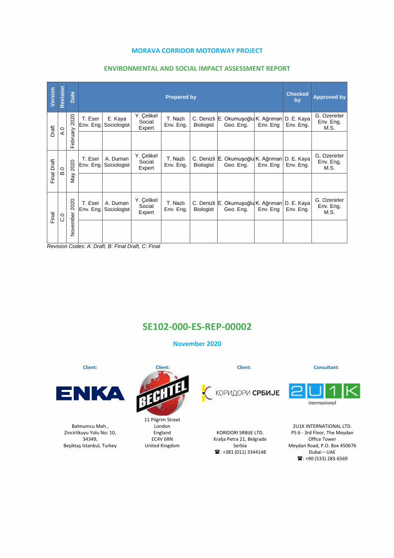
MORAVA CORRIDOR MOTORWAY PROJECT
ENVIRONMENTAL AND SOCIAL IMPACT ASSESSMENT REPORT
Vers
ion
Revis
ion
Date
Prepared by Checked
by Approved by
Dra
ft
A.0
Fe
bru
ary
2020
T. Eser Env. Eng.
E. Kaya Sociologist
Y. Çelikel Social Expert
T. Nazlı Env. Eng.
C. Denizli Biologist
E. Okumuşoğlu Geo. Eng.
K. Ağrıman Env. Eng
D. E. Kaya Env. Eng.
G. Ozenirler Env. Eng,
M.S.
Fin
al D
raft
B.0
Ma
y 2
020
T. Eser Env. Eng.
A. Duman Sociologist
Y. Çelikel Social Expert
T. Nazlı Env. Eng.
C. Denizli Biologist
E. Okumuşoğlu Geo. Eng.
K. Ağrıman Env. Eng
D. E. Kaya Env. Eng.
G. Ozenirler Env. Eng,
M.S.
Fin
al
C.0
Novem
ber
2020
T. Eser Env. Eng.
A. Duman Sociologist
Y. Çelikel Social Expert
T. Nazlı Env. Eng.
C. Denizli Biologist
E. Okumuşoğlu Geo. Eng.
K. Ağrıman Env. Eng
D. E. Kaya Env. Eng.
G. Ozenirler Env. Eng,
M.S.
Revision Codes: A: Draft, B: Final Draft, C: Final
SE102-000-ES-REP-00002
November 2020
Client: Client: Client: Consultant:
international
Balmumcu Mah., Zincirlikuyu Yolu No: 10,
34349, Beşiktaş Istanbul, Turkey
11 Pilgrim Street London England
EC4V 6RN United Kingdom
KORIDORI SRBIJE LTD. Kralja Petra 21, Belgrade
Serbia : +381 (011) 3344148
2U1K INTERNATIONAL LTD. PS 6 - 3rd Floor, The Meydan
Office Tower Meydan Road, P.O. Box 450676
Dubai – UAE : +90 (533) 283-6569

Morava Corridor Motorway Project
ESIA Final Report November 2020
SE102-000-ES-REP-00002 i / xxix
TABLE OF CONTENTS
Page
1 EXECUTIVE SUMMARY................................................................................................ 1
1.1 Introduction ............................................................................................................. 1
1.2 ESIA Objectives ...................................................................................................... 2
1.3 Project Description .................................................................................................. 3
1.3.1 Project Background .......................................................................................... 3
1.3.2 Project Overview .............................................................................................. 5
1.3.3 Project Development and Project Alternatives .................................................. 7
1.3.3.1 Technological Alternatives .......................................................................10
1.3.3.2 Zero Alternatives ......................................................................................10
1.4 Legal Framework ...................................................................................................10
1.5 Baseline Conditions ................................................................................................14
1.5.1 Area of Influence .............................................................................................14
1.5.1.1 Environmental Area of Influence ..............................................................14
1.5.1.2 Social Area of Influence ...........................................................................15
1.5.2 Environmental Baseline Conditions .................................................................15
1.5.3 Social Baseline Conditions ..............................................................................18
1.6 Impact Assessment ................................................................................................19
1.6.1 Environmental Impact Assessment and Mitigation Measures ..........................19
1.6.2 Social Impact Assessment and Mitigation Measures .......................................21
1.7 Stakeholder Engagement .......................................................................................23
1.8 Conclusions............................................................................................................23
2 INTRODUCTION ............................................................................................................ 1
2.1 Background to the Proposed Morava Corridor Motorway Project ................................. 1
2.1.1. Proposed Morava Corridor Motorway Project ....................................................... 2
2.1.2. Project Justification............................................................................................... 3
2.1.3. Project Overview .................................................................................................. 4
2.2 National EIA Process .............................................................................................. 8
2.3 ESIA Process .........................................................................................................14
2.3.1 International ESIA Consultants ........................................................................15
2.3.2 Structure of ESIA Report ......................................................................................17
3 PROJECT DESCRIPTION ............................................................................................. 1
3.1 Project Development and Project Alternatives ......................................................... 1
3.1.1 Zero Alternative ...............................................................................................11
3.1.2 Technological Alternatives ..............................................................................11
3.2 Project Elements and Alignment.............................................................................11
3.3 Design Criteria .......................................................................................................17
3.4 River Regulation and Drainage Control ..................................................................17
3.5 River Regulation Design .........................................................................................19
3.6 Above Ground Structures and Key Infrastructure ...................................................29

Morava Corridor Motorway Project
ESIA Final Report November 2020
SE102-000-ES-REP-00002 ii / xxix
3.7 Project Facilities .....................................................................................................33
3.7.1 Camp Sites, Storage Sites ..............................................................................33
3.7.2 Quarries and Borrow Pits ................................................................................38
3.7.3 Concrete Batching, Beam, Subbase, Asphalt and Screen – Wash Plants .......41
3.7.4 Temporary Access Roads ...............................................................................45
3.8 Third Party Utilities .................................................................................................46
3.9 Project Construction Activities ................................................................................51
3.9.1 Description of Methods of Earthworks .............................................................52
3.9.2 Excavation of Topsoil ......................................................................................54
3.9.3 Excavation of Any Material Except Topsoil ......................................................57
3.9.3.1 Common Excavation ................................................................................57
3.9.3.2 Replacement of Unstable Soils at Formation ............................................57
3.9.3.3 Rock Excavation ......................................................................................59
3.9.4 Mixed Material to Waste or Fill ........................................................................60
3.9.5 Spreading and Compacting of Fill....................................................................61
3.9.6 Reinforced Concrete Piles ...............................................................................62
3.9.7 Lean Concrete.................................................................................................62
3.9.8 Foundation Concrete .......................................................................................63
3.9.9 Wall Concrete .................................................................................................64
3.9.10 Pier Concrete ..................................................................................................65
3.9.10.1 Piers for Viaducts .....................................................................................65
3.9.10.2 Piers for Overpasses ................................................................................65
3.9.10.3 Pier Heads for Overpasses ......................................................................65
3.9.11 Pier Heads for Viaducts ...................................................................................65
3.9.12 Beam Transportation .......................................................................................66
3.9.13 Beam Installation .............................................................................................66
3.9.14 Deck Slab Concrete ........................................................................................67
3.9.15 Description of Drainage Work Methods ...........................................................67
3.9.15.1 Internal Drainage ......................................................................................68
3.9.15.1.1 Collector Pipes ....................................................................................68
3.9.15.1.2 Cross Pipes ........................................................................................68
3.9.15.1.3 Slotted Pipes .......................................................................................68
3.9.15.1.4 Channel and Gutters ...........................................................................69
3.9.15.2 External Drainage ....................................................................................70
3.9.15.2.1 Culverts ...............................................................................................70
3.9.15.2.2 Box Culverts .......................................................................................70
3.9.15.2.3 Pipe Culverts.......................................................................................70
3.9.15.2.4 Drainage Ditches ................................................................................70
3.9.16 Description of Paving Work Methods ...............................................................70
3.9.16.1 Preparation of Sub-Grading – Capping Layer ...........................................70
3.9.16.2 Mechanical Sub-Base ..............................................................................72
3.9.16.3 Asphalt Concrete Binder Course ..............................................................72
Morava Corridor Motorway Project
ESIA Final Report November 2020
SE102-000-ES-REP-00002 iii / xxix
3.9.16.4 Asphalt Concrete Wearing Course ...........................................................72
3.9.17 Finishing Works Methods ................................................................................73
3.10 Project Operation Activities ....................................................................................73
3.11 Resource Management ..........................................................................................76
3.12 Waste Management ...............................................................................................77
3.13 Employment ...........................................................................................................78
3.14 Land use / Land take and resettlement...................................................................79
3.15 Social Engagement ................................................................................................81
3.16 Construction Management .....................................................................................83
3.17 Operation Management ..........................................................................................89
3.18 Operational Employment ........................................................................................89
4 LEGAL FRAMEWORK .................................................................................................. 1
4.1 National Legislation ................................................................................................. 1
4.1.1 General Serbian Legal Framework Related to the Project ................................ 1
4.1.2 Relevant Legal Framework for Environmental Matters ..................................... 5
4.1.2.1 EIA Legislation .......................................................................................... 5
4.1.2.2 Water Qualitye .......................................................................................... 7
4.1.2.3 Air Quality ................................................................................................. 7
4.1.2.4 Soil Quality ................................................................................................ 7
4.1.2.5 Noise ......................................................................................................... 8
4.1.2.6 Waste Management .................................................................................. 8
4.1.2.7 Geology and Seismicity ............................................................................. 8
4.1.2.8 Nature Conservation ................................................................................. 9
4.1.3 Relevant Legal Framework for Social Matters .................................................. 9
4.1.3.1 Assets ....................................................................................................... 9
4.1.3.2 Expropriation ............................................................................................11
4.1.3.3 Labour and Working Conditions ...............................................................14
4.1.3.4 Stakeholder Engagement .........................................................................17
4.2 Lender Requirements .............................................................................................18
4.2.1 UKEF Requirements .......................................................................................18
4.2.2 MIGA Requirements ........................................................................................19
4.2.3 IFC Requirements ...........................................................................................21
4.2.4 Equator Principles ...........................................................................................23
4.3 Gaps between National EIA and International ESIA Processes ..............................23
5 BASELINE CONDITIONS .............................................................................................. 1
5.1 Definition of the Area of Influence ............................................................................ 1
5.1.1 Environmental Area of Influence ...................................................................... 2
5.1.2 Social Area of Influence ................................................................................... 3
5.2 Hydrology ................................................................................................................ 5
5.2.1 Study Area ....................................................................................................... 5
5.2.2 Methodology and Data Source ......................................................................... 5
5.2.3 Baseline Conditions ......................................................................................... 7

Morava Corridor Motorway Project
ESIA Final Report November 2020
SE102-000-ES-REP-00002 iv / xxix
5.2.4 Sensitive Receptors/Locations ........................................................................25
5.3 Climate ...................................................................................................................28
5.3.1 Study Area ......................................................................................................28
5.3.2 Methodology and Data Source ........................................................................29
5.3.3 Baseline Conditions ........................................................................................33
5.3.3.1 Data .........................................................................................................33
5.3.3.1.1 Global Data Assimilation System ........................................................33
5.3.3.1.2 5th Generation Reanalysis Data of European Centre for Medium Range
Weather Forecast (ERA5) ......................................................................................36
5.3.4 Sensitive Receptors ........................................................................................50
5.4 Air Quality ..............................................................................................................50
5.4.1 Study Area ......................................................................................................50
5.4.2 Methodology and Data Source ........................................................................55
5.4.3 Baseline Conditions ........................................................................................55
5.4.4 Sensitive Receptors ........................................................................................61
5.5 Noise ......................................................................................................................61
5.5.1 Study Area ......................................................................................................61
5.5.2 Methodology and Data Source ........................................................................61
5.5.3 Baseline Conditions ........................................................................................62
5.5.4 Sensitive Receptors ........................................................................................64
5.6 Soil Quality .............................................................................................................64
5.6.1 Study Area ......................................................................................................64
5.6.2 Methodology and Data Source ........................................................................66
5.6.3 Baseline Conditions ........................................................................................67
5.6.4 Sensitive Receptors ........................................................................................72
5.7 Water Quality .........................................................................................................72
5.7.1 Study Area ......................................................................................................72
5.7.2 Methodology and Data Source ........................................................................74
5.7.3 Baseline Conditions ........................................................................................74
5.7.4 Sensitive Receptors ........................................................................................81
5.8 Terres Terial and freshwater ecology .....................................................................81
5.8.1 Study Area ......................................................................................................81
5.8.2 Methodology and Data Source ........................................................................88
5.8.3 Baseline Conditions ...................................................................................... 101
5.8.3.1 Protected Areas ..................................................................................... 101
5.8.3.2 Terrestrial Flora and Ecosystems ........................................................... 106
5.8.3.3 Terrestrial Fauna .................................................................................... 118
5.8.3.4 Aquatic Ecosystems ............................................................................... 143
5.8.3.5 Ecosystem Services ............................................................................... 151
5.8.4 Sensitive Receptors ...................................................................................... 151
5.9 Geology, tectonics and seismicity ......................................................................... 153
5.9.1 Study Area .................................................................................................... 153
Morava Corridor Motorway Project
ESIA Final Report November 2020
SE102-000-ES-REP-00002 v / xxix
5.9.2 Methodology and Data Source ...................................................................... 154
5.9.3 Baseline Conditions ...................................................................................... 154
5.9.4 Sensitive Receptors/Locations ...................................................................... 162
5.10 Road traffic and transportation ............................................................................. 164
5.10.1 Study Area .................................................................................................... 164
5.10.2 Methodology and Data Source ...................................................................... 164
5.10.3 Baseline Conditions ...................................................................................... 165
5.10.4 Sensitive Receptors ...................................................................................... 167
5.11 Archaeological and cultural resources .................................................................. 168
5.11.1 Study Area .................................................................................................... 168
5.11.2 Methodology and Data Source ...................................................................... 169
5.11.3 Baseline Conditions ...................................................................................... 169
5.11.4 Sensitive Receptors ...................................................................................... 173
5.12 Visual landscape, land use and soil types ............................................................ 173
5.12.1 Study Area .................................................................................................... 173
5.12.2 Methodology and Data Source ...................................................................... 174
5.12.3 Baseline Conditions ...................................................................................... 174
5.12.3.1 Landscape ............................................................................................. 175
5.12.3.2 Land Use................................................................................................ 179
5.12.3.3 Soil Types .............................................................................................. 180
5.12.4 Sensitive Receptors/Locations ...................................................................... 181
5.13 Water Use (industrial, agriculture, domestic) ........................................................ 182
5.13.1 Study Area .................................................................................................... 182
5.13.2 Methodology and Data Source ...................................................................... 182
5.13.3 Baseline Conditions ...................................................................................... 182
5.13.4 Sensitive Receptors ...................................................................................... 183
5.14 Social Baseline ..................................................................................................... 183
5.14.1 Study Area .................................................................................................... 183
5.14.2 Methodology and Data Source ...................................................................... 185
5.14.2.1 Primary Data Collection .......................................................................... 186
5.14.2.1.1 Community Level Surveys (CLS) ...................................................... 186
5.14.2.1.2 Household Surveys (HHS) ................................................................ 187
5.14.2.1.3 Key Informant Interviews (KII) ........................................................... 187
5.14.2.1.4 Key Informant Interviews for the Land Acquisition ............................. 189
5.14.2.1.5 Focus Group Discussions (FGD)....................................................... 190
5.14.2.2 Secondary Data Collection ..................................................................... 190
5.14.2.3 Sampling for the Social Impact Assessment ........................................... 190
5.14.3 Baseline Conditions ...................................................................................... 192
5.14.3.1 Administrative Structure of Serbia .......................................................... 192
5.14.3.2 Population and Demography .................................................................. 193
5.14.3.2.1 Section 1: Ćićevac Municipality ......................................................... 195
5.14.3.2.2 Section 1: Kruševac Municipality ....................................................... 197
Morava Corridor Motorway Project
ESIA Final Report November 2020
SE102-000-ES-REP-00002 vi / xxix
5.14.3.2.3 Section 1: Varvarin Municipality ........................................................ 199
5.14.3.2.4 Section 2: Kraljevo Municipality ......................................................... 201
5.14.3.2.5 Section 2: Vrnjačka Banja Municipality .............................................. 204
5.14.3.2.6 Section 2: Trstenik Municipality ......................................................... 206
5.14.3.2.7 Section 3: Čačak Municipality ........................................................... 208
5.14.3.2.8 Sensitive Receptors .......................................................................... 211
5.14.3.3 Economy ................................................................................................ 211
5.14.3.3.1 Section 1: Ćićevac Municipality ......................................................... 212
5.14.3.3.2 Section 1: Kruševac Municipality ....................................................... 214
5.14.3.3.3 Section 1: Varvarin Municipality ........................................................ 216
5.14.3.3.4 Section 2: Kraljevo Municipality ......................................................... 218
5.14.3.3.5 Section 2: Vrnjačka Banja Municipality .............................................. 220
5.14.3.3.6 Section 2: Trstenik Municipality ......................................................... 222
5.14.3.3.7 Section 3: Čačak Municipality ........................................................... 224
5.14.3.3.8 Sensitive Receptors .......................................................................... 226
5.14.3.4 Ecosystem Services ............................................................................... 226
5.14.3.4.1 Section 1: Ćićevac Municipality ......................................................... 226
5.14.3.4.2 Section 1: Kruševac Municipality ....................................................... 228
5.14.3.4.3 Section 1: Varvarin Municipality ........................................................ 230
5.14.3.4.4 Section 2: Kraljevo Municipality ......................................................... 232
5.14.3.4.5 Section 2: Vrnjačka Banja Municipality .............................................. 235
5.14.3.4.7 Section 2: Trstenik Municipality ......................................................... 238
5.14.3.4.8 Section 3: Čačak Municipality ........................................................... 240
5.14.3.4.9 Sensitive Receptors .......................................................................... 243
5.14.3.5 Health .................................................................................................... 243
5.14.3.5.1 Section 1: Ćićevac Municipality ......................................................... 243
5.14.3.5.2 Section 1: Kruševac Municipality ....................................................... 245
5.14.3.5.3 Section 1: Varvarin Municipality ........................................................ 247
5.14.3.5.4 Section 2: Kraljevo Municipality ......................................................... 249
5.14.3.5.5 Section 2: Vrnjačka Banja Municipality .............................................. 251
5.14.3.5.6 Section 2: Trstenik Municipality ......................................................... 253
5.14.3.5.7 Section 3: Čačak Municipality ........................................................... 255
5.14.3.5.8 Sensitive Receptors .......................................................................... 257
5.14.3.6 Education ............................................................................................... 257
5.14.3.6.1 Section 1: Ćićevac Municipality ......................................................... 258
5.14.3.6.2 Section 1: Kruševac Municipality ....................................................... 260
5.14.3.6.3 Section 1: Varvarin Municipality ........................................................ 262
5.14.3.6.4 Section 2: Kraljevo Municipality ......................................................... 264
5.14.3.6.5 Section 2: Vrnjačka Banja Municipality .............................................. 267
5.14.3.6.6 Section 2: Trstenik Municipality ......................................................... 269
5.14.3.6.7 Section 3: Čačak Municipality ........................................................... 272
5.14.3.6.8 Sensitive Receptors .......................................................................... 274
Morava Corridor Motorway Project
ESIA Final Report November 2020
SE102-000-ES-REP-00002 vii / xxix
5.14.3.7 Infrastructure and Services .................................................................... 274
5.14.3.7.1 Section 1: Ćićevac Municipality ......................................................... 274
5.14.3.7.2 Section 1: Kruševac Municipality ....................................................... 278
5.14.3.7.3 Section 1: Varvarin Municipality ........................................................ 281
5.14.3.7.4 Section 2: Kraljevo Municipality ......................................................... 283
5.14.3.7.5 Section 2: Vrnjačka Banja Municipality .............................................. 289
5.14.3.7.6 Section 2: Trstenik Municipality ......................................................... 292
5.14.3.7.7 Section 3: Čačak Municipality ........................................................... 295
5.14.3.7.8 Sensitive Receptors .......................................................................... 300
5.14.3.8 Land Use................................................................................................ 300
5.14.3.8.1 Section 1: Ćićevac Municipality ......................................................... 300
5.14.3.8.2 Section 1: Kruševac Municipality ....................................................... 300
5.14.3.8.3 Section 1: Varvarin Municipality ........................................................ 301
5.14.3.8.4 Section 2: Kraljevo Municipality ......................................................... 301
5.14.3.8.5 Section 2: Vrnjačka Banja Municipality .............................................. 302
5.14.3.8.6 Section 2: Trstenik Municipality ......................................................... 302
5.14.3.8.7 Section 3: Čačak Municipality ........................................................... 303
5.14.3.8.8 Sensitive Receptors .......................................................................... 303
5.14.3.9 Project Information Level ........................................................................ 304
5.14.3.9.1 Project Information Level of the Community ...................................... 304
5.14.3.9.2 Sensitive Receptors .......................................................................... 308
5.14.3.10 Vulnerability ........................................................................................... 308
5.14.3.10.1 Section 1: Ćićevac Municipality ......................................................... 309
5.14.3.10.2 Section 1: Kruševac Municipality ....................................................... 310
5.14.3.10.3 Section 1: Varvarin Municipality ........................................................ 312
5.14.3.10.4 Section 2: Kraljevo Municipality ......................................................... 312
5.14.3.10.5 Section 2: Vrnjačka Banja Municipality .............................................. 314
5.14.3.10.6 Section 2: Trstenik Municipality ......................................................... 315
5.14.3.10.7 Section 3: Čačak Municipality ........................................................... 315
5.14.3.10.8 Sensitive Receptors .......................................................................... 316
5.14.3.11 Human Rights Screening ....................................................................... 317
6 IMPACT ASSESSMENT ................................................................................................ 1
6.1 Scooping of the Impacts .......................................................................................... 1
6.2 Methodology for Impact Assessment ....................................................................... 6
6.2.1 Impact Types and Definitions ........................................................................... 6
6.2.2 Method to Assess Environmental and Social Impacts ...................................... 7
6.2.2.1 Determination of Impact Significance Criteria ............................................ 7
6.2.2.2 Determination of Impact Likelihood ..........................................................11
6.2.2.3 Determination of the Overall Impact .........................................................11
6.3 Water Quality .........................................................................................................16
6.3.1 Surface Water .................................................................................................16
6.3.1.1 Construction Phase ..................................................................................16

Morava Corridor Motorway Project
ESIA Final Report November 2020
SE102-000-ES-REP-00002 viii / xxix
6.3.1.2 Operation Phase ......................................................................................24
6.3.2 Groundwater ...................................................................................................30
6.3.2.1 Construction Phase ..................................................................................30
6.3.2.2 Operation Phase ......................................................................................34
6.4 Air Quality and Climate ...........................................................................................37
6.4.1 Construction Phase .........................................................................................37
6.4.2 Operation Phase .............................................................................................42
6.4.3 Overview of Greenhouse Gas Emissions Approach ........................................46
6.4.3.1 Construction Phase ..................................................................................46
6.4.3.2 Operation Phase ......................................................................................47
6.4.3.3 Alternative Analysis ..................................................................................48
6.4.3.4 Monitoring & Reporting Requirements ......................................................51
6.4.3.5 Climate Change Adaptation .....................................................................51
6.4.3.6 Assessment of GHG Contribution ............................................................55
6.5 Noise and Vibration ................................................................................................55
6.5.1 Construction Phase .........................................................................................59
6.5.2 Operation Phase .............................................................................................74
6.6 Geology and Soil ....................................................................................................86
6.6.1 Construction Phase .........................................................................................86
6.6.2 Operation Phase .............................................................................................92
6.7 Resources and Waste ............................................................................................95
6.7.1 Construction Phase .........................................................................................99
6.7.2 Operation Phase ........................................................................................... 105
6.8 Terrestrial and Freshwater Ecology ...................................................................... 109
6.8.1 Construction Phase ....................................................................................... 123
6.8.2 Operation Phase ........................................................................................... 135
6.9 Archaeological and Cultural Resources ................................................................ 139
6.10 Visual Landscape and Land Use .......................................................................... 142
6.10.1 Construction Phase ....................................................................................... 144
6.10.2 Operation Phase ........................................................................................... 148
6.11 Social Impact Assessment ................................................................................... 151
6.11.1 Population ..................................................................................................... 152
6.11.1.1 Construction Phase ................................................................................ 152
6.11.1.2 Operation Phase .................................................................................... 162
6.11.2 Infrastructure ................................................................................................. 166
6.11.2.1 Construction Phase ................................................................................ 166
6.11.2.2 Operation Phase .................................................................................... 174
6.11.3 Economy ....................................................................................................... 178
6.11.3.1 Construction Phase ................................................................................ 178
6.11.3.2 Operation Phase .................................................................................... 186
6.11.4 Resettlement and Land Acquisition ............................................................... 191
6.11.4.1 Construction and Operation Phase......................................................... 191
Morava Corridor Motorway Project
ESIA Final Report November 2020
SE102-000-ES-REP-00002 ix / xxix
6.11.5 Ecosystem Services ...................................................................................... 208
6.11.5.1 Construction Phase ................................................................................ 208
6.11.5.2 Operation Phase .................................................................................... 223
6.11.6 Labour and Working Conditions .................................................................... 226
6.11.6.1 Construction and Operation Phase......................................................... 226
6.11.7 Occupational Health and Safety .................................................................... 235
6.11.7.1 Construction Phase ................................................................................ 235
6.11.7.2 Operation Phase .................................................................................... 241
6.11.8 Community Health and Safety ....................................................................... 245
6.11.8.1 Construction Phase ................................................................................ 245
6.11.8.2 Operation Phase .................................................................................... 254
6.11.9 Vulnerable People ......................................................................................... 258
6.11.9.1 Construction and Operation Phase......................................................... 258
7 CUMULATIVE AND TRANSBOUNDARY IMPACTS ..................................................... 1
7.1 Introduction ............................................................................................................. 1
7.2 Guidance ................................................................................................................. 1
7.3 Assessment Methodology ....................................................................................... 2
7.4 STEP 1 – Determination of Spatial and Temporal Boundaries ................................ 4
7.5 STEP 2 – Identification of VECs and Screening of Other Projects in Region ........... 4
7.6 STEP 3 – Determine Existing Conditions of the VECs ............................................ 7
7.7 STEP 4, STEP 5 and STEP 6 – Assesment of Cumulative Impacts and Identification
of Mitigation Measures ....................................................................................................... 7
7.8 Conclusion .............................................................................................................28
7.9 Transboundary Impacts ..........................................................................................28
8. ENVIRONMENTAL AND SOCIAL MANAGEMENT AND MONITORING PLAN ........... 1
8.1 Objective and Scope ............................................................................................... 1
8.2 Roles and Responsibilities ...................................................................................... 2
8.3 Documentation and Reporting ................................................................................. 3
8.3.1 External Reporting ........................................................................................... 4
8.3.2 Internal Reporting ............................................................................................. 4
8.4 ESMMP Review ...................................................................................................... 4
8.5 Training ................................................................................................................... 4
8.6 Monitoring ............................................................................................................... 5
8.7 Legal Framework .................................................................................................... 5
8.8 Supporting Environmental and Social Management Plans ...................................... 8
8.9 Environmental and Social Management and Monitoring .........................................10
8.9.1 Environmental and Social Management ..........................................................11
8.9.2 Environmental and Social Monitoring ..............................................................93
8.10 Key Performance Indicators ................................................................................. 117
9 STAKEHOLDER ENGAGEMENT .................................................................................. 1
9.1 Objectives of Stakeholder Engagement ................................................................... 1
9.2 Roles and Responsibilities ...................................................................................... 1
Morava Corridor Motorway Project
ESIA Final Report November 2020
SE102-000-ES-REP-00002 x / xxix
9.3 Stakeholder Identification and Analysis ................................................................... 2
9.3.1 Vulnerable Groups ........................................................................................... 5
9.4 Previous and Planned Stakeholder Engagement Activities ...................................... 7
9.4.1 Summary of the Social Field Studies for the ESIA Report ...............................22
9.4.1.1 Population of the Area of Influence ..........................................................22
9.4.1.2 Economy of the Area of Influence ............................................................23
9.4.1.3 Ecosystem Services of the Area of Influence ...........................................23
9.4.1.4 Cultural and Intangible Values of the Area of Influence ............................24
9.4.1.5 Project Information Level of the Area of Influence ....................................25
9.4.1.6 Vulnerability Assessment of the Area of Influence ....................................25
9.5 Stakeholder Engagement Program ........................................................................26
9.6 Pre-Construction Phase .........................................................................................27
9.7 Construction Phase ................................................................................................30
9.8 Operation Phase ....................................................................................................32
9.9 External Communications.......................................................................................33
9.10 Grievance Mechanism ............................................................................................34
9.10.1 Public Grievance Mechanism ..........................................................................34
9.10.2 Worker Grievance Mechanism ........................................................................35
10 CONCLUSION ............................................................................................................... 1
10.1 Impacts Summary ................................................................................................... 1
10.2 Additional Complementary Environmental and Social Studies ................................. 8
Morava Corridor Motorway Project
ESIA Final Report November 2020
SE102-000-ES-REP-00002 xi / xxix
LIST OF APPENDICES
Appendix – 1 Gap Assessment for Scoping Report in April 2019
Appendix – 2 Company Certifications and Qualifications
Appendix – 3 Stakeholder Engagement Plan
Appendix – 4 National Legislation and International Standards
Appendix – 5 Maps
Appendix – 5.1 Location of Borrow Pits Map
Appendix – 5.2 Measurement Locations Map
Appendix – 5.3 Archaeological Points and Heritage Buildings Maps
Appendix – 5.4 Soil Map
Appendix – 5.5 Land Use Map
Appendix – 5.6 Visibility Map
Appendix – 5.7 Constraint Map
Appendix – 6 Analysis Report
Appendix – 7 Biodiversity Baseline Report
Appendix – 8 Air Quality Modelling Report
Appendix – 9 Acoustic Report
Appendix – 10 Hydrotechnical Regulation of the Zapadna Morava River within the
Infrastructure Corridor of Highway E-761
Appendix – 11 Detailed Critical Habitat Assessment
Appendix – 12 Environment and Social Management System Framework
Appendix – 13 Non-Technical Summary
Morava Corridor Motorway Project
ESIA Final Report November 2020
SE102-000-ES-REP-00002 xii / xxix
LIST OF TABLES
Page
Table 1-1. Key Stages for the ESIA Report ........................................................................... 2
Table 1-2. The Sections of the Project. .................................................................................. 5
Table 1-3. Summary of the Project History ............................................................................ 8
Table 1-4. Land Characteristics of the Alternative Routes ..................................................... 9
Table 1-5. National Environmental and Social Legal and Policy Framework .........................11
Table 1-6. International Finance Institutions’ Requirements .................................................13
Table 1-7. EUNIS Habitat Types ..........................................................................................16
Table 1-8. Observed species within the AoI ..........................................................................17
Table 1-9. Municipalities Located in the Social AoI ...............................................................18
Table 2-1. Sections of the Project .......................................................................................... 5
Table 2-2. ESIA Limitations and Assumptions – include general and specific limitations and
assumptions that have influenced the preparation of the ESIA .............................. 9
Table 2-3. Key Stages for the ESIA Report ..........................................................................15
Table 2-4. Universities of the International Experts for Ecological Studies ............................16
Table 2-5. ESIA Report Structure .........................................................................................17
Table 3-1. Summary of the Project History ............................................................................ 2
Table 3-2. Potentially critical locations along the proposed motorway route option ................ 5
Table 3-3. Land Characteristics of the Alternative Routes ....................................................10
Table 3-4. The Sectors of the Project ...................................................................................12
Table 3-5. Project Location ...................................................................................................13
Table 3-6. Different Design Criteria of Morava Corridor Motorway Elements ........................17
Table 3-7. Number of Bridges, Overpasses and Interchanges along the Sections of the
Motorway ..............................................................................................................29
Table 3-8. List of Interchanges of the Morava Corridor Motorway Project .............................29
Table 3-9. Camps and Precast Yards ...................................................................................33
Table 3-10. Quarries and Borrow Pits ...................................................................................38
Table 3-11. Different Plants such as batch, asphalt, subbase, beam and screen and wash
plants ...................................................................................................................41
Table 3-12. River Crossings (via Bridge) ..............................................................................46
Table 3-13. Pond Crossings .................................................................................................47
Table 3-14. Road Crossings .................................................................................................47
Table 3-15. Railway Crossings .............................................................................................48
Table 3-16. Powerline Crossings ..........................................................................................48
Table 3-17. Gas Pipeline Crossings .....................................................................................49
Table 3-18. Motorway sections forecast AADT (vehicles/day) ..............................................74
Table 3-19. Financial effects-income from toll and commercial income (Million €) ................75
Table 3-20. Unit rates by basic vehicle type-category in Serbia ............................................75
Table 3-21. Facilities for the operational phase of the Morava Corridor Motorway Project ....75
Table 3-22. Responsible Institutions on Land Acquisition & Expropriation ............................79
Table 3-23. Land Use Areas in AoI .......................................................................................80
Morava Corridor Motorway Project
ESIA Final Report November 2020
SE102-000-ES-REP-00002 xiii / xxix
Table 3-24. Land Use Areas for the Temporary Access Roads, Project Facilities and
Motorway ..............................................................................................................80
Table 3-25. Past Stakeholder Engagement Activities within the Scope of ESIA Studies .......82
Table 4-1. International Conventions and Agreements ratified by Serbia ............................... 2
Table 4-2. Related Information and Article within the Law ..................................................... 3
Table 4-3. Serbian Legal Framework on Habitats and Species, ............................................ 9
Table 4-4. Law on Expropriation ...........................................................................................11
Table 4-5. Gap Assessment of National EIA and International ESIA Processes ...................24
Table 5-1. Potential Social Impacts According to Settlements in the Area of Influence .......... 4
Table 5-2. Municipalities Located in the Social AoI ................................................................ 4
Table 5-3. The Profiles which are considered during Hydrotechnical Study Report ............... 9
Table 5-4. Maximum Flow Calculations based on RMHS Measurements .............................. 9
Table 5-5. The Calculated Values of the Maximum Annual Flow Qmax (m3/s) and Western
Morava Flow for Typical Probabilities, p (%) .........................................................12
Table 5-6. Category of Morphological Changes in the West Morava River ...........................16
Table 5-7. The West Morava floodplain areas, discharge (Q100) .........................................24
Table 5-8. Coordinates and Station System MHE on the West Morava River .......................24
Table 5-9. Summary of Findings from the Hydrotechnical Study Report ...............................26
Table 5-10. Meteorology Stations in the vicinity of the Proposed Motorway Route ...............29
Table 5-11. Average values of Climate parameters from 1980 to 2009 ................................30
Table 5-12. Physics Options used in WRF Initialization ........................................................31
Table 5-13. Average Monthly Pressure in Kruševac Between 1919-2019 ............................36
Table 5-14. Average Monthly Pressure in Kraljevo Between 1979-2019 ..............................37
Table 5-15. Average Monthly Temperature in Kruševac Between 1979-2019 ......................39
Table 5-16. Average Monthly Temperature in Kraljevo Between 1979-2019 ........................40
Table 5-17. Average Monthly Wind Direction in Kruševac Between 1979-2019 ....................42
Table 5-18. Average Monthly Wind Direction in Kraljevo Between 1979-2019 ......................43
Table 5-19. Average Monthly Wind Velocity in Kruševac Between 1979-2019 .....................45
Table 5-20. Average Monthly Wind Velocity in Kraljevo Between 1979-2019 .......................46
Table 5-21. Annual Wind Count for Kraljevo .........................................................................46
Table 5-22. Annual Wind Count for Kruševac .......................................................................48
Table 5-23. Measuring Points for NO2, SO2 and H2S and Noise for Section-1 ......................50
Table 5-24. Measuring Points for NO2, SO2 and H2S and Noise for Section-2 ......................51
Table 5-25. Measuring Points for NO2, SO2 and H2S and Noise for Section-3 ......................51
Table 5-26. Measuring Points for PM10 and PM2.5 for Section-1 ............................................52
Table 5-27. Measurement Results of H2S, SO2, NO2, Toluene, Ethylbenzene, O-Xylene, P-M-
Xylene, Benzene for Section-1 .............................................................................57
Table 5-28. Measurement Results of H2S, SO2, NO2 for Section-3 .......................................58
Table 5-29. Measurement Results for PM10 and PM2.5 ..........................................................59
Table 5-30. Noise Measurement Results for Section-1 .........................................................63
Table 5-31. Measurement Locations for Section-1 Soil Quality .............................................65
Table 5-32. Measurement Locations for Section-2 Soil Quality .............................................65

Morava Corridor Motorway Project
ESIA Final Report November 2020
SE102-000-ES-REP-00002 xiv / xxix
Table 5-33. Measurement Locations for Section-3 Soil Quality .............................................66
Table 5-34. Measurement Results of Soil Sampling for Section-1 ........................................68
Table 5-35. Measurement Results of Soil Sampling for Section-2 ........................................69
Table 5-36. Measurement Results of Soil Sampling for Section-3 ........................................70
Table 5-37. The Section Vise Exceedance Levels ................................................................71
Table 5-38. Measurement results of Sediment Qulity ...........................................................72
Table 5-39. Measurement Locations for Section-1 Surface Water Quality ............................73
Table 5-40. Measurement Locations for Section-2 Surface Water Quality ............................73
Table 5-41. Measurement Locations for Section-3 Surface Water Quality ............................73
Table 5-42. Classes of Surface Water Quality ......................................................................75
Table 5-43. Classification of surface water bodies according to the Decree on the
Categorization of Watercourses ...........................................................................75
Table 5-44. Types of Surface Water Quality .........................................................................76
Table 5-45. Type Classification of Main Water Bodies in AoI of the Project ..........................76
Table 5-46. Measurement Results of Water Sampling for Section-1 .....................................78
Table 5-47. Measurement Results of Water Sampling for Section-2 .....................................78
Table 5-48. Measurement Results of Water Sampling for Section-3 .....................................79
Table 5-49. Limit Values of Some Parameters for Surface Water Quality Analysis ...............80
Table 5-50. Sampling Locations within each Section ............................................................82
Table 5-51. Coordinates of Sampling Locations ...................................................................82
Table 5-52. Photo-Trap and Bat Sound Recording Study .....................................................99
Table 5-53. KBAs Located in vicinity of the Project Area .................................................... 101
Table 5-54. List of EUNIS Level 3 Habitat Types ................................................................ 106
Table 5-55. Conservation Status of Flora Species .............................................................. 107
Table 5-56. Terrestrial Flora Species Identified in the Studies ............................................ 109
Table 5-57. Conservation Status of Invertebrates ............................................................... 118
Table 5-58. Butterfly Species Identified in the Studies ........................................................ 120
Table 5-59. Dragonfly Species Identified in the Studies ...................................................... 121
Table 5-60. Other Insect Species Identified in the Studies .................................................. 122
Table 5-61. Conservation Status of Amphibians and Reptiles ............................................ 124
Table 5-62. Amphibian-Reptilian Species Identified in the Studies ..................................... 127
Table 5-63. Conservation Status of Birds ........................................................................... 130
Table 5-64. Bird Species Identified in the Studies............................................................... 132
Table 5-65. Conservation Status of Mammals .................................................................... 137
Table 5-66. Mammal Species Identified in the Studies ....................................................... 139
Table 5-67. Conservation Status of Fishes ......................................................................... 144
Table 5-68. Freshwater Fish Species and Their Protected Status Inhabited in Morava River
........................................................................................................................... 148
Table 5-69. Macrobenthic Organisms Inhabited in Morava River ........................................ 150
Table 5-70. Sensitive Habitats ............................................................................................ 151
Table 5-71. Sensitive Flora and Fauna Species ................................................................. 151
Table 5-72. Seismic Terrain ............................................................................................... 161
Morava Corridor Motorway Project
ESIA Final Report November 2020
SE102-000-ES-REP-00002 xv / xxix
Table 5-73. Section Pojate - Kruševac updated forecast 2018 ........................................... 167
Table 5-74. Section: Kruševac (Koševi) - Adrani initial forecast 2011 ................................. 167
Table 5-75. Section Adrani - Mrčajevci - Preljina updated forecast 2018 ............................ 167
Table 5-76. Existing Roads intersected by the Project ........................................................ 168
Table 5-77. Railways intersected by the Project ................................................................. 168
Table 5-78. Archaeological Sites near to the Project Area .................................................. 169
Table 5-79. Heritage Buildings near to the Project Area ..................................................... 171
Table 5-80. Land Use Areas in the AoI ............................................................................... 180
Table 5-81. Municipalities located within the Study Area .................................................... 184
Table 5-82. Settlements Located in the Study Area ............................................................ 184
Table 5-83. Surveys and Interviews Conducted by 2U1K ................................................... 186
Table 5-84. Number of Business Surveys on each Affected Municipalities ......................... 189
Table 5-85. Details on the Focus Group Discussions ......................................................... 190
Table 5-86. List of Settlements and HH Sample Size ......................................................... 191
Table 5-87. Age Groups in Ćićevac Municipality................................................................. 195
Table 5-88. Demographic Characteristics of the Affected Villages in Ćićevac Municipality . 196
Table 5-89. Age Groups in Kruševac Municipality .............................................................. 197
Table 5-90. Demographic Characteristics of the Affected Villages in Kruševac Municipality
........................................................................................................................... 198
Table 5-91. Age Groups in Varvarin Municipality ................................................................ 199
Table 5-92. Demographic Characteristics of the Affected Villages in Varvarin Municipality 200
Table 5-93. Age Groups in Kraljevo Municipality ................................................................ 201
Table 5-94. Demographic Characteristics of the Affected Villages in Kraljevo Municipality . 203
Table 5-95. Demographic Characteristics of the Affected Villages in Vrnjačka Banja
Municipality ........................................................................................................ 205
Table 5-96. Age Groups in Trstenik Municipality................................................................. 206
Table 5-97. Demographic Characteristics of the Affected Villages in Trstenik Municipality . 207
Table 5-98. Age Groups in Čačak Municipality ................................................................... 208
Table 5-99. Demographic Characteristics of the Affected Villages in Čačak Municipality .... 210
Table 5-100. Employment data of Ćićevac Municipality ...................................................... 212
Table 5-101. Reasons of decrease in agricultural activities stated by the villagers ............. 213
Table 5-102. Income sources of the affected villages in the Ćićevac Municipality ............... 214
Table 5-103. Employment data of Kruševac Municipality .................................................... 215
Table 5-104. Economic Structures of the Villages in Kruševac Municipality ........................ 215
Table 5-105. Income sources of the affected villages in Kruševac Municipality .................. 216
Table 5-106. Employment data of Varvarin Municipality ..................................................... 217
Table 5-107. Economic Structures of the Villages in Varvarin Municipality ......................... 217
Table 5-108. Sources of the affected villages in Varvarin Municipality ................................ 218
Table 5-109. Employment data of Kraljevo Municipality ...................................................... 218
Table 5-110. Economic Structures of the Villages in Kraljevo Municipality.......................... 219
Table 5-111. Income sources of the affected villages in Kraljevo Municipality .................... 219
Table 5-112. Employment data of Vrnjačka Banja Municipality ........................................... 220
Morava Corridor Motorway Project
ESIA Final Report November 2020
SE102-000-ES-REP-00002 xvi / xxix
Table 5-113. Economic Structures of the Villages in Vrnjačka Banja Municipality ............... 221
Table 5-114. Income sources of the affected villages in Vrnjačka Banja Municipality ......... 222
Table 5-115. Employment data of Trstenik Municipality ...................................................... 222
Table 5-116. Economic Structures of the Villages in Trstenik Municipality .......................... 223
Table 5-117. Income sources of the affected villages in Trstenik Municipality .................... 223
Table 5-118. Employment data of Čačak Municipality ........................................................ 224
Table 5-119. Economic Structures of the Villages in Čačak Municipality ............................ 225
Table 5-120. Income sources of the affected villages in Čačak Municipality ....................... 225
Table 5-121. Ecosystem services in the Ćićevac Municipality ............................................ 227
Table 5-122. Ecosystem services in Ćićevac Municipality .................................................. 229
Table 5-123. Ecosystem services in Varvarin Municipality .................................................. 231
Table 5-124. Ecosystem services in Kraljevo Municipality .................................................. 233
Table 5-125. Ecosystem services in Vrnjačka Banja Municipality ....................................... 237
Table 5-126. Ecosystem services in Trstenik Municipality .................................................. 240
Table 5-127. Ecosystem services in the Čačak Municipality ............................................... 242
Table 5-128. Health Indicators of the Ćićevac Municipality ................................................. 243
Table 5-129. Availability of health centers in affected villages of Ćićevac Municipality ....... 244
Table 5-130. Access to health facilities in affected villages of Ćićevac Municipality ............ 244
Table 5-131. Households with chronic diseases for each affected village in Ćićevac
Municipality ........................................................................................................ 244
Table 5-132. Common chronic diseases of the affected villages of Ćićevac Municipality .... 245
Table 5-133. Health Indicators of the Kruševac Municipality .............................................. 245
Table 5-134. Availability of health centers in affected villages of Kruševac Municipality ..... 246
Table 5-135. Access to health facilities in affected villages of Kruševac Municipality .......... 246
Table 5-136. Households with chronic diseases for each affected village in Kruševac
Municipality ........................................................................................................ 246
Table 5-137. Common chronic diseases of the affected villages of Kruševac Municipality . 247
Table 5-138. Health Indicators of the Varvarin Municipality ................................................ 247
Table 5-139. Availability of health centers in affected villages of Varvarin Municipality ....... 247
Table 5-140. Access to health facilities in affected villages of Varvarin Municipality ........... 248
Table 5-141. Households with chronic diseases for each affected village in Varvarin
Municipality ........................................................................................................ 248
Table 5-142. Common chronic diseases of the affected villages of Varvarin Municipality ... 248
Table 5-143. Health Indicators of the Kraljevo Municipality ................................................. 249
Table 5-144. Availability of health centers in affected villages of Kraljevo Municipality ....... 249
Table 5-145. Access to health facilities in affected villages of Kraljevo Municipality ............ 250
Table 5-146. Households with chronic diseases for each affected village in Kraljevo
Municipality ........................................................................................................ 250
Table 5-147. Common chronic diseases of the affected villages of Kraljevo Municipality ... 251
Table 5-148. Health Indicators of the Vrnjačka Banja Municipality ...................................... 251
Table 5-149. Availability of health centers in affected villages of Vrnjačka Banja Municipality
........................................................................................................................... 252

Morava Corridor Motorway Project
ESIA Final Report November 2020
SE102-000-ES-REP-00002 xvii / xxix
Table 5-150. Access to health facilities in affected villages of Vrnjačka Banja Municipality . 252
Table 5-151. Households with chronic diseases for each affected village in Vrnjačka Banja
Municipality ........................................................................................................ 252
Table 5-152. Common chronic diseases of the affected villages of Vrnjačka Banja
Municipality ........................................................................................................ 253
Table 5-153. Health Indicators of the Trstenik Municipality ................................................ 253
Table 5-154. Availability of health centers in affected villages of Trstenik Municipality ....... 254
Table 5-155. Access to health facilities in affected villages of Trstenik Municipality ............ 254
Table 5-156. Households with chronic diseases for each affected village in Trstenik
Municipality ........................................................................................................ 254
Table 5-157. Common chronic diseases of the affected villages of Trstenik Municipality .... 255
Table 5-158. Health Indicators of the Čačak Municipality ................................................... 255
Table 5-159. Availability of health centers in affected villages of Čačak Municipality .......... 256
Table 5-160. Access to health facilities in affected villages of Čačak Municipality .............. 256
Table 5-161. Households with chronic diseases for each affected village in Čačak
Municipality ........................................................................................................ 256
Table 5-162. Common chronic diseases of the affected villages of Čačak Municipality ...... 257
Table 5-163. Education Indicators of Ćićevac Municipality ................................................. 258
Table 5-164. Education Indicators of Affected Villages in Ćićevac Municipality .................. 259
Table 5-165. Education Indicators of Kruševac Municipality ............................................... 260
Table 5-166. Education Indicators of Affected Villages in Kruševac Municipality ................ 262
Table 5-167. Education Indicators of Varvarin Municipality ................................................. 262
Table 5-168. Education Indicators of Affected Villages in Varvarin Municipality .................. 264
Table 5-169. Education Indicators of Kraljevo Municipality ................................................. 264
Table 5-170. Education Indicators of Affected Villages in Kraljevo Municipality .................. 266
Table 5-171. Education Indicators of Vrnjacka Banka Municipality ..................................... 267
Table 5-172. Education Indicators of Affected Villages in Vrnjačka Banja Municipality ....... 269
Table 5-173. Education Indicators of Trstenik Municipality ................................................. 269
Table 5-174. Education Indicators of Affected Villages in Trstenik Municipality .................. 271
Table 5-175. Education Indicators of Čačak Municipality .................................................... 272
Table 5-176. Education Indicators of Affected Villages in Trstenik Municipality .................. 273
Table 5-177. Type of services available in each affected village of Ćićevac Municipality .... 274
Table 5-178. Available infrastructure services in affected villages of Ćićevac Municipality . 275
Table 5-179. Household conditions of each affected settlements of Ćićevac Municipality .. 276
Table 5-180. Type of services available in each affected village of Kruševac Municipality .. 278
Table 5-181. Available infrastructure services in affected villages of Kruševac Municipality
........................................................................................................................... 279
Table 5-182. Household conditions of each affected settlements of Kruševac Municipality 279
Table 5-183. Type of services available in each affected village of Varvarin Municipality ... 281
Table 5-184. Available infrastructure services in affected villages of Varvarin Municipality . 281
Table 5-185. Household conditions of each affected settlements of Varvarin Municipality .. 282
Table 5-186. Type of services available in each affected village of Kraljevo Municipality .... 283
Morava Corridor Motorway Project
ESIA Final Report November 2020
SE102-000-ES-REP-00002 xviii / xxix
Table 5-187. Available infrastructure services in affected villages of Kraljevo Municipality . 284
Table 5-188. Household conditions of each affected settlements of Kraljevo Municipality .. 287
Table 5-189. Type of services available in each affected village of Vrnjačka Banja
Municipality ........................................................................................................ 289
Table 5-190. Available infrastructure services in affected villages of Vrnjačka Banja
Municipality ........................................................................................................ 290
Table 5-191. Household conditions of each affected settlements of Vrnjačka Banja
Municipality ........................................................................................................ 290
Table 5-192. Type of services available in each affected village of Trstenik Municipality .... 292
Table 5-193. Available infrastructure services in affected villages of Trstenik Municipality . 293
Table 5-194. Household conditions of each affected settlements of Trstenik Municipality .. 294
Table 5-195. Type of services available in each affected village of Čačak Municipality ...... 295
Table 5-196. Available infrastructure services in affected villages of Čačak Municipality .... 296
Table 5-197. Household conditions of each affected settlements of Čačak Municipality ..... 298
Table 5-198. Land use of villages located in Ćićevac Municipality ...................................... 300
Table 5-199. Land use of villages located in Kruševac Municipality .................................... 300
Table 5-200. Land use of villages located in Varvarin Municipality ..................................... 301
Table 5-201. Land use of villages located in Kraljevo Banja Municipality ............................ 301
Table 5-202. Land use of villages located in Vrnjačka Banja Municipality ........................... 302
Table 5-203. Land use of villages located in Trstenik Banja Municipality ............................ 302
Table 5-204. Land use of villages located in Čačak Municipality ........................................ 303
Table 5-205. Vulnerability parameters ................................................................................ 309
Table 5-206. Vulnerable groups in Ćićevac Municipality ..................................................... 310
Table 5-207. Vulnerable groups in Kruševac Municipality ................................................... 311
Table 5-208. Vulnerable groups in Varvarin Municipality .................................................... 312
Table 5-209. Vulnerable groups in Kraljevo Municipality ..................................................... 313
Table 5-210. Vulnerable groups in Vrnjačka Banja Municipality .......................................... 314
Table 5-211. Vulnerable groups in Trstenik Municipality ..................................................... 315
Table 5-212. Vulnerable groups in Čačak Municipality ....................................................... 316
Table 6-1. Scoping Matrix – Potential Environmental Impacts ............................................... 3
Table 6-2. Scoping Matrix - Potential Social Impacts ............................................................. 5
Table 6-3. Impact Types and Definitions ............................................................................... 6
Table 6-4. Criteria for Determining Impact Significance ......................................................... 8
Table 6-5. Likelihood Scoring ...............................................................................................11
Table 6-6. Determination of the Overall Impact* ...................................................................11
Table 6-7. Description of the Overall Impact Scores .............................................................11
Table 6-8. Hierarchy of Options for Mitigation .......................................................................12
Table 6-9. Assessment of Potential Impacts (As an example) ..............................................15
Table 6-10. Impact and Mitigations for Surface Water Quality in Construction Phase of the
Project ..................................................................................................................18
Table 6-11. Scoring of Surface Water Impacts in Construction Phase ..................................23

Morava Corridor Motorway Project
ESIA Final Report November 2020
SE102-000-ES-REP-00002 xix / xxix
Table 6-12. Impact and Mitigations for Surface Water Quality in Operation Phase of the
Project ..................................................................................................................25
Table 6-13. Scoring of Surface Water Impacts in Operation Phase ......................................29
Table 6-14. Impact and Mitigations for Groundwater Quality in Construction Phase of the
Project ..................................................................................................................31
Table 6-15. Scoring of Groundwater Impacts in Construction Phase ....................................33
Table 6-16. Impact and Mitigations for Groundwater Quality in Operation Phase of the
Project ..................................................................................................................35
Table 6-17. Scoring of Groundwater Impacts in Operation Phase ........................................36
Table 6-18. Construction Phase APCV Determined from the Modeling Studies ...................38
Table 6-19. Impact and Mitigations for Air Quality and Climate in Construction Phase of the
Project ..................................................................................................................39
Table 6-20. Scoring of Air Quality and Climate Impacts in Construction Phase ....................41
Table 6-21. Operation Phase APCV Determined from the Modeling Studies ........................42
Table 6-22. Impact and Mitigations for Air Quality and Climate in Operation Phase of the
Project ..................................................................................................................44
Table 6-23. Scoring of Air Quality and Climate Impacts in Operation Phase .........................45
Table 6-24. Major GHG Emissions during Construction Period ............................................47
Table 6-25. Major Annual GHG Emissions during Operation Period .....................................48
Table 6-26. Receiver Information .........................................................................................56
Table 6-27. Sound Power Level of Construction Phase ........................................................60
Table 6-28. Sound Power Level of Plants .............................................................................61
Table 6-29. Assessment Ldn for Construction Phase ...........................................................62
Table 6-30. Blasting Calculations at Quarry Areas ................................................................66
Table 6-31. Reference Vibration Levels for Machine and Equipment ....................................67
Table 6-32. Impact and Mitigations for Noise and Vibration in Construction Phase of the
Project ..................................................................................................................69
Table 6-33. Scoring of Ambient Noise and Vibration Impacts in Construction Phase ............73
Table 6-34. Assessment Ldn, for Operation ..........................................................................76
Table 6-35. Geometrical Information about Recommended Noise Barriers...........................78
Table 6-36. Final Impact Significance after Mitigation of the Noise Receivers that had “Major”
Impact ..................................................................................................................78
Table 6-37. Ground Scaling Factors and Power Coefficients for Different Soils (Watts and
Krylov, 2000) ........................................................................................................80
Table 6-38. Impact Assessment for Operational Vibration ....................................................81
Table 6-39. Impact and Mitigations for Noise and Vibration in Operation Phase of the Project
.............................................................................................................................84
Table 6-40. Scoring of Ambient Noise and Vibration Impacts in Operation Phase ................85
Table 6-41. Impact and Mitigations for Geology and Soil in Construction Phase of the Project
.............................................................................................................................88
Table 6-42. Scoring of Geology and Soil Impacts in Construction Phase .............................91
Table 6-43. Impact and Mitigations for Geology and Soil in Operation Phase of the Project .93
Morava Corridor Motorway Project
ESIA Final Report November 2020
SE102-000-ES-REP-00002 xx / xxix
Table 6-44. Scoring of Geology and Soil Impacts in Operation Phase ..................................94
Table 6-45. Amount of Water Use during Construction .........................................................96
Table 6-46. Impact and Mitigations for Waste Generation in Construction Phase of the
Project ................................................................................................................ 101
Table 6-47. Scoring of Waste Generation Impacts in Construction Phase .......................... 104
Table 6-48. Impact and Mitigations for Waste Generation in Operation Phase of the Project
........................................................................................................................... 106
Table 6-49. Scoring of Waste Management Impacts in Construction Phase ....................... 108
Table 6-50. Potential Impacts of the Project on Biological Environment ............................. 110
Table 6-51. Habitat Sensitivity and Habitat Loss due to Project .......................................... 112
Table 6-52. Detailed Habitat Loss due to Each Project Component.................................... 113
Table 6-53. Impact on Terrestrial and Freshwater Ecology (Construction Phase) ............... 124
Table 6-54. Impacts Scoring on Terrestrial and Freshwater Ecology (Construction Phase) 134
Table 6-55. Impacts on Terrestrial and Freshwater Ecology (Operation Phase) ................. 136
Table 6-56. Impacts Scoring on Terrestrial and Freshwater Ecology (Operation Phase) .... 138
Table 6-57. Impact and Mitigations for Archaeological Cultural Resources and in
Construction Phase of the Project ...................................................................... 140
Table 6-58. Scoring of Impact on Archaeological and Cultural Resources .......................... 141
Table 6-59. Recreational Areas .......................................................................................... 142
Table 6-60. Impact on Visual Landscape (Construction Phase) .......................................... 145
Table 6-61. Impacts Scoring on Impact on Visual Landscape (Construction Phase) .......... 147
Table 6-62. Impacts on Impact on Visual Landscape (Operation Phase) ............................ 149
Table 6-63. Impacts Scoring on Impact on Visual Landscape (Operation Phase) ............... 150
Table 6-64. Impacts on Population (Construction Phase) ................................................... 157
Table 6-65. Impacts Scoring on Population (Construction Phase) ...................................... 161
Table 6-66. Impacts on Population (Operation Phase) ....................................................... 164
Table 6-67. Impacts Scoring on Population (Operation Phase) .......................................... 165
Table 6-68. Density of the doctors in each affected municipality ......................................... 166
Table 6-69. Affected villages within the borders of Social AoI without health services ........ 167
Table 6-70. Infrastructure shortages According to Spatial Plan .......................................... 168
Table 6-71. Impacts on Infrastructure (Construction Phase) ............................................... 170
Table 6-72. Impacts Scoring on Infrastructure (Construction Phase) .................................. 173
Table 6-73. Impacts on Infrastructure (Operation Phase) ................................................... 176
Table 6-74. Impacts Scoring on Infrastructure (Operation Phase) ...................................... 177
Table 6-75. Unemployment Ratios of the Municipalities ..................................................... 178
Table 6-76. Available skills of the PAPs ............................................................................. 179
Table 6-77. Impacts on Economy (Construction Phase) ..................................................... 182
Table 6-78. Impacts Scoring on Economy (Construction Phase) ........................................ 185
Table 6-79. Impacts on Economy (Operation Phase) ......................................................... 189
Table 6-80. Impacts Scoring on Economy (Operation Phase) ............................................ 190
Table 6-81. Responsible Institutions on Land Acquisition & Expropriation .......................... 192
Table 6-82. Land Use Areas in AoI ..................................................................................... 192

Morava Corridor Motorway Project
ESIA Final Report November 2020
SE102-000-ES-REP-00002 xxi / xxix
Table 6-83. Potential Impacts Caused by the Economic and Physical Displacements ........ 193
Table 6-84. Impacts on Resettlement and Land Acquisition (Construction and Operation
Phase) ................................................................................................................ 203
Table 6-85. Impacts Scoring on Resettlement and Land Acquisition (Construction and
Operation Phase) ............................................................................................... 207
Table 6-86. Required Forest Lands and the Forest Usage within the Municipalities ........... 209
Table 6-87. Tourism activities within the AoI ....................................................................... 212
Table 6-88. Areas of the River Regulation .......................................................................... 213
Table 6-89. Purpose of River Usage ................................................................................... 214
Table 6-90. Impacts on Ecosystem Services (Construction Phase) .................................... 220
Table 6-91. Impacts Scoring on Ecosystem Services (Construction Phase) ....................... 222
Table 6-92. Impacts on Ecosystem Services (Operation Phase) ........................................ 224
Table 6-93. Impacts Scoring on Ecosystem Services (Operation Phase) ........................... 225
Table 6-94. Impacts on Labour and Working Conditions (Construction and Operation) ...... 230
Table 6-95. Impacts Scoring on Labour and Working Conditions (Construction and Operation
Phase) ................................................................................................................ 234
Table 6-96. Impacts on Occupational Health and Safety (Construction phase) .................. 237
Table 6-97. Impacts Scoring on Occupation Health and Safety (Construction Phase) ........ 240
Table 6-98. Impacts on Occupational Health and Safety (Operation Phase) ...................... 242
Table 6-99. Impacts Scoring on Occupation Health and Safety (Operation Phase) ............ 244
Table 6-100. Number of Vehicles proposed during Construction Phase ............................. 245
Table 6-101. Impacts on Community Health and Safety (Construction Phase) ................... 248
Table 6-102. Impacts Scoring on Community Health and Safety (Construction Phase) ...... 253
Table 6-103. Number of Bridges, Overpasses and Interchanges along the Sections of the
Motorway ............................................................................................................ 254
Table 6-104. Impacts on Community Health and Safety (Operation Phase) ....................... 256
Table 6-105. Impacts Scoring on Community Health and Safety (Operation Phase) .......... 257
Table 6-106. Impacts on Vulnerable Groups (Construction and Operation Phase) ............. 260
Table 7-1. The VECs in the Project Area ............................................................................... 5
Table 7-2. Potential Projects in the Region ............................................................................ 6
Table 7-3. Cumulative Impact Assessment and Mitigation Measures .................................... 8
Table 8-1. Roles and Responsibilities .................................................................................... 2
Table 8-2. National Environmental and Social Legal and Policy Framework .......................... 5
Table 8-3. International Finance Institutions’ Requirements .................................................. 7
Table 8-4. Environmental and Social Management and Monitoring Plan (Construction Phase)
.............................................................................................................................11
Table 8-5. Environmental and Social Management and Monitoring Plan (Operation Phase) 75
Table 8-6. Key Performance Indicators .............................................................................. 117
Table 9-1. Roles and Responsibilities .................................................................................... 2
Table 9-2. List of Stakeholders .............................................................................................. 4
Table 9-3. Potential Vulnerable Groups ................................................................................. 5
Table 9-4. Past Stakeholder Engagement Activities within the Scope of ESIA Studies .......... 7

Morava Corridor Motorway Project
ESIA Final Report November 2020
SE102-000-ES-REP-00002 xxii / xxix
Table 9-5. Surveys and Interviews Conducted by 2U1K .......................................................22
Table 9-6. Pre-Construction Phase Stakeholder Engagement Activities ...............................28
Table 9-7. Construction Phase Stakeholder Engagement Activities......................................30
Table 9-8. Operation Phase Stakeholder Engagement Activities ..........................................32
Table 10-1. ESIA Impact Assessment Summary ................................................................... 1
Table 10-2. Complementary Environmental and Social Studies ............................................ 8
LIST OF FIGURES
Page
Figure 2-1. Project Alignment ................................................................................................ 3
Figure 2-2. General Project Alignment ................................................................................... 5
Figure 2-3. EIA Procedure in Serbia .....................................................................................13
Figure 2-4. National and International Experts Under the Coordination of 2U1K International
.............................................................................................................................16
Figure 3-1. The route and Cross-section of Flood Relief Channels ........................................ 9
Figure 3-2. Variant Options at Sector-2 ................................................................................10
Figure 3-3. Route Map of Section-1 ......................................................................................14
Figure 3-4. Route Map of the first part of Section-2 ..............................................................15
Figure 3-5. Route Map of the second part of Section-2.........................................................15
Figure 3-6. Route Map of Section-3 ......................................................................................16
Figure 3-7. Typical Cross-Section of the Regulated Channel................................................19
Figure 3-8. River Regulation Typical Drawings .....................................................................22
Figure 3-9. The route and typical cross-section of the Structure 1, Section-1 .......................24
Figure 3-10. The route and typical cross-section of the Structure 2, Section-1 .....................25
Figure 3-11. The route and typical cross-section of the Structure 3, Section-1 .....................26
Figure 3-12. The route and typical cross-section of the Structure 4, Section-1 .....................27
Figure 3-13. Typical cross-section of the Structure 17, Section-3 .........................................28
Figure 3-14. Sketches of the Interchanges planned along the Motorway. .............................30
Figure 3-15. Sketches of the Interchanges planned along the Motorway. .............................31
Figure 3-16. Sketches of the Interchanges planned along the Motorway. .............................32
Figure 3-17. Camp Area – 1 in Section-1..............................................................................33
Figure 3-18. Layout of Camp Area in Section-1 (Krusevac). .................................................34
Figure 3-19. Camp Area – 2 in Section-2..............................................................................35
Figure 3-20. Camp Area – 3 in Section-3..............................................................................35
Figure 3-21. Precast Yard-1 .................................................................................................36
Figure 3-22. Precast Yard-2 .................................................................................................36
Figure 3-23. Precast Yard-3 .................................................................................................37
Figure 3-24. Precast Yard-4 .................................................................................................37
Figure 3-25. Precast Yard-5 .................................................................................................38
Figure 3-26. Quarry with Crusher-1 ......................................................................................39
Figure 3-27. Quarry with Crusher-2 ......................................................................................39
Figure 3-28. Quarry with Crusher-3 ......................................................................................40
Morava Corridor Motorway Project
ESIA Final Report November 2020
SE102-000-ES-REP-00002 xxiii / xxix
Figure 3-29. Quarry ..............................................................................................................40
Figure 3-30. Beam Plant-1 ...................................................................................................41
Figure 3-31. Batch Plant-1, Asphalt Plant-1, Beam Plant-2 and Subbase Plant-1.................42
Figure 3-32. Asphalt Plant-2 and Subbase Plant-2 ...............................................................42
Figure 3-33. Beam Plant-3 ...................................................................................................43
Figure 3-34. Beam Plant-4 ...................................................................................................43
Figure 3-35. Screen and Wash Plant-1 .................................................................................44
Figure 3-36. Screen and Wash Plant-2 .................................................................................44
Figure 3-37. Screen and Wash Plant-4 .................................................................................45
Figure 3-38. Typical Cross Section of Access Roads ...........................................................46
Figure 3-39. Example of Reno Mattress ...............................................................................53
Figure 3-40. Example of Riperian Vegetation Formation ......................................................53
Figure 3-41. Tentative List of Construction Equipment .........................................................55
Figure 3-42. Photos from Typical Clearing and Grubbing Works ..........................................56
Figure 3-43. Topsoil Excavation and Stockpiling within the Alignment ..................................56
Figure 3-44. Similar Excavation Photos ................................................................................58
Figure 3-45. Example of Excavation and Hauling as well as Compaction Works along the
Alignment .............................................................................................................58
Figure 3-46. Example of Replacing of Embankment Formation (Foundation) with Geotextile
and Suitable Material ............................................................................................59
Figure 3-47. Excavation Procedure Using Blasting Technique .............................................59
Figure 3-48. Typical Pictures from Excavation Procedure Using Blasting Technique. ..........60
Figure 3-49. Spreading and Compaction of Gravel and Earth Materials ...............................61
Figure 3-50. Pile Casting ......................................................................................................62
Figure 3-51. Lean Concrete Placement for Stepped Structural Foundation ..........................63
Figure 3-52. Foundation Concreting Operation .....................................................................64
Figure 3-53. Abutment Wall Ready for Concreting. ...............................................................64
Figure 3-54. Pier Concreting ................................................................................................65
Figure 3-55. Specialist Trailer Transportation .......................................................................66
Figure 3-56. Preparation of Beam Installation .......................................................................67
Figure 3-57. Lagoon Construction ........................................................................................68
Figure 3-58. Drainage Components’ Installation and Finishing Works ..................................69
Figure 3-59. Sub-base and Ditches Construction and Finishing Works ................................71
Figure 3-60. Drumrollers Compact the Asphalt Layer ...........................................................72
Figure 3-61. Finishing Works ................................................................................................73
Figure 3-62. Construction Employment Projection ................................................................78
Figure 3-63. Construction Time Schedule (for all sectors) ....................................................84
Figure 3-64. Construction Time Schedule (for all sectors) (Continue) ...................................85
Figure 3-65. Construction Time Schedule (for all sectors) (Continue) ...................................86
Figure 3-66. Proposed Construction Management Organization Structure ...........................88
Figure 4-1. The EIA Procedure in Serbia ............................................................................... 6
Figure 5-1. Environmental Area of Influence .......................................................................... 3
Morava Corridor Motorway Project
ESIA Final Report November 2020
SE102-000-ES-REP-00002 xxiv / xxix
Figure 5-2. West Morava Basin and the Morava Motorway Project Hydrotechnical Study Area
.............................................................................................................................. 6
Figure 5-3. Basin Map of the Project Area ............................................................................. 7
Figure 5-4. Absolute Annual Maximum Flows of Western Morova on Profiles H.S. Milocaj and
H.S. Jasika in the Period of Observation ..............................................................11
Figure 5-5. Calculation Values of Maximum Annual Flows of the Western Morava H.Š.
Miločaj with a 95% Confidence Interval ................................................................13
Figure 5-6. Calculation Values of Maximum Annual Flows of the Western Morava H.Š. Jasika
with a 95% Confidence Interval ............................................................................13
Figure 5-7. Calculation Values of Maximum Annual Flow of the River Ibar Hydrological
Station ..................................................................................................................14
Figure 5-8. Calculation Values of Maximum Annual Flow of the River Rasina Hydrological ..14
Figure 5-9. Example of Stable Section, from km 46 to km 52 ...............................................18
Figure 5-10. Example of Unstable Section, from km 30 to km 38 .........................................18
Figure 5-11. Example of Unstable Sections from km 87 to km 92 .........................................19
Figure 5-12. Condition Troughs from km 30 to km 35, a Large Number of Borrow Pits ........19
Figure 5-13. Condition Trough from km 42 to km 44, Slitting of the Meander km 44-46 ........20
Figure 5-14. Condition Troughs from km 59 to km 65 ...........................................................20
Figure 5-15. Condition Troughs from 87 km to 92 km, a Large Number of Borrow Pits ........21
Figure 5-16. Examples of Localities with Pronounced Fluvial Coastal Erosion (left km 42,
right km 100) ........................................................................................................23
Figure 5-17. The Existing Embankments (left km 75, right km 120) ......................................23
Figure 5-18. Cascade Run of River Type Dams on the West Morava River ..........................25
Figure 5-19. The Proposed Motorway Route and the locations of meteorology stations .......29
Figure 5-20. Average Daily Moisture in Kraljevo ...................................................................33
Figure 5-21. Average Daily Pressure in Kraljevo ..................................................................34
Figure 5-22. Average Daily Wind Velocity in Kraljevo ...........................................................34
Figure 5-23. Average Daily Wind Direction in Kraljevo .........................................................35
Figure 5-24. Average Daily Temperature in Kraljevo ............................................................35
Figure 5-25. Average Monthly Pressure in Kruševac ............................................................36
Figure 5-26. Average Monthly Pressure in Kraljevo ..............................................................37
Figure 5-27. Average Pressure Map .....................................................................................38
Figure 5-28. Average Monthly Temperature in Kruševac ......................................................39
Figure 5-29. Average Monthly Temperature in Kraljevo ........................................................40
Figure 5-30. Average Temperature Map ...............................................................................41
Figure 5-31. Average Monthly Wind Direction in Kruševac ...................................................42
Figure 5-32. Average Monthly Wind Direction in Kraljevo .....................................................43
Figure 5-33. Average Wind Map ...........................................................................................44
Figure 5-34. Average Monthly Wind Velocity in Kruševac .....................................................45
Figure 5-35. Average Monthly Wind Velocity in Kraljevo .......................................................46
Figure 5-36. Wind Diagram for Kraljevo ................................................................................48
Figure 5-37. Wind Diagram for Kraljevo ................................................................................49

Morava Corridor Motorway Project
ESIA Final Report November 2020
SE102-000-ES-REP-00002 xxv / xxix
Figure 5-38. All Measurement Points within the scope of Environmental Baseline Studies ...54
Figure 5-39. Soil Map of Serbia ............................................................................................67
Figure 5-40. Biodiversity Sampling Points (Section-1) ..........................................................84
Figure 5-41. Biodiversity Sampling Points (Section-2) ..........................................................85
Figure 5-42. Biodiversity Sampling Points (Section-2) ..........................................................86
Figure 5-43. Biodiversity Sampling Points (Section-3) ..........................................................87
Figure 5-44. Flora Expert and Local Botanists in the Survey Area ........................................92
Figure 5-45. Searching and Photographing for Invertebrates ...............................................95
Figure 5-46. Searching for Reptile Species Underneath the Rocks ......................................96
Figure 5-47. Bird observation and photographing .................................................................97
Figure 5-48. Key Biodiversity Areas in the vicinity of the AoI .............................................. 104
Figure 5-49. Osredak Nature Reserve in the vicinity of the AoI ........................................... 105
Figure 5-50. Ratio of the Habitats within the AoI ................................................................. 106
Figure 5-51. Important Wintering-Bird Areas Recommended in Serbia by Local Birdwatchers
........................................................................................................................... 131
Figure 5-52. Geological Formations in Serbia and Project Location.................................... 155
Figure 5-53. General Geological Map of Project Area ........................................................ 157
Figure 5-54. Mediterranean-Trans-Asian Seismic Zone...................................................... 159
Figure 5-55. Seismo-tectonic Map of Serbia and Project area ............................................ 160
Figure 5-56. Map of the Motorway E-761............................................................................ 166
Figure 5-57. Monumental Tree in KP32 .............................................................................. 172
Figure 5-58. Manumental Tree in KP 100 ........................................................................... 173
Figure 5-59. Agricultural field .............................................................................................. 176
Figure 5-60. Forest Areas ................................................................................................... 177
Figure 5-61. The West Morava River and Riparian Vegetation ........................................... 178
Figure 5-62. Artificial Ponds ............................................................................................... 179
Figure 5-63. Map of Serbia ................................................................................................. 194
Figure 5-64. Villages located in the Ćićevac Municipality .................................................... 196
Figure 5-65. Villages located in the Kruševac Municipality ................................................. 198
Figure 5-66. Villages located in the Varvarin Municipality ................................................... 200
Figure 5-67. Villages located in the Kraljevo Municipality ................................................... 201
Figure 5-68. Villages located in the Vrnjačka Banja Municipality ........................................ 205
Figure 5-69. Villages located in the Trstenik Municipality .................................................... 207
Figure 5-70. Villages located in the Čačak Municipality ...................................................... 209
Figure 5-71. The size of the forest lands within the borders of the Kruševac ...................... 228
Figure 5-72. The size of the forest lands within the borders of the Varvarin ........................ 230
Figure 5-73. The size of the forest lands within the borders of the Kraljevo ........................ 232
Figure 5-74. The size of the forest lands within the borders of the Vrnjačka Banja ............. 236
Figure 5-75. The size of the forest lands within the borders of the Trstenik ........................ 239
Figure 5-76. The size of the forest lands within the borders of the Čačak ........................... 241
Figure 5-77. Unsanitary Landfill Located in Ćićevac Municipality ........................................ 277
Figure 5-78. Unsanitary Landfill Located in Kraljevo Municipality ....................................... 285
Morava Corridor Motorway Project
ESIA Final Report November 2020
SE102-000-ES-REP-00002 xxvi / xxix
Figure 5-79. The main information tools of the Project Affected People .............................. 308
Figure 6-1. Vibration Critical Distance for Main Motorway Construction Activities .................67
Figure 6-2. Operational Vibration - PPV vs Distance ............................................................81
Figure 6-3. Recreational Areas ........................................................................................... 143
Figure 6-4. Workers Accommodation Location for Section-1 .............................................. 153
Figure 6-5. Workers Accommodation Location for Section-2 .............................................. 154
Figure 6-6. Workers Accommodation Location for Section-3 .............................................. 155
Figure 6-7. Land Types According to the Ownership Status ............................................... 195
Figure 6-8. Expropriation Route and Location of the Project Facilities for Section .............. 196
Figure 6-9. Expropriation Route and Location of the Project Facilities for Section 2 ........... 198
Figure 6-10. Expropriation Route and Location of the Project Facilities for Section 2-a ...... 199
Figure 6-11. Expropriation Route and Location of the Project Facilities for Section 3 ......... 201
Figure 6-12. Beehives in Mrzenica ..................................................................................... 210
Figure 6-13. Beehives in Mrzenica and Makrasene ............................................................ 211
Figure 6-14. Monument Tree Located in Bela Voda Village ................................................ 217
Figure 6-15. Monument Tree Located in Donja Gorevnica ................................................. 218
Figure 7-1. Steps of RCIA ..................................................................................................... 3
Figure 7-2. Potential Projects in the Region ........................................................................... 6

Morava Corridor Motorway Project
ESIA Final Report November 2020
SE102-000-ES-REP-00002 xxvii / xxix
LIST OF ABBREVIATIONS
2U1K 2U1K Engineering & Consulting Inc.
AFs associated facilities
AoI Area of Influence
APCV Air Pollution Contribution Values
BEJV Bechtel Enka Joint Venture
BT Near Threatened
CCF Chain of Custody Form
CHMP Cultural Heritage Management Plan
CIA Cumulative Impact Assessment
CIP Institute of Transportation
CLC CORINE Land Cover
CM Construction Manager
COD Chemical Oxygen Demand
CoS Corridors of Serbia
CRO Community Relations Officer
CRSD Community Relations and Sustainability Department
DTM Digital Terrain Model
ECA United Kingdom’s Export Credit Agency
EIA Environmental Impact Assessment
EP Equator Principles
EPAQS Expert Panel on Air Quality Standards
EPR Emergency Response Plan
ESDAC European Soil Data Center
ESH Environmental, Safety and Health
ESHR Environmental and Social Human Rights
ESIA Environmental and Social Impact Assessment
ESMMP Environmental and Social Management and Monitoring Plan
ESMS Environmental and Social Management System
ESSs Environmental and Social Standards
EU EU European Union
EUNIS European Nature Information System
FGD Focus Group Discussions

Morava Corridor Motorway Project
ESIA Final Report November 2020
SE102-000-ES-REP-00002 xxviii / xxix
GDAS Global Data Assimilation System
GFS Global Forecast System
GHG Greenhouse Gas
GM Grievance Mechanism
HS Hydrological Station
HSEP Health, Safety and Environmental Plan
IBAs Important Bird Areas
IFC International Finance Corporation
IFI International Financial Institutions
IJC The Jaroslav Černi Water Institute
ILO International Labour Organisation
IPAs Important Plant Areas
KBAs Key Biodiversity Areas
KPs Kilometer Points
LC Least Concern
MIGA Multilateral Investment Guarantee Agency
MoCTI Ministry of Construction, Transport and Infrastructure
MSK Medvedev, Spanheuer and Karnik
NCEP National Centres for Environmental Prediction
NGO Non-Governmental Organizations
NOAA National Oceanic and Atmospheric Administration
OECD Organisation for Economic Co-operation and Development
PAP Project Affected People
PEMP Project Environmental Management Plan
PM Project Manager
PPM Public Participation Meeting
PS Performance Standards
RCIA Rapid Cumulative Impact Assessment
RMHS Republic Hydro meteorological Service of Serbia
RoS Roads of Serbia
SAoI Social Area of Influence
SEP Stakeholder Engagement Plan
SMA Stone Mastic Asphalt

Morava Corridor Motorway Project
ESIA Final Report November 2020
SE102-000-ES-REP-00002 xxix / xxix
TCNs Third Country Nationals
UKEF UK Export Finance
VECs valued ecosystem components
VU Vulnerable
WB World Bank
WHO World Health Organization
WMP Waste Management Plan
WRF Weather Research and Forecasting

Morava Corridor Motorway Project
Chapter 1: Executive Summary
ESIA Final Report November 2020
SE102-000-ES-REP-00002 1 / 23
1 EXECUTIVE SUMMARY
1.1 Introduction
This Executive Summary serves to provide an overview of the results of the Environmental
and Social Impact Assessment (ESIA) studies carried out for Morava Corridor Motorway
Project (the Project), developed by the Ministry of Construction, Transport and Infrastructure
(MoCTI) and located in the West Morava Region of Serbia, is approximately a 112 km length
alignment and connects the country from Preljina to Pojate.
The ESIA Report of the Project was prepared by 2U1K Engineering and Consultancy Inc.
Government of Serbia is the owner of the Project (represented by the Ministry of Finance as
the borrower) and the Corridors of Serbia (CoS) is the Owner and implementing entity
responsible for the access to the Project site, land acquisition and expropriation. Construction
of the Project will be conducted by the Joint Venture of Bechtel ENKA UK Limited (BEJV) that
is called as the Contractor.
Public Enterprise Roads of Serbia (RoS) is responsible entity for operation of the Motorway
which includes, maintenance and preservation, exploitation, construction, reconstruction,
organization and control of toll collection, development and management of I and II category
state roads in the Republic of Serbia.
The Contractor is responsible for the detailed design and construction of the motorway.
Jaroslav Cerni Water Institute (JCI) is responsible for the design of the river regulation, and
the Contractor is responsible for the construction. Any design changes required as a result of
the ESIA studies will be incorporated into the Project as part of a Change Management
Procedure to be prepared and implemented by the Contractor according to their Environmental
and Social Management Systems. Also, the construction survey of the Project is still on going,
in case of a change on any Project component is needed, additional social and environmental
studies will be conducted accordingly as an addendum.
Last, the preliminary design and national Environmental Impact Assessment (EIA) studies for
the Project were prepared for three sections by two different consultants. The responsible
consultants for the Project design and national EIA studies are as follows:
Section-1 & 2: Institute of Transportation (CIP1)
Section-3: Highways Institute
1 Institute of Transportation CIP Ltd, Belgrade is a company registered with the Serbian Business Registers Agency mainly for
works for Engineering services and technical consulting. CIP is responsible party for preparation of EIA Reports for Section-1 and Section-2 and the Spatial Plan.

Morava Corridor Motorway Project
Chapter 1: Executive Summary
ESIA Final Report November 2020
SE102-000-ES-REP-00002 2 / 23
1.2 ESIA Objectives
The aim of this ESIA study was to carry out an environmental and social assessment of the
Project, document the potential environmental and social impacts associated with its
construction and operation phases and provide mitigation measures to prevent, avoid, reduce
or compensate for any adverse impacts.
The ESIA process started with the gap assessment phase according to the internationally
accepted and implemented impact assessment procedures. The findings of the studies were
documented in the Gap Assessment for the Scoping Report in April 2019 (see Appendix-1).
This Report assesses the available information on environmental, social, health and safety,
and public consultation in regard to national requirements, all relevant EU substantive
environmental standards or directives, and IFC Performance Standards on Environmental and
Social Sustainability (IFC PSs). It further assesses the extent of the risk posed by each
identified gap and provides an opinion as to whether the risk issue should be further assessed
and/or considered for avoidance, minimization and mitigation, and how it should be monitored.
After completion of the gap assessment phase, the following key activities were performed
within the scope of the ESIA process.
Re-definition of the Project units and activities to include project facilities,
Identification of the Project Area of Influence (AoI) with respect to redefinition of the project units and activities
Identification of the Project’s stakeholders (focusing on directly affected ones) and engagement
Collecting environmental and social baseline data through field studies
Impact identification, estimation and analysis
Establishment of mitigation or management measures and actions
Assessing the significance of impacts and residual effects.
The following Table presents the Key Stages for this ESIA Report.
Table 1-1. Key Stages for the ESIA Report
ESIA Stage Description
Gap Assessment for Scoping Report
This study was conducted in April 2019 to identify technical stakeholders involved to the process gaps between local EIA studies and ESIA requirements according to international finance institutions.
Environmental and Social Baseline
Outlines the existing physical, biological, social and cultural baseline characteristics in the Project’s Area of Influence are described environmental and social baseline studies conducted for the Project as well as including physical, biological and socio economic baseline.
Impact Assessment
Describes the methodology used for the assessment of impacts associated with the Project, as well as the process followed to identify mitigation and enhancement measures and then assign residual impact significance. The results of the impact assessment are then presented under the following impact headings.
Morava Corridor Motorway Project
Chapter 1: Executive Summary
ESIA Final Report November 2020
SE102-000-ES-REP-00002 3 / 23
ESIA Stage Description
ESMMP Introduces the Environmental and Social Management and Monitoring Plan (ESMMP) that present the mitigation measures for the identified environmental and social impacts with the proposed monitoring activities and responsible parties.
Stakeholder Engagement Plan
Outlines stakeholder engagement approach for the Project, defines stakeholder identification, presents previous and planned stakeholder engagement activities.
Resettlement and Livelihood Restoration Framework
This document frames the national and international legal requirements, gaps between them, defines roles and responsibilities and actions to be taken to fill the gaps according to roles of the institutions.
1.3 Project Description
1.3.1 Project Background
Initial phase of the Project was started in 2010. After that, the Spatial Plan for Specific
Purposes for infrastructural corridor highway E-761, Section Pojate - Preljina (Official Gazette
RS 84/10) was prepared by CIP. The Spatial Plan includes information on the purpose of the
Project, location, potential impacts, overview of the Project and its facilities and further potential
developments aligned with this Project. In 2013, the Regulation of Spatial Plan for Specific
Purposes for infrastructural corridor highway E-761, Section Pojate - Preljina was adopted and
has been put in force since November 08, 2013 (Official Gazette RS 98/13).
In line with the enforcement of the Spatial Plan, National Environmental Impact Assessment
(EIA) Reports for relevant sections (Section 1, Section 2 and Section 3) was prepared and
received an approval from related authorities. The Project’s official document, including the
national Strategic Environment Assessment [1], was available for public review and
participation for 30 days from May 14 to June 12, 2012 and the documents are still available
in the archives of the Republic Agency for Spatial Planning [2].
After the flood event along West Morava River in 2014, the Jaroslav Černi Water Institute (IJC)
conducted a Hydro-technical Study for River Regulation to re-determine the 100 years flood
zone line. The study also proposed river regulation on the West Morava River to protect the
Project as well as settlements located in the West Morava River Plain. As the outcome of this
study, the alignment of the Project including over passes on the West Morava River have been
changed by considering the new 100 years flood zone line. In this respect, the Spatial Plan
was amended to include new alignment as well as river diversion project, which resulted to
update the existing EIA Reports.
This decision for the amendment of the Spatial Plan was publicly disclosed in the Official
Gazette of the Republic of Serbia (numbered 33/2017 and dated April 07, 2017). The following
the Formal Decision (2017), the Ministry of Construction, Transport and Infrastructure’s the
Department for Spatial Planning has organized early insight to the Spatial Plan for the area of
specific purpose: The Plan for the Infrastructure Corridor E-761, Section Pojate - Preljina.
Morava Corridor Motorway Project
Chapter 1: Executive Summary
ESIA Final Report November 2020
SE102-000-ES-REP-00002 4 / 23
In that regards, the draft version of the Spatial Plan that includes change in the alignment and
river diversion was available between the dates of August 30, 2017 to September 13, 2017 for
a public disclosure. The Plan was available at the website of the Ministry of Construction,
Transport and Infrastructure [3]. The announcement and public invitation to citizens and
interested public (also referred as Notice on Public Insight) was being done through
announcements in the media as well as on the website of the Ministry of Construction,
Transport and Infrastructure. Locally, the public invitation for Early Insight was disclosed on
the website of the Municipality of Čačak[4], Municipality of Trstenik[5] and Municipality of
Varvarin[6]. The public invitation was accompanied by a full set of documents available on-line.
The received feedbacks from the stakeholders were implemented and the draft version of the
Spatial Plan went into revision process accordingly.
With the revisions being implemented the second draft version of the Spatial Plan was
disclosed with the Public for 30 days from July 18 to August 16 of 2019. The Disclosure was
held in the city halls of Kraljevo, Kruševac and Čačak, and the municipalities of Varvarin,
Vrnjačka Banja, Trstenik and Ćićevac, as well as on the MCTI website. The process for the
Spatial Plan was disclosed with the stakeholders through Public Participation Meeting (PPMs).
The first PPM was conducted by CoS on August 26, 2019. As a result, the feedback of the
stakeholder was implemented in the revision of the second Draft Spatial Plan.
The disclosure of the final version of the Spatial Plan was held from November 04 to November
18, 2019 in Kraljevo and Krusevac and Vrnjacka Banja and Trstenik as well as on the MCTI
website. The PPM was conducted on November 29, 2019. These concerns were addressed
by the relevant experts during the meeting and final version of the Spatial Plan is currently
being processed. In these PPM’s, 2U1K has attended with participation of their local experts
to follow up the discussions and process. In parallel to revision of the Spatial Plan, the EIA for
Section-2 is being revised to present the updated alignment of the Project. After the completion
of final versions of the Spatial Plan and the EIA report, Construction Permit for the Project will
be obtained accordingly.
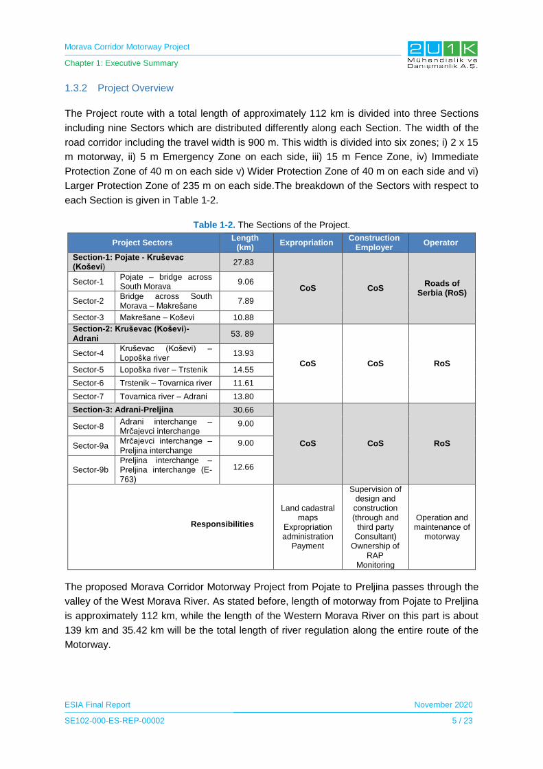
Morava Corridor Motorway Project
Chapter 1: Executive Summary
ESIA Final Report November 2020
SE102-000-ES-REP-00002 5 / 23
1.3.2 Project Overview
The Project route with a total length of approximately 112 km is divided into three Sections
including nine Sectors which are distributed differently along each Section. The width of the
road corridor including the travel width is 900 m. This width is divided into six zones; i) 2 x 15
m motorway, ii) 5 m Emergency Zone on each side, iii) 15 m Fence Zone, iv) Immediate
Protection Zone of 40 m on each side v) Wider Protection Zone of 40 m on each side and vi)
Larger Protection Zone of 235 m on each side.The breakdown of the Sectors with respect to
each Section is given in Table 1-2.
Table 1-2. The Sections of the Project.
Project Sectors Length
(km) Expropriation
Construction Employer
Operator
Section-1: Pojate - Kruševac (Koševi)
27.83
CoS CoS Roads of
Serbia (RoS)
Sector-1 Pojate – bridge across South Morava
9.06
Sector-2 Bridge across South Morava – Makrešane
7.89
Sector-3 Makrešane – Koševi 10.88
Section-2: Kruševac (Koševi)-Adrani
53. 89
CoS CoS RoS
Sector-4 Kruševac (Koševi) – Lopoška river
13.93
Sector-5 Lopoška river – Trstenik 14.55
Sector-6 Trstenik – Tovarnica river 11.61
Sector-7 Tovarnica river – Adrani 13.80
Section-3: Adrani-Preljina 30.66
CoS CoS RoS
Sector-8 Adrani interchange – Mrčajevci interchange
9.00
Sector-9a Mrčajevci interchange – Preljina interchange
9.00
Sector-9b Preljina interchange – Preljina interchange (E-763)
12.66
Responsibilities
Land cadastral maps
Expropriation administration
Payment
Supervision of design and construction (through and
third party Consultant)
Ownership of RAP
Monitoring
Operation and maintenance of
motorway
The proposed Morava Corridor Motorway Project from Pojate to Preljina passes through the
valley of the West Morava River. As stated before, length of motorway from Pojate to Preljina
is approximately 112 km, while the length of the Western Morava River on this part is about
139 km and 35.42 km will be the total length of river regulation along the entire route of the
Motorway.
Morava Corridor Motorway Project
Chapter 1: Executive Summary
ESIA Final Report November 2020
SE102-000-ES-REP-00002 6 / 23
The construction of the Motorway will approximately require 2,000 ha area including the
construction facilities. The construction of the Project is planned to be completed in four years.
The earthworks start dates for each Section are as follows;
Section-I in April 2020,
Section-II in April, and
Section-III in August 2020.
Construction phase of the Project was planned to be completed in late November 2023 when
the motorway will be operational. The operation period of the Project is foreseen to be 22
years.
The average number of the construction workers will be 3,100 and the peak number of the
Project workers will be approximately 3,800. The labour requirement for the construction of the
Project will be primarily sourced from Serbia, local labour force and complemented by expats.
Almost all sections of the motorway are on flat farmland and next to the West Morava River,
which is on a large flood plain. The site is accessible due to the proximity of local roads and
access points. Construction plan comprises passing through agricultural areas. All
expropriation and land access provisions (except for construction facilities to be done by the
contractor) are the responsibility of the Government of Serbia.
According to the Preliminary Economic Analysis and Feasibility Study2, the necessity of the
proposed Project (i.e., the goals of the realization of this project) is as follows:
• Reduce flood risk in the region;
• Improved employment in the Morava Valley with 9,950 employees by 2030;
• Increased tourism participation by 9% by 2025;
• Less time-consuming transportation from Pojate to Preljina (around 1 hour);
• Additional telecommunication connection for inhabitants;
• Overall Internal Rate of Return (IRR) of 7.75%, 7.91% and 13.49% for the three Sections 1, 2 and 3 (see project overview for detailed information about road sections) respectively;
• Toll revenue of €74.44m per year by 2044; and
• Accidents will reduce by over 50%.
2 Preliminary Economic Analysis and Feasibility Study for the E-761 the Republic of Srpska border - Požega - Preljina – Pojate Highway Construction.
Morava Corridor Motorway Project
Chapter 1: Executive Summary
ESIA Final Report November 2020
SE102-000-ES-REP-00002 7 / 23
The main aim of the Project is to shorten travel times with safe condition which is expected to
lead an increase in import and export opportunities in the region as well as nationwide, where
the domestic companies will have more opportunity to transport their goods and access to new
technologies. The Project is strategically significant for economic development and
investments in the region. The Project will also enable a connection between the municipal
centres Ćićevac, Varvarin, Kruševac, Trstenik, Vrnjačka Banja, Kraljevo and Čačak as well as
economic zones and tourist destinations in the region. The Project will include construction of
telecommunication infrastructure that will make the Motorway a digital highway, with modern
optical and digital cables, free internet and notifications to drivers for a safe traffic. In the
operational phase of the Project, the transit time between Pojate and Preljina will be reduced
from two hours to less than one hour.
1.3.3 Project Development and Project Alternatives
Project development phase of the Morava Corridor Motorway Project has been started in 2008.
At the initial design phase of the Project, general topographical condition of the West Morava
River valley is considered mainly for the identification of route options. The hills bounding the
North and South of the West Morava River valley limit the potential route option for the Project
in terms of constructability regarding physical, environmental and financial point of views. The
West Morava River together with the high number of settlements located along the river basin
is other limiting factors for the Project route selection. In addition to these limiting factors,
several variation options are considered from aspects to assess whether there are other
feasible options that will result in less significant impacts during the development of the Project.
Other factors considered in the route selection processes are to i) avoid settlements as much
as possible to minimize resettlement; ii) avoid natural and archaeological protected areas; and
iii) comply with technical design specifications considering topographical and hydrological
conditions of the basin. The whole process starting with the route selection, selection of
intersection locations and selection of project facilities’ locations are comprehensively carried
out in order to avoid and minimize the potential impacts as much as practical.
The project development timeline provided in the Hydrotechnical Regulation of the Zapadna
(West) Morava River Within the Infrastructure Corridor of Highway E-761 (see Appendix-10)
indicates that the route selection process of the Project was proceeded during the project
development together with the river regulation works. The project design activities performed
since 2008 are provided in Table 1-3 and summarized below.
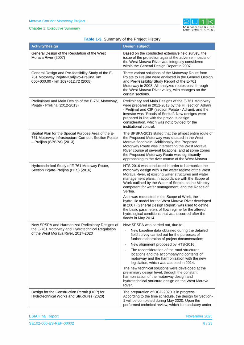
Morava Corridor Motorway Project
Chapter 1: Executive Summary
ESIA Final Report November 2020
SE102-000-ES-REP-00002 8 / 23
Table 1-3. Summary of the Project History
Activity/Design Design subject
General Design of the Regulation of the West Morava River (2007)
Based on the conducted extensive field survey, the issue of the protection against the adverse impacts of the West Morava River was integrally considered within the General Design Report in 2007.
General Design and Pre-feasibility Study of the E-761 Motorway Pojate-Kraljevo-Preljina, km 000+000.00 - km 109+612.72 (2008)
Three variant solutions of the Motorway Route from Pojate to Preljina were analyzed in the General Design and Pre-feasibility Study Report of the E-761 Motorway in 2008. All analyzed routes pass through the West Morava River valley, with changes on the certain sections.
Preliminary and Main Design of the E-761 Motorway, Pojate - Preljina (2012-2013)
Preliminary and Main Designs of the E-761 Motorway were prepared in 2012-2013 by the HI (section Adrani - Preljina) and CIP (section Pojate - Adrani), and the investor was "Roads of Serbia". New designs were prepared in line with the previous design consideration, which was not provided for the institutional control.
Spatial Plan for the Special Purpose Area of the E-761 Motorway Infrastructure Corridor, Section Pojate – Preljina (SPSPA) (2013)
The SPSPA-2013 stated that the almost entire route of the Proposed Motorway was situated in the West Morava floodplain. Additionally, the Proposed Motorway Route was intersecting the West Morava River course at several locations, and at some zones the Proposed Motorway Route was significantly approaching to the river course of the West Morava.
Hydrotechnical Study of E-761 Motoway Route, Section Pojate-Preljina (HTS) (2016)
HTS-2016 was conducted in order to harmonize the motorway design with i) the water regime of the West Morava River, ii) existing water structures and water management plans, in accordance with the Scope of Work outlined by the Water of Serbia, as the Ministry competent for water management, and the Roads of Serbia.
As it was requested in the Scope of Work, the hydraulic model for the West Morava River developed in 2007 (General Design Report) was used to define the basic parameters of flow regime for the altered hydrological conditions that was occurred after the floods in May 2014.
New SPSPA and Harmonized Preliminary Designs of the E-761 Motorway and Hydrotechnical Regulation of the West Morava River, 2017-2020
New SPSPA was carried out, due to:
- New baseline data obtained during the detailed field survey carried out for the purposes of further elaboration of project documentation;
- New alignment proposed by HTS-2016;
- The reconsideration of the road structures locations and the accompanying contents of motorway and the harmonization with the new legislation, which was adopted in 2014.
The new technical solutions were developed at the preliminary design level, through the constant harmonization of the motorway design and hydrotechnical structure design on the West Morava River.
Design for the Construction Permit (DCP) for Hydrotechnical Works and Structures (2020)
The preparation of DCP-2020 is in progress. According to the time schedule, the design for Section-1 will be completed during May 2020. Upon the performed technical review, which is mandatory under
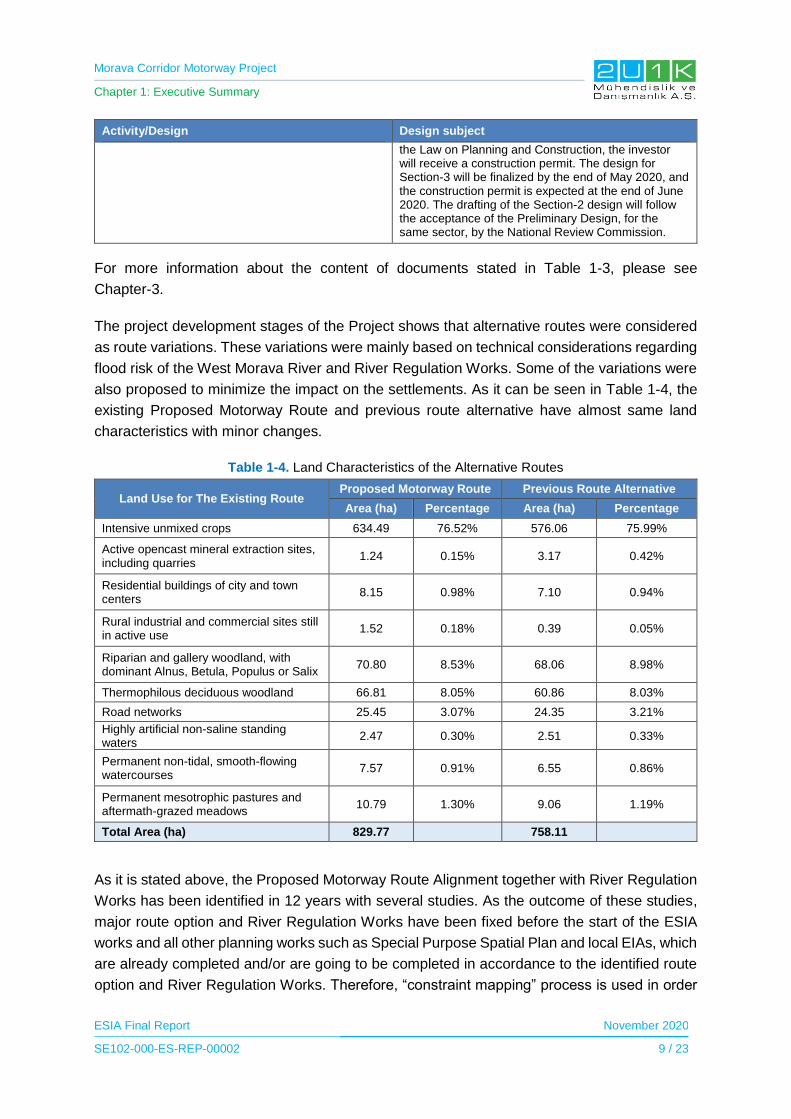
Morava Corridor Motorway Project
Chapter 1: Executive Summary
ESIA Final Report November 2020
SE102-000-ES-REP-00002 9 / 23
Activity/Design Design subject
the Law on Planning and Construction, the investor will receive a construction permit. The design for Section-3 will be finalized by the end of May 2020, and the construction permit is expected at the end of June 2020. The drafting of the Section-2 design will follow the acceptance of the Preliminary Design, for the same sector, by the National Review Commission.
For more information about the content of documents stated in Table 1-3, please see
Chapter-3.
The project development stages of the Project shows that alternative routes were considered
as route variations. These variations were mainly based on technical considerations regarding
flood risk of the West Morava River and River Regulation Works. Some of the variations were
also proposed to minimize the impact on the settlements. As it can be seen in Table 1-4, the
existing Proposed Motorway Route and previous route alternative have almost same land
characteristics with minor changes.
Table 1-4. Land Characteristics of the Alternative Routes
Land Use for The Existing Route Proposed Motorway Route Previous Route Alternative
Area (ha) Percentage Area (ha) Percentage
Intensive unmixed crops 634.49 76.52% 576.06 75.99%
Active opencast mineral extraction sites, including quarries
1.24 0.15% 3.17 0.42%
Residential buildings of city and town centers
8.15 0.98% 7.10 0.94%
Rural industrial and commercial sites still in active use
1.52 0.18% 0.39 0.05%
Riparian and gallery woodland, with dominant Alnus, Betula, Populus or Salix
70.80 8.53% 68.06 8.98%
Thermophilous deciduous woodland 66.81 8.05% 60.86 8.03%
Road networks 25.45 3.07% 24.35 3.21%
Highly artificial non-saline standing waters
2.47 0.30% 2.51 0.33%
Permanent non-tidal, smooth-flowing watercourses
7.57 0.91% 6.55 0.86%
Permanent mesotrophic pastures and aftermath-grazed meadows
10.79 1.30% 9.06 1.19%
Total Area (ha) 829.77 758.11
As it is stated above, the Proposed Motorway Route Alignment together with River Regulation
Works has been identified in 12 years with several studies. As the outcome of these studies,
major route option and River Regulation Works have been fixed before the start of the ESIA
works and all other planning works such as Special Purpose Spatial Plan and local EIAs, which
are already completed and/or are going to be completed in accordance to the identified route
option and River Regulation Works. Therefore, “constraint mapping” process is used in order
Morava Corridor Motorway Project
Chapter 1: Executive Summary
ESIA Final Report November 2020
SE102-000-ES-REP-00002 10 / 23
to avoid and minimize the further impact on habitats in line with ESIA findings. In this respect,
all no-go areas are identified and provided to engineering group for identification of the new
potential project unit locations as well as potential route modifications required by detailed
design phase.
1.3.3.1 Technological Alternatives
For the Project of concern, the technological aspect is the safe and sound operation of traffic
of passenger and freight motor vehicles, provision of services and regular-road maintenance
using the accompanying facilities. Looking at vehicle movement as a technological process,
alternatives are variations in traffic mode, in terms of regulating the speed of movement of
traffic participants and directing them to individual lanes. That is mostly governed by the Law
on Traffic Safety and Vertical and Horizontal Signaling and is not the subject of this study. All
alternatives in terms of road maintenance and related content management are subject to
specific projects. Fuel consumption depends on the traffic load, type and age of the vehicle,
traffic participants, and is stochastic.
For the aspect of the technological treatment of drainage water from the pavement surface of
motorway, the state of art closed system such as network of underground drainage pipe
connected to oil separators through gullies and manholes will be undertaken. However,
alternative equivalent system can also be considered during design development stage.
1.3.3.2 Zero Alternatives
Zero alternative of the Project (i.e., no realization of the Project) means an alternative solution
which will replace the Motorway construction with the same purpose to enable the connection
in the part Pojate - Kruševac - Kraljevo - Preljina, with branches to A1 and A2 state roads at
its ends. Considering such options as railway or alternative route corridor, there is none to be
considered in order to prefer zero alternative.
1.4 Legal Framework
The Project is planned to be funded by various international financial institutions (IFI), which
require an Environmental and Social Impact Assessment (ESIA) Report. With this intention,
the Project is committed to follow the Equator Principles, IFC performance standards on
environmental and social sustainability (2012), Environmental and Social Standards (ESSs) of
the World Bank Group as well as international environmental and social guidelines and
standards in addition to the relevant national environmental legislation and regulations. The
ESIA Report also provides detailed legal register of legislation, guidelines and strategies (both
national and international) pertinent to the proposed Project and associated ESIA.
Table 1-5 presents the summary of national laws and regulations to reduce the potential and
social impacts that may arise from the construction and operation activities of the Project.

Morava Corridor Motorway Project
Chapter 1: Executive Summary
ESIA Final Report November 2020
SE102-000-ES-REP-00002 11 / 23
Table 1-5. National Environmental and Social Legal and Policy Framework
National Environmental Legal and Policy Framework
Environmental Impact Assessment
Law on Environmental Impact Assessment Official Gazette of the RS ", No. 135/04 and 36/09
Law on Strategic Environmental Impact Assessment Official Gazette of RS, No.135/2004
Law on Planning and Construction Official Gazette of RS, No. 47/03, 34/06
Law on Environmental Protection Official Gazette of RS, No. 66/91, 83,92, 67/93, 48/94, 53/95, 135/04
Water
Law on Water Official Gazette of RS”, No. 95/2018
Air
Law on Air Protection Official Gazette of RS, No 78/09
Law on Integrated Environmental Pollution Prevention and Control
Official Gazette of RS, No. 13/04
Soil
Law on Soil Protection Official Gazette of RS, No. 112/15
Noise
Law on Environmental Noise Official Gazette of RS, No. 88/10
Waste
Law on Waste Management Official Gazette of RS, No. 36/09 and 88/10
Geology and Seismicity
Law on Mining and Geological Explorations Official Gazette of RS, No. 88/2011
Nature Conservation
Law on Nature Conservation Official Gazette of RS, No. 9/10
Law on Forest Official Gazette of RS, No. 30/10, 93/12, 89/15
National Social Legal and Policy Framework
Assets
The Law on Foundations of Property Law Relations Official Gazette of RS, No. 6/80, 36/90
Law on Planning and Construction Official Gazette of RS, No. 72/09
Law on Non-Contentious Proceedings Official Gazette of RS, No. 25/82 and 48/88 Official Gazette of the RS No 46/95, 18/05, 85/12, 45/13, 55/14, 6/15 and 106/15
Law on State Surveying and Cadastre of Immovable Property
Official Gazette of the RS, No 72/09, amended on 18/10, 65/13 and 15/15
Law on Public Property Official Gazette of RS, No. 95/18
Law on Contract and Property Rights Official Gazette of RS, No. 9113/17
Expropriation
Expropriation Law “Official Gazette RS”, No. 53/95
Labour and Working Conditions
Labour Law Official Gazette of RS, No. 75/2014
Occupational Health and Safety Law Official Gazette of RS, No: 101/05
Law on Gender Equality Official Gazette of RS, No. 104/09
Law on the Prohibition of Discrimination Official Gazette of RS, No. 22/09
Law on Preventing Discrimination against Persons with Disabilities
Official Gazette of RS, No. 33/06 and 13/16
Law on Retirement and Disability Insurance Official Gazette of RS, No. 34/03, 64/04
Law on Prevention of Harassment at Work Official Gazette of RS, No.36/10
Law on Employment of Foreigners Official Gazette of RS, No. 128/14

Morava Corridor Motorway Project
Chapter 1: Executive Summary
ESIA Final Report November 2020
SE102-000-ES-REP-00002 12 / 23
Stakeholder Engagement
Law on Free Access to Information of Public Importance
Official Gazette”, No. 120/04
Law on the Protector of Citizens Official Gazette of RS” No. 54/07
National Environmental Legal and Policy Framework
Environmental Impact Assessment
Law on Environmental Impact Assessment Official Gazette of the RS ", No. 135/04 and 36/09
Law on Strategic Environmental Impact Assessment Official Gazette of RS, No.135/2004
Law on Planning and Construction Official Gazette of RS, No. 47/03, 34/06
Law on Environmental Protection Official Gazette of RS, No. 66/91, 83,92, 67/93, 48/94, 53/95, 135/04
Water
Law on Water Official Gazette of RS”, No. 95/2018
Air
Law on Air Protection Official Gazette of RS, No 78/09
Law on Integrated Environmental Pollution Prevention and Control
Official Gazette of RS, No. 13/04
Soil
Law on Soil Protection Official Gazette of RS, No. 112/15
Noise
Law on Environmental Noise Official Gazette of RS, No. 88/10
Waste
Law on Waste Management Official Gazette of RS, No. 36/09 and 88/10
Geology and Seismicity
Law on Mining and Geological Explorations Official Gazette of RS, No. 88/2011
Nature Conservation
Law on Nature Conservation Official Gazette of RS, No. 9/10
Law on Forest Official Gazette of RS, No. 30/10, 93/12, 89/15
National Social Legal and Policy Framework
Assets
The Law on Foundations of Property Law Relations Official Gazette of RS, No. 6/80, 36/90
Law on Planning and Construction Official Gazette of RS, No. 72/09
Law on Non-Contentious Proceedings Official Gazette of RS, No. 25/82 and 48/88 Official Gazette of the RS No 46/95, 18/05, 85/12, 45/13, 55/14, 6/15 and 106/15
Law on State Surveying and Cadastre of Immovable Property
Official Gazette of the RS, No 72/09, amended on 18/10, 65/13 and 15/15
Law on Public Property Official Gazette of RS, No. 95/18
Law on Contract and Property Rights Official Gazette of RS, No. 9113/17
Expropriation
Expropriation Law “Official Gazette RS”, No. 53/95
Labour and Working Conditions
Labour Law Official Gazette of RS, No. 75/2014
Occupational Health and Safety Law Official Gazette of RS, No: 101/05
Law on Gender Equality Official Gazette of RS, No. 104/09
Law on the Prohibition of Discrimination Official Gazette of RS, No. 22/09
Law on Preventing Discrimination against Persons with Disabilities
Official Gazette of RS, No. 33/06 and 13/16
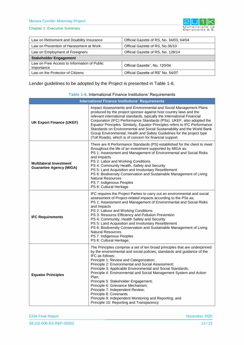
Morava Corridor Motorway Project
Chapter 1: Executive Summary
ESIA Final Report November 2020
SE102-000-ES-REP-00002 13 / 23
Law on Retirement and Disability Insurance Official Gazette of RS, No. 34/03, 64/04
Law on Prevention of Harassment at Work Official Gazette of RS, No.36/10
Law on Employment of Foreigners Official Gazette of RS, No. 128/14
Stakeholder Engagement
Law on Free Access to Information of Public Importance
Official Gazette”, No. 120/04
Law on the Protector of Citizens Official Gazette of RS” No. 54/07
Lender guidelines to be adopted by the Project is presented in Table 1-6.
Table 1-6. International Finance Institutions’ Requirements
International Finance Institutions’ Requirements
UK Export Finance (UKEF)
Impact Assessments and Environmental and Social Management Plans produced by the project sponsor against host country laws and the relevant international standards, typically the International Financial Corporation (IFC) Performance Standards (PSs). UKEF, also adopted the Equator Principles. Similarly, Equator Principles refers to IFC Performance Standards on Environmental and Social Sustainability and the World Bank Group Environmental, Health and Safety Guidelines for the project type (Toll Roads), which is of concern for financial support.
Multilateral Investment Guarantee Agency (MIGA)
There are 8 Performance Standards (PS) established for the client to meet throughout the life of an investment supported by MIGA as: PS 1: Assessment and Management of Environmental and Social Risks and Impacts PS 2: Labor and Working Conditions PS 4: Community Health, Safety and Security PS 5: Land Acquisition and Involuntary Resettlement PS 6: Biodiversity Conservation and Sustainable Management of Living Natural Resources PS 7: Indigenous Peoples PS 8: Cultural Heritage
IFC Requirements
IFC requires the Project Parties to carry out an environmental and social assessment of Project-related impacts according to the PSs as; PS 1: Assessment and Management of Environmental and Social Risks and Impacts PS 2: Labour and Working Conditions PS 3: Resource Efficiency and Pollution Prevention PS 4: Community, Health Safety and Security PS 5: Land Acquisition and Involuntary Resettlement PS 6: Biodiversity Conservation and Sustainable Management of Living Natural Resources PS 7: Indigenous Peoples PS 8: Cultural Heritage;
Equator Principles
The Principles comprise a set of ten broad principles that are underpinned by the environmental and social policies, standards and guidance of the IFC as follows; Principle 1: Review and Categorization; Principle 2: Environmental and Social Assessment; Principle 3: Applicable Environmental and Social Standards; Principle 4: Environmental and Social Management System and Action Plan; Principle 5: Stakeholder Engagement; Principle 6: Grievance Mechanism; Principle 7: Independent Review; Principle 8: Covenants Principle 9: Independent Monitoring and Reporting; and Principle 10: Reporting and Transparency

Morava Corridor Motorway Project
Chapter 1: Executive Summary
ESIA Final Report November 2020
SE102-000-ES-REP-00002 14 / 23
1.5 Baseline Conditions
1.5.1 Area of Influence
The Area of Influence (AoI) is an important element in assessing environmental and social
impacts of a proposed development since it informs about the physical and/or social extent
onto which the assessment should be performed. For this study, two different definitions of AoI
have been used for social and environmental baseline studies.
1.5.1.1 Environmental Area of Influence
The relevant environmental AoI for the Project can be divided into two main parts. The first
part covers the followings;
The Proposed Motorway Route,
The extended AoI of the Project, including access roads, quarries, asphalt and batch
plants, maintenance areas, and construction camps to be realized due to the Project,
Area of receptors (i.e. soil, surface water and ground water) that may be impacted from
supply and waste management operations,
For the intense and direct impacts associated with the project activities in construction and
operational phases, the immediate vicinity of the Proposed Motorway Route covering above
mentioned three items is considered to be a corridor of 1,000 m width (500 m on each side of
the motorway) along the Proposed Motorway Route. This is the first part of the Environmental
AoI along the Proposed Motorway Route. In addition, the following areas compose the second
part of the Environmental AoI due to the fact that the there can be impacts (e.g., handling of
wastes and transportation of the supply materials to the site from a long distance) associated
with the activities in relation to the Project outside the corridor of 1,000 m width:
Waste disposal facilities and the roads associated with waste management (i.e.
sanitary landfills, waste recycling facilities), and
Material supply locations and the roads associated with transport of such materials.
A total of 700 m wide corridor is specified as the protection zone in the Spatial Plan of E-761
Motorway Infrastructure Corridor (see Chapter-3 for the detailed information about the zone).
When determining the AoI as 1,000 m, the first intension was to cover this 700 m wide
protection zone. Then, activities causing impacts on a wider range were considered. In this
respect, the most important aspect that was taken into account is the impact area regarding
the air pollutant emissions which are expected to have impact on a wider area than the other
impacts of the Project such as noise or impacts on surface water and soil.
In this respect, a total of 1,000 m width was chosen as the first part of the Environmental AoI.
The size of the chosen area depends upon the types of the emission sources, mass of the
Morava Corridor Motorway Project
Chapter 1: Executive Summary
ESIA Final Report November 2020
SE102-000-ES-REP-00002 15 / 23
emissions, and types of the pollutants being emitted as well as the topography and
meteorological conditions of the area.
1.5.1.2 Social Area of Influence
The spatial scope of the Social Area of Influence (AoI) includes the following areas:
The Primary AoI: The primary area of influence encompasses a corridor of 500 m (being 250
m on each side of the Motorway centerline). This corridor is potentially expected to experience
the land acquisition impacts in addition to other environmental and social impacts.
The Secondary AoI: Area of potential socioeconomic impacts directly associated with the
Project activities (e.g. health impact caused by traffic movement, air pollution, and impact on
resources used by the villages.)
Area of Indirect Impacts: Area of potential socioeconomic impacts indirectly induced by the
Project activities (e.g. increase in the local employment rate and incomes, contacts with the
Project personnel, labour migration).
1.5.2 Environmental Baseline Conditions
The Project is located in the West (Zapadna) Morava River basin, and the Project route mainly
follows the West Morava River opposite to the river flow direction of west to south. The West
Morava River basin has significant use for agricultural and industrial purposes. The curvature
of the route of the West Morava River is highly variable, with a radius ranging from 100 m to
1,000 m. Some parts of the River are straight but they are very few and short. Radii of the
downstream river are generally greater than 200 m, and radii of the upstream river are smaller
than 200 m. The section of the West Morava River from km 90 to km 135 (from Kraljevo to
Čemernica) with a series connected of the river bends has radii of from 80 m to 200 m.
Furthermore, the existing surface water quality was determined at the study areas which were
determined within the environmental AoI by taking samples, from surface waters along the
proposed motorway route and the measurement results did not exceed the national and
international limit values at any point.
The general climate of AoI of the Project can be described as moderate-continental. In Serbia,
annual precipitation over the ranges from 600mm to 1000mm. The average maximum monthly
temperature and the average minimum monthly temperature are approximately 21.01 and -
0.62°C, respectively.
Baseline air quality and noise assessment was provided by using the results of the extensive
air quality measurements conducted by 2U1K. As a result of the measurements, the daily
average values are below Serbian limit values and IFC Guideline Limits for Ambient Air Quality
(125 µg/m3 as interim target-1).Comparing results of concentrations of suspended PM2.5 and
PM10 particles to the limit value can be concluded that measured values of PM2.5 and PM10
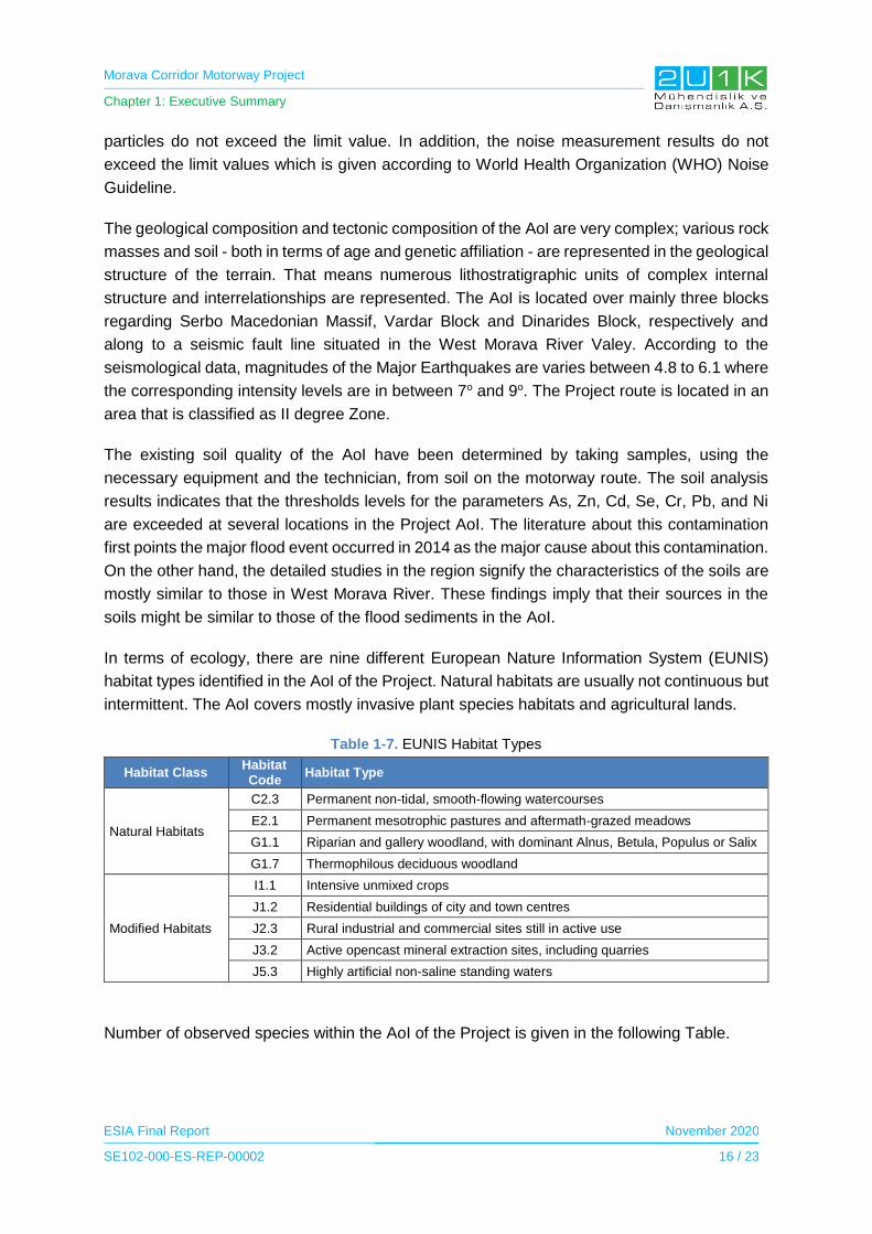
Morava Corridor Motorway Project
Chapter 1: Executive Summary
ESIA Final Report November 2020
SE102-000-ES-REP-00002 16 / 23
particles do not exceed the limit value. In addition, the noise measurement results do not
exceed the limit values which is given according to World Health Organization (WHO) Noise
Guideline.
The geological composition and tectonic composition of the AoI are very complex; various rock
masses and soil - both in terms of age and genetic affiliation - are represented in the geological
structure of the terrain. That means numerous lithostratigraphic units of complex internal
structure and interrelationships are represented. The AoI is located over mainly three blocks
regarding Serbo Macedonian Massif, Vardar Block and Dinarides Block, respectively and
along to a seismic fault line situated in the West Morava River Valey. According to the
seismological data, magnitudes of the Major Earthquakes are varies between 4.8 to 6.1 where
the corresponding intensity levels are in between 7o and 9o. The Project route is located in an
area that is classified as II degree Zone.
The existing soil quality of the AoI have been determined by taking samples, using the
necessary equipment and the technician, from soil on the motorway route. The soil analysis
results indicates that the thresholds levels for the parameters As, Zn, Cd, Se, Cr, Pb, and Ni
are exceeded at several locations in the Project AoI. The literature about this contamination
first points the major flood event occurred in 2014 as the major cause about this contamination.
On the other hand, the detailed studies in the region signify the characteristics of the soils are
mostly similar to those in West Morava River. These findings imply that their sources in the
soils might be similar to those of the flood sediments in the AoI.
In terms of ecology, there are nine different European Nature Information System (EUNIS)
habitat types identified in the AoI of the Project. Natural habitats are usually not continuous but
intermittent. The AoI covers mostly invasive plant species habitats and agricultural lands.
Table 1-7. EUNIS Habitat Types
Habitat Class Habitat Code
Habitat Type
Natural Habitats
C2.3 Permanent non-tidal, smooth-flowing watercourses
E2.1 Permanent mesotrophic pastures and aftermath-grazed meadows
G1.1 Riparian and gallery woodland, with dominant Alnus, Betula, Populus or Salix
G1.7 Thermophilous deciduous woodland
Modified Habitats
I1.1 Intensive unmixed crops
J1.2 Residential buildings of city and town centres
J2.3 Rural industrial and commercial sites still in active use
J3.2 Active opencast mineral extraction sites, including quarries
J5.3 Highly artificial non-saline standing waters
Number of observed species within the AoI of the Project is given in the following Table.
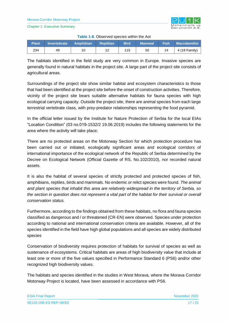
Morava Corridor Motorway Project
Chapter 1: Executive Summary
ESIA Final Report November 2020
SE102-000-ES-REP-00002 17 / 23
Table 1-8. Observed species within the AoI
Plant Invertebrate Amphibian Reptilian Bird Mammal Fish Macrobenthic
234 49 10 12 115 50 14 4 (18 Family)
The habitats identified in the field study are very common in Europe. Invasive species are
generally found in natural habitats in the project site. A large part of the project site consists of
agricultural areas.
Surroundings of the project site show similar habitat and ecosystem characteristics to those
that had been identified at the project site before the onset of construction activities. Therefore,
vicinity of the project site bears suitable alternative habitats for fauna species with high
ecological carrying capacity. Outside the project site, there are animal species from each large
terrestrial vertebrate class, with prey-predator relationships representing the food pyramid.
In the official letter issued by the Institute for Nature Protection of Serbia for the local EIAs
“Location Condition” (03 no.019-1532/2 19.06.2019) includes the following statements for the
area where the activity will take place;
There are no protected areas on the Motorway Section for which protection procedure has
been carried out or initiated, ecologically significant areas and ecological corridors of
international importance of the ecological network of the Republic of Serbia determined by the
Decree on Ecological Network (Official Gazette of RS, No.102/2010), nor recorded natural
assets.
It is also the habitat of several species of strictly protected and protected species of fish,
amphibians, reptiles, birds and mammals. No endemic or relict species were found. The animal
and plant species that inhabit this area are relatively widespread in the territory of Serbia, so
the section in question does not represent a vital part of the habitat for their survival or overall
conservation status.
Furthermore, according to the findings obtained from these habitats, no flora and fauna species
classified as dangerous and / or threatened (CR-EN) were observed. Species under protection
according to national and international conservation criteria are available. However, all of the
species identified in the field have high global populations and all species are widely distributed
species
Conservation of biodiversity requires protection of habitats for survival of species as well as
sustenance of ecosystems. Critical habitats are areas of high biodiversity value that include at
least one or more of the five values specified in Performance Standard 6 (PS6) and/or other
recognized high biodiversity values.
The habitats and species identified in the studies in West Morava, where the Morava Corridor
Motorway Project is located, have been assessed in accordance with PS6.

Morava Corridor Motorway Project
Chapter 1: Executive Summary
ESIA Final Report November 2020
SE102-000-ES-REP-00002 18 / 23
Critical habitat criteria are as follows:
• Criterion 1: Critically Endangered (CR) and/or Endangered (EN) species
• Criterion 2: Endemic or restricted-range species
• Criterion 3: Migratory or congregatory species
• Criterion 4: Highly threatened and/or unique ecosystems
• Criterion 5: Key evolutionary processes
Although no critical habitat was detected in the context of the project in the scope of the ESIA
baseline studies, it should be noted that there are ongoing additional studies on biodiversity
including collection of additional baseline data for identification of critical habitats and
biodiversity impact assessment. Results of such additional studies will be disclosed within the
Supplementary Lenders Information Package (SLIP). Please refer Chapter 10 where details
on additional tasks/studies are provided in a tabular form.
1.5.3 Social Baseline Conditions
There are 7 municipalities located in the Social AoI, including 48 affected villages within those
municipalities. Following Table presents the respective information on each affected
municipalities of the Project.
Table 1-9. Municipalities Located in the Social AoI
Municipality Number of settlements within buffer zone
Ćićevac 4
Varvarin 2
Kruševac 7
Vrnjačka Banja 6
Trstenik 8
Kraljevo 11
Čačak 10
TOTAL 48
In order to obtain baseline information and assess the possible social impacts of the Project,
Community Level Surveys, Household Surveys, Key Informant Interviews, Business Surveys
and Focus Group Discussions have been conducted by the social experts of the 2U1K. Along
with the field studies, secondary data sources were used as key tools to understand the
socioeconomic baseline.
According to social field studies, all of the affected municipalities experience population
increase as a result of economic lack of employment opportunities. Agriculture is one of the
main occupations in all affected villages and the interviewed farmers of the affected villages
stated that the income from agriculture was decreased because of the floods and droughts
happened in recent years. In all affected municipalities, the average family income ranges from
255 to 850 Euros.

Morava Corridor Motorway Project
Chapter 1: Executive Summary
ESIA Final Report November 2020
SE102-000-ES-REP-00002 19 / 23
According to results of the social surveys it has been observed that the ecosystem services
are being used for household purposes and consumption. The villages are considered to be
highly sensitive where Morava river is being used for; transportation, fishing, irrigation and
leisure activities. In terms of forest usage, the majority of the Project affected people is using
forest to collect wood for heating purposed and hunting for household consumption.
For health services, not every settlement in the social AoI have health facilities within its
borders. In terms of education, almost all locals within the AoI are literate. Last, the
infrastructure services were observed to be not sufficient especially waste management
system, sewage system, conditions of the local roads and the capacity of the electricity system.
1.6 Impact Assessment
1.6.1 Environmental Impact Assessment and Mitigation Measures
Environmental impacts of the proposed Project on water quality, air quality, noise and vibration,
geology and soil, waste, terrestrial and freshwater ecology and archaeological and cultural
resources have been determined, and the mitigation measures to be taken against them are
given in detail in Chapter 6 of the ESIA Report. The most important subjects that will be
impacted by the Project are water quality, air quality, noise, geology and soil and terrestrial
and freshwater ecology.
The most significant impact on water regime is related to reconstruction of the sections of
Morava River. River diversion may affect the natural water flow due to construction of artificial
structures and barriers. In which may result in siltation of riverbed, flowage during the high-
water period or heavy rains, etc. On the other hand, surface water quality and quantity are
considered to be temporary affected by the construction activities including but not limited to:
Silty/soiled water from excavations, quarries, topsoil placing, machinery washing, washing of
finished road surfaces to remove accumulated soil and disturbance of drains and streambeds;
the surface water may be at risk in case of a construction site or refueling and storage depot
is located near a surface water body; wastewater from construction accommodations and other
facilities poses a risk to water environment if not treated prior to discharge. During the
operation phase of the Project surface water sources may be impacted negatively. Some of
the potential sources of the impacts can be raised from: Pollutants released from vehicles;
occupation of the flood plain by the motorway; alteration of flow patterns due to hydraulic
structures. On the other hand, surface water quality and quantity are considered to be affected
followings during operation phase of the Project including but not limited to: spills due to road
accident and from gas stations and service areas; Motorway repair activities such as removal
of asphalt and replacement, painting etc. can impact to surface water quality; high storm water
flow rates can cause flooding, erosion and habitat degradation due to increase of impermeable
surface.

Morava Corridor Motorway Project
Chapter 1: Executive Summary
ESIA Final Report November 2020
SE102-000-ES-REP-00002 20 / 23
The Project has planned to locate on approximately 112 km route and there will be several
emission sources on the route during construction phase. The construction phase activities
cover all activities during the construction period including land arrangement, quarry and
borrow pit activities, crushing plants, batch plants, asphalt plants, main construction activities
and equipment’s movements such as cement mixers, trucks, backhoes, asphalt pavers etc.
Significant pollutant of this step will be dust generated from above activities and the release of
engine emissions (such as NOX, SOX, particles, CO, VOC etc.) from construction equipment
and vehicles.
According to activity type and location diversity, construction phase emission sources can be
classified as follow.
I. Borrow pits and quarries
II. Crushers and screen plants
III. Asphalt plants and batch plants
IV. Road construction
Noise levels will increase significantly during the construction phase of the Project compared
to the current situation. This is due to the noise and vibrations emitted by machinery and
equipment used during construction and activities. In addition, noisy construction operations
(earthworks, bridge construction, demolition, production of gravel and concrete, on-site and
off-site transport of materials, etc.) cause an increase in noise levels and emit vibrations.
Vibration during the construction stage is mainly from two main sources. One of them is
blasting activities held in quarries and second is construction vibration due to machine and
equipment that is used in main motorway construction. However, according to modelling study
results, it is expected that during operation phase, there is no vibration impact caused by the
Motorway.
The potential impacts of the land preparation and construction activities on the soil
environment are summarized as; disturbance such as loss of fertile top layer; mixing of soil
layers and types; soil compaction etc. due to top soil stripping, cut and fill operations;
construction of road structures and extraction of construction materials at the quarry sites; soil
erosion and soil contamination due to unexpected leakages or spills. During the operation
phase, soil contamination risks may be caused by the improper handling of the hazardous
materials to be used in the road maintenance activities and leakage/spill of fuels, chemicals,
etc. during the unexpected accidents.
The construction and operation of the Project will involve a wide range of activities that have
the potential to affect ecology. Impacts of project activities can be further divided into the target
group of biological elements as terrestrial and aquatic. Important impacts of motorway
construction and operation activities on biological environment are mainly habitat loss and
habitat fragmentation. Habitat loss is the process by which a natural habitat becomes
incapable of supporting its native species. The organisms that previously inhabited the site are

Morava Corridor Motorway Project
Chapter 1: Executive Summary
ESIA Final Report November 2020
SE102-000-ES-REP-00002 21 / 23
displaced or die, thereby reducing biodiversity and species abundance Habitat fragmentation
can be described as the splitting of natural habitats and ecosystems into smaller, more isolated
patches. The process of fragmentation is connected to many different factors, of which the
direct loss and isolation of natural habitat are the most important. The ecological impacts of
transportation include disturbance in terms of noise and visual nuisance and pollution, which
act to reduce the suitability of adjacent areas for wildlife. The infrastructure itself contributes
significantly towards habitat fragmentation by creating barriers to animal movement. This may
result in the isolation and extinction of vulnerable species. The steady increase in the number
of animal casualties associated with roads and to a lesser extent with drowned animals in
waterways, provides a further indication of the fragmentation effect. Fauna mortality, in
particular, has helped raise the public perception of the problem, due to the inherent link to
traffic safety. Finally, devaluation of the landscape and nature for human recreation can make
an important negative economic factor.
1.6.2 Social Impact Assessment and Mitigation Measures
Summary of the potential Project related social impacts and mitigation measures can be found
in the following paragraphs. Detailed version of the Social Impact Assessment including the
respective mitigation measures can be found in Chapter 6 of the ESIA Report in detail.
The existing land use of the Social AoI will be affected by the construction of the Project and
its components as well as by the Project facilities. There will be loss of business, municipality,
governmental and individual land as a result of the Project. The Project execution will require
permanent acquisition of land by using expropriation. The Project is expected to cause
economic displacement and physical resettlement, however, at this stage, the magnitude of
displacement is not completely known. The major impacts will be felt by people who will have
to expropriate all or most of their land and other property and move to the other locations.
Moderate impacts will be felt by people who will lose smaller portions of their land and assets
and who will not need to physically relocate. Losses will not only be limited to property owners
with legally recognized property rights, but some impacts could possibly be felt by people
without ownership rights, such as tenants and informal or itinerant land users. CoS will ensure
that effects of physical and economic displacement are minimized, and that people affected
by the Project will be compensated in accordance with the Principles set in the in the
Resettlement and Livelihood Restoration Framework of the Project.
During operation phase, the most likely potential impact would be damage to crops near the
Motorway corridor from maintenance activities or vehicular access. If complaints related with
unauthorized use of privately-owned lands, damages on adjacent lands, etc. are received
through Project’s Grievance Mechanism, evaluation/inquiry will be conducted on a case-by-
case and where necessary, corrective actions will be planned and implemented.
The Project alignment will pass through forestlands in each of the Municipalities within the AoI.
The most affected Municipalities are located in Section-2 including Trstenik and Vrnjačka
Morava Corridor Motorway Project
Chapter 1: Executive Summary
ESIA Final Report November 2020
SE102-000-ES-REP-00002 22 / 23
Banja Municipalities. The forestlands in the AoI are mainly used for wood, plant and mushroom
collection and hunting purposes. All of the forest related activities are mainly used for
household consumption according to the results of social field study. Although the Project
activities require forest utilization, no significance impact is foreseen on this ecosystem service,
since most of the plants used are in the peridomiciliary spaces, and have spaces for use or
complementary sources of supply for their use. Also, Section 3 is expected experience more
river regulation impacts among the Project sections. According to Household and Community
Level surveys, none of the locals among the Section 3 derives household income from the
Morava River. Popovici village, being the closest settlement to the river regulation activities in
Section 3 stated to use Morava River for fishing on household consumption. None of the
affected settlements use the river for transportation purposes. From this aspect, regulation
impacts on river usage could be managed sufficiently with proper mitigation measures
The construction phase of the project may result influx of addition population. To mitigate any
negative impacts from the job seekers in the region who migrate to the Project area to get
benefit from the job opportunities of the Project, a Recruitment Plan will be prepared to prevent
spontaneous influx of job seekers. Recruitment procedures to be prepared by the contractor
should aim to provide opportunities for employment of local workforce to the extent possible
considering unskilled, semi-skilled, and skilled workforce, and giving priority to vulnerable
persons (especially those who will be economically disabled). Priority will be given to Social
AoI. In order for to increase local procurement benefits, Project should seek to maximize the
benefits for local communities in terms of both direct and indirect employment and purchasing
of local good and services.
The ESIA also assessed the labour and working conditions as well as the health and safety
risks due to general occupational health and safety hazards during both operation and
construction phase of the Project, to mitigate any negative impacts, the Project will adopt and
implement Occupational Health and Safety Plan, Emergency Response Plan, Fitness to Work
Process Procedure, Camp Management Procedure, Subcontractor Management Procedure,
Human Resources Policy, Recruitment plan and Worker Accommodation Plan. In line with the
occupational health and safety measures, community health and safety impacts have also
been assessed and to mitigate any potential impacts, measures including proper trainings,
grievance mechanism, and protocols to be followed by the workers have been implemented
within the scope of impact assessment. Occupational Health and Safety Management Plan
will include awareness of community health and safety issues, including - the Pandemic
Preparedness Plan within its scope with respect to Covid – 19 and/or any other diseases
present in the region.
When assessing the potential operation impacts of the Project, increase and decrease in
population is expected. The population decrease as a result of PAPs whom become landless
and may decide to out-migrate is a negative impact at Municipal level. On the other hand, the
operational activities may attract people from other regions to migrate to the Project Area in
parallel with economic development and urbanization at District level. Employment for the
Morava Corridor Motorway Project
Chapter 1: Executive Summary
ESIA Final Report November 2020
SE102-000-ES-REP-00002 23 / 23
operation and maintenance activities of the motorway, bridge and tolls will be required,
resulting in long-term employment opportunities for the municipal, district and national
workforce. Local contractors and subcontractors as well as national and local companies will
have the opportunity to be involved in maintenance and repair works as well as services to be
provided in amenities. It is assumed that operation and maintenance work will require a mix of
skilled and semiskilled labor, which may be employed from the municipal or district workforce.
For in-depth details for the social impacts and proposed mitigation measures please see
Chapter 6 of the ESIA Report.
1.7 Stakeholder Engagement
Stakeholder engagement refers to a process of sharing information and knowledge, seeking
to understand and respond to the concern and expectations of stakeholders and building
relationships based on collaboration. As such, stakeholder engagement is a crucial part of the
ESIA process, looking to ensure that the views interests and concerns of interested groups are
taken into account in the project design and planning. The Stakeholder Engagement Plan
(SEP) presented in Appendix-3 has been developed with the aim of explaining how the Project
will communicate and interact with the stakeholders that may be directly or indirectly affected
by and / or interested in the Project.
SEP was revised as version 15 after completion of the Public Participation Meetings (PPMs)
where it was aimed to share the results of the ESIA studies with local people and to get their
comments or opinion about the Project, ESIA studies etc. PPMs were carried out in seven
affected municipalities, namely, Ćićevac, Varvarin, Kruševac, Tristenik, Vrnjačka Banja,
Kraljevo and Čačak. Outdoor meetings were held due to Covid-19 measures. The PPMs were
organized in between September 23 and 30, 2020.
1.8 Conclusions
As a result of the ESIA, it was assessed that the impacts of the Project are mostly medium and
residual impact decreases to low level after the implementation of the proposed mitigation
measures given in Chapter 6 of the ESIA Report. The impacts considered as high are; flood
risk during construction and operation, air quality, noise, change of landscape due to changes
in land use, visibility of new structures, loss of private lands, fragmentation of agricultural land
plots, physical and economic displacement of PAPs and traffic. In addition, socially positive
impacts are also evaluated. These impacts are mainly based on development in the local
economy and employment opportunities during the construction and operation phase of the
Project, which will be result from direct and indirect job opportunities and procurement
opportunities in the Project region.

Morava Corridor Motorway Project
Chapter 2: Introduction
ESIA Final Report November 2020
SE102-000-ES-REP-00002 1 / 18
2 INTRODUCTION
2.1 Background to the Proposed Morava Corridor Motorway Project
Morava Corridor Motorway Project (the Project) runs east/west in the West Morava River valley
and is seen as a key enabler of the economic corridor to the industrial city of Kruševac and its
ultimate international connections to Bosnia, Montenegro and Macedonia. The motorway will
boost international and local connectivity by linking pan-European Corridors 10 and 11 and all
major towns and cities in a central Serbian region that has a population of around 500,000 and
includes Čačak, Kraljevo, Vrnjačka Banja, Trstenik, Kruševac and Ćićevac.
The Project is expected to create around 10,000 jobs during construction, utilizing mainly
Serbian workforce which will prevent the flow of non-skilled and skilled Serbian workforce to
outside of Serbia. During the implementation of the Project, numerous workers will be trained
in very specific construction fields, contributing to their technical skills considerably. According
to the SPSPA, industrial zones are planned in the region, which will benefit from the
construction of the motorway and will also create significant job opportunities. The Project will
contribute the revitalization of the industry in the central Serbia.
In addition to reducing the travel time, the Motorway will also enable a much safer means of
travel in the region. Connectivity of the region will be improved by extensive telecommunication
network (5-G) planned, providing a Digital Corridor.
The Project also features extensive flood protection measures solving the challenge of flood
protection along the Motorway alignment corresponding to wide flood plain of West Morava
River. The current infrastructure in the region is based on previous (prior to 2014) 100-year
max flood protection level which the flood precautions are not valid anymore, after assessment
of 2014 flood disaster. Significant improvement of the flood protection measures is urgently
needed in order to assure protection of the settlements against flooding. The improvement will
be performed through new river bed arrangements improving the hydrological and flow
characteristics of West Morava River and construction of dykes forming the most important
flood protection measure.
Therefore, the Project is not only a motorway construction but also a flood protection measure
which requires urgent involvement and immediate actions.
Considering social, environmental and economic benefits to the nation, the Project is classified
as “project of importance for the Republic of Serbia” by The National Assembly of the Republic
of Serbia. Bechtel ENKA UK Limited was selected as Strategic Partner to implement the
Project as fast-track sectional delivery to mitigate the risk and ensure immediate flood
protection in the shortest construction duration.
Morava Corridor Motorway Project
Chapter 2: Introduction
ESIA Final Report November 2020
SE102-000-ES-REP-00002 2 / 18
2.1.1. Proposed Morava Corridor Motorway Project
Morava Corridor Motorway Project, developed by the Ministry of Construction, Transport and
Infrastructure (MoCTI) and located in the West Morava Region of Serbia, is approximately a
112 km length alignment and connects the country from Preljina to Pojate. Construction of the
Project will be conducted by Bechtel ENKA UK Limited that is called as the Contractor
hereinafter. The preliminary design of the Project has started in September 2019 and the
construction is expected to be completed in 4 years.
At present, movement predominantly takes place along the IB category1 (2 lines, asphalt
pavement) state road number 23 (Pojate-Kruševac-Trstenik-Kraljevo), and further on (due to
overlapping of alignments of state roads) along IB category state road number 22 (Kraljevo-
Mrčajevci-Preljina) in this section. In general, this state road from Pojate to Preljina is coded
as E-761 (international code). These two state roads, together with their extensions, (i.e. with
the use of other intersecting road routes), enable the movement of persons and goods across
the west, central and east part of Serbia. Traffic circulates along the existing state roads, with
all the disadvantages and deficiencies of a two-lane road, with increased impact of activities
of nearby settlements on the traffic flow. It currently takes around two hours, at best, to drive
from Pojate to Preljina.
Construction of the Project will provide a safer and shorter connection between the project
region and Bosnia and Herzegovina with the E-763 (Belgrade – South Adriatic) road and the
Corridor X, i.e. “Belgrade – Niš motorway”, and further on to east parts of Serbia and Bulgaria.
In addition, the Project will provide a linkage for the residents (more than 500,000 people) and
21,000 companies. This will include better accessibility for businesses in the region to expand
their geographical markets and resources into other areas and countries. It is estimated that
the transit time between Pojate and Preljina will be less than one hour after the completion of
this Project. With this intention, implementation of the Project is expected to attract more
investors to the Project region. Consequently, the increased investment will bring more
employment opportunities to the local people, including diversification of economic activities.
In order to develop local economy throughout the operation phase of the Project, according to
the Spatial Plan of the Special-Purpose Area of the Infrastructure Corridor E-761, Section
Pojate/Preljina (SPSPA) prepared by Institute of Transportation CIP Ltd. in 2017, there will be
two maintenance facilities in which expected to hire local community. Also, the Project will
establish amenities including; parking lots, rest areas, motels, gas stations (including grocery,
cafes and restaurant) in which is expected to increase benefits to local economy. Therefore,
after the completion of the Project, roadside businesses may enhance and facilitate trade along
the Project corridor.
1 The main roads in Serbia are designated as "state roads", all of which are paved. They are classified as I and II, having two subclasses A and B (For detailed information about classification, please visit the web page: https://web.archive.org/web/20130419032548/http://www.putevi-srbije.rs/pdf/zakon_o_putevima_lat.pdf).
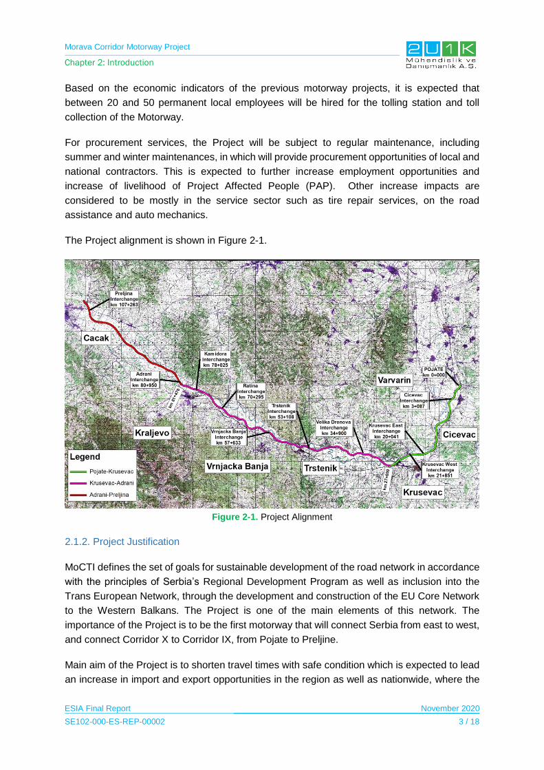
Morava Corridor Motorway Project
Chapter 2: Introduction
ESIA Final Report November 2020
SE102-000-ES-REP-00002 3 / 18
Based on the economic indicators of the previous motorway projects, it is expected that
between 20 and 50 permanent local employees will be hired for the tolling station and toll
collection of the Motorway.
For procurement services, the Project will be subject to regular maintenance, including
summer and winter maintenances, in which will provide procurement opportunities of local and
national contractors. This is expected to further increase employment opportunities and
increase of livelihood of Project Affected People (PAP). Other increase impacts are
considered to be mostly in the service sector such as tire repair services, on the road
assistance and auto mechanics.
The Project alignment is shown in Figure 2-1.
Figure 2-1. Project Alignment
2.1.2. Project Justification
MoCTI defines the set of goals for sustainable development of the road network in accordance
with the principles of Serbia’s Regional Development Program as well as inclusion into the
Trans European Network, through the development and construction of the EU Core Network
to the Western Balkans. The Project is one of the main elements of this network. The
importance of the Project is to be the first motorway that will connect Serbia from east to west,
and connect Corridor X to Corridor IX, from Pojate to Preljine.
Main aim of the Project is to shorten travel times with safe condition which is expected to lead
an increase in import and export opportunities in the region as well as nationwide, where the

Morava Corridor Motorway Project
Chapter 2: Introduction
ESIA Final Report November 2020
SE102-000-ES-REP-00002 4 / 18
domestic companies will have more opportunity to transport their goods and access to new
technologies. The Project is strategically significant for economic development and
investments in the region. The Project will also enable a connection between the municipal
centres Ćićevac, Varvarin, Kruševac, Trstenik, Vrnjačka Banja, Kraljevo and Čačak as well as
economic zones and tourist destinations in the region.
The Project will include construction of telecommunication infrastructure that will make the
Motorway a digital highway, with modern optical and digital cables, free Internet and
notifications to drivers for a safe traffic.
According to the Preliminary Economic Analysis and Feasibility Study2, the necessity of the
proposed Project (i.e., the goals of the realization of this project) is as follows:
• Reduce flood risk in the region;
• Improved employment in the Morava Valley with 9,950 employee by 2030;
• Increased tourism participation by 9% by 2025;
• Less time-consuming transportation from Pojate to Preljina (around 1 hr);
• Additional telecommunication connection for inhabitants;
• Overall Internal Rate of Return (IRR) of 7.75%, 7.91% and 13.49% for the three
Sections 1, 2 and 3 (see project overview for detailed information about road sections)
respectively;
• Toll revenue of €74.44m per year by 2044; and
• Accidents will reduce by over 50%.
The Project also has many indirect benefits such as facilitating access to tourist centres,
recreation and food facilities, development of health services and other recreational facilities.
Moreover, the Motorway will provide easy access to the regional market.
2.1.3. Project Overview
As shown in Figure 2-1 the Project comprises 3 sections including 9 sectors3 having different
lengths along each section. The Motorway runs parallel to the West Morava River, and all
sections of the Motorway mainly on the flat farmland of the West Morava River Plain.
Section-1 provides a connection between Ćićevac and Varvarin municipalities and the
city of Kruševac.
2 Preliminary Economic Analysis and Feasibility Study for the E-761 the Republic of Srpska border - Požega - Preljina – Pojate Highway Construction.
3 Different terminology is used in the construction contract with the Contractor.
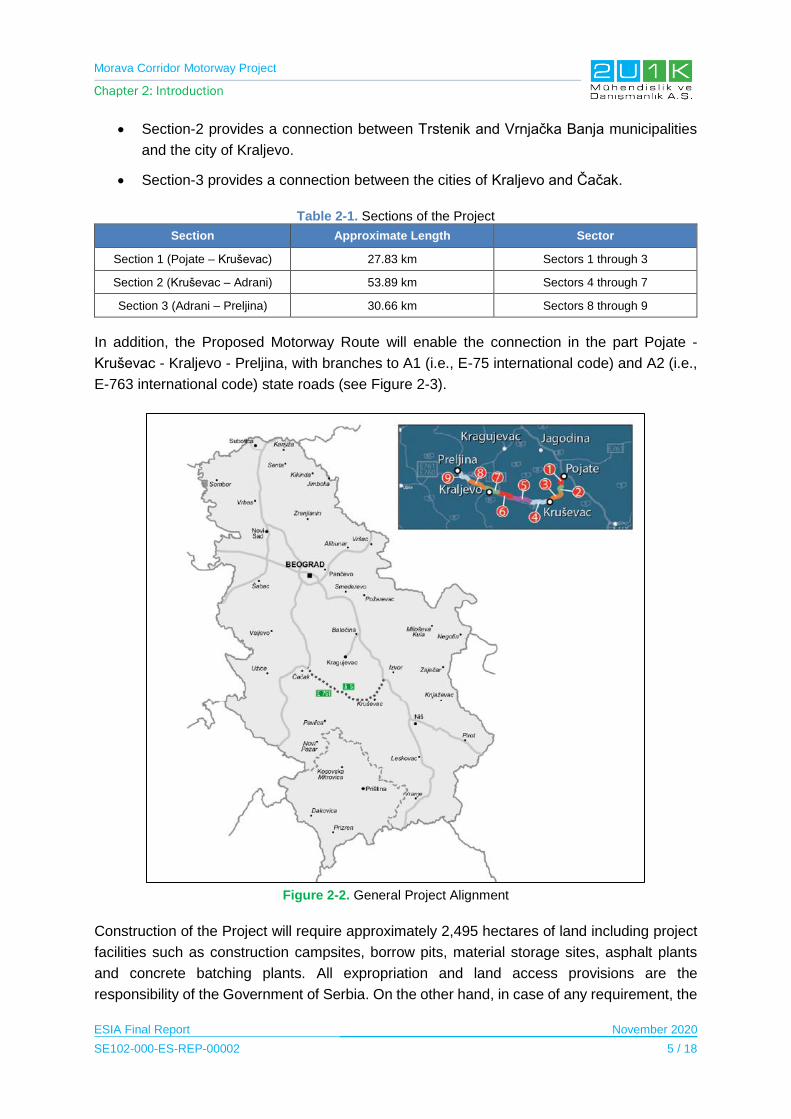
Morava Corridor Motorway Project
Chapter 2: Introduction
ESIA Final Report November 2020
SE102-000-ES-REP-00002 5 / 18
Section-2 provides a connection between Trstenik and Vrnjačka Banja municipalities
and the city of Kraljevo.
Section-3 provides a connection between the cities of Kraljevo and Čačak.
Table 2-1. Sections of the Project
Section Approximate Length Sector
Section 1 (Pojate – Kruševac) 27.83 km Sectors 1 through 3
Section 2 (Kruševac – Adrani) 53.89 km Sectors 4 through 7
Section 3 (Adrani – Preljina) 30.66 km Sectors 8 through 9
In addition, the Proposed Motorway Route will enable the connection in the part Pojate -
Kruševac - Kraljevo - Preljina, with branches to A1 (i.e., E-75 international code) and A2 (i.e.,
E-763 international code) state roads (see Figure 2-3).
Figure 2-2. General Project Alignment
Construction of the Project will require approximately 2,495 hectares of land including project
facilities such as construction campsites, borrow pits, material storage sites, asphalt plants
and concrete batching plants. All expropriation and land access provisions are the
responsibility of the Government of Serbia. On the other hand, in case of any requirement, the
Morava Corridor Motorway Project
Chapter 2: Introduction
ESIA Final Report November 2020
SE102-000-ES-REP-00002 6 / 18
Contractor will also buy or rent additional land(s) for project facilities required for the
construction.
The design and construction of the project is planned to be completed within four years. With
this intention, the design works have started in September 2019 and the mobilization works
started in April 2020 and it is planned that the earthworks will start in November 2020. It is
expected that all the works will be completed in October 2023. The average number of the
construction workers will be 3,100 and the peak number of the Project workers will be
approximately 3,800. The labour requirement for the construction of the Project will be primarily
sourced from local labour force and complemented by international workers. The operation
period of the Project is foreseen to be 22 years.
Initial phase of the Project was started in 2010. After that, Spatial Plan for the Special Purpose
Area of the E-761 Motorway Infrastructure Corridor, Section Pojate/Preljina (SPSPA) (Official
Gazette RS 84/10) was prepared by CIP. The SPSPA includes information on the purpose of
the Project, location, potential impacts, overview of the Project and its facilities and further
potential developments aligned with this Project. In 2013, the Regulation of Spatial Plan for
the Special Purpose Area of the E-761 Motorway Infrastructure Corridor, Section Pojate –
Preljina was adopted and has been put in force since November 08, 2013 (Official Gazette RS
98/13).
In line with the enforcement of the SPSPA, National Environmental Impact Assessment (EIA)
Reports for relevant sections (Section 1, Section 2 and Section 3) was prepared and received
an approval from related authorities. The Project’s official document, including the national
Strategic Environment Assessment4, was available for public review and participation for 30
days from May 14 to June 12, 2012 and the documents are still available in the archives of the
Republic Agency for Spatial Planning5.
After the flood event along West Morava River in 2014, The Jaroslav Černi Water Institute
(IJC) conducted a Hydrotechnical Study of E-761 Motoway Route, Section Pojate-Preljina to
re-determine the 100 years flood zone line. The study also proposed river regulation on the
West Morava River to protect the Project as well as settlements located in the West Morava
River Plain. As the outcome of this study, the alignment of the Project including over passes
on the West Morava River have been changed by considering the new 100 years flood zone
line. In this respect, the SPSPA was amended to include new alignment as well as river
diversion project, which resulted to update existing EIA Reports.
4 Soon after the adoption of the Spatial Plan for the Special Purpose Area of the E-761 Motorway Infrastructure Corridor, Section Pojate – Preljina and the SEA, there was a halt pending on the selection of strategic partner for this Project. In the spring of 2014, this region was hit by massive flooding which affected the whole country and this natural catastrophe provoked the necessity for changes in the Project documentation, especially related to hydrological situation. Institute “Jaroslav Černi“ was commissioned to perform a detailed hydrological study of the area of concern. The hydrotechnical study was completed in December 2016.
5 The Agency has was decommissioned in 2014, however, the link is still available. (See: http://195.222.96.93/index.php?kuda=dummy&sta=planovi&idplana=174 ).

Morava Corridor Motorway Project
Chapter 2: Introduction
ESIA Final Report November 2020
SE102-000-ES-REP-00002 7 / 18
This decision for the amendment of the SPSPA was publicly disclosed in the Official Gazette
of the Republic of Serbia (numbered 33/2017 and dated April 07, 2017). Following the Formal
Decision (2017), the Ministry of Construction, Transport and Infrastructure’s the Department
for Spatial Planning has organized early insight to the Spatial Plan for the Special Purpose
Area: the Plan for the E-761 Motorway Infrastructure Corridor, Section Pojate-Preljina.
In that regards, the draft version of the SPSPA that includes change in the alignment and river
diversion was available between the dates of August 30, 2017 to September 13, 2017 for a
public disclosure. The SPSPA was available at the website of the Ministry of Construction,
Transport and Infrastructure6 applewebdata://0A982FCD-13C9-4004-8852-CFDE1C23E5A6/
- _ftn3. The announcement and public invitation to citizens and interested public (also referred
as Notice on Public Insight) was being done through announcements in the media as well as
on the website of the Ministry of Construction, Transport and Infrastructure. Locally the public
invitation for Early Insight was disclosed on the website of the Municipality of Čačak7,
Municipality of Trstenik8 and Municipality of Varvarin9. The public invitation was accompanied
by a full set of documents available on-line. The received feedbacks from the stakeholders
were implemented and the draft version of the SPSPA went into revision process accordingly.
With the revisions being implemented the second draft version of the SPSPA was disclosed
with the Public for 30 days from July 18th to August 16th of 2019. The Disclosure was held in
the city halls of Kraljevo, Kruševac and Čačak, and the municipalities of Varvarin, Vrnjačka
Banja, Trstenik and Ćićevac, as well as on the MCTI website. The process for the SPSPA was
disclosed with the stakeholders through Public Participation Meeting (PPMs). The first PPM
was conducted on August 26, 2019. As a result, the feedback of the stakeholder was
implemented in the revision of the second Draft SPSPA.
The disclosure of the final version of the Spatial Plan for the Special Purpose Area of the E-
761 Motorway Infrastructure Corridor, Section Pojate/Preljina was held from November 04 to
November 18, 2019 in Kraljevo and Kruševac and Vrnjačka Banja and Trstenik as well as on
the MCTI website. The PPM was conducted on November 29, 2019. These concerns were
addressed by the relevant experts during the meeting and final version of the SPSPA is
currently being processed. In parallel to revision of the SPSPA, the EIA for Section-2 is being
revised to present the updated alignment of the Project. After the completion of final versions
of the SPSPA and the EIA report, Construction Permit for the Project will be obtained
accordingly.
6 http://www.mgsi.gov.rs/
7https://www.cacak.org.rs/Rani_javni_uvid_povodom_izrade_Izmena_i_dopuna_Prostornog_pl%D0%B0n%D0%B0_podrucj%D
0%B0_posebne_n%D0%B0mene_infrastrukturnog_koridora_autoputa_E_761_deonica_Pojate_%E2%80%93_Preljina-1-1-3597 8 http://www.trstenik.rs/index.php/aktuelnosti/1262
9 http://varvarin.org.rs/rani-javni-uvid/
Morava Corridor Motorway Project
Chapter 2: Introduction
ESIA Final Report November 2020
SE102-000-ES-REP-00002 8 / 18
2.2 National EIA Process
The main objectives of the national EIA study are to:
Identify existing bio-geo-physical and socio-economic conditions in the project area.
Describe the impacts (positive and negative) of the Project during construction and
operation periods.
Recommendations to eliminate, reduce or control the magnitude and significance of
identified impacts and propose plans and procedures to manage results, and
Incorporate the views and opinions of stakeholders, national and international
environmental regulations, laws and conventions related to proposed project activities
into the final project design from the EIA report review.
For the Morava Corridor Motorway Project, the preliminary design and national Environmental
Impact Assessment (EIA) studies were prepared for three sections by two different
consultants. The responsible consultants for the Project design and national EIA studies are
as follows:
Section-1 & 2: Institute of Transportation (CIP)
Section-3: Highways Institute
Separate National EIA Reports for each section of the Proposed Motorway Route had been
previously prepared, and approvals were received from related authorities. However, these
EIA Reports were revised due to the fact that, in the Spring of 2014, Serbia faced a tragic flood
disaster that has affected houses, infrastructure, livelihood, agriculture, and industries. The
Jaroslav Černi Water Institute (IJC), known as the leading research organization in Serbia's
water sector, conducted a hydrotechnical study in order to harmonize the Project (route and
facilities in the Proposed Motorway Route) with the regime of water, the existing water facilities
and the plans for water management. The objective of the Study was to present the changed
hydrological conditions (after floods of May 2014) and to provide the level of protection to the
Project from floods and erosion effects of watercourses. This study will harmonize the Project
with the regime of water, the existing water facilities and the water management plans. As a
result, a new location conditions were required within the scope of the Project, in order to
commence the national EIA for the revised Project, for all sections.
According to the national EIA consultants of Section-1 and Section-3, the updated EIA will not
have any difference in terms of horizontal design. However, the new EIA will have difference
in terms of vertical design due to hydrotechnical work. The alignment in Section-1 and Section-
3 was simply raised to accommodate these new flood levels. However, Section-2 required
large amounts of additional earthworks and was also moved horizontally to avoid the worst
flood areas.
Morava Corridor Motorway Project
Chapter 2: Introduction
ESIA Final Report November 2020
SE102-000-ES-REP-00002 9 / 18
Due to the design change of the Project, the EIA consultant for Section-2 waited for the new
location conditions that are provided from the Ministry for Environmental Protection to complete
the EIA studies.
The completion of the national EIA reports for Sections 1, 2 and 3, in accordance with the Law
on EIA, is expected to be completed by mid 2020. The diagram of the national EIA process is
given in Figure 2-3. For the purposes of the ESIA, all available information from the national
EIA studies has been assessed and incorporated where possible and appropriate.
The ESIA Report prepared for the Morava Corridor Motorway Project is based on the
information provided in Chapter 3 - Project Description. The design of the project is progressing
in parallel with the ESIA studies. Assessments made within the scope of this ESIA Report are
based on the most current design. On the other hand, the design and/or optimization of some
Project components (e.g. storage sites) are still on going. Other important data limitations
affecting the assessments made under this ESIA Report are summarized in Table 2-2.
Table 2-2. ESIA Limitations and Assumptions – include general and specific limitations and assumptions that have influenced the preparation of the ESIA
Chapter Contents Assumptions & Limitations regarding information from Contractor and Investor
Chapter 1 – Executive Summary
Provides an overview of the results of the environmental and social impact assessment studies carried out for the Project.
Also known as the Non Technical Summary.
NA10
Chapter 2 – Introduction
Presents a brief background to the proposed Project, Project rationale, the national EIA and international ESIA processes and the purpose and structure of the ESIA report.
Describes the ESIA Process followed for the proposed Motorway ESIA Project and the associated impact assessment methodology employed.
National EIA processes for Section-1 and 3 have been completed. On the other hand, completion of national EIA for Section-2 is expected to be completed by mid 2020.
Chapter 3 – Project Description
Describes the Area of Influence (AoI) and the proposed Project components, including an overview of ancillary infrastructure / Project activities.
Discusses the Project alternatives that have been considered in the ESIA process
Typical methods of construction and preliminary location of project facilities including camp sites, borrow pits, quarries, asphalt plants, concrete batching plants were used during the ESIA process. During the detailed design phase, these locations can be changed.
In addition, number of houses to be demolished were not certain yet (or at least that number was not provided us due the unavailability of EIA Report for Section 2).
The base map regarding all houses/buildings along the alignment of
10 Not Applicable

Morava Corridor Motorway Project
Chapter 2: Introduction
ESIA Final Report November 2020
SE102-000-ES-REP-00002 10 / 18
Chapter Contents Assumptions & Limitations regarding information from Contractor and Investor
the Proposed Motorway Route is not available yet. Therefore, broader maps (i.e. 1/25.000 or 1/50.000) and satellite images were used as background.
Chapter 4 – Legal Framework
Describes the legislative, policy and administrative requirements, as well as international good practise requirements applicable to the proposed Project.
Any changes/amendments to Serbian legal framework after 07.02.2020 will not be reflected in this report.
Legal requirements were determined using the standards below:
UKEF Requirements
MIGA Requirements
Equator Principles
IFC Performance Standards and Related Guidelines
Chapter 5 – Baseline Conditions
Provides a detailed baseline assessment of the physical environment (e.g. air, noise, water, etc.) and biological conditions in the AoI and surrounds.
Provides a detailed baseline assessment of the receiving socio-economic and health environment in the AoI and surrounds.
The content of the Gap Assessment for Scoping Report was taken into account during the preparation of the methodology of the baseline studies.
Route alignment provided in final version of the Spatial Plan for the Special Purpose Area of the E-761 Motorway Infrastructure Corridor, Section Pojate – Preljina is taken into consideration while writing environmental baseline conditions.
Some limitations (missing parts in Chapter-5) in the ESIA process is due to the fact that the EIA Report for Section-2 is not available.
Specific limitations for Chapter 5 are as follows;
The data on water supply and sewerage systems is not available for all affected settlements.
All settlements using private wells for water supply are not known and there is no information about the quality of drinking water from these wells.
There is no published landscape unit map for the project area. For this reason, the Digital Terrain Model (DTM) was used to describe the topography in the Project area.
The locations and capacities of the storage sites are not selected for all sections. Consequently, such components could not be included in the relevant assessments (e.g. air quality modelling) due to uncertainty of their locations.
For social baseline conditions, majority of the household surveys were interviewed with the local men, in order
Morava Corridor Motorway Project
Chapter 2: Introduction
ESIA Final Report November 2020
SE102-000-ES-REP-00002 11 / 18
Chapter Contents Assumptions & Limitations regarding information from Contractor and Investor
to bridge any gender-based gaps, Focus Groups Discussions were made with different type of local women groups (including farmers, elderly groups, unemployed, general population, Roma groups and young generations).
Chapter 6 – Impact Assessment
Presents the predicted impacts to the physical environment, biological environment and socio-economic as a result of the proposed Motorway.
Presents the management and mitigation recommendations.
Assessment is mainly based on the project description given in Chapter-3. In that respect, some of the detailed design parameters such as vertical alignment, exact numbers of the vehicle types, final location of the project facilities etc. are not fully known. Therefore, impact assessments are based on worst case scenarios. After finalization of the detailed design, locations which has significance impact can be re-evaluated by considering final design parameters.
Unpredictable impacts to be encountered during the implementation of the Project should be re-assessed.
Chapter 7 – Cumulative Impact Assessment
Presents the cumulative impacts that are a result of existing Projects in the broader AoI.
Limited and emergent, strategic regional, sectoral, or integrated resource planning schemes.
Lack of baseline data related to the other project developments.
Uncertainties associated with anticipated developments.
Chapter 8 – ESMMP Introduces the Environmental and Social Management and Monitoring Plan that present the mitigation measures for the identified environmental and social impacts with the proposed monitoring activities and responsible parties.
This ESMMP has been compiled to address the environmental and social impacts that are anticipated to occur as a result of the proposed project, as identified in the ESIA. As mentioned in the ESIA, the exact siting of certain Project infrastructure / activities (Construction Camps & Plant; and Quarries & Borrow Pits) are not yet completely determined. In addition, the national EIA reports for all Sections have not been received.
Accordingly, this ESMMP should not be regarded as complete or final, and requires a mechanism to manage change. This mechanism must ensure that changes to the scope of the proposed Project are subjected to a robust social and environmental assessment process. Any changes to Project scope or new substantive environmental and social findings will be evaluated for their degree of significance, and will be incorporated into the appropriate Project documentation as follows:
Minor changes will be reflected in updates to the ESMMP; and
Morava Corridor Motorway Project
Chapter 2: Introduction
ESIA Final Report November 2020
SE102-000-ES-REP-00002 12 / 18
Chapter Contents Assumptions & Limitations regarding information from Contractor and Investor
Substantive design changes that might potentially alter the ESIA findings (i.e. those that result in changes to the predicted significance of environmental and social impacts) will be subject to re-assessment, further stakeholder consultation, supplementary reporting and revision of the ESMMP.
Chapter 9 – Stakeholder Engagement
Summarises the stakeholder engagement activities undertaken for the ESIA Project to date.
No specific limit specified.
Chapter 10 – Conclusion and Recommendations
Summarises the key findings and recommendations of the ESIA.
NA
Chapter 11 - Appendices
Appendix-1 Gap Assessment for Scoping Report in April 2019
Appendix-2 Company Certifications and Qualifications
Appendix-3 Stakeholder Engagement Plan (SEP)
Appendix-4 National Legislation and International Standards
Appendix-5 Maps o 5.1 Location of Borrow Pits
Map o 5.2 Measurement Locations
Map o 5.3 Archaeological Points and
Heritage Buildings o 5.4 Soil Map o 5.5 Land Use Map o 5.6 Visibility Map o 5.7 Constraint Map
Appendix-6 Analysis Report
Appandix-7 Biodiversity Baseline Report
Appendix-8 Air Quality Modelling Report
Appendix-9 Acoustic Report
NA
Chapter 12 - References Contains a list of references used in compiling this ESIA Report.
NA

Morava Corridor Motorway Project
Chapter 2: Introduction
ESIA Final Report November 2020
SE102-000-ES-REP-00002 13 / 18
Figure 2-3. EIA Procedure in Serbia
Morava Corridor Motorway Project
Chapter 2: Introduction
ESIA Final Report November 2020
SE102-000-ES-REP-00002 14 / 18
2.3 ESIA Process
The Project is planned to be funded by various international financial institutions (IFI), which
require an Environmental and Social Impact Assessment (ESIA) Report. With this intention,
the Project is committed to follow the Equator Principles, IFC performance standards on
environmental and social sustainability (2012), Environmental and Social Standards (ESSs) of
the World Bank Group as well as international environmental and social guidelines and
standards in addition to the relevant national environmental legislation and regulations.
The Government of Serbia requested the Contractor for assistance with the procurement,
appointment and management of the ESIA Consultant to support the finance loan approval of
the proposed Project. The Contractor has (on behalf of Government of Serbia) appointed 2U1K
Engineering & Consulting Inc. (2U1K) as an independent environmental and social consultant
to undertake an ESIA for the proposed Project.
The main objectives of this ESIA report are to present the following:
A detailed description of the proposed Project and relevant Project alternatives;
The ESIA process and a detailed legal register of legislation, guidelines and strategies
(both national and international) pertinent to the proposed Project and associated
ESIA;
The outcomes associated with stakeholder engagement activities carried out to date;
A detailed baseline review of the physical, biological and socio-economic
characteristics of the AoI (Area of Influence) and surrounds;
An assessment of impacts to the physical, biological and socio-economical
environments related with the different phases (pre-construction, construction and
operational phases) of the proposed Motorway;
Mitigation measures and associated management plans that aim to avoid
/minimise/manage the severity of identified impacts; and
An assessment of cumulative impacts associated with other planned, existing or
project-related developments in the broader AoI.
To ensure that stakeholders are fully informed and that decision-makers evaluate both
the negative and positive environmental and social impacts, when deciding to
continue the project or not.
The ESIA process started with the gap assessment phase according to the internationally
accepted and implemented impact assessment procedures. The findings of the studies were
documented in the Gap Assessment for Scoping Report in April 2019 (see Appendix-1).
After completion of the gap assessment phase, following key activities were performed within
the scope of the ESIA process.
Morava Corridor Motorway Project
Chapter 2: Introduction
ESIA Final Report November 2020
SE102-000-ES-REP-00002 15 / 18
Re-definition of the project facilities and activities,
Identification of the project Area of Influence with respect to redefinition of the project
facilities and activities,
Identification of project stakeholders (focusing on directly affected ones) and
engagement,
Collecting environmental and social baseline data through field studies,
Impact identification, estimation and analysis,
Establishment of mitigation or management measures and actions,
Assessing the significance of impacts and residual effects.
The key stages for the ESIA Report are explained in Table 2-3.
Table 2-3. Key Stages for the ESIA Report
ESIA Stage Description
Gap Assessment for Scoping Report
This study was conducted in April 2019 to identify technical stakeholders involved to the process gaps between local EIA studies and ESIA requirements according to international finance institutions.
Environmental and Social Baseline
Outlines the existing physical, biological, social and cultural baseline characteristics in the Project’s Area of Influence are described environmental and social baseline studies conducted for the Project as well as including physical, biological and socio economic baseline.
Impact Assessment
Describes the methodology used for the assessment of impacts associated with the Project, as well as the process followed to identify mitigation and enhancement measures and then assign residual impact significance. The results of the impact assessment are then presented under the following impact headings.
ESMMP Introduces the Environmental and Social Management and Monitoring Plan (ESMMP) that present the mitigation measures for the identified environmental and social impacts with the proposed monitoring activities and responsible parties.
Stakeholder Engagement Plan
Outlines stakeholder engagement approach for the Project, defines stakeholder identification, presents previous and planned stakeholder engagement activities.
Resettlement and Livelihood Restoration Framework
This document frames the national and international legal requirements, gaps between them, defines roles and responsibilities and actions to be taken to fill the gaps according to roles of the institutions.
2.3.1 International ESIA Consultants
The ESIA was conducted by a highly qualified and experienced team of national and
international experts under the coordination of the lead ESIA consultant, 2U1K. All company
certifications and qualifications are provided in Appendix-2.
2U1K was supported by HPC France and its local consulting company (ENACTA Ltd.)
(Beograd/Serbia), mainly for environmental baseline data collection and Niš University
lecturers and SeConS Development Initiative Group for social baseline studies. In addition, for
environmental measurements and modelling studies, 2U1K had support from SEGAL
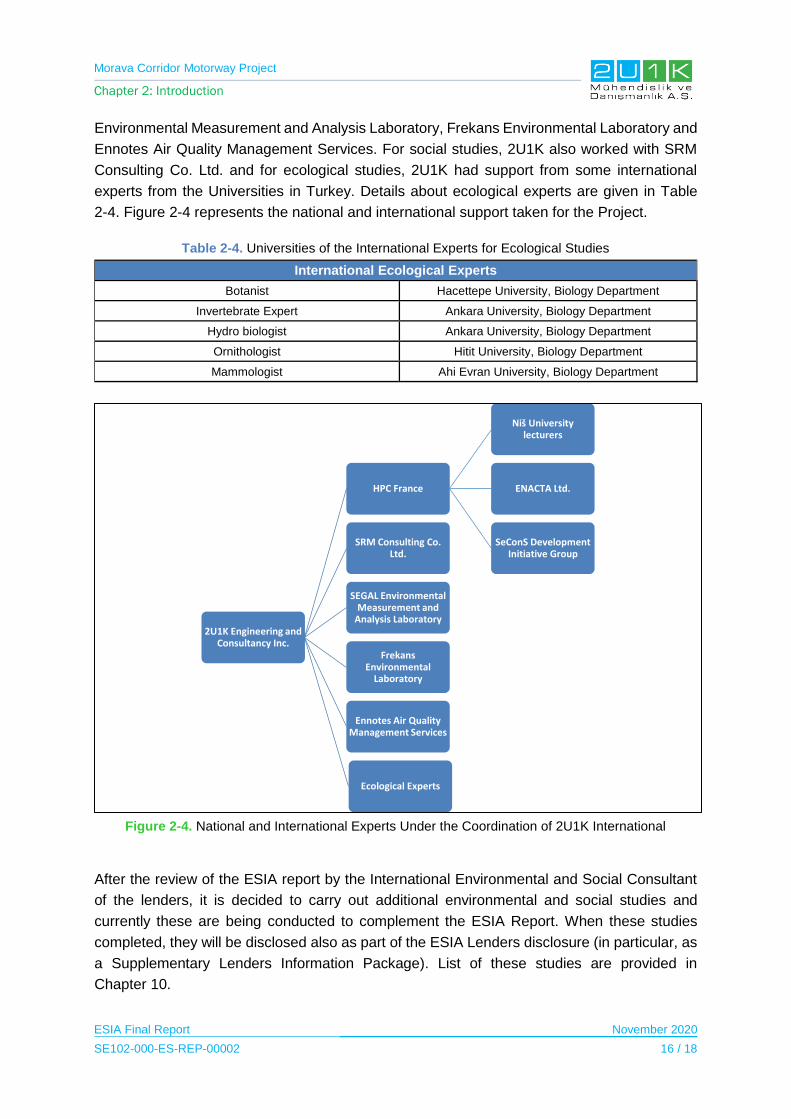
Morava Corridor Motorway Project
Chapter 2: Introduction
ESIA Final Report November 2020
SE102-000-ES-REP-00002 16 / 18
Environmental Measurement and Analysis Laboratory, Frekans Environmental Laboratory and
Ennotes Air Quality Management Services. For social studies, 2U1K also worked with SRM
Consulting Co. Ltd. and for ecological studies, 2U1K had support from some international
experts from the Universities in Turkey. Details about ecological experts are given in Table
2-4. Figure 2-4 represents the national and international support taken for the Project.
Table 2-4. Universities of the International Experts for Ecological Studies
International Ecological Experts
Botanist Hacettepe University, Biology Department
Invertebrate Expert Ankara University, Biology Department
Hydro biologist Ankara University, Biology Department
Ornithologist Hitit University, Biology Department
Mammologist Ahi Evran University, Biology Department
Figure 2-4. National and International Experts Under the Coordination of 2U1K International
After the review of the ESIA report by the International Environmental and Social Consultant
of the lenders, it is decided to carry out additional environmental and social studies and
currently these are being conducted to complement the ESIA Report. When these studies
completed, they will be disclosed also as part of the ESIA Lenders disclosure (in particular, as
a Supplementary Lenders Information Package). List of these studies are provided in
Chapter 10.
2U1K Engineering and Consultancy Inc.
HPC France
Niš University lecturers
ENACTA Ltd.
SeConS Development Initiative Group
SRM Consulting Co. Ltd.
SEGAL Environmental Measurement and
Analysis Laboratory
Frekans Environmental
Laboratory
Ennotes Air Quality Management Services
Ecological Experts
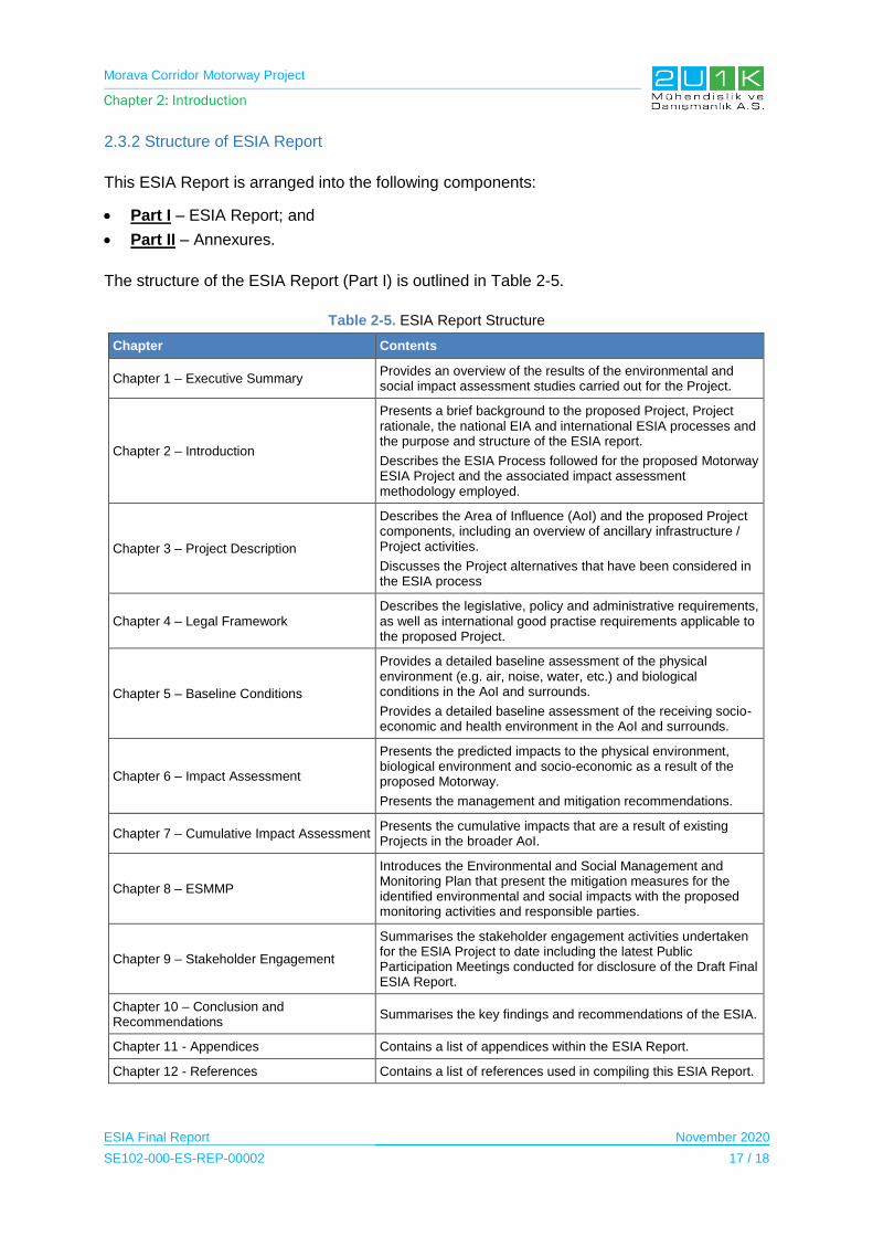
Morava Corridor Motorway Project
Chapter 2: Introduction
ESIA Final Report November 2020
SE102-000-ES-REP-00002 17 / 18
2.3.2 Structure of ESIA Report
This ESIA Report is arranged into the following components:
Part I – ESIA Report; and
Part II – Annexures.
The structure of the ESIA Report (Part I) is outlined in Table 2-5.
Table 2-5. ESIA Report Structure
Chapter Contents
Chapter 1 – Executive Summary Provides an overview of the results of the environmental and social impact assessment studies carried out for the Project.
Chapter 2 – Introduction
Presents a brief background to the proposed Project, Project rationale, the national EIA and international ESIA processes and the purpose and structure of the ESIA report.
Describes the ESIA Process followed for the proposed Motorway ESIA Project and the associated impact assessment methodology employed.
Chapter 3 – Project Description
Describes the Area of Influence (AoI) and the proposed Project components, including an overview of ancillary infrastructure / Project activities.
Discusses the Project alternatives that have been considered in the ESIA process
Chapter 4 – Legal Framework Describes the legislative, policy and administrative requirements, as well as international good practise requirements applicable to the proposed Project.
Chapter 5 – Baseline Conditions
Provides a detailed baseline assessment of the physical environment (e.g. air, noise, water, etc.) and biological conditions in the AoI and surrounds.
Provides a detailed baseline assessment of the receiving socio-economic and health environment in the AoI and surrounds.
Chapter 6 – Impact Assessment
Presents the predicted impacts to the physical environment, biological environment and socio-economic as a result of the proposed Motorway.
Presents the management and mitigation recommendations.
Chapter 7 – Cumulative Impact Assessment Presents the cumulative impacts that are a result of existing Projects in the broader AoI.
Chapter 8 – ESMMP
Introduces the Environmental and Social Management and Monitoring Plan that present the mitigation measures for the identified environmental and social impacts with the proposed monitoring activities and responsible parties.
Chapter 9 – Stakeholder Engagement
Summarises the stakeholder engagement activities undertaken for the ESIA Project to date including the latest Public Participation Meetings conducted for disclosure of the Draft Final ESIA Report.
Chapter 10 – Conclusion and Recommendations
Summarises the key findings and recommendations of the ESIA.
Chapter 11 - Appendices Contains a list of appendices within the ESIA Report.
Chapter 12 - References Contains a list of references used in compiling this ESIA Report.
Morava Corridor Motorway Project
Chapter 2: Introduction
ESIA Final Report November 2020
SE102-000-ES-REP-00002 18 / 18
The ESIA Report is supported by the following appendices:
APPENDIX – 1 Gap Assessment for Scoping Report in April 2019
APPENDIX – 2 Company Certifications and Qualifications
APPENDIX – 3 Stakeholder Engagement Plan
APPENDIX – 4 National Legislation and International Standards
APPENDIX – 5 Maps
o APPENDIX – 5.1 Location of Borrow Pits Map
o APPENDIX – 5.2 Measurement Locations Map
o APPENDIX – 5.3 Archaeological Points and Heritage Buildings Maps
o APPENDIX – 5.4 Soil Map
o APPENDIX – 5.5 Land Use Map
o APPENDIX – 5.6 Visibility Map
o APPENDIX – 5.7 Constraint Map
APPENDIX – 6 Analysis Report
APPENDIX – 7 Biodiversity Baseline Report
APPENDIX – 8 Air Quality Modelling Report
APPENDIX – 9 Acoustic Report
APPENDIX – 10 Hydrotechnical Regulation of the Zapadna Morava River within the
Infrastructure Corridor of Highway E-761
APPENDIX – 11 Detailed Critical Habitat Assessment
APPENDİX – 12 Environment and Social Management System Framework
Morava Corridor Motorway Project
Chapter 3: Project Description
ESIA Final Report November 2020
SE102-000-ES-REP-00002 1 / 89
3 PROJECT DESCRIPTION
This Chapter provides an overview of the key elements of the Morava Corridor Motorway
Project. Government of Serbia is the owner of the Project (represented by the Ministry of
Finance as the borrower) and the Ministry of Construction, Transport and Infrastructure,
represented by the Corridors of Serbia (CoS) is the implementing entity including land access
and expropriation. Construction of the Project will be conducted by Bechtel ENKA UK Limited
that is called as the Contractor.
Public Enterprise Roads of Serbia (RoS) is responsible entity for operation of the Motorway
which includes, maintenance and preservation, exploitation, construction, reconstruction,
organization and control of toll collection, development and management of I and II category
state roads in the Republic of Serbia.
The Project information used for the Environmental and Social Impact Assessment (ESIA)
studies is based on the preliminary design provided by the Employer and the Contractor for
the preparation of the ESIA and does not include any subsequent design changes during
detailed design phase.
The Contractor is responsible for the detailed design and construction of the Project. Any
design changes required as a result of the ESIA studies will be incorporated into the Project
as part of a Change Management Procedure to be prepared and implemented by the
Contractor according to their quality management system requirements.
3.1 Project Development and Project Alternatives
Project development phase of the Morava Corridor Motorway Project has been started in 2008.
At the initial design phase of the Project, general topographical condition of the West Morava
River valley is considered mainly for the identification of route options. The hills bounding the
North and South of the West Morava River valley limit the potential route option for the Project
in terms of constructability regarding physical, environmental and financial point of views. The
West Morava River together with the high number of settlements located along the river basin
is other limiting factors for the Project route selection. In addition to these limiting factors,
several variation options are considered from aspects to assess whether there are other
feasible options that will result in less significant impacts during the development of the Project.
Other factors considered in the route selection processes are to i) avoid settlements as much
as possible to minimize resettlement; ii) avoid natural and archaeological protected areas; and
iii) comply with technical design specifications considering topographical and hydrological
conditions of the basin. The whole process starting with the route selection, selection of
intersection locations and selection of project facilities’ locations are comprehensively carried
out in order to avoid and minimize the potential impacts as much as practical.
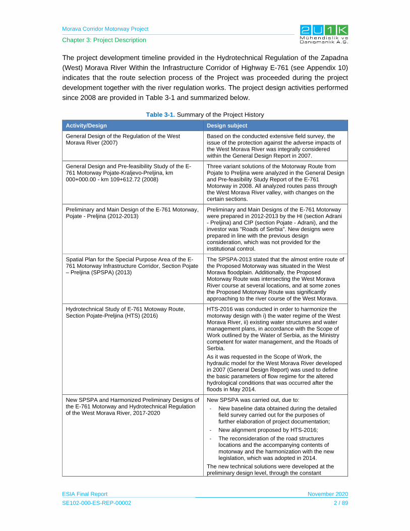
Morava Corridor Motorway Project
Chapter 3: Project Description
ESIA Final Report November 2020
SE102-000-ES-REP-00002 2 / 89
The project development timeline provided in the Hydrotechnical Regulation of the Zapadna
(West) Morava River Within the Infrastructure Corridor of Highway E-761 (see Appendix 10)
indicates that the route selection process of the Project was proceeded during the project
development together with the river regulation works. The project design activities performed
since 2008 are provided in Table 3-1 and summarized below.
Table 3-1. Summary of the Project History
Activity/Design Design subject
General Design of the Regulation of the West Morava River (2007)
Based on the conducted extensive field survey, the issue of the protection against the adverse impacts of the West Morava River was integrally considered within the General Design Report in 2007.
General Design and Pre-feasibility Study of the E-761 Motorway Pojate-Kraljevo-Preljina, km 000+000.00 - km 109+612.72 (2008)
Three variant solutions of the Motorway Route from Pojate to Preljina were analyzed in the General Design and Pre-feasibility Study Report of the E-761 Motorway in 2008. All analyzed routes pass through the West Morava River valley, with changes on the certain sections.
Preliminary and Main Design of the E-761 Motorway, Pojate - Preljina (2012-2013)
Preliminary and Main Designs of the E-761 Motorway were prepared in 2012-2013 by the HI (section Adrani - Preljina) and CIP (section Pojate - Adrani), and the investor was "Roads of Serbia". New designs were prepared in line with the previous design consideration, which was not provided for the institutional control.
Spatial Plan for the Special Purpose Area of the E-761 Motorway Infrastructure Corridor, Section Pojate – Preljina (SPSPA) (2013)
The SPSPA-2013 stated that the almost entire route of the Proposed Motorway was situated in the West Morava floodplain. Additionally, the Proposed Motorway Route was intersecting the West Morava River course at several locations, and at some zones the Proposed Motorway Route was significantly approaching to the river course of the West Morava.
Hydrotechnical Study of E-761 Motoway Route, Section Pojate-Preljina (HTS) (2016)
HTS-2016 was conducted in order to harmonize the motorway design with i) the water regime of the West Morava River, ii) existing water structures and water management plans, in accordance with the Scope of Work outlined by the Water of Serbia, as the Ministry competent for water management, and the Roads of Serbia.
As it was requested in the Scope of Work, the hydraulic model for the West Morava River developed in 2007 (General Design Report) was used to define the basic parameters of flow regime for the altered hydrological conditions that was occurred after the floods in May 2014.
New SPSPA and Harmonized Preliminary Designs of the E-761 Motorway and Hydrotechnical Regulation of the West Morava River, 2017-2020
New SPSPA was carried out, due to:
- New baseline data obtained during the detailed field survey carried out for the purposes of further elaboration of project documentation;
- New alignment proposed by HTS-2016;
- The reconsideration of the road structures locations and the accompanying contents of motorway and the harmonization with the new legislation, which was adopted in 2014.
The new technical solutions were developed at the preliminary design level, through the constant
Morava Corridor Motorway Project
Chapter 3: Project Description
ESIA Final Report November 2020
SE102-000-ES-REP-00002 3 / 89
Activity/Design Design subject
harmonization of the motorway design and hydrotechnical structure design on the West Morava River.
Design for the Construction Permit (DCP) for Hydrotechnical Works and Structures (2020)
The preparation of DCP-2020 is in progress. According to the time schedule, the design for Section-1 will be completed during May 2020. Upon the performed technical review, which is mandatory under the Law on Planning and Construction, the investor will receive a construction permit. The design for Section-3 will be finalized by the end of May 2020, and the construction permit is expected at the end of June 2020. The drafting of the Section-2 design will follow the acceptance of the Preliminary Design, for the same sector, by the National Review Commission.
a) General Design and Pre-feasibility Study of the E-761 Motorway Pojate-Kraljevo-Preljina
General Design and Pre-feasibility Study Report (GDPFSR) was prepared by the Highway
Institute (HI) from Belgrade for the investor "Roads of Serbia" in 2008. Three route variations
for the Proposed Motorway, between Pojate and Preljina, were analyzed in the GDPFSR-2008.
All the route variations were located in the West Morava River valley with variations on the
certain sections. It was seen that the negative impacts of flood on the Proposed Motorway’s
construction and operation were not considered during the identification of the alternative
options. Additionally, GDPFSR was not including the investment calculations for the protection
measures required for the negative impacts of the river system.
b) Preliminary and Main Design of the E-761 Motorway Pojate – Preljina
Preliminary and Main Designs of the E-761 Motorway Report (PMDR) were prepared between
the years 2012 and 2013 by the HI (section Adrani - Preljina) and CIP (section Pojate – Adrani)
for the investor Roads of Serbia. In the PMDR, the route designs were prepared in accordance
to the previous Law on Planning and Construction (LPC), which was amended in 2016, and
the designs were not submitted to revision or technical control. The Environmental Impact
Assessment (EIA) Studies have not been prepared for the drafted PMDR. Only for the section
between Pojate and Kruševac, the Ministry of Environmental Protection provided the scope
and the content of the EIA Study.
In the new design, several opinions developed by PWMC Srbijavode and Republic
Hydrometeorological Service of Serbia (RHMS) was considered in order to minimize the
hydrological impacts. In the study, surface elevation of the Proposed Motorway Route was
determined based on the hundred year flood return period calculation (Q100) performed in 2007
(General Design of the regulation of the West Morava River, 2007).
In the PMDR, the Proposed Motorway Route defined in 2008 was significantly changed. One
of the major changes was observed on the increased number of river crossings. For example,
3 bridge crossing proposed in 2008 was increased to 6 bridges in the 2012 design. Therefore,
depending on the route changes, impact of the Motorway on the West Morava River was
Morava Corridor Motorway Project
Chapter 3: Project Description
ESIA Final Report November 2020
SE102-000-ES-REP-00002 4 / 89
increased, whereas the impact of the West Morava River on the Motorway was increased as
well. Consequently, investment cost of the Motorway was increased depending on 2012
design.
c) Spatial Plan for the Special Purpose Area for the E-761 Motorway Infrastructure Corridor
Spatial Plan for the Special Purpose Area (SPSPA) for the Motorway in 2013 was based on
the route option developed in the revised PMDR that was in the drafting phase. And, SPSPA-
2013 was concluded that:
The embankments, which are proposed to control floodwaters and to protect the
settlements and economic activities located in flood basin, were partially built along the
course of the West Morava River. In other words, the embankments were constructed
partially in the zone of larger settlements and zone of low coastal terrain where the
impact of floods was at maximum level. By considering the Proposed Motorway Route,
it was seen that the route crossed almost the entire floodplain zone of the West Morava
River. Due to that reason, surface elevation of the Motorway should be raised above
the flood level.
The Proposed Motorway Route was intersecting at several location with the course of
the West Morava River whereas at one location with the course of South Morava River.
Additionally, at some zones, the Proposed Motorway Route was significantly
approaching to the course of the West Morava River.
Consequently, it has been emphasized that all activities on the harmonization of proposed
motorway infrastructure with water management infrastructure should be performed with the
approval and control of the competent authorities for water management.
d) Hydrotechnical Study of E-761 Motorway Corridor, Section Pojate-Preljina in line with
SPSPA-2013
As the outcome of the SPSPA-2013, a specific study, named as Hydrotechnical Study of E-
761 Motorway Corridor Section Pojate-Preljina (HTS), was conducted in 2016 to harmonize
the motorway design with the i) water regime of the West Morava River, ii) existing water
facilities, and iii) water management plans.
HTS-2016 was prepared by Jaroslav Černi Water Institute (JCWI) in accordance to the
contract signed with Roads of Serbia, and with Scope of Work agreed upon by PWMC
Srbijavode, and the Ministry competent for water management.
Agreed Scope of Work for HTS-2016 dictated that the hydraulic model for the West Morava
River developed in 2007 should be used to define the basic parameters of flow regime by
considering the altered hydrological conditions after the floods in May 2014.
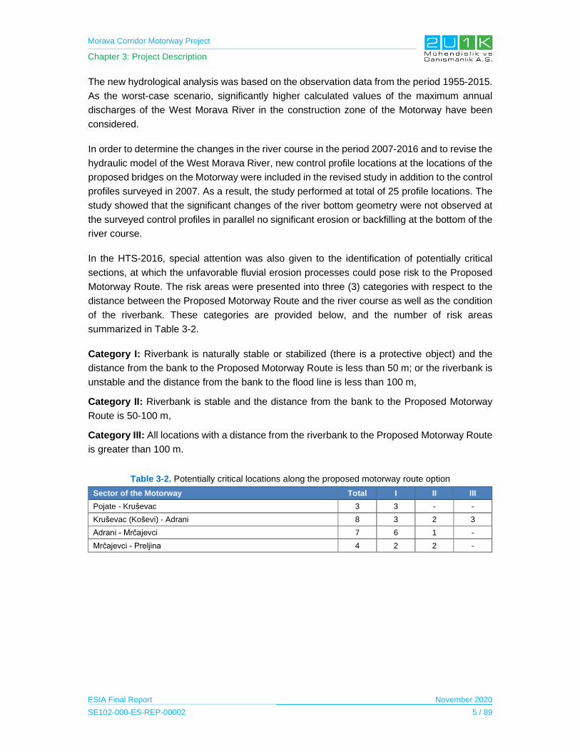
Morava Corridor Motorway Project
Chapter 3: Project Description
ESIA Final Report November 2020
SE102-000-ES-REP-00002 5 / 89
The new hydrological analysis was based on the observation data from the period 1955-2015.
As the worst-case scenario, significantly higher calculated values of the maximum annual
discharges of the West Morava River in the construction zone of the Motorway have been
considered.
In order to determine the changes in the river course in the period 2007-2016 and to revise the
hydraulic model of the West Morava River, new control profile locations at the locations of the
proposed bridges on the Motorway were included in the revised study in addition to the control
profiles surveyed in 2007. As a result, the study performed at total of 25 profile locations. The
study showed that the significant changes of the river bottom geometry were not observed at
the surveyed control profiles in parallel no significant erosion or backfilling at the bottom of the
river course.
In the HTS-2016, special attention was also given to the identification of potentially critical
sections, at which the unfavorable fluvial erosion processes could pose risk to the Proposed
Motorway Route. The risk areas were presented into three (3) categories with respect to the
distance between the Proposed Motorway Route and the river course as well as the condition
of the riverbank. These categories are provided below, and the number of risk areas
summarized in Table 3-2.
Category I: Riverbank is naturally stable or stabilized (there is a protective object) and the
distance from the bank to the Proposed Motorway Route is less than 50 m; or the riverbank is
unstable and the distance from the bank to the flood line is less than 100 m,
Category II: Riverbank is stable and the distance from the bank to the Proposed Motorway
Route is 50-100 m,
Category III: All locations with a distance from the riverbank to the Proposed Motorway Route
is greater than 100 m.
Table 3-2. Potentially critical locations along the proposed motorway route option
Sector of the Motorway Total I II III
Pojate - Kruševac 3 3 - -
Kruševac (Koševi) - Adrani 8 3 2 3
Adrani - Mrčajevci 7 6 1 -
Mrčajevci - Preljina 4 2 2 -
Morava Corridor Motorway Project
Chapter 3: Project Description
ESIA Final Report November 2020
SE102-000-ES-REP-00002 6 / 89
Other technical considerations in the hydromorphological model are given below;
1D hydraulic calculation of the Q100 level for quasi steady-state conditions was
performed in HEC RAS software in order to determine the impact of facility on the water
regime of the West Morava River. In the study, two states of the West Morava River
were modelled. These states were i) the existing state of the West Morava River Basin
and ii) the new state regarding construction of the Proposed Motorway.
In general, the hydromorphological model of the current status of the West Morava
River was taken from the 2007 report, i) with the replacement and addition of the cross-
section profiles with new surveys and ii) the minor route changes due to the occurrence
of meander cut-off. Due to the use of the new data of detailed geodetic surveys along
the motorway route and connecting roads, the topography of river inundation zones
was defined in more detail than 2007.
The hydromorphological model regarding the new status of the West Morava River
Basin was made by including all designed facilities in addition to the existing state. With
this intention, the Proposed Motorway Route with 8 bridges, access roads, loops and
river regulation works proposed for the West Morava River were included in the
modelling study. The existing embankments were also included, but with the
assumption that their reconstruction was carried out by considering the conditions of
Q100 in order to not have an overflow.
The study concluded that:
- The designed route of the Proposed Motorway was located, almost on its entire
length, through the valleys of the Great, South and the West Morava and Čemernica
Rivers. The Proposed Motorway Route is mostly located in the real flood zones, and
the lesser extent in flood-protected areas (i.e. in potentially flood zones);
- The flood zones of the West Morava River for the existing and designed states are
very similar. Although the major part of the Proposed Motorway Route was located
in the floodplain, the Motorway did not block the flood. Therefore, the flood was
expected on both sides of the Proposed Motorway;
- Surface elevation of the Proposed Motorway, in general immediate vicinity of the
West Morava River, should be high enough to provide a protection from estimated
Q100 level. It was estimated that the minimum freeboard of 1 m above the flood level
calculated for Q100. It was also concluded that longitudinal position together with
other project structures of the Proposed Motorway and the changed hydrological
conditions of the West Morava River after the big flood event occurred in 2014
should be taken into account;
- The study indicated that several critical locations, where the West Morava River and
the Proposed Motorway Route intersect (i.e. the connecting roads), were required
Morava Corridor Motorway Project
Chapter 3: Project Description
ESIA Final Report November 2020
SE102-000-ES-REP-00002 7 / 89
to be changed due to design considerations such as bridge angle, width of the bridge
opening, position of access roads etc.
- The Proposed Motorway Route was getting closer to the main river course at several
localities, of which many of them were critical due to the high instability of the
watercourse.
- The materials required for the construction of motorway body could be provided by
dredging from the riverbed of West Morava River. According to the PHD-2012
Report, about 20,000,000 m3 of material was required for the construction of the
Proposed Motorway and other infrastructures.
e) Final SPSPA and the Harmonized Preliminary Designs of the E-761 Motorway and
Regulation of the West Morava River
In 2017, SPSPA-2013 was amended due to following reasons;
The harmonization of the SPSPA-2013 in line with the outcomes of the HTS-2016.
The results of the detailed field surveys were required to be elaborated to technical
documentations.
The review of the Proposed Motorway Route together with locations of the road
facilities in accordance to the new LPC legislation which was adopted in 2014.
For the amendment of the SPSPA, at first stage, the issues identified in the HTS-2016 have
been elaborated and the new technical solutions were provided at the level of preliminary
design, through the process of harmonization of the proposed motorway design and design of
the hydrotechnical facilities required for the regulation of the West Morava River. In this
respect;
- New Preliminary Highway Designs (PHDs) were prepared by; i) CIP, for Sections 1
and 2, and ii) by HI, for Section 3, in accordance to the contracts signed with Roads
of Serbia. In the new PHDs, technical solutions were defined in several phases, and
the Motorway Route was subjected to significant changes in terms of the route
location, location and shape of the interchanges, location of the parking and rest
areas, as well as location of the road maintenance facilities.
- Preliminary Design of Hydrotechnical regulation of the West Morava River along the
E-761 Motorway route (PDHTR) was prepared by the JCWI, under a separate
contract with Roads of Serbia. The general goal of the PDHTR was to choose the
optimal solution for the watercourse and coastal regulation, which will minimize the
negative impacts of the proposed motorway construction on the water regime in the
basin and, at the same time, provide a quantitative estimation for the material
required for the construction of the Proposed Motorway. In PDHTR, in parallel to the
proposed motorway design, works and measures required for the regulation of
watercourse and for the coastal protection in several phases were predicted. In order
Morava Corridor Motorway Project
Chapter 3: Project Description
ESIA Final Report November 2020
SE102-000-ES-REP-00002 8 / 89
to perform of the hydraulic calculations in the PDHTR, the hydraulic model from the
HTS-2016 was revised by inclusion of the new location of motorway project facilities.
After that, the new locations of the project facilities were also changed and adapted.
PHD-2012 indicated that the most significant interactions between the Proposed Motorway
Route and the river system were estimated at the Proposed Motorway Section-2 between
Kruševac and Adrani. According to the PHD-2012, in this sector, the Proposed Motorway was
guided in a high embankment through the floodplain zone of the West Morava. Several critical
localities that have negative interactions were identified. In order to solve the problems at these
locations, two phased approach has been performed.
At first phase, CIP has developed a new PHD along the same route regarding the change of
surface elevation of the Proposed Motorway and interchanges in line with the
recommendations of the hydraulic design engineers. At the same time, as the hydrotechnical
design, construction of the flood relief channels for the discharge of flood of the West Morava
River was analyzed with inclusion of inflow, outflow and stabilization facilities, in order to i)
reduce the impact of the Proposed Motorway, ii) lower the Q100 level and iii) provide material
for backfilling of the proposed motorway main body.
As it is given in the Figure 3-3, the flood relief channels were located adjacent to the Proposed
Motorway, in order to direct use of the excavated material from the channel excavation in the
motorway construction. Six flood relief channels have been designed between Čitluk near
Kruševac and the mouth with Ibar River, with a total length of about 26 km. The channels had
a trapezoidal cross-section, about 100 m wide at bottom level and with an average depth of
about 4 m. The channels were supposed to be connected with the West Morava River only
when the Q100 appears. As the design, the channels were regulated by the inflow and outflow
structures located at both end of the channels. In the design of flood relief channel system,
LIDAR survey of the river valley was performed and the existing 1D hydraulic model was
updated.
A meeting was held on 25th of May 2018 by the Government of Serbia in order to determine
the status of preparation of the technical documentation. The Commission concluded that the
motorway solution from Kruševac to Adrani with the route in the West Morava valley was not
sustainable due to the high flood risk and the need for a large amount of filling material. The
commission requested development of a new variant option located outside of the floodplain,
regardless of the high cost of the new exploration works and of the new design.
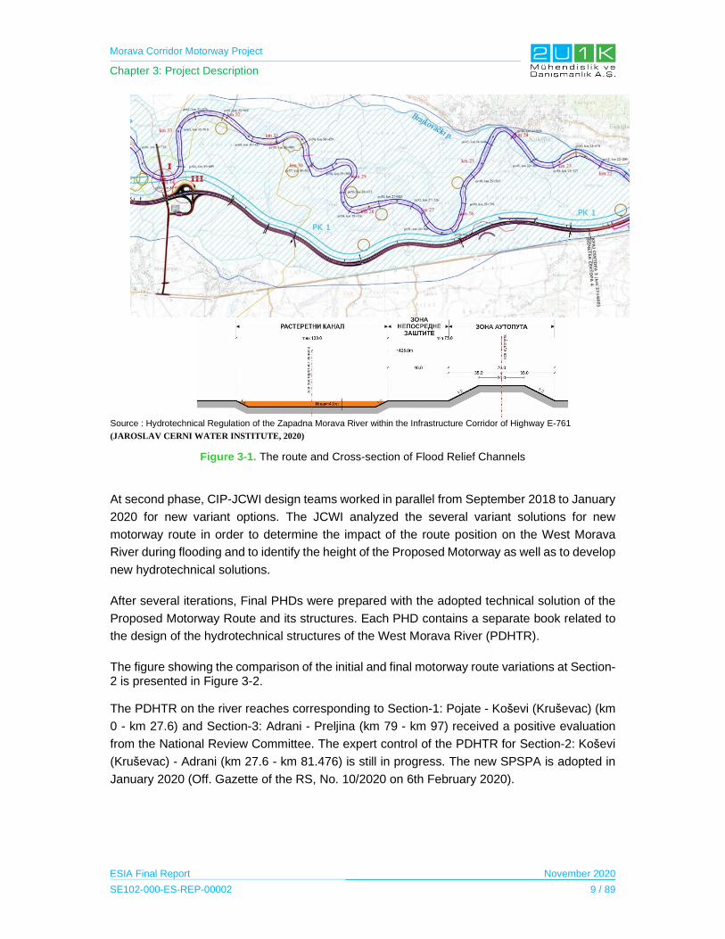
Morava Corridor Motorway Project
Chapter 3: Project Description
ESIA Final Report November 2020
SE102-000-ES-REP-00002 9 / 89
Source : Hydrotechnical Regulation of the Zapadna Morava River within the Infrastructure Corridor of Highway E-761
(JAROSLAV CERNI WATER INSTITUTE, 2020)
Figure 3-1. The route and Cross-section of Flood Relief Channels
At second phase, CIP-JCWI design teams worked in parallel from September 2018 to January
2020 for new variant options. The JCWI analyzed the several variant solutions for new
motorway route in order to determine the impact of the route position on the West Morava
River during flooding and to identify the height of the Proposed Motorway as well as to develop
new hydrotechnical solutions.
After several iterations, Final PHDs were prepared with the adopted technical solution of the
Proposed Motorway Route and its structures. Each PHD contains a separate book related to
the design of the hydrotechnical structures of the West Morava River (PDHTR).
The figure showing the comparison of the initial and final motorway route variations at Section-2 is presented in Figure 3-2.
The PDHTR on the river reaches corresponding to Section-1: Pojate - Koševi (Kruševac) (km
0 - km 27.6) and Section-3: Adrani - Preljina (km 79 - km 97) received a positive evaluation
from the National Review Committee. The expert control of the PDHTR for Section-2: Koševi
(Kruševac) - Adrani (km 27.6 - km 81.476) is still in progress. The new SPSPA is adopted in
January 2020 (Off. Gazette of the RS, No. 10/2020 on 6th February 2020).
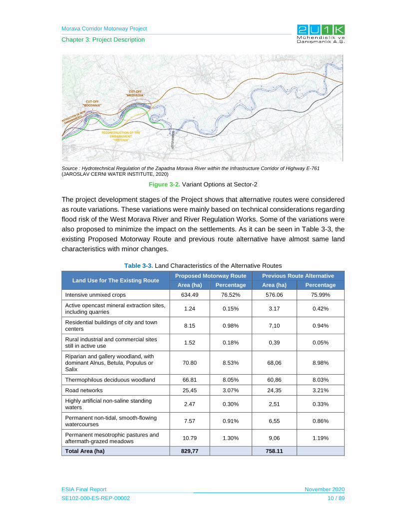
Morava Corridor Motorway Project
Chapter 3: Project Description
ESIA Final Report November 2020
SE102-000-ES-REP-00002 10 / 89
Source : Hydrotechnical Regulation of the Zapadna Morava River within the Infrastructure Corridor of Highway E-761 (JAROSLAV CERNI WATER INSTITUTE, 2020)
Figure 3-2. Variant Options at Sector-2
The project development stages of the Project shows that alternative routes were considered
as route variations. These variations were mainly based on technical considerations regarding
flood risk of the West Morava River and River Regulation Works. Some of the variations were
also proposed to minimize the impact on the settlements. As it can be seen in Table 3-3, the
existing Proposed Motorway Route and previous route alternative have almost same land
characteristics with minor changes.
Table 3-3. Land Characteristics of the Alternative Routes
Land Use for The Existing Route Proposed Motorway Route Previous Route Alternative
Area (ha) Percentage Area (ha) Percentage
Intensive unmixed crops 634.49 76.52% 576.06 75.99%
Active opencast mineral extraction sites, including quarries
1.24 0.15% 3.17 0.42%
Residential buildings of city and town centers
8.15 0.98% 7,10 0.94%
Rural industrial and commercial sites still in active use
1.52 0.18% 0,39 0.05%
Riparian and gallery woodland, with dominant Alnus, Betula, Populus or Salix
70.80 8.53% 68,06 8.98%
Thermophilous deciduous woodland 66.81 8.05% 60,86 8.03%
Road networks 25,45 3.07% 24,35 3.21%
Highly artificial non-saline standing waters
2.47 0.30% 2,51 0.33%
Permanent non-tidal, smooth-flowing watercourses
7.57 0.91% 6,55 0.86%
Permanent mesotrophic pastures and aftermath-grazed meadows
10.79 1.30% 9,06 1.19%
Total Area (ha) 829,77 758.11

Morava Corridor Motorway Project
Chapter 3: Project Description
ESIA Final Report November 2020
SE102-000-ES-REP-00002 11 / 89
As it is stated above, the Proposed Motorway Route Alignment together with River Regulation
Works has been identified in 12 years with several studies. As the outcome of these studies,
major route option and River Regulation Works have been fixed before the start of the ESIA
works and all other planning works such as Special Purpose Spatial Plan and local EIAs, which
are already completed and/or are going to be completed in accordance to the identified route
option and River Regulation Works. Therefore, “constraint mapping” process is used in order
to avoid and minimize the further impact on habitats in line with ESIA findings. In this respect,
all no-go areas are identified and provided to engineering group for identification of the new
potential project unit locations as well as potential route modifications required by detailed
design phase.
3.1.1 Zero Alternative
Zero alternative of the Project (i.e., no realization of the Project) means an alternative solution
which will replace the motorway construction with the same purpose to enable the connection
in the part Pojate - Kruševac - Kraljevo - Preljina, with branches to A1 and A2 state roads at
its ends. Considering such options as railway or alternative route corridor, there is none to be
considered in order to prefer zero alternative.
3.1.2 Technological Alternatives
For the Project of concern, the technological aspect is the safe and sound operation of traffic
of passenger and freight motor vehicles, provision of services and regular-road maintenance
using the accompanying facilities. Looking at vehicle movement as a technological process,
alternatives are variations in traffic mode, in terms of regulating the speed of movement of
traffic participants and directing them to individual lanes. That is mostly governed by the Law
on Traffic Safety and Vertical and Horizontal Signaling and is not the subject of this study. All
alternatives in terms of road maintenance and related content management are subject to
specific projects. Fuel consumption depends on the traffic load, type and age of the vehicle,
traffic participants, and is stochastic.
For the aspect of the technological treatment of drainage water from the pavement surface of
the Motorway, the state of art closed system such as network of underground drainage pipe
connected to oil separators through gullies and manholes will be undertaken. However,
alternative equivalent system can also be considered during design development stage.
3.2 Project Elements and Alignment
The Proposed Motorway Route with a total length of approximately 112 km is divided into three
Sections that are further divided into nine Sectors. The breakdown of the Sectors with respect
to each Section and responsible parties is given in Table 3-4. In addition, the Western Morava
River flowing along the road is 139 km and approximately 32 km river regulation along the
entire route of the Motorway will be carried out within the Project. Detailed information about
the project location and the River Regulation is provided in Table 3-5.

Morava Corridor Motorway Project
Chapter 3: Project Description
ESIA Final Report November 2020
SE102-000-ES-REP-00002 12 / 89
Table 3-4. The Sectors of the Project
Project SectorsLength
(km)Expropriation
Construction Employer
Operator
Section-1: Pojate - Kruševac (Koševi)
27.83
CoS CoS Roads of
Serbia (RoS)
Sector-1 Pojate – bridge across South Morava
9.06
Sector-2 Bridge across South Morava – Makrešane
7.89
Sector-3 Makrešane – Koševi 10.88
Section-2: Kruševac (Koševi)-Adrani
53.89
CoS CoS RoS
Sector-4 Kruševac (Koševi) – Lopoška river
13.93
Sector-5 Lopoška river – Trstenik 14.55
Sector-6 Trstenik – Tovarnica river
11.61
Sector-7 Tovarnica river – Adrani 13.80
Section-3: Adrani-Preljina 30.66
CoS CoS RoS
Sector-8a Adrani interchange – Mrčajevci
9.00
Sector-8b Mrčajevci– Preljina interchange
9.00
Sector-9 Preljina interchange – Preljina (E-763)
12.66
Responsibilities
Land cadastral maps
Expropriation administration
Payment. RAP execution
Supervision of design and construction (through and
third party Consultant)
Ownership of RAP
Monitoring
Operation and maintenance of
motorway

Morava Corridor Motorway Project
Chapter 3: Project Description
ESIA Final Report November 2020
SE102-000-ES-REP-00002 13 / 89
Table 3-5. Project Location
Section Location Sector Cadastral
Municipaliy
Section 1 The bridge on the South Morava is led by Pojate via Ćićevac to Stalač - City on the right bank of the river Velika and South Morava (see Figure 3-3).
Sector 1: Pojate - most on the South Morava river from km -0+229,75 to km 8+829,94 in length of 9.059,69 km
Pojate, Ćićevac, Lučina, Varvarin selo, Stalać Town of Stalać
Sector 2: Bridge on the South Morava river - Makrešane (beginning bypass Kruševac) from km 8+829,94 to km 16+721,95 with a length of 7.892,01 km River Regulation: from km 10 + 500 to km 12 + 850 in length of 1.671 km
Sector 3: Makrešane (beginning bypass around Kruševac) - Goals (end bypass around Kruševac) from km 16+721,95 to km 27+600,00 in the length of 10.878,05 km
Section 2 Bridge in the South Morava - Makrešane, located in the Kruševac basin zone.
The route was led by Stalaca - the city on the left bank of the river Morava to the village of Makrešane, where the route crosses the right bank of the West Morava river and fits into the existing main road M-5 (see Figure 3-2).
The route is designed with an embankment across the West Morava alluvial.
Sector 4: Krusevac (bins) - Lopaška River from km 27 + 600 to km 41+528,24 with a length of 13.928,24 km
The town of Stalac
Maskare Mrzenica Bosnjane Šanac Makrešani
Sector 5: Lopaška River - Trstenik from km 41+528,24 to km 56+073,87 to length of 14.545,63 km
Sector 6: Trstenik - Tovarnica River from km 56+073,87 to km 67+680,41 to length of 11.606,54 km
Sector 7: River Tovarnica - Adrani from km 67+680,41 to km 81+476,86 to length of 13.796,45 km River Regulation: from km 75 + 750 to km 76 + 500 in length of 0.984 km River Regulation: from km 76 + 800 to km 78 + 200 in length of 1.626 km River Regulation: from km 79 + 100 to km 80 + 125 in length of 1.300 km River Regulation: from km 80 + 400 to km 81 + 477 in length of 1.145 km
Section 3 Makrešane-Kosevi, located in the Kruševac basin zone, on the part of the existing main road M-5 and on the same section for which the expansion of the existing road is planned for ~ 15 m (see Figure 3-3).
The route is led north of Kruševac with the alluvion of the Western Morava.
Sector 8: Adrani - Mrčajevci from km 79 + 000 to km 97 + 000 in the length of 18,00 km River Regulation: from km 81 + 350 continues to the Sector 9 in length of 17.137 km
Makrešane Šanac Bivolje Lazarica Jasika Čitluk Kukljin Peplikac.
Sector 9: Mrčajevci - Preljina from km 97 + 000.00 to km 109+663,80 in length of 12.663,80 km. River Regulation: from the end of the Sector 9 to km 104 + 750 in length of 7.836 km
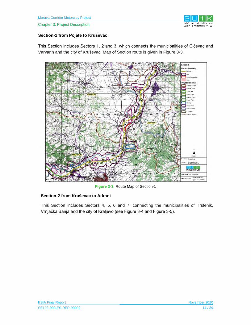
Morava Corridor Motorway Project
Chapter 3: Project Description
ESIA Final Report November 2020
SE102-000-ES-REP-00002 14 / 89
Section-1 from Pojate to Kruševac
This Section includes Sectors 1, 2 and 3, which connects the municipalities of Ćićevac and
Varvarin and the city of Kruševac. Map of Section route is given in Figure 3-3.
Figure 3-3. Route Map of Section-1
Section-2 from Kruševac to Adrani
This Section includes Sectors 4, 5, 6 and 7, connecting the municipalities of Trstenik,
Vrnjačka Banja and the city of Kraljevo (see Figure 3-4 and Figure 3-5).

Morava Corridor Motorway Project
Chapter 3: Project Description
ESIA Final Report November 2020
SE102-000-ES-REP-00002 15 / 89
Figure 3-4. Route Map of the first part of Section-2
Figure 3-5. Route Map of the second part of Section-2
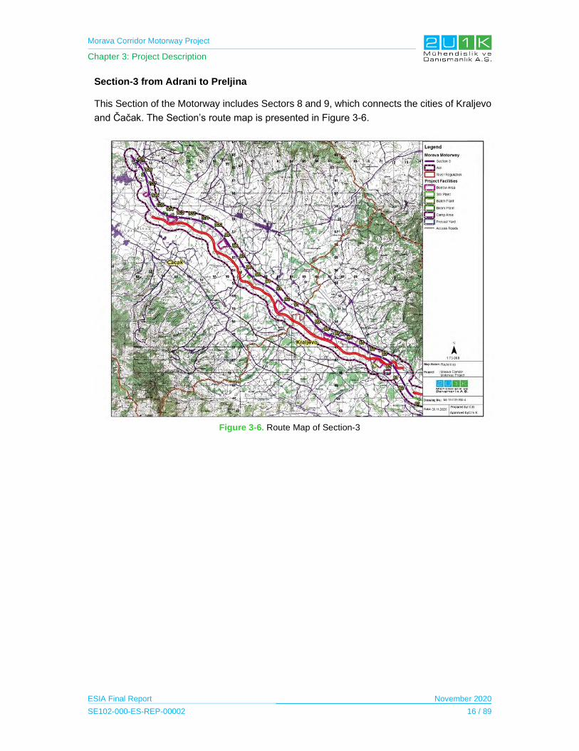
Morava Corridor Motorway Project
Chapter 3: Project Description
ESIA Final Report November 2020
SE102-000-ES-REP-00002 16 / 89
Section-3 from Adrani to Preljina
This Section of the Motorway includes Sectors 8 and 9, which connects the cities of Kraljevo
and Čačak. The Section’s route map is presented in Figure 3-6.
Figure 3-6. Route Map of Section-3

Morava Corridor Motorway Project
Chapter 3: Project Description
ESIA Final Report November 2020
SE102-000-ES-REP-00002 17 / 89
3.3 Design Criteria
Specific design elements of the Project are listed in the following table.
Table 3-6. Different Design Criteria of Morava Corridor Motorway Elements
General Information
Project Design Speed (Vp) 130 km/h
Horizontal Profile
Minimum Radius of Horizontal Curve (Rmin) 800 m
Minimum Length of Transition Length (Lmin) 115 m
Vertical Profile
Minimum Radius of Vertical Concave Curve (R'min) 11,250 m
Minimum Radius of Vertical Convex Curve (R''min) 22,500 m
Minimum Longitudinal Slope 0.30%
Maximum Longitudinal Slope 4%
Cross Section
Minimum Cross Slope of Pavement (i) 2.50%
Maximum Cross Slope of Pavement (i') 7%
Width of Traffic Lane 4 x 3.75 m
Width of Emergency Lane 2 x 2.50 m
Width of Shoulder 2 x 1.50 m
Width of Marginal Strip 2 x 1.50 m
Source: BEJV Design Team, 2019.
As per Schedule 2 of the Contract signed between CoS and the Contractor, the Contractor
may work with other recognized standards and technical regulations where the Contractor in
its absolute discretion considers the RSTS (Public Enterprise Roads of Serbia Technical
Specifications –Version E) is antiquated, superseded, or there are equivalent or updated
standards available for design, installation and/or testing purposes issued by a foreign
standardization body such as ISO, EN, DIN, ASTM. Any conflict between the codes and
standards shall be resolved by the Control Engineer (Supervisor) in accordance with the
provisions of the Special Law (namely, Law on the Establishment of a Public Intersection and
Special Procedures for the Implementation of the Project for Construction of the Infrastructure
Corridor of the E-761 Motorway section Pojate-Preljina).
The width of the road corridor including the travel width is 900 m. This width is divided into six
zones; i) 2 x 15 m motorway, ii) 5 m Emergency Zone on each side, iii) 15 m Fence Zone, iv)
Immediate Protection Zone of 40 m on each side v) Wider Protection Zone of 40 m on each
side and vi) Larger Protection Zone of 235 m on each side.
3.4 River Regulation and Drainage Control
The West Morava River is the left component of the Morava Basin. Length of the West Morava
River to the point where it combines with the South Morava River is approximately 210 km and
its basin area is 15,755 km2. The valley of the West Morava River has significant agricultural
Morava Corridor Motorway Project
Chapter 3: Project Description
ESIA Final Report November 2020
SE102-000-ES-REP-00002 18 / 89
potential and prominent traffic role, and the West Morava River itself flows through a large
number of settlements, some of them are significant industrial centers (e.g., Čačak, Kraljevo).
Because of this fact, Western Morava does not only represent the interests of water
management, but also it has broader socio-economic importance.
The nature of the West Morava River has many winding sections. Winding (i.e. meandering or
bending) sections of rivers are almost the exact opposite of rapids; they are usually slow-
moving parts of a river with a very minor downward grade and are most often found in plains
or lowlands.
Main goals for the flood protection along the West Morava were set more than 50 years ago.
These goals are: (a) protection of valuable assets in the riparian zone from flooding; (b)
protection of roads and bridges; and (c) stabilization of the river route and control of fluvial
erosion. In line with these goals, river regulation solutions for flood protection first General
Design was prepared in 2008. According to this design report;
Flood protection: It has been planned to preserve the existing flood protection system, and
to reconstruct the embankments in the area of Trstenik, in order to provide protection against
flooding caused by 100-year return river flow (Q100). The construction of new embankments
was not planned, due to the fact that protection of the agricultural lands from floods was not a
priority.
Flood protection of the main and regional roads: Existing roads were mostly protected from
the negative impact of the watercourse. However, it has been noted that the designed route of
the proposed motorway was in the impact zone of the river. Therefore, significant works on the
regulation of river course proposed to protect the project facilities from the flooding.
River route stabilization and fluvial erosion control: Biotechnical measures were recommended
for the protection of erosion-prone riverbanks of West Morava River to prevent the proposed
motorway, embankments and other significant facilities located near to the river coastal area
from erosion risk. In particular, a major river regulation works were suggested between r.km
96.5 and r.km 138.5 (the mouth of Čemernica River) of West Morava River, which has
meanders freely through the river valley and thus poses a risk for the proposed motorway. At
this part of West Morava River, a long river diversion channel (new river course) with smooth
curves was proposed as river regulation measure. With the construction of the new river
course, it was planned to eliminate the several consecutive sharp river bands as well as
several sites of erosion-prone riverbanks.
With the above-stated goal of the study, it is aimed to estimate or propose measures for the
regulation of watercourses and protection of coastal areas to minimize the negative impacts of
construction of the Project on the water regime, the stability of the riverbed and other water
resources’ users in coastal areas. Also, the study defines the basic parameters of the water
regime.

Morava Corridor Motorway Project
Chapter 3: Project Description
ESIA Final Report November 2020
SE102-000-ES-REP-00002 19 / 89
At the same time, considering the floods of May 2014 in Western Morava Flood Plains, the
River Regulation and Drainage Control Study (officially named as “Hydrotechnical Study,
Corridor of the Motorway E-761, Section Pojate-Preljina”) aimed to be designed to provide the
level of protection of the Motorway from floods and erosion effects of watercourses. The Study
was performed in 2016 by Jaroslav Černi Institute for the Development of Water Resources in
Belgrade.
As it is stated above, the proposed regulation designs are to protect against flooding and
eliminate more consecutive sharp bends and bank erosion. On the other hand, as the
suggestion of the ESIA and local EIA’s prepared for Sector-8 and Sector-9, the flow in the old
riverbed required to be maintained and it will not be completely interrupted to enhance aquatic
and riparian habitat. In this respect, old riverbed will not be used as borrow area and not filled
with unsuitable materials as it was recommended in the River Regulation and Drainage Control
Study Report. Cross-section view of the regulated channel of the Morava Corridor Motorway
Project is illustrated in Figure 3-7.
Source : Hydrotechnical Study Report
Figure 3-7. Typical Cross-Section of the Regulated Channel
3.5 River Regulation Design
As stated in Section 3.1, length of the Motorway from Pojate to Preljina is approximately 112
km, while the length of the Western Morava River on this part is about 139 km and
approximately 32 km will be the total length of river regulation along the entire route of the
Motorway. Based on the technical documentations developed by JCWI, following 18 structures
along the West Morava River are suggested as river regulation works.
Section-1 Pojate - Kruševac (km 0+229,75 - km 27+600):
STRUCTURE 1: The cut-off of the river curve from r.km 4.7 to r.km 7.1 near the village
of Maskare (km 11 - km 11.6 of the highway). The meander cut-off is projected along
the right inundation of the West Morava River in order to move the main river channel
from the highway route, and thus reduce the negative impacts of the River.
STRUCTURE 2: Protection of the left bank of the West Morava River (embankment) in
the length of ~ 600 m, from r.km 8.63 to r.km 9.25 (km 14.1 - km 15 of the Motorway).
Embankment protects the riverbank of the West Morava River near the Motorway from
fluvial erosion.

Morava Corridor Motorway Project
Chapter 3: Project Description
ESIA Final Report November 2020
SE102-000-ES-REP-00002 20 / 89
STRUCTURE 3: Reconstruction of the existing right bank dike of the West Morava
River and the left bank dike of Rasina near Kruševac (cassette "Čitluk") in order to
protect the Proposed Motorway Route, which passes through the flood zone (km 18.65
- km 24.6 along the Motorway). Total length of the dike is about 8 km.
STRUCTURE 4: Protection of the right bank of the West Morava River (embankment)
in the length of ~ 800 m from r.km 20.7 to r.km 21.26, i.e. km 25.7 - km 26.5 of the
Motorway.
Section-2 Kruševac (Koševi) - Adrani (km 27+600 - km 81+476,86):
STRUCTURE 5: Reconstruction of the existing dike on right bank of the West Morava
River and the left bank dike of the Crnišavska River near Trstenik (cassette “Trstenik”,
(r.km 42.75 to r.km 55.32). Total length of the dike is 10.2 km.
STRUCTURE 6: Reconstruction of the existing dike on left bank of the West Morava
River near Trstenik (cassette "Zvezdan", r.km 55.32 - r.km 58.1) and construction of
the dike along left bank of the Mala River up to the high terrain. Total length of the dike
is about 2760 m.
STRUCTURE 7: Construction of a new dike on left bank of the West Morava River from
the mouth of the Ljubostinjska River (r.km 55.1) to the iron bridge in Trstenik (r.km
55.32), with a length of about 235 m.
STRUCTURE 8: Construction of a new dike with the regulated river channel of the
Ljubostinjska River from the Motorway to high terrain in Trstenik, in length of about 230
m.
STRUCTURE 9: Protection of the unstable left bank of the West Morava River from the
existing concrete bridge (r.km 54.77) to the iron bridge (r.km 55.32) that is near the
Proposed Motorway Route.
STRUCTURE 10: Protection of the unstable right bank of the West Morava River from
r.km 62.45 to r.km 62.97 which is near the Proposed Motorway Route.
STRUCTURE 11: Protection of the unstable right bank of the West Morava River from
r.km 66.5 to r.km 67.15 due to proximity to the Proposed Motorway Route.
STRUCTURE 12: Protection of the stable right bank of the West Morava River from
r.km 87+880 to r.km 88+380 due to proximity to the Proposed Motorway Route.
STRUCTURE 13: The cut-off of the river curve (from r.km 88+900 to r.km 90+970) at
the location of intersection of the Proposed Motorway Route with the existing meander
of the West Morava River.
STRUCTURE 14: The cut-off of the river curve (from r.km 91.41 to r.km 95.19) at the
location of intersection of the Proposed Motorway Route with the existing meander of
the West Morava River.

Morava Corridor Motorway Project
Chapter 3: Project Description
ESIA Final Report November 2020
SE102-000-ES-REP-00002 21 / 89
STRUCTURE 15: The cut-off of the river curve (from r.km 96.55 to r.km 98.53) at the
location of intersection of the Proposed Motorway Route with the existing meander of
the West Morava River.
STRUCTURE 16: The cut- off of the river curve (from r.km 98.96 to r.km 101) at the
location of intersection of the Proposed Motorway Route with the existing meander of
the West Morava River.
Section-3, Adrani - Mrčajevci (km 79+000 - km 109+663,80):
STRUCTURE 17: The cut- off of the river curves of the on the reach Adrani - Mrčajevci
(km 79 - km 97 of the Motorway, i.e. from r.km 100.8 to r.km 127.2).
STRUCTURE 18: The cut-off of the river curves on the reach Mrčajevci - Preljina (km
97 - km 109.664, i.e. from r.km 127.2 to r.km 138.4).
According to Law on Waters ("Official Gazette of RS", no. 30/10 and 93/12), the water and
waterways, as well as goods of general interest, subject to special protection and can be used
under the conditions provided by the law. In this respect, the law allows to use floodplains of
the river system by considering the main factors given below;
- without causing an adverse effect on water coastal ecosystem;
- without causing impact on existing ground water quality and quantity.
- construction of water facilities and installation of devices intended for regulation of
watercourses;
- preservation of river courses and water facilities;
- implementation of measures to protect water; and,
- implementation of protection from contamination;
The total of 32 km length of river channel will be constructed to a bed width of 50 m, top width
of 100 m, depth of 4.00 m and bank slope of ½ (shown on the plan and profile maps in Figure
3-8. The side slope of river channel is designed as ½ considering the slope stability of sandy
riverbanks. The typical cross section drawings from the Proposed River Regulation are shown
in Figure 3-8.
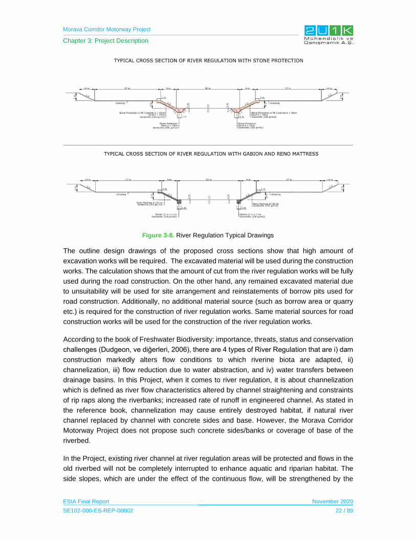
Morava Corridor Motorway Project
Chapter 3: Project Description
ESIA Final Report November 2020
SE102-000-ES-REP-00002 22 / 89
Figure 3-8. River Regulation Typical Drawings
The outline design drawings of the proposed cross sections show that high amount of
excavation works will be required. The excavated material will be used during the construction
works. The calculation shows that the amount of cut from the river regulation works will be fully
used during the road construction. On the other hand, any remained excavated material due
to unsuitability will be used for site arrangement and reinstatements of borrow pits used for
road construction. Additionally, no additional material source (such as borrow area or quarry
etc.) is required for the construction of river regulation works. Same material sources for road
construction works will be used for the construction of the river regulation works.
According to the book of Freshwater Biodiversity: importance, threats, status and conservation
challenges (Dudgeon, ve diğerleri, 2006), there are 4 types of River Regulation that are i) dam
construction markedly alters flow conditions to which riverine biota are adapted, ii)
channelization, iii) flow reduction due to water abstraction, and iv) water transfers between
drainage basins. In this Project, when it comes to river regulation, it is about channelization
which is defined as river flow characteristics altered by channel straightening and constraints
of rip raps along the riverbanks; increased rate of runoff in engineered channel. As stated in
the reference book, channelization may cause entirely destroyed habitat, if natural river
channel replaced by channel with concrete sides and base. However, the Morava Corridor
Motorway Project does not propose such concrete sides/banks or coverage of base of the
riverbed.
In the Project, existing river channel at river regulation areas will be protected and flows in the
old riverbed will not be completely interrupted to enhance aquatic and riparian habitat. The
side slopes, which are under the effect of the continuous flow, will be strengthened by the
Morava Corridor Motorway Project
Chapter 3: Project Description
ESIA Final Report November 2020
SE102-000-ES-REP-00002 23 / 89
implementation of “gabions” or “reno mattress” depending on the flow conditions. The river
section comprising upper bank will be left for natural vegetation and riverbed of new channel
will be left as much as natural. With this intention, channelization with the proposed design of
river regulation in the Project does not possess major impacts like those of regulation by dams,
water transfer between the basins. Some of the proposed river regulation structures are
provided in between the Figure 3-9 and Figure 3-13.

Morava Corridor Motorway Project
Chapter 3: Project Description
ESIA Final Report November 2020
SE102-000-ES-REP-00002 24 / 89
Figure 3-9. The route and typical cross-section of the Structure 1, Section-1
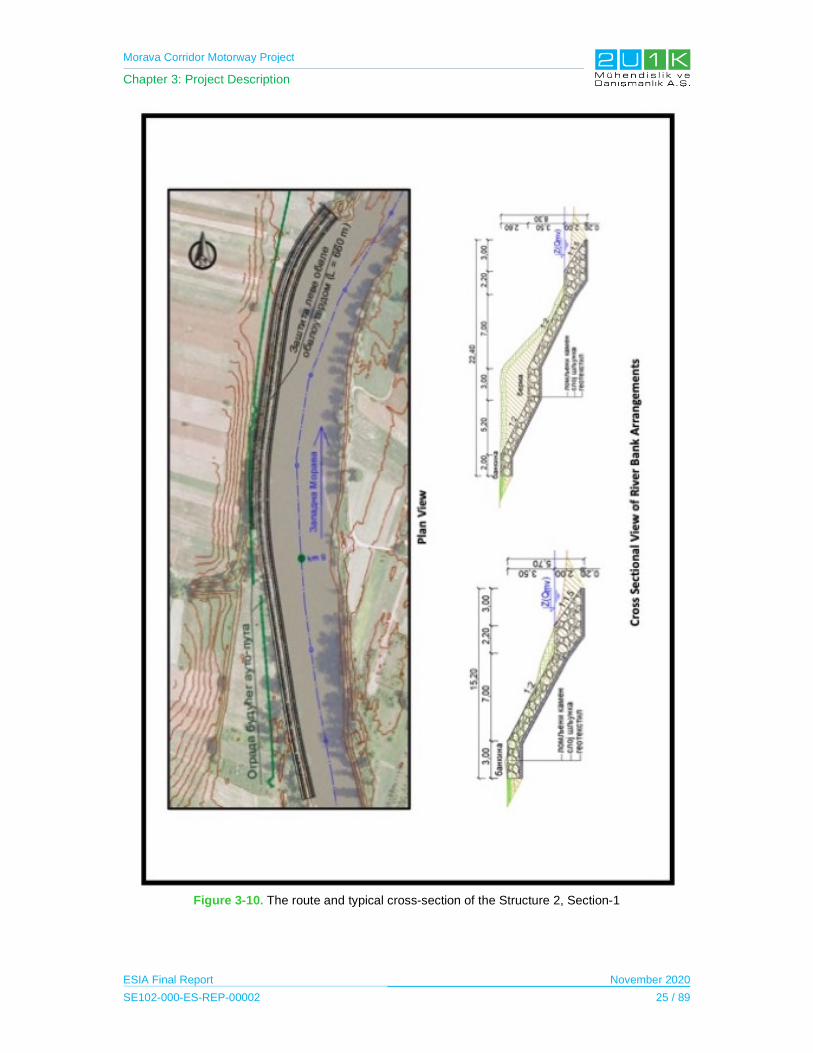
Morava Corridor Motorway Project
Chapter 3: Project Description
ESIA Final Report November 2020
SE102-000-ES-REP-00002 25 / 89
Figure 3-10. The route and typical cross-section of the Structure 2, Section-1
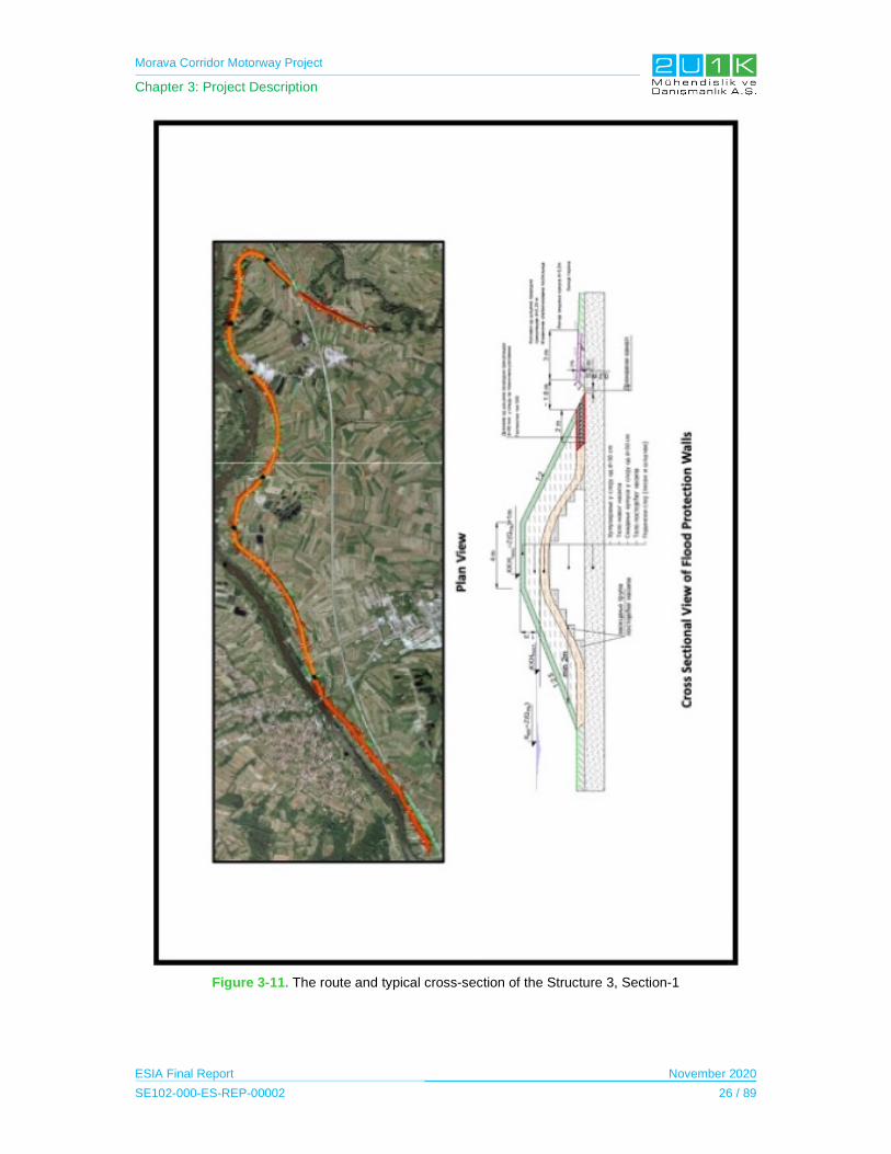
Morava Corridor Motorway Project
Chapter 3: Project Description
ESIA Final Report November 2020
SE102-000-ES-REP-00002 26 / 89
Figure 3-11. The route and typical cross-section of the Structure 3, Section-1
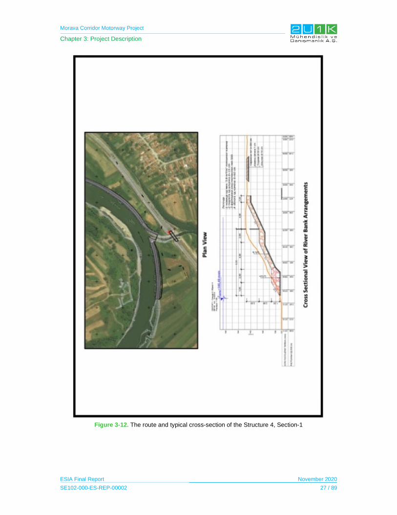
Morava Corridor Motorway Project
Chapter 3: Project Description
ESIA Final Report November 2020
SE102-000-ES-REP-00002 27 / 89
Figure 3-12. The route and typical cross-section of the Structure 4, Section-1
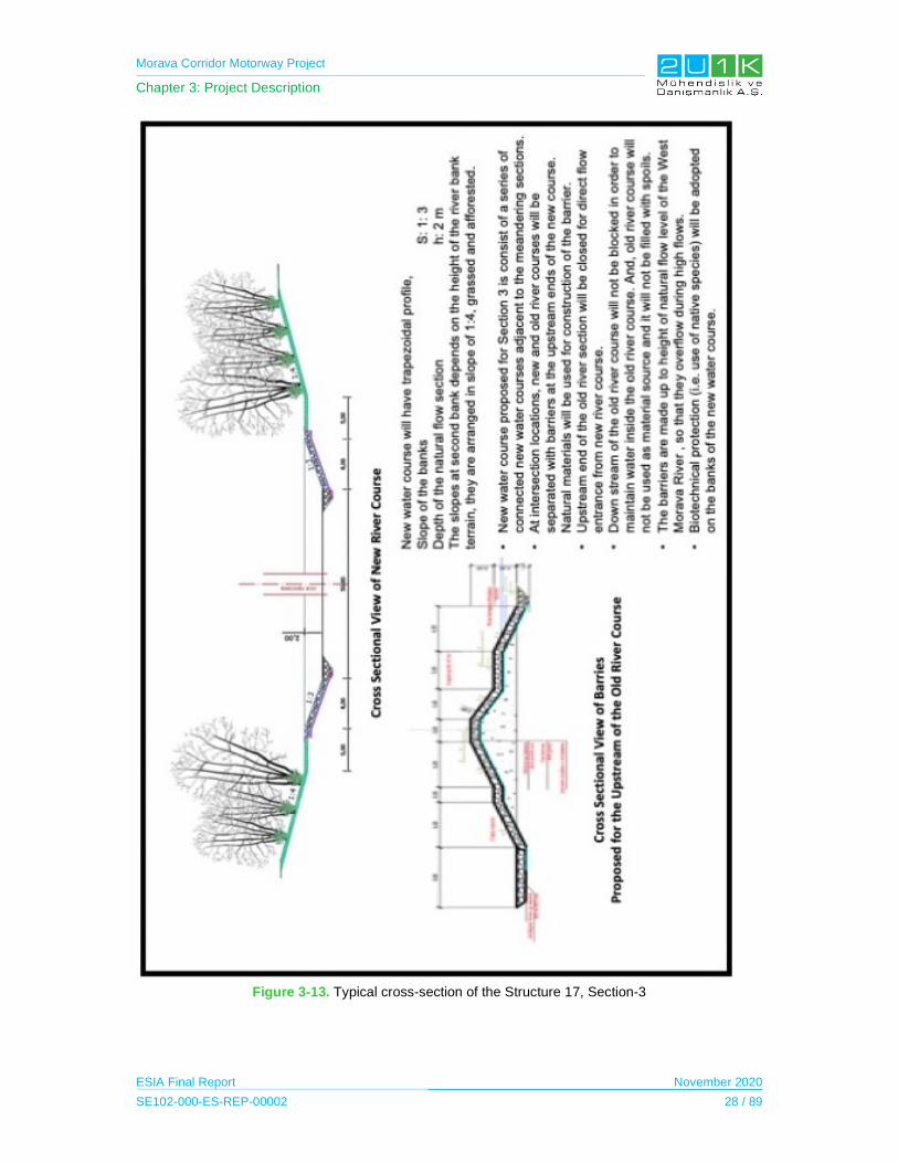
Morava Corridor Motorway Project
Chapter 3: Project Description
ESIA Final Report November 2020
SE102-000-ES-REP-00002 28 / 89
Figure 3-13. Typical cross-section of the Structure 17, Section-3
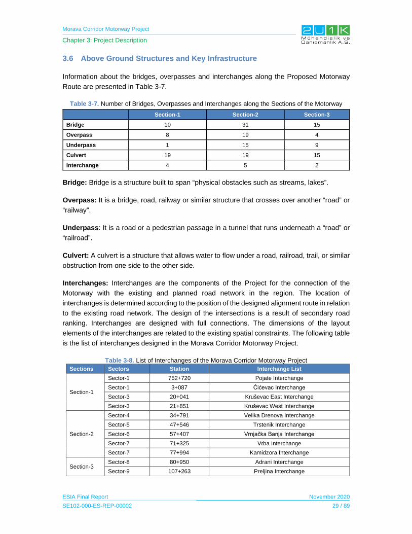
Morava Corridor Motorway Project
Chapter 3: Project Description
ESIA Final Report November 2020
SE102-000-ES-REP-00002 29 / 89
3.6 Above Ground Structures and Key Infrastructure
Information about the bridges, overpasses and interchanges along the Proposed Motorway
Route are presented in Table 3-7.
Table 3-7. Number of Bridges, Overpasses and Interchanges along the Sections of the Motorway
Section-1 Section-2 Section-3
Bridge 10 31 15
Overpass 8 19 4
Underpass 1 15 9
Culvert 19 19 15
Interchange 4 5 2
Bridge: Bridge is a structure built to span “physical obstacles such as streams, lakes”.
Overpass: It is a bridge, road, railway or similar structure that crosses over another “road” or
“railway”.
Underpass: It is a road or a pedestrian passage in a tunnel that runs underneath a “road” or
“railroad”.
Culvert: A culvert is a structure that allows water to flow under a road, railroad, trail, or similar
obstruction from one side to the other side.
Interchanges: Interchanges are the components of the Project for the connection of the
Motorway with the existing and planned road network in the region. The location of
interchanges is determined according to the position of the designed alignment route in relation
to the existing road network. The design of the intersections is a result of secondary road
ranking. Interchanges are designed with full connections. The dimensions of the layout
elements of the interchanges are related to the existing spatial constraints. The following table
is the list of interchanges designed in the Morava Corridor Motorway Project.
Table 3-8. List of Interchanges of the Morava Corridor Motorway Project
Sections Sectors Station Interchange List
Section-1
Sector-1 752+720 Pojate Interchange
Sector-1 3+087 Ćićevac Interchange
Sector-3 20+041 Kruševac East Interchange
Sector-3 21+851 Kruševac West Interchange
Section-2
Sector-4 34+791 Velika Drenova Interchange
Sector-5 47+546 Trstenik Interchange
Sector-6 57+407 Vrnjačka Banja Interchange
Sector-7 71+325 Vrba Interchange
Sector-7 77+994 Kamidzora Interchange
Section-3 Sector-8 80+950 Adrani Interchange
Sector-9 107+263 Preljina Interchange

Morava Corridor Motorway Project
Chapter 3: Project Description
ESIA Final Report November 2020
SE102-000-ES-REP-00002 30 / 89
The following figures show the sketches of the proposed interchanges designed in the Morava
Corridor Motorway Project.
Figure 3-14. Sketches of the Interchanges planned along the Motorway.
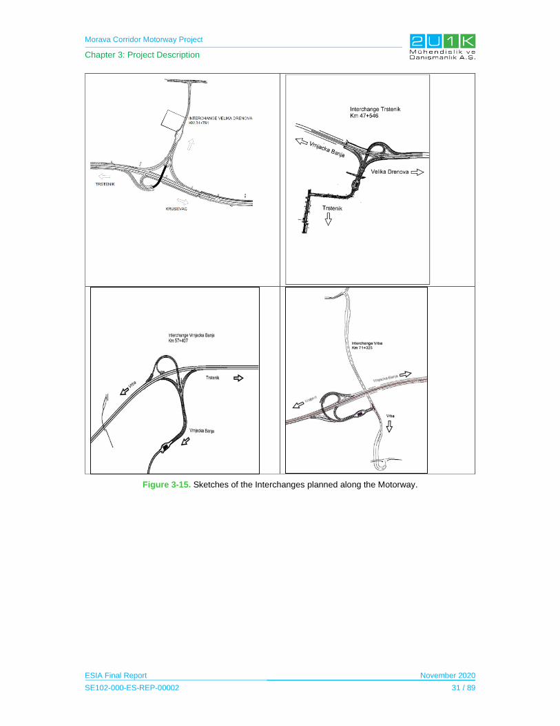
Morava Corridor Motorway Project
Chapter 3: Project Description
ESIA Final Report November 2020
SE102-000-ES-REP-00002 31 / 89
Figure 3-15. Sketches of the Interchanges planned along the Motorway.
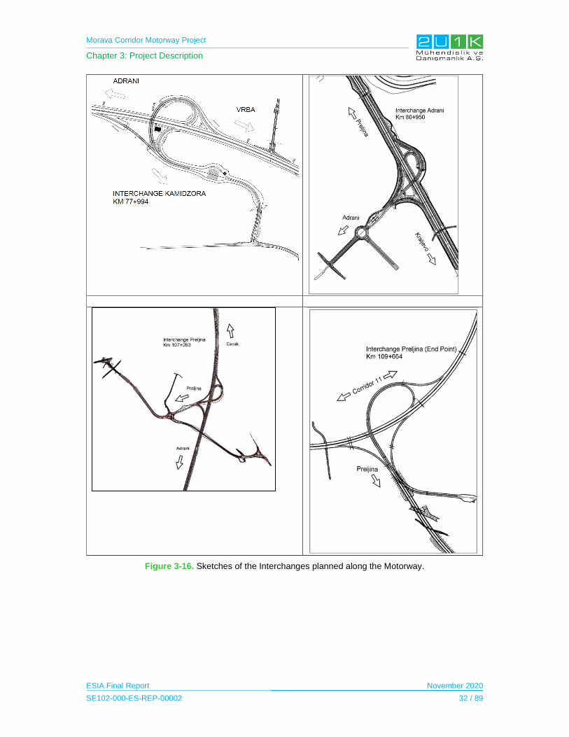
Morava Corridor Motorway Project
Chapter 3: Project Description
ESIA Final Report November 2020
SE102-000-ES-REP-00002 32 / 89
Figure 3-16. Sketches of the Interchanges planned along the Motorway.

Morava Corridor Motorway Project
Chapter 3: Project Description
ESIA Final Report November 2020
SE102-000-ES-REP-00002 33 / 89
3.7 Project Facilities
Third party facilities, that are also funded as a part of the Project are considered as the project
components. These facilities’ construction and operation are also considered in the context of
the ESIA studies.
Among others, the main project facilities to be considered in the ESIA are the followings:
Quarries and borrow pits;
Camp sites and storage areas;
Crushers, concrete batching plants and asphalt plants;
Access roads; and
Power lines, communication cables and substations.
3.7.1 Camp Sites, Storage Sites
In the context of the Project’s construction activities, there will be three campsites and five
precast storage yards of which currently planned locations and layouts can be seen in the
following table and figures. There will be no additional campsite for the river regulation works.
There will be a total of max. 3,800 workers, accommodated in 3 camps.
Table 3-9. Camps and Precast Yards
Description Amount
Camp (office and accommodation) 3
Precast Yard 5
Figure 3-17. Camp Area – 1 in Section-1.
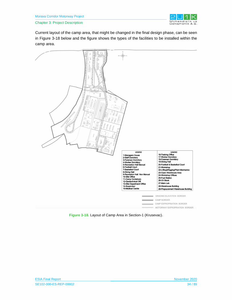
Morava Corridor Motorway Project
Chapter 3: Project Description
ESIA Final Report November 2020
SE102-000-ES-REP-00002 34 / 89
Current layout of the camp area, that might be changed in the final design phase, can be seen
in Figure 3-18 below and the figure shows the types of the facilities to be installed within the
camp area.
Figure 3-18. Layout of Camp Area in Section-1 (Krusevac).
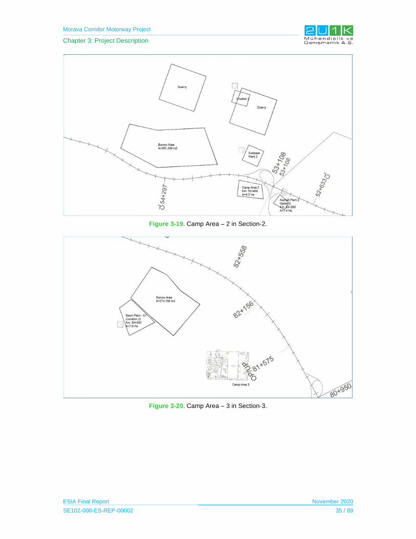
Morava Corridor Motorway Project
Chapter 3: Project Description
ESIA Final Report November 2020
SE102-000-ES-REP-00002 35 / 89
Figure 3-19. Camp Area – 2 in Section-2.
Figure 3-20. Camp Area – 3 in Section-3.
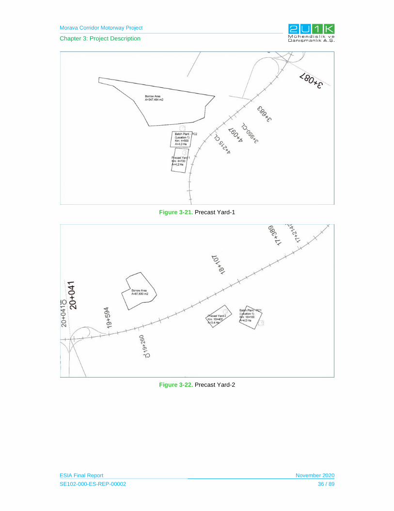
Morava Corridor Motorway Project
Chapter 3: Project Description
ESIA Final Report November 2020
SE102-000-ES-REP-00002 36 / 89
Figure 3-21. Precast Yard-1
Figure 3-22. Precast Yard-2

Morava Corridor Motorway Project
Chapter 3: Project Description
ESIA Final Report November 2020
SE102-000-ES-REP-00002 37 / 89
Figure 3-23. Precast Yard-3
Figure 3-24. Precast Yard-4

Morava Corridor Motorway Project
Chapter 3: Project Description
ESIA Final Report November 2020
SE102-000-ES-REP-00002 38 / 89
Figure 3-25. Precast Yard-5
3.7.2 Quarries and Borrow Pits
There will be various borrow pits and quarries, that have been identified by the Employer and
the Contractor along the Proposed Motorway Route, to be used in the construction phase of
the Project (See Table 3-10).
Table 3-10. Quarries and Borrow Pits
Description Amount
Identified Borrow Pit (Alluvial Deposit) 49
Identified Quarry (Rock Material) 5
Eruptive Quarry 2
Crusher 4
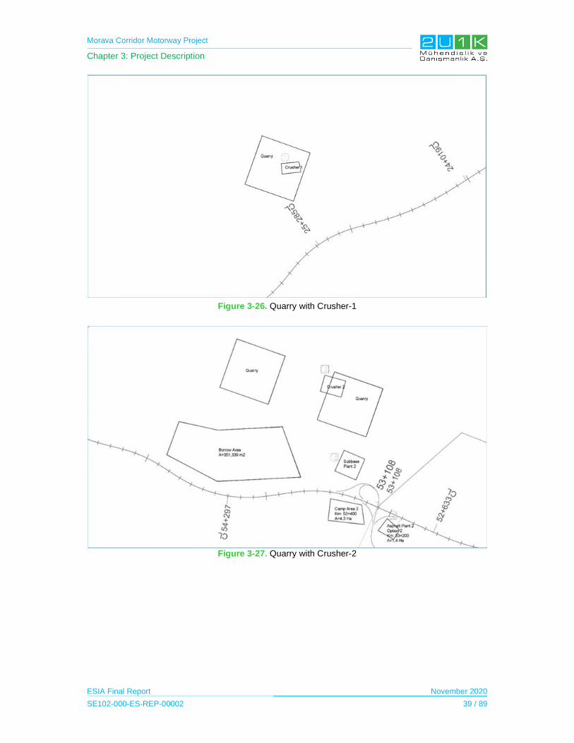
Morava Corridor Motorway Project
Chapter 3: Project Description
ESIA Final Report November 2020
SE102-000-ES-REP-00002 39 / 89
Figure 3-26. Quarry with Crusher-1
Figure 3-27. Quarry with Crusher-2
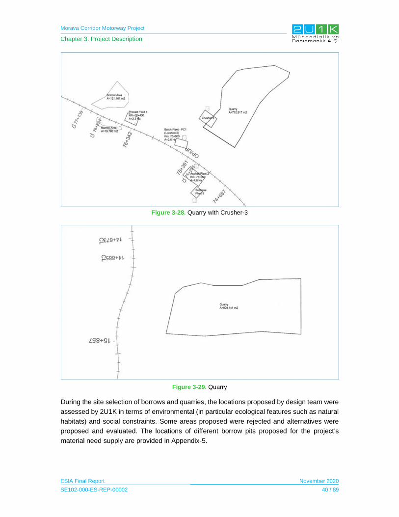
Morava Corridor Motorway Project
Chapter 3: Project Description
ESIA Final Report November 2020
SE102-000-ES-REP-00002 40 / 89
Figure 3-28. Quarry with Crusher-3
Figure 3-29. Quarry
During the site selection of borrows and quarries, the locations proposed by design team were
assessed by 2U1K in terms of environmental (in particular ecological features such as natural
habitats) and social constraints. Some areas proposed were rejected and alternatives were
proposed and evaluated. The locations of different borrow pits proposed for the project’s
material need supply are provided in Appendix-5.
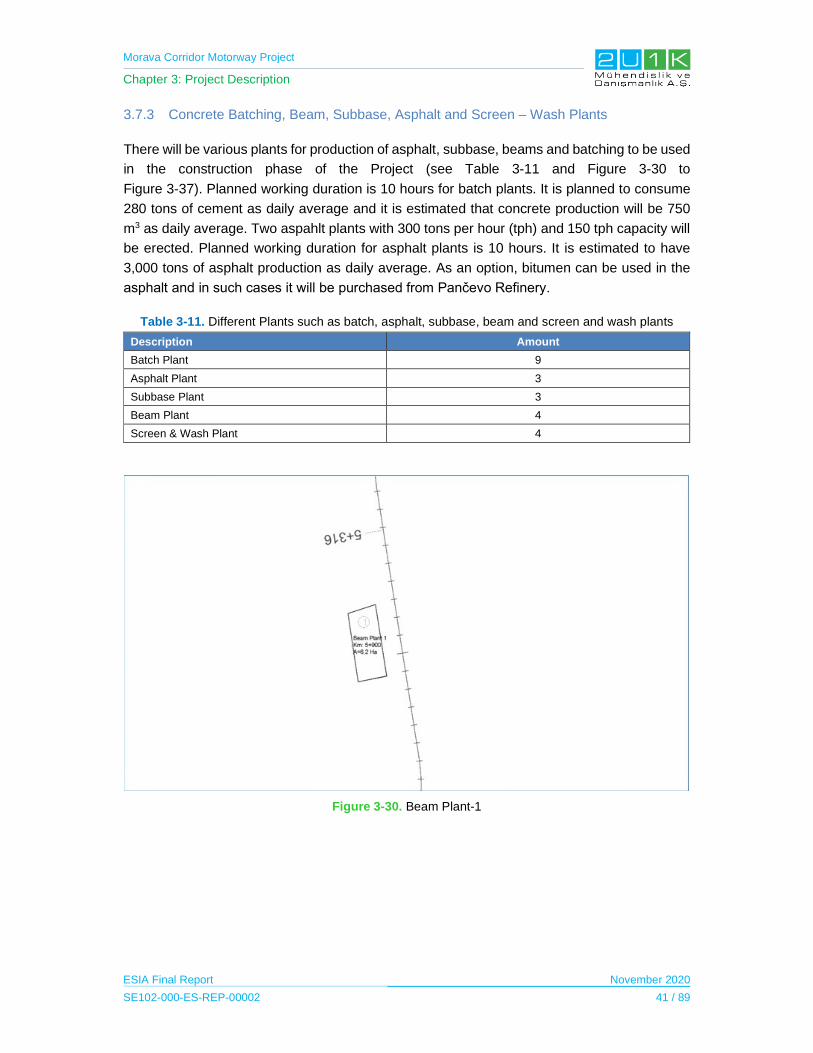
Morava Corridor Motorway Project
Chapter 3: Project Description
ESIA Final Report November 2020
SE102-000-ES-REP-00002 41 / 89
3.7.3 Concrete Batching, Beam, Subbase, Asphalt and Screen – Wash Plants
There will be various plants for production of asphalt, subbase, beams and batching to be used
in the construction phase of the Project (see Table 3-11 and Figure 3-30 to
Figure 3-37). Planned working duration is 10 hours for batch plants. It is planned to consume
280 tons of cement as daily average and it is estimated that concrete production will be 750
m3 as daily average. Two aspahlt plants with 300 tons per hour (tph) and 150 tph capacity will
be erected. Planned working duration for asphalt plants is 10 hours. It is estimated to have
3,000 tons of asphalt production as daily average. As an option, bitumen can be used in the
asphalt and in such cases it will be purchased from Pančevo Refinery.
Table 3-11. Different Plants such as batch, asphalt, subbase, beam and screen and wash plants
Description Amount
Batch Plant 9
Asphalt Plant 3
Subbase Plant 3
Beam Plant 4
Screen & Wash Plant 4
Figure 3-30. Beam Plant-1
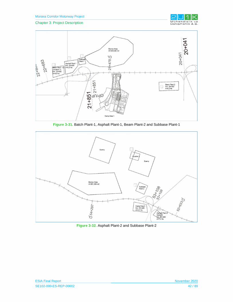
Morava Corridor Motorway Project
Chapter 3: Project Description
ESIA Final Report November 2020
SE102-000-ES-REP-00002 42 / 89
Figure 3-31. Batch Plant-1, Asphalt Plant-1, Beam Plant-2 and Subbase Plant-1
Figure 3-32. Asphalt Plant-2 and Subbase Plant-2
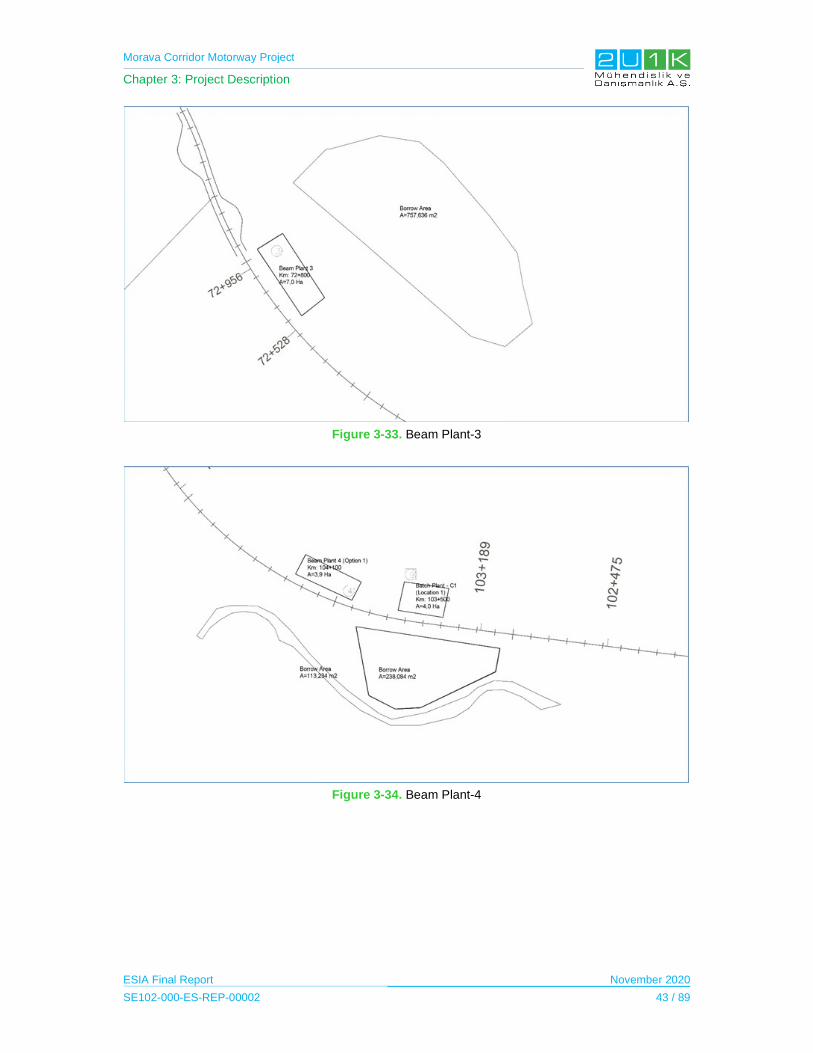
Morava Corridor Motorway Project
Chapter 3: Project Description
ESIA Final Report November 2020
SE102-000-ES-REP-00002 43 / 89
Figure 3-33. Beam Plant-3
Figure 3-34. Beam Plant-4
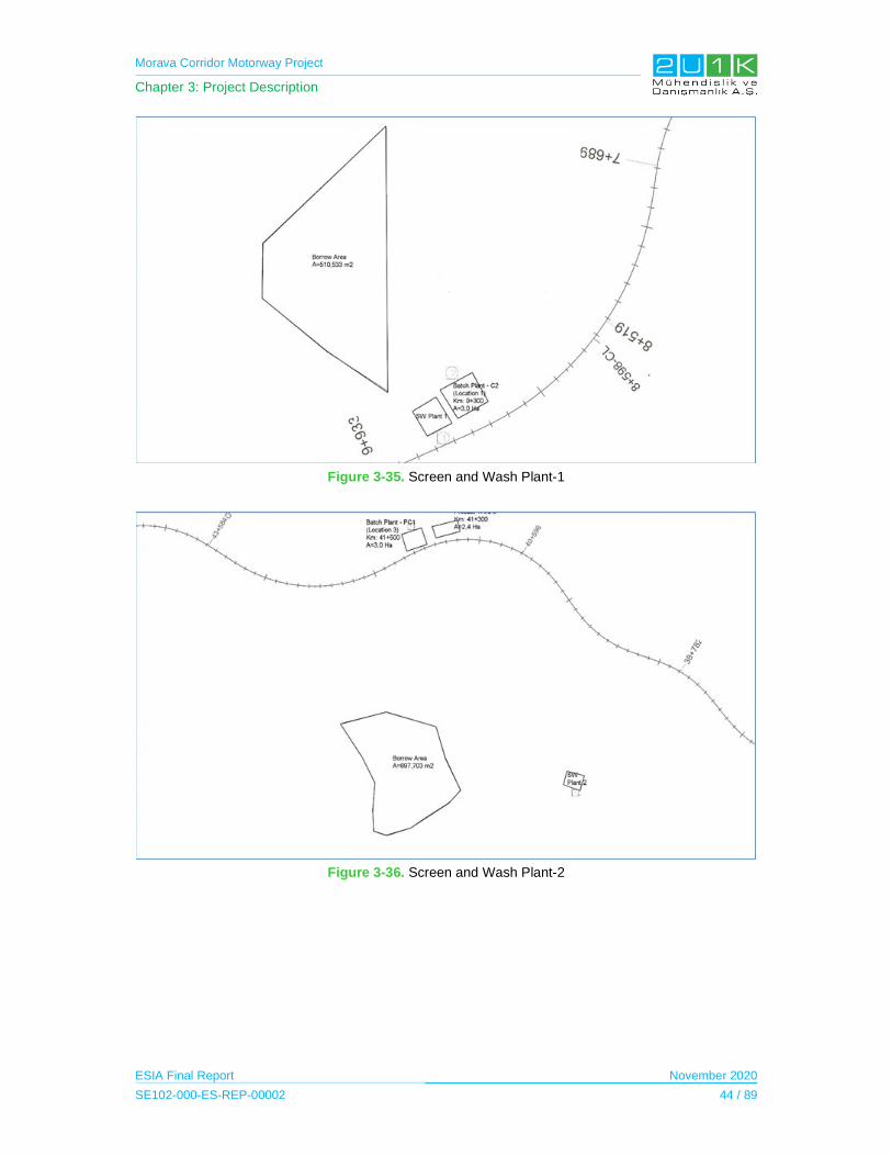
Morava Corridor Motorway Project
Chapter 3: Project Description
ESIA Final Report November 2020
SE102-000-ES-REP-00002 44 / 89
Figure 3-35. Screen and Wash Plant-1
Figure 3-36. Screen and Wash Plant-2

Morava Corridor Motorway Project
Chapter 3: Project Description
ESIA Final Report November 2020
SE102-000-ES-REP-00002 45 / 89
Figure 3-37. Screen and Wash Plant-4
3.7.4 Temporary Access Roads
Access roads will be required to reach motorway alignment locations from existing
local/national roads. These existing roads will also be used to reach the area where river
regulation works are carried out, including on-farm roads. Furthermore, in addition to these
existing roads, temporary access roads will be constructed for transportation to the Project
Site. The locations and layout of these temporary access roads will be developed by the
Contractor in consultation with the local authorities. The length of the temporary access roads
will be approximately 66,000 m in total. If any requirement, arrangements will be made on
existing roads. The figure below illustrates the typical cross section of access roads. As it seen
in the Figure, 30-40 cm thick of topsoil will be stripped from the existing surface and at least
30 cm thick of filling material will be used to stabilize the road.
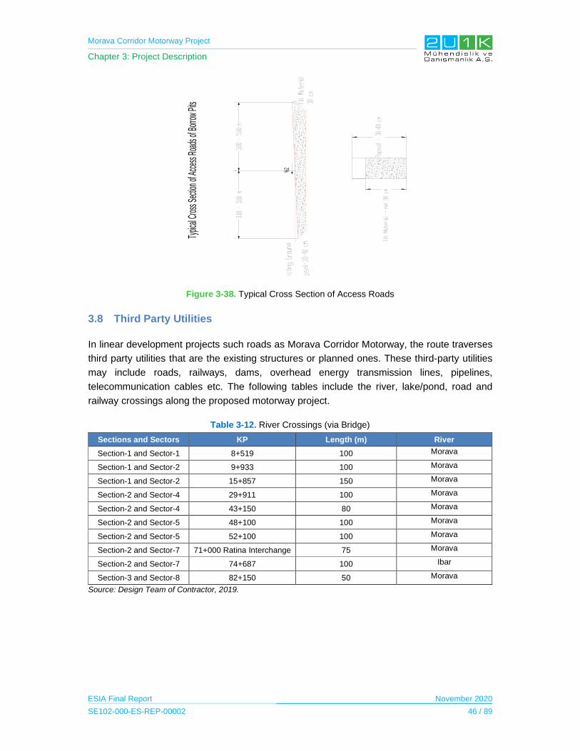
Morava Corridor Motorway Project
Chapter 3: Project Description
ESIA Final Report November 2020
SE102-000-ES-REP-00002 46 / 89
Figure 3-38. Typical Cross Section of Access Roads
3.8 Third Party Utilities
In linear development projects such roads as Morava Corridor Motorway, the route traverses
third party utilities that are the existing structures or planned ones. These third-party utilities
may include roads, railways, dams, overhead energy transmission lines, pipelines,
telecommunication cables etc. The following tables include the river, lake/pond, road and
railway crossings along the proposed motorway project.
Table 3-12. River Crossings (via Bridge)
Sections and Sectors KP Length (m) River
Section-1 and Sector-1 8+519 100 Morava
Section-1 and Sector-2 9+933 100 Morava
Section-1 and Sector-2 15+857 150 Morava
Section-2 and Sector-4 29+911 100 Morava
Section-2 and Sector-4 43+150 80 Morava
Section-2 and Sector-5 48+100 100 Morava
Section-2 and Sector-5 52+100 100 Morava
Section-2 and Sector-7 71+000 Ratina Interchange 75 Morava
Section-2 and Sector-7 74+687 100 Ibar
Section-3 and Sector-8 82+150 50 Morava
Source: Design Team of Contractor, 2019.
%2
Typic
alCr
ossS
ectio
nofA
ccess
Road
sofB
orrow
Pits
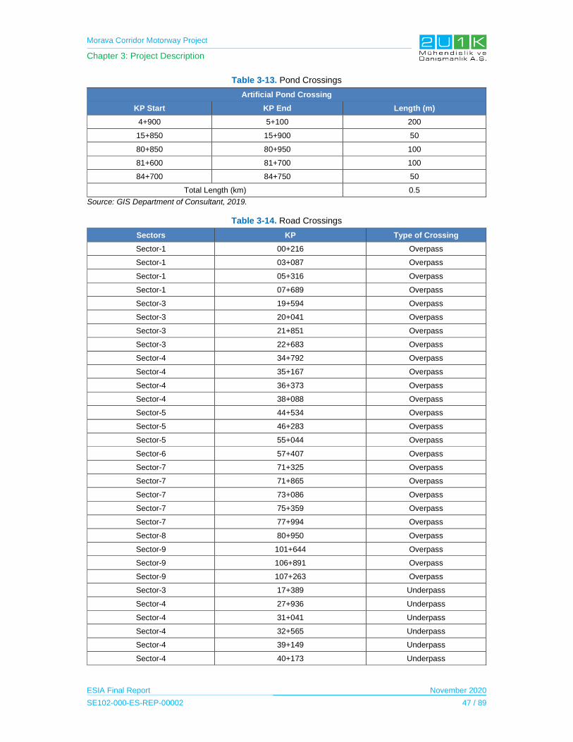
Morava Corridor Motorway Project
Chapter 3: Project Description
ESIA Final Report November 2020
SE102-000-ES-REP-00002 47 / 89
Table 3-13. Pond Crossings
Artificial Pond Crossing
KP Start KP End Length (m)
4+900 5+100 200
15+850 15+900 50
80+850 80+950 100
81+600 81+700 100
84+700 84+750 50
Total Length (km) 0.5
Source: GIS Department of Consultant, 2019.
Table 3-14. Road Crossings
Sectors KP Type of Crossing
Sector-1 00+216 Overpass
Sector-1 03+087 Overpass
Sector-1 05+316 Overpass
Sector-1 07+689 Overpass
Sector-3 19+594 Overpass
Sector-3 20+041 Overpass
Sector-3 21+851 Overpass
Sector-3 22+683 Overpass
Sector-4 34+792 Overpass
Sector-4 35+167 Overpass
Sector-4 36+373 Overpass
Sector-4 38+088 Overpass
Sector-5 44+534 Overpass
Sector-5 46+283 Overpass
Sector-5 55+044 Overpass
Sector-6 57+407 Overpass
Sector-7 71+325 Overpass
Sector-7 71+865 Overpass
Sector-7 73+086 Overpass
Sector-7 75+359 Overpass
Sector-7 77+994 Overpass
Sector-8 80+950 Overpass
Sector-9 101+644 Overpass
Sector-9 106+891 Overpass
Sector-9 107+263 Overpass
Sector-3 17+389 Underpass
Sector-4 27+936 Underpass
Sector-4 31+041 Underpass
Sector-4 32+565 Underpass
Sector-4 39+149 Underpass
Sector-4 40+173 Underpass
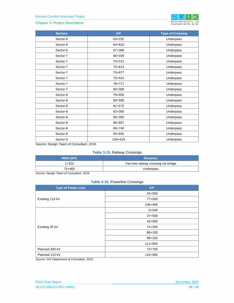
Morava Corridor Motorway Project
Chapter 3: Project Description
ESIA Final Report November 2020
SE102-000-ES-REP-00002 48 / 89
Sectors KP Type of Crossing
Sector-6 63+232 Underpass
Sector-6 64+819 Underpass
Sector-6 67+386 Underpass
Sector-7 68+339 Underpass
Sector-7 70+012 Underpass
Sector-7 70+813 Underpass
Sector-7 70+977 Underpass
Sector-7 75+441 Underpass
Sector-7 78+717 Underpass
Sector-7 80+308 Underpass
Sector-8 79+650 Underpass
Sector-8 80+595 Underpass
Sector-8 81+575 Underpass
Sector-8 83+390 Underpass
Sector-8 85+350 Underpass
Sector-8 86+897 Underpass
Sector-8 89+740 Underpass
Sector-8 93+655 Underpass
Sector-9 106+619 Underpass
Source: Design Team of Consultant, 2019.
Table 3-15. Railway Crossings
RWX (KP) Remarks
1+322 Two-line railway crossing via bridge
75+465 Underpass
Source: Design Team of Consultant, 2019.
Table 3-16. Powerline Crossings
Type of Power Line KP
Existing 110 kV
25+050
77+000
106+400
Existing 35 kV
6+500
37+500
43+500
74+300
86+100
98+100
111+800
Planned 400 kV 72+700
Planned 110 kV 110+900
Source: GIS Department of Consultant, 2019.
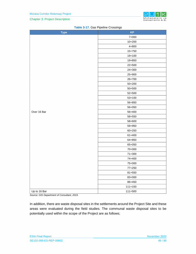
Morava Corridor Motorway Project
Chapter 3: Project Description
ESIA Final Report November 2020
SE102-000-ES-REP-00002 49 / 89
Table 3-17. Gas Pipeline Crossings
Type KP
Over 16 Bar
7+000
10+200
4+800
15+750
19+100
19+850
22+500
24+300
25+900
26+700
50+200
50+500
52+500
53+100
56+850
56+050
56+400
58+550
58+600
59+950
60+250
61+400
64+850
65+050
70+000
71+300
74+400
75+000
77+250
81+550
83+000
86+450
111+150
Up to 16 Bar 111+500
Source: GIS Department of Consultant, 2019.
In addition, there are waste disposal sites in the settlements around the Project Site and these
areas were evaluated during the field studies. The communal waste disposal sites to be
potentially used within the scope of the Project are as follows;
Morava Corridor Motorway Project
Chapter 3: Project Description
ESIA Final Report November 2020
SE102-000-ES-REP-00002 50 / 89
Ćićevac and Varvarin1 JKSP Razvitak from Ćićevac and JKP Varvarin from Varvarin are
engaged for collection, transport and disposal of communal waste. Collected communal
waste from Ćićevac and Varvarin Municipalities is disposed on non-hygenic dumpsite
located in abandoned river valley, approximately 500 m from Great Morava River and 4
km from the road Ćićevac – Varvarin. The dumpsite has been used for more than 20 years
and it occupies surface of approximately 1 ha. Annual disposal of communal waste from
both companies is estimated on approximately 10,600 m3. There are no protective
measures and very limited activities for compacting of disposed waste (with bulldozer).
Certain amounts of construction and animal waste are disposed also.
Kruševac2 JKP Kruševac is engaged for collection, transport and disposal of communal
waste. Communal waste is disposed on the Srnje dumpsite, location used since 1984,
located approximately 6.5 km from Kruševac and between three villages: Srnje, Velika
Kruševica and Padež. Total surface of complex is 37 ha of which 20 ha is dedicated for the
communal waste disposal. There are no drainage canals on the dumpsite and other
protective measures. Daily disposal of non-hazardous waste is estimated on 150 t. The
bulldozer and loading shovel are used for manipulation with collected communal waste.
JKP Kruševac holds one separate operational unit for sorting and recycling of PET
packaging, glass and cardboard/paper/PVC folia.
Trstenik3 JKSP Komstan Trstenik is engaged for collection, transport and disposal of
communal waste on the city landfill. Annual disposal of waste is 9,000 t for communal
waste and 2,000 t for the waste from the industry. Industrial waste is presented with sludge
and waste chemicals, which are disposed in dedicated concrete cassettes. The landfill is
located in Osaonica, in the place called “Dzamski potok”, approximately 3 km from the city
of Trstenik. Total surface of the landfill is 7.5 ha. The landfill is edged with fence, with
access road, plateau, system for extracting of landfill gases, drainage water system,
installed piezometers, etc.
Vrnjačka banja4 Vrnjačka banja Municipality has signed the contract with sanitary landfill
in Lapovo for collection, transport and disposal of communal waste.
Kraljevo5 JKP Čistoća is engaged for collection, transport and disposal of communal waste
on dumpsite “Kulagića Ada”, located approximately 150-200 m from West Morava River.
The dumpsite is formed in 1971 and the communal waste is disposed since then. It
occupies a surface of approximately 8 ha. Approximately 36,000 t of waste is disposed on
1 Document: LEAP for the Municipality of Ćićevac for 2017-2021, dated: December 2017 and Strategy of sustainable development of the Municipality of Varvarin for 2007-2017, dated: March 2007.
2 Document: Local program for environmental protection 2015-2024, dated: March 2015.
3 Document: Program for environmental protection in the Municipality of Trstenik 2017-2021, dated: February 2017. 4 Publicly available information. 5 Document: LEAP for the Municipality of Kraljevo, dated: 2012.

Morava Corridor Motorway Project
Chapter 3: Project Description
ESIA Final Report November 2020
SE102-000-ES-REP-00002 51 / 89
this dumpsite annually. It is characterized as a dumpsite without minimal protective
measures according to applicable Laws.
Čačak6 Čačak Municipality with other 8 Municipalities in Serbia have founded Duboko
regional sanitary landfill in Užice and they are engaged for collection, transport and
disposal of communal waste since 2005. Daily collected communal waste in Čačak is
approximately 70 t. In addition, the Municipality of Čačak has opened transfer station in
March 2016, as a central place for collection and primary sorting of waste in Čačak.
3.9 Project Construction Activities
The construction of the Project will require approximately 2,700 ha of land area including the
Construction Project Facilities. The construction of the Project is planned to be completed in
four years. The earthworks start dates for each Section are as follows;
Section-1 in April 2020;
Section-2 in April 2021; and
Section-3 in August 2020.
Construction phase of the Project was planned to be completed in late November 2023 when
the motorway will be operational.
The average number of the construction workers will be 3,100 and the peak number of the
project workers will be approximately 3,800 in 2022. The labour requirement for the
construction of the Project will be primarily sourced from Serbia, local labour force and
complemented by expats.
Almost all sections of the Motorway are on flat farmland and next to the West Morava River,
which is on a large flood plain. The Proposed Motorway Route is easily accessible due to the
proximity of local roads and access points. Construction plan comprises passing through
agricultural areas. All expropriation and land access provisions are the responsibility of the
Employer.
Typical road construction works begin with clearing the terrain in the area defined by the project
design boundaries. These works involve the removal of vegetation and structures in the area.
The next activities consist of earthworks (cut and fill sections` excavation and embankment
activities) for which graders, dozers, concrete skippers, rollers and other similar machinery are
used. This is followed by the construction of culverts and drainage systems as well as the
construction of larger structures (bridges, retaining walls, etc.). Upon completion of these
works, finishing works and pavement of the constructed road starts, i.e., the lower carrier layer,
6 Publicly available information.
Morava Corridor Motorway Project
Chapter 3: Project Description
ESIA Final Report November 2020
SE102-000-ES-REP-00002 52 / 89
the upper carrier layer and the pavement. The final stages are the installation of ancillary
equipment (fencing, signaling etc.) and the preparation of the road belt (greening).
The planned design and construction sequence provided by the Contractor, is as follows:
• Design for Construction (Contractor’s Scope);
• River Regulation Design (Employer’s Scope);
• Expropriation for project facilities such as camps (other expropriation is Employer’s
scope);
• Utility Relocations Completion;
• Mobilization;
• Earthworks;
• Drainage7;
• Structural Concrete;
• Paving;
• Finishing Works; and
• Open to Traffic.
Typical construction activities provided by the Contractor, which will subject to change as per
detailed design, are outlined in this section of the Report. The list given in Figure 3-41 shows
the possible construction equipment to be used in the construction activities. Permits for
“Access to Site” and “Access to Geotechnical Investigation and Survey Locations” as well as
“Provision of Borrow Pits/Quarries and Waste Areas” will be obtained by Employer prior to the
start of these activities of the Contractor.
3.9.1 Description of Methods of Earthworks
Clearing and grubbing involves the removal from the alignment of surface vegetation and
material unsuitable as part of the motorway structure. Bulldozers will generally be used for the
clearing and piling the material for hauling. Hydraulic excavators will be required for the
demolition of existing obstructions.
For the Project, the cleared and grubbed material will be removed, loaded and transported to
a site provided by the Employer and disposed of in an acceptable manner. Hydraulic
excavators will be used to load the material into suitable hauling equipment (off-highway or on-
highway trucks).
These activities will not include the clearance, removal, or disposal of any hazardous waste,
including unexploded ordinance or similar substances.
7 Drainage design targets a solution in order to achieve that all storm or surface runoff water from pavement surface are effectively collected and taken for the treatment and discharge to the receiving body. Rainwater from cut and fill slopes are collected with trenches and concrete channels along the right of way fence.
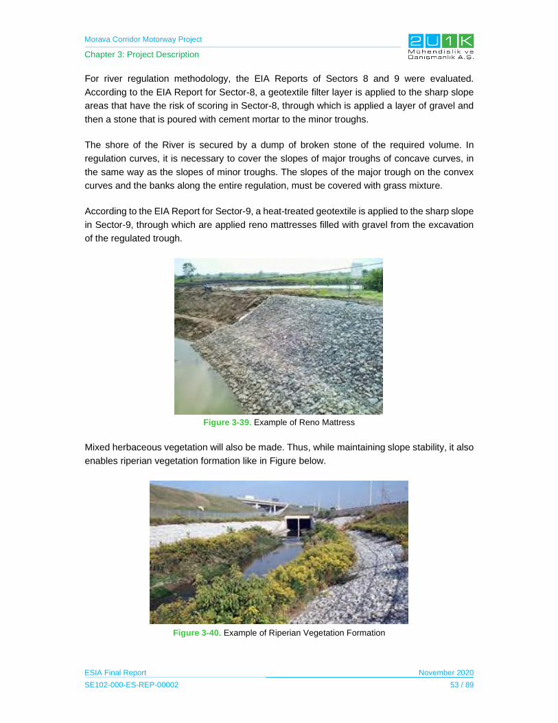
Morava Corridor Motorway Project
Chapter 3: Project Description
ESIA Final Report November 2020
SE102-000-ES-REP-00002 53 / 89
For river regulation methodology, the EIA Reports of Sectors 8 and 9 were evaluated.
According to the EIA Report for Sector-8, a geotextile filter layer is applied to the sharp slope
areas that have the risk of scoring in Sector-8, through which is applied a layer of gravel and
then a stone that is poured with cement mortar to the minor troughs.
The shore of the River is secured by a dump of broken stone of the required volume. In
regulation curves, it is necessary to cover the slopes of major troughs of concave curves, in
the same way as the slopes of minor troughs. The slopes of the major trough on the convex
curves and the banks along the entire regulation, must be covered with grass mixture.
According to the EIA Report for Sector-9, a heat-treated geotextile is applied to the sharp slope
in Sector-9, through which are applied reno mattresses filled with gravel from the excavation
of the regulated trough.
Figure 3-39. Example of Reno Mattress
Mixed herbaceous vegetation will also be made. Thus, while maintaining slope stability, it also
enables riperian vegetation formation like in Figure below.
Figure 3-40. Example of Riperian Vegetation Formation
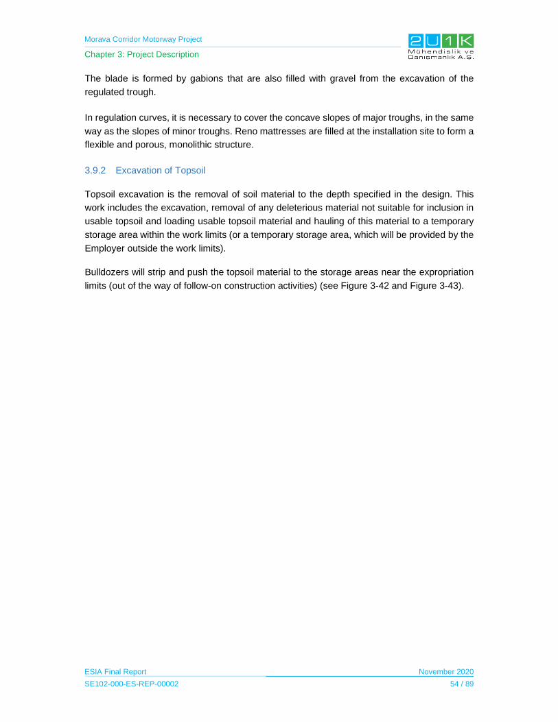
Morava Corridor Motorway Project
Chapter 3: Project Description
ESIA Final Report November 2020
SE102-000-ES-REP-00002 54 / 89
The blade is formed by gabions that are also filled with gravel from the excavation of the
regulated trough.
In regulation curves, it is necessary to cover the concave slopes of major troughs, in the same
way as the slopes of minor troughs. Reno mattresses are filled at the installation site to form a
flexible and porous, monolithic structure.
3.9.2 Excavation of Topsoil
Topsoil excavation is the removal of soil material to the depth specified in the design. This
work includes the excavation, removal of any deleterious material not suitable for inclusion in
usable topsoil and loading usable topsoil material and hauling of this material to a temporary
storage area within the work limits (or a temporary storage area, which will be provided by the
Employer outside the work limits).
Bulldozers will strip and push the topsoil material to the storage areas near the expropriation
limits (out of the way of follow-on construction activities) (see Figure 3-42 and Figure 3-43).

Morava Corridor Motorway Project
Chapter 3: Project Description
ESIA Final Report November 2020
SE102-000-ES-REP-00002 55 / 89
Figure 3-41. Tentative List of Construction Equipment
Equipment Needed Equipment
Sedan Car 7
SUV 4*4 34
Passenger Bus 23
Worker Bus 36
Pick Up 163
Ambulance 8
Mechanic Pick‐up 0
Boom Truck 38
Cargo Truck 0
Bitumen Distributor Truck 1
Repair Truck 7
Lube Truck 8
Tire Truck 6
Fuel Truck 16
Wash Truck 3
Potable Water Truck 4
Water Truck 23
Truck Tractor 25
Heavy Truck Tractor 1
Transit Mixer 6X4 41
Concrete Pump Truck 6
Dump Truck 8X4 24
Dump Truck 6X4 688
Truck with Snow Plow 1
Wet Shotcrete Machine 0
Highbed Trailer 28
Lowbed 10
Cement Silo Truck 1
Water Trailer (30,000 Liter) 0
Farm Tractor Trailer 9
Manlift 2
Forklift 11
Twin Boom Platform Lifter 0
High Pressure Washer 4
Rough Terrain Crane 30 Tons 9
Rough Terrain Crane 26 to 50 Tons 8
Rough Terrain Crane 51 to 100 Tons 8
Tower Crane 9
Gantry Crane 8
Wheel Loader 47
Backhoe Loader 22
Steer Skid Loader 7
Dozer (CAT D4 or equivalent) 3
Dozer (CAT D6 or equivalent) 0
Dozer (CAT D8 or equivalent) 24
Dozer (CAT D9 or equivalent) 1
Excavator (Hitachi ZX33 or equivalent) 3
Excavator (Hitachi ZX690 or equivalent) 19
Excavator (Hitachi ZX490 or equivalent) 5
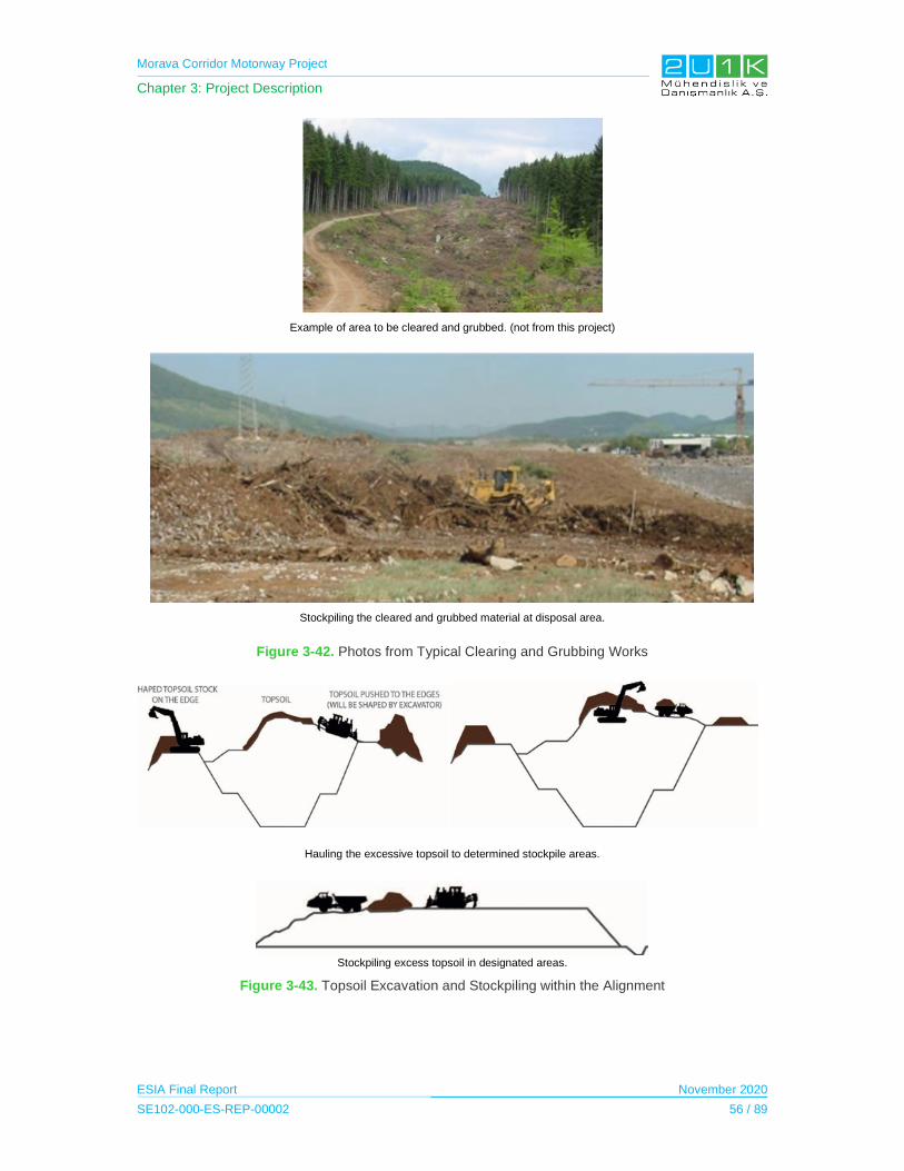
Morava Corridor Motorway Project
Chapter 3: Project Description
ESIA Final Report November 2020
SE102-000-ES-REP-00002 56 / 89
Example of area to be cleared and grubbed. (not from this project)
Stockpiling the cleared and grubbed material at disposal area.
Figure 3-42. Photos from Typical Clearing and Grubbing Works
Hauling the excessive topsoil to determined stockpile areas.
Stockpiling excess topsoil in designated areas.
Figure 3-43. Topsoil Excavation and Stockpiling within the Alignment
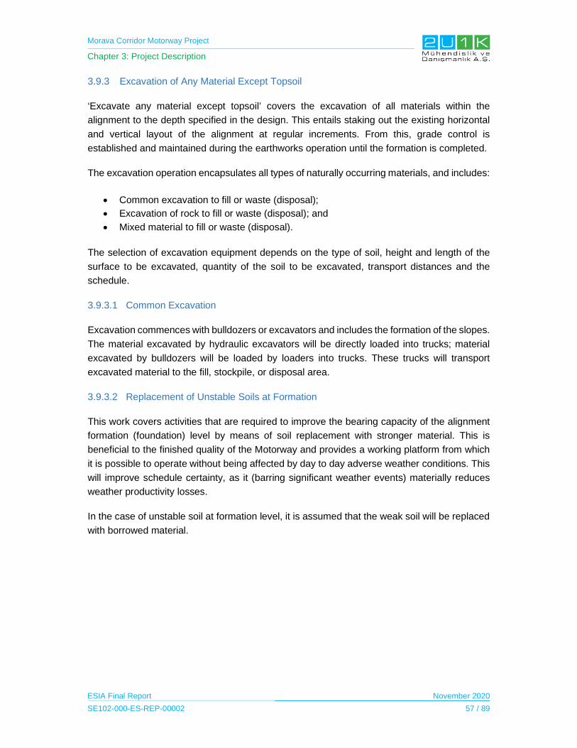
Morava Corridor Motorway Project
Chapter 3: Project Description
ESIA Final Report November 2020
SE102-000-ES-REP-00002 57 / 89
3.9.3 Excavation of Any Material Except Topsoil
‘Excavate any material except topsoil’ covers the excavation of all materials within the
alignment to the depth specified in the design. This entails staking out the existing horizontal
and vertical layout of the alignment at regular increments. From this, grade control is
established and maintained during the earthworks operation until the formation is completed.
The excavation operation encapsulates all types of naturally occurring materials, and includes:
Common excavation to fill or waste (disposal);
Excavation of rock to fill or waste (disposal); and
Mixed material to fill or waste (disposal).
The selection of excavation equipment depends on the type of soil, height and length of the
surface to be excavated, quantity of the soil to be excavated, transport distances and the
schedule.
3.9.3.1 Common Excavation
Excavation commences with bulldozers or excavators and includes the formation of the slopes.
The material excavated by hydraulic excavators will be directly loaded into trucks; material
excavated by bulldozers will be loaded by loaders into trucks. These trucks will transport
excavated material to the fill, stockpile, or disposal area.
3.9.3.2 Replacement of Unstable Soils at Formation
This work covers activities that are required to improve the bearing capacity of the alignment
formation (foundation) level by means of soil replacement with stronger material. This is
beneficial to the finished quality of the Motorway and provides a working platform from which
it is possible to operate without being affected by day to day adverse weather conditions. This
will improve schedule certainty, as it (barring significant weather events) materially reduces
weather productivity losses.
In the case of unstable soil at formation level, it is assumed that the weak soil will be replaced
with borrowed material.

Morava Corridor Motorway Project
Chapter 3: Project Description
ESIA Final Report November 2020
SE102-000-ES-REP-00002 58 / 89
Excavation of common material with excavator. Cutting of slopes with excavator.
Figure 3-44. Similar Excavation Photos
Figure 3-45. Example of Excavation and Hauling as well as Compaction Works along the Alignment

Morava Corridor Motorway Project
Chapter 3: Project Description
ESIA Final Report November 2020
SE102-000-ES-REP-00002 59 / 89
Figure 3-46. Example of Replacing of Embankment Formation (Foundation) with Geotextile and Suitable Material
3.9.3.3 Rock Excavation
Even though it is not expected to face rock excavation in general, rock materials are strong
materials where blasting may be required to perform the excavation. The speed of the drilling
and blasting operation is on the critical path for the earthworks schedule where rock material
prevails.
Excavation method, drilling method, spacing of boreholes and the size of explosive charge will
be decided after completion of the review of the geotechnical investigation reports. Hydraulic
drills will perform the drilling of boreholes for blasting operations (See Figure 3-47). The
number of the boreholes will be decided according to the blasting plan in order to reduce to a
minimum any need for secondary blasting of rock.
Figure 3-47. Excavation Procedure Using Blasting Technique
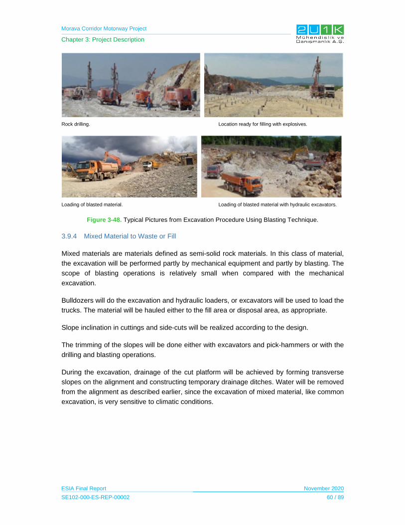
Morava Corridor Motorway Project
Chapter 3: Project Description
ESIA Final Report November 2020
SE102-000-ES-REP-00002 60 / 89
Rock drilling. Location ready for filling with explosives.
Loading of blasted material. Loading of blasted material with hydraulic excavators.
Figure 3-48. Typical Pictures from Excavation Procedure Using Blasting Technique.
3.9.4 Mixed Material to Waste or Fill
Mixed materials are materials defined as semi-solid rock materials. In this class of material,
the excavation will be performed partly by mechanical equipment and partly by blasting. The
scope of blasting operations is relatively small when compared with the mechanical
excavation.
Bulldozers will do the excavation and hydraulic loaders, or excavators will be used to load the
trucks. The material will be hauled either to the fill area or disposal area, as appropriate.
Slope inclination in cuttings and side-cuts will be realized according to the design.
The trimming of the slopes will be done either with excavators and pick-hammers or with the
drilling and blasting operations.
During the excavation, drainage of the cut platform will be achieved by forming transverse
slopes on the alignment and constructing temporary drainage ditches. Water will be removed
from the alignment as described earlier, since the excavation of mixed material, like common
excavation, is very sensitive to climatic conditions.
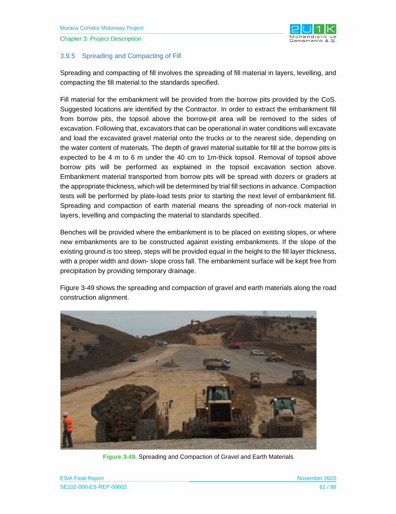
Morava Corridor Motorway Project
Chapter 3: Project Description
ESIA Final Report November 2020
SE102-000-ES-REP-00002 61 / 89
3.9.5 Spreading and Compacting of Fill
Spreading and compacting of fill involves the spreading of fill material in layers, levelling, and
compacting the fill material to the standards specified.
Fill material for the embankment will be provided from the borrow pits provided by the CoS.
Suggested locations are identified by the Contractor. In order to extract the embankment fill
from borrow pits, the topsoil above the borrow-pit area will be removed to the sides of
excavation. Following that, excavators that can be operational in water conditions will excavate
and load the excavated gravel material onto the trucks or to the nearest side, depending on
the water content of materials. The depth of gravel material suitable for fill at the borrow pits is
expected to be 4 m to 6 m under the 40 cm to 1m-thick topsoil. Removal of topsoil above
borrow pits will be performed as explained in the topsoil excavation section above.
Embankment material transported from borrow pits will be spread with dozers or graders at
the appropriate thickness, which will be determined by trial fill sections in advance. Compaction
tests will be performed by plate-load tests prior to starting the next level of embankment fill.
Spreading and compaction of earth material means the spreading of non-rock material in
layers, levelling and compacting the material to standards specified.
Benches will be provided where the embankment is to be placed on existing slopes, or where
new embankments are to be constructed against existing embankments. If the slope of the
existing ground is too steep, steps will be provided equal in the height to the fill layer thickness,
with a proper width and down- slope cross fall. The embankment surface will be kept free from
precipitation by providing temporary drainage.
Figure 3-49 shows the spreading and compaction of gravel and earth materials along the road
construction alignment.
Figure 3-49. Spreading and Compaction of Gravel and Earth Materials
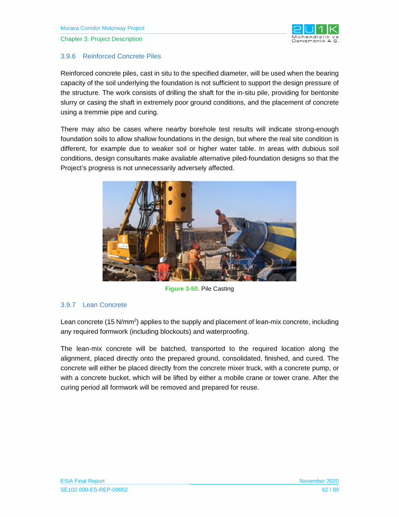
Morava Corridor Motorway Project
Chapter 3: Project Description
ESIA Final Report November 2020
SE102-000-ES-REP-00002 62 / 89
3.9.6 Reinforced Concrete Piles
Reinforced concrete piles, cast in situ to the specified diameter, will be used when the bearing
capacity of the soil underlying the foundation is not sufficient to support the design pressure of
the structure. The work consists of drilling the shaft for the in-situ pile, providing for bentonite
slurry or casing the shaft in extremely poor ground conditions, and the placement of concrete
using a tremmie pipe and curing.
There may also be cases where nearby borehole test results will indicate strong-enough
foundation soils to allow shallow foundations in the design, but where the real site condition is
different, for example due to weaker soil or higher water table. In areas with dubious soil
conditions, design consultants make available alternative piled-foundation designs so that the
Project’s progress is not unnecessarily adversely affected.
Figure 3-50. Pile Casting
3.9.7 Lean Concrete
Lean concrete (15 N/mm2) applies to the supply and placement of lean-mix concrete, including
any required formwork (including blockouts) and waterproofing.
The lean-mix concrete will be batched, transported to the required location along the
alignment, placed directly onto the prepared ground, consolidated, finished, and cured. The
concrete will either be placed directly from the concrete mixer truck, with a concrete pump, or
with a concrete bucket, which will be lifted by either a mobile crane or tower crane. After the
curing period all formwork will be removed and prepared for reuse.
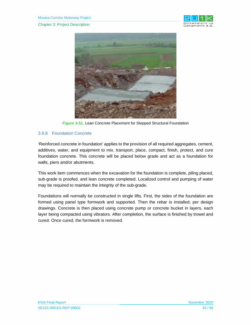
Morava Corridor Motorway Project
Chapter 3: Project Description
ESIA Final Report November 2020
SE102-000-ES-REP-00002 63 / 89
Figure 3-51. Lean Concrete Placement for Stepped Structural Foundation
3.9.8 Foundation Concrete
‘Reinforced concrete in foundation’ applies to the provision of all required aggregates, cement,
additives, water, and equipment to mix, transport, place, compact, finish, protect, and cure
foundation concrete. This concrete will be placed below grade and act as a foundation for
walls, piers and/or abutments.
This work item commences when the excavation for the foundation is complete, piling placed,
sub-grade is proofed, and lean concrete completed. Localized control and pumping of water
may be required to maintain the integrity of the sub-grade.
Foundations will normally be constructed in single lifts. First, the sides of the foundation are
formed using panel type formwork and supported. Then the rebar is installed, per design
drawings. Concrete is then placed using concrete pump or concrete bucket in layers, each
layer being compacted using vibrators. After completion, the surface is finished by trowel and
cured. Once cured, the formwork is removed.
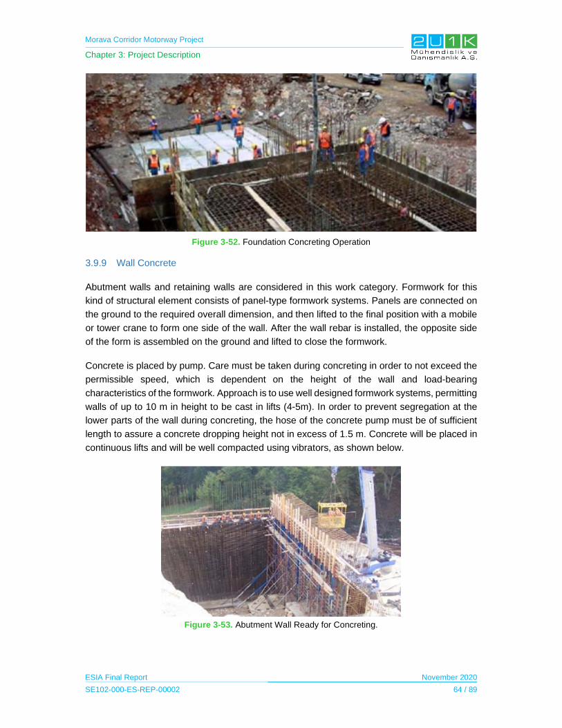
Morava Corridor Motorway Project
Chapter 3: Project Description
ESIA Final Report November 2020
SE102-000-ES-REP-00002 64 / 89
Figure 3-52. Foundation Concreting Operation
3.9.9 Wall Concrete
Abutment walls and retaining walls are considered in this work category. Formwork for this
kind of structural element consists of panel-type formwork systems. Panels are connected on
the ground to the required overall dimension, and then lifted to the final position with a mobile
or tower crane to form one side of the wall. After the wall rebar is installed, the opposite side
of the form is assembled on the ground and lifted to close the formwork.
Concrete is placed by pump. Care must be taken during concreting in order to not exceed the
permissible speed, which is dependent on the height of the wall and load-bearing
characteristics of the formwork. Approach is to use well designed formwork systems, permitting
walls of up to 10 m in height to be cast in lifts (4-5m). In order to prevent segregation at the
lower parts of the wall during concreting, the hose of the concrete pump must be of sufficient
length to assure a concrete dropping height not in excess of 1.5 m. Concrete will be placed in
continuous lifts and will be well compacted using vibrators, as shown below.
Figure 3-53. Abutment Wall Ready for Concreting.

Morava Corridor Motorway Project
Chapter 3: Project Description
ESIA Final Report November 2020
SE102-000-ES-REP-00002 65 / 89
3.9.10 Pier Concrete
3.9.10.1 Piers for Viaducts
It was assumed that the construction design of piers for viaducts will be of a hollow type. These
types of piers are cast in lifts of 4 - 5m height using special climbing formwork sets.
3.9.10.2 Piers for Overpasses
Piers for overpasses are typically of a solid design and smaller in size and height. They are
cast in one lift, with panel-type formwork. Panel sizes are chosen according to pier dimensions
and assembled on the ground. Pier rebar can be prefabricated and erected using mobile
cranes. After rebar installation, formwork is closed and properly supported on all four sides,
and the concrete is placed by pump or bucket.
3.9.10.3 Pier Heads for Overpasses
These are small in size, and as the pier height for overpasses is small, scaffolding is used to
support the formwork for this type of pier head. Before erecting the scaffold, the ground is
compacted and steel spreader plates are placed under the legs of the scaffold frames. At pier-
head level a platform is built to form the bottom of the pier head and to serve as a working
platform. The rebar cage at ground level will be prefabricated or installed in situ and lift it into
position by mobile crane. The side forms are then closed, and concreting can proceed.
3.9.11 Pier Heads for Viaducts
These types of pier heads are typically larger in size and can be constructed at considerably
higher elevations; we therefore utilize the formwork and pier-head concrete, is supported by a
system of truss girders anchored to the pier by special connections (see Figure 3-54).
Figure 3-54. Pier Concreting
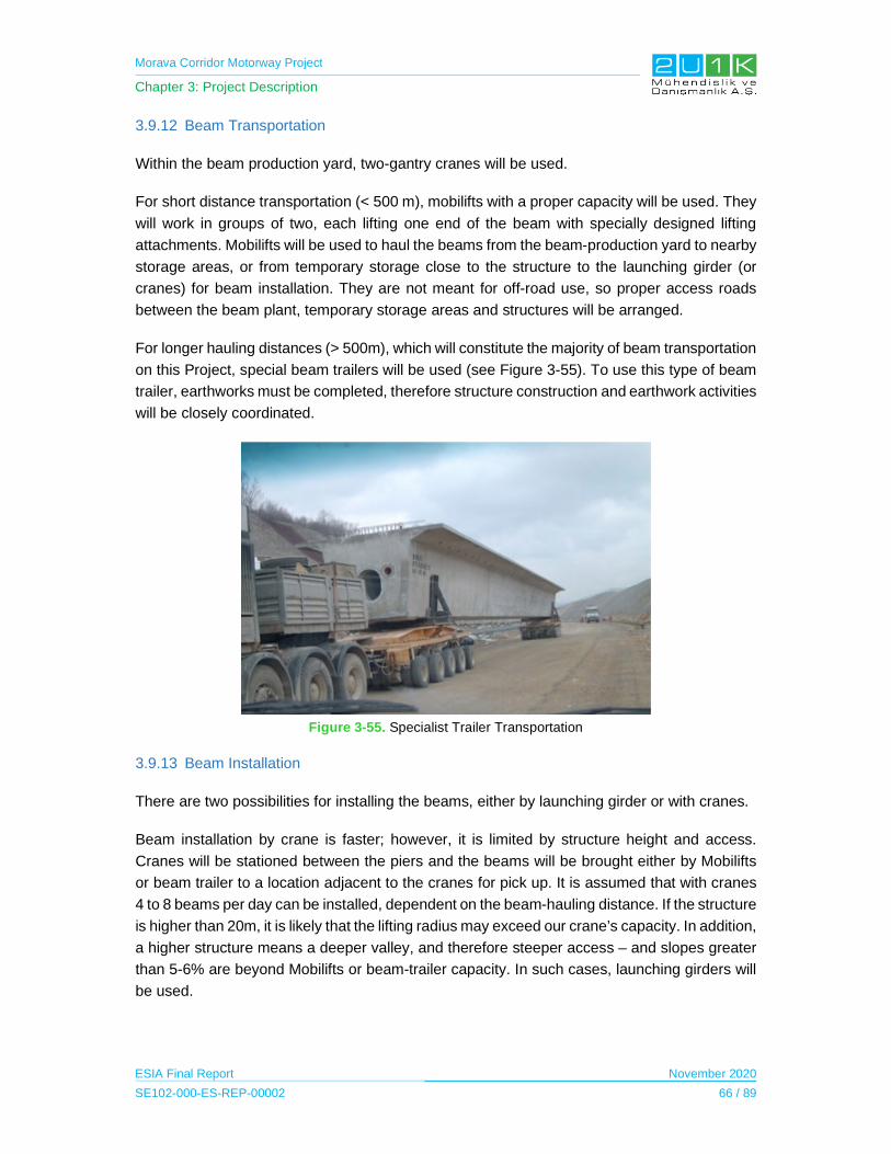
Morava Corridor Motorway Project
Chapter 3: Project Description
ESIA Final Report November 2020
SE102-000-ES-REP-00002 66 / 89
3.9.12 Beam Transportation
Within the beam production yard, two-gantry cranes will be used.
For short distance transportation (< 500 m), mobilifts with a proper capacity will be used. They
will work in groups of two, each lifting one end of the beam with specially designed lifting
attachments. Mobilifts will be used to haul the beams from the beam-production yard to nearby
storage areas, or from temporary storage close to the structure to the launching girder (or
cranes) for beam installation. They are not meant for off-road use, so proper access roads
between the beam plant, temporary storage areas and structures will be arranged.
For longer hauling distances (> 500m), which will constitute the majority of beam transportation
on this Project, special beam trailers will be used (see Figure 3-55). To use this type of beam
trailer, earthworks must be completed, therefore structure construction and earthwork activities
will be closely coordinated.
Figure 3-55. Specialist Trailer Transportation
3.9.13 Beam Installation
There are two possibilities for installing the beams, either by launching girder or with cranes.
Beam installation by crane is faster; however, it is limited by structure height and access.
Cranes will be stationed between the piers and the beams will be brought either by Mobilifts
or beam trailer to a location adjacent to the cranes for pick up. It is assumed that with cranes
4 to 8 beams per day can be installed, dependent on the beam-hauling distance. If the structure
is higher than 20m, it is likely that the lifting radius may exceed our crane’s capacity. In addition,
a higher structure means a deeper valley, and therefore steeper access – and slopes greater
than 5-6% are beyond Mobilifts or beam-trailer capacity. In such cases, launching girders will
be used.

Morava Corridor Motorway Project
Chapter 3: Project Description
ESIA Final Report November 2020
SE102-000-ES-REP-00002 67 / 89
Figure 3-56. Preparation of Beam Installation
3.9.14 Deck Slab Concrete
For structures with precast concrete beams, the deck slab is cast on top of the beams to form
the carriageway of the structure. For structures without precast beams, scaffolding and
formwork is required to support the deck slab concrete.
First, the side forms to the deck are erected, then the rebar is installed. Following the final
check of the top elevation, concrete is placed by pump. To achieve a smooth concrete surface,
vibrating screeds will be used. Proper curing control is important to prevent cracking on such
a large surface area.
3.9.15 Description of Drainage Work Methods
Drainage works will follow the completion of earthworks activities up to sub-grade level.
Excavators will perform drainage-pipe excavation. Slip-form pavers will be used for channels
and gutters to achieve the shortest installation time, whilst delivering excellent quality.
Similarly, the use of prefabricated culverts is proposed to shorten the construction period.
Drainage works can be classified as follows:
Internal Drainage: Collector pipes, cross pipes, manholes, water inlets, perforated
drainage pipes, concrete channels, bridge drainage and separators; and
External Drainage: Culverts, drainage ditches, lagoons, and down chutes.
The aim of internal drainage is to collect water coming from concrete ditches and down chutes,
and to take the discharge of water from the internal.
The aim of external drainage is to collect water coming from concrete ditches and down chutes,
and to take the discharge of water from the internal drainage system and collect it all in

Morava Corridor Motorway Project
Chapter 3: Project Description
ESIA Final Report November 2020
SE102-000-ES-REP-00002 68 / 89
lagoons. These lagoons facilitate the precipitation of solid wastes, resulting in the discharge of
clean water to natural watercourses.
For drainage excavation in general, it is planned on utilizing the following equipment:
Excavators for collector, cross pipe and separator excavation; and
Rubber tire excavators for water inlet excavation.
Figure 3-57. Lagoon Construction
3.9.15.1 Internal Drainage
3.9.15.1.1 Collector Pipes
Excavation will be executed as per design, and the excavated material will be kept adjacent to
the trench to act as a safety barricade.
The pipes will be backfilled as per design, and thereafter with selected suitable excavated
material.
3.9.15.1.2 Cross Pipes
After excavation, the pipe will be placed onto lean concrete and will be protected as per design.
Since the backfill depth is shallow, excavated material is unsuitable for cross- pipe backfill. It
is usual and common practice to use 0 - 25 or 0 – 30 mm crushed aggregate on these backfills
to prevent deformation at the asphalt surface over the cross pipes in the future. But use of
material for backfilling will be proceeded as per design.
3.9.15.1.3 Slotted Pipes
Medium-slotted pipes might be used to collect water coming from the asphalt surface.

Morava Corridor Motorway Project
Chapter 3: Project Description
ESIA Final Report November 2020
SE102-000-ES-REP-00002 69 / 89
3.9.15.1.4 Channel and Gutters
Channels will be applied on cut sections, and gutters will be applied on fill sections. Sub-base
will be spread and compacted, and our survey crews will set up offset wires for the slip form
paver. Typical internal drainage system works are shown below.
Collector pipe installation. Perforated pipe installation.
Sand bedding. Sand fill
Channel and gutter operation - median and shoulder.
Figure 3-58. Drainage Components’ Installation and Finishing Works

Morava Corridor Motorway Project
Chapter 3: Project Description
ESIA Final Report November 2020
SE102-000-ES-REP-00002 70 / 89
3.9.15.2 External Drainage
3.9.15.2.1 Culverts
Culvert operations start with earthworks operation. There are two types of culverts: box
culverts and pipe culverts.
3.9.15.2.2 Box Culverts
Either prefabricated (precast) or cast in situ method can be used. Preference is the precast
culvert method, as this permits acceleration of the earthworks. According to the experience of
the Contractor, a box culvert (of 1.5 m x 2.0 m size) can be constructed by the precast method
75% faster than the cast in situ method. In addition, the production quality will be better, and
the operation will not be weather susceptible. Precast culvert plants will be located adjacent to
our precast beam plants.
Larger culverts (> 2.0 m x 2.0 m size) will be constructed in situ, as precast elements of this
size or bigger become too heavy to lift with standard cranes.
3.9.15.2.3 Pipe Culverts
Pipe culverts usually will be constructed on local and parallel roads. It is expected that the pipe
diameters to be between 60 and 140 cm. After the placing of lean concrete, the pipes will be
laid and covered by concrete. Finally, the inlet and outlet structures will be constructed.
3.9.15.2.4 Drainage Ditches
Drainage ditches will be constructed as V type or trapeze type to collect water coming from
the top of the cut or fill slopes and transfer it to the culverts or absorption wells.
3.9.16 Description of Paving Work Methods
Paving operations will start with sub-grading works, following the completion of drainage
works. In order to meet the schedule and quality requirements, high capacity quarries,
crushers, sub-base and asphalt plants are needed to support the paving laydown operations.
As with all critical path activities, it is committed to achievement of the schedule through a
variety of shift patterns. A rotation system will be implemented to ensure our operators have
sufficient rest time between shifts. Detailed execution planning for the paving works is
described below.
3.9.16.1 Preparation of Sub-Grading – Capping Layer
Preparation of the sub-grading capping layer relates to the spreading and compacting of
suitable material over the completed cut, or last layer of fill, to improve the bearing capacity of
the roadbed under the sub- base and asphalt layers.
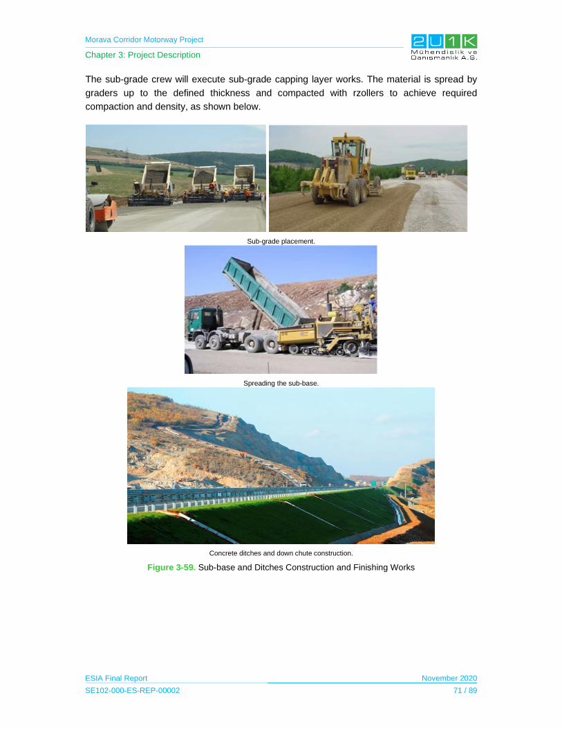
Morava Corridor Motorway Project
Chapter 3: Project Description
ESIA Final Report November 2020
SE102-000-ES-REP-00002 71 / 89
The sub-grade crew will execute sub-grade capping layer works. The material is spread by
graders up to the defined thickness and compacted with rzollers to achieve required
compaction and density, as shown below.
Sub-grade placement.
Spreading the sub-base.
Concrete ditches and down chute construction.
Figure 3-59. Sub-base and Ditches Construction and Finishing Works
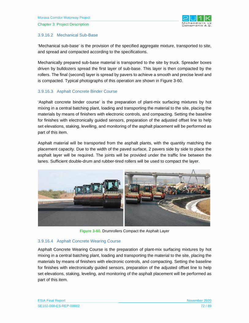
Morava Corridor Motorway Project
Chapter 3: Project Description
ESIA Final Report November 2020
SE102-000-ES-REP-00002 72 / 89
3.9.16.2 Mechanical Sub-Base
‘Mechanical sub-base’ is the provision of the specified aggregate mixture, transported to site,
and spread and compacted according to the specifications.
Mechanically prepared sub-base material is transported to the site by truck. Spreader boxes
driven by bulldozers spread the first layer of sub-base. This layer is then compacted by the
rollers. The final (second) layer is spread by pavers to achieve a smooth and precise level and
is compacted. Typical photographs of this operation are shown in Figure 3-60.
3.9.16.3 Asphalt Concrete Binder Course
‘Asphalt concrete binder course’ is the preparation of plant-mix surfacing mixtures by hot
mixing in a central batching plant, loading and transporting the material to the site, placing the
materials by means of finishers with electronic controls, and compacting. Setting the baseline
for finishes with electronically guided sensors, preparation of the adjusted offset line to help
set elevations, staking, levelling, and monitoring of the asphalt placement will be performed as
part of this item.
Asphalt material will be transported from the asphalt plants, with the quantity matching the
placement capacity. Due to the width of the paved surface, 2 pavers side by side to place the
asphalt layer will be required. The joints will be provided under the traffic line between the
lanes. Sufficient double-drum and rubber-tired rollers will be used to compact the layer.
Figure 3-60. Drumrollers Compact the Asphalt Layer
3.9.16.4 Asphalt Concrete Wearing Course
Asphalt Concrete Wearing Course is the preparation of plant-mix surfacing mixtures by hot
mixing in a central batching plant, loading and transporting the material to the site, placing the
materials by means of finishers with electronic controls, and compacting. Setting the baseline
for finishes with electronically guided sensors, preparation of the adjusted offset line to help
set elevations, staking, leveling, and monitoring of the asphalt placement will be performed as
part of this item.

Morava Corridor Motorway Project
Chapter 3: Project Description
ESIA Final Report November 2020
SE102-000-ES-REP-00002 73 / 89
3.9.17 Finishing Works Methods
Finishing works will start in parallel with related construction operations. These works will be
performed by direct hire forces or by subcontractors. Finishing works can be summarized as
follows:
Erection of cage-type fence
Installation of safety barriers (guardrails) on the alignment
Installation of bridge protective barriers (guardrails) on the bridges
Installation of vertical signs
Erection of sign gantries
Horizontal painting
Telecom ducts
Grassed areas and hydroseeding.
Figure 3-61. Finishing Works
3.10 Project Operation Activities
In the current condition (preliminary data of the “Roads of Serbia” for 2018), the value of
average annual daily traffic between Pojate and Preljina ranges from 3,609 vehicles/day
(section Ratina - Kraljevo (Kamidžora)) to 12,743 vehicles/day (section Mrčajevci - Preljina).
The average value, which accounts for the lengths of individual sections, is 8,205 vehicles/day.
After constructing the Motorway, part of this traffic will stay on the existing roads and other part
will be on the new motorway sections.

Morava Corridor Motorway Project
Chapter 3: Project Description
ESIA Final Report November 2020
SE102-000-ES-REP-00002 74 / 89
In the operational phase of the Motorway, the transit time between Pojate and Preljina will be
reduced from two hours to less than one hour. It is planned to make the motorway operational
in October 2023. Forecast values of Annual Average Daily Traffic (AADT) on motorway
sections for the first and the last year of traffic analysis are set forth here below.
Table 3-18. Motorway sections forecast AADT (vehicles/day)
Section-1: Forecast Study Results (2018)
Section Year PC* BUS LFV+MFV* HFV+TT* Total
Pojate - Ćićevac 2023 4664 49 266 706 5686
2043 7773 69 413 1124 9380
Ćićevac - Kruševac east
2023 6001 224 449 1031 7706
2043 10002 316 697 1644 12658
Kruševac east - Kruševac west
2023 3853 0 315 899 5067
2043 6420 1 489 1434 8344
Kruševac west - Koševi 2023 3570 0 383 566 4520
2043 5957 0 593 904 7455
Section-2: Forecast Study Results (2011)
section year PC BUS LFV+MFV HFV+TT total
Koševi - Velika Drenova
2015 9477 176 328 511 10493
2035 19704 280 640 1008 21631
Velika Drenova - Trstenik
2015 7774 134 301 508 8716
2035 16292 214 596 1001 18103
Trstenik - Vrnjačka Banja
2015 7749 123 306 528 8705
2035 16238 196 605 1040 18080
Vrnjačka Banja - Ratina2015 7798 162 322 557 8839
2035 16342 259 638 1098 18336
Ratina - Kamidžora 2015 8141 122 276 482 9021
2035 17061 194 546 938 18739
Kamidžora - Adrani 2015 4380 143 255 519 5298
2035 9158 225 498 1019 10899
Section-3: Forecast Study Results (2018)
section year PC BUS LFV+MFV HFV+TT total
Adrani - Mrčajevci 2023 5193 118 387 982 6680
2042 8526 165 595 1542 10828
Mrčajevci - Preljina 2023 8682 181 630 1266 10759
2042 14895 252 969 1988 18104
Preljina - Preljina AP 2023 11623 233 625 1402 13883
2042 19081 324 962 2202 22569
* PC: Private Cars, LFT: Light Freight Vehicle, MFT: Medium Freight Vehicle, HFT: Heavy Frieght Vehicle, TT: Tractor Trailer
Toll Collection
All junctions are designed according to closed toll fee payment system and include control
access to the Motorway through the toll platforms. In other words, toll payment collection will
be performed by paying directly to toll staff at booths or by toll card (electronic pre-paid
payment system).

Morava Corridor Motorway Project
Chapter 3: Project Description
ESIA Final Report November 2020
SE102-000-ES-REP-00002 75 / 89
Table 3-19. Financial effects-income from toll and commercial income (Million €)
Year Pojate- Kruševac (Koševi) Kruševac (Koševi)-
Adrani Adrani-Preljina
TOTAL Pojate-Preljina (all 3 sections)
2023 3.93 8,66 5.35 17.94
2044 17.22 35.75 21.47 74.44
The following table shows unit rate for toll collection, by basic vehicle type in Serbia.
Table 3-20. Unit rates by basic vehicle type-category in Serbia
Vehicle categories
I II III IV
Rate in EUR/km
0.03 0.05 0.10 0.20
Table 3-21. Facilities for the operational phase of the Morava Corridor Motorway Project
Sections Sector KP Operational Project Facility8
1 Sector-1 7,200 m Parking Area
2 Sector-4 33,750 m Service Area
2 Sector-4 34,790 m Maintenance Area
2 Sector-5 44,875 m Parking Area
2 Sector-6 64,000 m Service Area
2 Sector-7 73,400 m Parking Area
3 Sector-8 80,950 m Maintenance Area
3 Sector-9 99,600 m Parking Area
The Motorway connecting Preljina near Čačak with Pojate on the A1 Motorway (the North-
South motorway in central Serbia) through Kruševac, provides a linkage for the residents
(more than 500,000 people) and 21,000 companies. This will include better accessibility for
businesses in the Region to expand their geographical markets and resources to other areas
and countries.
The Motorway is expected to attract more investors in the Region. The increased investment
will bring in more employment opportunities to the local people, including diversification of
economic activities. This is quite significant considering the fact that majority of the
expropriated land are agricultural lands, and PAPs whom may be affected economically can
shift and continue to attribute their income through newly introduced economic fields.
8 Operational Project Facilities include parking area, service area and maintenance area.

Morava Corridor Motorway Project
Chapter 3: Project Description
ESIA Final Report November 2020
SE102-000-ES-REP-00002 76 / 89
In order to develop local economy throughout the operation phase of the Motorway, the Spatial
Plan indicates that there will be two maintenance facilities throughout the alignment in which
is expected to employ local community within its departments. Also, the Project will establish
amenities including; parking lots, rest areas, motels, gas station (including grocery, cafes and
restaurant in which is expected to increase benefits to local economy. Therefore, after the
establishment of the Project, roadside businesses may enhance and facilitate trade along the
Proposed Motorway Route.
For procurement services, the Project will be subject to regular maintenance, including
summer and winter maintenances, in which will provide procurement opportunities of local and
national contractors. This is expected to further induce employment opportunities and increase
of livelihood of PAPs. Other induced impacts are considered to be mostly in the service sector
such as tire repair services, on the road assistance and auto mechanics.
3.11 Resource Management
During the design and construction phase of the Project, there will be different types of
resources usage including water consumption for domestic needs in camps, production needs
in concrete batching plants etc. The estimated amount of water use for labor camps is 25,000
tons in total of 2 camps as monthly average. If the number of camps is to be 3 then this estimate
will yield as 38,000 tons per month. Water will mainly be supplied from the water wells.
For batch plants, water consumption of 10,000 tons is estimated as monthly average. Batch
plants will work year-round. Amount of raw material to be used will be about 36,000 tons of
aggregate and 7,500 tons of cement in order to produce 20,000 m3 of concrete as monthly
average. Around 25 dump trucks will be used for raw material transportation to batch plants.
750 m3 of concrete production is estimated as daily average. For this purpose, 280 tons of
cement will be consumed as daily average. Amount of daily water use for batch plant is
foreseen as 400 tons per day.
Regarding the consumptions of resources in asphalt plants, it is estimated to consume 3,500
tons of water as monthly average. Asphalt production of 3,000 tons is planned on a daily basis
average.
Amount of aggregate required for the construction for Sections 1, 2 and 3 are estimated as
1,984,000 m3, 3,894,500 m3 and 2,277,900 m3, respectively. These amounts will include
reserves of alluvial gravel, aggregate of carbonate origin (limestone), used for the construction
of the upper supporting layers of pavement structure and concrete. These materials will be
provided from different locales. For instance, according to the national EIA Report of Section-
1, ''Ladjevci'', ''Chokoće'', ''Plana'' are planned to be such areas where the construction raw
material including aggregates will be provided. Likewise, aggregates of Andensitic origin used
for the construction of the upper pavement layers (bonding and wear layer) are being exploited
at two sites in the wider zone of corridor E-761: "Kamenica" and "Strana". All listed sites of the
rock aggregate are located 20-30 km from the construction site. All materials used for

Morava Corridor Motorway Project
Chapter 3: Project Description
ESIA Final Report November 2020
SE102-000-ES-REP-00002 77 / 89
installation in embankments, as well as for the construction of lower and upper bearing pads
must meet the requirements defined by national standards.
In addition, excavation materials to be obtained as a result of river regulation works will also
be used in the construction of the Motorway. The amount to be obtained after this regulation
works is calculated as 9.968.980 m3. Regulation works will not include filling operations in the
River bottom.
3.12 Waste Management
Construction activities of the Project will cause all sorts of wastes including hazardous and
non-hazardous as well as inert wastes such as excess excavated material that needs to be
dumped properly. If wastes are not inadequately managed, this can lead the major
environmental impacts.
According to the national EIA studies, the evaluation of the spillage of the materials was made
on the basis of experience arising from 20-year studies where the quantities of solid and liquid
deposit per unit of road surface for reference traffic load (average annual daily traffic – 8,700
vehicles) are given annually. For the forecast traffic load on the sections of the Motorway
Pojate-Koshevo, oil and lubricant spills are calculated proportionally and are estimated at 1.9-
3.3 kg / ha annually.
A Waste Management Plan (WMP) will be prepared and maintained by the Contractor and its
subcontractors. The WMP will determine the types and quantities of wastes that are likely to
form during the construction phase, including: excavated materials and construction wastes;
Most of the excavated material will be reused, if practical and proper in the way to serve
as filling material or reinstatement / restoration /landscape works in the scope of the
environmental mitigation implementations;
In the pre-construction activities, location of the proper landfills will be determined in
order to be used for the disposal of the wastes and it should be covered in the WMP.
Waste materials generated by the regular operation of the Motorway are as follows:
solid municipal waste within project facilities,
solid municipal waste from uncontrolled emissions of road users on slopes (wild
landfills),
waste oils and sludge accumulated in separators for the purification of atmospheric
wastewaters from roadways,
waste resulting from regular and periodic road maintenance.
Waste management regarding the operational phase of the Motorway will be mainly composed
of food, paper, and packaging waste generated by passengers that would use the parking

Morava Corridor Motorway Project
Chapter 3: Project Description
ESIA Final Report November 2020
SE102-000-ES-REP-00002 78 / 89
places and gas stations along the Motorway. With the appropriate number of waste collection
bins and containers are going to be provided at the parking places and cooperation with local
public utility companies for waste disposal, the significance of the impact is to be negligible.
Any hazardous, contaminated wastes to be generated from the operation and maintenance
facilities as well as gas stations will be disposed according to the national requirements. Private
gas station facilities are responsible for their own operations in terms of the environmental
compliances. Furthermore, during regular traffic, release of liquid substances may occur in the
sense of leaking tanks, or engine parts, with fuel, engine oil and antifreeze remaining on the
Motorway.
3.13 Employment
The Project will result in temporary employments for the duration of the construction phase
(expected to be 4 years, see Figure 3-62). The average number of the construction workers
will be 3,100 and the peak number of the project workers will be approximately 3,800. Majority
of the unskilled workforce are expected to be hired from the locals of Social AoI, on the other
hand, majority of the skilled construction workers are expected to be recruited from expat
employees.
Figure 3-62. Construction Employment Projection
Operational period employment strategy is discussed in Section 3.16.
20192020
20212022
2023
Years
PROJECTION OF FOREIGN STAFF LEVEL BY YEAR
Foreig
Nation
Morava Corridor Motorway Project
Chapter 3: Project Description
ESIA Final Report November 2020
SE102-000-ES-REP-00002 79 / 89
3.14 Land use / Land take and resettlement
There will be loss of agricultural, forest, municipal, village and private land as a result of the
Project. The existing land use of the social AoI will be affected by the construction of the Project
and its opponents as well as by the project facilities.
The Project execution will require permanent acquisition of land by using expropriation. The
Project is expected to cause economic displacement and physical resettlement, however, at
this stage, the magnitude of displacement is not completely known. Identification of the
landowners for Section-1 started in February 2019 and the expropriation process started in
April 2019, which is planned to be completed in May 2020 by Corridors of Serbia. On the other
hand, Location Conditions9 for Section 2 and 3 is currently in progress; therefore the exact
amount of expropriated land is currently unknown.
The CoS will be responsible for the expropriation activities for each section of the Project.
Responsible Institutions and their roles on land acquisition and expropriation for the Project is
provided in Table below.
Table 3-22. Responsible Institutions on Land Acquisition & Expropriation
Sections Expropriation Roles
Section-1 CoS
Section-2 CoS
Section-3 CoS
Responsibilities
Land cadastral maps Expropriation administration Payment RAP implementation
All sections of the Motorway are on flat farmland and next to the West Morava River, which is
on a large flood plain. The site is accessible due to the proximity of local roads and access
points. However, in addition to local roads, temporary access roads are needed to access the
Site. Land use for the access roads Construction plan comprises passing through agricultural
lands. All expropriation and Land Access provisions are the responsibility of the Government
of Serbia. Within the scope of the Project land acquisition activities, the number of houses and
businesses to be physically displaced is going to be determined exactly at this stage (in
particular when the EIA for Section-2 is prepared and submitted for approval by CIP).
According to the data obtained by CoS and observations of the ESIA Consultant, arable land
(non-irrigated arable land) and heterogeneous agricultural areas (with complex cultivation
patterns) covers the largest area along the AoI, which covers 500 m on each side of the
motorway along the Proposed Motorway Route. The AoI also includes urban fabric, industrial,
9 The Project has previously prepared the separate National “Environmental Impact Assessment (EIA)” Reports for each section of the Project route alignment and received approvals from related authorities. However, these EIA Reports are being revised due to the fact that, in the Spring of 2014, Serbia faced a tragic flood disaster that has affected houses, infrastructure, livelihood, agriculture, and industries. Therefore, the Project started a new Location Condition Collection in order to receive national EIA for the re-proposed Project, for all sections.

Morava Corridor Motorway Project
Chapter 3: Project Description
ESIA Final Report November 2020
SE102-000-ES-REP-00002 80 / 89
commercial and transport units, mine, dump and construction sites, artificial, non-agricultural
vegetated areas, pastures, heterogeneous agricultural areas, forests, scrub and/or
herbaceous vegetation associations, inland wetlands, Inland waters. Total area of land to be
used in the AoI is estimated about 18,437 ha, details can be found in Table 3-23 below.
The Project will also require some temporary land take for construction routes, construction
laydown areas and camps, temporary storage of excavated materials/soil, cut trees etc.
Temporary land and property impacts (for borrow pits, excess material disposal sites, storage,
access roads and worker camps) will affect the landowners during the construction phase of
the Project. Total area of land to be used for the temporary access roads, project facilities and
motorway is estimated approximately 2.493 ha, details can be found in Table 3-23.
Table 3-23. Land Use Areas in AoI
Land Use ( for The AoI) Area (ha) Percentage
Intensive unmixed crops 11,312.16 61.4
Riparian and gallery woodland, with dominant Alnus, Betula, Populus or Salix
2,710.59 14.7
Thermophilous deciduous woodland 2,211.62 12.0
Residential buildings of city and town centres 863.65 4.7
Permanent non-tidal, smooth-flowing watercourses 685.95 3.7
Permanent mesotrophic pastures and aftermath-grazed meadows 188.42 1.0
Rural industrial and commercial sites still in active use 142.92 0.8
Road networks 130.83 0.7
Highly artificial non-saline standing waters 116.62 0.6
Active opencast mineral extraction sites, including quarries 74.43 0.4
Total Area (ha) 18,437.19 100.00%
Table 3-24. Land Use Areas for the Temporary Access Roads, Project Facilities and Motorway
Land Use ( for the Temporary Access Roads, Project Facilities and Motorway)
Area (ha) Percentage
Intensive unmixed crops 1,696.80 68.06
Thermophilous deciduous woodland 338.90 13.59 Riparian and gallery woodland, with dominant Alnus, Betula, Populus or Salix
319.94 12.83
Road networks 29.22 1.17 Permanent mesotrophic pastures and aftermath-grazed meadows
67.82 2.72
Residential buildings of city and town centres 21.15 0.85
Permanent non-tidal, smooth-flowing watercourses 4.64 0.19
Highly artificial non-saline standing waters 3.35 0.13
Active opencast mineral extraction sites, including quarries 1.54 0.06
Rural industrial and commercial sites still in active use 9.72 0.39
Total Area (ha) 2,493.08 100.00%

Morava Corridor Motorway Project
Chapter 3: Project Description
ESIA Final Report November 2020
SE102-000-ES-REP-00002 81 / 89
Detailed information on the Project Owner’s commitments for the Project Affected People and
physical, economic displacement and livelihood impacts caused by Project implementation in
all Project phases can be found in Resettlement and Livelihood Restoration Framework
(RLRF) prepared as a part of ESIA Disclosure Package.
Also, Resettlement Action Plan (RAP) is currently being prepared by an independent
consultant company in line with IFC Performance Standard 5 in order to:
mitigate adverse social and economic impacts of expropriation and temporary or
permanent losses by providing compensation for losses of property on the basis of
replacement costs and ensure implementation of the activities of displacement with
appropriate data disclosure, consultations and participation of the PAPs,
at a minimum, re-establish sources of income and living standards of resettled persons
to the level before Project impact.
The Project Employer will prepare and make available to all PAPs and interested stakeholders
the summary document of the RAP, after final RAP has been adopted, in addition of
appropriate full RAP disclosure.
In addition to land acquisition, the Proposed Motorway Route may divide the land parcels or
abrupt access to remaining land. During the disclosure of the draft Spatial Plan on August
2019, the landowners and land users underlined the importance of the accessibility to their
agriculture lands. Hence the Commission for Conducting the Public Insight of the Spatial Plan
stated that the Project will take necessary measures such as interchanges, overpasses,
bridges and underpasses in order to sustain the accessibility of the land owners and users to
these areas in order to minimize any adverse impact on the livelihood resources.
The Project will avoid the acquisition of lands or land use rights that result in any physical or
economic displacement where applicable. If the land acquisition and displacement is
unavoidable, the Project will apply the measures to minimize the impacts of displacement.
3.15 Social Engagement
Stakeholder engagement is a two-way process of communication between the project parties
and its stakeholders. It is a key part of the ESIA process, allowing stakeholders to express
their views about the Project.
The Stakeholder Engagement Plan (SEP) presented in Appendix-3 has been developed with
the aim of explaining how the Project will communicate with stakeholders that may be directly
or indirectly affected by and / or interested in the Project. The SEP summarizes engagement
activities undertaken to date and includes details of the approach and mechanisms proposed
for future engagement with stakeholders. It also includes details of a grievance mechanism for
stakeholders to raise any concerns related to the Project. In accordance to international best
practice, objectives of the Stakeholder Engagement are to:

Morava Corridor Motorway Project
Chapter 3: Project Description
ESIA Final Report November 2020
SE102-000-ES-REP-00002 82 / 89
build and maintain a constructive relationship with and among the stakeholders, in
particular project-affected communities,
promote environmental and social performance via effective stakeholder engagement,
promote and provide effective means for adequate engagement with project-affected
communities throughout the project cycle on issues that could potentially affect them
so that their concerns are addressed accordingly and to ensure that meaningful
environmental and social information is disclosed to them and to other stakeholders,
ensure that all stakeholders have ways to access project information and raise issues,
ensure that project-affected people (PAPs) have accessible and effective means to
raise issues and grievances, and the Contractor respond to and manage such issues
and grievances appropriately.
For the scope of ESIA studies following stakeholder engagement activities were carried out.
Table 3-25. Past Stakeholder Engagement Activities within the Scope of ESIA Studies
Engagement Activity
Details Date
Gap Assessment Studies for ESIA
For the initial stakeholder analysis, 2U1K conducted Key Informant Interviews (KII) carried out in order to: •understand the Justification of the Project; •obtain updated information on the EIAs prepared for the different phases of the Project; and •understand the possible environmental and social impacts and the approach to mitigations of the impacts.
March 2019
ESIA Consultation Phase
Following number of surveys and interviews conducted respectively and following sub-sections provide details of the surveys conducted.
Type of Survey/ Interview Number of Surveys/Interviews/ Meetings
Household Surveys 1563
Community Level Surveys 48
Key Informant Interviews (KIIs) during the Gap Assessment
6
KIIs with Non-Governmental Organizations
9
KIIs with Affected Municipalities 7
Focus Group Discussions 7
Business Surveys 110
August 2019 – October
2019
Disclosure of the Resettlement and Livelihood Restoration Framework (RLRF)
In the third quarter of February 2020, public participation meetings for RLRF disclosure were conducted to share the scope of the Framework for each affected municipality.
Third quarter of February
2020
ESIA Disclosure
On September 23-30, seven open air Public Participation Meetings were conducted in each affected municipalities. (Summary of the meetings can be found in Chapter 9 of this report and SEP).
September 2020
Morava Corridor Motorway Project
Chapter 3: Project Description
ESIA Final Report November 2020
SE102-000-ES-REP-00002 83 / 89
It is important to note that, the Stakeholder Engagement Program, through an Informed
Consultation and Participation (ICP) process, includes set of actions with targeted audience
and responsibilities in order to ensure the maximum engagement level for all relevant
stakeholders. The ICP process comprises all Project Phases including; pre-construction
phase, construction phase and operation phase. Details of the engagement methods
structured for the Project phases can be found in Chapter 9 of this Report and SEP.
3.16 Construction Management
The contractor will prepare its management plan covering the construction method statement
that considers the commitments in the ESIA Report and its appendices (in particular
Environmental and Social Management and Monitoring Plan (ESMMP) and its supporting sub-
plans). The Construction time schedule that covers the important milestones of the
construction works is provided in Figure 3-63. It should be noted that the construction works
to be carried out by the contractor will be supervised by the CoS.

Morava Corridor Motorway Project
Chapter 3: Project Description
ESIA Final Report November 2020
SE102-000-ES-REP-00002 84 / 89
Figure 3-63. Construction Time Schedule (for all sectors)
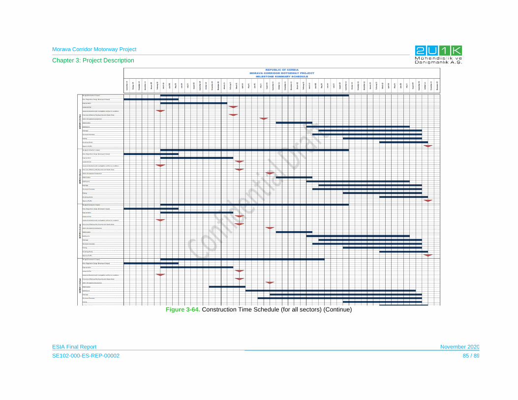
Morava Corridor Motorway Project
Chapter 3: Project Description
ESIA Final Report November 2020
SE102-000-ES-REP-00002 85 / 89
Figure 3-64. Construction Time Schedule (for all sectors) (Continue)

Morava Corridor Motorway Project
Chapter 3: Project Description
ESIA Final Report November 2020
SE102-000-ES-REP-00002 86 / 89
Figure 3-65. Construction Time Schedule (for all sectors) (Continue)

Morava Corridor Motorway Project
Chapter 3: Project Description
ESIA Final Report November 2020
SE102-000-ES-REP-00002 87 / 89
The Contractor’s proposed construction management organizational structure for the
execution of the Project is provided in Figure 3-66.
The management and monitoring of mitigations proposed in the ESIA, and which are the
responsibility of the Contractor will be implemented by the appropriate department within the
Contractor’s organization. The implementation of environmental, health, safety and social
commitments will be managed in line with the national and international requirements. The
Contractor will prepare policies, plans and association procedures for this purpose.

Morava Corridor Motorway Project
Chapter 3: Project Description
ESIA Final Report November 2020
SE102-000-ES-REP-00002 88 / 89
Figure 3-66. Proposed Construction Management Organization Structure
B PM1
1
E PM2
2
B Executive Assistant PM3
1
B Prime Contract Manager PRIME1
1
B Security Manager SE1
3
KM 79+000 to KM 109+663 KM 56+192 to KM 81+502 KM 27+600 to KM 56+192 KM -00+230 to KM 27+600
AREA 3 AREA 2 West AREA 2 East AREA 1
Area Manager 1 Area Manager 2 Area Manager 1 Area Manager 2
B
Environmental Safety & Health
Mng. ESH1
3
E Earthwork Manager EW1 E Earthwork Manager EW1
AREA 3 MANAGER 2 2
E Finishing Works Manager FN1
2
E Paving Manager PV1 E Paving Manager PV1
AREA 2 EAST MANAGER 2 2
E Drainage Manager DR1
2
E Quarries And Plants Manager QP1
AREA 1 MANAGER 2
E Structures Manager ST1 E Structures Manager ST1
AREA 2 WEST MANAGER 2 2
E
Equipment & Workshop
Manager EQ1
2
E Engineering Manager ENG1
2
E Design Manager DES1
2
B Design Liaison Manager DES2
2
E Field Engineering Manager FENG1
2
E QC Manager QC1
2
E Business Manager BM1
E Project Controls Manager PC1
1
B
Finance and Accounting
Manager F&A1
1
B
Procurement and Subcontracts
Manager PS1
1
B Human Resources Manager HR1
1
B
Community Relations &
Sustainability Manager CR1
3
B IS/T Manager IST1
1
E Camps And Facilities Manager CO1
1
1 - Sponsored by PM
2 - Sponsored by DPM
3 - Sponsored by PM & DPM
Deputy Project & Construction Manager
Project Manager

Morava Corridor Motorway Project
Chapter 3: Project Description
ESIA Final Report November 2020
SE102-000-ES-REP-00002 89 / 89
3.17 Operation Management
The Project is expected to be completed and commissioned in 2023, with 22 years of operation
period (overall horizon of analysis is 25 years and it includes the period of investment and the
period of operation). Corridors of Serbia (CoS) will operate the Motorway after its construction
is completed for Section-1 and Section-2. On the other hand, Roads of Serbia (RoS) will be
the responsible authority of the operation of Section-3 under the coordination of the CoS.
In order to develop local economy throughout the operation phase of the Motorway, the Spatial
Plan indicates that there will be two maintenance facilities throughout the alignment in which
is expected to employ local community within its departments. Also, the Project will establish
amenities including; parking lots, rest areas, motels, gas station (including grocery, cafes and
restaurant in which is expected to increase benefits to local economy. For national level, the
primary benefit will be derived from the toll collection for the Motorway.
The National Highways in Serbia are under tolling. Therefore, the primary national benefit will
be derived from the toll collection for the Motorway. Furthermore, the Motorway will significantly
shorten the travel time and the Social Area Influence will benefit from the improved
carriageway with higher quality transport movement and safer infrastructure. This will improve
the facilitation of goods transport costs and commune of financial resources within the country,
in general.
3.18 Operational Employment
Employees will be required for the operation of the toll collection and service facilities, the
maintenance of the Motorway, and environmental health and safety staff such as the
Emergency Response Team (ERT).
Based on the economic indicators of the previous motorway projects, it is expected that
between 20 and 50 permanent local employees will be hired for the tolling station and toll
collection of the Motorway.
The average number of personnel to be employed is expected to range between 300 and 400
full time equivalents throughout the years, including all contractors. These estimates will be
further developed during detailed design and implementation. Many of the persons will be
employed by the Operation and Maintenance (O&M) Contractor.

Morava Corridor Motorway Project
Chapter 4: Legal Framework
ESIA Final Report November 2020
SE102-000-ES-REP-00002 1 / 24
4 LEGAL FRAMEWORK
This Chapter presents the key elements of the national legislation and international standards,
guidelines and requirements that are relavent to the Project and its activities. Detailed
information on the mentioned legislation and international requirements are described in
Appendix-4.
4.1 National Legislation
This section presents the key national laws and regulations applicable to the reduce the
potential environmental and social impacts that may arise from the construction and
operational activities of the Project.
4.1.1 General Serbian Legal Framework Related to the Project
The Constitution of Republic of Serbia
The Constitution of Republic of Serbia was proclaimed on November 8, 2006. According to
Article 74 of the Constitution;
Everyone shall have the right to live in healthy environment and the right to timely and
full information about the state of environment.
Everyone, especially the Republic of Serbia and autonomous provinces, shall be
accountable for the protection of environment.
Everyone shall be obliged to preserve and improve the environment
Article 58 of the Constitution guarantees of peaceful tenure of a person’s own property and
other property rights acquired by law. The Article indicates that right of property may be
revoked or restricted only in public interest established by law and with compensation which
cannot be less than market value.
Article 16 of the Constitution states that the foreign policy of the Republic of Serbia shall be
based on generally accepted principles and rules of international law. Generally accepted rules
of international law and ratified international treaties shall be applied directly if they are dully
signed and ratified by the Government of Serbia.
Morava Corridor Motorway Project
Chapter 4: Legal Framework
ESIA Final Report November 2020
SE102-000-ES-REP-00002 2 / 24
International Conventions and Treaties
Table 4-1 presents the international conventions and agreements that have been ratified by
the Government of Serbia and are related to the Project .
Table 4-1. International Conventions and Agreements ratified by Serbia
Name of the Convention Details
Ramsar Convention The Convention on Wetlands of International Importance was adopted in Iran in February 1971 and came into force in December 1975. The Convention considers the subject area of wetland conservation and comprises three elements of activity. The three elements are; the designation of wetlands of international importance as Ramsar sites, the promotion of sustainable use of all wetlands on the territory of each country, and international co-operation with other countries to further the sustainable use of wetland and their resource.
The Convention on Biological Diversity
The Convention on Biological Diversity (CBD) was adopted in Rio de Janeiro in June 1992, and came into force in December 1993. It was the first global treaty to provide a legal framework for biodiversity conservation. The treaty has three primary goals; the conservation of biological diversity, the sustainable use of its components, and the fair and equitable sharing of benefits arising from the use of genetic resources. Signatories to the Convention are required to create and enforce national strategies and action plans to conserve, protect and enhance biological diversity. The Republic of Serbia ratified the convention in 2002.
The Bern Convention The requirements of the Convention on the Conservation of European Wildlife and Natural Habitat came in into force in 1982. The Convention requires signatories to ensure the conservation and protection of wild plant and animal species that are listed within the Convention which number over 500 wild plants and more that 1000 wild animal species. The Republic of Serbia ratified the Convention in 2007.
The Bonn Convention on Conservation of Migratory Species of Wild Animals
The aim of the convention in respect to migratory species is to achieve their effective management across national or jurisdictional boundaries. Threatened migratory species are listed in Appendix 1 of the Convention. The signing states are obliged to protect them. The migratory species in need of international cooperation for their conservation are listed in Appendix II. The convention allows for development of special international agreements. These agreements include those protecting populations of European bats (Eurobats), African-Eurasian migratory water birds (AEWA) and birds of grassland habitats (Grassland Birds). Serbia ratified the Bonn Convention in 2007.
European Landscape Convention
Serbia is a signatory to the European Landscape Convention (ELC), the fundamental point of which is that all landscapes are important, not just in special places and whether beautiful or degraded.
The implementation of the ELC is included in the Spatial Plan of the Republic of Serbia 2010- 2020 (Official Gazette No. 88/ established on 2010), which includes a section on the Protection and Development of Landscapes. This states that “The basic goal of protection and development of landscapes in Serbia is to achieve various high quality and adequately used landscapes and physically developed rural and urban settlements pleasant for living and leisure, with rich identity based on respect and affirmation of natural and cultural values”.

Morava Corridor Motorway Project
Chapter 4: Legal Framework
ESIA Final Report November 2020
SE102-000-ES-REP-00002 3 / 24
Name of the Convention Details
UN Economic Commission for Europe (UNECE) Aarhus Convention
The Aarhus Convention on Access to information, public participation in decision-making and access to justice in environmental matters, which the Republic of Serbia has ratified on May 12, 2009. („Official Gazette – International Contracts “, No. 38/09) came into force in 1998 and links environmental rights and human rights and is based on the belief that it is a basic right of present and future generations to live in an environment adequate to health and wellbeing. The convention is focused on achieving this through the implementation of three pillars: rights of access to information, access to decision-making, and access to justice. Convention states that public participation should be timely, effective, adequate and formal, and contain information, notification, dialogue, consideration and response.
Law on the Establishment of a Public Interest and Special Procedures for the Implementation
of the Project for Construction of the Infrastructure Corridor of the E-761 Motorway section
Pojate-Preljina (Official Gazette of RS, No. 49/19) adopted in July 2019 and regulates the
determination of the public interest for complete and incomplete expropriation and temporary
occupation of real estate for construction Morava corridor, designation of beneficiaries of
expropriation, method of security financial resources for project realization, expropriation
procedure, selection strategic partner, implementation of international standards for design
and execution works, customs procedures and taxes applicable upon importation of equipment
and materials, as well as arranging other issues in order to make the Project more effective.
Table 4-2 presents the salient feataures of the Law.
Table 4-2. Related Information and Article within the Law
Article Details
Article 1
Prescribes the establishment of a public interest for the expropriation of the real estate for the construction of the Pojate-Kruševac-Adrani-Preljina (Čačak) motorway as part of the E-761 corridor, with regulation of the river and the construction of telecommunication infrastructure along the highway corridor, determining the end-user of the expropriation, the method of securing financial means for the realization of the project, the procedure of expropriation, the choice of a strategic partner, the application of international standards for design and expropriation customs procedures and taxes applied when importing equipment and materials, as well as arranging other issues for the purpose of more efficient implementation of this project.
Article 3 Establishes the public interest for the expropriation of real estate land and conversion to the land for the purpose of building the "Morava Corridor" with the accompanying necessary infrastructure.
Article 5 Defines the PE "Roads of Serbia" and "Corridors of Serbia" l.t.d. for expropriation beneficiaries, as well as JVP "Srbijavode" for the expropriation beneficiary for performing works on the regulation of the river Morava.
Article 6 Stipulates that the proposal for expropriation shall be submitted no later than three years from the date of entry into force of this Law.
Article 7 Defines the competent authority that decides on the proposal for expropriation.
Article 8 Prescribes the documentation submitted with the proposal for expropriation.
Article 9 & 10 Stipulates the eligibility criteria for acquisition of construction land .
Article 11 Prescribes the actions of the competent authority for expropriation, upon the receipt of the proposal for expropriation.

Morava Corridor Motorway Project
Chapter 4: Legal Framework
ESIA Final Report November 2020
SE102-000-ES-REP-00002 4 / 24
Article Details
Article 12 Prescribes the grievance mechanism, as well as an appeal for "silence of the administration".
Article 13 Prescribes the procedure for concluding negotiated settlement .
Article 14 The investor has the right to bring the contractor into possession of the real estate expropriatedin accordance with this law upon the expiration of a period of seven days from the date of delivery of the decision onexpropriation to the parties to the proceedings.
Law on Planning and Construction (“Official Gazette of RS” No. 72/09, 81/09, 64/10, 24/11,
121/12, 42/13, 50/13, 98/13, 132/14, 145/14, 83/18, 31/19 and 37/2019) and the Law on the
Spatial Plan of the Republic of Serbia for the period from 2010 to 2020 (“Official Gazette of the
RS”, No. 88/10) for the proposed Project.
In accordance with “2.4. Spatial Plan for Special-Purpose Areas, Article 21” of the Law on
Planning and Construction, the Spatial Plan of a special-purpose area is adopted for areas
which require special regimen of organization, development, use and protection of space, for
projects of importance to the Republic of Serbia or for areas designated by the Spatial Plan of
the Republic of Serbia, or other spatial plan, and in particular for:
Area of natural, cultural-historical or landscape value;
Area that has possibilities for exploitation of mineral resources;
Area that has possibilities for using tourism potential;
Area that has possibilities for using hydroelectric potential;
For the realization of projects which are determined by the Government to constitute
projects of importance to the Republic of Serbia;
For the construction of facilities which require a building permit issued by the ministry
competent for construction matters, or the competent authority of the autonomous
province.
Accordingly, the Spatial Plan for infrastructural corridor highway E-761, Section Pojate-Preljina
(“Official Gazette of RS” No. 84/10) includes information on the purpose of the Project, location,
potential impacts, overview of the Project and its associated facilities and further potential
developments aligned with this Project. In 2013, the Regulation of Spatial Plan for Specific
Purposes for infrastructural corridor highway E-761, Section Pojate-Preljina was adopted and
has been put in force since November 08, 2013 (“Official Gazette of RS” No. 98/13).
Morava Corridor Motorway Project
Chapter 4: Legal Framework
ESIA Final Report November 2020
SE102-000-ES-REP-00002 5 / 24
4.1.2 Relevant Legal Framework for Environmental Matters
4.1.2.1 EIA Legislation
The national legislation of the Serbia is currently implementing and adopting EU standards and
requirements. In that regards, Environmental Impact Assessment (EIA) adopted the EIA
Directive (Directive 92/11/EC). The national EIA procedure comprises the phases of screening,
scoping, impact assessment and public consultation, furthermore, an EIA is required during
the Preliminary design phase of a project. The requirement for an EIA is initiated by a formal
screening study to identify the categorization of the proposed project. The fulfilment of EIA
requirements is a requirement to receive construction permit for the proposed project.
The major laws in force relevant to the EIA related to this project are listed below:
Law on Environmental Impact Assessment (EIA) ("Official Gazette of the RS ", No.
135/04 and 36/09) regulates EIA process,EIA content, Interested Autorities and
organizations participation and public participation, international notification for
projects that can have important impacts on other environment and inception and
other important issues for EIA.The need of an EIA is regulated by the Decree on the
List of Projects (2008) that an EIA is mandatory. According to the List 1, EIA is
required for “construction of main highways and roads with four or more lanes”.
Law on Strategic Environmental Impact Assessment (SEIA) (“Official Gazette of RS”
No.135/04) regulates the conditions, manner and procedure for assessing the impact
of certain plans and programs, on the environment.
Law on Planning and Construction (“Official Gazette of RS” No. 47/03, 34/06) that
regulates both the scope and the content of spatial, urban plans and technical
documentation. Strategic Environmental Impact Assessment is an integral part of the
spatial plan of the special purpose area.
Law on Environmental Protection (“Official Gazette of RS” No. 66/91, 83,92, 67/93,
48/94, 53/95, 135/04) is the framework national environmental law. The law regulates
the integral system of environmental protection ensuring the human right to live and
develop in a healthy environment as well as developing a balanced economy and
protection of the environment in Serbia.
Figure 4-1 presents the EIA Procedure in Serbia through flowchart and the stakeholder
engagement required by the law in each phase of the EIA managed by the Ministry of
Environmental Protection.

Morava Corridor Motorway Project
Chapter 4: Legal Framework
ESIA Final Report November 2020
SE102-000-ES-REP-00002 6 / 24
Figure 4-1. The EIA Procedure in Serbia

Morava Corridor Motorway Project
Chapter 4: Legal Framework
ESIA Final Report November 2020
SE102-000-ES-REP-00002 7 / 24
4.1.2.2 Water Qualitye
Law on Water (“Official Gazette of RS”, No. 30/210 as amended with 95/18) regulates the legal
status of water, integrated water management, water management facilities and water land,
sources and method of financing water activities, supervision over implementation of this law,
as well as other issues relevant to water management. The bullets below present Decrees
adopted by the Republic of Serbia that is related within the Project’s scope as:
Surface water quality, groundwater and sediment standards are regulated by the
Decree on limit values of polluting substances discharged into surface water,
groundwater and sediment and deadlines for compliance setting the limit values of
polluting substances and defining five classes of the ecological status: high, good,
moderate, poor and bad (“Official Gazette of RS”, No. 507/12).
Limit values of parameters related to general water conditions, oxygen regime,
nutrients, salinity, metals, organic matter, and microbiology are defined by the
Regulation on parameters of the ecological and chemical status of surface water and
parameters of the chemical and quantitative status of groundwater (“Official Gazette
of RS”, No. 74/11).
Limit values for priority and priority hazardous substances are set by the Decree on
limit values of priority and priority hazardous substances polluting surface waters and
deadlines for compliance (“Official Gazette of RS” No. 35/11).
4.1.2.3 Air Quality
The Law on Air Protection was adopted in May 2009 (“Official Gazette of RS”, No. 36/09).
According to this Law, the Ministry of Environment and Spatial Planning prepared drafts of
subsidiary legislations, such as the Decree on requirements of air quality, the Decree on
monitoring of air quality and the Decree on emission limit values of pollutants.
Also, the Law on Integrated Environmental Pollution Prevention and Control (“Official Gazette
of RS”, No. 13/04) regulates the conditions and procedure of granting of integrated permits for
installations and activities that may have adverse effects on human health, environment or
material resources, types of activities and installations, supervision and other issues that are
of relevance for environmental pollution prevention and control.
4.1.2.4 Soil Quality
The basic legal Act regulating the soil protection in the Republic of Serbia is the Law on Soil
Protection (“Official Gazette of RS”, No. 112/15). According to Article 1, the Law regulates the
protection of soil, systematic monitoring of the soil quality, measures of sanation, remediation,
reclamation, inspection and other issues of importance for the protection and preservation of
the soil as a natural resource of the national importance.

Morava Corridor Motorway Project
Chapter 4: Legal Framework
ESIA Final Report November 2020
SE102-000-ES-REP-00002 8 / 24
The purpose of this Law is to preserve areas and functions of the soil as a natural resource
and to prevent or eliminate harmful changes in the soil that can occur for example as a result
of unplanned urbanization, construction and development of infrastructure or erosion or fire
and chemical accidents, etc.
In addition, the standards for contaminated soils are stipulated by the Regulation on the
Program for Systematic Monitoring of Soil Quality, Indicators for Evaluation of Soil Degradation
and Methodology for Preparation of Remediation Program (“Official Gazette of RS”, No.88/10).
4.1.2.5 Noise
Environmental noise is regulated by the Law on Environmental Noise (“Official Gazette of RS”,
No. 88/10) as the main legislative document.
The permitted noise levels are defined by the Decree on environmental noise indicators, limits
values, assessment methods of the noise indicators, the nuisance and the harmful effects
(“Official Gazette of RS”, No. 75/10). This Decree stipulates the noise levels, which must not
be exceeded. According to Annex 2 of the Decree, the defined noise limits are applied to the
all-encompassing noise generated by all noise sources at the site. However, it is not stated
what the appropriate noise limit is in the case of a new development, where the prevailing
noise levels already exceed the stated values.
4.1.2.6 Waste Management
The main legislative document in Serbia regulating the waste management is the Law on
Waste Management ("Official Gazette of RS", No. 36/09 and 88/10) The Law is supplemented
by 29 by-law documents regulating specific waste management aspects. In 2015 the Law was
revised and amended to more precisely transpose certain requirements of the Waste
Framework Directive (2008/98/EC).
Hazardous waste is primarily regulated by the Law on Waste Management ("Official Gazette
of RS", no. 36/09 and 88/10) and the Regulation on Categories, Testing and Classification of
Waste (“Official Gazette of the RS“, No 56/10).
4.1.2.7 Geology and Seismicity
Depending on the ground conditions and the seismic characteristics of the region, design and
design verification will be carried out according to Eurocode 81.
Law on Mining and Geological Explorations ("Official Gazette of RS", No. 88/11) regulates
andregulate measures activities of the mineral policy and the manner of implementation
thereof, conditions and manner of execution of geological researches of mineral and other
1 The code applies to the design and construction of buildings and civil engineering works in seismic regions.
Morava Corridor Motorway Project
Chapter 4: Legal Framework
ESIA Final Report November 2020
SE102-000-ES-REP-00002 9 / 24
geological resources, researching of geological environment, as well as geological researches
for the purpose of spatial and urban planning, designing, construction of buildings and
remediation of terrain, manner of classification of resources and reserves of mineral raw
materials and ground waters, exploitations of reserves of mineral raw materials and
geothermal resources, construction, use and maintenance of mining facilities, plants,
machines and equipment, execution of mining works, mining waste management, remediation
and re-cultivation of abandoned mining facilities, as well as inspection over the implementation
of this Law.
4.1.2.8 Nature Conservation
The Law on Nature Conservation (“Official Gazette of RS”, No. 9/10) adopted EU Habitats
Directive and the Birds Directive. The Decree on Ecological Network (“Official Gazette of RS”,
No. 102/10) identifies ecological network areas in Serbia and sets the management, financing,
monitoring and protection requirements.
Table 4-3 presents the Serbian legal framework for the protection of habitats and species.
Table 4-3. Serbian Legal Framework on Habitats and Species,
Name of the Regulation Official Gazette No. and Date
Regulation on the criteria for separation of habitat types, habitat types, sensitive, vulnerable, rare, and for the protection of priority habitat types and protection measures for their preservation
Official Gazette of No. 35 Dated on 2010
Regulation on cross-border trade and trade in protected species
Last amended on: 2014 Official Gazette No: 6
Regulation on special technical and technological solutions that enable undisturbed and safe communication of wild animals
Official Gazette of No. 72 Dated on: 2010
Regulation on control of use and trade of wild flora and fauna
Last amended on: 2011 Official Gazette No: 69
Rulebook on cross-border trade and trade in protected species
Last amended on: 2014 Official Gazette No: 6
Regulation on the proclamation and protection of strictly protected and protected wild species of plants, animals and fungi
Last amended on: 2016 Official Gazette No: 98
4.1.3 Relevant Legal Framework for Social Matters
4.1.3.1 Assets
The Law on Foundations of Property Law Relations (“Official Gazette of RS”, No. 6/80, 36/90)
provides fundamental provisions of property relations as; ownership rights substance, subjects
of ownership rights, co-ownership and joint ownership rights, acquiring the right of ownership,
right on yields emanating from owned thing, possession rights, ownership acquired by adverse
possession, ownership relations deriving in situations when structures was built on someone
else's land, protection of ownership rights, protection of possession, cessation of ownership
Morava Corridor Motorway Project
Chapter 4: Legal Framework
ESIA Final Report November 2020
SE102-000-ES-REP-00002 10 / 24
rights, etc. The Law states that ownership rights and other proprietary rights may only be limited
or taken away in public interest and under the conditions defined by the Law ("Official Gazette
of the RS", No.115/05).
Law on Planning and Construction (“Official Gazette of the RS, No. 72/09, corr. Official Gazette
No. 81/09) administrates the conditions and modalities of spatial planning and development,
development and use of construction land and the construction facilities, predominant use of
land in case the land has multiple functions, etc. The Spatial Plan of the Project is prepared in
accordance with the provisions of this Law. Last, this Law enables the subsequent issuing of
a permit for construction, by the Municipal Council.
Law on Non-Contentious Proceedings (“Official Gazette of RS", No. 25/82 and 48/88,
amended Official Gazette of the RS No 46/95, 18/05, 85/12, 45/13, 55/14, 6/15 and 106/15)
describes the decision making rules of the courts on personal, family, property-related and
other rights and legal interests. According to this Law, the court in extra-judicial proceedings
determines compensation for an expropriated property after it establishes the important facts
and approves a decision which defines the type and amount of compensation. The participants
may conclude an agreement about type and amount of compensation, and the court will later
determine its decision on their agreement, if the court finds that the agreement is not contrary
to mandatory regulations.
Law on State Surveying and Cadastre of Immovable Property (“Official Gazette of RS" No
72/09, amended on 18/10, 65/13 and 15/15) regulates the matters related to land, buildings
and other structures survey, real estate cadastre, records and registration of property,
registration of possession, registration of illegal buildings and buildings legalized according to
Law on Building Legalization (“Official Gazette of the RS ", No. 96/15). Records of property
possessors are kept in the land registry.
The Law on Public Property (“Official Gazette of RS”, No. 95/18) regulates terms, method and
procedure for the restitution of and compensation for the property which was confiscated on
the territory of the Republic of Serbia with the application of regulations on agrarian reform,
nationalization, sequestration, and other regulations, on the basis of nationalization acts, after
9 March 1945, from natural persons and legal entities and transferred into all people, national,
state, social or cooperative property.
The main positive aspects of the Law on Public Property are in that it (i) decentralizes the
ownership entitlements, (ii) provides specific rules for use and disposal of public property and
(iii) sets the framework for potential public-private partnerships.
The law regulates the conditions and the manner of performing immovable property valuation
by licensed valuers, the professional capacity of a person and the conditions for obtaining the
licence for performing immovable property valuation, the obligation of valuating immovable
property in line with this Law, the supervision over the performance of immovable property
Morava Corridor Motorway Project
Chapter 4: Legal Framework
ESIA Final Report November 2020
SE102-000-ES-REP-00002 11 / 24
valuation, reviewing the operations of licensed valuers, disciplinary liability of licensed valuers,
the foundation and competence of the Expert Committee, the accredited associations of
valuers, as well as other issues pertaining to the performance of immovable property valuation
by licensed valuers.
4.1.3.2 Expropriation
Expropriation Law (“Official Gazette RS”, No. 53/95, including changes of 23/01, 20/09, and
55/13) guides expropriation and serves as a general framework for expropriation in the
Republic of Serbia. The Law also enshrines the principle of compensation at market value.
The Law regulates the conditions and procedure for expropriation of property for construction
of facilities in the Public Interest, compensation eligibility and amounts, handling of grievances
and disputes and other issues pertaining to the expropriation process.
The most important features of the Law on Expropriation are summarized in the Table 4-4.
Table 4-4. Law on Expropriation
Subject Reference Details
Temporary facilities
Article 6
The land intended to serve for a certain purpose in connection with construction of buildings may be occupied on a temporary basis for up to three years (temporary occupancy). Temporary occupancy shall be terminated once the purpose for which it was established ceases to exist and the land shall be restored upon that.
Article 38 A complaint filed against a decision establishing temporary occupancy of land shall not stay the execution of that decision
Partial expropriation
Article 10
If in the expropriation of a part of a real estate it is found that the owner has no economic interest in using the rest of that real estate or that because of it, the owner's livelihood in the rest of has been rendered impossible or substantially aggravated, that part of the real estate shall also be expropriated at the owner's request.
Compensation and Entitlement
Article 11 The compensation for expropriated real estate shall be set in money, unless otherwise provided by this law.
Article 41
The value of the building the title to which is transferred to one or several parties as compensation and the value of the expropriated building shall be determined in accordance with the market value of such buildings at the time of establishment of the ownership or co-ownership rights.
If the real estate is conveyed to the beneficiary of expropriation before the effective date of the expropriation order, the former owner shall have the right to opt for the compensation to be set in accordance with the circumstances existing at the time of conveyance of real estate or at the time when the first-instance decision on compensation was rendered.
If different kinds of real estate owned by a single owner are expropriated, the compensation for each individual kind of real estate (land, buildings, devices, etc.) shall be specified in the agreement on the amount of compensation or in the court decision.
Chapter 6
Of the Law
The Law of Expropriation does not recognize the rights of informal landowners or users that may be affected by the infrastructure projects. Usually, houses or other structures are built on such land, or the land is used for agriculture. The Law on Fundamentals of Property Relations entitles such possessors to compensation of costs of structures and installations in terms of made

Morava Corridor Motorway Project
Chapter 4: Legal Framework
ESIA Final Report November 2020
SE102-000-ES-REP-00002 12 / 24
Subject Reference Details
investment the assessed value of materials used, crops, woods, trees, fruit bearing trees, vineyards, the age of crops and the time needed to reproduce them.
For the resettlement of formal owners of immovable property except agricultural land;
Option 1: Cash compensation at market value +Moving costs
Option 2: Relocation - Appropriate replacement at owner request offered; other land in the vicinity equal in quality, cultivation, class and value
For the acquisition of agricultural land: appropriate replacement land offered; other land in the vicinity equal in quality, cultivation, class and value.
For the resettlement of informal owners of buildings: the Project Affected Persons is entitled to building construction costs - building material and labour.
For resettlement of the tenant of agricultural land: the Project Affected Person is entitled to cash compensation for any improvements made on the land, such as irrigation, drainage, perennial crops, objects, woods, trees, fruit bearing trees, vineyards, crops and the time needed to reproduce them etc.
For annual crops (owner or tenant): the Project Affected Person is entitled to harvest the crops or value at market price of that type of crops or fruits decreased by cost of harvest.
For business property:
Option 1: Cash compensation at market value and Moving costs
Option 2: Relocation - Appropriate replacement at owner request offered - other property in the vicinity equal in quality, size and value.
Natural Disaster
Article 37
In the areas affected by earthquake, flood, fire, ecological accident or some other major natural disaster, expropriation for the purpose of constructing buildings and executing works conducive to the elimination of consequences of such disaster, shall be carried out in conformity with the provisions stated by this Law.
Physical displacement
Article 16
At the request of the former owner of a residential building or apartment or business premises, the beneficiary of expropriation shall transfer to him the right of ownership or co-ownership to another residential building or apartment or business premises at the same place or nearby, the structure and area of which correspond to the conditions for dwelling or conduct of business the former owner had prior to expropriation.
Article 17
If there is a difference in value between the expropriated building and the building the right of ownership or co-ownership to which is transferred as compensation, either the beneficiary of expropriation or the former owner shall pay the difference in price to the other party.
Article 18
If the former owner is not requesting to be given the right of ownership or co-ownership to another real estate, the beneficiary of expropriation shall pay compensation to him in money, without being bound to provide him with another real estate.
Article 39
If a residential building, an apartment as part of a building or business premises are being expropriated, the beneficiary of expropriation shall provide the former owner, holder of the right of occupancy or lessee with another apartment or business premises to be owned/co-owned, occupied or leased by them, within six months from the date of moving out from the expropriated building, apartment or business premises.
Public Interest Decision
Article 20
The proposal for the determination of public interest for expropriation should be filed with the Government through the Ministry of Finance.
The Government shall render a decision on the proposal for the determination of public interest within 90 days. The Government decision adopting the

Morava Corridor Motorway Project
Chapter 4: Legal Framework
ESIA Final Report November 2020
SE102-000-ES-REP-00002 13 / 24
Subject Reference Details
proposal for determining public interest shall be published in the Službeni glasnik Republike Srbije.
Expropriation Proposal
Article 25
The beneficiary of expropriation may file the proposal for expropriation only after public* interest for expropriation of real estate has been determined. The Republic Public Legal Officer may file the proposal for expropriation on behalf of the Republic of Serbia. The proposal for expropriation may be filed with the authorities of the municipality in the territory of which the real estate proposed to be expropriated is situated, within a year from the date of determination of public* interest for expropriation.
Article 26
The following shall be indicated in the proposal for expropriation:
Name and registered office of the submitter of the proposal for expropriation (the beneficiary of expropriation);
Real estate proposed to be expropriated and place where that real estate is situated;
Owner of the real estate proposed to be expropriated and his/its address or registered office;
4) Purpose for which the expropriation is proposed.
Article 28 The beneficiary of expropriation shall file a commercial bank guarantee made out for the amount of dinars necessary for the payment of compensation for the expropriated real estate.
Grievance Mechanism
Article 29 The ministry in charge of finance shall decide on complaints filed against first-instance decisions on proposed expropriation.
Land Entry
Article 32
The beneficiary of expropriation shall file a request for the expropriation to be entered in the land registry or in other public books in which the rights to real estate are entered.
The conveyance of the real estate concerning which the expropriation was entered, as well as the change of relations affecting the real estate (change of holder of the right of occupancy, etc.) that could affect the duties of the beneficiary of expropriation, shall have no legal effect in relation to the beneficiary of expropriation.
Article 34
The beneficiary of expropriation shall have the right to take possession of the expropriated real estate on the effective date of the decision on compensation or the date of the agreement on compensation for the expropriated real estate, unless otherwise provided
Access to land under special circumstances
Article 35
At the request of the beneficiary of expropriation, the ministry in charge of finance may decide to convey the real estate to the beneficiary of expropriation before the effective date of the decision on compensation or the date of the agreement on compensation for the expropriated real estate, but not before the date of the second-instance decision on the complaint filed against the expropriation order, if it finds that so is necessary because of the urgent need for the building to be constructed or works to be executed.
If the real estate was conveyed to the beneficiary of expropriation prior to the effective date of the decision on compensation or conclusion of the agreement on compensation, and the proposal for expropriation gets effectively rejected in further proceedings, the beneficiary of expropriation shall restore the real estate to its owner and pay damages.
Voiding the Expropriation Proposal
Article 36
The beneficiary of expropriation may desist from the proposal for expropriation before the effective date of the expropriation order. An effective expropriation order shall be annulled or amended whenever the beneficiary of expropriation and the former owner file a request for that jointly.
Governmental Land Users
Article 43a
The user of expropriated state or public owned building land shall have the right to compensation
as follows:

Morava Corridor Motorway Project
Chapter 4: Legal Framework
ESIA Final Report November 2020
SE102-000-ES-REP-00002 14 / 24
Subject Reference Details
1) In the case of previous owner or some other person who derives the right of use from the
previous owner’s rights pursuant to Article 84 of the Planning and Construction Law (the market price of land)
2) In the case of a person who became the user of state-owned building land before 13 May
2003 pursuant to Article 87 of the Planning and Construction Law (the amount of money spent on the acquisition of that land)
The money spent on the acquisition of land shall not mean the money paid for the development and use of building land and the building legalisation costs.
Tenants Article 54
In the case of a leasing arrangement, the compensation is set in the amount of rent on the market for the nearest similar land.
Compensation shall be set as a lump sum for the whole lease period or in periodical payments to be made at equal time intervals. Compensation shall be due as of the day on which the land was handed over to the lessee.
If the leasing arrangement is causing actual damage to the owner of land, compensation for such damage shall be payable, too.
4.1.3.3 Labour and Working Conditions
Serbia was a member state of the International Labour Organisation (ILO) between 1919 and
1992 and restarted its membership in 2000. The country has ratified 772 ILO International
Labour Standards (Conventions), including the eight fundamental Conventions that are;
Freedom of Association and Protection of the Right to Organise Convention, 1948
(No. 87)
Right to Organise and Collective Bargaining Convention, 1949 (No. 98)
Forced Labour Convention, 1930 (No. 29)
Abolition of Forced Labour Convention, 1957 (No. 105)
Minimum Age Convention, 1973 (No. 138)
Worst Forms of Child Labour Convention, 1999 (No. 182)
Equal Remuneration Convention, 1951 (No. 100)
Discrimination (Employment and Occupation) Convention, 1958 (No. 111)
Labour and human resource management in Serbia are primarily addressed through the
Labour Law (“Official Gazette of RS”, No. 75/14). Compliance with labour laws is monitored by
the Labour Inspectorate of the Ministry of Labour and Social Policy of the Republic of Serbia.
Occupational health and Safety matters are under the responsibility of the Ministry of Labour
and Social Policy. The Occupational Health and Safety Law (“Official Gazette of RS”, No.
101/05) is the main law on Occupational Health and Safety issues in Serbia. The Law was
2 Out of 77 Conventions ratified by Serbia, of which 61 are in force, 14 Conventions have been denounced; 1 has been ratified in the past 12 months.
Morava Corridor Motorway Project
Chapter 4: Legal Framework
ESIA Final Report November 2020
SE102-000-ES-REP-00002 15 / 24
enforced in 2005 and incorporated the principles of the EU Workplace Health and Safety
Directive (89/391/EEC). The Law is based on the objectives as;
Training;
Protective measures on workers;
Appropriate work environment;
Evaluation of the risks;
Risk prevention;
Reduce the impact on potential risks; and,
Immediate action against the risk.
The Law on Gender Equality (“Official Gazette of RS”, No. 104/09) prescribes the
establishment of equal opportunities to accomplish rights and obligations, undertaking of
special measures to prevent and eliminate gender-based discrimination and the procedure of
legal protection of persons exposed to discrimination.
Gender-based discrimination is any unjustified differentiation or unequal treatment or failure to
treat (exclusion, restriction or prioritizing) aimed at hindering, jeopardizing, preventing or
denying exercising or enjoyment of human rights and freedoms to a person or a group of
persons in the area of politics, economy, social, cultural, civil, family life or any other area. It is
also considered discrimination if a person is unjustifiably treated or might be treated in worse
manner than another person, explicitly or mainly because such person is seeking or intends to
seek legal protection against discrimination or if a person offered or intends to offer evidence
of discriminatory treatment (Article 4).
Any employer is obliged to provide to employees, regardless of their sex, equal opportunities
and treatment, in relation to the accomplishment of rights resulting from employment and work-
related rights, in accordance with the relevant labor law. The following shall not be considered
discrimination or violation of the principle of equal opportunities:
Special measures to increase employment and employment possibilities of the less
employed sex;
Special measures to increase the participation of the less represented sex in
professional training and provision of equal opportunities for advancement;
Other special measures, established in accordance with the Law (Article 11).
The Law on the Prohibition of Discrimination (“Official Gazette of RS”, No. 22/09) states that it
is forbidden to exercise discrimination in the sphere of labour; that is to say, to violate the
principle of equal opportunity for gaining employment or equal conditions for enjoying all the
rights pertaining to the sphere of labour, such as the right to employment, free choice of
employment, promotion, professional training and professional rehabilitation, equal pay for
Morava Corridor Motorway Project
Chapter 4: Legal Framework
ESIA Final Report November 2020
SE102-000-ES-REP-00002 16 / 24
work of equal value, fair and satisfactory working conditions, paid vacation, joining a trade
union and protection from unemployment (Article 16).
The Law on Preventing Discrimination against Persons with Disabilities (“Official Gazette of
RS”, No. 33/06 and 13/16) states that the term “persons with disabilities” refers to people with
inherent or acquired physical, sensory, intellectual or emotional disability, who due to social or
other obstructions, do not have the opportunities or have limited opportunities to join the social
activities at the same level as other people, regardless of whether they can perform the said
activities with the assistance of technical aids or support services. In that regards the purpose
of this Law is to:
prohibit discrimination against persons with disabilities,
highlight the necessity of respecting human rights and dignity of persons with
disabilities,
include the persons with disabilities into all spheres of social life on an equal basis,
include persons with disabilities into all processes in which decisions are made on
their rights and obligations.
The Law on Retirement and Disability Insurance (“Official Gazette of RS”, No.64/04) regulates
mandatory pension and disability insurance. This Law shall also regulate mandatory and
disability insurance for persons not covered by mandatory insurance, in compliance with this
Law and having entered mandatory insurance scheme. This Law assures rights to certain
benefits in cases of certain risks such as old-age risk, the risk of full loss of working ability –
namely disability, the risk of death, the risk of bodily damage caused by industrial injury or
occupational disease.
The Law on Prevention of Harassment at Work ("Official Gazette of RS”, No.36/10) regulates
regulate: the prohibition of harassment at work and related to work; measures to prevent
harassment and improve relations at work; procedure for protection of persons exposed to
harassment at work and related to work and other issues of importance for the prevention and
protection from harassment at work and related to work.
Harassment, under this Law, shall be any active or passive behavior toward an employee or a
group of employees of an employer that is repeated, which is aimed at or represents a violation
of dignity, reputation, personal and professional integrity, health and status of an employee,
which also causes fear or creates a hostile, humiliating or offensive environment, deteriorates
conditions of work or leads an employee to isolate himself or to terminate the employment
contract or other contract on its own initiative.
The Law on Employment of Foreigners (“Official Gazette of RS”, No.128/14) recognizes two
types of labour permits as labour permit, and personal labour permit. A personal labour permit

Morava Corridor Motorway Project
Chapter 4: Legal Framework
ESIA Final Report November 2020
SE102-000-ES-REP-00002 17 / 24
shall be issued to: (i) employees who have acquired a residence permit, (ii) persons who have
the refugee status, (iii) persons belonging to a special category (seeking asylum, etc.), (iv)
immediate family members of persons covered in points (i) and (ii), (v) immediate family
members of a Serbian citizen, and (vi) foreigners with Serbian origin up to the third degree of
consanguinity in the direct line.
On the other hand, the Labour permits are issued for (i) employment, (ii) special cases of
employment, and for (iii) self-employment. Based on a labour permit, employees can be
employed only for the particular job for which the permit was issued for. It is worth noting that
the employer at whose request the labour permit was issued must comply with the following:
the employer (i) cannot assign particular employee to another employer, (ii) must register
employees in the social security system, and (iii) must bear the costs of issuing the labour
permit; such costs cannot be transferred to the employee.
Last, the Law prescribes certain cases when foreigners can work in Serbia without labour
permit. For instance, the Act provides that a foreigner can work in Serbia without a labour
permit if he/she resides in Serbia for less than 90 days within a period of six months as of the
day of their first entry into the country and if, inter alia, such person (i) is a shareholder, founder,
legal representative or a member of a corporate body of a Serbian legal entity and if he/she is
not employed there, (ii) is assigned to perform work in Serbia based on agreement on
purchasing goods, purchasing or leasing of equipment, delivery, instalment, repair or training
for work on those machines or equipment and in other cases prescribed by the Act.
4.1.3.4 Stakeholder Engagement
The Law on Free Access to Information of Public Importance (“Official Gazette of RS”,No.
120/04) regulates the rights to access information of public importance held by public authority
bodies, with the purpose of the fulfillment and protection of the public interest to know and
attain a free democratic order and an open society. According to the Law;
Everyone shall have the right to be informed whether a public authority holds specific
information of public importance and/or whether such is otherwise accessible to
him/her.
Everyone shall have the right to access information of public importance by being
allowed to examine a document containing information of public importance, by being
entitled to make a copy of that document, and by being entitled to receive a copy of
such document on request, by mail, fax, electronic mail or otherwise (Article 5).
The Law on the Protector of Citizens (“Official Gazette of RS” No.54/07) establishes an
independent state authority which protects the human and minority rights and freedoms of
citizens (domestic and foreign physical and legal entities) and controls the work of all
administrative authorities
Morava Corridor Motorway Project
Chapter 4: Legal Framework
ESIA Final Report November 2020
SE102-000-ES-REP-00002 18 / 24
4.2 Lender Requirements
4.2.1 UKEF Requirements
UK Export Finance (UKEF) is the United Kingdom’s Export Credit Agency (ECA). UKEF
determines whether applications for support fall within the scope of the Organisation for
Economic Co-operation and Development (OECD)’s Common Approaches and Equator
Principles for funding.
The OECD Common Approaches recognizes that the primary role of ECAs is to promote trade
in a competitive environment (in contrast to development banks and agencies which focus
primarily on development assistance) and that ECAs have a responsibility to consider the
positive and negative Environmental and Social Human Rights risks (ESHR) and impacts of
projects, in particular those in sensitive sectors and/or located in or near sensitive areas, and
the ESHR risks associated with existing operations, in deciding whether to offer support.
All projects are initially screened to determine whether the project falls under the Guidelines of
the Common Approaches (2016) and to categorize them as A (sensitive), B (potential
environmental and/or social impact) or C (minimal or no potentially adverse environmental
and/or social impacts).
Impact Assessments and Environmental and Social Management Plans produced by the
project sponsor against host country laws and the relevant international standards, typically
the International Financial Corporation (IFC) PSs. UKEF, also adopted the Equator Principles.
Similarly, Equator Principles refers to IFC Performance Standards on Environmental and
Social Sustainability and the World Bank Group Environmental, Health and Safety Guidelines
for the project type (Toll Roads), which is of concern for financial support. UK Export Finance’s
assessment of the potential ESHR impacts takes account impacts, receptors and issues during
the construction and operations phases including but not limited to:
Health and safety (of workers and local communities)
Emissions to the atmosphere
Waste water treatment;
Waste and hazardous materials management;
Labour camps;
Community engagement;
Grievance mechanisms;
Emergency Response; and
Traffic Management.
Morava Corridor Motorway Project
Chapter 4: Legal Framework
ESIA Final Report November 2020
SE102-000-ES-REP-00002 19 / 24
4.2.2 MIGA Requirements
The Multilateral Investment Guarantee Agency (MIGA) is a member of the World Bank Group.
MIGA’s Sustainability Framework (2013) articulates the Agency’s strategic commitment to
sustainable development and is an integral part of MIGA’s approach to risk management. The
Sustainability Framework comprises MIGA’s Policy and Performance Standards on
Environmental and Social Sustainability, and MIGA’s Access to Information Policy. The Policy
on Environmental and Social Sustainability describes MIGA’s commitments, roles, and
responsibilities related to environmental and social sustainability. There are 8 Performance
Standards (PS) esblished for the client to meet throughout the life of an investment supported
by MIGA as:
PS 1: Assessment and Management of Environmental and Social Risks and
Impacts; underscores the importance of managing environmental and social
performance throughout the life of a project. An effective Environmental and Social
Management System (ESMS) is a dynamic and continuous process initiated and
supported by management, and involves engagement between the client, its workers,
local communities directly affected by the project (the Affected Communities) and,
where appropriate, other stakeholders.
PS 2: Labor and Working Conditions; recognizes that the pursuit of economic growth
through employment creation and income generation should be accompanied by
protection of the fundamental rights of workers. For any business, the workforce is a
valuable asset, and a sound worker-management relationship is a key ingredient in the
sustainability of a company.
PS 3: Resource Efficiency and Pollution Prevention; recognizes that increased
economic activity and urbanization often generate increased levels of pollution to air,
water, and land, and consume finite resources in a manner that may threaten people
and the environment at the local, regional, and global levels. There is also a growing
global consensus that the current and projected atmospheric concentration of
greenhouse gases (GHG) threatens the public health and welfare of current and future
generations.
PS 4: Community Health, Safety and Security; recognizes that project activities,
equipment, and infrastructure can increase community exposure to risks and impacts.
In addition, communities that are already subjected to impacts from climate change
may also experience an acceleration and/or intensification of impacts due to project
activities. While acknowledging the public authorities’ role in promoting the health,
safety, and security of the public, this Performance Standard addresses the client’s
responsibility to avoid or minimize the risks and impacts to community health, safety,
and security that may arise from project related-activities, with particular attention to
vulnerable groups.
Morava Corridor Motorway Project
Chapter 4: Legal Framework
ESIA Final Report November 2020
SE102-000-ES-REP-00002 20 / 24
PS 5: Land Acquisition and Involuntary Resettlement; recognizes that project-
related land acquisition and restrictions on land use can have adverse impacts on
communities and persons that use this land. Involuntary resettlement refers both to
physical displacement (relocation or loss of shelter) and to economic displacement
(loss of assets or access to assets that leads to loss of income sources or other means
of livelihood1) as a result of project-related land acquisition2 and/or restrictions on land
use.
PS 6: Biodiversity Conservation and Sustainable Management of Living Natural
Resources; recognizes that protecting and conserving biodiversity, maintaining
ecosystem services, and sustainably managing living natural resources are
fundamental to sustainable development. The requirements set out in this Performance
Standard have been guided by the Convention on Biological Diversity, which defines
biodiversity as “the variability among living organisms from all sources including, inter
alia, terrestrial, marine and other aquatic ecosystems and the ecological complexes of
which they are a part; this includes diversity within species, between species, and of
ecosystems.”
PS 7: Indigenous Peoples; recognizes that Indigenous Peoples, as social groups with
identities that are distinct from mainstream groups in national societies, are often
among the most marginalized and vulnerable segments of the population. In many
cases, their economic, social, and legal status limits their capacity to defend their rights
to, and interests in, lands and natural and cultural resources, and may restrict their
ability to participate in and benefit from development. Indigenous Peoples are
particularly vulnerable if their lands and resources are transformed, encroached upon,
or significantly degraded. Their languages, cultures, religions, spiritual beliefs, and
institutions may also come under threat.
PS 8: Cultural Heritage; recognizes the importance of cultural heritage for current and
future generations. Consistent with the Convention Concerning the Protection of the
World Cultural and Natural Heritage, this Performance Standard aims to ensure that
clients protect cultural heritage in the course of their project activities. In addition, the
requirements of this Performance Standard on a project’s use of cultural heritage are
based in part on standards set by the Convention on Biological Diversity.
MIGA’s Access to Information Policy reflects MIGA’s commitment to transparency and good
governance on its operations, and outlines the Agency’s institutions disclosure obligations
regarding its guarantee and limited advisory services. The Performance Standards are
directed towards clients, providing guidance on how to identify risks and impacts as a way of
doing business in a sustainable way, including stakeholder engagement and disclosure
obligations of the client in relation to project-level activities. In the case of MIGA guarantee
(including project and/or corporate finance provided through financial intermediaries), MIGA
requires its clients to apply the Performance Standards to manage environmental and social
risks and impacts so that development opportunities are enhanced. MIGA uses the
Morava Corridor Motorway Project
Chapter 4: Legal Framework
ESIA Final Report November 2020
SE102-000-ES-REP-00002 21 / 24
Sustainability Framework along with other strategies, policies, and initiative to direct the
business activities of the Agency in order to achieve overall development objectives.
4.2.3 IFC Requirements
The IFC is an international financial institution, which offers investment, advisory, and asset
management services to encourage private sector development in projects. It was established
in 1956 as the private sector arm of the World Bank Group to advance economic development
by investing in strictly for-profit and commercial projects, which reduce poverty and promote
development. To provide a means of managing the social and environmental risks and impacts
on projects, the IFC has developed Performance Standards on Social and Environmental
Sustainability (amended in 2012). The Performance Standards are designed to help avoid,
mitigate, and manage risks and impacts as a means of doing business in a sustainable way,
including stakeholder engagement and disclosure obligations of the client in relation to project
level activities. In other words, IFC requires the Project Parties to carry out an environmental
and social assessment of Project-related impacts according to the PSs, which are listed as
follows:
PS 1: Assessment and Management of Environmental and Social Risks and
Impacts; applies to all projects that have environmental and social risks and impacts.
It underscores the importance of managing environmental and social performance
throughout the life of a project.
PS 2: Labour and Working Conditions; recognizes that the pursuit of economic
growth through employment creation and income generation should be accompanied
by protection of the fundamental rights of workers. The requirements set out in PS 2
have been in part guided by a number of international conventions and instruments,
including those of the International Labour Organization (ILO) and the United Nations
(UN).
PS 3: Resource Efficiency and Pollution Prevention; recognizes that increased
economic activity and urbanization often generate increased levels of pollution to air,
water, and land, and consume finite resources in a manner that may threaten people
and the environment at the local, regional, and global levels. There is also a growing
global consensus that the current and projected atmospheric concentration of
greenhouse gases (GHG) threatens the public health and welfare of current and
future generations. PS 3 outlines a project-level approach to resource efficiency and
pollution prevention and control in line with internationally disseminated technologies
and practices
PS 4: Community, Health Safety and Security; recognizes that project activities,
equipment, and infrastructure can increase community exposure to risks and impacts.
While acknowledging the public authorities’ role in promoting the health, safety, and
security of the public, PS 4 addresses the client’s responsibility to avoid or minimize

Morava Corridor Motorway Project
Chapter 4: Legal Framework
ESIA Final Report November 2020
SE102-000-ES-REP-00002 22 / 24
the risks and impacts to community health, safety, and security that may arise from
project related-activities, with particular attention to vulnerable groups
PS 5: Land Acquisition and Involuntary Resettlement; recognizes that project-
related land acquisition and restrictions on land use can have adverse impacts on
communities and persons that use this land. Involuntary resettlement refers both to
physical displacement (relocation or loss of shelter) and to economic displacement
(loss of assets or access to assets that leads to loss of income sources or other means
of livelihood) as a result of project-related land acquisition and/ or restrictions on land
use.
PS 6: Biodiversity Conservation and Sustainable Management of Living Natural
Resources; recognizes that protecting and conserving biodiversity, maintaining
ecosystem services, and sustainably managing living natural resources are
fundamental to sustainable development.
PS 7: Indigenous Peoples; recognizes that Indigenous Peoples, as social groups
with identities that are distinct from mainstream groups in national societies, are often
among the most marginalized and vulnerable segments of the population. In many
cases, their economic, social, and legal status limits their capacity to defend their
rights to, and interests in, lands and natural and cultural resources, and may restrict
their ability to participate in and benefit from development.
PS 8: Cultural Heritage; recognizes the importance of cultural heritage for current
and future generations. Consistent with the Convention Concerning the Protection of
the World Cultural and Natural Heritage, PS 8 aims to ensure that clients protect
cultural heritage in the course of their project activities. In addition, the requirements
of this PS on a project’s use of cultural heritage are based in part on standards set by
the Convention on Biological Diversity.
In addition, the following Guidelines of the IFC, which are deemed relevant to the Project, have
been followed during the preparation of the ESIA study:
The IFC General EHS Guidelines, dated April 30, 2007;
The IFC Environmental, Health, and Safety Guidelines for Construction Materials
Extraction, dated April 30, 2007
The IFC Environmental, Health, and Safety Guidelines for Toll Roads, dated April 30,
2007
The IFC and EBRD Workers’ Accommodation: Processes and Standards, dated
September 2009.
Morava Corridor Motorway Project
Chapter 4: Legal Framework
ESIA Final Report November 2020
SE102-000-ES-REP-00002 23 / 24
4.2.4 Equator Principles
The Equator Principles are a risk management framework, adopted by financial institutions,
for determining, assessing and managing environmental and social risk related to certain
project finance projects. The Equator Principles are a risk management framework, adopted
by financial institutions, for determining, assessing and managing environmental and social
risk related to certain project finance projects. International Financial Institutions adopt the
Equator Principles in order to ensure that financed projects are developed in a manner that is
socially responsible and reflects sound environmental management practices.
This framework is based on the IFC Performance Standards and the World Bank Group EHS
Guidelines. Financial Institutions adopt the Equator Principles in order to ensure that financed
projects are developed in a manner that is socially responsible and reflects sound
environmental management practices. The principles comprise a set of ten broad principles
that are underpinned by the environmental and social policies, standards and guidance of the
IFC. The Equator Principles are as follows:
Principle 1: Review and Categorization;
Principle 2: Environmental and Social Assessment;
Principle 3: Applicable Environmental and Social Standards;
Principle 4: Environmental and Social Management System and Action Plan;
Principle 5: Stakeholder Engagement;
Principle 6: Grievance Mechanism;
Principle 7: Independent Review;
Principle 8: Covenants
Principle 9: Independent Monitoring and Reporting; and
Principle 10: Reporting and Transparency (Equator Principles Financial Institutions,
2013).
4.3 Gaps between National EIA and International ESIA Processes
The most prominent topic, which requires further elaboration in national EIA legislation is the
assessment of social impact. Additional studies and procedures are required for internationally
financed projects to achieve alignment with international standards. For example, undertaking
of detailed socio-economic baseline surveys at Project AoI and the establishment of a
Grievance Mechanism which are not stipulated by the national EIA legislation.
Table 4-5 presents the further work that is not required by the Serbian EIA , however, needs
to be incorporated in the scope of international ESIA.
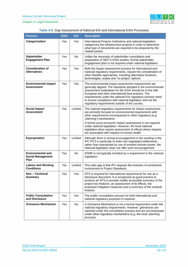
Morava Corridor Motorway Project
Chapter 4: Legal Framework
ESIA Final Report November 2020
SE102-000-ES-REP-00002 24 / 24
Table 4-5. Gap Assessment of National EIA and International ESIA Processes
Process ESIA EIA Description
Categorization Yes Yes International Finance Institutions and national legislation categorizes the infrastructure projects in order to determine what type of documents are required to be prepared by the related parties.
Stakeholder Engagement Plan
Yes No Unlike the necessity of stakeholder consultation and preparation of SEP in ESIA studies, formal stakeholder engagement plan is not required under national legislation.
Consideration of Alternatives
Yes Yes Both the impact assessment process for international and national regulatory requirements, require the consideration of other feasible approaches, including alternative locations, technologies, scales and ‘no project’ options
Environmental Impact Assessment
Yes Yes The environmental impact assessment requirements are generally aligned. The standards adopted in the environmental assessment undertaken for the ESIA should be in line with European and other international best practice. The requirements under the national EIA regulatory process need to ensure compliance with national legislation and not the regulatory requirements outside of the country.
Social Impact Assessment
Yes Limited The national regulatory requirements for impact assessment are primarily focused on environmental requirements with other requirements encompassed in other regulatory (e.g. ‘planning’) mechanisms.
A formal socio-economic impact assessment is not required under national legislation. However, the local national legislation does require assessment of effects where impacts are associated with impacts to human health.
Expropriation Yes Limited Although there is strong encouragement in the wording in the IFC PS 5 in particular to enter into negotiated settlements, rather than expropriate by use of eminent domain power, the National legislation does not offer such encouragement.
Environmental and Social Management Plan
Yes No ESMP is not typically included as a requirement in the national legislation.
Labour and Working Conditions
Yes Limited The main gap is that IFC requires the inclusion of contractors’ involvement in Project Standards.
Non – Technical Summary
Yes Yes NTS is required for international requirements for use as a disclosure document. It is recognized as good practice to produce an NTS to provide readily accessible summary of the project key features, an assessment of its effects, the proposed mitigation measures and a summary of the residual impacts.
Public Consultation and Disclosure
Yes Yes The public consultation process for both international and national regulatory purposes is required.
Grievance Mechanism Yes No A Grievance Mechanism is not a formal requirement under the national regulatory requirements. However, grievances are reported under the consultation process and are encompassed under other regulatory mechanisms (e.g. the local ‘planning’ process).
Morava Corridor Motorway Project
Chapter 5: Baseline Conditions
ESIA Final Report November 2020
SE102-000-ES-REP-00002 1 / 324
5 BASELINE CONDITIONS
5.1 Definition of the Area of Influence
The Area of Influence (AoI) is an important element in assessing environmental and social
impacts of a proposed development since it informs about the physical and/or social extent
onto which the assessment should be performed. According to the definition in IFC PS-1, the
AoI encompasses the followings:
The area likely to be affected by:
o (i) the project1 and the client’s activities and facilities that are directly owned,
operated or managed (including by contractors) and that are a component of
the project2;
o (ii) impacts from unplanned, but predictable developments caused by the
project that may occur later or at a different location; or
o (iii) indirect project impacts on biodiversity or on ecosystem services upon
which Affected Communities’ livelihoods are dependent.
Associated facilities, which are facilities that are not funded as part of the project and
that would not have been constructed or expanded if the project did not exist and
without which the project would not be viable3.
Cumulative impacts4 that result from the incremental impact on areas or resources
used or directly influenced by the project, from other existing, planned or reasonably
defined developments at the time when the risks and impacts identification process is
conducted.
For this study, two different definitions of AoI have been used for social and environmental
baseline studies.
1 Examples include the project’s sites, the immediate air shed and watershed, and/or transport corridors.
2 Examples include canals, tunnels, relocation and access roads, borrow and disposal areas, construction camps, power transmission corridors, pipelines and contaminated land (e.g., soil, groundwater, surface water, and sediments).
3 Associated facilities may include permanent facilities such as railways, roads, captive power plants or transmission lines, pipelines, utilities, warehouses, logistics terminals which are already existing in the region or non-permanent facilities such as capms, quarries, borrow pits and asphalt plants which are planned to be used directly for the project.
4 Cumulative impacts are limited to those impacts generally recognized as important on the basis of scientific concerns and/or concerns from Affected Communities. Examples of cumulative impacts include: incremental contribution of gaseous emissions to an airshed; reduction of water flows in a watershed due to multiple withdrawals; increases in sediment loads to a watershed; interference with migratory routes or wildlife movement; or more traffic congestion and accidents due to increases in vehicular traffic on community roadways.

Morava Corridor Motorway Project
Chapter 5: Baseline Conditions
ESIA Final Report November 2020
SE102-000-ES-REP-00002 2 / 324
5.1.1 Environmental Area of Influence
The relevant environmental AoI for the Project can be divided into two main parts. The first
part covers the followings;
The Proposed Motorway Route,
The extended AoI of the Project, including access roads, quarries, asphalt and batch
plants, maintenance areas, and construction camps to be realized due to the Project,
Area of receptors (i.e. soil, surface water and ground water) that may be impacted
from supply and waste management operations.
For the intense and direct impacts associated with the project activities in construction and
operational phases, the immediate vicinity of the Proposed Motorway Route covering above
mentioned three items is considered to be a corridor of 1,000 m width (500 m on each side of
the motorway) along the Proposed Motorway Route. This is the first part of the
Environmental AoI along the Proposed Motorway Route. In addition, the following areas
compose the second part of the Environmental AoI due to the fact that the there can be
impacts (e.g., handling of wastes and transportation of the supply materials to the site from a
long distance) associated with the activities in relation to the Project outside the corridor of
1,000 m width:
Waste disposal facilities and the roads associated with waste management (i.e.
sanitary landfills, waste recycling facilities), and
Material supply locations and the roads associated with transport of such materials.
A total of 700 m wide corridor is specified as the protection zone in the Spatial Plan of E-761
Motorway Infrastructure Corridor (see Chapter-3 for the detailed information about the zone).
When determining the AoI as 1,000 m, the first intension was to cover this 700 m wide
protection zone. Then, activities causing impacts on a wider range were considered. In this
respect, the most important aspect that was taken into account is the impact area regarding
the air pollutant emissions which are expected to have impact on a wider area than the other
impacts of the Project such as noise or impacts on surface water and soil.
In this respect, a total of 1,000 m width was chosen as the first part of the Environmental AoI.
The size of the chosen area depends upon the types of the emission sources, mass of the
emissions, and types of the pollutants being emitted as well as the topography and
meteorological conditions of the area. The map for specified environmental AoI is given in
Figure 5-1.
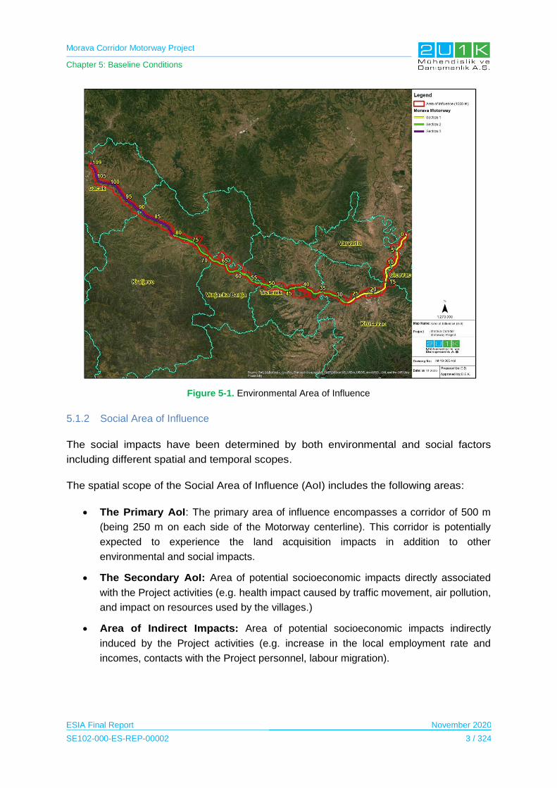
Morava Corridor Motorway Project
Chapter 5: Baseline Conditions
ESIA Final Report November 2020
SE102-000-ES-REP-00002 3 / 324
Figure 5-1. Environmental Area of Influence
5.1.2 Social Area of Influence
The social impacts have been determined by both environmental and social factors
including different spatial and temporal scopes.
The spatial scope of the Social Area of Influence (AoI) includes the following areas:
The Primary AoI: The primary area of influence encompasses a corridor of 500 m
(being 250 m on each side of the Motorway centerline). This corridor is potentially
expected to experience the land acquisition impacts in addition to other
environmental and social impacts.
The Secondary AoI: Area of potential socioeconomic impacts directly associated
with the Project activities (e.g. health impact caused by traffic movement, air pollution,
and impact on resources used by the villages.)
Area of Indirect Impacts: Area of potential socioeconomic impacts indirectly
induced by the Project activities (e.g. increase in the local employment rate and
incomes, contacts with the Project personnel, labour migration).
Morava Corridor Motorway Project
Chapter 5: Baseline Conditions
ESIA Final Report November 2020
SE102-000-ES-REP-00002 4 / 324
Temporal scope of the Project includes,
Immediate (<1 year)
Short term (1-4 years),
Medium term (5-15 years),
Long term (the impact will cease after the operational life span of the project)
Permanent (no mitigation measure of natural process will reduce the impact after
construction).
Table 5-1. Potential Social Impacts According to Settlements in the Area of Influence
Impact zones Distance to centerline
Expected impacts
Primary AoI 250 m
Physical displacement at Project footprint Economic displacement at Project footprint Cultural heritage Access to ecosystem services Employment opportunities Economic development Impacts on infrastructure and services Community health and safety impacts
Secondary AoI
500 m
Employment opportunities Economic development at village level Impacts on infrastructure and services at village level Community health and safety impacts at village level
Area of Indirect Impacts
500m+ Economic development at municipal level Impacts on infrastructure and services at municipal level
When determining the primary and secondary AoI, the zones specified in the Spatial Plan of
E-761 Motorway Infrastructure Corridor were taken into consideration (detailed information
about zones are provided in Chapter-3 of the ESIA Report). In this plan, a total of 700 m wide
protection zone is specified and the AoI is determined to cover this zone.
There are 7 municipalities located in the Social AoI, including 48 affected villages within
those municipalities. Table 5-2 presents the respective information on each affected
municipalities of the Project.
Table 5-2. Municipalities Located in the Social AoI
Municipality Number of settlements within the AoI of the Project
Ćićevac 4
Varvarin 2
Kruševac 7
Vrnjačka Banja 6
Trstenik 8
Kraljevo 11
Čačak 10
TOTAL 48
Morava Corridor Motorway Project
Chapter 5: Baseline Conditions
ESIA Final Report November 2020
SE102-000-ES-REP-00002 5 / 324
5.2 Hydrology
The proposed Project is located in the West (Zapadna) Morava River basin, and the
Proposed Motorway Route mainly follows the West Morava River opposite to the river flow
direction of west to south. Due to the flooding risks, the West Morava River has been studied
by the Jaroslav Cerni Institute for Water Management in terms of hydrotechnical aspects.
In the following subsections, the study area of the hydrological studies, the methodology and
data sources, general information about hydrology of the West Morava River are given, and
then hydrologic baseline information about the area where the Project is located is provided
more specifically.
5.2.1 Study Area
The Study Area of the Hydrotechnical Study Report for the Corridor of the Highway E-761
covers a large area expending along the West River and its tributaries. Therefore, it was
aimed to reduce the coverage area of the baseline data to be provided in the scope of the
ESIA studies of the Morava Corridor Motorway Project. In this respect, the Study Area of this
hydrology baseline section has been chosen as the overlapping parts of the West Morava
River with the Project, which is shown in Figure 5-2.
5.2.2 Methodology and Data Source
The following documents have been reviewed during the desktop study of the Project:
EIA Reports for Section-1 and Section 3 (incl. Sector 8 and Sector 9) prepared by
CIP and Highways Institute, respectively, (Highway Institute, 2019);
Hydrotechnical Study Report for Corridor of the Highway E-761, Section Pojate-
Preljina, prepared by Jaroslav Cerni Institute for Water Management, (Roads of
Serbia, 2016);
Sub-Basin Level Flood Action Plan - Velika Morava River Basin and Right Danube
Tributaries between the Sava River Mouth and RSBG Border (Republic of Serbia &
Republic of Bulgaria, 2009);
West Morava River Basin Zoning based on Low Flow Regime Evaluation (Simić &
Matić, West Morava river basin zoning based on low flow regime evaluation, 2018);
and
Hydrotechnical Regulation of The West Morava River within the Infrastructure
Corridor of Highway E-761.
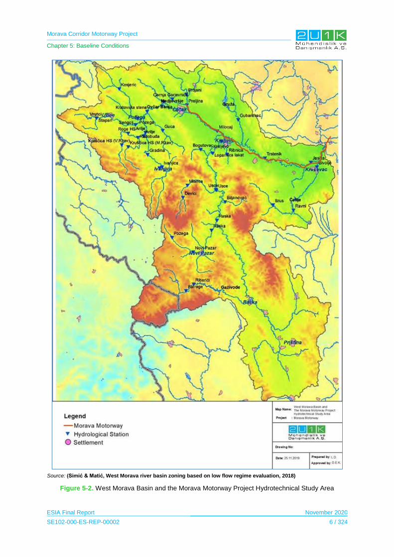
Morava Corridor Motorway Project
Chapter 5: Baseline Conditions
ESIA Final Report November 2020
SE102-000-ES-REP-00002 6 / 324
Source: (Simić & Matić, West Morava river basin zoning based on low flow regime evaluation, 2018)
Figure 5-2. West Morava Basin and the Morava Motorway Project Hydrotechnical Study Area

Morava Corridor Motorway Project
Chapter 5: Baseline Conditions
ESIA Final Report November 2020
SE102-000-ES-REP-00002 7 / 324
5.2.3 Baseline Conditions
The West Morava River, which forms the headwater of the Greater Morava River, arises at
the confluence of the Moravica (1,513 km2 basin area) and Djetinja (1,210 km2 basin area)
rivers, and it has about 210 km long course. There are many tributaries of the West Morava
River. Ibar River, which joins to the West Morava River (7,925 km2 basin area) at Kraljevo, is
the most important tributary in the basin. Ibar River rises in the most eastern part of
Montenegro, at very high mountains and it contributes the 50% of the West Morava River
discharge. Other important tributaries of the West Morava are the Rasina (990 km2),
Emernica (629 km2 basin area) and Gruža (617 km2 basin area). The map of the basin is
given in Figure 5-3.
Figure 5-3. Basin Map of the Project Area
The upstream of the West Morava River basin is located in the mountainous area (Kopaonik,
Prokletije, etc.), where the alpine climate with long winters and a lot of snow cover dominates
the region. In the downstream part of the West Morava River basin, the climate is moderate
continental with less fluctuation in temperature and higher yearly precipitation totals. In the
rain-snow regime, there are two precipitation maximums, with frequent and intensive summer
rainfalls (June), secondary autumn maximum (November), and generally dry in winters.
Typical to this climate, more than 50% of yearly precipitation occurs during the warmer

Morava Corridor Motorway Project
Chapter 5: Baseline Conditions
ESIA Final Report November 2020
SE102-000-ES-REP-00002 8 / 324
seasons, and frequently induce floods. During the spring period runoff is produced by
precipitation and melting of snow from mountainous regions.
The West Morava River basin has significant agricultural potential and the West Morava
River flows through settlements. In addition to the agricultural potential, the West Morava
River water is used for industrial purposes in important industrial centers such as Čačak and
Kraljevo where the West Morava River flows through. The West Morava River has great
social and economic importance besides water management issues due to its above-stated
characteristics. In this respect, a separate and detailed Hydrotechnical Study Report has
been prepared by Jaroslav Černi Institute. The Hyrotechnical Study Report covers 139 km
part of the basin where the Project is located. The aim of the Report is to provide a
harmonized motorway project together with all project construction facilities and activities in
line with the West Morava River regime (i.e. flood protection, design of civil structures such
as bridges etc.) as well as the existing water facilities and future water management plans.
With this intention, the study provides the following measures for the flooding risks and the
related impacts of the Project:
regulating the watercourses and protection of coastal areas;
minimizing the negative impacts construction of the motorway;
sustaining the stability of the West Morava Riverbed and other water users and
resources in coastal areas.
The study also defines the basic parameters for the protection measures as the changed
hydrological conditions in the West Morava River by considering the flood which occurred in
May 2014. The measures provide information for design of the Project to understand the
level of protection of the Project from floods as well as erosion effects of the watercourses.
Hydrological Study
As a part of the Hydrotechnical Study Report, flow monitoring is carried out to understand the
hydrological characteristics of the West Morava River basin. In this respect, the existing
hydrological stations of the Republic Hydrometeorological Service of Serbia (RMHS) with
long water level measurements are used. In the Hydrotechnical Study Report, it is given that
in the framework of the general planning of the West Morava River, the river course is
divided into 237 cross-sectional areas with the 500 m intervals from the South Morava to the
mouth Čemernica near Čačak and these transverse profiles are grouped as 25 characteristic
locations. In addition to these profiles, there are two more locations which are as follows:
Additional cross-sections at locations which are designed bridges on the motorway
E-761; and
Control profiles on specific locations (in the zone of water facilities, planned bridges,
landfills, etc.).
Morava Corridor Motorway Project
Chapter 5: Baseline Conditions
ESIA Final Report November 2020
SE102-000-ES-REP-00002 9 / 324
Location of the profiles are given in Table 5-3.
Table 5-3. The Profiles which are considered during Hydrotechnical Study Report
River Hydrological
Station Work
(start/end) Level (mnm)
Distance from the mouth (km)
Surface of the basin (km2)
Method of registering water levels w.r.t years
Lath Limnigraf Digitally
West Morava
The swing bridge
1922/1978 295.44 209.8 2688 1922 1958 -
West Morava
Kratovska Stena
1978 290.44 206 3077 1978 1978 2002
West Morava
Kraljevo 1955/1986 184.54 104.5 4721 1955 1957 -
West Morava
Miločaj 1986 194.27 119 4568 1923 1986 2002
West Morava
Trstenik 1940 160.63 63.5 13902 1940 - -
West Morava
Jasika 1940 138.56 20.5 14721 1940 1968 -
Ibar Lopatnica
Elbow 1935 224.68 26.5 7818 1935 1976 2007
Rasina Bivolje 1922 141.96 5.50 958 1922 1960 -
Source: Hydrotechnical Study Report for Corridor of the E-761
The fieldwork on the West Morava conducted by Jaroslav Cerni Institute in the scope of the
Hidrotechnical Study Report, was carried out in the period from 26 July to 29 July 2016.
Cross sections were recorded at the same position, or at the same directions with transverse
profiles that have been recorded in May 2007, for the purposes "General Project Planning
West Morava".
As stated above, the West Morava River discharge calculations are based on the
measurements of RMHS at the study area of the Hydrotechnical Study Report. The list of the
stations and approximate positions regarding motorway KPs (Kilometer Points) are provided
in Table 5-4. All discharge values after 2009 are based on the analysis made in the context
of Water Master Plan of Serbia of 2009.
Table 5-4. Maximum Flow Calculations based on RMHS Measurements
Section The Facility Document
Station
Q (m3 / s) for
different p (%)
Number Date 0,1 1 2
Pojate Section - Kruševac (km 0 + 000- km 27 +600)
1 Bridge over the South Morava
(km 0 + 000-km 8 + 830)
Bridge over South Morava (km 8+522.37)
92/I/1-
624/2011
19.09.2011 Mojsinje /
J. Morava
3122 2131 1855
2 Bridge over South Morava
Bridge 9 + 844.46
Bridge 16 + 030.12
Ј. Jasika /
Z. Моrava
2941 1844 1582
3 Makresane-Koshevi
- - - -
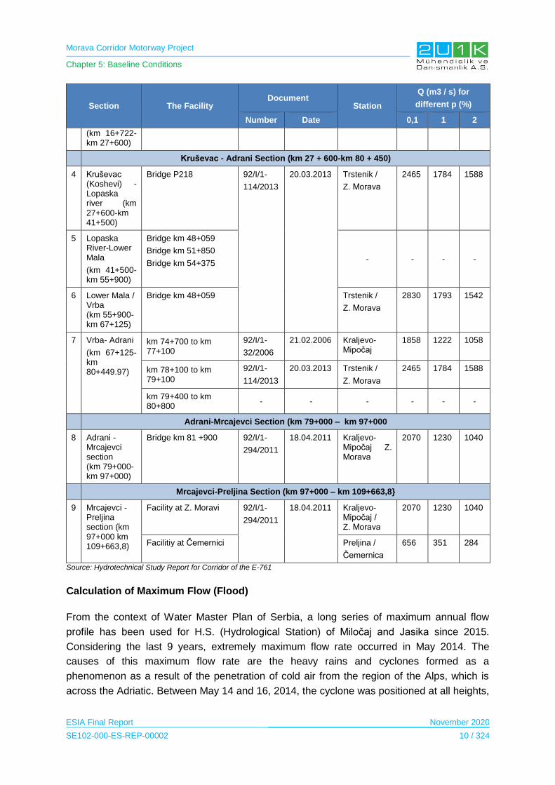
Morava Corridor Motorway Project
Chapter 5: Baseline Conditions
ESIA Final Report November 2020
SE102-000-ES-REP-00002 10 / 324
Section The Facility Document
Station
Q (m3 / s) for
different p (%)
Number Date 0,1 1 2
(km 16+722-km 27+600)
Kruševac - Adrani Section (km 27 + 600-km 80 + 450)
4 Kruševac (Koshevi) -Lopaska river (km 27+600-km 41+500)
Bridge P218 92/I/1-
114/2013
20.03.2013 Trstenik /
Z. Моrava
2465 1784 1588
5 Lopaska River-Lower Mala
(km 41+500-km 55+900)
Bridge km 48+059
Bridge km 51+850
Bridge km 54+375 - - - -
6 Lower Mala / Vrba (km 55+900-km 67+125)
Bridge km 48+059 Trstenik /
Z. Моrava
2830 1793 1542
7 Vrba- Adrani
(km 67+125-km 80+449.97)
km 74+700 to km 77+100
92/I/1-
32/2006
21.02.2006 Kraljevo-Mipočaj
1858 1222 1058
km 78+100 to km 79+100
92/I/1-
114/2013
20.03.2013 Trstenik /
Z. Моrava
2465 1784 1588
km 79+400 to km 80+800
- - - - - -
Adrani-Mrcajevci Section (km 79+000 – km 97+000
8 Adrani - Mrcajevci section (km 79+000-km 97+000)
Bridge km 81 +900 92/I/1-
294/2011
18.04.2011 Kraljevo-Mipočaj Z. Моrava
2070 1230 1040
Mrcajevci-Preljina Section (km 97+000 – km 109+663,8}
9 Mrcajevci - Preljina section (km 97+000 km 109+663,8)
Facility at Z. Moravi 92/I/1-
294/2011
18.04.2011 Kraljevo-Mipočaj / Z. Моrava
2070 1230 1040
Facilitiy at Čemernici Preljina /
Čemernica
656 351 284
Source: Hydrotechnical Study Report for Corridor of the E-761
Calculation of Maximum Flow (Flood)
From the context of Water Master Plan of Serbia, a long series of maximum annual flow
profile has been used for H.S. (Hydrological Station) of Miločaj and Jasika since 2015.
Considering the last 9 years, extremely maximum flow rate occurred in May 2014. The
causes of this maximum flow rate are the heavy rains and cyclones formed as a
phenomenon as a result of the penetration of cold air from the region of the Alps, which is
across the Adriatic. Between May 14 and 16, 2014, the cyclone was positioned at all heights,
Morava Corridor Motorway Project
Chapter 5: Baseline Conditions
ESIA Final Report November 2020
SE102-000-ES-REP-00002 11 / 324
resulting in heavy precipitation of 200 L/m2 in many areas and more than 300 L/m2 in the
local areas. The consequence of this phenomenon is the extreme rain runoff, which led to
series of maximum flow discharges to Western Morava: Skrapež, Moravice, Rzava and
Bjelica.
The purpose of this study, computing the values of the West Morava River’s maximum
annual flow profiles at H.S. Miločaj and H.S. Jasika and computing maximum flow rates at
River Ibar H.S. Lopatnica elbow and River Rasina H.S. Bivolje (see Table 5-5) is to evaluate
the historical exceptional changes in the water regime.
Heavy rainfall caused a large increase in water level on May 13 and 14, 2014 at tributaries of
the West Morava River. Maximum flow rates of the West Morava River, when water levels at
H. S. Miločaj and H. S. Jasika were above limit value of emergency flood protection level in
the period from May 16 to 18, 2014 are as follows:
at H. S. Miločaj was Qmax 2014 = 1320 m3/s and for H.S.
at Jasika was Qmax 2014 = 2150 m3 /s.
Source: Hydrotechnical Study Report for Corridor of the E-761
Figure 5-4. Absolute Annual Maximum Flows of Western Morova on Profiles H.S. Milocaj and H.S. Jasika in the Period of Observation

Morava Corridor Motorway Project
Chapter 5: Baseline Conditions
ESIA Final Report November 2020
SE102-000-ES-REP-00002 12 / 324
For computation, prolonged series of maximum annual flow data, which are adapted to the
theoretical distribution function probability have been used since 2015. The Pilot Harvey
Test, which is commonly used for measurement historical events when dealing with extreme
values, was performed within the scope of Hydrotechnical Study Report to check whether the
upstreams contain statistical exceptions and it is noted that Ibar River does not contain a
statistical exception.
Four theoretical distribution probability functions; namely, i) Pearson III, ii) Log Pearson III, iii)
Gumbel and iv) Weibull Log Normal distribution are used for data analysis. Quality
adjustment is verified by using x2 and Kolmogorov-Smirnov test. It is seen that the data best
fits with Log Pearson III distribution.
The estimated values of maximum annual flows according to Log Pearson III distribution are
given in Table 5-5 and the graphical analysis of distributions are shown in Figure 5-5,
Figure 5-6, Figure 5-7, Figure 5-8.
Table 5-5. The Calculated Values of the Maximum Annual Flow Qmax (m3/s) and Western Morava Flow for Typical Probabilities, p (%)
River/ Hydrological station
Period
Q max (m3/s) р(%)
0,1 1 2 5
West Morava/ Kraljevo / Mipočaj
1955-2005 1579 1067 930 759
1955-2006 2068 1234 1038 810
1955-2015 2555 1409 1156 870
West Morava / Jasika
1948-2005 2794 1781 1536 1244
1948-2006 2941 1844 1582 1274
1948-2015 4122 2224 1823 1381
Ibar / Lopatnica Elbow
1948-2005 2432 1324 1086 820
1948-2006 2600 1368 1111 831
1948-2015 2623 1364 1105 823
Rasina / Bivolje
1949-2005 678 446 380 297
1949-2006 638 430 370 292
1949-2015 721 445 373 285
Source: Hydrotechnical Study Report for Corridor of the E-761
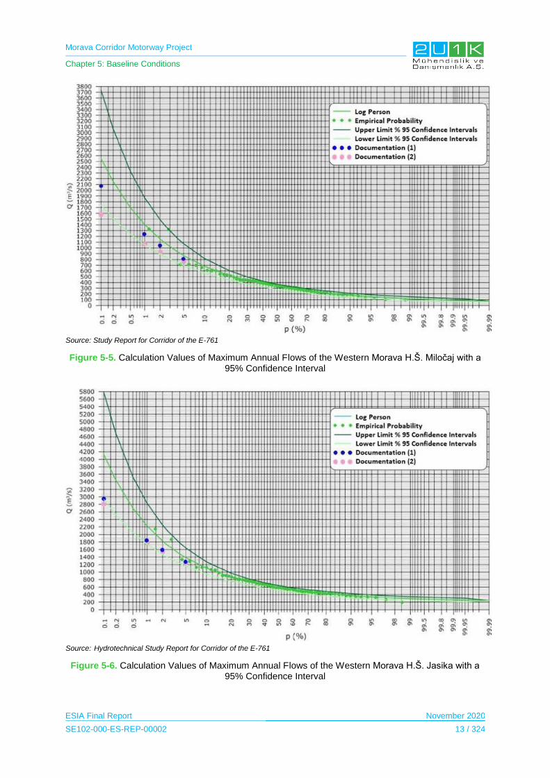
Morava Corridor Motorway Project
Chapter 5: Baseline Conditions
ESIA Final Report November 2020
SE102-000-ES-REP-00002 13 / 324
Source: Study Report for Corridor of the E-761
Figure 5-5. Calculation Values of Maximum Annual Flows of the Western Morava H.Š. Miločaj with a 95% Confidence Interval
Source: Hydrotechnical Study Report for Corridor of the E-761
Figure 5-6. Calculation Values of Maximum Annual Flows of the Western Morava H.Š. Jasika with a 95% Confidence Interval

Morava Corridor Motorway Project
Chapter 5: Baseline Conditions
ESIA Final Report November 2020
SE102-000-ES-REP-00002 14 / 324
Source: Hydrotechnical Study Report for Corridor of the E-761
Figure 5-7. Calculation Values of Maximum Annual Flow of the River Ibar Hydrological Station Lopatnica elbow with a 95% Confidence Interval
Source: Hydrotechnical Study Report for Corridor of the E-761
Figure 5-8. Calculation Values of Maximum Annual Flow of the River Rasina Hydrological Station Bivolje with a 95% Confidence Interval
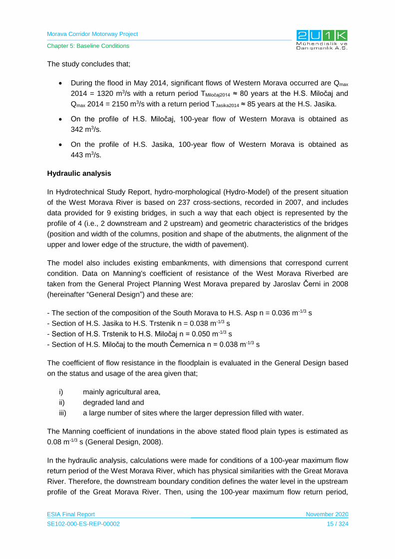
Morava Corridor Motorway Project
Chapter 5: Baseline Conditions
ESIA Final Report November 2020
SE102-000-ES-REP-00002 15 / 324
The study concludes that;
During the flood in May 2014, significant flows of Western Morava occurred are Qmax
2014 = 1320 m3/s with a return period TMiločaj2014 ≈ 80 years at the H.S. Miločaj and
Qmax 2014 = 2150 m3/s with a return period TJasika2014 ≈ 85 years at the H.S. Jasika.
On the profile of H.S. Miločaj, 100-year flow of Western Morava is obtained as
342 m3/s.
On the profile of H.S. Jasika, 100-year flow of Western Morava is obtained as
443 m3/s.
Hydraulic analysis
In Hydrotechnical Study Report, hydro-morphological (Hydro-Model) of the present situation
of the West Morava River is based on 237 cross-sections, recorded in 2007, and includes
data provided for 9 existing bridges, in such a way that each object is represented by the
profile of 4 (i.e., 2 downstream and 2 upstream) and geometric characteristics of the bridges
(position and width of the columns, position and shape of the abutments, the alignment of the
upper and lower edge of the structure, the width of pavement).
The model also includes existing embankments, with dimensions that correspond current
condition. Data on Manning's coefficient of resistance of the West Morava Riverbed are
taken from the General Project Planning West Morava prepared by Jaroslav Černi in 2008
(hereinafter “General Design”) and these are:
- The section of the composition of the South Morava to H.S. Asp n = 0.036 m-1/3 s
- Section of H.S. Jasika to H.S. Trstenik n = 0.038 m-1/3 s
- Section of H.S. Trstenik to H.S. Miločaj n = 0.050 m-1/3 s
- Section of H.S. Miločaj to the mouth Čemernica n = 0.038 m-1/3 s
The coefficient of flow resistance in the floodplain is evaluated in the General Design based
on the status and usage of the area given that;
i) mainly agricultural area,
ii) degraded land and
iii) a large number of sites where the larger depression filled with water.
The Manning coefficient of inundations in the above stated flood plain types is estimated as
0.08 m-1/3 s (General Design, 2008).
In the hydraulic analysis, calculations were made for conditions of a 100-year maximum flow
return period of the West Morava River, which has physical similarities with the Great Morava
River. Therefore, the downstream boundary condition defines the water level in the upstream
profile of the Great Morava River. Then, using the 100-year maximum flow return period,

Morava Corridor Motorway Project
Chapter 5: Baseline Conditions
ESIA Final Report November 2020
SE102-000-ES-REP-00002 16 / 324
water elevation (Z) has been estimated as 134.01 m at connection point of two rivers, namely
West Morava and Great Morava.
Flood zone in the current and projected state of the watercourse are very similar. According
to the hydraulic analysis that the Project and the access roads will be flooded as a results of
flood with the 100-year maximum flow return period. Therefore, in the scope of the detailed
design of the Project, the 100-year maximum flow return period should be considered.
Morphology of the West Morava River:
The study area of West Morava, from the junction with the South Morava to the mouth
Čemernica, have similar characteristics regarding meandering and wandering in the West
Morava Riverbed.
The dynamics of morphological changes in West Morava River depend on variations in the
water flow and sediment from the basin. The relation between the value of the water flow (Q)
and the sediment discharge (Pg) have inverse ratio of Q / Pg, not only caused by natural
origin, but also resulted by the anthropogenic impacts such as impact of regulation works
including construction of the West Morava River embankments and buildings, as well as
longitudinal cuts of meanders. Regarding the anthropogenic impacts, in addition to the
regulation works, there are morphological processes, exploitation of material from the West
Morava Riverbed and from the coastal sides and dredging material from the riverbed in some
sections of the watercourse are very significant. Therefore, morphological processes in
Western Morava interact with natural and anthropogenic impacts..
The curvature of the Proposed Motorway Route of the West Morava River is highly variable,
with a radius ranging from 100 m to 1,000 m. Some parts of the West Morava River are
straight but they are very few and short. Radii of the downstream river are generally greater
than 200 m, and radii of the upstream river are smaller than 200 m. The section of the West
Morava River from km 90 to km 135 (from Kraljevo to Čemernica) with a series connected of
the West Morava Riverbeds has radii of from 80 m to 200 m.
The study defines four categories of morphological changes in the West Morava River.
These categories and locations along the West Morava River are provided in Table 5-6.
Table 5-6. Category of Morphological Changes in the West Morava River
Part of the West Morava River Location Explanation
Stable parts of the West Morava River course with minimal changes.
From the connection point with the South Morava to the village of Bela Voda.
From Počekovina to the village to the mouth of the River Vrnjačka Banja.
From the mouth to Kraljevo.
Total length of all stable parts of The West Morava River is 62 km, i.e. 45% of the length of the West Morava. Almost there is no change in the watercourses from 1961 and 2007.

Morava Corridor Motorway Project
Chapter 5: Baseline Conditions
ESIA Final Report November 2020
SE102-000-ES-REP-00002 17 / 324
Part of the West Morava River Location Explanation
The West Morava River course parts subject to minor changes.
From the mouth of the West Morava River to the River Vrnjačka Banja.
From Kraljevo to Miločaj
From the mouth of Ostrovki to Čemernica
Total length of parts with minor changes in the Proposed Motorway Route of The West Morava River is 46 km, or 33% of the length of The West Morava River.
These parts are characterized by overall stability of the route of the watercourse, or slow river route changes.
The West Morava River course parts subject to major changes.
From Bela Voda to Prokuplje.
From Miločaj to the mouth of the Bresnica.
Total length of part with unstable the West Morava River route is 22 km, i.e. 16% considered the length of the West Morava River.
These changes created as a result of wandering riverbed. This part of the route is formed by multiple sharp and short curvatures, wherein the concave side of the curvature to occur intensively along the dredging coast
Artificial changes in the the West Morava River course
From the mouth of Bresnica (near villages Katrga) to the delta Ostrovki
Changes within the aforesaid sections in Trstenik.
Local changes in the route of the West Morava River seen in several places, mainly because of the dredging material from the West Morava River.
Source: Hydrotechnical Study Report for Corridor of the E-761
Morphological changes in the West Morava River given in Table 5-6 have been integrated
into the maps given in the figures below.

Morava Corridor Motorway Project
Chapter 5: Baseline Conditions
ESIA Final Report November 2020
SE102-000-ES-REP-00002 18 / 324
Figure 5-9. Example of Stable Section, from km 46 to km 52
Figure 5-10. Example of Unstable Section, from km 30 to km 38
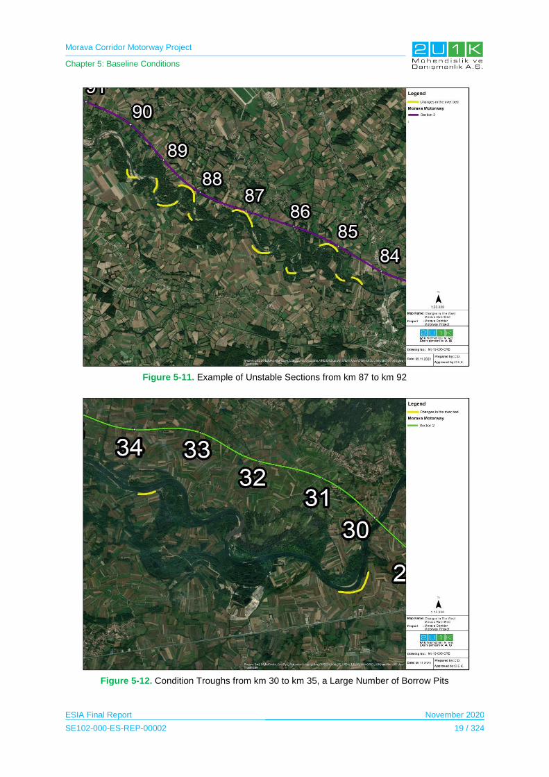
Morava Corridor Motorway Project
Chapter 5: Baseline Conditions
ESIA Final Report November 2020
SE102-000-ES-REP-00002 19 / 324
Figure 5-11. Example of Unstable Sections from km 87 to km 92
Figure 5-12. Condition Troughs from km 30 to km 35, a Large Number of Borrow Pits

Morava Corridor Motorway Project
Chapter 5: Baseline Conditions
ESIA Final Report November 2020
SE102-000-ES-REP-00002 20 / 324
Figure 5-13. Condition Trough from km 42 to km 44, Slitting of the Meander km 44-46
Figure 5-14. Condition Troughs from km 59 to km 65
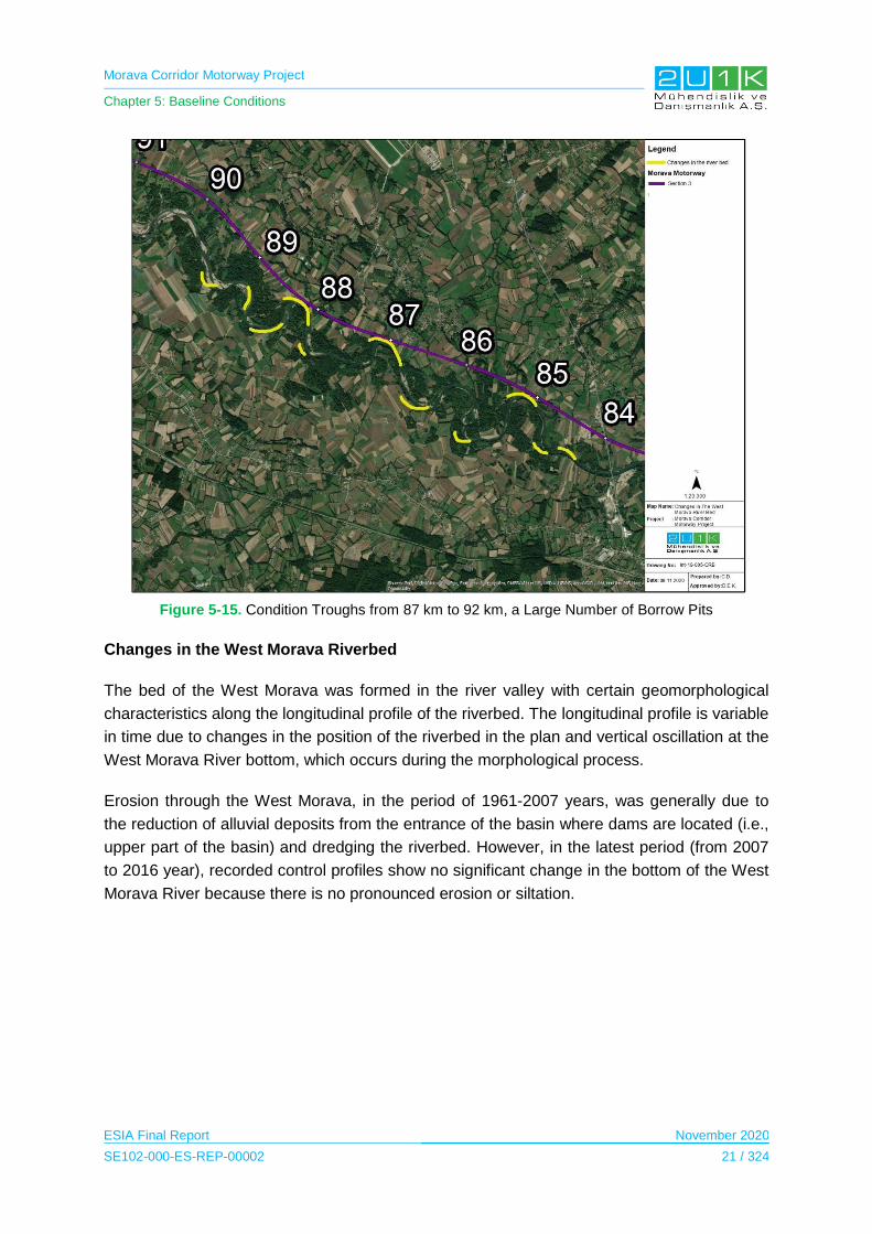
Morava Corridor Motorway Project
Chapter 5: Baseline Conditions
ESIA Final Report November 2020
SE102-000-ES-REP-00002 21 / 324
Figure 5-15. Condition Troughs from 87 km to 92 km, a Large Number of Borrow Pits
Changes in the West Morava Riverbed
The bed of the West Morava was formed in the river valley with certain geomorphological
characteristics along the longitudinal profile of the riverbed. The longitudinal profile is variable
in time due to changes in the position of the riverbed in the plan and vertical oscillation at the
West Morava River bottom, which occurs during the morphological process.
Erosion through the West Morava, in the period of 1961-2007 years, was generally due to
the reduction of alluvial deposits from the entrance of the basin where dams are located (i.e.,
upper part of the basin) and dredging the riverbed. However, in the latest period (from 2007
to 2016 year), recorded control profiles show no significant change in the bottom of the West
Morava River because there is no pronounced erosion or siltation.
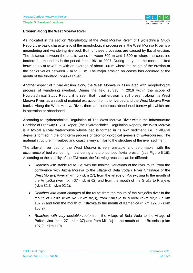
Morava Corridor Motorway Project
Chapter 5: Baseline Conditions
ESIA Final Report November 2020
SE102-000-ES-REP-00002 22 / 324
Erosion along the West Morava River
As indicated in the section “Morphology of the West Morava River” of Hyrotechnical Study
Report, the basic characteristic of the morphological processes in the West Morava River is a
meandering and wandering riverbed. Both of these processes are caused by fluvial erosion.
The distance between the coasts varies between 300 m and 1,500 m where the coastline
borders the meanders in the period from 1961 to 2007. During the years the coasts shifted
between 15 m to 400 m with an average of about 100 m where the height of the erosion at
the banks varies between 2 m to 11 m. The major erosion on coasts has occurred at the
mouth of the tributary Lopaška River.
Another aspect of fluvial erosion along the West Morava is associated with morphological
process of wandering riverbed. During the field survey in 2016 within the scope of
Hydrotechnical Study Report, it is seen that fluvial erosion is still present along the West
Morava River, as a result of material extraction from the riverbed and the West Morava River
banks. Along the West Morava River, there are numerous abandoned borrow pits which are
in operation or abandoned.
According to Hydrotechnical Regulation of The West Morava River within the Infrastructure
Corridor of Highway E-761 Report (the Hydrotechnical Regulation Report), the West Morava
is a typical alluvial watercourse whose bed is formed in its own sediment, i.e. in alluvial
deposits formed in the long-term process of geomorphological genesis of watercourses. The
material structure in riverbed and coast is very similar to the structure of the river sediment.
The alluvial river bed of the West Morava is very unstable and deformable, with the
occurrence of bed wandering, meandering and pronounced fluvial erosion (see Figure 5-16).
According to the stability of the ZM route, the following reaches can be differed:
Reaches with stable route, i.e. with the minimal variations of the river route: from the
confluence with Južna Morava to the village of Bela Voda ( River Chainage of the
West Morava River (r.km) 0 - r.km 27), from the village of Počekovina to the mouth of
the Vrnjačka river (r.km 37 - r.km) 62) and from the mouth of the Gruža to Kraljevo
(r.km 82.3 - r.km 92.2);
Reaches with minor changes of the route: from the mouth of the Vrnjačka river to the
mouth of Gruža (r.km 62 - r.km 82,3), from Kraljevo to Miločaj (r.km 92,2 - r. km
107,2) and from the mouth of Ostrovka to the mouth of Kamenica (r. km 127.8 - r.km
153.2);
Reaches with very unstable route from the village of Bela Voda to the village of
Počekovina (r.km 27 - r.km 37) and from Miločaj to the mouth of the Bresnica (r.km
107.2 - r.km 119).
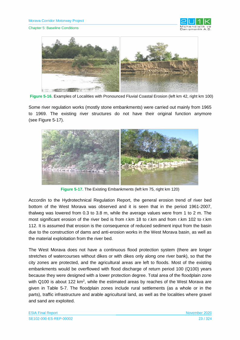
Morava Corridor Motorway Project
Chapter 5: Baseline Conditions
ESIA Final Report November 2020
SE102-000-ES-REP-00002 23 / 324
Figure 5-16. Examples of Localities with Pronounced Fluvial Coastal Erosion (left km 42, right km 100)
Some river regulation works (mostly stone embankments) were carried out mainly from 1965
to 1969. The existing river structures do not have their original function anymore
(see Figure 5-17).
Figure 5-17. The Existing Embankments (left km 75, right km 120)
Accordin to the Hydrotechnical Regulation Report, the general erosion trend of river bed
bottom of the West Morava was observed and it is seen that in the period 1961-2007,
thalweg was lowered from 0.3 to 3.8 m, while the average values were from 1 to 2 m. The
most significant erosion of the river bed is from r.km 18 to r.km and from r.km 102 to r.km
112. It is assumed that erosion is the consequence of reduced sediment input from the basin
due to the construction of dams and anti-erosion works in the West Morava basin, as well as
the material exploitation from the river bed.
The West Morava does not have a continuous flood protection system (there are longer
stretches of watercourses without dikes or with dikes only along one river bank), so that the
city zones are protected, and the agricultural areas are left to floods. Most of the existing
embankments would be overflowed with flood discharge of return period 100 (Q100) years
because they were designed with a lower protection degree. Total area of the floodplain zone
with Q100 is about 122 km2, while the estimated areas by reaches of the West Morava are
given in Table 5-7. The floodplain zones include rural settlements (as a whole or in the
parts), traffic infrastructure and arable agricultural land, as well as the localities where gravel
and sand are exploited.

Morava Corridor Motorway Project
Chapter 5: Baseline Conditions
ESIA Final Report November 2020
SE102-000-ES-REP-00002 24 / 324
Table 5-7. The West Morava floodplain areas, discharge (Q100)
River bank
Area Floodplain area (ha)
Right
Confluence with the J.Morava – the mouth of Rasina 514
The mouth of Pepeljuše-the villagy of Odžaci 2030
Trstenik – the mouth of Ibar 1994
The mouth of Ibar – Čačak 2708
Left
Connection with the J.Moravom – the villagy of Kukljin 594
The village of Kukljin – Trstenik 1546
Trstenik – the mouth of Ibar 1048
The mouth of Ibar – the mouth of Čemernica 1825
Total 12259
Planned Dams and Water Structures on the West Morava River
The Hydrotechnical Study Report states that a cascade small hydropower dam system is
planned to use the hydropower potential of the West Morava River. In this respect, 10 small
run of river type hydropower dams are proposed to be cascaded in approximately 75 km
distance along the cities Kraljevo, Vrnjačka Banja, Trstenik, Kruševac and Varvarin, where
the total energy head on the concerned section is approximately 50.0 m. The locations of the
proposed dams are shown in Figure 5-18 and the coordinate lists are provided in Table 5-8.
Design flow rate of the dams is estimated as 180 m3/s.
Table 5-8. Coordinates and Station System MHE on the West Morava River
Run of River Dam Kp Y X Length Head (m)
MHE 01 “Vitanovac” km 83+966 4840670.1 7483174.5 1250 4.1
MHE 02 “Vraneši” km 79+540 4839850.1 7486546.4 2800 4.1
MHE 03 “Stubal” km 69+455 4837137.6 7491490.7 4600 5.85
MHE 04 “Grabovac” km 59+881 4832756.1 7497300.1 4050 5.85
MHE 05 “Medvedja” km 48+878 4831258.0 7505249.2 5300 5.85
MHE 06 “Počekovina” km 41+631 4828405.4 7507734.6 5100 4.1
MHE 07 “Selište” km 35+595 4828330.1 7512006.5 2900 4.1
MHE 08 “Globoder” km 26+800 4827123.2 7517764.2 4800 4.5
MHE 09 “Kukljin” km 19+734 4828470.0 7522619.0 3500 4.1
MHE 09 “Bošnjane” km 8+640 4833175.6 7530940.6 4000 5.85
Source: Hydrotechnical Study Report for Corridor of the E-761

Morava Corridor Motorway Project
Chapter 5: Baseline Conditions
ESIA Final Report November 2020
SE102-000-ES-REP-00002 25 / 324
Figure 5-18. Cascade Run of River Type Dams on the West Morava River
According to the statement in the Hydrotechnical Study Report, potential locations of the
dams are in further discussion at the decision-making level within the Government of Serbia
in terms of actual physical, geomorphological, hydrological and other constraints such as
efficiency potential available in the given conditions. Existing infrastructures including existing
railway and highway as well as proposed Morava Corridor Motorway Project are the major
limiting factors of those dam projects. In the future, during the detailed design phase of the
hydroprojects (i.e., dams), these infrastructures will be taken into account. According to
information given in the Hydrotechnical Study Report, there is no plan for the construction of
new irrigation system in the Plain of the West Morava River.
5.2.4 Sensitive Receptors/Locations
The findings including sensitive locations which were outlined in accordance with the
Hydrotechnical Study Report is summarized in Table 5-9.

Morava Corridor Motorway Project
Chapter 5: Baseline Conditions
ESIA Final Report November 2020
SE102-000-ES-REP-00002 26 / 324
Table 5-9. Summary of Findings from the Hydrotechnical Study Report
Sector Summary of Findings
Sector 1 Main part of the Proposed Motorway Route in this sector passes through the potential flood zone of the Great Morava River and the South Morava River.
No regulation works on the existing water course is planned in this sector.
There will be bridges over major watercourses.
There is no critical locations in terms of relative positions of the motorway and the the West Morava River course.
According to the available data, existing and planned sources of water supply and treatment plants are not threatened by the construction of the motorway.
Sector 2 Main part of the Proposed Motorway Route in this sector passes through unprotected flood zone of the West Morava River.
Regulation work is required at the sector (between from KP 10+500 to KP 12+900). Regulation work comprises the cut of existing meander.
There are two bridges proposed on the West Morava River. Location of the Bridge at km 8 + 739 has no impact to the course and has the necessary height of the structure. On the other hand, second bridge at km 16 + 080 may have a negative impact on the West Morava river due a difficult angle and arrangement of bridge piers.
According to the available data, existing and planned sources of water supply and treatment plants are not threatened by the construction of the Motorway.
Sector 3 The part of the Motorway between Rasine and Čitluk passes through the potential flood zone of the West Morava River.
It is necessary to reconstruct the existing embankments at "Čitluk".
No regulation works on the existing water course is planned in this sector.
There are two critical locations in terms of relative positions of the Motorway and the West Morava River course.
According to the available data, existing and planned sources of water supply and treatment plants are not threatened by the construction of the motorway.
Sector 4 All sectors of the Proposed Motorway Route are located in unprotected flood zone of the West Morava River.
No regulation works on the existing water course is planned in this sector.
A new bridge over the West Morava River on the access road near to junction Drenova will be constructed.
There are three critical locations in terms of relative positions of the Motorway and the West Morava River course.
According to the available data, existing and planned sources of water supply and treatment plants are not threatened by the construction of the Motorway.

Morava Corridor Motorway Project
Chapter 5: Baseline Conditions
ESIA Final Report November 2020
SE102-000-ES-REP-00002 27 / 324
Sector Summary of Findings
Sector 5 Main part of the Proposed Motorway Route in this sector passes through the flood zone of the West Morava River.
Height of the embankments at Trstenik and Medvedja does not sustain requirement. Therefore, reconstruction is required.
Regulation work is required at the sector (between from KP 42+900-KP 45+300 and KP 46+500- KP 47+800)
Three new bridges are designed over the West Morava River. Bridge at km 48 + 000 has the required height, but access ramps are getting closer to major river body and it can cause backwater which may have adverse impact on upstream. Bridges on km 51 + 896 and km 54 + 369 have sufficient height and do not create any risk.
The Proposed Motorway Route intersects with the existing embankment located on the right bank of the West Morava River. During the construction special precaution regarding hindering the movement of machinery at the crest of the embankment and the embankment should not be demolished during the construction works in order to preserve existing flood protection.
There are two critical locations in terms of relative positions of the Motorway and the West Morava River course.
According to the available data, existing and planned sources of water supply and treatment plants are not threatened by the construction of the Motorway.
Sector 6 All sectors of the Proposed Motorway Route are located in unprotected flood zone of the West Morava River.
No regulation works on the existing water course is planned in this sector.
There is one bridge proposed on the West Morava River near Vrini. The position of the bridge is critical in terms of water flow in relation to the Proposed Motorway Route. In the hydrotechnical study report, there is recommendation for the culver box type of passages for water flow in between both sides of the motorway. Construction of embankments is required between the motorway and high terrain at the left end of the valley to prevent flow from floodplain.
There are no other critical locations in terms of relative positions of the Motorway and the West Morava River course.
According to the available data, existing and planned sources of water supply and treatment plants are not threatened by the construction of the motorway.
Sector 7 All sectors of the Proposed Motorway Route are located in unprotected flood zone of the West Morava River.
Regulation works are required near Kraljevo. The works comprises construction of three new channels.
There is one bridge proposed on the West Morava River on the access road near junction to Ratina. The bridge structure has sufficient height in relation to the level of 100-years return period water flow. Due to the bridge and access road to the embankment that blocks flow after inundation creates a back pressure of about 1 m.
There are five critical locations in terms of relative positions of the motorway and the West Morava River course.
According to the available data, existing and planned sources of water supply and treatment plants are not threatened by the construction of the Motorway.

Morava Corridor Motorway Project
Chapter 5: Baseline Conditions
ESIA Final Report November 2020
SE102-000-ES-REP-00002 28 / 324
Sector Summary of Findings
Sector 8 The part of section near Zadran is located in potential flood zone of the West Morava River where other part of the sector is situated at unprotected flood zone of the West Morava River.
Regulation works are required at the bridge location which is explained in the following bullet.
There is one bridge proposed on the West Morava River. The position of the bridge poses disadvantage due to the West Morava River flows at both side of the Motorway.
Height and condition of exiting embankment near to Zadran do not sustain the design requirements.
There are six critical locations in terms of relative positions of the Motorway and the West Morava River course.
According to the available data, existing and planned sources of water supply and treatment plants are not threatened by the construction of the motorway.
Sector 9 Main part of the sector of the Proposed Motorway Route is located in unprotected flood zone of the West Morava River. Other part of the Proposed Motorway Route, to Preljina passes through potential flood zone of the Čemernica River.
Regulation work is required on the existing water course is planned in this sector.
No new bridge proposed over the West Morava River. On the other hand, there are three bridges, proposed over Čemernica River (two for the motorway and one for the access road junction for Čačak.
Reconstruction of the embankment Čemernica is in progress.
There are five critical locations in terms of relative positions of the Motorway and the West Morava River course.
According to the available data, existing and planned sources of water supply and treatment plants are not threatened by the construction of the Motorway.
5.3 Climate
This Section starts with the general information on Serbia's climate and focuses on detailed
information of the baseline conditions of the AoI.
5.3.1 Study Area
In order to determine meteorological characteristics of the AoI, observation data of the
nearest meteorology station were used. Since the Project covers a large area and it is not
possible to represent all area by using one station data set, all possible representative
meteorology stations’ data were used.
Figure 5-19 shows the Proposed Motorway Route and the national meteorology station of
Serbia.

Morava Corridor Motorway Project
Chapter 5: Baseline Conditions
ESIA Final Report November 2020
SE102-000-ES-REP-00002 29 / 324
Figure 5-19. The Proposed Motorway Route and the locations of meteorology stations
According to satellite map, which is shown in figure above, it is seen that several stations
surrounding the Proposed Motorway Route. Some stations and their distances to the
Proposed Motorway Route are shown in Table 5-10.
Table 5-10. Meteorology Stations in the vicinity of the Proposed Motorway Route
Meteorology Station Distance to Project Line (Km)
Kruševac 1.2
Kraljevo 4.5
Cumrija 18
Pozega Uzica 32
Kopaonik 38
Valvejo 56
Zlatibor 60
According to Table 5-10 and the satellite map in Figure 5-19, Kruševac and Kraljevo
meteorology stations are the closest stations and they can represent the AoI better than
other stations because of the change of meteorological parameters with regard to distance,
topography and vegetation. Therefore, in order to identify meteorological characteristics,
Kruševac and Kraljevo meteorology stations’ observation data were used.
5.3.2 Methodology and Data Source
At the first part of this subsection of the Report, it is aimed to give general information about
the meteorological data gathered from the EIA Reports. As there is no information on
meteorological conditions of Section 3 in the pertinent EIA Report and there is no EIA Report
available for Section 2, only meteorological information provided in Section 1’s EIA Report
was presented here.

Morava Corridor Motorway Project
Chapter 5: Baseline Conditions
ESIA Final Report November 2020
SE102-000-ES-REP-00002 30 / 324
Meteorological data (from 1980 to 2009) of Kruševac station are given in Table 5-11 for the
area from Pojate to Koševo:
Table 5-11. Average values of Climate parameters from 1980 to 2009
Ja
n.
Fe
b.
Ma
rch
Аp
r.
Мa
y
Ju
ne
Јu
ly
Аg
s.
Sp
t.
Oc
t.
No
v.
De
c.
An
nu
al
Av
g.
Tsr(ºC) 0 2 6.6 11.6 16.7 20 21.7 21.4 16.7 11.7 5,7 1,5 11,3
Tx(ºC) 4.5 7.2 12.4 17.9 23 26.3 28.7 28.9 24.1 18.7 11,1 5,5 17,4
Tn(ºC) -3.6 -2.3 1.4 5.5 10.2 13.5 14.9 14.5 10.6 6.4 1,5 -1,9 5,9
ApsTx(ºC) 20.4 23.4 29.6 31.9 34.7 39.6 43.7 42.4 36.8 33.8 27,4 20 43,7
ApsTn(ºC) -26 -23.7 -15 -6.1 0.8 4.1 5.8 3 1.2 -6.6 -15,8 -23,9 -26
U (%) 85 79 73 71 73 72 70 70 74 78 82 86 76
SS (h) 54 79.4 129.3 154 204.5 223.6 267.7 260.7 191 138.8 77,4 41,6 1822
N 7 6 6 6 5 5 4 3 4 5 6 7 5
RR(mm) 41 36.7 47.6 55.5 60.7 70.1 55.1 49.4 50.2 48.3 57,7 57,3 629,5
maxRR(mm) 36.4 61.6 35.8 51.4 52.8 60.5 73.3 41.2 45.1 39.5 50,2 68,8 73,3
Tsr : Mean air temperature (ºC) Tx : Average Maximum Air Temperature (ºC) Tn : Average Minimum Air Temperature (ºC) ApsTx : Absolute Maximum Air Temperature (ºC) ApsTn : Absolute minimum air temperature (ºC) U : Relative humidity (%) SS : Sunset in hours total N : Cloudiness in 10/10 RR : Precipitation (mm) maxRR : Daily maximum rainfall (mm)
Precipitation
Depending on the atmospheric processes and relief characteristics of Serbia’s territory,
precipitation amount varies depending on the temperature and space. The general annual
precipitation amount in the Country is 896 mm. The annual amount of precipitation increases
with altitude. Annual precipitation over the Country ranges from 600 mm to 1,000 mm.
The majority part of Serbia has a higher amount of continental precipitation during warmer
times of the year. Precipitation usually occurs in June and May. 12-13% of total annual
precipitation falls in June. The least amount of precipitation occurs in February and October
with 5-6% of total annual precipitation. On the other hand, southwestern part of Serbia has
Mediterranean precipitation regime based on relief, Mediterranean climate influence and
mountain ranges’ slopes and maximum precipitation occurs in November, December, and
January while minimum precipitation occurs in August.

Morava Corridor Motorway Project
Chapter 5: Baseline Conditions
ESIA Final Report November 2020
SE102-000-ES-REP-00002 31 / 324
There is no precipitation data specific to the AoI from the selected two stations namely
Kraljevo and Kruševac. Therefore, other meteorological stations where the precipitation data
is available were chosen and used.
In addition, for analyzing climatic conditions of the Project area, data obtained from the
Republic Hydrometeorological Institute of Serbia website are obtained.
In the scope of the air quality two different methodologies were used to further examine the
climate and meteorological parameters of the AoI. These are global data assimilation system
(GDAS) and ERA5 reanalysis data, which are described in the following paragraphs.
Global Data Assimilation System (GDAS)
GDAS data is generated using Global Forecast System (GFS) model data produced by the
National Centres for Environmental Prediction (NCEP), operating under the United States’
National Oceanic and Atmospheric Administration (NOAA). GDAS model data have many
resolutions which expressed in degrees. GDAS data indicates a data assimilation process
with meteorological station measurement data (actual data) and GFS model analysis data.
Typically, GDAS ingests about 10% more observations than GFS. If simply stated, GDAS
data is more current than GFS data. GDAS data has various pressure levels up to 10 hPa
from the surface level. GDAS data contains approximately 45 meteorological variables like
air temperature, albedo, heat flux, vorticity.
In relation to the Project, GDAS data from January 1, 2018 to April 1, 2018 with a resolution
of 0.25 degrees were used as input for Weather Research and Forecasting (WRF) model.
The reason behind using WRF model is to achieve meteorological data with higher resolution
like 3 km. Physics options used in WRF is shown in Table 5-12.
Table 5-12. Physics Options used in WRF Initialization
WRF Physics Options Value Selected Scheme
Microphysics 8 Thompson
Longwave Radiation 4 Rapid Radiactive Transfer Model for Global Models
(RRTMG)
Planetary Boundary layer 2 Mellor-Yamada-Janjic (MYJ)
Surface Layer 2 Janjic Eta
Land-Surface 2 NOAH
Meteorological variables’ outputs from WRF model are Wind speed and Wind direction
(10 m), Temperature (2 m), Pressure (sea level pressure) and Relative Humidity (2 m). WRF
model outputs are obtained hourly for 3 months only for Kraljevo location.

Morava Corridor Motorway Project
Chapter 5: Baseline Conditions
ESIA Final Report November 2020
SE102-000-ES-REP-00002 32 / 324
ERA5
ERA-5 data is 5th generation reanalysis data of European Centre for Medium Range
Weather Forecast (ECMWF) for the global climate and weather variables that can up to 70
years but currently data is only available from January 1979. Reanalysis covers combining
observations worldwide, law of physics with data assimilation method. ERA-5 data contains
16 atmospheric variables and 37 pressure levels up to 1 hPa (~80 km from surface).
The type of ERA-5 data is Grid data which can create an accessible data set for the target
point. ERA-5 data used in the Project is based on monthly averaged ERA-5 reanalysis data
from January 1979 to July 2019 for only surface level (1000 hPa). Its resolution is regular
latitude-longitude grid of 0.25 degrees (~22-25 km). Meteorological variables used for this
study are Pressure (mb), Temperature (oC), Wind Speed (m/s) and Wind Direction. For this
Project, meteorological variables are found and used for Kraljevo and Kruševac locations.
Visualizations are made by using all monthly averages of 40 years for each meteorological
variable in order to create climate data such as prevailing wind and heat zones.
In addition, the following sources have been reviewed during the desktop study of the
Project:
The website of the Republic Hydro-meteorological Service of Serbia.
EIA Reports for Section-1 and Section-3 (CIP, 2018), (Highway Institute, 2019)
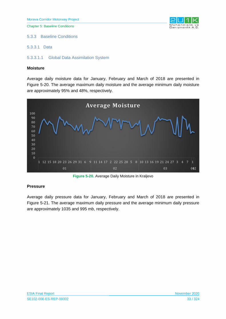
Morava Corridor Motorway Project
Chapter 5: Baseline Conditions
ESIA Final Report November 2020
SE102-000-ES-REP-00002 33 / 324
5.3.3 Baseline Conditions
5.3.3.1 Data
5.3.3.1.1 Global Data Assimilation System
Moisture
Average daily moisture data for January, February and March of 2018 are presented in
Figure 5-20. The average maximum daily moisture and the average minimum daily moisture
are approximately 95% and 48%, respectively.
Figure 5-20. Average Daily Moisture in Kraljevo
Pressure
Average daily pressure data for January, February and March of 2018 are presented in
Figure 5-21. The average maximum daily pressure and the average minimum daily pressure
are approximately 1035 and 995 mb, respectively.
0
10
20
30
40
50
60
70
80
90
100
1 12 15 18 20 23 26 29 31 6 9 11 14 17 2 22 25 28 5 8 10 13 16 19 21 24 27 3 4 7 1
01 02 03 0412
Average Moisture

Morava Corridor Motorway Project
Chapter 5: Baseline Conditions
ESIA Final Report November 2020
SE102-000-ES-REP-00002 34 / 324
Figure 5-21. Average Daily Pressure in Kraljevo
Wind Velocity
Average daily wind velocity data for January, February and March of 2018 are presented in
Figure 5-22. The average maximum daily wind velocity and the average minimum daily wind
velocity are approximately 11 and 1 m/s, respectively.
Figure 5-22. Average Daily Wind Velocity in Kraljevo
970
980
990
1000
1010
1020
1030
1040
31 11 14 17 2 22 25 28 30 5 8 10 13 16 19 21 24 27 4 7 1 12 15 18 20 23 26 29 31 6 9
12 01 02 03 04
2017 2018
Average Pressure
0
2
4
6
8
10
12
1 12 15 18 20 23 26 29 31 6 9 11 14 17 2 22 25 28 5 8 10 13 16 19 21 24 27 3 4 7 1
01 02 03 0412
Average Wind Velocity

Morava Corridor Motorway Project
Chapter 5: Baseline Conditions
ESIA Final Report November 2020
SE102-000-ES-REP-00002 35 / 324
Wind Direction
Average daily wind direction data for January, February and March of 2018 are presented in
Figure 5-23.
Figure 5-23. Average Daily Wind Direction in Kraljevo
Temperature
Average daily temperature data for January, February and March of 2018 are presented in
Figure 5-24. The average maximum daily temperature and the average minimum daily
temperature are approximately 17 and -9 °C, respectively.
Figure 5-24. Average Daily Temperature in Kraljevo
0
50
100
150
200
250
300
1 12 15 18 20 23 26 29 31 6 9 11 14 17 2 22 25 28 5 8 10 13 16 19 21 24 27 3 4 7 1
01 02 03 0412
Average Wind Direction
-15
-10
-5
0
5
10
15
20
31 11 14 17 2 22 25 28 30 5 8 10 13 16 19 21 24 27 4 7 1 12 15 18 20 23 26 29 31 6 9
12 01 02 03 04
2017 2018
Average Temperature
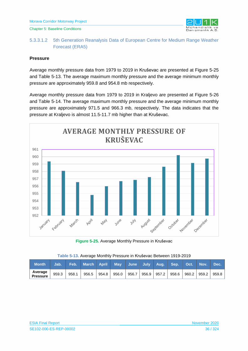
Morava Corridor Motorway Project
Chapter 5: Baseline Conditions
ESIA Final Report November 2020
SE102-000-ES-REP-00002 36 / 324
5.3.3.1.2 5th Generation Reanalysis Data of European Centre for Medium Range Weather
Forecast (ERA5)
Pressure
Average monthly pressure data from 1979 to 2019 in Kruševac are presented at Figure 5-25
and Table 5-13. The average maximum monthly pressure and the average minimum monthly
pressure are approximately 959.8 and 954.8 mb respectively.
Average monthly pressure data from 1979 to 2019 in Kraljevo are presented at Figure 5-26
and Table 5-14. The average maximum monthly pressure and the average minimum monthly
pressure are approximately 971.5 and 966.3 mb, respectively. The data indicates that the
pressure at Kraljevo is almost 11.5-11.7 mb higher than at Kruševac.
Figure 5-25. Average Monthly Pressure in Kruševac
Table 5-13. Average Monthly Pressure in Kruševac Between 1919-2019
Month Jab. Feb. March April May June July Aug. Sep. Oct. Nov. Dec.
Average Pressure
959.3 958.1 956.5 954.8 956.0 956.7 956.9 957.2 958.6 960.2 959.2 959.8
952
953
954
955
956
957
958
959
960
961
AVERAGE MONTHLY PRESSURE OF KRUŠEVAC
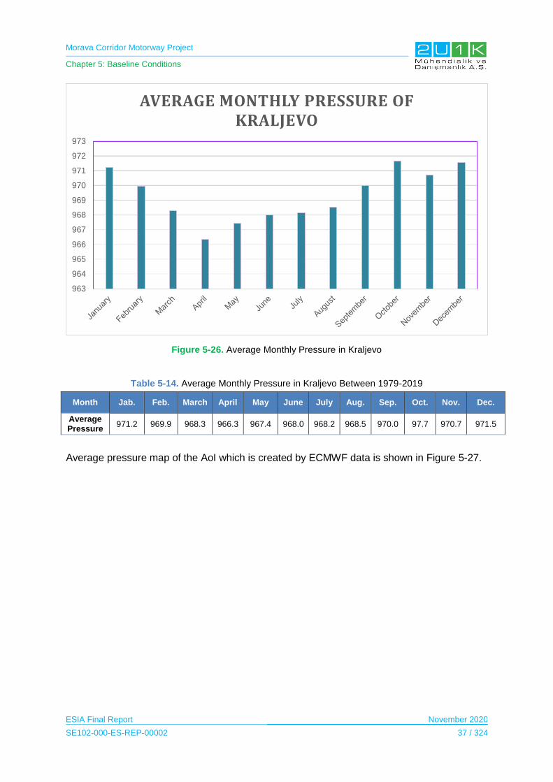
Morava Corridor Motorway Project
Chapter 5: Baseline Conditions
ESIA Final Report November 2020
SE102-000-ES-REP-00002 37 / 324
Figure 5-26. Average Monthly Pressure in Kraljevo
Table 5-14. Average Monthly Pressure in Kraljevo Between 1979-2019
Month Jab. Feb. March April May June July Aug. Sep. Oct. Nov. Dec.
Average Pressure
971.2 969.9 968.3 966.3 967.4 968.0 968.2 968.5 970.0 97.7 970.7 971.5
Average pressure map of the AoI which is created by ECMWF data is shown in Figure 5-27.
963
964
965
966
967
968
969
970
971
972
973
AVERAGE MONTHLY PRESSURE OF KRALJEVO
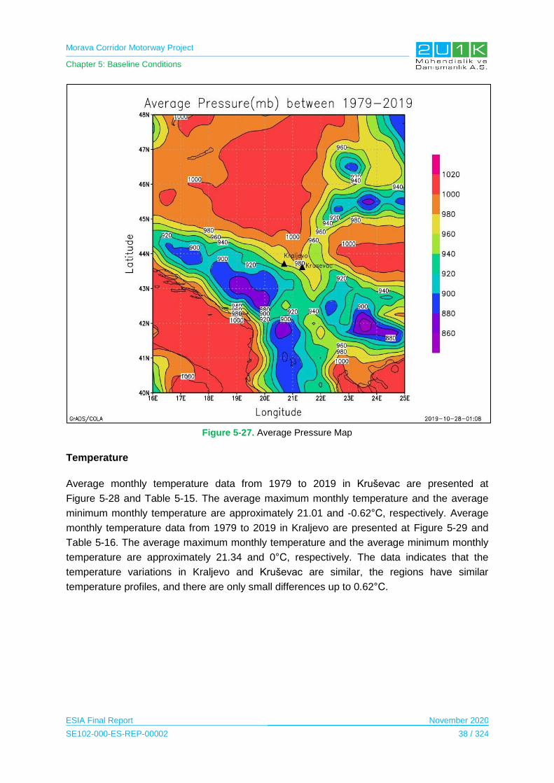
Morava Corridor Motorway Project
Chapter 5: Baseline Conditions
ESIA Final Report November 2020
SE102-000-ES-REP-00002 38 / 324
Figure 5-27. Average Pressure Map
Temperature
Average monthly temperature data from 1979 to 2019 in Kruševac are presented at
Figure 5-28 and Table 5-15. The average maximum monthly temperature and the average
minimum monthly temperature are approximately 21.01 and -0.62°C, respectively. Average
monthly temperature data from 1979 to 2019 in Kraljevo are presented at Figure 5-29 and
Table 5-16. The average maximum monthly temperature and the average minimum monthly
temperature are approximately 21.34 and 0°C, respectively. The data indicates that the
temperature variations in Kraljevo and Kruševac are similar, the regions have similar
temperature profiles, and there are only small differences up to 0.62°C.
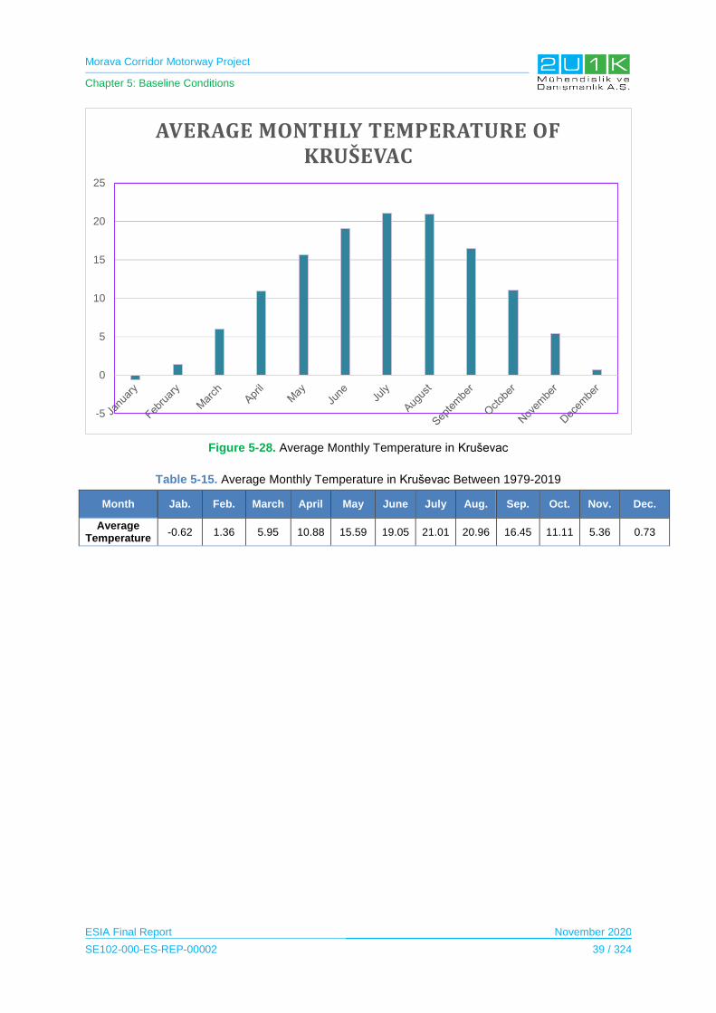
Morava Corridor Motorway Project
Chapter 5: Baseline Conditions
ESIA Final Report November 2020
SE102-000-ES-REP-00002 39 / 324
Figure 5-28. Average Monthly Temperature in Kruševac
Table 5-15. Average Monthly Temperature in Kruševac Between 1979-2019
Month Jab. Feb. March April May June July Aug. Sep. Oct. Nov. Dec.
Average Temperature
-0.62 1.36 5.95 10.88 15.59 19.05 21.01 20.96 16.45 11.11 5.36 0.73
-5
0
5
10
15
20
25
AVERAGE MONTHLY TEMPERATURE OF KRUŠEVAC

Morava Corridor Motorway Project
Chapter 5: Baseline Conditions
ESIA Final Report November 2020
SE102-000-ES-REP-00002 40 / 324
Figure 5-29. Average Monthly Temperature in Kraljevo
Table 5-16. Average Monthly Temperature in Kraljevo Between 1979-2019
Month Jab. Feb. March April May June July Aug. Sep. Oct. Nov. Dec.
Average Temperature
0.00 1.97 6.44 11.24 15.98 19.41 21.34 21.19 16.70 11.45 5.82 1.26
Average temperature map of the project area which is created by ECMWF data is shown in
Figure 5-30.
0
5
10
15
20
25
AVERAGE MONTHLY TEMPERATURE OF KRALJEVO
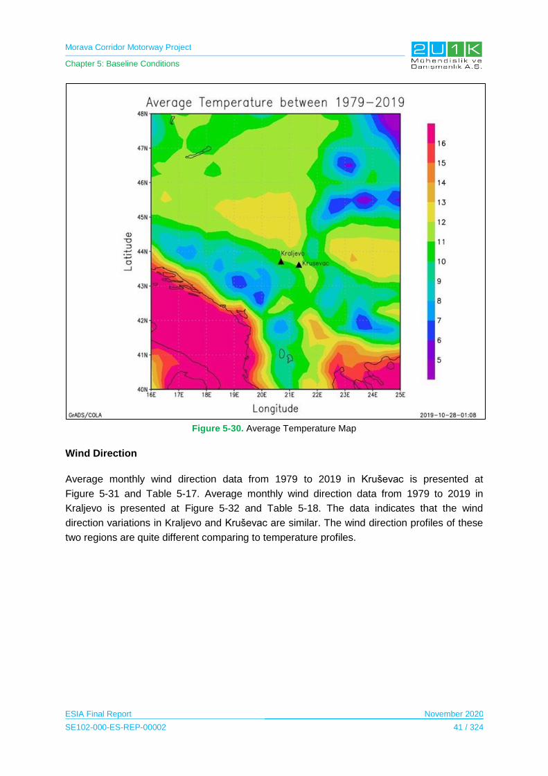
Morava Corridor Motorway Project
Chapter 5: Baseline Conditions
ESIA Final Report November 2020
SE102-000-ES-REP-00002 41 / 324
Figure 5-30. Average Temperature Map
Wind Direction
Average monthly wind direction data from 1979 to 2019 in Kruševac is presented at
Figure 5-31 and Table 5-17. Average monthly wind direction data from 1979 to 2019 in
Kraljevo is presented at Figure 5-32 and Table 5-18. The data indicates that the wind
direction variations in Kraljevo and Kruševac are similar. The wind direction profiles of these
two regions are quite different comparing to temperature profiles.
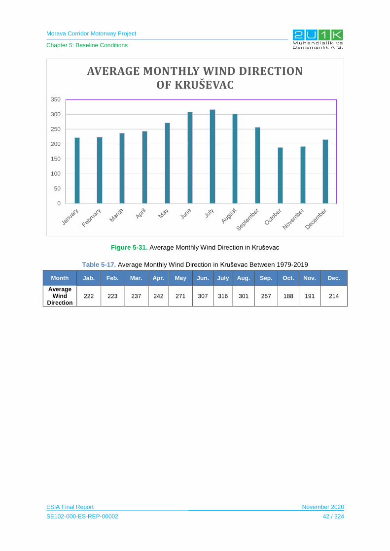
Morava Corridor Motorway Project
Chapter 5: Baseline Conditions
ESIA Final Report November 2020
SE102-000-ES-REP-00002 42 / 324
Figure 5-31. Average Monthly Wind Direction in Kruševac
Table 5-17. Average Monthly Wind Direction in Kruševac Between 1979-2019
Month Jab. Feb. Mar. Apr. May Jun. July Aug. Sep. Oct. Nov. Dec.
Average Wind
Direction 222 223 237 242 271 307 316 301 257 188 191 214
0
50
100
150
200
250
300
350
AVERAGE MONTHLY WIND DIRECTION OF KRUŠEVAC
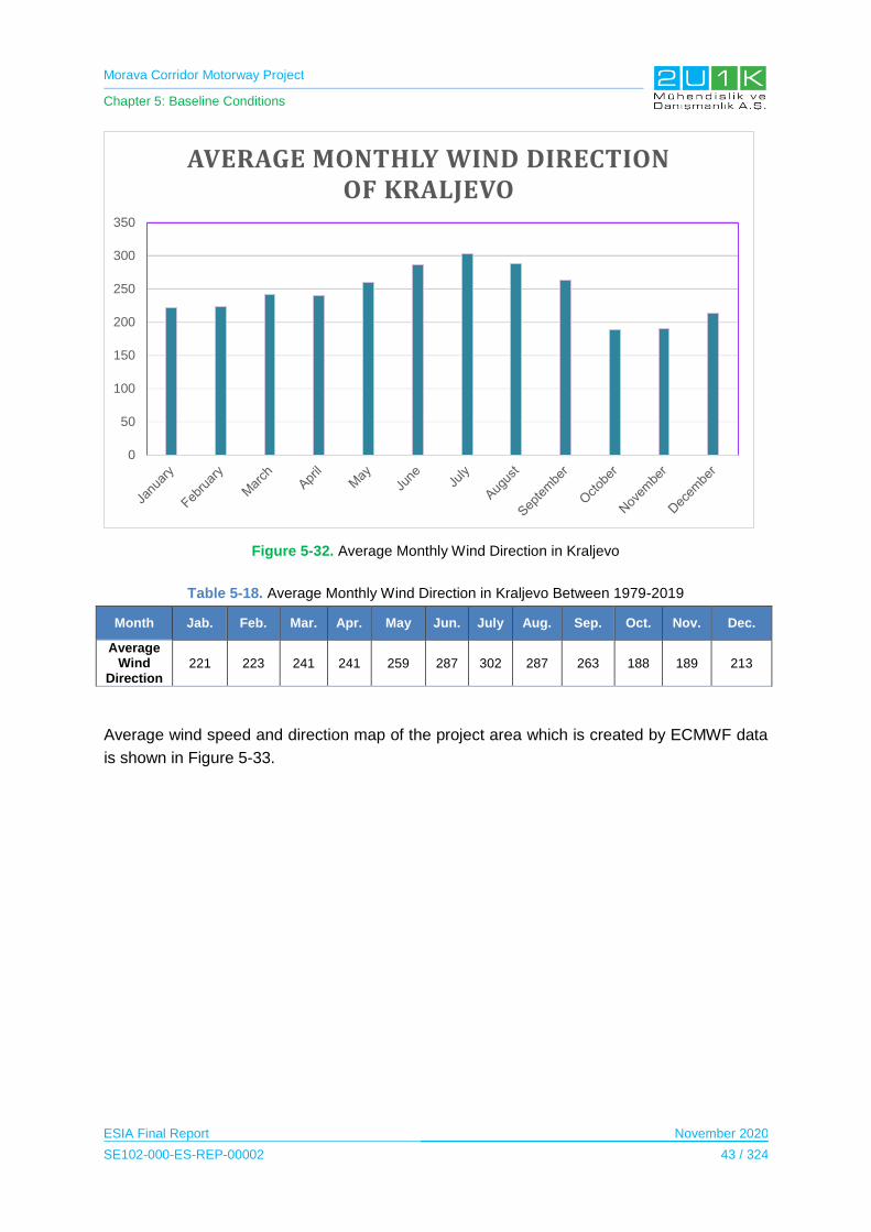
Morava Corridor Motorway Project
Chapter 5: Baseline Conditions
ESIA Final Report November 2020
SE102-000-ES-REP-00002 43 / 324
Figure 5-32. Average Monthly Wind Direction in Kraljevo
Table 5-18. Average Monthly Wind Direction in Kraljevo Between 1979-2019
Month Jab. Feb. Mar. Apr. May Jun. July Aug. Sep. Oct. Nov. Dec.
Average Wind
Direction 221 223 241 241 259 287 302 287 263 188 189 213
Average wind speed and direction map of the project area which is created by ECMWF data
is shown in Figure 5-33.
0
50
100
150
200
250
300
350
AVERAGE MONTHLY WIND DIRECTION OF KRALJEVO

Morava Corridor Motorway Project
Chapter 5: Baseline Conditions
ESIA Final Report November 2020
SE102-000-ES-REP-00002 44 / 324
Figure 5-33. Average Wind Map
Wind Velocity
Average monthly wind velocity data from 1979 to 2019 in Kruševac is presented at
Figure 5-34 and Table 5-19. The average maximum daily wind velocity and the average
minimum monthly wind velocity are approximately 1.12 and 0.50 m/s, respectively. Average
monthly wind velocity data from 1979 to 2019 in Kraljevo is presented at Figure 5-35 and
Table 5-20. The average maximum monthly wind velocity and the average minimum monthly
wind velocity are approximately 0.80 and 0.41 m/s, respectively. The data indicates that the
wind velocity variations in Kraljevo and Kruševac are quite different and the wind velocity in
Kruševac tends to be approximately 0.02 to 0.32 m/s greater than the wind velocity in
Kraljevo.
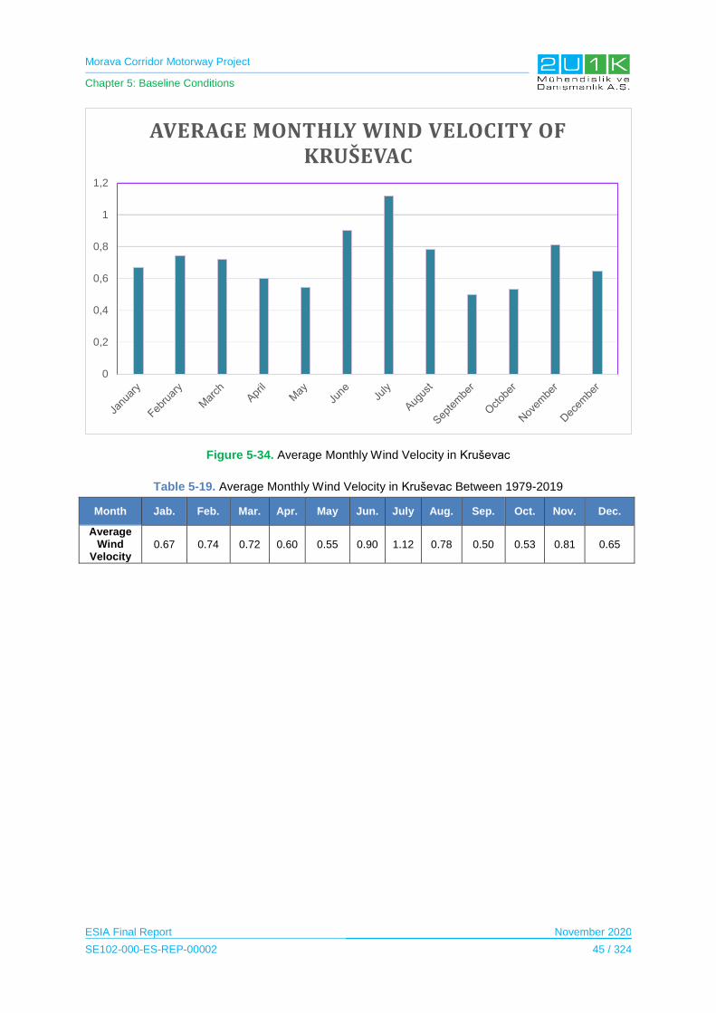
Morava Corridor Motorway Project
Chapter 5: Baseline Conditions
ESIA Final Report November 2020
SE102-000-ES-REP-00002 45 / 324
Figure 5-34. Average Monthly Wind Velocity in Kruševac
Table 5-19. Average Monthly Wind Velocity in Kruševac Between 1979-2019
Month Jab. Feb. Mar. Apr. May Jun. July Aug. Sep. Oct. Nov. Dec.
Average Wind
Velocity 0.67 0.74 0.72 0.60 0.55 0.90 1.12 0.78 0.50 0.53 0.81 0.65
0
0,2
0,4
0,6
0,8
1
1,2
AVERAGE MONTHLY WIND VELOCITY OF KRUŠEVAC
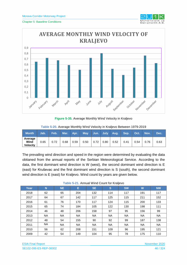
Morava Corridor Motorway Project
Chapter 5: Baseline Conditions
ESIA Final Report November 2020
SE102-000-ES-REP-00002 46 / 324
Figure 5-35. Average Monthly Wind Velocity in Kraljevo
Table 5-20. Average Monthly Wind Velocity in Kraljevo Between 1979-2019
Month Jab. Feb. Mar. Apr. May Jun. July Aug. Sep. Oct. Nov. Dec.
Average Wind
Velocity 0.65 0.72 0.68 0.59 0.50 0.72 0.80 0.52 0.41 0.54 0.76 0.63
The prevailing wind direction and speed in the region were determined by evaluating the data
obtianed from the annual reports of the Serbian Meteorological Service. According to the
data, the first dominant wind direction is W (west), the second dominant wind direction is E
(east) for Kruševac and the first dominant wind direction is S (south), the second dominant
wind direction is E (east) for Kraljevo. Wind count by years are given below.
Table 5-21. Annual Wind Count for Kraljevo
Year N NE E SE S SW W NW
2018 62 65 204 132 114 117 191 117
2017 64 67 142 117 125 115 211 152
2016 61 76 170 117 124 115 200 133
2015 65 74 184 105 122 130 198 111
2014 46 48 206 158 97 95 156 99
2013 NA NA NA NA NA NA NA NA
2012 48 54 155 90 92 99 187 138
2011 NA NA NA NA NA NA NA NA
2010 56 62 208 151 109 96 195 121
2009 42 54 149 104 95 78 175 110
0
0,1
0,2
0,3
0,4
0,5
0,6
0,7
0,8
0,9
AVERAGE MONTHLY WIND VELOCITY OF KRALJEVO
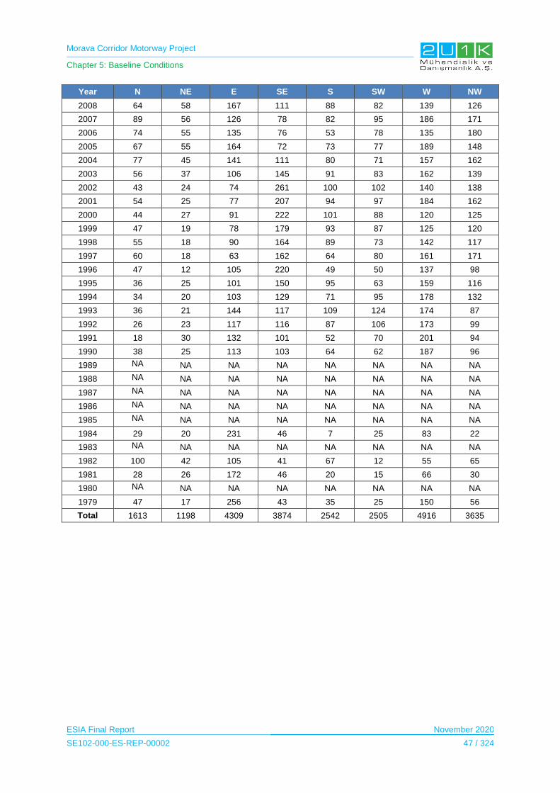
Morava Corridor Motorway Project
Chapter 5: Baseline Conditions
ESIA Final Report November 2020
SE102-000-ES-REP-00002 47 / 324
Year N NE E SE S SW W NW
2008 64 58 167 111 88 82 139 126
2007 89 56 126 78 82 95 186 171
2006 74 55 135 76 53 78 135 180
2005 67 55 164 72 73 77 189 148
2004 77 45 141 111 80 71 157 162
2003 56 37 106 145 91 83 162 139
2002 43 24 74 261 100 102 140 138
2001 54 25 77 207 94 97 184 162
2000 44 27 91 222 101 88 120 125
1999 47 19 78 179 93 87 125 120
1998 55 18 90 164 89 73 142 117
1997 60 18 63 162 64 80 161 171
1996 47 12 105 220 49 50 137 98
1995 36 25 101 150 95 63 159 116
1994 34 20 103 129 71 95 178 132
1993 36 21 144 117 109 124 174 87
1992 26 23 117 116 87 106 173 99
1991 18 30 132 101 52 70 201 94
1990 38 25 113 103 64 62 187 96
1989 NA NA NA NA NA NA NA NA
1988 NA NA NA NA NA NA NA NA
1987 NA NA NA NA NA NA NA NA
1986 NA NA NA NA NA NA NA NA
1985 NA NA NA NA NA NA NA NA
1984 29 20 231 46 7 25 83 22
1983 NA NA NA NA NA NA NA NA
1982 100 42 105 41 67 12 55 65
1981 28 26 172 46 20 15 66 30
1980 NA NA NA NA NA NA NA NA
1979 47 17 256 43 35 25 150 56
Total 1613 1198 4309 3874 2542 2505 4916 3635
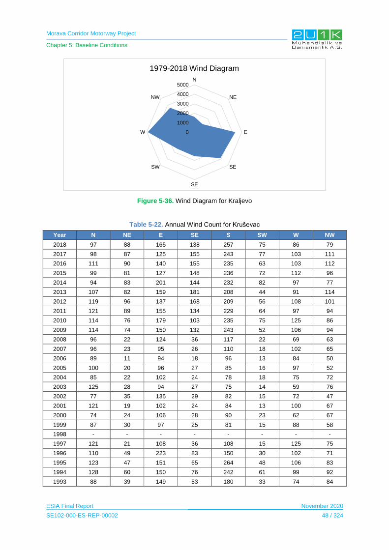
Morava Corridor Motorway Project
Chapter 5: Baseline Conditions
ESIA Final Report November 2020
SE102-000-ES-REP-00002 48 / 324
Figure 5-36. Wind Diagram for Kraljevo
Table 5-22. Annual Wind Count for Kruševac
Year N NE E SE S SW W NW
2018 97 88 165 138 257 75 86 79
2017 98 87 125 155 243 77 103 111
2016 111 90 140 155 235 63 103 112
2015 99 81 127 148 236 72 112 96
2014 94 83 201 144 232 82 97 77
2013 107 82 159 181 208 44 91 114
2012 119 96 137 168 209 56 108 101
2011 121 89 155 134 229 64 97 94
2010 114 76 179 103 235 75 125 86
2009 114 74 150 132 243 52 106 94
2008 96 22 124 36 117 22 69 63
2007 96 23 95 26 110 18 102 65
2006 89 11 94 18 96 13 84 50
2005 100 20 96 27 85 16 97 52
2004 85 22 102 24 78 18 75 72
2003 125 28 94 27 75 14 59 76
2002 77 35 135 29 82 15 72 47
2001 121 19 102 24 84 13 100 67
2000 74 24 106 28 90 23 62 67
1999 87 30 97 25 81 15 88 58
1998 - - - - - - - -
1997 121 21 108 36 108 15 125 75
1996 110 49 223 83 150 30 102 71
1995 123 47 151 65 264 48 106 83
1994 128 60 150 76 242 61 99 92
1993 88 39 149 53 180 33 74 84
0
1000
2000
3000
4000
5000N
NE
E
SE
SE
SW
W
NW
1979-2018 Wind Diagram
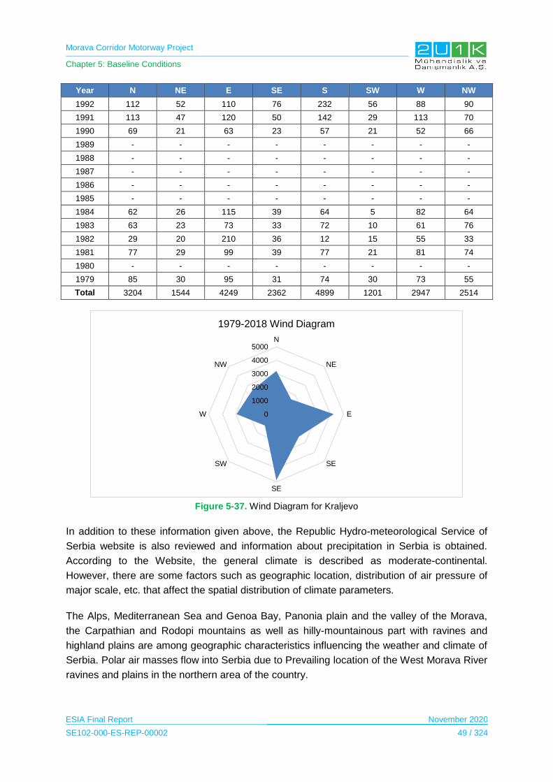
Morava Corridor Motorway Project
Chapter 5: Baseline Conditions
ESIA Final Report November 2020
SE102-000-ES-REP-00002 49 / 324
Year N NE E SE S SW W NW
1992 112 52 110 76 232 56 88 90
1991 113 47 120 50 142 29 113 70
1990 69 21 63 23 57 21 52 66
1989 - - - - - - - -
1988 - - - - - - - -
1987 - - - - - - - -
1986 - - - - - - - -
1985 - - - - - - - -
1984 62 26 115 39 64 5 82 64
1983 63 23 73 33 72 10 61 76
1982 29 20 210 36 12 15 55 33
1981 77 29 99 39 77 21 81 74
1980 - - - - - - - -
1979 85 30 95 31 74 30 73 55
Total 3204 1544 4249 2362 4899 1201 2947 2514
Figure 5-37. Wind Diagram for Kraljevo
In addition to these information given above, the Republic Hydro-meteorological Service of
Serbia website is also reviewed and information about precipitation in Serbia is obtained.
According to the Website, the general climate is described as moderate-continental.
However, there are some factors such as geographic location, distribution of air pressure of
major scale, etc. that affect the spatial distribution of climate parameters.
The Alps, Mediterranean Sea and Genoa Bay, Panonia plain and the valley of the Morava,
the Carpathian and Rodopi mountains as well as hilly-mountainous part with ravines and
highland plains are among geographic characteristics influencing the weather and climate of
Serbia. Polar air masses flow into Serbia due to Prevailing location of the West Morava River
ravines and plains in the northern area of the country.
0
1000
2000
3000
4000
5000N
NE
E
SE
SE
SW
W
NW
1979-2018 Wind Diagram
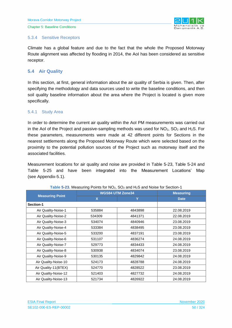
Morava Corridor Motorway Project
Chapter 5: Baseline Conditions
ESIA Final Report November 2020
SE102-000-ES-REP-00002 50 / 324
5.3.4 Sensitive Receptors
Climate has a global feature and due to the fact that the whole the Proposed Motorway
Route alignment was affected by flooding in 2014, the AoI has been considered as sensitive
receptor.
5.4 Air Quality
In this section, at first, general information about the air quality of Serbia is given. Then, after
specifying the methodology and data sources used to write the baseline conditions, and then
soil quality baseline information about the area where the Project is located is given more
specifically.
5.4.1 Study Area
In order to determine the current air quality within the AoI PM measurements was carried out
in the AoI of the Project and passive-sampling methods was used for NO2, SO2 and H2S. For
these parameters, measurements were made at 42 different points for Sections in the
nearest settlements along the Proposed Motorway Route which were selected based on the
proximity to the potential pollution sources of the Project such as motorway itself and the
associated facilities.
Measurement locations for air quality and noise are provided in Table 5-23, Table 5-24 and
Table 5-25 and have been integrated into the Measurement Locations’ Map
(see Appendix-5.1).
Table 5-23. Measuring Points for NO2, SO2 and H2S and Noise for Section-1
Measuring Point WGS84 UTM Zone34 Measuring
X Y Date
Section-1
Air Quality-Noise-1 535884 4843898 22.08.2019
Air Quality-Noise-2 534309 4841371 22.08.2019
Air Quality-Noise-3 534074 4840946 23.08.2019
Air Quality-Noise-4 533384 4838495 23.08.2019
Air Quality-Noise-5 533200 4837191 23.08.2019
Air Quality-Noise-6 531107 4836274 24.08.2019
Air Quality-Noise-7 529773 4834433 24.08.2019
Air Quality-Noise-8 530938 4834074 23.08.2019
Air Quality-Noise-9 530135 4829842 24.08.2019
Air Quality-Noise-10 524173 4828788 24.08.2019
Air Quality-11(BTEX) 524770 4828522 23.08.2019
Air Quality-Noise-12 521403 4827732 24.08.2019
Air Quality-Noise-13 521734 4826922 24.08.2019
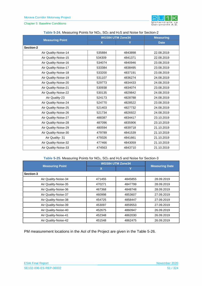
Morava Corridor Motorway Project
Chapter 5: Baseline Conditions
ESIA Final Report November 2020
SE102-000-ES-REP-00002 51 / 324
Table 5-24. Measuring Points for NO2, SO2 and H2S and Noise for Section-2
Measuring Point WGS84 UTM Zone34 Measuring
X Y Date
Section-2
Air Quality-Noise-14 535884 4843898 22.08.2019
Air Quality-Noise-15 534309 4841371 22.08.2019
Air Quality-Noise-16 534074 4840946 23.08.2019
Air Quality-Noise-17 533384 4838495 23.08.2019
Air Quality-Noise-18 533200 4837191 23.08.2019
Air Quality-Noise-19 531107 4836274 24.08.2019
Air Quality-Noise-20 529773 4834433 24.08.2019
Air Quality-Noise-21 530938 4834074 23.08.2019
Air Quality-Noise-22 530135 4829842 24.08.2019
Air Quality-23 524173 4828788 24.08.2019
Air Quality-Noise-24 524770 4828522 23.08.2019
Air Quality-Noise-25 521403 4827732 24.08.2019
Air Quality-Noise-26 521734 4826922 24.08.2019
Air Quality-Noise-27 488387 4834417 23.10.2019
Air Quality-Noise-28 487096 4835906 23.10.2019
Air Quality-Noise-29 480594 4839718 21.10.2019
Air Quality-Noise-30 479789 4841539 21.10.2019
Air Quality- 31 479326 4841661 21.10.2019
Air Quality-Noise-32 477466 4843059 21.10.2019
Air Quality-Noise-33 474563 4843710 21.10.2019
Table 5-25. Measuring Points for NO2, SO2 and H2S and Noise for Section-3
Measuring Point WGS84 UTM Zone34
Measuring Date X Y
Section-3
Air Quality-Noise-34 471455 4845855 28.09.2019
Air Quality-Noise-35 470271 4847799 28.09.2019
Air Quality-Noise-36 467368 4848748 28.09.2019
Air Quality-Noise-37 460998 4853607 27.09.2019
Air Quality-Noise-38 454725 4858447 27.09.2019
Air Quality-Noise-39 453097 4859553 27.09.2019
Air Quality-Noise-40 452675 4860947 26.09.2019
Air Quality-Noise-41 452348 4862030 26.09.2019
Air Quality-Noise-42 451548 4862475 26.09.2019
PM measurement locations in the AoI of the Project are given in the Table 5-26.

Morava Corridor Motorway Project
Chapter 5: Baseline Conditions
ESIA Final Report November 2020
SE102-000-ES-REP-00002 52 / 324
Table 5-26. Measuring Points for PM10 and PM2.5 for Section-1
Measuring Point GPS coordinates
Parameters Measuring Date X Y
Measuring Point 1: The courtyard of Budimir Ognjanović`s house in the village of Pojate
21° 26' 44,48" 43°44'50,11'' PM10 – PM2.5 20.09.2019 - 21.09.2019.
Measuring Point 2: The courtyard of Biljana Krstić`s house in Ćićevac
21° 26' 02,44" 43° 43' 22,01" PM10 ..
Measuring Point 3: The courtyard of Radovan Vasić`s house, 3 Slobodan Penezić street, Ćićevac
21° 25' 53,81" 43° 43' 13,03" PM10 – PM2.5 21.09. 2019 - 22.09.2019.
Measuring Point 4: The courtyard of Srbislav Vasić`s house, 93 Solunskih ratnika street, Stalać.
21° 24' 51,49" 43° 41' 55,4" PM10
Measuring Point 5: The courtyard of Igor Stefanović`s, 8 Todora od Stalaća street, Stalać.
21° 24' 46,71" 43° 41' 17,57" PM10 – PM2.5 22.09. 2019 - 23.09.2019.
Measuring Point 6: The courtyard of Bojan Mihajlović`s house in the village of Maskare.
21° 23' 08,81" 43° 40' 43,88" PM10
Measuring Point 7: The courtyard of Ljubiša Janićijević`s house in the village of Bošnjane.
21° 22' 8,74" 43° 39' 45,27" PM10 – PM2.5 23.09. 2019 - 24.09.2019.
Measuring Point 8: The courtyard of Aleksandar Marković`s house, 4 Moravska street in the village of Mrzenica.
21° 23' 01,23" 43° 39' 28,76" PM10
Measuring Point 9: The courtyard of Radoslav Davidović`s house, 193 Savska street in the village of Makrešane.
21° 22' 24,28" 43° 37' 13,37" PM10 – PM2.5 24.09. 2019- 25.09.2019.
Measuring Point 10: The courtyard of Milivoje Milovanović`s house, 17 Stanislava Biničkog street in the village of Jasika.
21° 17' 49,46" 43° 36' 37,57" PM10
Measuring Point 11: The yard of the company KRUŠEVAC PUT AD, 65 Jasički put, Kruševac.
21° 18' 25,86" 43° 36' 25,57" PM10 – PM2.5 25.09. 2019 - 26.09.2019.
Measuring Point 12: The courtyard of Miodrag Jovanović`s house 2 Sedmojulska street in the village of Kukljin.
21° 15' 54,69" 43° 36' 8,35" PM10
Measuring Point 13: The courtyard of Jelena Todorović`s house, 3 Jelena Anžujska street in the village of Čitluk.
21° 16' 09,59" 43° 35' 41,44"
PM10 26.09. 2019 - 27.09.2019.
Measuring Point 14: Dvorište kuće Bobana Marinkovića, selo Koševi kod Kruševca.
21°14'43,09'' 43°35'13.27'' PM10 13.11.2019 - 14.11.2019
Measuring Point 15: Dvorište kuće Miladinovića, selo Kukljin kod Kruševca
21° 14' 44,08" 43° 36' 6,54" PM10 – PM2.5 12.11.2019 – 13.11.2019
Measuring Point 16: Dvorište kuće Dragana Živkića, selo Selište kod Trstenika.
21° 8' 52,01" 43°36' 47,39" PM10
Measuring Point 17: Dvorište kuće Miće Promicaća, selo Medveđa kod Trstenika.
21° 5’ 23,55” 43°37’ 32,02” PM10 – PM2.5 11.11.2019-12.11.2019
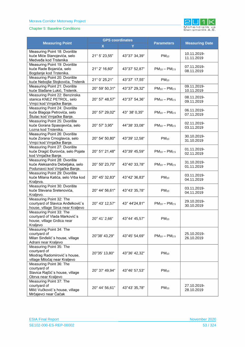
Morava Corridor Motorway Project
Chapter 5: Baseline Conditions
ESIA Final Report November 2020
SE102-000-ES-REP-00002 53 / 324
Measuring Point GPS coordinates
Parameters Measuring Date X Y
Measuring Point 18: Dvorište kuće Miće Stanojevića, selo Medveđa kod Trstenika
21° 5’ 23,55” 43°37' 34,39" PM10 10.11.2019-11.11.2019
Measuring Point 19: Dvorište kuće Rade Bojanića, selo Bogdanje kod Trstenika.
21° 2' 16,60" 43°37' 52,87" PM10 – PM2.5 07.11.2019-08.11.2019
Measuring Point 20: Dvorište kuće Nebojše Stojkovića, Trstenik
21° 0’ 25,21” 43°37’ 17,55” PM10
Measuring Point 21: Dvorište kuće Slađane Lukić, Trstenik.
20° 59' 50,31" 43°37' 29,32" PM10 – PM2.5 09.11.2019-10.11.2019
Measuring Point 22: Benzinska stanica KNEZ PETROL, selo Vrnjci kod Vrnjačke Banje.
20° 57’ 48,57” 43°37’ 54,36” PM10 – PM2.5 08.11.2019-09.11.2019
Measuring Point 24: Dvorište kuće Blagoja Petrovića, selo Štulac kod Vrnjačke Banje.
20° 57' 29,02" 43° 38' 0,35" PM10 – PM2.5 06.11.2019-07.11.2019
Measuring Point 25: Dvorište kuće Gorana Spasojevića, selo Lozna kod Trstenika.
20° 57' 3,95" 44°38' 33,08" PM10 – PM2.5 02.11.2019-03.11.2019
Measuring Point 26: Dvorište kuće Zorana Crnoglavca, selo Vrnjci kod Vrnjačke Banje.
20° 54' 50,80" 43°39' 12,58" PM10 30.10.2019-31.10.2019
Measuring Point 27: Dvorište kuće Dragić Đurovića, selo Pojate kod Vrnjačke Banje.
20° 51' 21,48" 43°39' 45,59" PM10 – PM2.5 01.11.2019-02.11.2019
Measuring Point 28: Dvorište kuće Aleksandra Debeljaka, selo Podunavci kod Vrnjačke Banje.
20° 50' 23,70" 43°40' 33,78" PM10 – PM2.5 31.10.2019-01.11.2019
Measuring Point 29: Dvorište kuće Milana Katića, selo Vrba kod Kraljeva.
20° 45' 32,83" 43°42' 36,83" PM10 03.11.2019-04.11.2019
Measuring Point 30: Dvorište kuće Stevana Sretenovića, Kraljevo.
20° 44' 56,61" 43°43' 35,78" PM10 03.11.2019-04.11.2019
Measuring Point 32: The courtyard of Slavica Anđelković`s house, village Sirca near Kraljevo
20° 43' 12,57" 43° 44'24,81" PM10 – PM2.5 29.10.2019-30.10.2019
Measuring Point 33: The courtyard of Vlada Marković`s house, village Grdica near Kraljevo
20° 41' 2,66" 43°44' 45,57" PM10
Measuring Point 34: The courtyard of Milan Sinđelić`s house, village Adrani near Kraljevo
20°38' 43,29" 43°45' 54,69" PM10 – PM2.5 25.10.2019-26.10.2019
Measuring Point 35: The courtyard of Miodrag Radomirović`s house, village Miločaj near Kraljevo
20°35' 13,80" 43°36' 42,32" PM10
Measuring Point 36: The courtyard of Slavica Rajčić`s house, village Obrva near Kraljevo
20° 37' 49,94" 43°46' 57,53" PM10
Measuring Point 37: The courtyard of Milić Vučković`s house, village Mrčajevci near Čačak
20° 44' 56,61" 43°43' 35,78" PM10 27.10.2019-28.10.2019

Morava Corridor Motorway Project
Chapter 5: Baseline Conditions
ESIA Final Report November 2020
SE102-000-ES-REP-00002 54 / 324
Measuring Point GPS coordinates
Parameters Measuring Date X Y
Measuring Point 38: The courtyard of Velimir Petrović`s house, village Stančići near Čačak
20° 26' 11,21" 43°52' 39,82" PM10 – PM2.5 24.10.2019-25.10.2019
Measuring Point 39: The courtyard of Marko Tripković`s house, village Baluga near Čačak
20° 25' 0,96" 43°53'14,61" PM10 – PM2.5 23.10.2019-24.10.2019
Measuring Point 40: The courtyard of Momčilo Mikavica`s house, village Konjevići near Čačak
20° 24' 40,43" 43° 54' 1,27" PM10
Measuring Point 41: The courtyard of Ljuban Grbović`s house, village Preljina near Čačak
20° 24' 27,15" 43°54'38,97" PM10 – PM2.5 22.10.2019-23.10.2019
Measuring Point 42: The courtyard of Stanimirka Vasović`s house, Čačak
20° 23' 59,14" 43°54'35,33" PM10 28.10.2019-29.10.2019
All measurement points conducted within the scope of environmental baseline studies are
presented in Figure 5-38.
Figure 5-38. All Measurement Points within the scope of Environmental Baseline Studies
Morava Corridor Motorway Project
Chapter 5: Baseline Conditions
ESIA Final Report November 2020
SE102-000-ES-REP-00002 55 / 324
5.4.2 Methodology and Data Source
Measurements were carried out by laboratories with national and international competence
(see Appendix-2 for certificates of competence). The measurements were taken over a total
of 30 days, which is sufficient according to Directive 2008/50/EC on ambient air quality and
cleaner air for Europe.
Measuring air quality to determine background concentrations of air pollutants is based on
the usage of passive sampling equipment i.e., diffusion tubes for gaseous pollutants which is
internationally acceptable technique based on EN ISO/IEC 17025:2005 standard.
To track and document each step in the testing process until the results are released, a
Chain of Custody Form (CCF) was used.
Ambient air - Standard gravimetric measurement method is used for the determination of the
PM10 and PM2.5 mass concentration of suspended particulate matter which is internationally
acceptable technique based on EN 12341:2015 standard.
Following documents have been reviewed during the desktop study of the project as;
• WHO Ambient Air Quality Guideline;
• Regulation on the Conditions for Monitoring and Air Quality Requirements (Official
Gazette of RS, No. 11/10 and 75/10, Amend 63/13);
• Degree on monitoring conditions and air quality requirements ("Official Gazette of
RS" No. 11/2010, 75/2010 and 63/2013), Attachment X, Part B).
5.4.3 Baseline Conditions
In general, air quality conditions in Serbia is known to be a major concern according to the
results of some measurement studies conducted in Serbia for different purposes in the past.
One of such measurements campaign is dated to 2013 and its results show that the air is to
be harmful to health due to the fact that PM2.5 and PM10 concentrations are well above the
limit values set by the EU and the World Health Organization (WHO) to protect health
((HEAL), 2014).
Regarding the baseline air quality conditions in relation to the AoI of the Project, Serbian EIA
Reports for each Section of the motorway were taken into account and much more detailed
baseline air quality assessment was provided by using the results of the extensive air quality
measurements conducted by 2U1K.
Serbian EIA reports have been reviewed to find out about the current air pollution in the
project area. According to the assessments in the EIA Reports, there are two types of
contributaries to the air pollution in this section; i) mobile/linear soruces (e.g., traffic) and ii)
point/stationary sources (e.g., industry, heating facilities and individual heating units).
Morava Corridor Motorway Project
Chapter 5: Baseline Conditions
ESIA Final Report November 2020
SE102-000-ES-REP-00002 56 / 324
Regarding the air pollution due to the traffic, the existing main roads M-5, M-22, M-23.1 are
the only sources.
Section 1: no specific measurement of air pollution has been made.
Section 2: no information is available due to the absence / incomplete EIA Report.
Section 3: EIA Report of Sector 8 states that the Adrani-Mrcajevci part of this Section
is assumed to be the dominant line of air pollutants orginated from traffic. In this part
of the section, there is no point sources of air pollution whereas Kraljevo that is the
settlement before Adrani in this Section has industry, heating facilities and individual
heating units as point sources. During the heating season, most of the pollutant
components in the populated suburban areas are caused by individual heating
furnaces. As a result, during the heating season, air pollution in the municipality of
Kraljevo is mainly due to the generation of thermal energy for heating, followed by
transport and industry. It is noted that traffic and industry are pollutants throughout
the year. No special traffic assessment has been conducted in the municipality of
Kraljevo. EIA Report of Sector 9 states that M22 and M23 are the main linear sources
of air pollution in the Sector and there are no major point sources in this Sector.
According to the air quality measurements made in 2017 for monitoring of impacts of
air quality on agricultural products in the Municipality of Čačak, the air quality
conditions prevailing in this Sector is defined as first category, which is clean or
slightly polluted air where no limit values for any pollutant have been exceeded.
Baseline air quality is examined by evaluating the measurement results of the air quality tests
for H2S, SO2, and NO2 that are given in Table 5-27.

Morava Corridor Motorway Project
Chapter 5: Baseline Conditions
ESIA Final Report November 2020
SE102-000-ES-REP-00002 57 / 324
Table 5-27. Measurement Results of H2S, SO2, NO2, Toluene, Ethylbenzene, O-Xylene, P-M-Xylene, Benzene for Section-1
Air Quality Measurement Location H2S(µg/m3) SO2(µg/m3) NO2(µg/m3) TOLUENE
(µg/m3) ETHYLBENZENE
(µg/m3) O- XYLENE
(µg/m3) P-M- XYLENE
(µg/m3) BENZENE
(µg/m3)
Air Quality-1 < 2.00 15.84 4.49 * * * * *
Air Quality-2 < 2.00 12.57 1.34 * * * * *
Air Quality-3 < 2.00 14.67 2.45 * * * * *
Air Quality-4 < 2.00 11.68 1.78 * * * * *
Air Quality-5 < 2.00 <2.92 2.50 * * * * *
Air Quality-6 < 2.00 19.68 0.49 * * * * *
Air Quality-7 < 2.00 <2.92 1.39 * * * * *
Air Quality-8 < 2.00 22.84 2.00 * * * * *
Air Quality-9 < 2.00 24.79 7.86 * * * * *
Air Quality-10 < 2.00 23.25 1.78 * * * * *
Air Quality-11 * * * 6.42 <0.68 0.77 0.78 0.61
Air Quality-12 < 2.00 5.93 1.64 * * * * *
Air Quality-13 < 2.00 4.53 2.27 * * * * *
Limit Values
125 - Interim target 1; 50 - Interim target 2;
20 – guideline (for an averaging period
of 24-hour)1
40 – guideline (for an averaging period of 1-year) 200 – guideline (for an averaging
period of 1-hour)1 2602 µg/m3 435,000 4,8001 µg/m3 4,8001 µg/m3
16.253 µg/m3
The values prescribed by the Regulation on the Conditions for Monitoring and Air Quality Requirements*
(µg/m3) 125 85
There is an asphalt plant in the same measurement location that is Air Quality-11. Therefore, Toluene, Benzene o-xylene and m-p-xylene measurements are conducted to evaluate the air quality. As it is shown
in the table above, results are well below the limit values.
1WHO Ambient Air Quality Guideline Value 2WHO (2000) 3UK Expert Panel on Air Quality Standarts (EPAQS)
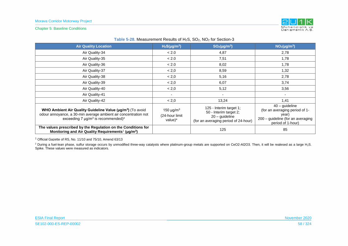
Morava Corridor Motorway Project
Chapter 5: Baseline Conditions
ESIA Final Report November 2020
SE102-000-ES-REP-00002 58 / 324
Table 5-28. Measurement Results of H2S, SO2, NO2 for Section-3
Air Quality Location H2S(µg/m3) SO2(µg/m3) NO2(µg/m3)
Air Quality-34 < 2.0 4,87 2,78
Air Quality-35 < 2.0 7,51 1,78
Air Quality-36 < 2.0 8,02 1,78
Air Quality-37 < 2,0 8,59 1,32
Air Quality-38 < 2,0 5,16 2,78
Air Quality-39 < 2,0 6,07 3,74
Air Quality-40 < 2,0 5,12 3,56
Air Quality-41 - - -
Air Quality-42 < 2,0 13,24 1,41
WHO Ambient Air Quality Guideline Value (µg/m3) (To avoid
odour annoyance, a 30-min average ambient air concentration not exceeding 7 μg/m3 is recommended)*
150 μg/m3
(24-hour limit value)*
125 - Interim target 1; 50 - Interim target 2;
20 – guideline (for an averaging period of 24-hour)
40 – guideline (for an averaging period of 1-
year) 200 – guideline (for an averaging
period of 1-hour)
The values prescribed by the Regulation on the Conditions for Monitoring and Air Quality Requirements1 (µg/m3)
125 85
1 Official Gazette of RS, No. 11/10 and 75/10, Amend 63/13
2 During a fuel-lean phase, sulfur storage occurs by unmodified three-way catalysts where platinum-group metals are supported on CeO2‐Al2O3. Then, it will be realesed as a large H2S. Spike. These values were measured as indicators.

Morava Corridor Motorway Project
Chapter 5: Baseline Conditions
ESIA Final Report November 2020
SE102-000-ES-REP-00002 59 / 324
As a result of the measurements, the daily average values are below Serbian limit values
and IFC Guideline Limits for Ambient Air Quality (125 µg/m3 as interim target-1). In addition,
the contribution from the Project should not exceed 25% of the limit value, which is 31.25
µg/m3. Accordingly, the AoI can be considered as having a non-degraded air shed.
In addition, baseline air quality is examined by evaluating the measurement results of the air
quality tests for PM10 and PM2.5 that are given in Table 5-29.
Table 5-29. Measurement Results for PM10 and PM2.5
Measuring Point Parameter Result of Measurement
(μg/m3) Limit Value
Measuring Point 1 PM10 27.2 ± 17% 505
PM2.5 9.1 ± 17% 256
Measuring Point 2 PM10 19.9 ± 17% 50
Measuring Point 3 PM10 27.2 ± 17% 50
PM2.5 14.5 ± 17% 25
Measuring Point 4 PM10 18.1 ± 17% 50
Measuring Point 5 PM10 41.7 ± 17% 50
PM2.5 23.6 ± 17% 25
Measuring Point 6 PM10 27.2 ± 17% 50
Measuring Point 7 PM10 23.6 ± 17% 50
PM2.5 10.9 ± 17% 25
Measuring Point 8 PM10 14.5 ± 17% 50
Measuring Point 9 PM10 32.6 ± 17% 50
PM2.5 19.0 ± 17% 25
Measuring Point 10 PM10 30.8 ± 17% 50
Measuring Point 11 PM10 42.3 ± 17% 50
PM2.5 23.6 ± 17% 25
Measuring Point 12 PM10 24.5 ± 17% 50
Measuring Point 13 PM10 20.7 ± 17% 50
Measuring Point 14 PM10 21.7 ± 17% 50
Measuring Point 15 PM10 20.7 ± 17% 50
PM2.5 15.8 ± 17% 25
Measuring Point 16 PM10 21.2 ± 17% 50
Measuring Point 17 PM10 20.1 ± 17% 50
PM2.5 16.9 ± 17% 25
Measuring Point 18 PM10 20.7 ± 17% 50
Measuring Point 19 PM10 24.2 ± 17% 50
PM2.5 17.9 ± 17% 25
Measuring Point 20 PM10 29.6 ± 17% 50
Measuring Point 21 PM10 29.8 ± 17% 50
PM2.5 21.8 ± 17% 25
Measuring Point 22 PM10 30.6 ± 17% 50
5 Limit value referring to the 1 - day averaging period 6 Limit value referring to the calendar year averaging period
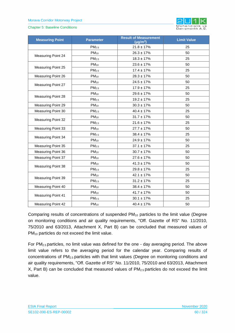
Morava Corridor Motorway Project
Chapter 5: Baseline Conditions
ESIA Final Report November 2020
SE102-000-ES-REP-00002 60 / 324
Measuring Point Parameter Result of Measurement
(μg/m3) Limit Value
PM2.5 21.8 ± 17% 25
Measuring Point 24 PM10 26.3 ± 17% 50
PM2.5 18.3 ± 17% 25
Measuring Point 25 PM10 23.6 ± 17% 50
PM2.5 17.4 ± 17% 25
Measuring Point 26 PM10 28.3 ± 17% 50
Measuring Point 27 PM10 24.5 ± 17% 50
PM2.5 17.9 ± 17% 25
Measuring Point 28 PM10 29.6 ± 17% 50
PM2.5 19.2 ± 17% 25
Measuring Point 29 PM10 30.3 ± 17% 50
Measuring Point 30 PM2.5 40.4 ± 17% 25
Measuring Point 32 PM10 31.7 ± 17% 50
PM2.5 21.6 ± 17% 25
Measuring Point 33 PM10 27.7 ± 17% 50
Measuring Point 34 PM2.5 38.4 ± 17% 25
PM10 24.9 ± 17% 50
Measuring Point 35 PM2.5 37.1 ± 17% 25
Measuring Point 36 PM10 30.7 ± 17% 50
Measuring Point 37 PM10 27.6 ± 17% 50
Measuring Point 38 PM10 41.3 ± 17% 50
PM2.5 29.8 ± 17% 25
Measuring Point 39 PM10 42.1 ± 17% 50
PM2.5 31.2 ± 17% 25
Measuring Point 40 PM10 38.4 ± 17% 50
Measuring Point 41 PM10 41.7 ± 17% 50
PM2.5 30.1 ± 17% 25
Measuring Point 42 PM10 40.4 ± 17% 50
Comparing results of concentrations of suspended PM10 particles to the limit value (Degree
on monitoring conditions and air quality requirements, "Off. Gazette of RS" No. 11/2010,
75/2010 and 63/2013, Attachment X, Part B) can be concluded that measured values of
PM10 particles do not exceed the limit value.
For PM2.5 particles, no limit value was defined for the one - day averaging period. The above
limit value refers to the averaging period for the calendar year. Comparing results of
concentrations of PM2.5 particles with that limit values (Degree on monitoring conditions and
air quality requirements, "Off. Gazette of RS" No. 11/2010, 75/2010 and 63/2013, Attachment
X, Part B) can be concluded that measured values of PM2.5 particles do not exceed the limit
value.

Morava Corridor Motorway Project
Chapter 5: Baseline Conditions
ESIA Final Report November 2020
SE102-000-ES-REP-00002 61 / 324
5.4.4 Sensitive Receptors
Since the results of the measurements for PM10, PM2.5, SO2 and NO2 do not exceed the limit
values, all measurement locations along the entire AoI, are determined as sensitive
receptors and the impact assessment will be carried out accordingly.
5.5 Noise
In this section, at first, the methodology and data sources used to write the baseline
conditions is specified, and then air quality baseline information about the area where the
Project is located is given more specifically.
5.5.1 Study Area
The existing noise level of the AoI was determined by taking samples from surface waters on
the Proposed Motorway Route. For this purpose, a total of 39 different measurement
locations were determined through the Proposed Motorway Route.
Measurement locations for noise are provided in Table 5-30 and they are integrated into the
Measurement Locations’ Map which is prepared by 2U1K (see Appendix-5.2).
5.5.2 Methodology and Data Source
Following documents have been reviewed during the desktop study of the Project;
EIA Reports for Section-1 (CIP, 2018) and Section-3 (Highway Institute, 2019); and
WHO Noise Guideline.
In order to determine the current situation along the motorway line, 24 hours of background
noise measurements was carried out by SEGAL at 39 points, which were determined as the
sensitive receptors in close proximity to the noise sources of the Project such as the
Proposed Motorway Route and construction facilities such as borrow pits.
Instrument (Type I noise measurement instruments i.e., SVANTEK SVAN957 model and
SVAN 971 model) approved by the International Electronic Commission was used for noise
measurements. The equipment was calibrated by the technician before each measurement
(see Appendix-2 for all accreditation certificates about noise measurements).
Ambient noise sources such as traffic, human and animal sounds, natural events, etc. will be
observed and recorded for the measurement. The noise measurement methodology is
described below;
• Noise measurement locations was minimum 2 m away from reflective surfaces the
buildings, walls, stone blocks, etc.
Morava Corridor Motorway Project
Chapter 5: Baseline Conditions
ESIA Final Report November 2020
SE102-000-ES-REP-00002 62 / 324
• The weather conditions observed by the measuring personnel were recorded for
reporting and in case of rainfall or heavy storm/strong winds, measurements or the
recorded results are cancelled.
• The measurement equipment automatically saves the measurements in its memory.
5.5.3 Baseline Conditions
Section-1: Noise is one of the most important sources of pollution in motorway construction
projects. The local legislation and standards dealt with for noise pollution are;
The Law on Environmental Noise (Official Gazette No.88/ last amended in 2010)
The Nuisance and the Harmful Effects (Official Gazette No.75/ last amended on
2010)
According to EIA Report for Section-1, the residential buildings are observed to be affected
from traffic noise caused by existing state road of II B (Corridor 11) line number 23, state
roads of the II A line number 187, line number 207 and more local roads.
Railway traffic along line number 55 is another source of noise pollution that affects the
neighboring residents. According to the EIA Report, the residential buildings are observed to
have most of the impacts of traffic pollution.
Section-2: No information is available due to the absence / incomplete EIA Report .
Section-3: According to the EIA Report for Section-3, the existing infrastructure facilities are
specified as the sources of current noise pollution in the study area of the EIA and no data
obtained about the current noise pollution. As stated in the EIA Report, after the construction
of Sector 8 and Sector 9 of the Morava Corridor Motorway, the dominant noise pollution
source will be derived from the proposed motorway traffic.
In addition to the EIA studies, within the scope of ESIA studies, noise level measurements
are conducted and the results of measurements are provided in Table 5-30.

Morava Corridor Motorway Project
Chapter 5: Baseline Conditions
ESIA Final Report November 2020
SE102-000-ES-REP-00002 63 / 324
Table 5-30. Noise Measurement Results for Section-1
Measurement Point Date Measurement Time
Scale
Measurement Results (dBA)
WHO Limit Value
Residential Areas Industrial
Leq-den LeqAnight 22:00-07:00
LeqAden and
LeqAnight
Leq-den L90 LCmax Leq-den Leq-night Leq-den/ Leq-night
Noise-1 22.08.2019 Leq-den 51,13 49,49 71,2 55
70
34T 535884 E 4843898 N 23.08.2019 Leq-night 44,08 42,39 59,1
45
Noise-2 22.08.2019 Leq-den 50,15 48,66 71,96 55
70
34T 534958 E 4841175 N 23.08.2019 Leq-night 44,11 42,38 59,51
45
Noise 3 23.08.2019 Leq-den 52,1 50,28 72,85 55
70
34T 534714 E 4840832 N 24.08.2019 Leq-night 44,77 43,18 59,93
45
Noise 4 23.08.2019 Leq-den 52,03 50,05 72,35 55
70
34T 533384 E 4838495 N 24.08.2019 Leq-night 44,99 43,25 60,45
45
Noise 5 23.08.2019 Leq-den 50,2 48,38 69,33 55
70
34T 533304 E 4837331 N 24.08.2019 Leq-night 43,48 41,87 57,85
45
Noise 6 24.08.2019 Leq-den 50,97 49,27 71,59 55
70
34T 531096 E 4836278 N 25.08.2019 Leq-night 44,69 43,16 61
45
Noise-7 24.08.2019 Leq-den 48,07 46,62 66,41 55
70
34T 529759 E 4834463 N 25.08.2019 Leq-night 41,93 40,52 55,91
45
Noise-8 23.08.2019 Leq-den 49,11 47,47 67,67 55
70
34T 530937 E 4833959 N 24.08.2019 Leq-night 42,54 41,9 57,12
45
Noise-9 24.08.2019 Leq-den 50,85 48,57 71,3 55
70
34T 530135 E 4829842 N 25.08.2019 Leq-night 42,5 40,87 56,53
45
Noise-10 24.08.2019 Leq-den 49,78 47,95 59,11 55
70
34T 524064 E 4828666 N 25.09.2019 Leq-night 43,04 41,55 57,27
45
Noise-11 24.08.2019 Leq-den 52,2 50,26 72,19 55
70
34T 521403 E 4827732 N 25.08.2019 Leq-night 44,76 43,36 60,18
45
Noise-12 24.08.2019 Leq-den 51,85 50,32 72,74 55
70
34T 521734 E 4826922 N 25.08.2019 Leq-night 44,75 42,93 59,43
45

Morava Corridor Motorway Project
Chapter 5: Baseline Conditions
ESIA Final Report November 2020
SE102-000-ES-REP-00002 64 / 324
As shown in Table 5-30, the measurement results do not exceed the limit values which is
given according to WHO Noise Guideline. In the Guideline, as shown in the table above, limit
values are given as 55 dBA (nighttime) and 45 dBA (daytime) for residential areas, and 70
dBA as noise limit value for industrial areas.
5.5.4 Sensitive Receptors
Sensitive receptors were determined as the closest settlements to the Proposed Motorway
Route because locals who live in these settlements are the ones affected mostly from noise
pollution, considering that the measurement results were close to the limit values. These
settlements are Pojate, Stalac, Grad Stalac, Maskare, Mrzenica, Bosnjane, Makresane,
Bivolje, Jasika and Citluk.
5.6 Soil Quality
In this section, at first, general information about the soil types of Serbia is given. Then, after
specifying the methodology and data sources used to write the baseline conditions, soil
quality baseline information about the area where the project is located is given more
specifically. Due to the fact that there is no information on the soil quality in the EIA Reports,
baseline surveys conducted in the scope of the ESIA studies were considered in order to
present the baseline soil quality conditions along the AoI.
5.6.1 Study Area
The study area for soil quality is determined to cover 500 m on both sides of the Proposed
Motorway Route.
The existing soil quality of the AoI have been determined by taking samples, using the
necessary equipment and the technician, from soil on the Proposed Motorway Route. Soil
sampling was carried out by SEGAL at 16 different points for Section-1, at 28 different points
for Section-2 and at 12 different points for Sector-3 along the Proposed Motorway Route in
order to determine the existing soil pollution of the AoI of the Project.
Measurement locations for soil quality are provided in Table 5-31, Table 5-32, Table 5-33
and they are integrated into the Measurement Locations’ Map which is prepared by 2U1K
(see Appendix-5.2).

Morava Corridor Motorway Project
Chapter 5: Baseline Conditions
ESIA Final Report November 2020
SE102-000-ES-REP-00002 65 / 324
Table 5-31. Measurement Locations for Section-1 Soil Quality
Soil Measurement Location WGS84 UTM Zone34
Measurement Date X Y
Section-1
Soil-1 533336 4840681 23.08.2019
Soil-1B 533213 4838837 23.08.2019
Soil-2 531784 4836496 23.08.2019
Soil-2B 532117 4836091 23.08.2019
Soil-3 531529 4835513 23.08.2019
Soil-4 531008 4834572 23.08.2019
Soil-4B 530173 4833869 24.08.2019
Soil-4C 531210 4832039 24.08.2019
Soil-5 529122 4828749 24.08.2019
Soil-5B 527685 4829008 24.08.2019
Soil-5C 528672 4828772 24.08.2019
Soil-5D 526623 4828278 24.08.2019
Soil-6 525284 4827999 24.08.2019
Soil-7 524770 4828522 23.08.2019
Soil-7A 525149 4828805 24.08.2019
Soil-8 521683 4827794 23.08.2019
Table 5-32. Measurement Locations for Section-2 Soil Quality
Soil Measurement Location WGS84 UTM Zone34
Measurement Date X Y
Section-2
Soil-9 519194 4826970 27.10.2019
Soil-10 510802 4828130 27.10.2019
Soil-10B 509225 4828206 27.10.2019
Soil-11 507739 4828714 26.10.2019
Soil-12 507860 4830372 26.10.2019
Soil-13 502018 4830464 26.10.2019
Soil-14 501457 4830515 25.10.2019
Soil-15 497131 4831037 25.10.2019
Soil-16 496724 4831212 25.10.2019
Soil-16B 496874 4831516 25.10.2019
Soil-17 496845 4831905 24.10.2019
Soil-18 495927 4831501 24.10.2019
Soil-19 496046 4832186 24.10.2019
Soil-19B 493185 4833590 24.10.2019
Soil-20 491143 4835346 23.10.2019
Soil-21 488075 4837003 23.10.2019
Soil-21B 486630 4837112 23.10.2019
Soil-22 486499 4838280 23.10.2019
Soil-23 481084 4840425 22.10.2019
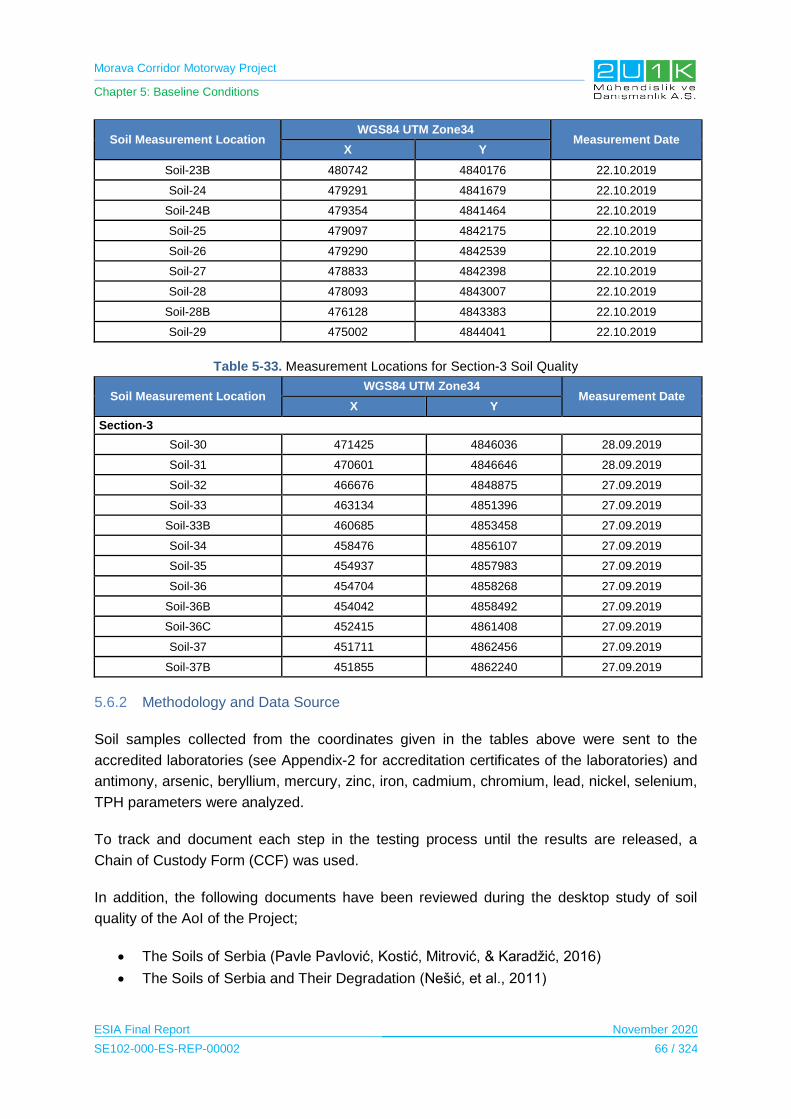
Morava Corridor Motorway Project
Chapter 5: Baseline Conditions
ESIA Final Report November 2020
SE102-000-ES-REP-00002 66 / 324
Soil Measurement Location WGS84 UTM Zone34
Measurement Date X Y
Soil-23B 480742 4840176 22.10.2019
Soil-24 479291 4841679 22.10.2019
Soil-24B 479354 4841464 22.10.2019
Soil-25 479097 4842175 22.10.2019
Soil-26 479290 4842539 22.10.2019
Soil-27 478833 4842398 22.10.2019
Soil-28 478093 4843007 22.10.2019
Soil-28B 476128 4843383 22.10.2019
Soil-29 475002 4844041 22.10.2019
Table 5-33. Measurement Locations for Section-3 Soil Quality
Soil Measurement Location WGS84 UTM Zone34
Measurement Date X Y
Section-3
Soil-30 471425 4846036 28.09.2019
Soil-31 470601 4846646 28.09.2019
Soil-32 466676 4848875 27.09.2019
Soil-33 463134 4851396 27.09.2019
Soil-33B 460685 4853458 27.09.2019
Soil-34 458476 4856107 27.09.2019
Soil-35 454937 4857983 27.09.2019
Soil-36 454704 4858268 27.09.2019
Soil-36B 454042 4858492 27.09.2019
Soil-36C 452415 4861408 27.09.2019
Soil-37 451711 4862456 27.09.2019
Soil-37B 451855 4862240 27.09.2019
5.6.2 Methodology and Data Source
Soil samples collected from the coordinates given in the tables above were sent to the
accredited laboratories (see Appendix-2 for accreditation certificates of the laboratories) and
antimony, arsenic, beryllium, mercury, zinc, iron, cadmium, chromium, lead, nickel, selenium,
TPH parameters were analyzed.
To track and document each step in the testing process until the results are released, a
Chain of Custody Form (CCF) was used.
In addition, the following documents have been reviewed during the desktop study of soil
quality of the AoI of the Project;
The Soils of Serbia (Pavle Pavlović, Kostić, Mitrović, & Karadžić, 2016)
The Soils of Serbia and Their Degradation (Nešić, et al., 2011)

Morava Corridor Motorway Project
Chapter 5: Baseline Conditions
ESIA Final Report November 2020
SE102-000-ES-REP-00002 67 / 324
5.6.3 Baseline Conditions
In this part of the Report, general information on the baseline soil conditions of the country is
provided and then, the Project specific soil quality survey results are presented and
assessed.
The Soil Map of Serbia (see Figure 5-39) consists of a large number of soil types and
subclasses, each with a unique set of morphological, chemical and water-physical properties,
each with different production characteristics (Licina, et al., 2011).
According to the census of agriculture (in 2012), 73.1% of the land in agricultural areas is
cultivated. 20.7% of these areas consist of pastures and meadows. 4.8% of this area is used
for fruit cultivation, 0.6% for vineyard and 0.7% for the garden (Pavlovic, Costic, Karadzic, &
Mistrovi, 2017).
Regarding the soil quality conditions along the Proposed Motorway Route, analyses results
of the soil samples are given in Table 5-34.
Source: (Serbian Environmental Protection Agency, 2015)
Figure 5-39. Soil Map of Serbia
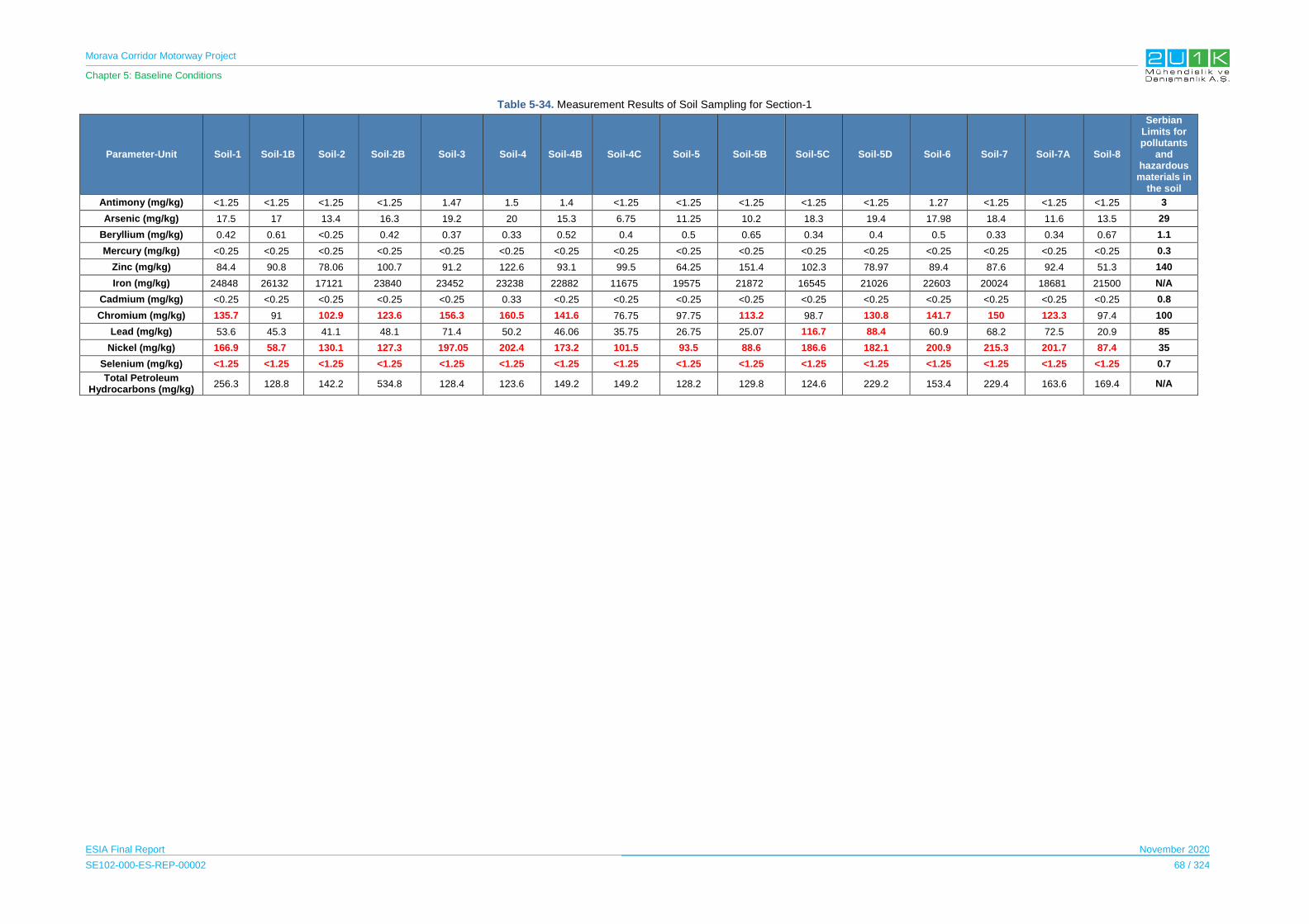
Morava Corridor Motorway Project
Chapter 5: Baseline Conditions
ESIA Final Report November 2020
SE102-000-ES-REP-00002 68 / 324
Table 5-34. Measurement Results of Soil Sampling for Section-1
Parameter-Unit Soil-1 Soil-1B Soil-2 Soil-2B Soil-3 Soil-4 Soil-4B Soil-4C Soil-5 Soil-5B Soil-5C Soil-5D Soil-6 Soil-7 Soil-7A Soil-8
Serbian Limits for pollutants
and hazardous
materials in the soil
Antimony (mg/kg) <1.25 <1.25 <1.25 <1.25 1.47 1.5 1.4 <1.25 <1.25 <1.25 <1.25 <1.25 1.27 <1.25 <1.25 <1.25 3
Arsenic (mg/kg) 17.5 17 13.4 16.3 19.2 20 15.3 6.75 11.25 10.2 18.3 19.4 17.98 18.4 11.6 13.5 29
Beryllium (mg/kg) 0.42 0.61 <0.25 0.42 0.37 0.33 0.52 0.4 0.5 0.65 0.34 0.4 0.5 0.33 0.34 0.67 1.1
Mercury (mg/kg) <0.25 <0.25 <0.25 <0.25 <0.25 <0.25 <0.25 <0.25 <0.25 <0.25 <0.25 <0.25 <0.25 <0.25 <0.25 <0.25 0.3
Zinc (mg/kg) 84.4 90.8 78.06 100.7 91.2 122.6 93.1 99.5 64.25 151.4 102.3 78.97 89.4 87.6 92.4 51.3 140
Iron (mg/kg) 24848 26132 17121 23840 23452 23238 22882 11675 19575 21872 16545 21026 22603 20024 18681 21500 N/A
Cadmium (mg/kg) <0.25 <0.25 <0.25 <0.25 <0.25 0.33 <0.25 <0.25 <0.25 <0.25 <0.25 <0.25 <0.25 <0.25 <0.25 <0.25 0.8
Chromium (mg/kg) 135.7 91 102.9 123.6 156.3 160.5 141.6 76.75 97.75 113.2 98.7 130.8 141.7 150 123.3 97.4 100
Lead (mg/kg) 53.6 45.3 41.1 48.1 71.4 50.2 46.06 35.75 26.75 25.07 116.7 88.4 60.9 68.2 72.5 20.9 85
Nickel (mg/kg) 166.9 58.7 130.1 127.3 197.05 202.4 173.2 101.5 93.5 88.6 186.6 182.1 200.9 215.3 201.7 87.4 35
Selenium (mg/kg) <1.25 <1.25 <1.25 <1.25 <1.25 <1.25 <1.25 <1.25 <1.25 <1.25 <1.25 <1.25 <1.25 <1.25 <1.25 <1.25 0.7
Total Petroleum Hydrocarbons (mg/kg)
256.3 128.8 142.2 534.8 128.4 123.6 149.2 149.2 128.2 129.8 124.6 229.2 153.4 229.4 163.6 169.4 N/A

Morava Corridor Motorway Project
Chapter 5: Baseline Conditions
ESIA Final Report November 2020
SE102-000-ES-REP-00002 69 / 324
Table 5-35. Measurement Results of Soil Sampling for Section-2
Parameter-Unit
Soil-9 Soil-
10 Soil-10B
Soil-11
Soil-12
Soil-13
Soil-14
Soil-15
Soil-16
Soil-16B
Soil-17
Soil-18
Soil-19
Soil-19B
Soil-20
Soil-21
Soil-21B
Soil-22
Soil-23
Soil-23B
Soil-24
Soil-24B
Soil-25
Soil-26
Soil-27
Soil-28
Soil-28B
Soil-29
Se
rbia
n L
imit
s f
or
po
llu
tan
ts a
nd
haza
rdo
us
ma
teri
als
in
th
e s
oil
Antimony (mg/kg)
1.77 1.49 <1.25 <1.25 <1.25 2.02 <1.25 2.41 1.5 1.51 2.08 1.75 1.7 2.04 1.32 1.36 1.63 1.55 1.59 1.59 1.88 1.85 1.38 1.35 1.33 <1.25 1.45 1.44 3
Arsenic (mg/kg)
26.4 12.9 12.6 13.5 11.75 29.2 31.05 32.03 29.75 24.8 27.7 32.6 28.9 28.7 22 24.3 27.04 24.6 26.8 23.8 27.3 28.4 16.8 16.8 15.3 14.5 19.5 20.9 29
Beryllium (mg/kg)
0.5 0.43 0.4 0.55 0.475 0.52 0.55 0.35 0.375 0.35 0.35 0.43 0.37 0.32 0.67 0.57 0.63 0.63 0.72 0.57 0.43 0.42 0.49 0.43 0.39 0.42 0.53 0.53 1.1
Mercury (mg/kg)
<0.25 <0.25 <0.25 <0.25 <0.25 <0.25 <0.25 <0.25 <0.25 <0.25 <0.25 <0.25 <0.25 <0.25 <0.25 <0.25 <0.25 <0.25 <0.25 <0.25 <0.25 <0.25 <0.25 <0.25 <0.25 <0.25 <0.25 <0.25 0.3
Zinc (mg/kg) 150.5 56.1 41 36.3 48.25 117.1 136.6 108.5 113.5 96.9 117.6 117 128.7 114 105.8 114.7 128.7 70.4 74.7 109.7 129.5 94.3 59.3 131.8 71.4 111.5 102.05 92.3 140
Iron (mg/kg) 19848 1186
0 12044 12081 12243 21365 20271 20469 19330 16401 19480 20110 18021 17663 15629 17555 19114 20033 20169 17560 20526 19189 17910 15168 14301 14599 17311 17101 N/A
Cadmium (mg/kg)
0.57 <0.25 <0.25 <0.25 <0.25 0.65 0.87 0.62 0.6 0.55 0.54 0.68 0.6 0.57 0.35 0.45 0.45 0.33 0.4 0.4 0.68 0.5 0.25 <0.25 <0.25 0.65 0.65 0.68 0.8
Chromium (mg/kg)
144.8 103.6 71.4 77.8 72.75 170.7 146.5 198.4 192 142.8 210.5 186.6 203.8 214.7 140.04 122.6 131.7 112.5 130.5 134.06 185.4 177.6 106 117.3 113.7 123.7 139.3 136.5 100
Lead (mg/kg) 101 31.08 30.6 33.3 28.75 120.1 106.3 86.1 82.5 84.8 76.8 91.4 83.08 77.3 53.2 51.8 50.6 43.4 49.1 48.2 140.8 122.03 29.6 30.3 26.8 41.6 43.02 41.4 85
Nickel (mg/kg)
176.6 102.0
7 93.6 78.04 77 221.2 244.4 268.1 300 217.4 274.9 313.1 326.8 299.3 137.04 30.7 69.6 68.9 55.8 <1.25 355.7 234.5 158.1 160.6 152.8 230.4 191.6 201.3 35
Selenium (mg/kg)
<1.25 <1.25 <1.25 <1.25 <1.25 <1.25 <1.25 <1.25 <1.25 <1.25 <1.25 <1.25 <1.25 <1.25 <1.25 <1.25 <1.25 <1.25 <1.25 <1.25 <1.25 <1.25 <1.25 <1.25 <1.25 <1.25 <1.25 <1.25 0.7
Total Petroleum
Hydrocarbons (mg/kg)
455.1 160.1 179 188.6 195.3 204.9 229.3 173.9 144.7 475.3 162.4 186.2 154.7 167.5 237.3 181.1 181.8 230.9 170.7 215.9 1003 175.3 187.8 223.6 264.4 216.06 336 372.6 N/A

Morava Corridor Motorway Project
Chapter 5: Baseline Conditions
ESIA Final Report November 2020
SE102-000-ES-REP-00002 70 / 324
Table 5-36. Measurement Results of Soil Sampling for Section-3
Parameter-Unit Soil-30 Soil-31 Soil-32 Soil-33 Soil-33B Soil-34 Soil-35 Soil-36 Soil-36B Soil-36C Soil-37 Soil-37B
Serbian Limits for pollutants
and hazardous
materials in the soil
Antimony (mg/kg) 1.402 1.5 1.43 1.62 1.27 1.29 15.27 <1.25 1.89 1.847 2.12 1.83 3
Arsenic (mg/kg) 17.28 19.55 14.59 20.15 18.96 13.4 22.53 22.33 23.95 26.98 17 14.8 29
Beryllium (mg/kg) 0.5 0.326 0.413 0.614 0.624 <0.25 0.576 0.558 0.726 0.705 0.689 0.626 1.1
Mercury (mg/kg) <0.25 <0.25 <0.25 <0.25 <0.25 <0.25 <0.25 <0.25 <0.25 <0.25 <0.25 <0.25 0.3
Zinc (mg/kg) 112.92 67.42 130.8 131.9 126.2 81.7 90.89 88.35 83.94 120.8 102.3 222 140
Iron (mg/kg) 21003 17761 17648 25246 23672 13685 17248 18973 20447 16833 19820 16934 N/A
Cadmium (mg/kg) 0.351 0.401 0.365 0.368 0.274 0.495 0.525 0.388 0.435 0.681 <0.25 0.276 0.8
Chromium (mg/kg) 138.7 129 123.3 154.5 139.7 123.3 131.4 139.3 208.5 179.6 269.6 234 100
Lead (mg/kg) 31.3 25.81 27.7 35.87 34.4 21.3 53.8 45.87 47.89 79.73 38.2 38.13 85
Nickel (mg/kg) 161.7 165.2 153 170.3 174.2 171.9 169.5 174.3 275.8 210.3 500 467 35
Selenium (mg/kg) <1.25 <1.25 <1.25 <1.25 <1.25 <1.25 <1.25 <1.25 <1.25 <1.25 <1.25 <1.25 0.7
Total Petroleum Hydrocarbons (mg/kg)
336.9 125.4 137.8 126.4 91 121.6 107 154.9 72.4 91 110.1 83.8 N/A
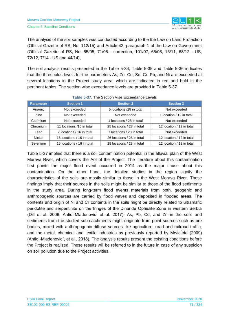
Morava Corridor Motorway Project
Chapter 5: Baseline Conditions
ESIA Final Report November 2020
SE102-000-ES-REP-00002 71 / 324
The analysis of the soil samples was conducted according to the the Law on Land Protection
(Official Gazette of RS, No. 112/15) and Article 42, paragraph 1 of the Law on Government
(Official Gazette of RS, No. 55/05, 71/05 - correction, 101/07, 65/08, 16/11, 68/12 - US,
72/12, 7/14 - US and 44/14),
The soil analysis results presented in the Table 5-34, Table 5-35 and Table 5-36 indicates
that the thresholds levels for the parameters As, Zn, Cd, Se, Cr, Pb, and Ni are exceeded at
several locations in the Project study area, which are indicated in red and bold in the
pertinent tables. The section wise exceedance levels are provided in Table 5-37.
Table 5-37. The Section Vise Exceedance Levels
Parameter Section 1 Section 2 Section 3
Arsenic Not exceeded 5 locations /28 in total Not exceeded
Zinc Not exceeded Not exceeded 1 location / 12 in total
Cadmium Not exceeded 1 locations / 28 in total Not exceeded
Chromium 11 locations /16 in total 25 locations / 28 in total 12 location / 12 in total
Lead 2 locations / 16 in total 7 locations / 28 in total Not exceeded
Nickel 16 locations / 16 in total 26 locations / 28 in total 12 location / 12 in total
Selenium 16 locations / 16 in total 28 locations / 28 in total 12 location / 12 in total
Table 5-37 implies that there is a soil contamination potential in the alluvial plain of the West
Morava River, which covers the AoI of the Project. The literature about this contamination
first points the major flood event occurred in 2014 as the major cause about this
contamination. On the other hand, the detailed studies in the region signify the
characteristics of the soils are mostly similar to those in the West Morava River. These
findings imply that their sources in the soils might be similar to those of the flood sediments
in the study area. During long-term flood events materials from both, geogenic and
anthropogenic sources are carried by flood waves and deposited in flooded areas. The
contents and origin of Ni and Cr contents in the soils might be directly related to ultramafic
peridotite and serpentinite on the fringes of the Dinaride Ophiolite Zone in western Serbia
(Dill et al. 2008; Antic ́-Mladenovic ́ et al. 2017). As, Pb, Cd, and Zn in the soils and
sediments from the studied sub-catchments might originate from point sources such as ore
bodies, mixed with anthropogenic diffuse sources like agriculture, road and railroad traffic,
and the metal, chemical and textile industries as previously reported by Mrvic ́etal.(2009)
(Antic´-Mladenovic´, et al., 2018). The analysis results present the existing conditions before
the Project is realized. These results will be referred to in the future in case of any suspicion
on soil pollution due to the Project activities.
Morava Corridor Motorway Project
Chapter 5: Baseline Conditions
ESIA Final Report November 2020
SE102-000-ES-REP-00002 72 / 324
Table 5-38. Measurement results of Sediment Qulity
Parameter-Unit
N-45202/19 N-45203/19 N-45204/19 N-45205/19 N-45205/19
Sediment-1 Sediment-2 Sediment-3 Sediment-4 Sediment-5
Oct.19 Oct.19 Oct.19 Oct.19 Oct.19
Antimony (mg/kg) <1,25 2,98 3,25 3,22 <1,25
Arsenic (mg/kg) 6,51 24,6 22 17,6 15
Beryllium (mg/kg) <0,25 0,27 <0,25 <0,25 <0,25
Mercury (mg/kg) <0,25 <0,25 <0,25 <0,25 <0,25
Zinc (mg/kg) 59,09 208,1 172,5 132,4 19,5
Iron (mg/kg) 10180 16327 19168 21314 14590
Cadmium (mg/kg) 0,45 1,14 0,575 0,54 <0,25
Chromium (mg/kg) 54,3 280,3 317,5 361,4 127,3
Lead (mg/kg) 19,3 63,7 57,75 37,6 20
Nickel (mg/kg) 17,8 347,2 385 631,2 187,6
Selenium (mg/kg) <1,25 <1,25 <1,25 <1,25 <1,25
Total Petroleum Hydrocarbons (mg/kg)
148,4 211,1 168 314,9 165,6
As it is seen in the sediment measurement results, 5 parameters (indicated in red and bold in
Table 5-38) which are high in soil quality are also high in sediment quality.
As mentioned above, the reasons for the high output of these parameters are the same.
5.6.4 Sensitive Receptors
The sensitive receptors were determined as all soil temporary storage and disposal sites;
these areas are not defined yet, (before construction, sitespecific baseline studies are
required for all defined temporary storage areas and permanent disposal sites) nearby
settlements that are under the dust impact, the West Morava River and its tributaries in
relation to storage and disposal areas and the campsites.
5.7 Water Quality
In this section, at first, general information about the water quality of Serbia is given. Then,
after specifying the methodology and data sources used to write the baseline conditions
including the site surveys, sampling and analyses specific to the Project, baseline information
on the water quality about the AoI of the Project is given more specifically.
5.7.1 Study Area
The existing surface water quality was determined at the study areas which were determined
within the AoI by taking samples, from surface waters along the Proposed Motorway Route.
Water quality sampling was carried out for Sector-1 at 10 different points, for Sector-2 at 9
different points and for Sector-3 at 8 different points along the Proposed Motorway Route by
SEGAL in order to determine the existing soil pollution of the AoI of the Project.
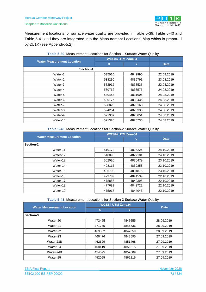
Morava Corridor Motorway Project
Chapter 5: Baseline Conditions
ESIA Final Report November 2020
SE102-000-ES-REP-00002 73 / 324
Measurement locations for surface water quality are provided in Table 5-39, Table 5-40 and
Table 5-41 and they are integrated into the Measurement Locations’ Map which is prepared
by 2U1K (see Appendix-5.2).
Table 5-39. Measurement Locations for Section-1 Surface Water Quality
Water Measurement Location WGS84 UTM Zone34
X Y Date
Section-1
Water-1 535026 4842990 22.08.2019
Water-2 533230 4839791 23.08.2019
Water-3 532912 4836538 23.08.2019
Water-4 530762 4833576 24.08.2019
Water-5 530458 4831904 24.08.2019
Water-6 530176 4830435 24.08.2019
Water-7 528823 4829168 24.08.2019
Water-8 524254 4828335 24.08.2019
Water-9 521337 4826651 24.08.2019
Water-10 521326 4826735 24.08.2019
Table 5-40. Measurement Locations for Section-2 Surface Water Quality
Water Measurement Location WGS84 UTM Zone34
X Y Date
Section-2
Water-11 519172 4826224 24.10.2019
Water-12 518096 4827101 24.10.2019
Water-13 502020 4830479 23.10.2019
Water-14 498116 4830858 23.10.2019
Water-15 496798 4831875 23.10.2019
Water-16 479789 4841539 22.10.2019
Water-17 478856 4842395 22.10.2019
Water-18 477682 4842722 22.10.2019
Water-19 475017 4844046 22.10.2019
Table 5-41. Measurement Locations for Section-3 Surface Water Quality
Water Measurement Location WGS84 UTM Zone34
Date X Y
Section-3
Water-20 472495 4845655 28.09.2019
Water-21 471775 4846736 28.09.2019
Water-22 469352 4847359 28.09.2019
Water-23 466476 4848595 27.09.2019
Water-23B 462629 4851468 27.09.2019
Water-24 458419 4856215 27.09.2019
Water-24B 454525 4857609 27.09.2019
Water-25 452095 4862215 27.09.2019

Morava Corridor Motorway Project
Chapter 5: Baseline Conditions
ESIA Final Report November 2020
SE102-000-ES-REP-00002 74 / 324
5.7.2 Methodology and Data Source
Sample points were sent to accredited laboratories to measure antimony, arsenic, beryllium,
mercury, zinc, iron, cadmium, COD, chromium, lead, nickel, selenium (see Appendix-2 for
accreditation certificates of the laboratories). Samples that will not be analysed on the same
day will be stabilized and protected in accordance with standard analytical methods. For
short-term storage (up to 24 hours), cooling at 4ºC will be applied.
To track and document each step in the testing process until the results are released, a
Chain of Custody Form (CCF) is used.
Wastewater and water samples are taken according to TS ISO 5667-10, TS ISO 5667-18,
TS ISO 5667-6 and TS ISO 5667-11 standards and sedimen is taken according to TS EN
ISO 5667-13, TS 9547 ISO 5667-12 and TS 12090 standards.
Following documents have been reviewed during the desktop study of soil quality of the AoI
of the Project;
Regulation on Water Classification (Off. Gazette of the SRS No. 5/68); and
EIA Reports for Section-1 (CIP, 2018) and Section-3 (Highway Institute, 2019).
5.7.3 Baseline Conditions
There are two main categorization of the surface water bodies in Serbia. The first
categorization is defined as Water Quality Classes and the second categorization is the type
of surface water bodies. The parameters which define the class and the type of the water
body is presented in Appendix-4.
According to the Decree on Water Classification (Official Gazette of RS, 05/68), all surface
waters are classified between I, II, IIa, IIb, III and IV river class. This Decree provides division
of waters into 4 main classes (I-IV, with IIa and IIb subclasses), according to the degree of
pollution and purpose. Class I rivers are the best quality (could be used for drinking in natural
condition or after disinfection) surface waters while class IV surface waters are the worst
(could be used after special treatment).
Decree on Water Classification (Official Gazette of RS, 05/68) adopted specific water quality
characteristics to define four classes of surface water quality, and these are provided in the
table below.
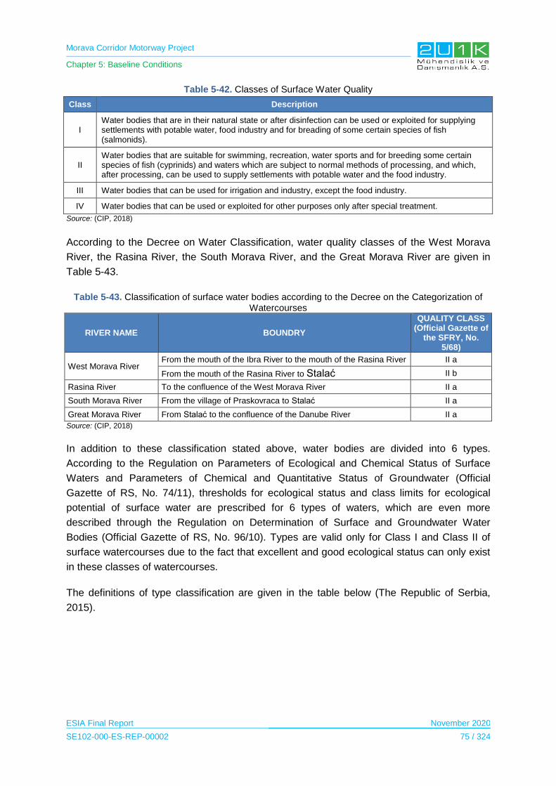
Morava Corridor Motorway Project
Chapter 5: Baseline Conditions
ESIA Final Report November 2020
SE102-000-ES-REP-00002 75 / 324
Table 5-42. Classes of Surface Water Quality
Class Description
I Water bodies that are in their natural state or after disinfection can be used or exploited for supplying settlements with potable water, food industry and for breading of some certain species of fish (salmonids).
II Water bodies that are suitable for swimming, recreation, water sports and for breeding some certain species of fish (cyprinids) and waters which are subject to normal methods of processing, and which, after processing, can be used to supply settlements with potable water and the food industry.
III Water bodies that can be used for irrigation and industry, except the food industry.
IV Water bodies that can be used or exploited for other purposes only after special treatment.
Source: (CIP, 2018)
According to the Decree on Water Classification, water quality classes of the West Morava
River, the Rasina River, the South Morava River, and the Great Morava River are given in
Table 5-43.
Table 5-43. Classification of surface water bodies according to the Decree on the Categorization of Watercourses
RIVER NAME BOUNDRY
QUALITY CLASS (Official Gazette of
the SFRY, No. 5/68)
West Morava River From the mouth of the Ibra River to the mouth of the Rasina River ver II a
From the mouth of the Rasina River to Stalać II b
Rasina River To the confluence of the West Morava River II a
South Morava River From the village of Praskovraca to Stalać II a
Great Morava River From Stalać to the confluence of the Danube River II a
Source: (CIP, 2018)
In addition to these classification stated above, water bodies are divided into 6 types.
According to the Regulation on Parameters of Ecological and Chemical Status of Surface
Waters and Parameters of Chemical and Quantitative Status of Groundwater (Official
Gazette of RS, No. 74/11), thresholds for ecological status and class limits for ecological
potential of surface water are prescribed for 6 types of waters, which are even more
described through the Regulation on Determination of Surface and Groundwater Water
Bodies (Official Gazette of RS, No. 96/10). Types are valid only for Class I and Class II of
surface watercourses due to the fact that excellent and good ecological status can only exist
in these classes of watercourses.
The definitions of type classification are given in the table below (The Republic of Serbia,
2015).

Morava Corridor Motorway Project
Chapter 5: Baseline Conditions
ESIA Final Report November 2020
SE102-000-ES-REP-00002 76 / 324
Table 5-44. Types of Surface Water Quality
Type Description
1 Large lowland rivers dominated by fine sediments (the Danube River, the Sava River, the Great Morava River, the Tisza River, the Tamiš River, the Begej River and the Stari Begej River):
2 Large rivers dominated by medium sediments, excluding rivers in the Pannonian Plain
3 Small and medium watercourses up to 500 m.s.l. (mean sea level) dominated by coarse sediments
4 Small and medium watercourses above 500 m.s.l. dominated by coarse sediments
5 Watercourses in the Pannonian Plain (excluding type 1 watercourses)
6 Small watercourses outside of the Pannonian Plain not included in other types and watercourses not included in the rulebook that regulates this area
Section-1, according to the Rulebook on Parameters of Ecological and Chemical Status of
Surface Waters, and Quantitative and Chemical Status of Ground Waters (“Official Gazette
RS” No. 74/11), types of water bodies is given in Table 5-45.
Table 5-45. Type Classification of Main Water Bodies in AoI of the Project
RIVER NAME QUALITY CLASS
(Official Gazette of RS, No. 74/11)
West Morava River Type 2
South Morava River Type 2
Rasina River Type 3
Source: (CIP, 2018)
The Environmental Protection Service within the Municipality of Kruševac performs
continuous control and monitoring of the state of the environment. The Public Health Institute
Kruševac did the monitoring of surface waters, rivers and streams which are located in
Kruševac in 2018.
According to the EIA Report for Section-1, by examining the effects of the water quality of the
Rasina River (pre-flowing to the West Morava), some parameters had been discovered to
deviate from the prescribed restriction values. The values of total nitrogen, ammonium ion,
biochemical oxygen demand have been inside the class III, and other different analysed
parameters of chemical analysis are inside the Class II of waters. In the microbiological
aspect, the presence of a massive variety of whole coliform bacteria, enterococci faecalis
and faecalis coliform bacteria in the III-IV classification have been recorded in the samples.
By evaluating the consequences of the water quality of Pepeljuga River (pre-flowing to the
West Morava), the values of phosphate and all phosphorus values are inside the class IV.
The values of ammonium ion, nitrate, nitrite, dissolved oxygen, biochemical oxygen
consumption and complete nitrogen are within the class III, the suspended solids depend is
out of type II, and other different examined parameters of chemical analysis are inside the
class II of water. In microbiological terms, the presence of total coliform bacteria, enterococci
faecalis starting place and faecalis coliform bacteria in the III – IV classification are recorded.
(CIP, 2018)
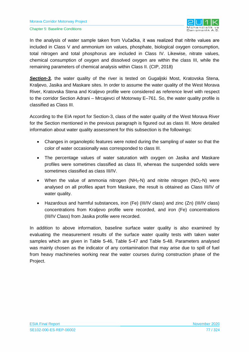
Morava Corridor Motorway Project
Chapter 5: Baseline Conditions
ESIA Final Report November 2020
SE102-000-ES-REP-00002 77 / 324
In the analysis of water sample taken from Vučačka, it was realized that nitrite values are
included in Class V and ammonium ion values, phosphate, biological oxygen consumption,
total nitrogen and total phosphorus are included in Class IV. Likewise, nitrate values,
chemical consumption of oxygen and dissolved oxygen are within the class III, while the
remaining parameters of chemical analysis within Class II. (CIP, 2018)
Section-3, the water quality of the river is tested on Gugaljski Most, Kratovska Stena,
Kraljevo, Jasika and Maskare sites. In order to assume the water quality of the West Morava
River, Kratovska Stena and Kraljevo profile were considered as reference level with respect
to the corridor Section Adrani – Mrcajevci of Motorway E–761. So, the water quality profile is
classified as Class III.
According to the EIA report for Section-3, class of the water quality of the West Morava River
for the Section mentioned in the previous paragraph is figured out as class III. More detailed
information about water quality assessment for this subsection is the followings:
Changes in organoleptic features were noted during the sampling of water so that the
color of water occasionally was corresponded to class III.
The percentage values of water saturation with oxygen on Jasika and Maskare
profiles were sometimes classified as class III, whereas the suspended solids were
sometimes classified as class III/IV.
When the value of ammonia nitrogen (NH3-N) and nitrite nitrogen (NO2-N) were
analysed on all profiles apart from Maskare, the result is obtained as Class III/IV of
water quality.
Hazardous and harmful substances, iron (Fe) (III/IV class) and zinc (Zn) (III/IV class)
concentrations from Kraljevo profile were recorded, and iron (Fe) concentrations
(III/IV Class) from Jasika profile were recorded.
In addition to above information, baseline surface water quality is also examined by
evaluating the measurement results of the surface water quality tests with taken water
samples which are given in Table 5-46, Table 5-47 and Table 5-48. Parameters analysed
was mainly chosen as the indicator of any contamination that may arise due to spill of fuel
from heavy machineries working near the water courses during construction phase of the
Project.

Morava Corridor Motorway Project
Chapter 5: Baseline Conditions
ESIA Final Report November 2020
SE102-000-ES-REP-00002 78 / 324
Table 5-46. Measurement Results of Water Sampling for Section-1
Parameter Unit Water-1 Water-2 Water-3 Water-4 Water-5 Water-6 Water-7 Water-8 Water-9 Water-10
Antimony <0.005 <0.005 <0.005 <0.005 <0.005 <0.005 <0.005 <0.005 <0.005 <0.005
Arsenic (mg/L) <0.005
(I)* 0.0083
(II) 0.0067
(II) 0.01 (II)
0.011 (I)
0.0098 (II)
<0.005 (I)
0.0099 (II)
0.011 (I)
0.01 (II)
Beryllium (mg/L) <0.001 <0.001 <0.001 <0.001 <0.001 <0.001 <0.001 <0.001 <0.001 <0.001
Mercury (mg/L) <0.0005 <0.0005 <0.0005 <0.0005 <0.0005 <0.0005 <0.0005 <0.0005 <0.0005 <0.0005
Zinc (mg/L) <0.001 <0.001 <0.001 <0.001 <0.001 <0.001 <0.001 <0.001 <0.001 <0.001
Iron (mg/L) 0.058
(I)* <0.01 0.02 <0.01 <0.01 <0.01 <0.01 <0.01 0.011 0.049
Cadmium (mg/L) <0.001 <0.001 <0.001 <0.001 <0.001 <0.001 <0.001 <0.001 <0.001 <0.001
Chemical Oxygen Demand (mg/L) 36 70 63 <10 <10 41 <10 <10 <10 <10
Chromium (mg/L) 0.0031
(I)* 0.003
(I) 0.0056
(I) 0.0048
(I) 0.0052
(I) 0.0055
(I) 0.0033
(I) 0.0036
(I) 0.0063
(I) 0.0051
(I)
Lead (mg/L) <0.005 <0.005 <0.005 <0.005 <0.005 <0.005 <0.005 <0.005 <0.005 <0.005
Nickel (mg/L) <0.005 <0.005 <0.005 <0.005 <0.005 <0.005 <0.005 <0.005 <0.005 <0.005
Selenium (mg/L) <0.005 <0.005 <0.005 <0.005 <0.005 <0.005 <0.005 <0.005 <0.005 <0.005
Table 5-47. Measurement Results of Water Sampling for Section-2
Parameter Unit Water-11 Water-12 Water-13 Water-14 Water-15 Water-16 Water-17 Water-18 Water-19
Antimony <0,005 <0,005 <0,005 <0,005 <0,005 <0,005 <0,005 <0,005 <0,005
Arsenic (mg/L) 0,01 (II)*
0,0095 (II)
0,0092 (II)
0,009 (II)
0,0097 (II)
0,011 (III)
<0,005 (I)
<0,005 (I)
<0,005 (I)
Beryllium (mg/L) <0,001 <0,001 <0,001 <0,001 <0,001 <0,001 <0,001 <0,001 <0,001
Mercury (mg/L) <0,0005 <0,0005 <0,0005 <0,0005 <0,0005 <0,0005 <0,0005 <0,0005 <0,0005
Zinc (mg/L) <0,001 <0,001 <0,001 <0,001 <0,001 <0,001 <0,001 <0,001 <0,001
Iron (mg/L) <0,01
(I)* <0,01
(I) <0,01
(I) <0,01
(I) <0,01
(I) <0,01
(I) <0,01
(I) <0,01
(I) <0,01
(I)
Cadmium (mg/L) <0,001 <0,001 <0,001 <0,001 <0,001 <0,001 <0,001 <0,001 <0,001
Chemical Oxygen Demand (mg/L) <10 <10 <10 <10 <10 <10 <10 13 <10
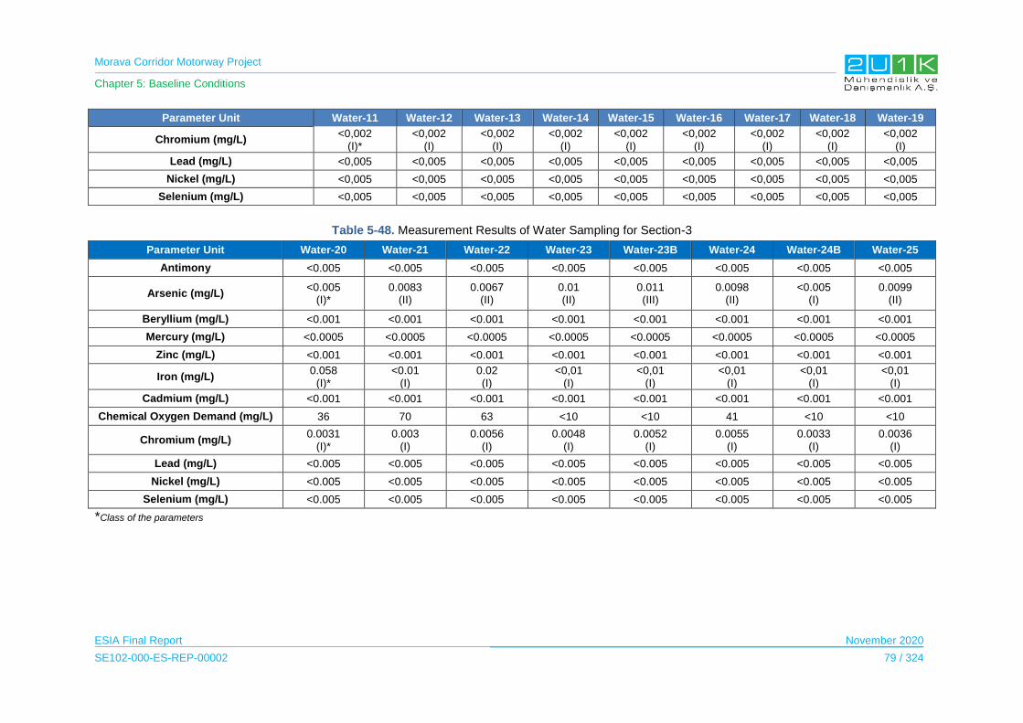
Morava Corridor Motorway Project
Chapter 5: Baseline Conditions
ESIA Final Report November 2020
SE102-000-ES-REP-00002 79 / 324
Parameter Unit Water-11 Water-12 Water-13 Water-14 Water-15 Water-16 Water-17 Water-18 Water-19
Chromium (mg/L) <0,002
(I)* <0,002
(I) <0,002
(I) <0,002
(I) <0,002
(I) <0,002
(I) <0,002
(I) <0,002
(I) <0,002
(I)
Lead (mg/L) <0,005 <0,005 <0,005 <0,005 <0,005 <0,005 <0,005 <0,005 <0,005
Nickel (mg/L) <0,005 <0,005 <0,005 <0,005 <0,005 <0,005 <0,005 <0,005 <0,005
Selenium (mg/L) <0,005 <0,005 <0,005 <0,005 <0,005 <0,005 <0,005 <0,005 <0,005
Table 5-48. Measurement Results of Water Sampling for Section-3
Parameter Unit Water-20 Water-21 Water-22 Water-23 Water-23B Water-24 Water-24B Water-25
Antimony <0.005 <0.005 <0.005 <0.005 <0.005 <0.005 <0.005 <0.005
Arsenic (mg/L) <0.005
(I)* 0.0083
(II) 0.0067
(II) 0.01 (II)
0.011 (III)
0.0098 (II)
<0.005 (I)
0.0099 (II)
Beryllium (mg/L) <0.001 <0.001 <0.001 <0.001 <0.001 <0.001 <0.001 <0.001
Mercury (mg/L) <0.0005 <0.0005 <0.0005 <0.0005 <0.0005 <0.0005 <0.0005 <0.0005
Zinc (mg/L) <0.001 <0.001 <0.001 <0.001 <0.001 <0.001 <0.001 <0.001
Iron (mg/L) 0.058
(I)* <0.01
(I) 0.02 (I)
<0,01 (I)
<0,01 (I)
<0,01 (I)
<0,01 (I)
<0,01 (I)
Cadmium (mg/L) <0.001 <0.001 <0.001 <0.001 <0.001 <0.001 <0.001 <0.001
Chemical Oxygen Demand (mg/L) 36 70 63 <10 <10 41 <10 <10
Chromium (mg/L) 0.0031
(I)* 0.003
(I) 0.0056
(I) 0.0048
(I) 0.0052
(I) 0.0055
(I) 0.0033
(I) 0.0036
(I)
Lead (mg/L) <0.005 <0.005 <0.005 <0.005 <0.005 <0.005 <0.005 <0.005
Nickel (mg/L) <0.005 <0.005 <0.005 <0.005 <0.005 <0.005 <0.005 <0.005
Selenium (mg/L) <0.005 <0.005 <0.005 <0.005 <0.005 <0.005 <0.005 <0.005
*Class of the parameters

Morava Corridor Motorway Project
Chapter 5: Baseline Conditions
ESIA Final Report November 2020
SE102-000-ES-REP-00002 80 / 324
The limit values of the above parameters, given in table below, according to national
legislations are provided in Table 5-49.
Table 5-49. Limit Values of Some Parameters for Surface Water Quality Analysis
Surface water
Parameter-Unit Maximum accepted
concentrations1
Maximum accepted
concentrations2
Limit values for river class 2 3
Maximum quantities of dangerous
materials in water, for river class 24
Antimony (mg/kg) - - - 0.05
Arsenic (mg/kg) 0.05 - 0.01 0.05
Beryllium (mg/kg) - - - 0.0002
Mercury (mg/kg) 0.001 0.07 - 0.001
Zinc (mg/kg) 1
0.3 (water hardness, T =10)
0.7 (T=50) 1 (T=100)
2 (T=500) mikro
0.2
Iron (mg/kg) - - 0.5 0.3
Cadmium (mg/kg) 0.01 0.08 (river class 2) - 0.005
Chromium (mg/kg) - -
15 (bichromate method)
10 (permanganate method)
-
Lead (mg/kg) 0.5 - 0.05 0.1
Nickel (mg/kg) 0.1 14 - 0.05
Selenium (mg/kg) 0.1 34 - 0.05
Total Petroleum Hydrocarbons
(mg/kg) - - - 0.01
COD - - - -
1 Maximum accepted concentration of pollutant in soil and water which could damage or change production of agricultural land and water quality for irrigation - Regulation on permitted quantities of hazardous and damage materials in soil and water for irrigation and methods for their testing (Official Gazette of RS, No. 23/94). 2 Regulation on limit values for priority and priority hazardous substances that pollute surface water and deadlines for reaching them (Official Gazette of RS, No. 24/2014) 3 Regulation on limit values for pollutants in surface, groundwater and sediments and deadlines for reaching them (Official Gazette of RS, No. 50/12) 4 Regulation on hazardous substances in waters (Official Gazette of SRS, No. 31/82)
Note: West Morava is declared as IIa or IIb river class between Čačak and Stalac (depending of which part) in accordance to the Regulation on water categorization (Official Gazette of SRS, No. 05/68)
The analysis results have been compared with the Serbia national water quality standards for
rivers, streams and lakes. International standards give only drinking water limit values and
surface waters in the AoI are not used for drinking purpose. Therefore, these standards were
not used to determine surface water quality. According to the analysis results, measured
parameters comply with the Serbia national water quality standards for rivers, streams and
lakes.
Morava Corridor Motorway Project
Chapter 5: Baseline Conditions
ESIA Final Report November 2020
SE102-000-ES-REP-00002 81 / 324
5.7.4 Sensitive Receptors
The measurement results did not exceed the limit values at any point. However, since the
impacts on the West Morava River during the construction and operation period of the
Project, cannot be ignored, the West Morava River has been identified as a sensitive
receptor.
5.8 Terres Terial and freshwater ecology
5.8.1 Study Area
A study area is defined within the AoI, by considering the Proposed Motorway Project,
including all project facilities, and West Morava River for biodiversity studies. In the scope of
the biodiversity field studies, sampling points, which represent different habitat types and
natural and/or sensitive were chosen. Sampling locations were determined as a result of a
detailed desktop analysis together with available satellite imagery (i.e. GoogleTM Earth) of
the AoI. As the desktop study, initial baseline assessment provided from local EIAs togetger
with literature survey and findings of the reconnaissance survey performed during scopping
phase of the Project were examined and the habitat map covering the proposed AoI was
prepared before the start of ecological survey. The habitat map prepared as the outcome of
the desktop study was mainly used the determination field study locations.
In the determination of the field study locations, general habitat distribution of the AoI was
considered at prime level. The habitat distribution in the AoI shows that majority of the
habitats composed of modified areas (68%), which are agricultural fields, borrow areas in the
alluvial plan and settlements. Field study locations were designed to include all habitats
represented in the AoI by considering the major impact sources of the Project. Additional
control locations were also provided during the first field survey. With this intention, in total,
44 different points (18 aquatic and 26 terrestrial) decided on desktop and 8 additional points
were decided on the field studies. The areas, where the study is conducted, are the
Proposed Motorway Route, project facilities and the West Morava River sections subject to
river regulation.
As it is stated above, for selection of field survey locations, major impact sources of the
proposed project were also considered. In particular, major river regulation area along
Section 3, where the potential major impact is expected due to river regulation works, was
studied in a total of 9 fresh water ecology survey locations. Terrestrial studies were also
focussed on major impact sources such as the proposed new river course location. Details of
the selected field survey locations are provided in “Biodiversity Baseline Report Annex-1”.
Selected sampling points located within each Section (1-2-3) in the study area are shown in
Table 5-50 and Table 5-51 and maps of the study area and sampling points are given in
Figure 5-40, Figure 5-41, Figure 5-42 and Figure 5-43.
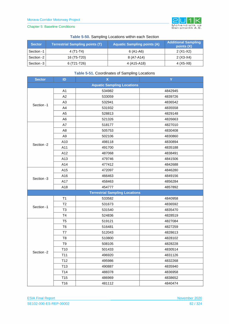
Morava Corridor Motorway Project
Chapter 5: Baseline Conditions
ESIA Final Report November 2020
SE102-000-ES-REP-00002 82 / 324
Table 5-50. Sampling Locations within each Section
Sector Terrestrial Sampling points (T) Aquatic Sampling points (A) Additional Sampling
points (X)
Section -1 4 (T1-T4) 6 (A1-A6) 2 (X1-X2)
Section -2 16 (T5-T20) 8 (A7-A14) 2 (X3-X4)
Section -3 6 (T21-T26) 4 (A15-A18) 4 (X5-X8)
Table 5-51. Coordinates of Sampling Locations
Sector ID X Y
Aquatic Sampling Locations
Section -1
A1 534982 4842945
A2 533059 4839726
A3 532941 4836542
A4 531932 4835558
A5 528813 4829148
A6 521326 4826663
Section -2
A7 518177 4827010
A8 505753 4830408
A9 502106 4830860
A10 498118 4830894
A11 491700 4835188
A12 487068 4838491
A13 479746 4841506
A14 477412 4842688
Section -3
A15 472097 4846280
A16 466463 4849156
A17 458463 4856284
A18 454777 4857892
Terrestrial Sampling Locations
Section -1
T1 533582 4840958
T2 531673 4836592
T3 531540 4835470
T4 524836 4828519
Section -2
T5 519121 4827084
T6 516481 4827259
T7 512043 4828613
T8 510800 4828102
T9 508105 4828228
T10 501433 4830514
T11 496920 4831126
T12 495986 4832268
T13 490887 4835940
T14 488378 4836958
T15 486969 4838652
T16 481112 4840474

Morava Corridor Motorway Project
Chapter 5: Baseline Conditions
ESIA Final Report November 2020
SE102-000-ES-REP-00002 83 / 324
Sector ID X Y
T17 479305 4841787
T18 479315 4842385
T19 477863 4842799
T20 474677 4843904
Section -3
T21 471340 4846107
T22 466889 4848807
T23 463124 4851348
T24 458725 4856234
T25 454706 4857820
T26 451613 4862542
Additional Sampling Locations
Section -1 X1 525200 4827999
X2 521860 4827835
Section -2 X3 507813 4830520
X4 490793 4830520
Section -3
X5 467117 4848310
X6 465682 4848896
X7 463614 4850455
X8 460419 4853089
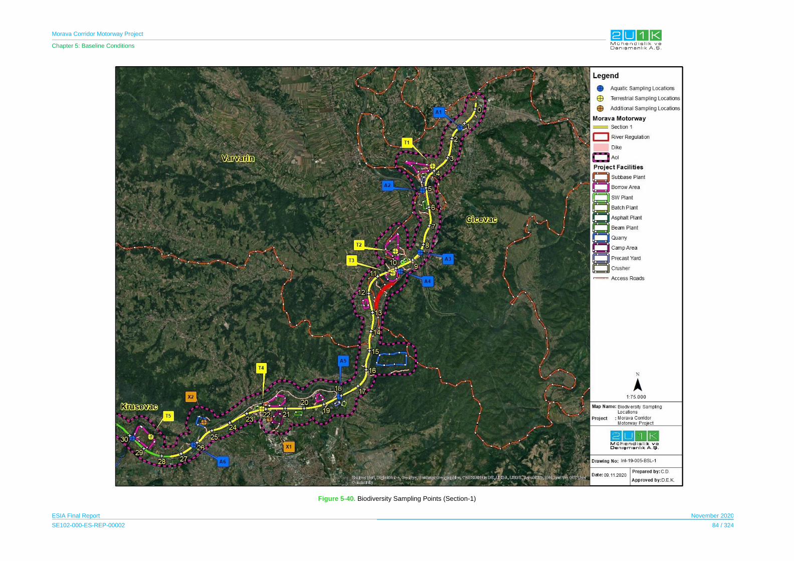
Morava Corridor Motorway Project
Chapter 5: Baseline Conditions
ESIA Final Report November 2020
SE102-000-ES-REP-00002 84 / 324
Figure 5-40. Biodiversity Sampling Points (Section-1)
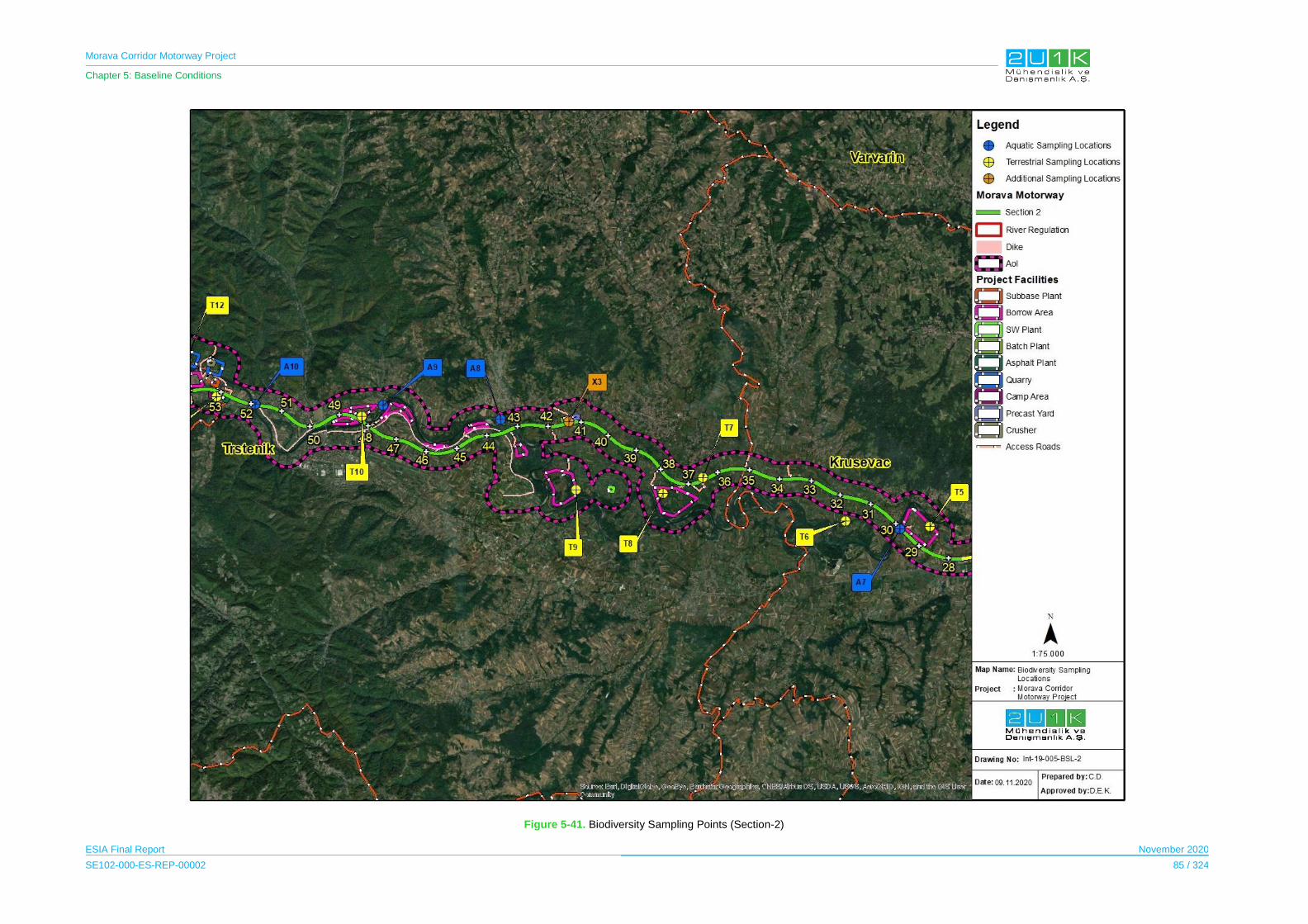
Morava Corridor Motorway Project
Chapter 5: Baseline Conditions
ESIA Final Report November 2020
SE102-000-ES-REP-00002 85 / 324
Figure 5-41. Biodiversity Sampling Points (Section-2)
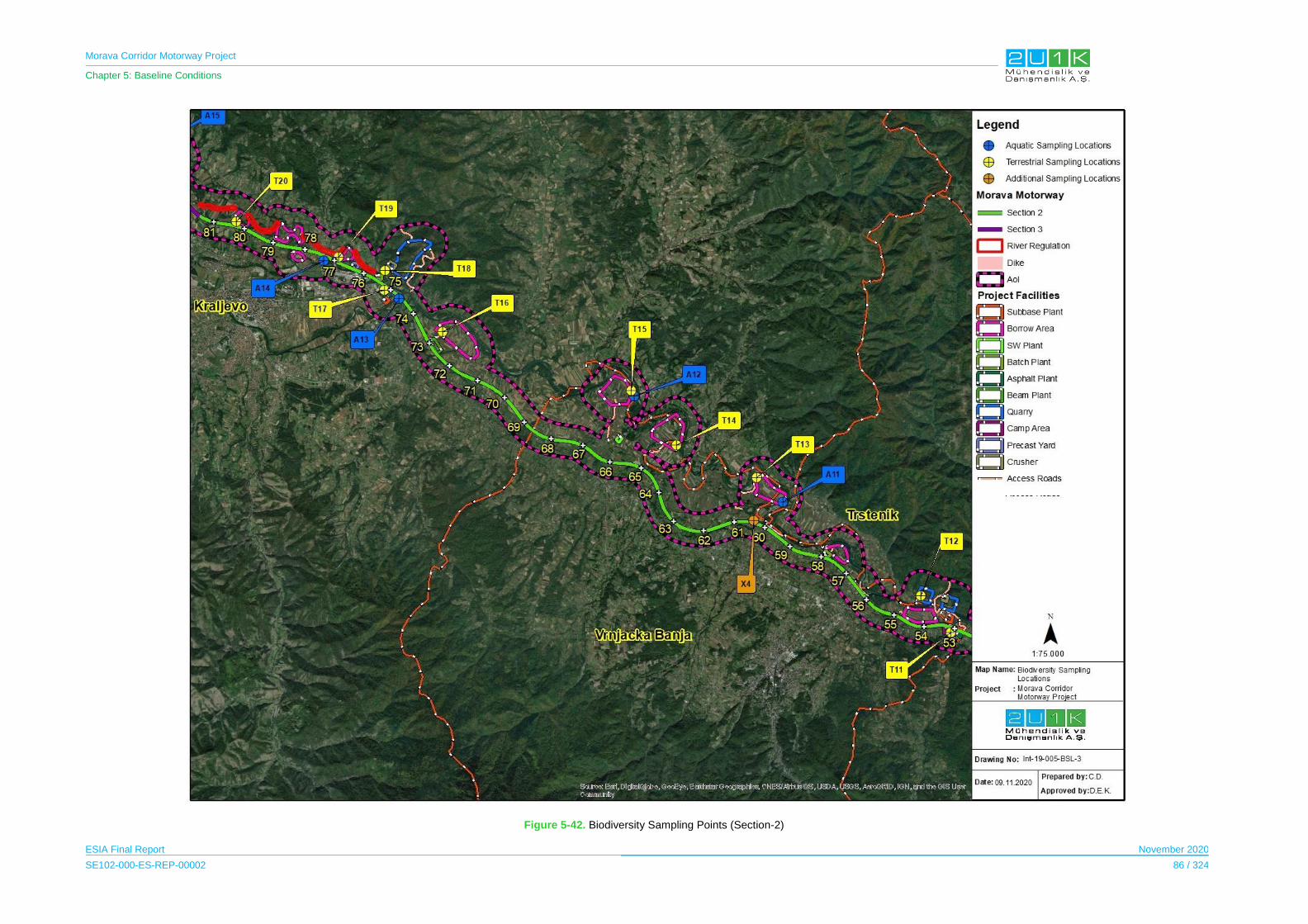
Morava Corridor Motorway Project
Chapter 5: Baseline Conditions
ESIA Final Report November 2020
SE102-000-ES-REP-00002 86 / 324
Figure 5-42. Biodiversity Sampling Points (Section-2)

Morava Corridor Motorway Project
Chapter 5: Baseline Conditions
ESIA Final Report November 2020
SE102-000-ES-REP-00002 87 / 324
Figure 5-43. Biodiversity Sampling Points (Section-3)

Morava Corridor Motorway Project
Chapter 5: Baseline Conditions
ESIA Final Report November 2020
SE102-000-ES-REP-00002 88 / 324
5.8.2 Methodology and Data Source
Methodology was determined and fieldwork was performed with local experts by the field
team consisting of Specialist Haşim Altınözlü (Botanist), Prof. Dr. İrfan Kandemir
(Entomologist), Ass. Prof. Dr. S. Cevher Özeren (Hydrobiologist), Celal Denizli
(Herpatologist), Ass. Prof. Dr. Şafak Bulut (Ornithologist) and Prof. Dr. Ş. Önder Özkurt
(Mammologist) and local experts David Bakic (Fauna expert), Milos Zbillijic (Botanist) and
Dmitrije Sekulic (Botanist), in addition to writing the report.
The information gathered included data on the followings:
Biological components on terrestrial environment,
Terrestrial habitats and ecosystems
Terrestrial flora and ecosystems,
o Flora species
Terrestrial fauna components
o Invertebrates,
o Amphibians and reptiles,
o Aves,
o Mammals.
Aquatic ecosystems
Key biodiversity areas,
Important Bird Areas,
Important Wetlands (Ramsar Sites),
Potential sensitive areas.
Desktop research and field study of the Motorway Route, River Regulation areas and the
project facilities’ locations were conducted by experts in both terrestrial and aquatic
environment. In this scope, biodiversity on spring and summer seasons terrestrial and
aquatic environment studies were carried out for three seasons. The dates of the field
surveys are provided below:
30 April - 5 May 2019, 28 – spring season;
June - 1 July 2019 - summer season;
28 August – 01 September 2019 – fall season.
The methodology to determine the baseline conditions included the followings:
Review of pertinent literature and previous works.
Field studies carried out in the Project area.
Satellite image interpretation, as available.
Communication with the inhabitants in the study area during the field studies.

Morava Corridor Motorway Project
Chapter 5: Baseline Conditions
ESIA Final Report November 2020
SE102-000-ES-REP-00002 89 / 324
Consultation with nature conservation administration and related agencies and
institutions concerned.
All the data regarding the Project area and project facilities such as asphalt plants, batch
plants, quarries, borrow areas and camp sites were supplied by the Contractor. All
international and national regarding biodiversity of Serbia were reviewed. Supports of the
local Serbian experts were provided for review of the national literature as well as assistance
for the translation for the interviews performed with local people during field surveys.
In addition, a detailed review of data was completed with the aim of obtaining readily
available information on ecological sampling points in the study areas to represent the
surrounding area (including designated sites, habitats and species). This was then used to
inform the scope and planning of the detailed methodologies for the field surveys. The data
review also provided contextual information about the status of ecological circumstances
(e.g., local, regional and global distribution, population size and level of extinction risk) and
ecological information about the biodiversity (e.g., habitat requirements and behavior of
species) to assist with the evaluation and assessment of potential impacts. The data review
included an extensive review of published scientific literature, websites and other sources.
General aspects of the baseline studies are provided below:
I. Within the scope of the field studies, a review of the existing information was
undertaken and ecological composition of the Project area in terms of terrestrial and
aquatic flora and fauna elements; potential sensitive areas and sensitive species
were identified. River flow conditions were also considered at the field surveys.
II. The study area for both terrestrial and aquatic environment has aligned with the
Section (1-2-3) of Project. In this context for terrestrial environment studies, the
survey encompassed as much of the habitat along the Proposed Motorway Route,
river regulation and project facilities as access and topography allowed. At each
sampling point and their vicinity, the features of the landscape and environment
include the dominant habitats and species of note.
III. In total, 44 sampling locations were studied for Spring, Summer and Autumn season.
The coordinates of the sampling locations were recorded with GPS to provide a
ground-truth for the habitat classifications as well as a reference for future field
surveys.
IV. For terrestrial habitat studies, field survey locations chosen by experts according to
representativeness of each habitat type within the study area. These locations are
named as sampling points. Sampling points were chosen to ensure that each of the
habitat types displayed in the European Nature Information System (EUNIS) habitat
classification were visited so that all of the different habitats were ground truthed in
the study area. Some of the sampling points were revised during the field surveys
observations to determine more representative sampling points.

Morava Corridor Motorway Project
Chapter 5: Baseline Conditions
ESIA Final Report November 2020
SE102-000-ES-REP-00002 90 / 324
V. For aquatic habitat studies, the West Morava River and tributaries in the AoI, which
have well-conditioned flow, were named as sampling points and studied during the
aquatic field surveys. Within the context of aquatic studies, river regulations, rivers
crossings on the Proposed Motorway Route and some streams, which were chosen
according to importance by Hydrobiology expert, were investigated.
VI. Distribution, population, ecology and reproductive biology of the threatened and
endemic plant species that are likely to occur within study area of interest were
studied. The literature surveys were intended to give information on identification of
endemic, endangered, and rare species and species defined under the national and
international conservation status. Accordingly, species that are under the risk of being
affected due to the Project and therefore, require special attention and protection
measures were determined.
VII. A species inventory for the baseline conditions are established as well as description
of the habitats, having been recorded in a systematic way. Also, Endemic, restricted-
range, CR, EN and VU category flora and fauna species were determined as the
target species within the scope of the study. The Project area covers mostly invasive
plant species habitats and agricultural lands. Therefore, mainly natural habitats were
chosen for sampling locations. Potential target species of each habitat were identified
as a result of literature review and the identified target species were confirmed
through field studies.
VIII. Additionally, determined target species were evaluated on the basis of habitat
characteristic. In context of the Proposed Motorway habitats were assessed along the
Proposed Motorway Route according to sensitive species, sensitive habitats and/or
ecosystems to determine whether there is a critical habitat in the Project area
Terrestrial Flora and Ecosystems
Within the scope of the terrestrial flora studies, the flora and vegetation types within the study
area were identified to serve as a basis for determination of the impacts of the Project on
biological resources and to develop appropriate mitigation measures, where necessary. The
aim of the baseline studies for terrestrial flora species and vegetation were to collect data
throughout the field surveys for explanation of the environmental conditions in the study area
through selected sensitivity elements. In this context, floristic studies were conducted
including both desktop and field studies to determine the baseline conditions in the study
area.
The objectives of the desktop study were to review and organize the existing information on
terrestrial flora, habitats and ecosystems within the study area. Therefore, Potential species
of conservation concern, potential natural habitats and potential critical habitats present in
the study area were determined before the field study and examined to verify during field
visits. Terrestrial flora studies were carried out light on the following key baseline issues:
Morava Corridor Motorway Project
Chapter 5: Baseline Conditions
ESIA Final Report November 2020
SE102-000-ES-REP-00002 91 / 324
Determining the species of terrestrial flora present in the Project area, their
distribution and conservation status (such as critically endangered species,
endangered species, as well as any endemic species),
Defining natural and critical terrestrial habitats and ecosystems present in the Project
area, their distribution and the list of species associated to each habitat.
The baseline data/information collection provide an overall picture of the conditions and
sensitivities in the areas that were considered in the assessment of potential impacts and
development of relevant mitigation measures for design, construction and operation phases
of the Project. Terrestrial flora and ecosystem studies were investigated in the following two
parts:
Terrestrial habitats and ecosystems,
Terrestrial flora.
Terrestrial Habitats and Ecosystems
In general, terrestrial habitats within baseline study area are categorized as modified, natural
or critical habitats according to IFC (2012), as the definition of critical habitats is dependent
on the presence of endemic, threatened, restricted-range species. As a result, distribution of
the endemic, threatened, restricted-range species and EUNIS Level 3 habitat distribution
within the Project area were obtained and mapped.
The habitat classification follows the EUNIS habitat type classification, a comprehensive pan-
European system that facilitates the harmonized description and collection of data across
Europe, through the use of habitat identification criteria. The preliminary habitat distribution in
the study area is determined based on EUNIS Level 3 habitat type classification. A variety of
habitat types were determined by analyzing appropriate satellite imagery and aerial photos
(most of the territory of the Republic of Serbia is covered by satellite imagery available
through Google Earth). Since there are different habitat types within the study area, the
European Nature Information System (EUNIS) habitat classification is used to determine the
number of different habitat types.
The habitats within the Project Area determined with desktop studies according to EUNIS
Habitat Classifications used satellite imagery. After the field studies, which were conducted in
spring (30 April - 5 May 2019), summer (28 June - 1 July 2019) and autumn (28 August – 01
September 2019) season, habitat types were verified by expert observations.

Morava Corridor Motorway Project
Chapter 5: Baseline Conditions
ESIA Final Report November 2020
SE102-000-ES-REP-00002 92 / 324
Terrestrial Flora
Survey locations were selected by the Project botanist and local botanists in different
habitats during the field study. The best sampling points were selected using a varied array
of datasets such as geological maps, the Proposed Motorway Route plans and satellite
images. At these selected sampling points, the existing plant types have been collected. The
collected samples are dried and ready to be identified. At each sampling point, at least 30
minutes have been spent for working. The dominant plant species were identified by taking
photographs of the sampling points studied (see Figure 5-44).
The flora lists, families and species are given in alphabetical order. The collected plant
samples were identified by using Flora Sırbije (Pančić, J., 1976).. Common and identifiable
species were not collected in study area. The samples were not taken for well-known species
in study area. However, 1-2 samples of species, which cannot be diagnosed as known
species, were taken and they were brought to herbarium material for identification.
The coordinates of the survey locations were taken according to UTM, the general
photograph of habitat, and the pictures of the plants in the study area were taken. During the
field study, data were generated for the report stage by taking notes according to the
characteristics of the sampling points studied.
Figure 5-44. Flora Expert and Local Botanists in the Survey Area
Morava Corridor Motorway Project
Chapter 5: Baseline Conditions
ESIA Final Report November 2020
SE102-000-ES-REP-00002 93 / 324
Terrestrial Fauna
The main objectives of fauna studies are i) to identify the fauna elements (invertebrates,
amphibians, reptiles, birds and mammals) of the study area, ii) to define the habitats that
these fauna elements inhabit, and iii) to make evaluations on faunal and ecological
characteristics of the study area. Terrestrial fauna field studies were conducted in 1,000 m
length buffer, which was determined by experts with desktop studies according to different
habitat types. During the terrestrial fauna field studies, four different experts investigated and
reported each fauna groups as invertebrates, amphibian-reptiles, birds and mammals.
Beside these above stated main goals, objectives of the terrestrial fauna survey within the
study area can be described as follows;
To determine the characteristics and importance of the project area in terms of
terrestrial fauna species,
To determine the important and sensitive habitats and critical fauna species,
To determine the protection status of the fauna species according to national and
international conventions, decisions and requirements.
To determine population densities of these species according to project sub-areas,
Fauna studies include mammals (Mammalia), birds (Aves), reptiles (Reptilia), amphibian
(Amphibia) and invertebrate groups. The information obtained by conducting a 30-45-minute
survey at each point is recorded. Habitats at each point determined during the field study
were examined in detail, species of fauna were recorded. The species list where fauna
species are given was prepared according to the observations during the survey. Any
information gathered from the local people, hunters, and/or any literature study on fauna
species within the area were also used for the preparation of the fauna species list. The
species lists were systematically prepared based on the names of the ordo, family species
names. Common names of species, hazard and protection categories in IUCN, Bern
Convention, CITES and nationally protected species are also given in detail in the tables.
Direct observation was made in determining the species, as well as traces and signs
(nests, nestlings and tracks of species, excrete and food wastes; horn and bone
remains, feathers, pellets, etc.) of suitable fauna species.
Line transect methods were used. Transect method consisted of terrestrial fauna
sampling points of the Proposed Motorway Route along which visual and audial
observations were conducted. In terms of the line transect method, observer walked
along 500 m lengths or 30 minutes duration whichever was reached first but with the
aim never to be less than 20 minutes duration in each sampling points of the
Proposed Motorway Route and recorded observations.
Morava Corridor Motorway Project
Chapter 5: Baseline Conditions
ESIA Final Report November 2020
SE102-000-ES-REP-00002 94 / 324
No hunting-gathering-killing was done during the identification of species in the area
during field work in line with ethical rule IFC PS6. Observations made directly (using
advanced optical instruments) have been utilized for species identification of fauna
species.
For the identification of fauna species in the identification of fauna elements, no
trapping by using nets or other kind of trapping was used. Line methods have been
applied in the identification of fauna species.
In general, Camera/Photo trapping is the most efficient method for mammals,
especially large size mammal species. Camera traps (Bushnell trophy cam) were
utilized in forested habitats and forest opening. During the field studies, a sufficient
number of camera traps were placed in appropriate habitats.
Ultrasonic bat detectors (Pettersson d500x model) were utilized in forested habitats
and forest opening to detect the bat species that are active at night (nocturnal) at the
project site. The sonograms of the bat voices recorded by these devices were
analyzed with Bat sound and/or BatExplorer programs and the bat species at the
project site and its close vicinity were detected.
Maps and satellite images have been used for field studies.
A GPS was also used in mapping studies for determining elevations and geographical
coordinates.
During the fieldwork, some species were photographed and added to the report.
Methodologies applied for each fauna class during the faunal studies are summarized below.
Invertebrates
A detailed literature study was conducted to present potential invertebrate species at the
Project’s AoI. In context of this literature research, study, invertebrate expert determined the
general habitat types in the area by evaluating the habitats in terms of seasonality, and
depending on the habitat types and season of the field survey, invertebrates likely to be
present in each habitat type was identified. During the field surveys, interviews with the local
people were also considered in addition to the information provided from literature and
habitat assessment. Most of the field data is obtained through the field observation, and
observed species were recorded with photographs (see Figure 5-45).
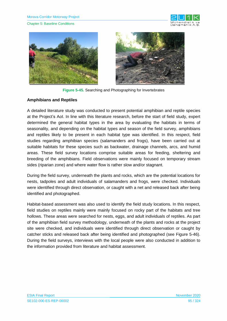
Morava Corridor Motorway Project
Chapter 5: Baseline Conditions
ESIA Final Report November 2020
SE102-000-ES-REP-00002 95 / 324
Figure 5-45. Searching and Photographing for Invertebrates
Amphibians and Reptiles
A detailed literature study was conducted to present potential amphibian and reptile species
at the Project’s AoI. In line with this literature research, before the start of field study, expert
determined the general habitat types in the area by evaluating the habitats in terms of
seasonality, and depending on the habitat types and season of the field survey, amphibians
and reptiles likely to be present in each habitat type was identified. In this respect, field
studies regarding amphibian species (salamanders and frogs), have been carried out at
suitable habitats for these species such as backwater, drainage channels, arcs, and humid
areas. These field survey locations comprise suitable areas for feeding, sheltering and
breeding of the amphibians. Field observations were mainly focused on temporary stream
sides (riparian zone) and where water flow is rather slow and/or stagnant.
During the field survey, underneath the plants and rocks, which are the potential locations for
nests, tadpoles and adult individuals of salamanders and frogs, were checked. Individuals
were identified through direct observation, or caught with a net and released back after being
identified and photographed.
Habitat-based assessment was also used to identify the field study locations. In this respect,
field studies on reptiles mainly were mainly focused on rocky part of the habitats and tree
hollows. These areas were searched for nests, eggs, and adult individuals of reptiles. As part
of the amphibian field survey methodology, underneath of the plants and rocks at the project
site were checked, and individuals were identified through direct observation or caught by
catcher sticks and released back after being identified and photographed (see Figure 5-46).
During the field surveys, interviews with the local people were also conducted in addition to
the information provided from literature and habitat assessment.
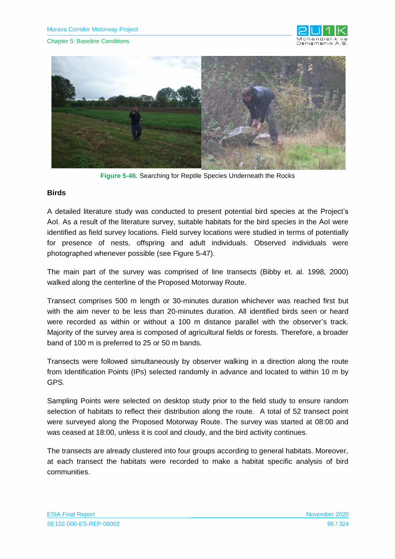
Morava Corridor Motorway Project
Chapter 5: Baseline Conditions
ESIA Final Report November 2020
SE102-000-ES-REP-00002 96 / 324
Figure 5-46. Searching for Reptile Species Underneath the Rocks
Birds
A detailed literature study was conducted to present potential bird species at the Project’s
AoI. As a result of the literature survey, suitable habitats for the bird species in the AoI were
identified as field survey locations. Field survey locations were studied in terms of potentially
for presence of nests, offspring and adult individuals. Observed individuals were
photographed whenever possible (see Figure 5-47).
The main part of the survey was comprised of line transects (Bibby et. al. 1998, 2000)
walked along the centerline of the Proposed Motorway Route.
Transect comprises 500 m length or 30-minutes duration whichever was reached first but
with the aim never to be less than 20-minutes duration. All identified birds seen or heard
were recorded as within or without a 100 m distance parallel with the observer’s track.
Majority of the survey area is composed of agricultural fields or forests. Therefore, a broader
band of 100 m is preferred to 25 or 50 m bands.
Transects were followed simultaneously by observer walking in a direction along the route
from Identification Points (IPs) selected randomly in advance and located to within 10 m by
GPS.
Sampling Points were selected on desktop study prior to the field study to ensure random
selection of habitats to reflect their distribution along the route. A total of 52 transect point
were surveyed along the Proposed Motorway Route. The survey was started at 08:00 and
was ceased at 18:00, unless it is cool and cloudy, and the bird activity continues.
The transects are already clustered into four groups according to general habitats. Moreover,
at each transect the habitats were recorded to make a habitat specific analysis of bird
communities.
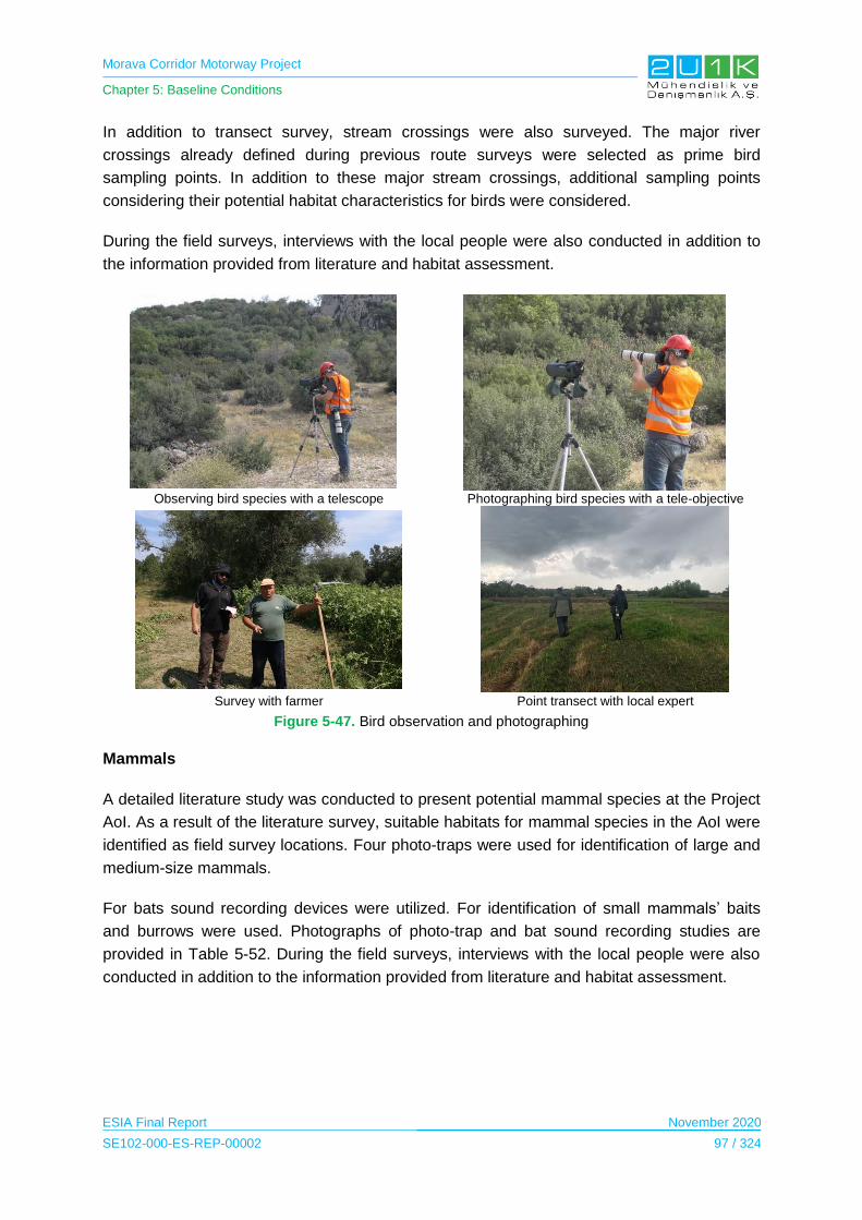
Morava Corridor Motorway Project
Chapter 5: Baseline Conditions
ESIA Final Report November 2020
SE102-000-ES-REP-00002 97 / 324
In addition to transect survey, stream crossings were also surveyed. The major river
crossings already defined during previous route surveys were selected as prime bird
sampling points. In addition to these major stream crossings, additional sampling points
considering their potential habitat characteristics for birds were considered.
During the field surveys, interviews with the local people were also conducted in addition to
the information provided from literature and habitat assessment.
Observing bird species with a telescope Photographing bird species with a tele-objective
Survey with farmer Point transect with local expert
Figure 5-47. Bird observation and photographing
Mammals
A detailed literature study was conducted to present potential mammal species at the Project
AoI. As a result of the literature survey, suitable habitats for mammal species in the AoI were
identified as field survey locations. Four photo-traps were used for identification of large and
medium-size mammals.
For bats sound recording devices were utilized. For identification of small mammals’ baits
and burrows were used. Photographs of photo-trap and bat sound recording studies are
provided in Table 5-52. During the field surveys, interviews with the local people were also
conducted in addition to the information provided from literature and habitat assessment.

Morava Corridor Motorway Project
Chapter 5: Baseline Conditions
ESIA Final Report November 2020
SE102-000-ES-REP-00002 98 / 324
Camera-trapping Studies: For identification of large (fox, Stone marten, wild boar) and
medium-sized (squirrel, hedgehog, weasel), photo-traps were located at 4 different
points to various proximities to the study location.
Bat Studies: For identification of nocturnal bat species at the project site, 2 ultrasonic
bat sound recording devices were used. One device was located within the
concerned field study location, while the other was located outside the site at a
distant point. Sonograms of bat sounds recorded by the devices were analyzed to
identify bat species within the AoI.
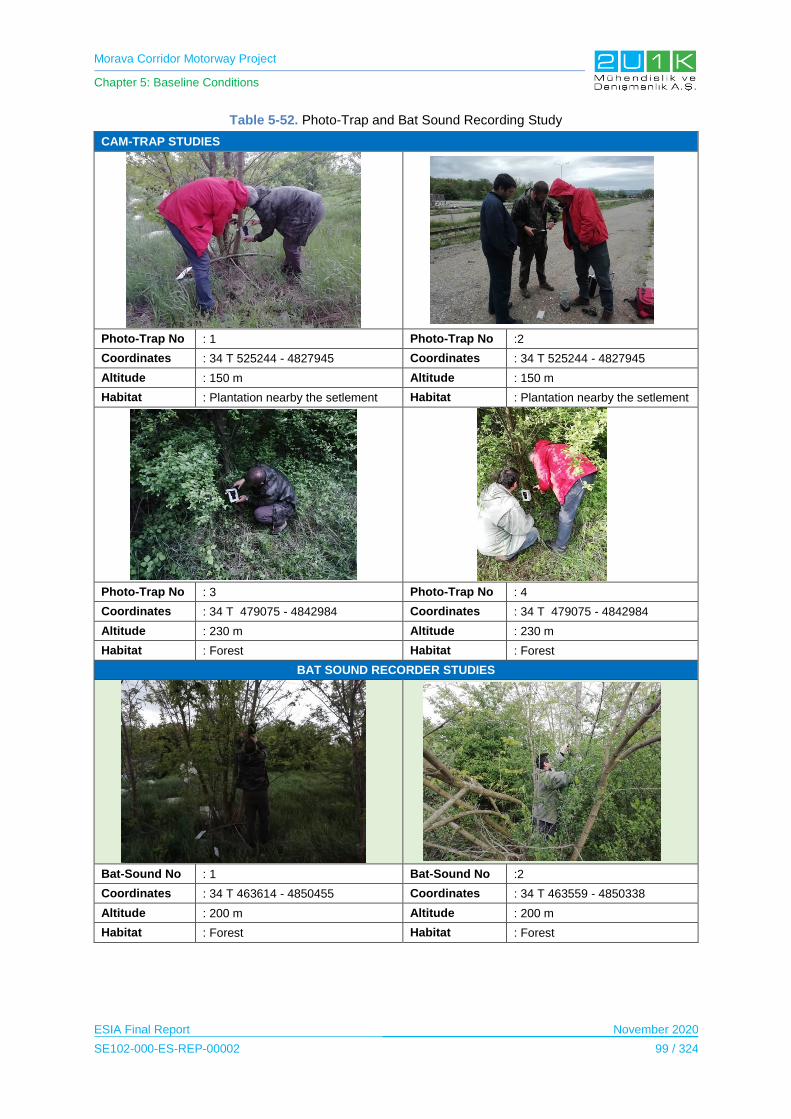
Morava Corridor Motorway Project
Chapter 5: Baseline Conditions
ESIA Final Report November 2020
SE102-000-ES-REP-00002 99 / 324
Table 5-52. Photo-Trap and Bat Sound Recording Study
CAM-TRAP STUDIES
Photo-Trap No : 1 Photo-Trap No :2
Coordinates : 34 T 525244 - 4827945 Coordinates : 34 T 525244 - 4827945
Altitude : 150 m Altitude : 150 m
Habitat : Plantation nearby the setlement Habitat : Plantation nearby the setlement
Photo-Trap No : 3 Photo-Trap No : 4
Coordinates : 34 T 479075 - 4842984 Coordinates : 34 T 479075 - 4842984
Altitude : 230 m Altitude : 230 m
Habitat : Forest Habitat : Forest
BAT SOUND RECORDER STUDIES
Bat-Sound No : 1 Bat-Sound No :2
Coordinates : 34 T 463614 - 4850455 Coordinates : 34 T 463559 - 4850338
Altitude : 200 m Altitude : 200 m
Habitat : Forest Habitat : Forest

Morava Corridor Motorway Project
Chapter 5: Baseline Conditions
ESIA Final Report November 2020
SE102-000-ES-REP-00002 100 / 324
Aquatic Biodiversity
Aquatic ecosystems are composed of the following organisms; phytoplanktonic organisms at
the producer level (free or attached algae), zooplanktonic and benthic organism that feed on
these, which are primary and secondary consumers, and tertiary consumer fish species,
which depending on their food preference can feed on either zooplanktonic and benthic
organisms or smaller fish.
In this context, the main links of the aquatic food chain are algae (attached or free forms,
phytoplanktonic organisms), zooplanktonic organisms, benthic organisms, and fish. Changes
in aquatic systems can cause changes on these organisms.
Within the scope of the aquatic studies carried out specifically for the Project, fish and
benthic species, which are expected to be affected by the Project activities, have been taken
into consideration. The objectives of these studies are mainly to identify aquatic freshwater
species as accurately as possible in the AoI. Within this context following studies were
carried out:
Detailed literature survey in order to define the existing aquatic species inhabiting the
aquatic ecosystems in the study area.
Determining the endemism status of species.
Evaluating the existing species according to the Bern Convention and the Red List of
International Union for Conservation of Nature (IUCN).
Defining the status of globally threatened species and restricted-range species within
the aquatic ecosystems both within the AoI and the adjacent catchments.
Defining and listing the target species within the aquatic ecosystems that might be
affected from the construction and operation activities of the project.
As the general methodology of the aquatic survey, transect study covering the up-stream and
down-stream of the field study locations (transect length is about 500 m) was applied.
Additionally, tributaries of the West Morava River were also covered in the study. Fish
samples, which constitute an important indicator of aquatic vertebrates, were sampled with a
Samus 725 mp electro shocker where the current rate and water depth are low. At higher
depths and where flow rate is higher a casting net and fyke-net were used. The fish
specimens caught from the sampling points were identified then they released back to the
capture area after they were counted.
Sampling methods for benthic organisms will vary depending on the floor structure of the
water body and on type of benthic organisms. Field study were carried out via 2 methods by
considering applicability for collecting Mollusca, Annelidae, Platyhelmintes and Arthropoda
(especially Insecta family) samples. Hand collection was mostly preferred when collecting
Crustacean samples; however, in some cases pond nets in the form of dipper were used
Morava Corridor Motorway Project
Chapter 5: Baseline Conditions
ESIA Final Report November 2020
SE102-000-ES-REP-00002 101 / 324
(Elliot and Mann, 1979; Biro, 1981; Edington, 1981; Bellman, 1988; Glöer, 1992; Ludwig,
1993).
The aquatic species that exist in the AoI were identified and recorded during field studies.
During the field surveys, interviews with the local people were also conducted in addition to
the information provided from literature and habitat assessment.
5.8.3 Baseline Conditions
5.8.3.1 Protected Areas
Internationally Recognized Areas within the Area of Influence and Surroundings
Key Biodiversity Areas
Internationally Recognised Areas are located in the surroundings of the Project Area located
in the provinces of Ćićevac to Čačak. These areas include Key Biodiversity Areas (KBA),
Important Plant Areas (IPA) and Important Bird Areas (IBA). There are no any internationally
recognized areas within the AoI
KBAs are the most important areas according to their characteristics in terms of supporting
biological components. Considering that all sections of the Project area, there are 3
internationally recognized areas have been found.
The internationally recognized areas are shown in Figure 5-48. Distance of the KBAs from
the Project area and the provinces, are summarized in Table 5-53.
Table 5-53. KBAs Located in vicinity of the Project Area
Internationally Recognised Areas Province Distance (km)
Gornje Pomoravlje KBA Paracin 8.5
Akumulacija Gruza KBA Knic 13.3
Ovcar-Kablar gorge KBA Čačak 8
Gornje Pomoravlje KBA Common Kingfisher (Alcedo atthis) is resident species in this IBA
and is breeding about 10-15 breeding pairs. On the other hand, the island is important
breeding area for Sand Martin (Riparia riparia) as 1300-1700 breeding pairs. The KBA is
located in 8.5 km distance from Section 1 of the Proposed Motorway Route.
Surface Area: 1701 ha
Province(s): Paracin
IBA Criteria met B2 (2009)
Akumulacija Gruza KBA is about the 75 individuals of Ferruginous Duck (Aythya nyroca),
which is an NT category as IUCN.

Morava Corridor Motorway Project
Chapter 5: Baseline Conditions
ESIA Final Report November 2020
SE102-000-ES-REP-00002 102 / 324
Surface Area: 4,038 ha
Province(s): Knic
IBA Criteria met: A1 (2009)
Ovcar-Kablar gorge KBA: This area is situated between the towns of Čačak and Pozega in
western Serbia. Limestone cliffs and rocky terrain are interspersed with sparse tree cover
and thickets comprising oak (Quercus), ash (Fraxinus), hornbeam (Carpinus), elm (Ulmus)
and lime (Tilia). Areas of meadow and pasture, small reservoirs, houses and orchards are
also present. It is also important for a variety of breeding raptors. The main threats are
disturbance, hunting and infrastructure development.
Surface Area: 6,174 ha
Province(s): Čačak
IBA Criteria met: B2, B3 (2009)
Ramsar Sites
There is no Ramsar Sites located in the surroundings of the Project Area.
Nationally Recognized Areas within the Area of Influence and Surroundings
There is one nationally recognized nature reserve area located outside the AoI (Section-2).
There is no any nationally recognized area within the AoI "Osredak" is located in central
Serbia on the banks of the Western Morava, 14 km northwest of Kruševac and 20 km east of
Trstenik, in the villages of Bela Voda, Kukljin, Globoder and Bresno Polje.
The “Osredak” Special Nature Reserve protected area is situated 530 m distance to the
Proposed Motorway and thus, does not overlap with the proposed project area. Pursuant to
Article 42, paragraph 8 of the Law on Nature Protection ("Official Gazette of the Republic of
Serbia" No. 36/09, 88/10, 91/10-correction and 14/16), the Ministry of Environmental
Protection informs the public about the procedure for initiating protection of the natural of the
category II (other) category, as the Special Nature Reserve "Osredak".
The protected nature reserve proposed for protection possesses the characteristic of the
constant displacement of the western Moravian basin. "Osredak" has great significance from
the aspect of protection of rare and protected plant and animal species: it is part of the
migration corridor and the nesting site of numerous wetland birds; it is a significant habitat for
amphibians and reptiles; the floating parts are ideal natural fishes for the fish fund; The
strictly protected species in Serbia - yellow lupus (Nuphar lutea) is included in the floating
vegetation.
The total area of "Osredak" is 245.75 ha. According to the structure of the area of cadastral
municipalities by ownership, private ownership rate is 97.31%, and the state owned 2.69% of

Morava Corridor Motorway Project
Chapter 5: Baseline Conditions
ESIA Final Report November 2020
SE102-000-ES-REP-00002 103 / 324
area. In the protected area, protection regimes of II (second) and III (third) levels have been
established.
According to the Rulebook on Criteria for Evaluation and Procedure for Categorization of
Protected Areas ("Official Gazette of the Republic of Serbia", No. 97/15), the Nature Reserve
"Osredak" is classified in category II - a protected area of great significance.
According to the Regulation on the ecological network ("Official Gazette of the Republic of
Serbia", No. 102/10), the area of "Osredak" belongs to a part of an ecologically significant
area under number 52 - "Osredak".
The Osredak Nature Reserve area is shown in Figure 5-49.
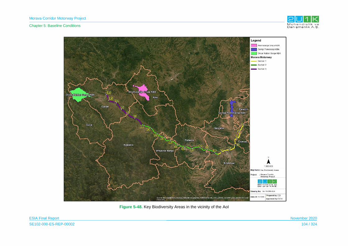
Morava Corridor Motorway Project
Chapter 5: Baseline Conditions
ESIA Final Report November 2020
SE102-000-ES-REP-00002 104 / 324
Figure 5-48. Key Biodiversity Areas in the vicinity of the AoI
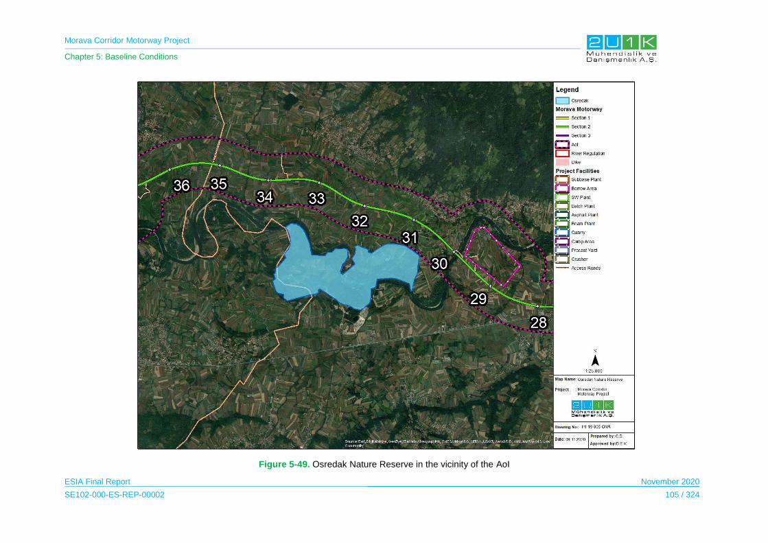
Morava Corridor Motorway Project
Chapter 5: Baseline Conditions
ESIA Final Report November 2020
SE102-000-ES-REP-00002 105 / 324
Figure 5-49. Osredak Nature Reserve in the vicinity of the AoI
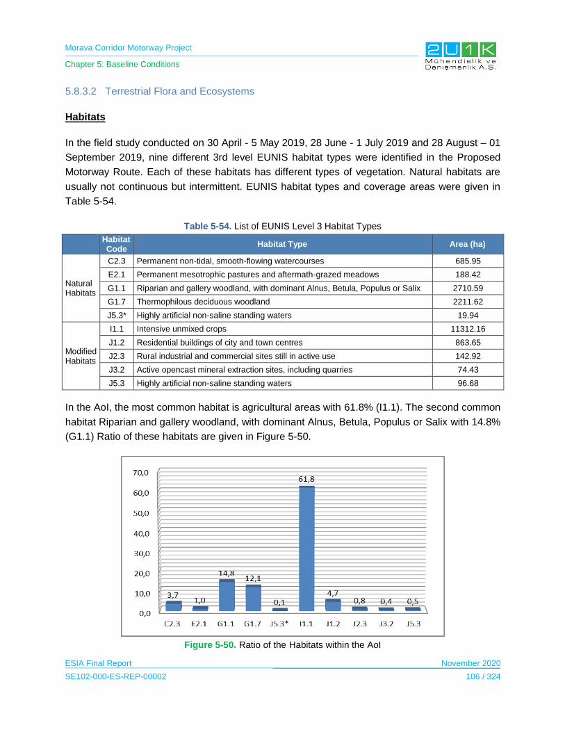
Morava Corridor Motorway Project
Chapter 5: Baseline Conditions
ESIA Final Report November 2020
SE102-000-ES-REP-00002 106 / 324
5.8.3.2 Terrestrial Flora and Ecosystems
Habitats
In the field study conducted on 30 April - 5 May 2019, 28 June - 1 July 2019 and 28 August – 01
September 2019, nine different 3rd level EUNIS habitat types were identified in the Proposed
Motorway Route. Each of these habitats has different types of vegetation. Natural habitats are
usually not continuous but intermittent. EUNIS habitat types and coverage areas were given in
Table 5-54.
Table 5-54. List of EUNIS Level 3 Habitat Types
Habitat Code
Habitat Type Area (ha)
Natural Habitats
C2.3 Permanent non-tidal, smooth-flowing watercourses 685.95
E2.1 Permanent mesotrophic pastures and aftermath-grazed meadows 188.42
G1.1 Riparian and gallery woodland, with dominant Alnus, Betula, Populus or Salix 2710.59
G1.7 Thermophilous deciduous woodland 2211.62
J5.3* Highly artificial non-saline standing waters 19.94
Modified Habitats
I1.1 Intensive unmixed crops 11312.16
J1.2 Residential buildings of city and town centres 863.65
J2.3 Rural industrial and commercial sites still in active use 142.92
J3.2 Active opencast mineral extraction sites, including quarries 74.43
J5.3 Highly artificial non-saline standing waters 96.68
In the AoI, the most common habitat is agricultural areas with 61.8% (I1.1). The second common
habitat Riparian and gallery woodland, with dominant Alnus, Betula, Populus or Salix with 14.8%
(G1.1) Ratio of these habitats are given in Figure 5-50.
Figure 5-50. Ratio of the Habitats within the AoI
Morava Corridor Motorway Project
Chapter 5: Baseline Conditions
ESIA Final Report November 2020
SE102-000-ES-REP-00002 107 / 324
Flora
In terms of flora species, 176 genus and 234 species belonging to 65 families were identified as
a result of literature and field studies. There is no endemic species in the samples collected in
the field study.
14 invasive species were found in the AoI. These species are: Fallopia japonica, Amorpha
fructicosa, Robinia pseudoacacia, Xanthium spinosum, Ailanthus altissima, Datura stramonium,
Xanthium strumarium, Erigeron annuus, Acer negundo, Erigeron canadensis, Phytolacca
americana, Amaranthus retroflexus and Datura stramonium.
As given in the Table 5-56, the flora species identified in the project AoI are listed as LC by
IUCN. On the other hand, one of the plant species, Nuphar lutea, is nationally listed as strictly
protected (Ann-I). In addition to Nuphar lutea, 10 other species, Arctium lappa, Hypericum
perforatum, Iris pseudoacorus, Acinos hungaricus, Lamium album, Althea officinalis, Crataegus
monogyna, Rosa canina, Galium odoratum and Viola odorata species listed as protected
species in Ann-II were identified in the AoI.
Table 5-55. Conservation Status of Flora Species
IUCN BERN CITES Habitat Directive National
Regulation
CR EN VU NT LC DD Ann-I Ann-I Ann-II Ann-II Ann-II Ann-IV Ann-V Ann-I Ann-II
- - - - 87 - - - - - - - - 1 10
Nuphar lutea is widely distribute in Albania; Austria; Belarus; Belgium; Bosnia and Herzegovina;
Bulgaria; Croatia; Czechia; Denmark; Estonia; Finland; France (France (mainland)); Germany;
Greece (Greece (mainland)); Hungary; Iran, Islamic Republic of; Ireland; Isle of Man; Italy
(Sardegna, Italy (mainland)); Kazakhstan; Latvia; Liechtenstein; Lithuania; Luxembourg;
Moldova; Montenegro; Netherlands; North Macedonia; Norway; Palestine, State of; Poland;
Portugal (Portugal (mainland)); Romania; Russian Federation (Northwest European Russia,
North European Russia, Central European Russia, East European Russia, Kaliningrad); Serbia;
Slovakia; Slovenia; Spain (Spain (mainland)); Sweden; Switzerland; Syrian Arab Republic;
Turkey (Turkey-in-Europe, Turkey-in-Asia); Ukraine; United Kingdom (Great Britain, Northern
Ireland). Population status of this species is stable and “LC” – Least Concern as IUCN criteria.
The local EIA report also indicates the protection status of the Nupher lutea and other species
listed with protection status. On the other hand, local EIA reports concluded that these species
are not concentrated in the project AoI. Therefore, project does not pose any risk to these
species.
Morava Corridor Motorway Project
Chapter 5: Baseline Conditions
ESIA Final Report November 2020
SE102-000-ES-REP-00002 108 / 324
In the Project AoI, Nuphar lutea species were observed in small water ponds mainly located at
old borrow areas. There is only one such habitat, where the species is concentrated, and that
habitat is identified in the AoI. Project activities including river diversion have no direct impact on
this habitat. This habitat is already included in the constraint maps (Appendix -5) and special
measures are suggested to avoid any impact on the habitat.
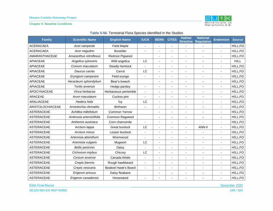
Morava Corridor Motorway Project
Chapter 5: Baseline Conditions
ESIA Final Report November 2020
SE102-000-ES-REP-00002 109 / 324
Table 5-56. Terrestrial Flora Species Identified in the Studies
Family Scientific Name English Name IUCN BERN CITES Habitat
Directive National
Regulation Endemism Source
ACERACAEA Acer campeste Field Maple - - - - - - HS,L,FO
ACERACAEA Acer negudno Boxelder - - - - - - HS,L,FO
AMARANTHACEAE Amaranthus retroflexus Redroot Pigweed - - - - - HS,L,FO
APIACEAE Angelica sylvestris Wild angelica LC - - - - - HS,L
APIACEAE Conium maculatum Deadly hemlock - - - - - - HS,L,FO
APIACEAE Daucus carota Carrot LC - - - - - HS,L,FO
APIACEAE Eryngium campestre Field eryngo - - - - - - HS,L,FO
APIACEAE Heracleum sphondylium Bear’s breech - - - - - HS,L,FO
APIACEAE Torilis arvensis Hedge parsley - - - - - - HS,L,FO
APOCYNACEAE Vinca herbacea Herbaceous periwinkle - - - - - - HS,L,FO
ARACEAE Arum maculatum Cuckoo pint - - - - - - HS,L,FO
ARALIACEAE Hedera helix İvy LC - - - - - HS,L,FO
ARISTOLOCHIACEAE Aristolochia clematitis Birthwort - - - - - - HS,L,FO
ASTERACEAE Achillea millefolium Common Yarrow - - - - - HS,L,FO
ASTERACEAE Ambrosia artemisiifolia Common Ragweed - - - - - HS,L,FO
ASTERACEAE Anthemis austriaca Corn chamomile - - - - - - HS,L,FO
ASTERACEAE Arctium lappa Great burdock LC - - - ANN-II - HS,L,FO
ASTERACEAE Arctium minus Lesser burdock - - - - - - HS,L,FO
ASTERACEAE Artemisia absinthum Wormwood - - - - - - HS,L,FO
ASTERACEAE Artemisia vulgaris Mugwort LC - - - - - HS,L,FO
ASTERACEAE Bellis perennis Daisy - - - - - - HS,L,FO
ASTERACEAE Cichorium intybus Chicory LC - - - - - HS,L,FO
ASTERACEAE Cirsium arvense Canada thistle - - - - - - HS,L,FO
ASTERACEAE Crepis biennis Rough hawkbeard - - - - - - HS,L,FO
ASTERACEAE Crepis vesicaria Beaked Hawk's Beard - - - - - - HS,L,FO
ASTERACEAE Erigeron annuus Daisy fleabane - - - - - HS,L,FO
ASTERACEAE Erigeron canadensis Horseweed - - - - - - HS,L,FO
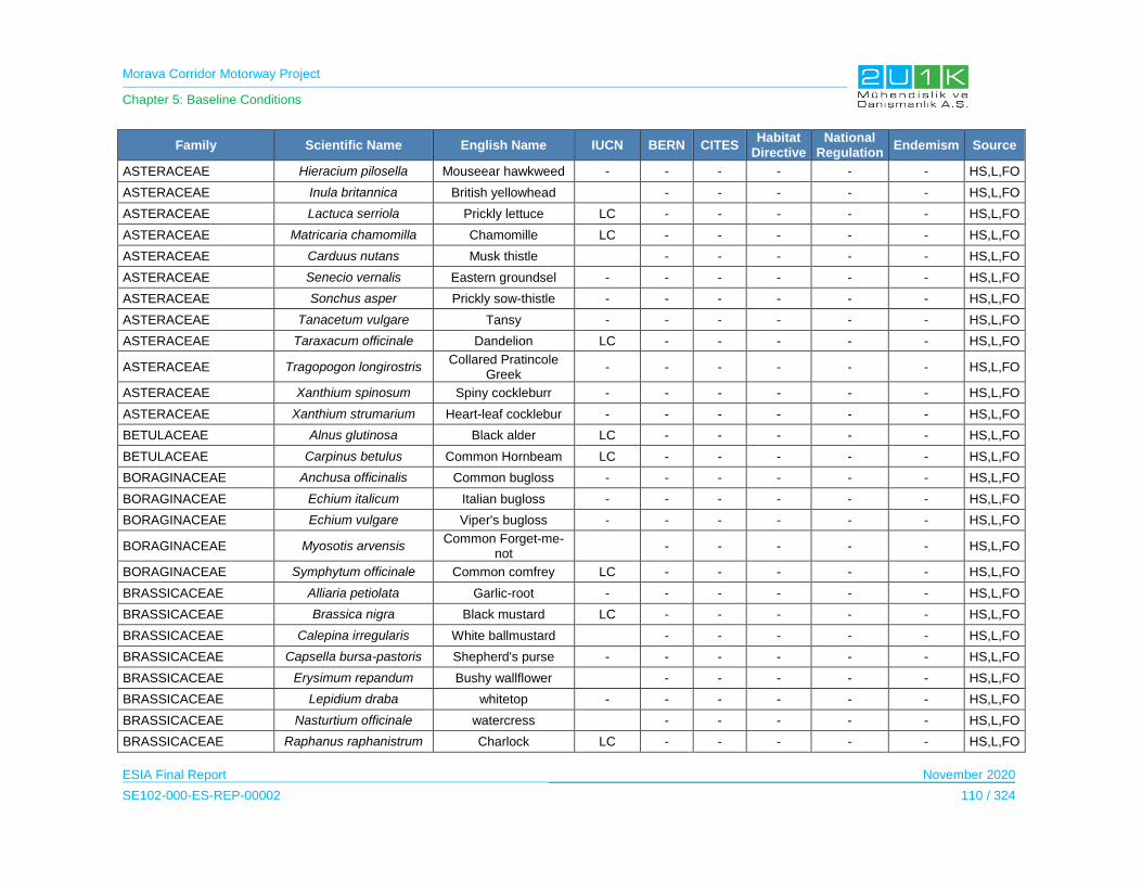
Morava Corridor Motorway Project
Chapter 5: Baseline Conditions
ESIA Final Report November 2020
SE102-000-ES-REP-00002 110 / 324
Family Scientific Name English Name IUCN BERN CITES Habitat
Directive National
Regulation Endemism Source
ASTERACEAE Hieracium pilosella Mouseear hawkweed - - - - - - HS,L,FO
ASTERACEAE Inula britannica British yellowhead - - - - - HS,L,FO
ASTERACEAE Lactuca serriola Prickly lettuce LC - - - - - HS,L,FO
ASTERACEAE Matricaria chamomilla Chamomille LC - - - - - HS,L,FO
ASTERACEAE Carduus nutans Musk thistle - - - - - HS,L,FO
ASTERACEAE Senecio vernalis Eastern groundsel - - - - - - HS,L,FO
ASTERACEAE Sonchus asper Prickly sow-thistle - - - - - - HS,L,FO
ASTERACEAE Tanacetum vulgare Tansy - - - - - - HS,L,FO
ASTERACEAE Taraxacum officinale Dandelion LC - - - - - HS,L,FO
ASTERACEAE Tragopogon longirostris Collared Pratincole
Greek - - - - - - HS,L,FO
ASTERACEAE Xanthium spinosum Spiny cockleburr - - - - - - HS,L,FO
ASTERACEAE Xanthium strumarium Heart-leaf cocklebur - - - - - - HS,L,FO
BETULACEAE Alnus glutinosa Black alder LC - - - - - HS,L,FO
BETULACEAE Carpinus betulus Common Hornbeam LC - - - - - HS,L,FO
BORAGINACEAE Anchusa officinalis Common bugloss - - - - - - HS,L,FO
BORAGINACEAE Echium italicum Italian bugloss - - - - - - HS,L,FO
BORAGINACEAE Echium vulgare Viper's bugloss - - - - - - HS,L,FO
BORAGINACEAE Myosotis arvensis Common Forget-me-
not - - - - - HS,L,FO
BORAGINACEAE Symphytum officinale Common comfrey LC - - - - - HS,L,FO
BRASSICACEAE Alliaria petiolata Garlic-root - - - - - - HS,L,FO
BRASSICACEAE Brassica nigra Black mustard LC - - - - - HS,L,FO
BRASSICACEAE Calepina irregularis White ballmustard - - - - - HS,L,FO
BRASSICACEAE Capsella bursa-pastoris Shepherd's purse - - - - - - HS,L,FO
BRASSICACEAE Erysimum repandum Bushy wallflower - - - - - HS,L,FO
BRASSICACEAE Lepidium draba whitetop - - - - - - HS,L,FO
BRASSICACEAE Nasturtium officinale watercress - - - - - HS,L,FO
BRASSICACEAE Raphanus raphanistrum Charlock LC - - - - - HS,L,FO

Morava Corridor Motorway Project
Chapter 5: Baseline Conditions
ESIA Final Report November 2020
SE102-000-ES-REP-00002 111 / 324
Family Scientific Name English Name IUCN BERN CITES Habitat
Directive National
Regulation Endemism Source
BRASSICACEAE Sinapis arvensis California rape LC - - - - - HS,L,FO
BRASSICACEAE Thlaspi perfoliatum Perfoliate pennycress - - - - - - HS,L,FO
BUTOMACEAE Butomus umbellatus Flowering rush LC - - - - - HS,L
CHENOPODIACEAE Chenopodium album Fat hen - - - - - - HS,L,FO
CANNABACEAE Humulus lupulus Common hop LC - - - - - HS,L,FO
CAPRIFOLIACAE Lonicera caprifolium Chèvre-feuille des
jardins - - - - - - HS,L,FO
CAPRIFOLIACAE Sambucus ebulus Dwarf Elder LC - - - - - HS,L,FO
CAPRIFOLIACAE Sambucus nigra Black elder LC - - - - - HS,L,FO
CAPRIFOLIACAE Viburnum opulus Guelder-rose LC - - - - - HS,L,FO
CARYOPHYLLACEAE Agrostemma githago Common corncockle - - - - - - HS,L,FO
CARYOPHYLLACEAE Holostemum umbellatum Jagged chickweed - - - - - - HS,L,FO
CARYOPHYLLACEAE Lychnis coronaria Catchfly - - - - - - HS,L,FO
CARYOPHYLLACEAE Lychnis flos-cuculi Ragged robins - - - - - - HS,L,FO
CARYOPHYLLACEAE Saponaria officinalis Common soapwort - - - - - HS,L,FO
CARYOPHYLLACEAE Silene latifolia Bladder campion - - - - - - HS,L,FO
CARYOPHYLLACEAE Stellaria media Common chickweed LC - - - - - HS,L,FO
CELASTRACEAE Euonymus europaeus European spindletree LC - - - - - HS,L,FO
CONVOLVULACEAE Calystegia sepium Great bindweed LC - - - - - HS,L,FO
CONVOLVULACEAE Convolvulus arvensis Bindweed - - - - - - HS,L,FO
CORNACEAE Cornus mas Cornelian cherry LC - - - - - HS,L,FO
CORNACEAE Cornus sanguinea Common Dogwood - - - - - - HS,L,FO
CUCURBITACEAE Bryonia alba White bryony - - - - - - HS,L,FO
CUCURBITACEAE Sicyos angulatus One seed
burcucumber - - - - - - HS,L,FO
CYPERACEAE Carex acutiformis lesser pond-sedge LC - - - - - HS,L
CYPERACEAE Carex hirta Down LC - - - - - HS,L,FO
CYPERACEAE Carex echinata Star Sedge LC - - - - - HS,L,FO
CYPERACEAE Carex pendula Down LC - - - - - HS,L,FO

Morava Corridor Motorway Project
Chapter 5: Baseline Conditions
ESIA Final Report November 2020
SE102-000-ES-REP-00002 112 / 324
Family Scientific Name English Name IUCN BERN CITES Habitat
Directive National
Regulation Endemism Source
CYPERACEAE Carex remota Remote sedge LC - - - - - HS,L
DENNSTAEDTIACEAE Pteridium aquilinum Bracken LC - - - - - HS,L,FO
DIPSACACEAE Dipsacus laciniatus Cutleaf teasel - - - - - - HS,L,FO
EQUISETACEAE Equisetum arvense Bottlebrush LC - - - - - HS,L,FO
EUPHORBIACEAE Euphorbia amygdaloides Wood spurge - - - - - HS,L,FO
EUPHORBIACEAE Euphorbia helioscopia Sun spurge - - - - - - HS,L,FO
EUPHORBIACEAE Euphorbia villosa Spurge - - - - - - HS,L,FO
EUPHORBIACEAE Euphorbia cyparissias cypress spurge - - - - - - HS,L,FO
EUPHORBIACEAE Euphorbia stricta Golden Foam Spurge - - - - - - HS,L,FO
FABACEAE Amorpha fructicosa bastard indigo - - - - - - HS,L,FO
FABACEAE Genista tinctoria Dyers greenweed - - - - - - HS,L,FO
FABACEAE Medicago coronata Crown medic LC - - - - - HS,L,FO
FABACEAE Medicago lupulina Trefoil LC - - - - - HS,L,FO
FABACEAE Medicago minima Little burclover - - - - - - HS,L,FO
FABACEAE Medicago sativa Alfalfa - - - - - - HS,L,FO
FABACEAE Melilotus officinalis Field melilot - - - - - HS,L,FO
FABACEAE Pisum sativum Pea LC - - - - - HS,L,FO
FABACEAE Robinia pseudoacacia False Acacia - - - - - - HS,L,FO
FABACEAE Trifolium nigrescens Small white clover - - - - - - HS,L,FO
FABACEAE Trifolium pratense Red clover LC - - - - - HS,L,FO
FABACEAE Trifolium repens White clover LC - - - - - HS,L,FO
FABACEAE Trifolium tomentosum Woolly clover - - - - - HS,L,FO
FABACEAE Trigonella monspeliaca Star-fruited Fenugreek - - - - - - HS,L,FO
FABACEAE Vicia angustifolia Vetch LC - - - - - HS,L,FO
FABACEAE Vicia cracca Cow Vetch LC - - - - - HS,L,FO
FABACEAE Vicia grandiflora Garden vetch LC - - - - - HS,L,FO
FABACEAE Vicia sativa Tare - - - - - - HS,L,FO
FAGACEAE Fagus sylvatica Beech LC - - - - - HS,L,FO
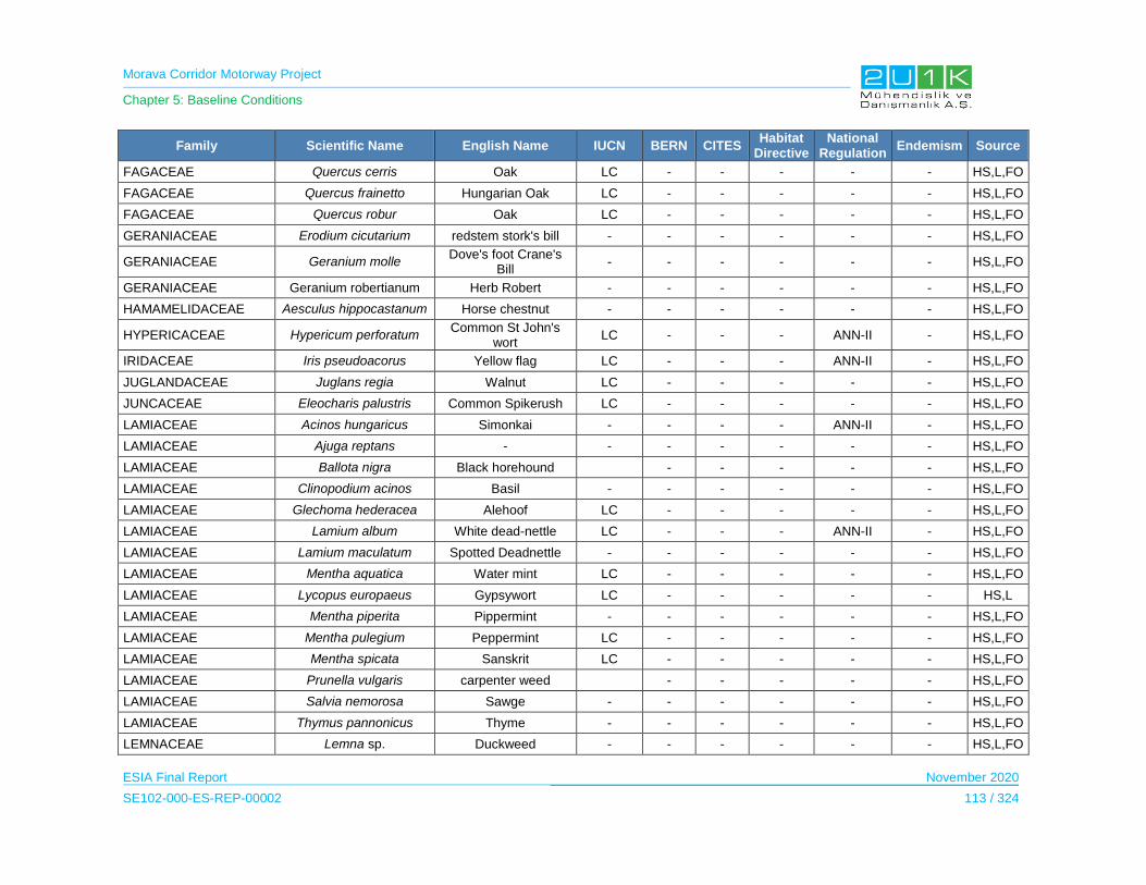
Morava Corridor Motorway Project
Chapter 5: Baseline Conditions
ESIA Final Report November 2020
SE102-000-ES-REP-00002 113 / 324
Family Scientific Name English Name IUCN BERN CITES Habitat
Directive National
Regulation Endemism Source
FAGACEAE Quercus cerris Oak LC - - - - - HS,L,FO
FAGACEAE Quercus frainetto Hungarian Oak LC - - - - - HS,L,FO
FAGACEAE Quercus robur Oak LC - - - - - HS,L,FO
GERANIACEAE Erodium cicutarium redstem stork's bill - - - - - - HS,L,FO
GERANIACEAE Geranium molle Dove's foot Crane's
Bill - - - - - - HS,L,FO
GERANIACEAE Geranium robertianum Herb Robert - - - - - - HS,L,FO
HAMAMELIDACEAE Aesculus hippocastanum Horse chestnut - - - - - - HS,L,FO
HYPERICACEAE Hypericum perforatum Common St John's
wort LC - - - ANN-II - HS,L,FO
IRIDACEAE Iris pseudoacorus Yellow flag LC - - - ANN-II - HS,L,FO
JUGLANDACEAE Juglans regia Walnut LC - - - - - HS,L,FO
JUNCACEAE Eleocharis palustris Common Spikerush LC - - - - - HS,L,FO
LAMIACEAE Acinos hungaricus Simonkai - - - - ANN-II - HS,L,FO
LAMIACEAE Ajuga reptans - - - - - - - HS,L,FO
LAMIACEAE Ballota nigra Black horehound - - - - - HS,L,FO
LAMIACEAE Clinopodium acinos Basil - - - - - - HS,L,FO
LAMIACEAE Glechoma hederacea Alehoof LC - - - - - HS,L,FO
LAMIACEAE Lamium album White dead-nettle LC - - - ANN-II - HS,L,FO
LAMIACEAE Lamium maculatum Spotted Deadnettle - - - - - - HS,L,FO
LAMIACEAE Mentha aquatica Water mint LC - - - - - HS,L,FO
LAMIACEAE Lycopus europaeus Gypsywort LC - - - - - HS,L
LAMIACEAE Mentha piperita Pippermint - - - - - - HS,L,FO
LAMIACEAE Mentha pulegium Peppermint LC - - - - - HS,L,FO
LAMIACEAE Mentha spicata Sanskrit LC - - - - - HS,L,FO
LAMIACEAE Prunella vulgaris carpenter weed - - - - - HS,L,FO
LAMIACEAE Salvia nemorosa Sawge - - - - - - HS,L,FO
LAMIACEAE Thymus pannonicus Thyme - - - - - - HS,L,FO
LEMNACEAE Lemna sp. Duckweed - - - - - - HS,L,FO

Morava Corridor Motorway Project
Chapter 5: Baseline Conditions
ESIA Final Report November 2020
SE102-000-ES-REP-00002 114 / 324
Family Scientific Name English Name IUCN BERN CITES Habitat
Directive National
Regulation Endemism Source
LILIACEAE Ornithogalum umbellatum Star of Bethlehem - - - - - - HS,L,FO
LILIACEAE Polygonatum multiflorum Solomon's Seal - - - - - - HS,L,FO
LYTHRACEAE Lythrum salicaria Purple Loosestrife - - - - - HS,L,FO
MALVACEAE Althea officinalis Mallow - - - - ANN-II - HS,L,FO
MALVACEAE Malva sylvestris Mallow LC - - - - - HS,L,FO
MORACEAE Morus alba White Mulberry - - - - - - HS,L,FO
NYMPHAEACEAE Nuphar lutea Yellow water-lily LC - - - ANN-I - HS,L,FO
OLEACEAE Fraxinus angustifolia Narrow-leaved Ash LC - - - - - HS,L,FO
OLEACEAE Fraxinus ornus Manna ash LC - - - - - HS,L,FO
OLEACEAE Ligustrum vulgare Gewone liguster - - - - - - HS,L,FO
ONAGRACEAE Epilobium lanceolatum - - - - - - HS,L,FO
OXALIDACEAE Oxalis acetosella Wood-sorrel - - - - - - HS,L,FO
PAPAVERACEAE Chelidonium majus Greater celandine LC - - - - - HS,L,FO
PAPAVERACEAE Fumaria officinalis Fumitory - - - - - - HS,L,FO
PAPAVERACEAE Papaver rhoeas Poppy LC - - - - - HS,L,FO
PLANTAGINACEAE Plantago lanceolata Narrowleaf Plantain LC - - - - - HS,L,FO
PLANTAGINACEAE Plantago major Broadleaf plantain LC - - - - - HS,L,FO
PLATANACEAE Platanus orientalis Oriental plane-tree - - - - - - HS,L,FO
POACEAE Agropyron repens Quackgrass - - - - - HS,L,FO
POACEAE Alopecurus pratensis Meadow foxtail LC - - - - - HS,L,FO
POACEAE Bromus tectorum Downy brome - - - - - - HS,L,FO
POACEAE Bromus sterilis Barren brome - - - - - - HS,L,FO
POACEAE Dactylis glomerata Cocksfoot grass - - - - - - HS,L,FO
POACEAE Calamagrostis epigeios Bushgrass - - - - - - HS,L
POACEAE Festuca rubra Red fescue LC - - - - - HS,L,FO
POACEAE Hordeum murinum Wall Barley LC - - - - - HS,L,FO
POACEAE Hordeum sativum Barley - - - - - - HS,L,FO
POACEAE Phleum phleoides Boehmer's cat's-tail LC - - - - - HS,L,FO
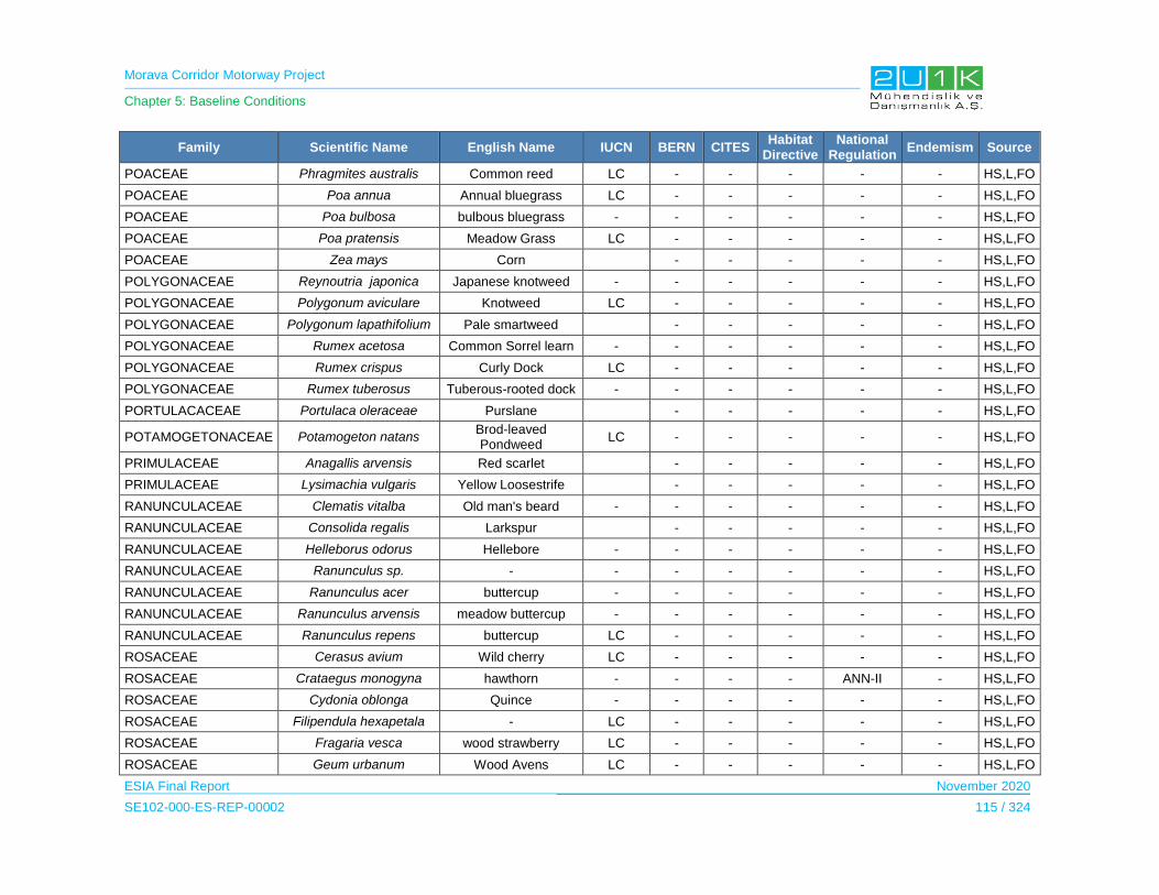
Morava Corridor Motorway Project
Chapter 5: Baseline Conditions
ESIA Final Report November 2020
SE102-000-ES-REP-00002 115 / 324
Family Scientific Name English Name IUCN BERN CITES Habitat
Directive National
Regulation Endemism Source
POACEAE Phragmites australis Common reed LC - - - - - HS,L,FO
POACEAE Poa annua Annual bluegrass LC - - - - - HS,L,FO
POACEAE Poa bulbosa bulbous bluegrass - - - - - - HS,L,FO
POACEAE Poa pratensis Meadow Grass LC - - - - - HS,L,FO
POACEAE Zea mays Corn - - - - - HS,L,FO
POLYGONACEAE Reynoutria japonica Japanese knotweed - - - - - - HS,L,FO
POLYGONACEAE Polygonum aviculare Knotweed LC - - - - - HS,L,FO
POLYGONACEAE Polygonum lapathifolium Pale smartweed - - - - - HS,L,FO
POLYGONACEAE Rumex acetosa Common Sorrel learn - - - - - - HS,L,FO
POLYGONACEAE Rumex crispus Curly Dock LC - - - - - HS,L,FO
POLYGONACEAE Rumex tuberosus Tuberous-rooted dock - - - - - - HS,L,FO
PORTULACACEAE Portulaca oleraceae Purslane - - - - - HS,L,FO
POTAMOGETONACEAE Potamogeton natans Brod-leaved Pondweed
LC - - - - - HS,L,FO
PRIMULACEAE Anagallis arvensis Red scarlet - - - - - HS,L,FO
PRIMULACEAE Lysimachia vulgaris Yellow Loosestrife - - - - - HS,L,FO
RANUNCULACEAE Clematis vitalba Old man's beard - - - - - - HS,L,FO
RANUNCULACEAE Consolida regalis Larkspur - - - - - HS,L,FO
RANUNCULACEAE Helleborus odorus Hellebore - - - - - - HS,L,FO
RANUNCULACEAE Ranunculus sp. - - - - - - - HS,L,FO
RANUNCULACEAE Ranunculus acer buttercup - - - - - - HS,L,FO
RANUNCULACEAE Ranunculus arvensis meadow buttercup - - - - - - HS,L,FO
RANUNCULACEAE Ranunculus repens buttercup LC - - - - - HS,L,FO
ROSACEAE Cerasus avium Wild cherry LC - - - - - HS,L,FO
ROSACEAE Crataegus monogyna hawthorn - - - - ANN-II - HS,L,FO
ROSACEAE Cydonia oblonga Quince - - - - - - HS,L,FO
ROSACEAE Filipendula hexapetala - LC - - - - - HS,L,FO
ROSACEAE Fragaria vesca wood strawberry LC - - - - - HS,L,FO
ROSACEAE Geum urbanum Wood Avens LC - - - - - HS,L,FO

Morava Corridor Motorway Project
Chapter 5: Baseline Conditions
ESIA Final Report November 2020
SE102-000-ES-REP-00002 116 / 324
Family Scientific Name English Name IUCN BERN CITES Habitat
Directive National
Regulation Endemism Source
ROSACEAE Malus domestica Apple - - - - - - HS,L,FO
ROSACEAE Malus sylvestris Crab Apple - - - - - - HS,L,FO
ROSACEAE Potentilla recta sulphur cinquefoil - - - - - - HS,L,FO
ROSACEAE Potentilla reptans Creeping Cinquefoil - - - - - - HS,L,FO
ROSACEAE Prunus dometica plum - - - - - HS,L,FO
ROSACEAE Prunus spinosa Blackthorn LC - - - - - HS,L,FO
ROSACEAE Prunus amygdalus - - - - - - - HS,L,FO
ROSACEAE Prunus avium Bird cherry LC - - - - - HS,L,FO
ROSACEAE Rosa canina Dog Rose LC - - - ANN-II - HS,L,FO
ROSACEAE Rubus caesius Dewberry LC - - - - - HS,L,FO
ROSACEAE Rubus candidus Black berry - - - - - - HS,L,FO
ROSACEAE Sanguisorba minor Salad Burnet - - - - - - HS,L,FO
RUBIACEAE Cruciata glabra Crosewort - - - - - - HS,L,FO
RUBIACEAE Galium aparine Cleavers LC - - - - - HS,L,FO
RUBIACEAE Galium odoratum Sweet Woodruff LC - - - ANN-II - HS,L,FO
SALICACEAE Populus alba White poplar LC - - - - - HS,L,FO
SALICACEAE Populus canadensis Poplar - - - - - - HS,L,FO
SALICACEAE Populus nigra Black poplar - - - - - - HS,L,FO
SALICACEAE Salix alba White willow LC - - - - - HS,L,FO
SALICACEAE Salix pentandra Bay willow LC - - - - - HS,L,FO
SALICACEAE Salix tetranda - - - - - - - HS,L,FO
SCROPHULARIACEAE Digitalis ferruginea Rusty foxglove - - - - - - HS,L,FO
SCROPHULARIACEAE Kickxia elatine Sharpleaf cancerwort - - - - - HS,L,FO
SCROPHULARIACEAE Linaria genistifolia Broom-leaf toadflax - - - - - - HS,L,FO
SCROPHULARIACEAE Scrophularia nodosa Woodland figwort LC - - - - - HS,L
SCROPHULARIACEAE Scrophularia scopolii Italian figwort - - - - - - HS,L,FO
SCROPHULARIACEAE Verbascum sp. - - - - - - - HS,L,FO
SCROPHULARIACEAE Veronica polita Grey Field-speedwell - - - - - - HS,L,FO
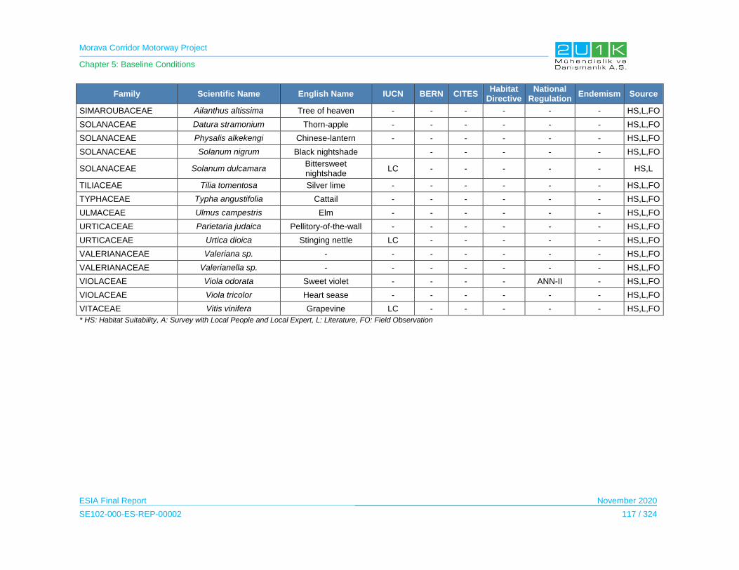
Morava Corridor Motorway Project
Chapter 5: Baseline Conditions
ESIA Final Report November 2020
SE102-000-ES-REP-00002 117 / 324
Family Scientific Name English Name IUCN BERN CITES Habitat
Directive National
Regulation Endemism Source
SIMAROUBACEAE Ailanthus altissima Tree of heaven - - - - - - HS,L,FO
SOLANACEAE Datura stramonium Thorn-apple - - - - - - HS,L,FO
SOLANACEAE Physalis alkekengi Chinese-lantern - - - - - - HS,L,FO
SOLANACEAE Solanum nigrum Black nightshade - - - - - HS,L,FO
SOLANACEAE Solanum dulcamara Bittersweet nightshade
LC - - - - - HS,L
TILIACEAE Tilia tomentosa Silver lime - - - - - - HS,L,FO
TYPHACEAE Typha angustifolia Cattail - - - - - - HS,L,FO
ULMACEAE Ulmus campestris Elm - - - - - - HS,L,FO
URTICACEAE Parietaria judaica Pellitory-of-the-wall - - - - - - HS,L,FO
URTICACEAE Urtica dioica Stinging nettle LC - - - - - HS,L,FO
VALERIANACEAE Valeriana sp. - - - - - - - HS,L,FO
VALERIANACEAE Valerianella sp. - - - - - - - HS,L,FO
VIOLACEAE Viola odorata Sweet violet - - - - ANN-II - HS,L,FO
VIOLACEAE Viola tricolor Heart sease - - - - - - HS,L,FO
VITACEAE Vitis vinifera Grapevine LC - - - - - HS,L,FO
* HS: Habitat Suitability, A: Survey with Local People and Local Expert, L: Literature, FO: Field Observation

Morava Corridor Motorway Project
Chapter 5: Baseline Conditions
ESIA Final Report November 2020
SE102-000-ES-REP-00002 118 / 324
5.8.3.3 Terrestrial Fauna
Invertebrates
Invertebrate studies were performed between 28 June and 1 July 2019. A total of 30 Lepidoptera
(Butterflies), 7 Odonata (Dragonflies) and 12 species belonging to other groups were identified
as a result of literature and field studies.
As it is given in Table 5-58, Table 5-59 and Table 5-60, among the lepidoptera species one
(Zerynhia cerisy) found to be in the NT (Near Threatened). The others are all LC (Least
Concern). The same for Odonata and the other insect species observed, they are all in LC
category according to IUCN list. None of the invertebrate species listed in Bern Convention,
CITES and Habitat Directive. According to the National legislation, there are 2 species Papilio
machaon and Pieris brassicae listed as s strictly protected (Ann-I).None of the invertebrate
species are endemic.
The local EIA reports also indicate the protection status of the Papilio machaon and Pieris
brassicae. On the other hand, local EIA reports concluded that these species are not
concentrated in the project AoI. Therefore, project does not pose any risk to these species.
Within the study area, there are bee colonies especially in forested areas at Kruševac. As they
are very important for ecosystem services, bees are used for apiculture, however they are
recognized as important source of pollination.
The photographs of representative species of invertebrate fauna observed during the field
studies are given in Biodiversity Baseline Report (see. Appendix-7)
Table 5-57. Conservation Status of Invertebrates
IUCN BERN CITES Habitat Directive National Regulation
CR EN VU NT LC DD NE Ann-
II Ann-III Ann-I
Ann-II
Ann-II
Ann-II Ann-IV Ann-V Ann-I Ann-II
- - - 1 48 - - - - - - - - - - 2 -
Papilio machaon is widely distribute in Albania; Andorra; Austria; Belarus; Belgium; Bosnia and
Herzegovina; Bulgaria; Croatia; Cyprus; Czechia; Estonia; Finland; France; Germany; Greece;
Hungary; Italy; Latvia; Liechtenstein; Lithuania; Luxembourg; Malta; Moldova; Montenegro;
Netherlands; North Macedonia; Norway; Poland; Portugal; Romania; Russian Federation;
Serbia; Slovakia; Slovenia; Spain; Sweden; Switzerland; Turkey; Ukraine; United Kingdom.
Population status of this species is stable and “LC” – Least Concern as IUCN criteria (van
Swaay, C et al, 2010).

Morava Corridor Motorway Project
Chapter 5: Baseline Conditions
ESIA Final Report November 2020
SE102-000-ES-REP-00002 119 / 324
Pieris brassicae is widely distribute in Albania; Andorra; Austria; Belarus; Belgium; Bosnia and
Herzegovina; Bulgaria; Croatia; Cyprus; Czechia; Denmark; Estonia; Finland; France; Germany;
Greece; Hungary; Ireland; Italy; Latvia; Liechtenstein; Lithuania; Luxembourg; Malta; Moldova;
Montenegro; Netherlands; North Macedonia; Norway; Poland; Portugal; Romania; Russian
Federation; Serbia; Slovakia; Slovenia; Spain; Sweden; Switzerland; Turkey; Ukraine; United
Kingdom. Population status of this species is stable and “LC” – Least Concern as IUCN criteria.
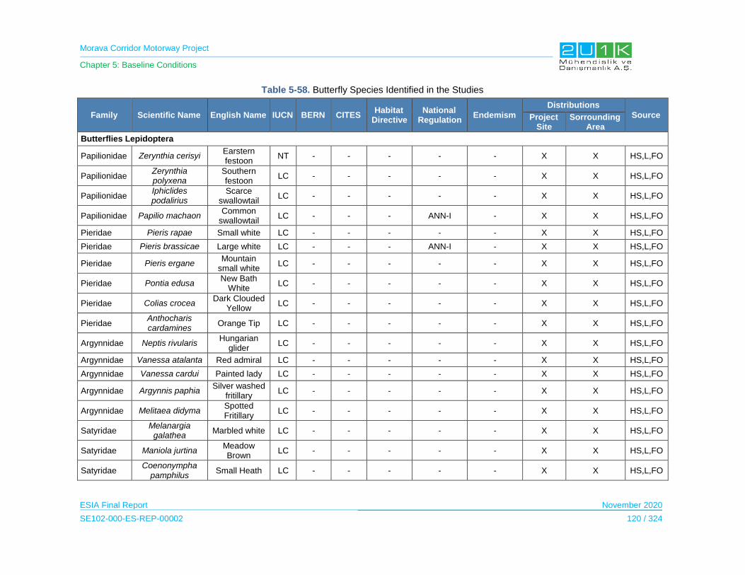
Morava Corridor Motorway Project
Chapter 5: Baseline Conditions
ESIA Final Report November 2020
SE102-000-ES-REP-00002 120 / 324
Table 5-58. Butterfly Species Identified in the Studies
Family Scientific Name English Name IUCN BERN CITES Habitat
Directive National
Regulation Endemism
Distributions
Source Project Site
Sorrounding Area
Butterflies Lepidoptera
Papilionidae Zerynthia cerisyi Earstern festoon
NT - - - - - X X HS,L,FO
Papilionidae Zerynthia polyxena
Southern festoon
LC - - - - - X X HS,L,FO
Papilionidae Iphiclides podalirius
Scarce swallowtail
LC - - - - - X X HS,L,FO
Papilionidae Papilio machaon Common
swallowtail LC - - - ANN-I - X X HS,L,FO
Pieridae Pieris rapae Small white LC - - - - - X X HS,L,FO
Pieridae Pieris brassicae Large white LC - - - ANN-I - X X HS,L,FO
Pieridae Pieris ergane Mountain
small white LC - - - - - X X HS,L,FO
Pieridae Pontia edusa New Bath
White LC - - - - - X X HS,L,FO
Pieridae Colias crocea Dark Clouded
Yellow LC - - - - - X X HS,L,FO
Pieridae Anthocharis cardamines
Orange Tip LC - - - - - X X HS,L,FO
Argynnidae Neptis rivularis Hungarian
glider LC - - - - - X X HS,L,FO
Argynnidae Vanessa atalanta Red admiral LC - - - - - X X HS,L,FO
Argynnidae Vanessa cardui Painted lady LC - - - - - X X HS,L,FO
Argynnidae Argynnis paphia Silver washed
fritillary LC - - - - - X X HS,L,FO
Argynnidae Melitaea didyma Spotted Fritillary
LC - - - - - X X HS,L,FO
Satyridae Melanargia
galathea Marbled white LC - - - - - X X HS,L,FO
Satyridae Maniola jurtina Meadow Brown
LC - - - - - X X HS,L,FO
Satyridae Coenonympha
pamphilus Small Heath LC - - - - - X X HS,L,FO

Morava Corridor Motorway Project
Chapter 5: Baseline Conditions
ESIA Final Report November 2020
SE102-000-ES-REP-00002 121 / 324
Family Scientific Name English Name IUCN BERN CITES Habitat
Directive National
Regulation Endemism
Distributions
Source Project Site
Sorrounding Area
Satyridae Pararge aegeria Speckled
Wood LC - - - - - X X HS,L,FO
Lycaenidae Satyrium spini Blue-spot Hairsreak
LC - - - - - X X HS,L,FO
Lycaenidae Polyommatus
icarus Common Blue LC - - - - - X X HS,L,FO
Lycaenidae Lycaena phlaeas Small Copper LC - - - - - X X HS,L,FO
Lycaenidae Lycaena tityrus Sooty copper LC - - - - - X X HS,L,FO
Lycaenidae Lycaena candens Balkan copper LC - - - - - X X HS,L,FO
Hesperidae Pyrgus malvae Grizzled Skipp
er LC - - - - - X X HS,L,FO
Hesperidae Carcharodus
alceae Mallow Skipper
LC - - - - - X X HS,L,FO
Hesperidae Ochlodes venatus Large skipper LC - - - - - X X HS,L,FO
Nymphalidae
Inashic io Peacock butterfly
LC - - - - - X X HS,L,FO
Nymphalidae
Polygonia c-album
Comma butterfly
LC - - - - - X X HS,L,FO
Sphingidae Macroglossum
stellatorum Hummingbird
hawk moth LC X X HS,L,FO
* HS: Habitat Suitability, A: Survey with Local People and Local Expert, L: Literature, FO: Field Observation
Table 5-59. Dragonfly Species Identified in the Studies
Family Scientific Name English Name
IUCN BERN CITES Habitat Directiv
e
National Regulation
Endemism
Distributions
Source Project Site
Sorrounding Area
Dragonflies, Odonata
Aeshnidae Anax imperator Emperor Dragonfly
LC - - - - - X X HS,L,FO
Libellulidae Orthetrum cancellatum Black-tailed
skimmer LC - - - - - X X HS,L,FO
Libellulidae Libellula fulva Blue chaser LC - - - - - X X HS,L,FO
Libellulidae Crocothemis erythraea Broad scarlet LC - - - - - X X HS,L,FO
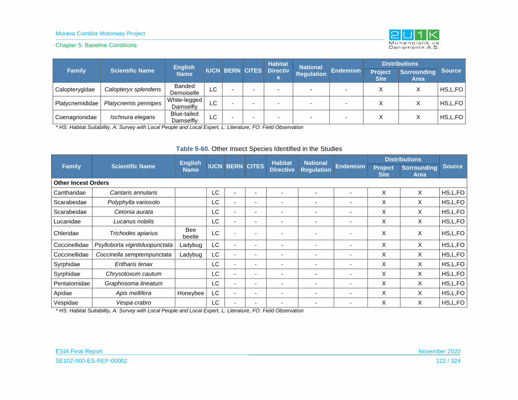
Morava Corridor Motorway Project
Chapter 5: Baseline Conditions
ESIA Final Report November 2020
SE102-000-ES-REP-00002 122 / 324
Family Scientific Name English Name
IUCN BERN CITES Habitat Directiv
e
National Regulation
Endemism
Distributions
Source Project Site
Sorrounding Area
Calopterygidae Calopteryx splendens Banded
Demoiselle LC - - - - - X X HS,L,FO
Platycnemididae Platycnemis pennipes White-legged
Damselfly LC - - - - - X X HS,L,FO
Coenagrionidae Ischnura elegans Blue-tailed Damselfly
LC - - - - - X X HS,L,FO
* HS: Habitat Suitability, A: Survey with Local People and Local Expert, L: Literature, FO: Field Observation
Table 5-60. Other Insect Species Identified in the Studies
Family Scientific Name English Name
IUCN BERN CITES Habitat
Directive National
Regulation Endemism
Distributions
Source Project Site
Sorrounding Area
Other Incest Orders
Cantharidae Cantaris annularis LC - - - - - X X HS,L,FO
Scarabeidae Polyphylla variosolo LC - - - - - X X HS,L,FO
Scarabeidae Cetonia aurata LC - - - - - X X HS,L,FO
Lucanidae Lucanus nobilis LC - - - - - X X HS,L,FO
Chleridae Trichodes apiarius Bee
beetle LC - - - - - X X HS,L,FO
Coccinellidae Psylloborta vigintiduopunctata Ladybug LC - - - - - X X HS,L,FO
Coccinellidae Coccinella semptempunctata Ladybug LC - - - - - X X HS,L,FO
Syrphidae Eritharis tenax LC - - - - - X X HS,L,FO
Syrphidae Chrysotoxum cautum LC - - - - - X X HS,L,FO
Pentatomidae Graphosoma lineatum LC - - - - - X X HS,L,FO
Apidae Apis mellifera Honeybee LC - - - - - X X HS,L,FO
Vespidae Vespa crabro LC - - - - - X X HS,L,FO
* HS: Habitat Suitability, A: Survey with Local People and Local Expert, L: Literature, FO: Field Observation
Morava Corridor Motorway Project
Chapter 5: Baseline Conditions
ESIA Final Report November 2020
SE102-000-ES-REP-00002 123 / 324
Amphibians and Reptiles
A total of 10 Amphibian species belonging to 2 order and 5 families and 12 Reptilian species
belonging to 2 order and 7 family species were identified as a result of literature and field
studies. Two tailed frog (Urodela) and 8 tailless frog (Anura) species were identified in the
project area. A total of 12 reptilian species identified along the Proposed Motorway Route were 2
turtles, 5 lizards and 5 snake species.
Amphibians
According to IUCN criteria given in Table 5-62, amphibian species were identified as a result of
literature and field studies, it is seen that only Triturus macedonicus is classified as DD. The
other 9 species are in LC (least concern) category. According to Bern Convention, 4 species are
in the list of Annex-II and the other 6 species are in the list of Annex-III. None of the amphibian
species is listed in CITES.
According to the Habitat Directive, 5 species listed in Annex-IV and 2 species listed in Annex-V.
According to the National legislation, 8 of the Amphibian species listed as strictly protected (Ann-
I). Only, Rana temporaria species listed as protected species (Ann-II). The local EIA reports also
indicate the protection status of the amphibian species. On the other hand, local EIA reports
concluded that these species are not concentrated in the project AoI. Therefore, project does not
pose any risk to these species.
Among these species, Pelophylax ridibundus was abundant. Salamandra salamandra, Triturus
macedonicus, Hyla arborea and Bufo bufo species were rarely observed. None of the amphibian
species are endemic. However, it is composed of widely spread species.
Reptiles
According to IUCN criteria given in Table 5-62, Emys orbicularis, Testudo hermanni and
Darevskia praticola are included in NT category. Emys orbicularis, has spread in Central and
Southern Europe, North Africa and Western Asia. Testudo hermanni is a wide-spread turtle
species which spreads in large regions of Southern Europe. Other reptile species identified in
Project area are listed in LC category. According to the Bern Convention, 9 species are listed in
Annex-2, the other 3 reptilian species are listed in Annex-3.
According to the Habitat Directive, 5 species listed in Annex-II and 3 species listed in Annex-IV.
According to the National legislation, 7 of the Reptile species listed as strictly protected (Ann-I).
The local EIA reports indicate the protection status of the Reptile species. On the other hand,

Morava Corridor Motorway Project
Chapter 5: Baseline Conditions
ESIA Final Report November 2020
SE102-000-ES-REP-00002 124 / 324
local EIA reports concluded that these species are not concentrated in the project AoI.
Teherefore, project does not pose any risk to these species.
Among these species, Lacerta viridis and Darevskia praticola were abundant, Natrix tessellata
had a moderate density, and the other species were rarely observed. None of the reptilian
species identified in project area are endemic but are widely distributed species.
Table 5-61. Conservation Status of Amphibians and Reptiles
IUCN BERN CITES Habitat Directive National Regulation
CR EN VU NT LC DD NE Ann-
II Ann-
III Ann-
I Ann-
II Ann-
II Ann-II Ann-IV
Ann-V
Ann-I Ann-II
Am
ph
ibia
n
- - - - 9 1 - 4 6 - - - 5- 2 8 1
Rep
tile
3 9 9 3 5 3 7
Salamandra salamandra is widely distribute in Albania; Andorra; Austria; Belgium; Bosnia and
Herzegovina; Bulgaria; Croatia; Czechia; France; Germany; Greece; Hungary; Italy;
Liechtenstein; Luxembourg; Montenegro; Netherlands; North Macedonia; Poland; Portugal;
Romania; San Marino; Serbia; Slovakia; Slovenia; Spain; Switzerland; Ukraine. Population
status of this species and “LC” – Least Concern as IUCN criteria.
Hyla arborea is widely distribute in Albania; Armenia; Austria; Azerbaijan; Belarus; Belgium;
Bosnia and Herzegovina; Bulgaria; Croatia; Czechia; Denmark; France; Georgia; Germany;
Greece; Hungary; Italy; Liechtenstein; Lithuania; Luxembourg; Moldova; Montenegro;
Netherlands; North Macedonia; Poland; Portugal; Romania; Russian Federation; Serbia;
Slovakia; Slovenia; Spain; Sweden; Switzerland; Turkey; Ukraine. Population status of this
species is “LC” – Least Concern as IUCN criteria.
Bufo bufo is widely distribute in Albania; Algeria; Andorra; Austria; Belarus; Belgium; Bosnia and
Herzegovina; Bulgaria; Croatia; Czechia; Denmark; Estonia; Finland; France; Germany;
Gibraltar; Greece; Hungary; Italy; Kazakhstan; Latvia; Lebanon; Liechtenstein; Lithuania;
Luxembourg; Moldova; Monaco; Montenegro; Morocco; Netherlands; North Macedonia; Norway;
Poland; Portugal; Romania; Russian Federation; San Marino; Serbia; Slovakia; Slovenia; Spain;
Sweden; Switzerland; Syrian Arab Republic; Tunisia; Turkey; Ukraine; United Kingdom.
Population status of this species is stable and “LC” – Least Concern as IUCN criteria.
Morava Corridor Motorway Project
Chapter 5: Baseline Conditions
ESIA Final Report November 2020
SE102-000-ES-REP-00002 125 / 324
Pseudepidalea viridis is widely distribute in Albania; Austria; Belarus; Bosnia and Herzegovina;
Bulgaria; Croatia; Czechia; Estonia; France; Germany; Greece; Hungary; Italy; Kazakhstan;
Latvia; Lithuania; Malta; Moldova; Montenegro; North Macedonia; Poland; Romania; Russian
Federation; Serbia; Slovakia; Slovenia; Ukraine Population status of this species is “LC” – Least
Concern as IUCN criteria.
Rana dalmatina is widely distribute in Albania; Austria; Belgium; Bosnia and Herzegovina;
Bulgaria; Croatia; Czechia; Denmark; France; Germany; Greece; Hungary; Italy; Luxembourg;
Montenegro; North Macedonia; Romania; Serbia; Slovakia; Slovenia; Spain; Sweden;
Switzerland; Turkey; Ukraine; United Kingdom. Population status of this species is “LC” – Least
Concern as IUCN criteria.
Rana graeca is widely distribute in Albania; Bosnia and Herzegovina; Bulgaria; Greece;
Montenegro; North Macedonia; Serbia Population status of this species is stable and “LC” –
Least Concern as IUCN criteria.
Rana temporaria is widely distribute in Albania; Andorra; Austria; Belarus; Belgium; Bulgaria;
Croatia; Czechia; Denmark; Finland; France; Germany; Greece; Hungary; Ireland; Italy;
Liechtenstein; Luxembourg; Montenegro; Netherlands; North Macedonia; Norway; Poland;
Romania; San Marino; Serbia; Slovakia; Slovenia; Spain; Sweden; Switzerland; United Kingdom
Population status of this species is stable and “LC” – Least Concern as IUCN criteria.
Pelophylax ridibundus is widely distribute in Afghanistan; Armenia; Austria; Azerbaijan; Bahrain;
Belarus; Bosnia and Herzegovina; Bulgaria; China; Croatia; Czechia; Denmark; France;
Georgia; Germany; Greece; Hungary; Iran, Islamic Republic of; Iraq; Kazakhstan; Kyrgyzstan;
Latvia; Lithuania; Moldova; Montenegro; Netherlands; North Macedonia; Poland; Romania;
Russian Federation; Saudi Arabia; Serbia; Slovakia; Slovenia; Tajikistan; Turkey; Turkmenistan;
Ukraine; Uzbekistan Population status of this species is increasing and “LC” – Least Concern as
IUCN criteria.
Pelobates syriacus is widely distribute in Armenia; Azerbaijan; Bulgaria; Georgia; Greece; Iran,
Islamic Republic of; Israel; Lebanon; North Macedonia; Romania; Russian Federation; Serbia;
Syrian Arab Republic; Turkey Population status of this species is “LC” – Least Concern as IUCN
criteria.
Emys orbicularis is widely distribute in Albania; Algeria; Armenia; Austria; Azerbaijan; Belarus;
Bosnia and Herzegovina; Bulgaria; Croatia; Czechia; France; Georgia; Germany; Greece;
Hungary; Iran, Islamic Republic of; Italy; Kazakhstan; Latvia; Liechtenstein; Lithuania; Malta;
Moldova; Monaco; Montenegro; Morocco; Netherlands; North Macedonia; Poland; Portugal;
Romania; Russian Federation; Serbia; Slovakia; Slovenia; Spain; Switzerland; Syrian Arab
Morava Corridor Motorway Project
Chapter 5: Baseline Conditions
ESIA Final Report November 2020
SE102-000-ES-REP-00002 126 / 324
Republic; Tunisia; Turkey; Turkmenistan; Ukraine. Population status of this species is “NT” –
Near Threatened as IUCN criteria.
Ablepharus kitaibelii is widely distribute in Albania; Bulgaria; Croatia; Greece; Hungary; North
Macedonia; Romania; Serbia; Slovakia; Turkey. Population status of this species is stable and
“LC” – Least Concern as IUCN criteria.
Darevskia praticola is widely distribute in Armenia; Azerbaijan; Bulgaria; Georgia; Greece; Iran,
Islamic Republic of; Romania; Russian Federation; Serbia; Turkey. Population status of this
species is “NT” – Near Threatened as IUCN criteria.
Dolichophis caspius is widely distribute in Albania; Bulgaria; Croatia; Georgia; Greece; Hungary;
Kazakhstan; Moldova; Montenegro; North Macedonia; Romania; Russian Federation; Serbia;
Turkey; Ukraine. Population status of this species is stable and “LC” – Least Concern as IUCN
criteria.
Natrix natrix is widely distribute in Albania; Algeria; Armenia; Austria; Azerbaijan; Belarus;
Belgium; Bosnia and Herzegovina; Bulgaria; China (Xinjiang); Croatia; Cyprus; Czechia;
Denmark; Estonia; Finland; France (Corsica); Georgia; Germany; Greece; Hungary; Iran, Islamic
Republic of; Italy; Kazakhstan; Latvia; Lithuania; Luxembourg; Moldova; Mongolia; Montenegro;
Morocco; Netherlands; North Macedonia; Norway; Poland; Portugal; Romania; Russian
Federation; Serbia; Slovenia; Spain; Sweden; Switzerland; Syrian Arab Republic; Tunisia;
Turkey; Turkmenistan; Ukraine; United Kingdom. Population status of this species is stable and
“LC” – Least Concern as IUCN criteria.
Natrix tessellata is widely distribute in Afghanistan; Albania; Armenia; Austria; Azerbaijan;
Bosnia and Herzegovina; Bulgaria; China; Croatia; Czechia; Egypt; Georgia; Germany; Greece;
Hungary; Iran, Islamic Republic of; Iraq; Israel; Italy; Jordan; Kazakhstan; Kyrgyzstan; Lebanon;
Moldova; Montenegro; North Macedonia; Pakistan; Romania; Russian Federation; Serbia;
Slovakia; Slovenia; Switzerland; Syrian Arab Republic; Tajikistan; Turkey; Turkmenistan;
Ukraine; Uzbekistan; Yemen. Population status of this species is stable and “LC” – Least
Concern as IUCN criteria.
Zamenis longissimus is widely distribute in Albania; Austria; Bosnia and Herzegovina; Bulgaria;
Croatia; Czechia; France; Georgia; Germany; Greece; Hungary; Italy; Moldova; Montenegro;
North Macedonia; Romania; Serbia; Slovakia; Slovenia; Spain; Switzerland; Turkey; Ukraine.
Population status of this species is stable and “LC” – Least Concern as IUCN criteria.

Morava Corridor Motorway Project
Chapter 5: Baseline Conditions
ESIA Final Report November 2020
SE102-000-ES-REP-00002 127 / 324
Table 5-62. Amphibian-Reptilian Species Identified in the Studies
Family Scientific Name English Name
IUCN BERN CITES Habitat
Directive National
Regulation Endemism
Distributions
Source Project Site
Sorrounding Area
Amphibian
Salamandridae Salamandra salamandra
Fire Salamander
LC ANN-
III - - ANN-I - X X HS,L,FO
Salamandridae Triturus
macedonicus Macedonian
Crested Newt DD
ANN-III
- - - - X X HS,L
Hylidae Hyla arborea European Tree Frog
LC ANN-
II - ANN-IV ANN-I - X X HS,L,FO
Bufonidae Bufo bufo Common
Toad LC
ANN-III
- - ANN-I - X X HS,A,L,FO
Bufonidae Pseudepidalea
viridis Green Toad LC
ANN-II
- ANN-IV ANN-I - X X HS,L,FO
Ranidae Rana dalmatina Agile Frog LC ANN-
II - ANN-IV ANN-I - X X HS,L,FO
Ranidae Rana graeca Stream Frog LC ANN-
III - ANN-IV ANN-I - X X HS,L
Ranidae Rana temporaria Common
Frog LC
ANN-III
- ANN-V ANN-I - X X HS,L,FO
Ranidae Pelophylax ridibundus
Marsh Frog LC ANN-
III - ANN-V ANN-II - X X HS,A,L,FO
Pelobatidae Pelobates syriacus Eastern
Spadefoot LC
ANN-II
- ANN-IV ANN-I - X X HS,L
Reptilian
Emydidae Emys orbicularis European
Pond Turtle NT
ANN-II
- ANN-II ANN-I - X X HS,A,L
Testudinidae Testudo hermanni Hermann's
Tortoise NT
ANN-II
ANN-II
ANN-II - - X X HS,A,L
Anguidae Anguis fragilis Slow Worm LC ANN-
III - - - - X X HS,L
Scincidae Ablepharus
kitaibelli Juniper Skink LC
ANN-II
- ANN-IV ANN-I - X X HS,L,FO
Lacertidae Darevskia praticola Meadow Lizard
NT ANN-
III - - ANN-I - X X HS,L
Lacertidae Lacerta viridis European
Green Lizard LC
ANN-II
- ANN-IV - - X X HS,A,L,FO
Lacertidae Podarcis muralis Common Wall
Lizard LC
ANN-II
- ANN-IV - - X X HS,L,FO
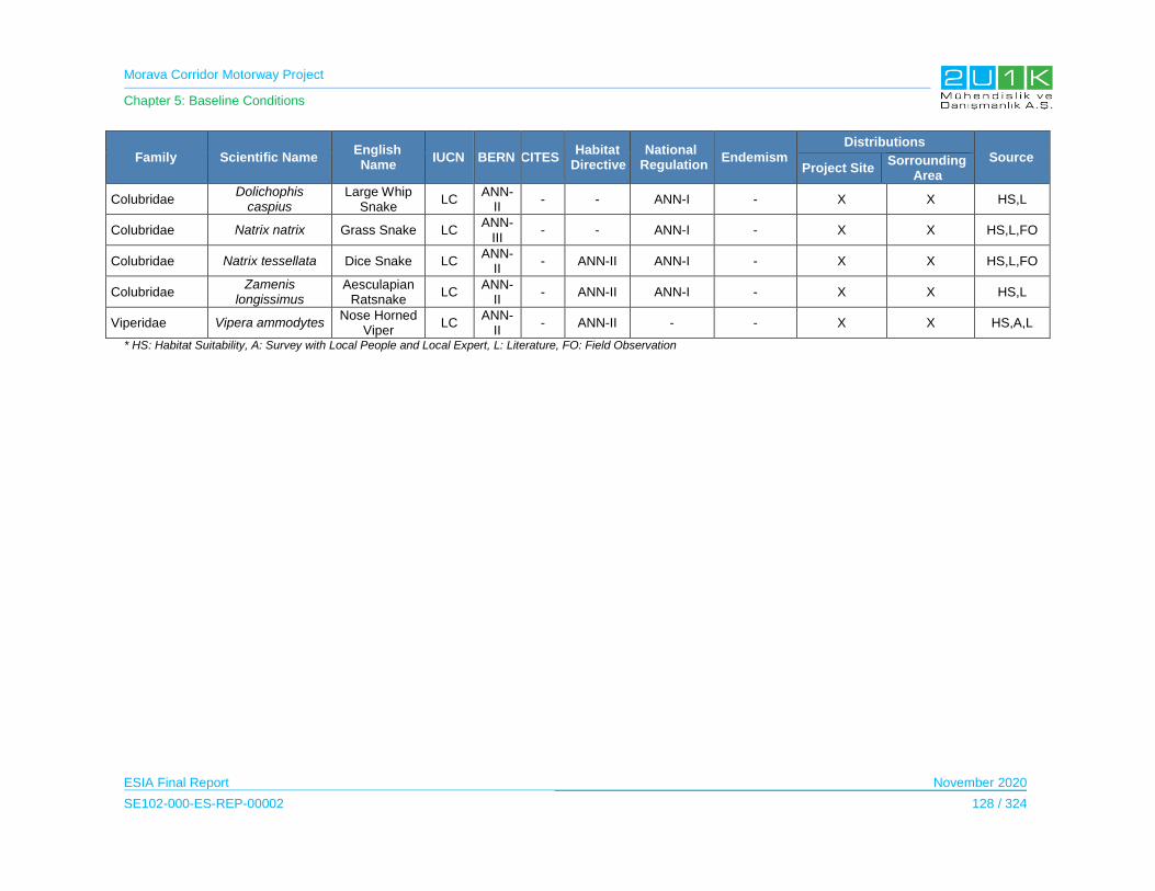
Morava Corridor Motorway Project
Chapter 5: Baseline Conditions
ESIA Final Report November 2020
SE102-000-ES-REP-00002 128 / 324
Family Scientific Name English Name
IUCN BERN CITES Habitat
Directive National
Regulation Endemism
Distributions
Source Project Site
Sorrounding Area
Colubridae Dolichophis
caspius Large Whip
Snake LC
ANN-II
- - ANN-I - X X HS,L
Colubridae Natrix natrix Grass Snake LC ANN-
III - - ANN-I - X X HS,L,FO
Colubridae Natrix tessellata Dice Snake LC ANN-
II - ANN-II ANN-I - X X HS,L,FO
Colubridae Zamenis
longissimus Aesculapian
Ratsnake LC
ANN-II
- ANN-II ANN-I - X X HS,L
Viperidae Vipera ammodytes Nose Horned
Viper LC
ANN-II
- ANN-II - - X X HS,A,L
* HS: Habitat Suitability, A: Survey with Local People and Local Expert, L: Literature, FO: Field Observation
Morava Corridor Motorway Project
Chapter 5: Baseline Conditions
ESIA Final Report November 2020
SE102-000-ES-REP-00002 129 / 324
Birds
A total of 115 bird species belonging to 18 ordo, 40 families were identified as a result of
literature and field studies. These bird species are widely spread in Serbia and Europa and they
are not endemic. 55 bird species belong to the non-Passerine group and 60 of them belong to
the Passerine group.
According to the IUCN Red List (see Table 5-64), 111 bird species those have been identified in
the study area are in the category "LC: Least Concern". Aquila heliaca and Streptopelia turtur
are classified as VU: Vulnerable and Milvus milvus and Falco vespertinus species are listed as
NT: Near Threatened.
73 of 115 bird species are listed as strictly protected fauna species in Annex 2 of the Bern
Convention. In addition, 34 species, together with a few exceptions, "protected fauna species"
covering most of the species not included in Annex 2, are listed in Annex 3 of the Bern
Convention. The remaining 8 species are not included in any conservation status of the Bern
Convention. From this point of view, 107 of 115 bird species detected in the field are protected
species according to the criteria of the Bern Convention. But according to the Bern Convention,
90% of the European ornithofauna seem to be species that need protection. This is why the
Bern Convention aims to protect the species of birds precisely against the risk of a fall in the
populations of European bird species. However, depending on its rich ecosystem, its location on
migration routes, its diverse climatic characteristics and various habitat types for bird species,
and the vast majority of the diversity and density of the Western Palearctic bird population,
Serbia is not at a high risk as it is in the European ornithological system.
According to the CITES, 2 species listed in Annex-I and 1 species listed in Annex-II.
According to the Bird Directive, 28 species listed in Annex-I and 20 species listed in Annex-II.
According to the National legislation, 75 of the bird species listed as strictly protected (Ann-I).
And 19 species listed as protected species (Ann-II). The local EIA reports indicate the protection
status of the bird species. On the other hand, local EIA reports concluded that these species are
not concentrated in the project AoI. Therefore, project does not pose any risk to these species.
The population density of bird species has been recorded as very low and has been found to be
between 1 and 10 in most populations except for crows. There were no bird species and/or
habitats in flocks and/or colonies observed in the study area.
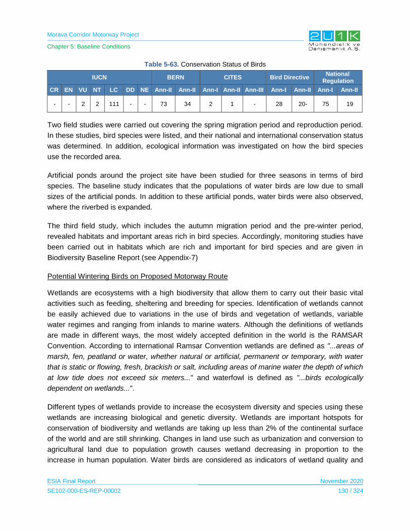
Morava Corridor Motorway Project
Chapter 5: Baseline Conditions
ESIA Final Report November 2020
SE102-000-ES-REP-00002 130 / 324
Table 5-63. Conservation Status of Birds
IUCN BERN CITES Bird Directive National
Regulation
CR EN VU NT LC DD NE Ann-II Ann-II Ann-I Ann-II Ann-III Ann-I Ann-II Ann-I Ann-II
- - 2 2 111 - - 73 34 2 1 - 28 20- 75 19
Two field studies were carried out covering the spring migration period and reproduction period.
In these studies, bird species were listed, and their national and international conservation status
was determined. In addition, ecological information was investigated on how the bird species
use the recorded area.
Artificial ponds around the project site have been studied for three seasons in terms of bird
species. The baseline study indicates that the populations of water birds are low due to small
sizes of the artificial ponds. In addition to these artificial ponds, water birds were also observed,
where the riverbed is expanded.
The third field study, which includes the autumn migration period and the pre-winter period,
revealed habitats and important areas rich in bird species. Accordingly, monitoring studies have
been carried out in habitats which are rich and important for bird species and are given in
Biodiversity Baseline Report (see Appendix-7)
Potential Wintering Birds on Proposed Motorway Route
Wetlands are ecosystems with a high biodiversity that allow them to carry out their basic vital
activities such as feeding, sheltering and breeding for species. Identification of wetlands cannot
be easily achieved due to variations in the use of birds and vegetation of wetlands, variable
water regimes and ranging from inlands to marine waters. Although the definitions of wetlands
are made in different ways, the most widely accepted definition in the world is the RAMSAR
Convention. According to international Ramsar Convention wetlands are defined as "...areas of
marsh, fen, peatland or water, whether natural or artificial, permanent or temporary, with water
that is static or flowing, fresh, brackish or salt, including areas of marine water the depth of which
at low tide does not exceed six meters..." and waterfowl is defined as "...birds ecologically
dependent on wetlands...".
Different types of wetlands provide to increase the ecosystem diversity and species using these
wetlands are increasing biological and genetic diversity. Wetlands are important hotspots for
conservation of biodiversity and wetlands are taking up less than 2% of the continental surface
of the world and are still shrinking. Changes in land use such as urbanization and conversion to
agricultural land due to population growth causes wetland decreasing in proportion to the
increase in human population. Water birds are considered as indicators of wetland quality and
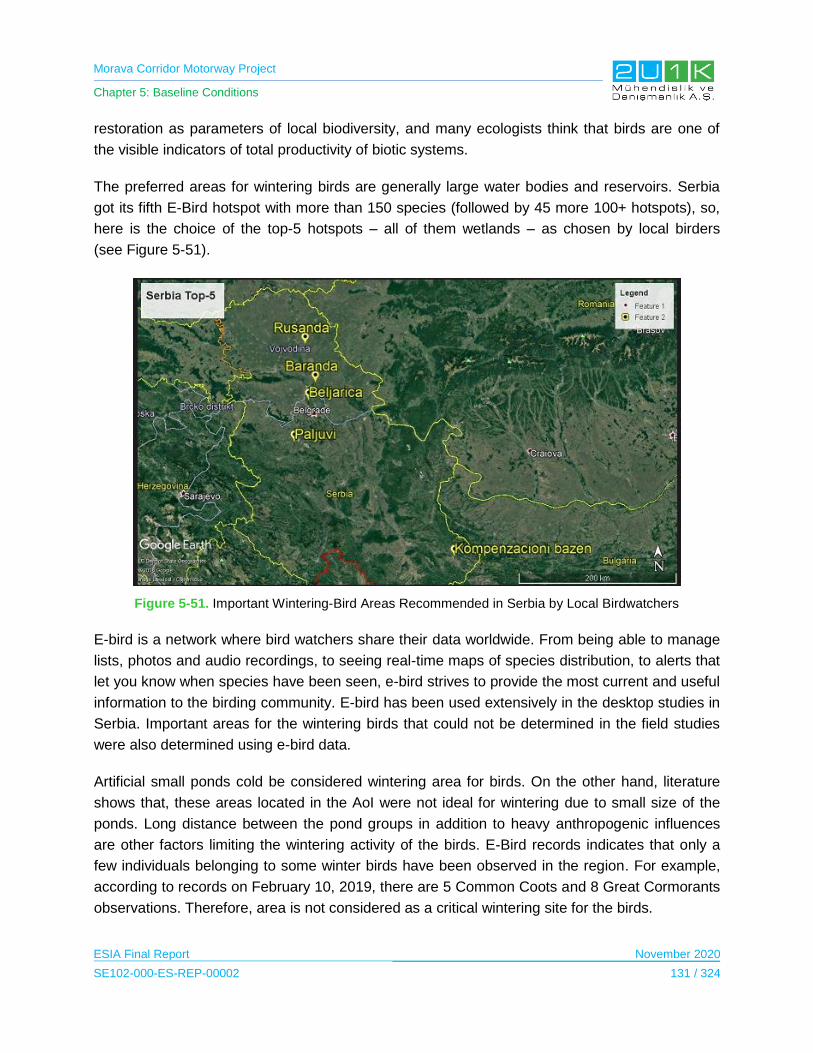
Morava Corridor Motorway Project
Chapter 5: Baseline Conditions
ESIA Final Report November 2020
SE102-000-ES-REP-00002 131 / 324
restoration as parameters of local biodiversity, and many ecologists think that birds are one of
the visible indicators of total productivity of biotic systems.
The preferred areas for wintering birds are generally large water bodies and reservoirs. Serbia
got its fifth E-Bird hotspot with more than 150 species (followed by 45 more 100+ hotspots), so,
here is the choice of the top-5 hotspots – all of them wetlands – as chosen by local birders
(see Figure 5-51).
Figure 5-51. Important Wintering-Bird Areas Recommended in Serbia by Local Birdwatchers
E-bird is a network where bird watchers share their data worldwide. From being able to manage
lists, photos and audio recordings, to seeing real-time maps of species distribution, to alerts that
let you know when species have been seen, e-bird strives to provide the most current and useful
information to the birding community. E-bird has been used extensively in the desktop studies in
Serbia. Important areas for the wintering birds that could not be determined in the field studies
were also determined using e-bird data.
Artificial small ponds cold be considered wintering area for birds. On the other hand, literature
shows that, these areas located in the AoI were not ideal for wintering due to small size of the
ponds. Long distance between the pond groups in addition to heavy anthropogenic influences
are other factors limiting the wintering activity of the birds. E-Bird records indicates that only a
few individuals belonging to some winter birds have been observed in the region. For example,
according to records on February 10, 2019, there are 5 Common Coots and 8 Great Cormorants
observations. Therefore, area is not considered as a critical wintering site for the birds.

Morava Corridor Motorway Project
Chapter 5: Baseline Conditions
ESIA Final Report November 2020
SE102-000-ES-REP-00002 132 / 324
Table 5-64. Bird Species Identified in the Studies
Family Code Scientific Name English Name IUCN BERN CITES Bird Directive National
Regulation Source
Podicipedidae 70
Tachybaptus ruficollis
Little Grebe LC ANN-II - - - HS,L,FO
90 Podiceps cristatus Great Crested Grebe LC ANN-III - - ANN-I HS,L,FO
Phalacrocoracidae 720 Phalacrocorax carbo Great Cormorant LC Ann-III - - - HS,L,FO,eB
Ardeidae
950 Botaurus stellaris Eurasian Bittern LC ANN-II - ANN-I ANN-I HS,L,FO
1190 Egretta garzetta Little Egret LC ANN-II - ANN-I ANN-I HS,A,L,FO
1210 Ardea alba Great White Egret LC ANN-II - ANN-I - HS,A,L,FO,e
B
1220 Ardea cinerea Grey Heron LC Ann-III - - ANN-II HS,A,L,FO
Ciconiidae 1310 Ciconia nigra Black Stork LC ANN-II ANN-II ANN-I ANN-I HS,A,L,FO
1340 Ciconia ciconia White Stork LC ANN-II - ANN-I ANN-I HS,A,L,FO
Anatidae 1840 Anas crecca Teal LC Ann-III - ANN-II-A,ANN-III-B ANN-II HS,L,FO
1860 Anas platyrhynchos Mallard LC Ann-III - ANN-II-A, ANN-III-A ANN-II HS,L,FO,eB
Accipitridae
2310 Pernis apivorus Honey Buzzard LC ANN-II - ANN-I ANN-I HS,L,FO
2380 Milvus migrans Black Kite LC ANN-II - ANN-I ANN-I HS,L,FO
2390 Milvus milvus Red Kite NT ANN-II - ANN-I ANN-I HS,L,FO
2560 Circaetus gallicus Short-Toed Eagle LC ANN-II - ANN-I ANN-I HS,L,FO
2600 Circus aeruginosus Marsh Harrier LC ANN-II - ANN-I ANN-I HS,L,FO
2690 Accipiter nisus Sparrowhawk LC ANN-II - ANN-I ANN-I HS,L,FO
2870 Buteo buteo Buzzard LC ANN-II - - ANN-I HS,A,L,FO,e
B
2880 Buteo rufinus Long-Legged
Buzzard LC ANN-II - ANN-I ANN-I HS,A,L,FO
2920 Clanga pomarina Lesser Spotted
Eagle LC ANN-II - ANN-I - HS,L,FO
2950 Aquila heliaca Imperial Eagle VU ANN-II ANN-I ANN-I ANN-I HS,L,FO
2960 Aquila chrysaetos Golden Eagle LC ANN-II - ANN-I ANN-I HS,L,FO
2980 Hieraaetus pennatus Booted Eagle LC ANN-II - ANN-I ANN-I HS,L,FO
Falconidae 3040 Falco tinnunculus Kestrel LC ANN-II - - ANN-I HS,L,FO
3070 Falco vespertinus Red-Footed Falcon NT ANN-II - ANN-I ANN-I HS,L,FO
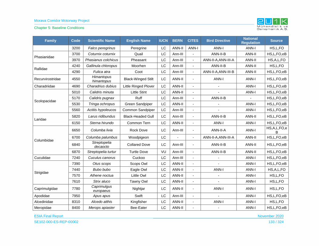
Morava Corridor Motorway Project
Chapter 5: Baseline Conditions
ESIA Final Report November 2020
SE102-000-ES-REP-00002 133 / 324
Family Code Scientific Name English Name IUCN BERN CITES Bird Directive National
Regulation Source
3200 Falco peregrinus Peregrine LC ANN-II ANN-I ANN-I ANN-I HS,L,FO
Phasianidae 3700 Coturnix coturnix Quail LC Ann-III - ANN-II-B ANN-II HS,L,FO,eB
3970 Phasianus colchicus Pheasant LC Ann-III - ANN-II-A,ANN-III-A ANN-II HS,A,L,FO
Rallidae 4240 Gallinula chloropus Moorhen LC Ann-III - ANN-II-B ANN-II HS,L,FO
4290 Fulica atra Coot LC Ann-III - ANN-II-A,ANN-III-B ANN-II HS,L,FO,eB
Recurvirostridae 4550 Himantopus himantopus
Black-Winged Stilt LC ANN-II - ANN-I ANN-I HS,L,FO,eB
Charadriidae 4690 Charadrius dubius Little Ringed Plover LC ANN-II - - ANN-I HS,L,FO,eB
Scolopacidae
5010 Calidris minuta Little Stint LC ANN-II - - ANN-I HS,L,FO,eB
5170 Calidris pugnax Ruff LC Ann-III - ANN-II-B - HS,L,FO,eB
5530 Tringa ochropus Green Sandpiper LC ANN-II - - ANN-I HS,L,FO,eB
5560 Actitis hypoleucos Common Sandpiper LC Ann-III - - ANN-I HS,L,FO,eB
Laridae 5820 Larus ridibundus Black-Headed Gull LC Ann-III - ANN-II-B ANN-II HS,L,FO,eB
6150 Sterna hirundo Common Tern LC ANN-II - ANN-I ANN-I HS,L,FO,eB
Columbidae
6650 Columba livia Rock Dove LC Ann-III - ANN-II-A ANN-I HS,A,L,FO,e
B
6700 Columba palumbus Woodpigeon LC - - ANN-II-A,ANN-III-A ANN-II HS,L,FO,eB
6840 Streptopelia
decaocto Collared Dove LC Ann-III - ANN-II-B ANN-II HS,L,FO,eB
6870 Streptopelia turtur Turtle Dove VU Ann-III - ANN-II-B ANN-II HS,L,FO,eB
Cuculidae 7240 Cuculus canorus Cuckoo LC Ann-III - - ANN-I HS,L,FO,eB
Strigidae
7390 Otus scops Scops Owl LC ANN-II - - ANN-I HS,L,FO,eB
7440 Bubo bubo Eagle Owl LC ANN-II - ANN-I ANN-I HS,A,L,FO
7570 Athene noctua Little Owl LC ANN-II - - ANN-I HS,L,FO
7610 Strix aluco Tawny Owl LC ANN-II - - ANN-I HS,L,FO
Caprimulgidae 7780 Caprimulgus europaeus
Nightjar LC ANN-II - ANN-I ANN-I HS,L,FO
Apodidae 7950 Apus apus Swift LC Ann-III - - ANN-I HS,L,FO,eB
Alcedinidae 8310 Alcedo atthis Kingfisher LC ANN-II - ANN-I ANN-I HS,L,FO
Meropidae 8400 Merops apiaster Bee-Eater LC ANN-II - - ANN-I HS,L,FO,eB

Morava Corridor Motorway Project
Chapter 5: Baseline Conditions
ESIA Final Report November 2020
SE102-000-ES-REP-00002 134 / 324
Family Code Scientific Name English Name IUCN BERN CITES Bird Directive National
Regulation Source
Upupidae 8460 Upupa epops Eurasian Hoopoe LC ANN-II - - ANN-I HS,L,FO,eB
Picidae
8550 Picus canus Grey-Headed Woodpecker
LC ANN-II - ANN-I ANN-I HS,A,L,FO,e
B
8630 Dryocopus martius Black Woodpecker LC ANN-II - ANN-I ANN-I HS,L,FO,eB
8760 Dendrocopos major Great-Spotted Woodpecker
LC ANN-II - ANN-I ANN-I HS,L,FO,eB
Alaudidae
9720 Galerida cristata Crested Lark LC Ann-III - - ANN-I HS,L,FO,eB
9740 Lullula arborea Woodlark LC Ann-III - ANN-I ANN-I HS,L,FO,eB
9760 Alauda arvensis Skylark LC Ann-III - ANN-II-B ANN-I HS,L,FO,eB
Hirundinidae 9920 Hirundo rustica Swallow LC ANN-II - - ANN-I HS,L,FO,eB
10010 Delichon urbicum House Martin LC ANN-II - - ANN-I HS,L,FO,eB
Motacillidae
10090 Anthus trivialis Tree Pipit LC ANN-II - - ANN-I HS,L,FO,eB
10170 Motacilla flava Yellow Wagtail LC ANN-II - - ANN-I HS,L,FO
10190 Motacilla cinerea Grey Wagtail LC ANN-II - - ANN-I HS,L,FO,eB
10200 Motacilla alba Pied Wagtail LC ANN-II - - ANN-I HS,L,FO,eB
Troglodytidae 10660 Troglodytes troglodytes
Wren, Winter Wren LC ANN-II - ANN-I - HS,L,FO,eB
Muscicapidae
10990 Erithacus rubecula Robin LC ANN-II - - - HS,L,FO,eB
11040 Luscinia
megarhynchos Nightingale LC ANN-II - - - HS,L,FO,eB
11210 Phoenicurus
ochruros Black Redstart LC ANN-II - - - HS,L,FO
11220 Phoenicurus phoenicurus
Redstart LC ANN-II - - - HS,L,FO,eB
11390 Saxicola torquata Stonechat LC ANN-II - - - HS,L,FO
11460 Oenanthe oenanthe Northern Wheatear LC ANN-II - - - HS,L,FO,eB
11480 Oenanthe hispanica Black-Eared
Wheatear LC ANN-II - - - HS,L,FO,eB
11660 Monticola solitarius Blue Rock Thrush LC ANN-II - - - HS,L,FO,eB
13350 Muscicapa striata Spotted flycatcher LC ANN-II - - ANN-I HS,L,FO,eB
Turdidae 11870 Turdus merula Blackbird LC Ann-III - ANN-II-B ANN-I HS,A,L,FO,e
B
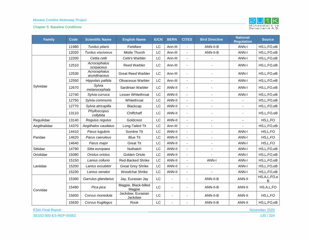
Morava Corridor Motorway Project
Chapter 5: Baseline Conditions
ESIA Final Report November 2020
SE102-000-ES-REP-00002 135 / 324
Family Code Scientific Name English Name IUCN BERN CITES Bird Directive National
Regulation Source
11980 Turdus pilaris Fieldfare LC Ann-III - ANN-II-B ANN-I HS,L,FO,eB
12020 Turdus viscivorus Mistle Thursh LC Ann-III - ANN-II-B ANN-I HS,L,FO,eB
Sylviidae
12200 Cettia cetti Cetti's Warbler LC Ann-III - - ANN-I HS,L,FO,eB
12510 Acrocephalus
scirpaceus Reed Warbler LC Ann-III - - ANN-I HS,L,FO,eB
12530 Acrocephalus arundinaceus
Great Reed Warbler LC Ann-III - - ANN-I HS,L,FO,eB
12550 Hippolais pallida Olivaceous Warbler LC Ann-III - - ANN-I HS,L,FO,eB
12670 Sylvia
melanocephala Sardinian Warbler LC ANN-II - - ANN-I HS,L,FO,eB
12740 Sylvia curruca Lesser Whitethroat LC ANN-II - - ANN-I HS,L,FO,eB
12750 Sylvia communis Whitethroat LC ANN-II - - - HS,L,FO,eB
12770 Sylvia atricapilla Blackcap LC ANN-II - - - HS,L,FO,eB
13110 Phylloscopus
collybita Chiffchaff LC ANN-II - - - HS,L,FO,eB
Reguliidae 13140 Regulus regulus Goldcrest LC ANN-II - - - HS,L,FO
Aegithalidae 14370 Aegithalos caudatus Long-Tailed Tit LC Ann-III - - - HS,L,FO,eB
Paridae
14410 Parus lugubris Sombre Tit LC ANN-II - - ANN-I HS,L,FO
14620 Parus caeruleus Blue Tit LC ANN-II - - ANN-I HS,L,FO
14640 Parus major Great Tit LC ANN-II - - ANN-I HS,L,FO
Sittidae 14790 Sitta europaea Nuthatch LC ANN-II - - ANN-I HS,L,FO,eB
Oriolidae 15080 Oriolus oriolus Golden Oriole LC ANN-II - - ANN-I HS,L,FO,eB
Laniidae
15150 Lanius collurio Red-Backed Shrike LC ANN-II - ANN-I ANN-I HS,L,FO,eB
15200 Lanius excubitor Great Grey Shrike LC ANN-II - - ANN-I HS,L,FO,eB
15230 Lanius senator Woodchat Shrike LC ANN-II - - ANN-I HS,L,FO,eB
Corvidae
15390 Garrulus glandarius Jay, Eurasian Jay LC - - ANN-II-B ANN-II HS,A,L,FO,e
B
15490 Pica pica Magpie, Black-billed
Magpie LC - - ANN-II-B ANN-II HS,A,L,FO
15600 Corvus monedula Jackdaw, Eurasian
Jackdaw LC - - ANN-II-B ANN-II HS,L,FO
15630 Corvus frugilegus Rook LC - - ANN-II-B ANN-II HS,L,FO,eB

Morava Corridor Motorway Project
Chapter 5: Baseline Conditions
ESIA Final Report November 2020
SE102-000-ES-REP-00002 136 / 324
Family Code Scientific Name English Name IUCN BERN CITES Bird Directive National
Regulation Source
15670 Corvus cornix Hooded Crow LC - - ANN-II-B ANN-II HS,L,FO
15720 Corvus corax Raven LC Ann-III - - ANN-II HS,A,L,FO
Sturnidae 15820 Sturnus vulgaris Starling LC - - ANN-II-B - HS,A,L,FO,e
B
Passeridae
15910 Passer domesticus House Sparrow LC - - - ANN-II HS,A,L,FO,e
B
15920 Passer
hispaniolensis Spanish Sparrow LC Ann-III - - ANN-I
HS,A,L,FO,eB
15980 Passer montanus Tree Sparrow LC Ann-III - - ANN-II HS,L,FO
Fringillidae
16360 Fringilla coelebs Chaffinch LC Ann-III - ANN-I ANN-I HS,L,FO,eB
16400 Serinus serinus Serin LC ANN-II - - ANN-I HS,L,FO
16490 Carduelis chloris Greenfinch LC ANN-II - - ANN-I HS,L,FO
16530 Carduelis carduelis Goldfinch LC ANN-II - - ANN-I HS,L,FO,eB
16540 Carduelis spinus Siskin LC ANN-II - - ANN-I HS,L,FO
Emberizidae
18580 Emberiza cirlus Cirl Bunting LC ANN-II - - ANN-I HS,L,FO,eB
18660 Emberiza hortulana Ortolan LC Ann-III - ANN-I ANN-I HS,L,FO
18810 Emberiza
melanocephala Black-Headed
Bunting LC ANN-II - - ANN-I HS,L,FO,eB
18820 Miliaria calandra Corn Bunting LC Ann-III - - - HS,L,FO,eB
* HS: Habitat Suitability, A: Survey with Local People and Local Expert, L: Literature, FO: Field Observation, eB:eBird

Morava Corridor Motorway Project
Chapter 5: Baseline Conditions
ESIA Final Report November 2020
SE102-000-ES-REP-00002 137 / 324
Mammals
A total of 50 mammal species belonging to 7 ordo, 15 families were identified as a result of
literature and field studies. These mammal species are widely spread in Serbia and Europe and
are not endemic.
Of the 50 mammal species, 13 belong to medium and large-sized mammals and 37 belong to
small mammals.
According to the IUCN Red List, the mammal species those have been identified in the project
area are in 45 of them the category "LC: Least Concern”, 1 of them “DD= Data Deficient”, 3 of
them is “NT= Near Threatened” these are Rhinolophus Euryale, Myotis bechsteinii and Lutra
lutra (=Eurasian otter) and 1 of them VU= “Vulnerable” that is Myotis capaccinii (=Long-fingered
Bat) and no mammal species classified as dangerous and/or threatened (CR-EN)
(see Table 5-66)
16 of the mammal species are listed as strictly protected fauna species in Annex 2 of the Bern
Convention. In addition, 14 species, together with a few exceptions, "protected fauna species"
covering most of the species not included in Annex 2, are listed in Annex 3 of the Bern
Convention. The remaining 20 species are not included in the lists of the Bern Convention.
According to the CITES, 1 species listed in Annex-II and 3 species listed in Annex-III.
According to the Habitat Directive, 7 species listed in both Annex-II and Annex IV and 4 species
listed in Annex-IV.
According to the National legislation, 33 of the mammal species are listed as strictly protected
(Ann-I). And 1 species listed as protected species (Ann-II). The local EIA reports indicate the
protection status of the mammal species. On the other hand, local EIA reports concluded that
these species are not concentrated in the project AoI. Therefore, project does not pose any risk
to these species.
Table 5-65. Conservation Status of Mammals
IUCN BERN CITES Habitat Directive National
Regulation
CR EN VU NT LC DD NE Ann-II Ann-III Ann-I Ann-II Ann-III Ann-II,IV Ann-IV Ann-I Ann-II
- - - 1 45 1 - 16 14 - 1 3 7 4 33 1

Morava Corridor Motorway Project
Chapter 5: Baseline Conditions
ESIA Final Report November 2020
SE102-000-ES-REP-00002 138 / 324
The survey indicates potential Bat species uses the area only for feeding purposes. During the
surveys, no permanent bat-roost, which can be impacted by project units or activities are
identified.
According to available data and knowledge in Serbia there are 2 potential invasive species of
mammals recorded: Ondatra zibethicus – muskrat and Myocastor coypus – nutria (Coypu).
Ondatra zibethicus is from North America. It inhabits coastal habitats of fresh and slow flowing
waters, ponds, swamps, lakes, fisheries and canals with dense coastal vegetation, and mountain
areas. In Serbia it is present in northern and central parts, and rarely in southern parts (part of
the South Morava River basin and Vlasina accumulation). It is present along all major and minor
watercourses along Danube, Sava, Great Morava, Tisa and DTD channel in Vojvodina. There
are also reports from Lim, Ibar and the West Morava River. Muskrat is potentially invasive
species.
It is possible that it has competitive relationship with European water vole (Arvicola amphibius),
autochthones species. Though insignificant according to current knowledge, there is digging
activity of the species present which creates some damage on river dams and dykes along
channels and rivers. In large abundances it can cause damages on agriculture in the vicinity of
lair, even though its nutrition is primarily based on hydrophilic and aquatic plants. Animal
nutrition is also present, but occasionally and of smaller percentage in total nutrition intake. It is
made of fish, fish eggs, snails, river shells, freshwater crustaceans, and according to some
reports even smaller poultry and juvenile birds.
Nutria (Myocastor coypus) comes from South America. It is adapted to semi aquatic life, and it
inhabits rivers, streams, lakes, and puddle areas, natural and artificial wetlands with developed
coastal vegetation. In Serbia it is present in Srem and Banat along Danube (Vojvodina), conflux
of rivers Great Morava, Mlava and Pek into Danube, and occasionally along Tisa River. Species
is potentially invasive. Outside of natural habitat and for short time it can grow in abundant
numbers, causing damages to crops, drainage systems and to autochthonous plants. Therefore
introduced populations are usually regarded as pest. Species can serve as vector for larger
number of infections for different animal species, and in some cases for humans: leptospirosis,
salmonellosis, pastelosis, botulism, some virus and fungal infections and parasitic infections
such as toxoplasmosis.
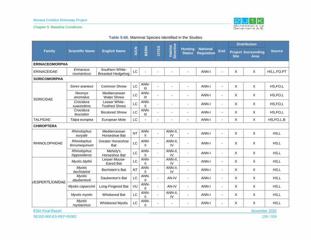
Morava Corridor Motorway Project
Chapter 5: Baseline Conditions
ESIA Final Report November 2020
SE102-000-ES-REP-00002 139 / 324
Table 5-66. Mammal Species Identified in the Studies
Family Scientific Name English Name
IUC
N
BE
RN
CIT
ES
Hab
ita
t
Dir
ec
tiv
e
Hunting Status
National Regulation
End.
Distribution
Source Project Site
Sorrounding Area
ERINACEOMORPHA
ERINACEIDAE Erinaceus
roumanicus Southern White-
Breasted Hedgehog LC - - - - ANN-I - X X HS,L,FO,PT
SORICOMORPHA
SORICIDAE
Sorex araneus Common Shrew LC ANN-
III - - - ANN-I - X X HS,FO,L
Neomys anomalus
Mediterranean Water Shrew
LC ANN-
III - - - ANN-I - X X HS,FO,L
Crocidura suaveolens
Lesser White-Toothed Shrew
LC ANN-
II - - - ANN-I - X X HS,FO,L
Crocidura leucodon
Bicolored Shrew LC ANN-
III - - - ANN-I - X X HS,FO,L
TALPIDAE Talpa europea European Mole LC - - - - ANN-I - X X HS,FO,L,B
CHIROPTERA
RHINOLOPHIDAE
Rhinolophus euryale
Mediterranean Horseshoe Bat
NT ANN-
II -
ANN-II, IV
- ANN-I - X X HS,L
Rhinolophus ferrumequinum
Greater Horseshoe Bat
LC ANN-
II -
ANN-II, IV
- ANN-I - X X HS,L
Rhinolophus hipposideros
Mehely's Horseshoe Bat
LC ANN-
II -
ANN-II, IV
- ANN-I - X X HS,L
VESPERTİLİONİDAE
Myotis blythii Lesser Mouse-
Eared Bat LC
ANN-II
- ANN-II,
IV - ANN-I - X X HS,L
Myotis bechsteinii
Bechstein's Bat NT ANN-
II -
ANN-II, IV
- ANN-I - X X HS,L
Myotis daubentonii
Daubenton's Bat LC ANN-
II - AN-IV - ANN-I - X X HS,L
Myotis capaccinii Long-Fingered Bat VU ANN-
II - AN-IV - ANN-I - X X HS,L
Myotis myotis Whiskered Bat LC ANN-
II -
ANN-II, IV
- ANN-I - X X HS,L
Myotis mystacinus
Whiskered Myotis LC ANN-
II - - - ANN-I - X X HS,L
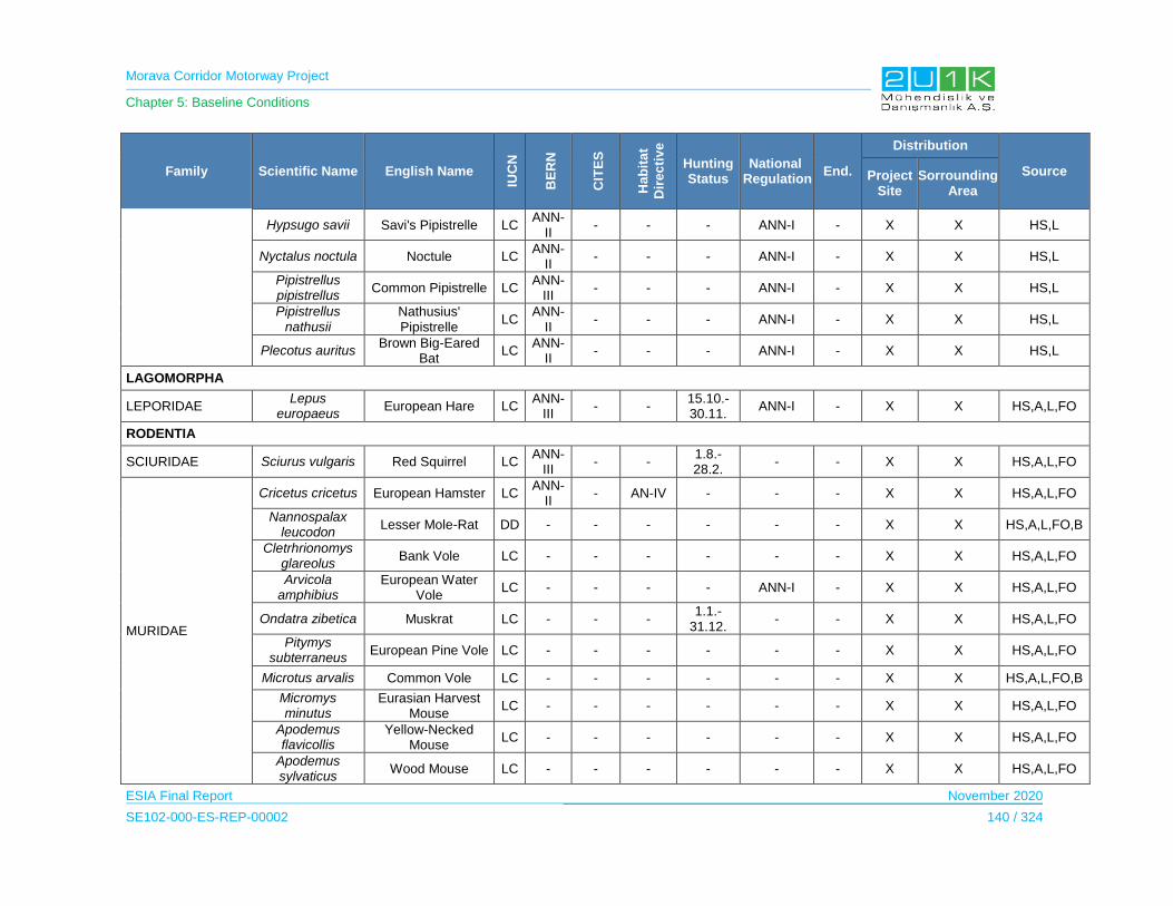
Morava Corridor Motorway Project
Chapter 5: Baseline Conditions
ESIA Final Report November 2020
SE102-000-ES-REP-00002 140 / 324
Family Scientific Name English Name
IUC
N
BE
RN
CIT
ES
Hab
ita
t
Dir
ec
tiv
e
Hunting Status
National Regulation
End.
Distribution
Source Project Site
Sorrounding Area
Hypsugo savii Savi's Pipistrelle LC ANN-
II - - - ANN-I - X X HS,L
Nyctalus noctula Noctule LC ANN-
II - - - ANN-I - X X HS,L
Pipistrellus pipistrellus
Common Pipistrelle LC ANN-
III - - - ANN-I - X X HS,L
Pipistrellus nathusii
Nathusius' Pipistrelle
LC ANN-
II - - - ANN-I - X X HS,L
Plecotus auritus Brown Big-Eared
Bat LC
ANN-II
- - - ANN-I - X X HS,L
LAGOMORPHA
LEPORIDAE Lepus
europaeus European Hare LC
ANN-III
- - 15.10.-30.11.
ANN-I - X X HS,A,L,FO
RODENTIA
SCIURIDAE Sciurus vulgaris Red Squirrel LC ANN-
III - -
1.8.-28.2.
- - X X HS,A,L,FO
MURIDAE
Cricetus cricetus European Hamster LC ANN-
II - AN-IV - - - X X HS,A,L,FO
Nannospalax leucodon
Lesser Mole-Rat DD - - - - - - X X HS,A,L,FO,B
Cletrhrionomys glareolus
Bank Vole LC - - - - - - X X HS,A,L,FO
Arvicola amphibius
European Water Vole
LC - - - - ANN-I - X X HS,A,L,FO
Ondatra zibetica Muskrat LC - - - 1.1.-
31.12. - - X X HS,A,L,FO
Pitymys subterraneus
European Pine Vole LC - - - - - - X X HS,A,L,FO
Microtus arvalis Common Vole LC - - - - - - X X HS,A,L,FO,B
Micromys minutus
Eurasian Harvest Mouse
LC - - - - - - X X HS,A,L,FO
Apodemus flavicollis
Yellow-Necked Mouse
LC - - - - - - X X HS,A,L,FO
Apodemus sylvaticus
Wood Mouse LC - - - - - - X X HS,A,L,FO

Morava Corridor Motorway Project
Chapter 5: Baseline Conditions
ESIA Final Report November 2020
SE102-000-ES-REP-00002 141 / 324
Family Scientific Name English Name
IUC
N
BE
RN
CIT
ES
Hab
ita
t
Dir
ec
tiv
e
Hunting Status
National Regulation
End.
Distribution
Source Project Site
Sorrounding Area
Apodemus agrarius
Striped Field Mouse LC - - - - - - X X HS,A,L,FO
Rattus rattus Black Rat LC - - - - - - X X HS,A,L,FO
Rattus norvegicus
Brown Rat LC - - - - - - X X HS,A,L,FO
Mus musculus House Mouse LC - - - - - - X X HS,A,L,FO
GLIRIDAE
Glis glis Edible Dormouse LC ANN-
III - -
1.8.-28.2
ANN-I - X X HS,A,L,FO
Dryomys nitedula
Forest Dormouse LC ANN-
III - - - ANN-I - X X HS,A,L,FO
MYOCASTORIDAE Myocastor
coypus Coypu LC - - - - - - X X HS,A,L,FO
CARNIVORA
CANIDAE
Canis aureus Golden Jackal LC - ANN-
III -
1.1.-31.12.
ANN-I - X X HS,A,FO,PT
Vulpes vulpes Red Fox LC - ANN-
III -
1.1.-31.12
ANN-I - X X HS,A,FO,PT
MUSTELIDAE
Mustela nivalis Least Weasel LC ANN-
III - -
Forbiden
ANN-I - X X HS,A,FO
Mustela putorius European Polecat LC ANN-
III - -
Forbiden
ANN-I - X X HS,A,FO
Martes foina Beech Marten LC ANN-
III ANN-
III -
1.10.-28.02.
ANN-I - X X HS,A,FO,PT
Meles meles European Badger LC ANN-
III - -
1.07.-28.02.
ANN-I - X X HS,A,FO,PT
Lutra lutra Eurasian Otter NT ANN-
II -
ANN-II, IV
Forbiden
ANN-I - X X HS,A,L
FELIDAE Felis silvestris Wildcat LC ANN-
II ANN-
II AN-IV - ANN-I - X X HS,A,FO
ARTRIODACTYLA
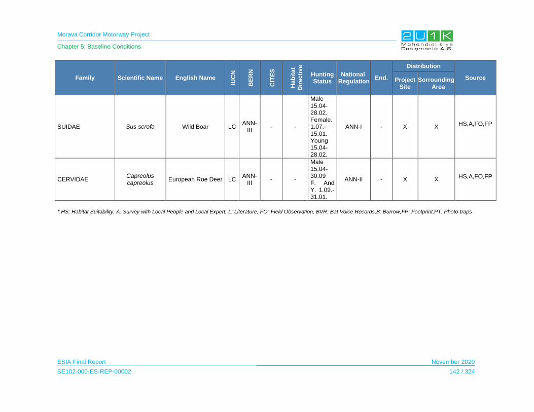
Morava Corridor Motorway Project
Chapter 5: Baseline Conditions
ESIA Final Report November 2020
SE102-000-ES-REP-00002 142 / 324
Family Scientific Name English Name
IUC
N
BE
RN
CIT
ES
Hab
ita
t
Dir
ec
tiv
e
Hunting Status
National Regulation
End.
Distribution
Source Project Site
Sorrounding Area
SUIDAE Sus scrofa Wild Boar LC ANN-
III - -
Male 15.04-28.02. Female. 1.07.-15.01. Young 15.04-28.02.
ANN-I - X X HS,A,FO,FP
CERVIDAE Capreolus capreolus
European Roe Deer LC ANN-
III - -
Male 15.04-30.09 F. And Y. 1.09.-31.01.
ANN-II - X X HS,A,FO,FP
* HS: Habitat Suitability, A: Survey with Local People and Local Expert, L: Literature, FO: Field Observation, BVR: Bat Voice Records,B: Burrow,FP: Footprint,PT. Photo-traps

Morava Corridor Motorway Project
Chapter 5: Baseline Conditions
ESIA Final Report November 2020
SE102-000-ES-REP-00002 143 / 324
5.8.3.4 Aquatic Ecosystems
Streams / rivers located within the boundaries of Kruševac, Kragujevac and Čačak Provinces
are found in the Morava River Basin. All of the river crossing points in the Proposed Motorway
Route is known as the West Morava River.
14 species (Alburnus alburnus, Alburnoides bipunctatus, Barbus barbus, Barbus balcanicus,
Carassius auratus, Carassius carassius, Cyprinus carpio, Gambusia holbrooki, Leuciscus idus,
Pesudorasbora parva, Sander lucioperca, Squalius cephalus, Esox lucius, Cobitis elongate)
belonging to the Cyprinidae (Carp), Cobitidae (Spine Loach) and Esocidae (Pike-Perch),
Percidae (European Perch), Poecilidae (Poeciliids) families were identified as a result of
literature and field studies
Within the ichthyofauna, 6 species (Carassius aurata, Ctenopharyngodon idella, Gambusia
holbrooki, Lepomis gibbosus, Oncorhynchus mykiss, Pseudorasbora parva) are known as exotic
species. One of the species, Cyprinus carpio (Wild Carp) is classified as ‘Vulnerable Species-
VU’ due to the IUCN Red List.
7 species (Alburnoides bipunctatus, Alburnus chalcoides, Chondrostoma nasus, Cobitis
elongate, Leucaspius delineates, Romanogobio uranoscopus, Silurus glanis) are protected
under Bern Convention, Annex III. The freshwater fish species living in the Morava River Basin
are listed in below according to the literature, local people and observation.
None of the fish species are listed in CITES and EU Habitat Directive.
According to the National legislation, 4 of the fish species listed as strictly protected (Ann-I). 9
species listed as protected species (Ann-II), as specified in Table 5-68. The local EIA reports
indicate the protection status of the fish species. On the other hand, local EIA reports also
concluded that these species are not concentrated in the project AoI. Therefore, project does not
pose any risk to these species.
Within the macrobenthic organisms, Hirudo medicinalis is classified as ‘Near Threatened
Species-NT’,Astacus astacus classified as ‘Vulnerable-VU’ and Unio crassus classified as
‘Endangered-EN’ due to the IUCN Red List.
According to the National legislation, 2 of the macrobenthic species listed as strictly protected
(Ann-I). Hirundo medicinalis species listed as protected species (Ann-II), as specified in
Table 5-69. Same as the fish species, the local EIAs concluded the project has no major impact
on macrobentic species.
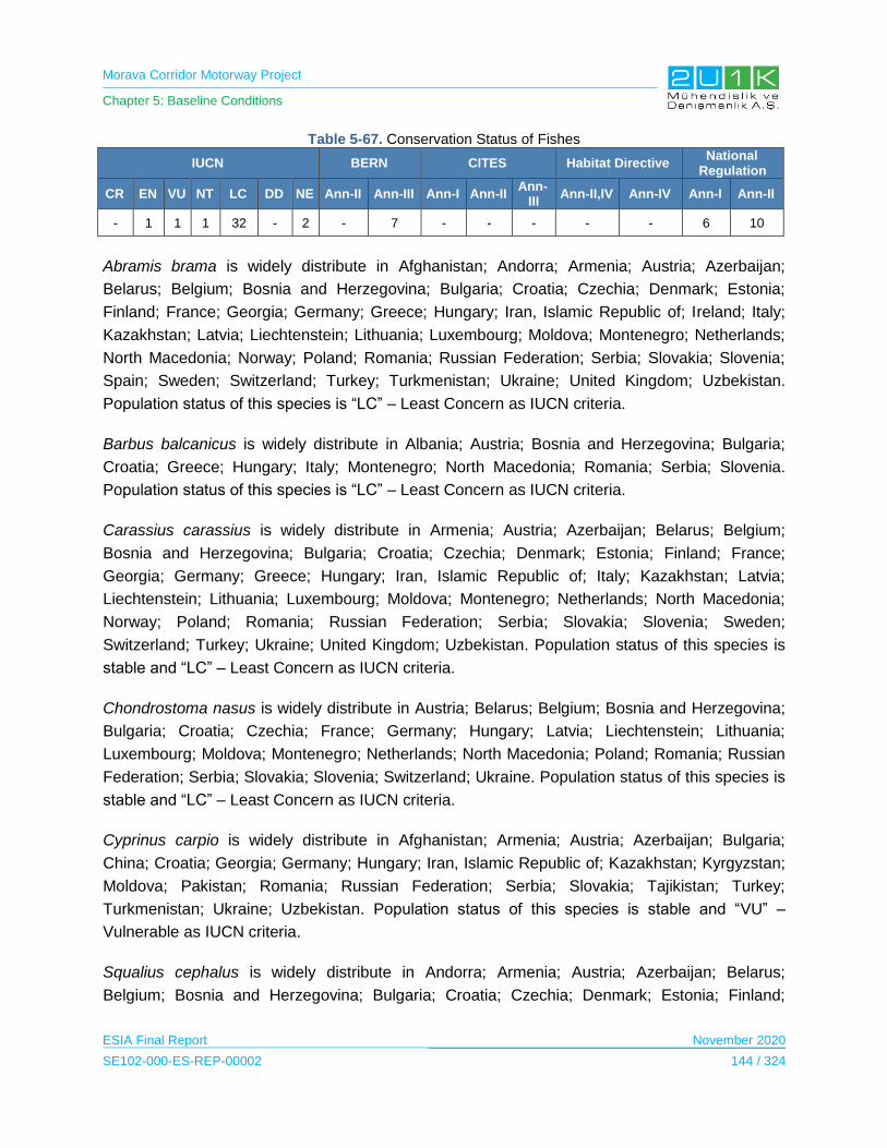
Morava Corridor Motorway Project
Chapter 5: Baseline Conditions
ESIA Final Report November 2020
SE102-000-ES-REP-00002 144 / 324
Table 5-67. Conservation Status of Fishes
IUCN BERN CITES Habitat Directive National
Regulation
CR EN VU NT LC DD NE Ann-II Ann-III Ann-I Ann-II Ann-
III Ann-II,IV Ann-IV Ann-I Ann-II
- 1 1 1 32 - 2 - 7 - - - - - 6 10
Abramis brama is widely distribute in Afghanistan; Andorra; Armenia; Austria; Azerbaijan;
Belarus; Belgium; Bosnia and Herzegovina; Bulgaria; Croatia; Czechia; Denmark; Estonia;
Finland; France; Georgia; Germany; Greece; Hungary; Iran, Islamic Republic of; Ireland; Italy;
Kazakhstan; Latvia; Liechtenstein; Lithuania; Luxembourg; Moldova; Montenegro; Netherlands;
North Macedonia; Norway; Poland; Romania; Russian Federation; Serbia; Slovakia; Slovenia;
Spain; Sweden; Switzerland; Turkey; Turkmenistan; Ukraine; United Kingdom; Uzbekistan.
Population status of this species is “LC” – Least Concern as IUCN criteria.
Barbus balcanicus is widely distribute in Albania; Austria; Bosnia and Herzegovina; Bulgaria;
Croatia; Greece; Hungary; Italy; Montenegro; North Macedonia; Romania; Serbia; Slovenia.
Population status of this species is “LC” – Least Concern as IUCN criteria.
Carassius carassius is widely distribute in Armenia; Austria; Azerbaijan; Belarus; Belgium;
Bosnia and Herzegovina; Bulgaria; Croatia; Czechia; Denmark; Estonia; Finland; France;
Georgia; Germany; Greece; Hungary; Iran, Islamic Republic of; Italy; Kazakhstan; Latvia;
Liechtenstein; Lithuania; Luxembourg; Moldova; Montenegro; Netherlands; North Macedonia;
Norway; Poland; Romania; Russian Federation; Serbia; Slovakia; Slovenia; Sweden;
Switzerland; Turkey; Ukraine; United Kingdom; Uzbekistan. Population status of this species is
stable and “LC” – Least Concern as IUCN criteria.
Chondrostoma nasus is widely distribute in Austria; Belarus; Belgium; Bosnia and Herzegovina;
Bulgaria; Croatia; Czechia; France; Germany; Hungary; Latvia; Liechtenstein; Lithuania;
Luxembourg; Moldova; Montenegro; Netherlands; North Macedonia; Poland; Romania; Russian
Federation; Serbia; Slovakia; Slovenia; Switzerland; Ukraine. Population status of this species is
stable and “LC” – Least Concern as IUCN criteria.
Cyprinus carpio is widely distribute in Afghanistan; Armenia; Austria; Azerbaijan; Bulgaria;
China; Croatia; Georgia; Germany; Hungary; Iran, Islamic Republic of; Kazakhstan; Kyrgyzstan;
Moldova; Pakistan; Romania; Russian Federation; Serbia; Slovakia; Tajikistan; Turkey;
Turkmenistan; Ukraine; Uzbekistan. Population status of this species is stable and “VU” –
Vulnerable as IUCN criteria.
Squalius cephalus is widely distribute in Andorra; Armenia; Austria; Azerbaijan; Belarus;
Belgium; Bosnia and Herzegovina; Bulgaria; Croatia; Czechia; Denmark; Estonia; Finland;
Morava Corridor Motorway Project
Chapter 5: Baseline Conditions
ESIA Final Report November 2020
SE102-000-ES-REP-00002 145 / 324
France; Georgia; Germany; Hungary; Iran, Islamic Republic of; Italy; Kazakhstan; Latvia;
Liechtenstein; Lithuania; Luxembourg; Moldova; Montenegro; Netherlands; North Macedonia;
Norway; Poland; Romania; Russian Federation; Serbia; Slovakia; Slovenia; Spain; Sweden;
Switzerland; Turkey; Turkmenistan; Ukraine; United Kingdom. Population status of this species
is “LC” – Least Concern as IUCN criteria.
Tinca tinca is widely distribute in Albania; Andorra; Armenia; Austria; Azerbaijan; Belarus;
Belgium; Bosnia and Herzegovina; Bulgaria; China; Croatia; Czechia; Denmark; Estonia;
Finland; France; Georgia; Germany; Gibraltar; Greece; Holy See (Vatican City State); Hungary;
Iran, Islamic Republic of; Italy; Jersey; Kazakhstan; Latvia; Liechtenstein; Lithuania;
Luxembourg; Moldova; Monaco; Mongolia; Montenegro; Netherlands; North Macedonia;
Norway; Poland; Portugal; Romania; Russian Federation; San Marino; Serbia; Slovakia;
Slovenia; Spain; Sweden; Switzerland; Turkey; Turkmenistan; Ukraine; United Kingdom;
Uzbekistan. Population status of this species is “LC” – Least Concern as IUCN criteria.
Cobitis elongata is widely distribute in Austria; Bosnia and Herzegovina; Bulgaria; Croatia;
Montenegro; North Macedonia; Romania; Serbia; Slovenia. Population status of this species is
“LC” – Least Concern as IUCN criteria.
Esox lucius is widely distribute in Albania; Austria; Belgium; Bosnia and Herzegovina; Bulgaria;
Canada; China; Croatia; Czechia; Denmark; Estonia; Finland; France; Germany; Greece;
Hungary; Ireland; Italy; Latvia; Lithuania; Luxembourg; Monaco; Mongolia; Netherlands; North
Macedonia; Norway; Poland; Romania; Russian Federation; Serbia; Slovakia; Slovenia;
Sweden; Switzerland; Turkey; Turkmenistan; Ukraine; United Kingdom; United States;
Uzbekistan. Population status of this species is stable and “LC” – Least Concern as IUCN
criteria.
Perca fluviatilis is widely distribute in Afghanistan; Albania; Andorra; Armenia; Austria;
Azerbaijan; Belarus; Belgium; Bosnia and Herzegovina; Bulgaria; China; Croatia; Czechia;
Denmark; Estonia; Finland; France; Georgia; Germany; Greece; Guernsey; Hungary; Iran,
Islamic Republic of; Ireland; Isle of Man; Italy; Jersey; Kazakhstan; Kyrgyzstan; Latvia;
Liechtenstein; Lithuania; Luxembourg; Moldova; Monaco; Mongolia; Montenegro; Netherlands;
North Macedonia; Norway; Pakistan; Poland; Romania; Russian Federation; Serbia; Slovakia;
Slovenia; Spain; Sweden; Switzerland; Tajikistan; Turkey; Turkmenistan; Ukraine; United
Kingdom; Uzbekistan. Population status of this species is “LC” – Least Concern as IUCN criteria.
Sander lucioperca is widely distribute in Afghanistan; Armenia; Austria; Azerbaijan; Belarus;
Bosnia and Herzegovina; Bulgaria; China; Croatia; Czechia; Denmark; Estonia; Finland;
Georgia; Germany; Greece; Hungary; Iran, Islamic Republic of; Italy; Kazakhstan; Kyrgyzstan;
Latvia; Lithuania; Moldova; Montenegro; North Macedonia; Norway; Pakistan; Poland; Romania;

Morava Corridor Motorway Project
Chapter 5: Baseline Conditions
ESIA Final Report November 2020
SE102-000-ES-REP-00002 146 / 324
Russian Federation; Serbia; Slovakia; Slovenia; Sweden; Switzerland; Tajikistan; Turkey;
Turkmenistan; Ukraine; Uzbekistan. Population status of this species is “LC” – Least Concern as
IUCN criteria.
Zingel zingel is widely distribute in Austria; Bosnia and Herzegovina; Bulgaria; Croatia; Czechia;
Germany; Hungary; Moldova; Montenegro; North Macedonia; Poland; Romania; Serbia;
Slovakia; Slovenia; Ukraine. Population status of this species is “LC” – Least Concern as IUCN
criteria.
Silurus glanis is widely distribute in Afghanistan; Albania; Armenia; Austria; Azerbaijan; Belarus;
Belgium; Bosnia and Herzegovina; Bulgaria; China; Croatia; Czechia; Denmark; Estonia;
Finland; France; Georgia; Germany; Greece; Hungary; Iran, Islamic Republic of; Italy;
Kazakhstan; Kyrgyzstan; Latvia; Liechtenstein; Lithuania; Luxembourg; Moldova; Montenegro;
Netherlands; North Macedonia; Pakistan; Poland; Romania; Russian Federation; Serbia;
Slovakia; Slovenia; Sweden; Switzerland; Tajikistan; Turkey; Turkmenistan; Ukraine;
Uzbekistan. Population status of this species is “LC” – Least Concern as IUCN criteria.
Hirudo medicinalis is widely distribute in Austria; Belarus; Croatia; Czechia; France; Germany;
Hungary; Latvia; Lithuania; Netherlands; Norway; Poland; Russian Federation; Slovenia;
Sweden; Switzerland; Ukraine; United Kingdom. Population status of this species is “NT” – Near
Threatened as IUCN criteria.
Unio crassus is widely distribute in Albania; Armenia; Austria; Azerbaijan; Belarus; Belgium;
Bosnia and Herzegovina; Bulgaria; Croatia; Czechia; Denmark; Estonia; Finland; France
(France (mainland)); Georgia; Germany; Greece; Hungary; Iran, Islamic Republic of; Iraq; Latvia;
Liechtenstein; Lithuania; Luxembourg; Netherlands; North Macedonia; Poland; Romania;
Russian Federation (Central European Russia); Serbia; Slovakia; Slovenia; Sweden;
Switzerland; Turkey; Ukraine. Global population status of this species is “EN” – Endangered as
IUCN criteria.
Astacus astacus is widely distribute in Andorra; Austria; Belarus; Belgium; Bosnia and
Herzegovina; Bulgaria; Croatia; Czechia; Denmark; Estonia; Finland; France; Georgia;
Germany; Greece; Hungary; Latvia; Lithuania; Moldova; Netherlands; North Macedonia; Poland;
Romania; Russian Federation (Kaliningrad); Serbia; Slovakia; Slovenia; Switzerland. Population
status of this species is “VU” – Vulnerable as IUCN criteria. Considering the literature studies
and their ecological features, Astacus astacus preferred mainly lakes, ponds and deep river
systems with slow flow and the species is mostly found at the regions close to the Danube River.
According to the SIMIC et. Al 2008, the Zeta River is given as an optimal habitat for Astacus
astacus. In the same study, West Morava River defined as poor habitat in terms of Astacus
astacus specie. On the other hand, according to the morphometric of the streams and physical,
Morava Corridor Motorway Project
Chapter 5: Baseline Conditions
ESIA Final Report November 2020
SE102-000-ES-REP-00002 147 / 324
chemical and biotic parameters, a large number of river habitats in Serbia have similar
characteristics as the Zeta river, but populations of river crayfish in those habitats are rare or
have completely disappeared (SIMIC et. Al 2008).
Ecological Water Quality of the West Morava River7
Ecological status assessment of the West Morava River was performed by using macro
invertebrates as bio indicators and taking into consideration community structure and
composition.
For saprobiological analyses, a list of bio indicator organisms according to Moog was applied
(Moog, 1995). Some taxa were not identified to the species level due to low level of confidence
and the complex identification process. The metrics calculation was performed using ASTERICS
software (AQEM, 2002). Indicative status assessment was carried out according to the national
legislation (Official Gazette of the Republic of Serbia 74/2011), based on the class boundaries
for rivers Type 2 (large rivers with medium grain-size mineral substrates, except the Pannonian
plain rivers). The recommendations provided by the EU Water Framework Directive were
applied (WFD, 2000).
According to the results of this study, it is concluded that the West Morava River is primarily
under the influence of moderate organic pollution as well as various types of hydro
morphological pressures. Therefore, an overall status of the river could be assessed as
moderate (Class III).
Detailed descriptions of sampling points are given in Biodiversity Baseline Report (see.
Appendix-7)
7 Indicative Ecological Status Assessment of the Zapadna Morava River Based on Aquatic Macroinvertebrate Community 2013
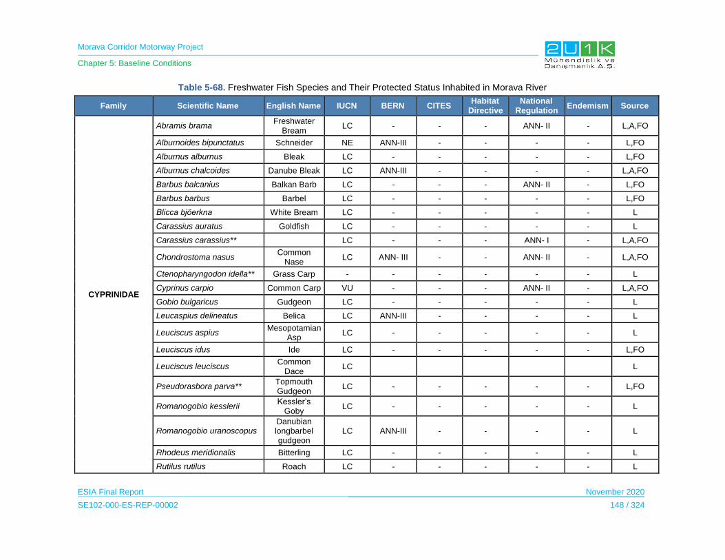
Morava Corridor Motorway Project
Chapter 5: Baseline Conditions
ESIA Final Report November 2020
SE102-000-ES-REP-00002 148 / 324
Table 5-68. Freshwater Fish Species and Their Protected Status Inhabited in Morava River
Family Scientific Name English Name IUCN BERN CITES Habitat
Directive National
Regulation Endemism Source
CYPRINIDAE
Abramis brama Freshwater
Bream LC - - - ANN- II - L,A,FO
Alburnoides bipunctatus Schneider NE ANN-III - - - - L,FO
Alburnus alburnus Bleak LC - - - - - L,FO
Alburnus chalcoides Danube Bleak LC ANN-III - - - - L,A,FO
Barbus balcanius Balkan Barb LC - - - ANN- II - L,FO
Barbus barbus Barbel LC - - - - - L,FO
Blicca bjöerkna White Bream LC - - - - - L
Carassius auratus Goldfish LC - - - - - L
Carassius carassius** LC - - - ANN- I - L,A,FO
Chondrostoma nasus Common
Nase LC ANN- III - - ANN- II - L,A,FO
Ctenopharyngodon idella** Grass Carp - - - - - - L
Cyprinus carpio Common Carp VU - - - ANN- II - L,A,FO
Gobio bulgaricus Gudgeon LC - - - - - L
Leucaspius delineatus Belica LC ANN-III - - - - L
Leuciscus aspius Mesopotamian
Asp LC - - - - - L
Leuciscus idus Ide LC - - - - - L,FO
Leuciscus leuciscus Common
Dace LC L
Pseudorasbora parva** Topmouth Gudgeon
LC - - - - - L,FO
Romanogobio kesslerii Kessler’s
Goby LC - - - - - L
Romanogobio uranoscopus Danubian longbarbel gudgeon
LC ANN-III - - - - L
Rhodeus meridionalis Bitterling LC - - - - - L
Rutilus rutilus Roach LC - - - - - L

Morava Corridor Motorway Project
Chapter 5: Baseline Conditions
ESIA Final Report November 2020
SE102-000-ES-REP-00002 149 / 324
Family Scientific Name English Name IUCN BERN CITES Habitat
Directive National
Regulation Endemism Source
Scardinius erythrophthalmus Rudd LC - - - - - L
Squalius cephalus Chub LC - - - ANN- II - L,FO
Tinca tinca Tench LC - - - ANN- I - L
Vimba vimba Vimba Bream LC - - - - - L
BALITORIDAE Barbatula barbatula Stone Loach LC - - - - - L
CENTRARCHIDAE Lepomis gibbosus* Pumpkinseed LC - - - - - L
COBITIDAE Cobitis elongata Balkan Loach LC ANN- III - - ANN- I - L,FO
ESOCIDAE Esox lucius Northen Pike LC - - - ANN- II - L,A,FO
PERCIDAE
Perca fluviatilis LC - - - ANN- II - L,A
Sander lucioperca Pike-perch LC - - - ANN- II - L,A,FO
Zingel zingel Zingel LC - - - ANN- I - L
POECILIDAE Gambusia holbrooki* Mosquitofish LC - - - - - L,FO
SALMONIDAE Oncorhynchus mykis* Rainbow trout NE - - - - - L
SILURIDAE Silurus glanis Wels Catfish LC ANN- III - - ANN- II - L,A,FO
* HS: Habitat Suitability, A: Survey with Local People and Local Expert, L: Literature, FO: Field Observation, BVR: Bat Voice Records,B: Burrow,FP: Footprint,PT. Photo-traps
**Exotic Species
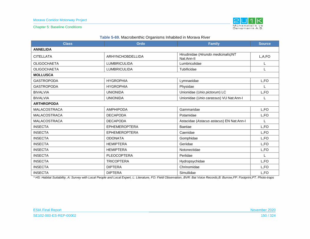
Morava Corridor Motorway Project
Chapter 5: Baseline Conditions
ESIA Final Report November 2020
SE102-000-ES-REP-00002 150 / 324
Table 5-69. Macrobenthic Organisms Inhabited in Morava River
Class Ordo Family Source
ANNELIDA
CITELLATA ARHYNCHOBDELLIDA Hirudinidae (Hirundo medicinalis)NT
Nat:Ann-II L,A,FO
OLIGOCHAETA LUMBRICULIDA Lumbriculidae L
OLIGOCHAETA LUMBRICULIDA Tubificidae L
MOLLUSCA
GASTROPODA HYGROPHIA Lymnaeidae L,FO
GASTROPODA HYGROPHIA Physidae L
BIVALVIA UNIONIDA Unionidae (Unio pictorum) LC L,FO
BIVALVIA UNIONIDA Unionidae (Unio carassus) VU Nat:Ann-I L
ARTHROPODA
MALACOSTRACA AMPHIPODA Gammaridae L,FO
MALACOSTRACA DECAPODA Potamidae L,FO
MALACOSTRACA DECAPODA Astacidae (Astacus astacus) EN Nat:Ann-I L
INSECTA EPHEMEROPTERA Baetiae L,FO
INSECTA EPHEMEROPTERA Caenidae L,FO
INSECTA ODONATA Gomphidae L,FO
INSECTA HEMIPTERA Geriidae L,FO
INSECTA HEMIPTERA Notonectidae L,FO
INSECTA PLEOCOPTERA Perlidae L
INSECTA TRICOPTERA Hydropsychidae L,FO
INSECTA DIPTERA Chrinomidae L,FO
INSECTA DIPTERA Simuliidae L,FO
* HS: Habitat Suitability, A: Survey with Local People and Local Expert, L: Literature, FO: Field Observation, BVR: Bat Voice Records,B: Burrow,FP: Footprint,PT. Photo-traps
Morava Corridor Motorway Project
Chapter 5: Baseline Conditions
ESIA Final Report November 2020
SE102-000-ES-REP-00002 151 / 324
Supplemental Biodiversity Assessment (“SBA”) including Critical habitat assessment (CHA),
Updated biodiversity impact assessment, Offset strategy and Biodiversity Management Plan
following IFC Performance Standard 6 is currently underway to more fully understand the
national and global significance of the habitats and species which may be affected, which will
enable targeted mitigation to be put in place where required. SBA will be presented in addition to
ESIA.
5.8.3.5 Ecosystem Services
Baseline condition assessment for “Ecosystem Services” is given in Chapter 5.15.3.4.
5.8.4 Sensitive Receptors
Within the AoI, terrestrial and aquatic habitats described as priority habitat according to the EU
Habitats Directive (92/43/EEC) are determined as sensitive receptors (Table 5-70)
Table 5-70. Sensitive Habitats
Habitat Code
Habitat Type Rationale
C2.3 Permanent non-tidal, smooth-flowing watercourses These habitat are described as a priority
Habitat according to the EU Habitats Directive
(92/43/EEC)
E2.1 Permanent mesotrophic pastures and aftermath-grazed meadows
G1.1 Riparian and gallery woodland, with dominant Alnus, Betula, Populus or Salix
G1.7 Thermophilous deciduous woodland
Terrestrial and aquatic flora and fauna species protected by national and international
conventions and species included in the threatened category in IUCN Red List are determined
as sensitive receptors (see Table 5-71).
Table 5-71. Sensitive Flora and Fauna Species
Species Rationale
Flora
Nuphar lutea
Regulation on Proclamation and Protection of Strictly Protected and Protected Species of Wild
Plants, Animals and Fungi (Ann-I)
Arctium lappa
Hypericum perforatum
Iris pseudoacorus
Acinos hungaricus
Lamium album
Althea officinalis
Crataegus monogyna
Rosa canina
Galium odoratum
Viola odorata
Regulation on Proclamation and Protection of Strictly Protected and Protected Species of Wild
Plants, Animals and Fungi (Ann-II)
Invertebrates Zerynhia cerisy
Evaluated as NT (Near Threatened) according to IUCN Red List
Papilio machaon Regulation on Proclamation and Protection of

Morava Corridor Motorway Project
Chapter 5: Baseline Conditions
ESIA Final Report November 2020
SE102-000-ES-REP-00002 152 / 324
Species Rationale
Pieris brassicae Strictly Protected and Protected Species of Wild Plants, Animals and Fungi
(Ann-I)
Amphibians and Reptiles
Emys orbicularis
Testudo hermanni
Darevskia praticola
Evaluated as NT (Near Threatened) according to IUCN Red List
Salamandra salamandra
Hyla arborea
Bufo bufo
Pseudepidalea viridis
Rana dalmatina
Rana graeca
Rana temporaria
Pelobates syriacus
Emys orbicularis
Ablepharus kitaibelli
Darevskia praticola
Dolichophis caspius
Natrix natrix
Natrix tessellata
Zamenis longissimus
Regulation on Proclamation and Protection of Strictly Protected and Protected Species of Wild
Plants, Animals and Fungi (Ann-I)
Pelophylax ridibundus Regulation on Proclamation and Protection of
Strictly Protected and Protected Species of Wild Plants, Animals and Fungi (Ann-II)
Birds
Aquila heliaca
Streptopelia turtur
Evaluated as NT (Near Threatened) according to IUCN Red List
Milvus milvus
Falco vespertinus
Evaluated as VU (Vulnerable) according to IUCN Red List
List of bird species was given in tables 75 species in Ann-I 19 species in Ann-II
Regulation on Proclamation and Protection of Strictly Protected and Protected Species of Wild
Plants, Animals and Fungi (Ann-I and Ann-II)
Mammals
Rhinolophus Euryale
Myotis bechsteinii
Lutra lutra
Evaluated as NT (Near Threatened) according to IUCN Red List
Myotis capaccinii Evaluated as VU (Vulnerable) according to
IUCN Red List
List of mammal species was given in tables 33 species in Ann-I
Regulation on Proclamation and Protection of Strictly Protected and Protected Species of Wild
Plants, Animals and Fungi (Ann-I)
Capreolus capreolus Regulation on Proclamation and Protection of
Strictly Protected and Protected Species of Wild Plants, Animals and Fungi (Ann-II)
Aquatic
Cyprinus carpio Evaluated as VU (Vulnerable) according to
IUCN Red List
Carassius carassius
Tinca tinca
Cobitis elongata
Zingel zingel
Unio carassus
Astacus astacus
Regulation on Proclamation and Protection of Strictly Protected and Protected Species of Wild
Plants, Animals and Fungi (Ann-I)
Abramis brama
Barbus balcanius
Chondrostoma nasus
Cyprinus carpio
Regulation on Proclamation and Protection of Strictly Protected and Protected Species of Wild
Plants, Animals and Fungi (Ann-II)
Morava Corridor Motorway Project
Chapter 5: Baseline Conditions
ESIA Final Report November 2020
SE102-000-ES-REP-00002 153 / 324
Species Rationale
Squalius cephalus
Esox lucius
Perca fluviatilis
Sander lucioperca
Silurus glanis
Hirundo medicinalis
5.9 Geology, tectonics and seismicity
In this section, at first, general information about geology, tectonics and seismicity of Serbia are
given. Then, after specifying the methodology and data sources used to write the baseline
conditions, geology, tectonics and seismicity baseline information about the area where the
Project is located are given more specifically.
5.9.1 Study Area
The Proposed Motorway Route is located in the valley sections along the course of the West
Morava River from the Čačak valley, across the Kraljevo and Kruševac basins to the Great
Moravian valley in the Ćićevac zone, as well as the hilly rim of the West Morava valley in the
north and south. It extends between 130 m above sea level (zone near Velika Morava,
downstream of Varvarin) and 1127 m above sea level (Goč, Krnja Jela, Zborište).
The peripheral parts of the low hill and the mountain are:
the Southwestern parts of the Kotlenik and Gledić Mountains
the northest branches of Goč,
the Northwestern parts of Great Jastrebac.
The Morava Corridor Motorway passes through the West Morava valley and connects all major
settlements in the region: Stalać, Kruševac, Trstenik, Vrnjačka Banja, Kraljevo and Čačak.
The geological composition and tectonic composition of the Study Area are very complex. In the
area of exploration, from Pojate to Preljina, various rock masses and soil - both in terms of age
and genetic affiliation - are represented in the geological structure of the terrain. That means
numerous lithostratigraphic units of complex internal structure and interrelationships are
represented.
Morava Corridor Motorway Project
Chapter 5: Baseline Conditions
ESIA Final Report November 2020
SE102-000-ES-REP-00002 154 / 324
5.9.2 Methodology and Data Source
The following documents have been reviewed during the desktop study of the project as;
The Spatial Plan of the Project (CIP, The Spatial Plan of the Morava Motorway Corridor
Project, 2019)
Geological atlas of Serbia (The Ministry of Natural Resourceses and Environmental
Protection, 2002)
Geological and Geotechnical Research and Analysis for Motorway E-761 and Associated
Facilities (CIP, 2018)
5.9.3 Baseline Conditions
Basic Geological Structure of the Terrain
Serbia belongs to the Pannonian and particularly Peri-Pannonian regions in the scope of
geological classification (Marovic, Djokovic, Pesic, Radovanovic, Toljic, & Gerzina, 2002).
According to Horvath, et al. (2006), the Pannonian Basin is located in Eastern Europe. The
Alpine, Carpathian and Dinaric mountain belts environ the extensional basin of Neogene-
Quaternary age. The basin is a wide zone of convergence between the Eurasian and African
plates and as it given in the Figure 5-52, the territory of Serbia can be defined in five geologic
group that are i) Pannonian Basin ii) Dinarides, iii) Vardar Zone, iv) Serbo-Macedonian Massif, v)
Carpatho-Balkanides.

Morava Corridor Motorway Project
Chapter 5: Baseline Conditions
ESIA Final Report November 2020
SE102-000-ES-REP-00002 155 / 324
Figure 5-52. Geological Formations in Serbia and Project Location
Figure 5-52, shows that the Project Area is located over mainly three blocks regarding Serbo
Macedonian Massif, Vardar Block and Dinarides Block, respectively. The subsidiaries of these
blocks and their explanations are provided below (source: Geological Atlas of Serbia).
The Serbian-Macedonian Massif consists of two complexes of crystalline schists - the lower
and the upper (Vlasina) one (recently regarded as the Ranovac-Vlasina terrane by some
students). Relations of these complexes are in the national territory tectonic. The lower complex
is composed of rocks pertaining to the amphibolite facies group, with magmatization and
Paleozoic granitoids; it is in places covered by shallow-marine Cretaceous and the Eocene
clastics of the P~inja Group. The Vlasina complex bears Riphean-Cambrian greenschists,
covered by weakly metamorphosed Ordovician to Carboniferous strata. It is intruded by
granitoids of Paleozoic (Vlajna, stitching with the lower complex) to Tertiary age (Surdulica).
Beneath this massif from both sides adjacent terranes are down thrust.

Morava Corridor Motorway Project
Chapter 5: Baseline Conditions
ESIA Final Report November 2020
SE102-000-ES-REP-00002 156 / 324
The Internal Vardar Subzone, which can be regarded also as the border of the Serbian-
Macedonian massif, consists of crystalline schists of unknown age, overlain by the Senonian
Toplica Flysch and Tertiary volcanics (Lece).
The Central Vardar Subzone bears the outstanding basin of the Lower Cretaceous Gledi}i
Paraflysch, over 150 km long, above the Ophiolite mélange and metamorphics, the age of which
is still not completely cleared.
The Drina-Ivanjica element is composed of a Paleozoic base (intense tectonization, with
Variscan axes oriented NE-SW, and Alpine rework), and a Triassic carbonate platform. In the W
and NW part of the belt some shallow marine Upper Cretaceous occurs, and the eastern
boundary of the element is fringed by products of the Kosovska Mitrovica Flysch trough (basal
rudites, rudist limestone, preflysch, flysch), deposited the most probably in the back-arc basin of
the boundary toward the Vardar ocean.
The Jadar block has a base of Paleozoic strata with a different and not sufficiently clear history
and structure (possible exotic terranes); Triassic with a volcanogenic-sedimentary formation
follows, ultramafics (Maljen, Suvobor) with some mélange, Cretaceous flysches (Ljig, Ugrinovci)
and paraflysches (Rudnik), Tertiary granitoids (Cer, Boranja, Bukulja) and volcanics (Bora~,
Kotlenik). Along the SW border a thin band of the Upper Cretaceous ophiolitic mélange runs,
common with the Kopaonik block.
As seen in Figure 5-53, the Proposed Motorway Route is mainly located over Quertanary and
Neogene Sediments of Western Morova River where the sub elements of the sediments are
Quaternary sediments, Neogene basin sediments, Younger, Kotlenic volcanic complex and
Marine sediments.
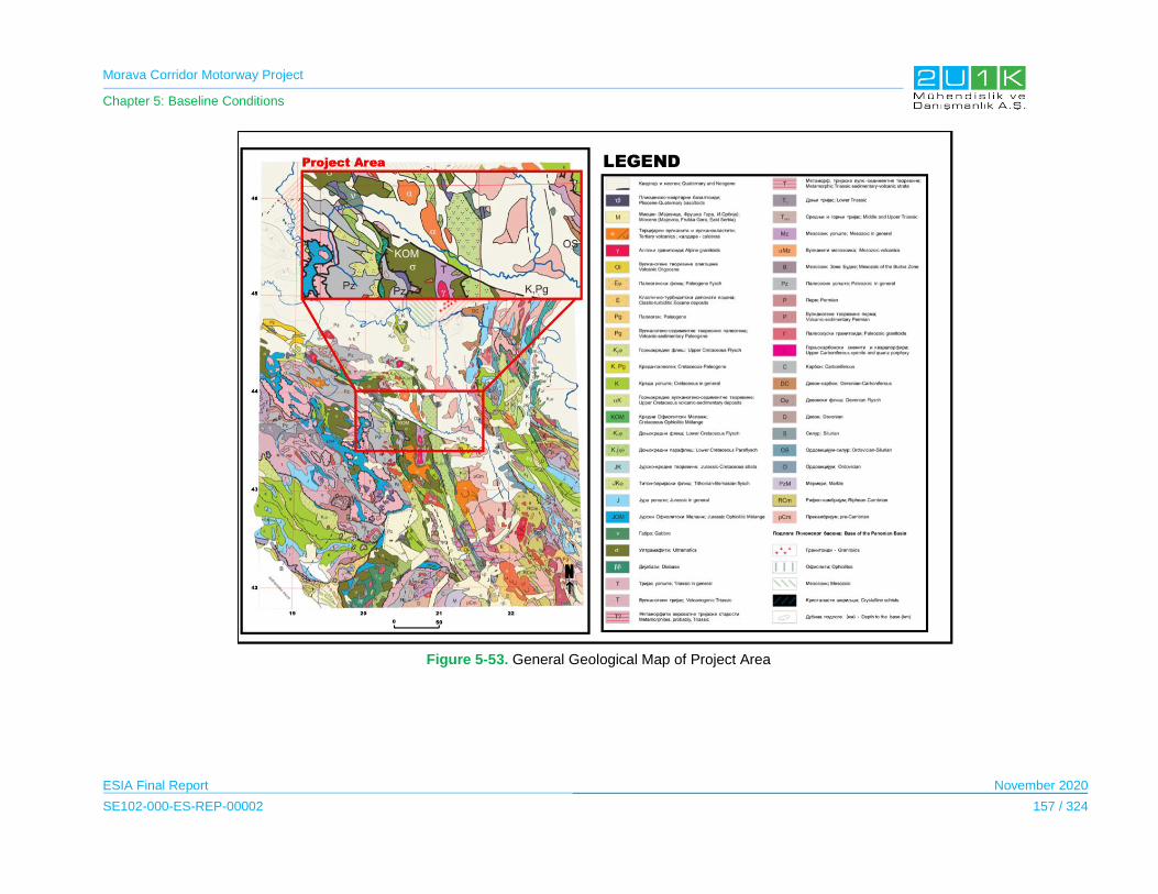
Morava Corridor Motorway Project
Chapter 5: Baseline Conditions
ESIA Final Report November 2020
SE102-000-ES-REP-00002 157 / 324
Figure 5-53. General Geological Map of Project Area
Morava Corridor Motorway Project
Chapter 5: Baseline Conditions
ESIA Final Report November 2020
SE102-000-ES-REP-00002 158 / 324
Groundwaters
The hydrogeological conditions of the terrain in the AoI of the Project are dictated by the
geological structure that is the lithological composition and position of individual members of
the complex within the terrain. The geological structure of the terrain in this area is very
diverse and complex.
Based on the hydrogeological characteristics of individual lithological environments, as well
as on the basis of structural types of porosity in the AoI of the Project, following types of
aquifers are identified:
phreatic type unconfined aquifers with free groundwater level; The aquifer is common
for the West Morava River Flood plain.
sub arterial type semi confined aquifers (captured type released under low pressure);
in general, deeper section of the plain (under unconfined aquifer) and at higher
elevations above natural flood level
crack type and broken crack type aquifers; Especially, sandstone and lime stone hills
bounding the north side of the West Morava River Valley. The terrain also features
areas that can be considered waterless.
Seismic Terrain
Serbia is located on a seismic active zone where the tectonic stresses caused by the NW
subduction of the African under the Europian plate. Movement of the Adriatic massif (the
promontory of Afrika) is pushed between the Apenines and the Dinarides along collision-
compression faults developed across the Adriatic coast. The stresses are transmitted to the
hinterland from the subduction zone and the faults. In the nearest, primary compression zone
(I), about 250 km wide, foci occur of earthquake magnitudes from 7.5 to 6.5 and intensities
from 9° to over 10° MSK. In the second (II) zone, at distances from 250 km to 400 (460) km,
earthquakes of magnitudes from 6.4 to 5.7 and intensities from 9° to 8° MSK are likely to
occur at seismo-active faults. In the third (III), most distant zone, earthquakes can have
magnitudes up to 5.6 and intensities in epicentre to 8° MSK.
Young (neotectonic) faults of this territory have general strike directions NW-SE, NE-SW, N-
S, W-E, dividing it into blocks of different vertical movements and forming a network of
seismogenic faults. Recent vertical movements of these blocks amount from -2mm/yr to
+6mm/yr. The foci of past and future shocks are associated with the faults bounding on
blocks. Seismogenic structures are mainly concentrated in the Adriatic coast or marginally on
Neogene depressions, where vertical displacements vary between -1mm/yr and +1mm/yr.
There are 116 recognized seismogenic faults: 70% in the Dinarides and Vardar zone, 14% in
Pannonian region and the Serbian-Macedonian Massif, and 16% in the Carpatho-

Morava Corridor Motorway Project
Chapter 5: Baseline Conditions
ESIA Final Report November 2020
SE102-000-ES-REP-00002 159 / 324
Balkanides. General seismo tectonic map showing movement of the plates and major fault
lines in the region is given in Figure 5-54.
Figure 5-54. Mediterranean-Trans-Asian Seismic Zone
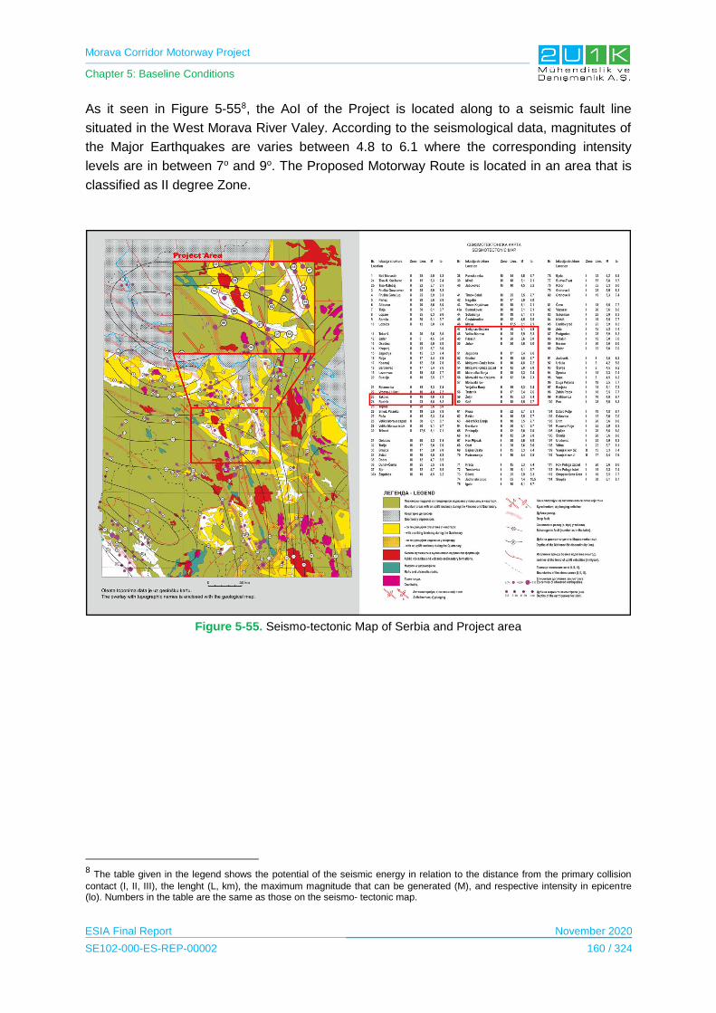
Morava Corridor Motorway Project
Chapter 5: Baseline Conditions
ESIA Final Report November 2020
SE102-000-ES-REP-00002 160 / 324
As it seen in Figure 5-558, the AoI of the Project is located along to a seismic fault line
situated in the West Morava River Valey. According to the seismological data, magnitutes of
the Major Earthquakes are varies between 4.8 to 6.1 where the corresponding intensity
levels are in between 7o and 9o. The Proposed Motorway Route is located in an area that is
classified as II degree Zone.
Figure 5-55. Seismo-tectonic Map of Serbia and Project area
8 The table given in the legend shows the potential of the seismic energy in relation to the distance from the primary collision
contact (I, II, III), the lenght (L, km), the maximum magnitude that can be generated (M), and respective intensity in epicentre (lo). Numbers in the table are the same as those on the seismo- tectonic map.

Morava Corridor Motorway Project
Chapter 5: Baseline Conditions
ESIA Final Report November 2020
SE102-000-ES-REP-00002 161 / 324
Earthquake intensities are defined in the twelve-degree scale devised by Medvedev, Spanheuer and Karnik (MSK) in
terms of the effects on three types of buildings: (A) of unfired bricks, mud and straw, packed earth, or unhewn stone; (B)
masonry, logs, dressed stone, or prefabricated materials; and (C) of reinforced concrete (skeleton construction) or well
jointed timber.
Earthquake intensity on the MSK scale and respective effects:
1" - Not felt.
2° - Barely felt.
3" - Partly noticeable.
4" - Moderate (buildings vibrate, windows rattle, furniture creaks, suspended objects swing).
5" - Strong (buildings shake, type A buildings damaged to the first degree).
6" - Frightening (fragile objects overturned and broken, furniture moved, objects failed out from shelves, ceiling joists
creak, visible damage to the second degree on 50% of type A and about 5% of type B buildings.
7" - Damaging ( heavy furniture items moved and light ones overturned, objects from cupboards and shelves fall; about
5% of A type buildings damaged to the fourth degree and about 75% of B type buildings to the third degree; about 50%
of B type buildings got damage to the second degree, and about 50% of C type buildings to the first degree).
8" - Much damaging (heavy furniture moved and overturned, suspended objects fall down, poorly fixed doors and
windows unhinged; about 50% of type A buildings damaged to the fourth degree, and about 5% destroyed; about 50%
of type B buildings damaged to the third degree, and about 5% to the fourth degree; about 75% of C type buildings
damaged to the second degree, and only few to the third degree.
9’ Disastrous (chimneys topple, roof slates slide down, wooden roofs and trusses thrown out of joints, eaves collapsed;
over 50% of A type buildings collapse and others are not safe, about 50% of B type buildings damaged to the fourth
degree with some collapse; about 50% of C type buildings damaged to the third degree, others to the fourth degree).
10' Destructive (stacks and tall structures topple; all type A and about 75% of B type buildings destroyed; about 50% of
C type buildings damaged to the fourth degree, some collapse).
11" - Devastating (all structures and infrastructures: dams, bridges, etc. destroyed or heavily damaged).
12° - Apocalyptic (all man-made structures destroyed, ground surface changed, rivers change courses, cracks in
ground of dekametric gape).
The intensities of earthquakes in Serbia have been up to 9° on MSK scale. The foci of major earthquakes are located in
eight areas, viz.:
(1) Adriatic coastal zone (8° - 9° MSK); (2) Vojvodina (Kanjiza, Becej, Novi Sad, Ruma; 8° MSK); (3) Western Serbia
(Loznica, Krupanj, Bajina Basta; 8° MSK); (4) Central Serbia (Lazarevac, Arandelovac, Rudnik, Kraljevo, Kopaonik; 8° -
9° MSK); (5) Velika Morava region (Svilajnac, Jagodina, Stalafi; 8° - 9° MSK); (6) Eastern Serbia (Golubac, Negotin; 8°
MSK); (7) Area between the Nisava and the middle and upper course of the Juzna Morava (Dimitrovgrad, Bosiljgrad,
Ni5, Vranje; 8° - 9° MSK); (8) Kosmet (Peb, Prizren, Pribtina, Lipljan, Urobevac; 8° - 9° MSK).
Earthquake intensity hazards in Serbia in respect to the percentage of the national territory are the following: 6° MSK -
13%, 7" MSK - 59%, 8" MSK - 23%, 9° MSK - 5%, or about 87% of the territory of Serbia is susceptible to destructive
earthquakes, which calls for paraseismic codes and standards in the housing and building projects
Table 5-72. Seismic Terrain
Return Period (Years)
Degree of Seismicity on MCS Rocks
50 7°
100 7°-8°
200 8°-9°
500 8°-9°
1000 9°
Morava Corridor Motorway Project
Chapter 5: Baseline Conditions
ESIA Final Report November 2020
SE102-000-ES-REP-00002 162 / 324
5.9.4 Sensitive Receptors/Locations
Terrain and Ground Stability
On the basis of the overall results of the research and analysis carried out for the Project, the
Proposed Motorway Route is classified according to the terrain's advantage in terms of
stability, load-bearing capacity and erodibility. These are;
Favorable (Stable) Terrains:
Terrains belonging to the complex of alluvial lake sediments.
The West Morava River terrain sediments are classified into parts of terrain with
favorable design conditions
Conditionally Favorable (Conditionally Stable) Terrains: The following complexes are
included in the group of conditionally favorable terrains:
Quaternary sediments
Neogene sedimentary basin
The younger, volcanic complex of Kotlenica
Flysch develops lower chalk
Proterozoic metamorphic rocks - crystalline shales of high degree of
metamorphism
Unfavorable (Unstable) Terrains: Following complexes are classified into unfavorable
(unstable) terrains:
Parts of the terrain representing colluvial deposits (chaotically mixed material of
Miocene sandy clayey deposits with varying fractions) affected by the slip
process; the material thus initiated has generally completely altered structural-
textural characteristics from the primary ones, by slipping of uncovered sediments
Parts of the terrain made up of alluvial fine-grained sand, sandstone and
siltstones and silt deposits (siltstones with organogenic matter) that make the
facies dead
Parts of the terrain with traces of intense dredging, rinsing, drifting, tearing and
less often block slippage are also indicated as partially conditional slopes if there
are deformable substrates in the zone. They are located around the perimeter of
the infrastructure corridor exploration area. These are mostly terrain of large or
medium gradients in decayed and cracked rock mass (dacitic-andesitic mass of
Kotlenik, gneisses, youngest Neogene materials and Cretaceous flysch with
variable influence of torrential waters)
Special zones in terrain such as wetlands and restricted areas in abandoned parts
of riverbed - often flooded areas
Morava Corridor Motorway Project
Chapter 5: Baseline Conditions
ESIA Final Report November 2020
SE102-000-ES-REP-00002 163 / 324
Zones of special importance such as existing water sources for settlements; the
narrower protection zones of the spring are located at two locations, one in the
vicinity of Kruševac and the other near Trstenik.
Groundwater
More abundant unconfined aquifers, which are the main groundwater source in the
Project Area, are located on the left and right valley sides of the West Morava River,
the Great Morava River, these aquifers are;
in the area of the Čačak-Kraljevo valley (including the alluvial plain Ibra);
on the right valley side of the West Morava River in the area of Ratino-Oslonica
Basin;
on the left and right side of West Morava in the area of the Reed Basin;
on the left and right sides of the West and the Great Morava in the area of
Bošnjani-Varvarin;
in the West and South Morava intersections and on the right valley side of the
Great Morava.
The Proposed Motorway Route has abundant groundwater reservoirs. On the other
hand, in the narrower parts of the West Morava, aquifer capacities are low and local.
Over 15 groundwater sources have been formed for public water supply to rural
settlements and some industrial plants. Catching facilities are mostly wells. The
springs do not have a defined or narrow sanitary protection zone.
Major use of groundwater for public water supply is done locally in the area of
Trstenik and Kruševac.
Groundwater reservoirs in other aquifers (sandy-gravel deposits) of older river
terraces are locally used for the pu denoted in general by EN 1998blic water supply of
rural settlements (Medvedja, Bogdanje, Lađevci).
Seicmicity
According to the Spatial Plan of E-761 Motorway Infrastructure Corridor, the given return
period for the eartquakes with intensity level between 7 and 9 is 50 to 1000 years. The
degree of probability of an intense event present at the faults situated in the project area is
given as 63% as the legal requirement all Project units will be designed and constructed in
accordance to Eurocode 8.
Morava Corridor Motorway Project
Chapter 5: Baseline Conditions
ESIA Final Report November 2020
SE102-000-ES-REP-00002 164 / 324
5.10 Road traffic and transportation
In this section, at first, study area for road traffic and transportation are specified. Then, after
specifying the methodology and data sources used to write the baseline conditions, road
traffic and transportation baseline information about the area where the Project is located are
given more specifically.
5.10.1 Study Area
The Study Area for this part of the Report i.e., road and transportation infrastructure has
decided based on the “Preliminary Economic Analyses and Feasibility Study for the E761
Morava Corridor Motorway of the Republic of Serbia”. It was aimed to cover the potential
impacted area due to the Project related activities (e.g., hauling of the excavated material
outside the construction corridor, roads to be used for transportation of the equipment to the
site etc.).
5.10.2 Methodology and Data Source
The following document has been reviewed during the desktop review:
Preliminary Economic Analyses and Feasibility Study for the E761 Morava Corridor
Motorway of the Republic of Serbia (The Ministry of Finance, 2019)
Eurocode 8: The code applies to the design and construction of buildings and civil engineering works in seismic regions.
It covers common structures and, although its provisions are of general validity, special structures, such as nuclear power plants, large dams or offshore structures are beyond its scope. Its seismic design should satisfy additional requirements and be subject to complementary verifications.
The objectives of seismic design in accordance with Eurocode 8 are explicitly stated. Its purpose is to ensure that in the event of earthquakes:
o human lives are protected;
o damage is limited; and
o structures important for civil protection remain operational.
These objectives are present throughout the code and condition the principles and application rules therein included.
Eurocode 8 is composed by 6 parts dealing with different types of constructions or subjects: o EN1998-1: General rules, seismic actions and rules for buildings
o EN1998-2: Bridges
o EN1998-3: Assessment and retrofitting of buildings
o EN1998-4: Silos, tanks and pipelines
o EN1998-5: Foundations, retaining structures and geotechnical aspects o EN1998-6: Towers, masts and chimneys
The above-mentioned increased seismic risk in relation to the one prescribed by the Eurocode EC8 is valorized in the definition of seismic design parameters.
Our National Regulation since 1990 requires the use of an earthquake with a return period of 500 years, that is, the fulfillment of the requirement that the building does not collapse.

Morava Corridor Motorway Project
Chapter 5: Baseline Conditions
ESIA Final Report November 2020
SE102-000-ES-REP-00002 165 / 324
5.10.3 Baseline Conditions
The Proposed Motorway Route will enable the connection in the part Pojate - Kruševac -
Kraljevo - Preljina, with branches to A1 and A2 state roads at its ends. Currently, at this
section, movement predominantly takes place along the IB category state road number 23
(Pojate-Kruševac-Trstenik-Kraljevo), and further on (due to overlapping of alignments of
state roads) along IB category state road number 22 (Kraljevo-Mrčajevci-Preljina). The
abovementioned two state roads, with their extensions, i.e. with the use of other intersecting
road routes, enable the movement of persons and goods across the west, central and east
part of Serbia. In parallel, by constructing the concerned project, conditions are to be created
for connecting the parts of the Republic of Srpska, i.e. Bosnia and Herzegovina with the road
route E-763 (Belgrade – South Adriatic) and the Corridor X, i.e. the Proposed Motorway
route Belgrade - Niš, and further on with east parts of Serbia and the Republic of Bulgaria.
Currently, the traffic on the entire route of the planned IA category state road number is
circulating along IB category state roads, with all the disadvantages and deficiencies of
mainly two-lane road, with increased impact of activities generated by nearby settlements on
the conditions in the traffic flow. It currently takes around two hours, to drive from Pojate to
Preljina, but this can easily be increased, as transit through city and town centers is required.
The planned Morava Motorway from Pojate to Preljina, within the primary road network of
Serbia, is to take over long-distance flows from the existing state roads IB-22 and IB-23 with
partial change in the conditions on the roads that are directly connected to it. It will represent
a quality connection in the area of: Ćićevac, Varvarin, Kruševac, Trstenik, Vrnjačka Banja,
Kraljevo and Čačak near Preljina. In the new situation with the motorway, the transit time
between Pojate and Preljina will be less than one hour.
Two important motorway routes will be connected, primarily at the level of road network of
the Republic of Serbia, and beyond as well:
IA category state road, A1 (former designation M-1, part of the international road
route E-75, i.e. part of road Corridor 10), via which the central part of Serbia is
connected, in the north, with Belgrade and Vojvodina, i.e. Central and Western
Europe, and, in the south, with the southern parts of the republic, i.e. with North
Macedonia, Bulgaria and further on with Middle East and Asia,
Partially constructed IA category state road, A2, which is located on the international
road route E - 763, Belgrade – South Adriatic. Via this route, the region would gain
the shortest connection with west Serbia, Montenegro, and via Bar Port with south
Italy, as well as connections with sea ports on the Adriatic Sea and the
Mediterranean.
On the road route E-763, which the state recognized as one of the priorities regarding the
road infrastructure, works are completed before November, 2016 on the section Ljig-Takovo-

Morava Corridor Motorway Project
Chapter 5: Baseline Conditions
ESIA Final Report November 2020
SE102-000-ES-REP-00002 166 / 324
Preljina and the road on that section is in operation as of beginning of November 2016 and
works on the section from Belgrade to Ljig are expected to be finalized during 2019. At the
same time in 2019, construction works will commence on the construction of the motorway
section of IA category state road number 2, from Preljina to Požega (towards Bosnia and
Montenegro).
Figure 5-56. Map of the Motorway E-761
In the current condition (preliminary data of the PE “Roads of Serbia” for 2018), the value of
average annual daily traffic between Pojate and Preljina ranges from 3,609 vehicles/day
(section Ratina - Kraljevo (Kamidžora)) to 12,743 vehicles/day (section Mrčajevci - Preljina).
The average value, which accounts for the lengths of individual sections, is 8,205
vehicles/day9. Forecast values of Annual Average Daily Traffic (AADT) on motorway sections
for the first and the last year of analysis are shown in Table 5-73, Table 5-74 and Table 5-75.
9 As it is stated, this part of text is about current traffic volumes, on existing roads. Section Mrčajevci - Preljina is part of state road IB category state road number 22. Below table is with forecasted traffic volumes on Motorway sections. After contructing Motorway, part of traffic will stay on existing roads and other part will be on Motorway sections.
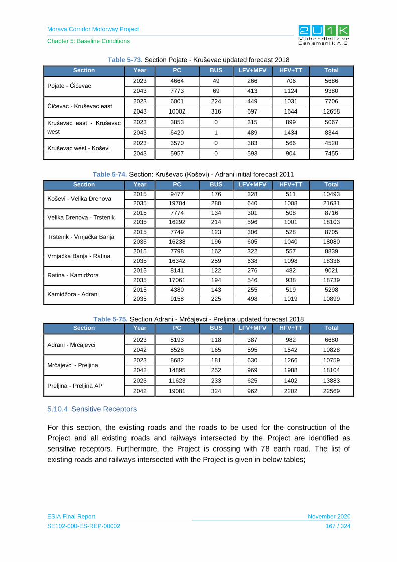
Morava Corridor Motorway Project
Chapter 5: Baseline Conditions
ESIA Final Report November 2020
SE102-000-ES-REP-00002 167 / 324
Table 5-73. Section Pojate - Kruševac updated forecast 2018
Section Year PC BUS LFV+MFV HFV+TT Total
Pojate - Ćićevac 2023 4664 49 266 706 5686
2043 7773 69 413 1124 9380
Ćićevac - Kruševac east 2023 6001 224 449 1031 7706
2043 10002 316 697 1644 12658
Kruševac east - Kruševac
west
2023 3853 0 315 899 5067
2043 6420 1 489 1434 8344
Kruševac west - Koševi 2023 3570 0 383 566 4520
2043 5957 0 593 904 7455
Table 5-74. Section: Kruševac (Koševi) - Adrani initial forecast 2011
Section Year PC BUS LFV+MFV HFV+TT Total
Koševi - Velika Drenova 2015 9477 176 328 511 10493
2035 19704 280 640 1008 21631
Velika Drenova - Trstenik 2015 7774 134 301 508 8716
2035 16292 214 596 1001 18103
Trstenik - Vrnjačka Banja 2015 7749 123 306 528 8705
2035 16238 196 605 1040 18080
Vrnjačka Banja - Ratina 2015 7798 162 322 557 8839
2035 16342 259 638 1098 18336
Ratina - Kamidžora 2015 8141 122 276 482 9021
2035 17061 194 546 938 18739
Kamidžora - Adrani 2015 4380 143 255 519 5298
2035 9158 225 498 1019 10899
Table 5-75. Section Adrani - Mrčajevci - Preljina updated forecast 2018
Section Year PC BUS LFV+MFV HFV+TT Total
Adrani - Mrčajevci 2023 5193 118 387 982 6680
2042 8526 165 595 1542 10828
Mrčajevci - Preljina 2023 8682 181 630 1266 10759
2042 14895 252 969 1988 18104
Preljina - Preljina AP 2023 11623 233 625 1402 13883
2042 19081 324 962 2202 22569
5.10.4 Sensitive Receptors
For this section, the existing roads and the roads to be used for the construction of the
Project and all existing roads and railways intersected by the Project are identified as
sensitive receptors. Furthermore, the Project is crossing with 78 earth road. The list of
existing roads and railways intersected with the Project is given in below tables;
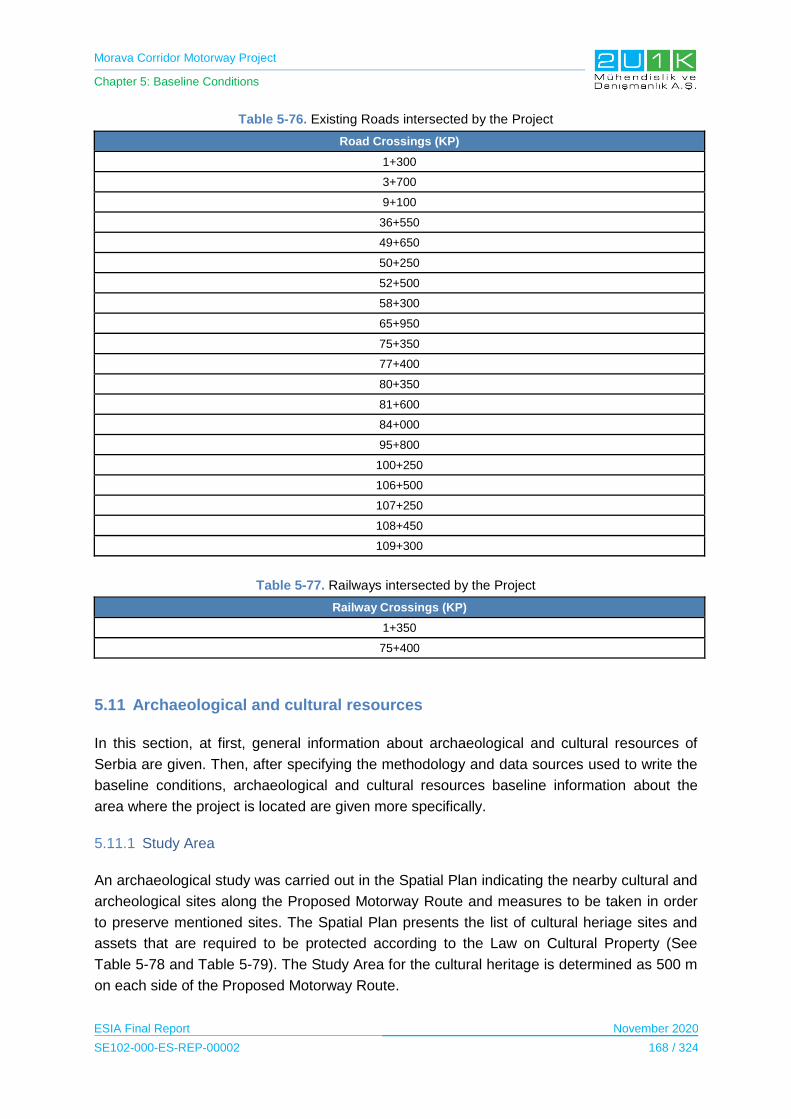
Morava Corridor Motorway Project
Chapter 5: Baseline Conditions
ESIA Final Report November 2020
SE102-000-ES-REP-00002 168 / 324
Table 5-76. Existing Roads intersected by the Project
Road Crossings (KP)
1+300
3+700
9+100
36+550
49+650
50+250
52+500
58+300
65+950
75+350
77+400
80+350
81+600
84+000
95+800
100+250
106+500
107+250
108+450
109+300
Table 5-77. Railways intersected by the Project
Railway Crossings (KP)
1+350
75+400
5.11 Archaeological and cultural resources
In this section, at first, general information about archaeological and cultural resources of
Serbia are given. Then, after specifying the methodology and data sources used to write the
baseline conditions, archaeological and cultural resources baseline information about the
area where the project is located are given more specifically.
5.11.1 Study Area
An archaeological study was carried out in the Spatial Plan indicating the nearby cultural and
archeological sites along the Proposed Motorway Route and measures to be taken in order
to preserve mentioned sites. The Spatial Plan presents the list of cultural heriage sites and
assets that are required to be protected according to the Law on Cultural Property (See
Table 5-78 and Table 5-79). The Study Area for the cultural heritage is determined as 500 m
on each side of the Proposed Motorway Route.

Morava Corridor Motorway Project
Chapter 5: Baseline Conditions
ESIA Final Report November 2020
SE102-000-ES-REP-00002 169 / 324
5.11.2 Methodology and Data Source
Following documents have been reviewed during the desktop study of the project as;
EIA Reports for Section-1, Section-3. (CIP, 2018) (Highway Institute, 2019)
The Spatial Plan of the Project (CIP, The Spatial Plan of the Morava Motorway
Corridor Project, 2019)
5.11.3 Baseline Conditions
According to the Spatial Plan of the Project, the archaeological sites and buildings in and
near the area of influence of the Project determined was listed in Table 5-78 and Table 5-79.
Table 5-78. Archaeological Sites near to the Project Area
Archaeological Sites
Section-1 68 Vrnjačka Banja, Rudjinci, St. Luke's Church
1 Ćićevac, Pojate, Staro selo 69 Vrnjačka Banja, Rudjinci, Church in Radenkovi
2 Ćićevac, Stalac, Ukosa, 70 Vrnjačka Banja, Rudjinci, Podine
3 Ćićevac, Radosevac, Cerje 71 Vrnjačka Banja, Rudjinci, Carp Code
4 Varvarin, Mascara, Bedem - fort 72 Vrnjačka Banja, Rudjinci, Magdin lug
5 Varvarin, Mascara, Necropolis in road profile 73 Vrnjačka Banja, Rudjinci, Lazic
6 Varvarin, Bosniaks, Ornice 74 Vrnjačka Banja, Vrnjci, Draskovic
7 Varvarin, Mascara, Ledine 75 Vrnjačka Banja, Vrnjci, Kostovo brdo
8 Varvarin, Mascara, Selište 76 Vrnjačka Banja, Vrnjci, Vitojevic Springs
9 Varvarin, Mascara, Gradine 77 Vrnjačka Banja, Vrnjci, Duboki brook
10 Varvarin, Barbarian Village, Guy 78 Vrnjačka Banja, Vrnjci, Martacici
11 Varvarin, Šanac, Kolarac 79 Vrnjačka Banja, Vrnjci, Skela Crnoglavaca
12 Varvarin, Bošnjane, Cernjak 80 Vrnjačka Banja, Vrnjci, Grkkara-Trnara
13 Varvarin, Bošnjane, Slatina 81 Vrnjačka Banja, Novo Selo, Sibenik houses
14 Varvarin, Bošnjane, Gaj 82 Vrnjačka Banja, Novo Selo, Grabovi
15 Varvarin, Bošnjane, Ornice 83 Vrnjačka Banja, Novo Selo, Veselinovici
16 Kruševac, Makresane, Jazbine 84 Vrnjačka Banja, Novo Selo, Duboki brook
17 Kruševac, Bivolje, Ingredients, 85 Vrnjačka Banja, Novo Selo, Zajecevac
18 Kruševac, Makresane, Cair 86 Vrnjačka Banja, Novo Selo, Stevanovici
19 Kruševac, Makresane, Tepelija 87 Vrnjačka Banja, Novo Selo, Miodragovici
20 Kruševac, Makresane, Old Cemetery 88 Vrnjačka Banja, Gracac, Sveta Petka
21 Kruševac, Makresane, Long field 89 Vrnjačka Banja, Gracac, Turkish Cemetery
22 Kruševac, Makrešane, Reka 90 Vrnjačka Banja, Gracac, Caliija
23 Kruševac, Lazarica, Buzdovani 91 Vrnjačka Banja, Gracac, Kenja dishes
24 Kruševac, Lazarica, Jasički put 92 Vrnjačka Banja, Podunavci, Cemetery
25 Kruševac, Dedina, Turkish Cemetery 93 Vrnjačka Banja, Podunavci, Rakovica
26 Kruševac, Dedina, Turkish Cemetery 94 Vrnjačka Banja, Podunavci, Usinka
27 Kruševac, Citluk, Konopljara 95 Vrnjačka Banja, Podunavci, Bare
28 Kruševac, Bela Voda, Kod česme 96 Vrnjačka Banja, Vranesi, Trnovaca

Morava Corridor Motorway Project
Chapter 5: Baseline Conditions
ESIA Final Report November 2020
SE102-000-ES-REP-00002 170 / 324
Archaeological Sites
29 Kruševac, Kukljin, Dinina Djula 97 Kraljevo, Vrba, Donje Polje
30 Kruševac, Bela Voda, Bunjiste 98 Kraljevo, Ratina, Divlje polje
31 Kruševac, Kukljin, Bogomoljiste 99 Kraljevo, Ratina, Roman Cemetery
32 Kruševac, Jasika, Latin Bar 100 Kraljevo, Ratina, Turkish Cemetery
33 Kruševac, Jasika, Odžinac -Miljkovićka 101 Kraljevo, Ratina, Crkvina
34 Kruševac, Jasika, Krstići 102 Kraljevo, Ratina, Staro selo
35 Kruševac, Globoder, Seliste 103 Kraljevo, Ratina, Old Cemetery- Dumbar
36 Kruševac, Mackovac, Ivlje 104 Kraljevo, Ratina, Djurovac Church
37 Kruševac, Globoder, Ratkovac 105 Kraljevo, Sijaće Polje, Mosque
38 Kruševac, Globoder, Božinovo brdo 106 Kraljevo, Sirča, Roman Cemetery
39 Kruševac, Globoder, Staro selo 107 Kraljevo, Miločaj, School code
40 Kruševac, Mackovac, Grobljanski brook 108 Kraljevo, Miločaj, Gorelo polje
41 Kruševac, Mackovac, Crkvina 109 Kraljevo, Mrsać, Ade, necropolis
42 Kruševac, Mackovac, Cemetery 110 Kraljevo, Eyebrow, cemetery
Section-2 Section-3
43 Vrnjačka Banja, Stulac Nemrak 111 Kraljevo, Miločaj, Velika gradina
44 Trstenik, Grabovac, Turkish Cemetery 112 Čačak, Katrga, Giant Cemetery
45 Trstenik, Trstenik, Stražba 113 Čačak, Katrga, Grobljuša
46 Trstenik, Počekovina, Grabak 114 Čačak, Mršinci, Crkvište
47 Trstenik, Počekovina, Selište 115 Čačak, Goričani, Crkvina
48 Trstenik, Počekovina, Staro selo 116 Čačak, Kukic, Turkish Cemetery
49 Trstenik, Počekovina, Tunnel Cemetery 117 Čačak, Mrčajevci, Grdeška bara
50 Trstenik, Stari Trstenik, Trnovaca 118 Čačak, Mrčajevci, Livade
51 Trstenik, Stari Trstenik, Ključ 119 Čačak, Mrcajevci, Gušavac, necropolis
52 Trstenik, Stopanja, off the coast of West Morava 120 Čačak, Donja Gorevnica, Crkvina
53 Trstenik, Stopanja, stoves on the Savic estate 121 Čačak, Donja Gorevnica, Giant Cemetery
54 Trstenik, Odzaci, Cara Lazar Cellars 122 Čačak, Donja Gorevnica, Crkvine
55 Trstenik, Medveđa, Savran mala, 123 Čačak, Mojsinje, Bent, Lugovi
56 Trstenik, Velika Drenova, Toponicka River 124 Čačak, Zablaće, Komadinići
57 Trstenik, Velika Drenova, Caves 125 Čačak, Vapa, Vojinovića Brdo
58 Trstenik, Selište, Panjak 126 Čačak, Vapa, Crkvina
59 Trstenik, Selište, Ključić 127 Čačak, Baluga (Trnavska), Makva
60 Trstenik, Bogdanje, Djurovaca 128 Čačak, Baluga, The Vulicevic Estate
61 Trstenik, Lozno, Cemeteries-Turkish Cemetery 129 Čačak, Baluga, Rainci, Old Cemetery
62 Trstenik, Osaonica, Petkovica Church 130 Čačak, Preljina, Estate of Ban Sovic, necropolis
63 Trstenik, Stari Trstenik, Church 131 Čačak, Preljina, Hippodrome
64 Trstenik, Osaonica, Turkish Cemetery 132 Čačak, Konjevic, Greek Cemetery
65 Vrnjačka Banja, Grabovac, Brod na Moravi 133 Čačak, Ljubić, Mutaovina
66 Vrnjačka Banja, Rudjinci, Blagojevici
67 Vrnjačka Banja, Rudjinci, Karan's Breg
*Archaeological sites within the AoI of the Project Source: (CIP, The Spatial Plan of the Morava Motorway Corridor Project, 2019), (CIP, 2018)
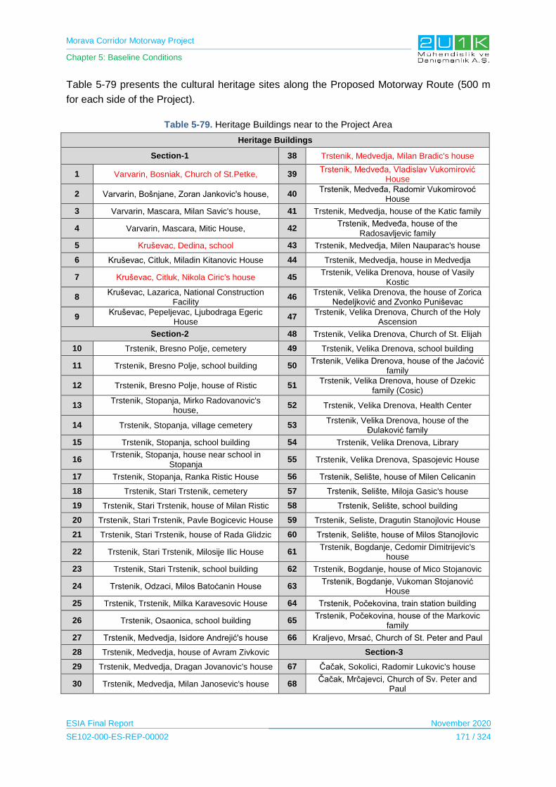
Morava Corridor Motorway Project
Chapter 5: Baseline Conditions
ESIA Final Report November 2020
SE102-000-ES-REP-00002 171 / 324
Table 5-79 presents the cultural heritage sites along the Proposed Motorway Route (500 m
for each side of the Project).
Table 5-79. Heritage Buildings near to the Project Area
Heritage Buildings
Section-1 38 Trstenik, Medvedja, Milan Bradic's house
1 Varvarin, Bosniak, Church of St.Petke, 39 Trstenik, Medveđa, Vladislav Vukomirović
House
2 Varvarin, Bošnjane, Zoran Jankovic's house, 40 Trstenik, Medveđa, Radomir Vukomirovoć
House
3 Varvarin, Mascara, Milan Savic's house, 41 Trstenik, Medvedja, house of the Katic family
4 Varvarin, Mascara, Mitic House, 42 Trstenik, Medveđa, house of the
Radosavljevic family
5 Kruševac, Dedina, school 43 Trstenik, Medvedja, Milen Nauparac's house
6 Kruševac, Citluk, Miladin Kitanovic House 44 Trstenik, Medvedja, house in Medvedja
7 Kruševac, Citluk, Nikola Ciric's house 45 Trstenik, Velika Drenova, house of Vasily
Kostic
8 Kruševac, Lazarica, National Construction
Facility 46
Trstenik, Velika Drenova, the house of Zorica Nedeljković and Zvonko Puniševac
9 Kruševac, Pepeljevac, Ljubodraga Egeric
House 47
Trstenik, Velika Drenova, Church of the Holy Ascension
Section-2 48 Trstenik, Velika Drenova, Church of St. Elijah
10 Trstenik, Bresno Polje, cemetery 49 Trstenik, Velika Drenova, school building
11 Trstenik, Bresno Polje, school building 50 Trstenik, Velika Drenova, house of the Jaćović
family
12 Trstenik, Bresno Polje, house of Ristic 51 Trstenik, Velika Drenova, house of Dzekic
family (Cosic)
13 Trstenik, Stopanja, Mirko Radovanovic's
house, 52 Trstenik, Velika Drenova, Health Center
14 Trstenik, Stopanja, village cemetery 53 Trstenik, Velika Drenova, house of the
Đulaković family
15 Trstenik, Stopanja, school building 54 Trstenik, Velika Drenova, Library
16 Trstenik, Stopanja, house near school in
Stopanja 55 Trstenik, Velika Drenova, Spasojevic House
17 Trstenik, Stopanja, Ranka Ristic House 56 Trstenik, Selište, house of Milen Celicanin
18 Trstenik, Stari Trstenik, cemetery 57 Trstenik, Selište, Miloja Gasic's house
19 Trstenik, Stari Trstenik, house of Milan Ristic 58 Trstenik, Selište, school building
20 Trstenik, Stari Trstenik, Pavle Bogicevic House 59 Trstenik, Seliste, Dragutin Stanojlovic House
21 Trstenik, Stari Trstenik, house of Rada Glidzic 60 Trstenik, Selište, house of Milos Stanojlovic
22 Trstenik, Stari Trstenik, Milosije Ilic House 61 Trstenik, Bogdanje, Cedomir Dimitrijevic's
house
23 Trstenik, Stari Trstenik, school building 62 Trstenik, Bogdanje, house of Mico Stojanovic
24 Trstenik, Odzaci, Milos Batoćanin House 63 Trstenik, Bogdanje, Vukoman Stojanović
House
25 Trstenik, Trstenik, Milka Karavesovic House 64 Trstenik, Počekovina, train station building
26 Trstenik, Osaonica, school building 65 Trstenik, Počekovina, house of the Markovic
family
27 Trstenik, Medvedja, Isidore Andrejić's house 66 Kraljevo, Mrsać, Church of St. Peter and Paul
28 Trstenik, Medvedja, house of Avram Zivkovic Section-3
29 Trstenik, Medvedja, Dragan Jovanovic's house 67 Čačak, Sokolici, Radomir Lukovic's house
30 Trstenik, Medvedja, Milan Janosevic's house 68 Čačak, Mrčajevci, Church of Sv. Peter and
Paul

Morava Corridor Motorway Project
Chapter 5: Baseline Conditions
ESIA Final Report November 2020
SE102-000-ES-REP-00002 172 / 324
Heritage Buildings
31 Trstenik, Medvedja, house of Jovan
Karamarkovic 69 Čačak, Mrcajevci, village cemetery
32 Trstenik, Medvedja, Radomir Raskovic's house 70 Čačak, Mrcajevci, Tosic House
33 Trstenik, Medvedja, Dragan Sremac's house 71 Čačak, Goricani, Dejan Cvetkovic's Chardak
34 Trstenik, Medvedja, house church of
Sv. Nicholas 72
Čačak, Zablace, Church of Sv. Archangel Gabriel
35 Trstenik, Medvedja, school building 73 Čačak, Preljina, Church of Sv. Joachim and
Anna
36 Trstenik, Medvedja, house of priest Bradic
37 Trstenik, Medvedja, Miodrag Toplicic House
*Heritage buildings within the Study Area
Source: (CIP, The Spatial Plan of the Morava Motorway Corridor Project, 2019) (CIP, 2018)
As shown in the Table 5-78 and Table 5-79, it is determined archaeological sites and
immovable cultural assets in the AoI of Project. In addition, according to Spatial Plan,
National EIAs and the interviews with focus groups, it was determined that there are
intangible cultural heritage which are two monumental trees given in Figure 5-57 and
Figure 5-58 below and the route of the motorway and area of the river regulation was
determined in line with these information. Thus, the Motorway route and area of the river
regulation works will not coincide with any archaeological area, immovable cultural assets
and intangible heritage and it is expected project will not impact these areas.
Figure 5-57. Monumental Tree in KP32
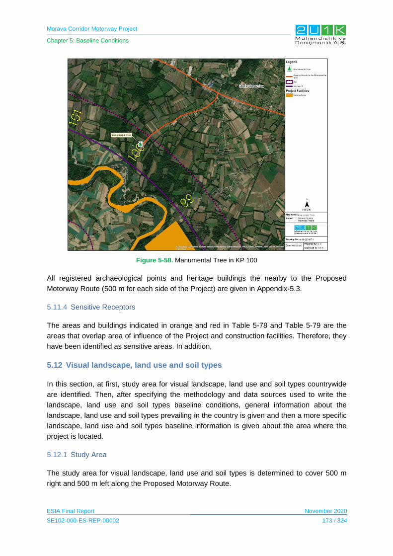
Morava Corridor Motorway Project
Chapter 5: Baseline Conditions
ESIA Final Report November 2020
SE102-000-ES-REP-00002 173 / 324
Figure 5-58. Manumental Tree in KP 100
All registered archaeological points and heritage buildings the nearby to the Proposed
Motorway Route (500 m for each side of the Project) are given in Appendix-5.3.
5.11.4 Sensitive Receptors
The areas and buildings indicated in orange and red in Table 5-78 and Table 5-79 are the
areas that overlap area of influence of the Project and construction facilities. Therefore, they
have been identified as sensitive areas. In addition,
5.12 Visual landscape, land use and soil types
In this section, at first, study area for visual landscape, land use and soil types countrywide
are identified. Then, after specifying the methodology and data sources used to write the
landscape, land use and soil types baseline conditions, general information about the
landscape, land use and soil types prevailing in the country is given and then a more specific
landscape, land use and soil types baseline information is given about the area where the
project is located.
5.12.1 Study Area
The study area for visual landscape, land use and soil types is determined to cover 500 m
right and 500 m left along the Proposed Motorway Route.

Morava Corridor Motorway Project
Chapter 5: Baseline Conditions
ESIA Final Report November 2020
SE102-000-ES-REP-00002 174 / 324
5.12.2 Methodology and Data Source
Following documents have been reviewed during the desktop study:
The EIA Reports for Section-1 and Section-3,
Government of Serbia website,
Statistical Yearbook 2018 of the Republic of Serbia,
European Environmental Agency
Copernicus Land Monitoring Service
The Soils of Serbia
European Soil Data Center (ESDAC)
5.12.3 Baseline Conditions
According to the web site of the Government of Serbia, Serbia has a total area of 8,840,000
hectares that is composed of 5,734,000 hectares of agricultural lands. 4,867,000 hectares of
these agricultural areas are arable land (Government of Serbia, no date). Agricultural land is
almost 70 % of Serbia’s territory and the rest is covered by forests. 3,355,859 hectares is the total
area of utilized agricultural land on Serbia’s territory.
The above part provides information on land use and landscape across Serbia and in order
to better understand the land use and landscape in the area where the project site is located,
a land use map was prepared for a the AoI of the Project, 500 m on each side of the Project
along the Proposed Motorway Route (see Appendix-5.5). Detailed information about the land
use and landscape in the the AoI of the Project is given in subsection 5.12.3.
According to The Soils of Serbia Book, Serbia contains different geological units of
composite structures and complex composition. Soil of Serbia contains quartz, mica,
feldspars, calcite, dolomite, and chlorite in the scope of mineralogical composition. Chlorite,
vermiculite and mixed layered silicates are found in the clay fraction together with illite,
smectite and kaolinite. The mild climate and low precipitation are favorable for the
biogeochemical weathering of primary minerals to clay minerals: smectite, illite and
vermiculite during bisiallitisation processes (Pavlovic, Costic, Karadzic, & Mistrovi, 2017).
The above part provides information on soil types country-wide and in order to better
understand the soil types in the area where the project site is located, a soil map was
prepared for a the AoI of the Project, 500 m on each side of the Project along the Proposed
Motorway Route (see Appendix-5.4). Soil types in the AoI of the Project and detailed
information about the soil types are given in subsection 5.12.3.
Morava Corridor Motorway Project
Chapter 5: Baseline Conditions
ESIA Final Report November 2020
SE102-000-ES-REP-00002 175 / 324
5.12.3.1 Landscape
There are a total of 7 municipalities (Ćićevac, Varvarin, Kruševac, Vrnjačka Banja, Trstenik,
Kraljevo and Čačak) and 49 settlements within AoI
In terms of water bodies including riparian section, there are three streams of large rivers: the
Great, the South and the West Morava’s, which with the rich river basin dominate the
landscape image as well as the extensive arable land along their coasts.
Sector-1 is located in the Great Morava basin, while the initial part of Sector-2 is located in
the South Morava basin. And all remaining sectors are also located in the west Morava
Basin.
In Sector 2, the Proposed Motorway Route runs through a narrow valley. The valley is
expanding in other sectors.
The Proposed Motorway Route generally located on flat topography. The starting point of
Pojate, the lowest point of the Proposed Motorway Route, is 150 m above sea level and the
end point in Čačak is 250 m above sea level. The elevation changes around 100 m along the
Proposed Motorway Route.
500 m right and 500 m left along the Proposed Motorway Route comprises a number of
visually distinct areas.
Landscape types are classified into three groups based on anthropogenic influence;
Natural and semi-natural landscapes (forest and semi natural areas, wetlands, water
bodies)
Anthropogenic landscapes (agricultural land, settlements, roads and industrial areas)
According to field studies conducted during the biodiversity baseline studies and desktop
studies, majority of the landscape is composed of agricultural areas. Agricultural land is
divided into three categories that are arable land, pastures, and heterogeneous agricultural
areas.

Morava Corridor Motorway Project
Chapter 5: Baseline Conditions
ESIA Final Report November 2020
SE102-000-ES-REP-00002 176 / 324
Figure 5-59. Agricultural field
In addition, natural and semi natural areas covers about 20% of the total area of AoI. Natural
and semi natural areas is divided into two categories that are forests and scrub and/or
herbaceous vegetation associations.
In Sections 1 and 2, forests are generally located on slopes that are located along Valley
edges. In Section 3, forests are densely located along the West Morava River.

Morava Corridor Motorway Project
Chapter 5: Baseline Conditions
ESIA Final Report November 2020
SE102-000-ES-REP-00002 177 / 324
Figure 5-60. Forest Areas
One of the most important landscape value within the AoI is the West Morava River. The
banks of the West Morava River are densely covered with riparian vegetation. Riparian
vegetation is also present with abandoned riverbeds.
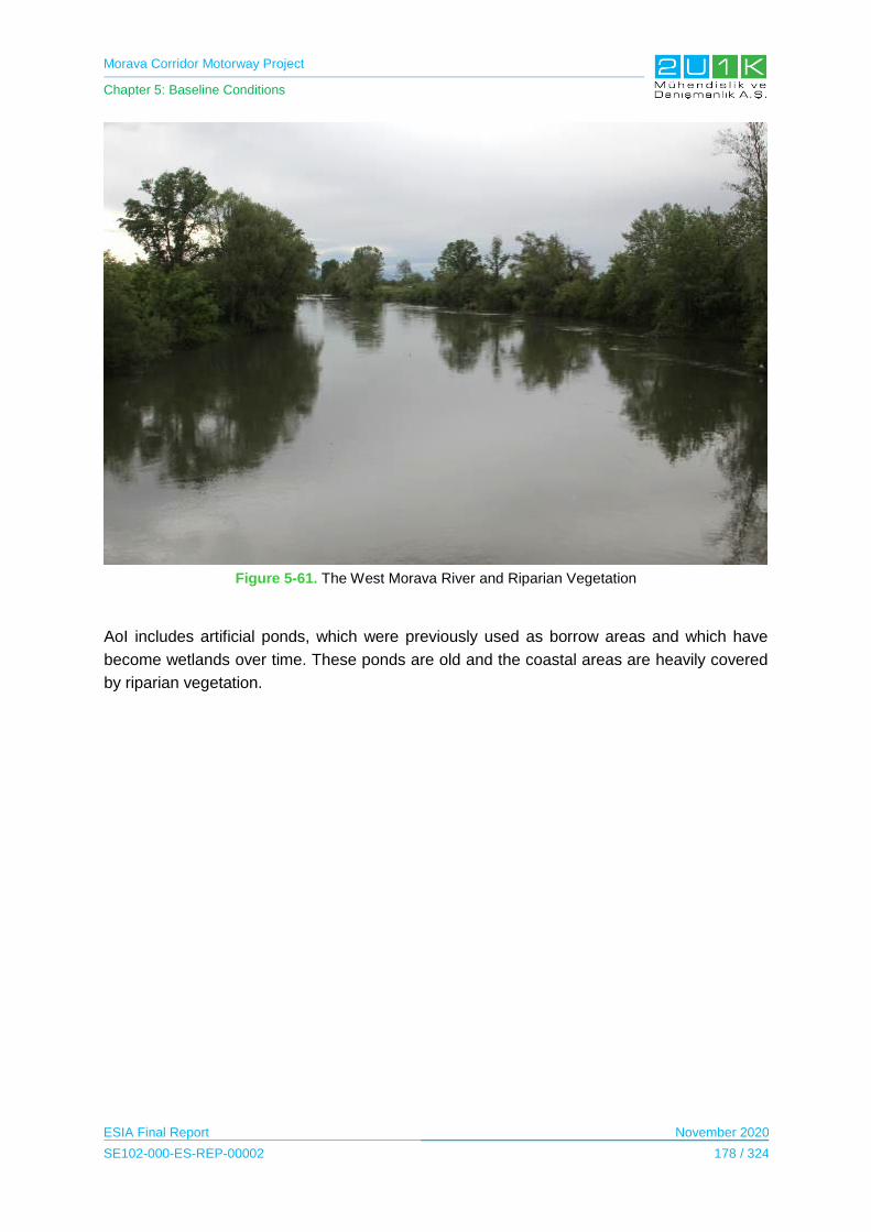
Morava Corridor Motorway Project
Chapter 5: Baseline Conditions
ESIA Final Report November 2020
SE102-000-ES-REP-00002 178 / 324
Figure 5-61. The West Morava River and Riparian Vegetation
AoI includes artificial ponds, which were previously used as borrow areas and which have
become wetlands over time. These ponds are old and the coastal areas are heavily covered
by riparian vegetation.

Morava Corridor Motorway Project
Chapter 5: Baseline Conditions
ESIA Final Report November 2020
SE102-000-ES-REP-00002 179 / 324
Figure 5-62. Artificial Ponds
5.12.3.2 Land Use
After obtaining necessary information about land use in Serbia during the site observation and
literature review, a land use map of Serbia is prepared by 2U1K. The map is provided in
Appendix-5.5 According to the data obtained, arable land (non-irrigated arable land) and
heterogeneous agricultural areas (with complex cultivation patterns) covers the largest area
within the AoI. The AoI also includes urban fabric, industrial, commercial and transport units,
mine, dump and construction sites, artificial, non-agricultural vegetated areas, pastures,
heterogeneous agricultural areas, forests, scrub and/or herbaceous vegetation associations,
inland wetlands, inland waters.
Table 5-80 shows the surface area occupied by the AoI and the percentage of these areas in the
AoI. In the Table 5-80, the CORINE Land Cover (CLC) nomenclature is used for the land use
classification. This nomenclature is a 3-level hierarchical classification system (Level 1, Level 2
and Level 3) and has 44 classes at the third (For more detailed information about CLC
nomenclature, please visit the website: https://land.copernicus.eu/eagle/files/eagle-related-
projects/pt_clc-conversion-to-fao-lccs3_dec2010)
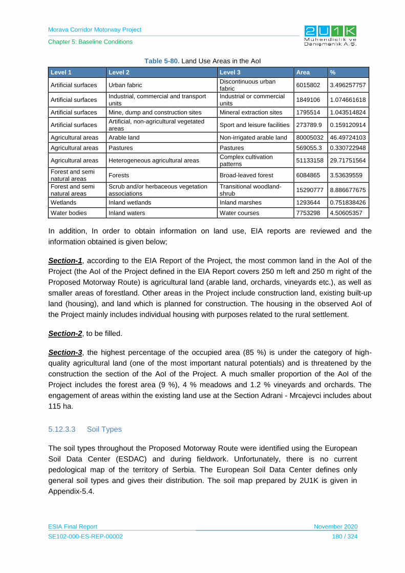
Morava Corridor Motorway Project
Chapter 5: Baseline Conditions
ESIA Final Report November 2020
SE102-000-ES-REP-00002 180 / 324
Table 5-80. Land Use Areas in the AoI
Level 1 Level 2 Level 3 Area %
Artificial surfaces Urban fabric Discontinuous urban fabric
6015802 3.496257757
Artificial surfaces Industrial, commercial and transport units
Industrial or commercial units
1849106 1.074661618
Artificial surfaces Mine, dump and construction sites Mineral extraction sites 1795514 1.043514824
Artificial surfaces Artificial, non-agricultural vegetated areas
Sport and leisure facilities 273789.9 0.159120914
Agricultural areas Arable land Non-irrigated arable land 80005032 46.49724103
Agricultural areas Pastures Pastures 569055.3 0.330722948
Agricultural areas Heterogeneous agricultural areas Complex cultivation patterns
51133158 29.71751564
Forest and semi natural areas
Forests Broad-leaved forest 6084865 3.53639559
Forest and semi natural areas
Scrub and/or herbaceous vegetation associations
Transitional woodland-shrub
15290777 8.886677675
Wetlands Inland wetlands Inland marshes 1293644 0.751838426
Water bodies Inland waters Water courses 7753298 4.50605357
In addition, In order to obtain information on land use, EIA reports are reviewed and the
information obtained is given below;
Section-1, according to the EIA Report of the Project, the most common land in the AoI of the
Project (the AoI of the Project defined in the EIA Report covers 250 m left and 250 m right of the
Proposed Motorway Route) is agricultural land (arable land, orchards, vineyards etc.), as well as
smaller areas of forestland. Other areas in the Project include construction land, existing built-up
land (housing), and land which is planned for construction. The housing in the observed AoI of
the Project mainly includes individual housing with purposes related to the rural settlement.
Section-2, to be filled.
Section-3, the highest percentage of the occupied area (85 %) is under the category of high-
quality agricultural land (one of the most important natural potentials) and is threatened by the
construction the section of the AoI of the Project. A much smaller proportion of the AoI of the
Project includes the forest area (9 %), 4 % meadows and 1.2 % vineyards and orchards. The
engagement of areas within the existing land use at the Section Adrani - Mrcajevci includes about
115 ha.
5.12.3.3 Soil Types
The soil types throughout the Proposed Motorway Route were identified using the European
Soil Data Center (ESDAC) and during fieldwork. Unfortunately, there is no current
pedological map of the territory of Serbia. The European Soil Data Center defines only
general soil types and gives their distribution. The soil map prepared by 2U1K is given in
Appendix-5.4.
Morava Corridor Motorway Project
Chapter 5: Baseline Conditions
ESIA Final Report November 2020
SE102-000-ES-REP-00002 181 / 324
As it seen from the Map, the Project passes through four different types of soil. The
explanation of these soil types are given below:
Fluvisol type of soils has well sorted soil layers. They have water permeability and alluvial
soils have little humus (under 1%). Alluvial soils are poor in humus (less than 1%). There are
many alluvial soil types depending on some characteristics. These types are alluvial fine
sorted carbonates, alluvial shallow soils on gravel materials, alluvial covered soils and so on.
Alluvial fine-sorted soils are the most distributed ones.
Eugley are soils dominated by the hydrogenation process. The accumulation of organic
matter is in the upper region, oxido-reduction occurs in the middle region, and there is a
reduction process in the lower region. The texture is heterogeneous and the micro-
aggregates in the carbonate-free clay soils are less stable. These soils are rich in humus
(5.8% on average) and the humus horizon is 20-40 cm deep.
Smonitzas (Vertisols) are formed in plain and mild hillside terrains and drained wetlands and
lakes areas. Vertisols are clay-rich soils. Therefore, they are highly fertile. Vertisols are
typically form from highly basic rocks, such as basalt, in climates that are seasonally humid
or subject to erratic droughts and floods, or that impeded drainage. Depending on the parent
material and the climate, they can range from grey or red to the more familiar deep black.
Humus, total nitrogen, and potassium are generally well supplied, while phosphorus content
is rather poor.
Ilimerized Pseudogyle soils are Pseuodogley soils undergone the ilimesrisation proces (the
process of eluvial-illuvial migration of colloidal clay). The process of ilimerisation leads to
differentiation of eluvial horizon depleted by base cations and colloidal clay and the iluvial
horizon enriched with base cations and colloidal clay.
Fluvisol and Eugley soil types observed to be dominant through Section-1 and Section-2 of
the Proposed Motorway Route, in other words, approximately 88 km of the Project is mainly
covered by the mentioned soil types. Between the 88 km and 90 km points of the Proposed
Motorway Route, fluvisol, eugley, smonitzas, pseudogyles and ilimerized pseudogyle soil
types were observed to be dominant. From the 90 km point to the end of the Proposed
Motorway Route; smonitzas type of soil was observed to be common.
5.12.4 Sensitive Receptors/Locations
In the evaluations made in the GIS study, the Proposed Motorway Route is located in a flat
topography and there is no barrier other than vegetation.
Within the AoI, sensitive receptors consist of residential and commercial areas and road
users. List of Sensitive receptors was given in Appendix 5.6 "Visibility Map".
Morava Corridor Motorway Project
Chapter 5: Baseline Conditions
ESIA Final Report November 2020
SE102-000-ES-REP-00002 182 / 324
5.13 Water Use (industrial, agriculture, domestic)
In this section, at first, study area for the water use is indicated. Then, after specifying the
methodology and data sources used to write the baseline conditions, water use baseline
information about the area where the project is located are given.
5.13.1 Study Area
The study area for industrial, agricultural and domestic water use is determined to cover 500
m right and 500 m left along the Proposed Motorway Route.
5.13.2 Methodology and Data Source
The water use in the Region was assessed during the social field studies through community
level and household level surveys with the locals by 2U1K.
5.13.3 Baseline Conditions
Social field studies were conducted in all affected municipalities, details of the surveys can
be found below.
Municipality of Čačak
According to social field studies conducted within the scope of the Project, the West Morava
River is stated to be used for fishing activities by the locals. Spring water is commonly used
by the drinking purposes by the locals of the Municipality. Last, according to outcomes of the
field study, drinking, irrigation and water resources are provided from water network, well
water and the West Morava River.
Municipality of Ćićevac
Based on the social field studies, the West Morava River is stated to be used for fishing and
irrigation purposes by locals. Locals stated during the field studies spring water are used for
drinking and technical purposes. In addition, some locals stated that they use rural water
supply and some locals stated that they have their own water supply from the West Morava
River.
Municipality of Kaljevo
According to the information obtained from the social field study, locals of the Municipality
stated that the West Morava River is used for fishing activities. Locals of the Municipality
state spring water as a source of drinking water and it is used for domestic purposes as well.
Some villages in the Municipality stated to use wells. Most of the locals stated that they have
water from rural water supply. As an outcome of the survey, it was stated that spring water
and well water were used both for domestic and irrigation purposes.

Morava Corridor Motorway Project
Chapter 5: Baseline Conditions
ESIA Final Report November 2020
SE102-000-ES-REP-00002 183 / 324
Municipality of Kruševac
As an outcome of the social field study, the West Morava River is found to be used for sport
fishing, irrigation and drinking purposes. The existence of a natural water source which is
used for drinking purposes by locals is indicated in the village of Bela Voda. Some locals in
the Municipality indicated well and spring water is used for drinking purposes. In addition, it
was observed that some locals have their own source of water.
Municipality of Trstenik
As a result of the social field study, the West Morava River is found to be used for various
purposes such as irrigation and sport fishing. Spring water is stated to be used for drinking
and domestic purposes by locals and most locals stated that they use wells for domestic
purposes. Water sources are indicated as water supply network, spring water, water tank
and well water. The locals states that they use springs and well water both for drinking and
irrigation purposes.
Municipality of Vrnjačka Banja
According to the social survey, In Municipality of Vrnjačka Banja, it is found that the West
Morava River is used by locals for irrigation and sport fishing. Spring water is stated as a
source for drinking purpose and for domestic purposes, some locals stated they have wells
for irrigation activities. In the Municipality, water supply network, spring water and wells are
stated to be used for drinking, irrigation purposes and water sources for other activities.
Municipality of Varvarin
For the Municipality of Varvarin, conducted field study shows that the West Morava River is
used for irrigation and fishing purposes by locals. It is also stated that locals use spring water
for drinking purpose and wells are used by very few locals for drinking purpose.
5.13.4 Sensitive Receptors
The West Morava River is being used by the near settlements for various purposes including;
irrigation, fishing and transportation. In that regards, the West Morava River is quite sensitive
among the locals for social and environmental purposes.
5.14 Social Baseline
5.14.1 Study Area
The Study Area is decided by considering the impacts sourced from transportation route,
workers accommodation, noise during construction and operation phases, labour influx, land
use, changes on dust and air quality.
Morava Corridor Motorway Project
Chapter 5: Baseline Conditions
ESIA Final Report November 2020
SE102-000-ES-REP-00002 184 / 324
There are 7 municipalities and 48 settlements within the envisaged the Project and
construction facilities.
In order to obtain baseline information and assess the possible social impacts of the Project,
a wider area of 1 km is determined as the Study Area. Municipalities located within the Study
Area are presented in Table 5-81.
Table 5-81. Municipalities located within the Study Area
Municipality Number of settlements within th AoI of The Project
Ćićevac 4
Varvarin 2
Kruševac 7
Vrnjačka Banja 7
Trstenik 8
Kraljevo 11
Čačak 9
TOTAL 48
Details regarding the 48 settlements within the AoI of the Project are presented in
Table 5-82.
Table 5-82. Settlements Located in the Study Area
Project Sectors
Settlement
Located within 0 - 100 meter to the closest Project unit
Located within 100 - 250 meter to the closest Project unit
Located within 250 - 500 meter to the closest Project unit
Closest Project Unit
1
Pojate X
Motorway
Stalać X
Motorway
Grad Stalać
X Borrow & Batch
Maskare
X
Borrow
Mrzenica X
Borrow & River Reg.
Bošnjane
X
Borrow
Makrešane X
Batch
Bivolje X
Camp & Dike & Asphalt & Batch
Jasika
X
Batch & Asphalt & Dike
Čitluk X
River Reg.
2
Koševi X
Borrow
Kukljin X
Quarry & Borrow
Bela Voda
X Motorway
Selište
X
Motorway
Velika Drenova
X
Motorway
Medveđa X
Batch & River
Bogdanje
X
Borrow
Grabovac
X Motorway
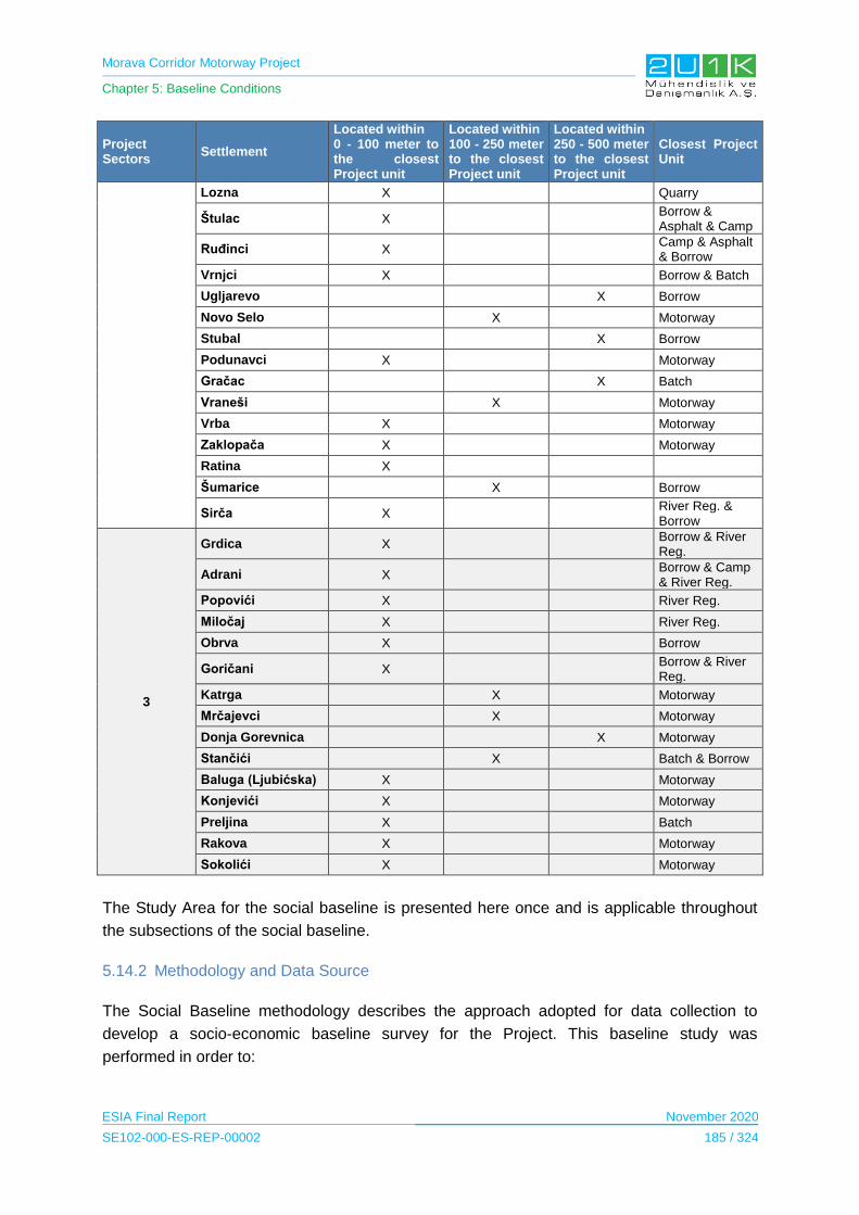
Morava Corridor Motorway Project
Chapter 5: Baseline Conditions
ESIA Final Report November 2020
SE102-000-ES-REP-00002 185 / 324
Project Sectors
Settlement
Located within 0 - 100 meter to the closest Project unit
Located within 100 - 250 meter to the closest Project unit
Located within 250 - 500 meter to the closest Project unit
Closest Project Unit
Lozna X
Quarry
Štulac X
Borrow & Asphalt & Camp
Ruđinci X
Camp & Asphalt & Borrow
Vrnjci X
Borrow & Batch
Ugljarevo
X Borrow
Novo Selo
X
Motorway
Stubal
X Borrow
Podunavci X
Motorway
Gračac
X Batch
Vraneši
X
Motorway
Vrba X
Motorway
Zaklopača X
Motorway
Ratina X
Šumarice
X
Borrow
Sirča X
River Reg. & Borrow
3
Grdica X
Borrow & River Reg.
Adrani X
Borrow & Camp & River Reg.
Popovići X
River Reg.
Miločaj X
River Reg.
Obrva X
Borrow
Goričani X
Borrow & River Reg.
Katrga
X
Motorway
Mrčajevci
X
Motorway
Donja Gorevnica
X Motorway
Stančići
X
Batch & Borrow
Baluga (Ljubićska) X
Motorway
Konjevići X
Motorway
Preljina X
Batch
Rakova X
Motorway
Sokolići X
Motorway
The Study Area for the social baseline is presented here once and is applicable throughout
the subsections of the social baseline.
5.14.2 Methodology and Data Source
The Social Baseline methodology describes the approach adopted for data collection to
develop a socio-economic baseline survey for the Project. This baseline study was
performed in order to:
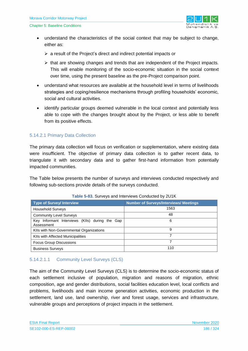
Morava Corridor Motorway Project
Chapter 5: Baseline Conditions
ESIA Final Report November 2020
SE102-000-ES-REP-00002 186 / 324
understand the characteristics of the social context that may be subject to change,
either as:
a result of the Project’s direct and indirect potential impacts or
that are showing changes and trends that are independent of the Project impacts.
This will enable monitoring of the socio-economic situation in the social context
over time, using the present baseline as the pre-Project comparison point.
understand what resources are available at the household level in terms of livelihoods
strategies and coping/resilience mechanisms through profiling households’ economic,
social and cultural activities.
identify particular groups deemed vulnerable in the local context and potentially less
able to cope with the changes brought about by the Project, or less able to benefit
from its positive effects.
5.14.2.1 Primary Data Collection
The primary data collection will focus on verification or supplementation, where existing data
were insufficient. The objective of primary data collection is to gather recent data, to
triangulate it with secondary data and to gather first-hand information from potentially
impacted communities.
The Table below presents the number of surveys and interviews conducted respectively and
following sub-sections provide details of the surveys conducted.
Table 5-83. Surveys and Interviews Conducted by 2U1K
Type of Survey/ Interview Number of Surveys/Interviews/ Meetings
Household Surveys 1563
Community Level Surveys 48
Key Informant Interviews (KIIs) during the Gap Assessment
6
KIIs with Non-Governmental Organizations 9
KIIs with Affected Municipalities 7
Focus Group Discussions 7
Business Surveys 110
5.14.2.1.1 Community Level Surveys (CLS)
The aim of the Community Level Surveys (CLS) is to determine the socio-economic status of
each settlement inclusive of population, migration and reasons of migration, ethnic
composition, age and gender distributions, social facilities education level, local conflicts and
problems, livelihoods and main income generation activities, economic production in the
settlement, land use, land ownership, river and forest usage, services and infrastructure,
vulnerable groups and perceptions of project impacts in the settlement.

Morava Corridor Motorway Project
Chapter 5: Baseline Conditions
ESIA Final Report November 2020
SE102-000-ES-REP-00002 187 / 324
CLS was performed with the village heads designated by Municipal authorities or opinion
leaders who have a representative position and deep knowledge about each settlement.
5.14.2.1.2 Household Surveys (HHS)
In the Serbian context, a household is defined as family or other community of persons who
live together and jointly spend funds for meeting their basic life needs (food, housing, etc.),
regardless of whether all members are permanently at the place where the household
resides or some of them temporarily reside in some other place in the country or abroad on
account of work, education or for some other reason.
The sampling approach included households in the closest proximity to the Project
infrastructure and local transport routes, to ensure that these were well understood, as well
as those further afield (and therefore likely to include secondary/indirect impacts). Despite
falling under the jurisdiction of particular villages, individual households were widely
dispersed in the area.
The sampling methodology took into account by identifying the final sample through use of
Geographic Information System (GIS) imagery (to identify areas where households were
targeted for proximity) as well as taking part of the sample from households not as obviously
affected, but which were nonetheless within the wider area of influence and relevant in terms
of employment, service provision and secondary impacts such as traffic.
The total number of household surveys for both zones were 1,563 for all rural settlements in
the Project buffer area.
5.14.2.1.3 Key Informant Interviews (KII)
Key informant interviews (KIIs) were held with relevant local leaders and subject-matter
experts like health care professionals, education professionals, local government officers,
local Non-Governmental Organizations (NGOs) and other individuals that are able to provide
specific information. KIIs would involve specific ‘deep dives’ into certain topics to close any
remaining data gaps.
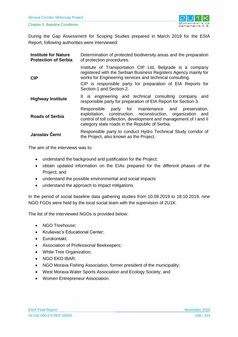
Morava Corridor Motorway Project
Chapter 5: Baseline Conditions
ESIA Final Report November 2020
SE102-000-ES-REP-00002 188 / 324
During the Gap Assessment for Scoping Studies prepared in March 2019 for the ESIA
Report, following authorities were interviewed:
Institute for Nature Protection of Serbia
Determination of protected biodiversity areas and the preparation of protection procedures.
CIP
Institute of Transportation CIP Ltd, Belgrade is a company registered with the Serbian Business Registers Agency mainly for works for Engineering services and technical consulting.
CIP is responsible party for preparation of EIA Reports for Section-1 and Section-2.
Highway Institute It is engineering and technical consulting company and responsible party for preparation of EIA Report for Section-3.
Roads of Serbia
Responsible party for maintenance and preservation, exploitation, construction, reconstruction, organization and control of toll collection, development and management of I and II category state roads in the Republic of Serbia.
Jaroslav Černi Responsible party to conduct Hydro Technical Study corridor of the Project, also known as the Project.
The aim of the interviews was to:
understand the background and justification for the Project;
obtain updated information on the EIAs prepared for the different phases of the
Project; and
understand the possible environmental and social impacts
understand the approach to impact mitigations.
In the period of social baseline data gathering studies from 10.09.2019 to 18.10.2019, nine
NGO FGDs were held by the local social team with the supervision of 2U1K.
The list of the interviewed NGOs is provided below:
NGO Treehouse;
Kruševac’s Educational Center;
Eurokontakt;
Association of Professional Beekeepers;
White Tree Organization;
NGO EKO IBAR;
NGO Morava Fishing Association, former president of the municipality;
West Morava Water Sports Association and Ecology Society; and
Women Entrepreneur Association.
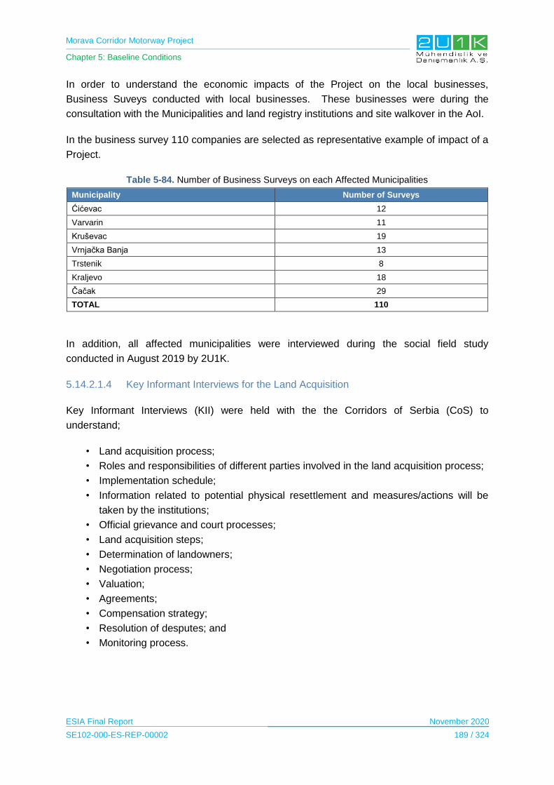
Morava Corridor Motorway Project
Chapter 5: Baseline Conditions
ESIA Final Report November 2020
SE102-000-ES-REP-00002 189 / 324
In order to understand the economic impacts of the Project on the local businesses,
Business Suveys conducted with local businesses. These businesses were during the
consultation with the Municipalities and land registry institutions and site walkover in the AoI.
In the business survey 110 companies are selected as representative example of impact of a
Project.
Table 5-84. Number of Business Surveys on each Affected Municipalities
Municipality Number of Surveys
Ćićevac 12
Varvarin 11
Kruševac 19
Vrnjačka Banja 13
Trstenik 8
Kraljevo 18
Čačak 29
TOTAL 110
In addition, all affected municipalities were interviewed during the social field study
conducted in August 2019 by 2U1K.
5.14.2.1.4 Key Informant Interviews for the Land Acquisition
Key Informant Interviews (KII) were held with the the Corridors of Serbia (CoS) to
understand;
• Land acquisition process;
• Roles and responsibilities of different parties involved in the land acquisition process;
• Implementation schedule;
• Information related to potential physical resettlement and measures/actions will be
taken by the institutions;
• Official grievance and court processes;
• Land acquisition steps;
• Determination of landowners;
• Negotiation process;
• Valuation;
• Agreements;
• Compensation strategy;
• Resolution of desputes; and
• Monitoring process.
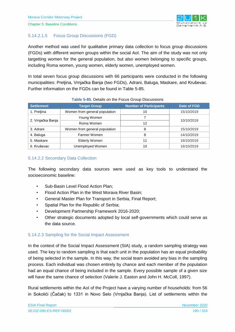
Morava Corridor Motorway Project
Chapter 5: Baseline Conditions
ESIA Final Report November 2020
SE102-000-ES-REP-00002 190 / 324
5.14.2.1.5 Focus Group Discussions (FGD)
Another method was used for qualitative primary data collection to focus group discussions
(FGDs) with different women groups within the social AoI. The aim of the study was not only
targetting women for the general population, but also women belonging to specific groups,
including Roma women, young women, elderly women, unemployed women.
In total seven focus group discussions with 66 participants were conducted in the following
municipalities: Preljina, Vrnjačka Banja (two FGDs), Adrani, Baluga, Maskare, and Kruševac.
Further information on the FGDs can be found in Table 5-85.
Table 5-85. Details on the Focus Group Discussions
Settlement Target Group Number of Participants Date of FGD
1. Preljina Women from general population 10 15/10/2019
2. Vrnjačka Banja Young Women 7
10/10/2019 Roma Women 12
3. Adrani Women from general population 8 15/10/2019
4. Baluga Farmer Women 8 14/10/2019
5. Maskare Elderly Women 11 16/10/2019
6. Kruševac Unemployed Women 10 16/10/2019
5.14.2.2 Secondary Data Collection
The following secondary data sources were used as key tools to understand the
socioeconomic baseline:
• Sub-Basin Level Flood Action Plan;
• Flood Action Plan in the West Morava River Basin;
• General Master Plan for Transport in Serbia, Final Report;
• Spatial Plan for the Republic of Serbia;
• Development Partnership Framework 2016-2020;
• Other strategic documents adopted by local self-governments which could serve as
the data source.
5.14.2.3 Sampling for the Social Impact Assessment
In the context of the Social Impact Assessment (SIA) study, a random sampling strategy was
used. The key to random sampling is that each unit in the population has an equal probability
of being selected in the sample. In this way, the social team avoided any bias in the sampling
process. Each individual was chosen entirely by chance and each member of the population
had an equal chance of being included in the sample. Every possible sample of a given size
will have the same chance of selection (Valerie J. Easton and John H. McColl, 1997).
Rural settlements within the AoI of the Project have a varying number of households: from 56
in Sokolići (Čačak) to 1331 in Novo Selo (Vrnjačka Banja). List of settlements within the

Morava Corridor Motorway Project
Chapter 5: Baseline Conditions
ESIA Final Report November 2020
SE102-000-ES-REP-00002 191 / 324
500 m the AoI of the Project and the number of HH survey sample size is given in Table 5-86
below.
Table 5-86. List of Settlements and HH Sample Size
Settlement Total
Households Average number of
members Household survey sample
size
1. Vraneši 451 3.10 45
2. Vrnjci 696 3.25 70
3. Novo Selo 1331 3.35 133
4. Podunavci 454 3.31 45
5. Ruđinci 787 3.13 79
6. Štulac 390 3.04 39
7. Adrani 726 3.07 73
8. Vrba 432 3.16 43
9. Grdica 251 3.26 25
10. Zaklopača 341 3.42 34
11. Miločaj 296 3.44 30
12. Obrva 201 3.25 20
13. Popovići 92 3.34 9
14. Ratina 983 3.27 98
15. Sirča 436 3.07 44
16. Šumarice 168 2.97 9
17. Baluga (Ljubićska) 122 3.40 12
18. Donja Gorevnica 313 2.80 15
19. Katrga 277 3.17 14
20. Mrčajevci 913 3.03 45
21. Preljina 552 3.33 55
22. Rakova 211 3.13 21
23. Sokolići 56 2.86 6
24. Stančići 83 3.99 4
25. Bošnjane 530 3.23 25
26. Maskare 172 2.90 9
27. Bela Voda 311 3.91 15
28. Bivolje 86 3.20 9
29. Jasika 554 3.22 27
30. Koševi 97 3.95 10
31. Kukljin 455 3.37 45
32. Makrešane 412 3.43 41
33. Čitluk 901 3.46 90
34. Bogdanje 292 3.33 15
35. Velika Drenova 708 3.34 35
36. Lozna 115 2.92 12
37. Medveđa 722 3.14 72
38. Selište 228 3.76 12
39. Grad Stalać 202 3.43 10
40. Mrzenica 69 2.71 7

Morava Corridor Motorway Project
Chapter 5: Baseline Conditions
ESIA Final Report November 2020
SE102-000-ES-REP-00002 192 / 324
Settlement Total
Households Average number of
members Household survey sample
size
41. Pojate 246 3.44 20
42. Stalać 477 3.28 47
43. Gračac 595 3.08 30
44. Konjevići 269 3.19 13
45. Grabovac 50 2.62 3
46. Ugljarevo 164 2.74 8
47. Stubal 357 3.34 18
48. Goričani 225 3.10 22
Total Number of Household Surveys 1,563
The total number of household surveys for both zones were 1,563 for all rural settlements in
the Project buffer area. Data for urban centres such as Trstenik and Kraljevo will be obtained
via other methods and mostly from the secondary data available and KIIs with the
governmental institutions.
5.14.3 Baseline Conditions
5.14.3.1 Administrative Structure of Serbia
Serbia is a unitary country with a one tier structure of government. In terms of
administrative and territorial division, the country is divided into five regions: Belgrade;
Vojvodina; Šumadija and West Serbia; South and East Serbia; and Kosovo and
Metohija. The lower administrative and territorial division includes the City of Belgrade,
as a special territorial unit, and 29 other administrative districts (UNECE, 2018).
Municipalities (usually>10,000 habitants), has an assembly, public service property and
a budget. They comprise local communities. Cities (>100,000 habitants) have an
assembly and budget of its own. Municipalities and cities are gathered into larger entities
known as districts which are regional centers of state authority. Besides five Regions
created for statistical purposes, there are also 2 autonomous Provinces, Pokrajine
Vojvodina and Kosovo. Local governments’ existence and autonomy are enshrined in
the Constitution of Republic of Serbia (2006) and the Law on Local Governments (2007).
The main sub-national governments responsibilities are infrastructure services including
urban water supply, sanitation and sewerage, local road maintenance, solid waste
management, urban planning and housing as well as transport, heating, kindergartens
and preschool education, facilities in the field of sport and culture, public lighting.
Competences on primary and secondary education and on social care are shared with
the central State level, with staff wages being paid by local governments, and facilities
and investment costs being covered by municipal budgets. Other shared responsibilities
include management of local airports and social housing centers for the youth (OECD,
2016).
Morava Corridor Motorway Project
Chapter 5: Baseline Conditions
ESIA Final Report November 2020
SE102-000-ES-REP-00002 193 / 324
5.14.3.2 Population and Demography
The Republic of Serbia is located in South-Eastern Europe and covers the area of 88,361
km2. Serbia shares a border with eight neighboring countries as; Albania, Bosnia and
Herzegovina, Bulgaria, Croatia, Hungary, Montenegro, Romania and the former Yugoslav
Republic of Macedonia (United Nations Economic Commission for Europe, 2007).
According to Statistical Office of the Republic of Serbia, the estimated population is
6,982,604 (2018). The natural increase rate equals -5.4‰. The birth rate equals 9.2‰, and
the death rate equals 14.6‰. The population average age is 43.2 years. In 2018 the life
expectancy for males equals 73 years, and for females 78 years. The average age of mother
at giving first live birth is 28.6. The leading death causes, both for male and female
population, are bloodstream system diseases (Statistical Office of the Republic of Serbia,
2019).
The official language is Serbian written in Cyrillic, although Latin script is also widely used. In
the areas inhabited by ethnic minorities, the languages and scripts of the minorities are in
official use (United Nations Economic Commission for Europe, 2007).
In terms of religious practices, among Serbian’s 84.5% are Orthodox, 5% Roman Catholic,
3% Islamic, 1% Protestant, 1.1% Atheist or Agnostic, 0.1% Other and 4.4% unspecified (BTI
2018 | Serbia Country Report, 2018). Figure 5-63 presents the map of Serbia.

Morava Corridor Motorway Project
Chapter 5: Baseline Conditions
ESIA Final Report November 2020
SE102-000-ES-REP-00002 194 / 324
Source: (Political Map of Serbia, 2019)
Figure 5-63. Map of Serbia
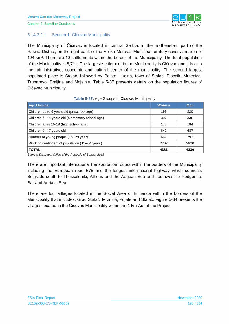
Morava Corridor Motorway Project
Chapter 5: Baseline Conditions
ESIA Final Report November 2020
SE102-000-ES-REP-00002 195 / 324
5.14.3.2.1 Section 1: Ćićevac Municipality
The Municipality of Ćićevac is located in central Serbia, in the northeastern part of the
Rasina District, on the right bank of the Velika Morava. Municipal territory covers an area of
124 km². There are 10 settlements within the border of the Municipality. The total population
of the Municipality is 8,711. The largest settlement in the Municipality is Ćićevac and it is also
the administrative, economic and cultural center of the municipality. The second largest
populated place is Stalac, followed by Pojate, Lucina, town of Stalac, Plocnik, Mrzenica,
Trubarevo, Braljina and Mojsinje. Table 5-87 presents details on the population figures of
Ćićevac Municipality.
Table 5-87. Age Groups in Ćićevac Municipality
Age Groups Women Men
Children up to 6 years old (preschool age) 198 220
Children 7─14 years old (elementary school age) 307 336
Children ages 15-18 (high school age) 172 184
Children 0─17 years old 642 687
Number of young people (15─29 years) 667 793
Working contingent of population (15─64 years) 2702 2920
TOTAL 4381 4330
Source: Statistical Office of the Republic of Serbia, 2018
There are important international transportation routes within the borders of the Municipality
including the European road E75 and the longest international highway which connects
Belgrade south to Thessaloniki, Athens and the Aegean Sea and southwest to Podgorica,
Bar and Adriatic Sea.
There are four villages located in the Social Area of Influence within the borders of the
Municipality that includes; Grad Stalać, Mrznica, Pojate and Stalać. Figure 5-64 presents the
villages located in the Ćićevac Municipality within the 1 km AoI of the Project.
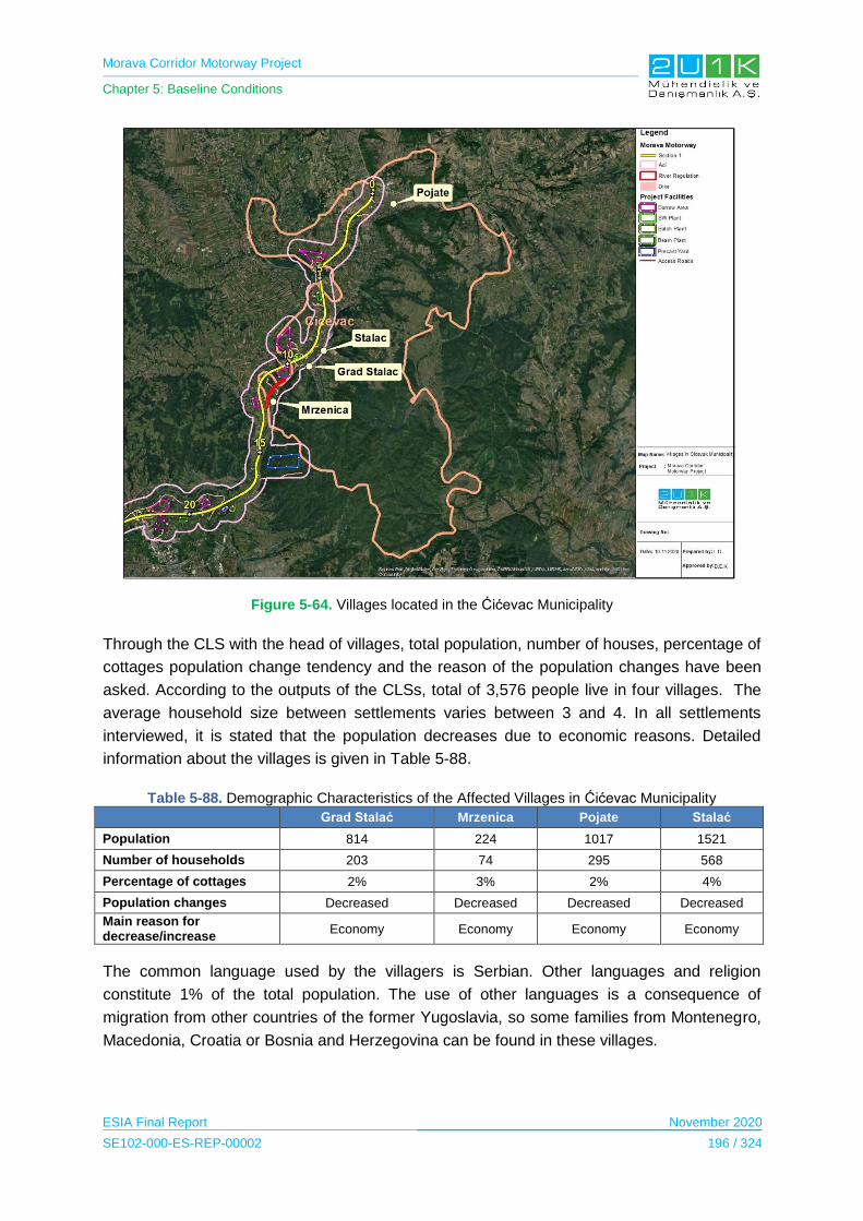
Morava Corridor Motorway Project
Chapter 5: Baseline Conditions
ESIA Final Report November 2020
SE102-000-ES-REP-00002 196 / 324
Figure 5-64. Villages located in the Ćićevac Municipality
Through the CLS with the head of villages, total population, number of houses, percentage of
cottages population change tendency and the reason of the population changes have been
asked. According to the outputs of the CLSs, total of 3,576 people live in four villages. The
average household size between settlements varies between 3 and 4. In all settlements
interviewed, it is stated that the population decreases due to economic reasons. Detailed
information about the villages is given in Table 5-88.
Table 5-88. Demographic Characteristics of the Affected Villages in Ćićevac Municipality
Grad Stalać Mrzenica Pojate Stalać
Population 814 224 1017 1521
Number of households 203 74 295 568
Percentage of cottages 2% 3% 2% 4%
Population changes Decreased Decreased Decreased Decreased
Main reason for decrease/increase
Economy Economy Economy Economy
The common language used by the villagers is Serbian. Other languages and religion
constitute 1% of the total population. The use of other languages is a consequence of
migration from other countries of the former Yugoslavia, so some families from Montenegro,
Macedonia, Croatia or Bosnia and Herzegovina can be found in these villages.
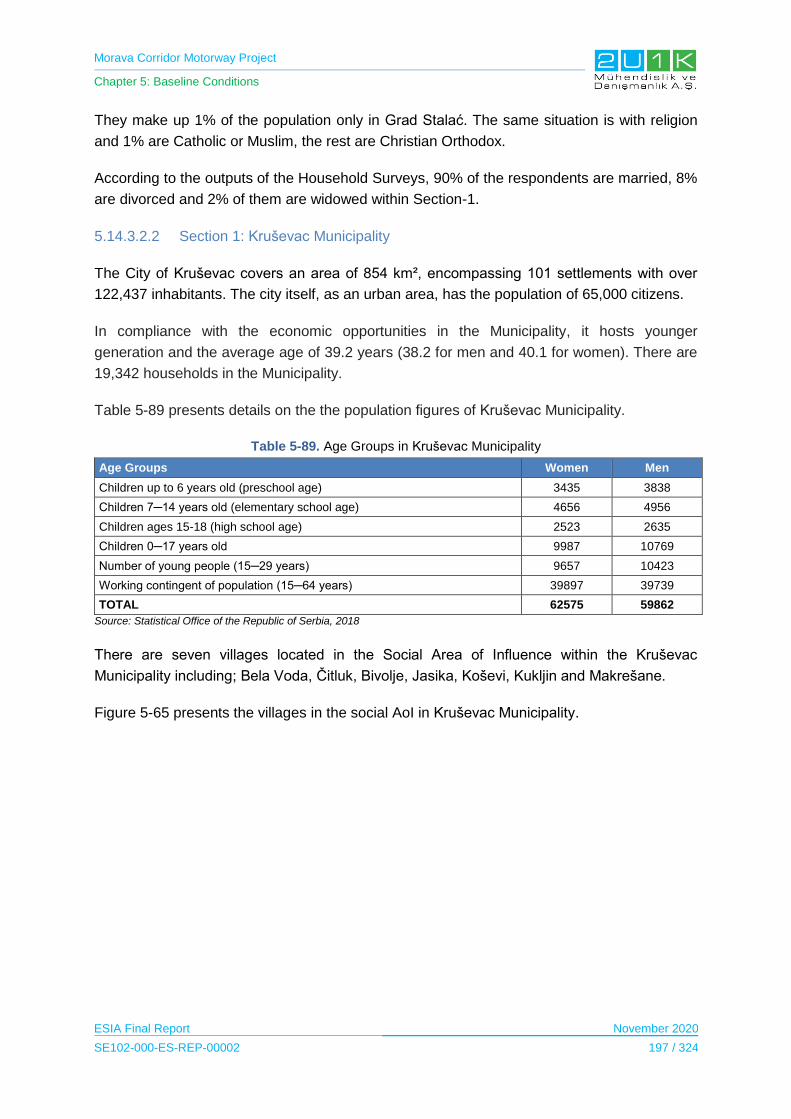
Morava Corridor Motorway Project
Chapter 5: Baseline Conditions
ESIA Final Report November 2020
SE102-000-ES-REP-00002 197 / 324
They make up 1% of the population only in Grad Stalać. The same situation is with religion
and 1% are Catholic or Muslim, the rest are Christian Orthodox.
According to the outputs of the Household Surveys, 90% of the respondents are married, 8%
are divorced and 2% of them are widowed within Section-1.
5.14.3.2.2 Section 1: Kruševac Municipality
The City of Kruševac covers an area of 854 km², encompassing 101 settlements with over
122,437 inhabitants. The city itself, as an urban area, has the population of 65,000 citizens.
In compliance with the economic opportunities in the Municipality, it hosts younger
generation and the average age of 39.2 years (38.2 for men and 40.1 for women). There are
19,342 households in the Municipality.
Table 5-89 presents details on the the population figures of Kruševac Municipality.
Table 5-89. Age Groups in Kruševac Municipality
Age Groups Women Men
Children up to 6 years old (preschool age) 3435 3838
Children 7─14 years old (elementary school age) 4656 4956
Children ages 15-18 (high school age) 2523 2635
Children 0─17 years old 9987 10769
Number of young people (15─29 years) 9657 10423
Working contingent of population (15─64 years) 39897 39739
TOTAL 62575 59862
Source: Statistical Office of the Republic of Serbia, 2018
There are seven villages located in the Social Area of Influence within the Kruševac
Municipality including; Bela Voda, Čitluk, Bivolje, Jasika, Koševi, Kukljin and Makrešane.
Figure 5-65 presents the villages in the social AoI in Kruševac Municipality.
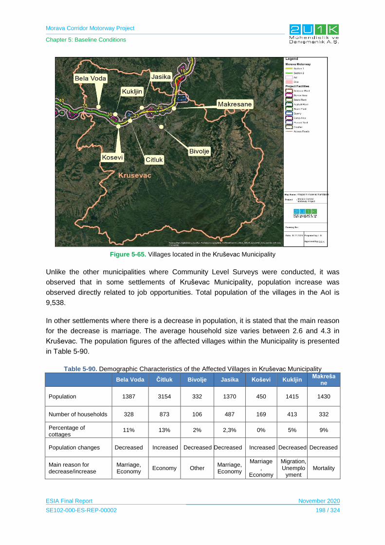
Morava Corridor Motorway Project
Chapter 5: Baseline Conditions
ESIA Final Report November 2020
SE102-000-ES-REP-00002 198 / 324
Figure 5-65. Villages located in the Kruševac Municipality
Unlike the other municipalities where Community Level Surveys were conducted, it was
observed that in some settlements of Kruševac Municipality, population increase was
observed directly related to job opportunities. Total population of the villages in the AoI is
9,538.
In other settlements where there is a decrease in population, it is stated that the main reason
for the decrease is marriage. The average household size varies between 2.6 and 4.3 in
Kruševac. The population figures of the affected villages within the Municipality is presented
in Table 5-90.
Table 5-90. Demographic Characteristics of the Affected Villages in Kruševac Municipality
Bela Voda Čitluk Bivolje Jasika Koševi Kukljin
Makrešane
Population 1387 3154 332 1370 450 1415 1430
Number of households 328 873 106 487 169 413 332
Percentage of cottages
11% 13% 2% 2,3% 0% 5% 9%
Population changes Decreased Increased Decreased Decreased Increased Decreased Decreased
Main reason for decrease/increase
Marriage, Economy
Economy Other Marriage, Economy
Marriage,
Economy
Migration, Unemplo
yment Mortality

Morava Corridor Motorway Project
Chapter 5: Baseline Conditions
ESIA Final Report November 2020
SE102-000-ES-REP-00002 199 / 324
Last, according to Household Surveys and Community Level Surveys, Serbian is spoken in
all settlements. All of the villagers are Christians and 93% of them are Orthodox and 7% are
Catholics.
5.14.3.2.3 Section 1: Varvarin Municipality
The Municipality of Varvarin is located in central Serbia and territorially belongs to the Rasina
District. It is located on the left bank of the Great Morava and Kalenicka Rivers, in the Temnic
region. It covers an area of 249 square kilometers and Rekovac Municipality is located in the
northwest, Jagodina in the north, Paracin in the northeast, Trstenik in the west and Kruševac
in the south. There are 17,966 inhabitants in the Municipality.
Table 5-91 presents details on the population figures of Varvarin Municipality.
Table 5-91. Age Groups in Varvarin Municipality
Age Groups Women Men
Children up to 6 years old (preschool age) 367 421
Children 7─14 years old (elementary school age) 611 611
Children ages 15-18 (high school age) 348 358
Children 0─17 years old 1231 1302
Number of young people (15─29 years) 1303 1455
Working contingent of population (15─64 years) 5067 5427
TOTAL 8319 8242
Source: Statistical Office of the Republic of Serbia, 2018
There are two villages located in the AoI of the Project in Varvarin Municipality as follows:
Bošnjane
Maskare
Figure 5-66 presents the villages located in the Varvarin Municipality within the 1 km AoI of
the Project.
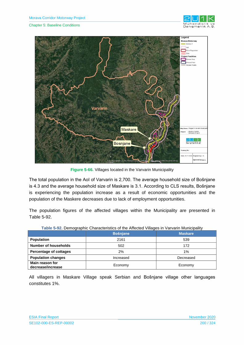
Morava Corridor Motorway Project
Chapter 5: Baseline Conditions
ESIA Final Report November 2020
SE102-000-ES-REP-00002 200 / 324
Figure 5-66. Villages located in the Varvarin Municipality
The total population in the AoI of Varvarin is 2,700. The average household size of Bošnjane
is 4.3 and the average household size of Maskare is 3.1. According to CLS results, Bošnjane
is experiencing the population increase as a result of economic opportunities and the
population of the Maskere decreases due to lack of employment opportunities.
The population figures of the affected villages within the Municipality are presented in
Table 5-92.
Table 5-92. Demographic Characteristics of the Affected Villages in Varvarin Municipality
Bošnjane Maskare
Population 2161 539
Number of households 502 172
Percentage of cottages 2% 1%
Population changes Increased Decreased
Main reason for decrease/increase
Economy Economy
All villagers in Maskare Village speak Serbian and Bošnjane village other languages
constitutes 1%.

Morava Corridor Motorway Project
Chapter 5: Baseline Conditions
ESIA Final Report November 2020
SE102-000-ES-REP-00002 201 / 324
5.14.3.2.4 Section 2: Kraljevo Municipality
The city of Kraljevo occupies the area of 1,529 km². According to Statistical Office of the
Republic of Serbia, the total population of Kraljevo Municipality is 119,585.
Table 5-93 presents details on the the population figures of Kraljevo Municipality.
Table 5-93. Age Groups in Kraljevo Municipality
Age Groups Women Men
Children up to 6 years old (preschool age) 3458 3733
Children 7─14 years old (elementary school age) 4662 5167
Children ages 15-18 (high school age) 2523 2620
Children 0─17 years old 10017 10853
Number of young people (15─29 years) 9707 10519
Working contingent of population (15─64 years) 38889 38968
TOTAL 60848 58737
Source: Statistical Office of the Republic of Serbia, 2018
There are 11 villages located in the Social Area of Influence within the borders of the
Municipality that includes; Adrani, Vrba, Grdica, Zaklopača, Miloča, Obrva, Popovići, Ratina,
Sirča, Šumarice and Stuba.
Figure 5-67 presents the affected villages located in the Kraljevo Municipality.
Figure 5-67. Villages located in the Kraljevo Municipality

Morava Corridor Motorway Project
Chapter 5: Baseline Conditions
ESIA Final Report November 2020
SE102-000-ES-REP-00002 202 / 324
When the municipalities in the impact area are analyzed, it was observed that Kraljevo is the
most affected Municipality in terms of number of the villages in the AoI of the Project. There
are 11 villages located in the 1 km AoI of the Project with the total population of 14,249. The
economy has been cited as the main cause of both population growth and the population
decrease. The average household size varies between 2.8 and 3.4.
The population figures of the affected villages within the Municipality are presented in
Table 5-94.
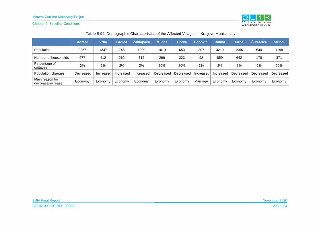
Morava Corridor Motorway Project
Chapter 5: Baseline Conditions
ESIA Final Report November 2020
SE102-000-ES-REP-00002 203 / 324
Table 5-94. Demographic Characteristics of the Affected Villages in Kraljevo Municipality
Adrani Vrba Grdica Zaklopača Miloča Obrva Popovići Ratina Sirča Šumarice Stubal
Population 2257 1347 748 1000 1019 653 307 3210 1966 544 1198
Number of households 677 412 262 312 296 223 92 859 642 178 371
Percentage of cottages
3% 2% 2% 2% 20% 20% 3% 2% 8% 2% 20%
Population changes Decreased Increased Increased Increased Decreased Decreased Increased Increased Decreased Decreased Decreased
Main reason for decrease/increase
Economy Economy Economy Economy Economy Economy Marriage Economy Economy Economy Economy
Morava Corridor Motorway Project
Chapter 5: Baseline Conditions
ESIA Final Report November 2020
SE102-000-ES-REP-00002 204 / 324
All villagers in Kraljevo speak Serbian and other languages constitutes 1-2% of the total
population.
5.14.3.2.5 Section 2: Vrnjačka Banja Municipality
The Municipality of Vrnjačka Banja is located in the borders of the Raška administrative
district in Serbia. The center of the municipality is Vrnjačka Banja. Vrnjačka Banja has 8,421
adults, with an average age of 44.2 years (42.6 for men and 45.6 for women). There are
3,703 households in the settlement, and the average number of members per household is
2.67.
There are seven villages located in the Social Area of Influence within the borders of the
Municipality that includes;
Vraneši;
Vrnjci;
Novo Selo;
Podunavci;
Ruđinci;
Štulac;
Gračac.
Figure 5-68 presents the affected villages located in the Vrnjačka Banja Municipality.
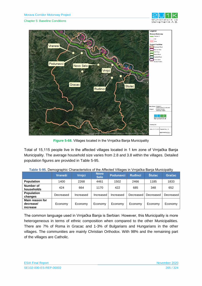
Morava Corridor Motorway Project
Chapter 5: Baseline Conditions
ESIA Final Report November 2020
SE102-000-ES-REP-00002 205 / 324
Figure 5-68. Villages located in the Vrnjačka Banja Municipality
Total of 15,115 people live in the affected villages located in 1 km zone of Vrnjačka Banja
Municipality. The average household size varies from 2.8 and 3.8 within the villages. Detailed
population figures are provided in Table 5-95.
Table 5-95. Demographic Characteristics of the Affected Villages in Vrnjačka Banja Municipality
Vraneši Vrnjci
Novo Selo
Podunavci Ruđinci Štulac Gračac
Population 1400 2268 4461 1502 2466 1185 1833
Number of households
424 664 1170 422 685 348 652
Population changes
Decreased Increased Increased Increased Decreased Decreased Decreased
Main reason for decrease/ increase
Economy Economy Economy Economy Economy Economy Economy
The common language used in Vrnjačka Banja is Serbian: However, this Municipality is more
heterogeneous in terms of ethnic composition when compared to the other Municipalities.
There are 7% of Roma in Gracac and 1-3% of Bulgarians and Hungarians in the other
villages. The communities are mainly Christian Orthodox. With 98% and the remaining part
of the villages are Catholic.
Morava Corridor Motorway Project
Chapter 5: Baseline Conditions
ESIA Final Report November 2020
SE102-000-ES-REP-00002 206 / 324
5.14.3.2.6 Section 2: Trstenik Municipality
The municipality of Trstenik is bordered by the town of Kraljevo in the west, the municipality
of Vrnjačka Banja in the southwest, the municipality of Aleksandrovac in the south and
southeast, the city of Kruševac in the east, the municipality of Rekovac in the north and the
municipality of Varvarin in the northeast. Trstenik municipality is located in the West Morava
valley, covering an area of 448 km². In this area, there are approximately 43,000 inhabitants
in 51 settlements.
Table 5-96 presents details on the population figures of Trstenik Municipality.
Table 5-96. Age Groups in Trstenik Municipality
Age Groups Women Men
Children up to 6 years old (preschool age) 949 1058
Children 7─14 years old (elementary school age) 1358 1407
Children ages 15-18 (high school age) 687 747
Children 0─17 years old 2821 3041
Number of young people (15─29 years) 2865 3076
Working contingent of population (15─64 years) 12500 12678
TOTAL 20088 19422
Source: Statistical Office of the Republic of Serbia, 2018
There are seven villages located in the Social Area of Influence within the borders of the
Municipality that includes;
Bogdanje;
Velika Drenova;
Lozna;
Medveđa;
Selište;
Grabovac;
Ugljarevo.
Figure 5-69 presents the affected villages located in Trstenik Municipality.
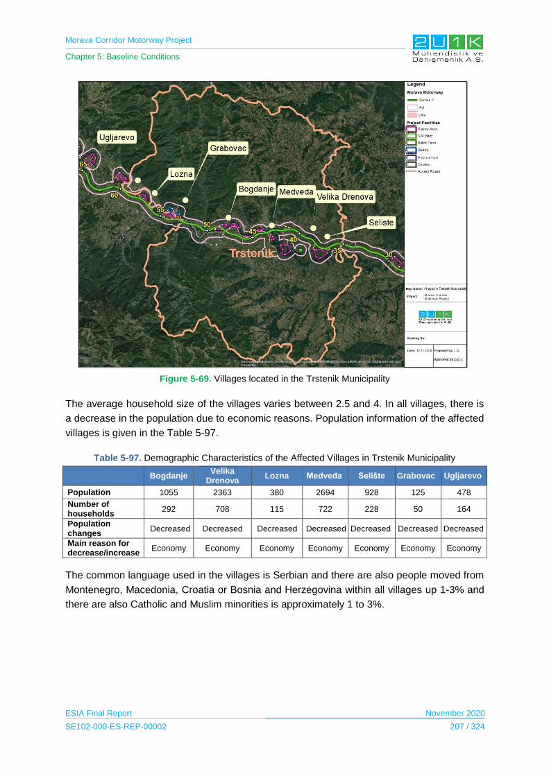
Morava Corridor Motorway Project
Chapter 5: Baseline Conditions
ESIA Final Report November 2020
SE102-000-ES-REP-00002 207 / 324
Figure 5-69. Villages located in the Trstenik Municipality
The average household size of the villages varies between 2.5 and 4. In all villages, there is
a decrease in the population due to economic reasons. Population information of the affected
villages is given in the Table 5-97.
Table 5-97. Demographic Characteristics of the Affected Villages in Trstenik Municipality
Bogdanje
Velika Drenova
Lozna Medveđa Selište Grabovac Ugljarevo
Population 1055 2363 380 2694 928 125 478
Number of households
292 708 115 722 228 50 164
Population changes
Decreased Decreased Decreased Decreased Decreased Decreased Decreased
Main reason for decrease/increase
Economy Economy Economy Economy Economy Economy Economy
The common language used in the villages is Serbian and there are also people moved from
Montenegro, Macedonia, Croatia or Bosnia and Herzegovina within all villages up 1-3% and
there are also Catholic and Muslim minorities is approximately 1 to 3%.

Morava Corridor Motorway Project
Chapter 5: Baseline Conditions
ESIA Final Report November 2020
SE102-000-ES-REP-00002 208 / 324
5.14.3.2.7 Section 3: Čačak Municipality
The Municipality of Čačak is located in the Moravica District. The center of the Municipality is
city of Čačak.
Table 5-98 presents details on the the population figures of Čačak Municipality.
Table 5-98. Age Groups in Čačak Municipality
Age Groups Women Men
Children up to 6 years old (preschool age) 5768 6375
Children 7─14 years old (elementary school age) 7304 7737
Children ages 15-18 (high school age) 3874 4129
Children 0─17 years old 16035 17274
Number of young people (15─29 years) 15211 16510
Working contingent of population (15─64 years) 64127 64854
TOTAL 101847 98358
Source: Statistical Office of the Republic of Serbia, 2018
There are ten villages located in the Social Area of Influence within the borders of the
Municipality that includes;
- Baluga;
- Donja Gorevnica;
- Katrga;
- Mrčajevci;
- Preljina;
- Rakova;
- Sokolići;
- Stančići;
- Konjevići;
- Goričani.
The Figure 5-70 presents the affected villages located in the Čačak Municipality.

Morava Corridor Motorway Project
Chapter 5: Baseline Conditions
ESIA Final Report November 2020
SE102-000-ES-REP-00002 209 / 324
Figure 5-70. Villages located in the Čačak Municipality
Population information of the affected villages is given in the Table 5-99.

Morava Corridor Motorway Project
Chapter 5: Baseline Conditions
ESIA Final Report November 2020
SE102-000-ES-REP-00002 210 / 324
Table 5-99. Demographic Characteristics of the Affected Villages in Čačak Municipality
Baluga Donja Gorevnica Katrga Mrčajevci Preljina Rakova Sokolići Stančići Konjevići Goričani
Population 726 877 877 2767 1840 661 160 331 859 780
Number of households 217 288 323 870 522 234 68 89 246 250
Population changes Decreased Decreased Decreased Increase Increase Decreased Decreased Decreased Increased Decreased
Main reason for decrease/increase
Economy Economy Economy Economy Economy Economy Economy Economy Economy Economy

Morava Corridor Motorway Project
Chapter 5: Baseline Conditions
ESIA Final Report November 2020
SE102-000-ES-REP-00002 211 / 324
There are 1-2% families from Montenegro in the villages of Donja Gorevnica, Mrčajevci,
Preljina and Goričani. In the village of Baluga, Katrga, Rakova, Sokolići, Stančići and
Konjevići all residents are Serbs and in terms of religion all villagers are Orthodox.
5.14.3.2.8 Sensitive Receptors
The sensitive receptors are considered where the Project may create population change
including population influx and population decrease. Although the population increase in the
close vicinity of the construction area may create some positive impacts including job
opportunities and local procurement; it may also create some negative impacts on the
existing social environment including, pressure on the local infrastructure and services,
community health and safety impacts due to interaction with the Project workers and social
conflicts. In addition, the majority of the land acquisition of the Project will be acquired from
agricultural lands from the private owners and it may cause Project affceted landowners
being landless. As a result of this acquisition, out-migration may occur. At the same time in-
migration may occur from the neighbouring communities due to direct and indirect job
opportunities caused by the Project.
5.14.3.3 Economy
Serbia is an upper middle-income country, according to the World Bank economy
classification. The country relies on manufacturing and exports, directed largely by foreign
investment. According to Fiscal Strategy, a document made by the Serbian Ministry of
Finance, predicts that in 2019 GDP will grow around 3.5%, and 4% in 2020 and 2021. Top
five sections in export were: Electrical machines and apparatus, road vehicles, iron and steel,
rubber products and non-ferrous metals (as of 2018) (China - CEE Institute, 2019).
Serbia is one of the top 10 European countries that exports agricultural and food products
(Public Policy Research Center, 2019). In 2018, the area of 754,048 ha was sown in the
autumn sowing season, which in comparison to the final results of the autumn sowing
season 2017 indicates a decrease by 7.3%. Observed by crop cultures, decreased values
were noted for wheat (by 10.6%), barley (by 2.0%), ray (by 19.7%), oat (by 26.7%) and
oilseed rape (by 17.2%). When related to the ten-year average of autumn sowing values
(2008 ‒ 2017), the areas under wheat are larger by 0.5% (Statistical Office of the Republic of
Serbia, 2019).
In 2018, the average gross salaries and wages amounted to RSD 68,629, while the average
net salaries and wages (tax and contributions excluded) amounted to RSD 49,650. Related
to 2017, the average gross salaries and wages increased by 6.0% in nominal terms, and by
3.9% in real terms, while the average net salaries and wages (tax and contributions
excluded) increased by 6.5% in nominal terms, and by 4.4% in real terms. In 2018 the total
number of registered employed amounted to 2,131,079, presenting increase of 3.3% if
related to 2017. In comparison to the year 2017 the number of employed persons increased

Morava Corridor Motorway Project
Chapter 5: Baseline Conditions
ESIA Final Report November 2020
SE102-000-ES-REP-00002 212 / 324
in all regions. The employment growth rate was most expressive in Region Vojvodine (4.1%),
while the lowest growth rate was notable in Region Južne i Istočne Srbije (1.8%).
Last, in 2018, the average monthly income in Serbia, amounted to RSD 63,734 per
household, and when related to 2017 it was increased by 3.8% in nominal terms. The largest
share in income generated from regular employment by 49.1%, then pensions by 32.3%,
income from from agriculture, hunting and fishing by 4.5%, natural consumption by 3.3%,
income coming out of regular employment by 2.8%, social insurance allowances by 2.7%,
and 5.3% goes to income from other sources. The largest share in individual consumption of
households goes to expenditures for food and non-alcoholic beverages by 34.3% and
housing, water, electricity, gas and other fuels by 16.7% (Statistical Office of the Republic of
Serbia, 2019).
5.14.3.3.1 Section 1: Ćićevac Municipality
The local economy in the Ćićevac Municipality is mainly based on private sector. The 70% of
adults (aged over 18 +) are employed, whereas the remaining 30% are unemployed.
Further information on the employment data of Ćićevac was derived from the Statistical
Office of the Republic of Serbia in Table 5-100.
Table 5-100. Employment data of Ćićevac Municipality
Employment and Earnings
Registered employees*1
by municipalities of work 2273 (2018)
by municipalities of residence 2409 (2018)
Registered employees* by municipalities of residence comparing to population number (%)1
28 (2018)
Net average salaries and wages (RSD)1 36751 (2018)
Registered unemployed2 802 (2018)
Registered unemployed per 1,000 inhabitants2 93 (2018)
Source:
1
Statistics of Employment and Earnings, SORS
2
National Employment Service
During the Community Level Surveys with the village heads the majority of the villagers are
salaried employees and farmers. The main local sectors in terms of occupation in the
affected villages are agriculture, wood and construction industries (Rasina Administrative
District, s. 2019).
Almost all participants of the household survey indicated that unemployment is the significant
issue in their villages. Unemployment is observed to be more common in local women,
whereas, retired pensions observed to be received equally among local men and women.
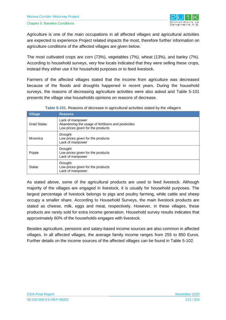
Morava Corridor Motorway Project
Chapter 5: Baseline Conditions
ESIA Final Report November 2020
SE102-000-ES-REP-00002 213 / 324
Agriculture is one of the main occupations in all affected villages and agricultural activities
are expected to experience Project related impacts the most, therefore further information on
agriculture conditions of the affected villages are given below.
The most cultivated crops are corn (73%), vegetables (7%), wheat (13%), and barley (7%).
According to household surveys, very few locals indicated that they were selling these crops,
instead they either use it for household purposes or to feed livestock.
Farmers of the affected villages stated that the income from agriculture was decreased
because of the floods and droughts happened in recent years. During the household
surveys, the reasons of decreasing agriculture activities were also asked and Table 5-101
presents the village vise households opinions on reasons of decrease.
Table 5-101. Reasons of decrease in agricultural activities stated by the villagers
Village Reasons
Grad Stalac Lack of manpower Abandoning the usage of fertilizers and pesticides Low prices given for the products
Mrzenica Drought Low prices given for the products Lack of manpower
Pojate Drought Low prices given for the products Lack of manpower
Stalac Drought Low prices given for the products Lack of manpower.
As stated above, some of the agricultural products are used to feed livestock. Although
majority of the villages are engaged in livestock, it is usually for household purposes. The
largest percentage of livestock belongs to pigs and poultry farming, while cattle and sheep
occupy a smaller share. According to Household Surveys, the main livestock products are
stated as cheese, milk, eggs and meat, respectively. However, in these villages, these
products are rarely sold for extra income generation. Household survey results indicates that
approximately 60% of the households engages with livestock.
Besides agriculture, pensions and salary-based income sources are also common in affected
villages. In all affected villages, the average family income ranges from 255 to 850 Euros.
Further details on the income sources of the affected villages can be found in Table 5-102.

Morava Corridor Motorway Project
Chapter 5: Baseline Conditions
ESIA Final Report November 2020
SE102-000-ES-REP-00002 214 / 324
Table 5-102. Income sources of the affected villages in the Ćićevac Municipality
Village Income Sources
Baluga
1. Agriculture 2. Pension 3. Salaried Employee 4. Seasonal agriculture
Donja Gorevnica 1. Agriculture 2. Salaried Employee 3. Pension
Katrga 1. Agriculture 2. Pension 3. Salaried Employee
Mrčajevci
1. Pension 2. Agriculture 3. Salaried Employee 4. Seasonal agriculture
Preljina 1. Agriculture 2. Salaried Employee 3. Pension
Rakova
1. Agriculture 2. Pension 3. Salaried Employee 4. Seasonal agriculture
Sokolići 1. Agriculture 2. Salaried Employee 3. Pension
Stančići 1. Agriculture 2. Pension 3. Salaried Employee
Konjevići 1. Salaried Employee 2. Agriculture 3. Pension
Goričani 1. Agriculture 2. Salaried Employee 3. Pension
The main expenses of the households stated as food, agricultural expenses and household
utility bills.
5.14.3.3.2 Section 1: Kruševac Municipality
The local economy in the Kruševac Municipality is mainly based on private sector and
services, and 75% of the adults (aged over 18+) are stated as employed, whereas remaining
25% is unemployed.
Further information on the employment data of Kruševac was derived from the Statistical
Office of the Republic of Serbia in Table 5-103.
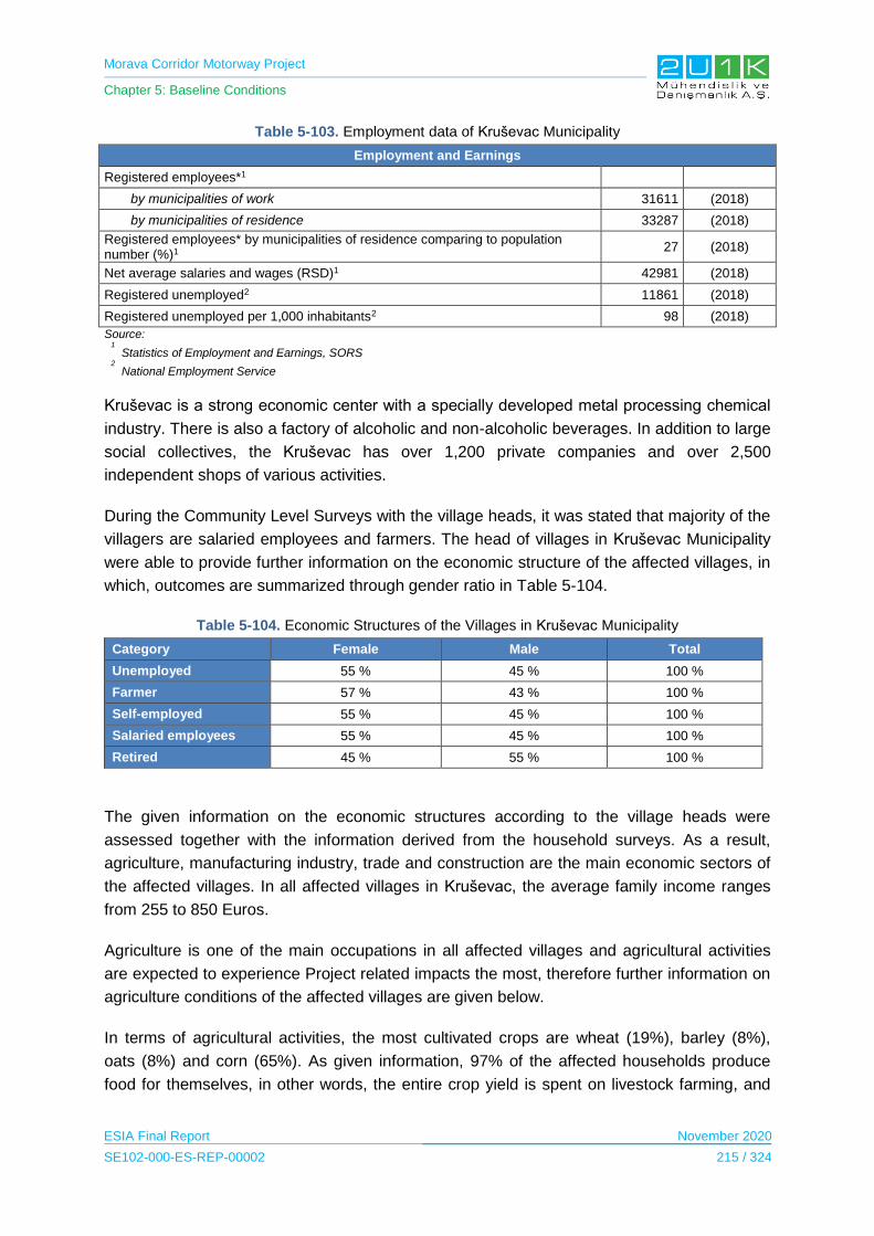
Morava Corridor Motorway Project
Chapter 5: Baseline Conditions
ESIA Final Report November 2020
SE102-000-ES-REP-00002 215 / 324
Table 5-103. Employment data of Kruševac Municipality
Employment and Earnings
Registered employees*1
by municipalities of work 31611 (2018)
by municipalities of residence 33287 (2018)
Registered employees* by municipalities of residence comparing to population number (%)1
27 (2018)
Net average salaries and wages (RSD)1 42981 (2018)
Registered unemployed2 11861 (2018)
Registered unemployed per 1,000 inhabitants2 98 (2018)
Source:
1
Statistics of Employment and Earnings, SORS
2
National Employment Service
Kruševac is a strong economic center with a specially developed metal processing chemical
industry. There is also a factory of alcoholic and non-alcoholic beverages. In addition to large
social collectives, the Kruševac has over 1,200 private companies and over 2,500
independent shops of various activities.
During the Community Level Surveys with the village heads, it was stated that majority of the
villagers are salaried employees and farmers. The head of villages in Kruševac Municipality
were able to provide further information on the economic structure of the affected villages, in
which, outcomes are summarized through gender ratio in Table 5-104.
Table 5-104. Economic Structures of the Villages in Kruševac Municipality
Category Female Male Total
Unemployed 55 % 45 % 100 %
Farmer 57 % 43 % 100 %
Self-employed 55 % 45 % 100 %
Salaried employees 55 % 45 % 100 %
Retired 45 % 55 % 100 %
The given information on the economic structures according to the village heads were
assessed together with the information derived from the household surveys. As a result,
agriculture, manufacturing industry, trade and construction are the main economic sectors of
the affected villages. In all affected villages in Kruševac, the average family income ranges
from 255 to 850 Euros.
Agriculture is one of the main occupations in all affected villages and agricultural activities
are expected to experience Project related impacts the most, therefore further information on
agriculture conditions of the affected villages are given below.
In terms of agricultural activities, the most cultivated crops are wheat (19%), barley (8%),
oats (8%) and corn (65%). As given information, 97% of the affected households produce
food for themselves, in other words, the entire crop yield is spent on livestock farming, and

Morava Corridor Motorway Project
Chapter 5: Baseline Conditions
ESIA Final Report November 2020
SE102-000-ES-REP-00002 216 / 324
livestock is used for household nutrition. Only 3% of the households stated to sell farmland
products and excess livestock.
The largest percentage of the livestock belongs to poultry farming (83%), followed by pigs,
(10%) while cattle (4%) and sheep (3%) occupy a smaller percentage. The main livestock
products are cheese, milk, eggs and meat. These products are mostly made for household
use. Besides, 40 families in the village of Kukljin is selling cheese, eggs and milk for income.
The village of Koševi follows Kukljin with 15 households, who are selling milk, cheese and
similar products, whereas 2-3 households in other villages of Kruševac deal with selling
livestock products.
Besides agriculture, small businesses and pensions are also common income sources in
affected villages. Further details on the income sources of the affected villages can be found
in Table 5-105.
Table 5-105. Income sources of the affected villages in Kruševac Municipality
Village Income Sources
Bela voda
1. Agriculture 2. Seasonal agriculture 3. Pension 4. Government social support 5. State job
Čitluk
1. Small business owner 2. Seasonal agriculture 3. Governmental job 4. Retired 5. Government social support
Bivolje
1. Small business owner 2. Seasonal agriculture 3. Governmental job 4. Retired 5. Government social support
Jasika, Koševi, Kukljin, Makrešane
1. Agriculture 2. Seasonal agriculture 3. Pension 4. Government social support 5. State job
The main expenses of the households stated to be household utility bills and health
expenses.
5.14.3.3.3 Section 1: Varvarin Municipality
The main economic segments within the Varvarin Municipality are mainly based on private
sector, tourism, and services, 75% of the adults (aged over 18+) are stated to be employed,
whereas remaining 25% is stated as unemployed.
Further information on the employment data of Varvarin was derived from the Statistical
Office of the Republic of Serbia in Table 5-106.
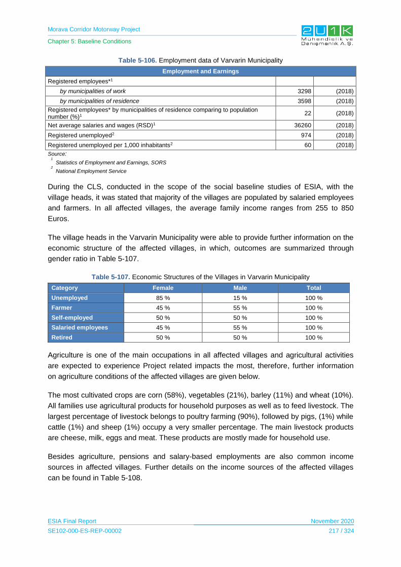
Morava Corridor Motorway Project
Chapter 5: Baseline Conditions
ESIA Final Report November 2020
SE102-000-ES-REP-00002 217 / 324
Table 5-106. Employment data of Varvarin Municipality
Employment and Earnings
Registered employees*1
by municipalities of work 3298 (2018)
by municipalities of residence 3598 (2018)
Registered employees* by municipalities of residence comparing to population number (%)1
22 (2018)
Net average salaries and wages (RSD)1 36260 (2018)
Registered unemployed2 974 (2018)
Registered unemployed per 1,000 inhabitants2 60 (2018)
Source:
1
Statistics of Employment and Earnings, SORS
2
National Employment Service
During the CLS, conducted in the scope of the social baseline studies of ESIA, with the
village heads, it was stated that majority of the villages are populated by salaried employees
and farmers. In all affected villages, the average family income ranges from 255 to 850
Euros.
The village heads in the Varvarin Municipality were able to provide further information on the
economic structure of the affected villages, in which, outcomes are summarized through
gender ratio in Table 5-107.
Table 5-107. Economic Structures of the Villages in Varvarin Municipality
Category Female Male Total
Unemployed 85 % 15 % 100 %
Farmer 45 % 55 % 100 %
Self-employed 50 % 50 % 100 %
Salaried employees 45 % 55 % 100 %
Retired 50 % 50 % 100 %
Agriculture is one of the main occupations in all affected villages and agricultural activities
are expected to experience Project related impacts the most, therefore, further information
on agriculture conditions of the affected villages are given below.
The most cultivated crops are corn (58%), vegetables (21%), barley (11%) and wheat (10%).
All families use agricultural products for household purposes as well as to feed livestock. The
largest percentage of livestock belongs to poultry farming (90%), followed by pigs, (1%) while
cattle (1%) and sheep (1%) occupy a very smaller percentage. The main livestock products
are cheese, milk, eggs and meat. These products are mostly made for household use.
Besides agriculture, pensions and salary-based employments are also common income
sources in affected villages. Further details on the income sources of the affected villages
can be found in Table 5-108.

Morava Corridor Motorway Project
Chapter 5: Baseline Conditions
ESIA Final Report November 2020
SE102-000-ES-REP-00002 218 / 324
Table 5-108. Sources of the affected villages in Varvarin Municipality
Village Income Sources
Bošnjane
1. Agriculture 2. Seasonal agriculture 3. Pension 4. Government social support 5. State job
Maskare
1. Pension 2. Agriculture 3. Seasonal agriculture 4. Agriculture
The main expenses of the households stated to be household utility bills and health
expenses.
5.14.3.3.4 Section 2: Kraljevo Municipality
The main economic sectors within the Kraljevo Municipality are mainly based on private
sector, agriculture and livestock and 75% of the adults (aged over 1+) are stated to be
employed, whereas remaining 25% is stated as unemployed.
Further information on the employment data of Kraljevo was derived from the Statistical
Office of the Republic of Serbia in Table 5-109.
Table 5-109. Employment data of Kraljevo Municipality
Employment and Earnings
Registered employees*1
by municipalities of work 29937 (2018)
by municipalities of residence 32349 (2018)
Registered employees* by municipalities of residence comparing to population number (%)1
27 (2018)
Net average salaries and wages (RSD)1 42708 (2018)
Registered unemployed2 10459 (2018)
Registered unemployed per 1,000 inhabitants2 88 (2018)
Source:
1
Statistics of Employment and Earnings, SORS
2
National Employment Service
The majority of the locals within the affected villages of Kraljevo Municipality are self-
employed, farmers and salaried employers. During the Community Level Surveys with the
village heads, the economic structure of the villages was asked and outcomes are
summarized through gender ratio in Table 5-110.
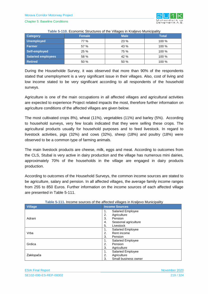
Morava Corridor Motorway Project
Chapter 5: Baseline Conditions
ESIA Final Report November 2020
SE102-000-ES-REP-00002 219 / 324
Table 5-110. Economic Structures of the Villages in Kraljevo Municipality
Category Female Male Total
Unemployed 77 % 23 % 100 %
Farmer 57 % 43 % 100 %
Self-employed 25 % 75 % 100 %
Salaried employees 58 % 42 % 100 %
Retired 50 % 50 % 100 %
During the Householde Survey, it was observed that more than 90% of the respondents
stated that unemployment is a very significant issue in their villages. Also, cost of living and
low income stated to be very significant according to all respondents of the household
surveys.
Agriculture is one of the main occupations in all affected villages and agricultural activities
are expected to experience Project related impacts the most, therefore further information on
agriculture conditions of the affected villages are given below.
The most cultivated crops 8%), wheat (11%), vegetables (11%) and barley (5%). According
to household surveys, very few locals indicated that they were selling these crops. The
agricultural products usually for household purposes and to feed livestock. In regard to
livestock activities, pigs (32%) and cows (32%), sheep (18%) and poultry (18%) were
observed to be a common type of farming animals.
The main livestock products are cheese, milk, eggs and meat. According to outcomes from
the CLS, Stubal is very active in dairy production and the village has numerous mini dairies,
approximately 70% of the households in the village are engaged in dairy products
production.
According to outcomes of the Household Surveys, the common income sources are stated to
be agriculture, salary and pension. In all affected villages, the average family income ranges
from 255 to 850 Euros. Further information on the income sources of each affected village
are presented in Table 5-111.
Table 5-111. Income sources of the affected villages in Kraljevo Municipality
Village Income Sources
Adrani
1. Salaried Employee 2. Agriculture 3. Pension 4. Seasonal agriculture 5. Livestock
Vrba 1. Salaried Employee 2. Rent income 3. Pension
Grdica 1. Salaried Employee 2. Pension 3. Agriculture
Zaklopača 1. Salaried Employee 2. Agriculture 3. Small business owner
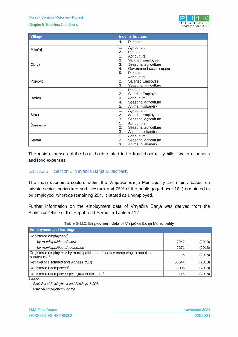
Morava Corridor Motorway Project
Chapter 5: Baseline Conditions
ESIA Final Report November 2020
SE102-000-ES-REP-00002 220 / 324
Village Income Sources
4. Pension
Miločaj 1. Agriculture 2. Pension
Obrva
1. Agriculture 2. Salaried Employee 3. Seasonal agriculture 4. Government social support 5. Pension
Popovići 1. Agriculture 2. Salaried Employee 3. Seasonal agriculture
Ratina
1. Pension 2. Salaried Employee 3. Agriculture 4. Seasonal agriculture 5. Animal husbandry
Sirča 1. Agriculture 2. Salaried Employee 3. Seasonal agriculture
Šumarice
1. Agriculture 2. Seasonal agriculture 3. Animal husbandry
Stubal 1. Agriculture 2. Seasonal agriculture 3. Animal husbandry
The main expenses of the households stated to be household utility bills, health expenses
and food expenses.
5.14.3.3.5 Section 2: Vrnjačka Banja Municipality
The main economic sectors within the Vrnjačka Banja Municipality are mainly based on
private sector, agriculture and livestock and 75% of the adults (aged over 18+) are stated to
be employed, whereas remaining 25% is stated as unemployed.
Further information on the employment data of Vrnjačka Banja was derived from the
Statistical Office of the Republic of Serbia in Table 5-112.
Table 5-112. Employment data of Vrnjačka Banja Municipality
Employment and Earnings
Registered employees*1
by municipalities of work 7247 (2018)
by municipalities of residence 7371 (2018)
Registered employees* by municipalities of residence comparing to population number (%)1
28 (2018)
Net average salaries and wages (RSD)1 38544 (2018)
Registered unemployed2 3005 (2018)
Registered unemployed per 1,000 inhabitants2 115 (2018)
Source:
1
Statistics of Employment and Earnings, SORS
2
National Employment Service

Morava Corridor Motorway Project
Chapter 5: Baseline Conditions
ESIA Final Report November 2020
SE102-000-ES-REP-00002 221 / 324
The majority of the locals within the affected villages of Vrnjačka Banja are salary employed,
farmers and retired. The village heads in Vrnjačka Banja Municipality were able to provide
further information on the economic structure of the affected villages, in which, outcomes are
summarized through gender ratio in Table 5-113.
Table 5-113. Economic Structures of the Villages in Vrnjačka Banja Municipality
Category Female Male Total
Unemployed 60 % 40 % 100 %
Farmer 35 % 65 % 100 %
Self-employed 35 % 65 % 100 %
Salaried employees 45 % 55 % 100 %
Retired 45 % 55 % 100 %
The given information on the economic structures according to the village heads were
assessed together with the information derived from the household surveys. As a result,
agriculture, manufacturing industry and trade are the main economic sectors of the affected
villages. In all affected villages in Vrnjačka Banja, the average family income ranges from
255 to 850 Euros.
Agriculture is one of the main occupations in all affected villages and agricultural activities
are expected to experience Project related impacts the most, therefore further information on
agriculture conditions of the affected villages are given below.
The most cultivated crops are vegetables (36%), corn (28%), fruits (20%), and wheat (16%).
According to the locals, corn and wheat are mainly used to feed livestock, whereas,
vegetables and fruits are used for household purposes. The largest percentage of livestock
belongs to pigs (53%) and poultry farming (23%), while cattle (12%) and sheep (12%)
occupy a smaller percentage. The main livestock products are cheese, milk, eggs and meat.
According to Household Surveys, livestock products are mainly used for household
purposes.
According to outcomes of the Household Surveys, income sources of each affected village
are presented in Table 5-114.

Morava Corridor Motorway Project
Chapter 5: Baseline Conditions
ESIA Final Report November 2020
SE102-000-ES-REP-00002 222 / 324
Table 5-114. Income sources of the affected villages in Vrnjačka Banja Municipality
Village Income Sources
Vraneši
1. Agriculture 2. Salaried Employee 3. Seasonal agriculture 4. Pension
Vrnjci 1. Salaried Employee 2. Pension 3. Agriculture
Novo Selo
1. Salaried Employee 2. Pension 3. Seasonal agriculture 4. Agriculture
Podunavci 1. Salaried Employee 2. Agriculture 3. Pension
Ruđinci 1. Pension 2. Salaried Employee
Štulac
1. Salary 2. Pension 3. Agriculture
Gračac 1. Salaried Employee 2. Agriculture 3. Pension
The main expenses of the households stated to be household utility bills, health expenses
and food expenses.
5.14.3.3.6 Section 2: Trstenik Municipality
The main economic sector within the Trstenik Municipality is mainly based on private sector
and 66% of the adults (aged over 18+) are stated to be employed, whereas remaining 34% is
stated as unemployed.
Further information on the employment data of Trsnetik was derived from the Statistical
Office of the Republic of Serbia in Table 5-115.
Table 5-115. Employment data of Trstenik Municipality
Employment and Earnings
Registered employees*1
by municipalities of work 9121 (2018)
by municipalities of residence 9705 (2018)
Registered employees* by municipalities of residence comparing to population number (%)1
25 (2018)
Net average salaries and wages (RSD)1 39466 (2018)
Registered unemployed2 4326 (2018)
Registered unemployed per 1,000 inhabitants2 111 (2018)
Source:
1
Statistics of Employment and Earnings, SORS
2
National Employment Service
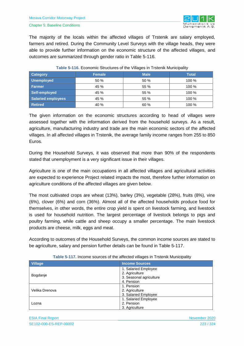
Morava Corridor Motorway Project
Chapter 5: Baseline Conditions
ESIA Final Report November 2020
SE102-000-ES-REP-00002 223 / 324
The majority of the locals within the affected villages of Trstenik are salary employed,
farmers and retired. During the Community Level Surveys with the village heads, they were
able to provide further information on the economic structure of the affected villages, and
outcomes are summarized through gender ratio in Table 5-116.
Table 5-116. Economic Structures of the Villages in Trstenik Municipality
Category Female Male Total
Unemployed 50 % 50 % 100 %
Farmer 45 % 55 % 100 %
Self-employed 45 % 55 % 100 %
Salaried employees 45 % 55 % 100 %
Retired 40 % 60 % 100 %
The given information on the economic structures according to head of villages were
assessed together with the information derived from the household surveys. As a result,
agriculture, manufacturing industry and trade are the main economic sectors of the affected
villages. In all affected villages in Trstenik, the average family income ranges from 255 to 850
Euros.
During the Household Surveys, it was observed that more than 90% of the respondents
stated that unemployment is a very significant issue in their villages.
Agriculture is one of the main occupations in all affected villages and agricultural activities
are expected to experience Project related impacts the most, therefore further information on
agriculture conditions of the affected villages are given below.
The most cultivated crops are wheat (13%), barley (3%), vegetable (28%), fruits (8%), vine
(6%), clover (6%) and corn (36%). Almost all of the affected households produce food for
themselves, in other words, the entire crop yield is spent on livestock farming, and livestock
is used for household nutrition. The largest percentage of livestock belongs to pigs and
poultry farming, while cattle and sheep occupy a smaller percentage. The main livestock
products are cheese, milk, eggs and meat.
According to outcomes of the Household Surveys, the common income sources are stated to
be agriculture, salary and pension further details can be found in Table 5-117.
Table 5-117. Income sources of the affected villages in Trstenik Municipality
Village Income Sources
Bogdanje
1. Salaried Employee 2. Agriculture 3. Seasonal agriculture 4. Pension
Velika Drenova 1. Pension 2. Agriculture 3. Salaried Employee
Lozna 1. Salaried Employee 2. Pension 3. Agriculture
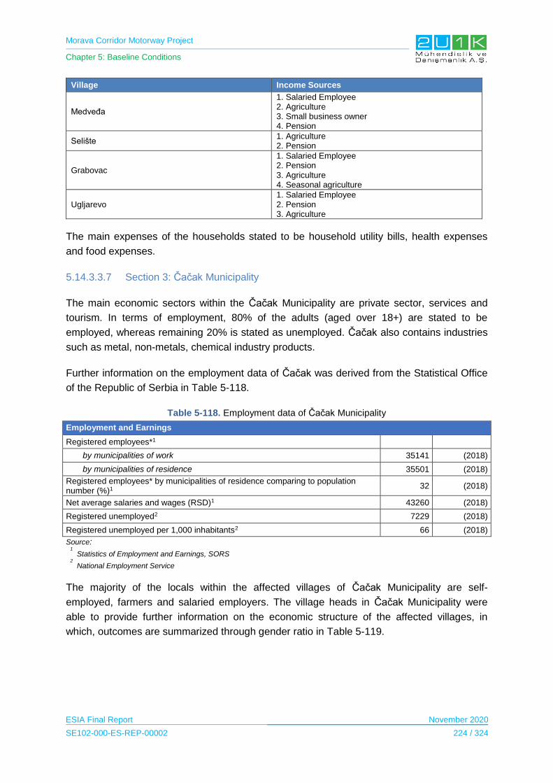
Morava Corridor Motorway Project
Chapter 5: Baseline Conditions
ESIA Final Report November 2020
SE102-000-ES-REP-00002 224 / 324
Village Income Sources
Medveđa
1. Salaried Employee 2. Agriculture 3. Small business owner 4. Pension
Selište 1. Agriculture 2. Pension
Grabovac
1. Salaried Employee 2. Pension 3. Agriculture 4. Seasonal agriculture
Ugljarevo 1. Salaried Employee 2. Pension 3. Agriculture
The main expenses of the households stated to be household utility bills, health expenses
and food expenses.
5.14.3.3.7 Section 3: Čačak Municipality
The main economic sectors within the Čačak Municipality are private sector, services and
tourism. In terms of employment, 80% of the adults (aged over 18+) are stated to be
employed, whereas remaining 20% is stated as unemployed. Čačak also contains industries
such as metal, non-metals, chemical industry products.
Further information on the employment data of Čačak was derived from the Statistical Office
of the Republic of Serbia in Table 5-118.
Table 5-118. Employment data of Čačak Municipality
Employment and Earnings
Registered employees*1
by municipalities of work 35141 (2018)
by municipalities of residence 35501 (2018)
Registered employees* by municipalities of residence comparing to population number (%)1
32 (2018)
Net average salaries and wages (RSD)1 43260 (2018)
Registered unemployed2 7229 (2018)
Registered unemployed per 1,000 inhabitants2 66 (2018)
Source:
1
Statistics of Employment and Earnings, SORS
2
National Employment Service
The majority of the locals within the affected villages of Čačak Municipality are self-
employed, farmers and salaried employers. The village heads in Čačak Municipality were
able to provide further information on the economic structure of the affected villages, in
which, outcomes are summarized through gender ratio in Table 5-119.

Morava Corridor Motorway Project
Chapter 5: Baseline Conditions
ESIA Final Report November 2020
SE102-000-ES-REP-00002 225 / 324
Table 5-119. Economic Structures of the Villages in Čačak Municipality
Category Female Male Total
Unemployed 60 % 40 % 100 %
Farmer 33 % 67 % 100 %
Self-employed 44 % 56 % 100 %
Salaried employees 35 % 65 % 100 %
Retired 58 % 42 % 100 %
During the Household Surveys, it was observed that more than 90% of the respondents
stated that unemployment is a very significant issue in their villages. Also, both “cost of living”
and “low income” were stated to be very significant according to all respondents of the
household surveys. In all affected villages in Čačak, the average family income ranges from
255 to 850 Euros.
Agriculture is one of the main occupations in all affected villages and agricultural activities
are expected to experience Project related impacts the most, therefore further information on
agriculture conditions of the affected villages are given below.
The most cultivated crops are vegetables (33%), fruits (25%), corn (19%), clover (9%), barley
(7%), wheat (4%) and vine (3%). According to Household Surveys, very few locals indicated
that they were selling these crops. Farmers of the affected villages stated that the income
from agriculture was decreasing over the years because in recent years the villages had
been affected by floods and droughts, so the crops they cultivated were barely able to feed
the livestock. In all villages, corn, barley and clover are used to feed livestock.
In regard to livestock activities, the largest percentage of livestock belong to pigs, sheep,
cattle and poultry. The main livestock products are stated to be cheese, milk, eggs and meat.
However, in these villages, it is rare for anyone to sell these products to generate extra
income. According to the Household Surveys, approximately 85% of the households in all
villages are engaged in livestock.
According to outcomes of The Household Surveys, income sources of each affected village
are presented in Table 5-120.
Table 5-120. Income sources of the affected villages in Čačak Municipality
Village Income Sources
Baluga
1. Agriculture 2. Pension 3. Salaried Employee 4. Seasonal agriculture
Donja Gorevnica 1. Agriculture 2. Salaried Employee 3. Pension
Katrga 1. Agriculture 2. Pension 3. Salaried Employee
Mrčajevci 1. Pension 2. Agriculture

Morava Corridor Motorway Project
Chapter 5: Baseline Conditions
ESIA Final Report November 2020
SE102-000-ES-REP-00002 226 / 324
Village Income Sources
3. Salaried Employee 4. Seasonal agriculture
Preljina 1. Agriculture 2. Salaried Employee 3. Pension
Rakova
1. Agriculture 2. Pension 3. Salaried Employee 4. Seasonal agriculture
Sokolići 1. Agriculture 2. Salaried Employee 3. Pension
Stančići 1. Agriculture 2. Pension 3. Salaried Employee
Konjevići 1. Salaried Employee 2. Agriculture 3. Pension
Goričani 1. Agriculture 2. Salaried Employee 3. Pension
The main expenses of the households stated to be household utility bills, health expenses
and agricultural expenses.
5.14.3.3.8 Sensitive Receptors
The local employment opportunities of the Project are expected to occur especially during
the construction phase of the Project. According to the results of the baseline studies,
sensitive receptors are high considering the unemployment rate of each affected settlement.
Also considering the indirect job opportunities, local suppliers are determined to be highly
sensitive since the local procurement opportunities have not been settled at this stage of the
Project.
5.14.3.4 Ecosystem Services
5.14.3.4.1 Section 1: Ćićevac Municipality
The West Morava River
In Ćićevac Municipality, communities use the West Morava River for recreational, irrigation
and fishing purposes. It is also used for the transportation in Grad Stalac Village.
The types of the fishes are; carp, whitefish and catfish. The communities use the West
Morava River during Spring period and each individual stated to catch around 10 kg in each
season for the household consumption.
Forests
In Ćićevac, there is no state-owned forest land and the size of privately-owned forests are
2,598 ha according to the Department of Forestry, SORS, 2017. In this Municipality,
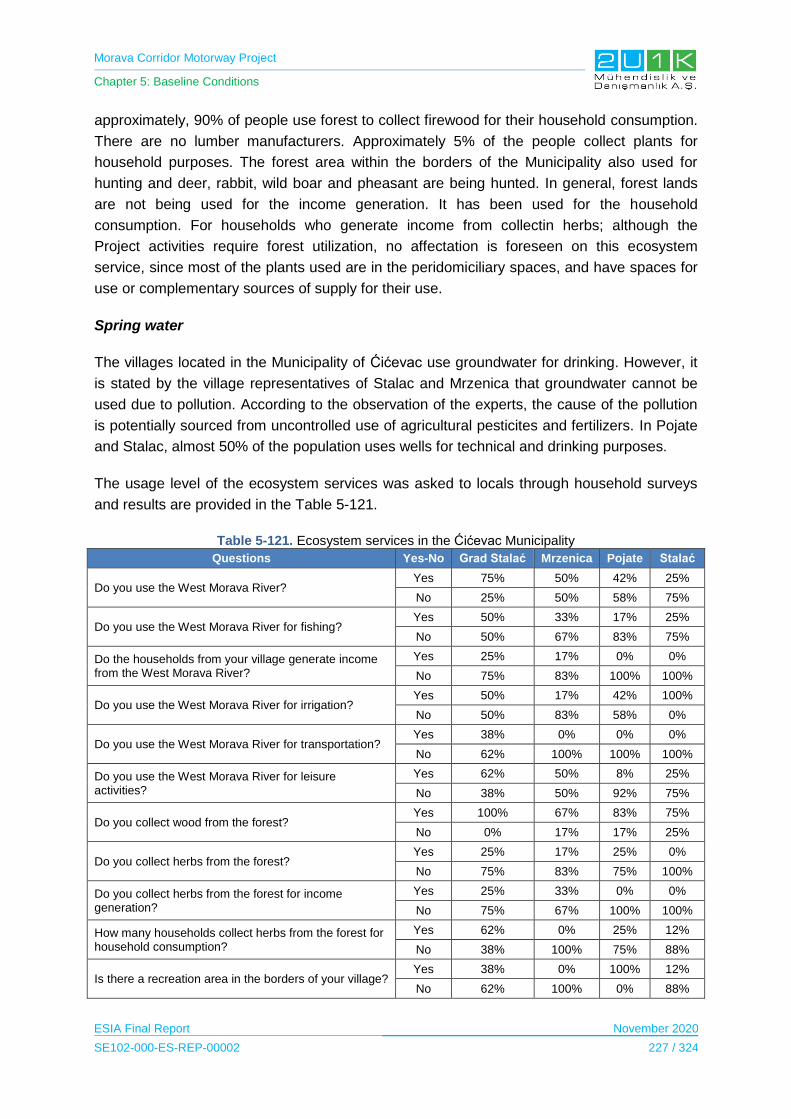
Morava Corridor Motorway Project
Chapter 5: Baseline Conditions
ESIA Final Report November 2020
SE102-000-ES-REP-00002 227 / 324
approximately, 90% of people use forest to collect firewood for their household consumption.
There are no lumber manufacturers. Approximately 5% of the people collect plants for
household purposes. The forest area within the borders of the Municipality also used for
hunting and deer, rabbit, wild boar and pheasant are being hunted. In general, forest lands
are not being used for the income generation. It has been used for the household
consumption. For households who generate income from collectin herbs; although the
Project activities require forest utilization, no affectation is foreseen on this ecosystem
service, since most of the plants used are in the peridomiciliary spaces, and have spaces for
use or complementary sources of supply for their use.
Spring water
The villages located in the Municipality of Ćićevac use groundwater for drinking. However, it
is stated by the village representatives of Stalac and Mrzenica that groundwater cannot be
used due to pollution. According to the observation of the experts, the cause of the pollution
is potentially sourced from uncontrolled use of agricultural pesticites and fertilizers. In Pojate
and Stalac, almost 50% of the population uses wells for technical and drinking purposes.
The usage level of the ecosystem services was asked to locals through household surveys
and results are provided in the Table 5-121.
Table 5-121. Ecosystem services in the Ćićevac Municipality
Questions Yes-No Grad Stalać Mrzenica Pojate Stalać
Do you use the West Morava River? Yes 75% 50% 42% 25%
No 25% 50% 58% 75%
Do you use the West Morava River for fishing? Yes 50% 33% 17% 25%
No 50% 67% 83% 75%
Do the households from your village generate income from the West Morava River?
Yes 25% 17% 0% 0%
No 75% 83% 100% 100%
Do you use the West Morava River for irrigation? Yes 50% 17% 42% 100%
No 50% 83% 58% 0%
Do you use the West Morava River for transportation? Yes 38% 0% 0% 0%
No 62% 100% 100% 100%
Do you use the West Morava River for leisure activities?
Yes 62% 50% 8% 25%
No 38% 50% 92% 75%
Do you collect wood from the forest? Yes 100% 67% 83% 75%
No 0% 17% 17% 25%
Do you collect herbs from the forest? Yes 25% 17% 25% 0%
No 75% 83% 75% 100%
Do you collect herbs from the forest for income generation?
Yes 25% 33% 0% 0%
No 75% 67% 100% 100%
How many households collect herbs from the forest for household consumption?
Yes 62% 0% 25% 12%
No 38% 100% 75% 88%
Is there a recreation area in the borders of your village? Yes 38% 0% 100% 12%
No 62% 100% 0% 88%
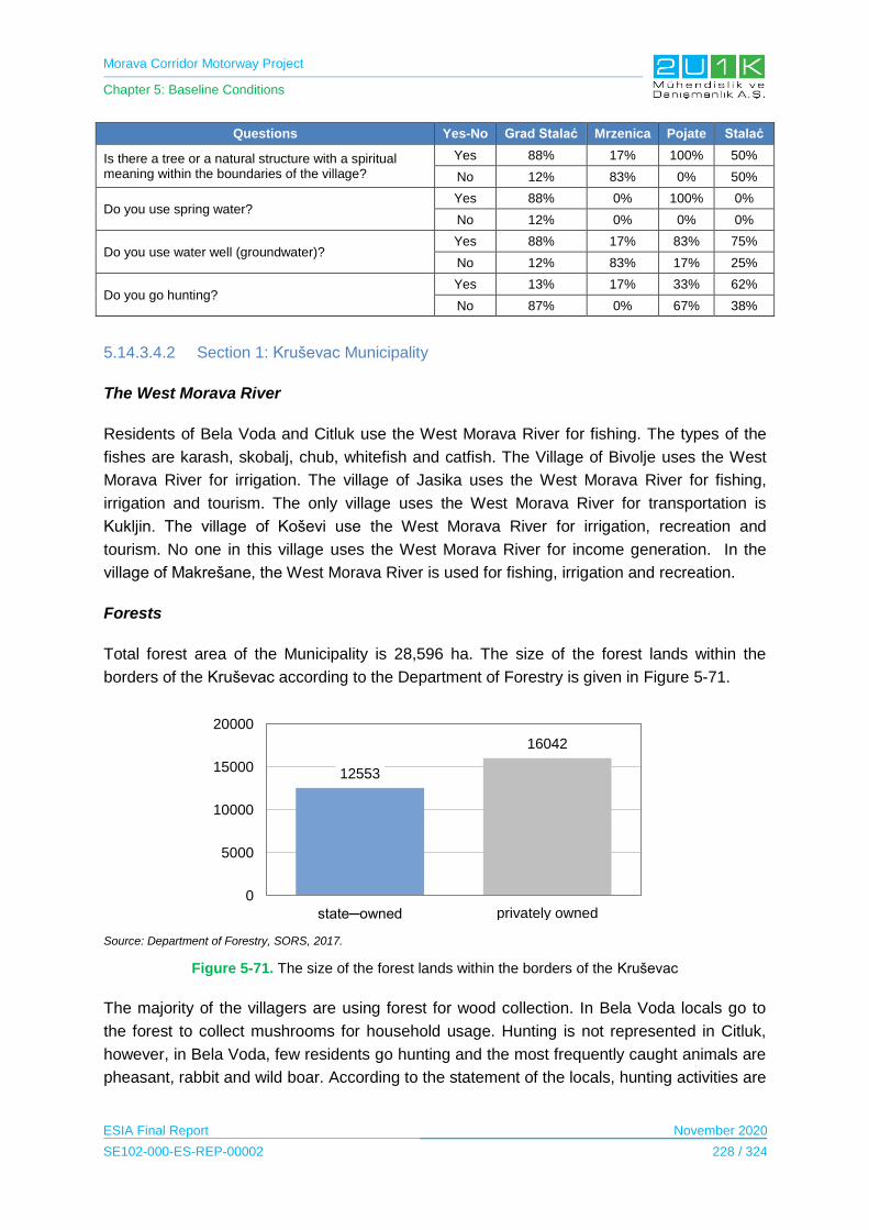
Morava Corridor Motorway Project
Chapter 5: Baseline Conditions
ESIA Final Report November 2020
SE102-000-ES-REP-00002 228 / 324
Questions Yes-No Grad Stalać Mrzenica Pojate Stalać
Is there a tree or a natural structure with a spiritual meaning within the boundaries of the village?
Yes 88% 17% 100% 50%
No 12% 83% 0% 50%
Do you use spring water? Yes 88% 0% 100% 0%
No 12% 0% 0% 0%
Do you use water well (groundwater)? Yes 88% 17% 83% 75%
No 12% 83% 17% 25%
Do you go hunting? Yes 13% 17% 33% 62%
No 87% 0% 67% 38%
5.14.3.4.2 Section 1: Kruševac Municipality
The West Morava River
Residents of Bela Voda and Citluk use the West Morava River for fishing. The types of the
fishes are karash, skobalj, chub, whitefish and catfish. The Village of Bivolje uses the West
Morava River for irrigation. The village of Jasika uses the West Morava River for fishing,
irrigation and tourism. The only village uses the West Morava River for transportation is
Kukljin. The village of Koševi use the West Morava River for irrigation, recreation and
tourism. No one in this village uses the West Morava River for income generation. In the
village of Makrešane, the West Morava River is used for fishing, irrigation and recreation.
Forests
Total forest area of the Municipality is 28,596 ha. The size of the forest lands within the
borders of the Kruševac according to the Department of Forestry is given in Figure 5-71.
Source: Department of Forestry, SORS, 2017.
Figure 5-71. The size of the forest lands within the borders of the Kruševac
The majority of the villagers are using forest for wood collection. In Bela Voda locals go to
the forest to collect mushrooms for household usage. Hunting is not represented in Citluk,
however, in Bela Voda, few residents go hunting and the most frequently caught animals are
pheasant, rabbit and wild boar. According to the statement of the locals, hunting activities are
12553
16042
0
5000
10000
15000
20000
state─owned privately owned

Morava Corridor Motorway Project
Chapter 5: Baseline Conditions
ESIA Final Report November 2020
SE102-000-ES-REP-00002 229 / 324
for household consumption. In the village of Jasika, locals collect timber and 70% of them
generates income from timber collection. Approximately 70% of them collect timber to
generate income. The villagers of Kukljin collect wood from the forest for household needs.
The wood collection is not expected to be affected as most of the ecosystem services plants
used are in the peridomiciliary spaces, and have spaces for use or complementary sources
of supply for their use.
There are 114 hunters in the village of Kukljin. In the village of Makrešane, most people
collect wood from the forest for household purposes and there are several hunters in the
village.
Spring water
There is a source of natural water in the village of Bela Voda and it is considered to be high
quality and it is used by the villagers for drinking purposes. There is no spring water in the
village of Jasika. In Kukljin both spring and well water are used. Well and spring water is
used for drinking. 50 households from this village own wells. There is no spring water or
wells water usage in Makrešane.
The usage level of the ecosystem services was asked to locals through household surveys
and results are provided in Table 5-122.
Table 5-122. Ecosystem services in Ćićevac Municipality
Questions Yes-No Bela Voda
Čitluk Bivolje Jasika Koševi Kukljin Makrešane
Do you use The West Morava River?
Yes 75% 35% 11% 40% 0% 55% 14%
No 25% 65% 89% 60% 100% 45% 86%
Do you use the West Morava River for fishing?
Yes 35% 43% 12% 40% 0% 45% 29%
No 65% 57% 89% 60% 100% 55% 71%
Do the households from your village generate income from the West Morava River?
Yes 0% 0% 0% 20% 0% 9% 0%
No 100% 100% 100% 80% 100% 91% 100%
Do you use the the West Morava River for irrigation?
Yes 0% 0% 0% 0% 0% 27% 14%
No 100% 100% 100% 100% 100% 73% 86%
Do you use the West Morava River for transportation?
Yes 0% 0% 0% 40% 0% 27% 14%
No 100% 100% 100% 60% 100% 73% 86%
Do you use the West Morava River for leisure activities?
Yes 50% 50% 11% 20% 0% 45% 29%
No 50% 50% 89% 80% 100% 55% 71%
Do you collect wood from the forest?
Yes 95% 80% 0% 40% 0% 73% 71%
No 5% 20% 100% 60% 100% 27% 29%
Do you collect herbs from the forest?
Yes 85% 0% 11% 40% 0% 36% 0%
No 15% 100% 89% 60% 100% 64% 100%
Do you collect herbs from the forest for income generation?
Yes 0% 0% 0% 0% 0% 18% 0%
No 100% 100% 100% 100% 100% 82% 100%
How many households Yes 100% 100% 0% 60% 0% 45% 0%
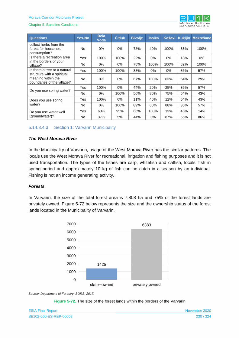
Morava Corridor Motorway Project
Chapter 5: Baseline Conditions
ESIA Final Report November 2020
SE102-000-ES-REP-00002 230 / 324
Questions Yes-No Bela Voda
Čitluk Bivolje Jasika Koševi Kukljin Makrešane
collect herbs from the forest for household consumption?
No 0% 0% 78% 40% 100% 55% 100%
Is there a recreation area in the borders of your village?
Yes 100% 100% 22% 0% 0% 18% 0%
No 0% 0% 78% 100% 100% 82% 100%
Is there a tree or a natural structure with a spiritual meaning within the boundaries of the village?
Yes 100% 100% 33% 0% 0% 36% 57%
No 0% 0% 67% 100% 63% 64% 29%
Do you use spring water? Yes 100% 0% 44% 20% 25% 36% 57%
No 0% 100% 56% 80% 75% 64% 43%
Does you use spring water?
Yes 100% 0% 11% 40% 12% 64% 43%
No 0% 100% 89% 60% 88% 36% 57%
Do you use water well (groundwater)?
Yes 63% 95% 66% 100% 13% 45% 14%
No 37% 5% 44% 0% 87% 55% 86%
5.14.3.4.3 Section 1: Varvarin Municipality
The West Morava River
In the Municipality of Varvarin, usage of the West Morava River has the similar patterns. The
locals use the West Morava River for recreational, irrigation and fishing purposes and it is not
used transportation. The types of the fishes are carp, whitefish and catfish, locals’ fish in
spring period and approximately 10 kg of fish can be catch in a season by an individual.
Fishing is not an income generating activity.
Forests
In Varvarin, the size of the total forest area is 7,808 ha and 75% of the forest lands are
privately owned. Figure 5-72 below represents the size and the ownership status of the forest
lands located in the Municipality of Varvarin.
Source: Department of Forestry, SORS, 2017.
Figure 5-72. The size of the forest lands within the borders of the Varvarin
1425
6383
0
1000
2000
3000
4000
5000
6000
7000
state─owned privately owned
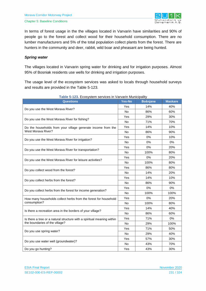
Morava Corridor Motorway Project
Chapter 5: Baseline Conditions
ESIA Final Report November 2020
SE102-000-ES-REP-00002 231 / 324
In terms of forest usage in the the villages located in Varvarin have similarities and 90% of
people go to the forest and collect wood for their household consumption. There are no
lumber manufacturers and 5% of the total population collect plants from the forest. There are
hunters in the community and deer, rabbit, wild boar and pheasant are being hunted.
Spring water
The villages located in Varvarin spring water for drinking and for irrigation purposes. Almost
95% of Bosniak residents use wells for drinking and irrigation purposes.
The usage level of the ecosystem services was asked to locals through household surveys
and results are provided in the Table 5-123.
Table 5-123. Ecosystem services in Varvarin Municipality
Questions Yes-No Bošnjane Maskare
Do you use the West Morava River? Yes 14% 40%
No 86% 60%
Do you use the West Morava River for fishing? Yes 29% 30%
No 71% 70%
Do the households from your village generate income from the West Morava River?
Yes 14% 10%
No 86% 90%
Do you use the West Morava River for irrigation? Yes 0% 10%
No 0% 0%
Do you use the West Morava River for transportation? Yes 0% 20%
No 100% 80%
Do you use the West Morava River for leisure activities? Yes 0% 20%
No 100% 80%
Do you collect wood from the forest? Yes 86% 80%
No 14% 20%
Do you collect herbs from the forest? Yes 14% 10%
No 86% 90%
Do you collect herbs from the forest for income generation? Yes 0% 0%
No 100% 100%
How many households collect herbs from the forest for household consumption?
Yes 0% 20%
No 100% 80%
Is there a recreation area in the borders of your village? Yes 14% 40%
No 86% 60%
Is there a tree or a natural structure with a spiritual meaning within the boundaries of the village?
Yes 71% 0%
No 29% 100%
Do you use spring water? Yes 71% 50%
No 29% 40%
Do you use water well (groundwater)? Yes 57% 30%
No 43% 70%
Do you go hunting? Yes 43% 30%
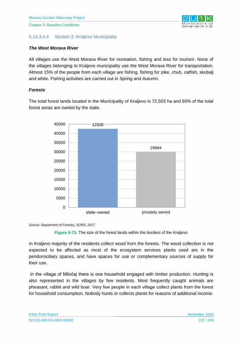
Morava Corridor Motorway Project
Chapter 5: Baseline Conditions
ESIA Final Report November 2020
SE102-000-ES-REP-00002 232 / 324
5.14.3.4.4 Section 2: Kraljevo Municipality
The West Morava River
All villages use the West Morava River for recreation, fishing and less for tourism. None of
the villages belonging to Kraljevo municipality use the West Morava River for transportation.
Almost 15% of the people from each village are fishing, fishing for pike, chub, catfish, skobalj
and white. Fishing activities are carried out in Spring and Autumn.
Forests
The total forest lands located in the Municipality of Kraljevo is 72,503 ha and 60% of the total
forest areas are owned by the state.
Source: Department of Forestry, SORS, 2017.
Figure 5-73. The size of the forest lands within the borders of the Kraljevo
In Kraljevo majority of the residents collect wood from the forests. The wood collection is not
expected to be affected as most of the ecosystem services plants used are in the
peridomiciliary spaces, and have spaces for use or complementary sources of supply for
their use.
In the village of Miločaj there is one household engaged with timber production. Hunting is
also represented in the villages by few residents. Most frequently caught animals are
pheasant, rabbit and wild boar. Very few people in each village collect plants from the forest
for household consumption. Nobody hunts or collects plants for reasons of additional income.
42508
29994
0
5000
10000
15000
20000
25000
30000
35000
40000
45000
state─owned privately owned

Morava Corridor Motorway Project
Chapter 5: Baseline Conditions
ESIA Final Report November 2020
SE102-000-ES-REP-00002 233 / 324
Spring water
All villages use spring water for drinking purposes. The residents of this villages also use
spring water for domestic purpose. However, in the villages of Obrva, Sirča, well water is not
used.
The usage level of the ecosystem services was asked to locals through household surveys
and results are provided in the Table 5-124.
Table 5-124. Ecosystem services in Kraljevo Municipality
Questions
Ye
s-N
o
Ad
ran
i
Vrb
a
Grd
ica
Za
klo
pa
ča
Mil
oča
j
Ob
rva
Po
po
vić
i
Ra
tin
a
Sir
ča
Šu
ma
ric
e
Stu
ba
l
Do you use the West Morava River?
Yes 60% 0% 0% 0% 0% 50% 25% 67% 50% 30% 60%
No 40% 100% 100% 100% 100% 50% 75% 33% 50% 70% 40%
Do you use the West Morava River for fishing?
Yes 40% 0% 0% 0% 17% 0% 12% 33% 0% 20% 0%
No 60% 100% 100% 100% 83% 100% 88% 67% 100% 80% 100%
Do the households from your village generate income from the West Morava River?
Yes 0% 20% 0% 0% 0% 0% 0% 0% 0% 0% 20%
No 100% 80% 100% 100% 100% 100% 100% 100% 100% 100% 80%
Do you use the West Morava River for irrigation?
Yes 0% 0% 0% 0% 17% 25% 25% 33% 25% 10% 40%
No 100% 100% 100% 100% 83% 75% 75% 67% 75% 90% 60%
Do you the West Morava River for transportation?
Yes 0% 40% 0% 40% 0% 0% 12% 0% 40% 0% 40%
No 100%
60% 100% 60% 100% 100% 88% 100% 60% 100% 60%
Do you use the river for leisure activities?
Yes 20% 20% 0% 20% 0% 25% 25% 0% 20% 10% 20%
No 80% 80% 100% 80% 100% 75% 75% 100% 80% 90% 80%
Do you collect wood from the forest?
Yes 60% 60% 0% 60% 50% 50% 88% 33% 80% 70% 80%
No 40% 40% 100% 40% 50% 50% 12% 67% 20% 30% 20%
Do you collect herbs from the forest?
Yes 40% 40% 0% 0% 0% 0% 25% 33% 20% 10% 20%
No 60% 60% 100% 100% 100% 100% 75% 67% 80% 90% 80%
Do you collect herbs from the forest for income generation?
Yes 0% 0% 0% 0% 0% 0% 37% 0% 37% 0% 0%
No 100% 100% 100% 100% 100% 100% 63% 100% 63% 100% 100%
How many households collect herbs from the forest for household consumption?
Yes 20% 60% 0% 60% 17% 0% 12% 0% 12% 0% 0%
No 80% 40% 100% 40% 83% 100% 88% 100% 88% 100% 100%
Is there a recreation area in the borders of your village?
Yes 0% 20% 0% 0% 0% 0% 37% 67% 0% 0% 40%
No 100% 80% 100% 100% 100% 100% 63% 33% 100% 100% 60%
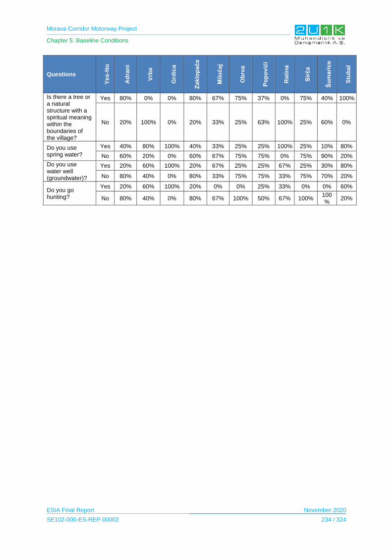
Morava Corridor Motorway Project
Chapter 5: Baseline Conditions
ESIA Final Report November 2020
SE102-000-ES-REP-00002 234 / 324
Questions
Ye
s-N
o
Ad
ran
i
Vrb
a
Grd
ica
Za
klo
pa
ča
Mil
oča
j
Ob
rva
Po
po
vić
i
Ra
tin
a
Sir
ča
Šu
ma
ric
e
Stu
ba
l
Is there a tree or a natural structure with a spiritual meaning within the boundaries of the village?
Yes 80% 0% 0% 80% 67% 75% 37% 0% 75% 40% 100%
No 20% 100% 0% 20% 33% 25% 63% 100% 25% 60% 0%
Do you use spring water?
Yes 40% 80% 100% 40% 33% 25% 25% 100% 25% 10% 80%
No 60% 20% 0% 60% 67% 75% 75% 0% 75% 90% 20%
Do you use water well (groundwater)?
Yes 20% 60% 100% 20% 67% 25% 25% 67% 25% 30% 80%
No 80% 40% 0% 80% 33% 75% 75% 33% 75% 70% 20%
Do you go hunting?
Yes 20% 60% 100% 20% 0% 0% 25% 33% 0% 0% 60%
No 80% 40% 0% 80% 67% 100% 50% 67% 100% 100%
20%
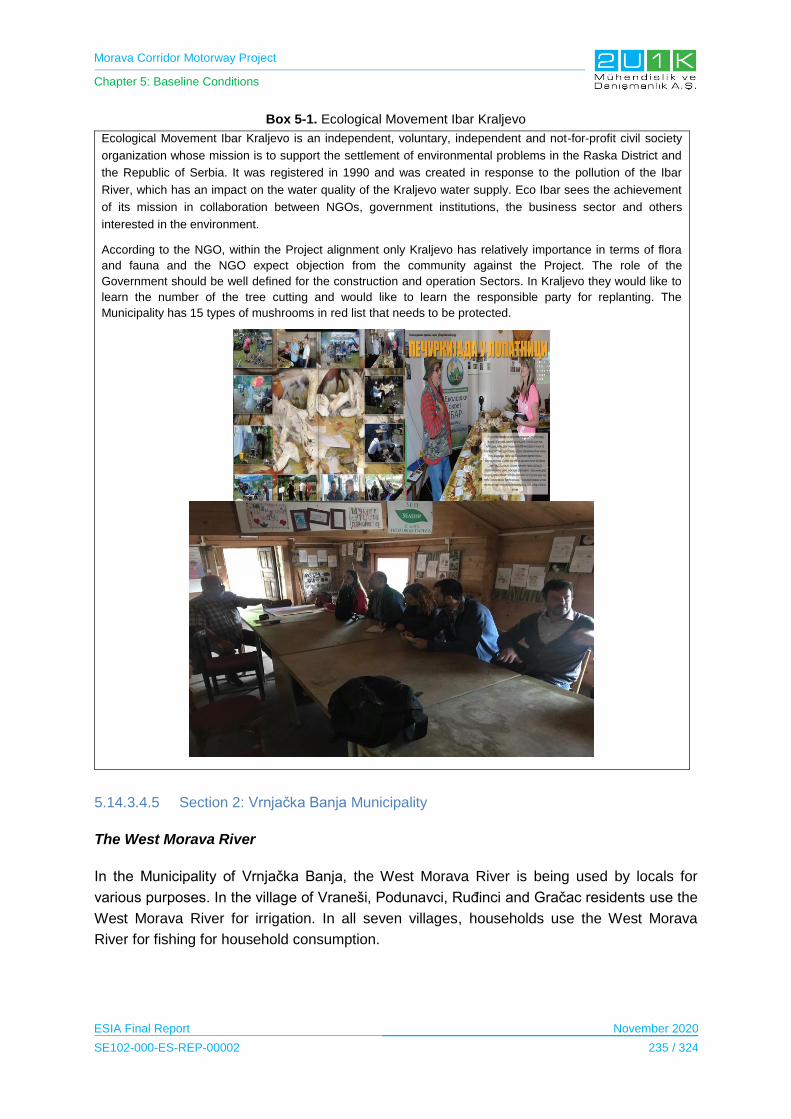
Morava Corridor Motorway Project
Chapter 5: Baseline Conditions
ESIA Final Report November 2020
SE102-000-ES-REP-00002 235 / 324
Box 5-1. Ecological Movement Ibar Kraljevo
Ecological Movement Ibar Kraljevo is an independent, voluntary, independent and not-for-profit civil society
organization whose mission is to support the settlement of environmental problems in the Raska District and
the Republic of Serbia. It was registered in 1990 and was created in response to the pollution of the Ibar
River, which has an impact on the water quality of the Kraljevo water supply. Eco Ibar sees the achievement
of its mission in collaboration between NGOs, government institutions, the business sector and others
interested in the environment.
According to the NGO, within the Project alignment only Kraljevo has relatively importance in terms of flora
and fauna and the NGO expect objection from the community against the Project. The role of the
Government should be well defined for the construction and operation Sectors. In Kraljevo they would like to
learn the number of the tree cutting and would like to learn the responsible party for replanting. The
Municipality has 15 types of mushrooms in red list that needs to be protected.
5.14.3.4.5 Section 2: Vrnjačka Banja Municipality
The West Morava River
In the Municipality of Vrnjačka Banja, the West Morava River is being used by locals for
various purposes. In the village of Vraneši, Podunavci, Ruđinci and Gračac residents use the
West Morava River for irrigation. In all seven villages, households use the West Morava
River for fishing for household consumption.
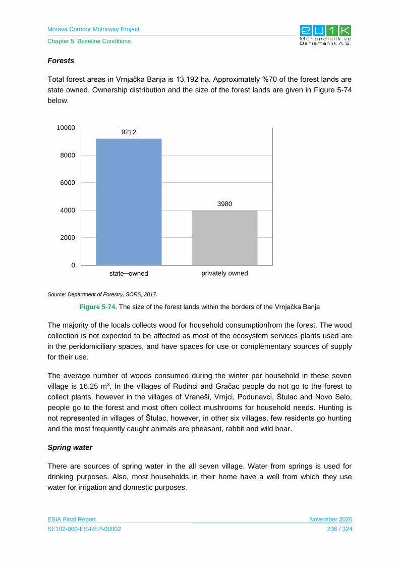
Morava Corridor Motorway Project
Chapter 5: Baseline Conditions
ESIA Final Report November 2020
SE102-000-ES-REP-00002 236 / 324
Forests
Total forest areas in Vrnjačka Banja is 13,192 ha. Approximately %70 of the forest lands are
state owned. Ownership distribution and the size of the forest lands are given in Figure 5-74
below.
Source: Department of Forestry, SORS, 2017.
Figure 5-74. The size of the forest lands within the borders of the Vrnjačka Banja
The majority of the locals collects wood for household consumptionfrom the forest. The wood
collection is not expected to be affected as most of the ecosystem services plants used are
in the peridomiciliary spaces, and have spaces for use or complementary sources of supply
for their use.
The average number of woods consumed during the winter per household in these seven
village is 16.25 m3. In the villages of Ruđinci and Gračac people do not go to the forest to
collect plants, however in the villages of Vraneši, Vrnjci, Podunavci, Štulac and Novo Selo,
people go to the forest and most often collect mushrooms for household needs. Hunting is
not represented in villages of Štulac, however, in other six villages, few residents go hunting
and the most frequently caught animals are pheasant, rabbit and wild boar.
Spring water
There are sources of spring water in the all seven village. Water from springs is used for
drinking purposes. Also, most households in their home have a well from which they use
water for irrigation and domestic purposes.
9212
3980
0
2000
4000
6000
8000
10000
state─owned privately owned
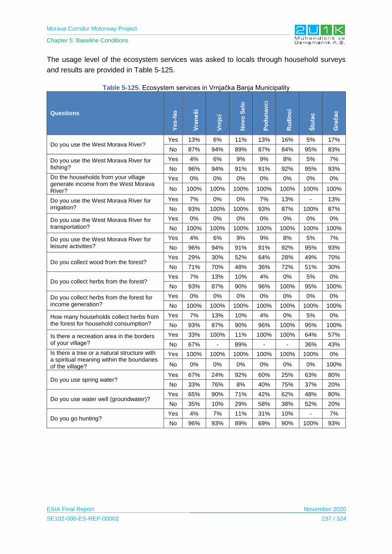
Morava Corridor Motorway Project
Chapter 5: Baseline Conditions
ESIA Final Report November 2020
SE102-000-ES-REP-00002 237 / 324
The usage level of the ecosystem services was asked to locals through household surveys
and results are provided in Table 5-125.
Table 5-125. Ecosystem services in Vrnjačka Banja Municipality
Questions
Ye
s-N
o
Vra
ne
ši
Vrn
jci
No
vo
Se
lo
Po
du
na
vc
i
Ru
đin
ci
Štu
lac
Gra
ča
c
Do you use the West Morava River? Yes 13% 6% 11% 13% 16% 5% 17%
No 87% 94% 89% 87% 84% 95% 83%
Do you use the West Morava River for fishing?
Yes 4% 6% 9% 9% 8% 5% 7%
No 96% 94% 91% 91% 92% 95% 93%
Do the households from your village generate income from the West Morava River?
Yes 0% 0% 0% 0% 0% 0% 0%
No 100% 100% 100% 100% 100% 100% 100%
Do you use the West Morava River for irrigation?
Yes 7% 0% 0% 7% 13% - 13%
No 93% 100% 100% 93% 87% 100% 87%
Do you use the West Morava River for transportation?
Yes 0% 0% 0% 0% 0% 0% 0%
No 100% 100% 100% 100% 100% 100% 100%
Do you use the West Morava River for leisure activities?
Yes 4% 6% 9% 9% 8% 5% 7%
No 96% 94% 91% 91% 92% 95% 93%
Do you collect wood from the forest? Yes 29% 30% 52% 64% 28% 49% 70%
No 71% 70% 48% 36% 72% 51% 30%
Do you collect herbs from the forest? Yes 7% 13% 10% 4% 0% 5% 0%
No 93% 87% 90% 96% 100% 95% 100%
Do you collect herbs from the forest for income generation?
Yes 0% 0% 0% 0% 0% 0% 0%
No 100% 100% 100% 100% 100% 100% 100%
How many households collect herbs from the forest for household consumption?
Yes 7% 13% 10% 4% 0% 5% 0%
No 93% 87% 90% 96% 100% 95% 100%
Is there a recreation area in the borders of your village?
Yes 33% 100% 11% 100% 100% 64% 57%
No 67% - 89% - - 36% 43%
Is there a tree or a natural structure with a spiritual meaning within the boundaries of the village?
Yes 100% 100% 100% 100% 100% 100% 0%
No 0% 0% 0% 0% 0% 0% 100%
Do you use spring water? Yes 67% 24% 92% 60% 25% 63% 80%
No 33% 76% 8% 40% 75% 37% 20%
Do you use water well (groundwater)? Yes 65% 90% 71% 42% 62% 48% 80%
No 35% 10% 29% 58% 38% 52% 20%
Do you go hunting? Yes 4% 7% 11% 31% 10% - 7%
No 96% 93% 89% 69% 90% 100% 93%

Morava Corridor Motorway Project
Chapter 5: Baseline Conditions
ESIA Final Report November 2020
SE102-000-ES-REP-00002 238 / 324
5.14.3.4.7 Section 2: Trstenik Municipality
The West Morava River
The West Morava River is used in all villages for various purposes. In the village of Bogdanje
and Medveđa, residents use the West Morava River for irrigation. The residents of village of
Velika Drenova and Lozna use the West Morava River for irrigation, fishing and leisure
activities.
Box 5-2. West Morava Water Sports Association and Ecology Society
West Morava Water Sports Association and Ecology Society was established for the water sports: NGO’s mentioned that the Project is passing through very critical spot of Tristenik as it is close to the airport, used for sportive purposes.
Forests
Total size of the forest lands in Trestenik is 11,582 ha and 60% of the forest lands are
privately owned. Figure 5-75 below shows the size and the ownership status of the Forest
lands.

Morava Corridor Motorway Project
Chapter 5: Baseline Conditions
ESIA Final Report November 2020
SE102-000-ES-REP-00002 239 / 324
Source: Department of Forestry, SORS, 2017.
Figure 5-75. The size of the forest lands within the borders of the Trstenik
The majority of the villages collect wood from the forest for heating. The wood collection is
not expected to be affected as most of the ecosystem services plants used are in the
peridomiciliary spaces, and have spaces for use or complementary sources of supply for
their use. The average number of woods consumed during the winter per household in these
seven village is 14.8 m3. In the villages of Bogdanje and Selište, people do not go to the
forest to collect plants, however in the villages of Velika Drenova, Grabovac, Lozna,
Ugljarevo and Medveđa, people go to the forest and most often collects mushrooms for
household usage. Hunting is also not represented in villages of Bogdanje and Grabovac,
however, in other five villages, few residents go hunting and the most frequently hunted
animals are pheasant, rabbit and wild boar.
Spring water
There are sources of spring water in the all seven villages used for drinking purposes. The
residents of this villages also use spring water for domestic purpose, especially in the village
of Selište which has no water supply network. Also, most households use well for irrigation
and domestic purposes.
The usage level of the ecosystem services was asked to locals through household surveys
and results are provided in Table 5-126.
4418
7164
0
1000
2000
3000
4000
5000
6000
7000
8000
state─owned privately owned
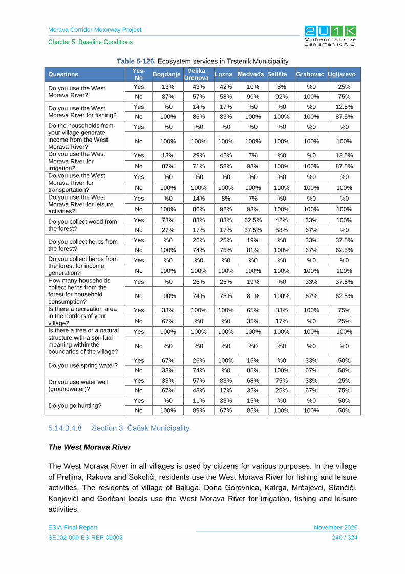
Morava Corridor Motorway Project
Chapter 5: Baseline Conditions
ESIA Final Report November 2020
SE102-000-ES-REP-00002 240 / 324
Table 5-126. Ecosystem services in Trstenik Municipality
Questions Yes-No
Bogdanje Velika
Drenova Lozna Medveđa Selište Grabovac Ugljarevo
Do you use the West Morava River?
Yes 13% 43% 42% 10% 8% %0 25%
No 87% 57% 58% 90% 92% 100% 75%
Do you use the West Morava River for fishing?
Yes %0 14% 17% %0 %0 %0 12.5%
No 100% 86% 83% 100% 100% 100% 87.5%
Do the households from your village generate income from the West Morava River?
Yes %0 %0 %0 %0 %0 %0 %0
No 100% 100% 100% 100% 100% 100% 100%
Do you use the West Morava River for irrigation?
Yes 13% 29% 42% 7% %0 %0 12.5%
No 87% 71% 58% 93% 100% 100% 87.5%
Do you use the West Morava River for transportation?
Yes %0 %0 %0 %0 %0 %0 %0
No 100% 100% 100% 100% 100% 100% 100%
Do you use the West Morava River for leisure activities?
Yes %0 14% 8% 7% %0 %0 %0
No 100% 86% 92% 93% 100% 100% 100%
Do you collect wood from the forest?
Yes 73% 83% 83% 62.5% 42% 33% 100%
No 27% 17% 17% 37.5% 58% 67% %0
Do you collect herbs from the forest?
Yes %0 26% 25% 19% %0 33% 37.5%
No 100% 74% 75% 81% 100% 67% 62.5%
Do you collect herbs from the forest for income generation?
Yes %0 %0 %0 %0 %0 %0 %0
No 100% 100% 100% 100% 100% 100% 100%
How many households collect herbs from the forest for household consumption?
Yes %0 26% 25% 19% %0 33% 37.5%
No 100% 74% 75% 81% 100% 67% 62.5%
Is there a recreation area in the borders of your village?
Yes 33% 100% 100% 65% 83% 100% 75%
No 67% %0 %0 35% 17% %0 25%
Is there a tree or a natural structure with a spiritual meaning within the boundaries of the village?
Yes 100% 100% 100% 100% 100% 100% 100%
No %0 %0 %0 %0 %0 %0 %0
Do you use spring water? Yes 67% 26% 100% 15% %0 33% 50%
No 33% 74% %0 85% 100% 67% 50%
Do you use water well (groundwater)?
Yes 33% 57% 83% 68% 75% 33% 25%
No 67% 43% 17% 32% 25% 67% 75%
Do you go hunting? Yes %0 11% 33% 15% %0 %0 50%
No 100% 89% 67% 85% 100% 100% 50%
5.14.3.4.8 Section 3: Čačak Municipality
The West Morava River
The West Morava River in all villages is used by citizens for various purposes. In the village
of Preljina, Rakova and Sokolići, residents use the West Morava River for fishing and leisure
activities. The residents of village of Baluga, Dona Gorevnica, Katrga, Mrčajevci, Stančići,
Konjevići and Goričani locals use the West Morava River for irrigation, fishing and leisure
activities.
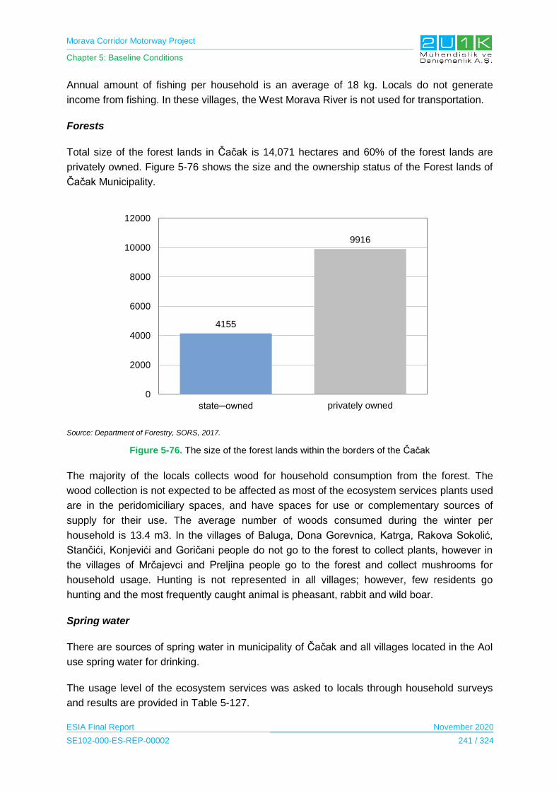
Morava Corridor Motorway Project
Chapter 5: Baseline Conditions
ESIA Final Report November 2020
SE102-000-ES-REP-00002 241 / 324
Annual amount of fishing per household is an average of 18 kg. Locals do not generate
income from fishing. In these villages, the West Morava River is not used for transportation.
Forests
Total size of the forest lands in Čačak is 14,071 hectares and 60% of the forest lands are
privately owned. Figure 5-76 shows the size and the ownership status of the Forest lands of
Čačak Municipality.
Source: Department of Forestry, SORS, 2017.
Figure 5-76. The size of the forest lands within the borders of the Čačak
The majority of the locals collects wood for household consumption from the forest. The
wood collection is not expected to be affected as most of the ecosystem services plants used
are in the peridomiciliary spaces, and have spaces for use or complementary sources of
supply for their use. The average number of woods consumed during the winter per
household is 13.4 m3. In the villages of Baluga, Dona Gorevnica, Katrga, Rakova Sokolić,
Stančići, Konjevići and Goričani people do not go to the forest to collect plants, however in
the villages of Mrčajevci and Preljina people go to the forest and collect mushrooms for
household usage. Hunting is not represented in all villages; however, few residents go
hunting and the most frequently caught animal is pheasant, rabbit and wild boar.
Spring water
There are sources of spring water in municipality of Čačak and all villages located in the AoI
use spring water for drinking.
The usage level of the ecosystem services was asked to locals through household surveys
and results are provided in Table 5-127.
4155
9916
0
2000
4000
6000
8000
10000
12000
state─owned privately owned
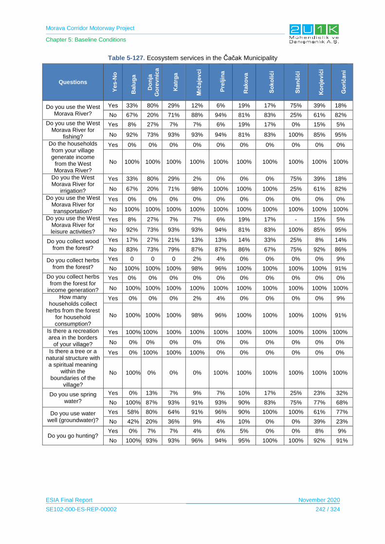
Morava Corridor Motorway Project
Chapter 5: Baseline Conditions
ESIA Final Report November 2020
SE102-000-ES-REP-00002 242 / 324
Table 5-127. Ecosystem services in the Čačak Municipality
Questions
Ye
s-N
o
Ba
lug
a
Do
nja
Go
rev
nic
a
Ka
trg
a
Mrč
aje
vc
i
Pre
ljin
a
Ra
ko
va
So
ko
lić
i
Sta
nč
ići
Ko
nje
vić
i
Go
rič
an
i
Do you use the West Morava River?
Yes 33% 80% 29% 12% 6% 19% 17% 75% 39% 18%
No 67% 20% 71% 88% 94% 81% 83% 25% 61% 82%
Do you use the West Morava River for
fishing?
Yes 8% 27% 7% 7% 6% 19% 17% 0% 15% 5%
No 92% 73% 93% 93% 94% 81% 83% 100% 85% 95%
Do the households from your village generate income
from the West Morava River?
Yes 0% 0% 0% 0% 0% 0% 0% 0% 0% 0%
No 100% 100% 100% 100% 100% 100% 100% 100% 100% 100%
Do you the West Morava River for
irrigation?
Yes 33% 80% 29% 2% 0% 0% 0% 75% 39% 18%
No 67% 20% 71% 98% 100% 100% 100% 25% 61% 82%
Do you use the West Morava River for transportation?
Yes 0% 0% 0% 0% 0% 0% 0% 0% 0% 0%
No 100% 100% 100% 100% 100% 100% 100% 100% 100% 100%
Do you use the West Morava River for leisure activities?
Yes 8% 27% 7% 7% 6% 19% 17% - 15% 5%
No 92% 73% 93% 93% 94% 81% 83% 100% 85% 95%
Do you collect wood from the forest?
Yes 17% 27% 21% 13% 13% 14% 33% 25% 8% 14%
No 83% 73% 79% 87% 87% 86% 67% 75% 92% 86%
Do you collect herbs from the forest?
Yes 0 0 0 2% 4% 0% 0% 0% 0% 9%
No 100% 100% 100% 98% 96% 100% 100% 100% 100% 91%
Do you collect herbs from the forest for
income generation?
Yes 0% 0% 0% 0% 0% 0% 0% 0% 0% 0%
No 100% 100% 100% 100% 100% 100% 100% 100% 100% 100%
How many households collect
herbs from the forest for household consumption?
Yes 0% 0% 0% 2% 4% 0% 0% 0% 0% 9%
No 100% 100% 100% 98% 96% 100% 100% 100% 100% 91%
Is there a recreation area in the borders
of your village?
Yes 100% 100% 100% 100% 100% 100% 100% 100% 100% 100%
No 0% 0% 0% 0% 0% 0% 0% 0% 0% 0%
Is there a tree or a natural structure with a spiritual meaning
within the boundaries of the
village?
Yes 0% 100% 100% 100% 0% 0% 0% 0% 0% 0%
No 100% 0% 0% 0% 100% 100% 100% 100% 100% 100%
Do you use spring water?
Yes 0% 13% 7% 9% 7% 10% 17% 25% 23% 32%
No 100% 87% 93% 91% 93% 90% 83% 75% 77% 68%
Do you use water well (groundwater)?
Yes 58% 80% 64% 91% 96% 90% 100% 100% 61% 77%
No 42% 20% 36% 9% 4% 10% 0% 0% 39% 23%
Do you go hunting? Yes 0% 7% 7% 4% 6% 5% 0% 0% 8% 9%
No 100% 93% 93% 96% 94% 95% 100% 100% 92% 91%
Morava Corridor Motorway Project
Chapter 5: Baseline Conditions
ESIA Final Report November 2020
SE102-000-ES-REP-00002 243 / 324
5.14.3.4.9 Sensitive Receptors
According to results of the social surveys it has been observed that the ecosystem services
are being used for household purposes and consumption.
The villages are considered to be highly sensitive where the West Morava River is being
used for; transportation, fishing, irrigation and leisure activities.
In terms of forest usage, the majorty of the Project affected people is using forest to collect
wood for heating purposed and hunting.
As a result sensitive receptors will be the villages where disturbance will be occur on the
West Morava River due to river regulation and forestry areas where Project components will
be established.
5.14.3.5 Health
The health care system in Serbia is based on a network of public health institutions funded
by the National Health Insurance and from the state budget. Access to public health
institutions is free. Preventive and curative services are provided at the local level in primary
health care centers. Secondary medical care is offered in pediatric departments of local and
regional general hospitals or outpatient clinics, and in specialized hospitals for children or
adults. Tertiary medical care is provided by inpatient or outpatient subspecialty services in 5
major university children’s clinics (Bogdanovic, Lozanovic, Milica, & Jovanovic, 2016).
The average life expectancy of Serbian people is 75.9 years, where for males it is 73 years
and for females 79 years. The death rate is estimated to be 13.6 death per 1000 people and
the birth rate is 8.6 births for every 1000 people. The fertility rate is pretty low being 1.44
children per woman and takes 208th place in the world rating (Central Intelligence Agency,
2018).
5.14.3.5.1 Section 1: Ćićevac Municipality
General health indicators of the Municipality were derived from the Institute of Public Health
of Serbia (2018). Table 5-128 presents the details on the health indicators of the Municipality.
Table 5-128. Health Indicators of the Ćićevac Municipality
Health Indicators of the Municipality
Number of doctors 12
Number of doctors per 1,000 inhabitants 1.4
Doctors ─ child healthcare (per 1,000 inhabitants) 4.8
Doctors ─ healthcare of school children and youth (per 1,000 inhabitants) 1.9
Doctors ─ adult population healthcare (per 1,000 inhabitants) 0.8
Dentists ─ dental healthcare of children, school children and youth (per 1,000 inhabitants)
0.0
Doctors ─ women's healthcare (per 1,000 inhabitants) 0.26

Morava Corridor Motorway Project
Chapter 5: Baseline Conditions
ESIA Final Report November 2020
SE102-000-ES-REP-00002 244 / 324
Health Indicators of the Municipality
Coverage of women in the first trimester of pregnancy by modern healthcare (%) 93.9
Coverage of pregnant women by visiting nurse service (Number) 1.2
Number of Tuberculosis cases 3
Incidence of tuberculosis (per 100,000 population) 35
Proportion of infants vaccinated against diphtheria, tetanus and pertussis (%) 100.0
Proportion of children vaccinated against measles (%) 89.9
Source: Institute of Public Health of Serbia, 2018
During the Community Level Survey, the village heads were asked if there are any health
centers or hospitals within the borders of their villages. The following Table 5-129 presents
the responds of the village heads for each settlement, respectively.
Table 5-129. Availability of health centers in affected villages of Ćićevac Municipality
Services Yes/No
Grad Stalać Mrzenica Pojate Stalać
Health centre/hospital No No Yes Yes
Pojate and Stalac villages have health centers whereas Grand Stalac and Mrzenica do not
have any. During the Household Surveys, the respondents were asked on how they access
to the health facilities and majority of the respondents stated as by private car. Further
information on access to health facilities presented in Table 5-130.
Table 5-130. Access to health facilities in affected villages of Ćićevac Municipality
Access to health facility Grad Stalać Mrzenica Pojate Stalać
On foot 100% 0% 0% 50%
Minibus / bus 0% 33% 0% 12%
Taxi 0% 0% 0% 0%
Private car 0% 67% 100% 38%
Car of relatives 0% 0% 0% 0%
Car of neighbors 0% 0% 0% 0%
Furthermore, during the Household Surveys, number of households with chronic diseases
were asked and the highest number of households (64%) with chronic diseases observed in
Grad Stalac village, whereas, Pojate village observed to have no number of households with
chronic diseases. Table 5-131 presents households with chronic diseases for each affected
village in Ćićevac Municipality, respectively.
Table 5-131. Households with chronic diseases for each affected village in Ćićevac Municipality
Percentage of households with chronic disease
Grad Stalać
Mrzenica Pojate Stalać
64% 60% 0% 40%

Morava Corridor Motorway Project
Chapter 5: Baseline Conditions
ESIA Final Report November 2020
SE102-000-ES-REP-00002 245 / 324
The respondents who have chronic diseases were asked further questions regarding the
type of diseases that they have, and it was observed that blood pressure and heart disease
are common chronic diseases majority of the affected villages. Further details on common
chronic diseases of the affected villages of Ćićevac Municipality can be found in Table 5-132.
Table 5-132. Common chronic diseases of the affected villages of Ćićevac Municipality
Type of Chronic Diseases Grad Stalać Mrzenica Pojate Stalać
Accident 14% 0% 0% 0%
Blood pressure 29% 0% 50% 50%
Diabetic Patient 14% 33% 0% 0%
Heart Disease 43% 33% 0% 25%
Cancer 0% 0% 25% 25%
Allergy 0% 33% 25% 0%
5.14.3.5.2 Section 1: Kruševac Municipality
General health indicators of the Municipality were derived from the Institute of Public Health
of Serbia (2018). Table 5-133 below presents the details on the health indicators of the
Municipality.
Table 5-133. Health Indicators of the Kruševac Municipality
Health Indicators of the Municipality
Number of doctors 348
Number of doctors per 1,000 inhabitants 2.9
Doctors ─ child healthcare (per 1,000 inhabitants) 1.3
Doctors ─ healthcare of school children and youth (per 1,000 inhabitants) 0.6
Doctors ─ adult population healthcare (per 1,000 inhabitants) 0.6
Dentists ─ dental healthcare of children, school children and youth (per 1,000 inhabitants)
0.8
Doctors ─ women's healthcare (per 1,000 inhabitants) 0.13
Coverage of women in the first trimester of pregnancy by modern healthcare (%) 83.7
Coverage of pregnant women by visiting nurse service (Number) 0.5
Number of TB cases 12
Incidence of tuberculosis (per 100,000 population) 10
Proportion of infants vaccinated against diphtheria, tetanus and pertussis (%) 98.7
Proportion of children vaccinated against measles (%) 71.2
Source: Institute of Public Health of Serbia, 2018

Morava Corridor Motorway Project
Chapter 5: Baseline Conditions
ESIA Final Report November 2020
SE102-000-ES-REP-00002 246 / 324
During the Community Level Survey, the village heads were asked if there are any health
centers or hospitals within the borders of their villages. The following Table 5-134 presents
the responds of the village heads for each settlement, respectively.
Table 5-134. Availability of health centers in affected villages of Kruševac Municipality
Services Yes/No
Bele Vode Čitluk Bivolje Jasika Koševi Kukljin Makrešane
Health centre/hospital
No Yes Yes Yes No Yes No
Bele Vode, Kosevi and Makresane villages do not have any health centers within their
settlement. During the Household Surveys, the respondents were asked on how they access
to the health facilities and majority of the respondents stated as by private car or
minibus/bus. Further information on access to health facilities presented in Table 5-135
below.
Table 5-135. Access to health facilities in affected villages of Kruševac Municipality
Access to the health facilities
Čitluk Bele Vode Bivolje Jasika Koševi Kukljin Makrešane
On foot 10% 5% 100% 25% 14% 0% 0%
Minibus / bus 10% 25% 0% 25% 43% 40% 29%
Taxi 1% 5% 0% 0% 0% 20% 0%
Private car 54% 45% 0% 50% 43% 40% 71%
Car of relatives 13% 11% 0% 0% 0% 0% 0%
Car of neighbours 12% 9% 0% 0% 0% 0% 0%
Furthermore, during the Household Surveys, the number of households with chronic
diseases were asked and the highest number of households (84%) with chronic diseases
observed in Bela Voda village, whereas, Bivolje village observed to have the least number of
households (36%) with chronic diseases. Table 5-136 below presents households with
chronic diseases for each affected village in Kruševac Municipality, respectively.
Table 5-136. Households with chronic diseases for each affected village in Kruševac Municipality
Settlement Bela Voda Čitluk Bivolje Jasika Koševi Kukljin Makrešane
Percentage of households with chronic disease
84% 73% 36% 40% 50% 40% 57%

Morava Corridor Motorway Project
Chapter 5: Baseline Conditions
ESIA Final Report November 2020
SE102-000-ES-REP-00002 247 / 324
The respondents who have chronic diseases were asked further questions regarding the
type of diseases that they have, and it was observed that blood pressure and diabetes are
common chronic disease majority of the affected villages. Further details on common chronic
diseases of the affected villages of Kruševac Municipality can be found in Table 5-137 below.
Table 5-137. Common chronic diseases of the affected villages of Kruševac Municipality
Type of Chronic Diseases Čitluk Bela Voda Bivolje Jasika Koševi Kukljin Makrešane
Accident 3% 11% 0% 0% 0% 0% 0%
Blood pressure 40% 53% 50% 0% 50% 25% 25%
Diabetic Patient 31% 27% 0% 50% 25% 25% 25%
Heart Disease 12% 4% 0% 0% 25% 50% 25%
Lung and respiratory diseases 0% 5% 0% 0% 0% 0% 25%
Allergy 9% 0% 50% 50% 0% 0% 0%
5.14.3.5.3 Section 1: Varvarin Municipality
General health indicators of the Municipality were derived from the Institute of Public Health
of Serbia (2018). Table 5-138 presents the details on the health indicators of the Municipality.
Table 5-138. Health Indicators of the Varvarin Municipality
Health Indicators of the Municipality
Number of doctors 18
Number of doctors per 1,000 inhabitants 1.1
Doctors ─ child healthcare (per 1,000 inhabitants) 1.3
Doctors ─ healthcare of school children and youth (per 1,000 inhabitants) 0.5
Doctors ─ adult population healthcare (per 1,000 inhabitants) 0.8
Dentists ─ dental healthcare of children, school children and youth (per 1,000 inhabitants)
0.7
Doctors ─ women's healthcare (per 1,000 inhabitants) 0.28
Coverage of women in the first trimester of pregnancy by modern healthcare (%) 64.2
Coverage of pregnant women by visiting nurse service (Number) 0.9
Number of TB cases 2
Incidence of tuberculosis (per 100,000 population) 12
Proportion of infants vaccinated against diphtheria, tetanus and pertussis (%) 90.7
Proportion of children vaccinated against measles (%) 98.2
Source: Institute of Public Health of Serbia.
The village heads were asked if there are any health centers or hospitals within the borders
of their villages during the Community Level Survey. The following Table 5-139 presents the
responds of the head of villages for each settlement, respectively.
Table 5-139. Availability of health centers in affected villages of Varvarin Municipality
Services Yes/No
Bošnjane Maskare
Health centre/hospital No No

Morava Corridor Motorway Project
Chapter 5: Baseline Conditions
ESIA Final Report November 2020
SE102-000-ES-REP-00002 248 / 324
All of the affected settlements do not have any health centers within their settlements. During
the Household Surveys, the respondents were asked on how they access to the health
facilities and majority of the respondents stated as on foot or by private car. Further
information on access to health facilities presented in Table 5-140.
Table 5-140. Access to health facilities in affected villages of Varvarin Municipality
Access to the health facilities Bošnjane Maskare
On foot 57% 0%
Minibus / bus 14% 30%
Taxi 0% 0%
Private car 29% 70%
Furthermore, during the Household Surveys, the number of households with chronic
diseases were asked and the highest number of households (20%) with chronic diseases
observed in Bosnhane village, whereas, Maskare village observed to have least number of
households (17 %) with chronic diseases. Table 5-141 presents households with chronic
diseases for each affected village in Varvarin Municipality, respectively.
Table 5-141. Households with chronic diseases for each affected village in Varvarin Municipality
Settlements Bošnjane Maskare
Percentage of households with chronic disease 20% 17%
The respondents who have chronic diseases were asked further questions regarding the
type of diseases that they have, and it was observed that diabetes is common chronic
disease in majority of the affected villages. Further details on common chronic diseases of
the affected villages of Varvarin Municipality can be found in Table 5-142.
Table 5-142. Common chronic diseases of the affected villages of Varvarin Municipality
Type of Chronic Diseases Bošnjane Maskare
Diabetic patient 80% 85%
Heart disease 13% 0%
Lung and respiratory diseases 7% 0%
Infectious disease 0% 15%

Morava Corridor Motorway Project
Chapter 5: Baseline Conditions
ESIA Final Report November 2020
SE102-000-ES-REP-00002 249 / 324
5.14.3.5.4 Section 2: Kraljevo Municipality
General health indicators of the Municipality was derived from the Institute of Public Health of
Serbia (2018). Table 5-143 presents the details on the health indicators of the Municipality.
Table 5-143. Health Indicators of the Kraljevo Municipality
Health Indicators of the Municipality
Number of doctors 343
Number of doctors per 1,000 inhabitants 2.9
Doctors ─ child healthcare (per 1,000 inhabitants) 1.1
Doctors ─ healthcare of school children and youth (per 1,000 inhabitants) 0.8
Doctors ─ adult population healthcare (per 1,000 inhabitants) 0.7
Dentists ─ dental healthcare of children, school children and youth (per 1,000 inhabitants)
0.9
Doctors ─ women's healthcare (per 1,000 inhabitants) 0.21
Coverage of women in the first trimester of pregnancy by modern healthcare (%) 71.2
Coverage of pregnant women by visiting nurse service (Number) 1.1
Number of TB cases 8
Incidence of tuberculosis (per 100,000 population) 7
Proportion of infants vaccinated against diphtheria, tetanus and pertussis (%) 100.0
Proportion of children vaccinated against measles (%) 90.1
Source: Institute of Public Health of Serbia, 2018
During the Community Level Survey, the head of villages were asked if there is any health
centers or hospitals within the borders of their villages. The following Table 5-144 presents
the responds of the head of villages for each settlement, respectively.
Table 5-144. Availability of health centers in affected villages of Kraljevo Municipality
Services
Yes/No
Ad
ran
i
Vrb
a
Grd
ica
Za
klo
pa
č
a
Mil
oča
j
Ob
rva
Po
po
vić
i
Rati
na
Sir
ca
Su
ma
ric
e
Stu
ba
l
Health centre/hospital No Yes No Yes Yes No No Yes No No Yes
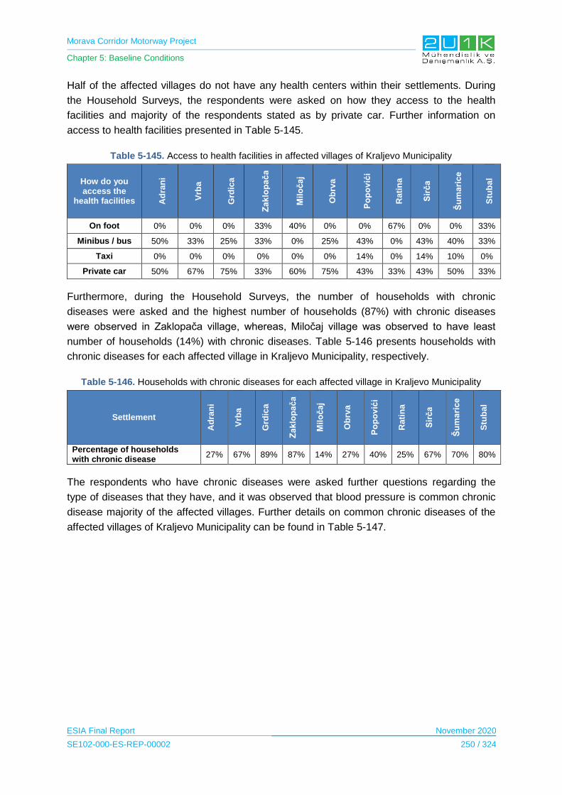
Morava Corridor Motorway Project
Chapter 5: Baseline Conditions
ESIA Final Report November 2020
SE102-000-ES-REP-00002 250 / 324
Half of the affected villages do not have any health centers within their settlements. During
the Household Surveys, the respondents were asked on how they access to the health
facilities and majority of the respondents stated as by private car. Further information on
access to health facilities presented in Table 5-145.
Table 5-145. Access to health facilities in affected villages of Kraljevo Municipality
How do you access the
health facilities Ad
ran
i
Vrb
a
Grd
ica
Za
klo
pa
ča
Mil
oča
j
Ob
rva
Po
po
vić
i
Ra
tin
a
Sir
ča
Šu
ma
ric
e
Stu
ba
l
On foot 0% 0% 0% 33% 40% 0% 0% 67% 0% 0% 33%
Minibus / bus 50% 33% 25% 33% 0% 25% 43% 0% 43% 40% 33%
Taxi 0% 0% 0% 0% 0% 0% 14% 0% 14% 10% 0%
Private car 50% 67% 75% 33% 60% 75% 43% 33% 43% 50% 33%
Furthermore, during the Household Surveys, the number of households with chronic
diseases were asked and the highest number of households (87%) with chronic diseases
were observed in Zaklopača village, whereas, Miločaj village was observed to have least
number of households (14%) with chronic diseases. Table 5-146 presents households with
chronic diseases for each affected village in Kraljevo Municipality, respectively.
Table 5-146. Households with chronic diseases for each affected village in Kraljevo Municipality
Settlement
Ad
ran
i
Vrb
a
Grd
ica
Za
klo
pa
ča
Mil
oča
j
Ob
rva
Po
po
vić
i
Rati
na
Sir
ča
Šu
ma
ric
e
Stu
ba
l
Percentage of households with chronic disease
27% 67% 89% 87% 14% 27% 40% 25% 67% 70% 80%
The respondents who have chronic diseases were asked further questions regarding the
type of diseases that they have, and it was observed that blood pressure is common chronic
disease majority of the affected villages. Further details on common chronic diseases of the
affected villages of Kraljevo Municipality can be found in Table 5-147.
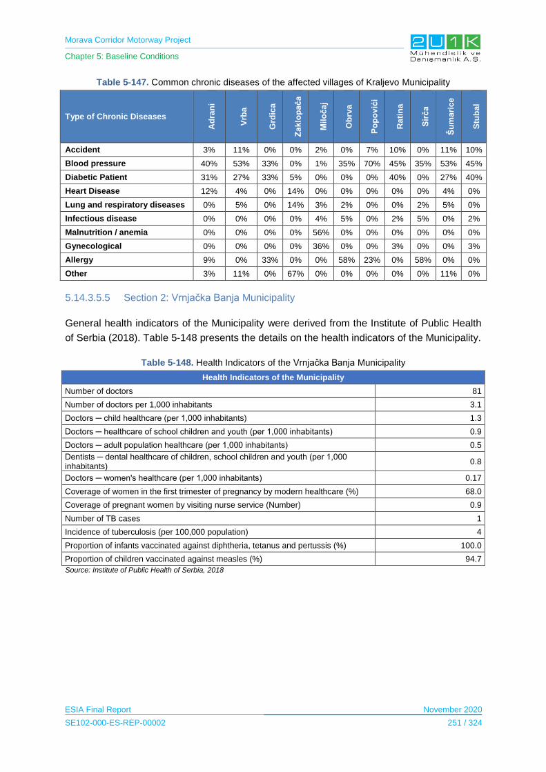
Morava Corridor Motorway Project
Chapter 5: Baseline Conditions
ESIA Final Report November 2020
SE102-000-ES-REP-00002 251 / 324
Table 5-147. Common chronic diseases of the affected villages of Kraljevo Municipality
Type of Chronic Diseases
Ad
ran
i
Vrb
a
Grd
ica
Za
klo
pa
ča
Mil
oča
j
Ob
rva
Po
po
vić
i
Ra
tin
a
Sir
ča
Šu
ma
ric
e
Stu
ba
l
Accident 3% 11% 0% 0% 2% 0% 7% 10% 0% 11% 10%
Blood pressure 40% 53% 33% 0% 1% 35% 70% 45% 35% 53% 45%
Diabetic Patient 31% 27% 33% 5% 0% 0% 0% 40% 0% 27% 40%
Heart Disease 12% 4% 0% 14% 0% 0% 0% 0% 0% 4% 0%
Lung and respiratory diseases 0% 5% 0% 14% 3% 2% 0% 0% 2% 5% 0%
Infectious disease 0% 0% 0% 0% 4% 5% 0% 2% 5% 0% 2%
Malnutrition / anemia 0% 0% 0% 0% 56% 0% 0% 0% 0% 0% 0%
Gynecological 0% 0% 0% 0% 36% 0% 0% 3% 0% 0% 3%
Allergy 9% 0% 33% 0% 0% 58% 23% 0% 58% 0% 0%
Other 3% 11% 0% 67% 0% 0% 0% 0% 0% 11% 0%
5.14.3.5.5 Section 2: Vrnjačka Banja Municipality
General health indicators of the Municipality were derived from the Institute of Public Health
of Serbia (2018). Table 5-148 presents the details on the health indicators of the Municipality.
Table 5-148. Health Indicators of the Vrnjačka Banja Municipality
Health Indicators of the Municipality
Number of doctors 81
Number of doctors per 1,000 inhabitants 3.1
Doctors ─ child healthcare (per 1,000 inhabitants) 1.3
Doctors ─ healthcare of school children and youth (per 1,000 inhabitants) 0.9
Doctors ─ adult population healthcare (per 1,000 inhabitants) 0.5
Dentists ─ dental healthcare of children, school children and youth (per 1,000 inhabitants)
0.8
Doctors ─ women's healthcare (per 1,000 inhabitants) 0.17
Coverage of women in the first trimester of pregnancy by modern healthcare (%) 68.0
Coverage of pregnant women by visiting nurse service (Number) 0.9
Number of TB cases 1
Incidence of tuberculosis (per 100,000 population) 4
Proportion of infants vaccinated against diphtheria, tetanus and pertussis (%) 100.0
Proportion of children vaccinated against measles (%) 94.7
Source: Institute of Public Health of Serbia, 2018

Morava Corridor Motorway Project
Chapter 5: Baseline Conditions
ESIA Final Report November 2020
SE102-000-ES-REP-00002 252 / 324
During the Community Level Survey, the village heads were asked if there are any health
centers or hospitals within the borders of their villages. The following Table 5-149 presents
the responds of the village heads for each settlement, respectively.
Table 5-149. Availability of health centers in affected villages of Vrnjačka Banja Municipality
Services
Yes/No
Vraneši Vrnjci Novo Selo
Podunavci Ruđinci Štulac Gračac
Health centre/hospital Yes No Yes Yes No No Yes
Majority of the villages were observed to have a health centers within their settlement. During
the Household Surveys, the respondents were asked on how they access to the health
facilities and majority of the respondents stated as by private car or car of relatives. Further
information on access to health facilities presented in Table 5-150.
Table 5-150. Access to health facilities in affected villages of Vrnjačka Banja Municipality
Access to the health facilities
Vraneši Vrnjci Novo Selo Podunavci Ruđinci Štulac Gračac
On foot 22.22% 0% 23.31% 20% 0% 0% 26.67%
Minibus / bus 0% 32.86% 0% 4.44% 26.58% 33.33% 0%
Taxi 0% 2.86% 0% 0% 7.59% 0% 0%
Private car 64.44% 51.43% 62.41% 57.78% 44.3% 46.15% 53.33%
Car of relatives 13.33% 12.86% 9.77% 17.78% 16.45% 20.51% 20%
Car of neighbours 0% 0% 4.51% 0% 5.06% 0% 0%
Furthermore, during the Household Surveys, the number of households with chronic
diseases were asked and the highest number of households (65%) with chronic diseases
observed in Rudinci village. Table 5-151 presents households with chronic diseases for each
affected village in Vrnjačka Banja Municipality, respectively.
Table 5-151. Households with chronic diseases for each affected village in Vrnjačka Banja Municipality
Settlement Vraneši Vrnjci Novo Selo Podunavci Ruđinci Štulac Gračac
Percentage of households with chronic disease
31.1% 61.4% 35.5% 0% 64.5% 39.8% 20%

Morava Corridor Motorway Project
Chapter 5: Baseline Conditions
ESIA Final Report November 2020
SE102-000-ES-REP-00002 253 / 324
The respondents who have chronic diseases were asked further questions regarding the
type of diseases that they have, and it was observed that blood pressure and diabetes are
common chronic disease majority of the affected villages. Further details on common chronic
diseases of the affected villages of Vrnjačka Banja Municipality can be found in Table 5-152.
Table 5-152. Common chronic diseases of the affected villages of Vrnjačka Banja Municipality
Type of Chronic Diseases Vraneši Vrnjci Novo Selo Ruđinci Štulac Gračac
Accident 0% 2.32% 0% 0% 0% 0%
Blood pressure 28.57% 18.6% 6.38% 0% 25% 16.67%
Diabetic Patient 14.29% 0% 0% 11.76% 16.67% 0%
Heart Disease 14.29% 9.3% 8.51% 13.72% 0% 16.67%
Lung and respiratory diseases 0% 0% 0% 1.96% 0% 0%
Cancer 7.14% 6.98% 4.25% 1.96% 0% 0%
Malnutrition / anemia 0% 4.65% 0% 0% 0% 0%
Gynecological 0% 0% 0% 3.92% 0% 0%
Allergy 0% 4.65% 10.64% 0% 0% 0%
Other 35.71% 53.49% 70.21% 66.67% 58.33% 66.67%
5.14.3.5.6 Section 2: Trstenik Municipality
General health indicators of the Municipality were derived from the Institute of Public Health
of Serbia (2018). Table 5-153 below presents the details on the health indicators of the
Municipality.
Table 5-153. Health Indicators of the Trstenik Municipality
Health Indicators of the Municipality
Number of doctors 50
Number of doctors per 1,000 inhabitants 1.3
Doctors ─ child healthcare (per 1,000 inhabitants) 1.5
Doctors ─ healthcare of school children and youth (per 1,000 inhabitants) 0.9
Doctors ─ adult population healthcare (per 1,000 inhabitants) 0.6
Dentists ─ dental healthcare of children, school children and youth (per 1,000 inhabitants)
0.9
Doctors ─ women's healthcare (per 1,000 inhabitants) 0.23
Coverage of women in the first trimester of pregnancy by modern healthcare (%) 51.8
Coverage of pregnant women by visiting nurse service (Number) 0.7
Number of TB cases 7
Incidence of tuberculosis (per 100,000 population) 18
Proportion of infants vaccinated against diphtheria, tetanus and pertussis (%) 98.1
Proportion of children vaccinated against measles (%) 99.4
Source: Institute of Public Health of Serbia, 2018

Morava Corridor Motorway Project
Chapter 5: Baseline Conditions
ESIA Final Report November 2020
SE102-000-ES-REP-00002 254 / 324
During the Community Level Survey, the village heads were asked if there are any health
centers or hospitals within the borders of their villages. The following Table 5-154 presents
the responds of the head of villages for each settlement, respectively.
Table 5-154. Availability of health centers in affected villages of Trstenik Municipality
Services
Yes/No
Bogdanje Velika
Drenova Lozna Medveđa Selište Grabovac Ugljarevo
Health centre/hospital No Yes No Yes No No No
Only Velika Drenova and Medveda villages observed to have a health centers within their
settlement. During the Household Surveys, the respondents were asked on how they access
to the health facilities and majority of the respondents stated as by private car or
minibus/bus. Further information on access to health facilities presented in Table 5-155.
Table 5-155. Access to health facilities in affected villages of Trstenik Municipality
Access to the health facilities
Bogdanje Velika
Drenova Lozna Medveđa Selište Grabovac Ugljarevo
On foot 0% 37.14% 0% 68.05% 25% 0% 0%
Minibus / bus 26.67% 0% 0% 0% 0% 33.33% 37.5%
Taxi 13.33% 0% 16.67% 0% 0% 0% 0%
Private car 40% 51.43% 75% 23.61% 58.33% 66.67% 62.5%
Car of relatives 20% 11.43% 8.33% 8.33% 16.67% 0% 0%
Furthermore, during the Household Surveys, number of households with chronic diseases
were asked and the highest number of households (81%) with chronic diseases observed in
Medveda village, whereas, Grabovac and Ugljarevo village observed to no chronic diseases.
Table 5-156 presents households with chronic diseases for each affected village in Trstenik
Municipality, respectively.
Table 5-156. Households with chronic diseases for each affected village in Trstenik Municipality
Settlement Bogdanje Velika
Drenova Lozna Medveđa Selište Grabovac Ugljarevo
Percentage of households with chronic disease
73.33% 42.86% 66.67% 80.55% 66.67% 0% 0%
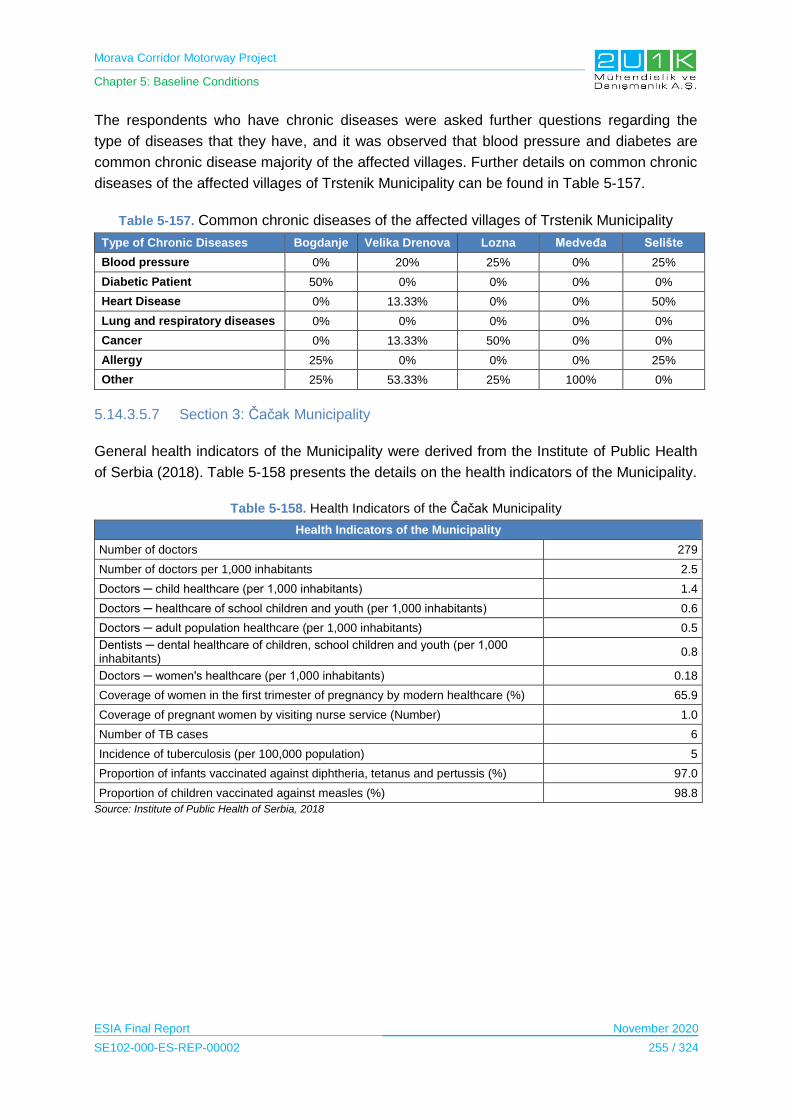
Morava Corridor Motorway Project
Chapter 5: Baseline Conditions
ESIA Final Report November 2020
SE102-000-ES-REP-00002 255 / 324
The respondents who have chronic diseases were asked further questions regarding the
type of diseases that they have, and it was observed that blood pressure and diabetes are
common chronic disease majority of the affected villages. Further details on common chronic
diseases of the affected villages of Trstenik Municipality can be found in Table 5-157.
Table 5-157. Common chronic diseases of the affected villages of Trstenik Municipality
Type of Chronic Diseases Bogdanje Velika Drenova Lozna Medveđa Selište
Blood pressure 0% 20% 25% 0% 25%
Diabetic Patient 50% 0% 0% 0% 0%
Heart Disease 0% 13.33% 0% 0% 50%
Lung and respiratory diseases 0% 0% 0% 0% 0%
Cancer 0% 13.33% 50% 0% 0%
Allergy 25% 0% 0% 0% 25%
Other 25% 53.33% 25% 100% 0%
5.14.3.5.7 Section 3: Čačak Municipality
General health indicators of the Municipality were derived from the Institute of Public Health
of Serbia (2018). Table 5-158 presents the details on the health indicators of the Municipality.
Table 5-158. Health Indicators of the Čačak Municipality
Health Indicators of the Municipality
Number of doctors 279
Number of doctors per 1,000 inhabitants 2.5
Doctors ─ child healthcare (per 1,000 inhabitants) 1.4
Doctors ─ healthcare of school children and youth (per 1,000 inhabitants) 0.6
Doctors ─ adult population healthcare (per 1,000 inhabitants) 0.5
Dentists ─ dental healthcare of children, school children and youth (per 1,000 inhabitants)
0.8
Doctors ─ women's healthcare (per 1,000 inhabitants) 0.18
Coverage of women in the first trimester of pregnancy by modern healthcare (%) 65.9
Coverage of pregnant women by visiting nurse service (Number) 1.0
Number of TB cases 6
Incidence of tuberculosis (per 100,000 population) 5
Proportion of infants vaccinated against diphtheria, tetanus and pertussis (%) 97.0
Proportion of children vaccinated against measles (%) 98.8
Source: Institute of Public Health of Serbia, 2018
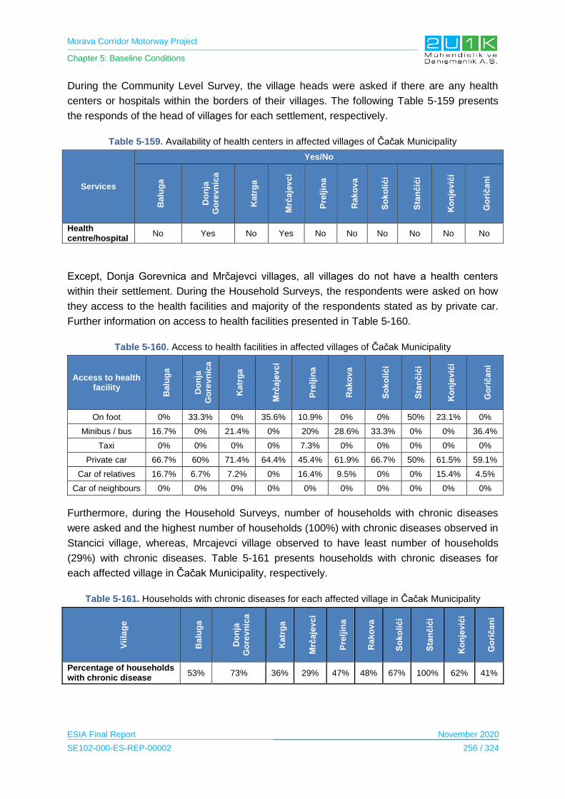
Morava Corridor Motorway Project
Chapter 5: Baseline Conditions
ESIA Final Report November 2020
SE102-000-ES-REP-00002 256 / 324
During the Community Level Survey, the village heads were asked if there are any health
centers or hospitals within the borders of their villages. The following Table 5-159 presents
the responds of the head of villages for each settlement, respectively.
Table 5-159. Availability of health centers in affected villages of Čačak Municipality
Services
Yes/No B
alu
ga
Do
nja
Go
rev
nic
a
Ka
trg
a
Mrč
aje
vc
i
Pre
ljin
a
Ra
ko
va
So
ko
lić
i
Sta
nč
ići
Ko
nje
vić
i
Go
rič
an
i
Health centre/hospital
No Yes No Yes No No No No No No
Except, Donja Gorevnica and Mrčajevci villages, all villages do not have a health centers
within their settlement. During the Household Surveys, the respondents were asked on how
they access to the health facilities and majority of the respondents stated as by private car.
Further information on access to health facilities presented in Table 5-160.
Table 5-160. Access to health facilities in affected villages of Čačak Municipality
Access to health facility
Balu
ga
Do
nja
Go
rev
nic
a
Katr
ga
Mrč
aje
vc
i
Pre
ljin
a
Rak
ov
a
So
ko
lić
i
Sta
nč
ići
Ko
nje
vić
i
Go
rič
an
i
On foot 0% 33.3% 0% 35.6% 10.9% 0% 0% 50% 23.1% 0%
Minibus / bus 16.7% 0% 21.4% 0% 20% 28.6% 33.3% 0% 0% 36.4%
Taxi 0% 0% 0% 0% 7.3% 0% 0% 0% 0% 0%
Private car 66.7% 60% 71.4% 64.4% 45.4% 61.9% 66.7% 50% 61.5% 59.1%
Car of relatives 16.7% 6.7% 7.2% 0% 16.4% 9.5% 0% 0% 15.4% 4.5%
Car of neighbours 0% 0% 0% 0% 0% 0% 0% 0% 0% 0%
Furthermore, during the Household Surveys, number of households with chronic diseases
were asked and the highest number of households (100%) with chronic diseases observed in
Stancici village, whereas, Mrcajevci village observed to have least number of households
(29%) with chronic diseases. Table 5-161 presents households with chronic diseases for
each affected village in Čačak Municipality, respectively.
Table 5-161. Households with chronic diseases for each affected village in Čačak Municipality
Vii
lag
e
Balu
ga
Do
nja
Go
rev
nic
a
Katr
ga
Mrč
aje
vc
i
Pre
ljin
a
Rak
ov
a
So
ko
lić
i
Sta
nč
ići
Ko
nje
vić
i
Go
rič
an
i
Percentage of households with chronic disease
53% 73% 36% 29% 47% 48% 67% 100% 62% 41%
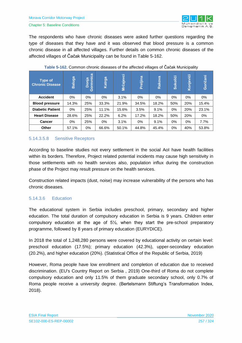
Morava Corridor Motorway Project
Chapter 5: Baseline Conditions
ESIA Final Report November 2020
SE102-000-ES-REP-00002 257 / 324
The respondents who have chronic diseases were asked further questions regarding the
type of diseases that they have and it was observed that blood pressure is a common
chronic disease in all affected villages. Further details on common chronic diseases of the
affected villages of Čačak Municipality can be found in Table 5-162.
Table 5-162. Common chronic diseases of the affected villages of Čačak Municipality
Type of Chronic Disease
Ba
lug
a
Do
nja
Go
rev
nic
a
Ka
trg
a
Mrč
aje
vc
i
Pre
ljin
a
Ra
ko
va
So
ko
lić
i
Ko
nje
vić
i
Go
rič
an
i
Accident 0% 0% 0% 3.1% 0% 0% 0% 0% 0%
Blood pressure 14.3% 25% 33.3% 21.9% 34.5% 18.2% 50% 20% 15.4%
Diabetic Patient 0% 25% 11.1% 15.6% 3.5% 9.1% 0% 20% 23.1%
Heart Disease 28.6% 25% 22.2% 6.2% 17.2% 18.2% 50% 20% 0%
Cancer 0% 25% 0% 3.1% 0% 9.1% 0% 0% 7.7%
Other 57.1% 0% 66.6% 50.1% 44.8% 45.4% 0% 40% 53.8%
5.14.3.5.8 Sensitive Receptors
According to baseline studies not every settlement in the social AoI have health facilities
within its borders. Therefore, Project related potential incidents may cause high sensitivity in
those settlements with no health services also, population influx during the construction
phase of the Project may result pressure on the health services.
Construction related impacts (dust, noise) may increase vulnerability of the persons who has
chronic diseases.
5.14.3.6 Education
The educational system in Serbia includes preschool, primary, secondary and higher
education. The total duration of compulsory education in Serbia is 9 years. Children enter
compulsory education at the age of 5½, when they start the pre-school preparatory
programme, followed by 8 years of primary education (EURYDICE).
In 2018 the total of 1,248,280 persons were covered by educational activity on certain level:
preschool education (17.5%); primary education (42.3%), upper-secondary education
(20.2%), and higher education (20%). (Statistical Office of the Republic of Serbia, 2019)
However, Roma people have low enrollment and completion of education due to received
discrimination. (EU's Country Report on Serbia , 2019) One-third of Roma do not complete
compulsory education and only 11.5% of them graduate secondary school, only 0.7% of
Roma people receive a university degree. (Bertelsmann Stiftung’s Transformation Index,
2018).
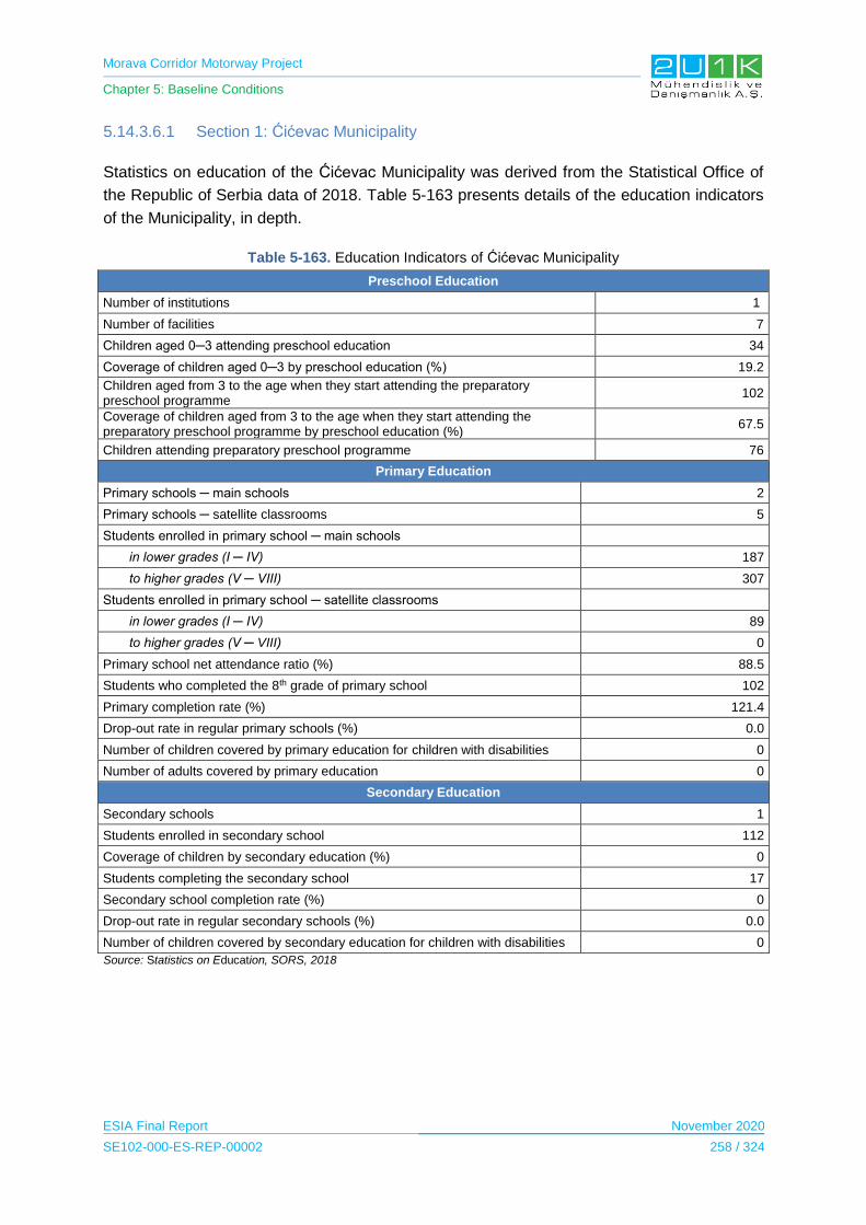
Morava Corridor Motorway Project
Chapter 5: Baseline Conditions
ESIA Final Report November 2020
SE102-000-ES-REP-00002 258 / 324
5.14.3.6.1 Section 1: Ćićevac Municipality
Statistics on education of the Ćićevac Municipality was derived from the Statistical Office of
the Republic of Serbia data of 2018. Table 5-163 presents details of the education indicators
of the Municipality, in depth.
Table 5-163. Education Indicators of Ćićevac Municipality
Preschool Education
Number of institutions 1
Number of facilities 7
Children aged 0─3 attending preschool education 34
Coverage of children aged 0─3 by preschool education (%) 19.2
Children aged from 3 to the age when they start attending the preparatory preschool programme
102
Coverage of children aged from 3 to the age when they start attending the preparatory preschool programme by preschool education (%)
67.5
Children attending preparatory preschool programme 76
Primary Education
Primary schools ─ main schools 2
Primary schools ─ satellite classrooms 5
Students enrolled in primary school ─ main schools
in lower grades (I ─ IV) 187
to higher grades (V ─ VIII) 307
Students enrolled in primary school ─ satellite classrooms
in lower grades (I ─ IV) 89
to higher grades (V ─ VIII) 0
Primary school net attendance ratio (%) 88.5
Students who completed the 8th grade of primary school 102
Primary completion rate (%) 121.4
Drop-out rate in regular primary schools (%) 0.0
Number of children covered by primary education for children with disabilities 0
Number of adults covered by primary education 0
Secondary Education
Secondary schools 1
Students enrolled in secondary school 112
Coverage of children by secondary education (%) 0
Students completing the secondary school 17
Secondary school completion rate (%) 0
Drop-out rate in regular secondary schools (%) 0.0
Number of children covered by secondary education for children with disabilities 0
Source: Statistics on Education, SORS, 2018

Morava Corridor Motorway Project
Chapter 5: Baseline Conditions
ESIA Final Report November 2020
SE102-000-ES-REP-00002 259 / 324
In terms of education information of the Social Area Influence following information were
derived from the Community Level Surveys and Household Surveys.
Grad Stalać: There is a primary school in the village of Stalac, which has 35 students and
has 2 teachers. For the further education, the students travel to Ćićevac located 6 km
distance from the village. In Grad Stalac, 20 students go to high school and 10 students go to
college to Ćićevac according to village head.
Mrzenica: The village of Mrzenica has an elementary school with 8 students and 1 teacher.
Two students from this village go the centre of Ćićevac for secondary school and 1 for high
school, located 10 km away from the village of Mrzenica.
Pojate and Stalać: Pojate and Stalac have a primary school, and for further education
students travel to Ćićevac, which is 3 km away from Pojate and 5km from Stalac. The
number of the students are not known by the village heads.
Overall, all participants of the social surveys are literate. While the lowest level of education
among the participants is primary school graduates, Pojate is the most concentrated
elementary school graduates with 50%. Secondary school graduates constitute the most
crowded group among the villages. Although Stalac has the highest education rate,
university graduates constitute 7% of the population.
Table 5-164 presents education indicators of all affected villages within Ćićevac Municipality
according to Community Level Surveys.
Table 5-164. Education Indicators of Affected Villages in Ćićevac Municipality
Education Grad Stalać Mrzenica Pojate Stalać
Never attended to school 0% 0% 0% 0%
Primary school student 0% 6% 0% 7%
Primary school dropout 0% 0% 0% 0%
Primary school graduated 26% 19% 50% 30%
Secondary school student 4% 10% 0% 7%
Secondary school dropout 0% 0% 0% 0%
Secondary school graduated 61% 65% 50% 33%
Technical high school 4% 0% 0% 0%
Technical high school dropped out 0% 0% 0% 0%
Technical high school graduated 0% 0% 0% 0%
High school student 0% 0% 0% 0%
High school dropout 0% 0% 0% 0%
High school graduated 0% 0% 0% 0%
University student 0% 0% 0% 15%
University dropout 0% 0% 0% 0%
University graduated 0% 0% 0% 7%
Not in school age 5% 0% 0% 0%

Morava Corridor Motorway Project
Chapter 5: Baseline Conditions
ESIA Final Report November 2020
SE102-000-ES-REP-00002 260 / 324
5.14.3.6.2 Section 1: Kruševac Municipality
Statistics on education of the Kruševac Municipality was derived from the Statistical Office of
the Republic of Serbia data of 2018. Table 5-165 presents details of the education indicators
of the Municipality, in depth.
Table 5-165. Education Indicators of Kruševac Municipality
Preschool Education
Number of institutions 1
Number of facilities 52
Children aged 0─3 attending preschool education 723
Coverage of children aged 0─3 by preschool education (%) 24.9
Children aged from 3 to the age when they start attending the preparatory preschool programme
1559
Coverage of children aged from 3 to the age when they start attending the preparatory preschool programme by preschool education (%)
59.5
Children attending preparatory preschool programme 1007
Primary Education
Primary schools ─ main schools 17
Primary schools ─ satellite classrooms 51
Students enrolled in primary school ─ main schools
in lower grades (I ─ IV) 3472
to higher grades (V ─ VIII) 4702
Students enrolled in primary school ─ satellite classrooms
in lower grades (I ─ IV) 904
to higher grades (V ─ VIII)
151
Primary school net attendance ratio (%) 96.5
Students who completed the 8th grade of primary school 1288
Primary completion rate (%) 100.4
Drop-out rate in regular primary schools (%) 0.4
Number of children covered by primary education for children with disabilities 143
Number of adults covered by primary education 141
Secondary Education
Secondary schools 8
Students enrolled in secondary school 5280
Coverage of children by secondary education (%) 0
Students completing the secondary school 1281
Secondary school completion rate (%) 0
Drop-out rate in regular secondary schools (%) 0.5
Number of children covered by secondary education for children with disabilities 44
Source: Statistics on Education, SORS, 2018
In terms of education information of the Social Area Influence following information were
derived from the Community Level Surveys and Household Surveys.
Morava Corridor Motorway Project
Chapter 5: Baseline Conditions
ESIA Final Report November 2020
SE102-000-ES-REP-00002 261 / 324
Bela Voda: In the village of Bele Voda there is one elementary school called "Brana
Pavlović". The school is attended by 120 students and it has 8 teachers. For the further
education most students travel to Kruševac. All residents of Bela Voda are literate.
Čitluk: "Sveti Sava" School is located in Čitluk and is attended by approximately 491
students. The school has 15 teachers. For the further education most students travel to
Kruševac. All residents of Čitluk are literate.
Bivolje: Bivolje has a primary school and a kindergarten and school has 27 teachers. For the
further education most students travel to Kruševac. The number of children in primary school
is 57.
Jasika: Jasika has a primary school and kindergarten. For the further education most
students travel to Kruševac which is 5 km away from the village. The school has 67 teachers
and approximately 300 students.
Koševi: The village of Koševi does not have any educational institution, for the needs of
kindergartens and elementary schools Koševi locals go to Čitluk, which is 3 km away from
the village. For high school they have to go to Kruševac which is 6km away. The number of
children attending all levels of education in the village of Koševi is 60.
Kukljin: There are a kindergarten and an elementary school in his village, the number of
children attending school is 50 with all levels and there are 5 teachers in this village. For the
further education students go to Kruševac which is 12km away.
Makrešane: Makrešane has a kindergarten and an elementary school. The number of
children attending school is 125 and, 41 of them continue to primary, 50 of them continue to
secondary and 30 them continue to high school.
In general, the only village which has illiterate residents is Bela Voda and 1% of the total
population is illiterate. Secondary school graduates make up the majority of the population. In
the Village of Bivoje 76% of the total population is composed of secondary school graduates.
Although there are no university graduates in the village of Jasika, the village Kosevi has the
highest number of university graduates with 12%.
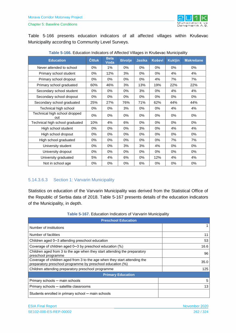
Morava Corridor Motorway Project
Chapter 5: Baseline Conditions
ESIA Final Report November 2020
SE102-000-ES-REP-00002 262 / 324
Table 5-166 presents education indicators of all affected villages within Kruševac
Municipality according to Community Level Surveys.
Table 5-166. Education Indicators of Affected Villages in Kruševac Municipality
Education Čitluk Bela Voda
Bivolje Jasika Koševi Kukljin Makrešane
Never attended to school 0% 1% 0% 0% 0% 0% 0%
Primary school student 0% 12% 3% 0% 0% 4% 4%
Primary school dropout 0% 0% 0% 0% 4% 7% 7%
Primary school graduated 60% 46% 3% 13% 19% 22% 22%
Secondary school student 0% 0% 0% 3% 0% 4% 4%
Secondary school dropout 0% 0% 0% 0% 0% 0% 0%
Secondary school graduated 25% 27% 76% 71% 62% 44% 44%
Technical high school 0% 0% 3% 0% 0% 4% 4%
Technical high school dropped out
0% 0% 0% 0% 0% 0% 0%
Technical high school graduated 10% 4% 6% 0% 0% 0% 0%
High school student 0% 0% 0% 3% 0% 4% 4%
High school dropout 0% 0% 0% 0% 0% 0% 0%
High school graduated 0% 0% 0% 0% 0% 7% 7%
University student 0% 0% 3% 3% 4% 0% 0%
University dropout 0% 0% 0% 0% 0% 0% 0%
University graduated 5% 4% 6% 0% 12% 4% 4%
Not in school age 0% 0% 0% 6% 0% 0% 0%
5.14.3.6.3 Section 1: Varvarin Municipality
Statistics on education of the Varvarin Municipality was derived from the Statistical Office of
the Republic of Serbia data of 2018. Table 5-167 presents details of the education indicators
of the Municipality, in depth.
Table 5-167. Education Indicators of Varvarin Municipality
Preschool Education
Number of institutions 1
Number of facilities 11
Children aged 0─3 attending preschool education 53
Coverage of children aged 0─3 by preschool education (%) 16.6
Children aged from 3 to the age when they start attending the preparatory preschool programme
96
Coverage of children aged from 3 to the age when they start attending the preparatory preschool programme by preschool education (%)
35.0
Children attending preparatory preschool programme 125
Primary Education
Primary schools ─ main schools 5
Primary schools ─ satellite classrooms 13
Students enrolled in primary school ─ main schools

Morava Corridor Motorway Project
Chapter 5: Baseline Conditions
ESIA Final Report November 2020
SE102-000-ES-REP-00002 263 / 324
in lower grades (I ─ IV) 374
to higher grades (V ─ VIII) 514
Students enrolled in primary school ─ satellite classrooms
in lower grades (I ─ IV) 154
to higher grades (V ─ VIII) 41
Primary school net attendance ratio (%) 89.3
Students who completed the 8th grade of primary school 155
Primary completion rate (%) 88.1
Drop-out rate in regular primary schools (%) 0.2
Number of children covered by primary education for children with disabilities 0
Number of adults covered by primary education 0
Secondary Education
Secondary schools 1
Students enrolled in secondary school 401
Coverage of children by secondary education (%) 0
Students completing the secondary school 94
Secondary school completion rate (%) 0
Drop-out rate in regular secondary schools (%) 5.8
Number of children covered by secondary education for children with disabilities 0
In terms of education information of the Social Area Influence following information were
derived from the Community Level Surveys and Household Surveys.
Bošnjane: Bosniacs have a kindergarten and primary school "Dragan Matic". In order to
continue secondary education, the students of Bošnjan go to Varvarin, which is 7 km away
and for the high school education and university education, the closest center is Kruševac
which is 15 km away from the village.
Maskare: In the village of Mascara there is an elementary school which has 15 students and
three teachers. Secondary education is given to the residents of Mascara in Varvarin, which
is 5km away, and the high education and the university service can be provided in Kruševac,
which is 18 km away. 13 students go to high school and 8 to college in Kruševac.
Overall, all participants in the interviewed villages are literate and the lowest level of
education is primary school graduated. On average 25% of the total participants are primary
school graduated. Similar to other municipalities, the secondary school graduates constitute
the most populous group in the Varvarin Municipality. The proportion of university graduates
in the village of Bošnjane is 12%, while in Maskare it is 3%.
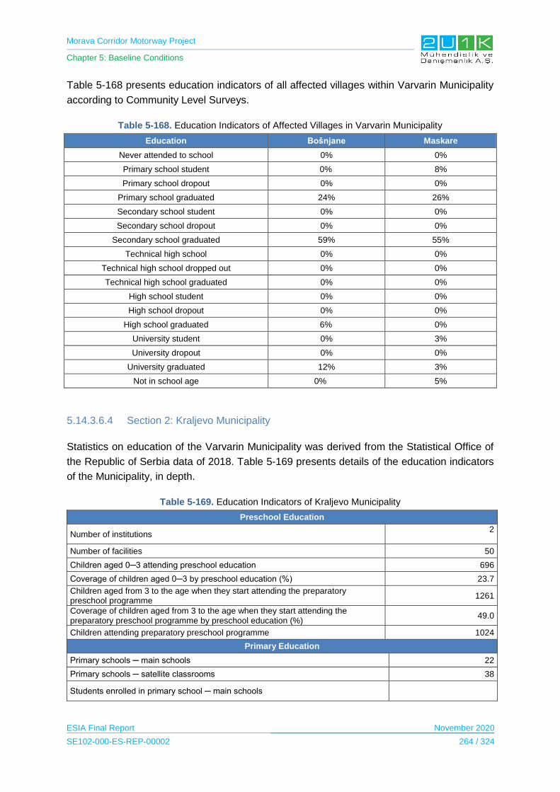
Morava Corridor Motorway Project
Chapter 5: Baseline Conditions
ESIA Final Report November 2020
SE102-000-ES-REP-00002 264 / 324
Table 5-168 presents education indicators of all affected villages within Varvarin Municipality
according to Community Level Surveys.
Table 5-168. Education Indicators of Affected Villages in Varvarin Municipality
Education Bošnjane Maskare
Never attended to school 0% 0%
Primary school student 0% 8%
Primary school dropout 0% 0%
Primary school graduated 24% 26%
Secondary school student 0% 0%
Secondary school dropout 0% 0%
Secondary school graduated 59% 55%
Technical high school 0% 0%
Technical high school dropped out 0% 0%
Technical high school graduated 0% 0%
High school student 0% 0%
High school dropout 0% 0%
High school graduated 6% 0%
University student 0% 3%
University dropout 0% 0%
University graduated 12% 3%
Not in school age 0% 5%
5.14.3.6.4 Section 2: Kraljevo Municipality
Statistics on education of the Varvarin Municipality was derived from the Statistical Office of
the Republic of Serbia data of 2018. Table 5-169 presents details of the education indicators
of the Municipality, in depth.
Table 5-169. Education Indicators of Kraljevo Municipality
Preschool Education
Number of institutions 2
Number of facilities 50
Children aged 0─3 attending preschool education 696
Coverage of children aged 0─3 by preschool education (%) 23.7
Children aged from 3 to the age when they start attending the preparatory preschool programme
1261
Coverage of children aged from 3 to the age when they start attending the preparatory preschool programme by preschool education (%)
49.0
Children attending preparatory preschool programme 1024
Primary Education
Primary schools ─ main schools 22
Primary schools ─ satellite classrooms 38
Students enrolled in primary school ─ main schools

Morava Corridor Motorway Project
Chapter 5: Baseline Conditions
ESIA Final Report November 2020
SE102-000-ES-REP-00002 265 / 324
in lower grades (I ─ IV) 3325
to higher grades (V ─ VIII) 4543
Students enrolled in primary school ─ satellite classrooms
in lower grades (I ─ IV) 992
to higher grades (V ─ VIII)
474
Primary school net attendance ratio (%) 95.8
Students who completed the 8th grade of primary school 1320
Primary completion rate (%) 99.8
Drop-out rate in regular primary schools (%) 0.5
Number of children covered by primary education for children with disabilities 59
Number of adults covered by primary education 104
Secondary Education
Secondary schools 9
Students enrolled in secondary school 4960
Coverage of children by secondary education (%) 0
Students completing the secondary school 1130
Secondary school completion rate (%) 0
Drop-out rate in regular secondary schools (%) 1.3
Number of children covered by secondary education for children with disabilities 22
In terms of education information of the Social Area Influence following information were
derived from the Community Level Surveys and Household Surveys.
Adrani: Adrani has a kindergarten and an elementary school. Children go to Kraljevo to
continue higher education, which is 4 km away from the village. The total number of students
attending the “Dragan Marinković” School in Adrani is 140 and the school has 9 teachers.
Vrba: The Vrba village has a kindergarten and a primary school. The students go to Kraljevo
for higher education which is 9 km away.
Grdica: There is a kindergarten and elementary school in Grdica up to the 4th grade, the
remaining 4 classes continue in Kraljevo which is 3 km away from the village. There are 52
students and 4 teachers at the “Vilotijević Brothers” School.
Zaklopača: There is a kindergarten and an elementary school in the village of Zaklopača.
For the further education students travel to Kraljevo. The number of the students and
teachers are not known by the village head.
Miločaj: Miločaj has a kindergarten and elementary school up to 4 grades, for the higer
education students go to Kraljevo, which is 10 km away. The number of children attending
school is 30 and there are 2 teachers in the village school.
Obrva: There is a kindergarten and an elementary school in the village of Obrva, in order to
continue higher education, students go to Kraljevo, which is 13 km away from the village.
The school is attended by 17 students and has 2 teachers.

Morava Corridor Motorway Project
Chapter 5: Baseline Conditions
ESIA Final Report November 2020
SE102-000-ES-REP-00002 266 / 324
Popovici: This village has a kindergarten and an elementary school. The closest high school
in Adrani which is 3km away and in Kraljevo which is 4 km away. The village has 17 students
and 3 teachers.
Ratina: Ratina has a kindergarten and an elementary school. The high is located in Kraljevo,
which is 7 km away. The total number of children attending school from this village is about
500. Of these, 350 go to primary school, 100 go to high school and 50 go to high school and
college. There are 35 teachers in the village school.
Sirča: Sirča has a primary school attended by 150 students, for high school students go to
Kraljevo which is 5 km away from the village.
Šumarice: Šumarice has a primary school and a kindergarten. The primary school has 2
students and has 1 teacher. To continue to high school, the remaining 16 students go to
Kraljevo, which is 6 km away from the village.
Stubal: In the village of Stubal, for the elementary education, children travel to Vitkovac
village which is 9 km away from Stubal and for high school they have two option; one is
Kraljevo (20km) and the other one is Trstenik (14km). The number of children attending
elementary school is 90, and the number of secondary school students is 45 and the number
of highschool students is 15. There are 3 teachers in the village school.
In general, Stubal and in Zaklopača has the highest illiterate population among the villages
including the other Municipalities. The proportion of the people who never attended to school
is 6% is Zaklopača and 12% in Stubal. Similar to other municipalities, the secondary school
graduates constitute the most populous group in the Kraljevo Municipality. Kraljevo is also
the municipality where university graduates are heavly populated compared with the other
Municipalitie, 38% of Ratine village are university graduated.
Table 5-170 presents education indicators of all affected villages within Kraljevo Municipality
according to Community Level Surveys.
Table 5-170. Education Indicators of Affected Villages in Kraljevo Municipality
Education
Ad
ran
i
Vrb
a
Grd
ica
Za
klo
pa
ča
Mil
oča
j
Ob
rva
Po
po
vić
i
Rati
na
Sir
ča
Šu
ma
ric
e
Stu
ba
l
Never attended to school 0% 0% 0% 6% 0% 0% 0% 0% 0% 0% 12%
Primary school student 0% 7% 0% 0% 0% 0% 9% 0% 7% - 6%
Primary school dropout 0% 0% 0% 6% 0% 6% 0% 0% 0% 0% 0%
Primary school graduated 24% 0% 3% 12% 0% 25% 13% 0% 0% 3% 6%
Secondary school student 0% 0% 3% 0% 0% 6% 0% 0% 0% 3% 12%
Secondary school dropout 0% 0% 0% 52% 0% 0% 0% 0% 0% 0% 0%
Secondary school graduated
59% 53% 70% 0% 88% 63% 74% 62% 53% 70% 46%
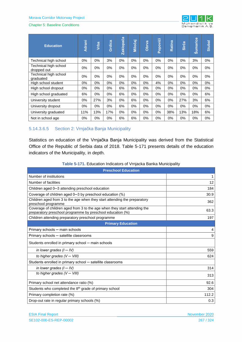
Morava Corridor Motorway Project
Chapter 5: Baseline Conditions
ESIA Final Report November 2020
SE102-000-ES-REP-00002 267 / 324
Education
Ad
ran
i
Vrb
a
Grd
ica
Za
klo
pa
ča
Mil
oča
j
Ob
rva
Po
po
vić
i
Ra
tin
a
Sir
ča
Šu
ma
ric
e
Stu
ba
l
Technical high school 0% 0% 3% 0% 0% 0% 0% 0% 0% 3% 0%
Technical high school dropped out
0% 0% 0% 0% 0% 0% 0% 0% 0% 0% 0%
Technical high school graduated
0% 0% 0% 0% 0% 0% 0% 0% 0% 0% 0%
High school student 0% 0% 0% 0% 0% 0% 4% 0% 0% 0% 0%
High school dropout 0% 0% 0% 6% 0% 0% 0% 0% 0% 0% 0%
High school graduated 6% 0% 0% 6% 0% 0% 0% 0% 0% 0% 6%
University student 0% 27% 3% 0% 6% 0% 0% 0% 27% 3% 6%
University dropout 0% 0% 0% 6% 0% 0% 0% 0% 0% 0% 0%
University graduated 11% 13% 17% 0% 0% 0% 0% 38% 13% 18% 6%
Not in school age 0% 0% 0% 6% 6% 0% 0% 0% 0% 0% 0%
5.14.3.6.5 Section 2: Vrnjačka Banja Municipality
Statistics on education of the Vrnjačka Banja Municipality was derived from the Statistical
Office of the Republic of Serbia data of 2018. Table 5-171 presents details of the education
indicators of the Municipality, in depth.
Table 5-171. Education Indicators of Vrnjacka Banka Municipality
Preschool Education
Number of institutions 1
Number of facilities 12
Children aged 0─3 attending preschool education 184
Coverage of children aged 0─3 by preschool education (%) 30.9
Children aged from 3 to the age when they start attending the preparatory preschool programme
362
Coverage of children aged from 3 to the age when they start attending the preparatory preschool programme by preschool education (%)
63.3
Children attending preparatory preschool programme 197
Primary Education
Primary schools ─ main schools 4
Primary schools ─ satellite classrooms 9
Students enrolled in primary school ─ main schools
in lower grades (I ─ IV) 559
to higher grades (V ─ VIII) 624
Students enrolled in primary school ─ satellite classrooms
in lower grades (I ─ IV) 314
to higher grades (V ─ VIII)
313
Primary school net attendance ratio (%) 92.6
Students who completed the 8th grade of primary school 304
Primary completion rate (%) 112.2
Drop-out rate in regular primary schools (%) 0.3
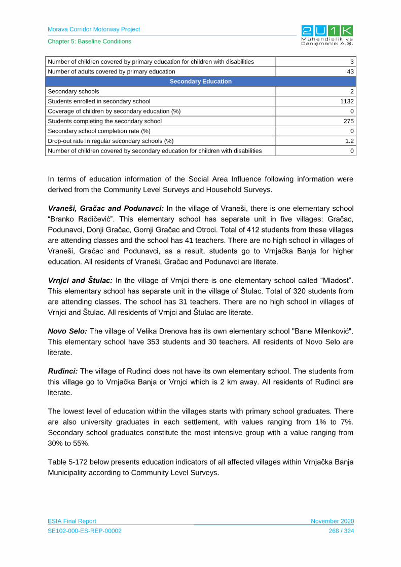
Morava Corridor Motorway Project
Chapter 5: Baseline Conditions
ESIA Final Report November 2020
SE102-000-ES-REP-00002 268 / 324
Number of children covered by primary education for children with disabilities 3
Number of adults covered by primary education 43
Secondary Education
Secondary schools 2
Students enrolled in secondary school 1132
Coverage of children by secondary education (%) 0
Students completing the secondary school 275
Secondary school completion rate (%) 0
Drop-out rate in regular secondary schools (%) 1.2
Number of children covered by secondary education for children with disabilities 0
In terms of education information of the Social Area Influence following information were
derived from the Community Level Surveys and Household Surveys.
Vraneši, Gračac and Podunavci: In the village of Vraneši, there is one elementary school
“Branko Radičević”. This elementary school has separate unit in five villages: Gračac,
Podunavci, Donji Gračac, Gornji Gračac and Otroci. Total of 412 students from these villages
are attending classes and the school has 41 teachers. There are no high school in villages of
Vraneši, Gračac and Podunavci, as a result, students go to Vrnjačka Banja for higher
education. All residents of Vraneši, Gračac and Podunavci are literate.
Vrnjci and Štulac: In the village of Vrnjci there is one elementary school called “Mladost”.
This elementary school has separate unit in the village of Štulac. Total of 320 students from
are attending classes. The school has 31 teachers. There are no high school in villages of
Vrnjci and Štulac. All residents of Vrnjci and Štulac are literate.
Novo Selo: The village of Velika Drenova has its own elementary school "Bane Milenković".
This elementary school have 353 students and 30 teachers. All residents of Novo Selo are
literate.
Ruđinci: The village of Ruđinci does not have its own elementary school. The students from
this village go to Vrnjačka Banja or Vrnjci which is 2 km away. All residents of Ruđinci are
literate.
The lowest level of education within the villages starts with primary school graduates. There
are also university graduates in each settlement, with values ranging from 1% to 7%.
Secondary school graduates constitute the most intensive group with a value ranging from
30% to 55%.
Table 5-172 below presents education indicators of all affected villages within Vrnjačka Banja
Municipality according to Community Level Surveys.
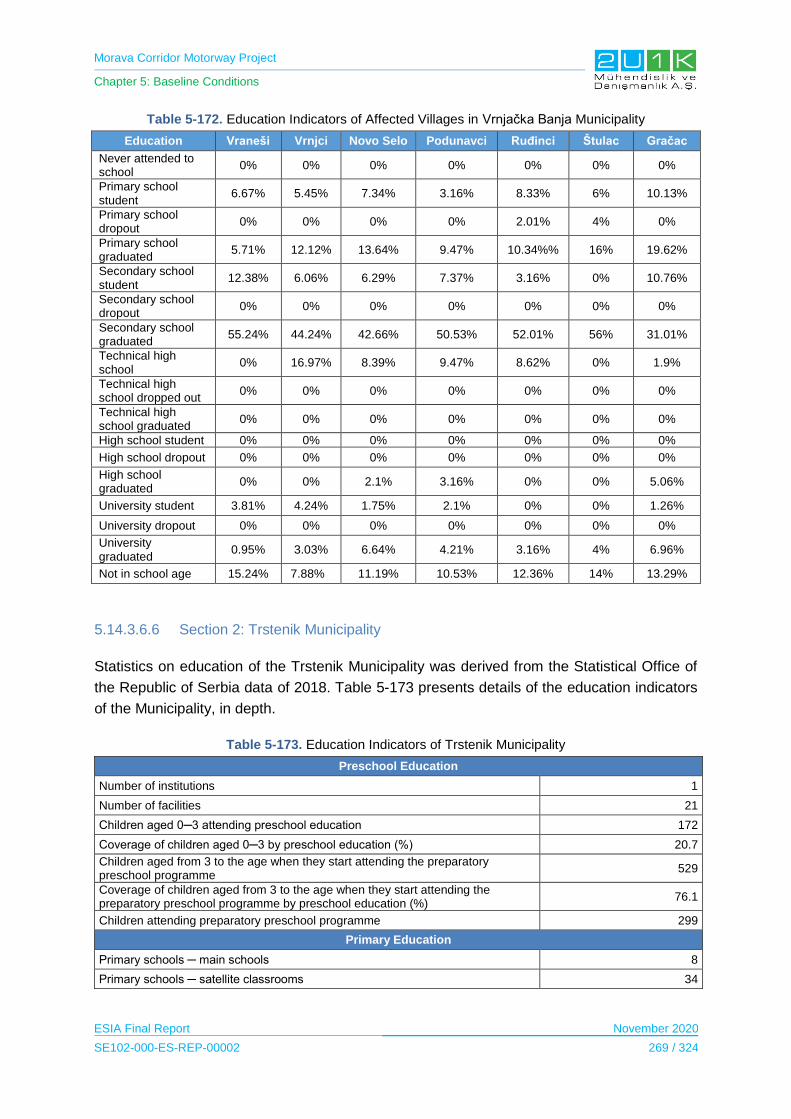
Morava Corridor Motorway Project
Chapter 5: Baseline Conditions
ESIA Final Report November 2020
SE102-000-ES-REP-00002 269 / 324
Table 5-172. Education Indicators of Affected Villages in Vrnjačka Banja Municipality
Education Vraneši Vrnjci Novo Selo Podunavci Ruđinci Štulac Gračac
Never attended to school
0% 0% 0% 0% 0% 0% 0%
Primary school student
6.67% 5.45% 7.34% 3.16% 8.33% 6% 10.13%
Primary school dropout
0% 0% 0% 0% 2.01% 4% 0%
Primary school graduated
5.71% 12.12% 13.64% 9.47% 10.34%% 16% 19.62%
Secondary school student
12.38% 6.06% 6.29% 7.37% 3.16% 0% 10.76%
Secondary school dropout
0% 0% 0% 0% 0% 0% 0%
Secondary school graduated
55.24% 44.24% 42.66% 50.53% 52.01% 56% 31.01%
Technical high school
0% 16.97% 8.39% 9.47% 8.62% 0% 1.9%
Technical high school dropped out
0% 0% 0% 0% 0% 0% 0%
Technical high school graduated
0% 0% 0% 0% 0% 0% 0%
High school student 0% 0% 0% 0% 0% 0% 0%
High school dropout 0% 0% 0% 0% 0% 0% 0%
High school graduated
0% 0% 2.1% 3.16% 0% 0% 5.06%
University student 3.81% 4.24% 1.75% 2.1% 0% 0% 1.26%
University dropout 0% 0% 0% 0% 0% 0% 0%
University graduated
0.95% 3.03% 6.64% 4.21% 3.16% 4% 6.96%
Not in school age 15.24% 7.88% 11.19% 10.53% 12.36% 14% 13.29%
5.14.3.6.6 Section 2: Trstenik Municipality
Statistics on education of the Trstenik Municipality was derived from the Statistical Office of
the Republic of Serbia data of 2018. Table 5-173 presents details of the education indicators
of the Municipality, in depth.
Table 5-173. Education Indicators of Trstenik Municipality
Preschool Education
Number of institutions 1
Number of facilities 21
Children aged 0─3 attending preschool education 172
Coverage of children aged 0─3 by preschool education (%) 20.7
Children aged from 3 to the age when they start attending the preparatory preschool programme
529
Coverage of children aged from 3 to the age when they start attending the preparatory preschool programme by preschool education (%)
76.1
Children attending preparatory preschool programme 299
Primary Education
Primary schools ─ main schools 8
Primary schools ─ satellite classrooms 34

Morava Corridor Motorway Project
Chapter 5: Baseline Conditions
ESIA Final Report November 2020
SE102-000-ES-REP-00002 270 / 324
Students enrolled in primary school ─ main schools
in lower grades (I ─ IV) 761
to higher grades (V ─ VIII) 1329
Students enrolled in primary school ─ satellite classrooms
in lower grades (I ─ IV) 439
to higher grades (V ─ VIII)
47
Primary school net attendance ratio (%) 93.3
Students who completed the 8th grade of primary school 394
Primary completion rate (%) 103.7
Drop-out rate in regular primary schools (%) 0.2
Number of children covered by primary education for children with disabilities 5
Number of adults covered by primary education 0
Secondary Education
Secondary schools 2
Students enrolled in secondary school 1107
Coverage of children by secondary education (%) 0
Students completing the secondary school 251
Secondary school completion rate (%) 0
Drop-out rate in regular secondary schools (%) 0.9
Number of children covered by secondary education for children with disabilities 0
In terms of education information of the Social Area Influence following information were
derived from the Community Level Surveys and Household Surveys.
Bogdanje: In the village of Bogdanje there is one elementary school. Total of 540 students
from Trstenik and Bogdan are getting service from this school. There are no high school in
village of Bogdanje, most students go in the city of Trsteni for high school. All residents of
Bogdanje are literate.
Lozna, Grabovac and Ugljarevo: The villages of Lozna, Grabovac and Ugljarevo, uses the
same elementary school called "Miodrag Čajetinac Čajka" from Trstenik. The school has 606
students. The village of Lozna, Grabovac and Ugljarevo don’t have high schools. The
nearest high school to these villages is in Trstenik.
Velika Drenova: The village of Velika Drenova has its own elementary school "Kneginja
Milica". This elementary school have 310 students and 34 teachers. All residents of Velika
Drenova are literate.
Medveđa: The village of Medveđa has its own elementary school "Ljubivoje Bajić". This
elementary school have 199 students and 29 teachers. All residents of Medveđa are literate.
Selište: There is no education facility in the village of Selište the students from this village
travels to Velika Drenova. All residents of Selište are literate.
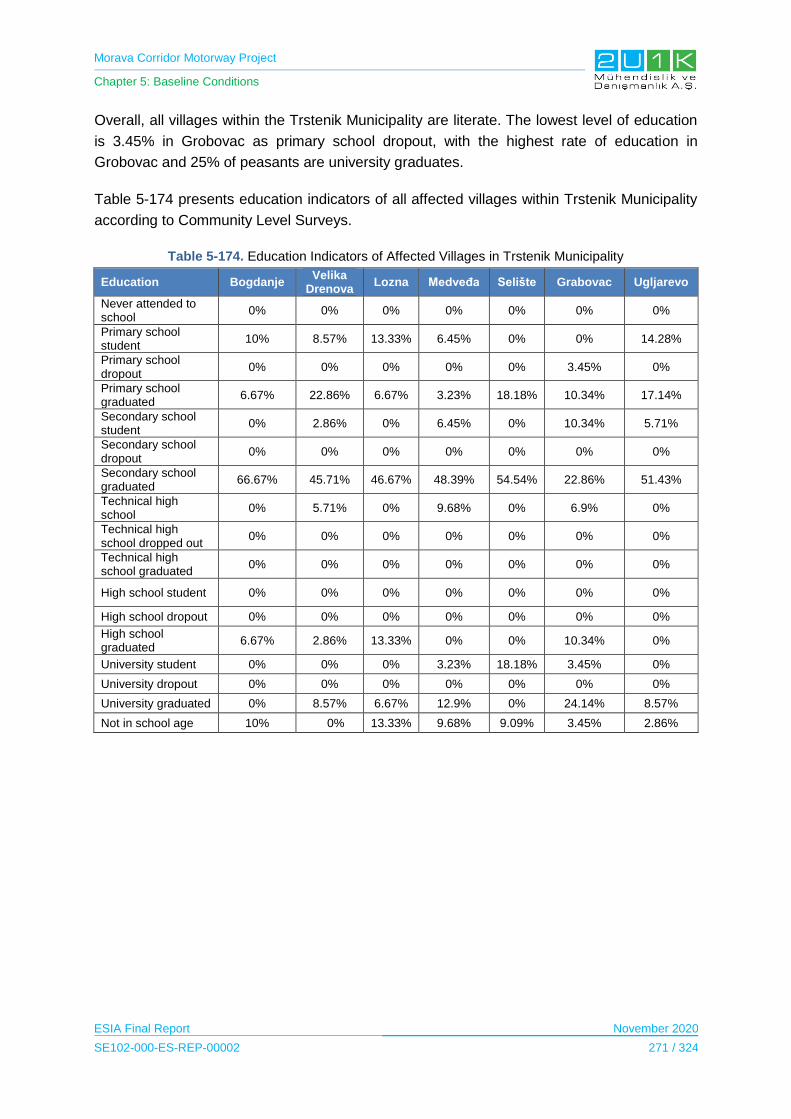
Morava Corridor Motorway Project
Chapter 5: Baseline Conditions
ESIA Final Report November 2020
SE102-000-ES-REP-00002 271 / 324
Overall, all villages within the Trstenik Municipality are literate. The lowest level of education
is 3.45% in Grobovac as primary school dropout, with the highest rate of education in
Grobovac and 25% of peasants are university graduates.
Table 5-174 presents education indicators of all affected villages within Trstenik Municipality
according to Community Level Surveys.
Table 5-174. Education Indicators of Affected Villages in Trstenik Municipality
Education Bogdanje Velika
Drenova Lozna Medveđa Selište Grabovac Ugljarevo
Never attended to school
0% 0% 0% 0% 0% 0% 0%
Primary school student
10% 8.57% 13.33% 6.45% 0% 0% 14.28%
Primary school dropout
0% 0% 0% 0% 0% 3.45% 0%
Primary school graduated
6.67% 22.86% 6.67% 3.23% 18.18% 10.34% 17.14%
Secondary school student
0% 2.86% 0% 6.45% 0% 10.34% 5.71%
Secondary school dropout
0% 0% 0% 0% 0% 0% 0%
Secondary school graduated
66.67% 45.71% 46.67% 48.39% 54.54% 22.86% 51.43%
Technical high school
0% 5.71% 0% 9.68% 0% 6.9% 0%
Technical high school dropped out
0% 0% 0% 0% 0% 0% 0%
Technical high school graduated
0% 0% 0% 0% 0% 0% 0%
High school student 0% 0% 0% 0% 0% 0% 0%
High school dropout 0% 0% 0% 0% 0% 0% 0%
High school graduated
6.67% 2.86% 13.33% 0% 0% 10.34% 0%
University student 0% 0% 0% 3.23% 18.18% 3.45% 0%
University dropout 0% 0% 0% 0% 0% 0% 0%
University graduated 0% 8.57% 6.67% 12.9% 0% 24.14% 8.57%
Not in school age 10% 0% 13.33% 9.68% 9.09% 3.45% 2.86%

Morava Corridor Motorway Project
Chapter 5: Baseline Conditions
ESIA Final Report November 2020
SE102-000-ES-REP-00002 272 / 324
5.14.3.6.7 Section 3: Čačak Municipality
Statistics on education of the Čačak Municipality was derived from the Statistical Office of the
Republic of Serbia data of 2018. Table 5-175 presents details of the education indicators of
the Municipality, in depth.
Table 5-175. Education Indicators of Čačak Municipality
Preschool Education
Number of institutions 5
Number of facilities 37
Children aged 0─3 attending preschool education 1163
Coverage of children aged 0─3 by preschool education (%) 38.5
Children aged from 3 to the age when they start attending the preparatory preschool programme
1886
Coverage of children aged from 3 to the age when they start attending the preparatory preschool programme by preschool education (%)
76.9
Children attending preparatory preschool programme 1086
Primary Education
Primary schools ─ main schools 16
Primary schools ─ satellite classrooms 24
Students enrolled in primary school ─ main schools
in lower grades (I ─ IV) 3812
to higher grades (V ─ VIII) 4397
Students enrolled in primary school ─ satellite classrooms
in lower grades (I ─ IV) 360
to higher grades (V ─ VIII)
8
Primary school net attendance ratio (%) 98.3
Students who completed the 8th grade of primary school 1241
Primary completion rate (%) 107.4
Drop-out rate in regular primary schools (%) 0.0
Number of children covered by primary education for children with disabilities 46
Number of adults covered by primary education 0
Secondary Education
Secondary schools 7
Students enrolled in secondary school 5193
Coverage of children by secondary education (%) 0
Students completing the secondary school 1138
Secondary school completion rate (%) 0
Drop-out rate in regular secondary schools (%) 08
Number of children covered by secondary education for children with disabilities 21
In terms of education information of the Social Area Influence following information were
derived from the Community Level Surveys and Household Surveys.
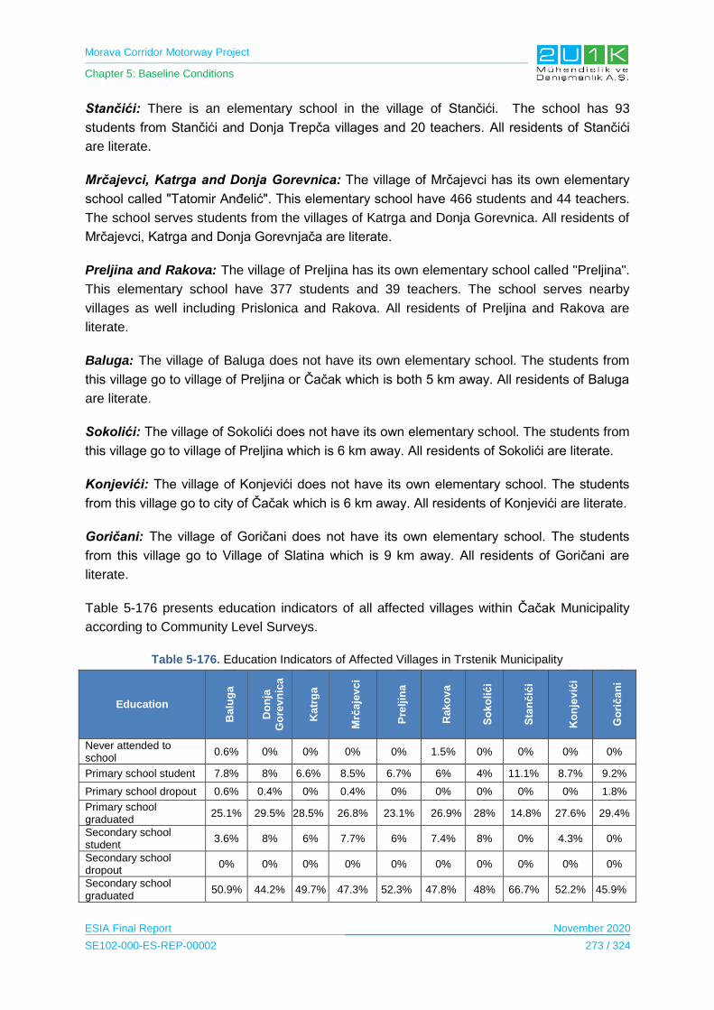
Morava Corridor Motorway Project
Chapter 5: Baseline Conditions
ESIA Final Report November 2020
SE102-000-ES-REP-00002 273 / 324
Stančići: There is an elementary school in the village of Stančići. The school has 93
students from Stančići and Donja Trepča villages and 20 teachers. All residents of Stančići
are literate.
Mrčajevci, Katrga and Donja Gorevnica: The village of Mrčajevci has its own elementary
school called "Tatomir Anđelić". This elementary school have 466 students and 44 teachers.
The school serves students from the villages of Katrga and Donja Gorevnica. All residents of
Mrčajevci, Katrga and Donja Gorevnjača are literate.
Preljina and Rakova: The village of Preljina has its own elementary school called "Preljina".
This elementary school have 377 students and 39 teachers. The school serves nearby
villages as well including Prislonica and Rakova. All residents of Preljina and Rakova are
literate.
Baluga: The village of Baluga does not have its own elementary school. The students from
this village go to village of Preljina or Čačak which is both 5 km away. All residents of Baluga
are literate.
Sokolići: The village of Sokolići does not have its own elementary school. The students from
this village go to village of Preljina which is 6 km away. All residents of Sokolići are literate.
Konjevići: The village of Konjevići does not have its own elementary school. The students
from this village go to city of Čačak which is 6 km away. All residents of Konjevići are literate.
Goričani: The village of Goričani does not have its own elementary school. The students
from this village go to Village of Slatina which is 9 km away. All residents of Goričani are
literate.
Table 5-176 presents education indicators of all affected villages within Čačak Municipality
according to Community Level Surveys.
Table 5-176. Education Indicators of Affected Villages in Trstenik Municipality
Education
Balu
ga
Do
nja
Go
rev
nic
a
Katr
ga
Mrč
aje
vc
i
Pre
ljin
a
Rak
ov
a
So
ko
lić
i
Sta
nč
ići
Ko
nje
vić
i
Go
rič
an
i
Never attended to school
0.6% 0% 0% 0% 0% 1.5% 0% 0% 0% 0%
Primary school student 7.8% 8% 6.6% 8.5% 6.7% 6% 4% 11.1% 8.7% 9.2%
Primary school dropout 0.6% 0.4% 0% 0.4% 0% 0% 0% 0% 0% 1.8%
Primary school graduated
25.1% 29.5% 28.5% 26.8% 23.1% 26.9% 28% 14.8% 27.6% 29.4%
Secondary school student
3.6% 8% 6% 7.7% 6% 7.4% 8% 0% 4.3% 0%
Secondary school dropout
0% 0% 0% 0% 0% 0% 0% 0% 0% 0%
Secondary school graduated
50.9% 44.2% 49.7% 47.3% 52.3% 47.8% 48% 66.7% 52.2% 45.9%
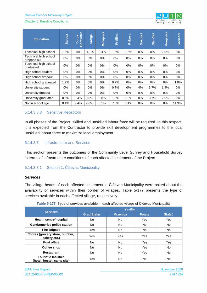
Morava Corridor Motorway Project
Chapter 5: Baseline Conditions
ESIA Final Report November 2020
SE102-000-ES-REP-00002 274 / 324
Education
Ba
lug
a
Do
nja
Go
rev
nic
a
Ka
trg
a
Mrč
aje
vc
i
Pre
ljin
a
Ra
ko
va
So
ko
lić
i
Sta
nč
ići
Ko
nje
vić
i
Go
rič
an
i
Technical high school 1.2% 0% 1.1% 0.4% 1.5% 1.5% 0% 0% 2.9% 0%
Technical high school dropped out
0% 0% 0% 0% 0% 0% 0% 0% 0% 0%
Technical high school graduated
0% 0% 0% 0% 0% 0% 0% 0% 0% 0%
High school student 0% 0% 0% 0% 0% 0% 0% 0% 0% 0%
High school dropout 0% 0% 0% 0% 0% 0% 0% 0% 0% 0%
High school graduated 1.2% 0% 0% 0% 0.7% 0% 0% 0% 0% 1.8%
University student 0% 0% 0% 0% 0.7% 0% 4% 3.7% 1.4% 0%
University dropout 0% 0% 0% 0% 0% 0% 0% 0% 0% 0%
University graduated 0.6% 0.4% 0.5% 0.8% 1.5% 1.5% 0% 3.7% 2.9% 0%
Not in school age 8.4% 9.4% 7.6% 8.1% 7.5% 7.4% 8% 0% 0% 11.9%
5.14.3.6.8 Sensitive Receptors
In all phases of the Project, skilled and unskilled labour force will be required. In this respect,
it is expected from the Contractor to provide skill development programmes to the local
unskilled labour force to maximize local employment.
5.14.3.7 Infrastructure and Services
This section presents the outcomes of the Community Level Survey and Household Survey
in terms of infrastructure conditions of each affected settlement of the Project.
5.14.3.7.1 Section 1: Ćićevac Municipality
Services
The village heads of each affected settlement in Ćićevac Municipality were asked about the
availability of services within their border of villages, Table 5-177 presents the type of
services available in each affected village, respectively.
Table 5-177. Type of services available in each affected village of Ćićevac Municipality
Services Yes/No
Grad Stalać Mrzenica Pojate Stalać
Health centre/hospital No No Yes Yes
Gendarmerie / police station No No No No
Fire Brigade Yes No No No
Stores (grocery store, butcher, bakery etc.)
Yes Yes Yes Yes
Post office No No Yes Yes
Coffee shop No No Yes No
Restaurant No No Yes No
Touristic facilities (hotel, hostel, camp site)
Yes No No No

Morava Corridor Motorway Project
Chapter 5: Baseline Conditions
ESIA Final Report November 2020
SE102-000-ES-REP-00002 275 / 324
Services Yes/No
Grad Stalać Mrzenica Pojate Stalać
Village room Yes Yes No No
Financial (eg banks, ATMs, foreign exchange bureaus)
No No No No
Church Yes Yes Yes Yes
Any other praying buildings? (Mosque or synagogue, please
specify) No No No No
Cooperative / Association No No No Yes
Public transportation (bus) Yes Yes Yes Yes
Infrastructure
The village heads were also asked about the infrastructure conditions of their settlement, it
was observed that electricity, solid waste collections, communication land lines and asphalt
roads are available in all villages. Further information on available infrastructure services in
affected villages of Ćićevac Municipality is presented in Table 5-178.
Table 5-178. Available infrastructure services in affected villages of Ćićevac Municipality
Yes/No
Type of Infrastructure Grad Stalać Mrzenica Poijate Stalać
Electrical infrastructure Yes Yes Yes Yes
Drinking water source Yes Yes No Yes
Domestic water source Yes No No Yes
Irrigation water source No No No No
Sewer system No No No No
Heating source No No No No
Domestic solid waste collection Yes Yes Yes Yes
Communication Landline Yes Yes Yes Yes
Mobile Phone Yes Yes Yes Yes
Internet Yes Yes Yes Yes
Asphalt road Yes Yes Yes Yes
Other No No No No
Furthermore, according to village heads, the water sources of the villages were polluted due
to the flooding from the West Morava. As for the sewage system, all the houses use septic
tanks, however the village heads stated that a sewage system will be established soon.
Household Conditions
In general, Grad Stalać, Mrzenica, Pojate and Stalać households stated to have average
conditions in the house, with a size larger than 50 m2. Majority of the households heated by
wood, residents of Stalac stated that 13% of them use electricity as a heating source. Last,
the waste is dumped in a landfill in general. Further information and details for each affected
settlement can be found in Table 5-179.

Morava Corridor Motorway Project
Chapter 5: Baseline Conditions
ESIA Final Report November 2020
SE102-000-ES-REP-00002 276 / 324
Table 5-179. Household conditions of each affected settlements of Ćićevac Municipality
Conditions Grad Stalać Mrzenica Pojate Stalać
What is the condition of your house when compared with the other houses in the area?
Better 0% 0% 0% 13%
Averege 100% 100% 100% 88%
Worse 0% 0% 0% 0%
Surface area 0-25 m² 0% 0% 0% 0%
25-50 m² 0% 17% 36% 25%
50-200 m² 89% 50% 74% 75%
200 m² 11% 33% 0% 0%
Owernship of the house Owner 100% 100% 100% 100%
Rental 0% 0% 0% 0%
Occupier 0% 0% 0% 0%
Other 0% 0% 0% 0%
Water source of drinking water Open source water 11% 0% 0% 0%
Well water 0% 0% 0% 0%
River 11% 17% 0% 0%
Tap Tank 78% 83% 100% 100%
Water source of the irrigation water Open source water 0% 17% 0% 0%
Well water 0% 0% 0% 0%
River 22% 0% 0% 0%
Tap tank 78% 83% 100% 100%
Water source of the domestic water Open source water 0% 17% 0% 0%
Well water 0% 0% 0% 0%
River 11% 0% 0% 0%
Tap Tank 89% 83% 100% 100%
Do you generally have electricity in the house you live in?
Yes 100% 100% 100% 100%
No 0% 0% 0% 0%
Are the electricity cut offs Rarely 67% 33% 0% 38%
No cut/offs 33% 67% 100% 62%
Toiler facilities In the house 100% 100% 100% 88%
Outside the house 0% 0% 0% 12%
Toilet system Sewer system 100% 100% 100% 100%
Septic tank 0% 0% 0% 0%
Heating source Coal 0% 17% 0% 13%
Electricity 0% 0% 0% 12%
Gas 0% 0% 0% 0%
Wood 100% 83% 0% 75%
Solar power 0% 0% 0% 0%
Waste management Bury 0% 0% 0% 0%
Incineration 0% 0% 0% 0%
Landfill 44% 83% 0% 100%
Unsanitary disposal 0% 0% 0% 0%
Other 56% 17% 100% 0%

Morava Corridor Motorway Project
Chapter 5: Baseline Conditions
ESIA Final Report November 2020
SE102-000-ES-REP-00002 277 / 324
During the ESIA Disclosure Meeting10 on September 23, 2020 the attendees of the meeting
informed 2U1K regarding an unsanitary landfill located in Ćićevac for further assessment
(See Figure 5-77).
Figure 5-77. Unsanitary Landfill Located in Ćićevac Municipality
The location of the unsanitary landfill was assessed by the 2U1K after the Disclosure
Meeting in Ćićevac to obtain exact coordinates of the landfill and observe potential impacts
could arise from the landfill. To conclude, the unsanitary landill is outside of the AoI and
expected to not cause any negative impacts to the Project or its facilities.
10 Details of the ESIA Disclosure Meeting can be obtained from the Stakeholder Engagement Plan.
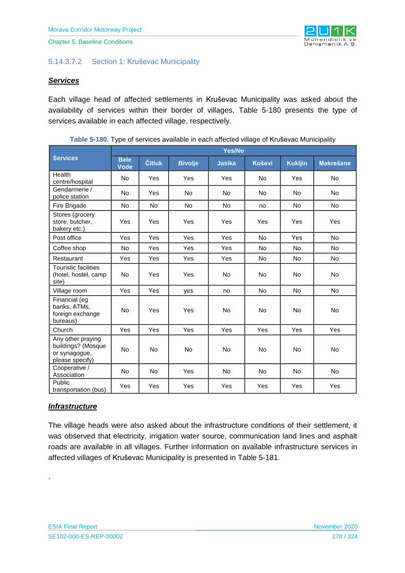
Morava Corridor Motorway Project
Chapter 5: Baseline Conditions
ESIA Final Report November 2020
SE102-000-ES-REP-00002 278 / 324
5.14.3.7.2 Section 1: Kruševac Municipality
Services
Each village head of affected settlements in Kruševac Municipality was asked about the
availability of services within their border of villages, Table 5-180 presents the type of
services available in each affected village, respectively.
Table 5-180. Type of services available in each affected village of Kruševac Municipality
Services
Yes/No
Bele Vode
Čitluk Bivolje Jasika Koševi Kukljin Makrešane
Health centre/hospital
No Yes Yes Yes No Yes No
Gendarmerie / police station
No Yes No No No No No
Fire Brigade No No No No no No No
Stores (grocery store, butcher, bakery etc.)
Yes Yes Yes Yes Yes Yes Yes
Post office Yes Yes Yes Yes No Yes No
Coffee shop No Yes Yes Yes No No No
Restaurant Yes Yes Yes Yes No No No
Touristic facilities (hotel, hostel, camp site)
No Yes Yes No No No No
Village room Yes Yes yes no No No No
Financial (eg banks, ATMs, foreign exchange bureaus)
No Yes Yes No No No No
Church Yes Yes Yes Yes Yes Yes Yes
Any other praying buildings? (Mosque or synagogue, please specify)
No No No No No No No
Cooperative / Association
No No Yes No No No No
Public transportation (bus)
Yes Yes Yes Yes Yes Yes Yes
Infrastructure
The village heads were also asked about the infrastructure conditions of their settlement, it
was observed that electricity, irrigation water source, communication land lines and asphalt
roads are available in all villages. Further information on available infrastructure services in
affected villages of Kruševac Municipality is presented in Table 5-181.
.

Morava Corridor Motorway Project
Chapter 5: Baseline Conditions
ESIA Final Report November 2020
SE102-000-ES-REP-00002 279 / 324
Table 5-181. Available infrastructure services in affected villages of Kruševac Municipality
Yes/ No
Type of Infrastructure Čitluk Bela Voda Bivolje Jasika Koševi Kukljin Makrešane
Electrical infrastructure Yes Yes Yes Yes Yes Yes Yes
Drinking water source Yes Yes Yes Yes No Yes Yes
Domestic water source Yes Yes Yes Yes No Yes Yes
Irrigation water source Yes Yes Yes Yes Yes Yes Yes
Sewer system No Yes No No No No No
Heating source No No Yes Yes No Yes No
Domestic solid waste collection
No No Yes No No Yes Yes
Communication Landline Yes Yes Yes Yes Yes Yes Yes
Mobile Phone Yes Yes Yes Yes Yes Yes Yes
Internet Yes Yes Yes Yes Yes Yes Yes
Asphalt road Yes Yes Yes Yes Yes Yes Yes
Other No No No No No No No
Furthermore, for heating, almost 95% of the population in all villages is heated by wood and
supplies coal to some households. All villages are covered by landline, mobile and internet.
Household Conditions
In general, majority of respondents of the Household Surveys live on a house sized
approximately 50 m². All of the locals were stated to be heated by wood. Further information
and details for each affected settlement can be found in Table 5-182.
Table 5-182. Household conditions of each affected settlements of Kruševac Municipality
Conditions
Bela
Vo
da
Čit
luk
Biv
olj
e
Ja
sik
a
Ko
še
vi
Ku
klj
in
Ma
kre
ša
ne
What is the condition of your house when compared with
the other houses in the area?
Better 45% 35% 10% 25% 0% 30% 14%
Surface area
Averege 55% 65% 70% 75% 88% 60% 71%
Worse 0% 0% 20% 0% 13% 10% 14%
0-25 m² 0% 0% 0% 0% 0% 0% 0%
25-50 m² 52% 65% 10% 25% 13% 10% 71%
50-200 m² 48% 35% 90% 75% 87% 90% 29%
200 m² 0% 0% 0% 0% 0% 0% 0%
Owernship of the house
Owner 100% 100% 90% 100% 100% 70% 86%
Rental 0% 0% 0% 0% 0% 0% 0%
Occupier 0% 0% 0% 0% 0% 0% 0%
Other 0% 0% 10% 0% 0% 20% 14%

Morava Corridor Motorway Project
Chapter 5: Baseline Conditions
ESIA Final Report November 2020
SE102-000-ES-REP-00002 280 / 324
Conditions
Be
la V
od
a
Čit
luk
Biv
olj
e
Ja
sik
a
Ko
še
vi
Ku
klj
in
Ma
kre
ša
ne
Water source of drinking water
Open source water 0% 0% 0% 0% 0% 0% 0%
Well water 0% 0% 0% 0% 0% 0% 0%
River 0% 0% 0% 0% 0% 10% 14%
Tap tank 100% 100% 100% 100% 100% 90% 86%
Water source of the irrigation water
Open source water 85% 100% 10% 0% 0% 0% 14%
Well water 15% 0% 0% 0% 0% 0% 0%
River 0% 0% 20% 50% 63% 40% 0%
Tap tank 0% 0% 70% 50% 37% 60% 86%
Water source of the domestic water
Open source water 100% 100% 0% 0% 0% 10% 0%
Well water 0% 0% 0% 0% 0% 0% 0%
River 0% 0% 20% 25% 38% 30% 14%
Tap tank 0% 0% 80% 75% 63% 60% 86%
Do you generally have electricity in the house you
live in?
Yes 100% 100% 100% 100% 100% 100% 100%
No 0% 0% 0% 0% 0% 0% 0%
Are the electricity cut offs Rarely 100% 100% 30% 75% 38% 50% 29%
No cut/offs 0% 0% 60% 0% 63% 40% 57%
Toiler facilities In the house 100% 100% 100% 100% 100% 100% 100%
Outside the house 0% 0% 0% 0% 0% 0% 0%
Toilet system Sewer system 0% 78% 0% 0% 0% 0% 0%
Septic tank 100% 22% 0% 0% 0% 0% 0%
Heating source
Coal 0% 15% 0% 0% 0% 10% 0%
Electricity 5% 35% 0% 0% 0% 0% 0%
Gas 0% 0% 0% 0% 0% 0% 0%
Wood 95% 50% 90% 100% 88% 90% 86%
Solar power 0% 0% 0% 0% 0% 0% 0%
Waste management
Bury 0% 0% 0% 0% 0% 0% 0%
Incineration 0% 0% 0% 0% 0% 0% 0%
Landfill 100% 100% 60% 75% 88% 90% 43%
Unsanitary disposal 0% 0% 0% 0% 0% 0% 0%
Other 0% 0% 30% 25% 13% 10% 43%

Morava Corridor Motorway Project
Chapter 5: Baseline Conditions
ESIA Final Report November 2020
SE102-000-ES-REP-00002 281 / 324
5.14.3.7.3 Section 1: Varvarin Municipality
Services
The village heads of each affected settlement in Varvarin Municipality were asked about the
availability of services within their border of villages, Table 5-183 presents the type of
services available in each affected village, respectively.
Table 5-183. Type of services available in each affected village of Varvarin Municipality
Services Yes/No
Bošnjane Maskare
Health centre/hospital No No
Gendarmerie / police station Yes No
Fire Brigade Yes Yes
Stores (grocery store, butcher, bakery etc.) Yes Yes
Post office Yes No
Coffee shop No No
Restaurant No No
Touristic facilities (hotel, hostel, camp site) No No
Village room No No
Financial (eg banks, ATMs, foreign exchange bureaus)
No No
Church Yes Yes
Any other praying buildings? (Mosque or synagogue, please specify)
No No
Cooperative / Association No No
Public transportation (bus) Yes Yes
Infrastructure
The village heads were also asked about the infrastructure conditions of their settlement, it
was observed that electricity, irrigation water source, communication land lines and asphalt
roads are available in all villages. Further information on available infrastructure services in
affected villages of Varvarin Municipality is presented in Table 5-184.
Table 5-184. Available infrastructure services in affected villages of Varvarin Municipality
Yes/No
Available infrastructure Bošnjane Maskare
Electrical infrastructure Yes Yes
Drinking water source Yes No
Domestic water source No No
Irrigation water source Yes No
Sewer system No No
Heating source No No
Domestic solid waste collection Yes Yes
Communication Landline Yes Yes

Morava Corridor Motorway Project
Chapter 5: Baseline Conditions
ESIA Final Report November 2020
SE102-000-ES-REP-00002 282 / 324
Yes/No
Available infrastructure Bošnjane Maskare
Mobile Phone Yes Yes
Internet Yes Yes
Asphalt road Yes Yes
All villages are covered by landline, mobile and internet.
Household Conditions
In general, majority of respondents of the Household Surveys live on a house sized
approximately 50 m2. All of the locals were stated to be heated by wood. Further information
and details for each affected settlement can be found in Table 5-185.
Table 5-185. Household conditions of each affected settlements of Varvarin Municipality
Conditions Village Bošnjane Maskare
What is the condition of your house when compared with the other houses in the area?
Better 29% 20%
Averege 71% 80%
Worse 0% 0%
Surface area
0-25 m² 0% 0%
25-50 m² 0% 0%
50-200 m² 86% 90%
200 m² 14% 10%
Owernship of the house
Owner 57% 80%
Rental 0% 0%
Occupier 0% 0%
Other 43% 20%
Water source of drinking water
Open source water 0% 0%
Well water 0% 0%
River 100% 90%
Tap Tank 0% 10%
Water source of the irrigation water
Open source water 0% 0%
Well water 100% 90%
River 0% 0%
Tap tank 0% 10%
Water source of the domestic water
Open source water 0% 10%
Well water 43% 10%
River 0% 0%
Tap Tank 57% 80%
Do you generally have electricity in the house you live in
Yes 100% 100%
No 0% 0%
Are the electricity cut offs Rarely 100% 90%
No cut/offs 0% 10%
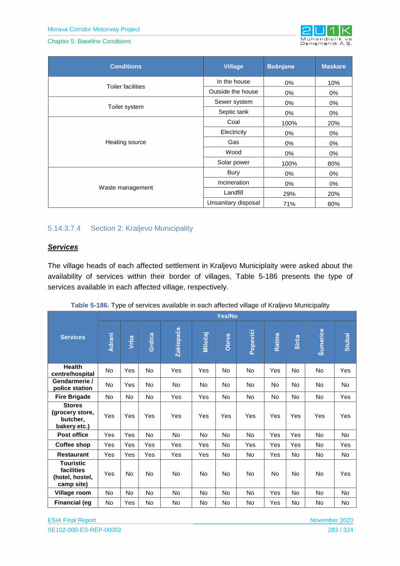
Morava Corridor Motorway Project
Chapter 5: Baseline Conditions
ESIA Final Report November 2020
SE102-000-ES-REP-00002 283 / 324
Conditions Village Bošnjane Maskare
Toiler facilities In the house 0% 10%
Outside the house 0% 0%
Toilet system Sewer system 0% 0%
Septic tank 0% 0%
Heating source
Coal 100% 20%
Electricity 0% 0%
Gas 0% 0%
Wood 0% 0%
Solar power 100% 80%
Waste management
Bury 0% 0%
Incineration 0% 0%
Landfill 29% 20%
Unsanitary disposal 71% 80%
5.14.3.7.4 Section 2: Kraljevo Municipality
Services
The village heads of each affected settlement in Kraljevo Municiplaity were asked about the
availability of services within their border of villages, Table 5-186 presents the type of
services available in each affected village, respectively.
Table 5-186. Type of services available in each affected village of Kraljevo Municipality
Services
Yes/No
Ad
ran
i
Vrb
a
Grd
ica
Za
klo
pa
ča
Mil
oča
j
Ob
rva
Po
po
vić
i
Rati
na
Sir
ča
Šu
ma
ric
e
Stu
ba
l
Health centre/hospital
No Yes No Yes Yes No No Yes No No Yes
Gendarmerie / police station
No Yes No No No No No No No No No
Fire Brigade No No No Yes Yes No No No No No Yes
Stores (grocery store,
butcher, bakery etc.)
Yes Yes Yes Yes Yes Yes Yes Yes Yes Yes Yes
Post office Yes Yes No No No No No Yes Yes No No
Coffee shop Yes Yes Yes Yes Yes No Yes Yes Yes No Yes
Restaurant Yes Yes Yes Yes Yes No No Yes No No No
Touristic facilities
(hotel, hostel, camp site)
Yes No No No No No No No No No Yes
Village room No No No No No No No Yes No No No
Financial (eg No Yes No No No No No Yes No No No

Morava Corridor Motorway Project
Chapter 5: Baseline Conditions
ESIA Final Report November 2020
SE102-000-ES-REP-00002 284 / 324
Services
Yes/No
Ad
ran
i
Vrb
a
Grd
ica
Za
klo
pa
ča
Mil
oča
j
Ob
rva
Po
po
vić
i
Ra
tin
a
Sir
ča
Šu
ma
ric
e
Stu
ba
l
banks, ATMs, foreign
exchange bureaus)
Church Yes Yes No Yes Yes Yes No Yes Yes Yes Yes
Any other praying
buildings? (Mosque or synagogue,
please specify)
No No No No No No No No No No No
Cooperative / Association
No No No Yes Yes No No No No No No
Public transportation
(bus) Yes Yes Yes Yes Yes Yes Yes Yes Yes Yes Yes
Infrastructure
The village heads were also asked about the infrastructure conditions of their settlement, it
was observed that electricity, communication land lines and asphalt roads are available in all
villages. Further information on available infrastructure services in affected villages of
Kraljevo Municipality is presented in Table 5-187.
Table 5-187. Available infrastructure services in affected villages of Kraljevo Municipality
Yes/No
Type of Infrastructure
Ad
ran
i
Vrb
a
Grd
ica
Za
klo
pa
ča
Mil
oča
j
Ob
rva
Po
po
vić
i
Rati
na
Sir
ča
Šu
ma
rce
Stu
ba
l
Electrical infrastructure
Yes Yes Yes Yes Yes Yes Yes Yes Yes Yes Yes
Drinking water source
Yes Yes Yes Yes No No Yes Yes Yes Yes Yes
Domestic water source
Yes Yes Yes Yes Yes Yes No Yes Yes Yes No
Irrigation water source
Yes No Yes Yes No Yes No Yes No No No
Sewer system Yes No Yes No No No No Yes No No No
Heating source No No No No No No No No No No No
Domestic solid waste
collection Yes Yes Yes Yes Yes Yes No Yes Yes Yes Yes
Communication Landline
Yes Yes Yes Yes Yes Yes Yes Yes Yes Yes Yes
Mobile Phone Yes Yes Yes Yes Yes Yes Yes Yes Yes Yes Yes
Internet Yes Yes Yes Yes Yes Yes Yes Yes Yes Yes Yes
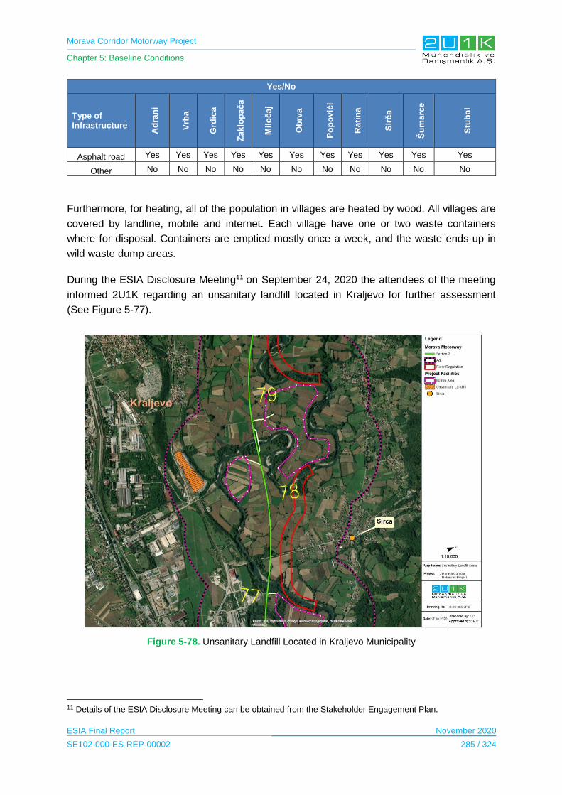
Morava Corridor Motorway Project
Chapter 5: Baseline Conditions
ESIA Final Report November 2020
SE102-000-ES-REP-00002 285 / 324
Yes/No
Type of Infrastructure
Ad
ran
i
Vrb
a
Grd
ica
Za
klo
pa
ča
Mil
oča
j
Ob
rva
Po
po
vić
i
Ra
tin
a
Sir
ča
Šu
ma
rce
Stu
ba
l
Asphalt road Yes Yes Yes Yes Yes Yes Yes Yes Yes Yes Yes
Other No No No No No No No No No No No
Furthermore, for heating, all of the population in villages are heated by wood. All villages are
covered by landline, mobile and internet. Each village have one or two waste containers
where for disposal. Containers are emptied mostly once a week, and the waste ends up in
wild waste dump areas.
During the ESIA Disclosure Meeting11 on September 24, 2020 the attendees of the meeting
informed 2U1K regarding an unsanitary landfill located in Kraljevo for further assessment
(See Figure 5-77).
Figure 5-78. Unsanitary Landfill Located in Kraljevo Municipality
11 Details of the ESIA Disclosure Meeting can be obtained from the Stakeholder Engagement Plan.

Morava Corridor Motorway Project
Chapter 5: Baseline Conditions
ESIA Final Report November 2020
SE102-000-ES-REP-00002 286 / 324
The location of the unsanitary landfill was assessed by the 2U1K after the Disclosure
Meeting in Ćićevac to obtain exact coordinates of the landfill and observe potential impacts
could arise from the landfill. To conclude, the unsanitary landill is outside of the AoI and
expected to not cause any negative impacts to the Project or its facilities.
Household Conditions
In general, majority of respondents of the Household Surveys live on a house sized
approximately 50 -200m2. All of the locals were stated to be heated by wood. Last, the waste
is dumped in a landfill in general. Further information and details for each affected
settlements can be found in Table 5-188.

Morava Corridor Motorway Project
Chapter 5: Baseline Conditions
ESIA Final Report November 2020
SE102-000-ES-REP-00002 287 / 324
Table 5-188. Household conditions of each affected settlements of Kraljevo Municipality
Conditions Adrani Vrba Grdica Zaklopača Miločaj Obrva Popovići Ratina Sirča Šumarice Stubal
Condition of house
Better 0% 0% 0% 0% 8% 0% 0% 67% 0% 11% 12%
Average 60% 50% 50% 50% 42% 100% 73% 33% 50% 42% 18%
Worse 40% 50% 50% 50% 8% 0% 0% 0% 50% 47% 70%
Surface area
0-25m2 0% 0% 0% 0% 0% 0% 0% 0% 0% 0% 0%
25m2 - 50 m2 40% 0% 0% 40% 0% 0% 0% 0% 0% 5% 0%
50 m2-200 m2 60% 50% 50% 60% 75% 100% 73% 100% 100% 47% 94%
More than 200 m2 0% 50% 50% 0% 25% 0% 27% 0% 0% 47% 6%
Ownership of the house
Owner 80% 100% 100% 100% 75% 100% 91% 67% 100% 84% 94%
Rental 0% 0% 0% 0% 0% 0% 0% 33% 0% 0% 0%
Occupier 0% 0% 0% 0% 0% 0% 0% 0% 0% 0% 0%
Other 20% 0% 0% 0% 25% 0% 9% 0% 0% 16% 6%
Water source of drinking
water
Spring water 0% 0% 0% 0% 8% 0% 0% 0% 0% 0% 12%
Well water 20% 0% 0% 0% 0% 0% 0% 0% 0% 0% 0%
Water tank 20%
0% 0% 0% 17% 50% 55% 33% 0% 16% 6%
Water supply network
60% 100% 100% 100% 75% 50% 45% 67% 100% 84% 82%
Water source of the irrigation
water
Spring water 0%
0% 0% 0% 0% 0% 0% 0% 0%
0% 6%
Well water 100% 0% 0% 100% 17% 25% 36% 33% 0% 37% 6%
Water tank 0%
0% 0% 0% 0% 0% 9% 0% 0% 0% 0%
Water supply network
0% 100% 100% 100% 83% 75% 64%% 67% 100% 63% 88%
Water source of the
domestic water
Spring water 0%
0% 0% 0% 0% 0% 0% 0% 0%
0% 6%
Well water 100% 0% 0% 100% 17% 25% 36% 33% 0% 37% 6%
Water tank 0% 0% 0% 0% 0% 0% 9% 0% 0% 0% 0%
Water supply network
0% 100% 100% 100% 83% 75% 64%% 67% 100% 63% 88%
Electricity in the house
Yes 40% 10% 50% 0% 25% 25% 36% 33% 0% 16% 6%
No 60% 90% 50% 0% 75% 75% 64% 77% 100% 84% 94%
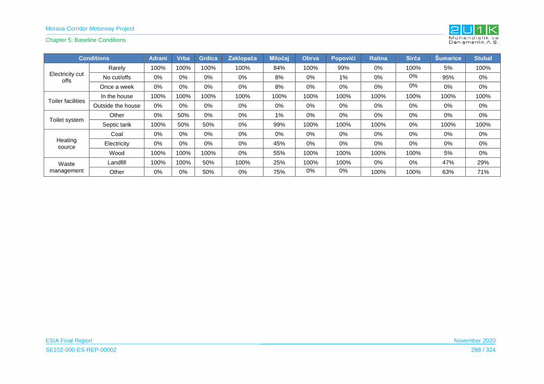
Morava Corridor Motorway Project
Chapter 5: Baseline Conditions
ESIA Final Report November 2020
SE102-000-ES-REP-00002 288 / 324
Conditions Adrani Vrba Grdica Zaklopača Miločaj Obrva Popovići Ratina Sirča Šumarice Stubal
Electricity cut offs
Rarely 100% 100% 100% 100% 84% 100% 99% 0% 100% 5% 100%
No cut/offs 0% 0% 0% 0% 8% 0% 1% 0% 0% 95% 0%
Once a week 0% 0% 0% 0% 8% 0% 0% 0% 0% 0% 0%
Toiler facilities In the house 100% 100% 100% 100% 100% 100% 100% 100% 100% 100% 100%
Outside the house 0% 0% 0% 0% 0% 0% 0% 0% 0% 0% 0%
Toilet system Other 0% 50% 0% 0% 1% 0% 0% 0% 0% 0% 0%
Septic tank 100% 50% 50% 0% 99% 100% 100% 100% 0% 100% 100%
Heating source
Coal 0% 0% 0% 0% 0% 0% 0% 0% 0% 0% 0%
Electricity 0% 0% 0% 0% 45% 0% 0% 0% 0% 0% 0%
Wood 100% 100% 100% 0% 55% 100% 100% 100% 100% 5% 0%
Waste management
Landfill 100% 100% 50% 100% 25% 100% 100% 0% 0% 47% 29%
Other 0% 0% 50% 0% 75% 0% 0% 100% 100% 63% 71%

Morava Corridor Motorway Project
Chapter 5: Baseline Conditions
ESIA Final Report November 2020
SE102-000-ES-REP-00002 289 / 324
5.14.3.7.5 Section 2: Vrnjačka Banja Municipality
Services
The village heads of each affected settlement in Vrnjačka Banja Municipality were asked
about the availability of services within their border of villages, Table 5-189 presents the type
of services available in each affected village, respectively.
Table 5-189. Type of services available in each affected village of Vrnjačka Banja Municipality
Services
Yes/No
Vraneši Vrnjci Novo Selo
Podunavci Ruđinci Štulac Gračac
Health centre/hospital Yes No Yes Yes No No Yes
Gendarmerie / police station
No No No Yes No No No
Fire Brigade No No No No No No No
Stores (grocery store, butcher, bakery etc.)
Yes Yes Yes Yes Yes Yes Yes
Post office Yes Yes Yes Yes No No No
Coffee shop No Yes Yes Yes No No Yes
Restaurant No Yes Yes Yes No Yes No
Touristic facilities (hotel, hostel, camp site)
No No No No No No No
Village room No No No No No No No
Financial (eg banks, ATMs, foreign exchange bureaus)
No Yes No Yes No No No
Church Yes Yes No No Yes No Yes
Any other praying buildings? (Mosque or synagogue, please specify)
No No No No No No No
Cooperative / Association
No No No No No No No
Public transportation (bus)
Yes Yes Yea Yes Yes Yes Yes
In case the services are not available in the villages, all of the locals stated to visit Vrnjačka
Banja to obtain additional services.
Infrastructure
The village heads were also asked about the infrastructure conditions of their settlement, it
was observed that electricity, drinking water source, irrigation water source, communication
land lines and asphalt roads are available in all villages. Further information on available
infrastructure services in affected villages of Vrnjačka Banja Municipality is presented in
Table 5-190.

Morava Corridor Motorway Project
Chapter 5: Baseline Conditions
ESIA Final Report November 2020
SE102-000-ES-REP-00002 290 / 324
Table 5-190. Available infrastructure services in affected villages of Vrnjačka Banja Municipality
Yes/No
Services Vraneši Vrnjci Novo Selo Podunavci Ruđinci Štulac Gračac
Electrical infrastructure
Yes Yes Yes Yes Yes Yes Yes
Drinking water source
Yes Yes Yes Yes Yes Yes Yes
Domestic water source
Yes Yes Yes Yes Yes Yes Yes
Irrigation water source
Yes Yes Yes Yes Yes Yes Yes
Sewer system No No Yes Yes Yes No Yes
Heating source No No No No No No No
Domestic solid waste collection
Yes Yes Yes Yes Yes Yes Yes
Communication Landline
Yes Yes Yes Yes Yes Yes Yes
Mobile Phone Yes Yes Yes Yes Yes Yes Yes
Internet Yes Yes Yes Yes Yes Yes Yes
Asphalt road Yes Yes Yes Yes Yes Yes Yes
Other No No No No No No No
Furthermore, septic tanks are stated to be available septic tank in each household in villages
of Vraneši, Vrnjci, Štulac and Gračac. As for heating, majority of the locals in villages are
heated by wood. However, Gračac and Ruđinci are the villages where some households use
electricity as a heating source. All villages are covered by landline, mobile and internet. Each
village has one or two containers where waste is disposed of. Containers are emptied mostly
once a week, and the waste ends up in heavy landfills.
Household Conditions
In general, majority of respondents of the Household Surveys live on a house sized
approximately between 50 to 200 m2. Majority of the locals are heated by wood 96%, but
there are some households that use electricity 4%. Further information and details for each
affected settlement can be found in Table 5-191.
Table 5-191. Household conditions of each affected settlements of Vrnjačka Banja Municipality
Conditions
Vra
ne
ši
Vrn
jci
No
vo
Se
lo
Po
du
na
vc
i
Ru
đin
ci
Štu
lac
Gra
ča
c
Condition of house
Better 4% 6% 6% 4% 8% 10% 0%
Average 89% 87% 83% 96% 90% 85% 100%
Worse 7% 7% 11% 0 2% 5% 0%
Surface area
0-25m2 0% 0% 0% 0% 0% 0% 0%
25m2 - 50 m2 0% 3% 2% 4% 10% 8% 0%
50 m2-200 m2 93% 90% 89% 73% 86% 79% 80%
More than 200 m2 7% 7% 9% 23% 4% 13% 20%
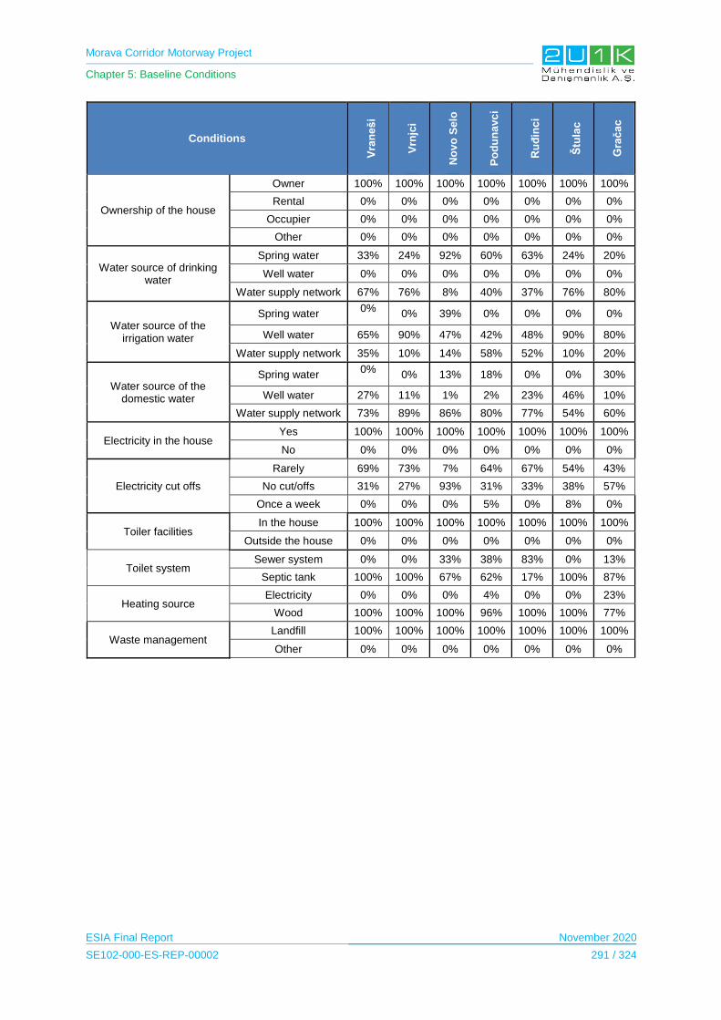
Morava Corridor Motorway Project
Chapter 5: Baseline Conditions
ESIA Final Report November 2020
SE102-000-ES-REP-00002 291 / 324
Conditions
Vra
ne
ši
Vrn
jci
No
vo
Se
lo
Po
du
na
vc
i
Ru
đin
ci
Štu
lac
Gra
ča
c
Ownership of the house
Owner 100% 100% 100% 100% 100% 100% 100%
Rental 0% 0% 0% 0% 0% 0% 0%
Occupier 0% 0% 0% 0% 0% 0% 0%
Other 0% 0% 0% 0% 0% 0% 0%
Water source of drinking water
Spring water 33% 24% 92% 60% 63% 24% 20%
Well water 0% 0% 0% 0% 0% 0% 0%
Water supply network 67% 76% 8% 40% 37% 76% 80%
Water source of the irrigation water
Spring water 0%
0% 39% 0% 0% 0% 0%
Well water 65% 90% 47% 42% 48% 90% 80%
Water supply network 35% 10% 14% 58% 52% 10% 20%
Water source of the domestic water
Spring water 0%
0% 13% 18% 0% 0% 30%
Well water 27% 11% 1% 2% 23% 46% 10%
Water supply network 73% 89% 86% 80% 77% 54% 60%
Electricity in the house Yes 100% 100% 100% 100% 100% 100% 100%
No 0% 0% 0% 0% 0% 0% 0%
Electricity cut offs
Rarely 69% 73% 7% 64% 67% 54% 43%
No cut/offs 31% 27% 93% 31% 33% 38% 57%
Once a week 0% 0% 0% 5% 0% 8% 0%
Toiler facilities In the house 100% 100% 100% 100% 100% 100% 100%
Outside the house 0% 0% 0% 0% 0% 0% 0%
Toilet system Sewer system 0% 0% 33% 38% 83% 0% 13%
Septic tank 100% 100% 67% 62% 17% 100% 87%
Heating source Electricity 0% 0% 0% 4% 0% 0% 23%
Wood 100% 100% 100% 96% 100% 100% 77%
Waste management Landfill 100% 100% 100% 100% 100% 100% 100%
Other 0% 0% 0% 0% 0% 0% 0%

Morava Corridor Motorway Project
Chapter 5: Baseline Conditions
ESIA Final Report November 2020
SE102-000-ES-REP-00002 292 / 324
5.14.3.7.6 Section 2: Trstenik Municipality
Services
The village heads of each affected settlement in Trstenik Municipality were asked about the
availability of services within their border of villages, Table 5-192 presents the type of
services available in each affected village, respectively.
Table 5-192. Type of services available in each affected village of Trstenik Municipality
Services
Yes/No
Bogdanje Velika
Drenova Lozna Medveđa Selište Grabovac Ugljarevo
Health centre/hospital No Yes No Yes No No No
Gendarmerie / police station
No Yes No No No No No
Fire Brigade No No No No No No No
Stores (grocery store, butcher, bakery etc.)
Yes Yes Yes Yes Yes Yes Yes
Post office No Yes No Yes No No No
Coffee shop No Yes No Yes No No Yes
Restaurant No Yes No No No Yes No
Touristic facilities (hotel, hostel, camp site)
No No No No No No No
Village room No No No No No No No
Financial (eg banks, ATMs, foreign exchange bureaus)
No Yes No Yes No No No
Church No Yes No Yes Yes Yes Yes
Any other praying buildings? (Mosque or synagogue, please specify)
No No No No No No No
Cooperative / Association
No No No Yes No No No
Public transportation (bus)
Yes Yes Yea Yes Yes Yes Yes

Morava Corridor Motorway Project
Chapter 5: Baseline Conditions
ESIA Final Report November 2020
SE102-000-ES-REP-00002 293 / 324
Infrastructure
The village heads were also asked about the infrastructure conditions of their settlement, it
was observed that electricity, drinking water source, irrigation water source, communication
land lines and asphalt roads are available in all villages. Further information on available
infrastructure services in affected villages of Trstenik Municipality is presented in
Table 5-193.
Table 5-193. Available infrastructure services in affected villages of Trstenik Municipality
Yes/No
Type of Infrastructure
Bogdanje Velika
Drenova Lozna Medveđa Selište Grabovac Ugljarevo
Electrical infrastructure
Yes Yes Yes Yes Yes Yes Yes
Drinking water source
Yes Yes Yes Yes Yes Yes Yes
Domestic water source
Yes Yes Yes Yes Yes Yes Yes
Irrigation water source
Yes Yes Yes Yes Yes Yes Yes
Sewer system No No No No No No No
Heating source No No No No No No No
Domestic solid waste collection
Yes Yes Yes Yes Yes Yes Yes
Communication Landline
Yes Yes Yes Yes Yes Yes Yes
Mobile Phone Yes Yes Yes Yes Yes Yes Yes
Internet Yes Yes Yes Yes Yes Yes Yes
Asphalt road Yes Yes Yes Yes Yes Yes Yes
Furthermore, septic tanks are stated to be available in each household, and several
households in villages of Bogdanje also have septic tanks and a toilet outside the house.
As for heating, majority of the locals in villages is heated by wood. However, the village of
Medveđa, where 7% of residence use electricity, and 6% of residence use coal as a heating
source. All villages are covered by landline, mobile and internet.
Each village has one or two containers where waste is disposed of. Containers are emptied
mostly once a week, and the waste ends up in wild waste dump area.
Household Conditions
In general, majority of respondents of the Household Surveys live on a house sized
approximately between 50 to 200 m2. Almost all of the locals stated to be heated by wood.
Further information and details for each affected settlement can be found in Table 5-194.
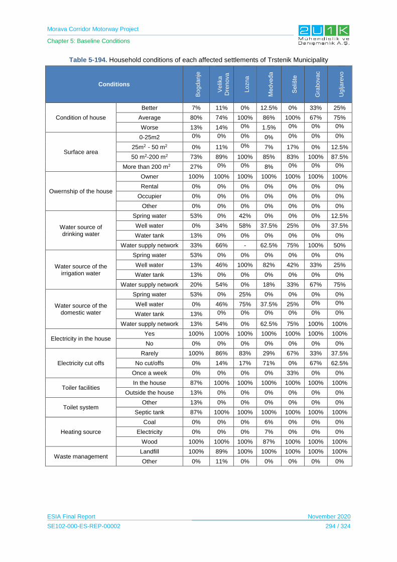
Morava Corridor Motorway Project
Chapter 5: Baseline Conditions
ESIA Final Report November 2020
SE102-000-ES-REP-00002 294 / 324
Table 5-194. Household conditions of each affected settlements of Trstenik Municipality
Conditions
Bo
gd
anje
Ve
lika
Dre
no
va
Lo
zna
Me
dve
đa
Se
lište
Gra
bo
vac
Ug
ljare
vo
Condition of house
Better 7% 11% 0% 12.5% 0% 33% 25%
Average 80% 74% 100% 86% 100% 67% 75%
Worse 13% 14% 0% 1.5% 0% 0% 0%
Surface area
0-25m2 0% 0% 0% 0% 0% 0% 0%
25m2 - 50 m2 0% 11% 0% 7% 17% 0% 12.5%
50 m2-200 m2 73% 89% 100% 85% 83% 100% 87.5%
More than 200 m2 27% 0% 0% 8% 0% 0% 0%
Owernship of the house
Owner 100% 100% 100% 100% 100% 100% 100%
Rental 0% 0% 0% 0% 0% 0% 0%
Occupier 0% 0% 0% 0% 0% 0% 0%
Other 0% 0% 0% 0% 0% 0% 0%
Water source of drinking water
Spring water 53% 0% 42% 0% 0% 0% 12.5%
Well water 0% 34% 58% 37.5% 25% 0% 37.5%
Water tank 13% 0% 0% 0% 0% 0% 0%
Water supply network 33% 66% - 62.5% 75% 100% 50%
Water source of the irrigation water
Spring water 53% 0% 0% 0% 0% 0% 0%
Well water 13% 46% 100% 82% 42% 33% 25%
Water tank 13% 0% 0% 0% 0% 0% 0%
Water supply network 20% 54% 0% 18% 33% 67% 75%
Water source of the domestic water
Spring water 53% 0% 25% 0% 0% 0% 0%
Well water 0% 46% 75% 37.5% 25% 0% 0%
Water tank 13% 0% 0% 0% 0% 0% 0%
Water supply network 13% 54% 0% 62.5% 75% 100% 100%
Electricity in the house Yes 100% 100% 100% 100% 100% 100% 100%
No 0% 0% 0% 0% 0% 0% 0%
Electricity cut offs
Rarely 100% 86% 83% 29% 67% 33% 37.5%
No cut/offs 0% 14% 17% 71% 0% 67% 62.5%
Once a week 0% 0% 0% 0% 33% 0% 0%
Toiler facilities In the house 87% 100% 100% 100% 100% 100% 100%
Outside the house 13% 0% 0% 0% 0% 0% 0%
Toilet system Other 13% 0% 0% 0% 0% 0% 0%
Septic tank 87% 100% 100% 100% 100% 100% 100%
Heating source
Coal 0% 0% 0% 6% 0% 0% 0%
Electricity 0% 0% 0% 7% 0% 0% 0%
Wood 100% 100% 100% 87% 100% 100% 100%
Waste management Landfill 100% 89% 100% 100% 100% 100% 100%
Other 0% 11% 0% 0% 0% 0% 0%
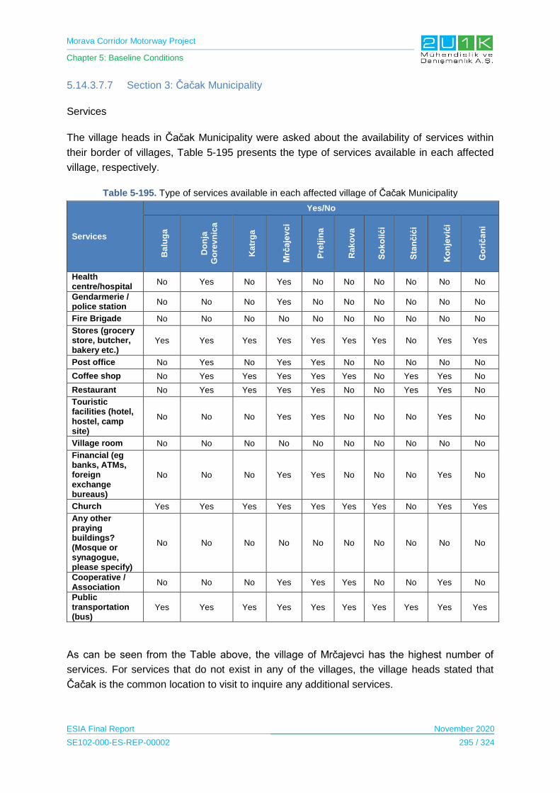
Morava Corridor Motorway Project
Chapter 5: Baseline Conditions
ESIA Final Report November 2020
SE102-000-ES-REP-00002 295 / 324
5.14.3.7.7 Section 3: Čačak Municipality
Services
The village heads in Čačak Municipality were asked about the availability of services within
their border of villages, Table 5-195 presents the type of services available in each affected
village, respectively.
Table 5-195. Type of services available in each affected village of Čačak Municipality
Services
Yes/No
Ba
lug
a
Do
nja
Go
rev
nic
a
Ka
trg
a
Mrč
aje
vc
i
Pre
ljin
a
Ra
ko
va
So
ko
lić
i
Sta
nč
ići
Ko
nje
vić
i
Go
rič
an
i
Health centre/hospital
No Yes No Yes No No No No No No
Gendarmerie / police station
No No No Yes No No No No No No
Fire Brigade No No No No No No No No No No
Stores (grocery store, butcher, bakery etc.)
Yes Yes Yes Yes Yes Yes Yes No Yes Yes
Post office No Yes No Yes Yes No No No No No
Coffee shop No Yes Yes Yes Yes Yes No Yes Yes No
Restaurant No Yes Yes Yes Yes No No Yes Yes No
Touristic facilities (hotel, hostel, camp site)
No No No Yes Yes No No No Yes No
Village room No No No No No No No No No No
Financial (eg banks, ATMs, foreign exchange bureaus)
No No No Yes Yes No No No Yes No
Church Yes Yes Yes Yes Yes Yes Yes No Yes Yes
Any other praying buildings? (Mosque or synagogue, please specify)
No No No No No No No No No No
Cooperative / Association
No No No Yes Yes Yes No No Yes No
Public transportation (bus)
Yes Yes Yes Yes Yes Yes Yes Yes Yes Yes
As can be seen from the Table above, the village of Mrčajevci has the highest number of
services. For services that do not exist in any of the villages, the village heads stated that
Čačak is the common location to visit to inquire any additional services.
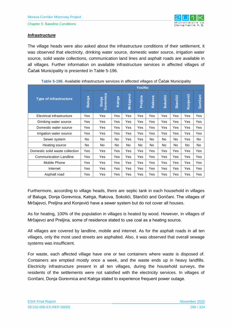
Morava Corridor Motorway Project
Chapter 5: Baseline Conditions
ESIA Final Report November 2020
SE102-000-ES-REP-00002 296 / 324
Infrastructure
The village heads were also asked about the infrastructure conditions of their settlement, it
was observed that electricity, drinking water source, domestic water source, irrigation water
source, solid waste collections, communication land lines and asphalt roads are available in
all villages. Further information on available infrastructure services in affected villages of
Čačak Municipality is presented in Table 5-196.
Table 5-196. Available infrastructure services in affected villages of Čačak Municipality
Type of infrastructure
Yes/No B
alu
ga
Do
nja
Go
rev
nic
a
Ka
trg
a
Mrč
aje
vc
i
Pre
ljin
a
Ra
ko
va
So
ko
lić
i
Sta
nč
ići
Ko
nje
vić
i
Go
rič
an
i
Electrical infrastructure Yes Yes Yes Yes Yes Yes Yes Yes Yes Yes
Drinking water source Yes Yes Yes Yes Yes Yes Yes Yes Yes Yes
Domestic water source Yes Yes Yes Yes Yes Yes Yes Yes Yes Yes
Irrigation water source Yes Yes Yes Yes Yes Yes Yes Yes Yes Yes
Sewer system No No No Yes Yes No No No Yes No
Heating source No No No No No No No No No No
Domestic solid waste collection Yes Yes Yes Yes Yes Yes Yes Yes Yes Yes
Communication Landline Yes Yes Yes Yes Yes Yes Yes Yes Yes Yes
Mobile Phone Yes Yes Yes Yes Yes Yes Yes Yes Yes Yes
Internet Yes Yes Yes Yes Yes Yes Yes Yes Yes Yes
Asphalt road Yes Yes Yes Yes Yes Yes Yes Yes Yes Yes
Furthermore, according to village heads, there are septic tank in each household in villages
of Baluga, Donja Gorevnica, Katrga, Rakova, Sokolići, Stančići and Goričani. The villages of
Mrčajevci, Preljina and Konjevići have a sewer system but do not cover all houses.
As for heating, 100% of the population in villages is heated by wood. However, in villages of
Mrčajevci and Preljina, some of residence stated to use coal as a heating source.
All villages are covered by landline, mobile and internet. As for the asphalt roads in all ten
villages, only the most used streets are asphalted. Also, it was observed that overall sewage
systems was insufficient.
For waste, each affected village have one or two containers where waste is disposed of.
Containers are emptied mostly once a week, and the waste ends up in heavy landfills.
Electricity infrastructure present in all ten villages, during the household surveys, the
residents of the settlements were not satisfied with the electricity services. In villages of
Goričani, Donja Gorevnica and Katrga stated to experience frequent power outage.

Morava Corridor Motorway Project
Chapter 5: Baseline Conditions
ESIA Final Report November 2020
SE102-000-ES-REP-00002 297 / 324
Household Conditions
In general, majority of respondents of the Household Surveys live on a house sized
approximately 50 -200 m2. Mostly, drinking, irrigation and water sources are stated to be from
water supply network, well water. All of the locals were stated to be heated by wood. Last,
the waste is dumped in a landfill in general. Further information and details for each affected
settlement can be found in Table 5-197.
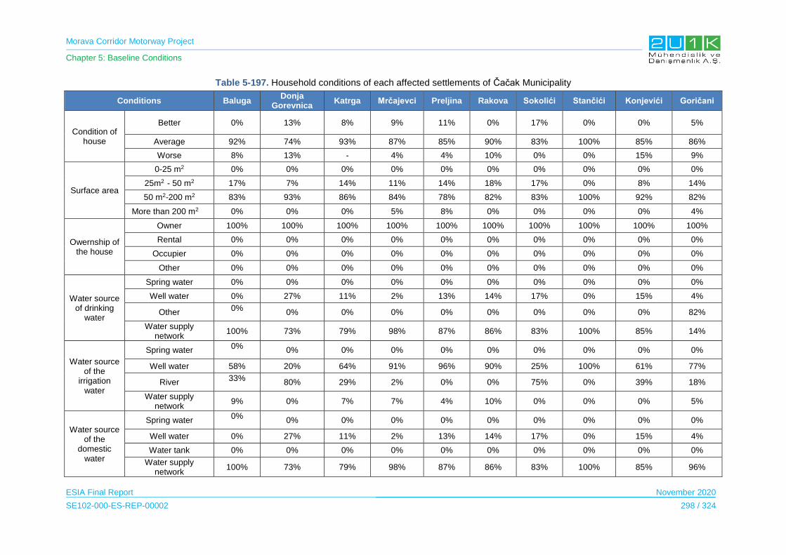
Morava Corridor Motorway Project
Chapter 5: Baseline Conditions
ESIA Final Report November 2020
SE102-000-ES-REP-00002 298 / 324
Table 5-197. Household conditions of each affected settlements of Čačak Municipality
Conditions Baluga Donja
Gorevnica Katrga Mrčajevci Preljina Rakova Sokolići Stančići Konjevići Goričani
Condition of house
Better 0% 13% 8% 9% 11% 0% 17% 0% 0% 5%
Average 92% 74% 93% 87% 85% 90% 83% 100% 85% 86%
Worse 8% 13% - 4% 4% 10% 0% 0% 15% 9%
Surface area
0-25 m2 0% 0% 0% 0% 0% 0% 0% 0% 0% 0%
25m2 - 50 m2 17% 7% 14% 11% 14% 18% 17% 0% 8% 14%
50 m2-200 m2 83% 93% 86% 84% 78% 82% 83% 100% 92% 82%
More than 200 m2 0% 0% 0% 5% 8% 0% 0% 0% 0% 4%
Owernship of the house
Owner 100% 100% 100% 100% 100% 100% 100% 100% 100% 100%
Rental 0% 0% 0% 0% 0% 0% 0% 0% 0% 0%
Occupier 0% 0% 0% 0% 0% 0% 0% 0% 0% 0%
Other 0% 0% 0% 0% 0% 0% 0% 0% 0% 0%
Water source of drinking
water
Spring water 0% 0% 0% 0% 0% 0% 0% 0% 0% 0%
Well water 0% 27% 11% 2% 13% 14% 17% 0% 15% 4%
Other 0%
0% 0% 0% 0% 0% 0% 0% 0% 82%
Water supply network
100% 73% 79% 98% 87% 86% 83% 100% 85% 14%
Water source of the
irrigation water
Spring water 0%
0% 0% 0% 0% 0% 0% 0% 0% 0%
Well water 58% 20% 64% 91% 96% 90% 25% 100% 61% 77%
River 33%
80% 29% 2% 0% 0% 75% 0% 39% 18%
Water supply network
9% 0% 7% 7% 4% 10% 0% 0% 0% 5%
Water source of the
domestic water
Spring water 0%
0% 0% 0% 0% 0% 0% 0% 0% 0%
Well water 0% 27% 11% 2% 13% 14% 17% 0% 15% 4%
Water tank 0% 0% 0% 0% 0% 0% 0% 0% 0% 0%
Water supply network
100% 73% 79% 98% 87% 86% 83% 100% 85% 96%
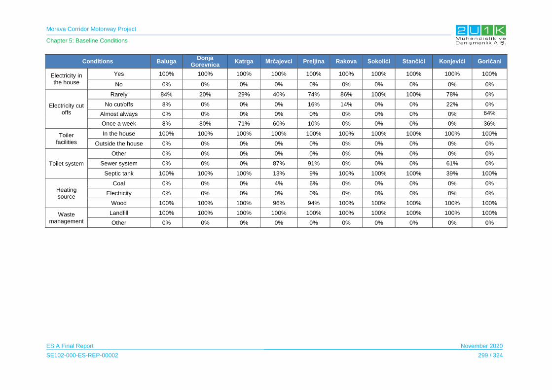
Morava Corridor Motorway Project
Chapter 5: Baseline Conditions
ESIA Final Report November 2020
SE102-000-ES-REP-00002 299 / 324
Conditions Baluga Donja
Gorevnica Katrga Mrčajevci Preljina Rakova Sokolići Stančići Konjevići Goričani
Electricity in the house
Yes 100% 100% 100% 100% 100% 100% 100% 100% 100% 100%
No 0% 0% 0% 0% 0% 0% 0% 0% 0% 0%
Electricity cut offs
Rarely 84% 20% 29% 40% 74% 86% 100% 100% 78% 0%
No cut/offs 8% 0% 0% 0% 16% 14% 0% 0% 22% 0%
Almost always 0% 0% 0% 0% 0% 0% 0% 0% 0% 64%
Once a week 8% 80% 71% 60% 10% 0% 0% 0% 0% 36%
Toiler facilities
In the house 100% 100% 100% 100% 100% 100% 100% 100% 100% 100%
Outside the house 0% 0% 0% 0% 0% 0% 0% 0% 0% 0%
Toilet system
Other 0% 0% 0% 0% 0% 0% 0% 0% 0% 0%
Sewer system 0% 0% 0% 87% 91% 0% 0% 0% 61% 0%
Septic tank 100% 100% 100% 13% 9% 100% 100% 100% 39% 100%
Heating source
Coal 0% 0% 0% 4% 6% 0% 0% 0% 0% 0%
Electricity 0% 0% 0% 0% 0% 0% 0% 0% 0% 0%
Wood 100% 100% 100% 96% 94% 100% 100% 100% 100% 100%
Waste management
Landfill 100% 100% 100% 100% 100% 100% 100% 100% 100% 100%
Other 0% 0% 0% 0% 0% 0% 0% 0% 0% 0%

Morava Corridor Motorway Project
Chapter 5: Baseline Conditions
ESIA Final Report November 2020
SE102-000-ES-REP-00002 300 / 324
5.14.3.7.8 Sensitive Receptors
From the baseline studies, it was observed that the existing infrastructure are not sufficient
especially waste management system system, sewage system, conditions of the local roads
and the capacity of the electricity system. Considering the heavy traffic load expected to be
caoused during the construction activities all villages in the social AoI are highly sensitive.
Also, labour influx may cause weight on the existing insufficient infrastructures of the affected
settlements.
5.14.3.8 Land Use
5.14.3.8.1 Section 1: Ćićevac Municipality
Table 5-198 presents land use information derived on each affected village of the Ćićevac
Municipality.
Table 5-198. Land use of villages located in Ćićevac Municipality
Village Land Use
Grad Stalać The average size is 3 ha, and they use the land without irrigation for agriculture.
Mrzenica The land is used for agriculture. The average size of land is 4 ha. The type of land is 100% dry agriculture.
Pojate The land is used for agriculture. The average size of land is 3 ha. The type of land is 58.3% irrigated land and 41.7% dry agriculture.
Stalać The average size of the land is 1.6 ha. The type of land is 60% irrigated land and 40% dry agriculture.
Furthermore, in Stalac village it was observed to have the greatest number of households
whom have size of the land less than 3 ha.
5.14.3.8.2 Section 1: Kruševac Municipality
Table 5-199 presents land use information derived on each affected village of the Kruševac
Municipality.
Table 5-199. Land use of villages located in Kruševac Municipality
Village Land Use
Bele-Vode The average size of the land is 3ha and the type of land is 100% dry agriculture and it is used for agriculture.
Citluk The average size is 4 ha and the type of land is 100% dry agriculture land. The agricultural land is mainly used for agricultural products by the elder households.
Bivolje The average land size is 3ha and it is dry land and used for agriculture.
Jasika The average land size 2ha. It is dry land and used for agriculture.
Kosevi The average land size is 3ha and it is dry land used for agriculture.
Kukljin Most of the villagers use the land for agriculture, 2% stated that it has pastures and one respondent said it was land in a commercial zone. Some respondents lease land, but most use land for agriculture
Makrenesi The average land size is 2ha, 50% is irrigated land and land without irrigation. Also, used as a greenhouse or for agriculture.

Morava Corridor Motorway Project
Chapter 5: Baseline Conditions
ESIA Final Report November 2020
SE102-000-ES-REP-00002 301 / 324
Furthermore, in Jasika village it was observed to have the greatest number of households
whom have size of the land less than 3 ha.
5.14.3.8.3 Section 1: Varvarin Municipality
Table 5-200 presents land use information derived on each affected village of the Varvarin
Municipality.
Table 5-200. Land use of villages located in Varvarin Municipality
Village Land Use
Bošnjane The average size is 3ha and type of land is 20% dry agriculture and 80% irrigated land.
Maskare The average size is 3ha and type of land is 40% dry agriculture and 60% irrigated land.
Furthermore, in Maskare village it was observed to have the greatest number of households
whom have size of the land less than 3 ha.
5.14.3.8.4 Section 2: Kraljevo Municipality
Table 5-201 presents land use information derived on each affected village of the Kraljevo
Municipality.
Table 5-201. Land use of villages located in Kraljevo Banja Municipality
Village Land Use
Adrani The average size of the land is 4ha. The type of land is 60% dry agriculture, 40% irrigated land. It is used for agriculture.
Vrba The average size of the land is 4ha. The type of land is 100% dry agriculture. It is used for agriculture
Grdica The average size of the land is 4ha. The type of land is 100% dry agriculture. It is used for agriculture
Zaklopača The average size of the land is 4ha. The type of land is 100% dry agriculture. It is used for agriculture
Miločaj The average size of the land is 4ha. The type of land is 50% dry agriculture, 50% irrigated land. It is used for agriculture
Obrva The average size of the land is 3ha. The type of land is 100% dry agriculture. It is used for agriculture.
Popovići The average size of the land is 4ha. The type of land is 100% dry agriculture. It is used for agriculture.
Ratina The average size of the land is 2ha. The type of land is 100% dry agriculture. It is used for agriculture.
Sirča The average size of the land is 2ha. The type of land is 100% dry agriculture. It is used for agriculture.
Šumarice The average size of the land is 1ha. The type of land is 100% dry agriculture. It is used for agriculture.
Stubal The average size of the land is 2ha. The type of land is 80% dry agriculture, 20% irrigated land. It is used for agriculture.
Furthermore, in Grdica village it was observed to have the greatest number of households
whom have size of the land less than 3 ha.
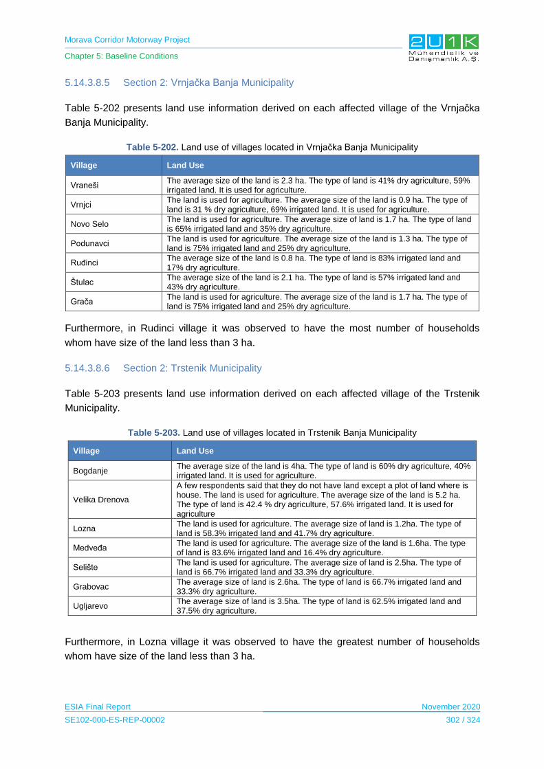
Morava Corridor Motorway Project
Chapter 5: Baseline Conditions
ESIA Final Report November 2020
SE102-000-ES-REP-00002 302 / 324
5.14.3.8.5 Section 2: Vrnjačka Banja Municipality
Table 5-202 presents land use information derived on each affected village of the Vrnjačka
Banja Municipality.
Table 5-202. Land use of villages located in Vrnjačka Banja Municipality
Village Land Use
Vraneši The average size of the land is 2.3 ha. The type of land is 41% dry agriculture, 59% irrigated land. It is used for agriculture.
Vrnjci The land is used for agriculture. The average size of the land is 0.9 ha. The type of land is 31 % dry agriculture, 69% irrigated land. It is used for agriculture.
Novo Selo The land is used for agriculture. The average size of land is 1.7 ha. The type of land is 65% irrigated land and 35% dry agriculture.
Podunavci The land is used for agriculture. The average size of the land is 1.3 ha. The type of land is 75% irrigated land and 25% dry agriculture.
Ruđinci The average size of the land is 0.8 ha. The type of land is 83% irrigated land and 17% dry agriculture.
Štulac The average size of the land is 2.1 ha. The type of land is 57% irrigated land and 43% dry agriculture.
Grača The land is used for agriculture. The average size of the land is 1.7 ha. The type of land is 75% irrigated land and 25% dry agriculture.
Furthermore, in Rudinci village it was observed to have the most number of households
whom have size of the land less than 3 ha.
5.14.3.8.6 Section 2: Trstenik Municipality
Table 5-203 presents land use information derived on each affected village of the Trstenik
Municipality.
Table 5-203. Land use of villages located in Trstenik Banja Municipality
Village Land Use
Bogdanje The average size of the land is 4ha. The type of land is 60% dry agriculture, 40% irrigated land. It is used for agriculture.
Velika Drenova
A few respondents said that they do not have land except a plot of land where is house. The land is used for agriculture. The average size of the land is 5.2 ha. The type of land is 42.4 % dry agriculture, 57.6% irrigated land. It is used for agriculture
Lozna The land is used for agriculture. The average size of land is 1.2ha. The type of land is 58.3% irrigated land and 41.7% dry agriculture.
Medveđa The land is used for agriculture. The average size of the land is 1.6ha. The type of land is 83.6% irrigated land and 16.4% dry agriculture.
Selište The land is used for agriculture. The average size of land is 2.5ha. The type of land is 66.7% irrigated land and 33.3% dry agriculture.
Grabovac The average size of land is 2.6ha. The type of land is 66.7% irrigated land and 33.3% dry agriculture.
Ugljarevo The average size of land is 3.5ha. The type of land is 62.5% irrigated land and 37.5% dry agriculture.
Furthermore, in Lozna village it was observed to have the greatest number of households
whom have size of the land less than 3 ha.

Morava Corridor Motorway Project
Chapter 5: Baseline Conditions
ESIA Final Report November 2020
SE102-000-ES-REP-00002 303 / 324
5.14.3.8.7 Section 3: Čačak Municipality
Table 5-204 presents land use information derived on each affected village of the Čačak
Municipality.
Table 5-204. Land use of villages located in Čačak Municipality
Village Land Use
Baluga The average size of the land is 1.6 ha. The type of land is 33.3 % dry agriculture, 66.7 % irrigated land, used for agriculture.
Donja Gorevnica The majority land is used for agriculture in the village. The average size of the land is 4.3 ha. The type of land is 26.7 % dry agriculture, 73.3 % irrigated land, used for agriculture.
Katrga The land is used for agriculture. The average size of land is 2.1 ha. The type of land is 71.4 % irrigated land and 28.6 % dry agriculture.
Mrčajevci The land is used for agriculture. The average size of the land is 2.2 ha. The type of land is 66.7% irrigated land and 33.3 % dry agriculture.
Preljina The land is used for agriculture. The average size of land is 2.4 ha. The type of land is 74.5% irrigated land and 25.5 % dry agriculture.
Rakova The land is used for agriculture. The average size of land is 1.8 ha. The type of land is 61.9% irrigated land and 38.1% dry agriculture.
Sokolići The average size of land is 3.1 ha. The type of land is 60% irrigated land and 40% dry agriculture.
Stančići The land is used for agriculture. The average size of the land is 5.5 ha. The type of land 100% irrigated land. It is used for agriculture.
Goričani The land is used for agriculture. The average size of land is 3.5 ha. The type of land is 77.3% irrigated land and 22.7% dry agriculture
Konjevići The land is used for agriculture. The average size of land is 2.7 ha. The type of land is 72.7% irrigated land and 27.3% dry agriculture.
Furthermore, in Katgra village it was observed to have the greatest number of households
whom have size of the land less than 3 ha.
5.14.3.8.8 Sensitive Receptors
The impact source on the land use will be the land acquitition of the Project which may cause
physicial and economic displacement. Highly sensitive receptors are considered as;
PAPs will have access problems to their land due to construction of the Project;
PAPs that may become landless;
PAPS whom will lose income after the loss of agricultural land;
Agricultural workers (including seasonal agricultural workers);
Agricultural enterprices;
Local businesses/shops; and
PAPs who will be resettled.

Morava Corridor Motorway Project
Chapter 5: Baseline Conditions
ESIA Final Report November 2020
SE102-000-ES-REP-00002 304 / 324
5.14.3.9 Project Information Level
Project Information Level has been asked through CLSs and HHSs. This Chapter presents
the current Project information level of the local communities.
It was stated that the Project was heard by the public in all settlements. Television is the
primary source of information for the public and the second source of information is stated as
radio and the internet. Village heads stated that their knowledge of the Project is not
sufficient, and they would like to be informed in more detail about the following issues:
Employment Opportunities;
The Proposed Motorway Route Alignment;
Construction Period;
Operation Period;
Compensation; and
Expropriation.
5.14.3.9.1 Project Information Level of the Community
According to the outputs of the HHS, 100% of the participants are stated that heard the
Project. The main information channel of the villagers is TV, radio and the community.
The other information tools are newspapers, internet and other tools. All participants agreed
that the information level on the Project is insufficient, and it is recommended to use media
more frequently to raise the information level of the public.
As a source of information, TV is the most widely used channel in all villages with a value
ranging from 35% to 53%. It is seen that that the community members are the second source
of information with a value ranging between 12% and 27%. The main information tools
according to the Municipalities are given below.

Morava Corridor Motorway Project
Chapter 5: Baseline Conditions
ESIA Final Report November 2020
SE102-000-ES-REP-00002 305 / 324
SECTION-1
Ćićevac
Kruševac
Varvarin
40%
15%
15%
7%
13%
10%
Tv Internet Community Newspaper Public Participation Meeting Other
40%
15%
15%
7%
13%
10%
Tv Internet Community Newspaper Public Participation Meeting Other

Morava Corridor Motorway Project
Chapter 5: Baseline Conditions
ESIA Final Report November 2020
SE102-000-ES-REP-00002 306 / 324
SECTION-2
Trestenik
Vrnjačka Banja
53%
12%
12%
10%
5%8%
Tv Internet Community Newspaper Public Participation Meeting Other
35%
15%23%
4%
13%
10%
Tv Internet Community Newspaper Public Participation Meeting Other
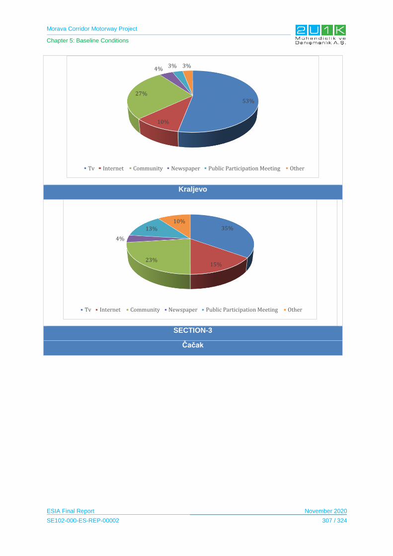
Morava Corridor Motorway Project
Chapter 5: Baseline Conditions
ESIA Final Report November 2020
SE102-000-ES-REP-00002 307 / 324
Kraljevo
SECTION-3
Čačak
53%
10%
27%
4% 3% 3%
Tv Internet Community Newspaper Public Participation Meeting Other
35%
15%23%
4%
13%10%
Tv Internet Community Newspaper Public Participation Meeting Other
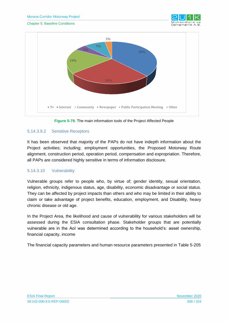
Morava Corridor Motorway Project
Chapter 5: Baseline Conditions
ESIA Final Report November 2020
SE102-000-ES-REP-00002 308 / 324
Figure 5-79. The main information tools of the Project Affected People
5.14.3.9.2 Sensitive Receptors
It has been observed that majority of the PAPs do not have indepth information about the
Project activities; including; employment opportunities, the Proposed Motorway Route
alignment, construction period, operation period, compensation and expropriation. Therefore,
all PAPs are considered highly sensitive in terms of information disclosure.
5.14.3.10 Vulnerability
Vulnerable groups refer to people who, by virtue of; gender identity, sexual orientation,
religion, ethnicity, indigenous status, age, disability, economic disadvantage or social status.
They can be affected by project impacts than others and who may be limited in their ability to
claim or take advantage of project benefits, education, employment, and Disability, heavy
chronic disease or old age.
In the Project Area, the likelihood and cause of vulnerability for various stakeholders will be
assessed during the ESIA consultation phase. Stakeholder groups that are potentially
vulnerable are in the AoI was determined according to the household’s: asset ownership,
financial capacity, income
The financial capacity parameters and human resource parameters presented in Table 5-205
38%
26%
19%
5%9%
3%
Tv Internet Community Newspaper Public Participation Meeting Other
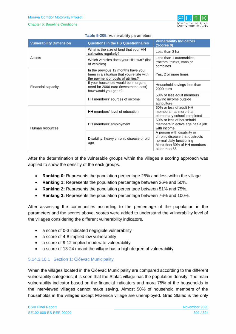
Morava Corridor Motorway Project
Chapter 5: Baseline Conditions
ESIA Final Report November 2020
SE102-000-ES-REP-00002 309 / 324
Table 5-205. Vulnerability parameters
Vulnerability Dimension Questions in the HS Questionnaires Vulnerability Indicators (Scores 0)
Assets
What is the size of land that your HH cultivates regularly?
Less than 3 ha
Which vehicles does your HH own? (list of vehicles)
Less than 1 automobiles, tractors, trucks, vans or combines
Financial capacity
In the previous 12 months have you been in a situation that you're late with the payment of costs of utilities?
Yes, 2 or more times
If your household would be in urgent need for 2000 euro (investment, cost) how would you get it?
Household savings less than 2000 euro
HH members’ sources of income 50% or less adult members having income outside agriculture
Human resources
HH members’ level of education 50% or less of adult HH members has more than elementary school completed
HH members’ employment 50% or less of household members in active age has a job with income
Disability, heavy chronic disease or old age
A person with disability or chronic disease that obstructs normal daily functioning More than 50% of HH members older than 65
After the determination of the vulnerable groups within the villages a scoring approach was
applied to show the densitiy of the eack groups.
Ranking 0: Represents the population percentage 25% and less within the village
Ranking 1: Represents the population percentage between 26% and 50%.
Ranking 2: Represents the population percentage between 51% and 75%.
Ranking 3: Represents the population percentage between 76% and 100%.
After assessing the communities according to the percentage of the population in the
parameters and the scores above, scores were added to understand the vulnerability level of
the villages considering the different vulnerability indicators.
a score of 0-3 indicated negligible vulnerability
a score of 4-8 implied low vulnerability
a score of 9-12 implied moderate vulnerability
a score of 13-24 meant the village has a high degree of vulnerability
5.14.3.10.1 Section 1: Ćićevac Municipality
When the villages located in the Ćićevac Municipality are compared according to the different
vulnerability categories, it is seen that the Stalac village has the population density. The main
vulnerability indicator based on the financial indicators and mora 75% of the households in
the interviewed villages cannot make saving. Almost 50% of household members of the
households in the villages except Mrzenica village are unemployed. Grad Stalać is the only

Morava Corridor Motorway Project
Chapter 5: Baseline Conditions
ESIA Final Report November 2020
SE102-000-ES-REP-00002 310 / 324
village that has etnic minority. Table 5-206 shows the population of the vulnerable groups
according to villages and the scores of the vulnerability according to population density.
Table 5-206. Vulnerable groups in Ćićevac Municipality
Grad Stalać Mrzenica Pojate Stalać
Total Score According to Vulnerability
Size of the land - less than 3 ha 25% 50% 45% 63%
Score 0 1 1 2 4
Vehicles - less than 1 automobiles 75% 33% 57% 75%
Score 2 1 2 2 7
Late with the payment (2 or more times) 13% 17% 63% 25%
Score 0 0 2 0 2
HH saving less than 2000e 88% 83% 75% 88%
Score 3 3 2 3 11
50% or less adult members have income source other than agriculture
38% 50% 25% 88%
Score 1 1 0 3 5
50% or less of adult HH members has more than elementary school
63% 50% 88% 75%
Score 2 1 3 2 8
50% or less of household members in active age has a job with income
63% 50% 88% 63%
Score 2 1 3 2 9
More than 50% of HH members older than 65, disabled or have chronic disease
50% 17% 50% 50%
Score 1 0 1 1 3
Ethnic Minority 1% 0% 0% 0% 0
Score 0 0 0 0 0
TOTAL Vulnerability Score of the Village
11 8 11 15
5.14.3.10.2 Section 1: Kruševac Municipality
When the villages located in the borders of Kruševac Municipality compared, it is seen that
the Citluk village has the all vulnerable categories. It is seen that the main source for the
vulnerability is economy. The most populated group among all villages are the unemployed
and the low educated groups. There was no ethnic minority in the villages. The number of
people with chronic illnesses, people with disabilities or over 65 years of age and the number
of households with having difficulty payments are quite low compared to other vulnerability
categories. The percentage of vulnerable groups in Kruševac Municipality is presented in
Table 5-207.
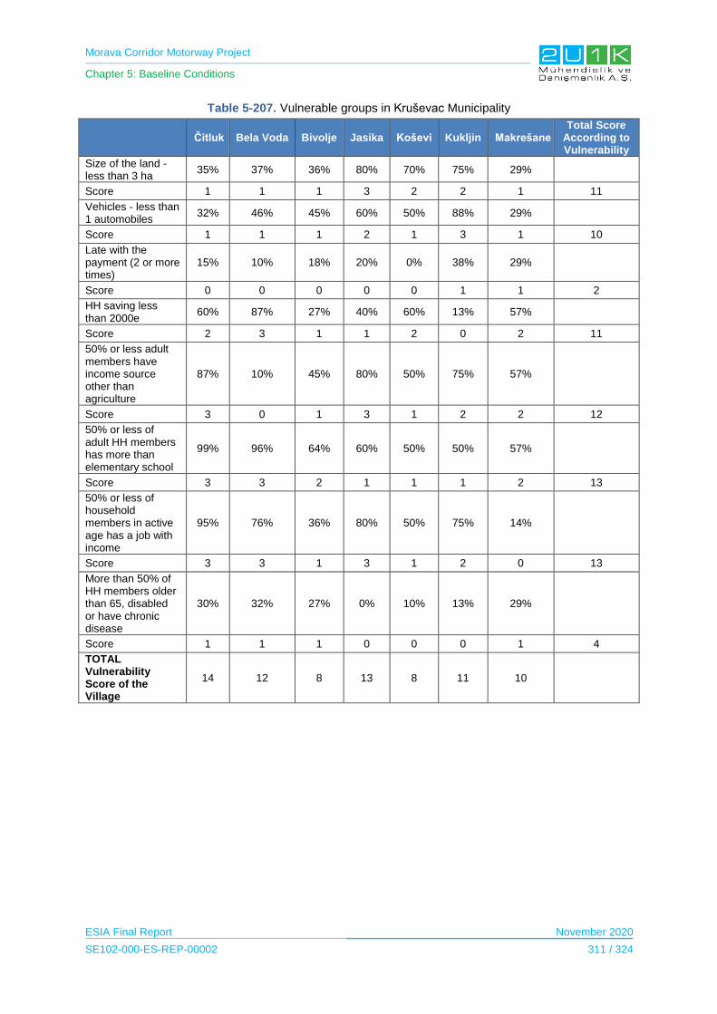
Morava Corridor Motorway Project
Chapter 5: Baseline Conditions
ESIA Final Report November 2020
SE102-000-ES-REP-00002 311 / 324
Table 5-207. Vulnerable groups in Kruševac Municipality
Čitluk Bela Voda Bivolje Jasika Koševi Kukljin Makrešane Total Score
According to Vulnerability
Size of the land - less than 3 ha
35% 37% 36% 80% 70% 75% 29%
Score 1 1 1 3 2 2 1 11
Vehicles - less than 1 automobiles
32% 46% 45% 60% 50% 88% 29%
Score 1 1 1 2 1 3 1 10
Late with the payment (2 or more times)
15% 10% 18% 20% 0% 38% 29%
Score 0 0 0 0 0 1 1 2
HH saving less than 2000e
60% 87% 27% 40% 60% 13% 57%
Score 2 3 1 1 2 0 2 11
50% or less adult members have income source other than agriculture
87% 10% 45% 80% 50% 75% 57%
Score 3 0 1 3 1 2 2 12
50% or less of adult HH members has more than elementary school
99% 96% 64% 60% 50% 50% 57%
Score 3 3 2 1 1 1 2 13
50% or less of household members in active age has a job with income
95% 76% 36% 80% 50% 75% 14%
Score 3 3 1 3 1 2 0 13
More than 50% of HH members older than 65, disabled or have chronic disease
30% 32% 27% 0% 10% 13% 29%
Score 1 1 1 0 0 0 1 4
TOTAL Vulnerability Score of the Village
14 12 8 13 8 11 10
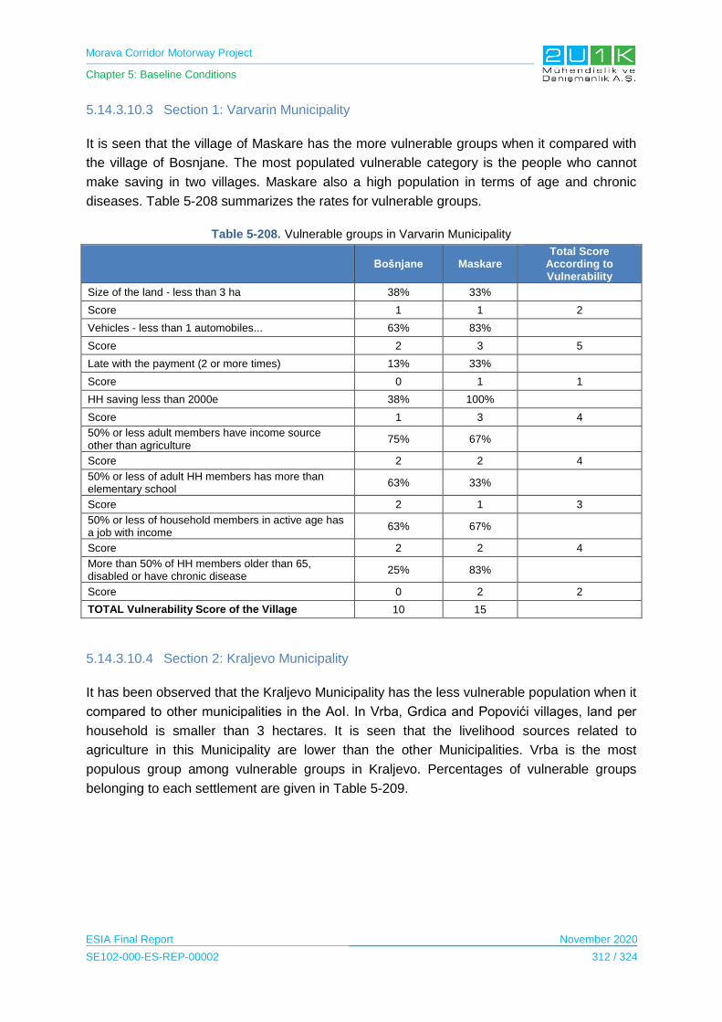
Morava Corridor Motorway Project
Chapter 5: Baseline Conditions
ESIA Final Report November 2020
SE102-000-ES-REP-00002 312 / 324
5.14.3.10.3 Section 1: Varvarin Municipality
It is seen that the village of Maskare has the more vulnerable groups when it compared with
the village of Bosnjane. The most populated vulnerable category is the people who cannot
make saving in two villages. Maskare also a high population in terms of age and chronic
diseases. Table 5-208 summarizes the rates for vulnerable groups.
Table 5-208. Vulnerable groups in Varvarin Municipality
Bošnjane Maskare
Total Score According to Vulnerability
Size of the land - less than 3 ha 38% 33%
Score 1 1 2
Vehicles - less than 1 automobiles... 63% 83%
Score 2 3 5
Late with the payment (2 or more times) 13% 33%
Score 0 1 1
HH saving less than 2000e 38% 100%
Score 1 3 4
50% or less adult members have income source other than agriculture
75% 67%
Score 2 2 4
50% or less of adult HH members has more than elementary school
63% 33%
Score 2 1 3
50% or less of household members in active age has a job with income
63% 67%
Score 2 2 4
More than 50% of HH members older than 65, disabled or have chronic disease
25% 83%
Score 0 2 2
TOTAL Vulnerability Score of the Village 10 15
5.14.3.10.4 Section 2: Kraljevo Municipality
It has been observed that the Kraljevo Municipality has the less vulnerable population when it
compared to other municipalities in the AoI. In Vrba, Grdica and Popovići villages, land per
household is smaller than 3 hectares. It is seen that the livelihood sources related to
agriculture in this Municipality are lower than the other Municipalities. Vrba is the most
populous group among vulnerable groups in Kraljevo. Percentages of vulnerable groups
belonging to each settlement are given in Table 5-209.
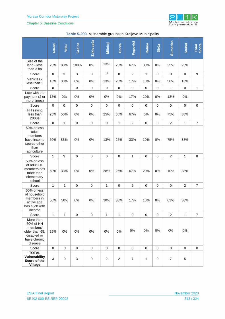
Morava Corridor Motorway Project
Chapter 5: Baseline Conditions
ESIA Final Report November 2020
SE102-000-ES-REP-00002 313 / 324
Table 5-209. Vulnerable groups in Kraljevo Municipality
Ad
ran
i
Vrb
a
Grd
ica
Za
klo
pa
ča
Mil
oča
j
Ob
rva
Po
po
vić
i
Ra
tin
a
Sir
ča
Šu
ma
ric
e
Stu
ba
l
To
tal
Sc
ore
Size of the land - less than 3 ha
25% 83% 100% 0% 13% 25% 67% 30% 0% 25% 25%
Score 0 3 3 0 0 0 2 1 0 0 0 9
Vehicles - less than 1
13% 33% 0% 0% 13% 25% 17% 10% 0% 50% 13%
Score 0 0 0 0 0 0 0 0 1 0 1
Late with the payment (2 or more times)
13% 0% 0% 0% 0% 0% 17% 10% 0% 13% 0%
Score 0 0 0 0 0 0 0 0 0 0 0 0
HH saving less than
2000e 25% 50% 0% 0% 25% 38% 67% 0% 0% 75% 38%
Score 0 1 0 0 0 1 2 0 0 2 1 7
50% or less adult
members have income source other
than agriculture
50% 83% 0% 0% 13% 25% 33% 10% 0% 75% 38%
Score 1 3 0 0 0 0 1 0 0 2 1 8
50% or less of adult HH
members has more than elementary
school
50% 33% 0% 0% 38% 25% 67% 20% 0% 10% 38%
Score 1 1 0 0 1 0 2 0 0 0 2 7
50% or less of household members in active age
has a job with income
50% 50% 0% 0% 38% 38% 17% 10% 0% 63% 38%
Score 1 1 0 0 1 1 0 0 0 2 1 7
More than 50% of HH members
older than 65, disabled or
have chronic disease
25% 0% 0% 0% 0% 0% 0% 0% 0% 0% 0%
Score 0 0 0 0 0 0 0 0 0 0 0 0
TOTAL Vulnerability Score of the
Village
3 9 3 0 2 2 7 1 0 7 5

Morava Corridor Motorway Project
Chapter 5: Baseline Conditions
ESIA Final Report November 2020
SE102-000-ES-REP-00002 314 / 324
5.14.3.10.5 Section 2: Vrnjačka Banja Municipality
According to the results of Household Surveys, it has been analyzed that most vulnerable
groups resides in Ruđinci village within the borders of Vrnjačka Banja. The vulnerability in
this Municipality based on the economy as in other settlements and is related to the limited
asset ownership. A large proportion of the households interviewed in the villages of Vrnjačka
Banja municipality have less than 3 hectares of land. The education rate is relatively higher
than other municipalities. The number of people has no income other than agriculture was
the highest in the village of Novo Selo. Table 5-210 summarizes the proportion of the
vulnerable groups in Vrnjačka Banja Municipality.
Table 5-210. Vulnerable groups in Vrnjačka Banja Municipality
Vraneši Vrnjci
Novo Selo
Podunavci Ruđinci Štulac Gračac Total Score
Size of the land - less than 3 ha
69% 83% 74% 75% 91% 59% 63%
Score 2 3 2 2 3 2 2 16
Vehicles - less than 1 automobiles.
27% 40% 21% 40% 54% 38% 33%
Score 2 1 0 1 2 1 1 8
Late with the payment (2 or more times)
2% 6% 5% 0% 1% 0% 0%
Score 0 0 0 0 0 0 0 0
HH saving less than 2000e
91% 77% 47% 69% 87% 69% 27%
Score 3 2 1 2 3 2 1 14
50% or less adult members have
income source other than agriculture
64% 11% 66% 62% 28% 33% 57%
Score 2 0 2 2 1 1 2 10
50% or less of adult HH members has
more than elementary school
20% 16% 23% 20% 29% 28% 30%
Score 0 0 0 0 1 1 1 3
50% or less of household members
in active age has a job with income
71% 33% 31% 49% 56% 36% 30%
Score 2 1 1 1 2 1 1 9
More than 50% of HH members older than 65, disabled or have
chronic disease
22% 16% 24% 13% 25% 21% 23%
Score 0 0 0 0 0 0 0 0
TOTAL Vulnerability Score of the Village
11 7 6 8 12 8 8
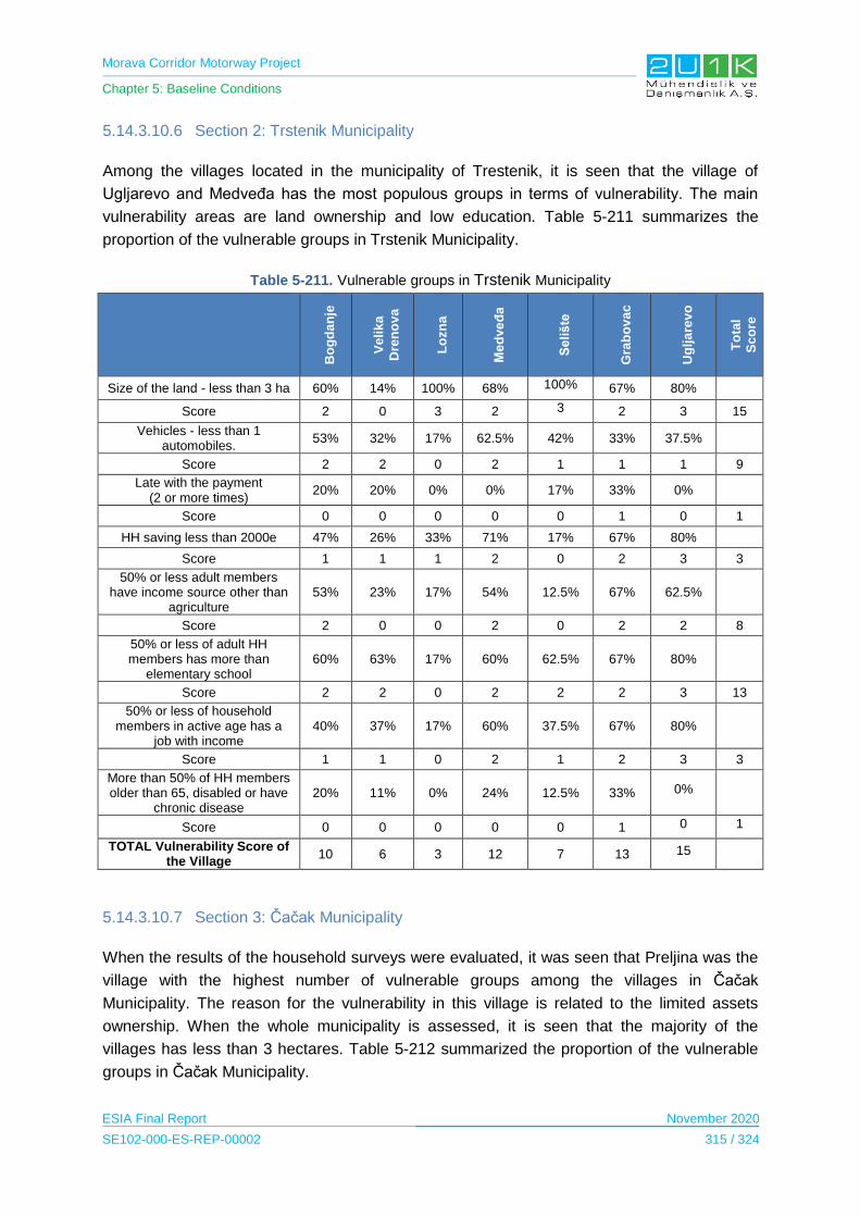
Morava Corridor Motorway Project
Chapter 5: Baseline Conditions
ESIA Final Report November 2020
SE102-000-ES-REP-00002 315 / 324
5.14.3.10.6 Section 2: Trstenik Municipality
Among the villages located in the municipality of Trestenik, it is seen that the village of
Ugljarevo and Medveđa has the most populous groups in terms of vulnerability. The main
vulnerability areas are land ownership and low education. Table 5-211 summarizes the
proportion of the vulnerable groups in Trstenik Municipality.
Table 5-211. Vulnerable groups in Trstenik Municipality
Bo
gd
an
je
Ve
lik
a
Dre
no
va
Lo
zn
a
Me
dve
đa
Se
liš
te
Gra
bo
va
c
Ug
lja
rev
o
To
tal
Sc
ore
Size of the land - less than 3 ha 60% 14% 100% 68% 100% 67% 80%
Score 2 0 3 2 3 2 3 15
Vehicles - less than 1 automobiles.
53% 32% 17% 62.5% 42% 33% 37.5%
Score 2 2 0 2 1 1 1 9
Late with the payment (2 or more times)
20% 20% 0% 0% 17% 33% 0%
Score 0 0 0 0 0 1 0 1
HH saving less than 2000e 47% 26% 33% 71% 17% 67% 80%
Score 1 1 1 2 0 2 3 3
50% or less adult members have income source other than
agriculture 53% 23% 17% 54% 12.5% 67% 62.5%
Score 2 0 0 2 0 2 2 8
50% or less of adult HH members has more than
elementary school 60% 63% 17% 60% 62.5% 67% 80%
Score 2 2 0 2 2 2 3 13
50% or less of household members in active age has a
job with income 40% 37% 17% 60% 37.5% 67% 80%
Score 1 1 0 2 1 2 3 3
More than 50% of HH members older than 65, disabled or have
chronic disease 20% 11% 0% 24% 12.5% 33% 0%
Score 0 0 0 0 0 1 0 1
TOTAL Vulnerability Score of the Village
10 6 3 12 7 13 15
5.14.3.10.7 Section 3: Čačak Municipality
When the results of the household surveys were evaluated, it was seen that Preljina was the
village with the highest number of vulnerable groups among the villages in Čačak
Municipality. The reason for the vulnerability in this village is related to the limited assets
ownership. When the whole municipality is assessed, it is seen that the majority of the
villages has less than 3 hectares. Table 5-212 summarized the proportion of the vulnerable
groups in Čačak Municipality.
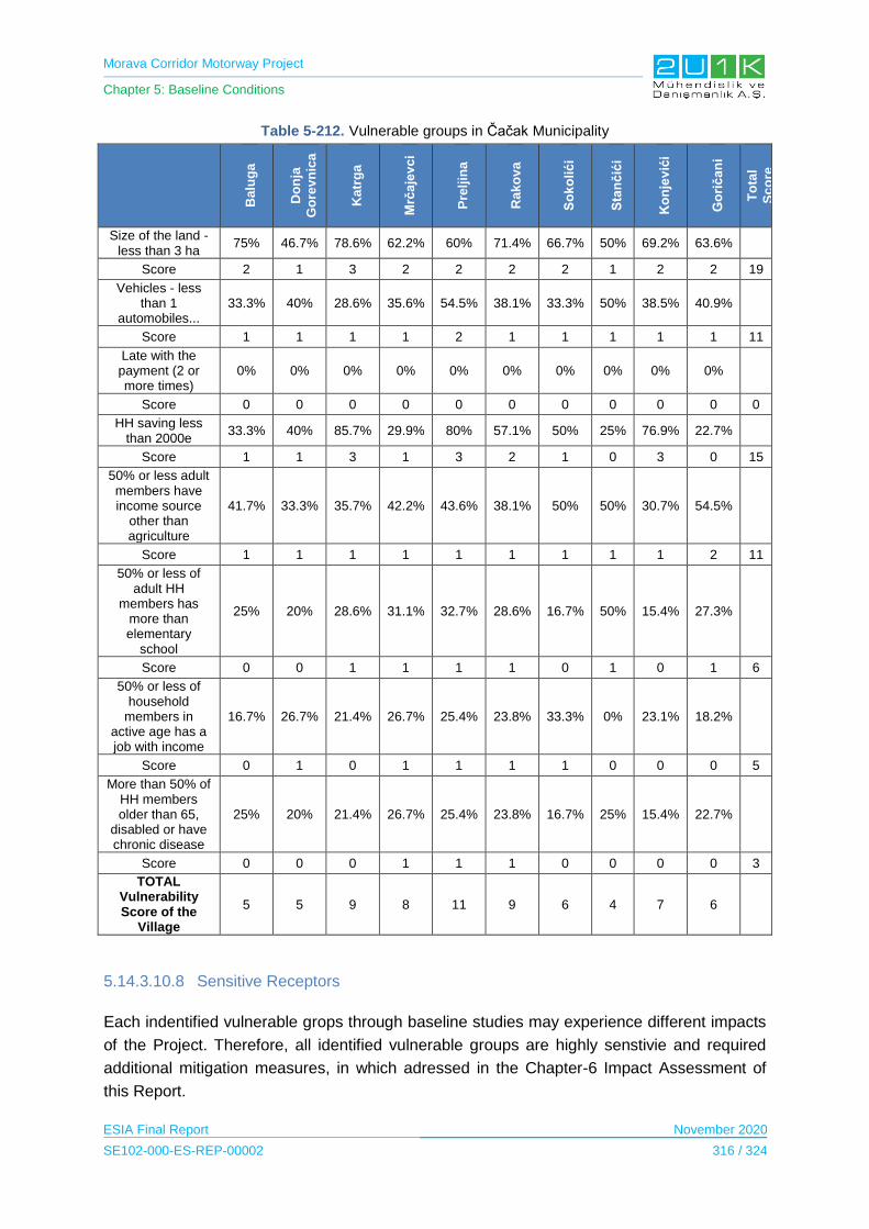
Morava Corridor Motorway Project
Chapter 5: Baseline Conditions
ESIA Final Report November 2020
SE102-000-ES-REP-00002 316 / 324
Table 5-212. Vulnerable groups in Čačak Municipality
Ba
lug
a
Do
nja
Go
rev
nic
a
Ka
trg
a
Mrč
aje
vc
i
Pre
ljin
a
Ra
ko
va
So
ko
lić
i
Sta
nč
ići
Ko
nje
vić
i
Go
rič
an
i
To
tal
Sc
ore
Size of the land - less than 3 ha
75% 46.7% 78.6% 62.2% 60% 71.4% 66.7% 50% 69.2% 63.6%
Score 2 1 3 2 2 2 2 1 2 2 19
Vehicles - less than 1
automobiles... 33.3% 40% 28.6% 35.6% 54.5% 38.1% 33.3% 50% 38.5% 40.9%
Score 1 1 1 1 2 1 1 1 1 1 11
Late with the payment (2 or more times)
0% 0% 0% 0% 0% 0% 0% 0% 0% 0%
Score 0 0 0 0 0 0 0 0 0 0 0
HH saving less than 2000e
33.3% 40% 85.7% 29.9% 80% 57.1% 50% 25% 76.9% 22.7%
Score 1 1 3 1 3 2 1 0 3 0 15
50% or less adult members have income source
other than agriculture
41.7% 33.3% 35.7% 42.2% 43.6% 38.1% 50% 50% 30.7% 54.5%
Score 1 1 1 1 1 1 1 1 1 2 11
50% or less of adult HH
members has more than elementary
school
25% 20% 28.6% 31.1% 32.7% 28.6% 16.7% 50% 15.4% 27.3%
Score 0 0 1 1 1 1 0 1 0 1 6
50% or less of household
members in active age has a job with income
16.7% 26.7% 21.4% 26.7% 25.4% 23.8% 33.3% 0% 23.1% 18.2%
Score 0 1 0 1 1 1 1 0 0 0 5
More than 50% of HH members older than 65,
disabled or have chronic disease
25% 20% 21.4% 26.7% 25.4% 23.8% 16.7% 25% 15.4% 22.7%
Score 0 0 0 1 1 1 0 0 0 0 3
TOTAL Vulnerability Score of the
Village
5 5 9 8 11 9 6 4 7 6
5.14.3.10.8 Sensitive Receptors
Each indentified vulnerable grops through baseline studies may experience different impacts
of the Project. Therefore, all identified vulnerable groups are highly senstivie and required
additional mitigation measures, in which adressed in the Chapter-6 Impact Assessment of
this Report.
Morava Corridor Motorway Project
Chapter 5: Baseline Conditions
ESIA Final Report November 2020
SE102-000-ES-REP-00002 317 / 324
5.14.3.11 Human Rights Screening
Legal Approach
In terms of human rights in the Serbian Constitution, Section II of the 2006 Constitution of
Serbia, comprising human and minority rights and freedoms (Arts. 18–81), is divided into
three parts: I. Fundamental Principles (Arts. 18–22), II. Human Rights and Freedoms (Arts.
23–74) and III. Rights of Persons Belonging to National Minorities (Arts. 75–81). Under the
Constitution, provisions on human and minority rights shall be interpreted in accordance with
the valid international standards and practices of international institutions monitoring their
implementation (Art. 18(3)) and the courts shall rule pursuant to the Constitution, the law
and20 other general enactments when so provided for by the law, generally recognized rules
of international law and ratified international treaties (Art. 142).
All major universal human rights treaties are binding on Serbia12. Serbia in 2010 ratified the
Protocol Additional to the Geneva Conventions of 12 August 1949 and relating to the
Adoption of an Additional Distinctive Emblem (Protocol III), the Convention for the
Safeguarding of the Intangible Cultural Heritage and the Convention for the Protection of
Human Rights and Dignity of the Human Being with regard to the Application of Biology and
Medicine: Convention on Human Rights and Biomedicine.
With a view to improving the state authorities’ coordination in the process of drafting periodic
reports for UN Committees and the Universal Periodic Reviews, the Government of the
Republic of Serbia in December 2014 enacted a decision forming a Council for the
Monitoring of the Implementation of Recommendations of United Nations Human Rights
Mechanisms. In compliance with its treaty obligations, the Republic of Serbia submits periodic
reports on the implementation of the ratified conventions to the relevant UN committees.
The European Convention for the Protection of Human Rights and Fundamental Freedoms
(ECHR) was ratified by the State Union of Serbia and Montenegro (SaM) back in 2004.
Serbian nationals may file cases with the European Court of Human Rights (ECtHR). The
Convention guarantees specific rights and freedoms and prohibits unfair and harmful
practices (Belgrade Centre for Human Rights, 2019).
12 The International Covenant on Civil and Political Rights and its two Protocols, the International Covenant on Economic, Social and Cultural Rights, the International Convention on the Elimination of All Forms of Racial Discrimination, the International Convention on the Elimination of Discrimination against Women and its Protocol, the Convention on the Rights of the Child and its two Protocols (on the involvement of children in armed conflict and on the sale of children, child prostitution and child pornography), the Convention on the Prevention and Punishment of the Crime of Genocide, the Convention against Torture and Other Cruel, Inhuman or Degrading Treatment or Punishment and its Protocol and the Convention on the Rights of Persons with Disabilities and its Protocol and Convention for the Protection of All Persons from Enforced Disappearance.

Morava Corridor Motorway Project
Chapter 5: Baseline Conditions
ESIA Final Report November 2020
SE102-000-ES-REP-00002 318 / 324
The Convention secures:
the right to life (Article 2)
freedom from torture (Article 3)
freedom from slavery (Article 4)
the right to liberty (Article 5)
the right to a fair trial (Article 6)
the right not to be punished for something that wasn’t against the law at the time
(Article 7)
the right to respect for family and private life (Article 8)
freedom of thought, conscience and religion (Article 9)
freedom of expression (Article 10)
freedom of assembly (Article 11)
the right to marry and start a family (Article 12)
the right not to be discriminated against in respect of these rights (Article 14)
the right to protection of property (Protocol 1, Article 1)
the right to education (Protocol 1, Article 2)
the right to participate in free elections (Protocol 1, Article 3)
the abolition of the death penalty (Protocol 13) (European Court of Human Rights and
Council of Europe, 1994)
Serbia is a member of International Labour Organization since November, 2000. Serbia
ratified 77 ILO Conventions; including Fundamental, Governance and Technical
Conventions. The eight fundamental conventions ratified by Serbia are;
1. Freedom of Association and Protection of the Right to Organise Convention, 1948 (No.
87)
2. Right to Organise and Collective Bargaining Convention, 1949 (No. 98)
3. Forced Labour Convention, 1930 (No. 29) (and its 2014 Protocol )
4. Abolition of Forced Labour Convention, 1957 (No. 105)
5. Minimum Age Convention, 1973 (No. 138)
6. Worst Forms of Child Labour Convention, 1999 (No. 182)
7. Equal Remuneration Convention, 1951 (No. 100)
8. Discrimination (Employment and Occupation) Convention, 1958 (No. 111)
Human Development Index
The main premise of the human development approach is that expanding peoples’ freedoms
is both the main aim of, and the principal means for sustainable development. Serbia’s
Human Development Index (HDI) value for 2018 is 0.799— which put the country in the high
human development category— positioning it at 63 out of 189 countries and territories.
Serbia’s 2018 HDI of 0.799 is above the average of 0.750 for countries in the high human
Morava Corridor Motorway Project
Chapter 5: Baseline Conditions
ESIA Final Report November 2020
SE102-000-ES-REP-00002 319 / 324
development group and above the average of 0.779 for countries in Europe and Central Asia
(UNDP).
Serbia’s human development indicators and access to basic services shows that Serbia
performs better on the Human Development Index than other countries with similar income
levels; including with respect to school enrollment rates, life expectancy, and infant and
maternal mortality rates.
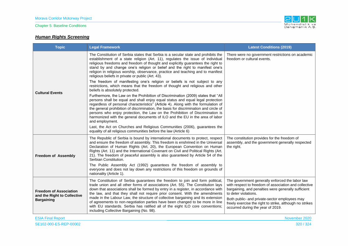
Morava Corridor Motorway Project
Chapter 5: Baseline Conditions
ESIA Final Report November 2020
SE102-000-ES-REP-00002 320 / 324
Human Rights Screening
Topic Legal Framework Latest Conditions (2019)
Cultural Events
The Constitution of Serbia states that Serbia is a secular state and prohibits the establishment of a state religion (Art. 11), regulates the issue of individual religious freedoms and freedom of thought and explicitly guarantees the right to stand by and change one’s religion or belief and the right to manifest one’s religion in religious worship, observance, practice and teaching and to manifest religious beliefs in private or public (Art. 43).
The freedom of manifesting one’s religion or beliefs is not subject to any restrictions, which means that the freedom of thought and religious and other beliefs is absolutely protected.
Furthermore, the Law on the Prohibition of Discrimination (2009) states that “All persons shall be equal and shall enjoy equal status and equal legal protection regardless of personal characteristics” (Article 4). Along with the formulation of the general prohibition of discrimination, the basis for discrimination and circle of persons who enjoy protection, the Law on the Prohibition of Discrimination is harmonized with the general documents of ILO and the EU in the area of labor and employment.
Last, the Act on Churches and Religious Communities (2006), guarantees the equality of all religious communities before the law (Article 6)
There were no government restrictions on academic freedom or cultural events.
Freedom of Assembly
The Republic of Serbia is bound by international documents to protect, respect and ensure the freedom of assembly. This freedom is enshrined in the Universal Declaration of Human Rights (Art. 20), the European Convention on Human Rights (Art. 11) and the International Covenant on Civil and Political Rights (Art. 21). The freedom of peaceful assembly is also guaranteed by Article 54 of the Serbian Constitution.
The Public Assembly Act (1992) guarantees the freedom of assembly to everyone and does not lay down any restrictions of this freedom on grounds of nationality (Article 1).
The constitution provides for the freedom of assembly, and the government generally respected the right.
Freedom of Association and the Right to Collective Bargaining
The Constitution of Serbia guarantees the freedom to join and form political, trade union and all other forms of associations (Art. 55). The Constitution lays down that associations shall be formed by entry in a register, in accordance with the law, and that they shall not require prior consent. With the amendments made in the Labour Law, the structure of collective bargaining and its extension of agreements to non-negotiation parties have been changed to be more in line with EU standards. Serbia has ratified all of the eight ILO core conventions; including Collective Bargaining (No. 98).
The government generally enforced the labor law with respect to freedom of association and collective bargaining, and penalties were generally sufficient to deter violations.
Both public- and private-sector employees may freely exercise the right to strike, although no strikes occurred during the year of 2019.
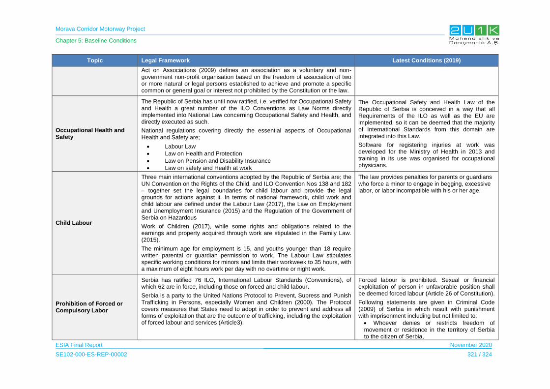
Morava Corridor Motorway Project
Chapter 5: Baseline Conditions
ESIA Final Report November 2020
SE102-000-ES-REP-00002 321 / 324
Topic Legal Framework Latest Conditions (2019)
Act on Associations (2009) defines an association as a voluntary and non-government non-profit organisation based on the freedom of association of two or more natural or legal persons established to achieve and promote a specific common or general goal or interest not prohibited by the Constitution or the law.
Occupational Health and Safety
The Republic of Serbia has until now ratified, i.e. verified for Occupational Safety and Health a great number of the ILO Conventions as Law Norms directly implemented into National Law concerning Occupational Safety and Health, and directly executed as such.
National regulations covering directly the essential aspects of Occupational Health and Safety are;
Labour Law
Law on Health and Protection
Law on Pension and Disability Insurance
Law on safety and Health at work
The Occupational Safety and Health Law of the Republic of Serbia is conceived in a way that all Requirements of the ILO as well as the EU are implemented, so it can be deemed that the majority of International Standards from this domain are integrated into this Law.
Software for registering injuries at work was developed for the Ministry of Health in 2013 and training in its use was organised for occupational physicians.
Child Labour
Three main international conventions adopted by the Republic of Serbia are; the UN Convention on the Rights of the Child, and ILO Convention Nos 138 and 182 – together set the legal boundaries for child labour and provide the legal grounds for actions against it. In terms of national framework, child work and child labour are defined under the Labour Law (2017), the Law on Employment and Unemployment Insurance (2015) and the Regulation of the Government of Serbia on Hazardous
Work of Children (2017), while some rights and obligations related to the earnings and property acquired through work are stipulated in the Family Law. (2015).
The minimum age for employment is 15, and youths younger than 18 require written parental or guardian permission to work. The Labour Law stipulates specific working conditions for minors and limits their workweek to 35 hours, with a maximum of eight hours work per day with no overtime or night work.
The law provides penalties for parents or guardians who force a minor to engage in begging, excessive labor, or labor incompatible with his or her age.
Prohibition of Forced or Compulsory Labor
Serbia has ratified 76 ILO, International Labour Standards (Conventions), of which 62 are in force, including those on forced and child labour.
Serbia is a party to the United Nations Protocol to Prevent, Supress and Punish Trafficking in Persons, especially Women and Children (2000). The Protocol covers measures that States need to adopt in order to prevent and address all forms of exploitation that are the outcome of trafficking, including the exploitation of forced labour and services (Article3).
Forced labour is prohibited. Sexual or financial exploitation of person in unfavorable position shall be deemed forced labour (Article 26 of Constitution).
Following statements are given in Criminal Code (2009) of Serbia in which result with punishment with imprisonment including but not limited to:
Whoever denies or restricts freedom of movement or residence in the territory of Serbia to the citizen of Serbia,
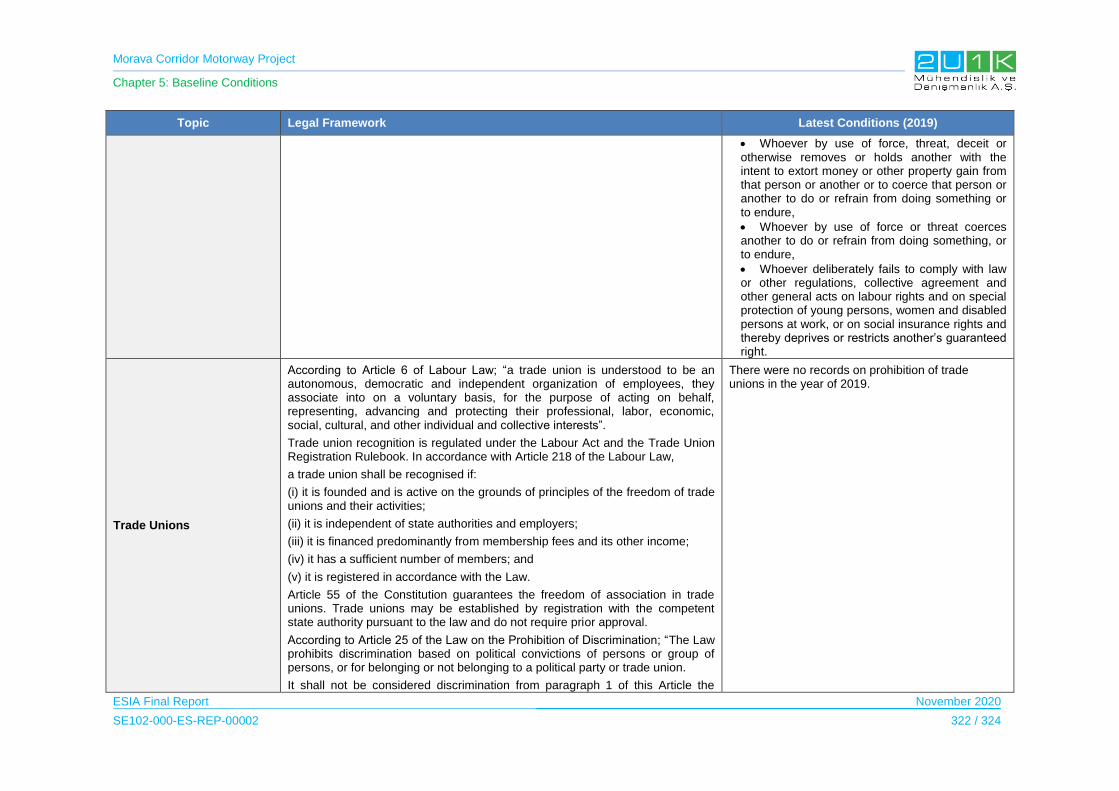
Morava Corridor Motorway Project
Chapter 5: Baseline Conditions
ESIA Final Report November 2020
SE102-000-ES-REP-00002 322 / 324
Topic Legal Framework Latest Conditions (2019)
Whoever by use of force, threat, deceit or otherwise removes or holds another with the intent to extort money or other property gain from that person or another or to coerce that person or another to do or refrain from doing something or to endure,
Whoever by use of force or threat coerces another to do or refrain from doing something, or to endure,
Whoever deliberately fails to comply with law or other regulations, collective agreement and other general acts on labour rights and on special protection of young persons, women and disabled persons at work, or on social insurance rights and thereby deprives or restricts another’s guaranteed right.
Trade Unions
According to Article 6 of Labour Law; “a trade union is understood to be an autonomous, democratic and independent organization of employees, they associate into on a voluntary basis, for the purpose of acting on behalf, representing, advancing and protecting their professional, labor, economic, social, cultural, and other individual and collective interests”.
Trade union recognition is regulated under the Labour Act and the Trade Union Registration Rulebook. In accordance with Article 218 of the Labour Law,
a trade union shall be recognised if:
(i) it is founded and is active on the grounds of principles of the freedom of trade unions and their activities;
(ii) it is independent of state authorities and employers;
(iii) it is financed predominantly from membership fees and its other income;
(iv) it has a sufficient number of members; and
(v) it is registered in accordance with the Law.
Article 55 of the Constitution guarantees the freedom of association in trade unions. Trade unions may be established by registration with the competent state authority pursuant to the law and do not require prior approval.
According to Article 25 of the Law on the Prohibition of Discrimination; “The Law prohibits discrimination based on political convictions of persons or group of persons, or for belonging or not belonging to a political party or trade union.
It shall not be considered discrimination from paragraph 1 of this Article the
There were no records on prohibition of trade unions in the year of 2019.
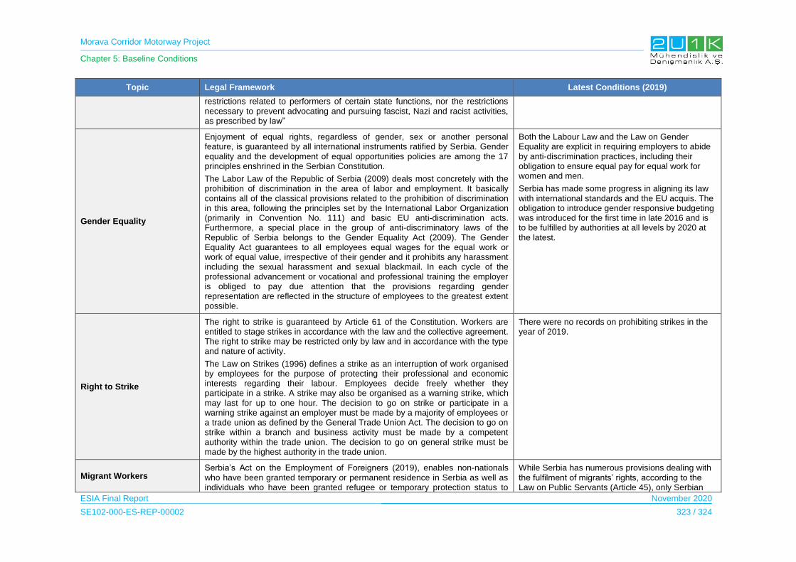
Morava Corridor Motorway Project
Chapter 5: Baseline Conditions
ESIA Final Report November 2020
SE102-000-ES-REP-00002 323 / 324
Topic Legal Framework Latest Conditions (2019)
restrictions related to performers of certain state functions, nor the restrictions necessary to prevent advocating and pursuing fascist, Nazi and racist activities, as prescribed by law”
Gender Equality
Enjoyment of equal rights, regardless of gender, sex or another personal feature, is guaranteed by all international instruments ratified by Serbia. Gender equality and the development of equal opportunities policies are among the 17 principles enshrined in the Serbian Constitution.
The Labor Law of the Republic of Serbia (2009) deals most concretely with the prohibition of discrimination in the area of labor and employment. It basically contains all of the classical provisions related to the prohibition of discrimination in this area, following the principles set by the International Labor Organization (primarily in Convention No. 111) and basic EU anti-discrimination acts. Furthermore, a special place in the group of anti-discriminatory laws of the Republic of Serbia belongs to the Gender Equality Act (2009). The Gender Equality Act guarantees to all employees equal wages for the equal work or work of equal value, irrespective of their gender and it prohibits any harassment including the sexual harassment and sexual blackmail. In each cycle of the professional advancement or vocational and professional training the employer is obliged to pay due attention that the provisions regarding gender representation are reflected in the structure of employees to the greatest extent possible.
Both the Labour Law and the Law on Gender Equality are explicit in requiring employers to abide by anti-discrimination practices, including their obligation to ensure equal pay for equal work for women and men.
Serbia has made some progress in aligning its law with international standards and the EU acquis. The obligation to introduce gender responsive budgeting was introduced for the first time in late 2016 and is to be fulfilled by authorities at all levels by 2020 at the latest.
Right to Strike
The right to strike is guaranteed by Article 61 of the Constitution. Workers are entitled to stage strikes in accordance with the law and the collective agreement. The right to strike may be restricted only by law and in accordance with the type and nature of activity.
The Law on Strikes (1996) defines a strike as an interruption of work organised by employees for the purpose of protecting their professional and economic interests regarding their labour. Employees decide freely whether they participate in a strike. A strike may also be organised as a warning strike, which may last for up to one hour. The decision to go on strike or participate in a warning strike against an employer must be made by a majority of employees or a trade union as defined by the General Trade Union Act. The decision to go on strike within a branch and business activity must be made by a competent authority within the trade union. The decision to go on general strike must be made by the highest authority in the trade union.
There were no records on prohibiting strikes in the year of 2019.
Migrant Workers Serbia’s Act on the Employment of Foreigners (2019), enables non-nationals who have been granted temporary or permanent residence in Serbia as well as individuals who have been granted refugee or temporary protection status to
While Serbia has numerous provisions dealing with the fulfilment of migrants’ rights, according to the Law on Public Servants (Article 45), only Serbian

Morava Corridor Motorway Project
Chapter 5: Baseline Conditions
ESIA Final Report November 2020
SE102-000-ES-REP-00002 324 / 324
Topic Legal Framework Latest Conditions (2019)
apply for work permits.
All foreigners, including labour migrants, who hold a residence permit have the right to health protection, according to Article 3 of the Law on Health Protection. Health services, as well as primary and secondary education, are available free of charge.
nationals are permitted to work as civil servants in the public sector. However, foreign citizens are allowed to work in state-owned or public enterprises.
Right to Bargain
Serbia has signed ILO Convention No. 98 Concerning the Application of the Principles of the Right to Organise and to Bargain Collectively.
Article 5 of the Revised European Social Charter, ratified by Serbia in 2009, enshrines the right of workers and employers to organise, which entails the right to form local, national or international organisations for the protection of their economic and social interests.
The Labor Law protects the right to bargain collectively, and this right was effectively enforced and practiced.
Right to Property
According to Article 58 of the Constitution “Peaceful tenure of a person's own property and other property rights acquired by the law shall be guaranteed. Right of property may be revoked or restricted only in public interest established by the law and with compensation which cannot be less than market value.”
The Republic of Serbia Expropriation Law (passed in 1995 and enacted on January 1, 1996, amended in March 2001, amended again on March 19, 2009, 2013 by the Constitutional Court ruling and in 2016 by the Authentic interpretation) guides expropriation and serves as a general framework for expropriation in the Republic of Serbia. The law also enshrines the principle of compensation at market value.
It is intended to ensure simple, efficient process, reducing as far as possible the need for a lengthy judicial process to facilitate necessary expropriation. Under normal circumstances, the entire process of acquisition can be completed within six months. Public interest is determined in accordance with the Law on Expropriation, as a legal way of acquiring property, providing adequate compensation for expropriated property, as a result of a comprehensive legal and administrative process aiming at balancing between the necessary preservation and protection of ownership right and the public interest prevalence.
Source: (United States Department of State - Bureau of Democracy, Human Rights and Labor, 2019) (Belgrade Centre for Human Rights, 2019) (IOM, 2018) (EuroFund, 2018)

Morava Corridor Motorway Project
Chapter 6: Impact Assessment
ESIA Final Report November 2020
SE102-000-ES-REP-00002 1 / 260
6 IMPACT ASSESSMENT
In this Chapter, construction and operation activities of the Proposed Morava Corridor
Motorway Project are against the baseline conditions in order to assess the environmental and
social potential impacts of the Project. With this intention, Chapter 6 provides a summary of
the major, moderate and positive impacts identified during the ESIA study for the construction
and operation of the Project.
The basic approach for the ESIA is adopted for conducting the environmental and social impact
study for the proposed project to assess the existing baseline in the AoI (i.e., defined as the
area of 1,000 m buffer along the length of the Project, consisting of a 500 m buffer on both
sides of the Project), where the components and activities of the project having potential
environmental and social impacts. Environmental and Social impact assessments are framed
with the prevailing institutional and legislative setup provided in Section 4 Legal Framework.
The main approaches for the assessment covers:
1. Identification and analysis of potential positive and negative impacts, direct and indirect
impacts, and short-term and long-term impacts likely to result from project
implementation;
2. Identification of feasible and cost-effective mitigation measures to avoid or to minimize
negative impacts, and to provide technical guidance to the engineering design for the
implementation of proposed mitigations.
3. Identify potential opportunities for environmental enhancement;
4. Preparation of Environmental and Social Management and Monitoring Plan for effective
implementation of environmental mitigation measures at different stages of the project.
6.1 Scoping of the Impacts
The potential environmental and social impacts of the Proposed Morava Corridor Motorway
Project together with River Regulation1 are summarized in the scoping matrix for the main
Project phases (construction and operation) to identify the likely environmental and social
aspects originating from them. These phases are described below:
The Construction Phase activities, which comprises pre-construction including detailed
design, construction and post-construction phases, considered in the scoping stage. In
this respect, this phase covers all detailed design and construction activities as well as
decommissioning of the temporary construction facilities.
1 River Regulation Project is designed as a part of the Morava Corridor Motorway Project and general constrcution impacts are same and in paralel with the impacts caused by major constrcution works such as excavation, air qulity etc. In this respect, common impacts, impact asessment and related mtigation measures are covered under common topics. Only specific impacts caused by river regulation works are individually assessed and expressed related sections.

Morava Corridor Motorway Project
Chapter 6: Impact Assessment
ESIA Final Report November 2020
SE102-000-ES-REP-00002 2 / 260
The Operational Phase considers all operational activities including:
- Operation of the motorway, which may potentially result in impacts such as the
generation of noise and vibration, release of chemicals, fuels or hazardous
substances, accidental spills and leakage from movement of the vehicles as well
as killing of crossing animals and generation of various waste streams;
- Potential impact of the River Regulation works on surface and subsurface water
quality at West Morava Basin, and potential impacts on fresh water and terrresterial
ecology of the project AoI.
- Maintenance activities of the motorway, which may potentially result in impacts
such as on the occupational health and safety for the workers that will perform
regular maintenance of the motorway and public safety during the maintenance.
The potential impacts (adverse and positive) of all planned project activities have been
identified and the interaction between the project activities in all these phases and the natural,
physical environment and social‐economic aspects are addressed using the environmental
and social scoping matrixes provided in Table 6-1 and Table 6-2 below.

Morava Corridor Motorway Project
Chapter 6: Impact Assessment
ESIA Final Report November 2020
SE102-000-ES-REP-00002 3 / 260
Table 6-1. Scoping Matrix – Potential Environmental ImpactsP
roje
ct
Sta
ge
Su
b P
roje
ct
Sta
ge
Potential Impact
Locations Activity/Source
Wate
r Q
ua
lity Air Quality
and Climate
No
ise a
nd
Vib
rati
on
Geology Soils
and Cont.
Wa
ste
Ma
na
gem
en
t
Terrestrial and Aquatic Ecos.
Arc
ha
eo
log
ica
l a
nd
Cu
ltu
ral R
es.
Lan
dscap
e
Su
rfac
e W
ate
r
Gro
un
d W
ate
r
NO
x
SO
2
Du
st
(PM
2.5
/10)
GH
G E
mis
sio
ns
Err
os
ion
Ge
oh
aza
rds
So
il
Aq
uati
c E
co
sy
ste
ms
Terr
es
tria
l
Pro
tec
ted
Are
as
Pre
-Co
ns
tru
cti
on
Acti
vit
ies
Sit
e p
rep
ara
tio
n
Camp Sites, Borrow Pits,
Quarries, Asphalt Plants,
Concreate Batching
Plant, Construction
corridor, Access Roads,
River Regulation
Top-soil stripping X X X X X X X X X
Top-Soil Storage X X X X X X X X X
Tree Cutting /Vegetation clearance
X X X X X X
Demolishing of Exiting Buildings/Structures
X X X X X X
Geological and Geotechnical Studies
X X X
Mapping and Alignment/site selection
X X
Land Take/Expropriation
Sit
e
Mo
biliz
ati
on
Mobilization of Machinery and Equipment
X X X X X X X
Procurement of Materials and Equipment
Employment
Co
ns
tru
cti
on
Acti
vit
ies
Co
nstr
uc
tio
n
Camp Sites, Borrow Pits,
Quarries, Asphalt Plants,
Concrete Batching Plants,
Construction corridor,
Access Roads, River
Regulation
Camp Sites X X X X X X X X X X X X
Material Storage X X X X X X X X X X X
Waste Storage/Disposal Sites
X X X X X X
Water Supply X X X
Wastewater Treatment and Disposal
X X X X
Excavation X X X X X X X X X X X X X X
Backfilling X X X X X X X X X X X X X
Storage, Re-Use and Disposal of Excavations
X X X X X X X X X X
Material Spreading/Rolling/Compaction
X X X X X x X XX
Asphalt-Concrete Wearing
X X X X X X
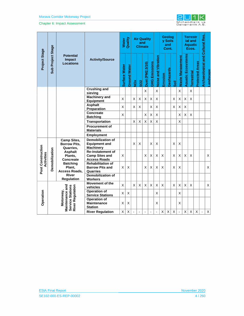
Morava Corridor Motorway Project
Chapter 6: Impact Assessment
ESIA Final Report November 2020
SE102-000-ES-REP-00002 4 / 260
Pro
jec
t S
tag
e
Su
b P
roje
ct
Sta
ge
Potential Impact
Locations Activity/Source
Wate
r Q
ua
lity Air Quality
and Climate
No
ise
an
d V
ibra
tio
n
Geology Soils
and Cont.
Was
te M
an
ag
em
en
t
Terrestrial and Aquatic Ecos.
Arc
hae
olo
gic
al a
nd
Cu
ltu
ral R
es
.
La
nd
sca
pe
Su
rfac
e W
ate
r
Gro
un
d W
ate
r
NO
x
SO
2
Du
st
(PM
2.5
/10
)
GH
G E
mis
sio
ns
Err
osio
n
Ge
oh
azard
s
So
il
Aq
ua
tic E
co
sy
ste
ms
Te
rre
str
ial
Pro
tec
ted
Are
as
Crushing and sieving
X X X X
Machinery and Equipment
X X X X X X X X X X
Asphalt Preparation
X X X X X X X X
Concreate Batching
X X X X X X X
Transportation X X X X X X
Procurement of Materials
Employment
Po
st
Co
ns
tru
cti
on
A
cti
vit
ies
De
mo
bil
iza
tio
n
Camp Sites, Borrow Pits,
Quarries, Asphalt Plants,
Concreate Batching
Plant, Access Roads,
River Regulation
Demobilization of Equipment and Machinery
X X X X X X
Re-instatement of Camp Sites and Access Roads
X X X X X X X X X X
Rehabilitation of Barrow Pits and Quarries
X X X X X X X X X
Demobilization of Workers
Op
era
tio
n
Mo
torw
ay
, M
ain
ten
an
ce
an
d
Se
rvic
e S
tati
on
sR
iver
Reg
ula
tio
n
Movement of the vehicles
X X X X X X X X X X X X
Operation of Service Stations
X X X X
Operation of Maintenance Station
X X X X
River Regulation X X - - - - - X X X - X X X - X
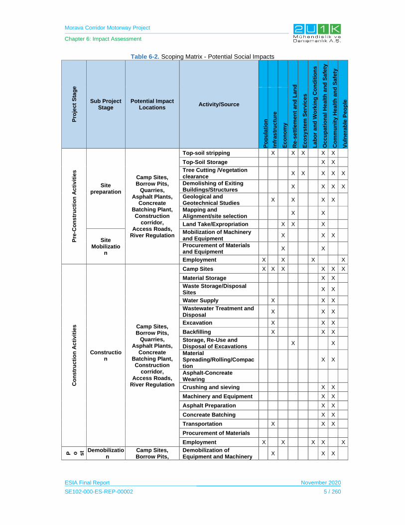
Morava Corridor Motorway Project
Chapter 6: Impact Assessment
ESIA Final Report November 2020
SE102-000-ES-REP-00002 5 / 260
Table 6-2. Scoping Matrix - Potential Social Impacts
Pro
ject
Sta
ge
Sub Project Stage
Potential Impact Locations
Activity/Source
Re-s
ett
lem
en
t an
d L
an
d
Eco
sy
ste
m S
erv
ice
s
La
bo
r a
nd
Wo
rkin
g C
on
dit
ion
s
Oc
cu
pati
on
al H
ealt
h a
nd
Safe
ty
Co
mm
un
ity H
ea
lth
an
d S
afe
ty
Vu
lne
rab
le P
eo
ple
Po
pu
lati
on
Infr
as
tru
ctu
re
Eco
no
my
Pre
-Co
ns
tru
cti
on
Ac
tivit
ies
Site preparation
Camp Sites, Borrow Pits,
Quarries, Asphalt Plants,
Concreate Batching Plant, Construction
corridor, Access Roads,
River Regulation
Top-soil stripping X X X X X
Top-Soil Storage X X
Tree Cutting /Vegetation clearance
X X X X X
Demolishing of Exiting Buildings/Structures
X X X X
Geological and Geotechnical Studies
X X X X
Mapping and Alignment/site selection
X X
Land Take/Expropriation X X X
Site Mobilizatio
n
Mobilization of Machinery and Equipment
X X X
Procurement of Materials and Equipment
X X
Employment X X X X
Co
ns
tru
cti
on
Ac
tivit
ies
Construction
Camp Sites, Borrow Pits,
Quarries, Asphalt Plants,
Concreate Batching Plant, Construction
corridor, Access Roads,
River Regulation
Camp Sites X X X X X X
Material Storage X X
Waste Storage/Disposal Sites
X X
Water Supply X X X
Wastewater Treatment and Disposal
X X X
Excavation X X X
Backfilling X X X
Storage, Re-Use and Disposal of Excavations
X X
Material Spreading/Rolling/Compaction
X X
Asphalt-Concreate Wearing
Crushing and sieving X X
Machinery and Equipment X X
Asphalt Preparation X X
Concreate Batching X X
Transportation X X X
Procurement of Materials
Employment X X X X X
P o st C
Demobilization
Camp Sites, Borrow Pits,
Demobilization of Equipment and Machinery
X X X

Morava Corridor Motorway Project
Chapter 6: Impact Assessment
ESIA Final Report November 2020
SE102-000-ES-REP-00002 6 / 260
Pro
ject
Sta
ge
Sub Project Stage
Potential Impact Locations
Activity/Source
Re-s
ett
lem
en
t an
d L
an
d
Ec
osy
ste
m S
erv
ices
La
bo
r a
nd
Wo
rkin
g C
on
dit
ion
s
Occ
up
ati
on
al H
ealt
h a
nd
Sa
fety
Co
mm
un
ity H
ea
lth
an
d S
afe
ty
Vu
lne
rab
le P
eo
ple
Po
pu
lati
on
Infr
as
tru
ctu
re
Ec
on
om
y
Quarries, Asphalt Plants,
Concreate Batching Plant, Access Roads,
River Regulation
Re-instatement of Camp Sites and Access Roads
X X
Rehabilitation of Barrow Pits and Quarries
X
Demobilization of Workers X X
Op
era
tio
n Motorway, Maintenance and Service Stations River Regulation
Movement of the vehicles X X
Operation of Service Stations
XX
X
Operation of Maintenance Station
X X
River Regulation - X - - X - - - X
6.2 Methodology for Impact Assessment
6.2.1 Impact Types and Definitions
Impacts may occur as positive, negative, direct, indirect and cumulative. Determination of the
type of impact is the important step of the assessment process. The determination of the
impact type is based on geographical size, sensitivity of receptor, duration, significance and
likelihood of the impact. Impact types are provided in Table 6-3.
Table 6-3. Impact Types and Definitions
Impact Type Definition
Positive Impacts that make positive changes over the current conditions.
Negative Impacts that lead to new and undesirable changes over the current conditions.
Direct Direct impacts occur through direct interaction of an activity with an environmental, social, or economic component.
Indirect Impacts which are not a direct result of the project, often produced away from or as a result of a complex impact pathway.
Cumulative Impacts that consist of an impact that is created as a result of the combination of the project evaluated in the current project together with other projects causing related impacts.

Morava Corridor Motorway Project
Chapter 6: Impact Assessment
ESIA Final Report November 2020
SE102-000-ES-REP-00002 7 / 260
6.2.2 Method to Assess Environmental and Social Impacts
6.2.2.1 Determination of Impact Significance Criteria
The environmental and social impacts are dependent on the impact significance criteria (SC)
of the particular impact and the Likelihood (L) of the impact occurring. Impact significance
criteria (SC) is determined through the consideration of the Nature (N), Extent (E), Duration
(D), Magnitude (M), and receptor sensitivity (R) applicable to the specific impact.
For the purpose of this methodology the consequence of the impact is represented by:
SC= (E+D+M+R) x N/4
A rating scale as defined in below table represents each individual aspect in the determination
of the consequence.
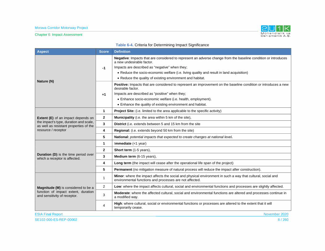
Morava Corridor Motorway Project
Chapter 6: Impact Assessment
ESIA Final Report November 2020
SE102-000-ES-REP-00002 8 / 260
Table 6-4. Criteria for Determining Impact Significance
Aspect Score Definition
Nature (N)
-1
Negative: Impacts that are considered to represent an adverse change from the baseline condition or introduces a new undesirable factor.
Impacts are described as “negative” when they;
Reduce the socio-economic welfare (i.e. living quality and result in land acquisition)
Reduce the quality of existing environment and habitat.
+1
Positive: Impacts that are considered to represent an improvement on the baseline condition or introduces a new desirable factor.
Impacts are described as “positive” when they;
Enhance socio-economic welfare (i.e. health, employment).
Enhance the quality of existing environment and habitat.
Extent (E) of an impact depends on the impact’s type, duration and scale, as well as resistant properties of the resource / receptor
1 Project Site: (i.e. limited to the area applicable to the specific activity)
2 Municipality (i.e. the area within 5 km of the site),
3 District (i.e. extends between 5 and 15 km from the site
4 Regional: (i.e. extends beyond 50 km from the site)
5 National: potential impacts that expected to create changes at national level.
Duration (D) is the time period over which a receptor is affected.
1 Immediate (<1 year)
2 Short term (1-5 years),
3 Medium term (6-15 years),
4 Long term (the impact will cease after the operational life span of the project)
5 Permanent (no mitigation measure of natural process will reduce the impact after construction).
Magnitude (M) is considered to be a function of impact extent, duration and sensitivity of receptor.
1 Minor: where the impact affects the social and physical environment in such a way that cultural, social and environmental functions and processes are not affected.
2 Low: where the impact affects cultural, social and environmental functions and processes are slightly affected.
3 Moderate: where the affected cultural, social and environmental functions are altered and processes continue in a modified way.
4 High: where cultural, social or environmental functions or processes are altered to the extent that it will temporarily cease.

Morava Corridor Motorway Project
Chapter 6: Impact Assessment
ESIA Final Report November 2020
SE102-000-ES-REP-00002 9 / 260
Aspect Score Definition
5 Very high: where natural, cultural, social or environmental functions or processes are altered to the extent that it will permanently cease.
Receptor Sensitivity (R)2 describes the ability of the receptor to withstand adverse impacts. It takes into consideration not only activity-impact-receptor pathways, but also social and environmental characteristics of the receptor that might make it more or less resilient to change.
1
Low: Local community and/or environment is fully equipped/has the tools to manage changes of life quality.
Species and/or population has high capacity to absorb or adapt to change (i.e. has capacity to move away from or adapt to the project impact), and is potentially unaffected or marginally affected
People being least vulnerable to change or disturbance (i.e. ambient conditions such as air quality are well below applicable legislation and international guidance)
Individuals who are able to quickly adapt to temporary disruption in their living conditions, livelihood status or a change in the status of public infrastructure
3
Medium: Local community and/or environment is partially equipped/has the tools to manage changes of life quality. For example:
Internationally threatened species /protected area within the area impacted by the project activities outside of period of high sensitivity or during routine or reliably predictable peak presence
Species and/or population which has moderate capacity to absorb or adapt to change (i.e. has capacity to move away from or adapt to the project impact), leading to potential temporary but sustainable effect which does not substantially alter character or result in significant loss of ecological functionality
People being vulnerable to change or disturbance (i.e. ambient conditions such as air quality are below adopted standards
Negative change in livelihood status, household assets/income or living conditions. Temporary disruption to businesses resulting in a small drop in business revenue.
Increased risk to public health that can be controlled using detailed mitigation measures.
Disruption to public infrastructure that results in an inconvenience to other users
2 Receptors may be humans, ecological and physical components of the environment. Receptor sensitivity considers how a particular receptor may be more or less susceptible to a given impact. More sensitive receptors may experience a greater degree of change, or have less ability to deal with the change, compared with less sensitive receptors that may be more resilient or adaptable.
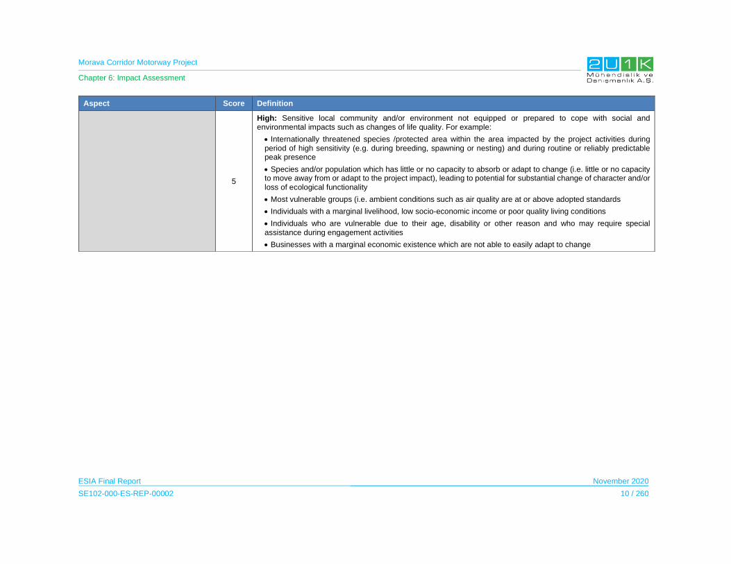
Morava Corridor Motorway Project
Chapter 6: Impact Assessment
ESIA Final Report November 2020
SE102-000-ES-REP-00002 10 / 260
Aspect Score Definition
5
High: Sensitive local community and/or environment not equipped or prepared to cope with social and environmental impacts such as changes of life quality. For example:
Internationally threatened species /protected area within the area impacted by the project activities during period of high sensitivity (e.g. during breeding, spawning or nesting) and during routine or reliably predictable peak presence
Species and/or population which has little or no capacity to absorb or adapt to change (i.e. little or no capacity to move away from or adapt to the project impact), leading to potential for substantial change of character and/or loss of ecological functionality
Most vulnerable groups (i.e. ambient conditions such as air quality are at or above adopted standards
Individuals with a marginal livelihood, low socio-economic income or poor quality living conditions
Individuals who are vulnerable due to their age, disability or other reason and who may require special assistance during engagement activities
Businesses with a marginal economic existence which are not able to easily adapt to change
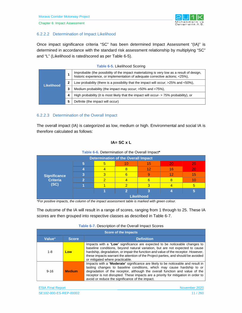
Morava Corridor Motorway Project
Chapter 6: Impact Assessment
ESIA Final Report November 2020
SE102-000-ES-REP-00002 11 / 260
6.2.2.2 Determination of Impact Likelihood
Once impact significance criteria “SC” has been determined Impact Assessment “(IA)” is
determined in accordance with the standard risk assessment relationship by multiplying “SC”
and “L” (Likelihood is rated/scored as per Table 6-5).
Table 6-5. Likelihood Scoring
Likelihood
1 Improbable (the possibility of the impact materializing is very low as a result of design, historic experience, or implementation of adequate corrective actions; <25%),
2 Low probability (there is a possibility that the impact will occur; >25% and <50%),
3 Medium probability (the impact may occur; >50% and <75%),
4 High probability (it is most likely that the impact will occur- > 75% probability), or
5 Definite (the impact will occur)
6.2.2.3 Determination of the Overall Impact
The overall impact (IA) is categorized as low, medium or high. Environmental and social IA is
therefore calculated as follows:
IA= SC x L
Table 6-6. Determination of the Overall Impact*
Determination of the Overall Impact
Significance Criteria
(SC)
5 5 10 15 20 25
4 4 8 12 16 20
3 3 6 9 12 15
2 2 4 6 8 10
1 1 2 3 4 5
1 2 3 4 5
Likelihood
*For positive impacts, the column of the impact assessment table is marked with green colour.
The outcome of the IA will result in a range of scores, ranging from 1 through to 25. These IA
scores are then grouped into respective classes as described in Table 6-7.
Table 6-7. Description of the Overall Impact Scores
Score of the Impacts
Value* Score Definition
1-8 Low
Impacts with a “Low” significance are expected to be noticeable changes to baseline conditions, beyond natural variation, but are not expected to cause hardship, degradation, or impair the function and value of the receptor. However, these impacts warrant the attention of the Project parties, and should be avoided or mitigated where practicable.
9-16 Medium
Impacts with a “Moderate” significance are likely to be noticeable and result in lasting changes to baseline conditions, which may cause hardship to or degradation of the receptor, although the overall function and value of the receptor is not disrupted. These impacts are a priority for mitigation in order to avoid or reduce the significance of the impact.

Morava Corridor Motorway Project
Chapter 6: Impact Assessment
ESIA Final Report November 2020
SE102-000-ES-REP-00002 12 / 260
Score of the Impacts
Value* Score Definition
17+ High
Impacts with a “High” significance are likely to disrupt the function and value of the receptor, and may have broader systemic consequences (e.g. environment, ecosystem or social well-being). These impacts are a priority for mitigation in order to avoid or reduce the significance of the impact.
*In case the value of the overall impact is a fractional number, the value is rounded as <0.5 to round down; >0.5 to round up.
The impact IA will be determined for each impact without relevant management and mitigation
measures (pre-mitigation), as well as post implementation of relevant management and
mitigation measures (post-mitigation). This allows for a prediction in the degree to which the
impact can be managed/mitigated.
The impact assessment in each technical chapter will include impact summary table for each
phase of the Project (an example is presented in).
Development of Mitigation Measures and Enhancement Plans
One of the aims of an ESIA consists of suggesting mitigation measures in order to limit any
potential negative impacts affecting all physical, biological and socioeconomic resources as
well as receptors due to Project activities. Mitigation measures are defined against each
significant adverse impact by making use of avoidance, minimization, restoration and
remediation as appropriate. Mitigation measures provided in each impact assessment table
are also grouped under each project phase such as design, pre-construction, post construction
and operation. In general, mitigations suggested for operation phase are directly related to the
Project design, in this respect these mitigations are also grouped under design phase.
A hierarchy of mitigation options is considered, with avoidance at the source of the impact as
a priority and compensatory measures or offsets to reduce the impact significance as a last
resort. The mitigation hierarchy that is utilised in this ESIA is presented in Table 6-8 below.
Table 6-8. Hierarchy of Options for Mitigation
Options Explanation
Avoid at Source;
Reduce at Source
Avoiding or reducing at source is designing the project so that a feature causing an impact is designed out (eg, avoiding constraint areas during site selection) or altered (eg, reduced waste volume).
Abate on Site This involves adding something to the design to abate the impact (eg, pollution controls).
Abate at Receptor If an impact cannot be avoided, reduced or abated on-site then measures can be implemented off-site (eg, noise screening at properties).
Repair or Remedy Some impacts involve unavoidable damage to a resource. Repair essentially involves restoration and reinstatement type measures.

Morava Corridor Motorway Project
Chapter 6: Impact Assessment
ESIA Final Report November 2020
SE102-000-ES-REP-00002 13 / 260
The aim of the mitigation measures is to prevent or reduce the importance of negative impacts
whilst optimizing the feasibility and potential benefits of the Project. Impact mitigation
objectives are often established on the basis of legal standards or by referring to best practice.
In the absence of any existing benchmarks, objectives specific to the project are established.
Mitigation activities are supported with management plans linked to potential impacts, and they
include monitoring requirements detailing what will be monitored, the method of monitoring,
frequency, and measurable targets. Stepps for determination of mitigations in line with
“Mitigation Hierarchy” provided below.
Avoid at Source, Reduce at Source: avoiding or reducing at source through the design
of the Project (e.g., avoiding by siting or re-routing activity away from sensitive areas
or reducing by restricting theworking area or changing the time of the activity). For this
purpose, Constraint Maps regarding no-go areas and sensitive locations are prepared
as an Annex of ESIA Report to serve as a Guiding document for the Detailed design
as well as Sub-management and monitoring plans.
Abate on Site: add something to the design to abate the impact (e.g., pollution control
equipment, traffic controls, perimeter screening and landscaping).
Abate at Receptor: if an impact cannot be abated on-site then control measures can
be implemented off-site (e.g., noise barriers to reduce noise impact at a nearby
residence or fencing to prevent animals straying onto the site).
Repair or Remedy: some impacts involve unavoidable damage to a resource (e.g.
agricultural land and forestry due to creating access, work camps or materials storage
areas) and these impacts can be addressed through repair, restoration or
reinstatement measures.
Compensate in Kind, Compensate Through Other Means: where other mitigation
approaches are not possible or fully effective, then compensation for loss, damage and
disturbance might be appropriate (e.g., planting to replace damaged vegetation,
financial compensation for damaged crops or providing community facilities for loss of
fisheries access, recreation and amenity space).
The priority in mitigation is to first apply mitigation measures to the source of the impact (i.e.,
to avoid or reduce the magnitude of the impact from the associated Project activity), and then
to address the resultant effect to the resource/receptor via abatement or compensatory
measures or offsets (i.e., to reduce the significance of the effect once all reasonably practicable
mitigations have been applied to reduce the impact magnitude).
Taking into account how mitigation will reduce a predicted impact, receptor sensitivity and
significance of the after-mitigation impacts, residual impacts are identified. Some mitigation
measures may directly address the impact on the predicted receptors, in which, the overall
impact after applying the mitigation measures will result in reducing the impact on the sensitive
receptors.
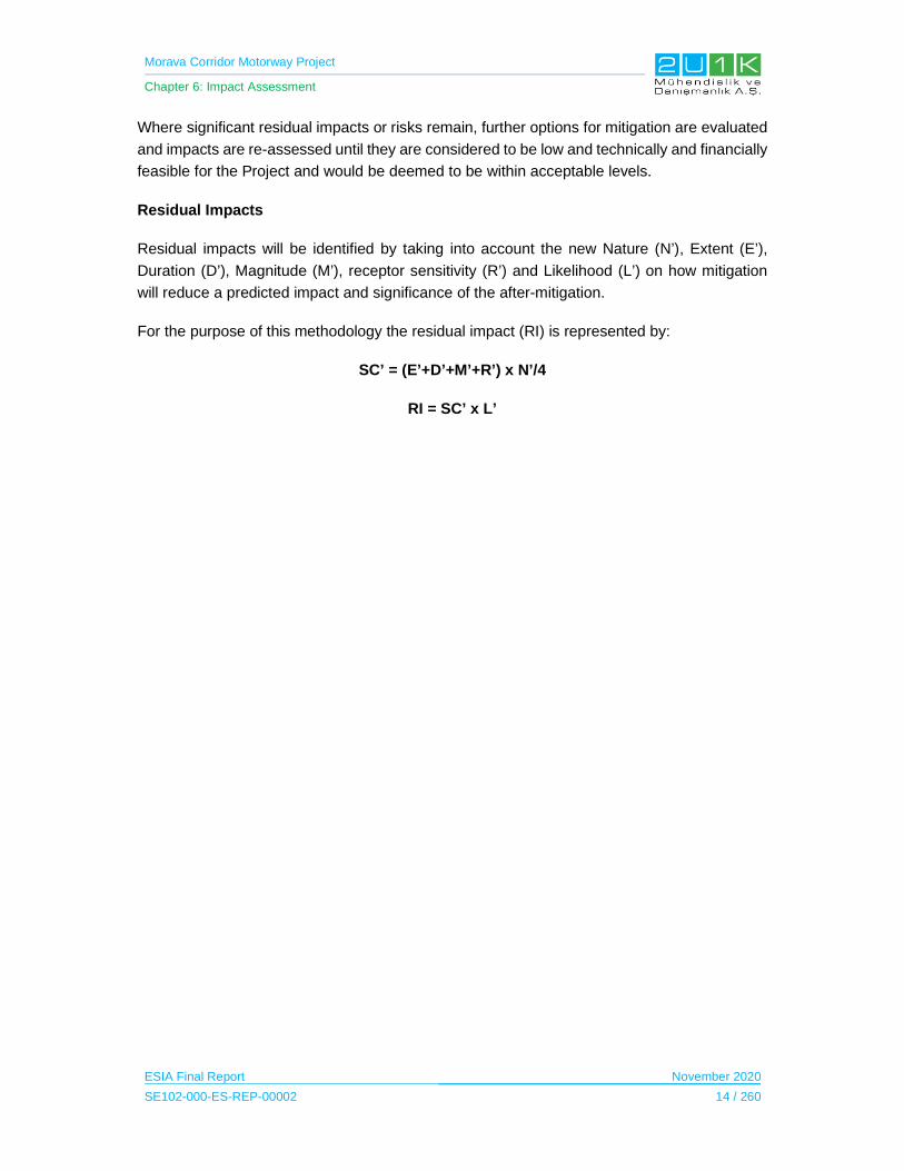
Morava Corridor Motorway Project
Chapter 6: Impact Assessment
ESIA Final Report November 2020
SE102-000-ES-REP-00002 14 / 260
Where significant residual impacts or risks remain, further options for mitigation are evaluated
and impacts are re-assessed until they are considered to be low and technically and financially
feasible for the Project and would be deemed to be within acceptable levels.
Residual Impacts
Residual impacts will be identified by taking into account the new Nature (N’), Extent (E’),
Duration (D’), Magnitude (M’), receptor sensitivity (R’) and Likelihood (L’) on how mitigation
will reduce a predicted impact and significance of the after-mitigation.
For the purpose of this methodology the residual impact (RI) is represented by:
SC’ = (E’+D’+M’+R’) x N’/4
RI = SC’ x L’
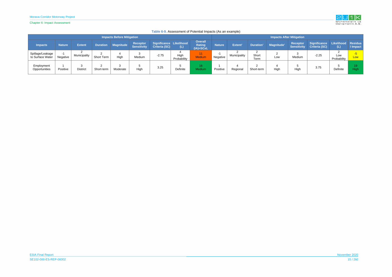
Morava Corridor Motorway Project
Chapter 6: Impact Assessment
ESIA Final Report November 2020
SE102-000-ES-REP-00002 15 / 260
Table 6-9. Assessment of Potential Impacts (As an example)
Impacts Before Mitigation Impacts After Mitigation
Impacts Nature Extent Duration Magnitude Receptor
Sensitivity Significance Criteria (SC)
Likelihood (L)
Overall Rating
(IA)=SCxLNature Extent’ Duration’ Magnitude’
Receptor Sensitivity
Significance Criteria (SC)
Likelihood (L)
Residual Impact
Spillage/Leakage to Surface Water
-1 Negative
2 Municipality
2 Short Term
4 High
3 Medium
-2.75 4
High Probability
11 Medium
-1 Negative
2 Municipality
2 Short Term
2 Low
3 Medium
-2.25 2
Low Probability
-5 Low
Employment Opportunities
1 Positive
3 District
2 Short-term
3 Moderate
5 High
3.25 5
Definite 16
Medium 1
Positive 4
Regional 2
Short-term 4
High 5
High 3.75
5 Definite
19 High

Morava Corridor Motorway Project
Chapter 6: Impact Assessment
ESIA Final Report November 2020
SE102-000-ES-REP-00002 16 / 260
6.3 Water Quality
In this section, construction and operation impacts due to project activities on surface water
and ground water within the Area of Influence (AoI) of the Project and measures will be taken
by the Contractor and the Employer were determined.
6.3.1 Surface Water
Surface water quality and flow characteristics (level and volume) may be susceptible to
contamination by the Project activities during the construction and operation phase of the
Project.
The sensitive receptors were determined according to the Baseline Conditions of the surface
water (See Chapter 5). Impacts that may be caused by the Project together with the mitigation
measures are provided in Table 6-10 and Table 6-11.
6.3.1.1 Construction Phase
The construction activities may cause negative impacts on surface water sources throughout
the construction phase in case no mitigation measures are taken.
Some of the potential sources of the impacts can be raised from;
Construction machinery through risk of spillages or accidental releases of oil and
petroleum products, discharge of motor oil and/or similar waste.
Uncontrolled disposal of excavated materials.
Uncontrolled drainage of sanitary waters in project facilities.
During the construction works, surface water quality is considered to be temporary affected by
the construction activities including but not limited to:
Silty/soiled water from excavations (road and river regulation), quarries, topsoil
placing, machinery washing, washing of finished road surfaces to remove
accumulated soil and disturbance of drains and streambeds.
The surface water may be at risk in case of a construction site or refueling and storage
depot is located near a surface water body.
Discharge of wastewater from construction workers’ accommodation sites and other
construction facilities and activities poses a risk to water environment if not treated
prior to discharge.
All impacts and mitigations for surface water quality in the Construction Phase of the Project
is provided in Table 6-10.
Morava Corridor Motorway Project
Chapter 6: Impact Assessment
ESIA Final Report November 2020
SE102-000-ES-REP-00002 17 / 260
Table 6-11 shows the overall rating of the impacts before and after mitigations. Potential
impacts of the construction works performed in the West Morava River (i.e. river regulation,
foundations for bridges etc.) are considered with high impact significance due to large impact
extent and high impact magnitude. Other potential impact soruces sucha as spillage/leakage
to surface water and the wastewater discharge are considered with medium significance
before mitigation implementations. All mitigation measures provided in Table 6-10 are design
to reduce the magnitude and minimize the likelihood of the impacts. After taking mitigation
measures, the residual impacts estimated to be decreased significantly, and the impact
significance of the residual impacts are classified as low.
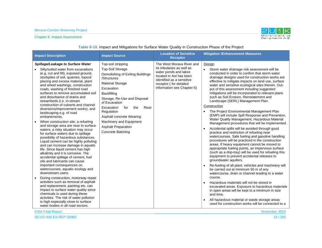
Morava Corridor Motorway Project
Chapter 6: Impact Assessment
ESIA Final Report November 2020
SE102-000-ES-REP-00002 18 / 260
Table 6-10. Impact and Mitigations for Surface Water Quality in Construction Phase of the Project
Impact Description Impact Source Location of Sensitive
Receptor Mitigation /Enhancement Measures
Spillage/Leakage to Surface Water
Silty/soiled water from excavations (e.g. cut and fill), exposed ground, stockpiles of soil, quarries, topsoil placing and excess material, plant and wheel washings, construction roads, washing of finished road surfaces to remove accumulated soil and disturbance of drains and streambeds (i.e. in-stream construction of culverts and channel diversions/improvement works), and landscaping e.g. of road embankments.
When construction site, a refueling and storage area are near to surface waters, a risky situation may occur for surface waters due to spillage possibility of hazardous substances. Liquid cement can be highly polluting and can increase damage in aquatic life. Since liquid cement has high alkalinity and it is corrosive. The accidental spillage of cement, fuel oils and lubricants can cause important consequences on watercourses, aquatic ecology and downstream users.
During construction, motorway repair activities such as removal of asphalt and replacement, painting etc. can impact to surface water quality since chemicals is used during these activities. The risk of water pollution is high especially close to surface water bodies in all road sectors.
Top-soil stripping
Top-Soil Storage
Demolishing of Exiting Buildings /Structures
Material Storage
Excavation
Backfilling
Storage, Re-Use and Disposal of Excavation
Excavation for the River Regulation
Asphalt concrete Wearing
Machinery and Equipment
Asphalt Preparation
Concrete Batching
The West Morava River and its tributaries as well as water ponds and lakes located in AoI has been identified as a sensitive receptor.( for detailed information see Chapter-5)
Design
Storm water drainage risk assessment will be conducted in order to confirm that storm water drainage designs used for construction works are effective to mitigate impacts on land use, surface water and sensitive ecological sites therein. Out-put of this assessment including suggested mitigations will be incorporated to relevant plans such as Soil Erosion, Reinstatement and Landscape (SERL) Management Plan.
Construction
The Project Environmental Management Plan (EMP) will include Spill Response and Prevention, Water Quality Management, Hazardous Material Management procedures that will be implemented.
Accidental spills will be avoided through good practice and restriction of refueling near watercourses. Safe fueling and gasoline handling procedures will be practiced in the construction areas. If heavy equipment cannot be moved to appropriate fueling points, an impervious surface (such as a drip-tray) will be used for refueling this equipment to prevent accidental releases to groundwater aquifers.
Re-fueling of all plant, vehicles and machinery will be carried out at minimum 50 m of any watercourse, drain or channel leading to a water course.
Hazardous materials will not be stored in excavated areas. Exposure to hazardous materials in open areas will be kept to a minimum in size and time.
All hazardous material or waste storage areas used for construction works will be connected to a
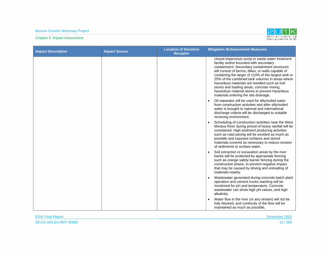
Morava Corridor Motorway Project
Chapter 6: Impact Assessment
ESIA Final Report November 2020
SE102-000-ES-REP-00002 19 / 260
Impact Description Impact Source Location of Sensitive
Receptor Mitigation /Enhancement Measures
closed impervious sump or waste water treatment facility and/or bounded with secondary containment. Secondary containment structures will consist of berms, dikes, or walls capable of containing the larger of 110% of the largest tank or 25% of the combined tank volumes in areas where hazardous materials are handled such as fuel stores and loading areas, concrete mixing, hazardous material stores to prevent hazardous materials entering the site drainage.
Oil separator will be used for silty/soiled water from construction activities and after silty/soiled water is brought to national and international discharge criteria will be discharged to suitable receiving environment.
Scheduling of construction activities near the West Morava River during period of heavy rainfall will be considered. High sediment producing activities such as road paving will be avoided as much as possible and exposed surfaces and stored materials covered as necessary to reduce erosion of sediments to surface water.
Soil extraction or excavation areas by the river banks will be protected by appropriate fencing such as orange safety barrier fencing during the construction phase, to prevent negative impact that may be caused by driving and unloading of materials nearby.
Wastewater generated during concrete batch plant operation and cement trucks washing will be monitored for pH and temperature. Concrete wastewater can show high pH values, and high alkalinity.
Water flow in the river (or any stream) will not be fully blocked, and continuity of the flow will be maintained as much as possible,

Morava Corridor Motorway Project
Chapter 6: Impact Assessment
ESIA Final Report November 2020
SE102-000-ES-REP-00002 20 / 260
Impact Description Impact Source Location of Sensitive
Receptor Mitigation /Enhancement Measures
Sensitive areas of rivers and drains will be protected from impact from vehicles and other construction activities with appropriate fencing such as orange safety barrier fencing or other appropriate ways.
Spill Response Kits will be available on construction site.
Spill Response Kits will be held at secure, clearly signposted locations, instructions will be provided in appropriate languages and personnel will be trained in their use.
Spills will be immediately contained on site and all contaminated materials including soils will be removed from the site for suitable treatment and disposal.
All staff and subcontractors will report any spill incidents, and these will be subject to investigation and close out remedial and preventive actions.
Working in the River-Bed
and River Regulation works
River regulation works during constructon phase can impact to surface water quality.
Excavation for the River Regulation
The West Morava River and its tributaries as well as water ponds and lakes located in AoI has been identified as a sensitive receptor.( for detailed information see Chapter-5)
Construction
The timing of the work will be constrained by the months of high-water level and Environmental requirements if the works directly related with the existing River flow.
Size of the working area in the riverbed will be reduced and limited as much as practicable.
Water flow in the river (or any stream) will not be fully blocked, and continuity of the flow will be maintained as much as possible,
Water turbidity at up-steam and down-stream of the working area will be monitored during construction activity in the riverbed. If the turbidity level exceeds the standards, level of construction works will be decreased (or stopped) at

Morava Corridor Motorway Project
Chapter 6: Impact Assessment
ESIA Final Report November 2020
SE102-000-ES-REP-00002 21 / 260
Impact Description Impact Source Location of Sensitive
Receptor Mitigation /Enhancement Measures
corresponding location until the turbidity is decreased to regulated levels.
Re-fueling of all plant, vehicles and machinery will be carried out at minimum 50 m of any watercourse, drain or channel leading to a water course.
Storage and handling of fuels, oils and other hydrocarbons through a controlled process, involving measures to prevent soil and water contamination. Those should include fuel and oil storage on sealed surfaces and within secondary containment;
All sites near rivers will be protected by fencing and other means to prevent loss of construction materials, particularly hazardous materials.
Movement of equipment inside rivers, streams, or on their banks, will be prevented except when it is unavoidable due to the construction of a structure or in emergency situation.
Training will be provided to machine operators regarding the sensitivities and working procedures, with attention to machine and equipment inspection for leaks prior to use, safe storage and handling of fuels/oils/hydrocarbons near the watercourse and/or precautionary measures to prevent contamination of soil and watercourse
Emergency Preparedness and Response Plan (EPRP) will be followed by all staff working on or near the river.
Wastewater generation
Wastewater generation during construction activities can impact the water quality. Wastewater originated from project facilities and activities used construction works can arise a
Camp Sites
Asphalt Plants
Concrete Batching Plants
Wastewater Treatment and Disposal
The West Morava River and its tributaries as well as water ponds and lakes located in AoI has been identified as a sensitive
Pre-Construction
Design of wastewater treatment facilities should sustain water discharge standards provided in Chapter 4 and Appendix – 4.
During site arrangement, the potential wastewater sources from camp/site facilities, asphalt plant,

Morava Corridor Motorway Project
Chapter 6: Impact Assessment
ESIA Final Report November 2020
SE102-000-ES-REP-00002 22 / 260
Impact Description Impact Source Location of Sensitive
Receptor Mitigation /Enhancement Measures
risk to water environment if it is not treated before discharge.
receptor.( for detailed information see Chapter-5)
concrete batching plant, and quarries will be defined. Depending on availability on waste treatment facilities, these sources can be connected to local sewerage system, which should be ended with proper wastewater treatment facility sustains the discharge quality standards given in Chapter-4 and Appendix -4.
Wastewater treatment facilities will be established before operation of construction project facilities such as camp sites, asphalt plants and concrete batching plant. Permits and licenses for operation of these wastewater treatment facilities will be in line with national requirements.
Construction
All wastewater discharges from all construction components must comply with the relevant legal requirements provided in Chapter 4 and appendix 4.
The treated water will be reused whenever possible.
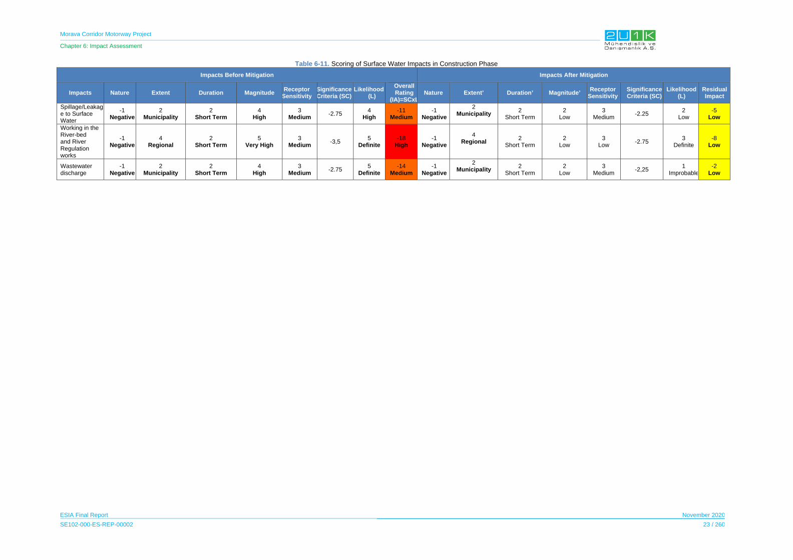
Morava Corridor Motorway Project
Chapter 6: Impact Assessment
ESIA Final Report November 2020
SE102-000-ES-REP-00002 23 / 260
Table 6-11. Scoring of Surface Water Impacts in Construction Phase
Impacts Before Mitigation Impacts After Mitigation
Impacts Nature Extent Duration Magnitude Receptor
SensitivitySignificance Criteria (SC)
Likelihood(L)
Overall Rating
(IA)=SCxLNature Extent’ Duration’ Magnitude’
Receptor Sensitivity
Significance Criteria (SC)
Likelihood(L)
Residual Impact
Spillage/Leakage to Surface Water
-1 Negative
2 Municipality
2 Short Term
4 High
3 Medium
-2.75 4
High -11
Medium -1
Negative
2 Municipality
2 Short Term
2 Low
3 Medium
-2.25 2
Low -5
Low
Working in the River-bed and River Regulation works
-1 Negative
4 Regional
2 Short Term
5 Very High
3 Medium
-3,5 5
Definite -18
High -1
Negative
4 Regional
2 Short Term
2 Low
3 Low
-2.75 3
Definite -8
Low
Wastewater discharge
-1 Negative
2 Municipality
2 Short Term
4 High
3 Medium
-2.75 5
Definite -14
Medium -1
Negative
2 Municipality
2 Short Term
2 Low
3 Medium
-2,25 1
Improbable-2
Low

Morava Corridor Motorway Project
Chapter 6: Impact Assessment
ESIA Final Report November 2020
SE102-000-ES-REP-00002 24 / 260
6.3.1.2 Operation Phase
During the operation phase of the Motorway, surface water quality may be impacted negatively
in case inadequate mitigation measures be taken.
The potential operational impacts may be rised due to:
Pollutants released from vehicles,
Occupation of the flood plain by the Motorway,
Alteration of flow patterns due to hydraulic structures,
Spills due to road accident and from gas stations and service areas,
Motorway repair activities such as removal of asphalt and replacement, painting etc.
can impact to surface water quality,
High storm water flow rates can cause flooding, erosion and habitat degradation due
to increase of impermeable surface.
Potential impact on water regime is related to the regulated sections of West Morava
River.
Potential impact of river regulation work on water quality of West Morava River.
Table 6-12 details the impact and mitigations for surface water quality in operation phase of
the Motorway.
Table 6-13 shows the overall rating of the impact of before and after mitigations.
Spillage/leakage to surface water, the wastewater discharge and river regulation works are
considered medium since the magnitude and the likelihood of the impacts are determined as
high. In addition, flooding is considered high since the magnitude and the likelihood of the
impacts are determined as high. After taking mitigation measures, as shown in Table 6-13, the
residual impacts decrease significantly, and the residual impacts are classified as low.
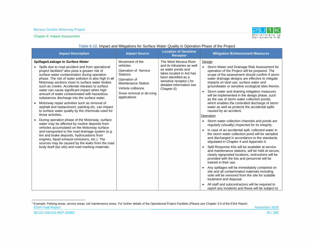
Morava Corridor Motorway Project
Chapter 6: Impact Assessment
ESIA Final Report November 2020
SE102-000-ES-REP-00002 25 / 260
Table 6-12. Impact and Mitigations for Surface Water Quality in Operation Phase of the Project
Impact Description Impact Source Location of Sensitive
Receptor Mitigation /Enhancement Measures
Spillage/Leakage to Surface Water
Spills due to road accident and from operational project facilities3 also pose a greater risk of surface water contamination during operation phase. The risk of water pollution is also high in all Motorway sections close to surface water bodies such as creeks. Accidental releases to surface water can cause significant impact when high amount of water contaminated with hazardous substances discharge into the surface water.
Motorway repair activities such as removal of asphalt and replacement, painting etc. can impact to surface water quality by the chemicals used for those activities.
During operation phase of the Motorway, surface water may be affected by routine deposits from vehicles accumulated on the Motorway surface and transported to the road drainage system (e.g. tire and brake deposits, hydrocarbons from engines, liquid exhaust emissions, etc.). The sources may be caused by the leaks from the road body itself (tar oils) and road marking materials.
Movement of the vehicles
Operation of Service Stations
Operation of Maintenance Station
Vehicle collisions
Snow removal or de-icing applications
The West Morava River and its tributaries as well as water ponds and lakes located in AoI has been identified as a sensitive receptor.( for detailed information see Chapter-5)
Design
Storm Water and Drainage Risk Assessment for operation of the Project will be prepared. The scope of the assessment should confirm if storm water drainage designs are effective to mitigate impacts on land use, surface water and groundwater or sensitive ecological sites therein.
Storm water and draining mitigation measures will be implemented in the design phase, such as the use of storm water collection ponds, which enables the controlled discharge of storm water as well as protects the accidental spills caused by an accident.
Operation
Storm water collection channels and ponds are regularly (visually) inspected for its integrity.
In case of an accidental spill, collected water in the storm water collection pond will be sampled and discharged in accordance to the standards stipulated in Chapter-4 and Appendix-4.
Spill Response Kits will be available at service and maintenance stations, will be held at secure, clearly signposted locations, instructions will be provided with the kits and personnel will be trained in their use.
Any spillages will be immediately contained on site and all contaminated materials including soils will be removed from the site for suitable treatment and disposal.
All staff and subcontractors will be required to report any incidents and these will be subject to
3 Example: Parking areas, service areas, toll maintenance areas. For further details of the Operational Project Facilities (Please see Chapter 3.9 of the ESIA Report.
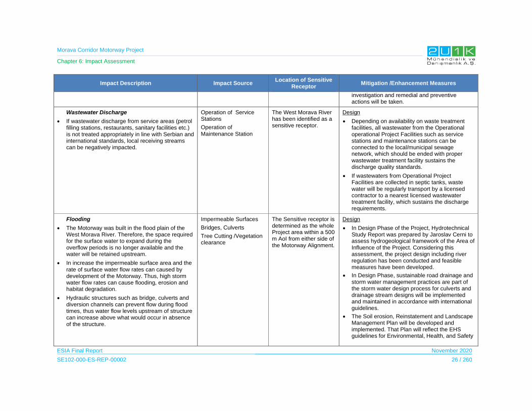
Morava Corridor Motorway Project
Chapter 6: Impact Assessment
ESIA Final Report November 2020
SE102-000-ES-REP-00002 26 / 260
Impact Description Impact Source Location of Sensitive
Receptor Mitigation /Enhancement Measures
investigation and remedial and preventive actions will be taken.
Wastewater Discharge
If wastewater discharge from service areas (petrol filling stations, restaurants, sanitary facilities etc.) is not treated appropriately in line with Serbian and international standards, local receiving streams can be negatively impacted.
Operation of Service Stations
Operation of Maintenance Station
The West Morava River has been identified as a sensitive receptor.
Design
Depending on availability on waste treatment facilities, all wastewater from the Operational operational Project Facilities such as service stations and maintenance stations can be connected to the local/municipal sewage network, which should be ended with proper wastewater treatment facility sustains the discharge quality standards.
If wastewaters from Operational Project Facilities are collected in septic tanks, waste water will be regularly transport by a licensed contractor to a nearest licensed wastewater treatment facility, which sustains the discharge requirements.
Flooding
The Motorway was built in the flood plain of the West Morava River. Therefore, the space required for the surface water to expand during the overflow periods is no longer available and the water will be retained upstream.
In increase the impermeable surface area and the rate of surface water flow rates can caused by development of the Motorway. Thus, high storm water flow rates can cause flooding, erosion and habitat degradation.
Hydraulic structures such as bridge, culverts and diversion channels can prevent flow during flood times, thus water flow levels upstream of structure can increase above what would occur in absence of the structure.
Impermeable Surfaces
Bridges, Culverts
Tree Cutting /Vegetation clearance
The Sensitive receptor is determined as the whole Project area within a 500 m AoI from either side of the Motorway Alignment.
Design
In Design Phase of the Project, Hydrotechnical Study Report was prepared by Jaroslav Cerni to assess hydrogeological framework of the Area of Influence of the Project. Considering this assessment, the project design including river regulation has been conducted and feasible measures have been developed.
In Design Phase, sustainable road drainage and storm water management practices are part of the storm water design process for culverts and drainage stream designs will be implemented and maintained in accordance with international guidelines.
The Soil erosion, Reinstatement and Landscape Management Plan will be developed and implemented. That Plan will reflect the EHS guidelines for Environmental, Health, and Safety
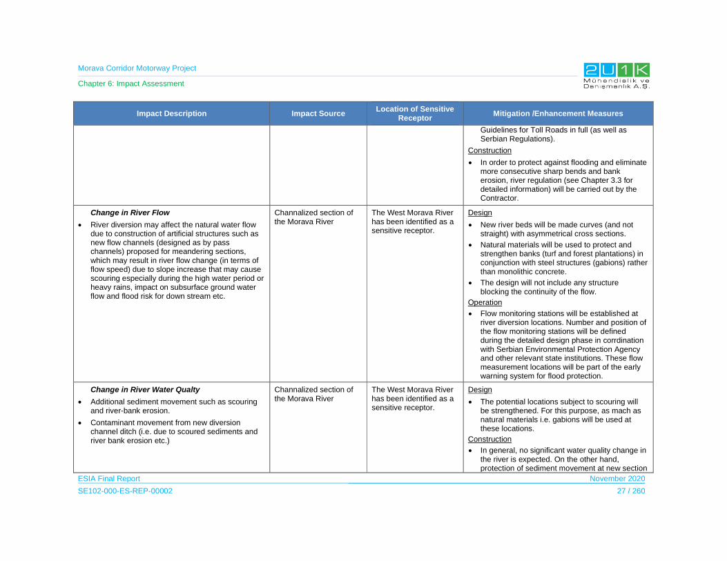
Morava Corridor Motorway Project
Chapter 6: Impact Assessment
ESIA Final Report November 2020
SE102-000-ES-REP-00002 27 / 260
Impact Description Impact Source Location of Sensitive
Receptor Mitigation /Enhancement Measures
Guidelines for Toll Roads in full (as well as Serbian Regulations).
Construction
In order to protect against flooding and eliminate more consecutive sharp bends and bank erosion, river regulation (see Chapter 3.3 for detailed information) will be carried out by the Contractor.
Change in River Flow
River diversion may affect the natural water flow due to construction of artificial structures such as new flow channels (designed as by pass channels) proposed for meandering sections, which may result in river flow change (in terms of flow speed) due to slope increase that may cause scouring especially during the high water period or heavy rains, impact on subsurface ground water flow and flood risk for down stream etc.
Channalized section of the Morava River
The West Morava River has been identified as a sensitive receptor.
Design
New river beds will be made curves (and not straight) with asymmetrical cross sections.
Natural materials will be used to protect and strengthen banks (turf and forest plantations) in conjunction with steel structures (gabions) rather than monolithic concrete.
The design will not include any structure blocking the continuity of the flow.
Operation
Flow monitoring stations will be established at river diversion locations. Number and position of the flow monitoring stations will be defined during the detailed design phase in corrdination with Serbian Environmental Protection Agency and other relevant state institutions. These flow measurement locations will be part of the early warning system for flood protection.
Change in River Water Qualty
Additional sediment movement such as scouring and river-bank erosion.
Contaminant movement from new diversion channel ditch (i.e. due to scoured sediments and river bank erosion etc.)
Channalized section of the Morava River
The West Morava River has been identified as a sensitive receptor.
Design
The potential locations subject to scouring will be strengthened. For this purpose, as mach as natural materials i.e. gabions will be used at these locations.
Construction
In general, no significant water quality change in the river is expected. On the other hand, protection of sediment movement at new section
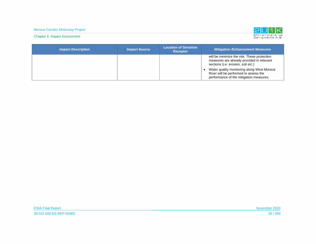
Morava Corridor Motorway Project
Chapter 6: Impact Assessment
ESIA Final Report November 2020
SE102-000-ES-REP-00002 28 / 260
Impact Description Impact Source Location of Sensitive
Receptor Mitigation /Enhancement Measures
will be minimize the risk. These protection measures are already provided in relevant sections (i.e. erosion, soil etc.)
Water quality monitoring along West Morava River will be performed to assess the performance of the mitigation measures.
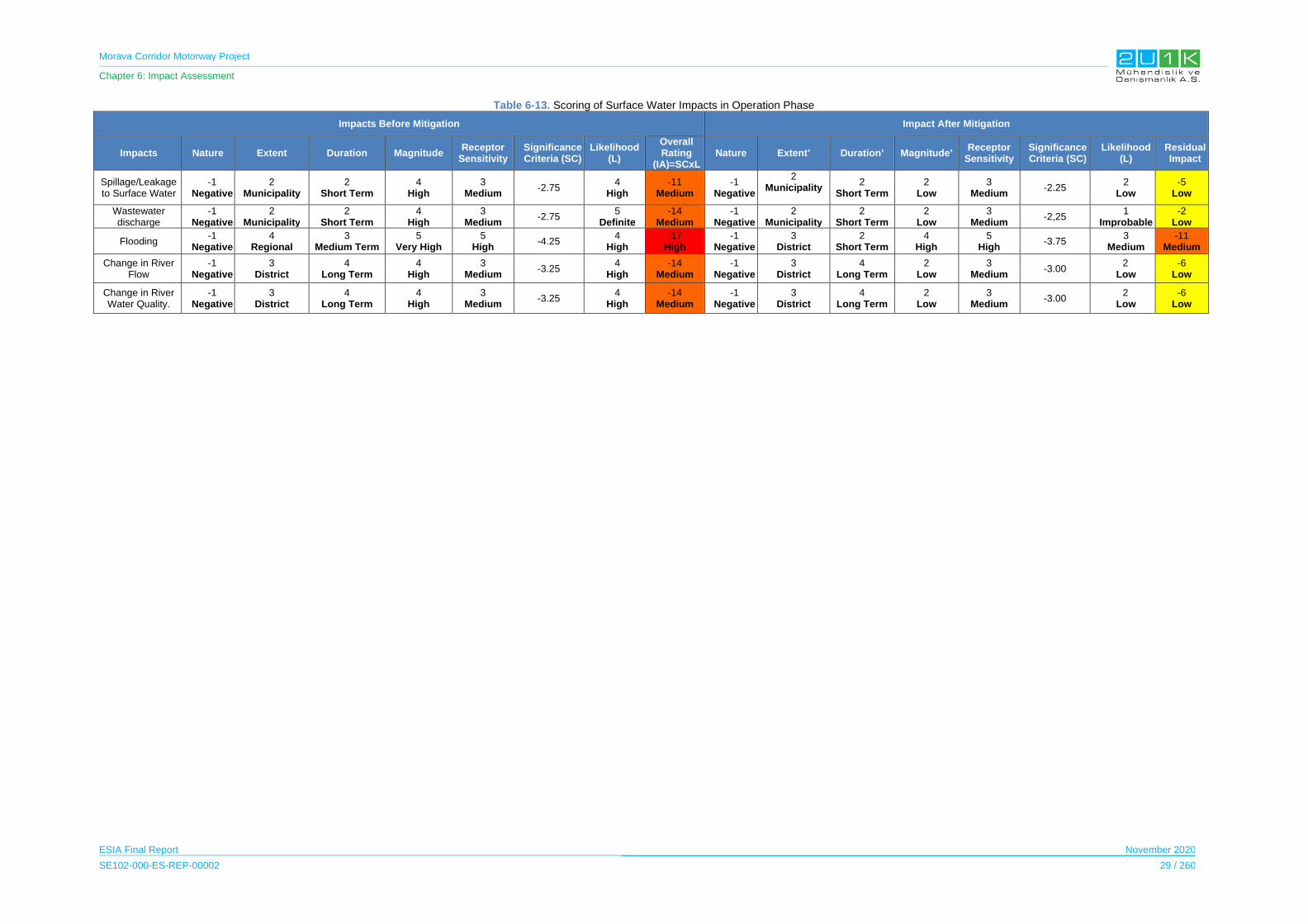
Morava Corridor Motorway Project
Chapter 6: Impact Assessment
ESIA Final Report November 2020
SE102-000-ES-REP-00002 29 / 260
Table 6-13. Scoring of Surface Water Impacts in Operation Phase
Impacts Before Mitigation Impact After Mitigation
Impacts Nature Extent Duration Magnitude Receptor
Sensitivity Significance Criteria (SC)
Likelihood (L)
Overall Rating
(IA)=SCxLNature Extent’ Duration’ Magnitude’
Receptor Sensitivity
Significance Criteria (SC)
Likelihood(L)
Residual Impact
Spillage/Leakage to Surface Water
-1 Negative
2 Municipality
2 Short Term
4 High
3 Medium
-2.75 4
High -11
Medium -1
Negative
2 Municipality
2 Short Term
2 Low
3 Medium
-2.25 2
Low -5
Low
Wastewater discharge
-1 Negative
2 Municipality
2 Short Term
4 High
3 Medium
-2.75 5
Definite-14
Medium-1
Negative2
Municipality2
Short Term2
Low3
Medium-2,25
1 Improbable
-2 Low
Flooding -1
Negative4
Regional 3
Medium Term5
Very High5
High -4.25
4 High
-17 High
-1 Negative
3 District
2 Short Term
4 High
5 High
-3.75 3
Medium -11
Medium
Change in River Flow
-1 Negative
3 District
4 Long Term
4 High
3 Medium
-3.25 4
High -14
Medium-1
Negative3
District4
Long Term2
Low3
Medium-3.00
2 Low
-6 Low
Change in River Water Quality.
-1 Negative
3 District
4 Long Term
4 High
3 Medium
-3.25 4
High -14
Medium-1
Negative3
District4
Long Term2
Low3
Medium-3.00
2 Low
-6 Low
Morava Corridor Motorway Project
Chapter 6: Impact Assessment
ESIA Final Report November 2020
SE102-000-ES-REP-00002 30 / 260
6.3.2 Groundwater
6.3.2.1 Construction Phase
Large construction sites, if not properly managed and operated, may lead to significant
negative impacts on groundwater quality of the AoI.
During the construction phase, the potential sources of impact can be due to:
Aquifers can be contaminated in the event of accidental or intentional discharges of
hazardous materials to the ground,
The bedrock aquifers can be impacted by activities such as site clearance,
earthworks, spillages and leakages from construction activities,
All wastewater from construction accommodation sites and other construction
facilities and activities poses a risk to water environment if not treated prior to
discharge,
Deep cuttings and excavation are necessity during construction phase. Deep cuttings
may have impacts on groundwater regime.
It is important to note that, regulation activities on Morava River as mentioned in Section
6.3.1.1 will be made in order to transfer water flow to prevent flood without distrupting
groundwater levels. Furter details on river regulation works within the scope of the Project is
given in Chapter 3.3. of the ESIA Report.
Table 6-14 details the impact and mitigations for groundwater quality in construction phase of
the Project.
Table 6-15 shows the overall rating of the impact of before and after mitigations. Leakage to
Groundwater and Groundwater Contamination due to Wastewater Discharge to Water
Environment are considered medium since the magnitude, the likelihood of the impacts and
receptor sensitivity are determined as high. Alteration of groundwater level is considered high
since the duration, magnitude, the likelihood of the impacts and receptor sensitivity are
determined as high. After taking mitigation measures, as shown in Table 6-15, the residual
impacts decrease significantly, and the residual impacts are classified as low.

Morava Corridor Motorway Project
Chapter 6: Impact Assessment
ESIA Final Report November 2020
SE102-000-ES-REP-00002 31 / 260
Table 6-14. Impact and Mitigations for Groundwater Quality in Construction Phase of the Project
Impact Description Impact Source Location of Sensitive
Receptor Mitigation /Enhancement Measures
Leakage to Groundwater
During construction phase, particularly in shallow overburden areas, aquifers can be contaminated in the event of accidental or intentional discharges of hazardous materials to the ground.
Material Storage
Waste Storage/Disposal
Excavation
Excavation for the River Regulation
Backfilling
Storage, Re-Use and Disposal of Excavations
West Morava River and its tributaries Groundwater Basin in AoI of the Project.
Pre-construction
Fuelling and storage areas will be planned and designed with containment to prevent releases to ground.
Construction
Accidental spills will be avoided through good practice and restriction of refueling near watercourses. Safe fueling and gasoline handling procedures will be practiced in the construction areas. Where the construction equipment cannot be moved to fueling points, an impervious surface (such as drip-trays) will be used during refueling of construction equipment to prevent accidental leakage to groundwater.
Hazardous materials will not be stored in excavated areas.
Exposure to hazardous materials in open areas will be kept to a minimum in size and time.
Groundwater Contamination due to Wastewater Discharge to Water Environment
Wastewater generation during construction activities can impact the water quality. Wastewater originated from project facilities and activities used construction works can arise a risk to water environment if it is not treated before discharge
Camp Sites
Asphalt Plants
Concrete Batching Plants
Wastewater Treatment and Disposal
West Morava River Groundwater Basin
Pre-construction
Design of wastewater treatment facilities should sustain water discharge standards provided in Chapter 4 and Appendix – 4.
Construction
Wastewater and/or treated wastewater form treatment facilities will not be discharged or collected in any earth based dry stream course or soil pit.
Any underground septic tank either for the collection of wastewater or treated wastewater will be impervious and protected from any leakage.
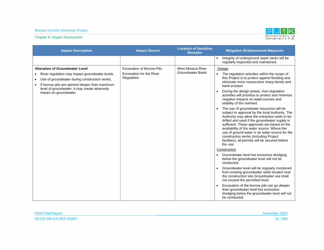
Morava Corridor Motorway Project
Chapter 6: Impact Assessment
ESIA Final Report November 2020
SE102-000-ES-REP-00002 32 / 260
Impact Description Impact Source Location of Sensitive
Receptor Mitigation /Enhancement Measures
Integrity of underground septic tanks will be regularly inspected and maintained.
Alteration of Groundwater Level
River regulation may impact groundwater levels.
Use of groundwater during construction works.
If borrow pits are opened deeper than maximum level of groundwater, it may create adversely impact on groundwater.
Excavation of Borrow Pits
Excavation for the River Regulation
West Morava River Groundwater Basin
Design
The regulation activities within the scope of this Project is to protect against flooding and eliminate more consecutive sharp bends and bank eroision.
During the design phase, river regulation activities will prioritize to protect and minimize negative impacts on watercourses and stability of the riverbed.
The use of groundwater resources will be subject to approval by the local Authority. The Authority may allow the extraction wells to be drilled and used if the groundwater supply is sufficient. These approvals are based on the availability of the water source. Where the use of ground water is as water source for the construction works (including Project facilities), all permits will be secured before the use.
Construction
Groundwater level but excessive dredging below the groundwater level will not be conducted.
Groundwater level will be regularly monitored from existing groundwater wells located near the construction site.Groundwater use shall not exceed the permitted level.
Excavation of the borrow pits can go deeper than groundwater level but excessive dredging below the groundwater level will not be conducted.
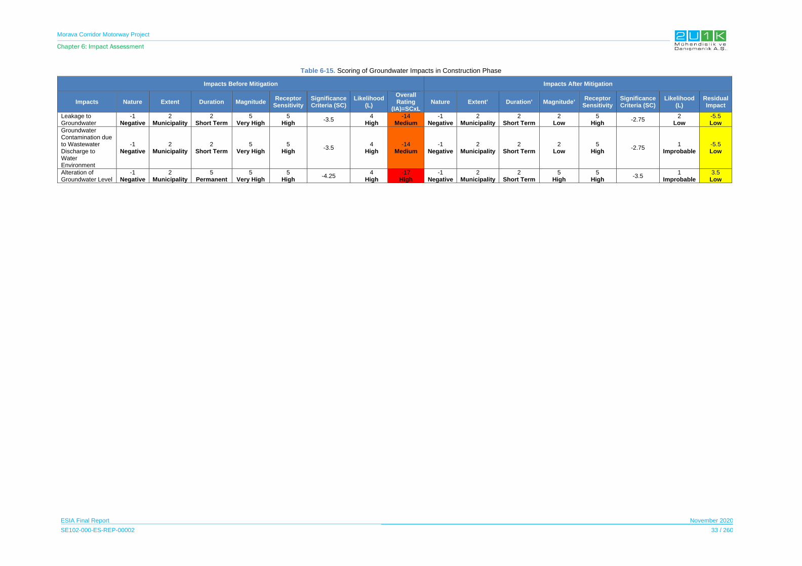
Morava Corridor Motorway Project
Chapter 6: Impact Assessment
ESIA Final Report November 2020
SE102-000-ES-REP-00002 33 / 260
Table 6-15. Scoring of Groundwater Impacts in Construction Phase
Impacts Before Mitigation Impacts After Mitigation
Impacts Nature Extent Duration Magnitude Receptor
Sensitivity Significance Criteria (SC)
Likelihood (L)
Overall Rating
(IA)=SCxLNature Extent’ Duration’ Magnitude’
Receptor Sensitivity
Significance Criteria (SC)
Likelihood (L)
Residual Impact
Leakage to Groundwater
-1 Negative
2 Municipality
2 Short Term
5 Very High
5 High
-3.5 4
High -14
Medium-1
Negative2
Municipality2
Short Term2
Low5
High-2.75
2 Low
-5.5 Low
Groundwater Contamination due to Wastewater Discharge to Water Environment
-1 Negative
2 Municipality
2 Short Term
5 Very High
5 High
-3.5 4
High -14
Medium-1
Negative2
Municipality 2
Short Term2
Low5
High-2.75
1 Improbable
-5.5 Low
Alteration of Groundwater Level
-1 Negative
2 Municipality
5 Permanent
5 Very High
5 High
-4.25 4
High -17
High-1
Negative2
Municipality2
Short Term5
High5
High-3.5
1 Improbable
3.5 Low

Morava Corridor Motorway Project
Chapter 6: Impact Assessment
ESIA Final Report November 2020
SE102-000-ES-REP-00002 34 / 260
6.3.2.2 Operation Phase
Potential impacts on water resources during operation/use of the Motorway are generally more
limited than construction phase. Table 6-16 details the impact and mitigations for groundwater
quality in operation phase of the project.
New diversion channels will be constructed at the flood plain section (alluvium deposits) of the
West Morava River. Geologically, the river-bed of the West Morava River is the surficial part
of the shallow aquifer. Due to this fact, the geological characteristics of the new channel same
as with the existing river ditch.
Soil quality assessment in the project AoI indicates that there are elevated level of
contaminants along the basin. Literarture shows that these elevated contaminant leves are
caused by flood sediments either sourced by natural geogenic sources found in West Morava
River Basin and/or anthropogenic sources such as mining activities located upper section of
the basin. Therefore, existing surface and ground water quality in the basin already defined by
these sources. Therefore, no quality cahnge is expected on groundwater. On the other hand,
ground water quality monitoring shoyld also be included in parallet to the water quality
monitoring along West Morava River in order to assess the performance of the mitigation
measures.
Table 6-17 shows the overall rating of the impact of before and after mitigations. Accidental
Spillage and Surface Runoff Contaminated Water is considered medium since the magnitude
and the likelihood of the impacts are determined as high. After taking mitigation measures, as
shown in Table 6-17, the residual impacts decrease significantly, and the residual impacts are
classified as low.
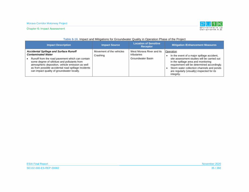
Morava Corridor Motorway Project
Chapter 6: Impact Assessment
ESIA Final Report November 2020
SE102-000-ES-REP-00002 35 / 260
Table 6-16. Impact and Mitigations for Groundwater Quality in Operation Phase of the Project
Impact Description Impact Source Location of Sensitive
Receptor Mitigation /Enhancement Measures
Accidental Spillage and Surface Runoff Contaminated Water
Runoff from the road pavement which can contain some degree of silt/dust and pollutants from atmospheric deposition, vehicle emission as well as from possible accidental road spillage incidents can impact quality of groundwater locally.
Movement of the vehicles
Crashing
West Morava River and its tributaries
Groundwater Basin
Operation
In the event of a major spillage accident, site assessment studies will be carried out in the spillage area and monitoring requirement will be determined accordingly.
Storm water collection channels and ponds are regularly (visually) inspected for its integrity.
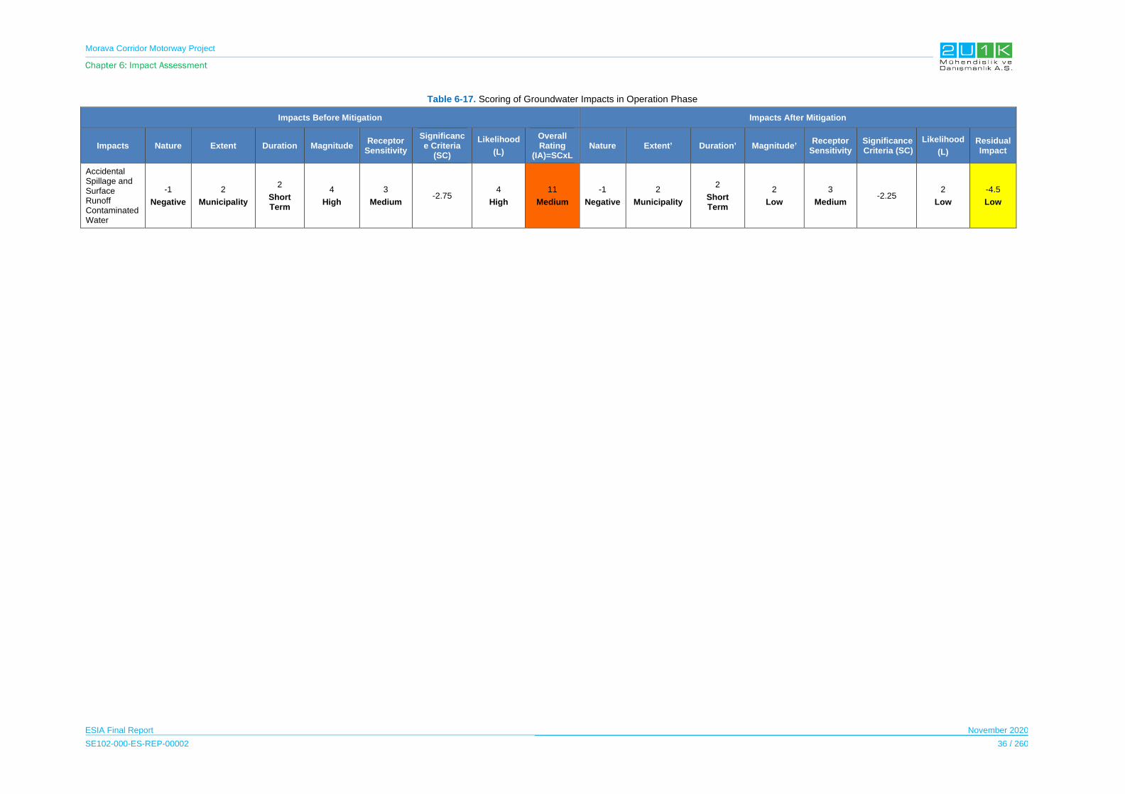
Morava Corridor Motorway Project
Chapter 6: Impact Assessment
ESIA Final Report November 2020
SE102-000-ES-REP-00002 36 / 260
Table 6-17. Scoring of Groundwater Impacts in Operation Phase
Impacts Before Mitigation Impacts After Mitigation
Impacts Nature Extent Duration Magnitude Receptor
Sensitivity
Significance Criteria
(SC)
Likelihood
(L)
Overall Rating
(IA)=SCxL Nature Extent’ Duration’ Magnitude’
Receptor Sensitivity
Significance Criteria (SC)
Likelihood
(L)
Residual Impact
Accidental Spillage and Surface Runoff Contaminated Water
-1
Negative
2
Municipality
2
Short Term
4
High
3
Medium -2.75
4
High
11
Medium
-1
Negative
2
Municipality
2
Short Term
2
Low
3
Medium -2.25
2
Low
-4.5
Low
Morava Corridor Motorway Project
Chapter 6: Impact Assessment
ESIA Final Report November 2020
SE102-000-ES-REP-00002 37 / 260
6.4 Air Quality and Climate
Air quality impacts are expected to occur during the construction and operation phase of the
Project.
During construction phase of the Project, impacts to the air quality may result from but not
limited to:
outdoor machinery,
road construction,
construction vehicle and equipment,
transportation,
emissions caused by construction facilities (i.e. borrow pits, quarries, crushers, screen
plants, asphalt plants and batch plants).
On the other hand, the operation phase of the Motorway, major air quality impacts may result
from traffic generation.
As a result of environmental baseline studies, sensitive receptors were determined in Chapter
5 of the ESIA Report. Based on the baseline air quality information, the impact on the sensitive
receptors was determined and these impacts, together with mitigation methods, are detailed
in the Table 6-19 and Table 6-20.
6.4.1 Construction Phase
The construction activities may cause negative impacts on air quality and climate throughout
the construction in case inadequate mitigation measures taken.
The Project will extend along an approximately 112 km route and there will be several emission
sources on the Proposed Motorway Route. During construction phase, all activities including
pre-construction land arrangement, quarry and borrow pit, crushing plants, batch plants,
asphalt plants, road construction activities and construction equipment and vehicle movement
such as cement mixers, trucks, backhoes, asphalt pavers etc. are sources of air emission.
Significant pollutant will be dust generated from construction activities mentioned above, and
the release of engine emissions (such as NOX, SOX, particles, CO, VOC etc.) from construction
equipment and vehicles.
Detailed emission source list including the location on the Proposed Motorway Route, emission
calculations and air modelling methodology are given in Air Quality Modeling Report (see
Appendix-8).

Morava Corridor Motorway Project
Chapter 6: Impact Assessment
ESIA Final Report November 2020
SE102-000-ES-REP-00002 38 / 260
Air Modeling studies were carried out on dust parameters for construction activities. Air
pollution contribution values (APCV) of PM10 and PM deposition, determined from the modeling
studies. PM10 Air Pollution Contribution Values (APCV) and total pollution values which are
calculated according to background monitoring. The results are shown in
Table 6-21.
Table 6-18. Construction Phase APCV Determined from the Modeling Studies
Parameter PeriodMaximum APCV
(µg/m3)
Limit Values(µg/m3)
National Limit
Values
EU Limit Values
WHO Limit
Values
PM 10
24 Hour 14,2 50 50 50
1 Year 2,36 40 40 20
PM 2,5
24 Hour 1,27 - - 25
1 Year 0,26 - 20 10
In accordance with Table 6-18, daily and yearly APCV of PM10 and PM2,5 to be originated from
construction operations are comply with the national and international standards for all periods.
Table 6-19 details the impact and mitigations for the air quality and climate in the Construction
Phase of the Project.
Table 6-20 shows the overall rating of the impacts before and after mitigations. Dust generation
is considered medium since the magnitude and the likelihood of the impacts and receptor
sensitivity are determined as high. After taking mitigation measures, as shown in Table 6-20,
the residual impacts decrease significantly, and the residual impacts are classified as low.
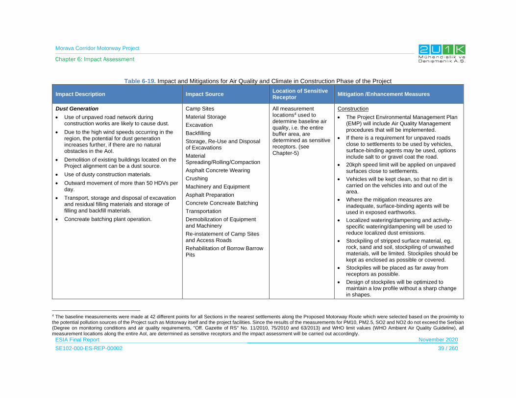
Morava Corridor Motorway Project
Chapter 6: Impact Assessment
ESIA Final Report November 2020
SE102-000-ES-REP-00002 39 / 260
Table 6-19. Impact and Mitigations for Air Quality and Climate in Construction Phase of the Project
Impact Description Impact Source Location of Sensitive Receptor
Mitigation /Enhancement Measures
Dust Generation
Use of unpaved road network during construction works are likely to cause dust.
Due to the high wind speeds occurring in the region, the potential for dust generation increases further, if there are no natural obstacles in the AoI.
Demolition of existing buildings located on the Project alignment can be a dust source.
Use of dusty construction materials.
Outward movement of more than 50 HDVs per day.
Transport, storage and disposal of excavation and residual filling materials and storage of filling and backfill materials.
Concreate batching plant operation.
Camp Sites
Material Storage
Excavation
Backfilling
Storage, Re-Use and Disposal of Excavations
Material Spreading/Rolling/Compaction
Asphalt Concrete Wearing
Crushing
Machinery and Equipment
Asphalt Preparation
Concrete Concreate Batching
Transportation
Demobilization of Equipment and Machinery
Re-instatement of Camp Sites and Access Roads
Rehabilitation of Borrow Barrow Pits
All measurement locations4 used to determine baseline air quality, i.e. the entire buffer area, are determined as sensitive receptors. (see Chapter-5)
Construction
The Project Environmental Management Plan (EMP) will include Air Quality Management procedures that will be implemented.
If there is a requirement for unpaved roads close to settlements to be used by vehicles, surface-binding agents may be used, options include salt to or gravel coat the road.
20kph speed limit will be applied on unpaved surfaces close to settlements.
Vehicles will be kept clean, so that no dirt is carried on the vehicles into and out of the area.
Where the mitigation measures are inadequate, surface-binding agents will be used in exposed earthworks.
Localized watering/dampening and activity-specific watering/dampening will be used to reduce localized dust emissions.
Stockpiling of stripped surface material, eg. rock, sand and soil, stockpiling of unwashed materials, will be limited. Stockpiles should be kept as enclosed as possible or covered.
Stockpiles will be placed as far away from receptors as possible.
Design of stockpiles will be optimized to maintain a low profile without a sharp change in shapes.
4 The baseline measurements were made at 42 different points for all Sections in the nearest settlements along the Proposed Motorway Route which were selected based on the proximity to the potential pollution sources of the Project such as Motorway itself and the project facilities. Since the results of the measurements for PM10, PM2.5, SO2 and NO2 do not exceed the Serbian (Degree on monitoring conditions and air quality requirements, "Off. Gazette of RS" No. 11/2010, 75/2010 and 63/2013) and WHO limit values (WHO Ambient Air Quality Guideline), all measurement locations along the entire AoI, are determined as sensitive receptors and the impact assessment will be carried out accordingly.

Morava Corridor Motorway Project
Chapter 6: Impact Assessment
ESIA Final Report November 2020
SE102-000-ES-REP-00002 40 / 260
Impact Description Impact Source Location of Sensitive Receptor
Mitigation /Enhancement Measures
Wind breaks or dust protection systems (including sprinklers) should be built around the main construction activities where necessary and, if possible, near potentially dusty works to minimize the impact of nearby residential receptors.
Good practice should be applied for selection of Project vehicles that meet the latest emission standards (e.g. EURO 3 or US EPA Tier 2 emission standards) and maintained in a reasonable working order.
When not in use, vehicles should be shut down unless it is due to health and safety reasons (e.g. maintenance of the air conditioner).
Air pollution control equipment (e.g. baghouse) should be installed and operated for the asphalt plants.
During transportation on public roads, the excavated materials will be covered with nylon canvas or suitable materials with a grain size greater than 10 mm in public roads as good practice.
To reduce fugitive dust emission during vehicle operation on public roads and at construction sites, service roads and quarry/material borrow/storage sites, dust suppression methods (i.e. watering with water trucks, applying nontoxic chemicals, speed limits for mobile vehicles, using well-maintained vehicles/equipment) should be used.

Morava Corridor Motorway Project
Chapter 6: Impact Assessment
ESIA Final Report November 2020
SE102-000-ES-REP-00002 41 / 260
Table 6-20. Scoring of Air Quality and Climate Impacts in Construction Phase
Impacts Before Mitigation Impacts After Mitigation
Impacts Nature Extent Duration Magnitude Receptor
Sensitivity Significance Criteria (SC)
Likelihood(L)
Overall Rating
(IA)=SCxLNature Extent’ Duration’ Magnitude’
Receptor Sensitivity
Significance Criteria (SC)
Likelihood(L)
Residual Impact
Dust Generation
-1 Negative
1 Project Site
4 Long Term
4 High
5 High
-3.50 5
Definite -18
Medium -1
Negative1
Project Site 4
Long Term 3
Moderate 5
High -3.25
2 Low
Probability
-7 Low

Morava Corridor Motorway Project
Chapter 6: Impact Assessment
ESIA Final Report November 2020
SE102-000-ES-REP-00002 42 / 260
6.4.2 Operation Phase
During the operation phase of the Project, air quality and climate may be impacted negatively
in case inadequate mitigation measures be taken.
Section-1 of the Morava Corridor Motorway expected to start operation in year 2021.
The main pollution source during the operation phase is exhaust emissions of the vehicles
along the Proposed Motorway Route. The calculations of the emissions caused by traffic along
the Motorway are divided into three sections as:
1. Pojate – Kruševac
2. Kruševac (Koševi) – Adrani
3. Adrani - Mrčajevci - Preljina
According to data derived from the Roads of Serbia for the year of 2018, the value of average
annual daily traffic between Pojate and Preljina ranges from 3,609 vehicles/day (section Ratina
- Kraljevo (Kamidžora)) to 12,743 vehicles/day (section Mrčajevci - Preljina). The average
value, which accounts for the lengths of individual sections, is 8,205 vehicles/day.
Modeling studies are carried out for NO2, SO2, PM10, PM2,5 and CO parameters for operation
activities. APCV estimated in the measurement points and the associated limit values are
presented in Table 6-21.
Table 6-21. Operation Phase APCV Determined from the Modeling Studies
Parameter PeriodMaximum
APCV (µg/m3)
Limit Values(µg/m3)
National Limit Values
EU Limit Values
WHO Limit Values
SO2
1 Hour 130.50 350 350 -
24 Hour 26.33 125 125 20
1 Year 7.40 50 50 50
NO2
1 Hour 203.98 150 200 200
Exceedance 1 can be
exceeded 18 times
can be exceeded 18
times-
24 Hour 41.16 85 - -
1 Year 11.57 40 40 40
PM 10
24 Hour 1.45 50 50 50
1 Year 0.41 40 40 20
PM 2,5
24 Hour 1.45 - - 25
1 Year 0.41 - 20 10
CO
Maximum Daily 8-Hour Mean
100.19 10,000 10,000 10,000
24 Hour 20.21 5,000 - -
1 Year 5.68 3,000 - -
Morava Corridor Motorway Project
Chapter 6: Impact Assessment
ESIA Final Report November 2020
SE102-000-ES-REP-00002 43 / 260
All parameters complied by the national and international limit values5. Only NO2 parameter
slightly exceeds hourly EU and WHO limit value. National standards and EU standards allows
to exceed hourly limit values 18 times in a year. Project exceeds hourly NO2 limits one time.
Therefore, modeling studies complies with standards. Only WHO NO2 limit values slightly
exceeded in operation phase.
Table 6-22 details the impact and mitigations for air quality and climate in operation phase of
the Motorway.
Table 6-23 shows the overall rating of the impact of before and after mitigations. Impact of the
gaseus emissions is considered medium since the receptor sensitivity is determined as high.
The modelling study indicates that the impact of gaseus amissions during operation phase of
the project is limited and not significant. No project specific mitigation measures are suggested
for this impact. In general, it is envistaged that with the implementation of new technologies on
mobile sources (i.e. increased engine efficiency, use of electrical cars, and implementation of
low emissions standards etc.) emissions will be reduced in time. On the other hand, ambient
air quality montitoring is required to assess the contribution of the project.
5 Degree on monitoring conditions and air quality requirements, "Off. Gazette of RS" No. 11/2010, 75/2010 and 63/2013) and WHO limit values (WHO Ambient Air Quality Guideline)

Morava Corridor Motorway Project
Chapter 6: Impact Assessment
ESIA Final Report November 2020
SE102-000-ES-REP-00002 44 / 260
Table 6-22. Impact and Mitigations for Air Quality and Climate in Operation Phase of the Project
Impact Description Impact Source Location of Sensitive Receptor Mitigation /Enhancement Measures
Gaseous Pollutant Generation
It is predicted that there will be an increase in the number of vehicles along the Proposed Motorway Route and since the traffic uses the main arterial roads, it will affect the air quality within the wide traffic network because of increase in concentrations of gaseous pollutants.
Movement of the vehicles All measurement locations used to determine baseline air quality, i.e. the entire AoI are determined as sensitive receptors. (see Chapter-5)
Operation
No mitigation is required.
Continuous air quality monitoring is suggested.

Morava Corridor Motorway Project
Chapter 6: Impact Assessment
ESIA Final Report November 2020
SE102-000-ES-REP-00002 45 / 260
Table 6-23. Scoring of Air Quality and Climate Impacts in Operation Phase
Impacts Before Mitigation Impacts After Mitigation
Impacts Nature Extent Duration Magnitude Receptor
Sensitivity Significance Criteria (SC)
Likelihood(L)
Overall Rating
(IA)=SCxLNature Extent’ Duration’ Magnitude’
Receptor Sensitivity
Significance Criteria
(SC)
Likelihood (L)
Residual
Impact
Gaseous Pollutant Generation
-1 Negative
2 Municipality
2 Short Term
3 Medium
5 High
-3.00 3
Medium -9
Medium -1
Negative2
Municipality2
Short Term3
Medium 5
High -3.00
3 Medium
-9 Medium

Morava Corridor Motorway Project
Chapter 6: Impact Assessment
ESIA Final Report November 2020
SE102-000-ES-REP-00002 46 / 260
6.4.3 Overview of Greenhouse Gas Emissions Approach
Project activities indicate that the most relevant greenhouse gas (GHG) emitted from the
project is Carbon dioxide (CO2). As the common best practice, GHG emissions are calculated
for construction and operation of the phases in accordance to the Greenhouse Gas Protocol6.
In this respect, GHG calculations are based on three-scope process. These are;
Scope 1 covers the direct emissions from sources used or controlled by the Contractor.
Scope 2 emissions include indirect emissions from electric power taken from the grid;
and
Scope 3 emissions include emissions from sources that are neither owned nor directly
controlled by the construction company but related to the project activities.
Available data from project plans, public sources, and previous studies have been used. Data
gaps are filled with reasonable assumptions to estimate approximate level of the emissions for
a given activity.
6.4.3.1 Construction Phase
Relevant activities and calculated CO2 levels of each scope during construction are given in
Table 6-24 below. The Table also includes key assumptions. The construction period is 4
years. In general, a conservative calculation method is considered on the individual
assumptions regarding Greenhouse Gas Protocol. In total, the emissions over the entire
construction period are about 390,259 tCO2. With by far the greatest portion occurring under
Scope 1 (381,270 t). Scope 2 and Scope 3 are being very minor in comparison. The average
combined annual CO2 emission for the construction period is 97,564 tCO2/year
6 The GHG Protocol is developed by World Resources Institute (WRI) and the World Business Council for Sustainable Development (WBCSD) to establishe comprehensive global standardized frameworks to measure and manage greenhouse gas (GHG) emissions from private and public sector operations, value chains and mitigation actions.

Morava Corridor Motorway Project
Chapter 6: Impact Assessment
ESIA Final Report November 2020
SE102-000-ES-REP-00002 47 / 260
Table 6-24. Major GHG Emissions during Construction Period
Scope Project Activity Description Emission
(tCO2)
Scope1
Road and River Regulation construction*
Construction machinery- (including generators, project-related vehicles, etc.)
Asphalt and concrete production
transport-hauling of bulk construction materials*
- ROADEO7 “Road Emissions Optimization: A toolkit for greenhouse gas emissions mitigation in road construction and rehabilitation” is used 381,270
Scope 2
Grid electricity use
Worker Accommodation Camps (approximate 3000 workers in 3 camps)
- Consumption avg 500 kWh/person
- 4 years construction period - Grid emission factor for Serbia
is 1.099 tCO2/MWh8
6,594
Scope 3
Indirect emissions from the off-site production of material
Transport of bitumen
- 300 t/day; - Travel distance 500 km
(Pancheva Refinery) - Emission factor 0.280 kg/km
1,725
Transport of cement
- 250 t/day; - Travel distance 250 km
(nearest cement producers) - Emission factor 0.280 kg/km -
diesel9
670
Total 390,259 * Excavated materials from the river regulation work are planned to be used for road construction. Wit this intention, GHG emissions from the River Regulation Work is included in the total GHG emissions.
6.4.3.2 Operation Phase
Relevant activities and calculated annual CO2 levels of each scope during operation of the
motorway are given in Table 6-25. The table also includes key assumptions. The assumed
operation period is taken between the years 2023 and 2045. The average combined annual
CO2 emission for all scopes is about 35,000 tCO2/year.
It is considered that the Scope 3 emissions will occur only the additional traffic induced by the
Motorway, as based the traffic information given in Chapter 3. The Motorway will also result in
a certain savings of emissions such as engine improvements for new model cars as well as
7 Microsoft Excel-based Road Emission Optimization Toolkit has been developed as part of an effort to assess the reduction of GHG emissions in the road construction industry, ESMAP, World Bank Group 8 The Institute for Global Environmental Strategies (IGES), 2019 9 WRI, 2019

Morava Corridor Motorway Project
Chapter 6: Impact Assessment
ESIA Final Report November 2020
SE102-000-ES-REP-00002 48 / 260
fuel change. These savings cannot be accurately estimated at this time, and are thus not
considered quantitatively in these calculations.
Table 6-25. Major Annual GHG Emissions during Operation Period
Scope Project Activity Description Emission
(tCO2)
Scope1
Road maintenance
Road maintenance (approximately 5 km/year)
- 5% of construction GHG 26,534
Scope 2
Grid electricity use
Lightning of cross roads
- Approximately 1,000 lamps for 12 cross roads
- 200 W / Lamp
- 60% efficiency
- Grid emission factor for Serbia is 1.099 tCO2/MWh
4,396
Scope 3
Indirect emissions from the off-site production of material
Increase in traffic
- Estimated maximum daily bases traffic increase between the years 2018 to 2045 is approximately 11,000, which corresponds to 400 vehicle/day/year.
- App. 90% personal cars
- App. 10% light and heavy vehicles
- 0.240 kg CO2/km - gasoline
- 0.280 kg CO2/km – diesel
3,989
Total 34,919
6.4.3.3 Alternative Analysis
According to Principle 2 of the Equator Principles 1, an alternative analysis (to determine less
GHG-intensive options) is required for projects emitting more than 100,000 t of CO2 equivalent
annually within combined Scopes 1 and 2. Per the preceding calculations, the combined Scope
1 and 2 emissions for the construction phase of this Project is about 97,000 tCO2 per year and
for the operation phase it is about 30,000 tCO2 per year. Both annual values are below the
threshold limit of 100,000 tCO2. In this respect an alternative analysis is not considered for the
Project. On the other hand, the calculated annual emissions during construction are based on
draft-stage design information and the overall averages are based on 4 years construction
phase. During construction of the Project, a year-by-year evaluation of emissions may exceed
the 100,000 tCO2 threshold value in the peak construction periods in particular. Therefore, a
further update and breakdown of the GHG emission calculations will be warranted once further

Morava Corridor Motorway Project
Chapter 6: Impact Assessment
ESIA Final Report November 2020
SE102-000-ES-REP-00002 49 / 260
design details and project schedule are confirmed10. Furthermore, following are suggested to
be considered during detailed design and construction works.
Minimization of unnecessary earthworks and minimization of travel distances. The
main project target is to use excess materials at the same location for different
requirement of the project. For example, stripped top-soil will be used for arrangement
of the road bunkers and the use of excess materials at borrow areas for site
arrangements and backfilling.
The use of adequate construction equipment. This involves not only thick pavement
layers (paving machine, compactor) but also earthworks (grader, compactor)
The mobilization of qualified workmanship
The proper management of material production and laying (avoiding
unnecessary stops during laying operations)
The selection of adequate materials (to avoid deformation and rutting under traffic load)
Minimization fuel use and use of more efficient engines end equipment’s.
Equipment’s and structures used for the road safety may have significant indirect GHG
emission share. For example; construction of safety barriers is can be a major GHG
emission source (upto 25%) in a road project. These emissions vary depending on the
barriers‘type and materials. The principle of the alternative practice is to:
- Limit the construction of safety barriers to the strict minimum required for safety
purpose by optimizing the project
- Select, where possible, lower emitting materials (from 4 to 23% of GHG
emissions due to pavement in the case of steel or concrete barriers and from 2
to 12% in the case of wood barriers)
- There may be a significant interest in limiting the use of steel and concrete
barriers where possible through adequate and safe design (safety zone cleared
of obstacles, removal of aggressive spots, etc.), or to replace it by wood barriers
when traffic volumes and loads are low enough. The potential impact could be
upto 50% of the length of barriers, or from 2 to 12% of the emissions of
pavement (depending on the selected structure). This requires anticipation in
the geometric design, and efforts during the design phase
Properly assess the traffic load which the pavement will have to bear during its life.
This includes an adequate assessment of overloading, which in turn may result in
stronger (thicker) pavement structures than in the absence of overloading. The
10 Equator Principles, June 2013
Morava Corridor Motorway Project
Chapter 6: Impact Assessment
ESIA Final Report November 2020
SE102-000-ES-REP-00002 50 / 260
expected benefit is to avoid premature failure and reconstruction, which will be
ineffective in terms of GHG emissions.
Assess the potential use of warm and cold asphalt aggregate processes. The literature
shows that the total life-cycle of a pavement construction (binder, aggregate, mixing
process, transport, processing) with a cold process could reduce GHG emissions from
about 30-35 %.
Assess the potential use of recycled materials. This technic can also be considered for
the operation of the motorway, in particular, during maintenance of the road.
- Cement concrete pavements can be recycled in place by breaking the existing
concrete and overlaying it with a new asphalt or cement concrete surface.
Alternatively, the existing concrete may be broken up, removed and crushed
into aggregate sizes at the mixing plant and used as recycled concrete with
additional cement.
- Reclaimed Asphalt Pavements (RAP) can be recycled:
In hot mixing plants at a recycling rate generally close to 10% in elevator foot,
corresponding to the maximum acceptable threshold in most international
specifications and standards. Nevertheless, this level in specifications is being
updated by taking into account possible higher recycling rates that can possibly
be reached now, depending on recent improvements in mixing plant
technology:
Up to 25% into the mixer,
Up to 35% into dryer recycling ring,
Up to 50% in case of two drums in parallel, this is the most advanced
technology for hot asphalt recycling, nevertheless available only for very few
plants at the present time.
In hot surface recycling/thermo-regeneration, this technology is usable only for
wearing courses on a maximum thickness of 40 mm;
Cold in mixing plant or on-site by adding as binder either bitumen emulsion (or
foam bitumen), or cement or a mix of bituminous emulsion and cement. This
technology is very attractive in terms of mitigation of GHG emissions as it
permits a recycling rate up to 100% of in-site existing materials, which is
significantly higher than recycling technology in hot mixing plants.
Nevertheless, the elastic modulus and structural efficiency of these materials
remain relatively weak and cause an increase in the thickness of the
corresponding layer by about 30% when compared to traditional hot asphalt
materials. Also in-site cold recycling requires a sufficient homogeneity of
Morava Corridor Motorway Project
Chapter 6: Impact Assessment
ESIA Final Report November 2020
SE102-000-ES-REP-00002 51 / 260
existing pavement structures, which is not the case for most job sites, causing
quality defects.
Design of the Motorway embankments and drainage system needs to be suitable for
the potentially more intense (though less frequent) rainfalls;
Measures should be reviewed periodically by the Project Operator as part of the
environmental management system to promote water conservation at the Service
Areas (eg recycling/re-use of any car-wash waters, rainfall recovery/re- use for onsite
irrigation).
6.4.3.4 Monitoring & Reporting Requirements
According to Annex A of the Equator Principles, project developers/ borrowers must quantify
Scope 1 and 2 GHG emissions in accordance with internationally recognized methods and
goods practices. These Scope 1 and 2 emission levels must then be publicly reported annually
if they exceed 100,000 tCO2 equivalent annually during the operational phase of the project.
Whilst not obligatory, borrowers are encouraged to voluntarily report their emissions if
exceeding 25,000 tCO2 equivalent annually. In the case of this Project, per the above
calculations and assumptions, the Scope 1 and 2 emissions during operations are estimated
to be about 30,000 tCO2 that is above the threshold. In this respect, a public reporting is
suggested for the operation of the Motorway.
In order to contribute to enforcement of EU Acquis in a climate change field and fulfilment of
obligations under the UNFCCC, the Government of Serbia has launched an EU twinning
project “Establishment of a mechanism for implementation of the Monitoring and Reporting of
GHG Emissions (MMR)”. The main goal of the project is the establishment and maintaining of
a system and processes for collection and storage of and report on climate change related
data and information.
6.4.3.5 Climate Change Adaptation
The Republic of Serbia has been part of the United Nations Framework Convention on Climate
Change (UNFCCC) since 2001 and the Kyoto Protocol since 2008 as a developing country
(non-Annex I country). The Republic of Serbia defines the Climate Change (CC) as a global
challenge that requires a rapid and decisive response from every country. It is anticipated that
the consequences of climate change could have material, financial impacts as well as human
loss in The Republic of Serbia. In this respect, The Republic of Serbia has developed “The
National Climate Change Strategy” (NCCS) in 2019 in order to establish a strategic framework
for climate action and including adaptation options addressing the climate risks. NCCS is also
an indicator that RS is moving forward in the fulfilment of both its international commitments

Morava Corridor Motorway Project
Chapter 6: Impact Assessment
ESIA Final Report November 2020
SE102-000-ES-REP-00002 52 / 260
and national objectives. The Paris Agreement11 is the major basis of the NCCS. Prior to the
Paris Conference, Serbia submitted its Intended National Determined Contribution (INDC) with
the pledge to reduce greenhouse gas emissions of 9.8% by 2030 compared to 1990 levels
(Ref 1).
The Second National Communication (SNC) and the draft National Adaptation Plan (NAP) of
Serbia indicate that the average temperature increase between the period 1960-2012 is about
0.3°C per decade. Furthermore, developed climate scenario models anticipate future
temperature increase estimates varies in the range from 3.8 to 4.6°C (depending on climate
scenarios) (Ref 2). In parallel to temperature increase, a significant decrease in precipitation
amount compared to the reference period (1961-1990) during the most of seasons (except in
spring) is projected for the period of 2071-2100 over the majority of the country. This decrease
is projected up to 30% in the summer season across almost the whole territory of the Republic
of Serbia. Moreover, the impacts of climate change may, among other, jeopardize
infrastructure, agriculture productivity, water availability and public health. Vulnerability and
Adaptation options for the purpose of the Strategy were identified also based on the Second
National Communication (SNC) and the draft National Adaptation Plan (NAP). These
documents underline three most vulnerable sectors:
1. Agriculture – food production:
2. Forestry – bioenergy:
3. Hydrology and Water Resources – hydro-electric production:
As given in the Draft Low Carbon Development Strategy Action Plan (LCDSAP) dated
December 2019, total GHG emissions in 2015 estimated as to 61.233 kt CO2eq, which
represents 2,3% decrease of emissions compared to the year 2010 and 24,9% compared to
1990.
Energy is the major GHG emitting sector in the country with a share of 80,6% in overall
emissions, of which, the sub-sector Energy Industries that contains public electricity and heat
production, transport, refineries and manufacturing of fuels. In the country there is a decreasing
trend for GHG emissions since 1990 (21,4%) due to lower production in general. Structural
changes in the sector are other cause of the decrease. Compared to 2010, emissions have
been decreased by 5% in 2015.
11 The Paris Agreement, adopted under the United Nations Framework Convention on Climate Change (UNFCCC) in 2015 and entered into force on 4 November 2016. It sets out a global action plan to put the world on track to avoid dangerous climate change by limiting global warming to well below 2°C. Previously, the European Union (EU) adopted the 2030 Climate and Energy Framework; its targets entail a GHG reduction of 40% by 2030 compared to 1990 levels.
Morava Corridor Motorway Project
Chapter 6: Impact Assessment
ESIA Final Report November 2020
SE102-000-ES-REP-00002 53 / 260
GHG emissions in sub sectors/categories of the energy sector in 2015 were:
In Transport sector the GHG emissions are 31,4% higher than in 1990 and 11,1%
below the 2010.
GHG emissions from Manufacturing Industries and Construction are 46,2% lower
than 1990 values and 19,3% lower than 2010. This decrease is the consequence of
the decrease in manufacturing industry and, to some extent, to the increase in the
biomass consumption (137% higher than 2010).
GHG emissions in the “Other sectors”, (commercial, residential and other institutional
buildings and fuel combustion in agricultural stationary equipment) are 61,5% lower
than 1990 values and 22% lower than 2010.
Fugitive GHG emissions i) from mining and post-mining activities, ii) oil and gas
production, and processing (the main source of CH4 emissions in the Energy sector)
are 34,3% lower than in 1990 values and 4,7% higher than in 2010.
Four mitigation scenarios are developed under the LCDSAP in order to develop the strategy
as well as to identify the indicators for the achievement of the climate vision. The models used
for all scenarios are also covers the EU targets regarding 2020, 2030 and 2050 in addition to
the respective policies and measures, besides national requirements. The base year used for
expression of the GHG emission reduction is 2010.
Those scenarios are:
Scenario 1: Baseline scenario regarding current trend plus implementation of the EU-
Emission Trading Scheme.
Scenario 2: Implementation of all EU acquis in whole is transposed and implemented,
Achieving 33% GHG emissions compared to 1990; With the use of Renewable Energy
Sources (RES) by 2030 and implementation of Enhanced Energy Efficiency (EEE), as
the Republic of Serbian contribution to the EU target (Contribute to 1,50C goal).
Scenario 3: The Republic of Serbia individually achieves the EU 2030 targets (meaning
-40% GHG emissions compared to 1990; with the use of RES by 2030 and increased
level of EEE.)
M4 scenario: Serbia achieves 80% GHG cuts in 2050 compared to 1990 levels (aligned
with the European Commission communication on climate neutrality).
Action Plan annexed to the LCDSAP covers two mitigation items (Item 11 and Item 14), which
are directly related to the Project. According to these items
(Item 11) New vehicles are becoming more efficient based on CO2 standards that are
in effect in EU, of which Serbia benefits indirectly. The EU has adopted Regulation
Morava Corridor Motorway Project
Chapter 6: Impact Assessment
ESIA Final Report November 2020
SE102-000-ES-REP-00002 54 / 260
443/2009 defining targets for CO2 emissions of 130 gCO2/km in 2015 and 95 gCO2/km
in 2021. In 2019, the EU targets for 2030 have been agreed, emissions have to
decrease by 37.5 % by 2030 compared to 2021 levels for cars and by 30 % for vans.
The EU, for the first time in 2019, agreed also on the reduction target for trucks and
buses, for which the average emissions of new vehicles in 2030 will have to be 30 %
lower than in 2019. Based on these targets, vehicles in Serbia will become more
efficient even if Serbia is not part of the EU, since the same vehicles are sold in Serbia
as in EU. Serbia needs to align its legislation to the EU legislation no later than by 2021.
For the improvement of efficiency of vehicles, it is important that Serbia controls the
import of used cars and their use, especially for very old vehicles. There is a risk that,
due to upcoming electrification, even more old vehicles from the EU will be imported to
Serbia, limiting the effects of the legislation on new vehicles. That is why the legislation
on yearly taxation has to change in the way that it will stimulate buying vehicles that
are more efficient and emits less CO2 per km. The Law on taxes on the use, possession
and carrying goods (Official Gazette of the Republic of Serbia no. 26/01, 80/02, 43/04,
132/04, 112/05, 114/06, 118/07, 114/08 and 31/09) defines yearly tax for vehicles that
is dependent on the volume of the engine and age of the vehicle. Discount for older
cars needs to be gradually removed, since they have much greater negative impact on
the environment than new cars. To support low CO2 emissions vehicles, CO2 emissions
should be included in the calculation of level of the yearly registration tax, with lower
taxes for lower emitting cars. For a faster penetration of electric vehicles, subsidies
would need to be offered, at least in the early stage of market development.
Furthermore, the Public Procurement Directive, aligned with the Directive on the
Promotion of Clean and Energy Efficient Road Transport Vehicles, recognizes that
public procurement can be a powerful market mover for the introduction of new
technologies, including of clean and high energy efficient vehicles. This is not because
it can have direct large impact on emissions reduction, but because of its large
demonstration effect. Serbia will have to invest in charging infrastructure for electric
vehicles and also for other alternative fuels (natural gas). This will, partially, have to be
supported by the Government (through energy efficiency fund).
(Item14) Freight transport is necessary for economic growth and normally witnessing
higher growth rates than GDP. As such, in a context where Serbia’s GDP will continue
to grow and freight more than the GDP, it is important to find modalities to limit from
this source, without necessarily limiting freight and growth. Serbia lies on X. and XI.
Corridors experiencing high freight flows also from abroad. These will heavily increase
when Serbia joins the EU, as has also been experienced by other countries joining EU,
due to free trade and movement of goods.
Therefore, in order to support promotion of sustainable freight transport it is important
to implement modulation of yearly infrastructure charges for HDVs according to CO2
Morava Corridor Motorway Project
Chapter 6: Impact Assessment
ESIA Final Report November 2020
SE102-000-ES-REP-00002 55 / 260
emission performance standards and implement road charging for freight vehicles
based on EURO emission standard.
Furthermore, the updates of Strategy of railway, road, inland waterway, air and
intermodal transport development of Republic of Serbia 2008-2015 has to be prepared
to assess different aspects of transport development and Serbia’s needs and
possibilities to define optimal infrastructure development path for the future in order to
ease the future pressure on road infrastructure.
With the implementation of these mitigations, it is aiming to save total of 908 ktCO2 eq per
annum by the year of 2030.
6.4.3.6 Assessment of GHG Contribution
The GHG estimates demonstrates that GHG contribution of the project during construction is
about 97 ktCO2 per year, which is approximately 0,2 % of the estimated total emissions of the
Republic of Serbia for the year 2015. By considering the four year construction period, the
GHG contribution of the construction works will be limited and will not cause a major change
for the national targets. Furthermore, the Project itself is the one of the target project to help to
increase the energy efficiency objective of the action plan, in particular during the operation
phase of the project. The impact of the GHG emissions are considered minor and negligible.
6.5 Noise and Vibration
Noise levels around the AoI will increase during the construction temporarily and operation
phase of the Project. The difference between the baseline noise levels and the noise levels
during Project implementation will determine the impact and its significance. Table 6-32 and
Table 6-39 detail the impact and mitigations for the noise and vibration in the Construction
Phase and Operation Phase of the Project.
Modelling study was performed to determine noise and vibration level both for construction
and operation phase of the Project. Receiver (R) coordinate information used in Acoustic
Report of the modelling study is given in Table 6-26.
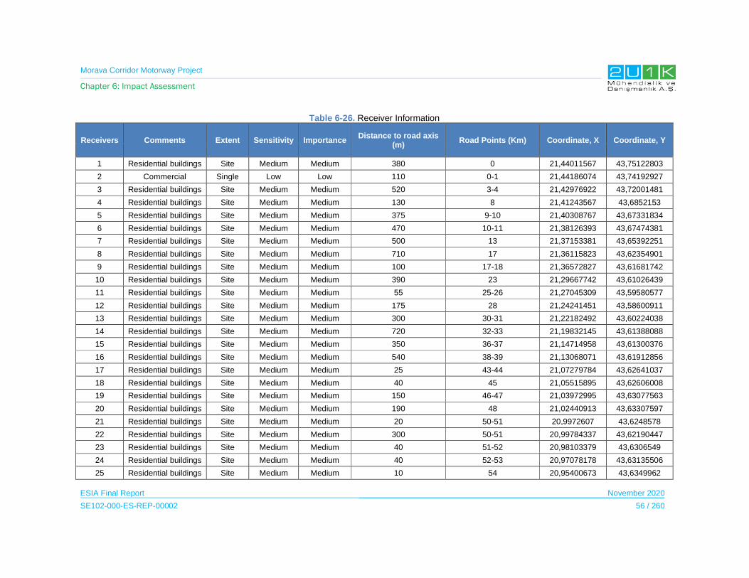
Morava Corridor Motorway Project
Chapter 6: Impact Assessment
ESIA Final Report November 2020
SE102-000-ES-REP-00002 56 / 260
Table 6-26. Receiver Information
Receivers Comments Extent Sensitivity Importance Distance to road axis
(m) Road Points (Km) Coordinate, X Coordinate, Y
1 Residential buildings Site Medium Medium 380 0 21,44011567 43,75122803
2 Commercial Single Low Low 110 0-1 21,44186074 43,74192927
3 Residential buildings Site Medium Medium 520 3-4 21,42976922 43,72001481
4 Residential buildings Site Medium Medium 130 8 21,41243567 43,6852153
5 Residential buildings Site Medium Medium 375 9-10 21,40308767 43,67331834
6 Residential buildings Site Medium Medium 470 10-11 21,38126393 43,67474381
7 Residential buildings Site Medium Medium 500 13 21,37153381 43,65392251
8 Residential buildings Site Medium Medium 710 17 21,36115823 43,62354901
9 Residential buildings Site Medium Medium 100 17-18 21,36572827 43,61681742
10 Residential buildings Site Medium Medium 390 23 21,29667742 43,61026439
11 Residential buildings Site Medium Medium 55 25-26 21,27045309 43,59580577
12 Residential buildings Site Medium Medium 175 28 21,24241451 43,58600911
13 Residential buildings Site Medium Medium 300 30-31 21,22182492 43,60224038
14 Residential buildings Site Medium Medium 720 32-33 21,19832145 43,61388088
15 Residential buildings Site Medium Medium 350 36-37 21,14714958 43,61300376
16 Residential buildings Site Medium Medium 540 38-39 21,13068071 43,61912856
17 Residential buildings Site Medium Medium 25 43-44 21,07279784 43,62641037
18 Residential buildings Site Medium Medium 40 45 21,05515895 43,62606008
19 Residential buildings Site Medium Medium 150 46-47 21,03972995 43,63077563
20 Residential buildings Site Medium Medium 190 48 21,02440913 43,63307597
21 Residential buildings Site Medium Medium 20 50-51 20,9972607 43,6248578
22 Residential buildings Site Medium Medium 300 50-51 20,99784337 43,62190447
23 Residential buildings Site Medium Medium 40 51-52 20,98103379 43,6306549
24 Residential buildings Site Medium Medium 40 52-53 20,97078178 43,63135506
25 Residential buildings Site Medium Medium 10 54 20,95400673 43,6349962

Morava Corridor Motorway Project
Chapter 6: Impact Assessment
ESIA Final Report November 2020
SE102-000-ES-REP-00002 57 / 260
Receivers Comments Extent Sensitivity Importance Distance to road axis
(m) Road Points (Km) Coordinate, X Coordinate, Y
26 Residential buildings Site Medium Medium 25 56-57 20,92724325 43,64372526
27 Residential buildings Site Medium Medium 30 58 20,91133288 43,65390663
28 Residential buildings Site Medium Medium 60 60 20,89165185 43,66116494
29 Residential buildings Site Medium Medium 190 61-62 20,8750816 43,66141816
30 Residential buildings Site Medium Medium 20 63 20,85612756 43,66265644
31 Residential buildings Site Medium Medium 85 66 20,83094431 43,67790181
32 Residential buildings Site Medium Medium 100 68-69 20,80320696 43,68858119
33 Residential buildings Single Medium Medium 140 70 20,7871039 43,69833968
34 Residential buildings Site Medium Medium 120 72 20,76654634 43,70637611
35 Residential buildings Site Medium Medium 120 74 20,75229284 43,72259825
36 Residential buildings Single Medium Medium 60 74-75 20,74979203 43,72686968
37 Hotel Single Medium Low 180 75-76 20,73880279 43,72996946
38 Residential buildings Site Medium Medium 350 76 20,73626687 43,73629339
39 Residential buildings Site Medium Medium 230 77-78 20,72019148 43,74036096
40 Residential buildings Site Medium Medium 900 79 20,68411075 43,74585837
41 Residential buildings Site Medium Medium 90 80-81 20,70126681 43,75002828
42 Residential buildings Site Medium Medium 140 80 20,6630601 43,75450502
43 Residential buildings Site Medium Medium 750 80-81 20,66982602 43,76199799
44 Residential buildings Site Medium Medium 650 81 20,64882123 43,7636101
45 Residential buildings Single Medium Medium 390 82 20,65682249 43,7722241
46 Residential buildings Single Medium Medium 320 84 20,63052744 43,78278467
47 Residential buildings Site Medium Medium 40 87 20,59837392 43,79070763
48 Residential buildings Site Medium Medium 380 89 20,57821617 43,80272715
49 Residential buildings Single Medium Medium 580 90-91 20,56479579 43,81390457
50 Residential buildings Single Medium Medium 130 95 20,5148306 43,83451111
51 Residential buildings Site Medium Medium 50 98 20,49456125 43,853061
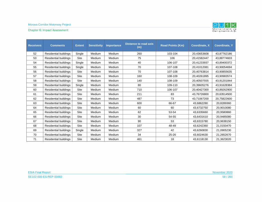
Morava Corridor Motorway Project
Chapter 6: Impact Assessment
ESIA Final Report November 2020
SE102-000-ES-REP-00002 58 / 260
Receivers Comments Extent Sensitivity Importance Distance to road axis
(m) Road Points (Km) Coordinate, X Coordinate, Y
52 Residential buildings Single Medium Medium 260 103-104 20,43653608 43,87762186
53 Residential buildings Site Medium Medium 75 106 20,41582447 43,88774603
54 Residential buildings Single Medium Medium 40 106-107 20,41233937 43,89400372
55 Residential buildings Single Medium Medium 70 107-108 20,41012081 43,90054694
56 Residential buildings Site Medium Medium 70 107-108 20,40763814 43,90855635
57 Residential buildings Site Medium Medium 160 108-109 20,40261895 43,90983574
58 Residential buildings Site Medium Medium 140 108-109 20,40507555 43,91201844
59 Residential buildings Single Medium Medium 80 109-110 20,39605276 43,91628384
60 Residential buildings Site Medium Medium 710 106-107 20,40427300 43,89262900
61 Residential buildings Site Medium Medium 211 83 43,76726800 20,63514500
62 Residential buildings Site Medium Medium 487 73 43,71067200 20,75822600
63 Residential buildings Site Medium Medium 600 66-67 43,6862280 20,8289360
64 Residential buildings Site Medium Medium 60 60 43,6732750 20,9010080
65 Residential buildings Site Medium Medium 62 53-54 43,6335660 20,9580860
66 Residential buildings Site Medium Medium 30 54-55 43,6431610 20,9485080
67 Residential buildings Site Medium Medium 90 53 43,6315780 20,9638150
68 Residential buildings Site Medium Medium 107 48-49 43,6242360 21,0150470
69 Residential buildings Single Medium Medium 327 42 43,6260830 21,0905230
70 Residential buildings Site Medium Medium 34 25-26 43,6024630 21,2652670
71 Residential buildings Site Medium Medium 461 18 43,6118130 21,3623020

Morava Corridor Motorway Project
Chapter 6: Impact Assessment
ESIA Final Report November 2020
SE102-000-ES-REP-00002 59 / 260
6.5.1 Construction Phase
Although the construction noise is temporary, the noise levels will increase significantly during
the construction phase of the Project compared to the baseline condition.
Potential source of noise and vibration impacts may be caused by but not limited to:
noise and vibrations emitted by machinery, equipment and vehicles used during
construction,
demolition,
production of gravel and concrete,
construction works (i.e. earthworks, bridge construction, on-site and off-site transport
of materials, etc.)
Therefore, emission of noise and vibrations will affect sensitive receptors (for details of the
sensitive receptors see Chapter 5 of the ESIA Report).
Noise Modelling Study was performed to determine noise and vibration level for construction
phase of the Project.
Construction Noise
To perform noise modelling study, the quantities of construction machines and equipment that
will be required for construction activities were taken into consideration as sources of noise
emissions. All of the construction sub-stages were assumed to be held at the same time in a
specific construction corridor around main motorway axis and they are defined as area
sources. Besides, quarries, concrete plants and asphalt plants were also integrated to the
noise model as separate area sources. All noise sources for the construction are defined as
area noise sources and machine and equipment are considered as distributed noise sources
over defined areas.
Phases of the construction are earthworks, structural works, paving and finishing works. In the
worst-case scenario, all the phases of the construction takes place at the time but in different
locations.
Construction machine and equipment list and their sound power levels are detailed in acoustic
report which gives also methodology of impact assessment. (See Appendix-9).
Table 6-29 below summarizes the details of the noise impact assessment for construction
phase.
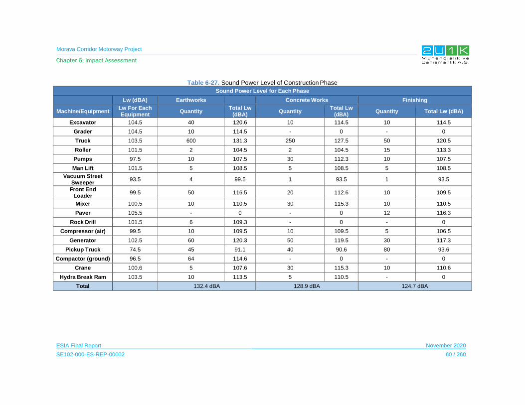
Morava Corridor Motorway Project
Chapter 6: Impact Assessment
ESIA Final Report November 2020
SE102-000-ES-REP-00002 60 / 260
Table 6-27. Sound Power Level of Construction Phase
Sound Power Level for Each Phase
Lw (dBA) Earthworks Concrete Works Finishing
Machine/EquipmentLw For Each Equipment
QuantityTotal Lw
(dBA)Quantity
Total Lw (dBA)
Quantity Total Lw (dBA)
Excavator 104.5 40 120.6 10 114.5 10 114.5
Grader 104.5 10 114.5 - 0 - 0
Truck 103.5 600 131.3 250 127.5 50 120.5
Roller 101.5 2 104.5 2 104.5 15 113.3
Pumps 97.5 10 107.5 30 112.3 10 107.5
Man Lift 101.5 5 108.5 5 108.5 5 108.5
Vacuum Street Sweeper
93.5 4 99.5 1 93.5 1 93.5
Front EndLoader
99.5 50 116.5 20 112.6 10 109.5
Mixer 100.5 10 110.5 30 115.3 10 110.5
Paver 105.5 - 0 - 0 12 116.3
Rock Drill 101.5 6 109.3 - 0 - 0
Compressor (air) 99.5 10 109.5 10 109.5 5 106.5
Generator 102.5 60 120.3 50 119.5 30 117.3
Pickup Truck 74.5 45 91.1 40 90.6 80 93.6
Compactor (ground) 96.5 64 114.6 - 0 - 0
Crane 100.6 5 107.6 30 115.3 10 110.6
Hydra Break Ram 103.5 10 113.5 5 110.5 - 0
Total 132.4 dBA 128.9 dBA 124.7 dBA

Morava Corridor Motorway Project
Chapter 6: Impact Assessment
ESIA Final Report November 2020
SE102-000-ES-REP-00002 61 / 260
Table 6-28. Sound Power Level of Plants
Sound Power Level for Each Phase
Lw (dBA) Asphalt Plant Batch Plant Barrow Pit/Quarry
Machine /Equipment
Lw For Each Equipment
Quantity Total Lw (dBA)
Quantity Total Lw (dBA) Quantity Total Lw (dBA)
Slurry Plant 101.5 2 104.5 - 0 - 0
Truck 103.5 40 119.6 - 0 - 0
Generator 102.5 1 102.5 1 102.5 1 102.5
Rock Drill 101.5 - 0 - 0 1 101.5
Grader 104.5 - 0 2 107.6 1 104.5
Dump Truck 103.5 - 0 25 117.5 25 117.5
Mixer 100.5 - 0 40 116.5 - 0
Pumps 97.5 - 0 2 100.5 - 0
Concrete Batch Plant 98.3 - 0 - 0 - 0
Front End Loader
99.5 1 99.5 1 99.5 1 99.5
Total 119,8 dBA 120,5 dBA 118 dBA
Lw’’ (sound power level per area) (dBA/m2) 70 dBA/m2 75 dBA/m2 60 dBA/m2
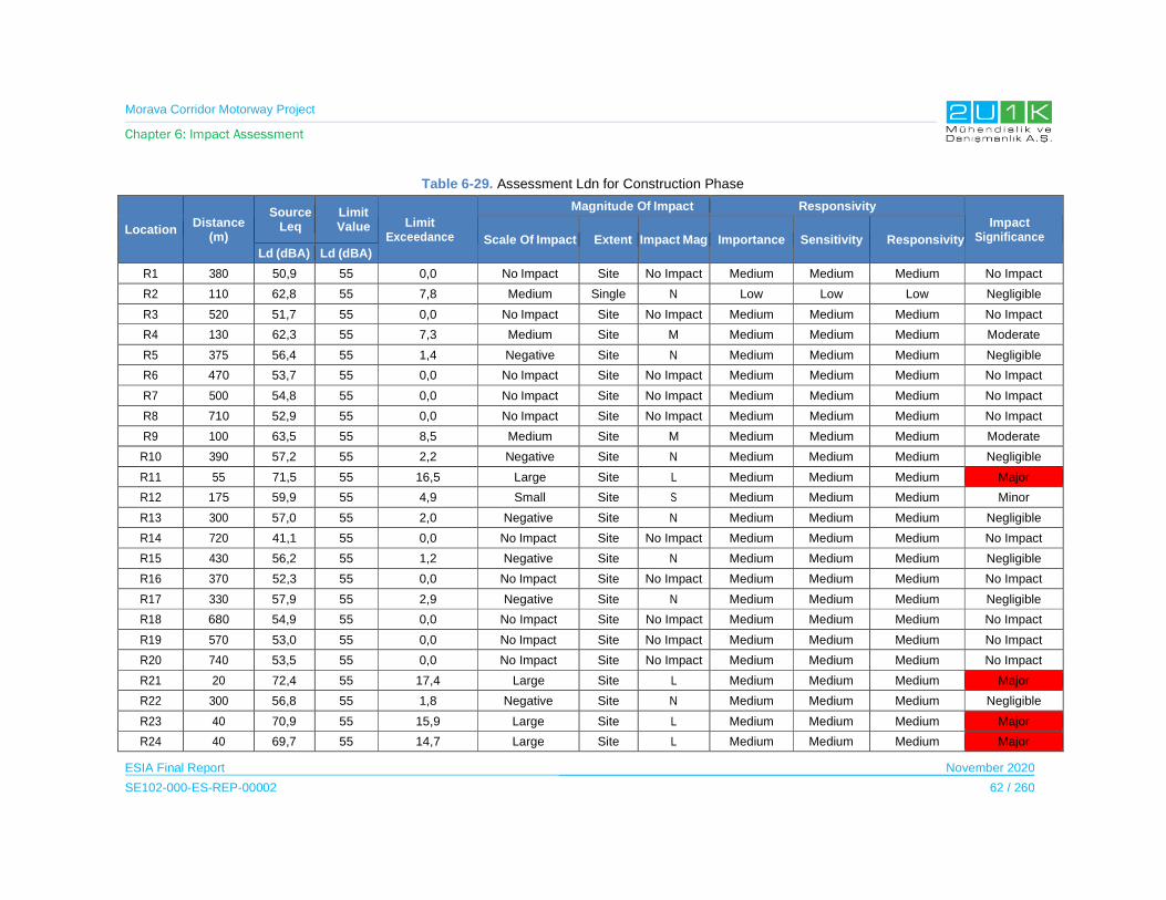
Morava Corridor Motorway Project
Chapter 6: Impact Assessment
ESIA Final Report November 2020
SE102-000-ES-REP-00002 62 / 260
Table 6-29. Assessment Ldn for Construction Phase
LocationDistance
(m)
Source Leq
Limit Value Limit
Exceedance
Magnitude Of Impact Responsivity
Impact SignificanceScale Of Impact Extent Impact Mag Importance Sensitivity Responsivity
Ld (dBA) Ld (dBA)
R1 380 50,9 55 0,0 No Impact Site No Impact Medium Medium Medium No Impact
R2 110 62,8 55 7,8 Medium Single N Low Low Low Negligible
R3 520 51,7 55 0,0 No Impact Site No Impact Medium Medium Medium No Impact
R4 130 62,3 55 7,3 Medium Site M Medium Medium Medium Moderate
R5 375 56,4 55 1,4 Negative Site N Medium Medium Medium Negligible
R6 470 53,7 55 0,0 No Impact Site No Impact Medium Medium Medium No Impact
R7 500 54,8 55 0,0 No Impact Site No Impact Medium Medium Medium No Impact
R8 710 52,9 55 0,0 No Impact Site No Impact Medium Medium Medium No Impact
R9 100 63,5 55 8,5 Medium Site M Medium Medium Medium Moderate
R10 390 57,2 55 2,2 Negative Site N Medium Medium Medium Negligible
R11 55 71,5 55 16,5 Large Site L Medium Medium Medium Major
R12 175 59,9 55 4,9 Small Site S Medium Medium Medium Minor
R13 300 57,0 55 2,0 Negative Site N Medium Medium Medium Negligible
R14 720 41,1 55 0,0 No Impact Site No Impact Medium Medium Medium No Impact
R15 430 56,2 55 1,2 Negative Site N Medium Medium Medium Negligible
R16 370 52,3 55 0,0 No Impact Site No Impact Medium Medium Medium No Impact
R17 330 57,9 55 2,9 Negative Site N Medium Medium Medium Negligible
R18 680 54,9 55 0,0 No Impact Site No Impact Medium Medium Medium No Impact
R19 570 53,0 55 0,0 No Impact Site No Impact Medium Medium Medium No Impact
R20 740 53,5 55 0,0 No Impact Site No Impact Medium Medium Medium No Impact
R21 20 72,4 55 17,4 Large Site L Medium Medium Medium Major
R22 300 56,8 55 1,8 Negative Site N Medium Medium Medium Negligible
R23 40 70,9 55 15,9 Large Site L Medium Medium Medium Major
R24 40 69,7 55 14,7 Large Site L Medium Medium Medium Major
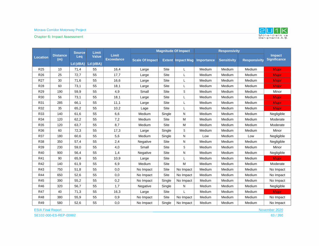
Morava Corridor Motorway Project
Chapter 6: Impact Assessment
ESIA Final Report November 2020
SE102-000-ES-REP-00002 63 / 260
LocationDistance
(m)
Source Leq
Limit Value Limit
Exceedance
Magnitude Of Impact Responsivity
Impact SignificanceScale Of Impact Extent Impact Mag Importance Sensitivity Responsivity
Ld (dBA) Ld (dBA)
R25 10 71,4 55 16,4 Large Site L Medium Medium Medium Major
R26 25 72,7 55 17,7 Large Site L Medium Medium Medium Major
R27 30 71,6 55 16,6 Large Site L Medium Medium Medium Major
R28 60 73,1 55 18,1 Large Site L Medium Medium Medium Major
R29 190 59,9 55 4,9 Small Site S Medium Medium Medium Minor
R30 56 73,1 55 18,1 Large Site L Medium Medium Medium Major
R31 285 66,1 55 11,1 Large Site L Medium Medium Medium Major
R32 35 65,2 55 10,2 Lage Site L Medium Medium Medium Major
R33 140 61,6 55 6,6 Medium Single N Medium Medium Medium Negligible
R34 120 62,2 55 7,2 Medium Site M Medium Medium Medium Moderate
R35 120 63,7 55 8,7 Medium Site M Medium Medium Medium Moderate
R36 60 72,3 55 17,3 Large Single S Medium Medium Medium Minor
R37 180 60,6 55 5,6 Medium Single N Low Medium Low Negligible
R38 350 57,4 55 2,4 Negative Site N Medium Medium Medium Negligible
R39 230 59,0 55 4,0 Small Site S Medium Medium Medium Minor
R40 900 56,4 55 1,4 Negative Site N Medium Medium Medium Negligible
R41 90 65,9 55 10,9 Large Site L Medium Medium Medium Major
R42 140 61,9 55 6,9 Medium Site M Medium Medium Medium Moderate
R43 750 51,8 55 0,0 No Impact Site No Impact Medium Medium Medium No Impact
R44 650 52,6 55 0,0 No Impact Site No Impact Medium Medium Medium No Impact
R45 390 55,2 55 0,2 No Impact Single No Impact Medium Medium Medium No Impact
R46 320 56,7 55 1,7 Negative Single N Medium Medium Medium Negligible
R47 40 71,3 55 16,3 Large Site L Medium Medium Medium Major
R48 380 55,9 55 0,9 No Impact Site No Impact Medium Medium Medium No Impact
R49 580 52,6 55 0,0 No Impact Single No Impact Medium Medium Medium No Impact
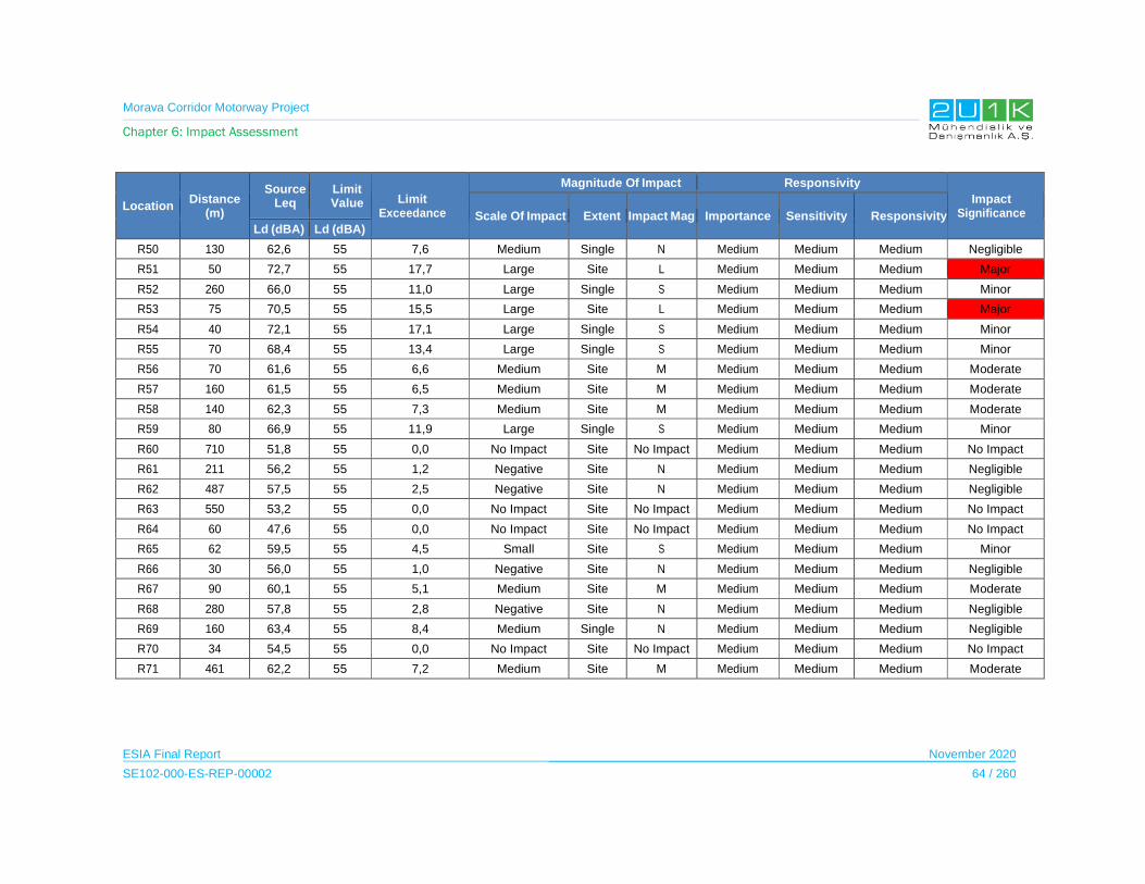
Morava Corridor Motorway Project
Chapter 6: Impact Assessment
ESIA Final Report November 2020
SE102-000-ES-REP-00002 64 / 260
LocationDistance
(m)
Source Leq
Limit Value Limit
Exceedance
Magnitude Of Impact Responsivity
Impact SignificanceScale Of Impact Extent Impact Mag Importance Sensitivity Responsivity
Ld (dBA) Ld (dBA)
R50 130 62,6 55 7,6 Medium Single N Medium Medium Medium Negligible
R51 50 72,7 55 17,7 Large Site L Medium Medium Medium Major
R52 260 66,0 55 11,0 Large Single S Medium Medium Medium Minor
R53 75 70,5 55 15,5 Large Site L Medium Medium Medium Major
R54 40 72,1 55 17,1 Large Single S Medium Medium Medium Minor
R55 70 68,4 55 13,4 Large Single S Medium Medium Medium Minor
R56 70 61,6 55 6,6 Medium Site M Medium Medium Medium Moderate
R57 160 61,5 55 6,5 Medium Site M Medium Medium Medium Moderate
R58 140 62,3 55 7,3 Medium Site M Medium Medium Medium Moderate
R59 80 66,9 55 11,9 Large Single S Medium Medium Medium Minor
R60 710 51,8 55 0,0 No Impact Site No Impact Medium Medium Medium No Impact
R61 211 56,2 55 1,2 Negative Site N Medium Medium Medium Negligible
R62 487 57,5 55 2,5 Negative Site N Medium Medium Medium Negligible
R63 550 53,2 55 0,0 No Impact Site No Impact Medium Medium Medium No Impact
R64 60 47,6 55 0,0 No Impact Site No Impact Medium Medium Medium No Impact
R65 62 59,5 55 4,5 Small Site S Medium Medium Medium Minor
R66 30 56,0 55 1,0 Negative Site N Medium Medium Medium Negligible
R67 90 60,1 55 5,1 Medium Site M Medium Medium Medium Moderate
R68 280 57,8 55 2,8 Negative Site N Medium Medium Medium Negligible
R69 160 63,4 55 8,4 Medium Single N Medium Medium Medium Negligible
R70 34 54,5 55 0,0 No Impact Site No Impact Medium Medium Medium No Impact
R71 461 62,2 55 7,2 Medium Site M Medium Medium Medium Moderate
Morava Corridor Motorway Project
Chapter 6: Impact Assessment
ESIA Final Report November 2020
SE102-000-ES-REP-00002 65 / 260
Since construction activities will end in a specific time period (4 years), no residual noise
impacts are expected from construction activities.
Construction Vibration
Vibration during the construction phase is mainly from two main sources:
blasting activities held in quarries and
construction vibration due to machine and equipment that is used in main motorway
construction.
Vibration from blasting activity was calculated for two scenarios for every facility where blasting
activity is held. One scenario assumes that blasting is happening at the closest point to the
residential areas in the boundary polygon of facility. Second scenario as assumes that blasting
is happening at the mean distance inside the boundary polygon of facility. This strategy was
developed because the area of the facilities that includes blasting activities is very large and it
cannot be precisely known where the specific blasting point is.
With given blasting design it is estimated that the closest safe distance for blasting activities is
185 meters, which is calculated by using the Divine Equation. The values used in the
calculation are given in Table 6-30 and the figure for blasting calculations is given below. Any
blasting activity will be dangerous and has impact closer than this distance to the receiving
bodies.
All of the receiving bodies are counted as Category III according to the US Federal Transit
Administration document that is non-engineered timber and masonry buildings. (John A. Volpe
National Transportation Systems Center, 2018)

Morava Corridor Motorway Project
Chapter 6: Impact Assessment
ESIA Final Report November 2020
SE102-000-ES-REP-00002 66 / 260
Table 6-30. Blasting Calculations at Quarry Areas
Facility InformationReceptor Minimum Distance
Receptor Average Distance
Assessment Min
Distance
Assessment Ave.Distance
Limits
Facility
Explosive amount in
single hole (kg)
Receptor Distance Min (m)
Receptor Distance Average
(m)
VibrationFTA
LimitsFTA
Limits
FTACategories
3PPV (mm/s)
Makresane Quarry
50 500 750 2.0 0.4 1.0 1.1 0.2 0.5 Suitable Suitable 5.08
Citluk Quarry 50 40 300 116.1 23.2 58.1 4.6 0.9 2.3 Impact Suitable 5.08
Vrnjci Quarry 1 50 20 250 352.0 70.4 176.0 6.2 1.2 3.1 Impact Suitable 5.08
Vrnjci Quarry 2 50 580 800 1.6 0.3 0.8 1.0 0.2 0.5 Suitable Suitable 5.08
Sumarice Quarry 50 10 300 1066.9 213.4 533.5 4.6 0.9 2.3 Impact Suitable 5.08
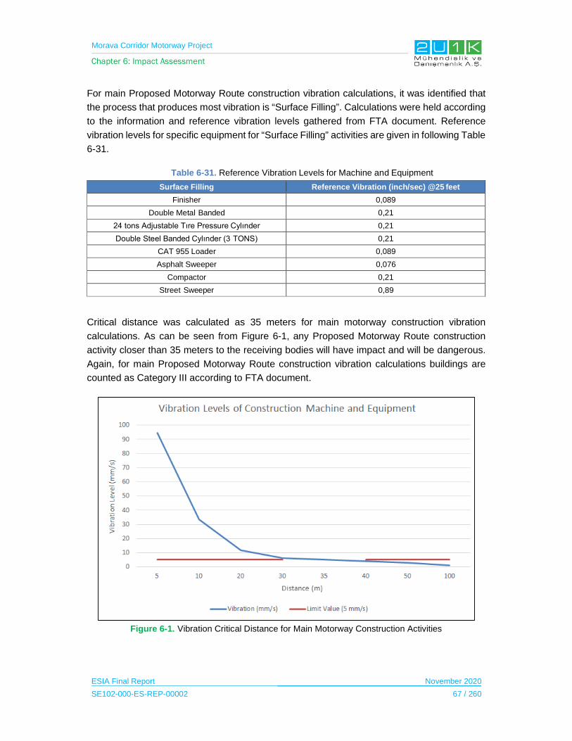
Morava Corridor Motorway Project
Chapter 6: Impact Assessment
ESIA Final Report November 2020
SE102-000-ES-REP-00002 67 / 260
For main Proposed Motorway Route construction vibration calculations, it was identified that
the process that produces most vibration is “Surface Filling”. Calculations were held according
to the information and reference vibration levels gathered from FTA document. Reference
vibration levels for specific equipment for “Surface Filling” activities are given in following Table
6-31.
Table 6-31. Reference Vibration Levels for Machine and Equipment
Surface Filling Reference Vibration (inch/sec) @25 feet
Finisher 0,089
Double Metal Banded 0,21
24 tons Adjustable Tıre Pressure Cylınder 0,21
Double Steel Banded Cylınder (3 TONS) 0,21
CAT 955 Loader 0,089
Asphalt Sweeper 0,076
Compactor 0,21
Street Sweeper 0,89
Critical distance was calculated as 35 meters for main motorway construction vibration
calculations. As can be seen from Figure 6-1, any Proposed Motorway Route construction
activity closer than 35 meters to the receiving bodies will have impact and will be dangerous.
Again, for main Proposed Motorway Route construction vibration calculations buildings are
counted as Category III according to FTA document.
Figure 6-1. Vibration Critical Distance for Main Motorway Construction Activities

Morava Corridor Motorway Project
Chapter 6: Impact Assessment
ESIA Final Report November 2020
SE102-000-ES-REP-00002 68 / 260
As shown in Table 6-33, the overall rating of vibration is considered medium since the
magnitude and the likelihood of the impacts are determined as high due to blasting activities
within the scope of Project. After taking mitigation measures, the likelihood and the magnitude
of the impact expected to decrease to the levels stipulated by the national regulations.
Morava Corridor Motorway Project
Chapter 6: Impact Assessment
ESIA Final Report November 2020
SE102-000-ES-REP-00002 69 / 260
Table 6-32. Impact and Mitigations for Noise and Vibration in Construction Phase of the Project
Impact Description Impact Source Location of Sensitive Receptor
Mitigation /Enhancement Measures
Noise Pollution
The noise impact will be temporarily and expected to affect the settlements within the AoI of the Project.
In construction of bridges and viaducts, noise arising from general construction works is considered in road construction site evaluations. Bored piles is used, which has lower noise level than driven piles.
Noise pollution due to vehicle operation.
Camp Sites
Material Storage
Excavation
Backfilling
Storage, Re-Use and Disposal of Excavations
Excavation for River Regulation
Material Spreading/Rolling/Compaction
Asphalt concrete Wearing
Crushing
Machinery and Equipment
Asphalt Preparation
Concreate Batching
Transportation
Demobilization of Equipment and Machinery
Re-instatement of Camp Sites and Access Roads
Rehabilitation of Borrow Barrow Pits
All Settlements within the AoI (see Chapter 5)
Pre-construction
Project Environmental Management Plan (EMP) will include Noise and Vibration and Management Plan that will be define the sensitive receptor locations, monitoring program and specific mitigation measures to be implemented.
Traffic Management Plan (EMP) and construction Method Statements will include any agreed noise and vibration mitigation measures.
Planning of transport routes including temporary access roads, haul roads and construction work sites should be determined to avoid populated areas and away from sensitive receptors and villages as much as possible.
The Project should consider the construction of a newly allocated access road instead of using the existing road network.
As Project construction progresses, buildings that may be potentially affected will be identified prior to construction, including assessing whether buildings are sensitive to night-time disturbance.
Construction
Motorway alignment will be used for the transport of construction materials and equipment wherever possible.
Internal haul routes will be well designed and maintained and steep gradients should be avoided where possible.
Empty vehicles will not have loose chains or other noise “generating parts on the loading platform.
During off-loading, materials will dropped from an appropriate height to avoid noise disturbance to the surrounding receptors or to minimize noise from the site in general.
All construction equipment and vehicles will be regularly checked and maintained. This should particularly include the regular inspection of diesel powered equipment and, if necessary, replacement of intake and exhaust silencers. Any change in the
Morava Corridor Motorway Project
Chapter 6: Impact Assessment
ESIA Final Report November 2020
SE102-000-ES-REP-00002 70 / 260
Impact Description Impact Source Location of Sensitive Receptor
Mitigation /Enhancement Measures
noise emission characteristics of equipment should serve as trigger for withdrawing it for maintenance.
Position of all auxiliary plant (e.g. generators, compressors) should be determined to cause minimal noise disturbance.
In case of noise exceedance, silencers or acoustic enclosures on machines as well as portable sound barriers around stationary equipment, should be installed where applicable.
20kph speed limit will be applied on unpaved roads to reduce noise and vibration, limit fugitive dust generation, reduce emission and reduce the risk of accidents (vehicles, pedestrians, cyclist, and fauna).
Speed exceedances will be notified to the site administration and handled according to H&S Management Plan.
Additional driver training, temporary speed restrictions, improved driving monitoring, etc., will be provided as necessary or required.
Movement of construction traffic through sensitive receptor community areas will be prevented or limited, wherever possible. If this cannot be avoided, additional measures defined in the Traffic Management Plan (TMP) such as slower driving rules, physical speed restrictions) will be applied.
Noise mitigation measures specifically related to equipment and vehicle traffic through sensitive receptors should be directed at:
- Minimizing individual vehicle engine, transmission, and body noise/vibration. This is achieved through the implementation of an equipment maintenance program.
- Maintain road surface regularly.
- Avoid unnecessary idling times.
- Minimizing the need for trucks/equipment to reverse movement. This will reduce the frequency of reverse warnings will occur. Alternatives to the traditional reverse ‘beeper’ alarm such as a ‘self-adjusting’ or ‘smart’ alarm could be considered. These alarms include a mechanism to detect the local noise level and automatically adjust the output of the alarm is so that

Morava Corridor Motorway Project
Chapter 6: Impact Assessment
ESIA Final Report November 2020
SE102-000-ES-REP-00002 71 / 260
Impact Description Impact Source Location of Sensitive Receptor
Mitigation /Enhancement Measures
it is 5 to 10 dB above the noise level near the moving equipment.
- Where possible, noisy activities such as, decommissioning and maintenance, should be limited to day-time hours.
Noise levels will not exceed WHO Environmental Noise Limits, national limits or result in a maximum increase in background levels of 3 dB at the nearest receptor location off-site.
Noise level limits for construction activities are stated in the national EIA. If limits are exceeded, then appropriate mitigation measures will be implemented in accordance with the Serbian regulations. These may include:
- Night-time operation and transport should be minimized as much as possible, near to villages or where a transport road passes.
- Distance between construction site and sensitive receptors (e.g. hospitals, nursing homes, schools) should be mazimised. If this is not possible, then temporary noise barriers (eg. portable sound walls, soil berm) should be installed between the construction site and sensitive receptors.
- Construction equipment used in intermittent periods will be shut down at intervals between works.
- Working hours for some construction equipment or operations with greater noise and vibration impact will be limited to core daytime hours or routes where the area is less susceptible to noise.
Sensitive receptors (e.g. hospitals, nursing homes, schools) will be provided with advanced notification of noisy works and project specific additional mitigation measures.
Special acoustic insulation and related mitigation measures will be evaluated on a case-by-case basis.
Vibration Excavation
Backfilling
Asphalt Concrete Wearing
All Settlements within the AoI (see Chapter 5)
Pre-construction

Morava Corridor Motorway Project
Chapter 6: Impact Assessment
ESIA Final Report November 2020
SE102-000-ES-REP-00002 72 / 260
Impact Description Impact Source Location of Sensitive Receptor
Mitigation /Enhancement Measures
Potential damage to buildings caused by construction vibration
Potential vibration caused during the work in quarries
Crushing
Machinery and Equipment
Transportation
Demobilization of Equipment and Machinery
Buildings near vibration sources (e.g. blasting, pile-driving and operating heavy earth-moving equipment) will be identified prior to construction.
Buildings and occupants with susceptibility detection will be evaluated for vibration, and if vibration estimates or measurements show potential for building damage, alternative construction methods will be developed to prevent damage.
Vibration standards according to Serbian regulations (Law on Environmental Noise / 2010) will be implemented through the Noise and Vibration Management Plan. Documentation will be prepared for each of the identified buildings.
Quarry Management Plan will be developed, and should include noise and vibration mitigation measures such as placement of rock structures as a noise barrier between the quarry area and potentially affected villages.
Material procured from quarries and suppliers that are not directly owned by the Project Owner or the Contractor will be evaluated to assess the operations of this facility to verify compliance with its permitted activities and relevant operating conditions.
Construction
Monitoring of vibration in initiation of relevant activities will be performed to ensure that national legal requirements and international standards are met.
Additional measures will be taken to reduce vibration effects if standards are exceeded, and, if necessary, to change operating methods to use equipment that generates lower vibration levels.
Mitigation measures will be taken into account to prevent negative impacts caused by vibration in quarries, and this will be documented in the Quarry Management Plan.
During blasting operations, when hydraulic drills are used for drilling of boreholes, the number of the boreholes will be decided according to the blasting plan in order to reduce to a minimum any need for secondary blasting of rock.
Morava Corridor Motorway Project
Chapter 6: Impact Assessment
ESIA Final Report November 2020
SE102-000-ES-REP-00002 73 / 260
Impact Description Impact Source Location of Sensitive Receptor
Mitigation /Enhancement Measures
During blasting operations at quarry sites and during earthworks, monitoring/inspection will be carried out to ensure compliance with legal requirements and blasting permit requirements.

Morava Corridor Motorway Project
Chapter 6: Impact Assessment
ESIA Final Report November 2020
SE102-000-ES-REP-00002 74 / 260
Table 6-33. Scoring of Ambient Noise and Vibration Impacts in Construction Phase
Impacts Before Mitigation Impacts After Mitigation
Impacts Nature Extent Duration Magnitude Receptor
Sensitivity Significance Criteria (SC)
Likelihood
(L)
Overall Rating
(IA)=SCxLNature Extent’ Duration’ Magnitude’
Receptor Sensitivity
Significance Criteria
(SC)
Likelihood(L)
Residual Impact
Noise Pollution
-1 Negative
1 Project Site
2 Short Term
4 High
3 Medium
-2.50 5
Definite-13
Medium-1
Negative1
Project Site2
Short Term2
Low 3
Medium-2
2 Low
-4 Low
Vibration -1
Negative1
Project Site2
Short Term5
Very High3
Medium-2.75
5 Definite
-14 Medium
-1 Negative
1 Project Site
2 Short Term
3 Moderate
3 Medium
-2.25 3
Medium -7
Low

Morava Corridor Motorway Project
Chapter 6: Impact Assessment
ESIA Final Report November 2020
SE102-000-ES-REP-00002 75 / 260
6.5.2 Operation Phase
Modelling study was performed to determine noise and vibration level for operation phase of
the Project.
Operation Noise
Noise sources during operation phase of the Motorway is mainly due to road traffic which will
be cumulated throughout the road axis. This perspective was incorporated during the noise
modeling study and magnitude of the impact as well as impact significance can be found in
Table 6-34.
Since surrounding terrain alignment information around road axis is not finalized at this stage
of the Project, it is difficult to determine exact mitigation measures that will suit to prevent
operational noise impacts. Therefore, following measures may be incorporated after the
finalization of road axis in order to prevent noise related impacts during the operation phase
as:
Noise barriers: Noise barriers are engineered structures that lower the noise exposure at
determined receiver locations. However, it is not reasonable to build noise barriers at every
situation. Rather than reducing the noise exposure, physical characteristics of noise barriers
are also needed to be considered such as; static and wind loads. Optimized height of the noise
barriers should not be exceeding 4 meters in order to maintain effectiveness of sound reduction
and practicality of construction. For maintaining effectiveness of the barrier structures following
aspects should be considered;
Distance between receiver locations and barrier structures
Terrain levels of the road axis and receiver locations
Height of the receiver location and road axis
Social acceptance of barrier structures (because of wall like structure of the noise
barriers some residents living just behind those structures may refuse noise barriers
to be built)
Noise Berms: Noise berms are more efficient than noise barriers in many cases in terms of
applicability. However, for application of berms available space, terrain levels and availability
of the berm material are limiting aspects.
Vegetation: Vegetation is an option for noise reduction and social acceptance. Even though
vegetation has no proved sufficient effect for noise reduction surely it has affirmative
psychological effects on residents.
Morava Corridor Motorway Project
Chapter 6: Impact Assessment
ESIA Final Report November 2020
SE102-000-ES-REP-00002 76 / 260
Stone Mastic Asphalt Surface (SMA) Application (approximately 4dBA noise reduction):
SMA have modified surface textures which bring about reductions in noise and could reduce
the noise generated by the tire/pavement interaction.
Applicability and effectiveness of noise barriers and noise berm structures and vegetation
applications strongly depend on the terrain structure between noise source and receiver.
Because of explained situation noise barrier structures are assumed to be suitable for every
major impacted case and designed accordingly.
Noise reduction gained by barrier structures also strongly depends on the terrain levels. Since
the Project’s terrain data is not finalized, it is not possible to determine amount of reduction will
be gained by barrier structure, thus; a standard noise reduction is assumed as 10 dB for every
barrier structure.

Morava Corridor Motorway Project
Chapter 6: Impact Assessment
ESIA Final Report November 2020
SE102-000-ES-REP-00002 77 / 260
Table 6-34. Assessment Ldn, for Operation
Location of the Receivers
(R)Distance (m)
Source Leq Limit Value Limit Exceedance
Magnitude Of Impact Responsivity
Impact SignificanceScale Of Impact Extent Impact Mag Importance Sensitivity Responsivity
Ld (dBA) Ln (dBA) Ld (dBA) Ln (dBA)
R1 380 45,9 42,1 55 45 0,0 No Impact Site No Impact Medium Medium Medium No Impact
R2 110 57,6 52,3 55 45 7,3 M Single N Low Low Low Negligible
R3 520 45,8 42,8 55 45 0,0 No Impact Site No Impact Medium Medium Medium No Impact
R4 130 56,8 52 55 45 7,0 M Site M Medium Medium Medium Moderate
R5 375 50,1 46,6 55 45 1,6 N Site N Medium Medium Medium Negligible
R6 470 48,3 45,1 55 45 0,1 No Impact Site No Impact Medium Medium Medium No Impact
R7 500 49,2 45,1 55 45 0,1 No Impact Site No Impact Medium Medium Medium No Impact
R8 710 45,5 41,2 55 45 0,0 No Impact Site No Impact Medium Medium Medium No Impact
R9 100 58 52,6 55 45 7,6 M Site M Medium Medium Medium Moderate
R10 390 50,1 45 55 45 0,0 No Impact Site No Impact Medium Medium Medium No Impact
R11 55 62,5 56,7 55 45 11,7 L Site L Medium Medium Medium Major
R12 175 55,9 51,5 55 45 6,5 M Site M Medium Medium Medium Moderate
R13 300 53,3 48,5 55 45 3,5 S Site S Medium Medium Medium Minor
R14 720 45,3 41,8 55 45 0,0 No Impact Site No Impact Medium Medium Medium No Impact
R15 430 49,9 46,8 55 45 1,8 N Site N Medium Medium Medium Negligible
R16 370 49,4 46,4 55 45 1,4 N Site N Medium Medium Medium Negligible
R17 330 51,6 47,7 55 45 2,7 N Site N Medium Medium Medium Negligible
R18 680 45,9 42,3 55 45 0,0 No Impact Site No Impact Medium Medium Medium No Impact
R19 570 45,9 43 55 45 0,0 No Impact Site No Impact Medium Medium Medium No Impact
R20 740 45,4 42,3 55 45 0,0 No Impact Site No Impact Medium Medium Medium No Impact
R21 20 73,2 67,4 55 45 22,4 L Site L Medium Medium Medium Major
R22 300 52,9 47,9 55 45 2,9 N Site N Medium Medium Medium Negligible
R23 40 68,5 62,8 55 45 17,8 L Site L Medium Medium Medium Major
R24 40 59,7 54,7 55 45 9,7 M Site M Medium Medium Medium Moderate
R25 10 78,2 72,4 55 45 27,4 L Site L Medium Medium Medium Major
R26 25 67,6 61,8 55 45 16,8 L Site L Medium Medium Medium Major
R27 30 66,9 61,1 55 45 16,1 L Site L Medium Medium Medium Major
R28 60 65,5 59,7 55 45 14,7 L Site L Medium Medium Medium Major
R29 190 55,9 51 55 45 6,0 M Site M Medium Medium Medium Moderate
R30 56 63,6 58 55 45 13,0 L Site L Medium Medium Medium Major
R31 285 53,1 48,6 55 45 3,6 S Site S Medium Medium Medium Minor
R32 35 68,2 62,4 55 45 17,4 L Site L Medium Medium Medium Major
R33 140 54,8 51,1 55 45 6,1 M Single N Medium Medium Medium Negligible
R34 120 54,1 50,4 55 45 5,4 M Site M Medium Medium Medium Moderate
R35 120 60,7 55,4 55 45 10,4 L Site L Medium Medium Medium Major
R36 60 63 57,5 55 45 12,5 L Single S Medium Medium Medium Minor
R37 180 53,6 50,2 55 45 5,2 M Single N Low Medium Low Negligible
R38 350 52 47,5 55 45 2,5 N Site N Medium Medium Medium Negligible
R39 230 55,4 50,3 55 45 5,3 M Site M Medium Medium Medium Moderate
R40 900 43,8 40,3 55 45 0,0 No Impact Site No Impact Medium Medium Medium No Impact
R41 90 60 55,1 55 45 10,1 L Site L Medium Medium Medium Major
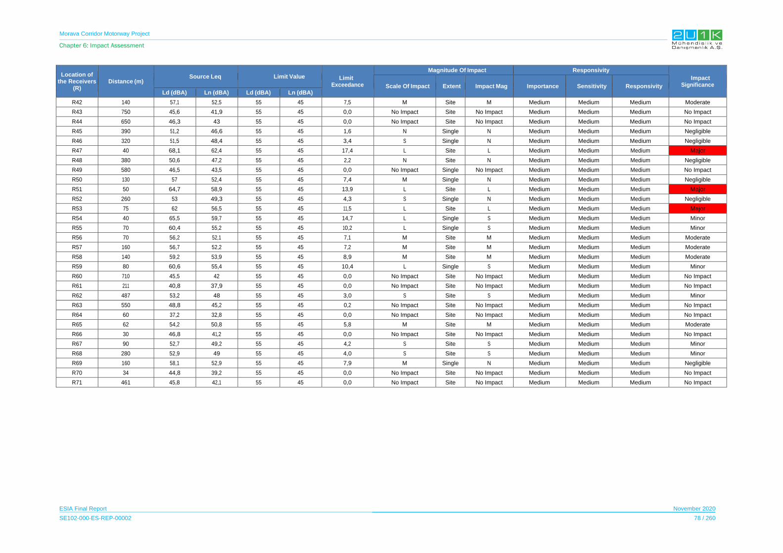
Morava Corridor Motorway Project
Chapter 6: Impact Assessment
ESIA Final Report November 2020
SE102-000-ES-REP-00002 78 / 260
Location of the Receivers
(R)Distance (m)
Source Leq Limit Value Limit Exceedance
Magnitude Of Impact Responsivity
Impact SignificanceScale Of Impact Extent Impact Mag Importance Sensitivity Responsivity
Ld (dBA) Ln (dBA) Ld (dBA) Ln (dBA)
R42 140 57,1 52,5 55 45 7,5 M Site M Medium Medium Medium Moderate
R43 750 45,6 41,9 55 45 0,0 No Impact Site No Impact Medium Medium Medium No Impact
R44 650 46,3 43 55 45 0,0 No Impact Site No Impact Medium Medium Medium No Impact
R45 390 51,2 46,6 55 45 1,6 N Single N Medium Medium Medium Negligible
R46 320 51,5 48,4 55 45 3,4 S Single N Medium Medium Medium Negligible
R47 40 68,1 62,4 55 45 17,4 L Site L Medium Medium Medium Major
R48 380 50,6 47,2 55 45 2,2 N Site N Medium Medium Medium Negligible
R49 580 46,5 43,5 55 45 0,0 No Impact Single No Impact Medium Medium Medium No Impact
R50 130 57 52,4 55 45 7,4 M Single N Medium Medium Medium Negligible
R51 50 64,7 58,9 55 45 13,9 L Site L Medium Medium Medium Major
R52 260 53 49,3 55 45 4,3 S Single N Medium Medium Medium Negligible
R53 75 62 56,5 55 45 11,5 L Site L Medium Medium Medium Major
R54 40 65,5 59,7 55 45 14,7 L Single S Medium Medium Medium Minor
R55 70 60,4 55,2 55 45 10,2 L Single S Medium Medium Medium Minor
R56 70 56,2 52,1 55 45 7,1 M Site M Medium Medium Medium Moderate
R57 160 56,7 52,2 55 45 7,2 M Site M Medium Medium Medium Moderate
R58 140 59,2 53,9 55 45 8,9 M Site M Medium Medium Medium Moderate
R59 80 60,6 55,4 55 45 10,4 L Single S Medium Medium Medium Minor
R60 710 45,5 42 55 45 0,0 No Impact Site No Impact Medium Medium Medium No Impact
R61 211 40,8 37,9 55 45 0,0 No Impact Site No Impact Medium Medium Medium No Impact
R62 487 53,2 48 55 45 3,0 S Site S Medium Medium Medium Minor
R63 550 48,8 45,2 55 45 0,2 No Impact Site No Impact Medium Medium Medium No Impact
R64 60 37,2 32,8 55 45 0,0 No Impact Site No Impact Medium Medium Medium No Impact
R65 62 54,2 50,8 55 45 5,8 M Site M Medium Medium Medium Moderate
R66 30 46,8 41,2 55 45 0,0 No Impact Site No Impact Medium Medium Medium No Impact
R67 90 52,7 49,2 55 45 4,2 S Site S Medium Medium Medium Minor
R68 280 52,9 49 55 45 4,0 S Site S Medium Medium Medium Minor
R69 160 58,1 52,9 55 45 7,9 M Single N Medium Medium Medium Negligible
R70 34 44,8 39,2 55 45 0,0 No Impact Site No Impact Medium Medium Medium No Impact
R71 461 45,8 42,1 55 45 0,0 No Impact Site No Impact Medium Medium Medium No Impact

Morava Corridor Motorway Project
Chapter 6: Impact Assessment
ESIA Final Report November 2020
SE102-000-ES-REP-00002 79 / 260
The location of the receivers where have “Major” noise impact significance recommended to
implement noise barriers. Detailed information on the recommended noise barriers including
their locations and size is given in Table 6-35.
Table 6-35. Geometrical Information about Recommended Noise Barriers
Barrier No Barrier KM Barrier Side Relevant Receivers Length (m) Height (m)
1 25-26 LHS 11 1381 3
2 50-51 RHS 21 845 3
3 51-52 RHS 23 796 3
4 54 RHS 25 285 3
5 53-55 LHS 25-65 1055 3
6 55-59 LHS 26-27 4101 3
7 58-59 RHS 27 926 3
8 59-61 LHS 28 1557 3
9 63 LHS 30 724 3
10 68-69 RHS 32 1080 3
11 74 LHS 35 796 3
12 80 LHS 41 1221 3
13 86-88 RHS 47 2077 3
14 96-98 RHS 51 2029 3
15 104-107 RHS 53 2426 3
*LHS=Left Hand Side *RHS=Right Hand Side
After implementing the recommended noise barriers according to Table 6-35, the final impact
significance are given in the Table 6-36.
Table 6-36. Final Impact Significance after Mitigation of the Noise Receivers that had “Major” Impact
Location of the Receiver (R)
Distance Final Impact Significance Before Mitigation
Final Impact Significance After Mitigation(m)
R11 55 Major Negligible
R21 20 Major Major
R23 40 Major Moderate
R25 10 Major Major
R26 25 Major Moderate
R27 30 Major Moderate
R28 60 Major Minor
R30 56 Major Minor
R32 35 Major Moderate
R35 120 Major No Impact
R41 90 Major No Impact
R47 40 Major Moderate
R51 50 Major Minor
R53 75 Major Negligible
Morava Corridor Motorway Project
Chapter 6: Impact Assessment
ESIA Final Report November 2020
SE102-000-ES-REP-00002 80 / 260
Three “Major” affected receivers after implementation of recommended noise barriers
(see Table 6-37, additional measures such as;
to implementate noise berms which are more efficient than noise barriers in many
cases in terms of applicability;
to implementate Vegetation and SMA Surface Application to reduce potential residual
impacts;
to rehabilitate receptors by insulating to reduce recoptor sensitivity
to pay compensation to receivers in cases where insulation is not possible
are recommended.
For the “Moderate” affected receivers after implementation of recommended noise barriers,
additional mitigation measures such as noise berms, vegetation and SMA Surface Application
are recommended to be implemented.
For receiver locations where the final impact significance is moderate, noise monitoring
processes12 is recommended. This monitoring process should either be periodic or continuous.
For continuous monitoring systems; implementation of steady online noise monitoring
devices is recommended.
For periodic noise monitoring systems; the frequency of the monitoring is
recommended to be twice or three times annually.
In addition to noise monitoring processes, grievances regarding the noise will be recorded in
the Grievance Mechanism and necessary mitigation measures will be adopted, as appropriate.
During noise monitoring studies both for periodic and continuous rules defined about
environmental noise monitoring studies in ISO 1996-2:2017 Acoustics – Description,
measurement and assessment of environmental noise is recommended to be adopted.
12 The noise monitoring was conducted in line with ISO 1996-2: Acoustics – Description and measurement of environmental noise. During noise monitoring process both for periodic and continuous; the rules defined about environmental noise monitoring studies in ISO 1996-2 international standard recommended to be followed.

Morava Corridor Motorway Project
Chapter 6: Impact Assessment
ESIA Final Report November 2020
SE102-000-ES-REP-00002 81 / 260
Operation Vibration
Ground-borne vibrations due to irregularities on the road, especially generated by heavy
vehicles on the flowing traffic, may have an impact on receivers close to the main road axis.
An empirical equation developed by R. Watts and V.V. Krylov used to predict the PPV in mm/s
at a building foundations due to heavy vehicles passing over a road surface defects
������ = �.��� × � ×�
��× � × � × �
�
���
Where;
a : maximum height or depth of the road surface defect in mm,
ν : maximum expected speed of heavy vehicle in km/h
p : the wheel index, which is over 0.75 for heavy vehicles when one wheel crosses a
damaged spot, or 1 in other cases
t: the coefficient of soil supporting a roadway structure
r : the distance between the measuring point and the moving vehicle
x: power coefficient
Table 6-37. Ground Scaling Factors and Power Coefficients for Different Soils (Watts and Krylov, 2000)
Ground Type Ground Scaling Factor (G) Power Coefficient for Attenuation (X)
Alluvium 4.40 -0.79
Peat 2.39 -1.19
London clay 1.93 -1.06
Sand/gravel 0.58 -0.74
Boulder clay 0.27 -0.93
Chalk rock 0.06 -1.08
Source: G.R. Watts, V.V. Krylov. Ground-borne vibration generated by vehicles crossing road humps and speed control cushions. Applied Acoustics 59 (2000) 221-236
Calculations conducted for a heavy vehicle having 80 km/h and 50 mm of maximum road
defect, and two wheels crosses the damaged spot. Since softer ground types are not suitable
for construction of founded structures, both London clay and sand/gravel arrangements
considered in the calculations. Results of the calculations based on these parameters, are
presented in the Figure below:
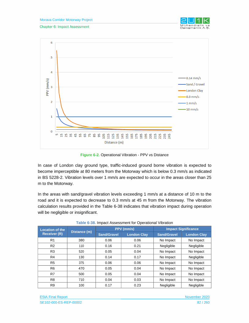
Morava Corridor Motorway Project
Chapter 6: Impact Assessment
ESIA Final Report November 2020
SE102-000-ES-REP-00002 82 / 260
Figure 6-2. Operational Vibration - PPV vs Distance
In case of London clay ground type, traffic-induced ground borne vibration is expected to
become imperceptible at 80 meters from the Motorway which is below 0.3 mm/s as indicated
in BS 5228-2. Vibration levels over 1 mm/s are expected to occur in the areas closer than 25
m to the Motorway.
In the areas with sand/gravel vibration levels exceeding 1 mm/s at a distance of 10 m to the
road and it is expected to decrease to 0.3 mm/s at 45 m from the Motorway. The vibration
calculation results provided in the Table 6-38 indicates that vibration impact during operation
will be negligible or insignificant.
Table 6-38. Impact Assessment for Operational Vibration
Location of the Receiver (R)
Distance (m)PPV (mm/s) Impact Significance
Sand/Gravel London Clay Sand/Gravel London Clay
R1 380 0.06 0.06 No Impact No Impact
R2 110 0.16 0.21 Negligible Negligible
R3 520 0.05 0.04 No Impact No Impact
R4 130 0.14 0.17 No Impact Negligible
R5 375 0.06 0.06 No Impact No Impact
R6 470 0.05 0.04 No Impact No Impact
R7 500 0.05 0.04 No Impact No Impact
R8 710 0.04 0.03 No Impact No Impact
R9 100 0.17 0.23 Negligible Negligible

Morava Corridor Motorway Project
Chapter 6: Impact Assessment
ESIA Final Report November 2020
SE102-000-ES-REP-00002 83 / 260
Location of the Receiver (R)
Distance (m)PPV (mm/s) Impact Significance
Sand/Gravel London Clay Sand/Gravel London Clay
R10 390 0.06 0.05 No Impact No Impact
R11 55 0.26 0.43 Negligible Small
R12 175 0.11 0.13 No Impact No Impact
R13 300 0.07 0.07 No Impact No Impact
R14 720 0.04 0.03 No Impact No Impact
R15 430 0.06 0.05 No Impact No Impact
R16 370 0.06 0.05 No Impact No Impact
R17 330 0.07 0.06 No Impact No Impact
R18 680 0.04 0.02 No Impact No Impact
R19 570 0.05 0.03 No Impact No Impact
R20 740 0.04 0.02 No Impact No Impact
R21 20 0.56 1.26 Small Medium
R22 300 0.07 0.07 No Impact No Impact
R23 40 0.33 0.60 Small Small
R24 40 0.33 0.60 Small Small
R25 10 0.93 2.62 Small Medium
R26 25 0.47 0.99 Small Small
R27 30 0.41 0.82 Small Small
R28 60 0.25 0.39 Negligible Small
R29 190 0.10 0.12 No Impact No Impact
R30 56 0.26 0.42 Negligible Small
R31 285 0.08 0.07 No Impact No Impact
R32 35 0.37 0.70 Small Small
R33 140 0.13 0.16 No Impact Negligible
R34 120 0.15 0.19 Negligible Negligible
R35 120 0.15 0.19 Negligible Negligible
R36 60 0.25 0.39 Negligible Small
R37 180 0.11 0.12 No Impact No Impact
R38 350 0.07 0.06 No Impact No Impact
R39 230 0.09 0.09 No Impact No Impact
R40 900 0.03 0.02 No Impact No Impact
R41 90 0.18 0.26 Negligible Negligible
R42 140 0.13 0.16 No Impact Negligible
R43 750 0.04 0.03 No Impact No Impact
R44 650 0.04 0.03 No Impact No Impact
R45 390 0.06 0.05 No Impact No Impact
R46 320 0.07 0.07 No Impact No Impact
R47 40 0.33 0.60 Small Small
R48 380 0.06 0.06 No Impact No Impact
R49 110 0.16 0.21 Negligible Negligible
R50 520 0.05 0.04 No Impact No Impact
R51 130 0.14 0.17 No Impact Negligible
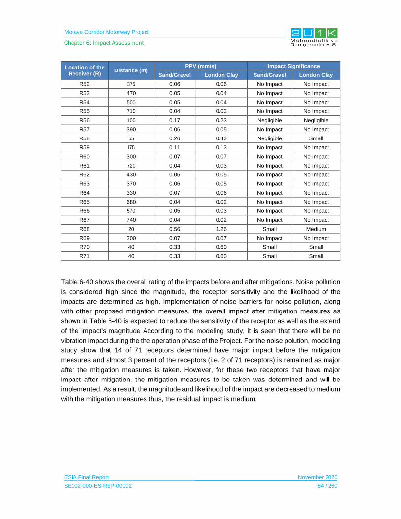
Morava Corridor Motorway Project
Chapter 6: Impact Assessment
ESIA Final Report November 2020
SE102-000-ES-REP-00002 84 / 260
Location of the Receiver (R)
Distance (m)PPV (mm/s) Impact Significance
Sand/Gravel London Clay Sand/Gravel London Clay
R52 375 0.06 0.06 No Impact No Impact
R53 470 0.05 0.04 No Impact No Impact
R54 500 0.05 0.04 No Impact No Impact
R55 710 0.04 0.03 No Impact No Impact
R56 100 0.17 0.23 Negligible Negligible
R57 390 0.06 0.05 No Impact No Impact
R58 55 0.26 0.43 Negligible Small
R59 175 0.11 0.13 No Impact No Impact
R60 300 0.07 0.07 No Impact No Impact
R61 720 0.04 0.03 No Impact No Impact
R62 430 0.06 0.05 No Impact No Impact
R63 370 0.06 0.05 No Impact No Impact
R64 330 0.07 0.06 No Impact No Impact
R65 680 0.04 0.02 No Impact No Impact
R66 570 0.05 0.03 No Impact No Impact
R67 740 0.04 0.02 No Impact No Impact
R68 20 0.56 1.26 Small Medium
R69 300 0.07 0.07 No Impact No Impact
R70 40 0.33 0.60 Small Small
R71 40 0.33 0.60 Small Small
Table 6-40 shows the overall rating of the impacts before and after mitigations. Noise pollution
is considered high since the magnitude, the receptor sensitivity and the likelihood of the
impacts are determined as high. Implementation of noise barriers for noise pollution, along
with other proposed mitigation measures, the overall impact after mitigation measures as
shown in Table 6-40 is expected to reduce the sensitivity of the receptor as well as the extend
of the impact's magnitude According to the modeling study, it is seen that there will be no
vibration impact during the the operation phase of the Project. For the noise polution, modelling
study show that 14 of 71 receptors determined have major impact before the mitigation
measures and almost 3 percent of the receptors (i.e. 2 of 71 receptors) is remained as major
after the mitigation measures is taken. However, for these two receptors that have major
impact after mitigation, the mitigation measures to be taken was determined and will be
implemented. As a result, the magnitude and likelihood of the impact are decreased to medium
with the mitigation measures thus, the residual impact is medium.
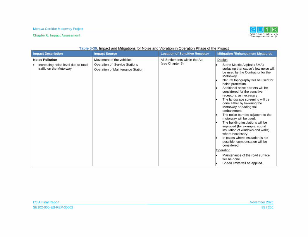
Morava Corridor Motorway Project
Chapter 6: Impact Assessment
ESIA Final Report November 2020
SE102-000-ES-REP-00002 85 / 260
Table 6-39. Impact and Mitigations for Noise and Vibration in Operation Phase of the Project
Impact Description Impact Source Location of Sensitive Receptor Mitigation /Enhancement Measures
Noise Pollution
Increasing noise level due to road traffic on the Motorway
Movement of the vehicles
Operation of Service Stations
Operation of Maintenance Station
All Settlements within the AoI (see Chapter 5)
Design
Stone Mastic Asphalt (SMA) surfacing that cause’s low noise will be used by the Contractor for the Motorway.
Natural topography will be used for noise protection.
Additional noise barriers will be considered for the sensitive receptors, as necessary.
The landscape screening will be done either by lowering the Motorway or adding soil embankment
The noise barriers adjacent to the motorway will be used.
The building insulations will be improved (for example, sound insulation of windows and walls), where necessary.
In cases where insulation is not possible, compensation will be considered.
Operation
Maintenance of the road surface will be done.
Speed limits will be applied.

Morava Corridor Motorway Project
Chapter 6: Impact Assessment
ESIA Final Report November 2020
SE102-000-ES-REP-00002 86 / 260
Table 6-40. Scoring of Ambient Noise and Vibration Impacts in Operation Phase
Impacts Before Mitigation Impacts After Mitigation
Impacts Nature Extent Duration Magnitude Receptor
Sensitivity Significance Criteria (SC)
Likelihood(L)
Overall Rating (IA)=SCxL
Nature Extent’ Duration’ Magnitude’ Receptor
Sensitivity
Significance Criteria
(SC)
Likelihood(L)
Residual Impact
Noise Pollution
-1 Negative
1 Project Site
5 Permanent
4 High
5 High
-3.50 5
Definite -18
High -1
Negative1
Project Site
4 Long Term
2 Low
5 High
-3.00 3
Medium -9
Medium

Morava Corridor Motorway Project
Chapter 6: Impact Assessment
ESIA Final Report November 2020
SE102-000-ES-REP-00002 87 / 260
6.6 Geology and Soil
Impacts on soil and geology will be a concern mainly during the construction phase of the
Project as the construction activities include direct and/or extensive physical interaction with
the environmental components.
On the other hand, risk of soil contamination due to accidents and geotechnical and seismic
risks would be of the primary concern for the operation phase.
Assessment of the impacts for geology and soil in construction and operation phases is
provided in Subsection 6.6.1 and Subsection 6.6.2.
As a result of environmental baseline studies, sensitive receptors were determined in Chapter
5 of this Report. Table 6-41 and Table 6-43 detail the impact and mitigations for geology and
soil in the Construction and Operation Phases.
6.6.1 Construction Phase
The Project will be constructed along a long route of approximately 112 km and significant
volumes of the earthworks will be conducted in the scope of the Project, relevant measures
required to be taken into a consideration, in order to avoid significant impacts on the soil
environment.
The potential impacts of the land preparation and construction activities on the soil
environment are summarized as;
disturbance such as loss of fertile top layer,
mixing of soil layers and types,
soil compaction etc. due to top soil stripping, cut and fill operations,
construction of road structures and extraction of construction materials at the quarry
sites;
soil erosion and soil contamination due to unexpected leakages or spills.
In addition, geotechnical risks along the Proposed Motorway Route will be identified to ensure
safety and stability.
In case of not implementing the mitigation measures, top soil itself or its vegetative properties
along the Motorway route may be lost due to erosion or mixing with coarse or contaminated
soils. Thus, top soil management measures will be applied in the scope of the Project
Table 6-41 details the impact and mitigations for geology and soil in the Construction Phase
of the Project.

Morava Corridor Motorway Project
Chapter 6: Impact Assessment
ESIA Final Report November 2020
SE102-000-ES-REP-00002 88 / 260
Table 6-42 shows the overall rating of the impacts before and after mitigations. Erosion, land
degradation and soil loss and soil pollution caused by construction activities are considered
medium since the magnitude and the receptor sensitivity of the impacts are determined as
high. For potential earthquake related impact, the design of the project to took consideration
of national requirement while conducting seismic design and risk assessment of the Project.
In addition, construction specific emergency preparedness and response plan will be adopted
throughout the construction phase. For erosion related impact, the design of the Project took
measures to reduce of the sensitivity of the receptors. Considering, measures taken for both
erosion and earthquake related impacts as shown in Table 6-41, the sensitivity of the receptors
will reduce to medium.

Morava Corridor Motorway Project
Chapter 6: Impact Assessment
ESIA Final Report November 2020
SE102-000-ES-REP-00002 89 / 260
Table 6-41. Impact and Mitigations for Geology and Soil in Construction Phase of the Project
Impact Description Impact Source Location of Sensitive Receptor
Mitigation /Enhancement Measures
Earthquake13
Earthquake may occur either during the construction or the operation of the Project. The Project site is located on the 2nd degree seismic zone.
Faults Bounding on blocks (See Subsection 5.8.8 in Chapter 5)
Design and Pre-construction
The Project will comply with the relevant Serbian regulatory requirements related to seismic design and risk assessment.( 14)
Emergency Preparedness and Response Plan (EPRP) will be implemented.
Erosion
Several areas of potential soil erosion were identified as part of the preliminary geotechnical assessment investigation. There are areas along the Project which have a natural erosion risk due to their subsurface characteristics, areas at risk from excavation works and soil movement such as steep slopes at cut and fill sections.
Top-soil stripping
Top-Soil Storage
Tree Cutting /Vegetation clearance
Excavation
Backfilling
Storage, Re-Use and Disposal of Excavations
(See Subsection 5.8.8 in Chapter 5)
Design
The Soil Erosion, Reinstatement and Landscape Management Plan will be developed and implemented. The Plan will adopt measures stated in the IFC EHS Guidelines: Construction and Decommissioning (2007) as:
o Scheduling to avoid heavy rainfall periods (i.e., during the dry season) to the extent practical,
o Contouring and minimizing length and steepness of slopes
o Mulching to stabilize exposed areas
o Re-vegetating areas promptly
o Designing channels and ditches for post-construction flows
o Lining steep channel and slopes (e.g. use jute matting).
Also, structure of the Plan will comply with the IFC EHS Guidelines: Toll Roads (2007).
13 The Project will not create any seismic activity As a result, it is not expected any earthquake caused by the Project. In this section, the impact of the earthquake on the Project area and mitigations is evaluated. 14 Depending on the ground conditions and the seismic characteristics of the region, design and design verification will be carried out according to Eurocode 8: Design of structures for earthquake resistance.
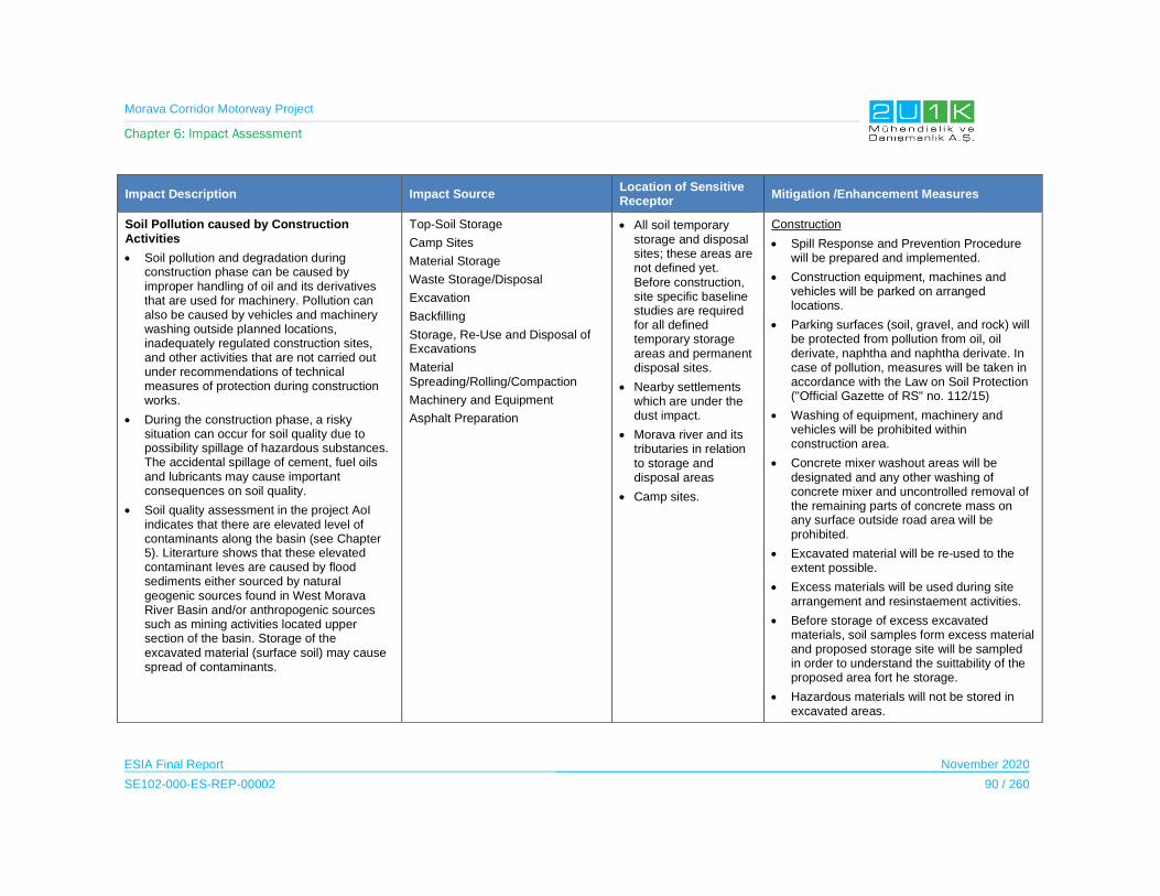
Morava Corridor Motorway Project
Chapter 6: Impact Assessment
ESIA Final Report November 2020
SE102-000-ES-REP-00002 90 / 260
Impact Description Impact Source Location of Sensitive Receptor
Mitigation /Enhancement Measures
Soil Pollution caused by Construction Activities
Soil pollution and degradation during construction phase can be caused by improper handling of oil and its derivatives that are used for machinery. Pollution can also be caused by vehicles and machinery washing outside planned locations, inadequately regulated construction sites, and other activities that are not carried out under recommendations of technical measures of protection during construction works.
During the construction phase, a risky situation can occur for soil quality due to possibility spillage of hazardous substances. The accidental spillage of cement, fuel oils and lubricants may cause important consequences on soil quality.
Soil quality assessment in the project AoI indicates that there are elevated level of contaminants along the basin (see Chapter 5). Literarture shows that these elevated contaminant leves are caused by flood sediments either sourced by natural geogenic sources found in West Morava River Basin and/or anthropogenic sources such as mining activities located upper section of the basin. Storage of the excavated material (surface soil) may cause spread of contaminants.
Top-Soil Storage
Camp Sites
Material Storage
Waste Storage/Disposal
Excavation
Backfilling
Storage, Re-Use and Disposal of Excavations
Material Spreading/Rolling/Compaction
Machinery and Equipment
Asphalt Preparation
All soil temporary storage and disposal sites; these areas are not defined yet. Before construction, site specific baseline studies are required for all defined temporary storage areas and permanent disposal sites.
Nearby settlements which are under the dust impact.
Morava river and its tributaries in relation to storage and disposal areas
Camp sites.
Construction
Spill Response and Prevention Procedure will be prepared and implemented.
Construction equipment, machines and vehicles will be parked on arranged locations.
Parking surfaces (soil, gravel, and rock) will be protected from pollution from oil, oil derivate, naphtha and naphtha derivate. In case of pollution, measures will be taken in accordance with the Law on Soil Protection ("Official Gazette of RS" no. 112/15)
Washing of equipment, machinery and vehicles will be prohibited within construction area.
Concrete mixer washout areas will be designated and any other washing of concrete mixer and uncontrolled removal of the remaining parts of concrete mass on any surface outside road area will be prohibited.
Excavated material will be re-used to the extent possible.
Excess materials will be used during site arrangement and resinstaement activities.
Before storage of excess excavated materials, soil samples form excess material and proposed storage site will be sampled in order to understand the suittability of the proposed area fort he storage.
Hazardous materials will not be stored in excavated areas.
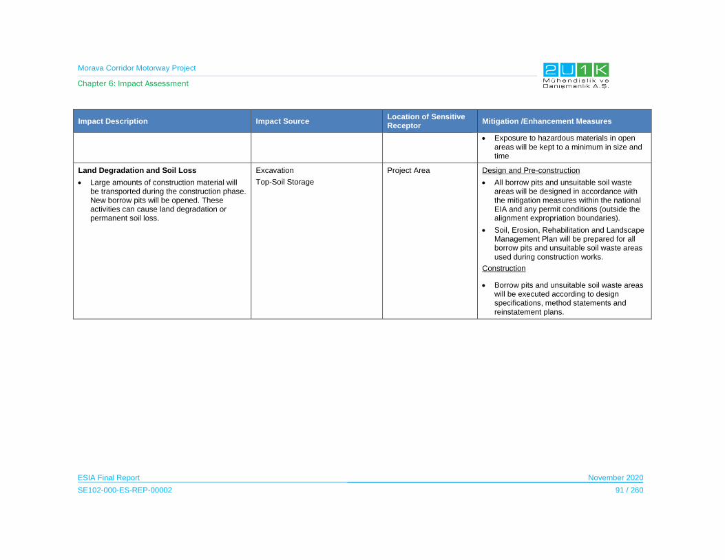
Morava Corridor Motorway Project
Chapter 6: Impact Assessment
ESIA Final Report November 2020
SE102-000-ES-REP-00002 91 / 260
Impact Description Impact Source Location of Sensitive Receptor
Mitigation /Enhancement Measures
Exposure to hazardous materials in open areas will be kept to a minimum in size and time
Land Degradation and Soil Loss
Large amounts of construction material will be transported during the construction phase. New borrow pits will be opened. These activities can cause land degradation or permanent soil loss.
Excavation
Top-Soil Storage
Project Area Design and Pre-construction
All borrow pits and unsuitable soil waste areas will be designed in accordance with the mitigation measures within the national EIA and any permit conditions (outside the alignment expropriation boundaries).
Soil, Erosion, Rehabilitation and Landscape Management Plan will be prepared for all borrow pits and unsuitable soil waste areas used during construction works.
Construction
Borrow pits and unsuitable soil waste areas will be executed according to design specifications, method statements and reinstatement plans.

Morava Corridor Motorway Project
Chapter 6: Impact Assessment
ESIA Final Report November 2020
SE102-000-ES-REP-00002 92 / 260
Table 6-42. Scoring of Geology and Soil Impacts in Construction Phase
Impacts Before Mitigation Impacts After Mitigation
Impacts Nature Extent Duration Magnitude Receptor
Sensitivity Significance Criteria (SC)
Likelihood(L)
Overall Rating (IA)=SCxL
Nature Extent’ Duration’ Magnitude’ Receptor Sensitivit
y
Significance Criteria (SC)
Likelihood (L)
Residual Impact
Earthquake -1
Negative 4
Regional 1
Immediate 3
Moderate 5
High -3.25
1 Improbabl
e
-3.25 Low
-1 Negative
4 Regional
1 Immediate
3 Moderate
3 Medium
-2.75 1
Improbable -2.75 Low
Erosion -1
Negative2
Municipality1
Immediate3
Moderate5
High-2.75
4 High
-11 Medium
-1 Negative
2 Municipality
1 Immediate
2 Moderate
3 Medium
-2 4
High 8
Low
Soil Pollution Caused by Construction Activities
-1 Negative
2 Municipality
2 Short Term
4 High
5 High
-3.25 3
Medium-10
Medium-1
Negative
2 Municipality
2 Short Term
2 Low
5 High
-2.75 1
Improbable -3
Low
Land Degradation and Soil Loss
-1 Negative
2 Municipality
2 Short Term
3 Moderate
5 High
-3 5
Definite-15
Medium-1
Negative
2 Municipality
2 Short Term
1 Minor
5 High
-2.5 1
Improbable -3
Low

Morava Corridor Motorway Project
Chapter 6: Impact Assessment
ESIA Final Report November 2020
SE102-000-ES-REP-00002 93 / 260
6.6.2 Operation Phase
During the operation phase, soil contamination risks may be caused by the improper handling
of the hazardous materials to be used in the road maintenance activities and leakage/spill of
fuels, chemicals, etc. during the unexpected accidents. In that case, the associated impacts
would be similar to the impacts described for the construction phase and a similar mitigation
strategy would be adopted for the mitigation of potential impacts.
Last, seismic risks would be of concern for the entire operational life of the Motorway thus
further evaluation on the potential risks and mitigation approaches is provided below.
Table 6-43 details the impact and mitigations for geology and soil in the Operation Phase of
the Project.
Table 6-44 shows the overall rating of the impacts before and after mitigations. Earthquake
impact is considered as low since the likelihood and duration are determined low. On the other
hand, road and accidental spillage is considered as medium since the magnitude and
likelihood are determined as high. For potential earthquake related impact, the design of the
project to took consideration of national requirement while conducting seismic design and risk
assessment of the Project. In addition, construction specific emergency preparedness and
response plan will be adopted throughout the operation phase. Considering, measures
earthquake related impacts as shown in Table 6-43, the sensitivity of the receptor will reduce
to medium.
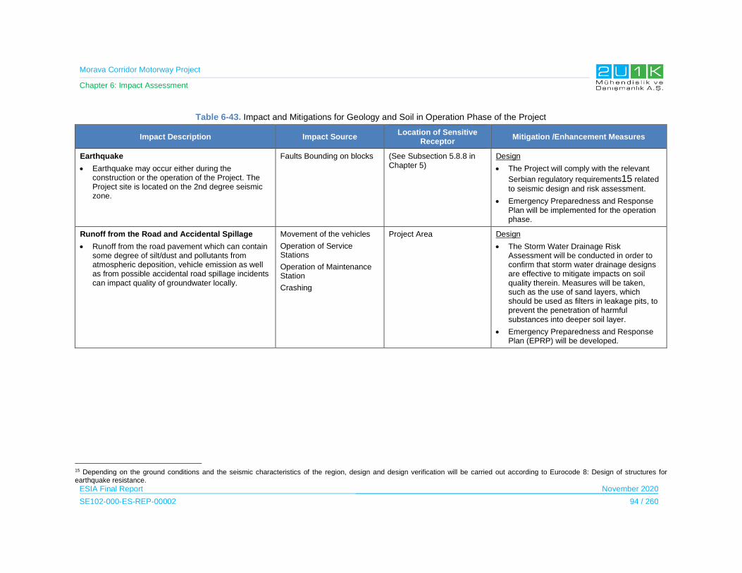
Morava Corridor Motorway Project
Chapter 6: Impact Assessment
ESIA Final Report November 2020
SE102-000-ES-REP-00002 94 / 260
Table 6-43. Impact and Mitigations for Geology and Soil in Operation Phase of the Project
Impact Description Impact Source Location of Sensitive
Receptor Mitigation /Enhancement Measures
Earthquake
Earthquake may occur either during the construction or the operation of the Project. The Project site is located on the 2nd degree seismic zone.
Faults Bounding on blocks (See Subsection 5.8.8 in Chapter 5)
Design
The Project will comply with the relevant
Serbian regulatory requirements15 related to seismic design and risk assessment.
Emergency Preparedness and Response Plan will be implemented for the operation phase.
Runoff from the Road and Accidental Spillage
Runoff from the road pavement which can contain some degree of silt/dust and pollutants from atmospheric deposition, vehicle emission as well as from possible accidental road spillage incidents can impact quality of groundwater locally.
Movement of the vehicles
Operation of Service Stations
Operation of Maintenance Station
Crashing
Project Area Design
The Storm Water Drainage Risk Assessment will be conducted in order to confirm that storm water drainage designs are effective to mitigate impacts on soil quality therein. Measures will be taken, such as the use of sand layers, which should be used as filters in leakage pits, to prevent the penetration of harmful substances into deeper soil layer.
Emergency Preparedness and Response Plan (EPRP) will be developed.
15 Depending on the ground conditions and the seismic characteristics of the region, design and design verification will be carried out according to Eurocode 8: Design of structures for earthquake resistance.
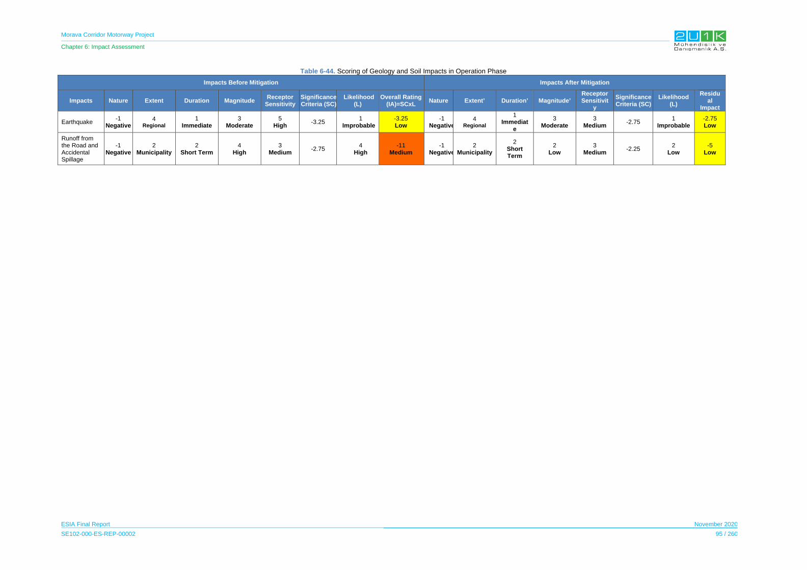
Morava Corridor Motorway Project
Chapter 6: Impact Assessment
ESIA Final Report November 2020
SE102-000-ES-REP-00002 95 / 260
Table 6-44. Scoring of Geology and Soil Impacts in Operation Phase
Impacts Before Mitigation Impacts After Mitigation
Impacts Nature Extent Duration Magnitude Receptor
Sensitivity Significance Criteria (SC)
Likelihood (L)
Overall Rating (IA)=SCxL
Nature Extent’ Duration’ Magnitude’ Receptor Sensitivit
y
Significance Criteria (SC)
Likelihood (L)
Residual
Impact
Earthquake -1
Negative4
Regional
1 Immediate
3 Moderate
5 High
-3.25 1
Improbable-3.25 Low
-1 Negative
4 Regional
1 Immediat
e
3 Moderate
3 Medium
-2.75 1
Improbable-2.75 Low
Runoff from the Road and Accidental Spillage
-1 Negative
2 Municipality
2 Short Term
4 High
3 Medium
-2.75 4
High -11
Medium-1
Negative2
Municipality
2 Short Term
2 Low
3 Medium
-2.25 2
Low -5
Low
Morava Corridor Motorway Project
Chapter 6: Impact Assessment
ESIA Final Report November 2020
SE102-000-ES-REP-00002 96 / 260
6.7 Resources and Waste
This section discusses resource efficiency for the Project and all waste impact that may occur
during construction and operation phases of the Project. Following subsections determine
magnitude of waste related impacts to the environment and how to manage, reduce or prevent
them with recommended mitigation measures.
Resource
For the construction of the Project and all related infrastructure, significant quantities of various
typical construction materials will be needed; these will include concrete, prefabricated
segments (e.g. beams for bridges), steel, aggregates, and asphalt. In addition, large volumes
of soil/topsoil will need to be excavated for motorway and river regulation works and as much
as re-used as filling material as well as site arrangement and reinstatement.
Arrangements for sourcing and transport of the materials and equipment are under the
responsibility of the Contractor. The supply of these materials will involve supply from local,
national or international sources and use of transport by road or rail.
As explained in Section 3, at preliminary design phase of the project, a total of 56 borrow area
and quarry have been identified along the project route. In addition to these borrow areas,
excavated materials from river diversion channels will be used for the motorway construction.
The construction material requirements have not been finalized since geotechnical
investigations for the final design are still ongoing and the suitability of cut-fill requirements for
the project have not been finalized. Due to this reason, a range for the material requirement
could not be assessed. However, a preliminary estimate Amount of aggregate required for the
construction is estimated as 8.156,400 m3 in total. The amount include reserves of alluvial
gravel, aggregate of carbonate origin (limestone), used for the construction of the upper
supporting layers of pavement structure and concrete. As the Contractors estimate the
quarries and borrow areas together with the excavated material sourced from river diversion
project is sufficient for construction works. On the other hand, depending on the results of
detailed geotechnical study, there will be some changes about the size and location of
proposed material source. In case a requirement, constraint maps prepared as a result of ESIA
study will be used for the new site determination in order to avoid and minimize any potential
impact on sensitive locations. Additionally, the contractor will conduct Environmental Site
Assessment as a Due Diligence study for new proposed sites in line with the policies and
mitigations identified in the ESIA. In this respect, EHS considerations that will need to be taken
into account in the selection of appropriate quarry sites and access routes will be based on
IFC General EHS Guidelines (IFC, 2007) as well as guidelines for IFC EHS Guidelines for
Construction Materials Extraction (IFC, 2007). These guidelines will take into account the
noise, air quality, proximity to sensitive receptors, community HS, vibration issues (blasting),
habitat and biodiversity among other considerations for the selection and use of these quarries.
Morava Corridor Motorway Project
Chapter 6: Impact Assessment
ESIA Final Report November 2020
SE102-000-ES-REP-00002 97 / 260
An audit procedure will be developed to assess the existing quarries with respect to the IFC
and Serbian regulatory requirements.
The approximate earthwork volumes are: 20 million m3 of cut volume and 17 million m3 of ̧fill
volume. Based on the above estimates there will be a net surplus of material across the Project
of approximately 3 million m3. As stated above, most of the material will be useful for
construction of other parts of the Project (embankments, road base materials, backfilling for
reinstatement of borrow areas etc.) and the aim will be to achieve a balance of cut and fill
material as far as possible. It should be noted that geotechnical assessment is being conducted
for the final design stage and a more accurate number will be established. The soil quality will
be tested in areas where potential sources of contamination may be expected to ensure proper
usage as material for the cut and fill requirements (see Chapter 5 Geology and Soils).
Water is another major requirement in the project. The estimated amount of water use for labor
camps is 25,000 tons in total of 2 camps as monthly average. If the number of camps is to be
3 then this estimate will yield as 38,000 tons per month. For batch plants, water consumption
is estimated as approximately 10,000 tons per month. Regarding the consumptions of
resources in asphalt plants, it is estimated to consume 3,500 tons of water as monthly average.
Potential water consumptions for the construction of project are provided in Table 6-45. Water
will mainly be supplied from existing sources and the water wells.
Table 6-45. Amount of Water Use during Construction
Some of the other materials used for the project
7,500 tons of cement per month is expected to be used in the concrete batching plant.
Cement for concrete production will be supplied from the cement producer facilities
nearby the project site (around 250 km distance). Approximately 25 dump trucks per
day will be used for raw material transportation to batch plants.
Average daily production of the asphalt is estimated as 3,000 tons. Bitumen will be
used in the asphalt production and it will be supplied from Pančevo Refinery. The
distance between the project site and refinery is about 500 km.
Waste
Description Water Use (ton/month)
Labour camps 25,000
Batch plants 10,000
Asphalth plants 3,500
Concrete Production 8,500
Total 47,000
Morava Corridor Motorway Project
Chapter 6: Impact Assessment
ESIA Final Report November 2020
SE102-000-ES-REP-00002 98 / 260
Following waste materials are expected to be generated during the construction and operation
phases of the Project.
Excavation Materials: Excavation materials will result from the construction activities of the
Project. Numerous cuttings to be built along the Proposed Motorway Route are planned. In
addition, river regulation works to prevent flooding will result in excavation materials. The
amount of excavation material caused by the river regulation is 9 647 756 m3. Wherever
possible, materials excavated from excavation sites will be reused as fillers on the construction
site or for reinstatement purposes. This will maximize the rate of use of materials on-site and
reduce the need for off-site disposal. On the other hand, unsuitable soil from excavations are
not expected to be generated in large quantities during the construction of the Project.
If there is excess unsuitable excavation material, proper storage and evacuation of the material
will be carried out in order to not carry the pollution to another location considering the high
heavy metal values found in the soil during the baseline studies. When it needs to be moved
to another location, it should be proved that it will not create pollution in that area by conducting
soil and field analyses.
Domestic Waste: It is foreseen that there will be approximately 2000 construction phase
workers in the two worker accommodation sites. The Contractor stated that the domestic waste
to be produced at all sites will be collected and stored in containers placed at suitable points
and the recyclable waste will be collected separately. These wastes will be collected
periodically by licensed companies and sent to the nearest waste disposal facility.
Worldwide, waste generated per person per day averages 0.74 kilogram (The World Bank,
n.d.). Thus,
0.74��
������.���� × 2000 ������ = 1,480 ��
����
Thus, it is estimated that a total of 740 kg of domestic waste will be produced per camp per
day.
In summary, it is foreseen that the importance of the impact of domestic wastes to be produced
during construction phase will be small as the generated wastes will be collected at certain
intervals.
During the operation phase of the Project, it is foreseen that the domestic wastes will be limited
to the small volumes related to the maintenance works and the maintenance of the landscape
areas.
In summary, no significant impact is anticipated given that appropriate waste treatment,
storage and disposal procedures will be adopted and detailed information on waste disposal
sites to be potentially used within the scope of the Project provided in Chapter 3.6 (Third Party
Morava Corridor Motorway Project
Chapter 6: Impact Assessment
ESIA Final Report November 2020
SE102-000-ES-REP-00002 99 / 260
Utilities) of the ESIA Report. Before the construction phase, waste disposal sites will be visited
and appropriate disposal sites will be added to the waste management plan.
Waste Oil: During the construction phase, waste oil originating from the maintenance of
construction machinery, equipment and vehicles will be generated. Maintenance activities
such as oil change of construction machinery and equipment will be carried out at various
locations along the Proposed Motorway Route. Therefore, drip trays will be used to avoid soil
pollution.
The waste oil produced required to be collected in safe sealed containers. It will be stored in
an area with a concrete surface and in a suitable secondary container to prevent spills and
leaks from reaching the soil and groundwater. Containers will be appropriately labelled. These
labels will also indicate the amount of waste stored and the time of storage. If containers are
damaged, waste will be transferred to other containers with the same characteristics.
It is recommended that the waste oil containers are kept in bounded areas; such that there will
be a permeable wall around the oil storage areas to contain any spillage. Ideally, its volume
required to contain 110% of the oil stored there.
The transportation of wastes required to be carried out by persons and institutions licensed for
this work and by means of the vehicles appropriate to the characteristics of the waste
transported. These hazardous wastes will be sent to an arranged licensed facility. All health
and safety precautions related to personnel responsible for activities such as transportation
and temporary waste storage at the facility will be taken.
Other typical construction wastes will be stored temporarily onsite in appropriate containers
and then transferred to and disposed of (or treated) via licensed waste facilities located in
vicinity of the Project. The waste facilities used during construction will be selected by the EPC
contractor. The wastes that will be generated during the construction process include:
Recyclable wastes: waste metals, plastics, cables, glass, paper (packaging material, clean air
filters, clean containers, drums bins, crushed stone).

Morava Corridor Motorway Project
Chapter 6: Impact Assessment
ESIA Final Report November 2020
SE102-000-ES-REP-00002 100 / 260
Wastewater from construction camps and construction operations
Non-hazardous waste from construction camps and construction operations (scrap
metal, slightly contaminated discarded material)
Hazardous waste (chemicals, additives, paints) generated from use of hazardous
materials for road construction
Machinery operation and maintenance related wastes (machinery parts replacement,
used filters, etc)
Waste generated from concrete batch plant and asphalt plant and painting operations
(wastewater, sludge, waste bitumen, spent paint)
Medical waste
Waste batteries and accumulators.
The quantities of materials used and wastes generated during the Project operation phase will
primarily relate to the operation of the service and maintenance areas and the toll plazas, as
well as to the maintenance of the road corridor. Solid waste generation during operation and
maintenance activities may include road resurfacing waste (e.g. removal of the old road
surface material); during operation and maintenance activities may include road resurfacing
waste (e.g. removal of the old road surface material); road litter, illegally dumped waste, or
general solid waste from rest areas; animal carcasses; vegetation waste from right-of-way
maintenance; and sediment and sludge from stormwater drainage system maintenance
(including sediment traps and oil/water separation systems). Paint waste may also be
generated from road and bridge maintenance (e.g. due to removal of old paint from road
stripping and bridges prior to re-painting).The oil to be used for maintenance activities must
not contain PCBs (polychlorinated biphenyl) or other carcinogenic chemicals. All wastes
should be collected and disposed of properly by the arranged licensed company.
6.7.1 Construction Phase
During the construction phase, a significant amount of rock and soil material will be formed
from the earthworks. In the design phase, the disposal sites of excess material and the
methods of disposal (area, compaction, slope stability, drainage, etc.) will be identified. Areas
for disposal of inert materials (construction and demolition waste) will be determined in
consultation with the related local authorities.
During the construction phase, the Waste Management Plan will be carried in accordance with
the IFC EHS Guidelines for Construction Materials Extraction (2007) and the
recommendations of the IFC General EHS Guidelines (2007).
Table 6-46 shows the overall rating of the impacts before and after mitigations. Destruction of
habitats and plants during earthworks and resource extraction, disposal of excavated waste

Morava Corridor Motorway Project
Chapter 6: Impact Assessment
ESIA Final Report November 2020
SE102-000-ES-REP-00002 101 / 260
soil and hazardous waste generated during construction activities are considered medium
since the magnitude and the likelihood of the impacts are determined as high. After taking
mitigation measures, as shown in Table 6-47, the residual impacts decrease significantly, and
the residual impacts are classified as low.

Morava Corridor Motorway Project
Chapter 6: Impact Assessment
ESIA Final Report November 2020
SE102-000-ES-REP-00002 102 / 260
Table 6-46. Impact and Mitigations for Waste Generation in Construction Phase of the Project
Impact Description Impact Source Location of Sensitive
Receptor Mitigation /Enhancement Measures
Destruction of habitats and plants during earthworks and resource extraction
Top-soil stripping
Tree Cutting /Vegetation clearance
Demolishing of Exiting Buildings/Structures
Camp Sites
Waste Storage/Disposal
Excavation
Crushing
Asphalt Preparation
Concrete Batching
Existing waste disposal sites, settlements near to the camp areas and storage areas are determined as sensitive receptors.
Design and Pre-construction
Quarry Management Plan will be developed and implemented during the construction phase.
Soil Erosion, Reinstatement and Landscape (SERL) Management Plan will be prepared in accordance with Serbian law, IFC EHS Guidelines and international environmental management systems.
Emergency Preparedness and Response Plan (EPRP) will be developed and implemented.
Hazardous Material Management Plan will be developed and implemented.
Construction
Quarries will be operated and monitored to comply with national and international standards (IFC EHS Guidelines for Construction Materials Extraction (2007)
Where possible, existing (fully licensed) quarries should be used instead of opening new quarries.
Existing quarries will be assessed to ensure that the permits are valid and that operations are appropriate and in accordance with national and international standards.
If a new quarry is opened outside the expropriation boundaries, all required permits will be obtained
Disposal of excavated waste soil Top-soil stripping
Tree Cutting /Vegetation clearance
Demolishing of Exiting Buildings/Structures
Camp Sites
Waste Storage/Disposal
Existing waste disposal sites, settlements near to the camp areas and storage areas are determined as sensitive receptors.
Pre-construction
Waste Management Plan and Soil Erosion, Reinstatement and Landscape (SERL) Management Plan will include best management practices for excavated waste soils.
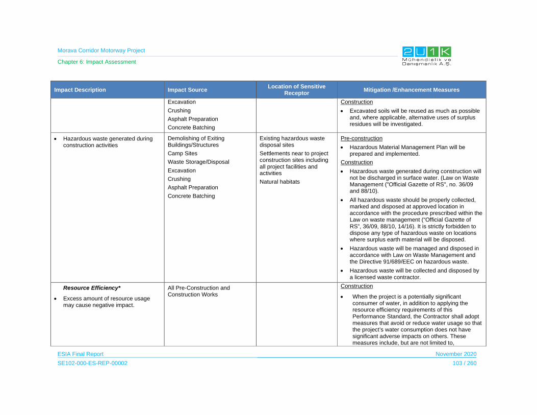
Morava Corridor Motorway Project
Chapter 6: Impact Assessment
ESIA Final Report November 2020
SE102-000-ES-REP-00002 103 / 260
Impact Description Impact Source Location of Sensitive
Receptor Mitigation /Enhancement Measures
Excavation
Crushing
Asphalt Preparation
Concrete Batching
Construction
Excavated soils will be reused as much as possible and, where applicable, alternative uses of surplus residues will be investigated.
Hazardous waste generated during construction activities
Demolishing of Exiting Buildings/Structures
Camp Sites
Waste Storage/Disposal
Excavation
Crushing
Asphalt Preparation
Concrete Batching
Existing hazardous waste disposal sites
Settlements near to project construction sites including all project facilities and activities
Natural habitats
Pre-construction
Hazardous Material Management Plan will be prepared and implemented.
Construction
Hazardous waste generated during construction will not be discharged in surface water. (Law on Waste Management ("Official Gazette of RS", no. 36/09 and 88/10).
All hazardous waste should be properly collected, marked and disposed at approved location in accordance with the procedure prescribed within the Law on waste management (“Official Gazette of RS”, 36/09, 88/10, 14/16). It is strictly forbidden to dispose any type of hazardous waste on locations where surplus earth material will be disposed.
Hazardous waste will be managed and disposed in accordance with Law on Waste Management and the Directive 91/689/EEC on hazardous waste.
Hazardous waste will be collected and disposed by a licensed waste contractor.
Resource Efficiency*
Excess amount of resource usage may cause negative impact.
All Pre-Construction and Construction Works
Construction
When the project is a potentially significant consumer of water, in addition to applying the resource efficiency requirements of this Performance Standard, the Contractor shall adopt measures that avoid or reduce water usage so that the project’s water consumption does not have significant adverse impacts on others. These measures include, but are not limited to,
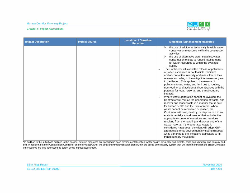
Morava Corridor Motorway Project
Chapter 6: Impact Assessment
ESIA Final Report November 2020
SE102-000-ES-REP-00002 104 / 260
Impact Description Impact Source Location of Sensitive
Receptor Mitigation /Enhancement Measures
the use of additional technically feasible water conservation measures within the construction activities,
the use of alternative water supplies, water consumption offsets to reduce total demand for water resources to within the available supply
The Contractor will avoid the release of pollutants or, when avoidance is not feasible, minimize and/or control the intensity and mass flow of their release according to the mitigation measures given in the Report. This applies to the release of pollutants to air, water, and land due to routine, non-routine, and accidental circumstances with the potential for local, regional, and transboundary impacts.
Where waste generation cannot be avoided, the Contractor will reduce the generation of waste, and recover and reuse waste in a manner that is safe for human health and the environment. Where waste cannot be recovered or reused, the Contractor will treat, destroy, or dispose of it in an environmentally sound manner that includes the appropriate control of emissions and residues resulting from the handling and processing of the waste material. If the generated waste is considered hazardous, the client will adopt GIIP alternatives for its environmentally sound disposal while adhering to the limitations applicable to its transboundary movement.
*In addition to the mitigitions outlined in this section, detailed measures are specified in each environmental section; water quality, air quality and climate, noise and vibration, and geology and soil. In addition, both the Construction Contractor and the Project Owner will detail their implementation plans within the scope of the quality system they will implement within the project. Impacts
on resources are also addressed as part of social impact assessment.
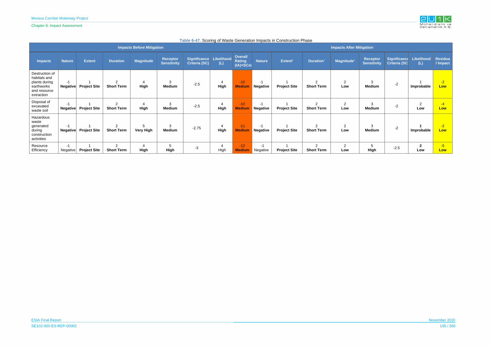
Morava Corridor Motorway Project
Chapter 6: Impact Assessment
ESIA Final Report November 2020
SE102-000-ES-REP-00002 105 / 260
Table 6-47. Scoring of Waste Generation Impacts in Construction Phase
Impacts Before Mitigation Impacts After Mitigation
Impacts Nature Extent Duration Magnitude Receptor
Sensitivity Significance Criteria (SC)
Likelihood(L)
Overall Rating (IA)=SCxL
Nature Extent’ Duration’ Magnitude’ Receptor
Sensitivity Significance Criteria (SC)
Likelihood (L)
Residual Impact
Destruction of habitats and plants during earthworks and resource extraction
-1 Negative
1 Project Site
2 Short Term
4 High
3 Medium
-2.5 4
High -10
Medium -1
Negative1
Project Site 2
Short Term2
Low 3
Medium-2
1 Improbable
-2 Low
Disposal of excavated waste soil
-1 Negative
1 Project Site
2 Short Term
4 High
3 Medium
-2.5 4
High -10
Medium -1
Negative1
Project Site 2
Short Term2
Low 3
Medium-2
2 Low
-4 Low
Hazardous waste generated during construction activities
-1 Negative
1 Project Site
2 Short Term
5 Very High
3 Medium
-2.75 4
High -11
Medium -1
Negative1
Project Site 2
Short Term2
Low 3
Medium-2
1 Improbable
-2 Low
Resource Efficiency
-1 Negative
1 Project Site
2 Short Term
4 High
5 High
-3 4
High -12
Medium -1
Negative 1
Project Site2
Short Term2
Low 5
High -2.5
2 Low
-5 Low
Morava Corridor Motorway Project
Chapter 6: Impact Assessment
ESIA Final Report November 2020
SE102-000-ES-REP-00002 106 / 260
6.7.2 Operation Phase
The waste to be generated during the operation phase will be sourced from food, paper and
packaging waste from the passengers who will use the parking lots along the Motorway. A
sufficient number of waste bins and containers will be placed in the parking lots and disposal
of waste will be cooperated with arranged by the local authorities.
Also, during the maintenance activities of the Motorway and operational vehicles/equipment,
hazardous waste may impact the environment.
Table 6-48 details the impact and mitigations for waste in operation phase of the Motorway.
Table 6-49 shows the overall rating of the impact of before and after mitigations. Generation
of waste is considered high since the duration, magnitude and the likelihood of the impacts are
determined as high. After taking mitigation measures, as shown in Table 6-49, the residual
impacts decrease significantly, and the residual impacts are classified as low.
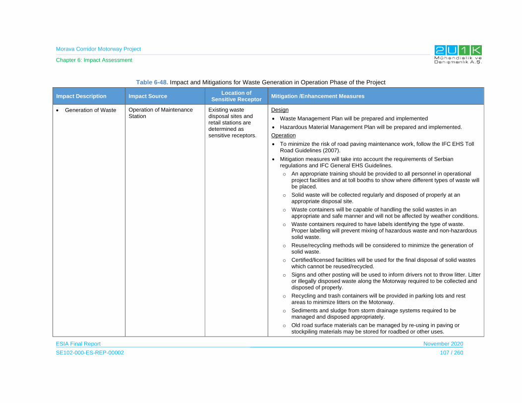
Morava Corridor Motorway Project
Chapter 6: Impact Assessment
ESIA Final Report November 2020
SE102-000-ES-REP-00002 107 / 260
Table 6-48. Impact and Mitigations for Waste Generation in Operation Phase of the Project
Impact Description Impact Source Location of
Sensitive Receptor Mitigation /Enhancement Measures
Generation of Waste Operation of Maintenance Station
Existing waste disposal sites and retail stations are determined as sensitive receptors.
Design
Waste Management Plan will be prepared and implemented
Hazardous Material Management Plan will be prepared and implemented.
Operation
To minimize the risk of road paving maintenance work, follow the IFC EHS Toll Road Guidelines (2007).
Mitigation measures will take into account the requirements of Serbian regulations and IFC General EHS Guidelines.
o An appropriate training should be provided to all personnel in operational project facilities and at toll booths to show where different types of waste will be placed.
o Solid waste will be collected regularly and disposed of properly at an appropriate disposal site.
o Waste containers will be capable of handling the solid wastes in an appropriate and safe manner and will not be affected by weather conditions.
o Waste containers required to have labels identifying the type of waste. Proper labelling will prevent mixing of hazardous waste and non-hazardous solid waste.
o Reuse/recycling methods will be considered to minimize the generation of solid waste.
o Certified/licensed facilities will be used for the final disposal of solid wastes which cannot be reused/recycled.
o Signs and other posting will be used to inform drivers not to throw litter. Litter or illegally disposed waste along the Motorway required to be collected and disposed of properly.
o Recycling and trash containers will be provided in parking lots and rest areas to minimize litters on the Motorway.
o Sediments and sludge from storm drainage systems required to be managed and disposed appropriately.
o Old road surface materials can be managed by re-using in paving or stockpiling materials may be stored for roadbed or other uses.

Morava Corridor Motorway Project
Chapter 6: Impact Assessment
ESIA Final Report November 2020
SE102-000-ES-REP-00002 108 / 260
Impact Description Impact Source Location of
Sensitive Receptor Mitigation /Enhancement Measures
All hazardous waste should be properly collected, marked and disposed at approved location in accordance with the procedure prescribed within the Law on waste management (“Official Gazette of RS”, 36/09, 88/10, 14/16). It is strictly forbidden to dispose any type of hazardous waste on locations where surplus earth material will be disposed.

Morava Corridor Motorway Project
Chapter 6: Impact Assessment
ESIA Final Report November 2020
SE102-000-ES-REP-00002 109 / 260
Table 6-49. Scoring of Waste Management Impacts in Construction Phase
Impacts Before Mitigation Impacts After Mitigation
Impacts Nature Extent Duration Magnitude Receptor
Sensitivity Significance Criteria (SC)
Likelihood
(L)
Overall Rating
(IA)=SCxL Nature Extent’ Duration’ Magnitude’
Receptor Sensitivity
Significance Criteria (SC)
Likelihood
(L)
Residual Impact
Generation of Waste
-1
Negative
2
Municipality
4
Long Term
2
Low
3
Medium -2.75
5
Definite
11
Medium
-1
Negative
2
Municipality
4
Long Term
2
Low
3
Medium -2.75
2
Low Probability
-6
Low
Morava Corridor Motorway Project
Chapter 6: Impact Assessment
ESIA Final Report November 2020
SE102-000-ES-REP-00002 110 / 260
6.8 Terrestrial and Freshwater Ecology
The construction and operation of the Project will involve a wide range of activities that have
the potential to affect ecology. Impacts of project activities can be further divided into the target
group of biological elements as terrestrial and aquatic. Important impacts of motorway
construction and operation activities on biological environment are mainly habitat
fragmentations. Habitat fragmentation can be described as the splitting of natural habitats and
ecosystems into smaller, more isolated patches. The process of fragmentation is connected to
many different factors, of which the direct loss and isolation of natural habitat are the most
important.
The ecological effects of transportation include disturbance in terms of noise, visual nuisance
from artificial structures and machinery activities and pollution, which act to reduce the
suitability of adjacent areas for wildlife. The infrastructure itself contributes significantly towards
habitat fragmentation by creating barriers to animal movement. This may result in the isolation
and loss of sensitive species. The steady increase in the number of animal casualties
associated with roads and to a lesser extent with drowned animals in waterways provides a
further indication of the fragmentation effect. Fauna mortality, in particular, has helped raise
the public perception of the problem, due to the inherent link to traffic safety. Finally,
devaluation of the landscape and nature for human recreation can make an important negative
economic factor.
During the planning, construction or upgrading of transportation infrastructure, all possible
efforts must be made to maintain or restore ecological structures and connect habitats and
populations. Particular attention will be paid to rivers, streams, riparian forests, wooded
corridors, networks of hedges and dikes etc., which provide ecological corridors for growth,
expansion of range and/or migration of wildlife populations and can often be the last refuge for
many species in an intensively man-used landscape.
Best practice assigns that project planning and design will aim to avoid ecological damage,
especially to protected or sensitive habitats and/or species. The avoidance of fragmentation
will be considered before resorting to mitigation measures.
The general principles that will be considered to avoid against the habitat fragmentation are:
The fragmentation of natural habitats by transportation infrastructure is a problem,
which can only be solved through acceptance of the issue at a policy level. Only an
interdisciplinary approach involving planners, economists, engineers, ecologists and
landscape architects etc., can provide the necessary tools for successfully addressing
fragmentation. Public involvement is also essential to ensure the success of the
chosen solutions.

Morava Corridor Motorway Project
Chapter 6: Impact Assessment
ESIA Final Report November 2020
SE102-000-ES-REP-00002 111 / 260
Habitat connectivity is a vital property of landscapes and is especially important for
sustaining animal movement across the landscape. The preservation of habitat
connectivity should be a strategic goal in the environmental policy of the transport
sector.
Avoiding and mitigation will be applied from the start of the planning process.
The relevant construction and operational activities of the Project likely to give rise to impacts
on receptors are summarized in Table 6-50, along with the likely pathway of the impacts.
Table 6-50. Potential Impacts of the Project on Biological Environment
Phase of the Project
Activities Activity Potential Impact
Construction
Vegetation clearance
Damage or loss of habitats
Loss of important plant species
Direct incidental killing of fauna
Loss of habitat for faunal species
Increase in noise, visual and vibration which may cause disturbance or displacement of fauna
Invasive species
Camp sites, borrow areas, batch and asphalt plants
and quarries
Damage or loss of habitat
Increase in noise, visual and vibration which may cause disturbance or displacement of fauna
Construction of culverts, bridges and viaducts
Damage or loss of habitat
Increase in noise, and vibration and disturbance on fauna
Disruption of ecological connectivity
Loss of ecosystem services
Presence of site preparation and
construction vehicles
Increase in noise, visual and vibration which may cause disturbance or displacement of fauna
Damage or loss of flora and /or fauna
Operation Operational traffic
Increase in noise, visual and vibration which may cause disturbance or displacement of fauna
Damage and/or loss of fauna
Barrier effects
Morava Corridor Motorway Project
Chapter 6: Impact Assessment
ESIA Final Report November 2020
SE102-000-ES-REP-00002 112 / 260
Protected Areas
According to the EIAs prepared for the Morava Motorway Project, based on the decision of the
Institute for Nature Protection of Serbia, It was determined that the area foreseen for the
Motorway, is not located in "protected areas for which protection procedure has been carried
out or initiated”, “Ecological Network of the Republic of Serbia ”, and “recorded natural assets”.
Internationally Recognized Areas
IFC PS6 states that internationally and/or nationally recognized areas of high biodiversity value
are likely qualified as critical habitat. These include Key Biodiversity Areas (KBAs), Important
Bird Areas (IBAs) and Important Plant Areas (IPAs). Therefore, all of the KBAs within and in
the vicinity of the Project Area are considered to be of high sensitivity.
Nationally Recognized Areas
IFC PS6 states that internationally and/or nationally recognized areas of high biodiversity value
are likely qualify as critical habitat. These include nationally protected areas. Therefore, all of
the protected areas within and in the vicinity of the Project area are considered to be of high
sensitivity.
There is no nationally or internationally protected area within the AoI. Only one nationally
recognized nature reserve area located is outside the AoI (Section-2, KP 30). The “Osredak”
Special Nature Reserve protected area is situated 530 m distance to the Proposed Motorway
centerline. The Project does not pose any direct impact (land take, construction of any access
roads, borrow area etc.) to the site. The results of the assessment on physical impacts (i.e. air
quality, noise, soil and water quality) given in this chapter indicate that indirect impacts of the
Project to the site are also insignificant or negligible. All the assessment on noise and air
impacts have been estimated with numerical models. As an example, estimated noise level at
the Osredak Special Nature Reserve is 40 dB, which indicates that no noise impact on the
area is expected due to its distance to project facilities. The site is also included in the
constraint maps as no-go area.
River diversion project will cause a significant change in the river flow. In order to reduce the
impact of flow in the new riverbed due to river regulation, natural material (such as rocks) will
be used for the protection of scouring and river bank erosion. Continuity of the flow will be
maintained in the new channel and the flow of the river will not be impacted. Therefore, no
adverse impacts on Gornje Pomoravlje KBA.
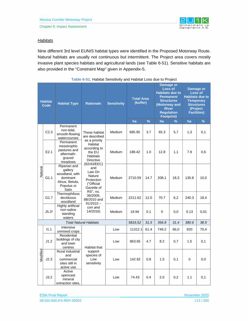
Morava Corridor Motorway Project
Chapter 6: Impact Assessment
ESIA Final Report November 2020
SE102-000-ES-REP-00002 113 / 260
Habitats
Nine different 3rd level EUNIS habitat types were identified in the Proposed Motorway Route.
Natural habitats are usually not continuous but intermittent. The Project area covers mostly
invasive plant species habitats and agricultural lands (see Table 6-51). Sensitive habitats are
also provided in the “Constraint Map” given in Appendix-5.
Table 6-51. Habitat Sensitivity and Habitat Loss due to Project
Habitat Code
Habitat Type Rationale Sensitivity
Total Area (buffer)
Damage or Loss of
Habitats due to Permanent Structures
(Motorway and River
Regulation Footprint)
Damage or Loss of
Habitats due to Temporary Structures
(Project Facilities)
ha % ha % ha %
Natu
ral
C2.3
Permanent non-tidal,
smooth-flowing watercourses
These habitat are described as a priority
Habitat according to
the EU Habitats Directive
(92/43/EEC) and
Law On Nature
Protection ("Official
Gazette of RS", no. 36/2009,
88/2010 and 91/2010 –corr.and 14/2016)
Medium 685.95 3.7 65.3 5,7 1,3 0,1
E2.1
Permanent mesotrophic pastures and
aftermath-grazed
meadows
Medium 188.42 1.0 12.8 1,1 7.9 0,6
G1.1
Riparian and gallery
woodland, with dominant
Alnus, Betula, Populus or
Salix
Medium 2710.59 14.7 208.1 18,3 130.8 10,0
G1.7 Thermophilous
deciduous woodland
Medium 2211.62 12.0 70.7 6,2 240.3 18,4
J5.3*
Highly artificial non-saline standing waters
Medium 19.94 0.1 0 0,0 0.13 0,01
Total Natural Habitats 5816,52 31,5 356.8 31,4 380.6 38.9
Mod
ifie
d
I1.1 Intensive
unmixed crops
Habitat that support
species of Low
sensitivity
Low 11312.16 61.4 749.2 66,0 920 70,4
J1.2
Residential buildings of city
and town centres
Low 863.65 4.7 8.2 0,7 1.5 0,1
J2.3
Rural industrial and
commercial sites still in active use
Low 142.92 0.8 1.5 0,1 0 0,0
J3.2
Active opencast mineral
extraction sites,
Low 74.43 0.4 2.0 0,2 1.1 0,1

Morava Corridor Motorway Project
Chapter 6: Impact Assessment
ESIA Final Report November 2020
SE102-000-ES-REP-00002 114 / 260
Habitat Code
Habitat Type Rationale Sensitivity
Total Area (buffer)
Damage or Loss of
Habitats due to Permanent Structures
(Motorway and River
Regulation Footprint)
Damage or Loss of
Habitats due to Temporary Structures
(Project Facilities)
ha % ha % ha %
including quarries
J4.2 Road Networks Low 130.83 0.7 25,7 2,3 1.7 0,1
J5.3
Highly artificial non-saline standing waters
Low 96,68 0.5 2.3 0,2 1.9 0,2
Total Modified Habitats 12620,61 68,5 779.1 74.9 926.3 61.1
Total 18437,19100.0 1135.9 100.0 1306.8 100.0
*areas which naturalized in time
Table 6-52. Detailed Habitat Loss due to Each Project Component
Project Component
Total Area of the Component
(ha)
% Area of the Component
Habitat Total Area of the Habitat within the Component (ha)
% Area of the Habitat within the
Component
Motorway 829,38 33,76
C2.3 7,57 0,91
E2.1 10,79 1,30
G1.1 70,79 8,54
G1.7 66,80 8,05
I1.1 634,97 76,56
J1.2 8,15 0,98
J2.3 1,52 0,18
J3.2 1,24 0,15
J4.2 25,45 3,07
J5.3 2,10 0,25
River Reguation 316,25 12,87
C2.3 57,69 18,24
E2.1 1,96 0,62
G1.1 137,29 43,41
G1.7 3,94 1,25
I1.1 114,18 36,10
J3.2 0,78 0,25
J4.2 0,23 0,07
J5.3 0,17 0,05
Batch Plant 37,48 1,53
G1.1 1,91 5,10
G1.7 1,68 4,48
I1.1 33,83 90,26

Morava Corridor Motorway Project
Chapter 6: Impact Assessment
ESIA Final Report November 2020
SE102-000-ES-REP-00002 115 / 260
Project Component
Total Area of the Component
(ha)
% Area of the Component
Habitat Total Area of the Habitat within the Component (ha)
% Area of the Habitat within the
Component
J5.3 0,06 0,16
Precast Yard 13,58 0,55
G1.1 0,28 2,06
G1.7 0,46 3,39
I1.1 12,84 94,55
Beam Plant 25,81 1,05 I1.1 25,80 100,00
Borrow Area 956,14 38,92
C2.3 0.00 0,00
E2.1 6,16 0,64
G1.1 125,34 13,11
G1.7 45,19 4,73
I1.1 776,04 81,16
J3.2 0,77 0,08
J4.2 0,60 0,06
J5.3 2.00 0,21
SW Plant 8,55 0,35 G1.7 0,11 1,29
I1.1 8,45 98,83
Quarry 201,76 8,21
C2.3 1,33 0,66
E2.1 1,80 0,89
G1.1 1,65 0,82
G1.7 189,26 93,80
I1.1 5,04 2,50
J1.2 1,24 0,61
J3.2 0,32 0,16
J4.2 1,12 0,56
Asphalt Plant 11,3 0,46
G1.1 0,06 0,53
G1.7 0,28 2,48
I1.1 10,67 94,42
J1.2 0,27 2,39
Subbase Plant 6,39 0,26 G1.7 0,11 1,72
I1.1 6,28 98,28
Camp Area 42,7 1,74
G1.1 1,61 3,77
G1.7 0,04 0,09
I1.1 41,06 96,16
Crusher 7,07 0,29 G1.7 3,15* 100,00
Total 2456,41 100,00
Morava Corridor Motorway Project
Chapter 6: Impact Assessment
ESIA Final Report November 2020
SE102-000-ES-REP-00002 116 / 260
*The remaining area of the Curshers are located in the Quarry sites
It can be observed that the most affected habitat (permanently occupied by the motorway and
river regulation – habitat lost) is agricultural lands (66%), described with a low sensitivity.
Thermophilous deciduous woodland (6.2%) and Riparian and gallery woodland, with dominant
Alnus, Betula, Populus or Salix (18.3%). The affection to the rest of the habitats will be much
lower, with a percentage of habitat loss below 9.5% in all the cases. Regarding temporary
occupancies of habitats, they are mostly limited to agricultural lands (70.4%), Thermophilous
deciduous woodland (18.4%) and Riparian and gallery woodland, with dominant Alnus, Betula,
Populus or Salix (10%). The rest of the habitats represent a percentage below 1.2%.
Threatened Flora and Fauna Species
Flora
There are no species endemic and protected by international conventions in the Project area.
According to the National legislation, there is one plant species listed as strictly protected (Ann-
I) Nuphar lutea. Only, Arctium lappa, Hypericum perforatum, Iris pseudoacorus, Acinos
hungaricus, Lamium album, Althea officinalis, Crataegus monogyna, Rosa canina, Galium
odoratum and Viola odorata species listed as protected species (Ann-II) were identified. These
species are assessed as medium sensitivity.
Invertebrates
According to the National legislation, there are 2 species Papilio machaon and Pieris brassicae
listed as strictly protected (Ann-I). The species potentially found in the Project AoI don’t have
important concentrations in terms of the species listed in National Protection lists. These
species identified in the studies have high global populations and widely distributed species in
the country and in Europe. According to this situation, these species are assessed as high
sensitivity.
Zerynhia cerisy is evaluated as NT (Near Threatened) according to IUCN Red List is assessed
as medium sensitivity. Rest of the invertebrate species are low sensitivity.
Amphibian –Reptilian
According to the National legislation, there are 8 Amphibian species and 7 Reptile species
listed as s strictly protected (Ann-I) and 1 Amphibian species listed as protected species (Ann-
II). The species potentially found in the Project AoI don’t have important concentrations in
terms of the species listed in National Protection lists. These species identified in the studies
have high global populations and widely distributed species in the country and in Europe.
According to this situation, species listed in Ann-I are assessed as high sensitivity and species
listed in Ann-II are assessed as medium sensitivity.

Morava Corridor Motorway Project
Chapter 6: Impact Assessment
ESIA Final Report November 2020
SE102-000-ES-REP-00002 117 / 260
Emys orbicularis, Testudo hermanni and Darevskia praticola are evaluated as NT (Near
Threatened) according to IUCN Red List and assessed as medium sensitivity.
Triturus macedonicus, Anguis fragilis, Lacerta viridis, Podarcis muralis and Vipera ammodytes
are assessed as low sensitivity due to their global and national status.
Birds
According to the National legislation, 75 of the bird species are listed as strictly protected (Ann-
I). And 19 species are listed as protected species (Ann-II).The species potentially found in the
Project AoI don’t have important concentrations in terms of the species listed in National
Protection lists. These species identified in the studies have high global populations and widely
distributed species in the country and in Europe. There were no bird species and/or habitats
in flocks and/or colonies observed in the study area. According to this situation, species listed
in Ann-I are assessed as high sensitivity and species listed in Ann-II are assessed as medium
sensitivity.
Aquila heliaca, Streptopelia turtur are evaluated as VU (Vulnerable) and Milvus milvus, Falco
vespertinus are evaluated as NT according to the IUCN Red List. These species are assessed
as medium sensitivity. Rest of the species not belonging to the National legislation and
evaluated lower than NT according to the IUCN are assessed as low sensitivity.
Mammals
According to the National legislation, 33 of the mammal species are listed as strictly protected
(Ann-I). And 1 species is listed as protected species (Ann-II). The species potentially found in
the project AoI don’t have important concentrations in terms of the species listed in National
Protection lists. These species identified in the studies have high global populations and widely
distributed species in the country and in Europe. According to this situation, species listed in
Ann-I are assessed as high sensitivity and species listed in Ann-II are assessed as medium
sensitivity.
Rhinolophus Euryale, Myotis bechsteinii and Lutra lutra are evaluated as NT (Near
Threatened) and Myotis capaccinii is evaluated as VU (Vulnerable) according to IUCN Red
List and assessed as medium sensitivity. Rest of the species do not belong to the National
legislation and evaluated lower than NT-VU according to the IUCN are assessed as low
sensitivity.
Aquatic Environment
According to the National legislation, 4 of the fish species and 2 of the macrobenthic species
listed as strictly protected (Ann-I). 9 fish species and one macrobenthic species listed as
protected species (Ann-II). The species potentially found in the Project AoI don’t have
Morava Corridor Motorway Project
Chapter 6: Impact Assessment
ESIA Final Report November 2020
SE102-000-ES-REP-00002 118 / 260
important concentrations in terms of the species listed in National Protection lists. These
species identified in the studies have high global populations and widely distributed species in
the riverine system of the country and Europe. According to this situation, species listed in
Ann-I are assessed as high sensitivity and species listed in Ann-II are assessed as medium
sensitivity.
Cyprinus carpio is evaluated as VU (Vulnerable) according to IUCN Red List and assessed as
medium sensitivity. Within the macrobenthic organisms, Hirudo medicinalis is classified as
‘Near Threatened Species-NT’,Astacus astacus classified as ‘Vulnerable-VU’ and Unio
crassus classified as ‘Endangered-EN’ according to IUCN Red List. In this context, Hirudo
medicinalis and Astacus astacus assessed as medium and Unio crassus assessed as high
sensitivity. Rest of the aquatic species not belonging to the National legislation and evaluated
lower than NT-VU according to the IUCN are assessed as low sensitivity.
Critical Habitat Assessment
Conservation of biodiversity requires protection of habitats for survival of species as well as
sustenance of ecosystems. As stated by IFC PS 6, habitats constitute “a terrestrial, freshwater
or marine geographical unit or airway that supports assemblages of living organisms and their
interactions with the non-living environment” (IFC, 2012). To meet IFC PS 6 requirements,
clients would have different obligations for different kinds of habitats. This enables to provide
a better understanding of specific species and habitat requirements and establish meaningful
management units to define a mitigation strategy. In order for IFC PS6 requirements to be met,
clients have different responsibilities regarding different habitat types.
The first step in assessment of habitat features is to differentiate between modified, natural
and critical habitats, each of which require different conservation efforts and compensatory
measures. Modified habitats, in the most general sense, are those that have been subject to
some form of alteration, often resulting in agricultural land. Despite the fact that some modified
habitats might lose all of their natural characteristics, it is still required to minimize further
impacts. Natural habitats are composed of plant and/or animal species that are mostly of native
origin, where human activity has not been significant enough to modify ecological functions
and species composition within. In line with IFC PS 6, in areas of natural habitat project
activities will not significantly convert or degrade the habitat unless the following conditions are
met (IFC, 2012):
There are no technically and financially feasible alternatives;
The overall benefits of the project outweigh the costs, including those to the
environment and biodiversity; and
Any conversion or degradation is appropriately mitigated.

Morava Corridor Motorway Project
Chapter 6: Impact Assessment
ESIA Final Report November 2020
SE102-000-ES-REP-00002 119 / 260
In areas of natural habitat, mitigation measures are required to be designed to achieve no net
loss of biodiversity. Critical habitats are areas of high biodiversity value that may include at
least one or more of the five values specified in IFC PS 6. Critical habitat criteria are as follows
and should form the basis of any critical habitat assessment (IFC, 2019 GN53):
I. Criterion 1: Critically Endangered (CR) and/or Endangered (EN) species;
II. Criterion 2: Endemic and/or restricted-range species;
III. Criterion 3: Migratory and/or congregatory species;
IV. Criterion 4: Highly threatened and/or unique ecosystems; and
V. Criterion 5: Key evolutionary processes.
Numerical thresholds have been defined for the first four critical habitat criteria. The thresholds
are indicative and serve as a guideline for decision-making only (IFC, 2019 GN56).
I. Criterion 1: Critically Endangered and Endangered Species
Species threatened with global extinction and listed as CR and EN on the IUCN Red List of
Threatened Species shall be considered as part of Criterion 1. Critically Endangered species
face an extremely high risk of extinction in the wild. Endangered species face a very high risk
of extinction in the wild.
Criterion 1 of species that are listed nationally/regionally as CR or EN in countries that adhere
to IUCN guidance shall be determined on a project-by-project basis in consultation with
competent professionals.
Thresholds for Criterion 1 are the followings:
a) Areas that support globally important concentrations of an IUCN Red-listed EN or CR
species (≥ 0.5% of the global population AND ≥ 5 reproductive units of a CR or EN
species).
b) Areas that support globally important concentrations of an IUCN Red-listed Vulnerable
(VU) species, the loss of which would result in the change of the IUCN Red List status
to EN or CR and meet the thresholds in (a).
c) As appropriate, areas containing important concentrations of a nationally or
regionally listed EN or CR species.
According to the findings obtained from surveys in these habitats, no Terrestrial and Aquatic
flora-fauna species classified as CR were observed. Only Unio crassus classified as EN in
global scale according to IUCN. Although, European population of Unio crassus classifed as
VU. Unio crassus was not detected in the field study and was included in the lists based on
the literature. Species classified as VU status have been identified during the studies, but the
habitats don’t have globally important concentrations in these habitats. All of the species
Morava Corridor Motorway Project
Chapter 6: Impact Assessment
ESIA Final Report November 2020
SE102-000-ES-REP-00002 120 / 260
identified in these studies have high global populations and all species are widely distributed
species.
As it is given in the baseline chapter of the ESIA Report, the literature together with the baseline
study indicates that neither species potentially found in the project AoI nor the habitats don’t
have important concentrations in terms of the species listed in National Protection lists. The
assessment shows that the area is heavily under the anthropogenic influences (mainly
agriculture and populated settlements along Morava River and the existing road).
II. Criterion 2: Endemic and Restricted-range Species
For terrestrial vertebrates and plants, restricted-range species are defined as those
species that have an EOO16 less than 50,000 square kilometers (km2).
For marine systems, restricted-range species are provisionally being considered as
those with an EOO of less than 100,000 km2.
For coastal, riverine, and other aquatic species in habitats that do not exceed 200 km
width at any point (for example, rivers), restricted range is defined as having a global
range of less than or equal to 500 km linear geographic span (i.e., the distance between
occupied locations furthest apart).
The threshold for Criterion 2 is the following:
a) Areas that regularly hold ≥10% of the global population size AND ≥10 reproductive
units of a species
According to the findings obtained from surveys in these habitats, no Terrestrial and Aquatic
flora-fauna species classified as Endemic and Restricted-Range Species were observed. All
of the species identified in the studies have high global populations and all species are widely
distributed species.
There are no Global-level Key Biodiversity Areas and Important Bird and Biodiversity Areas
for restricted-range species.
For the above reasons, no Critical habitat is expected to be present within the AoI according
to Criterion 2.
III. Criterion 3: Migratory and Congregatory Species
16 IFC Guidance Note GN74 For purposes of this Guidance Note, the term endemic is defined as restricted-range. Restricted range refers to a limited extent of occurrence (EOO).

Morava Corridor Motorway Project
Chapter 6: Impact Assessment
ESIA Final Report November 2020
SE102-000-ES-REP-00002 121 / 260
Migratory species are defined as any species of which a significant proportion of its members
cyclically and predictably move from one geographical area to another (including within the
same ecosystem).
Congregatory species are defined as species whose individuals gather in large groups on a
cyclical or otherwise regular and/or predictable basis.
Thresholds for Criterion 3 are the followings:
a) Areas known to sustain, on a cyclical or otherwise regular basis, ≥ 1 percent of the
global population of a migratory or congregatory species at any point of the species’
lifecycle.
b) Areas that predictably support ≥10 percent of the global population of a species
during periods of environmental stress.
During the studies, it was observed that there are areas used for breeding and wintering
purposes. However, the species in these areas do not form large colonies.
There are no Global-level Key Biodiversity Areas and Important Bird and Biodiversity Areas
for congregatory species.
There are no Wetlands of International Importance designated under criteria 5 or 6 of the
Ramsar Convention.
For the above reasons, no Critical habitat is expected to be present within the AoI according
to Criterion 3.
IV. Criterion 4: Highly Threatened or Unique Ecosystems
The IUCN is developing a Red List of Ecosystems, following an approach similar to the Red
List for Threatened Species. “The client should use the Red List of Ecosystems where formal
IUCN assessments have been performed. Where formal IUCN assessments have not been
performed, the client may use assessments using systematic methods at the national/ regional
level, carried out by governmental bodies, recognized academic institutions and/or other
relevant qualified organizations (including internationally recognized NGOs). GN80”.
The thresholds for Criterion 4 are the followings:
a) Areas representing ≥5% of the global extent of an ecosystem type meeting the criteria
for IUCN status of CR or EN.
b) Other areas not yet assessed by IUCN but determined to be of high priority for
conservation by regional or national systematic conservation planning.
None of the habitats identified within the AoI are considered to be “Highly Threatened and/or
Unique Ecosystems” i.e.:
Morava Corridor Motorway Project
Chapter 6: Impact Assessment
ESIA Final Report November 2020
SE102-000-ES-REP-00002 122 / 260
(i) at risk of significantly decreasing in area or quality;
(ii) with a small spatial extent; and/or
(iii) containing unique assemblages of species including assemblages or concentrations of
biome-restricted species.
The Terrestrial and Aquatic habitats identified are not considered as threatened according to
the “IUCN Red List of Ecosystems” and “European Red List of Habitats”. These habitats are
very common in Europe.
For the above reasons, no Critical habitat is expected to be present within the AoI according
to Criterion 4.
V. Criterion 5: Key Evolutionary Processes
The structural attributes of a region, such as its topography, geology, soil, temperature, and
vegetation, and combinations of these variables, can influence the evolutionary processes that
give rise to regional configurations of species and ecological properties. In some cases, spatial
features that are unique or idiosyncratic of the landscape have been associated with
genetically unique populations or subpopulations of plant and animal species. Physical or
spatial features have been described as surrogates or spatial catalysts for evolutionary and
ecological processes, and such features are often associated with species diversification.
Maintaining these key evolutionary processes inherent in a landscape as well as the resulting
species (or subpopulations of species) has become a major focus of biodiversity conservation
in recent decades, particularly the conservation of genetic diversity. By conserving species
diversity within a landscape, the processes that drive speciation, as well as the genetic
diversity within species, ensures the evolutionary flexibility in a system, which is especially
important in a rapidly changing climate.
There is no any isolation, spatial heterogeneity and wealth of environmental gradients in the
AoI. It also has not been subject to much higher levels of habitat loss and fragmentation. AoI
does not support key evolutionary processes.
For the above reasons, no Critical habitat is expected to be present within the AoI according
to Criterion 5.
The habitats identified in the field study are very common in Europe. Invasive species are
generally found in natural habitats in the Project site. A large part of the Project site consists
of agricultural areas.
Surroundings of the Project site show similar habitat and ecosystem characteristics to those
that had been identified at the project site before the onset of construction activities. Therefore,
vicinity of the Project site bears suitable alternative habitats for fauna species with high

Morava Corridor Motorway Project
Chapter 6: Impact Assessment
ESIA Final Report November 2020
SE102-000-ES-REP-00002 123 / 260
ecological carrying capacity. Outside the Project site, there are animal species from each large
terrestrial vertebrate class, with prey-predator relationships representing the food pyramid.
In the official letter issued by the Institute for Nature Protection of Serbia17 for the local EIAs
“Location Condition” (03 no.019-1532/2 19.06.2019) includes the following statements for the
area where the activity will take place;
There are no “protected areas on the Motorway Section for which protection procedure has
been carried out or initiated”, “ecologically significant areas and ecological corridors of
international importance of the ecological network of the Republic of Serbia determined by the
Decree on Ecological Network (Official Gazette of RS, No.102/2010)”.
It is also the habitat of several species of strictly protected and protected species of fish,
amphibians, reptiles, birds and mammals. No endemic or relict species were found. The animal
and plant species that inhabit this area are relatively widespread in the territory of Serbia, so
the area does not represent a vital part of the habitat for their survival or overall conservation
status.
Furthermore, according to the findings obtained from studies in these habitats, no flora and
fauna species classified as dangerous and / or threatened (CR) were observed. Species under
protection according to national and international conservation criteria are available. However,
all of the species identified in the field have high global populations and all species are widely
distributed ones.
Critical habitat assessment carried out in the Area of Influence defined in the report presented
in Appendix-11.
Supplemental Biodiversity Assessment (“SBA”) including Critical habitat assessment (CHA),
Updated biodiversity impact assessment, Offset strategy and Biodiversity Management Plan
following IFC Performance Standard 6 is currently underway to more fully understand the
national and global significance of the habitats and species which may be affected, which will
enable targeted mitigation to be put in place where required. SBA will be presented in addition
to ESIA.
17 In the process of elaboration of the Fifth National Report on implementation of the Convention on Biological Diversity, the Institute for Nature Conservation of Serbia have given their contribution by delivering information and data.
Morava Corridor Motorway Project
Chapter 6: Impact Assessment
ESIA Final Report November 2020
SE102-000-ES-REP-00002 124 / 260
6.8.1 Construction Phase
The Impact Assessment on Terrestrial and Freshwater Ecology during the Construction Phase
Table 6-53 details the impact and mitigations for the Terrestrial and Freshwater Ecology in the
Construction Phase of the Project.
Table 6-54 shows the overall rating of the impacts before and after mitigations. All of the
potential impacts may cause medium receptor sensitivity with various duration. Therefore, the
overall impacts prior to mitigation measures are medium. After taking mitigation measures, as
shown in Table 6-54, the residual impacts decrease significantly, and the residual impacts are
classified as low.

Morava Corridor Motorway Project
Chapter 6: Impact Assessment
ESIA Final Report November 2020
SE102-000-ES-REP-00002 125 / 260
Table 6-53. Impact on Terrestrial and Freshwater Ecology (Construction Phase)
Impact Description Impact Source Location of
Sensitive Receptor Mitigation /Enhancement Measures
Impact assessment for “Protected Areas” was not performed due to protected areas will not be affected in any way since they are located outside the Morava Corridor Motorway Project AoI.
Damage or loss of terrestrial habitats due to permanent structures
Construction activities can directly cause damage and loss of habitats: Vegetation clearance and motorway
Top-soil stripping
Top-Soil Storage
Tree Cutting /Vegetation clearance
Land Take/Expropriation
Mobilization of Machinery and Equipment
Camp Sites
Material Storage
Waste Storage/Disposal
Excavation
Backfilling
Storage, Re-Use and Disposal of Excavations
Machinery and Equipment
Terrestrial Habitats Design
Afforestation activities to be performed in line with No net loss principle, i.e preparation of Biodiversity Management Plan and SERL Management Plan.
Gallery vegetation will be created along West Morava's new riverbed, as it existed before the regulation, to restore the natural habitat condition. This gallery will also be retention for possible high waters.
After the river regulation, 17 m of revegetated area with native species will be created on both sides of the new river bed.
Pre-Construction
Delimitation of areas to be cleared before the beginning of the construction activities in order to limit as much as possible the surface of vegetation to be cleared.
Construction
Project construction sites and access roads will be separated from sensitive areas with appropriate fencing and signage.
Appropriate fencing such as orange safety barrier fencing will be installed to protect sensitive habitats. (Sensitive habitats are provided in the Constraint Map given in Appendix-5)
In sensitive habitat areas, pedestrian, equipment and vehicle access will be limited to the designated access to construction sites. Parking and driving off the designated access roads will not be allowed.

Morava Corridor Motorway Project
Chapter 6: Impact Assessment
ESIA Final Report November 2020
SE102-000-ES-REP-00002 126 / 260
Impact Description Impact Source Location of
Sensitive Receptor Mitigation /Enhancement Measures
Waste generated from construction work and activities will be stored at designated areas and then disposed. Solid waste will not be allowed to be left at natural habitats.
Construction waste generated due to project activities will first be stored at designated storage areas and then disposed. Solid waste will not be allowed to be left at natural habitats.
Licensed/approved facilities for solid and liquid waste disposal will be used and a duty of care and chain of custody for all waste leaving the site will be followed.
Riparian vegetation along the West Morava River will be restored.
Damage or loss of terrestrial habitats due to temporary structures
Construction activities can directly cause damage and loss of habitats: Vegetation clearance, Soil and rock excavations and Borrow pits, quarries, camp sites and other facilities.
Top-soil stripping
Top-Soil Storage
Tree Cutting /Vegetation clearance
Land Take/Expropriation
Mobilization of Machinery and Equipment
Camp Sites
Material Storage
Waste Storage/Disposal
Excavation
Backfilling
Storage, Re-Use and Disposal of Excavations
Machinery and Equipment
Demobilization of Equipment and Machinery
Terrestrial Habitats Design and pre-construction
Delimitation of areas to be cleared before the beginning of the construction activities in order to limit as much as possible the surface of vegetation to be cleared.
SERL Plans will be developed for all Project Facilities – camps, site facilities, borrow pits, quarries, batching plant, and asphalt plants.
SERL plans for borrow pits will include habitat designs that allow artificial wetlands to be reformed. During the baseline field studies, existing borrow pits which had already been opened in the region in the past, had over time developed into wetland habitats. This measure will encourage development of new habitats, especially aquatic plants and bird species.
Construction
Project construction sites and access roads will be separated from sensitive areas with appropriate

Morava Corridor Motorway Project
Chapter 6: Impact Assessment
ESIA Final Report November 2020
SE102-000-ES-REP-00002 127 / 260
Impact Description Impact Source Location of
Sensitive Receptor Mitigation /Enhancement Measures
Re-instatement of Camp Sites and Access Roads
Rehabilitation of Borrow Pits
Movement of the vehicles
fencing and signage.
Appropriate fencing such as orange safety barrier fencing will be installed to protect sensitive habitats. (Sensitive habitats are provided in the Constraint Map given in Appendix-5)
In sensitive habitat areas, pedestrian, equipment and vehicle access will be limited to the designated access to construction sites. Parking and driving off the designated access roads will not be allowed.
Waste generated from construction work and activities will be stored at designated areas and then disposed. Solid waste will not be allowed to be left at natural habitats.
Licensed/approved facilities for solid and liquid waste disposal must be used and a duty of care and chain of custody for all waste leaving the site will be followed.
Project Facilities will be dismantled upon completion of the construction phase.
Areas where the facilities are located will be reinstated according to SERL Plans.
Habitat fragmentation
Linear infrastructures, such as highways, contribute significantly towards the habitat fragmentation. Building of a closed highway will cause fragmentation and separation of habitats.
Top-soil stripping
Top-Soil Storage
Tree Cutting /Vegetation clearance
Land Take/Expropriation
Mobilization of Machinery and Equipment
Excavation
Movement of the vehicles
Terrestrial Habitats Construction
Fauna crossing points (i.e. culverts) will be designed and installed along the motorway. Culverts for animals are primarily constructed as safe crossing points for mammals. Target species are usually mammals. Small fauna species may readily use these culverts as well. As a minimum when using culverts a ledge will be incorporated where species such as otters and reptiles can cross alongside the river even at times of high flow. It can also be used on bridges to be built on the West Morava River to prevent barrier effect.
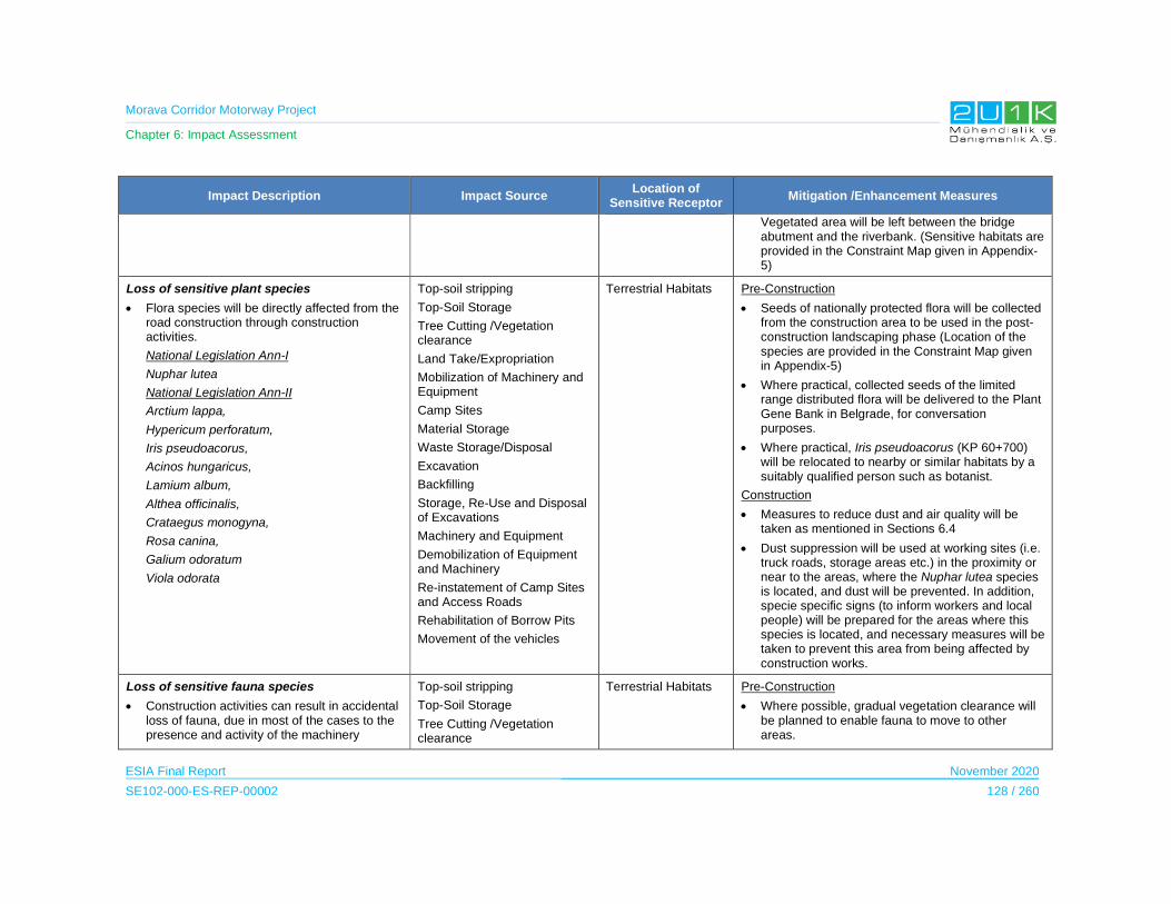
Morava Corridor Motorway Project
Chapter 6: Impact Assessment
ESIA Final Report November 2020
SE102-000-ES-REP-00002 128 / 260
Impact Description Impact Source Location of
Sensitive Receptor Mitigation /Enhancement Measures
Vegetated area will be left between the bridge abutment and the riverbank. (Sensitive habitats are provided in the Constraint Map given in Appendix-5)
Loss of sensitive plant species
Flora species will be directly affected from the road construction through construction activities.
National Legislation Ann-I
Nuphar lutea
National Legislation Ann-II
Arctium lappa,
Hypericum perforatum,
Iris pseudoacorus,
Acinos hungaricus,
Lamium album,
Althea officinalis,
Crataegus monogyna,
Rosa canina,
Galium odoratum
Viola odorata
Top-soil stripping
Top-Soil Storage
Tree Cutting /Vegetation clearance
Land Take/Expropriation
Mobilization of Machinery and Equipment
Camp Sites
Material Storage
Waste Storage/Disposal
Excavation
Backfilling
Storage, Re-Use and Disposal of Excavations
Machinery and Equipment
Demobilization of Equipment and Machinery
Re-instatement of Camp Sites and Access Roads
Rehabilitation of Borrow Pits
Movement of the vehicles
Terrestrial Habitats Pre-Construction
Seeds of nationally protected flora will be collected from the construction area to be used in the post-construction landscaping phase (Location of the species are provided in the Constraint Map given in Appendix-5)
Where practical, collected seeds of the limited range distributed flora will be delivered to the Plant Gene Bank in Belgrade, for conversation purposes.
Where practical, Iris pseudoacorus (KP 60+700) will be relocated to nearby or similar habitats by a suitably qualified person such as botanist.
Construction
Measures to reduce dust and air quality will be taken as mentioned in Sections 6.4
Dust suppression will be used at working sites (i.e. truck roads, storage areas etc.) in the proximity or near to the areas, where the Nuphar lutea species is located, and dust will be prevented. In addition, specie specific signs (to inform workers and local people) will be prepared for the areas where this species is located, and necessary measures will be taken to prevent this area from being affected by construction works.
Loss of sensitive fauna species
Construction activities can result in accidental loss of fauna, due in most of the cases to the presence and activity of the machinery
Top-soil stripping
Top-Soil Storage
Tree Cutting /Vegetation clearance
Terrestrial Habitats Pre-Construction
Where possible, gradual vegetation clearance will be planned to enable fauna to move to other areas.
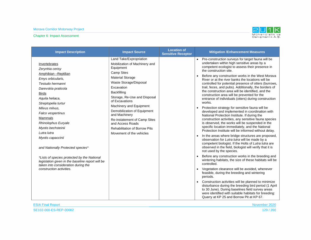
Morava Corridor Motorway Project
Chapter 6: Impact Assessment
ESIA Final Report November 2020
SE102-000-ES-REP-00002 129 / 260
Impact Description Impact Source Location of
Sensitive Receptor Mitigation /Enhancement Measures
Invertebrates
Zerynhia cerisy
Amphibian –Reptilian
Emys orbicularis,
Testudo hermanni
Darevskia praticola
Birds
Aquila heliaca,
Streptopelia turtur
Milvus milvus,
Falco vespertinus
Mammals
Rhinolophus Euryale
Myotis bechsteinii
Lutra lutra
Myotis capaccinii
and Nationally Protected species*
*Lists of species protected by the National legislation given in the baseline report will be taken into consideration during the construction activities.
Land Take/Expropriation
Mobilization of Machinery and Equipment
Camp Sites
Material Storage
Waste Storage/Disposal
Excavation
Backfilling
Storage, Re-Use and Disposal of Excavations
Machinery and Equipment
Demobilization of Equipment and Machinery
Re-instatement of Camp Sites and Access Roads
Rehabilitation of Borrow Pits
Movement of the vehicles
Pre-construction surveys for target fauna will be undertaken within high sensitive areas by a competent ecologist to assess their presence in the construction site.
Before any construction works in the West Morava River or at the river banks the locations will be controlled for potential presence of otters (burrows, trail, feces, and pubs). Additionally, the borders of the construction area will be identified, and the construction area will be prevented for the entrance of individuals (otters) during construction works.
Protection strategy for sensitive fauna will be developed and implemented in coordination with National Protection Institute. If during the construction activities, any sensitive fauna species is observed, the works will be suspended in the specific location immediately, and the National Protection Institute will be informed without delay.
In the areas where bridge structures are proposed, observation for Lutra lutra will be made by a competent biologist. If the Holts of Lutra lutra are observed in the field, biologist will verify that it is not used by the species.
Before any construction works in the breeding and wintering habitats, the size of these habitats will be controlled.
Vegetation clearance will be avoided, whenever feasible, during the breeding and wintering periods.
Construction activities will be planned to minimize disturbance during the breeding bird period (1 April to 30 June). During baselines field survey areas were identified with suitable habitats for breeding: Quarry at KP 25 and Borrow Pit at KP 67.

Morava Corridor Motorway Project
Chapter 6: Impact Assessment
ESIA Final Report November 2020
SE102-000-ES-REP-00002 130 / 260
Impact Description Impact Source Location of
Sensitive Receptor Mitigation /Enhancement Measures
Construction activities will be planned to minimize disturbance during the wintering bird period (1 December to 1 February). During baselines field survey areas were identified as wintering area: Borrow Pit at KP 60 and West Morava River corresponding to KP 95.
If construction has started before these dates, work can be continued in both breeding and wintering areas.
Construction
Speed of construction vehicles will be limited, in order to limit emission of dust in non-paved access roads and avoid the risk of accidents with fauna.
Sensitive habitats will be protected by the use of appropriate fencing such as orange safety barrier fencing. Protective measures will be implemented especially in locations of active construction works to also avoid the entry fauna and avoiding accidents.
Increase in noise, visual nuisance and vibration which may cause disturbance or displacement of fauna
Construction activities can directly and indirectly cause disturbance to species of fauna, due in most of the cases to the presence and activity of the machinery.
Mobilization of Machinery and Equipment
Camp Sites
Material Storage
Excavation
Backfilling
Storage, Re-Use and Disposal of Excavations
Crushing
Machinery and Equipment
Asphalt Preparation
Concrete Batching
Terrestrial Habitats Construction
Measures to reduce noise will be taken as mentioned in Sections 6.5
Noise, waste and spills created during the construction activities will be managed under an Environmental Management Plan, to limit the disturbance to fauna.
Environmental Awareness training will be provided to all personnel to increase awareness about the impact of disturbance, waste and spills on habitats and fauna.

Morava Corridor Motorway Project
Chapter 6: Impact Assessment
ESIA Final Report November 2020
SE102-000-ES-REP-00002 131 / 260
Impact Description Impact Source Location of
Sensitive Receptor Mitigation /Enhancement Measures
Demobilization of Equipment and Machinery
Movement of the vehicles
Introduction of Alien invasive species
The clearing of new areas may provide opportunities for Alien invasive species introduction.
Top-soil stripping
Top-Soil Storage
Tree Cutting /Vegetation clearance
Land Take/Expropriation
Mobilization of Machinery and Equipment
Excavation
Machinery and Equipment
Re-instatement of Camp Sites and Access Roads
Rehabilitation of Borrow Pits
Movement of the vehicles
Terrestrial Habitats Construction
Intrusion of any invasive flora species into the project area and its surroundings will be prevented. For this purpose, especially vehicles used for vegetation clearance and/or plant transfer will be washed/cleaned prior to use.
Project employees will not be allowed to bring any live animals or plants into the construction site to avoid the risk of pest/invasive species establishing in the Project area.
Planting of alien species will be prohibited within the Project Facilities or any areas within the AoI, including landscaping of revegetated areas.
Where practical, alien species will be seasonally monitored to record their populations in the construction area and to prevent them from spreading throughout the AoI. Additionally, prompt revegetation (i.e. sowing of native herbaceous species and/or planting native shrubs/trees) on bare soil with natural or semi-natural vegetation will reduce the spread of alien species.
Revegetation (i.e., the sowing of native herbaceous species on top-soils and/or the planting of native shrubs/trees) will be undertaken as soon as possible after clearance and construction.
Damage to Freshwater Ecosystem
There are a number of activities during the construction activities that can result in damage to the freshwater ecosystems:
Waste Storage/Disposal
Water Supply
Wastewater Treatment and Disposal
Aquatic Habitats Pre-Construction
Temporary culverts proposed for river and stream crossings as mitigation measure to protect sensitive aquatic habitats (see Water Environment
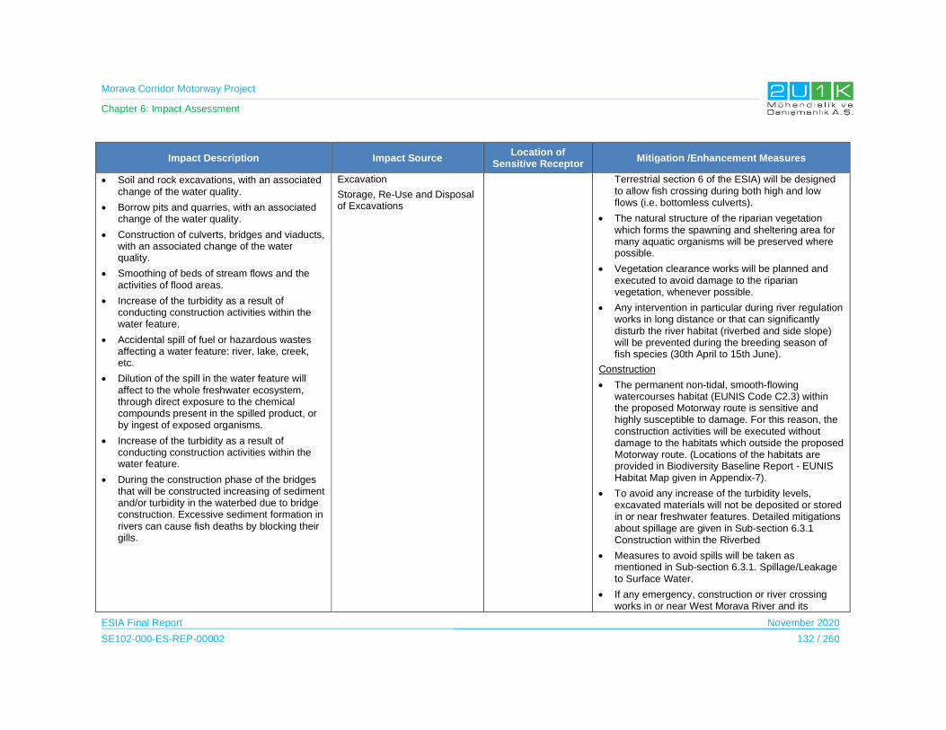
Morava Corridor Motorway Project
Chapter 6: Impact Assessment
ESIA Final Report November 2020
SE102-000-ES-REP-00002 132 / 260
Impact Description Impact Source Location of
Sensitive Receptor Mitigation /Enhancement Measures
Soil and rock excavations, with an associated change of the water quality.
Borrow pits and quarries, with an associated change of the water quality.
Construction of culverts, bridges and viaducts, with an associated change of the water quality.
Smoothing of beds of stream flows and the activities of flood areas.
Increase of the turbidity as a result of conducting construction activities within the water feature.
Accidental spill of fuel or hazardous wastes affecting a water feature: river, lake, creek, etc.
Dilution of the spill in the water feature will affect to the whole freshwater ecosystem, through direct exposure to the chemical compounds present in the spilled product, or by ingest of exposed organisms.
Increase of the turbidity as a result of conducting construction activities within the water feature.
During the construction phase of the bridges that will be constructed increasing of sediment and/or turbidity in the waterbed due to bridge construction. Excessive sediment formation in rivers can cause fish deaths by blocking their gills.
Excavation
Storage, Re-Use and Disposal of Excavations
Terrestrial section 6 of the ESIA) will be designed to allow fish crossing during both high and low flows (i.e. bottomless culverts).
The natural structure of the riparian vegetation which forms the spawning and sheltering area for many aquatic organisms will be preserved where possible.
Vegetation clearance works will be planned and executed to avoid damage to the riparian vegetation, whenever possible.
Any intervention in particular during river regulation works in long distance or that can significantly disturb the river habitat (riverbed and side slope) will be prevented during the breeding season of fish species (30th April to 15th June).
Construction
The permanent non-tidal, smooth-flowing watercourses habitat (EUNIS Code C2.3) within the proposed Motorway route is sensitive and highly susceptible to damage. For this reason, the construction activities will be executed without damage to the habitats which outside the proposed Motorway route. (Locations of the habitats are provided in Biodiversity Baseline Report - EUNIS Habitat Map given in Appendix-7).
To avoid any increase of the turbidity levels, excavated materials will not be deposited or stored in or near freshwater features. Detailed mitigations about spillage are given in Sub-section 6.3.1 Construction within the Riverbed
Measures to avoid spills will be taken as mentioned in Sub-section 6.3.1. Spillage/Leakage to Surface Water.
If any emergency, construction or river crossing works in or near West Morava River and its
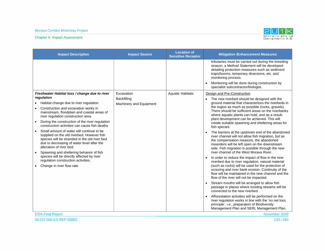
Morava Corridor Motorway Project
Chapter 6: Impact Assessment
ESIA Final Report November 2020
SE102-000-ES-REP-00002 133 / 260
Impact Description Impact Source Location of
Sensitive Receptor Mitigation /Enhancement Measures
tributaries must be carried out during the breeding season, a Method Statement will be developed detailing protection measures such as sediment traps/booms, temporary diversions, etc. and monitoring process.
Monitoring will be done during construction by specialist subcontractor/biologist.
Freshwater Habitat loss / change due to river regulation
Habitat change due to river regulation
Construction and excavation works in mainstream, floodplain and coastal areas of river regulation construction area
During the construction of the river regulation construction activities can cause fish deaths
Small amount of water will continue to be supplied on the old riverbed. However fish species will be stranded in the old river bed due to decreasing of water level after the alteration of river bed.
Spawning and sheltering behavior of fish species will be directly affected by river regulation construction activities.
Change in river flow rate
Excavation
Backfilling
Machinery and Equipment
Aquatic Habitats Design and Pre-Construction
The new riverbed should be designed with the ground material that characterizes the riverbeds in the region as much as possible (rocks, gravels). There should be sufficient areas on the riverbanks where aquatic plants can hold, and as a result, plant development can be achieved. This will create suitable spawning and sheltering areas for fish species.
The barriers at the upstream end of the abandoned river channel will not allow fish migration, but as the compensation measure, the abandoned meanders will be left open on the downstream side. Fish migration is possible through the new river channel of the West Morava River.
In order to reduce the impact of flow in the new riverbed due to river regulation, natural material (such as rocks) will be used for the protection of scouring and river bank erosion. Continuity of the flow will be maintained in the new channel and the flow of the river will not be impacted.
Stream mouths will be arranged to allow fish passage in places where existing streams will be connected to the new riverbed.
Afforestation activities will be performed on the river regulation works in line with the ‘no net loss principle’, i.e., preparation of Biodiversity Management Plan and SERL Management Plan.

Morava Corridor Motorway Project
Chapter 6: Impact Assessment
ESIA Final Report November 2020
SE102-000-ES-REP-00002 134 / 260
Impact Description Impact Source Location of
Sensitive Receptor Mitigation /Enhancement Measures
Construction
During river regulation or diversion works, fish species stranded in the natural small ponds (puddle) will be transported to the riverbed by a competent biologist.
Fish transportation will be made in specialized vehicles with tanks and oxygen, if necessary, other vehicles will be adapted for this purpose and equipped with a container for transporting fish.
Loss of important aquatic species
Construction activities can result in accidental loss of aquatic species, due in most of the cases to the presence and activity of the machinery
Nationally Protected species Ann-I
Carassius carassius*
Tinca tinca
Cobitis elongata
Zingel zingel
Unio carassus
Astacus astacus
Nationally Protected species Ann-II
Abramis brama
Barbus balcanius
Chondrostoma nasus
Cyprinus carpio (VU)
Squalius cephalus
Esox lucius
Perca fluviatilis
Sander lucioperca
Top-soil stripping
Top-Soil Storage
Tree Cutting /Vegetation clearance
Land Take/Expropriation
Mobilization of Machinery and Equipment
Camp Sites
Material Storage
Waste Storage/Disposal
Water Supply
Wastewater Treatment and Disposal
Excavation
Backfilling
Storage, Re-Use and Disposal of Excavations
Crushing
Machinery and Equipment
Asphalt Preparation
Concrete Batching
Aquatic Habitats Pre-construction and Construction
Construction work (bridge structures, drainage, temporary crossings and temporary works for structures) on and near the West Morava River and its tributaries between 30th April to 15th June will be planned and executed with care to avoid or minimize impact to fish species caused by human or equipment activities.
A Method Statement for Work on or Near Watercourse will be prepared detailing the measures such as sediment traps/booms, temporary diversions, etc.
If construction work (river regulation, bridge structures, drainage, temporary crossings, and temporary works for structures) has commence before the start of breeding season, work can continue in line with the measures detailed in the Method Statement.
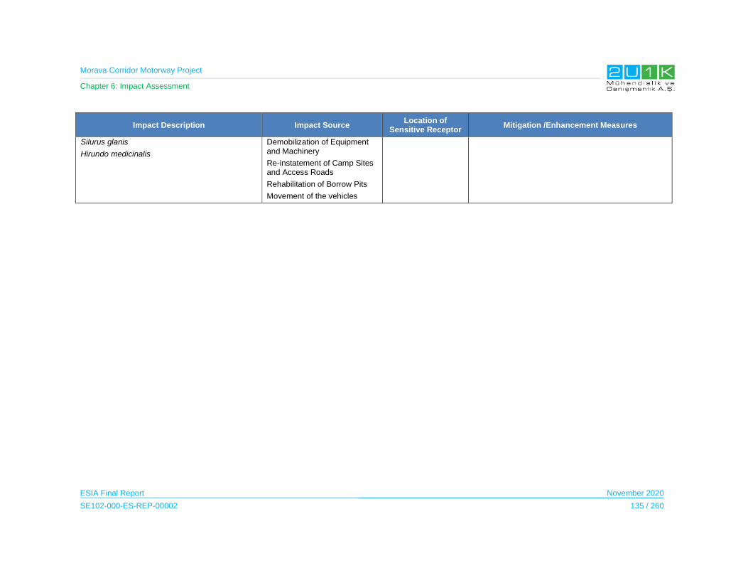
Morava Corridor Motorway Project
Chapter 6: Impact Assessment
ESIA Final Report November 2020
SE102-000-ES-REP-00002 135 / 260
Impact Description Impact Source Location of
Sensitive Receptor Mitigation /Enhancement Measures
Silurus glanis
Hirundo medicinalis
Demobilization of Equipment and Machinery
Re-instatement of Camp Sites and Access Roads
Rehabilitation of Borrow Pits
Movement of the vehicles

Morava Corridor Motorway Project
Chapter 6: Impact Assessment
ESIA Final Report November 2020
SE102-000-ES-REP-00002 136 / 260
Table 6-54. Impacts Scoring on Terrestrial and Freshwater Ecology (Construction Phase)
Impacts Before Mitigation Impacts After Mitigation
Impacts Nature Extent Duration Magnitude Receptor
Sensitivity Significance Criteria (SC)
Likelihood
(L)
Overall Rating
(IA)=CxLNature Extent Duration Magnitude
Receptor Sensitivity
Significance Criteria (C)
Likelihood
(L)
Residual Impact
Damage or loss of terrestrial habitats due to permanent structures
-1
Negative
2
Municipality
5
Permanent
5
Very High
3
Medium -3.75
5
Definite
-19
High
-1
Negative
2
Municipality
5
Permanent
2
Low
3
Medium -3.00
2
Low Probablity
-6
Low
Damage or loss of terrestrial habitats due to temporary structures
-1
Negative
2
Municipality
4
Long Term
4
High
3
Medium -3.25
5
Definite
-16
Medium
-1
Negative
2
Municipality
2
Short Term
2
Low
3
Medium 2.25
2
Low Probablity
-5
Low
Habitat fragmentation -1
Negative
2
Municipality
5
Permanent
5
Very High
3
Medium -3.75
5
Definite
-19
Hİgh
-1
Negative
2
Municipality
5
Permanent
3
Medium
3
Medium -3.25
2
Low Probablity
-7
Low
Loss of important plant species
-1
Negative
2
Municipality
2
Short Term
2
Low
3
Medium -2.25
5
Definite
-11
Medium
-1
Negative
2
Municipality
2
Short Term
2
Low
3
Medium -1.75
2
Low Probablity
-3.5
Low
Loss of important fauna species
-1
Negative
2
Municipality
2
Short Term
2
Low
5
High -2.2.75
5
Definite
-14
Medium
-1
Negative
2
Municipality
2
Short Term
2
Low
5
High -2.75
2
Low Probablity
-6
Low
Increase in noise, visual and vibration which may cause disturbance or displacement of fauna
-1
Negative
2
Municipality
2
Short Term
3
Medium
3
Medium -2.5
5
Definite
-13
Medium
-1
Negative
2
Municipality
2
Short Term
2
Low
3
Medium -2.25
2
Low Probablity
-5
Low
Introduction of Alien invasive species
-1
Negative
2
Municipality
3
Medium Term
3
Medium
3
Medium
-2.75 5
Definite
-14
Medium
-1
Negative
2
Municipality
3
Medium Term
2
Low
3
Medium -2.50
2
Low Probablity
-5
Low
Damage to Freshwater Ecosystem
-1
Negative
3
District
5
Permanent
4
High
3
Medium -3.75
5
Definite
-19
High
-1
Negative
2
Municipality
2
Short Term
2
Low
3
Medium -2.25
2
Low Probablity
-5
Low
Freshwater Habitat loss / change due to river regulation
-1
Negative
2
Municipality
5
Permanent
5
Very High
3
Medium
-3.75 5
Definite
-19
High
-1
Negative
2
Municipality
2
Short Term
2
Low
3
Medium -2.25
2
Low Probablity
-5
Low
Loss of important aquatic species
-1
Negative
2
Municipality
2
Short Term
2
Low
3
Medium
-2.5 5
Definite
-13
Medium
-1
Negative
2
Municipality
2
Short Term
2
Low
3
Medium -2.25
2
Low Probablity
-5
Low

Morava Corridor Motorway Project
Chapter 6: Impact Assessment
ESIA Final Report November 2020
SE102-000-ES-REP-00002 137 / 260
Morava Corridor Motorway Project
Chapter 6: Impact Assessment
ESIA Final Report November 2020
SE102-000-ES-REP-00002 138 / 260
6.8.2 Operation Phase
The Impact Assessment on Terrestrial and Freshwater Ecology during the Construction Phase
Table 6-55 details the impact and mitigations for the Terrestrial and Freshwater Ecology in the
Operation Phase of the Project.
Table 6-56 shows the overall rating of the impacts before and after mitigations. All of the
potential impacts may cause medium receptor sensitivity with permanent duration. Therefore,
the overall impacts prior to mitigation measures are medium. After taking mitigation measures,
as shown in Table 6-56, the residual impacts decrease significantly, and the residual impacts
are classified as low.

Morava Corridor Motorway Project
Chapter 6: Impact Assessment
ESIA Final Report November 2020
SE102-000-ES-REP-00002 139 / 260
Table 6-55. Impacts on Terrestrial and Freshwater Ecology (Operation Phase)
Impact Description Impact Source Location of Sensitive Receptor
Mitigation /Enhancement Measures
Impact assessment for “Protected Areas” was not performed due to protected areas will not be affected in any way since they are located outside the Morava Corridor Motorway Project AoI.
Accidental loss of fauna
The presence of a motorway can result in the loss of some fauna, as a result of accidents when crossing the motorway, getting run over by the vehicles. This can affect to all the different groups of fauna.
Movement of the vehicles Terrestrial Habitats Design
Hard fences are erected to prevent the access of animals onto roads. They are mostly constructed to reduce accidents due to collisions between large mammals and cars, but also to reduce the number of smaller animals killed on the roads. The disadvantage of hard fences is that they increase the barrier effect. In most cases, hard fences must therefore be combined with wildlife passages. In these cases, they fulfill an important role in guiding animals to the crossing points.
Hard fences will always be built on both sides of a road. The ends of the hard fences are danger points: animals may go around the end of the hard fence and get trapped on the road. Hard fences will therefore end at structures like bridges.
Warning signs aim at influencing the behavior of drivers in order to reduce the number and severity of collisions between large mammals and cars.
Road lights often attract insects and as a consequence bats or nocturnal birds which hunt them. This results in high mortality for the insects as well as for their predators. To prevent collisions of insects the use of sodium lights is recommended.
Operation
Standard traffic signals will be placed in areas where collisions often occur. They also exist for amphibians, water birds and other animals.
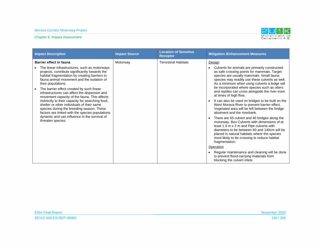
Morava Corridor Motorway Project
Chapter 6: Impact Assessment
ESIA Final Report November 2020
SE102-000-ES-REP-00002 140 / 260
Impact Description Impact Source Location of Sensitive Receptor
Mitigation /Enhancement Measures
Barrier effect in fauna
The linear infrastructures, such as motorways projects, contribute significantly towards the habitat fragmentation by creating barriers to fauna animal movement and the isolation of their populations.
The barrier effect created by such linear infrastructures can affect the dispersion and movement capacity of the fauna. This affects indirectly to their capacity for searching food, shelter or other individuals of their same species during the breeding season. These factors are linked with the species populations dynamic and can influence in the survival of threaten species.
Motorway Terrestrial Habitats Design
Culverts for animals are primarily constructed as safe crossing points for mammals. Target species are usually mammals. Small fauna species may readily use these culverts as well. As a minimum when using culverts a ledge will be incorporated where species such as otters and reptiles can cross alongside the river even at times of high flow.
It can also be used on bridges to be built on the West Morava River to prevent barrier effect. Vegetated area will be left between the bridge abutment and the riverbank.
There are 65 culvert and 40 bridges along the motorway. Box Culverts with dimensions of at least 1.5 m x 2 m and Pipe culverts with diameters to be between 60 and 140cm will be placed in natural habitats where the species most likely to be crossing to reduce habitat fragmentation.
Operation
Regular maintenance and cleaning will be done to prevent flood-carrying materials from blocking the culvert inlets
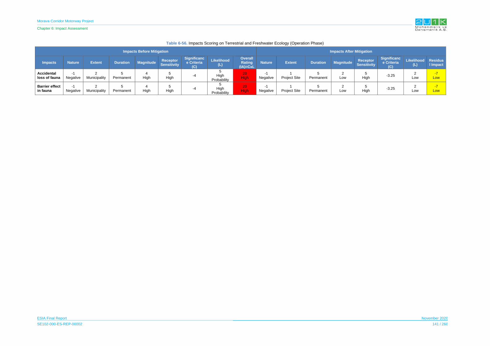
Morava Corridor Motorway Project
Chapter 6: Impact Assessment
ESIA Final Report November 2020
SE102-000-ES-REP-00002 141 / 260
Table 6-56. Impacts Scoring on Terrestrial and Freshwater Ecology (Operation Phase)
Impacts Before Mitigation Impacts After Mitigation
Impacts Nature Extent Duration Magnitude Receptor
Sensitivity
Significance Criteria
(C)
Likelihood (L)
Overall Rating
(IA)=CxLNature Extent Duration Magnitude
Receptor Sensitivity
Significance Criteria
(C)
Likelihood (L)
Residual Impact
Accidental loss of fauna
-1 Negative
2 Municipality
5 Permanent
4 High
5 High
-4 5
High Probability
20 High
-1 Negative
1 Project Site
5 Permanent
2 Low
5 High
-3.25 2
Low -7
Low
Barrier effect in fauna
-1 Negative
2 Municipality
5 Permanent
4 High
5 High
-4 5
High Probability
20 High
-1 Negative
1 Project Site
5 Permanent
2 Low
5 High
-3.25 2
Low -7
Low

Morava Corridor Motorway Project
Chapter 6: Impact Assessment
ESIA Final Report November 2020
SE102-000-ES-REP-00002 142 / 260
6.9 Archaeological and Cultural Resources
According to Spatial Plan, National EIAs and the interviews with focus groups, it was
determined that there are intangible cultural heritage such as two sacred trees and an old
building in the Municipality of Maskare, archaeological sites and immovable cultural assets in
the Project and the route of the motorway and area of the river regulation was determined in
line with these information.Thus, the Motorway route and area of the river regulation works will
not coincide with any archaeological area and immovable cultural assets and will not impact
these areas. During construction phase of the Project, a Chance Finds Procedure will be
prepared and it will be implemented for the all Project sections. The Procedure will include
measures; in case of a chance find occurs during the excavation works. In exizisting situtaiton,
to access of these sacred trees are through existing unpaved village roads. During the
operation phase of the Project, the access to the sacred tree located in Bela Voda village will
be provided with under passes. On the other hand, the sacred tree located in Donja Gorevnica
Village will use the existing path as there will be no limits to access.These trees are located
respectively.
Table 6-57 details the impact and mitigations for the archaeological and cultural resources in
the Construction Phase of the Project and there will be no impact during the Operation Phase
of the Motorway.
Table 6-58 shows the overall rating of the impacts before and after mitigations. Dust generation
is considered medium since the magnitude, the likelihood of the impacts and receptor
sensitivity are determined as high. After taking mitigation measures, as shown in Table 6-58,
the residual impacts decrease significantly, and the residual impacts are classified as low.
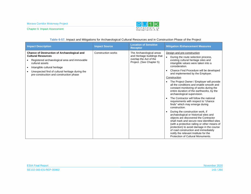
Morava Corridor Motorway Project
Chapter 6: Impact Assessment
ESIA Final Report November 2020
SE102-000-ES-REP-00002 143 / 260
Table 6-57. Impact and Mitigations for Archaeological Cultural Resources and in Construction Phase of the Project
Impact Description Impact Source Location of Sensitive Receptor
Mitigation /Enhancement Measures
Chance of Destruction of Archaeological and Cultural Resources
Registered archaeological area and immovable cultural assets
Intangible cultural heritage
Unexpected find of cultural heritage during the pre-construction and construction phase
Construction works The Archaeological areas and Heritage buildings that overlap the AoI of the Project. (See Chapter 5)
Design and pre-construction
During the route selection process, existing cultural heritage sites and intangible values were taken into a consideration.
Chance Find Procedure will be developed and implemented by the Employer.
Construction
The Project Owner / Employer will provide all the conditions and enable smooth and constant monitoring of works during the entire duration of the earthworks, by the archaeological supervision.
The Contractor will follow the national requirements with respect to “chance finds” which may emerge during construction.
During the construction work, if archaeological or historical sites and objects are discovered the Contractor shall mark and secure new identified sites (with a protective railing or other means of protection) to avoid damage in the course of road construction and immediately notify the relevant Institute for the Protection of Cultural Monuments.

Morava Corridor Motorway Project
Chapter 6: Impact Assessment
ESIA Final Report November 2020
SE102-000-ES-REP-00002 144 / 260
Table 6-58. Scoring of Impact on Archaeological and Cultural Resources
Impacts Before Mitigation Impacts After Mitigation
Impacts Nature Extent Duration Magnitude Receptor
Sensitivity Significance Criteria (SC)
Likelihood
(L)
Overall Rating
(IA)=SCxL Nature Extent’ Duration’ Magnitude’
Receptor Sensitivity
Significance Criteria (SC)
Likelihood
(L)
Residual Impact
Chance Destruction of Archaeological and Cultural Resources
-1
Negative
1
Project Site
2
Short Term
5
Very High
5
High -3.25
4
High
-13
Medium
-1
Negative
1
Project Site
2
Short Term
2
Low
5
High -2.5
1
Low
-3
Low
Morava Corridor Motorway Project
Chapter 6: Impact Assessment
ESIA Final Report November 2020
SE102-000-ES-REP-00002 145 / 260
6.10 Visual Landscape and Land Use
The Motorway components such as bridge, overpasses, underpasses, culverts, interchanges
toll plazas and other project components will be a source of change in the existing visual
environment. Construction of the Motorway and its components will result in the changes in
the existing land use. Accordingly, landscape character of these areas will change
permanently. The width of the expropriation corridor changes depending on the scale of
excavation and fill requirements and siting of the road structures such as interchanges, service
areas, etc. Therefore, landscape in the mentioned area will be affected. In addition, quarries
and camp sites will have potential impacts on landscape.
In the visual analysis, first of all the settlements that will be constantly affected by the project
were evaluated. All of the sensitivity of the settlements is assessed as medium. In addition to
the settlements, recreational areas such as trekking routes, rafting and boat tours and other
recreational areas (picnic areas etc.) were also evaluated. In this context, 13 recreational
activity areas were taken into consideration. Sensitivity of the recreational areas is assessed
as high sensitivity. The recreational areas evaluated are given in Table 6-59 and Figure 6-3
Table 6-59. Recreational Areas
Trekking Route Rafting and-Boat Tour Other Recreational Areas
Trekking Route-1 (Mrzenica Monastary) in Mrzenica
Rafting-Boat Tour-1 in Ćićevac Recreational Area-1 in Makreasane
Trekking Route-2 (St. Mark's Church) in Kukljin
Rafting-Boat Tour-2 in Trstenik Recreational Area-2 in Adrani
Trekking Route-3 in Bogdanje Rafting-Boat Tour-3 in Vrnjci
Trekking Route-4 in Grabovac
Trekking Route-5 in Stulac
Trekking Route-6 (Stubal Monastary) in Stubal
Trekking Route-7 in Sirca
Trekking Route-8 in Sirca
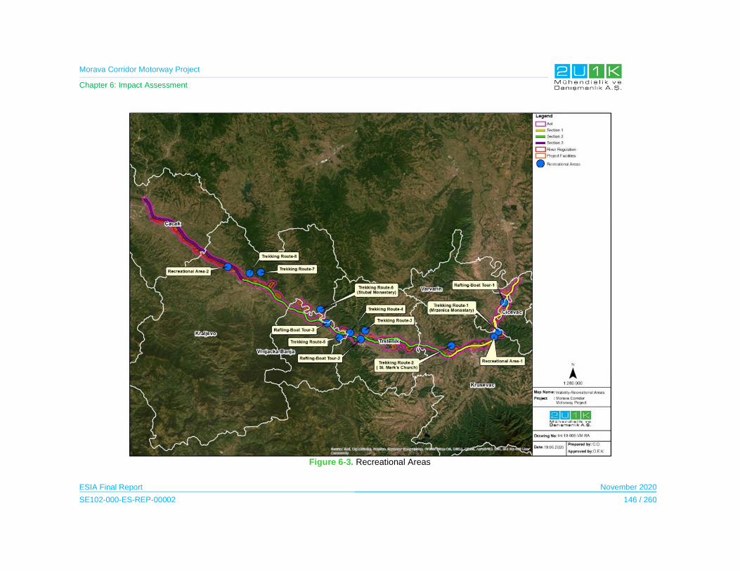
Morava Corridor Motorway Project
Chapter 6: Impact Assessment
ESIA Final Report November 2020
SE102-000-ES-REP-00002 146 / 260
Figure 6-3. Recreational Areas

Morava Corridor Motorway Project
Chapter 6: Impact Assessment
ESIA Final Report November 2020
SE102-000-ES-REP-00002 147 / 260
Visual analysis was carried out by considering the barrier effect of the existing vegetation in
the area with topographical features at all potential points of view. All potential points of view
were selected as observer points. Due to the flat terrain behavior of the project area and
habitats characteristics of the region, the visibility of the road and river regulation project is
limited.
As a result of the analysis, it was concluded that the project components are only visible from
Recreation Area-1 in Makresane, Recreation Area-2 in Adrani and Trekking Route-5 in Stulac.
The project is not visible from other areas.
6.10.1 Construction Phase
The Impact Assessment on Visual Landscape Ecology during the Construction Phase
Table 6-60 details the impact and mitigations for the Visual Landscape in the Construction
Phase of the Project.
Table 6-61 shows the overall rating of the impacts before and after mitigations. All of the
potential impacts on settlements may cause medium receptor sensitivity with very high
magnitude. Therefore, the overall impacts prior to mitigation measures are medium. At the
same time, the potential impacts on the three recreational areas mentioned above may cause
high receptor sensitivity with very high magnitude. Therefore, the overall impact prior to
mitigation measures is high on recreational areas while the other overall impacts are medium.
After taking mitigation measures, as shown in Table 6-61, the residual impacts decrease
significantly, and the residual impacts are classified as low.
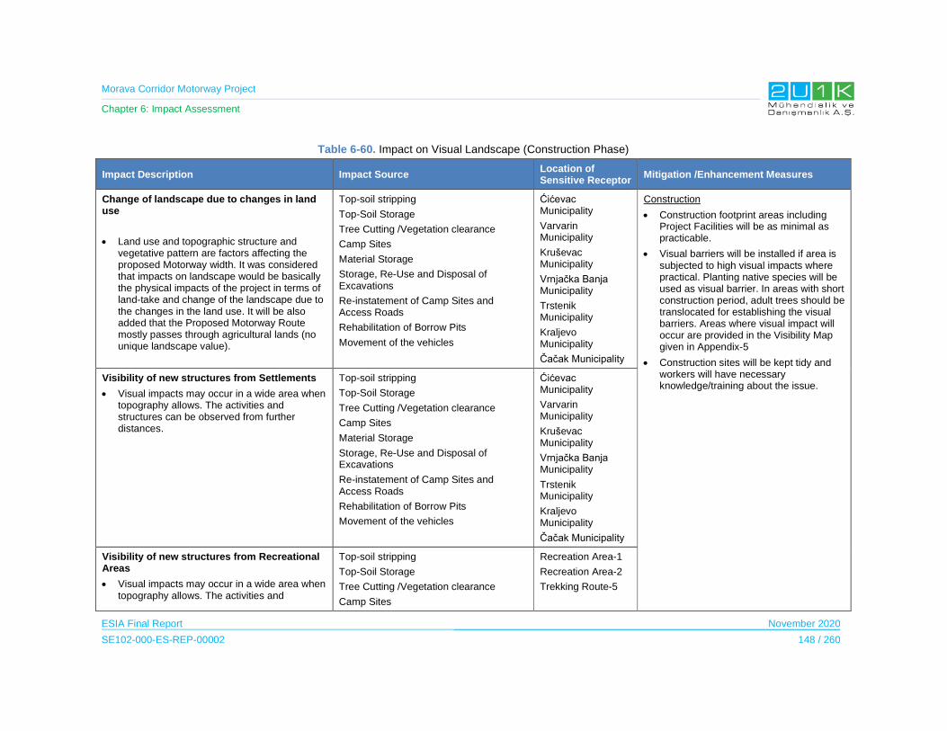
Morava Corridor Motorway Project
Chapter 6: Impact Assessment
ESIA Final Report November 2020
SE102-000-ES-REP-00002 148 / 260
Table 6-60. Impact on Visual Landscape (Construction Phase)
Impact Description Impact Source Location of Sensitive Receptor
Mitigation /Enhancement Measures
Change of landscape due to changes in land use
Land use and topographic structure and vegetative pattern are factors affecting the proposed Motorway width. It was considered that impacts on landscape would be basically the physical impacts of the project in terms of land-take and change of the landscape due to the changes in the land use. It will be also added that the Proposed Motorway Route mostly passes through agricultural lands (no unique landscape value).
Top-soil stripping
Top-Soil Storage
Tree Cutting /Vegetation clearance
Camp Sites
Material Storage
Storage, Re-Use and Disposal of Excavations
Re-instatement of Camp Sites and Access Roads
Rehabilitation of Borrow Pits
Movement of the vehicles
Ćićevac Municipality
Varvarin Municipality
Kruševac Municipality
Vrnjačka Banja Municipality
Trstenik Municipality
Kraljevo Municipality
Čačak Municipality
Construction
Construction footprint areas including Project Facilities will be as minimal as practicable.
Visual barriers will be installed if area is subjected to high visual impacts where practical. Planting native species will be used as visual barrier. In areas with short construction period, adult trees should be translocated for establishing the visual barriers. Areas where visual impact will occur are provided in the Visibility Map given in Appendix-5
Construction sites will be kept tidy and workers will have necessary knowledge/training about the issue.
Visibility of new structures from Settlements
Visual impacts may occur in a wide area when topography allows. The activities and structures can be observed from further distances.
Top-soil stripping
Top-Soil Storage
Tree Cutting /Vegetation clearance
Camp Sites
Material Storage
Storage, Re-Use and Disposal of Excavations
Re-instatement of Camp Sites and Access Roads
Rehabilitation of Borrow Pits
Movement of the vehicles
Ćićevac Municipality
Varvarin Municipality
Kruševac Municipality
Vrnjačka Banja Municipality
Trstenik Municipality
Kraljevo Municipality
Čačak Municipality
Visibility of new structures from Recreational Areas
Visual impacts may occur in a wide area when topography allows. The activities and
Top-soil stripping
Top-Soil Storage
Tree Cutting /Vegetation clearance
Camp Sites
Recreation Area-1
Recreation Area-2
Trekking Route-5
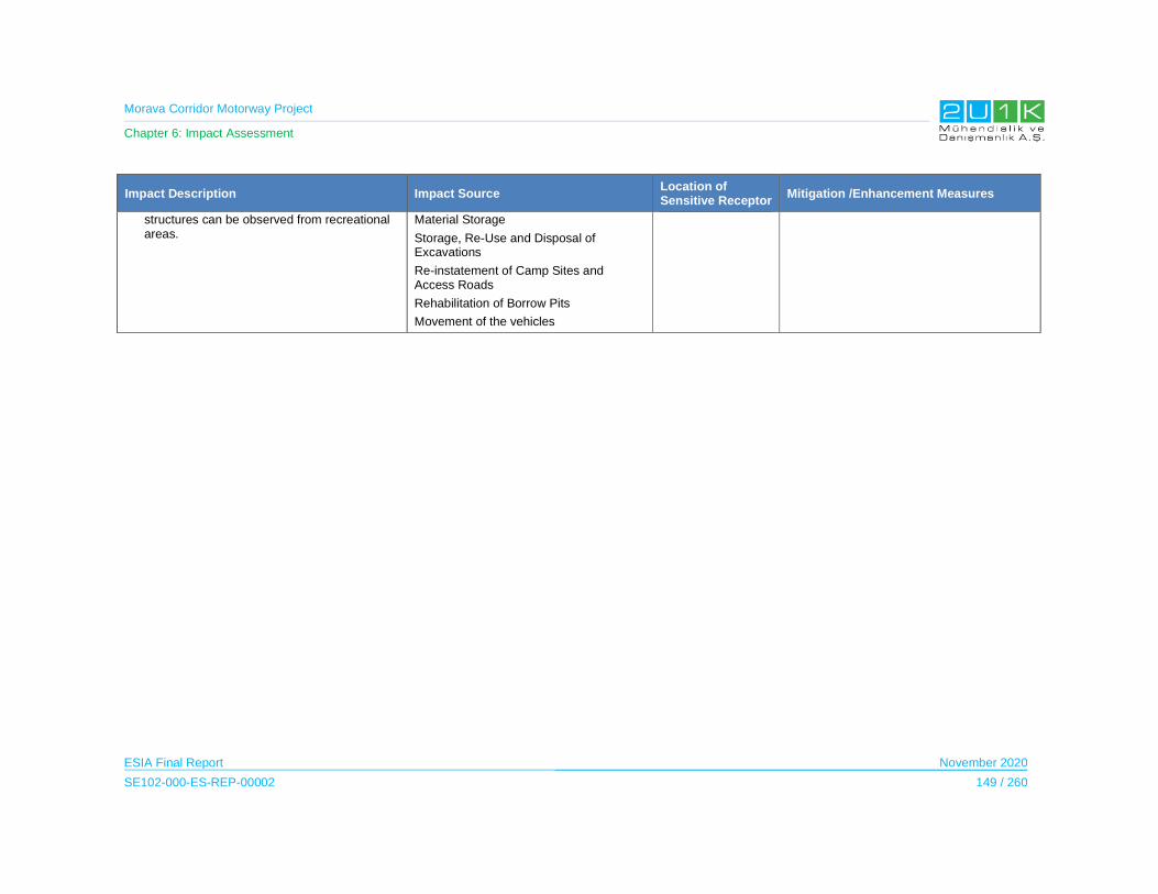
Morava Corridor Motorway Project
Chapter 6: Impact Assessment
ESIA Final Report November 2020
SE102-000-ES-REP-00002 149 / 260
Impact Description Impact Source Location of Sensitive Receptor
Mitigation /Enhancement Measures
structures can be observed from recreational areas.
Material Storage
Storage, Re-Use and Disposal of Excavations
Re-instatement of Camp Sites and Access Roads
Rehabilitation of Borrow Pits
Movement of the vehicles
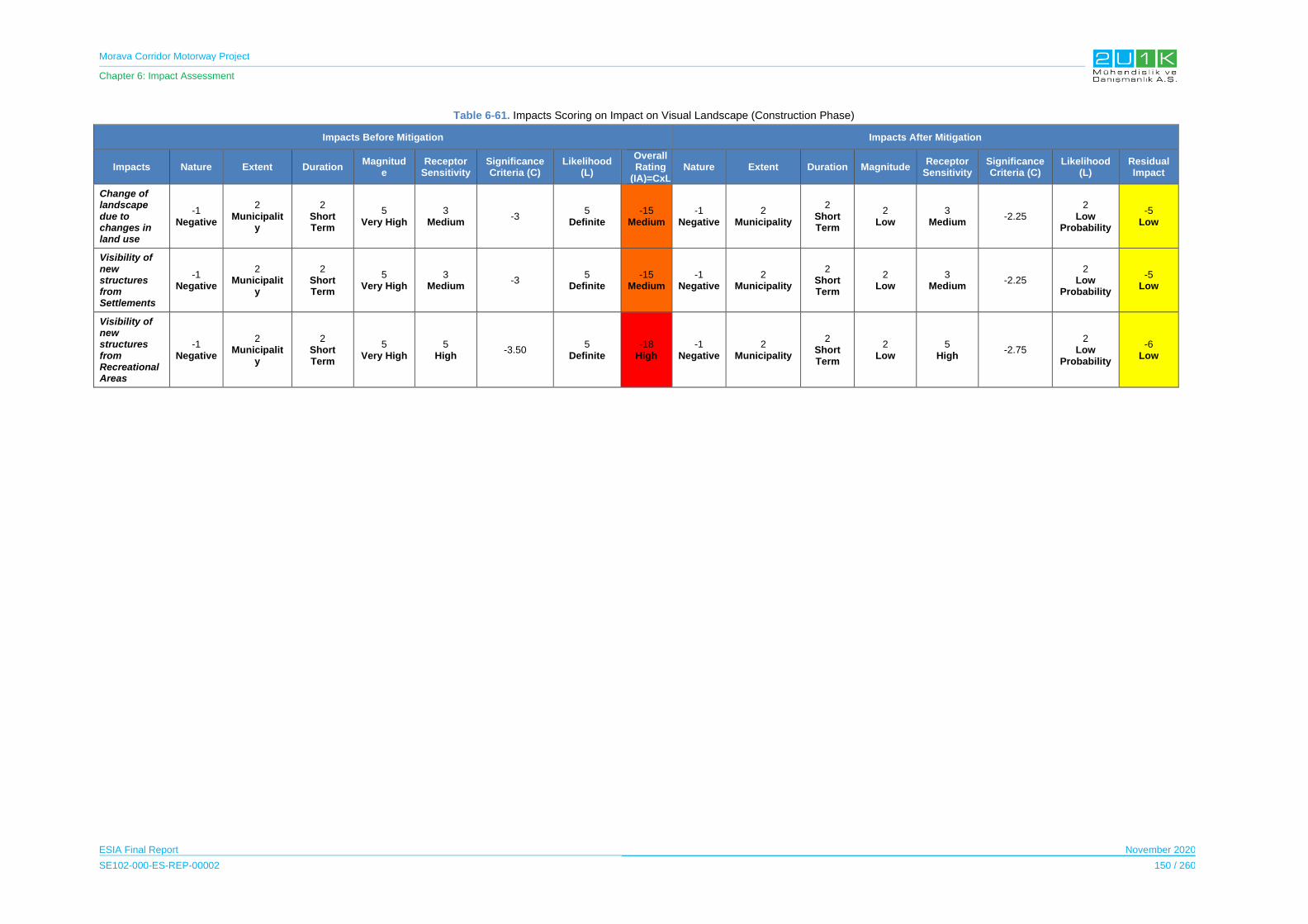
Morava Corridor Motorway Project
Chapter 6: Impact Assessment
ESIA Final Report November 2020
SE102-000-ES-REP-00002 150 / 260
Table 6-61. Impacts Scoring on Impact on Visual Landscape (Construction Phase)
Impacts Before Mitigation Impacts After Mitigation
Impacts Nature Extent Duration Magnitud
e Receptor
Sensitivity Significance Criteria (C)
Likelihood (L)
Overall Rating
(IA)=CxLNature Extent Duration Magnitude
Receptor Sensitivity
Significance Criteria (C)
Likelihood (L)
Residual Impact
Change of landscape due to changes in land use
-1 Negative
2 Municipalit
y
2 Short Term
5 Very High
3 Medium
-3 5
Definite -15
Medium -1
Negative2
Municipality
2 Short Term
2 Low
3 Medium
-2.25 2
Low Probability
-5 Low
Visibility of new structures from Settlements
-1 Negative
2 Municipalit
y
2 Short Term
5 Very High
3 Medium
-3 5
Definite-15
Medium-1
Negative2
Municipality
2 Short Term
2 Low
3 Medium
-2.25 2
Low Probability
-5 Low
Visibility of new structures from Recreational Areas
-1 Negative
2 Municipalit
y
2 Short Term
5 Very High
5 High
-3.50 5
Definite-18
High-1
Negative2
Municipality
2 Short Term
2 Low
5 High
-2.75 2
Low Probability
-6 Low
Morava Corridor Motorway Project
Chapter 6: Impact Assessment
ESIA Final Report November 2020
SE102-000-ES-REP-00002 151 / 260
6.10.2 Operation Phase
The Impact Assessment on Visual Landscape Ecology during the Operation Phase
Table 6-62 details the impact and mitigations for the Visual Landscape in the Operation Phase
of the Project.
Table 6-63 shows the overall rating of the impacts before and after mitigations. All of the
potential impacts on settlements may cause medium receptor sensitivity with permanent
duration and very high magnitude. At the same time, the potential impacts on the three
recreational areas mentioned above may cause high receptor sensitivity with permanent
duration and very high magnitude. Therefore, the overall impacts prior to mitigation measures
are high. After taking mitigation measures, as shown in Table 6-63, the residual impacts
decrease significantly, and the residual impacts are classified as low.
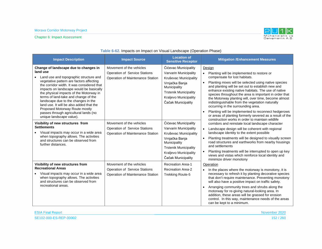
Morava Corridor Motorway Project
Chapter 6: Impact Assessment
ESIA Final Report November 2020
SE102-000-ES-REP-00002 152 / 260
Table 6-62. Impacts on Impact on Visual Landscape (Operation Phase)
Impact Description Impact Source Location of
Sensitive Receptor Mitigation /Enhancement Measures
Change of landscape due to changes in land use
Land use and topographic structure and vegetative pattern are factors affecting the corridor width. It was considered that impacts on landscape would be basically the physical impacts of the Motorway in terms of land-take and change of the landscape due to the changes in the land use. It will be also added that the Proposed Motorway Route mostly passes through agricultural lands (no unique landscape value).
Movement of the vehicles
Operation of Service Stations
Operation of Maintenance Station
Ćićevac Municipality
Varvarin Municipality
Kruševac Municipality
Vrnjačka Banja Municipality
Trstenik Municipality
Kraljevo Municipality
Čačak Municipality
Design
Planting will be implemented to restore or compensate for lost habitats.
Planting mixes will be selected using native species and planting will be set out to establish new and enhance existing native habitats. The use of native species throughout the area is important in order that the Motorway planting will, over time, become almost indistinguishable from the vegetation naturally occurring in the surrounding area.
Planting will be implemented to reconnect hedgerows or areas of planting formerly severed as a result of the construction works in order to maintain wildlife corridors and reinstate local landscape character
Landscape design will be coherent with regional landscape identity to the extent possible
Planting treatments will be designed to visually screen road structures and earthworks from nearby housings and settlements
Planting treatments will be interrupted to open up key views and vistas which reinforce local identity and minimize driver monotony
Operation
In the places where the motorway is monotony, it is necessary to refresh it by planting decorative species that don’t require maintenance. Preventing monotony will also have a positive impact on traffic safety.
Arranging community trees and shrubs along the motorway for re-giving natural-looking area. In addition, these areas will be grassed for erosion control. In this way, maintenance needs of the areas can be kept to a minimum.
Visibility of new structures from Settlements
Visual impacts may occur in a wide area when topography allows. The activities and structures can be observed from further distances.
Movement of the vehicles
Operation of Service Stations
Operation of Maintenance Station
Ćićevac Municipality
Varvarin Municipality
Kruševac Municipality
Vrnjačka Banja Municipality
Trstenik Municipality
Kraljevo Municipality
Čačak Municipality
Visibility of new structures from Recreational Areas
Visual impacts may occur in a wide area when topography allows. The activities and structures can be observed from recreational areas.
Movement of the vehicles
Operation of Service Stations
Operation of Maintenance Station
Recreation Area-1
Recreation Area-2
Trekking Route-5

Morava Corridor Motorway Project
Chapter 6: Impact Assessment
ESIA Final Report November 2020
SE102-000-ES-REP-00002 153 / 260
Table 6-63. Impacts Scoring on Impact on Visual Landscape (Operation Phase)
Impacts Before Mitigation Impacts After Mitigation
Impacts Nature Extent Duration Magnitude Receptor
Sensitivity Significance Criteria (C)
Likelihood
(L)
Overall Rating (IA)=CxL
Nature Extent Duration Magnitude Receptor
Sensitivity
Significance Criteria
(C)
Likelihood
(L)
Residual Impact
Change of landscape due to changes in land use
-1
Negative
2
Municipality
5
Permanent
5
Very High
3
Medium -3.75
5
Definite
-18.75
High
-1
Negative
2
Municipality
5
Permanent
2
Low
3
Medium-3
2
Low Probability
-6
Low
Visibility of new structuresfrom Settlements
-1
Negative
2
Municipality
5
Permanent
5
Very High
3
Medium-3.75
5
Definite
-15
Medium
1
Positive
2
Municipality
5
Permanent
2
Low
3
Medium-3
2
Low Probability
-6
Low
Visibility of new structures from Recreational Areas
-1
Negative
2
Municipality
5
Permanent
5
Very High
5
High-4.25
5
Definite
-21
High
-1
Negative
2
Municipality
5
Permanent
2
Low
5
High-3.5
2
Low Probability
-7
Low

Morava Corridor Motorway Project
Chapter 6: Impact Assessment
ESIA Final Report November 2020
SE102-000-ES-REP-00002 154 / 260
6.11 Social Impact Assessment
The Motorway projects have both negative and positive impacts from a socio-economic
standpoint. Land acquisition and loss of income generation due to land acquisition can be
characterized as negative impacts; while short and long term employment opportunities,
increase in local development due to accessibility and transportation benefits can be described
as positive impacts.
This section of the impact assessment assesses the direct and indirect potential socio-
economic impacts of the Project. In order to explain the cause of the expected impacts of the
Project for socio-economic stand point of view, each subsections either refers and repeats the
data derived from the baseline studies (Chapter 5 of the ESIA Report) to emphasize on the
existing conditions of the AoI. In that aspect, given the baseline conditions will explain the
reason behind expected impacts for each different topics discussed in below.
Major social issues subject to assessment are:
Population
Infrastructure
Economy
Resettlement and Land Acquisition
Ecosystem Services
Labour and Working Conditions
Occupational Health and Safety
Community Health and Safety and,
Vulnerable People.18
18 Human Rights is scoped out in this Section of the ESIA Report.
Morava Corridor Motorway Project
Chapter 6: Impact Assessment
ESIA Final Report November 2020
SE102-000-ES-REP-00002 155 / 260
6.11.1 Population
6.11.1.1 Construction Phase
The main impact source for the population influx during the construction phase is expected to
be the immigration of the construction workers and the people seeking for the job opportunities.
In addition to the direct employment opportunities during the construction phase, the Project
is expected to create a wide range of project-related economic opportunities that will increase
the number of the local population.
The construction phase of the Project is expected to be four years and the peak period of the
Project is expected to be 2022. During the peak period, the number of the direct construction
workers will be approximately 3,800.
According to the Guidance document of the World Bank “Managing the Risks of Adverse
Impacts on Communities from Temporary Project Induced Labor Influx”; the influx of workers
and followers can lead to adverse social and environmental impacts on local communities,
especially if the communities are rural, remote or small (World Bank, 2016).
The direct impact zone of the population influx will be the settlements located in the close
vicinity to workers accommodation sites. The workers accommodation for Section-1 will be
established in the borders of the Kruševac Municipality. The worker accommodation site is
located in the borders of the industrial zone and located at a distance of 1.7 km to the
residential areas. Figure 6-4 below is showing the location of the accommodation for
Section-1.

Morava Corridor Motorway Project
Chapter 6: Impact Assessment
ESIA Final Report November 2020
SE102-000-ES-REP-00002 156 / 260
Figure 6-4. Workers Accommodation Location for Section-1
The workers accommodation camp for Section-2 is planned to be established within the
borders of the Trstenik Municipality. The closest settlements to the accommodation are Vrnjci
Village which is located at a distance of 200mm and Trstenik which has residential areas
approximately 500 m to the camp. Figure 6-5 represents the location of the workers camp for
Section-2.
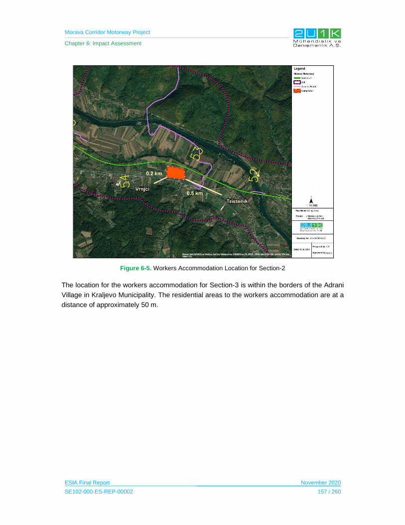
Morava Corridor Motorway Project
Chapter 6: Impact Assessment
ESIA Final Report November 2020
SE102-000-ES-REP-00002 157 / 260
Figure 6-5. Workers Accommodation Location for Section-2
The location for the workers accommodation for Section-3 is within the borders of the Adrani
Village in Kraljevo Municipality. The residential areas to the workers accommodation are at a
distance of approximately 50 m.

Morava Corridor Motorway Project
Chapter 6: Impact Assessment
ESIA Final Report November 2020
SE102-000-ES-REP-00002 158 / 260
Figure 6-6. Workers Accommodation Location for Section-3
Populations of settlements that are planned to be established for the workers accommodation
vary between 1,300 and 2,300 people. During the peak period, an average of 2,000 people is
expected to stay in accommodation camps which doubles the population of the nearby
settlements. In this respect, all settlements close to accommodations considered as sensitive
receptor. Jasika is considered to be more sensitive considering to its rural characteristics.
However, Adrani is located at the closest point to the workers accommodation in Section-3
(i.e., 50 m) which makes Adrani the most sensitive receptor to the population influx impact
caused by the migration of the workers.
The Impact Assessment on Population during the Construction Phase
The Table 6-64 presents the potential population related impacts and the proposed mitigation
measures to prevent stated impacts due to Project construction. In that regards, Table 6-65
provides quantitative assessment of the impacts through identifying; nature, extent, duration,
magnitude, significance and likelihood of each potential impacts of the Project. Considering
the Project will adopt and apply the given mitigation measures in Table 6-64, Table 6-65 then
assess the residual impacts of the Project.
When assessing the potential construction impacts of the Project, all of the population related
impacts observed to be negative, municipal and short term. The overall rating of influx of

Morava Corridor Motorway Project
Chapter 6: Impact Assessment
ESIA Final Report November 2020
SE102-000-ES-REP-00002 159 / 260
additional population, increase burden on competition of for public services and inflation of the
price of goods and services are assessed as medium, considering the receptor sensitivity and
likelihood of the impacts. After implementation of proposed mitigation measures, the likelihood
of the impacts are observed to increase in which caused all of the impacts’ residual impacts
as low.

Morava Corridor Motorway Project
Chapter 6: Impact Assessment
ESIA Final Report November 2020
SE102-000-ES-REP-00002 160 / 260
Table 6-64. Impacts on Population (Construction Phase)
Impact Description Impact Source
Sensitive Receptor (s)
Mitigation /Enhancement Measures
Increased risk of illicit behavior and crime: The influx of workers and service providers into communities may increase the rate of crimes and/or a perception of insecurity by the local community.
Construction phase labor force
Jasika
Vrnjci
Adrani
Pre-construction and Construction
Workers will be paid adequately to prevent theft potential.
Workers will be paid into bank accounts.
Priority will be given to the local labor where possible and practical.
Worker accommodation facilities will include leisure areas to reduce the interaction of the workers with the local communities.
Code of Conduct will be developed in compliance with the Serbian legislation. Hard copies will be provided in English and the native languages of the workforce.
All workers (including international workers) will be trained in their native languages about the Code of Conduct and dismissal policy in particular in criminal cases.
Risk of social conflict: Conflicts may arise between the local communities and the construction workers, which may be related to religious, cultural or ethnic differences, or based on competition for local resources.
Construction phase labor force
Jasika
Vrnjci
Adrani
Pre-construction and Construction
Code of Conduct will be developed in compliance with the Serbian legislation. Hard copies will be provided in English and the native languages of the workforce.
All workers (including international workers) will be trained in their native languages about the Code of Conduct.
All workers (including international workers) will receive Project Orientation and Cultural Awareness training that covers sensitive issues on the local communities.
Before mobilizing the workers to the camp accommodation, the Camp Manager and the local CLOs will inform the local communities about the international workers.
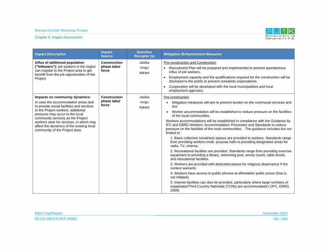
Morava Corridor Motorway Project
Chapter 6: Impact Assessment
ESIA Final Report November 2020
SE102-000-ES-REP-00002 161 / 260
Impact Description Impact Source
Sensitive Receptor (s)
Mitigation /Enhancement Measures
Influx of additional population (“followers”): job seekers in the region can migrate to the Project area to get benefit from the job opportunities of the Project.
Construction phase labor force
Jasika
Vrnjci
Adrani
Pre-construction and Construction
Recruitment Plan will be prepared and implemented to prevent spontaneous influx of job seekers.
Employment capacity and the qualifications required for the construction will be disclosed to the public to prevent unrealistic expectations.
Cooperation will be developed with the local municipalities and local employment agencies.
Impacts on community dynamics:
In case the accommodation areas lack to provide social facilities and services to the Project workers, additional pressure may occur to the local community services as the Project workers seek for services, in which may affect the dynamics of the existing local community of the Project area.
Construction phase labor force
Jasika
Vrnjci
Adrani
Pre-construction
Mitigation measures will aim to prevent burden on the communal services and AoI.
Worker accommodation will be established to reduce pressure on the facilities of the local communities.
Workers accommodations will be established in compliance with the Guidance by IFC and EBRD Workers’ Accommodation: Processes and Standards to reduce pressure on the facilities of the local communities. . The guidance includes but not limited to:
1. Basic collective social/rest spaces are provided to workers. Standards range from providing workers multi- purpose halls to providing designated areas for radio, TV, cinema.
2. Recreational facilities are provided. Standards range from providing exercise equipment to providing a library, swimming pool, tennis courts, table tennis, and educational facilities.
3. Workers are provided with dedicated places for religious observance if the context warrants.
4. Workers have access to public phones at affordable/ public prices (that is, not inflated).
5. Internet facilities can also be provided, particularly where large numbers of expatriates/Third Country Nationals (TCNs) are accommodated ( (IFC, EBRD, 2009)
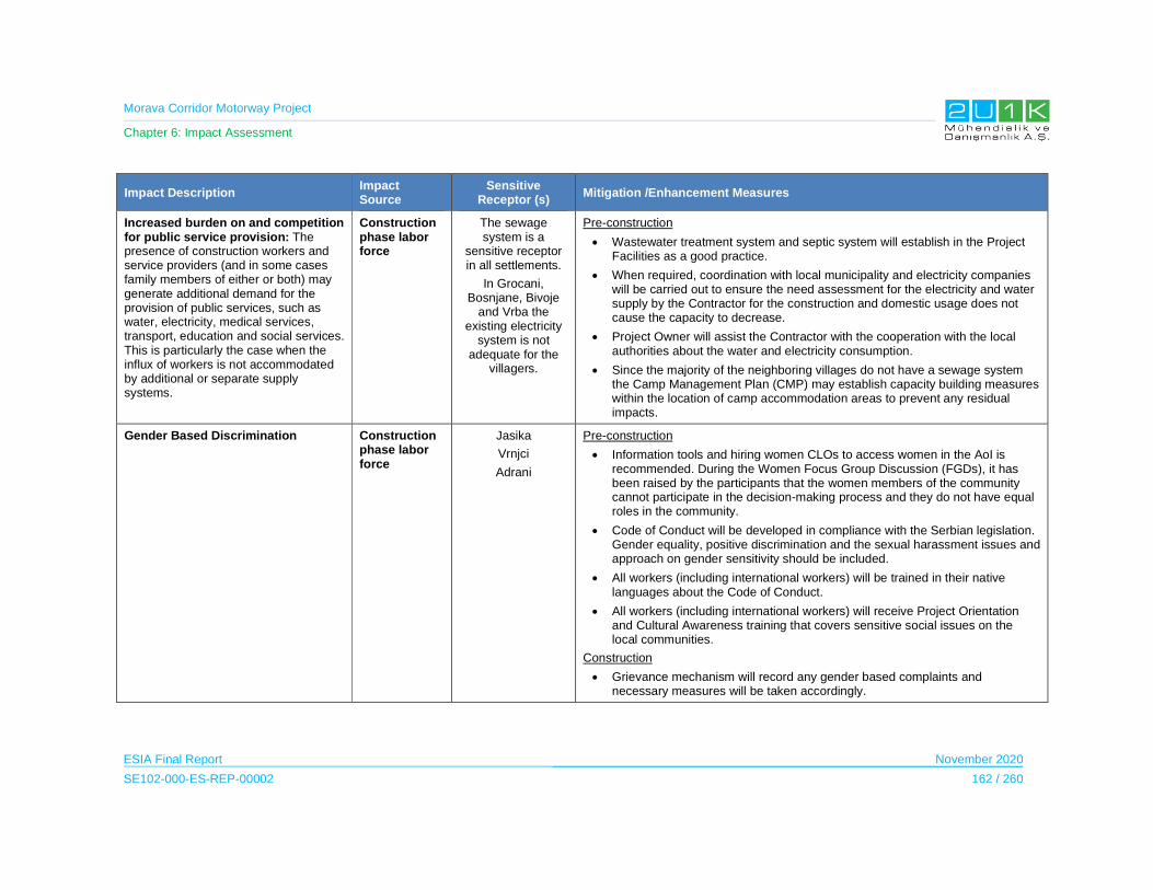
Morava Corridor Motorway Project
Chapter 6: Impact Assessment
ESIA Final Report November 2020
SE102-000-ES-REP-00002 162 / 260
Impact Description Impact Source
Sensitive Receptor (s)
Mitigation /Enhancement Measures
Increased burden on and competition for public service provision: The presence of construction workers and service providers (and in some cases family members of either or both) may generate additional demand for the provision of public services, such as water, electricity, medical services, transport, education and social services. This is particularly the case when the influx of workers is not accommodated by additional or separate supply systems.
Construction phase labor force
The sewage system is a
sensitive receptor in all settlements.
In Grocani, Bosnjane, Bivoje
and Vrba the existing electricity
system is not adequate for the
villagers.
Pre-construction
Wastewater treatment system and septic system will establish in the Project Facilities as a good practice.
When required, coordination with local municipality and electricity companies will be carried out to ensure the need assessment for the electricity and water supply by the Contractor for the construction and domestic usage does not cause the capacity to decrease.
Project Owner will assist the Contractor with the cooperation with the local authorities about the water and electricity consumption.
Since the majority of the neighboring villages do not have a sewage system the Camp Management Plan (CMP) may establish capacity building measures within the location of camp accommodation areas to prevent any residual impacts.
Gender Based Discrimination Construction phase labor force
Jasika
Vrnjci
Adrani
Pre-construction
Information tools and hiring women CLOs to access women in the AoI is recommended. During the Women Focus Group Discussion (FGDs), it has been raised by the participants that the women members of the community cannot participate in the decision-making process and they do not have equal roles in the community.
Code of Conduct will be developed in compliance with the Serbian legislation. Gender equality, positive discrimination and the sexual harassment issues and approach on gender sensitivity should be included.
All workers (including international workers) will be trained in their native languages about the Code of Conduct.
All workers (including international workers) will receive Project Orientation and Cultural Awareness training that covers sensitive social issues on the local communities.
Construction
Grievance mechanism will record any gender based complaints and necessary measures will be taken accordingly.
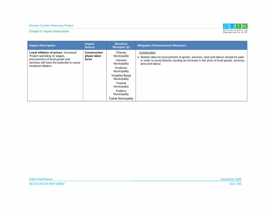
Morava Corridor Motorway Project
Chapter 6: Impact Assessment
ESIA Final Report November 2020
SE102-000-ES-REP-00002 163 / 260
Impact Description Impact Source
Sensitive Receptor (s)
Mitigation /Enhancement Measures
Local inflation of prices: Increased Project spending on wages, procurement of local goods and services will have the potential to cause localized inflation.
Construction phase labor force
Ćićevac Municipality
Varvarin Municipality
Kruševac Municipality
Vrnjačka Banja Municipality
Trstenik Municipality
Kraljevo Municipality
Čačak Municipality
Construction
Market rates for procurement of goods, services, land and labour should be paid in order to avoid directly causing an increase in the price of local goods, services, land and labour.

Morava Corridor Motorway Project
Chapter 6: Impact Assessment
ESIA Final Report November 2020
SE102-000-ES-REP-00002 164 / 260
Table 6-65. Impacts Scoring on Population (Construction Phase)
Impacts Before Mitigation Impacts After Mitigation
Impacts Nature Extent Duration Magnitude Receptor
Sensitivity
Significance Criteria
(C)
Likelihood
(L)
Overall Rating (IA)=CxL
Nature Extent’ Duration’ Magnitude’ Receptor
Sensitivity Significance Criteria (C)
Likelihood
(L)
Residual Impacts
Increase risk of illicit behavior or crime
-12
Municipal
2
Short term
2
Low
5
High2.75
2
Low
-6
Low -1
2
Municipal
2
Short term
2
Low
5
High 2.75
1
Improbable
-3
Low
Risk of social conflict
-12
Municipal
2
Short term
2
Low
3
Medium 2.25
2
Low
-5
Low-1
2
Municipal
2
Short term
2
Low
3
Medium 2.25
1
Improbable
-2
Low
Influx of additional population
-1 2
Municipal
2
Short term
3
Moderate
5
High 3
3
Medium
-9
Medium -1
2
Municipal
2
Short term
3
Moderate
5
High 3
2
Low
-6
Low
Impacts on community dynamics
-1 2
Municipal
2
Short term
2
Low
3
Medium 2.25
2
Low
-5
Low -1
2
Municipal
2
Short term
2
Low
3
Medium 2.25
1
Improbable
-2
Low
Increase burden on competition for public service
-1 2
Municipal
2
Short term
3
Moderate
5
High 3
3
Medium
-9
Medium -1
1
Project Site
2
Short term
3
Moderate
5
High 2.75
2
Low
-6
Low
Gender based violence
-1 2
Municipal
2
Short term
2
Low
1
Low 1.75
2
Low
-4
Low -1
2
Municipal
2
Short term
2
Low
1
Low 1.75
1
Improbable
-2
Low
Local inflation
-1 2
Municipal
2
Short term
3
Moderate
5
High 3
3
Medium
-9
Medium -1
2
Municipal
2
Short term
3
Moderate
5
High 3
2
Low
-6
Low
Morava Corridor Motorway Project
Chapter 6: Impact Assessment
ESIA Final Report November 2020
SE102-000-ES-REP-00002 165 / 260
6.11.1.2 Operation Phase
During the operation phase of the Project, the main source of the population change is
expected to be the outmigration of the people who lost their all agricultural lands and where
the overpasses locate in the highly populated residential areas. The Project may also lead
population increase due to mobility of the people as a result of the better transportation
structure and urbanization.
Population decrease
The implementation of the Project may cause out-migration for new job opportunities due to
the fact that people who will lose their entire agricultural lands as a result of land acquisition
and access to the livelihood sources may leave the region. The magnitude of this impact will
be determined during the Resettlement Action Plan (RAP) preparation process.
Comment on the Spatial Plan:
Vrnjci: “…the planned overpass directly threatens the life of the inhabited population in these plots of the
settlement Vrnjci, Vrnjačka Banja, where there is high population density and where there will be no conditions
for further living, because you will certainly agree that life below the overpass is not possible.”
Answer to Comment and Mitigation Measure:
“…the possibility of displacement of the planned graded junction in Vrnjačka Banja will be examined.”
Population increase
The Project is expected to connect more than 500,000 people by linking more than 20,000
small and medium-sized enterprises through the Corridor X and XI, which run to Austria and
Greece by way through Slovenia, Croatia, and Macedonia; and to Italy and Romania via
Montenegro. The mobility is expected to create long term population increase in the AoI. The
establishment of the Motorway will lead urbanization and in parallel with the urbanization
process; the business sectors will be developed in the area and employment opportunities of
the new sectors will increase the population figures.
Comment on the Spatial Plan:
Čačak: “…From the airport “Morava” at Lađevci, the Highway should be entered directly. Mrčajevci, as a place
with large number of inhabitants, and the villages gravitating towards this place, as an important tourist
destination and the area with great economic potential, should have a connection with the Highway.
It would be of great significance that the old road Čačak-Kraljevo, i.e. a large number of villages on the right
bank of the West Morava in the area from Čačak to Kraljevo, have connection with this Highway. This would
be a great opportunity for economic development of this very large region.”
Answer to Comment and Mitigation Measure:
“The airport “Morava” currently does not have a direct access to the Highway, other than via the Adrani loop.
In the future, as already specified in the Spatial Plan, when preparing technical and planning documentation
for the future Highway link Batočina-Kragujevac-Knić-connection with E-761, the position of loop which will
Morava Corridor Motorway Project
Chapter 6: Impact Assessment
ESIA Final Report November 2020
SE102-000-ES-REP-00002 166 / 260
provide more optimum connection of the airport with the Highway E 761 will be defined. This link connecting
with the Highway should be solved by way of the Spatial Plan of the local self-government.
In the textual part of the Plan, the need for accommodating the specified emergency services will be defined,
what will be also spatially located during preparation of the urban-technical documentation.”
The Impact Assessment on Population during the Operation Phase
The Table 6-66 presents the potential population related impacts and the proposed mitigation
measures to prevent stated impacts due to Project operation. In that regards, Table 6-67
provides quantitative assessment of the impacts through identifying; nature, extent, duration,
magnitude, significance and likelihood of each potential impacts of the Project. Considering
the Project will adopt and apply the given mitigation measures in Table 6-66, Table 6-67 then
assess the residual impacts of the Project.
When assessing the potential operation impacts of the Project, increase and decrease in
population is expected. The population decrease as a result of PAPs whom become landless
and may decide to out-migrate is a negative impact at Municipal level. On the other hand, the
operational activities may attract people from other regions to migrate to the Project Area in
parallel with economic development and urbanization at District level. The receptor sensitivity
is high based on the observations made on the social field studies in terms of population
decrease, therefore, the impact is considered as medium. With the implementation of the
proposed mitigation measures, especially implementation the Resettlement Action Plan, the
likelihood of occurrences of negative impacts will be reduced to low.

Morava Corridor Motorway Project
Chapter 6: Impact Assessment
ESIA Final Report November 2020
SE102-000-ES-REP-00002 167 / 260
Table 6-66. Impacts on Population (Operation Phase)
Impact Description Impact Source Mitigation /Enhancement Measures
Population Decrease Loss of Livelihoods Design
The livelihood sources of the PAPs will be taken into consideration during the approval of the Spatial Planning process which frames the borders of the Project establishments.
Overpasses and underpasses will be designed considering the agricultural activities.
Detailed “Resettlement Action Plan” will be prepared to determine the PAPs and develop practical mechanism to prevent the outmigration.
Replacement of the lost assets within the acquired land with similar assets at the same or better standard to ensure continuity of current livelihoods will be achieved through provision of materials, seedlings, labor, and additional financial and legal assistance.
Pre-construction
Priority for the employment opportunities of the Project will be given to people whom lost their livelihoods.
Skill development training will be provided to local labor force.
Cooperation will be established with the local governmental bodies including job agencies and agricultural institutions to develop effective community development programs and strategies.
Population Increase Increased mobility due to developed transportation and urbanization
Design
Enable the construction of commercial buildings in new locations as a planned reserved space.
Operation
Strengthening competition among business entities through the development of local institutions necessary for the faster development and structural adjustment.
Identifying and implementing a new industrial development policy as a combination of targeted policy with justified, direct state interventions and horizontal measures without special protection sectors with care for key inputs, labor, capital, infrastructure services, research and development.
Encouraging the development of information and communication technologies, information technology infrastructure, electronic networks, databases and sources of data and statistics as a basis for speeding up growth in general and the new service sector in particular.
Give preference to local processing of agricultural products, agroindustry and other "clean" branches of economy that will take advantage of the location advantages derived from proximity to the market, for multipurpose border - crossing centers.
Development of a rational and functional structure of the settlement network.
Identifying settlements that can most effectively serve as service, manufacturing and commercial centers of the surrounding area.
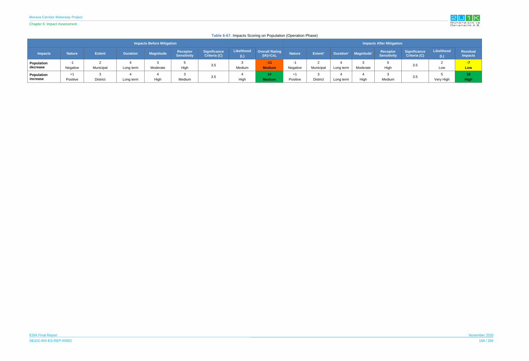
Morava Corridor Motorway Project
Chapter 6: Impact Assessment
ESIA Final Report November 2020
SE102-000-ES-REP-00002 168 / 260
Table 6-67. Impacts Scoring on Population (Operation Phase)
Impacts Before Mitigation Impacts After Mitigation
Impacts Nature Extent Duration Magnitude Receptor
Sensitivity Significance Criteria (C)
Likelihood
(L)
Overall Rating (IA)=CxL
Nature Extent’ Duration’ Magnitude’ Receptor
Sensitivity Significance Criteria (C)
Likelihood
(L)
Residual Impacts
Population decrease
-1
Negative
2
Municipal
4
Long term
3
Moderate
5
High3.5
3
Medium
-11
Medium
-1
Negative
2
Municipal
4
Long term
3
Moderate
5
High 3.5
2
Low
-7
Low
Population increase
+1
Positive
3
District
4
Long term
4
High
3
Medium 3.5
4
High
14
Medium
+1
Positive
3
District
4
Long term
4
High
3
Medium 3.5
5
Very High
18
High
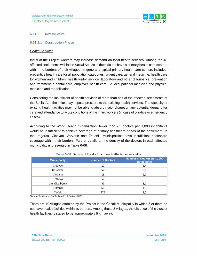
Morava Corridor Motorway Project
Chapter 6: Impact Assessment
ESIA Final Report November 2020
SE102-000-ES-REP-00002 169 / 260
6.11.2 Infrastructure
6.11.2.1 Construction Phase
Health Services
Influx of the Project workers may increase demand on local health services. Among the 48
affected settlements within the Social AoI, 29 of them do not have a primary health care centers
within the borders of their villages. In general a typical primary health care centers includes;
preventive health care for all population categories, urgent care, general medicine, health care
for women and children, health visitor service, laboratory and other diagnostics, prevention
and treatment in dental care, employee health care, i.e. occupational medicine and physical
medicine and rehabilitation.
Considering the insufficient of health services of more than half of the affected settlements of
the Social AoI, the influx may impose pressure to the existing health services. The capacity of
existing health facilities may not be able to absorb major disruption any potential demand for
care and attendance to acute conditions of the influx workers (in case of curative or emergency
cases).
According to the World Health Organization, fewer than 2.3 doctors per 1,000 inhabitants
would be insufficient to achieve coverage of primary healthcare needs of the settlement. In
that regards, Ćićevac, Varvarin and Trstenik Municipalities have insufficient healthcare
coverage within their borders. Further details on the density of the doctors in each affected
municipality is presented in Table 6-68.
Table 6-68. Density of the doctors in each affected municipality
Municipality Number of Doctors Number of Doctors per 1,000
inhabitants
Ćićevac 12 1,4
Kruševac 348 2,9
Varvarin 18 1,1
Kraljevo 343 2,9
Vrnjačka Banja 81 3,1
Trstenik 50 1,3
Čačak 279 2,5
Source: Institute of Public Health of Serbia, 2018
There are 10 villages affected by the Project in the Čačak Municipality in which 8 of them do
not have health facilities within its borders. Among those 8 villages, the distance of the closest
health facilities is stated to be approximately 5 km away.
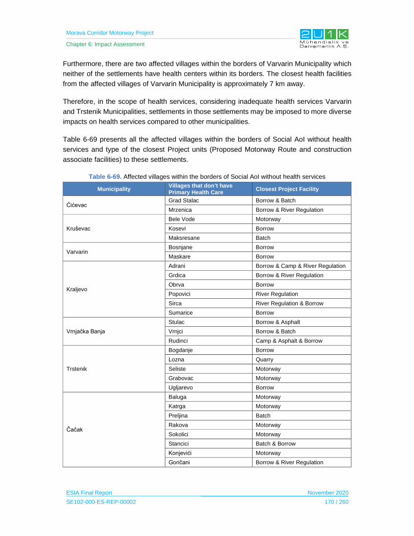
Morava Corridor Motorway Project
Chapter 6: Impact Assessment
ESIA Final Report November 2020
SE102-000-ES-REP-00002 170 / 260
Furthermore, there are two affected villages within the borders of Varvarin Municipality which
neither of the settlements have health centers within its borders. The closest health facilities
from the affected villages of Varvarin Municipality is approximately 7 km away.
Therefore, in the scope of health services, considering inadequate health services Varvarin
and Trstenik Municipalities, settlements in those settlements may be imposed to more diverse
impacts on health services compared to other municipalities.
Table 6-69 presents all the affected villages within the borders of Social AoI without health
services and type of the closest Project units (Proposed Motorway Route and construction
associate facilities) to these settlements.
Table 6-69. Affected villages within the borders of Social AoI without health services
Municipality Villages that don’t have Primary Health Care
Closest Project Facility
Ćićevac Grad Stalac Borrow & Batch
Mrzenica Borrow & River Regulation
Kruševac
Bele Vode Motorway
Kosevi Borrow
Maksresane Batch
Varvarin Bosnjane Borrow
Maskare Borrow
Kraljevo
Adrani Borrow & Camp & River Regulation
Grdica Borrow & River Regulation
Obrva Borrow
Popovici River Regulation
Sirca River Regulation & Borrow
Sumarice Borrow
Vrnjačka Banja
Stulac Borrow & Asphalt
Vrnjci Borrow & Batch
Rudinci Camp & Asphalt & Borrow
Trstenik
Bogdanje Borrow
Lozna Quarry
Seliste Motorway
Grabovac Motorway
Ugljarevo Borrow
Čačak
Baluga Motorway
Katrga Motorway
Preljina Batch
Rakova Motorway
Sokolici Motorway
Stancici Batch & Borrow
Konjevići Motorway
Goričani Borrow & River Regulation

Morava Corridor Motorway Project
Chapter 6: Impact Assessment
ESIA Final Report November 2020
SE102-000-ES-REP-00002 171 / 260
Infrastructure
The establishment of three worker accommodation camps with worker accommodation (with
an average of approximately 2,000 workers) and other project construction facilities and
activities may lead to temporary increased pressure and potential cuts of utility supply such as
electricity, water supply, and waste management, in particular for settlements located closer
to the project facilities and activities. Disruption to utilities could result in impacts to livelihood
or quality of life and if unmanaged could result in health impacts.
According to Community Level and Household Surveys, electricity cut offs occur rarely in all
affected villages. Almost all of the affected villages throughout the Project sections observed
to have insufficient sewage system and the domestic waste are being disposed through wild
dumping. This subject is also covered in the Spatial Plan of the Project and according to Plan,
priority will be given to complete sanitation of the settlements in the Social AoI. The
reconstruction and extension of the sewage network and the construction of a sewage
treatment plant are planned to be constructed in accordance with the requirements, needs and
economic development of the Social AoI. In this regard, to mitigate negative impacts and
increase existing sewage capacity of the settlements, the following objectives were claimed in
the Spatial Plan;
organized solution of the sewerage system,
planned construction of sewerage networks sewage treatment plants for sewage and
process wastewater; and,
establishment of a system for quality and quantity control of discharged wastewater.
The Spatial Plan of the Project also made assessments on each affected municipality and
addressed key infrastructure insufficiencies, in which may provide further information on the
existing infrastructure conditions and cover any gaps from the outcomes of the social field
study. The Table 6-70 below presents the summary of the outcomes made according to the
Plan.
Table 6-70. Infrastructure shortages According to Spatial Plan
Municipality Infrastructure Shortages
Ćićevac Varvarin
Uncontrolled and improper disposal of domestic waste
Kruševac
Wastewater is directly discharged into the Waste Morava without treatment. Sewage in rural areas are insufficient. Septic tanks are either discharged into nearest ditches or water courses. Disposal of solid waste from villages are disorganized.
Kraljevo Inadequate treatment of municipal waste and wastewater
Vrnjačka Banja Lack of landfill, recycling and wastewater treatment systems
Trstenik In central settlements, transportation and disposal of waste is sufficient. On the other
hand, in the villages waste is disposed in landfills.
Čačak Large number of wild landfills.
Source: Spatial Plan, November 2019

Morava Corridor Motorway Project
Chapter 6: Impact Assessment
ESIA Final Report November 2020
SE102-000-ES-REP-00002 172 / 260
Traffic & Accessibility
The potential impacts on the local road network as a result of the construction activities (i.e.
transportation workers, material and equipment, waste disposal, etc.) are disruption to traffic
and transportation due to road crossings and damage to local roads from heavy traffic
movement to and from project facilities and activities. Disruption to road infrastructure and
reduced access due to road cuttings may result negative impacts on the livelihood or quality
of live if not managed properly. Considering the importance of the road network to ensure
mobility between settlements along the Social AoI and access to municipality centers, services
(i.e. education, health, etc.) as well as access to agricultural fields, all PAPs are considered as
highly sensitive.
The Project has a risk of reducing access to agricultural fields in case of appropriate road
underpasses are not designed. During the stakeholder consultations of the Spatial Plan on
August 2019, PAPs raised the potential of reduced access to agricultural fields after the
implementation of the Project. The common concern is that the number of underpasses may
not be located close enough to the affected fields and this may cause increased transportation
costs to the farmers who would have spent more money and time for access. Furthermore,
some of the local businesses were concerned that during the construction of the Project, their
businesses may not be accessible to the customers. These concerns were addressed by the
committee of the Spatial Plan as access roads will be provided to the businesses to continue
their activity. In Sirca village of Kraljevo Municipality, the residents were concerned to
accessibility of pedestrians, and this was addressed through the design of the Proposed
Motorway Route by considering the construction of a road bridge over the regulated river bed
of the West Morava River, as well as the construction of an overpass or underpass below the
highway for the pedestrians of the Sirca village.
The Impact Assessment on Infrastructure during the Construction Phase
The Table 6-71 presents the potential infrastructure related impacts and the proposed
mitigation measures to prevent stated impacts due to Project construction. In that regards,
Table 6-72 provides quantitative assessment of the impacts through identifying; nature, extent,
duration, magnitude, significance and likelihood of each potential impacts of the Project.
Considering the Project will adopt and apply the given mitigation measures in
Table 6-71, Table 6-72 then assess the residual impacts of the Project.
The impacts regarding the infrastructure during the construction phase is observed to be
negative and in Municipal extent. All of the potential impacts may cause high receptor
sensitivity due to insufficient infrastructure services in the region, therefore, the overall impacts
prior to mitigation measures are medium. The extent of the Project’s impact is expected to be
in Municipal level without any mitigation measures. With the implementation of proposed
mitigation measures given below, the extent of the infrastructure related impacts are expected
to be reduced from Municipal to Project Site with the compliance of international good
practices.
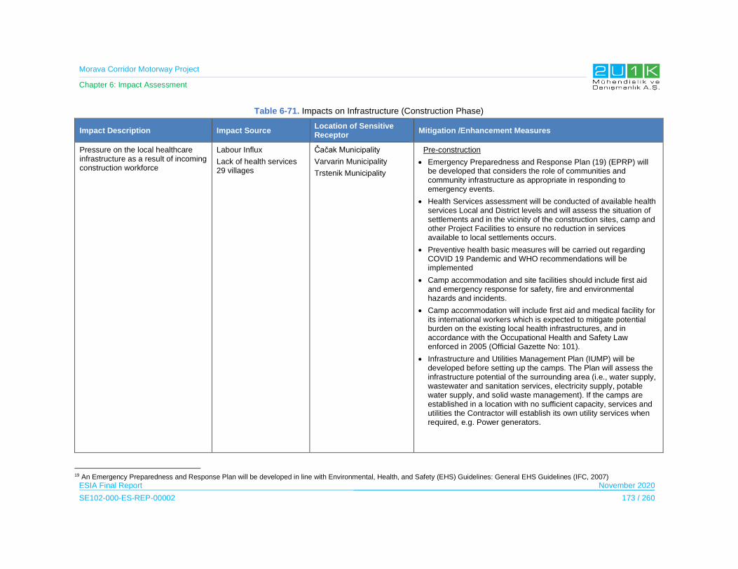
Morava Corridor Motorway Project
Chapter 6: Impact Assessment
ESIA Final Report November 2020
SE102-000-ES-REP-00002 173 / 260
Table 6-71. Impacts on Infrastructure (Construction Phase)
Impact Description Impact Source Location of Sensitive Receptor
Mitigation /Enhancement Measures
Pressure on the local healthcare infrastructure as a result of incoming construction workforce
Labour Influx
Lack of health services 29 villages
Čačak Municipality
Varvarin Municipality
Trstenik Municipality
Pre-construction
Emergency Preparedness and Response Plan (19) (EPRP) will be developed that considers the role of communities and community infrastructure as appropriate in responding to emergency events.
Health Services assessment will be conducted of available health services Local and District levels and will assess the situation of settlements and in the vicinity of the construction sites, camp and other Project Facilities to ensure no reduction in services available to local settlements occurs.
Preventive health basic measures will be carried out regarding COVID 19 Pandemic and WHO recommendations will be implemented
Camp accommodation and site facilities should include first aid and emergency response for safety, fire and environmental hazards and incidents.
Camp accommodation will include first aid and medical facility for its international workers which is expected to mitigate potential burden on the existing local health infrastructures, and in accordance with the Occupational Health and Safety Law enforced in 2005 (Official Gazette No: 101).
Infrastructure and Utilities Management Plan (IUMP) will be developed before setting up the camps. The Plan will assess the infrastructure potential of the surrounding area (i.e., water supply, wastewater and sanitation services, electricity supply, potable water supply, and solid waste management). If the camps are established in a location with no sufficient capacity, services and utilities the Contractor will establish its own utility services when required, e.g. Power generators.
19 An Emergency Preparedness and Response Plan will be developed in line with Environmental, Health, and Safety (EHS) Guidelines: General EHS Guidelines (IFC, 2007)
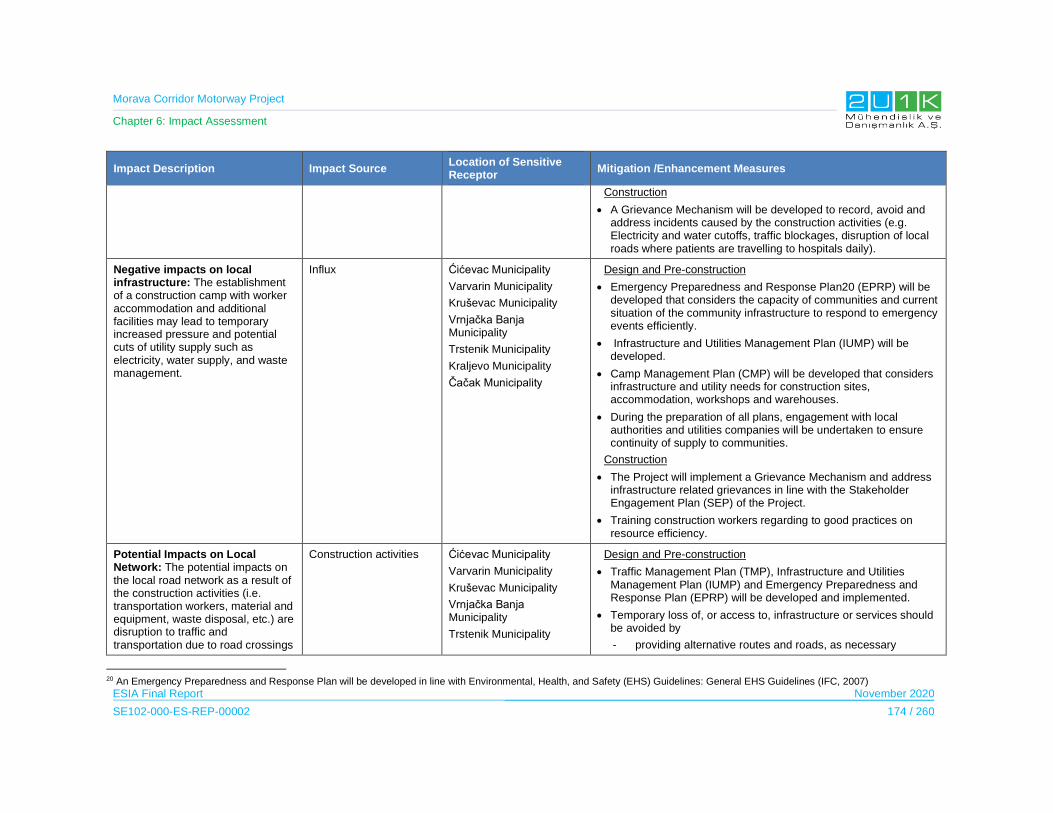
Morava Corridor Motorway Project
Chapter 6: Impact Assessment
ESIA Final Report November 2020
SE102-000-ES-REP-00002 174 / 260
Impact Description Impact Source Location of Sensitive Receptor
Mitigation /Enhancement Measures
Construction
A Grievance Mechanism will be developed to record, avoid and address incidents caused by the construction activities (e.g. Electricity and water cutoffs, traffic blockages, disruption of local roads where patients are travelling to hospitals daily).
Negative impacts on local infrastructure: The establishment of a construction camp with worker accommodation and additional facilities may lead to temporary increased pressure and potential cuts of utility supply such as electricity, water supply, and waste management.
Influx Ćićevac Municipality
Varvarin Municipality
Kruševac Municipality
Vrnjačka Banja Municipality
Trstenik Municipality
Kraljevo Municipality
Čačak Municipality
Design and Pre-construction
Emergency Preparedness and Response Plan20 (EPRP) will be developed that considers the capacity of communities and current situation of the community infrastructure to respond to emergency events efficiently.
Infrastructure and Utilities Management Plan (IUMP) will be developed.
Camp Management Plan (CMP) will be developed that considers infrastructure and utility needs for construction sites, accommodation, workshops and warehouses.
During the preparation of all plans, engagement with local authorities and utilities companies will be undertaken to ensure continuity of supply to communities.
Construction
The Project will implement a Grievance Mechanism and address infrastructure related grievances in line with the Stakeholder Engagement Plan (SEP) of the Project.
Training construction workers regarding to good practices on resource efficiency.
Potential Impacts on Local Network: The potential impacts on the local road network as a result of the construction activities (i.e. transportation workers, material and equipment, waste disposal, etc.) are disruption to traffic and transportation due to road crossings
Construction activities Ćićevac Municipality
Varvarin Municipality
Kruševac Municipality
Vrnjačka Banja Municipality
Trstenik Municipality
Design and Pre-construction
Traffic Management Plan (TMP), Infrastructure and Utilities Management Plan (IUMP) and Emergency Preparedness and Response Plan (EPRP) will be developed and implemented.
Temporary loss of, or access to, infrastructure or services should be avoided by
- providing alternative routes and roads, as necessary
20 An Emergency Preparedness and Response Plan will be developed in line with Environmental, Health, and Safety (EHS) Guidelines: General EHS Guidelines (IFC, 2007)
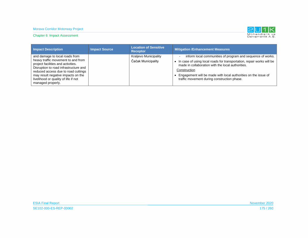
Morava Corridor Motorway Project
Chapter 6: Impact Assessment
ESIA Final Report November 2020
SE102-000-ES-REP-00002 175 / 260
Impact Description Impact Source Location of Sensitive Receptor
Mitigation /Enhancement Measures
and damage to local roads from heavy traffic movement to and from project facilities and activities. Disruption to road infrastructure and reduced access due to road cuttings may result negative impacts on the livelihood or quality of life if not managed properly.
Kraljevo Municipality
Čačak Municipality
- inform local communities of program and sequence of works.
In case of using local roads for transportation, repair works will be made in collaboration with the local authorities.
Construction
Engagement will be made with local authorities on the issue of traffic movement during construction phase.
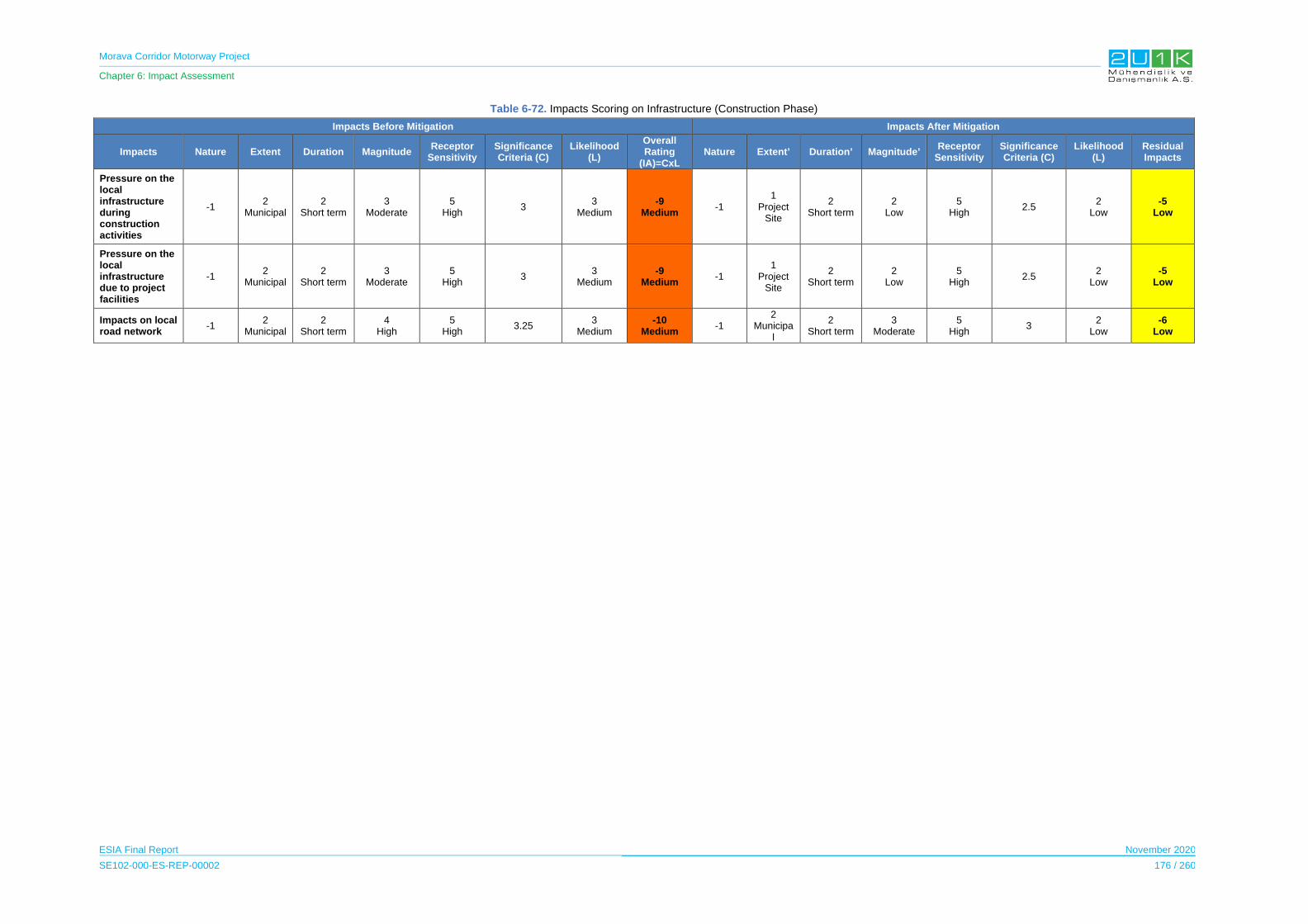
Morava Corridor Motorway Project
Chapter 6: Impact Assessment
ESIA Final Report November 2020
SE102-000-ES-REP-00002 176 / 260
Table 6-72. Impacts Scoring on Infrastructure (Construction Phase)
Impacts Before Mitigation Impacts After Mitigation
Impacts Nature Extent Duration Magnitude Receptor
Sensitivity Significance Criteria (C)
Likelihood (L)
Overall Rating
(IA)=CxLNature Extent’ Duration’ Magnitude’
Receptor Sensitivity
Significance Criteria (C)
Likelihood (L)
Residual Impacts
Pressure on the local infrastructure during construction activities
-1 2
Municipal 2
Short term 3
Moderate 5
High 3
3 Medium
-9 Medium
-1 1
Project Site
2 Short term
2 Low
5 High
2.5 2
Low -5
Low
Pressure on the local infrastructure due to project facilities
-1 2
Municipal 2
Short term 3
Moderate 5
High 3
3 Medium
-9 Medium
-1 1
Project Site
2 Short term
2 Low
5 High
2.5 2
Low -5
Low
Impacts on local road network
-1 2
Municipal 2
Short term 4
High 5
High 3.25
3 Medium
-10 Medium
-1 2
Municipal
2 Short term
3 Moderate
5 High
3 2
Low -6
Low
Morava Corridor Motorway Project
Chapter 6: Impact Assessment
ESIA Final Report November 2020
SE102-000-ES-REP-00002 177 / 260
6.11.2.2 Operation Phase
The emerging market`s economic growth is positively impacted by the implementation of
quality infrastructure projects. Transport infrastructure, in particular, is linked with
improvements in an emerging market`s economy through reduced transportation costs and
increased accessibility. These two factors not only impact directly on productivity and growth
but also indirectly impact by enabling higher levels of private investment.
The Project aims to improve the quality of life and create the conditions for demographic
renewal and encourage people to return in Project region. The Project is expected to contribute
improve transportation within the region and also improve transit and intermediary links
between pan-European infrastructure corridors as well.
The Project will indirectly lead to an increase in economic activities such as tourism,
infrastructure services, agricultural and industry, real estate investments and employment
levels. The Project will provide the local residents with better accessibility to social, health and
educational services in larger towns in Serbia. Also, the locals that use the public transport
would likely experience decrease in travel time due to reduced traffic in the Project region.
On the other hand, the potential for unplanned and uncontrolled economic and population
growth could lead to issues surrounding sanitation, and service delivery. In terms of impacts
on infrastructure, the increased population due to economic growth of the region may lead to
a surge in demand for water, power, sewerage and waste facilities, health and education
facilities, and telecommunications. As mentioned in Chapters 5.14.3.7 and 6.10.2.1, almost all
of the affected villages observed to have insufficient sewage system and the domestic waste
are being disposed through uncontrolled dumping. According to the Spatial Plan,
reconstruction and extension of the sewage network and the construction of a sewage
treatment plant are planned to be constructed to prevent any negative impacts during the
operation phase of the Project.
The Spatial Plan introduces various developments in infrastructure to mitigate negative
impacts and improve the livelihood of the local residents within the Project region.
According to Spatial Plan, the existing power supply will be sufficient for the operation phase
of the Project. The Social AoI is equipped with a power grid and substations with nominal
voltage of 220 and 110 kV and distribution network and substations with 35 and 10 kV.
The Impact Assessment on Infrastructure during the Operation Phase
The Table 6-73 presents the potential infrastructure related impacts and the proposed
mitigation measures to prevent stated impacts due to Project operation. In that regards, Table
6-74 provides quantitative assessment of the impacts through identifying; nature, extent,
duration, magnitude, significance and likelihood of each potential impacts of the Project.

Morava Corridor Motorway Project
Chapter 6: Impact Assessment
ESIA Final Report November 2020
SE102-000-ES-REP-00002 178 / 260
Considering the Project will adopt and apply the given mitigation measures in
Table 6-73, Table 6-74 then assess the residual impacts of the Project.
Pressure on local infrastructure during operation phase may occur in Municipal level without
any improvement on the existing Municipal infrastructure. According to mitigation measures,
the likelihood of the potential impact is expected to be low.
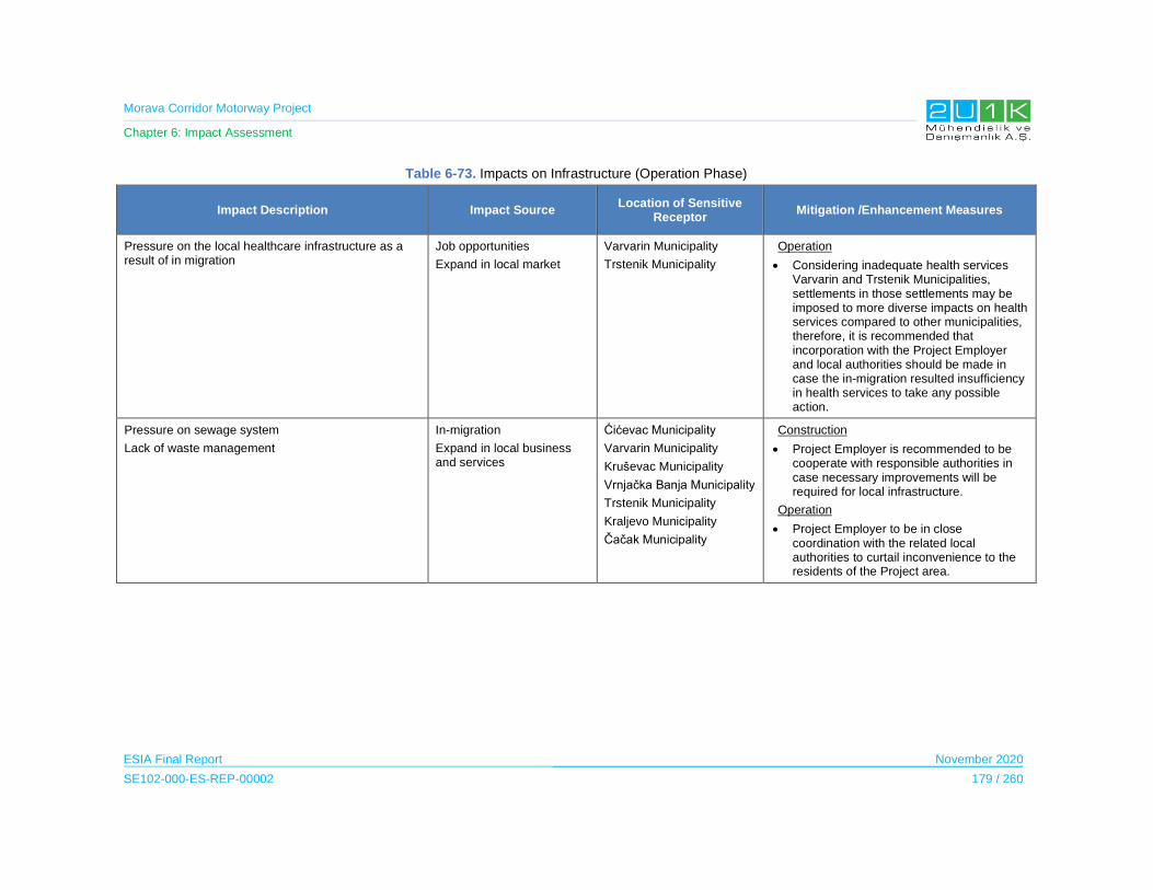
Morava Corridor Motorway Project
Chapter 6: Impact Assessment
ESIA Final Report November 2020
SE102-000-ES-REP-00002 179 / 260
Table 6-73. Impacts on Infrastructure (Operation Phase)
Impact Description Impact Source Location of Sensitive
Receptor Mitigation /Enhancement Measures
Pressure on the local healthcare infrastructure as a result of in migration
Job opportunities
Expand in local market
Varvarin Municipality
Trstenik Municipality
Operation
Considering inadequate health services Varvarin and Trstenik Municipalities, settlements in those settlements may be imposed to more diverse impacts on health services compared to other municipalities, therefore, it is recommended that incorporation with the Project Employer and local authorities should be made in case the in-migration resulted insufficiency in health services to take any possible action.
Pressure on sewage system
Lack of waste management
In-migration
Expand in local business and services
Ćićevac Municipality
Varvarin Municipality
Kruševac Municipality
Vrnjačka Banja Municipality
Trstenik Municipality
Kraljevo Municipality
Čačak Municipality
Construction
Project Employer is recommended to be cooperate with responsible authorities in case necessary improvements will be required for local infrastructure.
Operation
Project Employer to be in close coordination with the related local authorities to curtail inconvenience to the residents of the Project area.
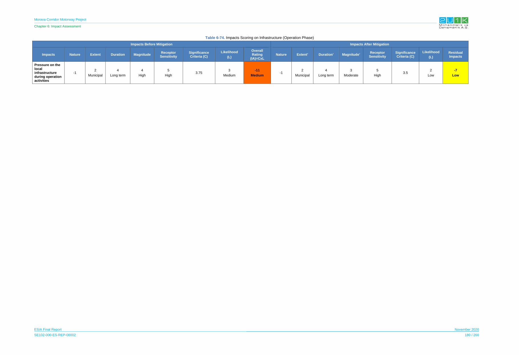
Morava Corridor Motorway Project
Chapter 6: Impact Assessment
ESIA Final Report November 2020
SE102-000-ES-REP-00002 180 / 260
Table 6-74. Impacts Scoring on Infrastructure (Operation Phase)
Impacts Before Mitigation Impacts After Mitigation
Impacts Nature Extent Duration Magnitude Receptor
Sensitivity Significance Criteria (C)
Likelihood
(L)
Overall Rating
(IA)=CxL Nature Extent’ Duration’ Magnitude’
Receptor Sensitivity
Significance Criteria (C)
Likelihood
(L)
Residual Impacts
Pressure on the local infrastructure during operation activities
-1 2
Municipal
4
Long term
4
High
5
High 3.75
3
Medium
-11
Medium -1
2
Municipal
4
Long term
3
Moderate
5
High 3.5
2
Low
-7
Low

Morava Corridor Motorway Project
Chapter 6: Impact Assessment
ESIA Final Report November 2020
SE102-000-ES-REP-00002 181 / 260
6.11.3 Economy
In this Section, the potential economic (national and local) and employment (direct and indirect)
impacts associated with the construction and operation of the Project are assessed.
IFC’s Good Practice Note on Non-discrimination and Equal Opportunity states that “good
practice companies operating in emerging markets often set specific targets for creating local
employment opportunities, building local capacity through training, and advancing country
nationals to replace expatriates in management positions”. IFC further explains that large
projects can have ripple effects on the economy, creating jobs and business opportunities,
increasing competitiveness, and generating tax revenues for national and local governments.
6.11.3.1 Construction Phase
High number of unemployment in the Social AoI
In all affected municipalities, unemployment is stated to be a significant issue. Especially
considering the fact that increased number of out-migration of young generation occurred over
the recent years due to lack of job opportunities. The Republic of Serbia considers individuals
aged between 15 and 64 as a working age and according to national statistics unemployment
rate of Social AoI ranges from 11% to 35%. Table 6-75 presents the employment profile of the
Project affected municipalities.
Table 6-75. Unemployment Ratios of the Municipalities
Municipality Working Age
Population (2018) Unemployed (2018)
Unemployment Rate
Number of Affected
Settlements
Ćićevac 2,702 802 29.5 % 4
Kruševac 39,897 11,861 29.7 % 7
Varvarin 5,067 974 19.2 % 2
Kraljevo 38,889 10,459 26.9 % 11
Vrnjačka Banja 8,609 3,005 34.9% 7
Trstenik 12,500 4,326 34.6 % 7
Čačak 64,127 7,229 11.8 % 10
All of the Social AoI is considered as highly sensitive in terms of economic impacts. Among
the affected municipalities, Trstenik municipality is observed to be most affected from the lack
of employment opportunities in the AoI. On the other hand, considering the unemployment rate
(34.9 %) and number of villages (seven) affected by the Project related activities, especially
during the expropriation process, Trstenik municipality is one of the highly sensitive receptors
when assessing the local economy. Also, considering the unemployment rate (26.9%) and
number of affected villages (11), it can be stated that Kraljevo municipality is moderately
sensitive in terms of economic impacts of the Project.
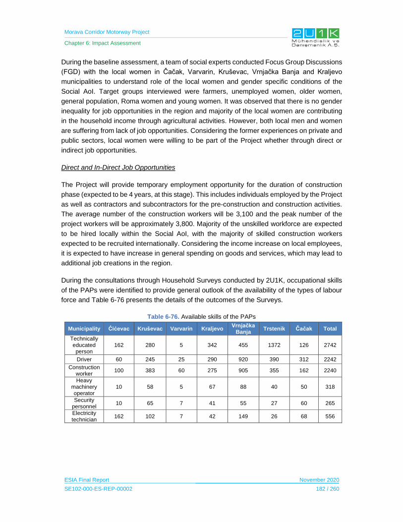
Morava Corridor Motorway Project
Chapter 6: Impact Assessment
ESIA Final Report November 2020
SE102-000-ES-REP-00002 182 / 260
During the baseline assessment, a team of social experts conducted Focus Group Discussions
(FGD) with the local women in Čačak, Varvarin, Kruševac, Vrnjačka Banja and Kraljevo
municipalities to understand role of the local women and gender specific conditions of the
Social AoI. Target groups interviewed were farmers, unemployed women, older women,
general population, Roma women and young women. It was observed that there is no gender
inequality for job opportunities in the region and majority of the local women are contributing
in the household income through agricultural activities. However, both local men and women
are suffering from lack of job opportunities. Considering the former experiences on private and
public sectors, local women were willing to be part of the Project whether through direct or
indirect job opportunities.
Direct and In-Direct Job Opportunities
The Project will provide temporary employment opportunity for the duration of construction
phase (expected to be 4 years, at this stage). This includes individuals employed by the Project
as well as contractors and subcontractors for the pre-construction and construction activities.
The average number of the construction workers will be 3,100 and the peak number of the
project workers will be approximately 3,800. Majority of the unskilled workforce are expected
to be hired locally within the Social AoI, with the majority of skilled construction workers
expected to be recruited internationally. Considering the income increase on local employees,
it is expected to have increase in general spending on goods and services, which may lead to
additional job creations in the region.
During the consultations through Household Surveys conducted by 2U1K, occupational skills
of the PAPs were identified to provide general outlook of the availability of the types of labour
force and Table 6-76 presents the details of the outcomes of the Surveys.
Table 6-76. Available skills of the PAPs
Municipality Ćićevac Kruševac Varvarin Kraljevo Vrnjačka
Banja Trstenik Čačak Total
Technically educated person
162 280 5 342 455 1372 126 2742
Driver 60 245 25 290 920 390 312 2242
Construction worker
100 383 60 275 905 355 162 2240
Heavy machinery operator
10 58 5 67 88 40 50 318
Security personnel
10 65 7 41 55 27 60 265
Electricity technician
162 102 7 42 149 26 68 556

Morava Corridor Motorway Project
Chapter 6: Impact Assessment
ESIA Final Report November 2020
SE102-000-ES-REP-00002 183 / 260
Indirect Employment opportunities also include jobs supplying the goods and services required
to support the construction process including; asphalt from local refinery, machinery fuels from
local market, cement, iron, construction vehicles and machinery, food, laundry, security and
transport services and other services to support accommodation camps (considered as indirect
employment). The procurement of goods and services for the Project is expected to contribute
to the economy to the extent that these services are purchased municipal, district or national
level.
The procurement of goods and services from the local business is likely to have a positive
impact on economic growth and result in employment opportunities during the 4-year
construction phase by creating new businesses and jobs. Also, it is assumed that an increase
in demand of goods and services will lead to increase in supply. This is likely to create the pull
factors which are needed to restore the attractiveness of the local communities and keep
young people in the villages and even encourage in-migration. During the interviews with the
local NGO’s (conducted on 26.09.2019), Association of Serbian Businesswomen stated that,
at least two companies from Čačak who participated in the construction of the Corridor X and
Milos Great Highway benefitted from improving the skills and qualifications of their workforce.
From the outcomes of the baseline] assessment, majority of the PAPs may not be qualified for
the skilled positions required by the Contractor, however, PAPs will benefit from the
employment opportunities through unskilled positions. On the other hand, the Project will result
in long-term capacity enhancement for the local workforce during the construction phase.
Especially, long-term benefits from on the job and formal training opportunities for individual
workers. This will also apply for local companies who would provide services in terms of
capacity enhancement. The companies who will provide services would also reputational
benefits from working on a major national Project.
Negative Impacts on the Local Economy Due to Expropriation
The Project is expected to cause economic displacement on land users, business owners and
farmers within the borders of AoI due to expropriation. Negative impacts on people,
households and communities may result from economic displacement as a result of loss of
assets or access to them, loss of employment or other aspects of livelihood, welfare and/or
amenity, due to direct changes in land use on which the Motorway and its ancillary facilities
will be constructed.
Based on the Household and Community Level Surveys, the PAPs are predominantly involved
in agricultural activities as their main source of income. Also, livestock activities are common
for household purposes. The Project will require temporary and permanent land acquisitions
that will lead to physical and economic displacement of PAPs. There will be loss of agricultural
land, forest land, business land and private land as a result of the Project. PAPs that will go
through expropriation on agricultural lands may experience loss of main or partial source of
their household income. This may occur especially in the cases where remaining parcels of

Morava Corridor Motorway Project
Chapter 6: Impact Assessment
ESIA Final Report November 2020
SE102-000-ES-REP-00002 184 / 260
the agricultural land after expropriation is not suitable for cultivation. On the other hand, some
of the farmers may experience loss of their best quality arable land due to expropriation, which
may cause reduced production and consequent loss of income. These types of concerns were
expressed by locals during the disclosure of the Spatial Plan ( August 2019), and according to
the minutes of meeting, farmers who had concerns regarding losing best quality arable lands
were offered an exception to exclude arable lands during the land acquisition as much as
possible.
The Impact Assessment on Economy during the Construction Phase
The Table 6-77 presents the potential economy related impacts and the proposed mitigation
measures to prevent stated impacts due to Project construction. In that regards, Table 6-78
provides quantitative assessment of the impacts through identifying; nature, extent, duration,
magnitude, significance and likelihood of each potential impacts of the Project. Considering
the Project will adopt and apply the given mitigation measures in Table 6-77, Table 6-78 then
assess the residual impacts of the Project.
During the construction phase of the Project, both direct and indirect economic opportunities
at municipal is expected to occur. The magnitude of the potential impacts will be increased to
high with the implementation of proposed enhancement measures from municipal to district
level, especially the implementation of the Local Procurement Plan will lead equal competition
opportunity.

Morava Corridor Motorway Project
Chapter 6: Impact Assessment
ESIA Final Report November 2020
SE102-000-ES-REP-00002 185 / 260
Table 6-77. Impacts on Economy (Construction Phase)
Impact Description Impact Source Location of Sensitive Receptor
Mitigation /Enhancement Measures
Employment Opportunities: Local unemployment is a significant issue in the Social AoI. In that regards, the Project will require temporary direct workers for the duration of the construction phase.
The labour requirement for the construction of the Project will be primarily sourced from local labour force and complemented by international workers.
Employment or Recruitment:
The average number of the construction workers will be 3,100 and the peak number of the Project workers will be approximately 3,800 for the construction phase.
Ćićevac Municipality
Varvarin Municipality
Kruševac Municipality
Vrnjačka Banja Municipality
Trstenik Municipality
Kraljevo Municipality
Čačak Municipality
Pre-construction
Recruitment procedures will be developed and aim to:
- provide opportunities for employment of local workforce to the extent possible considering unskilled, semi-skilled, and skilled workforce
- give priority to vulnerable persons (especially those who will be economically disabled)
- give priority to Social AoI as much as possible, for the scope of good practice.
The Contractor and the Employer will outline and require a fair and transparent, gender neutral recruitment process for all job openings. The Contractor should seek to employ Project PAPs on each Sector of the Project route.
The Contractor should encourage Subcontractors to employ local personnel.
Construction
Capacity enhancement benefits will be increased through training programs for contractors and subcontractors on related policies, as well as phased capacity building and targeted training programs for national and local suppliers agreed with local government and industry organizations to benefit local capacity enhancement.
Procurement Opportunities:Employment opportunities include jobs supplying the goods and services needed to support the construction process, including construction vehicles and machinery, food, laundry, security and transport services and other
Construction activities
Services for the Project Facilities
Ćićevac Municipality
Varvarin Municipality
Kruševac Municipality
Vrnjačka Banja Municipality
Trstenik Municipality
Kraljevo Municipality
Pre-construction
Project should seek to maximize the benefits for local communities in terms of both direct and indirect employment opportunities and purchasing of local good and services.
Procurement Plan will be developed and implemented. Project should adopt measures within its purchasing policy to provide opportunity for local
Morava Corridor Motorway Project
Chapter 6: Impact Assessment
ESIA Final Report November 2020
SE102-000-ES-REP-00002 186 / 260
Impact Description Impact Source Location of Sensitive Receptor
Mitigation /Enhancement Measures
services to support accommodation camps.
In addition, the increased income of the direct and indirect employees will lead to an increase in general spending on goods and services as well as potentially related job creations.
Čačak Municipality scale businesses to tender for procurement of subcontracted good and services (e.g. advertising locally).
The Project will result in long-term capacity enhancement for the local workforce during the construction phase. This includes long-term benefits from on-the-job and formal training opportunities for individual workers, and the possibility for capacity enhancements for local and national companies.
These companies would also reap reputational benefits from working on a national major Project.
Construction activities
Services for the Project Facilities
Ćićevac Municipality
Varvarin Municipality
Kruševac Municipality
Vrnjačka Banja Municipality
Trstenik Municipality
Kraljevo Municipality
Čačak Municipality
Construction
Increase capacity enhancement benefits through training programs for contractors and subcontractors on related policies, as well as phased capacity building and targeted training programs for national and local suppliers agreed with local government and industry organizations to benefit local capacity enhacement.
Impact on Agriculture:
Agriculture is one of the main income sources of the Project region, implementation of Project may lead farmers landless or move on to different sectors.
Expropriation for the Project PAPs who engaged in agriculture and livestock
Pre-construction
During land expropriation and acquisition process, cooperation between the Project Owner and Project Operator (Corridors of Serbia, Ministry of Construction, Transport and Infrastructure (MCTI) and Roads of Serbia) should consider the following measures;
- support for the development of cooperatives and farmers associations should be provided
- ensure the implementation of education programs for farmers; implementation of local agricultural incentive programs,
- provide seminars to direct for farmers to promote and modern approaches to farming.
- Implementation of RLRF and RAP.
Morava Corridor Motorway Project
Chapter 6: Impact Assessment
ESIA Final Report November 2020
SE102-000-ES-REP-00002 187 / 260
Impact Description Impact Source Location of Sensitive Receptor
Mitigation /Enhancement Measures
Construction
The Project Owner/Employer will encourage and interact with Ministry of Agriculture to include the PAPs within their training programs (eg. reskilling, opportunity, diversity).

Morava Corridor Motorway Project
Chapter 6: Impact Assessment
ESIA Final Report November 2020
SE102-000-ES-REP-00002 188 / 260
Table 6-78. Impacts Scoring on Economy (Construction Phase)
Impacts Before Mitigation Impacts After Mitigation
Impacts Nature Extent Duration Magnitude Receptor
Sensitivity Significance Criteria (C)
Likelihood
(L)
Overall Rating
(IA)=CxL Nature Extent’ Duration’ Magnitude’
Receptor Sensitivity
Significance Criteria (C)
Likelihood
(L)
Residual Impacts
Employment Opportunities
1
Positive
3
District
2
Short-term
3
Moderate
5
High 3.25
5
Definite
16
Medium
1
Positive
4
Regional
2
Short-term
4
High
5
High 3.75
5
Definite
19
High
Local Procurement Opportunities
1
Positive
3
District
2
Short-term
3
Moderate
5
High 3.25
5
Definite
16
Medium
1
Positive
4
Regional
2
Short-term
4
High
5
High 3.75
5
Definite
19
High
Morava Corridor Motorway Project
Chapter 6: Impact Assessment
ESIA Final Report November 2020
SE102-000-ES-REP-00002 189 / 260
6.11.3.2 Operation Phase
Benefit to the National Economy
The Project connects Preljina near Čačak with Pojate on the A1 Motorway (the North-South
motorway in central Serbia) through Kruševac, where it will provide a linkage for the residents
(more than 500,000 people) and 21,000 companies. This will include better accessibility for
businesses in the Project region to expand their geographical markets and resources to other
areas and countries.
The majority of the National Highways in Serbia are under tolling21. Therefore, the primary
national benefit will be derived from the toll collection for the Motorway. Furthermore, the
Project will significantly shorten the travel time and the Social AoI will benefit from the improved
carriageway with higher quality transport movement and safer infrastructure. In general, this
will improve the facilitation of goods transport costs and commune of financial resources within
the country.
On the other hand, the locals whom travel frequently for any occasion could still use village
roads to acess their business, farm or any other local location since the Project do not bind the
locals to only use the Motorway.
Benefits to the Local Economy
The Project is expected to attract more investors in the Project region. The increased
investment will bring in more employment opportunities to the local people, including
diversification of economic activities. This is quite significant considering the fact that majority
of the expropriated land are agricultural lands, and PAPs whom may be affected economically
can shift and continue to attribute their income through newly introduced economic fields.
In order to develop local economy throughout the operation phase of the Project, the Spatial
Plan indicates that there will be two maintenance facilities within the Motorway alignment in
which it is expected to employ local community within its departments. Also, the Project will
establish amenities including; parking lots, rest areas, motels, gas station (including grocery,
cafes and restaurant) which are expected to increase benefits to the local economy. Therefore,
after the establishment of the Project, roadside businesses may enhance and facilitate trade
along the Project corridor.
Based on the economic indicators of previous motorway projects, it is expected that between
20 and 50 permanent local employees will be hired for the tolling station and toll collection of
21 There are charges for the passage of several motorways leading across the Serbia, the current state in 2019 is 645 km of highway tolls with 47 toll gates. On toll roads are subject to the obligation to pay tolls for all motor vehicles using these roads, including motorcycles, quads and tricycles.
Morava Corridor Motorway Project
Chapter 6: Impact Assessment
ESIA Final Report November 2020
SE102-000-ES-REP-00002 190 / 260
the Motorway in general. The following operational activities are expected to be required which
will result in direct employment opportunities within the Social AoI:
Traffic and safety operation:
o Route patrolling;
o Operation and maintenance of traffic and safety; and,
o Emergency operations.
Tolling operation:
o Cash collection and money management in toll lanes; and,
o Operation and maintenance of toll office, including user data management
(vehicle classification, license plate number, toll plaza lane entry / exit
corrections, Illegal Passes etc.).
The Project will be subject to regular maintenance, including summer and winter
maintenances, in which will provide procurement opportunities of local and national
contractors. Some of the procurement activities related to maintenance expected to be
required listed as following:
Routine maintenance, cleaning and limited repair of the motorway, interchanges and
connecting roads including the related structures and infrastructures;
Watering, trimming and mowing of non-decorative green areas;
Winter maintenance with preventive and corrective activities;
Operation and routine maintenance, cleaning and repair of the toll related structures,
infrastructures, building, facilities, ancillaries;
Maintenance of equipment; and,
Routine inspections for all motorway assets.
Indirect job opportunities are expected to further stimulate employment opportunities and
increase the livelihood of PAPs. Other induced impacts are considered to be mostly in the
service sector such as tire repair services, on the road assistance and auto mechanics.
According to the Spatial Plan, the Proposed Logistic Centers are expected to be constructed
in Čačak and Kraljevo municipalities by the Government of Serbia after the operation phase of
the Project. These centers can employ between 500 and 10,000 employees, which may
provide significant benefit for the locals who seek employment. The Spatial Plan also states
that, industrial zones are planned to be constructed along the Motorway corridor located in
Kraljevo, Kruševac, Čačak, Trstenik, Varvarin and Ćićevac municipalities. The details of the
Morava Corridor Motorway Project
Chapter 6: Impact Assessment
ESIA Final Report November 2020
SE102-000-ES-REP-00002 191 / 260
planned industrial zones are currently being arranged, no further details are provided in the
Spatial Plan.
The Impact Assessment on Economy during the Operation Phase
The Table 6-79 presents the potential economy related impacts and the proposed mitigation
measures to prevent stated impacts due to Project operation. In that regards, Table 6-80
provides quantitative assessment of the impacts through identifying; nature, extent, duration,
magnitude, significance and likelihood of each potential impacts of the Project. Considering
the Project will adopt and apply the given mitigation measures in Table 6-79, Table 6-80 then
assess the residual impacts of the Project. The only negative impact caused by the Project
operation phase is expected to be decrease in agricultural sector in the Region. With the
implementation of proposed mitigation measures, the likelihood of this impact may decrease
from medium to low, in which the overall impact is assessed as low. On the other hand, direct
and indirect job opportunities and increase in economic development of Region could be
improved with the proposed enhancement measures.
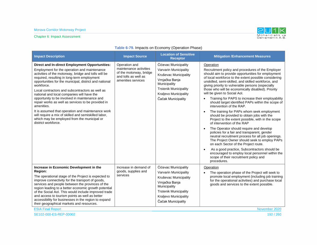
Morava Corridor Motorway Project
Chapter 6: Impact Assessment
ESIA Final Report November 2020
SE102-000-ES-REP-00002 192 / 260
Table 6-79. Impacts on Economy (Operation Phase)
Impact Description Impact Source Location of Sensitive
Receptor Mitigation /Enhancement Measures
Direct and In-direct Employment Opportunities:
Employment for the operation and maintenance activities of the motorway, bridge and tolls will be required, resulting in long-term employment opportunities for the municipal, district and national workforce.
Local contractors and subcontractors as well as national and local companies will have the opportunity to be involved in maintenance and repair works as well as services to be provided in amenities.
It is assumed that operation and maintenance work will require a mix of skilled and semiskilled labor, which may be employed from the municipal or district workforce.
Operation and maintenance activities of the motorway, bridge and tolls as well as amenities services
Ćićevac Municipality
Varvarin Municipality
Kruševac Municipality
Vrnjačka Banja Municipality
Trstenik Municipality
Kraljevo Municipality
Čačak Municipality
Operation
Recruitment policy and procedures of the Employer should aim to provide opportunities for employment of local workforce to the extent possible considering unskilled, semi-skilled, and skilled workforce, and giving priority to vulnerable persons (especially those who will be economically disabled). Priority will be given to Social AoI.
Training for PAPS to increase their employability should target identified PAPs within the scope of intervention of the RAP.
The training for PAPs whom seek employment should be provided to obtain jobs with the Project to the extent possible, with in the scope of intervention of the RAP
The Operator should require and develop policies for a fair and transparent, gender neutral recruitment process for all job openings. The Project Owner should seek to employ PAPs on each Sector of the Project route.
As a good practice, Subcontractors should be encouraged to employ local personnel within the scope of their recruitment policy and procedures.
Increase in Economic Development in the Region:
The operational stage of the Project is expected to improve connectivity for the transport of goods, services and people between the provinces of the region leading to a better economic growth potential of the Social AoI. This would include improved trade and access to tourism points as well as better accessibility for businesses in the region to expand their geographical markets and resources.
Increase in demand of goods, supplies and services
Ćićevac Municipality
Varvarin Municipality
Kruševac Municipality
Vrnjačka Banja Municipality
Trstenik Municipality
Kraljevo Municipality
Čačak Municipality
Operation
The operation phase of the Project will seek to promote local employment (including job training for the operational activities) and purchase local goods and services to the extent possible.
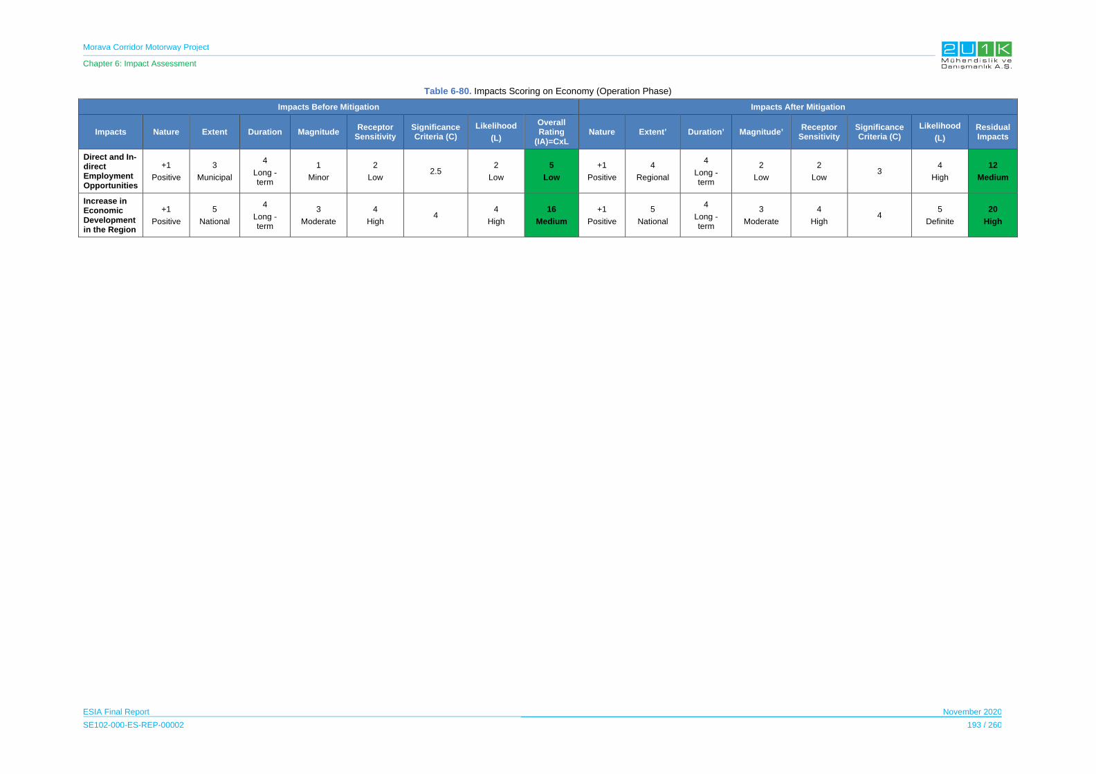
Morava Corridor Motorway Project
Chapter 6: Impact Assessment
ESIA Final Report November 2020
SE102-000-ES-REP-00002 193 / 260
Table 6-80. Impacts Scoring on Economy (Operation Phase)
Impacts Before Mitigation Impacts After Mitigation
Impacts Nature Extent Duration Magnitude Receptor
Sensitivity Significance Criteria (C)
Likelihood
(L)
Overall Rating
(IA)=CxL Nature Extent’ Duration’ Magnitude’
Receptor Sensitivity
Significance Criteria (C)
Likelihood
(L)
Residual Impacts
Direct and In-direct Employment Opportunities
+1
Positive
3
Municipal
4
Long - term
1
Minor
2
Low 2.5
2
Low
5
Low
+1
Positive
4
Regional
4
Long - term
2
Low
2
Low 3
4
High
12
Medium
Increase in Economic Development in the Region
+1
Positive
5
National
4
Long - term
3
Moderate
4
High 4
4
High
16
Medium
+1
Positive
5
National
4
Long - term
3
Moderate
4
High 4
5
Definite
20
High

Morava Corridor Motorway Project
Chapter 6: Impact Assessment
ESIA Final Report November 2020
SE102-000-ES-REP-00002 194 / 260
6.11.4 Resettlement and Land Acquisition
This section discusses potential impacts on the land use and the PAPs whose land will be
expropriated. Detailed information on the Project Owner’s commitments for the PAPs and
physical, economic displacement and livelihood impacts caused by Project implementation in
all Project phases can be found in Resettlement and Livelihood Restoration Framework
(RLRF) prepared as a part of ESIA Disclosure Package.
Also, Resettlement Action Plan (RAP) is currently being prepared by an independent
consultant company in order to:
mitigate adverse social and economic impacts of expropriation and temporary or
permanent losses by providing compensation for losses of property on the basis of
replacement costs and ensure implementation of the activities of displacement with
appropriate data disclosure, consultations and participation of the PAPs,
re-establish or even improve sources of income and living standards of resettled
persons to the level before Project impact.
The Project Employer will prepare and make available to all PAPs and interested stakeholders
the summary document of the RAP, after final RAP has been adopted, in addition of
appropriate full RAP disclosure.
6.11.4.1 Construction and Operation Phase
The Project includes approximately 112 km long Motorway from Pojate to Preljina and with 40
bridges, 20 overpasses and 10 interchanges and regulation of the West Morava River (with
total length of 32 km of regulation works). The proposed regulation designs are to protect
against flooding and eliminate more consecutive sharp bends and bank erosion.
The Project will lead to impacts associated with land use and land base livelihoods including
physical and economic displacement.
The existing land use of the Social AoI will be affected by the construction of the Project and
its components as well as by the project facilities and activities. There will be loss of business,
municipality, governmental and individual land as a result of the Project. The land types and
person who will have compensation rights were provided in the RLRF of the Project.
The Project execution will require permanent acquisition of land by using expropriation. The
Project is expected to cause economic displacement and physical resettlement, however, at
this stage, the magnitude of displacement is not completely known. Identification of the
landowners for Section 1 and Section is completed. At this stage, the Preliminary Design of
Section-2 is currently in progress in parallel to the national EIA process; therefore the exact
amount of expropriated land is currently unknown.
Morava Corridor Motorway Project
Chapter 6: Impact Assessment
ESIA Final Report November 2020
SE102-000-ES-REP-00002 195 / 260
The CoS will be responsible for the expropriation activities for all Sections of the Project.
Responsible Institutions and their roles on land acquisition and expropriation for the Project is
provided in Table 6-81.
Table 6-81. Responsible Institutions on Land Acquisition & Expropriation
Section Expropriation Construction Employer Operator
Section 1 CoS CoS CoS
Section 2 CoS CoS CoS
Section 3 CoS CoS RoS
Responsibilities Land cadastral maps Expropriation administration Payment
Supervision of design and construction (through and third party Consultant) Ownership of RAP Monitoring
Operation and maintenance of motorway
According to the data obtained from CoS and the Contractor, arable land (non-irrigated arable
land) and heterogeneous agricultural areas (with complex cultivation patterns) cover the
largest area along the AoI, which covers 500 m on each side of the motorway along the Project
route.
Table 6-82. Land Use Areas in AoI
Land Type Area (ha) %
Arable land 10,453.63 61.2
Mineral extraction sites 74.12 0.4
Residential buildings of villages and urban peripheries 814.82 4.8
Rural industrial and commercial sites still in active use 142.47 0.8
Road networks 129.41 0.8
Broad-leaved forest 4,564.51 26.7
Grassland 177.36 1.0
Artificial Ponds 110.37 0.6
Water courses 618.64 3.6
Total 17,085.33 100
Source: Community Level Surveys, 2019
The Project will avoid the acquisition of lands or land use rights that result in any physical or
economic displacement where possible. If the land acquisition and displacement is
unavoidable, the Project will apply the mitigation measures as agreed in the Resettlement and
Livelihood Restoration Framework of the Project to minimize the impacts resulted by
displacement. The impacts resulting from the economic and physical displacements are
summarized in the Table 6-83.
Morava Corridor Motorway Project
Chapter 6: Impact Assessment
ESIA Final Report November 2020
SE102-000-ES-REP-00002 196 / 260
Table 6-83. Potential Impacts Caused by the Economic and Physical Displacements
Project Impacts in Preconstruction Phase Under the Responsibility of CoS
Project Impacts in Construction Phase Under the Responsibility of Contractor
(if the cause solely owned by the contractor)
Economic Displacement of Agricultural Land PAP’s livelihoods
Economic Displacement of Construction Land
Economic Displacement of Unviable Land Loss of Annual Crops Loss of Plants and Trees Loss of Wood mass Loss of Forest Loss of Buildings Used for Livestock Loss of Immovable Assess Negative impacts on agricultural workers Loss of business structures Loss of structures used for living
premises (no physical resettlement is needed but used for leased as a source of income)
Physical displacement of buildings Displacement of structures used for
agricultural and livestock activities Physical displacement of unviable
buildings Physical displacement of state- owned
buildings Physical displacement of public utility and
community health resources Impact caused by temporary occupancy
Impacts on vulnerable groups
Additional land requirement due to alignment change
Access to the Natural sources Access to ecosystem services (river,
forest, hunting areas) Access to agricultural lands Access to ecosystem services (river,
forest, hunting areas) Impact on local businessescultural
heritage Changes in community dynamics and
social network
Impacts on local businesses Unplanned Damages to agricultural lands during
Construction Unplanned Damages to Crops, trees During
Construction Loss of livelihoods due to noise and dust Loss of livelihoods due to access to the agricultural
lands during the construction Unauthorized entry to private lands
The key land acquisition activities including the identification of the required land, identification
of PAPs, land valuation, negotiation with landowners and the identification of the affected
people and compensation, land valuation, preparation of the land acquisition files, and
announcement of the Project layout through newspapers have been carried out for Section-1,
by CoS. This process will be supplemented if needed in the course of the RAP
definition/implementation.
The potential major impacts may be experienced by the locals who may have to expropriate
all or most of their land and other property and move to the other locations. Moderate impacts
may be experienced by the locals who may lose smaller portions of their land and assets and
who may not need to physically relocate. Losses may not only be limited to property owners
Morava Corridor Motorway Project
Chapter 6: Impact Assessment
ESIA Final Report November 2020
SE102-000-ES-REP-00002 197 / 260
with legally recognized property rights, but some impacts could possibly be experienced by
people without ownership rights, such as tenants and informal or itinerant land users.
During operation phase, the most likely potential impact would be damage to crops near the
Motorway corridor from maintenance activities or vehicular access.
Below present the land acquisition requirements for the Motorway construction and the project
facilities according to each Section in order to understand Section specific impacted areas and
types of lands for the Proposed Motorway Route and construction facilities in terms of land
acquisition.
To understand the scope of the impact and the justification of the proposed mitigation
measures, following subsections provide required permanent and temporary lands for the
Project and its facilties for each Section, respectively. In order to do so, maps for respective
expropriation area for the Proposed Motorway Route followed by the maps preparead for the
locations of the project facilties of each Section shown in below.
Section 1
For the construction of the Motorway in Section-1, 267 ha area is required permanently
including land required for camp sites.
The expropriation zone of the motorway alignment passes through 17 Cadastral
Municipalities22 within the borders of the three Municipalities including; Kruševac, Ćićevac and
Varvarin. The private lands constitute 83% of the affected lands including the 1% of the
business. Public land constitutes 17% of overall impacted land; of which Government lands
consist 14% of the affected lands and Municipal land 3%.
22 Cadastral municipality is a subclass of administrative territorial entity and records property ownership in a cadastre, which is a register describing property ownership by boundary lines of the real estate. The land record in Serbia is kept by cadastral municipalities.

Morava Corridor Motorway Project
Chapter 6: Impact Assessment
ESIA Final Report November 2020
SE102-000-ES-REP-00002 198 / 260
Figure 6-7. Land Types According to the Ownership Status
The list of PAPs within Section-1 is provided by CoS. Land acquisition data for private parcels
includes size of land impacted per parcel. Based on received information, 38% of PAPs have
lost more than 80% of their parcel. Almost a quarter of PAPs have lost less than 10% of their
parcel.
Project Facilities will also require land acquisition. The Facilities for Section-1 consists of beam
plant, borrow area, precast yard, quarry, subbase plant SW plant, asphalt plant, and the camp
area. Total land required for the project facilities is approximately 600 ha. The Figure 6-8
presents expropriation route, river regulation and location of the Project facilities for Section 1.
1%
3%
14%
82%
Business
Municipality
Government
Private
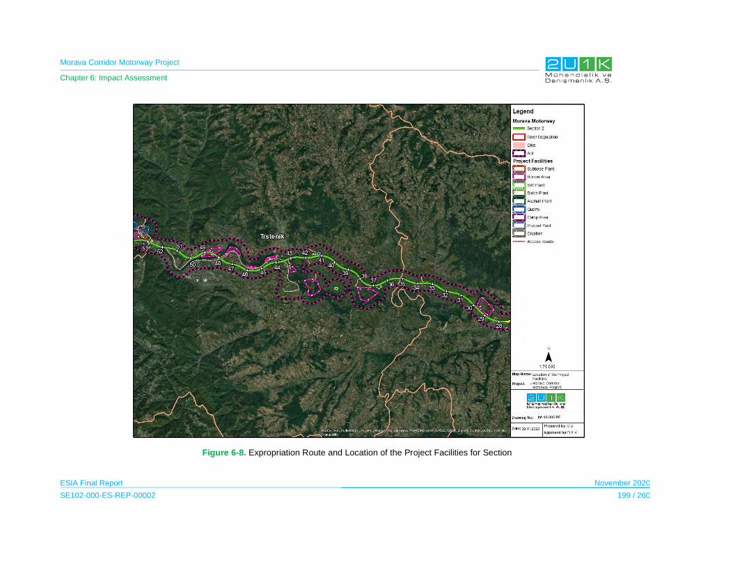
Morava Corridor Motorway Project
Chapter 6: Impact Assessment
ESIA Final Report November 2020
SE102-000-ES-REP-00002 199 / 260
Figure 6-8. Expropriation Route and Location of the Project Facilities for Section
Morava Corridor Motorway Project
Chapter 6: Impact Assessment
ESIA Final Report November 2020
SE102-000-ES-REP-00002 200 / 260
Section 2
For the construction of the Motorway in Section-2, at this stage of the Project, it is estimated
that 530 ha is required permanently. Furthermore, land required area for the temporary usage
(access roads, storage areas) will be determined in the further stages of the Project Design.
The expropriation zone of the motorway alignment passes through the Kraljevo, Vrnjačka
Banja, Trstenik Municipalities. This Section includes 42 Cadastral Municipalities. The project
facilities for the Section-2 will consist asphalt plant, batch plant, beam plant, borrow area,
precast yard, quarry, subbase plant SW plant and the camp area. Total land required for the
facilities is estimated at approximately 750 ha (maximum) at this stage of the Project.
The Figure 6-9 and Figure 6-10 presents expropriation route, river regulation and location of
the Project facilities for Section-2.
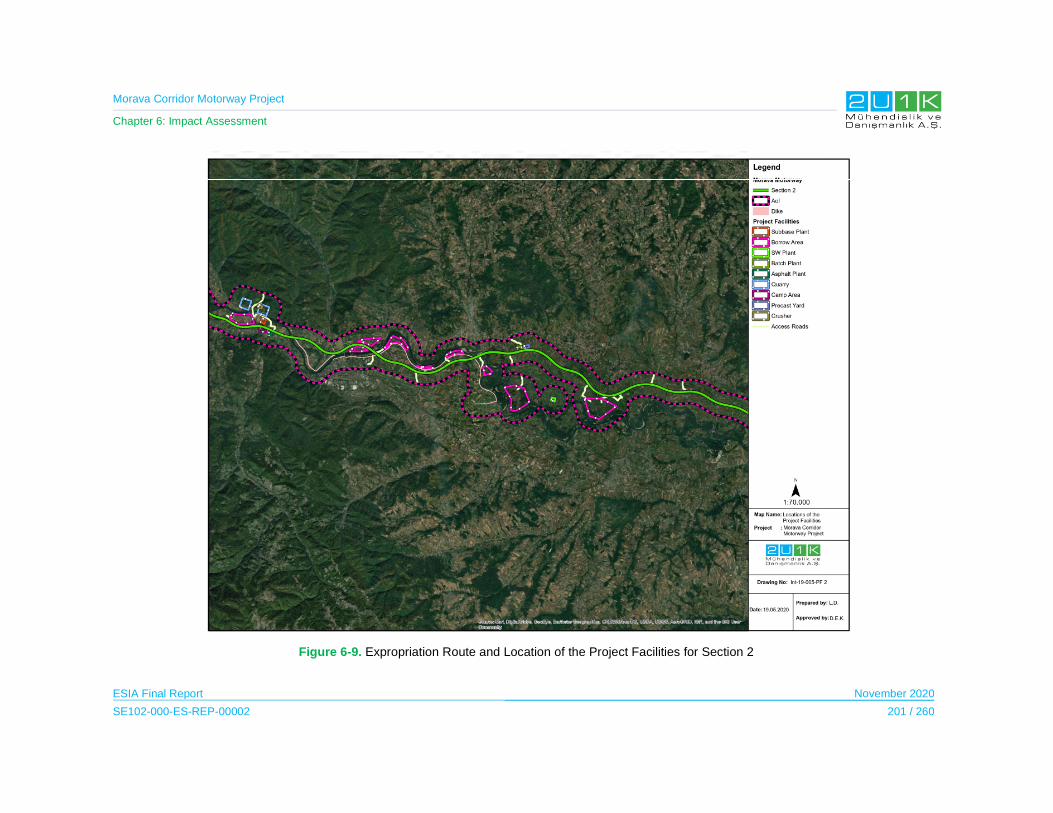
Morava Corridor Motorway Project
Chapter 6: Impact Assessment
ESIA Final Report November 2020
SE102-000-ES-REP-00002 201 / 260
Figure 6-9. Expropriation Route and Location of the Project Facilities for Section 2
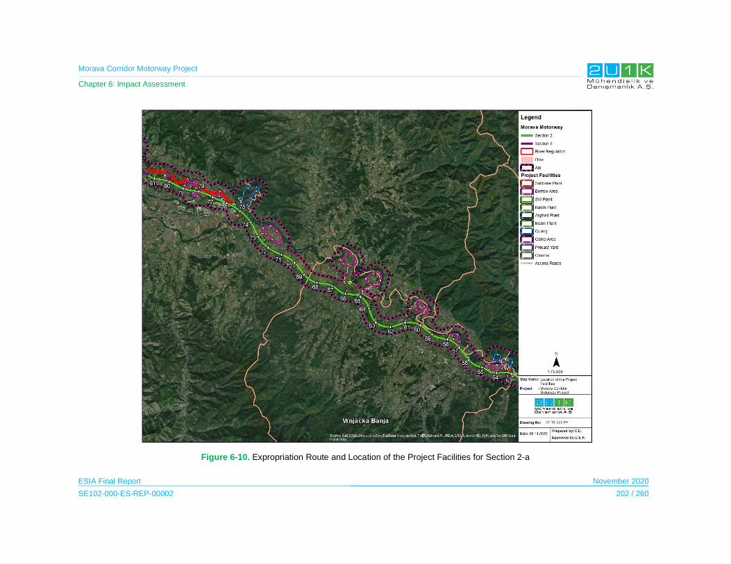
Morava Corridor Motorway Project
Chapter 6: Impact Assessment
ESIA Final Report November 2020
SE102-000-ES-REP-00002 202 / 260
Figure 6-10. Expropriation Route and Location of the Project Facilities for Section 2-a
Morava Corridor Motorway Project
Chapter 6: Impact Assessment
ESIA Final Report November 2020
SE102-000-ES-REP-00002 203 / 260
Section 3
For the construction of the Motorway in Section-3, at this stage of the Project, it is estimated
that 320 ha is required permanently. Furthermore, land required area for the temporary usage
(access roads, storage areas) will be determined in the further stages of the Project Design.
The expropriation zone of the motorway alignment it passes through the Čačak Municipality.
This Section includes 17 Cadastral Municipalities.
The project facilities and activities for Section-3 will consist batch plant, beam plant, borrow
area, precast yard, SW plant and the camp area. Total land required for the facilities is
estimated at approximately 200 ha at this stage of the Project.
The Project will also require some temporary land take for construction access roads,
construction laydown areas and camps, temporary storage of excavated materials/soil, cut
trees etc.
In addition to land acquisition, the Project may cause severance impacts from dividing the land
parcels. During the disclosure of the draft Spatial Plan (August and November 2019), the
landowners and land users expressed the importance of accessibility to their agriculture lands.
Hence, the Commission for Conducting the Public Insight of the Spatial Plan stated that the
Project will take necessary measures such as interchanges, overpasses, bridges and
underpasses in order to retain the accessibility of the land owners and users to these areas in
order to minimize any adverse impact on the livelihood resources.
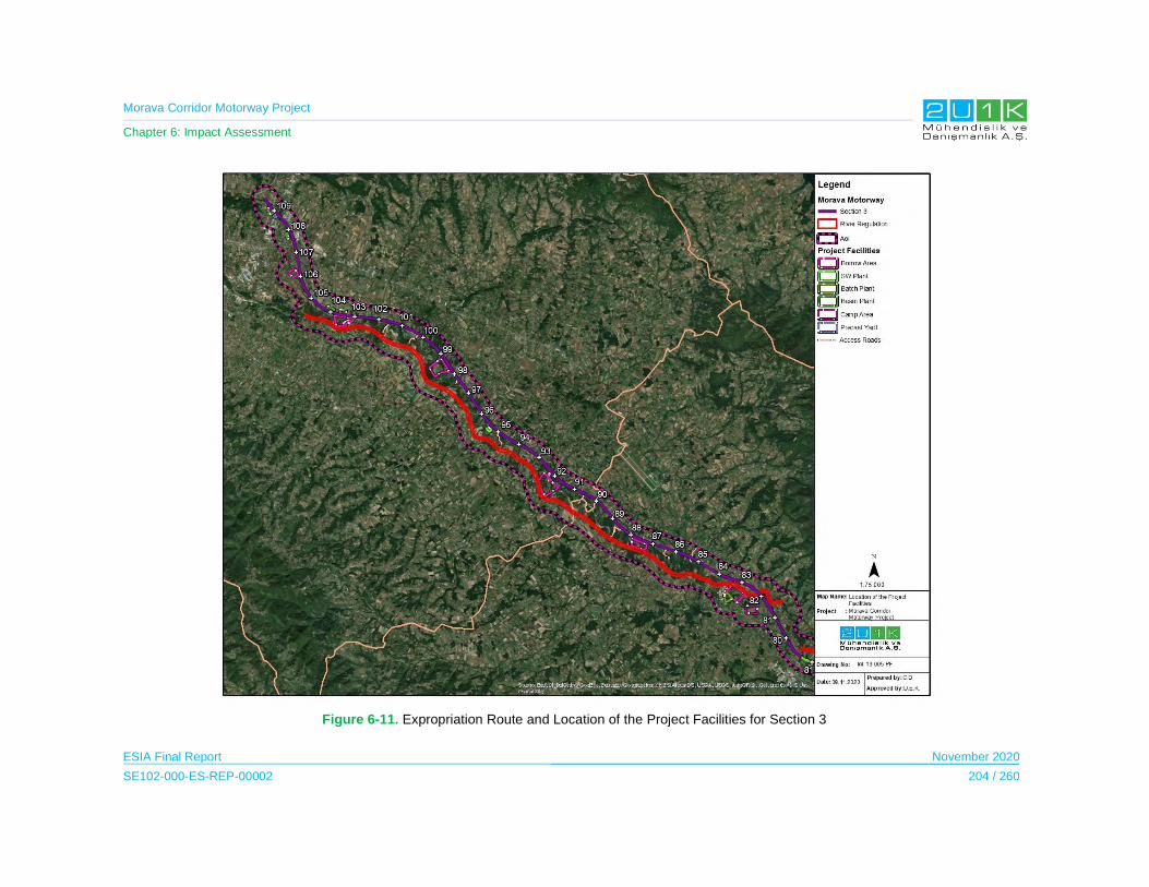
Morava Corridor Motorway Project
Chapter 6: Impact Assessment
ESIA Final Report November 2020
SE102-000-ES-REP-00002 204 / 260
Figure 6-11. Expropriation Route and Location of the Project Facilities for Section 3
Morava Corridor Motorway Project
Chapter 6: Impact Assessment
ESIA Final Report November 2020
SE102-000-ES-REP-00002 205 / 260
The Impact Assessment on Resettlement and Land Acquisition during the Construction and
Operation Phase
The Table 6-84 presents the potential resettlement and land acquisition related impacts and
the proposed mitigation measures to prevent stated impacts due to Project construction and
operation. In that regards, Table 6-85 provides quantitative assessment of the impacts through
identifying; nature, extent, duration, magnitude, significance and likelihood of each potential
impacts of the Project. Considering the Project will adopt and apply the given mitigation
measures in Table 6-84, Table 6-85 then assess the residual impacts of the Project.
All impacts caused by the resettlement and land acquisition have negative nature, however,
duration of the impacts may change according to temporary and permanent requirement of the
land. The magnitude of the impacts for permanent land requirement and resettlement are
assessed as high and the magnitude of the temporary land requirement and possible damage
assessed as low. The likelihood of all impacts are definite, excluding the unplanned damages,
before the implementation of the proposed mitigation measures. The sensitive receptors for
land acquisition and resettlement impacts are those who will lose their land, structure, business
and income sources. Prior to the mitigation measures, the sensitivity of the receptors mainly
considered as high. The implementation of mitigation measures (i.e. compensation and other
type of assistances provided by the Project Employer), the sensitivity of the receptors who will
lose lands is expected to reduced as shown in
Table 6-85.

Morava Corridor Motorway Project
Chapter 6: Impact Assessment
ESIA Final Report November 2020
SE102-000-ES-REP-00002 206 / 260
Table 6-84. Impacts on Resettlement and Land Acquisition (Construction and Operation Phase)
Impact Description Impact Source Location of Sensitive Receptor
Mitigation /Enhancement Measures
Loss of private and public lands due to expropriation
The Project execution will require permanent acquisition of land by using expropriation.
There will be loss of agricultural, forest, municipal, village and private land as a result of the Project. The existing land use of the Social AoI will be affected by the construction of the Project and its components as well as by the project facilities.
Loss of private and public lands due to expropriation
Ćićevac Municipality
Varvarin Municipality
Kruševac Municipality
Vrnjačka Banja Municipality
Trstenik Municipality
Kraljevo Municipality
Čačak Municipality
Design
Effects of physical and economic displacement will be minimized
People affected by the Project will be compensated in accordance with the Principles set in the in the RLRF.
As a minimum, Resettlement Action Plans (RAPs) will be prepared. It will detail the impacts of the Project on land ownership, land use, property and livelihoods. The RAPs will set out the measures needed to address adequately physical and economic displacements due to the Project.
A detailed socio-economic assessment will be undertaken for the RAP to identify impacts on PAPs, including land acquisition impacts and restriction to land use.
A census will be carried out to determine persons to be displaced by the Project, persons that are eligible for compensation and assistance, inventory of affected land and property.
Pre-construction
Assistance will be provided to vulnerable persons who are not able to relocate and resettle on their own.
Additional targeted assistance (e.g., credit facilities, training, or job opportunities) will be provided and opportunities to improve or at least restore their income-earning capacity, production levels, and standards of living to Economically Displaced Persons whose livelihoods or income levels are adversely affected
Construction
The amount of land occupied during the construction will be minimized.
Construction workers will be trained to stay within the border of the construction areas and expropriation corridor and avoid trespass on private land.
Morava Corridor Motorway Project
Chapter 6: Impact Assessment
ESIA Final Report November 2020
SE102-000-ES-REP-00002 207 / 260
Impact Description Impact Source Location of Sensitive Receptor
Mitigation /Enhancement Measures
For exceptional cases when the privately-owned land has to be used but the expropriation or court processes have not been finalized yet, no work will be started until bilateral agreements are settled and official consent letters are taken from the legal owners.
If complaints related with unauthorized use of privately-owned lands, damages on adjacent lands, etc. are received through Project’s Grievance Mechanism, evaluation/inquiry will be conducted on a case-by-case basis and where necessary, corrective actions will be planned and implemented.
In case of any direct damage on private property as a result of the activities of the Project contractors or subcontractors, the Contractor will ensure that relevant corrective measures (e.g. repair, maintenance, rebuilding, restoration, etc.) are implemented.
Impacts on agricultural land:
Agricultural lands will be affected during the land acquisition/ expropriation process
Expropriation Ćićevac Municipality
Varvarin Municipality
Kruševac Municipality
Vrnjačka Banja Municipality
Trstenik Municipality
Kraljevo Municipality
Čačak Municipality
Pre-construction
Users of land will be timely informed when construction is planned to begin and how lost crops and damages will be compensated.
When displacement cannot be avoided, displaced persons will be provided with appropriate compensation for loss of assets per Expropriation Law (Official Gazette RS, No. 53/95 dated December 28, 1995, including changes of 23/01 dated April 6, 2001, 20/09 dated March 19, 2009 and 55/13 dated June 25, 2013) considering the provisions of the Spatial Law.
All users of land whose crops are lost or affected by any other damage during the construction will be compensated at a full replacement value, in accordance with Serbian legislation and IFC requirements.
If compensation alone is not sufficient to restore livelihoods, implementation of livelihood restoration in accordance with IFC requirements.
Grievance mechanism will be established
Morava Corridor Motorway Project
Chapter 6: Impact Assessment
ESIA Final Report November 2020
SE102-000-ES-REP-00002 208 / 260
Impact Description Impact Source Location of Sensitive Receptor
Mitigation /Enhancement Measures
Construction
Impacts to agricultural and pasture lands will be minimized as far as possible by keeping the Project construction footprint as narrow as possible, and efficiently restoring any damaged areas
Impacts on business land:
Business lands will be affected during the land acquisition/ expropriation process.
Expropriation Owner of the business lands its employees in the following municipalities:
Ćićevac Municipality
Varvarin Municipality
Kruševac Municipality
Vrnjačka Banja Municipality
Trstenik Municipality
Kraljevo Municipality
Čačak Municipality
Pre-construction
Business losses will be compensated at a full replacement value, in accordance with Serbian Legislation and the IFC requirements.
If compensation alone is not sufficient to restore livelihoods, implementation of livelihood restoration in accordance with IFC requirements.
Grievance Mechanism will be implemented in line with the SEP.
Temporary land allocation:
Temporary land and property impacts (for borrow pits, excess material disposal sites, storage, access roads and worker camps) impacts will affect the landowners during the construction phase of the Project
Construction activities Ćićevac Municipality
Varvarin Municipality
Kruševac Municipality
Vrnjačka Banja Municipality
Trstenik Municipality
Kraljevo Municipality
Čačak Municipality
Construction
All of the disturbed sites will be rehabilitated as appropriate and agreed upon, following the completion of construction works.
Fragmentation of certain land plots:
The Project implementation will cause the fragmentation of certain land plots.
Expropriation Ćićevac Municipality
Varvarin Municipality
Kruševac Municipality
Vrnjačka Banja Municipality
Trstenik Municipality
Kraljevo Municipality
Čačak Municipality
Deisgn and Pre-construction
Underpasses will be designed to ensure access of local people to agricultural lands, with sufficient dimensions for the passage of harvesters, vehicles, etc. where required.
Temporary access roads will be constructed in parallel to the Motorway route near agricultural areas/zones to provide access to agricultural lands, where practical.
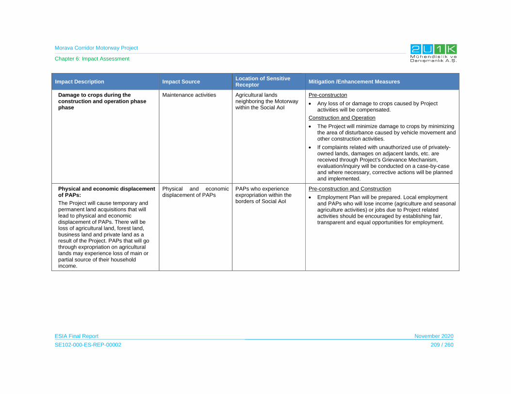
Morava Corridor Motorway Project
Chapter 6: Impact Assessment
ESIA Final Report November 2020
SE102-000-ES-REP-00002 209 / 260
Impact Description Impact Source Location of Sensitive Receptor
Mitigation /Enhancement Measures
Damage to crops during the construction and operation phase phase
Maintenance activities Agricultural lands neighboring the Motorway within the Social AoI
Pre-constructon
Any loss of or damage to crops caused by Project activities will be compensated.
Construction and Operation
The Project will minimize damage to crops by minimizing the area of disturbance caused by vehicle movement and other construction activities.
If complaints related with unauthorized use of privately-owned lands, damages on adjacent lands, etc. are received through Project’s Grievance Mechanism, evaluation/inquiry will be conducted on a case-by-case and where necessary, corrective actions will be planned and implemented.
Physical and economic displacement of PAPs:
The Project will cause temporary and permanent land acquisitions that will lead to physical and economic displacement of PAPs. There will be loss of agricultural land, forest land, business land and private land as a result of the Project. PAPs that will go through expropriation on agricultural lands may experience loss of main or partial source of their household income.
Physical and economic displacement of PAPs
PAPs who experience expropriation within the borders of Social AoI
Pre-construction and Construction
Employment Plan will be prepared. Local employment and PAPs who will lose income (agriculture and seasonal agriculture activities) or jobs due to Project related activities should be encouraged by establishing fair, transparent and equal opportunities for employment.
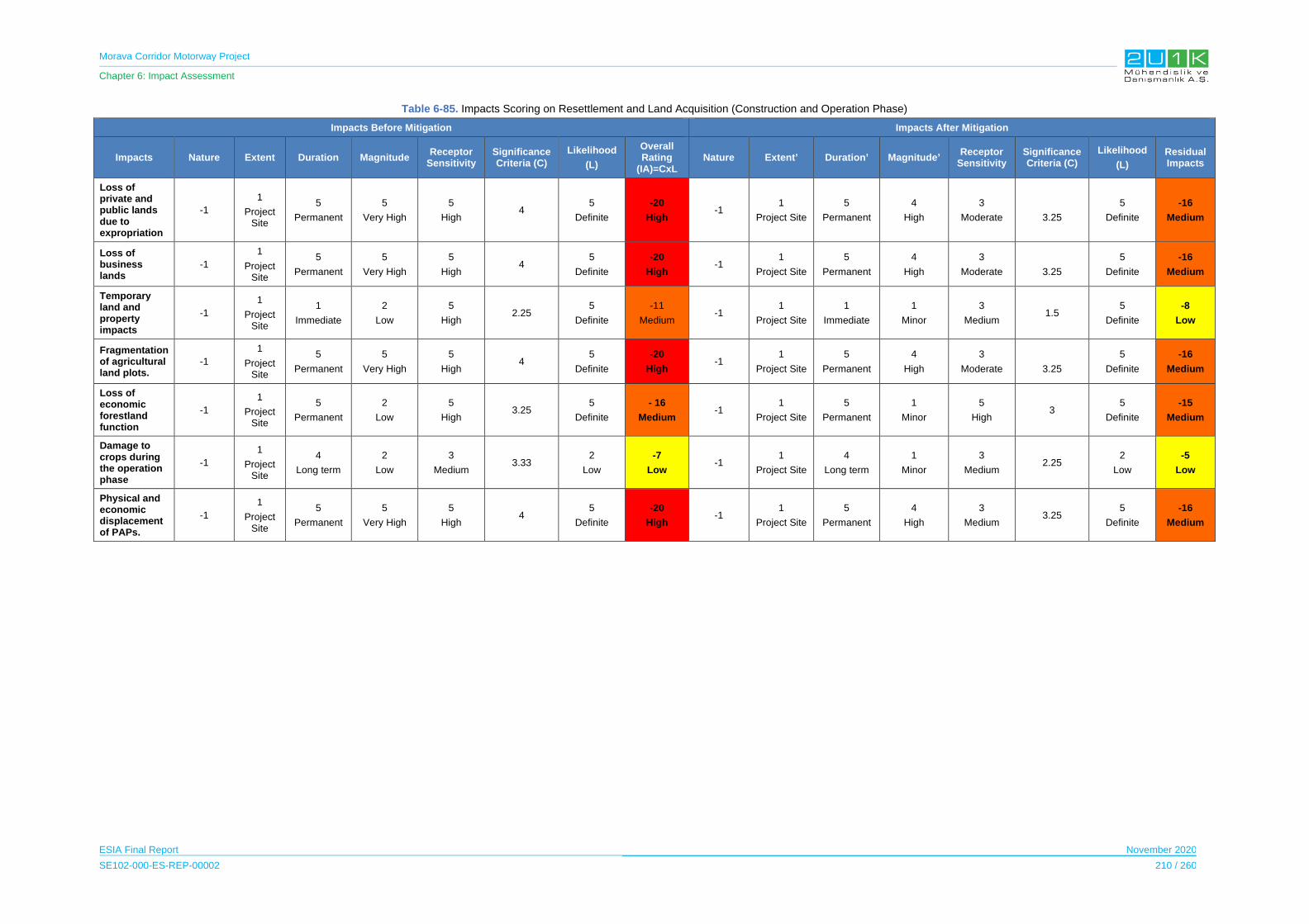
Morava Corridor Motorway Project
Chapter 6: Impact Assessment
ESIA Final Report November 2020
SE102-000-ES-REP-00002 210 / 260
Table 6-85. Impacts Scoring on Resettlement and Land Acquisition (Construction and Operation Phase)
Impacts Before Mitigation Impacts After Mitigation
Impacts Nature Extent Duration Magnitude Receptor
Sensitivity Significance Criteria (C)
Likelihood
(L)
Overall Rating
(IA)=CxL Nature Extent’ Duration’ Magnitude’
Receptor Sensitivity
Significance Criteria (C)
Likelihood
(L)
Residual Impacts
Loss of private and public lands due to expropriation
-1
1
Project Site
5
Permanent
5
Very High
5
High 4
5
Definite
-20
High -1
1
Project Site
5
Permanent
4
High
3
Moderate 3.25
5
Definite
-16
Medium
Loss of business lands
-1
1
Project Site
5
Permanent
5
Very High
5
High 4
5
Definite
-20
High-1
1
Project Site
5
Permanent
4
High
3
Moderate 3.25
5
Definite
-16
Medium
Temporary land and property impacts
-1
1
Project Site
1
Immediate
2
Low
5
High 2.25
5
Definite
-11
Medium -1
1
Project Site
1
Immediate
1
Minor
3
Medium 1.5
5
Definite
-8
Low
Fragmentation of agricultural land plots.
-1
1
Project Site
5
Permanent
5
Very High
5
High 4
5
Definite
-20
High-1
1
Project Site
5
Permanent
4
High
3
Moderate 3.25
5
Definite
-16
Medium
Loss of economic forestland function
-1
1
Project Site
5
Permanent
2
Low
5
High 3.25
5
Definite
- 16
Medium -1
1
Project Site
5
Permanent
1
Minor
5
High 3
5
Definite
-15
Medium
Damage to crops during the operation phase
-1
1
Project Site
4
Long term
2
Low
3
Medium 3.33
2
Low
-7
Low -1
1
Project Site
4
Long term
1
Minor
3
Medium 2.25
2
Low
-5
Low
Physical and economic displacement of PAPs.
-1
1
Project Site
5
Permanent
5
Very High
5
High 4
5
Definite
-20
High -1
1
Project Site
5
Permanent
4
High
3
Medium 3.25
5
Definite
-16
Medium
Morava Corridor Motorway Project
Chapter 6: Impact Assessment
ESIA Final Report November 2020
SE102-000-ES-REP-00002 211 / 260
6.11.5 Ecosystem Services
Ecosystem services are the benefits that people, including businesses, derive from
ecosystems. According to IFC Performance Standard 6, the ecosystem services are organized
into four types:
(i) provisioning services, which are the products people obtain from ecosystems;
(ii) regulating services, which are the benefits people obtain from the regulation of ecosystem
processes;
(iii) cultural services, which are the nonmaterial benefits people obtain from ecosystems; and
(iv) supporting services, which are the natural processes that maintain the other services (IFC,
2012).
This Chapter of the Impact Assessment covers the existing ecosystem services including types
of usage along the AoI, respectively.
6.11.5.1 Construction Phase
This section of the Impact Assessment derived from the social field study conducted on 2019,
and Spatial Plan of the Project (2019). The questionnaires prepared for the social field studies
included specific topic for ecosystem services to:
Identify drivers of ecosystem change likely to be associated with the project
Identify potentially impacted ecosystems and ecosystem services and potentially
affected beneficiaries
Assess project impact on ecosystem services
Assess current supply of priority ecosystem services and their contribution to
beneficiaries well being
Impact on Forest Lands:
The Project alignment will pass through forestlands in each of the Municipalities within the AoI.
The most affected Municipalities are located in Section-2 including Trstenik and Vrnjačka
Banja Municipalities. The forestlands in the AoI are mainly used for wood, plant and mushroom
collection and hunting purposes. All of the forest related activities are mainly used for
household consumption according to the results of social field study.
Although the Project activities require forest utilization, no significance impact is foreseen on
this ecosystem service, since most of the plants used are in the peridomiciliary spaces, and
have spaces for use or complementary sources of supply for their use.
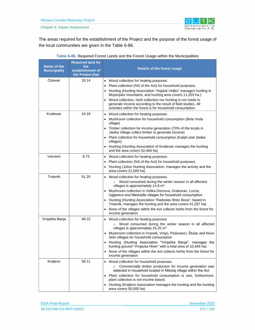
Morava Corridor Motorway Project
Chapter 6: Impact Assessment
ESIA Final Report November 2020
SE102-000-ES-REP-00002 212 / 260
The areas required for the establishment of the Project and the purpose of the forest usage of
the local communities are given in the Table 6-86.
Table 6-86. Required Forest Lands and the Forest Usage within the Municipalities
Name of the Municipality
Required land for the
establishment of the Project (ha)
Details of the forest usage
Ćićevac 18.14 Wood collection for heating purposes.
Plant collection (%5 of the AoI) for household purposes.
Hunting (Hunting Association "Hajduk Veljko" manages hunting in Mojsinjske mountains, and hunting area covers 11,203 ha.)
Wood collection, herb collection nor hunting is not made to generate income according to the result of field studies. All activities within the forest is for household consumption.
Kruševac 24.19 Wood collection for heating purposes.
Mushroom collection for household consumption (Bela Voda village)
Timber collection for income generation (70% of the locals in Jasika Village collect timber to generate income)
Plant collection for household consumption (Kukjin and Jasika villages)
Hunting (Hunting Association of Kruševac manages the hunting and the area covers 52,464 ha)
Varvarin 8.73 Wood collection for heating purposes.
Plant collection (%5 of the AoI) for household purposes.
Hunting (Juhor Hunting Association, manages the activity and the area covers 21,500 ha)
Trstenik 51.20 Wood collection for heating purposes.
o Wood consumed during the winter season in all affected villages is approximately 14.8 m3
Mushroom collection in Velika Drenova, Grabovac, Lozna, Ugljarevo and Medveđa villages for household consumption.
Hunting (Hunting Association "Radoslav Brkic Boza", based in Trstenik, manages the hunting and the area covers 41,287 ha)
None of the villages within the AoI collects herbs from the forest for income generation
Vrnjačka Banja 48.22 Wood collection for heating purposes
o Wood consumed during the winter season in all affected villages is approximately 16.25 m3
Mushroom collection in Vraneši, Vrnjci, Podunavci, Štulac and Novo Selo villages for household consumption
Hunting (Hunting Association "Vrnjačka Banja", manages the hunting ground "Vrnjacka River" with a total area of 10,445 ha)
None of the villages within the AoI collects herbs from the forest for income generation
Kraljevo 58.11 Wood collection for household purposes.
o Commercially timber production for income generation was detected in household located in Miločaj village within the AoI.
Plant collection for household consumption is rare, furthermore, plant collection is not income based.
Hunting (Kraljevo Association manages the hunting and the hunting area covers 50,000 ha)
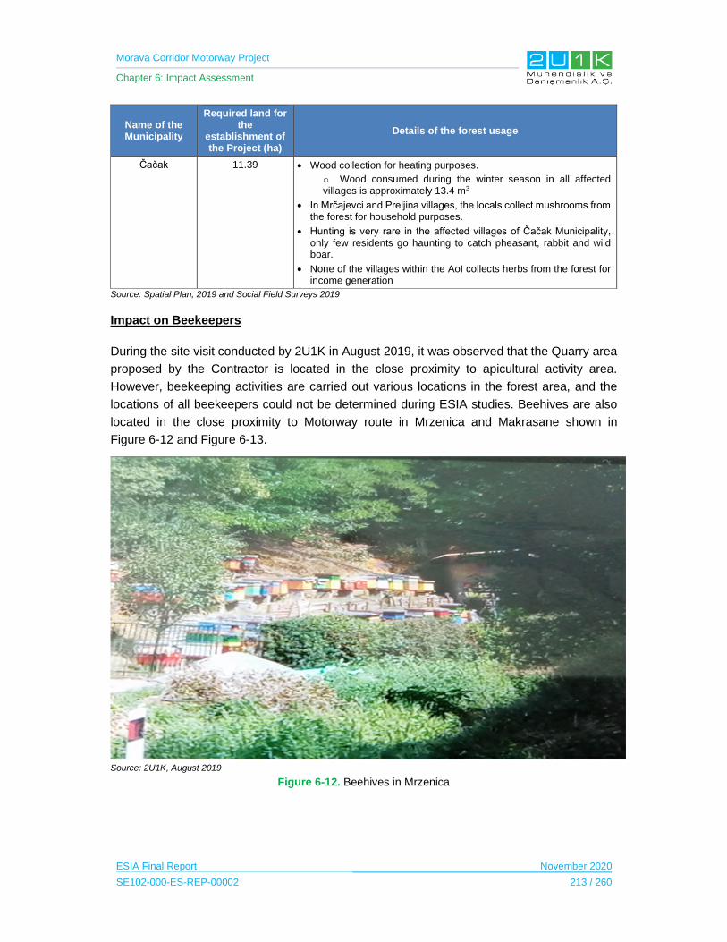
Morava Corridor Motorway Project
Chapter 6: Impact Assessment
ESIA Final Report November 2020
SE102-000-ES-REP-00002 213 / 260
Name of the Municipality
Required land for the
establishment of the Project (ha)
Details of the forest usage
Čačak 11.39 Wood collection for heating purposes.
o Wood consumed during the winter season in all affected villages is approximately 13.4 m3
In Mrčajevci and Preljina villages, the locals collect mushrooms from the forest for household purposes.
Hunting is very rare in the affected villages of Čačak Municipality, only few residents go haunting to catch pheasant, rabbit and wild boar.
None of the villages within the AoI collects herbs from the forest for income generation
Source: Spatial Plan, 2019 and Social Field Surveys 2019
Impact on Beekeepers
During the site visit conducted by 2U1K in August 2019, it was observed that the Quarry area
proposed by the Contractor is located in the close proximity to apicultural activity area.
However, beekeeping activities are carried out various locations in the forest area, and the
locations of all beekeepers could not be determined during ESIA studies. Beehives are also
located in the close proximity to Motorway route in Mrzenica and Makrasane shown in
Figure 6-12 and Figure 6-13.
Source: 2U1K, August 2019
Figure 6-12. Beehives in Mrzenica

Morava Corridor Motorway Project
Chapter 6: Impact Assessment
ESIA Final Report November 2020
SE102-000-ES-REP-00002 214 / 260
Figure 6-13. Beehives in Mrzenica and Makrasene
According to the information received from the Association of Professional Beekeepers,
beehives located in the close proximity Morava River will be affected by the excavation and
blasting activities of the Project including dust, noise and vibration. The beekeeper Association
of Kruševac recommended that the construction activities should be conducted as much as
practical distance from the beehives (in May, June, July they can fly 2 km) by considering the
seasonal changes.
The quality of the flowers may be reduced as a result of the CO2 and dust emissions and this
may reduce honey production and quality.

Morava Corridor Motorway Project
Chapter 6: Impact Assessment
ESIA Final Report November 2020
SE102-000-ES-REP-00002 215 / 260
Impact on Tourism
Within the borders of the AoI, municipality of Vrnjačka Banja is observed to have the most
available touristic activities among other affected municipalities. Below presents details on the
tourism activities and available hospitality services within the affected municipalities.
Table 6-87. Tourism activities within the AoI
Name of the Municipality Available Touristic Activities and Areas
Vrnjačka Banja According to social surveys, there are no touristic facilities (i.e .hotel, hostel, camp site) among the affected villages
The main tourism source in the Municipality is thermal water. Special Mercury Hospital and HTP Fontana are the main touristic facilities.
Another tourism source is Goč mountain in terms of hiking trails, two hunting grounds, ski slopes with cable car, lake Selište, ponds.
Other tourist attraction in Vrnjačka Banja is the area with a recreational-tourist zone along the West Morava. This zone is mainly being used for hunting and fishing.
Kraljevo According to social surveys, Adrani village stated to have touristic facilities (i.e.hotel, hostel, camp site) among the affected villages.
Čačak According to social surveys, Mrčajevci and Preljina villages were stated to have touristic facilities (i.e. hotel, hostel, camp site) among the affected villages.
Ovčar-Kablar Gorge is a karst limestone canyon that is a touristic source of the Municipality.
Ćićevac According to social surveys, Grad Stalac village was stated to have touristic facilities (i.e. hotel, hostel, camp site) among the affected villages.
Kruševac According to social surveys, Citluk and Bivolje villages were stated to havetouristic facilities (i.e. hotel, hostel, camp site) among the affected villages.
Trstenik According to social surveys, there are no touristic facilities (i.e. .hotel, hostel, camp site) among the affected villages.
Varvarin According to social surveys, there are no touristic facilities (i.e. .hotel, hostel, camp site) among the affected villages.
Source: Social Field Study (2019)
During the discussions with the head of villages, although there may be lack of touristic
activities nor facilities among the AoI, it was stated that most of the affected settlement may
have potential to become a touristic location. This matter is also covered in the Spatial Plan
(November 2019) of the Project indicating the importance of Project to increase the tourism
potential of the affected settlements through easier accessibility of the settlements.
Morava Corridor Motorway Project
Chapter 6: Impact Assessment
ESIA Final Report November 2020
SE102-000-ES-REP-00002 216 / 260
Impact on River Usage
The Morava River is used by the villagers for various purposes including fishing, irrigation and
transportation. The main impact on the river use is expected to be from the regulation of the
river. River regulation activities will not create additional worker accommodation sites within
the scope of Project activities. Also, existing roads will be used within the scope of regulation
works. Based on the Hydrotechnical Study Corrıdor of the Highway E-761, Section Pojate-
Prelina conducted by Jaroslav Cerni (2016), Table 6-88 presents the areas of the river
regulation along with the closest settlements according to Project sections, respectively.
Table 6-88. Areas of the River Regulation
Section Number Settlement Distance Between the River Regulation and the
Village Center (km)
1
Grad Stalac 1,339
Maskare 1,597
Mrzenica 0,247
Bosnjane 1,308
2 Sirca 0,527
3
Grdica 0,966
Adrani 2,504
Popovici 0,649
Milocaj 0,883
Obrva 1,409
Goricani 1,643
Katrga 2,072
Mrcajevci 3,744
Donja Gorevnica 2,484
Stancici 1,336
As can be seen from the Table above, Section 3 is expected experience more river regulation
impacts among the Project sections. According to Household and Community Level surveys,
none of the locals among the Section 3 derives household income from the Morava River.
Popovici village, being the closest settlement to the river regulation activities in Section 3 stated
to use Morava River for fishing on household consumption. None of the affected settlements
use the river for transportation purposes. From this aspect, regulation impacts on river usage
could be managed sufficiently with proper mitigation measures.
During the social field studies, the head of each affected villages was asked the purpose of
Morava River usage, which can be found below. Although fishing activities are common in
majority of the affected settlements within the AoI, the locals do not generate income from
fishing. On the other hand, Čačak Municipality is observed to be the only affected municipality
that use the River for transportation purposes.

Morava Corridor Motorway Project
Chapter 6: Impact Assessment
ESIA Final Report November 2020
SE102-000-ES-REP-00002 217 / 260
Table 6-89. Purpose of River Usage
Section Municipality Purpose of the River Usage Name of the villages
Section 1
Ćićevac
Irrigation Grad Stalac, Mrzenica, Poijate, Stalack
Transportation None
Fishing (household consumption) Grad Stalac, Mrzenica, Poijate, Stalack
Recreation Grad Stalac, Mrzenica, Poijate, Stalack
Kraljevo
Irrigation Adrani, Vrba, Grdica, Zaklopaca, Milocaj, Obrva, Popovici, Ratina, Sirca, Sumarce, Stubal
Transportation None
Fishing (household consumption) Adrani, Vrba, Grdica, Zaklopaca, Milocaj, Obrva, Popovici, Ratina, Sirca, Sumarce, Stubal
Recreation None
Varvarin
Irrigation Bosnjane and Maskare
Transportation None
Fishing (household consumption) Bosnjane and Maskare
Recreation Bosnjane and Maskare
Section 2
Kruševac
Irrigation Bivolje, Bela Voda, Citlluk, Kosevi, Makrešane
Transportation Kukljin,
Fishing (household consumption) Makrešane, Jasika
Recreation Kosevi
Vrnjačka Banja
Irrigation Vraneši, Podunavci, Ruđinci and Gračac
Transportation None
Fishing (household consumption) Vraneši, Podunavci, Ruđinci, Vrnji, Novo Selo, Stulac and Gračac
Recreation None
Trstenik
Irrigation Bogdanje, Medveđa, of Velika Drenova and Lozna
Transportation None
Fishing (household consumption) Velika Drenova and Lozna
Recreation Velika Drenova and Lozna
Morava Corridor Motorway Project
Chapter 6: Impact Assessment
ESIA Final Report November 2020
SE102-000-ES-REP-00002 218 / 260
Section Municipality Purpose of the River Usage Name of the villages
Section 3 Čačak
Irrigation Baluga, Dona Gorevnica, Katrga, Mrčajevci, Stančići, Konjevići and Goričani
Transportation None
Fishing (household consumption) Baluga, Dona Gorevnica, Katrga, Mrčajevci, Stančići, Konjevići and Goričani, Popovici
Recreation None
Morava Corridor Motorway Project
Chapter 6: Impact Assessment
ESIA Final Report November 2020
SE102-000-ES-REP-00002 219 / 260
Spring and Well Water:
As can be seen from the Section 5 of the ESIA Report, majority of the affected settlements
either use spring and/or well water for household consumption and irrigation purposes. The
design phase of the Project took consideration and avoided to interact with spring and well
water sources. It is important to note that, regulation activities on Morava River will be made
in order to transfer water flow to prevent flood without distrupting groundwater levels and
springwater. As stated in Chapter 6.3.2, groundwater level will be regularly monitored from
existing groundwater wells located near the construction site.
The overall construction of the Project is not expected to cause negative impact on both
resources. Furter details on river regulation works within the scope of the Project is given in
Chapter 3.3. of the ESIA Report.
Cultural and Intangible Values:
During the social field study, specific questionnaires were dedicated to determine and
understand the existing tangible/intangible cultural heritages among the AoI. Besides
acknowledging, Archaeological and cultural resources (See Chapter 6.9 for details), it is
important to identify cultural and spiritual values specific to the AoI. Potential contacts between
the local population and non-local workforces unfamiliar with the traditional conventions and
customary modes of behavior may also negatively impact on traditional intangible culture of
the AoI.
As mentioned in the Section 6.9 of this Impact Assessment, there are various types of
registered cultural heritages among the AoI.
According to the Spatial Plan of the Project (November, 2019) and the information derived
during the social field study, there are two sacred trees that and old building located within the
borders of AoI. Thus, the Motorway route and area of the river regulation works will not coincide
with any archaeological area and immovable cultural assets and will not impact these areas.
During construction phase of the Project, a Chance Finds Procedure will be prepared and it
will be implemented for the all Project sections. The Procedure will include measures; in case
of a chance find occurs during the excavation works.
As stated, there are two sacred trees within the borders of AoI; located in Bela Voda villige and
Donja Gorevnica village respectively. As stated in the Spatial Plan of the Project, these trees
were left outside of the selected route of the Motorway. In addition, according to the design of
the Project, none of the Project construction facilities will be neighboring these trees.
The locals access to of these sacred trees are through existing unpaved village roads. During
the operation phase of the Project, the access to the sacred tree located in Bela Voda village
will be through under pass.
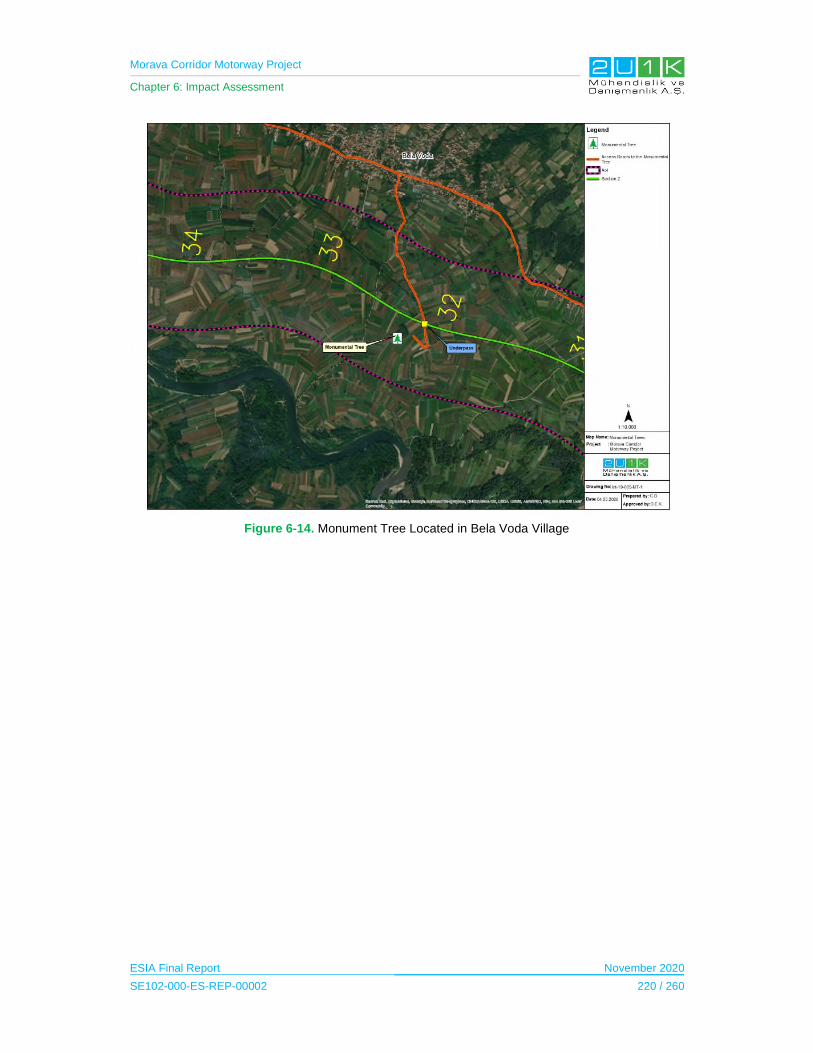
Morava Corridor Motorway Project
Chapter 6: Impact Assessment
ESIA Final Report November 2020
SE102-000-ES-REP-00002 220 / 260
Figure 6-14. Monument Tree Located in Bela Voda Village

Morava Corridor Motorway Project
Chapter 6: Impact Assessment
ESIA Final Report November 2020
SE102-000-ES-REP-00002 221 / 260
Figure 6-15. Monument Tree Located in Donja Gorevnica
On the other hand, the sacred tree located in Donja Gorevnica Village will use the existing path
as there will be no limits to access.
In case of unexpected tangible/intangible cultural heritage determined during the pre-
construction / construction activities; the Contractor will not remove any nonreplicable cultural
heritage, unless all of the following conditions are met:
There are no technically or financially feasible alternatives to removal;
The overall benefits of the project conclusively outweigh the anticipated cultural
heritage loss from removal; and
Any removal of cultural heritage is conducted using the best available technique. (IFC
PS 8 Guidance Note,2012).
Last, it is important to note that, there is no Indigenous People residing among the AoI. Details
on existing archaeological and cultural resources, along with the proposed mitigation
measures are addressed in Chapter 6.9 of this ESIA Report.
Morava Corridor Motorway Project
Chapter 6: Impact Assessment
ESIA Final Report November 2020
SE102-000-ES-REP-00002 222 / 260
The Impact Assessment on Ecosystem Services during the Construction Phase
Table 6-90 presents the potential ecosystem services related impacts and the proposed
mitigation measures to prevent stated impacts due to Project construction. In that regards,
Table 6-91 provides quantitative assessment of the impacts through identifying; nature, extent,
duration, magnitude, significance and likelihood of each potential impacts of the Project.
Considering the Project will adopt and apply the given mitigation measures in
Table 6-90, Table 6-91 then assess the residual impacts of the Project.
The impacts on ecosystem services have negative nature. Access to the forest lands and
impacts apiculture activities have Municipal extent, however, impact on river usage, leisure
activities and tourism have district extent. The likelihood of the negative impacts on apiculture
are assessed as medium considering the possible changes on the location of the borrow pits
and quarries. With the implementation of mitigation measures, the likelihood of the negative
impacts decrease as can be seen in Table 6-91.
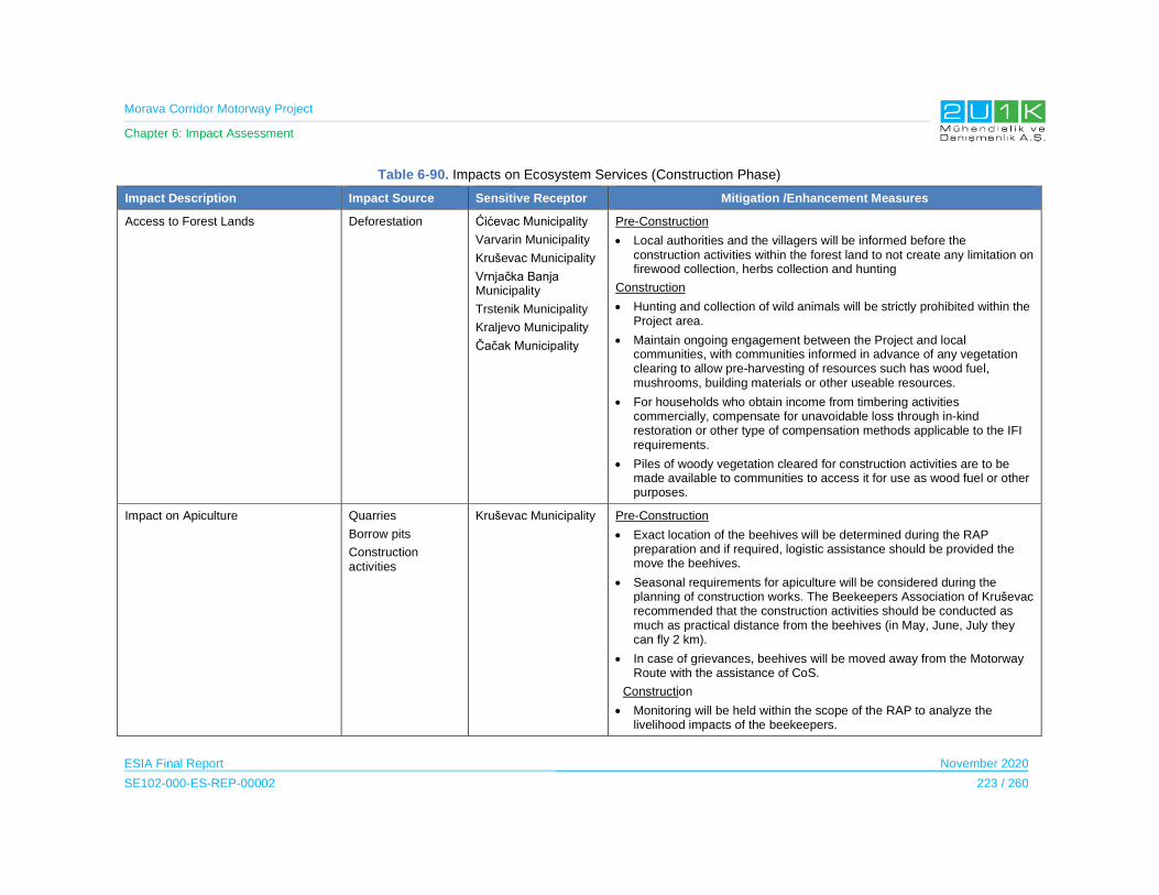
Morava Corridor Motorway Project
Chapter 6: Impact Assessment
ESIA Final Report November 2020
SE102-000-ES-REP-00002 223 / 260
Table 6-90. Impacts on Ecosystem Services (Construction Phase)
Impact Description Impact Source Sensitive Receptor Mitigation /Enhancement Measures
Access to Forest Lands Deforestation Ćićevac Municipality
Varvarin Municipality
Kruševac Municipality
Vrnjačka Banja Municipality
Trstenik Municipality
Kraljevo Municipality
Čačak Municipality
Pre-Construction
Local authorities and the villagers will be informed before the construction activities within the forest land to not create any limitation on firewood collection, herbs collection and hunting
Construction
Hunting and collection of wild animals will be strictly prohibited within the Project area.
Maintain ongoing engagement between the Project and local communities, with communities informed in advance of any vegetation clearing to allow pre-harvesting of resources such has wood fuel, mushrooms, building materials or other useable resources.
For households who obtain income from timbering activities commercially, compensate for unavoidable loss through in-kind restoration or other type of compensation methods applicable to the IFI requirements.
Piles of woody vegetation cleared for construction activities are to be made available to communities to access it for use as wood fuel or other purposes.
Impact on Apiculture Quarries
Borrow pits
Construction activities
Kruševac Municipality Pre-Construction
Exact location of the beehives will be determined during the RAP preparation and if required, logistic assistance should be provided the move the beehives.
Seasonal requirements for apiculture will be considered during the planning of construction works. The Beekeepers Association of Kruševac recommended that the construction activities should be conducted as much as practical distance from the beehives (in May, June, July they can fly 2 km).
In case of grievances, beehives will be moved away from the Motorway Route with the assistance of CoS.
Construction
Monitoring will be held within the scope of the RAP to analyze the livelihood impacts of the beekeepers.
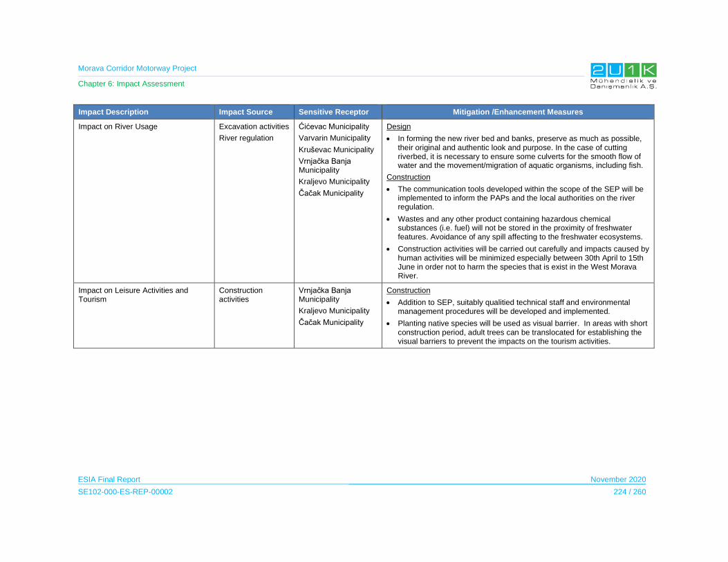
Morava Corridor Motorway Project
Chapter 6: Impact Assessment
ESIA Final Report November 2020
SE102-000-ES-REP-00002 224 / 260
Impact Description Impact Source Sensitive Receptor Mitigation /Enhancement Measures
Impact on River Usage Excavation activities
River regulation
Ćićevac Municipality
Varvarin Municipality
Kruševac Municipality
Vrnjačka Banja Municipality
Kraljevo Municipality
Čačak Municipality
Design
In forming the new river bed and banks, preserve as much as possible, their original and authentic look and purpose. In the case of cutting riverbed, it is necessary to ensure some culverts for the smooth flow of water and the movement/migration of aquatic organisms, including fish.
Construction
The communication tools developed within the scope of the SEP will be implemented to inform the PAPs and the local authorities on the river regulation.
Wastes and any other product containing hazardous chemical substances (i.e. fuel) will not be stored in the proximity of freshwater features. Avoidance of any spill affecting to the freshwater ecosystems.
Construction activities will be carried out carefully and impacts caused by human activities will be minimized especially between 30th April to 15th June in order not to harm the species that is exist in the West Morava River.
Impact on Leisure Activities and Tourism
Construction activities
Vrnjačka Banja Municipality
Kraljevo Municipality
Čačak Municipality
Construction
Addition to SEP, suitably qualitied technical staff and environmental management procedures will be developed and implemented.
Planting native species will be used as visual barrier. In areas with short construction period, adult trees can be translocated for establishing the visual barriers to prevent the impacts on the tourism activities.

Morava Corridor Motorway Project
Chapter 6: Impact Assessment
ESIA Final Report November 2020
SE102-000-ES-REP-00002 225 / 260
Table 6-91. Impacts Scoring on Ecosystem Services (Construction Phase)
Impacts Before Mitigation Impacts After Mitigation
Impacts Nature Extent Duration Magnitude Receptor
Sensitivity Significance Criteria (C)
Likelihood (L)
Overall Rating
(IA)=CxLNature Extent’ Duration’ Magnitude’
Receptor Sensitivity
Significance Criteria (C)
Likelihood (L)
Residual Impacts
Access to Forest Lands
-1 Negative
2 Municipal
1 Immediate
3 Moderate
5 High
2.75 5
Definite
-14 Negative Medium
-1 Negative
2 Municipal
1 Immediate
3 Moderate
5 High
2.75 3
Medium
-8 Negative
Low
Impact on Apiculture
-1 Negative
2 Municipal
1 Immediate
2 Low
5 High
2.5 3
Medium
-8 Negative
Low
-1 Negative
1 Project
Site
1 Immediate
2 Low
5 High
2.25 2
Low
-5 Negative
Low
Impact on River Usage
-1 Negative
3 District
1 Immediate
4 High
3 Medium
2.75 5
Definite
-14 Negative Medium
-1 Negative
3 District
1 Immediate
4 High
3 Medium
2.75 4
High
- 11 Negative Medium
Impact on Leisure Activities and Tourism
-1 Negative
3 District
1 Immediate
3 Moderate
5 High
3 5
Definite
-15 Negative Medium
-1 Negative
2 Municipal
1 Immediate
2 Low
5 High
2.5 4
High
- 10 Negative Medium

Morava Corridor Motorway Project
Chapter 6: Impact Assessment
ESIA Final Report November 2020
SE102-000-ES-REP-00002 226 / 260
6.11.5.2 Operation Phase
During the operation period of the Project, access to the ecosystem services will be limited,
including forest areas, irrigation from the Morava River and the permanent withdrawal of forest
lands by the Project will result in loss of its economic function as well as socioeconomic value
for local communities including ecosystem services use.
The Impact Assessment on Ecosystem Services during the Operation Phase
The Table 6-92 presents the potential ecosystem services related impacts and the proposed
mitigation measures to prevent stated impacts due to Project operation. In that regards, Table
6-93 provides quantitative assessment of the impacts through identifying; nature, extent,
duration, magnitude, significance and likelihood of each potential impacts of the Project.
Considering the Project will adopt and apply the given mitigation measures in
Table 6-92, Table 6-93 then assess the residual impacts of the Project.
During the operation phase, the main impact is expected to be access to the ecosystem
services. With the provision of the required access to the service areas and the implementation
of the mitigation measures, the likelihood of the impact is expected to be reduced to low.
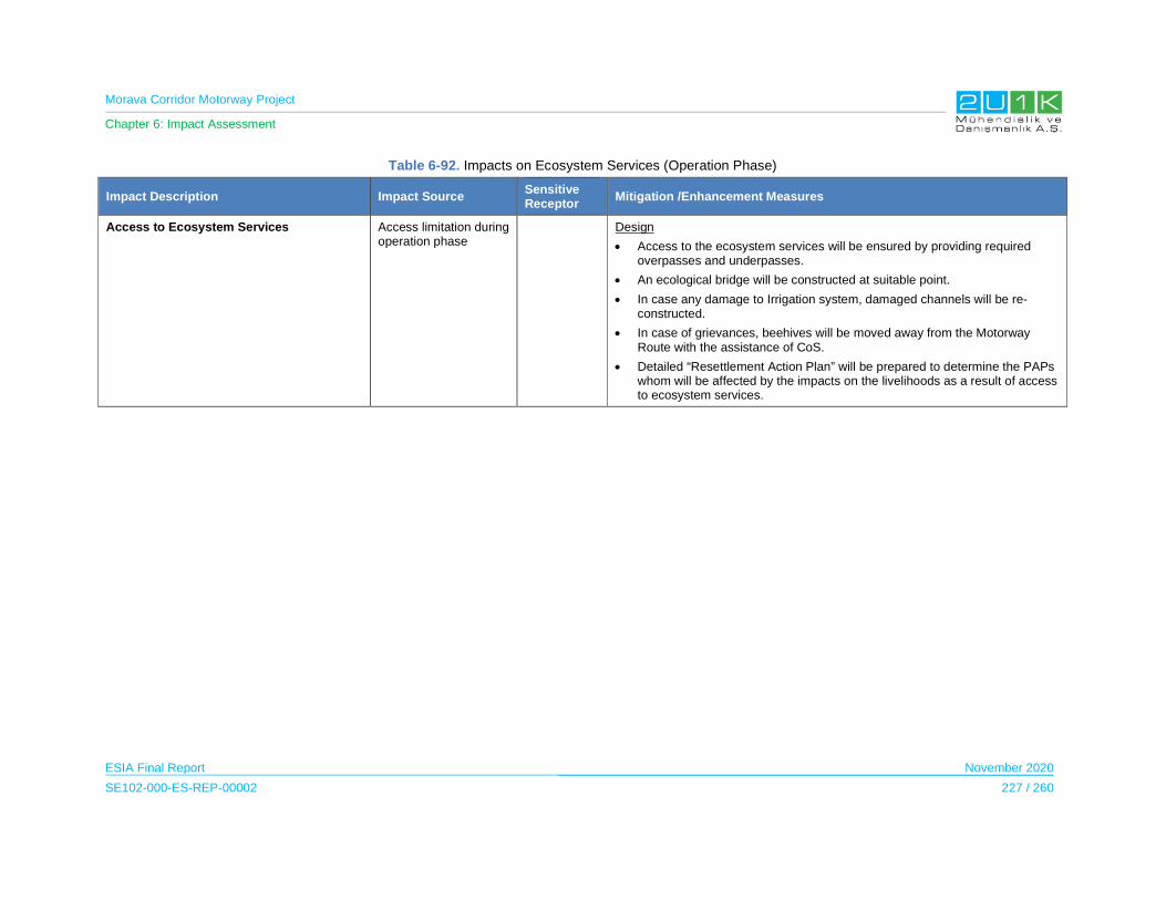
Morava Corridor Motorway Project
Chapter 6: Impact Assessment
ESIA Final Report November 2020
SE102-000-ES-REP-00002 227 / 260
Table 6-92. Impacts on Ecosystem Services (Operation Phase)
Impact Description Impact Source Sensitive Receptor
Mitigation /Enhancement Measures
Access to Ecosystem Services Access limitation during operation phase
Design
Access to the ecosystem services will be ensured by providing required overpasses and underpasses.
An ecological bridge will be constructed at suitable point.
In case any damage to Irrigation system, damaged channels will be re-constructed.
In case of grievances, beehives will be moved away from the Motorway Route with the assistance of CoS.
Detailed “Resettlement Action Plan” will be prepared to determine the PAPs whom will be affected by the impacts on the livelihoods as a result of access to ecosystem services.
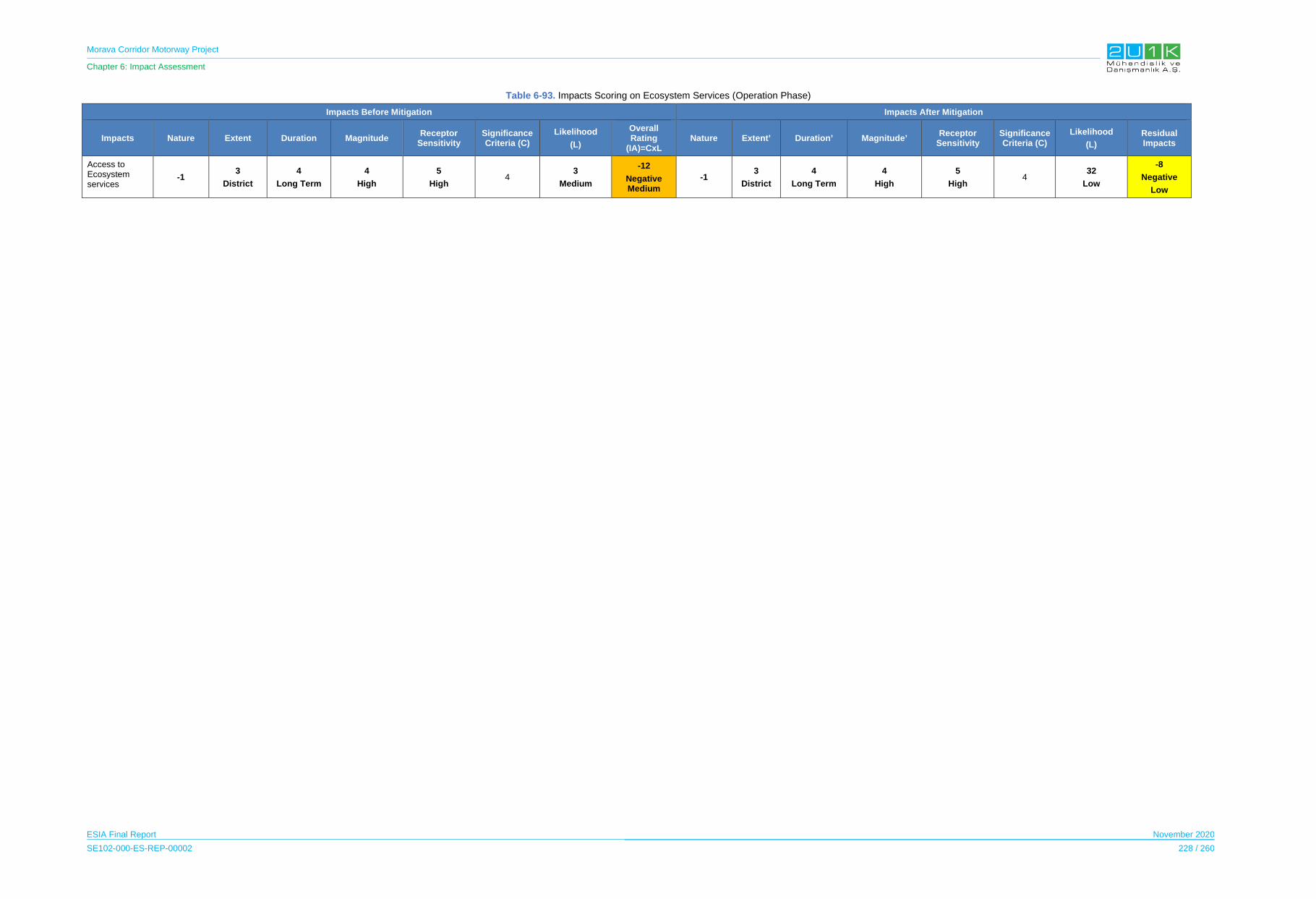
Morava Corridor Motorway Project
Chapter 6: Impact Assessment
ESIA Final Report November 2020
SE102-000-ES-REP-00002 228 / 260
Table 6-93. Impacts Scoring on Ecosystem Services (Operation Phase)
Impacts Before Mitigation Impacts After Mitigation
Impacts Nature Extent Duration Magnitude Receptor
Sensitivity Significance Criteria (C)
Likelihood
(L)
Overall Rating
(IA)=CxL Nature Extent’ Duration’ Magnitude’
Receptor Sensitivity
Significance Criteria (C)
Likelihood
(L)
Residual Impacts
Access to Ecosystem services
-1 3
District
4
Long Term
4
High
5
High 4
3
Medium
-12
Negative Medium
-13
District
4
Long Term
4
High
5
High4
32
Low
-8
Negative
Low
Morava Corridor Motorway Project
Chapter 6: Impact Assessment
ESIA Final Report November 2020
SE102-000-ES-REP-00002 229 / 260
6.11.6 Labour and Working Conditions
The impact assessment of labour and working conditions is considered together for both the
construction and operation phase, as similar consequences can arise as well as same
mitigation measures will be applied for both phases of the Project.
The Contractor envisages a 60 hour working week within the conditions provided by the
national labour legislation which in addition will provide:
Redistribution of working hours supporting the construction schedule needs, while
complying with the labour law, and the options set within.
Addional payment for extra working hours in accordance with national labour law
Provision of accommodation in accordance with national standards
Health and wellbeing program for all employees
Occupational health and safety program for all employees
Prevention program that identifies opportunities to reduce exposure to occupational
health and safety risks
Training program for all employees, with focus on high risk activities
Work organization at site in order to make easier and more efficient for employee to
complete their tasks
Grievance procedure for employees to compliance with the requirements of good
practices required by the International Finance Institutions.
6.11.6.1 Construction and Operation Phase
The Project will result in temporary employment for the duration of construction phase
(expected to be 4 years, at this stage). The average number of the Project workers will be
3,100 and the peak number will be approximately 3,800. To the extent possible, the unskilled
workforce are expected to be hired from the local of AoI. On the other hand, majority of the
skilled construction workers are expected to be sourced from the Contractor, and these will be
primarily temporary international workers. This recruitment process has been implemented by
the Contractor on previous infrastructure projects. The Contractor will be responsible for
human resources for the construction phase.
For operation phase of the Project, it is expected that between 20 and 50 permanent local
employees will be hired for the tolling station and toll collection of the Motorway, in which will
be the responsibility of Roads of Serbia for the operation phase.
Morava Corridor Motorway Project
Chapter 6: Impact Assessment
ESIA Final Report November 2020
SE102-000-ES-REP-00002 230 / 260
Throughout the construction and operation phases, the Project will comply with national labor,
social security and occupational health and safety laws as well as the principles and standards
of ILO convention. The national principles embodied in the ILO convention are:
The abolition of child labor,
The elimination of forced labor,
The elimination of discrimination,
Collective bargaining.
The detailed information of the Legal Framework of the Project is presented in Chapter 4 of
this ESIA Report. However, in order to understand the applicability of the mitigation measures,
additional information of the labour related national requirements are also specified in this
section below.
Child labour: The Constitution (Official Gazette of the RS. No. 98/2006) and Labour Law
(Official Gazette of the Republic of Serbia no. 24/05, 61/05, 54/09) guarantee special
protection to the family and the child and prohibit the employment of children under 15 and for
hazardous work under 18. These provisions are in line with international standards.
Forced labour: The Constitution prohibits slavery, keeping persons in conditions tantamount
to slavery and all forms of trafficking in persons. The Law on the Protection Program for
Participants in Criminal Proceedings (Official Gazette of the RS. No. 85/05) regulates the
protection of and assistance to victims of human trafficking.
Occupational Health and Safety: The Constitution guarantees the right to occupational safety
and health and the right to protection at work, as well as special protection at work for women,
young persons and persons with disabilities. The Occupational Safety and Health Act was
significantly amended in 2015 to be aligned with EU standards Health and Safety.
Trade Unions: The Constitution guarantees the freedom of association in trade unions. The
freedom to associate in trade unions is the only trade union-related right guaranteed by human
rights protection instruments ratified by Serbia. This freedom entails the right to establish a
trade union and join it of one’s own free will, the right to establish associations, national and
international alliances of trade unions and the right of trade unions to act independently,
without interference from the state.
Collective Bargaining: The Labour Law requires collective bargaining agreements for any
company with more than 10 employees. To be recognized as a collective bargaining agent, a
union must comprise 15 percent of the workforce. The collective agreements may apply on the
general, sectorial or at company level.
Working Conditions: The Constitution protects the right to fair and favorable working conditions
and equal access to work. Working conditions are primarily regulated by the Labour Law and
the Employment and Unemployment Insurance Act (adopted on 13.05.2019). The employment

Morava Corridor Motorway Project
Chapter 6: Impact Assessment
ESIA Final Report November 2020
SE102-000-ES-REP-00002 231 / 260
of foreign citizens in Serbia is regulated by the Law on Employment of Foreigners.
Representatives (Official Gazette of RS”, no. 31/2019) of the public and private sectors,
consulted in 2013 and 2015, reported that the Labour Law did not sufficiently allow flexible
forms of employment.
• Workplace harassment: The Act on the Prevention of Harassment at Work (Official
Gazette of the Republic of Serbia", No. 36/2010 ) obliges employers to inform workers
in writing of the provisions of the law and to ensure, among others, that work is
organised in a manner precluding harassment and that it protects workers from
harassment. The Act applies also to sexual harassment and provides employees with
the opportunity to obtain faster and more efficient protection than the one provided by
the Labour Law.
• Wages: The constitution guarantees the right of workers to fair remuneration for work.
According to the Labour Law, employment contracts violating the principle of an
appropriate wage shall be deemed null and void. The overtime rate is at least 26
percent higher than the wage base, as is work in shifts or at night, in the event the
employment contract does not specify remuneration for such work. This is in line with
international standards.
• Working hours: The Constitution guarantees the right to limited working hours, daily
and weekly rest and paid annual vacations. The Construction Contract between the
Government of the Republic of Serbia BEJV; and the Special Law (Law on Establishing
Public Interest and Special Procedures for the Implementation of the Project for
Construction of the Infrastructure Corridor of E-761 Highway, Section Pojate-Preljina)
envisage 60 hours of average working hours in a week.
• Social security: The Constitution guarantees the rights of workers and their families to
social protection and insurance, the right to compensation in case of temporary inability
to work and to temporary unemployment allowances and the right to pension insurance.
The social security system covers nine benefits: old age, invalidity, survivors, sickness,
maternity, employment injury, unemployment, medical care and family benefits. The
unemployed are entitled to allowances paid out for a maximum of 12 months, ranging
from 80 to 160 percent of the minimum wage.
The Impact Assessment on Labour and Working Conditions during the Construction and
Operation Phase
Table 6-94 presents the potential labour and working conditions related impacts and the
proposed mitigation measures to prevent stated impacts due to Project construction and
operation. In that regards, Table 6-95 provides quantitative assessment of the impacts through
identifying; nature, extent, duration, magnitude, significance and likelihood of each potential
impacts of the Project. Considering the Project will adopt and apply the given mitigation
measures in Table 6-94, Table 6-95 then assess the residual impacts of the Project.

Morava Corridor Motorway Project
Chapter 6: Impact Assessment
ESIA Final Report November 2020
SE102-000-ES-REP-00002 232 / 260
The possibility of the inadequate management of the labour (ie. labour discrimination,
inadequate payroll process, etc.) may create negative impacts on the direct and indirect labour
force. The extent of impact is expected to municipal, considering the requirement of skilled and
unskilled labour. Considering the best labour practices of the Contractor, the likelihood of the
impact is expected to be low without mitigation measures. The likelihood of the negative
impacts will be reduce from low to improbable with the proposed mitigation measures.
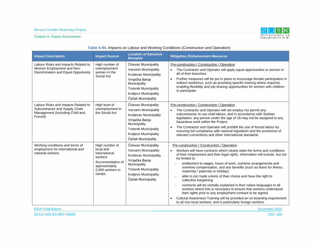
Morava Corridor Motorway Project
Chapter 6: Impact Assessment
ESIA Final Report November 2020
SE102-000-ES-REP-00002 233 / 260
Table 6-94. Impacts on Labour and Working Conditions (Construction and Operation)
Impact Description Impact Source Location of Sensitive Receptor
Mitigation /Enhancement Measures
Labour Risks and Impacts Related to Women Employment and Non-Discrimination and Equal Opportunity
High number of unemployment women in the Social AoI
Ćićevac Municipality
Varvarin Municipality
Kruševac Municipality
Vrnjačka Banja Municipality
Trstenik Municipality
Kraljevo Municipality
Čačak Municipality
Pre-construction / Construction / Operation
The Contractor and Operator will apply equal opportunities to women in all of their branches.
Further measures will be put in place to encourage female participation in indirect workforce, such as providing specific training where required, enabling flexibility and job-sharing opportunities for women with children to participate.
Labour Risks and Impacts Related to Subcontractor and Supply Chain Management (Including Child and Forced)
High level of unemployment in the Social AoI
Ćićevac Municipality
Varvarin Municipality
Kruševac Municipality
Vrnjačka Banja Municipality
Trstenik Municipality
Kraljevo Municipality
Čačak Municipality
Pre-construction / Construction / Operation
The Contractor and Operator will not employ nor permit any subcontractor to use child labour, and in accordance with Serbian legislation, any person under the age of 18 may not be assigned to any hazardous work within the Project.
The Contractor and Operator will prohibit the use of forced labour by ensuring full compliance with national legislation and the provisions of relevant conventions and other international standards
Working conditions and terms of employment for international and national workers.
High number of local and international workers
Accommodation of approximately 2,000 workers in camps
Ćićevac Municipality
Varvarin Municipality
Kruševac Municipality
Vrnjačka Banja Municipality
Trstenik Municipality
Kraljevo Municipality
Čačak Municipality
Pre-construction / Construction / Operation
Workers will have contracts which clearly state the terms and conditions of their employment and their legal rights. Information will include, but not be limited to:
- entitlement to wages, hours of work, overtime arrangements and overtime compensation, and any benefits (such as leave for illness, maternity / paternity or holiday)
- able to join trade unions of their choice and have the right to collective bargaining
- contracts will be verbally explained in their native languages to all workers where this is necessary to ensure that workers understand their rights prior to any employment contract to be signed.
Cultural Awareness Training will be provided an on-boarding requirement to all non-local workers, and in particularly foreign workers.
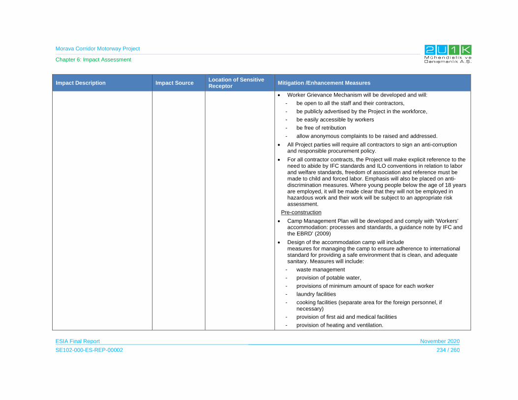
Morava Corridor Motorway Project
Chapter 6: Impact Assessment
ESIA Final Report November 2020
SE102-000-ES-REP-00002 234 / 260
Impact Description Impact Source Location of Sensitive Receptor
Mitigation /Enhancement Measures
Worker Grievance Mechanism will be developed and will:
- be open to all the staff and their contractors,
- be publicly advertised by the Project in the workforce,
- be easily accessible by workers
- be free of retribution
- allow anonymous complaints to be raised and addressed.
All Project parties will require all contractors to sign an anti-corruption and responsible procurement policy.
For all contractor contracts, the Project will make explicit reference to the need to abide by IFC standards and ILO conventions in relation to labor and welfare standards, freedom of association and reference must be made to child and forced labor. Emphasis will also be placed on anti-discrimination measures. Where young people below the age of 18 years are employed, it will be made clear that they will not be employed in hazardous work and their work will be subject to an appropriate risk assessment.
Pre-construction
Camp Management Plan will be developed and comply with ‘Workers’ accommodation: processes and standards, a guidance note by IFC and the EBRD’ (2009)
Design of the accommodation camp will include measures for managing the camp to ensure adherence to international standard for providing a safe environment that is clean, and adequate sanitary. Measures will include:
- waste management
- provision of potable water,
- provisions of minimum amount of space for each worker
- laundry facilities
- cooking facilities (separate area for the foreign personnel, if necessary)
- provision of first aid and medical facilities
- provision of heating and ventilation.

Morava Corridor Motorway Project
Chapter 6: Impact Assessment
ESIA Final Report November 2020
SE102-000-ES-REP-00002 235 / 260
Impact Description Impact Source Location of Sensitive Receptor
Mitigation /Enhancement Measures
Camp Management Project will include a Code of Conduct for construction workers
Construction
During the construction phase, the Contractor’s HSE plans and procedures include requirements for induction and training on expected behaviors and on disciplinary procedures (including dismissal procedures for unacceptable conduct).
In case of a collective dismissal required, Retrenchment Plan will be developed by the Contractor to mitigate adverse effects of job losses on the workers concerned. Retrenchment of workers is likely to be required across the lifespan of the Project, particularly during the transition from construction to operation. Retrenchment of workers will be undertaken in line with national law and international best practices, and will include providing skills to enable individuals to secure alternative employment.
o The effectiveness of all retrenchment should be monitored including the timely close out of retrenchment-related grievances
Operation
Human Resources Policy will be developed and implemented. Under the policy, the project proponent shall provide all employees with information regarding their rights under national labour law, including their rights related to wages and benefits. The policy covers working conditions, right to organize, non-discrimination, grievance mechanisms, child labour, and forced labour.
For operation phase of the Project, it is expected that between 20 and 50 permanent local employees will be hired for the tolling station and toll collection of the Motorway.
Risk of not continuing good labour practices
Ćićevac Municipality
Varvarin Municipality
Kruševac Municipality
Vrnjačka Banja Municipality
Trstenik Municipality
Kraljevo Municipality
Čačak Municipality
Operation
The workers will have contracts which clearly state the terms and conditions of their employment and their legal rights. Information will include, but not be limited to, entitlement to wages, hours of work, overtime arrangements and overtime compensation, and any benefits (such as leave for illness, maternity / paternity or holiday). All workers will be able to join trade unions of their choice and have the right to collective bargaining. Contracts will be verbally explained to all workers where this is necessary to ensure that workers understand their rights prior to any employment contract to be signed.

Morava Corridor Motorway Project
Chapter 6: Impact Assessment
ESIA Final Report November 2020
SE102-000-ES-REP-00002 236 / 260
Impact Description Impact Source Location of Sensitive Receptor
Mitigation /Enhancement Measures
The Project will put in place a worker grievance mechanism. The grievance mechanism will be open to all the staff and their contractors. The grievance mechanism will be publicly advertised by the Project in the workforce. It will be easily accessible by workers, free of retribution and will allow anonymous complaints to be raised and addressed.
The Operator will establish human resources policy for all operational employees with information regarding their rights under national labour law, including their rights related to wages and benefits. The policy will cover working conditions, right to organize, non-discrimination, grievance mechanisms, child labour, and forced labour.
All contractor contracts, the Project will make explicit reference to the need to abide by Serbian Labour Law (Official Gazette No. 75/ last amended on 2014). IFC standards and ILO conventions in relation to labor and welfare standards, freedom of association and reference must be made to child and forced labor. Emphasis will also be placed on anti-discrimination measures. Where young people below the age of 18 years are employed, it will be made clear that they will not be employed in hazardous work and their work will be subject to an appropriate risk assessment.

Morava Corridor Motorway Project
Chapter 6: Impact Assessment
ESIA Final Report November 2020
SE102-000-ES-REP-00002 237 / 260
Table 6-95. Impacts Scoring on Labour and Working Conditions (Construction and Operation Phase)
Impacts Before Mitigation Impacts After Mitigation
Impacts Nature Extent Duration Magnitude
Receptor Sensitivity
Significance Criteria (C)
Likelihood
(L)
Overall Rating
(IA)=CxL Nature Extent’ Duration’ Magnitude’
Receptor Sensitivity
Significance Criteria (C)
Likelihood
(L)
Residual Impacts
Risks and Impacts Related to Women Employment and Non-Discrimination and Equal Opportunity
-1 4
Regional
4
Long term
3
Moderate
3
Medium -3.5
2
Low
-7
Low -1
4
Regional
4
Long term
3
Moderate
3
Medium -3.50
1
Improbable
-3
Low
Labour Risks and Impacts Related to Subcontractor and Supply Chain Management (Including Child and Forced)
-1 4
Regional
4
Long term
3
Moderate
3
Medium -3.5
2
Low
-7
Low -1
4
Regional
4
Long term
3
Moderate
3
Medium -3.50
1
Improbable
-3
Low
Working conditions and terms of employment for international and national workers.
-1 4
Regional
2
Short term
3
Moderate
3
Medium -3
2
Low
-6
Low -1 4
Regional
2
Short term
3
Moderate
3
Medium -3
1
Improbable
-3
Low
For operation phase of the Project, it is expected that between 20 and 50 permanent local employees will be hired for the tolling station and toll collection of the Motorway.
-1 4
Regional
4
Long term
2
Low
1
Low -2.75
2
Low
-6
Low -1
4
Regional
4
Long term
2
Low
1
Low -2.75
1
Improbable
-3
Low
Morava Corridor Motorway Project
Chapter 6: Impact Assessment
ESIA Final Report November 2020
SE102-000-ES-REP-00002 238 / 260
6.11.7 Occupational Health and Safety
6.11.7.1 Construction Phase
The Project is expected to create more than 3,800 direct employment opportunities during the
peak of the construction period. Construction activities will involve the operation of heavy
equipment and trucks, working at height, construction traffic, use of electric devices, handling
of hazardous materials and other hazardous activities. Due to the nature of the activities being
undertaken during construction, occupational health and safety is a key risk with the potential
for accidents that may result in personal injuries and fatalities, as well as lost job-hours.
The construction of motorway projects may carry several key health and safety risks to the
construction workers including;
Work at heights,
Slips and falls,
Moving machinery,
Struck by objects,
Dust,
Confined spaces and excavations,
Epidemic diseases,
Biological hazards (poisonous snakes).
In addition to general construction working the risks for this Project are working near water,
driving, transportation of personnel, materials & equipment, manual handling & off loading,
crane/lifting activities, hot work/welding, communicable diseases (leptospyrosis), public
interface and dust (silica), in which will be detailed in the Construction Risk Register of the
Project by the Contractor.
The Contractor’s Environmental, Safety, and Health (ES&H) Core Processes (CPs) are the
foundation for all project ES&H programs/plans and/or processes that will be implemented on
the Project to ensure all activities are executed in an appropriate manner in accordance with
regulatory and project specific requirements. They have been developed to address the
different subjects that fall within the ES&H responsibilities and are built into the Morava
Corridor Motorway Project policies, plans and procedures.
The categories of core ES&H work processes include general safe work procedures, ES&H
training and competency, hazardous work/permit procedures, health and hygiene procedures,
emergency planning/evacuation procedures and environmental assurance/compliance
procedures.

Morava Corridor Motorway Project
Chapter 6: Impact Assessment
ESIA Final Report November 2020
SE102-000-ES-REP-00002 239 / 260
Considering the potential risks, some of the construction activities may be classified as high
risk with a significant potential for incident if no appropriate mitigation management systems
are not adopted.
It is important to ensure that the Contractor and its subcontractors will employ workers that are
suitably trained, and have the appropriate equipment to undertake their tasks in a safe manner.
All workers associated with the Project, and in particular the site management, will be required
to be familiar with the appropriate safety measures, starting with undertaking appropriate
hazard and risk assessment for all activities. This should be followed by appropriate training,
that personnel undertaking hazardous tasks are certified to do so and implementation of
specific international requirements for working at height and working in enclosed spaces.
A particularly sensitive group of workers may be associated with the workforce sourced from
the local communities who may not have previous experience of working on large-scale
construction projects.
Last, in response to the COVID-19 outbreak, Serbia has adopted new legal measures that
affect employers. Businesses are now required to support working remotely where possible
and to take additional measures to safeguard the health of employees, among other new
requirements. Namely, the Serbian Government has adopted a Decree on the organization of
operation of employers during the state of emergency (Official Gazette of the R, No. 31/2020)
("Decree"), which entered into force on 16 March 2020. This Decree defines the special
manner and organization of work of Serbian employers during the current state of emergency.
The Impact Assessment on Occupational Health and Safety during the Construction Phase
The Table 6-96 presents the potential occupational health and safety related impacts and the
proposed mitigation measures to prevent stated impacts due to Project construction. In that
regards, Table 6-97 provides quantitative assessment of the impacts through identifying;
nature, extent, duration, magnitude, significance and likelihood of each potential impacts of
the Project. Considering the Project will adopt and apply the given mitigation measures in
Table 6-96, Table 6-97 then assess the residual impacts of the Project.
The impacts to the Occupational Health and Safety are likely to be direct negative. The impacts
related to OHS is short term and extent is limited with the Project sites. Although, the duration
and the extent of the impact leads the magnitude of the impact low, considering the worst case
scenario (fatalities), the magnitude is assessed as high. With the implementation of the
mitigation measures, and experiences of the Contractor from previous infrastructure projects,
the overall impacts likelihood will be minimized to low.
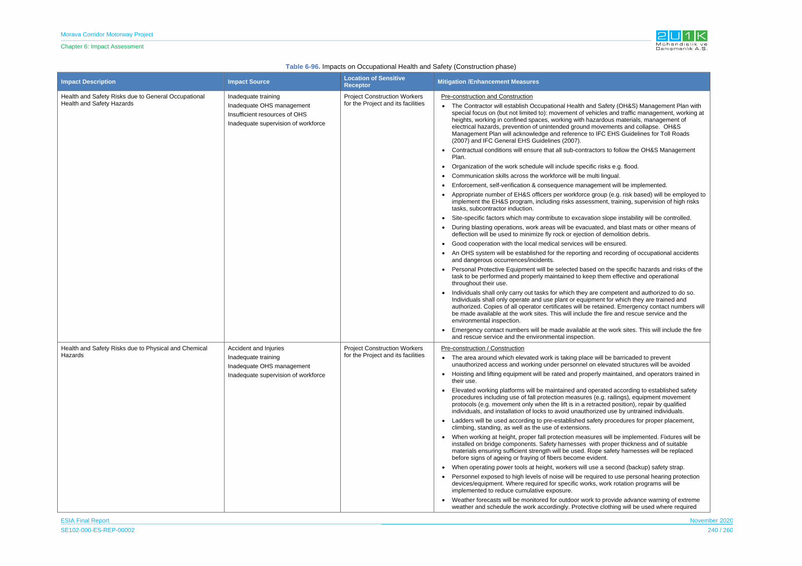
Morava Corridor Motorway Project
Chapter 6: Impact Assessment
ESIA Final Report November 2020
SE102-000-ES-REP-00002 240 / 260
Table 6-96. Impacts on Occupational Health and Safety (Construction phase)
Impact Description Impact Source Location of Sensitive Receptor
Mitigation /Enhancement Measures
Health and Safety Risks due to General Occupational Health and Safety Hazards
Inadequate training
Inadequate OHS management
Insufficient resources of OHS
Inadequate supervision of workforce
Project Construction Workers for the Project and its facilities
Pre-construction and Construction
The Contractor will establish Occupational Health and Safety (OH&S) Management Plan with special focus on (but not limited to): movement of vehicles and traffic management, working at heights, working in confined spaces, working with hazardous materials, management of electrical hazards, prevention of unintended ground movements and collapse. OH&S Management Plan will acknowledge and reference to IFC EHS Guidelines for Toll Roads (2007) and IFC General EHS Guidelines (2007).
Contractual conditions will ensure that all sub-contractors to follow the OH&S Management Plan.
Organization of the work schedule will include specific risks e.g. flood.
Communication skills across the workforce will be multi lingual.
Enforcement, self-verification & consequence management will be implemented.
Appropriate number of EH&S officers per workforce group (e.g. risk based) will be employed to implement the EH&S program, including risks assessment, training, supervision of high risks tasks, subcontractor induction.
Site-specific factors which may contribute to excavation slope instability will be controlled.
During blasting operations, work areas will be evacuated, and blast mats or other means of deflection will be used to minimize fly rock or ejection of demolition debris.
Good cooperation with the local medical services will be ensured.
An OHS system will be established for the reporting and recording of occupational accidents and dangerous occurrences/incidents.
Personal Protective Equipment will be selected based on the specific hazards and risks of the task to be performed and properly maintained to keep them effective and operational throughout their use.
Individuals shall only carry out tasks for which they are competent and authorized to do so. Individuals shall only operate and use plant or equipment for which they are trained and authorized. Copies of all operator certificates will be retained. Emergency contact numbers will be made available at the work sites. This will include the fire and rescue service and the environmental inspection.
Emergency contact numbers will be made available at the work sites. This will include the fire and rescue service and the environmental inspection.
Health and Safety Risks due to Physical and Chemical Hazards
Accident and Injuries
Inadequate training
Inadequate OHS management
Inadequate supervision of workforce
Project Construction Workers for the Project and its facilities
Pre-construction / Construction
The area around which elevated work is taking place will be barricaded to prevent unauthorized access and working under personnel on elevated structures will be avoided
Hoisting and lifting equipment will be rated and properly maintained, and operators trained in their use.
Elevated working platforms will be maintained and operated according to established safety procedures including use of fall protection measures (e.g. railings), equipment movement protocols (e.g. movement only when the lift is in a retracted position), repair by qualified individuals, and installation of locks to avoid unauthorized use by untrained individuals.
Ladders will be used according to pre-established safety procedures for proper placement, climbing, standing, as well as the use of extensions.
When working at height, proper fall protection measures will be implemented. Fixtures will be installed on bridge components. Safety harnesses with proper thickness and of suitable materials ensuring sufficient strength will be used. Rope safety harnesses will be replaced before signs of ageing or fraying of fibers become evident.
When operating power tools at height, workers will use a second (backup) safety strap.
Personnel exposed to high levels of noise will be required to use personal hearing protection devices/equipment. Where required for specific works, work rotation programs will be implemented to reduce cumulative exposure.
Weather forecasts will be monitored for outdoor work to provide advance warning of extreme weather and schedule the work accordingly. Protective clothing will be used where required

Morava Corridor Motorway Project
Chapter 6: Impact Assessment
ESIA Final Report November 2020
SE102-000-ES-REP-00002 241 / 260
Impact Description Impact Source Location of Sensitive Receptor
Mitigation /Enhancement Measures
Properly maintained construction machinery, equipment and vehicles will be used to minimize air emissions.
Engine idling time will be reduced in construction sites.
Direct diesel exhaust will be properly removed to minimize exposure of the operators.
Indoor working areas where vehicles or engines are operated will be ventilated or the exhaust gases will be properly diverted.
Lead-containing paint will be avoided, and appropriate respiratory protection will be used when cutting galvanized steel.
At work sites where dust levels are excessive, dusks will be used by relevant personnel.
Health and Safety Risks due to Emergencies and epidemic diseases
Inadequate training
Inadequate OHS management
Insufficient accident preventive measures
Project Construction Workers for the Project and its facilities
Design
Emergency Preparedness and Response Plan (EPRP) will be prepared and cover specific project risks such as spill containment and clean-up, flood, working over water, fire, rescue from height. The EPRP should include:
- Risk assessment,
- Location of medical rescue, fire-fighting resources and spill response equipment will be available along the route.
- Procedure for staff and subcontractors to report any incidents and the investigation, remediation and preventive actions taken,
- Emergency response information and training
- Emergency Communication Procedure included in the Stakeholder Engagement Plan (SEP) and the Emergency Preparedness and Response Plan (EPRP) including with local communities and authorities
Sub-Contractors will develop and prepare site-specific EPRPs in line with the Contractor overarching plan.
Relevant emergency preparedness and response measures will be taken during emergency situations arising at the construction/work sites and Camp Sites.
The Pandemic Preparedness Plan will be implemented based on the prevailing situation with respect to Covid-19. The Pandemic Preparedness Plan will take into a consideration to Decree on the organization of operation of employers during the state of emergency (Official Gazette of the R, No. 31/2020) following measures have been adopted by the Government as:
During the state of emergency, the employer must enable employees to perform work remotely (i.e. outside of the employer's business premises (teleworking and work from home)), at all workplaces where such work can be organized in line with the general enactment (i.e. the employment rulebook or collective bargaining agreement of the employer, whichever is applicable) and the employment contract.
If the general enactment and the employment contract do not provide for the possibility for remote work, the employer may issue a decision allowing for work outside of the business premises, if organizational conditions allow so. Such a decision must contain the duration of working hours and the manner of supervision of the work of employees. The employer is obligated to keep records of employees who work outside of the business premises.
If the nature of the activity of the employer does not allow for organization of work in the manner provided above, such an employer must adjust its operations to the conditions of the state of emergency as follows:
− arrange shift work, if possible and without requiring additional resources, so that as few persons (employees and all other engaged persons) as possible work simultaneously at one premises.
− enable that all business meetings are held via electronic or other appropriate means (video link, video call, etc.);
− postpone business trips in Serbia and abroad, in accordance with the authority's ban / temporary restriction of entry and movement.
In order to ensure the protection and health of employees, engaged personnel and clients, employers must provide all general, special and extraordinary measures related to the hygienic
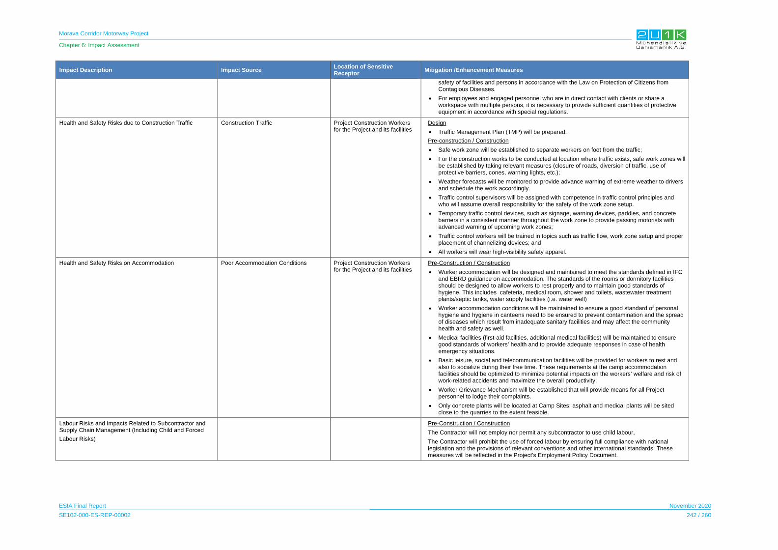
Morava Corridor Motorway Project
Chapter 6: Impact Assessment
ESIA Final Report November 2020
SE102-000-ES-REP-00002 242 / 260
Impact Description Impact Source Location of Sensitive Receptor
Mitigation /Enhancement Measures
safety of facilities and persons in accordance with the Law on Protection of Citizens from Contagious Diseases.
For employees and engaged personnel who are in direct contact with clients or share a workspace with multiple persons, it is necessary to provide sufficient quantities of protective equipment in accordance with special regulations.
Health and Safety Risks due to Construction Traffic Construction Traffic Project Construction Workers for the Project and its facilities
Design
Traffic Management Plan (TMP) will be prepared.
Pre-construction / Construction
Safe work zone will be established to separate workers on foot from the traffic;
For the construction works to be conducted at location where traffic exists, safe work zones will be established by taking relevant measures (closure of roads, diversion of traffic, use of protective barriers, cones, warning lights, etc.);
Weather forecasts will be monitored to provide advance warning of extreme weather to drivers and schedule the work accordingly.
Traffic control supervisors will be assigned with competence in traffic control principles and who will assume overall responsibility for the safety of the work zone setup.
Temporary traffic control devices, such as signage, warning devices, paddles, and concrete barriers in a consistent manner throughout the work zone to provide passing motorists with advanced warning of upcoming work zones;
Traffic control workers will be trained in topics such as traffic flow, work zone setup and proper placement of channelizing devices; and
All workers will wear high-visibility safety apparel.
Health and Safety Risks on Accommodation Poor Accommodation Conditions Project Construction Workers for the Project and its facilities
Pre-Construction / Construction
Worker accommodation will be designed and maintained to meet the standards defined in IFC and EBRD guidance on accommodation. The standards of the rooms or dormitory facilities should be designed to allow workers to rest properly and to maintain good standards of hygiene. This includes cafeteria, medical room, shower and toilets, wastewater treatment plants/septic tanks, water supply facilities (i.e. water well)
Worker accommodation conditions will be maintained to ensure a good standard of personal hygiene and hygiene in canteens need to be ensured to prevent contamination and the spread of diseases which result from inadequate sanitary facilities and may affect the community health and safety as well.
Medical facilities (first-aid facilities, additional medical facilities) will be maintained to ensure good standards of workers’ health and to provide adequate responses in case of health emergency situations.
Basic leisure, social and telecommunication facilities will be provided for workers to rest and also to socialize during their free time. These requirements at the camp accommodation facilities should be optimized to minimize potential impacts on the workers’ welfare and risk of work-related accidents and maximize the overall productivity.
Worker Grievance Mechanism will be established that will provide means for all Project personnel to lodge their complaints.
Only concrete plants will be located at Camp Sites; asphalt and medical plants will be sited close to the quarries to the extent feasible.
Labour Risks and Impacts Related to Subcontractor and Supply Chain Management (Including Child and Forced
Labour Risks)
Pre-Construction / Construction
The Contractor will not employ nor permit any subcontractor to use child labour,
The Contractor will prohibit the use of forced labour by ensuring full compliance with national legislation and the provisions of relevant conventions and other international standards. These measures will be reflected in the Project’s Employment Policy Document.

Morava Corridor Motorway Project
Chapter 6: Impact Assessment
ESIA Final Report November 2020
SE102-000-ES-REP-00002 243 / 260
Table 6-97. Impacts Scoring on Occupation Health and Safety (Construction Phase)
Impacts Before Mitigation Impacts After Mitigation
Impacts Nature Extent Duration Magnitude Receptor
Sensitivity Significance Criteria (C)
Likelihood (L)
Overall Rating
(IA)=CxLNature Extent’ Duration’ Magnitude’
Receptor Sensitivity
Significance Criteria (C)
Likelihood (L)
Residual Impacts
Health and Safety Risks due to General Occupational Health and Safety Hazards
-1 1
Project Site
2 Short Term
5 Very High
5 Very High
3.25 3
Medium -10
Medium -1
1 Project
Site
2 Short Term
3 Moderate
5 Very High
2.75 2
Low-6
Low
Health and Safety Risks due to Physical and Chemical Hazards
-1 1
Project Site
2 Short Term
5 Very High
5 Very High
3.25 3
Medium -10
Medium -1
1 Project
Site
2 Short Term
3 Moderate
5 Very High
2.75 2
Low -6
Low
Health and Safety Risks due to Emergencies and Epidemic Diseases
-1 1
Project Site
2 Short Term
5 Very High
5 Very High
3.25 3
Medium -10
Medium -1
1 Project
Site
2 Short Term
3 Moderate
5 Very High
2.75 2
Low -6
Low
Health and Safety Risks due to Construction Traffic
-1 1
Project Site
2 Short Term
5 Very High
5 Very High
3.25 3
Medium -10
Medium -1
1 Project
Site
2 Short Term
3 Moderate
5 Very High
2.75 2
Low -6
Low
Health and Safety Risks on Accommodation
-1 1
Project Site
2 Short Term
5 Very High
5 Very High
3.25 3
Medium -10
Medium -1
1 Project
Site
2 Short Term
3 Moderate
5 Very High
2.75 2
Low -6
Low
Labour Risks and Impacts Related to Subcontractor and Supply Chain Management (Including Child and Forced Labour Risks)
-1 1
Project Site
2 Short Term
5 Very High
5 Very High
3.25 3
Medium -10
Medium -1
1 Project
Site
2 Short Term
3 Moderate
5 Very High
2.75 2
Low -6
Low
Morava Corridor Motorway Project
Chapter 6: Impact Assessment
ESIA Final Report November 2020
SE102-000-ES-REP-00002 244 / 260
6.11.7.2 Operation Phase
For the operation phase, there will be direct and indirect workers for the Project. Direct
employees will be approximately between 20 and 50 and hired for traffic and safety operations
and tolling operation departments of the Project. Indirect workers will be hired for maintenance
of Motorway, infrastructures and equipment’s throughout the operation phase of the Project.
The maintenance of motorway projects may carry several key health and safety risks to the
workers including;
Inadequate selection of worker for specific assignment
Inadequate OHS Management
General occupation and health pre-cautions should be applied to all operation workers and for
maintenance workers, specific mitigation measures should be implemented whether direct or
indirectly hired.
The Impact Assessment on Occupational Health and Safety during the Operation Phase
The Table 6-98 presents the potential occupational health and safety related impacts and the
proposed mitigation measures to prevent stated impacts due to Project operation. In that
regards, Table 6-99 provides quantitative assessment of the impacts through identifying;
nature, extent, duration, magnitude, significance and likelihood of each potential impacts of
the Project. Considering the Project will adopt and apply the given mitigation measures in
Table 6-98, Table 6-99 then assess the residual impacts of the Project.
The impacts to the Occupational Health and Safety are likely to be direct negative. The lack of
experience in Motorway maintenance may lead to complacency which increases the risks, on
the other hand, considering the OHS management and trainings will be according to the
mitigation measured stated below. The OHS related impacts are expected to be low.

Morava Corridor Motorway Project
Chapter 6: Impact Assessment
ESIA Final Report November 2020
SE102-000-ES-REP-00002 245 / 260
Table 6-98. Impacts on Occupational Health and Safety (Operation Phase)
Impact Description Impact Source Location of Sensitive Receptor
Mitigation /Enhancement Measures
Health and Safety Risks due to General Occupational Health and Safety Hazards
Inadequate OHS Management
Inadequate selection of worker for specific assignment
Emergency cases
Motorway Route
Administrative Offices of the Motorway
Toll collection locations
Maintenance locations
Operation
Occupational Health and Safety Management Plan specific to operational activities will be prepared and OH&S Management Plan will acknowledge and reference to IFC EHS Guidelines for Toll Roads (2007) and IFC General EHS Guidelines (2007).
A system will be established for the reporting and recording of occupational accidents and dangerous occurrences/incidents.
Tollbooths will be equipped with proper ventilation and air filtration systems.
PPEs will be selected based on the specific hazards and risks of the task to be performed and properly maintained to keep them effective and operational throughout their use.
Individuals shall only carry out tasks for which they are competent and authorized to do so. Individuals shall only operate and use plant or equipment for which they are trained and authorized. Copies of all operator certificates will be retained.
Emergency contact numbers will be made available at the assigned areas. This will include the fire and rescue service and the environmental inspection.
Health and Safety Risks due to Physical and Chemical Hazards
Maintenance activities Motorway Route
Administrative Offices of the Motorway
Toll collection locations
Maintenance locations
Operation
Pavers with exhaust ventilation systems will be used and proper maintenance of such systems will be ensured to maintain worker exposure to crystalline silica (millers and grinders) and asphalt fumes (pavers) below applicable occupational exposure levels.
Correct asphalt product will be used for each specific application and application at the correct temperature will be ensured to reduce the fuming of bitumen during normal handling.

Morava Corridor Motorway Project
Chapter 6: Impact Assessment
ESIA Final Report November 2020
SE102-000-ES-REP-00002 246 / 260
Impact Description Impact Source Location of Sensitive Receptor
Mitigation /Enhancement Measures
Tollbooths will be equipped with proper ventilation systems;
Protective clothing will be used when working with cutbacks (a mixture of asphalt and solvents for the repair of pavement), diesel fuel, or other solvents.
Appropriate respiratory protection will be used when removing paints.
Health and Safety Risks due to Emergencies
Emergency cases Motorway Route
Administrative Offices of the Motorway
Toll collection locations
Design
An Emergency Preparedness and Response Plan, covering the emergency situations (involving vehicles and pedestrians) that may occur during the Motorway’s operation, should be prepared and implemented by trained personnel in order to avoid significant risks.
Health and Safety Risks due to Motorway maintenance
Insufficient Trainings
Inadequate OHS Management
Motorway Route
Administrative Offices of the Motorway
Toll collection locations
Operation
Workers will only work in live lane(s) once advance signs are in place to warn road users of their presence. Where possible, operatives should face the oncoming traffic, or work with a lookout.
Works vehicles will support operatives and minimise the need to cross the carriageway. They should be positioned to prevent funneling of drivers toward the work area or into the path of oncoming traffic.
Incidents where vehicles have struck or displaced traffic management equipment or entered the works area should be recorded. This will allow the traffic management design to be reviewed and altered, if appropriate, to maintain the safety of drivers and workers.
Reflective signs and equipment need to be kept clean to maintain clear visibility. Replacing dirty or damaged equipment rather than cleaning or repairing it in situ will reduce time at the roadside.
Night workers (i.e. those regularly working between 11 pm and 6 am unless specified elsewhere in a written agreement)
Morava Corridor Motorway Project
Chapter 6: Impact Assessment
ESIA Final Report November 2020
SE102-000-ES-REP-00002 247 / 260
Impact Description Impact Source Location of Sensitive Receptor
Mitigation /Enhancement Measures
Lone working should be assessed to determine if one person can do the tasks safely and if particular precautions are needed.
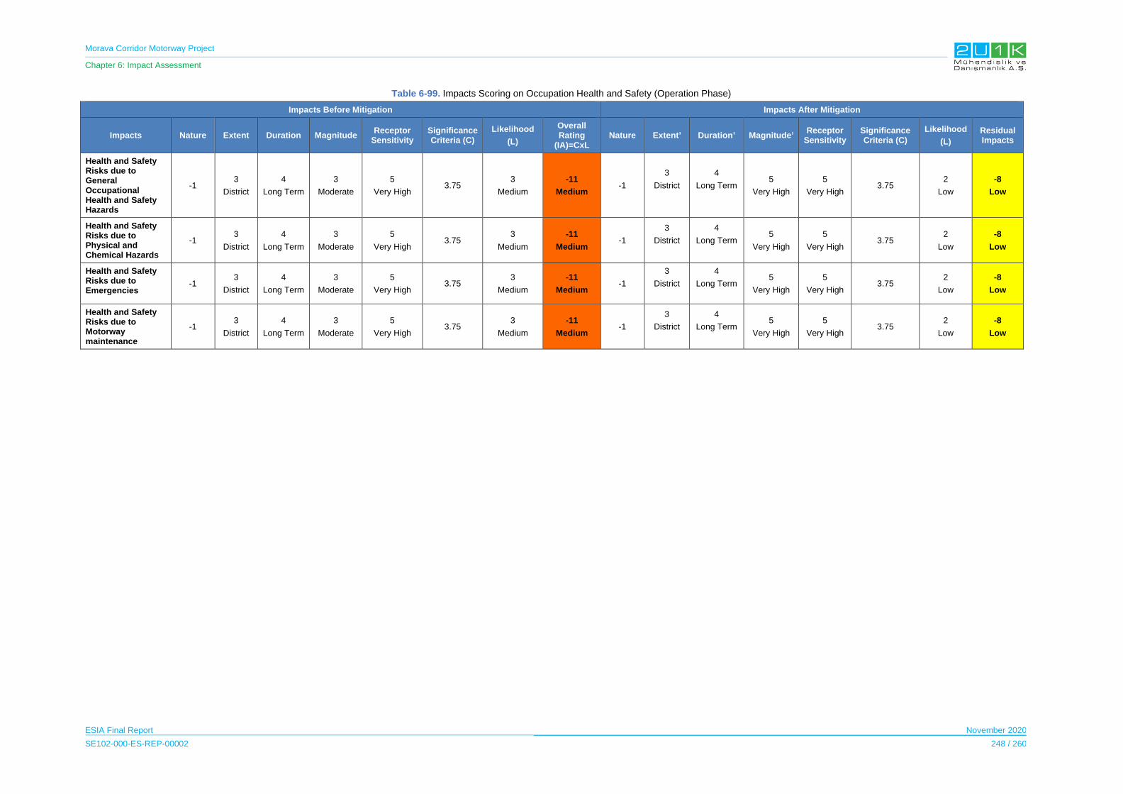
Morava Corridor Motorway Project
Chapter 6: Impact Assessment
ESIA Final Report November 2020
SE102-000-ES-REP-00002 248 / 260
Table 6-99. Impacts Scoring on Occupation Health and Safety (Operation Phase)
Impacts Before Mitigation Impacts After Mitigation
Impacts Nature Extent Duration Magnitude Receptor
Sensitivity Significance Criteria (C)
Likelihood
(L)
Overall Rating
(IA)=CxL Nature Extent’ Duration’ Magnitude’
Receptor Sensitivity
Significance Criteria (C)
Likelihood
(L)
Residual Impacts
Health and Safety Risks due to General Occupational Health and Safety Hazards
-1 3
District
4
Long Term
3
Moderate
5
Very High 3.75
3
Medium
-11
Medium -1
3
District
4
Long Term 5
Very High
5
Very High 3.75
2
Low
-8
Low
Health and Safety Risks due to Physical and Chemical Hazards
-1 3
District
4
Long Term
3
Moderate
5
Very High 3.75
3
Medium
-11
Medium -1
3
District
4
Long Term 5
Very High
5
Very High 3.75
2
Low
-8
Low
Health and Safety Risks due to Emergencies
-1 3
District
4
Long Term
3
Moderate
5
Very High 3.75
3
Medium
-11
Medium -1
3
District
4
Long Term 5
Very High
5
Very High 3.75
2
Low
-8
Low
Health and Safety Risks due to Motorway maintenance
-1 3
District
4
Long Term
3
Moderate
5
Very High 3.75
3
Medium
-11
Medium -1
3
District
4
Long Term 5
Very High
5
Very High 3.75
2
Low
-8
Low

Morava Corridor Motorway Project
Chapter 6: Impact Assessment
ESIA Final Report November 2020
SE102-000-ES-REP-00002 249 / 260
6.11.8 Community Health and Safety
6.11.8.1 Construction Phase
Traffic
The main impact source of the traffic on the community health and safety is expected to be the
vehicle increase due to construction works including excavation and hauling of excess
excavated material outside the construction platform, as well as installation works at the road
and railway crossings. During the construction phase of the Project, the Contractor estimated
1,136 vehicles will be required, as shown in Table 6-100.
Table 6-100. Number of Vehicles proposed during Construction Phase
Moving Vehicles Number of Vehicle
Sedan Car 7
SUV 4*4 34
Passenger Bus 23
Worker Bus 36
Pick Up 163 163
Bitumen Distributor Truck 1
Repair Truck 7
Lube Truck 8
Tire Truck 6
Fuel Truck 16
Potable Water Truck 4
Water Truck 23
Heavy Truck Tractor 1
Transit Mixer 6X4 41
Concrete Pump Truck 6
Dump Truck 8X4 24
Dump Truck 6X4 688
Truck with Snow Plow 1
High bed Trailer 28
Lowbed 10
Farm Tractor Trailer 9
TOTAL 1,136
Source: Equipment List of BEJV
Morava Corridor Motorway Project
Chapter 6: Impact Assessment
ESIA Final Report November 2020
SE102-000-ES-REP-00002 250 / 260
Communicable disease
The construction of each Section of the Project will require approximately 3,800 workers and
during the peak period, infectious diseases and Sexually Transmitted Diseases (STD) may
occur in the communities due to potential worker in-migration to the area.
According to the community-level survey, infectious diseases were reported only in Kraljevo
and Varvarin. Among the total diseases, infection-related diseases have a scale of 2% and
15%. In the villages interviewed, no STD was specified.
Other source of the communicable diseases may be the inadequate management of
household waste. During the social field survey conducted from August to September 2019, it
is observed that the main village problems are directly related with the inadequate waste
management and the sewage system. The majority of houses are using septic tanks.
Last, considering the prevailing situation with respect to Covid-19, Serbia has designated
COVID-19 hospitals and quarantine locations across the country. All community hospitals and
medical care centers through Serbia have opened COVID-19 clinics. The Clinics accepts
patients with COVID-19 symptoms through a dedicated entrance separate from that used by
other patients. If the test results are negative, the patient is released. If the tests results are
positive, the patient will remain at the Clinic.
Construction related environmental impacts:
During implementation of the planned activities, dust, noise, mud on roads and
landslides/unstable slopes impacts are expected to occur from the demolition and clearance
of objects that are located along the intended route. Earthworks (including terrain cleaning,
excavation, leveling), transport and disposal of excavated material and movement of
mechanization and transport vehicles will cause increase in the traffic load in the AoI.
Construction noise is explained in detail in Section 6.5 of this ESIA Report. With the application
of the mitigation measures regarding the construction noise, the significance of negative
impacts are expected to reduce to 4% in other words, the overall impact of construction noise
is expected to be low. From the social quality aspect of view, no additional measures are
needed considered the given scenarios in Chapter 6.5.
The construction activities may cause negative impacts on surface water sources throughout
the construction phase in case no mitigation measures are taken. The most significant impact
on water regime is related to reconstruction of the sections of West Morava River. River
diversion may affect the natural water flow due to construction of artificial structures and
barriers, which may result in siltation of riverbed, flow during the high water period or heavy
rains, etc. Chapter 6.3 of this ESIA Report explains the potential impacts on surface water
including measures to minimize the negative impacts.
Morava Corridor Motorway Project
Chapter 6: Impact Assessment
ESIA Final Report November 2020
SE102-000-ES-REP-00002 251 / 260
Last, for air quality related impacts, Chapter 6.4 of this Report addresses the Project’s impacts
on air quality and climate in detail.
Security around the Project site:
During the construction phase of the Project, security will be needed on the site. According to
the results of the social field survey, there are total of 265 people who obtained a certification
for private security living in the villages located in the Aoi. Security personnels who are part
of the community and who are familiar with local customs may serve as a positive and visible
point of contact between the company and the community.
According to the National legal requirements, the parties involved in the Project will follow the
Law on Private Security (published in the Official Gazette of the Republic of Serbia No. 87/18
from 13 November 2018 which will come into force on 21 November 2018) to ensure security
within the Project site.
The Impact Assessment on Community Health and Safety during the Construction Phase
The Table 6-101 presents the potential community health and safety related impacts and the
proposed mitigation measures to prevent stated impacts due to Project construction. In that
regards, Table 6-102 provides quantitative assessment of the impacts through identifying;
nature, extent, duration, magnitude, significance and likelihood of each potential impacts of
the Project. Considering the Project will adopt and apply the given mitigation measures in
Table 6-101, Table 6-102 then assess the residual impacts of the Project.
The impacts to the Community Health and Safety are likely to be direct negative. The impacts
related to is Community Health and Safety short term and extent is Municipal. Although, the
duration and the extent of the impact leads the magnitude of the impact low, considering the
worst case scenario (fatalities), and the sensitivity of the local communities the magnitude is
assessed as moderate to high. With the implementation of the mitigation measures, and
experiences of the CoS from previous infrastructure projects, the overall impacts likelihood will
be reduced.

Morava Corridor Motorway Project
Chapter 6: Impact Assessment
ESIA Final Report November 2020
SE102-000-ES-REP-00002 252 / 260
Table 6-101. Impacts on Community Health and Safety (Construction Phase)
Impact Description Impact Source Sensitive Receptor Mitigation /Enhancement Measures
Disturbance to environmental health, quality of life and wellbeing during construction phase
Construction activities
Ćićevac Municipality
Varvarin Municipality
Kruševac Municipality
Vrnjačka Banja Municipality
Trstenik Municipality
Kraljevo Municipality
Čačak Municipality
Design
Project Environmental Management Plan (EMP) will include Noise and Vibration and Management Plan that will be define the sensitive receptor locations, monitoring program and specific mitigation measures to be implemented.
The Project Environmental Management Plan (EMP) will include Air Quality Management procedures that will be implemented.
Planning of transport routes including temporary access roads, haul roads and construction work sites should be determined to avoid populated areas and away from sensitive receptors and villages as much as possible.
As Project construction progresses, buildings that may be potentially affected will be identified prior to construction, including assessing whether buildings are sensitive to night-time disturbance.
Traffic Management Plan of the Project will include measures on accessibility for local community.
Pre- Construction
OH&S Management Plan will include awareness of community health and safety issues. OH&S Management Plan will include the Pandemic Preparedness Plan within its scope with respect to Covid – 19 and/or any other diseases present in the region.
Construction work schedule will be distributed to the affected settlements in a timely manner to inform any road closures and construction related cautions.
Air and noise monitoring will be undertaken in accordance with local regulations. Establish in advance a relationship with municipal environmental department.
Construction
Operational area in borrow pits, access roads, work sites, construction camp sites, batch and asphalt plants etc. will be regularly monitored for air quality parameters such as PM10, PM2.5, SO2, NOx, HC, CO etc. (For Air Quality related measures; See Chapter 6.2.1 of the ESIA Report).
Construction work schedule will be distributed to the affected settlements in a timely manner to inform any road closures and construction related cautions.
Washing system will be implemented to prevent mud on roads.
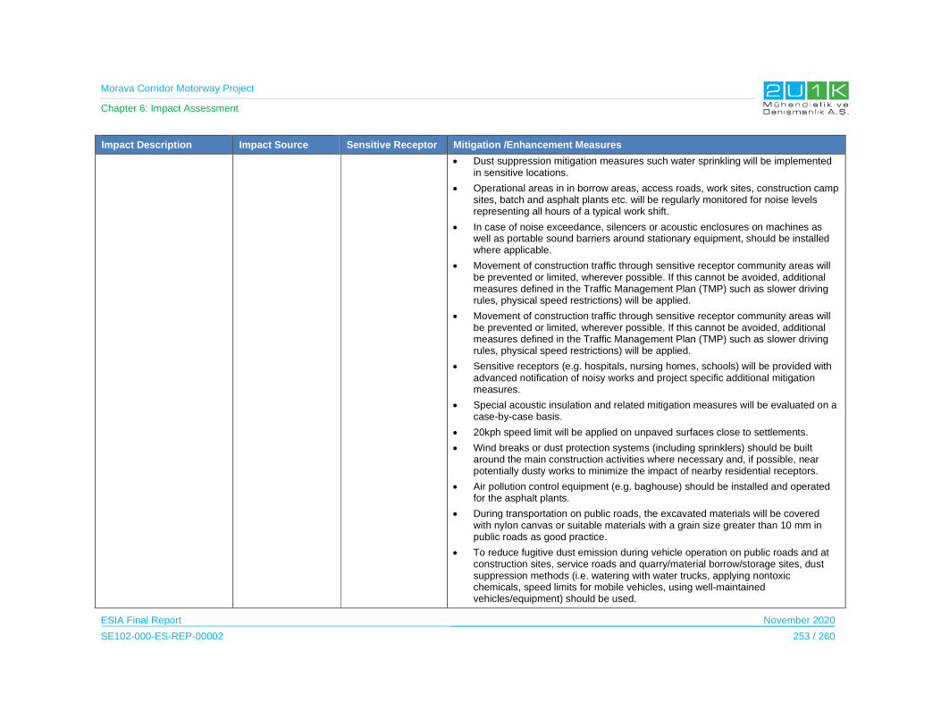
Morava Corridor Motorway Project
Chapter 6: Impact Assessment
ESIA Final Report November 2020
SE102-000-ES-REP-00002 253 / 260
Impact Description Impact Source Sensitive Receptor Mitigation /Enhancement Measures
Dust suppression mitigation measures such water sprinkling will be implemented in sensitive locations.
Operational areas in in borrow areas, access roads, work sites, construction camp sites, batch and asphalt plants etc. will be regularly monitored for noise levels representing all hours of a typical work shift.
In case of noise exceedance, silencers or acoustic enclosures on machines as well as portable sound barriers around stationary equipment, should be installed where applicable.
Movement of construction traffic through sensitive receptor community areas will be prevented or limited, wherever possible. If this cannot be avoided, additional measures defined in the Traffic Management Plan (TMP) such as slower driving rules, physical speed restrictions) will be applied.
Movement of construction traffic through sensitive receptor community areas will be prevented or limited, wherever possible. If this cannot be avoided, additional measures defined in the Traffic Management Plan (TMP) such as slower driving rules, physical speed restrictions) will be applied.
Sensitive receptors (e.g. hospitals, nursing homes, schools) will be provided with advanced notification of noisy works and project specific additional mitigation measures.
Special acoustic insulation and related mitigation measures will be evaluated on a case-by-case basis.
20kph speed limit will be applied on unpaved surfaces close to settlements.
Wind breaks or dust protection systems (including sprinklers) should be built around the main construction activities where necessary and, if possible, near potentially dusty works to minimize the impact of nearby residential receptors.
Air pollution control equipment (e.g. baghouse) should be installed and operated for the asphalt plants.
During transportation on public roads, the excavated materials will be covered with nylon canvas or suitable materials with a grain size greater than 10 mm in public roads as good practice.
To reduce fugitive dust emission during vehicle operation on public roads and at construction sites, service roads and quarry/material borrow/storage sites, dust suppression methods (i.e. watering with water trucks, applying nontoxic chemicals, speed limits for mobile vehicles, using well-maintained vehicles/equipment) should be used.
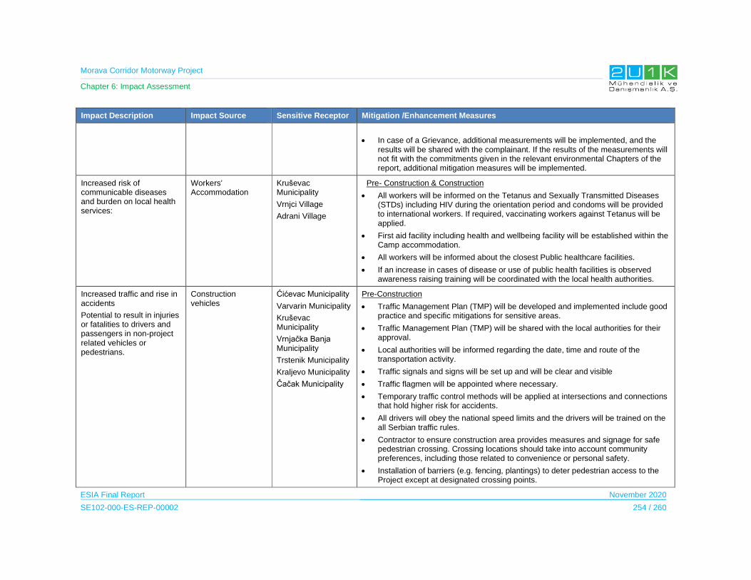
Morava Corridor Motorway Project
Chapter 6: Impact Assessment
ESIA Final Report November 2020
SE102-000-ES-REP-00002 254 / 260
Impact Description Impact Source Sensitive Receptor Mitigation /Enhancement Measures
In case of a Grievance, additional measurements will be implemented, and the results will be shared with the complainant. If the results of the measurements will not fit with the commitments given in the relevant environmental Chapters of the report, additional mitigation measures will be implemented.
Increased risk of communicable diseases and burden on local health services:
Workers’ Accommodation
Kruševac Municipality
Vrnjci Village
Adrani Village
Pre- Construction & Construction
All workers will be informed on the Tetanus and Sexually Transmitted Diseases (STDs) including HIV during the orientation period and condoms will be provided to international workers. If required, vaccinating workers against Tetanus will be applied.
First aid facility including health and wellbeing facility will be established within the Camp accommodation.
All workers will be informed about the closest Public healthcare facilities.
If an increase in cases of disease or use of public health facilities is observed awareness raising training will be coordinated with the local health authorities.
Increased traffic and rise in accidents
Potential to result in injuries or fatalities to drivers and passengers in non-project related vehicles or pedestrians.
Construction vehicles
Ćićevac Municipality
Varvarin Municipality
Kruševac Municipality
Vrnjačka Banja Municipality
Trstenik Municipality
Kraljevo Municipality
Čačak Municipality
Pre-Construction
Traffic Management Plan (TMP) will be developed and implemented include good practice and specific mitigations for sensitive areas.
Traffic Management Plan (TMP) will be shared with the local authorities for their approval.
Local authorities will be informed regarding the date, time and route of the transportation activity.
Traffic signals and signs will be set up and will be clear and visible
Traffic flagmen will be appointed where necessary.
Temporary traffic control methods will be applied at intersections and connections that hold higher risk for accidents.
All drivers will obey the national speed limits and the drivers will be trained on the all Serbian traffic rules.
Contractor to ensure construction area provides measures and signage for safe pedestrian crossing. Crossing locations should take into account community preferences, including those related to convenience or personal safety.
Installation of barriers (e.g. fencing, plantings) to deter pedestrian access to the Project except at designated crossing points.

Morava Corridor Motorway Project
Chapter 6: Impact Assessment
ESIA Final Report November 2020
SE102-000-ES-REP-00002 255 / 260
Impact Description Impact Source Sensitive Receptor Mitigation /Enhancement Measures
Construction
Supervision and escort for heavy machinery (which requires escort and permit in line with Serbian Legislation) will be provided.
Supervision for vehicles carrying construction materials and equipment that pass over public or private roads and railway crossings will be provided.
Project related traffic will be regulated during certain dates and times where local community will require to commute (to/from schools, commercial areas etc.) or take on any agricultural activity (animal grazing or other farming activities etc.).
Temporary access to private property or appropriate accessing alternatives will be determined in consultation with the land owners or users.
Local authorities and community will be provided with detailed information on closure of roads during the road and railway crossings.
Methods for every road crossing will be determined and agreed upon with authorities prior to taking any action. All methods and construction techniques proposed by the Contractor will aim to minimize possible disruptions caused by road crossings.
Contractor will ensure that road safety training will be provided to employees.
The schools nearby the Project site will be informed about the peak movements of the vehicles and vehicle traffic will be minimized during hours when children are traveling to and from school.
Heavy machinery and vehicles utilized in transportation activities (including transportation of personnel) will be used by qualified and licensed drivers.
All drivers will know and comply with all traffic signs, are will be made aware of hotspots of intense traffic that are expected along the route and are trained properly for on and off-road conditions.
Managing and monitoring of working and resting hours drivers will be undertaken according to Serbian Legislation.
Monitoring security arrangements for loads, vehicles and drivers will be undertaken according to Serbian Legislation.
All project work sites, associated facilities, temporary roads, and traffic management works will be will be signposted in line Serbian Legislation and as required by the Traffic Management Plan (TMP).
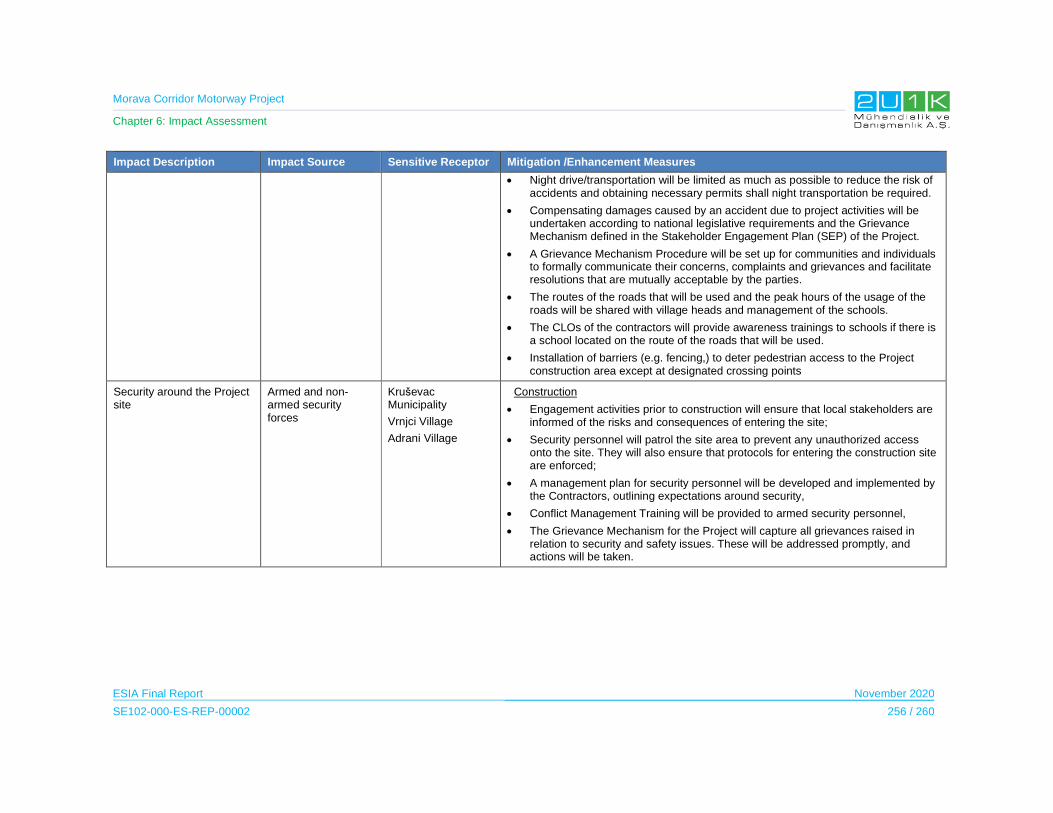
Morava Corridor Motorway Project
Chapter 6: Impact Assessment
ESIA Final Report November 2020
SE102-000-ES-REP-00002 256 / 260
Impact Description Impact Source Sensitive Receptor Mitigation /Enhancement Measures
Night drive/transportation will be limited as much as possible to reduce the risk of accidents and obtaining necessary permits shall night transportation be required.
Compensating damages caused by an accident due to project activities will be undertaken according to national legislative requirements and the Grievance Mechanism defined in the Stakeholder Engagement Plan (SEP) of the Project.
A Grievance Mechanism Procedure will be set up for communities and individuals to formally communicate their concerns, complaints and grievances and facilitate resolutions that are mutually acceptable by the parties.
The routes of the roads that will be used and the peak hours of the usage of the roads will be shared with village heads and management of the schools.
The CLOs of the contractors will provide awareness trainings to schools if there is a school located on the route of the roads that will be used.
Installation of barriers (e.g. fencing,) to deter pedestrian access to the Project construction area except at designated crossing points
Security around the Project site
Armed and non-armed security forces
Kruševac Municipality
Vrnjci Village
Adrani Village
Construction
Engagement activities prior to construction will ensure that local stakeholders are informed of the risks and consequences of entering the site;
Security personnel will patrol the site area to prevent any unauthorized access onto the site. They will also ensure that protocols for entering the construction site are enforced;
A management plan for security personnel will be developed and implemented by the Contractors, outlining expectations around security,
Conflict Management Training will be provided to armed security personnel,
The Grievance Mechanism for the Project will capture all grievances raised in relation to security and safety issues. These will be addressed promptly, and actions will be taken.
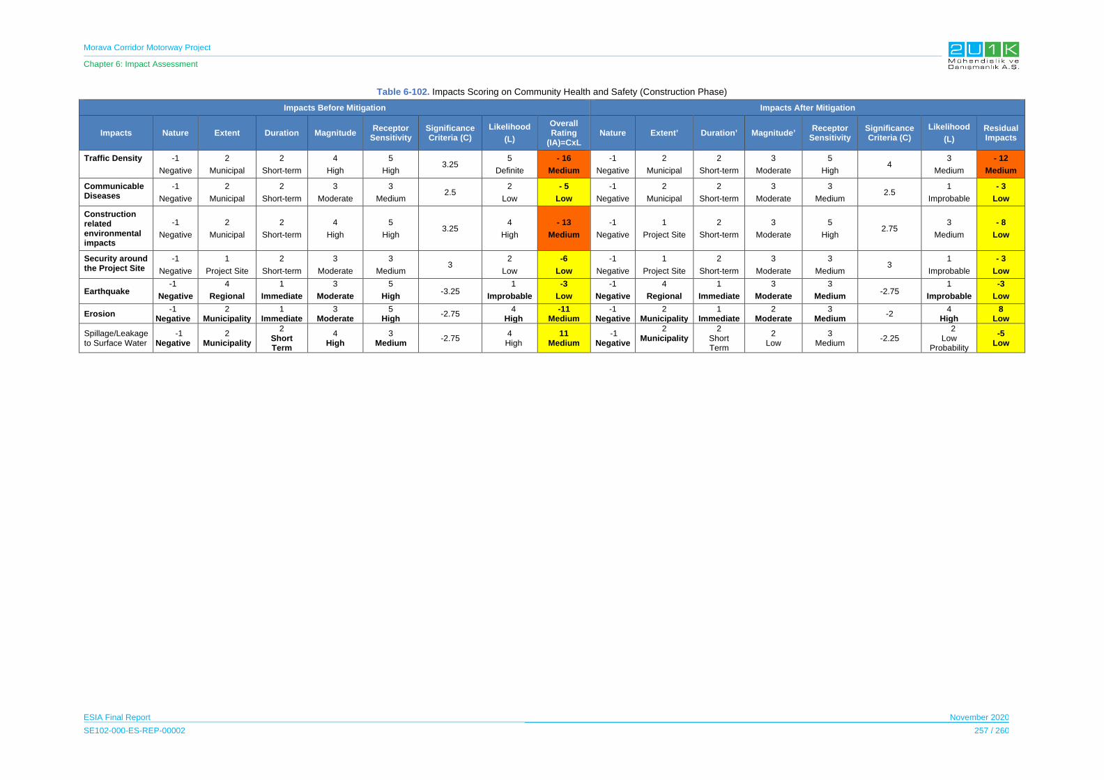
Morava Corridor Motorway Project
Chapter 6: Impact Assessment
ESIA Final Report November 2020
SE102-000-ES-REP-00002 257 / 260
Table 6-102. Impacts Scoring on Community Health and Safety (Construction Phase)
Impacts Before Mitigation Impacts After Mitigation
Impacts Nature Extent Duration Magnitude Receptor
Sensitivity Significance Criteria (C)
Likelihood
(L)
Overall Rating
(IA)=CxL Nature Extent’ Duration’ Magnitude’
Receptor Sensitivity
Significance Criteria (C)
Likelihood
(L)
Residual Impacts
Traffic Density -1
Negative
2
Municipal
2
Short-term
4
High
5
High 3.25
5
Definite
- 16
Medium
-1
Negative
2
Municipal
2
Short-term
3
Moderate
5
High 4
3
Medium
- 12
Medium
Communicable Diseases
-1
Negative
2
Municipal
2
Short-term
3
Moderate
3
Medium 2.5
2
Low
- 5
Low
-1
Negative
2
Municipal
2
Short-term
3
Moderate
3
Medium 2.5
1
Improbable
- 3
Low
Construction related environmental impacts
-1
Negative
2
Municipal
2
Short-term
4
High
5
High 3.25
4
High
- 13
Medium
-1
Negative
1
Project Site
2
Short-term
3
Moderate
5
High 2.75
3
Medium
- 8
Low
Security around the Project Site
-1
Negative
1
Project Site
2
Short-term
3
Moderate
3
Medium 3
2
Low
-6
Low
-1
Negative
1
Project Site
2
Short-term
3
Moderate
3
Medium 3
1
Improbable
- 3
Low
Earthquake -1
Negative
4
Regional
1
Immediate
3
Moderate
5
High-3.25
1
Improbable
-3
Low
-1
Negative
4
Regional
1
Immediate
3
Moderate
3
Medium-2.75
1
Improbable
-3
Low
Erosion -1
Negative2
Municipality1
Immediate3
Moderate5
High-2.75
4 High
-11 Medium
-1 Negative
2 Municipality
1 Immediate
2 Moderate
3 Medium
-2 4
High 8
Low
Spillage/Leakage to Surface Water
-1 Negative
2 Municipality
2 Short Term
4 High
3 Medium
-2.75 4
High 11
Medium -1
Negative
2 Municipality
2 Short Term
2 Low
3 Medium
-2.25 2
Low Probability
-5 Low
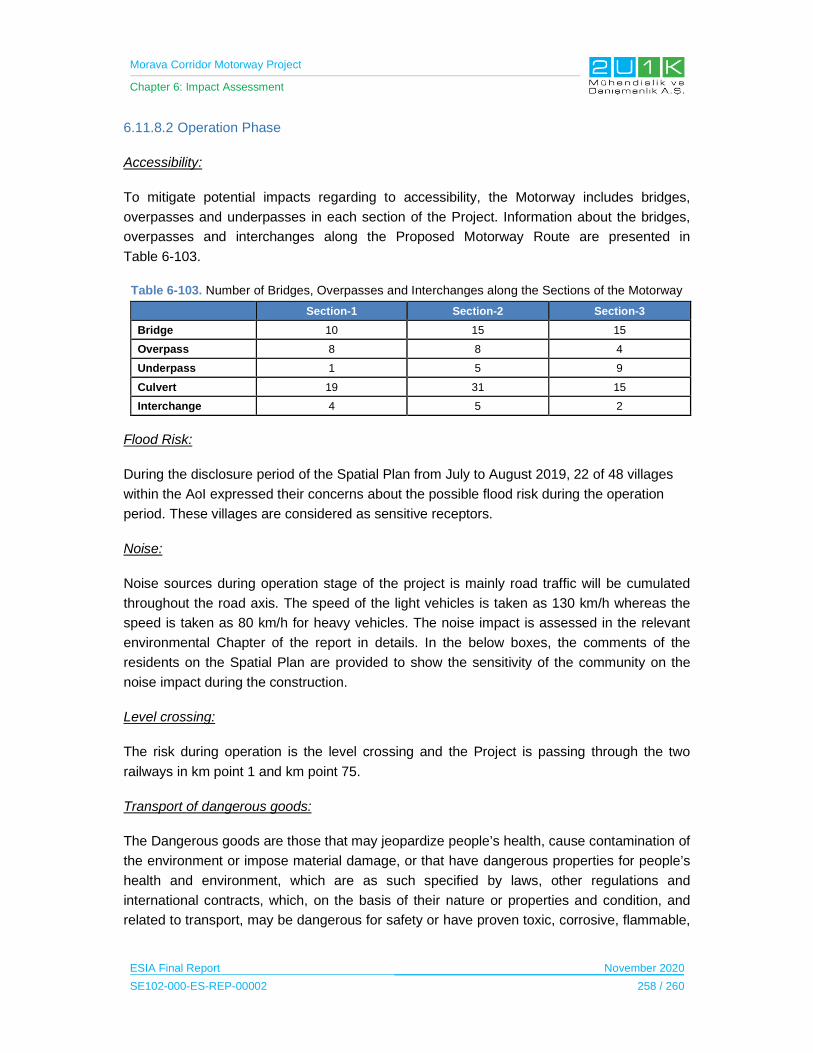
Morava Corridor Motorway Project
Chapter 6: Impact Assessment
ESIA Final Report November 2020
SE102-000-ES-REP-00002 258 / 260
6.11.8.2 Operation Phase
Accessibility:
To mitigate potential impacts regarding to accessibility, the Motorway includes bridges,
overpasses and underpasses in each section of the Project. Information about the bridges,
overpasses and interchanges along the Proposed Motorway Route are presented in
Table 6-103.
Table 6-103. Number of Bridges, Overpasses and Interchanges along the Sections of the Motorway
Section-1 Section-2 Section-3
Bridge 10 15 15
Overpass 8 8 4
Underpass 1 5 9
Culvert 19 31 15
Interchange 4 5 2
Flood Risk:
During the disclosure period of the Spatial Plan from July to August 2019, 22 of 48 villages
within the AoI expressed their concerns about the possible flood risk during the operation
period. These villages are considered as sensitive receptors.
Noise:
Noise sources during operation stage of the project is mainly road traffic will be cumulated
throughout the road axis. The speed of the light vehicles is taken as 130 km/h whereas the
speed is taken as 80 km/h for heavy vehicles. The noise impact is assessed in the relevant
environmental Chapter of the report in details. In the below boxes, the comments of the
residents on the Spatial Plan are provided to show the sensitivity of the community on the
noise impact during the construction.
Level crossing:
The risk during operation is the level crossing and the Project is passing through the two
railways in km point 1 and km point 75.
Transport of dangerous goods:
The Dangerous goods are those that may jeopardize people’s health, cause contamination of
the environment or impose material damage, or that have dangerous properties for people’s
health and environment, which are as such specified by laws, other regulations and
international contracts, which, on the basis of their nature or properties and condition, and
related to transport, may be dangerous for safety or have proven toxic, corrosive, flammable,
Morava Corridor Motorway Project
Chapter 6: Impact Assessment
ESIA Final Report November 2020
SE102-000-ES-REP-00002 259 / 260
explosive or radioactive effects. Dangerous goods also include raw materials of which
dangerous goods are produced as well as waste if possess the properties of dangerous goods.
Law on Transport of Dangerous Goods (“Official Gazette RS“, No 88/2010) regulates the
transport of the dangerous goods.
The Impact Assessment on Community Health and Safety during the Operation Phase
The Table 6-104 presents the potential community health and safety related impacts and the
proposed mitigation measures to prevent stated impacts due to Project operation. In that
regards, Table 6-105 provides quantitative assessment of the impacts through identifying;
nature, extent, duration, magnitude, significance and likelihood of each potential impacts of
the Project. Considering the Project will adopt and apply the given mitigation measures in
Table 6-104, Table 6-105 then assess the residual impacts of the Project.
Project impacts on the community health and safety has negative nature. It has been observed
that the flood risk during the operation phase has the highest magnitude and sensitivity level
as a result, the overall rating of the impact is assessed as high. With the proposed mitigation
measures, the impacts regarding the flood and operational noise could be managed and the
receptor sensitivity will be reduced.
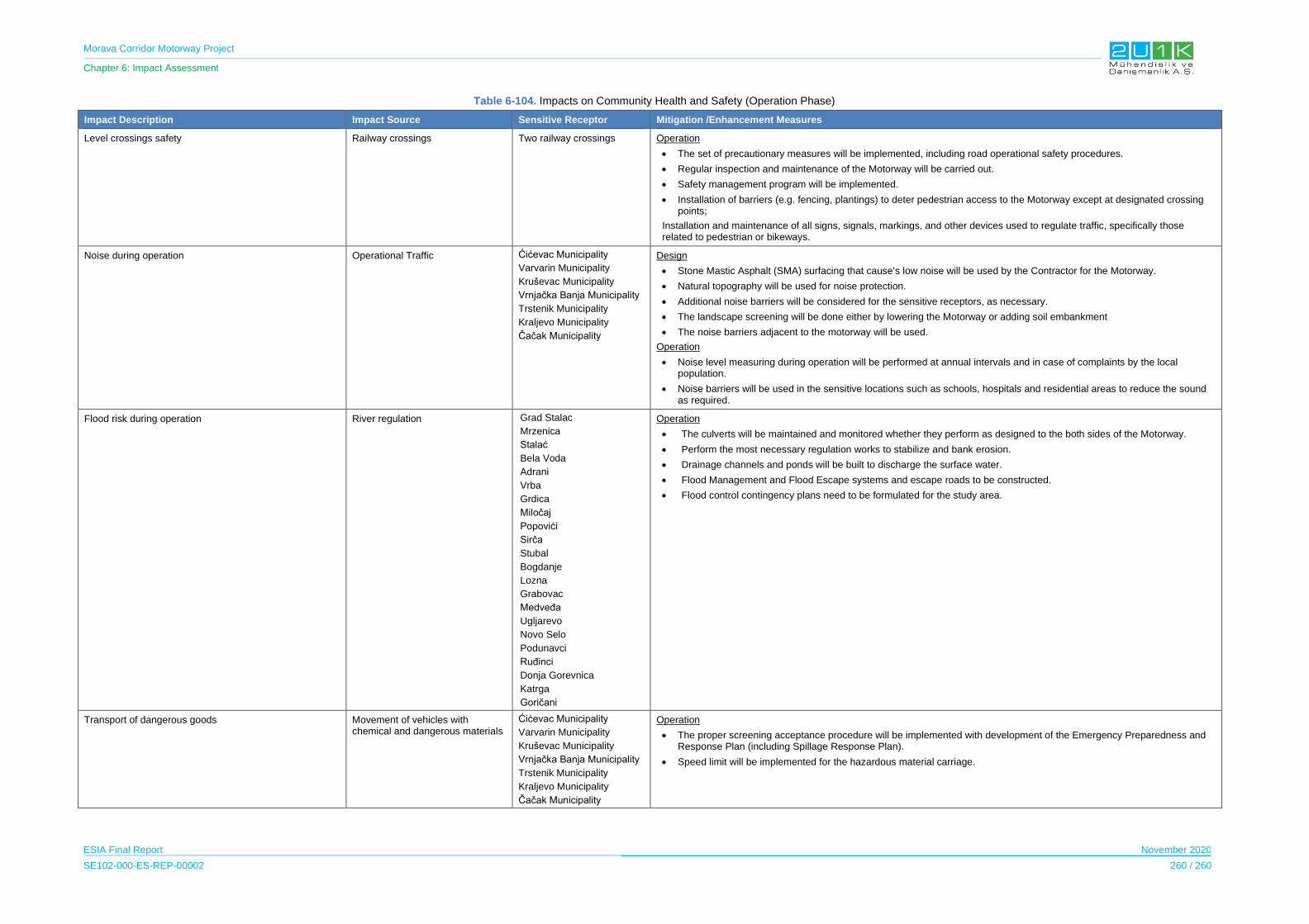
Morava Corridor Motorway Project
Chapter 6: Impact Assessment
ESIA Final Report November 2020
SE102-000-ES-REP-00002 260 / 260
Table 6-104. Impacts on Community Health and Safety (Operation Phase)
Impact Description Impact Source Sensitive Receptor Mitigation /Enhancement Measures
Level crossings safety Railway crossings Two railway crossings Operation
The set of precautionary measures will be implemented, including road operational safety procedures.
Regular inspection and maintenance of the Motorway will be carried out.
Safety management program will be implemented.
Installation of barriers (e.g. fencing, plantings) to deter pedestrian access to the Motorway except at designated crossing points;
Installation and maintenance of all signs, signals, markings, and other devices used to regulate traffic, specifically those related to pedestrian or bikeways.
Noise during operation Operational Traffic Ćićevac Municipality
Varvarin Municipality
Kruševac Municipality
Vrnjačka Banja Municipality
Trstenik Municipality
Kraljevo Municipality
Čačak Municipality
Design
Stone Mastic Asphalt (SMA) surfacing that cause’s low noise will be used by the Contractor for the Motorway.
Natural topography will be used for noise protection.
Additional noise barriers will be considered for the sensitive receptors, as necessary.
The landscape screening will be done either by lowering the Motorway or adding soil embankment
The noise barriers adjacent to the motorway will be used.
Operation
Noise level measuring during operation will be performed at annual intervals and in case of complaints by the local population.
Noise barriers will be used in the sensitive locations such as schools, hospitals and residential areas to reduce the sound as required.
Flood risk during operation River regulation Grad Stalac
Mrzenica
Stalać
Bela Voda
Adrani
Vrba
Grdica
Miločaj
Popovići
Sirča
Stubal
Bogdanje
Lozna
Grabovac
Medveđa
Ugljarevo
Novo Selo
Podunavci
Ruđinci
Donja Gorevnica
Katrga
Goričani
Operation
The culverts will be maintained and monitored whether they perform as designed to the both sides of the Motorway.
Perform the most necessary regulation works to stabilize and bank erosion.
Drainage channels and ponds will be built to discharge the surface water.
Flood Management and Flood Escape systems and escape roads to be constructed.
Flood control contingency plans need to be formulated for the study area.
Transport of dangerous goods Movement of vehicles with chemical and dangerous materials
Ćićevac Municipality
Varvarin Municipality
Kruševac Municipality
Vrnjačka Banja Municipality
Trstenik Municipality
Kraljevo Municipality
Čačak Municipality
Operation
The proper screening acceptance procedure will be implemented with development of the Emergency Preparedness and Response Plan (including Spillage Response Plan).
Speed limit will be implemented for the hazardous material carriage.
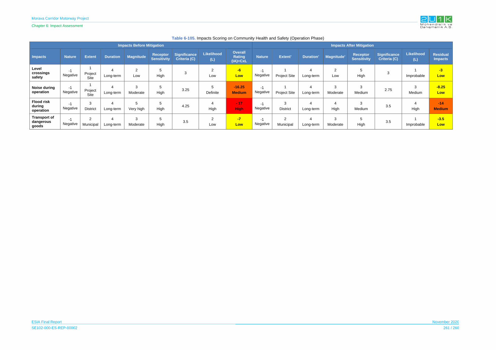
Morava Corridor Motorway Project
Chapter 6: Impact Assessment
ESIA Final Report November 2020
SE102-000-ES-REP-00002 261 / 260
Table 6-105. Impacts Scoring on Community Health and Safety (Operation Phase)
Impacts Before Mitigation Impacts After Mitigation
Impacts Nature Extent Duration Magnitude Receptor
Sensitivity Significance Criteria (C)
Likelihood
(L)
Overall Rating
(IA)=CxL Nature Extent’ Duration’ Magnitude’
Receptor Sensitivity
Significance Criteria (C)
Likelihood
(L)
Residual Impacts
Level crossings safety
-1 Negative
1
Project Site
4
Long-term
2
Low
5
High 3
2
Low
-6
Low
-1 Negative
1
Project Site
4
Long-term
2
Low
5
High 3
1
Improbable
-3
Low
Noise during operation
-1 Negative
1
Project Site
4
Long-term
3
Moderate
5
High 3.25
5
Definite
-16.25
Medium
-1 Negative
1
Project Site
4
Long-term
3
Moderate
3
Medium 2.75
3
Medium
-8.25
Low
Flood risk during operation
-1 Negative
3
District
4
Long-term
5
Very high
5
High 4.25
4
High
- 17
High
-1 Negative
3
District
4
Long-term
4
High
3
Medium 3.5
4
High
-14
Medium
Transport of dangerous goods
-1 Negative
2
Municipal
4
Long-term
3
Moderate
5
High 3.5
2
Low
-7
Low
-1 Negative
2
Municipal
4
Long-term
3
Moderate
5
High 3.5
1
Improbable
-3.5
Low
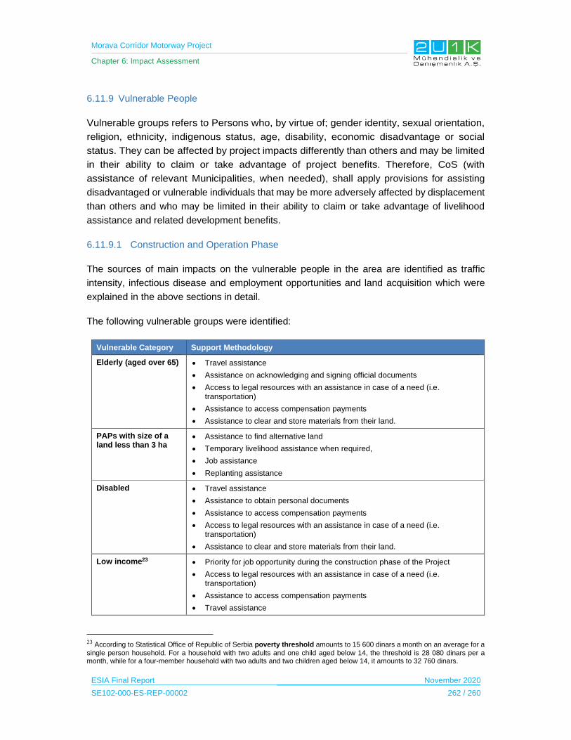
Morava Corridor Motorway Project
Chapter 6: Impact Assessment
ESIA Final Report November 2020
SE102-000-ES-REP-00002 262 / 260
6.11.9 Vulnerable People
Vulnerable groups refers to Persons who, by virtue of; gender identity, sexual orientation,
religion, ethnicity, indigenous status, age, disability, economic disadvantage or social
status. They can be affected by project impacts differently than others and may be limited
in their ability to claim or take advantage of project benefits. Therefore, CoS (with
assistance of relevant Municipalities, when needed), shall apply provisions for assisting
disadvantaged or vulnerable individuals that may be more adversely affected by displacement
than others and who may be limited in their ability to claim or take advantage of livelihood
assistance and related development benefits.
6.11.9.1 Construction and Operation Phase
The sources of main impacts on the vulnerable people in the area are identified as traffic
intensity, infectious disease and employment opportunities and land acquisition which were
explained in the above sections in detail.
The following vulnerable groups were identified:
Vulnerable Category Support Methodology
Elderly (aged over 65) Travel assistance
Assistance on acknowledging and signing official documents
Access to legal resources with an assistance in case of a need (i.e. transportation)
Assistance to access compensation payments
Assistance to clear and store materials from their land.
PAPs with size of a land less than 3 ha
Assistance to find alternative land
Temporary livelihood assistance when required,
Job assistance
Replanting assistance
Disabled Travel assistance
Assistance to obtain personal documents
Assistance to access compensation payments
Access to legal resources with an assistance in case of a need (i.e. transportation)
Assistance to clear and store materials from their land.
Low income23 Priority for job opportunity during the construction phase of the Project
Access to legal resources with an assistance in case of a need (i.e. transportation)
Assistance to access compensation payments
Travel assistance
23 According to Statistical Office of Republic of Serbia poverty threshold amounts to 15 600 dinars a month on an average for a single person household. For a household with two adults and one child aged below 14, the threshold is 28 080 dinars per a month, while for a four-member household with two adults and two children aged below 14, it amounts to 32 760 dinars.
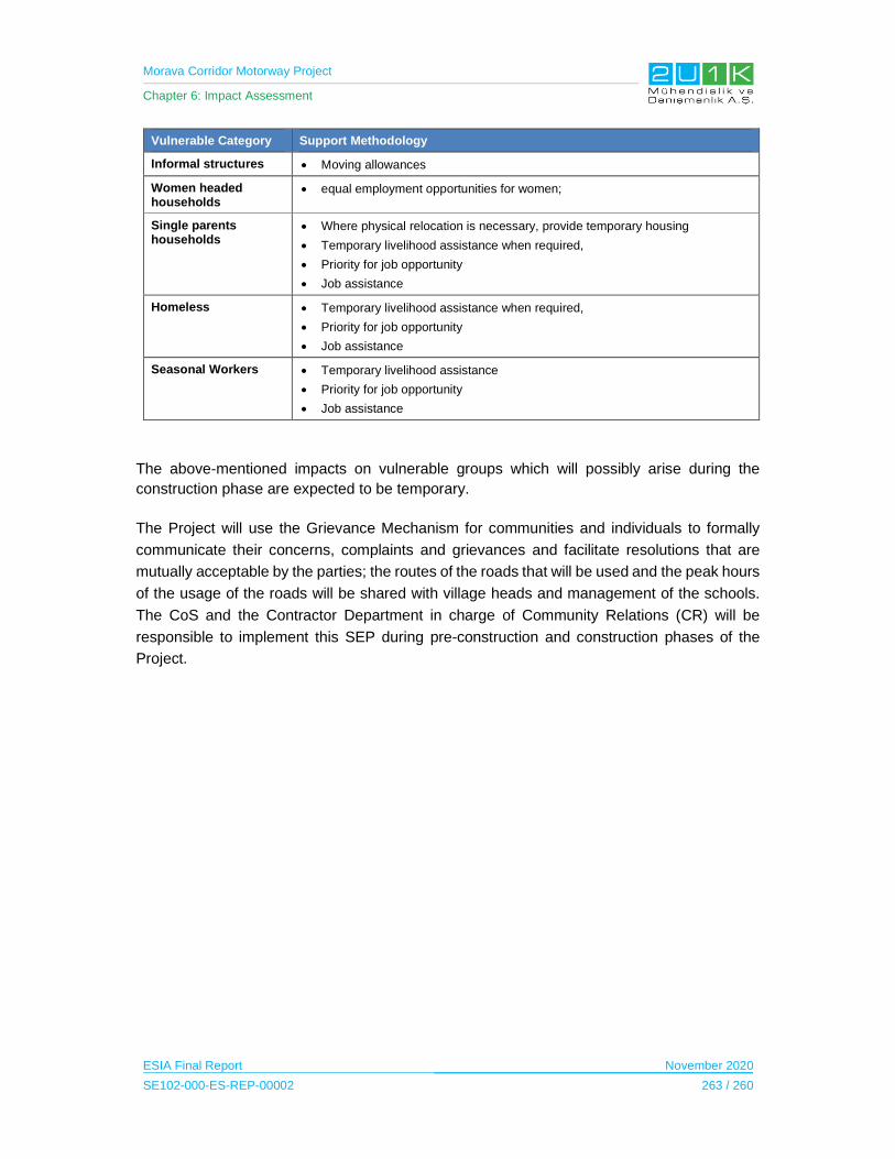
Morava Corridor Motorway Project
Chapter 6: Impact Assessment
ESIA Final Report November 2020
SE102-000-ES-REP-00002 263 / 260
Vulnerable Category Support Methodology
Informal structures Moving allowances
Women headed households
equal employment opportunities for women;
Single parents households
Where physical relocation is necessary, provide temporary housing
Temporary livelihood assistance when required,
Priority for job opportunity
Job assistance
Homeless Temporary livelihood assistance when required,
Priority for job opportunity
Job assistance
Seasonal Workers Temporary livelihood assistance
Priority for job opportunity
Job assistance
The above-mentioned impacts on vulnerable groups which will possibly arise during the
construction phase are expected to be temporary.
The Project will use the Grievance Mechanism for communities and individuals to formally
communicate their concerns, complaints and grievances and facilitate resolutions that are
mutually acceptable by the parties; the routes of the roads that will be used and the peak hours
of the usage of the roads will be shared with village heads and management of the schools.
The CoS and the Contractor Department in charge of Community Relations (CR) will be
responsible to implement this SEP during pre-construction and construction phases of the
Project.

Morava Corridor Motorway Project
Chapter 6: Impact Assessment
ESIA Final Report November 2020
SE102-000-ES-REP-00002 264 / 260
Table 6-106. Impacts on Vulnerable Groups (Construction and Operation Phase)
Impact Description Impact
Source
Sensitive
Receptor Mitigation /Enhancement Measures
Impact on the Vulnerable
Groups
Employment
opportunities
Traffic
density
Project
information
Land
acquisition
Infectious
diseases
Vulnerable
Groups
Pre-Construction
Travel assistance will be provided to elderly and disabled people during land acquisition when required.
Assistance will be provided to elderly and low educated groups on acknowledging and signing official documents during land acquisition.
During land acquisition Legal assistance will be provided when requested to all groups.
Assistance will be provided to access compensation payments to disabled and elderly groups during land acquisition.
Where physical relocation is necessary, temporary housing will be provided to low income groups, women household heads and elderly groups during land acquisition.
Construction
Traffic management plan will be implemented.
Face to face meetings will be held to inform the elderly people on the construction and operation activities.
Priority will be provided for the job opportunity during the construction phase of the Project to landless and low-income groups.
Equal employment opportunities will be provided to women;
Code of conduct will be implemented.
Skill development programs will be implemented.
Morava Corridor Motorway Project
Chapter 7: Cumulative Impact Assessment
ESIA Final Report November 2020
SE102-000-ES-REP-00002 1 / 28
7 CUMULATIVE AND TRANSBOUNDARY IMPACTS
7.1 Introduction
This Chapter focuses on Cumulative Impact Assessment (CIA), where the planned and
foreseeable future developments within or near by the Project AoI are investigated and
assessed to determine whether any of these planned projects will cause additional
unanticipated environmental and social impacts. The CIA also defines applicable mitigation
measures in order to prevent or minimize the related risks of potential cumulative impacts in
line with the mitigation measures defined in the ESIA report.
7.2 Guidance
IFC Performance Standard 1, Assessment and Management of Environmental and Social
Risks and Impacts, recognizes that in some instances, private sector developers need to
consider cumulative effects in their identification and management of environmental and
social impacts and risks. Therefore, IFC requires that when a private sector project sponsor
faces cumulative environmental and social impacts, it should have mechanisms for
identifying the magnitude and significance of its contribution to those impacts and risks, and
should include appropriate mitigation measures as an integral component of the Project’s
Environmental and Social Management System (ESMS).
Performance Standard 1, in paragraph 8, defines the area of influence to encompass
“cumulative impacts that result from the incremental impact, on areas or resources used or
directly impacted by the project, from other existing, planned, or reasonably defined
developments at the time the risks and impact identification process is conducted.”
Performance Standard 1, in footnote 16, limits the cumulative impacts to be addressed to
“those impacts generally recognized as important on the basis of scientific concerns and/or
concerns from “Affected Communities” and provides examples such as “incremental
contribution of gaseous emissions to an airshed; reduction of water flows in a watershed due
to multiple withdrawals; increases in sediment loads to a watershed; interference with
migratory routes or wildlife movement; or more traffic congestion and accidents due to
increases in vehicular traffic on community roadways.”
IFC also defines cumulative impact assessment in its Good Practice Handbook as: “the
process of (a) analysing the potential impacts and risks of proposed developments in the
context of the potential effects of other human activities and natural environmental and social
external drivers on the chosen Valued Ecosystem Components (VECs) over time, and (b)
proposing concrete measures to avoid, reduce, or mitigate such cumulative impacts and risk
to the extent possible.”
IFC further defines VECs as “environmental and social attributes that are considered to be
important in assessing risks”; and that they may be:
Morava Corridor Motorway Project
Chapter 7: Cumulative Impact Assessment
ESIA Final Report November 2020
SE102-000-ES-REP-00002 2 / 28
• physical features, habitats, wildlife populations,
• ecosystem services,
• natural processes,
• social conditions, or
• cultural aspects.
While VECs may be directly or indirectly affected by a specific development, they often are
also affected by the cumulative effects of several developments. VECs are the ultimate
recipient of impacts because they tend to be at the ends of ecological pathways.
The key task with this CIA is to describe how the potential impacts of a proposed
development might combine, cumulatively, with the potential impacts of the other human
activities.
7.3 Assessment Methodology
Assessment of cumulative impacts consider the effects of other past, present and planned
projects with similar impacts on the project area of influence. The key point in determining
the need for cumulative impact assessment is to identify one or more impact topics which are
affected by different developments.
Cumulative effects can occur as interactions; between actions and the environment, and
between components of the environment. These “pathways” between a source and an effect
are often the focus of an assessment of indirect or cumulative impacts. The magnitude of the
combined effects along a pathway can be equal to the sum of the individual effects (additive
effect) or can be an increased effect (synergistic effect).
The objective of the assessment of cumulative impacts and impact interactions is to identify
and focus on the significant impacts, and to ensure that these impacts are taken into
consideration in the decision-making process. In order to make the assessment effective, at
first these main impacts should be understood. They can be generally defined as follows.
Cumulative Impacts: These impacts are incremental effects of past, present or future
activities together with the proposed project.
Indirect Impacts (Secondary Impacts): These impacts are not directly caused by project.
Indirect impacts occur in complex pathways or away from the project.
Impact Interactions: These impacts (e.g. reaction of emissions of proposed project and an
existing plant) are the results of reactions between impacts of proposed project or other
actions.
The approach to this CIA has been undertaken in line with the IFC Good Practice Handbook,
Cumulative Impact Assessment and Management Guidance for the Private Sector in

Morava Corridor Motorway Project
Chapter 7: Cumulative Impact Assessment
ESIA Final Report November 2020
SE102-000-ES-REP-00002 3 / 28
Emerging Markets. Considering the limited availability of existing data and uncertainties
regarding anticipated developments, in this respect, a Rapid Cumulative Impact Assessment
(RCIA) is considered to be appropriate for the Project. RCIA can be considered when the
challenges are due to:
• Lack of baseline data related to the other project developments;
• Uncertainties associated with anticipated developments; and
• Limited and emergent, strategic regional, sectoral, or integrated resource planning schemes.
In line with IFC PS 1 guidance notes (GN41) the assessment should be;
• “commensurate with the incremental contribution, source, extent, and severity of
cumulative impacts anticipated”,
• when the assessment attempts to focus only on the potentially significant
cumulative impacts,
• where the Project’s contribution to the cumulative impact is considered to be
significant.
The CIA methodology follows the steps indicated in Figure 7-1:
(Source: IFC Good Practice Handbook: Cumulative Impact Assessment and Management)
Figure 7-1. Steps of RCIA
The RCIA given in this section is mainly based on the baseline information gathered through
the ESIA process. As it is given in Chapter 5, baseline information includes primary data
collection, review of existing EIAs, review of relevant existing scientific sources as well as
review of spatial plan. In addition to baseline studies, the following information has been
considered;
• Outcomes of the impact assessment process are used for the determination of
key potential cumulative impacts;
Morava Corridor Motorway Project
Chapter 7: Cumulative Impact Assessment
ESIA Final Report November 2020
SE102-000-ES-REP-00002 4 / 28
• Data gathered during social baseline studies and outcomes of interviews including
inputs from public and statutory stakeholders are considered;
• Information on potential other projects available through publicly available
sources.
7.4 STEP 1 – Determination of Spatial and Temporal Boundaries
Spatial Boundaries
The relevant spatial boundaries for this RCIA are essentially the same as the specific AoI in
Chapter 5, where it varies between 35 m to 500 m (as the distance from the centreline of the
Motorway alignment, locations regarding river regulation works as well as other project
facilities such as borrow pits, quarries, camp sites, concrete batching plants, asphalt plants
etc.) depending on the baseline feature.
Temporal Boundaries
In general, the temporal boundary of the RCIA covers the entire Project life-cycle, from
construction through long-term operations. On the other hand, the RCIA process is limited
with the prediction of the future activities and developments such as the
planning/implementation of other relevant projects in the region. Therefore, for the purpose of
this RCIA, consideration is given to the pre-construction, design and construction phase and
for operation phase is only considered to the extent feasible for discussion and assessment
of cumulative impacts with the other projects.
7.5 STEP 2 – Identification of VECs and Screening of Other Projects in Region
Identification of VECs
In the ESIA process, VECs in the AoI, which are subject to potential impacts from the Project
and other relevant projects in a cumulative manner, are already defined in Chapter 6. At first,
the results of the impact assessments are reviewed to identify VECs that are impacted by the
Project. Then the common VECs are defined by considering other projects that may
significant contribution in terms of cumulative impacts. These significant impacts are
considered to represent the contribution of other development’s (see Table 7-2) of industrial
zones in the region to cumulative impacts.
The VECs to be considered within the RCIA are provided in Table 7-1.
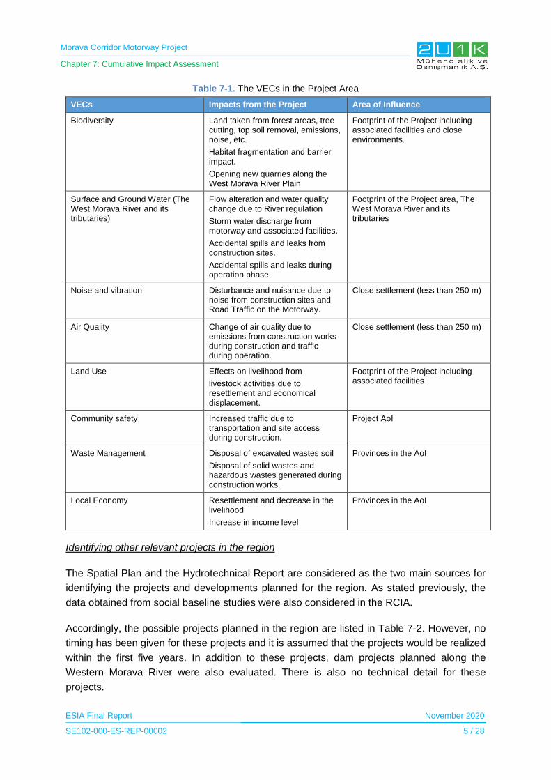
Morava Corridor Motorway Project
Chapter 7: Cumulative Impact Assessment
ESIA Final Report November 2020
SE102-000-ES-REP-00002 5 / 28
Table 7-1. The VECs in the Project Area
VECs Impacts from the Project Area of Influence
Biodiversity Land taken from forest areas, tree cutting, top soil removal, emissions, noise, etc.
Habitat fragmentation and barrier impact.
Opening new quarries along the West Morava River Plain
Footprint of the Project including associated facilities and close environments.
Surface and Ground Water (The West Morava River and its tributaries)
Flow alteration and water quality change due to River regulation
Storm water discharge from motorway and associated facilities.
Accidental spills and leaks from construction sites.
Accidental spills and leaks during operation phase
Footprint of the Project area, The West Morava River and its tributaries
Noise and vibration Disturbance and nuisance due to noise from construction sites and Road Traffic on the Motorway.
Close settlement (less than 250 m)
Air Quality Change of air quality due to emissions from construction works during construction and traffic during operation.
Close settlement (less than 250 m)
Land Use Effects on livelihood from
livestock activities due to resettlement and economical displacement.
Footprint of the Project including associated facilities
Community safety Increased traffic due to transportation and site access during construction.
Project AoI
Waste Management Disposal of excavated wastes soil
Disposal of solid wastes and hazardous wastes generated during construction works.
Provinces in the AoI
Local Economy Resettlement and decrease in the livelihood
Increase in income level
Provinces in the AoI
Identifying other relevant projects in the region
The Spatial Plan and the Hydrotechnical Report are considered as the two main sources for
identifying the projects and developments planned for the region. As stated previously, the
data obtained from social baseline studies were also considered in the RCIA.
Accordingly, the possible projects planned in the region are listed in Table 7-2. However, no
timing has been given for these projects and it is assumed that the projects would be realized
within the first five years. In addition to these projects, dam projects planned along the
Western Morava River were also evaluated. There is also no technical detail for these
projects.

Morava Corridor Motorway Project
Chapter 7: Cumulative Impact Assessment
ESIA Final Report November 2020
SE102-000-ES-REP-00002 6 / 28
Table 7-2. Potential Projects in the Region
Project Description
Establishment of the Logistic Centers
The Logistic Centersare expected to be constructed in Čačak and Kraljevo municipalities after the operation phase of the Project and according to the Spatial Plan. These centers can employ between 500 and 10,000 employees in which may provide significant benefit for the locals who seek employment.
Establishment of Industrial Zones
According to the Spatial Plan, Industrial Zones are planned to be constructed in Kraljevo, Kruševac, Čačak, Trstenik, Varvarin and Ćićevac municipalities. The details of the planned Industrial Zones are currently being arranged and no further details provided in the Plan.
Reconstruction and rehabilitation of exiting Railway Systems
Reconstruction, modernization and construction of the existing Belgrade - Mladenovac railway with European interoperability standards,
Revitalization and modernization (ultimately complete electrification) of the existing single-track railway lines Lapovo - Kraljevo - Lesak - Kosovo Polje - General Jankovic,
Revitalization and modernization of the existing single-track Stalać - Kraljevo railway,
Stations will be either improve or construct businesses and services.
Run-of the River Dam Projects along the West Morava River
Five cascade Run-of the River Dam Projects are planned over the river section (see Figure 7-2).
Figure 7-2 represents the potential projects in the Region, which are given in the table above.
Figure 7-2. Potential Projects in the Region

Morava Corridor Motorway Project
Chapter 7: Cumulative Impact Assessment
ESIA Final Report November 2020
SE102-000-ES-REP-00002 7 / 28
7.6 STEP 3 – Determine Existing Conditions of the VECs
Existing conditions of the VECs, which are summarized in Table 7-1, are described in the
respective baseline sections in Chapter 5 of the ESIA report. With this intention, current
understanding of baseline conditions has been used to identify and assess the potential
cumulative impacts presented in Step 4, Step 5 and Step 6 given below.
7.7 STEP 4, STEP 5 and STEP 6 – Assesment of Cumulative Impacts and
Identification of Mitigation Measures
A qualitative assessment of potential cumulative impacts on the identified VECs, by
considering each of project identified in Step 2, was undertaken and is provided in the
Table 7-3.
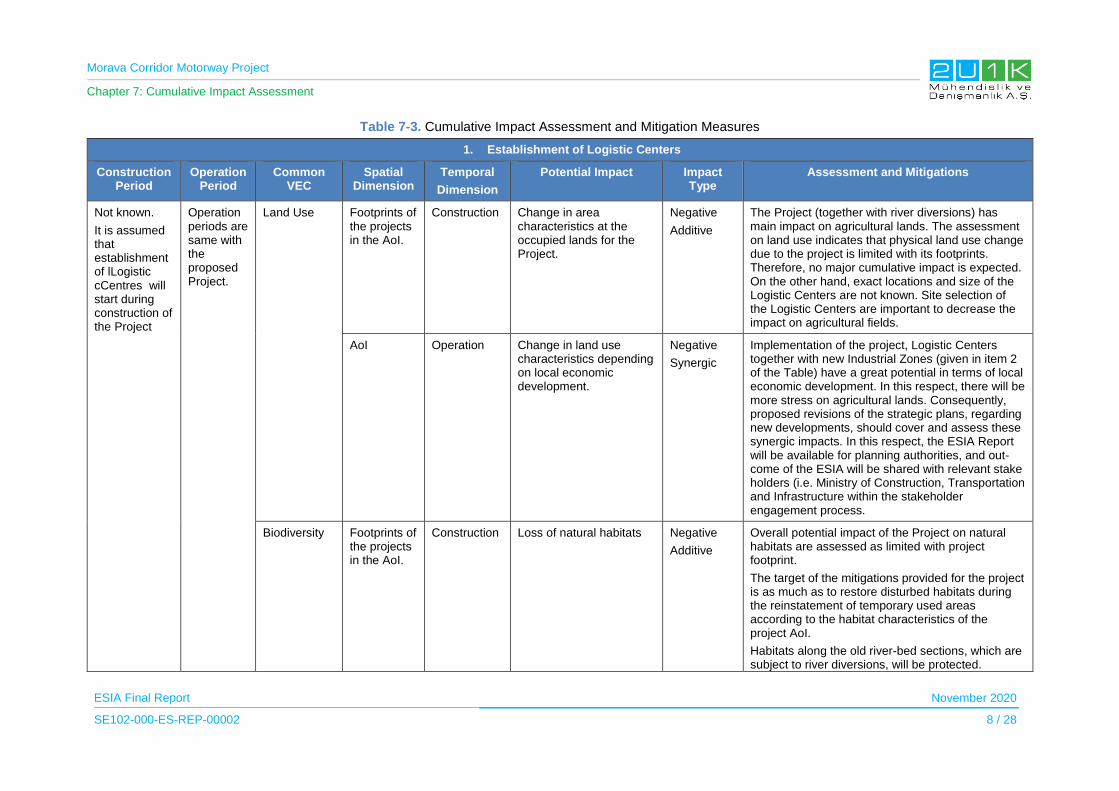
Morava Corridor Motorway Project
Chapter 7: Cumulative Impact Assessment
ESIA Final Report November 2020
SE102-000-ES-REP-00002 8 / 28
Table 7-3. Cumulative Impact Assessment and Mitigation Measures
1. Establishment of Logistic Centers
Construction Period
Operation Period
Common VEC
Spatial Dimension
Temporal
Dimension
Potential Impact Impact Type
Assessment and Mitigations
Not known.
It is assumed that establishment of lLogistic cCentres will start during construction of the Project
Operation periods are same with the proposed Project.
Land Use Footprints of the projects in the AoI.
Construction Change in area characteristics at the occupied lands for the Project.
Negative
Additive
The Project (together with river diversions) has main impact on agricultural lands. The assessment on land use indicates that physical land use change due to the project is limited with its footprints. Therefore, no major cumulative impact is expected. On the other hand, exact locations and size of the Logistic Centers are not known. Site selection of the Logistic Centers are important to decrease the impact on agricultural fields.
AoI Operation Change in land use characteristics depending on local economic development.
Negative
Synergic
Implementation of the project, Logistic Centers together with new Industrial Zones (given in item 2 of the Table) have a great potential in terms of local economic development. In this respect, there will be more stress on agricultural lands. Consequently, proposed revisions of the strategic plans, regarding new developments, should cover and assess these synergic impacts. In this respect, the ESIA Report will be available for planning authorities, and out-come of the ESIA will be shared with relevant stake holders (i.e. Ministry of Construction, Transportation and Infrastructure within the stakeholder engagement process.
Biodiversity Footprints of the projects in the AoI.
Construction Loss of natural habitats Negative
Additive
Overall potential impact of the Project on natural habitats are assessed as limited with project footprint.
The target of the mitigations provided for the project is as much as to restore disturbed habitats during the reinstatement of temporary used areas according to the habitat characteristics of the project AoI.
Habitats along the old river-bed sections, which are subject to river diversions, will be protected.

Morava Corridor Motorway Project
Chapter 7: Cumulative Impact Assessment
ESIA Final Report November 2020
SE102-000-ES-REP-00002 9 / 28
1. Establishment of Logistic Centers
Construction Period
Operation Period
Common VEC
Spatial Dimension
Temporal
Dimension
Potential Impact Impact Type
Assessment and Mitigations
Additionally, new river bed at river diversion sections will be constructed with natural materials and river banks along river regulation sections will be planted with native species in order to support existing riparian habitats. Therefore, no major cumulative impact is expected.
On the other hand, exact locations and size of the Logistic Centers are not known. Site selection of the Logistic Centers are important to decrease the impact on biodiversity. The outcome of the ESIA study should be considered during the site selection process of the Logistic Centers.
In this respect, the ESIA Report will be available for planning authorities, and out-come of the ESIA will be shared with relevant stake holders (i.e. Ministry of Construction, Transportation and Infrastructure within the stakeholder engagement process.
AoI Operation Fauna casualties Negative
Additive
The Project is directly connected to the logistic centers, so that operation of the Logistic Centers will increase the truck traffic, which increase the risk of fauna causalities. Design of proposed Motorway Project includes under passes for movement of terrestrial fauna. ESIA studies concluded that no major impact is expected on the terrestrial fauna species. Therefore, no cumulative impact is expected. On the other hand, an informative program about fauna species of the project AoI can be considered for the truck drivers serving for the proposed logistic centres.
Surface and Ground Water
The West Morava River
Construction Wastewater discharges from construction camps and from other associated facilities.
Negative
Additive
All wastewater discharged from project facilities of the project will be treated in accordance to the existing national regulation as well as IFC Guidelines. Therefore, no major impact is expected

Morava Corridor Motorway Project
Chapter 7: Cumulative Impact Assessment
ESIA Final Report November 2020
SE102-000-ES-REP-00002 10 / 28
1. Establishment of Logistic Centers
Construction Period
Operation Period
Common VEC
Spatial Dimension
Temporal
Dimension
Potential Impact Impact Type
Assessment and Mitigations
Sand and Silt discharge from construction areas.
due to proposed project.
Operation Storm water discharges from open surfaces.
Negative
Additive
All the storm water collected from proposed Project, will be rested in settlement ponds before discharge to the Western Morava River (or its any tributaries). Therefore, no major cumulative impact is expected.
Noise and Vibration
Near Settlements
Construction Increase in ambient noise level due to construction activities.
Negative
Additive
Exact locations of the Logistic Centers are not known. Therefore, there is no information regarding their impact on sensitive receptors identified in this ESIA.
No major impact is expected from the Project construction works. On the other hand, cumulative noise impact may exceed the guideline limits where the construction locations of the Logistic Centers and proposed motorway project get closer. In this respect, during the noise monitoring of the construction works of the project, potential construction areas, which may cause cumulative noise impact, will be identified and noticed in the noise monitoring reports.
Near Settlements
Operation Increase in ambient noise due to traffic.
Negative
Additive
As stated in Chapter 6, there are critical locations along the Project route, where the noise guideline limits might be exceeded during operation of the Project. Besides, exact locations of the Logistic Centers are not known. Therefore, there is no information about overlapping areas in terms of these sensitive locations. Therefore, the assessment results in the ESIA report should be considered during the site selection process of the Logistic Centers as well as local EIA process. In this respect, the ESIA Report will be available for related authorities, and out-come of the ESIA will be shared with relevant stakeholders (i.e. Ministry
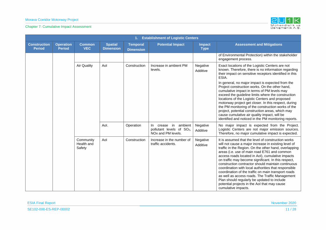
Morava Corridor Motorway Project
Chapter 7: Cumulative Impact Assessment
ESIA Final Report November 2020
SE102-000-ES-REP-00002 11 / 28
1. Establishment of Logistic Centers
Construction Period
Operation Period
Common VEC
Spatial Dimension
Temporal
Dimension
Potential Impact Impact Type
Assessment and Mitigations
of Environmental Protection) within the stakeholder engagement process.
Air Quality AoI Construction Increase in ambient PM levels.
Negative
Additive
Exact locations of the Logistic Centers are not known. Therefore, there is no information regarding their impact on sensitive receptors identified in this ESIA.
In general, no major impact is expected from the Project construction works. On the other hand, cumulative impact in terms of PM levels may exceed the guideline limits where the construction locations of the Logistic Centers and proposed motorway project get closer. In this respect, during the PM monitoring of the construction works of the project, potential construction areas, which may cause cumulative air quality impact, will be identified and noticed in the PM monitoring reports.
AoI. Operation In crease in ambient pollutant levels of SO2, NOx and PM levels.
Negative
Additive
No major impact is expected from the Project. Logistic Centers are not major emission sources. Therefore, no major cumulative impact is expected.
Community Health and Safety
AoI Construction Increase in the number of traffic accidents.
Negative
Additive
It is assumed that the level of construction works will not cause a major increase in existing level of traffic in the Region. On the other hand, overlapping areas (i.e. use of main road E761 and common access roads located in AoI), cumulative impacts on traffic may become significant. In this respect, construction contractor should maintain continuous coordination with local authorities that responsible coordination of the traffic on main transport roads as well as access roads. The Traffic Management Plan should regularly be updated to include potential projects in the AoI that may cause cumulative impacts.

Morava Corridor Motorway Project
Chapter 7: Cumulative Impact Assessment
ESIA Final Report November 2020
SE102-000-ES-REP-00002 12 / 28
1. Establishment of Logistic Centers
Construction Period
Operation Period
Common VEC
Spatial Dimension
Temporal
Dimension
Potential Impact Impact Type
Assessment and Mitigations
AoI Operation Increase in the number of traffic accidents.
Negative
Synergic
Exact locations of the Logistic Centers and capacities are not known. On the other hand, it is a fact that establishment of the Logistic Centers will increase the traffic level in the motorway. In general, the traffic level is included in the feasibility of the project, and traffic level on the motorway as well as performance of the proposed mitigations will be continuously monitored by related state authorities.
Local Economy
Footprints of the projects
Construction Resettlement and decrease in the livelihood
Negative
Synergic
Resettlement and loss in livelihood are the major negative impact of the proposed Project. In this respect, any land acquisition process for the :Logistic Centers may cause additional impact on the local people, in case overlapping of the Logistic Centers and the Project. In this respect, any potential land acquisition process performed for Logistic Centers are required to be followed by CoS (having information from related designated authority such as municipalities) to understand any additional potential impact on the affected person covered in the Resettlement Action Plan. The additional impact (if exist) should be included in the monitoring reports. In this respect, the ESIA Report will be available for planning authorities, and out-come of the ESIA will be shared with relevant stakeholders (i.e. Ministry of Construction, Transportation and Infrastructure within the stakeholder engagement process.
Province in the AoI
Operation Increase in income level Positive
Synergic
The Spatial Plan states that establishment of the Logistic Centers will to lead new employment opportunities up to 10,000 workers. These new job opportunities and transportation revenues as well as increase in the secondary services such as temporal accommodation of vehicle drivers and

Morava Corridor Motorway Project
Chapter 7: Cumulative Impact Assessment
ESIA Final Report November 2020
SE102-000-ES-REP-00002 13 / 28
1. Establishment of Logistic Centers
Construction Period
Operation Period
Common VEC
Spatial Dimension
Temporal
Dimension
Potential Impact Impact Type
Assessment and Mitigations
maintenance services etc. can lead important contribution to local economy. Proposed Motorway will establish a direct connection of these Logistic Centers to national and international markets. In this respect, establishment of the projects will lead potential positive impacts for the local economy.
2. Establishment of Industrial Zones
Construction Period
Operation Period
Common VEC
Spatial Dimension
Temporal
Dimension Potential Impact
Impact Type
Assessment and Mitigations
Not known.
It is assumed that construction of Industrial Zones will start during construction of the proposed project
Operation periods are same with the proposed project.
Land Use Footprints of the projects in the AoI.
Construction Change in area characteristics at the occupied lands for the project.
Negative
Additive
The Project has main impact on agricultural lands. The assessment on land use indicates that physical land use change due to project is limited with its footprints. Therefore, no major cumulative impact is expected. On the other hand, exact locations and size of Industrial Zones are not known. Site selection of the Industrial Zones are important to decrease the impact on agricultural fields. In this respect, the ESIA Report will be available for planning authorities, and out-come of the ESIA will be shared with relevant stake holders (i.e. Ministry of Construction, Transportation and Infrastructure within the stakeholder engagement process.
AoI Operation Change in land use characteristics depending on local economic development.
Negative
Synergic
Implementation of the Project and Industrial Zones together with new Logistic Centers (given in item 1) have great potential in terms of local economic development. In this respect, there will be more stress on agricultural fields. Consequently, proposed revisions of the strategic plans, regarding new developments, should cover and assess these synergic impacts.

Morava Corridor Motorway Project
Chapter 7: Cumulative Impact Assessment
ESIA Final Report November 2020
SE102-000-ES-REP-00002 14 / 28
2. Establishment of Industrial Zones
Construction Period
Operation Period
Common VEC
Spatial Dimension
Temporal
Dimension Potential Impact
Impact Type
Assessment and Mitigations
Biodiversity Footprints of the projects in the AoI.
Construction Loss of natural habitats Negative
Additive
Overall potential impact of the Project on natural habitats are assessed as limited with project footprint.
The target of the mitigations provided for the project is as much as to restore disturbed habitats during the reinstatement of temporary used areas according to the habitat characteristics of the project AoI.
Habitats along the old river-bed sections, which are subject to river diversions, will be protected. Additionally, new river bed at river diversion sections will be constructed with natural materials and river banks along river regulation sections will be planted with native species in order to support existing riparian habitats. Therefore, no major cumulative impact is expected.
On the other hand, same as the Logistic Centres exact locations and size of the Industrial Zones are not known. Site selection of the Industrial Zones are important to decrease the impact on biodiversity. The outcome of the ESIA study should be considered during the site selection process of the Industrial Zones.
In this respect, the ESIA Report will be available for planning authorities, and out-come of the ESIA will be shared with relevant stake holders (i.e. Ministry of Construction, Transportation and Infrastructure within the stakeholder engagement process.
AoI Operation Fauna casualties Negative
Additive
The project is directly connected to planned Industrial Zones, so that operation of the Industrial Zones will increase the local traffic, which increase the risk of fauna causalities. Design of proposed motorway project includes under passes for

Morava Corridor Motorway Project
Chapter 7: Cumulative Impact Assessment
ESIA Final Report November 2020
SE102-000-ES-REP-00002 15 / 28
2. Establishment of Industrial Zones
Construction Period
Operation Period
Common VEC
Spatial Dimension
Temporal
Dimension Potential Impact
Impact Type
Assessment and Mitigations
movement of terrestrial fauna. ESIA studies concluded that no major impact is expected on the terrestrial fauna species. Therefore, no cumulative impact is expected. On the other hand, an informative program about fauna species of the project AoI can be considered for the truck drivers serving for the proposed Industrial Zones.
Surface and Ground Water
The West Morava River
Construction Wastewater discharges from construction camps and from other associated facilities.
Sand and Silt discharge from construction areas.
Negative
Additive
All wastewater discharged from project facilities of the Project will be treated in accordance to the existing national regulation as well as IFC Guidelines. Therefore, no major cumulative impact is expected due to proposed project.
The West Morava River
Operation Storm water discharges from open surfaces.
Negative
Additive
All the storm water collected form proposed Morava Motorway Project, will be rested in settlement ponds before discharge to the Western Morava River (or its any tributaries). Therefore, no major cumulative impact is expected.
Noise and Vibration
Near Settlements
Construction Increase in ambient noise level due to construction activities.
Negative
Additive
Exact locations of the Industrial Zones are not known. Therefore, there is no information regarding their impact on sensitive receptors identified in this ESIA.
In general, no major impact is expected from construction works of the Project. On the other hand, cumulative noise impact may exceed the guideline limits, where the Project alignment passes close to construction locations of the Industrial Zones (or any construction works in the Industrial Zones such as construction new industrial unit) . In this respect, during the noise monitoring of the construction works of the Project, potential construction areas of Industrial Zones, which may cause cumulative noise impact, will be identified
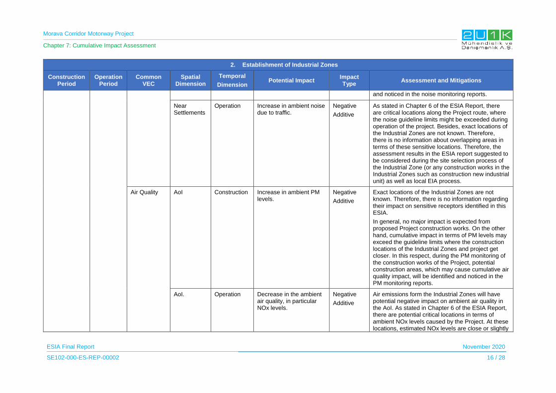
Morava Corridor Motorway Project
Chapter 7: Cumulative Impact Assessment
ESIA Final Report November 2020
SE102-000-ES-REP-00002 16 / 28
2. Establishment of Industrial Zones
Construction Period
Operation Period
Common VEC
Spatial Dimension
Temporal
Dimension Potential Impact
Impact Type
Assessment and Mitigations
and noticed in the noise monitoring reports.
Near Settlements
Operation Increase in ambient noise due to traffic.
Negative
Additive
As stated in Chapter 6 of the ESIA Report, there are critical locations along the Project route, where the noise guideline limits might be exceeded during operation of the project. Besides, exact locations of the Industrial Zones are not known. Therefore, there is no information about overlapping areas in terms of these sensitive locations. Therefore, the assessment results in the ESIA report suggested to be considered during the site selection process of the Industrial Zone (or any construction works in the Industrial Zones such as construction new industrial unit) as well as local EIA process.
Air Quality AoI Construction Increase in ambient PM levels.
Negative
Additive
Exact locations of the Industrial Zones are not known. Therefore, there is no information regarding their impact on sensitive receptors identified in this ESIA.
In general, no major impact is expected from proposed Project construction works. On the other hand, cumulative impact in terms of PM levels may exceed the guideline limits where the construction locations of the Industrial Zones and project get closer. In this respect, during the PM monitoring of the construction works of the Project, potential construction areas, which may cause cumulative air quality impact, will be identified and noticed in the PM monitoring reports.
AoI. Operation Decrease in the ambient air quality, in particular NOx levels.
Negative
Additive
Air emissions form the Industrial Zones will have potential negative impact on ambient air quality in the AoI. As stated in Chapter 6 of the ESIA Report, there are potential critical locations in terms of ambient NOx levels caused by the Project. At these locations, estimated NOx levels are close or slightly

Morava Corridor Motorway Project
Chapter 7: Cumulative Impact Assessment
ESIA Final Report November 2020
SE102-000-ES-REP-00002 17 / 28
2. Establishment of Industrial Zones
Construction Period
Operation Period
Common VEC
Spatial Dimension
Temporal
Dimension Potential Impact
Impact Type
Assessment and Mitigations
above regulated levels. As the nature of the Project, the NOx emissions from the vehicles cannot be controlled by the projects, and it is directly related to national policies. It is assumed that NOx emission levels will be decreased in time with respect to new technological improvements on transport vehicles as well as new national policies developed in line with EU accession. On the other hand, impact of the motorway in terms of air quality should always be regarded in future EIA Processes performed for new developments in the Region, in particular for the projects which have a potential impact on air quality. In this respect, the ESIA Report will be available for relevant authorities, and out-come of the ESIA will be shared with relevant stakeholders (i.e. Ministry of Environmental Protection within the stakeholder engagement process.
Community Health and Safety
AoI Construction Increase in the number of traffic accidents.
Negative
Additive
It is assumed that level of the construction works associated with the Industrial Zones will not cause a major increase in existing level of traffic in the region. On the other hand, cumulative impacts on traffic may become significant at overlapping areas, which is under the impact of the Project (i.e. access roads to the project site and associated facilities), In this respect, construction contractor should maintain continuous coordination with local authorities that responsible for coordination of the traffic on main transport roads as well as access roads. The Traffic management plan regularly updated to include potential projects in the AoI that may cause cumulative impacts.
AoI Operation Increase in the number of traffic accidents.
Negative
Synergic
Exact locations of the Industrial Zones and size of the zones are not known. On the other hand, it is a
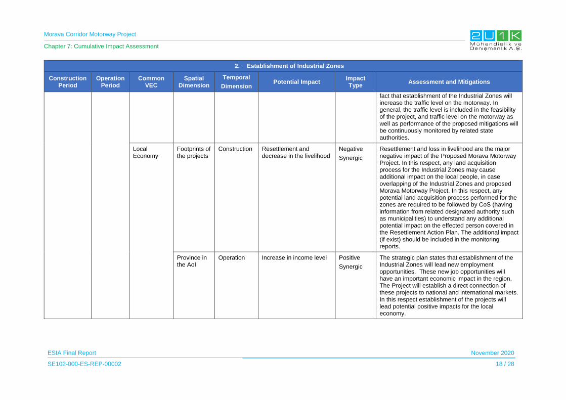
Morava Corridor Motorway Project
Chapter 7: Cumulative Impact Assessment
ESIA Final Report November 2020
SE102-000-ES-REP-00002 18 / 28
2. Establishment of Industrial Zones
Construction Period
Operation Period
Common VEC
Spatial Dimension
Temporal
Dimension Potential Impact
Impact Type
Assessment and Mitigations
fact that establishment of the Industrial Zones will increase the traffic level on the motorway. In general, the traffic level is included in the feasibility of the project, and traffic level on the motorway as well as performance of the proposed mitigations will be continuously monitored by related state authorities.
Local Economy
Footprints of the projects
Construction Resettlement and decrease in the livelihood
Negative
Synergic
Resettlement and loss in livelihood are the major negative impact of the Proposed Morava Motorway Project. In this respect, any land acquisition process for the Industrial Zones may cause additional impact on the local people, in case overlapping of the Industrial Zones and proposed Morava Motorway Project. In this respect, any potential land acquisition process performed for the zones are required to be followed by CoS (having information from related designated authority such as municipalities) to understand any additional potential impact on the effected person covered in the Resettlement Action Plan. The additional impact (if exist) should be included in the monitoring reports.
Province in the AoI
Operation Increase in income level Positive
Synergic
The strategic plan states that establishment of the Industrial Zones will lead new employment opportunities. These new job opportunities will have an important economic impact in the region. The Project will establish a direct connection of these projects to national and international markets. In this respect establishment of the projects will lead potential positive impacts for the local economy.

Morava Corridor Motorway Project
Chapter 7: Cumulative Impact Assessment
ESIA Final Report November 2020
SE102-000-ES-REP-00002 19 / 28
3. Reconstruction and rehabilitation of exiting Railway systems
Construction Period
Operation Period
Common VEC
Spatial Dimension
Temporal
Dimension Potential Impact
Impact Type
Assessment and Mitigations
Not known.
It is assumed that reconstruction and rehabilitation will start during construction of the proposed project
Operation periods are same with the proposed project.
Land Use Footprints of the projects in the AoI.
Construction Change in area characteristics at the occupied lands for the project.
Negative
Additive
Project has main impact on agricultural lands. The assessment on land use indicates that physical land use change due to the project is limited with its footprints. Therefore, no major cumulative impact is expected.
AoI Operation Impact is not expected Negative
Additive
NA
Biodiversity Footprints of the projects in the AoI.
Construction Loss of natural habitats Negative
Additive
Potential impact of the Project on natural habitats is limited with its footprint. Therefore, no major cumulative impact is expected.
Same level of impact is expected from implementation of the Railway Rehabilitation and Reconstruction Project. Therefore, no major cumulative impact is expected.
AoI Operation Fauna casualties
Barrier effect
Negative
Additive
Barrier effect of the Project is minimized with inclusion of the under passes for movement of terrestrial fauna. ESIA studies concluded that no major impact is expected on the terrestrial fauna species. Therefore, no major cumulative impact is expected.
Surface and Ground Water
The West Morava River
Construction Wastewater discharges from construction camps and from other associated facilities.
Sand and Silt discharge from construction areas.
Negative
Additive
All wastewater discharged from the project facilities will be treated in accordance to the existing national regulation as well as IFC Guidelines. Therefore, no major cumulative impact is expected.
Operation Storm water discharges from open surfaces.
Negative
Additive
All the storm water collected form the Project will be rested in settlement ponds before it is discharged to the West Morava River (or its any tributaries). Therefore, no major cumulative impact is expected.
Morava Corridor Motorway Project
Chapter 7: Cumulative Impact Assessment
ESIA Final Report November 2020
SE102-000-ES-REP-00002 20 / 28
3. Reconstruction and rehabilitation of exiting Railway systems
Construction Period
Operation Period
Common VEC
Spatial Dimension
Temporal
Dimension Potential Impact
Impact Type
Assessment and Mitigations
Noise and Vibration
Near Settlements
Construction Increase in ambient noise level due to construction activities.
Negative
Additive
No major impact is expected from the Project construction works. On the other hand, cumulative noise impact may exceed the guideline limits where the Project alignment passes close to the construction locations of the Railway Rehabilitation and Reconstruction Project. In this respect, during the noise monitoring of the construction works of the proposed motorway, potential construction areas, which may cause cumulative noise impact, will be identified and noticed in the noise monitoring reports.
Near Settlements
Operation Impact is not expected NA Noise level caused by the use of existing railway were measured and included in the baseline noise measurements. No major changes in terms of noise caused by train operation is expected after the Railway Rehabilitation and Reconstruction Project.
Air Quality AoI Construction Increase in ambient PM levels.
Negative
Additive
No major impact is expected from the Project construction works. On the other hand, cumulative impact in terms of PM levels may exceed the guideline limits where the Project alignment passes close to the construction locations of the Railway Rehabilitation and Reconstruction Project. In this respect, during the PM monitoring of the construction works of the project, potential construction areas, which may cause cumulative air quality impact, will be identified and noticed in the PM monitoring reports.
AoI. Operation Impact is not expected Negative
Additive
NA.

Morava Corridor Motorway Project
Chapter 7: Cumulative Impact Assessment
ESIA Final Report November 2020
SE102-000-ES-REP-00002 21 / 28
3. Reconstruction and rehabilitation of exiting Railway systems
Construction Period
Operation Period
Common VEC
Spatial Dimension
Temporal
Dimension Potential Impact
Impact Type
Assessment and Mitigations
Community Health and Safety
AoI Construction Increase in the number of traffic accidents.
Negative
Additive
Construction works of the Project will not cause a major increase in existing level of traffic in the region. On the other hand, at overlapping areas (i.e. use of main road E761 and common access roads located in AoI), cumulative impacts on traffic may become significant. In this respect, construction contractor should maintain continuous coordination with local authorities that responsible coordination of the traffic on main transport roads as well as access roads. The traffic management plan regularly updated to include potential projects in the AoI that may cause cumulative impacts.
AoI Operation Impact is not expected Negative
Additive
NA
Local Economy
Footprints of the projects
Construction Resettlement and decrease in the livelihood
Negative
Synergic
Resettlement and loss in livelihood are the major negative impact of the Project. In this respect, any land acquisition process for the railway projects may cause additional impact on the local people at overlapping areas with the Railway Rehabilitation and Reconstruction Project. Due to that reason, any potential land acquisition process performed for the Railway Rehabilitation and Reconstruction Project are required to be followed by CoS (having information from related designated authority such as railway authority) to understand any additional potential impact on the effected person covered in the Resettlement Action Plan. The additional impact (if exist) should be included in the monitoring reports.
Morava Corridor Motorway Project
Chapter 7: Cumulative Impact Assessment
ESIA Final Report November 2020
SE102-000-ES-REP-00002 22 / 28
3. Reconstruction and rehabilitation of exiting Railway systems
Construction Period
Operation Period
Common VEC
Spatial Dimension
Temporal
Dimension Potential Impact
Impact Type
Assessment and Mitigations
Province in the AoI
Operation Increase in income level Positive
Synergic
Railway project and motorway projects are two critical infrastructures for development of the regional and national economies. Therefore, establishment of the projects will have important positive impact on local economy.
4. Run-of the River Dam Projects along Morava River
Construction Period
Operation Period
Common VEC
Spatial Dimension
Temporal
Dimension Potential Impact Impact Type Assessment and Mitigations
Not known.
It is assumed that construction will start during construction of the proposed project
Operation periods are same with the proposed project.
Land Use Footprints of the projects in the AoI.
Construction Change in area characteristics at the occupied lands for the project.
Negative
Additive
The Project has main impact on agricultural lands. The assessment on land use indicates that physical land use change due to the project is limited with its footprints.
There is no detailed technical information regarding the area requirement as well as the maps showing the coverage areas of the Run of the River Projects. By considering the general project characteristics of the Run of the River Projects, the land requirements for the projects are considered to be limited with weir ponds and power structures. In general, no major cumulative impact is expected. However, as it is stated above there is no detailed information on these hydropower projects. Additionally, material requirement for these projects are another important impact source of the Run of the River Projects. Due to that reason, National EIA process of the Run of the River Projects require to consider land use impact of the proposed Project.
Therefore, the ESIA Report will be available for
Morava Corridor Motorway Project
Chapter 7: Cumulative Impact Assessment
ESIA Final Report November 2020
SE102-000-ES-REP-00002 23 / 28
4. Run-of the River Dam Projects along Morava River
Construction Period
Operation Period
Common VEC
Spatial Dimension
Temporal
Dimension Potential Impact Impact Type Assessment and Mitigations
planning authorities, and out-come of the ESIA will be shared with relevant stake holders (i.e. Ministry of Environment Protection, within the stakeholder engagement process.
AoI Operation Impact is not expected Negative
Additive
NA
Biodiversity Footprints of the projects in the AoI.
Construction Loss of natural habitats Negative
Additive
Overall potential impact of the Project on natural habitats are assessed as limited with project footprint.
The target of the mitigations provided for the project is as much as to restore disturbed habitats during the reinstatement of temporary used areas according to the habitat characteristics of the project AoI.
Habitats along the old river-bed sections, which are subject to river diversions, will be protected. Additionally, new river bed at river diversion sections will be constructed with natural materials and river banks along river regulation sections will be planted with native species in order to support existing riparian habitats. Exact locations and detailed information on Run of the River Projects are not known. Therefore, an estimation on habitat loss due to Run of the River Projects is not possible. Besides, by considering the number of the Run of the River Projects and coverage are of the Project together with the Run of the River Projects, habitat loss can be significant in the Project AoI. Therefore, the site selection, design and local EIA Process of these projects should consider the outcome of the ESIA study. In this respect, the ESIA Report will be
Morava Corridor Motorway Project
Chapter 7: Cumulative Impact Assessment
ESIA Final Report November 2020
SE102-000-ES-REP-00002 24 / 28
4. Run-of the River Dam Projects along Morava River
Construction Period
Operation Period
Common VEC
Spatial Dimension
Temporal
Dimension Potential Impact Impact Type Assessment and Mitigations
available for planning authorities, and out-come of the ESIA will be shared with relevant stake holders (i.e. Ministry of Environmental Protection within the stakeholder engagement process.)
AoI Operation Impact is not expected Negative
Additive
Alteration of the river flow and barrier effect of the weirs are the major operational impact of the Run of the River Projects. Flow alteration and barrier effect of Run of the River projects mainly have significant impact on migratory aquatic species.
As it in explained in Chapter 3, the diversion channels designed for River Regulation sections, does not include any structure (i.e. energy breaking weirs etc.), which is hindering the hydraulic conductivity of the West Morava River in order to sustain movement of the migratory aquatic species. Additionally, the water flow speed at new regulated sections will be more or less same with natural flows of the river system by arranging the areal size of the new channel at design phase. Due to that reason, no major flow change is expected at regulated sections due to flow alteration.
In this respect, operational impacts of the river regulation and Run of the River Regulation Projects will not be common. Therefore, no cumulative impact is expected during operation phase. On the other hand, the design of Run of the River Projects should be made in accordance to the River Regulation design. For this purpose, River Regulation design and outcome of the ESIA Studies will be available for planning authorities, and out-come of the
Morava Corridor Motorway Project
Chapter 7: Cumulative Impact Assessment
ESIA Final Report November 2020
SE102-000-ES-REP-00002 25 / 28
4. Run-of the River Dam Projects along Morava River
Construction Period
Operation Period
Common VEC
Spatial Dimension
Temporal
Dimension Potential Impact Impact Type Assessment and Mitigations
ESIA will be shared with relevant stake holders (i.e. Ministry of Environmental Protection within the stakeholder engagement process.)
Surface and Ground Water
The West Morava River
Construction Wastewater discharges from construction camps and from other associated facilities.
Sand and Silt discharge from construction areas.
Negative
Additive
All wastewater discharged from the Project facilities will be treated in accordance to the existing national regulation as well as IFC Guidelines. Therefore, no major impact is expected due to the Project. In this respect, no major cumulative impact is expected.
Operation Storm water discharges from open surfaces.
Negative
Additive
All the storm water collected from the proposed the Project, will be rested in settlement ponds before it is discharged to the West Morava River (or its tributaries). Therefore, no major cumulative impact is expected.
Noise and Vibration
Near Settlements
Construction Increase in ambient noise level due to construction activities.
Negative
Additive
No major impact is expected from the Project construction works. On the other hand, cumulative noise impact may exceed the guideline limits where the construction locations of dams and the project get closer. In this respect, during the noise monitoring of the construction works of the project, potential construction areas, which may cause cumulative noise impact, will be identified and noticed in the noise monitoring reports.
Near Settlements
Operation Impact is not expected. Negative Additive
NA
Air Quality AoI Construction Increase in ambient PM levels.
Negative
Additive
No major impact is expected from the Project construction works. On the other hand, cumulative impact in terms of PM levels may exceed the guideline limits where the Project alignment passes close to the construction locations of the dams including material
Morava Corridor Motorway Project
Chapter 7: Cumulative Impact Assessment
ESIA Final Report November 2020
SE102-000-ES-REP-00002 26 / 28
4. Run-of the River Dam Projects along Morava River
Construction Period
Operation Period
Common VEC
Spatial Dimension
Temporal
Dimension Potential Impact Impact Type Assessment and Mitigations
sources. In this respect, during the PM monitoring of the construction works of the Project, potential construction areas, which may cause cumulative air quality impact, will be identified and highlighted in the PM monitoring reports.
AoI. Operation Impact is not expected. Negative
Additive
NA
Community Health and Safety
AoI Construction Increase in the number of traffic accidents.
Negative
Additive
It is assumed that level of the construction works of the Project will not cause a major increase in existing level of traffic in the region. On the other hand, at overlapping areas (i.e. use of main road E761 and common access roads located in AoI), cumulative impacts on traffic may become significant. In this respect, construction contractor should maintain continuous coordination with local authorities that responsible coordination of the traffic on main transport roads as well as access roads. A traffic management plan regularly updated to include potential projects in the AoI that may cause cumulative impacts.
AoI Operation Impact is not expected Negative
Additive
NA
Local Economy
Footprints of the projects
Construction Resettlement and decrease in the livelihood
Negative
Synergic
Resettlement and loss in livelihood are the major negative impact of the Project. In this respect, any land acquisition process for the dam projects may cause additional impact on the local people at overlapping areas. In this respect, any potential land acquisition process performed for the dam projects is required to be followed by CoS (having information from

Morava Corridor Motorway Project
Chapter 7: Cumulative Impact Assessment
ESIA Final Report November 2020
SE102-000-ES-REP-00002 27 / 28
4. Run-of the River Dam Projects along Morava River
Construction Period
Operation Period
Common VEC
Spatial Dimension
Temporal
Dimension Potential Impact Impact Type Assessment and Mitigations
related designated authority such as railway authority) to understand any additional potential impact on the effected person covered in the Resettlement Action Plan. The additional impact (if exist) should be included in the monitoring reports.
Province in the AoI
Operation Impact is not expected Positive
Additive
NA

Morava Corridor Motorway Project
Chapter 7: Cumulative Impact Assessment
ESIA Final Report November 2020
SE102-000-ES-REP-00002 28 / 28
7.8 Conclusion
This RCIA identified the relevant and potential major development projects in the region, and
applied a systematic methodology to assessment of cumulative impacts (both spatial and
temporal) in relation to the Project (together with river regulation works) construction and
operation activities.
The RCIA found that major development projects in the region such as establishment of
Industrial Zones and Logistic Centers have both potential negative and positive cumulative
impacts. Positive impacts, which are anticipated in relation to economic development in the
Project AoI, align with the main objective of the Project. On the other hand, economic
development also leads to a shift in the structure of production, with a move from agricultural
to manufacturing and services in addition to population growth. These structural changes put
additional stress on land use as well as ecological habitats. Future Spatial Plan(s) or EIAs
prepared for new developments covering the Project AoI need to consider the outcomes of
the ESIA, and the potential cumulative impacts on existing land use including natural habitats
are required to be evaluated. The extent of this impact will rely on coordinated planning
between transportation and land use planning agencies. In this respect, the ESIA Report and
out-come of the ESIA will be shared with relevant stakeholders such as Ministry of
Construction, Transportation and Infrastructure and Ministry of Environmental Protection etc.
within the stakeholder engagement process.
The assessment shows that expected level of the cumulative impacts related to air
emissions, noise, traffic, waste water discharges are same as the Project impacts given in
Chapter 6, and in general minor. Therefore, no specific recommendations are made for
monitoring or measurements of potential impacts in the field due to fact that mitigations
suggested in the assessment overlaps with mitigations stipulated in the ESMMP given in
Chapter 8.
7.9 Transboundary Impacts
Due to the distances between planned Project activities and the land territories of Bosnia-
Herzegovina, Macedonia and Kosovo (i.e. greater than 50 km), predicted impacts do not
have the potential to cross territorial land borders and have a transboundary environmental
impact. This includes potential transboundary air quality impacts as associated with the
transportation of resources to and from the Project during the Construction and Operation
Phase of the Project. In Chapter 6, impact on Terrestrial Ecology also considers and
concludes that there will not be transboundary impacts upon migratory birds given that the
Project will not have significant adverse direct or indirect impacts upon migratory bird species
during planned activities.

Morava Corridor Motorway Project
Chapter 8: ESMMP
ESIA Final Report November 2020
SE102-000-ES-REP-00002 1 / 118
8. ENVIRONMENTAL AND SOCIAL MANAGEMENT AND
MONITORING PLAN
This plan presents the Environmental and Social Management and Monitoring Plan
(ESMMP) for the proposed Morava Motorway Project, and will be implemented as part of the
proposed Project’s Environmental and Social Management System (ESMS). The ESMS will
be implemented through an integrated framework of the projects overall management
systems defined and framed in the ESIA as well as in the ESMMP. The ESMS will address
organizational structure, responsibilities, practices and resources necessary for managing
the project, including specific environmental and social commitments during the construction
and operational phases of the proposed Motorway. The framework of the ESMS is provided
in the Appendix-12.
This ESMMP sets out a formal system by which the Project can manage and monitor
commitments during the construction and operational phases of the proposed Motorway.
8.1 Objective and Scope
The ESIA process has identified the key environmental, social and health issues, impacts
and risks associated with the Project requiring the implementation of mitigation measures.
this; these include;
all the Project commitments (including relevant national regulations and legal
requirements and lenders requirements),
mitigation measures that have been identified from the impact assessment, and
other best practice measures designed to avoid, minimize or reduce negative impacts
and enhance positive impacts.
The purpose of this ESMMP is to establish how the mitigation commitments made through
the ESIA process will be implemented, monitored and sustained. The content of the ESMMP
is essential to bridge the findings of the ESIA with the implementation of the mitigation
measures and to provide an early framework of management and monitoring that will ensure
the implementation of these ESIA commitments.
The ESMMP also provides information and instructions on how environmental, social, and
health commitments of the Project will be managed from design, pre-construction through the
construction and operation phases. The ESMMP is a living document which:
Incorporates the environment and social mitigation measures identified as a result of
the ESIA process into a comprehensive framework to facilitate and ensure
appropriate management throughout the Project life cycle.

Morava Corridor Motorway Project
Chapter 8: ESMMP
ESIA Final Report November 2020
SE102-000-ES-REP-00002 2 / 118
Provides a framework to incorporate commitments into the Project plans and
procedures for construction and operation activities.
Presents the division of responsibilities for achieving the ESMMP requirements
including the provision of training.
Provides a framework for the implementation of specific management plans by the
Contractor and Operator that will meet the requirements of the national legislation as
well as IFC/WB Group Performance Standards.
Provides the monitoring/verification and reporting program (including corrective
actions).
8.2 Roles and Responsibilities
The key parties and their primary roles and responsibilities in implementing the ESMMP are
given in Table 8-1.
Table 8-1. Roles and Responsibilities
Name of the Authority Responsibilities
Borrower –
Ministry of Finance/ Ministry of Construction Transport and Infrastructure
Ensure allocation of sufficient resources for the implementation of bi-annual monitoring of the ESMMP, in line with Lender requirements.
Project Owner (Construction)- Corridors of Serbia
Overall responsibility of the Project with respect to applicable national and international standards.
Ensure the allocation of sufficient resources for the implementation of their commitments within the ESMMP.
Ensure stakeholder engagement and grievances related to land acquisition and expropriation activities are managed in line with the agreed Project SEP, RLRF and RAPs.
Review the Contractors site specific implementation plans to ensure that they meet the requirements of and support the implementation of this ESMMP.
Periodic review of the ESMMP effectiveness in line with the provisions of this plan.
Participate in ESMMP Implementation Group.
Reporting of significant incidents in line with Lender requirements.
Construction
Contractor - BEJV
Overall responsibility for construction execution of the Project with respect to applicable national and international standards
Ensure the allocation of sufficient resources (personnel, materials and equipment) are consistent with achieving the objectives and requirements for the implementation of their commitments within the ESMMP.
Assign clear responsibilities and expectations with respect to implementing the Contractor’s responsibilities and commitments within the ESMMP.
Ensure the allocation of appropriately qualified personnel for the implementation of their commitments with the ESMMP.
Employ Community Relations Officer to manage, review and monitor a social program to meet Project requirements, including commitment within the ESMMP.
Employ Environmental Officer to manage, review and monitor the environmental program to meet Project requirements, including commitment within the ESMMP.
Employ Health and Safety Officer to manage, review and monitor the occupational health and safety program to meet Project requirements, including commitment within the ESMMP.
Morava Corridor Motorway Project
Chapter 8: ESMMP
ESIA Final Report November 2020
SE102-000-ES-REP-00002 3 / 118
Name of the Authority Responsibilities
Prepare site specific implementation plans that meet the requirements of and support the implementation of this ESMMP.
Promote and implement the ESMMP by incorporating the appropriate provisions into Project policies, plans and procedures.
Ensure stakeholder engagement and grievances related to construction activities are executed in line with the Contractor responsibilities and commitments in the agreed Project SEP, RLRF and RAPs
Identify environmental and social risks as part of its planning processes and through implementation of appropriate mitigation measures and communicating these to its workforce.
Establish self-verification of its own compliance by maintaining a system to manage environment and social aspects and impacts in line with ESIA requirements.
Perform environmental and social monitoring activities prescribed within the national EIA Study and ESIA.
Establish an ES&H program of internal reporting that includes incident reporting and investigation, system to record observations, non-conformance and actions that includes ESMMP performance indicators.
Provide training to Project and subcontractor staff in their responsibilities with respect to compliance with the ES&H program.
Report environmental and social performance to Project Owner and Lenders in line with agreed KPIs on periodical basis in a commonly agreed format.
Ensure stakeholder engagement and grievances related to construction activities are managed in line with the agreed Project SEP.
Develop awareness campaign on the Project SEP and Grievance Mechanism and address accordingly any grievances received that are related to construction activities.
Prepare Human Resources policies and procedures that meet the requirements of national legislation and IFC/WB performance standards.
Participate in ESMMP Implementation Group.
Project Operator – Roads of Serbia
Ensure the allocation of sufficient resources for the implementation of their commitments within the ESMMP.
Ensure stakeholder engagement and grievances related to operation activities are managed in line with the agreed Project SEP, RLRF and RAPs
Periodic review of the ESMMP effectiveness in line with the provisions of this plan.
Participate in ESMMP Implementation Committee.
8.3 Documentation and Reporting
Documentation is an important element linked to the implementation of the ESMMP. The
construction Contractor will establish a documentation and record keeping system in keeping
with their Environment and Social Management System (ESMS), and will include the
commitments within the ESMMP. Responsibilities will be assigned to relevant personnel for
ensuring that the ESMMP documentation system is maintained, document controlled and
distributed to the identified personnel. The following plans, procedures, and reports will be
included in the Contractor’s management systems:
Occupational Health and Safety Management Plans
Environmental Management Plans
Sustainability and Social Management Plans
Legal Compliance Register

Morava Corridor Motorway Project
Chapter 8: ESMMP
ESIA Final Report November 2020
SE102-000-ES-REP-00002 4 / 118
Method Statements and Work Instructions
Incident Reporting
Emergency preparedness and response procedures
Training records
Auditing and Monitoring reports;
Complaints Register and issues attended/closed.
The Contractor will provide timely submissions of reports with the agreed level of detail.
In addition to the commercial contract requirements the Contractor’s Construction Log and
Construction Diary will include other observations that support the implementation of the
ESMMP, such as community relations grievances.
8.3.1 External Reporting
All external reporting will be managed by the Project Owner/Employer within their obligations
to the Serbian government entities under the national legislation and to the Lenders.
8.3.2 Internal Reporting
Internal reporting with regards to the Contractor’s commitments within the ESMMP will be
managed jointly by the Community Relations Officer, Environmental Officer and
Occupational Health and Safety Officer. The Project will share, as appropriate, inspection
and audit findings with their suggested measures regularly with the Project management, the
ESMMP Implementation Committee and employees. To maintain an open communication
between the employees and management on occupational health, safety, environmental and
social issues the following tools will be used:
Team Briefings,
On-site work group meetings,
Work Specific Instructions.
8.4 ESMMP Review
The ESMMP will be periodically reviewed to address changes in the responsible parties’
organization, process or regulatory requirements.
Following any reviews, the Contractor will coordinate through the ESMMP Implementation
Group to make any necessary amendments in the ESMMP, with, the updates communicated
to all responsible parties and employees on the Project.
8.5 Training
The Project will implement a training and awareness program covering ESMMP expectations
and commitments of the Project. As a minimum, this should be implemented as an induction

Morava Corridor Motorway Project
Chapter 8: ESMMP
ESIA Final Report November 2020
SE102-000-ES-REP-00002 5 / 118
for all employees and sub-contractors engaged during pre-construction, design, construction
and operation phases, with further training to be implemented depending on the level of
responsibility for implementing the ESMMP.
The training program will cover the following aspects:
Purpose of ESMMP in relation to the Project activities,
Requirements of the management and monitoring plans,
Understanding of the sensitive environmental and social receptors within and
surrounding the Project areas, and
Aware of the potential risks from the Project activities.
The Project will ensure that all personnel responsible for the implementation of this ESMMP
are competent on the basis of education, training and experience. All Project personnel will
be provided with environmental and social training appropriate to their scope of activity and
level of responsibility.
8.6 Monitoring
A monitoring, review and auditing program will be implemented during construction to
monitor implementation of the ESMMP requirements and environment and social
commitments. The Project Owner/Employer will be responsible for ensuring that the
Contractor and its sub-contractors are complying with the applicable national regulations as
well as lenders requirements.
In line with the commercial contract, the Contractor will develop its own monitoring plan in
conjunction with the Project Supervision Consultant (PSC) and relevant Project documents
(EIA Studies, Preconditions of relevant authorities and ESIA). Responsibilities and cost of
implementation of monitoring activities should be harmonized with EIA Studies requirements.
8.7 Legal Framework
This section presents a summary of national legislations and international standards,
guidelines and requirements that are relevant to the Project and its activities. Detailed
information on the mentioned legislations and international requirements can be found in
Chapter 4 and Appendix 4 of the ESIA Report.
Table 8-2 presents the summary of national laws and regulations to reduce the potential and
social impacts that may arise from the construction and operation activities of the Project.
Table 8-2. National Environmental and Social Legal and Policy Framework
National Environmental Legal and Policy Framework
Environmental Impact Assessment
Law on Environmental Impact Assessment Official Gazette of the RS ", No. 135/04 and 36/09
Morava Corridor Motorway Project
Chapter 8: ESMMP
ESIA Final Report November 2020
SE102-000-ES-REP-00002 6 / 118
Law on Strategic Environmental Impact Assessment Official Gazette of RS, No.135/2004
Law on Planning and Construction Official Gazette of RS, No. 47/03, 34/06
Law on Environmental Protection Official Gazette of RS, No. 66/91, 83,92, 67/93, 48/94, 53/95, 135/04
Water
Law on Water Official Gazette of RS”, No. 95/2018
Air
Law on Air Protection Official Gazette of RS, No 78/09
Law on Integrated Environmental Pollution Prevention and Control
Official Gazette of RS, No. 13/04
Soil
Law on Soil Protection Official Gazette of RS, No. 112/15
Noise
Law on Environmental Noise Official Gazette of RS, No. 88/10
Waste
Law on Waste Management Official Gazette of RS, No. 36/09 and 88/10
Geology and Seismicity
Law on Mining and Geological Explorations Official Gazette of RS, No. 88/2011
Nature Conservation
Law on Nature Conservation Official Gazette of RS, No. 9/10
Law on Forest Official Gazette of RS, No. 30/10, 93/12, 89/15
National Social Legal and Policy Framework
Assets
The Law on Foundations of Property Law Relations Official Gazette of RS, No. 6/80, 36/90
Law on Planning and Construction Official Gazette of RS, No. 72/09
Law on Non-Contentious Proceedings Official Gazette of RS, No. 25/82 and 48/88 Official Gazette of the RS No 46/95, 18/05, 85/12, 45/13, 55/14, 6/15 and 106/15
Law on State Surveying and Cadastre of Immovable Property
Official Gazette of the RS, No 72/09, amended on 18/10, 65/13 and 15/15
Law on Public Property Official Gazette of RS, No. 95/18
Law on Contract and Property Rights Official Gazette of RS, No. 9113/17
Expropriation
Expropriation Law “Official Gazette RS”, No. 53/95
Labour and Working Conditions
Labour Law Official Gazette of RS, No. 75/2014
Occupational Health and Safety Law Official Gazette of RS, No: 101/05
Law on Gender Equality Official Gazette of RS, No. 104/09
Law on the Prohibition of Discrimination Official Gazette of RS, No. 22/09
Law on Preventing Discrimination against Persons with Disabilities
Official Gazette of RS, No. 33/06 and 13/16
Law on Retirement and Disability Insurance Official Gazette of RS, No. 34/03, 64/04
Law on Prevention of Harassment at Work Official Gazette of RS, No.36/10
Law on Employment of Foreigners Official Gazette of RS, No. 128/14
Stakeholder Engagement
Law on Free Access to Information of Public Importance
Official Gazette”, No. 120/04
Law on the Protector of Citizens Official Gazette of RS” No. 54/07

Morava Corridor Motorway Project
Chapter 8: ESMMP
ESIA Final Report November 2020
SE102-000-ES-REP-00002 7 / 118
Lender guidelines to be adopted by the Project is presented in Table 8-3.
Table 8-3. International Finance Institutions’ Requirements
International Finance Institutions’ Requirements
UK Export Finance (UKEF)
Impact Assessments and Environmental and Social Management Plans produced by the project sponsor against host country laws and the relevant international standards, typically the International Financial Corporation (IFC) Performance Standards (PSs). UKEF, also adopted the Equator Principles. Similarly, Equator Principles refers to IFC Performance Standards on Environmental and Social Sustainability and the World Bank Group Environmental, Health and Safety Guidelines for the project type (Toll Roads), which is of concern for financial support.
Multilateral Investment Guarantee Agency (MIGA)
There are 8 Performance Standards (PS) established for the client to meet throughout the life of an investment supported by MIGA as:
PS 1: Assessment and Management of Environmental and Social Risks and Impacts PS 2: Labor and Working Conditions PS 3: Resource Efficiency and Pollution Prevention PS 4: Community Health, Safety and Security PS 5: Land Acquisition and Involuntary Resettlement PS 6: Biodiversity Conservation and Sustainable Management of Living Natural Resources PS 7: Indigenous Peoples PS 8: Cultural Heritage
IFC Requirements
IFC requires the Project Parties to carry out an environmental and social assessment of Project-related impacts according to the PSs as;
PS 1: Assessment and Management of Environmental and Social Risks and Impacts PS 2: Labour and Working Conditions PS 3: Resource Efficiency and Pollution Prevention PS 4: Community, Health Safety and Security PS 5: Land Acquisition and Involuntary Resettlement PS 6: Biodiversity Conservation and Sustainable Management of Living Natural Resources PS 7: Indigenous Peoples PS 8: Cultural Heritage;
Equator Principles
The Principles comprise a set of ten broad principles that are underpinned by the environmental and social policies, standards and guidance of the IFC as follows;
Principle 1: Review and Categorization; Principle 2: Environmental and Social Assessment; Principle 3: Applicable Environmental and Social Standards; Principle 4: Environmental and Social Management System and Action Plan; Principle 5: Stakeholder Engagement; Principle 6: Grievance Mechanism; Principle 7: Independent Review; Principle 8: Covenants Principle 9: Independent Monitoring and Reporting; and Principle 10: Reporting and Transparency
8.8 SUPPORTING ENVIRONMENTAL AND SOCIAL MANAGEMENT PLANS
Various management plans and procedures will be developed by the Contractor and will be
implemented throughout the construction phase of the Project. The main subject and its
purpose is presented below:

Morava Corridor Motorway Project
Chapter 8: ESMMP
ESIA Final Report November 2020
SE102-000-ES-REP-00002 8 / 118
Environment, Health and Safety (EH&S) Management Plan: The purpose of this Plan is to
provide a system and program that enables the ES&H policies, plans and procedures to be
achieved by successfully performing the Project works in compliance with the Project
requirements and the legal requirements of Serbia and IFI requirements. The Contractor's
Project specific ES&H Management Plan will be developed to meet the requirements of ISO
45001 and ISO 14001, for which both Bechtel Corporation and ENKA İnşaat ve Sanayi A.Ş.
have achieved certification.
The key elements of this Plan will include:
ES&H Policy
ES&H Responsibilities
Worksite Rules and Security
Sub-contractor management
Incident Management
Emergency Preparedness and Response
Training
Health and Wellbeing (including community health and safety)
Incentive and Disciplinary
Continuous improvement
Construction Environmental Management Plan (EMP): This Plan will outline how the
Project will implement the requirements of the international Environmental Standard BS EN
ISO 14001:2015, to which both joint venture companies are certified. This Plan will be
implemented during the construction phase of the Project, and will include the additional
policies, plans and procedures, such as:
Environmental Policy
Incident Management
Noise and Vibration
Water Quality Management
Waste Management
Soil Management
Spill Response and Pollution Prevention, including specific procedures
Emergency Preparedness and Response
Chance-find Procedure
Hazardous Materials Management
Environmental Awareness Training
Site Closure Plan
Emergency Preparedness and Response Plan (ERRP): This Plan outlines the roles and
responsibilities involved in the planning and execution of emergency situations, identifies
resources, training, and response procedures for any emergency situation during the
construction phase.

Morava Corridor Motorway Project
Chapter 8: ESMMP
ESIA Final Report November 2020
SE102-000-ES-REP-00002 9 / 118
Biodiversity Management Plan: This Plan outlines the mitigation measures, commitments
and responsibilities, monitoring, auditing and implementation schedule in relation to
Biodiversity during the construction phase.
Security Management Plan: This Plan outlines the roles and responsibilities involved in the
planning and execution of security services, identifies resources, training, and response
procedures for any emergency security situation during the construction phase. This Plan
also includes community interface.
Infrastructure and Utility Management Plan (IUMP): This Plan includes processes to
minimize risks and outlines appropriate response to failures and ensures operational
reliability and effectiveness of all utility systems.
Traffic Management Plan (TMP): This Plan includes procedures and standards to minimize
risks related to traffic management on public roads, private roads and temporary access
roads during the construction phase.
Quarry Management Plan: This Plan includes guidance for selection, management and
rehabilitation of quarries and borrow pits in compliance with the ESMMP and national
requirements.
Soil, Erosion, Reinstatement and Landscape Management Plan (SERL): This Plan will
describe the framework and approach that will be applied by the Project Owner and its
Contractors to manage soil, erosion, sediment control and reinstatement during construction.
Stakeholder Engagement Plan (SEP): This Plan will be developed accordance with the
approved SEP developed within the ESIA process, and aligned with international best
practice. The Plan will provide sufficient opportunity for stakeholders to express their
opinions or concerns via Grievance Mechanism and ensure that these concerns are
addressed in the Project decision-making processes during all stages of the Project lifecycle.
Workers Grievance Mechanism: The Worker Grievance Mechanism will include policy and
procedures to deal with the complaints and feedback received from the Project workforce.
The structured Workers Grievance Mechanism will ensure that the grievances associated
with the Project are addressed through a transparent and impartial process. From the early
stages of the Project lifecycle, the grievance procedure has been and will continue to be
disclosed to the workforce through individual or group meetings, printed materials, notice
boards. Within the scope of the Workers Grievance Mechanism will be included for the
construction phase of the Project by the Contractor for the complaints from the Contractor
employees (including both direct and indirect employees, local workers and migrant workers
through contractors).
Resettlement Action Plan (RAP): The purpose of this Plan is to specify all resettlement the
procedures that will be followed and the actions that will be taken to mitigate adverse effects,
Morava Corridor Motorway Project
Chapter 8: ESMMP
ESIA Final Report November 2020
SE102-000-ES-REP-00002 10 / 118
compensate losses, prevent impact on the livelihoods and provide development benefits to
persons and communities affected by the Project. The document is developed for and
implemented by the Project Owner.
Camp Management Plan (CMP): This Plan will outline the standard requirements of camp
management process including worker accommodation and temporary site facilities for the
Project. The main purpose of this Procedure is to delineate the general requirements
applicable for the administration and maintenance of temporary camp facilities.
HR Policy and Labour Relations Plan: The aim of this document will be to establish an
active human resource management to meet with the quality and quantity requirements of
the Contractor and their Subcontractors to ensure good working conditions including
recruitment strategy, fair and equitable pay, benefits and opportunities as determined by their
qualifications, position and work performance for its staff and the staff of subcontractors. This
document will provide a framework for recruitment, training, motivation and promotion
processes.
During the operation phase, the Project Operator will establish their Environmental and
Social Management System in order to implement the measures within the ESMMP.
8.9 Environmental and Social Management and Monitoring
Monitoring will be conducted for the Project activities to confirm effectiveness of
management and mitigation measures within the ESMMP to ensure compliance with Project
standards (national legislation and IFC/WB performance standards).
Periodical monitoring will be conducted during the life of the Project to confirm the
effectiveness of the management plans. A reporting mechanism for the monitoring results is
essential and will ensure the review of the Project seniors and lenders. The ESMMP Audit
Reports shall cover the status of ES&H -related aspects such as permits, status of
compliance with obligations arising from licenses or permits, non-compliance with regulatory
environmental standards with root cause analysis, corrective measures, as well as
conformance with the ESMMP. The audits must address the performance of both the Project
Owner and the Contractor or its Subcontractors.
A management and monitoring plan has been prepared for the construction (pre-
construction, design, and construction) and operation phases of the Project in Table 8-4 and
Table 8-5.
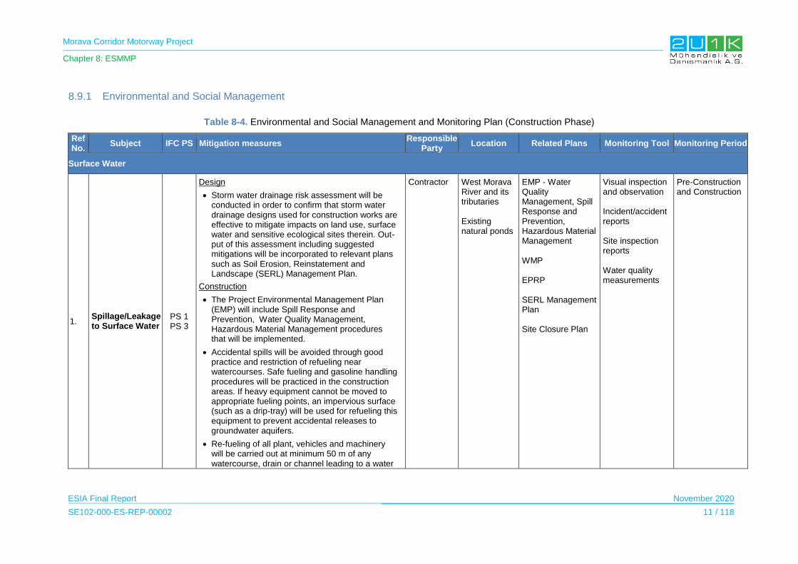
Morava Corridor Motorway Project
Chapter 8: ESMMP
ESIA Final Report November 2020
SE102-000-ES-REP-00002 11 / 118
8.9.1 Environmental and Social Management
Table 8-4. Environmental and Social Management and Monitoring Plan (Construction Phase)
Ref No.
Subject IFC PS Mitigation measures Responsible
Party Location Related Plans Monitoring Tool Monitoring Period
Surface Water
1. Spillage/Leakage to Surface Water
PS 1 PS 3
Design
Storm water drainage risk assessment will be conducted in order to confirm that storm water drainage designs used for construction works are effective to mitigate impacts on land use, surface water and sensitive ecological sites therein. Out-put of this assessment including suggested mitigations will be incorporated to relevant plans such as Soil Erosion, Reinstatement and Landscape (SERL) Management Plan.
Construction
The Project Environmental Management Plan (EMP) will include Spill Response and Prevention, Water Quality Management, Hazardous Material Management procedures that will be implemented.
Accidental spills will be avoided through good practice and restriction of refueling near watercourses. Safe fueling and gasoline handling procedures will be practiced in the construction areas. If heavy equipment cannot be moved to appropriate fueling points, an impervious surface (such as a drip-tray) will be used for refueling this equipment to prevent accidental releases to groundwater aquifers.
Re-fueling of all plant, vehicles and machinery will be carried out at minimum 50 m of any watercourse, drain or channel leading to a water
Contractor West Morava River and its tributaries Existing natural ponds
EMP - Water Quality Management, Spill Response and Prevention, Hazardous Material Management WMP EPRP SERL Management Plan Site Closure Plan
Visual inspection and observation Incident/accident reports Site inspection reports Water quality measurements
Pre-Construction and Construction
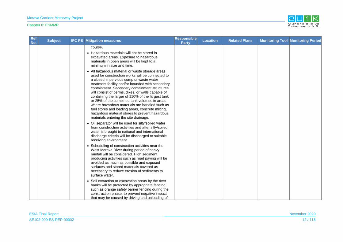
Morava Corridor Motorway Project
Chapter 8: ESMMP
ESIA Final Report November 2020
SE102-000-ES-REP-00002 12 / 118
Ref No.
Subject IFC PS Mitigation measures Responsible
Party Location Related Plans Monitoring Tool Monitoring Period
course.
Hazardous materials will not be stored in excavated areas. Exposure to hazardous materials in open areas will be kept to a minimum in size and time.
All hazardous material or waste storage areas used for construction works will be connected to a closed impervious sump or waste water treatment facility and/or bounded with secondary containment. Secondary containment structures will consist of berms, dikes, or walls capable of containing the larger of 110% of the largest tank or 25% of the combined tank volumes in areas where hazardous materials are handled such as fuel stores and loading areas, concrete mixing, hazardous material stores to prevent hazardous materials entering the site drainage.
Oil separator will be used for silty/soiled water from construction activities and after silty/soiled water is brought to national and international discharge criteria will be discharged to suitable receiving environment.
Scheduling of construction activities near the West Morava River during period of heavy rainfall will be considered. High sediment producing activities such as road paving will be avoided as much as possible and exposed surfaces and stored materials covered as necessary to reduce erosion of sediments to surface water.
Soil extraction or excavation areas by the river banks will be protected by appropriate fencing such as orange safety barrier fencing during the construction phase, to prevent negative impact that may be caused by driving and unloading of

Morava Corridor Motorway Project
Chapter 8: ESMMP
ESIA Final Report November 2020
SE102-000-ES-REP-00002 13 / 118
Ref No.
Subject IFC PS Mitigation measures Responsible
Party Location Related Plans Monitoring Tool Monitoring Period
materials nearby.
Wastewater generated during concrete batch plant operation and cement trucks washing will be monitored for pH and temperature. Concrete wastewater can show high pH values, and high alkalinity.
Water flow in the river (or any stream) will not be fully blocked, and continuity of the flow will be maintained as much as possible,
Sensitive areas of rivers and drains will be protected from impact from vehicles and other construction activities with appropriate fencing such as orange safety barrier fencing or other appropriate ways.
Spill Response Kits will be available on construction site.
Spill Response Kits will be held at secure, clearly signposted locations, instructions will be provided in appropriate languages and personnel will be trained in their use.
Spills will be immediately contained on site and all contaminated materials including soils will be removed from the site for suitable treatment and disposal.
All staff and subcontractors will report any spill incidents, and these will be subject to investigation and close out remedial and preventive actions.
2.
Working in the River-Bed and River Regulation works
PS 1 PS 3 PS 6
Construction
The timing of the work will be constrained by the months of high-water level and Environmental requirements if the works directly related with the existing River flow.
Contractor West Morava River and its tributaries
Construction Method Statements EPRP
Pre-mobilization
Visual Inspections and observations Water quality measurements
Warnings/penaltie
Pre-Construction and Construction
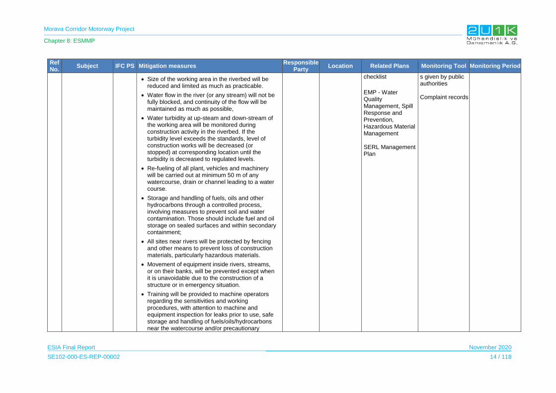
Morava Corridor Motorway Project
Chapter 8: ESMMP
ESIA Final Report November 2020
SE102-000-ES-REP-00002 14 / 118
Ref No.
Subject IFC PS Mitigation measures Responsible
Party Location Related Plans Monitoring Tool Monitoring Period
Size of the working area in the riverbed will be reduced and limited as much as practicable.
Water flow in the river (or any stream) will not be fully blocked, and continuity of the flow will be maintained as much as possible,
Water turbidity at up-steam and down-stream of the working area will be monitored during construction activity in the riverbed. If the turbidity level exceeds the standards, level of construction works will be decreased (or stopped) at corresponding location until the turbidity is decreased to regulated levels.
Re-fueling of all plant, vehicles and machinery will be carried out at minimum 50 m of any watercourse, drain or channel leading to a water course.
Storage and handling of fuels, oils and other hydrocarbons through a controlled process, involving measures to prevent soil and water contamination. Those should include fuel and oil storage on sealed surfaces and within secondary containment;
All sites near rivers will be protected by fencing and other means to prevent loss of construction materials, particularly hazardous materials.
Movement of equipment inside rivers, streams, or on their banks, will be prevented except when it is unavoidable due to the construction of a structure or in emergency situation.
Training will be provided to machine operators regarding the sensitivities and working procedures, with attention to machine and equipment inspection for leaks prior to use, safe storage and handling of fuels/oils/hydrocarbons near the watercourse and/or precautionary
checklist
EMP - Water Quality Management, Spill Response and Prevention, Hazardous Material Management SERL Management Plan
s given by public authorities Complaint records

Morava Corridor Motorway Project
Chapter 8: ESMMP
ESIA Final Report November 2020
SE102-000-ES-REP-00002 15 / 118
Ref No.
Subject IFC PS Mitigation measures Responsible
Party Location Related Plans Monitoring Tool Monitoring Period
measures to prevent contamination of soil and watercourse
Emergency Preparedness and Response Plan (EPRP) will be followed by all staff working on or near the river.
3. Wastewater generation
PS 1 PS 3
Pre-Construction
Design of wastewater treatment facilities should sustain water discharge standards provided in Chapter 4 and Appendix – 4.
During site arrangement, the potential wastewater sources from camp/site facilities, asphalt plant, concrete batching plant, and quarries will be defined. Depending on availability on waste treatment facilities, these sources can be connected to local sewerage system, which should be ended with proper wastewater treatment facility sustains the discharge quality standards given in Chapter-4 and Appendix -4.
Wastewater treatment facilities will be established before operation of construction project facilities such as camp sites, asphalt plants and concrete batching plant. Permits and licenses for operation of these wastewater treatment facilities will be in line with national requirements.
Construction
All wastewater discharges from all construction components must comply with the relevant legal requirements provided in Chapter 4 and Appendix 4.
The treated water will be reused whenever possible.
Contractor West Morava River and its tributaries
Camp Management Plan
EMP - Water Quality Management, Spill Response and Prevention, Hazardous Material Management WMP
Monitoring results of wastewater treatment facilities Water quality measurements.
Warnings/penalties given by public authorities Complaint records.
Pre-Construction and Construction
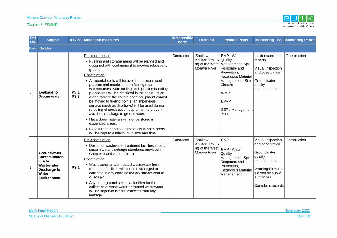
Morava Corridor Motorway Project
Chapter 8: ESMMP
ESIA Final Report November 2020
SE102-000-ES-REP-00002 16 / 118
Ref No.
Subject IFC PS Mitigation measures Responsible
Party Location Related Plans Monitoring Tool Monitoring Period
Groundwater
4. Leakage to Groundwater
PS 1 PS 3
Pre-construction
Fuelling and storage areas will be planned and designed with containment to prevent releases to ground.
Construction
Accidental spills will be avoided through good practice and restriction of refueling near watercourses. Safe fueling and gasoline handling procedures will be practiced in the construction areas. Where the construction equipment cannot be moved to fueling points, an impervious surface (such as drip-trays) will be used during refueling of construction equipment to prevent accidental leakage to groundwater.
Hazardous materials will not be stored in excavated areas.
Exposure to hazardous materials in open areas will be kept to a minimum in size and time.
Contractor Shallow Aquifer (1m - 6 m) of the West Morava River
EMP - Water Quality Management, Spill Response and Prevention, Hazardous Material Management, Site Closure WMP EPRP SERL Management Plan
Incident/accident reports Visual Inspection and observation Groundwater quality measurements.
Construction
5.
Groundwater Contamination due to Wastewater Discharge to Water Environment
PS 1
Pre-construction
Design of wastewater treatment facilities should sustain water discharge standards provided in Chapter 4 and Appendix – 4.
Construction
Wastewater and/or treated wastewater form treatment facilities will not be discharged or collected in any earth based dry stream course or soil pit.
Any underground septic tank either for the collection of wastewater or treated wastewater will be impervious and protected from any leakage.
Contractor Shallow Aquifer (1m - 6 m) of the West Morava River
CMP
EMP - Water Quality Management, Spill Response and Prevention, Hazardous Material Management
Visual Inspection and observation Groundwater quality measurements. Warnings/penalties given by public authorities Complaint records
Construction

Morava Corridor Motorway Project
Chapter 8: ESMMP
ESIA Final Report November 2020
SE102-000-ES-REP-00002 17 / 118
Ref No.
Subject IFC PS Mitigation measures Responsible
Party Location Related Plans Monitoring Tool Monitoring Period
Integrity of underground septic tanks will be regularly inspected and maintained.
6. Alteration of Groundwater Level
Design
The regulation activities within the scope of this Project is to protect against flooding and eliminate more consecutive sharp bends and bank eroision.
During the design phase, river regulation activities will prioritize to protect and minimize negative impacts on watercourses and stability of the riverbed.
The use of groundwater resources will be subject to approval by the local Authority. The Authority may allow the extraction wells to be drilled and used if the groundwater supply is sufficient. These approvals are based on the availability of the water source. Where the use of ground water is as water source for the construction works (including Project facilities), all permits will be secured before the use.
Construction
Groundwater level but excessive dredging below the groundwater level will not be conducted.
Groundwater level will be regularly monitored from existing groundwater wells located near the construction site.Groundwater use shall not exceed the permitted level.
Excavation of the borrow pits can go deeper than groundwater level but excessive dredging below the groundwater level will not be conducted.
Project Owner
Contractor
West Morava River aquifer
CMP
EMP - Water Quality Management, Spill Response and Prevention, Hazardous Material Management
Groundwater level monitoring results of Project Facilities and existing wells close to the borrow pit areas
Pre-construction baseline and Construction

Morava Corridor Motorway Project
Chapter 8: ESMMP
ESIA Final Report November 2020
SE102-000-ES-REP-00002 18 / 118
Ref No.
Subject IFC PS Mitigation measures Responsible
Party Location Related Plans Monitoring Tool Monitoring Period
Air Quality and Climate
7. Dust Generation PS 1 PS 3
Construction
The Project Environmental Management Plan (EMP) will include Air Quality Management procedures that will be implemented.
If there is a requirement for unpaved roads close to settlements to be used by vehicles, surface-binding agents may be used, options include salt to or gravel coat the road.
20kph speed limit will be applied on unpaved surfaces close to settlements.
Vehicles will be kept clean, so that no dirt is carried on the vehicles into and out of the area.
Where the mitigation measures are inadequate, surface-binding agents will be used in exposed earthworks.
Localized watering/dampening and activity-specific watering/dampening will be used to reduce localized dust emissions.
Stockpiling of stripped surface material, eg. rock, sand and soil, stockpiling of unwashed materials, will be limited. Stockpiles should be kept as enclosed as possible or covered.
Stockpiles will be placed as far away from receptors as possible.
Design of stockpiles will be optimized to maintain a low profile without a sharp change in shapes.
Wind breaks or dust protection systems (including sprinklers) should be built around the main construction activities where necessary and, if possible, near potentially dusty works to minimize the impact of nearby residential
Contractor Nearest settlements to construction sites
Natural habitats along the construction sites
EMP - Air Quality Management
TMP
Air quality monitoring results
Maintenance records of vehicles and equipment.
Warnings/penalties given by public authorities
Complaint records.
Construction
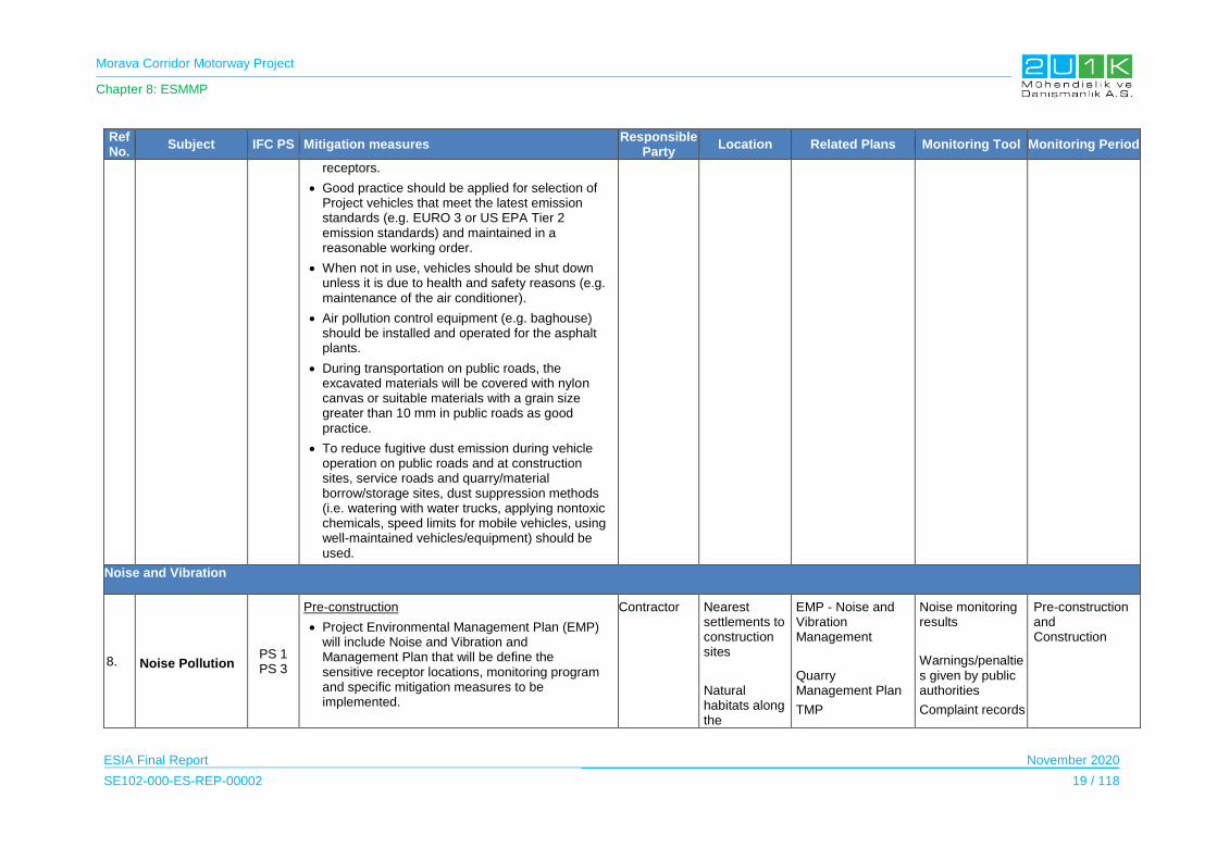
Morava Corridor Motorway Project
Chapter 8: ESMMP
ESIA Final Report November 2020
SE102-000-ES-REP-00002 19 / 118
Ref No.
Subject IFC PS Mitigation measures Responsible
Party Location Related Plans Monitoring Tool Monitoring Period
receptors.
Good practice should be applied for selection of Project vehicles that meet the latest emission standards (e.g. EURO 3 or US EPA Tier 2 emission standards) and maintained in a reasonable working order.
When not in use, vehicles should be shut down unless it is due to health and safety reasons (e.g. maintenance of the air conditioner).
Air pollution control equipment (e.g. baghouse) should be installed and operated for the asphalt plants.
During transportation on public roads, the excavated materials will be covered with nylon canvas or suitable materials with a grain size greater than 10 mm in public roads as good practice.
To reduce fugitive dust emission during vehicle operation on public roads and at construction sites, service roads and quarry/material borrow/storage sites, dust suppression methods (i.e. watering with water trucks, applying nontoxic chemicals, speed limits for mobile vehicles, using well-maintained vehicles/equipment) should be used.
Noise and Vibration
8. Noise Pollution PS 1 PS 3
Pre-construction
Project Environmental Management Plan (EMP) will include Noise and Vibration and Management Plan that will be define the sensitive receptor locations, monitoring program and specific mitigation measures to be implemented.
Contractor Nearest settlements to construction sites
Natural habitats along the
EMP - Noise and Vibration Management
Quarry Management Plan
TMP
Noise monitoring results
Warnings/penalties given by public authorities
Complaint records
Pre-construction and Construction

Morava Corridor Motorway Project
Chapter 8: ESMMP
ESIA Final Report November 2020
SE102-000-ES-REP-00002 20 / 118
Ref No.
Subject IFC PS Mitigation measures Responsible
Party Location Related Plans Monitoring Tool Monitoring Period
Traffic Management Plan (EMP) and construction Method Statements will include any agreed noise and vibration mitigation measures.
Planning of transport routes including temporary access roads, haul roads and construction work sites should be determined to avoid populated areas and away from sensitive receptors and villages as much as possible.
The Project should consider the construction of a newly allocated access road instead of using the existing road network.
As Project construction progresses, buildings that may be potentially affected will be identified prior to construction, including assessing whether buildings are sensitive to night-time disturbance.
Construction
Motorway alignment will be used for the transport of construction materials and equipment wherever possible.
Internal haul routes will be well designed and maintained and steep gradients should be avoided where possible.
Empty vehicles will not have loose chains or other noise “generating parts on the loading platform.
During off-loading, materials will dropped from an appropriate height to avoid noise disturbance to the surrounding receptors or to minimize noise from the site in general.
All construction equipment and vehicles will be regularly checked and maintained. This should particularly include the regular inspection of diesel powered equipment and, if necessary,
construction sites
SEP
Maintenance records of vehicles
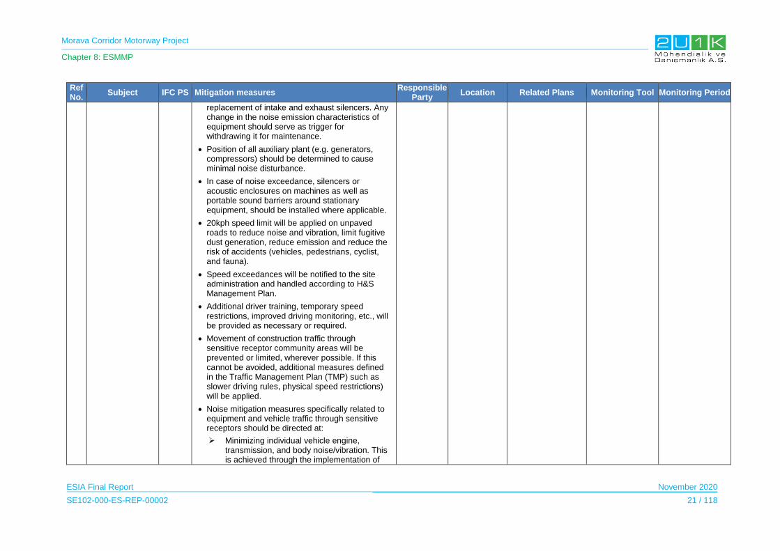
Morava Corridor Motorway Project
Chapter 8: ESMMP
ESIA Final Report November 2020
SE102-000-ES-REP-00002 21 / 118
Ref No.
Subject IFC PS Mitigation measures Responsible
Party Location Related Plans Monitoring Tool Monitoring Period
replacement of intake and exhaust silencers. Any change in the noise emission characteristics of equipment should serve as trigger for withdrawing it for maintenance.
Position of all auxiliary plant (e.g. generators, compressors) should be determined to cause minimal noise disturbance.
In case of noise exceedance, silencers or acoustic enclosures on machines as well as portable sound barriers around stationary equipment, should be installed where applicable.
20kph speed limit will be applied on unpaved roads to reduce noise and vibration, limit fugitive dust generation, reduce emission and reduce the risk of accidents (vehicles, pedestrians, cyclist, and fauna).
Speed exceedances will be notified to the site administration and handled according to H&S Management Plan.
Additional driver training, temporary speed restrictions, improved driving monitoring, etc., will be provided as necessary or required.
Movement of construction traffic through sensitive receptor community areas will be prevented or limited, wherever possible. If this cannot be avoided, additional measures defined in the Traffic Management Plan (TMP) such as slower driving rules, physical speed restrictions) will be applied.
Noise mitigation measures specifically related to equipment and vehicle traffic through sensitive receptors should be directed at:
Minimizing individual vehicle engine, transmission, and body noise/vibration. This is achieved through the implementation of

Morava Corridor Motorway Project
Chapter 8: ESMMP
ESIA Final Report November 2020
SE102-000-ES-REP-00002 22 / 118
Ref No.
Subject IFC PS Mitigation measures Responsible
Party Location Related Plans Monitoring Tool Monitoring Period
an equipment maintenance program.
Maintain road surface regularly.
Avoid unnecessary idling times.
Minimizing the need for trucks/equipment to reverse movement. This will reduce the frequency of reverse warnings will occur. Alternatives to the traditional reverse ‘beeper’ alarm such as a ‘self-adjusting’ or ‘smart’ alarm could be considered. These alarms include a mechanism to detect the local noise level and automatically adjust the output of the alarm is so that it is 5 to 10 dB above the noise level near the moving equipment.
Where possible, noisy activities such as, decommissioning and maintenance, should be limited to day-time hours.
Noise levels will not exceed WHO Environmental Noise Limits, national limits or result in a maximum increase in background levels of 3 dB at the nearest receptor location off-site.
Noise level limits for construction activities are stated in the national EIA. If limits are exceeded, then appropriate mitigation measures will be implemented in accordance with the Serbian regulations. These may include:
Night-time operation and transport should be minimized as much as possible, near to villages or where a transport road passes.
Distance between construction site and sensitive receptors (e.g. hospitals, nursing homes, schools) should be mazimised. If this is not possible, then temporary noise barriers (eg. portable sound walls, soil berm) should be installed between the construction site and sensitive receptors.
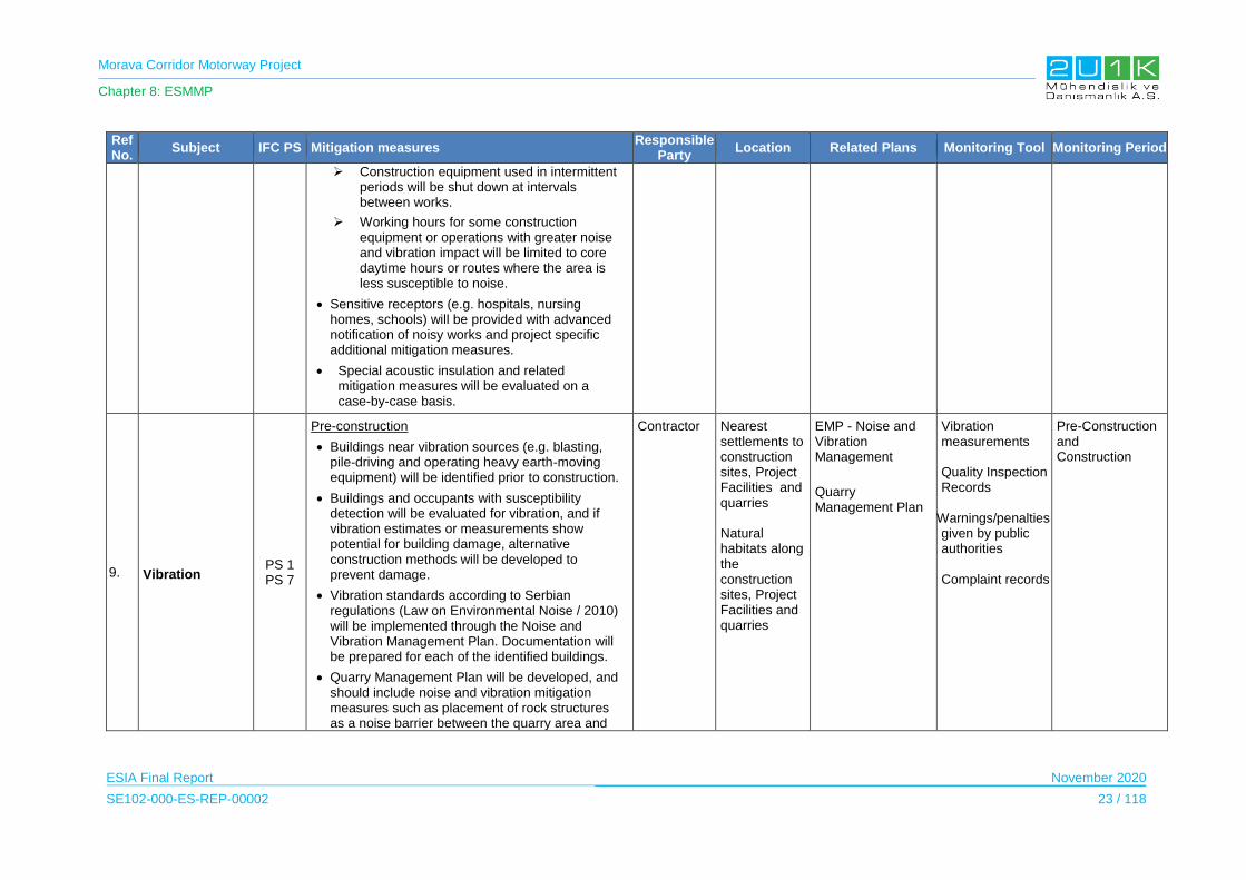
Morava Corridor Motorway Project
Chapter 8: ESMMP
ESIA Final Report November 2020
SE102-000-ES-REP-00002 23 / 118
Ref No.
Subject IFC PS Mitigation measures Responsible
Party Location Related Plans Monitoring Tool Monitoring Period
Construction equipment used in intermittent periods will be shut down at intervals between works.
Working hours for some construction equipment or operations with greater noise and vibration impact will be limited to core daytime hours or routes where the area is less susceptible to noise.
Sensitive receptors (e.g. hospitals, nursing homes, schools) will be provided with advanced notification of noisy works and project specific additional mitigation measures.
Special acoustic insulation and related mitigation measures will be evaluated on a case-by-case basis.
9. Vibration PS 1 PS 7
Pre-construction
Buildings near vibration sources (e.g. blasting, pile-driving and operating heavy earth-moving equipment) will be identified prior to construction.
Buildings and occupants with susceptibility detection will be evaluated for vibration, and if vibration estimates or measurements show potential for building damage, alternative construction methods will be developed to prevent damage.
Vibration standards according to Serbian regulations (Law on Environmental Noise / 2010) will be implemented through the Noise and Vibration Management Plan. Documentation will be prepared for each of the identified buildings.
Quarry Management Plan will be developed, and should include noise and vibration mitigation measures such as placement of rock structures as a noise barrier between the quarry area and
Contractor Nearest settlements to construction sites, Project Facilities and quarries
Natural habitats along the construction sites, Project Facilities and quarries
EMP - Noise and Vibration Management
Quarry Management Plan
Vibration measurements
Quality Inspection Records
Warnings/penalties given by public authorities
Complaint records
Pre-Construction and Construction
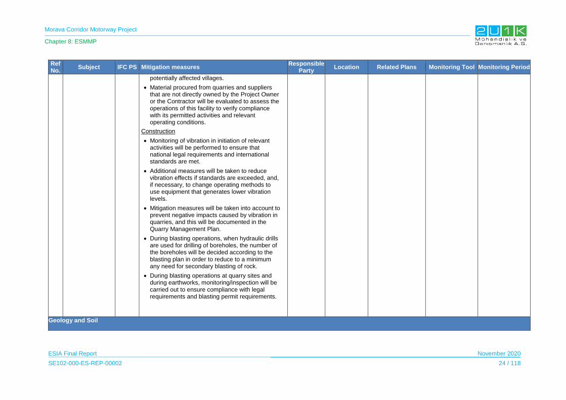
Morava Corridor Motorway Project
Chapter 8: ESMMP
ESIA Final Report November 2020
SE102-000-ES-REP-00002 24 / 118
Ref No.
Subject IFC PS Mitigation measures Responsible
Party Location Related Plans Monitoring Tool Monitoring Period
potentially affected villages.
Material procured from quarries and suppliers that are not directly owned by the Project Owner or the Contractor will be evaluated to assess the operations of this facility to verify compliance with its permitted activities and relevant operating conditions.
Construction
Monitoring of vibration in initiation of relevant activities will be performed to ensure that national legal requirements and international standards are met.
Additional measures will be taken to reduce vibration effects if standards are exceeded, and, if necessary, to change operating methods to use equipment that generates lower vibration levels.
Mitigation measures will be taken into account to prevent negative impacts caused by vibration in quarries, and this will be documented in the Quarry Management Plan.
During blasting operations, when hydraulic drills are used for drilling of boreholes, the number of the boreholes will be decided according to the blasting plan in order to reduce to a minimum any need for secondary blasting of rock.
During blasting operations at quarry sites and during earthworks, monitoring/inspection will be carried out to ensure compliance with legal requirements and blasting permit requirements.
Geology and Soil
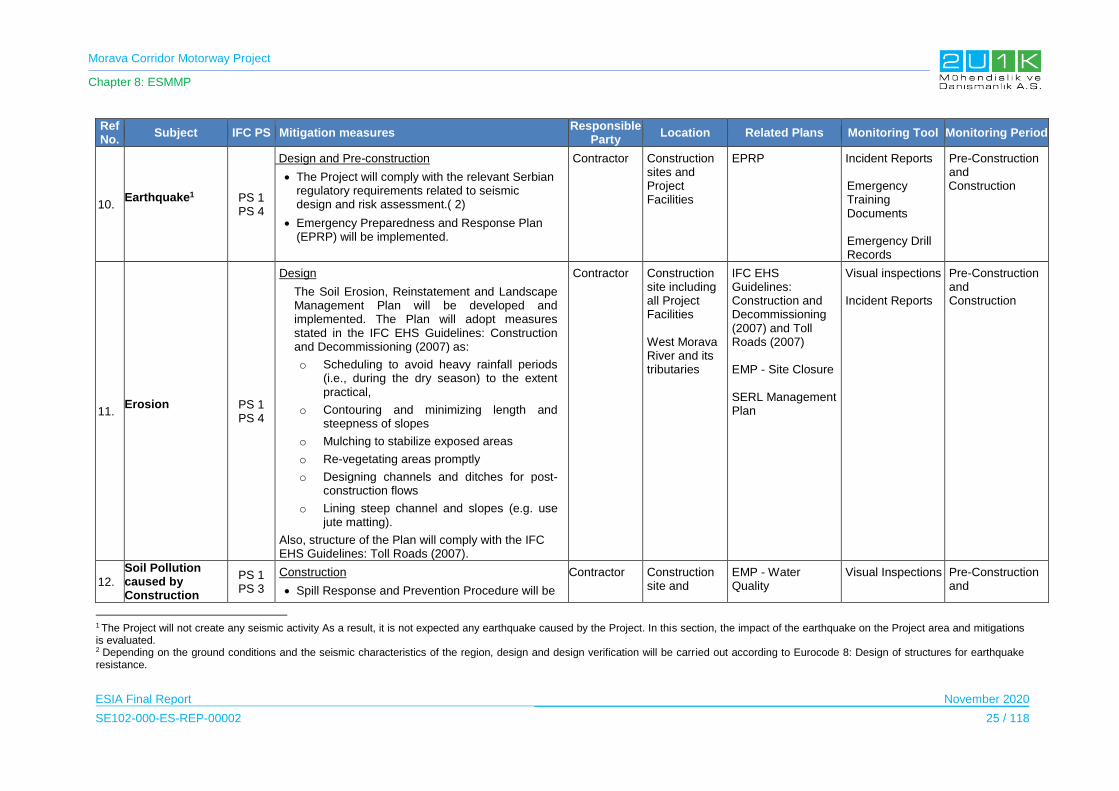
Morava Corridor Motorway Project
Chapter 8: ESMMP
ESIA Final Report November 2020
SE102-000-ES-REP-00002 25 / 118
Ref No.
Subject IFC PS Mitigation measures Responsible
Party Location Related Plans Monitoring Tool Monitoring Period
10. Earthquake1
PS 1 PS 4
Design and Pre-construction
The Project will comply with the relevant Serbian regulatory requirements related to seismic design and risk assessment.( 2)
Emergency Preparedness and Response Plan (EPRP) will be implemented.
Contractor Construction sites and Project Facilities
EPRP Incident Reports Emergency Training Documents Emergency Drill Records
Pre-Construction and Construction
11. Erosion
PS 1 PS 4
Design
The Soil Erosion, Reinstatement and Landscape Management Plan will be developed and implemented. The Plan will adopt measures stated in the IFC EHS Guidelines: Construction and Decommissioning (2007) as:
o Scheduling to avoid heavy rainfall periods (i.e., during the dry season) to the extent practical,
o Contouring and minimizing length and steepness of slopes
o Mulching to stabilize exposed areas
o Re-vegetating areas promptly
o Designing channels and ditches for post-construction flows
o Lining steep channel and slopes (e.g. use jute matting).
Also, structure of the Plan will comply with the IFC EHS Guidelines: Toll Roads (2007).
Contractor Construction site including all Project Facilities
West Morava River and its tributaries
IFC EHS Guidelines: Construction and Decommissioning (2007) and Toll Roads (2007)
EMP - Site Closure
SERL Management Plan
Visual inspections Incident Reports
Pre-Construction and Construction
12.
Soil Pollution caused by Construction
PS 1 PS 3
Construction
Spill Response and Prevention Procedure will be
Contractor Construction site and
EMP - Water Quality
Visual Inspections
Pre-Construction and
1 The Project will not create any seismic activity As a result, it is not expected any earthquake caused by the Project. In this section, the impact of the earthquake on the Project area and mitigations is evaluated. 2 Depending on the ground conditions and the seismic characteristics of the region, design and design verification will be carried out according to Eurocode 8: Design of structures for earthquake resistance.

Morava Corridor Motorway Project
Chapter 8: ESMMP
ESIA Final Report November 2020
SE102-000-ES-REP-00002 26 / 118
Ref No.
Subject IFC PS Mitigation measures Responsible
Party Location Related Plans Monitoring Tool Monitoring Period
Activities prepared and implemented.
Construction equipment, machines and vehicles will be parked on arranged locations.
Parking surfaces (soil, gravel, and rock) will be protected from pollution from oil, oil derivate, naphtha and naphtha derivate. In case of pollution, measures will be taken in accordance with the Law on Soil Protection ("Official Gazette of RS" no. 112/15)
Washing of equipment, machinery and vehicles will be prohibited within construction area.
Concrete mixer washout areas will be designated and any other washing of concrete mixer and uncontrolled removal of the remaining parts of concrete mass on any surface outside road area will be prohibited.
Excavated material will be re-used to the extent possible.
Excess materials will be used during site arrangement and resinstaement activities.
Before storage of excess excavated materials, soil samples form excess material and proposed storage site will be sampled in order to understand the suittability of the proposed area fort he storage.
Hazardous materials will not be stored in excavated areas.
Exposure to hazardous materials in open areas will be kept to a minimum in size and time.
Project Facilities
Management, Spill Response and Prevention, Hazardous Material Management, Waste Management, Site Closure Plan ERPR SERL Management Plan
Soil quality analysis Warnings/penalties given by public authorities Complaint records
Construction
13. Land Degradation and Soil Loss
PS 1
Design and Pre-construction
All borrow pits and unsuitable soil waste areas will be designed in accordance with the
Contractor Construction site and Project
SERL Management Plan
Visual Inspections Site inspection
Pre-Construction and Construction

Morava Corridor Motorway Project
Chapter 8: ESMMP
ESIA Final Report November 2020
SE102-000-ES-REP-00002 27 / 118
Ref No.
Subject IFC PS Mitigation measures Responsible
Party Location Related Plans Monitoring Tool Monitoring Period
mitigation measures within the national EIA and any permit conditions (outside the alignment expropriation boundaries).
Soil, Erosion, Rehabilitation and Landscape Management Plan will be prepared for all borrow pits and unsuitable soil waste areas used during construction works.
Construction
Borrow pits and unsuitable soil waste areas will be executed according to design specifications, method statements and reinstatement plans.
Facilities EMP - Site Closure reports
Resource and Waste
14.
Destruction of habitats and plants during earthworks and resource extraction
PS 3 PS 6
Design and Pre-construction
Quarry Management Plan will be developed and implemented during the construction phase.
Soil Erosion, Reinstatement and Landscape (SERL) Management Plan will be prepared in accordance with Serbian law, IFC EHS Guidelines and international environmental management systems.
Emergency Preparedness and Response Plan (EPRP) will be developed and implemented.
Hazardous Material Management Plan will be developed and implemented.
Construction
Quarries will be operated and monitored to comply with national and international standards (IFC EHS Guidelines for Construction Materials Extraction (2007)
Where possible, existing (fully licensed) quarries should be used instead of opening new quarries.
Existing quarries will be assessed to ensure that
Contractor Construction site and Project Facilities
SERL Management Plan
Quarry Management Plan
EPRP
Visual inspection to ensure the effectiveness of the mitigation measures Waste disposal records
Records of the contractual agreements .
Pre-Construction and
Construction
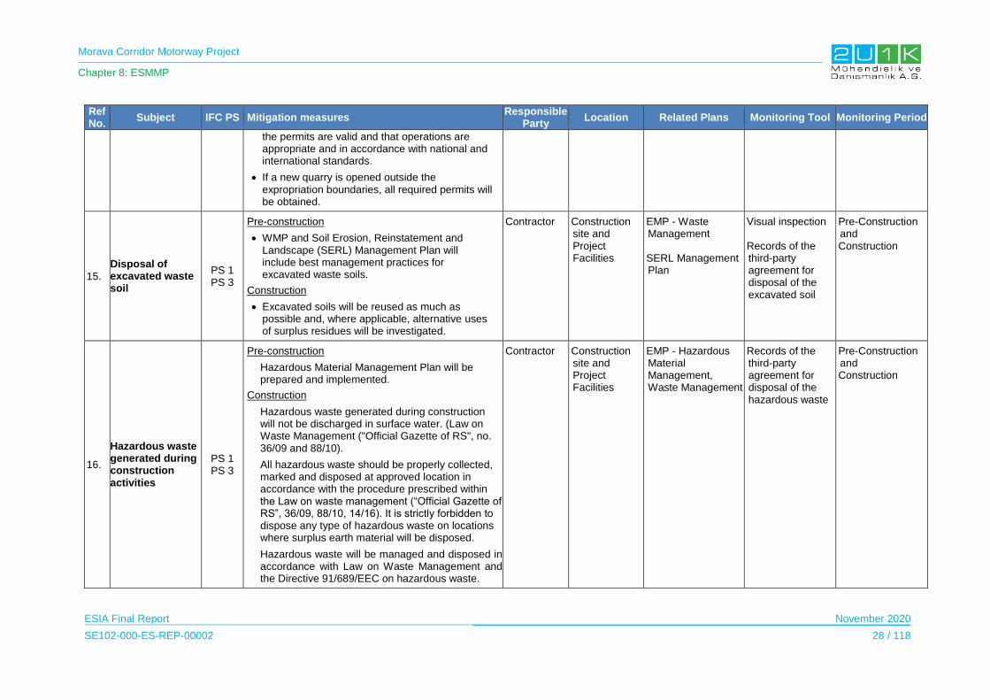
Morava Corridor Motorway Project
Chapter 8: ESMMP
ESIA Final Report November 2020
SE102-000-ES-REP-00002 28 / 118
Ref No.
Subject IFC PS Mitigation measures Responsible
Party Location Related Plans Monitoring Tool Monitoring Period
the permits are valid and that operations are appropriate and in accordance with national and international standards.
If a new quarry is opened outside the expropriation boundaries, all required permits will be obtained.
15.
Disposal of excavated waste soil
PS 1 PS 3
Pre-construction
WMP and Soil Erosion, Reinstatement and Landscape (SERL) Management Plan will include best management practices for excavated waste soils.
Construction
Excavated soils will be reused as much as possible and, where applicable, alternative uses of surplus residues will be investigated.
Contractor Construction site and Project Facilities
EMP - Waste Management SERL Management Plan
Visual inspection Records of the third-party agreement for disposal of the excavated soil
Pre-Construction and Construction
16.
Hazardous waste generated during construction activities
PS 1 PS 3
Pre-construction
Hazardous Material Management Plan will be prepared and implemented.
Construction
Hazardous waste generated during construction will not be discharged in surface water. (Law on Waste Management ("Official Gazette of RS", no. 36/09 and 88/10).
All hazardous waste should be properly collected, marked and disposed at approved location in accordance with the procedure prescribed within the Law on waste management (“Official Gazette of RS”, 36/09, 88/10, 14/16). It is strictly forbidden to dispose any type of hazardous waste on locations where surplus earth material will be disposed.
Hazardous waste will be managed and disposed in accordance with Law on Waste Management and the Directive 91/689/EEC on hazardous waste.
Contractor Construction site and Project Facilities
EMP - Hazardous Material Management, Waste Management
Records of the third-party agreement for disposal of the hazardous waste
Pre-Construction and Construction

Morava Corridor Motorway Project
Chapter 8: ESMMP
ESIA Final Report November 2020
SE102-000-ES-REP-00002 29 / 118
Ref No.
Subject IFC PS Mitigation measures Responsible
Party Location Related Plans Monitoring Tool Monitoring Period
Hazardous waste will be collected and disposed by a licensed waste contractor.
17. Resource Efficiency*
Construction
When the project is a potentially significant consumer of water, in addition to applying the resource efficiency requirements of this Performance Standard, the Contractor shall adopt measures that avoid or reduce water usage so that the project’s water consumption does not have significant adverse impacts on others. These measures include, but are not limited to,
the use of additional technically feasible water conservation measures within the construction activities,
the use of alternative water supplies, water consumption offsets to reduce total demand for water resources to within the available supply
The Contractor will avoid the release of pollutants or, when avoidance is not feasible, minimize and/or control the intensity and mass flow of their release according to the mitigation measures given in the Report. This applies to the release of pollutants to air, water, and land due to routine, non-routine, and accidental circumstances with the potential for local, regional, and transboundary impacts.
Where waste generation cannot be avoided, the Contractor will reduce the generation of waste, and recover and reuse waste in a manner that is safe for human health and the environment. Where waste cannot be recovered or reused, the Contractor will treat, destroy, or dispose of it in an environmentally sound manner that includes
Contractor Construction site and project construction facilities
EMP - Waste Management
Construction Management Plan
Sustainability Report
Pre-Construction and
Construction

Morava Corridor Motorway Project
Chapter 8: ESMMP
ESIA Final Report November 2020
SE102-000-ES-REP-00002 30 / 118
Ref No.
Subject IFC PS Mitigation measures Responsible
Party Location Related Plans Monitoring Tool Monitoring Period
the appropriate control of emissions and residues resulting from the handling and processing of the waste material. If the generated waste is considered hazardous, the client will adopt GIIP alternatives for its environmentally sound disposal while adhering to the limitations applicable to its transboundary movement.
Terrestrial and Freshwater Ecology
18.
Damage or loss of terrestrial habitats due to permanent structures
PS6
Design
Afforestation activities will be performed in line with the ‘no net loss principle’, i.e., preparation of Biodiversity Management Plan and SERL Management Plan.
Gallery vegetation will be created along West Morava's new riverbed, as it existed before the regulation, to restore the natural habitat condition. This gallery will also be retention for possible high waters.
After the river regulation, 17 m of revegetated area with native species will be created on both sides of the new river bed.
Pre-Construction
Delimitation of areas to be cleared before the beginning of the construction activities in order to limit as much as possible the surface of vegetation to be cleared.
Construction
Project construction sites and access roads will be separated from sensitive areas with appropriate fencing and signage.
Appropriate fencing such as orange safety
Project Owner
Contractor
Construction site Project Facilities
Biodiversity Management Plan
SERL Management Plan
Visual Inspections
Site inspection reports.
Achievement of the targets/measures provided in Biodiversity Management Plan.
Pre-construction Construction
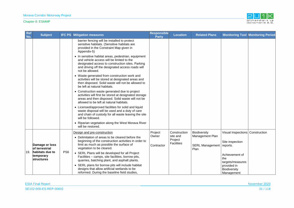
Morava Corridor Motorway Project
Chapter 8: ESMMP
ESIA Final Report November 2020
SE102-000-ES-REP-00002 31 / 118
Ref No.
Subject IFC PS Mitigation measures Responsible
Party Location Related Plans Monitoring Tool Monitoring Period
barrier fencing will be installed to protect sensitive habitats. (Sensitive habitats are provided in the Constraint Map given in Appendix-5)
In sensitive habitat areas, pedestrian, equipment and vehicle access will be limited to the designated access to construction sites. Parking and driving off the designated access roads will not be allowed.
Waste generated from construction work and activities will be stored at designated areas and then disposed. Solid waste will not be allowed to be left at natural habitats.
Construction waste generated due to project activities will first be stored at designated storage areas and then disposed. Solid waste will not be allowed to be left at natural habitats.
Licensed/approved facilities for solid and liquid waste disposal will be used and a duty of care and chain of custody for all waste leaving the site will be followed.
Riparian vegetation along the West Morava River will be restored.
19.
Damage or loss of terrestrial habitats due to temporary structures
PS6
Design and pre-construction
Delimitation of areas to be cleared before the beginning of the construction activities in order to limit as much as possible the surface of vegetation to be cleared.
SERL Plans will be developed for all Project Facilities – camps, site facilities, borrow pits, quarries, batching plant, and asphalt plants.
SERL plans for borrow pits will include habitat designs that allow artificial wetlands to be reformed. During the baseline field studies,
Project Owner
Contractor
Construction site and Project Facilities
Biodiversity Management Plan
SERL Management Plan
Visual Inspections
Site inspection reports.
Achievement of the targets/measures provided in Biodiversity Management
Construction
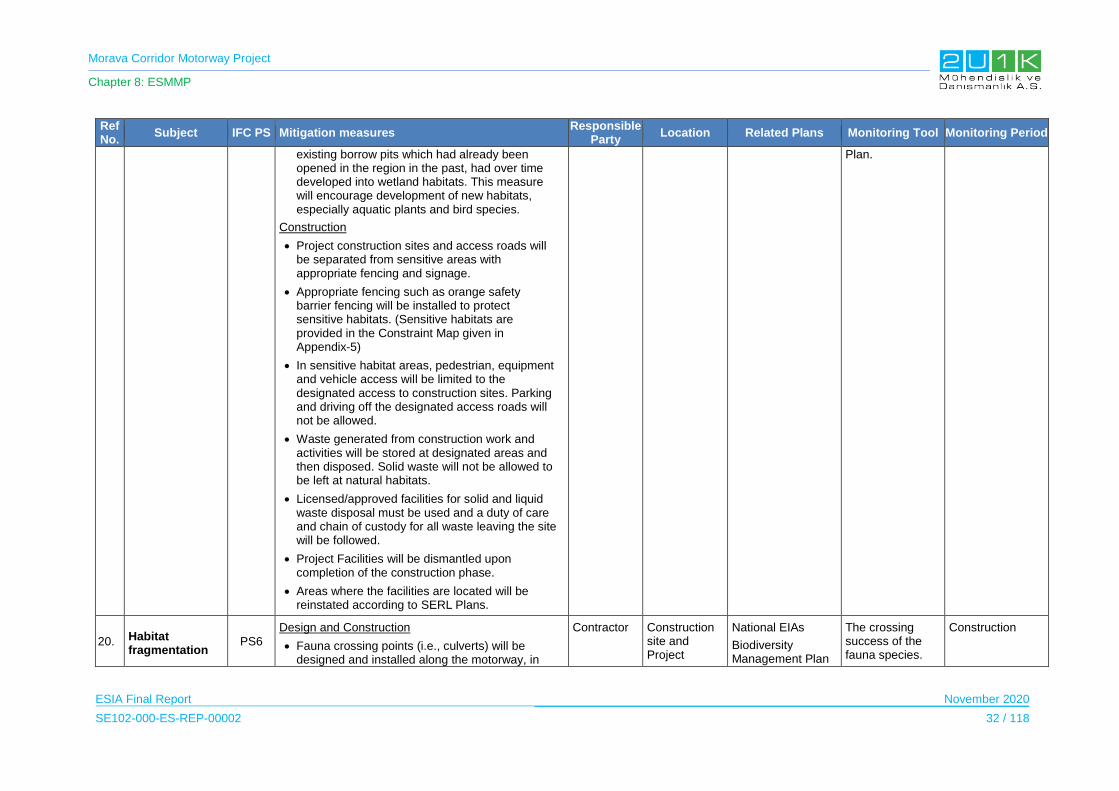
Morava Corridor Motorway Project
Chapter 8: ESMMP
ESIA Final Report November 2020
SE102-000-ES-REP-00002 32 / 118
Ref No.
Subject IFC PS Mitigation measures Responsible
Party Location Related Plans Monitoring Tool Monitoring Period
existing borrow pits which had already been opened in the region in the past, had over time developed into wetland habitats. This measure will encourage development of new habitats, especially aquatic plants and bird species.
Construction
Project construction sites and access roads will be separated from sensitive areas with appropriate fencing and signage.
Appropriate fencing such as orange safety barrier fencing will be installed to protect sensitive habitats. (Sensitive habitats are provided in the Constraint Map given in Appendix-5)
In sensitive habitat areas, pedestrian, equipment and vehicle access will be limited to the designated access to construction sites. Parking and driving off the designated access roads will not be allowed.
Waste generated from construction work and activities will be stored at designated areas and then disposed. Solid waste will not be allowed to be left at natural habitats.
Licensed/approved facilities for solid and liquid waste disposal must be used and a duty of care and chain of custody for all waste leaving the site will be followed.
Project Facilities will be dismantled upon completion of the construction phase.
Areas where the facilities are located will be reinstated according to SERL Plans.
Plan.
20. Habitat fragmentation
PS6
Design and Construction
Fauna crossing points (i.e., culverts) will be designed and installed along the motorway, in
Contractor Construction site and Project
National EIAs
Biodiversity Management Plan
The crossing success of the fauna species.
Construction
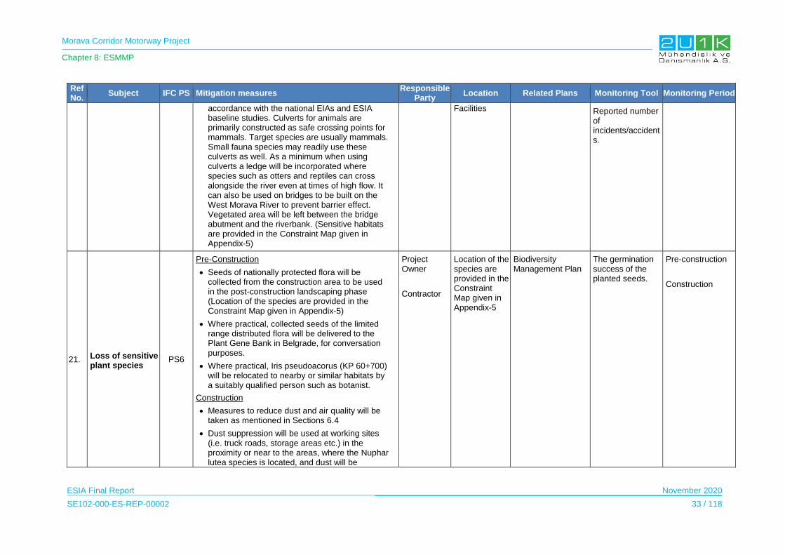
Morava Corridor Motorway Project
Chapter 8: ESMMP
ESIA Final Report November 2020
SE102-000-ES-REP-00002 33 / 118
Ref No.
Subject IFC PS Mitigation measures Responsible
Party Location Related Plans Monitoring Tool Monitoring Period
accordance with the national EIAs and ESIA baseline studies. Culverts for animals are primarily constructed as safe crossing points for mammals. Target species are usually mammals. Small fauna species may readily use these culverts as well. As a minimum when using culverts a ledge will be incorporated where species such as otters and reptiles can cross alongside the river even at times of high flow. It can also be used on bridges to be built on the West Morava River to prevent barrier effect. Vegetated area will be left between the bridge abutment and the riverbank. (Sensitive habitats are provided in the Constraint Map given in Appendix-5)
Facilities Reported number of incidents/accidents.
21. Loss of sensitive plant species
PS6
Pre-Construction
Seeds of nationally protected flora will be collected from the construction area to be used in the post-construction landscaping phase (Location of the species are provided in the Constraint Map given in Appendix-5)
Where practical, collected seeds of the limited range distributed flora will be delivered to the Plant Gene Bank in Belgrade, for conversation purposes.
Where practical, Iris pseudoacorus (KP 60+700) will be relocated to nearby or similar habitats by a suitably qualified person such as botanist.
Construction
Measures to reduce dust and air quality will be taken as mentioned in Sections 6.4
Dust suppression will be used at working sites (i.e. truck roads, storage areas etc.) in the proximity or near to the areas, where the Nuphar lutea species is located, and dust will be
Project Owner
Contractor
Location of the species are provided in the Constraint Map given in Appendix-5
Biodiversity Management Plan
The germination success of the planted seeds.
Pre-construction
Construction
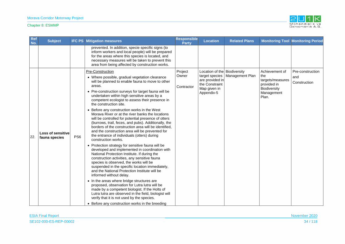
Morava Corridor Motorway Project
Chapter 8: ESMMP
ESIA Final Report November 2020
SE102-000-ES-REP-00002 34 / 118
Ref No.
Subject IFC PS Mitigation measures Responsible
Party Location Related Plans Monitoring Tool Monitoring Period
prevented. In addition, specie specific signs (to inform workers and local people) will be prepared for the areas where this species is located, and necessary measures will be taken to prevent this area from being affected by construction works.
22. Loss of sensitive fauna species
PS6
Pre-Construction
Where possible, gradual vegetation clearance will be planned to enable fauna to move to other areas.
Pre-construction surveys for target fauna will be undertaken within high sensitive areas by a competent ecologist to assess their presence in the construction site.
Before any construction works in the West Morava River or at the river banks the locations will be controlled for potential presence of otters (burrows, trail, feces, and pubs). Additionally, the borders of the construction area will be identified, and the construction area will be prevented for the entrance of individuals (otters) during construction works.
Protection strategy for sensitive fauna will be developed and implemented in coordination with National Protection Institute. If during the construction activities, any sensitive fauna species is observed, the works will be suspended in the specific location immediately, and the National Protection Institute will be informed without delay.
In the areas where bridge structures are proposed, observation for Lutra lutra will be made by a competent biologist. If the Holts of Lutra lutra are observed in the field, biologist will verify that it is not used by the species.
Before any construction works in the breeding
Project Owner
Contractor
Location of the target species are provided in the Constraint Map given in Appendix-5
Biodiversity Management Plan
Achievement of the targets/measures provided in Biodiversity Management Plan.
Pre-construction
and
Construction

Morava Corridor Motorway Project
Chapter 8: ESMMP
ESIA Final Report November 2020
SE102-000-ES-REP-00002 35 / 118
Ref No.
Subject IFC PS Mitigation measures Responsible
Party Location Related Plans Monitoring Tool Monitoring Period
and wintering habitats, the size of these habitats will be controlled.
Vegetation clearance will be avoided, whenever feasible, during fauna breeding and wintering periods.
Construction activities will be planned to minimize disturbance during the breeding bird period (1 April to 30 June). During baselines field survey areas were identified with suitable habitats for breeding: Quarry at KP 25 and Borrow Pit at KP 67.
Construction activities will be planned to minimize disturbance during the wintering bird period (1 December to 1 February). During baselines field survey areas were identified as wintering area: Borrow Pit at KP 60 and West Morava River corresponding to KP 95.
If construction has started before these dates, work can be continued in both breeding and wintering areas.
Construction
Speed of construction vehicles will be limited, in order to limit emission of dust in non-paved access roads and avoid the risk of accidents with fauna.
Sensitive habitats will be protected by the use of appropriate fencing such as orange safety barrier fencing. Protective measures will be implemented especially in locations of active construction works to also avoid the entry fauna and avoiding accidents.
23. Increase in noise, visual and vibration which
PS6
Construction
Measures to reduce noise will be taken as mentioned in Sections 6.5
Contractor Construction site located in Sensitive
EMP – Waste Management,
Environmental
Site inspection reports.
Pre-construction
Construction

Morava Corridor Motorway Project
Chapter 8: ESMMP
ESIA Final Report November 2020
SE102-000-ES-REP-00002 36 / 118
Ref No.
Subject IFC PS Mitigation measures Responsible
Party Location Related Plans Monitoring Tool Monitoring Period
may cause disturbance or displacement of fauna
Noise, waste and spills created during the construction activities will be managed under an Environmental Management Plan, to limit the disturbance to fauna.
Environmental Awareness training will be provided to all personnel to increase awareness about the impact of disturbance, waste and spills on habitats and fauna.
Habitats provided in the Constraint Map given in Appendix-5
Awareness Training
Biodiversity Management Plan
Achievement of the targets/measures provided in Biodiversity Management Plan.
Noise measurement results.
24. Introduction of Alien invasive species
PS6
Construction
Intrusion of any invasive flora species into the project area and its surroundings will be prevented. For this purpose, especially vehicles used for vegetation clearance and/or plant transfer will be washed/cleaned prior to use.
Project employees will not be allowed to bring any live animals or plants into the construction site to avoid the risk of pest/invasive species establishing in the Project area.
Planting of alien species will be prohibited within the Project Facilities or any areas within the AoI, including landscaping of revegetated areas.
Where practical, alien species will be seasonally monitored to record their populations in the construction area and to prevent them from spreading throughout the AoI. Additionally, prompt revegetation (i.e. sowing of native herbaceous species and/or planting native shrubs/trees) on bare soil with natural or semi-natural vegetation will reduce the spread of alien species.
Revegetation (i.e., the sowing of native herbaceous species on top-soils and/or the
Contractor Construction site and Project Facilities
EMP – Site Closure
Biodiversity Management Plan
SERL Management Plan
Visual Inspection
Achievement of the targets/measures provided in Biodiversity Management Plan.
Construction
Post-construction

Morava Corridor Motorway Project
Chapter 8: ESMMP
ESIA Final Report November 2020
SE102-000-ES-REP-00002 37 / 118
Ref No.
Subject IFC PS Mitigation measures Responsible
Party Location Related Plans Monitoring Tool Monitoring Period
planting of native shrubs/trees) will be undertaken as soon as possible after clearance and construction.
25.
Damage to Freshwater Ecosystem
PS6
Pre-Construction
Temporary culverts proposed for river and stream crossings as mitigation measure to protect sensitive aquatic habitats (see Water Environment Terrestrial section 6 of the ESIA) will be designed to allow fish crossing both high and low flows (i.e. bottomless culverts).
The natural structure of the riparian vegetation which forms the spawning and sheltering area for many aquatic organisms will be preserved where possible.
Vegetation clearance works will be planned and executed to avoid damage to the riparian vegetation, whenever possible.
Any intervention in particular during river regulation works in long distance or that can significantly disturb the river habitat (riverbed and side slope) will be prevented during the breeding season of fish species (30th April to 15th June).
Construction
The permanent non-tidal, smooth-flowing watercourses habitat (EUNIS Code C2.3) within the proposed Motorway route is sensitive and highly susceptible to damage. For this reason, the construction activities will be executed without damage to the habitats which outside the proposed Motorway route. (Locations of the habitats are provided in Biodiversity Baseline Report - EUNIS Habitat Map given in Appendix-7).
To avoid any increase of the turbidity levels,
Project Owner
Contractor
West Morava River and its tributaries
Natural ponds in the AoI.
EMP – Water Quality Management, Waste Management, Site Closure
Biodiversity Management Plan
SERL Management Plan
Site inspection reports.
Achievement of the targets/measures provided in Biodiversity Management Plan.
Water quality measurement results.
Pre-construction
Construction

Morava Corridor Motorway Project
Chapter 8: ESMMP
ESIA Final Report November 2020
SE102-000-ES-REP-00002 38 / 118
Ref No.
Subject IFC PS Mitigation measures Responsible
Party Location Related Plans Monitoring Tool Monitoring Period
excavated materials will not be deposited or stored in or near freshwater features. Detailed mitigations about spillage are given in Sub-section 6.3.1 Construction within the Riverbed
Measures to avoid spills will be taken as mentioned in Sub-section 6.3.1. Spillage/Leakage to Surface Water.
If any emergency, construction or river crossing works in or near West Morava River and its tributaries must be carried out during the breeding season, a Method Statement will be developed detailing protection measures such as sediment traps/booms, temporary diversions, etc. and monitoring process.
Monitoring will be done during construction by specialist subcontractor/biologist.
26.
Freshwater Habitat loss / change due to river regulation
PS6
Design and Pre-Construction
The new riverbed should be designed with the ground material that characterizes the riverbeds in the region as much as possible (rocks, gravels). There should be sufficient areas on the riverbanks where aquatic plants can hold, and as a result, plant development can be achieved. This will create suitable spawning and sheltering areas for fish species.
The barriers at the upstream end of the abandoned river channel will not allow fish migration, but as the compensation measure, the abandoned meanders will be left open on the downstream side. Fish migration is possible through the new river channel of the West Morava River.
In order to reduce the impact of flow rate in the new riverbed due to river regulation natural material (such as rocks) will be used for the
Project Owner and external experts to conduct the specialist services, field surveys. Contractor
West Morava River and its tributaries Natural ponds in the AoI
EMP – Water Quality Management, Waste Management, Site Closure
Biodiversity Management Plan SERL Management Plan
Site inspection reports. Achievement of the targets/measures provided in Biodiversity Management Plan.
Water quality measurement results.
Pre-construction Construction
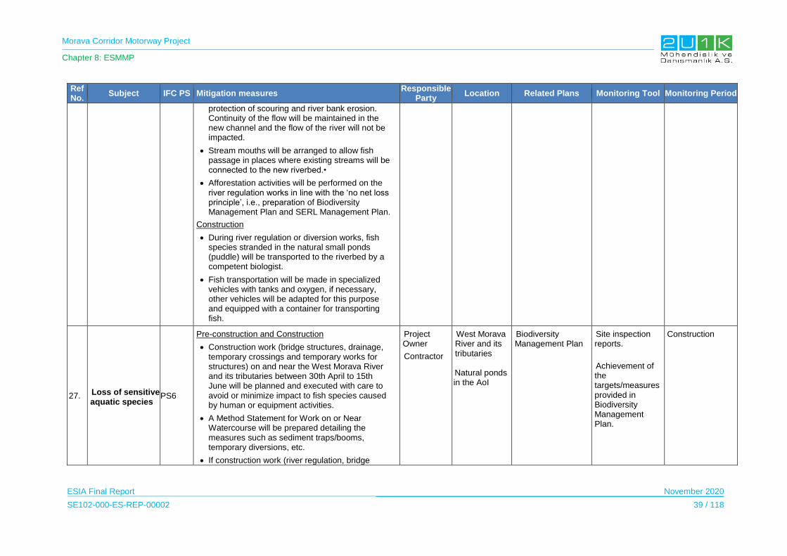
Morava Corridor Motorway Project
Chapter 8: ESMMP
ESIA Final Report November 2020
SE102-000-ES-REP-00002 39 / 118
Ref No.
Subject IFC PS Mitigation measures Responsible
Party Location Related Plans Monitoring Tool Monitoring Period
protection of scouring and river bank erosion. Continuity of the flow will be maintained in the new channel and the flow of the river will not be impacted.
Stream mouths will be arranged to allow fish passage in places where existing streams will be connected to the new riverbed.•
Afforestation activities will be performed on the river regulation works in line with the ‘no net loss principle’, i.e., preparation of Biodiversity Management Plan and SERL Management Plan.
Construction
During river regulation or diversion works, fish species stranded in the natural small ponds (puddle) will be transported to the riverbed by a competent biologist.
Fish transportation will be made in specialized vehicles with tanks and oxygen, if necessary, other vehicles will be adapted for this purpose and equipped with a container for transporting fish.
27. Loss of sensitive aquatic species
PS6
Pre-construction and Construction
Construction work (bridge structures, drainage, temporary crossings and temporary works for structures) on and near the West Morava River and its tributaries between 30th April to 15th June will be planned and executed with care to avoid or minimize impact to fish species caused by human or equipment activities.
A Method Statement for Work on or Near Watercourse will be prepared detailing the measures such as sediment traps/booms, temporary diversions, etc.
If construction work (river regulation, bridge
Project Owner
Contractor
West Morava River and its tributaries Natural ponds in the AoI
Biodiversity Management Plan
Site inspection reports.
Achievement of the targets/measures provided in Biodiversity Management Plan.
Construction

Morava Corridor Motorway Project
Chapter 8: ESMMP
ESIA Final Report November 2020
SE102-000-ES-REP-00002 40 / 118
Ref No.
Subject IFC PS Mitigation measures Responsible
Party Location Related Plans Monitoring Tool Monitoring Period
structures, drainage, temporary crossings, and temporary works for structures) has commence before the start of breeding season, work can continue in line with the measures detailed in the Method Statement.
Archaeological and Cultural Resources
28.
Chance of Destruction of Archaeological and Cultural Resources
PS 8
Design and pre-construction
During the route selection process, existing cultural heritage sites and intangible values were taken into a consideration.
Chance Find Procedure will be developed and implemented by the Employer.
Construction
The Project Owner / Employer will provide all the conditions and enable smooth and constant monitoring of works during the entire duration of the earthworks, by the archaeological supervision.
The Contractor will follow the national requirements with respect to “chance finds” which may emerge during construction.
During the construction work, if archaeological or historical sites and objects are discovered the Contractor shall mark and secure new identified sites (with a protective railing or other means of protection) to avoid damage in the course of road construction and immediately notify the relevant Institute for the Protection of Cultural Monuments.
Project Owner and external experts to conduct the field surveys. Contractor
The Archaeological areas and Heritage buildings that overlap the buffer zone of the Project (see Appendix 5.3)
Chance Find Procedure
Visual check Site inspection reports
Pre-Construction and Construction
Visual and Landscape and Land Use
29. Change of landscape due to
Pre-construction and Construction Project Owner
All Municipalities
EMP –Site Closure Visual inspections
Construction
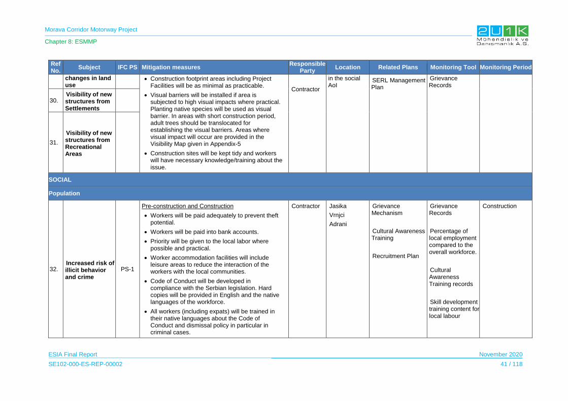
Morava Corridor Motorway Project
Chapter 8: ESMMP
ESIA Final Report November 2020
SE102-000-ES-REP-00002 41 / 118
Ref No.
Subject IFC PS Mitigation measures Responsible
Party Location Related Plans Monitoring Tool Monitoring Period
changes in land use
Construction footprint areas including Project Facilities will be as minimal as practicable.
Visual barriers will be installed if area is subjected to high visual impacts where practical. Planting native species will be used as visual barrier. In areas with short construction period, adult trees should be translocated for establishing the visual barriers. Areas where visual impact will occur are provided in the Visibility Map given in Appendix-5
Construction sites will be kept tidy and workers will have necessary knowledge/training about the issue.
Contractor
in the social AoI
SERL Management Plan
Grievance Records
30. Visibility of new structures from Settlements
31.
Visibility of new structures from Recreational Areas
SOCIAL
Population
32. Increased risk of illicit behavior and crime
PS-1
Pre-construction and Construction
Workers will be paid adequately to prevent theft potential.
Workers will be paid into bank accounts.
Priority will be given to the local labor where possible and practical.
Worker accommodation facilities will include leisure areas to reduce the interaction of the workers with the local communities.
Code of Conduct will be developed in compliance with the Serbian legislation. Hard copies will be provided in English and the native languages of the workforce.
All workers (including expats) will be trained in their native languages about the Code of Conduct and dismissal policy in particular in criminal cases.
Contractor Jasika
Vrnjci
Adrani
Grievance Mechanism
Cultural Awareness Training
Recruitment Plan
Grievance Records
Percentage of local employment compared to the overall workforce.
Cultural Awareness Training records
Skill development training content for local labour
Construction
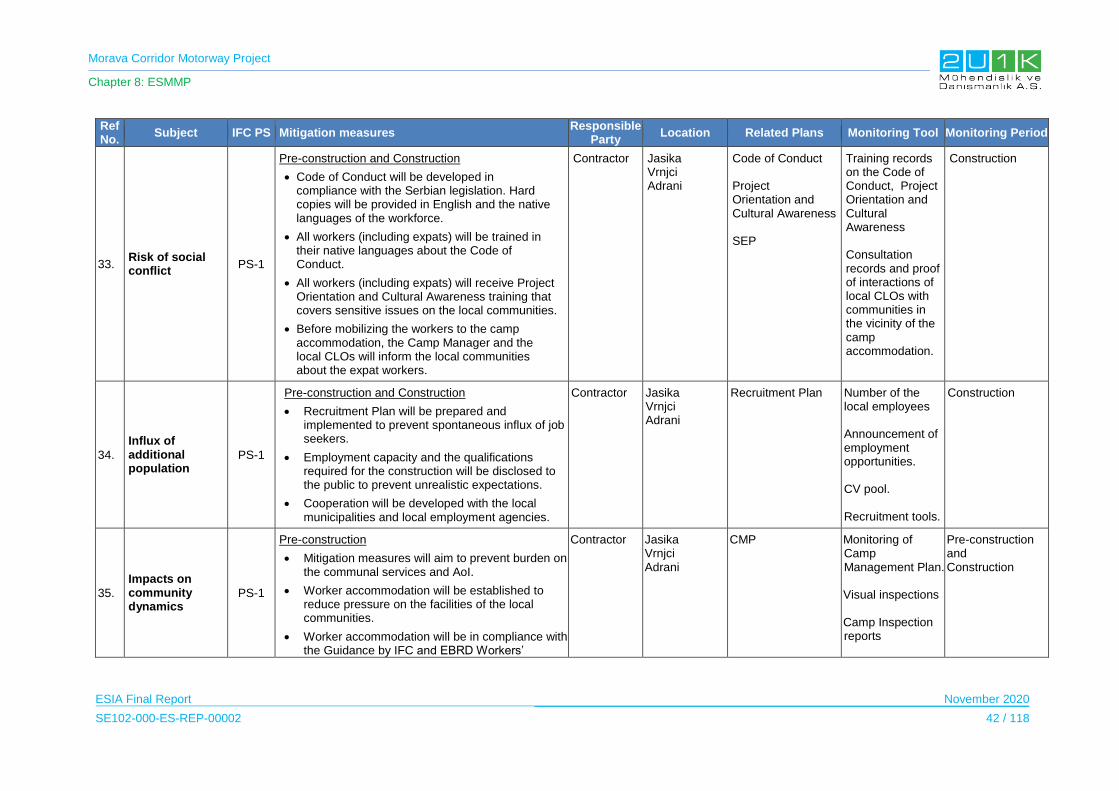
Morava Corridor Motorway Project
Chapter 8: ESMMP
ESIA Final Report November 2020
SE102-000-ES-REP-00002 42 / 118
Ref No.
Subject IFC PS Mitigation measures Responsible
Party Location Related Plans Monitoring Tool Monitoring Period
33. Risk of social conflict
PS-1
Pre-construction and Construction
Code of Conduct will be developed in compliance with the Serbian legislation. Hard copies will be provided in English and the native languages of the workforce.
All workers (including expats) will be trained in their native languages about the Code of Conduct.
All workers (including expats) will receive Project Orientation and Cultural Awareness training that covers sensitive issues on the local communities.
Before mobilizing the workers to the camp accommodation, the Camp Manager and the local CLOs will inform the local communities about the expat workers.
Contractor Jasika Vrnjci Adrani
Code of Conduct Project Orientation and Cultural Awareness SEP
Training records on the Code of Conduct, Project Orientation and Cultural Awareness Consultation records and proof of interactions of local CLOs with communities in the vicinity of the camp accommodation.
Construction
34.
Influx of additional population
PS-1
Pre-construction and Construction
Recruitment Plan will be prepared and implemented to prevent spontaneous influx of job seekers.
Employment capacity and the qualifications required for the construction will be disclosed to the public to prevent unrealistic expectations.
Cooperation will be developed with the local municipalities and local employment agencies.
Contractor Jasika Vrnjci Adrani
Recruitment Plan Number of the local employees Announcement of employment opportunities. CV pool. Recruitment tools.
Construction
35.
Impacts on community dynamics
PS-1
Pre-construction
Mitigation measures will aim to prevent burden on the communal services and AoI.
Worker accommodation will be established to reduce pressure on the facilities of the local communities.
Worker accommodation will be in compliance with the Guidance by IFC and EBRD Workers’
Contractor Jasika Vrnjci Adrani
CMP Monitoring of Camp Management Plan. Visual inspections Camp Inspection reports
Pre-construction and Construction
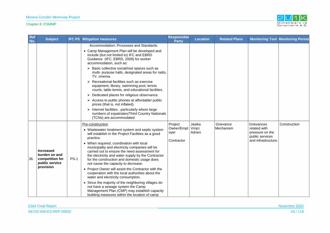
Morava Corridor Motorway Project
Chapter 8: ESMMP
ESIA Final Report November 2020
SE102-000-ES-REP-00002 43 / 118
Ref No.
Subject IFC PS Mitigation measures Responsible
Party Location Related Plans Monitoring Tool Monitoring Period
Accommodation: Processes and Standards.
Camp Management Plan will be developed and include (but not limited to) IFC and EBRD Guidance (IFC, EBRD, 2009) for worker accommodation, such as:
Basic collective social/rest spaces such as multi- purpose halls, designated areas for radio, TV, cinema.
Recreational facilities such as exercise equipment, library, swimming pool, tennis courts, table tennis, and educational facilities.
Dedicated places for religious observance.
Access to public phones at affordable/ public prices (that is, not inflated).
Internet facilities , particularly where large numbers of expatriates/Third Country Nationals (TCNs) are accommodated
36.
Increased burden on and competition for public service provision
PS-1
Pre-construction
Wastewater treatment system and septic system will establish in the Project Facilities as a good practice.
When required, coordination with local municipality and electricity companies will be carried out to ensure the need assessment for the electricity and water supply by the Contractor for the construction and domestic usage does not cause the capacity to decrease.
Project Owner will assist the Contractor with the cooperation with the local authorities about the water and electricity consumption.
Since the majority of the neighboring villages do not have a sewage system the Camp Management Plan (CMP) may establish capacity building measures within the location of camp
Project Owner/Employer Contractor
Jasika Vrnjci Adrani
Grievance Mechanism
Grievances related with pressure on the public services and infrastructure.
Construction
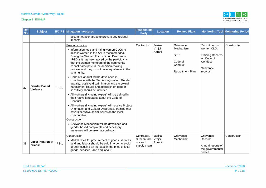
Morava Corridor Motorway Project
Chapter 8: ESMMP
ESIA Final Report November 2020
SE102-000-ES-REP-00002 44 / 118
Ref No.
Subject IFC PS Mitigation measures Responsible
Party Location Related Plans Monitoring Tool Monitoring Period
accommodation areas to prevent any residual impacts.
37. Gender Based Violence
PS-1
Pre-construction
Information tools and hiring women CLOs to access women in the AoI is recommended. During the Women Focus Group Discussion (FGDs), it has been raised by the participants that the women members of the community cannot participate in the decision-making process and they do not have equal roles in the community.
Code of Conduct will be developed in compliance with the Serbian legislation. Gender equality, positive discrimination and the sexual harassment issues and approach on gender sensitivity should be included.
All workers (including expats) will be trained in their native languages about the Code of Conduct.
All workers (including expats) will receive Project Orientation and Cultural Awareness training that covers sensitive social issues on the local communities.
Construction
Grievance Mechanism will be developed and gender based complaints and necessary measures will be taken accordingly.
Contractor Jasika Vrnjci Adrani
Grievance Mechanism SEP Code of Conduct Recruitment Plan
Recruitment of women CLO. Training Records on Code of Conduct. Grievance records.
Construction
38. Local inflation of prices:
PS-1
Construction
Market rates for procurement of goods, services, land and labour should be paid in order to avoid directly causing an increase in the price of local goods, services, land and labour.
Contractor, Subcontractors and supply chain
Jasika Vrnjci Adrani
Grievance Mechanism
Grievance Records Annual reports of the governmental bodies.
Construction
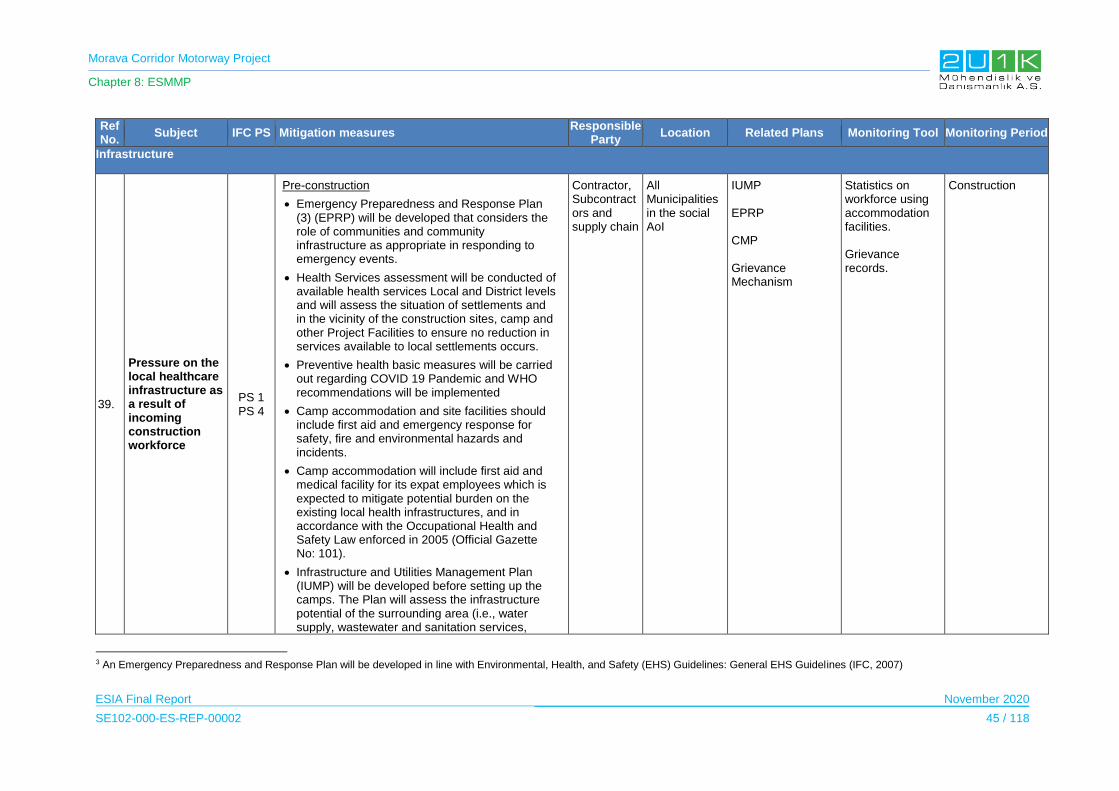
Morava Corridor Motorway Project
Chapter 8: ESMMP
ESIA Final Report November 2020
SE102-000-ES-REP-00002 45 / 118
Ref No.
Subject IFC PS Mitigation measures Responsible
Party Location Related Plans Monitoring Tool Monitoring Period
Infrastructure
39.
Pressure on the local healthcare infrastructure as a result of incoming construction workforce
PS 1 PS 4
Pre-construction
Emergency Preparedness and Response Plan (3) (EPRP) will be developed that considers the role of communities and community infrastructure as appropriate in responding to emergency events.
Health Services assessment will be conducted of available health services Local and District levels and will assess the situation of settlements and in the vicinity of the construction sites, camp and other Project Facilities to ensure no reduction in services available to local settlements occurs.
Preventive health basic measures will be carried out regarding COVID 19 Pandemic and WHO recommendations will be implemented
Camp accommodation and site facilities should include first aid and emergency response for safety, fire and environmental hazards and incidents.
Camp accommodation will include first aid and medical facility for its expat employees which is expected to mitigate potential burden on the existing local health infrastructures, and in accordance with the Occupational Health and Safety Law enforced in 2005 (Official Gazette No: 101).
Infrastructure and Utilities Management Plan (IUMP) will be developed before setting up the camps. The Plan will assess the infrastructure potential of the surrounding area (i.e., water supply, wastewater and sanitation services,
Contractor, Subcontractors and supply chain
All Municipalities in the social AoI
IUMP EPRP CMP Grievance Mechanism
Statistics on workforce using accommodation facilities. Grievance records.
Construction
3 An Emergency Preparedness and Response Plan will be developed in line with Environmental, Health, and Safety (EHS) Guidelines: General EHS Guidelines (IFC, 2007)
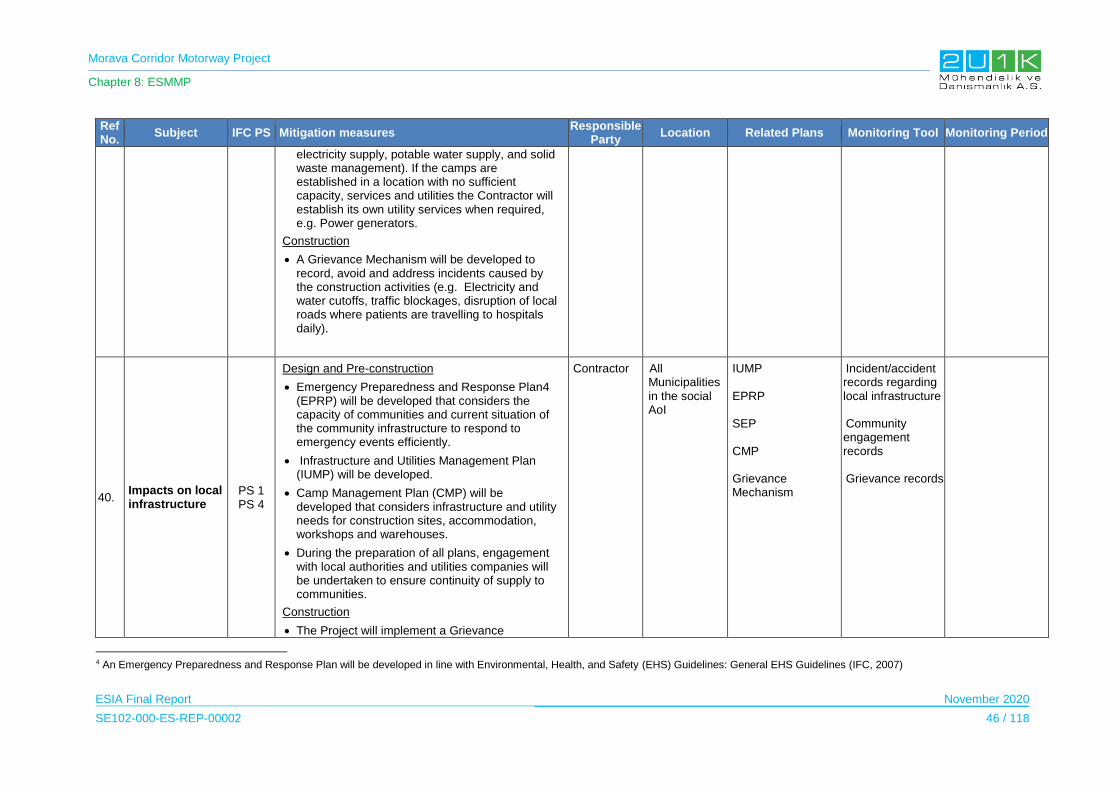
Morava Corridor Motorway Project
Chapter 8: ESMMP
ESIA Final Report November 2020
SE102-000-ES-REP-00002 46 / 118
Ref No.
Subject IFC PS Mitigation measures Responsible
Party Location Related Plans Monitoring Tool Monitoring Period
electricity supply, potable water supply, and solid waste management). If the camps are established in a location with no sufficient capacity, services and utilities the Contractor will establish its own utility services when required, e.g. Power generators.
Construction
A Grievance Mechanism will be developed to record, avoid and address incidents caused by the construction activities (e.g. Electricity and water cutoffs, traffic blockages, disruption of local roads where patients are travelling to hospitals daily).
40. Impacts on local infrastructure
PS 1 PS 4
Design and Pre-construction
Emergency Preparedness and Response Plan4 (EPRP) will be developed that considers the capacity of communities and current situation of the community infrastructure to respond to emergency events efficiently.
Infrastructure and Utilities Management Plan (IUMP) will be developed.
Camp Management Plan (CMP) will be developed that considers infrastructure and utility needs for construction sites, accommodation, workshops and warehouses.
During the preparation of all plans, engagement with local authorities and utilities companies will be undertaken to ensure continuity of supply to communities.
Construction
The Project will implement a Grievance
Contractor All Municipalities in the social AoI
IUMP EPRP SEP CMP Grievance Mechanism
Incident/accident records regarding local infrastructure Community engagement records Grievance records
4 An Emergency Preparedness and Response Plan will be developed in line with Environmental, Health, and Safety (EHS) Guidelines: General EHS Guidelines (IFC, 2007)
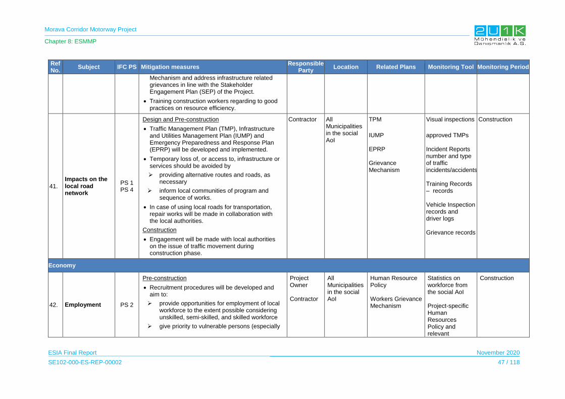
Morava Corridor Motorway Project
Chapter 8: ESMMP
ESIA Final Report November 2020
SE102-000-ES-REP-00002 47 / 118
Ref No.
Subject IFC PS Mitigation measures Responsible
Party Location Related Plans Monitoring Tool Monitoring Period
Mechanism and address infrastructure related grievances in line with the Stakeholder Engagement Plan (SEP) of the Project.
Training construction workers regarding to good practices on resource efficiency.
41.
Impacts on the local road network
PS 1 PS 4
Design and Pre-construction
Traffic Management Plan (TMP), Infrastructure and Utilities Management Plan (IUMP) and Emergency Preparedness and Response Plan (EPRP) will be developed and implemented.
Temporary loss of, or access to, infrastructure or services should be avoided by
providing alternative routes and roads, as necessary
inform local communities of program and sequence of works.
In case of using local roads for transportation, repair works will be made in collaboration with the local authorities.
Construction
Engagement will be made with local authorities on the issue of traffic movement during construction phase.
Contractor All Municipalities in the social AoI
TPM
IUMP EPRP Grievance Mechanism
Visual inspections
approved TMPs Incident Reports number and type of traffic incidents/accidents Training Records – records Vehicle Inspection records and driver logs Grievance records
Construction
Economy
42. Employment PS 2
Pre-construction
Recruitment procedures will be developed and aim to:
provide opportunities for employment of local workforce to the extent possible considering unskilled, semi-skilled, and skilled workforce
give priority to vulnerable persons (especially
Project Owner Contractor
All Municipalities in the social AoI
Human Resource Policy Workers Grievance Mechanism
Statistics on workforce from the social AoI Project-specific Human Resources Policy and relevant
Construction

Morava Corridor Motorway Project
Chapter 8: ESMMP
ESIA Final Report November 2020
SE102-000-ES-REP-00002 48 / 118
Ref No.
Subject IFC PS Mitigation measures Responsible
Party Location Related Plans Monitoring Tool Monitoring Period
those who will be economically disabled)
give priority to Social AoI as much as possible, for the scope of good practice.
The Contractor and the Employer will outline and require a fair and transparent, gender neutral recruitment process for all job openings. The Contractor should seek to employ Project PAPs on each Sector of the Project route.
The Contractor should encourage Subcontractors to employ local personnel.
Construction
Capacity enhancement benefits will be increased through training programs for contractors and subcontractors on related policies, as well as phased capacity building and targeted training programs for national and local suppliers agreed with local government and industry organizations to benefit local capacity enhancement.
procedures Grievances records
43.
Pre-construction
Project should seek to maximize the benefits for local communities in terms of both direct and indirect employment opportunities and purchasing of local good and services.
Procurement Plan will be developed and implemented. Project should adopt measures within its purchasing policy to provide opportunity for local scale businesses to tender for procurement of subcontracted good and services (e.g. advertising locally).
Contractor All Municipalities in the social AoI
Local Procurement Plan
Procurement Plan local business content and records Grievances records
Construction
44. Impact on Agriculture
Pre-construction
During land expropriation and acquisition process, cooperation between the Project Owner and Project Operator (Corridors of Serbia,
Project Owner Project Operator
All Locations where land acquisition is occurring
RAP The indicators that will be provided within the scope of RAP
Construction

Morava Corridor Motorway Project
Chapter 8: ESMMP
ESIA Final Report November 2020
SE102-000-ES-REP-00002 49 / 118
Ref No.
Subject IFC PS Mitigation measures Responsible
Party Location Related Plans Monitoring Tool Monitoring Period
Ministry of Construction, Transport and Infrastructure (MCTI) and Roads of Serbia) should consider the following measures;
support for the development of cooperatives and farmers associations should be provided
ensure the implementation of education programs for farmers; implementation of local agricultural incentive programs,
provide seminars to direct for farmers to promote and modern approaches to farming.
Implementation of RLRF and RAP.
Construction
The Project Owner/Employer will encourage and interact with Ministry of Agriculture to include the PAPs within their training programs (eg. reskilling, opportunity, diversity).
Grievances records
Land Acquisition and Resettlement
45. Permanent acquisition of lands
PS 5
Design
Effects of physical and economic displacement will be minimized
People affected by the Project will be compensated in accordance with the Principles set in the in the RLRF.
As a minimum, Resettlement Action Plans (RAPs) will be prepared. It will detail the impacts of the Project on land ownership, land use, property and livelihoods. The RAPs will set out the measures needed to address adequately physical and economic displacements due to the Project.
Project Owner Contractor
All affected people from the land acquisition and resettlement
RAP SEP Grievance Mechanism
Documentation associated with implementation of RAP Documentation associated with implementation of Livelihood Restoration Plan Grievances records
Pre-Construction Construction

Morava Corridor Motorway Project
Chapter 8: ESMMP
ESIA Final Report November 2020
SE102-000-ES-REP-00002 50 / 118
Ref No.
Subject IFC PS Mitigation measures Responsible
Party Location Related Plans Monitoring Tool Monitoring Period
A detailed socio-economic assessment will be undertaken for the RAP to identify impacts on PAPs, including land acquisition impacts and restriction to land use.
A census will be carried out to determine persons to be displaced by the Project, persons that are eligible for compensation and assistance, inventory of affected land and property.
Pre-construction
Assistance will be provided to vulnerable persons who are not able to relocate and resettle on their own.
Additional targeted assistance (e.g., credit facilities, training, or job opportunities) will be provided and opportunities to improve or at least restore their income-earning capacity, production levels, and standards of living to Economically Displaced Persons whose livelihoods or income levels are adversely affected
Construction
The amount of land occupied during the construction will be minimized.
Construction workers will be trained to stay within the border of the construction areas and expropriation corridor and avoid trespass on private land.
For exceptional cases when the privately-owned land has to be used but the expropriation or court processes have not been finalized yet, no work will be started until bilateral agreements are settled and official consent letters are taken from the legal owners.
If complaints related with unauthorized use of
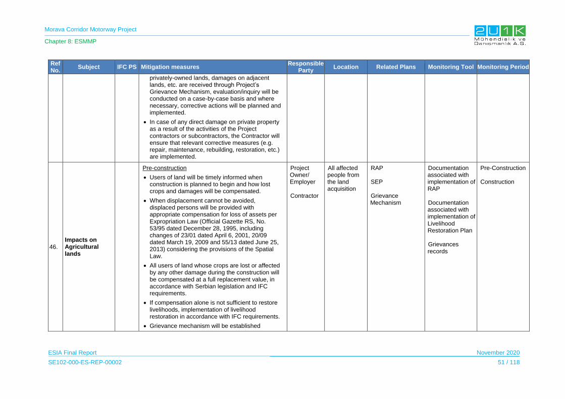
Morava Corridor Motorway Project
Chapter 8: ESMMP
ESIA Final Report November 2020
SE102-000-ES-REP-00002 51 / 118
Ref No.
Subject IFC PS Mitigation measures Responsible
Party Location Related Plans Monitoring Tool Monitoring Period
privately-owned lands, damages on adjacent lands, etc. are received through Project’s Grievance Mechanism, evaluation/inquiry will be conducted on a case-by-case basis and where necessary, corrective actions will be planned and implemented.
In case of any direct damage on private property as a result of the activities of the Project contractors or subcontractors, the Contractor will ensure that relevant corrective measures (e.g. repair, maintenance, rebuilding, restoration, etc.) are implemented.
46.
Impacts on Agricultural lands
Pre-construction
Users of land will be timely informed when construction is planned to begin and how lost crops and damages will be compensated.
When displacement cannot be avoided, displaced persons will be provided with appropriate compensation for loss of assets per Expropriation Law (Official Gazette RS, No. 53/95 dated December 28, 1995, including changes of 23/01 dated April 6, 2001, 20/09 dated March 19, 2009 and 55/13 dated June 25, 2013) considering the provisions of the Spatial Law.
All users of land whose crops are lost or affected by any other damage during the construction will be compensated at a full replacement value, in accordance with Serbian legislation and IFC requirements.
If compensation alone is not sufficient to restore livelihoods, implementation of livelihood restoration in accordance with IFC requirements.
Grievance mechanism will be established
Project Owner/ Employer Contractor
All affected people from the land acquisition
RAP SEP Grievance Mechanism
Documentation associated with implementation of RAP Documentation associated with implementation of Livelihood Restoration Plan Grievances records
Pre-Construction Construction

Morava Corridor Motorway Project
Chapter 8: ESMMP
ESIA Final Report November 2020
SE102-000-ES-REP-00002 52 / 118
Ref No.
Subject IFC PS Mitigation measures Responsible
Party Location Related Plans Monitoring Tool Monitoring Period
Construction
Impacts to agricultural and pasture lands will be minimized as far as possible by keeping the Project construction footprint as narrow as possible, and efficiently restoring any damaged areas
47. Impacts on Business lands
Pre-construction
Business losses will be compensated at a full replacement value, in accordance with Serbian Legislation and the IFC requirements.
If compensation alone is not sufficient to restore livelihoods, implementation of livelihood restoration in accordance with IFC requirements.
Grievance Mechanism will be implemented in line with the SEP.
Project Owner Contractor
All affacted businessess
RAP SEP Grievance Mechanism
Documentation associated with implementation of RAP
Documentation associated with implementation of Livelihood Restoration Plan Grievances records
Pre-Cpnstruction Construction
48. Temporary land allocation
Construction
All disturbed private land will be rehabilitated as appropriate and agreed upon, following the completion of construction works.
Contractor All locations where temporary land allocation is occuring
EMP –Site Closure RAP SEP Grievance Mechanism
Protocols with land owners Grievances records
Pre-Construction Constrcution
49.
Fragmentation of certain land plots
Design and Pre-construction
Underpasses will be designed to ensure access of local people to agricultural lands, with sufficient dimensions for the passage of harvesters, vehicles, etc. where required.
Temporary access roads will be constructed in parallel to the Motorway route near agricultural areas/zones to provide access to agricultural
Project Owner/ Employer Contractor
All municipalities in social AoI
RAP SEP Grievance Mechanism
Documentation associated with implementation of RAP Documentation associated with implementation of
Pre-Construction Construction

Morava Corridor Motorway Project
Chapter 8: ESMMP
ESIA Final Report November 2020
SE102-000-ES-REP-00002 53 / 118
Ref No.
Subject IFC PS Mitigation measures Responsible
Party Location Related Plans Monitoring Tool Monitoring Period
lands, where practical. Livelihood Restoration Plan Grievances records
50.
Damage to crops during construction
Pre-construction
Any loss of or damage to crops caused by Project activities will be compensated.
Construction
The Project will minimize damage to crops by minimizing the area of disturbance caused by vehicle movement and other construction activities.
If complaints related with unauthorized use of privately-owned lands, damages on adjacent lands, etc. are received through Project’s Grievance Mechanism, evaluation/inquiry will be conducted on a case-by-case and where necessary, corrective actions will be planned and implemented.
Project Owner
Contractor
All locations where damage may occur
RAP SEP Grievance Mechanism
Protocols with land owners Grievances records
Pre-Construction Construction
51.
Physical and economic displacement of PAPs
Pre-construction and Construction
Employment Plan will be prepared. Local employment and PAPs who will lose income (agriculture and seasonal agriculture activities) or jobs due to Project related activities should be encouraged by establishing fair, transparent and equal opportunities for employment.
Project Owner/ Employer
All affected people from the land acquisition and resettlement
RAP SEP Grievance Mechanism
Employment records Grievances records
Pre-Construction Construction
Ecosystem Services
52. Access to Forest Lands
PS 5 PS 6
Pre-Construction
Local authorities and the villagers will be informed before the construction activities within the forest land to not create any limitation on
Project Owner
Contractor
All municipalities in the AoI
Grievance Mechanism RAP
Visual inspections and records of information tools & consultation
Construction

Morava Corridor Motorway Project
Chapter 8: ESMMP
ESIA Final Report November 2020
SE102-000-ES-REP-00002 54 / 118
Ref No.
Subject IFC PS Mitigation measures Responsible
Party Location Related Plans Monitoring Tool Monitoring Period
firewood collection, herbs collection and hunting.
Construction
Hunting and collection of wild animals will be strictly prohibited within the Project area.
Maintain ongoing engagement between the Project and local communities, with communities informed in advance of any vegetation clearing to allow pre-harvesting of resources such has wood fuel, mushrooms, building materials or other useable resources.
For households who obtain income from timbering activities commercially, compensate for unavoidable loss through in-kind restoration or other type of compensation methods applicable to the IFI requirements.
Piles of woody vegetation cleared for construction activities are to be made available to communities to access it for use as wood fuel or other purposes.
SEP Environmental measurement records Traffic incident/accident reports Training records on traffic management Biodiversity monitoring records Visual inspections and records of vegetation clearing Grievances records related to restrictions on designated hunting areas
53. Impact on Apiculture
PS 5 PS 6
Pre-Construction
Exact location of the beehives will be determined during the RAP preparation and if required, logistic assistance should be provided the move the beehives.
Seasonal requirements for apiculture will be considered during the planning of construction works. The Beekeepers Association of Kruševac recommended that the construction activities should be conducted as much as practical distance from the beehives (in May, June, July they can fly 2 km).
In case of grievances, beehives will be moved
Project Owner
Kruševac Grievance Mechanism RAP SEP
Statistics on beekeepers and activities Environmental measurement records - dust & noise Resettlement action records (if required) Grievance records
Construction

Morava Corridor Motorway Project
Chapter 8: ESMMP
ESIA Final Report November 2020
SE102-000-ES-REP-00002 55 / 118
Ref No.
Subject IFC PS Mitigation measures Responsible
Party Location Related Plans Monitoring Tool Monitoring Period
away from the Motorway Route with the assistance of CoS.
Construction
Monitoring will be held within the scope of the RAP to analyze the livelihood impacts of the beekeepers
related with beekeeping activities.
54. Impact on River Usage
PS 5 PS 6
Design
In forming the new river bed and banks, preserve as much as possible, their original and authentic look and purpose. In the case of cutting riverbed, it is necessary to ensure some culverts for the smooth flow of water and the movement/migration of aquatic organisms, including fish.
Construction
The communication tools developed within the scope of the SEP will be implemented to inform the PAPs and the local authorities on the river regulation.
Wastes and any other product containing hazardous chemical substances (i.e. fuel) will not be stored in the proximity of freshwater features. Avoidance of any spill affecting to the freshwater ecosystems.
Construction activities will be carried out carefully and impacts caused by human activities will be minimized especially between 30th April to 15th June in order not to harm the species that is exist in the West Morava River.
Project Owner
Contractor
All municipalities in the AoI
Grievance Mechanism RAP SEP
Consultation records Grievance records related to river usage
Construction
55.
Impact on Leisure Activities and Tourism
PS 5 PS 6
Construction
Addition to SEP, suitably qualitied technical staff and environmental management procedures will be developed and implemented.
Project Owner Contractor
Vrnjačka Banja Municipality Kraljevo Municipality Čačak
Grievance Mechanism RAP
Grievance Records Tourism statistics
Construction
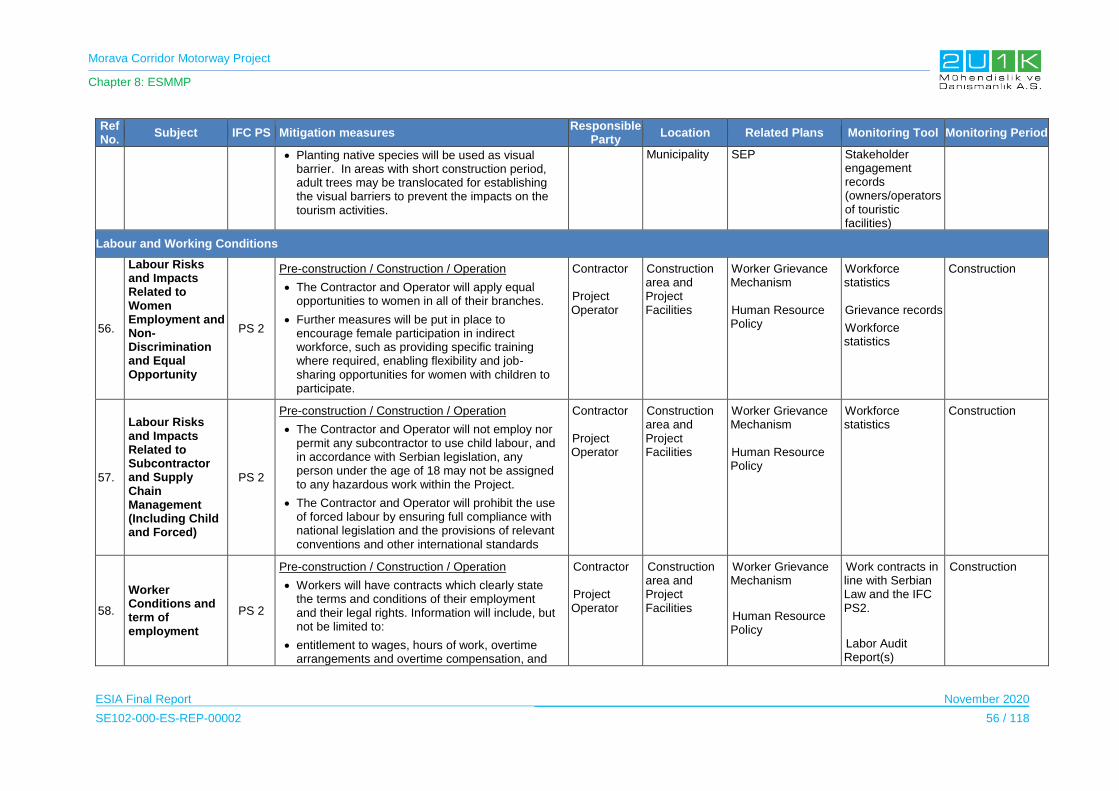
Morava Corridor Motorway Project
Chapter 8: ESMMP
ESIA Final Report November 2020
SE102-000-ES-REP-00002 56 / 118
Ref No.
Subject IFC PS Mitigation measures Responsible
Party Location Related Plans Monitoring Tool Monitoring Period
Planting native species will be used as visual barrier. In areas with short construction period, adult trees may be translocated for establishing the visual barriers to prevent the impacts on the tourism activities.
Municipality SEP Stakeholder engagement records (owners/operators of touristic facilities)
Labour and Working Conditions
56.
Labour Risks and Impacts Related to Women Employment and Non-Discrimination and Equal Opportunity
PS 2
Pre-construction / Construction / Operation
The Contractor and Operator will apply equal opportunities to women in all of their branches.
Further measures will be put in place to encourage female participation in indirect workforce, such as providing specific training where required, enabling flexibility and job-sharing opportunities for women with children to participate.
Contractor Project Operator
Construction area and Project Facilities
Worker Grievance Mechanism Human Resource Policy
Workforce statistics Grievance records
Workforce statistics
Construction
57.
Labour Risks and Impacts Related to Subcontractor and Supply Chain Management (Including Child and Forced)
PS 2
Pre-construction / Construction / Operation
The Contractor and Operator will not employ nor permit any subcontractor to use child labour, and in accordance with Serbian legislation, any person under the age of 18 may not be assigned to any hazardous work within the Project.
The Contractor and Operator will prohibit the use of forced labour by ensuring full compliance with national legislation and the provisions of relevant conventions and other international standards
Contractor Project Operator
Construction area and Project Facilities
Worker Grievance Mechanism Human Resource Policy
Workforce statistics
Construction
58.
Worker Conditions and term of employment
PS 2
Pre-construction / Construction / Operation
Workers will have contracts which clearly state the terms and conditions of their employment and their legal rights. Information will include, but not be limited to:
entitlement to wages, hours of work, overtime arrangements and overtime compensation, and
Contractor Project Operator
Construction area and Project Facilities
Worker Grievance Mechanism
Human Resource Policy
Work contracts in line with Serbian Law and the IFC PS2.
Labor Audit Report(s)
Construction

Morava Corridor Motorway Project
Chapter 8: ESMMP
ESIA Final Report November 2020
SE102-000-ES-REP-00002 57 / 118
Ref No.
Subject IFC PS Mitigation measures Responsible
Party Location Related Plans Monitoring Tool Monitoring Period
any benefits (such as leave for illness, maternity / paternity or holiday)
able to join trade unions of their choice and have the right to collective bargaining
contracts will be verbally explained in their native languages to all workers where this is necessary to ensure that workers understand their rights prior to any employment contract to be signed.
Cultural Awareness Training will be provided an on-boarding requirement to all non-local workers, and in particularly foreign workers.
Worker Grievance Mechanism will be developed and will:
be open to all the staff and their contractors,
be publicly advertised by the Project in the workforce,
be easily accessible by workers
be free of retribution
allow anonymous complaints to be raised and addressed.
All Project parties will require all contractors to sign an anti-corruption and responsible procurement policy.
For all contractor contracts, the Project will make explicit reference to the need to abide by IFC standards and ILO conventions in relation to labor and welfare standards, freedom of association and reference must be made to child and forced labor. Emphasis will also be placed on anti-discrimination measures. Where young people below the age of 18 years are employed, it will be made clear that they will not be employed in hazardous work and their work will
Training Records

Morava Corridor Motorway Project
Chapter 8: ESMMP
ESIA Final Report November 2020
SE102-000-ES-REP-00002 58 / 118
Ref No.
Subject IFC PS Mitigation measures Responsible
Party Location Related Plans Monitoring Tool Monitoring Period
be subject to an appropriate risk assessment.
Pre-construction
Camp Management Plan will be developed and comply with ‘Workers’ accommodation: processes and standards, a guidance note by IFC and the EBRD’ (2009)
Design of the accommodation camp will include measures for managing the camp to ensure adherence to international standard for providing a safe environment that is clean, and adequate sanitary. Measures will include:
waste management
provision of potable water,
provisions of minimum amount of space for each worker
laundry facilities
cooking facilities (separate area for the foreign personnel, if necessary)
provision of first aid and medical facilities
provision of heating and ventilation.
Camp Management Project will include a Code of Conduct for construction workers,
Construction
During the construction phase, the Contractor’s HSE plans and procedures include requirements for induction and training on expected behaviors and on disciplinary procedures (including dismissal procedures for unacceptable conduct).
During the construction phase, the Contractor’s HSE plans and procedures include requirements for induction and training on expected behaviors and on disciplinary procedures (including
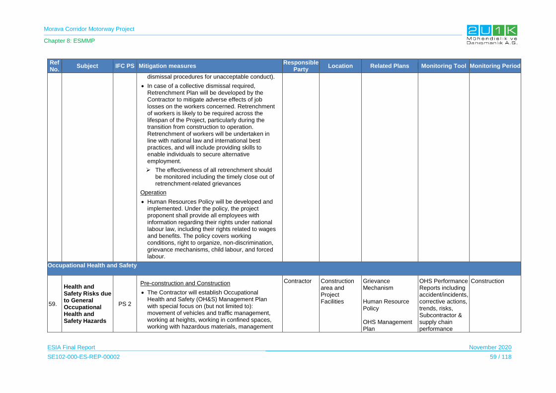
Morava Corridor Motorway Project
Chapter 8: ESMMP
ESIA Final Report November 2020
SE102-000-ES-REP-00002 59 / 118
Ref No.
Subject IFC PS Mitigation measures Responsible
Party Location Related Plans Monitoring Tool Monitoring Period
dismissal procedures for unacceptable conduct).
In case of a collective dismissal required, Retrenchment Plan will be developed by the Contractor to mitigate adverse effects of job losses on the workers concerned. Retrenchment of workers is likely to be required across the lifespan of the Project, particularly during the transition from construction to operation. Retrenchment of workers will be undertaken in line with national law and international best practices, and will include providing skills to enable individuals to secure alternative employment.
The effectiveness of all retrenchment should be monitored including the timely close out of retrenchment-related grievances
Operation
Human Resources Policy will be developed and implemented. Under the policy, the project proponent shall provide all employees with information regarding their rights under national labour law, including their rights related to wages and benefits. The policy covers working conditions, right to organize, non-discrimination, grievance mechanisms, child labour, and forced labour.
Occupational Health and Safety
59.
Health and Safety Risks due to General Occupational Health and Safety Hazards
PS 2
Pre-construction and Construction
The Contractor will establish Occupational Health and Safety (OH&S) Management Plan with special focus on (but not limited to): movement of vehicles and traffic management, working at heights, working in confined spaces, working with hazardous materials, management
Contractor Construction area and Project Facilities
Grievance Mechanism Human Resource Policy OHS Management Plan
OHS Performance Reports including accident/incidents, corrective actions, trends, risks, Subcontractor & supply chain performance
Construction
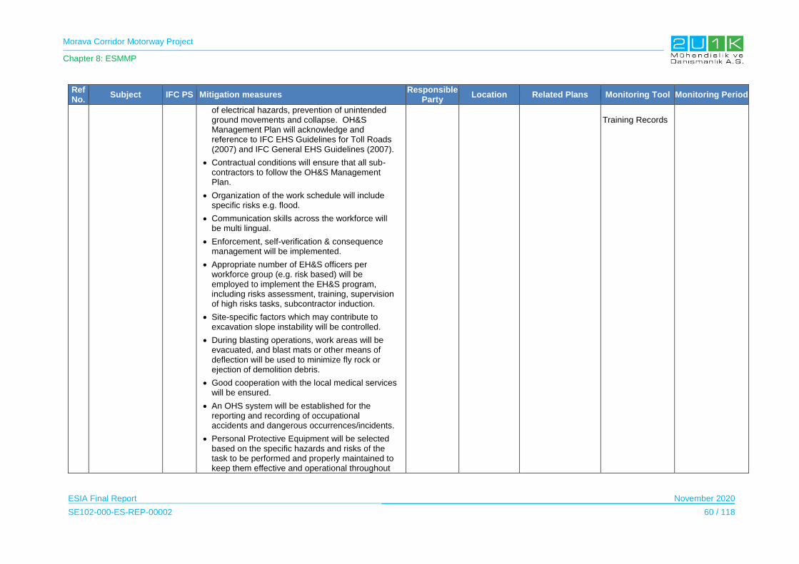
Morava Corridor Motorway Project
Chapter 8: ESMMP
ESIA Final Report November 2020
SE102-000-ES-REP-00002 60 / 118
Ref No.
Subject IFC PS Mitigation measures Responsible
Party Location Related Plans Monitoring Tool Monitoring Period
of electrical hazards, prevention of unintended ground movements and collapse. OH&S Management Plan will acknowledge and reference to IFC EHS Guidelines for Toll Roads (2007) and IFC General EHS Guidelines (2007).
Contractual conditions will ensure that all sub-contractors to follow the OH&S Management Plan.
Organization of the work schedule will include specific risks e.g. flood.
Communication skills across the workforce will be multi lingual.
Enforcement, self-verification & consequence management will be implemented.
Appropriate number of EH&S officers per workforce group (e.g. risk based) will be employed to implement the EH&S program, including risks assessment, training, supervision of high risks tasks, subcontractor induction.
Site-specific factors which may contribute to excavation slope instability will be controlled.
During blasting operations, work areas will be evacuated, and blast mats or other means of deflection will be used to minimize fly rock or ejection of demolition debris.
Good cooperation with the local medical services will be ensured.
An OHS system will be established for the reporting and recording of occupational accidents and dangerous occurrences/incidents.
Personal Protective Equipment will be selected based on the specific hazards and risks of the task to be performed and properly maintained to keep them effective and operational throughout
Training Records
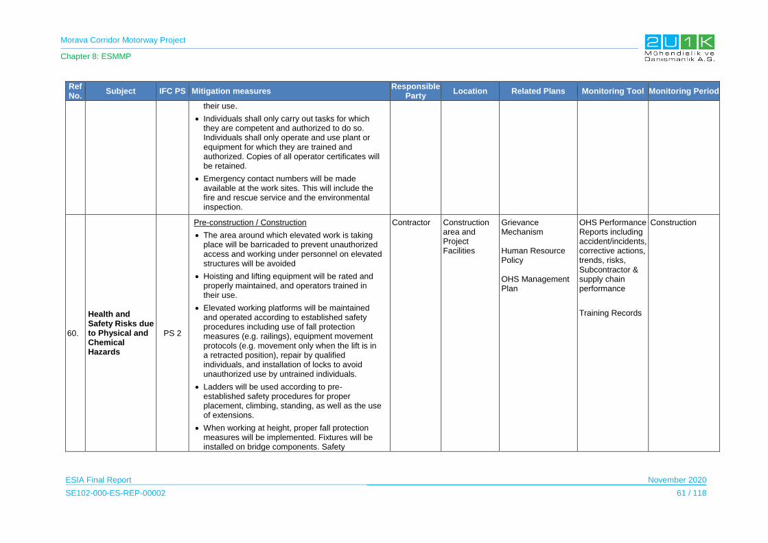
Morava Corridor Motorway Project
Chapter 8: ESMMP
ESIA Final Report November 2020
SE102-000-ES-REP-00002 61 / 118
Ref No.
Subject IFC PS Mitigation measures Responsible
Party Location Related Plans Monitoring Tool Monitoring Period
their use.
Individuals shall only carry out tasks for which they are competent and authorized to do so. Individuals shall only operate and use plant or equipment for which they are trained and authorized. Copies of all operator certificates will be retained.
Emergency contact numbers will be made available at the work sites. This will include the fire and rescue service and the environmental inspection.
60.
Health and Safety Risks due to Physical and Chemical Hazards
PS 2
Pre-construction / Construction
The area around which elevated work is taking place will be barricaded to prevent unauthorized access and working under personnel on elevated structures will be avoided
Hoisting and lifting equipment will be rated and properly maintained, and operators trained in their use.
Elevated working platforms will be maintained and operated according to established safety procedures including use of fall protection measures (e.g. railings), equipment movement protocols (e.g. movement only when the lift is in a retracted position), repair by qualified individuals, and installation of locks to avoid unauthorized use by untrained individuals.
Ladders will be used according to pre-established safety procedures for proper placement, climbing, standing, as well as the use of extensions.
When working at height, proper fall protection measures will be implemented. Fixtures will be installed on bridge components. Safety
Contractor Construction area and Project Facilities
Grievance Mechanism Human Resource Policy OHS Management Plan
OHS Performance Reports including accident/incidents, corrective actions, trends, risks, Subcontractor & supply chain performance
Training Records
Construction
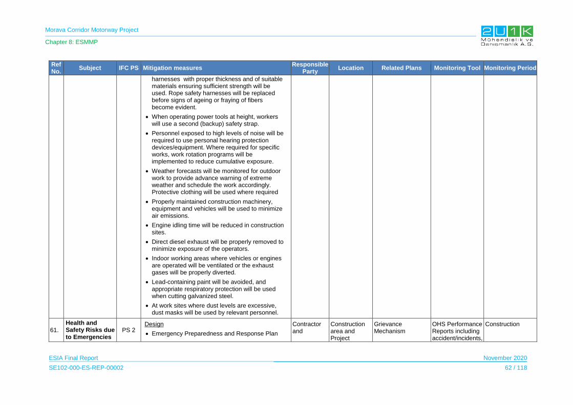
Morava Corridor Motorway Project
Chapter 8: ESMMP
ESIA Final Report November 2020
SE102-000-ES-REP-00002 62 / 118
Ref No.
Subject IFC PS Mitigation measures Responsible
Party Location Related Plans Monitoring Tool Monitoring Period
harnesses with proper thickness and of suitable materials ensuring sufficient strength will be used. Rope safety harnesses will be replaced before signs of ageing or fraying of fibers become evident.
When operating power tools at height, workers will use a second (backup) safety strap.
Personnel exposed to high levels of noise will be required to use personal hearing protection devices/equipment. Where required for specific works, work rotation programs will be implemented to reduce cumulative exposure.
Weather forecasts will be monitored for outdoor work to provide advance warning of extreme weather and schedule the work accordingly. Protective clothing will be used where required
Properly maintained construction machinery, equipment and vehicles will be used to minimize air emissions.
Engine idling time will be reduced in construction sites.
Direct diesel exhaust will be properly removed to minimize exposure of the operators.
Indoor working areas where vehicles or engines are operated will be ventilated or the exhaust gases will be properly diverted.
Lead-containing paint will be avoided, and appropriate respiratory protection will be used when cutting galvanized steel.
At work sites where dust levels are excessive, dust masks will be used by relevant personnel.
61.
Health and Safety Risks due to Emergencies
PS 2 Design
Emergency Preparedness and Response Plan
Contractor and
Construction area and Project
Grievance Mechanism
OHS Performance Reports including accident/incidents,
Construction

Morava Corridor Motorway Project
Chapter 8: ESMMP
ESIA Final Report November 2020
SE102-000-ES-REP-00002 63 / 118
Ref No.
Subject IFC PS Mitigation measures Responsible
Party Location Related Plans Monitoring Tool Monitoring Period
(EPRP) will be prepared and cover specific project risks such as spill containment and clean-up, flood, working over water, fire, rescue from height. The EPRP should include:
Risk assessment,
Location of medical rescue, fire-fighting resources and spill response equipment will be available along the route.
Procedure for staff and subcontractors to report any incidents and the investigation, remediation and preventive actions taken,
Emergency response information and training
Emergency Communication Procedure included in the Stakeholder Engagement Plan (SEP) and the Emergency Preparedness and Response Plan (EPRP) including with local communities and authorities
Sub-Contractors will develop and prepare site-specific EPRPs in line with the Contractor overarching plan.
Relevant emergency preparedness and response measures will be taken during emergency situations arising at the construction/work sites and Camp Sites.
The Pandemic Preparedness Plan will be implemented based on the prevailing situation with respect to Covid-19. The Pandemic Preparedness Plan will take into a consideration to Decree on the organization of operation of employers during the state of emergency (Official Gazette of the R, No. 31/2020) following measures have been adopted by the Government as:
During the state of emergency, the employer must enable employees to perform work
Subcontractors
Facilities Human Resource Policy OHS Management Plan EPRP
corrective actions, trends, risks, Subcontractor & supply chain performance Training Records
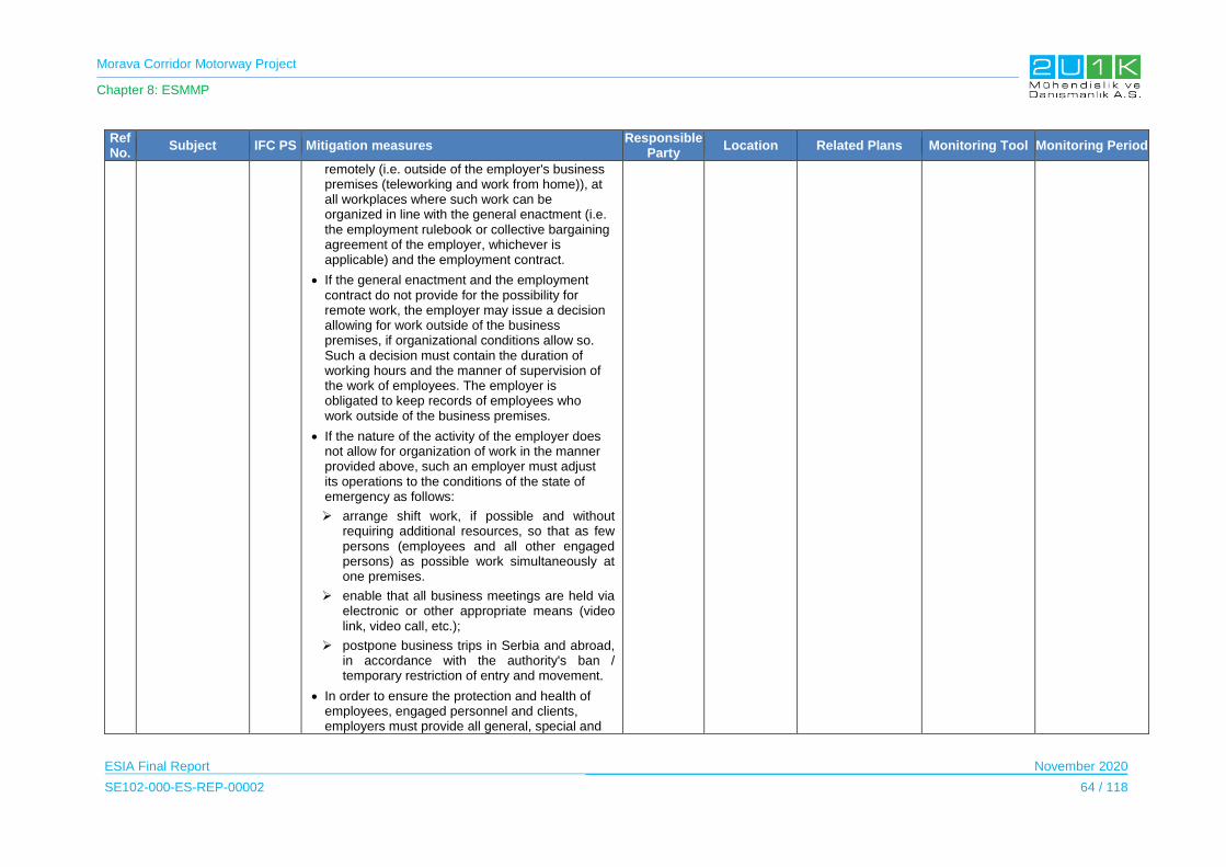
Morava Corridor Motorway Project
Chapter 8: ESMMP
ESIA Final Report November 2020
SE102-000-ES-REP-00002 64 / 118
Ref No.
Subject IFC PS Mitigation measures Responsible
Party Location Related Plans Monitoring Tool Monitoring Period
remotely (i.e. outside of the employer's business premises (teleworking and work from home)), at all workplaces where such work can be organized in line with the general enactment (i.e. the employment rulebook or collective bargaining agreement of the employer, whichever is applicable) and the employment contract.
If the general enactment and the employment contract do not provide for the possibility for remote work, the employer may issue a decision allowing for work outside of the business premises, if organizational conditions allow so. Such a decision must contain the duration of working hours and the manner of supervision of the work of employees. The employer is obligated to keep records of employees who work outside of the business premises.
If the nature of the activity of the employer does not allow for organization of work in the manner provided above, such an employer must adjust its operations to the conditions of the state of emergency as follows:
arrange shift work, if possible and without requiring additional resources, so that as few persons (employees and all other engaged persons) as possible work simultaneously at one premises.
enable that all business meetings are held via electronic or other appropriate means (video link, video call, etc.);
postpone business trips in Serbia and abroad, in accordance with the authority's ban / temporary restriction of entry and movement.
In order to ensure the protection and health of employees, engaged personnel and clients, employers must provide all general, special and
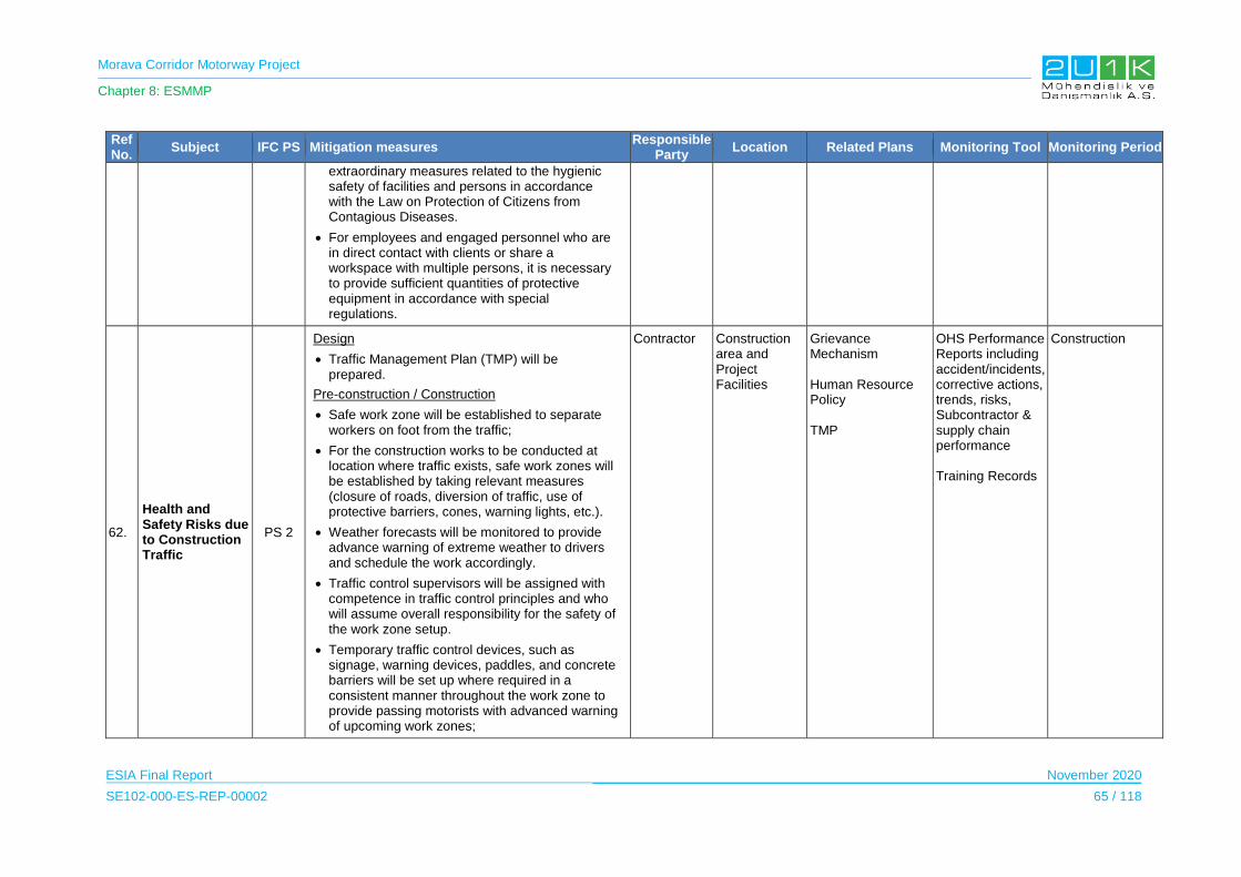
Morava Corridor Motorway Project
Chapter 8: ESMMP
ESIA Final Report November 2020
SE102-000-ES-REP-00002 65 / 118
Ref No.
Subject IFC PS Mitigation measures Responsible
Party Location Related Plans Monitoring Tool Monitoring Period
extraordinary measures related to the hygienic safety of facilities and persons in accordance with the Law on Protection of Citizens from Contagious Diseases.
For employees and engaged personnel who are in direct contact with clients or share a workspace with multiple persons, it is necessary to provide sufficient quantities of protective equipment in accordance with special regulations.
62.
Health and Safety Risks due to Construction Traffic
PS 2
Design
Traffic Management Plan (TMP) will be prepared.
Pre-construction / Construction
Safe work zone will be established to separate workers on foot from the traffic;
For the construction works to be conducted at location where traffic exists, safe work zones will be established by taking relevant measures (closure of roads, diversion of traffic, use of protective barriers, cones, warning lights, etc.).
Weather forecasts will be monitored to provide advance warning of extreme weather to drivers and schedule the work accordingly.
Traffic control supervisors will be assigned with competence in traffic control principles and who will assume overall responsibility for the safety of the work zone setup.
Temporary traffic control devices, such as signage, warning devices, paddles, and concrete barriers will be set up where required in a consistent manner throughout the work zone to provide passing motorists with advanced warning of upcoming work zones;
Contractor Construction area and Project Facilities
Grievance Mechanism Human Resource Policy TMP
OHS Performance Reports including accident/incidents, corrective actions, trends, risks, Subcontractor & supply chain performance Training Records
Construction
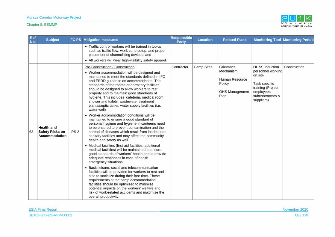
Morava Corridor Motorway Project
Chapter 8: ESMMP
ESIA Final Report November 2020
SE102-000-ES-REP-00002 66 / 118
Ref No.
Subject IFC PS Mitigation measures Responsible
Party Location Related Plans Monitoring Tool Monitoring Period
Traffic control workers will be trained in topics such as traffic flow, work zone setup, and proper placement of channelizing devices; and
All workers will wear high-visibility safety apparel.
63.
Health and Safety Risks on Accommodation
PS 2
Pre-Construction / Construction
Worker accommodation will be designed and maintained to meet the standards defined in IFC and EBRD guidance on accommodation. The standards of the rooms or dormitory facilities should be designed to allow workers to rest properly and to maintain good standards of hygiene. This includes cafeteria, medical room, shower and toilets, wastewater treatment plants/septic tanks, water supply facilities (i.e. water well)
Worker accommodation conditions will be maintained to ensure a good standard of personal hygiene and hygiene in canteens need to be ensured to prevent contamination and the spread of diseases which result from inadequate sanitary facilities and may affect the community health and safety as well.
Medical facilities (first-aid facilities, additional medical facilities) will be maintained to ensure good standards of workers’ health and to provide adequate responses in case of health emergency situations.
Basic leisure, social and telecommunication facilities will be provided for workers to rest and also to socialize during their free time. These requirements at the camp accommodation facilities should be optimized to minimize potential impacts on the workers’ welfare and risk of work-related accidents and maximize the overall productivity.
Contractor Camp Sites Grievance Mechanism Human Resource Policy OHS Management Plan
OH&S Induction personnel working on site Task specific training (Project employees, subcontractors & suppliers)
Construction
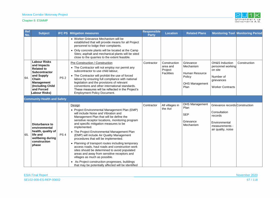
Morava Corridor Motorway Project
Chapter 8: ESMMP
ESIA Final Report November 2020
SE102-000-ES-REP-00002 67 / 118
Ref No.
Subject IFC PS Mitigation measures Responsible
Party Location Related Plans Monitoring Tool Monitoring Period
Worker Grievance Mechanism will be established that will provide means for all Project personnel to lodge their complaints.
Only concrete plants will be located at the Camp Sites; asphalt and mechanical plants will be sited close to the quarries to the extent feasible.
64.
Labour Risks and Impacts Related to Subcontractor and Supply Chain Management (Including Child and Forced
Labour Risks)
PS 2
Pre-Construction / Construction
The Contractor will not employ nor permit any subcontractor to use child labour,
The Contractor will prohibit the use of forced labour by ensuring full compliance with national legislation and the provisions of relevant conventions and other international standards. These measures will be reflected in the Project’s Employment Policy Document.
Contractor Construction area and Project Facilities
Grievance Mechanism Human Resource Policy OHS Management Plan
OH&S Induction personnel working on site Number of grievances Worker Contracts
Construction
Community Health and Safety
65.
Disturbance to environmental health, quality of life and wellbeing during construction phase
PS 4
Design
Project Environmental Management Plan (EMP) will include Noise and Vibration and Management Plan that will be define the sensitive receptor locations, monitoring program and specific mitigation measures to be implemented.
The Project Environmental Management Plan (EMP) will include Air Quality Management procedures that will be implemented.
Planning of transport routes including temporary access roads, haul roads and construction work sites should be determined to avoid populated areas and away from sensitive receptors and villages as much as possible.
As Project construction progresses, buildings that may be potentially affected will be identified
Contractor All villages in the AoI
OHS Management Plan SEP Grievance Mechanism
Grievance records Consultation records Environmental measurements - air quality, noise
Construction
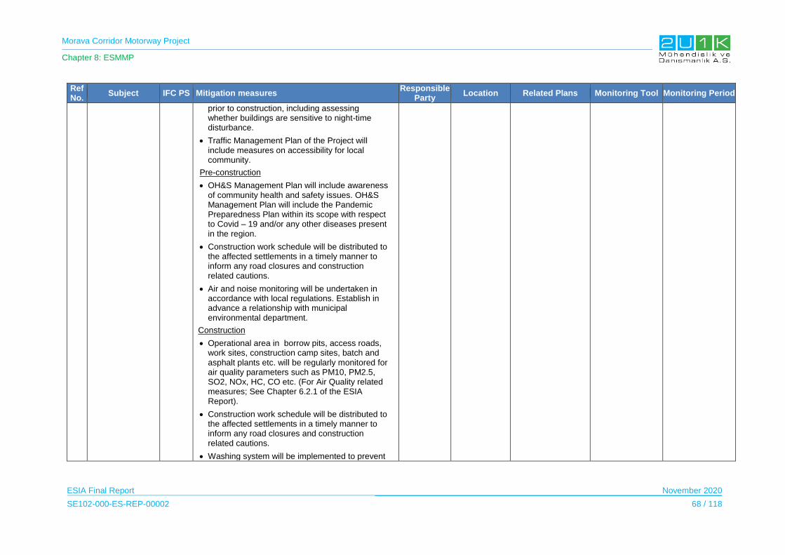
Morava Corridor Motorway Project
Chapter 8: ESMMP
ESIA Final Report November 2020
SE102-000-ES-REP-00002 68 / 118
Ref No.
Subject IFC PS Mitigation measures Responsible
Party Location Related Plans Monitoring Tool Monitoring Period
prior to construction, including assessing whether buildings are sensitive to night-time disturbance.
Traffic Management Plan of the Project will include measures on accessibility for local community.
Pre-construction
OH&S Management Plan will include awareness of community health and safety issues. OH&S Management Plan will include the Pandemic Preparedness Plan within its scope with respect to Covid – 19 and/or any other diseases present in the region.
Construction work schedule will be distributed to the affected settlements in a timely manner to inform any road closures and construction related cautions.
Air and noise monitoring will be undertaken in accordance with local regulations. Establish in advance a relationship with municipal environmental department.
Construction
Operational area in borrow pits, access roads, work sites, construction camp sites, batch and asphalt plants etc. will be regularly monitored for air quality parameters such as PM10, PM2.5, SO2, NOx, HC, CO etc. (For Air Quality related measures; See Chapter 6.2.1 of the ESIA Report).
Construction work schedule will be distributed to the affected settlements in a timely manner to inform any road closures and construction related cautions.
Washing system will be implemented to prevent
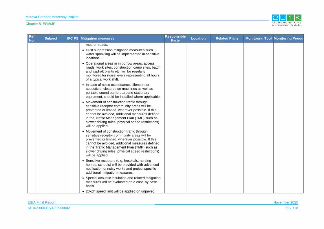
Morava Corridor Motorway Project
Chapter 8: ESMMP
ESIA Final Report November 2020
SE102-000-ES-REP-00002 69 / 118
Ref No.
Subject IFC PS Mitigation measures Responsible
Party Location Related Plans Monitoring Tool Monitoring Period
mud on roads.
Dust suppression mitigation measures such water sprinkling will be implemented in sensitive locations.
Operational areas in in borrow areas, access roads, work sites, construction camp sites, batch and asphalt plants etc. will be regularly monitored for noise levels representing all hours of a typical work shift.
In case of noise exceedance, silencers or acoustic enclosures on machines as well as portable sound barriers around stationary equipment, should be installed where applicable.
Movement of construction traffic through sensitive receptor community areas will be prevented or limited, wherever possible. If this cannot be avoided, additional measures defined in the Traffic Management Plan (TMP) such as slower driving rules, physical speed restrictions) will be applied.
Movement of construction traffic through sensitive receptor community areas will be prevented or limited, wherever possible. If this cannot be avoided, additional measures defined in the Traffic Management Plan (TMP) such as slower driving rules, physical speed restrictions) will be applied.
Sensitive receptors (e.g. hospitals, nursing homes, schools) will be provided with advanced notification of noisy works and project specific additional mitigation measures.
Special acoustic insulation and related mitigation measures will be evaluated on a case-by-case basis.
20kph speed limit will be applied on unpaved
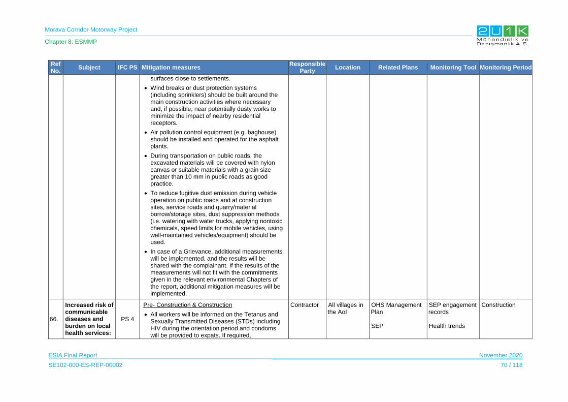
Morava Corridor Motorway Project
Chapter 8: ESMMP
ESIA Final Report November 2020
SE102-000-ES-REP-00002 70 / 118
Ref No.
Subject IFC PS Mitigation measures Responsible
Party Location Related Plans Monitoring Tool Monitoring Period
surfaces close to settlements.
Wind breaks or dust protection systems (including sprinklers) should be built around the main construction activities where necessary and, if possible, near potentially dusty works to minimize the impact of nearby residential receptors.
Air pollution control equipment (e.g. baghouse) should be installed and operated for the asphalt plants.
During transportation on public roads, the excavated materials will be covered with nylon canvas or suitable materials with a grain size greater than 10 mm in public roads as good practice.
To reduce fugitive dust emission during vehicle operation on public roads and at construction sites, service roads and quarry/material borrow/storage sites, dust suppression methods (i.e. watering with water trucks, applying nontoxic chemicals, speed limits for mobile vehicles, using well-maintained vehicles/equipment) should be used.
In case of a Grievance, additional measurements will be implemented, and the results will be shared with the complainant. If the results of the measurements will not fit with the commitments given in the relevant environmental Chapters of the report, additional mitigation measures will be implemented.
66.
Increased risk of communicable diseases and burden on local health services:
PS 4
Pre- Construction & Construction
All workers will be informed on the Tetanus and Sexually Transmitted Diseases (STDs) including HIV during the orientation period and condoms will be provided to expats. If required,
Contractor All villages in the AoI
OHS Management Plan SEP
SEP engagement records Health trends
Construction
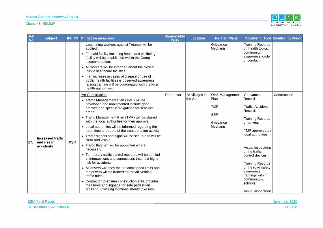
Morava Corridor Motorway Project
Chapter 8: ESMMP
ESIA Final Report November 2020
SE102-000-ES-REP-00002 71 / 118
Ref No.
Subject IFC PS Mitigation measures Responsible
Party Location Related Plans Monitoring Tool Monitoring Period
vaccinating workers against Tetanus will be applied.
First aid facility including health and wellbeing facility will be established within the Camp accommodation.
All workers will be informed about the closest Public healthcare facilities.
If an increase in cases of disease or use of public health facilities is observed awareness raising training will be coordinated with the local health authorities.
Grievance Mechanism
Training Records on health topics, community awareness, code of conduct
67.
Increased traffic and rise in accidents
PS 4
Pre-Construction
Traffic Management Plan (TMP) will be developed and implemented include good practice and specific mitigations for sensitive areas.
Traffic Management Plan (TMP) will be shared with the local authorities for their approval.
Local authorities will be informed regarding the date, time and route of the transportation activity.
Traffic signals and signs will be set up and will be clear and visible
Traffic flagmen will be appointed where necessary.
Temporary traffic control methods will be applied at intersections and connections that hold higher risk for accidents.
All drivers will obey the national speed limits and the drivers will be trained on the all Serbian traffic rules.
Contractor to ensure construction area provides measures and signage for safe pedestrian crossing. Crossing locations should take into
Contractor All villages in the AoI
OHS Management Plan TMP SEP Grievance Mechanism
Grievance Records Traffic Accident Records Training Records on drivers TMP approved by local authorities
Visual inspections of the traffic control devices Training Records of the road safety awareness trainings within community & schools, Visual inspections
Construction
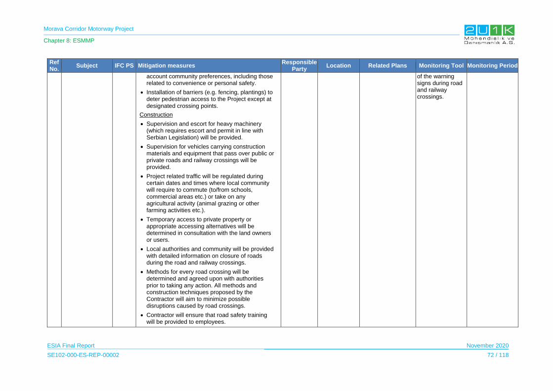
Morava Corridor Motorway Project
Chapter 8: ESMMP
ESIA Final Report November 2020
SE102-000-ES-REP-00002 72 / 118
Ref No.
Subject IFC PS Mitigation measures Responsible
Party Location Related Plans Monitoring Tool Monitoring Period
account community preferences, including those related to convenience or personal safety.
Installation of barriers (e.g. fencing, plantings) to deter pedestrian access to the Project except at designated crossing points.
Construction
Supervision and escort for heavy machinery (which requires escort and permit in line with Serbian Legislation) will be provided.
Supervision for vehicles carrying construction materials and equipment that pass over public or private roads and railway crossings will be provided.
Project related traffic will be regulated during certain dates and times where local community will require to commute (to/from schools, commercial areas etc.) or take on any agricultural activity (animal grazing or other farming activities etc.).
Temporary access to private property or appropriate accessing alternatives will be determined in consultation with the land owners or users.
Local authorities and community will be provided with detailed information on closure of roads during the road and railway crossings.
Methods for every road crossing will be determined and agreed upon with authorities prior to taking any action. All methods and construction techniques proposed by the Contractor will aim to minimize possible disruptions caused by road crossings.
Contractor will ensure that road safety training will be provided to employees.
of the warning signs during road and railway crossings.

Morava Corridor Motorway Project
Chapter 8: ESMMP
ESIA Final Report November 2020
SE102-000-ES-REP-00002 73 / 118
Ref No.
Subject IFC PS Mitigation measures Responsible
Party Location Related Plans Monitoring Tool Monitoring Period
The schools nearby the Project site will be informed about the peak movements of the vehicles and vehicle traffic will be minimized during hours when children are traveling to and from school.
Heavy machinery and vehicles utilized in transportation activities (including transportation of personnel) will be used by qualified and licensed drivers.
All drivers will know and comply with all traffic signs, are will be made aware of hotspots of intense traffic that are expected along the route and are trained properly for on and off-road conditions.
Managing and monitoring of working and resting hours drivers will be undertaken according to Serbian Legislation.
Monitoring security arrangements for loads, vehicles and drivers will be undertaken according to Serbian Legislation.
All project work sites, Project Facilities, temporary roads, and traffic management works will be will be signposted in line Serbian Legislation and as required by the Traffic Management Plan TMP).
Night drive/transportation will be limited as much as possible to reduce the risk of accidents and obtaining necessary permits shall night transportation be required.
Compensating damages caused by an accident due to project activities will be undertaken according to national legislative requirements and the Grievance Mechanism defined in the Stakeholder Engagement Plan (SEP) of the Project.
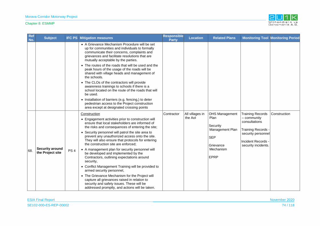
Morava Corridor Motorway Project
Chapter 8: ESMMP
ESIA Final Report November 2020
SE102-000-ES-REP-00002 74 / 118
Ref No.
Subject IFC PS Mitigation measures Responsible
Party Location Related Plans Monitoring Tool Monitoring Period
A Grievance Mechanism Procedure will be set up for communities and individuals to formally communicate their concerns, complaints and grievances and facilitate resolutions that are mutually acceptable by the parties.
The routes of the roads that will be used and the peak hours of the usage of the roads will be shared with village heads and management of the schools.
The CLOs of the contractors will provide awareness trainings to schools if there is a school located on the route of the roads that will be used.
Installation of barriers (e.g. fencing,) to deter pedestrian access to the Project construction area except at designated crossing points
68. Security around the Project site
PS 4
Construction
Engagement activities prior to construction will ensure that local stakeholders are informed of the risks and consequences of entering the site;
Security personnel will patrol the site area to prevent any unauthorized access onto the site. They will also ensure that protocols for entering the construction site are enforced;
A management plan for security personnel will be developed and implemented by the Contractors, outlining expectations around security,
Conflict Management Training will be provided to armed security personnel,
The Grievance Mechanism for the Project will capture all grievances raised in relation to security and safety issues. These will be addressed promptly, and actions will be taken.
Contractor All villages in the AoI
OHS Management Plan Security Management Plan SEP Grievance Mechanism EPRP
Training Records – community consultations Training Records - security personnel Incident Records - security incidents.
Construction
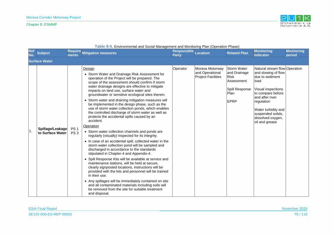
Morava Corridor Motorway Project
Chapter 8: ESMMP
ESIA Final Report November 2020
SE102-000-ES-REP-00002 75 / 118
Table 8-5. Environmental and Social Management and Monitoring Plan (Operation Phase) Ref No.
Subject Requirements
Mitigation measures Responsible Party
Location Related Plan Monitoring Indicator
Monitoring period
Surface Water
1. Spillage/Leakage to Surface Water
PS 1 PS 3
Design
Storm Water and Drainage Risk Assessment for operation of the Project will be prepared. The scope of the assessment should confirm if storm water drainage designs are effective to mitigate impacts on land use, surface water and groundwater or sensitive ecological sites therein.
Storm water and draining mitigation measures will be implemented in the design phase, such as the use of storm water collection ponds, which enables the controlled discharge of storm water as well as protects the accidental spills caused by an accident.
Operation
Storm water collection channels and ponds are regularly (visually) inspected for its integrity.
In case of an accidental spill, collected water in the storm water collection pond will be sampled and discharged in accordance to the standards stipulated in Chapter-4 and Appendix-4.
Spill Response Kits will be available at service and maintenance stations, will be held at secure, clearly signposted locations, instructions will be provided with the kits and personnel will be trained in their use.
Any spillages will be immediately contained on site and all contaminated materials including soils will be removed from the site for suitable treatment and disposal.
Operator Morava Motorway and Operational Project Facilities
Storm Water and Drainage Risk Assessment Spill Response Plan EPRP
Natural stream flow and slowing of flow due to sediment load Visual inspections to compare before and after river regulation Water turbidity and suspended solids, dissolved oxygen, oil and grease
Operation
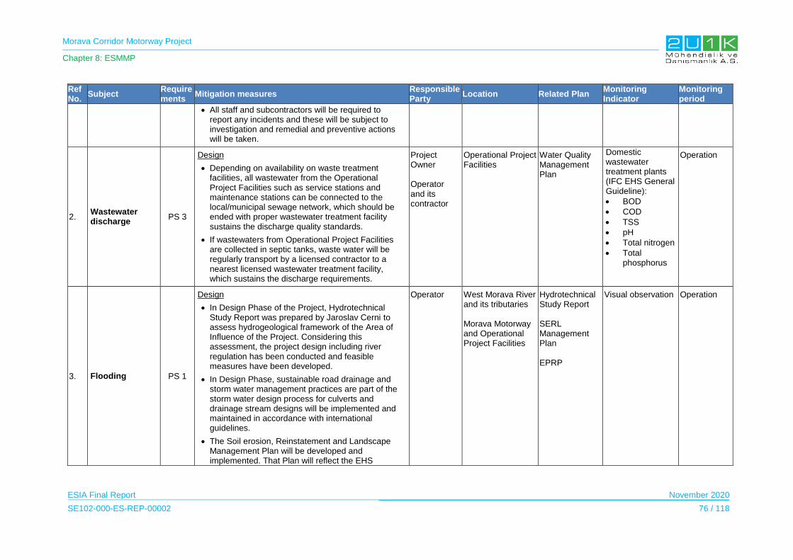
Morava Corridor Motorway Project
Chapter 8: ESMMP
ESIA Final Report November 2020
SE102-000-ES-REP-00002 76 / 118
Ref No.
Subject Requirements
Mitigation measures Responsible Party
Location Related Plan Monitoring Indicator
Monitoring period
All staff and subcontractors will be required to report any incidents and these will be subject to investigation and remedial and preventive actions will be taken.
2. Wastewater discharge
PS 3
Design
Depending on availability on waste treatment facilities, all wastewater from the Operational Project Facilities such as service stations and maintenance stations can be connected to the local/municipal sewage network, which should be ended with proper wastewater treatment facility sustains the discharge quality standards.
If wastewaters from Operational Project Facilities are collected in septic tanks, waste water will be regularly transport by a licensed contractor to a nearest licensed wastewater treatment facility, which sustains the discharge requirements.
Project Owner Operator and its contractor
Operational Project Facilities
Water Quality Management Plan
Domestic wastewater treatment plants (IFC EHS General Guideline):
BOD
COD
TSS
pH
Total nitrogen
Total phosphorus
Operation
3. Flooding PS 1
Design
In Design Phase of the Project, Hydrotechnical Study Report was prepared by Jaroslav Cerni to assess hydrogeological framework of the Area of Influence of the Project. Considering this assessment, the project design including river regulation has been conducted and feasible measures have been developed.
In Design Phase, sustainable road drainage and storm water management practices are part of the storm water design process for culverts and drainage stream designs will be implemented and maintained in accordance with international guidelines.
The Soil erosion, Reinstatement and Landscape Management Plan will be developed and implemented. That Plan will reflect the EHS
Operator West Morava River and its tributaries Morava Motorway and Operational Project Facilities
Hydrotechnical Study Report SERL Management Plan EPRP
Visual observation Operation

Morava Corridor Motorway Project
Chapter 8: ESMMP
ESIA Final Report November 2020
SE102-000-ES-REP-00002 77 / 118
Ref No.
Subject Requirements
Mitigation measures Responsible Party
Location Related Plan Monitoring Indicator
Monitoring period
guidelines for Environmental, Health, and Safety Guidelines for Toll Roads in full (as well as Serbian Regulations).
Construction
In order to protect against flooding and eliminate more consecutive sharp bends and bank erosion, river regulation (see Chapter 3.3 for detailed information) will be carried out by the Contractor.
4. Change in River Flow
Design
New river beds will be made curves (and not straight) with asymmetrical cross sections.
Natural materials will be used to protect and strengthen banks (turf and forest plantations) in conjunction with steel structures (gabions) rather than monolithic concrete.
The design will not include any structure blocking the continuity of the flow..
Operation
Flow monitoring stations will be established at river diversion locations. Number and position of the flow monitoring stations will be defined during the detailed design phase in coordination with Serbian Environmental Protection Agency and other relevant state institutions. These flow measurement locations will be part of the early warning system for flood protection.
Operator Flow monitoring stations in river regulation locations defined during the detailed design phase in coordination with Serbian Environmental Protection Agency and other relevant state institutions.
Water Quality Management Plan
Water Quality Monitoring Report
Operation
5. Change in River Water Quality
Design
The potential locations subject to scouring will be strengthened. For this purpose, as much as natural materials i.e. gabions will be used at these locations.
Operator Flow monitoring stations in river regulation locations defined during the detailed design phase in coordination with
Water Quality Management Plan
Water Quality Monitoring Report
Operation
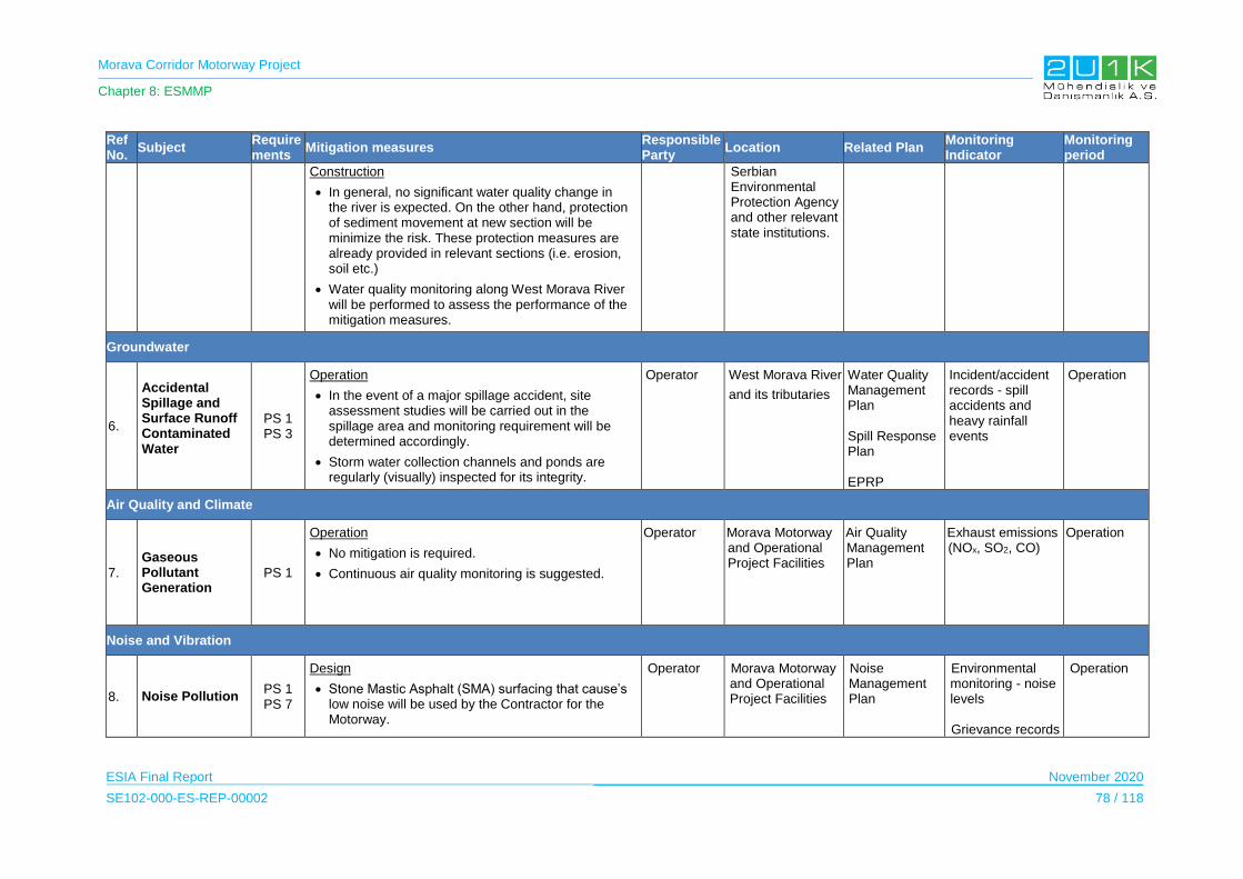
Morava Corridor Motorway Project
Chapter 8: ESMMP
ESIA Final Report November 2020
SE102-000-ES-REP-00002 78 / 118
Ref No.
Subject Requirements
Mitigation measures Responsible Party
Location Related Plan Monitoring Indicator
Monitoring period
Construction
In general, no significant water quality change in the river is expected. On the other hand, protection of sediment movement at new section will be minimize the risk. These protection measures are already provided in relevant sections (i.e. erosion, soil etc.)
Water quality monitoring along West Morava River will be performed to assess the performance of the mitigation measures.
Serbian Environmental Protection Agency and other relevant state institutions.
Groundwater
6.
Accidental Spillage and Surface Runoff Contaminated Water
PS 1 PS 3
Operation
In the event of a major spillage accident, site assessment studies will be carried out in the spillage area and monitoring requirement will be determined accordingly.
Storm water collection channels and ponds are regularly (visually) inspected for its integrity.
Operator West Morava River
and its tributaries
Water Quality Management Plan Spill Response Plan EPRP
Incident/accident records - spill accidents and heavy rainfall events
Operation
Air Quality and Climate
7.
Gaseous Pollutant Generation
PS 1
Operation
No mitigation is required.
Continuous air quality monitoring is suggested.
Operator Morava Motorway and Operational Project Facilities
Air Quality Management Plan
Exhaust emissions (NOx, SO2, CO)
Operation
Noise and Vibration
8. Noise Pollution PS 1 PS 7
Design
Stone Mastic Asphalt (SMA) surfacing that cause’s low noise will be used by the Contractor for the Motorway.
Operator Morava Motorway and Operational Project Facilities
Noise Management Plan
Environmental monitoring - noise levels Grievance records
Operation

Morava Corridor Motorway Project
Chapter 8: ESMMP
ESIA Final Report November 2020
SE102-000-ES-REP-00002 79 / 118
Ref No.
Subject Requirements
Mitigation measures Responsible Party
Location Related Plan Monitoring Indicator
Monitoring period
Natural topography will be used for noise protection.
Additional noise barriers will be considered for the sensitive receptors, as necessary.
The landscape screening will be done either by lowering the Motorway or adding soil embankment
The noise barriers adjacent to the motorway will be used.
The building insulations will be improved (for example, sound insulation of windows and walls), where necessary.
In cases where insulation is not possible, compensation will be considered.
Operation
Maintenance of the road surface will be done.
Speed limits will be applied.
(complaints related with noise)
Geology and Soil
9. Earthquake PS 1 PS 4
Design
The Project will comply with the relevant Serbian regulatory requirements related to seismic design and risk assessment.
Emergency Preparedness and Response Plan (EPRP) will be implemented for the operation phase.
Operator Morava Motorway and Operational Project Facilities
EPRP
Records of emergency drills
Operation
10.
Runoff from the Road and Accidental Spillage
PS 1
Design
Storm Water and Drainage Risk Assessment will be conducted in order to confirm that storm water drainage designs are effective to mitigate impacts on soil quality therein. Measures will be taken, such as the use of sand layers, which should be used as filters in leakage pits, to prevent the
Operator West Morava River and its tributaries Morava Motorway and Operational Project Facilities
Storm Water and Drainage Risk Assessment Spill Response Plan
Incident / accident records
Operation

Morava Corridor Motorway Project
Chapter 8: ESMMP
ESIA Final Report November 2020
SE102-000-ES-REP-00002 80 / 118
Ref No.
Subject Requirements
Mitigation measures Responsible Party
Location Related Plan Monitoring Indicator
Monitoring period
penetration of harmful substances into deeper soil layer.
Emergency Preparedness and Response Plan (EPRP) will be developed.
EPRP
Waste Management
11. Generation of Waste
PS 1 PS 3 PS 6
Design
Waste Management Plan will be prepared and implemented
Hazardous Material Management Plan will be prepared and implemented.
Operation
To minimize the risk of road paving maintenance work, follow the IFC EHS Toll Road Guidelines (2007).
Mitigation measures will take into account the requirements of Serbian regulations and IFC General EHS Guidelines.
An appropriate training should be provided to all personnel in operational project facilities and at toll booths to show where different types of waste will be placed.
Solid waste will be collected regularly and disposed of properly at an appropriate disposal site.
Waste containers will be capable of handling the solid wastes in an appropriate and safe manner and will not be affected by weather conditions.
Waste containers required to have labels identifying the type of waste. Proper labelling will prevent mixing of hazardous waste and non-hazardous solid waste.
Reuse/recycling methods will be considered to
Operator and its contractor
Morava Motorway and Operational Project Facilities
Hazardous Material Management Plan Waste Management Plan
Visual inspections Waste Audits including disposal records
Operation

Morava Corridor Motorway Project
Chapter 8: ESMMP
ESIA Final Report November 2020
SE102-000-ES-REP-00002 81 / 118
Ref No.
Subject Requirements
Mitigation measures Responsible Party
Location Related Plan Monitoring Indicator
Monitoring period
minimize the generation of solid waste.
Certified/licensed facilities will be used for the final disposal of solid wastes which cannot be reused/recycled.
Signs and other posting will be used to inform drivers not to throw litter. Litter or illegally disposed waste along the Motorway required to be collected and disposed of properly.
Recycling and trash containers will be provided in parking lots and rest areas to minimize litters on the Motorway.
Sediments and sludge from storm drainage systems required to be managed and disposed appropriately.
Old road surface materials can be managed by re-using in paving or stockpiling materials may be stored for roadbed or other uses.
All hazardous waste should be properly collected, marked and disposed at approved location in accordance with the procedure prescribed within the Law on waste management (“Official Gazette of RS”, 36/09, 88/10, 14/16). It is strictly forbidden to dispose any type of hazardous waste on locations where surplus earth material will be disposed.
Terrestrial and Freshwater Ecology
12. Accidental loss of fauna
PS6
Design
Hard fences are erected to prevent the access of animals onto roads. They are mostly constructed to reduce accidents due to collisions between large mammals and cars, but also to reduce the number of smaller animals killed on the roads. The disadvantage of hard fences is that they increase the barrier effect. In most cases, hard fences must
Operator Morava Motorway Biodiversity Management Plan
Visual observations,
Photographic records
Inspection records
Operation

Morava Corridor Motorway Project
Chapter 8: ESMMP
ESIA Final Report November 2020
SE102-000-ES-REP-00002 82 / 118
Ref No.
Subject Requirements
Mitigation measures Responsible Party
Location Related Plan Monitoring Indicator
Monitoring period
therefore be combined with wildlife passages. In these cases, they fulfill an important role in guiding animals to the crossing points.
Hard fences will always be built on both sides of a road. The ends of the hard fences are danger points: animals may go around the end of the hard fence and get trapped on the road. Hard fences will therefore end at structures like bridges.
Warning signs aim at influencing the behavior of drivers in order to reduce the number and severity of collisions between large mammals and cars.
Road lights often attract insects and as a consequence bats or nocturnal birds which hunt them. This results in high mortality for the insects as well as for their predators. To prevent collisions of insects the use of sodium lights is recommended.
Operation
Standard traffic signals will be placed in areas where collisions often occur. They also exist for amphibians, water birds and other animals.
13. Barrier effect in fauna
PS6
Design
Culverts for animals are primarily constructed as safe crossing points for mammals. Target species are usually mammals. Smal fauna species may readily use these culverts as well. As a minimum when using culverts a ledge will be incorporated where species such as otters and herptiles can cross alongside the river even at times of high flow.
It can also be used on bridges to be built on the West Morava River to prevent barrier effect. Vegetated area will be left between the bridge abutment and the riverbank.
Operator
Morava Motorway Biodiversity Management Plan
Visual observations,
Photographic records
Inspection records The crossing success of the fauna species
Operation
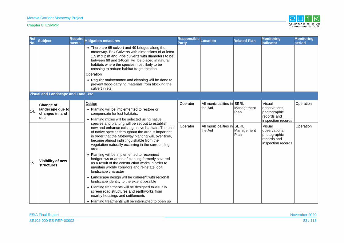
Morava Corridor Motorway Project
Chapter 8: ESMMP
ESIA Final Report November 2020
SE102-000-ES-REP-00002 83 / 118
Ref No.
Subject Requirements
Mitigation measures Responsible Party
Location Related Plan Monitoring Indicator
Monitoring period
There are 65 culvert and 40 bridges along the motorway. Box Culverts with dimensions of at least 1.5 m x 2 m and Pipe culverts with diameters to be between 60 and 140cm will be placed in natural habitats where the species most likely to be crossing to reduce habitat fragmentation.
Operation
Regular maintenance and cleaning will be done to prevent flood-carrying materials from blocking the culvert inlets
Visual and Landscape and Land Use
14.
Change of landscape due to changes in land use
Design
Planting will be implemented to restore or compensate for lost habitats.
Planting mixes will be selected using native species and planting will be set out to establish new and enhance existing native habitats. The use of native species throughout the area is important in order that the Motorway planting will, over time, become almost indistinguishable from the vegetation naturally occurring in the surrounding area.
Planting will be implemented to reconnect hedgerows or areas of planting formerly severed as a result of the construction works in order to maintain wildlife corridors and reinstate local landscape character
Landscape design will be coherent with regional landscape identity to the extent possible
Planting treatments will be designed to visually screen road structures and earthworks from nearby housings and settlements
Planting treatments will be interrupted to open up
Operator
All municipalities in the AoI
SERL Management Plan
Visual observations, photographic records and inspection records
Operation
15. Visibility of new structures
Operator
All municipalities in the AoI
SERL Management Plan
Visual observations, photographic records and inspection records
Operation
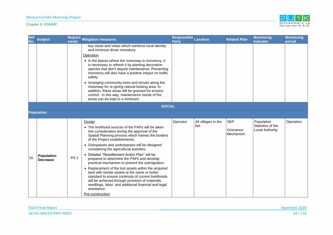
Morava Corridor Motorway Project
Chapter 8: ESMMP
ESIA Final Report November 2020
SE102-000-ES-REP-00002 84 / 118
Ref No.
Subject Requirements
Mitigation measures Responsible Party
Location Related Plan Monitoring Indicator
Monitoring period
key views and vistas which reinforce local identity and minimize driver monotony
Operation
In the places where the motorway is monotony, it is necessary to refresh it by planting decorative species that don’t require maintenance. Preventing monotony will also have a positive impact on traffic safety.
Arranging community trees and shrubs along the motorway for re-giving natural-looking area. In addition, these areas will be grassed for erosion control. In this way, maintenance needs of the areas can be kept to a minimum.
SOCIAL
Population
16. Population Decrease
PS 1
Design
The livelihood sources of the PAPs will be taken into consideration during the approval of the Spatial Planning process which frames the borders of the Project establishments,
Overpasses and underpasses will be designed considering the agricultural activities,
Detailed “Resettlement Action Plan” will be prepared to determine the PAPs and develop practical mechanism to prevent the outmigration.
Replacement of the lost assets within the acquired land with similar assets at the same or better standard to ensure continuity of current livelihoods will be achieved through provision of materials, seedlings, labor, and additional financial and legal assistance.
Pre-construction
Operator All villages in the AoI
SEP Grievance Mechanism
Population Statistics of the Local Authority
Operation
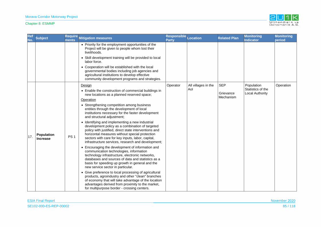
Morava Corridor Motorway Project
Chapter 8: ESMMP
ESIA Final Report November 2020
SE102-000-ES-REP-00002 85 / 118
Ref No.
Subject Requirements
Mitigation measures Responsible Party
Location Related Plan Monitoring Indicator
Monitoring period
Priority for the employment opportunities of the Project will be given to people whom lost their livelihoods.
Skill development training will be provided to local labor force.
Cooperation will be established with the local governmental bodies including job agencies and agricultural institutions to develop effective community development programs and strategies.
17. Population Increase
PS 1
Design
Enable the construction of commercial buildings in new locations as a planned reserved space;
Operation
Strengthening competition among business entities through the development of local institutions necessary for the faster development and structural adjustment;
Identifying and implementing a new industrial development policy as a combination of targeted policy with justified, direct state interventions and horizontal measures without special protection sectors with care for key inputs, labor, capital, infrastructure services, research and development;
Encouraging the development of information and communication technologies, information technology infrastructure, electronic networks, databases and sources of data and statistics as a basis for speeding up growth in general and the new service sector in particular.
Give preference to local processing of agricultural products, agroindustry and other "clean" branches of economy that will take advantage of the location advantages derived from proximity to the market, for multipurpose border - crossing centers.
Operator All villages in the AoI
SEP Grievance Mechanism
Population Statistics of the Local Authority
Operation

Morava Corridor Motorway Project
Chapter 8: ESMMP
ESIA Final Report November 2020
SE102-000-ES-REP-00002 86 / 118
Ref No.
Subject Requirements
Mitigation measures Responsible Party
Location Related Plan Monitoring Indicator
Monitoring period
Development of a rational and functional structure of the settlement network;
Identifying settlements that can most effectively serve as service, manufacturing and commercial centers of the surrounding area:
Infrastructure
18.
Pressure on the local healthcare infrastructure as a result of in migration
PS 1 PS 4
Operation
Considering inadequate health services Varvarin and Trstenik Municipalities, settlements in those settlements may be imposed to more diverse impacts on health services compared to other municipalities, therefore, it is recommended that incorporation with the Project Employer and local authorities should be made in case the in-migration resulted insufficiency in health services to take any possible action.
Operator All villages in the AoI
SEP IUMP Grievance Mechanism
Statistics Grievance records (regarding accommodation)
Operation
19.
Pressure on sewage system Lack of waste management
PS 1 PS 4
Construction
Project Employer is recommended to be cooperate with responsible authorities in case necessary improvements will be required for local infrastructure.
Operation
Project Employer to be in close coordination with the related local authorities to curtail inconvenience to the residents of the Project area.
Operator All villages in the AoI
SEP Waste Management Plan Grievance Mechanism
Statistics Grievance records (regarding accommodation)
Operation
Economy
20.
Direct and In-direct Employment Opportunities
PS 1 PS 2
Operation
Recruitment policy and procedures of the Employer should aim to provide opportunities for
Operator All municipalities in the AoI
Statistics SEP
Statistics on workforce (inc. breakdown of
Operation

Morava Corridor Motorway Project
Chapter 8: ESMMP
ESIA Final Report November 2020
SE102-000-ES-REP-00002 87 / 118
Ref No.
Subject Requirements
Mitigation measures Responsible Party
Location Related Plan Monitoring Indicator
Monitoring period
employment of local workforce to the extent possible considering unskilled, semi-skilled, and skilled workforce, and giving priority to vulnerable persons (especially those who will be economically disabled). Priority will be given to Social AoI.
Training for PAPS to increase their employability should target identified PAPs within the scope of intervention of the RAP.
Training for PAPs whom seek employment should be provided to obtain jobs with the Project to the extent possible, within the scope of intervention of the RAP
The Operator should require and develop policies for a fair and transparent, gender neutral recruitment process for all job openings. The Project Owner should seek to employ PAPs on each Sector of the Project route.
As a good practice, Subcontractors should be encouraged to employ local personnel within the scope of their recruitment policy and procedures.
Grievance Mechanism Human Resource Policy
direct and contracted workers, ratio of people hired from the local) Labour Audit Repots
Written Project-specific Human Resources Policy and relevant procedures Grievances records (recruitment) Number of female staff recruited Worker Grievance Procedure
21.
Increase in Economic Development in the Region
PS 1
Operation
The operation phase of the Project will seek to promote local employment (including job training for the operational activities) and purchase local goods and services to the extent possible.
Operator All municipalities in the AoI
Statistics SEP Grievance Mechanism
Procurement records Number of local employees Number of local services acquired Grievance Records
Operation
Ecosystem Services

Morava Corridor Motorway Project
Chapter 8: ESMMP
ESIA Final Report November 2020
SE102-000-ES-REP-00002 88 / 118
Ref No.
Subject Requirements
Mitigation measures Responsible Party
Location Related Plan Monitoring Indicator
Monitoring period
22.
Access to Ecosystem Services
Design
Access to the ecosystem services will be ensured by providing required overpasses and underpasses.
An ecological bridge will be constructed at suitable point.
In case any damage to Irrigation system, damaged channels will be re-constructed.
In case of grievances, beehives will be moved away from the Motorway Route with the assistance of CoS.
Detailed “Resettlement Action Plan” will be prepared to determine the PAPs whom will be affected by the impacts on the livelihoods as a result of access to ecosystem services.
Operator All affected municipalities
RAP Grievance Mechanism SEP
Grievance Mechanism
Operation
Labour and Working Conditions
23. Local Employment
PS 2
Operation
The workers will have contracts which clearly state the terms and conditions of their employment and their legal rights. Information will include, but not be limited to, entitlement to wages, hours of work, overtime arrangements and overtime compensation, and any benefits (such as leave for illness, maternity / paternity or holiday). All workers will be able to join trade unions of their choice and have the right to collective bargaining. Contracts will be verbally explained to all workers where this is necessary to ensure that workers understand their rights prior to any employment contract to be signed.
The Project will put in place a worker grievance mechanism. The grievance mechanism will be open to all the staff and their contractors. The
Operator Tool Stations Human Resource Policy Workers Grievance Mechanism
Worker Contracts Training Records Grievance Records Labour Audit Repots
Operation

Morava Corridor Motorway Project
Chapter 8: ESMMP
ESIA Final Report November 2020
SE102-000-ES-REP-00002 89 / 118
Ref No.
Subject Requirements
Mitigation measures Responsible Party
Location Related Plan Monitoring Indicator
Monitoring period
grievance mechanism will be publicly advertised by the Project in the workforce. It will be easily accessible by workers, free of retribution and will allow anonymous complaints to be raised and addressed.
The Operator will establish human resources policy for all operational employees with information regarding their rights under national labour law, including their rights related to wages and benefits. The policy will cover working conditions, right to organize, non-discrimination, grievance mechanisms, child labour, and forced labour.
All contractor contracts, the Project will make explicit reference to the need to abide by Serbian Labour Law (Official Gazette No. 75/ last amended on 2014). IFC standards and ILO conventions in relation to labor and welfare standards, freedom of association and reference must be made to child and forced labor. Emphasis will also be placed on anti-discrimination measures. Where young people below the age of 18 years are employed, it will be made clear that they will not be employed in hazardous work and their work will be subject to an appropriate risk assessment.
Occupational Health and Safety
24.
Health and Safety Risks due to General Occupational Health and Safety Hazards
PS 4
Operation
Occupational Health and Safety Management Plan specific to operational activities will be prepared and OH&S Management Plan will acknowledge and reference to IFC EHS Guidelines for Toll Roads (2007) and IFC General EHS Guidelines (2007).
A system will be established for the reporting and
Operator Morava Motorway and Operational Project Facilities
OHS Management Plan
Training Records including inductions, code of conduct, cultural awareness, environmental awareness, toolbox talks.
Operation

Morava Corridor Motorway Project
Chapter 8: ESMMP
ESIA Final Report November 2020
SE102-000-ES-REP-00002 90 / 118
Ref No.
Subject Requirements
Mitigation measures Responsible Party
Location Related Plan Monitoring Indicator
Monitoring period
recording of occupational accidents and dangerous occurrences/incidents.
Personal Protective Equipment will be selected based on the specific hazards and risks of the task to be performed and properly maintained to keep them effective and operational throughout their use.
Individuals shall only carry out tasks for which they are competent and authorized to do so. Individuals shall only operate and use plant or equipment for which they are trained and authorized. Copies of all operator certificates will be retained.
Emergency contact numbers will be made available at the assigned areas. This will include the fire and rescue service and the environmental inspection.
Stop Work Incident Records Quality Audits including subcontractors
25.
Health and Safety Risks due to Physical and Chemical Hazards
PS 4
Operation
Pavers with exhaust ventilation systems will be used and proper maintenance of such systems will be ensured to maintain worker exposure to crystalline silica (millers and grinders) and asphalt fumes (pavers) below applicable occupational exposure levels.
Correct asphalt product will be used for each specific application and application at the correct temperature will be ensured to reduce the fuming of bitumen during normal handling.
Tollbooths will be equipped with proper ventilation systems;
Protective clothing will be used when working with cutbacks (a mixture of asphalt and solvents for the repair of pavement), diesel fuel, or other solvents.
Appropriate respiratory protection will be used when removing paints.
Operator
Morava Motorway and Operational Project Facilities
OHS Management Plan
Operation

Morava Corridor Motorway Project
Chapter 8: ESMMP
ESIA Final Report November 2020
SE102-000-ES-REP-00002 91 / 118
Ref No.
Subject Requirements
Mitigation measures Responsible Party
Location Related Plan Monitoring Indicator
Monitoring period
26.
Health and Safety Risks due to Emergencies
PS 4
Design
An Emergency Preparedness and Response Plan, covering the emergency situations (involving vehicles and pedestrians) that may occur during the Motorway’s operation, should be prepared and implemented by trained personnel in order to avoid significant risks.
Operator
Morava Motorway and Operational Project Facilities
OHS Management Plan EPRP
Operation
27.
Health and Safety Risks due to Motorway maintenance
PS 4
Operation
Workers will only work in live lane(s) once advance signs are in place to warn road users of their presence. Where possible, operatives should face the oncoming traffic, or work with a lookout.
Works vehicles will support operatives and minimise the need to cross the carriageway. They should be positioned to prevent funneling of drivers toward the work area or into the path of oncoming traffic.
Incidents where vehicles have struck or displaced traffic management equipment or entered the works area should be recorded. This will allow the traffic management design to be reviewed and altered, if appropriate, to maintain the safety of drivers and workers.
Reflective signs and equipment will be kept clean to maintain clear visibility. Replacing dirty or damaged equipment rather than cleaning or repairing it in situ will reduce time at the roadside.
Night workers (i.e. those regularly working between 11 pm and 6 am) unless specified elsewhere in a written agreement.
Lone working should be assessed to determine if one person can do the tasks safely and if particular precautions are needed
Operator
Morava Motorway and Operational Project Facilities
OHS Management Plan
Operation
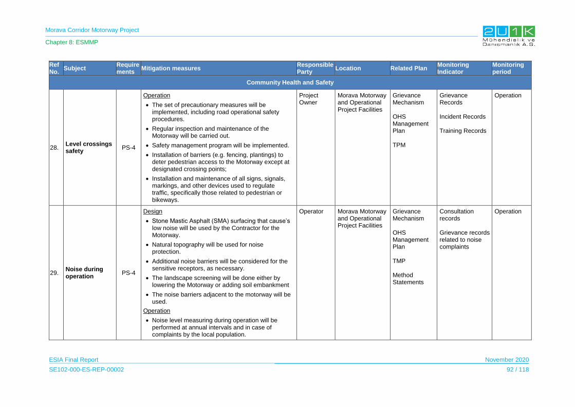
Morava Corridor Motorway Project
Chapter 8: ESMMP
ESIA Final Report November 2020
SE102-000-ES-REP-00002 92 / 118
Ref No.
Subject Requirements
Mitigation measures Responsible Party
Location Related Plan Monitoring Indicator
Monitoring period
Community Health and Safety
28. Level crossings safety
PS-4
Operation
The set of precautionary measures will be implemented, including road operational safety procedures.
Regular inspection and maintenance of the Motorway will be carried out.
Safety management program will be implemented.
Installation of barriers (e.g. fencing, plantings) to deter pedestrian access to the Motorway except at designated crossing points;
Installation and maintenance of all signs, signals, markings, and other devices used to regulate traffic, specifically those related to pedestrian or bikeways.
Project Owner
Morava Motorway and Operational Project Facilities
Grievance Mechanism OHS Management Plan TPM
Grievance Records Incident Records Training Records
Operation
29. Noise during operation
PS-4
Design
Stone Mastic Asphalt (SMA) surfacing that cause’s low noise will be used by the Contractor for the Motorway.
Natural topography will be used for noise protection.
Additional noise barriers will be considered for the sensitive receptors, as necessary.
The landscape screening will be done either by lowering the Motorway or adding soil embankment
The noise barriers adjacent to the motorway will be used.
Operation
Noise level measuring during operation will be performed at annual intervals and in case of complaints by the local population.
Operator
Morava Motorway and Operational Project Facilities
Grievance Mechanism OHS Management Plan TMP Method Statements
Consultation records Grievance records related to noise complaints
Operation
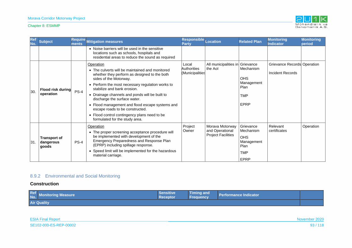
Morava Corridor Motorway Project
Chapter 8: ESMMP
ESIA Final Report November 2020
SE102-000-ES-REP-00002 93 / 118
Ref No.
Subject Requirements
Mitigation measures Responsible Party
Location Related Plan Monitoring Indicator
Monitoring period
Noise barriers will be used in the sensitive locations such as schools, hospitals and residential areas to reduce the sound as required
30. Flood risk during operation
PS-4
Operation
The culverts will be maintained and monitored whether they perform as designed to the both sides of the Motorway.
Perform the most necessary regulation works to stabilize and bank erosion.
Drainage channels and ponds will be built to discharge the surface water.
Flood management and flood escape systems and escape roads to be constructed.
Flood control contingency plans need to be formulated for the study area.
Local Authorities (Municipalities)
All municipalities in the AoI
Grievance Mechanism
OHS Management Plan TMP EPRP
Grievance Records Incident Records
Operation
31.
Transport of dangerous goods
PS-4
Operation
The proper screening acceptance procedure will be implemented with development of the Emergency Preparedness and Response Plan (EPRP) including spillage response.
Speed limit will be implemented for the hazardous material carriage.
Project Owner
Morava Motorway and Operational Project Facilities
Grievance Mechanism
OHS Management Plan
TMP
EPRP
Relevant certificates
Operation
8.9.2 Environmental and Social Monitoring
Construction
Ref No.
Monitoring Measure Sensitive Receptor
Timing and Frequency
Performance Indicator
Air Quality

Morava Corridor Motorway Project
Chapter 8: ESMMP
ESIA Final Report November 2020
SE102-000-ES-REP-00002 94 / 118
Ref No.
Monitoring Measure Sensitive Receptor
Timing and Frequency
Performance Indicator
1. A Method Statement will be prepared for air quality monitoring during the pre-construction and construction phase. The Method Statement will make provision for:
Periodic visual inspections of activities resulting in impact to air quality. Visual inspections will reflect the ethos of ‘see it, own it’, in terms of identifying and addressing significant air quality impacts. Where significant impacts are observed, these will be recorded and closed out.
Regular inspections during the site preparation phase to review air and dust issues and dust suppression techniques altered as required.
If significant dust complaints are received, passive monitoring of dust deposition upwind and downwind of key construction areas will be undertaken. Monitoring will be undertaken using an internationally recognised technique.
Nearest settlements to construction sites Natural habitats along the construction sites
During construction. Monitoring data reviewed monthly
Dust monitoring results compliant to performance criteria.
Recommendations and corrective actions taken when dust generation or combustion sources are noted.
Complaints arising from air quality emissions managed through the Grievance Mechanism.
Contractor
Greenhouse Gas Emissions
2. The ESIA undertaken for the proposed Motorway suggests that on the basis of the amount of diesel required during the construction phase that GHG emissions during the construction phase would surpass the IFC PS3 threshold of 25,000 tCO2e per year. Given this exceedance the Project will quantify and monitor direct GHG emissions from the Project in accordance with internationally recognized methodologies and in accordance with the requirements included in Annex A of the IFC PS3.
Not Applicable During construction.
Annual report
Quantification of Project GHG emissions during the construction phase.
Monitoring results which can be used to evaluate project performance.
Contractor
Noise and Vibration
3. A Method Statement will be prepared for noise monitoring during the pre-construction and construction phase. The Method Statement will make provision for:
Monthly noise measurements with portable noise meter at the nearest noise sensitive receptor locations to key Project activities (viz. Construction Camp and Plant; quarries and borrow pit sites; and active work sites).
Inspection of vehicle/machinery/equipment maintenance
Nearest settlements to construction sites
Natural habitats along the construction sites
Regular noise level checks will be carried out on a monthly basis during construction and when significant noise
Noise monitoring results compliant to performance criteria.
Noise monitoring records.
Recommendations and corrective actions taken when high audible incidents are noted.
Complaints arising from excessive noise
Contractor and Project Owner
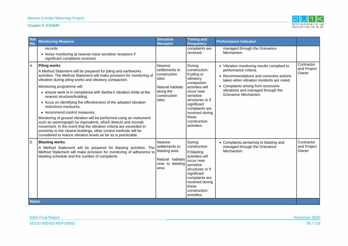
Morava Corridor Motorway Project
Chapter 8: ESMMP
ESIA Final Report November 2020
SE102-000-ES-REP-00002 95 / 118
Ref No.
Monitoring Measure Sensitive Receptor
Timing and Frequency
Performance Indicator
records.
Noise monitoring at nearest noise sensitive receptors if significant complaints received.
complaints are received.
managed through the Grievance Mechanism.
4. Piling works
A Method Statement will be prepared for piling and earthworks activities. The Method Statement will make provision for monitoring of vibration during piling works and vibratory compaction.
Monitoring programme will:
ensure work is in compliance with Serbia’s vibration limits at the nearest structure/building.
focus on identifying the effectiveness of the adopted vibration reductions measures.
recommend control measures.
Monitoring of ground vibration will be performed using an instrument such as seismograph (or equivalent), which detects and records movement. In the event that the vibration criteria are exceeded in proximity to the closest buildings, other control methods will be considered to reduce vibration levels as far as is practicable.
Nearest settlements to construction sites Natural habitats along the construction sites
During construction. If piling or vibratory compaction activities will occur near sensitive structures or if significant complaints are received during these construction activities.
Vibration monitoring results compliant to performance criteria.
Recommendations and corrective actions taken when vibration incidents are noted.
Complaints arising from excessive vibrations and managed through the Grievance Mechanism.
Contractor and Project Owner
5. Blasting works
A Method Statement will be prepared for blasting activities. The Method Statement will make provision for monitoring of adherence to blasting schedule and the number of complaints.
Nearest settlements to blasting area Natural habitats near to blasting area
During construction
If blasting activities will occur near sensitive structures or if significant complaints are received during these construction activities.
Complaints pertaining to blasting and managed through the Grievance Mechanism.
Contractor and Project Owner
Water

Morava Corridor Motorway Project
Chapter 8: ESMMP
ESIA Final Report November 2020
SE102-000-ES-REP-00002 96 / 118
Ref No.
Monitoring Measure Sensitive Receptor
Timing and Frequency
Performance Indicator
6. Groundwater levels in private and community wells located within 1 km of Project water abstraction boreholes will be monitored on a quarterly basis.
West Morava River aquifer
Pre-construction to obtain a seasonal baseline for capturing multi-seasonal data and1-yr post construction
Quarterly
Water levels in private / community wells not affected.
Project Owner
7. Ground water and surface water quality.
Ground water - in private and community wells located within 1 km of proposed water abstraction boreholes, Construction Camps, and any areas where hazardous substances will be handled, e.g.: refueling stations, vehicle workshops.
Surface water - in rivers, streams and dams located within 1 km downstream of Project activities including Construction Camps and any areas where hazardous substances will be handled, e.g.: refueling stations, vehicle workshops.
Surface and groundwater samples will be collected at least quarterly, twice during the wet season and twice during the dry season, in areas where Project activities are taking place and for one year thereafter.
Samples will be analyzed for a suite of analyses suitable to identify potential contaminants from project activities, e.g.: total petroleum hydrocarbons, dissolved metals, cations and anions (Ca, Mg, K, Fl, Cl, SO4), pH, total dissolved solids (TDS) and total suspended solids (TSS), and other compounds of potential concern based on chemicals compounds used during the project (e.g.: lubricants, degreasers).
West Morava River and its tributaries
Existing natural ponds within project AoI West Morava River aquifer
Pre-construction to obtain a seasonal baseline for capturing multi-seasonal data and1-yr post construction During construction
Quarterly
Water quality results compliant to performance criteria.
Project Owner
8. Waste water discharge
Monitoring of discharge from wastewater treatment plants located on construction site and Camp Accommodation to comply with applicable Serbian legislation and international good practice.
West Morava River and its tributaries Wastewater Treatment
During construction and operation of camp accommodation
Water quality in private / community wells and in nearby rivers not affected.
Contractor
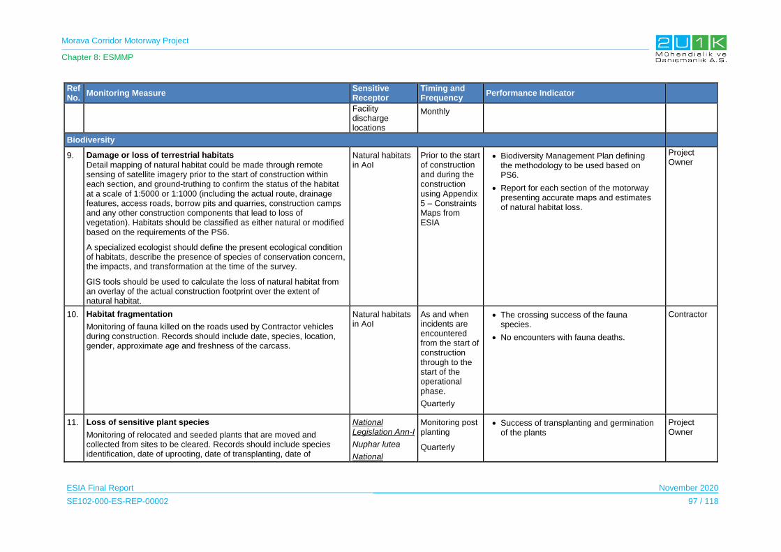
Morava Corridor Motorway Project
Chapter 8: ESMMP
ESIA Final Report November 2020
SE102-000-ES-REP-00002 97 / 118
Ref No.
Monitoring Measure Sensitive Receptor
Timing and Frequency
Performance Indicator
Facility discharge locations
Monthly
Biodiversity
9. Damage or loss of terrestrial habitats
Detail mapping of natural habitat could be made through remote sensing of satellite imagery prior to the start of construction within each section, and ground-truthing to confirm the status of the habitat at a scale of 1:5000 or 1:1000 (including the actual route, drainage features, access roads, borrow pits and quarries, construction camps and any other construction components that lead to loss of vegetation). Habitats should be classified as either natural or modified based on the requirements of the PS6.
A specialized ecologist should define the present ecological condition of habitats, describe the presence of species of conservation concern, the impacts, and transformation at the time of the survey.
GIS tools should be used to calculate the loss of natural habitat from an overlay of the actual construction footprint over the extent of natural habitat.
Natural habitats in AoI
Prior to the start of construction and during the construction using Appendix 5 – Constraints Maps from ESIA
Biodiversity Management Plan defining the methodology to be used based on PS6.
Report for each section of the motorway presenting accurate maps and estimates of natural habitat loss.
Project Owner
10. Habitat fragmentation
Monitoring of fauna killed on the roads used by Contractor vehicles during construction. Records should include date, species, location, gender, approximate age and freshness of the carcass.
Natural habitats in AoI
As and when incidents are encountered from the start of construction through to the start of the operational phase.
Quarterly
The crossing success of the fauna species.
No encounters with fauna deaths.
Contractor
11. Loss of sensitive plant species
Monitoring of relocated and seeded plants that are moved and collected from sites to be cleared. Records should include species identification, date of uprooting, date of transplanting, date of
National Legislation Ann-I
Nuphar lutea
National
Monitoring post planting
Quarterly
Success of transplanting and germination of the plants
Project Owner
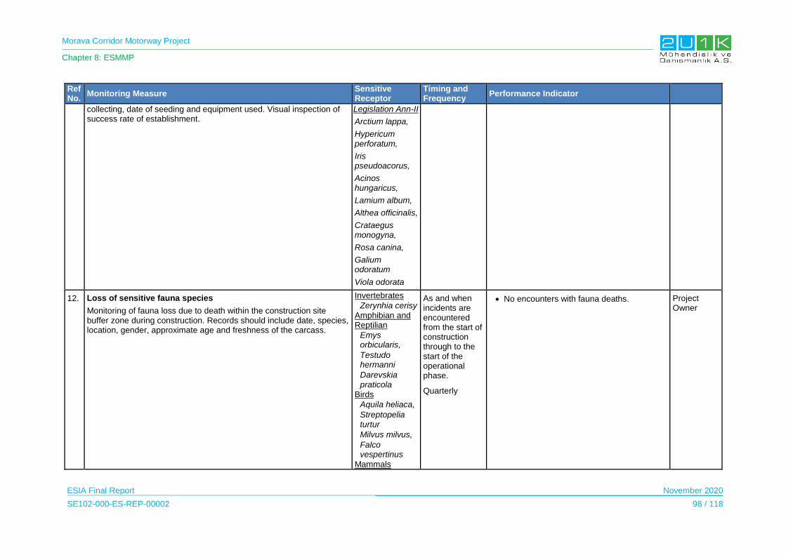
Morava Corridor Motorway Project
Chapter 8: ESMMP
ESIA Final Report November 2020
SE102-000-ES-REP-00002 98 / 118
Ref No.
Monitoring Measure Sensitive Receptor
Timing and Frequency
Performance Indicator
collecting, date of seeding and equipment used. Visual inspection of success rate of establishment.
Legislation Ann-II
Arctium lappa,
Hypericum perforatum,
Iris pseudoacorus,
Acinos hungaricus,
Lamium album,
Althea officinalis,
Crataegus monogyna,
Rosa canina,
Galium odoratum
Viola odorata
12. Loss of sensitive fauna species
Monitoring of fauna loss due to death within the construction site buffer zone during construction. Records should include date, species, location, gender, approximate age and freshness of the carcass.
Invertebrates
Zerynhia cerisy
Amphibian and Reptilian
Emys orbicularis,
Testudo hermanni
Darevskia praticola
Birds
Aquila heliaca,
Streptopelia turtur
Milvus milvus,
Falco vespertinus
Mammals
As and when incidents are encountered from the start of construction through to the start of the operational phase.
Quarterly
No encounters with fauna deaths. Project Owner
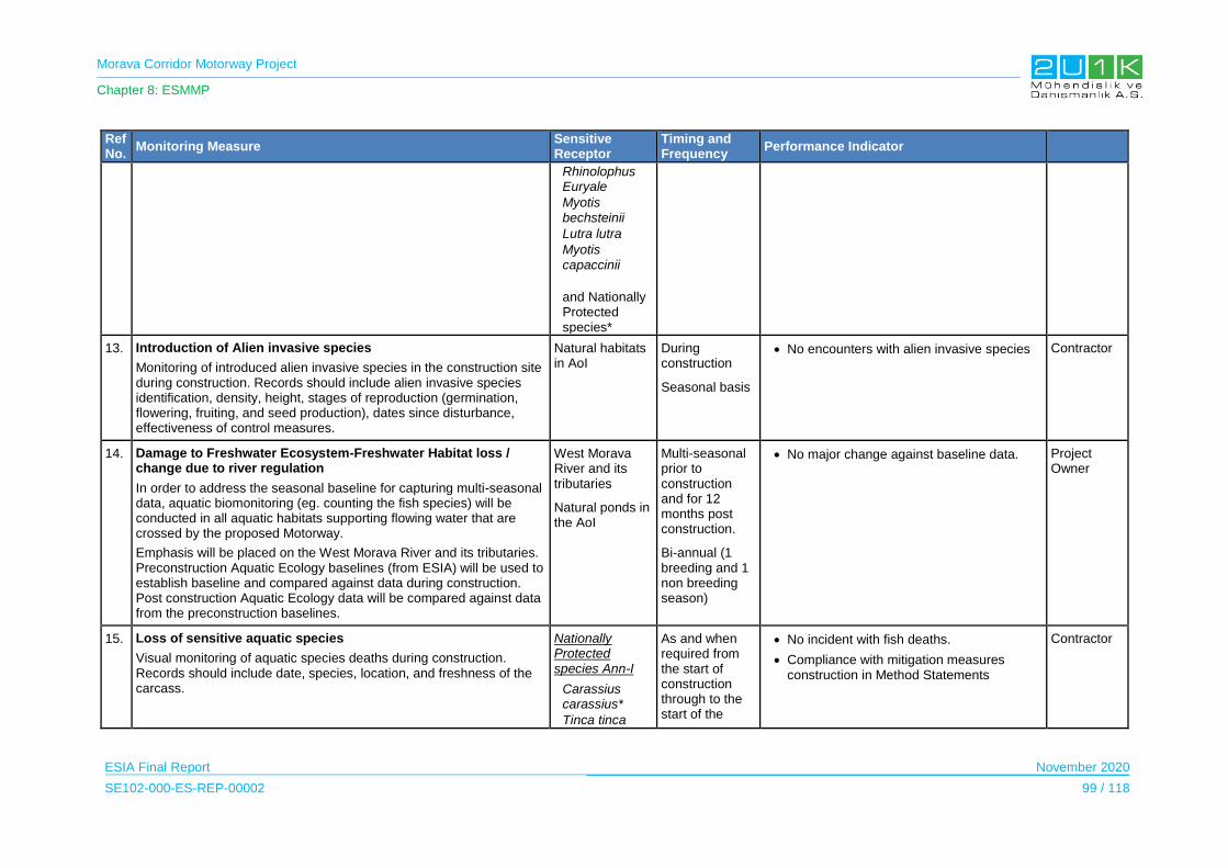
Morava Corridor Motorway Project
Chapter 8: ESMMP
ESIA Final Report November 2020
SE102-000-ES-REP-00002 99 / 118
Ref No.
Monitoring Measure Sensitive Receptor
Timing and Frequency
Performance Indicator
Rhinolophus Euryale
Myotis bechsteinii
Lutra lutra
Myotis capaccinii
and Nationally Protected species*
13. Introduction of Alien invasive species
Monitoring of introduced alien invasive species in the construction site during construction. Records should include alien invasive species identification, density, height, stages of reproduction (germination, flowering, fruiting, and seed production), dates since disturbance, effectiveness of control measures.
Natural habitats in AoI
During construction
Seasonal basis
No encounters with alien invasive species Contractor
14. Damage to Freshwater Ecosystem-Freshwater Habitat loss / change due to river regulation
In order to address the seasonal baseline for capturing multi-seasonal data, aquatic biomonitoring (eg. counting the fish species) will be conducted in all aquatic habitats supporting flowing water that are crossed by the proposed Motorway.
Emphasis will be placed on the West Morava River and its tributaries. Preconstruction Aquatic Ecology baselines (from ESIA) will be used to establish baseline and compared against data during construction. Post construction Aquatic Ecology data will be compared against data from the preconstruction baselines.
West Morava River and its tributaries
Natural ponds in the AoI
Multi-seasonal prior to construction and for 12 months post construction.
Bi-annual (1 breeding and 1 non breeding season)
No major change against baseline data. Project Owner
15. Loss of sensitive aquatic species
Visual monitoring of aquatic species deaths during construction. Records should include date, species, location, and freshness of the carcass.
Nationally Protected species Ann-I
Carassius carassius*
Tinca tinca
As and when required from the start of construction through to the start of the
No incident with fish deaths.
Compliance with mitigation measures construction in Method Statements
Contractor
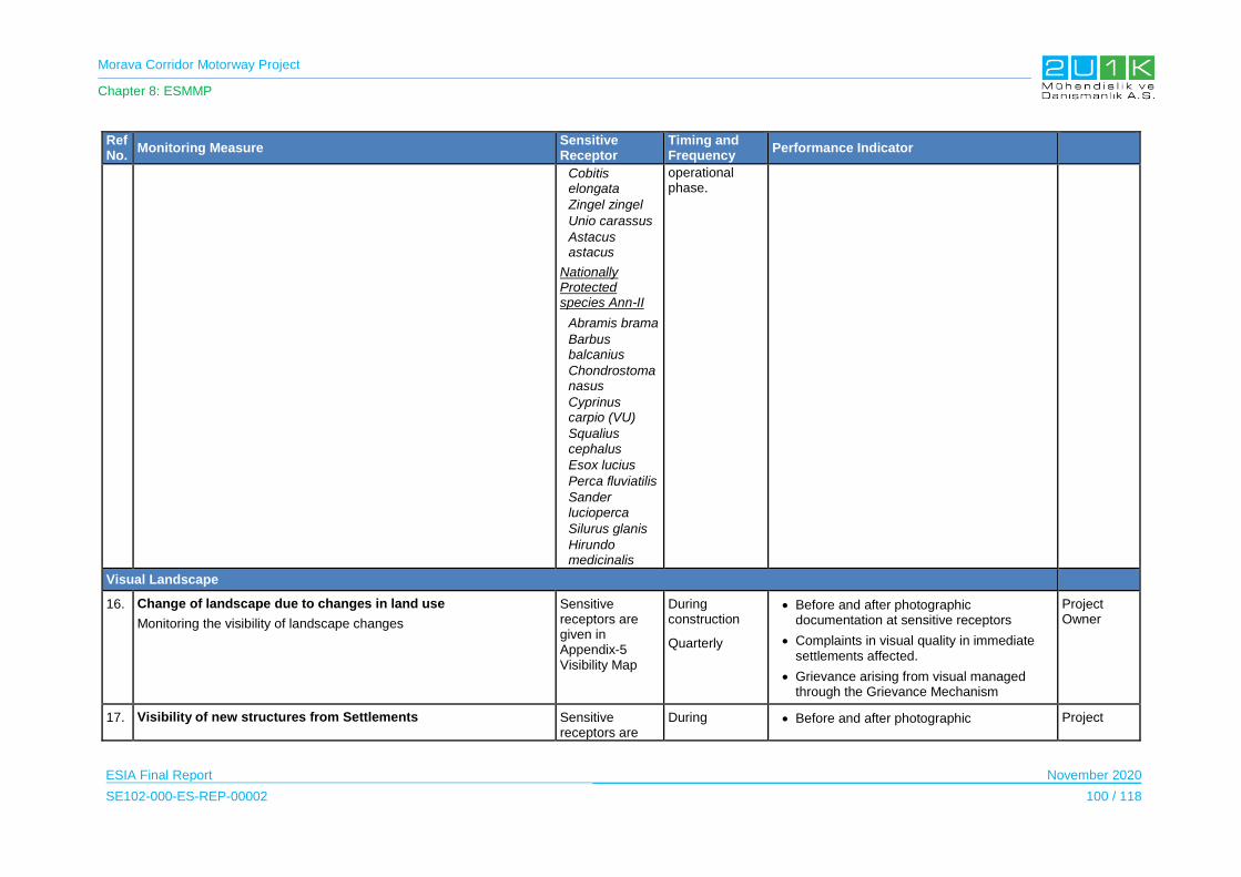
Morava Corridor Motorway Project
Chapter 8: ESMMP
ESIA Final Report November 2020
SE102-000-ES-REP-00002 100 / 118
Ref No.
Monitoring Measure Sensitive Receptor
Timing and Frequency
Performance Indicator
Cobitis elongata
Zingel zingel
Unio carassus
Astacus astacus
Nationally Protected species Ann-II
Abramis brama
Barbus balcanius
Chondrostoma nasus
Cyprinus carpio (VU)
Squalius cephalus
Esox lucius
Perca fluviatilis
Sander lucioperca
Silurus glanis
Hirundo medicinalis
operational phase.
Visual Landscape
16. Change of landscape due to changes in land use
Monitoring the visibility of landscape changes
Sensitive receptors are given in Appendix-5 Visibility Map
During construction
Quarterly
Before and after photographic documentation at sensitive receptors
Complaints in visual quality in immediate settlements affected.
Grievance arising from visual managed through the Grievance Mechanism
Project Owner
17. Visibility of new structures from Settlements Sensitive receptors are
During Before and after photographic Project

Morava Corridor Motorway Project
Chapter 8: ESMMP
ESIA Final Report November 2020
SE102-000-ES-REP-00002 101 / 118
Ref No.
Monitoring Measure Sensitive Receptor
Timing and Frequency
Performance Indicator
Monitoring the visibility of new structures in particular Project Facilities e.g. quarries, borrow pits, asphalt plants, to be built by the Project
given in Appendix-5 Visibility Map
construction
Quarterly
documentation at sensitive receptors
Visual quality in immediate settlements not affected.
Grievance arising from visual managed through the Grievance Mechanism
Owner
18. Visibility of new structures from Recreational Areas
Monitoring the visibility of new structures in particular Project Facilities e.g. quarries, borrow pits, asphalt plants, to be built by the Project
Sensitive receptors are given in Appendix-5 Visibility Map
During construction
Quarterly
Before and after photographic documentation at sensitive receptors
Visual quality in recreational areas not affected.
Grievance arising from visual managed through the Grievance Mechanism
Project Owner
Waste
19. Duty of Care of contractors will be audited to ensure that facilities and waste disposal/treatment/recycling / reclamation processes are suitable and in line with national Serbian and international good practice standards.
Construction site and Project Facilities
During construction
Bi-annually
Waste contractor facilities and process fully licensed and in line with national and international standards
Waste contractor performance is in line with national and international standards.
Contractor
20. Housekeeping checks will be conducted to ensure waste is being transferred to and stored correctly at the Construction Camps and that no littering is occurring at active work sites.
Workers who accommodate in camp sites
During construction Visual inspections on an regular basis
Well-maintained and clean active work areas that are free of litter and other wastes.
Contractor
21. Regular Inspections of waste disposal areas at active work areas and waste storage facilities at the Construction Camp will be undertaken to ensure compliance with this ESMMP, Environmental License conditions and relevant legislation.
Construction site and Project Construction Facilities
During construction Visual inspections on an regular basis
Contractor
22. Grievance Mechanism to include complaints regarding waste management.
PAPs During construction
Up to date complaints register. Contractor
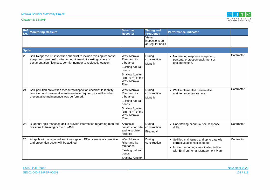
Morava Corridor Motorway Project
Chapter 8: ESMMP
ESIA Final Report November 2020
SE102-000-ES-REP-00002 102 / 118
Ref No.
Monitoring Measure Sensitive Receptor
Timing and Frequency
Performance Indicator
Visual inspections on an regular basis
Spills
23. Spill Response Kit inspection checklist to include missing response equipment, personal protection equipment, fire extinguishers or documentation (licenses, permit), number to replaced, location.
West Morava River and its tributaries
Existing natural ponds
Shallow Aquifer (1m - 6 m) of the West Morava River
During construction
Monthly
No missing response equipment, personal protection equipment or documentation.
Contractor
24. Spill pollution prevention measures inspection checklist to identify condition and preventative maintenance required, as well as what preventative maintenance was performed.
West Morava River and its tributaries
Existing natural ponds
Shallow Aquifer (1m - 6 m) of the West Morava River
During construction
Monthly
Well implemented preventative maintenance programme.
Contractor
25. Bi-annual spill response drill to provide information regarding required revisions to training or the ESMMP.
Across all construction site and associate facilities
During construction
Bi-annual
Undertaking bi-annual spill response drills.
Contractor
26. 3 All spills will be reported and investigated. Effectiveness of corrective and prevention action will be audited.
West Morava River and its tributaries
Existing natural ponds
Shallow Aquifer
During construction
Spill log maintained and up to date with corrective actions closed out.
Incident reporting classification in line with Environmental Management Plan.
Contractor
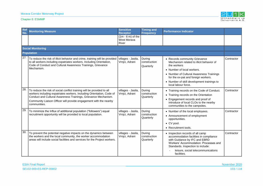
Morava Corridor Motorway Project
Chapter 8: ESMMP
ESIA Final Report November 2020
SE102-000-ES-REP-00002 103 / 118
Ref No.
Monitoring Measure Sensitive Receptor
Timing and Frequency
Performance Indicator
(1m - 6 m) of the West Morava River
Social Monitoring
Population
27. To reduce the risk of illicit behavior and crime, training will be provided to all workers including expatriates workers. Including Orientation, Code of Conduct and Cultural Awareness Trainings, Grievance Mechanism.
villages - Jasila, Vrnjci, Adrani
During construction
Quarterly
Records community Grievance Mechanism related to illicit behavior of the workers
Number of local workers.
Number of Cultural Awareness Trainings for the ex-pat and foreign workers.
Number of skill development trainings to local labour force.
Contractor
28. To reduce the risk of social conflict training will be provided to all workers including expatriates workers. Including Orientation, Code of Conduct and Cultural Awareness Trainings, Grievance Mechanism.
Community Liaison Officer will provide engagement with the nearby communities.
villages - Jasila, Vrnjci, Adrani
During construction Quarterly
Training records on the Code of Conduct.
Training records on the Orientation
Engagement records and proof of introduce of local CLOs to the nearby communities to the campsites.
Contractor
29. To minimize the Influx of additional population (“followers”) equal recruitment opportunity will be provided to local population.
villages - Jasila, Vrnjci, Adrani
During construction Quarterly
Number of the local employees.
Announcement of employment opportunities.
CV pool.
Recruitment tools.
Contractor
30. To prevent the potential negative impacts on the dynamics between the workers and the local community, the worker accommodation areas will include social facilities and services for the Project workers.
villages - Jasila, Vrnjci, Adrani
During construction Quarterly
Inspection records of all camp accommodation facilities in compliance with Guidance by IFC and EBRD Workers’ Accommodation: Processes and Standards. Inspection to include:
- leisure, social telecommunications facilities.
Contractor
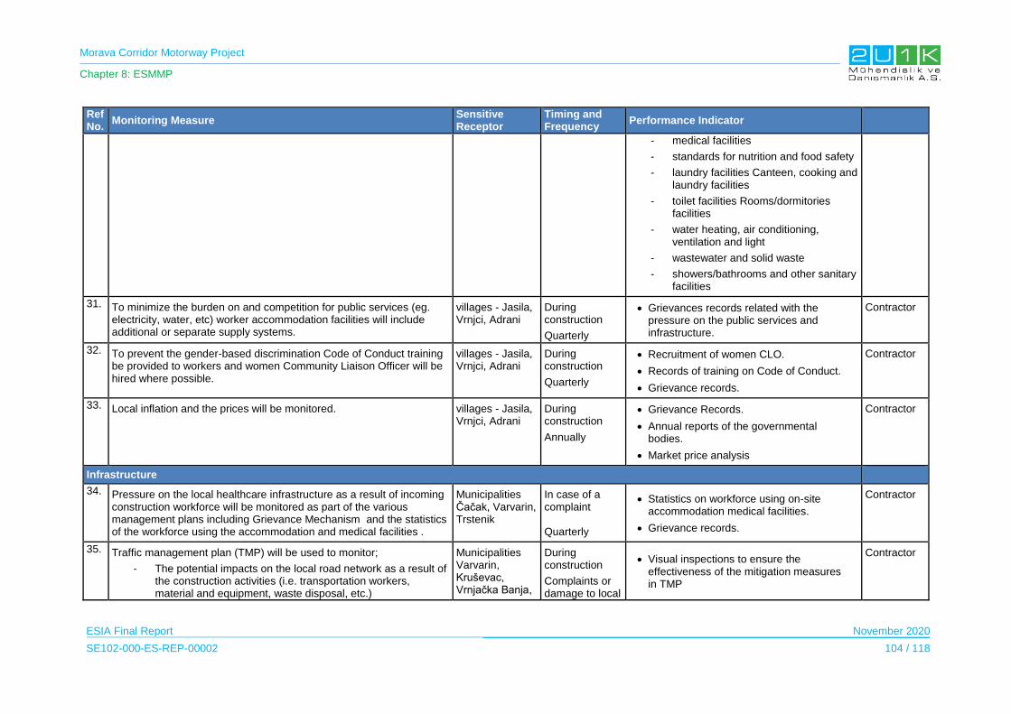
Morava Corridor Motorway Project
Chapter 8: ESMMP
ESIA Final Report November 2020
SE102-000-ES-REP-00002 104 / 118
Ref No.
Monitoring Measure Sensitive Receptor
Timing and Frequency
Performance Indicator
- medical facilities
- standards for nutrition and food safety
- laundry facilities Canteen, cooking and laundry facilities
- toilet facilities Rooms/dormitories facilities
- water heating, air conditioning, ventilation and light
- wastewater and solid waste
- showers/bathrooms and other sanitary facilities
31. To minimize the burden on and competition for public services (eg. electricity, water, etc) worker accommodation facilities will include additional or separate supply systems.
villages - Jasila, Vrnjci, Adrani
During construction
Quarterly
Grievances records related with the pressure on the public services and infrastructure.
Contractor
32. To prevent the gender-based discrimination Code of Conduct training be provided to workers and women Community Liaison Officer will be hired where possible.
villages - Jasila, Vrnjci, Adrani
During construction
Quarterly
Recruitment of women CLO.
Records of training on Code of Conduct.
Grievance records.
Contractor
33. Local inflation and the prices will be monitored. villages - Jasila, Vrnjci, Adrani
During construction
Annually
Grievance Records.
Annual reports of the governmental bodies.
Market price analysis
Contractor
Infrastructure
34. Pressure on the local healthcare infrastructure as a result of incoming construction workforce will be monitored as part of the various management plans including Grievance Mechanism and the statistics of the workforce using the accommodation and medical facilities .
Municipalities Čačak, Varvarin, Trstenik
In case of a complaint Quarterly
Statistics on workforce using on-site accommodation medical facilities.
Grievance records.
Contractor
35. Traffic management plan (TMP) will be used to monitor;
- The potential impacts on the local road network as a result of the construction activities (i.e. transportation workers, material and equipment, waste disposal, etc.)
Municipalities Varvarin, Kruševac, Vrnjačka Banja,
During construction
Complaints or damage to local
Visual inspections to ensure the effectiveness of the mitigation measures in TMP
Contractor

Morava Corridor Motorway Project
Chapter 8: ESMMP
ESIA Final Report November 2020
SE102-000-ES-REP-00002 105 / 118
Ref No.
Monitoring Measure Sensitive Receptor
Timing and Frequency
Performance Indicator
- road crossings and damage to local roads from heavy traffic movement
- disruption to road infrastructure and reduced access due to road cuttings
Trstenik, Kraljevo, Čačak
roads TMP in place and implemented
Reported number of incidents/accidents
Driver training records and driver logs in place
Grievance Mechanism
36. during the operation
Pressure on waste management system including the pressure on the sewage system will be monitored through WMPand Grievance Mechanism.
Municipalities Ćićevac Varvarin Kruševac Vrnjačka Banja Trstenik Kraljevo Čačak
Complaints Number of grievances raised in relation to accommodation
Permits in place
Contractor
Economy
37. during the operation
Employment of the local people and direct and indirect job opportunities will be monitored through the Grievance Mechanism, HR policy and the workforce statistics.
Municipalities Ćićevac Varvarin Kruševac Vrnjačka Banja Trstenik Kraljevo Čačak
During construction
Quarterly
Workforce statistics including:
- breakdown of direct and contracted worker
- percentage of the skilled, semi-skilled and unskilled
- number of female staff recruited - workforce hired from within the social
AoI - grievances raised in relation to
recruitment
Written Project-specific Human Resources
Policy and relevant procedures in place
Grievance Procedure in place and implemented
grievance forms available at construction camps site and other works sites
Grievance records register and close-out forms
Contractor
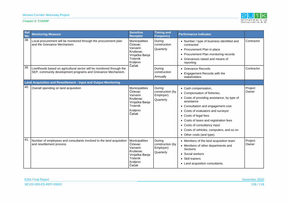
Morava Corridor Motorway Project
Chapter 8: ESMMP
ESIA Final Report November 2020
SE102-000-ES-REP-00002 106 / 118
Ref No.
Monitoring Measure Sensitive Receptor
Timing and Frequency
Performance Indicator
38. Local procurement will be monitored through the procurement plan and the Grievance Mechanism.
Municipalities Ćićevac Varvarin Kruševac Vrnjačka Banja Trstenik Kraljevo Čačak
During construction
Quarterly
Number / type of business identified and contracted
Procurement Plan in place
Procurement Plan monitoring records
Grievances raised and means of reporting
Contractor
39. Livelihoods based on agricultural sector will be monitored through the SEP, community development programs and Grievance Mechanism.
During construction
Annually
Grievance Records
Engagement Records with the stakeholders
Contractor
Land Acquisition and Resettlement - Input and Output Monitoring
40. Overall spending on land acquisition Municipalities Ćićevac Varvarin Kruševac Vrnjačka Banja Trstenik
Kraljevo Čačak
During construction (by Employer)
Quarterly
Cash compensation,
Compensation of fisheries,
Costs of providing assistance, by type of assistance
Consultation and engagement cost
Costs of evaluators and surveyor
Costs of legal fees
Costs of taxes and registration fees
Costs of consultancy input
Costs of vehicles, computers, and so on
Other costs (and type).
Project Owner
41. Number of employees and consultants involved to the land acquisition and resettlement process
Municipalities Ćićevac Varvarin Kruševac Vrnjačka Banja Trstenik Kraljevo Čačak
During construction (by Employer)
Quarterly
Members of the land acquisition team
Members of other departments and Sections
Social workers
Skill trainers
Land acquisition consultants.
Project Owner
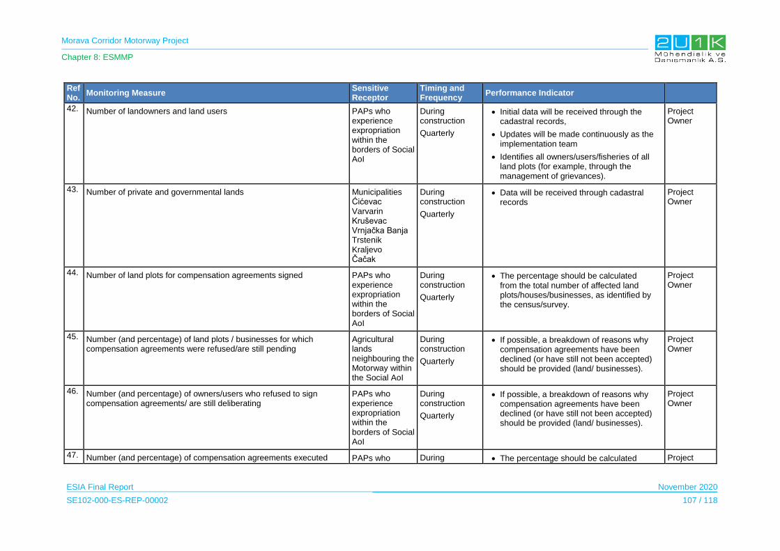
Morava Corridor Motorway Project
Chapter 8: ESMMP
ESIA Final Report November 2020
SE102-000-ES-REP-00002 107 / 118
Ref No.
Monitoring Measure Sensitive Receptor
Timing and Frequency
Performance Indicator
42. Number of landowners and land users PAPs who experience expropriation within the borders of Social AoI
During construction
Quarterly
Initial data will be received through the cadastral records,
Updates will be made continuously as the implementation team
Identifies all owners/users/fisheries of all land plots (for example, through the management of grievances).
Project Owner
43. Number of private and governmental lands Municipalities Ćićevac Varvarin Kruševac Vrnjačka Banja Trstenik Kraljevo Čačak
During construction
Quarterly
Data will be received through cadastral records
Project Owner
44. Number of land plots for compensation agreements signed PAPs who experience expropriation within the borders of Social AoI
During construction
Quarterly
The percentage should be calculated from the total number of affected land plots/houses/businesses, as identified by the census/survey.
Project Owner
45. Number (and percentage) of land plots / businesses for which compensation agreements were refused/are still pending
Agricultural lands neighbouring the Motorway within the Social AoI
During construction
Quarterly
If possible, a breakdown of reasons why compensation agreements have been declined (or have still not been accepted) should be provided (land/ businesses).
Project Owner
46. Number (and percentage) of owners/users who refused to sign compensation agreements/ are still deliberating
PAPs who experience expropriation within the borders of Social AoI
During construction
Quarterly
If possible, a breakdown of reasons why compensation agreements have been declined (or have still not been accepted) should be provided (land/ businesses).
Project Owner
47. Number (and percentage) of compensation agreements executed PAPs who During The percentage should be calculated Project
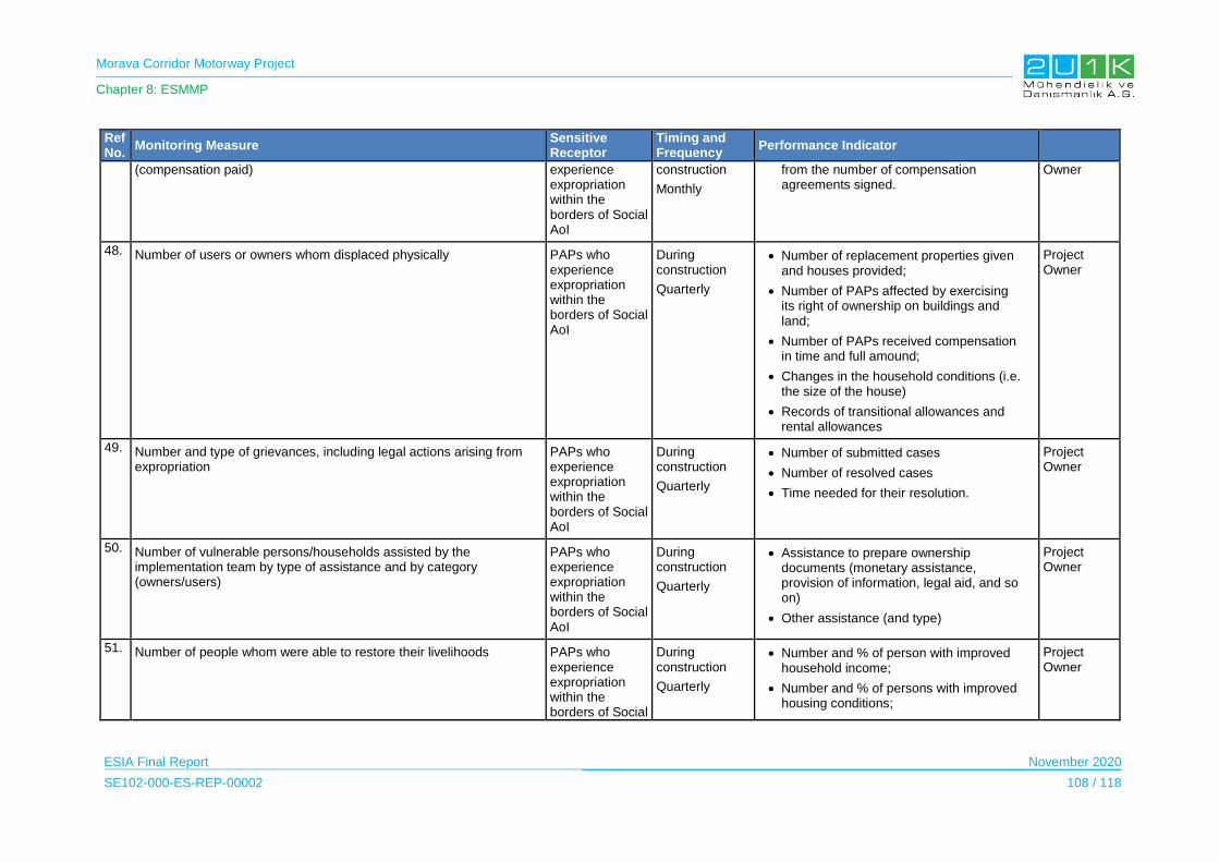
Morava Corridor Motorway Project
Chapter 8: ESMMP
ESIA Final Report November 2020
SE102-000-ES-REP-00002 108 / 118
Ref No.
Monitoring Measure Sensitive Receptor
Timing and Frequency
Performance Indicator
(compensation paid) experience expropriation within the borders of Social AoI
construction
Monthly
from the number of compensation agreements signed.
Owner
48. Number of users or owners whom displaced physically PAPs who experience expropriation within the borders of Social AoI
During construction
Quarterly
Number of replacement properties given and houses provided;
Number of PAPs affected by exercising its right of ownership on buildings and land;
Number of PAPs received compensation in time and full amound;
Changes in the household conditions (i.e. the size of the house)
Records of transitional allowances and rental allowances
Project Owner
49. Number and type of grievances, including legal actions arising from expropriation
PAPs who experience expropriation within the borders of Social AoI
During construction
Quarterly
Number of submitted cases
Number of resolved cases
Time needed for their resolution.
Project Owner
50. Number of vulnerable persons/households assisted by the implementation team by type of assistance and by category (owners/users)
PAPs who experience expropriation within the borders of Social AoI
During construction
Quarterly
Assistance to prepare ownership documents (monetary assistance, provision of information, legal aid, and so on)
Other assistance (and type)
Project Owner
51. Number of people whom were able to restore their livelihoods PAPs who experience expropriation within the borders of Social
During construction
Quarterly
Number and % of person with improved household income;
Number and % of persons with improved housing conditions;
Project Owner

Morava Corridor Motorway Project
Chapter 8: ESMMP
ESIA Final Report November 2020
SE102-000-ES-REP-00002 109 / 118
Ref No.
Monitoring Measure Sensitive Receptor
Timing and Frequency
Performance Indicator
AoI Number and % of persons with increased monthly expenditure level;
Number and % of persons with improved asset ownership;
Number and % of persons still living below poverty line (applying the same criteria as was used to determine vulnerability).
Access to Ecosystem Services
52. Grievance Mechanism, visual inspections, traffic management plan, dust noise and air measurements, will be used to monitor,
- Access to Forest Lands - Impact on Apiculture - Impact on River Usage - Impact on Leisure Activities and Tourism
Municipalities Ćićevac Varvarin Kruševac Vrnjačka Banja Trstenik Kraljevo Čačak
During construction
Quarterly
Visual inspections and records of information tools and records of consultations,
Grievances related with the access to the ecosystem services,
Grievances related with dust, air and vibration,
Environmental measurement records,
Visual inspections of the vegetation clearing
Number of beekeepers (enterprises or individuals)
Number of beehives,
Dust and noise measurement records,
Annual honey production level,
Grievance records related with beekeeping activities.
Grievances related with restrictions on the designated hunting areas.
Project Owner
Labour and Working Conditions

Morava Corridor Motorway Project
Chapter 8: ESMMP
ESIA Final Report November 2020
SE102-000-ES-REP-00002 110 / 118
Ref No.
Monitoring Measure Sensitive Receptor
Timing and Frequency
Performance Indicator
53. HR policy, workers Grievance Mechanism will be used to minimize the
labour risks and impacts and to monitor: - women employment and non-discrimination and equal
opportunity - labour risks and impacts related to subcontractor and supply
chain management (including child and forced) - working conditions and terms of employment for expat and
national workers. - employment of the local workforce
Municipalities Ćićevac Varvarin Kruševac Vrnjačka Banja Trstenik Kraljevo Čačak
During construction
Quarterly
Percentage of workforce who are women or from other vulnerable groups
Number of workers (direct employees and subcontractors) trained on the worker grievance mechanism
Number of grievances from workers or job seekers related to discrimination, abuse of labour rights, sexual harassment.
Grievance Records
Average number of hours worked per week
Average number of days worked without a rest day
Average number of overtime hours worked per week
100% of contracts including clauses on labour and working conditions in line with Serbian Law and the IFC PS2.
Labor Audit Report(s) verifying worker/contractor accommodation conditions provided in line with the requirements described in the "IFC/EBRD Guidance Note on Workers'
Accommodation: Processes and Standards"
Records of trainings
Percentage of workforce who receive training/ induction on
HR policies, plans and procedures
Number of workers (direct employees and subcontractors) trained on the worker
Contractor
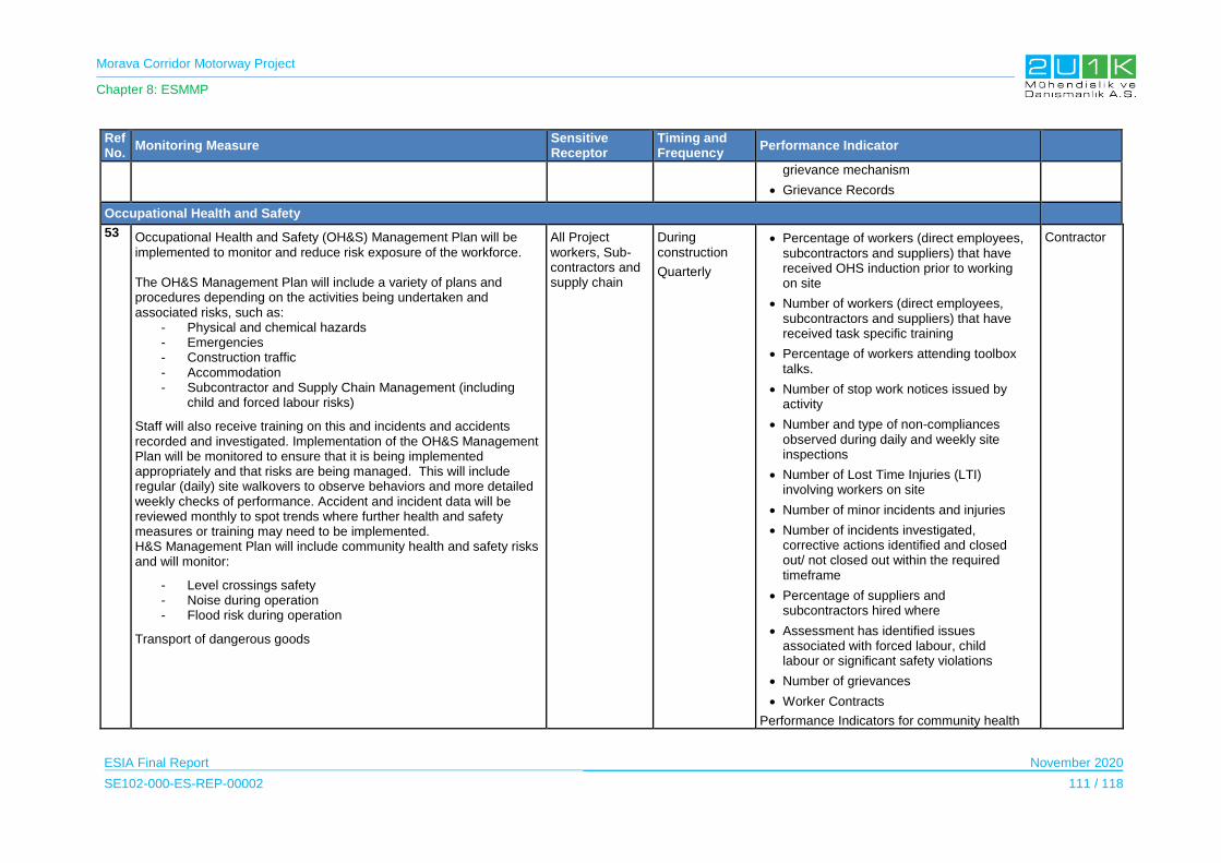
Morava Corridor Motorway Project
Chapter 8: ESMMP
ESIA Final Report November 2020
SE102-000-ES-REP-00002 111 / 118
Ref No.
Monitoring Measure Sensitive Receptor
Timing and Frequency
Performance Indicator
grievance mechanism
Grievance Records
Occupational Health and Safety
53 Occupational Health and Safety (OH&S) Management Plan will be implemented to monitor and reduce risk exposure of the workforce. The OH&S Management Plan will include a variety of plans and procedures depending on the activities being undertaken and associated risks, such as:
- Physical and chemical hazards - Emergencies - Construction traffic - Accommodation - Subcontractor and Supply Chain Management (including
child and forced labour risks)
Staff will also receive training on this and incidents and accidents recorded and investigated. Implementation of the OH&S Management Plan will be monitored to ensure that it is being implemented appropriately and that risks are being managed. This will include regular (daily) site walkovers to observe behaviors and more detailed weekly checks of performance. Accident and incident data will be reviewed monthly to spot trends where further health and safety measures or training may need to be implemented. H&S Management Plan will include community health and safety risks and will monitor:
- Level crossings safety - Noise during operation - Flood risk during operation
Transport of dangerous goods
All Project workers, Sub-contractors and supply chain
During construction
Quarterly
Percentage of workers (direct employees, subcontractors and suppliers) that have received OHS induction prior to working on site
Number of workers (direct employees, subcontractors and suppliers) that have received task specific training
Percentage of workers attending toolbox talks.
Number of stop work notices issued by activity
Number and type of non-compliances observed during daily and weekly site inspections
Number of Lost Time Injuries (LTI) involving workers on site
Number of minor incidents and injuries
Number of incidents investigated, corrective actions identified and closed out/ not closed out within the required timeframe
Percentage of suppliers and subcontractors hired where
Assessment has identified issues associated with forced labour, child labour or significant safety violations
Number of grievances
Worker Contracts
Performance Indicators for community health
Contractor
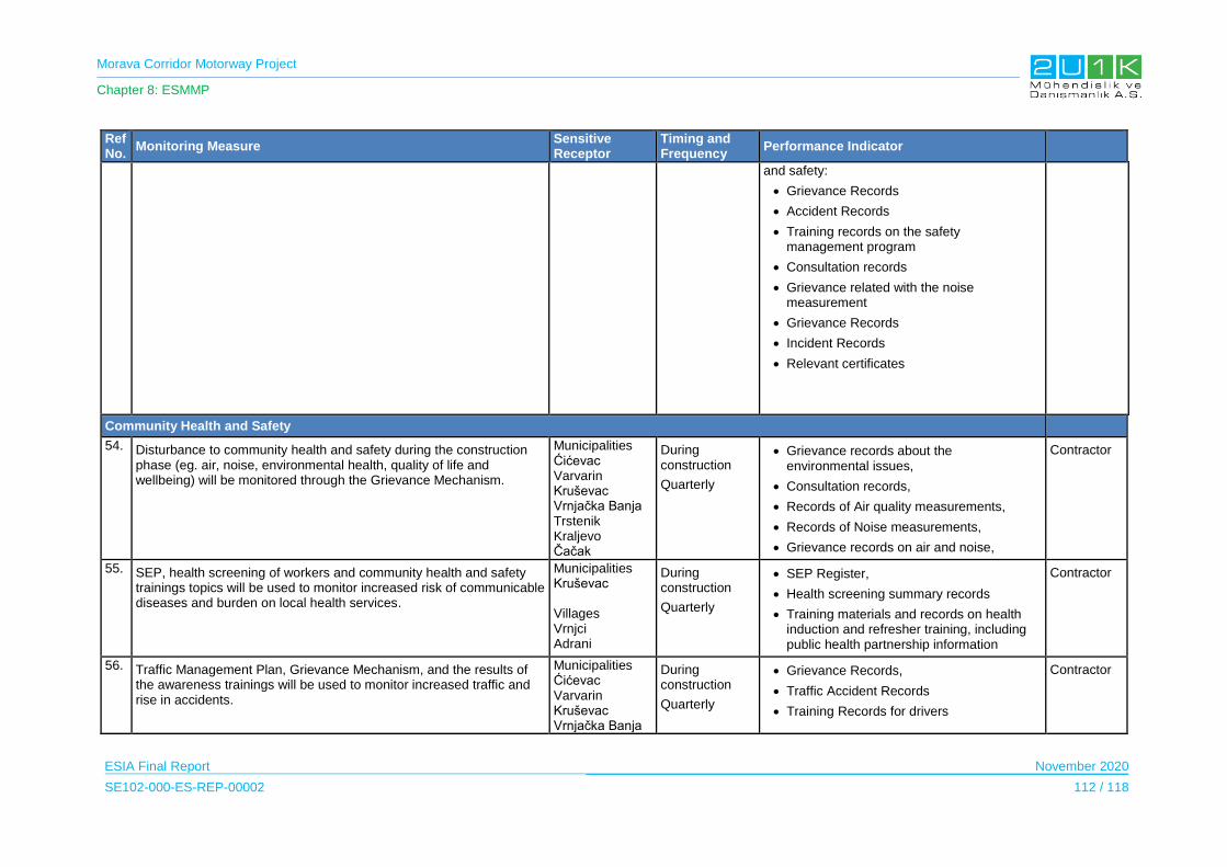
Morava Corridor Motorway Project
Chapter 8: ESMMP
ESIA Final Report November 2020
SE102-000-ES-REP-00002 112 / 118
Ref No.
Monitoring Measure Sensitive Receptor
Timing and Frequency
Performance Indicator
and safety:
Grievance Records
Accident Records
Training records on the safety management program
Consultation records
Grievance related with the noise measurement
Grievance Records
Incident Records
Relevant certificates
Community Health and Safety
54. Disturbance to community health and safety during the construction phase (eg. air, noise, environmental health, quality of life and wellbeing) will be monitored through the Grievance Mechanism.
Municipalities Ćićevac Varvarin Kruševac Vrnjačka Banja Trstenik Kraljevo Čačak
During construction
Quarterly
Grievance records about the environmental issues,
Consultation records,
Records of Air quality measurements,
Records of Noise measurements,
Grievance records on air and noise,
Contractor
55. SEP, health screening of workers and community health and safety trainings topics will be used to monitor increased risk of communicable diseases and burden on local health services.
Municipalities Kruševac Villages Vrnjci Adrani
During construction
Quarterly
SEP Register,
Health screening summary records
Training materials and records on health induction and refresher training, including public health partnership information
Contractor
56. Traffic Management Plan, Grievance Mechanism, and the results of the awareness trainings will be used to monitor increased traffic and rise in accidents.
Municipalities Ćićevac Varvarin Kruševac Vrnjačka Banja
During construction
Quarterly
Grievance Records,
Traffic Accident Records
Training Records for drivers
Contractor

Morava Corridor Motorway Project
Chapter 8: ESMMP
ESIA Final Report November 2020
SE102-000-ES-REP-00002 113 / 118
Ref No.
Monitoring Measure Sensitive Receptor
Timing and Frequency
Performance Indicator
Trstenik Kraljevo Čačak
Protocols signed with the local authorities if any
Visual inspections of the traffic signs
Records of the road safety awareness trainings to the nearby schools
Visual inspections of the warning signs during road and railway crossings
57. Security Management Plan will include monitoring of the private security services around the Project sites and the local community hot spots.
Municipalities Kruševac Villages Vrnjci Adrani
During construction
Quarterly
Records of the consultations
Records of the trainings given the security personnel
Records of the security incidents
Contractor
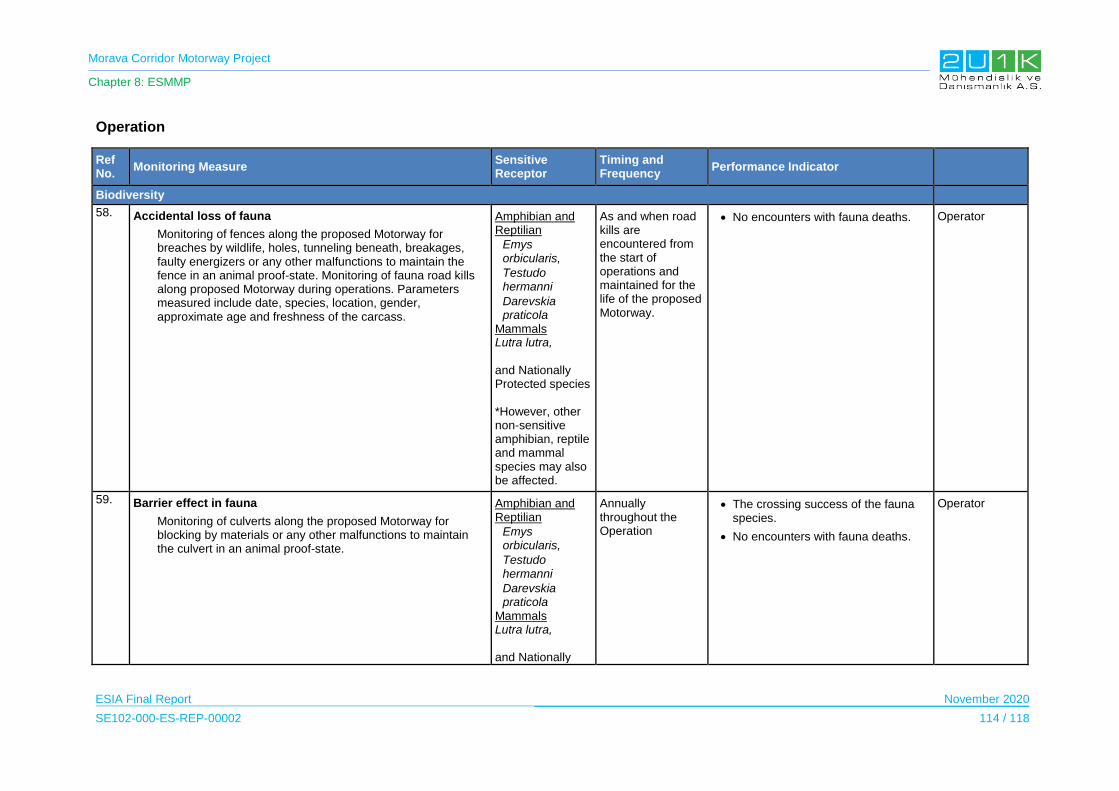
Morava Corridor Motorway Project
Chapter 8: ESMMP
ESIA Final Report November 2020
SE102-000-ES-REP-00002 114 / 118
Operation
Ref No.
Monitoring Measure Sensitive Receptor
Timing and Frequency
Performance Indicator
Biodiversity
58. Accidental loss of fauna
Monitoring of fences along the proposed Motorway for breaches by wildlife, holes, tunneling beneath, breakages, faulty energizers or any other malfunctions to maintain the fence in an animal proof-state. Monitoring of fauna road kills along proposed Motorway during operations. Parameters measured include date, species, location, gender, approximate age and freshness of the carcass.
Amphibian and Reptilian
Emys orbicularis,
Testudo hermanni
Darevskia praticola
Mammals Lutra lutra, and Nationally Protected species
*However, other non-sensitive amphibian, reptile and mammal species may also be affected.
As and when road kills are encountered from the start of operations and maintained for the life of the proposed Motorway.
No encounters with fauna deaths. Operator
59. Barrier effect in fauna
Monitoring of culverts along the proposed Motorway for blocking by materials or any other malfunctions to maintain the culvert in an animal proof-state.
Amphibian and Reptilian
Emys orbicularis,
Testudo hermanni
Darevskia praticola
Mammals Lutra lutra, and Nationally
Annually throughout the Operation
The crossing success of the fauna species.
No encounters with fauna deaths.
Operator

Morava Corridor Motorway Project
Chapter 8: ESMMP
ESIA Final Report November 2020
SE102-000-ES-REP-00002 115 / 118
Ref No.
Monitoring Measure Sensitive Receptor
Timing and Frequency
Performance Indicator
Protected species *However, other non-sensitive amphibian, reptile and mammal species may also be affected.
Visual Landscape
60. Change of landscape due to changes in land use
Monitoring the visibility of landscape changes
Sensitive receptors are given in Appendix-5 Visibility Map
Annual monitoring studies throughout operation
Visual quality in immediate settlements not affected.
Grievance arising from visual managed through the grievance procedure
Project Owner
Ecosystem Services
61. Access to Ecosystem Services due to lack of under and overpasses will be monitored through the GRM
All Municipalities in the AoI
Bi-Annually during the operation
Grievance Mechanism Project Owner
Occupational Health and Safety
62. Occupational Health and Safety Management Plan will be implemented to monitor and reduce risk exposure of the workforce. The OH&S Management Plan will include a variety of plans and procedures depending on the activities being undertaken and associated risks, such as:
- Physical and chemical hazards - Emergencies - Construction traffic - Accommodation - Subcontractor and Supply Chain Management (Including
Child and Forced Labour Risks) Staff will receive training on incidents and accidents recorded and investigated.
All Project workers, Sub-contractors and supply chain
Quarterly during the operation
Percentage of workers (direct employees, subcontractors and suppliers) that have received OH&S induction prior to working on site
Number of workers (direct employees, subcontractors and suppliers) that have received task specific training
Percentage of workers attending toolbox talks.
Number of stop work notices issued by activity
Number and type of non-
Operator
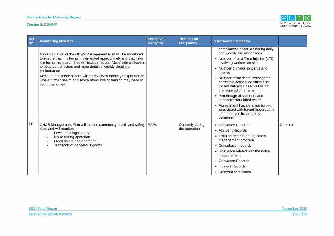
Morava Corridor Motorway Project
Chapter 8: ESMMP
ESIA Final Report November 2020
SE102-000-ES-REP-00002 116 / 118
Ref No.
Monitoring Measure Sensitive Receptor
Timing and Frequency
Performance Indicator
Implementation of the OH&S Management Plan will be monitored to ensure that it is being implemented appropriately and that risks are being managed. This will include regular (daily) site walkovers to observe behaviors and more detailed weekly checks of performance.
Accident and incident data will be reviewed monthly to spot trends where further health and safety measures or training may need to be implemented.
compliances observed during daily and weekly site inspections
Number of Lost Time Injuries (LTI) involving workers on site
Number of minor incidents and injuries
Number of incidents investigated, corrective actions identified and closed out/ not closed out within the required timeframe
Percentage of suppliers and subcontractors hired where
Assessment has identified issues associated with forced labour, child labour or significant safety violations
63. OH&S Management Plan will include community health and safety risks and will monitor:
- Level crossings safety - Noise during operation - Flood risk during operation - Transport of dangerous goods
PAPs Quarterly during the operation
Grievance Records
Accident Records
Training records on the safety management program
Consultation records
Grievance related with the noise measurement
Grievance Records
Incident Records
Relevant certificates
Operator
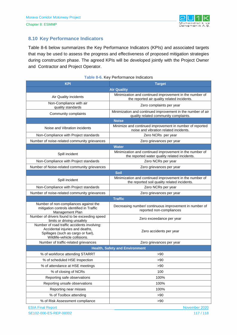
Morava Corridor Motorway Project
Chapter 8: ESMMP
ESIA Final Report November 2020
SE102-000-ES-REP-00002 117 / 118
8.10 Key Performance Indicators
Table 8-6 below summarizes the Key Performance Indicators (KPIs) and associated targets
that may be used to assess the progress and effectiveness of proposed mitigation strategies
during construction phase. The agreed KPIs will be developed jointly with the Project Owner
and Contractor and Project Operator.
Table 8-6. Key Performance Indicators
KPI Target
Air Quality
Air Quality incidents Minimization and continued improvement in the number of
the reported air quality related incidents.
Non-Compliance with air quality standards
Zero complaints per year
Community complaints Minimization and continued improvement in the number of air
quality related community complaints.
Noise
Noise and Vibration incidents Minimize and continued improvement in number of reported
noise and vibration related incidents.
Non-Compliance with Project standards Zero NCRs per year
Number of noise-related community grievances Zero grievances per year
Water
Spill incident Minimization and continued improvement in the number of
the reported water quality related incidents.
Non-Compliance with Project standards Zero NCRs per year
Number of Noise-related community grievances Zero grievances per year
Soil
Spill incident Minimization and continued improvement in the number of
the reported soil quality related incidents.
Non-Compliance with Project standards Zero NCRs per year
Number of noise-related community grievances Zero grievances per year
Traffic
Number of non-compliances against the mitigation controls identified in Traffic
Management Plan
Decreasing number/ continuous improvement in number of reported non-compliances
Number of drivers found to be exceeding speed limits or driving unsafely
Zero exceedance per year
Number of road traffic accidents involving: Accidental injuries and deaths,
Spillages (such as cargo or fuel), Wildlife-vehicle collisions.
Zero accidents per year
Number of traffic-related grievances Zero grievances per year
Health, Safety and Environment
% of workforce attending STARRT >90
% of scheduled HSE Inspection >90
% of attendance at HSE meetings >90
% of closing of NCRs 100
Reporting safe observations 100%
Reporting unsafe observations 100%
Reporting near misses 100%
% of Toolbox attending >90
% of Risk Assessment compliance >90
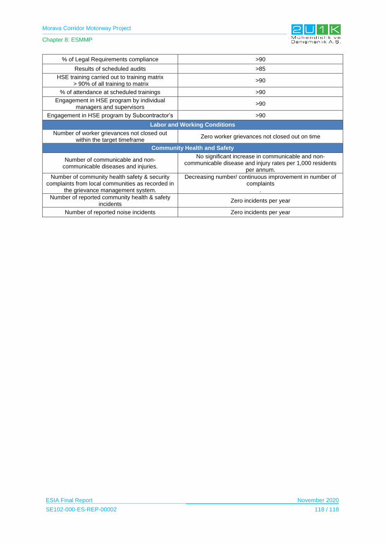
Morava Corridor Motorway Project
Chapter 8: ESMMP
ESIA Final Report November 2020
SE102-000-ES-REP-00002 118 / 118
% of Legal Requirements compliance >90
Results of scheduled audits >85
HSE training carried out to training matrix > 90% of all training to matrix
>90
% of attendance at scheduled trainings >90
Engagement in HSE program by individual managers and supervisors
>90
Engagement in HSE program by Subcontractor’s >90
Labor and Working Conditions
Number of worker grievances not closed out within the target timeframe
Zero worker grievances not closed out on time
Community Health and Safety
Number of communicable and non-communicable diseases and injuries.
No significant increase in communicable and non-communicable disease and injury rates per 1,000 residents
per annum.
Number of community health safety & security complaints from local communities as recorded in
the grievance management system.
Decreasing number/ continuous improvement in number of complaints
.
Number of reported community health & safety incidents
Zero incidents per year
Number of reported noise incidents Zero incidents per year

Morava Corridor Motorway Project
Chapter 9: Stakeholder Engagement
ESIA Final Report November 2020
SE102-000-ES-REP-00002 1 / 35
9 STAKEHOLDER ENGAGEMENT
9.1 Objectives of Stakeholder Engagement
Stakeholder engagement is a two-way process of communication between the Project parties
and its stakeholders. The Stakeholder Engagement Plan (SEP) presented in Appendix-3 has
been developed with the aim of explaining how the Project will communicate, engage and
interact with the stakeholders that may be directly or indirectly affected by and / or interested
in the Project. The SEP summarizes engagement activities undertaken to date and includes
details of the approach and mechanisms proposed for future engagement with stakeholders.
It also includes the general principles and main steps of a grievance management system of
the mechanism for stakeholders to raise any concerns related to the Project.
In accordance with international best practice, the objectives of the Stakeholder Engagement
are to:
build and maintain a constructive relationship with and among the stakeholders, in
particular project-affected communities;
promote improved environmental and social performance through effective
engagement with the stakeholders;
promote and provide effective means for adequate engagement with project-affected
communities throughout the project cycle on issues that could potentially affect them so
that their concerns are addressed accordingly and to ensure that meaningful
environmental and social information is timely disclosed to them and to other stakeholders;
ensure that all stakeholders have ways to access project information and raise issues;
ensure that project-affected people (PAPs) have accessible and effective means to
raise issues and grievances, and the Contractor responds to and manages such issues
and grievances appropriately.
9.2 Roles and Responsibilities
Corridors of Serbia and the Ministry of Construction, Transport and Infrastructure, on behalf of
the Government of Serbia, is the Employer of the Project.
The SEP describes CoS and the Contractor’s approach in engaging with stakeholders that will
be maintained throughout the Project lifecycle. SEP is a strategy for the provision of timely
information on the Project’s commitment to Stakeholder EngagementThe CoS and the
Contractor Department in charge of Community Relations (CR) will be responsible to
implement this SEP during pre-construction and construction phases of the Project. During the
operation phase, the CoS will have the main responsibility to implement and update the
document.

Morava Corridor Motorway Project
Chapter 9: Stakeholder Engagement
ESIA Final Report November 2020
SE102-000-ES-REP-00002 2 / 35
In terms of land acquisition process, mainly for the implementation of the grievance
mechanism, the CoS will be the main responsible party with the assistance of CRSD, in the
cases where needed. Detailed responsibility for individual activities within the scope of
Stakeholder Engagement listed in Table 9-1 below.
Table 9-1. Roles and Responsibilities
Name of the Authority Responsibilities
Ministry for Construction, Transport and Infrastructure
The role of Ministry will be during the permitting phase and to some extent during public disclosure of the Project. The activities regarding Project documentation and permits, a certain role of this Ministry will be dissemination of the information regarding the project. Public disclosure and media coverage will be to some extent responsibility of this Ministry.
CoS
The day-to-day implementation of the SEP, grievance management for the land acquisition and resettlement will be the responsibility of the CoS.
The CoS will closely liaison with other relevant institutions, governmental bodies, local governments, and affected communities and individual as well as with other stakeholders to engage with them and ensure full disclosure of information and documents as defined by this SEP.
Prior to construction, the public and local community will be informed, through the websites of the CoS and those of the respective Municipality’s Administration website, about the information and Grievance officer.
The day-to-day implementation of the SEP will be the responsibility of the Land acquisition and resettlement department of the CoS.
Contractor
Stakeholder engagement and grievances management related to construction activities will be managed by the Contractor. Prior to construction, the public and local community will be informed by construction contractor at local level.
Prepare HR Policy and Workers GRM and comply with their requirements
Ministry for Environmental Protection
The role of the Ministry is; protection and improvement of the environmental system; application of scientific and technological research results and investigation in the environment; implementation of the Convention of public participation, access to information and right on legal protection in the environmental field; determination of environmental conditions in spatial planning and construction of objects.
Municipalities Local municipalities govern the expropriation process (Department of property affairs)
9.3 Stakeholder Identification and Analysis
A stakeholder is defined as an individual or group that may be directly or indirectly affected by
the Project, and/or that may have an interest in or influence over the Project. Stakeholders are
those who have an interest in a particular decision, either as individuals or representatives of
a group including people who influence a decision or can influence it as well as those affected
by it. Stakeholders include Project affected people and other stakeholders including; non-
governmental organizations, governments, shareholders and employees as well as non-
affected community members.
Stakeholders have been identified based on proximity to Project features, and the degree of
impact and interest in the Project.
Morava Corridor Motorway Project
Chapter 9: Stakeholder Engagement
ESIA Final Report November 2020
SE102-000-ES-REP-00002 3 / 35
Project-affected parties include those likely to be affected by the project because of actual
impacts or potential risks to their physical environment, health, security, cultural practices, well-
being, or livelihoods. These stakeholders may include individuals or groups, including local
communities
Other Stakeholders refer to individuals, groups, or organizations with an interest in the
project, which may be because of the project location, its characteristics, its impacts, or matters
related to public interest. For example, these parties may include regulators, government
officials, the private sector, the scientific community, academics, unions, women’s
organizations, other civil society organizations, and cultural groups.
Table 9-2 below presents identified stakeholders based the on-desktop study1 and the
consultations2 during the ESIA studies. Disclosure and recommended routine of
communication for the future stakeholder engagement activities; during the ESIA are also
presented.
1 Studies on the Environmental Impact Assessment Project of the E-761 Motorway Project border of Republika Srpska - Pozega - Preljina - Pojate, section Pojate - Kruševac (Kosevi) from km 0-229.75 to km 27 + 600.00 (Traffic Institute CIP, 2018) EIA of Preliminary Design of Motorway E - 761 Pojate – Preljina, Section: Adrani – Mrcajevci (Institute for Roads J.S.C.,2011) Hydro technical Study Corridor of the Motorway E-761, Section Pojate-Preljina Field Study Outcomes (March 18 – 22, 2019)
2 Consultation tools used for the past stakeholder engagement process presented in Chapter 5 in detail
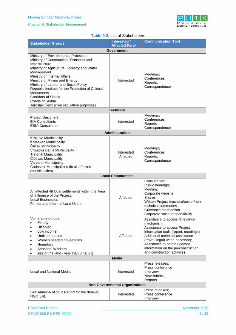
Morava Corridor Motorway Project
Chapter 9: Stakeholder Engagement
ESIA Final Report November 2020
SE102-000-ES-REP-00002 4 / 35
Table 9-2. List of Stakeholders
Stakeholder Groups Interested / Affected Party
Communication Tool
Government
Ministry of Environmental Protection Ministry of Construction, Transport and Infrastructure Ministry of Agriculture, Forestry and Water Management Ministry of Internal Affairs Ministry of Mining and Energy Ministry of Labour and Social Policy Republic Institute for the Protection of Cultural Monuments Corridors of Serbia Roads of Serbia Jaroslav Černi (river regulation purposes)
Interested
Meetings; Conferences; Reports; Correspondence
Technical
Project Designers EIA Consultants ESIA Consultants
Interested
Meetings; Conferences; Reports Correspondence
Administration
Kraljevo Municipality Kruševac Municipality Čačak Municipality Vrnjačka Banja Municipality Trstenik Municipality Ćićevac Municipality Varvarin Municipality Cadastral Municipalities (in all affected municipalities)
Interested Affected
Meetings; Conferences; Reports; Correspondence
Local Communities
All affected 48 local settlements within the Area of Influence of the Project. Local Businesses Formal and Informal Land Users
Affected
Consultation; Public hearings; Meeting; Corporate website Shares; Written Project brochure/poster/non-technical summaries Grievance mechanism Corporate social responsibility
Vulnerable groups;
Elderly Disabled Low income Untitled houses Women headed households Homeless Seasonal Workers Size of the land - less than 3 ha (%)
Affected
Assistance to access Grievance mechanism Assistance to access Project information tools (report, meetings) Additional technical assistance (travel, legal) when necessary, Assistance to obtain updated information on the preconstruction and construction activities.
Media
Local and National Media Interested
Press releases; Press conference Interview; Newsletters; Reports
Non-Governmental Organizations
See Annex-6 of SEP Report for the detailed NGO List.
Interested Press releases; Press conference Interview;
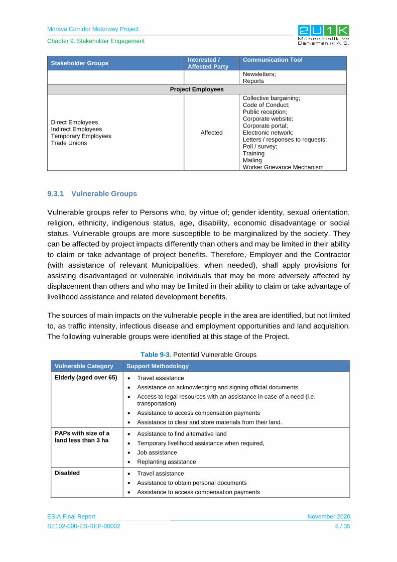
Morava Corridor Motorway Project
Chapter 9: Stakeholder Engagement
ESIA Final Report November 2020
SE102-000-ES-REP-00002 5 / 35
Stakeholder Groups Interested / Affected Party
Communication Tool
Newsletters; Reports
Project Employees
Direct Employees Indirect Employees Temporary Employees Trade Unions
Affected
Collective bargaining; Code of Conduct; Public reception; Corporate website; Corporate portal; Electronic network; Letters / responses to requests; Poll / survey; Training Mailing Worker Grievance Mechanism
9.3.1 Vulnerable Groups
Vulnerable groups refer to Persons who, by virtue of; gender identity, sexual orientation,
religion, ethnicity, indigenous status, age, disability, economic disadvantage or social
status. Vulnerable groups are more susceptible to be marginalized by the society. They
can be affected by project impacts differently than others and may be limited in their ability
to claim or take advantage of project benefits. Therefore, Employer and the Contractor
(with assistance of relevant Municipalities, when needed), shall apply provisions for
assisting disadvantaged or vulnerable individuals that may be more adversely affected by
displacement than others and who may be limited in their ability to claim or take advantage of
livelihood assistance and related development benefits.
The sources of main impacts on the vulnerable people in the area are identified, but not limited
to, as traffic intensity, infectious disease and employment opportunities and land acquisition.
The following vulnerable groups were identified at this stage of the Project.
Table 9-3. Potential Vulnerable Groups
Vulnerable Category Support Methodology
Elderly (aged over 65) Travel assistance
Assistance on acknowledging and signing official documents
Access to legal resources with an assistance in case of a need (i.e. transportation)
Assistance to access compensation payments
Assistance to clear and store materials from their land.
PAPs with size of a land less than 3 ha
Assistance to find alternative land
Temporary livelihood assistance when required,
Job assistance
Replanting assistance
Disabled Travel assistance
Assistance to obtain personal documents
Assistance to access compensation payments
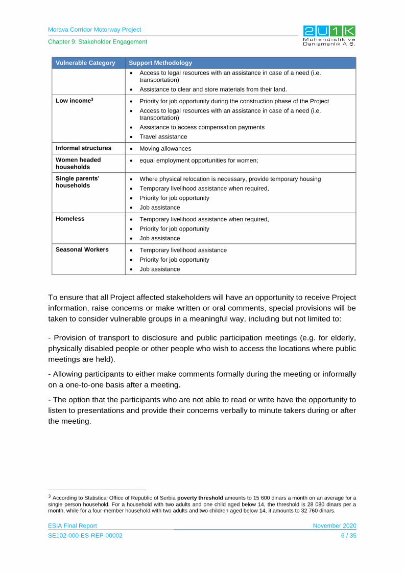
Morava Corridor Motorway Project
Chapter 9: Stakeholder Engagement
ESIA Final Report November 2020
SE102-000-ES-REP-00002 6 / 35
Vulnerable Category Support Methodology
Access to legal resources with an assistance in case of a need (i.e. transportation)
Assistance to clear and store materials from their land.
Low income3 Priority for job opportunity during the construction phase of the Project
Access to legal resources with an assistance in case of a need (i.e. transportation)
Assistance to access compensation payments
Travel assistance
Informal structures Moving allowances
Women headed households
equal employment opportunities for women;
Single parents’ households
Where physical relocation is necessary, provide temporary housing
Temporary livelihood assistance when required,
Priority for job opportunity
Job assistance
Homeless Temporary livelihood assistance when required,
Priority for job opportunity
Job assistance
Seasonal Workers Temporary livelihood assistance
Priority for job opportunity
Job assistance
To ensure that all Project affected stakeholders will have an opportunity to receive Project
information, raise concerns or make written or oral comments, special provisions will be
taken to consider vulnerable groups in a meaningful way, including but not limited to:
- Provision of transport to disclosure and public participation meetings (e.g. for elderly,
physically disabled people or other people who wish to access the locations where public
meetings are held).
- Allowing participants to either make comments formally during the meeting or informally
on a one-to-one basis after a meeting.
- The option that the participants who are not able to read or write have the opportunity to
listen to presentations and provide their concerns verbally to minute takers during or after
the meeting.
3 According to Statistical Office of Republic of Serbia poverty threshold amounts to 15 600 dinars a month on an average for a
single person household. For a household with two adults and one child aged below 14, the threshold is 28 080 dinars per a month, while for a four-member household with two adults and two children aged below 14, it amounts to 32 760 dinars.
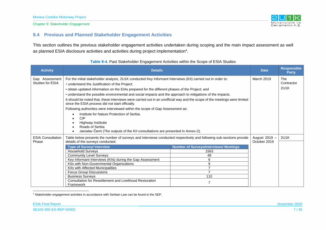
Morava Corridor Motorway Project
Chapter 9: Stakeholder Engagement
ESIA Final Report November 2020
SE102-000-ES-REP-00002 7 / 35
9.4 Previous and Planned Stakeholder Engagement Activities
This section outlines the previous stakeholder engagement activities undertaken during scoping and the main impact assessment as well
as planned ESIA disclosure activities and activities during project implementation4.
Table 9-4. Past Stakeholder Engagement Activities within the Scope of ESIA Studies
Activity Details Date Responsible
Party
Gap Assessment Studies for ESIA
For the initial stakeholder analysis, 2U1K conducted Key Informant Interviews (KII) carried out in order to:
• understand the Justification of the Project;
• obtain updated information on the EIAs prepared for the different phases of the Project; and
• understand the possible environmental and social impacts and the approach to mitigations of the impacts.
It should be noted that, these interviews were carried out in an unofficial way and the scope of the meetings were limited since the ESIA process did not start officially.
Following authorities were interviewed within the scope of Gap Assessment as:
Institute for Nature Protection of Serbia.
CIP
Highway Institutie
Roads of Serbia
Jaroslav Černi (The outputs of the KII consultations are presented in Annex-2).
March 2019 The Contractor
2U1K
ESIA Consultation Phase
Table below presents the number of surveys and interviews conducted respectively and following sub-sections provide details of the surveys conducted.
Type of Survey/ Interview Number of Surveys/Interviews/ Meetings
Household Surveys 1563
Community Level Surveys 48
Key Informant Interviews (KIIs) during the Gap Assessment 6
KIIs with Non-Governmental Organizations 9
KIIs with Affected Municipalities 7
Focus Group Discussions 7
Business Surveys 110
Consultation for Resettlement and Livelihood Restoration Framework
7
August 2019 – October 2019
2U1K
4 Stakeholder engagement activities in accordance with Serbian Law can be found in the SEP.
Morava Corridor Motorway Project
Chapter 9: Stakeholder Engagement
ESIA Final Report November 2020
SE102-000-ES-REP-00002 8 / 35
Activity Details Date Responsible
Party
The qualitative and quantitative tools that were used during the ESIA consultation phase in order to gather data for baseline purposes are as follows:
Community Level Surveys (CLS): Community level surveys were performed with the village representatives and 46 CLS were conducted in total.
Household Surveys (HHS): There is a total of 48 settlements within the buffer zone of 1000 meters. In period from26.08.2019-26.09.2019 1563 household surveys conducted according to the sample size determined in compliance with the population of the settlements. (The main impacts expected by the participants according to the settlements is presented in Annex-3.)
Focus Group Discussions (FGD): Another method used for qualitative primary data collection is planned to be focus group discussions (FGDs) with different social/stakeholder groups: men, women, farmers, entrepreneurs, youth, elderly, etc. (See Annex 5 for details of the FGDs)
NGO meetings: In period from 10.09.2019 till 18.10.2019, 10 NGO FGDs were held by the local social team with the supervision of 2U1K.
Following NGOs were interviewed:
NGO Treehouse
Kruševac’s Educational Center
Eurokontakt
Bee organization
White Tree Organization
NGO EKO IBAR
NGO Morava Fishing Association, former president of the municipality
Information level about the Project is inadequate.
West Morava Water Sports Association and Ecology Society
Women Entrepreneur Association
The summary of NGO meetings is presented in Annex-4.
Key Informant Interviews (KII): Key informant interviews (KIIs) were held with relevant local leaders and topic experts like health care professionals, education professionals, local government officers and other individuals able to provide specific information. Key Informant Interviews are realized in 7 Municipalities.
Total of 110 companies were interviewed within the scope of Business surveys for the Project as:

Morava Corridor Motorway Project
Chapter 9: Stakeholder Engagement
ESIA Final Report November 2020
SE102-000-ES-REP-00002 9 / 35
Activity Details Date Responsible
Party
Municipality Number of Surveys
Ćićevac 12
Varvarin 11
Kruševac 19
Vrnjačka Banja 13
Trstenik 8
Kraljevo 18
Čačak 29
TOTAL 110
Through the mentioned surveys following topics were discussed :
Population and Demography of the AoI
Economic conditions of the AoI
Existing ecosystem services of the AoI
Health, environment and security conditions of the AoI
Infrastructure and Services of the AoI
Vulnerability assessment
Existing tangible and intangible resources located within the AoI
Project Information level of the interviewees
Suggestions for the Project development
Social baseline conditions of the AoI derived from the desktop and field studies can be found in Chapter 5 of the ESIA Report. Social impact Assessment including suggestions made by the interviewees can be found in Chapter 6 of the ESIA Report for respective topics listed above.
Disclosure of the Resettlement and Livelihood Restoration Framework (RLRF)
On January 22, 2020, both English and Serbian versions of the RLRF were disclosed on the official web site of the Corridors of Serbia (CoS) from the links provided below:
Serbian version: http://koridorisrbije.rs/site/content/media/img/files/Morava%20RLRF%20Rev_%2010%20(14_01_2020)_Serbian(1).pdf
English version:
http://koridorisrbije.rs/site/content/media/img/files/RLRF_Rev_10%20(14_01_2020)%20CC.pdf.pdf
In the third quarter of February 2020, public participation meetings for disclosure were conducted to share the scope of the Framework
Third quarter of February 2020
2U1K
CoS
Morava Corridor Motorway Project
Chapter 9: Stakeholder Engagement
ESIA Final Report November 2020
SE102-000-ES-REP-00002 10 / 35
Activity Details Date Responsible
Party
For the announcement of the disclosure meeting, several invitation channels were used including the TV announcements, municipal announcements, radio and social media
Various informative materials were prepared to be used during the disclosure meetings including the presentation, brochure, maps (showing the motorway route, expropriation zone and the associated facilities) and comment forms
Distribution of the participants according to the municipalities given in below.
Municipality Number of Participants
Kruševac 9
Ćićevac 8
Trestenik 30
Vrnjačka Banja 26
Kraljevo 37
Čačak 21
Total 131
ESIA Disclosure 2U1K experts conducted a field study on August 2020 to assess whether open air Public Participation Meeting (PPM) could be arranged with local authorities and venues considering mandatory restrictions and social distancing measures associated with Covid-19. With the assessment of venues in August, all the arrangements and official permits were completed to conduct open air Public Participation Meetings in each affected villages, respectively. With the approval of local authorities, Contractor, Employer and Project Lenders; 2U1K was able to arrange and organize outdoor Public Participation Meetings located on each affected municipalities between the dates of September 23-30. The arranged venues were feasible to invite affected villages’ leaders/ representatives and interested NGOs.
All the villages arranged to have Project Leaflets prior to PPMs and banners posted at the office of the village heads. It is important to note that the number of leaflets calculated for each affected villages according to ESIA baseline data to cover all vulnerable households in minimum. In other words, availability of leaflets for all vulnerable households was the key approach to reach out to them one by one and provide information on Project documents and how to contact to Project Parties. Also, website of the Employer announced the meetings in local language. The announcement of PPMs as well as the soft copy of the Non-Technical Summary of the ESIA Report can be accessed from: http://koridorisrbije.rs/sr/n-a-5f6206db6de3c
Also, 17 NGOs and organizations were invited to participate in the open air venues. NGOs whom participated during the ESIA studies are also included in the invitation circle. The invitation made in Serbian language and included following information;
Purpose of the Meeting
Brief Project Information
PPM Schedule for Each Affected Municipality
Covid-19 Precautions
Access to Project Documentation
Contact Information.
September 2020
2U1K
BEJV
CoS

Morava Corridor Motorway Project
Chapter 9: Stakeholder Engagement
ESIA Final Report November 2020
SE102-000-ES-REP-00002 11 / 35
Activity Details Date Responsible
Party
Each meetings presented through a local facilitator whom was capable of translate from Serbian to English to obtain additional information from the 2U1K experts when necessary. In addition, meetings included hard copies of Project leaflets available for stakeholders to obtain. Also Project banners were posted entrances of the meeting venue.
The presentation contained the following topics;
Purpose of the Meeting,
Covid – 19 briefing and precautions,
Introduction of the Project,
Explaining the Project parties,
Benefits of the Project,
Project sections and sectors,
Roles and responsibilities,
Land acquisition and resettlement,
Project construction schedule,
Project elements,
River regulation,
Introduction to environmental and social area of influence,
Environmental and social baseline studies conducted for the ESIA,
Key environmental and social impacts expected for construction and operation phase of the Project,
Environmental and Social Management and Monitoring Plan,
Conclusion,
Informed consultation and participation,
Grievance mechanism,
Access to Project documents and contact information.
As can be seen in the images below the Route map was prepared for each affected municipality and hard copy (in A1 size) and presented at the end of the PPM for the interested stakeholders to show;
Route of the motorway,
Associated facilities,
River regulation,
Expropriation zone,
Location of the bridges, interchanges and underpasses,
EUNIS Habitat,
Location of the villages.
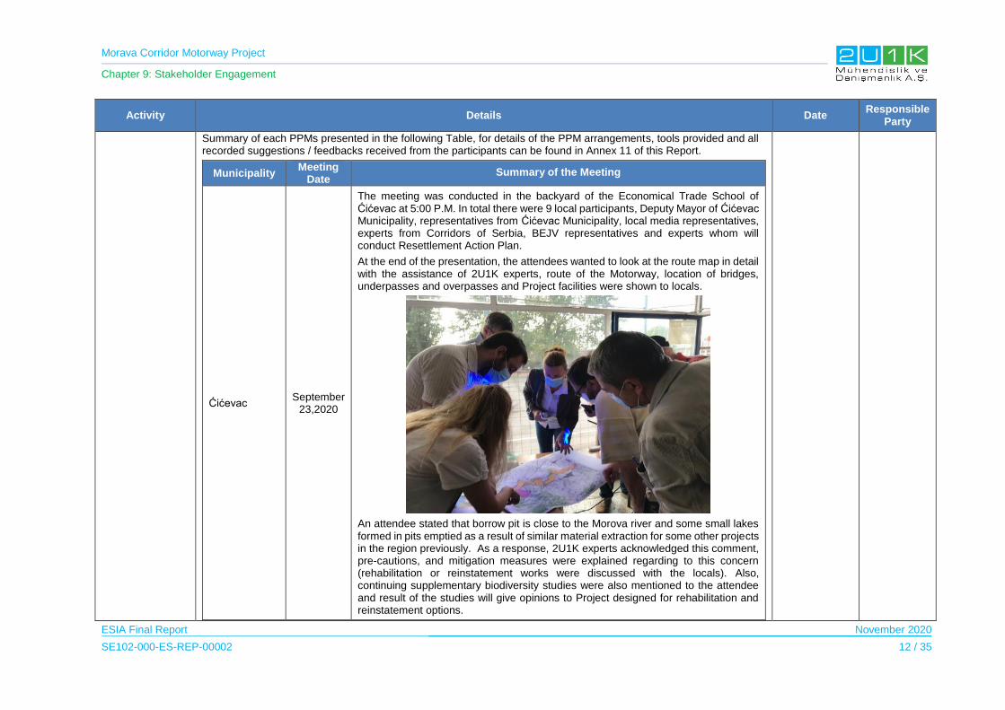
Morava Corridor Motorway Project
Chapter 9: Stakeholder Engagement
ESIA Final Report November 2020
SE102-000-ES-REP-00002 12 / 35
Activity Details Date Responsible
Party
Summary of each PPMs presented in the following Table, for details of the PPM arrangements, tools provided and all recorded suggestions / feedbacks received from the participants can be found in Annex 11 of this Report.
Municipality Meeting
Date Summary of the Meeting
Ćićevac September
23,2020
The meeting was conducted in the backyard of the Economical Trade School of Ćićevac at 5:00 P.M. In total there were 9 local participants, Deputy Mayor of Ćićevac Municipality, representatives from Ćićevac Municipality, local media representatives, experts from Corridors of Serbia, BEJV representatives and experts whom will conduct Resettlement Action Plan.
At the end of the presentation, the attendees wanted to look at the route map in detail with the assistance of 2U1K experts, route of the Motorway, location of bridges, underpasses and overpasses and Project facilities were shown to locals.
An attendee stated that borrow pit is close to the Morova river and some small lakes formed in pits emptied as a result of similar material extraction for some other projects in the region previously. As a response, 2U1K experts acknowledged this comment, pre-cautions, and mitigation measures were explained regarding to this concern (rehabilitation or reinstatement works were discussed with the locals). Also, continuing supplementary biodiversity studies were also mentioned to the attendee and result of the studies will give opinions to Project designed for rehabilitation and reinstatement options.

Morava Corridor Motorway Project
Chapter 9: Stakeholder Engagement
ESIA Final Report November 2020
SE102-000-ES-REP-00002 13 / 35
Activity Details Date Responsible
Party
Varvarin September
24,2020
The PPM was conducted at the Plaza Hotel in Varvarin Municipality. In total there were 10 local participants, including Deputy President Assembly of Varvarin, officials from Varvarin Municipality, local TV (RTK TV), local business owners, experts from Corridors of Serbia, BEJV representatives and experts whom will conduct Resettlement Action Plan. Deputy President Assembly of Varvarin was provided with hard copy of Non-Technical Summary of ESIA and leaflets for further distribution. Local news reporters interviewed Günal Özenirler with the help of translation by Lola Milojevic to introduce the Project, location of Project facilities and purpose of the PPM.
At the end of the presentation, an attendee stated that there is an old church located in Maskare village and wondered whether the stated church will be impacted due to Project. 2U1K experts explained the archeological studies conducted within the scope of ESIA and concluded that no tangible or intangible values will be impacted due to Project. Also, Chance Find Procedure was explained to the attendee.
Another attendee stated ongoing issues with flood in the Region and wondered how the Project will place a role in this matter. 2U1K explained the purpose of the river regulation for the Project as well as other flood protection measures considered within the scope of the Project. The representative from CoS also contributed to the explanation river regulation design.

Morava Corridor Motorway Project
Chapter 9: Stakeholder Engagement
ESIA Final Report November 2020
SE102-000-ES-REP-00002 14 / 35
Activity Details Date Responsible
Party
Kruševac September
25,2020
The PPM was conducted at the Nicolo Hotel located in Kruševac Municipality. The local participants were offered for bottled drinks, hygienic supplies and Project leaflets. In total there were 9 local participants, Counselor Member of the Kruševac, Secretary of the Local office in Kuklin, local TV (Jefimija TV), locals whom are affected by the expropriation, representor from CoS, BEJV representatives and experts whom will conduct Resettlement Action Plan. The Counselor Member was provided with hard copy of Non-Technical Summary of the ESIA and leaflets for further distribution. Local news reporter interviewed Günal Özenirler with the help of translation by Lola Milojevic to introduce the Project, location of Project facilities and purpose of the PPM.
At the end of the presentation, an attendee asked whether it is safe to continue agricultural production nearby the Motorway. 2U1K environmental expert (Günal Özenirler) explained the environmental studies conducted for the both construction and operation phases to assess the short term, long term and residual impacts of the Project. Considering the studies conducted in regard to air and noise impacts, the results of measurement and modelling studies show that agricultural fields neighboring the Motorway will not have a residual impacts after the implementation of mitigation measures stated in the ESIA.
Morava Corridor Motorway Project
Chapter 9: Stakeholder Engagement
ESIA Final Report November 2020
SE102-000-ES-REP-00002 15 / 35
Activity Details Date Responsible
Party
Another attendee asked what type of impacts are expected in neighboring locations by the quarry located in Makresani village. 2U1K environmental expert (Günal Özenirler) explained that the area of influence of the Project includes not only the route of the Motorway, Project facilities and areas for the river regulation also included. In that regards, environmental baseline studies for air quality, noise and vibration were also covered for the potential quarry locations in the ESIA study. To minimize impacts, the area of the quarry was decided reduced in order to mitigate impacts to the locals, sensitive receptors, settlements and beehives. It was also noted by the 2U1K that, this Project will be financed by the International Finance Institutions and according to their standards, the rehabilitation of selected quarries is committed within the scope of Project. Management and monitoring of the Project facilities are also covered in the Environmental and Social Monitoring and Management Plan of the ESIA. In case the locals have further comments / suggestions in regard to this matter, communication channels of the Project were reminded to the locals as given in the PowerPoint presentation.
Trstenik September 26, 2020
The PPM was conducted at the Public Venue in front of the local library in Trstenik Municipality. The local participants were offered for bottled drinks, hygienic supplies and Project leaflets.
In total, there were 27 participants, Mayor of the Trstenik Municipality, Vice President of Trstenik Municipality, local TV (Trstenik TV), locals whom wanted further information on the expropriation, representors from CoS and BEJV. The Mayor was provided with hard copy of Non-Technical Summary of the ESIA and PR official from the Trstenik was provided with additional leaflets for further distribution. Local news reporter interviewed Günal Özenirler with the help of translation by Dragan Kovacevic to introduce the Project, location of Project facilities and purpose of the PPM.

Morava Corridor Motorway Project
Chapter 9: Stakeholder Engagement
ESIA Final Report November 2020
SE102-000-ES-REP-00002 16 / 35
Activity Details Date Responsible
Party
At the end of the presentation, the locals were pleased to be discussed further details with the representor from CoS, Nina Valcic, in regard to future expropriation procedures planned within the scope of the Project. Nina Valcic started her speech with the brief information of the Expropriation Law and procedures adopted within the national framework. Also, she explained the Project will also follow International Finance Institutions requirements to bridge any gaps by the national legislation. Availability of Cadastral Maps were also discussed by Nina Valcic and the availability of these maps can be found in CoS website as well as in all affected Municipalities. The evaluation procedure for the expropriated lands, structures and agricultural products were briefly introduced by Nina Valcic. The upcoming social field study for the Resettlement Action Plan was introduced and the procedures were briefly discussed as well, the further announcements in regard to RAP studies will also be made by the Trstenik Municipality officials.
Vrnjačka Banja
September 28,2020
The PPM was conducted at the amphitheater located in Vrnjačka BanjaMunicipality. The local participants were offered for bottled drinks, hygienic supplies and Project leaflets.
In total, there were 33 participants including the Mayor of Vrnjačka Banja, local TV (VRT TV), locals whom wanted further information on the expropriation, representors from CoS and BEJV. The Mayor was provided with hard copy of Non-Technical Summary of the ESIA. Local news reporter interviewed Günal Özenirler with the help

Morava Corridor Motorway Project
Chapter 9: Stakeholder Engagement
ESIA Final Report November 2020
SE102-000-ES-REP-00002 17 / 35
Activity Details Date Responsible
Party
of translation by Dragan Kovacevic to introduce the Project, location of Project facilities and purpose of the PPM.
At the end of the presentation, an attendee requested further information on who to contact regarding the construction activities.2U1K representative, Günal Özenirler, explained that the Contractor will implement Construction Management Plan. Within the scope of this Plan, affected settlements for upcoming construction works will be notified prior to construction activities in detail. Also, Mr. Özenirler stated that the engagement with stakeholder will be continuous process throughout the phases of the Project. Stakeholder Engagement Plan (SEP) prepared for this Project was briefly introduced and explained locals how to access to the Report.
Another attendee stated that after the expropriation, his settlement will be separated in two and additional access may be needed for locals in terms of health and school services. 2U1K representative, Günal Özenirler, explained the planned bridges and underpasses to be constructed within the Project and showed the locations of these structures through the map at the end of PPM directly to the attendee. Field studies in the scope of RAP will discuss this issue with the locals in further details, and these types of issues will be covered in RAP. In case they have further questions or suggestions in regard to this matter, grievance mechanism was reminded to the attendee again.

Morava Corridor Motorway Project
Chapter 9: Stakeholder Engagement
ESIA Final Report November 2020
SE102-000-ES-REP-00002 18 / 35
Activity Details Date Responsible
Party
Kraljevo September
29,2020
The PPM was conducted at the entrance of Bataljan Elementary School. The school administration provided electricity, chairs and desks for 2U1K. Both entrance of the venue arranged to include masks and hygienic supplies for the attendees.
In total, there were 29 participants including; officials from local environmental NGO, local TV (RVT Kraljevo), locals who wanted further information on the expropriation and ecological conditions of the Morava River, representors from CoS and BEJV. Although the Municipality officials were previously contacted officially through letter, e-mail and phone call, Municipality representors were not present in the meeting. Local news reporter interviewed Günal Özenirler with the help of translation by Dragan Kovacevic to introduce the Project, location of Project facilities and purpose of the PPM.
At the end of the presentation, a local asked the purpose behind the river regulation and how this with affect the natural habitat in the Morava River. Similar to the comment, an attendee from a local NGO asked how river regulation activities will be monitored. 2U1K representative, Günal Özenirler, explained the purpose of the river regulation, especially in terms of flood prevention. For ecological conditions, the intensive ecological baseline survey within the scope of ESIA study was explained and background disciplines of the national and international experts who conducted the baseline studies were briefly introduced. Mitigation measures considered within the scope of river regulation (including technical details) also explained by Mr. Özenirler and for attendees whom may want further information can access to the NTS whether in hard copy or electronic version (see Appendix-13 for soft copy of NTS). Additional ecological studies that are currently been ongoing was also introduced and the banner posted regarding the details of the ongoing studies were shown to the attendees, the results of the studies stated to be disclosed to all interested stakeholders. The purpose of Environmental and Social Management Plan as introduced in the PowerPoint presentation was expanded to explain what type monitoring activities are suggested in terms of surface water, ground water, flora, fauna and soil. Last, 2U1K representatives also explained that during the construction activities continuous engagement will be made with interested and affected stakeholders and reference to Stakeholder Engagement Plan (SEP) was made and how the locals can access to Serbian version SEP was also explained.
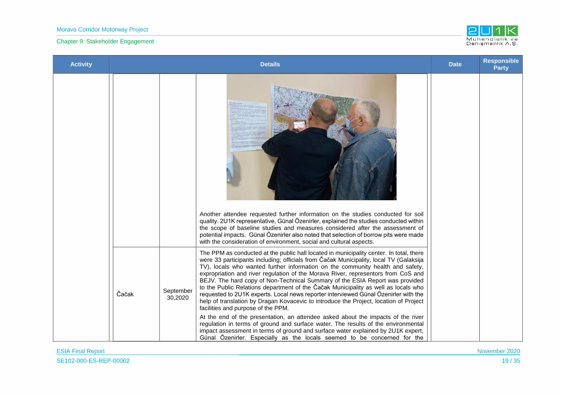
Morava Corridor Motorway Project
Chapter 9: Stakeholder Engagement
ESIA Final Report November 2020
SE102-000-ES-REP-00002 19 / 35
Activity Details Date Responsible
Party
Another attendee requested further information on the studies conducted for soil quality. 2U1K representative, Günal Özenirler, explained the studies conducted within the scope of baseline studies and measures considered after the assessment of potential impacts. Günal Özenirler also noted that selection of borrow pits were made with the consideration of environment, social and cultural aspects.
Čačak September
30,2020
The PPM as conducted at the public hall located in municipality center. In total, there were 33 participants including; officials from Čačak Municipality, local TV (Galaksija TV), locals who wanted further information on the community health and safety, expropriation and river regulation of the Morava River, representors from CoS and BEJV. The hard copy of Non-Technical Summary of the ESIA Report was provided to the Public Relations department of the Čačak Municipality as well as locals who requested to 2U1K experts. Local news reporter interviewed Günal Özenirler with the help of translation by Dragan Kovacevic to introduce the Project, location of Project facilities and purpose of the PPM.
At the end of the presentation, an attendee asked about the impacts of the river regulation in terms of ground and surface water. The results of the environmental impact assessment in terms of ground and surface water explained by 2U1K expert, Günal Özenirler. Especially as the locals seemed to be concerned for the
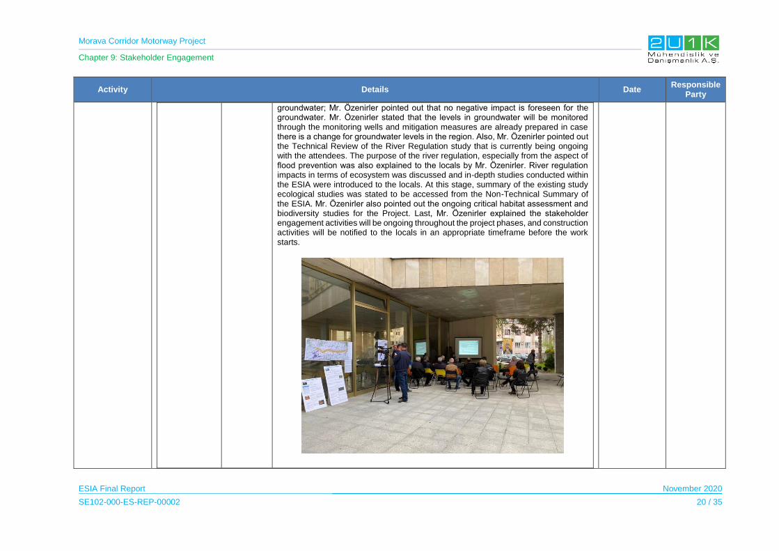
Morava Corridor Motorway Project
Chapter 9: Stakeholder Engagement
ESIA Final Report November 2020
SE102-000-ES-REP-00002 20 / 35
Activity Details Date Responsible
Party
groundwater; Mr. Özenirler pointed out that no negative impact is foreseen for the groundwater. Mr. Özenirler stated that the levels in groundwater will be monitored through the monitoring wells and mitigation measures are already prepared in case there is a change for groundwater levels in the region. Also, Mr. Özenirler pointed out the Technical Review of the River Regulation study that is currently being ongoing with the attendees. The purpose of the river regulation, especially from the aspect of flood prevention was also explained to the locals by Mr. Özenirler. River regulation impacts in terms of ecosystem was discussed and in-depth studies conducted within the ESIA were introduced to the locals. At this stage, summary of the existing study ecological studies was stated to be accessed from the Non-Technical Summary of the ESIA. Mr. Özenirler also pointed out the ongoing critical habitat assessment and biodiversity studies for the Project. Last, Mr. Özenirler explained the stakeholder engagement activities will be ongoing throughout the project phases, and construction activities will be notified to the locals in an appropriate timeframe before the work starts.
Morava Corridor Motorway Project
Chapter 9: Stakeholder Engagement
ESIA Final Report November 2020
SE102-000-ES-REP-00002 21 / 35
Activity Details Date Responsible
Party
Another attendee complained regarding the lack of information provided to locals who are affected by the expropriation. 2U1K expert Yasemin Celikel stated that this Project will obey not only national legislations also requirements of International Finance Institutions. Therefore, transparency and ongoing stakeholder engagement is the key approach to move forwards with the Project. For expropriation related matters the locals were also suggested to look over the disclosed Resettlement and Livelihood Restoration Framework of the Project. Also, the locals were informed that there is an ongoing Resettlement Action Plan study that the locals can be reached by the experts to convey their issue in detail. Experts from CoS made a speech stating these issues will be taken into a consideration for further assessment and requested attendees with similar complaints to address this issue through official mechanisms to be recorded and monitored. Also, grievance mechanism was mentioned again to all attendees and details communication options repeated by Mr. Özenirler.

Morava Corridor Motorway Project
Chapter 9: Stakeholder Engagement
ESIA Final Report November 2020
SE102-000-ES-REP-00002 22 / 35
9.4.1 Summary of the Social Field Studies for the ESIA Report
The social study area was decided by considering the impacts sourced from transportation
route, workers accommodation, noise during construction and operation phases, labour influx,
land use, changes on dust and air quality. As stated previously, there are 7 municipalities and
48 settlements within the envisaged the Project and construction facilities.
The objective of primary data collection is to gather recent data, to triangulate it with secondary
data and to gather first-hand information from potentially impacted communities.
Table below presents the number of surveys and interviews conducted respectively and
following sub-sections provide details of the surveys conducted.
Table 9-5. Surveys and Interviews Conducted by 2U1K
Type of Survey/ Interview Number of Surveys/Interviews/ Meetings
Household Surveys 1563
Community Level Surveys 48
Key Informant Interviews (KIIs) during the Gap Assessment
6
KIIs with Non-Governmental Organizations 9
KIIs with Affected Municipalities 7
Focus Group Discussions 7
Business Surveys 110
Following subsections will address brief summary of the outcomes of the social field study in
respective topics. Details of the social field study as well as other topics that were covered can
be found in ESIA Chapter 5, furthermore, Chapter 6 of the ESIA Report presents the impact
assessment derived from the outcomes of the baseline conditions of the Area of Influence.
Further details on surveys can also be found in SEP Report: Annex 2 (Key Outputs of KIIs
during Gap Assessment Study), Annex 3 (Summary of CLSs and HHSs), Annex 4 (List of
NGOs interviewed) and Annex 5 (Summary of Focus Group Discussions).
9.4.1.1 Population of the Area of Influence
Ćićevac Municipality: According to the outputs of the Community Level Surveys, total of 3,576
people live in four villages. In all settlements interviewed, it was stated that the population
decreases due to economic reasons.
Kruševac Municipality: Unlike the other municipalities where Community Level Surveys were
conducted, it was observed that in some settlements of Kruševac Municipality, population
increase was observed directly related to job opportunities.
Varvarin Municipality: According to Community Level Surveys results, Bošnjane village is
experiencing the population increase as a result of economic opportunities and the population
of the Maskere village decreases due to lack of employment opportunities.

Morava Corridor Motorway Project
Chapter 9: Stakeholder Engagement
ESIA Final Report November 2020
SE102-000-ES-REP-00002 23 / 35
Kraljevo Municipality: When the municipalities in the impact area are analyzed, it was observed
that Kraljevo is the most affected Municipality in terms of number of the villages in the AoI of
the Project. There are 11 villages located in the 1 km AoI of the Project with the total population
of 14,249. The economic reasons stated to be the main cause of both population growth and
the population decrease.
Vrnjačka Banja Municipality: 15,115 people live in the affected villages located in 1 km zone
of Vrnjačka Banja Municipality. This Municipality is more heterogeneous in terms of ethnic
composition when compared to the other Municipalities. There are 7% of Roma in Gracac and
1-3% of Bulgarians and Hungarians in the other villages.
Trstenik Municipality: The average household size of the villages varies between 2.5 and 4. In
all villages, there is a decrease in the population due to economic reasons.
Čačak Municipality: According to the results of Community Level Surveys, majority of the
affected villages population figures have been decreasing due to economic reasons.
9.4.1.2 Economy of the Area of Influence
Based on the Household and Community Level Surveys, the PAPs are predominantly involved
in agricultural activities as their main source of income. Also, livestock activities are common
for household purposes.
In all affected municipalities, unemployment was stated to be a significant issue. Especially
considering the fact that increased number of out-migration of young generation occurred over
the recent years due to lack of job opportunities.
Among the affected municipalities, Trstenik municipality is observed to be most affected from
the lack of employment opportunities in the AoI. On the other hand, considering the
unemployment rate (34.9 %) and number of villages (seven) affected by the Project related
activities, especially during the expropriation process, Trstenik municipality is one of the highly
sensitive receptors when assessing the local economy. Also, considering the unemployment
rate (26.9%) and number of affected villages (11), it can be stated that Kraljevo municipality is
moderately sensitive in terms of economic impacts of the Project.
9.4.1.3 Ecosystem Services of the Area of Influence
The Project alignment will pass through forestlands in each of the Municipalities within the AoI.
The most affected Municipalities are located in Section-2 including Trstenik and Vrnjačka
Banja Municipalities. The forestlands in the AoI are mainly used for wood, plant and mushroom
collection and hunting purposes. All of the forest related activities are mainly used for
household consumption according to the results of social field study.
During the site visit conducted by 2U1K in August 2019, it was observed that the Quarry area
proposed by the Contractor is located in the close proximity to apicultural activity area.

Morava Corridor Motorway Project
Chapter 9: Stakeholder Engagement
ESIA Final Report November 2020
SE102-000-ES-REP-00002 24 / 35
However, beekeeping activities are carried out various locations in the forest area, and the
locations of all beekeepers could not be determined during ESIA studies. According to the
information received from the Association of Professional Beekeepers, beehives located in the
close proximity Morava River will be affected by the excavation and blasting activities of the
Project including dust, noise and vibration. The beekeeper Association of Kruševac
recommended that the construction activities should be conducted as much as practical
distance from the beehives (in May, June, July they can fly 2 km) by considering the seasonal
changes.
During the discussions with the head of villages, although there may be lack of touristic
activities nor facilities among the AoI, it was stated that most of the affected settlement may
have potential to become a touristic location. This matter is also covered in the Spatial Plan
(November 2019) of the Project indicating the importance of Project to increase the tourism
potential of the affected settlements through easier accessibility of the settlements.
During the social field studies, the head of each affected villages was asked the purpose of
Morava River usage, although fishing activities are common in majority of the affected
settlements within the AoI, the locals do not generate income from fishing. On the other hand,
Čačak Municipality is observed to be the only affected municipality that use the River for
transportation purposes.
9.4.1.4 Cultural and Intangible Values of the Area of Influence
During the social field study, specific questionnaires were dedicated to determine and
understand the existing tangible/intangible cultural heritages among the AoI.
According to Spatial Plan, National EIAs and the interviews with focus groups and head of
villages, it was determined that there are intangible cultural heritage such as two sacred trees
and an old building in the Municipality of Maskare, archaeological sites and immovable cultural
assets in the Project and the route of the motorway and area of the river regulation was
determined in line with these information. Thus, the Motorway route and area of the river
regulation works will not coincide with any archaeological area and immovable cultural assets
and will not impact these areas.
As stated in the Spatial Plan of the Project, these trees were left outside of the selected route
of the Motorway. In addition, according to the design of the Project, none of the Project
construction facilities will be neighboring these trees. The locals access to of these sacred
trees are through existing unpaved village roads.

Morava Corridor Motorway Project
Chapter 9: Stakeholder Engagement
ESIA Final Report November 2020
SE102-000-ES-REP-00002 25 / 35
9.4.1.5 Project Information Level of the Area of Influence
Project Information Level has been asked through Community Level Surveys and Household
Surveys. It was stated that the Project was heard by the public in all settlements. Television is
the primary source of information for the public and the second source of information was
stated as radio and the internet. Village heads stated that their knowledge of the Project is not
sufficient, and they would like to be informed in more detail about the following issues:
• Employment Opportunities;
• The Proposed Motorway Route Alignment;
• Construction Period;
• Operation Period;
• Compensation; and
• Expropriation.
9.4.1.6 Vulnerability Assessment of the Area of Influence
Ćićevac Municipality: When the villages located in the Ćićevac Municipality were compared
according to the different vulnerability categories, it is seen that the Stalac village has the
population density. The main vulnerability indicator based on the financial indicators and mora
75% of the households in the interviewed villages cannot make saving. Almost 50% of
household members of the households in the villages except Mrzenica village are unemployed.
Grad Stalać is the only village that has etnic minority.
Kruševac Municipality: When the villages located in the borders of Kruševac Municipality
compared, it is seen that the Citluk village has the all vulnerable categories. It was seen that
the main source for the vulnerability is economy. The most populated group among all villages
are the unemployed and the low educated groups. There was no ethnic minority in the villages.
The number of people with chronic illnesses, people with disabilities or over 65 years of age
and the number of households with having difficulty payments are quite low compared to other
vulnerability categories.
Varvarin Municipality: It was observed that the village of Maskare has the more vulnerable
groups when it compared with the village of Bosnjane. The most populated vulnerable category
is the people who cannot make saving in two villages. Maskare also a high population in terms
of age and chronic diseases.
Kraljevo Municipality: It has been observed that the Kraljevo Municipality has the less
vulnerable population when it compared to other municipalities in the AoI. In Vrba, Grdica and
Popovići villages, land per household is smaller than 3 hectares. It was seen that the livelihood
sources related to agriculture in this Municipality are lower than the other Municipalities. Vrba
is the most populous group among vulnerable groups in Kraljevo.
Morava Corridor Motorway Project
Chapter 9: Stakeholder Engagement
ESIA Final Report November 2020
SE102-000-ES-REP-00002 26 / 35
Vrnjačka Banja Municipality: According to the results of Household Surveys, it has been
analyzed that most vulnerable groups resides in Ruđinci village within the borders of Vrnjačka
Banja. The vulnerability in this Municipality based on the economy as in other settlements and
is related to the limited asset ownership. A large proportion of the households interviewed in
the villages of Vrnjačka Banja municipality have less than 3 hectares of land. The education
rate is relatively higher than other municipalities. The number of people has no income other
than agriculture was the highest in the village of Novo Selo.
Trstenik Municipality: Among the villages located in the municipality of Trestenik, it was
observed that the village of Ugljarevo and Medveđa has the most populous groups in terms of
vulnerability. The main vulnerability areas are land ownership and low education.
Čačak Municipality: When the results of the household surveys were evaluated, it was seen
that Preljina was the village with the highest number of vulnerable groups among the villages
in Čačak Municipality. The reason for the vulnerability in this village is related to the limited
assets ownership. When the whole municipality is assessed, it is seen that the majority of the
villages has less than 3 hectares.
9.5 Stakeholder Engagement Program
The Stakeholder Engagement Program, through an Informed Consultation and Participation
(ICP) process, includes set of actions with targeted audience and responsibilities in order to
ensure the maximum engagement level for all relevant stakeholders.
The ICP process presented in this chapter covers 3 phases of the Project cycle. The Project
cycle comprises the following;
Pre-construction Phase
Construction Phase
Operation Phase.
The Employer of the Project, as part of the stakeholder engagement, will disclose following
information and documentation regarding the Project as:
Stakeholder Engagement Plan (SEP),
Project description and updates regarding the implementation progress of the Project,
Information on community health and safety risks and impacts (including any expected
road access restrictions and construction works) and proposed mitigation measures;
Resettlement and Livelihood Restoration Framework (RLRF),
Resettlement Action Plans (RAPs),
Summary of conclusions from the consultative meetings and public discussions held,
The Grievance Redress Mechanism, its objectives, and the information request form.
Morava Corridor Motorway Project
Chapter 9: Stakeholder Engagement
ESIA Final Report November 2020
SE102-000-ES-REP-00002 27 / 35
The information packages will be available in Serbian (as well as in English) immediately upon
the commencement of the Project. Information packages will be accessible through websites
of the affected municipalities and CoS. Printed copies of SEP, RLRF, RAPs and RLRF will be
available in all affected municipalities and Project offices. The Contractor will also disclose
ESIA, SEP and Grievance Redress Mechanism to its own website.
It is important to note that, these documents and information will remain in the public domain
for the entire duration of the Project.
9.6 Pre-Construction Phase
During pre-construction phase, the information package will be updated as needed and
disclosed. It is important to notify local stakeholders, in a meaningful and timely manner, of
any activities that might impact them.
The ESIA and EIA information disclosure package will be disclosed in pre-construction phase.
The disclosure and consultation activities will be designed along the following objectives:
Consultation events and opportunities will be widely and proactively publicized (two
weeks prior to any meeting),
The ESIA Summary will be accessible prior to any event to ensure that people are
informed of the assessment content and conclusions in advance of the meeting,
The location and timing of any meeting will be designed to maximize accessibility to
affected stakeholders,
Accessibility to the meeting venues (i.e. transportation services) will be provided for
each affected settlement,
Information presented will be clear and non-technical, and will be presented in the local
language understood by those in the communities,
Facilitation will be provided to ensure that stakeholders are able to raise their concerns,
Issues raised will be answered at the meeting or actively followed up.
ESIA disclosure and stakeholder engagement require effective processes, systems and tools.
These become even more important in ensuring effective engagement during the Covid-19
pandemic. Under this special circumstance, the Project endeavored to reduce large human
gathering during ESIA disclosure, especially when consulting with communities. 2U1K experts
conducted a field study on August 2020 to assess whether open air Public Participation
Meeting (PPM) could be arranged with local authorities and venues. With the assessment of
venues in August, all the arrangements and official permits were completed to conduct open
air Public Participation Meetings in each affected villages, respectively.
With the approval of local authorities, Contractor, Employer and Project Lenders; 2U1K was
able to arrange and organize outdoor Public Participation Meetings located on each affected
municipalities between the dates of September 23-30. Details of the PPMs can be found in
Annex – 11 of the SEP Report.
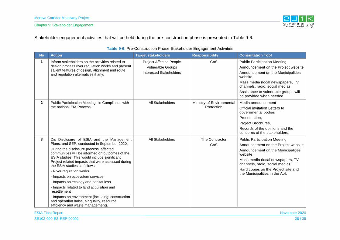
Morava Corridor Motorway Project
Chapter 9: Stakeholder Engagement
ESIA Final Report November 2020
SE102-000-ES-REP-00002 28 / 35
Stakeholder engagement activities that will be held during the pre-construction phase is presented in Table 9-6.
Table 9-6. Pre-Construction Phase Stakeholder Engagement Activities
No Action Target stakeholders Responsibility Consultation Tool
1 Inform stakeholders on the activities related to design process river regulation works and present salient features of design, alignment and route and regulation alternatives if any.
Project Affected People
Vulnerable Groups
Interested Stakeholders
CoS Public Participation Meeting
Announcement on the Project website
Announcement on the Municipalities website,
Mass media (local newspapers, TV channels, radio, social media)
Assistance to vulnerable groups will be provided when needed.
2 Public Participation Meetings in Compliance with the national EIA Process
All Stakeholders Ministry of Environmental Protection
Media announcement
Official invitation Letters to governmental bodies
Presentation,
Project Brochures,
Records of the opinions and the concerns of the stakeholders,
3 Dis Disclosure of ESIA and the Management Plans, and SEP. conducted in September 2020.
During the disclosure process, affected communities will be informed on outcomes of the ESIA studies. This would include significant Project related impacts that were assessed during the ESIA studies as follows:
- River regulation works
- Impacts on ecosystem services
- Impacts on ecology and habitat loss
- Impacts related to land acquisition and resettlement
- Impacts on environment (including; construction and operation noise, air quality, resource efficiency and waste management).
All Stakeholders The Contractor
CoS
Public Participation Meeting
Announcement on the Project website
Announcement on the Municipalities website,
Mass media (local newspapers, TV channels, radio, social media).
Hard copies on the Project site and the Municipalities in the AoI.

Morava Corridor Motorway Project
Chapter 9: Stakeholder Engagement
ESIA Final Report November 2020
SE102-000-ES-REP-00002 29 / 35
No Action Target stakeholders Responsibility Consultation Tool
4 Introduce Stakeholder Engagement Plan and Project Grievance Mechanism
All Stakeholders The Contractor
CoS
Presentation on the grievance mechanism and the stakeholder engagement tools,
Distribution of the Contact details of the Public Relations Officers,
Records of the grievances
5 Informed Consultations on land acquisition and compensations during the finalization of Resettlement and Livelihood Restoration Plan used to develop specific Resettlement Action Plan
Landowners and land users
Informal landowners and land users
Owners of assets, structures, buildings and businesses that will be affected by the Project
CoS Public notice and official
correspondence by concerned
authorities and organization
Noticeboards and website of the affected local municipalities
Individual compensation agreements
and the Grievance Records5
6 Implementation of stakeholder engagement and information disclosure
activities for PAPs
PAPs that will be directly/indirectly affected by
the land acquisition and resettlement activities
Vulnerable groups
CoS Announcement on the Project website
Announcement on the Municipalities website,
Mass media (local newspapers, TV channels, radio, social media).
Hard copies on the Project site and the Municipalities in the AoI
7 Engage with stakeholders during preparation of site specific RAPs and implementation of individual measures as prescribed in the RAP
All Stakeholders CoS Social Survey of all affected
households with individual visits to
each affected household
Disclosure of draft RAP
Dissemination of Cut-Off date via
public announcements
5 A specific grievance mechanism will be established for the affected people from the land acquisition and this mechanism will be introduced to the PAPs as part of the Resettlement Policy Framework.
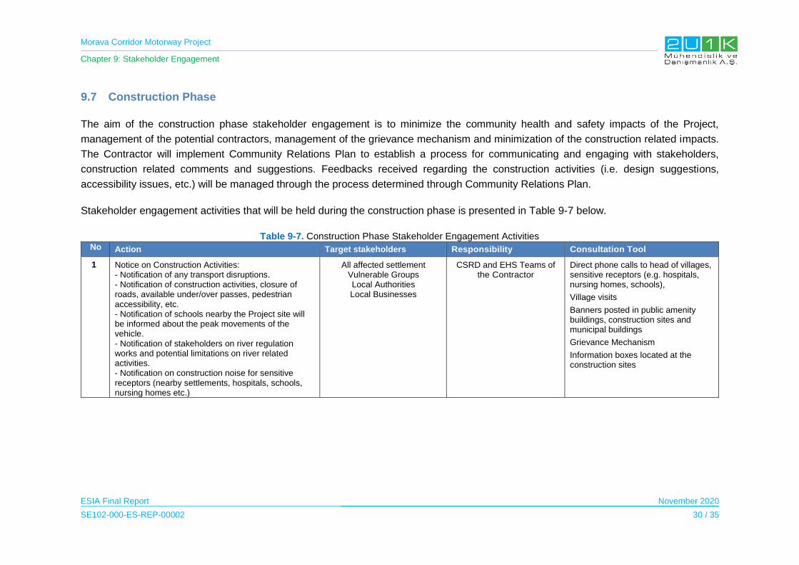
Morava Corridor Motorway Project
Chapter 9: Stakeholder Engagement
ESIA Final Report November 2020
SE102-000-ES-REP-00002 30 / 35
9.7 Construction Phase
The aim of the construction phase stakeholder engagement is to minimize the community health and safety impacts of the Project,
management of the potential contractors, management of the grievance mechanism and minimization of the construction related impacts.
The Contractor will implement Community Relations Plan to establish a process for communicating and engaging with stakeholders,
construction related comments and suggestions. Feedbacks received regarding the construction activities (i.e. design suggestions,
accessibility issues, etc.) will be managed through the process determined through Community Relations Plan.
Stakeholder engagement activities that will be held during the construction phase is presented in Table 9-7 below.
Table 9-7. Construction Phase Stakeholder Engagement Activities No Action Target stakeholders Responsibility Consultation Tool
1 Notice on Construction Activities: - Notification of any transport disruptions. - Notification of construction activities, closure of roads, available under/over passes, pedestrian accessibility, etc. - Notification of schools nearby the Project site will be informed about the peak movements of the vehicle. - Notification of stakeholders on river regulation works and potential limitations on river related activities. - Notification on construction noise for sensitive receptors (nearby settlements, hospitals, schools, nursing homes etc.)
All affected settlement Vulnerable Groups Local Authorities Local Businesses
CSRD and EHS Teams of the Contractor
Direct phone calls to head of villages, sensitive receptors (e.g. hospitals, nursing homes, schools),
Village visits
Banners posted in public amenity buildings, construction sites and municipal buildings
Grievance Mechanism
Information boxes located at the construction sites
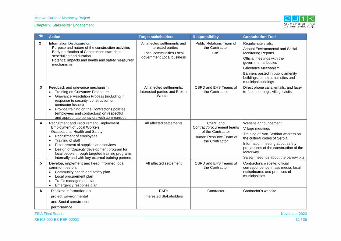
Morava Corridor Motorway Project
Chapter 9: Stakeholder Engagement
ESIA Final Report November 2020
SE102-000-ES-REP-00002 31 / 35
No Action Target stakeholders Responsibility Consultation Tool
2 Information Disclosure on: Purpose and nature of the construction activities Early notification of Construction start date,
scheduling and duration Potential impacts and health and safety measures/
mechanisms
All affected settlements and Interested parties
Local communities Local government Local business
Public Relations Team of the Contractor
CoS
Regular site visits,
Annual Environmental and Social Monitoring Reports
Official meetings with the governmental bodies
Grievance Mechanism
Banners posted in public amenity buildings, construction sites and municipal buildings
3 Feedback and grievance mechanism
Training on Grievance Procedure
Grievance Resolution Process (including in response to security, construction or contractor issues)
Provide training on the Contractor’s policies (employees and contractors) on respectful and appropriate behaviors with communities
All affected settlements, Interested parties and Project
Workers
CSRD and EHS Teams of the Contractor
Direct phone calls, emails, and face-to-face meetings, village visits.
4 Recruitment and Procurement Employment Employment of Local Workers Occupational Health and Safety
Recruitment of employees
Training of staff
Procurement of supplies and services
Design of Capacity development program for local people through targeted training programs internally and with key external training partners
All affected settlements CSRD and Contract/procurement teams
of the Contractor
Human Resource Team of the Contractor
Website announcement
Village meetings
Training of Non-Serbian workers on the cultural codes of Serbia
Information meeting about safety precautions of the construction of the Motorway
Safety meetings about the barrow pits
5 Develop, implement and keep informed local communities on:
Community health and safety plan
Local procurement plan
Traffic management plan
Emergency response plan
All affected settlement CSRD and EHS Teams of the Contractor
Contractor’s website, official correspondence, mass media, local noticeboards and premises of municipalities.
6 Disclose information on
project Environmental
and Social construction
performance
PAPs
Interested Stakeholders
Contractor Contractor’s website
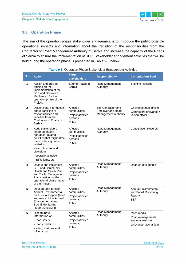
Morava Corridor Motorway Project
Chapter 9: Stakeholder Engagement
ESIA Final Report November 2020
SE102-000-ES-REP-00002 32 / 35
9.8 Operation Phase
The aim of the operation phase stakeholder engagement is to introduce the public possible
operational impacts and information about the transition of the responsibilities from the
Contractor to Road Management Authority of Serbia and increase the capacity of the Roads
of Serbia to ensure the implementation of SEP. Stakeholder engagement activities that will be
held during the operation phase is presented in Table 9-8 below.
Table 9-8. Operation Phase Stakeholder Engagement Activities
No Action Target
stakeholders Responsibility Consultation Tool
1 Assign and provide training on the implementation of the SEP and Grievance Mechanism for the operation phase of the Project.
Staff of Roads of Serbia
Road Management Authority
Training Records
2 Disseminate information about transition of responsibilities and liabilities from the Contractor to Roads of Serbia
Affected communities,
Project affected persons
Public.
The Contractor and Employer and Road Management Authority
Grievance mechanism.
Contractors grievance / liaison officer
3 Keep stakeholders informed on any operation -related activities that might affect them including but not limited to:
- road closures and diversions
- operational noise
- traffic jams, etc.
Affected communities,
Project affected persons
Public.
Road Management Authority
Consultation Records
4 Update and implement SEP and Community Health and Safety Plan and Traffic Management Plan considering the operational phase impact of the Project.
Affected communities,
Project affected persons
Public.
Road Management Authority
Updated documents
5 Develop and publish Annual Environmental and Social Report (brief summary of the Annual Environmental and Social Monitoring Report (AESMR)
Affected communities,
Project affected persons,
Public.
Road Management Authority
Annual Environmental and Social Monitoring Reports
SEP
6 Disseminate information on:
- road safety
- road conditions
- tolling stations and tolling cost
Affected communities,
Project affected persons,
Public.
Road Management Authority
Mass media
Road managements authority website
Grievance Mechanism
Morava Corridor Motorway Project
Chapter 9: Stakeholder Engagement
ESIA Final Report November 2020
SE102-000-ES-REP-00002 33 / 35
9.9 External Communications
The external communication includes exchange of information both within the entire Project
parties themselves and all related stakeholders. It is significant for all parties involved to take
ownership of entire stakeholder relations and manage them effectively.
External communication is the very first step in creating the appropriate the Project image. It
contains related Project information from inventive reports, printed publications, presentations,
or web pages. The main goal of external communication is to inform the stakeholders an
important message about the work and quality of the Project. External communication activities
play a very important role in every phase of the Project cycle. To engage with stakeholder
groups that impacted parties: governmental institutions, local communities, associations,
organizations, academia, media, and NGO´s. A good working relationships will be established
with all of stakeholders and actively elicit their input through public consultations, focus groups,
face-to-face meetings. It is essential to be proactive, accessible, and responsive about project
impacts and work collaboratively with the stakeholders on projects of mutual interest.
The Grievance Mechanism will provide complaint management and their responses which is
intended specifically on affected stakeholders. The external communications will cover
specifications of the SEP and the Grievance Mechanism. All related Project representatives
from CoS and the Contractor will communicate with the stakeholders on a regular basis. For
implementation and maintenance of the external communication; each request and/or
feedback will be recorded and be followed and responded to by the Community Relations
and Sustainability Department. The team will track related external communications to
facilitate a local discourse with identified stakeholders and affected communities.
The external communication information, aligned to the Project’s progress reports, will list the
activities will carry out in over the Project phases, and will include key performance indicators
(KPI) for the Contractor and the Employer to enable measurement of performance against set
targets.
According IFC, External Communications have several benefits:
Increases program transparency
Reduces the spread of misinformation
Serves as a two-way channel for feedback from stakeholders
Builds interest and buy-in from civil society and government
Strengthens corporate image among the public and industry peers
Improves risk management
Strengthens brand value / reputation
Increases appeal to financial investors

Morava Corridor Motorway Project
Chapter 9: Stakeholder Engagement
ESIA Final Report November 2020
SE102-000-ES-REP-00002 34 / 35
All engagements will be documented both in writing and photographically, with minutes taken
in standardized format and attendance recorded. Minutes will be shared with and approved by
participants.
9.10 Grievance Mechanism
The purpose of Grievance Management is foremost to provide access to a problem-solving
procedure applicable throughout the Project lifecycle.
A structured Grievance Management system will be established to ensure that grievances
associated with the Project are addressed through a transparent and impartial process.
Stakeholders will be able to share their opinions and grievances via a range of options such
as letters, e-mail, grievance boxes and face to face meetings during all phases of the Project.
9.10.1 Public Grievance Mechanism
Public Grievance will be managed in six main steps as follows.
1. Receipt of Grievances: Complaints may be sent via letters, e-mails, phone calls, in
person, through municipalities.
2. Acknowledgement and Record Keeping: All incoming grievances will be reflected
on a daily basis through a Grievance Log. The Grievance Log will also be used to track
the status of a grievance, analyses the frequency of complaints arising, typical sources
and causes of complaints, as well as to identify prevailing topics and any recurrent
trends.
3. Investigation: Through the investigation; underlying causes of the grievances will be
assessed and possible response/and solution including the corrective measures will be
established.
4. Response to Complaint: Once the investigations are complete and the proposed
resolution determined, the Project will then provide an official response to complainants
and the grievance will be formally closed.
5. Discussion of Resolution: If a complainant is not satisfied with the proposed
resolution, further negotiations can take place until the matter of the complaint is
resolved and the case is closed. If negotiations between the Project parties and the
complainant do not achieve a satisfactory result leading to the closure of the complaint,
then the grievance is escalated to higher levels to be defined in the course of the
Project’s procedures setting.
6. Resource to Legal System: The parties may take the dispute to court at any point
during the process. Resorting to the Project’s amicable grievance resolution does not
prevent the complainant to resort to Justice at any stage in the process.
Morava Corridor Motorway Project
Chapter 9: Stakeholder Engagement
ESIA Final Report November 2020
SE102-000-ES-REP-00002 35 / 35
9.10.2 Worker Grievance Mechanism
A Worker Grievance Mechanism will be established by the Project prior to construction within
the scope of the HR Management Plan to manage the complaints from all Project employees.
This mechanism will be structured with an intention of it being an effective approach for early
identification, assessment and resolution of grievances throughout the Project’s phases.
During the construction phase, the Contractor will be responsible to implement the mechanism
then it will be transferred to the CoS for the operations phase.

Morava Corridor Motorway Project
Chapter 10: Conclusion
ESIA Final Report November 2020
SE102-000-ES-REP-00002 1 / 8
10 CONCLUSION
This ESIA has been conducted to evaluate the impacts associated with the proposed Morova
Motorway Project of 112 km length, passing through the seven Municipalities including Čačak,
Kraljevo, Vrnjačka Banja, Trstenik, Kruševac and Ćićevac in Serbia. The impact assessment
has been conducted in compliance with IFC Performance Standards, international best
practice, relevant national legislative requirements, international conventions and the
Contractor’s corporate requirements.
10.1 Impacts Summary
Following a gap assessment for the scoping phase, this ESIA Report focuses on interactions
among the pre-construction including design phase, construction, post-construction and
operation Project activities and various sensitive receptors that may experience impacts during
the Project lifecycle.
As a result of the ESIA, the Project impacts are mostly medium and residual impact and these
impacts will decrease to low level mostly after the implementation of the proposed mitigation
measures given in Chapter 6 of the ESIA Report. Table 10-1 presents the outcomes of the
detailed assessment of identified impacts as a result of various phases of the proposed Project
and summaries the impacts.
Table 10-1. ESIA Impact Assessment Summary
Impact Description Phase Impact Nature Overall Impact Residual Impact
ENVIRONMENTAL IMPACT ASSESSMENT
Water Quality
Spillage/Leakage to Surface Water
Construction Negative Medium Low
Working in the River-bed and River
Regulation works Construction Negative High Low
Wastewater discharge Construction Negative Medium Low
Spillage/Leakage to Surface Water
Operation Negative Medium Low
Wastewater discharge Operation Negative Medium Low
Flooding Operation Negative High Medium
Change in River Flow Operation Negative Medium Low
Change in River Water Quality.
Operation Negative Medium Low
Groundwater
Leakage to Groundwater
Construction Negative Medium Low
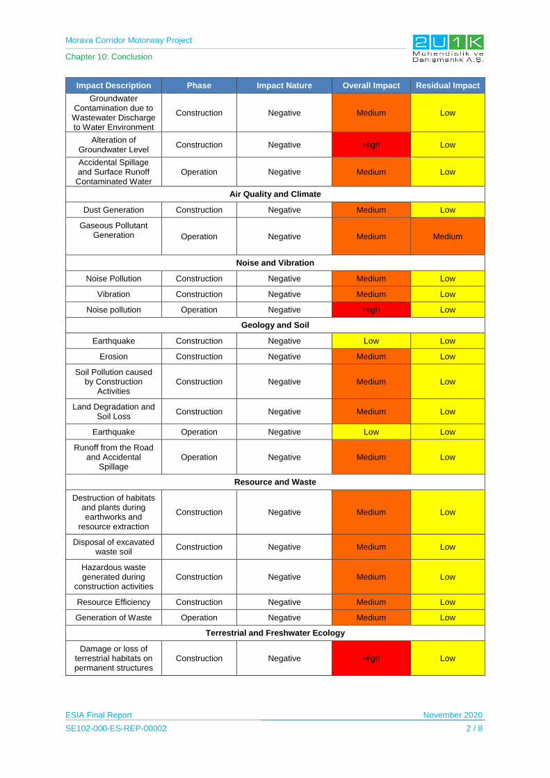
Morava Corridor Motorway Project
Chapter 10: Conclusion
ESIA Final Report November 2020
SE102-000-ES-REP-00002 2 / 8
Impact Description Phase Impact Nature Overall Impact Residual Impact
Groundwater Contamination due to Wastewater Discharge to Water Environment
Construction Negative Medium Low
Alteration of Groundwater Level
Construction Negative High Low
Accidental Spillage and Surface Runoff
Contaminated Water Operation Negative Medium Low
Air Quality and Climate
Dust Generation Construction Negative Medium Low
Gaseous Pollutant Generation
Operation Negative Medium Medium
Noise and Vibration
Noise Pollution Construction Negative Medium Low
Vibration Construction Negative Medium Low
Noise pollution Operation Negative High Low
Geology and Soil
Earthquake Construction Negative Low Low
Erosion Construction Negative Medium Low
Soil Pollution caused by Construction
Activities Construction Negative Medium Low
Land Degradation and Soil Loss
Construction Negative Medium Low
Earthquake Operation Negative Low Low
Runoff from the Road and Accidental
Spillage Operation Negative Medium Low
Resource and Waste
Destruction of habitats and plants during earthworks and
resource extraction
Construction Negative Medium Low
Disposal of excavated waste soil
Construction Negative Medium Low
Hazardous waste generated during
construction activities Construction Negative Medium Low
Resource Efficiency Construction Negative Medium Low
Generation of Waste Operation Negative Medium Low
Terrestrial and Freshwater Ecology
Damage or loss of terrestrial habitats on permanent structures
Construction Negative High Low

Morava Corridor Motorway Project
Chapter 10: Conclusion
ESIA Final Report November 2020
SE102-000-ES-REP-00002 3 / 8
Impact Description Phase Impact Nature Overall Impact Residual Impact
Damage or loss of terrestrial habitats on temporary structures
Construction Negative Medium Low
Habitat fragmentation Construction Negative High Low
Loss of important plant species
Construction Negative Medium Low
Loss of important fauna species
Construction Negative Medium Low
Increase in noise, visual and vibration which may cause
disturbance or displacement of fauna
Construction Negative Medium Low
Introduction of Alien invasive species
Construction Negative Medium Low
Damage to Freshwater Ecosystem
Construction Negative High Low
Freshwater Habitat loss / change due to
river regulation Construction Negative High Low
Loss of important aquatic species
Construction Negative Medium Low
Accidental loss of fauna
Operation Negative High Low
Barrier effect in fauna Operation Negative High Low
Archaeological and Cultural Resources
Chance Destruction of Archaeological and Cultural Resources
Construction Negative Medium Low
Visual Landscape and Land Use
Change of landscape due to changes in land
use Construction Negative Medium Low
Visibility of new structures
Construction Negative Medium Low
Visibility of new structures from
Recreational Areas Construction Negative Medium Low
Change of landscape due to changes in land
use Operation Negative High Low
Visibility of new structures
Operation Negative Medium Low
Visibility of new structures from
Recreational Areas High
SOCIAL IMPACT ASSESSMENT
Population

Morava Corridor Motorway Project
Chapter 10: Conclusion
ESIA Final Report November 2020
SE102-000-ES-REP-00002 4 / 8
Impact Description Phase Impact Nature Overall Impact Residual Impact
Increase risk of illicit behavior or crime
Construction Negative Low Low
Risk of social conflict Construction Negative Low Low
Influx of additional population
Construction Negative Medium Low
Impacts on community dynamics
Construction Negative Low Low
Increase burden on competition for public
service Construction Negative Medium Low
Gender based violence Construction Negative Low Low
Local inflation Construction Negative Medium Low
Population decrease Operation Negative Medium Low
Population increase Operation Positive Medium High
Infrastructure
Pressure on the local infrastructure during
construction activities Construction Negative Medium Low
Pressure on the local infrastructure due to associated facilities
Construction Negative Medium Low
Impacts on local road network
Construction Negative Medium Low
Pressure on the local infrastructure during operation activities
Operation Negative Medium Low
Economy
Employment Opportunities
Construction Positive Medium High
Local Procurement Opportunities
Construction Positive Medium High
Direct and In-direct Employment Opportunities
Operation Positive Low Medium
Increase in Economic Development in the
Region Operation Positive Medium High
Decrease in agricultural sector in
the Region Operation Negative Medium Low
Resettlement and Land Acquisition
Loss of private and public lands due to
expropriation Pre-Construction Negative High Medium
Loss of business lands Pre-Construction Negative High Medium
Temporary land and property impacts
Pre-Construction Negative Medium Low

Morava Corridor Motorway Project
Chapter 10: Conclusion
ESIA Final Report November 2020
SE102-000-ES-REP-00002 5 / 8
Impact Description Phase Impact Nature Overall Impact Residual Impact
Fragmentation of agricultural land plots.
Pre-Construction Negative High Medium
Loss of economic forestland function
Pre-Construction Negative Medium Medium
Damage to crops during the operation
phase Pre-Construction Negative Low Low
Physical and economic displacement of PAPs.
Pre-Construction Negative High Medium
Ecosystem Services
Access to Forest Lands
Construction Negative Medium Low
Impact on Apiculture Construction Negative Low Low
Impact on River Usage Construction Negative Medium Medium
Impact on Leisure Activities and Tourism
Construction Negative Medium Medium
Access to Ecosystem Services
Operation Negative Medium Low
Labor and Working Conditions
Risks and Impacts Related to Women
Employment and Non-Discrimination and Equal Opportunity
Both phases Negative Low Low
Labour Risks and Impacts Related to Subcontractor and
Supply Chain Management
(Including Child and Forced)
Both phases Negative Low Low
Working conditions and terms of
employment for expat and national workers.
Both phases Negative Low Low
For operation phase of the Project, it is
expected that between 20 and 50 permanent
local employees will be hired for the tolling
station and toll collection of the
Motorway.
Both phases Negative Low Low
Occupational Health and Safety
Health and Safety Risks due to General Occupational Health and Safety Hazards
Construction Negative Medium Low

Morava Corridor Motorway Project
Chapter 10: Conclusion
ESIA Final Report November 2020
SE102-000-ES-REP-00002 6 / 8
Impact Description Phase Impact Nature Overall Impact Residual Impact
Health and Safety Risks due to Physical
and Chemical Hazards Construction Negative Medium Low
Health and Safety Risks due to
Emergencies and Epidemic Diseases
Construction Negative Medium Low
Health and Safety Risks due to
Construction Traffic Construction Negative Medium Low
Health and Safety Risks on
Accommodation Construction Negative Medium Low
Labor Risks and Impacts Related to Subcontractor and
Supply Chain Management
(Including Child and Forced
Labour Risks)
Construction Negative Medium Low
Health and Safety Risks due to General Occupational Health and Safety Hazards
Operation Negative Medium Low
Health and Safety Risks due to Physical
and Chemical Hazards
Operation Negative Medium
Low
Health and Safety Risks due to Emergencies
Operation Negative Medium
Low
Health and Safety Risks due to Motorway
maintenance
Operation Negative Medium
Low
Community Health and Safety
Traffic Density Construction Negative Medium Medium
Communicable Diseases
Construction Negative Low
Low
Construction related environmental impacts
Construction Negative Medium
Low
Security around the Project Site
Construction Negative Low
Low
Earthquake Construction Negative Low Low
Erosion Construction Negative Low Low
Spillage/Leakage to Surface Water
Construction Negative Low Low
Level crossings safety Operation Negative Low Low
Noise during operation Operation Negative Medium Low
Flood risk during operation
Operation Negative High Medium
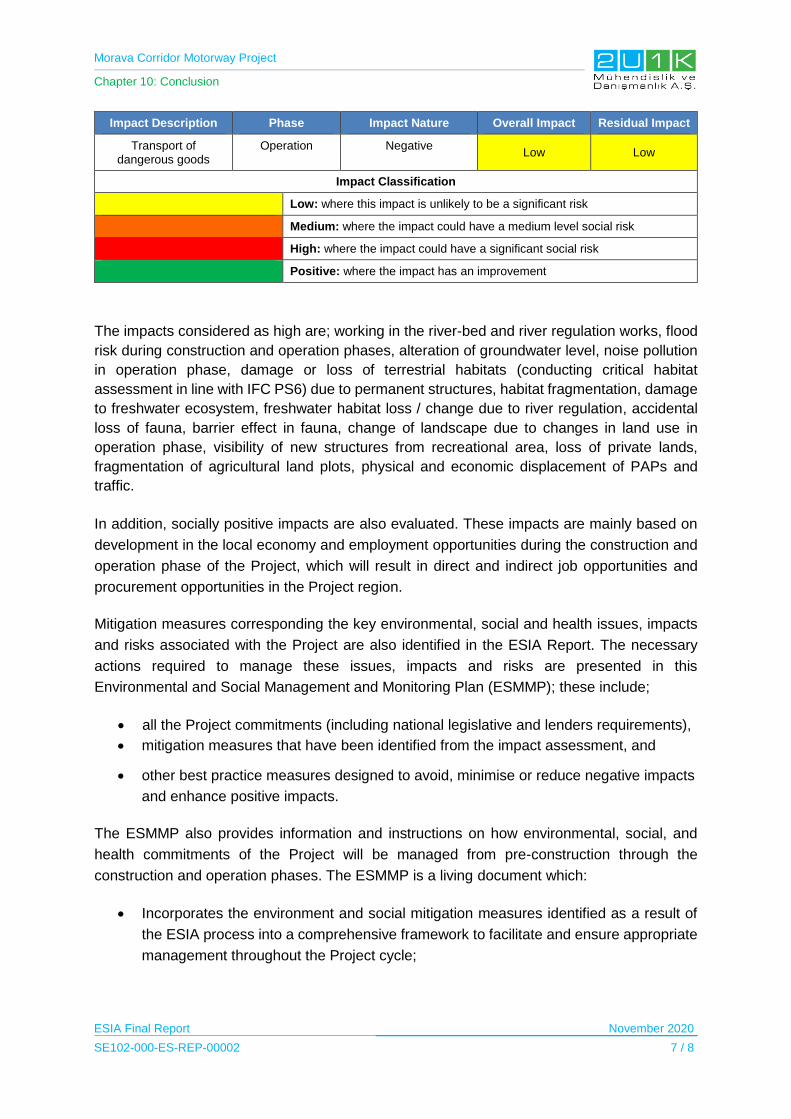
Morava Corridor Motorway Project
Chapter 10: Conclusion
ESIA Final Report November 2020
SE102-000-ES-REP-00002 7 / 8
Impact Description Phase Impact Nature Overall Impact Residual Impact
Transport of dangerous goods
Operation Negative Low Low
Impact Classification
Low: where this impact is unlikely to be a significant risk
Medium: where the impact could have a medium level social risk
High: where the impact could have a significant social risk
Positive: where the impact has an improvement
The impacts considered as high are; working in the river-bed and river regulation works, flood
risk during construction and operation phases, alteration of groundwater level, noise pollution
in operation phase, damage or loss of terrestrial habitats (conducting critical habitat
assessment in line with IFC PS6) due to permanent structures, habitat fragmentation, damage
to freshwater ecosystem, freshwater habitat loss / change due to river regulation, accidental
loss of fauna, barrier effect in fauna, change of landscape due to changes in land use in
operation phase, visibility of new structures from recreational area, loss of private lands,
fragmentation of agricultural land plots, physical and economic displacement of PAPs and
traffic.
In addition, socially positive impacts are also evaluated. These impacts are mainly based on
development in the local economy and employment opportunities during the construction and
operation phase of the Project, which will result in direct and indirect job opportunities and
procurement opportunities in the Project region.
Mitigation measures corresponding the key environmental, social and health issues, impacts
and risks associated with the Project are also identified in the ESIA Report. The necessary
actions required to manage these issues, impacts and risks are presented in this
Environmental and Social Management and Monitoring Plan (ESMMP); these include;
all the Project commitments (including national legislative and lenders requirements),
mitigation measures that have been identified from the impact assessment, and
other best practice measures designed to avoid, minimise or reduce negative impacts
and enhance positive impacts.
The ESMMP also provides information and instructions on how environmental, social, and
health commitments of the Project will be managed from pre-construction through the
construction and operation phases. The ESMMP is a living document which:
Incorporates the environment and social mitigation measures identified as a result of
the ESIA process into a comprehensive framework to facilitate and ensure appropriate
management throughout the Project cycle;
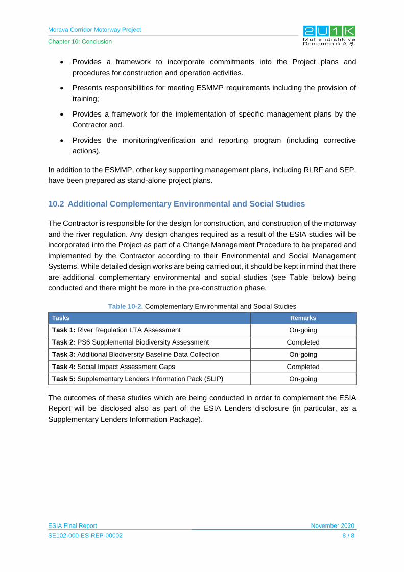
Morava Corridor Motorway Project
Chapter 10: Conclusion
ESIA Final Report November 2020
SE102-000-ES-REP-00002 8 / 8
Provides a framework to incorporate commitments into the Project plans and
procedures for construction and operation activities.
Presents responsibilities for meeting ESMMP requirements including the provision of
training;
Provides a framework for the implementation of specific management plans by the
Contractor and.
Provides the monitoring/verification and reporting program (including corrective
actions).
In addition to the ESMMP, other key supporting management plans, including RLRF and SEP,
have been prepared as stand-alone project plans.
10.2 Additional Complementary Environmental and Social Studies
The Contractor is responsible for the design for construction, and construction of the motorway
and the river regulation. Any design changes required as a result of the ESIA studies will be
incorporated into the Project as part of a Change Management Procedure to be prepared and
implemented by the Contractor according to their Environmental and Social Management
Systems. While detailed design works are being carried out, it should be kept in mind that there
are additional complementary environmental and social studies (see Table below) being
conducted and there might be more in the pre-construction phase.
Table 10-2. Complementary Environmental and Social Studies
Tasks Remarks
Task 1: River Regulation LTA Assessment On-going
Task 2: PS6 Supplemental Biodiversity Assessment Completed
Task 3: Additional Biodiversity Baseline Data Collection On-going
Task 4: Social Impact Assessment Gaps Completed
Task 5: Supplementary Lenders Information Pack (SLIP) On-going
The outcomes of these studies which are being conducted in order to complement the ESIA
Report will be disclosed also as part of the ESIA Lenders disclosure (in particular, as a
Supplementary Lenders Information Package).