Malungsong-Mabongtot Footpath Construction Subproject Initial
86
Initial Environmental Examination Project number: 41220-013 September 2019 PHI: Integrated Natural Resources and Environmental Management Project Subproject: Construction of Malusong to Mabongtot Footpath, Lubuagan, Kalinga Prepared by the Municipality of Lubuagan, Province of Kalinga for the Department of Environment and Natural Resources and for the Asian Development Bank.
-
Upload
khangminh22 -
Category
Documents
-
view
2 -
download
0
Transcript of Malungsong-Mabongtot Footpath Construction Subproject Initial

Initial Environmental Examination
Project number: 41220-013September 2019
PHI: Integrated Natural Resources and Environmental Management Project
Subproject: Construction of Malusong to Mabongtot Footpath, Lubuagan, Kalinga
Prepared by the Municipality of Lubuagan, Province of Kalinga for the Department of Environment and Natural Resources and for the Asian Development Bank.

CURRENCY EQUIVALENTS
(as of 15 August 2019) The date of the currency equivalents must be within 2 months from the date on the cover.
Currency unit – peso (PhP) PhP 1.00 = $ 0.01941
$1.00 = PhP 51.505
ABBREVIATIONS
ADB Asian Development Bank BDC Barangay Development Council BUB CHARMP2
Bottom-Up Budgeting Second Cordillera Highland Agricultural Resource Management Project
CNC Certificate of Non Coverage CSC Construction Supervision Consultant CSO DA
Civil Society Organization Department of Agriculture
DED Detail Engineering Design DENR Department Of Environment And Natural Resources DILG Department of Interior and Local Government DSWD Department of Social Welfare and Development ECA Environmentally Critical Area ECC Environmental Compliance Certificate ECP Environmentally Critical Project EHSM Environmental Health And Safety Manager EIA Environmental Impact Assessment EIS Environmental Impact Statement EMB ESS FMR
Environmental Management Bureau Environmental Safeguards Specialist Farm to Market Road
GAD Gender And Development IEE Initial Environmental Examination INREMP Integrated Natural Resources and Environment Management Project IP Indigenous People IROW Infrastructure Right of Way LGU Local Government Unit MDC Municipal Development Council MPN Most Probable Number NAAQ National Ambient Air Quality Guidelines NCB National Competitive Bidding NECA Non Environmental Critical Area NECP Non Environmental Critical Project NIA NOL
National Irrigation Administration No Objection Letter
NPCO National Project Coordinating Office NRIMP National Road Improvement and Management Program NRM Natural Resources Management OCM Overhead, Contingencies and Miscellaneous PCCP PDR
Portland Cement Concrete Pavement Project Description Report
PMIC Project Management Implementation Consultant

PPCO Provincial Project Coordination Offices RPMO Regional Project Management Office PMU Project Management Unit POs Peoples’ Organizations PSA Philippine Statistics Authority PWD Persons With Disability RC Reinforced Concrete RCPC Reinforced Concrete Pipe Culvert RPCO Regional Project Coordinating Offices REA Rapid Environmental Assessment ROW Right of Way SB Sangguniang Bayan SBD Standard Bidding Document
SEMS Social and Environmental Management Systems SPMU Subproject Management Unit SPS SSS
Safeguard Policy Statement Social Safeguards Specialist
TA Technical Assistance TDS Total Dissolved Solids TOR Terms of Reference TSP Total Suspended Particulates WMA WMC
Watershed Management Area Watershed Management Council
WMPCO Watershed Management And Project Coordination Offices

WEIGHTS AND MEASURES
˚C – degree centigrade ha – hectare km – kilometer m – meter
m asl – meter above sea level mm – millimeter
mg/L – milligram per liter mg/Nm3 – milligram per normal cubic meter
ppt – parts per thousand μg/Nm3 – microgram per normal cubic meter
µS/cm – microSiemens/cm % – percent
NOTE In this report, "$" refers to US dollars unless otherwise stated.
This Initial Environmental Examination is a document of the borrower. The views expressed herein do not necessarily represent those of ADB's Board of Directors, Management, or staff, and may be preliminary in nature.
In preparing any country program or strategy, financing any project, or by making any designation of or reference to a particular territory or geographic area in this document, the Asian Development Bank does not intend to make any judgments as to the legal or other status of any territory or area.

TABLE OF CONTENTS
I. EXECUTIVE SUMMARY ..................................................................................................... 1 II. POLICY, LEGAL, AND ADMINISTRATIVE FRAMEWORK .............................................. 2
A. Environmental Clearance Requirements ........................................................................ 2 1. Government Environmental Laws, Regulations and Guidelines ................................. 2 2. ADB Environmental Assessment Requirements ......................................................... 5
III. DESCRIPTION OF THE PROJECT .................................................................................. 6 A. Overview ......................................................................................................................... 6 B. Project Location .............................................................................................................. 6 C. Project Rationale ............................................................................................................ 6 D. Project Development Plan .............................................................................................. 7
1. Project Components ..................................................................................................... 7 2. Description of the Project Phases ................................................................................. 9
E. Manpower Requirements .............................................................................................. 10 F. Project Cost ................................................................................................................... 10 G. Project Duration and Schedule ..................................................................................... 10
IV. DESCRIPTION OF THE ENVIRONMENT ...................................................................... 11 A. Elevation and Slope ...................................................................................................... 11 B. Climate .......................................................................................................................... 11 C. Soil Types ..................................................................................................................... 12 D. Land Use ...................................................................................................................... 12 E. Hydrology ...................................................................................................................... 14 F. Water Quality ................................................................................................................ 14 G. Water Sources .............................................................................................................. 15 H. Flora and Fauna ........................................................................................................... 15
1. Flora Characteristics .................................................................................................. 16 2. Fauna Characteristics ................................................................................................. 16
I. Socio-Economic Conditions ........................................................................................... 16 1. Demographic Characteristics ..................................................................................... 16 2. Basic Social Services ................................................................................................ 18 3. Economic Situation .................................................................................................... 18 4. Income and Expenditures .......................................................................................... 19 5. Transport System ...................................................................................................... 20
V. ANTICIPATED ENVIRONMENTAL IMPACTS AND MITIGATION MEASURES ........... 20 A. Pre-Construction Phase ............................................................................................. 22
1. Confirmation of no required resettlement, relocations, and compensation ............. 22 2. Identification and establishment of the route or the stretch of the project ............... 22 3. Preparation of detailed engineering designs and programs of work ....................... 22 4. Recruitment of workers ........................................................................................... 22
B. Construction Phase .................................................................................................... 22 1. Construction materials acquisition, transport access, and storage system ............. 22 2. Clearing and removal of obstructions ....................................................................... 23 3. Soil erosion ............................................................................................................... 23 4. Ground surface leveling and gravelling of existing footsteps/footpath ...................... 23 5. Civil works ............................................................................................................... 23 6. Implementation of noise and dust control measure ................................................. 24 7. Implementation of spoil management and control measure .................................... 24 8. Solid and liquid construction waste management system ....................................... 24 9. Water Quality .......................................................................................................... 24 10. Construction drainage system ................................................................................. 24 11. Workers health, safety and hygiene ........................................................................ 24 12. Traffic safety and management ............................................................................... 25

13. Ecological environment (Flora and Fauna) ............................................................. 25 14. Damage to properties .............................................................................................. 25 15. Concrete washout ................................................................................................... 26 16. Use of Hazardous Substances ................................................................................ 26 17. Public safety ............................................................................................................ 26
C. Operation and Maintenance (O&M) Phase ................................................................... 26 1. Operation of upgraded access road ........................................................................ 26
VI. INFORMATION DISCLOSURE, CONSULTATION, AND PARTICIPATION ............ 26 A. Stakeholder Consultations ............................................................................................ 26 B. Information Disclosure .................................................................................................. 28
VII. GRIEVANCE REDRESS MECHANISM ........................................................................ 28 A. Grievance among IPs ................................................................................................. 30
VIII. ENVIRONMENTAL MANAGEMENT PLAN .............................................................. 30 A. Implementation Arrangements .................................................................................... 30 B. Environmental Mitigation ............................................................................................ 31 C. Environmental Monitoring Plan ................................................................................... 37
IX. CONCLUSION AND RECOMMENDATION ................................................................... 39 A. Conclusion .................................................................................................................... 39 B. Recommendation .......................................................................................................... 39
APPENDICES ...................................................................................................................... 40
LIST OF TABLES
Table 1: Summary list of ECP types and ECA categories ...................................................... 2
Table 2: INREMP subprojects threshold for coverage screening and categorization (EMB-MC 005-2014) .......................................................................................................... 4
Table 2: Preliminary cost estimate on major scope of works ............................................... 10
Table 3: Indicative subproject implementation schedule ...................................................... 11
Table 5: Result of the water analysis at the Surung Watershed Management Unit .............. 14
Table 6: 2015 population per sex per sitio .............................. Error! Bookmark not defined.
Table 7: Projected population for the next 10 years ............................................................. 17
Table 8: Income distribution by household ........................................................................... 19
Table 9: Household expenditures ......................................................................................... 20
Table 10: Assessment of potential environmental impacts ................................................... 21
Table 11: Summary of stakeholder views of the construction of Malusong to Mabongtot footpath .................................................................................................................. 27
Table 12: Responsibilities for EMP implementation .............................................................. 30
Table 13: Environmental Impact Mitigation Plan ................................................................... 32
Table 14: Environmental Monitoring Plan ............................................................................. 37

LIST OF FIGURES
Figure 1: Lubuagan Municipal Map and Road ....................................................................... 7
Figure 2: Elevation and slope of proposed footpath subproject ........................................... 12
Figure 3: Present day climate in Lubuagan, Mountain Province ........................................... 13
Figure 4: Soil type map of the municipality of Lubuagan ..................................................... 13
Figure 5: River network of the Municipality of Lubuagan ...................................................... 15
Figure 6: Photographs of Common Fauna Species found within the Surung Watershed ..... 17
LIST OF APPENDICES
Appendix 1: A Copy of the Payment for CNC Application .................................................... 41
Appendix 2: Post Activity Report – Validation of Proposed Subproject ................................ 42
Appendix 3: Pictures of the Footpath for Rehabilitation ........................................................ 43
Appendix 4: Barangay Consultation/Orientation Documentation .......................................... 43
Appendix 5: Barangay Resolution Endorsing the Subproject .............................................. 73
Appendix 6: SB Resolution Accepting and Supporting the Subproject ................................ 74
Appendix 7: Grievance Intake Form ..................................................................................... 76
Appendix 8: Certifaction of NoTrees to be affected………………..……………………………78

1
I. EXECUTIVE SUMMARY
1. This Initial Environmental Examination (IEE) intends to summarize the environmental issues, concerns and impacts for the Construction of Malusong to Mabongtot Footpath in Mabongtot, Lubuagan, Kalinga Province. This subproject is the concreting of an existing footpath with an estimated length of two (2) kilometers. The main proponent of the project is the Local Government Unit of Lubuagan, Kalinga assisted by the Department of Agriculture – Integrated Natural Resources and Environmental Management Project. The LGU will implement the subproject led by the Municipal Engineer’s Office. 2. The objective of the proposed Construction of Malusong to Mabongtot Footpath is to uplift the social and economic condition of the community through the provision of all-year-round safe access.
3. The Subproject was categorized as ‘Category B’ and this IEE was prepared consistent with the environmental assessment requirements of ADB’s Safeguard Policy Statement of 2009. The IEE was carried out through screening and analysis of various environmental parameters, field investigations, stakeholder consultations, and review of other footpath project reports in the Philippines. The IEE covers the general environmental profile of Mabongtot and includes an assessment of the potential environmental impacts during different subproject phases and formulation of corresponding mitigation measures. The IEE was prepared by the LGU of Lubuagan with the cooperation of RPCO, PMU, WMCO, POs and its consultant.
4. The total cost of the subproject is Three Million Two Hundred Thousand Pesos (PhP
3,200,000.00). Following the agreed financing mix of the subproject, 88% of the total subproject cost will be covered by the INREMP and the remaining 12% will be shouldered by LGU Lubuagan as cash equity counterpart.
5. Major land use along the proposed subproject is agriculture. None of the sub-project areas are located near or within ecologically sensitive areas.
6. The IEE, based on the screening of baseline environment and review of proposed civil works, has not identified any major environmental concerns considering that all the proposed civil works are only asset preservation and are located within the existing right of way. There will only be localized short term impacts during construction activities due to implementation of civil works that will be addressed in the detailed design and thorough the implementation of the mitigation and monitoring measures specified in the environmental management plan.
7. The IEE process included stakeholder participation and consultation to help LGUs achieve public acceptance of the subproject. Public consultation at Barangay Mabongtot confirmed that the Construction of Malusong to Mabongtot Footpath is essential for social and economic development.
8. A grievance redress mechanism shall be established by the LGU of Lubuagan to ensure that complaints of affected persons and other stakeholders regarding the project’s environmental performance are promptly addressed.
9. The IEE includes an environmental management plan which details the mitigation measures, environmental monitoring activities, institutional responsibilities, and environmental management capacity building. The LGU through its Municipal Planning and Development Coordinator and the Municipal Engineer will ensure that relevant EMP provisions are included in the bid and contract documents for the detailed design, project supervision, and civil works. During construction, they will closely conduct monitoring the contractor’s environmental

2
performance and over-all EMP implementation. Environmental monitoring reports will be submitted by LGU to ADB and such reports will be posted on ADB’s website for public disclosure.
10. The major positive impact of the project will be economic and better accessibility. The subproject will directly benefit people located in the barangay and its adjoining barangays of Antonio Canao. This subproject will have an overall beneficial impact and will have minor negative impacts that will be carefully monitored and adequately mitigated through the implementation of the EMP.
II. POLICY, LEGAL, AND ADMINISTRATIVE FRAMEWORK A. Environmental Clearance Requirements
1. Government Environmental Laws, Regulations and Guidelines 11. According to the EMB Memorandum Circular 005 - 2014, the environmental category of a project is decided based on the type of the project (whether it falls into ‘Environmental Critical Project’, ECP type), location of the project (whether it falls into ‘Environmental Critical Areas’, ECA category), and size of the project. A summary list of ECPs and ECA categories are presented in Table 1.
Table 1: Summary list of ECP types and ECA categories A. List of ECPs
As declared by Proclamation No. 2146 (1981)
1. Heavy Industries – Non-ferrous Metal Industries, Iron and Steel Mills, Petroleum and
Petrochemical Industries including Oil and Gas, Smelting Plants
2. Resource Extractive Industries – Major Mining and Quarrying Projects, Forestry
Projects (logging, major wood processing projects, introduction of fauna (exotic
animals) in public and private forests, forest occupancy, extraction of mangrove
products, grazing), Fishery Projects (dikes for/ and fishpond development projects)
3. Infrastructure Projects – Major Dams, Major Power Plants (fossil-fueled, nuclear
fueled, hydroelectric or geothermal), Major Reclamation Projects, Major Roads and
Bridges
As declared by Proclamation No. 803 (1996)
4. All golf course projects
B. List of ECA Categories - As declared by Proclamation No. 2146 (1981)
1. All areas declared by law as national parks, watershed reserves, wildlife preserves,
sanctuaries
2. Areas set aside as aesthetic potential tourist spots
3. Areas which constitute the habitat of any endangered or threatened species of Philippine wildlife (flora and fauna)
4. Areas of unique historic, archaeological, or scientific interests
5. Areas which are traditionally occupied by cultural communities or tribes
6. Areas frequently visited and/or hard-hit by natural calamities (geologic hazards,
floods, typhoons, volcanic activity, etc.)

3
7. Areas with critical slopes
8. Areas classified as prime agricultural lands
9. Recharged areas of aquifers
10. Water bodies characterized by one or any combination of the following conditions:
tapped for domestic purposes; within the controlled and/or protected areas declared
by appropriate authorities; which support wildlife and fishery activities
11. Mangrove areas characterized by one or any combination of the following conditions:
with primary pristine and dense young growth; adjoining mouth of major river
systems; near or adjacent to traditional productive fry or fishing grounds; areas which
act as natural buffers against shore erosion, strong winds and storm floods; areas on
which people are dependent for their livelihood.
12. Coral reefs characterized by one or any combination of the following conditions: With
50% and above live coralline cover; Spawning and nursery grounds for fish; Act as
natural breakwater of coastlines
12. Based on their type, size and location the projects have been classified into 3 major groups:
• Group I (ECPs): ECPs in either ECAs or NECAs – Environmentally Critical Projects in either Environmentally Critical Areas or Non-Environmentally Critical Areas. These projects require the proponent to submit ‘Environmental Impact Statement’ report to secure ‘Environmental Compliance Certificate’ from DENR’s Environment Management Bureau (EMB).
• Group II (NECPs): NECPS in ECAs – Non Environmentally Critical Projects in Environmentally Critical Areas. These projects require proponent to submit either ‘Initial Environmental Examination’ Report or ‘Project Description Report ‘ based on the size of the project (Table 2) to secure either ECC or ‘Certificate of Non Coverage’.
• Group III (Non Covered Projects): NECPs in NECS – Non Environmentally Critical Projects in Non-Environmentally Critical Areas. PDR required to be submitted for Enhancement Mitigation Projects for confirmation of benign nature of proposed activity, and CNC is required to be secured. All other projects shall be at the option of the proponent to prepare a PDR as a basis for CNC, should the proponent opt to secure one.
13. This subproject is an improvement of existing barangay road which falls under the group of Category B. Given that the subproject is the rehabilitation of access road with no more than 50% increase in capacity, a Certificate of Non-coverage (CNC) was requested by the LGU to the Environmental Management Bureau (EMB). A copy of the payment for CNC application is attached (Appendix 1).

4
Table 2: INREMP subprojects threshold for coverage screening and categorization (EMB-MC 005-2014)
Projects within the INREMP Menu of
Subprojects
Covered (Required to secure ECC) Not covered (may secure
CNC) Project
size parameter
s / Remarks
CATEGORY A: ECP CATEGORY B: Non-ECP CATEGORY D
EIS EIS IEE
Checklist
Project Description (Part I only)
HEAVY AND OTHER PROCESSING/ MANUFACTURING INDUSTRIES Food preservation (e.g. drying, freezing) and similar methods aside from canning
None None None Regardless of
capacity
Agricultural processing including rice, corn, vegetables, fruits and other agricultural products
none ≥ 50,000
MT
> 5,000 MT but < 50,000
MT <5,000 MT
Annual production
rate
Rice/Corn mill None None
> ton/hr or mill with polishing
(regardless of
production rate if with polishing)
≤ 1 ton/hr Hourly
production rate
Other types of food (and other food by-products, additives, etc.) processing industries
None ≥ 50,000
MT
> 200 MT but < 50,000
MT < 200 MT
Annual production
rate
RESOURCES EXTRATIVE INDUSTRIES Other Forestry Projects; Forestry project co-managed with DENR
≥ 10,000 m3 ≥ 5,000 m3
but <10,000 m3
≥ 100 m3 but <5,000 m3
<100 m3
Annual volume of trees to be
cut
Wood processing projects
≥ 10,000 m3 ≥ 4,000 m3
but <10,000 m3
≥ 100 m3 but <4,000 m3
<100 m3 Equivalent products per year
Livestock Animal Industries (Livestock/Piggery Projects – e.g. pigs/goats)
None ≥ 5,000 heads
> 100 but 5,000 heads
<100 heads Stocking
population
INFRASTRUCTURE PROJECTS
Irrigation projects (distribution system only)
None
≥1,000 hectares (service
area)
>300 but <1,000
hectares ≤300 hectares
Service area
Water Supply Projects (without dam)
None
With water source (e.g. infiltration
gallery, etc.) and water treatment facilities including
desalination, reverse osmosis
(RO)
Level III (Distribution system only)
Level II / Level I Water refilling
station

5
Projects within the INREMP Menu of
Subprojects
Covered (Required to secure ECC) Not covered (may secure
CNC) Project
size parameter
s / Remarks
CATEGORY A: ECP CATEGORY B: Non-ECP CATEGORY D
EIS EIS IEE
Checklist
Project Description (Part I only)
Roads, widening, rehabilitation and/or improvement
None
>50% increase in capacity (or in terms of
length/width) AND ≥20km,
(length with no critical slope) OR
≥10km (length with
critical slope)
>50% increase in capacity (or in terms of
length/width) AND
>2km but <20km,
(length with no critical slope) OR
≥10km (length with
critical slope)
>50% increase in capacity (or in
terms of length/width) BUT ≤ 2km increase in
length
Storage facilities with no hazardous or toxic materials.
None ≥ 5 hectare >1 hectare
but <5 hectare
≤ 1 hectare
Total/gross floor area including parking,
open space and other
areas
2. ADB Environmental Assessment Requirements
14. According to ADB guidelines, the process of determining a project’s environment category is to prepare a Rapid Environmental Assessment screening checklist, taking into account the type, size, and location of the proposed project. Based on ADB’s Safeguard Policy Statement 2009 (SPS 2009), a project is classified as one of the three (3) environmental categories (A, B, C, FI) as follows:
• Category A: Projects with potential for significant adverse environmental impacts that are irreversible, diverse or unprecedented. These impacts may affect an area larger than the sites or facilities subject to physical works. An environmental impact assessment is required.
• Category B: Projects judged to have some adverse environmental impacts, but of lesser degree and/or significance than those for category A projects. Impacts are site-specific, few if any of them are irreversible, and in most cases mitigation measures can be designed more readily than for Category A projects. An initial environmental examination (IEE) is required.
• Category C: Projects likely to have minimal or no adverse environmental impacts. No environmental assessment is required although environmental implications are still reviewed.
• Category FI: Projects are classified as category FI if they involve investment of funds to or through a financial intermediary. Where the FI’s investment have minimal or no adverse environmental risks. The FI project will be treated as Category C. All other FI’s must establish and maintain an environmental and social management system and must comply with the environmental safeguards

6
requirements specified in SPS 2009 if the FI’s subprojects have the potential for significant adverse environmental impacts.
15. According to Philippines environmental guidelines, the Project or Subproject is considered under Group II or III while ADB has categorized the Project as environment Category B. hence, this IEE has been prepared to meet the requirements of both the ADB and the government. Upon ADB’s receipt of final IEE from the proponent, this will be publicly disclosed through posting on ADB’s website.
III. DESCRIPTION OF THE PROJECT A. Overview 16. The general objective of the proposed Construction of Malusong to Mabongtot Footpath is to facilitate the delivery of basic services as well as to improve the social and economic condition of the community through the provision of all-year-round safe access. Specifically, it aims to provide safer access to all users especially to children, elderly, pregnant mothers, and differently-abled persons with the concreting of footsteps/footpath and installation of handrails. It also aims to increase economic opportunities within the barangay by decreasing time and making it easier for manual hauling. B. Project Location
17. The project is located at Barangay Antonio Canao and Barangay Mabongtot. Said barangays are two (2) of the 9 barangays of Lubuagan municipality. Barangay Mabongtot has a total land area of 1,587 hectares classified into forest land, agricultural land, and residential land. It lies on the eastern part of Lubuagan and bounded on the north by Barangay Tanglag, south by Municipality of Tinglayan and East by Municipality of Tanudan and Barangays Mabilong and Antonio Canao in the west (Figure 1).
18. The project location is accessible only through footsteps/footpaths and there is no road that directly traverse the area. It is around 3 km to the national road and to the Lubuagan Municipal building in Barangay Poblacion. Barangay Mabongtot is composed of six (6) sitios namely Bawak, Bisong, Dulawon, Gawaan, Malpaya, and Sacwilig.
C. Project Rationale 19. Barangay Mabongtot ranked number 1 as the poorest barangay in Lubuagan, as per the result of 2015 Community-Based Monitoring System (CBMS). This may be attributed to the physical location of the barangay and its inaccessibility from the town center. The footpath/footsteps going to the barangay is slippery both during dry season and wet season because of the type of the terrain and soil in the area.
20. Economic activities are limited because of the issues in accessibility. Most often, the farmers limit their production for their own consumption and items sold in the stores are very limited and expensive because of the costly manual hauling.
21. Social condition of the barangay is also below par specially in terms of sanitation. Most households have no access to sanitary toilets because of the laborious hauling of hardware

7
materials. Most of houses are made of wood and light materials. Students also had a hard time going to school specially the high school and senior high school students since the nearest high school and senior high school are located at barangay Poblacion of Lubuagan and in Taloctoc of the Municipality of Tanudan.
22. Barangay Mabongtot is primarily an agricultural land. Production of rice, bothcommercial variety and heirloom rice are very much viable in the area because of the irrigatedrice paddies and ample supply of water. Production of legumes and root crops may also beenhanced with the available fertile agricultural areas within the barangay. Coffee productionis also common in the area. Soft broom making is also possible in the community becausehouseholds may propagate tiger grass in Mabongtot.
23. At present, there is no road going to Barangay Mabongtot. Its main access is afootpath and crossing the Chico River through the Ambalbalan Cable Bridge. Being the onlyaccess to the town center of Lubuagan, one does not have a choice but to use the footpathand cable bridge despite its poor and unsafe condition. Thus, this subproject is proposed.
D. Project Development Plan
1. Project Components
Design Consideration
24. The proposed subproject, Construction of Malusong to Mabongtot Footpath willhave a total length of 2 kilometers with a design width of 0.90 meter with a total project area

8
of 1,800 m². The route will start at Sitio Malusong of barangay Antonio Canao station 0+000 towards Barangay Mabongtot at station 2+000.
Design and Specifications
25. The construction works and specification of materials shall comply with engineeringand construction standards set-forth by the Department of Public Works and Highways(DPWH). Materials as quantified and estimated (cost) are assumed to be available at TabukCity. Prevailing market price is used to achieve the approved agency estimate whichsubsequently will be used as basis for the anticipated evaluation of bids, since theconstruction of the subproject will be through national competitive bidding (NCB). Specifiedhereunder are the items of works to wit:
Clearing and Grubbing
This item shall consist of clearing, grubbing, removing and disposing all vegetationand debris as designated in the Contract, except those objects that are designatedto remain in place or are to be removed in consonance with other provisions of thisSpecification. The works shall also include the preservation from injury ordefacement of all objects designated to remain.
Structure Excavation
Structure excavation shall be made to meet established design, grade, elevation ordimensions on plans.
The contractor shall clear all bushes within the contract limits and suitably disposeoff to the designated areas.
The contractor shall exercise extreme precautions and perform safety measuresduring the excavation.
Any existing properties shall be suitably protected. If damaged by the contractor,property shall be repaired by him to the satisfaction of the owner.
Structural Concrete
This Item shall consist of furnishing, bending, placing and finishing concrete in allstructures except pavements in accordance with this specification and conformingto the lines, grades, and dimensions shown on the Plans. Concrete shall consist ofa mixture of Portland Cement, fine aggregate, coarse aggregate, admixture whenspecified, and water mixed in the proportions specified or approved by the Engineer.
- Concrete mixture shall be class “B” with a compressive 1:2.5:5 with acompressive strength of 2500 psi @14 days curing period
- Forms shall be firmly in contact with the foundation and shall not deviate
from the true line by more than one cm. at any point.
- Forms shall remain in place undisturbed for not less than 24 hours after
concrete pouring.
- Payment for pavement with deficient thickness and strength shall be based
on DPWH standard and specifications.
Grouted Riprap Class A

9
Stone boulders and aggregates must be hard, durable, free form dirt and other
foreign materials that are injurious to concrete. Stone weight must be ranging from 15-25 kilograms with at least 50% of the stones weighing more than 20 kilograms.
Provide 4” diameter PVC weep holes at 1.00 m O.C.
Mortar mixture shall be one part of cement to three parts sand
Fabrication and Installation of Railings
Railings shall be 1” GI pipe schedule 40
2. Description of the Project Phases
a. Pre-Construction Phase/Pre-Development Phase
26. The pre-construction phase involves the social preparation of the community for theentry of the project to the site, conduct of pre-engineering activities covering detailed surveyworks to determine alignment of canal systems, preparation of the detailed engineering plansand programs of work, ROW negotiation if there be issues, recruitment of work force and initialsourcing and procurement of construction materials. These activities will be conducted by theproponent technical staff, DA-INREMP staff, community beneficiaries especially the Peoples’organizations and contractors.
b. Construction/Development Phase
27. The construction phase involves the mobilization of construction workers and materialsto the specific project site after which the longer period of actual construction work willcommence. The construction phase will end with the demobilization of construction workersand other construction paraphernalia from the construction site. The majority of these activitieswill be undertaken by the contractor and community residents under the close supervision ofthe DA-INREMP technical staff.
c. Operation Phase and Maintenance Phase
28. The phase involves the actual maintenance of the proposed footpath during itsexpected economic life. Monitoring tools and parameters will be set forth in the MOA that theLGU and DA will sign to ensure sustainability of the constructed facility. The specificmonitoring items and parameters, location and frequency, monitoring responsibilities andsources of budget are presented in the EIAMMP.
d. Abandonment Phase
29. This phase is included in the project demobilization. The proponent does not intend toabandon any facilities and unserviceable equipment used during construction. The projectlocation will not be abandoned in disorderly condition but instead restored for functional use.Following the completion of the construction, the proponent will dismantle temporary sheltersand the construction yard.

10
30. Wastes arising from the abandonment are expected to be minimal. These wastescould include small volumes of left over sand and gravel, steel materials and lumber.
E. Manpower Requirements
31. Construction activities will require hiring of skilled and unskilled manpower. It isassumed that some skilled, semi-skilled and unskilled manpower will be available in the area.Skilled manpower not available in the locality may be sourced from other nearby barangays.
32. During the construction phase, a workforce consisting of contractual and regularlaborers will be employed to carry out the construction of the proposed subproject.
33. The Contractor shall employ quality and sufficient staff to carry out inspections, testingand monitoring for the subproject.
F. Project Cost
34. The subproject cost as estimated has the total amount of PhP 3,200,000.00 whichincludes the costs for the indirect cost and taxes aside from the direct cost (composed ofmaterial + labor + equipment). Said Direct Cost has an amount of PhP 2,405,340.83. The OCM(Overhead, Contingencies and Miscellaneous) and Contractor’s Profit will be 15% and 10%of the direct cost, respectively. Taxes will be in the fixed ratio of 5% as required by the nationalgovernment. See table below for the summary of the preliminary cost estimate.
Table 3: Preliminary cost estimate on major scope of works ITEM DESCRIPTION UNIT QUANTITY UNIT COST COST
SPL. A Project Billboard lot 1.00 3,270.24 3,270.24 SPL. B Construction Safety And Health
Requirements lot 1.00 25,339.28 25,339.28
103 Structure Excavation(Common Earth)
cu m 100.18 305.41 30,595.95
105 Subgrade Preparation sq m 2,756.10 20.84 57,442.77 405 Structural Concrete(Class B) cu m 275.61 7,844.10 2,161,912.40 505 Grouted Riprap cu m 88.50 4,484.12 396,844.26
SPL. C Fabrication And Installation Of Railings
lot 1.00 524,641.82 524,641.82
TOTAL 3,200,046.72
35. Following the agreed financing mix of the subproject, 88% of the total Subproject Costas presented will be covered by the INREMP equivalent to PhP 2,815,493.72 and theremaining 12% will be borne by LGU Lubuagan as cash equity counterpart. The amount ofequity counterpart based from the presented subproject cost above is Php 383,930.96.
G. Project Duration and Schedule
36. After the conduct of technical assistance to partner LGUs in November 2017, theLGU technical staff started the preparation and completion of the SPD. The completed SPDwill be submitted to DA-INREMP for review and concurrence. When found substantial, it willbe endorsed to the ADB for the request of NOL which is targeted on the last quarter of 2018.During these stages, the DED is simultaneously being prepared by the LGU Engineering Officeand is expected to be final and complete on or before the time of the ADB NOL. The DEDshall then be translated into a Bidding Document once the SPD is approved.

11
3 7 . Procurement period may start on September 2019 and shall take 10 to 12 weeks to comply with the ADB Procurement Guidelines, thus the subproject is expected to be awarded within the month of November 2019. Construction will take 90 calendar days. After the completion of construction works, the LGU will prepare the completion documents before the year ends and the turn-over ceremonies shall also take place at the same time.
Table 4: Indicative subproject implementation schedule Subproject Milestones 2018 2019
Q2 Q3 Q4 Q1 Q2 Q3 Q4 Q1 Ocular Inspection, Validation, Geotagging SPD Preparation DED Preparation SPD Review and Approval Preparation of Bidding Documents Procurement Stage Construction Stage Completion and Turn Over O&M Activity
IV. DESCRIPTION OF THE ENVIRONMENT
A. Elevation and Slope
38. The slope of Barangay Mabongtot ranges from rolling to moderately steep slopinggrounds. Its terrain near the habitation is generally rolling while mountainous and rugged in itsoutlying areas. In particular, the elevation of the proposed footpaths ranges from 405 m asl to772 m asl with an average slope of 14 %. Further details are shown in Figure 2.
B. Climate
39. According to Corona’s Classification, the municipality of Lubuagan has a Type IIIclimate which means seasons are not very pronounced relatively dry from November to Apriland wet during rest of the year. Dry season starts from January to June while wet seasonstarts from July to December. The coldest months are November and December, while thewarmest months are March, April, and May. Typhoons occur during the months or period fromJuly to November.
40. In Lubuagan, the average annual temperature is 22.4 °C. The month of June is thewarmest month with an average 19.3 °C. The month of January is the coldest month withaverage temperature of 15.1 °C.
41. Rainfall is significant most months of the year, and short dry season has little effect.In a year, the average rainfall is about 3,000 mm. The driest month is February. Highestrainfall normally occurred in November (Figure 3).

12
Figure 2: Elevation and slope of proposed footpath subproject
C. Soil Types
42. Soil classification of barangay Mabongtot is composed mainly of clay, sandy soil, loamsoil, and clay loam. The soil depth is usually 1 meter before reaching the stoney and rockylayer of the soil as per PIP. The soil in the area belongs to the antipolo series, most part havedark color which is loam soil, some part have brown color, soil texture varies upon the slopelandform and strata location, the surface soil located along the valley area of silty clay loamwhile those of higher portion are clayey, the subsoil in all location, clayey.
D. Land Use
43. Barangay Mabongtot is one of the nine (9) barangays of the municipality of Lubuagan.The barangay has a total land area of 1,587 ha. Classified into forest land, agricultural land,and residential land. It lies on mountainous terrain of gentle to steep slopes interspersed withplains along the Chico River. It is bounded by Barangay Tanglag on the North, BarangayMabilong on the west, Municipality of Tanudan on the east, Municipality of Tinglayan on thesouth, on the northwest by barangays of Poblacion and Antonio Canao, and on the southwestby Barangay Mabilong.
44. The whole area covered by thick forest in the barangay form part of the watershedarea – the Surung Watershed Management Unit.
45. It must be noted that no houses present within the 5-10 meters range on both sides ofthe proposed footpath access. The location is an open area and will not traverse any structure.There are also no trees, crops and other assets encroachment at the easement and right ofway of the road. The actual land use types along this proposed subproject are mostlyagricultural lands planted of heirloom rice, legumes, root crops, and tiger grass.

13
Figure 3: Present day climate in Lubuagan, Mountain Province
Figure 4: Soil type map of the municipality of Lubuagan

14
E. Hydrology
46. The proposed footpath is within the Surong Watershed. As mentioned in the report ofDENR INREMP characterization research, the Surong watershed management unit is one ofthe tributary of the Upper Chico River. It is the 3rd largest area among the eight watershedwithin the Upper Chico river basin which occupying 15% of the URB total area. SurungWatershed Management Unit has an accumulated discharge of 56 cubic meters per second.
F. Water Quality
47. The proposed footpath is adjacent and eventually cross to the main stream of the ChicoRiver. The upper rivers remain no water classification in pursuant to DAO No. 34, Series of1990 and DENR Memorandum Circular No. 09, Series of 2001. In accordance with the Manualof Procedure for Water Classification, the rivers within Surung Watershed are assumed to beClass A waters since most of the upstream stations are under this classification. “Class A” waters are for public water supply, which is usually sources of water supply that will require complete treatment (coagulation, sedimentation, filtration, and disinfection) in order to meet the National Standards for Drinking Water.
48. Physical examinations of the waters of the Surung Watershed were based on thePhilippine National Standard for Drinking and were collected from the six (6) established watersampling points (Table 5). All the major tributaries and inlets and outlets of the SurungWatershed, along Chico River, are not contaminated with the effect of physical pollutants asshown from the normal results of pH range, total suspended solids, total dissolved solids andtotal solids. However, the river is not recommended for bathing especially for individuals withwounds unless water is treated with chlorine.
Table 5: Result of the water analysis at the Surung Watershed Management Unit
Source : MGB-CAR, August 2016 report
Station mark
Location Parameters
pH Total suspended
solids, ppm Total dissolved
solids, ppm Total solids, ppm
1 Chico River
(Brgy. Poblacion Tinglayan)
8.38 13 203 216
2 Pasil River
(Sitio Mosimus Dupag Tabuk)
6.26 30 359 389
3 Chico River
(Sitio Mosimus Dupag Tabuk)
7.98 22 228 250
4 Chico River
(Brgy. Ambato Tinglayan)
8.03 15 231 246
5 Bunog River
(Brgy. Poblacion Tinglayan)
7.31 25 341 366
6 Chico River
(Brgy. Dupag Tabuk) 7.21 29 425 454
DENR Standards (Class A) 6.5 – 8.5 50 ppm - -

15
G. Water Sources
49. Major sources for domestic water supply in barangay Mabongtot are Makilo,Tanganga, Ammutu, Uppoy, and Ladog. While various creeks are sources of irrigation suchas Palpalyon Creek for Banao agricultural areas, Kasabang Creeks for Ladog area, SapilyokCreek for Kellip area, Makilo-Amuto creek for Tangkarayan area, Ampipilop Creek for Kadilan,and Ipil Creek for Aped area. The other possible sources of water is shown in Figure 5.
Figure 5: River network of the Municipality of Lubuagan
G. Mining
50. There is no large or small scale mining activity in the area.
H. Flora and Fauna
51. Barangay Mabongtot forest is rich in biodiversity just like any other barangay in themunicipality of Lubuagan. As per Mabongtot PIP, there are no government declared NationalParks, Natural reserves, wildlife sanctuaries. Some of the forest products available in thelocality includes rattan, wild animals, birds, timber, bamboos, and fruits. Agroforestry isestablished near a forest with mixed plantations of coffee and other fruit trees.
52. The proposed footpath subproject is about 10 km away from the northwestern side ofBalbalasang-Balbalan National Park. The staff of the DA-INREMP, LGU Lubuagan, and itsconsultants have conducted a field validation that there are no trees at the easement and rightof way, and no endangered and critically endangered species of flora and fauna within theproposed road rehabilitation project during the field visit in May 15, 2018 (Appendix 2).However, there will only be a small portion of the crops that may be affected due to clearingwithin the right of way of the proposed footpath access. Photographs are shown in Appendix
3.

16
1. Flora Characteristics
53. In Surung Watershed, vegetational analysis was conducted by the DENR CAR ondifferent land covers to validate the land cover map, and analysis on biodiversity was doneusing quadrat method; 20 m x 20 m plots were established and subdivided into four sub-quadrats, measuring 5 m x 5 m, and line transect method. The vegetation based on Shannon’s diversity index is 2.8067, which means that there is moderate biodiversity in the area. Closed Forests are dominated by oak species; shrubland/brushlands are dominated by lantana species; and grasslands are dominated by cogon species.
2. Fauna Characteristics
54. Faunal species were assessed by the DENR (2013-2014) using site observation andfocused group discussions. Results seem that the watershed is dominated by avian species,where in some are endemic to the area (Figure 6). Species of mammal, reptiles, and insectare also observed as dictated by seasonal changes and suitable natural conditions for foodand habitation.
I. Socio-Economic Conditions
1. Demographic Characteristics
55. Based on the 2015 result of CBMS survey, barangay Mabongtot has a total populationof 645 and with a population density of 34 people per square kilometer.
56. Out of the 645 total population, 346 are male and 299 are female. It is composed of141 households and with an average household size of 4. This total population is distributedto six (6) sitios or clustered houses. The breakdown of 2015 population per sitio is presentedin Table 6.
Table 6: 2015 population per sex per sitio Sitio Male Female Total Population
Bawak 41 43 84 Bisong 147 125 272 Dulawon 41 42 83 Gawa-an 12 11 23 Malpaya 59 48 107 Sacwilig 46 30 76 Total 346 299 645
Source: 2015 CBMS
57. Meanwhile, with an average municipal growth rate of 0.42%, projected population ofthe barangay in the next ten (10) years is estimated to reach 673 (Table 7).

17
Figure 6: Photographs of Common Fauna Species found within the Surung Watershed
Table 7: Projected population for the next 10 years
Source: by computation
58. With regard to ethnicity, about 98% of the total population of the barangay belongs toKalinga Tribe with only 2% intermarried from other sub tribes.

18
2. Basic Social Services
2.1 Health Services
59. One barangay health station (BHS) serves all the sitios of Barangay Mabongtot. TheBHS is manned by a midwife hired by the MLGU of Lubuagan, barangay health workers(BHWs), and health personnel augmentation by the Department of Health (DOH) under thesupervision of the Municipal Health Officer of Lubuagan. This BHS provides health servicessuch as maternal care, child care, environmental and sanitations, nutrition, TB control, andother health program.
60. In cases of illnesses and situations beyond the capability of the BHS, the services ofLubuagan Municipal Health Office (MHO) and of the Kalinga District Hospital (KDH) are ready.These facilities are located at Barangay Poblacion around 3 kilometers or 1 and half hour hike.
2.2 Water
61. Barangay Mabongtot is being supplied with domestic water from several protectedsprings. Before, most of the household are on level 1 water system. However, with the comingof the Bottom Up Budgeting (BuB) program of the national government in partnership withDILG and MLGU, some households enjoyed level 2 water supply or shared faucet/communitywater system. Major sources of water supply are the CECAP, Tanganga, Pon-ad, and Makilo.These domestic water supply system is being maintained by the community and barangaywith some assistance from the MLGU
2.3 Education
62. As per records of the Municipal Planning and Development Office (MPDO), barangayMabongtot has Mabongtot Elementary School and the construction of its new building isongoing. Early childhood care is being served by a Day Care Center. For High School andSenior High School students, the student from Mabongtot are enrolled at the High Schoolsand Senior High Schools in Poblacion. Twice a week, these students hike the Malusong-Mabongtot Footpath and haul with them their food supplies and other needs.
3. Economic Situation
3.1 Agricultural Area
63. The major source of income in the barangay is agricultural production of rice, coffee,mongo and beans. Average household farm size for rice production is 1,538 sq m, Coffeeproduction is 333 sq m, Mongo is 200 sq.m., and 100 sq.m. for white beans.
64. The agricultural produce are being hauled manually by farmers through comboy orporters from farm site to community and from community to Poblacion, the center of Lubuagan.
3.2 Agroforestry and Plantation Areas
65. Agroforestry in the area are combination of legumes and fruit trees and coffee.

19
3.3 Fisheries
66. The Chico river, creeks, and rice paddies are the community’s source of fish. Anybodycan catch for their home consumption and some make it as a livelihood catching and selling within the barangay.
3.4 Commerce and Industry
67. To augment household income from agricultural production, some engage in otherincome generating activities such as livestock production of carabao, swine, duck, andchicken. Some are engage in coffee processing while some are engage in soft broom making.
3.5 Tourism
68. Barangay Mabongtot has a scenic view surrounded by rice terraces/paddies with theMt. Atip as the backdrop and the famous Chico River at the entrance. Moreover, LongsedFalls can be considered as a potential tourism destination.
4. Income and Expenditures
4.1 Income Distribution by Household
69. The table shows that majority of the household has monthly income ranging from PhP20,001 – PhP 25000, PhP 15,001 – PhP 20,000 and PhP 11, 001 – PhP 15,000. Belongingto this range are generally rice and coffee farmers (Table 8).
Table 8: Income distribution by household
Source: CHARMP2 PPIP

20
4.2 Household Expenditures
70. Although 96.45% of the total household are living below the poverty thresholds, 0%experienced hunger due to food shortage (Table 9).
Table 9: Household expenditures
Source: CHARMP2 PPIP
5. Transport System
71. At present there is no transport system going to barangay Mabongtot. This barangayis only accessible by foot through earth footpath that becomes slippery and unsafe duringrainy seasons. The Ambalbalan cable footbridge is the main access to the barangay. Itconnects Mabongtot to the rest of the barangay in Lubuagan.
V. ANTICIPATED ENVIRONMENTAL IMPACTS AND MITIGATION MEASURES
72. The IEE, based on the screening of baseline environment and review of proposed civilworks, has not identified any major environmental concerns due to proposed Construction ofMalusong to Mabongtot Footpath given that all the proposed civil works are only assetpreservation of existing foot trail. There will only be localized short-term impacts duringconstruction activities due to implementation of civil works that will be addressed in thedetailed design and through implementation of the mitigation and monitoring measuresspecified in the environmental management plan. These construction related impacts can bemitigated by (i) the contractors’ work practices, especially those related to the systematizeddemolition procedure consistent with approved standard safety requirements; (ii) cooperation by the local authorities with the contractor in terms of use of public space and utilities; (iii) project management’s strict enforcement of the correct construction practices and standards;(iv) the incorporation of the mitigation measures identified in the IEE into the bid documentsand specifications; and (v) close monitoring of the contractor’s implementation of the required mitigation measures.
73. Meanwhile, environmental impacts and proposed mitigation measures in each activityduring project pre-construction, construction and operation phases are presented in Table13.Detailed environmental mitigation measures have been prepared for all the identified impactsand presented in the environmental management plan under Chapter VIII.
74. The potential environmental impacts resulting from implementation of civil works areexpected to be minor and likely short-term since the improvement works will involve a minimalwidening and alignment adjustments. Potential environmental impacts that could be expectedfrom the subproject are described in Table 10.

21
Table 10: Assessment of potential environmental impacts Potential Environmental Impacts or Values the Subproject construction
would likely create:
Clearing & Grubbing
Concrete Footsteps/Footpath
Fabrication & Installation of Handrails
Grouted Riprap
Land surface disturbance – surfacescrapping, top soil erosion, and vegetative clearing
Minor Minor None Minor
Affects temporal water regime: decrease water quantity and quality and flow regularity or seasonality due to altered drainage patterns, water way configuration, sedimentation, turbidity, as well as river flow diversion
None None None None
Altered or impaired hydrology of the immediate area: increase peak and flood flows and irregular stream flow
None None None None
Decrease in downstream natural resources’ economic and social values/uses
None None None None
Decrease site’s attraction in terms of losing some geological or geomorphological values, particularly those of known local, national or international nature conservation importance
None None None None
Vegetation loss affecting rare species habitats, particularly of known local, national or international nature conservation importance,
None None None None
Adverse impact on local and transient fauna species (those species whose range may include the project site), particularly those of known local, national or international nature conservation importance.
None None None None
Bio-invasion of new strain of pests, weeds or rare diseases
None None None None
Frequent incurrence and increased intensity of grassfire
None None None None
Contamination of the immediate and/or broader environment cause by the storage or use of chemicals needed for the construction works
Minor None None Minor
Air particulate emissions which may cause atmospheric / environmental pollution impacting on human health and livelihood at local or larger scale during construction phase
Minor Minor Minor Minor
Excessive solid waste accumulation during infrastructure construction
Minor Minor Minor Minor
Increase in noise and/or vibration during construction
Minor Minor Minor Minor
Unnatural lighting effects that may impact upon flora and fauna, or deplete the sense of naturalness of the area
None None None None
Natural landscape fragmentation and discontinuity
None None None None
Adverse impact on land use and the amenity values of adjacent or downstream areas (including the integrity of agricultural land, or other industry that the local community may depend on)
None None None None
Adverse impact on existing or potential recreational value and quality of known traditional experience associated to site natural setting
None None None None
Adverse impact or alter on-sites’ visual value and its surrounding area -from different vantage points
None None None None
Rating: None = no adverse impact; Minor = slight negative impact and momentary; Moderate = slight negative impact for a year but not damaging enough to cause ecological, health and economic disturbance.

22
75. During operation, the project is expected to benefit the environment and socio- economic conditions of the subproject areas through increased delivery of agriculturalproducts, increased tourism, improved access and economic development, reduced dust dueto asset preservation, improved footpath safety due to installation of safety signs, and others.
76. Environmental impacts and proposed mitigation measures during subproject pre-construction, construction and operation phases are described under Chapter VIII. Detailedenvironmental mitigation measures have been prepared for all the identified impacts andpresented in the environmental management plan.
A. Pre-Construction Phase
1. Confirmation of no required resettlement, relocations, and compensation
77. This will be undertaken prior to the commencement of any civil works. The proponentshall conduct consultation meetings with directly affected barangays and concerned POs’, and information awareness campaign regarding subproject location.
2. Identification and establishment of the route or the stretch of the project
78. A subproject site validation will be facilitated to ensure that the INREMP validationprocess on subproject implementation is being complied with and hold consultative meetingswith balanced representation of men and women and affected persons on the subprojectcomponents and management plan.
3. Preparation of detailed engineering designs and programs of work
79. The detailed engineering designs and programs of work for the subproject will beprepared by the LGU. The detailed designs shall include the identification of spill managementprevention and emergency response plans for all construction sites, locate aggregate borrowpits and rock supply areas away from human settlements with fencing and access barriers,and specific plan to notify and provide them schedule to minimize disruption to normalcommercial and residential activities.
80. The LGU will ensure that relevant provisions of the EMP in terms of implementation ofenvironmental mitigation measures, monitoring activities, supervision and reporting areincluded for civil works and construction supervision.
4. Recruitment of workers
81. The potential impact of the subproject will be hiring of skilled local workers and otherunskilled jobs. A robust “local first” hiring policy will be designed and be implemented incoordination with local officials and community leaders especially at the barangay and municipal levels. The Contractor will be required to follow the “local first” hiring policy.
B. Construction Phase
1. Construction materials acquisition, transport access, and storage system
82. The contractors will source construction materials under their own arrangements.Uncontrolled sourcing of such materials could harm the environment particularly illegalgatherings of local materials such as lumber for forms work and collecting of stone forriprapping which may lead to soil erosion and disfigurements of the landscapes.

23
83. As much as possible, contractors will not make use of productive agricultural land. Incase this is unavoidable, the contractor will obtain consent from the land owner and will restorethe site to its original condition after completion of civil works.
2. Clearing and removal of obstructions
84. The contractor will initiate clearing and removal of obstructions on the existing footpathwhich would result to have minor damage landscape. No trees will be affected during sitepreparation and ground clearing.
85. There are no encroachments of any residential houses or dwellings, businesses, orinstitutional structures found along the right of way of the proposed rehabilitation of accessfootpath. There are no house/ dwelling structures found on these areas.
86. The contractor will not use or permit the use of illegally gathered lumber as forms orscaffold during the entire construction period of the subproject.
3. Soil erosion
87. Soil erosion and unstable side slopes susceptible to landslides are noticed alongsubproject footsteps/footpath. The impact of soil erosion and unstable side slope areincreased run off and sedimentation causing a greater flood hazard to the downstream, lossof topsoil affects the growth of vegetation that causes ecological imbalances, and developmentof unsightly cuts and fills that have been riddled by uncontrolled erosion and gullying.Construction activities should be taken up only during dry season.
88. During operation, silt load in the river is expected to be minor due to slope protectionstructures installed. The contractor will also be required to make additional measures tominimize erosion and landslides during construction phase such as 1) minimize damage andcutting of surrounding vegetation during slope formation, 2) prevent erosion and protect thecut slope with temporary drainage as soon as practicable after cutting, and 3) If new erosionoccurs accidentally, back fill immediately to restore original contours.
4. Ground surface leveling and gravelling of existing footsteps/footpath
89. During ground surface clearing and grubbing, the potential impacts would be minorand short-term to the earthly resources as well as to the quality of surface water downstream.The contractor will be required to do the following: 1) the construction site should be locatedaway from production areas or rice fields, 2) all construction fluids such as oils, and fuelsshould be stored and handled away from production areas or rice fields, 3) no waste of anykind is to be discarded on land or in production areas or rice fields, 4) erosion channels mustbe built around aggregate stockpile areas to contain rain-induced erosion, 5) earthworksshould be conducted during dry periods, 6) no waste of any kind is to be thrown in surfacewaters, 7) no washing or repair of machinery near surface waters, 8) pit latrines to be locatedaway from surface waters, 9) no unnecessary earthworks in or adjacent to water courses, and10) no use of heavy equipment at steep slopes.
5. Civil works
90. Since the subproject will only involve a 1-meter wide concreting of the existing footpath,no major side slope cutting and excavation is expected, the main impacts on land duringconstruction are access problems. The contractor shall apply appropriate mitigating measuresduring concrete pavement activities such as 1) piling of aggregates at sites which should beused/or removed promptly, and 2) all materials and possible waste should be cleaned

24
immediately and handled as per hazardous waste management plan, and other government regulations.
6. Implementation of noise and dust control measure
91. During construction, air quality is likely to be degraded by exhaust emissions from theoperation of construction equipment (if any) and dust generated from haul roads, unpavedroads, exposed soils and material stock piles.
92. In order to mitigate these, the following will be implemented: 1) regularly apply wettingagents to exposed soil and construction roads, 2) cover or keep moist all stockpiles ofconstruction aggregates, 3) minimize the time for excavations and exposed soil are left openor exposed, 4) backfill immediately after work is completed, 5) restrict working time between8:00 am and 5:00 pm, 6) maintain equipment in proper working condition, 7) vehicles andmachinery to be turned off when not in use, and 8) construct temporary noise barriers aroundexcessively noisy activity areas if possible.
7. Implementation of spoil management and control measure
93. The contractor will ensure that there will be no contamination of land and surfacewaters from excavated spoils, and construction wastes. The uncontaminated spoils will bedisposed of in municipal or provincial designated sites, which must never be in or adjacentsurface water. On the other hand, suspicious contaminated soil will be tested, and disposedof in designated sites identified as per government regulations.
8. Solid and liquid construction waste management system
94. Solid and liquid construction wastes management system will be facilitated to avoidcontamination of land and surface water from the construction wastes. The management ofgeneral solid and liquid wastes of construction will follow government regulations to includecovering, collecting, handling, transporting, recycling, and disposing waste created fromconstruction activities and the work force. A schedule of solid and liquid waste pickup anddisposal will be established and followed to ensure construction sites are as clean as possible.All solid wastes will be separated and recyclables be donated to the barangay. There will beno site-specific landfills established by the contractors. All solid waste will be collected andremoved from the work camps and disposed in local waste disposal sites.
9. Water Quality
95. The subproject has minimal impacts on water quality due to manual mixing of cementand washing of construction tools and leakage and spills from discharge from worker office tothe water resources. To mitigate, there should be a 1) set up proper and adequate sanitaryfacilities, 2) ensure strict observance of proper waste handling and disposal and propersanitation including by the contractors and its workers.
10. Construction drainage system
96. The contractor shall construct drainage systems to facilitate drainage and rain waternatural channels. The contractor will also provide adequate short-term drainage away fromconstruction sites to prevent ponding and flooding.
11. Workers health, safety and hygiene
97. Construction sites are likely to have public health impacts. Contractors will ensure thatno untreated wastewater is discharged in the creeks/ river and that no site-specific landfills

25
will be established at the construction camps. There will be a potential for diseases to be transmitted, exacerbated by inadequate health and safety practices. The contractor will therefore be required to recruit or designate a health and safety officer to address such concerns in the work sites and liaise/work with the nearby communities.
98. Mitigation measures include: 1) sufficient signage and information disclosure, andsupervisors should be placed, 2) worker and public safety guidelines should be followed, 3)provide adequate sanitation and waste disposal at construction sites, 4) the contractor will nothire children and pregnant women, 5) standing water suitable for disease vector breedingshould be filled in, 6) worker education and awareness seminars for construction hazardsshould be given at the beginning of the construction phase. A construction site safetyprogram should be developed and distributed to workers, 7) appropriate safety clothing,footwear, gloves, hard hats, eye protection and other PPE should be mandatory for allconstruction workers, 8) adequate medical services must be on site or nearby all constructionsite, 9) drinking water must be provided at all construction sites, 10) sufficient lighting be usedduring necessary night work, and 11) all construction sites should be examined daily to ensureunsafe conditions are removed.
12. Traffic safety and management
99. Throughout the construction period, the contractor should ensure that affected peopleare provided adequate and safe access to properties (structures, land, etc.). The contractor isresponsible for ensuring that all construction vehicles observe speed limits on the constructionsites and to provide adequate signage, barriers, and flag persons for traffic control. Signpostings such as ‘men working’, ‘Keep left/right’, ‘construction ahead’, and ‘speed limit’, should be used for traffic management and road safety. As much as possible, road works will be confined to one half of the road width at each section to provide access to pedestrian and vehicles during construction works.
13. Ecological environment (Flora and Fauna)
100. The proposed subproject has no direct or indirect impact to the ecological environmentparticularly flora and fauna, since the location of the project is far away from the whereaboutsof this important forest species. Also, a Certification of no trees to be affected was releasedby CENRO Tabuk. The certification was based on the results of the joint validation betweenthe DA-INREMP, MLGU, and DENR CENRO conducted on January 15, 2019 (see appendix
9).
101. Meanwhile, the potential impacts from construction worker camps are poaching ofedible animals and birds of the locality in spite of prohibitions. The contractors’ will be responsible for providing adequate knowledge to the workers regarding the protection of fauna. In short, all workers will be prohibited from hunting wild animals.
14. Damage to properties
102. Another potential impact during construction is damaged to properties (structures,irrigation, farmland) and access footpath due to civil works, transport of materials and otherproject-related activities. To address this impact, the contractor will immediately repair and/orcompensate for any damage that it causes to properties (houses, farmlands, aquacultureponds, irrigation canals, and others), community facilities such as water supply, power supply,communication facilities and the like. Access footpath used for transport of constructionmaterials and other construction-related activities will be maintained by the Contractor in atleast in their pre-project condition for the duration of construction.

26
15. Concrete washout
103. The discharge of cement-laden water and slurry during concrete mixing maycontaminate water resources and damage productive land in the surrounding areas. Tomitigate possible effects of cement-laden water and slurry, the Contractor shall 1) collect andretain all the concrete washout water and solids in leak proof containers, so that this does notreach the soil surface and then migrate to surface waters or into the ground water, 2) recyclethe collected concrete washout water and solids, and/or 3) use of a washout pit made with aplastic lining that can be dug into the ground or built above grade.
16. Use of Hazardous Substances
104. Storage and use of fuel, and lubricant will have potential impacts on soil surface andgroundwater contamination. The rehabilitation of the footpath however does not require theuse of hazardous substances. Nevertheless, applicable adequate precaution will be taken toprevent oil/lubricant/ hazardous substances contamination of channel beds. Spillage if any willbe immediately cleared with utmost caution to leave no traces. The personnel in-charge ofthese sites will be properly trained and these areas will be access controlled and entry will beallowed only under authorization. Hazardous wastes will be collected, stored, transported anddisposed consistent with national regulations to ensure that these will not cause pollution ofsurrounding areas
17. Public safety
105. Some of the mitigation measures that should be implemented are as follows: 1)installation of fencing around excavation areas and construction sites (if any), 2) provision ofproper signage and lighting and direct traffic and pedestrians, and 3) deployment of securitypersonnel in hazardous areas to restrict public access.
C. Operation and Maintenance (O&M) Phase
1. Operation of upgraded access road
106. The operation of the improved footpath will surely provide potential positive impactssuch as favorable mobility, safe and accessible to all. To maintain the operation of thefootpath, the LGU in partnership with the barangays and other stakeholders has to conductregular monitoring including vegetation control along the footpath route and ensure thatexisting environmental management policies are effectively implemented.
VI. INFORMATION DISCLOSURE, CONSULTATION, AND PARTICIPATION
A. Stakeholder Consultations
107. The IEE process included stakeholder participation and consultation to help LGUsachieve public acceptance of the Sub-project. A barangay consultation to include neighboringbeneficiary barangays conducted wherein they manifested support for the Construction ofMalusong to Mabongtot Footpath.

27
108. During this consultation, the proponent has made presentation of the Sub-projectdescribing the objective of the consultations, project description, proposed civil works, andanticipated environmental impacts and their mitigation measures. The consultations went verywell and effective and the discussions were documented (Table 11 and Appendix 4). Theresults of the consultation were positive, with local people considering that the footpath willbring significant economic benefits to the barangays and increase trade flows. Concerns onthe subproject mainly revolved on its construction phase which can be mitigated. No long termnegative environmental impact assessed by the participants.
109. As a result of the consultation meeting conducted, the barangay council expressedtheir acceptance and support to the project by executing a resolution endorsing theConstruction of Malusong to Mabongtot Footpath (Appendix 5)
110. The LGU of Lubuagan expressly showed their interest in all the subprojects of INREMPstarting from the pre-implementation phase up to implementation stage. This is manifested intheir cooperation and participation during orientation, consultation, planning and trainingactivities. Support from the LGU further heightened with the passing of SB resolution acceptingand supporting the Rural Infrastructure (RI) and Natural Resource Management (NRM)component of the project (Appendix 6).
Table 11: Summary of stakeholder views of the construction of Malusong to Mabongtot footpath
Date: April 24, 2018 and November 13, 2018 Venue: Mabongtot Elementary School Number of Participants: 86 and 111
Participating agencies/institutions: MLGU, BLGU, DENR-Tabuk, NCIP, DA-INREMP
Questions Responses
Benefits from the footpath rehabilitation expressed by on-site and off-site stakeholders
The following are the responses of the participants when asked what benefits they’re expecting to gain from the subproject:
April 24, 2018 The Footpath give ease and safe access to the barangay and to center of
Lubuagan especially to students, women, children, PWDs, and the elderlies Delivery and access to social services will improve Safe access for all, accidents prevented Encourage more income generating activities and increase productions
November 13, 2018 Quicker access to market local products Decrease slipperiness especially when the path is wet Reduce risk and accidents Easy access to women, elders and children Lessen the possibility of children getting dirty going to school Prevent getting lost especially of first timers going in the barangay Improves local safety and security Improves access to social services Can walk in a steady pace
Pre- construction phase issues
Beneficiaries Response Project Management Team Response
No potable water sources,irrigation, and deep well, alongthe rehabilitation site to beaffected; No wildlife to beaffected
No issues identified
Construction phase issues
The lot owners will be the oneto implement the projects
Possible soil erosion on slopes Steep areas
Suggestion/s:
Only eligible contractor willimplement the subproject and toensure the quality and part of themonitoring, land owners and localswill be prioritized in hiring of skilledand unskilled manpower
Riprapping activities to be includedin the work program
Installation of hand rails

28
Date: April 24, 2018 and November 13, 2018 Venue: Mabongtot Elementary School Number of Participants: 86 and 111
Participating agencies/institutions: MLGU, BLGU, DENR-Tabuk, NCIP, DA-INREMP
Questions Responses
Waste may arise from theresidual and packagingmaterials
Removal or excavation of somedirt for the footpath foundation
The contractor will ensure toimplement a waste disposal scheme
Proper disposal of the removed soilespecially not along bodies of water
Operation and maintenance phase issues
No issues during the earlierorientation/consultation
Possible increase of surfacerun-off since pavement cannotquickly absorb water
The possibility of surface-run off canbe minimal, and since there isdense vegetation surrounding theproposed site including trees withheavy roots penetrate deeper intothe ground
Suggested impact mitigation measures
▪ Aside from the anticipated issues and its corresponding mitigation measure, thebeneficiaries of the subproject to be vigilant during construction phase to checkpossible adverse impact and adopt corresponding mitigation measures
B. Information Disclosure
111. After study completion, the IEE documenting the mitigation measures and consultationprocess will be submitted to ADB for posting on their website, INREMP-DA, DENR-FMB, theMunicipality of Lubuagan, Kalinga Province and the affected Barangay officials, the ProvincialEnvironmental and Natural Resource Officer, and DENR regional office, which will make themavailable to the public. More informal and vigorous level of disclosure and consultation will bedone during implementation through:
Barangay meetings, Family Development Sessions, Signage at project site,posting to the Full Disclosure Policy Bulletin Board.
Setting up a formal grievance redress committee with a representation from theaffected people. The SPMU in association with the Contractor will be responsiblefor managing the effective grievance redress program.
VII. GRIEVANCE REDRESS MECHANISM
112. The Local Government Unit of Lubuagan has properly conducted the consultationswith the different stakeholders of the sub-project site. However, it still has to make room forpossible issues, concerns, or grievances and disputes arising from the communities in relationto the project implementation. Thus, it sets up a Grievance Redress Mechanism to provide avenue for resolving grievances and disputes even at the lowest level. This will be done toresolve disputes as early and as quickly as possible before it escalates to an unmanageablelevel.
113. Consultations with stakeholders in regards to the subproject were done. Since, theywere conducted smoothly and no adverse or violent reactions have been noted, the LGU willhave to anticipate complaints that may arise during project implementation, which are listedbelow:

29
a. Footpath related grievances – This may include complaints from communitiesusing the footpath under repair or construction due to temporary obstruction,which may cause sudden disruption to passersby.
b. Construction related grievances – Community members may demand to be hiredas part of the labor force in the project rehabilitation/implementation. This may alsoinclude complaints of community members regarding noise, drainage, and etc.
c. Indigenous Peoples related grievances – may come from IPs residing within theinfluence areas concerned with potential effects to ecological and social resourcesof their area/abode.
114. If case grievances and disputes do arise, there are existing groups in the area whichcan be tapped to form part of the GRM. In fact, different active groups exist in the area suchas the Barangay Development Council (BDC) with its Lupon which is mainly in-charge ofsettling disputes related to barangay administration.
115. The BDC then and the Punong Barangay will be the first people/group to beapproached by the aggrieved party for any complaint. Both groups may then resolve the issuesat their level. In case, either group cannot resolve the matters at their level, they shall makeproper documentation of the case and submit the same to the Municipal Development Council(MDC). The MDC is composed of the different barangay chairman of the municipality, and theyare mainly the policy-making body especially with regards to barangay affairs. Thus, the MDCwill be the body to resolve the grievances endorsed to them by the BDC. In case, the MDC isnot able to resolve the disputes, it will then be endorsed to the Sangguniang Bayan, whichshall the body to finally resolve the disputes.
116. The grievance redress committee (GRC) will be chaired by the RPMO head. Memberswill include the following: (i) designated GRM officer of RPMO, (ii) contractor’s highest official at the site such as the Construction Manager or the Construction Superintendent; and (iii) barangay chairperson. For the quick filing of complaints, the GRC will use the attached grievance intake form (Appendix 7). The RPMO's GRM officers will be responsible for registration of grievances and communication with the aggrieved party.
117. The steps to be followed in filing complaints and the procedures for redress are thefollowing:
(i) complainant will provide the background and file the complaint verbally or in writingto the RPMO, and the RPMO's GRM officer will assist the complainant in filling-upthe grievance intake form;
(ii) within 2 working days, the GRM Officer, contractor’s representative, andcomplainant will discuss if the complaint can be resolved without calling for a GRCmeeting;
(iii) within 3 days of lodging the complaint, the RPMO's GRM officer will provide thecomplainant a written feedback on the process, steps and timeframe for resolvingthe complaint.
(iv) if the complaint cannot be resolved, a GRC meeting with the complainant will becalled within 5 working days;
(v) the GRC will have 15 working days to resolve the complaint;

30
(vi) the complainant will receive feedback from the RPMO's GRM officer within 5working days after the various steps of the GRM are completed; and
(vii) if unsatisfied with the decision, the existence of the GRC will not impede thecomplainant's access to the Government's judicial, administrative remedies orthrough concerned government agencies (e.g., Community Environment andNatural Resources Office and Provincial Environment and Natural ResourcesOffice of DENR, Regional offices of the Environmental Management Bureau, etc.)
118. The GRC will receive, follow-up and prepare monthly reports regarding all complaints,disputes or questions received about the Project and corresponding actions taken to resolvethe issues. These reports will be included in the semi-annual environmental monitoring reportsto be submitted to ADB.
A. Grievance among IPs
119. Giving primacy to the traditional conflict resolution system, grievances will be handledfollowing the procedure outlined below. In resolving disputes among the indigenous peoples,the determination or decision is usually reached through dialogue and consensus. There maybe several conflict resolution sessions according to the specific tribe’s customary laws before the dispute may be resolve. Thus, there is no clear definite timeline on when the conflict or dispute should be settled at the level of the clan and the Council of Elders.
a. Dispute/grievance will be resolved first among the members of the clan;
b. If the said grievance/dispute is not resolved at the clan level, this will be brought tothe level of the Council of Elders (COE); and
c. If still unresolved at the COE level, the said dispute/grievance will be submitted tothe NCIP Regional Hearing Officer (RHO), for resolution, where the decision willbe final and executory. The dispute/ grievance will be heard and adjudicated inaccordance with the Rules on Pleadings, Practice and Procedures before theNCIP.
VIII. ENVIRONMENTAL MANAGEMENT PLAN
A. Implementation Arrangements
120. Institutions responsible for executing and monitoring the implementation of the EMPare presented in Table 12.
Table 12: Responsibilities for EMP implementation Agency Responsibilities
LGU of Lubuagan, Kalinga Executing agency with overall responsibility for project constructionand operation
Ensure that sufficient funds are available to properly implement theEMP
Ensure that Project implementation complies with Governmentenvironmental policies and regulations
Ensure that the Project, regardless of financing source, complies withthe provisions of the EMP and ADB Safeguard Policy Statement2009

31
Agency Responsibilities
Obtain necessary environmental approval(s) from the EnvironmentalManagement Bureau and/or other concerned government agenciesprior to commencement of civil works
Ensure that tender and contract documents for design, supervisionand civil works include the relevant EMP requirements
Establish an environmental grievance redress mechanism, asdescribed in the IEE, to receive and facilitate resolution of affectedpeoples’ concerns
Submit semi-annual monitoring reports on EMP implementation toADB.
PPMO and WMPCO Closely monitor contractor’s environmental performance and over-allimplementation of the EMP
Prepare semi-annual environmental monitoring reports on status ofEMP implementation for submission to ADB
Based on the results of EMP monitoring, identify environmentalcorrective actions and prepare a corrective action plan, asnecessary, for submission to ADB
Responsible for coordinating with EMB, Local Government Units(LGU), and other concerned agencies related to environmentalaspects for maintaining project`s compliance with environmentalpermits.
TA – PMIC and DA-INREMP Engage environment specialists who will undertake supervision andmonitoring of EMP implementation and contractor’s environmentalperformance
As part of day-to-day project supervision, closely supervise andmonitor the contractor’s implementation of mitigation measuresspecified in the EMP
Assist PMU and WMPCO in preparing semi-annual environmentalmonitoring reports on status of EMP implementation. Such report willinclude results of ambient environmental monitoring to be conductedby the contractors.
Contractors Recruit qualified environmental and safety officer to ensurecompliance with environmental statutory requirements, contractualobligations and EMP provisions
Provide sufficient funding and human resources for proper and timelyimplementation of required mitigation and monitoring measures inthe EMP
Implement additional environmental mitigation measures, asnecessary, to avoid, minimize and/or compensate for adverseimpacts due to construction works and related activities performedby the contractor.
EMB – DENR Review and approve environmental assessment reports required bythe Government
Undertake monitoring of the project’s environmental performancebased on their mandate
ADB Conduct periodic site visits to assess status of EMP implementationand over-all environmental performance of the Project
Review environmental monitoring reports submitted by the executingagency to ensure that adverse impacts and risks are properlyaddressed
Publicly disclose through posting on ADB’s website environmentalmonitoring reports, corrective action plans, new or updated IEE (ifany) prepared by the executing agency during projectimplementation
B. Environmental Mitigation
121. Table 13 presents environmental mitigation measures to address anticipated adverseimpacts of the Subproject. The EMP also shows responsibilities for implementation ofmitigation measures and corresponding supervision and monitoring.

32
Table 13: Environmental Impact Mitigation Plan Project Component/
Activity Potential Environmental
Impacts Mitigation Measures Institutional Responsibilities Cost Estimates
Implementation Monitor Pre-Construction Phase 1. Confirmation of no
required resettlement, relocations, and compensation
No negative environmental impacts
Conduct community consultations and meetings with barangay officials, concerned POs, affected persons, indigenous peoples, ensuring that there is equal representation of women.
Conduct information awareness campaign regarding subproject location.
PMU PPMO
2. Identification and prioritization of roadand canal alignment, conduct topographic survey and Right of Way (ROW) negotiation
Subproject siting posing adverse impact on the environment andimmediate surroundings
Lack of information and/or low participation of the community, particularly women, indigenous peoples and marginalized sectors
ROW conflict between and among land owners
Subproject site validation with following conditions:
Ensure that the validation process as per DENR NCIP-MOA on INREMP implementation is being complied with
Hold consultative meetings with balanced representation of men and women, indigenous peoples and affected persons on the subproject components and management plan
During the subproject conceptualization and initial design stage and even prior to finalization of design, the proponent LGU shall invite representatives from all sectors of the community, including the indigenous peoples and equal representation of women, for the conduct of orientation. The aim is to generate reactions and comments for integration into final subproject design
Involve barangay officials, indigenous peoples and affectedhouseholds in ROW negotiation
Secure the waiver of rights to any claim/ compensation if there are any claimants.
PMU PPMO
3. Preparation of detailed engineering designs and programs of work for the subproject
Minimize negativeenvironmental impacts
Work with proponent LGU RI Engineer for the completion of the proposed upgraded access road detailed designs and to ensure the following measures are included:
Identification of spill management prevention and emergency responseplans for all construction sites;
No disturbance or damage to cultural objects and landmarks;
No or minimal encroachment intoagriculture or forested lands.
Locate aggregate borrow pits and rock supply areas away from humansettlements with fencing and access barriers;
No or minimal disruption to village water supplies along access roads, utilities, and electricity with contingency plans for unavoidable disruptions;
For local residents: include specific plan to notify and provide them schedule to minimize disruption to normal commercial and residential activities
PMU PPMO
4. Recruitment ofworkers
Gender discrimination and tendency to recruit outsiders
Hire local workers as much as possible, and give equal privilege for women and indigenous peoples to get involved in selected tasks appropriate for them.
During recruitment of construction workers, the Contractor shall ensure that qualified community members, to include the indigenous peoples and equal representation of women are given priority in recruitment of workforce; this will be stipulated in thecontract documents..
Contractor PMU Part of the Contractor’s
contract
Construction Phase Implement construction materials acquisition, transport access, and storage system
Pollution, injury, interrupted usual road use, disrupted access, noise
Procure construction materials from sources with valid environmental clearances, i.e. for sand, gravel and timber from thosewith valid DENR-MGB/EMB permits.
All borrow pits and quarries should be approved by Municipal Engineering Division.
Select pits and quarries in areas with low gradient and as close as possible to construction the sites.
Required aggregate volumes must becarefully calculated prior to extraction to prevent wastage.
Contractor PMU PPMO INREMP-DA
Part of the Contractor’s
contract

33
Pits and quarries should not be located near surface waters, forestedareas, critical habitat for wildlife, or cultural objects and landmarks.
If aggregate quarrying from fluvial environments is required small streams and rivers should be used, and dry alluvial plains preferred.
All topsoil and overburden removedshould be stockpiled for later restoration.
All borrow pits and quarries should have a fence perimeter with signageto keep public away.
After use pits and quarries should be dewatered and permanent fences installed with signage to keep public out, and restored as much as possible using original overburden and topsoil.
Unstable slope conditions in/adjacent to the quarry or pit caused by the extractions should be rectified with tree planting.
Define & schedule how materials are extracted from borrow pits and rock quarries, transported, and handled & stored at sites.
Define and schedule how fabricatedmaterials such as steel, wood structures, and scaffolding will be transported and handled.
All aggregate loads on trucks should be covered.
Clearing and removal of obstructions
Damage or loss of vegetation and landscape
Contact PENRO/CENRO for advice on how to minimize damage to vegetation
Restrict vegetation removal to within RoWs.
Within RoWs, minimize land cover removals, and install protective physical barriers around trees.
All RoWs to be re-vegetated and landscaped after construction completed.
Consult PENRO/CENRO to determine the most successful restoration strategy and techniques.
Secure tree cutting permit from DENR and PCA.
Secure waiver of right to any claim and/ or compensation from claimants.
Contractor PMU PPMO DA-INREMP
Part of the Contractor’s
contract
Implement soil erosion control measures
Land erosion Berms, and plastic sheet fencing should be placed around all excavations and earthwork areas.
Earthworks should be conductedduring dry periods.
Maintain a stockpile of topsoil for immediate site restoration following backfilling.
Protect exposed or cut slopes with planted vegetation and have a slopestabilization protocol ready.
Re-vegetate all soil exposure areas immediately after work is completed.
minimize damage and cutting of surrounding vegetation during slope formation,
prevent erosion and protect the cut slope with temporary drainage as soon as practicable after cutting, and
If new erosion occurs accidentally, back fill immediately to restore original contours.
Contractor PMU PPMO DA- INREMP
Part of the Contractor’s
contract
Civil works: ground surface levelling and concrete paving of existing road
Degradation of terrestrial and aquatic resources and decreased water quality
All construction sites should be located away from forested or plantation areas as much as possible.
All construction fluids such as oils, and fuels should be stored and handled away from forested and plantation areas.
No waste of any kind is to bediscarded on land or in forests/plantations.
Protective berms, plastic sheet fencing, or silt curtains should be placed between all earthworks andnearby surface waters.
Erosion channels must be built around aggregate stockpile areas tocontain rain-induced erosion.
Earthworks should be conductedduring dry periods.
All construction fluids such as oils, and fuels should be stored and handled with extra care away from surface waters.
No waste of any kind is to be thrownin surface waters.
Contractor PMU PPMO DA- INREMP
Part of the Contractor’s
contract

34
No washing or repair of machinery near surface waters.
Pit latrines to be located away from surface waters.
No unnecessary earthworks in or adjacent to water courses.
No aggregate mining from rivers or lakes.
Implement noise and dust control
Dust and noise Regularly apply wetting agents to exposed soil and construction roads.
Cover or keep moist all stockpiles ofconstruction aggregates, and all truckloads of aggregates.
Minimize the time for excavations and exposed soil are left open or exposed. Backfill immediately after work is completed.
As much as possible, restrict working time between 07:00 and 17:00, in particular, activities such as pile driving, etc.
Maintain equipment in proper working condition
Replace unnecessarily noisy vehicles and machinery.
Vehicles and machinery to be turnedoff when not in use.
Construct temporary noise barriers.
Contractor PMU PPMO DA- INREMP
Part of the Contractor’s
contract
Dust and noise from borrow pits
Air and noise provision of noise control measures to comply with national standards, watering of the earth roads close to the settlements, use covered truck,
secure appropriate environmental permits,
the borrow and material dumping sites must be access controlled to keep away unauthorized entry of people, grazing cattle and any other stray animals, and
protective gear like ear plugs will beprovided to operating personnel if they are exposed to noise levels beyond threshold limits.
Contractor PMU PPMO DA- INREMP
Part of the Contractor’s
contract
Implement spoil management and control measure
Contamination of land and surface waters from excavated spoil, and construction waste
Uncontaminated spoil to be disposed of in government –designated sites, which must never be in or adjacent surface waters. Designated sites must be clearly marked and identified.
Spoil must not be disposed of on sloped land, near cultural property or values, ecologically important areas, or on/near any other socially or ecologically sensitive feature.
Where possible spoil should be usedat other construction sites, or disposed in spent quarries or borrow pits.
A record of type, estimated volume, and source of disposed spoil must be recorded.
Contaminated spoil disposal must follow government regulations including handling, transport, treatment (if necessary), and disposal.
Suspected contaminated soil must be tested, and disposed of in designated sites identified as per government regulations.
Before treatment or disposal contaminated spoil must be coveredwith plastic and isolated from all human activity.
Contractor PMU PPMO DA- INREMP
Part of the Contractor’s
contract
Implement solid and liquid construction waste management system
Contamination of land and surface waters from construction waste
Management of general solid and liquid waste of construction will follow government regulations to include covering, collecting, handling, transporting, recycling, and disposing waste created from construction activities and the work force.
Disposal areas for solid and liquid waste must be determined by the
Contractor PMU PPMO DA- INREMP
Part of the Contractor’s
contract

35
government. Disposal of waste should be
catalogued for type, estimated weigh, and source.
Construction sites should have largegarbage bins.
A schedule of solid and liquid waste pickup and disposal must be established and followed that ensures construction sites are as clean as possible.
Solid waste should be separated andrecyclables be sold to buyers in the community.
Hazardous Waste Collection, storage, transport, and
disposal of hazardous waste such as used oils, gasoline, paint, and other toxics must follow government regulations.
Wastes should be separated (e.g.,hydrocarbons, batteries, paints, organic solvents)
Wastes must be stored above groundin closed, well labeled, ventilated plastic bins in good condition, away from construction activity areas, all surface water, water supplies, and cultural and ecological sensitive receptors.
All spills must be cleaned up completely with all contaminated soil removed and handled with by contaminated spoil sub-plan.
Water quality Water and soil set up proper and adequate sanitary facilities,
ensure strict observance of proper waste handling and disposal and proper sanitation including by the contractors and its workers,
provide wastewater treatment facility (e.g., septic tank), and
trucks and other vehicle maintenance should be strictly controlled to prevent the discharge of waste into the river system. Wastewater from the construction works containing high concentration of suspended solids should be treated through sedimentation tanks.
Contractor PMU PPMO DA- INREMP
Part of the Contractor’s
contract
Workers health, safety and hygiene
Land and people proper fencing, protective barriers, and buffer zones should be providedaround all construction sites,
sufficient signage and information disclosure, and supervisors and night guards should be placed,
worker and public safety guidelines should be followed,
provide adequate sanitation and waste disposal at construction sites,
the contractor will not hire children and pregnant women,
standing water suitable for diseasevector breeding should be filled in,
worker education and awareness seminars for construction hazards should be given at the beginning of the construction phase. A constructionsite safety program should be developed and distributed to workers,
appropriate safety clothing, footwear, gloves, hard hats, eye protection and other PPE should be mandatory for all construction workers,
adequate medical services must be on site or nearby all construction site,
drinking water must be provided at all construction sites,
sufficient lighting be used during necessary night work, and
all construction sites should be examined daily to ensure unsafeconditions are removed.
Contractor PMU PPMO DA- INREMP
Part of the Contractor’s
contract
Ecological environment (Flora and Fauna)
Land poaching of edible animals and birds of the locality in spite of prohibitions.
providing adequate knowledge to theworkers regarding the protection of fauna.
all workers will be prohibited fromhunting wild animals.
Contractor PMU PPMO DA- INREMP
Part of the Contractor’s
contract
Damage to properties Land The contractor will immediately repair and/or compensate for any damage that it causes to properties (houses, farmlands, aquaculture ponds, irrigation canals, and others), community facilities such as water supply, power supply, communication facilities and the like. Access roads used for transport of construction materials and
Contractor PMU PPMO DA- INREMP
Part of the Contractor’s
contract

36
other construction-related activities will be maintained by the Contractor in at least in their pre-project condition for the duration of construction.
Concrete washout Soil and water contamination
The Contractor shall 1) collect and retain all the concrete washout water and solids in leak proof containers, so that this does not reach the soil surface and then migrate to surface waters or into the ground water, 2) recycle the collected concrete washout water and solids, and/or 3) use of a washout pit made with a plastic lining that can be dug into the ground or built abovegrade.
Contractor PMU PPMO DA- INREMP
Part of the Contractor’s
contract
Use of Hazardous Substances
People, land and water Vehicle maintenance and refueling will be confined to areas in construction sites designed (with concrete flooring, drainage leading to oil and water separator, etc.) to contain spilled lubricants and fuels. Spill waste will be disposed to sites approved by the concerned government agency and following national regulations. Adequate precaution will be taken to prevent oil/lubricant/ hazardous substances contamination of channel beds. Spillage if any will be immediately cleared with utmost caution to leave no traces. All areas intended for storage of hazardous materials will be quarantined and provided with adequate facilities to combat emergency situations such as fire, spills, etc. in compliance with all the applicable statutory stipulation. The personnel in-charge of these sites will be properly trained and these areas will be access controlled and entry will be allowed only under authorization. Hazardous wastes will be collected, stored, transported and disposed consistent with national regulations to ensure that these will not cause pollution of surrounding areas.
Contractor PMU PPMO DA- INREMP
Part of the Contractor’s
contract
Public safety People installation of sturdy fencing aroundexcavation areas and construction sites,
provision of proper signage and lighting at night at the periphery of theconstruction site to warn and direct traffic and pedestrians,
deployment of security personnel in hazardous areas to restrict public access,
imposition of speed limits for construction vehicles along residential areas and where there are other sensitive receptors, and
orientation of drivers on safe driving practices to minimize accidents and to prevent spill of hazardous substances and other construction materials during transport.
DA- INREMP
Operation and Maintenance (O&M) Phase Operation of upgraded access road
Increased risk of accident or injury
Exploitation of natural resources in the area.
Increased delivery of agricultural products
Tourism
• Provide appropriate warning signs and lighting
• Regular vegetation control along run-off area to ensure free flow
• Ensure that existing environmental management policies are effectively implemented and proper coordinationinvolves different agencies.
• Adherence to land use and zoning regulations
• Promote tourism in the area throughadvertisement from the local and nationwide venue.
LGU of Tanudan WMPCO PPMO DENR
DA- INREMP
Part of the proponent obligation
Conduct of O & M organizational and coordination meetings
Lack of participation of indigenous peoples, women or other marginalized sectors in sub-project operation and maintenance
Lack of knowledge on prohibitions and obligations of community members on the proper use of completed facilities
Sustain involvement of Ips, women and marginalized sectors thru conduct of regular meetings on O and M concerns with O and M committees and organizations.
Conduct O and M orientation to community in native dialect
LGU of Tanudan WMPCO PPMO DENR
DA- INREMP
Part of the proponent obligation

37
C. Environmental Monitoring Plan
122. Table 14 presents the environmental monitoring activities to be undertaken duringvarious project phases. Monitoring of the contractor’s environmental performance in terms of implementation of mitigation measures during construction phases shall be undertaken by the community at the barangay level, project management unit, provincial project coordination office, regional project management office, and ESS. The RPMO and ESS shall be assisted by TA-PMIC in preparing semi-annual environmental monitoring reports. Such report will be submitted by the proponent to ADB and will be publicly disclosed on ADB’s website. The monitoring reports shall describe in detail the status of EMP implementation and compliance issues as well as corrective actions, if any.
123. The RPMO and ESS during project implementation will be required to organize acommunity level environmental monitoring. Prior to commencement of site works, the RPMO,ESS and SSS shall undertake consultations with affected residents, barangay and/or officialsto encourage them to participate in the community level environmental monitoring program.The locals shall be allowed to freely participate during the environmental monitoring to beconducted by the LGU together with PPCO, RPMO, SSS and ESS. The SSE, ESS andWMPCO shall provide orientation on how to undertake monitoring using the EnvironmentalMonitoring Framework shown below:
COMMUNITY LEVEL CONSTRUCTION MONITORING FORM Subproject Name: Construction of Malusong to Mabongtot Footpath Location: Mabongtot, Lubuagan, Kalinga Province Reporting Period: Impact/ Mitigation Measures Compliance
Attained (Yes, No, or Partial)
Comment on Reasons for Partial or Non- Compliance
1 2 3 4
Recommendation/s: Signature: Date:
Table 14: Environmental Monitoring Plan Activities Location Means of
Monitoring Frequency of Monitoring
Responsible Unit
Monitoring Cost
Pre-Construction
Completion of the Subproject Documents
Final location of the subproject
Review of the SPD Prior to issuance of NOL
PMU, WMPCO, with SSS and ESS, ADB
INREMP Project Cost
Completion of detailed engineering design in accordance with EMP requirements
Final location of the subproject
Review of detailed design documentation
Prior to approval of detailed design
PMU, WMPCO, with SSS and ESS, ADB
INREMP Project Cost
Completion of social and environmental safeguards
Final location of the subproject
Confirm IEE report and disclosed to the public
Prior to issuance of NOL
PMU, WMPCO, with SSS and ESS, ADB
INREMP Project Cost
Establishment of Final location of Confirm GRM is Prior to start of site PMU, WMPCO, INREMP

38
grievance redress mechanism
the subproject established and disclosed to the public
works with SSS and ESS, ADB
Project Cost
Construction
Implementation of construction phase environmental mitigation measures specified in IEE EMP
As indicated in IEE EMP for specific mitigation measures (e.g., subproject road, borrow sites, construction/ workers’ camps, air and noise, water contamination and others)
Site visit, ocular inspections, interviews with local residents, coordination with concerned barangay/s
Monthly and as part of regular project supervision
Random checks and to validate complaints
PMU, WMPCO, with SSS and ESS, ADB
INREMP Project Cost
124. The RPMO shall submit the following environmental reporting documentation to ADB:
Environmental Monitoring Reports: Semi-annual environmental monitoringreports will be submitted by DA-INREMP to ADB. The report, which will beprepared by ESS with assistance for TA-PMIC, will provide the followinginformation:
Background/Context of the monitoring report (adequate information onthe project, including physical implementation progress of projectactivities, scope of monitoring report, reporting period, and themonitoring requirements including frequency of submission as agreedupon);
Compliance with applicable government laws, regulations andrequirements;
Changes in project scope and adjusted safeguard measures, ifapplicable;
Monitoring parameters/indicators and methods based on the monitoringplan/program in the EMP;
Monitoring results compared against the objectives of safeguards ordesired outcomes documented (e.g. environmental impacts avoided orminimized, etc.);
If noncompliance or any major gaps identified, include a correctiveaction plan;
Records on disclosure of monitoring information to affectedcommunities;
Summary of environmental mitigations and compensation measuresimplemented;
Identification of key issues, or complaints from affected people, orrecommendations for improvement;
Monitoring adjustment measures recommended based on monitoringexperience/trends and stakeholders response;
Information about actual institutional arrangement for implementing themonitoring program/plan provided or adjusted, as may be required;
Proposed items of focus for the next report and due date.
Project Completion Report: One (1) year after completion of the construction,the NPCO through its ESS shall submit a Project Completion Report which willinclude the overall environmental performance of the Subproject.

39
IX. CONCLUSION AND RECOMMENDATION
A. Conclusion
125. The IEE presents the general environmental profile of the subproject, covering about2-kilometer footpath and screened them to assess potential impacts. The IEE reveals that nomajor negative environmental impacts are likely to occur due to the construction activities andnormal operations after the proposed rehabilitation. Implementation of appropriate mitigationmeasures during construction and operation phases will minimize the negative impacts of theproject to acceptable levels. To ensure that these mitigation measures are implemented andnegative impacts avoided, the measures will be included in the civil works bid and contractspecifications of the project.
126. Rural infrastructures like access and water supply projects, arguably are vitalstructures needed to spur economic development in Lubuagan, Kalinga, with full potentialsand opportunities owing to its varied development zones and natural resources.
127. The Construction of Malusong to Mabongtot Footpath project for one shall be a crucialinfrastructure for uplifting the quality of life of the people by providing an all-year-round easyand safe access, improving the prompt delivery of basic services and increasing economicopportunities, thus supporting the developing economy of the barangay and eventually theentire municipality.
128. Hence, the Project will have overall beneficial impact and will have minor negativeimpacts that will be carefully monitored and adequately mitigated through the implementationof the EMP.
B. Recommendation
129. The end goal of the proposed Construction of Malusong to Mabongtot Footpath is touplift the social and economic condition of the community through the provision of all-year-round safe access. It aims to increase productivity and profit, decrease farm expenses onhauling works, hasten delivery of agricultural products to market outlets, enable timelytransport of farm inputs to production areas, reduce vehicle operating cost and maintenancecost after project implementation and maximize agricultural potential of the production areaafter footsteps/footpath rehabilitation.
130. The proposed Construction of Malusong to Mabongtot Footpath will boost theeconomic activities of the influence area. With the subproject, socio-economic services will beeasier not only for the public sector but also to private and semi-private providers. Consideringthe many benefits this subproject provides, implementing the subproject is recommended.

40
APPENDICES

41
Appendix 1: A Copy of the Payment for CNC Application

42
Appendix 2: Post Activity Report – Validation of Proposed Subproject
The proposed Construction of Malusong to Mabongtot Footpath was validated on March 15, 2018 composed of LGU staff from Municipal Engineering Office, Municipal Assessor’s Office, barangay official, and three (3) staff from DA-INREMP including their engineer. The team conducted a walk-through from the proposed start of the project, Sitio Malusong of barangay Antonio Canao up to the community of barangay Mabongtot. They follow the existing footpath which the beneficiaries traverse every day. To track the stretch of the project, the team used Global Positioning System (GPS).
The following are the findings of the team:
The total length of the project is two (2) kilometers of existing earth footpath;
There are very minimal concreted footpath in intermittent manner and also needimprovement because it is already cracked and damaged;
The proposed footpath does not traverse any tree plantations, or vegetable plotsand will not disturb the present trees thus, does not adversely affect theenvironment;
No existing dwellings or buildings that will be affected hence, there will be nodisplaced families;
There are some portions of that needs slope protection or grouted riprap toprotect the area from erosion;
There is also a need to install hand railing on some portions of the project for theease and safety of the beneficiaries especially the elderly, children, PWDs, andwomen;
The site is not within any protected areas nor in any declared cultural heritagesites;
The proposed project is very much a necessity to support the social andeconomic development of the target beneficiaries.

43
Appendix 3: Pictures of the Footpath for Rehabilitation
Appendix 4: Barangay Consultation/Orientation Documentation

44
April 24, 2018
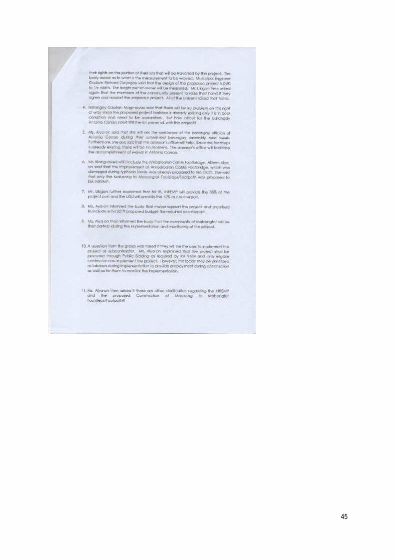
45

46

47

48

49

50

51

52

53

54
November 13, 2018

55

56

57

58

59

60

61

62

63

64

65

66

67

68

69

70
Pictures of Barangay Consultation/Orientation
April 26, 2018

71

72
November 20, 2018

73
Appendix 5: Barangay Resolution Endorsing the Subproject

74
Appendix 6: SB Resolution Accepting and Supporting the Subproject

75

76
Appendix 7: Grievance Intake Form

77

78

79
Appendix 8: Certification of No trees to be affected