Leica Campus Knowledge at your Fingertips - The Survey ...
19
Leica Campus Knowledge at your Fingertips Training Schedule 2010
-
Upload
khangminh22 -
Category
Documents
-
view
3 -
download
0
Transcript of Leica Campus Knowledge at your Fingertips - The Survey ...

To find out more about these training courses contact: T: +44(0)1908 256542 E: [email protected] W: www.leica-geosystems.co.uk
1
Leica Campus Knowledge at your Fingertips
Training Schedule 2010
To find out more about these training courses contact: T: +44(0)1908 256542 E: [email protected] W: www.leica-geosystems.co.uk W: https://myworld.leica-geosystems.com
2
Leica Campus Training Schedule 2010
Leica Campus Training Packages offers flexible courses designed to suit your company’s needs and the professional development of your staff. Whether you use a simple distance measuring device or the most sophisticated integrated solution, Leica Geosystems provides a true partnership in helping to define your training requirements and deliver the highest level of service, support and collaboration.
Offering a range of basic, intermediate and in-depth educational programmes, each course listed in this document has been carefully structured to ensure you get the most out of your training and includes; best practice techniques, hands-on practical guidance and easy to follow theoretical training. These courses will not only help enhance your day-to-day activity but they will also contribute to your Continuous Professional Development (CPD).
Contents
Leica Geosystems Tailored Training Packages...........................................................................................................3 GPS for Site Surveying .................................................................................................................................................4 Combining GPS & TPS ..................................................................................................................................................5 Developments in GPS, GNSS & Leica SmartNet.........................................................................................................6 Network Adjustments in Leica Geo Office .................................................................................................................7 TPS for Site Surveying .................................................................................................................................................8 TPS for Land Surveying................................................................................................................................................9 Leica RoadRunner ......................................................................................................................................................10 Traversing & Monitoring On Site ..............................................................................................................................11 Leica LISCAD ...............................................................................................................................................................12 Leica High Definition SurveyingTM Training Courses .................................................................................................13 Applications in CADD Training...................................................................................................................................14 McCarthy Taylor Systems LSS Training .....................................................................................................................15 Newcastle University CORS Course...........................................................................................................................16 The Survey School Training Courses.........................................................................................................................17 Training Course Costs................................................................................................................................................18
Page

To find out more about these training courses contact: T: +44(0)1908 256542 E: [email protected] W: www.leica-geosystems.co.uk W: https://myworld.leica-geosystems.com
3
Leica Geosystems Tailored Training Packages
Designed with complete flexibility in mind, Leica Geosystems offers tailored training and 1-2-1 tuition packages. Work with our team of training experts to customise training programmes to meet your exact training requirements. Products included:
Leica Viva Leica ScanStation C10 Leica System 1200 Leica ScanStation 2 Leica FlexLine Leica HDS6100 Leica GPS900, Leica GS09 Leica Cyclone Leica LISCAD/LGO
For a free evaluation of your training requirements contact Ben Carruthers, Training and Support Supervisor on +44 (0)1908 256542 or [email protected]
To find out more about these training courses contact: T: +44(0)1908 256542 E: [email protected] W: www.leica-geosystems.co.uk W: https://myworld.leica-geosystems.com
4
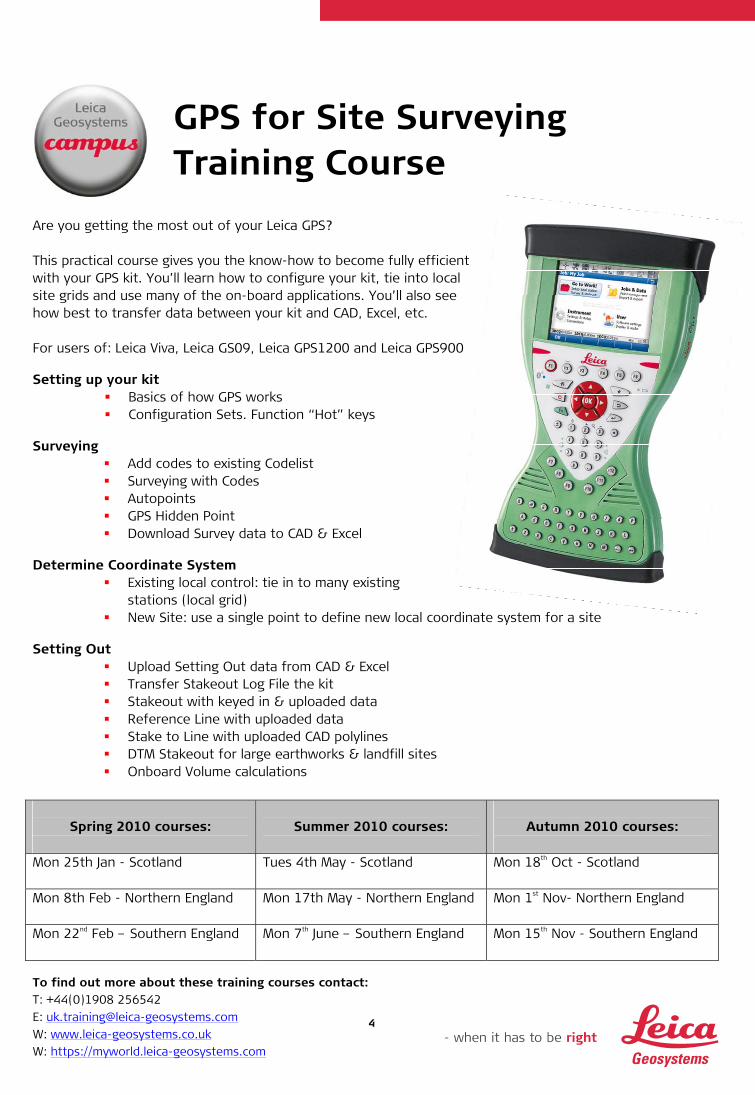
GPS for Site Surveying Training Course
Are you getting the most out of your Leica GPS? This practical course gives you the know-how to become fully efficient with your GPS kit. You’ll learn how to configure your kit, tie into local site grids and use many of the on-board applications. You’ll also see how best to transfer data between your kit and CAD, Excel, etc. For users of: Leica Viva, Leica GS09, Leica GPS1200 and Leica GPS900 Setting up your kit
Basics of how GPS works Configuration Sets. Function “Hot” keys
Surveying
Add codes to existing Codelist Surveying with Codes Autopoints GPS Hidden Point Download Survey data to CAD & Excel
Determine Coordinate System
Existing local control: tie in to many existing stations (local grid)
New Site: use a single point to define new local coordinate system for a site Setting Out
Upload Setting Out data from CAD & Excel Transfer Stakeout Log File the kit Stakeout with keyed in & uploaded data Reference Line with uploaded data Stake to Line with uploaded CAD polylines DTM Stakeout for large earthworks & landfill sites Onboard Volume calculations
Spring 2010 courses:
Summer 2010 courses:
Autumn 2010 courses:
Mon 25th Jan - Scotland Tues 4th May - Scotland Mon 18th Oct - Scotland
Mon 8th Feb - Northern England Mon 17th May - Northern England Mon 1st Nov- Northern England
Mon 22nd Feb – Southern England Mon 7th June – Southern England
Mon 15th Nov - Southern England
To find out more about these training courses contact: T: +44(0)1908 256542 E: [email protected] W: www.leica-geosystems.co.uk W: https://myworld.leica-geosystems.com
5
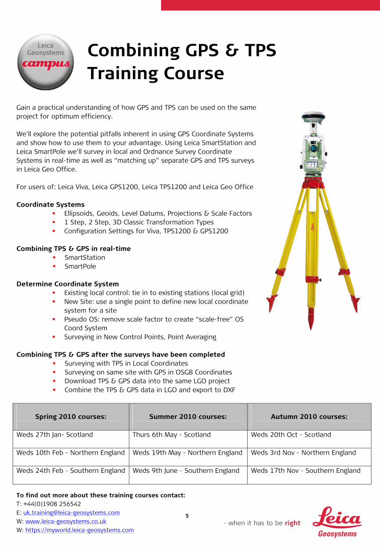
Combining GPS & TPS Training Course
Gain a practical understanding of how GPS and TPS can be used on the same project for optimum efficiency. We’ll explore the potential pitfalls inherent in using GPS Coordinate Systems and show how to use them to your advantage. Using Leica SmartStation and Leica SmartPole we’ll survey in local and Ordnance Survey Coordinate Systems in real-time as well as “matching up” separate GPS and TPS surveys in Leica Geo Office. For users of: Leica Viva, Leica GPS1200, Leica TPS1200 and Leica Geo Office Coordinate Systems
Ellipsoids, Geoids, Level Datums, Projections & Scale Factors 1 Step, 2 Step, 3D Classic Transformation Types Configuration Settings for Viva, TPS1200 & GPS1200
Combining TPS & GPS in real-time
SmartStation SmartPole
Determine Coordinate System
Existing local control: tie in to existing stations (local grid) New Site: use a single point to define new local coordinate
system for a site Pseudo OS: remove scale factor to create “scale-free” OS
Coord System Surveying in New Control Points, Point Averaging
Combining TPS & GPS after the surveys have been completed
Surveying with TPS in Local Coordinates Surveying on same site with GPS in OSGB Coordinates Download TPS & GPS data into the same LGO project Combine the TPS & GPS data in LGO and export to DXF
Spring 2010 courses:
Summer 2010 courses:
Autumn 2010 courses:
Weds 27th Jan- Scotland Thurs 6th May - Scotland Weds 20th Oct - Scotland
Weds 10th Feb - Northern England Weds 19th May - Northern England Weds 3rd Nov - Northern England
Weds 24th Feb - Southern England Weds 9th June - Southern England
Weds 17th Nov - Southern England
To find out more about these training courses contact: T: +44(0)1908 256542 E: [email protected] W: www.leica-geosystems.co.uk W: https://myworld.leica-geosystems.com
6
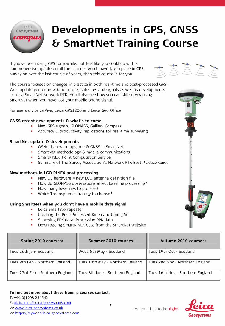
Developments in GPS, GNSS & SmartNet Training Course
If you’ve been using GPS for a while, but feel like you could do with a comprehensive update on all the changes which have taken place in GPS surveying over the last couple of years, then this course is for you. The course focuses on changes in practice in both real-time and post-processed GPS. We'll update you on new (and future) satellites and signals as well as developments in Leica SmartNet Network RTK. You’ll also see how you can still survey using SmartNet when you have lost your mobile phone signal. For users of: Leica Viva, Leica GPS1200 and Leica Geo Office GNSS recent developments & what’s to come
New GPS signals, GLONASS, Galileo, Compass Accuracy & productivity implications for real-time surveying
SmartNet update & developments
OSNet hardware upgrade & GNSS in SmartNet SmartNet methodology & mobile communications SmartRINEX, Point Computation Service Summary of The Survey Association’s Network RTK Best Practice Guide
New methods in LGO RINEX post processing
New OS hardware = new LGO antenna definition file How do GLONASS observations affect baseline processing? How many baselines to process? Which Tropospheric strategy to choose?
Using SmartNet when you don’t have a mobile data signal
Leica SmartBox repeater Creating the Post-Processed-Kinematic Config Set Surveying PPK data. Processing PPK data Downloading SmartRINEX data from the SmartNet website
Spring 2010 courses:
Summer 2010 courses:
Autumn 2010 courses:
Tues 26th Jan- Scotland Weds 5th May - Scotland Tues 19th Oct - Scotland
Tues 9th Feb - Northern England Tues 18th May - Northern England Tues 2nd Nov - Northern England
Tues 23rd Feb - Southern England Tues 8th June - Southern England
Tues 16th Nov - Southern England
To find out more about these training courses contact: T: +44(0)1908 256542 E: [email protected] W: www.leica-geosystems.co.uk W: https://myworld.leica-geosystems.com
7
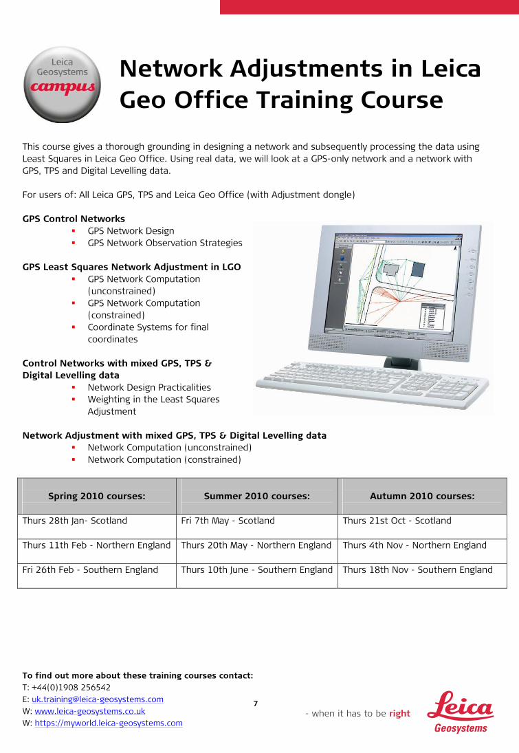
Network Adjustments in Leica Geo Office Training Course
This course gives a thorough grounding in designing a network and subsequently processing the data using Least Squares in Leica Geo Office. Using real data, we will look at a GPS-only network and a network with GPS, TPS and Digital Levelling data. For users of: All Leica GPS, TPS and Leica Geo Office (with Adjustment dongle) GPS Control Networks
GPS Network Design GPS Network Observation Strategies
GPS Least Squares Network Adjustment in LGO
GPS Network Computation (unconstrained)
GPS Network Computation (constrained)
Coordinate Systems for final coordinates
Control Networks with mixed GPS, TPS & Digital Levelling data
Network Design Practicalities Weighting in the Least Squares
Adjustment Network Adjustment with mixed GPS, TPS & Digital Levelling data
Network Computation (unconstrained) Network Computation (constrained)
Spring 2010 courses:
Summer 2010 courses:
Autumn 2010 courses:
Thurs 28th Jan- Scotland Fri 7th May - Scotland Thurs 21st Oct - Scotland
Thurs 11th Feb - Northern England Thurs 20th May - Northern England Thurs 4th Nov - Northern England
Fri 26th Feb - Southern England Thurs 10th June - Southern England
Thurs 18th Nov - Southern England

To find out more about these training courses contact: T: +44(0)1908 256542 E: [email protected] W: www.leica-geosystems.co.uk W: https://myworld.leica-geosystems.com
8
TPS for Site Surveying Training Course
Are you getting the most out of your Leica TPS? This practical training course gives you everything you need to know to become fully efficient on site with your Leica Total Station. You’ll learn how to configure your kit, perform the relevant Setup methods and use many of the on-board applications. You’ll also see how best to transfer data between your kit and CAD, Excel, etc. For users of: Leica Viva, Leica TPS1200 and Leica FlexLine Setting up your kit
Configuration Sets & function “Hot” keys Surveying
Add codes to existing Codelist Surveying with Codes Download Survey data to CAD & Excel
TPS Setups & when to use them
Set Azimuth. Known Backsight Resection. Orientation & Height Transfer
Setting Out
Upload Setting Out data from CAD & Excel Transfer Stakeout Log File to the kit Stakeout with keyed in & uploaded data Reference Line with uploaded data Stake to Line with uploaded CAD polylines DTM Stakeout for large earthworks & landfill sites Onboard volume calculations
Spring 2010 courses:
Summer 2010 courses:
Autumn 2010 courses:
Mon 1st Feb - Southern England Mon 10th May - Southern England
Mon 25th Oct - Southern England
Mon 15th Feb - Scotland Tues 1st June - Scotland
Mon 8th Nov - Scotland
Mon 1st March - Northern England Mon 14th June - Northern England
Mon 22nd Nov - Northern England
To find out more about these training courses contact: T: +44(0)1908 256542 E: [email protected] W: www.leica-geosystems.co.uk W: https://myworld.leica-geosystems.com
9
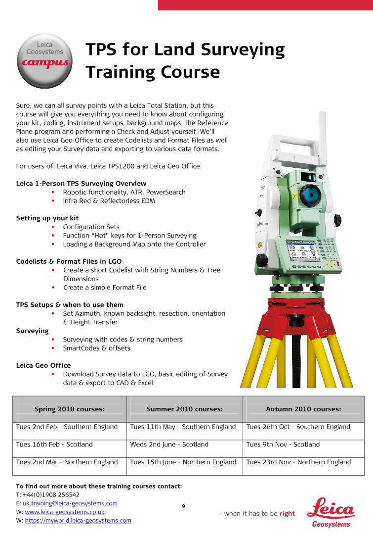
TPS for Land Surveying Training Course
Sure, we can all survey points with a Leica Total Station, but this course will give you everything you need to know about configuring your kit, coding, instrument setups, background maps, the Reference Plane program and performing a Check and Adjust yourself. We’ll also use Leica Geo Office to create Codelists and Format Files as well as editing your Survey data and exporting to various data formats. For users of: Leica Viva, Leica TPS1200 and Leica Geo Office Leica 1-Person TPS Surveying Overview
Robotic functionality, ATR, PowerSearch Infra Red & Reflectorless EDM
Setting up your kit
Configuration Sets Function “Hot” keys for 1-Person Surveying Loading a Background Map onto the Controller
Codelists & Format Files in LGO
Create a short Codelist with String Numbers & Tree Dimensions
Create a simple Format File TPS Setups & when to use them
Set Azimuth, known backsight, resection, orientation & Height Transfer
Surveying Surveying with codes & string numbers SmartCodes & offsets
Leica Geo Office
Download Survey data to LGO, basic editing of Survey data & export to CAD & Excel
Spring 2010 courses:
Summer 2010 courses:
Autumn 2010 courses:
Tues 2nd Feb - Southern England Tues 11th May - Southern England
Tues 26th Oct - Southern England
Tues 16th Feb - Scotland Weds 2nd June - Scotland
Tues 9th Nov - Scotland
Tues 2nd Mar - Northern England Tues 15th June - Northern England
Tues 23rd Nov - Northern England
To find out more about these training courses contact: T: +44(0)1908 256542 E: [email protected] W: www.leica-geosystems.co.uk W: https://myworld.leica-geosystems.com
10
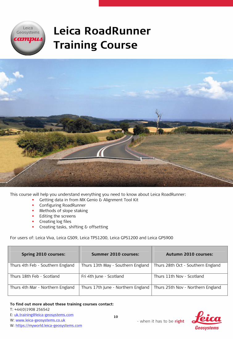
Leica RoadRunner Training Course
This course will help you understand everything you need to know about Leica RoadRunner:
Getting data in from MX Genio & Alignment Tool Kit Configuring RoadRunner Methods of slope staking Editing the screens Creating log files Creating tasks, shifting & offsetting
For users of: Leica Viva, Leica GS09, Leica TPS1200, Leica GPS1200 and Leica GPS900
Spring 2010 courses:
Summer 2010 courses:
Autumn 2010 courses:
Thurs 4th Feb - Southern England Thurs 13th May - Southern England
Thurs 28th Oct - Southern England
Thurs 18th Feb - Scotland Fri 4th June - Scotland
Thurs 11th Nov - Scotland
Thurs 4th Mar - Northern England Thurs 17th June - Northern England
Thurs 25th Nov - Northern England

To find out more about these training courses contact: T: +44(0)1908 256542 E: [email protected] W: www.leica-geosystems.co.uk W: https://myworld.leica-geosystems.com
11
Traversing & Monitoring On Site Training Course
Using Sets of Angles and the Traverse program on board the Total Station, we will observe a small traverse. We’ll compute the traverse both onboard (with the new Leica Viva kit) and in Leica Geo Office. Then we’ll use the Sets of Angles program to perform a monitoring task. In order to make most efficient use of this function we’ll create a LogFile in Leica Geo Office. For users of: Leica Viva, Leica TPS1200 and Leica Geo Office
Spring 2010 courses:
Summer 2010 courses:
Autumn 2010 courses:
Weds 3rd Feb - Southern England Weds 12th May - Southern England
Weds 27th Oct - Southern England
Weds 17th Feb - Scotland Thurs 3rd June - Scotland
Weds 10th Nov - Scotland
Weds 3rd Mar - Northern England Weds 16th June - Northern England
Weds 24th Nov - Northern England
To find out more about these training courses contact: T: +44(0)1908 256542 E: [email protected] W: www.leica-geosystems.co.uk W: https://myworld.leica-geosystems.com
12
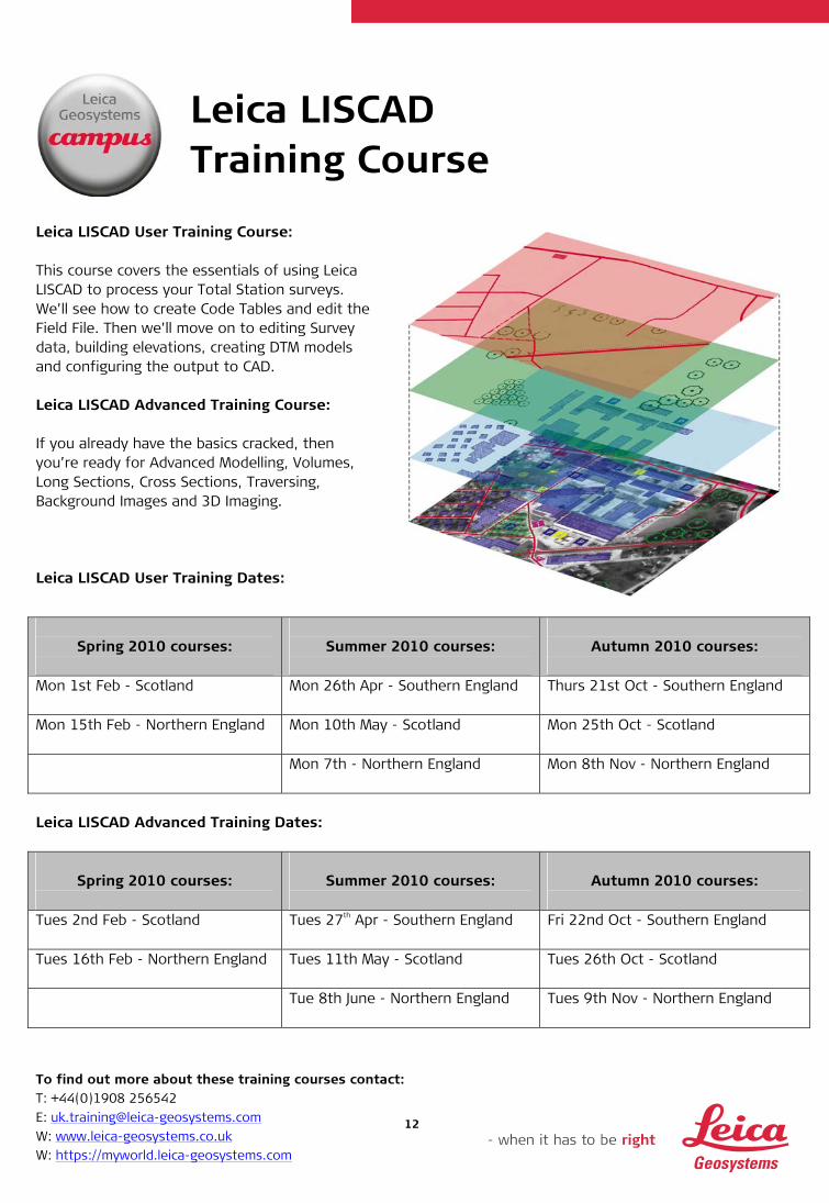
Leica LISCAD Training Course
Leica LISCAD User Training Course: This course covers the essentials of using Leica LISCAD to process your Total Station surveys. We’ll see how to create Code Tables and edit the Field File. Then we’ll move on to editing Survey data, building elevations, creating DTM models and configuring the output to CAD. Leica LISCAD Advanced Training Course: If you already have the basics cracked, then you’re ready for Advanced Modelling, Volumes, Long Sections, Cross Sections, Traversing, Background Images and 3D Imaging. Leica LISCAD User Training Dates:
Spring 2010 courses:
Summer 2010 courses:
Autumn 2010 courses:
Mon 1st Feb - Scotland Mon 26th Apr - Southern England
Thurs 21st Oct - Southern England
Mon 15th Feb - Northern England Mon 10th May - Scotland
Mon 25th Oct - Scotland
Mon 7th - Northern England
Mon 8th Nov - Northern England
Leica LISCAD Advanced Training Dates:
Spring 2010 courses:
Summer 2010 courses:
Autumn 2010 courses:
Tues 2nd Feb - Scotland Tues 27th Apr - Southern England
Fri 22nd Oct - Southern England
Tues 16th Feb - Northern England Tues 11th May - Scotland
Tues 26th Oct - Scotland
Tue 8th June - Northern England
Tues 9th Nov - Northern England

To find out more about these training courses contact: T: +44(0)1908 256542 E: [email protected] W: www.leica-geosystems.co.uk W: https://myworld.leica-geosystems.com
13
Leica High Definition SurveyingTM
Training Courses This series of training courses are dedicated to the HDS laser scanning system and Leica Cyclone point cloud processing software. The 4 day course uses a combination of classroom based knowledge transfer and practical application based field exercises. HDS Training Course Agenda:
Navigator online help, database object hierarchy scans & images
Cyclone quickstart Organising & measuring data Basic modelling Scanning & scanner features Point cloud registration Coordinate systems KeyMap & TruSpace Mesh functions Alignments & Sections Export/ Import functionality
All training courses listed below will take place at Leica Geosystems HQ in Milton Keynes, although onsite training is available.
Spring 2010 courses:
Summer 2010 courses:
Autumn 2010 courses:
Tues 19th - Fri 22nd Jan Tues 15th – Fri 18th Jun
Tues 14th – Fri 17th Sept
Tues 16th - Fri 19th Feb
Tues 13th – Fri 16th Jul
Tues 12th – Fri 15th Oct
Tues 16th – Fri 19th Mar
Tues 17th – Fri 20th Aug
Tues 9th – Fri 12th Nov
Tues 20th – Fri 23rd Apr
Tues 11th - Fri 14th May

To find out more about these training courses contact: T: +44(0)1908 256542 E: [email protected] W: www.leica-geosystems.co.uk W: https://myworld.leica-geosystems.com
14
Leica Geosystems & Applications in CADD Training
Aimed at users of Leica System 1200/Leica Viva who also use, or are intending to use N4CE, this 1 day hands on course is run jointly by trainers from both companies. The agenda is designed to harmonise the setup between your hardware and N4CE software and will include:
N4CE Configuration for working with Leica System 1200/Leica Viva Leica Codelists & Format Files for use with N4CE Surveying with the configured instruments - including Coding, String Numbers, Comma
Codes, Instrument Setups, Resections, etc. Data download into N4CE (GPS Survey data into N4CE) Data upload from N4CE to the Leica kit for Stake Out – including line work and DTMs
Attendees are encouraged to bring their own Total Station and laptop with N4CE installed, in order to give them the bonus of having their own software and kit configured during the course.
Spring 2010 courses:
Summer 2010 courses:
Autumn 2010 courses:
Weds 3rd Feb - Scotland Weds 28th Apr - Southern England
Weds 20th Oct - Southern England
Weds 17th Feb - Northern England Weds 12th May - Scotland
Weds 27th Oct - Scotland
Weds 2nd June - Northern England
Weds 10th Nov - Northern England
To find out more about these training courses contact: T: +44(0)1908 256542 E: [email protected] W: www.leica-geosystems.co.uk W: https://myworld.leica-geosystems.com
15
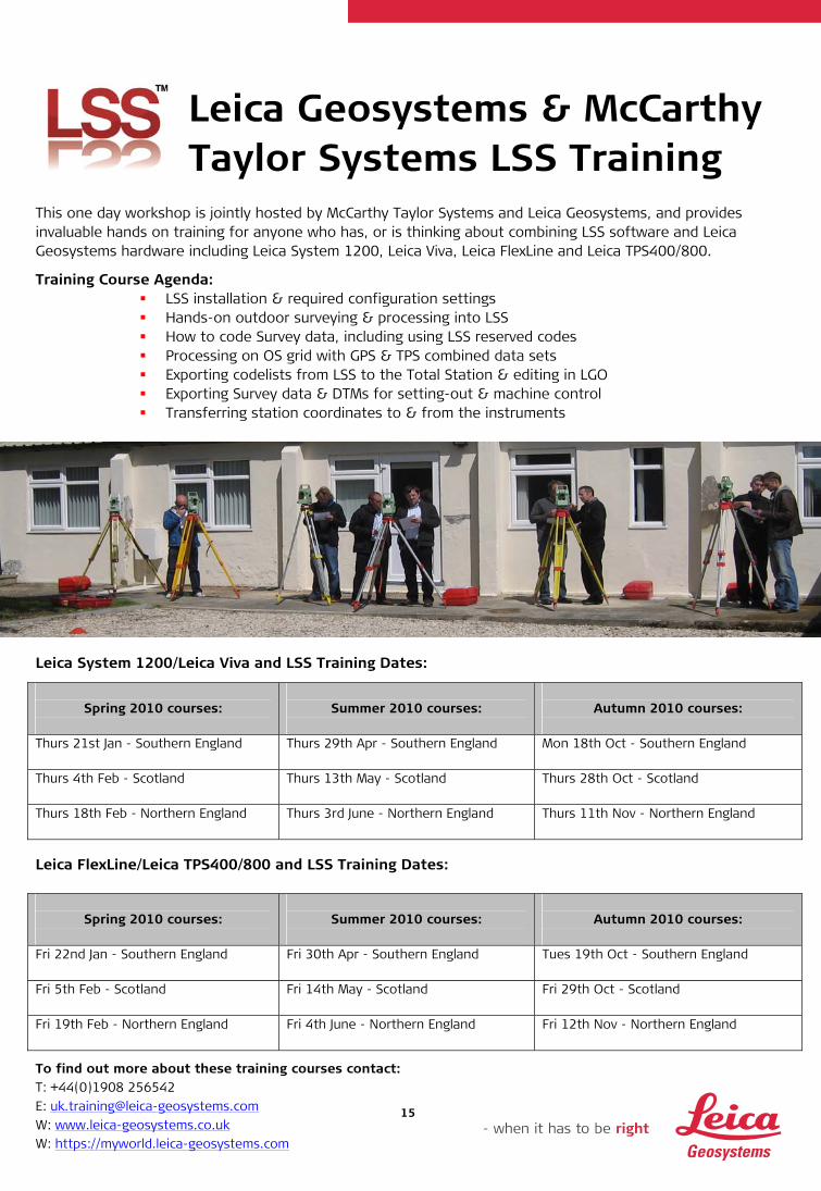
Leica Geosystems & McCarthy Taylor Systems LSS Training
This one day workshop is jointly hosted by McCarthy Taylor Systems and Leica Geosystems, and provides invaluable hands on training for anyone who has, or is thinking about combining LSS software and Leica Geosystems hardware including Leica System 1200, Leica Viva, Leica FlexLine and Leica TPS400/800.
Training Course Agenda: LSS installation & required configuration settings Hands-on outdoor surveying & processing into LSS How to code Survey data, including using LSS reserved codes Processing on OS grid with GPS & TPS combined data sets Exporting codelists from LSS to the Total Station & editing in LGO Exporting Survey data & DTMs for setting-out & machine control Transferring station coordinates to & from the instruments
Leica System 1200/Leica Viva and LSS Training Dates:
Spring 2010 courses:
Summer 2010 courses:
Autumn 2010 courses:
Thurs 21st Jan - Southern England Thurs 29th Apr - Southern England
Mon 18th Oct - Southern England
Thurs 4th Feb - Scotland Thurs 13th May - Scotland
Thurs 28th Oct - Scotland
Thurs 18th Feb - Northern England Thurs 3rd June - Northern England
Thurs 11th Nov - Northern England
Leica FlexLine/Leica TPS400/800 and LSS Training Dates:
Spring 2010 courses:
Summer 2010 courses:
Autumn 2010 courses:
Fri 22nd Jan - Southern England Fri 30th Apr - Southern England
Tues 19th Oct - Southern England
Fri 5th Feb - Scotland Fri 14th May - Scotland
Fri 29th Oct - Scotland
Fri 19th Feb - Northern England Fri 4th June - Northern England
Fri 12th Nov - Northern England

To find out more about these training courses contact: T: +44(0)1908 256542 E: [email protected] W: www.leica-geosystems.co.uk W: https://myworld.leica-geosystems.com
16
Leica Geosystems & Newcastle University
This 3 day intermediate/advanced course in conjunction with Newcastle University is designed to provide theoretical and practical training on GNSS Continually Operating Reference Stations. The Ordnance Survey active and SmartNet networks, Network RTK and post-processing data using active control stations are considered in detail. Training Course Agenda:
Introduction to Continuously Operating Reference Stations (CORS) Overview of free web-based automated processing facilities Review of GPS/reference systems/frames (datums) GPS processing with CORS data GNSS QC practical session Leica Geo Office practical exercise Best practice in GPS surveying; developments & future directions in satellite positioning Collecting data using SmartNet & assessing quality of SmartNet solutions
This course will take place at Newcastle University.
2010 courses:
Tues 23rd – Thurs 25th Mar Weds 8th – Fri 10th Sept
To register simply contact Newcastle University: T: +44 (0)191 2227439 E: [email protected] W: www.ceg.ncl.ac.uk/cpd
To find out more about these training courses contact: T: +44(0)1908 256542 E: [email protected] W: www.leica-geosystems.co.uk W: https://myworld.leica-geosystems.com
17
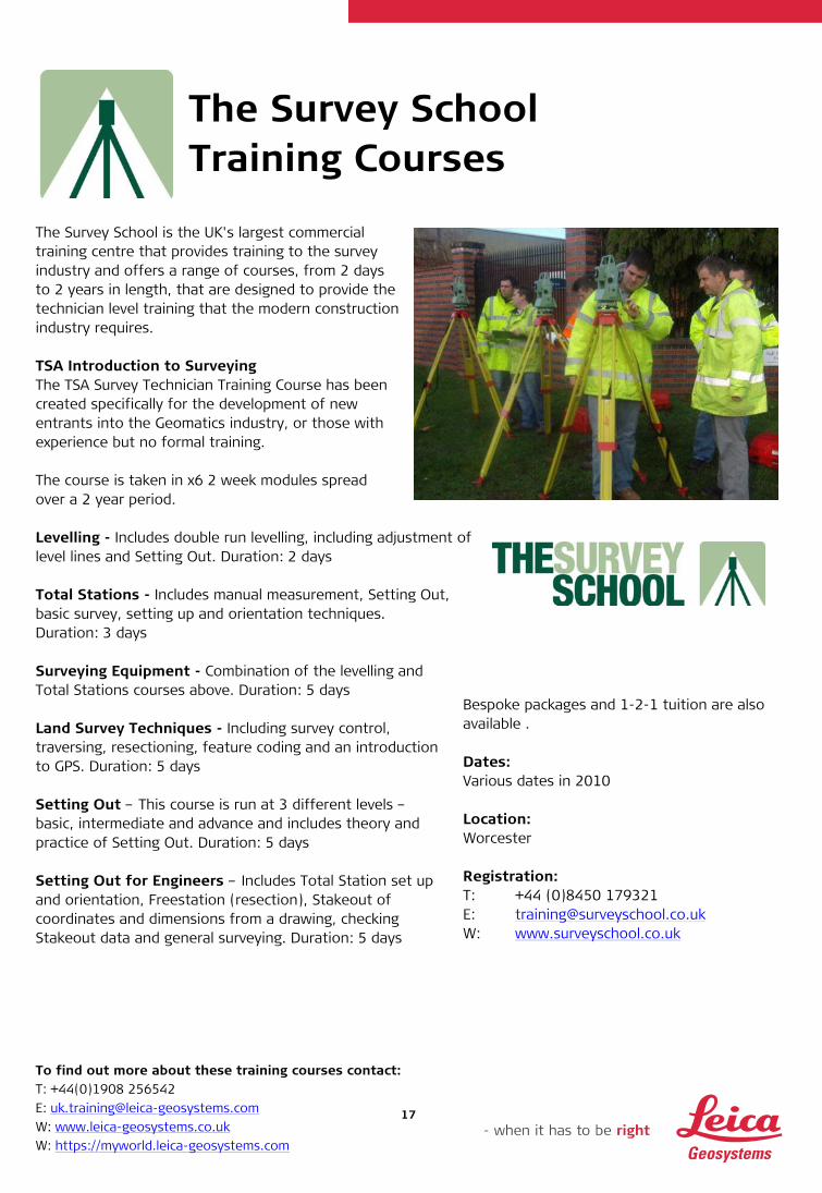
The Survey School Training Courses
The Survey School is the UK's largest commercial training centre that provides training to the survey industry and offers a range of courses, from 2 days to 2 years in length, that are designed to provide the technician level training that the modern construction industry requires. TSA Introduction to Surveying The TSA Survey Technician Training Course has been created specifically for the development of new entrants into the Geomatics industry, or those with experience but no formal training. The course is taken in x6 2 week modules spread over a 2 year period. Levelling - Includes double run levelling, including adjustment of level lines and Setting Out. Duration: 2 days
Total Stations - Includes manual measurement, Setting Out, basic survey, setting up and orientation techniques. Duration: 3 days Surveying Equipment - Combination of the levelling and Total Stations courses above. Duration: 5 days Land Survey Techniques - Including survey control, traversing, resectioning, feature coding and an introduction to GPS. Duration: 5 days Setting Out – This course is run at 3 different levels – basic, intermediate and advance and includes theory and practice of Setting Out. Duration: 5 days Setting Out for Engineers – Includes Total Station set up and orientation, Freestation (resection), Stakeout of coordinates and dimensions from a drawing, checking Stakeout data and general surveying. Duration: 5 days
Bespoke packages and 1-2-1 tuition are also available . Dates: Various dates in 2010 Location: Worcester Registration: T: +44 (0)8450 179321 E: [email protected] W: www.surveyschool.co.uk
To find out more about these training courses contact: T: +44(0)1908 256542 E: [email protected] W: www.leica-geosystems.co.uk W: https://myworld.leica-geosystems.com
18
Training Course Costs
Course:
Page:
Duration:
Cost:
Leica Geosystems Bespoke Training Packages
3 Costs & duration dependant on requirements. For further details contact Training Supervisor Ben Carruthers T: 01908 256542 E: [email protected]
GPS for Site Surveying 4 1 day Combining GPS & TPS 5 1 day Developments in GPS, GNSS & SmartNet 6 1 day Network Adjustment in Leica Geo Office 7 1 day TPS for Site Surveying 8 1 day TPS for Land Surveying 9 1 day Leica RoadRunner 10 1 day TPS Traversing & Simple Monitoring 11 1 day Leica LISCAD 12 1 day
Cost for 1 course/place = £395* Cost for 2 courses /places = £695* Cost for 3 courses/places = £995* If you have a Customer Care Package then special discounts apply: Cost for 1 course/place = £350* Cost for 2 courses/places = £595* Cost for 3 courses/places = £850*
Leica High Definition SurveyingTM Training Course
13 4 days Cost = £2395* Any additional delegate from the same company will cost £1711* All training courses will take place at Leica Geosystems HQ in Milton Keynes. Onsite training available from £1369 ex VAT per day (max 8 delegates)
Applications in CADD Training 14 1 day Cost = £195* McCarthy Taylor Systems LSS Training 15 1 day Cost = £195* Newcastle University CORS Course
16 3 days Cost = £700** includes course notes, refreshments and lunch
The Survey School TSA Introduction to Surveying
17 x6 2 week modules over 2 years
Prices start from £870* per module for TSA members. For non members prices start from £970* per module
The Survey School Levelling 17 2 days Cost: £340* The Survey School Total Stations 17 3 days Cost: £450* The Survey School Surveying Equipment 17 5 days Cost: £750* The Survey School Land Survey Techniques
17 5 days Cost: £750*
The Survey School Setting Out 17 5 days Cost: £750* The Survey School Setting Out for Engineers
17 5 days Cost: £750*
* Cost per person excluding VAT **Please note this cost does not attract VAT and excludes accommodation

To find out more about these training courses contact: T: +44(0)1908 256542 E: [email protected] W: www.leica-geosystems.co.uk W: https://myworld.leica-geosystems.com
19
Campus – Information, Knowledge, Training Whether building a house or a bridge, an office complex or a new road, you need reliable measurements. So when it has to be right, professionals can trust Leica Geosystems to help them collect, analyse and present spatial information. Leica Campus Training Packages offers flexible courses designed to suit your company’s needs and the professional development of your staff. Whether you use a simple distance measuring device or the most sophisticated integrated solution, Leica Geosystems provides a true partnership in helping to define your training requirements and deliver the highest level of service, support and collaboration. When it has to be right.
Illustrations, descriptions and technical specifications are not binding and may change. Copyright Leica Geosystems Ltd Milton Keynes 1209