ITEM C- 1 - Department of Land and Natural Resources
618
STATE OF HAWAI’I DEPARTMENT OF LAND AND NATURAL RESOURCES Division of Forestry and Wildlife Honolulu, Hawai’i 96813 November 8, 2019 Chairperson and Members Board of Land and Natural Resources State of Hawai’i Honolulu, Hawai’i Land Board Members: SUBJECT: REQUEST APPROVAL OF THE KAPOAULA KOA FOREST MANAGEMENT PLAN AND FOREST STEWARDSHIP AGREEMENT WiTH PANIOLO TONEWOODS LLC, TAX MAP KEY NUMBER (3)4- 7-007:011, KAMUELA, ISLAND OF HAWAI’I AND REQUEST APPROVAL AND ACCEPTANCE OF THE FINAL ENVIRONMENTAL ASSESSMENT FOR THE KAPOAULA KOA FOREST MANAGEMENT PLAN AND FINDING OF NO SIGNIFICANT IMPACT. BACKGROUND: The State of Hawai’i Forest Stewardship Program (FSP) provides technical and financial assistance to private landowners and land managers committed to the stewardship, conservation, and restoration of important forest resources across the state. These private properties provide a variety of public benefits for the residents of Hawai’i, including but not limited to fresh water capture and production, decreased soil erosion, wildlife habitat, forest products, recreational and educational opportunities, and local jobs. The assistance provided by FSP enables private landowners to develop and implement long-term multi-resource management plans to conserve, restore, and maintain forested areas on their property. The Forest Stewardship Program was established through Chapter 195F-6, Hawai’i Revised Statutes (HRS) and provides the Department of Land and Natural Resources with the authority to provide financial assistance to approved Forest Stewardship projects for private landowners to manage, protect, and restore important natural resources on forested and formerly forested properties. The Forest Stewardship Program is implemented pursuant to Chapter 195F, HRS, and Section 109, Hawai’i Administrative Rules (HAR). The program provides cost-share reimbursement for the development of long-term forest management plans and for the 1 ITEM C- 1
-
Upload
khangminh22 -
Category
Documents
-
view
1 -
download
0
Transcript of ITEM C- 1 - Department of Land and Natural Resources

STATE OF HAWAI’IDEPARTMENT OF LAND AND NATURAL RESOURCES
Division of Forestry and WildlifeHonolulu, Hawai’i 96813
November 8, 2019
Chairperson and MembersBoard of Land and Natural ResourcesState of Hawai’iHonolulu, Hawai’i
Land Board Members:
SUBJECT: REQUEST APPROVAL OF THE KAPOAULA KOA FORESTMANAGEMENT PLAN AND FOREST STEWARDSHIP AGREEMENTWiTH PANIOLO TONEWOODS LLC, TAX MAP KEY NUMBER (3)4-7-007:011, KAMUELA, ISLAND OF HAWAI’I
AND
REQUEST APPROVAL AND ACCEPTANCE OF THE FINALENVIRONMENTAL ASSESSMENT FOR THE KAPOAULA KOAFOREST MANAGEMENT PLAN AND FINDING OF NOSIGNIFICANT IMPACT.
BACKGROUND:
The State of Hawai’i Forest Stewardship Program (FSP) provides technical and financialassistance to private landowners and land managers committed to the stewardship, conservation,and restoration of important forest resources across the state. These private properties provide avariety of public benefits for the residents of Hawai’i, including but not limited to fresh watercapture and production, decreased soil erosion, wildlife habitat, forest products, recreational andeducational opportunities, and local jobs. The assistance provided by FSP enables privatelandowners to develop and implement long-term multi-resource management plans to conserve,restore, and maintain forested areas on their property.
The Forest Stewardship Program was established through Chapter 195F-6, Hawai’i RevisedStatutes (HRS) and provides the Department of Land and Natural Resources with the authority toprovide financial assistance to approved Forest Stewardship projects for private landowners tomanage, protect, and restore important natural resources on forested and formerly forestedproperties. The Forest Stewardship Program is implemented pursuant to Chapter 195F, HRS, andSection 109, Hawai’i Administrative Rules (HAR). The program provides cost-sharereimbursement for the development of long-term forest management plans and for the
1
ITEM C- 1

implementation of approved Forest Stewardship management plans.
To participate in FSP, interested landowners and managers follow a sequence of application stepsin the process of developing a long-term Forest Stewardship management plan. All interestedlandowners submit their project for review by the Forest Stewardship Advisory Committee(FSAC). The FSAC reviews the project based on program eligibility requirements and assures theproposed project is in line with the program’s goals of conservation, restoration and/or forestproduction. Further, the FSAC recommends the development of and reviews all ForestStewardship management plans. The Forest Stewardship management plan is created bylandowners in partnership with natural resource professional/experts, reviewed and approved byboth Division and the FSAC, and may be recommended for approval by the Department.
The award of cost-share support for Forest Stewardship management plan implementation followsa similar process to the development of a management plan. Upon approval of a project’s ForestStewardship management plan, the FSAC reviews the implementation schedule and budgetsummary to ensure that the practice costs are reasonable and follow the program’s approved cost-share rates. The FSAC recommends cost-share support for project implementation based on the10-year implementation schedule that is submitted to the Board of Land and Natural Resources(Board) for consideration. Review and approval of the Forest Stewardship project and managementplan, as well as authorization of cost-share support for the project by the Board is required for theDepartment to enter into the Forest Stewardship Agreement. The Division has previously workedwith the Department of the Attorney General to develop a Forest Stewardship Agreement template(Exhibit A) for eligible projects.
The Kapoaula Koa Forest Stewardship project proposes to reforest 543 acres of cattle pasture to asemblance of the native koa (Acacia koa) -‘öhi’a (Metrosiderospolymorpha) forest that was oncepresent. In addition to the numerous public benefits provided by the forest, the resulting koa forestwill provide a long-term, sustainable source of instrument grade wood and high-quality wood forother uses. The long-term (50-year) goal is for the property to be a mixed-species native forestwith koa timber production on the flatter, less erodible areas and a diverse native forest (nottargeted for timber production) on the steeper slopes. The forest will produce a sustainable yieldof koa timber for guitars, ukuleles and other wood products while providing habitat for nativespecies, sequestering carbon, and inspiring others to plant trees on their land for similar purposes.The 10-year objectives are as follows:
• Reforest the entire property with koa and a complement of associated native forest plants.• Improve the quality of wood by planting seed from known, high-quality sources and using
planting stock from trees identified as having superior color, figure, and form.• Intensively manage koa for production purposes in portions of the property with slopes
less than 20% — accounting for 74% of the property or 402 acres.• Reforest the remaining upland areas with a multi-species native forest, using koa as a
pioneer species — accounting for 26% of the area or 141 acres.• Protect planted forest from wind by planting fast-growing, non-invasive windbreaks.
2
• Invest in building local capacity for specialty instrument-grade lumber processing byconstructing processing facilities on site (this portion of the project is not requesting cost-share from FSP).
The FSAC approved the Kapoaula Koa Forest Stewardship management plan at their meeting onOctober 12, 2018 and the State Forester/Division Administrator approved the Forest StewardshipManagement Plan on OCT 232019 (Exhibit B).
DISCUSSION:
The Division is requesting approval of a Forest Stewardship Agreement with Paniolo TonewoodsLLC for the implementation of the Kapoaula Koa Forest Stewardship management plan andproject. Over the course of the 10-year management plan, Paniolo Tonewoods LLC is seekingcost-share support for the implementation of their project from FSP. The approximately 553 acreKapoaula Koa project is located with the state Agricultural District and zoned as A-40a by theCounty of Hawai’i.
Kapoaula and the surrounding area was historically known for its abundance of koa; this projectreturns that key species to the landscape. Kapoaula Koa was purchased with the intention ofcreating a sustainable koa forest for musical instrument wood. This project will plant, over a ten(10) year period, the entire 553 acres of available land with koa (Acacia koa) and associated nativeplants. The project will combine the production of timber in a plantation style setting with mixednative forest plantings in less accessible areas. Over time, native species from the mixed forestplantings will gradually colonize the plantation area. There is currently active cattle grazing on theproperty, which will keep grass and weeds under control while the forest is planted. As cattle aregradually removed and replaced by trees, compaction, erosion and animal organic wastes will beeliminated with positive consequences for water quality and enhance carbon sequestration.Incorporating plantings of native species favored by birds and insects will dramatically improvewildlife habitat. Historic stock watering ponds may be enhanced with perimeter plantings andpredator proof fencing and traps to favor migratory and resident waterfowl.
Once the new koa forest is established over the ten year management plan period, the plan callsfor a continuing series of pre-commercial thinning, commercial thinning (at age 30 to 35) andpatch clearing or individual tree selection of mature trees (age 50 to 65+). Beginning in year 30-35 a selection harvest is planned, emphasizing tree quality and stand vigor, while also removinguseable koa wood. This will result in the natural regeneration of a cohort of koa trees, which willbe repeated every 15 years to create a structurally diverse, continuity of tree canopy over spaceand time. Ideally this project will inspire adjacent landowners to further leverage and expand theenvironmental gains and highlight the economic potential of sustainable forest managementprovided by this project.
At this time, the only native trees on the property are scattered ‘öhi’a, found mostly on steep, rockyareas. Given the property’s history of long-term cattle grazing, it is assumed that seed sources fornative understory plants will be non-existent, thereby requiring planting of seedlings. The goal for
3

planting of mixed native species is a net average of 75 trees per acre in areas with a slope >20%.Koa will be used as a pioneer species to provide initial cover, planted at a density of 125 trees/acrewith a mix of native species planted in between. The goal is to re-create the native forest that oncestood on this land, thereby providing habitat for native species and improving the overallenvironmental quality of the property, including aquifer recharge, and erosion control. Thesemixed plantings will serve as “kipukas,” islands of native vegetation, which, over time, willprovide seed sources and spread throughout the site.
Public environmental benefits provided by the timber portion of the Kapoaula Koa ForestStewardship project include increased groundwater production, decreased soil erosion, enhancedwildlife habitat, carbon sequestration, forest product industry development and local jobopportunities.
Payback of State Funds: In accordance with Hawaii Administrative Rule Chapter 109, Sections13-109-11: Payback Provision, the Board may require a payback provision for projects that havea forest production component to their projects. The Board may require that a certain percentageof all matching State funds provided under the Forest Stewardship Agreement be paid back to theprogram upon each commercial harvest or sale as set forth by the contract agreement between theBoard and applicant. A commercial timber harvest is defined as a certain minimum volume oftimber removed per acre from a minimum acreage of the applicant’s project as determined by theDivision or as set forth in the contract between the Board and the applicant. A payback provisionwill be included as a special condition of the contract, stipulating that this provision will survivebeyond the term length of the contract.
The amount of cost-share requested for the timber component of the Kapoaula Koa ForestStewardship project is $541,766. The Division is recommending that the Board authorize a 5%payback rate on commercial harvests occurring from Kapoaula Koa Forest until $270,883 (50%of the State cost share provided to the project for the timber component) is repaid. Therecommendation is consistent with previous FSP projects that contain a timber productioncomponent implemented under the program. The Division is requesting that the Board define acommercial timber harvest for the Kapoaula Koa Forest Stewardship project as any volume oftimber sold within one-month period that generates revenue greater than or equal to $1000 gross.
A total of $749,523 in state Forest Stewardship funding is requested to provide cost-share supportfor the Kapoaula Koa Forest Stewardship management plan and Kapoaula Koa Forest StewardshipAgreement. Paniolo Tonewoods LLC will be contributing an equal amount of $749,523 towardthe implementation of their project through FSP. The costs associated with the proposed practicesare consistent with the intensity of management required for this type of project. Cost-share fundsare provided as reimbursement payments for implementation of approved management practicesthrough the State fiscal year 2029. In addition, Paniolo Tonewoods LLC has committed to continuemaintenance of the installed Forest Stewardship practices for an additional 20 years following thecompletion of the 10-year cost-sharing portion of the Agreement, through State fiscal year 2050,as required by the program for timber production projects.
4

CHAPTER 343 - ENVIRONMENTAL ASSESSMENT:
Per the requirements of Chapter 343, HRS, and as required for Forest Stewardship projects thathave a timber harvesting component, Paniolo Tonewoods LLC has prepared a Final EnvironmentalAssessment (FEA) for the Kapoaula Koa Forest Management Plan for approval and acceptance ofa finding of no significant impact (FONSI) by the Board (Exhibit C).
The Draft Environmental Assessment (DEA) Anticipated FONSI for the subject project waspublished in the Office of Environmental Quality Control’s Environmental Notice on June 23,2019 http://oegc2.doh.hawaii . govfEA EIS Libraryl20 19-06-23 -HA-DEA-Kapoaula-KoaManagement-Plan.pdf. The comment period has been completed and staff seeks the Board’sapproval of the Final EA and FONSI in order to submit the FEA for publication in OEQC’sEnvironmental Notice.
Agencies consulted in the preparation of the FEA included the Office of Hawaiian Affairs, DLNR,County of Hawai’i, local community organizations and neighboring landowners. The SignificanceCriteria in HAR Title 11, 200-12 for environmental impacts were reviewed and the proposedproject was assessed for significant impacts. The FEA evaluation includes analysis of both directand indirect impacts and short-term and long-term effects, and the cumulative effects. Based onanalysis of the Hawai ‘i Environmental Policy Act significance criteria, the proposed action wouldnot result in significant adverse environmental impacts, there would be no irrevocableconunitment, loss or destruction of any identified natural or cultural resource. There would be acommitment to protect those resources within the project area resulting in a net beneficial impact.In summary of the FEA prepared by Paniolo Tonewoods, LLC:
1) The project plans to convert pasture into forest containing native species and high valuekoa timber which will expand the areas in the state dedicated to forestry using nativespecies;
2) The project is consistent and compatible with existing and planned land uses for overallbeneficial impact;
3) The project will manage all forestry activities to be consistent with Best ManagementPractices that will maintain soil in place, minimize disturbance of erodible soils and preventstormwater runoff;
4) The proposed project is consistent with HRS 344 in that the project will not conflict withthe long-term goals of State environmental policies or guidelines;
5) The parcels currently contain almost no native Hawaiian plants or fauna and restoration ofthe pasture to native forest will improve habitat for native flora and fauna. Potential minorimpacts to native faunal species will be mitigated to insignificant levels through projectmanagement measures;
6) There are no known archeological resources on the property and the determination of effectfor the proposed project is “no historic properties affected.”
7) The project will have a net positive economic benefit for the local community during theestablishment and maintenance phases of the timber planting;
8) There are no known public health concerns associated with the proposed project; and
5

9) The project is not anticipated to have any cumulative adverse effects;
Therefore, the Division recommends that the Board accept the FONSI for the Kapoaula Koa ForestManagement Plan. Should the Kapoaula Koa Forest Management Plan propose any future use ofthe land that triggers Chapter 343, HRS, Paniolo Tonewoods LLC shall be responsible forcompliance with Chapter 343, HRS, as amended.
RECOMMENDATIONS:
That the Board:
1. Approve the Kapoaula Koa Forest tewardship management p an;
2. Approve cost-share support in the amount of $749,523 for the implementation of theKapoaula Koa Forest Stewardship management plan;
3. Authorize the Chairperson to amend, finalize and execute a Forest StewardshipAgreement with Paniolo Tonewoods LLC to participate in the State ForestStewardship Program subject to the following:
A. Availability of State Forest Stewardship funds; andB. Review and approval as to form of the Forest Stewardship Agreement by
the Department of the Attorney General.
4. Approve and accept the Final EA for the Kapoaula Koa Forest Management Plan andthe FONSI.
Res~-ef 1 su~ ed,
David G. Smith, AdministratorDivision of Forestry and Wildlife
Attachments: (Exhibit A, B, C)
APPROVED FOR SUBMITTAL:
Suza D. Case, Chairperson

Exhibit A
STATE OF HAWAII FOREST STEWARDSHIP AGREEMENT
This AGREEMENT, made this day of
, 20 , by and between the BOARD OF LAND AND NATURAL
RESOURCES, STATE OF HAWAII (“STATE”), by its Chairperson, whose address is
1151 Punchbowl Street, Honolulu, Hawaii 96813, and , (“LANDOWNER”)
whose address and federal and state taxpayer identification numbers are as follows:
RECITALS
WHEREAS, Chapter 195F, Hawaii Revised Statutes (HRS), provides for the
establishment of a forest stewardship program to encourage and assist private landowners
in managing, protecting, and restoring important watersheds, native vegetation, fish and
wildlife habitats, isolated populations of rare and endangered plants, and other forest
lands that are not recognized as potential natural area reserves; and
WHEREAS, in accordance with HRS Chapter 195F and Title 13, Subtitle 5, Part
1, Chapter 109 of the Hawaii Administrative Rules (HAR), the LANDOWNER has
applied, and qualifies, for participation in the forest stewardship program; and
WHEREAS, the LANDOWNER has submitted a forest stewardship management
plan, as set forth in Exhibit A hereto, that the STATE agrees is consistent with the
policies, goals, and objectives of the forest stewardship program; and
WHEREAS, the STATE desires to assist the LANDOWNER in implementing the
forest stewardship management plan with financial and other assistance; and
WHEREAS, money is available to fund this agreement pursuant to: Act 195, SLH
1993, Hawaii Revised Statutes, Section 247-7.
NOW, THEREFORE, in consideration of the promises contained in this
AGREEMENT, the STATE and the LANDOWNER agree as follows:
Federal and state taxpayer identification numbers
Business address

Exhibit A
A. SCOPE OF SERVICES
The LANDOWNER hereby agrees to implement the forest stewardship
management plan set forth in Exhibit A and the project described in the “Scope of
Services” set forth in Attachment S1 in proper and satisfactory manner as determined by
the STATE, both of which are hereby made a part of this AGREEMENT. The STATE
hereby agrees to assist the LANDOWNER in implementing the forest stewardship
management plan, all in accordance with the terms and conditions set forth in
Attachments S1, S2, S3, S4, S5, and S6, attached hereto.
B. COMPENSATION
The LANDOWNER shall be compensated for performance of the project under
this AGREEMENT according to the “Compensation and Payment Schedule,” set forth in
Attachment S2, which is hereby made a part of this Agreement.
C. TIME OF PERFORMANCE
The performance required of the LANDOWNER under this AGREEMENT shall
be completed in accordance with the “Time of Performance” set forth in Attachment S3,
which is hereby made a part of this AGREEMENT.
D. CERTIFICATE OF EXEMPTION FROM CIVIL SERVICE
The “State of Hawaii Certificate of Exemption from Civil Service,” set forth in
Attachment S4, is hereby made a part of the AGREEMENT.
E. OTHER TERMS AND CONDITIONS
The “State of Hawaii Special and General Conditions for Forest Stewardship
Program Agreements,” set forth in Attachment S5, and the General Conditions attached
hereto, are hereby made a part of this AGREEMENT. For the purposes of this
AGREEMENT the term “CONTRACTOR” in the “General Conditions” shall mean the
LANDOWNER.

Exhibit A
F. STANDARDS OF CONDUCT DECLARATION
The “Standards of Conduct Declaration” by LANDOWNER, set forth in
Attachment S6, is hereby made a part of this AGREEMENT. For the purposes of this
AGREEMENT the term “CONTRACTOR” in the “Standards of Conduct Declaration”
shall mean the LANDOWNER.

Exhibit A
IN WITNESS WHEREOF, the parties execute this AGREEMENT by their signatures to
be effective as of the date first above written.
STATE
By ________________________________ Chairperson of the Board of Land and Natural Resources
___________________________________ Print Name
Date________________________________
LANDOWNER
By_________________________________
___________________________________ Print Name
Date________________________________
Approved by the Board of Land and Natural Resources on
____________________.
APPROVED AS TO FORM:
______________________ Deputy Attorney General
Exhibit A
LANDOWNER’S ACKNOWLEDGMENT
STATE OF HAWAII ) ) SS. COUNTY OF )
On this day of ____________________, 20_____, before me
personally appeared , to me personally
known, who being by me duly sworn, did say the he/she is the
, the LANDOWNER named in the foregoing
instrument, and the he/she is authorized to sign said instrument on behalf of the
LANDOWNER, and acknowledges that he/she executed said instrument as the free act
and deed of the LANDOWNER.
__________________________________ Notary Public, State of Hawaii
My Commission Expires:
Date of the Notarized Document: Number of Pages: Identification or Description of the Document being Notarized: Printed Name of Notary: Circuit ________________________________________________________________________ Notary’s Signature and Notary’s Official Stamp or Seal Date

AG-010 Rev 11/15/2005
STATE OF HAWAII
CONTRACTOR'S STANDARDS OF CONDUCT DECLARATION
For the purposes of this declaration: "Agency" means and includes the State, the legislature and its committees, all executive departments, boards, commissions, committees, bureaus, offices; and all independent commissions and other establishments of the state government but excluding the courts.
"Controlling interest" means an interest in a business or other undertaking which is sufficient in fact to control, whether the interest is greater or less than fifty per cent (50%).
"Employee" means any nominated, appointed, or elected officer or employee of the State, including members of boards, commissions, and committees, and employees under contract to the State or of the constitutional convention, but excluding legislators, delegates to the constitutional convention, justices, and judges. (Section 84-3, HRS).
On behalf of , CONTRACTOR, the undersigned does declare as follows:
1. CONTRACTOR is* is not a legislator or an employee or a business in which a legislator or an employee has a controlling interest. (Section 84-15(a), HRS).
2. CONTRACTOR has not been represented or assisted personally in the matter by an individual who has been an employee of the agency awarding this Contract within the preceding two years and who participated while so employed in the matter with which the Contract is directly concerned. (Section 84-15(b), HRS).
3. CONTRACTOR has not been assisted or represented by a legislator or employee for a fee or other compensation to obtain this Contract and will not be assisted or represented by a legislator or employee for a fee or other compensation in the performance of this Contract, if the legislator or employee had been involved in the development or award of the Contract. (Section 84-14 (d), HRS).
4. CONTRACTOR has not been represented on matters related to this Contract, for a fee or other consideration by an individual who, within the past twelve (12) months, has been an agency employee, or in the case of the Legislature, a legislator, and participated while an employee or legislator on matters related to this Contract. (Sections 84-18(b) and (c), HRS).
CONTRACTOR understands that the Contract to which this document is attached is voidable on behalf of the STATE if this Contract was entered into in violation of any provision of chapter 84, Hawaii Revised Statutes, commonly referred to as the Code of Ethics, including the provisions which are the source of the declarations above. Additionally, any fee, compensation, gift, or profit received by any person as a result of a violation of the Code of Ethics may be recovered by the STATE.
* Reminder to Agency: If the "is" block is checked and if the Contract involves goods or services of a value in excess of $10,000, the Contract must be awarded by competitive sealed bidding under section 103D-302, HRS, or a competitive sealed proposal under section 103D-303, HRS. Otherwise, the Agency may not award the Contract unless it posts a notice of its intent to award it and files a copy of the notice with the State Ethics Commission. (Section 84-15(a), HRS).
CONTRACTOR By (Signature) Print Name
Print Title Name of Contractor Date

Attachment - S1 STATE OF HAWAII
SCOPE OF SERVICES
AG-011 Rev 07/28/2005 1
SECTION 1 - SCOPE OF WORK
1.1 MANAGEMENT AREA - The project area to be managed is the Forest
Stewardship project area; TMK NUMBER(S) as designated on maps
found in to this AGREEMENT.
1.2 THE PRIMARY OBJECTIVES - The STATE and LANDOWNER shall direct their
efforts under this AGREEMENT to do the following: fund the management of and
manage the natural resources of the Forest
Stewardship project area (“Forest Stewardship project area”) in accordance with the
MANAGEMENT PLAN, attached as to this AGREEMENT, and all approved
amendments thereto, with the intention of in the
….. community.
1.3 SCOPE OF WORK - The LANDOWNER shall perform the following technical and
professional services:
(a) Management plan. The LANDOWNER shall carry out the management activities
outlined in the approved MANAGEMENT PLAN, attached as to this
AGREEMENT.
(b) Consultation. The LANDOWNER shall be available for consultation regarding
progress, upon request by the STATE.
1.4 AUTHORITY TO CARRY OUT MANAGEMENT PLAN - The LANDOWNER hereby
represents that it has authority to carry out the MANAGEMENT PLAN and that it is the
landowner of “Forest Stewardship project area” as defined in Section 195F-2, Hawaii
Revised Statutes, as amended.
1.5 NO INCONSISTENT ACTIVITIES - The LANDOWNER shall not take any action on
the “Forest Stewardship project area”, which will undermine or conflict with the
approved MANAGEMENT PLAN.
II. SECTION 2 - CONTROL AND PROGRESS OF THE WORK

Attachment - S1 STATE OF HAWAII
SCOPE OF SERVICES
AG-011 Rev 07/28/2005 2
2.1 REPORTS - The LANDOWNER shall submit to the STATE, reports showing work
accomplished at the following times:
(a) Progress Reports. A progress report shall be due on December 31 of each year
under this AGREEMENT for which funding has been approved. This report shall
include a description of the approved MANAGEMENT PLAN accomplishments
and activities, areas needing technical advice, an accounting of expenditures with
documentation, and proposed modifications to the current year's management
activities. This report shall be submitted to the STATE within 30 days following
the due date. If the LANDOWNER would like more than 2 reimbursements per
year, a progress report shall accompany each reimbursement request and the
“Forest Stewardship project area” shall be made available for a site visit by
Department of Land and Natural Resources personnel.
(b) Annual Report. An annual report shall be due on or before June 30 of each year
under this AGREEMENT for which funding has been approved. In the event the
contract is executed less than 6 months prior to June 30, then no annual report is
due on June 30 of that year. This report shall include a description of
MANAGEMENT PLAN accomplishments and activities, areas needing technical
advice, and proposed modifications to the next year's approved management
objectives, projects and budget. This report shall also include a detailed
accounting of expenditures for the preceding 12-month period to provide the basis
for the annual reconciliation of the STATE's and the LANDOWNER's respective
shares of funding as determined pursuant to Attachment S2, Section 1.1. This
report shall be submitted to the STATE within 60 days of due date. This report
may also request, subject to approval by the STATE, changes to the management
plan, for either or both the practice implementation schedule and/or the
budget/payment schedule in order to best consolidate and rectify the past year’s
outcomes or lack thereof.

Attachment - S1 STATE OF HAWAII
SCOPE OF SERVICES
AG-011 Rev 07/28/2005 3
2.2 DELEGATION OF AUTHORITY - As used herein and throughout this AGREEMENT,
unless the context clearly indicates otherwise, the STATE shall include the State of
Hawaii Department of Land and Natural Resources and its authorized employees, agents
and representatives.

Attachment – S2 STATE OF HAWAII
COMPENSATION AND PAYMENT SCHEDULE
AG-012 Rev 11/15/2005 1
SECTION 1 – PAYMENT
1.1 SCOPE OF PAYMENT -
(a) STATE's Payment. In full satisfaction of the STATE's funding share of the
approved MANAGEMENT PLAN, which is contingent upon satisfactory
completion by the LANDOWNER of the management activities described in the
approved MANAGEMENT PLAN, attached as Exhibit A to this AGREEMENT,
the STATE agrees to pay the LANDOWNER a total sum not to exceed
. 00/100 Dollars ($ ) according to the schedule outlined
below that includes fiscal year 20XX through 20XX for completion of the
management activities described in the approved MANAGEMENT PLAN.
Payments shall be made by the STATE to the LANDOWNER as partial annual
reimbursements for actual expenditures made by the LANDOWNER in
completing the management activities described in the approved
MANAGEMENT PLAN only after the corresponding progress or annual report
has been reviewed by the STATE and all reported management activity
accomplishments have been verified following an inspection of the “Forest
Stewardship project area” by the STATE. Actual expenditures may include but
are not limited to in-kind services such as heavy equipment operation and sources
of labor. All funds to be paid by the STATE to the LANDOWNER shall be
encumbered on an annual basis for the forthcoming fiscal year provided that the
STATE has approved the continuation of management activities outlined in
………….. of this AGREEMENT for the forthcoming fiscal year.
If in any fiscal year the allocated annual funds are not exhausted due to the
LANDOWNER not completing all management activities described in the
MANAGEMENT PLAN for that year, the LANDOWNER may request that these
funds be incorporated in the following year’s encumbrances to complete the
management activities which were not completed. If there are sufficient funds
available to accommodate LANDOWNER’s request and the STATE approves the
Attachment – S2 STATE OF HAWAII
COMPENSATION AND PAYMENT SCHEDULE
AG-012 Rev 11/15/2005 2
request, this change will be incorporated by written amendment to the
AGREEMENT.
If in any fiscal year the STATE does not appropriate, and/or the STATE does not
approve the expenditure of, funds sufficient to meet the STATE’s funding share
of the approved MANAGEMENT PLAN, this AGREEMENT shall automatically
terminate without penalty at the end of the last fiscal year for which any funds
have been appropriated and approved, subject to Attachment S5, Section 4.1,
regarding partial State funding.
(b) LANDOWNER's Share. In full satisfaction of the LANDOWNER's funding share
of the approved MANAGEMENT PLAN, the LANDOWNER agrees to fully
complete the management activities described in the approved MANAGEMENT
PLAN, and to initially assume all corresponding actual annual expenditures in
expectation of the STATE’s partial reimbursement for satisfactory completion of
these management activities. Expenditures for implementation of the approved
MANAGEMENT PLAN which are less than the amounts allocated in the
approved budget may be made by the LANDOWNER in its discretion so long as
the quality of materials and work as called for in the approved MANAGEMENT
PLAN are not adversely affected.

Attachment – S2 STATE OF HAWAII
COMPENSATION AND PAYMENT SCHEDULE
AG-012 Rev 11/15/2005 3
FOREST STEWARDSHIP PROJECT BUDGET/
PAYMENT SCHEDULE:
YEAR Total Budget Land Owner share State Share 12345678910
Total
1.2 PAYMENT SCHEDULE –
(a) Progress Payment. Within 30 days following receipt of the progress report as
provided in Attachment S1, Section 2.1(a) for each year for which the STATE has
agreed to pay the LANDOWNER as outlined in the schedule above and for which
funding has been appropriated, the STATE shall pay to the LANDOWNER a
portion of the STATE’s funding share of the approved MANAGEMENT PLAN
as a partial reimbursement of actual expenditures made to complete approved
management activities. This payment shall be subject to the LANDOWNER’s
satisfactory completion of the corresponding approved management activities
described in the approved MANAGEMENT PLAN, attached as Exhibit A to this
AGREEMENT, and calculated on the basis of actual expenditures made by the
LANDOWNER. This payment shall also be subject to the STATE's approval of
such progress report.
(b) Annual/Final Payment. Within 30 days of receipt of the annual report as provided
in Attachment S1, Section 2.1(b), the STATE shall pay to the LANDOWNER the
balance of the STATE’s approved annual funding share. This payment shall be
subject to the LANDOWNER’s satisfactory completion of the corresponding

Attachment – S2 STATE OF HAWAII
COMPENSATION AND PAYMENT SCHEDULE
AG-012 Rev 11/15/2005 4
annual management activities described in the approved MANAGEMENT PLAN,
attached as Exhibit A to this AGREEMENT, and calculated on the basis of actual
expenditures made by the LANDOWNER.
(1) Annual or Final Acceptance and Payment - Annual or final acceptance
means a written notice from the STATE to the LANDOWNER advising
the LANDOWNER of the satisfactory fulfillment of the AGREEMENT's
annual or final requirements.
1.3 UNAUTHORIZED WORK - The LANDOWNER shall not receive matching STATE
funds for management activities not designated in the approved MANAGEMENT PLAN.
All work completed by the LANDOWNER prior to receipt of a fully-executed copy of this
AGREEMENT, and prior to STATE approval of funding for any subsequent years and
prior to STATE approval of any subsequent amendments to the approved
MANAGEMENT PLAN, shall be at the LANDOWNER's own volition and risk,
including work performed during the period of any deliberations by the STATE in
anticipation of approval; provided, however, that if funding and/or amendments applicable
to such work are subsequently approved, the LANDOWNER may be paid for such work
even if performed prior to such approval.
SECTION 2 - FISCAL RECORDS MAINTENANCE, RETENTION, AND ACCESS
2.1 The LANDOWNER shall maintain, in accordance with generally acceptable accounting
practices, fiscal records and supporting documents and related files, papers and reports
that adequately reflect all direct and indirect expenditures and management and fiscal
practices materially related to the LANDOWNER's performance of services paid for by
State funds under this AGREEMENT.
(a) The STATE, the Comptroller of the State of Hawaii, and any of their authorized
representatives, the committees (and their staff) of the Legislature of the State of
Hawaii, and the Legislative Auditor of the State of Hawaii shall have the right of
access to any book, document, paper, file, or other records of the LANDOWNER

Attachment – S2 STATE OF HAWAII
COMPENSATION AND PAYMENT SCHEDULE
AG-012 Rev 11/15/2005 5
that is materially related to the performance by the LANDOWNER of services
funded by the STATE under this AGREEMENT, in accordance with generally
accepted audit procedures, for the purposes of monitoring and evaluating the
LANDOWNER's performance of services and the LANDOWNER's management
program and fiscal practices to assure the proper and effective expenditure of
funds under this AGREEMENT; provided, however, that no party conducting any
such audit or examination shall copy, distribute, or retain any of such information
or records, with the understanding that it is not the intention that the
LANDOWNER's financial and other records and information be made public.
(b) The right of access shall not be limited to the required retention period but shall
last as long as the records are retained. The LANDOWNER shall retain all
records related to the LANDOWNER's performance of services funded under this
AGREEMENT for at least 3 years after the date of submission of the
LANDOWNER's annual reports for any designated period and payment for such
expenditures by the STATE in accordance with its matching share, except that if
any litigation, claim, negotiation, investigation, audit, or other action involving
the records has been started before the expiration of the 3-year period, the
LANDOWNER shall retain the records until completion of the action and
resolution of all issues that arise from it or until the end of the regular 3-year
retention period, whichever occurs later.

Attachment – S3 STATE OF HAWAII
TIME OF PERFORMANCE
AG-013 Rev 11/15/2005 1
SECTION 1 - EXECUTION OF AGREEMENT
1.1 EXECUTION OF AGREEMENT - This AGREEMENT shall be promptly executed by
the STATE and the LANDOWNER upon approval by each party.
1.2 CERTIFICATION AND APPROVAL OF AGREEMENT - This AGREEMENT shall
not be considered binding upon the STATE, unless the availability of the funds therefore
has been duly certified as prescribed by Section 103-39, Hawaii Revised Statutes, as
amended. Further, this AGREEMENT shall not be considered to be fully executed unless
the Office of the Attorney General of the State of Hawaii has approved this
AGREEMENT as to form.
SECTION 2 - TERM
2.1 INITIAL TERM - The initial term will be for a minimum of _______(__) years following
the completion of any and all management practices for which the LANDOWNER has
received cost-share assistance. Accordingly, this AGREEMENT shall commence on the
date of full execution hereof and shall be in effect until ; subject, however
to earlier termination as provided in this AGREEMENT.
2.2 STATE FUNDING CONDITION - This AGREEMENT is subject to continued funding
of the STATE's share of the approved management budget as outlined in Attachment S2,
Section 1.1. Annual funding is provided by the Conveyance Tax pursuant to Act 195,
SLH 1993, Section 247-7, Hawaii Revised Statutes, whereby twenty-five percent of the
amount collected from this tax shall be paid into the natural area reserve fund from which
funds are dispersed to the natural area partnership and forest stewardship programs, and
by way of Act 269, SLH 2000 to projects undertaken in accordance with watershed
management plans. Payments are then made through the forest stewardship program to
reimburse landowners for implementing approved stewardship management practices.
Any balance remaining in this fund at the end of any fiscal year shall be carried forward

Attachment – S3 STATE OF HAWAII
TIME OF PERFORMANCE
AG-013 Rev 11/15/2005 2
into the fund for the next fiscal year. If in any fiscal year the STATE does not
appropriate, and/or the STATE does not approve the expenditure of, funds sufficient to
meet its share of the approved management budget, this AGREEMENT shall
automatically terminate without penalty at the end of the last fiscal year for which any
funds have been appropriated and approved, subject to Attachment S5, Section 4.1,
regarding partial State funding.

AG-014 Rev 6/26/2006 1
Attachment – S4 STATE OF HAWAII
CERTIFICATE OF EXEMPTION
FROM CIVIL SERVICE
1. By Heads of Departments Delegated by the Director of the Department of Human
Resources Development (“DHRD”).*
Pursuant to a delegation of the authority by the Director of DHRD, I certify that the services to be provided under this Contract, and the person(s) providing the services under this Contract are exempt from the civil service, pursuant to § 76-16, Hawaii Revised Statutes (HRS). (Signature) (Date)
(Print Name) (Print Title) * This part of the form may be used by all department heads and the heads of attached agencies to whom the Director of DHRD expressly has delegated authority to certify § 76-16, HRS, civil service exemptions. The specific paragraph(s) of § 76-16, HRS, upon which an exemption is based should be noted in the contract file. If an exemption is based on § 76-16(b)(15), the contract must meet the following conditions: (1) It involves the delivery of completed work or product by or during a specific time; (2) There is no employee-employer relationship; and (3) The authorized funding for the service is from other than the "A" or personal services cost element. NOTE: Not all attached agencies have received a delegation under § 76-16(b)(15). If in doubt, attached agencies should check with the Director of DHRD prior to certifying an exemption under § 76-16(b)(15). Authority to certify exemptions under §§76-16(b)(2), and 76-16(b)(12), HRS, has not been delegated; only the Director of DHRD may certify §§ 76-16(b)(2), and 76-16(b)(12) exemptions.
2. By the Director of DHRD, State of Hawaii.
I certify that the services to be provided under this Contract, and the person(s) providing the services under this Contract are exempt from the civil service, pursuant to §76-16, HRS. (Signature) (Date)
(Print Name) (Print Title, if designee of the Director of DHRD)

Attachment – S5 STATE OF HAWAII
SPECIAL CONDITIONS
AG-015 Rev 11/15/2005 1
SECTION 1 – INSPECTIONS
1.1 The STATE shall have the right to make inspections of the “Forest Stewardship project
area” after prior notice to the LANDOWNER. In addition, the STATE shall be obligated
to inspect the work on the “Forest Stewardship project area” not less frequently than once
per year under this AGREEMENT, and more frequently in the case of a LANDOWNER
default as provided in Section 4.1(d) below or when the LANDOWNER makes more than
2 reimbursement requests per year as provided in Attachment S1, Section 2.1. The
STATE shall notify the LANDOWNER within a reasonable time thereafter of any
perceived defaults in the LANDOWNER's implementation of the approved
MANAGEMENT PLAN. The LANDOWNER hereby represents that it has authority to
allow access to the “Forest Stewardship project area” by the STATE in connection with
this AGREEMENT, conditional upon receipt of a liability waiver, acceptable to the
LANDOWNER for all state personnel visiting the “Forest Stewardship project area”.
SECTION 2 - AMENDMENTS
2.1 The LANDOWNER may propose for approval by the STATE, and the STATE may
approve, minor alterations to the approved MANAGEMENT PLAN, which will not have
a material adverse impact on the achievement of the overall management objectives of the
approved MANAGEMENT PLAN. This includes minor changes to the practice
implementation schedule and/or changes in the budget/payments schedule so long as the
total management activities do not subtract from or exceed the total scope of the approved
MANAGEMENT PLAN and the budget/payments schedule does not exceed the total
annual budget allocations up to and including the budget request for that year, and so long
as the STATE has sufficient funding available to accommodate such a request.
2.2 The LANDOWNER may propose for approval by the STATE, and the STATE may
approve, significant changes to the approved MANAGEMENT PLAN or budget to adapt
to current conditions. Significant amendments to the approved MANAGEMENT PLAN
shall include an amended budget, which will increase the overall STATE's funding share

Attachment – S5 STATE OF HAWAII
SPECIAL CONDITIONS
AG-015 Rev 11/15/2005 2
above the total amount set forth in the approved budget/payment schedule. The STATE
shall make the proposed amendments available for public review prior to final approval.
2.3 The proposed amendments may include, without limitation, re-establishment of
management priorities, increase or reduction of the specified work, increases to the
budget/payments schedule, or time for performance of specified tasks, all as determined
considering the natural conditions of the “Forest Stewardship project area,” existing
management priorities, threats, potential for decline of the natural resource during any
period under consideration, availability of specialized labor or technical expertise,
permitting requirements and time needed to obtain permits, and other material factors.
2.4 Any proposed expenditures which will increase the overall STATE's funding share above
the amount set forth in the approved budget of the approved MANAGEMENT PLAN,
which are proposed either as a result of additional costs required to implement the
approved MANAGEMENT PLAN or as a result of amendments to the approved
MANAGEMENT PLAN, must be mutually agreed upon in advance by and between the
STATE and the LANDOWNER. If so agreed upon the approval of these expenditures
shall be incorporated in written amendment to this AGREEMENT.
2.5 Economic Hardship. Notwithstanding other provisions of this AGREEMENT, in the
event that the LANDOWNER determines in good faith that it is financially unable
without undue economic hardship to fulfill its funding share as provided in Attachment
S2, Section 1.1(b), or to carry out fully the management activities described in the
approved MANAGEMENT PLAN, attached as Exhibit A to this AGREEMENT, within
the budget and time period established thereby, the LANDOWNER may apply to the
STATE to renegotiate the terms thereof.
(a) Negotiation of Amendment. In such event, the STATE and the LANDOWNER
shall meet and negotiate in good faith an acceptable amendment to the approved
MANAGEMENT PLAN that seeks to accomplish the significant objectives of the
Attachment – S5 STATE OF HAWAII
SPECIAL CONDITIONS
AG-015 Rev 11/15/2005 3
approved MANAGEMENT PLAN reasonably within the LANDOWNER's
financial means. The amendment may include, without limitation, re-
establishment of management priorities and reduction and/or deferral of the
specified work, involving significant costs, and/or extension of time for
performance of specified tasks, all as determined considering the natural
conditions of the “Forest Stewardship project area,” existing management
priorities, threats, potential for decline of the natural resource during any period
under consideration, other potential sources of funding, and other material factors.
(b) Disputes. If the STATE and the LANDOWNER are unable to agree reasonably
and in good faith on a suitable amendment to the approved MANAGEMENT
PLAN, the parties shall refer any such disputes to arbitration as provided in the
General Conditions, Section 11.
(c) No Termination for Economic Hardship. This provision shall not be construed to
allow the LANDOWNER or the STATE to terminate this AGREEMENT for
economic hardship; it is rather intended to provide a mechanism for reasonable
revisions to the approved MANAGEMENT PLAN for economic hardship.
SECTION 3 - PAYBACK OF STATE FUNDS
3.1 In the event that the LANDOWNER sells, conveys, or otherwise transfers
LANDOWNER’s right, title, or interest in the “Forest Stewardship project area,” or any
portion thereof, during the initial term of this AGREEMENT as defined in Attachment
S3, Section 2.1, the LANDOWNER shall within 90 days of the sale, conveyance or
transfer of title or interest in the “Forest Stewardship project area,” pay back to the
STATE a portion of the amount paid by the STATE to the LANDOWNER pursuant to
this AGREEMENT. The amount to be paid back to the STATE shall be that fraction of
the total matching funds received by the LANDOWNER under this AGREEMENT that is

Attachment – S5 STATE OF HAWAII
SPECIAL CONDITIONS
AG-015 Rev 11/15/2005 4
equal to the fraction of the “Forest Stewardship project area” that is sold, conveyed or
otherwise transferred by the LANDOWNER.
3.2 In the event that the LANDOWNER sells, conveys, or otherwise transfers
LANDOWNER’s right, title, or interest in the “Forest Stewardship project area,” or any
portion thereof, during the initial term of this AGREEMENT as defined in Attachment
S3, Section 2.1, the LANDOWNER will not be required to reimburse the STATE as set
forth in Attachment S5, Section 3.1 for the cost-share assistance received if the person(s)
who acquire the property contractually agree to assume full responsibility for this
AGREEMENT for the initial term of the AGREEMENT, including but not limited to
management and financial responsibilities and penalties contained herein. See Agenda
Item C-3, as amend, approved at the Board of Land and Natural Resources October 11,
2013 meeting,. Nothing in this provision shall relieve the LANDOWNER of its
obligations under this AGREEMENT.
3.3 The LANDOWNER shall, within ninety days following the completion and sale of each
COMMERCIAL TIMBER HARVEST from the __________________, payback to the
STATE an amount equal to no less than five percent of $ paid by the
STATE to the LANDOWNER under this AGREEMENT. The LANDOWNER shall
continue to make such payments to the STATE in this manner until fifty percent of $
received by the LANDOWNER under this AGREEMENT has been returned to
the STATE. A COMMERCIAL TIMBER HARVEST is defined here as having taken
place when a volume of timber is sold within a one month period that generates revenue
greater than or equal to $1,000 gross.
SECTION 4 - TERMINATION; DEFAULT; PENALTY PAYBACK
4.1 TERMINATION OF THE AGREEMENT - It is mutually agreed that this AGREEMENT
may be terminated for any one of the following reasons on the following terms:

Attachment – S5 STATE OF HAWAII
SPECIAL CONDITIONS
AG-015 Rev 11/15/2005 5
(a) No State Funding. This AGREEMENT shall be terminated if the STATE does
not approve funding for the forthcoming fiscal year of the approved
MANAGEMENT PLAN. In such event, this AGREEMENT shall automatically
terminate without penalty at the end of the funding period then in effect.
(b) Partial State Funding. This AGREEMENT may be terminated by the
LANDOWNER if the STATE approves only a portion of its share of funding for
the forthcoming fiscal year as outlined in the budget provided in the approved
MANAGEMENT PLAN.
(1) In such event, the LANDOWNER shall elect, by written notice to the
STATE, either:
(A) to terminate this AGREEMENT without penalty at the end of the
funding period then in effect; or
(B) to revise the approved MANAGEMENT PLAN and budget in the
LANDOWNER's reasonable discretion to accomplish significant
management goals which can reasonably be funded with the
amount of STATE funding actually approved.
(c) Transfer to Government Agency. This AGREEMENT may be terminated without
penalty if the “Forest Stewardship project area” is transferred or sold to a
government agency committed to forest stewardship and that possesses the
technical and professional skills to manage the “Forest Stewardship project area”
natural resources.
(d) LANDOWNER Default. This AGREEMENT may be terminated by the STATE
upon substantial evidence that progress being made by the LANDOWNER in
carrying out the approved MANAGEMENT PLAN is inadequate, incorrect, or
insufficient to substantially complete on a timely basis the work called for in the

Attachment – S5 STATE OF HAWAII
SPECIAL CONDITIONS
AG-015 Rev 11/15/2005 6
approved MANAGEMENT PLAN subject to the lack of performance notification
provisions set forth below.
(1) Penalties Apply. In the event of termination for default in accordance with
these provisions, the penalty payback provisions set forth below shall
apply.
(2) Lack of Performance Notification. In such event, the STATE may
terminate for default, provided the STATE adheres to the following
procedures for notice and opportunity to cure prior to termination:
(A) The STATE shall first notify the LANDOWNER in writing of any
perceived inadequacy, incorrectness or insufficient progress. The
STATE and the LANDOWNER shall meet within two weeks
thereafter, and every three months thereafter until one year
following the date of the notice, and discuss in good faith the
perceived failure and the reasons therefore and any subsequent
progress or lack thereof. If the reason for the failure is a good faith
inability of the LANDOWNER to carry out the terms of the
MANAGEMENT PLAN for reasons beyond the LANDOWNER's
reasonable control, including without limitation economic hardship
as described in Attachment S5, Section 2.5 above, the STATE and
the LANDOWNER shall specifically consider the need to amend
the approved MANAGEMENT PLAN, including extending the
time to carry out the work called for in the approved
MANAGEMENT PLAN and/or revising the budget established in
the approved MANAGEMENT PLAN, subject to the provisions of
Attachment S1, Section 1.5 and Attachment S5, Section 2 of this
AGREEMENT regarding amendments to this AGREEMENT and
the approved MANAGEMENT PLAN. Following the date of the

Attachment – S5 STATE OF HAWAII
SPECIAL CONDITIONS
AG-015 Rev 11/15/2005 7
notice, the STATE shall be obligated to inspect the “Forest
Stewardship project area” once each quarter after notifying the
LANDOWNER, to determine the updated status of the perceived
default.
(B) Following the expiration of the one year period following notice of
default given by the STATE to the LANDOWNER and failure of
the LANDOWNER to remedy the default, or to make significant
progress to remedy the default if by its nature the default cannot
reasonably be remedied within one year, the STATE may elect to
notify the LANDOWNER of its intention to terminate this
AGREEMENT for default. Such notice shall be in writing, shall
state that the STATE will terminate the AGREEMENT for default
on a date not less than 3 months thereafter if the LANDOWNER
does not remedy the default, or to make significant progress to
remedy the default if by its nature the default cannot reasonably be
remedied within 3 months, and shall specify that penalties as
provided under this AGREEMENT shall apply.
(C) If the LANDOWNER fails to remedy the default within 3 months
thereafter, or to make significant progress to remedy the default if
by its nature the default cannot reasonably be remedied within 3
months, the STATE may terminate this AGREEMENT effective
immediately for default by written notice thereof to the
LANDOWNER.
(D) The STATE shall be deemed to have complied with these
provisions if it attempts in good faith to meet with the
LANDOWNER and to inspect the “Forest Stewardship project

Attachment – S5 STATE OF HAWAII
SPECIAL CONDITIONS
AG-015 Rev 11/15/2005 8
area” as provided above, whether or not the LANDOWNER
cooperates in such procedures.
(3) All disputes regarding default and termination under this AGREEMENT,
which cannot be resolved by the parties, shall be referred to arbitration as
provided in the General Conditions, Section 11.
(4) If the LANDOWNER has not fully performed its work under this
AGREEMENT on expiration or termination of this AGREEMENT, the
STATE may withhold the final payment to the LANDOWNER pending
full completion of the LANDOWNER's work. This withheld payment
shall be paid by the STATE to the LANDOWNER on final acceptance and
tax clearance as provided in Attachment S2, Section 1.2 (b) and the
General Conditions, Section 17.
4.2 PENALTY PAYBACK -
(a) Payback and Penalties. In the event that the LANDOWNER defaults on this
AGREEMENT as provided in Attachment S5, Section 4.1(d) above and the
STATE has followed the Lack of Performance Notification procedures as outlined
in Attachment S5, Section 4.1(d)(2) above, the LANDOWNER shall promptly
pay to the STATE the following payback and penalty monies:
(1) Refund of State Funds - 3 Years. All funds paid from the initial date of
this AGREEMENT by the STATE to the LANDOWNER in the previous
3 years (or such portion thereof as STATE shall have funded if this
AGREEMENT shall have been in effect for less than 3 years) shall be
returned to the STATE. In the event that this AGREEMENT shall have
been in effect for more than 3 years, the LANDOWNER shall be liable to
pay back State funds for the immediately preceding 3 years. In addition,

Attachment – S5 STATE OF HAWAII
SPECIAL CONDITIONS
AG-015 Rev 11/15/2005 9
the LANDOWNER shall pay to the STATE a penalty of two percent of the
total of funds that are returned to the STATE.
(b) No Other Party Liable. Only the LANDOWNER receiving State funding under
the FOREST STEWARDSHIP PROGRAM shall be liable to the STATE under
this AGREEMENT for the payback and penalty.
(c) Disputes. The LANDOWNER shall have the right to submit any disputes to the
arbitration procedure as outlined in the General Conditions, Section 11 if it feels
that the imposition of payback, and/or additional penalties is unwarranted.
4.3 VIOLATIONS OF AGREEMENT - It is expressly understood and agreed that violations
which are not caused by the LANDOWNER shall not constitute or give rise to a default
by the LANDOWNER under this AGREEMENT and no penalty provisions shall apply to
the LANDOWNER.
4.4 EFFECT OF EMINENT DOMAIN -
(a) Full Condemnation. If any action in eminent domain for the condemnation of the
fee title of the entire “Forest Stewardship project area” described herein is filed, or
if the “Forest Stewardship project area” is acquired in lieu of eminent domain for
a public improvement by a public agency or person or whenever there is any such
action or acquisition by the federal government or the state government or any
person, instrumentality or agency acting under authority or power of the federal
government or the state government, this AGREEMENT shall be deemed null and
void without penalty as to the land actually being condemned or so acquired as of
the date the action is filed, and upon the termination of such a proceeding, this
AGREEMENT shall be null and void without penalty for all land actually taken or
acquired.

Attachment – S5 STATE OF HAWAII
SPECIAL CONDITIONS
AG-015 Rev 11/15/2005 10
(b) Partial Condemnation. When such an action to condemn or acquire less than all
the entire “Forest Stewardship project area” is filed, this AGREEMENT shall be
deemed null and void without penalty as to the portion so condemned or acquired.
(c) Adjustment of approved MANAGEMENT PLAN. The land actually taken by the
means set forth above in this Section shall be removed from this AGREEMENT
and the approved MANAGEMENT PLAN and budget adjusted accordingly on a
reasonable basis by the STATE and the LANDOWNER.
SECTION 5 - INCORPORATION OF CHAPTER 195F, HAWAII REVISED STATUTES
5.1 Incorporation. The provisions of chapter 195F, Hawaii Revised Statutes, as amended, are
incorporated by reference into this AGREEMENT. In the event that there is any conflict
between the provisions of this AGREEMENT and the provisions of chapter 195F, Hawaii
Revised Statutes, the latter shall be controlling.
5.2 Renumbering. In the event that chapter 195F, or any of the sections under chapter 195F,
Hawaii Revised Statutes, are renumbered, any references to the chapter or sections in this
AGREEMENT shall be deemed renumbered accordingly.
EXHIBIT A ________________________Forest Stewardship Management Plan.


EXHIBIT B
Kapoaula Koa ForestPan lob Tonewoods, LLC
Forest Stewardship Management Plan
Kapoàula, Island of Hawai’i
Fore~~”‘ SolutionsInc.
PC Box 250Pa’auilo, HI 96776
Tel +1 808 776 9900Fax +1 808 776 9901
Bob Rose & Nicholas Koch & Willie RiceSeptember 25,2018

Table of Contents1. CLIENT AND PROPERTY INFORMATION 5
1.1. Client 5
1.2. Consultant 5
2. Signature Page 6
3. Introduction 73.1. Vision and long-term goals 7
3.1.1. Vision 7
3.1.2. Ten-year objectives 7
3.2. Description of property and history 7
3,3. Overview of Project Specific Management Objectives 9
4. Land and Resource Description 124.1. Resource concerns 12
4.2. Existing vegetation and forest cover 12
4.3. Existing Forest Health and Function 13
4.4. Soils and Their Conditions 14
4.5. General Slope and Aspect 17
4.6. Water Resources 19
4.7. Timber Resources 21
4.8. Wetland Resources 21
4.9. Significant Historic and Cultural Resources 22
4.10. Existing Wildlife 22
4.11. Threatened and Endangered Species Existing on Property 23
4.12. Existing Recreational and Aesthetic Values 23
4.13. Infrastructure and Access Conditions 23
5. Management Objectives and Practice 255.1. Overview 25
5.1.1. Fence units 25
5.1.2. Forest management units 27
6. Detailed practices and objectives 306.1. Summary of stands, activity year and objective 30
6.2. Summary of stocking & seedling needs 31

6.3. Site Preparation. 32
6.4. Windbreaks 34
6.5. Fencing 35
6.5.1. Cattle 35
6.5.2. Other mammals 35
6.6. Tree/Shrub Establishment 37
6.6.1. Seedlings 37
6.6.2. Seed sourcing 37
6.6.3. Improved genetic sources 38
6.6.4. Koa wilt 38
6.6.5. Koa Plantings 38
6.6.6. Mixed forest plantings (kipuka enrichment planting) 38
6.7. Nutrient Management 39
6.8. Weed Control 41
6.9. Integrated Pest Management 42
6.10. Pruning and Singling 43
6.11, Ash stand replacement (year 8) 44
6.12. Monitoring 46
7. Budget & practices summary 477.1. Budget summary 47
7,2. FSP and NRCS practice codes used in this management plan & relevant rates for Siglo property49
8. Practice implementation schedule & annual budgets 508.1. Year 1 implementation schedule 50
8.1.1. Year 1 budget 51
8.2. Year 2 Implementation schedule 52
8.2.1. Year 2 Budget 53
8.3. Year 3 implementation schedule 54
8.3.1. Year 3 budget 55
8.4. Year 4 implementation schedule 56
8.4.1. Year 4 budget 57
8.5. YearS implementation schedule 58
III

8.5.1. Year 5budget.59
8.6. Year 6 implementation schedule 60
8.6.1. Year 6 budget 61
8.7. Year 7 implementation schedule 62
8.7.1. Year 7 budget 63
8.8. Year 8 implementation schedule 64
8.8.1. Year 8 budget 65
8.9. Year 9 implementation schedule 66
8.9.1. Year 9 budget 67
8.10. Year 10 implementation Schedule 68
8.10.1. Year 10 budget 69
9. Economic Analysis 709.1. Methods and assumptions 70
9.2. Results of the analysis 73
9.3. Challenges to this analysis 73
9.3.1. Unknown growth 73
9.3.2. Prices for koa volume will vary in the long term 73
9.3.3. Diseases and/or climate change 73
iv

1. CLIENT AND PROPERTY INFORMATION
Li. Client
Applicant Name: Pan job Tonewoods, LLC
Address: Attn: Nicholas Koch, Manager
Po Box 490, Paauilo HI 96776
Landowner Name: Siglo Forest, LLC
Leaseholder Name: Paniolo Tonewoods, LLC
Effective Date /Term of Lease: January 1, 2019, 50 years
Address: 47-4521 Old Mãmalahoa Highway, Kamuela, HI 96743
TMK number: (3)-4-7-007-011
State and County Zoning: Agriculture district, 40 acres (A-40a)
Farm Service Agency Tract No: None
Total property acreage: •563.6 acres
Proposed stewardship area: 542.9 acres
Elevation range: 2,740 — 3,180 ft ASL
Slope: 440’ rise makai to mauka, over distance of 9,546 ft = average 5% slope
80% of TMK is <20% slope
0-10% (+1-) 302 acres
10-20% (~1-) 162 acres
>20% (+/-) 100 acres w/ areas of extreme slope & exposed rock
Perennial/intermittent steams: There is a short intermittent stream segement on the NE corner of the
property, adjacent to Mamalahoa Highway
1.2. Consultant
Company: Forest Solutions, Inc.
Name: Nicholas Koch
Title: General Manager
Address: P.O. Box 250, Paauibo HI 96776
Email: [email protected]
Phone I Fax: +1 (808) 776-9900 x 2 I +1 (808) 776-9901
Date of Plan Completion: September 25, 2018
Rose&KochI5Forest
SobutionsInc.

2. Signature Page(Appendix D) — With signatures of the applicant, consultant, approval date by Forest Stewardship AdvisoryCommittee and State Forester
/
Signature Applicant: .
‘ behalf of Paniolo Tonewoods, LLC)
Signature Consultant: “1717.%4 i4~L(o~ behalf of Forest Solutions, Inc.)
Approval Date by Forest Stewardship Advisory Committee: OL’1~oJ~ t /27 2 ~
Signature$~te Forester: __ 1 0 Z S ‘2.01
Fore~/’ Rose & Koch I 6

3. Introduction3.1. Vision and long-term goals
3.1.1. VisionSiglo Forest, LLC acquired the Kapoaula property from Parker Ranch to provide it with long term access toplanted koa wood and convert pastureland back to a semblance of the native koa-’Ohi’a forest that once stoodin this area. The resulting koa forest will provide a long-term, predictable source of instrument grade wood forTaylor Guitars, one of the venture partners, and produce high-quality wood for other uses.
In 50 years, this property will be a mixed-species native forest with flatter, less erodible areas that emphasizetimber production, and other areas that emphasize native species, which are steeper. The forest will producea sustainable yield of instrument grade koa timber while also providing habitat for native species and inspiringothers to plant trees on their land for similar purposes.
3.1.2. Ten-year objectives• Reforest the entire property with koa and a complement of associated native forest plants• Improve the quality of wood to be harvested in the future by:
o Planting seed from known, high-quality sourceso Utilizing cuttings propagated from trees identified as having superior desirable qualities
• Intensive management of koa for saw timber on those areas of the property with slopes less than 20%accounting for 74% of the property or 402 acres
• Reforest the remaining upland areas with a multi-species native forest, utilizing koa as a pioneerspecies, accounting for 26% of the area or 141 acres
• Protect planted forest from wind by planting fast-growing, cattle resistant windbreaks
3.2. Description of property and history
During the Great Mahele of 1848 this property was granted to Prince William Pitt Leleiohoku II, one of the 4members of the royal family. At his untimely death at age 22, the land was transferred to John Parker, a closefamily friend, in 1862. The property remained in Parker Ranch ownership until its recent sale in March 2018 toSiglo Forestry, LLC, the third owner.
This 565-acre TMK is locally identified as Kapoaula owing to its namesake Ahupua’a. The original property wasapproximately 660 acres. In 2004, the quarry on the northwest corner of the roughly rectangular-shapedparcel (approximately 95 acres) was divided off and sold to Kapoaula Land, LLC to continue its long-standing(and continued use) as a gravel quarry (Edwin DeLuz quarry).
The property abuts the Old Mämalahoa Highway midway between Waimea and Honoka’a. Aside from thequarry, it is surrounded by Department of Hawaiian Homelands pastoral leaseholds used for cattle grazing.Some of these leaseholds have single family houses and attendant small farm structures. Its general slopeaspect is north facing with constant exposure to East-West Tradewinds. The overall landscape is open, rollingpasture with few trees, punctuated with small hills, outcroppings and occasional steep and rocky ridges. It isprimarily covered in non-native kikuyu grass (Pennisetum clandestinum) with other pasture grasses, with a fewremnant ‘Ohi’a trees remaining on the edges of steep knolls. The subject property is notably well managed,with lush pasture grass and few pasture weeds. Under the terms of the property sale, Parker Ranch has a year
Rose&KochI7Forest
SolutionsInc.

to year license to continue to graze cattle until owner Siglo Forest is ready to reforest all or part of thedesignated sections with koa and other native vegetation. There is a 20-year agricultural tax dedication on theproperty that expires in 2021, to keep this and avoid retroactive taxes, the property must be grazed orforested until then.
Historical records indicate that this entire flank of Mauna Kea was once a dense koa-’Ohi’a forest. Gagne andCuddihy (1990) identify this region as “sub montane ‘ôhi’a -koa forest.” However, by the 1850’s the forest wasevidently nearly eliminated and replaced by grazing land. A mid nineteenth century account reported:
‘7t is in the memory of many foreigners now living here, when the whole of these plains were covered ina thick wood... where hardly a tree stands for miles Thousands of old dead trees both standingupright and prostrate, from the present boundaries of these woods, exhibit a mode in which thedestruction is effected;for while whilst the old trees die of age, no young ones are seen taking theirplace, as during the last thirty or forty years, the cattle have eaten or trodden them down.” “In
former times when I was a boy (said Ha’alelea), Waimea was a thickly wooded region all about there....but of late years round about where I lived, it is as cleared of trees as the Esplanade is.” Heexplained that white settlers had felled the trees for fuel and fences for cattle pens and that “a goodmany of the young trees were destroyed by the cattle.” P.62
“From the nature of the country to the windward of our private lands [Waimea] (a dense forest andalmost impenetrable undergrowth covering nearly the whole of it) as the herds increased it became animpossibility to prevent cattle from getting beyond the reach of our control, and gradually they havefilled this land with their offspring.” P.188
[1856 edition of Sandwich Island Monthly Magazine, from: Cattle Colonialism- John RyanFischer~. 2015, U. North Carolina Press]
John Parker’s original homestead at Mana was located about a mile mauka of the property boundary. Anearly account of the ranch reported on the koa milling activity in the area:
“it was below the koa forest of Hanaipoi that the saw pits were dug in the land known as Makahalauwhere the purebred bulls and cows are now penned up. This became the great centerfor koa work,cutting down trees, selecting the best to be sawn up into lumber through the saw pits, the piling up ofkoa lumber on hilly ground so that the air could get between the boards and season the wood. Therewas so much lumber piled up in this section that the natives called the place Palihooukapapa [Hill ofpiled lumber].”
The Parker Ranch of Hawaii - The saga of a Ranch and a Dynasty, Joseph Brennan, MutualPublishing, Honolulu, 1974/2006; p.82
This sawpit area is about 3 miles mauka and 1,000 higher from the upper property boundary of the property.
Rose&KochI8Forest
So’utionsInc.

3.3. Overview of Project Specific Management Objectives
The specific forest management objectives for this property include:
Property Location~gIoF~e5t-Kap~uIa-LocEtim-ietter
91712018Forest Solutions Inc & Northwest Geospalia
0 15 3 6Mtles
1 In = 3 miles
• Improve the quality of wood to be harvested in the future by planting seeds from known, high-qualitysources and utilizing cuttings from trees identified as having superior color, figure and form (timberstands)
• Focus intensive management of koa for saw timber on those areas of the property with slopes lessthan 20%, accounting for 74% or 402 acres
• Re-vegetate slopes and erosion-prone ridges with a multi-species combination of koa and native trees,shrubs and groundcover plants, accounting for estimated 26% or 141 acres
• Protect planted stands from the effects of persistent and sometimes extreme wind by establishing15,800 feet of cattle resistant windbreaks
• Emphasize the planting of native frugivorous species to increase habitat for native forest-dwelling birds
Fore”‘ SolutionsInc.
Rose & Koch I 9
iau_ ~_ ~•—let
II
Wdicoio. Driving Distances (mi)11 ~jonokaa 75~ Vi?aimea 9
Kawaihat 21~ Kilo 48
Kailua-Kona 50
‘~020

A planted koa forest will provide a reliable farmed source of high-quality koa for guitars, ukuleles and otherwood products, thereby reducing pressure on natural forests and the concomitant habitat disturbance.Kapoaula and the surrounding area was historically known for its abundance of koa. This project returns thatkey “forest engineer” species -koa- to the landscape, initiating the reversal of nearly two centuries ofdeforestation and grazing.
Planting native species at this scale will increase the habitat for forest dwelling birds including ‘io (alreadysighted on the property), ‘ope’ape’a (Lasiurus cinereus semotus) (likely), ‘i’iwi ( Vestiaria coccinea) (threatened,not seen), ‘Amakihi (Hemignathus virens), ‘Apapane (Himatione sanguinea), ‘Oma’o (Myadestes obscurus),Hawai’i ‘Elepaio (Chasiempis sandwichensis), and Néné (Branta sandvicensis).
Once the new koa forest is established, the forest management plan (below) calls for a continuing series ofpre-commercial thinning, commercial thinning (at age 30 to 35) and patch clearing or individual tree selectionof mature trees (age 50 to 65+). The closest model for this type of management is the long-standing andaccepted silvicultural practices used in managing eastern U.S. hardwood forests such as maple and cherry.While the initial thrust is for plantation establishment, this is a means to the objective of rapid forest coverrather than the direction of long-term forest management. The intention is to have a continuous forest covercomposed of trees in various age and size classes throughout. Each harvest activity will be designed togenerate its own replacement cohort by virtue of soil disturbance combined with natural seeding. Potentially,this will be improved by using genetically superior seedlings as available and desirable, enriching the standgenetics.
Figure 1. The property is currently used for grazing angus cattle by ParkerRanch, who has maintained the pasture in excellent condition.
Rose & Koch I 10Forest
SolutionsInc.

0,0
S
~~‘0
if‘I
S
Fore’‘ SolutionsInc.
Rose & Koch I
I.I
0~ ~~j28g0 ~,
0~
‘.5.
‘S5.If
~4 /~~
‘V
0~
I
Ok
c)I
I
‘4
S4I,is
4
I
Topography
og6~N
I
I
I‘II
a
SI(III
‘S
‘I0~
II
0
ISiglo-Forest-Kapoaula-Topo-Hydro-ExRoads-Letter
91712018Forest Sduticw~s Inc & Northwest Geospatial
/4WD Track
— Parcel Boundary•iii
0 Intermittent Streams
\A~ter Resources
500 1,000
ii~ —
0
Contours20’ Contour
Vegetation Height
03c:~3
2,000 Feet-J
I inI,000ft

4. Land and Resource Description
4.1. Resource concerns
The following resource concerns have been identified, listed from highest to lowest concern, these concernsare common to pasture areas in Hawai’i:
1. Soil erosion & soil compaction2. Undesirable air movement3. Water quality, excess sediment4. Insufficient flow in watercourses5. Hydrologic cycle: capture and storage of rainfall6. Threatened and endangered species7. Inadequate cover & food for wildlife
4.2. Existing vegetation and forest cover
Until March of this year, the property was owned and managed by Parker Ranch as a cattle pasture since itsacquisition in the 19th century. The deep and fertile soils, used only for grazing for the past century and a halfhave never been disrupted or compacted by sugar cane or other plantation crops.
The pastures are surprisingly clean. There is a single Christmasberry (Schinus terebenthifolius) tree, andscattered fireweed (Seneclo madagascariensis) as well as some joee (Stachytarpheta cayennensis), bullthistle(Cirsium vulgare), sourbush (Pluchea carolinensis), smutgrass (Sporobulus indicus), Yorkshire fog (Holcuslanatus) and sourgrass (Digitaria insularis) which are common to all pastures in the area. The dominantpasture grasses are Kikuyu grass (Pennisetum clandestinum) and pangola grass (Digitaria eriantha).
There is a single 14.8-acre grove of planted trees likely planted during the Civilian Conservation Corps era, inthe 1930’s. It is composed of mainly of tropicalash (Fraxinus uhdei), with two rows of tsugi pine(Cryptomeriajaponica), two rows of swampmahogany (Eucalyptus robusta) in poor conditionand scattered turpentine tree (Syncarpiaglomulifera). The windward edge of the stand,composed of tsugi pine and swamp mahoganyhas been stunted by wind, the rest of the ashstand is beginning to show signs of mechanicaldeterioration, owing to the mature condition ofthe trees. While this grove is not spreading onaccount of the cattle grazing the emerging ashseedlings, this stand will need to be managedcarefully to avoid its spread.
There are also a two or three small clumps of 5-10 trees each of Monterey pine (Pinus radiata)
Figure 2. There are less than 100 ‘öhi’a trees on the property,clinging to the steep sides of steep hills. The objective of thisplan is to plant a mixed koa-’öhi’a forest on these slopes.
• •
~- ~
S .. S
• ‘•0
1 .44 A. 2018• - S.
Fore~”‘ SolutionsInc.
Rose & Koch I 12

• ~-‘ .....•. I
14:32 3/i /211
Figure 3. A mixed stand dominated by tropical ash is the only significant forest cover on the property.
4.3. Existing Forest Health and Function
As noted above, the only “forest” resources located on the property are either scattered ‘ôhi’a found on clifffaces or rocky slopes, a small stand of mechanically deteriorating Monterey pine on a ridge just north of theforest grove and the 14.8-acre grove of ash trees.
Resource Concern: Brush management, weed control. Tropical ash was planted in numerous locations duringthe mid-2Oth century. It is now listed as an invasive species. The grazing Parker herd has kept emergentseedlings in this planted stand under control. Stand replacement with native trees and control of volunteertropical ash seedlings will be addressed in the management practices section.
Fore~”‘ SolutionsInc.
Rose & Koch I 13
on the lower ridges. There are few (less than 100) remnant ‘ôhi’a trees remaining on the edges of steep knolls.
Resource Concern/objective: Reforesting the property with koa and associated native species will ensure thatthe landscape is, once again, covered with appropriate native tree and ground cover. Removal of cattle infavor of native trees will minimize soil compaction, provide cover and food for native wildlife, and provide asignificant area of continuous tree cover in the context of extensive open grazing ground.

4.4. Soils and Their Conditions
Geologically, the property is located on the north east flank of Mauna Kea on ash-covered lava flows. Soils onthe property are classified by the U.S. Natural Resources Conservation Service (NRCS) as Honoka’a silty clayloam in the lower elevations and Maile silt loam in the upper elevations. Both soil types are listed as “highlyerodible.” These soils have an 8-10% organic material content. This part of the island is noted as having a lowrisk of volcanic events (8 on a 1-9 scale) and a moderate earthquake hazard level (4 -moderate). There are nosubsidence or landslide risks. The land is fully stocked with high-quality pasture grasses and there are noobvious signs of soil erosion or sediment transport. However, we suspect that erosion occurring under thegrass sward on the ridges during large storm events. Sheet and nIl erosion are minimal owing to the thick grassswa rd.
The following is paraphrased from the NRCS web soil descriptions:
The HONOKAA series consists of deep, well drained soils that formed in basic volcanicash. Honokaa soils are on mid-elevation, windward slopes of Mauna Kea at elevationsfrom 335 to 1,222 meters (1,100 to 4,000 feet) and have slopes ranging from 0 to 35percent. This humid volcanic ash soil is found on low and intermediate rolling mountainslopes in the Hãmãkua and Mauna Kea Districts, Island of Hawaii. Honokaa soils areclassified as “Well drained.” Runoff is lo~v to high. Permeability is rapid. Little standingwater is present, even during high rainfall events.
Steep and narrow drainage gulches dissect the landscape. The soils are on summit,shoulder:, backslope, and footslope hillslope profile positions of ash fields that overlie64,000 to 300,000 year-old lava flows. Slope gradients typically range from 0 to 35-percent but can be as great as 100 percent in gulches. The soils formed in basic volcanicash. The mean annual rainfall is 2,000 to 3,800 millimeters (78 to 150 inches). The meanannual temperature is 16 to 22 degrees C (61 to 72 degrees F) and the mean annual soiltemperature is 19 degrees C (66 degrees F).
Honoka’a soils are typically used for tree plantations and pasture. In the past, at lowerelevations, they were used extensivelyfor growing sugarcane (up to 640 meters — 2,100feet elevation). Natural vegetation includes ‘ohi’a Iehua (Metrosideros polymorpha),häpu ‘u tree fern (Cibotium glaucum), Hilo grass (Paspalum conjugatum), and kikuyugrass (Pennisetum clandestinum).
The MAILE series consists of deep and very deep, well drained soils that formed in basicvolcanic ash over ‘a’a lava flows on Mauna Kea. Maile soils are on ash fields of midelevation (915 to 1,375 meters —3,000 to 4,500 feet), on windward mountain slopes of 0to 20 percent. Mean annual rainfall is about 1,900 millimeters (75 inches) and meanannual temperature is 17 degrees C (63 degrees F). The soils are on all hillslope profilepositions of undulating ash fields that overlie 11,000 to 300,000-year-old lava flows.Cloud cover and fog are common. The mean annual temperature is 16 to 18 degrees C(61 to 64 degrees F) and the mean annual soil temperature is 18 degrees C (64 degrees
Rose & Koch I 14Forest
SofuttonsInc.

F). The Maile soils are well drained with low to medium runoff and moderately rapidpermeability.
Maile soils are used principally for pasture and timber plantations. Some areas of nativeforest remain. The vegetation is dominated by kikuyugrass (Pennisetum clandestinum),rattallgrass (Sporobolus indicus), and sweet vernaigrass (Anthoxanthum odoratum) andYorkshire fog (Holcus Ian atus) at the higher elevations. Natural vegetation includes koa(Acacia koa), “öhi”a (Metrosideros polymorpha), hãpu ‘u tree fern (Cibotium glaucum),and “alapa (Cheirodendron trigynum).
Resource Concern: Erosion. All site preparation, road and pond construction, planting, and silviculturalactivities will be conducted with focused attention on maintaining soil in place and minimizing situationswhere these highly fertile and erodible soils will be disturbed. Best management practices will ensure that thehigh current level of organic material in the soil will be retained and that no sediments will escape theproperty through surface water transport.
1409 3/JAN/2018
Figure 4. The property presents deep, flat areas with pronounced ridges resembling the surface ofa meringue pie. The flat areas will be used for timber, the ridges for mixed forest.
Rose & Koch I 15Forest
SolutionsInc.

II
ISI
SIIII
ii//I
Soils & ClimateSigIo-Forest-Kapoaula-Soils-Climate-Letter
9/7/2018Fooast Solutions Inc. & N~thwest Geospatial
Parcel
/ Avg Daily Max Wind Speed
.‘ Rainfall lsohyetAnnual Inches
Made hydrous sdt loam
~tz mpY~ Honokaa highly organic hydrous silty clay loamMade-Walakea-Rock outcrop complex
500 1,000 2,000 Feet
1 in=1,000ft
Rose & Koch I 16Forest
SolutionsInc.
j~%II~4I.dII~ eI~~lIi
SI/III
cD
-CCE
I
I

4.5. General Slope and Aspect
The property is long rectangle with the northwest corner of about 95 acres previously subdivided as a
separate TMK, now a quarry. It is oriented in a north to south direction, facing north, and running mauka from
Old Mamalahoa Highway to the surveyed and fenced southern boundary. The elevation of the property
fronting the highway, is approximately 2,740 feet. The mauka boundary, approximately 9,500 ft from the
highway, is at elevation of 3,180 feet, a 440’ elevation gain. The overall average slope of the property is 5%
(440 elevation gain over 9,500 ft distance) with numerous intermittent steep hills and ridges up to 100% slope.
A GIS analysis of the publicly available digital elevation model revealed the following slope classes:
Slope class A es Land ea Table 1. Summary of land area by slope class0-10% 302 54% green = easy mechanical preparation (crawler/exc)10-20 162 29% yellow = difficult mechanical preparation (excavator reach)20-30 57 10%
orange = hand planting only (some excavator reaching)30-40 29 54>40 14 2%
Resource Concern: Erosion and compaction. Soil disturbance is far more likely on steeper exposed and rockyareas. Intensive forest management activities will take place on those portions of the property <20% slope.
Steeper areas will be accessed less often, and prepared using spot cultivation with minimal soil/topographic
disruption.
Rose & Koch I 17Forest
SolutionsInc.

4.1_,
‘4
I
I1
$—
C
I4,
g
Ig
C
I
CII
Slope & Hydrology= 9/7/2018
Forest Sdutions Inc & Northwest Geospahal1
Parcel Boundary Slope~miJI 20’Contour <10%
j Intermittent Streams (~‘3 10- 20%
(~3 20-30%
30-40%
C >40%I
iu~, 500 1,000 2,000Feet
1 in= 1,000ff
Rose & Koch I 18
L

4.6. Water Resources
Kapoaula is located on the windward side of Hawai’i (see location map) and receives abundant rainfall. Theaverage rainfall is 83 inches on the makai end of the property (2,740 feet) and 56 inches mauka at 3,180 feet.Area rainfall averages approximately 70 inches per year. Mean annual rainfall in this location is quite high,ranging from above 4 inches per month in the comparatively dry summer months to more than 12 inchesmonthly in the relatively wetter months of November through March. The area is at virtually no risk ofdrought.
There is one small segment of blue-line intermittent gulch on the northeastern flank of the property,intersecting the highway, which does not significantly affect management activities as it is near the propertyboundary and no channel altering work is planned.
Model hydrol9gy using NEXTMap 5-meter IFSAR bare earth Digital terrain Model (DTM) using catchment areaof 1 acre shows a theoretical network of waterways along the depressions. However, the well-drained, highlypermeable soils only allow water to accumulate and flow in these topographical depressions during stormevents (see Modelled hydrology map). Observations during heavy rain events March-June, 2018, revealedsmall channels of surface water movement in these mapped areas. Increasing forest cover will likely reducethe flashiness of these channels and possibly eliminate overland flow altogether.
There are a number of un-named gullies on the property that flow only in storm events. There are noperennial streams or seasonal watercourses on the parcel other than the previously noted short blue-linegulch segment which is intermittent. There are no National Wetland Inventory wetlands.
Three un-lined stock watering ponds are located in the vicinity of the previously planted windbreak grove. (seeHydrology map). During wet season observation, these three ponds were partially full. They have not beenobserved during dry season to determine if they continue to hold water in the face of naturally well-drainedsoils and evapotranspiration. These ponds will not be planted or disturbed, rather they will continue toprovide stock water and, as cattle are removed, habitat for native species.
Parker Ranch maintains a water supply system for stock watering, using remote county water sources andagreements with neighboring properties. This system has served the property for many years. Current plansfor the property include the gradual removal of the Parker water system as cattle are removed.
Resource Concern: Lack of infiltration due to compaction. Loosening soil and planting a forest cover willreduce rainfall arriving at the soil level and improve infiltration. This, in turn, will reduce overland flow andprovide a steadier water supply to nearby gulches should rainfall be sufficient.
Rose & Koch I 19Forest
So’utionsInc.

I o9J 0g9~
II II O0iZ
Qo1~10
1~or.~
0
I
0
0
0
098Z3
=
08$~
Modelled Hydrologyjr Slglo-Forest-Kapoeule-Slope-ModelHydro-Letter9)7)2018
Forest Sdutions & Northwest GeospatialI
IParcel Boundary Slope
j 20 Contour cD3 <10%ttv~terResources (~~3 10- 20%
I ü Modelled Hydrology c::3 20- 30°
0:3 30-40°
/ >40%
a 0 500 1000 2,000 Feet
0linl,000tt
(c&~
Fore~ Rose & Koch I 20
‘~IutjonsInc.

Figure 5. There is a stand of senescent tropical ash in the center portion ofthe property. This will be converted to koa in year 8. Below: There are a fewclumps of Monterey pine that will also be removed and replaced with mixedkoa forest. The conifers are not significant in quantity but do speak to thewind effects, see crowns of background trees.
4.8. Wetland Resources
Except for the one “blue-line”
intermittent stream adjacent to the Old
Mãmalahoa Highway, there are no
identified natural wetland resources on
this property. Existing cattle stock
watering ponds provide an opportunity for enhancement as wildlife habitat, such as néné geese (Brantasanvicensis) and Koloa duck (Anas wyvilliana), provided that cats mongoose and rats are controlled and
excluded from breeding areas. Prints of mongoose and rats are common around the stock ponds. The
installation of a fire-control pond may also provide additional habitat opportunities.
Resource Concern: Potential habitat. There may be an opportunity to enhance on-site potential wetland
Rose & Koch I 21Forest
SolutionsInc.
S ~~••
.4• i~lz7~
• ~ ~
~ •.. ~
;~z~;- ~
w .~.
~4 3-...
-:3. ~ -
4.7. Timber Resources
Except for the above-noted 14.8-acre
grove of tropical ash, there are no
timber resources currently on this
property. Over the course of this
management plan, the entire property
will be reforested with approximately
74% of the area dedicated to
commercial forest production of
instrument quality koa. The ash stand
will be converted to koa in year 8.
Resource Concern: Koa timber supply,
habitat. Reforesting with native koa and
associated species will ensure that
invasive species do not re-capture the
site and provide habitat for native
species. As each planted unit (~1- 50
acres/year over a 10-year period)
reaches canopy closure (Year 3), native
species will begin to re-inhabit the area
and provide additional inputs of native
species to enhance intentional planting
efforts. The intention of this plan is to
reforest the entire site and then manage
it as a sustainable forest with small
patch (< 1-acre) and individual tree
selection harvests.
15. 2 3/JANI2O1

resources. However, a site visit with NRCS biologist (May, 2018), seemed to indicate that fencing andprotection of existing stock watering ponds to prevent predation by cats, mongoose and other invasivemammals, rather than the deepening and lining of the ponds may be the preferred way to address thepossible use of these area by resident and migratory wildlife. Planting of trees will likely reduce or eliminatethe ponds due to higher evapotranspiration.
4.9. Significant Historic and Cultural Resources
The environmental history of this area which indicates an original “nearly impenetrable” koa-’Ohi’a forest andthat by the mid-l9th century this entire landscape was in the process of conversion from forest to pasture.This property would have been part of the Wao Akua, or land of the gods, where most Hawaiians did notenter.
A letter (dated 9/13/2019, Log No.: 2019.01046, Doc. No.: 1909SC03) was received from the State HistoricalPreservation Division (SHPD) that verifies there are no archeological, burial or historic sites present on theentire 564-acre TMK. This letter was received following the submission of an application for a County gradingpermit. Along with this permit an archaeological inventory survey (AIS) was completed and submitted by ASMAffiliates. An excerpt from this letter is included below for reference.
No archaeological sites or other historic properties ofany kind were ident~/Ied within the study area. Allthe ranching related infrastructure (e.g., fencing, water troughs) encountered during the survey appearedmodern. The concrete fenceposts observed during the current study did not correspond to the “concreteposts” depicted in the 1951 plat map. An effort was made to ident~fy evidence of the two trails (“Alanuipu uka i ka mauna” and the “Alanui o Honokaia ‘~) depicted on historic maps. Portions of the unpavedranch road makai ofthe tropical ash stand likelyfollow the alignment ofthe “Alanui pu uka i ka mauna “,
but there were only extensive wheel ruts from motor vehicle traffic. Where the projected trail alignmentdeviates from the jeep roach there are no surface indications of the trail. The physical route of the trailappears to have been obscured by cattle trampling, erosion, and the incursion ofpasture grasses sincethe mid-nineteenth century.
The determination ofeffectfor the subject project is “no historic properties affected.” The SHPD agreesthat no further worIç~ including archaeological monitoring, is needed. The historic preservation reviewprocess is complete.
Resource Concern: None
4.10. Existing Wildlife
Because the entire property has been a managed cattle pasture for over a century, there is little evidence ofnative wildlife. On site visits earlier this year (March, May 2018), ‘io (Buteo solitarius) was seen on theproperty. There was also possible evidence (bird tracks in mud adjacent to stock ponds), of néné, thoughthese could also have been from ducks. Hoary bats likely use the thick, non-native mature tropical ash standas well.
Non-native bird species likely include Japanese bush-warbler (Horornis diphone), melodius laughing-thrush(Garrulaxleucolophus), northern cardinal (Cardinalis cardinalis), common myna (Acridotheres tristis), Japanesewhite-eye (Zosterops japonicus), kalij pheasant (Lophura leucomelanos), and Erckel ‘s Fra ncol in (Francolinuserckelii).
Non-native mammals likely include black rat (Rattus rattus), small Asian mongoose (Herpestes javanicus), feral
Rose & Koch I 22ForestSolutionsInc.

pigs (Sus scrofa), feral cats (Fells catus) and dogs (Canis lupus). Evidence of rats and possibly mongoose wereseen along the fringes of existing stock ponds. A small herd of small, feral black pigs has been observed in thiswoodlot.
Resource Concern: Bird predation. A Biological Assessment will be carried out during the breeding and nestingseason (winter/spring 2018-2019) to confirm these findings andestablish a baseline population. Based on thisinformation, vector control methods and/or protective fencing will be deployed to enhance bird survival.
4.11. Threatened and Endangered Species Existing on Property
Fauna:
‘io — male-female pair in forest ash groveSeabirds — not detected‘op&ape’a — both radar and acoustic detection focused in forest ash grove
Flora:
None encountered thus far. It is unlikely that any threatened and/or endangered species would beencountered given the managed and manipulated aspects of this landscape over the past 150+ years.
Resource Concern: Habitat improvement. Property owner has already initiated preliminary discussions withUSFWS regarding application for a Habitat Conservation Plan or Safe Harbor Agreement in anticipation ofnative plantings attracting currently listed or potentially listed wildlife.
4.12. Existing Recreational and Aesthetic Values
This property has been in private (Parker Ranch) ownership since the 1860’s. The only recreational use hasbeen occasional hunting of pigs by Parker employees and picnicking and small gatherings of employees andfamilies in the ash grove. There is and has been no public use or access.
Aesthetically, the property has been described by local realtors and the surveyor who confirmed propertycorners and fence lines as “one of the most beautiful pieces of land they had seen on the island.” Rolling,verdant pastures, separated by exposed cliff faces and small “meringue like” hills, with expansive views of theWaipio Bay/Kohala Mountains and the Pacific Ocean. At night, the lights from Waimea are visible from upperridges and stars are readily visible as there is little nearby light pollution.
Open vistas will, over time, be reduced or eliminated by rapidly growing koa and other woody species. Thiswill produce its own aesthetic complex that will be the subject of interpretive signage and other informationalmaterial.
Resource concern: None
4.13. Infrastructure and Access Conditions
As noted above, the mauka boundary of Kapoaula is defined by the easily accessed Old Mãmalahoa Highway,which is asphalted and publicly maintained. Presently, there is a 5-strand barbed wire perimeter fence withone standard pipe gate entry located approximately midway between the eastern and western propertycorners. The historic road layout creates a blind corner from each direction, making the narrow pull out areaadjacent to the fence quite dangerous for loading and unloading equipment. Projected plans include widening
Rose & Koch I 23Forest
SoluUonsInc.

this pull-out area and pulling back the fence line to accommodate low-boy trailer equipment delivery. Theinterior of the property has only unimproved jeep and cattle trails. There are no graveled roads.
As shown on the attached maps, approximately 11.3 acres for a mill site and access road have been removedfrom the active forest management regime. The mill site will be self-contained with on-site power and water.There are no projected plans for bringing public water or power to the site owing to prohibitive cost.
Resource Concern: Minimizing transport of any sediments off-site onto a public road. Ensuring safe and easyaccess for highway vehicles (cars and trucks) as well as for delivery of equipment for on-site work. Such workwill be conducted outside of the auspices of this management plan.
qr~ Rose & Koch I 24Forest
SokutionsInc.

5. Management Objectives and Practice
5.1. Overview
Kapoaula was purchased with expressed intention of creating a dedicated, sustainable koa forest for musicalinstrument wood. This project will plant, over a ten (10) year period, the entire 543 acres of available landwith koa and a range of associated native plants (11.3 additional acres are reserved for a saw mill site andaccess road). The project will combine the production of timber in a plantation format with mixed nativeforest plantings in less accessible areas. Over time — decades or century — we anticipate the colonization of theplantation area with the enrichment species from the mixed forests, from bird droppings and natural plantcolonization. We call this a kipuka restoration strategy whereby nuclei of enriched koa stands extent out andinto the adjoining koa plantation stands.
As cattle are removed from the land and replaced by trees, compaction, erosion and animal organic wasteswill be eliminated with positive consequences for water quality. Incorporating intentional plantings of nativespecies favored by birds and insects will dramatically improve wildlife habitat. Windbreaks planted onstrategic ridges will allow the koa trees to grow with minimum wind-caused distortion. Historic stock wateringponds may be enhanced with perimeter plantings and predator proof fencing and traps to favor migratory andresident waterfowl.
Beginning in year 30-35 a selection harvest is planned, emphasizing tree quality and stand vigor, while alsoremoving useable koa wood. This will cause the natural regeneration of a cohort of koa trees, which will berepeated more or less every 15 years to create a continuity of canopy closure over space and time.
Ideally this project will inspire others. Early indications are that neighboring property owners are now alsocontemplating planting native trees on their DHHL pastoral leaseholds. Such plantings will leverage andexpand the environmental gains provided by this project.
5.1.1. Fence unitsThere is active and obligate grazing on the property, which will Table 2. Proposed fence unitsbe rolled back sequentially as the forest is planted. To keepgrass sward and woody weeds under control and to maintainthe land-use designation, cattle will continue to graze theproperty until it is planted out. Therefore, for each successiveyear fencing is planned that will remove cattle and pigs fromeach regenerated area, protecting both the timber and non-timber species.
The sequence of fencing is important. In order to minimizewind effects, orographic conditions are exploited in years 1-4,where hills are used to “hide” new plantings from the wind
Fore~~~‘ SolutionsInc..
Yea Fenc ft Maint ft Acres1 6,414 3,744 532 0 10,309 713 5,491 10,173 644 1,365 15,709 595 5,028 13,721 776 3,383 17,887 607 1,649 17,332 708 6,022 18,844 469 0 0 63
otail 29, 52 107 719 564
while the windbreaks develop stature. Starting in year 5, plantings will be behind windbreaks.
Rose & Koch I 25

YR-3 ~: •
9 ___
FencingSiglo-Forest-Kapoaula-Fence-Units-Letter
912412018Forest Solutions Inc & Northwest Geospatial
Year X X 5 ~ Management Units
1 X — X 6 A.A Windbreaks
2x X7
3X X8
YR-5 4X—X9
500 1,000 2,000 Feet
Natlo 1 in = 1000 ft
Rose & Koch I 26Forest
SolutionsInc.

5.1.2. Forest management unitsTo accomplish the koa and other native vegetation re-establishment objectives outlined for this plan, specificmanagement activities will be implemented on each designated unit. To facilitate field operations, budgeting,and progress reporting, the property has been divided into a series of numbered units, called ForestManagement Units or FMU’s. A unique identifying number is assigned to each FMU. (See 10-year Forestry PlanMap and implementation schedule).
The first number indicates the silvicultural regime
1 = timber emphasis, koa2 = restoration emphasis. koa and native species mix3 = existing non-native trees (ash stand) — special case FMU scheduled for conversion to koa in year 85= demonstration site, koa seed orchard7 infrastructure — not part of management plan
The second number indicates the year the plantings will occur
year 1-9, roughly equivalent to fence unit
The third number indicates the sub-unit within a specific year’s planting
Examples:
Unit 262 is a koa mixed species unit, planted in year 6 it is the second of two similar units
2 — Mixed forest silviculture
6 — Year 6 planting
2 — Second unit
Unit 131 is a koa timber stand to be planted in year 3, it is the first sub-unit.
1 — Koa plantation silviculture
3 — Year 3 planting
1— First unit
~
qrr~ Rose & Koch I 27Forest
SolutionsInc.

I’I~I
“I-I ID791I 113ac IDI9Ia 324ac
i— I~1
I ~—
I~ j0-133 ~ ‘~ -
I
85ac I~!181I .-284ac
p ‘n. ~ III -I ~.‘ II
~ID.232~j 6ac~
~ID,131I ~ 14.Tac
ID-171 10-172
s’~~ 8acj 52ac
‘SI
10-21273ac
~‘iD-16140.8ac
10-262 ,
~‘19ac-
j 10-121 •S.k. 10-year Forestry Plan473ac X ~4 II k .~ Siglo-Forest-Kapoaula-Units-Topo-Letter
10-222 12/21)2018! 1O.6ac / _______ Forest So’utions Inc. & Northwest Geospatial
Intermittent Streams X — )C FencesVP WaterResources Windbreaks
V / /I Working Circle/ i j Parcel Boundary
Production Koa VHI
/ ‘ Prospective RoadsMixed Forestj 4 4%~ Confirmedj 10-141 1 Miii Site
1’59ac ~ p ‘~‘ ~ Prospectivep DwellingJeep Track
Existing Non-native Trees
~ ~ 0 500 1,000~ 2000FeetI 4,~
—~ .___: ~ ~ .~ — •-
Fore~ Rose & Koch I 28
‘;;utlOnsInc.

x /—x —
)( •~
I ~4
4 +k~k // k
4/ /
+ 4/ /
4 4‘j~f
/
4-.-
-1-II ~
-Ic
10-261~ l7lac
+x
>~ ~ ,++ ~1 , 10-262
1’~9acx I 10-year Forestry PlanX _______________________________
9/7120184 Siglo-Forest-Kapoaula-iinits-Satellite-Letter
Forest Solutions Inc & Northwest Geospatia
x = ~ Parcel Boundary ~3 Management Units~III_
Prospective Roads Fences4b~, Confirmed ~ Wndbreaks
~ ~-. Prospective WaterResourcesx~ Jeep Track Intermittent Streams
x
>c I
x
- -
500 1,000 , 2,000 Feet
— ~x—x— lin=l000ft
Fore~ Rose & Koch I 29
‘i:,IutIonsInc.

6. Detailed practices and objectives
6.1. Summary of stands, activity year and objective
Table 3. Detail of Forest Management Units (FMU5), prescriptions and areas. Colors differentiate between fence units.There are several FMUs within each fence unit.
FMU Type Year Unit ac Perimiter ft FMU’~ac .~.. T e& r ~. ‘ °Ob ective111 1 1 7.8 koa timber hi h .uality koa timber on 40-60 year rotation211 2 1 4.1 natIve forest native forest and timber212 2 1 53.4 5,948 7.3 native forest native forest and timber511 5 1 4.2 see~d orchard not .‘rtof management Ian711 7 1 5.2 dwellin not • ‘ftc management Ian121 1 2 47.3 koa timber high quality koa timber on 40-60 year rotation221 2 2 70.7 7,656 12.8 native forest native forest and timber222 2 2 10.6 native forest native forest and timber131 1 3 14.7 koa timber hi h uality koa timber on 40-60 year rotation132 1 3 16.1 koa timber high quality koa timber on 40-60 year rotation133 1 3 64.3 6,874 8.5 koa timber high quality koa timber on 40-60 year rotation231 2 3 19.0 native forest native forest and timber232 2 3 6.0 native forest native forest and timber141 1 4 59.0 6,581 59.0 koa timber high quality koa timber on 40-60 year rotation151 1 5 77.3 8,449 77.3 koa timber hi h uality koa timber on 40-60 year rotation161 1 6 40.8 koa timber high quality koa timber on 40-60 year rotation261 2 6 59.7 6,972 17.1 native forest native forest and timber262 2 6 1.9 native forest native forest and timber171 1 7 8.0 koa timber high quality koa timber on 40-60 year rotation172 1 7 70.1 7,732 37.2 koa timber high quality koa timber on 40-60 year rotation271 2 7 25.0 native forest native forest and timber181 1 8 46 0 6 299 28.4 koa timber high quality koa timber on 40-60 year rotation281 2 8 ‘ 17.6 native forest native forest and timber311 3 8 part of unit 1 part of unit 1 14.8 ash stand replace ash with koa timber191 1 9 32.4 koa timber high quality koa timber on 40-60 year rotation291 2 9 63.0 7,084 19.3 nativeforest native forest and timber791 7 9 11.3 infrastructure not part of management plan
563.6 24,908 542 9 Stewardship sub-total791 7 9 part a unit I - ~11 3 ~sawmill\.. not mana.ement plan511 5 1 part of unit 2 42 se~dorchardc ~‘ ,~. not part of~,afiä~efñent plan711 7 1 part of unit 9 :52~ ::. ~lweiIihg” ~‘ ~~ ~6fMdh~,gement plan
Pro e total 563.6 Entire TMK area
Rose & Koch I 30Forest
SolutionsInc.

6.2. Summary of stocking & seedling needs
Table 4. Forest Management Units (FMU5), area and stocking
Koa stocking is the number of koa trees per acre. Lower stocking in the mixed forest, higher in the timber
forest.
Other species stocking is the number of seedlings per acre from the species list presented in Section 6.6, page
38. There are more of these in the mixed forest, less in the timber stands.
ForestSolutionsInc.
Rose & Koch I 31
‘c-;)~-~’- -~ ~ - ~. -‘
FJj~Typ.ç ~~!1 Ai~â (a~se4lii~gs~ QtIIer ~e~dIing~
I iii II 1 1 1 17.8 181 __________________________________________21112 I 1 4.1 100 ______________________________
212121 1 7.3 100 ________
311j3j 1,(1211 1- 12.1
14.847.3
--- 3,220
1 50 II 410 II 20050
221 I ‘2 2 12.8 •1I 100
I 730 I 370181 2,680
~ 181 1 8,5601 50 1,280 640
222 ~ ~ 11. 10.6. II- 100 I 50 1,060 530131 1 3 14.7 181 2,660
[ 132 II. 1’ I 3 16.1 181 2,920I 133 II 1 1 3 8.5 181 1,530
231 2 3 19.0 100 50 1,900 950
[ 232 II 2 I 3 6.0 100 50 600 . 300141 I 1 I 4 59.0 181 --- 10,670151 D.J 5 77.3 181 13,99016~1 I 1 I 6 40.8 18~I 7,38026g. 2 6 17.1 100 50 1,710 850
~ 262 II 2 I 6 1.9 100 50 190 90171 1 7 8.0 181 1,440172 1 7 37.2 181 --- 6,740271 2 7 25.0 100 50 2,500 1,250181 1 8 28.4 181 5,140281 2 8 17.6 100 50 1,760 880191 1 9 32.4 181 5,860291 2 9 19.3 100 50 1,930 . 960
Total/avg: 542.9 160 13 86,860 - 7,020
Notes:

6.3. Site Preparation
Objective: Ensure former pasture ground is suitably prepared and cultivated to accept and support koa andother native seedlingsPractice- Tree and Shrub Site Preparation: NRCS Practice 490This operation consists of two phases, initial weed control and soil cultivation.
Weed control:
Herbaceous ground cover control must occur before ripping or spot cultivation to increase effectiveness of themechanical treatment and reduce weed competition on planted trees. Two to four months prior to anycultivation, a pre-planting herbicide application to control herbaceous vegetation and grass cover inproduction planting areas will be carried out using a combined mixture of imazapyr and glyphosate (Roundup).This application should occur in April to May.
..
~ ‘.4 b,.’‘~ ~‘
~r.
‘4 C— S 3
S
g~ ~, •
~-\ 3,
• --
C ~ a. - •~*._~ . .. --,
q .~... q
‘4. .
--
L.
~.ji ~ -, •1~~ -&fr -‘..~....:-
4.. “—~
Figure 6. Mechanical site preparation reduces planting costs an • improves tree growth and wind resis ance by improvingroot penetration. These effects are expressed in the first 5-10 years of growth.
-
:-~~-
I’
S
-C •_—.
Fore~ Rose & Koch I 32
e;IUdonsInc.

Mechanical site preparation’:
The purpose of this practice is to improve site conditions to be suitable for the purposeful establishment ofdesired trees and shrubs. In the case of Kapoaula, the entire property, except for exposed rocks and cliffs, isdensely covered with long established cattle pasture. Because of the history of cattle grazing and associatedcompaction, deep ripping and bedding or deep spot cultivation will be required to assure that koa roots have aminimally compacted soil profile to penetrate. Depth of this operation should be at least 24 inches (60cm) andideally 36 inches (90 cm) to provide for ease of root penetration and enhanced growth.
After the vegetation has died and begun to decompose, a tractor pulling long shank ripper and bedding plow(line cultivation) or an excavator equipped with a spot cultivation attachment (“chicken foot”) will be used toprepare planting spots at a spacing of approximately 20’ x 12’ and average stem density of 181 trees per acrefor timber stands. On slopes of 20% or greater, where a mixed forest is the objective, stocking will drop to 150trees per acre, roughly 20’ x 15’. Site preparation should not take place more than 2 months before firstplanting, cultivation by either means must prepare soils to a depth of 24”—36”, depending on substrate andoperating conditions. Better the site preparation will be evident in the medium and long-term standperformance, where enhanced root penetration results in taller, more wind-firm trees.
• -
C ‘‘4- S
Fore”‘ SolutionsInc.
Rose & Koch I 33
•~?‘•• ‘~ •~ ~ I •~—. •~
Figure 7. Spot cultivation, using a specialized tool built for the purpose will be used in less accessible terrain and reachingonto steeper slopes. Ripper shank is 3 ft (90 cm) long, proving ample rooting depth early on, improving tree growth vishand prepared soil which is never able to achieve the depth.
Mechanical site preparation will require an approved Soil and Water Conservation Plan

6.4. Windbreaks
Objective: Protect young seedlings and saplings from occasional high winds, improve stem architecture andshelter native forest stands from storms.
Practice: Windbreak/Shelterbelt Establishment: NRCS Practice 380
The combined factors of regional lack of tree cover, 3,000’elevation, and persistent and occasionally gusty trade windsfrom the east create challenging conditions for minimizing windstress on young seedlings and saplings. As a fast growing,vertical species, koa is particularly susceptible to deformationand leader damage due to strong winds.
The operational plan is based on installing early koa plantings inthose areas already orographically protected from wind (seeFencing units map sequence). Most of the site after fence unit4 (year 5 on) is, quite exposed to wind. The traditional namefor these legendary winds with driving rain is “kipu’upu’u, the Figure 8 Areas to be planted first are sheltered byname King Kamehameha gave his first-in-battle assault soldiers topography and/or existing ash tree stand.who trained in these harsh conditions.
Minimizing wind stress on young trees can protect plants from wind-related damage and alter themicroenvironment to enhance plant growth. Wind protection can be accomplished by planting fast-growingwind breaks on strategic high points and ridge crests. Luckily, the topography of the land seems to runperpendicular to prevailing wind conditions, thus providing a suitable setting for installation of windbreakplantings.
The intention of this plan is to install all windbreak plantings within the first year to develop evolvingprotection for future plantings as rapidly as possible, certainly by year 5. In addition, as protected koaplantings become established, they will provide some additional protection for subsequent plantings. They willbe planted in 3 rows, with one species per row. Rows will be 10 ft apart and trees will be 20 ft apart along therow. Trees will be arranged so as to alternate with each other.
Windbreak/shelterbelt species by row, from shortest to tallest, from east to west row
1. Podocarpus (Podocarpus gracilior) — WRA 0 low windbreak, medium growth rate2. Tallow-wood (Eucalyptus microcorys) — WRA 1
or blood-leaf gum (Eucalyptus torelliana) — WRA 4 medium windbreak, fast growth3. Norfolk Island Pine (Araucaria heterophylla) — WRA -5 tall windbreak, medium growth rate
or Mexican cypress (Cupressus lusitanica) — WRA 6 tall windbreak, medium growth rate
Rule of thumb calculations for windbreaks indicate a wind protection distance of lOx the height of maturetrees. As shown on 10-year forestry plan map, ridge crest planting locations will, over time, provideshelter for the entire site, assuming the araucaria and gum plantings reach a height of 100+’ after the first20 years of establishment.
q’r~ Rose & Koch I 34Forest
SolutionsInc.

6.5. Fencing
Objective: Exclude domesticated, feral and non-native mammals from the growing restored native forest
Fence - NRCS Practice 382
6.5.1. Cattle
The property has been a cattle ranch since the mid nineteenth-century. The property is perimeter fenced with5-strand barbed wire. Some sections of fence are adequate; some in need of repair. An agreed uponcondition of purchase earlier this year (2018) was that Parker Ranch can continue to graze cattle on thosesections of the property not yet scheduled for afforestation. On the three sides of the property not frontingthe Mãmalahoa Highway, DHHL pastoral lessees run cattle and horses in various conditions of husbandry.Exclusion of cattle is a fundamental requirement for successful koa forest re-generation.
Investment in a koa forest at this scale will require thehighest level of protection from cattle or sheep. A small Table 5. Summary of fencing unitsherd of black feral pigs were observed. To protect the Year Fence ft Maint ft resinvestment in select growing stock and especially sensitive 1 6,414 3,744 53native understory species, pigs must also be excluded from 2 0 10,309 71the planting. 3 5,491 10,173 64
4 1,365 15,709 59A perimeter 5-foot hogwire fence with barbed wire at the 5,028 13,721 77top and ground level (outside) to deter pig grubbing will be 6 3,383 17,887 60installed (see Fence map). This fence will also serve to 7 1,649 17,332 70exclude neighboring cattle. Every year fences will be 8 6,022 18,844 46inspected and maintained if needed, and includes 9 0 0 63tightening wires, fixing loose sections and re-staking Tot I 29,352 07,719 564sections that have come loose.
Cattle are an essential management tool to execute this reforestation stewardship plan. They will keeppasture grasses and invasive woody species, especially topical ash (Fraxinus uhdei), sourbush (Plucheacarolinensis) and guava (Psidium guajava) under control until a unit is scheduled for site preparation andplanting. An essential and critical protection aspect for this significant investment is a system of cross fencingto create paddocks that securely contains cattle from temptation grazing on adjacent koa saplings.
As each subsequent pasture unit is converted to koa forest, cattle will be replaced by native vegetation. At theend of this ten (10)-year plan, all cattle will be eliminated from the property and a permanent fencing systemwill be in place to localize, contain, and minimize any potential cattle trespass that might occur from adjacentpastoral leasehold herds.
6.5.2. Other mammalsSigns of several deleterious mammals have been noted during site visits, particularly around and near theopen stock watering ponds. These include rats (Rattus rattus and possibly Rattus norvegicus), feral pigs (Susscrofa), mongoose (Herpestes javanicus), and cats (Fells catus) it is likely that loose or feral dogs (Canis lupus)also visit the ponds.
qr~ Rose & Koch I 35Forest
SolutionsInc.

Most of these species do not represent, at this time, a threat to the forest restoration objective of this project,aside from pigs which uproot tender seedlings, and rats which occasionally chew bark on koa trees.
The long-term objective of a restored koa-’ôhi’a forest means that, over time, there will be an increase innative bird habitat which may, in the future, be affected by the presence of rats and cats. Rats eat tree fruitsand seeds as well as eggs and nestlings. Cats eat birds at various life stages. As native forest areas are restoredand enriched during the course of this project, invasive animal control protocols may be necessary.
Recent experience in New Zealand and in Hawai’i with “Good Nature” traps have shown great success incontrolling rodent and cat damage using humane means. These traps use a C02 cylinder to power a strikebolt that instantly kills animals attracted to the bait. The design allows for upwards of 12 kills/trap beforerequiring re-arming. As native and migratory birds begin to frequent the property, vector control will be usedto reduce the population of these mammals to promote a safe haven for nesting and foraging. In addition, itmay be prudent to incorporate this control feature on the high-value, select “elite” seedlings planting sites toavoid bark damage by rats.
Due to the low cost, location specificity and iterative nature of vector control, this is included under themonitoring and not separated as a budget item in this management plan. Most of the cost, as with othermonitoring activities, is in the technician time needed to get the work done.
~
Rose & Koch I 36Forest
SolutionsInc.

6.6. Tree/Shrub Establishment
Objective: Re-establish a koa-dominant forest with ‘öhi’a and associated native understory on land historicallymanaged as cattle pasture.
Practice- Tree/Shrub Establishment: NRCS practice 612Hand planting will be carried out using a tree spade or dibble as appropriate for the available nursery stock.Soil surface should be perforated to a depth slightly greater than the length of the seedling stock and theseedling should be placed into this hole. The root collar should be marginally lower than the level of the soil(between 1/8-1/4” with the root mass oriented vertically so the tip of the root does not bend outward (“J -
rooting”). Soil is then compacted lightly around the root system. Subsequent silvicultural activities willinclude fertilizer application, competition control, timber stand improvement (pruning), and native speciesenhancement.
Koa and mixed forest plantings will be planted at the same time, the only difference being their spatialarrangement and seedling count. Mixed forest stands, as their name implies should be a mix of species acrossthe area, not a patchwork of monotypic stands.
Table 6. Summary of stocking by stand type and relative area occupied by each stand type
eedlingslacreTy~ e Descriptio Koa Other Acres
1 Timber 181 0 3872 Restoration 100 50 1413 imber (ash 181 0 15
6.6.1. SeedlingsSeedling size will necessarily depend on the species in question: Pioneer species such as koa will be 25-30 cmin height with a small dibble pot size of 65-100 cc, which is sufficient for a more aggressive species.Enrichment and enclosure species will be in 20-40 cm in height in a small to medium pot of 200 to 500 cc, withthe objective of providing an older, more robust seedling for these more sensitive species. At least ninemonths should be allowed for mãmane and ‘ôhi’a seedlings; six months for maile, ‘olapa and pilo seedlings;and three to four months for koa seedlings.
Paniolo Tonewoods currently has a working relationship with various nurseries in Hawai’i including who willsupply the seedlings. Additionally, in a meeting with the local charter school, Kanu o ka ‘Ama, they haveexpressed interest in growing and planting enrichment seedlings using students, combining a needed resourcewith community outreach and education.
6.6.2. Seed sourcingSeeds need to be collected in advance to allow adequate time for growth in the nursery setting. There are verylimited supplies of ‘ôhi’a on the property, and no koa. Therefore, seedlings will be grown from collected seedsupplies with first preference for the Waimea area followed by upper elevations in Hãmãkua and then Ka’u.
Koa seed procurement strategy is to keep sources as local (Island of Hawaii) as possible. There are severalreasons for this: increased project flexibility by having a stable source of seedlings, safeguarding againstoutside pathogen spread (especially Rapid ‘Ohi’a Death [ROD]), promoting genetically conserved adaptations
Rose & Koch I 37Forest
SolutionsInc.

to local conditions, and introducing volunteers to this aspect of forestry. However, the laudable objective ofusing locally sourced seedlings must not come at the expense of achieving overall forest management goals.Because the overall project goal is to produce the highest quality koa wood with desirable characteristics, seedsources from other islands may also be included into yearly plantings to ensure as robust a genetic base aspossible.
6.6.3. lmnroved genetic sourcesIn addition, working relationships with Haleakala Ranch and Kamehameha Schools (Hãnaunau) havegenerated propagation material from selected “elite” lines of koa which show desired and valuablecharacteristics such as figure, color, and vertical form. The Haleakala stock was originally propagated fromIsland of Hawaii seedstock 32 years ago. These selected lines of improved planting stock will be planted inidentified highest-quality growing areas for propagation purposes. One or several seed orchards arecontemplated as part of this project to capture and track the progress of these elite genetic sources.
6.6.4. Koa wiltKoa wilt is a threat on this property due to the marginal elevation at just over 2,000 ft ASL. Below 2,000 ft anddefinitely below 1,500 ft koa plantings have consistently been infected by koa wilt. Koa wilt kills 50-90% of thetrees in the stand. Even if the wilt is not prevalent early on, climate change (warming) and an evolving fungalpathogen over time will likely result in a migration to higher elevations, including this property.
In preparation for this, Paniolo Tonewoods has established a relationship with the Hawaii Agriculture ResearchCenter (HARC) forestry program to purchase limited quantities of wilt-resistant koa seeds. The seeds availableat this early date in the program will not be sufficient to fully cover the annual planting needs, yet willsubstantially improve the resilience of the forest should the disease make an appearance. Having thesegenetics in place will also improve resulting progeny in future in situ regeneration
6.6.5. Koa PlantingsSeedlings will be planted three to six months after weed control and site preparation. The planting sequencewill begin with cultivation of planting sites for individual seedlings. Approximately 20’ x 12’ spacing will yieldthe target 181 trees per acre. However, natural variations in site will result in densities that are slightly higheror lower than the target.
Each seedling will then be manually planted along the line or in the prepared hole. Hand planting crews willuse a tree spade or dibble as appropriate for the nursery stock. Mechanical site preparation facilitatesplanting, and it is expected that rates will exceed 800 trees planted per day on flatter ground (<20% slope).Production will drop to 500 trees per day on sloping soil, and 200 in areas where machine site preparation isnot possible and hand preparation will be needed.
Standard planting techniques will be followed, with planting holes dug to the depth of the seedling root stock,root collars buried marginally lower than the level of the soil, and all seedlings oriented vertically. Afterseedlings are placed in the ground, loose soil will be firmly packed around the roots to bring the root collarlevel with the soil surface.
6.6.6. Mixed forest niantings (ki~uka enrichment DlantinR)At this time, the only significant native vegetation on the property are scattered ‘Ohi’a, found mostly on cliff
Rose & Koch I 38Forest
SolutionsInc.

faces and steep, rocky areas. Given the history of Parker Ranch pasture management and grazing for over 150years, it is assumed that seed sources for native understory plants will be non-existent, thereby requiring useof seedlings for enrichment species.
The goal for enrichment species establishment is a net average of 150 trees per acre on those units with slope>20%. Koa will be used as a pioneer species to carry the stand and provide initial cover, planted at a density of100 trees per acre. The remaining 50 trees per acre will be a mix of native species
The focus is to initiate a trajectory of recovery to re-create the native forest that once stood on this land,thereby providing habitat for native species and improving the overall environmental quality of the property,including aquifer recharge, and erosion control. These ridge units will effectively serve as “kipukas”, islands ofnative vegetation, which, slowly, over time, will provide seed sources and spread throughout the site.
The following list of proposed enrichment species is representative, other species will also be utilized asappropriate for the site and as available.
• ‘Ohi’a (Metrosideros polymorpha)• A’ali’i (Dodonaea viscosa)• Mãmaki (Pipturus albidus)• ‘Olapa (Cheirodendron triginum)• Kölea (Myrsine lessertiana)• ‘i’o nui (Dryopteris wallichiana)• ‘Ohelo (Vaccinium calycinum)• Hö’awa (Pittosporum glabrum)• Pilo (Coprosma montana)• Ulei (Osteomeles anthyl(idifolia)• Maile (Alyxia stellate)• ‘le’ie (Freycinetia arborea)• Hapu’u pulu (Cibotium glaucum)• Hãpu’u i’i (Cibotium menziesii)• lliahi (Santalum paniculatum)
6.7. Nutrient Management
Objective: Provide koa and other seedlings with nutrient inputs to ensure health and productivity whileminimizing non-point pollution of surface and groundwater
Practice- Nutrient Management: NRCS practice 590
Long-term grazing has reduced soil fertility in this area and post-planting fertilizer application reduces thefuture weed control burden by helping seedlings to grow more quickly to heights at which weed competitionis less intense. Application using controlled release fertilizer (CRF) will minimize movement of nutrients andother potential contaminants to surface and/or groundwater.
At planting, a crown fertilizer treatment assists with early seedling growth and development, and will consistof a 4-ounce (120 gram) dose of high phosphate (11-52-00 or similar) CRF distributed evenly within a 12”diameter area centered on the seedling stem, or, on slopes, a half-moon shape on the uphill side of theseedling. The property is located in a high-rainfall area (70” or more per year), so nutrient leaching is aconcern, which is partially mitigated by the use of CRF fertilizers.
Rose & Koch I 39Forest
SolutionsInc.

If an unlikely second application is needed, the crown application will be 6 ounces (180 grams) per seedling of11-52-0 with micronutrients or other high-phosphate, low potash mix with micronutrients at 6 ounces perseedling CRF.
Rose & Koch I 40Forest
SolutionsInc.

6.8. Weed Control
Objective: Control herbaceous weed competition until canopy closure and establishment of trees and shrubs
Practice- Herbaceous Weed Control: NRCS Practice 315;Creating a “new” koa forest on previously pastured and grazed land will require significant inputs of weedcontrol agents to ensure the successful survival and health of the newly-planted seedlings. Site preparationactivities will temporarily diminish competitive herbaceous weed pressure through chemical and mechanicalmeans. However, in the months following planting, there will be inevitable recurrence of resident grasses thatwill need attention.
For timber stands, a single weed control(aside from that applied during sitepreparation) application will be used. Formixed species restoration stands, whichfeature lower stocking and slower growingspecies, two entries will be used in thefirst year. All stands will receive twofurther entries during the Integrated PestManagement (1PM) applications, whichalso include control of psyllids, anticipatedfor the second and third years.
Selective or broad-spectrum herbicides,depending on actual weed pressure willbe used as needed for post-plantingcompetition control until trees are twoyears old or until the canopy has closed.
Fore~~”‘ SolutionsInc.
Rose & Koch I 41
.~ ;4.,,~
-. -4. . 1 -
•
• . • .~ ~ . •,. .
-~ 4 /_~ ~•
—:~ ~ ~-- ~ ‘~.;
~ ‘~
• ~ ~ ~~ ~. • •~~•~ ~~ :~
— ..~ ••• -~“- ~ •
Figure 9. Ground control works very well if the terrain is less than 20%slope, the limit for rubber tire equipment.
Grasses will be the main targets for this operation; annual herbaceous species such as bull thistle and fireweedin moderate numbers are not as damaging to young seedlings. A manual spot treatment is an option foroutbreaks of broadleaf weeds in early development stage (less than 10 ft height).
Because of the history of pasture management, the dominant weed species on site are grasses. Herbicideswith grass-specific modes of action may, therefore, be applied over the entire planting area. Thesecompounds do not affect broadleaf biochemistry and are thus safe to use without chemical barriers aroundseedlings. Examples of these grass-specific herbicides are fluazipop (Fusilade DX) and quizalofop (Assure II).
Monitoring will reveal which particular weed species have emerged and will be used to determine the preciseformula to control weeds. Depending on the weed species composition, other herbicides in the toolbox mayinclude Streamline (aminocyclopyrachlor), Polaris AC (imazapyr), Element 4 (triclopyr), Roundup PowerMax(glyphosate), and Escort (metsulfuron methyl). All label regulations will be observed for broadcast or spottreatments as appropriate.

6.9. Integrated Pest Management
Integrated Pest ManagementObjective: Protect growing koa trees with timely and effective treatment of insects and pathogens.
Practice- Forest stand improvement: NRCS Practice 666
Maintaining healthy trees is the first and best defense against pests and pathogens, but some level of diseaseor pest infestation may be unavoidable even in healthy plantings. This is best accomplished in the context ofan integrated pest management (1PM) approach to dealing with pests and pathogens. The 1PM frameworkinvolves three sequential assessments, (1) monitoring potential pest agents, (2) identifying threshold densitiesor populations at which pests cause unacceptable economic damage, and (3) identifying and applying themost effective control agent.
___ 9
* ‘
/ ~! .. ‘
4) : ‘~
Figure 10. Rotary wing aircraft are a cost-effective option for later stage weed control combined with pest control.Psyllids are of particular concern for this project. Note the row site preparation working around native forest patches.
To control insect pests using 1PM, the first step is to identify potential pest species. This requires a monitoringprogram that can take on varying degrees of sophistication. When damaging levels of the pest are discovered,the first option for control methods is typically a pheromone-based trapping system or adhesive traps.Chemical insecticides are used if control is impossible with more benign methods.
Likely insect pests on A. koa include the acacia psyllid (Acizzia uncotoides), a non-native sap-sucking insect, thekoa moth (Scotorythra paludicola), a native defoliating insect, and the koa borer (Xylosandrus cornpactus).Psyllid infestations may threaten performance of entire stands by feeding on growing tips and causingextreme branching in the following growth phase. Koa is attacked by psyllids in the second year after planting.This causes stunting and loss of apical dominance, with concomitant branchiness. Koa moth is usuallyconstrained to a few individuals in a given stand. The forest health practice here is to use 1PM techniques toreduce the psyllid population during the critical spring time of year 2 and year 3.
Chemical options for controlling the psyllid include dinotefuran (Safari 20 SG) or spirotetramat (Movento),both of which have labeling appropriate or adaptable to use in koa plantings on Hawaii Island. The koa mothmay also respond to these treatments, although such a use is not explicitly defined for Movento.
A combined treatment, utilizing one of the agents above plus a grass-control herbicide will be applied in the
Rose & Koch 42Forest
SolutionsInc.
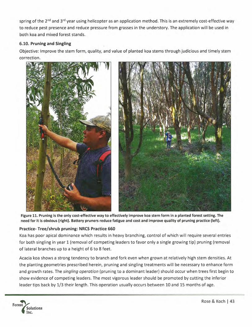
spring of the 2uid and 3rd year using helicopter as an application method. This is an extremely cost-effective wayto reduce pest presence and reduce pressure from grasses in the understory. The application will be used inboth koa and mixed forest stands.
6.10. Pruning and Singling
Objective: Improve the stem form, quality, and value of planted koa stems through judicious and timely stemcorrection.
• :
A
Figure 11. Pruning is the only cost-effective way to effectively improve koa stem form in a planted forest setting. Theneed for it is obvious (right). Battery pruners reduce fatigue and cost and improve quality of pruning practice (left).
Practice- Tree/shrub pruning: NRCS Practice 660
Koa has poor apical dominance which results in heavy branching, control of which will require several entriesfor both singling in year 1 (removal of competing leaders to favor only a single growing tip) pruning (removal
of lateral branches up to a height of 6 to 8 feet.
Acacia koa shows a strong tendency to branch and fork even when grown at relatively high stem densities. Atthe planting geometries prescribed herein, pruning and singling treatments will be necessary to enhance form
and growth rates. The singling operation (pruning to a dominant leader) should occur when trees first begin to
show evidence of competing leaders. The most vigorous leader should be promoted by cutting the inferior
leader tips back by 1/3 their length. This operation usually occurs between 10 and 15 months of age.
Rose & Koch I 43Forest
SolutionsInc.
~ -~ j
~d. -

At a point between 14 and 20 months, depending on growth performance, the first pruning treatment willlikely be required. Lower branches should be pruned up to a height of approximately 50% to 65% of the crowndepth, with the smaller percentage crown depth removed from unhealthy! shorter trees, and the largerpercentage from healthy / taller trees. Branches must be pruned when their basal diameter is less than 1/2”.Depending on growth rates, a second pruning entry may be required after 24 months of age.
A third pruning, after 24 months of age is not included in the budget tables for this management plan due tothe uncertainty of its need. This treatment should be used only if additional clear wood height is needed andcomes at a relatively nominal cost per entry.
The final objective should be to yield an expanse of tree trunk free of branches for at least 8 to 10’ above theground. Subsequent entries scheduled as necessary according to tree growth rates. Pruning should result inkoa trees with no lower branches to interfere with clear wood growth.
6.11. Ash stand replacement (year 8)
Objective: Replace existing tropical ash stand and regenerate a new koa forest
Practice- Site preparation: NRCS Practice 460; Brush management: NRCS practice 314The ash stand is approximately 80 years old (estimated planting date 1930’s CCC) and apparently has neverbeen thinned or managed in any active way. The impressive height of these existing trees is evidence of thesite’s productivity for timber production and one of the reasons for the acquisition of this property. Tropicalash is a known invasive species. Evidence of prolific volunteer re-generation is evident on the forest floor,kept in check by constant cattle presence.
As these cattle transition off the property in coordination with koa plantings on successive units, herbicideapplications will be necessary to control the spread of volunteer starts. The location of this stand provides anadvantageous existing windbreak for that portion of the property directly to the west.
The ash stand is also a significant amenity on the property, providing shade and shelter from wind and rain forvisitors and a windbreak for young saplings in years 1 and 2. Until other maturing forest components areestablished on site, retaining a portion of this grove is desirable. However, in the grove will become a nuisanceas cattle are removed and seedlings begin to germinate inside the koa and mixed forest planted stands.Therefore, it must be removed.
Plans for the property call for a small saw mill (permit applications in process) that will be able to millmaterials from this initial harvest and will be capable of milling the final harvest of the residual stand. Finalharvest of these trees and subsequent conversion to a koa stand will occur in year 8. It is estimated that bythis time there will be more comfort in the land management to tackle this stand and the sawmill use will havereduced the stocking to ameliorate costs.
The conversion of an ash stand to koa is no small feat, thus the following measures are to be used, based onexperience of converting such stands in Hönaunau Forest in 2005-2010:
1. Site preparation (ash only): remove all remaining standing trees and treat (with imazapyr) or removestumps. Preferably keep stumps in place to avoid soil disturbance.
a. Clear brush into windrows no less than 200’ apart in neat stacks such that they block the wind~
Rose & Koch I 44Forest
SolutionsInc.

2. Brush management: Treat seedlings and sprouting root fragments with imazapyr or Garlon 3A/43. Control weeds (ash seedlings) a second time in year 1 using imazapyr at low rates with glyphosate
Controlling ash is a necessary step for the long-term integrity of the forest and surrounding properties.
Ash is very susceptible to imazapyr, koa is less susceptible. This single factor, combined with high stocking willassist the conversion of this stand from the aggressive ash seedlings to koa. Ash seeds only last 2-3 years in theground, the weed pressure will be short-term.
I.
-
4
Figure 12. Treating an ash stump with imazapyr mix. Ash is very susceptible to imazapyr,both as cut stump and foliar.
Rose & Koch I 45Forest
Solutionsinc.

6.12. Monitoring
Objective: Actively monitor and adaptively manage silvicultural activities and their results and incorporate thisinformation into future management decisions. Monitor and control vectors if these are predating on forestbirds.
Practice- Access Control: NRCS Practice 472; and Upland Wildlife Habitat Management: NRCS Practice 643A critical element of forest management is an active and effective monitoring program. Monitoring will takeplace in three areas every year, using the following practices:
1. Monitor integrity of fences and gates, fix as necessary to maintain pig and cattle exclusion2. Growth and yield of production koa plantings — establish 2 permanent sample plots of 8-10 trees each for
annual measurements, ideally these are circular, using variable area or a fixed area approach. In the first 2years, tree height and survival would be the two data categories. Once trees reach sufficient size to have ameasurable diameter at 1.4 m above the ground, diameter would also be recorded. Data analysis wouldfollow standard statistical methods to quantify koa growth rates and projected timber yields, as well asevolving species composition of the restored forest.
3. Record sign of deleterious mammals near water bodies, consider deployment of control measures if theseare affecting native or migratory birds and a safe harbor agreement is in place.
Rose&KochI46Forest
SolutionsInc.

7. Budget & practices summary
7.1. Budget summary
Period Applicant FSP CombinedYear 1 $86,977 $86,977 $ 173,954.99Year 2 $55,333 $55,333 $ 110,666.18Year 3 $87,560 $87,560 $ 175,120.99Year 4 $70,052 $70,052 $ 140,103.46Year 5 $96,641 $96,641 $ 193,281.25Year 6 $85,720 $85,720 $ 171,440.15Year 7 $82,133 $82,133 $ 164,265.80Year 8 $103,945 $103,945 $ 207,889.56Year 9 $55,974 $55,974 $ 111,947.54Year 10 $25,188 $25,188 $ 50,376.59
Total: $749,523 $749,523 $1,499,047avg per year $149,905avg per acre $2,761.43
Period Share Timber RestoreYear I Applicant $ 58,577.60 $ 28,399.90Year I FSP $ 58,577.60 $ 28,399.90Year 2 Applicant $ 35,827.92 $ 19,505.17Year 2 FSP $ 35,827.92 $ 19,505.17Year 3 Applicant $ 55,774.26 $ 31,786.24Year 3 FSP $ 55,774.26 $ 31,786.24Year 4 Applicant $ 59,144.62 $ 10,907.11Year 4 FSP $ 59,144.62 $ 10,907.11Year 5 Applicant $ 85,135.79 $ 11,504.83Year 5 FSP $ 85,135.79 $ 11,504.83Year 6 Applicant $ 63,325.57 $ 22,394.51Year 6 FSP $ 63,325.57 $22,394.51
Year 7 Applicant $ 56,666.24 $ 25,466.66Year 7 FSP $ 56,666.24 $ 25,466.66Year 8 Applicant $ 73,997.69 $29,947.09Year 8 FSP $ 73,997.69 $29,947.09Year 9 Applicant $ 35,807.44 $ 20,166.33Year 9 FSP $ 35,807.44 $ 20,166.33Year 10 Applicant $ 17,508.89 $ 7,679.41Year 10 FSP $ 17,508.89 $ 7,679.41
Applicant Share Total: S541.766 $207.757FSP Share Total: $541,766 $207,757
Total: $1,083,532 $415,514avg per acre: $2,812 $2,954
Fore”‘ SolutionsInc.
Rose & Koch I 47
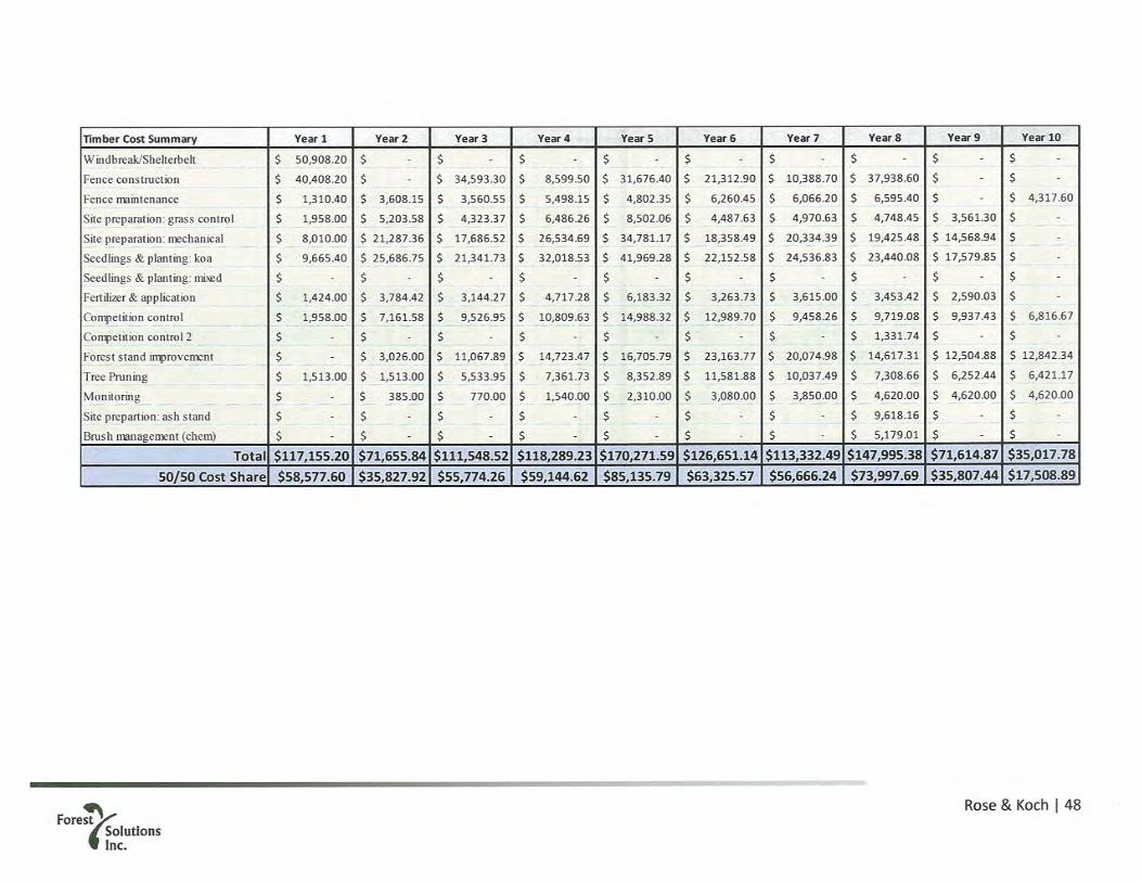
Timber Cost Summary Year 1 Year 2 Year 3 Year 4 Year 5 Year 6 Year 7 Year 8 Year 9 Year 10
WindbreakfShelterbelt $ 50,908.20 $ - $ - $ - $ - $ - $ - $ - $ - $ -
Fence construction $ 40,408.20 $ - $ 34,593.30 $ 8,599.50 $ 31,676.40 $ 21,312.90 $ 10,388.70 $ 37,938.60 $ - $ -
Fence maintenance $ 1,310.40 $ 3,608.15 $ 3,560.55 $ 5,498.15 $ 4,802.35 $ 6,260.45 $ 6,066.20 $ 6,595.40 $ - $ 4,317.60
Site preparation: grass control $ 1,958.00 $ 5,203.58 $ 4,323.37 $ 6,486.26 $ 8,502.06 $ 4,487.63 $ 4,970.63 $ 4,748.45 $ 3,561.30 $ -
Site preparation: mechanical $ 8,010.00 $ 21,287.36 $ 17,686.52 $ 26,534.69 $ 34,781.17 $ 18,358.49 $ 20,334.39 $ 19,425.48 $ 14,568.94 $ -
Seedlings & planting: koa $ 9,665.40 $ 25,686.75 $ 21,341.73 $ 32,018.53 $ 41,969.28 $ 22,152.58 $ 24,536.83 $ 23,440.08 $ 17,579.85 $ -
Seedlings & planting: mi~d $ - $ - $ - $ - $ - $ $ - $ - $ - $ -
Fertiizer&application $ 1,424.00 $ 3,784.42 $ 3,144.27 $ 4,717.28 $ 6,183.32 $ 3,263.73 $ 3,615.00 $ 3,453.42 $ 2,590.03 $ -
Competition control $ 1,958.00 $ 7,161.58 $ 9,526.95 $ 10,809.63 $ 14,988.32 $ 12,989.70 $ 9,458.26 $ 9,719.08 $ 9,937.43 $ 6,816.67
Competition control 2 $ - $ - $ - $ - $ - $ - $ - $ 1,331.74 $ - $ -
Forest stand improvement $ - $ 3,026.00 $ 11,067.89 $ 14,723.47 $ 16,705.79 $ 23,163.77 $ 20,074.98 $ 14,617.31 $ 12,504.88 $ 12,842.34
Tree Pruning $ 1,513.00 $ 1,513.00 $ 5,533.95 $ 7,361.73 $ 8,352.89 $ 11,581.88 $ 10,037.49 $ 7,308.66 $ 6,252.44 $ 6,421.17
Monitoring $ - $ 385.00 $ 770.00 $ 1,540.00 $ 2,310.00 $ 3,080.00 $ 3,850.00 $ 4,620.00 $ 4,620.00 $ 4,620.00
Site prepartion: ash stand $ - $ - $ - $ - $ - $ - $ - $ 9,618.16 $ - $ -
Brush management (chem) $ - $ - $ - $ - $ - $ - $ - $ 5,179.01 $ - $ -
Total $117,155.20 $71,655.84 $111,548.52 $118,289.23 $170,271.59 $126,651.14 $113,332.49 $147,995.38 $71,614.87 $35,017.78
50/50 Cost Share $58,577.60 $35,827.92 $55,774.26 $59,144.62 $85,135.79 $63,325.57 $56,666.24 $73,997.69 $35,807.44 $17,508.89
Fore~ Rose & Koch I 48
e;IutIonsInc.

7.2. FSP and NRCS practice codes used in this management plan & relevant rates for 51gb property
FMP Simplified Name NRCS Practice Name NRCS Code Unit Cost per unitTree Pruning Tree/Shrub Pruning 660 acre $ 85.00Seedlings:Koa TreeEstablishment 612 seedling $ 3.00Seedlings:Native TreeEstablishment 612 seedling $ 5.50Monitoring Access control 472 acre $ 110.00Fence construction Fence 382 foot $ 9.00Fence maintenance Fence 382 foot $ 0.50Brush management (chem) Brush Management 314 acre $ 350.00Competition control Herbaceous Weed Control 315 acre $ 110.00Competition control 2 Herbaceous Weed Control 315 acre $ 90.00Fertilizer & a pplication Nutrient management 590 acre $ 80.00Forest stand improvement Forest stand improvement 666 acre $ 170.00Site preparation (ash only) Tree/Shrub Site Preparation 460 acre $ 650.00Site preparation: Grass control Tree/Shrub Site Preparation 490 acre $ 110.00Site preparation: Mechanical Tree/Shrub Site Preparation 490 acre $ 450.00Windbreak/Shelterbelt Windbreak/Shelterbelt 380 acre $ 4.60
Rose & Koch I 49Forest
SolutionsInc.

8. Practice implementation schedule & annual budgets
8.1. Year 1 implementation schedule
NRCS Start FMUActivity
code month 1 111 211 212Year 1 (2020)
Windbreak/Shelterbelt 380 3Fence construction 382 8Fence maintenance 382 8Site preparation: grass control 490 2 1 1 1Site preparation: mechanical 490 7 1 1 1Seedlings &planting:koa 612 10 181 100 100Seedlings & planting: mixed 612 10 50 50Fertilizer & application 590 10 1 1 1Competition control 315 11 1 1 1Competition control 2 315 12 1 1Forest stand improvement 666 3Tree Pruning 660 7 1 1 1
Rose & Koch I 50Forest
SolutionsInc.

8.1.1. Year 1 budget
. . NRCS Cost per . FMU 1 111 211 212Activity Units
code unit Area 29.2 17.8 4.1 7.3Year 1 (2020) Month I Year 1Windbreak/Shelterbelt 380 $4.60 15,810 3 $ 72,726Fence construction 382 $9.00 6,414 8 $ 57,726Fence maintenance 382 $0.50 3,744 8 $ 1,872Site preparation: grass control 490 $110 --- 2 $ 1,958 $ 446 $ 808Site preparation: mechanical 490 $450 7 $ 8,010 $ 1,826 $ 3,305Seedlings & planting: koa 612 $3.00 181 / 100 10 $ 9,665 $ 1,218 $ 2,203Seedlings & planting: mixed 612 $5.50 50 10 $ - $ 1,116 $ 2,019Fertilizer & application 590 $80 --- 10 $ 1,424 $ 325 $ 587Competition control 315 $110 --- 11 $ 1,958 $ 446 $ 808Competition control 2 315 $90 --- 12 $ $ 365 $ 661Forest stand improvement 666 $170 - 3 $ - $ - $ -
Tree Pruning 660 $85.00 --- 7 $ 1,513 $ 345 $ 624
Year subtotal: --- --- --- $i3~2,3-24 $ 24,5’28 $ 6,088 $ 11,0.15. Share% --- --- --- 50% 50% 50% 50%
Applicantsha~e: --- --- --- $ 66,162 $ 12,264 $ 3,044 $ 5,508• F~SP Sharie: --- --- --- $ 66,162 $ 12,264 $ 3,044 $ 5,508
Year 1 ApphcantfSu~n $86,977’ Year fF5 $86,977 Tot’~I 3173955 $/ac~ ~$5~957
Rose & Koch I 51Forest
SolutionsInc.

8.2. Year 2 Implementation schedule
Activity
Fence constructionFence maintenanceSite preparation: grass controlSite preparation: mechanicalSeedlings & planting: koaSeedlings & planting: mixedFertilizer & applicationCompetition controlCompetition control 2Forest stand improvementTree PruningMonitoring
NRCS Startcode month 2
Year 2 (2021)
1
Fore~bi.~‘ SolutionsInc.
Rose & Koch I 52
382382490490612612590315315666660
8827101010111237
FMU
121 221 222 111 211 212
Ii~iI ~yrI i~öTi~
50 501
~T ifT 1
1
643 7 5

8.2.1. Year 2 Budget
. . NRCS Cost per . FMU 2 121 221 222 111 211 212Activity Unitscode unit Area 70.7 47.3 12.8 10.6 17.8 4.1 7.3
Year 2 (2021) Month I Year 1 Year 2Fence construction 382 $9.00 0 8 $ -
Fence maintenance 382 $0.50 10,309 8 $ 5,155Site preparation: grass control 490 $110 - 2 $ 5,204 $ 1,412 $ 1,164 $ - $ - $ -
Site preparation: mechanical 490 $450 - - 7 $ 21,287 $ 5,778 $ 4,760 $ - $ - $ -
Seedlings & planting: koa 612 $3.00 181 / 100 10 $ 25,687 $ 3,852 $ 3,174 $ - $ - $ -
Seedlings & planting: mixed 612 $5.50 50 10 $ $ 3,531 $ 2,909 $ - $ - $ -
Fertilizer & application 590 $80 --- 10 $ 3,784 $ 1,027 $ 846 $ - $ - $ -
Competition control 315 $110 -- 11 $ 5,204 $ 1,412 $ 1,164 $ 1,958 $ 446 $ 808Competition control 2 315 $90 -- 12 $ - $ 1,156 $ 952 $ - $ - $ -
Forest stand improvement 666 $170 --- 3 $ - $ - $ - $ 3,026 $ 690 $ 1,248Tree Pruning 660 $85.00 - 7 $ - $ - $ - $ 1,513 $ 345 $ 624Monitoring 643 $110 --- 7 $ 550
Yearsubtotal: --- --- --- $ 5,705 $ .61,166 $ 18,169 $14,968 $ 6,49~1 $ 1,481 $ 2,680NRCS% --- 50% 50% . 50% 50% 50% 50% 50%
Applicant share: --- --- . --- $2,852 $30,583 $9~084 $~,484 $3,249 $74’l $1,340FSP Share: --- --- .. ---~ $2,852 $30,583 $9,084 .$i7,484 $3,249 $~i44 $4,34.0
Year 2 Applicant Sum $55,333~ ~Year 2 F~i’ SJm’ - $~5 3ä3 ~ ~ To~i ~ $I~c $Y~65
Fore~ Rose & Koch I 53
~IutlonsInc.

8.3. Year 3 implementation schedule
Fore~~”‘ SolutionsInc.
Rose & Koch I 54
• . NRCS Start FMUActivity code month 3 131 132 133 231 232 121 221 222 111 211 212
___________________________________________ Year 3 (2022)Fence construction 382 8 1Fence maintenance 382 8Site preparation: grass control 490 2Site preparation: mechanical 490 7 1Seedlings & planting: koa 612 10Seedlings & planting: mixed 612 10Fertilizer & application 590 10Competition control 315 11Competition control 2 315 12Foreststand improvement 666 3TreePruning 660 7 _____ —
Monitoring 643 7 •P~

8.3.1. Year 3 budget
Year 3 2022Fence constructionFence maintenanceSite preparation: grass controlSite preparation: mechanicalSeedlings & planting: koaSeedlings & planting: mixedFertilizer & applicationCompetition controlCompetition control 2Forest stand improvementTree PruningMonitoring
Year subtotal:NRCS%
Applicant share:FSP Share:
Year 3 A licant Sum:
382 $9.00 5,491 8 $ 49,419382 $0.50 10,173 8 $ 5,087
7 $ 1,100$ 55,606
50%$ 27,803
27 803$87,560 Year 3 FSP Sum:
$ 26,893 $ 8,542 $17,26650% 50% 50%
$ 13,447 $ 4,271 $ 8,63313447 4271 8633175121 ac: 2722
222 11 2110.6 17.8 .1
Year3
Fore~~”‘ SolutionsInc.
Rose & Koch I 55
Activity NRCS Cost per Units FMU 3 131 132 133 231 232 121 221unit Area 64.3 14.7 16.1 8.5 19.0 6.0 47.3 12.8
Month Yearl Year 2
181 / 10050
490490612612590315315666660
$110.00$450.00
$3.00$5.50$80.00
$110.00$90.00
$170.00$85.00
27101010111237
2127
643 $110
$ 1,616 $ 1,775 $ 933 $ 2,091 $ 664 $ $ $ - $ - $ -
$ 6,610 $ 7,261 $ 3,815 $ 8,553 $ 2,717 $ - $ $ - $ $ - $$ 7,976 $ 8,762 $ 4,603 $ 5,702 $ 1,811 $ $ $ - $ $ - $$ - $ - $ $ 5,227 $ 1,660 $ $ S - S S -
$ 1,175 $ 1,291 $ 678 $ 1,520 $ 483 $ - $ - 5 - 5 $ - $$ 1,616 $ 1,775 $ 933 $ 2,091 $ 664 $ 5,204 $ 1,412 5 1,164 5 5 - $$ $ - $ $ 1,711 $ 543 $ - $ - $ - 5 5 -
$ $ - $ $ $ $ 8,042 $ 2,183 5 1,798 5 3,026 5 690 $1,248$ $ - $ $ $ $ 4,021 $ 1,091 5 899 5 1,513 5 345 $ 624
$ 18,99350%
$ 9,4979 497
$ 20,86450%
$ 10,43210432
$ 10,96250%
$ 5,4815481
87 560 Total:
$ 4,68750%
$ 2,3432 343
$ 3,86150%
$ 1,9311931
S 4,53950%
5 2,2702 270
$1,03550%
S 517517
$1,87350%
$ 936936

8.4. Year 4 implementation schedule
Activity
Fence constructionFence maintenanceSite preparation: grass controlSite preparation: mechanicalSeedlings & planting: koaSeedlings & planting: mixedFertilizer & applicationCompetition controlCompetition control 2Forest stand improvementTree PruningMonitoring
NRCScode
Fore’‘ SolutionsInc.
Rose & Koch I 56
Start FMUmonth 4 141 131 132 133 231 232 121 221 222
Year 4 (2023)382 8382 8490 2490 7612 10612 10590 10315 11315 12666 3660 7643 7

8.4.1. Year 4 budget
Activity
Year 4 (2023)Fence constructionFence maintenanceSite preparation: grass controlSite preparation: mechanicalSeedlings & planting: koaSeedlings & planting: mixedFertilizer & applicationCompetition controlCompetition control 2Forest stand improvementTree PruningMonitoring
Year subtotal:NRCS%
Applicant share:FSP Share:
Year 4 A licant Sum:
NRCS Cost per . FMU 4Units
code unit Area 59.0Month Year 1
$9.00 1,365 8 $ 12,285$0.50 15,709 8 $ 7,855
$110.00 2$450.00 7
$3.00 181/100 10$5.50 50 10$80.00 10
$110.00 11$90.00 12
$170.00 3$85.00 7$110 7 $ 2,200
$ 22,34050%
$ 11,17011170
$70,052 Year 4 FSP Sum:
133 231 2328.5 19.0 6.0
$ - $ - $ - $ -
$ - $ - $ - $ -
$ - $ - $ - $ -
$ - $ - $ - $ -
$ .. $ - $ - $ -
$ 1,616 $ 1,775 $ 933 $ 2,091$ - $ - $ - $ -
$ 2,497 $ 2,743 $ 1,441 $ 3,231$ 1,249 $ 1,372 $ 721 $ 1,615
Fore~’!”‘ SolutionsInc.
Rose & Koch I 57
141 131 13259.0 14.7 16.1
382382490490612612590315315666660643
Year 2
6,48626,53532,019
4,7176,486
Year 3
$$$$$$$$$
$ - $ - $ -
$ - $ - $ -
$ - $ - $ -
$ - $ - $ - $$ - $ - $ - $$ 664 $ - $ - $ -
$ $ - $ -
$ 1,026 $ 8,042 $ 2,183 $ 1,798$ 513 $ 4,021 $ 1,091 $ 899
$ 76,243 $ 5,362 $ 5,890 $ 3,094 $ 6,93~7 .$ 2,204 $12,063 $3~2~4 $ 2,69750% 50% 50% 50% S0% 50% 50% 50% 50%
$ 38,122 $ 2~681 $ 2,945 $ 1,547 $. 3,469 $ 1,102 $ 6,03.1 . $ 1,63’7 $ 1,34938 122 2 681 2 945 1 547 3 469 1102 6 03~1 1 63’7 1349
$70,052 ~ ‘~To~’aI~ 140 103 ‘~ ~. ac ~ 2 37~’ ~. ~! ,~

8.5. Year 5 implementation schedule
• NRCS Start FMUActivity code month 5 151 141 131 132 133 231 232
Year 5 (2024) __________________________________Fence construction 382 8Fence maintenance 382 8Site preparation: grass control 490 2Site preparation: mechanical 490 7Seedlings & planting: koa 612 10Seedlings&planting:mixed 612 10Fertilizer & application 590 10Competition control 315 11Competition control 2 315 12Forest stand improvement 666 3Tree Pruning 660 7Monitoring 643 7 S1i•
Fore~!t”‘ SolutionsInc.
Rose & Koch I 58

8.5.1. Year 5 bud&et
‘ SolutionsInc.
Rose & Koch I 59
NRCS Cost percode unit
FMU 5 151Units
Area 77 77.3Month Year 1
5,028 8 $ 45,25213,721 8 $ 6,861
Activity
Year 5 (2024)Fence constructionFence maintenanceSite preparation: grass controlSite preparation: mechanicalSeedlings & planting: koaSeedlings & planting: mixedFertilizer & applicationCompetition controlCompetition control 2Forest stand improvementTree PruningMonitoring
Year subtotal:NRCS%
Applicant share:FSP Share:
Year 5 A licant Sum:
382 $9.00382 $0.50490 $110.00 2 $490 $450.00 7 $612 $3.00 181/100 10 $612 $5.50 50 10 $590 $80.00 --- 10 $315 $110.00 11 $315 $90.00 -- 12 $666 $170.00 3 $660 $85.00 -- 7 $643 $110 -- 7 $ 3,300
$ 55,413 $50%
$ 2’7,706 $-~ 2’7 ~06
$96 641 ~‘ear 5~FSP~S~ii~
141 3 3 259.0 .1 9~0 .0
Year 2 Year 3
8,502$ - $ - $ - $ - $ - $-
34,781$ - $ - $ - $ - $ - $ -
41,969$ - $ - $ - $ - $ - $ -
- $ - $ - $ - $ - $ - $6,183$ - $ - $ - $ - $ - $ -
8,502 $ 6,486 $ - $ - $ - $ - $ -
- $ - $ - $ - $ - $ - $- $ 10,024 $ 2,497 $ 2,743 $ 1,441 $ 3,231 $ 1,026- $ 5,012 $ 1,249 $ 1,372 $ 721 $ 1,615 $ 513
99,938 $ 24,5~23 $ 3,746 $ 4,115. $ 2,162 $ 4,846 $ 1,539,50% . 50~ 50% 50% 50% 50% 50%49,969 . $ 1O,76~1 $ 1,8q3 $ 2,05~1 $ 1,084. $ 2,423 $ 770499.69 iOZ6•1 18F113 2O5~1 108.1 2423 7,70
496~641 ~ ~TotaI 19’3 281 ~ ~c ~_ ~.50i

8.6. Year 6 implementation schedule
‘ SolutionsInc.
Rose & Koch I 60
II
• . NRCS Start FMUActivity code month 6 161 261 262 151 141
Year 6 (2025) ________________________
Fence construction 382 8 JFence maintenance 382 8Site preparation: grass control 490 •2Site preparation: mechanical 490 7Seedlings & planting: koa 612 10Seedlings&planting:mixed 612 10Fertilizer & application 590 10Competition control 315 11Competition control 2 315 12Forest stand improvement 666 3Tree Pruning 660 7Monitoring 643 7 ~

8.6.1. Year 6 budget
NRCS Cost per . FMU 6 161 261 262 151 141Activity Units
code unit Area 59.7 40.8 17.1 1.9 77.3 59.0Year 6 (2025 Month Year 1 Year 2 Year 3Fence construction 382 $9.00 3,383 8 $ 30,447Fence maintenance 382 $0.50 17,887 8 $ 8,944Site preparation: grass control 490 $110.00 2 $ 4,488 $ 1,880 $ 205 $ - $ -
Site preparation: mechanical 490 $450.00 --- 7 $ 18,358 $ 7,692 $ 837 $ - $ -
Seedlings & planting: koa 612 $3.00 181 / 100 10 $ 22,153 $ 5,128 $ 558 $ - $ -
Seedlings & planting: mixed 612 $5.50 50 10 $ - $ 4,701 $ 512 $ - $ -
Fertilizer & application 590 $80.00 --- 10 $ 3,264 $ 1,367 $ 149 $ - $ -
Competition control 315 $110.00 --- 11 $ 4,488 $ 1,880 $ 205 $ 8,502 $ -
Competition control 2 315 $90.00 - 12 $ - $ 1,538 $ 167 $ - $ -
Forest stand improvement 666 $170.00 --- 3 $ - $ 2,906 $ 316 $ 13,140 $10,024Tree Pruning 660 $85.00 --- 7 $ - $ 1,453 $ 158 $ 6,570 $ 5,012Monitoring 643 $110 --- 7 $ 4,400
Year subtotal: --- --- $ 43,791 $ 52,750 $ 28,545 $ 3,107 $ 28,211 $15,036NRCS% --- --- 50% 50% 50% 50% 50% 50%
Applicantshare: --- --- $ 21,895 $ 26,375 $ 14,273 $ 1,553 $ 14,106 $ 7,518FSPShare: --- --- 21895 26375 $ 14273 $ 1553 14106 7518
Year 6 A licant Sum: $85,720 Year 6 FSP Sum: $85,720 Total: 171 440 ac: 2 869
Rose & Koch I 61Forest
SolutionsInc.

8.7. Year 7 implementation schedule
Activity
Fence constructionFence maintenanceSite preparation: grass contFolSite preparation: mechanicalSeedlings & planting: koaSeedlings & planting: mixedFertilizer & applicationCompetition controlCompetition control 2Forest stand improvementTree PruningMonitoring
Fore’‘ SolutionsInc.
Rose & Koch I 62
NRCS Start FMUcode month 7 171 172 271 161 261 262 151
Year 7 (2026)382 8382 8490 2490 7612 10612 10590 10315 11315 12666 3660 7643 7 50
I_~_ ~Ii 1

8.7.1. Year 7 budget
Year 7 (2026)Fence constructionFence maintenance
Forest stand improvementTree PruningMonitoring
490490612612590315315666660643
$110.00$450.00
$3.00$5.50$80.00
$110.00$90.00
$170.00$85.00
$ 29,00750%
$ 14,50414504
Fore~”‘ SolutionsInc.
Rose & Koch I 63
Activity
Month
Site preparation: grass controlSite preparation: mechanicalSeedlings & planting: koaSeedlings & planting: mixedFertilizer & applicationCompetition controlCompetition control 2
NRCS Cost per . FMU 7 171 172 271 161 261 262 1. Units
code unit Area 70.1 8.0 37.2 25.0 40.8 17.1 1.9 77.3
382 $9.00 1,649 8 $ 14,841382 $0.50 17,332 8 $ 8,666
Year 1 Year 2 Year 3
-- 2 $ 876 $ 4,094 $ 2,745 $ - $ - $ - $ -
-- 7 $ 3,585 $ 16,749 $ 11,230 $ - $ - $ - $ -
181 / 100 10 $ 4,326 $ 20,211 $ 7,487 $ - $ - $ - $ -
50 10 $ - $ - $6,863$ - $ - $ - $ -
--- 10 $ 637 $ 2,978 $ 1,997 $ - $ - $ - $ -
--- 11 $ 876 $ 4,094 $ 2,745 $ 4,488 $ 1,880 $ 205 $ -
--- 12 $ - $ - $2,246$ - $ - $ - $ -
3 $ - $ - $ - $ 6,935 $ 2,906 $ 316 $13,1407 $ - $ - $ - $ 3,468 $ 1,453 $ 158 $ 6,570
$110 --- 7 $ 5,500Vearsubtotal: --- --- $ 10,301 $ 48,127 $ 35,343 $ 14,891 $ 6,239 $ 679 $19,709
NRCS% --- --- 50% 503fo . 50% 50% 50% 50% 50%Applicant share: --- --- $ 5,150 $ 24,063 . $ 17,65~7 $ 7,445 $ 3,119 $ 340 $ 9,855
FSP Share: --- --- 5 150 24 063 17 65~ 7 445 $ 3 119 340 9 8~-5Year 7 A hcant Sum $82,133 Year 7 FSP Sum $82,133 Total .~. i’~4 266~’” ‘~ “ ~ ~c 1~’918’ ~

8.8. Year 8 implementation schedule
Activity
Fence constructionFence maintenanceSite prepartion: ash standBrush management (chem)Site preparation: grass controlSite preparation: mechanicalSeedlings & planting: koaSeedlings & planting: mixedFertilizer & applicationCompetition controlCompetition control 2Forest stand improvementTree PruningMonitoring
27101010101237777~
Fore”‘ SolutionsInc.
Rose & Koch I 64
NRCS Start ________
code month 8Year 8
FMU
8~8
L 181 281 171 172 271 161261 262
1
382382490314490490612612590315315666660643

8.8.1. Year 8 budget
Activity
Year 8 2027Fence constructionFence maintenanceSite prepartion: ash standBrush management (chem)Site preparation: grass controlSite preparation: mechanicalSeedlings & planting: koaSeedlings & planting: mixedFertilizer & applicationCompetition controlCompetition control 2Forest stand improvementTree PruningMonitoring
382 $9.00382 $0.50490 $650.00314 $350.00490 $110.00490 $450.00612 $3.00612 $5.50590 $80.00315 $110.00315 $90.00666 $170.00660 $85.00643 $110
8 $ 54,1988 $ 9,42227101010101237777 $ 6,600
$ 70,22050%
$ 35,110$ 35110
$ 24,886 $ 2,90850% 50%
$ 12,443 $ 1,45412443 1454
Total: 207 890
‘ SoludonsInc.
Rose & Koch I 65
Month
NRCS cost per . FMU 8 311 181 281 171 172 271 16 261 262• Units
code unit Area 46.0 14.8 28.4 17.6 8.0 37.2 25.0 40 7.1 .9
6,02218,844
181 / 10050
Year 2
$ $ $ -
$ $ - $ -
$ 1,935 $ - $ -
$ 7,914 $ - $ -
$ 5,276 $ - $ -
$ 4,837 $ - $ -
$ 1,407 $ - $ -
$ 1,935 $ 876 $ 4,094$ 1,583 $ - $ -
$ - $ 1,354 $ 6,328$ - $ 677 $ 3,164
Year 1
$ -
$ -
$ 3,121$ 12,767$ 15,405$ -
$ 2,270$ 3,121$ -
$ -
$ -
$ 36,68350%
$ 18,34218 342
$ 9,618$ 5,179$ 1,628$ 6,659$ 8,035$ -
$ 1,184$ 1,628$ 1,332$ -
$ -
$ 35,26250%
$ 17,63117 631
Year subtotal:NRCS%
Applicant share:FSP Share:
Year 8 A licant Sum:
Year 3
$ -
$ - $$
$ .. $$
$ -
$$ 2,906 $ 316$ 1,453 $ 158
$$$$$$$$ 2,745$$ 4,243$ 2,121
$ 9,10950%
$ 4,5554 555
$103,945
$$
$$
$ 6,935$ 3,468
$10,40350%
$ 5,2025 202
Year 1 FSP Sum: $103,945
$13,58650%
$ 6,7936 793
$ 4,35950%
$ 2,1792 179
$ 47450%
$ 237$ 237
ac: 3422

8.9. Year 9 implementation schedule
Activity
Fence constructionFence maintenanceSite preparation: grass controlSite preparation: mechanicalSeedlings & planting: koaSeedlings & planting: mixedFertilizer & applicationCompetition controlCompetition control 2Forest stand improvementTree PruningMonitoring
382382490490612612590315 11315 12666660643 7 .1
11
Fore~SolutionsInc.
Rose & Koch I 66
NRCS Start FMUcode month 9 191 291 311 181 281 171 172 271
Year 9 (2028)8827101010
37

8.9.1. Year 9 budget
NRCS Cost per . FMU 9 191 291 311 181 281 171 17 271Activity Units
code unit Area 51.7 32.4 19.3 14.8 28.4 17.6 8.0 37.2 25.0Year 9 (2028) Month Year 1 Year 2 Year 3Fence construction 382 $9.00 0 8 $Fence maintenance 382 $0.50 0 8 $ -
Site preparation: grass control 490 $110.00 2 $ 3,561 $ 2,123 $ - $ - $ - $ - $ - $ -
Site preparation: mechanical 490 $450.00 --- 7 $ 14,569 $ 8,684 $ - $ - $ - $ - $ - $ -
Seedlings & planting: koa 612 $3.00 181 / 100 10 $ 17,580 $ 5,789 $ - $ - $ - $ - $ - $ -
Seedlings & planting: mixed 612 $5.50 50 10 $ - $ 5,307 $ - $ - $ - $ - $ - $ -
Fertilizer & application 590 $80.00 --- 10 $ 2,590 $ 1,544 $ - $ - $ - $ - $ - $ -
Competition control 315 $110.00 11 $ 3,561 $ 2,123 $ 3,255 $ 3,121 $ 1,935 $ - $ - $ -
Competition control 2 315 $90.00 12 $ - $ - $ - $ - $ - $ - $ - $ -
Forest stand improvement 666 $170.00 3 $ - $ - $ - $ 4,823 $ 2,990 $ 1,354 $ 6,328 $ 4,243Tree Pruning 660 $85.00 7 $ - $ - $ - $ 2,411 $ 1,495 $ 677 $ 3,164 $ 2,121Monitoring 643 $110 7 $ 6,600
Year subtotal: --- $ 6,600 $ 41,861 $ 25,569 $ 3,255 $ 10,355 $ 6,419 $ 2,031 $ 9,491 $ 6,364NRCS% --- --- --- 50% 50% 50% 50% 50% 50% 50% 50% 50%
Applicantshare: --- $ 3,300 $ 20,931 $ 12,785 $ 1,628 $ 5,178 $ 3,210 $ 1,016 $ 4,746 $ 3,182FSP Share: --- --- --- 3300 20931 12785 1628 5178 3210 1016 4746 3182
Year 9 A licant Sum: $55,974 Year 9 FSP Sum: $55,974 Total: 111 948 at: 2 166
Rose & Koch I 67Forest
SolutionsInc.

8.10. Year 10 implementation Schedule
Activity NRCS Start FMUcode month 9 191 291 311 181 281Year 10 (2029)
Fence maintenance 382 8Competition control 315 11Forest stand improvement 666 3Tree Pruning 660 7Monitoring 643 7
Rose & Koch I 68Forest
SolutionsInc.

8.10.1. Year 10 budget
NRCS Cost per . FMU 9 191 291 311 181 281Activity Units
code unit Area 0 32.4 19.3 14.8 28.4 7.6Year 10 2029 Month Year 2 Year 3Fence maintenance 382 $0.50 12,336 8 $ 6,168Competition control 315 $110.00 11 $ 3,561 $ 2,123 $ 3,255 $ - $ -
Forest stand improvement 666 $170.00 -- 3 $ 5,504 $ 3,281 $ 2,516 $ 4,823 $ 2,990Tree Pruning 660 $85.00 -- 7 $ 2,752 $ 1,640 $ 1,258 $ 2,411 $ 1,495Monitoring 643 110.00 -- 7 6 600 - - - - -
Year subtotal: --- . --- $ 12,768 $ 11,817 $ 7,044 $ 7,029 $ 7,234 $ 4,485NR~~S% --- --- 50% 50% . 50% 50% 50% 50%
Applicantshare~ --, --- $ 6,384 $ 5,909 $ 3,5-2Q $ 3,5~14 $ 3,6.17 $ 2,242FSPShaije: ‘--~- . ---‘ --- 6384 509 $ 352’2 35•14 364.7 $ 2242
Yea 40:A.. iicaiitSLini~ ‘:~$25~I88~.~25i88~~ ~ ~ ~TàtaI: ‘~%~ 5O’~37Z≥?:’: ~~c:~
Rose & Koch I 69Forest
SolutionsInc.

9. Economic Analysis
9.1. Methods and assumptions
For the purposes of this management plan, the current budget costs were fed into a discounted cash flow(DCF) model that simplifies operations into a single “standard” acre. The “standard” acre costs were equalizedso as to more or less add up to the total budget figure of 2.3 million dollars in aggregate.
Per acre koa establishment costs, spot cultivation and manual spraying and fertilizer• Cost ($ / ac) by year with GE tax
Description Year 0 Year 1 Year 2
Fence installation & maintenance ($720) $0 $0Site preparation: grass control ($250) $0 $0Site preparation: mechanical ($396) $0 $0Seedlings: Koa & a’alii ($560) $0 $0Seedlings: Natives ($113) $0 $0Planting ($400) $0 $0Fertilizer and application ($189) $0 $~Competition control ($220) ($220) $0Competitioncontrol 2 ($60) $0 $0Integrated: pest management ($206) ($206)Tree p i~g ($91) ($91)Monitoring ($68)ether aetivities~: Invasive weed c. ($14)
Forest management ($70 ($45) ($45)Totals ($2,978) $ (562) $ (424)
Cumulative (3,964
Koa establishment costs, mechanical preparation, ex pasture, 550 acres unsubsidized
Operation Cost ($ by activity by entry for entire project
Fence installation & maintenance ($393,840) $0 $0Site preparation: grass control ($136,750) $0 $0Site preparation: mechanical ($216,612) $0 $0Seedlings: Koa & aalii ($306,320) $0 $0Seedlings: Natives ($61,811) $0 $0Planting ($218,800) $0 $0Fertilizer and application ($103,383) $0 $0Competition control ($120,340) ($120,340) $0Competition control 2 ($32,820) $0 $0Integrated pest management $0 ($112,682) ($112,682)Tree pruning $0 ($49,777) ($49,777)Monitoring $0 $0 ($37,196)Other activities: Invasive weed c. $0 $0 ($7,658)
$0 $0 $0Forest management ($38,290) ($24,615) ($24,615)
($1 628,966) ($307,414) ($231 928)
‘ So(utionsInc.
Rose & Koch 70
TotalsCumulative $ (2,168,308

Koa spot~estabIisI~ment costs by category, year 0-3ompetition con rol, Competition control 2,
(~°) (60)
Fertilizer and Integrated pestapplication, (189) management, (412)
Tree pruning, (182)Planting, (400)
Monitoring, (68)Other activities:
Invasive weed c., (14)Seedlings: Natives, (113)
Total=$ 3,964
Fence installation &Seedlings: Koa & aalii, maintenance, (720)
(560)
Site preparation: Site preparation: grassmechanical, (396) control, (250)
Fore~‘ SolutionsIhc~
These costs are all discounted to year 0 at a 7% annual yield, including 3 planned harvest entries: one at 30
years, a second at 45 years and a final harvest (of the first cohort) at 60 years. For each successive harvest,
resulting volume was calculated and apportioned according to predicted quality into small sawtimber, large
sawtimber and veneer. Each harvest age and quality type has a different price point:
Table 7. Relative allocation of volume by harvest age
PercentOperation Year
Biomass Small Saw Large Saw VeneerHarvest 1 30 60% 30% 10% 0%Harvest 2 45 30% 30% 30% 10%Final vol 60 20% 20% 40% 20%
Table 8. Relative value of koa wood by type and age
Value, US$/bdft stumpageOperation Year
Biomass Small Saw Large Saw VeneerHarvest 1 30 - $ 4.00 $ 8.00 $ 14.00Harvest 2 45 - $ 5.00 $ 10.00 $ 16.00Final vol 60 - $ 6.00 $ 12.00 $ 18.00
Fore~ Rose & Koch I 71
‘~utIonsInc.

Growth and harvest estimates for 3,000’ elevation koa30 —— -—----—-—--—---------—-—----— - —______
Gross volume (bdft/ac) bdft/ac/yr
Is
25
_________________ I ——
C)Ezu
___ 1111111 IIII’ II-~ - 11111111 11111111 ~ ‘fl”1
0 ii- . .1 .- _I 111111 1111111 i.IiI I . II~ 0 May2017 Period (year)
Inc. _____ ____________ _____ ___________________________________________________________________________
Growth information from other properties under management and DOFAW permanent sample plots were used to fit a koa growth function andestimate overall yield in three harvests, graphically represented above, where the V axis represents the standing volume and the x axis representsthe successive years. The green bars represent total standing volume, the brown line is the annual grown rate (mean annual increment — MAI).
Each harvest entry is evident by the downward step in total volume. Standing volume will recover faster younger trees and under higher stocking;this is accounted for with the reduction in response rate after each harvest entry.
Rose & Koch I 72Forest
SolutionsInc.
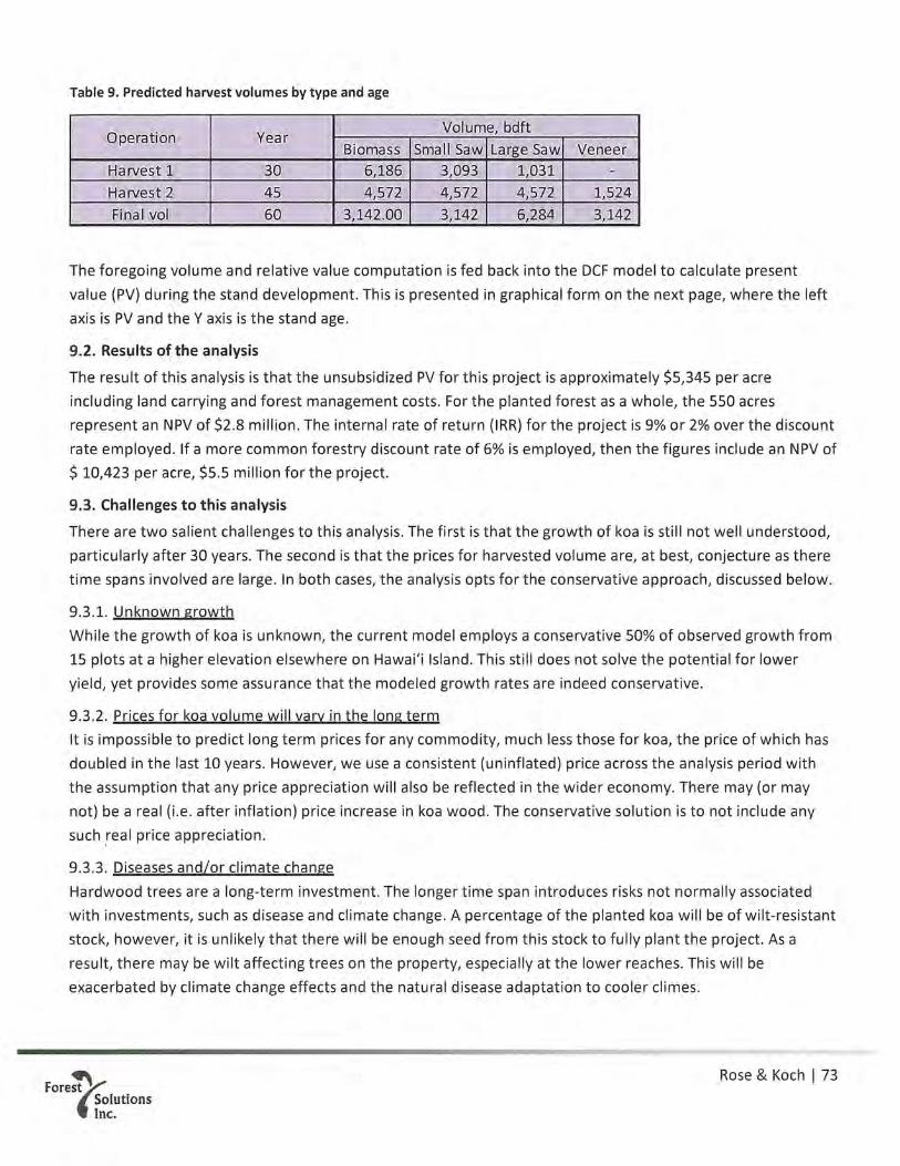
Table 9. Predicted harvest volumes by type and age
. Volume, bdftOperation Year
Biomass Small Saw Large Saw VeneerHarvest 1 30 6,186 3,093 1,031 -
Harvest 2 45 4,572 4,572 4,572 1,524Final vol 60 3,142.00 3,142 6,284 3,142
The foregoing volume and relative value computation is fed back into the DCF model to calculate presentvalue (PV) during the stand development. This is presented in graphical form on the next page, where the leftaxis is PV and the V axis is the stand age.
9.2. Results of the analysis
The result of this analysis is that the unsubsidized PV for this project is approximately $5,345 per acreincluding land carrying and forest management costs. For the planted forest as a whole, the 550 acresrepresent an NPV of $2.8 million. The internal rate of return (IRR) for the project is 9% or 2% over the discountrate employed. If a more common forestry discount rate of 6% is employed, then the figures include an NPV of$ 10,423 per acre, $5.5 million for the project.
9.3. Challenges to this analysis
There are two salient challenges to this analysis. The first is that the growth of koa is still not well understood,particularly after 30 years. The second is that the prices for harvested volume are, at best, conjecture as theretime spans involved are large. In both cases, the analysis opts for the conservative approach, discussed below.
9.3.1. Unknown growthWhile the growth of koa is unknown, the current model employs a conservative 50% of observed growth from15 plots at a higher elevation elsewhere on Hawai’i Island. This still does not solve the potential for loweryield, yet provides some assurance that the modeled growth rates are indeed conservative.
9.3.2. Prices for koa volume will vary in the long termIt is impossible to predict long term prices for any commodity, much less those for koa, the price of which hasdoubled in the last 10 years. However, we use a consistent (uninflated) price across the analysis period withthe assumption that any price appreciation will also be reflected in the wider economy. There may (or maynot) be a real (i.e. after inflation) price increase in koa wood. The conservative solution is to not include anysuch real price appreciation.
9.3.3. Diseases and/or climate changeHardwood trees are a long-term investment. The longer time span introduces risks not normally associatedwith investments, such as disease and climate change. A percentage of the planted koa will be of wilt-resistantstock, however, it is unlikely that there will be enough seed from this stock to fully plant the project. As aresult, there may be wilt affecting trees on the property, especially at the lower reaches. This will beexacerbated by climate change effects and the natural disease adaptation to cooler climes.
Rose & Koch I 73Forest
SolutionsInc.

Timeline of discounted cash flows by forest age, koa planted forest
$5 10000PV $ by year —Cumulative performance PV $, right axis
~ $4 80000
-CI
6000~CD
c~)4000t~
~ 10 15 20 25 30 35 40 50 2000 ~
~ ($1) -2000 ~..
G).~
~ ($2) -4000 .~
E
($3) -6000
($4) -8000
Establishment Thinning, harvest & re eneration of next crop of trees
($5) -10000
Fore~~Cohort Age (yrs) Koch, Jan 2019
Rose & Koch I 74Forest
SolutionsInc.

FINAL ENVIRONMENTAL AS S ES S MENTKAPOAULA KOA FORES T MANAGEMENT PLANTax Map Ke y (3) 4-7-007:011Ā hualoa, Hawai‘i
Pre pare d for: Paniolo Tone w oods
Pre pare d by:Cardno
In association w ith:Ge ome trician Associate s LLCand AS M affiliate s
August 2019
Approving Age ncy:S tate of Haw ai‘iDe partme nt of Land and Natural Re source s1151 Punchbow l S tre e t, Room 131Honolulu, Haw ai‘i 96813
EXHIBIT C

Kapoaula Koa Forest Management Plan Final Environmental Assessment August 2019
Final Environmental Assessment Kapoaula Koa Forest Management Plan Tax Map Key (3) 4-7-007:011 Kapoaula, Hawai‘i August 2019
Approving Agency: State of Hawai‘i Department of Land and Natural Resources 1151 Punchbowl Street, Room 131 Honolulu, Hawai‘i 96813 Prepared for: Paniolo Tonewoods Prepared by: Cardno In association with: Geometrician Associates LLC and ASM affiliates

Kapoaula Koa Forest Management Plan Final Environmental Assessment August 2019
This page intentionally left blank.

Kapoaula Koa Forest Management Plan Final Environmental Assessment August 2019
CONTACT INFORMATION
Cardno
737 Bishop Street Suite 3050, Mauka Tower Honolulu, Hawai‘i 96813
Geometrician Associates LLC
P.O. Box 396 Hilo, Hawai‘i 96721
ASM affiliates
507A E. Lanikāula Street Hilo, Hawai‘i 96720
DOCUMENT INFORMATION
Approving Agency: State of Hawai‘i
Department of Land and Natural Resources
Prepared For: Paniolo Tonewoods
Prepared By: Cardno
Project Name: Final Environmental Assessment Kapoaula Koa Forest Management Plan
Date: August 2019
This document was prepared pursuant to the Hawai‘i Environmental Policy Act; Chapter 343, Hawai‘i Revised Statutes; and Title 11, Chapter 200, Hawai‘i Administrative Rules.

Kapoaula Koa Forest Management Plan Final Environmental Assessment August 2019
This page intentionally left blank.
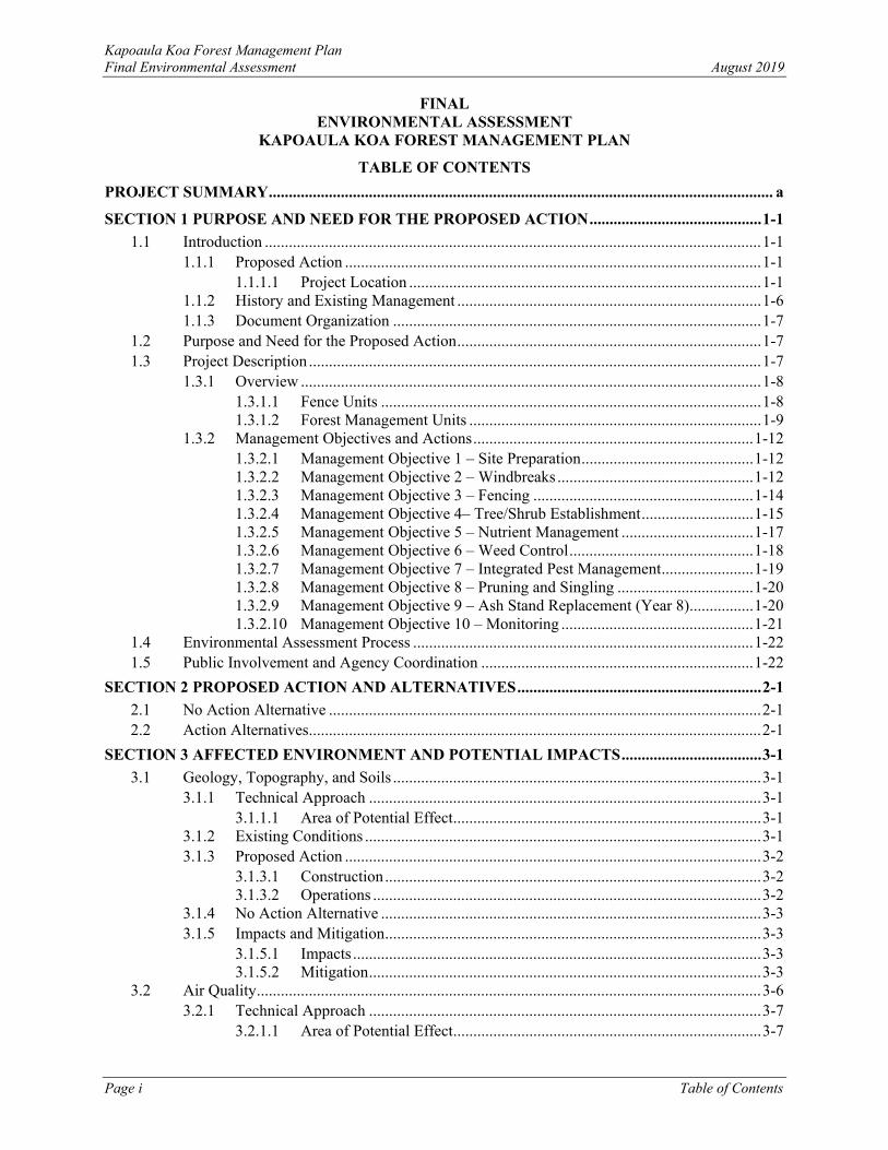
Kapoaula Koa Forest Management Plan Final Environmental Assessment August 2019
Page i Table of Contents
FINAL ENVIRONMENTAL ASSESSMENT
KAPOAULA KOA FOREST MANAGEMENT PLAN
TABLE OF CONTENTS PROJECT SUMMARY .............................................................................................................................. a
SECTION 1 PURPOSE AND NEED FOR THE PROPOSED ACTION ........................................... 1-1 1.1 Introduction ............................................................................................................................ 1-1
1.1.1 Proposed Action ........................................................................................................ 1-1 1.1.1.1 Project Location ........................................................................................ 1-1
1.1.2 History and Existing Management ............................................................................ 1-6 1.1.3 Document Organization ............................................................................................ 1-7
1.2 Purpose and Need for the Proposed Action ............................................................................ 1-7 1.3 Project Description ................................................................................................................. 1-7
1.3.1 Overview ................................................................................................................... 1-8 1.3.1.1 Fence Units ............................................................................................... 1-8 1.3.1.2 Forest Management Units ......................................................................... 1-9
1.3.2 Management Objectives and Actions ...................................................................... 1-12 1.3.2.1 Management Objective 1 – Site Preparation ........................................... 1-12 1.3.2.2 Management Objective 2 – Windbreaks ................................................. 1-12 1.3.2.3 Management Objective 3 – Fencing ....................................................... 1-14 1.3.2.4 Management Objective 4– Tree/Shrub Establishment ............................ 1-15 1.3.2.5 Management Objective 5 – Nutrient Management ................................. 1-17 1.3.2.6 Management Objective 6 – Weed Control .............................................. 1-18 1.3.2.7 Management Objective 7 – Integrated Pest Management ....................... 1-19 1.3.2.8 Management Objective 8 – Pruning and Singling .................................. 1-20 1.3.2.9 Management Objective 9 – Ash Stand Replacement (Year 8) ................ 1-20 1.3.2.10 Management Objective 10 – Monitoring ................................................ 1-21
1.4 Environmental Assessment Process ..................................................................................... 1-22 1.5 Public Involvement and Agency Coordination .................................................................... 1-22
SECTION 2 PROPOSED ACTION AND ALTERNATIVES ............................................................. 2-1 2.1 No Action Alternative ............................................................................................................ 2-1 2.2 Action Alternatives ................................................................................................................. 2-1
SECTION 3 AFFECTED ENVIRONMENT AND POTENTIAL IMPACTS ................................... 3-1 3.1 Geology, Topography, and Soils ............................................................................................ 3-1
3.1.1 Technical Approach .................................................................................................. 3-1 3.1.1.1 Area of Potential Effect ............................................................................. 3-1
3.1.2 Existing Conditions ................................................................................................... 3-1 3.1.3 Proposed Action ........................................................................................................ 3-2
3.1.3.1 Construction .............................................................................................. 3-2 3.1.3.2 Operations ................................................................................................. 3-2
3.1.4 No Action Alternative ............................................................................................... 3-3 3.1.5 Impacts and Mitigation .............................................................................................. 3-3
3.1.5.1 Impacts ...................................................................................................... 3-3 3.1.5.2 Mitigation .................................................................................................. 3-3
3.2 Air Quality .............................................................................................................................. 3-6 3.2.1 Technical Approach .................................................................................................. 3-7
3.2.1.1 Area of Potential Effect ............................................................................. 3-7

Kapoaula Koa Forest Management Plan Final Environmental Assessment August 2019
Page ii Table of Contents
3.2.2 Existing Conditions ................................................................................................... 3-7 3.2.3 Proposed Action ........................................................................................................ 3-7
3.2.3.1 Construction .............................................................................................. 3-7 3.2.3.2 Operations ................................................................................................. 3-8
3.2.4 No Action Alternative ............................................................................................... 3-8 3.2.5 Summary of Impacts and Mitigation ......................................................................... 3-8
3.2.5.1 Impacts ...................................................................................................... 3-8 3.2.5.2 Mitigation .................................................................................................. 3-9
3.3 Floodplains, Drainage, and Water Resources ......................................................................... 3-9 3.3.1 Technical Approach .................................................................................................. 3-9
3.3.1.1 Area of Potential Effect ............................................................................. 3-9 3.3.2 Existing Conditions ................................................................................................... 3-9 3.3.3 Proposed Action ...................................................................................................... 3-10
3.3.3.1 Construction ............................................................................................ 3-10 3.3.3.2 Operations ............................................................................................... 3-10
3.3.4 No Action Alternative ............................................................................................. 3-10 3.3.5 Impacts and Mitigation ............................................................................................ 3-10
3.3.5.1 Impacts .................................................................................................... 3-10 3.3.5.2 Mitigations .............................................................................................. 3-11
3.4 Biological Resources ............................................................................................................ 3-14 3.4.1 Technical Approach ................................................................................................ 3-14
3.4.1.1 Area of Potential Effect ........................................................................... 3-14 3.4.2 Existing Conditions – Vegetation and Flora ........................................................... 3-14 3.4.3 Existing Conditions – Fauna ................................................................................... 3-15
3.4.3.1 Property and Regional Habitat ................................................................ 3-15 3.4.3.2 Findings of Survey on Kapoaula Property .............................................. 3-17
3.4.4 Proposed Action ...................................................................................................... 3-18 3.4.4.1 Construction ............................................................................................ 3-18 3.4.4.2 Operations ............................................................................................... 3-19
3.4.5 No Action Alternative ............................................................................................. 3-19 3.4.6 Impacts and Mitigation ............................................................................................ 3-19
3.4.6.1 Impacts .................................................................................................... 3-19 3.4.6.2 Mitigations .............................................................................................. 3-20
3.5 Climate Change .................................................................................................................... 3-21 3.5.1 Technical Approach ................................................................................................ 3-21
3.5.1.1 Area of Potential Effect ........................................................................... 3-21 3.5.2 Existing Conditions ................................................................................................. 3-21 3.5.3 Proposed Action ...................................................................................................... 3-21
3.5.3.1 Construction ............................................................................................ 3-21 3.5.3.2 Operations ............................................................................................... 3-22
3.5.4 No Action Alternative ............................................................................................. 3-22 3.5.5 Impacts and Mitigation ............................................................................................ 3-22
3.5.5.1 Impacts .................................................................................................... 3-22 3.5.5.2 Mitigations .............................................................................................. 3-23
3.6 Noise ..................................................................................................................................... 3-25 3.6.1 Technical Approach ................................................................................................ 3-26
3.6.1.1 Area of Potential Effect ........................................................................... 3-26 3.6.2 Existing Conditions ................................................................................................. 3-26 3.6.3 Proposed Action ...................................................................................................... 3-26

Kapoaula Koa Forest Management Plan Final Environmental Assessment August 2019
Page iii Table of Contents
3.6.3.1 Construction ............................................................................................ 3-26 3.6.3.2 Operations ............................................................................................... 3-26
3.6.4 No Action Alternative ............................................................................................. 3-26 3.6.5 Impacts and Mitigation ............................................................................................ 3-27
3.6.5.1 Impacts .................................................................................................... 3-27 3.6.5.2 Mitigation ................................................................................................ 3-27
3.7 Scenic Resources .................................................................................................................. 3-27 3.7.1 Technical Approach ................................................................................................ 3-27
3.7.1.1 Area of Potential Effect ........................................................................... 3-27 3.7.2 Existing Conditions ................................................................................................. 3-28 3.7.3 Proposed Action ...................................................................................................... 3-28
3.7.3.1 Construction ............................................................................................ 3-28 3.7.3.2 Operations ............................................................................................... 3-28
3.7.4 No Action Alternative ............................................................................................. 3-28 3.7.5 Impacts and Mitigation ............................................................................................ 3-28
3.7.5.1 Impacts .................................................................................................... 3-29 3.7.5.2 Mitigation ................................................................................................ 3-29
3.8 Hazardous Materials and Wastes.......................................................................................... 3-29 3.8.1 Technical Approach ................................................................................................ 3-29
3.8.1.1 Area of Potential Effect ........................................................................... 3-30 3.8.1.2 Significance ............................................................................................. 3-30
3.8.2 Existing Conditions ................................................................................................. 3-30 3.8.2.1 User Provided Information ...................................................................... 3-30 3.8.2.2 Records Review ...................................................................................... 3-30 3.8.2.3 Site Reconnaissance ................................................................................ 3-31 3.8.2.4 Interviews ................................................................................................ 3-31
3.8.3 No Action Alternative ............................................................................................. 3-31 3.8.4 Impacts and Mitigation ............................................................................................ 3-31
3.8.4.1 Impacts .................................................................................................... 3-31 3.8.4.2 Mitigation ................................................................................................ 3-33
3.9 Archaeological and Architectural Resources ....................................................................... 3-33 3.9.1 Technical Approach ................................................................................................ 3-33
3.9.1.1 Area of Potential Effect ........................................................................... 3-34 3.9.2 Methods ................................................................................................................... 3-34 3.9.3 Findings ................................................................................................................... 3-35 3.9.4 Impacts and Mitigations .......................................................................................... 3-35
3.10 Cultural Resources ............................................................................................................... 3-35 3.10.1 Technical Approach ................................................................................................ 3-35 3.10.2 Cultural Background ............................................................................................... 3-35 3.10.3 Consultation and Cultural Informant Interviews ..................................................... 3-39 3.10.4 Cultural, Historical, or Natural Resources Impacts and Mitigation Measures ........ 3-39
3.11 Roads and Traffic ................................................................................................................. 3-41 3.11.1 Technical Approach ................................................................................................ 3-41
3.11.1.1 Area of Potential Effect ........................................................................... 3-41 3.11.2 Existing Conditions ................................................................................................. 3-41 3.11.3 Proposed Action ...................................................................................................... 3-41
3.11.3.1 Construction ............................................................................................ 3-41 3.11.3.2 Operations ............................................................................................... 3-41
3.11.4 No Action Alternative ............................................................................................. 3-41

Kapoaula Koa Forest Management Plan Final Environmental Assessment August 2019
Page iv Table of Contents
3.11.5 Impacts and Mitigation ............................................................................................ 3-42 3.11.5.1 Impacts .................................................................................................... 3-42 3.11.5.2 Mitigation ................................................................................................ 3-42
3.12 Cumulative Impacts .............................................................................................................. 3-42 3.12.1 No Action Alternative ............................................................................................. 3-45
3.13 Irretrievable and Irreversible Commitment of Resources .................................................... 3-45 SECTION 4 CONSISTENCY WITH EXISTING PLANS, POLICIES AND CONTROLS ............ 4-1
4.1 Regulatory Overview ............................................................................................................. 4-1 4.1.1 Hawai‘i State Plan ..................................................................................................... 4-1 4.1.2 Hawai‘i’s Comprehensive Wildlife Conservation Strategy ...................................... 4-4 4.1.3 Hawai‘i County General Plan and Hāmākua Community Development Plan .......... 4-5
4.1.3.1 Hawai‘i County General Plan ................................................................... 4-5 4.1.3.2 Hāmākua Community Development Plan ................................................. 4-7
SECTION 5 DETERMINATION........................................................................................................... 5-1 5.1 Comparison of the Environmental Consequences of the Alternatives ................................... 5-1 5.2 Hawai‘i Environmental Policy Act Significance Criteria ...................................................... 5-4 5.3 Unresolved Issues ................................................................................................................... 5-6 5.4 Determination ......................................................................................................................... 5-6
SECTION 6 LIST OF PREPARERS ..................................................................................................... 6-1 6.1 Cardno .................................................................................................................................... 6-1 6.2 Geometrician .......................................................................................................................... 6-1 6.3 ASM ....................................................................................................................................... 6-1
SECTION 7 REFERENCES ................................................................................................................... 7-1
FIGURES Figure 1.1-1. Location Map ....................................................................................................................... 1-3 Figure 1.1-2. Aerial Location Map ............................................................................................................ 1-4 Figure 1.1-3. Photographs of Current Subject Property ............................................................................. 1-5 Figure 1.1-4. Photograph of Specialty Instrument-grade Lumber Processing Site .................................... 1-6 Figure 1.3-1. Fencing ............................................................................................................................... 1-10 Figure 1.3-2. FMUs .................................................................................................................................. 1-11 Figure 3.1-1. Topography and Slope ......................................................................................................... 3-4 Figure 3.1-2. Soils ...................................................................................................................................... 3-5 Figure 3.3-1. FEMA Flood Insurance Rate Map ..................................................................................... 3-13 Figure 3.5-1. Isohyet Map ........................................................................................................................ 3-24
TABLES Table 1.3-1. Proposed Fence Units ............................................................................................................ 1-9 Table 1.3-2. Summary of Stocking by Stand Type and Relative Area Occupied by each Stand Type ... 1-15 Table 3.1-1. Geology, Topography, and Soils Impacts .............................................................................. 3-3 Table 3.2-1. NAAQS and HAAQS ............................................................................................................ 3-6 Table 3.2-2. Air Quality Impacts ............................................................................................................... 3-9 Table 3.3-1. Floodplains, Drainage, and Water Resources Impacts ........................................................ 3-11 Table 3.4-1. Biological Impacts ............................................................................................................... 3-20 Table 3.5-1. Climate Change Impacts ...................................................................................................... 3-23

Kapoaula Koa Forest Management Plan Final Environmental Assessment August 2019
Page v Table of Contents
Table 3.6-1. DOH Maximum Permissible Noise Levels (A-weighted sound levels) .............................. 3-25 Table 3.6-2. Typical Construction Equipment Noise............................................................................... 3-25 Table 3.6-3. Summary of Noise Impacts ................................................................................................. 3-27 Table 3.7-1. Climate Change Impacts ...................................................................................................... 3-29 Table 3.8-1. Summary of Hazardous Material Management Impacts ..................................................... 3-33 Table 3.11-1. Summary of Roadway and Traffic Impacts ....................................................................... 3-42 Table 3.12-1. Cumulative Projects ........................................................................................................... 3-43 Table 5.1-1. Summary of Impacts and Potential Mitigation ...................................................................... 5-2
APPENDICES Appendix A Forest Management Plan Appendix B Biological Survey Appendix C Archaeological and Cultural Inventory Reports C1 Final Archaeological Assessment C2 Cultural Impact Assessment Appendix D Phase I Environmental Site Assessment Appendix E Public Involvement Correspondence E1 Pre-Assessment Consultation E2 Draft EA Comments and Reponses

Kapoaula Koa Forest Management Plan Final Environmental Assessment August 2019
Page i List of Abbreviations and Acronyms
ACRONYMS AND ABBREVIATIONS % percent APE area of potential effect BMP best management practices CAA Clean Air Act CDP Community Development Plan CFR Code of Federal Regulations CRF controlled release fertilizer CWCS Comprehensive Wildlife Conservation Strategy CWA Clean Water Act DHHL Department of Hawaiian Home Lands DLNR Department of Land and Natural Resources DOFAW Division of Forestry and Wildlife DOH Department of Health EA Environmental Assessment ESA Endangered Species Act FEMA Federal Emergency Management Agency
FMP forestry management plan FMU forest management units FONSI Finding of No Significant Impact GHG greenhouse gas emissions HAAQS Hawai‘i Ambient Air Quality Standards HAR Hawai‘i Administrative Rules HRS Hawai‘i Revised Statutes IPM integrated pest management NAAQS National Ambient Air Quality Standards NRCS Natural Resources Conservation Science SHPD State Historic Preservation Division SHA safe harbor agreement TMK Tax Map Key U.S. United States USACE United States Army Corps of Engineers USFWS United States Fish and Wildlife Service USGS United States Geological Survey WRA Wind Resource Assessment

Kapoaula Koa Forest Management Plan Final Environmental Assessment August 2019
Page a Project Summary
PROJECT SUMMARY
Project Name: Kapoaula Koa Forest Management Plan
Proposed Action: Implementation of an existing forest stewardship management plan on a 564-acre property acquired from Parker Ranch for the purposes of planting koa trees, located in Kapoaula in the northern area of the island of Hawai‘i.
Applicant/Developer: Paniolo Forestry, LLC
P.O. Box 490 Pa‘auilo, Hawai‘i 96776 In conjunction with: Paniolo Tonewoods
Tax Map Key: (3) 4-7-007:011
Location: 47-4521 Old Māmalahoa Highway, Kamuela, Hawai‘i 96743
Property Owner: Siglo Forest, LLC
Lessee: Paniolo Forestry, LLC
State Approving Agency: State of Hawai‘i, Department of Land and Natural Resources
State Land Use District: Agriculture
County Zoning: 40 acres (A-40a)
Ahupua‘a: Kapoaula
Hawai‘i Revised Statutes Chapter 343 Trigger: Use of State of Hawai‘i funds
Summary: Siglo Forest, LLC acquired the 564-acre Kapoaula property from Parker Ranch for the purposes of planting koa trees. The project will convert pastureland back to a semblance of the native koa-‘ōhi‘a forest that once stood in this area and provide controlled future uses of the forest for commercial products. A small, specialty instrument-grade lumber processing facility (permit applications in process) is also being developed onsite. The processing facility is a separate project by the property owner and is analyzed as a cumulative impact to the proposed action in this EA. The processing of specialty instrument-grade lumber is analyzed in this EA. Forestry Solutions, Inc. has authored a site-specific Forest Stewardship Plan for the area. Through implementation of the site-specific forestry management plan, in approximately 50 years, the property would consist of a mixed-species native forest with steep sloped areas primarily for native species conservation and less steeply sloped and less erodible areas primarily used for timber production. The resulting koa forest would provide a sustainable, long-term, predictable source of instrument-grade wood, produce high-quality wood for other uses, and provide habitat for native species that could inspire others to

Kapoaula Koa Forest Management Plan Final Environmental Assessment August 2019
Page b Project Summary
plant trees on their land for similar purposes. The 10-year objectives are as follows:
• Reforest the entire property with koa and a complement of associated native forest plants
• Improve the quality of wood to be harvested in the future by: o planting seed from known, high-quality sources o utilizing planting stock propagated from trees identified
as having superior color, figure, and form • Intensively manage koa for saw timber on those areas of the
property with slopes less than 20% – accounting for 70% of the property or 390 acres
• Reforest the remaining upland areas with a multi-species native forest, utilizing koa as a pioneer species – accounting for 30% of the area or 163 acres
• Protect planted forest from wind by planting fast-growing, cattle-resistant windbreaks
• Specialty instrument-grade lumber processing will take place on site
Determination: Anticipate a Finding of No Significant Impact

Kapoaula Koa Forest Management Plan Final Environmental Assessment August 2019
Page 1-1 Section 1: Purpose and Need for the Proposed Action
SECTION 1 PURPOSE AND NEED FOR THE PROPOSED ACTION
1.1 Introduction
1.1.1 Proposed Action
Siglo Forest, LLC acquired the 564-acre Kapoaula property from Parker Ranch for the purposes of planting, managing, and eventually harvesting koa (Acacia koa) trees. This will be a concerted effort to convert pastureland back to a semblance of the native koa-ʻōhiʻa forest that once stood in this area. The intent is also to provide controlled future uses of the forest for commercial products. Forest Solutions Inc. has authored a site-specific forestry management plan (FMP) for the area, which is provided in this document as Appendix A. Through implementation of the site-specific FMP, in approximately 50 years, the property would consist of a mixed-species native forest with steep sloped areas primarily for native species conservation and less steeply sloped, less erodible areas primarily used for timber production. The resulting koa forest would provide a sustainable, long-term, predictable source of instrument-grade wood, produce high-quality wood for other uses, and provide habitat for native species, inspiring others to plant trees on their land for similar purposes. The 10-year objectives are as follows:
• Reforest the entire property with koa and a complement of associated native forest plants. • Improve the quality of wood to be harvested in the future by:
o planting seed from known, high-quality sources o utilizing cuttings propagated from trees identified as having superior color, figure, and form
• Intensively manage koa for saw timber on those areas of the property with slopes less than 20 percent (%) – accounting for 70% of the property or 390 acres.
• Reforest the remaining upland areas with a multi-species native forest, utilizing koa as a pioneer species – accounting for 30% of the area or 163 acres.
• Protect planted forest from wind by planting fast-growing, cattle-resistant windbreaks.
A small, specialty instrument-grade lumber processing facility (permit applications in process) is also being developed in the lowest part of the property near the road onsite (Figures 1.1-2 and 1.1-4). The processing facility for specialty lumber from other areas of the island is a separate project being undertaken by the property owner and is analyzed as a cumulative impact to the proposed action in this Environmental Assessment (EA). The processing of the wood during operations is analyzed in this EA.
1.1.1.1 Project Location
The Kapoaula Koa Forest (“subject property”) is located in Hāmākua on the northern side of the island of Hawai‘i (Figure 1.1-1). The subject property extends in elevation from 2,740 to 3,180 feet above sea level. The nearest towns are Waimea and Honoka‘a. The subject property is identified by Tax Map Key (TMK): (3) 4-7-007:011. The subject property is roughly an L-shape, with the northwestern section bordered by the Edwin DeLuz gravel quarry (TMK: [3] 4-7-007:090). The Old Māmalahoa Highway abuts the subject property to the north. The other surrounding properties are State of Hawai‘i, Department of Hawaiian Home Lands (DHHL) pastoral leaseholds used for domestic cattle grazing (Figure 1.1-1). Some of these leaseholds have single-family houses and accessory small farm structures. Figure 1.1-2 is a satellite image that illustrates vegetation types in and adjacent to the subject property. The landscape of the subject property and adjacent properties is open, rolling pasture with few trees, punctuated with small hills, outcroppings, and occasional steep and rocky ridges. The area is primarily covered with non-native kikuyu grass (Cenchrus clandestinus) with other pasture grasses, with a few remnant ʻōhiʻa (Metrosideros

Kapoaula Koa Forest Management Plan Final Environmental Assessment August 2019
Page 1-2 Section 1: Purpose and Need for the Proposed Action
polymorpha) trees remaining on the edges of steep knolls. The subject property is notably well managed, with lush pasture grass and few pasture weeds (Figure 1.1-3).

Kapoaula Koa Forest Management Plan Final Environmental Assessment August 2019
Page 1-3 Section 1: Purpose and Need for the Proposed Action
Figure 1.1-1. Location Map

Kapoaula Koa Forest Management Plan Final Environmental Assessment August 2019
Page 1-4 Section 1: Purpose and Need for the Proposed Action
Figure 1.1-2. Aerial Location Map
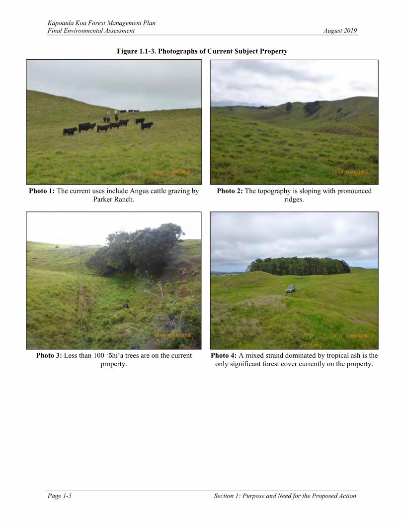
Kapoaula Koa Forest Management Plan Final Environmental Assessment August 2019
Page 1-5 Section 1: Purpose and Need for the Proposed Action
Figure 1.1-3. Photographs of Current Subject Property
Photo 1: The current uses include Angus cattle grazing by
Parker Ranch.
Photo 2: The topography is sloping with pronounced
ridges.
Photo 3: Less than 100 ʻōhiʻa trees are on the current
property.
Photo 4: A mixed strand dominated by tropical ash is the
only significant forest cover currently on the property.

Kapoaula Koa Forest Management Plan Final Environmental Assessment August 2019
Page 1-6 Section 1: Purpose and Need for the Proposed Action
Figure 1.1-4. Photograph of Specialty Instrument-grade Lumber Processing Site
1.1.2 History and Existing Management
The subject property was granted to Prince William Pitt Leleiohoku II of the House of Kalākaua, in 1848 during the division of lands termed the Great Māhele. At the age of 22, Prince William Pitt Leleiohoku II died of rheumatic fever at ‘Iolani Palace (The Pacific Commercial Advertiser, 1877). The subject property was subsequently transferred to John Parker in 1862. In March 2018, Siglo Forest, LLC purchased the subject property from Parker Ranch.
Originally, the subject property was approximately 659 acres. The northwest corner of the subject property was subdivided off in 2004 and sold to Kapoaula Land, LLC to continue the long-standing land use as a gravel quarry. The quarry section (Edwin DeLuz quarry) is approximately 95 acres (see Figure 1.1-1).
The current 564-acre property is under a 20-year agricultural tax dedication that will expire in 2021. To keep the dedication and avoid retroactive taxes, the property must be grazed or forested until the expiration date. Siglo Forest, LLC, the current property owner, would continue to graze cattle until proper permitting and assessments, including this EA, allow for the reforestation of all or part of designated sections with koa and other native vegetation.
Historical records indicate that this entire flank of Mauna Kea was once a dense koa-ʻōhiʻa forest. Gagne and Cuddihy (1990) identify this region as “sub-montane ʻōhiʻa -koa forest.” However, by the 1850s the forest was evidently nearly eliminated and replaced by grazing land. A mid-nineteenth century account reported:
“It is in the memory of many foreigners now living here, when the whole of these plains were covered in a thick wood…where hardly a tree stands for miles…Thousands of old dead trees both standing upright and prostrate, from the present boundaries of these woods, exhibit a mode in which the destruction is effected; for while whilst the old trees die of age, no young ones are seen taking their place, as during the last thirty or forty years, the cattle have eaten or trodden them down.”...“In former times when I was a boy (said Ha’alelea), Waimea was a thickly wooded region all about there…but of late years round about where I lived, it is as cleared of trees as the Esplanade is.”...He explained

Kapoaula Koa Forest Management Plan Final Environmental Assessment August 2019
Page 1-7 Section 1: Purpose and Need for the Proposed Action
that white settlers had felled the trees for fuel and fences for cattle pens and that “a good many of the young trees were destroyed by the cattle.” P.62
“From the nature of the country to the windward of our private lands [Waimea] (a dense forest and almost impenetrable undergrowth covering nearly the whole of it) as the herds increased it became an impossibility to prevent cattle from getting beyond the reach of our control, and gradually they have filled this land with their offspring.” P.188 (Fischer 2015)
John Parker’s original homestead at Mānā was located about 1 mile mauka of the property boundary. An early account of the ranch reported on the koa milling activity in the area:
“It was below the koa forest of Hanaipoi that the saw pits were dug in the land known as Makahalau where the purebred bulls and cows are now penned up. This became the great center for koa work, cutting down trees, selecting the best to be sawn up into lumber through the saw pits, the piling up of koa lumber on hilly ground so that the air could get between the boards and season the wood. There was so much lumber piled up in this section that the natives called the place Paliho‘oukapapa (Hill of piled lumber) (Brennan 1974).”
1.1.3 Document Organization
The EA is organized as follows:
• Section 1 introduces the project, the purpose and need, the environmental regulatory review requirements, and the past and proposed public involvement.
• Section 2 describes the Proposed Action and the No Action Alternative. The owner, Siglo Forest, LLC, does not desire to conduct any other land use; therefore, no other alternatives are proposed.
• Section 3 describes the technical approach to the impact analysis by resource, the existing conditions, and the potential impacts of the Proposed Action on each resource.
• Section 4 summarizes the Proposed Action’s consistency with existing plans and regulations and identifies potential permits and approvals required.
• Section 5 summarizes the determination criteria for Hawai‘i Revised Statutes (HRS) Chapter 343 and summarizes how the project is consistent with the criteria.
• Section 6 is a list of preparers of this document. • Section 7 is a list of references cited in the document.
1.2 Purpose and Need for the Proposed Action
The purpose and need of the Proposed Action is to convert current grazing lands back to native koa-ʻōhiʻa forest. The resulting koa forest will provide a sustainable, long-term, and predictable source of musical instrument-grade wood, produce high-quality wood for other uses, and provide habitat for native species.
1.3 Project Description
A series of management objectives and actions that respond to the purpose and need described above comprise the “action” elements of the FMP (Appendix A). Most of these actions could have either beneficial or adverse effects and thus require examination in this EA. The actions listed below in Section 1.3.2 have been summarized and adapted from Section 5 of the FMP (Appendix A), which contain background and further details.
Kapoaula Koa Forest Management Plan Final Environmental Assessment August 2019
Page 1-8 Section 1: Purpose and Need for the Proposed Action
1.3.1 Overview
Kapoaula was purchased with the intent to create a dedicated, sustainable koa forest for musical instrument-quality wood. Over a 10-year period, this project would plant the entire 553 acres of available land with koa and a range of associated native plants (an additional 11.1 acres are reserved for a specialty instrument-grade lumber processing site and access road). The processing facility is a separate project being undertaken by the property owner and is analyzed as a cumulative impact to the proposed action in this EA. The processing of the wood from the Kapoaula property during operations is analyzed in this EA. The project would combine the production of timber in a plantation format with mixed native forest plantings in less accessible areas. Over time, the surrounding area would be colonized with enrichment species from the mixed forests. This is referred to as the kīpuka restoration strategy in which enriched koa stands extend out and into the adjoining koa plantation stands through bird droppings and natural plant colonization.
Removing cattle from the land and replacing with trees will reduce compaction, erosion, and animal organic wastes and have a positive effect on water quality. Incorporating native species favored by birds and insects would improve wildlife habitat. Planting windbreaks on strategic ridges would reduce the effects of wind distortion on the koa plantings. Historic stock watering ponds would be enhanced with perimeter plantings and predator-proof fencing and traps to improve habitat for migratory and resident waterfowl.
In approximately 30 to 35 years, a selective harvest would be planned that emphasizes tree quality and stand vigor, while also removing useable koa wood. This would cause the natural regeneration of a cohort of koa trees, which would be repeated more or less every 15 years to create a continuity of canopy closure over space and time.
Ideally, this project would encourage others to plant native species. Neighboring property owners are contemplating planting native trees on their DHHL pastoral leaseholds. Such plantings would leverage and expand the positive environmental effects provided by this project.
1.3.1.1 Fence Units
There is active grazing on the property that would be rolled back sequentially as the forest is planted. To keep the grass sward and woody weeds under control and to maintain the land-use designation, cattle would continue to graze the property until it is planted out. For each successive year, a standard 5-foot hogwire fence with a smooth top wire and barbed ground wire would be installed. This would protect each regenerated area from cattle and pigs, protecting both the timber and non-timber species.
In order to minimize wind effects, favorable topography would be exploited in Year 1 through 4, in which hills are used to protect new plantings from the wind while the windbreaks develop stature. Starting in Year 5, plantings would be located behind windbreaks. Table 1.3-1 lists the year, fence length, and acreage of enclosure. Figure 1.3-1 depicts these locations.

Kapoaula Koa Forest Management Plan Final Environmental Assessment August 2019
Page 1-9 Section 1: Purpose and Need for the Proposed Action
Table 1.3-1. Proposed Fence Units
Year Fence (Feet) Acres 1 5,947 53
2 6,173 71
3 5,451 64
4 4,376 60
5 4,890 59
6 3,802 77
7 3,957 70
8 4,408 46
9 5,211 63
Total 44,215 564
1.3.1.2 Forest Management Units
To facilitate field operations, budgeting, and progress reporting, the subject property has been divided into a series of numbered units, called forest management units (FMUs). A unique identifying number would be assigned to each FMU to distinguish the silvicultural regime, year plantings would occur, and sub-unit of yearly plantings. The unique identifying number of each FMU is determined as follows:
The first number indicates the silvicultural regime as follows:
• 1 = koa timber emphasis • 2 = koa with native species mixed forest • 3 = existing non-native trees (ash stand) – special case FMU scheduled for conversion to koa in
Year 8 • 7 = mill site – not part of management plan1.
The second number indicates the year the plantings would occur (Year 1 through 9) and is roughly equivalent to the fence unit. The third number indicates the sub-unit within a specific year’s planting. For example, Unit 242 is a koa mixed species unit planted in Year 4, and it is the second of two similar units. Figure 1.3-2 depicts the FMUs.
1 The specialty instrument-grade processing facility is assessed in this EA and is considered in the cumulative impacts section.

Kapoaula Koa Forest Management Plan Final Environmental Assessment August 2019
Page 1-10 Section 1: Purpose and Need for the Proposed Action
Figure 1.3-1. Fencing

Kapoaula Koa Forest Management Plan Final Environmental Assessment August 2019
Page 1-11 Section 1: Purpose and Need for the Proposed Action
Figure 1.3-2. FMUs

Kapoaula Koa Forest Management Plan Final Environmental Assessment August 2019
Page 1-12 Section 1: Purpose and Need for the Proposed Action
1.3.2 Management Objectives and Actions
To accomplish the koa and other native vegetation re-establishment objectives outlined in the FMP, specific management activities would be implemented on each designated unit as detailed in the following sections.
1.3.2.1 Management Objective 1 – Site Preparation
Goal: Ensure former pasture ground is suitably prepared and cultivated to accept and support koa and other native seedlings. This operation consists of two phases, initial weed control and soil cultivation.
Action – Tree and Shrub Site Preparation: Natural Resources Conservation Science (NRCS) Practice 490
Weed Control
Herbaceous ground cover control would occur before ripping or spot cultivation to increase effectiveness of mechanical treatment and reduce weed competition on planted trees. Two to four months prior to any cultivation, a pre-planting herbicide application to control herbaceous vegetation and grass cover in production planting areas would be carried out using a combined mixture of imazapyr and glyphosate (Roundup). This application would occur in April to May.
Mechanical Site Preparation
The purpose of this practice is to improve site conditions to be suitable for the purposeful establishment of desired trees and shrubs. In the case of Kapoaula, the entire property, except for exposed rocks and cliffs, is densely covered with long established cattle pasture. Because of the history of cattle grazing and associated compaction, deep ripping and bedding or deep spot cultivation would be required to assure that koa roots have a minimally compacted soil profile to penetrate. Depth of this operation should be at least 24 inches and ideally 36 inches to provide for ease of root penetration and enhanced growth.
After the ground cover vegetation has died and begun to decompose, a tractor pulling a long shank ripper and bedding plow (line cultivation) or an excavator equipped with a spot cultivation attachment (“chicken foot”) would be used to prepare planting spots at a spacing of approximately 10 feet by 11 feet and average stem density of 400 spots (trees) per acre for timber stands. On slopes of 20% or greater, where a mixed forest is the objective, stocking would drop to 200 trees per acre, roughly 15 feet by 15 feet. Site preparation should not take place more than two months before first planting, cultivation by either means must prepare soils to a depth of 24 to 36 inches, depending on substrate and operating conditions. Better site preparation would be evident in the medium- and long-term stand performance, where enhanced root penetration results in taller, and more wind-firm trees.
1.3.2.2 Management Objective 2 – Windbreaks
Goal: Protect young seedlings and saplings from occasional high winds, improve stem architecture, and shelter native forest stands from storms.
Action – Windbreak/Shelterbelt Establishment: NRCS Practice 380
The combined factors of regional lack of tree cover, 3,000-foot elevation, and persistent and occasionally gusty trade winds from the east create challenging conditions for minimizing wind stress on young seedlings and saplings. As a fast-growing vertical species, koa is particularly susceptible to deformation and leader damage due to strong winds.
The operational plan is based on installing early koa plantings in those areas already orographically protected from wind (see Figure 1.3-1). Most of the site after fence unit four (Year 5 and after) is quite

Kapoaula Koa Forest Management Plan Final Environmental Assessment August 2019
Page 1-13 Section 1: Purpose and Need for the Proposed Action
exposed to wind. The traditional name for these legendary winds with driving rain is kipu’u pu’u, the name King Kamehameha gave his first in-battle assault soldiers who trained in these harsh conditions.
Minimizing wind stress on young trees can protect plants from wind-related damage and alter the microenvironment to enhance plant growth. Wind protection can be accomplished by planting fast-growing windbreaks on strategic high points and ridge crests. Luckily, the topography of the land seems to run perpendicular to prevailing wind conditions, thus providing a suitable setting for installation of windbreak plantings.
The goal of this plan is to install all windbreak plantings within the first year to develop evolving protection for future plantings as rapidly as possible, certainly by Year 5. In addition, as protected koa plantings become established, they would provide some additional protection for subsequent plantings. They would be planted in three rows with one species per row. Rows would be 10 feet apart and trees would be 20 feet apart along the row. Trees would be arranged so as to alternate with each other.
Windbreak/shelterbelt species by row, from shortest to tallest, from east to west row:
• Podocarpus (Podocarpus gracilior) – Wind Resource Assessment (WRA) 0 low windbreak, medium growth rate
• Tallow-wood (Eucalyptus microcorys) – WRA 1 or blood-leaf gum (Eucalyptus torelliana) – WRA 4 medium windbreak, fast growth
• Norfolk Island Pine (Araucaria heterophylla) – WRA -5 tall windbreak, medium growth rate or Chinese fir (Cunninghamii lanceolata) – no WRA available
The State of Hawai‘i or federal government does not consider any of these windbreak trees invasive or noxious species.2
Rule of thumb calculations for windbreaks indicate a wind protection distance of 10 times the height of mature trees. As shown in Figure 1.3-2, ridge crest planting locations would, over time, provide shelter for the entire site, assuming the Norfolk Island pine and the blood-leaf gum plantings reach a height of 100 feet or more after the first 20 years of establishment.
2 The windbreak species are not contained on the official State of Hawai‘i or federal noxious species lists (https://plants.usda.gov/java/noxious?rptType=State&statefips=15; https://plants.usda.gov/java/noxious). They are also not noted as invasive on the Hawai‘i Invasive Species Council’s list of invasive species (http://dlnr.hawaii.gov/hisc/info/invasive-species-profiles/). However, according to the Hawai‘i Invasive Species Council: “The federal and state definitions for “invasive species” are broad, non-regulatory terms that describe any non-native species that causes or could cause harm to agriculture, natural resources, economy, or human health. In Hawai‘i, there are thousands of species that fit this broad definition of ‘invasive species. There is currently no regulatory list of “invasive species” in Hawai‘i. The Hawai‘i Invasive Species Council is in the process of developing administrative rules that would describe a small subset of species for which control and eradication over a large geographic area are still possible.” Forest Solutions Inc. has determined based on field knowledge and invasive species profiles that these specified windbreak species are not likely to be invasive.

Kapoaula Koa Forest Management Plan Final Environmental Assessment August 2019
Page 1-14 Section 1: Purpose and Need for the Proposed Action
1.3.2.3 Management Objective 3 – Fencing
Goal: Exclude domesticated, feral and non-native mammals from the reestablished native forest.
Actions – Fence: NRCS Practice 382
Cattle
The property has been a cattle ranch since the mid-nineteenth century. The property is surrounded by perimeter fencing consisting of five-strand barbed wire. Some sections of the fence are adequate, but some of the sections are in need of repair. One of the conditions of purchase agreed upon in early 2018 was that Parker Ranch can continue to graze cattle on those sections of the property not yet scheduled for afforestation. On the three sides of the property not fronting the Māmalahoa Highway, DHHL pastoral lessees run cattle and horses in various conditions of husbandry. Exclusion of cattle is a fundamental requirement for successful koa forest re-generation (see Table 1.3-1).
Investment in a koa forest at this scale would require the highest level of protection from cattle or sheep. Small herds of black feral pigs (Sus scrofa) have been occasionally observed during site visits. To protect the investment in select growing stock and especially sensitive native understory species, pigs must also be excluded from the planting.
A perimeter 5-foot hogwire fence with smooth wire for stability on the top and barbed wire at ground level (outside) to deter pig grubbing would be installed in each fence unit (see Figure 1.3-1). This fence would also serve to exclude neighboring cattle. Every year or more frequently fences would be inspected and maintained if needed. A formal maintenance entry is planned starting in Year 5 (four years after installation), including tightening wires, fixing loose sections and re-staking sections that have come loose.
Cattle are an essential management tool to execute this reforestation stewardship plan. They keep pasture grasses and invasive woody species, especially tropical ash (Fraxinus uhdei), sourbush (Pluchea carolinensis), guava (Psidium guajava), and strawberry guava (Psidium cattleianum) under control until a unit is scheduled for site preparation and planting. An essential and critical protection aspect for this significant investment is a system of cross fencing to create paddocks that securely contains cattle from temptation grazing on adjacent koa saplings.
As each subsequent pasture unit is converted to koa forest, cattle would be replaced by native vegetation. At the end of this 10-year plan, all cattle would be eliminated from the property and a permanent fencing system would be in place to localize, contain, and minimize any potential cattle trespass that might occur from adjacent pastoral leasehold herds.
Other Mammals
Signs of several deleterious mammals have been noted during site visits, particularly around and near the open stock watering ponds. These include rats (Rattus rattus and possibly R. norvegicus), feral pigs, mongoose (Herpestes javanicus), and cats (Felis catus) it is likely that domestic or feral dogs (Canis lupus familiaris) also visit the ponds.
Three of these species do not represent, at this time, a threat to the forest restoration objective of this project. Pigs uproot tender seedlings, and rats occasionally chew bark on koa trees.
The long-term objective of a restored koa-ʻōhiʻa forest means that, over time, there would be an increase in native bird habitat, which may, in the future, be affected by the presence of rats and cats. Rats eat tree fruits and seeds as well as eggs and nestlings. Cats eat birds at various life stages. As native forest areas

Kapoaula Koa Forest Management Plan Final Environmental Assessment August 2019
Page 1-15 Section 1: Purpose and Need for the Proposed Action
are restored and enriched during the course of this project, invasive animal control protocols may be necessary.
Recent experience in New Zealand and in Hawaiʻi with “good nature” traps have shown great success in controlling rodent and cat damage. These traps use a carbon dioxide cylinder to power a strike bolt that instantly kills animals attracted to the bait. The design allows for upwards of 12 kills/trap before requiring re-arming. As native and migratory birds begin to frequent the property, vector control would be used to reduce the population of these mammals to promote a safe haven for nesting and foraging. In addition it may be prudent to incorporate this control feature on the high-value, select “elite” seedlings planting sites to avoid bark damage by rats.
Due to the low cost, location specificity and iterative nature of vector control, this is included under the monitoring and not separated as a budget item in this management plan. Most of the cost, as with other monitoring activities, is in the technician time needed to get the work done.
1.3.2.4 Management Objective 4– Tree/Shrub Establishment
Goal: Re-establish a koa-dominant forest with ʻōhiʻa and associated native understory on land historically managed as cattle pasture.
Actions – Tree/Shrub Establishment: NRCS Practice 612
Hand planting would be carried out using a tree spade or dibble as appropriate for the available nursery stock. Soil surface should be perforated to a depth slightly greater than the length of the seedling stock and the seedling should be placed into this hole. The root collar should be marginally lower than the level of the soil between 0.125 to 0.25 inch with the root mass oriented vertically so the tip of the root does not bend outward (“J-rooting”). Soil is then compacted lightly around the root system. Subsequent silvicultural activities would include fertilizer application, competition control, timber stand improvement (pruning), and native species enhancement.
Koa and mixed forest plantings would be planted at the same time, the only difference being their spatial arrangement and seedling count. Mixed forest stands, as their name implies should be a mix of species across the area, not a patchwork of monotypic stands. Table 1.3-2 lists the stand stocking type and relative area by each stand type.
Table 1.3-2. Summary of Stocking by Stand Type and Relative Area Occupied by each Stand Type
Type Description Seedling/Acre Acres Koa Other
1 Timber 350 50 385 2 Restoration 125 75 148 3 Timber (ash)* 650 50 15
Note: *Higher number to overcrowd out other reproducing ash.
Seedlings and Seed Sourcing
Seeds need to be collected in advance to allow adequate time for growth in the nursery setting. There are very limited supplies of ʻōhiʻa on the property and no koa. Therefore, seedlings would be grown from collected seed supplies with first preference for the Waimea area followed by upper elevations in Hāmākua and then Kaʻū. However, due to historic forest clearing, there is an extremely limited gene pool of koa growing at elevations lower than 4,000 feet on the Big Island.

Kapoaula Koa Forest Management Plan Final Environmental Assessment August 2019
Page 1-16 Section 1: Purpose and Need for the Proposed Action
Paniolo Forestry, LLC currently has a working relationship with Native Nursery on Maui, who could supply most of the seedlings. Additionally, seedlings may be sourced from the State Tree Nursery in Kamuela, the local charter school, Kanu o ka ʻĀina or other nurseries in Hawai‘i.
Koa seed procurement strategy is to keep sources as local (island of Hawai‘i) as possible. There are several reasons for this: increased project flexibility by having a stable source of seedlings, safeguarding against outside pathogen spread (especially Rapid ʻŌhiʻa Death), promoting genetically conserved adaptations to local conditions, and introducing volunteers to this aspect of forestry. However, the laudable objective of using locally sourced seedlings must not come at the expense of achieving overall forest management goals. Because the overall project goal is to produce the highest quality koa wood with desirable characteristics, seed sources from other islands may also be included into yearly plantings to ensure as robust a genetic base as possible.
In addition, working relationships with Haleakalā Ranch and Kamehameha Schools have generated propagation material from selected “elite” lines of koa, which show desired and valuable characteristics such as figure, color, and vertical form. The Haleakalā stock was originally propagated from island of Hawai‘i seed stock 32 years ago. These selected lines of improved planting stock would be planted in identified highest quality growing areas for propagation purposes. One or several seed orchards are contemplated as part of this project to capture and track the progress of these elite genetic sources.
Seedling size would necessarily depend on the species in question. Pioneer species such as koa would be 10 to 12 inches in height with a small dibble pot size of 4 to 6 cubic inches, which is sufficient for a more aggressive species.
Enrichment and enclosure species would be 8 to 16 inches in height in a small to medium pot of 12 to 31 cubic inches, with the objective of providing an older, more robust seedling for these more sensitive species. At least nine months should be allowed for māmane (Sophora chrysophylla) and ʻōhiʻa seedlings; six months for maile (Alyxia stellata), ‘ōlapa (Cheirodendron trigynum) and pilo (Capparis sandwichiana) seedlings; and three to four months for koa seedlings.
Koa Plantings
Koa and aʻaliʻi (Dodonaea viscosa) seedlings would be planted three to six months after weed control and site preparation. The planting sequence would begin with spot cultivation of planting sites for individual seedlings. Approximately 10 foot by 11 foot spacing would yield the target 400 spots per acre, of which 350 are for koa and 50 are for aʻaliʻi, mixed. However, natural variations in site would result in densities that are slightly higher or lower than the target.
Each koa or aʻaliʻi seedling would then be manually planted along the line or in the prepared hole. Hand planting crews would use a tree spade or dibble as appropriate for the nursery stock. Mechanical site preparation facilitates planting, and it is expected that planting rates would exceed 800 trees per day on flatter ground (less than 20% slope). Production would drop to 500 trees per day on sloping soil and 200 per day in areas where machine site preparation is not possible and hand preparation would be needed.
Standard planting techniques would be followed, with planting holes dug to the depth of the seedling root stock, root collars buried marginally lower than the level of the soil, and all seedlings oriented vertically. After seedlings are placed in the ground, loose soil would be firmly packed around the roots to bring the root collar level with the soil surface.
Mixed Forest Plantings (Kīpuka Enrichment Planting)
At this time, the only significant native vegetation on the property are scattered ʻōhiʻa, found mostly on cliff faces and steep, rocky areas. Given the history of Parker Ranch pasture management and grazing for

Kapoaula Koa Forest Management Plan Final Environmental Assessment August 2019
Page 1-17 Section 1: Purpose and Need for the Proposed Action
over 150 years, it is assumed that seed sources for native understory plants would be non-existent, thereby requiring use of seedlings for enrichment species.
The goal for enrichment species establishment is a net average of 75 trees per acre on those units with slope greater than 20%. Koa would be used as a pioneer species to carry the stand and provide initial cover, planted at a density of 125 trees per acre.
The focus is to initiate a trajectory of recovery to re-create the native forest that once stood on this land, thereby providing habitat for native species and improving the overall environmental quality of the property, including aquifer recharge, and erosion control. These ridge units would effectively serve as “kīpukas”, islands of native vegetation, which, slowly, over time, would provide seed sources and spread throughout the site.
The following list of proposed enrichment species is representative, in order of planned abundance, other species would also be utilized as appropriate for the site and as available.
• ‘Ōhi‘a • A‘ali‘i • Māmaki (Pipturus albidus) • ‘Ōlapa • Kōlea (Myrsine lessertiana) • ‘I‘o nui (Dryopteris wallichiana) • ‘Ōhelo (Vaccinium calycinum) • Hō‘awa (Pittosporum glabrum) • Pilo • Ulei (Osteomeles anthyllidifolia) • Maile • ‘Ie‘ie (Freycinetia arborea) • Hāpu‘u pulu (Cibotium glaucum) • Hāpu‘u i‘i (Cibotium menziesii) • ‘Iliahi (Santalum paniculatum)
1.3.2.5 Management Objective 5 – Nutrient Management
Goal: Provide koa and other seedlings with nutrient inputs to ensure health and productivity while minimizing non-point pollution of surface and groundwater.
Actions – Nutrient Management: NRCS Practice 590
Long-term grazing has likely reduced soil fertility in this area. Post-planting fertilizer application reduces the future weed control burden by helping seedlings to grow more quickly to heights at which weed competition is less intense. Application using controlled release fertilizer (CRF) would minimize movement of nutrients and other potential contaminants to surface and/or groundwater.
At planting, a crown fertilizer treatment assists with early seedling growth and development, and would consist of a 4-ounce dose of high phosphate (11-52-00 or similar) CRF distributed evenly within a 12-inch diameter area centered on the seedling stem or on slopes in a half-moon shape on the uphill side of the seedling. The property is located in a high-rainfall area (70 inches or more per year), so nutrient leaching is a concern, which is partially mitigated by the use of CRF fertilizers.

Kapoaula Koa Forest Management Plan Final Environmental Assessment August 2019
Page 1-18 Section 1: Purpose and Need for the Proposed Action
If in the unlikely event that a second application is needed, the crown application would be 6 ounces per seedling of 11-52-0 with micronutrients or other high-phosphate, low potash mix with micronutrients at 6 ounces per seedling CRF.
1.3.2.6 Management Objective 6 – Weed Control
Goal: Control herbaceous weed competition until canopy closure and establishment of trees and shrubs.
Actions – Herbaceous Weed Control: NRCS Practice 315
Creating a “new” koa forest on previously pastured and grazed land would require significant inputs of weed control agents to ensure the successful survival and health of the newly-planted seedlings. Site preparation activities would temporarily diminish competitive herbaceous weed pressure through chemical and mechanical means. However, in the months following planting, there would be inevitable recurrence of resident grasses that would need attention.
For timber stands, a single weed control (aside from that applied during site preparation) application would be used. For mixed species restoration stands, which feature lower stocking and slower growing species, two entries would be used in the first year. All stands would receive two further entries during the integrated pest management (IPM) applications, which also include control of psyllids, anticipated for the second and third years.
Selective or broad-spectrum herbicides, depending on actual weed pressure would be used as needed for post-planting competition control until trees are two years old or until the canopy has closed. Grasses would be the main targets for this operation; annual herbaceous species such as bull thistle (Cirsium vulgare) and fireweed (Senecio madagascariensis) in moderate numbers are not as damaging to young seedlings. A manual spot treatment is an option for outbreaks of broadleaf weeds in early development stage (less than 10 feet in height).
Because of the history of pasture management, the dominant weed species on site are grasses. Herbicides with grass-specific modes of action may, therefore, be applied over the entire planting area. These compounds do not affect broadleaf biochemistry and are thus safe to use without chemical barriers around seedlings. Examples of these grass-specific herbicides are fluazipop (Fusillade DX) and quizalofop (Assure II).
Monitoring would reveal which particular weed species have emerged and would be used to determine the precise formula to control weeds. Depending on the weed species composition, other herbicides that may be applied include Streamline (aminocyclopyrachlor), Polaris AC (imazapyr), Element 4 (triclopyr), Roundup PowerMax (glyphosate), and Escort (metsulfuron methyl). All label regulations would be observed for broadcast or spot treatments as appropriate.
Due to a public comment received during the Draft Environmental Assessment review period, the following paragraph has been added to the Final Environmental Assessment to expound upon the use of these herbicides. Both Fusillade (Fluazifop-P-butyl) and Assure (Quizalofop-p-ethyl) are grass-specific herbicides applied at low rates once per year during the second and third year of tree planting together with an insecticide to reduce the population of the acacia psyllid (Psylla uncatoides). These two applications are the only expected use of these products in the tree planting project life of 50-60 years. Fusillade, in particular, is widely used by conservation groups to maintain native plant cover precisely because most native plants, being broadleaves, are not affected. At the same time, non-native and aggressive pasture grasses are the largest threat to an incipient tree-planting project.

Kapoaula Koa Forest Management Plan Final Environmental Assessment August 2019
Page 1-19 Section 1: Purpose and Need for the Proposed Action
1.3.2.7 Management Objective 7 – Integrated Pest Management
Goal: Protect growing koa trees with timely and effective treatment of insects and pathogens.
Actions – Forest Stand Improvement: NRCS Practice 666
Maintaining healthy trees is the first and best defense against pests and pathogens, but some level of disease or pest infestation may be unavoidable even in healthy plantings. Stand management is best accomplished in the context of an IPM approach to dealing with pests and pathogens. The IPM framework involves three sequential assessments, (1) monitoring potential pest agents, (2) identifying threshold densities or populations at which pests cause unacceptable economic damage, and (3) identifying and applying the most effective control agent.
To control insect pests using IPM, the first step is to identify potential pest species. This requires a monitoring program that can take on varying degrees of sophistication. When damaging levels of the pest are discovered, the first option for control methods is typically a pheromone-based trapping system or adhesive traps. Chemical insecticides are used if control is impossible with more benign methods.
Likely insect pests on koa include the acacia psyllid (Acizzia uncotoides), a non-native sap-sucking insect, the koa moth (Scotorythra paludicola), a native defoliating insect, and the koa borer (Xylosandrus compactus).
Psyllid infestations may threaten performance of entire stands by feeding on growing tips and causing extreme branching in the following growth phase. Koa is attacked by psyllids in the second year after planting. This causes stunting and loss of apical dominance, with concomitant branchiness. The forest health practice here is to use IPM techniques to reduce the psyllid population during the critical spring time of Year 2 and 3. Koa moth is usually constrained to a few individuals in a given stand.
Chemical options for controlling the psyllid include dinotefuran (Safari 20 SG) or spirotetramat (Movento), both of which have labeling appropriate or adaptable to use in koa plantings on Hawai‘i island. The koa moth may also respond to these treatments, although such a use is not explicitly defined for Movento.
A combined treatment, utilizing one of the agents above plus a grass-control herbicide would be applied in the spring of the second and third year using helicopter as an application method. This is an extremely cost-effective way to reduce pest presence and reduce pressure from grasses in the understory. The application would be used in both koa and mixed forest stands. This application would be minimized to approximately 150-acres, occur 1 time per year; or approximately 10 hours per year limited to the forest establishment period (approximately 9 years).
Due to a public comment received during the Draft Environmental Assessment review period, the following paragraphs have been added to the Final Environmental Assessment to compare alternative methods for aerial spraying.
Alternatives
Alternatives for use of these herbicides on grasses include motor-manual and manual methods of control. Terrain conditions, although favorable for forestry, are not smooth enough to use traditional agricultural tractor-drawn mowing equipment. Motor-manual control of grasses involves the use of weed-eaters or string-trimmers by field personnel, while the manual method involves direct pulling or cutting of grasses with non-mechanized hand tools. The motor-manual method imposes an additional challenge of damaging the bark on young trees by the inadvertent contact of the strings with the stem, either girdling or severing the sapling.

Kapoaula Koa Forest Management Plan Final Environmental Assessment August 2019
Page 1-20 Section 1: Purpose and Need for the Proposed Action
Costs for motor-manual control (weed eater) include a twice per year mowing at a cost of $291 per acre per entry, $582 per year. For the two years contemplated, the mowing would result in a total cost of $1,082 per acre. Manual control, or pulling of weeds, is seldom practiced at this scale, yet experience at smaller scale projects indicates a per-entry cost of $540 per acre per entry with a similar sequence of entries totaling $2,160 per acre for the two years. Helicopter application, by contrast, aerial application results in an annual cost of $73.24 per acre, for a total of $146.48 for the two-year period. In summary, the manual options result in a cost increase of between 10x and 20x relative to chemical means.
Neither of these operations deals with the acacia psyllid, a non-native insect pathogen that was introduced in the second half of the 20th century. The acacia psyllid, at high population levels, results in the mortality of the growing tips (meristems) of the koa trees. This, in turn, results in branchy, poorly formed trees and reduced vigor, both of which negate the very reason for the project as a sustainable timber production from a planted native forest. The control of psyllids has been effective using a single application per year of a neonicotinoid pesticide in years 2 and 3 to reduce the population to acceptable levels. The ground based alternative here control of which would require either a separate manual entry with high-pressure ground equipment. Aside from cost, this operation needlessly exposes workers to overhead application of insect control pesticides, which is not reasonable given the availability of safer alternatives.
1.3.2.8 Management Objective 8 – Pruning and Singling
Goal: Improve the stem form, quality, and value of planted koa stems through judicious and timely stem correction.
Actions – Tree/Shrub Pruning: NRCS Practice 660
Koa has poor apical dominance which results in heavy branching, control of which would require several entries for both singling in Year 1 (removal of competing leaders to favor only a single growing tip) and pruning (removal of lateral branches up to a height of 6 to 8 feet).
Koa shows a strong tendency to branch and fork even when grown at relatively high stem densities. At the planting geometries prescribed herein, pruning and singling treatments would be necessary to enhance form and growth rates. The singling operation (pruning to a dominant leader) should occur when trees first begin to show evidence of competing leaders. The most vigorous leader should be promoted by cutting the inferior leader tips back by a third of their length. This operation usually occurs between 10 and 15 months of age.
At a point between 14 and 20 months, depending on growth performance, the first pruning treatment would likely be required. Lower branches should be pruned up to a height of approximately 50% to 65% of the crown depth, with the smaller percentage crown depth removed from unhealthy/shorter trees, and the larger percentage from healthy/taller trees. Branches must be pruned when their basal diameter is less than 0.5 inch. Depending on growth rates, a second pruning entry may be required after 24 months of age.
A third pruning after 24 months of age is not included in the budget tables for this management plan due to the uncertainty of its need. This treatment should be used only if additional clear wood height is needed and comes at a relatively nominal cost per entry.
The final objective should be to yield an expanse of tree trunk free of branches for at least 8 to 10 feet above the ground. Subsequent entries scheduled as necessary according to tree growth rates. Pruning should result in koa trees with no lower branches to interfere with clear wood growth.
1.3.2.9 Management Objective 9 – Ash Stand Replacement (Year 8)
Goal: Replace existing tropical ash stand and regenerate a new koa forest.

Kapoaula Koa Forest Management Plan Final Environmental Assessment August 2019
Page 1-21 Section 1: Purpose and Need for the Proposed Action
Actions – Site Preparation: NRCS Practice 460; Brush Management: NRCS Practice 314
The ash stand is approximately 80 years old (estimated planting date in 1930’s by Civilian Conservation Corps) and apparently has never been thinned or managed in any active way. The impressive height of these existing trees is evidence of the site’s productivity for timber production and one of the reasons for the acquisition of this property. Tropical ash is a known invasive species. Evidence of prolific volunteer re-generation is evident on the forest floor, kept in check by constant cattle presence.
As these cattle transition off the property in coordination with koa plantings on successive units, herbicide applications would be necessary to control the spread of volunteer starts. The location of this stand provides an advantageous existing windbreak for that portion of the property directly to the west.
The ash stand is also a significant amenity on the property, providing shade and shelter from wind and rain for visitors and a windbreak for young saplings in Year 1 and 2. Until other components are established on site, retaining a portion of this grove is desirable. However, the grove would increasingly become a nuisance as cattle are removed and more seedlings begin to germinate inside the koa and mixed forest planted stands. Therefore, it must be removed.
As discussed in Section 1.1.1, plans for the property call for a small, specialty instrument-grade lumber processing facility (permit applications in process) that would be able to mill materials from off-site as well as this initial harvest and would be capable of milling the final harvest of the residual stand. Final harvest of these trees and subsequent conversion to a koa stand would occur in Year 8 (see Figure 1.1-2 for specialty instrument-grade processing facility site location).
The conversion of an ash stand to koa is no small feat, thus the following measures are to be used, based on experience of converting such stands in Hōnaunau Forest in 2005-2010:
1. Site preparation (ash only): remove all remaining standing trees and treat (with imazapyr) or remove stumps. Preferably keep stumps in place to avoid soil disturbance. a. Clear brush into windrows no less than 200 feet apart in neat stacks so that they block the
wind 2. Brush management: Treat seedlings and sprouting root fragments with imazapyr or Garlon 3A/4 3. Plant stands at a high 700 koa seedlings/acre to promote rapid site occupation and shading 4. Control weeds (ash seedlings) a second time in Year 1 using imazapyr at low rates with
glyphosate
Controlling ash is a necessary step for the long-term integrity of the forest and surrounding properties. Ash is very susceptible to imazapyr, however koa is less susceptible. This single factor, combined with high stocking, would assist the conversion of this stand from the aggressive ash seedlings to koa. Ash seeds only last 2 to 3 years in the ground, so the weed pressure would be short-term.
1.3.2.10 Management Objective 10 – Monitoring
Goal: Actively monitor and adaptively manage silvicultural activities and their results and incorporate this information into future management decisions. Monitor and control vectors if these are preying upon forest birds.
Actions – Access Control: NRCS Practice 472; and Upland Wildlife Habitat Management: NRCS Practice 643
A critical element of forest management is an active and effective monitoring program. Monitoring would take place in three areas every year, using the following practices:
1. Monitor integrity of fences and gates, fix as necessary to maintain pig and cattle exclusion

Kapoaula Koa Forest Management Plan Final Environmental Assessment August 2019
Page 1-22 Section 1: Purpose and Need for the Proposed Action
2. Growth and yield of production koa plantings – establish two permanent sample plots of eight to ten trees each for annual measurements, ideally these are circular, using variable area or a fixed area approach. In the first two years, tree height and survival would be the two data categories. Once trees reach sufficient size to have a measurable diameter at 3.6 feet above the ground, diameter would also be recorded. Data analysis would follow standard statistical methods to quantify koa growth rates and projected timber yields, as well as evolving species composition of the restored forest.
3. Record sign of deleterious mammals near water bodies, consider deployment of control measures if these are affecting native or migratory birds.
1.4 Environmental Assessment Process
This EA was prepared in accordance with Chapter 343 of the HRS. Chapter 343, HRS, along with its implementing regulations, Title 11, Chapter 200.1, of the Hawai‘i Administrative Rules (HAR), is the basis for the environmental impact assessment process in the State of Hawai‘i. Board of Land and Natural Resources approval is required to finalize the FMP and provide funding for implementation of the proposed action through a Forest Stewardship Agreement (Chapter 195F, HRS).
An EA is prepared to determine impacts associated with an action, to develop mitigation measures for adverse impacts, and to determine whether any of the impacts are significant according to thirteen specific criteria. Use of state funding is among the criteria in HRS Chapter 343 that trigger the need for a state EA. Part 4 of this document states the finding (anticipated in the Draft EA) that no significant impacts are expected to occur, and Part 5 lists each criterion and presents the findings by the approving agency. If approving agency finds after considering comments to the Draft EA that no significant impacts would be expected to occur, then it issues a Finding of No Significant Impact (FONSI), and the action would be permitted to occur. If the agency concludes that significant impacts are expected to occur as a result of the Proposed Action, then it determines that an Environmental Impact Statement must be prepared for the action to proceed.
The goal of this EA is to ensure that comprehensive and systematic consideration is given to potential environmental impacts that may result from implementing the Proposed Action, or any reasonable alternative action, upon the natural, man-made, or social environment. Information presented in this EA would result in either a FONSI, preparation of an Environmental Impact Statement, or no action on the proposal.
1.5 Public Involvement and Agency Coordination
Public involvement is an important component of the EA development process as a means to:
• accurately assess the scope of the EA • identify resources and issues of concern • disclose potential impacts • develop mitigation measures • inform minority and disadvantaged populations • coordinate with regulatory agencies • refine project design
Public outreach has been conducted through formal early consultation letters, informal meetings, and communications with parties who have inquired about the project. The following agencies, organizations and individuals were contacted by mail, email, or phone. Those with whom the team conducted presentations, attended meetings, or had interviews are indicated by an asterisk:

Kapoaula Koa Forest Management Plan Final Environmental Assessment August 2019
Page 1-23 Section 1: Purpose and Need for the Proposed Action
Individuals and Organizations:
• Cory Harden for Sierra Club • Dahana Ranch • Elizabeth B. Camara • Glenn Bertelmann • Hawaiian Cultural Center of Hāmākua • Irene L. Fergerstrom • Jolette A. Rapozo Trust • Kalawaianui, Pa‘akaula Kalawaianui, Ku‘uipo‘okala Ka‘aihue, Micah • Kapoaula Land, LLC • Mālama Hāmākua* • Pamela Jean Ramos • Paul, David, and Cindy Lou Andrade • Paula Iwalani Boteilho • Parker Ranch Mauna Kea, LLC • Walter L. Puhi Jr. • Yvonne L. K. Deluz
County Agencies and Officials:
• Civil Defense Agency • District 1, County Councilmember Valerie T. Poindexter • Department of Environmental Management • Department of Public Works • Fire Department • Planning Department • Police Department
State Agencies and Officials:
• Department of Health (DOH), Environmental Planning Office • Department of Land and Natural Resources (DLNR) • Office of Hawaiian Affairs
Early EA consultation letters were distributed to the above via mail or email. Responses to the consultation letters were received from Department of Environmental Management, Department of Public Works, and the Hawai‘i Police Department. The early EA consultation letter and responses to the consultation letters are provided in Appendix E. On February 24, 2019, the organization Mālama Hāmākua held a community outreach event and invited the EA preparers to attend. Cardno representative Kerry Kylene Wells and Forest Solutions representative William Rice attended the event that was announced via social media.
The event was held on a Sunday from 5:00 p.m. to 8:00 p.m. The event consisted of an open house format with one topography poster of the subject property on display, the early EA consult letter and the FMP for perusal, and the two EA preparers present to orient attendees and answer questions. Almost 50 Hāmākua residents and others from around the island attended the meeting. Most individuals had general positive comments about the project. Several individuals mentioned the request to volunteer to assist in tree plantings on the subject property.
Copies of written communications received in response to early consultation efforts are included in Appendix E1. Appendix E2 contains written comments on the Draft EA and the responses to these

Kapoaula Koa Forest Management Plan Final Environmental Assessment August 2019
Page 1-24 Section 1: Purpose and Need for the Proposed Action
comments. Various places in the EA have been modified to reflect input received in the comment letters; additional or modified non-procedural text is denoted by underlines, as in this paragraph.

Kapoaula Koa Forest Management Plan Final Environmental Assessment August 2019
Page 2-1 Section 2: Proposed Action
SECTION 2 PROPOSED ACTION AND ALTERNATIVES
2.1 No Action Alternative
Under the No Action Alternative, the suite of actions described in the Kapoaula FMP would not be undertaken. General management would continue under the status quo and the property would potentially remain as a grazing area for cattle. The no action alternative does not meet the purpose for acquisition but provides a useful baseline by which to compare environmental effects from the project.
2.2 Action Alternatives
As described in Section 1.1.1 of this EA, the Proposed Action is the preferred alternative and environmental effects are examined based upon implementation of the FMP.
Siglo Forest, LLC acquired the 564-acre Kapoaula property from Parker Ranch for the purposes of planting, managing, and harvesting koa trees. This will convert pastureland back to a semblance of the native koa-ʻōhiʻa forest that once stood in this area and provide controlled future uses of the forest for commercial products. Forest Solutions Inc. has authored a site-specific FMP for the area, which is provided in this document as Appendix A. The FMP was reviewed and recommended for state approval by the State Forest Stewardship Advisory Committee in October 2018. Through implementation of the site-specific FMP, in approximately 50 years, the property would consist of a mixed-species native forest with steep sloped areas primarily for native species conservation and less steeply sloped, less erodible primarily used for timber production. The resulting koa forest would provide a sustainable, long-term, predictable source of instrument-grade wood, produce high-quality wood for other uses, and provide habitat for native species, inspiring others to plant trees on their land for similar purposes. The objectives are as follows:
• Reforest the entire property with koa and a complement of associated native forest plants • Improve the quality of wood to be harvested in the future by:
o planting seed from known, high-quality sources o utilizing cuttings propagated from trees identified as having superior color, figure, and form
• Intensively manage koa for saw timber on those areas of the property with slopes less than 20% – accounting for 70% of the property or 390 acres
• Reforest the remaining upland areas with a multi-species native forest, utilizing koa as a pioneer species – accounting for 30% of the area or 163 acres
• Protect planted forest from wind by planting fast-growing, cattle resistant windbreaks • Specialty instrument-grade lumber processing of koa from Kapoaula to be completed onsite
A small, specialty instrument-grade lumber processing facility (permit applications in process) is also being developed in the lowest part of the property near the road onsite (see Figures 1.1-2 and 1.1-4). The processing facility for specialty lumber from other areas of the island is a separate project being undertaken by the property owner and is analyzed as a cumulative impact to the proposed action in this EA. The processing of the wood during operations is analyzed in this EA.

Kapoaula Koa Forest Management Plan Final Environmental Assessment August 2019
Page 2-2 Section 2: Proposed Action
This page intentionally left blank.

Kapoaula Koa Forest Management Plan Final Environmental Assessment August 2019
Page 3-1 Section 3: Affected Environment and Potential Impacts
SECTION 3 AFFECTED ENVIRONMENT AND POTENTIAL IMPACTS
This section defines the environmental resources, technical approach to analysis, existing resource conditions and potential impacts due to the Proposed Action, including the No Action Alternative. The potential impacts of construction (short-term) and operations (long-term), and direct and indirect impacts are considered. Indirect impacts are defined in HAR 11-200-2 as “effects which are caused by the action and are later in time or farther removed in distance, but are still reasonably foreseeable.” Indirect effects could include induced changes in the pattern of land use and related effects on air and water and other natural systems. Cumulative impacts of the action alternative are assessed in Section 3.12. Section 5.2 summarizes the Hawai‘i Environmental Policy Act significance criteria and the lead/approving agencies determinations.
The FMP identified seven resource concerns. These concerns are common to pasture areas in Hawai‘i. They are ranked, with EA analysis section in parentheses:
1. Soil erosion and soil compaction (Geology, Topography, and Soils) 2. Undesirable air movement (Air Quality) 3. Water quality and excess sediment (Water Resources) 4. Insufficient flow in watercourses (Water Resources) 5. Hydrologic cycle: capture and storage of rainfall (Water Resources) 6. Threatened and endangered species (Biological Resources) 7. Inadequate cover and food for wildlife (Climate Change)
These concerns are analyzed in this EA, along with noise, scenic, hazardous materials, cultural and archaeological, roads/traffic, utilities/public facilities and services, and cumulative resource impacts. Additionally, a comprehensive Biological Assessment is included as Appendix B, and an Archaeological Assessment Survey and a Cultural Impact Assessment are included as Appendix C1 and C2, respectively.
3.1 Geology, Topography, and Soils
Geology describes the characteristics of surface and subsurface materials that make up land. These characteristics include stability, slope, compatibility, shear strength, and productivity. Soil characteristics determine the ability of the ground to support structures and facilities and determine the likelihood of erosion and run-off. Topography describes surface features of an area and is usually described with respect to elevation, slope, aspect, and landforms.
3.1.1 Technical Approach
3.1.1.1 Area of Potential Effect
The area of potential effect (APE) would be the area of ground disturbance for construction and operation of the Proposed Action and adjacent areas.
3.1.2 Existing Conditions
The elevation of the property ranges from approximately 2,740 feet to 3,180 feet above sea level (Figure 3.1-1). The overall average slope of the property is 5%, with numerous intermittent steep hills and ridges with slopes as steep as 100%. Geologically, the property is located on the flanks of Mauna Kea volcano lava flows that erupted from 14,000 to 250,000 years before the present (Wolfe and Morris 1996). All lava flows are mantled with a thick layer of volcanic ash derived from Kohala and Mauna Kea volcanoes (United States [U.S.] Geological Survey [USGS]-Hawaiian Volcanoes Observatory: 2009). The resulting

Kapoaula Koa Forest Management Plan Final Environmental Assessment August 2019
Page 3-2 Section 3: Affected Environment and Potential Impacts
ash-derived soils of the Hāmākua coast were the basis for highly productive farming and/or grazing from early Hawaiian times until today.
Soils on the property are classified by the U.S. Natural Resources Conservation Service (formerly Soil Conservation Service) as Honoka‘a silty clay loam in the lower elevations and Maile silt loam in upper elevations (Figure 3.1-2). The Honoka‘a series consists of deep, well-drained soil that formed in basic volcanic ash. It is found on mid-elevation, windward slopes of Mauna Kea with slopes ranging from 0 to 35%, and it is potentially highly erodible. Maile silt loam is a very deep, well-drained soil that formed in basic volcanic ash over ‘a‘a lava flows. It is found at mid-elevations on the windward slopes of Mauna Kea and has slopes of 0 to 20%. It is not highly erodible. Both soils are used principally for pasture and timber plantations, although some areas of native forest remain (U.S. Soil Conservation Service 1973).
The land is fully stocked with high-quality pasture grasses and there are no obvious signs of soil erosion or sediment transport. Sheet and rill erosion are minimal owing to the thick grass sward. Some erosion may be occurring under the grass sward on the ridges during large storm events.
The project area has a very low risk of volcanic hazard – zone 8 on a scale of ascending risk 9 to 1 – because Mauna Kea is not an active volcano (Heliker 1990). The island of Hawai‘i experiences high seismic activity and is at risk from major earthquake damage (USGS 2000), especially to structures that are poorly designed or built. On Sunday, October 15, 2006, two damaging earthquakes of magnitude 6.7 and 6.0 struck the west side of Hawai‘i island, causing extensive damage in West Hawai‘i. An even stronger magnitude 6.9 occurred under Kilauea Volcano on May 3, 2018. None of these earthquakes appear to have caused any damage on the subject property.
3.1.3 Proposed Action
3.1.3.1 Construction
As described in Section 1.3.2.1, mechanical site preparation for re-forestation would include deep ground ripping and possible grading for access roads. These site preparations would be temporary and short term, and would involve typical earth moving equipment such as tractor-pulled ripping implements and bucket loaders. Because of the temporary and low impact nature of site preparation activities, it is anticipated that these activities would result in negligible soil erosion and compaction related impacts.
Fencing would be constructed at various times and in various locations throughout the life of the project using mainly hydraulic rams with minimal air quality impacts. Because of the temporary and low impact nature of fencing activities, it is anticipated that these activities would result in no soil erosion and compaction related impacts.
Best management practices (BMPs) to maintain soil in place and minimize disturbance of erodible soils will be implemented.
3.1.3.2 Operations
Operations such as pruning activities (see Section 1.3.2.8) may displace soils. There would be negligible during forest establishment adverse and additionally positive impacts on soil displacement associated with pruning and vegetation management activities.
Specialty Instrument-grade Lumber Processing Operations
There would be no direct, adverse impact on soil erosion and compaction associated with specialty instrument-grade lumber processing activities.
Pesticide, fertilizer, and chemical application may be applied in various ways including application by helicopter. Because this is expected to be infrequent and short-term (approximately 10 hours, once per

Kapoaula Koa Forest Management Plan Final Environmental Assessment August 2019
Page 3-3 Section 3: Affected Environment and Potential Impacts
year, approximately 150 acres, limited to the forest establishment period (approximately 9 years), impacts to soils due to pesticide application are expected to be negligible.
3.1.4 No Action Alternative
Under the No Action Alternative, no changes to the proposed site would occur. Therefore, there would be no change to the erosion or compaction of soils on the subject property.
3.1.5 Impacts and Mitigation
3.1.5.1 Impacts
In general, geologic conditions impose no constraints on the forestry project, which would promote appropriate agricultural use of the property in conformance with zoning, and the Proposed Action is not imprudent to implement. See Table 3.1-1 for a summary of impacts during all phases of the Proposed Action.
Table 3.1-1. Geology, Topography, and Soils Impacts
Proposed Action No Action Construction Phase
Site Preparation Negligible No Impact Fencing No Impact No Impact
Operations Phase Specialty Instrument-grade Lumber Processing Facility No Impact No Impact
Pesticide Application No Impact No Impact Pruning and Maintenance Negligible No Impact
3.1.5.2 Mitigation
All site preparation, road and pond construction, planting, and silvicultural activities would be conducted with standard BMPs that maintain soil in place and minimize disturbance of erodible soils. BMPs would ensure that the high current level of organic material in the soil would be retained and that no sediments would escape the property through surface water transport (see Section 3.3).

Kapoaula Koa Forest Management Plan Final Environmental Assessment August 2019
Page 3-4 Section 3: Affected Environment and Potential Impacts
Figure 3.1-1. Topography and Slope

Kapoaula Koa Forest Management Plan Final Environmental Assessment August 2019
Page 3-5 Section 3: Affected Environment and Potential Impacts
Figure 3.1-2. Soils

Kapoaula Koa Forest Management Plan Final Environmental Assessment August 2019
Page 3-6 Section 3: Affected Environment and Potential Impacts
3.2 Air Quality
Air quality is defined as the ambient air concentrations of pollutants determined by the U.S. Environmental Protection Agency to be of concern to the health and welfare of the general public. The designated criteria pollutants include:
• ozone • carbon monoxide • nitrogen dioxide • sulfur dioxide • particulate matter less than 2.5 microns in diameter • particulate matter less than 10 microns in diameter • lead
The Clean Air Act (CAA) of 1970 established air quality regulations and National Ambient Air Quality Standards (NAAQS). The DOH enforces air pollution regulations and sets guidelines to maintain the NAAQS and Hawai‘i Ambient Air Quality Standards (HAAQS) within the State of Hawai‘i.
Table 3.2-1 lists NAAQS and HAAQS in parts per million and micrograms per cubic meter. These are the maximum concentrations of criteria pollutants considered allowable to protect human health and welfare. NAAQS have both primary and secondary standards. Primary standards are aimed at protecting human health in areas that are considered sensitive, such as residential neighborhoods, churches, libraries, schools, and parks. Secondary NAAQS are aimed at protection of plants and animals.
Table 3.2-1. NAAQS and HAAQS
Criteria Pollutant Averaging Time HAAQS NAAQS
Primary Secondary
Hydrogen Sulfide 1-hour Maximum 0.025 ppm (35 µg/m3) -- --
Ozone 8-hour Maximum 0.08 ppm (157 µg/m3)
0.075 ppm (147 µg/m3)
0.075 ppm (147 µg/m3)
Carbon Monoxide 1-hour Maximum 9 ppm
(10 mg/m3) 35 ppm
(40 mg/m3) --
8-hour Maximum 4.4 ppm (5 mg/m3)
9 ppm (10 mg/m3) --
Lead Average Over 3 Months -- 0.15 µg/m3 0.15 µg/m3 Quarterly Average 1.5 µg/m3 1.5 µg/m3 1.5 µg/m3
Nitrogen Dioxide Annual Mean 0.04 ppm (75 µg/m3)
0.053 ppm (100 µg/m3)
0.053 ppm (100 µg/m3)
PM10 Annual Mean 50 µg/m3 -- --
24-hour Average 150 µg/m3 150 µg/m3 150 µg/m3
PM2.5 Annual Mean -- 15.0 µg/m3 --
24-hour Average -- 35 µg/m3 --
Sulfur Dioxide
Annual Mean 0.03 ppm (80 µg/m3)
0.03 ppm (80 µg/m3) --
24-hour Maximum 0.14 ppm (365 µg/m3)
0.14 ppm (365 µg/m3) --
3-hour Maximum 0.5 ppm (3,000 µg/m3) -- 0.5 ppm
(3,000 µg/m3) Legend: HAAQS = Hawai‘i Ambient Air Quality Standards; µg/m3 = micrograms per cubic meter; NAAQS = National Ambient Air Quality Standards; PM2.5 = particulate matter less than 2.5 microns in diameter; PM10 = particulate matter less than 10 microns in diameter; ppm = parts per million

Kapoaula Koa Forest Management Plan Final Environmental Assessment August 2019
Page 3-7 Section 3: Affected Environment and Potential Impacts
Air quality can be affected by both stationary and mobile sources. Examples of stationary sources include combustion and industrial stacks. Examples of mobile sources include vehicular traffic and aircraft. Areas that exceed ambient air quality standards are designated as nonattainment areas and areas that comply with ambient air quality standards are designated as attainment areas. Areas without data to determine whether they are in attainment or nonattainment status are considered unclassified and are assumed to be in attainment.
The DOH Clean Air Branch regulates stationary sources of air pollutants and issues permits. Permits limit emissions of pollutants and require monitoring. The State does not regulate mobile sources; however, these sources must meet NAAQS.
The CAA requirements (see Table 3.2-1) are used to determine if impacts of the Proposed Action are significant. Since the area is currently in attainment, any emissions causing any criteria pollutants to rise above attainment levels would be significant. Additionally, air emissions that would expose sensitive receptors (e.g., schools, housing, childcare centers, etc.) to substantial pollutants or create odors are also considered significant.
In addition to meeting regulatory standards for air emissions, there are climate change and global warming considerations. Greenhouse gas emissions (GHG) trap heat within the lowest portion of the earth’s atmosphere causing heating at the surface of the earth. The increase in global temperature results in sea level rise and changing weather patterns. The GHG include carbon dioxide, methane, and nitrous oxide that occur naturally in the atmosphere but increase due to man-made activities.
3.2.1 Technical Approach
3.2.1.1 Area of Potential Effect
The APE would be limited to the subject property and immediate vicinity. It is important to note that the “property line boundary” as used in the DOH regulations would be the TMK parcel boundary, which is the same area as the project area (see Figure 1.1-1). The impacts of GHG and climate change is presumed to be county-wide.
3.2.2 Existing Conditions
The project area and vicinity are undeveloped and characterized by open space, preservation, and agricultural land uses. There are no known point sources of air pollution in the APE. Mobile sources include vehicular traffic and agricultural activities, but the low traffic levels are unlikely to contribute significantly to the degradation of ambient air quality. The existing Edwin DeLuz gravel quarry located at the northern end of the project area likely has historically and would continue to generate periodic fugitive dust events. The DOH maintains thirteen air quality monitoring stations on Hawai‘i island, the nearest monitoring station to the APE is located at Waikoloa, approximately 15 miles southwest of the APE boundary. The station currently monitors only for particulate matter less than 2.5 microns in diameter. The APE area is characterized as rural and no industrial stationary sources of air pollutants were identified in the APE. The study area is in attainment with both the HAAQS and NAAQS for all criteria pollutants and is not subject to the CAA General Conformity Rule.
Winds in the study area are generally from the northeast.
3.2.3 Proposed Action
3.2.3.1 Construction
As described in Section 1.3.2.1, mechanical site preparation for re-forestation would include deep ground ripping and possible grading for access roads. These site preparations would be temporary and short term,

Kapoaula Koa Forest Management Plan Final Environmental Assessment August 2019
Page 3-8 Section 3: Affected Environment and Potential Impacts
and would involve typical earth moving equipment such as tractor-pulled ripping implements and bucket loaders. Because of the temporary and low impact nature of site preparation activities, it is anticipated that these activities would result in negligible air quality related impacts.
Fencing would be constructed at various times and in various locations throughout the life of the project using mainly hydraulic rams with minimal air quality impacts. Because of the temporary and low impact nature of fencing activities, it is anticipated that these activities would result in no air quality related impacts.
BMPs to control dust during construction would be required by county grading and grubbing permit conditions. BMPs may include dust fences to keep the dust on-site, and watering to minimize the amount of dust produced. All construction activities would comply with regulations for fugitive dust control under HAR Section 11-60.1-33 that require reasonable precautions to prohibit visible fugitive dust beyond the property line.
The project vicinity is agricultural in nature and there are no sensitive receptors (i.e., schools or medical facilities) adjacent to the work areas; therefore, none would be adversely impacted by the temporary air emissions. Emissions are not expected to exceed the CAA major source threshold of 250 tons per year for construction. Construction emissions would be less than significant with implementation of the BMPs.
3.2.3.2 Operations
Operations such as pruning activities (see Section 1.3.2.8) would not involve equipment other than transportation vehicles, hand tools, and elevated bucket trucks. There would be no direct adverse impact on air quality associated with pruning and vegetation management activities.
Specialty Instrument-grade Lumber Processing Operations
Specialty instrument-grade lumber processing operations as an allowed agricultural processing use would include modern equipment that is designed and manufactured to meet regulatory guidelines for air pollution as much as possible at the time of installation. A small state of the art generator (approximately 14,000 watts) will run the processing unit. The generator will produce negligible amounts of air pollution while running; however, this amount will be low compared to the adjacent landowner. Additionally, the processing site would be spatially associated near the existing Edwin DeLuz quarry, which currently utilizes mobile equipment, rock crushers, and trucks and generates a level of fugitive dust. There would be negligible additional direct, adverse impact on air quality associated with specialty instrument-grade lumber processing activities.
Pesticide and chemical application may be applied in various ways including application by helicopter. Because this is expected to be infrequent and short-term (approximately 10 hours, once per year, approximately 150 acres, limited to the forest establishment period (approximately 9 years), impacts to air quality due to pesticide application are expected to be negligible.
3.2.4 No Action Alternative
Under the No Action Alternative, no changes to the proposed site would occur. Therefore, there would be no adverse significant impact to air quality under the No Action Alternative.
3.2.5 Summary of Impacts and Mitigation
3.2.5.1 Impacts
As shown in Table 3.2-2, the Proposed Action would collectively result in a less than significant impact on air quality during construction with the implementation of BMPs. Operations of the preferred alternative would result in no direct impact on air quality.

Kapoaula Koa Forest Management Plan Final Environmental Assessment August 2019
Page 3-9 Section 3: Affected Environment and Potential Impacts
Table 3.2-2. Air Quality Impacts
Proposed Action No Action Construction Phase
Site Preparation Negligible No Impact Fencing No Impact No Impact
Operations Phase Specialty Instrument-grade Lumber Processing Facility Negligible No Impact
Pesticide Application Negligible No Impact Pruning and Maintenance No Impact No Impact
3.2.5.2 Mitigation
BMPs to control dust would need to meet permit requirements and are assumed to be included in the Proposed Action. Pesticide spraying would be subject to weather related restrictions.
3.3 Floodplains, Drainage, and Water Resources
Water resources include surface water, groundwater and wetlands. Surface water includes all water found on land, such as stormwater, lakes, canals, streams and rivers. Groundwater is found in aquifers beneath the surface of the earth, and its quality is of great importance because it is often used as potable water. For the purposes of this document, nearshore waters are defined as coastal waters extending from the shore to a depth of 60 feet.
In 1972, the Clean Water Act (CWA) was enacted to protect water resources. The U.S. Army Corps of Engineers (USACE) is the enforcing agency for the CWA. The purpose of the CWA is to restore and maintain the health of water resources in the U.S. by preventing pollution and assisting in proper wastewater management (U.S. Environmental Protection Agency 2009). Wetlands and the CWA are addressed in Section 3.3. Hazards related to water include flooding and tsunami waves.
3.3.1 Technical Approach
3.3.1.1 Area of Potential Effect
The APE for the surface water assessment is limited to the project area because no surface water bodies were identified in the vicinity that that would potentially be affected by the Proposed Action. The APE for the assessment of groundwater and tsunami and flood risks is expanded to include the Kekaha-Waimea Region.
3.3.2 Existing Conditions
The Federal Emergency Management Agency (FEMA) has prepared Flood Insurance Rate Maps for the general area (Panel No. 155166 0225F), and there are no mapped flood hazards on or near the Kapoaula property (Figure 3.3-1). The area is considered to be within Flood Zone X, outside of the 500-year floodplain.
No lakes or permanent streams are present. Several unnamed gullies with poorly defined channels drain the property. There is also a roughly 1,400 foot-long headwater segment of an intermittent stream, a third-order tributary of Honokāia Stream, depicted on USGS topographic maps (see Figure 3.1-1).
Fieldwork and consultation of USGS maps and U.S. Fish and Wildlife Service (USFWS) National Wetland Inventory maps indicate that there are no mapped wetlands on the property. Three small, unlined stock watering ponds are located near a planted windbreak in the mid-section of the property. During wet season observations, these three ponds have consistently been partially full. They have not been observed

Kapoaula Koa Forest Management Plan Final Environmental Assessment August 2019
Page 3-10 Section 3: Affected Environment and Potential Impacts
during dry season to determine if they continue to hold water in the face of naturally well-drained soils and evapotranspiration. In addition to the stock ponds, several natural and human-induced small depressions are present in this landscape and form temporary or even sometimes semi-permanent ponds. All ponds have fringing wetlands with primarily non-native vegetation but offer some habitat for wetlands fauna (see Section 3.4).
3.3.3 Proposed Action
3.3.3.1 Construction
As described in Section 1.3.2.1, mechanical site preparation would include deep ground ripping and possible grading for access roads. These site preparations would be temporary and short term, and would involve typical earth moving equipment such as tractor-pulled ripping implements and bucket loaders. Because of the temporary and low impact nature of site preparation activities, it is anticipated that these activities would result in negligible water quality and excess sediment related impacts.
Fencing would be constructed at various times and in various locations throughout the life of the project using mainly hydraulic rams with minimal air quality impacts. Because of the temporary and low impact nature of fencing activities, it is anticipated that these activities would result in no water quality and excess sediment related impacts.
3.3.3.2 Operations
Operations such as pruning activities (see Section 1.3.2.8) could lower excess sedimentation rates on the subject property. There would be negligible adverse impact on water quality and excess sediment associated with pruning and vegetation management activities.
Specialty Instrument-grade Lumber Processing Operations
There would be no direct, adverse impact on water quality and excess sediment associated with specialty instrument-grade lumber processing activities.
Pesticide and chemical application may be applied in various ways including application by helicopter. Because this is expected to be infrequent and short-term (approximately 10 hours, once per year, approximately 150-acres, limited to the forest establishment period (approximately 9 years), impacts to water quality due to pesticide application are expected to be negligible.
3.3.4 No Action Alternative
Under the No Action Alternative, no changes to the proposed site would occur. Therefore, there would be no change to the water quality and excess sediment on the subject property.
3.3.5 Impacts and Mitigation
3.3.5.1 Impacts
Planting of trees as part of the forestry project would not involve any impacts to floodplains and would generally benefit watersheds. Whenever soil is disturbed, however, there is at least some potential for excess sediment from soil erosion during and after disturbance to impact natural watercourses, water quality and flooding potential. If the activity involves compaction, it can hinder rainfall infiltration. However, all activities will be conducted using BMPs to minimize soil disturbance.
Contaminants associated with forestry, primarily with fertilization and herbicides, also have the potential to impact downstream water bodies if not mitigated effectively.

Kapoaula Koa Forest Management Plan Final Environmental Assessment August 2019
Page 3-11 Section 3: Affected Environment and Potential Impacts
Water bodies, including gullies, the one intermittent stream, and the various natural and artificial ponds, would not be altered or adversely impacted. See Table 3.3-1 for a summary of impacts during all phases of the Proposed Action.
Due to a public comment received during the Draft Environmental Assessment review period, the following paragraphs have been added to the Final Environmental Assessment to expound upon the surface and groundwater impacts and mitigation.
While rainfall is abundant on the project site, there are no year-round watercourses near or on the property. The single blue-line stream on the northeast corner of the property is intermittent and has not been observed flowing since the project was started (see Figure 3.1-1). The abundance of vegetation within the stream channel further indicates the lack of scouring and churn associated with frequent and active water flows.
Another feature of the property is the depth of the soil, which in addition to being the main reason for the purchase of the subject property for reforestation is also a buffer in the application of herbicides - numbering less than five in the 50-60 year lifespan of the project. Neither Fusillade (Fluazifop-P-butyl) or Assure (Quizalofop-p-ethyl) which are grass-specific herbicides are a known groundwater pollutant and both adsorb readily onto soil, reducing their subsequent movement.
"[Quizalofop ethyl ] has a low potential to leach and contaminate groundwater and does not accumulate in fish." EPA Pesticide fact sheet June 10, 1988 available:
https://nepis.epa.gov/Exe/ZyPDF.cgi/91024L28.PDF?Dockey=91024L28.PDF Table 3.3-1. Floodplains, Drainage, and Water Resources Impacts
Proposed Action No Action Construction Phase
Site Preparation Negligible No Impact Fencing No Impact No Impact
Operations Phase Specialty Instrument-grade Lumber Processing Facility No Impact No Impact
Pesticide Application Negligible No Impact Pruning and Maintenance Negligible No Impact
3.3.5.2 Mitigations
The project involves minimal spot grading in order to ensure passable unpaved roads, and a County Grading Permit is required for the mill site and associated access road. In order to minimize the potential for sedimentation and erosion, the contractor shall perform all earthwork and grading in conformance with Chapter 10, Erosion and Sediment Control, Hawai‘i County Code. In order to properly manage stormwater runoff, the project would incorporate standard erosion and sedimentation BMPs for the project. These BMPs may include, but would not be limited to, the following:
• Limiting the amount of surface area graded at any given time to reduce the area subject to potential erosion;
• Utilizing soil erosion protective materials such as mulch or geotextiles on areas where soils have a high potential for erosion until permanent vegetation is in place;
• Planting vegetation as soon as grading operations permit to minimize the amount of time soils are exposed to possible erosion; and
Kapoaula Koa Forest Management Plan Final Environmental Assessment August 2019
Page 3-12 Section 3: Affected Environment and Potential Impacts
• Installing silt fences along the downhill perimeter of any disturbed areas to collect sediment from stormwater runoff.
The project plans would be regulated through review and approval by the Department of Public Works to ensure compliance with standards related to storm runoff containment. It is not expected that unpaved forest road improvements would have a long term negative impact on water quality in any area.
To mitigate the soil disturbance during the Proposed Action, BMPs would include controlled loosening the soil, which combined with a growing forest cover would reduce the quantity of rainfall arriving at the soil level and improve infiltration. This in turn would reduce overland flow and provide a slow, steady water supply to nearby gulches during high rainfall events.
Potential contaminants associated with forestry, primarily with fertilization and herbicides, also have the potential to impact downstream water bodies if not mitigated effectively. Application using CRF would minimize movement of nutrients and other potential contaminants to surface and/or groundwater. The FMP specifies fertilization regimes that have been scientifically designed to require the minimum amount necessary for effective growth. CRF help mitigate the nutrient leaching concern. The FMP and specific measures would be adapted to feedback received in monitoring field conditions to ensure optimum fertilizer delivery while minimizing contamination.
Similarly, as discussed in Chapter 1, herbicide application utilizing elective or broad-spectrum herbicides, depending on actual weed pressure, would be used as needed pre-planting and for post-planting competition control until trees are two years old or until the canopy has closed. Monitoring would reveal which particular weed species have emerged and would be used to determine the precise formula to control weeds while avoiding overapplication that could impact water quality.
Water bodies, including gullies, the one intermittent stream, and the various natural and artificial ponds, would not be altered or adversely impacted. No filling or channel altering work is proposed.

Kapoaula Koa Forest Management Plan Final Environmental Assessment August 2019
Page 3-13 Section 3: Affected Environment and Potential Impacts
Figure 3.3-1. FEMA Flood Insurance Rate Map

Kapoaula Koa Forest Management Plan Final Environmental Assessment August 2019
Page 3-14 Section 3: Affected Environment and Potential Impacts
3.4 Biological Resources
The discussion of biological resources below is divided for convenience into a Vegetation and Flora section and a Fauna section, although it is recognized that these resources are part of an integrated ecosystem whole. Included in these sections are discussions of threatened and endangered species. Federal and State of Hawai‘i endangered species laws require government agencies to ensure that their actions are not likely to jeopardize the continued existence of federal- or state-listed threatened or endangered species (16 U.S. Code §1536[a][2] and [4]; Chapter 195D, HRS). The Endangered Species Act (ESA) defines critical habitat as areas that may or may not be occupied by a threatened or endangered species but are essential to the conservation of the species. These areas may require special management considerations or protection (16 U.S. Code §1532 [5]). Federal and state agencies also have an interest in protecting rare species. Biological resources are treated in greater detail in the Biological Survey; readers interested in additional information are referred to Appendix B.
3.4.1 Technical Approach
Potential impacts to biological resources are significant if they affect an important, sensitive, or unique resource, a large portion of a biological resource, or cause long-term impacts to biological resources. Special-status species are protected by law and any impact to those species is significant.
General principles used to evaluate impacts are:
• The extent, if any, that the action would permanently lessen ecological habitat qualities that ESA-listed species depend upon, and which partly determines the species’ prospects for conservation and recovery,
• The extent, if any, that the action would diminish population sizes, distribution, or habitat of regionally important native plant or animal species,
• The extent, if any, that the action would be likely to jeopardize the continued existence of any ESA-listed species and
• The extent, if any, that the action would be inconsistent with the goals of USFWS recovery plans or other conservation plans.
A biological survey was prepared for the project and it is the primary source of resource information in this section. It is included as Appendix B.
3.4.1.1 Area of Potential Effect
The APE for the biological resources assessment involved a full assessment of flora and vegetation of the Subject Property. The assessment was based on walking the main access road and the perimeter fence line; inspection of existing groves of trees; wandering transects focused on areas with the highest potential for native species; inspection of a number of wetlands; and periodic excursions into random areas not selected for examination for other reasons. No marine biological resources were assessed because the Proposed Action would not affect the ocean.
3.4.2 Existing Conditions – Vegetation and Flora
The volcanic geology and resulting rich soils along with the moderate slopes and moist, cool climate discussed in other sections of this EA greatly influence the flora and vegetation of the Kapoaula property. The ephemeral drainages on the property are minimally developed and do not offer distinct riparian habitats, but both natural and human-created small depressions form temporary or sometimes semi-permanent ponds.

Kapoaula Koa Forest Management Plan Final Environmental Assessment August 2019
Page 3-15 Section 3: Affected Environment and Potential Impacts
It is difficult to speculate on the precise pre-human vegetation of the area, since the area has been completely transformed by removal of tree cover and introduction and promotion of pasture grasses maintained by heavy cattle grazing. In The Manual of the Flowering Plants of the Hawaiian Islands, Gagne and Cuddihy (1990) described the natural vegetation in fairly undisturbed areas with similar geology and climate in this part of Hāmākua as sub-montane rain forest dominated by ‘ōhi‘a, koa and hāpu‘u (Cibotium spp.). Historical records indicate that this entire flank of Mauna Kea was once a dense koa-ʻōhiʻa forest, but the in 1850s the forest was evidently nearly eliminated and replaced by grazing land, as discussed in Chapter 1 of this EA. Where trees are present, they are generally non-native. There is a single 14.8-acre grove of forestry trees likely planted during the 1930s (see Figure 1.1-2). It is composed mainly of tropical ash, with two rows of sugi pine (Cryptomeria japonica), two rows of swamp mahogany (Eucalyptus robusta) in poor condition, and scattered turpentine tree (Syncarpia glomulifera). A few remnant patches of ‘ōhi‘a reflect the original vegetation. No threatened and endangered plant species are known from this general area, and no plant critical habitat is present on or near the property (USFWS 2019a). The closest plant critical habitat is at about 3 miles south on a pair of hills that provide specialized habitat for a group of cinder cone species.
A full list of flora found on the property is contained in Table 1 of Appendix B. Only a small proportion of the plant species found are native, and they make up generally a very small part of the vegetative cover and biomass. The most numerous native plants are ‘ōhi‘a, the fern pala‘ā (Sphenomeris chinensis) and the sedge Cyperus polystachyos. Also present are the herb popolo (Solanum americanum), the fern ally moa (Psilotum nudum), and several more ferns: uluhe (Dicranopteris linearis), Microlepia speluncae, Christella cyatheoides, and sword fern (Nephrolepis exaltata).
Although the pasture is generally very healthy and low in weeds, non-native plants of some concern include the widespread fireweed, which sickens cattle, and strawberry guava.
No listed or proposed threatened and endangered plant species were found. Given the current context, in an area almost completely devoted to regularly grazed pasture and groves of non-native forestry trees, it is unlikely that threatened or endangered species would be found.
3.4.3 Existing Conditions – Fauna
3.4.3.1 Property and Regional Habitat
The quality of habitat for native animals is determined primarily by vegetation and the degree of disturbance. At the Kapoaula property, as in similar locations along the Hāmākua Coast, both the bird and invertebrate fauna would be expected to be dominated by non-native species that are adapted to open grassland habitats. A few widespread native species will tend to be present and forest patches may attract native birds. Unlike the situation with plants, a number of widespread endangered species may fly over, and, in some cases, nest, roost, forage, or otherwise utilize some features of the habitat on the property. However, no animal critical habitat is present on or near the property (USFWS 2019a). The closest animal critical habitat is 8 miles away on Mauna Kea and on the Hakalau Forest National Wildlife Refuge, which are critical habitat units for various endangered birds.
A number of native forest bird species are found in the montane forests along the Hāmākua Coast above the mosquito belt (generally above 4,000 feet in elevation), where native plant resources are still present and Culex mosquitos are absent or scarce. Threatened and endangered birds that may be found in certain areas include the threatened ‘i‘iwi (Drepanis coccinea), as well as the endangered ‘akiapōlā‘au (Hemignathus munroi), Hawai‘i creeper (Loxops mana) and Hawai‘i ‘ākepa (Loxops coccineus). Other native forest birds occur at least occasionally along the Hilo-Hāmākua coast at lower elevations, within the 2,000 to 3,000 feet elevation range of the Kapoaula property. These include honeycreepers such as the

Kapoaula Koa Forest Management Plan Final Environmental Assessment August 2019
Page 3-16 Section 3: Affected Environment and Potential Impacts
‘apapane (Himatione sanguinea) and ‘amakihi (Chlorodrepanis virens) (one of the few native forest birds that has adapted somewhat to mosquitos and thus low elevations), the ‘elepaio (Chasiempis sandwicensis – a monarch flycatcher), the ‘ōma‘o thrush (Myadestes obscurus), and the Hawaiian hawk (Buteo solitarius). All of these species generally require ‘ōhi‘a forest, but the hawk is known to breed successfully in both native and non-native forests. These lowland ‘ōhi‘a forests can also support endangered Hawaiian hawks, which forage in forests and nearby agricultural tracts and nest in tall trees. At low elevations there has been widespread recovery of this species and a changing composition of the forest bird community; nevertheless, lowlands dominated by non-native vegetation and bird species continue to have few forest birds, with limited exceptions.
By contrast, some native migratory birds and water birds are common in both upland and lowland environments. A very common native resident migratory bird, the Pacific golden-plover, or kōlea (Pluvialis fulva), is often seen in grassy areas far from the coast throughout the region during its winter residency in Hawai‘i. In the Hāmākua Coast in general, water birds may be found in streams, estuaries, natural and artificial ponds, and wetlands. The most common native water bird at lower elevations is the indigenous black-crowned night heron, or ‘auku‘u (Nycticorax nycticorax hoactli), a wetland bird. It is also not unusual to spot the endangered Hawaiian goose, or nēnē (Branta sandwicensis), a wide-ranging bird, in a variety of environments and elevations throughout the island. Conceivably present in isolated ponds in the uplands are three endangered water birds: Hawaiian ducks, or koloa maoli (Anas wyvilliana); Hawaiian stilt, or ae‘o (Himantopus mexicanus knudseni); and the Hawaiian coot, or ‘alae ke’oke’o (Fulica alai). Of these three birds, only the koloa maoli is likely in the project area, as ae‘o are generally found only below 600 feet in elevation, and ‘alae below 1,320 feet (DLNR 2015).
While seabirds are not generally observed directly in the region, they may actually be transiting it at night. The Hawaiian petrel (Pterodroma sandwichensis), the Hawaiian sub‐species of Newell’s shearwater (Puffinus newelli), and the band-rumped storm-petrel (Oceanodroma castro) have been recorded over‐flying various areas on the island of Hawai‘i between mid-March and December each year. The Hawaiian petrel and band-rumped storm-petrel are listed as endangered, and Newell’s shearwater as threatened, under both federal and State of Hawai‘i endangered species statutes. The petrels and shearwaters hunt over the ocean during the day and fly to higher elevations at night to nest. The Hawaiian petrel and the band-rumped storm petrel generally nest well above 5,000 feet on the Big Island, but some nests have recently been found at lower elevations on Kohala volcano. Both the Newell’s shearwater and Hawaiian petrel are known to burrow under ferns on forested mountain slopes. These burrows are used year after year and usually by the same pair of birds. Although capable of climbing shrubs and trees before taking flight, they need an open downhill flight path through which they can become airborne. The primary cause of mortality in these species in Hawai‘i is thought to be predation by alien mammalian species at the nesting colonies. Collision with man‐made structures is another significant cause. Nocturnally flying seabirds, especially fledglings on their way to sea in the summer and fall, can become disoriented by exterior lighting. Disoriented seabirds may collide with manmade structures and, if not killed outright, become easy targets of predatory mammals.
Hawai‘i’s only native land mammal is the endangered Hawaiian hoary bat, or ōpe‘ape‘a (Lasiurus cinereus semotus). These solitary, nocturnal bats roost in tall shrubs and trees and rarely in lava tubes, cracks in rocks, or man-made structures. They are found at all elevations on Kaua‘i, Maui, Hawai‘i and O‘ahu. They roost in native and non-native vegetation alike, utilizing ‘ōhi‘a, hala (Pandanus tectorius), coconut palms (Cocos nucifera), kukui (Aleurites moluccanus), kiawe (Prosopis pallida), avocado (Persea americana), shower trees (Cassia fistula), and even fern clumps, as well as possibly eucalyptus and sugi pine. Prime foraging areas include forest and pasture interfaces, forest road corridors, streams, bays, and inlets. They use echolocation to find and capture native and non-native night-flying insects such

Kapoaula Koa Forest Management Plan Final Environmental Assessment August 2019
Page 3-17 Section 3: Affected Environment and Potential Impacts
as moths (Lepidoptera spp.), beetles (Coleoptera spp.), crickets (Gryllidae spp.), mosquitoes (Culicidae spp.), and termites (Isoptera spp.). Ōpe‘ape‘a have adapted to urban and agricultural land uses fairly successfully, probably because of high levels of insect prey found there. Research indicates that bats reproduce in the lowlands but move to higher elevations during the winter, possibly in order to utilize the cooler temperatures to achieve a lower metabolic rate while roosting. Maps produced by DLNR (2015) indicate that they have been sighted throughout the Hāmākua Coast, and indeed, the island.
Bats are vulnerable to habitat loss, pesticides, predation, snagging in barbed wire, and roost disturbance. During clearing, grubbing or tree trimming/cutting, the removal of tall, woody vegetation can temporarily displace bats using the vegetation for roosting. As bats use multiple roosts within their home territories, this disturbance from the removal of vegetation is likely to be minimal. However, during the pupping season, from about June 1 to September 15 each year, female bats carrying pups may be less able to rapidly vacate a roost site when the vegetation is cleared. Additionally, adult female bats sometimes leave their pups in the roost tree while they forage, and very small pups may be unable to flee a tree that is being felled (Bonaccorso 2010; DLNR 2005a).
There are no native terrestrial reptiles or amphibians in Hawai‘i. Several species of gecko (Gekkonidae), anole (Anolis spp.), and skink (Scincidae spp.), as well as a cryptic, wormlike blind snake (Indotyphlops braminus), are common throughout the island. Bufo toads (Bufo marinus), bullfrogs (Rana catesbeiana) and the highly invasive coqui frog (Eleutherodactylus coqui) are found in all of the rainier lowlands of the island of Hawai‘i, including the Hāmākua Coast. Twenty-three species of invertebrate are currently listed as threatened or endangered in the State of Hawai‘i (USFWS 2019b). These include a spider, an amphipod, a moth, snails, picturewing flies, yellow-faced bees and damselflies. Very few if any of these species have a high potential to be present at the Kapoaula property. Most of the listed species are restricted to other islands or found at substantially higher elevations with intact native forest, often with specific host plant species that are lacking on the properties.
Native insects are highly associated with native vegetation. Invertebrate fauna in active agricultural areas are almost exclusively non-native species, because of the lack of native plants and the periodic application of insecticides. Few of the endangered insects listed above are common in the pastures of the region. However, there is one endangered insect, the orange black Hawaiian damselfly (Megalagrion xanthomelas), that lives in streams and wetlands at locations around the coastline on the Island of Hawai‘i, primarily in estuaries and ponds at sea level. On other islands, it has been sighted as high as 3,280 feet above sea level. According to conservationists, its limited habitat and small scattered populations may affect long-term stability. The species is susceptible to the effects of habitat loss and introduced species (Xerces Society 2019; USFWS 2019c; DLNR 2005b; Polhemus 1993; Polhemus and Asquith 1996).
3.4.3.2 Findings of Survey on Kapoaula Property
The endangered ōpe‘ape‘a is ubiquitous throughout the Island of Hawai‘i, and they are thus presumed to be present in a limited area on the property. The bats are known to favor eucalyptus groves, which are present on the property and in the general region. Bats may forage for flying insects near the large grove of tropical ash and eucalyptus and the small groves of ‘ōhi‘a on a seasonal basis. They may roost in some of the trees and shrubs on the property. In addition to unaided visual detection in the dawn and dusk hours, ōpe‘ape‘a can be detected by night vision binoculars and goggles using available light; thermal infrared scopes and cameras; sound detectors using high-frequency ultrasonic microphones with a range above 20,000 hertz; and modified marine surveillance radar. The visual-only surveys conducted for this EA took place in daylight, and none of these techniques were employed on the property, because the bats

Kapoaula Koa Forest Management Plan Final Environmental Assessment August 2019
Page 3-18 Section 3: Affected Environment and Potential Impacts
are presumed to be present and no information valuable in a biological reconnaissance would be obtained by employing the technologies.
Only a few species of birds were detected during the surveys, most of them non-native and typical of those found in similar pasture habitats: skylark (Alauda arvensis), Japanese white-eye (Zosterops japonicus), Kalij pheasant (Lophura leucomelanos), domestic chickens (Gallus gallus domesticus), wild turkeys (Meleagris gallopavo) and scaly-breasted munia (Lonchura punctulata). It is likely that repeated or extended observations at different times of the day and year would generate a much larger list of non-native birds. One would expect ring-necked pheasant (Phasianus colchicus), Erckel’s francolin (Francolinus erckelii), mourning dove (Zenaida macroura) and a variety of other birds.
Several native birds were also present. The most frequently seen native bird was the protected migratory bird kōlea. A pair of pueo (Asio flammeus sandwichensis), the Hawaiian endemic sub-species of the short-eared owl, was seen in the lower elevations near the adjacent quarry. This diurnal bird of prey is regularly seen within the grasslands of South Kohala into Hāmākua. This species is currently widespread in South Kohala and does not have special protected status under either the state or federal endangered species statutes. Two endangered bird species were also present. A pair of endangered Hawaiian hawks that appear to have been a parent and a juvenile from the previous year were seen from a distance and then close-up as they approached and remained nearby out of curiosity. It is somewhat likely given the size of the grove and its relationship to adjacent habitat that Hawaiian hawks utilize the grove for nesting. On two occasions, a pair of what were either koloa maoli or, more likely, Hawaiian duck-mallard hybrids were observed in two separate small ponds in the lower part of the property.
Although the elevation of the land at 2,740 to 3,180 feet above sea level is within the range of native forest birds such as the Hawai‘i ‘amakihi, ‘elepaio, ‘i‘iwi, ‘apapane, and ‘ōma’o, the lack of native forest cover means that such birds are unlikely to be found, and several bird observations at different times of the day did not detect them.
The threatened and endangered seabirds discussed above, including the Hawaiian petrel, Newell’s shearwater and band-rumped storm petrel may be present in this part of Hāmākua and may overfly, roost, nest, or utilize resources here. No advanced seabird detection technologies (e.g., radar) were employed, and it is difficult to speculate on whether these birds pass over the property.
The only live mammals seen during the survey were domestic cattle. It is likely that small Indian mongooses, mice (Mus spp.), rats (Rattus spp.), feral cats, feral pigs, and domestic dogs are occasionally present on the property. None of these wild alien mammals have conservation value and all are deleterious to native flora and fauna. No reptiles and amphibians were detected during the survey.
No systematic invertebrate survey was conducted for the property, given the low probability of the presence of threatened and endangered or rare species, and the low likelihood that reforestation activities would adversely affect them. Several damselflies, likely one of the common native species, as well as an indigenous dragonfly, the common green darner (Anax junius) were observed in several of the ponds that occupy the property.
3.4.4 Proposed Action
3.4.4.1 Construction
As described in Section 1.3.2.1, mechanical site preparation would include deep ground ripping and possible grading for access roads. These site preparations would be temporary and short term, and would involve typical earth moving equipment such as tractor-pulled ripping implements and bucket loaders. Because of the temporary and low impact nature of site preparation activities, it is anticipated that these activities would result in no impact to biological resources.

Kapoaula Koa Forest Management Plan Final Environmental Assessment August 2019
Page 3-19 Section 3: Affected Environment and Potential Impacts
Fencing would be constructed at various times and in various locations throughout the life of the project using mainly hydraulic rams with minimal air quality impacts. Because of the temporary and low impact nature of fencing activities, it is anticipated that these activities would result in no impact to biological resources.
3.4.4.2 Operations
Operations such as pruning activities (see Section 1.3.2.8) would not involve equipment other than transportation vehicles, hand tools, and elevated bucket trucks. There would be no direct adverse impact to biological resources associated with pruning and vegetation management activities.
Specialty Instrument-grade Lumber Processing Operations
There would be no direct, adverse impact on biological resources associated with specialty instrument-grade lumber processing activities.
Pesticide and chemical application may be applied in various ways including application by helicopter. Because this is expected to be infrequent and short-term (approximately 10 hours, once per year, approximately 150-acres, limited to the forest establishment period (approximately 9 years), impacts to biological resources due to pesticide application are expected to be negligible.
3.4.5 No Action Alternative
Under the No Action Alternative, no changes to the proposed site would occur. Therefore, there would be no change to the biological resources due to the No Action Alternative.
3.4.6 Impacts and Mitigation
3.4.6.1 Impacts
Both the vegetation and flora of the Kapoaula property are typical of former native forests that were cleared for pasture many decades ago. A stable assemblage of pasture grasses and some herbs have come to dominate the biomass and cover, except in the limited forestry planting. Very few natives are present besides a few scattered groves of ‘ōhi‘a. All rare, threatened or endangered plants and any traces of intact native ecosystems are long gone and unlikely to return without intensive human intervention. Habitat for native animals is very limited and in general, only the most widespread endangered animals (i.e., ōpe‘ape‘a and Hawaiian hawks) are present. Interestingly, the pair of koloa maoli (or more likely, koloa-mallard hybrids) seen in one of the property’s small ponds signals that there is potential for nesting habitat for this species, although the areas around such ponds would need to be managed with rat, mongoose, and cat predator control to allow breeding. Other less manageable threats exist as well, including avian diseases and predation by ‘auku‘u, cattle egrets (Bubulcus ibis), and barn owls (Tyto alba), each of them present in the area.
The reforestation of virtually the entire property with koa and a complement of associated native forest plants will significantly improve the vegetation, watershed qualities and faunal habitat of the property. The majority of the property will be intensively managed to grow koa for saw timber, but where high slopes are present – about 30% of the property – the vegetation will be managed for a multi-species native forest where koa is not planned for harvest. Even in the saw timber areas, the encouragement of a native species understory rather than a plantation-style arrangement, coupled with the planting and harvesting rotation of stands of varying ages, will maintain a healthy native forest over most of the property at any given time. In addition to diversifying the native flora, this restoration will reduce soil compaction and provide cover and food for native wildlife.

Kapoaula Koa Forest Management Plan Final Environmental Assessment August 2019
Page 3-20 Section 3: Affected Environment and Potential Impacts
• The kōlea is unlikely to be disturbed by the forestry operations but because of the growth of trees may become less abundant on the property in the future. It will continue to find abundant habitat in the thousands of acres of pasture and other grasslands in the area, as well as agricultural and urban areas throughout the island.
• Forestry operations in the short-term and the eventual growth of tree cover will displace short-eared owls, but there is abundant additional suitable pasture habitat within the area for any displaced owls to move into, and no adverse impacts would be expected.
See Table 3.4-1 for a summary of impacts during all phases of the Proposed Action. Table 3.4-1. Biological Impacts
Proposed Action No Action Construction Phase
Site Preparation No Impact No Impact Fencing No Impact No Impact
Operations Phase Specialty Instrument-grade Lumber Processing Facility No Impact No Impact
Pesticide Application Negligible No Impact Pruning and Maintenance No Impact No Impact
3.4.6.2 Mitigations
There will be minor impacts to some native faunal species, all of which are either insignificant or can be mitigated to insignificant levels through simple project management measures.
In order to avoid impacts to endangered but widespread native birds and the ōpe‘ape‘a:
• To minimize impacts to the endangered ōpe‘ape‘a, trees taller than 15 feet will not be removed or trimmed during the bat birthing and pup rearing season (June 1 through September 15). Barbed wire shall not be used on fences with the exception of the bottom strand, which is required for excluding feral pigs.
• To minimize impacts to Hawaiian hawks, earthmoving and tree cutting during the breeding season for Hawaiian hawks (March through September) will be avoided. If this time period cannot be avoided, arrange for a hawk nest search to be conducted by a qualified biologist. If hawk nests are present in or near the project site, all land clearing activity will cease until the expiration of the breeding season.
• If any activities incorporate outdoor lighting, they may attract endangered seabirds, which may become disoriented by the lighting, resulting in birds being downed. To avoid the potential downing of these seabirds through interaction with outdoor lighting, no construction lighting or unshielded equipment maintenance lighting after dark will be used between the months of April and October. All permanent lighting will be shielded in strict conformance with the Hawai‘i County Outdoor Lighting Ordinance (Hawai‘i County Code Chapter 9, Article 14), which requires shielding of exterior lights so as to lower the ambient glare caused by unshielded lighting.
Chapter 6 of the FMP for the project contains “detailed practices and objectives,” a variety of specific and detailed best practices for forest management, that include measures to protect the biological environment. These recommendations are incorporated by reference here.

Kapoaula Koa Forest Management Plan Final Environmental Assessment August 2019
Page 3-21 Section 3: Affected Environment and Potential Impacts
There is a significant potential for the project to accomplish some or all of the following conservation benefits:
• Reduced habitat fragmentation; • Maintenance, restoration, or enhancement of existing habitats; • Increases in habitat connectivity; • Stabilized or increased numbers or distribution; and • Opportunities to test and develop new habitat management techniques.
As the project proceeds, it is expected that a baseline survey will be conducted to establish the levels of listed species currently on the property, and an SHA will be developed.
3.5 Climate Change
In addition to meeting regulatory standards for air emissions, there are climate change and global warming considerations. The GHG trap heat within the lowest portion of the earth’s atmosphere causing heating at the surface of the earth. The increase in global temperature results in sea level rise and changing weather patterns. The GHG include carbon dioxide, methane, and nitrous oxide that occur naturally in the atmosphere but increase due to man-made activities.
There is a scientific consensus that the earth is warming due to manmade increases in greenhouse gases in the atmosphere, according to the United Nations’ Intergovernmental Panel on Climate Change (Sea Grant 2014). Global mean air temperatures are projected to increase by at least 2.7 degrees Fahrenheit by the end of the century. This would be accompanied by the warming of ocean waters, expected to be highest in tropical and subtropical seas of the Northern Hemisphere. Wet and dry season contrasts will increase, and wet tropical areas in particular are likely to experience more frequent and extreme precipitation. For Hawai‘i, where warming air temperatures are already quite apparent, not only is the equable climate at risk but also coastal infrastructure, agriculture, ecosystems, the visitor industry and public health.
3.5.1 Technical Approach
3.5.1.1 Area of Potential Effect
The APE would be limited to the subject property and immediate vicinity. It is important to note that the “property line boundary” would be the TMK parcel boundary, which is the same area as the project area (see Figure 1.1-1). The impacts of GHG and climate change is presumed to be county-wide.
3.5.2 Existing Conditions
Winds in the area are dominantly northeast trades, replaced periodically by winds with a southerly component that can bring with them volcanic haze, or vog, when Kilauea Volcano is active (Baerman et al 1998). Kapoaula receives abundant rainfall. The average annual rainfall is 83 inches on the makai end of the property at an elevation of 2,740 feet and 56 inches at the mauka end at 3,180 feet (Figure 3.5-1). Monthly averages vary from about 4 inches in the comparatively dry summer months to more than 12 inches in the relatively wetter months of November through March (Giambelluca et al 2013). The mean annual temperature is 61 to 72 degrees Fahrenheit, with a mean annual soil temperature of 66 degrees Fahrenheit.
3.5.3 Proposed Action
3.5.3.1 Construction
As described in Section 1.3.2.1, mechanical site preparation would include deep ground ripping and possible grading for access roads. These site preparations would be temporary and short term, and would involve typical earth moving equipment such as tractor-pulled ripping implements and bucket loaders.

Kapoaula Koa Forest Management Plan Final Environmental Assessment August 2019
Page 3-22 Section 3: Affected Environment and Potential Impacts
Because of the temporary and low impact nature of site preparation activities, it is anticipated that these activities would result in negligible climate change related impacts.
Fencing would be constructed at various times and in various locations throughout the life of the project using mainly hydraulic rams with minimal air quality impacts. Because of the temporary and low impact nature of fencing activities, it is anticipated that these activities would result in no climate change related impacts.
BMPs to control dust during construction would be required by county grading and grubbing permit conditions. BMPs may include dust fences to keep the dust on-site, and watering to minimize the amount of dust produced. All construction activities would comply with regulations for fugitive dust control under HAR Section 11-60.1-33 that require reasonable precautions to prohibit visible fugitive dust beyond the property line.
The project vicinity is agricultural in nature and there are no sensitive receptors (i.e., schools or medical facilities) adjacent to the work areas; therefore, none would be adversely impacted by the temporary air emissions. Emissions are not expected to exceed the CAA major source threshold of 250 tons per year for construction. Construction emissions would be less than significant with implementation of the BMPs.
3.5.3.2 Operations
Operations such as pruning activities (see Section 1.3.2.8) would not involve equipment other than transportation vehicles, hand tools, and elevated bucket trucks. There would be no direct adverse impact on climate change associated with pruning and vegetation management activities.
Specialty Instrument-grade Lumber Processing Operations
Specialty instrument-grade lumber processing operations as an allowed agricultural processing use would include modern equipment that is designed to reduce air pollution as much as possible at the time of installation. Additionally the mill would be spatially associated near the existing Edwin DeLuz quarry, which currently utilizes mobile equipment, rock crushers, and trucks and generates a level of fugitive dust. There would be negligible direct, adverse impact to climate change associated with specialty instrument-grade lumber processing activities.
Pesticide and chemical application may be applied in various ways including application by helicopter. Because this is expected to be infrequent and short-term (approximately 10 hours, once per year, approximately 150-acres, limited to the forest establishment period (approximately 9 years), impacts to climate change due to pesticide application are expected to be negligible.
3.5.4 No Action Alternative
Under the No Action Alternative, no changes to the proposed site would occur. Therefore, there would be no adverse significant impact to climate change under the No Action Alternative.
3.5.5 Impacts and Mitigation
3.5.5.1 Impacts
The weather and climate conditions at the Kapoaula property area currently ideal for forestry with koa and associated native species. Orographic rainfall at this elevation ensures adequate rainfall, with little risk for drought. Although winds can be brisk and require consideration for seedling planting, windbreak design, and crown maintenance, damaging winds have historically been very infrequent. No adverse effects to air quality would occur.
For actions in far mauka areas such as Kapoaula, which has a minimum elevation of 2,740 feet and does not depend on coastal roads for access, the key direct consideration is not sea level rise but instead the

Kapoaula Koa Forest Management Plan Final Environmental Assessment August 2019
Page 3-23 Section 3: Affected Environment and Potential Impacts
potential for increased runoff from storms, increased fire risk from droughts, and higher wind loads from more frequent hurricanes. Greater rainfall on an hourly, daily, seasonal or annual basis can lead to increased runoff and gulch flow. The property is not vulnerable to flooding, excessive runoff or erosion, and the very minor scale of proposed land alteration would not lead to any appreciable additional runoff concerns, and the growth of a native forest would indeed alleviate them. Larger storms may also lead to higher peak winds, which could pose issues if there is a severe increase. Uncertainties regarding regional circulation make it possible that instead of more annual rainfall, climate change may also involve long droughts and even overall drier conditions, increasing wildfire risk, which presently is minimal. Finally, plant diseases such as koa wilt that are not currently a major potential issue at the property could become more severe if substantial warming occurs. See Table 3.5-1 for a summary of impacts during all phases of the Proposed Action.
Table 3.5-1. Climate Change Impacts Proposed Action No Action
Construction Phase Site Preparation Negligible No Impact
Fencing No Impact No Impact Operations Phase Specialty Instrument-grade Lumber Processing Facility Negligible No Impact
Pesticide Application Negligible No Impact Pruning and Maintenance No Impact No Impact
3.5.5.2 Mitigations
The project proponents are highly aware that hardwood trees are a long-term investment. The longer time span introduces risks not normally associated with investments, such as climate change. The project would utilize adaptive management and monitor climate as areas are successively planted to deal as effectively as possible with the still unknown consequences of climate change.
Forestry projects such as this also represent an opportunity for long term net sequestration of carbon, as koa growing absorbs substantial quantities of carbon dioxide. Koa’s use in high-value products such as musical instruments and cabinetry provides for a long extended product lifetime.

Kapoaula Koa Forest Management Plan Final Environmental Assessment August 2019
Page 3-24 Section 3: Affected Environment and Potential Impacts
Figure 3.5-1. Isohyet Map

Kapoaula Koa Forest Management Plan Final Environmental Assessment August 2019
Page 3-25 Section 3: Affected Environment and Potential Impacts
3.6 Noise
Noise is defined as an unwanted or annoying sound. Sound is made up of waves that travel to the auditory organs. Sound, often described by the relative term “loudness,” is measured in decibels. A decibel is a logarithmic ratio, thus an increase of 10 decibels is perceived as a doubling of sound. Noise may be generated by both natural and human-created sources and may have negative effects on physical and psychological health, affect workplace productivity, and degrade quality of life.
Human perception of sound is influenced by factors other than the actual sound level, including the duration of the sound, the frequency of the sound, fluctuations in sound level, and time of day. The human ear can recognize frequencies between 20 and 20,000 hertz, but is most sensitive to frequencies of 1,000 to 8,000 hertz. Because there are multiple factors contributing to perception of sound, sound levels are weighted. A-weighted sound levels place emphasis on frequencies between 1,000 and 8,000 hertz.
Construction noise, often created by heavy machinery, is generally limited to day-time hours due to local regulations or ordinances. Construction noise exceeding regulatory limits requires a permit or variance from the DOH. The maximum permissible sound level for stationary noise sources and equipment related to agriculture, construction and industrial activities adopted by DOH for various zoning classes are listed in Table 3.6-1. The noise level relative to this table is measured at or beyond the property line boundary of the source property. The subject property for this EA would be considered Class C (agriculture, country, industrial, etc.) Zoning District.
Table 3.6-1. DOH Maximum Permissible Noise Levels (A-weighted sound levels)
Zoning District Day (7:00 a.m. – 10:00 p.m.) Night (10:00 a.m. – 7:00 p.m.) Class A (residential, conservation,
preservation or open space) 55 45
Class B (multi-family dwelling, apartment, commercial, etc.) 60 50
Class C (agriculture, country, industrial, etc.) 70 70
Source: HAR, Title 11, Chapter 46, 3 and 4
Construction equipment varies in noise levels produced and Table 3.6-2 lists some typical equipment and the estimated noise levels at a 50-foot distance from the noise source.
Table 3.6-2. Typical Construction Equipment Noise
Equipment Typical Noise Level at 50 feet from Source Air Compressor 81
Backhoe 80 Concrete Mixer 85 Crane mobile 83
Dozer 85 Generator 81
Grader 85 Pneumatic Tool 85
Scraper 89 Truck 88
Source: Federal Highway Administration 2006.

Kapoaula Koa Forest Management Plan Final Environmental Assessment August 2019
Page 3-26 Section 3: Affected Environment and Potential Impacts
3.6.1 Technical Approach
3.6.1.1 Area of Potential Effect
The APE would be limited the subject property and immediate vicinity. It is important to note that the “property line boundary” as used in the DOH regulations would be the TMK parcel boundary, which is the same area as the project area (see Figure 1.1-1).
3.6.2 Existing Conditions
The project area and vicinity are undeveloped and characterized by open space, preservation and agricultural land uses. There are DHHL pastoral lease home resident populations on the adjacent properties surrounding the Subject Property. There are no schools, hospitals or other sensitive receptors that would be affected by changes in noise levels at the project site. The existing Edwin DeLuz gravel quarry located at the northern end of the project area likely has historically, and would continue to generate periodic noise events within the APE. The Class C (agriculture) DOH maximum permissible levels would apply (see Table 3.6-1).
3.6.3 Proposed Action
3.6.3.1 Construction
As described in Section 1.3.2.1, mechanical site preparation would include deep ground ripping and possible grading for access roads. These site preparations would be temporary and short term, and would involve typical earth moving equipment such as tractor-pulled ripping implements and bucket loaders. Because of the temporary and low impact nature of site preparation activities, it is anticipated that these activities would result in negligible noise related impacts.
Fencing would be constructed at various times and in various locations throughout the life of the project using mainly hydraulic rams with minimal noise. Because of the temporary and low impact nature of fencing activities, it is anticipated that these activities would result in no noise related impacts.
3.6.3.2 Operations
Operations such as pruning activities (see Section 1.3.2.8) would not involve equipment other than transportation vehicles, hand tools and elevated bucket trucks. There would be no direct adverse impact on ambient noise levels associated with pruning and vegetation management activities.
Pesticide and chemical application may be applied in various ways including application by helicopter. Because this is expected to be infrequent and short-term (approximately 10 hours, once per year, approximately 150-acres, limited to the forest establishment period (approximately 9 years), impacts to ambient noise levels due to pesticide application are expected to be negligible.
Specialty Instrument-grade Lumber Processing Operations
Specialty instrument-grade lumber processing operations would occur within enclosed buildings and would include modern equipment that is designed to be as noise attenuating as would be readily available upon installation. Additionally the mill would be spatially associated near the existing Edwin DeLuz quarry, which currently utilizes mobile equipment, rock crushers and trucks. There would be negligible direct, adverse impact on ambient noise levels associated with specialty instrument-grade lumber processing related activities.
3.6.4 No Action Alternative
Under the No Action Alternative, there would be no changes to existing conditions and therefore no significant impact to ambient noise.

Kapoaula Koa Forest Management Plan Final Environmental Assessment August 2019
Page 3-27 Section 3: Affected Environment and Potential Impacts
3.6.5 Impacts and Mitigation
3.6.5.1 Impacts
As shown in Table 3.6-3, construction of the Proposed Action would result in elevated noise levels associated with the use of heavy equipment. The adverse impact is considered less than significant due to the short duration, lack of sensitive receptors and compliance with applicable regulations. Operations phase of the preferred alternative would result in negligible impact and indirect impact on noise levels. A small generator (approximately 14,000 watts) will run the processing unit. The generator will produce negligible amounts of noise while running; however, this amount will be low compared to the adjacent landowner (Edwin DeLuz gravel quarry).
Table 3.6-3. Summary of Noise Impacts
Proposed Action No Action Construction Phase
Site Preparation Negligible No Impact Fencing No Impact No Impact
Operations Phase Specialty Instrument-grade Lumber Processing Facility Negligible No Impact
Pesticide Application Negligible No Impact Pruning and Maintenance No Impact No Impact
3.6.5.2 Mitigation
All equipment would be equipped with original-equipment; manufacturer-installed noise attenuation features (mufflers, baffles, etc.) that meet all current regulatory requirements. Construction and maintenance workers would adhere to Occupational Safety and Health Administration requirements for hearing safety.
3.7 Scenic Resources
Visual resources are aesthetically-pleasing places or views. These resources may be views to a specific point (e.g., monument, waterfall, historic site, architectural feature), or a landscape (e.g., valleys, mountain ranges, shorelines, open space, national or state historic property). The valued visual resources are typically identified by the community and documented in planning guidance documents or tourist brochures or other published media. Visual resources are an important part of the quality and sensory experience of an area. Users often encounter an area first and foremost through a visual interaction or their “view” of a place.
3.7.1 Technical Approach
A site visit was conducted to identify and photo document those viewpoints that may be impacted by the Proposed Action, with consideration of the effects of topography and existing vegetation screening.
3.7.1.1 Area of Potential Effect
The APE for visual impacts includes sites where the public can readily view the Proposed Action, such as public roadways. The lower (northern) portions of the Proposed Action would be south of Māmalahoa Highway. The APE consists of views in the direction of the Proposed Action from this roadway.
There are no residents or other adjacent land users that would be directly impacted by a change in views related to the Proposed Action. There are no recreational (i.e., hunting, fishing) uses that occur in the project vicinity.

Kapoaula Koa Forest Management Plan Final Environmental Assessment August 2019
Page 3-28 Section 3: Affected Environment and Potential Impacts
3.7.2 Existing Conditions
The Hawai‘i County General Plan (Hawai‘i County Planning Department 2005) identifies areas of natural beauty and exceptional trees in each district. None of the sites, viewpoints or trees identified within the Hāmākua District are associated with the Kapoaula property or general project area. Nonetheless, the drive along the winding Old Māmalahoa Highway Waimea and Honokaʻa is highly scenic, with views of pasture, rock faces, and individual trees or groves of trees (see Figure 1.1-3). The Hāmākua Community Development Plan (CDP) (Hawai‘i County Planning Department 2018) has priorities for natural and cultural resources and community infrastructure that include protection of “open space, areas with natural beauty, and scenic view planes.” The property has a relatively narrow frontage between a rock aggregate quarry and DHHL pastoral leaseholds used for cattle grazing and residences. Because of the slope in the area, no public vantage point has clear views of the upper half of the property, which is clearly visible only from the air.
3.7.3 Proposed Action
3.7.3.1 Construction
As described in Section 1.3.2.1, mechanical site preparation would include deep ground ripping and possible grading for access roads. These site preparations would be temporary and short term, and would involve typical earth moving equipment such as tractor-pulled ripping implements and bucket loaders. Because of the temporary and low impact nature of site preparation activities, it is anticipated that these activities would result in negligible scenic resource related impacts.
Fencing would be constructed at various times and in various locations throughout the life of the project using mainly hydraulic rams with minimal air quality impacts. Because of the temporary and low impact nature of fencing activities, it is anticipated that these activities would result in no scenic resource related impacts.
3.7.3.2 Operations
Operations such as pruning activities (see Section 1.3.2.8) would not involve equipment other than transportation vehicles, hand tools, and elevated bucket trucks. There would be no direct adverse impact on scenic resources associated with pruning and vegetation management activities.
Specialty Instrument-grade Lumber Processing Operations
There would be no direct, adverse impact on scenic resources associated with specialty instrument-grade lumber processing activities.
Pesticide and chemical application may be applied in various ways including application by helicopter. Because this is expected to be infrequent and short-term (approximately 10 hours, once per year, approximately 150-acres, limited to the forest establishment period (approximately 9 years), no impacts to scenic resources due to pesticide application are expected.
3.7.4 No Action Alternative
Under the No Action Alternative, the proposed construction would not occur, thus there would be no impact to scenic resources.
3.7.5 Impacts and Mitigation
No adverse scenic impacts would occur. Although it would not be highly visible, the growth of a koa forest will enhance the general scenic values of the property by providing an example of the forest type that was native to the area. It will help perpetuate the rural scenic values of the area. The small specialty

Kapoaula Koa Forest Management Plan Final Environmental Assessment August 2019
Page 3-29 Section 3: Affected Environment and Potential Impacts
instrument-grade lumber processing operation would be sited in an area not visible from public vantage points.
3.7.5.1 Impacts
See Table 3.7-1 for a summary of impacts during all phases of the Proposed Action. Table 3.7-1. Climate Change Impacts
Proposed Action No Action Construction Phase
Site Preparation No Impact No Impact Fencing No Impact No Impact
Operations Phase Specialty Instrument-grade Lumber Processing Facility No Impact No Impact
Pesticide Application No Impact No Impact Pruning and Maintenance No Impact No Impact
3.7.5.2 Mitigation
Sense there is no anticipated impacts to scenic resources no mitigation is proposed.
3.8 Hazardous Materials and Wastes
3.8.1 Technical Approach
Hazardous wastes and materials include a wide range of liquids, gases, and solid waste and materials that can potentially harm humans, animals, and the environment. Chemicals or materials released unsafely or in abundance into the community can become hazards to the community, and in certain forms, can cause serious injury, health problems, property damage, and death (FEMA 2010).
Federal regulations that enforce proper storage and disposal of hazardous materials and wastes include: • Comprehensive Environmental Response, Compensation, and Liability Act • Resource Conservation and Recovery Act • Toxic Substances Control Act • Federal Water Pollution Control Act • CAA • CWA • Safe Drinking Water Act • Federal Insecticide, Fungicide and Rodenticide Act • Emergency Planning and Community Right-to-Know Act • Pollution Prevention Act
Toxic materials are specific hazardous materials identified in regulations. Toxic materials include Diisocyanates, Dioxins, and Dioxin-like Compounds, to name a few.
Hazardous wastes are specifically defined or determined as such based on their ignitability, corrosiveness, reactivity, and toxicity. Toxic materials include: products used for various maintenance or repairs and identified as hazardous on manufacturer material safety data sheets; petroleum, oils, lubricants; antifreeze; and miscellaneous other waste streams.
Resource Conservation and Recovery Act, as amended by the Hazardous and Solid Waste Amendments (and corresponding Hawai‘i HARs), define hazardous waste as:
A solid waste not specifically excluded from being classified as a hazardous waste under 40 Code of Federal Regulations (CFR) 261.4(b) that exhibits any of the characteristics (i.e., ignitability,

Kapoaula Koa Forest Management Plan Final Environmental Assessment August 2019
Page 3-30 Section 3: Affected Environment and Potential Impacts
corrosivity, reactivity, toxicity) described in 40 CFR 261; or is listed in 40 CFR 261 Subpart D; or a mixture containing one or more listed hazardous wastes from 40 CFR 261 Subpart D. Any combination of wastes that poses a substantial present or potential hazard to human health or the environment that has been discarded or abandoned is a hazardous waste.
Resource Conservation and Recovery Act requires that hazardous waste be tracked from cradle-to-grave. This hazardous waste tracking system mandates the collection and retention of key information including: the generator of the waste, how the waste is routed to the receiving facility, a description of the waste, the quantity of the waste, identification of the facility that receives the waste, and other relevant data.
The U.S. Environmental Protection Agency and Hawai‘i universal waste regulations streamline hazardous waste management standards for federally designated “universal wastes,” which include batteries, pesticides and mercury-containing materials. Universal wastes are considered hazardous however they are unique in that they are not considered in the determination of generator status.
3.8.1.1 Area of Potential Effect
The APE for the hazardous materials assessment includes the project site, for which a Phase I Environmental Site Assessment was conducted (see Appendix D), and other areas in the vicinity that could be affected by the Proposed Action through environmental pathways, such as surface water, groundwater, or air.
3.8.1.2 Significance
The potential for release of hazardous or toxic materials into the environment could result in a potentially adverse impact, especially if there is potential for human exposure. However, the transport, use, storage and disposal of these materials and related wastes are subject to numerous federal and local regulations that would minimize the potential impact to the environment.
3.8.2 Existing Conditions
A 2018 Phase I Environmental Site Assessment (Myounghee Noh & Associates 2018) was prepared for the entire 564-acre property (Appendix D). The purpose of the Phase I Environmental Site Assessment was to conduct an evaluation for the potential presence of hazardous and/or toxic materials (otherwise known as recognized environmental conditions) at the subject property or in the vicinity. The Phase I Environmental Site Assessment met the requirements of the American Society for Materials and Testing Standard Practice for Environmental Site Assessments: Phase I Environmental Site Assessment Process, Designation E 2247-08.
The key tasks in the 2013 Phase 1 Environmental Site Assessment included user provided information, records review, site reconnaissance, and interviews.
3.8.2.1 User Provided Information
Siglo Forest, LLC provided records and information concerning environmental liens or activity and use limitations, specialized knowledge, commonly known or reasonably ascertainable information, valuation reduction for environmental issues, and owner information. A review of these documents demonstrated no threat of hazardous materials on the subject property (Appendix D).
3.8.2.2 Records Review
A records search of government agency environmental databases was requested from Environmental Data Resources that lists the presence of Comprehensive Environmental Response, Compensation, and Liability Act; Resource Conservation and Recovery Act; State Hazardous Waste Site; Underground Storage Tanks; Leaking Underground Storage Tanks; and brownfield sites in the vicinity of the project.
Kapoaula Koa Forest Management Plan Final Environmental Assessment August 2019
Page 3-31 Section 3: Affected Environment and Potential Impacts
The records review did not identify any instances of hazardous or toxic materials on the project site or topographically up gradient or adjacent to the project site (Appendix D). No Sanborn Fire Insurance maps were available for the subject property.
A review of historical topographic maps of the site was completed from maps created in 1916, 1930, 1957, 1982, 1995, and 2013. A review of historic aerial photography of the subject property was conducted from photographs taken in 1954, 1965, 1977, and 2002. The maps and photographs show that the property and surrounding areas has been historically managed as pasture developed with quarries, water tanks, and jeep trails. No historic buildings appear to have been present. No RECs were identified (Appendix D).
3.8.2.3 Site Reconnaissance
A survey of the project site was conducted on February 5, 2018 by Myounghee Noh & Associates personnel to obtain information indicating the likelihood of any recognized environmental conditions in connection with the project site. Myounghee Noh & Associates looked for a variety of environmental hazard indicators including, but not limited to, stained surface soil, dead or stressed vegetation, hazardous substances, aboveground and underground storage tanks, disposal areas, groundwater wells, drywells, and sumps. The site reconnaissance did not identify any visible recognized environmental conditions (Appendix D).
3.8.2.4 Interviews
Interviews with persons familiar with the project site were conducted. Keoki Wood, Livestock Operations Manager of Parker Ranch, stated that he has worked at the subject property since 2002 and since then, the property has only been used for cattle grazing. Harry “Haia” Auweloa, Grazing Unit Ranch Hand of Parker Ranch, has worked on the subject property since September 2016, and is responsible for overseeing the general day to day operations of the cattle pasture. He said that to his knowledge, the subject property has always been used as pasture for cattle. The adjoining properties were also once all owned by Parker Ranch and used as pasture. He indicated that approximately 15 years ago, many of the adjoining properties were acquired by Hawaiian Homelands and were subdivided. Mr. Auweloa indicated that there was one water aboveground storage tank on the site. He also stated that there were four year-round ponds on the site, and eight seasonal ponds. Mr. Auweloa said that there was no green waste or dump site on the subject property. Both Mr. Wood and Mr. Auweloa indicated that they had no knowledge of any spills, chemical releases, environmental cleanups, environmental cleanup liens, engineering controls, land use restrictions, or institutional controls at the site.
3.8.3 No Action Alternative
Under the No Action Alternative, the property would not be reforested and would continue to be used for grazing, and there would be no significant impacts from hazardous materials or wastes with implementation of the No Action Alternative.
3.8.4 Impacts and Mitigation
3.8.4.1 Impacts
As discussed in detail in Section 1.3.2.6, the project will involve the use of fertilizers, herbicides and insecticides that will be applied strictly in conformance with label instructions and environmental regulations. A pre-planting herbicide application to control herbaceous vegetation and grass cover in production planting areas will be carried out using a combined mixture of imazapyr and glyphosate (Roundup). Selective or broad-spectrum herbicides, depending on actual weed pressure, will be used as needed for post-planting competition control until trees are two years old or until the canopy has closed.

Kapoaula Koa Forest Management Plan Final Environmental Assessment August 2019
Page 3-32 Section 3: Affected Environment and Potential Impacts
Herbicides with grass-specific modes of action may be applied over the entire planting area. Examples of these grass-specific herbicides are fluazipop (Fusilade DX) and quizalofop (Assure II). Monitoring will reveal which particular weed species have emerged and will be used to determine the precise formula to control weeds. Depending on the weed species composition, other herbicides that may be applied include Streamline (aminocyclopyrachlor), Polaris AC (imazapyr), Element 4 (triclopyr), Roundup PowerMax (glyphosate), and Escort (metsulfuron methyl).
Although insect pests on koa will be subject to IPM that emphasizes non-chemical means at first, chemical options for controlling the psyllid and perhaps koa moth include dinotefuran (Safari 20 SG) or spirotetramat (Movento), both of which have labeling appropriate or adaptable to use in koa plantings on Hawai‘i island. A combined treatment utilizing one of the agents above plus a grass-control herbicide will be applied twice during the growing cycle. A CRF will be applied to minimize movement of nutrients and other potential contaminants to surface and/or groundwater. Fertilizer will be applied at planting, consisting of 4-ounce dose of high phosphate (11-52-00 or similar) CRF distributed evenly within a 12-inch diameter area centered on the seedling stem. Additional applications may be made later, with 11-52-0 CRF with micronutrients or other high-phosphate, low potash mix with micronutrients at 6 ounces per seedling.
In addition, the use of heavy equipment during site preparation will involve the use of minor quantities of hazardous materials (e.g., diesel and gasoline fuels, hydraulic oil). Herbicides, insecticides, and fertilizers are normally applied in many types of agriculture and silviculture and are safe if applied correctly and will not damage water, soil or air quality, or affect human health. All of these materials can also be hazardous or toxic if spilled or improperly stored or applied. In order to prevent contamination, the following BMPs will be implemented. See Table 3.8-1 for a summary of impacts during all phases of the Proposed Action.

Kapoaula Koa Forest Management Plan Final Environmental Assessment August 2019
Page 3-33 Section 3: Affected Environment and Potential Impacts
Table 3.8-1. Summary of Hazardous Material Management Impacts
Proposed Action No Action Construction Phase
Site Preparation Negligible No Impact Fencing No Impact No Impact
Operations Phase Specialty Instrument-grade Lumber Processing Facility Negligible No Impact
Pesticide Application Negligible No Impact Pruning and Maintenance No Impact No Impact
3.8.4.2 Mitigation
A Health and Safety Plan and Hazardous Material Management Plan would be prepared and implemented. The Health and Safety Plan, at minimum, would identify the following:
• All appropriate worker, public health, and environmental protection equipment and procedures, including label regulations that must be observed for broadcast or spot treatments as appropriate.
• Proper housekeeping and BMP procedures to prevent spills • Emergency response procedures • Most direct route to a hospital • Site Safety Officer
The purpose of a Hazardous Material Management Plan is to have an established plan for management of all hazardous materials handled on site, as well as protocols for the management of accidental releases. The Hazardous Material Management Plan would contain the following:
• Definition of a protocol for proper handling, transport, and disposal of hazardous materials • Definition of a protocol for proper emergency procedures and handling, transport, and disposal of
hazardous materials if an accidental spill occurs during storage or application. • Establishment of BMPs to reduce the potential for spills may include, but are not limited to:
o Having a spill prevention control and countermeasure plan with a designated supervisor to oversee and enforce proper spill prevention procedures if over 1,320 gallons of petroleum, oils and lubricants are held onsite;
o Provide spill response and prevention education for employees and subcontractors; o Stocking appropriate clean-up materials onsite near material storage, unloading and use areas; o Designating hazardous waste storage areas away from storm drains or watercourses; o Minimizing production or generation of hazardous waste on-site or substituting chemicals
used on-site (e.g. herbicides during restoration) with less hazardous chemicals; o Designating areas for construction vehicle and equipment maintenance and fueling with
appropriate control measures for runoff; and o Arranging for regular hazardous waste removal to minimize onsite storage.
3.9 Archaeological and Architectural Resources
3.9.1 Technical Approach
Archaeological resources are areas of physical evidence of human alteration of the earth. In Hawai‘i, pre-Western contact resources include but are not limited to stone structures associated with residential, agricultural, transportation, military and ceremonial uses, as well as modified ground surfaces that are evidence of agriculture or trails. Historic-era resources include such features as cattle walls, historic
Kapoaula Koa Forest Management Plan Final Environmental Assessment August 2019
Page 3-34 Section 3: Affected Environment and Potential Impacts
homestead remains, and agricultural and industrial features. Architectural resources are structures of historic significance, including but not limited to dwellings and other buildings, reservoirs, dams, and bridges.
Under HRS Chapter 6e, significant archaeological cultural resources must be considered for potential adverse impacts from the Proposed Action. Archaeological and architectural resources generally must be greater than 50 years old and features must be preserved and recognizable to be considered eligible for the State Register of Historic Places. To be determined a significant cultural resource, archaeological or architectural resources must meet one or more criteria as established by the DLNR State Historic Preservation Division (SHPD) and contained in the HAR 13§13-284-6:
A – Associated with events that have made an important contribution to the broad patterns of our history; B – Associated with the lives of persons important in our past; C – Embody the distinctive characteristics of a type, period or method of construction; represent the work of a master; or possess high artistic value; D – Have yielded, or be likely to yield, information important for research on prehistory or history; E – Have an important value to the native Hawaiian people or to another ethnic group of the state due to associations with cultural practices once carried out, or still carried out, at the property or due to associations with traditional beliefs, events or oral accounts, these associations being important to the group’s history and cultural identity.
3.9.1.1 Area of Potential Effect
The impact to physical elements of the archaeological landscape were assessed for the Proposed Action footprint, which was considered the entire 564-acre property. No direct or indirect effects to archaeological or architectural resources would occur outside the property boundaries.
3.9.2 Methods
A review of previous archaeological studies and historic documents for the area was conducted in order to arrive at model for expected historic resources in the general area. As discussed in Chapter 1, traditional accounts, boundary commission testimonies and historical maps indicate that the study area was forested until the second half of the nineteenth century. Traditional uses of the forests on the slopes of Mauna Kea are understood to have included the harvesting of upland resources such as timber, plants products, and bird feathers, as well as for travel, ceremonial or ritual purposes, and associated temporary habitation. After the introduction of cattle to the area in the early to mid-nineteenth century, the area became deforested and converted to pasture. The land was acquired by Parker Ranch in 1874, and it has been used for cattle grazing since that time. Potential resources still present in the general area include ancient trails and temporary shelters and historic-era cattle walls and pens.
In the field, the ground surface of the entire project site, which was defined by fencing along the property boundary, was visually examined for archaeological resources during the survey. A field crew of four people walked in systematic transects paralleling the survey area boundaries, spaced no more than 131 feet apart. The low, recently-grazed grass covering most of the study area resulted in excellent visibility. In addition to walking transects, a thorough inspection was made of vegetated areas and bedrock overhangs with potential for concealing archaeological features and lava tubes, as well as prominent and anomalous landforms. Exposed soil cuts created by roads and cattle were inspected to ascertain the soil stratigraphy throughout the study area. Given the erosional concern of the study area, no subsurface testing was conducted.

Kapoaula Koa Forest Management Plan Final Environmental Assessment August 2019
Page 3-35 Section 3: Affected Environment and Potential Impacts
3.9.3 Findings
In their Archaeological Assessment report prepared for the proposed project (Appendix C1), ASM Affiliates reported that no historic properties are present and that there will be no historic properties affected. HRS Chapter 6E review of the project by the SHPD is underway.
In the unlikely event that significant archaeological resources are discovered during the implementation of the proposed project, work should cease in the area of the discovery and SHPD contacted pursuant to HAR 13§13-284-12, following the procedures of HAR 13§13-280.
3.9.4 Impacts and Mitigations
Given the negative findings of the current study with respect to archaeological resources, it is concluded that the proposed project will not impact any known historic properties. The determination of effect for the proposed project is “no historic properties affected.” With respect to the historic preservation review process of the SHPD, the archaeologist’s recommendation is that no further work needs to be conducted within the current study area prior to or during project implementation. In the unlikely event that significant archaeological resources are discovered during the proposed ground disturbing activity, work should cease in the area of the discovery and SHPD contacted pursuant to HAR 13§13-280-3. Given the absence of archaeological or architectural resources, no impact to such resources would occur, and no mitigation is necessary for the forestry project.
3.10 Cultural Resources
3.10.1 Technical Approach
A cultural impact assessment focusing on identification and impact analysis for valued cultural, historical, or natural resources was conducted by ASM Affiliates and is attached as Appendix C2. In the interest of readability, the summary below does not include all scholarly references; readers interested in extended discussion and sources may consult the appendix.
3.10.2 Cultural Background
A generalized model of Hawaiian pre-history that explains the settlement of the islands, the development of a unique culture that utilized diverse resources and spread into both the dry and the wet areas of the islands, and the creation of a stratified society with a complex social and material culture is presented in Appendix C2 and will not be repeated here. This section focuses the cultural practices that developed in Kapoaula, what remained of them after profound socioeconomic changes of the nineteenth and twentieth centuries, and which cultural practices continue to be important in the region today.
Kapoaula, an ahupua‘a located along the northeast facing shores of the moku (district) of Hāmākua, is one of six traditional districts on Hawai‘i Island. The lands contained within the Hāmākua District possess a unique environment with knife-edged valleys and sea coasts usually defined by abrupt, high cliffs. This setting played a large role in determining its boundaries and shaping its history from the time of Polynesian settlement. The sheer size of this district coupled with its access to a variety of environments and resources set the foundation for a thriving population. The ‘ōlelo no‘eau “Hāmākua i ka wakawaka” or “irregular and rough Hāmākua” celebrates this district’s uniquely steep and rugged terrain (Pukui 1983).
Traveling on foot via the ancient alaloa and ala hele trails of Hāmākua was done with much difficulty. These trails required the ancient travelers to, at times, descend cliff faces with ropes and ladders woven together from natural fibers. This treacherous method of travel is recorded in a portion of an ancient chant titled Kū E Ho‘opio Ka Lā or Kūhaupio, which is often chanted in performance with the art of hei or string figures. This chant “recites in turn the divisions of the island of Hawai‘i, alluding to some well-

Kapoaula Koa Forest Management Plan Final Environmental Assessment August 2019
Page 3-36 Section 3: Affected Environment and Potential Impacts
known feature of each division, relating through metaphor a love tale” (Dickey 1928). Both the chant and the accompanying string figure repertoire were recorded by Lyle Dickey (1928.) sometime between 1915 and 1917 from informants living on the islands of O‘ahu, Kaua‘i, and Ni‘ihau. In summarizing this chant Dickey (1928) opines that “Up Rose The Sun” (Kū E Ho‘opio Ka Lā) is the most famous of Hawaiian string figures.” Dickey goes on to explain that “[t]he accompanying chant is regarded has having a higher literary quality than that of any other figures” (1928). That portion of the chant describing Hāmākua reads thus:
O Hāmākua ia, lawe i ka pali Ko‘olau
Ke ku‘uku‘u ala i ke kaula, ke aki ala ka niho i ka ipu i ka pali o Koholālele, o Waipi‘o, a o Waimanu.
This is Hāmākua with Ko‘olau cliffs
Lowering rope ladders, holding fishing gourds in the teeth on the cliffs of Koholālele, Waipi‘o and Waimanu. (Dickey 1928)
In the forested zones of the portion of Hāmākua that contains Kapoaula ahupua‘a, various resources were collected that supported the traditional subsistence lifestyle of the people. Such gathering practices included the collection of bark from māmaki, ‘ākōlea fern (Athyrium sp.), and wauke (Broussonetia papyrifera), whose fibers were prepared and used to make items such as fish nets and kapa cloth; the catching of birds, whose feathers were assembled and fashioned into ahu‘ula (feathered cloaks), lei hulu (feathered lei), and mahiole helmets that used exclusively by those of royal bloodline; and the chopping of timbers, from which canoes, houses, and ki‘i (wooden images) were carefully carved. While the forested areas provided an array of natural resources, the grassy kula lands were transformed into cultivatable fields where both staple and supplemental crops such as maiʻa (banana), kalo (taro), ‘uala (sweet potato) were grown in fields and plantations. The “habitually underestimated” uhi (yam), a food crop that was often cultivated in the forests to sustain the people during dry seasons and droughts, was also part of the repertoire of staple crops favored by the Hawaiians of Hāmākua (Handy and Handy 1991). Within Kapoaula specifically, especially in lower elevations, crops such as kalo, ‘uala, and wauke were traditionally cultivated in kuleana plots. In the book, Native Planters in Old Hawaiʻi: Their Life, Lore and Environment, Handy and Handy (1991) described a traditional agricultural technique called waele that occurred on the kula lands, where fire was used to prepare the land for planting.
The Polynesian-introduced kō (sugarcane; Saccharum officinarum) was extensively cultivated in pre-contact Hawaiʻi and served a variety of important uses. Kō was traditionally planted in the lowland plains and slopes, as found in the makai portion of Kapoaula. Another culturally important plant, olonā, was heavily cultivated in the upland reaches of Hāmākua, and was traditionally grown near māmaki and wauke in kīhāpai by transplanting tight-knit cuttings in a patch:
Olonā was much the best fiber for fishlines and fishnets. When used for cord (aho olonā) the strands of the cleaned fiber were simply spun on the thigh and twisted (nino or milo). Olonā cord has a tensile strength greater than that of hemp, but its great value for fishlines and nets lies in the facts that it does not kink and that it lasts longer than any other material. The cord was also used for making nets (kōkō) to carry containers and as a base for ti leaf raincoats and feather capes. The fresh bark and leaf buds were thought to have medicinal value (Handy 1940).
Prior to first contact with Europeans in the late 18th century and the development of a written Hawaiian language, the history of ancient Hawai‘i was transmitted orally from generation to generation. After the arrival of the first missionaries in 1820, Hawaiian culture underwent major transformations, one of which included the adoption of the written language. Although oral traditions were still maintained, many natives and foreigners began inscribing generations worth of knowledge onto paper. As such, these
Kapoaula Koa Forest Management Plan Final Environmental Assessment August 2019
Page 3-37 Section 3: Affected Environment and Potential Impacts
writings provide us with invaluable insight into Hawai‘i’s past as they describe historical figures, beliefs, traditions, wahi pana (legendary places), inoa ‘āina (place names) in mo‘olelo (legendary accounts, stories, and myths), mele and oli (songs and chants), and ‘ōlelo no‘eau (proverbs and sayings). All contribute to an in-depth understanding of the people, their culture and place. One of the hallmarks of traditional legendary accounts is their ability to transcend place and time, all while bringing cohesion to landscapes that have been subjected to artificial divisions and boundaries. While traditional mo‘olelo specifically associated with Kapoaula are limited, there are many that concern the greater Hāmākua region. They include references to the ‘Aeloa, Koholālele, and Holopo‘opo‘o winds, exalted deities such as Kamapua‘a, renowned chiefs such as Wanu‘a and Aiohikupua, and famed figures such as Lā‘iekawai. These mo‘olelo are discussed in depth in Appendix C2.
Traditional life in Hāmākua and throughout Hawai‘i took a sharp turn on January 18, 1778 with the arrival of British Captain James Cook in the islands. On a return trip to Hawai‘i ten months later, Kamehameha visited Cook aboard his ship, Resolution, off the east coast of Maui and helped Cook navigate his way to the island of Hawai‘i. Cook exchanged gifts with Kalaniopu‘u during a long stay at Kealakekua Bay the following January. Although he tried to depart the island in February, one of his ships sustained damage to a mast in a severe storm off Kohala, and the party returned to Kealakekua, setting the stage for his death on the shores of the bay.
During the Proto-historic Period, there was a continuation of the trend toward intensification of agriculture, ali‘i-controlled aquaculture, settling of upland areas and development of traditional oral history. The Ku cult, luakini heiau, and the kapu system were at their peaks, but the influence of western civilization was being felt in the introduction of trade for profit and a market-system economy. By 1810, the sandalwood trade established by Europeans and Americans twenty years earlier was flourishing. That contributed to the breakdown of the traditional subsistence system, as farmers and fishermen were required to toil at logging, which resulted in food shortages and a decline in population.
The rampant sandalwood trade also resulted in the first Hawaiian national debt, as promissory notes and levies granted by American traders were enforced by American warships. The assimilation of western ways continued with the short-lived whaling industry to the production of sugar cane, which was more lucrative but carried a heavy environmental price.
Following the death of Kamehameha I in 1819, the customary relaxing of kapu took place. But with the introduction of Christianity shortly thereafter, his successor, Kamehameha II, renounced the traditional religion and ordered that heiau structures either be destroyed or left to deteriorate. The family worship of ‘aumakua images was allowed to continue
By the mid-nineteenth century, the ever-growing population of Westerners in Hawai‘i forced socioeconomic and demographic changes that promoted the establishment of a Euro-American style of land ownership. In 1848, the Māhele ‘Āina became the vehicle for determining ownership of native lands. This change in land tenure was promoted primarily by the missionaries and Western businessmen, who were generally hesitant to enter business deals on leasehold land. The Māhele (division) defined the land interests of Kamehameha III (the King), the high-ranking chiefs, and the konohiki. The Māhele placed all lands in the Kingdom of Hawai‘i in one of three categories: (1) Crown Lands (for the occupant of the throne); (2) Government Lands; and (3) Konohiki Lands. The chiefs and konohiki were required to present their claims to the Land Commission to receive awards for lands provided to them by Kamehameha III. They were also required to provide commutations to the government in order to receive royal patents on their awards. The lands were identified by name only, with the understanding that the ancient boundaries would prevail until the land could be surveyed. Native tenants could claim and acquire title to kuleana parcels that they actively lived on or farmed at the time of the Māhele.
Kapoaula Koa Forest Management Plan Final Environmental Assessment August 2019
Page 3-38 Section 3: Affected Environment and Potential Impacts
In the Māhele, the disposition of the lands of Kapoaula is a complicated matter and there are inconsistencies in the Māhele-era recordkeeping that are detailed in Appendix C2. In the end, though, the entire 1,697-acre ahupua‘a of Kapoaula lands was awarded to William Pitt Leleiōhoku posthumously as Land Commission Award 997. The land was not patented for another eighty years, when A.W. Carter, manager of Parker Ranch, which by then owned the land, was issued Land Patent Grant 8451 on January 8, 1934. No kuleana awards were made within the subject Kapoaula property. In the makai portion of Kapoaula, however, nine claims for kuleana parcels totaling 116.5 acres were made by eight claimants, all of which were awarded.
The testimony for the Māhele supplemented information derived from mo‘olelo on place names. As stated in Appendix C2, place names “serve as vehicles of ancestral memory, and when we remember the old name of a place, we remember the words of the kūpuna (ancestors), and we recall the wisdom of their teachings (Olivera 2009).” As presented in detail in Appendix C2, place names were given for trails, roads, and boundaries in and around the Kapoaula property that were generally derived from natural features such as plants and animals.
The decades that followed the Māhele of 1848 in all of Hawai‘i saw foreigners arrive and introduce a western economy, which combined with disease and migration contributed to the decline of traditional subsistence activities. Life in Hāmākua began to change drastically, and as a result the population of the district also declined rapidly as native populations were decimated by disease and a depressed birth rate. Epidemics in 1848 and 1849 killed more than 10,000 people in twelve months throughout the Hawaiian Islands. After 1848, when land became a commodity, Hawaiians were often forced off their house lots and out of their livelihoods simply for lacking the cash to buy land or pay property taxes. The creation of private property also altered the traditional mauka-to-makai management of entire ahupua‘a, as certain industries with unrelated management occupied large swaths of land, such as livestock ranching in the dwindling upper forests of Hāmākua and commercial sugarcane cultivation in more coastal areas.
Livestock were brought to Hawai‘i in the ships of Western explorers during the late eighteenth century. Upon presenting the first cattle to Kamehameha I in 1789, Captain George Vancouver advised him to place a protective ten-year kapu on the animals to allow them to multiply and roam freely all throughout Hawai‘i Island. Within a few decades, the rampant livestock had become a nuisance to the native farmers. Vaqueros, who were cowboys of Mexican, Indian, and Spanish descent, were brought to Hawai‘i to train Hawaiians how to handle both horses and wild cattle. Although Hawaiians quickly adopted these skills, organized ranching would not prosper in Hāmākua until the mid-nineteenth century. The tools and practices brought by the vaqueros added to the cultural tapestry of the islands and helped create Hawai‘i’s paniolo (cowboy) culture. The introduction of European livestock had a profound effect on upland Hāmākua and neighboring lands in Kohala.
By the time the Māhele began in 1848, John Palmer Parker had struck out on his own, having received 2 acres of land at Mānā where he built a family house and first ranch buildings. He rapidly expanded his landholdings, purchasing 640 acres surrounding Mānā in 1850, and in 1852 he purchased another 1,000 acres [Bergin 2004]). The growth of Parker Ranch and its rivals inevitably led to legal clashes over land and cattle. Parker Ranch purchased Kapoaula from Ruth Ke‘elikōlani, William Pitt Leleiōhoku’s widow, on August 5, 1874, for a sum of two hundred dollars.
The history of the Hāmākua District since 1860 is inextricably linked to the growth of the sugar cane industry. In 1876, Hawaiian laborers planted the first sugar cane crop at the 500-acre Honoka‘a Sugar Plantation. The plantation was expanded with the creation of the Honoka‘a Sugar Company in 1878. Although not cultivated on the subject Kapoaula property, the social context and demographics of the area

Kapoaula Koa Forest Management Plan Final Environmental Assessment August 2019
Page 3-39 Section 3: Affected Environment and Potential Impacts
were transformed by the migration of laborers from lands across the world, including China, Japan, Portugal, and Puerto Rico.
By the end of the nineteenth century, a “new” road to Waimea (the Old Government Road now currently known as the Old Māmālahoa Highway) was constructed across Kapoaula Ahupua‘a, forming the makai boundary of the subject Kapoaula property. Not until 1964 was the modern highway constructed and the old road was relegated into a sleepy byway.
3.10.3 Consultation and Cultural Informant Interviews
When assessing potential cultural impacts to resources, practices, and beliefs, input gathered from community members with genealogical ties and/or long-standing residency relationships to the study area is vital. It is precisely these individuals who ascribe meaning and value to traditional resources and practices. Community members may also retain traditional knowledge and beliefs unavailable elsewhere in the historical or cultural record of a place.
As stated in the Office of Environmental Quality Control Guidelines for Assessing Cultural Impacts, the goal of the oral interview process is to identify and help determine the significance of potential cultural resources, practices, and beliefs associated with the affected study area, along with potential cultural impacts and appropriate mitigation as necessary. A notice describing the proposed action and its location and inviting consultation was published in the Office of Hawaiian Affairs (OHA) newspaper Ka Wai Ola (April 2019). No responses were received as a result of this notice. In addition, eight individuals were contacted via email and/or phone, several of whom kindly consented to interviews.
Appendix C2 provides details concerning the consultation process and summaries of interviews, which were conducted with veterinarian and historical expert Dr. William Bergin, Mauna Kea Forest Restoration Project Coordinator Chauncy “Kalā” Lindsey-AhSing, and Gary Rapozo, a former Parker Ranch paniolo. To summarize, to the extent each was familiar with the area, none identified any sensitive resources or practices, and one voiced support for native reforestation and the sustainable harvest of those resources in appropriate areas. Although there were no explicit objections to the proposed project, they expressed a desire for the project proponent to be mindful of the cultural, social, and environmental uniqueness of Hawai‘i. It should be noted that separate from the cultural impact assessment consultation efforts, the EA team notified the Office of Hawaiian Affairs, other agency officials and neighbors by mail or email to inquire concerning information on natural or cultural resources that might be present or affected. Those contacted did not respond with information concerning cultural resources or practices
3.10.4 Cultural, Historical, or Natural Resources Impacts and Mitigation Measures
No ongoing cultural traditions, beliefs, or practices were identified during the current consultation efforts and culture-historical background research, and no culturally valued historic properties were identified during those efforts. Thus, no mitigation measures per se were required or proposed. However, the project has the potential to synergistically combine native reforestation and Hawaiian cultural revitalization efforts in Hāmākua. From the information obtained during this study, it is evident that the apparent absence of ongoing cultural traditions, beliefs, and practices is in part related to the transformation of the mauka portion of Kapoaula from a dense koa and ‘ōhi‘a forest to open pasture lands. This history of timber harvesting, ranching, and other associated agricultural endeavors in Hāmākua contributed to the demise of the natural resources that were vital to the traditional lifeways of the Hawaiian people of Hāmākua. Implementation of the proposed project would help re-introduce native plants and other resources that were once collected and used as part of Hawaiian cultural traditions. By reducing erosion and eliminating cattle-caused compaction, the proposed project also has the potential to enhance the condition of the surrounding watershed, which could improve the supply of fresh water, which itself is a

Kapoaula Koa Forest Management Plan Final Environmental Assessment August 2019
Page 3-40 Section 3: Affected Environment and Potential Impacts
profound cultural resource in Hawai‘i. These positive impacts of the proposed project can create opportunities to promote educational programs that would promote an understanding of Hawai‘i’s cultural heritage for residents and visitors alike.
In sum, the proposed project can have a net positive impact on cultural resources. By replacing non-native pasture land with native forest, the project promises the return of flora, fauna, and fresh water resources that were integrated into traditional Hawaiian cultural practice. The positive impacts may be further enhanced through adoption of recommendations from the cultural consultant concerning harvesting, educational opportunities, and potential reuse of the traditional mauka-makai route. Each of these recommendations is provided in the context of deforestation in Hāmākua, which has in part contributed to the erosion of traditional Hawaiian cultural practices, beliefs, and traditions in the area. Appendix C2 contains the full text of the recommendations, which are summarized here:
Reforestation and harvesting. Access to a mixed native forest appropriately planted with native species with cultural importance should be provided to education partners or cultural practitioners. This would help extend the project’s positive impacts directly to traditional Hawaiian cultural practices and beliefs. The use of sustainable harvest practices will also help make the project more culturally appropriate.
Educational opportunities. The project should develop opportunities for local students to participate in the reforestation and forest management efforts. As an oral culture, Hawaiians have for generations relied on the tradition of ha‘i mo‘olelo or the verbal presentation of stories and histories, which can be utilized in educational excursions. As the forest grows back, the physical evidence of the land’s ranching history will disappear, and moʻolelo and memories of paniolo will be among the few sources of information about that ranching history. Given that the property was frequented by paniolo, many of whom have generational ties to these lands, the project should continue and expand its working relationships with the paniolo. The project should also help perpetuate Kapoaula’s history by utilizing the traditional place names in maps and in the designation of forest management units.
Reuse of traditional trail alignment (Alanui pi‘i uka i ka mauna). Historical maps document a trail, the “alanui pi‘i uka i ka mauna,” ascending through the proposed project area as the main mauka-makai route through Kapoaula. At present, no physical evidence of the trial exists, but the current two-track access road appears to partially follow the old trail alignment. As the project area becomes reforested, the proposed project’s access and logging roads will become the de facto mauka-makai route through this portion of Kapoaula. It is recommended that the traditional route through the ahupua‘a become incorporated into the logging and access roads, and that maps used within the forest could indicate this route and use the traditional name.
These recommendations have been incorporated into the operating principles of the project, which has already established a relationship with Kanu O Ka ‘Aina Public Charter School and Parker Ranch and several of its paniolo. The project intends to work with the school and other organizations to promote not only cultural uses of the forest and forest material but also to help incorporate place names, uses of traditional access, and perpetuation of the history of this ahupua‘a.
Given the above consultation and assessment, it was the conclusion of the cultural impact assessment that the proposed reforestation effort would not result in impacts to any traditionally valued cultural or historical resources nor will it impact any traditional cultural practices or beliefs. The Draft EA was distributed to agencies and groups who might have knowledge in order to confirm this finding.

Kapoaula Koa Forest Management Plan Final Environmental Assessment August 2019
Page 3-41 Section 3: Affected Environment and Potential Impacts
3.11 Roads and Traffic
3.11.1 Technical Approach
3.11.1.1 Area of Potential Effect
The APE would be limited the subject property and immediate vicinity. It is important to note that the “property line boundary” as used in the DOH regulations would be the TMK parcel boundary, which is the same area as the project area (see Figure 1.1-1).
3.11.2 Existing Conditions
The existing roadway and traffic network within the APE is rural in nature with one secondary roadway, The Old Māmalahoa Highway providing access to the property. The Old Māmalahoa Highway travels parallel to the Māmalahoa Highway (Highway 19), a primary arterial, with the two highways being approximately 0.5 mile apart. The access point of the Old Māmalahoa Highway is located approximately 5 miles east of the town of Waimea. The Old Māmalahoa Highway is located approximately 0.5 mile from the project boundary and travels in a generally east-west direction. The Old Māmalahoa Highway provides the main access to the property and comprises the northern boundary of the parcel.
The annual average daily traffic count for the Māmalahoa Highway at the location of the project is 8,600 vehicles. There are no traffic counts and no congestion on Old Māmalahoa Highway.
3.11.3 Proposed Action
3.11.3.1 Construction
Traffic increases due to construction would consist of trucks used in the transportation of equipment used in planting. Generally, once equipment has been transported to the project area, it would remain and not require additional transportation of equipment unless for replacement purposes. Daily workers for construction projects would likely be consistent and minimal (less than 10 per day) with minor peaks in workforce during construction of specific components of the facilities.
Additional access roads would be developed as needed to access planting and fencing areas as well as pest control access. These access roads may be temporary or permanent depending on location and use. Access roads would not be made accessible to the public and would be for project use only.
Daily transportation of workers involved in planting and fence construction would generally be consistent throughout the construction life of the project.
3.11.3.2 Operations
Traffic increases due to operation would consist of vehicles used in the transportation of daily operations. Approximately, one log truck a day incoming to the subject property and a couple of container trucks a week leaving would utilize Old Māmalahoa Highway and Māmalahoa Highway. Workers who would be carrying out daily operations activities such as planting, facilities maintenance and pesticide application would also utilize Old Māmalahoa Highway and Māmalahoa Highway. As with construction, generally, once equipment has been transported to the project area, it would remain and not require additional transportation of equipment unless for replacement purposes. Daily workers for operation and maintenance of the site would likely be consistent and minimal (less than 10 per day) with minor peaks in workforce during some harvest activities.
3.11.4 No Action Alternative
Under the No Action Alternative, there would be no changes to existing conditions and therefore no significant impacts to traffic and roadway use.

Kapoaula Koa Forest Management Plan Final Environmental Assessment August 2019
Page 3-42 Section 3: Affected Environment and Potential Impacts
3.11.5 Impacts and Mitigation
3.11.5.1 Impacts
As shown in Table 3.11-1, construction of the Proposed Action would result in elevated traffic levels associated with the addition and use of equipment. The adverse impact is considered less than significant due to the short duration of activities. Operations phase of the preferred alternative would result in no direct impact or indirect impact on traffic levels.
Table 3.11-1. Summary of Roadway and Traffic Impacts
Proposed Action No Action Construction Phase
Site Preparation Negligible No Impact Fencing Negligible No Impact
Operations Phase Specialty Instrument-grade Lumber Processing Facility Negligible No Impact
Pesticide Application Negligible No Impact Pruning and Maintenance Negligible No Impact
3.11.5.2 Mitigation
Construction and maintenance workers would be encouraged to carpool to and from the project. The log trucks and container trucks will be scheduled on and off the subject property outside of peak hours. Peak traffic hours on Māmalahoa Highway are 0700 to 0800 HST and 1500-1700 HST.
3.12 Cumulative Impacts
Cumulative impacts can result from incremental impacts of an action when added to other past, present and reasonably foreseeable future actions regardless of what agency or person undertakes such actions. Cumulative impacts can result from individually minor but collectively significant actions taking place over a period of time (HAR 11-200). The Council on Environmental Quality regulations similarly define “cumulative effects” as:
… the impact on the environment which results from the incremental impact of the action when added to other past, present, and reasonably foreseeable future actions regardless of what agency (federal or non-federal) or person undertakes such other actions. Cumulative impacts can result from individually minor but collectively significant actions taking place over a period of time.”(40 CFR 1508.7).
Analysis of cumulative impacts was conducted on a qualitative basis, and included an assessment of known activities and developments occurring or planned within the Hāmākua Community. The recent past, present and future projects identified are listed in Table 3.12-1. Unless otherwise stated the projects are limited geographically to within the Hāmākua Community boundary. The Proposed Action and other projects approved within the community would be consistent with the community plans.

Kapoaula Koa Forest Management Plan Final Environmental Assessment August 2019
Page 3-43 Section 3: Affected Environment and Potential Impacts
Table 3.12-1. Cumulative Projects
Title Proponent Description Location Date of Completion Impacts Identified
Māmālahoa Highway Widening in Waimea
Hawai‘i County Department of Public Works
Widen 2.8 miles of Māmālahoa Highway; notice to proceed occurred on 15 March 2018 with up to 60 days to begin. Project should be completed in 480 days, conditions permitting. $19.6 million bid won by Goodfellow Bros. Inc.
Māmālahoa Highway between Mānā Road and Mud Lane
Summer of 2019
The impacts to traffic from the Proposed Action would be minimal as Year 1 from the FMP may overlap with the road widening project. Additional trucks may utilize the intersection of Mud Lane, Māmālahoa Highway, and Old Māmālahoa Highway.
Onsite Specialty Instrument-grade Lumber Processing Site
Building Permit Granted
A small specialty instrument-grade processing site will be located on the northwest portion of the subject property (see Figure 1.1-2). The capacity of the site will be approximately 200,000 board feet per year. See Figure 1.1-4 for a photograph of the specialty instrument-grade lumber processing site.
On the subject property Summer of 2019
The impacts from the processing site to traffic, noise, air quality will be negligible. The adjacent landowner (Edwin DeLuz gravel quarry) produces a significantly larger volume of traffic, noise, and air pollution then the processing site.
Waimea Regional Safety Study
State of Hawai‘i Department of Transportation
To identify potential projects that would improve safety and operations, relieve congestion and enhance multi modal travel options in the Waimea region and that can be accomplished within the resources available to the Department of Transportation and can be ready for design and construction within the next two years.
South of Kawaihae Road from west of the Kawaihae/Waiemi Place intersection to the Māmālahoa Highway/Church Road intersection. Area covers approximately 13,000 acres
Projects are only being considered over the next two years (2019/2020); however, the Safety Study may have funding up through a 4-year period (through 2022).
The Safety Study area is approximately 8 miles from the Proposed Action project site location. No impacts are expected from the Proposed Action.
The Historic Honoka‘a Town Project
Local residents and dedicated friends of the town
The Historic Honoka‘a Town Project is an effort by local residents and dedicated friends of the town to celebrate Honoka‘a and help foster employment, boost cultural tourism in the region, and provide visitors with a richer experience of the Hawaiian plantation town, all while preserving the
Honoka‘a Town
Ongoing as long as funding persists from the public and private assistance
Honoka‘a Town is approximately 7 miles for the Proposed Action project site location. No impacts are expected from the Proposed Action.

Kapoaula Koa Forest Management Plan Final Environmental Assessment August 2019
Page 3-44 Section 3: Affected Environment and Potential Impacts
Title Proponent Description Location Date of Completion Impacts Identified
unique character and historical resources of the area. Many members of the project have backgrounds in historic preservation, and with the community's help are working with private and federal programs designed to aid small historic rural communities that have proven very successful across the U.S. These programs are based upon low-impact cultural tourism which emphasizes the unique heritage resources such as architecture, customs, and ceremonies. The program involves historic research, rehabilitating the town’s buildings, encouraging new enterprises, and promoting Honoka‘a to visitors.
Honokāia Non-potable Water System
State of Hawai‘i DHHL
DHHL is proposing a gravity fed non-potable water system consisting of a County DWS connection, a 104,600-gallon metal storage tank reservoir, 32,000 linear feet of transmission lines and laterals, submeters and appurtenant infrastructure. The benefitted properties are 46 leased pastoral lots within a DHHL pastoral subdivision near Honoka‘a. For ranching needs, the project would distribute 4,800 gallons a day to the lessees, sufficient for 320 head of cattle. Beneficial effects include facilitating the subdivision’s intended land use and lifestyle.
TMK (3) 4-6-001:001-046; (3) 4-7-007:005; immediately adjacent to the Proposed Action subject property
300 days after Notice to Proceed is issued; bids were required for submittal on December 19, 2018
This project location is directly next to the Proposed Action project site. Year 1 and possibly Year 2 of the FMP may overlap with the Honokāia Non-Potable Water System project. It is not anticipated that the combination of these projects would produce any adverse cumulative effects.
Legend: DHHL = Department of Hawaiian Home Lands; DWS = Department of Water Supply; FMP = forest management plan; TMK = Tax Map Key; U.S. = United States.
Kapoaula Koa Forest Management Plan Final Environmental Assessment August 2019
Page 3-45 Section 3: Affected Environment and Potential Impacts
3.12.1 No Action Alternative
Under the No Action Alternative, there would be no changes to existing conditions and therefore no adverse impact to cumulative impacts would occur. However, if no action occurs the condition of the subject property would remain grazing land with no native forest or incentive for adjacent property owners to plant native trees.
3.13 Irretrievable and Irreversible Commitment of Resources
Resources that are committed irreversibly or irretrievably are those that cannot be recovered if the Proposed Action is implemented. The Proposed Action does not include any irreversible or irretrievable loss.

Kapoaula Koa Forest Management Plan Final Environmental Assessment August 2019
Page 3-46 Section 3: Affected Environment and Potential Impacts
This page intentionally left blank.

Kapoaula Koa Forest Management Plan Final Environmental Assessment August 2019
Page 4-1 Section 4: Consistency with Existing Plans Policies and Controls
SECTION 4 CONSISTENCY WITH EXISTING PLANS, POLICIES AND CONTROLS
4.1 Regulatory Overview
In addition to the laws and regulations cited in Section 3, this section lists federal, state, and county laws and consultations that were considered for relevance to the Proposed Action.
4.1.1 Hawai‘i State Plan
Adopted in 1978 and last revised in 1991 (HRS Chapter 226, as amended), the Hawai‘i State Plan establishes a set of themes, goals, objectives and policies that are meant to guide the State’s long-run growth and development activities. The three themes that express the basic purpose of the Hawai‘i State Plan are individual and family self-sufficiency, social and economic mobility and community or social well-being. Implementation of the FMP would be consistent with the State’s goals and objectives that call for preservation and restoration of natural, cultural and recreational resources.
The FMP is in keeping with one of the goals in the Hawai‘i State Plan, which is maintaining stable natural systems, as stated in Section 226-4:
In order to guarantee, for present and future generations, those elements of choice and mobility that insure that individuals and groups may approach their desired levels of self- reliance and self-determination, it shall be the goal of the State to achieve: ... (2) A desired physical environment, characterized by beauty, cleanliness, quiet, stable natural systems, and uniqueness, that enhances the mental and physical well-being of the people.
The FMP also conforms with the “overall direction” of the Hawai‘i State Plan, namely that of improving the quality of life through proper management of the State’s land resources, as presented in Section 226-102:
The State shall strive to improve the quality of life for Hawai‘i’s present and future population through the pursuit of desirable courses of action in five major areas of statewide concern which merit priority attention: economic development, population growth and land resource management, affordable housing, crime and criminal justice, and quality education.
Discussion: Implementation of the FMP would help fulfill the overall direction of the Hawai‘i State Plan by contributing to management of land resources, namely native forests that are being degraded by ungulates and invasive plants, along with the watersheds and other values these forests protect.
Among the sections of the Hawai‘i State Plan most relevant to the FMP are those centered on the theme of the physical environment. The following objective and policies are taken from Section 226-11, which deals with land-based, shoreline, and marine resources in the physical environment:
Objectives: Planning for the State’s physical environment with regard to land-based, shoreline and marine resources shall be directed towards achievement of the following objectives: (1) prudent use of Hawai‘i’s land-based, shoreline and marine resources and (2) effective protection of Hawai‘i’s unique and fragile environmental resources. To achieve those objectives, the Hawai‘i State Plan notes it shall be the policy of the state to:
a) Exercise an overall conservation ethic in the use of Hawai‘i’s natural resources.
Kapoaula Koa Forest Management Plan Final Environmental Assessment August 2019
Page 4-2 Section 4: Consistency with Existing Plans Policies and Controls
b) Ensure compatibility between land-based and water-based activities and natural resources and ecological systems.
c) Manage natural resources and environs to encourage their beneficial and multiple use without generating costly or irreparable environmental damage.
d) Encourage the protection of rare or endangered plant and animal species and habitats native to Hawai‘i.
e) Pursue compatible relationships among activities, facilities, and natural resources. f) Promote increased accessibility and prudent use of inland and shoreline areas for public
recreational, educational, and scientific purposes.
And from Section 226-12, regarding the scenic, natural beauty, and historic resources of the physical environment:
Objective: Planning for the State’s physical environment shall be directed towards achievement of the objective of enhancement of Hawai‘i’s scenic assets, natural beauty, and multi-cultural/historical resources. To achieve that objective, it shall be the policy of this State to:
a) Promote the preservation and restoration of significant natural and historic resources. b) Provide incentives to maintain and enhance historic, cultural, and scenic amenities. c) Promote the preservation of views and vistas to enhance the visual and aesthetic enjoyment of
mountains, ocean, scenic landscapes, and other natural features. d) Protect those special areas, structures, and elements that are an integral and functional part of
Hawai‘i’s ethnic and cultural heritage.
Also relevant is Section 226-13, which concerns land, air, and water quality of the physical environment:
Objectives: Planning for the State’s physical environment with regard to land, air, and water quality shall be directed towards achievement of the following: (1) Maintenance and pursuit of improved quality in Hawai‘i’s land, air, and water resources, and (2) Greater public awareness and appreciation of Hawai‘i’s environmental resources. To achieve those objectives it shall be the policy of the State to:
a) Foster educational activities that promote a better understanding of Hawai‘i’s limited environmental resources.
b) Promote the proper management of Hawai‘i’s land and water resources. c) Reduce the threat to life and property from erosion, flooding, tsunamis, hurricanes, earthquakes,
volcanic eruptions, and other natural or man-induced hazards and disasters. d) Foster recognition of the importance and value of the land, air and water resources to Hawai‘i’s
people, their cultures and visitors.
Discussion: Hawai‘i’s natural resources continue to be threatened by invasive species, including feral ungulates and weeds, which diminish the scenic beauty, biodiversity, and watershed values of the native forest. Implementation of the FMP would help protect rare and or endangered plant as well as animal species dependent upon native food and habitat. The FMP also includes enhancement of access, recreational activities, education, and involvement of the Hāmākua residents as well as the wider community in the management and enjoyment of the Subject Property. This involvement would increase the “stake” the community has in the sound management of resources.
Other sections of the Hawai‘i State Plan relevant to the FMP are those centered on the theme of socio-cultural advancement. The following objective and policies are taken from Section 226-25 dealing with culture:
Kapoaula Koa Forest Management Plan Final Environmental Assessment August 2019
Page 4-3 Section 4: Consistency with Existing Plans Policies and Controls
Objective: Planning for the State’s socio-cultural advancement with regard to culture shall be directed toward the achievement of the objective of enhancement of cultural identities, traditions, values, customs, and arts of Hawai‘i’s people. To achieve the objective, it shall be the policy of this State to:
a) Foster increased knowledge and understanding of Hawai‘i’s ethnic and cultural heritages and the history of Hawai‘i.
b) Support activities and conditions that promote cultural values, customs, and arts that enrich the lifestyles of Hawai‘i’s people and which are sensitive and responsive to family and community needs.
c) Encourage increased awareness of the effects of proposed public and private actions on the integrity and quality of cultural and community lifestyles in Hawai‘i.
The following objective and policies are taken from Section 226-23 regarding leisure and socio-cultural advancement:
Objective: Planning for the State’s socio-cultural advancement with regard to leisure shall be directed towards the achievement of the objective of the adequate provision of resources to accommodate diverse cultural, artistic, and recreational needs for present and future generations. To achieve the leisure objective it shall be the policy of the State to:
a) Promote the recreational and educational potential of natural resources having scenic, open space, cultural, historical, geological, or biological values while ensuring that their inherent values are preserved.
b) Ensure opportunities for everyone to use and enjoy Hawai‘i’s recreational resources. c) Assure the availability of sufficient resources to provide for future cultural, artistic, and
recreational needs. d) Assure adequate access to significant natural and cultural resources in public ownership.
Also relevant to the FMP project is the objective from Section 226-27 pertaining to government and socio-cultural advancement:
Objective: Planning the State’s socio-cultural advancement with regard to government shall be directed towards the achievement of efficient, effective, and responsive government services at all levels in the State. To achieve that objective, it shall be the policy of this State to:
a) Provide for necessary public goods and services not assumed by the private sector.
Other relevant portions of the sections pertaining to socio-cultural advancement include §226-20, which calls for the fulfilling of basic individual health needs and maintaining environmentally healthful conditions in Hawai‘i’s communities through the prevention of contamination by pesticides and other potentially hazardous substances; and §226-21, which seeks the promotion of educational programs which enhance understanding of Hawai‘i’s cultural heritage. Also applicable is §226-8, objective and policies for the economy as it involves the visitor industry, which calls for the fostering of an understanding by visitors of the aloha spirit and of the unique and sensitive character of Hawai‘i’s culture and values.
Discussion: Implementation of the FMP would help protect native plants and other resources that are traditionally collected and used for cultural purposes, as well as the watershed that ensures a continual supply of fresh water, which itself is a profound cultural resource in Hawai‘i. Protecting those resources would further the Hawai‘i State Plan’s objective to promote educational programs which enhance the understanding of Hawai‘i’s cultural heritage for residents and visitors alike. It would also improve access

Kapoaula Koa Forest Management Plan Final Environmental Assessment August 2019
Page 4-4 Section 4: Consistency with Existing Plans Policies and Controls
for cultural practitioners and others interested in experiencing the forest firsthand, whether residents or visitors.
4.1.2 Hawai‘i’s Comprehensive Wildlife Conservation Strategy
Hawai‘i’s Comprehensive Wildlife Conservation Strategy (CWCS) is an interagency initiative that comprehensively reviewed the status of the full range of the State’s native terrestrial and aquatic species (DLNR 2015). The DLNR took the lead in preparing the CWCS. A combination of traditional outreach, such as public meetings and technical workshops, with “modern” outreach, such as the development of a website and use of email, was used to invite and expand participation in the development of the CWCS. The collaborative nature of the effort, which involved resource managers, biologists, and concerned individuals statewide, indicates broad support and the likelihood that the conservation strategies identified would be implemented by multiple partners, including DLNR. Development of the CWCS allows as participation in the State Wildlife Grant program administered by the USFWS. The CWCS of every state required the following eight elements:
1. Information on the distribution and abundance of species of wildlife identified as “species of greatest conservation need,” including low and declining populations, as the State’s fish and wildlife agency deems appropriate, that are indicative of the diversity and health of the State’s wildlife;
2. Descriptions of the locations and relative condition of key habitats and community types essential to the conservation of species identified in (1);
3. Descriptions of problems which may adversely affect species identified in (1) or their habitats, and priority research and survey efforts needed to identify factors which may assist in restoration and improved conservation of these species and habitats;
4. Descriptions of conservation actions proposed to conserve the identified species and habitats and priorities for implementing such actions;
5. Proposed plans for monitoring species identified in (1) and their habitats, for monitoring the effectiveness of the conservation actions proposed in (4), and for adapting these conservation actions to respond appropriately to new information or changing conditions;
6. Descriptions of procedures to review the plan at an interval not to exceed ten years; 7. Plans for coordinating the development, implementation, review, and revision of the plan with
federal, state, and local agencies and Indian tribes that manage significant land and water areas within the state or administer programs that significantly affect the conservation of identified species and habitats;
8. Provisions to ensure public participation in the development, revision, and implementation of projects and programs.
As part of the research and policy formulation, the CWCS determined the major threats facing Hawai‘i’s native wildlife, including degradation of habitat, invasive species, uneven management, extractive uses, and inadequate funding, among others.
To address these threats, the CWCS identifies multiple strategies to implement the following seven priority conservation objectives for the state:
1. Maintain, protect, manage, and restore native species and habitats in sufficient quantity and quality to allow native species to thrive;
2. Combat invasive species through a three-tiered approach combining prevention and interdiction, early detection and rapid response, and ongoing control or eradication;
3. Develop and implement programs to obtain, manage, and disseminate information needed to guide conservation management and recovery programs;
Kapoaula Koa Forest Management Plan Final Environmental Assessment August 2019
Page 4-5 Section 4: Consistency with Existing Plans Policies and Controls
4. Strengthen existing and create new partnerships and cooperative efforts; 5. Expand and strengthen outreach and education to improve understanding of our native wildlife
resources among the people of Hawai‘i; 6. Support policy changes aimed at improving and protecting native species and habitats; and 7. Enhance funding opportunities to implement needed conservation actions.
Discussion: Successful implementation of the CWCS includes efforts by the State of Hawai‘i in partnership with private and other government parties to manage its Forest Reserves to protect native habitat and watershed value. The FMP is specifically designed to accomplish this and is fully consistent with the CWCS.
4.1.3 Hawai‘i County General Plan and Hāmākua Community Development Plan
4.1.3.1 Hawai‘i County General Plan
The General Plan for the County of Hawai‘i is a policy document expressing the broad goals and policies for the long-range development of the island of Hawai‘i. The plan was adopted by ordinance in 1989 and revised in 2005 (Hawai‘i County Planning Department). The General Plan itself is organized into thirteen elements, with policies, objectives, standards, and principles for each. There are also discussions of the specific applicability of each element to the nine judicial districts comprising the County of Hawai‘i. Most relevant to the proposed project are the following Goals, Policies and Standards of particular chapters of the General Plan:
Environmental Quality – Goals
• Define the most desirable use of land within the county that achieves an ecological balance providing residents and visitors the quality of life and an environment in which the natural resources of the island are viable and sustainable.
• Maintain and, if feasible, improve the existing environmental quality of the island. • Control pollution.
Environmental Quality – Policies
• Take positive action to further maintain the quality of the environment. • Advise the public of environmental conditions and research undertaken on the island’s
environment.
Environmental Quality – Standards
• Pollution shall be prevented, abated, and controlled at levels that would protect and preserve the public health and wellbeing, through the enforcement of appropriate federal, state and county standards.
• Incorporate environmental quality controls either as standards in appropriate ordinances or as conditions of approval.
• Federal and state environmental regulations shall be adhered to.
Discussion: The Plan would fulfill the specifications of the Hawai‘i County General Plan by maintaining and improving the environmental quality of the island through protecting native forest habitat and watershed values.
Natural Beauty – Goals
• Protect, preserve, and enhance the quality of areas endowed with natural beauty, including the quality of coastal scenic resources.
Kapoaula Koa Forest Management Plan Final Environmental Assessment August 2019
Page 4-6 Section 4: Consistency with Existing Plans Policies and Controls
• Protect scenic vistas and view planes from becoming obstructed. • Maximize opportunities for present and future generations to appreciate and enjoy natural and
scenic beauty.
Discussion: Implementation of the Plan would help restore and preserve the native vegetation of the Reserve, one of the contributing scenic elements. It would also provide additional accesses and trails and other facilities to enable users to enjoy different vantages and vistas.
Natural Resources and Shoreline – Goals
• Protect and conserve the natural resources from undue exploitation, encroachment and damage. • Protect and promote the prudent use of Hawai‘i’s unique, fragile, and significant environmental
and natural resources. • Protect rare or endangered species and habitats native to Hawai‘i. • Protect and effectively manage Hawai‘i’s open space, watersheds, shoreline, and natural areas.
Natural Resources and Shoreline – Policies
• Encourage a program of collection and dissemination of basic data concerning natural resources. • Coordinate programs to protect natural resources with other government agencies. • Encourage public and private agencies to manage the natural resources in a manner that avoids or
minimizes adverse effects on the environment and depletion of energy and natural resources to the fullest extent.
• Encourage an overall conservation ethic in the use of Hawai‘i’s resources by protecting, preserving, and conserving the critical and significant natural resources of the County of Hawai‘i.
• Encourage the protection of watersheds, forest, brush and grassland from destructive agents and uses.
• Work with the appropriate state, federal agencies, and private landowners to establish a program to manage and protect identified watersheds.
• Create incentives for landowners to retain and re-establish forest cover in upland watershed areas with emphasis on native forest species.
Natural Resources and Shoreline – Standards
• The following shall be considered for the protection and conservation of natural resources: • Areas necessary for the protection and propagation of specified endangered native wildlife, and
conservation for natural ecosystems of endemic plants, fish and wildlife. • Lands necessary for the preservation of forests, park lands, wilderness and beach areas.
Discussion: The Plan is designed to protect native forests and watersheds, specifically fulfilling the Natural Resources and Shoreline elements of the Hawai‘i County General Plan.
Land Use – Public Lands – Goal
• Utilize publicly owned lands in the best public interest and to the maximum benefit for the greatest number of people.
Land Use – Public Lands – Policy
• Encourage uses of public lands that would satisfy specific public needs, such as housing, recreation, open space and education.
Land Use – Public Lands – Standard
Kapoaula Koa Forest Management Plan Final Environmental Assessment August 2019
Page 4-7 Section 4: Consistency with Existing Plans Policies and Controls
• Public lands with unique recreational and natural resources shall be maintained for public use.
Discussion: The Plan maintains and enhances recreational opportunities. Although the establishment of fenced management units from which ungulates would be removed reduces total hunting area, the improvements to access and facilities would counteract this loss, which is necessary to balance the management of the Reserve towards the intended goals of preserving native habitat and watershed values. Ultimately, it is these values that would provide the soundest basis for public land use.
4.1.3.2 Hāmākua Community Development Plan
The project site is located in the Hāmākua CDP planning area. The Hāmākua CDP (Hawai‘i County Planning Department 2018) has been adopted and was finalized in August 2018. The final Hāmākua CDP is available for public view here: http://www.hawaiicountycdp.info/hamakua-cdp/recommended-cdp-2018. The Hāmākua CDP stresses the value of having a rural community of distinctive small towns and villages thriving on sustainable agriculture and ranching to provide itself and the rest of Hawai’i with healthy food and locally grown products. The Proposed Action to restore grazing lands to native forest is highly consistent with goals of protecting the ‘āina and managing natural and cultural resources, preserving and strengthening community character, building a robust local economy, and building and strengthening community capacity, and it is not inconsistent with any aspect of the plan to date.

Kapoaula Koa Forest Management Plan Final Environmental Assessment August 2019
Page 4-8 Section 4: Consistency with Existing Plans Policies and Controls
This page intentionally left blank.

Kapoaula Koa Forest Management Plan Final Environmental Assessment August 2019
Page 5-1 Section 5: Determination
SECTION 5 DETERMINATION
5.1 Comparison of the Environmental Consequences of the Alternatives
The Proposed Action would convert roughly 555 acres of grazing land to native forest. A summary of potential impacts and mitigation measures is provided in Table 5.1-1. Environmental protection measures that are required by law or as conditions to permits are not considered mitigation but are considered part of the Proposed Action.

Kapoaula Koa Forest Management Plan Final Environmental Assessment August 2019
Page 5-2 Section 5: Determination
Table 5.1-1. Summary of Impacts and Potential Mitigation
Resource Proposed Action Potential Impacts Mitigation Proposed for Consideration No Action
Land Use No significant adverse impact. Consistent and compatible with existing and planned land uses for overall beneficial impact.
Not applicable No impact
Air Quality No significant adverse impact with construction and operation BMPs
Implementation of BMPs during operations phase of the specialty instrument-grade lumber processing facility and BMPs to control dust would need to meet permit requirements and are assumed to be included in the Proposed Action. Pesticide spraying would be subject to weather related restrictions.
No impact
Noise No significant adverse impact with construction and operation BMPs
All equipment would be equipped with original-equipment; manufacturer-installed noise attenuation features (mufflers, baffles, etc.). Construction and maintenance workers would adhere to Occupational Safety and Health Administration requirements for hearing safety.
No impact
Geology and Soils No significant adverse impact with BMPs and adherence to permit conditions to control erosion
All site preparation, road and pond construction, planting, and silvicultural activities would be conducted with standard BMPs that maintain soil in place and minimize disturbance of erodible soils. BMPs would ensure that the high current level of organic material in the soil would be retained and that no sediments would escape the property through surface water transport
No impact
Water Resources No significant adverse impact with BMPs to control stormwater onsite and adherence to permit conditions
In order to properly manage stormwater runoff, the project would incorporate standard erosion and sedimentation BMPs for the project. These BMPs may include, but would not be limited to, the following: • Limiting the amount of surface area graded at any given time to reduce the area subject to potential erosion; • Utilizing soil erosion protective materials such as mulch or geotextiles on areas where soils have a high potential for erosion until permanent vegetation is in place; • Planting vegetation as soon as grading operations permit to minimize the amount of time soils are exposed to possible erosion; and • Installing silt fences along the downhill perimeter of any disturbed areas to collect sediment from stormwater runoff.
No impact
Biological Resources
There will be minor impacts to some native faunal species. There is a significant potential for the project to accomplish some or all of the following conservation benefits: • Reduced habitat fragmentation;
Can be mitigated to insignificant levels through simple project management measures. In order to avoid impacts to endangered but widespread native birds and the ōpe‘ape‘a: • To minimize impacts to the endangered ōpe‘ape‘a, trees taller than 15 feet (5 meters) will not be removed or trimmed during the bat birthing and pup rearing season (June 1 through September 15). Barbed wire shall not be used on fences
No impact

Kapoaula Koa Forest Management Plan Final Environmental Assessment August 2019
Page 5-3 Section 5: Determination
Resource Proposed Action Potential Impacts Mitigation Proposed for Consideration No Action • Maintenance, restoration, or enhancement of existing habitats; • Increases in habitat connectivity; • Stabilized or increased numbers or distribution; and • Opportunities to test and develop new habitat management techniques. As the project proceeds, it is expected that a baseline survey will be conducted to establish the levels of listed species currently on the property.
with the exception of the bottom strand, which is required for excluding feral pigs. • To minimize impacts to Hawaiian hawks, earthmoving and tree cutting during the breeding season for Hawaiian hawks (March through September) will be avoided. If this time period cannot be avoided, arrange for a hawk nest search to be conducted by a qualified biologist. If hawk nests are present in or near the project site, all land clearing activity will cease until the expiration of the breeding season. • If any activities incorporate outdoor lighting, they may attract endangered seabirds, which may become disoriented by the lighting, resulting in birds being downed. To avoid the potential downing of these seabirds through interaction with outdoor lighting, no construction lighting or unshielded equipment maintenance lighting after dark will be used between the months of April and October. All permanent lighting will be shielded in strict conformance with the Hawai‘i County Outdoor Lighting Ordinance (Hawai‘i County Code Chapter 9, Article 14), which requires shielding of exterior lights so as to lower the ambient glare caused by unshielded lighting.
Archaeological Resources
The determination of effect for the proposed project is “no historic properties affected.” With respect to the historic preservation review process of the SHPD, the archaeologist’s recommendation is that no further work needs to be conducted within the current study area prior to or during project implementation.
Given the absence of archaeological or architectural resources, no impact to such resources would occur, and no mitigation is necessary for the forestry project. In the unlikely event that significant archaeological resources are discovered during the proposed ground disturbing activity, work should cease in the area of the discovery and SHPD contacted pursuant to HAR 13§13-280-3.
No impact
Socioeconomics and Cultural Environment
Incentive for adjacent property owners (DHHL lands) to plant native trees. No significant adverse impact on socioeconomics and cultural environment.
Not applicable
No incentive for adjacent property owners (DHHL lands) to plant native trees
Hazardous Materials and Wastes
No significant impact with adherence to applicable laws and regulations
A Health and Safety Plan and Hazardous Material Management Plan would be prepared and implemented No impact
Visual Resources No significant impact Not applicable No impact Utilities and Public Services No significant impact Not applicable No impact
Legend: BMP = best management practices; DHHL = Department of Hawaiian Home Lands.

Kapoaula Koa Forest Management Plan Final Environmental Assessment August 2019
Page 5-4 Section 5: Determination
5.2 Hawai‘i Environmental Policy Act Significance Criteria
The Significance Criteria in HAR Title 11, 200-12 for environmental impacts were reviewed and the proposed project was assessed for significant impacts. The evaluation included all phases of the Proposed Action, both direct and indirect impacts and short-term and long-term effects, and the cumulative effects. Short-term is considered to be construction phase and long-term is the operations phase in the discussion below. Each of the significance criteria listed below is followed by the evaluation.
1. Involves an irrevocable commitment or loss or destruction of any natural or cultural resource.
There will be minor impacts to some native faunal species, all of which are either insignificant or can be mitigated to insignificant levels through simple project management measures (See Section 3.4.6.2).
There are no cultural sites within the development area. No negative impacts to National Register of Historic Places/Hawai‘i Register of Historic Places eligible archaeological resources are anticipated under the Proposed Action.
During operation, there would be no irrevocable commitment, loss or destruction of any identified natural or cultural resource. There would be a commitment to protect those resources within the project area resulting in a net beneficial impact. There would be no significant cumulative adverse impact on natural and cultural resources.
2. Curtails the range of beneficial uses of the environment.
The Proposed Action augments the range of beneficial uses of the environment. The Proposed Action offers the following benefits to the agricultural, cultural, etc. uses in the community:
• Incentive for adjacent property owners (DHHL lands) to plant native trees. • The project intends to work with local schools and other organizations to promote not only
cultural uses of the forest and forest material but also to help incorporate place names, uses of traditional access, and perpetuation of the history of this ahupua‘a.
3. Conflicts with the State’s long-term environmental policies or goals and guidelines as expressed in Chapter 344, HRS, and any revisions thereof and amendments thereto, court decisions, or executive orders.
The Proposed Action supports the State’s long term environmental policies or goals in HRS Chapter 344. Specifically:
HRS §344-3. Conserve the natural resources, so that land, water, mineral, visual, air and other natural resources are protected by controlling pollution, by preserving or augmenting natural resources, and by safeguarding the State’s unique natural environmental characteristics in a manner which would foster and promote the general welfare, create and maintain conditions under which humanity and nature can exist in productive harmony, and fulfill the social, economic, and other requirements of the people of Hawai‘i.
The Proposed Action would not have direct adverse impacts to land, water, mineral, visual, air and other natural resources.
The HRS §344-4 guidelines are generally not relevant to the Proposed Action; however, the Proposed Action is consistent with those that are relevant, as listed below:

Kapoaula Koa Forest Management Plan Final Environmental Assessment August 2019
Page 5-5 Section 5: Determination
HRS §344-4 Guidelines
(2) Land, water, mineral, visual, air, and other natural resources. (A) Encourage management practices which conserve and fully utilize all natural resources;
(3) Flora and fauna. (A) Protect endangered species of indigenous plants and animals and introduce new plants or
animals only upon assurance of negligible ecological hazard; (5) Economic development.
(A) Encourage industries in Hawai‘i which would be in harmony with our environment; (7) Energy.
(A) Encourage the efficient use of energy resources.
The Proposed Action would not have a significant adverse impact on the environment. It would be consistent with the State of Hawai‘i’s long-term environmental policies, goals, and guidelines.
4. Substantially affects the economic or social welfare of the community or State.
The Proposed Action would have beneficial impacts on socioeconomics during construction related to employment opportunities and purchase of materials.
5. Substantially affects public health.
During both construction and operation of the proposed project, no adverse impacts to public health are anticipated. Construction and operation would be accomplished in compliance with all federal, state, and county regulations.
6. Involves substantial secondary impacts, such as population changes or effects on public facilities.
The Proposed Action would not induce population growth or adversely impact public infrastructure. There would be minimal increase in commuter traffic associated with the work force at the site.
7. Involves a substantial degradation of environmental quality.
During construction and operation, there would be short-term air quality and noise impacts. The BMPs required as permit conditions would be implemented to minimize construction impacts. During operations, there would be minimal adverse impact on environmental quality. The minimal amounts of hazardous and regulated materials used onsite would be managed in accordance with applicable regulations. Therefore, no substantial degradation of environmental quality is anticipated.
8. Is individually limited but cumulatively has considerable effect upon the environment or involves a commitment for larger actions.
Section 3.12 presents a cumulative impact analysis and there was no indication that the project would have significant cumulative adverse impacts. The project is a stand-alone project that would not require future actions.
9. Substantially affects a rare, threatened, or endangered species or its habitat.
No rare, threatened or endangered species were identified in the proposed development area. No direct, indirect or cumulative significant adverse impacts to species or habitats were identified.
10. Detrimentally affects air or water quality or ambient noise levels.
During the construction phase, there would be short-term air quality and ambient noise impacts. To minimize air quality impacts during construction, dust control measures would be implemented to minimize wind-blown emissions. Noise impacts from construction would be minimized by limiting

Kapoaula Koa Forest Management Plan Final Environmental Assessment August 2019
Page 5-6 Section 5: Determination
construction activities to daylight hours and by following all applicable regulations. During operations, there would be minimal impacts to air and noise and these impacts are unlikely to be unnoticeable beyond the property boundary.
No stormwater would leave the site during construction or operation. BMPs would be implemented as part of permit conditions to protect water resources.
11. Affects or is likely to suffer damage by being located in an environmentally sensitive area such as a flood plain, tsunami zone, beach, erosion-prone area, geologically hazardous land, estuary, fresh water, or coastal waters.
The Proposed Action is not located in any of the environmentally sensitive areas listed. No increased risk to or from the development is anticipated. No indirect or cumulative impacts are anticipated on environmentally sensitive areas.
12. Substantially affects scenic vistas and view planes identified in county or state plans or studies.
The Proposed Action would not directly or indirectly affect any identified scenic views or view planes as described in Section 3.7. No cumulative impacts to visual resources are anticipated.
13. Requires substantial energy consumption.
The Proposed Action would not require substantial energy during construction or operations.
5.3 Unresolved Issues
No unresolved issues were identified.
5.4 Determination
Based on analysis of the Hawai‘i Environmental Policy Act significance criteria, the Proposed Action would not result in significant adverse environmental impacts. The Proposed Action is anticipated to be a FONSI.

Kapoaula Koa Forest Management Plan Final Environmental Assessment August 2019
Page 6-1 Section 6: List of Preparers
SECTION 6 LIST OF PREPARERS 6.1 Cardno
Kerry Kylene, Project Manager/Geographic Information Systems M.S., Ocean Engineering B.S., Physics
Benjamin Berridge, Environmental Scientist B.S., Environmental Science
Mark Gerber, Senior Scientist M.S., Biology
Natalie Vergara, Quality Assurance/Quality Control Review and Word Processing B.S., Coastal Environmental Science
6.2 Geometrician
Ron Terry, Project Manager, Ph.D.
Patrick Hart, Biologist, Ph.D.
6.3 ASM
Ben Barna, Archaeologist, Ph.D.
Lauren M. U. Kepa‘a
Ivana Hall, B.A., Anthropology
Lokelani Brandt, Cultural Resource Management Specialist B.A., Anthropology M.A., Heritage Management Program

Kapoaula Koa Forest Management Plan Final Environmental Assessment August 2019
Page 6-2 Section 6: List of Preparers
This page intentionally left blank.

Kapoaula Koa Forest Management Plan Final Environmental Assessment August 2019
Page 7-1 Section 7: References
SECTION 7 REFERENCES
Baerman, A., Businger, S., Porter, J., Stevens, D., Draxler, R. 1998. Concentration and Dispersion Modeling of the Kilauea Plume. University of Hawai‘i – Hilo. https://www.soest.hawaii.edu/MET/Faculty/businger/poster/vog/
Bergin, B. 2004. Loyal to the Land: The Legendary Parker Ranch, 750-1950. Honolulu: University of Hawai‘i Press.
Bonaccorso, F. 2010. ‘Ōpe‘ape‘a: Solving the Puzzles of Hawai‘i’s Only Bat. BATS Magazine. Volume 28, Issue 4.
Brennan, J. 1974. The Parker Ranch of Hawai‘i – The Saga of a Ranch and a Dynasty. Mutual Publishing. Honolulu, HI.
DLNR. 2005a. Hawai‘i’s Comprehensive Wildlife Conservation Strategy: ‘Ōpe‘ape‘a or Hawaiian Hoary Bat. 6 October.
DLNR. 2005b. Hawai‘i’s Comprehensive Wildlife Conservation Strategy: Ae‘o or Hawaiian Stilt. 1 October.
DLNR. 2015. Hawai‘i State Wildlife Action Plan. Prepared by H. T. Harvey and Associates, Honolulu, HI.
Dickey, L. 1928. String Figures from Hawai‘i Including Some from New Hebrides and Gilbert Islands. Bulletin 54. Bernice P Bishop Museum, Honolulu.
Federal Highway Administration. 2006. Federal Highway Administration Highway Construction Noise Handbook. Prepared by Volpe National Transportation Systems Center for the Federal Highway Administration, Office of Natural and Human Environment. August.
Gagne, W.C. and Cuddihy, L.W. 1990. Manual of the Flowering Plants of Hawai‘i. Vol. 1. Bishop Museum Special Publication 83. University of Hawai‘i Press, Honolulu, HI.
Giambelluca, T.W., Q. Chen, A.G. Frazier, J.P. Price, Y.-L. Chen, P.-S. Chu, J.K. Eischeid, and D.M. Delparte. 2013. Online Rainfall Atlas of Hawai‘i. Bull. Amer. Meteor. Soc., doi: 10.1175/BAMS-D-11-00228.1.
Handy, E.S.C. 1940. The Hawaiian Planter. B.P. Bishop Museum Bulletin No. 126. Honolulu: Bishop Museum Press.
Handy, E.S.C. and Handy, E.G. 1991. Native Planters in Old Hawai‘i: Their Life, Lore, and Environment. Bernice P. Bishop Museum Bulletin 233. Honolulu: Bishop Museum Press.
Hawai‘i County Planning Department. 2005. The General Plan, County of Hawai‘i. Hilo. http://www.hawaii-county.com/la/gp/toc.html

Kapoaula Koa Forest Management Plan Final Environmental Assessment August 2019
Page 7-2 Section 7: References
Hawai‘i County Planning Department. 2018. Hāmākua Community Development Plan. Hilo.
Heliker, C. 1990. Volcanic and Seismic Hazards on the Island of Hawai‘i. Washington: U.S. GPO.
FEMA. 2010. Developing and Maintaining Emergency Operations Plans. Comprehensive Preparedness Guide 101, Version 2.0. November.
Fischer. 2015. Cattle Colonialism: An Environmental History of the Conquest of California and Hawai‘i. University of North Carolina Press.
Olivera, K. 2009. “Wahi a Kahiki: Place Names as Vehicles of Ancestral Memory.” AlterNative 5(2): 101–115.
Pacific Commercial Advertiser. 1877. Chronicling America: Historic American Newspapers. Library of Congress. https://chroniclingamerica.loc.gov/lccn/sn82015418/1877-04-14/ed-1/seq-2/. 14 April.
Polhemus, D.A. 1993. Damsels in Distress: A Review of the Conservation Status of Hawaiian Megalagrion Damselflies (Odonata: Coenagrionidae). Aquatic Conservation 3(4): 343-349.
Polhemus, D.A. and Asquith, A. 1996. Hawaiian Damselflies. A Field Identification Guide. Honolulu: Bishop Museum Press.
Pukui, M.K. 1983. ʻOlelo Noʻeau: Hawaiian Proverbs and Poetical Sayings. Bishop Museum Special Publication 71. Honolulu: Bishop Museum Press.
Sea Grant. 2014. University of Hawai‘i at Mānoa, Sea Grant College Program, Climate Change Impacts in Hawai‘i - A summary of climate change and its impacts to Hawai‘i’s ecosystems and communities. UNIHI-SEAGRANT-TT-12-04.
U.S. Environmental Protection Agency. 2009. Clean Water Act Enforcement Action Plan. 15 October.
USFWS. 2019a. USFWS Threatened and Endangered Species Active Critical Habitat Report. 3 May.
USFWS. 2019b. Listed Invertebrate Animals.
USFWS. 2019c. Species Profile for Orangeblack Hawaiian Damselfly (Megalagrion xanthomelas). https://ecos.fws.gov/ecp0/profile/speciesProfile?spcode=I063.
USGS. 2000. Seismic Hazard Maps for Hawai‘i. By F.W. Klein, A.D. Frankel, C.S. Mueller, R.L. Wesson and P.G. Okubo.
USGS Hawaiian Volcanoes Observatory. 2009. “One man’s soil is another man’s ash.” 10/19/2009 Volcano Watch column: http://www.hawaii247.com/2009/10/19/volcano-watch-one-man%E2%80%99s-soil-is-another-man%E2%80%99s-ash/.
U.S. Soil Conservation Service. 1973. Soil Survey of Island of Hawai‘i, State of Hawai‘i. Washington: U.S.D.A. Soil Conservation Service.
Xerces Society. 2019. Damselflies: Orangeblack Hawaiian Damselfly (Megalagrion xanthomelas). https://xerces.org/orangeblack-hawaiian-damselfly/

Kapoaula Koa Forest Management Plan Final Environmental Assessment August 2019
Page A-1 Appendix A: Forest Management Plan
APPENDIX A FOREST MANAGEMENT PLAN

Kapoaula Koa Forest Management Plan Final Environmental Assessment August 2019
Page A-2 Appendix A: Forest Management Plan
This page intentionally left blank.
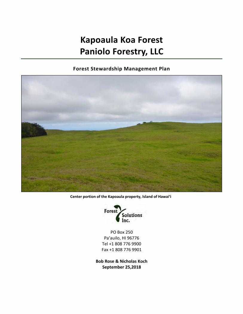
Kapoaula Koa Forest Paniolo Forestry, LLC
Forest Stewardship Management Plan
PO Box 250
Paʻauilo, HI 96776 Tel +1 808 776 9900 Fax +1 808 776 9901
Bob Rose & Nicholas Koch
September 25,2018
Center portion of the Kapoaula property, Island of Hawaiʻi

ii
Table of Contents 1. CLIENT AND PROPERTY INFORMATION .................................................................... 5
Client ................................................................................................................................................ 5
Consultant ....................................................................................................................................... 5
2. Signature Page ......................................................................................................... 6
3. Introduction ............................................................................................................. 7 Vision and long-term goals ............................................................................................................ 7
3.1.1. Vision ........................................................................................................................................ 7
3.1.2. Ten-year objectives ................................................................................................................... 7
Description of property and history ............................................................................................. 7
Overview of Project Specific Management Objectives ............................................................... 9
4. Land and Resource Description ............................................................................... 12 Resource concerns ......................................................................................................................... 12
Existing vegetation and forest cover.............................................................................................. 12
Existing Forest Health and Function .............................................................................................. 13
Soils and Their Conditions .............................................................................................................. 14
General Slope and Aspect .............................................................................................................. 17
Water Resources ............................................................................................................................ 19
Timber Resources ........................................................................................................................... 21
Wetland Resources ........................................................................................................................ 21
Significant Historic and Cultural Resources ................................................................................... 22
Existing Wildlife ............................................................................................................................ 22
Threatened and Endangered Species Existing on Property ......................................................... 23
Existing Recreational and Aesthetic Values ................................................................................. 23
Infrastructure and Access Conditions .......................................................................................... 23
5. Management Objectives and Practice ..................................................................... 25 Overview ........................................................................................................................................ 25
5.1.1. Fence units .............................................................................................................................. 25
5.1.2. Forest management units ....................................................................................................... 27
6. Detailed practices and objectives ............................................................................ 30 Summary of stands, activity year and objective ............................................................................ 30
Summary of stocking & seedling needs ......................................................................................... 31

iii
Site Preparation ............................................................................................................................. 32
Windbreaks .................................................................................................................................... 34
Fencing ........................................................................................................................................... 35
6.5.1. Cattle ....................................................................................................................................... 35
6.5.2. Other mammals ...................................................................................................................... 36
Tree/Shrub Establishment ............................................................................................................. 37
6.6.1. Seedlings & seed sourcing ...................................................................................................... 37
6.6.2. Koa Plantings ........................................................................................................................... 38
6.6.3. Mixed forest plantings (kīpuka enrichment planting) ............................................................ 38
Nutrient Management ................................................................................................................... 39
Weed Control ................................................................................................................................. 40
Integrated Pest Management ........................................................................................................ 41
Pruning and Singling ..................................................................................................................... 42
Ash stand replacement (year 8) ................................................................................................... 43
Monitoring ................................................................................................................................... 45
7. Budget & practices summary .................................................................................. 46 Budget summary ............................................................................................................................ 46
FSP and NRCS practice codes used in this management plan & relevant rates for Siglo property47
8. Practice implementation schedule & annual budgets.............................................. 48 Year 1 implementation schedule ................................................................................................... 48
8.1.1. Year 1 budget .......................................................................................................................... 49
Year 2 Implementation schedule ................................................................................................... 50
8.2.1. Year 2 Budget .......................................................................................................................... 51
Year 3 implementation schedule ................................................................................................... 52
8.3.1. Year 3 budget .......................................................................................................................... 53
Year 4 implementation schedule ................................................................................................... 54
8.4.1. Year 4 budget .......................................................................................................................... 55
Year 5 implementation schedule ................................................................................................... 56
8.5.1. Year 5 budget .......................................................................................................................... 57
Year 6 implementation schedule ................................................................................................... 58
8.6.1. Year 6 budget .......................................................................................................................... 59

iv
Year 7 implementation schedule ................................................................................................... 60
8.7.1. Year 7 budget .......................................................................................................................... 61
Year 8 implementation schedule ................................................................................................... 62
8.8.1. Year 8 budget .......................................................................................................................... 63
Year 9 implementation schedule ................................................................................................... 64
8.9.1. Year 9 budget .......................................................................................................................... 65
Year 10 implementation Schedule ............................................................................................... 66
8.10.1. Year 10 budget ...................................................................................................................... 67
9. Economic Analysis ................................................................................................... 68 Methods and assumptions ............................................................................................................. 68
Results of the analysis .................................................................................................................... 72
Challenges to this analysis ............................................................................................................. 72
9.3.1. Unknown growth .................................................................................................................... 72
9.3.2. Prices for koa volume will vary in the long term .................................................................... 72
9.3.3. Diseases and/or climate change ............................................................................................. 72

Rose & Koch | 5
1. CLIENT AND PROPERTY INFORMATION
Client Applicant Name: Paniolo Forestry LLC
Address: Attn: Nicholas Koch, Manager
Po Box 490, Paauilo HI 96776
Landowner Name: Siglo Forest, LLC
Leaseholder Name: Paniolo Forestry, LLC
Effective Date /Term of Lease: January 1, 2019, 50 years
Address: 47-4521 Old Māmalahoa Highway, Kamuela, HI 96743
TMK number: (3)-4-7-007-011
State and County Zoning: Agriculture district, 40 acres (A-40a)
Farm Service Agency Tract No: None
Total property acreage: 564.1 acres
Proposed stewardship area: 552.8 acres
Elevation range: 2,740 – 3,180 ft ASL
Slope: 440’ rise makai to mauka, over distance of 9,546 ft = average 5% slope
80% of TMK is <20% slope
0-10% (+/-) 302 acres
10-20% (+/-) 162 acres
>20% (+/-) 100 acres w/ areas of extreme slope & exposed rock
Perennial/intermittent steams: There is a short segment of blue-line intermittent gulch on the NW corner of the property, adjacent to Mamalahoa Highway
Consultant Company: Forest Solutions, Inc.
Name: Nicholas Koch
Title: General Manager
Address: P.O. Box 250, Paauilo HI 96776
Email: [email protected]
Phone | Fax: +1 (808) 776-9900 x 2 | +1 (808) 776-9901
Date of Plan Completion: September 25, 2018

Rose & Koch | 6
2. Signature Page (Appendix D) – With signatures of the applicant, consultant, approval date by Forest Stewardship Advisory Committee and State Forester
Signature Applicant: ____________________________________________________________________ (on behalf of Paniolo Forestry, LLC)
Signature Consultant: ____________________________________________________________________ (on behalf of Forest Solutions, Inc.)
Approval Date by Forest Stewardship Advisory Committee: _____________________________________
Signature State Forester: ___________________________________________________________

Rose & Koch | 7
3. Introduction Vision and long-term goals
3.1.1. Vision Siglo Forest, LLC acquired the Kapoaula property from Parker Ranch to provide it with long term access to planted koa wood and convert pastureland back to a semblance of the native koa-ʻōhiʻa forest that once stood in this area. The resulting koa forest will provide a long-term, predictable source of instrument grade wood for Taylor Guitars, one of the venture partners, and produce high-quality wood for other uses.
In 50 years, this property will be a mixed-species native forest with flatter, less erodible areas that emphasize timber production, and other areas that emphasize native species, which are steeper. The forest will produce a sustainable yield of instrument grade koa timber while also providing habitat for native species and inspiring others to plant trees on their land for similar purposes.
3.1.2. Ten-year objectives • Reforest the entire property with koa and a complement of associated native forest plants • Improve the quality of wood to be harvested in the future by:
o Planting seed from known, high-quality sources o Utilizing cuttings propagated from trees identified as having superior color, figure and form
• Intensive management of koa for saw timber on those areas of the property with slopes less than 20% accounting for 70% of the property or 390 acres
• Reforest the remaining upland areas with a multi-species native forest, utilizing koa as a pioneer species, accounting for 30% of the area or 163 acres
• Protect planted forest from wind by planting fast-growing, cattle resistant windbreaks
Description of property and history During the Great Mahele of 1848 this property was granted to Prince William Pitt Leleiohoku II, one of the 4 members of the royal family. At his untimely death at age 22, the land was transferred to John Parker, a close family friend, in 1862. The property remained in Parker Ranch ownership until its recent sale in March 2018 to Siglo Forestry, LLC, the third owner.
This 565-acre TMK is locally identified as Kapoaula owing to its namesake Ahupuaʻa. The original property was approximately 660 acres. In 2004, the quarry on the northwest corner of the roughly rectangular-shaped parcel (approximately 95 acres) was divided off and sold to Kapoaula Land, LLC to continue its long-standing (and continued use) as a gravel quarry (Edwin DeLuz quarry).
The property abuts the Old Māmalahoa Highway midway between Waimea and Honokaʻa. Aside from the quarry, it is surrounded by Department of Hawaiian Homelands pastoral leaseholds used for cattle grazing. Some of these leaseholds have single family houses and attendant small farm structures. Its general slope aspect is north facing with constant exposure to East-West Tradewinds. The overall landscape is open, rolling pasture with few trees, punctuated with small hills, outcroppings and occasional steep and rocky ridges. It is primarily covered in non-native kikuyu grass (Pennisetum clandestinum) with other pasture grasses, with a few remnant ʻōhiʻa trees remaining on the edges of steep knolls. The subject property is notably well managed, with lush pasture grass and few pasture weeds. Under the terms of the property sale, Parker Ranch has a year
Rose & Koch | 8
to year license to continue to graze cattle until owner Siglo Forest is ready to reforest all or part of the designated sections with koa and other native vegetation. There is a 20-year agricultural tax dedication on the property that expires in 2021, to keep this and avoid retroactive taxes, the property must be grazed or forested until then.
Historical records indicate that this entire flank of Mauna Kea was once a dense koa-ʻōhiʻa forest. Gagne and Cuddihy (1990) identify this region as “sub montane ʻōhiʻa -koa forest.” However, by the 1850’s the forest was evidently nearly eliminated and replaced by grazing land. A mid nineteenth century account reported:
“it is in the memory of many foreigners now living here, when the whole of these plains were covered in a thick wood…where hardly a tree stands for miles…….Thousands of old dead trees both standing upright and prostrate, from the present boundaries of these woods, exhibit a mode in which the destruction is effected; for while whilst the old trees die of age, no young ones are seen taking their place, as during the last thirty or forty years, the cattle have eaten or trodden them down.”…..“In former times when I was a boy (said Ha’alelea), Waimea was a thickly wooded region all about there…. but of late years round about where I lived, it is as cleared of trees as the Esplanade is.”….. He explained that white settlers had felled the trees for fuel and fences for cattle pens and that “a good many of the young trees were destroyed by the cattle.” P.62
“From the nature of the country to the windward of our private lands [Waimea] (a dense forest and almost impenetrable undergrowth covering nearly the whole of it) as the herds increased it became an impossibility to prevent cattle from getting beyond the reach of our control, and gradually they have filled this land with their offspring.” P.188
[1856 edition of Sandwich Island Monthly Magazine, from: Cattle Colonialism- John Ryan Fischer, 2015, U. North Carolina Press]
John Parker’s original homestead at Mana was located about a mile mauka of the property boundary. An early account of the ranch reported on the koa milling activity in the area:
“it was below the koa forest of Hanaipoi that the saw pits were dug in the land known as Makahalau where the purebred bulls and cows are now penned up. This became the great center for koa work, cutting down trees, selecting the best to be sawn up into lumber through the saw pits, the piling up of koa lumber on hilly ground so that the air could get between the boards and season the wood. There was so much lumber piled up in this section that the natives called the place Palihooukapapa [Hill of piled lumber].”
The Parker Ranch of Hawaii - The saga of a Ranch and a Dynasty, Joseph Brennan, Mutual Publishing, Honolulu, 1974/2006; p.82
This sawpit area is about 3 miles mauka and 1,000 higher from the upper property boundary of the property.

Rose & Koch | 9
Overview of Project Specific Management Objectives The specific forest management objectives for this property include:
• Improve the quality of wood to be harvested in the future by planting seeds from known, high-quality sources and utilizing cuttings from trees identified as having superior color, figure and form (timber stands)
• Focus intensive management of koa for saw timber on those areas of the property with slopes less than 20%, accounting for 70% or 390 acres
• Re-vegetate slopes and erosion-prone ridges with a multi-species combination of koa and native trees, shrubs and groundcover plants, accounting for estimated 30% or 163 acres
• Protect planted stands from the effects of persistent and sometimes extreme wind by establishing 15,800 feet of cattle resistant windbreaks
• Emphasize the planting of native frugivorous species to increase habitat for native forest-dwelling birds
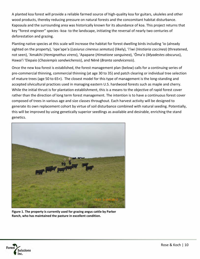
Rose & Koch | 10
A planted koa forest will provide a reliable farmed source of high-quality koa for guitars, ukuleles and other wood products, thereby reducing pressure on natural forests and the concomitant habitat disturbance. Kapoaula and the surrounding area was historically known for its abundance of koa. This project returns that key “forest engineer” species -koa- to the landscape, initiating the reversal of nearly two centuries of deforestation and grazing.
Planting native species at this scale will increase the habitat for forest dwelling birds including ʻio (already sighted on the property), ʻopeʻapeʻa (Lasiurus cinereus semotus) (likely), ʻiʻiwi (Vestiaria coccinea) (threatened, not seen), ‘Amakihi (Hemignathus virens), ‘Apapane (Himatione sanguinea), ‘Ōma‘o (Myadestes obscurus), Hawai‘i ‘Elepaio (Chasiempis sandwichensis), and Nēnē (Branta sandvicensis).
Once the new koa forest is established, the forest management plan (below) calls for a continuing series of pre-commercial thinning, commercial thinning (at age 30 to 35) and patch clearing or individual tree selection of mature trees (age 50 to 65+). The closest model for this type of management is the long-standing and accepted silvicultural practices used in managing eastern U.S. hardwood forests such as maple and cherry. While the initial thrust is for plantation establishment, this is a means to the objective of rapid forest cover rather than the direction of long term forest management. The intention is to have a continuous forest cover composed of trees in various age and size classes throughout. Each harvest activity will be designed to generate its own replacement cohort by virtue of soil disturbance combined with natural seeding. Potentially, this will be improved by using genetically superior seedlings as available and desirable, enriching the stand genetics.
Figure 1. The property is currently used for grazing angus cattle by Parker Ranch, who has maintained the pasture in excellent condition.

Rose & Koch | 11
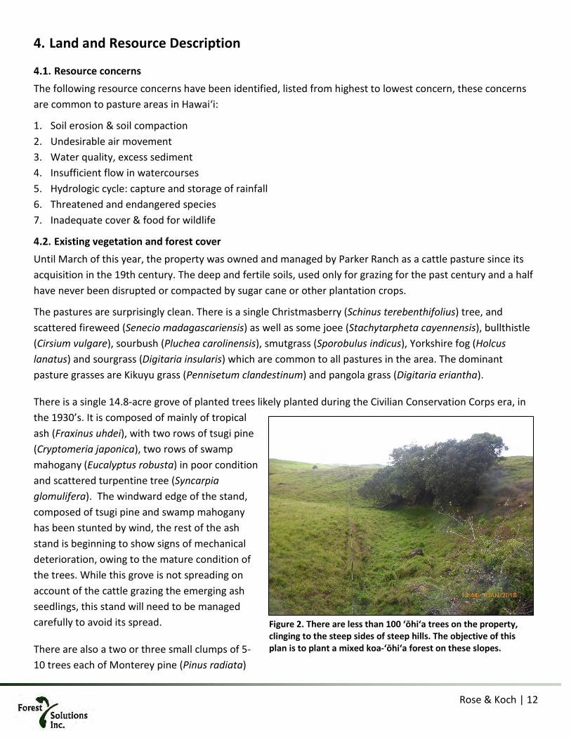
Rose & Koch | 12
4. Land and Resource Description
Resource concerns The following resource concerns have been identified, listed from highest to lowest concern, these concerns are common to pasture areas in Hawaiʻi:
1. Soil erosion & soil compaction 2. Undesirable air movement 3. Water quality, excess sediment 4. Insufficient flow in watercourses 5. Hydrologic cycle: capture and storage of rainfall 6. Threatened and endangered species 7. Inadequate cover & food for wildlife
Existing vegetation and forest cover Until March of this year, the property was owned and managed by Parker Ranch as a cattle pasture since its acquisition in the 19th century. The deep and fertile soils, used only for grazing for the past century and a half have never been disrupted or compacted by sugar cane or other plantation crops.
The pastures are surprisingly clean. There is a single Christmasberry (Schinus terebenthifolius) tree, and scattered fireweed (Senecio madagascariensis) as well as some joee (Stachytarpheta cayennensis), bullthistle (Cirsium vulgare), sourbush (Pluchea carolinensis), smutgrass (Sporobulus indicus), Yorkshire fog (Holcus lanatus) and sourgrass (Digitaria insularis) which are common to all pastures in the area. The dominant pasture grasses are Kikuyu grass (Pennisetum clandestinum) and pangola grass (Digitaria eriantha).
There is a single 14.8-acre grove of planted trees likely planted during the Civilian Conservation Corps era, in the 1930’s. It is composed of mainly of tropical ash (Fraxinus uhdei), with two rows of tsugi pine (Cryptomeria japonica), two rows of swamp mahogany (Eucalyptus robusta) in poor condition and scattered turpentine tree (Syncarpia glomulifera). The windward edge of the stand, composed of tsugi pine and swamp mahogany has been stunted by wind, the rest of the ash stand is beginning to show signs of mechanical deterioration, owing to the mature condition of the trees. While this grove is not spreading on account of the cattle grazing the emerging ash seedlings, this stand will need to be managed carefully to avoid its spread.
There are also a two or three small clumps of 5-10 trees each of Monterey pine (Pinus radiata)
Figure 2. There are less than 100 ʻōhiʻa trees on the property, clinging to the steep sides of steep hills. The objective of this plan is to plant a mixed koa-ʻōhiʻa forest on these slopes.
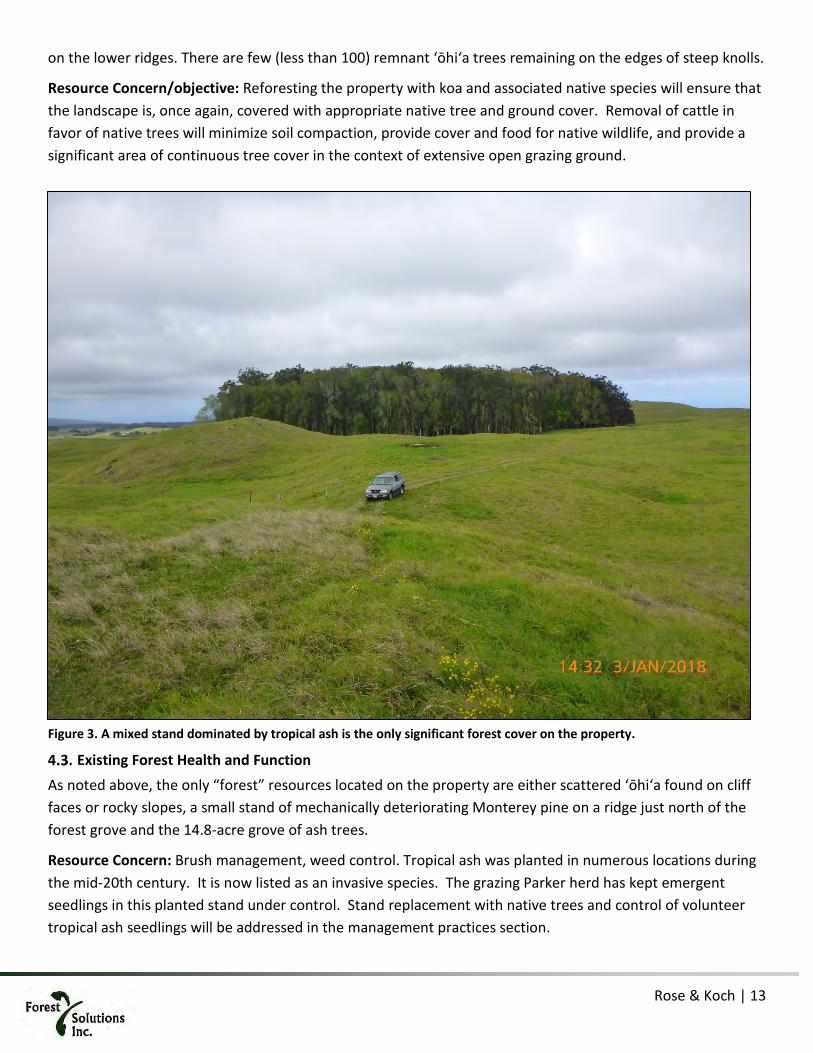
Rose & Koch | 13
on the lower ridges. There are few (less than 100) remnant ʻōhiʻa trees remaining on the edges of steep knolls.
Resource Concern/objective: Reforesting the property with koa and associated native species will ensure that the landscape is, once again, covered with appropriate native tree and ground cover. Removal of cattle in favor of native trees will minimize soil compaction, provide cover and food for native wildlife, and provide a significant area of continuous tree cover in the context of extensive open grazing ground.
Existing Forest Health and Function As noted above, the only “forest” resources located on the property are either scattered ʻōhiʻa found on cliff faces or rocky slopes, a small stand of mechanically deteriorating Monterey pine on a ridge just north of the forest grove and the 14.8-acre grove of ash trees.
Resource Concern: Brush management, weed control. Tropical ash was planted in numerous locations during the mid-20th century. It is now listed as an invasive species. The grazing Parker herd has kept emergent seedlings in this planted stand under control. Stand replacement with native trees and control of volunteer tropical ash seedlings will be addressed in the management practices section.
Figure 3. A mixed stand dominated by tropical ash is the only significant forest cover on the property.

Rose & Koch | 14
Soils and Their Conditions Geologically, the property is located on the north east flank of Mauna Kea on ash-covered lava flows. Soils on the property are classified by the U.S. Natural Resources Conservation Service (NRCS) as Honokaʻa silty clay loam in the lower elevations and Maile silt loam in the upper elevations. Both soil types are listed as “highly erodible.” These soils have an 8-10% organic material content. This part of the island is noted as having a low risk of volcanic events (8 on a 1-9 scale) and a moderate earthquake hazard level (4 -moderate). There are no subsidence or landslide risks. The land is fully stocked with high-quality pasture grasses and there are no obvious signs of soil erosion or sediment transport. However, we suspect that erosion occurring under the grass sward on the ridges during large storm events. Sheet and rill erosion are minimal owing to the thick grass sward.
The following is paraphrased from the NRCS web soil descriptions:
The HONOKAA series consists of deep, well drained soils that formed in basic volcanic ash. Honokaa soils are on mid-elevation, windward slopes of Mauna Kea at elevations from 335 to 1,222 meters (1,100 to 4,000 feet) and have slopes ranging from 0 to 35 percent. This humid volcanic ash soil is found on low and intermediate rolling mountain slopes in the Hāmākua and Mauna Kea Districts, Island of Hawaii. Honokaa soils are classified as “Well drained.” Runoff is low to high. Permeability is rapid. Little standing water is present, even during high rainfall events.
Steep and narrow drainage gulches dissect the landscape. The soils are on summit, shoulder, backslope, and footslope hillslope profile positions of ash fields that overlie 64,000 to 300,000 year-old lava flows. Slope gradients typically range from 0 to 35-percent but can be as great as 100 percent in gulches. The soils formed in basic volcanic ash. The mean annual rainfall is 2,000 to 3,800 millimeters (78 to 150 inches). The mean annual temperature is 16 to 22 degrees C (61 to 72 degrees F) and the mean annual soil temperature is 19 degrees C (66 degrees F).
Honokaʻa soils are typically used for tree plantations and pasture. In the past, at lower elevations, they were used extensively for growing sugarcane (up to 640 meters – 2,100 feet elevation). Natural vegetation includes ʻōhiʻa lehua (Metrosideros polymorpha), hāpuʻu tree fern (Cibotium glaucum), Hilo grass (Paspalum conjugatum), and kikuyu grass (Pennisetum clandestinum).
The MAILE series consists of deep and very deep, well drained soils that formed in basic volcanic ash over `a`a lava flows on Mauna Kea. Maile soils are on ash fields of mid elevation (915 to 1,375 meters – 3,000 to 4,500 feet), on windward mountain slopes of 0 to 20 percent. Mean annual rainfall is about 1,900 millimeters (75 inches) and mean annual temperature is 17 degrees C (63 degrees F). The soils are on all hillslope profile positions of undulating ash fields that overlie 11,000 to 300,000-year-old lava flows. Cloud cover and fog are common. The mean annual temperature is 16 to 18 degrees C (61 to 64 degrees F) and the mean annual soil temperature is 18 degrees C (64 degrees

Rose & Koch | 15
F). The Maile soils are well drained with low to medium runoff and moderately rapid permeability.
Maile soils are used principally for pasture and timber plantations. Some areas of native forest remain. The vegetation is dominated by kikuyugrass (Pennisetum clandestinum), rattailgrass (Sporobolus indicus), and sweet vernalgrass (Anthoxanthum odoratum) and Yorkshire fog (Holcus lanatus) at the higher elevations. Natural vegetation includes koa (Acacia koa), ʻōhiʻa (Metrosideros polymorpha), hāpuʻu tree fern (Cibotium glaucum), and ʻōlapa (Cheirodendron trigynum).
Resource Concern: Erosion. All site preparation, road and pond construction, planting, and silvicultural activities will be conducted with focused attention on maintaining soil in place and minimizing situations where these highly fertile and erodible soils will be disturbed. Best management practices will ensure that the high current level of organic material in the soil will be retained and that no sediments will escape the property through surface water transport.
Figure 4. The property presents deep, flat areas with pronounced ridges resembling the surface of a meringue pie. The flat areas will be used for timber, the ridges for mixed forest.

Rose & Koch | 16

Rose & Koch | 17
General Slope and Aspect The property is long rectangle with the northwest corner of about 95 acres previously subdivided as a separate TMK, now a quarry. It is oriented in a north to south direction, facing north, and running mauka from Old Māmalahoa Highway to the surveyed and fenced southern boundary. The elevation of the property fronting the highway, is approximately 2,740 feet. The mauka boundary, approximately 9,500 ft from the highway, is at elevation of 3,180 feet, a 440’ elevation gain. The overall average slope of the property is 5% (440 elevation gain over 9,500 ft distance) with numerous intermittent steep hills and ridges up to 100% slope. A GIS analysis of the publicly available digital elevation model revealed the following slope classes:
Table 1. Summary of land area by slope class
green = easy mechanical preparation (crawler/exc)
yellow = difficult mechanical preparation (excavator reach)
orange = hand planting only (some excavator reaching)
Resource Concern: Erosion and compaction. Soil disturbance is far more likely on steeper exposed and rocky areas. Intensive forest management activities will take place on those portions of the property <20% slope. Steeper areas will be accessed less often, and prepared using spot cultivation with minimal soil/topographic disruption.
Slope class Acres % Land area 0-10% 302 54% 10-20 162 29% 20-30 57 10% 30-40 29 5% >40 14 2%

Rose & Koch | 18

Rose & Koch | 19
Water Resources Kapoaula is located on the windward side of Hawai‘i (see location map) and receives abundant rainfall. The average rainfall is 83 inches on the makai end of the property (2,740 feet) and 56 inches mauka at 3180 feet. Area rainfall averages approximately 70 inches per year. Mean annual rainfall in this location is quite high, ranging from above 4 inches per month in the comparatively dry summer months to more than 12 inches monthly in the relatively wetter months of November through March. The area is at virtually no risk of drought.
There is one small segment of blue-line intermittent gulch on the northeastern flank of the property, intersecting the highway, which does not significantly affect management activities as it is near the property boundary and no channel altering work is planned.
Model hydrology using NEXTMap 5-meter IFSAR bare earth Digital terrain Model (DTM) using catchment area of 1 acre shows a theoretical network of waterways along the depressions. However, the well-drained, highly permeable soils only allow water to accumulate and flow in these topographical depressions during storm events (see Modelled hydrology map). Observations during heavy rain events March-June, 2018, revealed small channels of surface water movement in these mapped areas. Increasing forest cover will likely reduce the flashiness of these channels and possibly eliminate overland flow altogether.
There are a number of un-named gullies on the property that flow only in storm events. There are no perennial streams or seasonal watercourses on the parcel other than the previously noted short blue-line gulch segment which is intermittent. There are no National Wetland Inventory wetlands.
Three un-lined stock watering ponds are located in the vicinity of the previously planted windbreak grove. (see Hydrology map). During wet season observation, these three ponds were partially full. They have not been observed during dry season to determine if they continue to hold water in the face of naturally well-drained soils and evapotranspiration. These ponds will not be planted or disturbed, rather they will continue to provide stock water and, as cattle are removed, habitat for native species.
Parker Ranch maintains a water supply system for stock watering, using remote county water sources and agreements with neighboring properties. This system has served the property for many years. Current plans for the property include the gradual removal of the Parker water system as cattle are removed.
Resource Concern: Lack of infiltration due to compaction. Loosening soil and planting a forest cover will reduce rainfall arriving at the soil level and improve infiltration. This, in turn, will reduce overland flow and provide a more steady water supply to nearby gulches should rainfall be sufficient.
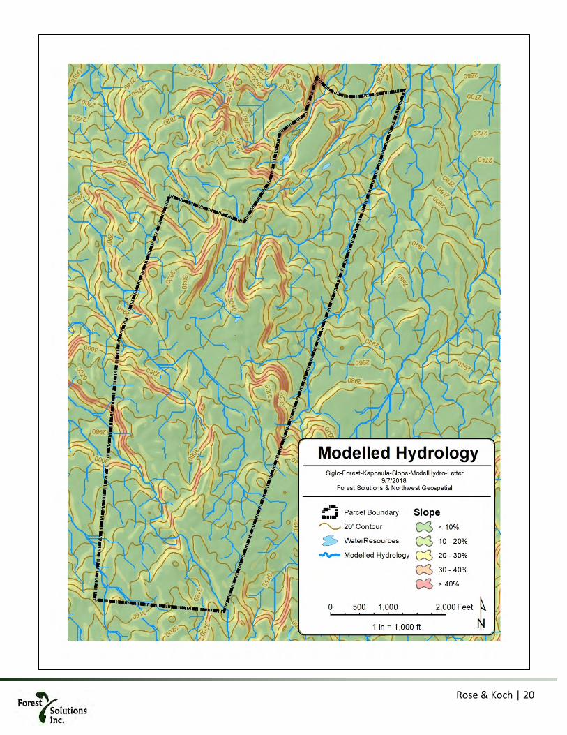
Rose & Koch | 20

Rose & Koch | 21
Timber Resources Except for the above-noted 14.8-acre grove of tropical ash, there are no timber resources currently on this property. Over the course of this management plan, the entire property will be reforested with approximately 70% of the area dedicated to commercial forest production of instrument quality koa. The ash stand will be converted to koa in year 8.
Resource Concern: Koa timber supply, habitat. Reforesting with native koa and associated species will ensure that invasive species do not re-capture the site and provide habitat for native species. As each planted unit (+/- 50 acres/year over a 10-year period) reaches canopy closure (Year 3), native species will begin to re-inhabit the area and provide additional inputs of native species to enhance intentional planting efforts. The intention of this plan is to reforest the entire site and then manage it as a sustainable forest with small patch (< 1-acre) and individual tree selection harvests.
Wetland Resources Except for the one “blue-line” intermittent gulch adjacent to the Old Māmalahoa Highway, there are no identified wetland resources on this property. Existing cattle stock watering ponds may provide an opportunity for enhancement as wildlife habitat and installation of a fire-control pond may also provide additional habitat opportunities.
Resource Concern: Potential habitat. There may be an opportunity to enhance on-site potential wetland resources. However, a site visit with NRCS biologist (May, 2018), seemed to indicate that fencing and protection of existing stock watering ponds to prevent predation by cats, mongoose and other invasive
Figure 5. There is a stand of senescent tropical ash in the center portion of the property. This will be converted to koa in year 8. Below: There are a few clumps of Monterey pine that will also be removed and replaced with mixed koa forest. The conifers are not significant in quantity but do speak to the wind effects, see crowns of background trees.

Rose & Koch | 22
mammals, rather than the depeening and lining of the ponds may be the preferred way to address the possible use of these area by resident and migratory wildlife. Planting of trees will likely reduce or eliminate the ponds due to higher evapotranspiration.
Significant Historic and Cultural Resources Based on the environmental history of this area which indicates an original “nearly impenetrable” ko-ʻōhiʻa forest and the fact that by the mid-19th century, this entire landscape was in the process of conversion from forest to pasture, there is little likelihood of any historic or cultural resources being found on the property. This property would have been part of the Wao Akua, or land of the gods, where most Hawaiians did not enter.
The Final Environmental Assessment and Anticipated FONSI prepared by DHHL for the Honokaia Non-Potable Water System (2016), prepared for property immediately adjacent to Kapoaula’s eastern property boundary states:
“The entirety of the project site is utilized by Native Hawaiian lessees for grazing. The area is fenced off in order to protect cattle and rationalize grazing, and no public access is allowed. There is no indication that individuals other than the lessees and persons they allow to utilize the land gather or perform other cultural activities on the land. Research in historic records, reconnaissance of the sites, and discussions with lessees did not reveal any caves, springs, pu’u, native forest groves, gathering resources or other culturally significant features in or near the area.” (emphasis added).
As part of the owner’s application to construct an access road and small saw mill on the northwest corner of the property (approximately 11.3 acres, not included in this Stewardship Plan), an application has been submitted to the State Historical Preservation Division (SHPD) to verify there are no archeological, burial or historic sites present on this entire 565-acre TMK. However, no formal archeological assessment has been conducted by the current landowner and none is known from the previous owner, Parker Ranch.
Resource Concern: None
Existing Wildlife Because the entire property (except for 14.8 acres of non-native mature tropical ash) has been a managed cattle pasture for over a century, there is little evidence of native wildlife. On site visits earlier this year (March, May 2018), ‘io (Buteo solitarius) was seen on the property. There was also possible evidence (bird tracks in mud adjacent to stock ponds), of nēnē, though these could also have been from ducks. Hoary bats likely use the thick, non-native mature tropical ash stand as well.
Non-native bird species likely include Japanese bush-warbler (Horornis diphone), melodius laughing-thrush (Garrulax leucolophus), northern cardinal (Cardinalis cardinalis), common myna (Acridotheres tristis), Japanese white-eye (Zosterops japonicus), kalij pheasant (Lophura leucomelanos), and Erckel's Francolin (Francolinus erckelii).
Non-native mammals likely include black rat (Rattus rattus), small Asian mongoose (Herpestes javanicus), feral pigs (Sus scrofa), feral cats (Felis catus) and dogs (Canis lupus). Evidence of rats and possibly mongoose were seen along the fringes of existing stock ponds. A small herd of small, feral black pigs has been observed in this woodlot.

Rose & Koch | 23
Resource Concern: Bird predation. A Biological Assessment will be carried out during the breeding and nesting season (winter/spring 2018-2019) to confirm these findings and establish a baseline population. Based on this information, vector control methods and/or protective fencing will be deployed to enhance bird survival.
Threatened and Endangered Species Existing on Property Fauna:
ʻio – seen once, flying overhead near forest grove Nēnē – not seen, possible tracks on pond fringe, though these could also have been from ducks ʻopeʻapeʻa – not seen, likely use the thick tropical ash stand to roost Flora:
None encountered thus far. It is unlikely that any threatened and/or endangered species would be encountered given the managed and manipulated aspects of this landscape over the past 150+ years.
Resource Concern: Habitat improvement. Property owner has already initiated preliminary discussions with USFWS regarding application for a Habitat Conservation Plan or Safe Harbor Agreement in anticipation of native plantings attracting currently listed or potentially listed wildlife.
Existing Recreational and Aesthetic Values This property has been in private (Parker Ranch) ownership since the 1860’s. The only recreational use has been occasional hunting of pigs by Parker employees and picnicking and small gatherings of employees and families in the ash grove. There is and has been no public use or access.
Aesthetically, the property has been described by local realtors and the surveyor who confirmed property corners and fence lines as “one of the most beautiful pieces of land they had seen on the island.” Rolling, verdant pastures, separated by exposed cliff faces and small “meringue like” hills, with expansive views of the Waipio Bay/Kohala Mountains and the Pacific Ocean. At night, the lights from Waimea are visible from upper ridges and stars are readily visible as there is little nearby light pollution.
Open vistas will, over time, be reduced or eliminated by rapidly growing koa and other woody species. This will produce its own aesthetic complex that will be the subject of interpretive signage and other informational material.
Resource concern: None
Infrastructure and Access Conditions As noted above, the mauka boundary of Kapoaula is defined by the easily accessed Old Māmalahoa Highway, which is asphalted and publicly maintained. Presently, there is a 5-strand barbed wire perimeter fence with one standard pipe gate entry located approximately midway between the eastern and western property corners. The historic road layout creates a blind corner from each direction, making the narrow pull out area adjacent to the fence quite dangerous for loading and unloading equipment. Projected plans include widening this pull-out area and pulling back the fence line to accommodate low-boy trailer equipment delivery. The interior of the property has only unimproved jeep and cattle trails. There are no graveled roads.
As shown on the attached maps, approximately 11.3 acres for a mill site and access road have been removed

Rose & Koch | 24
from the active forest management regime. The mill site will be self-contained with on-site power and water. There are no projected plans for bringing public water or power to the site owing to prohibitive cost.
Resource Concern: Minimizing transport of any sediments off-site onto a public road. Ensuring safe and easy access for highway vehicles (cars and trucks) as well as for delivery of equipment for on-site work. Such work will be conducted outside of the auspices of this management plan.

Rose & Koch | 25
5. Management Objectives and Practice
Overview Kapoaula was purchased with expressed intention of creating a dedicated, sustainable koa forest for musical instrument wood. This project will plant, over a ten (10) year period, the entire 553 acres of available land with koa and a range of associated native plants (11.3 additional acres are reserved for a saw mill site and access road). The project will combine the production of timber in a plantation format with mixed native forest plantings in less accessible areas. Over time – decades or century – we anticipate the colonization of the plantation area with the enrichment species from the mixed forests, from bird droppings and natural plant colonization. We call this a kīpuka restoration strategy whereby nuclei of enriched koa stands extent out and into the adjoining koa plantation stands.
As cattle are removed from the land and replaced by trees, compaction, erosion and animal organic wastes will be eliminated with positive consequences for water quality. Incorporating intentional plantings of native species favored by birds and insects will dramatically improve wildlife habitat. Windbreaks planted on strategic ridges will allow the koa trees to grow with minimum wind-caused distortion. Historic stock watering ponds may be enhanced with perimeter plantings and predator proof fencing and traps to favor migratory and resident waterfowl.
Beginning in year 30-35 a selection harvest is planned, emphasizing tree quality and stand vigor, while also removing useable koa wood. This will cause the natural regeneration of a cohort of koa trees, which will be repeated more or less every 15 years to create a continuity of canopy closure over space and time.
Ideally this project will inspire others. Early indications are that neighboring property owners are now also contemplating planting native trees on their DHHL pastoral leaseholds. Such plantings will leverage and expand the environmental gains provided by this project.
5.1.1. Fence units There is active and obligate grazing on the property, which will be rolled back sequentially as the forest is planted. To keep grass sward and woody weeds under control and to maintain the land-use designation, cattle will continue to graze the property until it is planted out. Therefore, for each successive year a standard 5’ hogwire fence with a smooth top wire and barbed ground wire is planned. This will remove cattle and pigs from each regenerated area, protecting both the timber and non-timber species.
The sequence of fencing is important. In order to minimize wind effects, orographic conditions are exploited in years 1-4, where hills are used to “hide” new plantings from the wind while the windbreaks develop stature. Starting in year 5, plantings will be behind windbreaks.
Year Fence ft Acres1 5,947 532 6,173 713 5,451 644 4,376 605 4,890 596 3,802 777 3,957 708 4,408 469 5,211 63
Total 44,215 564
Table 2. Proposed fence units

Rose & Koch | 26

Rose & Koch | 27
5.1.2. Forest management units To accomplish the koa and other native vegetation re-establishment objectives outlined for this plan, specific management activities will be implemented on each designated unit. To facilitate field operations, budgeting, and progress reporting, the property has been divided into a series of numbered units, called Forest Management Units or FMU’s. A unique identifying number is assigned to each FMU. (See 10-year Forestry Plan Map and implementation schedule).
The first number indicates the silvicultural regime
1 = koa timber emphasis 2 = koa with native species mixed forest 3 = existing non-native trees (ash stand) – special case FMU scheduled for conversion to koa in year 8 7 = mill site – not part of management plan
The second number indicates the year the plantings will occur
year 1-9, roughly equivalent to fence unit
The third number indicates the sub-unit within a specific year’s planting
Examples:
Unit 242 is a koa mixed species unit, planted in year 4 it is the second of two similar units
2 – Mixed forest silviculture
4 – Year 4 planting
2 – Second unit
Unit 131 is a koa timber stand to be planted in year 3, it is the first sub-unit.
1 – Koa plantation silviculture
4 – Year 3 planting
2 – First (maybe only) unit

Rose & Koch | 28

Rose & Koch | 29

Rose & Koch | 30
6. Detailed practices and objectives
Summary of stands, activity year and objective
Table 3. Detail of Forest Management Units (FMUs), prescriptions and areas. Colors differentiate between fence units. There are several FMUs within each fence unit.
FMU Type Year Fence unit ac Perimiter ft FMU ac Type Objective111 1 1 22.0 koa timber high quality koa timber on 40-60 year rotation211 2 1 4.1 native forest native forest and timber212 2 1 7.3 native forest native forest and timber711 7 1 5.2 dwelling not part of management plan121 1 2 47.3 koa timber high quality koa timber on 40-60 year rotation221 2 2 12.8 native forest native forest and timber222 2 2 10.6 native forest native forest and timber131 1 3 14.7 koa timber high quality koa timber on 40-60 year rotation132 1 3 16.1 koa timber high quality koa timber on 40-60 year rotation133 1 3 8.5 koa timber high quality koa timber on 40-60 year rotation231 2 3 19.0 native forest native forest and timber232 2 3 6.0 native forest native forest and timber141 1 4 40.8 koa timber high quality koa timber on 40-60 year rotation241 2 4 17.1 native forest native forest and timber242 2 4 1.9 native forest native forest and timber151 1 5 59.0 4,890 59.0 koa timber high quality koa timber on 40-60 year rotation161 1 6 77.3 3,802 77.3 koa timber high quality koa timber on 40-60 year rotation171 1 7 8.0 koa timber high quality koa timber on 40-60 year rotation172 1 7 37.2 koa timber high quality koa timber on 40-60 year rotation271 2 7 25.0 native forest native forest and timber181 1 8 23.6 koa timber high quality koa timber on 40-60 year rotation182 1 8 4.4 koa timber high quality koa timber on 40-60 year rotation281 2 8 13.2 native forest native forest and timber282 2 8 4.8 native forest native forest and timber311 3 8 part of unit 1 part of unit 1 14.8 ash stand replace ash with koa timber191 1 9 26.1 koa timber high quality koa timber on 40-60 year rotation291 2 9 19.3 native forest native forest and timber292 2 9 6.8 native forest native forest and timber791 7 9 11.3 sawmill & dwelling not part of management plan
564.1 44,215 547.6791 7 9 11.3 sawmill not part of management plan711 7 1 5.2 dwelling not part of management plan
564.1Property total: Entire TMK area
5,451
part of unit 1part of unit 9
Stewardship sub-total
70.7 6,173
63.5
46.0
70.1
64.3
59.7 4,376
3,957
4,408
5,211
53.4 5,947

Rose & Koch | 31
Summary of stocking & seedling needs
Table 4. Forest Management Units (FMUs), area and stocking
FMU Type Year Area (ac) Koa stocking Other stocking Koa seedlings Other seedlings111 1 1 22.0 350 50 7,700 1,100211 2 1 4.1 125 75 510 300212 2 1 7.3 125 75 920 550311 3 1 14.8 650 50 9,620 740121 1 2 47.3 350 50 16,560 2,370221 2 2 12.8 125 75 1,610 960222 2 2 10.6 125 75 1,320 790131 1 3 14.7 350 50 5,140 730132 1 3 16.1 350 50 5,650 810133 1 3 8.5 350 50 2,970 420231 2 3 19.0 125 75 2,380 1,430232 2 3 6.0 125 75 750 450141 1 4 40.8 350 50 14,280 2,040241 2 4 17.1 125 75 2,140 1,280242 2 4 1.9 125 75 230 140151 1 5 59.0 350 50 20,640 2,950161 1 6 77.3 350 50 27,050 3,860171 1 7 8.0 350 50 2,790 400172 1 7 37.2 350 50 13,030 1,860271 2 7 25.0 125 75 3,120 1,870181 1 8 23.6 350 50 8,260 1,180182 1 8 4.4 350 50 1,530 220281 2 8 13.2 125 75 1,650 990281 2 8 4.8 125 75 590 360191 1 9 26.1 350 50 9,120 1,300291 2 9 19.3 125 75 2,410 1,450292 2 9 6.8 125 75 850 510
Total/avg: 547.6 297 75 162,820 31,060
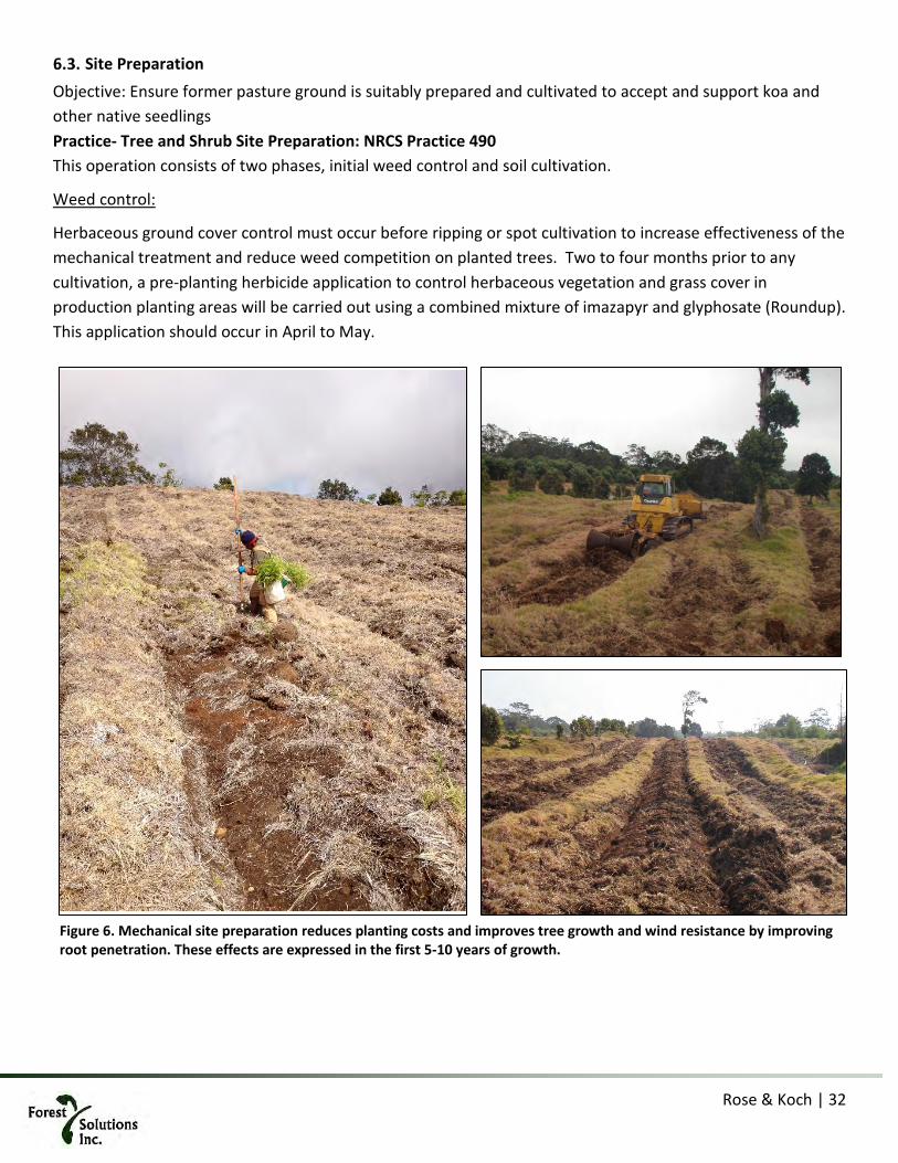
Rose & Koch | 32
Site Preparation Objective: Ensure former pasture ground is suitably prepared and cultivated to accept and support koa and other native seedlings Practice- Tree and Shrub Site Preparation: NRCS Practice 490 This operation consists of two phases, initial weed control and soil cultivation.
Weed control:
Herbaceous ground cover control must occur before ripping or spot cultivation to increase effectiveness of the mechanical treatment and reduce weed competition on planted trees. Two to four months prior to any cultivation, a pre-planting herbicide application to control herbaceous vegetation and grass cover in production planting areas will be carried out using a combined mixture of imazapyr and glyphosate (Roundup). This application should occur in April to May.
Figure 6. Mechanical site preparation reduces planting costs and improves tree growth and wind resistance by improving root penetration. These effects are expressed in the first 5-10 years of growth.

Rose & Koch | 33
Mechanical site preparation1:
The purpose of this practice is to improve site conditions to be suitable for the purposeful establishment of desired trees and shrubs. In the case of Kapoaula, the entire property, except for exposed rocks and cliffs, is densely covered with long established cattle pasture. Because of the history of cattle grazing and associated compaction, deep ripping and bedding or deep spot cultivation will be required to assure that koa roots have a minimally compacted soil profile to penetrate. Depth of this operation should be at least 24 inches (60cm) and ideally 36 inches (90 cm) to provide for ease of root penetration and enhanced growth.
After the vegetation has died and begun to decompose, a tractor pulling long shank ripper and bedding plow (line cultivation) or an excavator equipped with a spot cultivation attachment (“chicken foot”) will be used to prepare planting spots at a spacing of approximately 10’ x 11’ and average stem density of 400 spots (trees) per acre for timber stands. On slopes of 20% or greater, where a mixed forest is the objective, stocking will drop to 200 trees per acre, roughly 15 x 15. Site preparation should not take place more than 2 months before first planting, cultivation by either means must prepare soils to a depth of 24”–36”, depending on substrate and operating conditions. Better the site preparation will be evident in the medium and long-term stand performance, where enhanced root penetration results in taller, more wind-firm trees.
1 Mechanical site preparation will require an approved Soil and Water Conservation Plan
Figure 7. Spot cultivation, using a specialized tool built for the purpose will be used in less accessible terrain and reaching onto steeper slopes. Ripper shank is 3 ft (90 cm) long, proving ample rooting depth early on, improving tree growth vis hand prepared soil which is never able to achieve the depth.
Rose & Koch | 34
Windbreaks Objective: Protect young seedlings and saplings from occasional high winds, improve stem architecture and shelter native forest stands from storms.
Practice: Windbreak/Shelterbelt Establishment: NRCS Practice 380
The combined factors of regional lack of tree cover, 3,000’ elevation, and persistent and occasionally gusty trade winds from the east create challenging conditions for minimizing wind stress on young seedlings and saplings. As a fast growing, vertical species, koa is particularly susceptible to deformation and leader damage due to strong winds.
The operational plan is based on installing early koa plantings in those areas already orographically protected from wind (see Fencing units map sequence). Most of the site after fence unit 4 (year 5 on)is, quite exposed to wind. The traditional name for these legendary winds with driving rain is “kipu’u pu’u, the name King Kamehameha gave his first-in-battle assault soldiers who trained in these harsh conditions.
Minimizing wind stress on young trees can protect plants from wind-related damage and alter the microenvironment to enhance plant growth. Wind protection can be accomplished by planting fast-growing wind breaks on strategic high points and ridge crests. Luckily, the topography of the land seems to run perpendicular to prevailing wind conditions, thus providing a suitable setting for installation of windbreak plantings.
The intention of this plan is to install all windbreak plantings within the first year to develop evolving protection for future plantings as rapidly as possible, certainly by year 5. In addition, as protected koa plantings become established, they will provide some additional protection for subsequent plantings. They will be planted in 3 rows, with one species per row. Rows will be 10 ft apart and trees will be 20 ft apart along the row. Trees will be arranged so as to alternate with each other.
Windbreak/shelterbelt species by row, from shortest to tallest, from east to west row
1. Podocarpus (Podocarpus gracilior) – WRA 0 low windbreak, medium growth rate 2. Tallow-wood (Eucalyptus microcorys) – WRA 1
or blood-leaf gum (Eucalyptus torelliana) – WRA 4 medium windbreak, fast growth 3. Norfolk Island Pine (Araucaria heterophylla) – WRA -5 tall windbreak, medium growth rate
or Chinese fir (Cunninghamii lanceolata) – no WRA available
Rule of thumb calculations for windbreaks indicate a wind protection distance of 10x the height of mature trees. As shown on 10-year forestry plan map, ridge crest planting locations will, over time, provide shelter for the entire site, assuming the araucaria and gum plantings reach a height of 100+’ after the first 20 years of establishment.

Rose & Koch | 35
Fencing Objective: Exclude domesticated, feral and non-native mammals from the growing restored native forest Fence - NRCS Practice 382
6.5.1. Cattle The property has been a cattle ranch since the mid nineteenth-century. The property is perimeter fenced with 5-strand barbed wire. Some sections of fence are adequate; some in need of repair. An agreed upon condition of purchase earlier this year (2018) was that Parker Ranch can continue to graze cattle on those sections of the property not yet scheduled for afforestation. On the three sides of the property not fronting the Māmalahoa Highway, DHHL pastoral lessees run cattle and horses in various conditions of husbandry. Exclusion of cattle is a fundamental requirement for successful koa forest re-generation.
Table 5. Summary of fencing units
Year Fence ft Acres 1 5,947 53 2 6,173 71 3 5,451 64 4 4,376 60 5 4,890 59 6 3,802 77 7 3,957 70 8 4,408 46 9 5,211 63
Total 44,215 564
Investment in a koa forest at this scale will require the highest level of protection from cattle or sheep. A small herd of black feral pigs were observed. To protect the investment in select growing stock and especially sensitive native understory species, pigs must also be excluded from the planting.
A perimeter 5-foot hogwire fence with smooth wire for stability on the top and barbed wire at ground level (outside) to deter pig grubbing will be installed in each fence unit (see Fence map). This fence will also serve to exclude neighboring cattle. Every year fences will be inspected and maintained if needed. A formal maintenance entry is planned starting in year 5 (four years after installation), including tightening wires, fixing loose sections and re-staking sections that have come loose.
Cattle are an essential management tool to execute this reforestation stewardship plan. They will keep pasture grasses and invasive woody species, especially topical ash (Fraxinus uhdei), sourbush (Pluchea carolinensis) and guava (Psidium guajava) under control until a unit is scheduled for site preparation and planting. An essential and critical protection aspect for this significant investment is a system of cross fencing to create paddocks that securely contains cattle from temptation grazing on adjacent koa saplings.
As each subsequent pasture unit is converted to koa forest, cattle will be replaced by native vegetation. At the end of this ten (10)-year plan, all cattle will be eliminated from the property and a permanent fencing system

Rose & Koch | 36
will be in place to localize, contain, and minimize any potential cattle trespass that might occur from adjacent pastoral leasehold herds.
6.5.2. Other mammals Signs of several deleterious mammals have been noted during site visits, particularly around and near the open stock watering ponds. These include rats (Rattus rattus and possibly Rattus norvegicus), feral pigs (Sus scrofa), mongoose (Herpestes javanicus), and cats (Felis catus) it is likely that loose or feral dogs (Canis lupus) also visit the ponds.
Most of these species do not represent, at this time, a threat to the forest restoration objective of this project, aside from pigs which uproot tender seedlings, and rats which occasionally chew bark on koa trees.
The long-term objective of a restored koa-ʻōhiʻa forest means that, over time, there will be an increase in native bird habitat which may, in the future, be affected by the presence of rats and cats. Rats eat tree fruits and seeds as well as eggs and nestlings. Cats eat birds at various life stages. As native forest areas are restored and enriched during the course of this project, invasive animal control protocols may be necessary.
Recent experience in New Zealand and in Hawaiʻi with “Good Nature” traps have shown great success in controlling rodent and cat damage using humane means. These traps use a CO2 cylinder to power a strike bolt that instantly kills animals attracted to the bait. The design allows for upwards of 12 kills/trap before requiring re-arming. As native and migratory birds begin to frequent the property, vector control will be used to reduce the population of these mammals to promote a safe haven for nesting and foraging. In addition it may be prudent to incorporate this control feature on the high-value, select “elite” seedlings planting sites to avoid bark damage by rats.
Due to the low cost, location specificity and iterative nature of vector control, this is included under the monitoring and not separated as a budget item in this management plan. Most of the cost, as with other monitoring activities, is in the technician time needed to get the work done.

Rose & Koch | 37
Tree/Shrub Establishment Objective: Re-establish a koa-dominant forest with ʻōhiʻa and associated native understory on land historically managed as cattle pasture.
Practice- Tree/Shrub Establishment: NRCS practice 612 Hand planting will be carried out using a tree spade or dibble as appropriate for the available nursery stock. Soil surface should be perforated to a depth slightly greater than the length of the seedling stock and the seedling should be placed into this hole. The root collar should be marginally lower than the level of the soil (between 1/8-1/4” with the root mass oriented vertically so the tip of the root does not bend outward (“J -rooting”). Soil is then compacted lightly around the root system. Subsequent silvicultural activities will include fertilizer application, competition control, timber stand improvement (pruning), and native species enhancement.
Koa and mixed forest plantings will be planted at the same time, the only difference being their spatial arrangement and seedling count. Mixed forest stands, as their name implies should be a mix of species across the area, not a patchwork of monotypic stands.
Table 6. Summary of stocking by stand type and relative area occupied by each stand type
6.6.1. Seedlings & seed sourcing Seeds need to be collected in advance to allow adequate time for growth in the nursery setting. There are very limited supplies of ʻōhiʻa on the property, and no koa. Therefore, seedlings will be grown from collected seed supplies with first preference for the Waimea area followed by upper elevations in Hāmākua and then Kaʻu. Paniolo Forestry currently has a working relationship with Native Nursery on Maui, who will supply most of the seedlings. Additionally, in a meeting with the local charter school, Kanu o ka ʻĀina, they have expressed interest in growing and planting enrichment seedlings using students.
Koa seed procurement strategy is to keep sources as local (Island of Hawaii) as possible. There are several reasons for this: increased project flexibility by having a stable source of seedlings, safeguarding against outside pathogen spread (especially Rapid ʻōhiʻa Death [ROD]), promoting genetically conserved adaptations to local conditions, and introducing volunteers to this aspect of forestry. However, the laudable objective of using locally sourced seedlings must not come at the expense of achieving overall forest management goals. Because the overall project goal is to produce the highest quality koa wood with desirable characteristics, seed sources from other islands may also be included into yearly plantings to ensure as robust a genetic base as possible.
In addition, working relationships with Haleakala Ranch and Kamehameha Schools have generated propagation material from selected “elite” lines of koa which show desired and valuable characteristics such as figure, color, and vertical form. The Haleakala stock was originally propagated from Island of Hawaii
Koa Other1 Timber 350 50 3852 Restoration 125 75 1483 Timber (ash) 650 50 15
Type DescriptionSeedlings/acre
Acres

Rose & Koch | 38
seedstock 32 years ago. These selected lines of improved planting stock will be planted in identified highest-quality growing areas for propagation purposes. One or several seed orchards are contemplated as part of this project to capture and track the progress of these elite genetic sources.
Seedling size will necessarily depend on the species in question: Pioneer species such as koa will be 25-30 cm in height with a small dibble pot size of 65-100 cc, which is sufficient for a more aggressive species. Enrichment and enclosure species will be in 20-40 cm in height in a small to medium pot of 200 to 500 cc, with the objective of providing an older, more robust seedling for these more sensitive species. At least nine months should be allowed for māmane and ʻōhiʻa seedlings; six months for maile, ʻolapa and pilo seedlings; and three to four months for koa seedlings.
6.6.2. Koa Plantings Koa and aʻaliʻi seedlings will be planted three to six months after weed control and site preparation. The planting sequence will begin with spot cultivation of planting sites for individual seedlings. Approximately 10’ x 11’ (3.3 m x 3.5 m) spacing will yield the target 400 spots per acre, of which 350 are for koa and 50 are for aʻaliʻi, mixed. However, natural variations in site will result in densities that are slightly higher or lower than the target.
Each koa or aʻaliʻi seedling will then be manually planted along the line or in the prepared hole. Hand planting crews will use a tree spade or dibble as appropriate for the nursery stock. Mechanical site preparation facilitates planting, and it is expected that rates will exceed 800 trees planted per day on flatter ground (<20% slope). Production will drop to 500 trees per day on sloping soil, and 200 in areas where machine site preparation is not possible and hand preparation will be needed.
Standard planting techniques will be followed, with planting holes dug to the depth of the seedling root stock, root collars buried marginally lower than the level of the soil, and all seedlings oriented vertically. After seedlings are placed in the ground, loose soil will be firmly packed around the roots to bring the root collar level with the soil surface.
6.6.3. Mixed forest plantings (kīpuka enrichment planting) At this time, the only significant native vegetation on the property are scattered ʻōhiʻa, found mostly on cliff faces and steep, rocky areas. Given the history of Parker Ranch pasture management and grazing for over 150 years, it is assumed that seed sources for native understory plants will be non-existent, thereby requiring use of seedlings for enrichment species.
The goal for enrichment species establishment is a net average of 75 trees per acre on those units with slope >20%. Koa will be used as a pioneer species to carry the stand and provide initial cover, planted at a density of 125 trees/acre.
The focus is to initiate a trajectory of recovery to re-create the native forest that once stood on this land, thereby providing habitat for native species and improving the overall environmental quality of the property, including aquifer recharge, and erosion control. These ridge units will effectively serve as “kīpukas”, islands of native vegetation, which, slowly, over time, will provide seed sources and spread throughout the site.

Rose & Koch | 39
The following list of proposed enrichment species is representative, in order of planned abundance, other species will also be utilized as appropriate for the site and as available.
• ʻŌhiʻa (Metrosideros polymorpha) • Aʻaliʻi (Dodonaea viscosa) • Māmaki (Pipturus albidus) • ʻŌlapa (Cheirodendron triginum) • Kōlea (Myrsine lessertiana) • ʻiʻo nui (Dryopteris wallichiana) • ʻŌhelo (Vaccinium calycinum) • Hōʻawa (Pittosporum glabrum) • Pilo (Coprosma montana) • Ulei (Osteomeles anthyllidifolia) • Maile (Alyxia stellate) • ʻIeʻie (Freycinetia arborea) • Hāpuʻu pulu (Cibotium glaucum) • Hāpuʻu iʻi (Cibotium menziesii) • Iliahi (Santalum paniculatum)
Nutrient Management Objective: Provide koa and other seedlings with nutrient inputs to ensure health and productivity while minimizing non-point pollution of surface and groundwater Practice- Nutrient Management: NRCS practice 590 Long-term grazing has reduced soil fertility in this area and post-planting fertilizer application reduces the future weed control burden by helping seedlings to grow more quickly to heights at which weed competition is less intense. Application using controlled release fertilizer (CRF) will minimize movement of nutrients and other potential contaminants to surface and/or groundwater.
At planting, a crown fertilizer treatment assists with early seedling growth and development, and will consist of a 4-ounce (120 gram) dose of high phosphate (11-52-00 or similar) CRF distributed evenly within a 12” diameter area centered on the seedling stem, or, on slopes, a half-moon shape on the uphill side of the seedling. The property is located in a high-rainfall area (70” or more per year), so nutrient leaching is a concern, which is partially mitigated by the use of CRF fertilizers.
If an unlikely second application is needed, the crown application will be 6 ounces (180 grams) per seedling of 11-52-0 with micronutrients or other high-phosphate, low potash mix with micronutrients at 6 ounces per seedling CRF.

Rose & Koch | 40
Weed Control Objective: Control herbaceous weed competition until canopy closure and establishment of trees and shrubs Practice- Herbaceous Weed Control: NRCS Practice 315; Creating a “new” koa forest on previously pastured and grazed land will require significant inputs of weed control agents to ensure the successful survival and health of the newly-planted seedlings. Site preparation activities will temporarily diminish competitive herbaceous weed pressure through chemical and mechanical means. However, in the months following planting, there will be inevitable recurrence of resident grasses that will need attention.
For timber stands, a single weed control (aside from that applied during site preparation) application will be used. For mixed species restoration stands, which feature lower stocking and slower growing species, two entries will be used in the first year. All stands will receive two further entries during the Integrated Pest Management (IPM) applications, which also include control of psyllids, anticipated for the second and third years.
Selective or broad-spectrum herbicides, depending on actual weed pressure will be used as needed for post-planting competition control until trees are two years old or until the canopy has closed. Grasses will be the main targets for this operation; annual herbaceous species such as bull thistle and fireweed in moderate numbers are not as damaging to young seedlings. A manual spot treatment is an option for outbreaks of broadleaf weeds in early development stage (less than 10 ft height).
Because of the history of pasture management, the dominant weed species on site are grasses. Herbicides with grass-specific modes of action may, therefore, be applied over the entire planting area. These compounds do not affect broadleaf biochemistry and are thus safe to use without chemical barriers around seedlings. Examples of these grass-specific herbicides are fluazipop (Fusilade DX) and quizalofop (Assure II).
Monitoring will reveal which particular weed species have emerged and will be used to determine the precise formula to control weeds. Depending on the weed species composition, other herbicides in the toolbox may include Streamline (aminocyclopyrachlor), Polaris AC (imazapyr), Element 4 (triclopyr), Roundup PowerMax (glyphosate), and Escort (metsulfuron methyl). All label regulations will be observed for broadcast or spot treatments as appropriate.
Figure 8. Ground control works very well if the terrain is less than 20% slope, the limit for rubber tire equipment.

Rose & Koch | 41
Integrated Pest Management Integrated Pest Management Objective: Protect growing koa trees with timely and effective treatment of insects and pathogens. Practice- Forest stand improvement: NRCS Practice 666 Maintaining healthy trees is the first and best defense against pests and pathogens, but some level of disease or pest infestation may be unavoidable even in healthy plantings. This is best accomplished in the context of an integrated pest management (IPM) approach to dealing with pests and pathogens. The IPM framework involves three sequential assessments, (1) monitoring potential pest agents, (2) identifying threshold densities or populations at which pests cause unacceptable economic damage, and (3) identifying and applying the most effective control agent.
To control insect pests using IPM, the first step is to identify potential pest species. This requires a monitoring program that can take on varying degrees of sophistication. When damaging levels of the pest are discovered, the first option for control methods is typically a pheromone-based trapping system or adhesive traps. Chemical insecticides are used if control is impossible with more benign methods.
Likely insect pests on A. koa include the acacia psyllid (Acizzia uncotoides), a non-native sap-sucking insect, the koa moth (Scotorythra paludicola), a native defoliating insect, and the koa borer (Xylosandrus compactus). Psyllid infestations may threaten performance of entire stands by feeding on growing tips and causing extreme branching in the following growth phase. Koa is attacked by psyllids in the second year after planting. This causes stunting and loss of apical dominance, with concomitant branchiness. Koa moth is usually constrained to a few individuals in a given stand. The forest health practice here is to use IPM techniques to reduce the psyllid population during the critical spring time of year 2 and year 3.
Chemical options for controlling the psyllid include dinotefuran (Safari 20 SG) or spirotetramat (Movento), both of which have labeling appropriate or adaptable to use in koa plantings on Hawaii Island. The koa moth may also respond to these treatments, although such a use is not explicitly defined for Movento.
A combined treatment, utilizing one of the agents above plus a grass-control herbicide will be applied in the
Figure 9. Rotary wing aircraft are a cost-effective option for later stage weed control combined with pest control. Psyllids are of particular concern for this project. Note the row site preparation working around native forest patches.

Rose & Koch | 42
spring of the 2nd and 3rd year using helicopter as an application method. This is an extremely cost-effective way to reduce pest presence and reduce pressure from grasses in the understory. The application will be used in both koa and mixed forest stands.
Pruning and Singling Objective: Improve the stem form, quality, and value of planted koa stems through judicious and timely stem correction.
Practice- Tree/shrub pruning: NRCS Practice 660 Koa has poor apical dominance which results in heavy branching, control of which will require several entries for both singling in year 1 (removal of competing leaders to favor only a single growing tip) pruning (removal of lateral branches up to a height of 6 to 8 feet.
Acacia koa shows a strong tendency to branch and fork even when grown at relatively high stem densities. At the planting geometries prescribed herein, pruning and singling treatments will be necessary to enhance form and growth rates. The singling operation (pruning to a dominant leader) should occur when trees first begin to show evidence of competing leaders. The most vigorous leader should be promoted by cutting the inferior leader tips back by 1/3 their length. This operation usually occurs between 10 and 15 months of age.
Figure 10. Pruning is the only cost-effective way to effectively improve koa stem form in a planted forest setting. The need for it is obvious (right). Battery pruners reduce fatigue and cost and improve quality of pruning practice (left).

Rose & Koch | 43
At a point between 14 and 20 months, depending on growth performance, the first pruning treatment will likely be required. Lower branches should be pruned up to a height of approximately 50% to 65% of the crown depth, with the smaller percentage crown depth removed from unhealthy / shorter trees, and the larger percentage from healthy / taller trees. Branches must be pruned when their basal diameter is less than 1/2”. Depending on growth rates, a second pruning entry may be required after 24 months of age.
A third pruning, after 24 months of age is not included in the budget tables for this management plan due to the uncertainty of its need. This treatment should be used only if additional clear wood height is needed and comes at a relatively nominal cost per entry.
The final objective should be to yield an expanse of tree trunk free of branches for at least 8 to 10’ above the ground. Subsequent entries scheduled as necessary according to tree growth rates. Pruning should result in koa trees with no lower branches to interfere with clear wood growth.
Ash stand replacement (year 8) Objective: Replace existing tropical ash stand and regenerate a new koa forest Practice- Site preparation: NRCS Practice 460; Brush management: NRCS practice 314 The ash stand is approximately 80 years old (estimated planting date 1930’s CCC) and apparently has never been thinned or managed in any active way. The impressive height of these existing trees is evidence of the site’s productivity for timber production and one of the reasons for the acquisition of this property. Tropical ash is a known invasive species. Evidence of prolific volunteer re-generation is evident on the forest floor, kept in check by constant cattle presence.
As these cattle transition off the property in coordination with koa plantings on successive units, herbicide applications will be necessary to control the spread of volunteer starts. The location of this stand provides an advantageous existing windbreak for that portion of the property directly to the west.
The ash stand is also a significant amenity on the property, providing shade and shelter from wind and rain for visitors and a windbreak for young saplings in years 1 and 2. Until other maturing forest components are established on site, retaining a portion of this grove is desirable. However, in the grove will become a nuisance as cattle are removed and seedlings begin to germinate inside the koa and mixed forest planted stands. Therefore, it must be removed.
Plans for the property call for a small saw mill (permit applications in process) that will be able to mill materials from this initial harvest and will be capable of milling the final harvest of the residual stand. Final harvest of these trees and subsequent conversion to a koa stand will occur in year 8. It is estimated that by this time there will be more comfort in the land management to tackle this stand and the sawmill use will have reduced the stocking to ameliorate costs.
The conversion of an ash stand to koa is no small feat, thus the following measures are to be used, based on experience of converting such stands in Hōnaunau Forest in 2005-2010:
1. Site preparation (ash only): remove all remaining standing trees and treat (with imazapyr) or remove stumps. Preferably keep stumps in place to avoid soil disturbance.
a. Clear brush into windrows no less than 200’ apart in neat stacks such that they block the wind

Rose & Koch | 44
2. Brush management: Treat seedlings and sprouting root fragments with imazapyr or Garlon 3A/4 3. Plant stands at a high 700 seedlings/acre to promote rapid site occupation and shading 4. Control weeds (ash seedlings) a second time in year 1 using imazapyr at low rates with glyphosate
Controlling ash is a necessary step for the long-term integrity of the forest and surrounding properties.
Ash is very susceptible to imazapyr, koa is less susceptible. This single factor, combined with high stocking will assist the conversion of this stand from the aggressive ash seedlings to koa. Ash seeds only last 2-3 years in the ground, the weed pressure will be short-term.
Figure 11. Treating an ash stump with imazapyr mix. Ash is very susceptible to imazapyr, both as cut stump and foliar.

Rose & Koch | 45
Monitoring Objective: Actively monitor and adaptively manage silvicultural activities and their results and incorporate this information into future management decisions. Monitor and control vectors if these are predating on forest birds. Practice- Access Control: NRCS Practice 472; and Upland Wildlife Habitat Management: NRCS Practice 643 A critical element of forest management is an active and effective monitoring program. Monitoring will take place in three areas every year, using the following practices:
1. Monitor integrity of fences and gates, fix as necessary to maintain pig and cattle exclusion 2. Growth and yield of production koa plantings – establish 2 permanent sample plots of 8-10 trees each for
annual measurements, ideally these are circular, using variable area or a fixed area approach. In the first 2 years, tree height and survival would be the two data categories. Once trees reach sufficient size to have a measurable diameter at 1.4 m above the ground, diameter would also be recorded. Data analysis would follow standard statistical methods to quantify koa growth rates and projected timber yields, as well as evolving species composition of the restored forest.
3. Record sign of deleterious mammals near water bodies, consider deployment of control measures if these are affecting native or migratory birds and a safe harbor agreement is in place.

Rose & Koch | 46
7. Budget & practices summary
Budget summary
Period Applicant FSP CombinedYear 1 $88,723 $88,723 177,445.43$ Year 2 $113,263 $113,263 226,526.58$ Year 3 $119,919 $119,919 239,837.18$ Year 4 $113,963 $113,963 227,926.29$ Year 5 $116,861 $116,861 233,722.57$ Year 6 $126,272 $126,272 252,543.56$ Year 7 $125,385 $125,385 250,769.19$ Year 8 $238,835 $238,835 477,669.89$ Year 2 $118,354 $118,354 236,707.53$ Year 10 $31,354 $31,354 62,707.48$
Total: $1,192,928 $1,192,928 $2,385,856avg per year $238,586avg per acre $4,357.24

Rose & Koch | 47
FSP and NRCS practice codes used in this management plan & relevant rates for Siglo property
FMP Simplified Name NRCS Practice Name NRCS Code Unit Cost per unit Tree Pruning Tree/Shrub Pruning 660 acre $ 91.00 Seedlings: Koa (350) & a'ali i (50) Tree Establishment 612 seedling $ 3.00 Seedlings: Native Tree Establishment 612 seedling $ 5.50 Monitoring Access control 472 acre $ 110.00 Fence construction Fence 382 foot $ 9.00 Fence maintenance Fence 382 foot $ 0.32 Brush management (chem) Brush Management 314 acre $ 340.00 Competition control Herbaceous Weed Control 315 acre $ 220.00 Competition control 2 Herbaceous Weed Control 315 acre $ 110.00 Fertil izer & application Nutrient management 590 acre $ 189.00 Forest stand improvement Forest stand improvement 666 acre $ 245.00 Site preparation (ash only) Tree/Shrub Site Preparation 460 acre $ 650.00 Site preparation: Grass control Tree/Shrub Site Preparation 490 acre $ 250.00 Site preparation: Mechanical Tree/Shrub Site Preparation 490 acre $ 396.00 Windbreak/Shelterbelt Windbreak/Shelterbelt 380 acre $ 3.10
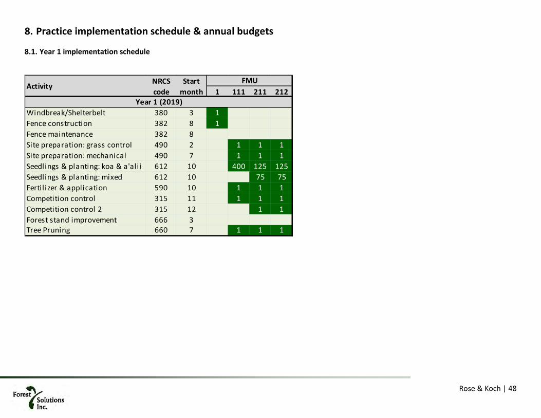
Rose & Koch | 48
8. Practice implementation schedule & annual budgets
Year 1 implementation schedule
1 111 211 212
Windbreak/Shelterbelt 380 3 1 0 0Fence construction 382 8 1 0 0 0Fence maintenance 382 8 0Site preparation: grass control 490 2 1 1 1Site preparation: mechanical 490 7 1 1 1Seedlings & planting: koa & a'ali i 612 10 400 125 125Seedlings & planting: mixed 612 10 0 75 75Fertil izer & application 590 10 1 1 1Competition control 315 11 1 1 1Competition control 2 315 12 1 1Forest stand improvement 666 3Tree Pruning 660 7 1 1 1
FMU
Year 1 (2019)
NRCS code
Start month
Activity

Rose & Koch | 49
8.1.1. Year 1 budget
FMU 1 111 211 212Area 5,947 22.0 4.1 7.3
Year 1 (2019) MonthWindbreak/Shelterbelt 380 $3.10 15,810 3 49,011$ Fence construction 382 $9.00 5,947 8 53,523$ Fence maintenance 382 $0.32 --- 8Site preparation: grass control 490 $250 --- 2 5,500$ 1,015$ 1,836$ Site preparation: mechanical 490 $396 --- 7 8,712$ 1,607$ 2,908$ Seedlings & planting: koa & a'ali i 612 $3.00 350 / 125 10 26,400$ 1,522$ 2,754$ Seedlings & planting: mixed 612 $5.50 75 10 -$ 1,674$ 3,029$ Fertil izer & application 590 $189 --- 10 4,158$ 767$ 1,388$ Competition control 315 $220 --- 11 4,840$ 893$ 1,616$ Competition control 2 315 $110 --- 12 -$ 446$ 808$ Forest stand improvement 666 $245 --- 3 -$ -$ -$ Tree Pruning 660 $91.00 --- 7 2,002$ 369$ 668$
Year subtotal: --- --- --- 102,534$ 51,612$ 8,293$ 15,006$ Share % --- --- --- 50% 50% 50% 50%
Applicant share: --- --- --- 51,267$ 25,806$ 4,147$ 7,503$ FSP Share: --- --- --- 51,267$ 25,806$ 4,147$ 7,503$
Year 1 Applicant Sum: $88,723 Year 1 FSP$88,723 Total: $177,445 $/ac: $5,312
Activity Cost per unit
NRCS code
Year 1
Units

Rose & Koch | 50
Year 2 Implementation schedule
2 121 221 222 111 211 212
Fence construction 382 8 1 0 0 0Fence maintenance 382 8 0Site preparation: grass control 490 2 1 1 1Site preparation: mechanical 490 7 1 1 1Seedlings & planting: koa & a'ali i 612 10 400 125 125Seedlings & planting: mixed 612 10 0 75 75Fertil izer & application 590 10 1 1 1Competition control 315 11 1 1 1 1 1 1Competition control 2 315 12 1 1Forest stand improvement 666 3 1 1 1Tree Pruning 660 7 1 1 1Monitoring 643 7 5
Year 2 (2020)
Activity NRCS code
Start month
FMU

Rose & Koch | 51
8.2.1. Year 2 Budget
FMU 2 121 221 222 111 211 212Area 6,173 47.3 12.8 10.6 22.0 4.1 7.3
Year 2 (2020) MonthFence construction 382 $9.00 6,173 8 55,557$ Fence maintenance 382 $0.32 --- 8Site preparation: grass control 490 $250 --- 2 11,826$ 3,210$ 2,645$ -$ -$ -$ Site preparation: mechanical 490 $396 --- 7 18,733$ 5,085$ 4,189$ -$ -$ -$ Seedlings & planting: koa & a'ali i 612 $3.00 350 / 125 10 56,766$ 4,815$ 3,967$ -$ -$ -$ Seedlings & planting: mixed 612 $5.50 75 10 -$ 5,297$ 4,364$ -$ -$ -$ Fertil izer & application 590 $189 --- 10 8,941$ 2,427$ 1,999$ -$ -$ -$ Competition control 315 $220 --- 11 10,407$ 2,825$ 2,327$ 4,840$ 893$ 1,616$ Competition control 2 315 $110 --- 12 -$ 1,412$ 1,164$ -$ -$ -$ Forest stand improvement 666 $245 --- 3 -$ -$ -$ 5,390$ 994$ 1,799$ Tree Pruning 660 $91.00 --- 7 -$ -$ -$ 2,002$ 369$ 668$ Monitoring 643 $110 --- 7 550$
Year subtotal: --- --- --- 55,557$ 106,673$ 25,071$ 20,654$ 12,232$ 2,256$ 4,083$ NRCS% --- --- --- 50% 50% 50% 50% 50% 50% 50%
Applicant share: --- --- --- $27,779 $53,337 $12,535 $10,327 $6,116 $1,128 $2,041FSP Share: --- --- --- $27,779 $53,337 $12,535 $10,327 $6,116 $1,128 $2,041
Year 2 Applicant Sum: Year 2 FSP Sum: $113,263 Total: $226,527 $/ac: $3,203$113,263
UnitsActivity NRCS code
Cost unit-
1
Year 1 Year 2

Rose & Koch | 52
Year 3 implementation schedule
3 131 132 133 231 232 121 221 222 111 211 212
Fence construction 382 8 1 0 0 0Fence maintenance 382 8 0Site preparation: grass control 490 2 1 1 1 1 1Site preparation: mechanical 490 7 1 1 1 1 1Seedlings & planting: koa & a'ali i 612 10 400 400 400 125 125Seedlings & planting: mixed 612 10 0 75 75Fertil izer & application 590 10 1 1 1 1 1Competition control 315 11 1 1 1 1 1 1 1 1Competition control 2 315 12 1 1 1 1Forest stand improvement 666 3 1 1 1 1 1 1Tree Pruning 660 7 1 1 1 1 1 1Monitoring 643 7 10
Activity NRCS code
Year 3 (2021)
FMUStart month

Rose & Koch | 53
8.3.1. Year 3 budget
Activity NRCS Cost unit- Units FMU 3 131 132 133 231 232 121 221 222 111 211 212Area 5,451 14.7 16.1 8.5 19.0 6.0 47.3 12.8 10.6 22.0 4.1 7.3
Year 3 (2021) MonthFence construction 382 $9.00 5,451 8 49,059$ Fence maintenance 382 $0.32 --- 8Site preparation: grass control 490 $250.00 --- 2 3,672$ 4,034$ 2,119$ 4,751$ 1,509$ -$ -$ -$ -$ -$ -$ Site preparation: mechanical 490 $396.00 --- 7 5,817$ 6,390$ 3,357$ 7,526$ 2,391$ -$ -$ -$ -$ -$ -$ Seedlings & planting: koa & a'ali i 612 $3.00 350 / 125 10 17,627$ 19,364$ 10,173$ 7,127$ 2,264$ -$ -$ -$ -$ -$ -$ Seedlings & planting: mixed 612 $5.50 75 10 -$ -$ -$ 7,840$ 2,490$ -$ -$ -$ -$ -$ -$ Fertil izer & application 590 $189.00 --- 10 2,776$ 3,050$ 1,602$ 3,592$ 1,141$ -$ -$ -$ -$ -$ -$ Competition control 315 $220.00 --- 11 3,232$ 3,550$ 1,865$ 4,181$ 1,328$ 10,407$ 2,825$ 2,327$ -$ -$ -$ Competition control 2 315 $110.00 --- 12 -$ 1,775$ 933$ 2,091$ 664$ -$ -$ -$ -$ -$ -$ Forest stand improvement 666 $245.00 --- 3 -$ -$ -$ -$ -$ 11,590$ 3,146$ 2,592$ 5,390$ 994$ 1,799$ Tree Pruning 660 $91.00 --- 7 -$ -$ -$ -$ -$ 4,305$ 1,168$ 963$ 2,002$ 369$ 668$ Monitoring 643 $110 --- 7 1,100$
Year subtotal: --- --- --- 49,059$ 33,125$ 38,162$ 20,050$ 37,109$ 11,787$ 26,302$ 7,139$ 5,882$ 7,392$ 1,364$ 2,467$ NRCS% --- --- --- 50% 50% 50% 50% 50% 50% 50% 50% 50% 50% 50% 50%
Applicant share: --- --- --- 24,530$ 16,562$ 19,081$ 10,025$ 18,554$ 5,894$ 13,151$ 3,570$ 2,941$ 3,696$ 682$ 1,234$ FSP Share: --- --- --- 24,530$ 16,562$ 19,081$ 10,025$ 18,554$ 5,894$ 13,151$ 3,570$ 2,941$ 3,696$ 682$ 1,234$
Year 3 Applicant Sum: Year 3 FSP Sum: 119,919 Total: $239,837 $/ac: $3,727
Year1 Year 2 Year 3
$119,919

Rose & Koch | 54
Year 4 implementation schedule
4 141 241 242 131 132 133 231 232 121 221 222
Fence construction 382 8 1 0 0 0Fence maintenance 382 8 0Site preparation: grass control 490 2 1 1 1Site preparation: mechanical 490 7 1 1 1Seedlings & planting: koa & a'ali i 612 10 400 125 125Seedlings & planting: mixed 612 10 0 75 75Fertil izer & application 590 10 1 1 1Competition control 315 11 1 1 1 1 1 1 1 1Competition control 2 315 12 1 1Forest stand improvement 666 3 1 1 1 1 1 1 1 1Tree Pruning 660 7 1 1 1 1 1 1 1 1Monitoring 643 7 20
Year 4 (2022)
Activity NRCS code
Start month
FMU

Rose & Koch | 55
8.4.1. Year 4 budget
FMU 4 141 241 242 131 132 133 231 232 121 221 222Area 4,376 40.8 17.1 1.9 14.7 16.1 8.5 19.0 6.0 47.3 12.8 10.6
Year 4 (2022) MonthFence construction 382 $9.00 4,376 8 39,384$ Fence maintenance 382 $0.32 6,173 8Site preparation: grass control 490 $250.00 --- 2 10,199$ 4,273$ 465$ -$ -$ -$ -$ -$ -$ -$ -$ Site preparation: mechanical 490 $396.00 --- 7 16,155$ 6,769$ 737$ -$ -$ -$ -$ -$ -$ -$ -$ Seedlings & planting: koa & a'ali i 612 $3.00 350 / 125 10 48,956$ 6,410$ 698$ -$ -$ -$ -$ -$ -$ -$ -$ Seedlings & planting: mixed 612 $5.50 75 10 -$ 7,051$ 767$ -$ -$ -$ -$ -$ -$ -$ -$ Fertil izer & application 590 $189.00 --- 10 7,711$ 3,231$ 352$ -$ -$ -$ -$ -$ -$ -$ -$ Competition control 315 $220.00 --- 11 8,975$ 3,760$ 409$ 3,232$ 3,550$ 1,865$ 4,181$ 1,328$ -$ -$ -$ Competition control 2 315 $110.00 --- 12 -$ 1,880$ 205$ -$ -$ -$ -$ -$ -$ -$ -$ Forest stand improvement 666 $245.00 --- 3 -$ -$ -$ 3,599$ 3,953$ 2,077$ 4,656$ 1,479$ 11,590$ 3,146$ 2,592$ Tree Pruning 660 $91.00 --- 7 -$ -$ -$ 1,337$ 1,468$ 771$ 1,730$ 549$ 4,305$ 1,168$ 963$ Monitoring 643 $110 --- 7 2,200$
Year subtotal: --- --- --- 39,384$ 91,996$ 33,374$ 3,632$ 8,167$ 8,972$ 4,714$ 10,567$ 3,357$ 15,895$ 4,314$ 3,554$ NRCS% --- --- --- 50% 50% 50% 50% 50% 50% 50% 50% 50% 50% 50% 50%
Applicant share: --- --- --- 19,692$ 45,998$ 16,687$ 1,816$ 4,084$ 4,486$ 2,357$ 5,284$ 1,678$ 7,947$ 2,157$ 1,777$ FSP Share: --- --- --- 19,692$ 45,998$ 16,687$ 1,816$ 4,084$ 4,486$ 2,357$ 5,284$ 1,678$ 7,947$ 2,157$ 1,777$
Year 4 Applicant Sum: Year 4 FSP Sum: Total: $227,926 $/ac: $3,815$113,963
Activity NRCS code
Cost unit-
1
Year 3
$113,963
Units
Year 1 Year 2

Rose & Koch | 56
Year 5 implementation schedule
5 151 141 241 242 131 132 133 231 232
Fence construction 382 8 1 0 0 0Fence maintenance 382 8 1Site preparation: grass control 490 2 1Site preparation: mechanical 490 7 1Seedlings & planting: koa & a'ali i 612 10 400Seedlings & planting: mixed 612 10 0Fertil izer & application 590 10 1Competition control 315 11 1 1 1 1Competition control 2 315 12Forest stand improvement 666 3 1 1 1 1 1 1 1 1Tree Pruning 660 7 1 1 1 1 1 1 1 1Monitoring 643 7 30
NRCS code
Start month
Activity
Year 5 (2023)
FMU

Rose & Koch | 57
8.5.1. Year 5 budget
FMU 5 151 141 241 242 131 132 133 231 232Area 4,890 59.0 40.8 17.1 1.9 14.7 16.1 8.5 19.0 6.0
Year 5 (2023) Month Year 1Fence construction 382 $9.00 4,890 8 44,010$ Fence maintenance 382 $0.32 5,947 8 1,903$ Site preparation: grass control 490 $250.00 --- 2 14,741$ -$ -$ -$ -$ -$ -$ -$ -$ Site preparation: mechanical 490 $396.00 --- 7 23,351$ -$ -$ -$ -$ -$ -$ -$ -$ Seedlings & planting: koa & a'ali i 612 $3.00 350 / 125 10 70,759$ -$ -$ -$ -$ -$ -$ -$ -$ Seedlings & planting: mixed 612 $5.50 75 10 -$ -$ -$ -$ -$ -$ -$ -$ -$ Fertil izer & application 590 $189.00 --- 10 11,145$ -$ -$ -$ -$ -$ -$ -$ -$ Competition control 315 $220.00 --- 11 12,973$ 8,975$ 3,760$ 409$ -$ -$ -$ -$ -$ Competition control 2 315 $110.00 --- 12 -$ -$ -$ -$ -$ -$ -$ -$ -$ Forest stand improvement 666 $245.00 --- 3 -$ 9,995$ 4,188$ 456$ 3,599$ 3,953$ 2,077$ 4,656$ 1,479$ Tree Pruning 660 $91.00 --- 7 -$ 3,712$ 1,555$ 169$ 1,337$ 1,468$ 771$ 1,730$ 549$ Monitoring 643 $110 --- 7 3,300$
Year subtotal: --- --- --- 45,913$ 132,968$ 22,683$ 9,504$ 1,034$ 4,936$ 5,422$ 2,848$ 6,386$ 2,028$ NRCS% --- --- --- 50% 50% 50% 50% 50% 50% 50% 50% 50% 50%
Applicant share: --- --- --- 22,957$ 66,484$ 11,341$ 4,752$ 517$ 2,468$ 2,711$ 1,424$ 3,193$ 1,014$ FSP Share: --- --- --- 22,957$ 66,484$ 11,341$ 4,752$ 517$ 2,468$ 2,711$ 1,424$ 3,193$ 1,014$
Year 5 Applicant Sum: Year 5 FSP Sum: Total: $233,723 $/ac: $3,964$116,861
Year 2 Year 3
$116,861
Activity NRCS code
Cost unit-
1Units

Rose & Koch | 58
Year 6 implementation schedule
6 161 151 141 241 242
Fence construction 382 8 1 0 0 0Fence maintenance 382 8 1Site preparation: grass control 490 2 1Site preparation: mechanical 490 7 1Seedlings & planting: koa & a'ali i 612 10 400Seedlings & planting: mixed 612 10 0Fertil izer & application 590 10 1Competition control 315 11 1 1Competition control 2 315 12Forest stand improvement 666 3 1 1 1 1Tree Pruning 660 7 1 1 1 1Monitoring 643 7 40
Activity
Year 6 (2024)
NRCS code
Start month
FMU

Rose & Koch | 59
8.6.1. Year 6 budget
FMU 6 161 151 141 241 242Area 3,802 77.3 59.0 40.8 17.1 1.9
Year 6 (2024) Month Year 1 Year 2Fence construction 382 $9.00 3,802 8 34,218$ Fence maintenance 382 $0.32 6,173 8 1,975$ Site preparation: grass control 490 $250.00 --- 2 19,323$ -$ -$ -$ -$ Site preparation: mechanical 490 $396.00 --- 7 30,607$ -$ -$ -$ -$ Seedlings & planting: koa & a'ali i 612 $3.00 350 / 125 10 92,750$ -$ -$ -$ -$ Seedlings & planting: mixed 612 $5.50 75 10 -$ -$ -$ -$ -$ Fertil izer & application 590 $189.00 --- 10 14,608$ -$ -$ -$ -$ Competition control 315 $220.00 --- 11 17,004$ 12,973$ -$ -$ -$ Competition control 2 315 $110.00 --- 12 -$ -$ -$ -$ -$ Forest stand improvement 666 $245.00 --- 3 -$ 14,447$ 9,995$ 4,188$ 456$ Tree Pruning 660 $91.00 --- 7 -$ 5,366$ 3,712$ 1,555$ 169$ Monitoring 643 $110 --- 7 4,400$
Year subtotal: --- --- --- 36,193$ 174,292$ 27,419$ 9,995$ 4,188$ 456$ NRCS% --- --- --- 50% 50% 50% 50% 50% 50%
Applicant share: --- --- --- 18,097$ 87,146$ 13,710$ 4,998$ 2,094$ 228$ FSP Share: --- --- --- 18,097$ 87,146$ 13,710$ 4,998$ 2,094$ 228$
Year 6 Applicant Sum: Year 6 FSP Sum: Total: $252,544 $/ac: $3,267
Activity NRCS code
$126,272 $126,272
Cost unit-
1Units
Year 3

Rose & Koch | 60
Year 7 implementation schedule
7 171 172 271 161 151
Fence construction 382 8 1 0 0 0Fence maintenance 382 8 1Site preparation: grass control 490 2 1 1 1Site preparation: mechanical 490 7 1 1 1Seedlings & planting: koa & a'ali i 612 10 400 400 125Seedlings & planting: mixed 612 10 0 75Fertil izer & application 590 10 1 1 1Competition control 315 11 1 1 1 1Competition control 2 315 12 1Forest stand improvement 666 3 1 1Tree Pruning 660 7 1 1Monitoring 643 7 50
Year 7 (2025)
FMUStart month
Activity NRCS code

Rose & Koch | 61
8.7.1. Year 7 budget
FMU 7 171 172 271 161 151Area 3,957 8.0 37.2 25.0 77.3 59.0
Year 7 (2025) Month Year 2 Year 3Fence construction 382 $9.00 3,957 8 35,613$ Fence maintenance 382 $0.32 5,451 8 1,744$ Site preparation: grass control 490 $250.00 --- 2 1,992$ 9,305$ 6,239$ -$ -$ Site preparation: mechanical 490 $396.00 --- 7 3,155$ 14,740$ 9,883$ -$ -$ Seedlings & planting: koa & a'ali i 612 $3.00 350 / 125 10 9,560$ 44,665$ 9,359$ -$ -$ Seedlings & planting: mixed 612 $5.50 75 10 -$ -$ 10,295$ -$ -$ Fertil izer & application 590 $189.00 --- 10 1,506$ 7,035$ 4,717$ -$ -$ Competition control 315 $220.00 --- 11 1,753$ 8,189$ 5,490$ 17,004$ -$ Competition control 2 315 $110.00 --- 12 -$ -$ 2,745$ -$ -$ Forest stand improvement 666 $245.00 --- 3 -$ -$ -$ 18,936$ 14,447$ Tree Pruning 660 $91.00 --- 7 -$ -$ -$ 7,034$ 5,366$ Monitoring 643 $110 --- 7 5,500$
Year subtotal: --- --- --- 37,357$ 17,965$ 83,933$ 48,727$ 42,974$ 19,813$ NRCS% --- --- --- 50% 50% 50% 50% 50% 50%
Applicant share: --- --- --- 18,679$ 8,982$ 41,967$ 24,364$ 21,487$ 9,906$ FSP Share: --- --- --- 18,679$ 8,982$ 41,967$ 24,364$ 21,487$ 9,906$
Year 7 Applicant Sum: Year 7 FSP Sum: Total: $250,769 $/ac: $3,575$125,385 $125,385
Activity NRCS code
Cost unit-
1Units
Year 1

Rose & Koch | 62
Year 8 implementation schedule
8 311 181 182 281 282 171 172 271 161
Fence construction 382 8 1 0 0 0Fence maintenance 382 8 1Site prepartion: ash stand 490 2 1Brush management (chem) 314 7 1Site preparation: grass control 490 10 1 1 1 1Site preparation: mechanical 490 10 1 1 1 1 1Seedlings & planting: koa & a'ali i 612 10 700 400 400 125 125Seedlings & planting: mixed 612 10 0 75 75Fertil izer & application 590 12 1 1 1 1 1Competition control 315 3 1 1 1 1 1 1 1 1Competition control 2 315 7 1 1 1 1 1Forest stand improvement 666 7 1 1 1 1 1Tree Pruning 660 7 1 1 1 1 1Monitoring 643 7 60
Year 8 (2026)
Activity NRCS code
Start month
FMU

Rose & Koch | 63
8.8.1. Year 8 budget
FMU 8 311 181 182 281 282 171 172 271 161Area 4,408 14.8 23.6 4.4 13.2 4.8 8.0 37.2 25.0 77.3
Year 8 (2026) Month Year 3Fence construction 382 $9.00 4,408 8 39,672$ Fence maintenance 382 $0.32 4,376 8 1,400$ Site prepartion: ash stand 490 $650.00 --- 2 38,328$ -$ -$ -$ -$ -$ -$ -$ -$ Brush management (chem) 314 $340.00 --- 7 20,048$ -$ -$ -$ -$ -$ -$ -$ -$ Site preparation: grass control 490 $250.00 --- 10 -$ 10,199$ 4,273$ 465$ 3,672$ -$ -$ -$ -$ Site preparation: mechanical 490 $396.00 --- 10 23,351$ 16,155$ 6,769$ 737$ 5,817$ -$ -$ -$ -$ Seedlings & planting: koa & a'ali i 612 $3.00 350 / 125 10 123,829$ 48,956$ 20,511$ 698$ 5,509$ -$ -$ -$ -$ Seedlings & planting: mixed 612 $5.50 75 10 -$ -$ -$ 767$ 6,059$ -$ -$ -$ -$ Fertil izer & application 590 $189.00 --- 12 11,145$ 7,711$ 3,231$ 352$ 2,776$ -$ -$ -$ -$ Competition control 315 $220.00 --- 3 12,973$ 8,975$ 3,760$ 409$ 3,232$ 3,550$ 1,865$ 4,181$ -$ Competition control 2 315 $110.00 --- 7 6,486$ 4,488$ 1,880$ 205$ 1,616$ -$ -$ -$ -$ Forest stand improvement 666 $245.00 --- 7 -$ -$ -$ -$ 3,599$ 3,953$ 2,077$ 4,656$ 1,479$ Tree Pruning 660 $91.00 --- 7 -$ -$ -$ -$ 1,337$ 1,468$ 771$ 1,730$ 549$ Monitoring 643 $110 --- 7 6,600$
Year subtotal: --- --- --- 41,072$ 236,159$ 96,484$ 40,425$ 3,632$ 33,617$ 8,972$ 4,714$ 10,567$ 2,028$ NRCS% --- --- --- 50% 50% 50% 50% 50% 50% 50% 50% 50% 50%
Applicant share: --- --- --- 20,536$ 118,079$ 48,242$ 20,212$ 1,816$ 16,808$ 4,486$ 2,357$ 5,284$ 1,014$ FSP Share: --- --- --- 20,536$ 118,079$ 48,242$ 20,212$ 1,816$ 16,808$ 4,486$ 2,357$ 5,284$ 1,014$
Year 8 Applicant Sum: Year 1 FSP Sum: Total: $477,670 $/ac: $7,862$238,835 $238,835
Year 1 Year 2
Activity NRCS code
Cost unit-
1Units
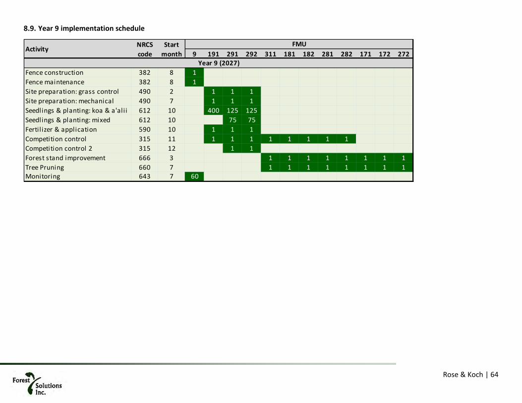
Rose & Koch | 64
Year 9 implementation schedule
9 191 291 292 311 181 182 281 282 171 172 272
Fence construction 382 8 1 0 0 0Fence maintenance 382 8 1Site preparation: grass control 490 2 1 1 1Site preparation: mechanical 490 7 1 1 1Seedlings & planting: koa & a'ali i 612 10 400 125 125Seedlings & planting: mixed 612 10 0 75 75Fertil izer & application 590 10 1 1 1Competition control 315 11 1 1 1 1 1 1 1 1Competition control 2 315 12 1 1Forest stand improvement 666 3 1 1 1 1 1 1 1 1Tree Pruning 660 7 1 1 1 1 1 1 1 1Monitoring 643 7 60
Year 9 (2027)
Activity NRCS code
Start month
FMU

Rose & Koch | 65
8.9.1. Year 9 budget
FMU 9 191 291 292 311 181 182 281 282 171 172 272Area 5,211 26.1 19.3 6.8 23.6 4.4 13.2 4.8 8.0 37.2 25.0 25.0
Year 9 (2027) MonthFence construction 382 $9.00 5,211 8 46,899$ Fence maintenance 382 $0.32 3,957 8 1,266$ Site preparation: grass control 490 $250.00 --- 2 10,199$ 4,273$ 465$ -$ -$ -$ -$ -$ -$ -$ -$ Site preparation: mechanical 490 $396.00 --- 7 16,155$ 6,769$ 737$ -$ -$ -$ -$ -$ -$ -$ -$ Seedlings & planting: koa & a'ali i 612 $3.00 350 / 125 10 48,956$ 6,410$ 698$ -$ -$ -$ -$ -$ -$ -$ -$ Seedlings & planting: mixed 612 $5.50 75 10 -$ 7,051$ 767$ -$ -$ -$ -$ -$ -$ -$ -$ Fertil izer & application 590 $189.00 --- 10 7,711$ 3,231$ 352$ -$ -$ -$ -$ -$ -$ -$ -$ Competition control 315 $220.00 --- 11 8,975$ 3,760$ 409$ 3,232$ 3,550$ 1,865$ 4,181$ 1,328$ -$ -$ -$ Competition control 2 315 $110.00 --- 12 -$ 1,880$ 205$ -$ -$ -$ -$ -$ -$ -$ -$ Forest stand improvement 666 $245.00 --- 3 -$ -$ -$ 3,599$ 3,953$ 2,077$ 4,656$ 1,479$ 11,590$ 3,146$ 2,592$ Tree Pruning 660 $91.00 --- 7 -$ -$ -$ 1,337$ 1,468$ 771$ 1,730$ 549$ 4,305$ 1,168$ 963$ Monitoring 643 $110 --- 7 6,600$
Year subtotal: --- --- --- 48,165$ 91,996$ 33,374$ 3,632$ 8,167$ 8,972$ 4,714$ 10,567$ 3,357$ 15,895$ 4,314$ 3,554$ NRCS% --- --- --- 50% 50% 50% 50% 50% 50% 50% 50% 50% 50% 50% 50%
Applicant share: --- --- --- 24,083$ 45,998$ 16,687$ 1,816$ 4,084$ 4,486$ 2,357$ 5,284$ 1,678$ 7,947$ 2,157$ 1,777$ FSP Share: --- --- --- 24,083$ 45,998$ 16,687$ 1,816$ 4,084$ 4,486$ 2,357$ 5,284$ 1,678$ 7,947$ 2,157$ 1,777$
Year 2 Applicant Sum: Year 2 FSP Sum: Total: $236,708 $/ac: $4,536$118,354
Activity NRCS code
Cost unit-
1Units
Year 1
$118,354
Year 3Year 2

Rose & Koch | 66
Year 10 implementation Schedule
9 191 291 292 311 181 182 281 282
Fence maintenance 382 8 1 0 0 0Competition control 315 11 1 1 1 1 0Forest stand improvement 666 3 1 1 1 1 1 1 1 1Tree Pruning 660 7 1 1 1 1 1 1 1 1Monitoring 643 7 60
Activity NRCS code
Start month
FMU
Year 10 (2028)
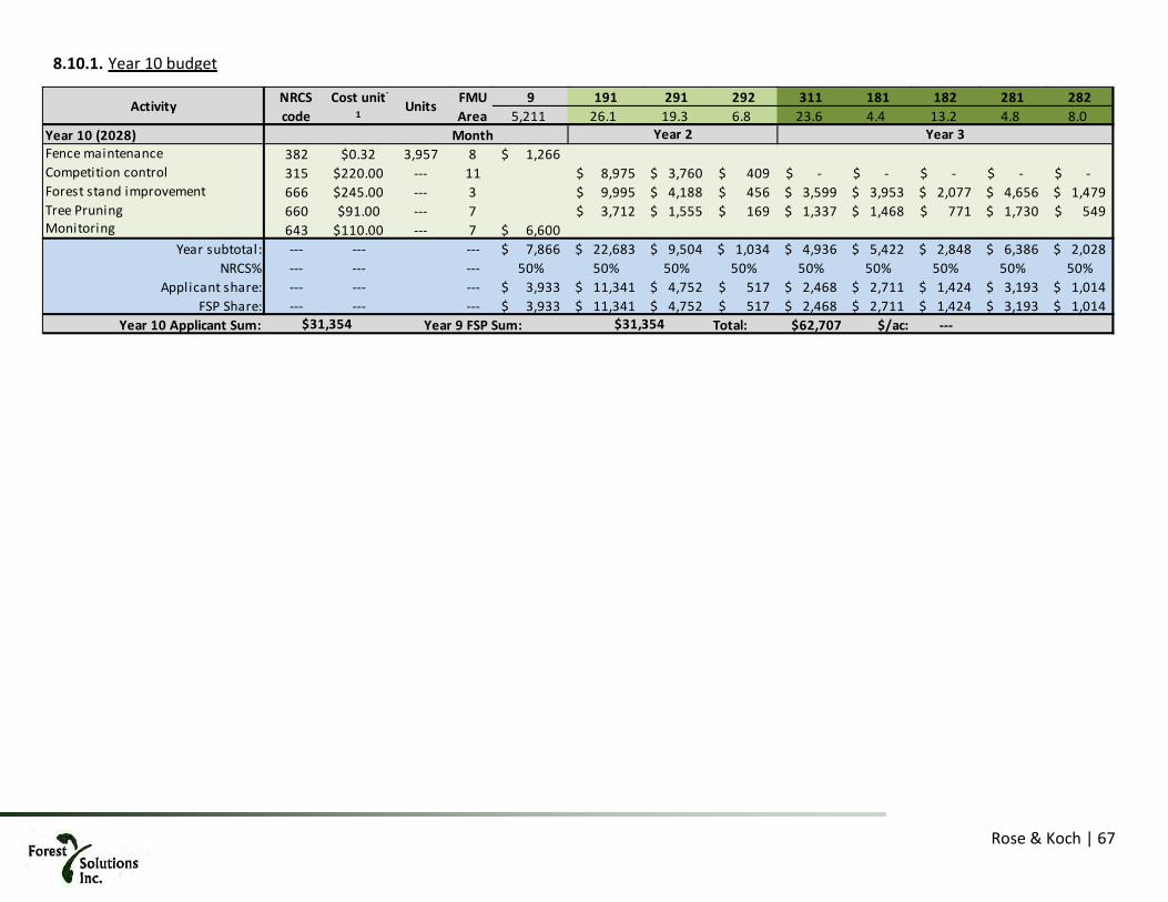
Rose & Koch | 67
8.10.1. Year 10 budget
FMU 9 191 291 292 311 181 182 281 282Area 5,211 26.1 19.3 6.8 23.6 4.4 13.2 4.8 8.0
Year 10 (2028) MonthFence maintenance 382 $0.32 3,957 8 1,266$ Competition control 315 $220.00 --- 11 8,975$ 3,760$ 409$ -$ -$ -$ -$ -$ Forest stand improvement 666 $245.00 --- 3 9,995$ 4,188$ 456$ 3,599$ 3,953$ 2,077$ 4,656$ 1,479$ Tree Pruning 660 $91.00 --- 7 3,712$ 1,555$ 169$ 1,337$ 1,468$ 771$ 1,730$ 549$ Monitoring 643 $110.00 --- 7 6,600$
Year subtotal: --- --- --- 7,866$ 22,683$ 9,504$ 1,034$ 4,936$ 5,422$ 2,848$ 6,386$ 2,028$ NRCS% --- --- --- 50% 50% 50% 50% 50% 50% 50% 50% 50%
Applicant share: --- --- --- 3,933$ 11,341$ 4,752$ 517$ 2,468$ 2,711$ 1,424$ 3,193$ 1,014$ FSP Share: --- --- --- 3,933$ 11,341$ 4,752$ 517$ 2,468$ 2,711$ 1,424$ 3,193$ 1,014$
Year 10 Applicant Sum: Year 9 FSP Sum: Total: $62,707 $/ac: ---
Activity
$31,354
Year 3
$31,354
NRCS code
Cost unit-
1Units
Year 2

Rose & Koch | 68
9. Economic Analysis
Methods and assumptions For the purposes of this management plan, the current budget costs were fed into a discounted cash flow (DCF) model that simplifies operations into a single “standard” acre. The “standard” acre costs were equalized so as to more or less add up to the total budget figure of 2.3 million dollars in aggregate.
Year 1 Year 2 Year 3Fence installation & maintenance ($730) $0 $0Site preparation: grass control ($250) $0 $0Site preparation: mechanical ($396) $0 $0Seedlings: Koa & a'ali'i ($800) $0 $0Seedlings: Natives ($450) $0 $0Planting ($153) $0 $0Fertilizer and application ($189) $0 $0Competition control ($220) ($220) $0Competition control 2 ($73) $0 $0Integrated pest management ($230) ($230)Tree pruning ($35) ($35)Monitoring ($91)Other activities: ash stand mgmt ($105)
Totals ($3,261) (485.00)$ (461.00)$ Cumulative (4,207)$
Per acre koa establishment costs, spot cultivation and manual spraying and fertilizer
DescriptionCost ($ / ac) by year with GE tax
Koa establishment costs, mechanical preparation, ex pasture, 550 acres unsubsidized
1 2 3Fence installation & maintenance ($401,500) $0 $0Site preparation: grass control ($137,500) $0 $0Site preparation: mechanical ($217,800) $0 $0Seedlings: Koa & a'ali'i ($440,000) $0 $0Seedlings: Natives ($247,500) $0 $0Planting ($84,150) $0 $0Fertilizer and application ($103,950) $0 $0Competition control ($121,000) ($121,000) $0Competition control 2 ($40,150) $0 $0Integrated pest management $0 ($126,500) ($126,500)Tree pruning $0 ($19,250) ($19,250)Monitoring $0 $0 ($50,050)Other activities: ash stand mgmt $0 $0 ($57,750)
Totals ($1,793,550) (266,750.00)$ (253,550.00)$ Cumulative (2,313,850)$
OperationCost ($) by activity by entry for entire project
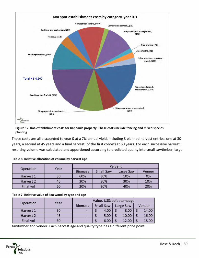
Rose & Koch | 69
These costs are all discounted to year 0 at a 7% annual yield, including 3 planned harvest entries: one at 30 years, a second at 45 years and a final harvest (of the first cohort) at 60 years. For each successive harvest, resulting volume was calculated and apportioned according to predicted quality into small sawtimber, large
sawtimber and veneer. Each harvest age and quality type has a different price point:
Figure 12. Koa establishment costs for Kapoaula property. These costs include fencing and mixed species planting
Biomass Small Saw Large Saw VeneerHarvest 1 30 60% 30% 10% 0%Harvest 2 45 30% 30% 30% 10%Final vol 60 20% 20% 40% 20%
Operation Year Percent
Table 8. Relative allocation of volume by harvest age
Biomass Small Saw Large Saw VeneerHarvest 1 30 - 4.00$ 8.00$ 14.00$ Harvest 2 45 - 5.00$ 10.00$ 16.00$ Final vol 60 - 6.00$ 12.00$ 18.00$
Operation Year Value, US$/bdft stumpageTable 7. Relative value of koa wood by type and age

Rose & Koch | 70
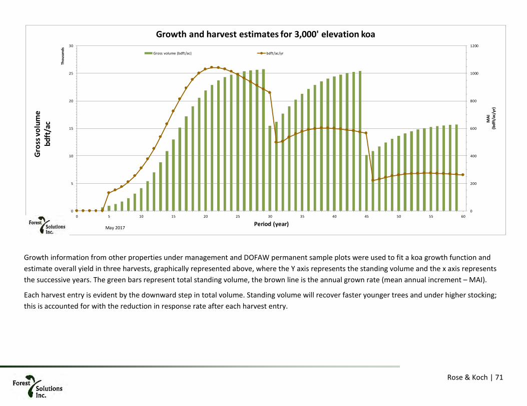
Rose & Koch | 71
Growth information from other properties under management and DOFAW permanent sample plots were used to fit a koa growth function and estimate overall yield in three harvests, graphically represented above, where the Y axis represents the standing volume and the x axis represents the successive years. The green bars represent total standing volume, the brown line is the annual grown rate (mean annual increment – MAI).
Each harvest entry is evident by the downward step in total volume. Standing volume will recover faster younger trees and under higher stocking; this is accounted for with the reduction in response rate after each harvest entry.
0
200
400
600
800
1000
1200
0
5
10
15
20
25
30
0 5 10 15 20 25 30 35 40 45 50 55 60
MAI
(bdf
t/ac
/yr)
Gros
s vol
ume
bdft
/ac
Thou
sand
s
Period (year)
Growth and harvest estimates for 3,000' elevation koa
Gross volume (bdft/ac) bdft/ac/yr
May 2017

Rose & Koch | 72
The foregoing volume and relative value computation is fed back into the DCF model to calculate present value (PV) during the stand development. This is presented in graphical form on the next page, where the left axis is PV and the Y axis is the stand age.
Results of the analysis The result of this analysis is that the unsubsidized PV for this project is approximately $5,100 per acre including land carrying and forest management costs. For the planted forest as a whole, the 550 acres represent an NPV of $2.8 million. The internal rate of return (IRR) for the project is 9% or 2% over the discount rate employed.
Challenges to this analysis There are two salient challenges to this analysis. The first is that the growth of koa is still not well understood, particularly after 30 years. The second is that the prices for harvested volume are, at best, conjecture as there time spans involved are large. In both cases, the analysis opts for the conservative approach, discussed below.
9.3.1. Unknown growth While the growth of koa is unknown, the current model employs a conservative 50% of observed growth from 15 plots at a higher elevation elsewhere on Hawaiʻi Island. This still does not solve the potential for lower yield, yet provides some assurance that the modeled growth rates are indeed conservative.
9.3.2. Prices for koa volume will vary in the long term It is impossible to predict long term prices for any commodity, much less those for koa, the price of which has doubled in the last 10 years. However, we use a consistent (uninflated) price across the analysis period with the assumption that any price appreciation will also be reflected in the wider economy. There may (or may not) be a real (i.e. after inflation) price increase in koa wood. The conservative solution is to not include any such real price appreciation.
9.3.3. Diseases and/or climate change Hardwood trees are a long-term investment. The longer time span introduces risks not normally associated with investments, such as disease and climate change. A percentage of the planted koa will be of wilt-resistant stock, however, it is unlikely that there will be enough seed from this stock to fully plant the project. As a result, there may be wilt affecting trees on the property, especially at the lower reaches. This will be exacerbated by climate change effects and the natural disease adaptation to cooler climes.
Biomass Small Saw Large Saw VeneerHarvest 1 30 6,186 3,093 1,031 - Harvest 2 45 4,572 4,572 4,572 1,524 Final vol 60 3,142.00 3,142 6,284 3,142
Operation Year Volume, bdft
Table 9. Predicted harvest volumes by type and age

Rose & Koch | 73
-10000
-8000
-6000
-4000
-2000
0
2000
4000
6000
8000
10000
($5)
($4)
($3)
($2)
($1)
$0
$1
$2
$3
$4
$5
0 5 10 15 20 25 30 35 40 45 50 55 60
Cum
ulat
ive
perf
orm
ance
, PV
($/a
c) @
6 %
Pres
ent V
alue
(PV)
of a
ctiv
ity ($
/ac)
Thou
sand
s
Cohort Age (yrs)
Timeline of discounted cash flows by forest age, koa planted forest
PV $ by year Cumulative performance PV $, right axis
Establishment Thinning , harvest & regeneration of next crop of trees
Koch, Sep 2018

Kapoaula Koa Forest Management Plan Final Environmental Assessment August 2019
Page B-1 Appendix B: Biological Survey
APPENDIX B BIOLOGICAL SURVEY

Kapoaula Koa Forest Management Plan Final Environmental Assessment August 2019
Page B-2 Appendix B: Biological Survey
This page intentionally left blank.

Biological Survey of Kapoaula Koa Forest, Page 1
Biological Survey Kapoaula Koa Forest
TMK (3rd.) 4-7-007-011 Kapoaula, Hāmākua, Island of Hawai‘i
By Ron Terry, Ph.D., Patrick Hart, Ph.D., and Layne Yoshida, B.S. Prepared for Paniolo Forestry LLC and the Department of Land and Natural Resources
April 2019 Introduction Siglo Forest, LLC acquired the 564-acre Kapoaula property from Parker Ranch to obtain long-term access for the purposes of planting koa trees (Figure 1a and 1b). Siglo has partnered with other resource firms and public agencies in a project to convert pastureland back to a semblance of the native koa-ʻōhiʻa forest (Acacia koa-Metrosideros polymorpha) that once stood in this area and to provide controlled future uses of the forest for commercial products. This goal has been advanced through preparation of a site-specific forestry management plan (FMP) prepared by Forestry Solutions, Inc.1 Through implementation of the FMP measures, in approximately 50 years the property will consist of a mixed-species native forest with the steep-sloped areas primarily used for native species conservation and less steeply sloped, less erodible areas primarily used for timber production. The resulting koa forest will provide a sustainable, long-term, predictable source of instrument grade wood for Taylor Guitars, one of the venture partners, produce high-quality wood for other uses, and provide habitat for native species, inspiring others to plant trees on their land for similar purposes. The ten-year objectives are as follows:
• Reforest the entire property with koa and a complement of associated native forest plants. • Improve the quality of wood to be harvested in the future by:
o planting seed from known, high-quality sources; and o utilizing cuttings propagated from trees with superior color, figure and form.
• Intensive management of koa for saw timber on those areas of the property with slopes less than 20%--accounting for 70% of the property or 390 acres.
• Reforest the remaining upland areas with a multi-species native forest, utilizing koa as a pioneer species—accounting for 30% of the area or 163 acres.
• Protect planted forest from wind by planting fast-growing, cattle resistant windbreaks. This biological survey was prepared to provide an assessment of the overall biological environment and potential impacts of the project and to inform implementation of the project in case there is a need for avoidance or other mitigation. The survey involved a full assessment of flora and vegetation of the property based on walking the main access road and the perimeter fence line; inspection of existing groves of trees; wandering transects focused on areas with the highest potential for native species; inspection of a number of wetlands; and periodic excursions into random areas not selected for examination for other reasons.
1 The FMP is a separate appendix to the Environmental Assessment to which this report is an appendix.

Biological Survey of Kapoaula Koa Forest, Page 2
Teams of between one and four biologists (Ron Terry, Patrick Hart, Layne Yoshida, and Cory Edging) walked the area on two separate days in February and March 2019. The objectives of the botanical survey were to: 1) describe the vegetation; 2) list all species encountered; and 3) identify threatened or endangered plant species. Plant species were identified in the field and later in the laboratory. Special attention was given to the possible presence of any federally (USFWS 2019) listed threatened or endangered plant species. The survey also included a limited faunal survey restricted to providing a list of birds and introduced mammals, reptiles, or amphibians observed during the botanical survey. Also considered in this report is the general value of the habitat for native birds and the Hawaiian hoary bat. Not included are evaluation of impacts to invertebrates, although members of the Solanaceae plant family, many of which are known to be host plants for the endangered Blackburn’s sphinx moth (Manduca blackburnii), were specifically searched for. Included in this report are discussions of threatened and endangered species. Federal and State of Hawai‘i endangered species laws require government agencies to ensure that their actions are not likely to jeopardize the continued existence of federal or State listed threatened endangered species (16 U.S.C. §1536(a)(2) and (4); Chapter 195D, HRS). The U.S. Endangered Species Act defines Critical Habitat as areas that may or may not be occupied by a threatened or endangered species but are essential to the conservation of the species. These areas may require special management considerations or protection (16 U.S.C. §1532 (5)). Ecological Context and Biological Literature Physical Factors Influencing Vegetation and Animal Habitat There are several factors that influence the flora, vegetation and faunal habitat of the Kapoaula property. The geologic substrate on the property consists of different-aged lava flows from Mauna Kea ranging from as young as 4,000 years to as old as 250,000 years (Wolfe and Morris 1996). Winds in the area are dominantly northeast trades, replaced periodically by winds with a southerly component that can bring with them volcanic haze, or vog, when Kilauea Volcano is active (UH Hilo 1998). Kapoaula receives abundant rainfall. The average annual rainfall is 83 inches on the makai end of the property at an elevation of 2,740 feet and 56 inches at the mauka end at 3,180 feet. Monthly averages vary from about 4 inches in the comparatively dry summer months to more than 12 inches in the relatively wetter months of November through March (Giambelluca et al. 2013). The area is at very low risk of drought. Soils on the property are classified by the U.S. Natural Resources Conservation Service (NRCS) as Honokaʻa silty clay loam in the lower elevations and Maile silt loam in the upper elevations. Both soil types are listed as “highly erodible.” These soils have an 8-10% organic material content. Locally boggy conditions develop readily when the soil is compressed by cultivation, vehicles or animals. Both natural and human-created small depressions are present in this landscape and form temporary or even sometimes semi-permanent ponds. A number of minor gullies and ephemeral streams are typical of this landscape, which has not eroded sufficiently to have deep gulches and permanent streams, which would offer very distinct habitats.
Biological Survey of Kapoaula Koa Forest, Page 3
Vegetation It is difficult to speculate on the precise pre-human vegetation of the area, since the area has been completely transformed by removal of tree cover and introduction and promotion of pasture grasses maintained by heavy cattle grazing. In the Manual of the Flowering Plants of the Hawaiian Islands, Gagne and Cuddihy (1990) described the natural vegetation in fairly undisturbed areas with similar geology and climate in this part of Hāmākua as sub-montane rain forest dominated by ‘ōhi‘a, koa and hapu‘u (Cibotium spp.) (Gagne and Cuddihy 1990). Historical records indicate that this entire flank of Mauna Kea was once a dense koa-ʻōhiʻa forest, but the in 1850s the forest was evidently nearly eliminated and replaced by grazing land. An 1856 account from the Sandwich Island Monthly Magazine reported:
“…it is in the memory of many foreigners now living here, when the whole of these plains were covered in a thick wood…where hardly a tree stands for miles…….Thousands of old dead trees both standing upright and prostrate, from the present boundaries of these woods, exhibit a mode in which the destruction is effected; for whilst the old trees die of age, no young ones are seen taking their place, as during the last thirty or forty years, the cattle have eaten or trodden them down.…..“In former times when I was a boy (said Ha’alelea), Waimea was a thickly wooded region all about there…. but of late years round about where I lived, it is as cleared of trees as the Esplanade is.”….. He explained that white settlers had felled the trees for fuel and fences for cattle pens and that “a good many of the young trees were destroyed by the cattle” (Fischer 2015: 62).
“From the nature of the country to the windward of our private lands [Waimea] (a dense forest and almost impenetrable undergrowth covering nearly the whole of it) as the herds increased it became an impossibility to prevent cattle from getting beyond the reach of our control, and gradually they have filled this land with their offspring” (Fischer 2015: 188).
John Parker’s original homestead at Mana was located about a mile mauka of the property boundary. An early account of the ranch reported on the koa milling activity in the area:
“…it was below the koa forest of Hanaipoi that the saw pits were dug in the land known as Makahalau where the purebred bulls and cows are now penned up. This became the great center for koa work, cutting down trees, selecting the best to be sawn up into lumber through the saw pits, the piling up of koa lumber on hilly ground so that the air could get between the boards and season the wood. There was so much lumber piled up in this section that the natives called the place Palihooukapapa [Hill of piled lumber]” (Brennan 2006: 82).
Over the last century, however, there have only been small areas of remnant forest patches of ‘ōhi‘a that reflect the original vegetation. No threatened or endangered plant species are known from this general area, and no plant critical habitat is present on or near the property (https://ecos.fws.gov/ecp/report/table/critical-habitat.html). The closest plant critical habitat is at about three miles south on a pair of hills that provide specialized habitat for a group of cinder cone species.

Biological Survey of Kapoaula Koa Forest, Page 4
General Faunal Habitat The quality of habitat for native animals is primarily determined by vegetation and the degree of disturbance. At the Kapoaula property, as in similar locations along the Hāmākua Coast, both the bird and invertebrate fauna would be expected to be dominated by non-native species that are adapted to open grassland habitats. A few widespread native species will tend to be present and forest patches may attract native birds. Unlike the situation with plants, a number of widespread endangered species may fly over, and, in some cases, nest, roost, forage, or otherwise utilize some features of the habitat on the property. However, no animal critical habitat is present on the property or within four miles of the property (https://ecos.fws.gov/ecp/report/table/critical-habitat.html). The closest animal critical habitat is eight miles away on Mauna Kea and on the Hakalau Forest National Wildlife Refuge, which are critical habitat units for various endangered birds. Birds A number of native forest birds occur along the Hilo-Hāmākua coast within the elevational range of the Kapoaula property. These include honeycreepers such as the ‘apapane (Himatione sanguinea) and ‘amakihi (Chlorodrepanis virens), the ‘elepaio (Chasiempis sandwicensis – a monarch flycatcher), the ‘ōma‘o thrush (Myadestes obscurus), and the Hawaiian hawk (Buteo solitarius). All of these species generally require ‘ōhi‘a forest, but the hawk is known to breed successfully in both native and non-native forests. Additional native forest bird species are found in the montane forests along the Hāmākua Coast above the mosquito belt (generally above 4,000 feet in elevation), where native plant resources are still present and Culex mosquitos are absent or scarce. A particularly important location is the 32,733-acre Hakalau Forest National Wildlife Refuge, located about 20 miles from the Kapoaula property. Birds for which the continuing health of the Refuge may be a critical factor include the threatened ‘i‘iwi (Drepanis coccinea), as well as the endangered ‘akiapōlā‘au (Hemignathus munroi), Hawai‘i creeper (Loxops mana) and Hawai‘i ‘akepa (Loxops coccineus). Bird survey work in Puna on the eastern end of the Island of Hawai‘i documented in Spiegel et al. (2006) indicate that in many lowland forests, ‘amakihi are the most common and widespread native birds and are significantly associated with ‘ōhi‘a. These lowland ‘ōhi‘a forests can also support endangered Hawaiian hawks which forage in forests nearby agricultural tracts and nest in tall trees. At low elevations there has been widespread recovery of this species and a changing composition of the forest bird community; nevertheless, lowlands dominated by non-native vegetation and bird species continue to have few forest birds, with a few exceptions. By contrast, some native waterbirds are common in both upland and lowland environments. In the Hāmākua Coast in general, waterbirds may be found in streams, estuaries, natural and artificial ponds, and wetlands. The most common native waterbird at lower elevations is the indigenous black-crowned night heron, or ‘auku‘u (Nycticorax nycticorax hoactli), a wetland bird. It is also not unusual to spot the endangered Hawaiian goose or nēnē (Branta sandwicensis), a wide-ranging and friendly bird, in a variety of environments and elevations throughout the island. Conceivably present in isolated ponds in the uplands are three endangered waterbirds: Hawaiian ducks or koloa maoli (Anas wyvilliana), Hawaiian stilt or ae‘o (Himantopus mexicanus knudseni), and the Hawaiian coot or ‘alae ke’oke’o (Fulica alai). Of these three birds, only the koloa maoli is likely in the project area, as Hawaiian stilts are generally found only below 600 feet in elevation, and Hawaiian coots below 1,320 feet (Hawai‘i DLNR 2015).

Biological Survey of Kapoaula Koa Forest, Page 5
A very common native resident migratory bird, the Pacific golden-plover or kolea (Pluvialis fulva), is often seen in grassy areas far from the coast throughout the region during its winter residency in Hawai‘i. While seabirds are not generally observed directly in the region, they may actually be transiting it at night. The Hawaiian petrel (Pterodroma sandwichensis), the Hawaiian sub‐species of Newell’s shearwater (Puffinus newelli), and the band-rumped storm-petrel (Oceanodroma castro) have been recorded over‐flying various areas on the Island of Hawai‘i between mid-March and December each year. The Hawaiian petrel and band-rumped storm-petrel are listed as endangered, and Newell’s shearwater as threatened, under both federal and State of Hawai‘i endangered species statutes. The petrels and shearwaters hunt over the ocean during the day and fly to higher elevations at night to nest. The Hawaiian petrel and the band-rumped storm petrel generally nest well above 5,000 feet on the Big Island, but some nests have recently been found at lower elevations on Kohala volcano. Both the Newell’s shearwater and Hawaiian petrel are known to burrow under ferns on forested mountain slopes. These burrows are used year after year and usually by the same pair of birds. Although capable of climbing shrubs and trees before taking flight, they need an open downhill flight path through which they can become airborne. Although once abundant on all the main Hawaiian islands, most Newell’s shearwater colonies today are found in the steep terrain between 500 to 2,300 feet on Kaua‘i, while Hawaiian petrel colonies are found on Kaua‘i, Maui, Lana‘i, and Hawai‘i islands (https://www.fws.gov/pacificislands/fauna/newellsshearwater.html). The primary cause of mortality in these species in Hawai‘i is thought to be predation by alien mammalian species at the nesting colonies. Collision with man‐made structures is another significant cause. Nocturnally flying seabirds, especially fledglings on their way to sea in the summer and fall, can become disoriented by exterior lighting. Disoriented seabirds may collide with manmade structures and, if not killed outright, become easy targets of predatory mammals. Mammals Hawai‘i’s only native land mammal is the endangered Hawaiian hoary bat or ōpe‘ape‘a (Lasiurus cinereus semotus). These solitary, nocturnal bats roost in tall shrubs and trees and rarely in lava tubes, cracks in rocks, or man-made structures. They are found at all elevations on Kaua‘i, Maui, Hawai‘i and O‘ahu. They roost in native and non-native vegetation alike, utilizing ‘ōhi‘a, hala, coconut palms, kukui, kiawe, avocado, shower trees, and even fern clumps, as well as possibly eucalyptus and sugi pine. Prime foraging areas include forest and pasture interfaces, forest road corridors, streams, bays, and inlets. They use echolocation to find and capture native and non-native night-flying insects such as moths, beetles, crickets, mosquitoes, and termites. Hawaiian hoary bats have adapted to urban and agricultural land uses fairly successfully, probably because of high levels of insect prey found there. Research indicates that bats reproduce in the lowlands but move to higher elevations during the winter, possibly in order to utilize the cooler temperatures to achieve a lower metabolic rate while roosting. Maps produced by DLNR (2015) indicate that they have been sighted throughout the Hāmākua Coast, and indeed, the island. Bats are vulnerable to habitat loss, pesticides, predation, snagging in barbed wire, and roost disturbance. During clearing, grubbing or tree trimming/cutting, the removal of tall, woody vegetation can temporarily displace bats using the vegetation for roosting. As bats use multiple roosts within their home territories, this disturbance from the removal of vegetation is likely to be minimal. However, during the pupping season, from about June 1 to September 15 each year,
Biological Survey of Kapoaula Koa Forest, Page 6
female bats carrying pups may be less able to rapidly vacate a roost site when the vegetation is cleared. Additionally, adult female bats sometimes leave their pups in the roost tree while they forage, and very small pups may be unable to flee a tree that is being felled. (DLNR- 2005; Bonaccorso 2010; https://www.pacificrimconservation.org/wp-content/.../Hawaiian%20Hoary%20Bat.pdf; Reptiles and Amphibians There are no native terrestrial reptiles or amphibians in Hawai‘i. Several species of gecko, anole and skink, as well as a cryptic, wormlike blind snake, are common throughout the island. Bufo toads (Bufo marinus), bullfrogs (Rana catesbeiana) and the highly invasive coqui frog (Eleutherodactylus coqui) are found in all of the rainier lowlands of the island of Hawai‘i, including the Hāmākua Coast. Invertebrates Twenty-three species of invertebrate are currently listed as threatened or endangered in the State of Hawai‘i (U.S. Fish and Wildlife Service 2019). These include a spider, an amphipod, a moth, snails, picturewing flies, yellow-faced bees and damselflies. Very few if any of these species have a high potential to be present at the Kapoaula property. Most of the listed species are restricted to other islands or found at substantially higher elevations with intact native forest, often with specific host plant species that are lacking on the properties. Native insects are highly associated with native vegetation. Invertebrate fauna in active agricultural areas are almost exclusively non-native species, because of the lack of native plants and the periodic application of insecticides. Few of the endangered insects listed above are common in the pastures of the region. However, there is one endangered insect, the orangeblack Hawaiian damselfly (Megalagrion xanthomelas), that lives in streams and wetlands at locations around the coastline on the Island of Hawai‘i, primarily in estuaries and ponds at sea level. On other islands, it has been sighted as high as 3,280 feet above sea level. According to conservationists, its limited habitat and small scattered populations may affect long-term stability. The species is susceptible to the effects of habitat loss and introduced species (https://xerces.org/orangeblack-hawaiian-damselfly/; https://ecos.fws.gov/ecp0/profile/speciesProfile?spcode=I063; DLNR-DOFAW 2013; Polhemus 1993 and 1995; Polhemus and Asquith 1996). Current Vegetation and Flora at Kapoaula Our team of biologists spent portions of two days at Kapoaula conducting biological surveys. All portions of the property were investigated. The current vegetation on the property is about 90 percent managed pasture, consisting of various non-native species of grass, with kikuyu grass (Cenchrus clandestinus) and Pangola grass (Digitaria eriantha) most common. There are also a large variety of primarily non-native herbs, although the pasture is well-managed and noxious weeds are relatively low in cover and biomass. Gulch slopes and rock faces support some ferns and low shrubs as well.

Biological Survey of Kapoaula Koa Forest, Page 7
There is a single 14.8-acre grove of forestry trees likely planted during the Civilian Conservation Corps era, in the 1930s (see Figures 1a and 2e). It is composed mainly of tropical ash (Fraxinus uhdei), with two rows of tsugi pine (Cryptomeria japonica), two rows of swamp mahogany (Eucalyptus robusta) in poor condition, and scattered turpentine tree (Syncarpia glomulifera). The windward edge of the stand, composed of tsugi pine and swamp mahogany, has been stunted by wind, and the rest of the ash stand is beginning to show signs of mechanical deterioration, owing to the mature condition of the trees. No permanent streams are present and all watercourses are highly ephemeral. True, distinct riparian vegetation is not present, but the high slopes and presence of trees near the deeper gulches creates a shady environment that promotes different assemblages of plants than the open pastures. More ferns and herbs and fewer grasses are present there. Several semi-permanent ponds or wetlands are also present, most of them apparently created by artificially blocked drainage, sometimes for cattle watering. Flora A full list of flora found on the property is contained in Table 1. Only a small proportion of the plant species found are native, and they make up generally a very small part of the vegetative cover and biomass. The most numerous native plants are ohi‘a, the fern pala‘a (Sphenomeris chinensis) and the sedge Cyperus polystachyos. Also present are the herb popolo (Solanum americanum), the fern ally moa (Psilotum nudum), and several ferns: uluhe (Dicranopteris linearis), Microlepia speluncae, Christella cyatheoides and sword fern (Nephrolepis exaltata). Non-native plants of some concern include the widespread fireweed (Senecio madagascariensis), which sickens cattle, and strawberry guava (Psidium cattleianum).
Threatened and Endangered Plant Species No listed or proposed threatened or endangered plant species were found. Given the current context, in an area almost completely devoted to regularly grazed pasture and groves of non-native forestry trees, it is unlikely that one would be found. It should also be noted that very few individuals within Solanaceae family were found, and none that could potentially serve as hosts for the endangered Blackburn’s sphinx moth. Fauna and Native Animal Species Habitat at Kapoaula Introduced Mammals, Reptiles, and Amphibians The only live mammals seen during the survey were domestic cattle (Bos taurus). It is likely that small Indian mongooses (Herpestes a. auropunctatus), mice (Mus spp.), rats (Rattus spp.), feral cats (Felis catus), feral pigs (Sus scrofa) and domestic dogs, (Canis f. familiaris) are occasionally present on the property. None of these wild alien mammals have conservation value and all are deleterious to native flora and fauna. There are no native terrestrial reptiles or amphibians in Hawai‘i. No reptiles and amphibians were detected during the survey.
Biological Survey of Kapoaula Koa Forest, Page 8
Invertebrates No systematic invertebrate survey was conducted for the property, given the low probability of the presence of T&E or rare species, and the low likelihood that reforestation activities would adversely affect them. Several damselflies, likely one of the common native species, as well as an indigenous dragonfly, the common green darner (Anax junius) were observed in several of the ponds that occupy the property. Hawaiian Hoary Bat The endangered Hawaiian hoary bat (Lasiurus cinereus semotus) is ubiquitous throughout the Island of Hawai‘i, and they are thus presumed to be present on the property. The bats are known to favor eucalyptus groves, which are present on the property and in the general region. Bats may forage for flying insects near the large grove of tropical ash and eucalyptus and the small groves of ‘ōhi‘a on a seasonal basis. They may roost in some of the trees and shrubs on the property. In addition to unaided visual detection in the dawn and dusk hours, Hawaiian hoary bats can be detected by night vision binoculars and goggles using available light; thermal infrared scopes and cameras; sound detectors using high-frequency ultrasonic microphones with a range above 20 kilohertz; and modified marine surveillance radar. Our visual-only surveys took place in daylight, and none of these techniques were employed on the property, because the bats are presumed to be present and no information valuable in a biological reconnaissance would be obtained by employing the technologies. Birds Only a few species of birds were detected during the surveys, most of them non-native and typical of those found in similar pasture habitats: skylark (Alauda arvensis), Japanese white-eye (Zosterops japonicus), Kalij pheasant (Lophura leucomelanos), domestic chickens (Gallus gallus domesticus), wild turkeys (Meleagris gallopavo) and scaly-breasted munia (Lonchura punctulata). It is likely that repeated or extended observations at different times of the day and year would generate a much larger list of non-native birds. One would expect ring-necked pheasant (Phasianus colchicus), Erckel’s francolin (Francolinus erckelii), mourning dove (Zenaida macroura) and a variety of other birds. Several native birds were also present. The most frequently seen native bird was the Pacific golden-plover or kolea (Pluvialis fulva), which was abundant in the pastures. The Pacific golden-plover is a protected migratory bird. A pair of pueo (Asio flammeus sandwichensis), the Hawaiian endemic sub-species of the short-eared owl, was seen in the lower elevations near the adjacent quarry. This diurnal bird of prey is regularly seen within the grasslands of South Kohala into Hāmākua. This species is currently widespread in South Kohala and does not have special protected status under either the State or federal endangered species statutes. Two endangered bird species were also present. We observed a pair of endangered Hawaiian hawks (Buteo solitarius), which appear to have been a parent and a juvenile from the previous year. The birds were seen from a distance in a small grove of ‘ōhi‘a, but when we got to the edge of the grove of tropical ash, the birds flew into a low position on a tree on the edge of a grove directly above us and observed us for about ten minutes (see Figure 2i for a photo). It is somewhat likely given the size of the grove and its relationship to adjacent habitat that Hawaiian hawks utilize the grove for nesting. On two occasions

Biological Survey of Kapoaula Koa Forest, Page 9
we observed a pair of what were either Hawaiian ducks (koloa maoli -Anas wyvilliana) or Hawaiian duck hybrids, in two separate small ponds in the lower part of the property. As stated previously, the elevation of the land at 2,740 to 3,180 feet above sea level is within the range of many native forest birds, including the Hawai‘i ‘amakihi (Hemignathus virens) (which is sometimes found down to sea level in Puna), ‘elepaio (Chasiempis sandwichensis), ‘i‘iwi (Vestiaria coccinea), ‘apapane (Himatione sanguinea), and ‘ōma’o (Myadestes obscurus). However, the lack of native forest cover means that such birds are unlikely to be found, and several bird observations at different times of the day did not detect them. The seabirds discussed in the previous section may be present in this part of Hāmākua and may overfly, roost, nest, or utilize resources here, including the endangered Hawaiian petrel (Pterodroma sandwichensis), and the threatened Newell’s shearwater (Puffinus auricularis newelli). No advanced seabird detection technologies (e.g., radar) were employed, and it is difficult to speculate on whether these birds pass over the property. Findings and Recommendations Both the vegetation and flora of the Kapoaula property are typical of former native forests that were cleared for pasture many decades ago. A stable assemblage of pasture grasses and some herbs have come to dominate the biomass and cover, except in the limited forestry plantings. Very few natives are present besides a few scattered groves of ‘ōhi‘a. All rare, threatened or endangered plants and any traces of intact native ecosystems are long gone and unlikely to return without intensive human intervention. Habitat for native animals is very limited and in general, only the most widespread endangered animals – Hawaiian hoary bats and Hawaiian hawks – are present. Interestingly, the pair of Hawaiian ducks seen in one of the property’s small ponds signals that there is potential for nesting habitat for this species, although the areas around such ponds would need to be managed with rat, mongoose and cat predator control to allow breeding. Other less manageable threats exist as well, including avian diseases and predation by ‘auku‘u, cattle egrets (Bubulcus ibis) and barn owls (Tyto alba), each of them present in the area. The reforestation of virtually the entire property with koa and a complement of associated native forest plants will significantly improve the vegetation, watershed qualities and faunal habitat of the property. The majority of the property will be intensively managed to grow koa for saw timber, but where high slopes are present – about 30 percent of the property – the vegetation will be managed for a multi-species native forest where koa is not planned for harvest. Even in the saw timber areas, the encouragement of a native species understory rather than a plantation-style arrangement, coupled with the planting and harvesting rotation of stands of varying ages, will maintain a healthy native forest over most of the property at any given time. In addition to diversifying the native flora, this restoration will reduce soil compaction and provide cover and food for native wildlife. There will be minor impacts to some native faunal species, all of which are either insignificant or can be mitigated to insignificant levels through simple project management measures.
• The Pacific golden-plover is unlikely to be disturbed by the forestry operations but because of the growth of trees may become less abundant on the property in the future. It will

Biological Survey of Kapoaula Koa Forest, Page 10
continue to find abundant habitat in the thousands of acres of pasture and other grasslands in the area, as well as agricultural and urban areas throughout the island.
• Forestry operations in the short-term and the eventual growth of tree cover will displace short-eared owls, but there is abundant additional suitable pasture habitat within the area for any displaced owls to move into, and no adverse impacts would be expected.
In order to avoid impacts to endangered but widespread native birds and the Hawaiian hoary bat:
• To minimize impacts to the endangered Hawaiian hoary bat, we recommend that trees taller than 15 feet not be removed or trimmed during the bat birthing and pup rearing season (June 1 through September 15). Barbed wire should not be used on fences with the exception of the bottom strand, which is required for excluding feral pigs.
• To minimize impacts to Hawaiian hawks, we recommend avoiding earthmoving or tree cutting during the breeding season for Hawaiian hawks (March through September). If this time period cannot be avoided, arrange for a hawk nest search to be conducted by a qualified biologist. If hawk nests are present in or near the project site, all land clearing activity should cease until the expiration of the breeding season.
• If any activities incorporate outdoor lighting, they may attract endangered seabirds, which may become disoriented by the lighting, resulting in birds being downed. To avoid the potential downing of these seabirds through interaction with outdoor lighting, we recommend no construction lighting or unshielded equipment maintenance lighting after dark between the months of April and October. All permanent lighting should be shielded in strict conformance with the Hawai‘i County Outdoor Lighting Ordinance (Hawai‘i County Code Chapter 9, Article 14), which requires shielding of exterior lights so as to lower the ambient glare caused by unshielded lighting.
The Forest Management Plan for the project contains in Chapter 6, “Detailed practices and objectives”, a variety of specific and detailed best practices for forest management that include measures to protect the biological environment. These recommendations are incorporated by reference here. There is a significant potential for the project to accomplish some or all of the following conservation benefits:
• Reduced habitat fragmentation; • Maintenance, restoration, or enhancement of existing habitats; • Increases in habitat connectivity; • Stabilized or increased numbers or distribution; and • Opportunities to test and develop new habitat management techniques.
As the project proceeds, it is expected that a baseline survey will be conducted to establish the levels of listed species currently on the property, and an SHA will be developed. Limitations No biological survey of a large area can claim to have detected every species present. Some plant species are cryptic in juvenile or even mature stages of their life cycle. Thick brush can obscure

Biological Survey of Kapoaula Koa Forest, Page 11
even large, healthy specimens. Birds utilize different patches of habitat during different times of the day and seasons, and only long-term study can determine the exact species composition. The findings of this survey must therefore be interpreted with proper caution; in particular, there is no warranty as to the absence of any particular species. REFERENCES Banko, W. E. 1980. “Population Histories – Species Accounts Seabirds: Newell’s Shearwater (‘A‘o).” Cooperative National Park Resources Studies Unit, University of Hawai‘i at Manoa, Department of Botany, Technical Report #5A. Bonaccorso, F. J. 2010. Ope’ape’a: understanding the puzzles of Hawaii’s only bat. Bat Conservation International 28(4):10-12. Brennan, J. 2006. The Parker Ranch of Hawaii - The Saga of a Ranch and a Dynasty. Honolulu: Mutual Publishing. Cuddihy, L.W., and C. P. Stone, 1990. Alteration of native Hawaiian vegetation: effects of humans, their activities and introductions. University of Hawai‘i Press, Honolulu, Hawai‘i. Day, R. H., B. Cooper, and T. C. Telfer. 2003. Decline of Townsend’s (Newell’s Shearwaters (Puffinus auricularis newelli) on Kauai, Hawaii. The Auk 120: 669-679. Fischer, J.R. 2015. Cattle Colonialism. Chapel Hill NC: U. North Carolina Press. Gagne, W., and L. Cuddihy. 1990. “Vegetation,” pp. 45-114 in W.L. Wagner, D.R. Herbst, and S.H. Sohmer, eds., Manual of the Flowering Plants of Hawai‘i. 2 vols. Honolulu: University of Hawai‘i Press. Giambelluca, T.W., Q. Chen, A.G. Frazier, J.P. Price, Y.-L. Chen, P.-S. Chu, J.K. Eischeid, and D.M. Delparte, 2013: Online Rainfall Atlas of Hawai‘i. Bull. Amer. Meteor. Soc., doi: 10.1175/BAMS-D-11-00228.1. Handy, E.S.C., and E. Handy. 1972. Native Planters in Old Hawai‘i. B.P. Bishop Museum Bulletin 233. Bishop Museum Press, Honolulu. (With M.K. Pukui). Hawai‘i State Department of Land and Natural Resources (DLNR-DOFAW). 2015. State Wildlife Action Plan (SWAP) Fact Sheets. (all accessed March 2019). ‘Ōpe‘ape‘a or Hawaiian Hoary Bat Lasiurus cinereus semotus. https://dlnr.hawaii.gov/wildlife/files/2019/03/SWAP-2015-Hawaiian-hoary-bat-Final.pdf Koloa Maoli or Hawaiian Duck. Anas wyvilliana. https://dlnr.hawaii.gov/wildlife/files/2019/03/SWAP-2015-Hawaiian-duck-Final.pdf Damselflies and Dragonflies Order Odonata. https://dlnr.hawaii.gov/wildlife/files/2019/02/SWAP-2015-Odonata-Final.pdf ‘Alae ke‘oke‘o or Hawaiian coot. Fulica alai. https://dlnr.hawaii.gov/wildlife/files/2019/03/SWAP-2015-Hawaiian-coot-Final.pdf;
Biological Survey of Kapoaula Koa Forest, Page 12
Ae‘o or Hawaiian stilt Himantopus mexicanus knudseni. https://dlnr.hawaii.gov/wildlife/files/2013/09/Fact-Sheet-hawaiian-stilt.pdf Polhemus D. A. 1993. “Damsels in distress: a review of the conservation status of Hawaiian Megalagrion damselflies (Odonata: Coenagrionidae).” Aquatic Conservation 3(4): 343-349. Polhemus, D.A. 1995. “New Heteroptera and Odonata (Insecta) records and range extensions in the Hawaiian Islands.” Bishop Museum Occasional Papers 42:42-43. Polhemus, D.A. and Asquith, A. 1996. Hawaiian Damselflies. A Field Identification Guide. Honolulu: Bishop Museum Press. Spiegel, C.S., and P.J. Hart, B.L. Woodworth, E.J. Tweed and J.J. Lebrun. 2006. “Distribution and abundance of forest birds in low-altitude habitat on Hawai‘i Island: evidence for range expansion of native species.” Bird Conservation International 16:175–185. U.S. Fish and Wildlife Service (USFWS). 2004. Draft Revised Recovery Plan for the Nēnē or Hawaiian Goose (Branta sandvicensis). U.S. Fish and Wildlife Service, Portland, OR. _____, 2015. 50 CFR Part 17. Endangered and Threatened Wildlife and Plants; Endangered Status for 49 Species from the Hawaiian Islands; Proposed Rule (Federal Register, Vol 80, No. 189, September 30, 2015, pp:58820-58909) _____. 2019. USFWS Threatened and Endangered Species System (TESS). Washington: GPO. http://ecos.fws.gov/tess_public/ U.S. Geological Survey, Hawaiian Volcanoes Observatory: (USGS-HVO). 2009. “One man’s soil is another man’s ash.” 10/19/2009 Volcano Watch column: http://www.hawaii247.com/2009/10/19/volcano-watch-one-man%E2%80%99s-soil-is-another-man%E2%80%99s-ash/ University of Hawai‘i at Hilo, Dept. of Geography. 1998. Atlas of Hawai‘i. 3rd ed. Honolulu: University of Hawai‘i Press. Wagner, D.R. Herbst, and S.H. Sohmer, eds. 1990 (digital update Vers. 3.1, 2003). Manual of the Flowering Plants of Hawai‘i. 2 vols. Honolulu: University of Hawai‘i Press. Woodworth, B.L et al. 2005. “Host population persistence in the face of introduced vector-borne diseases: Hawaii amakihi and avian malaria.” PNAS 102 (5): 1531-1536/ www.pnas.org_cgi_doi_10.1073_pnas.0409454102 Wolfe, E.W., and J. Morris. 1996. Geologic Map of the Island of Hawai‘i. USGS Misc. Investigations Series Map i-2524-A. Washington, D.C.: U.S. Geological Survey. Xerxes Society: https://xerces.org/orangeblack-hawaiian-damselfly/

Biological Survey of Kapoaula Koa Forest, Page 13
Figure 1a Property Location Map
Source: Forestry Solutions Inc.
Figure 1b. Aerial Image of Property
Source: Google Earth ©.

Biological Survey of Kapoaula Koa Forest, Page 14
Figure 2 Project Site Photos
2a. USDA Airphoto from January 1965 (Tropical ash stand on property visible in upper right quadrant) ▲

Biological Survey of Kapoaula Koa Forest, Page 15
Figure 2 Project Site Photos
2b. Majority of property is pasture with no trees ▲ ▼ 2c. Isolated groves are present on a few ridges

Biological Survey of Kapoaula Koa Forest, Page 16
Figure 2 Project Site Photos
2e. Tropical ash grove on left, ‘ōhi‘a patch in foreground, Monterey pines on ridge in center ▲
▼ 2f. Low light levels prevail in interior rows of tropical ash grove
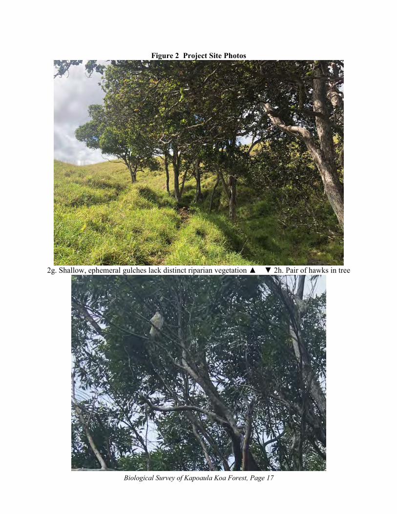
Biological Survey of Kapoaula Koa Forest, Page 17
Figure 2 Project Site Photos
2g. Shallow, ephemeral gulches lack distinct riparian vegetation ▲ ▼ 2h. Pair of hawks in tree

Biological Survey of Kapoaula Koa Forest, Page 18
Figure 2 Project Site Photos
2i. Isolated ponds with wetlands and waterbird habitat ▲
▼ 2j. Eucalyptus fringe tropical ash grove

Biological Survey of Kapoaula Koa Forest, Page 19
Table 1
Plants Observed on Kapoaula Property Scientific Name Family Common Name Life
Form Status*
Adiantum hispidulum Pteridaceae Rough maidenhair fern Fern A Ageratina adenophera Asteraceae Maui pamakani Herb A Agrostis stolonifera Poaceae Creeping bentgrass Herb A Andropogon virginicus Poaceae Broomsedge Grass A Anthoxanthum odoratum Poaceae Sweet vernal grass Herb A Axonopus fissifolius Poaceae Narrow leaved carpet
grass Grass A
Blechnum occidentalum Blechnaceae Blechnum Fern A Cenchrus clandestinus Poaceae Kikuyu grass Grass A Centella asiatica Apiaceae Asiatic Pennywort Herb A Cibotium glaucum Cibotiaceae Hapu‘u pulu Fern E Christella cyatheoides Thelypteridaceae Cyclosorus Fern E Christella dentata Thelypteridaceae Christella Fern A Cirsium vulgare Asteraceae Bull thistle Herb A Commelina diffusa Commelinaceae Honohono grass Herb A Conyza bonariensis Asteraceae Hairy horseweed Herb A Cryptomeria japonica Taxodiaceae Tsugi Tree A Cuphea carthagenensis Lythraceae Tarweed Shrub A Cupressus sp. Cupressaceae Cypress Tree A Cymbopogon refractus Poaceae Barbwire grass Herb A Cynodon dactylon Poaceae Bermuda grass Grass A Cyperus halpan Cyperaceae Nut grass Sedge A Cyperus polystachyos Cyperaceae Pycreus Sedge I Desmodium uncinatum Fabaceae Desmodium Herb A Dicranopteris linearis Gleicheniaceae Uluhe Fern I Digitaria eriantha Poaceae Pangola grass Herb A Digitaria violascens Poaceae Violet crabgrass Herb A Eragrostis brownei Poaceae Sheepgrass Herb A Erechtites hieracifolia Asteraceae Fireweed Herb A Eucalyptus robusta Myrtaceae Swamp mahogany Tree A Fraxinus uhdei Oleacea Tropical ash Tree A Geranium homeanum Geraniaceae Cranesbill Herb A Gnaphalium purpureum Asteraceae Purple cudweed Herb A Hedychium sp. Zingiberaceae Ginger Herb A Hydrocotyle verticillata Araliaeae Marsh pennywort Herb A Hypericum mutilum Clusiaceae Dwarf St. John’s wort Herb A Hypochoeris radicata Asteraceae Hairy cat’s ear Herb A Juncus acuminatus Juncaceae Sharp-fruited rush Herb A Kyllinga breviifolia Cyperaceae Kili‘o‘opu Sedge A Medicago rugosa Fabaceae Clover Herb A Megathyrsus maximus Poaceae Guinea grass Grass A Melaleuca leucodendrum Myrtaceae Paperbark tree Tree A Melinus minutiflora Poaceae Molasses grass Grass A Metrosideros polymorpha Myrtaceae ‘Ōhi‘a Tree E Microlepia speluncae Dennstaedtiaceae Microlepia Fern I

Biological Survey of Kapoaula Koa Forest, Page 20
Nephrolepis exaltata Nephrolepidaceae Sword Fern Fern I Nephrolepis multiflora Nephrolepidaceae Sword fern Fern A Oxalis corymbosa Oxalidaceae Pink wood sorrel Herb A Panicum repens Poaceae Torpedo grass Herb A Paspalum conjugatum Poaceae Hilo grass Grass A Paspalum urvillei Poaceae Vasey grass Grass A Persicaria punctata Water smartweed Polygonaceae Herb A Pinus radiata Pinaceae Monterey pine Tree A Phytolacca octandra Phytolaccaceae Southern pokeweed Herb A Plantago lanceolata Plantaginaceae Narrow-leaved plantain Herb A Plantago major Plantaginaceae Common plantain Herb A Pluchea carolinensis Asteraceae Sourbush Shrub A Polygala paniculata Polygonaceae Milkwort Herb A Psidium cattleianum Myrtaceae Strawberry guava Tree A Psilotum nudum Psilotaceae Moa Fern Ally I Rhynchospora caduca Cyperaceae Beak rush Herb A Rubus rosifolius Rosaceae Thimble berry Herb A Sacciolepis indica Poaceae Glenwood grass Herb A Senecio madagascariensis Asteraceae Fireweed Herb A Schinus terebinthifolius Anacardiaceae Christmas berry Shrub A Schizachyrium condensatum Poaceae Tufted beardgrass Grass A Sida rhombifolia Malvaceae Cuba jute Herb A Solanum americanum Solanaceae Popolo Shrub I Sphenomeris chinensis Lindsaeaceae Pala‘a Fern I Sporobolus africanus Poaceae Smutgrass Grass A Syncarpia glomulifera Myrtaceae Turpentine tree Tree A Trifolium repens Fabaceae White clover Herb A Urochloa mutica Poaceae California grass Grass A Verbena litoralis Verbenaceae Oiwi Shrub A Vulpia myuros Poaceae Rat tail fescue Herb A

Kapoaula Koa Forest Management Plan Final Environmental Assessment August 2019
Page C-1 Appendix
APPENDIX C ARCHAEOLOGICAL AND CULTURAL INVENTORY REPORTS C1 FINAL ARCHAEOLOGICAL ASSESSMENT C2 CULTURAL IMPACT ASSESSMENT

Kapoaula Koa Forest Management Plan Final Environmental Assessment August 2019
Page C-2 Appendix
This page intentionally left blank.

An Archaeological Assessment of the Paniolo Tonewoods Kapoaula Koa Forest Management Plan
TMK: (3) 4-7-007:011
Kapoaula Ahupuaʻa Hāmākua District
Island of Hawaiʻi DRAFT VERSION
Prepared By:
Lauren M. U. Kepa‘a
and
Benjamin Barna, Ph.D.
Prepared For:
Ron Terry
Geometrician Associates, LLC
P.O. Box 396Hilo, Hi 96721
March 2019
ASM Project Number 31870.00

An Archaeological Assessment of the Paniolo Tonewoods Kapoaula Koa Forest Management
Plan
TMK: (3) 4-7-007:011
Kapoaula Ahupua‘a Hāmākua District Island of Hawaiʻi

Executive Summary
AA of Paniolo Tonewoods Kapoaula Koa Forest Management Plan , Kapoaula, Hāmākua, Hawaiʻi i
EXECUTIVE SUMMARY At the request of Ron Terry of Geometrician Associates, LLC, on behalf of Cardno GS, Inc. (CGS), ASM Affiliates conducted an Archaeological Inventory Survey (AIS) of a roughly 564-acre study area located on Tax Map Key (TMK): (3) 4-7-007:011 in Kapoaula Ahupuaʻa, Hāmākua District, Island of Hawaiʻi. The AIS was conducted to accompany a Hawai‘i Revised Statutes Chapter 343 Environmental Assessment prepared for the Kapoaula Koa Forest Management Plan Project that has been proposed by the landowner’s (Siglo Forest, Inc.) lessee, Paniolo Forestry, LLC, in conjunction with Paniolo Tonewoods. The objective of the project is to develop a long-term supply of quality koa (Acacia koa) wood and associated native forest plants by reforesting the study area with koa and other native trees, replacing the existing pasture that has been used for cattle grazing since the mid- to late nineteenth century. The current study was conducted in accordance with Hawai‘i Administrative Rules (HAR) 13§13–284 and was performed in compliance with the Rules Governing Minimal Standards for Archaeological Inventory Surveys and Reports as contained in Hawai‘i Administrative Rules 13§13–276. Because no archaeological sites were found during the AIS, this report has been prepared as an Archaeological Assessment in accordance with HAR 13§13-284-5(b)(5)(A).
Traditional accounts, boundary commission testimonies and historical maps indicate that the study area was forested until the second half of the nineteenth century. Traditional uses of the forests on the slopes of Mauna Kea are understood to have included the harvesting of upland resources such as timber, plants products, and bird feathers, as well as for travel, ceremonial or ritual purposes, and associated temporary habitation. After the introduction of cattle to the area in the early to mid-nineteenth century, the current study area became deforested and converted to pasture. The land was acquired by Parker Ranch in 1874, and it has been used for cattle grazing since that time.
Fieldwork for the current study consisted of an initial reconnaissance of the study area conducted by Benjamin Barna, Ph.D. (Principal Investigator) on January 29, 2019, followed by an intensive (100% coverage) pedestrian survey conducted between March 26 and 28, 2019. The field crew for the intensive survey consisted of Genevieve L. Glennon, B.A., Lauren M. U. Kepa‘a, Johnny Dudoit, B.A., and Lyle Auld, B.A., under the direction of Benjamin Barna, Ph.D. In the large open pasture portions of the study area, field crew members walked in systematic transects paralleling the survey area boundaries, spaced no more than 40 meters apart. The low, recently-grazed grass covering most of the study area resulted in excellent visibility. In addition to walking transects, a thorough inspection was made of vegetated areas and bedrock overhangs with potential for concealing archaeological features and lava tubes, as well as prominent and anomalous landforms. Exposed soil cuts created by roads and cattle were inspected to ascertain the soil stratigraphy throughout the study area. Given the erosional environment of the study area, no subsurface testing was conducted.
As a result of the current fieldwork, no archaeological sites or other historic properties of any kind were identified within the study area. All of the ranching related infrastructure encountered during the survey appeared modern. An effort was made to identify the physical routes two trails depicted on historic maps, but the routes have been obscured by cattle trampling, erosion, and the incursion of pasture grasses since the mid-nineteenth century. Given the history of erosion and other ground disturbance related to livestock ranching, it is unlikely that any buried cultural deposits exist within the current study area.
Given the negative findings of the current study with respect to archaeological resources, it is concluded that the proposed project will not impact any known historic properties. The determination of effect for the proposed project is “no historic properties affected.” With respect to the historic preservation review process of the Department of Land and Natural Resources–State Historic Preservation Division, our recommendation is that no further work needs to be conducted within the current study area prior to or during project implementation. In the unlikely event that significant archaeological resources are discovered during the proposed ground disturbing activity, work should cease in the area of the discovery and DLNR-SHPD contacted pursuant to HAR 13§13-280-3.

Table of Contents
AA of Paniolo Tonewoods Kapoaula Koa Forest Management Plan , Kapoaula, Hāmākua, Hawaiʻi iii
CHAPTERS Page
1. INTRODUCTION ......................................................................................................... 1
STUDY AREA DESCRIPTION .......................................................................................... 4
THE PROPOSED PROJECT ............................................................................................. 16
2. BACKGROUND .......................................................................................................... 18
CULTURE-HISTORICAL CONTEXT ............................................................................. 18
A Generalized Model of Hawaiian Prehistory ............................................................. 18
History After Contact ................................................................................................... 22
Hāmākua 1820-1848: A Land in Transition................................................................. 24
The Legacy of the Māhele ‘Āina of 1848..................................................................... 25
Boundary Commission Testimony (1862-1873) .......................................................... 32
The Ranching and Sugar Industries in Hāmākua During the Mid to Late Nineteenth Century....................................................................................................... 35
PREVIOUS ARCHAEOLOGICAL STUDIES ................................................................. 41
3. STUDY AREA EXPECTATIONS ............................................................................. 43
4. FIELDWORK .............................................................................................................. 44
FINDINGS ......................................................................................................................... 44
5. DETERMINATION OF EFFECT AND RECOMMENDATIONS ....................... 45
REFERENCES CITED ................................................................................................... 46
FIGURES
Page 1. Study area location. ................................................................................................................................... 2
2. Tax Map Key (3) 4-7-007 showing location of current study parcel (011). ............................................. 3
3. Google Earth™ satellite image showing study area location (outlined in red). ........................................ 5
4. Northern study area boundary adjacent to Old Māmalahoa Highway, view to the northwest. ................. 6
5. Typical undulating terrain in study area, view to the southwest. .............................................................. 6
6. Typical study area terrain, view to the southeast. ..................................................................................... 7
7. Eastern, fenced study area boundary crossing a small perennial stream, view to the northeast. .............. 7
8. Shallow drainage paralleling western study area boundary, view to the north. ........................................ 8
9. Wide drainage near western boundary of study area, view to the northeast. ............................................ 8
10. Soil within the study area (Soil Survey Staff 2019). ............................................................................... 9
11. Geological units in the current study area (Sherrod et al. 2007). ............................................................ 9
12. Pair of ‘ōhi‘a trees on slope of elevated landform, view to the southwest. .......................................... 10
13. Stand of ash trees (at right), view to the northwest. .............................................................................. 10
14. Unimproved access road leading mauka from Old Māmalahoa Highway, view to the southwest. ...... 11

Table of Contents
iv AA of Paniolo Tonewoods Kapoaula Koa Forest Management Plan , Kapoaula, Hāmākua, Hawaiʻi
15. Remnant 1-inch galvanized steel waterline, overview. ......................................................................... 11
16. Water pump on hilltop, view to the east. .............................................................................................. 12
17. Porcelain water trough in depression, view to the east. ........................................................................ 12
18. Barbed wire fence line on the eastern boundary of the study area, view to the northeast. ................... 13
19. Barbed wire fence and pipe gate on the mauka boundary of the study area, view to the south. ........... 13
20. Concrete fence post with embedded PVC pipe and inscription reading “07” and unidentifiable brand, view to the north. ........................................................................................................................ 14
21. Hillside exhibiting a network of terracettes, view to the southeast. ...................................................... 14
22. Cattle resting area, view to the northeast. ............................................................................................. 15
23. Cattle resting area situated at base of bedrock outcrop, view to the northwest. ................................... 15
24. Proposed forest management units. ...................................................................................................... 17
25. Portion of Hawai‘i Registered Map No. 2060 showing location of the study area within Hāmākua and Kapoaula (after Donn 1901). .......................................................................................... 21
26. Newspaper notice from March 15, 1853 listing Kapoaula (listed as Kapaaula) and other lands to be awarded to Leleiohoku during the Māhele (The Polynesian 1853). ................................................. 28
27. LCAw. 9971 ‘apana 2 to William Leleiohoku (www.kipukadatabase.com). ...................................... 29
28. Survey map of LCAw. 9971:2 by C.J. Lyons, study area shaded red. ................................................. 30
30. Tracing of C.J. Lyons’ survey map of LCAw. 9971:2 with the current study area outlined in red (Office of Hawaiian Affairs 2018)......................................................................................................... 33
32. Public notice regarding purchase of Kapoaula (listed as “Kaapaaula”) on October 28, 1882 (Daily Honolulu Press 1882). ................................................................................................................ 36
33. Portion of Hawai‘i Registered Map No. 2640 showing Kapoaula (outlined in red) and the study area (shaded gray) within the lands of Parker Ranch (after Williamson 1909). .................................... 37
34. Aerial photograph taken in 1954 with the study area outlined in red (USGS 1954). ........................... 38
35. Portion of Plat Map 6.2 H.H. with current study area outlined in red (Aki and Lane 1951). ............... 39
36. Portion of 1957 Kukuihaele quadrangle map, current study area outlined in red (USGS 1957). ......... 40
37. Aerial photograph taken in 1977 with the study area outlined in red (Hawaii Statewide GIS Program 2017). ...................................................................................................................................... 40
38. Previous archaeological studies conducted in the vicinity of the current study area. ........................... 41
39. Exposed soil profile in cattle resting area. ............................................................................................ 44
TABLES Page
1. NRCS Conservation Practices with potential to effect historic properties. ............................................ 16
2. Previous archaeological studies conducted in the vicinity of the current study area. ............................. 43

1. Introduction
AA of Paniolo Tonewoods Kapoaula Koa Forest Management Plan , Kapoaula, Hāmākua, Hawaiʻi 1
1. INTRODUCTION
At the request of Ron Terry of Geometrician Associates, LLC, on behalf of Cardno GS, Inc. (CGS), ASM Affiliates conducted an Archaeological Inventory Survey (AIS) of a roughly 564-acre study area located in Kapoaula Ahupuaʻa, Hāmākua District, Island of Hawaiʻi (Figure 1). The study area comprises a single parcel, Tax Map Key (TMK): (3) 4-7-007:011 (Figure 2), which is owned by Siglo Forest, Inc. The AIS was conducted to accompany a Hawai‘i Revised Statutes Chapter 343 Environmental Assessment prepared for the Kapoaula Koa Forest Management Plan Project that has been proposed by Siglo Forest, Inc.’s lessee, Paniolo Forestry, LLC, in conjunction with Paniolo Tonewoods. The objective of the project is to develop a long-term supply of quality koa (Acacia koa) wood and associated native forest plants on the subject parcel for use in the manufacture of musical instruments and for other uses. To do so, Paniolo Forestry, LLC will plant koa and other native trees on the subject parcel, which will replace the existing pasture that has been used for cattle grazing since the mid- to late nineteenth century.
The current study was conducted in accordance with Hawai‘i Administrative Rules (HAR) 13§13–284 and was performed in compliance with the Rules Governing Minimal Standards for Archaeological Inventory Surveys and Reports as contained in Hawai‘i Administrative Rules 13§13–276. Compliance with the above standards is sufficient for meeting the historic preservation review process requirements of both the Department of Land and Natural Resources–State Historic Preservation Division (DLNR–SHPD) and the County of Hawai‘i Planning Department. According to HAR 13§13-284-5(b)(5)(A), when no archaeological sites are found during an AIS, the results of the AIS shall be reported through an Archaeological Assessment. This report contains background information outlining the study area’s physical and cultural contexts, a presentation of previous archaeological work in the vicinity of the project area, and current survey expectations based on that previous work. Also presented are an explanation of the project’s methods and a description of the findings, followed by recommendations and a determination of effect for the proposed project.
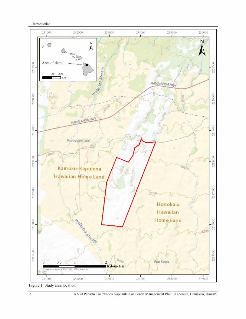
1. Introduction
2 AA of Paniolo Tonewoods Kapoaula Koa Forest Management Plan , Kapoaula, Hāmākua, Hawaiʻi
Figure 1. Study area location.

1. Introduction
AA of Paniolo Tonewoods Kapoaula Koa Forest Management Plan , Kapoaula, Hāmākua, Hawaiʻi 3 Fi
gure
2. T
ax M
ap K
ey (3
) 4-7
-007
show
ing
loca
tion
of c
urre
nt st
udy
parc
el (0
11).

1. Introduction
4 AA of Paniolo Tonewoods Kapoaula Koa Forest Management Plan , Kapoaula, Hāmākua, Hawaiʻi
STUDY AREA DESCRIPTION
The current study area encompasses roughly 564 acres of pastureland (Figure 3) and is situated on the southernmost boundary of Kapoaula Ahupuaʻa, Hāmākua District, Island of Hawaiʻi (see Figures 1 and 2). The study area extends along the mauka (southern) edge of the Old Māmalahoa Highway, and is accessed by a gated, unimproved access road that enters into the parcel from the north. The study area is bounded to the west by Kamoku and Kapulena ahupuaʻa and to the east by Honokaia Ahupuaʻa. Its northern boundary is coterminous with the ahupua‘a boundary with Kamoku along the Old Māmalahoa Highway (Figure 4), and it is adjacent to the Edwin DeLuz gravel quarry to the northwest. It is situated on the northern flank of Mauna Kea Volcano at elevations ranging from 2,740 to 3,180 feet (835 to 969 meters) above sea level, roughly 7 kilometers from the coast (see Figure 1). The undulating terrain (Figures 5 and 6) is characterized by gentle to moderately north-sloping hills punctuated with outcroppings and occasional steep and rocky ridgelines, particularly in the makai half of the parcel. A single permanent stream crosses into the study area near the northwestern corner of the property (Figure 7). Several non-perennial surface streams (none of which were flowing at the time of the current study) have incised shallow to moderate intermittent drainage channels (Figures 8 and 9) through the study area.
Soils within the study area (Figure 10) are classified as Maile-Waiākea-Rock outcrop complex on 6 to 35 percent slopes (Soil Survey Staff 2019). These soils consist of two distinct, well-drained loams, namely Maile and Honokaa, that range from ashy, sandy loam to hydrous silt loam, and highly organic silty clay that formed in a series of volcanic ash layers overlying basalt that originated from Mauna Kea Volcano during the Pleistocene epoch. The geology underlying the current study area is composed predominately of 11,000 to 64,000-year-old Laupāhoehoe Volcanics (labeled as “Qlb” in Figure 11). The northeast section of the parcel contains small portions of Hāmākua Volcanics that have been dated to 64,000 to 300,000 years old (labeled as “Qhm” in Figure 11). Mean annual rainfall within the study area averages approximately of 2,038 millimeters (80.24 inches), with the majority of rainfall occurring between the months of November and April and the least occurring in June and September (Giambelluca et al. 2013). The study area is characterized by a cool, semi-tropical climate with a mean annual temperature ranging from 32 to 78 degrees Fahrenheit (Giambelluca et al. 2013).
As a result of nearly two centuries of cattle grazing, vegetation within the study area consists almost exclusively of a pasture grasses (see Figure 5), dominated by introduced perennial forage grasses and sedges including but not limited to kikuyu (Pennisetum clandestinum), Honohono (Haplostachys haplostachya), natal redtop (Melinus rupens), and Hilo (Paspalum conjungatum) grasses occasionally interspersed with common dandelion (Taraxacum officinale), palapalai (lace fern; Microlepia strigosa), and fireweed (Chamerion angustifolium). Within actively grazed paddocks, cattle aid in keeping the vegetation cover down. The study area’s pastoral vegetation pattern is further characterized by a lone Christmas berry (Schinus terebinthifolius) and cherry blossom tree (Prunus sp.), a few free-standing patches of ‘ōhi‘a lehua (Metrosideros polymorpha) along hill slopes (Figure 12), and a 14-acre stand of introduced tropical ash trees (Fraxinus uhdei; Figure 13) located in the central portion of the study area. This introduced vegetation regime is much different than what would have been found prior to the widespread impacts of cattle ranching during the Historic Period, when the study area would have occupied a zone of dense ‘ōhi‘a rainforest (Clark and Kirch 1983).
The interior of the study area is accessed via an unimproved ranch road (Figure 14) that ascends from Old Māmalahoa Highway. The road generally traverses prominent ridges and high ground past the stand of tropical ash, then continues to a cattle watering hole located about 550 meters from the he mauka parcel boundary. Grazing has also resulted in a several artificial modifications to the landscape that include barbed wire and electric fence lines, remnant water lines (Figure 15), a water pump (Figure 16), and several concrete- and porcelain cattle water troughs (Figure 17). Permanent barbed wire boundary fencing, with the occasional welded pipe gate, surrounds the entire perimeter of the study area (Figures 18 and 19). A small segment of the fence on the study area’s western boundary includes several square concrete fence posts, one of which is inscribed near the top with the letters “07” and marked with an unidentifiable ranch brand below (Figure 20). Electric cross-fencing partitions the study area into eight grazing paddocks. The impacts of livestock grazing on the study area is also visible. Many of the grazed, moderately to steeply sloping hills in the study area are crossed by networks of meandering livestock trails and are contoured with a series of descending terracettes (Figure 21), undoubtedly intensified by livestock trampling. Furthermore, numerous semicircular cattle resting areas are eroded into the bases of low-lying hillsides (Figure 22) and occasionally at the bases of bedrock outcroppings (Figure 23).

1. Introduction
AA of Paniolo Tonewoods Kapoaula Koa Forest Management Plan , Kapoaula, Hāmākua, Hawaiʻi 5
Figure 3. Google Earth™ satellite image showing study area location (outlined in red).

1. Introduction
6 AA of Paniolo Tonewoods Kapoaula Koa Forest Management Plan , Kapoaula, Hāmākua, Hawaiʻi
Figure 4. Northern study area boundary adjacent to Old Māmalahoa Highway, view to the northwest.
Figure 5. Typical undulating terrain in study area, view to the southwest.

1. Introduction
AA of Paniolo Tonewoods Kapoaula Koa Forest Management Plan , Kapoaula, Hāmākua, Hawaiʻi 7
Figure 6. Typical study area terrain, view to the southeast.
Figure 7. Eastern, fenced study area boundary crossing a small perennial stream, view to the northeast.

1. Introduction
8 AA of Paniolo Tonewoods Kapoaula Koa Forest Management Plan , Kapoaula, Hāmākua, Hawaiʻi
Figure 8. Shallow drainage paralleling western study area boundary, view to the north.
Figure 9. Wide drainage near western boundary of study area, view to the northeast.

1. Introduction
AA of Paniolo Tonewoods Kapoaula Koa Forest Management Plan , Kapoaula, Hāmākua, Hawaiʻi 9
Figure 10. Soil within the study area (Soil Survey Staff 2019).
Figure 11. Geological units in the current study area (Sherrod et al. 2007).

1. Introduction
10 AA of Paniolo Tonewoods Kapoaula Koa Forest Management Plan , Kapoaula, Hāmākua, Hawaiʻi
Figure 12. Pair of ‘ōhi‘a trees on slope of elevated landform, view to the southwest.
Figure 13. Stand of ash trees (at right), view to the northwest.
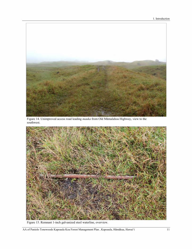
1. Introduction
AA of Paniolo Tonewoods Kapoaula Koa Forest Management Plan , Kapoaula, Hāmākua, Hawaiʻi 11
Figure 14. Unimproved access road leading mauka from Old Māmalahoa Highway, view to the southwest.
Figure 15. Remnant 1-inch galvanized steel waterline, overview.
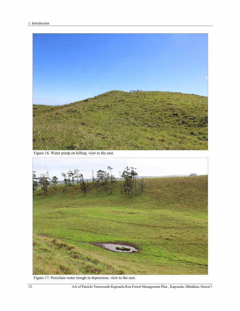
1. Introduction
12 AA of Paniolo Tonewoods Kapoaula Koa Forest Management Plan , Kapoaula, Hāmākua, Hawaiʻi
Figure 16. Water pump on hilltop, view to the east.
Figure 17. Porcelain water trough in depression, view to the east.

1. Introduction
AA of Paniolo Tonewoods Kapoaula Koa Forest Management Plan , Kapoaula, Hāmākua, Hawaiʻi 13
Figure 18. Barbed wire fence line on the eastern boundary of the study area, view to the northeast.
Figure 19. Barbed wire fence and pipe gate on the mauka boundary of the study area, view to the south.

1. Introduction
14 AA of Paniolo Tonewoods Kapoaula Koa Forest Management Plan , Kapoaula, Hāmākua, Hawaiʻi
Figure 20. Concrete fence post with embedded PVC pipe and inscription reading “07” and unidentifiable brand, view to the north.
Figure 21. Hillside exhibiting a network of terracettes, view to the southeast.

1. Introduction
AA of Paniolo Tonewoods Kapoaula Koa Forest Management Plan , Kapoaula, Hāmākua, Hawaiʻi 15
Figure 22. Cattle resting area, view to the northeast.
Figure 23. Cattle resting area situated at base of bedrock outcrop, view to the northwest.

1. Introduction
16 AA of Paniolo Tonewoods Kapoaula Koa Forest Management Plan , Kapoaula, Hāmākua, Hawaiʻi
THE PROPOSED PROJECT
Siglo Forest, LLC acquired the 564-acre Kapoaula property from Parker Ranch to obtain long-term access for the purposes of planting koa trees. In an effort to convert pastureland back to a semblance of the native koa-ʻōhiʻa forest that once stood in this area and to provide controlled future uses of the forest for commercial products, Forest Solutions Inc. was hired by Siglo Forest, LLC to author a site-specific forestry management plan for the area. Figure 24 depicts the twenty-five forest units, fencing, and roadways that will be used to implement the plan. The project will plant, over a ten (10) year period, 553 acres of suitable land with koa and a range of associated native plants (11.3 additional acres are reserved for a saw mill site and access road). The project will combine the production of timber in a plantation format with mixed native forest plantings in less accessible areas. Over time–decades or a century–colonization of the plantation area with the enrichment species from the mixed forests, from bird droppings and natural plant colonization is anticipated. Through implementation of the site-specific forestry management plan, in approximately 50 years, pasture in current study area will be replaced with a mixed-species native forest. Steep-sloped areas will primarily be used for native species conservation, and less steeply-sloped, less erodible areas will be primarily used for timber production. The resulting koa forest will provide a sustainable, long-term, predictable source of musical-instrument grade wood, produce high-quality wood for other uses, and provide habitat for native species. The ten-year objectives are as follows:
• Reforest the entire property with koa and a complement of associated native forest plants. • Improve the quality of wood to be harvested in the future by: • planting seed from known, high-quality sources; and • utilizing cuttings propagated from trees identified as having superior color, figure, and form. • Intensive management of koa for saw timber on those areas of the property with slopes less than 20%--
accounting for 70% of the property or 390 acres. • Reforest the remaining upland areas with a multi-species native forest, utilizing koa as a pioneer species—
accounting for 30% of the area or 163 acres. • Protect planted forest from wind by planting fast-growing, cattle resistant windbreaks The proposed project will include activities identified as Natural Resource Conservation Service (NRCS)
conservation practices with potential to affect historic properties as identified in the 2016 Prototype Programmatic Agreement Between the US Department of Agriculture, Pacific Islands Area Natural Resources Conservation Service State Office, and the Hawaii State Historic Preservation Officer, Regarding Conservation Assistance (the PPA). Conservation practices with potential to affect historic properties that will be implemented by the proposed project are listed in Table 1. These practices include Tree and Shrub Site Preparation (Practice 490), Windbreak/Shelterbelt Establishment (Practice 380), Fencing (Practice 382), and Tree/Shrub Pruning (Practice 660). Fencing will be installed over a nine-year period as cattle are gradually removed from the parcel (see Figure 24). Other improvements will include a dwelling unit and a sawmill.
Table 1. NRCS Conservation Practices with potential to effect historic properties.
NRCS Practice
Practice Name Description
490 Tree and Shrub Site Preparation
Ripping and bedding or deep spot cultivation 24 to 36 inches (60 to 90 cm)
380 Windbreak/Shelterbelt Establishment
Ripping and bedding or deep spot cultivation 24 to 36 inches (60 to 90 cm)
382 Fencing Standard 5-foot hog-wire fences with a smooth top wire and barbed ground wire
660 Tree/Shrub Pruning Singling and one, possibly two, pruning treatments per tree

1. Introduction
AA of Paniolo Tonewoods Kapoaula Koa Forest Management Plan , Kapoaula, Hāmākua, Hawaiʻi 17
Figure 24. Proposed forest management units.

2. Background
18 AA of Paniolo Tonewoods Kapoaula Koa Forest Management Plan , Kapoaula, Hāmākua, Hawaiʻi
2. BACKGROUND
To generate a set of expectations regarding the nature of archaeological resources that might be encountered within the study area, and to establish an environment within which to assess the significance of any such resources, a general culture-historical background for the region is presented, and the results of previous archaeological studies conducted in the vicinity of the study area are summarized.
CULTURE-HISTORICAL CONTEXT
The study area is situated in Kapoaula Ahupua‘a on the windward slopes of Mauna Kea within the traditional moku (district) of Hāmākua, one of six moku of Hawai‘i Island (Figure 25). The name of the ahupua‘a is currently spelled “Kapoaula,” but early documents produced during the Māhele of 1848 consistently spell the name “Kapaaula.” Neither of these place names appear in Pukui et al.’s (1974) compendium of place names. This modern spelling appears to originate in the Land Commission Award documentation for the ahupua‘a (see discussion below).
Although the boundaries of the Hāmākua District are strictly political, the lands encompassed by it possess a unique environment that played a large role in determining the boundaries and shaping its history from the time of Polynesian settlement to the modern day. Understanding this environment is important for understanding the history of the current study area:
Hāmākua district is a windward district in the truest sense. It has ca. 29 miles of shoreline, primarily focused on Mauna Kea’s eastern slopes with exposed cliffs rough seas, and narrow reef formations. Above the sea cliffs, the gentle slopes have a thick soil cover and abundant rainfall, and lush vegetation, with the upper slopes from 1,000-6,000 feet in an ‘ōhi‘a-koa rain forest. The slopes are cut by deep (up to 300-foot), narrow stream gulches cloaked with kukui and pandanus. Yet Hāmākua is more than these slope and gulch lands. It also includes the extremely large, deep valleys of Waipi‘o and Waimanu which have cut over a millennia into the older Kohala Mountain, valleys which . . . dominated the history of the district and the island. Hāmākua also extended inland, encompassing the high elevation māmane-naio forests of Mauna Kea and the subalpine, oft snow-covered, summit itself. The district continued across the foggy and cold upland plateau or Saddle with its terrain a mixture of bare lava and soils, and with its vegetation a mixture of ‘ōhi‘a and māmane-naio forests. This plateau had important nesting grounds of ‘u‘au and nēnē. And, Hāmākua virtually spanned the island-reaching to and looking down into the upper edges of Kona. (Cordy 2000:21)
It was to this general environmental setting that the first Polynesians in Hawai‘i arrived. Over generations they shaped and utilized the natural environment to provide all they needed for sustenance and survival. In the process they created a uniquely Hawaiian culture that was wholly adapted to the environment. The chronological summary presented below begins with the peopling of the Hawaiian Islands and includes the presentation of a generalized model of Hawaiian Prehistory and a discussion of the general settlement patterns for Hāmākua. The discussion of Prehistory is followed by a summary of Historical events in the district that begins with the arrival of foreigners in the islands and then continues with the history of land use in Hāmākua after contact. The summary includes a discussion of the changing lifeways and population decline of the early Historic Period, a review of land tenure in the study ahupua‘a during the Māhele ‘Āina of 1848, and documentation of the transition to the ranching industry from the last quarter of the nineteenth century to the present day. A synthesis of the Precontact settlement patterns and the Historically documented land use, combined with a review of the findings of previously conducted archeological studies, provides a means for predicting the types of archaeological features that may be encountered within the study area, and forms a basis for assessing the function, age, and significance of any encountered archaeological sites.
A Generalized Model of Hawaiian Prehistory
Within the last decade, refined chronometric data and analyses strongly support a “short chronology” of the timing of the initial colonization of the Hawaiian Islands. In this chronology, the settlement of the archipelago begins around A.D. 1000. It has been generally reported that the sources of the early Hawaiian population—the Hawaiian Kahiki—were the Marquesas and Society Islands (Emory in Tatar 1982). Athens et al. (2014), using archaeological and paleoenvironmental data, propose that the initial settlement of the Hawaiian Islands occurred between A.D. 940 and 1130, and most probably between A.D. 1000 and 1100. Other recently developed models date this event to ca. A.D. 1120-1260 (Duarte 2012; Rieth et al. 2011; Wilmshurst et al. 2011), while Kirch’s (2011) position is that colonization was unlikely to have occurred before A.D. 1000, but definitely by A.D. 1200. As with previous models (which held that the first inhabitants of Hawaiʻi Island arrived by A.D. 300), early colonization is still thought to have involved

2. Background
AA of Paniolo Tonewoods Kapoaula Koa Forest Management Plan , Kapoaula, Hāmākua, Hawaiʻi 19
habitation and subsistence activity on the windward side of the island (Burtchard 1995; Hommon 1986; Kirch 1985). The implications of a more recent colonization on the currently accepted chronology alters the timing of Kirch’s (1985) Settlement, Developmental, and Expansion Periods, possibly shifting the Settlement Period to A.D. 1000 to 1100, the Developmental Period to A.D. 1100 to 1350, and the Expansion Period to A.D. 1350 to 1650.
The Settlement Period was a time of great exploitation and environmental modification, when early Hawaiian farmers developed new subsistence strategies by adapting their familiar patterns and traditional tools to their new environment (Kirch 1985; Pogue 1978). Their ancient and ingrained philosophy of life tied them to their environment and kept order. Order was further assured by the conical clan principle of genealogical seniority (Kirch 1984, 2010). According to Fornander (1969), Hawaiians brought from their homeland certain universal Polynesian customs: the major gods Kāne, Kū, Kanaloa, and Lono; the kapu system of law and order; cities of refuge; the ‘aumakua concept; various epiphenomenal beliefs; and the concept of mana. Conventional wisdom suggests that the first inhabitants of Hawai‘i Island focused habitation and subsistence activity on the windward side of the island (Burtchard 1995; Hommon 1986; Kirch 1985). Initial permanent settlements in the islands were established at sheltered bays with access to fresh water and marine resources. Communities shared extended familial relations and there was an occupational focus on the collection of marine resources.
As time passed a uniquely Hawaiian culture developed. The portable artifacts found in archaeological sites of the Development Period of the Hawaiian prehistory reflect not only an evolution of the traditional tools, but some distinctly Hawaiian inventions. The adze (ko‘i) evolved from the typical Polynesian variations of plano-convex, trapezoidal, and reverse-triangular cross-section to a very standard Hawaiian rectangular quadrangular tanged adze. The two-piece fishhook and the octopus-lure breadloaf sinker are Hawaiian inventions of this period, as are ‘ulu maika stones and lei niho palaoa. The later were status items worn by individuals of high rank, which indicates recognition of status differentiation (Kirch 1985). As population expanded in the Hawaiian Islands so did social stratification, which was accompanied by major socioeconomic changes and intensive land modification. Once most of the ecologically favorable zones of the windward and coastal regions of the major islands were settled, the more marginal leeward areas were developed. Migrations to Hawai‘i from the Marquesas and Society Islands may have continued throughout the early Settlement and Development Periods (Kirch 1985, 2012). Over a period of several centuries the areas with the richest natural resources became populated and perhaps even crowded, and there was an increasing separation of the chiefly class from the common people. As the environment reached its maximum carrying capacity, the result was social stress, hostility, and war between neighboring groups (Kirch 1985). Soon, large areas of Hawai‘i were controlled by a few powerful chiefs.
The Expansion Period is characterized by the greatest social stratification, major socioeconomic changes, and intensive land modification. Most of the ecologically favorable zones of the windward and coastal regions of all major islands were settled and the more marginal leeward areas were being developed. Subsistence patterns intensified as crop farming evolved into large irrigated field systems and expanded into the marginal dry land areas. The greatest population growth occurred during the Expansion Period, and it was during this time that a second major migration settled in Hawai‘i, this time from Tahiti in the Society Islands. According to Kamakau (1976), the kahuna Pā‘ao settled in the islands during the 13th century. Pā‘ao was the keeper of the god Kū‘kā‘ilimoku, who had fought bitterly with his older brother, the high priest Lonopele. After much tragedy on both sides, Pā‘ao was expelled from his homeland in Tahiti by Lonopele. He prepared for a long voyage and set out across the ocean in search of a new land. On board Pā‘ao’s canoes were thirty-eight men (kānaka), two stewards (kānaka ‘ā‘īpu‘upu‘u), the chief Pilika‘aiea (Pili) and his wife Hina‘aukekele, Nāmau‘u o Malaia, the sister of Pā‘ao, and the prophet Makuaka‘ūmana. Kamakau (1991:100–102) told the following story of their arrival in Hawai‘i:
Puna on Hawai‘i Island was the first land reached by Pā‘ao, and here in Puna he built his first heiau for his god Aha‘ula and named it Aha‘ula [Waha‘ula]. It was a luakini. From Puna, Pā‘ao went on to land in Kohala, at Pu‘uepa. He built a heiau there called Mo‘okini, a luakini. It is thought that Pā‘ao came to Hawai‘i in the time of the ali‘i La‘au because Pili ruled as mo‘i after La‘au. You will see Pili there in the line of succession, the mo‘o kū‘auhau, of Hanala‘anui. It was said that Hawai‘i Island was without a chief, and so a chief was brought from Kahiki; this is according to chiefly genealogies. Hawai‘i Island had been without a chief for a long time, and the chiefs of Hawai‘i were ali‘i maka‘āinana or just commoners, maka‘āinana, during this time. …There were seventeen generations during which Hawai‘i Island was without chiefs—some eight hundred years…The lack of a high chief was the reason for seeking a chief in Kahiki, and that is perhaps how Pili became the chief of Hawai‘i. He was a chief from Kahiki and became the ancestor of chiefs and people of Hawai‘i Island.

2. Background
20 AA of Paniolo Tonewoods Kapoaula Koa Forest Management Plan , Kapoaula, Hāmākua, Hawaiʻi
The Pili line’s initial ruling center was likely in Kohala, but Cartwright (1933) suggests that Pili resided in and ruled from Waipi‘o Valley in the Hāmākua District. Ethnohistorical traditions (Fornander 1880) indicate that Waipi‘o was associated with at least nine successive Pili line rulers of Hawai‘i Island, from Kaha‘imoele‘a to Umi (between roughly A.D. 1460 and 1620). Prior to the establishment of these Pili rulers, Waipi‘o was the residential base for powerful local rulers dating back to at least the A.D. 1200s (Cartwright 1933).
Heiau construction flourished during the Expansion Period as religion became more complex and embedded in a sociopolitical climate of territorial competition. Monumental architecture, such as heiau, “played a key role as visual markers of chiefly dominance” (Kirch 1990:206). This pattern continued to intensify from A.D. 1500 to Contact (A.D. 1778), and evidence suggests that substantial changes were made to the political system as well. Within Kohala, for example, the Great Wall complex at Koai‘e is organized with certain platforms in the complex physically separated from contemporaneous features. Griffin et al. (1971) interpret these separate spaces as symbolizing class stratification.
The period from A.D. 1300–1500 was characterized by population growth as well as expanded efforts to intensify upland agriculture. Rosendahl (1972) has proposed that settlement in leeward Kohala at this time was related to seasonal, recurrent occupation, and that coastal sites were occupied in the summer to exploit marine resources, while upland sites were being occupied during the winter months with a primary focus on agriculture. An increasing reliance on agricultural products may have caused a shift in social networks as well, according to Hommon (1976). Hommon argues that kinship links between coastal settlements disintegrated as those links within the mauka-makai settlements expanded to accommodate exchange of agricultural products for marine resources. This shift is believed to have resulted in the establishment of the ahupua‘a system. The implications of this model include a shift in residential patterns from seasonal, temporary occupation, to permanent dispersed occupation of both coastal and upland areas.
According to Kirch’s (1985) model, the concept of the ahupua‘a was established sometime during the A.D. 1400s, adding another component to an already well-stratified society. This land unit became the equivalent of a local community, with its own social, economic, and political significance. Ahupua‘a were ruled by ali‘i ‘ai ahupua‘a or lesser chiefs; who, for the most part, had complete autonomy over this generally economically self-supporting piece of land, which was managed by a konohiki. Ahupua‘a generally speaking, are wedge-shaped subdivisions of land that radiate out from the center of the island, typically extending from the mountain into the sea. Their boundaries are often defined by the topography of the land and its geological features. In these land units the native tenants tended fields and cultivated crops necessary to sustain their families, and the chiefly communities with which they were associated. As long as sufficient tribute was offered and kapu (restrictions) were observed, the common people (maka‘āinana), who lived in a given ahupua‘a had access to most of the resources from mountain slopes to the ocean. These access rights were almost uniformly tied to residency on a particular land, and earned as a result of taking responsibility for stewardship of the natural environment, and supplying the needs of the ali‘i (see Kamakau 1992; Malo 1951).
Entire ahupua‘a, or smaller portions of the land called ‘ili were generally under the jurisdiction of appointed konohiki or lesser chief-landlords, who answered to an ali‘i-‘ai-ahupua‘a (chief who controlled the ahupua‘a resources). The ali‘i-‘ai-ahupua‘a in turn answered to an ali‘i ‘ai moku (chief who claimed the abundance of the entire district). Thus, ahupua‘a resources supported not only the maka‘āinana and ‘ohana who lived on the land, but also contributed to the support of the royal community of regional and/or island kingdoms. This form of district subdividing was integral to Hawaiian life and was the product of strictly adhered to resource management planning. In this system, the land provided fruits and vegetables and some meat for the diet, and the ocean provided a wealth of protein resources (Rechtman and Maly 2003). The ahupua‘a were further divided into smaller sections such as the ‘ili ‘āina, mo‘o ‘āina, paukū ‘āina, kīhāpai, kō‘ele, hakuone, and kuakua (Hommon 1986; Pogue 1978). The chiefs of these land units gave their allegiance to a territorial chief or mō‘ī (king). By the seventeenth century, large areas of Hawai‘i Island (moku āina – districts) were controlled by a few powerful ali‘i ‘ai moku. There is island-wide evidence to suggest that growing conflicts between independent chiefdoms were resolved through warfare, culminating in a unified political structure at the district level. It has been suggested that the unification of the island resulted in a partial abandonment of portions of leeward Hawai‘i, with people moving to more favorable agricultural areas (Barrera 1971; Schilt and Sinoto 1980). ‘Umi a Līloa, a renowned ali‘i of the Pili line who ruled from Waipi‘o Valley, is often credited with uniting the island of Hawai‘i under one rule (Cordy 1994). ‘Umi’s reign lasted until around A.D. 1620, and was followed by the rule of his son, Keawenui a ‘Umi, and then his grandson, Lonoikamakahiki (Cordy 1994).
Kirch (1985) places the beginning of the Proto-Historic Period during the rule of Lonoikamakahiki. This was a time marked by both political intensification and stress and continual conquest by the reigning ali‘i. Wars occurred regularly between intra-island and inter-island polities during this period. By the 1700s, rule of Hawai‘i Island was divided among the chiefs of Kona and Hilo (Kamakau 1992). Keawe, a Pili line ruler and the son of Kanaloakapulehu, was the chief of Kohala, Kona, and Ka‘ū. When Keawe died, he split the rule of his lands between two of his sons, further dividing the island’s chiefdoms; Kalaninui‘iamamao became the ruling chief of Ka‘ū, and Ke‘eaumoku

2. Background
AA of Paniolo Tonewoods Kapoaula Koa Forest Management Plan , Kapoaula, Hāmākua, Hawaiʻi 21
became the ruling chief of Kona and Kohala (Kamakau 1992). Wars between the ali‘i continued unabated through this transition. Alapa‘inui, the son of former Kona war chief Kauauanui a Mahi, desired to take control of Hawai‘i Island (Kamakau 1992), and successfully waged war against the chiefs of Kona and Kohala, and eventually took control of Ka‘ū and Hilo as well. Alapa‘inui ruled for many years, and appointed his son Keawe‘ōpala ruler of the island upon his death in 1754 (Kamakau 1992). It was during this time of warfare that Kamehameha was born in the North Kohala District in the ahupua‘a of Kokoiki, near the heiau of Mo‘okini (Kamakau 1992). There is some controversy about the year of his birth, but Kamakau (1992:66–68) places the birth event sometime between A.D. 1736 and 1758, most likely nearer to the later date. This period was one of continual conquest by the reigning ali‘i. In A.D. 1775 Kalani‘ōpu‘u and his forces, who had already conquered Hāna in eastern Maui, raided and destroyed the neighboring Kaupō District, then launched several more raids on Molokaʻi, Lānaʻi, Kaho‘olawe, and parts of West Maui. It was at the battle of Kalaeoka‘ilio that Kamehameha, a favorite of Kalani‘ōpu‘u, was first recognized as a great warrior and given the name of Pai‘ea (hard-shelled crab) by the Maui chiefs and warriors (Kamakau 1992). During the battles between Kalani‘ōpu‘u and Kahekili (1777–1779), Ka‘ahumanu and her parents left Maui to live on the island of Hawai‘i (Kamakau 1992). Kalani‘ōpu‘u was fighting on Maui when the British explorer Captain James Cook first arrived in the islands.
Figure 25. Portion of Hawai‘i Registered Map No. 2060 showing location of the study area within Hāmākua and Kapoaula (after Donn 1901).

2. Background
22 AA of Paniolo Tonewoods Kapoaula Koa Forest Management Plan , Kapoaula, Hāmākua, Hawaiʻi
History After Contact
The arrival of foreigners in Hawai‘i marks the beginning of the Historic Period. Demographic trends during the later Proto-Historic Period indicate population reduction in some areas, due to war and disease, yet increases in others, with relatively little change in material culture. There was a continued trend toward craft and status specialization, intensification of agriculture, ali‘i controlled aquaculture, the establishment of upland residential sites, and the enhancement of traditional oral history. The Kū cult, luakini heiau, and the kapu system were at their peaks, although western influence was already altering the cultural fabric of the Islands (Kent 1983; Kirch 1985). Foreigners very quickly introduced the concept of trade for profit, and by the time Kamehameha I had conquered O‘ahu, Maui and Moloka‘i, in 1795, Hawai‘i saw the beginnings of a market system economy (Kent 1983). This marked the end of the Proto-Historic Period and the end of an era of uniquely Hawaiian culture.
The Arrival of Captain James Cook and the End of Kalani‘ōpu‘u’s Reign (1778-1782) British explorer Captain James Cook, in command of the ships H.M.S. Resolution and H.M.S. Discovery, landed in the Hawaiian Islands on January 18, 1778. The following January 17th [1779], on a return trip to Hawaiian waters, Cook anchored near Ka‘awaloa along the north shore of Kealakekua Bay in the South Kona District to resupply his ships. This return trip occurred at the time of the annual Makahiki festival, and many of chiefs and commoners were gathered around the bay celebrating. It has been suggested that Captain Cook was understood to be the god Lono himself returned, as men would not normally be allowed to paddle out during the Makahiki without breaking the kapu and forfeiting all of their possessions (Kamakau 1992). Kalani‘ōpu‘u, the reigning chief of Hawai‘i Island, left a battle with Kahekili on Maui, and after arriving at Kealakekua Bay, visited Cook on board the H.M.S. Resolution, where they exchanged gifts. Kamehameha, the future ruler of all of Hawai‘i, was present at this meeting (Jarves 1847). On February 4th, Cook set sail, but a storm off the Kohala coast damaged the mast of the H.M.S. Resolution, and both ships were forced to return to Kealakekua Bay to make repairs. With Cook’s return many of the inhabitants of Kealakekua began to doubt that he actually was the physical manifestation of Lono (Kamakau 1992). Ten days later, a dispute over stolen nails escalated and after one of Cook’s boats was stolen, the captain set ashore at Ka‘awaloa with six marines to ask Kalani‘ōpu‘u for its return. When Kalani‘ōpu‘u denied any knowledge of the theft, Cook tried to take him captive (Kamakau 1992). A fight ensued, and Cook was killed along with four of his men and several natives. Kalani‘ōpu‘u and his retinue retreated inland. After offering the body of Cook as a sacrifice to the akua, some of his bones were returned to the British aboard Resolution (Kamakau 1992), who shortly thereafter returned to sea.
After the death of Captain Cook and the departure of H.M.S. Resolution and Discovery, Kalani‘ōpu‘u moved to Kona, where he surfed and amused himself with the pleasures of dance (Kamakau 1992). While he was living in Kona, famine struck the district. Kalani‘ōpu‘u ordered that all the cultivated products of that district be seized, and then he set out on a circuit of the island. While in Kohala, Kalani‘ōpu‘u proclaimed that his son Kiwala‘ō would be his successor, and he gave the guardianship of the war god Kūka‘ilimoku to Kamehameha. However, Kamehameha and a few other chiefs were concerned about their land claims, which Kiwala‘ō did not seem to honor (Fornander 1996; Kamakau 1992). The heiau of Moa‘ula was erected in Waipi‘o at this time (ca. A.D. 1781), and after its dedication Kalani‘ōpu‘u set out for Hilo to quell a rebellion by a Puna chief named Imakakolo‘a.
Imakakolo‘a was defeated in Puna by Kalani‘ōpu‘u’s superior forces, but he managed to avoid capture and hide from detection for the better part of a year. While the rebel chief was sought, Kalani‘ōpu‘u went to Kaʻū and erected a heiau called Pākini (Kamakau 1992). Imakakolo‘a was eventually captured and brought to the heiau, where Kiwala‘ō was to sacrifice him. “The routine of the sacrifice required that the presiding chief should first offer up the pigs prepared for the occasion, then bananas, fruit, and lastly the captive chief” (Fornander 1996:202). However, before Kiwala‘ō could finish the first offerings, Kamehameha, “grasped the body of Imakakolo‘a and offered it up to the god, and the freeing of the tabu for the heiau was completed” (Kamakau 1992:109). Upon observing this single act of insubordination, many of the chiefs believed that Kamehameha would eventually rule over all of Hawai‘i. After usurping Kiwalao’s authority with a sacrificial ritual in Ka‘ū, Kamehameha retreated to his home district of Kohala. While in Kohala, Kamehameha farmed the land, growing taro and sweet potatoes (Handy and Handy 1972). Kalani‘ōpu‘u died in April of 1782 and was succeeded by his son Kiwala‘ō.
The Rule of Kamehameha I (1782-1819)
After Kalani‘ōpu‘u died, several chiefs were unhappy with Kiwala‘ō’s division of the island’s lands, and civil war broke out. Kiwala‘ō, Kalani‘ōpu‘u’s son and appointed heir, was killed at the battle of Moku‘ōhai, South Kona in July of 1782. Supporters of Kiwala‘ō, including his half-brother Keōua and his uncle Keawemauhili, escaped the and laid claim to the Hilo, Puna, and Ka‘ū Districts. According to ‘I‘i (1963), nearly ten years of almost continuous warfare followed, as Kamehameha endeavored to unite the island of Hawai‘i under his rule and conquer the islands of Maui

2. Background
AA of Paniolo Tonewoods Kapoaula Koa Forest Management Plan , Kapoaula, Hāmākua, Hawaiʻi 23
and O‘ahu. Keōua became Kamehameha’s main rival on the island of Hawai‘i, and he proved difficult to defeat (Kamakau 1992). Around 1790, in an effort to secure his rule, Kamehameha began building the heiau of Pu‘ukoholā at Kawaihae, which was to be dedicated to the war god Kūka‘ilimoku (Fornander 1996). When Pu‘ukoholā Heiau was completed in the summer of 1791, Kamehameha sent his two counselors, Keaweaheulu and Kamanawa, to Keōua to offer peace. Keōua was enticed to the dedication of the Pu‘ukoholā Heiau by this ruse and when he arrived at Kawaihae he and his party were sacrificed to complete the dedication (Kamakau 1992). The assassination of Keōua gave Kamehameha undisputed control of Hawai‘i Island (Greene 1993). Between 1792 and 1796, after the dedication of Pu‘ukoholā, Kamehameha mostly resided at Kawaihae and worked the lands of the Waikōloa-Waimea region (Maly and Maly 2002). By 1796, Kamehameha had conquered all the island kingdoms except for Kaua‘i. It wasn’t until 1810, when Kaumuali‘i of Kaua‘i gave his allegiance to Kamehameha, that the Hawaiian Islands were unified under one ruler (Kuykendall and Day 1976). Kamehameha would go on to rule the islands for another nine years. He and his high chiefs participated in foreign trade, but continued to enforce the rigid kapu system.
In the twelve years following the death of Captain Cook, sixteen foreign ships (all British and American) called in Hawaiian waters (Restarick 1928). In 1790, two sister ships, the Eleanora and the Fair American, were trading in Hawaiian waters when a skiff was stolen from the Eleanora and one of its sailors was murdered. The crew of the Eleanora proceeded to slaughter more than 100 natives at Olowalu [Maui]. After leaving Maui, the Eleanora sailed to Hawai‘i Island, where one of its crew, John Young, went ashore and was detained by Kamehameha’s men. The other vessel, the Fair American, was captured by the forces of Kamehameha off the coast of North Kona, and in an act of retribution for the Olowalu massacre, they slaughtered all but one crew member, Isaac Davis. Guns and a cannon (later named “Lopaka”) were recovered from the Fair American and were kept by Kamehameha as part of his fleet (Kamakau 1992). Kamehameha made John Young and Isaac Davis his advisors.
During the first part of the nineteenth century, Hawai‘i’s culture and economy continued to change drastically as capitalism and industry established a firm foothold in the islands. The sandalwood (Santalum ellipticum) trade, established by Euro-Americans in 1790 and turned into a viable commercial enterprise by 1805 (Oliver 1961), was flourishing by 1810. This added to the breakdown of the traditional subsistence system, as farmers and fishermen were ordered to spend most of their time logging, resulting in food shortages and famine that led to a population decline. Kamehameha, who resided on the Island of O‘ahu at this time, did manage to maintain some control over the trade on Hawai‘i Island (Kent 1983; Kuykendall and Day 1976).
Upon returning to Kailua in 1812, Kamehameha resided at Kamakahonu, from whence he continued to rule the islands for another nine years. While in Kailua, He and his high chiefs participated in foreign trade, but also continued to enforce the rigid kapu system. He ordered men into the mountains of Kona to cut sandalwood and carry it to the coast, paying them in cloth, kapa material, food and fish (Kamakau 1992). This new burden added to the breakdown of the traditional subsistence system. Farmers and fishermen were ordered to spend most of their time logging, resulting in food shortages and famine that led to a population decline. Kamakau indicates that, “this rush of labor to the mountains brought about a scarcity of cultivated food . . . The people were forced to eat herbs and tree ferns, thus the famine [was] called Hi-laulele, Haha-pilau, Laulele, Pualele, ‘Ama‘u, or Hapu‘u, from the wild plants resorted to” (Kamakau 1992:204). Once Kamehemeha realized that his people were suffering, he “declared all the sandalwood the property of the government and ordered the people to devote only part of their time to its cutting and return to the cultivation of the land” (Kamakau 1992:204).
The Death of Kamehameha I and the Abolition of the Kapu System (1819-1820)
Kamehameha I died on May 8, 1819 at Kamakahonu, and the changes that had been affecting the Hawaiian culture since the arrival of Captain Cook in the Islands began to accelerate. Following the death of a prominent chief, it was customary to eliminate all of the regular kapu that maintained social order and the separation of men and women, elite and commoner. Thus, following Kamehameha’s death, a period of ‘ai noa (free eating) was observed along with the relaxation of other traditional kapu. It was the responsibility of the new ruler and kahuna to re-establish kapu and restore social order, but at this point in history traditional customs were altered (Kamakau 1992).
The death of Kamehameha was the first step in the ending of the tabus; the second was the modifying of the mourning ceremonies; the third, the ending of the tabu of the chief; the fourth, the ending of carrying the tabu chiefs in the arms and feeding them; the fifth, the ruling chief’s decision to introduce free eating (‘ainoa) after the death of Kamehameha; the sixth, the cooperation of his aunts, Ka-ahu-manu and Ka-heihei-malie; the seventh, the joint action of the chiefs in eating together at the suggestion of the ruling chief, so that free eating became an established fact and the credit of establishing the custom went to the ruling chief. This custom was not so much of an innovation as might be supposed. In old days the period of mourning at the death of a ruling chief who had been
2. Background
24 AA of Paniolo Tonewoods Kapoaula Koa Forest Management Plan , Kapoaula, Hāmākua, Hawaiʻi
greatly beloved was a time of license. The women were allowed to enter the heiau, to eat bananas, coconuts, and pork, and to climb over the sacred places. You will find record of this in the history of Ka-ula-hea-nui-o-ka-moku, in that of Ku-ali‘i, and in most of the histories of ancient rulers. Free eating followed the death of the ruling chief; after the period of mourning was over the new ruler placed the land under a new tabu following old lines. (Kamakau 1992:222)
Immediately upon the death of Kamehameha I, Liholiho (his son and to be successor) was sent away to Kawaihae to keep him safe from the impurities of Kamakahonu brought about from the death of Kamehameha. After purification ceremonies Liholiho returned to Kamakahonu. Instead of re-instating the traditional kapu, Liholiho ate the dog meat kapu to the women aliʻi, entered the women’s lauhala house, and did whatever he desired. While he may have done so during a time when he had not yet reinstituted the eating kapu, other chiefs present appear to have thought otherwise, and word spread that the kapu had been abandoned. Kekuaokalani, caretaker of the war god Kūka‘ilimoku, was dismayed by his cousin’s (Liholiho) actions and revolted against him, but was defeated.
With an indefinite period of free-eating and the lack of the reinstatement of other kapu extending from Hawai‘i to Kaua‘i, and the arrival of the Christian missionaries shortly thereafter, the traditional religion had been officially replaced by Christianity within a year following the death of Kamehameha I. By December of 1819, Kamehameha II had sent edicts throughout the kingdom renouncing the ancient state religion, ordering the destruction of the heiau images, and ordering that the heiau structures be destroyed or abandoned and left to deteriorate. He did, however, allow the personal family religion, the ‘aumakua worship, to continue (Kamakau 1992; Oliver 1961).
With the end of the kapu system, changes in the social and economic patterns began to affect the lives of the common people. Liholiho moved his court to O‘ahu, lessening the burden of resource procurement for the chiefly class on the residents of Hawai‘i Island. Some of the work of the commoners shifted from subsistence agriculture to the production of foods and goods that they could trade with early Western visitors. Introduced foods often grown for trade included yams, coffee, melons, Irish potatoes, Indian corn, beans, figs, oranges, guavas, and grapes (Wilkes 1845).
Hāmākua 1820-1848: A Land in Transition
In October of 1819, seventeen Protestant missionaries set sail from Boston to Hawai‘i. They arrived in Kailua-Kona on March 30, 1820 to a society with a religious void to fill. Many of the ali‘i, who were already exposed to western material culture, welcomed the opportunity to become educated in a western style and adopted their dress and religion. Soon they were rewarding their teachers with land and positions in the Hawaiian government. During this period, the sandalwood trade wrought havoc on the lives of the commoners, as they weakened from the heavy production, exposure, and famine just to fill the coffers of the ali‘i, who were no longer under any traditional constraints (Kuykendall and Day 1976; Oliver 1961). The lack of control of the sandalwood trade was to soon lead to the first Hawaiian national debt as promissory notes and levies were initiated by American traders and enforced by American warships (Oliver 1961). The Hawaiian culture was well on its way towards Western assimilation as industry in Hawai‘i went from the sandalwood trade, to a short-lived whaling industry, to the more lucrative, but environmentally destructive sugar industry.
Some of the earliest written descriptions of Hāmākua come from the accounts of the first Protestant Missionaries to visit the island. Early Historic visitors to Hāmākua noted the beauty and fertility of this part of the island. In 1823, British missionary William Ellis and members of the American Board of Commissioners for Foreign Missions (ABCFM) toured the island of Hawai‘i seeking out communities in which to establish church centers for the growing Calvinist mission. Ellis recorded observations made during this tour in a journal. Traveling through the Hāmākua District heading west from Hilo, Ellis described the environs of Hāmākua, particularly between the stretch of Koloaha to the east of the study area to Kapulena to the west, thusly:
We arose at day-light on the 16th, and shortly after left Tumoarii. We had not travelled more than four or five miles when we reached Kaahua. After breakfast, we proceeded on our journey over a country equal in fertility to any we had passed since leaving Waiakea. The houses were in general large, containing usually three or four families each. Mr. Goodrich was indisposed through the day, which obliged us to travel but slowly. near noon we stopped at Koloaha, and while he reclined beneath the shade of an adjoining grove of trees, I addressed the assembled natives on the subject of religion. After remaining about two hours, we walked to another village, where Mr. Thurston spoke to the people, who gave good attention. We then kept on our way till we reached Malanahae, where a congregation of people assembled, with whom we conversed some short time, then bade

2. Background
AA of Paniolo Tonewoods Kapoaula Koa Forest Management Plan , Kapoaula, Hāmākua, Hawaiʻi 25
them farewell, and about three P.M. reached Kapulena, where we preached to upwards of 100 of the people. (Ellis 2004:356)
At Kapulena (northwest of the current study area) Ellis’ party split into two groups; Ellis and Thurston continued northwest following the coast to Waipi‘o Valley, and Bishop and Goodrich proceed inland to Waimea, passing nearby the study area:
On Monday morning Messers. Bishop and Goodrich commenced their journey to Waimea. Having procured a man to carry their baggage, they left Kapulena, and taking an inland direction, passed over a pleasant country, gently undulated with hill and dale. The soil was fertile, the vegetation flourishing, and there was considerable cultivation, though but few inhabitants. (Ellis 2004:357)
Lyons arrived at Kawaihae on July 16, 1832 and replaced Reverend Dwight Baldwin as the minister in Waimea (Maly 1999). Lyons’ missionary territory, although centered in Waimea, included the districts of Kohala and Hāmākua. He served as the preeminent missionary of the area of the area until his death in 1886 (Puakō Historical Society 2000), becoming one of the most beloved of the Hawaiian missionaries, known to his parishioners as Ka Makua Laiana, haku mele o ka aina Mauna (Father Lyons, lyric poet of the mountain country). In 1834, Lyons relocated to Hāmākua following his two-year missionary service in Waimea. He described the journey to Hāmākua thusly:
. . . If we take the route to Hamakua, there is, in wet weather, a marsh to pass through—not much unlike Bunyan’s Slough of Despond—either in going or returning, or both. It is perhaps four miles long—a most dismal place; yet the woods are sometimes vocal with the music of birds, which furnishes a little relief to the tediousness of the way. . . On one route to Hamakua, part of the road is a mere foot-path lying thro’ a dense wood of Koa and Ohia. (Doyle 1953:111)
He further elaborated: We have no roads such as you have in America, but we got to Hamakua after a fashion. Mrs. L was drawn part of the way in a rocking chair attached to the fore wheels of a wagon; a part of the way she was carried in the same chair by natives; and part of the way she walked. The little one was carried by a native. You would have smiled to see how we lived. (Doyle 1953:75)
The Legacy of the Māhele ‘Āina of 1848
By the mid-nineteenth century, the ever-growing population of Westerners in the Hawaiian Islands forced socioeconomic and demographic changes that promoted the establishment of a Euro-American style of land ownership. By 1840 the first Hawaiian constitution had been drafted and the Hawaiian Kingdom transformed from an absolute monarchy into a constitutional government. Convinced that the feudal system of land tenure previously practiced was not compatible with a constitutional government, the King (Kamehameha III) and his high-ranking chiefs decided to separate and define the ownership of all lands in the Kingdom (King n.d.). This change was further promoted by missionaries and Western businessmen in the islands who were generally hesitant to enter business deals on leasehold lands that could be taken from them at any time. After much consideration, it was decided that three classes of people each had one-third vested rights to the lands of Hawai‘i: the King, the chiefs and konohiki, and their tenants (the maka‘āinana or common people). In 1845 the legislature created the “Board of Commissioners to Quiet Land Titles” (more commonly known as the Land Commission. All land claims, whether by chiefs for entire ahupua‘a or by tenants for their house lots and gardens, had to be filed with the Land Commission within two years of the February 14, 1846, but the deadline was extended several times for chiefs and konohiki (Soehren 2005).
The King and some 245 chiefs (Kuykendall 1938) spent nearly two years trying unsuccessfully to divide all the lands of Hawai‘i amongst themselves before the whole matter was referred to the Privy Council on December 18, 1847 (King n.d.). Once the King and his chiefs accepted the principles of the Privy Council, the Māhele ‘Āina (Land Division) was completed in just forty days (on March 7, 1848), and the names of all of the ahupua‘a and ‘ili kūpono (nearly independent ʻili land division within an ahupuaʻa, that paid tribute to the ruling chief and not to the chief of the ahupuaʻa) of the Hawaiian Islands and the chiefs who claimed them, were recorded in the Māhele Book (Soehren 2005). As this process unfolded King Kamehameha III, who received roughly one-third of the lands of Hawai‘i, realized the importance of setting aside public lands that could be sold to raise money for the government and also purchased by his subjects to live on. Accordingly, the day after the division with the last chief was recorded in the Buke Māhele (Māhele Book), King Kamehameha III commuted about two-thirds of the lands awarded to him to the government (King n.d.). Unlike the King, the chiefs and konohiki were required to present their claims to the Land Commission to receive their awards (LCAw.). The chiefs who participated in the Māhele were also required to provide to the government commutations of a portion of their lands in order to receive a Royal Patent giving them title to their

2. Background
26 AA of Paniolo Tonewoods Kapoaula Koa Forest Management Plan , Kapoaula, Hāmākua, Hawaiʻi
remaining lands. The lands surrendered to the government by the King and chiefs became known as “Government Land,” while the lands retained by Kamehameha III became known as “Crown Land,” and the lands received by the chiefs became known as “Konohiki Land” (Chinen 1958:vii, 1961:13). All lands awarded during the Māhele were identified by name only, with the understanding that the ancient boundaries would prevail until the land could be surveyed. This process expedited the work of the Land Commission.
During the Māhele, native tenants of the lands that were divided up among the Crown, Konohiki, and Government could claim, and acquire title to, kuleana parcels that they actively lived on or farmed. The Board of Commissioners oversaw the program and administered the kuleana as Land Commission Awards (LCAw.). Claims for kuleana had to be submitted during a two-year period that expired on February 14, 1848 to be considered. All of the land claimants were required to provide proof of land use and occupation, which took the form of volumes of native registry and testimony. The claims and awards were numbered, and the LCAw. numbers, in conjunction with the volumes of documentation, remain in use today to identify the original owners and their use of the kuleana lands. The work of hearing, adjudicating, and surveying the claims required more than the two-year term, and the deadline was extended several times for the Land Commission to finish its work (Maly 2002). In the meantime, as the new owners of the lands on which the kuleana were located began selling parcels to foreigners, questions arose concerning the rights of the native tenants and their ability to access and collect the resources necessary for sustaining life. The “Enabling” or “Kuleana Act,” passed by the King and Privy Council on December 21, 1849, clarified the native tenants’ rights to the land and resources, and the process by which they could apply for fee-simple interest in their kuleana. The work of the Land Commission was completed on March 31, 1855. A total of 13,514 kuleana were claimed by native tenants throughout the islands, of which 9,337 were awarded (Maly 2002).
The disposition of the lands of Kapoaula is a complicated matter, and it is important to note that there are inconsistencies in the Māhele-era recordkeeping for Leleiōhoku’s land award. As a result of the Māhele, the entire 1,697 ¼-acre ahupua‘a of Kapoaula (comprising five smaller lands of the same name) was slated to be returned to Kamehameha III by the Ali‘i Nui William Pitt Leleiōhoku, the first husband of Harriet Keōpūolani Nāhi‘ena‘ena and second husband to Ruth (Luka) Ke‘elikōlani (Buke Mahele 1848:23). Combining smaller ahupua‘a in this was not uncommon, as Gonschor and Beamer (2014:80) note, “If a group of numbered ahupua‘a with the same name ended up having the same konohiki, or all becoming Government or Crown land, they were frequently consolidated into one.” As Leleiōhoku’s lands were to be awarded to him in “Freehold less than Allodial,” it appears that Kapoaula was intended to be one of the lands commutated to the Government in exchange for patenting his other lands. The chain of events following this initial decision is somewhat murky, however, as Leleiōhoku died in 1848 shortly after the Māhele was completed, and Kapoaula was not commutated. The lands awarded to him as a result of the Māhele were allocated to his widow and to their son and heir, John William Pitt Kīna‘u:
By action of the Privy Council on May 27, 1850, a Resolution was approved for the division of the lands of William Pitt Leleiohoku to be surrendered in Lieu of Commutation as set forth in Vol. 3 of Privy Council Records on page 327 as follows:
“Resolved that the division of lands between the Government and the widow and heirs of William Pitt Leleiohoku, deceased, this day submitted to the King and Privy Council be, and is hereby approved: and that the Minister of the Interior be, and is hereby authorized to grant a Royal Patent or Patents to Luka Keelikolani, the widow of the said Leleiohoku for such lands as may apportioned to her as her dower in the estate of the said Leleiohoku, and also to grant a Royal Patent or Patents to John Pitt Kinau, the son and heir of the said Leleiohoku for such lands as may be assigned to him as his portion of said estate: Provided however, that nothing in this resolution shall be construed as interfering with the rights of the Land Commission to settle all disputes that may exist as to the title or bounds of any of said lands; and further provided, that nothing therein contained shall be construed as interfering with the rights of native tenants in said lands.” (Commisioner of Public Lands 1929:75–76)
Of the thirteen Hāmākua ahupua‘a awarded to Leleiōhoku, nine were relinquished to the Mō‘ī, and four were retained by him (Kame‘eleihiwa 1992). Kame‘eleihiwa (1992:25) relates that Leleiōhoku
held 93 ‘Āina before the Māhele, principally on Hawai‘i island (73). He gave up 61 percent of his ‘Āina to the Mō‘ī, receiving 36: 25 on Hawai‘i, 7 on Māui, 2 on O‘ahu, and 1 on Moloka‘i… When Leleiōhoku died soon after the signing of the Buke Mahele in 1848, his heirs (his wife Ke‘elikōlani and son John Pitt Kīna‘u) were required to cede 12 or more ‘Āina, or another 13 percent, in

2. Background
AA of Paniolo Tonewoods Kapoaula Koa Forest Management Plan , Kapoaula, Hāmākua, Hawaiʻi 27
government commutation. These included 8 ‘Āina on Hawai‘i and 4 on Māui. By 1849, Leleiōhoku’s estate had shrunk to 25 percent of its pre-Māhele size.
Commutation of the nine Hāmākua ahupua‘a occurred on August 27, 1850, two years after his death. Kapoaula was not included among these lands. Leleiōhoku was succeeded by his only heir, and “the substantial ‘Āina of Leleiōhoku [including Kapoaula] were left to his son, W.P. Kīna‘u, with his widow Ruta Ke‘elikōlani as guardian” but “Kīna‘u died as a youth in 1859 and so Leleiōhoku’s ‘Āina were really inherited by Ke‘elikōlani” (Kame‘eleihiwa 1992:307). Before Ke‘elikōlani passed away in 1883, she “became one of the largest owners of ‘Āina by the time of her death…because she became heir to various Ali‘i Nui who died before her” (Kame‘eleihiwa 1992:246).
Leleiōhoku’s lands were awarded posthumously as Land Commission Award (LCAw.) 9971. The award itself adds to the confusion over Kapoaula, as it appears that the ahupua‘a was included twice in the award (Soehren 2005). ‘Āpana 2 of the award (Figures 26 and 27) is for the ahupua‘a of “Kapoaula” in Hāmāku on Hawai‘i Island. The award includes a description of the boundary and a map that clearly identifies the land as the ahupua‘a containing the current study area. ‘Āpana 18 of the award is for “Kapaaula” in Hamakaua on Hawai‘i Island. The land is not described in the same detail as ‘Āpana 2, only named. The award was finalized on May 2, 1853, five years after Leleiōhoku’s death, and a map (Figure 28) were made from C. J. Lyons’s survey of the awarded land. A description of the ahupua‘a boundary, as surveyed by Lyons, was included in the LCAw. documentation (the portion including the current study area is bolded; Hawaiian words are italicized):
Starting at the east corner on the makai (seaward) side adjoining with Malanahae just below the stream, and running to the ili kai maloo (low tide, as when much of the reef is exposed) for 435 feet, then ascending up the cliff to the large stone at the boundary of this [land] and Manai, then ascending on the boundary of Manai Hema 16˚ west 1,346 feet until the pā (enclosure) of Popoloa, then from the enclosure south 31˚ west 330 feet, then south 35˚ west 515 feet, then at Manai south 9˚ 45 feet west 5,555 feet until it reaches the mauka most kuleana boundary, then at Mooiki, south 11˚ 30 feet west 1,666 feet to the top of the hill, then south 25˚ 15 feet west 3,080 feet cutting the western corner of Wainaku, until it reaches the puu “Naunuakini” then at Haukoi, south 15˚ west 3,300 feet until it reaches the embankment on the western side of the stream, then at Keahakea, south 43˚ 30 feet west 2,400 feet until it reaches the ahupohaku (stone mound) at Waiakaalae, then on the boundary of Kapulena south 11˚ 45 feet west 12,800 feet until it reaches the marker at the awawa (gulch, valley) makai of Kamakaukuapuu, then south 2˚ east 4,450 feet at Kapulena until it reaches the mauka most boundary of this land, just below Alalakeiki, then at Kamoku north 87˚ 30 feet east 2,250 feet until it reaches the “Alanui pii o Honokaia,” north 11˚ 30 feet east 17,700 feet until it reaches puu Ka-manu, then at the boundary of Malanahae north 22˚ west 690 feet until it reaches puu Keokeo, then north 5˚ west 1,350 feet until it reaches the ‘ōhi‘a tree marking Kapaaula at the start of the stream at a placed called Kapohoiholena, then descending down the stream on the boundary of Malanahae until the point of commencement. 1,697 ¼ acres
The land was not patented for another eighty years, when Alfred Wellington (A.W.) Carter, manager of Parker Ranch (which owned the land by that time) was issued Land Patent Grant 8451 on January 8, 1934.
Another version of Lyons’ map (Figure 29) includes additional details about the study area. Most importantly, the map indicates that the study area was still forested in 1853. The forests on Mauna Kea traditionally provided Hawaiians with forest resources, especially feathers, plant materials, and wood, and places for ritual activities (Tomonari-Tuggle 1996). Bird-catching was a specialized form of hunting that provided highly-valued feathers to craft specialists, who transformed them into high status goods that included lei, kāhili (royal insignial plumes), ʻahu ʻula (cloaks), mahiole (helmets), and ‘akua hulu manu (feathered images of gods) (Brigham 1899, 1903, 1918; Buck 1944, 1957; Emerson 1894). The aliʻi controlled the collection of feathers through specific requests (Kamakau 1992), as tribute during the Makahiki, and through a “standing order” (palala) for this item of hoʻokupu (Malo 1951). Boundary Commission records examined by Cordy (Cordy 2003), support the idea that bird-catchers were maka‘āinana who hunted birds within their own ahupua‘a on a part-time basis (contra Emerson 1894; see also Lass 1998; Linnekin 1988). This suggests only temporary habitation in this part of the forest, which would likely lead to relatively ephemeral evidence of the presence of the bird-catchers. Boundary commission records (see discussion below) indicate that the forests continued to support some bird-catching into the mid-19th century, but the upper forests were significantly altered by livestock, which trampled and grazed them into grasslands. Lyons’ map captures this landscape in transition by noting a “Pahua Bipi” [pāhuʻa, a clear areas in pastures where it is easy to rope cattle; bipi, beef/cattle] located makai of the current study area. (Pukui and Elbert 1986:301)

2. Background
28 AA of Paniolo Tonewoods Kapoaula Koa Forest Management Plan , Kapoaula, Hāmākua, Hawaiʻi
The map also shows two trails, which are highlighted in yellow on Figure 29. The old trail/road referred to as “Honokaia” by Makaenaena is depicted in Figure 30, where it is labeled “Alanui o Honokaia.” The trail extends slightly into the southeastern corner of the current study area. From there, the trail follows the parcel’s eastern boundary for a short distance before linking with a mauka/makai trail/road called “Alanui pii uka i ka mauna” which translates literally as “large path going inland to the mountain.” This second trail roughly bisects the study area and extends from this junction makai towards the kuleana lots in the northern portion of Kapoaula. Above the junction at the Honokaia boundary, the Alanui pii uka i ka mauna and the Alanui o Honokaia continue southwards into the Government land of Kamoku (see Figures 30 and 29).
No kuleana awards were made within the current study area. In the makai portion of Kapoaula, nine claims for kuleana parcels were made by eight claimants, all of which were awarded. The awarded lands totaled 116.5 acres and ranged between 9.3 and 16.5 acres.
Figure 26. Newspaper notice from March 15, 1853 listing Kapoaula (listed as Kapaaula) and other lands to be awarded to Leleiohoku during the Māhele (The Polynesian 1853).

2. Background
AA of Paniolo Tonewoods Kapoaula Koa Forest Management Plan , Kapoaula, Hāmākua, Hawaiʻi 29
Figure 27. LCAw. 9971 ‘apana 2 to William Leleiohoku (www.kipukadatabase.com).

2. Background
30 AA of Paniolo Tonewoods Kapoaula Koa Forest Management Plan , Kapoaula, Hāmākua, Hawaiʻi
Figure 28. Survey map of LCAw. 9971:2 by C.J. Lyons, study area shaded red.

2. Background
AA of Paniolo Tonewoods Kapoaula Koa Forest Management Plan , Kapoaula, Hāmākua, Hawaiʻi 31
Figure 29. Portion of Registered Map No. 46 with the current study area outlined red (after Lyons 1853).

2. Background
32 AA of Paniolo Tonewoods Kapoaula Koa Forest Management Plan , Kapoaula, Hāmākua, Hawaiʻi
Boundary Commission Testimony (1862-1873)
In 1862, the Commission of Boundaries (Boundary Commission) was established in the Kingdom of Hawai‘i to legally set the boundaries of all the ahupua‘a that had been awarded as a part of the Māhele. Subsequently, in 1874, the Commissioners of Boundaries were authorized to certify the boundaries for lands brought before them. The primary informants for the boundary descriptions were old native residents of the lands, many of which had also been claimants for kuleana during the Māhele. This information was collected primarily between 1873 and 1885 and was usually given in Hawaiian and transcribed in English. Although hearings for most ahupua‘a boundaries were brought before the Boundary Commission and later surveyed by Government employed surveyors, in some instances, the boundaries were established through a combination of other methods. In some cases, ahupua‘a boundaries were established by conducting surveys on adjacent ahupua‘a. In cases where the entire ahupua‘a was divided and awarded as Land Claim Awards and or Government issued Land Grants (both which required formal surveys), the Boundary Commission relied on those surveys to establish the boundaries for that ahupua‘a. Although these surveys aided in establishing the boundaries, they lack the detailed knowledge of the land that is found in the Boundary Commission hearings.
While the boundaries for Kapoaula do not appear to have ever been brought before the Boundary Commission, testimony for the adjacent ahupua‘a of Honokaia was provided to the Boundary by Makaenaena on April 18, 1873. Makaenaena may have been about fifty years old at the time of his testimony. In his description, Makaenaena not only names several places in the immediate vicinity of the current project area, but provides insights regarding Precontact land use, such as bird-catching, within the general area. Makaenaena described the boundaries of Honokaia as follows (place names bolded, Hawaiian words italicized, and underlined emphasis added for sections relevant to Kapoaula):
I was born at Kawela Hamakua, Island of Hawaii, before the time of collecting sandalwood on the mountains. Have always lived on Kawela and Honokaia. I am a kamaaina of these lands. My father Moopua (now dead) showed me these boundaries when I went with him to catch birds. If we caught birds on other lands, the Luna of those lands, would take the birds away from us, and so he pointed out the boundaries to me. Honokaia is bounded on the makai side by the Sea; on the South East side by Kawela and Au 1st, mauka by Kamoko [Kamoku], North West side by Kamoko, Kapoaula and Malanahae. There were always in old times fisheries belonging to Honokaia extending out to sea a short distance. The boundary at the shore between Honokaia and Kawela is a large rock in the Sea called Pohakulelehu: From this point the boundary between these two lands runs mauka to a grove of Puhala trees called Paihala, thence mauka to place at old road called Kuaiwahia: Thence mauka to grove of Puhala trees called Puanapouli: Thence to small hill called Kulanahae: Thence across Government road to hill called Puuainako: Thence to a small mound Wiliwilihalou: Thence to a grove of small ohia trees on the side of a pali at place called Kauluawaa: Thence to waterhole called Kauluawaa: Thence to grove of ohia trees Kuhewa: The place called Ohiakiihelele is on the land Honokaia a short distance from the boundary: From Kuhewa the boundary runs mauka to Kawelaloa: Thence to Kawahine: The boundary from the shore follows up the iwi aina: From Kawahine to to [sic] Inoino gulch, and mauka to a pali called Palinui: The brow of pali is boundary, level land is on Honokaia, and pali on Kawela: Thence along brow of pali and on to Pakeke: Thence to Pohokai: Thence up a ridge to Pohopuumaia, at this point cross the Inoino gulch: Thence to place called Puuloa at the old Kawela road: Thence follow up the old road to Nahaleopaa a puu pahoehoe in Inoino kahawai: the mauka corner of Kawela where it is cut off by Au 1st: The place where the boundary of Honokaia enters the woods is at the water hole Kaohiawaa mauka of the grove of ohia trees of the same name.
From Nahaleopaa the boundary between Honokaia and Au 1st follows up the old road Honokaia one side of road and Au 1st on other, to place called Puuokane hekili (a small hill or mound): Thence along road to a hill Puupohaku: Thence to old mamake [māmaki] ground called Waiakekukai: Thence to Kalapahaaha: Thence to small hill Puulepo: Thence to Waiakahoi a Kahawai with a cave it where the bird catchers used to live: Thence Honokaia ends and Au is cut off by Kamoko: Thence boundary of Honokaia runs along Kamoko to old Mamake ground called Kumaweo: Thence to Mamake grounds called Nakikapio: Thence to a ridge called Makaleha: Thence makai to a hill Kalapaaki: Thence to Kalapa Hapu [Lapa Hapuu] the mauka corner of land of Kapoaula The corner of Kamoku on boundary of Honokaia.
I went with Wiltse when he surveyed the boundary between Honokaia and Kawela, marked trees and pointed out boundaries. Kaikauna went with us. I was born before the collecting of sandalwood by Boki. . . . (Boundary Commission, Hawaii, Vol. A, No. 1, pgs. 238-240)

2. Background
AA of Paniolo Tonewoods Kapoaula Koa Forest Management Plan , Kapoaula, Hāmākua, Hawaiʻi 33
Makaenaena’s testimony indicates that Kapoaula borders Honokaia to the northwest, and that Kalapa/Lapa Hapuu was the southeastern corner boundary between the two ahupua‘a. Makaenaena’s testimony also contains references to cultural, natural, and geographic places of significance in the general vicinity of the study area, including a grove of pūhala trees (Puanapouli), a place with a water hole where ‘ōhi‘a grew (Kauluawaa), another water hole (Kaohiawaa), two groves of ‘ōhi‘a trees (Kaohiawaa, Kuhewa), a gulch (Inoino), a pali (Palinui), a pu’u pāhoehoe (Nahaleopaa), three māmaki-growing areas (Kumaweo, Nakikapio, Waiakekukai), an upland stream with cave where bird-catchers dwelled (Waiakahoi), a ridge (Makaleha), numerous hills (Kalapaaki, Kulanahae, Puuainako, Puuokane hekili, Puupohaku), and four old roads (Honokaia, Government road, Kawela, Kuaiwahia). Makaenaena also reveals that the lands of Honokaia were hunting grounds for birds. Honokaia also had ancient fishing rights extending out to the sea, and Kapoaula undoubtedly did, too. While traditional land use is not explicitly discussed for Kapoaula in the testimony, Makaenaena’s description of the forest land and bird-catching boundaries suggest that bird-catching likely took place in the current study area.
Another historic map prepared in 1853 (Figure 30) depicts five inoa ‘āina (Hawaiian place names) within the study area, supplementing the few mentioned in the LCAw. boundary description. These places are Alala Keiki, Lapa Hapuu, Kamauami, Kamakaukuapuu, and Ka Hoope. Most importantly for the current study, the two trails shown in Figure 29 are also depicted. The locations of the named places described above are plotted on a current satellite image of the study area in Figure 31. Superimposing these named places onto the present-day landscape
Figure 30. Tracing of C.J. Lyons’ survey map of LCAw. 9971:2 with the current study area outlined in red (Office of Hawaiian Affairs 2018).
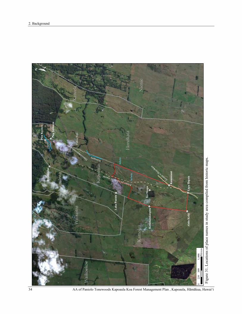
2. Background
34 AA of Paniolo Tonewoods Kapoaula Koa Forest Management Plan , Kapoaula, Hāmākua, Hawaiʻi Fi
gure
31.
Loc
atio
ns o
f pla
ce n
ames
in st
udy
area
com
pile
d fr
om h
isto
ric m
aps.
2. Background
AA of Paniolo Tonewoods Kapoaula Koa Forest Management Plan , Kapoaula, Hāmākua, Hawaiʻi 35
The Ranching and Sugar Industries in Hāmākua During the Mid to Late Nineteenth Century
The written history of the late nineteenth to the early twentieth century largely reflects news of new settlers, religious endeavors, and commercial pursuits in the region. The introduction of European livestock had a profound effect on upland Hāmākua and neighboring lands in Kohala. McEldowney (1983) discusses changes in land use and land ownership before and after the Māhele that culminated in the eventual displacement of the Hawaiian community in Kohala, and similar events impacted Hāmākua’s residents as well. After 1848, when land became a commodity, Hawaiians were often forced off their house lots (and livelihoods) simply because they lacked the cash with which to make the purchase (of land) or pay the property tax. The creation of private property also resulted in a shift away from the traditional mauka-to-makai management of whole ahupua‘a, as certain industries moved into large swaths of land, such as livestock ranching into dwindling upper forests of Hāmākua. As a result, Hawaiian culture was well on its way towards Western assimilation as industry in Hawai‘i transitioned from the boom-and-bust sandalwood trade, to a short-lived whaling industry, to the more lucrative, but environmentally destructive sugar and cattle industries.
Free-roaming livestock, such as cattle, sheep, and goats were brought to Hawai‘i in the ships of Western explorers during the late eighteenth century. Upon presenting the first cattle to Kamehameha I in 1789, Captain George Vancouver advised the Mō‘ī to place a protective ten-year kapu on the animals to allow them to multiply and roam freely all throughout Hawai‘i Island (Vancouver 1984). By the mid-nineteenth century, the unregulated population of livestock became a nuisance to the native farmers and evidence of the impact on the greater environment was cause for concern. During the 1830s, under the administration of Kauikeaouli (Kamehameha III), vaqueros (cowboys of Mexican, Indian, and Spanish descent) were brought to Hawai‘i to train Hawaiians in the handling of both horses and wild cattle. Although Hawaiians quickly adopted the newly introduced animal handling skills, organized ranching operations would not prosper in Hāmākua until the mid-nineteenth century.
By the time the Māhele began in 1848, John Palmer Parker had struck out on his own, having received two acres of land at Mānā where he built a family house and first ranch buildings (Bergin 2004). He rapidly expanded his landholdings, purchasing 640 acres surrounding Mānā in 1850, and in 1852 he purchased another 1,000 acres. Some of the leased lands would eventually be deeded to the ranch by outright purchase (Bergin 2004). In a few years, John Parker had turned most of the day-to-day operations of Parker Ranch over to his son, John Palmer Parker II. The growth of Parker Ranch and its rivals inevitably led to legal clashes over land and cattle throughout the 1860s.
An early rival of Parker Ranch, the Waimea Grazing and Agricultural Company (WGAC), was founded by Robert C. Janion and William H. Green in 1861 and joined by F. Spencer and Company soon thereafter. The WGAC acquired considerable strategic assets around Waimea in an attempt to monopolize the livestock industry in the region (Bergin 2004). From the outset, Spencer, Janion, and Green maintained an adversarial relationship with Parker Ranch. Land disputes and allegations cattle rustling were common occurrences between these two competing entities. During the early 1860s, for example, Parker successfully thwarted Janion’s men from harvesting unbranded cattle on his lands. Frank Spencer, meanwhile, contested Parker’s claim to more than 17,800 acres in other parts of the island. These disputes were still ongoing when John Palmer Parker, the founder of Parker Ranch, died on August 20, 1868 (Bergin 2004). At the time Parker Ranch controlled about 47,000 acres of land in the region. The ranch lands were divided evenly between John Parker II and his adopted son and nephew, Sam Parker Sr. In the next decade, the ranch would outbid the WGAC on important grazing leases and purchase additional lands, dooming its early rival to bankruptcy (Maly and Maly 2005; Wellmon 1969). Among those land purchases were several ahupua‘a in Hāmākua and Kohala belonging to H.R.H. Ruth Ke‘elikōlani. Parker Ranch purchased Kapoaula from Ke‘elikōlani on August 5, 1874, for a sum of two hundred dollars (Bureau of Conveyances Liber 39:496). A list of lands bought from Ke‘elikōlani appears in an advertisement (Figure 32) taken out by Samuel Parker in 1882 in an attempt to collect outstanding rents.
An 1877 Report of the Royal Commissioners on Development of Resources documented the effects of cattle ranching on the environment of the Kohala, Waimea, and Hāmākua regions, and the resultant outmigration of the native population during this period. Forests on the Kohala mountains were dying back, and water sources were polluted by cattle (Maly and Maly 2002). By the late-1870s, largely due to persistent drought conditions within its grazing lands, the Waimea Grazing and Agricultural Company went out of business, and its herd was purchased by Parker Ranch. Parker Ranch continued to expand their operations in the Hāmākua area throughout the 1870s and 1880s, and in 1882, existing Parker Ranch landholdings were further amplified by the purchase of Kapoaula from Ke‘elikōlani by Samuel Parker (Figure 32).

2. Background
36 AA of Paniolo Tonewoods Kapoaula Koa Forest Management Plan , Kapoaula, Hāmākua, Hawaiʻi
Figure 32. Public notice regarding purchase of Kapoaula (listed as “Kaapaaula”) on October 28, 1882 (Daily Honolulu Press 1882).
Another industry that emerged in Hāmākua during the mid- to late nineteenth century was commercial sugar cultivation. Sugarcane was grown on all islands, and when Cook arrived he wrote of seeing sugarcane plantations. Sugarcane was a Polynesian introduction and served a variety of uses. The kō kea or white cane was the most common, usually planted near Hawaiian homes for medicinal purposes, and to counteract bad tastes (Handy and Handy 1972). Sugarcane was a snack, condiment, famine food; fed to nursing babies, and helped to strengthen children’s teeth by chewing on it (Handy and Handy 1972). It was used to thatch houses when pili grass or lau hala were not abundant (Malo 1903). The Chinese on Lāna‘i are credited with producing sugar first, as early as 1802. However, it was not until 1835 that sugar became established commercially, replacing the waning sandalwood industry (Kuykendall and Day 1976; Oliver 1961).
Following the signing of a reciprocity treaty between the Kingdom of Hawai‘i and the United States of America in 1876, sugar plantations developed rapidly throughout the islands (Fong et al. 2005). Between 1876 and 1888, twenty sugar plantations sprang up along the Hāmākua coast (Dorrance and Morgan 2000). In 1878, the first sugar mill was established in the Hāmākua District, and due to its rich soil and plentiful water supply the district soon became the premiere location for growing sugar on the Island of Hawai‘i (Hazlett et al. 2007). The seaward portions of Kapoaula (up to 1,400 feet elevation) were included in the lands of the Honoka‘a Sugar Company. Lands cultivated in sugarcane extended from Kahaupu Gulch between the ahupua‘a of Pā‘auhau and Kaao northeast of the study area, all the way to the edge of Waipi‘o Valley. The fields were originally unirrigated, and for twenty-five years ratoon crops were grown in many areas because reaching the fields to replant was difficult. Eventually harvesting was accomplished using a combination of hand labor, flumes, and railroad (Dorrance and Morgan 2000).
While the makai portion of Kapoaula was included in the lands of the Honoka‘a Sugar Company, the mauka portion of the ahupua‘a remained under ownership of Parker Ranch and continued to be used for grazing purposes. A map of the northwestern portion of Hāmākua prepared in 1909 by A.J. Williamson (Hawai‘i Registered Map No. 2640) shows the relationship between Parker Ranch lands and Kapoaula (Figure 33). One important detail shown on the map is the upper extent of the forest (symbolized with bushy “tree-top” symbols, cf. Figure 29) located below the current study area at elevations less than 2,250 feet. Also, the trails depicted in 1853 do not appear on this map. A “new” road to Waimea (built ca. 1907) passes along the makai boundary of the current study area.

2. Background
AA of Paniolo Tonewoods Kapoaula Koa Forest Management Plan , Kapoaula, Hāmākua, Hawaiʻi 37
Figure 33. Portion of Hawai‘i Registered Map No. 2640 showing Kapoaula (outlined in red) and the study area (shaded gray) within the lands of Parker Ranch (after Williamson 1909).

2. Background
38 AA of Paniolo Tonewoods Kapoaula Koa Forest Management Plan , Kapoaula, Hāmākua, Hawaiʻi
For the remainder of the twentieth century, the current study area was used almost exclusively as pasture. One exception to this was an experimental planting of tropical ash (Fraxinus sp.) trees in the central portion of the study area. More than 1,500 acres of tropical ash were planted throughout Hawai‘i beginning in 1924 (Whitesell et al. 1971). Information concerning the planting of this stand could not be located, but it is possible that the stand was planted in ca. 1930s by the Civilian Conservation Corps (CCC). Based on aerial photographs taken in 1954 (Figure 34), the stand of trees was well established by mid-century.
The stand of trees is also depicted on a 1951 Plat Map (Figure 35) of the parcel. This map also shows in detail the ranching infrastructure in the study area and the survey markers used to produce the survey. Survey markers shown include three concrete posts at parcel boundary corners and the “Kamakaukuapuu” triangulation station near the parcel’s western boundary makai of the ash stand. Ranching infrastructure includes a waterhole in the upper and lower portions of the study area and a network of cattle trails connecting these waterholes with others outside the current study area. This cattle trail network contrasts with the distinctly linear routes of the Alanui pii uka i ka mauna and the Alanui o Honokaia depicted on maps from a century before (see Figures 29 and 30). Although it is possible to follow the cattle trails in a mauka-makai direction, they do not appear to follow either of the older trails very closely. The tropical ash stand in also depicted, as is a gravel pit straddling the Old Māmalahoa Highway at the northern boundary of the study area. These two features are also visible on the 1957 USGS quadrangle map (Figure 36). The study area remained in pasture since throughout the twentieth century (Figure 37), and into the present day.
Figure 34. Aerial photograph taken in 1954 with the study area outlined in red (USGS 1954).

2. Background
AA of Paniolo Tonewoods Kapoaula Koa Forest Management Plan , Kapoaula, Hāmākua, Hawaiʻi 39
Figu
re 3
5. P
ortio
n of
Pla
t Map
6.2
H.H
. with
cur
rent
stud
y ar
ea o
utlin
ed in
red
(Aki
and
Lan
e 19
51).

2. Background
40 AA of Paniolo Tonewoods Kapoaula Koa Forest Management Plan , Kapoaula, Hāmākua, Hawaiʻi
Figure 36. Portion of 1957 Kukuihaele quadrangle map, current study area outlined in red (USGS 1957).
Figure 37. Aerial photograph taken in 1977 with the study area outlined in red (Hawaii Statewide GIS Program 2017).

2. Background
AA of Paniolo Tonewoods Kapoaula Koa Forest Management Plan , Kapoaula, Hāmākua, Hawaiʻi 41
PREVIOUS ARCHAEOLOGICAL STUDIES
Very few formal archaeological studies have been conducted in the immediate vicinity of the current study area (Table 1). Cordy’s (1994) regional synthesis of previous studies in Hāmākua summarizes the general Precontact and early Historic land use patterns of the region (including the lands of the study area) in an effort to provide a predictive archaeological model for the district. Immediately adjacent to the current study area, Fong et al. (2005) conducted a literature review, field check, and cultural impact evaluation for Honokaia Pasture Lots Subdivision. Slightly makai (northeast) of the current study area, Cleghorn (1999) conducted an Archaeological Inventory Survey (AIS) at Inoino bridge located along the Old Māmalahoa Highway, and Rechtman et al. (2009) prepared An Archaeological and Limited Cultural Assessment of a Planned Access Road Route across TMKs: 3-4-6-11:004, 006, and 044. The locations of the Fong et al. (2005), Cleghorn (1999), and Rechtman et al. (2009) studies relative to the current study area are shown in Figure 38, and the findings of each of the studies listed above are summarized below.
In A Regional Synthesis of the Hāmākua District, Island of Hawai‘i, Dr. Ross Cordy (1994) summarizes the general Precontact and early Historic land use patterns for the subregion of East Hāmākua, which includes Kapoaula Ahupuaʻa (Cordy 1994). The summary is based on a review of Māhele records and a detailed examination of archival historical information. Cordy (1994) defines four general envirionmental zones within East Hāmākua: (1) the Sea-shore, (2) the Seaward Upland Slopes, (3) the ‘Ōhi‘a-Koa Forest Zone, and (4) The Gulches. The current project area is located just above the Seaward Upland Slopes within the ‘Ōhi‘a-Koa Forest Zone. The Seaward Upland Slopes was the primary farming and residential zone of East Hāmākua. House sites in this zone were common between the sea cliffs and the cross-island trail (near the present-day Highway 19). Garden plots (māla, kīhāpai, and kula), which were generally non-irrigated, tended to be located in close proximity to the house lots. In the mauka regions of this zone, some scattered fields were present that were not associated with permanent residences. Dryland taro was the dominant crop of The Seaward Upland Slopes, but sweet potatoes and bananas were also commonly grown (Cordy 1994).
Figure 38. Previous archaeological studies conducted in the vicinity of the current study area.

2. Background
42 AA of Paniolo Tonewoods Kapoaula Koa Forest Management Plan , Kapoaula, Hāmākua, Hawaiʻi
In the ‘Ōhi‘a-Koa Forest Zone, the Precontact and early Historic peoples of East Hāmākua utilized the natural resources of the forest. Activities in this zone included gathering bark to make fishing nets, collecting māmaki to make kapa, and catching birds for their feathers. At lower elevations within the ‘Ōhi‘a-Koa Forest Zone small plantings of supplemental crops such as bananas and taro were also present. Habitation in this zone occurred at caves and campsites that were occupied for short durations of time (Cordy 1994).
Cleghorn (1999) conducted an archaeological inventory survey at Inoino Bridge located along the Old Māmalahoa Highway to the northeast of the current study area (see Figure 38). He identified four small caves (Caves 1, 2, 3, and 4) in the ‘Ōhi‘a-Koa Forest Zone during an archaeological inventory survey at Inoino Bridge along the Old Māmalahoa Highway (TMKs: (3) 4-6-011:037 and 038). The caves, which were all recorded under the State Inventory of Historic Places (SIHP) designation Site 21405, are located in Kawela Ahupua‘a along its boundary with Honokaia Ahupua‘a. Each of caves contained stone constructions including platforms, walls, and alignments. Cleghorn (1999) suggests that the platforms within three of the caves, based on their formal attributes, could be Precontact burial monuments. However, no excavations or structural dismantling was performed during the survey to determine if human remains were indeed present within the stone structures. Cleghorn (1999) also recorded the Historic Inoino Bridge across Inoino Gulch, which was replaced by a new Inoino Bridge subsequent to the completion of the study.
In 2005, Fong et al. (2005) conducted a literature review, field check and cultural impact evaluation for approximately 2,500 acres of Department of Hawaiian Home Lands (DHHL) Lands in Honokaia Ahupua‘a (TMKs: (3) 4-6-011: 003, 011, 012, and 013), to the east/southeast of the current study area (see Figure 38). The literature review included a study of archival sources, historic maps, Land Commission Awards (LCAw.), and previous archaeological studies relative to Honokaia. These resources were used to construct a history of land use within the ahupua‘a. The field inspection, which included limited pedestrian survey and aerial survey, was conducted by two archaeologists over a span of three days. The inspection was intended to identify any surface archaeological features present within the 2,500 acres and to assess the potential impacts to any such features so that sensitive areas that might require further investigation or mitigation prior to any development could be dealt with. As a result of the field check a single archaeological site – a Historic wall, possibly a dam or gulch crossing – was recorded, but was not considered significant and was not assigned an SIHP site number. Two other structures, a corral and a quarry, were noted within the survey area, but were determined to lack archaeological or historical significance, as both were less than fifty years old. Fong et al. (2005) did not provide a map showing the location of any of the potential archaeological features identified. During community consultation, seven individuals were contacted of which only one individual, Halealoha Ayau, responded with interest to participate. In his interview, he recommended that cultural monitors be on site during excavations, “to assure that applicable burial treatment laws are adhered to.”
Site 21405, previously recorded by Cleghorn (1999) within Inoino Gulch, was also relocated and inspected by Fong et al. (2005), and a fifth cave (Cave 5) containing two crude, mounded walls was identified at the site. As a result of the inspection, it was determined that all five of the caves were located just beyond the boundaries of the study area. Given the absence of significant sites within the Fong et al. (2005) study area, it was concluded that the development of the area would have no effect on historic resources. As part of the study of the DHHL Honokaia Lands Fong et al. (2005) made an attempt to contact several individuals, organizations, and agencies by e-mail regarding traditional cultural properties in Honokaia. Only one organization, Hui Mālama O Nā Kūpuna O Hawai‘i Nei headed by Mr. Halealoha Ayau, responded to the e-mail. Mr. Ayau indicated that the members of the organization primarily wanted to make sure that cultural monitors were present during excavations to assure that applicable burial treatment laws would be adhered to (see Fong et al. 2005:36). Fong et al. (2005) reviewed several areas of possible cultural concerns for properties that could by impacted by the proposed development of the DHHL lands including archaeological sites, burials, gathering rights, hunting rights, trails, and storied places, but no traditional cultural properties were identified within the area, so no impacts were expected.
In 2009, Rechtman Consulting, LLC (Rechtman et al. 2009) conducted an archaeological survey and limited cultural assessment for a roughly 1.3 kilometer-long access road across three parcels northeast of the current study area (see Figure 38). The study involved a visual inspection of the access road corridor along the eastern boundary of Honokaia Ahupua‘a from Highway 19 to the Old Māmalahoa Highway and phone interviews with five individuals from the Honokaia ‘Ohana group. No archaeological resources of any kind were observed during the pedestrian survey, and no resources (landforms, vegetation, etc.) of a traditional cultural nature were present. The individuals interviewed for the study had no information regarding significant cultural places or practices that may have occurred within the project area. The only recollection of the area was that it was used for ranching. Given the negative findings of the study, Rechtman et al. (2009) concluded that development of the proposed access road route would not significantly impact any known historic properties or any cultural resources and practices of a traditional and customary nature. They therefore recommended that no further historic preservation work or mitigation was needed.

3. Study Area Expectations
AA of Paniolo Tonewoods Kapoaula Koa Forest Management Plan , Kapoaula, Hāmākua, Hawaiʻi 43
In 2015, ASM Affiliates (Clark et al. 2015) conducted an AIS a portion of a portion of TMK: (3) 4-6-013:001-046 in Honokaia Ahupua‘a to the east/southeast of the current study area for the proposed installation of a gravity-fed non-potable water system and appurtenances in the Honokaia Pastoral Lots Subdivision (see Figure 38). As a result of the study, a single archaeological site (Temporary Site 1), consisting of a short alignment of stacked boulders and cobbles on the northeastern slope of an intermittent drainage channel, was identified near the northern boundary of the study area. The site was fully documented during the study, however it was concluded by Clark et al. (2015) that much like a similar alignment previously identified by Fong et al. (2005), the site retained no integrity and was therefore not considered to be significant. As such, it was not assigned an SIHP Site number.
Table 2. Previous archaeological studies conducted in the vicinity of the current study area.Year Author(s) Type of Study Ahupua‘a 1999 Cleghorn Inventory Survey Kawela 2005 Fong et al. Literature Review, Field Check, Cultural Impact Evaluation Honokaia 2009 Rechtman et al. Inventory Survey and Limited Cultural Assessment Honokaia 2015 Clark et al. Inventory Survey Honokaia
3. STUDY AREA EXPECTATIONS
The culture-historical context presented above for the ahupua‘a of Kapoaula and the Hāmākua District, combined with the summary of previous archaeological research conducted in the vicinity of the study area, provides a basis for predicting the type and location of archaeological resources that may still be present within the current study area. Based this information, the archaeological expectations for the current study are limited. Traditional accounts, boundary commission testimonies and historical maps indicate that the study area was forested until the second half of the nineteenth century. Prior to that time, the forests on the slopes of Mauna Kea are known to have been used primarily for obtaining upland resources such as timber, plants products, and bird feathers, as well as for travel and for ceremonial or ritual purposes. Travel into the forests occurred on mauka-makai trails, two of which are known to have crossed the current study area. Those traveling into the forests likely only stayed temporarily while conducting their business there, and so evidence of these activities in the form of habitation sites or activity areas are likely to have been relatively ephemeral.
Deforestation of the current study area likely began shortly after the introduction of European livestock. The effects of grazing, but also timbering, led to the degradation of the native forest. As historical descriptions from other parts of the island attest, the loss of tree cover on the mountain side resulted in a dramatic increase in erosion. The loss of topsoil would have also resulted in damage to or the destruction of shallow or surface archaeological sites. While the amount of soil lost due to the effects of deforestation are unknown, it strongly suggests that the entire study area is an erosional environment, and that the prospects of buried sites is minimal. Over the course of the nineteenth century, the forest was replaced by pasture. The combined effects of trampling by cattle and the spread of introduced grasses such as kikuyu would have also had a deleterious effect on remnants of any sites created while the area was forested. Modern use of four-wheel-drive vehicles appears to have followed a similar route to that of the mauka-makai trail (the “Alanui pii uka i ka mauna”), further reducing the potential that evidence of the trail has survived.
While the expectations for encountering intact archaeological sites are very low, it is remotely possible that Precontact sites, including trails, temporary habitations, caves, or resource procurement areas could be encountered in areas protected by old-growth vegetation or difficult to reach terrain. Additionally, historic ranching related features such as corrals, walls, roads, fences, dams, or enclosures may also be present.

4. Fieldwork
44 AA of Paniolo Tonewoods Kapoaula Koa Forest Management Plan , Kapoaula, Hāmākua, Hawaiʻi
4. FIELDWORK
Fieldwork for the current study consisted of an initial reconnaissance of the study area conducted by Benjamin Barna, Ph.D. (Principal Investigator) on January 29, 2019, followed by an intensive (100% coverage) pedestrian survey conducted between March 26 and 28, 2019. The field crew for the intensive survey consisted of Genevieve L. Glennon, B.A., Lauren M. U. Kepa‘a, Johnny Dudoit, B.A., and Lyle Auld, B.A., under the direction of Benjamin Barna, Ph.D. In the large open pasture portions of the study area, field crew members walked in systematic transects paralleling the survey area boundaries with spacing between crew members no more than 40 meters. Ground surface visibility was excellent in the pasture. No archaeological features were observed on the ground surface, nor were any grass-covered terrain anomalies suspected of being archaeological features. In addition to walking transects, a thorough inspection was made of vegetated areas and bedrock overhangs with potential for concealing archaeological features and lava tubes, as well as prominent and anomalous landforms. Exposed soil cuts created by roads and cattle (Figure 39) were inspected to ascertain the soil stratigraphy throughout the study area. Soils observed in these cuts consisted of 7.5 4/4 Brown compact organic silty clay loam extending at least 1.5 meters below the ground surface, with subrounded basalt cobble and boulder inclusions. Given the erosional environment (which was probably exacerbated between the 1850s and the establishment of pasture later that century), no subsurface testing was conducted.
Figure 39. Exposed soil profile in cattle resting area.
FINDINGS
As a result of the current study, no archaeological sites or other historic properties of any kind were identified within the study area. All of the ranching related infrastructure (e.g., fencing, water troughs) encountered during the survey appeared modern. The concrete fenceposts (see Figure 20) observed during the current study did not correspond to the “concrete posts” depicted in the 1951 plat map (see Figure 35). An effort was made to identify evidence of the two trails (“Alanui pii uka i ka mauna” and the “Alanui o Honokaia”) depicted on historic maps (see Figures 29 and 30). Portions of the unpaved ranch road makai of the tropical ash stand likely follow the alignment of the “Alanui pii uka i ka mauna”, but currently there are only extensive wheel ruts from motor vehicle traffic. Where the projected trail alignment deviates from the jeep road, there are no surface indications of the trail. The physical route of the trail appears to have been obscured by cattle trampling, erosion, and the incursion of pasture grasses since the mid-nineteenth century. Given the history of erosion and other ground disturbance related to livestock ranching, it is unlikely that any buried cultural deposits exist within the current study area.

5. Determination of Effect and Recommendations
AA of Paniolo Tonewoods Kapoaula Koa Forest Management Plan , Kapoaula, Hāmākua, Hawaiʻi 45
5. DETERMINATION OF EFFECT AND RECOMMENDATIONS
Given the negative findings of the current study with respect to archaeological resources, it is concluded that the Paniolo Tonewoods Kapoaula Koa Forest Management Plan will not impact any known historic properties. The determination of effect for the proposed project is “no historic properties affected.” With respect to the historic preservation review process of the Department of Land and Natural Resources–State Historic Preservation Division (DLNR–SHPD), our recommendation is that no further work needs to be conducted within the Paniolo Tonewoods Kapoaula Koa Forest Management Plan study area prior to or during project implementation. In the unlikely event that significant archaeological resources are discovered during the proposed ground disturbing activity, work should cease in the area of the discovery and DLNR-SHPD contacted pursuant to HAR 13§13-280-3.

References Cited
46 AA of Paniolo Tonewoods Kapoaula Koa Forest Management Plan , Kapoaula, Hāmākua, Hawaiʻi
REFERENCES CITED
Aki, H. K., and R. Lane 1951 Hawaiian Home Land. Portion of the Lands of Kamoku-Kapulena, Hamakua, Hawaii, T.H. Hawaii
Territory Survey Plat 6.2 H.H. http://ags.hawaii.gov/survey/map-search/, accessed August 10, 2017.
Athens, J. S., T. Rieth, and T. Dye 2014 A Paleoenvironmental and Archaeological Model-Based Age Estimate for the Colonization of
Hawai’i. American Antiquity 79(1): 144–155.
Barrera, W., Jr 1971 Archaeological Excavations and Survey at Keauhou, North Kona, Hawaii. Departmental Report
Series 71–10. Department of Anthropology, B.P. Bishop Museum, Honolulu.
Bergin, B. 2004 Loyal to the Land: The Legendary Parker Ranch, 750-1950. University of Hawaii Press, Honolulu.
Brigham, W. 1899 Hawaiian Feather Work. Memoirs of the Bernice Pauahi Bishop Museum Volume 1, Number 1.
Bishop Museum Press, Honolulu.
1903 Additional Notes on Hawaiian Feather Work. Memoirs of the Bernice Pauahi Bishop Museum Volume 1, Number 3. Bishop Museum Press, Honolulu.
1918 Additional Notes on Hawaiian Feather Work: Second Supplement. Memoirs of the Bernice Pauahi Bishop Museum Volume 7. Bishop Museum Press, Honolulu.
Buck, P. H. 1944 The Local Evolution of Hawaiian Feather Capes and Cloaks. The Journal of the Polynesian Society
53(1): 1–16.
1957 Arts and Crafts of Hawaii. B. P. Bishop Museum Special Publication 45. Bishop Museum Press, Honolulu.
Buke Mahele 1848 Buke Kakau Paa no ka mahele aina i Hooholoia iwaena o Kamehameha III a me Na Lii a me Na
Konohiki ana. Hale Alii Honolulu.
Burtchard, G. 1995 Population and Land Use on the Keauhou Coast, the Mauka Land Inventory Survey, Keauhou, North
Kona, Hawai‘i Island. Part I: Narrative Volume. International Archaeological Research Institute, Inc. report. Prepared for Belt Collins and Associates and Kamehameha Investment Corporation, Honolulu, Hawai‘i.
Cartwright, B. 1933 Some Aliis of the Migratory Period. Bishop Museum Occasional Papers 10(7): 56–61.
Chinen, J. J. 1958 The Great Mahele: Hawaii’s Land Division of 1848. University of Hawaii Press, Honolulu.
1961 Original Land Titles in Hawaii. Privately published.

References Cited
AA of Paniolo Tonewoods Kapoaula Koa Forest Management Plan , Kapoaula, Hāmākua, Hawaiʻi 47
Clark, J., and P. Kirch (editors). 1983 Archaeological Investigations of the Mudlane-Waimea-Kawaihae Road Corridor, Island of Hawai‘i.
An Interdisciplinary Study of an Environmental Transect. Departmental Report Series 83–1. Department of Anthropology, B.P. Bishop Museum, Honolulu. Prepared for Department of Transportation, State of Hawaii.
Clark, M., S. Plunkett, and R. Rechtman 2015 An Archaeological Assessment Survey of the Proposed DHHL Honokaia Pastoral Lots Subidivision
Non-Potable Water System, Portions of TMKs: (3) 4-6-013:001-005, 010, 013, 014, 020, 022, 024, 036, 044, 045, 046, and (3) 4-7-007:005, Honokaia Ahupua’a, Kamoku ’Okana, Hāmākua District, Island of Hawai’i. ASM Affiliates 23360.00. Prepared for Ron Terry, Geometrician Associates, LLC, Hilo.
Cleghorn, P. 1999 The Results of an Archaeological Inventory Survey at Inoino Bridge, Kawela, Hamakua, Hawai’i.
Honolulu. Honolulu.
Cordy, R. 1994 A Regional Synthesis of Hamakua District, Hawai‘i Island. Historic Preservation Division, DLNR,
State of Hawai‘i, Honolulu.
2000 Exalted Sits the Chief, The Ancient History of Hawai‘i Island. Mutual Publishing, Honolulu, Hawaiʻi.
2003 Who Made the Feather Cloaks? Some Additional Information. The Journal of the Polynesian Society 112(1): 157–161.
Daily Honolulu Press 1882 Public Notice!. Daily Honolulu Press, October 28, 1882, p. 3.
Donn, J. M. 1901 Hawaii, Hawaiian Islands. Hawaii Territorial Survey Map. Registered Map 2060.
http://hdl.handle.net/10524/49272, accessed August 9, 2017.
Dorrance, W., and F. Morgan 2000 Sugar Islands: The 165-Year Story of Sugar in Hawaii. Mutual Publishing, Honolulu, Hawai‘i.
Doyle, E. L. 1953 Makua Laiana: The Story of Lorenzo Lyons. Honolulu Star Bulletin, Honolulu.
Duarte, T. 2012 Colonization and Prehistory on the Island of Maui: A Radiocarbon Synthesis of Maui Island. M.A.
Thesis, Department of Anthropology, University of Hawaiʻi at Mānoa, Honolulu.
Ellis, W. 2004 Journal of William Ellis, Narrative of a Tour of Hawaii, or Owhyee; with remarks on the History,
Traditions, Manners, Customs and Language of the Inhabitants of the Sandwich Islands. Advertiser Publishing Co., Ltd., Honolulu.
Emerson, N. B. 1894 The Bird Hunters of Ancient Hawaii. In Thrum’s Hawaiian Annual for 1895, edited by Thomas A.
Thrum, pp. 101–111. Thos. A Thrum, Honolulu, Hawaiʻi.

References Cited
48 AA of Paniolo Tonewoods Kapoaula Koa Forest Management Plan , Kapoaula, Hāmākua, Hawaiʻi
Fong, J. W., D. W. Shideler, and H. Hammatt 2005 Literature Review, Field Check and Cultural Impact Evaluation For Approximately 2,500-Acres of
DHHL Lands at Honokaia Ahupua‘a, Hāmākua District, Hawaii Island, TMK: 4-6-11: 3, 11, 12, and 13. HONO 64. Honolulu, HI. Honolulu, HI.
Fornander, A. 1880 An Account of the Polynesian Race. Vol. II. Three volumes vols. Trübner & Co., London.
1969 An Account of the Polynesian Race: Its Origins and Migrations, and the Ancient History of the Hawaiian People to the Times of Kamehameha I. Ed. John F. G. Stokes. Charles Tuttle & Co., Inc., Tokyo.
1996 Ancient History of the Hawaiian People. Vol. II. Mutual Publishing, Australia.
Giambelluca, T. W., Q. Chen, A. G. Frazier, J. P. Price, Y.-L. Chen, P.-S. Chu, J. K. Eischeid, and D. M. Delparte 2013 Online Rainfall Atlas of Hawai‘i. Bulletin of the American Meteorological Society 94(3): 313–316.
Gonschor, L., and K. Beamer 2014 Toward an Inventory of Ahupua’a in the Hawaiian Kingdom: A survey of Nineteenth- and early
Twentieth-Century Cartographic and Archival Records of the Island of Hawai’i. The Hawaiian Journal of History 48: 53–87.
Greene, L. 1993 A Cultural History of Three Traditional Hawaiian Sites on the West Coast of Hawai‘i Island. United
States Department of the Interior, National Park Service, Denver Service Center.
Griffin, P. B., P. H. Rosendahl, and H. D. Tuggle 1971 Archaeology of Halawa and Lapakahi: Windward Valley and Leeward Slope. New Zealand
Archaeological Association Newsletter 14(3): 101–112.
Handy, E. S. C., and E. G. Handy 1972 Native Planters in Old Hawaii: Their Life, Lore, and Environment. Bernice P. Bishop Museum
Bulletin 233. Bishop Museum Press, Honolulu.
Hawaii Statewide GIS Program 2017 1977 Digital Ortho Quad Photomosaics. Hawaii State Office of Planning.
http://geodata.hawaii.gov/arcgis/rest/services/SoH_Imagery/BW_1977/ImageServer, accessed April 24, 2018.
Hazlett, A., D. W. Shideler, and H. Hammatt 2007 Supplemental Archaeological Surveying, Recordation, Monitoring, Discovery, and Data Recovery
Plan for the Hamakua Ditch System, Lālākea, Kukuihaele, Kanahonua, Waio‘eko‘e, Kea‘ā, Pu‘u‘ōpaha, Kalakala‘ula, Mo‘oiki 1, Hanapai, Niupuka, Kana, Pa‘akō, Puanui, Papalapuka, Waikōloa, Wai‘ale‘ale, Kapulena, Ka‘auhuhu, Ke‘ahakea, Hauko‘i, Mo‘oiki 2, Manae, Kapoa‘ula, Malanahae and Honokai‘a Ahupua‘a, Hāmākua District, Hawai‘i Island, Portions of TMK: [3] 4-06, 4-07, and 4-08 LALAKEA 1. Honolulu, HI, October. Honolulu, HI.
Hommon, R. 1976 The Formation of Primitive States in Pre-Contact Hawaii. Ph.D. Dissertation, Department of
Anthropology, University of Arizona, Tucson.
1986 Social Evolution in Ancient Hawai‘i. In Island Societies: Archaeological Approaches to Evolution and Transformation, edited by Patrick Kirch, pp. 55–88. Cambridge University Press, Cambridge, Massachusetts.

References Cited
AA of Paniolo Tonewoods Kapoaula Koa Forest Management Plan , Kapoaula, Hāmākua, Hawaiʻi 49
I‘i, J. P. 1963 Fragment of Hawaiian History. B.P. Bishop Museum Special Publication 70. Bishop Museum Press,
Honolulu.
Jarves, J. 1847 History of the Hawaiian Islands: embracing their antiquities, mythology, legends, discovery by
Europeans in the sixteenth century, re-discovery by Cook, with their civil, religious and political history, from the earliest traditionary period to the present time. C. E. Hitchcock, Honolulu.
Kamakau, S. 1976 The Works of the People of Old, Na Hana a ka Po‘e Kahiko. B.P. Bishop Museum Special
Publication 61. Bishop Museum Press, Honolulu, Hawaiʻi.
1991 Tales and Traditions of the People of Old, Nā Mo‘olelo a ka Po‘e Kahiko. Bishop Museum Press, Honolulu, Hawaiʻi.
1992 Ruling Chiefs of Hawaii. Revised edition. Kamehameha Schools Press, Honolulu.
Kame‘eleihiwa, L. 1992 Native Land and Foreign Desires: How Shall We Live in Harmony? = Ko Hawaii Aina a Me Na
Koi Puumake a Ka Poe Haole. Bishop Museum Press, Honolulu.
Kent, N. 1983 Hawaii: Islands Under the Influence. University of Hawai‘i Press, Honolulu.
King, R.
n.d. Hawaiian Land Titles. Manuscript. https://ags.hawaii.gov/wp-content/uploads.
Kirch, P. 1984 The Evolution of the Polynesian Chiefdoms. Cambridge University Press, New York.
1985 Feathered Gods and Fishhooks: An Introduction to Hawaiian Archaeology and Prehistory. University of Hawaii Press, Honolulu.
1990 The evolution of sociopolitical complexity in prehistoric hawaii: an assessment of the archaeological evidence. Journal of World Prehistory 4(3): 311–345.
2010 How Chiefs Became Kings: Divine Kingship and the Rise of Archaic States in Ancient Hawai’i. University of California Press, Berkeley.
2011 When did the Polynesians Settle Hawai‘i? A Review of 150 Years of Scholarly Inquiry and a Tentative Answer. Hawaiian Archaeology 12: 3–26.
2012 A Shark Going Inland Is My Chief: The Island Civilization of Ancient Hawaiʻi. University of California Press, Berkeley.
Kuykendall, R. 1938 The Hawaiian Kingdom 1778–1854. Foundation and Transformation. University Press of Hawaii,
Honolulu.
Kuykendall, R., and A. G. Day 1976 Hawaii: A History; From Polynesian Kingdom to American Statehood. Prentice-Hall, Englewood
Cliffs, New Jersey.

References Cited
50 AA of Paniolo Tonewoods Kapoaula Koa Forest Management Plan , Kapoaula, Hāmākua, Hawaiʻi
Lass, B. 1998 Crafts, Chiefs, and Commoners: Production and Control in Precontact Hawaiʻi. Archaeological
Papers of the American Anthropological Society 8: 19–30.
Linnekin, J. 1988 Who Made the Feather Cloaks? A Problem in Hawaiian Gender Relations. The Journal of the
Polynesian Society 97(3): 265–280.
Lyons, C. J. 1853 Map of Kohala, Hawaii. Hawai‘i Land Survey Division, Registered Map No. 46.
http://ags.hawaii.gov/survey/map-search.
Malo, D. 1903 Hawaiian Antiquities (Moolelo Hawaii). Translated by Dr. N. B. Emerson. Hawaiian Gazette Co.,
Ltd., Honolulu.
1951 Hawaiian Antiquities. B. P. Bishop Museum Special Publication 2. Second edition. Translator Nathaniel B. Emerson. B. P. Bishop Museum Press, Honolulu.
Maly, K. 1999 Na Ala Hele Ma Kai O Kohala Hema (The Coastal Trails of South Kohala): Archival-Historical
Documentary Research, Oral History—Consultation Study and Limited Site Preservation Plan Kawaihae-‘Anaeho‘omalu Trail Section. Kumu Pono Associates Report HiAla-17K (043099). Prepared for for Na Ala Hele, Hilo, Hawaii.
Maly, K. 2002 The Māhele ‘Āina (The Land Division) an Overview of Documentation Found in the Claims and
Awards of the Māhele. Kumu Pono Associates, LLC.
Maly, K., and O. Maly 2002 He Wahi Mo‘olelo No Ka ‘Āina A Me Nā ‘Ohana O Waiki‘i Ma Waikōloa (Kalana O Waimea,
Kohala), A Me Ka ‘Āina Mauna: A Collection of Traditions and Historical Accounts of the Lands and Families of Waiki‘i at Waikōloa (Waimea Region, South Kohala), and the Mountain Lands, Island of Hawai‘i (TMK Overview Sheet 6-7-01). Kumu Pono Associates Report HiWaikii61-111202. Prepared for Waiki‘i Ranch Homeowner’s Association, Kamuela, Hawai‘i.
2005 Mauna Kea- Ka Piko Kaulana O Ka ʻĀina/Mauna Kea- The Famous Summit of the Land. Kumu Pono Associates Study HIMK67-OMKM (033005b). Prepared for The Office of Mauna Kea Management (University of Hawaiʻi Hilo), Hilo, HI.
McEldowney, H. 1983 Report 16, A Description of Major Vegetation Patterns in the Waimea-Kawaihae Region During the
Early Historic Period. In Archaeological Investigations of the Mudlane-Waimea-Kawaihae Road Corridor, Island of Hawai‘i. An Interdisciplinary Study of an Environmental Transect, edited by Jeffrey Clark and Patrick Kirch, pp. 407–448. Departmental Report Series 83–1. Prepared for Department of Transportation, State of Hawaii. Department of Anthropology, B.P. Bishop Museum, Honolulu.
Office of Hawaiian Affairs 2018 Kipuka Database. Kipuka Database. http://kipukadatabase.com/kipuka, accessed March 29, 2018.
Office of the Commissioner of Public Lands of the Territory of Hawaii (Commisioner of Public Lands) 1929 Indices of Awards Made by the Board of Commissioners to Quiet Land Titles in the Hawaiian
Islands. Star Bulletin Press, Honolulu.

References Cited
AA of Paniolo Tonewoods Kapoaula Koa Forest Management Plan , Kapoaula, Hāmākua, Hawaiʻi 51
Oliver, D. 1961 The Pacific Islands. University of Hawaii Press, Honolulu.
Pogue, J. F. 1978 Moolelo of Ancient Hawaii. Translator Charles W. Kenn. Topgallant Press, Honolulu.
Puakō Historical Society 2000 Puakō An Affectionate History. Creative Connections Publishing, Vancouver, B.C.
Pukui, M. K., and S. H. Elbert 1986 Hawaiian Dictionary: Hawaiian-English, English-Hawaiian. Rev. and enl. ed. University of Hawaii
Press, Honolulu.
Pukui, M. K., S. H. Elbert, and E. Mo‘okini 1974 Place Names of Hawaii. Revised and Expanded Edition. University of Hawaii Press, Honolulu.
Rechtman, R. B., and K. Maly 2003 Cultural Impact Assessment for the Proposed Development of TMK:3-7-3-9:22, ‘O‘oma 2nd
Ahupua‘a, North Kona District, Island of Hawai‘i, Volumes I and II. Rechtman Consulting Report RC-0154. Prepared for Helber Hastert & Fee, Honolulu, Hawai‘i.
Rechtman, R. R., M. R. Clark, and A. Dircks Ah Sam 2009 An Archaeological and Limited Cultural Assessment of a Planned Access Road Route across TMKs:
3-4-6-11:004, 006, and 044, Honokaia Ahupua‘a, Hāmākua District, Island of Hawai‘i. Rechtman Consulting report RC-0652. Honolulu, HI. Honolulu, HI.
Restarick, H. 1928 Historic Kealakekua Bay. Papers of the Hawaiian Historical Society 15: 5–20.
Rieth, T., T. Hunt, C. Lipo, and J. Wilmshurst 2011 The 13th Century Polynesian Colonization of Hawaii Island. Journal of Archaeological Science 38:
2740–2749.
Rosendahl, P. 1972 Archaeological Salvage of the Hapuna-Anaehoomalu Section of the Kailua-Kawaihae Road (Queen
Kahumanu Highway), Island of Hawaii. Departmental Report Series 72–5. Department of Anthropology, B. P. Bishop Museum, Honolulu.
Schilt, R., and A. Sinoto 1980 Limited Phase I Archaeological Survey of Mahukona Properties, North Kohala, Island of Hawaii.
Department of Anthropology, Bernice P. Bishop Museum Ms. 013180. Preprared for Belt Collins and Associates, Honolulu. Honolulu.
Sherrod, D. R., J. M. Sinton, S. E. Watkins, and K. M. Brunt 2007 Geologic Map of the State of Hawai`i. Open-File Report 2007-1089. U.S. Department of the
Interior, U.S. Geological Survey. http://pubs.usgs.gov/of/2007/1089, accessed April 27, 2018.
Soehren, L. 2005 A Catalog of Hawai‘i Place Names Compiled from the Records of the Boundary Commission and
the Board of Commissioners to Quiet Land Title of the Kingdom of Hawaii. Part 4: Ka‘ū. http://ulukau.org/cgi-bin/hpn?, accessed September 14, 2016.

References Cited
52 AA of Paniolo Tonewoods Kapoaula Koa Forest Management Plan , Kapoaula, Hāmākua, Hawaiʻi
Soil Survey Staff (Soil Survey Staff) 2019 Web Soil Survey. United State Deparment of Agriculture, Natural Resources Conservation Service.
http://websoilsurvey.nrcs.usda.gov/, accessed March 4, 2019.
Tatar, E. 1982 Nineteenth Century Hawaiian Chant. Pacific Anthropological Records. Department of
Anthropology, B.P. Bishop Museum, Honolulu. Honolulu.
The Polynesian 1853 . The Polynesian, March 26, 1853, p. 3.
Tomonari-Tuggle, M.-J. 1996 Bird Catchers and Bullock Hunters in the Upland Mauna Kea Forest: A Cultural Resource Overview
of the Hakalau Forest National Wildlife Refuge, Island of Hawaiʻi, Contract No. 10181-5-2193. International Archaeological Research Institute, Inc. report.
United States Geological Survey (USGS) 1954 Aerial Photograph 1HAI000010005. Aerial Photograph. United States Department of Geology.
https://earthexplorer.usgs.gov/, accessed December 20, 2017.
1957 Kukuihaele Quadrangle. U.S. Department of the Interior, U.S. Geological Survey. https://ngmdb.usgs.gov/topoview.
Vancouver, G. 1984 A Voyage of Discovery to the North Pacific Ocean and Round the World, 1791-1795: With an
Introduction and Appendices. Ed. William Kaye Lamb. Hakluyt Society, London.
Wellmon, B. B. 1969 The Parker Ranch: A History. Ph. D. dissertation, Department of History, Texas Christian
University. University Microfilms International, Ann Arbor, MI.
Whitesell, C., H. Wick, and N. Honda 1971 Growth Response of a Thinned Tropical Ash Stand in Hawaii...after 5 years. USDA Forest Service
Research Note PSW-227. Prepared by Forest Service, U.S. Department of Agriculture, Berkeley.
Wilkes, C. 1845 Narrative of the United States Exploring Expedition During the Years 1838. 1839, 1849, 1842. Vol.
Volume IV. Lea and Blanchard, Philadelphia.
Williamson, A. 1909 Plan of the North Western Part of Hamakua Hawaii Showing Honokaa and Pacific-Sugar-Mill
Plantations and the Hamakua Upper and Lower Ditches. Hawai‘i Land Survey Division, Registered Map No. 2640. http://ags.hawaii.gov/survey/map-search, accessed August 10, 2017.
Wilmshurst, J., T. Hunt, C. Lipo, and A. Anderson 2011 High-Precision Radiocarbon Dating Shows Recent and Rapid Colonization of East Polynesia.
Proceedings of the National Academy of Sciences 108: 1815–1820.

A Cultural Impact Assessment for the Paniolo Tonewoods Kapoaula Koa Forest Management Project
TMK: (3) 4-7-007:011
Kapoaula Ahupua‘a Hāmākua District
Island of Hawaiʻi
Prepared By: Lauren M. U. Kepa‘a, Ivana Hall, B.A., and Lokelani Brandt, M.A.
Prepared For: Ron Terry, Ph.D Geometrician Associates, LLC P.O. Box 396 Hilo, HI 96720
March 2019
ASM Project Number 31870.00

A Cultural Impact Assessment for the Paniolo Tonewoods Kapoaula Koa
Forest Management Project
TMK: (3) 4-7-007:011
Kapoaula Ahupua‘a Hāmākua District Island of Hawaiʻi

Table of Contents
CIA for Paniolo Tonewoods Kapoaula Koa Forest Management Project, Kapoaula, Hāmākua, Hawaiʻi i
CHAPTERS Page
1. INTRODUCTION ......................................................................................................... 1
STUDY AREA DESCRIPTION .......................................................................................... 5
PROPOSED KAPOAULA KOA FOREST MANAGEMENT PLAN ................................ 7
2. BACKGROUND ............................................................................................................ 9
CULTURE-HISTORICAL CONTEXT ............................................................................... 9
A Generalized Model of Hawaiian Prehistory ............................................................... 9
A Brief History of Hawai‘i After Western Contact ..................................................... 11
KAPOAULA AHUPUA‘A AND THE GREATER HĀMĀKUA DISTRICT ................. 11
Traditional Agricultural and Gathering Practices of Hāmākua Hikina ........................ 16
Legendary Accounts of the Greater Hāmākua District ................................................ 19
Kapola‘ula, Hāmākua’s Strong Man is Defeated by Kauaahiapaoa of Kaua‘i ..................................... 19
The Legend of Kuapāka‘a and the Wind-Gourd of La‘amaomao ......................................................... 21
He Mo‘olelo No Palila .......................................................................................................................... 26
Haunaka, the Strong Man of Pā‘auhau Yields to Aiohikupua, the Young Chief of Kaua‘i .................. 26
Legends Concerning Kamapuaʻa .......................................................................................................... 26
‘Aumakua Manō of Hāmākua ............................................................................................................... 27
‘Ōlelo No‘eau of Hāmākua .......................................................................................... 28
Waipi‘o: the Epicenter of Hāmākua’s Precontact Political System ............................. 29
Hāmākua 1820-1848: A Land in Transition and Early Historical Accounts ............... 36
The Legacy of the Māhele ‘Āina of 1848..................................................................... 37
Boundary Commission Testimony (1862-1873) .......................................................... 47
Nā Inoa ‘Āina of Kapoaula Ahupua‘a .......................................................................... 49
The Historic Vernacular Landscape of Kapoaula and Hāmākua During the Mid to Late Nineteeth Century ................................................................................................ 51
The Ranching Industry in Kapoaula and Hāmākua ............................................................................... 52
An Overview of Early Agricultural Pursuits in Hāmākua ..................................................................... 56
A Concise History of the Honoka‘a Sugar Plantation ........................................................................... 60
The Development of the Government Road (Alanui Aupuni) in Hāmākua and Land Use in the Study Area During the Early to Late Twentieth Century ................................................................................ 66
SUMMARY OF ARCHAEOLOGICAL AND CULTURAL STUDIES CONDUCTED IN THE VICINITY OF THE STUDY AREA ......................................... 76
Previous Archaeological Studies Conducted in the Vicinity of the Current Study Area .............................................................................................................................. 76
Cultural Studies Conducted for Kapoaula and General Vicinity ................................. 79
3. CONSULTATION ....................................................................................................... 80
CHAUNCEY KALĀ LINDSEY-AH SING ...................................................................... 81
DR. BILLY BERGIN ......................................................................................................... 81

Table of Contents
ii CIA for Paniolo Tonewoods Kapoaula Koa Forest Management Project, Kapoaula, Hāmākua, Hawaiʻi
GARY RAPOZO ................................................................................................................ 81
4. IDENTIFICATION AND MITIGATION OF POTENTIAL CULTURAL
IMPACTS .................................................................................................................... 82
SUMMARY OF THE CULTURAL-HISTORIC BACKGROUND ................................. 83
IDENTIFIED CULTURAL IMPACTS AND PROPOSED MITIGATION MEASURES ....................................................................................................................... 84
Reforestation and Harvesting ....................................................................................... 84
Educational opportunities ............................................................................................. 85
Reuse of traditional trail alignment (Alanui pii uka i ka mauna) ................................. 85
5. CONCLUSION ............................................................................................................ 85
REFERENCES CITED ................................................................................................... 86
FIGURES
Page 1. Study area location. ................................................................................................................................... 2
2. Tax Map Key (3) 4-7-007:011 showing the current study parcel (shaded in red). ................................... 3
3. Google Earth™ satellite image showing study area location (outlined in red). ........................................ 4
4.Map showing soil deposits within the current study area (outlined in red). .............................................. 6
5.Map showing geological deposits within the current study area (outlined in red). ................................... 6
6. Proposed forest management units. .......................................................................................................... 8
7. Portion of Hawai‘i Registered Map No. 2060 (Donn 1901) showing the current study area location (shaded red) within Kapoaula (shaded gray) in the moku of Hāmākua (shaded blue). ............ 13
8. Google Earth™ satellite image showing study area location (outlined in red). ...................................... 14
9. The Regions of Hāmākua District (Cordy 1994:3) ................................................................................. 15
10. Chronology of the Pili rulers of Hawai‘i Island (Cordy 1994:7). ......................................................... 30
11. LCAw. 9971 ‘apana 2 to William Leleiohoku (www.kipukadatabase.com). ...................................... 41
12. Newspaper notice from March 15, 1853 listing Kapoaula (listed as Kapaaula) and other lands to be awarded to Leleiōhoku during the Māhele (The Polynesian 1853). ................................................. 42
13. Survey map of LCAw. 9971:2 by C.J. Lyons, study area shaded red. ................................................. 43
14. Portion of Registered Map No. 46 with the current study area outlined red (after Lyons 1853). ......... 44
15. Tracing of C.J. Lyons’ survey map of LCAw. 9971:2 with the current study area outlined in red (Office of Hawaiian Affairs 2018)......................................................................................................... 45
16. Kuleana parcels awarded in Kapoaula Ahupua‘a. ................................................................................ 47
17. Locations of place names in study area compiled from historic maps. ................................................. 50
18. An 1853 “Map of the island of Hawaii” by Coulter showing Hāmākua (shaded red) (after Maly 1999:63). ................................................................................................................................................ 52
19. Undated photo of Hale Manā, North Hawai‘i Education and Research Center,Billy Bergin Collection, 1B-11-BB. ........................................................................................................................... 53
20. Newspaper clipping from April 22, 1857 (The Polynesian 1857). ....................................................... 53

Table of Contents
CIA for Paniolo Tonewoods Kapoaula Koa Forest Management Project, Kapoaula, Hāmākua, Hawaiʻi iii
21. Newspaper clipping from June 23, 1860 (The Polynesian 1860). ........................................................ 55
22. Public notice published by Samuel Parker regarding purchase of Kapoaula (listed as Kaapaaula) on October 28, 1882 (Daily Honolulu Press 1882). ........................................................... 56
23. Copy of Survey Furnished (C.S.F.) Map No. 11391 showing current study area in relation to mauka boundary of the Hāmākua Forest Reserve. ................................................................................ 59
24. 1904 map by Cha. V.E. Dove depicting the sugar plantation fields of the Honokaa Sugar Company extending along the makai lands of Kapoaula. Project area not shown on map. North Hawai‘i Education and Research Center, map collection. ..................................................................... 62
25. 1889 map showing the proposed route for the Upper Hāmākua Ditch by J. M. Lydgate with project area outlined in red. North Hawai‘i Education and Research Center, map collection. ............. 63
26. Portion of 1909 Hawai‘i Registered Map No. 2640 by A.J. Williamson showing the study area within the lands of Parker Ranch and the lands of Honokaa Sugar Companyand Pacific Sugar Mill. ....................................................................................................................................................... 65
27. Map of Hawai’i Island published in the Pacific Commercial Advertiser on February17, 1859, showing a trail extending from Hilo into Hāmākua (The Pacific Commercial Advertiser 1859). ........ 66
28. Portion of 1916 Waipio USGS quadrangle map with study area indicated in red. ............................... 71
29. Portion of 1927 Hawai‘i Registered Map No. 2761 by C.L. Murray showing portion of current study area and Kapoaula Ahupua‘a. ...................................................................................................... 72
30. Portion of 1951 Plat Map 6.2 H.H. by T.Y. Awana with current study area outlined in red (Aki and Lane 1951). ..................................................................................................................................... 73
31. September 28, 1954 USGS aerial photograph of the study area (outlined in red). ............................... 74
32. Portion of 1957 Kukuihaele USGS quadrangle map showing stand of tropical ash trees (shaded green) (United States Geological Survey 1957). ................................................................................... 74
33. January 7, 1977 USGS aerial photograph of the study area (outlined in red). ...................................... 75
34. Portion of 1982 Kukuihaele USGS quadrangle map showing stand of tropical ash trees (shaded light green), water tank, and quarry site in study area (outlined in red). ............................................... 75
TABLES
Page 1. NRCS Conservation Practices with potential to effect historic properties. .............................................. 7
2. Kuleana parcels awarded in Kapoaula Ahupua‘a. .................................................................................. 46
3. List of place names noted on historical maps. (* located outside of the project area) ............................ 50
4. Archaeological studies conducted for Kapoaula and of general vicinity. ............................................... 76
5. Cultural studies conducted for Kapoaula and of general vicinity. .......................................................... 79
APPENDIX
A. Ka Wai Ola Public Notice
1. Introduction
CIA for Paniolo Tonewoods Kapoaula Koa Forest Management Project, Kapoaula, Hāmākua, Hawaiʻi 1
1. INTRODUCTION
At the request of Ron Terry of Geometrician Associates, LLC on behalf of Cardno GS, Inc. (CGS), ASM Affiliates has prepared this Cultural Impact Assessment (CIA) to accompany a Hawaiʻi Revised Statues (HRS) Chapter 343 Environmental Assessment (EA) for the proposed Kapoaula Koa Forest Management Plan (KKFMP) located on a roughly 564-acre portion of land in Kapoaula Ahupua‘a, Hāmākua District, Island of Hawai‘i on TMK: (3) 4-7-007:011 (Figures 1, 2, and 3). The land is owned by the Siglo Forest, Inc. and leased to Paniolo Forestry, LLC (the project proponent). The project has been proposed by Paniolo Forestry, LLC, in conjunction with Paniolo Tonewoods. The objective of the project is to develop a long-term supply of quality koa (Acacia koa) wood and associated native forest plants on the subject parcel for use in the manufacture of musical instruments and for other uses. To do so, Paniolo Forestry, LLC will plant koa and other native trees on the subject parcel, which will replace the existing pasture that has been used for cattle grazing since the mid- to late-19th century.
The current study is an accompanying document to an Environmental Assessment (EA) conducted in compliance with Hawai‘i Revised Statutes (HRS) Chapter 343; pursuant to Act 50 and in adherence with the Office of Environmental Quality Control (OEQC) Guidelines for Assessing Cultural Impact, adopted by the Environmental Council, State of Hawai‘i, on November 19, 1997. As stated in Act 50, which was proposed and passed as Hawai‘i State House of Representatives Bill No. 2895 and signed into law by the Governor on April 26, 2000, “environmental assessments . . . should identify and address effects on Hawaii’s culture, and traditional and customary rights . . . native Hawaiian culture plays a vital role in preserving and advancing the unique quality of life and the ‘aloha spirit’ in Hawai‘i. Articles IX and XII of the state constitution, other state laws, and the courts of the State impose on governmental agencies a duty to promote and protect cultural beliefs, practices, and resources of native Hawaiians as well as other ethnic groups.”
This report is divided into four main sections, beginning with an introduction and a general description of the study area, followed by a detailed cultural-historical background and a presentation of prior studies; all of which combine to provide a physical and cultural context for the current project area. The results of the consultation process are then presented, along with a discussion of potential impacts as well as appropriate actions and strategies to mitigate any such impacts.

1. Introduction
2 CIA for Paniolo Tonewoods Kapoaula Koa Forest Management Project, Kapoaula, Hāmākua, Hawaiʻi
Figure 1. Study area location.
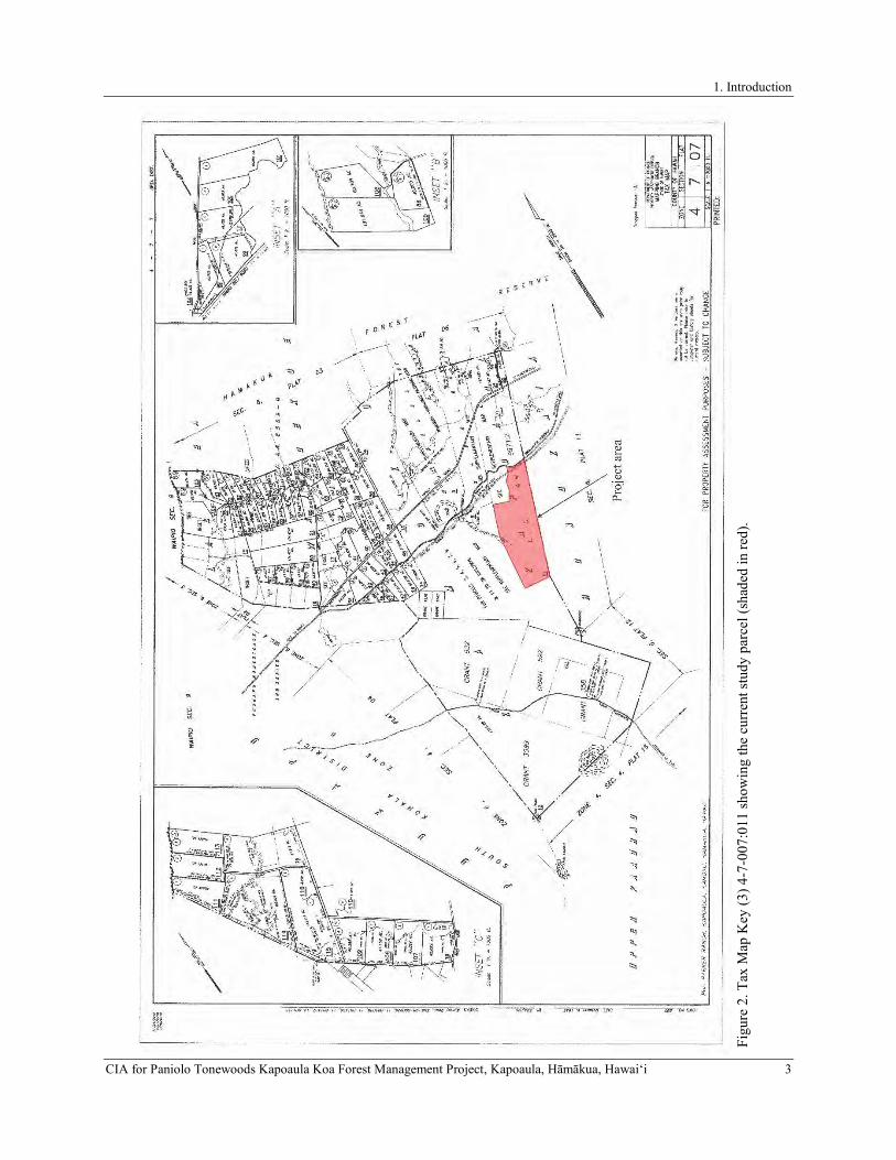
1. Introduction
CIA for Paniolo Tonewoods Kapoaula Koa Forest Management Project, Kapoaula, Hāmākua, Hawaiʻi 3 Fi
gure
2. T
ax M
ap K
ey (3
) 4-7
-007
:011
show
ing
the
curr
ent s
tudy
par
cel (
shad
ed in
red)
.

1. Introduction
4 CIA for Paniolo Tonewoods Kapoaula Koa Forest Management Project, Kapoaula, Hāmākua, Hawaiʻi
Figure 3. Google Earth™ satellite image showing study area location (outlined in red).

1. Introduction
CIA for Paniolo Tonewoods Kapoaula Koa Forest Management Project, Kapoaula, Hāmākua, Hawaiʻi 5
STUDY AREA DESCRIPTION
The current study area encompasses roughly 564 acres of pastureland situated on the southern or mauka most boundary of Kapoaula Ahupuaʻa, Hāmākua District, Island of Hawaiʻi (see Figure 3). The study area extends along the mauka (southern) edge of the Old Māmalahoa Highway, and is accessed by a gated, unimproved access road that enters into the parcel from the north. The study area is bounded to the west by Kamoku and Kapulena ahupuaʻa and to the east by Honokaia Ahupuaʻa. Its northern boundary is coterminous with the ahupua‘a boundary with Kamoku along the Old Māmalahoa Highway and it is adjacent to the Edwin DeLuz gravel quarry to the northwest. It is situated on the northern flank of Mauna Kea Volcano at elevations ranging from 2,740 to 3,180 feet (835 to 969 meters) above sea level, roughly 7 kilometers from the coast. The undulating terrain is characterized by gentle to moderately north-sloping hills punctuated with outcroppings and occasional steep and rocky ridgelines, particularly in the makai half of the parcel. A single permanent stream crosses into the study area near the northwestern corner of the property. Several non-perennial surface streams (none of which were flowing at the time of the current study) have incised shallow to moderate intermittent drainage channels through the study area.
Soils within the study area (Figure 4) are classified as Maile-Waiākea-Rock outcrop complex on 6 to 35 percent slopes (Soil Survey Staff 2019). These soils consist of two distinct, well-drained loams, namely Maile and Honokaa, that range from ashy, sandy loam to hydrous silt loam, and highly organic silty clay that formed in a series of volcanic ash layers overlying basalt that originated from Mauna Kea Volcano during the Pleistocene epoch. The geology underlying the current study area is composed predominately of 11,000 to 64,000-year-old Laupāhoehoe Volcanics (labeled as “Qlb” in Figure 4). The northeast section of the parcel contains small portions of Hāmākua Volcanics that have been dated to 64,000 to 300,000 years old (labeled as “Qhm” in Figure 5). Mean annual rainfall within the study area averages approximately of 2,038 millimeters (80.24 inches), with the majority of rainfall occurring between the months of November and April and the least occurring in June and September (Giambelluca et al. 2013). The study area is characterized by a cool, semi-tropical climate with a mean annual temperature ranging from 32 to 78 degrees Fahrenheit (Giambelluca et al. 2013).
As a result of nearly two centuries of cattle grazing, vegetation within the study area consists almost exclusively of a pasture grasses dominated by introduced perennial forage grasses and sedges including but not limited to kikuyu (Pennisetum clandestinum), Honohono (Haplostachys haplostachya), natal redtop (Melinus rupens), and Hilo (Paspalum conjungatum) grasses occasionally interspersed with common dandelion (Taraxacum officinale), palapalai (lace fern; Microlepia strigosa), and fireweed (Chamerion angustifolium). Within actively grazed paddocks, cattle aid in keeping the vegetation cover down. The study area’s pastoral vegetation pattern is further characterized by a lone Christmas berry (Schinus terebinthifolius) and cherry blossom tree (Prunus sp.), a few free-standing patches of ‘ōhi‘a lehua (Metrosideros polymorpha) along hill slopes and a 14-acre stand of introduced tropical ash trees (Fraxinus uhdei) in the central portion of the study area. This introduced vegetation regime is much different than what would have been found prior to the widespread impacts of cattle ranching during the Historic Period, when the study area would have occupied a zone of dense ‘ōhi‘a rainforest (Clark and Kirch 1983).
Grazing has also resulted in a several artificial modifications to the landscape that include barbed wire and electric fence lines, unimproved ranch roads, remnant water lines, a water pump, and several concrete- and porcelain cattle water troughs, a modern survey marker was identified in the northern central portion of the study area. Permanent barbed wire boundary fencing, with the occasional welded pipe gate, surrounds the entire perimeter of the study area. A small segment of the fence on the study area’s western boundary includes several square concrete fence posts, one of which is inscribed near the top with the letters “07” and marked with an unidentifiable ranch brand below. Electric cross-fencing partitions the study area into eight grazing paddocks. The impacts of livestock grazing on the study area is also visible. Many of the grazed, moderately to steeply sloping hills in the study area are crossed by networks of meandering livestock trails and are contoured with a series of descending terracettes intensified by livestock trampling. Furthermore, numerous semicircular cattle resting areas are eroded into the bases of low-lying hillsides and occasionally at the bases of bedrock outcroppings.

1. Introduction
6 CIA for Paniolo Tonewoods Kapoaula Koa Forest Management Project, Kapoaula, Hāmākua, Hawaiʻi
Figure 4.Map showing soil deposits within the current study area (outlined in red).
Figure 5.Map showing geological deposits within the current study area (outlined in red).
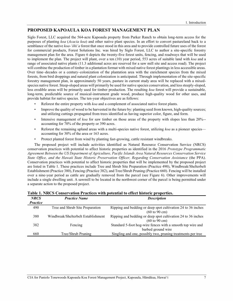
1. Introduction
CIA for Paniolo Tonewoods Kapoaula Koa Forest Management Project, Kapoaula, Hāmākua, Hawaiʻi 7
PROPOSED KAPOAULA KOA FOREST MANAGEMENT PLAN
Siglo Forest, LLC acquired the 564-acre Kapoaula property from Parker Ranch to obtain long-term access for the purposes of planting koa (Acacia koa) and other native plant species. In an effort to convert pastureland back to a semblance of the native koa-ʻōhiʻa forest that once stood in this area and to provide controlled future uses of the forest for commercial products, Forest Solutions Inc. was hired by Siglo Forest, LLC to author a site-specific forestry management plan for the area. Figure 6 depicts the twenty-five forest units, fencing, and roadways that will be used to implement the plan. The project will plant, over a ten (10) year period, 553 acres of suitable land with koa and a range of associated native plants (11.3 additional acres are reserved for a saw mill site and access road). The project will combine the production of timber in a plantation format with mixed native forest plantings in less accessible areas. Over time–decades or a century–colonization of the plantation area with the enrichment species from the mixed forests, from bird droppings and natural plant colonization is anticipated. Through implementation of the site-specific forestry management plan, in approximately 50 years, pasture in current study area will be replaced with a mixed-species native forest. Steep-sloped areas will primarily be used for native species conservation, and less steeply-sloped, less erodible areas will be primarily used for timber production. The resulting koa forest will provide a sustainable, long-term, predictable source of musical-instrument grade wood, produce high-quality wood for other uses, and provide habitat for native species. The ten-year objectives are as follows:
• Reforest the entire property with koa and a complement of associated native forest plants. • Improve the quality of wood to be harvested in the future by: planting seed from known, high-quality sources;
and utilizing cuttings propagated from trees identified as having superior color, figure, and form. • Intensive management of koa for saw timber on those areas of the property with slopes less than 20%--
accounting for 70% of the property or 390 acres. • Reforest the remaining upland areas with a multi-species native forest, utilizing koa as a pioneer species—
accounting for 30% of the area or 163 acres. • Protect planted forest from wind by planting fast-growing, cattle resistant windbreaks. The proposed project will include activities identified as Natural Resource Conservation Service (NRCS)
conservation practices with potential to affect historic properties as identified in the 2016 Prototype Programmatic Agreement Between the US Department of Agriculture, Pacific Islands Area Natural Resources Conservation Service State Office, and the Hawaii State Historic Preservation Officer, Regarding Conservation Assistance (the PPA). Conservation practices with potential to affect historic properties that will be implemented by the proposed project are listed in Table 1. These practices include Tree and Shrub Site Preparation (Practice 490), Windbreak/Shelterbelt Establishment (Practice 380), Fencing (Practice 382), and Tree/Shrub Pruning (Practice 660). Fencing will be installed over a nine-year period as cattle are gradually removed from the parcel (see Figure 6). Other improvements will include a single dwelling unit. A sawmill to be located in the northwest corner of the parcel is being permitted under a separate action to the proposed project.
Table 1. NRCS Conservation Practices with potential to effect historic properties.NRCS
Practice Practice Name Description
490 Tree and Shrub Site Preparation Ripping and bedding or deep spot cultivation 24 to 36 inches (60 to 90 cm)
380 Windbreak/Shelterbelt Establishment Ripping and bedding or deep spot cultivation 24 to 36 inches (60 to 90 cm)
382 Fencing Standard 5-foot hog-wire fences with a smooth top wire and barbed ground wire
660 Tree/Shrub Pruning Singling and one, possibly two, pruning treatments per tree

1. Introduction
8 CIA for Paniolo Tonewoods Kapoaula Koa Forest Management Project, Kapoaula, Hāmākua, Hawaiʻi
Figure 6. Proposed forest management units.

2. Background
CIA for Paniolo Tonewoods Kapoaula Koa Forest Management Project, Kapoaula, Hāmākua, Hawaiʻi 9
2. BACKGROUND
This section of the report includes a discussion of the cultural-historical background for the study area and a synthesis of relevant prior research. This information is presented to provide a comprehensive understanding of the cultural significance of the study area and general vicinity and to establish an analytical basis for the assessment of any potential cultural impacts. The ability to assess the cultural significance of the current study area parcel is contingent upon developing (at a minimum), a comprehensive understanding of the ahupua‘a in which the study area is located. As will be demonstrated in the ensuing section, a consideration of the broader region and island landscape is also required.
CULTURE-HISTORICAL CONTEXT
The chronological summary presented below begins with the peopling of the Hawaiian Islands and includes a presentation of a generalized model of Hawaiian Prehistory containing specific legendary references to places within and near to Kapoaula and a discussion of the general settlement patterns for the greater Hāmākua District. The discussion of Prehistory is followed by a summary of historical events in the district that begins with the arrival of foreigners in the islands and then continues with the history of land use in Hāmākua after contact. The summary includes a discussion of the changing lifeways and population decline of the early Historic Period, a review of land tenure in the study ahupua‘a during the Māhele ‘Āina of 1848, and the subsequent transition into the ranching and commercial agricultural industries beginning in the last quarter of the 19th century.
A Generalized Model of Hawaiian Prehistory
While the question of the timing of the first settlement of Hawai‘i by Polynesians remains unanswered, several theories have been offered that derive from various sources of information (i.e., genealogical, oral-historical, mythological, radiometric). However, none of these theories is today universally accepted (Kirch 2011). What is more widely accepted is the answer to the question of where Hawaiian populations came from and the transformations they went through on their way to establish a uniquely Hawaiian culture. For many years, researchers have proposed that early Polynesian settlement voyages between Kahiki (the ancestral homeland of the Hawaiian gods and people) and Hawai‘i were underway by A.D. 300, with long distance voyages occurring fairly regularly through at least the 13 th century. While historical accounts often describes Kahiki as any land outside of Hawai‘i, some researchers point to the Marquesas and the Society Islands as the ancestral homeland of Hawai‘i’s early settlers (Emory in Tatar 1982). More recently, with advances in palynology and radiocarbon dating techniques, Kirch (2011) and others (Athens et al. 2014; Wilmshurst et al. 2011) have convincingly argued that Polynesians arrived in the Hawaiian Islands, sometime between A.D. 1000 and A.D. 1200 and expanded rapidly thereafter (c.f., Kirch 2011).
During these early times, Hawai‘i’s inhabitants were primarily engaged in subsistence level agriculture and fishing (Handy and Handy 1991). This was a period of great exploitation and environmental modification when early Hawaiian farmers developed new subsistence strategies by adapting their familiar patterns and traditional tools to their new environment (Kirch 1985; Pogue 1978). Their ancient and ingrained philosophy of life tied them to their environment and kept both environmental and social order; which was further assured by the conical clan principle of genealogical seniority (Kirch 1984). The initial permanent settlements were established at sheltered bays with access to fresh water and marine resources. These communities shared extended familial relations and there was an occupational focus on the collection of marine resources. Over a period of a few centuries, the areas with the richest natural resources became populated and perhaps even crowded, and there was an increasing separation of the chiefly class from the common people. As populations increased so did societal conflict, which resulted in hostility and war between neighboring groups (Kirch 1985). According to Kamakau (1991), the initial settlements were not governed by a political caste system until the arrival of Pāʻao and chiefs from Kahiki.
…there were seventeen generations during which Hawai‘i Island was without chiefs—some eight hundred years… The lack of a high chief was the reason for seeking a chief in Kahiki, and that is perhaps how Pili became the chief of Hawai‘i. He was a chief from Kahiki and became the ancestor of chiefs and people of Hawai‘i Island. (Kamakau 1991:101–102)
Additionally, Kamakau (1976) concluded that settlement patterns date the migration of Pāʻao to the islands during the 13th century. Pā‘ao, the keeper of the war god Kūkā‘ilimoku, fought bitterly with his older brother, the high priest Lonopele. After much tragedy on both sides, Pā‘ao was expelled from his homeland by Lonopele forcing Pāʻao to set out on a long journey across the ocean in search of new land. Thirty-eight kānaka (men) accompanied Pāʻao, which included kānaka ‘ā‘īpu‘upu‘u (stewards), a chief named Pilika‘aiea (Pili) and his wife Hina‘aukekele, Nāmau‘u o Malaia, the sister of Pā‘ao, and the prophet Makuaka‘ūmana (Kamakau 1991). In 1866, Kamakau told the following story of their arrival in Hawai‘i:

2. Background
10 CIA for Paniolo Tonewoods Kapoaula Koa Forest Management Project, Kapoaula, Hāmākua, Hawaiʻi
Puna on Hawai‘i Island was the first land reached by Pā‘ao, and here in Puna he built his first heiau for his god Aha‘ula and named it Aha‘ula [Waha‘ula]. It was a luakini. From Puna, Pā‘ao went on to land in Kohala, at Pu‘uepa. He built a heiau there called Mo‘okini, a luakini. It is thought that Pā‘ao came to Hawai‘i in the time of the ali‘i La‘au because Pili ruled as mo‘i after La‘au. You will see Pili there in the line of succession, the mo‘o kū‘auhau, of Hanala‘anui. It was said that Hawai‘i Island was without a chief, and so a chief was brought from Kahiki; this is according to chiefly genealogies. Hawai‘i Island had been without a chief for a long time, and the chiefs of Hawai‘i were ali‘i maka‘āinana or just commoners, maka‘āinana, during this time. (Kamakau 1991:100)
Prior to the establishment of the Pili dynasty, Waipi‘o Valley in the Hāmākua District was the residential base for powerful local rulers dating back to A.D. 1200s (Cartwright 1933). Presumably, during Pili’s rule, the center of government shifted from Waipiʻo to Kohala District but then ultimately centered back to Waipi‘o Valley (Cartwright 1933). Ethnohistorical traditions (Fornander 1880) indicate that Waipiʻo Valley was associated with at least nine successive Pili line rulers of Hawai‘i Island, from Kaha‘imoele‘a to ‘Umi A Līloa (from roughly AD 1460 to 1620). During this period, the major rise and influence of the Pili family line expanded beyond the Hāmākua region, and thereby constituted Hāmākua as the epicenter for a complex political caste system formed by firm religious and economic beliefs. As described by Fornander (1880), these universal Polynesian customs and beliefs included: the major gods Kāne, Kū, and Lono; the kapu system of law and order; pu‘uhonua or cities of refuge; the worship of ‘aumakua or personal family deities; and the concept of mana.
As time passed, a uniquely Hawaiian culture developed. The portable artifacts found in archaeological sites of this next period reflect an evolution of the traditional tools and distinctly Hawaiian inventions. The adze (ko‘i) evolved from the typical Polynesian variations of plano-convex, trapezoidal, and reverse-triangular cross-section to a very standard Hawaiian rectangular quadrangular tanged adze. The two-piece fishhook and the octopus-lure breadloaf sinker are Hawaiian inventions of this period, as are ‘ulu maika stones and lei niho palaoa. The latter was a status item worn by those of high rank, indicating a trend toward greater status differentiation (Kirch 1985). As the population continued to expand so did social stratification, which was accompanied by major socioeconomic changes and intensive land modification. Most of the ecologically favorable zones of the windward and coastal regions of all major islands were settled and the more marginal leeward areas were being developed. During this expansion period, additional migrations to Hawai‘i occurred from Tahiti in the Society Islands. Rosendahl (1972) has proposed that settlement at this time was related to seasonal, recurrent occupation in which coastal sites were occupied in the summer to exploit marine resources, and upland sites were occupied during the winter months, with a focus on agriculture. An increasing reliance on agricultural products may have caused a shift in social networks as well. Hommon (1976) argues, kinship links between coastal settlements disintegrated as those links within the mauka-makai settlements expanded to accommodate the exchange of agricultural products for marine resources. This shift is believed to have resulted in the formalization of the land division system sometime during the A.D. 1400s (Kirch 1985), which added another component to an already well-stratified society. The implications of this model include a shift in residential patterns from seasonal, temporary occupation, to permanent dispersed occupation of both coastal and upland areas.
The formalization of Hawai‘i Island’s land division system is a major hallmark of this era. The ahupuaʻa became the equivalent of a local community, with its own social, economic, and political significance, which added another component to a then well-stratified society. Ahupua‘a (such as Kapoaula) are land divisions that typically incorporated all of the eco-zones from the mountains to the sea and for several hundred yards beyond the shore, assuring a diverse subsistence resource base (Hommon 1986). Although the ahupua‘a land division typically incorporated all the eco-zones, their size and shape varied greatly. Ahupua‘a were ruled by ali‘i ‘ai ahupua‘a or chiefs who controlled the ahupua‘a resources; who, for the most part, had complete autonomy over this generally economically self-supporting piece of land. Ahupua‘a lands were in turn, managed by an appointed konohiki or lesser chief-landlord. The ali‘i-‘ai-ahupua‘a, in turn, answered to an ali‘i ‘ai moku (chief who claimed the abundance of the entire district). Thus, ahupua‘a resources supported not only the maka‘āinana (commoners) and ‘ohana (families) who lived on the land but also contributed to the support of the royal community of regional and/or island kingdoms. This form of district subdividing was integral to Hawaiian life and was the product of resource management planning that was strictly adhered to. In this system, the land provided fruits and vegetables and some meat for the diet, and the ocean provided a wealth of protein resources (Rechtman and Maly 2003). In communities with long-term royal residents, divisions of labor (with specialists in various occupations on land and in the procurement of marine resources) were also strictly enforced.
By the 17th century, large areas of Hawai‘i Island were controlled by a few powerful ali‘i ‘ai moku. There is island-wide evidence to suggest that growing conflicts between independent chiefdoms were resolved through
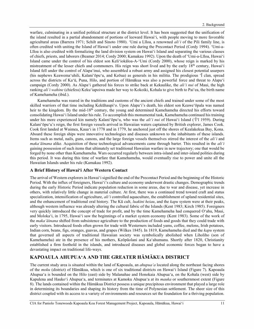
2. Background
CIA for Paniolo Tonewoods Kapoaula Koa Forest Management Project, Kapoaula, Hāmākua, Hawaiʻi 11
warfare, culminating in a unified political structure at the district level. It has been suggested that the unification of the island resulted in a partial abandonment of portions of leeward Hawai‘i, with people moving to more favorable agricultural areas (Barrera 1971; Schilt and Sinoto 1980). ‘Umi a Līloa, a renowned ali‘i of the Pili family line, is often credited with uniting the Island of Hawai‘i under one rule during the Precontact Period (Cordy 1994). ‘Umi-a-Līloa is also credited with formalizing the land division system on Hawai‘i Island and separating the various classes of chiefs, priests, and laborers (Beamer 2014; Cordy 2000; Kamakau 1992). Upon the death of ‘Umi-a-Līloa, Hawai‘i Island came under the control of his eldest son Keli‘iokāloa-A-‘Umi (Cordy 2000), whose reign is marked by his mistreatment of the lesser chiefs and commoners. His reign was short lived and by the early 18th century, Hawai‘i Island fell under the control of Alapa‘inui, who assembled a robust army and assigned his closest potential usurpers (his nephews Keawema‘uhili, Kalani‘ōpu‘u, and Keōua) as generals in his militia. The prodigious ‘Ī clan, spread across the districts of Ka‘ū, Puna, Hilo, and portion of Hāmākua was also a powerful force and threat to Alapa‘i campaign (Cordy 2000). As Alapa‘i gathered his forces to strike back at Kekaulike, the ali‘i nui of Maui, the high ranking ali‘i wahine (chiefess) Keku‘iapoiwa made her way to Kokoiki, Kohala to give birth to Pai‘ea, the birth name of Kamehameha (ibid.).
Kamehameha was reared in the traditions and customs of the ancient chiefs and trained under some of the most skilled warriors of that time including Kekūhaupi‘o. Upon Alapa‘i’s death, his eldest son Keawe‘ōpala was named heir to the kingdom. By the mid-18th century, the young and determined Kamehameha directed his efforts toward consolidating Hawai‘i Island under his rule. To accomplish this monumental task, Kamehameha continued his training under his more experienced kin namely Kalani‘ōpu‘u, who was the ali‘i nui of Hawai‘i Island (‘Ī‘ī 1959). During Kalani‘ōpu‘u’s reign, the first foreign vessels arrived in Hawaiian waters captained by British explorer, James Cook. Cook first landed at Waimea, Kaua‘i in 1778 and in 1779, he anchored just off the shores of Kealakekua Bay, Kona. Aboard these foreign ships were innovative technologies and diseases unknown to the inhabitants of these islands. Items such as metal, nails, guns, canons, and the large foreign vessels themselves stirred the interest of the ali‘i and maka‘āinana alike. Acquisition of these technological advancements came through barter. This resulted in the ali‘i gaining possession of such items that ultimately set traditional Hawaiian warfare in new trajectory; one that would be forged by none other than Kamehameha. Wars occurred regularly between intra-island and inter-island polities during this period. It was during this time of warfare that Kamehameha, would eventually rise to power and unite all the Hawaiian Islands under his rule (Kamakau 1992).
A Brief History of Hawai‘i After Western Contact
The arrival of Western explorers in Hawai‘i signified the end of the Precontact Period and the beginning of the Historic Period. With the influx of foreigners, Hawai‘i’s culture and economy underwent drastic changes. Demographic trends during the early Historic Period indicate population reduction in some areas, due to war and disease, yet increase in others, with relatively little change in material culture. At first, there was a continued trend toward craft and status specialization, intensification of agriculture, ali‘i controlled aquaculture, the establishment of upland residential sites, and the enhancement of traditional oral history. The Kū cult, luakini heiau, and the kapu system were at their peaks, although western influence was already altering the cultural fabric of the Islands (Kent 1983; Kirch 1985). Foreigners very quickly introduced the concept of trade for profit, and by the time Kamehameha had conquered O‘ahu, Maui, and Moloka‘i, in 1795, Hawai‘i saw the beginnings of a market system economy (Kent 1983). Some of the work of the maka‘āinana shifted from subsistence agriculture to the production of foods and goods that they could trade with early visitors. Introduced foods often grown for trade with Westerners included yams, coffee, melons, Irish potatoes, Indian corn, beans, figs, oranges, guavas, and grapes (Wilkes 1845). In 1819, Kamehameha died and the kapu system that governed all aspects of traditional Hawaiian society was symbolically abolished when Liholiho (son of Kamehameha) ate in the presence of his mothers, Keōpūolani and Ka‘ahumanu. Shortly after 1820, Christianity established a firm foothold in the islands, and introduced diseases and global economic forces began to have a devastating impact on traditional life-ways.
KAPOAULA AHUPUA‘A AND THE GREATER HĀMĀKUA DISTRICT
The current study area is situated within the land of Kapoaula, an ahupua‘a located along the northeast facing shores of the moku (district) of Hāmākua, which is one of six traditional districts on Hawai‘i Island (Figure 7). Kapoaula Ahupua‘a is bounded on the Hilo (east) side by Malanahae and Honokaia Ahupua‘a, on the Kohala (west) side by Kapulena and Hauko‘i Ahupua‘a, and terminates at Kamoku Ahupua‘a at its mauka or southernmost extent (Figure 8). The lands contained within the Hāmākua District possess a unique precipitous environment that played a large role in determining its boundaries and shaping its history from the time of Polynesian settlement. The sheer size of this district coupled with its access to a variety of environments and resources set the foundation for a thriving population.

2. Background
12 CIA for Paniolo Tonewoods Kapoaula Koa Forest Management Project, Kapoaula, Hāmākua, Hawaiʻi
Stories recounting the episodic life stories and feats of its chiefs and common people illustrate Hāmākua as a thriving political district supported by its fertile and extensively cultivated valleys. Collectively, these accounts paint a picture of the area’s rich cultural landscape, most of which has been radically transformed during the Historic era. To begin developing an understanding of this district’s cultural history, it is essential to understand the physical environment of this district.
Hāmākua district is a windward district in the truest sense. It has ca. 29 miles of shoreline, primarily focused on Mauna Kea’s eastern slopes with exposed cliffs rough seas, and narrow reef formations. Above the sea cliffs, the gentle slopes have a thick soil cover and abundant rainfall, and lush vegetation, with the upper slopes from 1,000-6,000 feet in an ‘ōhi‘a-koa rain forest. The slopes are cut by deep (up to 300-foot), narrow stream gulches cloaked with kukui and pandanus. Yet Hāmākua is more than these slope and gulch lands. It also includes the extremely large, deep valleys of Waipi‘o and Waimanu which have cut over a millennia into the older Kohala Mountain, valleys which, as will be seen, dominated the history of the district and the island. Hāmākua also extended inland, encompassing the high elevation māmane-naio forests of Mauna Kea and the subalpine, oft snow-covered, summit itself. The district continued across the foggy and cold upland plateau or Saddle with its terrain a mixture of bare lava and soils, and with its vegetation a mixture of ‘ōhi‘a and māmane-naio forests. This plateau had important nesting grounds of ‘u‘au and nēnē. And, Hāmākua virtually spanned the island-reaching to and looking down into the upper edges of Kona. (Cordy 2000:21)
The Hāmākua District is unlike any other found on Hawai‘i Island, sharing its boundaries with five of the six district on the island (excluding the Puna District) and encompassing the summit of Mauna Kea and a portion of the summit of Mauna Loa (see Figure 7). The ʻōlelo no‘eau or Hawaiian proverb, “Hāmākua kihi loa” literally translated as “Hāmākua of the long corner” commemorates the extent of this district’s boundaries (Pukui 1983:53). While the interior portion of this district, known as the ‘āina mauna or mountainous lands (Maly and Maly 2005), encompasses the highest reaches found in the Hawaiian archipelago, its coastal section is cut by numerous valleys and gulches with Ka‘ula Gulch forming its easternmost most boundary and Honopu‘e Valley marking its westernmost boundary (see Figure 7). The ‘ōlelo no‘eau “Hāmākua i ka wakawaka” or “irregular and rough Hāmākua” celebrates this district’s uniquely steep and rugged terrain (Pukui 1983:53). Another distinguishing feature of this region is its massive cliff faces that stretches along the coastline. “Hāmākua ‘āina pali loa” or “Hāmākua, land of tall cliffs” praises this natural feature that dominates much of this region (ibid.).
Traveling on foot via the ancient alaloa and ala hele trails of Hāmākua was done with much difficulty. The old saying “Hāmākua i ke ala ‘ulili” or “Hāmākua of the steep trails” recognizes this region as “a land of precipices and gulches where the old trails were often steep and difficult to travel on” (Pukui 1983:53). These trails required the ancient travelers to, at times, descend cliff faces with ropes and ladders woven together from natural fibers. This treacherous method of travel is recorded in a portion of an ancient chant titled Kū E Ho‘opio Ka Lā or Kūhaupio, which is often chanted in performance with the art of hei or string figures. This chant “recites in turn the divisions of the island of Hawaii, alluding to some well-known feature of each division, relating through metaphor a love tale” (Dickey 1928:14). Both the chant and the accompanying string figure repertoire have been recorded by Lyle Dickey (ibid.) sometime between 1915 and 1917 from informants living on the islands of O‘ahu, Kaua‘i, and Ni‘ihau. In summarizing this chant Dickey (ibid.:14) opines “Up rose the sun” (ku e hoopio ka la) is the most famous of Hawaiian string figures.” Dickey goes on to explain that “[t]he accompanying chant is regarded has having a higher literary quality than that of any other figures.” (ibid.). That portion of the chant describing Hāmākua reads thusly:
O Hamakua ia, lawe i ka pali Koolau Ke kuukuu ala i ke kaula, ke aki ala ka niho i ka ipu i ka pali o Kohola-lele, o Waipio, a o Waimanu
This is Hamakua with Koolau cliffs Lowering rope ladders, holding fishing gourds in the teeth on the cliffs of Koholalele, Waipio and Waimanu. (Dickey 1928:17)
Dickey also gathered another version of this chant that reads: O Hamakua ia, o ka i‘a iniiniki i ka lima Ke ho‘oku‘uku‘u la ka nalu la ke kaula i ka niho la
This is Hamakua where the eels are pinched in the hand Where the ladder is let down while the teeth hold the string. (ibid:18)

2. Background
CIA for Paniolo Tonewoods Kapoaula Koa Forest Management Project, Kapoaula, Hāmākua, Hawaiʻi 13
Figure 7. Portion of Hawai‘i Registered Map No. 2060 (Donn 1901) showing the current study area location (shaded red) within Kapoaula (shaded gray) in the moku of Hāmākua (shaded blue).

2. Background
14 CIA for Paniolo Tonewoods Kapoaula Koa Forest Management Project, Kapoaula, Hāmākua, Hawaiʻi
Figure 8. Google Earth™ satellite image showing study area location (outlined in red).
Its northeastward orientation coupled with its densely vegetated interior mountainous slopes created an ideal environment that attracted the rain clouds carried on the ever-blowing trade winds. Several rain names have been recorded for the Hāmākua District, including the Kīnehelehua, which is said to have produced the lehua clusters and the misty Lilinoe rain that appears near the cliff face (Akana and Gonzalez 2015). The slow-moving Pupūhale rain is said to have kept the district residence close to their home (Akana and Gonzalez 2015; Pukui and Elbert 1986). An account concerning the mysterious rain described as the Kūnihi appeared in the October 15, 1872 edition of the Hawaiian language newspaper, Ka Nūpepa Kū‘ōko‘a. The author, S. K. Kaaiai described a time when a great drought came upon the lands of Hāmākua, which he described as being cultivated by a great number of people. By the end of the drought, all that remained in the middle of the cultivated fields was a single banana belonging to a farmer named Kanoa. Kanoa gazed out to the horizon and saw an “ao nui elele” or a large dark cloud hovering over the ocean (Kaaiai 1872:1). The farmer then kalokalo or summoned (through conversational prayer) the large cloud, asking it to water his little field (Kaaiai 1872:1; Pukui and Elbert 1986:123). At the closing of his prayer, the cloud moved straight to his field and sent a much-needed downpour that lasted until the following day. The farmer’s crops once again flourished but strangely, the rain did not fall upon any other fields, only that of Kanoa (Kaaiai 1872).
The northeast trade winds that blow continuously over this land is duly named A‘eloa, also referred to as the Moa‘e winds (Pukui and Elbert 1986). The A‘eloa wind is also known at times to have a destructive force, tearing down everything in its path. A newspaper article published in the November 30, 1867 edition of Ka Nūpepa Kū‘ōko‘a described the A‘eloa wind breaking the old landing located in Koholālele Ahupua‘a (Keomakani 1867). Koholālele, literally translated as leaping whale, describes the winds of Hāmākua that blows from east to west (Pukui and Elbert 1986). The Koholālele wind is also mentioned in the legendary account of La‘amaomao (Fornander 1918–1919). Within the renowned and extensively cultivated valley of Waipi‘o, is the Holopo‘opo‘o winds that blows through hollows of the land (ibid.).
As with many of the large districts of Hawai‘i Island, Hāmākua was further divided into two major subdistricts; Hāmākua Komohana or West Hāmākua consisting of all the valley lands situated between the Waipi‘o and Honopu‘e

2. Background
CIA for Paniolo Tonewoods Kapoaula Koa Forest Management Project, Kapoaula, Hāmākua, Hawaiʻi 15
Ahupua‘a and Hāmākua Hikina or East Hāmākua inclusive of all the lands between Waipi‘o and Manowaiale‘e Ahupua‘a. There are roughly 95 ahupua‘a within all of Hāmākua, seven of which are in Hāmākua Komohana, while all the remaining 87 ahupua‘a are within Hāmākua Hikina (Cordy 1994). In his study conducted for the State of Hawaiʻi Historic Preservation Division, titled A Regional Synthesis of Hāmākua District, Island of Hawaiʻi, Cordy (1994) drew upon these divisions and provided an in-depth overview of the general Precontact and early Historic land use and settlement patterns for the district. The current study area ahupua‘a of Kapoaula is situated in Hāmākua Hikina.
In his attempt to better understand the settlement patters of Hāmākua Hikina, Cordy further divided east Hāmākua into three subregions: 1) The Lower Windward Slopes of Mauna Kea; 2) the Upper Slopes of Mauna Kea and; 3) the Interior Plateau containing the lands of Pōhakuloa and the slopes of Mauna Loa (Figure 9). Based on Cordy’s (1994:3) designation, Kapoaula Ahupuaʻa lies within the subregion, which he dubbed the “Lower Windward Slopes of Mauna Kea”. In summarizing the distinguishing features of this subregion, Cordy (1994:3) explains, “[t]he Lower Windward Slopes subregion extends inland up through the ‘ōhiʻa forest on Mauna Kea — from sea level to the 5,000-6,000 foot elevation. This is a rolling upland which is cut by a number of fairly deep, narrow gulches.”
Unlike the valleyed ahupua‘a found in the westward section of Hāmākua, those ahupua‘a in Hāmākua Hikina were relatively narrow at the coast ranging anywhere between 0.1-0.4 miles wide and extending between 2.5-4.0 miles inland (Cordy 1994). These ahupua‘a are characterized by their sloping kula lands with their boundaries following the natural contours or ridgelines of the gulches. A few ahupua‘a extended further inland, essentially cutting off the lower ahupua‘a at their mauka most end. There are, however, two very large ahupua‘a in east Hāmākua, both of which are very narrow at the coast but increase significantly in acreage as they extend further inland. The smaller of the two is Pā‘auhau, which encompasses the western limit of Hāmākua Hikina and is situated further inland of Kapoaula. The significantly larger Ka‘ohe Ahupua‘a borders the Hilo District and includes a portion of the summit of Mauna Loa and the entire summit region of Mauna Kea, where the sacred spring of Waiau is found and where dense basalt stone was quarried and shaped into the highly prized ko‘i (adzes). The subject ahupuaʻa of Kapoaula falls within the first type of ahupua‘a described by Cordy as it extends inland at an elevation of about 3,200 feet above sea level before being cut off at the mauka most extant by Kamoku Ahupua‘a (see Figures 1 and 8).
Figure 9. The Regions of Hāmākua District (Cordy 1994:3)

2. Background
16 CIA for Paniolo Tonewoods Kapoaula Koa Forest Management Project, Kapoaula, Hāmākua, Hawaiʻi
Traditional Agricultural and Gathering Practices of Hāmākua Hikina
In the forested zones of Hāmākua Hikina, various resources were collected that supported the traditional subsistence lifestyle of the people. Such gathering practices included the collection of bark from māmaki (Pipturus sp.), ‘akolea fern (Athyrium sp.), and wauke (Broussonetia papyrifera), whose fibers were prepared and used to make items such as fish nets and kapa cloth; the catching of birds, whose feathers were assembled and fashioned into ahu‘ula (feathered cloaks), lei hulu (feathered lei), and mahi‘ole helmets that used exclusively by those of royal bloodline; and the chopping of timbers, from which canoes, houses, and ki‘i (wooden images) were carefully carved. While the forested areas provided an array of natural resources, the grassy kula lands were transformed into cultivatable fields where small plantings of both staple and supplemental crops such as maiʻa (banana), kalo (taro), ‘uala (sweet potato), which were grown openly in fields and plantations. The “habitually underestimated” uhi (yam), a food crop that was often cultivated in the forests to sustain the people during dry seasons and droughts was also part of the repertoire of staple crops favored by the Hawaiians of Hāmākua (Handy and Handy 1991:182). Within Kapoaula specifically, crops such as kalo, ‘uala, and wauke were traditionally cultivated in kuleana plots. In the book, Native Planters In Old Hawaiʻi, Their Life, Lore and Environment, Handy and Handy (1991) described a traditional agricultural technique called waele, (which mirrors that of swidden agriculture), occurring on the kula lands, where fire was used to prepare the land for planting:
On slopes covered with grass, like those of Hāmākua on Maui and Hawaii, and Kohala on Hawaii, the grass was formerly burned off and the ground cleared (waele) of brush and stubble...The field then had to be dug over (‘ohiki) and the stubble thrown out. The open soil was left for a few weeks, or until the small rubbish had decayed. On the windy slopes of Kohala the whole field was covered with cut grass to keep the moisture in. In planting, small holes were made in the soft earth several feet apart and a cutting dropped into each. The old procedure, termed ‘okupe, was to thrust the digging stick into the soft earth with the right hand, lift the soil to one side, and drop the cutting into the hole with the left. The cuttings were left uncovered until the rootlets showed vigorous growth; then each cutting was straightened and soil pressed down around it. (Handy and Handy 1991:109)
Prior to the massive land clearing efforts of the early sugar plantations, Handy and Handy (ibid.:231) described the “board slopes of the wet windward coast [Hāmākua] of Hawaii” as being “completely covered by kukui forests.” Kukui, commonly known as candlenut (Alleurites moluccanus), also served a number of purposes. The oily nut found within the hard black shell was used as a lamp and at times the nut was slow roasted then crushed with pa‘akai (salt) to make the relish/seasoning known as inamona (Abbott 1992). The oily properties of this nut were also used medicinally as a laxative to helped expel waste from in the body (ibid.). Hawaiian plant expert, Isabella Abbott further notes that “[a]ll parts of the tree—flowers, fruits (nuts), bark, and leaves—can be used for these purposes” (ibid.:100). Fresh kukui leaves were prepared into a poultice and used to treat swelling, deep bruises, and other injuries. Red pigment was also extracted from the bark of old kukui trees and from this pigment a reddish color was produced that was used to dye kapa and fishnets (ibid.). The hard-black shells were also strung together into lei. It is within and along the edges of the old kukui forests that another agricultural method termed pā kukui or pā kuikui was practiced. Handy and Handy write:
In localities where planting was done along the edges and within the borders of old kukui forests, notably on the lower slopes of the Hamakua coast of Hawaii before the forest were cleared for sugar-cane plantations, taro was planted in clearings termed pa kukui or pa-kuikui. The trees were felled and allowed to decompose. The kukui rots very quickly when wet, and wood, bark, and foliage make rich humus. Large holes were then dug in the soil and filled with kukui leaves, and when these were decomposed the taro was planted. The plants are said to have grown luxuriantly in such localities, to a height of 7 feet and with corms weighing 20 pounds. (1991:109–110)
These extensive groves of kukui found within this district carried with it important spiritual significance and was seen as an domain of the pig-deity Kanepua‘a or Kamapua‘a, who was understood to be an embodiment of the deity Lono (Handy and Handy 1991). While Kamapua‘a held his domain over the lush northeast parts of Hawai‘i Island, namely Hāmākua and Kohala where “southerly winds sweep around the eastern flank of Mauna Kea” and where the “storm clouds pile up in rolling masses like giant swine rutting in the uplands,” his lover and rival Pelehonuamea reigned over the southern and leeward districts of Hilo, Puna, Ka‘ū, and Kona (ibid.:341). It is likely, observance of these natural phenomena supported the belief that Kanepua‘a symbolized growth, vigor, and volcanic dormancy, while Pele, with her molten fire, symbolized transformation and rebirth through her volcanic activity. A traditional legendary account describes Kamapua‘a’s arrival to Hāmākua and how in a battle with other gods, shaped the precipitous land of Hāmākua. Handy and Handy (1991:619) elucidates:

2. Background
CIA for Paniolo Tonewoods Kapoaula Koa Forest Management Project, Kapoaula, Hāmākua, Hawaiʻi 17
Kamapua‘a (=Lono) comes to Hawaii from Kahiki—that is, from the south—as do the kona or southerly cyclonic storms which bring winter rains, on which planters in leeward areas depend for their sweet-potato planting. On his way to challenge Pele, Kamapua‘a (as rain clouds) met and vanquished “Lono-with-the-eight-foreheads” (not the same as Lono-the-lord-of-rain). The “eight foreheads” we take to mean eight forelands, or cliffs between gulches along the rainy windward Hamakua coast of Hawaii. This Lono-ka-eho “lowered his foreheads” until they case their shadow upon Kamapua‘a, who was traveling in one of his many forms in the sea. Kamapua‘a pushed aside the forelands (eroded the valleys between them), and then called upon his plant forms of the forests, the kukui trees…the ‘ama‘uma‘u ferns…and the hala (pandanus trees are all along the coast and in the gulches), to grow onto “the foreheads” (headlands). The roots crept forth and the forelands (eho means to heap of stones) were held fast.
The kula region of east Hāmākua served as ideal environment for various subsistence crops. To ensure success in planting in the wind swept kula lands, Handy and Handy, detailed specific mulching techniques used to ensure the crops survival:
Mulched taro was planted on the open kula lands up to the border of the old forest zone and is said to have flourished under a mulch of grass, ti leaves, and other rubbish heaped around it in the red soil. Small patches so growing today seem to flourish. We are told that taro was planted in kukui forests which used to cover the slopes of much of the land that is now planted to sugar cane; for this planting the kukui trees were not felled. Presumably such planting was successful only in relatively open glades. A method of upland planting peculiar to this section was that of felling kukui trees, allowing them to rot, and then planting taros, which are said to have grown to great size, in the decayed refuse. Another method consisted of digging sizable holes in the ground, filling them with kukui leaves, and allowing these to decay completely, after which taros that had been started from cuttings planted in plain soil were introduced and grew to great size. (Handy and Handy 1991:537)
The diversity of climates and the verdant landscapes of east Hāmākua, coupled with the abundance of freshwater and access to both coastal fisheries and the island’s summit region provided the district’s early inhabitants with access to nearly all of the necessities that were vital to their physical and spiritual wellbeing.
Wauke, or what is known as the paper mulberry (Broussonetia papyrifera), is also said to have been historically cultivated within Kapoaula Ahupua‘a. According to Handy (1940), there are two types of wauke: wauke and wauke mālolo. Both are utilized for therapeutic purposes, though the former is also useful for kapa (tapa) making. Like kō, wauke was typically grown around lo‘i kalo and residences, and Handy (1940) relates that it was prevalent in more moist environments including mauka kula lands and sloped valley sides. Kamakau (1976:40) indicates that wauke could also be cultivated in sheltered areas “along streams, in woods, in rocky patches (kipohopoho makaili), in rutted ground (malualua), in dried-up taro patches, on lands where water flows, and on bottom lands (‘aina palawai).” Like wauke, olonā was heavily cultivated in the upland reaches of Hāmākua, and was traditionally grown nearby māmaki and wauke in kīhāpai by transplanting tight-knit cuttings in a patch (Handy 1940:201):
Olona was much the best fiber for fishlines and fishnets. When used for cord (aho olona) the strands of the cleaned fiber were simply spun on the thigh and twisted (nino or milo). Olona cord has a tensile strength greater than that of hemp, but its great value for fishlines and nets lies in the facts that it does not kink and that it lasts longer than any other material. The cord was also used for making nets (koko) to carry cntainers and as a base for ti-leaf raincoats and feather capes. The fresh bark and leaf buds were thought to have medicinal value.
The Polynesian-introduced kō (sugarcane; Saccharum officinarum) stands as perhaps the most widely developed and extensively cultivated crop in Precontact Hawaiʻi. Kō was the primary commercial export of the district beginning in the mid-1800s, facilitating Hāmākua’s economic transition during the Historic Period. Cultivation of sugar for commerce purposes has had the unfortunate effect of diluting the distinguishing characteristics of Hawaiian cane varieties due to the hybridization of traditional and introduced species. Prior to its exploitation for profit, kō served as a fixed element in Hawaiian horticulture that served a variety of important uses.
Kō was traditionally planted in the lowland plains, and in the makai portion of Kapoaula. Neal (1965) relates that there were approximately forty named varieties cultivated by the Hawaiians. Included in these is the most common kō kea (white cane) which was typically planted near old homesteads. In general, kō is purported to grow well in almost all locales, and was “planted at kīhāpai of sweet potato, dry taro and wauke, and on the banks of loʻi taro patches; and fields of cultivated plants were beautified by plantings of cane along their banks and borders” (Kamakau 1976:39).

2. Background
18 CIA for Paniolo Tonewoods Kapoaula Koa Forest Management Project, Kapoaula, Hāmākua, Hawaiʻi
Of great curative value, kō is considered especially therapeutic and was included as an essential component of medicinal tonics and compounds (Handy 1940). Aside from its role as an active ingredient in medicines, Abbott (1992) opined that it was sometimes used not as a primary constituent, but rather as a flavoring agent to sweeten distasteful bitter herbs in curative compounds. Alternatively, its sweet juice could also be used in a more insidious manner to conceal and accelerate the effects of various poisons (Lincoln In Press). The juice of the kō was considered as a very effective remedy for healing deep cuts and wounds, fractured limbs, and severed body parts, healing the skin leaving no evidence of scar tissue (Kaaiakamanu and Akina 1922; Krauss 1993).
According to Handy and Handy (1991), kō served chiefly as sustenance and was eaten as a snack, condiment, and a famine food. The juice of the cane was also toasted over the fire and fed to nursing babies, and was used to strengthen children’s teeth by chewing (Handy and Handy 1991). From a more utilitarian aspect, kō could be used to thatch the interior of houses when pili grass or lauhala (pandanus) were not abundant (Handy 1940; Malo 1951). Tassel stems of the kō were crafted into roughly two-foot-long arrow darts to be used in the game of keʻa pua (also referred to as ka pua and pa pua) which was enjoyed by men, women, and children particularly during the Makahiki (ancient festival that began in October) when the pua kō (sugarcane blossom) was in bloom (Lucas 1982; Malo 1951). In ancient Hawai‘i, the pua kō were also strewn about hōlua (sled) courses on grassy slopes to make it more slippery (Abbott 1992; Pukui 1983).
Other Historic sources mention the gathering of māmaki (Pipturus spp.) from the wao lāʻau (upland forests) of neighboring Honokaia Ahupua‘a, a practice that undoubtedly happened within Kapoaula as well, and Handy (1940) relates that māmaki was especially prevalent in the higher reaches of Hāmākua. While wauke was commonly used for kapa production, kapa was also made from the bark of the wild māmaki (primarly on Hawaiʻi Island) and was known for being quite exceptional, though considered second best in comparison (Brigham 1911; Kamakau 1976). Kapa wauke paled in comparison to kapa māmaki, which was exceedingly soft and strong and used to make items such as malo (loincloth), pāʻū (skirt), kīhei (shawl covering), and kapa moe (sleeping kapa) (Handy and Pukui 1998; Kamakau 1976; Neal 1965). However, unlike the former, kapa māmaki could not withstand getting wet, making it a poor choice for items that would need to be washed. According to Kaaiakamanu and Akina (1922), the strength of māmaki wood also made it a prime choice for kapa beater implements.
In addition to being used to make kapa, the māmaki was also an essential ingredient in traditional medicinal preparations and its fruit, seeds, and leaves were used to treat various ailments in adults, children including weakness and general debility, thrush, digestion issues, cuts and sores, and the fruit and seeds were eaten by expectant mothers beginning at five months along in their pregnancies (Gutmanis 2015; Kaaiakamanu and Akina 1922). Additionally, Krauss (1993) relates that fresh māmaki leaves were placed in an ipu with hot stones and covered with fresh water where they could be steeped until drunk as a cleansing tonic.
Breadfruit (‘ulu) was a kinolau (physical manifestation) of the goddess Haumea, the “patron of childbirth,” and was plentiful in the district of Hāmākua where it was grown “in the sheltered valleys of the Hamakua coast, where there are still a great many. . .” (1940:190). Careful and gentle propagation was required, which entailed the removal and replanting of the root sucker cutting while ensuring it remained within its original, undisturbed soil casing. With respect to ‘ulu as a sustainable food source.
One of the crops cultivated specifically in Kapoaula was the ‘uala. Abbot (1992:30) relates that typically “‘uala were grown in pu‘e (mounds) that formed a māla (patch), usually surrounded by stone walls” and planted during the full moon, or during the six first days of the new moon. The preparation of ‘uala for consumption was similar to kalo, and entailed either steaming in an imu and eaten whole or mashed as poi ‘uala (Abbott 1992; Handy 1940). Although the poi ‘uala soured quickly, it was “regarded by Hawaiians as dietetically superior to taro poi, but it is less relished” (Handy 1940:149). Additionally, a dish known as palula was also made from the green leaves of the ‘uala plant after being cooked. Handy (1940:151) also relates than an alcoholic drink comprised of high-sugar content found in ‘uala was also prepared in Hāmākua, and describes the preparation of the ‘uala ‘awa‘awa as follows:
. . . The potatoes are cooked, peeled, mashed and mixed with a large quantity of water, then left in the barrel or jar for three days, being stirred each day. On the third and fourth days the fermentation is sufficient to give the beer enough head to be exhilarating. Mohihi was the most popular variety for making uala awaawa; because of its exhilarating effect when fermented, it was nicknamed Kauaheahe (staring fixedly). Uala awaawa had a great vogue during the period of clearing forests in Hamakua, Hawaii, in the early days of sugar planting. A native landowner would plant a large patch of Mohihi, harvest and cook all of it, put it down in barrels to ferment, and then invite his countrymen from far and near to come and help him clear his land, and in return enjoy a wild orgy of talk and festivity in emptying the barrels of prime Mohihi awaawa.

2. Background
CIA for Paniolo Tonewoods Kapoaula Koa Forest Management Project, Kapoaula, Hāmākua, Hawaiʻi 19
Uhi was cultivated throughout Hāmākua and served to supplement more primary sources of sustenance such as kalo and ‘uala. Unlike kalo, the uhi did not make fine poi, and as such was steamed in an imu and consumed in its whole form rather than being mashed. In addition to being a supplementary form of nourishment, the uhi also possessed value medicinally and it was a beneficial treatment of a wide variety of ailments. Within Hāmākua specifically, the ke‘oke‘o and ulaula varieties were cultivated, the former of which was only utilized for food purposes and the latter which was consumed both as food and could be used for its medicinal value (Handy 1940). Handy and Handy (1940:169–170) elaborate on a method of planting uhi in Hāmākua:
The following old Hawaiian method of planting uhi in Hamakua and Olaa was described to me by Judge George Tucker of Olaa whose Hawaiian forbears taught him yam culture. On the ground in the forest a great bin of tree-fern trunks (hapuu) was built 3 to 4 feet high on the sides, the fern trucks being laid horizontally. The bin was filled with decaying fern leaves and other rubbish. The seedling tubers (hua uhi) were then stuck in the rubbish a few inches below the surface. No earth was put in, but as the rubbish in the bin decayed and sank, more rubbish was heaped on top. Fully matured tubers grown by this method are said to have weighed up to 50 pounds. . . . . . Another interesting practice in planting yams on steep hillsides and the sides of gulches on the Hamakua coast and in North Hilo was to dig a vertical hole in the side of the slope, 2 to 3 feet deep, and place a large flat stone in it. The hole was then filled with earth and decaying leaves, and the seed yam planted near the top of the hole. The rock at the bottom of the hole prevented the tuber, which grew downward, from growing deep into the ground and forced it to spread out. When time for digging, the earth on the side of the hill or gulch was simply dug away and the tubers extracted. (Handy 1940:169–170)
The hāpuʻu, mentioned in several of the Boundary Commission testimonies and historic accounts, was also considered a famine food by Handy and Pukui (Handy and Pukui 1998) and Krauss (1993) who indicate that its starchy core could be cooked and eaten in times of deprivation. Also utilized as a famine food is the pia (Polynesian arrowroot), which Abbott (1992) relates was commonly grown in close proximity to loʻi kalo (wetland taro).
Legendary Accounts of the Greater Hāmākua District
Prior to first contact with Europeans in the late 18th century and the development of a written Hawaiian language, the history of ancient Hawai‘i was transmitted orally from generation to generation. After the arrival of the first missionaries in 1820, Hawaiian culture underwent major transformations, one of which included the adoption of the written language. Although oral traditions were still maintained, many natives and foreigners began inscribing generations worth of knowledge onto paper. As such, these writings provide us with invaluable insight into Hawai‘i’s past as they describe elements of Hawaiian culture such as historical figures, beliefs, traditions, wahi pana (legendary places), inoa ‘āina (place names), and mo‘olelo (legendary accounts, stories, and myths), mele and oli (songs and chants), and ‘ōlelo no‘eau (proverbs and sayings); all of which contribute to an in-depth understanding of the people, their culture and place. One of the hallmarks of traditional legendary accounts is their ability to transcend place and time, all while bringing cohesion to landscapes that have been subjected to artificial divisions and boundaries.
Although traditional mo‘olelo specifically associated with Kapoaula are limited, numerous exist for the greater Hāmākua region itself, and include references to the ‘Aeloa, Koholālele, and Holopo‘opo‘o winds, exalted deities such as Kamapua‘a, renowned chiefs such as Wanu‘a and Aiohikupua, and famed figures such as Kapola‘ula, Kauakahiapaoa, and Lā‘iekawai. The following mo‘olelo of a strong man named Kapola‘ula provides the most detailed account of the study area and it may well be that the name of the current study area ahupua‘a is derived from this legendary figure.
Kapola‘ula, Hāmākua’s Strong Man is Defeated by Kauaahiapaoa of Kaua‘i
The following mo‘olelo is an excerpt that appears in the lengthy Ka Mo‘olelo O Hi‘iakaikapoliopele (Ho‘oulumāhiehie 2006a)—a story that details the plight of Pele’s younger sister, Hi‘iakaikapoliopele, while attempting to secure her sister’s lover, Lohi‘auipo from Kaua‘i. Journeying from the Puna District to Kaua‘i, Hi‘iaka after encountering a series of obstacles manages to bring Lohi‘auipo to her sister at Kīlauea. Pele, however, is dissatisfied and in a fury encases Lohi‘auipo’s body in molten lava. Lohi‘auipo’s spirit escapes through the districts of Ka‘ū and Kona, where he finally lands at Kawaihae. From Kawaihae, Lohi‘auipo’s spirit travels over the ocean back to his homeland of Kaua‘i. Lohi‘au’s spirit meets with Kauakahiapaoa, his ‘aikāne (companion). Lohi‘au, in his spirit form, explained the events that led to his death and request that Kauakahiapaoa seeks revenge on the fiery Peleihonuamea. After hearing Lohi‘au’s plea, Kauakahiapaoa commits to traveling to Hawai‘i Island.

2. Background
20 CIA for Paniolo Tonewoods Kapoaula Koa Forest Management Project, Kapoaula, Hāmākua, Hawaiʻi
Kauakahiapaoa, the young chief from Kaua‘i was greatly admired for his comely appearance, pleasant physique, and his skillfulness in every kind of hula. Although hula was his expertise, the young chief, was also an expert fighter. After landing at Honoipu in Kohala, Kauakahiapaoa saw a crowd gathered in Waimea. The handsome Kaua‘i chief journeyed to Waimea and stood amongst the onlookers, observing some of Waimea’s best fighters in full display. Kauakahiapaoa presence caught the eye of many, including the chiefess of Waimea who kindly invited the visitor into her royal. After questioning Kauakahiapaoa about the reason for his visit she encouraged him to join in the festivities, to which he gladly accepted. The ilāmuku (executive officer) announced to the crowd that Kauakahiapaoa was to go head-to-head with Waimea’s strongest, ‘Āinakō—a man of great size and strength. The two men moved to the wrestling grounds and after exchanging a series of poetic taunts, the crowd roared with excitement showing their admiration to the visitor. ‘Āinakō bunched up his fists and hurled it toward Kauakahiapaoa, sending a huge rush of fire to the face of the young Kaua‘i chief. Kauakahiapaoa dodged the fiery blow and in one sweep, hit ‘Āinakō, sending his body into a dizzying spin. The mighty Kauakahiapaoa managed to grab hold of ‘Āinakō and in his final move, tossed the body of the giant and where it landed became known as Pu‘u ‘Āinakō. The chiefess of Waimea delighted in the festivities and later invited Kauakahiapaoa to her abode where they feasted. After a long night of enjoying in a great delight of food and hospitality, Kauakahiapaoa set out once again towards Puna, passing first through the forested area of Māhiki in Hāmākua.
Kauakahiapaoa emerged at Kukuihaele and while traversing through these lands, heard the beckoning calls of the people. Curious about this comely visitor, an old man, and a woman from Kukuihaele emerged from their little makeshift hut and called out to Kauakahiapaoa, inviting him into their home. In following the ancient customs, Kauakahiapaoa turned around and headed back toward the beckoning hosts. When Kauakahiapaoa arrived at their little hut, the old couple greeted their visitor and the old man, ‘Ele‘io quickly moved to prepare some food. ‘Ele‘io grabbed a chicken, killed it, and set it in a fire to steam. The two men delighted in conversation and ‘Ele‘io explained that he was from Kukuihaele and his wife was a kama‘āina of “nā pali hula‘ana,” a poetic reference to the sheer cliff of Hāmākua where travel required people to swim past that cliffs that blocked the coastal trails (Ho‘oulumāhiehie 2006a:406; Pukui and Elbert 1986). Kauakahiapaoa explained to the old man the reason for his journey. He then inquired with ‘Ele‘io the nature of amusement for the people of this area, to which, ‘Ele‘io replied, hula, fighting, wrestling, spear throwing and more.
As the two men conversed, the old man overheard chattering coming from some passersby who talked on and on about a strong man from Kaua‘i that had just defeated Waimea’s best. ‘Ele‘io’s wife, Ka‘āuna was outside securing a piglet when one of the passserby asked why she had the pig. Ka‘āuna informed them that she was preparing food for a visitor that was at her home. The people asked where the visitor had come from and she responded, Waimea, the same place where you all came from. The passersby stood in wonder, pondering if the visitor at Ka‘āuna’s home was indeed the man that has just defeated ‘Āinakō. The passersby walked towards the little hut and the old couple welcomed them into their home and to their surprise, there in the little hut sat the strong man from Kaua‘i. The old couple prepared the piglet and asked their guests stay to partake in another meal. One of the passersby declined their offer and expressed to the old couple that they too would like to host’s the young champion from Kaua‘i. Not wanting to keep good company to themselves, the old woman bid farewell to Kauakahiapaoa and encouraged him and her husband to go along with their new friends.
Kauakahiapaoa and ‘Ele‘io set out with their new company of friends as they walked over a long span of land, they came upon a sporting field filled with a great crowd of people. Strutting amongst the crowd was Kapola‘ula, Hāmākua’s strong man. Much like ‘Āinakō, Kapola‘ula was a giant of a man with broad shoulders that exceeded those of ‘Āinakō. It is said that when Kapola‘ula grabbed his malo (loincloth) and snapped it down, it cracked loudly and would send a powerful whirlwind across the land. Similar to ‘Āinakō, when Kapola‘ula’s fist hurled through the air, it sent a hot spiral of wind over the land. ‘Ele‘io then asked Kauakahiapaoa if he would be willing to fight against Kapola‘ula, the strongest man of Hāmākualalo (lower Hāmākua)? Not seeing much of a competition, Kauakahiapaoa humbly accepted the offer. The fighting grounds were set and Kaua‘i’s bravest presented his chant before the crowd, boasting of the fineness of his homelands on Kaua‘i. These words only riled Kapola‘ula who without hesitation responded to his opponent stating:
‘O ke keiki ihola nō ia o ke ala ‘ūlili o Hāmākua, ‘a‘ohe pūko‘a kū e naue ‘ole i ku‘u pu‘upu‘u ‘o Halulukialani. Ke hō‘ike mai nei nō ‘oe, e ka malihini, he Kaua‘i ‘oe, a inā pēlā e kū pōpō ma‘o ‘oe ma ke kahua mokomoko nei a na‘u e tī aku iā ‘oe, lele kawa ‘oe in ā pali kūha‘o o Hāmākua nei.(Ho‘oulumāhiehie 2006a:409)
The translation of this text presented in Ho‘oulumāhiehie’s (Ho‘oulumāhiehie 2006b) English version of this story reads:
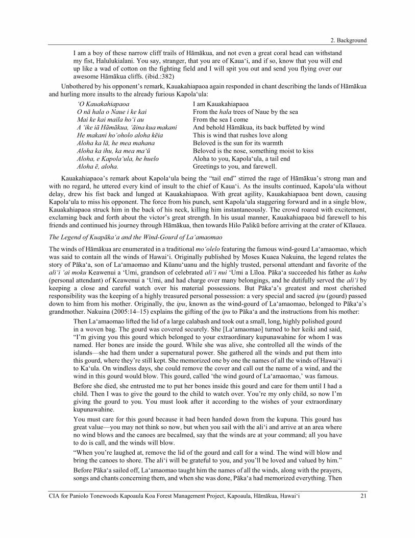
2. Background
CIA for Paniolo Tonewoods Kapoaula Koa Forest Management Project, Kapoaula, Hāmākua, Hawaiʻi 21
I am a boy of these narrow cliff trails of Hāmākua, and not even a great coral head can withstand my fist, Halulukialani. You say, stranger, that you are of Kaua‘i, and if so, know that you will end up like a wad of cotton on the fighting field and I will spit you out and send you flying over our awesome Hāmākua cliffs. (ibid.:382)
Unbothered by his opponent’s remark, Kauakahiapaoa again responded in chant describing the lands of Hāmākua and hurling more insults to the already furious Kapola‘ula:
‘O Kauakahiapaoa O nā hala o Naue i ke kai Mai ke kai maila ho‘i au A ‘ike iā Hāmākua, ‘āina kua makani He makani ho‘oholo aloha kēia Aloha ka lā, he mea mahana Aloha ka ihu, ka mea ma‘ū Aloha, e Kapola‘ula, he huelo Aloha ē, aloha.
I am Kauakahiapaoa From the hala trees of Naue by the sea From the sea I come And behold Hāmākua, its back buffeted by wind This is wind that rushes love along Beloved is the sun for its warmth Beloved is the nose, something moist to kiss Aloha to you, Kapola‘ula, a tail end Greetings to you, and farewell.
Kauakahiapaoa’s remark about Kapola‘ula being the “tail end” stirred the rage of Hāmākua’s strong man and with no regard, he uttered every kind of insult to the chief of Kaua‘i. As the insults continued, Kapola‘ula without delay, drew his fist back and lunged at Kauakahiapaoa. With great agility, Kauakahiapaoa bent down, causing Kapola‘ula to miss his opponent. The force from his punch, sent Kapola‘ula staggering forward and in a single blow, Kauakahiapaoa struck him in the back of his neck, killing him instantaneously. The crowd roared with excitement, exclaming back and forth about the victor’s great strength. In his usual manner, Kauakahiapaoa bid farewell to his friends and continued his journey through Hāmākua, then towards Hilo Palikū before arriving at the crater of Kīlauea.
The Legend of Kuapāka‘a and the Wind-Gourd of La‘amaomao
The winds of Hāmākua are enumerated in a traditional mo‘olelo featuring the famous wind-gourd La‘amaomao, which was said to contain all the winds of Hawai‘i. Originally published by Moses Kuaea Nakuina, the legend relates the story of Pāka‘a, son of La‘amaomao and Kūanu‘uanu and the highly trusted, personal attendant and favorite of the ali‘i ‘ai moku Keawenui a ‘Umi, grandson of celebrated ali‘i nui ‘Umi a Līloa. Pāka‘a succeeded his father as kahu (personal attendant) of Keawenui a ‘Umi, and had charge over many belongings, and he dutifully served the ali‘i by keeping a close and careful watch over his material possessions. But Pāka‘a’s greatest and most cherished responsibility was the keeping of a highly treasured personal possession: a very special and sacred ipu (gourd) passed down to him from his mother. Originally, the ipu, known as the wind-gourd of La‘amaomao, belonged to Pāka‘a’s grandmother. Nakuina (2005:14–15) explains the gifting of the ipu to Pāka‘a and the instructions from his mother:
Then La‘amaomao lifted the lid of a large calabash and took out a small, long, highly polished gourd in a woven bag. The gourd was covered securely. She [La‘amaomao] turned to her keiki and said, “I’m giving you this gourd which belonged to your extraordinary kupunawahine for whom I was named. Her bones are inside the gourd. While she was alive, she controlled all the winds of the islands—she had them under a supernatural power. She gathered all the winds and put them into this gourd, where they’re still kept. She memorized one by one the names of all the winds of Hawai‘i to Ka‘ula. On windless days, she could remove the cover and call out the name of a wind, and the wind in this gourd would blow. This gourd, called ‘the wind gourd of La‘amaomao,’ was famous. Before she died, she entrusted me to put her bones inside this gourd and care for them until I had a child. Then I was to give the gourd to the child to watch over. You’re my only child, so now I’m giving the gourd to you. You must look after it according to the wishes of your extraordinary kupunawahine. You must care for this gourd because it had been handed down from the kupuna. This gourd has great value—you may not think so now, but when you sail with the ali‘i and arrive at an area where no wind blows and the canoes are becalmed, say that the winds are at your command; all you have to do is call, and the winds will blow. “When you’re laughed at, remove the lid of the gourd and call for a wind. The wind will blow and bring the canoes to shore. The ali‘i will be grateful to you, and you’ll be loved and valued by him.” Before Pāka‘a sailed off, La‘amaomao taught him the names of all the winds, along with the prayers, songs and chants concerning them, and when she was done, Pāka‘a had memorized everything. Then

2. Background
22 CIA for Paniolo Tonewoods Kapoaula Koa Forest Management Project, Kapoaula, Hāmākua, Hawaiʻi
he took the wind gourd and tied it with a cord he had made, prepared his other things for the voyage, and left home.
Pāka‘a settled into his role as kahu, and he became the utmost favorite of Keawenui a ‘Umi. However, the favoritism of Pāka‘a inspired considerable virulence and collusion against him by two men, Ho-okele-i-Hilo and Ho‘okele-i-Puna. The pair conspired to entrap Pāka‘a in scandal by spreading untruths about him to Keawenui a ‘Umi and slandered his name in an effort to undermine Pāka‘a’s prestige in the eyes of his haku (master). Keawenui a ‘Umi was incensed, and relinquished all of Pāka‘a’s gifted lands and authority, transferring all power to the two antagonistic men who had usurped Pāka‘a’s power with their cruel deception. Utterly hurt by Keawenui a ‘Umi’s naivety to the slander that had befallen his name, Pāka‘a gathered some of the belongings of his former haku, placed them inside his special family heirloom, departed from Waipi‘o, and eventually made a life for himself on Moloka‘i. While on Moloka‘i, Pāka‘a fathered a son, Kūapāka‘a whom he groomed the way his own father had groomed him, to one day serve the man who would one day become his haku and avenge Pāka‘a’s enemies.
Meanwhile, the true character of the two schemers who deposed Pāka‘a of his esteemed position began to surface, and Keawenui a ‘Umi grew regretful of his decision to scorn his former kahu in their favor. The tale continues with Keawenui a ‘Umi’s frantic and persistent search for Pāka‘a, with whom he had been communicating with in dreams. Pāka‘a and Kūapāka‘a knew that the ali‘i would come searching for them, and strategically positioned themselves in their canoe where they fished for uhu (parrot fish) in the dark of morning off the shore of Moloka‘i. Keawenui a ‘Umi’s party approached the pair, but unsuspected their true identity, especially because Pāka‘a had assumed the guise of a hunched-over deaf fishermen. The six canoe fleets of men and chiefs from each district on Hawai‘i Island approached Pāka‘a and Kūapāka‘a, led by the ali‘i of Kohala, Wahilani, soon followed by Wanu‘a of Hāmākua:
As Wanu‘a’s canoe passed by, Kūapāka‘a called out loudly: “Wanu‘a goes by, our ali‘i of Hāmākua, yet he’s not an ali‘i, but a kaukauali‘i who traps the puhi of Hāmākua with his fingers. He lays his fingers on the smooth rock with bait and when the small puhi crawl up in the spaces between his fingers he grabs them and tosses them into a gourd. This is how he catches the fish of his land, and this is how he enjoys the bounty of Hāmākua. It’s said he’s an ali‘i, but he’s not an ali‘i.” (Nakuina 2005:31)
With each passing fleet, Kūapāka‘a continued to hurl insults, incensing each district ali‘i, who continued past the father and son allowing Keawenui a ‘Umi’s bevy closer and closer to them. Just before dawn, as Keawenui a ‘Umi’s party approached, Kūapāka‘a chanted to his haku at the request of his father. His chant was rivaled by a chant from the Kuhina Nui, Kahikuokamoku, who was part of Keawenui a ‘Umi’s party and unaware of the youth’s true identity. Kūapāka‘a, in an effort to lure Keawenui a ‘Umi’s party onshore so he could isolate Ho-okele-i-Hilo and Ho‘okele-i-Puna, continued his chants implicating impending stormy weather. However, Kahikuokamoku challeneged his prophecy, arguing the impossibility of poor weather, and refused to come ashore. Furthermore, Kahikuokamoku challenged Kūapāka‘a’s knowledge of Hawai‘i Island’s winds, for how could a young native boy from Moloka‘i possibly understand and foretell that strong winds would be heading towards them from Hawai‘i Island and cause havoc enough that they would be forced upon the shore. In response, Kūapāka‘a drew upon his heirloom gourd and his ancestral knowledge, and began chanting his warning of destruction (bolded, italicized, and underlined emphasis added):
Hurry, hurry, The source of the storms of Hilo, Is the wind called ua kea, Shearing off the edges of a hale and breaking it up, Kēpia is of Hilo of the upright cliffs, Uluau is of Waiākea, Ulumano, ‘Awa, Pu‘ulena, Moani‘ala are of Puna, The winds of Kuamoa‘e have gathered, My Moa‘e, the wind that is swelling, Apaiahaa is at Kanakaloloa, Hau is of Kapalilua, ‘Eka is of Kona, Kipu is of Kahuā, ‘E‘elekoa is of Uli, Kīpu‘upu‘u is of Waimea, ‘Ōlauniu is of Kekaha,

2. Background
CIA for Paniolo Tonewoods Kapoaula Koa Forest Management Project, Kapoaula, Hāmākua, Hawaiʻi 23
Pa‘ala‘a is in the ocean, Nāulu is of Kawaihae, A wind that comes And dashes the milo leaves of Makaopau, Kalāhuipua‘a, ‘Āpa‘apa‘a is of Kohala’s upland cliffs, The wind that flies about like vapor, Pu‘ukolea is of Kapa‘au, Holopo‘opo‘o is of Waipi‘o, ‘Aeloa is of Hāmākua, Kona is the wind of the sky Above the ‘Alenuihāhā sea, You should come ashore, The spray of the sea flies up, The spray of the wind, a storm is coming (Nakuina 2005:39–40)
Keawenui a ‘Umi was rapt with attention at the youth’s enumeration, so Kūapāka‘a continued chanting, the winds of Hawai‘i:
At Ka‘ū’s windy cape is Ka ‘Īlio a Lono, The paddle is dipped into the sea of Kāiliki‘i, At Puna’s foundation turns the sun, the light, Go and feel the wind of Kumukahi, Hilo’s wind-blown rain at sea, The rain is seaward, over the hala of Leleiwi, The spray of rain is at Hāmākua, Hāmākua is the bridge to the cliffs, At Kohala-iki is the Moa‘e wind, the Moa‘e blows, Kona awakens with the Kēhau breeze, Kona’s burden diminishing with the Kēhau breeze, Keawenuia‘umi, come ashore, a storm is coming. (ibid.:40)
He continued: There, there are the winds rising from the earth, The ‘Āpa‘apa‘a is of Kohala, The rainy wind called Nāulu is of Kawaihae, The Kīpu‘upu‘u is of Waimea, A cold wind that hurts the skin, A wind that whips the kapa of that land about, Tossing up dust before it, Frightening the procession of travelers, ‘Ōlaniu is the wind, Pili-a is of Kanikū, A‘e is of Kala‘au, Pohu and ‘Eka are the winds of Kona, Ma‘a‘akuulapu is of Kahalu‘u, Pilihala is of Ka‘awaloa, Kēhau is of Kapalilua, Piuohooilo is of Ka‘ū, Ho‘olapa is of Kamā‘oa, Kuehulepo is of Nā‘ālehu Uahipele is of Kīlauea, ‘Awa is of Leleiwi, Pu‘ulena is of Waiākea, Uluau is of Hilo-pali-kū, Koholālele is of Hāmākua, Holopo‘opo‘o is of Waipi‘o, The tip of that wind, The tip of this wind,

2. Background
24 CIA for Paniolo Tonewoods Kapoaula Koa Forest Management Project, Kapoaula, Hāmākua, Hawaiʻi
They will twist into a whirlwind, The bundle of bones at the back of the canoe exhaling, Breaking off the buoy floating at the front; Taking the load from the swamped canoe, The small canoe will be swamped, Destroyed with the large canoe, The ali‘i will die, the kahuna will die, The weak will die, the strong will die, The dark wisemen, the bright wisemen, They will search out, they will confer To locate the stars of the wave, O Hōkū‘ula, O Hōkūlei, They will swimp singly, they will swim by twos, Yesterday was a calm day, A crowd of fishermen was at sea, The paddling of the good canoes, The strength of the hoewa‘a, The wisdom of the ho‘okele, Don’t go far out to sea, ē dear ones, Stop here, those from Hawai‘i, Come here over the sea surface, You will be possessed on O‘ahu, There will be darkness only on calm O‘ahu, Yesterday was calm, today will be stormy; Keawenuia‘Umi, come ashore, a storm is coming. (ibid.:41-42)
After Kūapāka‘a’s recital of the winds of Hawai‘i, O‘ahu, Kaua‘i, Maui, and Ka‘ula, Keawenui a ‘Umi became unsettled with suspicion that the boy’s forecast would be realized. Perturbed at the possibility of meeting certain death in the face of violent weather, Keawenui a ‘Umi consulted with his two advisors, and thus the ultimate targets of the trickery, who adamantly insisted that Kūapāka‘a was lying and that they should depart. Kūapāka‘a continued chanting his warning, enumerating upon the winds of Maui and Moloka‘i in an effort to beguile them onshore, but Keawenui a ‘Umi’s party still retained suspicion and were not sure if they were being duped. Kahikuokamoku demanded the youth’s name, but Kūapāka‘a denied him, arguing that he would reveal his name once the men landed, but they did not comply, and instead the canoes sailed off to O‘ahu. Soon after their departure, and upon the command of his father, Kūapāka‘a chanted:
Ē winds that I’ve called, Blow here, those of Ka‘ula and Kaua‘i first, Those of O‘ahu and Hawai‘i from the sides, Those of Maui and Moloka‘i last, Blow true, and overtake the canoe fleet Of Keawenuia‘umi, the ali‘i. (ibid.:63)
And with this utterance, every wind that had escaped Kūapāka‘a’s lips through chant ravaged the atmosphere, wreaking utter havoc upon Keawenui a ‘Umi’s fleet. Soon, the survivors and their ali‘i made their way back to Moloka‘i to escape the mayhem, and were led safely to shore by Kūapāka‘a and his father, who continued to play the role of the unassuming fisherman. Keawenui a ‘Umi was cold and wet from the escapade, and Kūapāka‘a was concerned for his wellbeing:
By evening, all the canoes had landed, but Keawenuia‘umi remained on the platform of his double-hulled canoe because he had no dry kapa or malo to wear since all his clothing had been lost at sea. Kūapāka‘a saw his haku shivering on the canoe, so he went to speak to his father: “I pity my haku because he’s suffering from the cold. He just sits there in a wet malo on the canoe, without any kapa covering.” Pāka‘a took out one of Keawenuia‘umi’s malo which he had cared for when he was the ali‘i’s kahu; he gave it to his keiki: “Here’s one of your haku’s malo. Take it to him. Ask him to remove the wet malo he’s wearing and bring it back here. Tell him that this malo you give him is yours.” Kūapāka‘a took the dry malo and offered it to Keawenuia‘umi saying, “Here’s my insignificant malo for you. Please remove your wet one.”
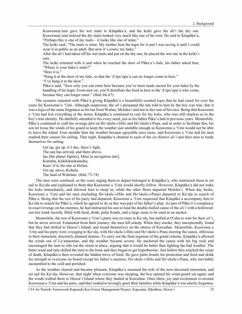
2. Background
CIA for Paniolo Tonewoods Kapoaula Koa Forest Management Project, Kapoaula, Hāmākua, Hawaiʻi 25
Keawenuia‘umi gave his wet malo to Kūapāka‘a, and the keiki gave the ali‘i the dry one. Keawenuia‘umi noticed the dry malo looked very much like one of his own. He said to Kūapāka‘a, “Perhaps this is one of my malo—it looks like one of mine.” The keiki said, “The malo is mine. My mother beat the kapa for it and I was saving it until I could wear it in public as an adult. But now it’s yours, my haku.” After the ali‘i had taken off his wet malo and put on the dry one, he placed the wet one in the keiki’s care. The keiki returned with it and when he reached the door of Pāka‘a’s hale, his father asked him, “Where is your haku’s malo?” “Here it is.” “Hang it at the door of my hale, so that the ‘ā‘ipu‘upu‘u can no longer come in here.” “I’ve hung it at the door.” Pāka‘a said, “Now only you can enter here because you’ve been made sacred for your haku by the handling of his kapa. From now on, you’ll distribute the food in here to the ‘ā‘ipu‘upu‘u who come, because they can longer enter.” (ibid.:66-67)
The scenario repeated with Pāka‘a giving Kūapāka‘a a beautifully-scented kapa that he had cared for over the years for Keawenui a ‘Umi. Although suspicious, the ali‘i presumed the tale told to him by the boy was true, that it was a kapa of the same fragrance as his but from Wailau, Moloka‘i and not in fact one of his own. Being that Keawenui a ‘Umi had lost everything in the storm, Kūapāka‘a continued to care for his haku, who was still clueless as to the boy’s true identity. He dutifully attended to his every need, just as his father Pāka‘a had in previous years. Meanwhile, Pāka‘a continued to craft his revenge plot on Ho‘okele-i-Hilo and Ho‘okele-i-Puna, and in order to facilitate this, his son let loose the winds of his gourd to keep the weather just unstable enough so Keawenui a ‘Umi would not be able to leave the island. Four months later the weather became agreeable once more, and Keawenui a ‘Umi and his men readied their canoes for sailing. That night, Kūapāka‘a chanted to each of the six district ali‘i and their men to ready themselves for sailing:
Get up, get up, it’s day, there’s light, The sun has arrived, and there above, Iao [the planet Jupiter], Maio [a navigation star], Kamaha, Kahikikuokamoku, Kani-‘ū‘ū, the star at Helani, Get up, move, Kohala, The land of Wahilani. (ibid.:73-74)
The men were confused, as the voice urging them to depart belonged to Kūapāka‘a, who instructed them to set sail to Ka‘ula and explained to them that Keawenui a ‘Umi would shortly follow. However, Kūapāka‘a did not wake his haku immediately, and allowed him to sleep in, while the other fleets departed Moloka‘i. When day broke, Keawenui a ‘Umi and his men (including Ho‘okele-i-Hilo and Ho‘okele-i-Puna) departed to Ka‘ula in search of Pāka‘a. Being that the rest of his party had departed, Keawenui a ‘Umi requested that Kūapāka‘a accompany him to Ka‘ula to search for Pāka‘a, which he agreed to do as this was part of his father’s plan. As part of Pāka‘a’s conspiracy to exact revenge on his enemies, he had instructed his son to load the double-hulled canoe of the ali‘i with a hollowed-out tree trunk secretly filled with food, drink, palm fronds, and a large stone to be used as an anchor.
Meanwhile, the rest of Keawenui a ‘Umi’s party was en route to Ka‘ula, but stalled at O‘ahu to wait for their ali‘i, but he never arrived. Exhausted from their journey, the men fell asleep. When they awoke, they unexpectedly found that they had drifted to Hawai‘i Island, and found themselves on the shores of Kawaihae. Meanwhile, Keawenui a ‘Umi and his party were voyaging to Ka‘ula, with Ho‘okele-i-Hilo and Ho‘okele-i-Puna steering the canoe, oblivious to their immenent, discretely planned demise. To carry out the final segment of the grand scheme, Kūapāka‘a allowed the winds out of La‘amaomao, and the weather became severe. He anchored the canoe with his big rock and encouraged the men to ride out the storm in place, arguing that it would be better than fighting the bad weather. The bitter wind and rain chilled the men to the bone and they began to get hypothermic. Just before they reached the verge of death, Kūapāka‘a then revealed the hidden trove of food. He gave palm fronds for protection and food and drink for strength to everyone on board except his father’s enemies, Ho‘okele-i-Hilo and Ho‘okele-i-Puna, who inevitably sucuumbed to the cold and perished.
As the weather cleared and became pleasant, Kūapāka‘a assumed the role of the now-deceased steersmen, and set sail for Ka‘ula. However, that night when everyone was sleeping, the boy opened his wind-gourd yet again, and the winds wafted them to Hawai‘i Island where they landed at Kawaihae. Once there, joy and excitement overcame Keawenui a ‘Umi and his party, and they rushed to lovingly greet their families while Kūapāka‘a was utterly forgotten,

2. Background
26 CIA for Paniolo Tonewoods Kapoaula Koa Forest Management Project, Kapoaula, Hāmākua, Hawaiʻi
abandoned, and alone. Eventually, word of a canoe race that the boy participated in reached the ears of Keawenui a ‘Umi by a messenger, and it was realized that Kūapāka‘a’s neglect had been inadvertent, as it was mistakenly presumed that the youth had been taken in and cared for. As part of the wager for the canoe race against Keawenui a ‘Umi’s favorite fishermen, it was agreed that should Kūapāka‘a reign victorious, the losers be baked in an imu (underground oven). During their conversation, Kūapāka‘a informed his haku that he intended to make true on his wager and kill the men. But he was met with opposition from Keawenui a ‘Umi, who did not want to see his men perish. Eventually, a deal was made in which Kūapāka‘a would fetch Pāka‘a from Moloka‘i if Keawenui a ‘Umi agreed that the fishermen be put to death.
Though Pāka‘a longed to serve his haku once more, he refused to travel back to Hawai‘i Island without having his land, position as navigator, and other rights restored. When Keawenui a ‘Umi was informed of this, he immediately consented, eager to reconnect. Only once Keawenui a ‘Umi agreed to restore everything that had been revoked from Pāka‘a, did his beloved kahu return to him to serve him faithfully for the rest of his days.
He Mo‘olelo No Palila
The following account concerns a brave and powerful warrior from Kauaʻi named Palila, who was known to single handedly defeat a multitude of warriors in any battle. At a young age, Palila was taken by his grandmother Hina to the temple of ‘Ālanapō in Kōloa on Kauaʻi Island. Here, Palila was raised by the gods and where he acquired all his mana (power). Palila eventually moved from Kauaʻi to Hawaiʻi Island, where one of his most epic battles took place. Upon his arrival, a battle between the Hilo chief, Kulukulu‘ā and Hāmākua chief, Wanu‘a was being fought. Wanu‘a, and his warriors, Moanonuikalehua, Kamuonuiaiake, and Puupuukaamai were about to defeat Kulukulu‘ā when Palila, in a surprise attack, swung his club and struck it fiercely to the earth, causing the land to violently shake. With such force, the club became buried deep into the ground killing all three men. In his pursuit for victory, Palila traversed across the lands of Hāmākua to slaughter as many men as he possibly could, traveling as far as Kūkaʻiau in Hāmākua (Fornander 1918–1919).
Haunaka, the Strong Man of Pā‘auhau Yields to Aiohikupua, the Young Chief of Kaua‘i
The following story concerns Aiohikupua (also spelled Aiwohikupua in some accounts), a young chief from Kaua‘i who set out on a journey to secure his dream lover, Lā‘ieikawai who resided in seclusion at the mythical land of Paliuli on Hawai‘i Island. While en route from Kaua‘i, Aiohikupua, who is described as a “kanaka ikaika…i ke kui a me ka mokomoku” (a strong man skilled in both boxing and wrestling), landed at Kauhola in Pū‘eke, Kohala where a customary gathering displaying the strength and skills of the district’s most famed fighters were on display. While at Kauhola, Aiohikupua went head-to-head with Kohala’s most famed fighter, Ihuanu (Fornander 1918–1919:407). After an exchange of taunts, Aiohikupua with a single thrust, drove his fist right through the chest of Ihuanu, killing him almost instantaneously. After raising the body of Ihuanu on his hand, Aiohikupua twirled his hand over his head, sending the body of Ihuanu hurling over the crowd. Startled by the power and strength of the young chief, the crowd quickly dispersed and word of Aiohikupua’s strength spread throughout the neighboring lands. After defeating Ihuanu, Aiohikupua boarded a double-hulled canoe and along with his company of men, sailed to Pā‘auhau in Hāmākua.
After landing at the shores of Pā‘auhau, Aiohikupua heard a great roar of voices coming from the uplands. He then inquired with the kama‘āina of Pā‘auhau the source of the shouting, to which the people replied “[t]he people are gathered there to witness the champion wrestler, Haunaka, the strongest man of the district” (ibid.:410). To his excitement, Aiohikupua proceeded towards the crowd and upon his arrival called out Haunaka. While Aiohikupua vocalized his taunts to Haunaka, a man, who had witnessed the events at Kauhola approached Haunaka from the crowd informing him that “…this is the very man who struck Ihuanu, in Kohala, and killed him. This man’s blow is sharp like a point of a spear; you people will therefore have no chance against him” (ibid.). Rather than engaging in battle, Haunaka approached Aiohikupua and extended his greetings. At the conclusion of the games, Aiohikupua and his company of men once again, boarded a double hauled canoe and set sailed for Hilo in search of his lover Lā‘ieikawai.
Legends Concerning Kamapuaʻa
The Hāmākua coast was known as the region that belonged to the shapeshifting pig deity, Kanepuaʻa or Kamapuaʻa, who was thought to be one of the embodiments of Lono, a paramount deity who was considered the “rain maker” and who was closely associated with fertility (Handy and Handy 1991:333). Lono was also embodied in dark rain clouds brought on by the southerly (kona) storms. In traditional myths, it is believed that Lono migrated from the south and landed in Kona where he introduced several food plants, such as kalo (taro), ‘uala (sweet potato), uhi (yams), kō (sugar cane), mai‘a (banana) and ‘awa (kava) (ibid.).
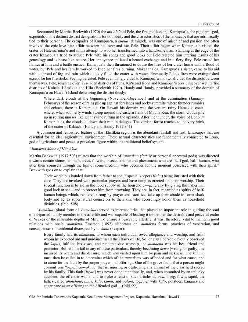
2. Background
CIA for Paniolo Tonewoods Kapoaula Koa Forest Management Project, Kapoaula, Hāmākua, Hawaiʻi 27
Recounted by Martha Beckwith (1970) the moʻolelo of Pele, the fire goddess and Kamapuaʻa, the pig demi-god, expounds on the distinct district designations for both deity and the characteristics of the landscape that are intrinsically tied to their persona. The escapades of Kamapuaʻa, a kupua (demigod), was one of mischief and passion and often involved the epic love-hate affair between his lover and foe, Pele. Their affair began when Kamapuaʻa visited the crater of Halemaʻumaʻu and in his attempt to woo her transformed into a handsome man. Standing at the edge of the crater Kamapuaʻa tried to seduce Pele with his songs and good looks but Pele rejected him uttering insults of his genealogy and is beast-like nature. Her annoyance initiated a heated exchange and in a fiery fury, Pele casted her flames at him and a battle ensued. Kamapuaʻa then threatened to douse the fires of her crater home with a flood of water, but Pele and her family worked to keep her fires burning. Makahanaloa, Kamapua‘a’s sister, came to his aid with a shroud of fog and rain which quickly filled the crater with water. Eventually Pele’s fires were extinguished except for her fire sticks. Feeling defeated, Pele eventually yielded to Kamapuaʻa and two divided the districts between themselves. Pele, reigning over lava-laden districts of Puna, Kaʻū and Kona and Kamapuaʻa presiding over wet, fertile districts of Kohala, Hāmākua and Hilo (Beckwith 1970). Handy and Handy, provided a summary of the domain of Kamapuaʻa on Hawaiʻi Island describing the district thusly:
Where dark clouds at the beginning (November-December) and at the culmination (January-February) of the season of rains pile up against forelands and rocky summits, where thunder rumbles and echoes, there is Kamapuaʻa. On Hawaii his domain was the verdant rainy Hamakua coast, where, when southerly winds sweep around the eastern flank of Mauna Kea, the storm clouds pile up in roiling masses like giant swine rutting in the uplands. After the thunder, the voice of Lono (= Kamapuaʻa), the clouds let down their rain in deluges. The verdant forest reaches to the very brink of the crater of Kilauea. (Handy and Handy 1972:341)
A common and renowned feature of the Hāmākua region is the abundant rainfall and lush landscapes that are essential for an ideal agricultural environment. These natural characteristics are fundamentally connected to Lono, god of agriculture and peace, a prevalent figure within the traditional belief system.
‘Aumakua Manō of Hāmākua
Martha Beckwith (1917:503) relates that the worship of ʻaumakua (family or personal ancestral gods) was directed towards certain stones, animals, trees, flowers, insects, and natural phenomena who are “half god, half, human, who utter their counsels through the lips of some medium, who becomes for the moment possessed with their spirit.” Beckwith goes on to explain that:
Their worship is handed down from father to son, a special keeper (Kahu) being intrusted with their care. They are invoked with particular prayers and have temples erected for their worship. Their special function is to aid in the food supply of the household—generally by giving the fisherman good luck at sea—and to protect him from drowning. They are, in fact, regarded as spitirs of half-human beings which, rendered strong by prayer and sacrifice, take up their abode in some shark body and act as supernatural counselors to their kin, who accordingly honor them as household divinities. (ibid.:508)
‘Aumākua (plural form of ‘aumakua) served as intermediaries that played an important role in guiding the soul of a departed family member in the afterlife and was capable of leading it into either the desirable and peaceful realm of Wākea or the miserable depths of Milu. To ensure a peaceable afterlife, it was, therefore, vital to maintain good relations with one’s ‘aumākua. Emerson (1892) elaborates on ʻaumākua forms, practices of veneration, and consequenses of accidental disrespect by its kahu (keeper):
Every family had its aumakua, to whom each individual owed allegiance and worship, and from whom he expected aid and guidance in all the affairs of life. So long as a person devoutly observed the kapus, fulfilled his vows, and rendered due worship, the aumakua was his best friend and protector. But let him fail in any of these particulars, thereby becoming hewa [wrong, or guilty], he incurred its wrath and displeasure, which was visited upon him by pain and sickness. The kahuna must then be called in to determine which of the aumakuas was offended and for what cause, and to atone for the fault by the proper prayer and offerings. One of the grave faults that a person might commit was “pepehi aumakua,” that is, injuring or destroying any animal of the class held sacred by his family. This fault [hewa] was never done intentionally, and, when commited by an unlucky accident, the offender was bound to make a feast of such articles as awa, a pig, fowls, squid, the fishes called aholehole, anae, kala, kumu, and palani, together with kalo, potatoes, bananas and sugar cane as an offering to the offended god. . .(ibid.:22)

2. Background
28 CIA for Paniolo Tonewoods Kapoaula Koa Forest Management Project, Kapoaula, Hāmākua, Hawaiʻi
As the children inherited the aumakuas of both father and mother, the tendency was for every family to have a large number of aumakuas. It is claimed, that the primary idea of the word aumakua is the spirit of an ancestor, deified and rendered potent for good or evil, by the long continued hoomanamana of its posterity. The spirits of those who had become famous for skill or power would very naturally after death receive the worship of those their craft or profession. Many of these aumakuas still retain the shadowy form of a human spirit. Others have been transformed into various animal forms, or, as some people prefer to consider it, manifest themselves through those animals. Other have taken up their abode in trees, stones, and other objects. (ibid:23)
Of particular note are shark ʻaumākua who are frequently worshipped in coastal areas of Hawaiʻi such as Hāmākua, and considered as both a friend and protector of its kahu yet are merely associated as kauwā (slaves/servants) because of their obligatory servitude (Beckwith 1917; Emerson 1892). Emerson (1892:8) argues that the “shark was perhaps the most universally worshipped of all the aumakuas, and, strange to say, was regarded as peculiarly the friend and protector of all his faithful worshippers.” Ancestral deity worship is considered a quintessential spiritual practice of the Native Hawaiians of old, and it stands today as a heritable custom, belief, and connection to the past preserved by rich oral traditions many of which are associated with mythological tales. The following six ‘aumākua manō are identified as belonging Hāmākua (Emerson in Beckwith 1917:512–513):
Pehu (k) (swollen), listed for Hamakua, Hawaii, and said to have eaten some natives there, also listed second among the great sharks of Maui. Mahiki (k), Kawaiiki (w), Kaahu (w), Kai (w), Uhanui (k), sharks of Hamakua, Hawaii. Kupiopio (k), seven fathoms long, who lives at Keamoku, Haena. He is slain by the Kau shark-god. According to Emerson’s notes “He came from Kaula to live at Hamakua. On his way he fell in with Makaluahau (k) of Kalihi, Oahu, who became his aikane, and went with him to Hamakua. There their spirits rested and directed the people of Paauhau to plant awa, which their keeper brought to feed them.
‘Ōlelo No‘eau of Hāmākua
The oral tradition of Hawai‘i is perhaps best preserved in ‘ōlelo no‘eau, which have been passed down throughout the generations. Many ‘ōlelo no‘eau speak of Hāmākua, and most mention the famed winds of the region The following proverbs illustrate Hāmākua in great detail, and appear below as they were interpreted and published in ‘Ōlelo No‘eau, Hawaiian Proverbs & Poetical Sayings by Mary Kawena Pukui (1983):
Hāmākua ‘āina pali loa. Hāmākua, land of tall cliffs. Praise of Hāmākua, Hawai‘i. (ibid.:53)
Hāmākua i ka wakawaka. Irregular and rough Hāmākua. Praise of Hāmākua, a district of gulches and valleys. (ibid.)
Hāmākua i ke ala ‘ulili. Hāmākua of the steep trails. Praise of Hāmākua, a land of precipices and gulches where the old trails were often steep and difficult to travel on. (ibid.)
Hāmākua kihi loa. Hāmākua with a long corner. One corner of Hāmākua touches every district of Hawai‘i except Puna. Also, a play on kihi loa. A native of Hāmākua is said to avoid meeting strangers. Because of bashfulness or disinclination to share his possessions, he will turn aside (kihi) and go a long way (loa). (ibid.)
Hele a ‘īlio pī‘alu ka uka o Hāmākua i ka lā. Like a wrinkled dog is the upland of Hāmākua in the sunlight. An uncomplimentary remark about an aged, wrinkled person. Line from a chant.

2. Background
CIA for Paniolo Tonewoods Kapoaula Koa Forest Management Project, Kapoaula, Hāmākua, Hawaiʻi 29
(ibid.:80)
Hilo, mai Mawae a ka pali o Maulua. Hilo, from Mawae to the cliff of Maulua. The extent of the Hilo district is from Mawae on the Puna side to Maulua on the Hāmākua side. (ibid.:108)
Ka hālau a Ī. The house of ‘Ī. The descendants of ‘Ī, who extended through Hāmākua, Hilo, Puna and Ka‘ū. One of these was ‘Īmakakoloa, who was condemned to death by Kamehameha. According to the historian Kamakau, ‘Īmakakoloa was put to death in Kama‘oa. But according to the people of Ka’ū, a junior kinsman of similar appearance was substituted at the execution. (ibid.:141)
Ka ua kīhene lehua o Hāmākua. The rain that produces the lehua clusters of Hāmākua. (ibid.:169)
Waipi‘o: the Epicenter of Hāmākua’s Precontact Political System
Situated roughly three miles to the west of Kapoaula Ahupua‘a is Waipi‘o, a large, well-watered valley that during Hawai‘i’s Precontact times was an exceptionally significant royal and religious center. Waipiʻo’s valley floors were checkered with significant architecture centered around its status as a royal center. These included man-made fishponds, sacred heiau, a royal residence and mausoleum, and numerous loʻi. Aside from these archaeological sites and features, Waipiʻo was also home to the kāʻai – two woven wicker caskets containing the iwi (bones) of the aliʻi Līloa and allegedly his grandson, Lonoikamakahiki. In addition to this, Waipiʻo also contained a puʻuhonua (places of refuge). But perhaps it is most renowned for serving as home base to a long line of powerful Pili rulers. Cordy’s (1994) report outlines the reign of Pili from approximately A.D.1300-1800, accounting for roughly 20 years per reign (Figure 10), establishing the original Pili line ruler (Pili Kaʻaiea) at A.D.1320 It is suggested by Cartwright in Cordy’s (1994) study that Pili “resided and ruled out of Waipiʻo,” however therein lies an uncertainty as to the determination of whether or not the early Pili rulers controlled the entirety of Hawaiʻi Island, “or whether the island was a loose confederation with Hamakua’s ruler as the most powerful ruler.” Waipiʻo remained the ruling center of Hawaiʻi Island until approximately A.D.1620, “when ʻUmi shifted the governmental focus to Kona,” however “it remained important to the ruling line up to the time of Kamehameha as one of many royal residences” (Cordy 1994:6).
Fornander’s (1969) An Account of the Polynesian Race attributed the foundation of the Pili ruler lineage to the high priest Paʻao, who in the wake of the “expulsion or death” of Waipiʻo’s prior, sovereign ruler Kapawa, sent for a replacement chief from the lands of Kahiki. The name of this new, territorial sovereign chief was Pili Kaʻaiea. It is from him that “the ruling Hawaiian chiefs down the Kamehameha family, claimed their descent” (Fornander 1969:23). Pili was seemingly succeeded in rule by his son Koa, his grandson ‘Ole, and his great grandson Kukohou. However, Fornander (ibid.) was unable to say for certain whether or not this is the actual hereditary relationship, as according to other genealogies, Koa and ‘Ole might have in fact been brothers to Pili instead.
Perhaps, the most prominent Pili descendant aliʻi to rule over Waipiʻo were Līloa and his two sons, Hākau and ʻUmi-a-Līloa. Although the Pili bloodline ran strong through the veins of various aliʻi up until the time of Kamehameha I, the story of these three chiefs still echo in the minds and hearts of Hāmākua’s natives. Especially the tale of ʻUmi, the last great aliʻi of Waipiʻo. ‘Umi-a-Līloa (‘Umi-son-of-Līloa), born in the 15th century, exhibited a special aptitude for humbly taking care of people since the days of his youth. This extraordinary quality would continue to bloom over the course of his life, leading up to chiefdom and his eventual success in ruling the kingdom and uniting all the districts of Hawai’i Island under his rule. ʻUmi’s father was the religious and sacred high chief (ali‘i nui kapu) Līloa (son of Kiha), who was responsible for the “building of the places of worship (luakini, waihau, unu, koʻa) and the erecting of stones of Kane” (Kamakau 1992:2). Līloa was an aliʻi who “kept the peace in his kingdom and his people contented and prosperous,” a trait which undoubtedly spilled over to his son ʻUmi (ibid.). Līloa was born of a chiefly ancestry, both paternally and maternally, and fathered two children aside from ‘Umi, who were of chiefly descent: a son, Hākau (Līloa’s initial successor), and a daughter named Kapu-kini, who would later become a wife of ʻUmi. In describing some of Līloa’s feats in Hāmākua Kamakau (1992:2) writes:
At one time Liloa desired to build several heiaus in Hamakua from Kukuihaele to Kowana‘e and the vicinity about Kealakaha. When a house for the god was completed, Liloa, the kahunas, the

2. Background
30 CIA for Paniolo Tonewoods Kapoaula Koa Forest Management Project, Kapoaula, Hāmākua, Hawaiʻi
favorite god, Ku-ka‘ili-moku, the chiefs, and servants went up from Waipi‘o to the pork-eating feast for the dedication of the chief’s heiau. The procession was made a tabu one, from Kukuihaele to Wai-ko‘eko‘e and on to Kapulena, Kawela, and Pa‘auhau. Games for the strengthening of the body were played, such as dish rolling (maika), dart gliding (pahe‘e), boxing (mokomoko), and spear hurling (pahukala). At Koholalele, the tabu for [the heiau of] Maninini was observed. Then they went on the lower side of Kowaluna and Koapapa‘a. They encamped at Koapapa‘a and at Ka‘awikiwiki.
Figure 10. Chronology of the Pili rulers of Hawai‘i Island (Cordy 1994:7).
The mother of ʻUmi was a common woman from Kealakaha named Akahi-a-Kuleana. Although her genealogy did link her to Kanipahu, a descendant of the Pili line, the generations that followed had coupled with people of lower rank, thereby lowering their family’s status to maka‘āinana or commoners. Being that her status was not of aliʻi rank, her son ʻUmi was considered a “lowly birth (lepo popolo)” (Kamakau 1992:1). It was not common for aliʻi and commoners to intermingle, much less to conceive a child together, in fact, “she was startled at seeing a man dressed

2. Background
CIA for Paniolo Tonewoods Kapoaula Koa Forest Management Project, Kapoaula, Hāmākua, Hawaiʻi 31
in the attire of a chief and thought that she was about to be put to death” when he approached her bathing in a stream after gazing upon her beauty from the cliff of Kealakaha (ibid:3).
The chief asked that they do what he was desirous of doing, and the woman consented. After they had fulfilled that desire they knew that a child was conceived. The chief said, ‘This is my command: when our child is born if it be a girl, name her for your side of the family; but if it be a boy, name him for mine. He shall be named ʻUmi. I am Liloa, and these are the tokens for the child when he grows up and seeks me in Waipiʻo: the feather cape, ivory pendant, helmet and kauila spear’ (laau palau). The woman heeded the words and remembered all of the chief’s command. (Kamakau 1992:3)
Indeed, Akahi had conceived a child that day, whom she reared with her sometime abusive husband. She named him ʻUmi, and “in raising him no particular rules were observed, and he grew up into a handsome but mischievous boy. He did not mind his father but minded his mother” (ibid.:5). The boy seemed to have a fondness for providing for other children, continually giving them “all the food, fish, tapa, and loin cloths” from his personal household, often landing him in trouble with Akahi’s husband, who handed out beatings to the boy frequently out of his frustration and anger. On one such occasion, ʻUmi was receiving yet another beating, Akahi exclaimed to her husband:
That is not your son that you are cruelly beating, but you and I have a share in rearing him. Why talk about your food and fish that are consumed by him? This is why I live with you, to feed his mouth and to give him his needs. “Whose is this child of yours?” [he asked]. His wife answered, “My child is not yours; my child is a chief and he is Liloa’s.” “Where are the tokens that I may recognize your son as the child of Liloa, the chief?” Akahi-a-Kuleana fetched the feather cape, the helmet, the ivory pendant, and loin cloth from their hiding place. (Kamakau 1992:5)
Fearing for his life, Akahi’s husband ceased the beating of the child. The young ‘Umi then requested to see his birth father to which his mother obliged. ‘Akahi adorned her son with the royal items and gave him detailed instructions on how to approach his sacred father lest death be handed to him. ‘Akahi explained:
After leaving this place, you will have far to go until you reach a wide stream. Remember then that the land lying before you is Waipi‘o, a land of plenty. It is a beautiful land to behold from the top of the precipice. You will see numerous fish ponds and taro patches. The long river there is Wailoa, and on both sides of it, at the opening in the valley, and along the sides [of the cliffs] going inland are the cluster of houses. (Kamakau 1992:6)
‘Umi, who was about the age of ten, rounded up his ho‘okama (adopted son), ‘Oma‘okamau and the two boys journeyed to Waipi‘o. Along the way, ‘Umi in his kind-hearted manner took it upon himself to adopt two more sons, Pi‘imaiwa‘a and Ko‘i. Together, the four young boys walked until they reached the cliff of Koa‘ekea, where:
ʻUmi gazed down on the cluster of houses nestling on a broad stretch of land surrounded by cliffs with an opening on the seaward side. They descended, walked to Lalakea pond, swam across the Wailoa Stream, and faced Ka-hauno-ka-maʻahala, the residence of the chief Liloa. It was surrounded by a wooden fence. Tabu sticks were placed outside of the enclosure to mark the boundary beyond which commoners were not allowed to go. (Kamakau 1992:7)
Watching the guards closely, ‘Umi snuck his way around the royal residence and in a sudden dash, leaped onto the lap of the great chief Līloa.
The chief looked at the boy sitting on his lap and asked, “Whose child are you?” The boy answered, “Yours! I am ‘Umi-a-Liloa.” Liloa noticed the token he had left for his son and kissed and wept over him. (Kamakau 1992:7)
The great chief Līloa, embraced his son and following their reunion, ‘Umi was circumcised and dedicated, as custom dictated. The sacred drum, Halalū, and the smaller ka‘eke drums were sounded in the heiau of Paka‘alana. After learning that his son had adopted his three traveling companions, Līloa recognized ‘Umi’s kind-hearted nature and in a somewhat prophetic manner Līloa declared:
This is a kind-hearted boy. Although he is still a child, he has made himself like a father and mother to his people. His descendants cannot fail to become rulers. (Kamakau 1992:8)
As the news of Līloa’s new son spread throughout his kingdom, it was met with both innocent ignorance from the people of the countysides and with despite, which came primarily from Līloa’s eldest son and heir apparent, Hākau. Seeing his father’s love for ‘Umi filled Hākau with feelings of envy and jealousy. Līloa worried for ‘Umi and informed him:

2. Background
32 CIA for Paniolo Tonewoods Kapoaula Koa Forest Management Project, Kapoaula, Hāmākua, Hawaiʻi
…after I am dead and you are left with your lord and brother, go elsewhere and live under others if he should mistreat and abuse you. This is the one thing you must do, take care of the god. Whatever you have, remember him. Though you may live in poverty, the god will have compassion on you and reward you. (Kamakau 1992:9)
Following the death of Līloa, Hākau took over his father’s kingdom and ruled for a year, observing his father’s teachings. However, as Līloa predicted, Hākau grew to be a cruel and merciless chief, having no regard for other chiefs, including ‘Umi and commoners alike. In missionary, William Ellis’s transcriptions from the native people of the valley, it was said that Hākau’s cruelty was renown, that he had even been known to behead men who had a “fine-looking head” and had once even “ordered a man’s arm to be cut off, and brought to him, only because it was tataued [tatooed] in a manner more handsome than his own” (Ellis 1917:274). Fearfully, ʻUmi emancipated himself and his adopted sons to the moku of Hilo, where Hākau had no reign. There, he acquired four wives and lived proper, all the while heeding his father’s words regarding the god Ku-ka-ʻili-moku. Questions began to arise regarding the disappearance of ʻUmi. One man in particular, Kaleiokū, began seeing certain chiefly omens when he was around ʻUmi, and one day confronted him. His suspicions were confirmed, indeed, this was the chief everyone had been talking about. Although many were fearful once this fact arose in public, Kaleiokū became ʻUmi’s attendant, and:
Built many long houses (halau), ten times ten of them, for the purpose of feeding men. When people came from Hilo to Hamakua for salt they were given pork to eat [ a mark of great hospitality]. Travellers [sic] from Hamakua, Kohala and Kona who went to Hilo and Puna for birds’ feathers were received in ‘Umi’s eating places. Before a year had gone, many people had been received, and ‘Umi’s hospitality gained fame.” (Kamakau 1992:12)
It was said that ‘Umi was a “kindly chief who cared for the big men, the little men, the old men, the old women, children, the poor, and the sick. One thing he did was to give food to people” (Kamakau 1992:12). His genuine kindness and compassion served him well. With the help of those he had selflessly served, he forged a surprise attack on “Hakau, his chiefs, and members of the court. . . all the corpses of those slain in battle were offered up in the heiau of Honua‘ula in Waipi‘o,” and it is said that when:
‘Umi-a-Liloa laid the victims on the altar in the heiau-the bodies of the fallen warriors and chif, Hakau-the tongue of god came down from heaven, without the body being seen. The tongue quivered downward to the altar, accompanied by thunder and lightning, and took away all the sacrifices. (Kamakau 1992:14)
In the years following the overthrow of Hākau’s court, ‘Umi waged war on and succeeded in taking each moku of Hawai‘i Island. He had many chiefly wifes, one of whom was also his half-sister (Hākau’s full blooded sister) Kapu-kini who bore him two sons, Keli‘i-o-kaloa and Ke-awe-nui-a-‘Umi, both who would become heir to the Kingdom of Hawai‘i. ‘Umi, being an avid farmer and fisherman, accomplished much, including constructing kalo patches in Waipi‘o.
In his old age, ‘Umi-a-Līloa retired to Kona. At his request, a plan was set in motion which would require the help of his sons, daughters, fellow chiefs, and commoners to erect a stone slab tomb to prepare for his death. The tomb failed to be readied by the time of ‘Umi’s passing, and instead the slabs were stored in a cave in Kailua. There are two versions of the fate of ‘Umi’s corpse: one story says that his adopted son Ko‘i (who had been given land from Waimanu to Pololū) asked permission to “conceal his bones completely” (Kamakau 1992:32). He killed a man in Kekaha who bore a strong resemblance to ‘Umi. Late one night, he entered the cave at Maka‘eo, laid this substitute corpse to rest, and accompanied by his brother in law, took ‘Umi’s body to a secret cave among the precipitous cliffs at Waimanu. Another account contradicts this story, stating that Ko‘i actually took ‘Umi’s bones to the island of Maui to a secret, undisclosed location. Until this day, ‘Only the birds know where Umi son of Līloa lies buried” (Beckwith 1970:391). The Arrival of Captain James Cook and the End of Kalani‘ōpu‘u’s Reign (1778-1782)
British explorer Captain James Cook, in command of the ships H.M.S. Resolution and H.M.S. Discovery, landed in the Hawaiian Islands on January 18, 1778. The following January 17th [1779], on a return trip to Hawaiian waters, Cook anchored near Ka‘awaloa along the north shore of Kealakekua Bay in the South Kona District to resupply his ships. This return trip occurred at the time of the annual Makahiki festival, and many of chiefs and commoners were gathered around the bay celebrating. It has been suggested that Captain Cook was understood to be the god Lono himself returned, as men would not normally be allowed to paddle out during the Makahiki without breaking the kapu and forfeiting all of their possessions (Kamakau 1992). Kalani‘ōpu‘u, the reigning chief of Hawai‘i Island, left a battle with Kahekili on Maui, and after arriving at Kealakekua Bay, visited Cook on board the H.M.S. Resolution, where they exchanged gifts. Kamehameha, the future ruler of all of Hawai‘i, was present at this meeting (Jarves 1847). On February 4th, Cook set sail, but a storm off the Kohala coast damaged the mast of the H.M.S. Resolution, and both
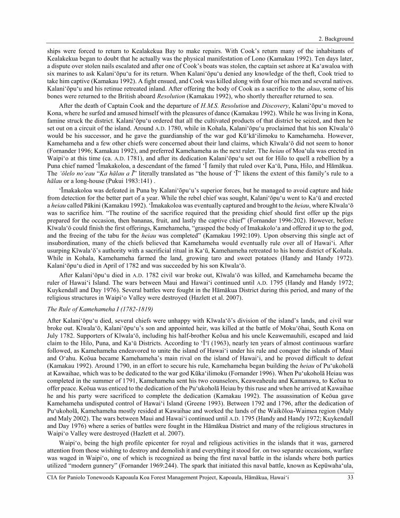
2. Background
CIA for Paniolo Tonewoods Kapoaula Koa Forest Management Project, Kapoaula, Hāmākua, Hawaiʻi 33
ships were forced to return to Kealakekua Bay to make repairs. With Cook’s return many of the inhabitants of Kealakekua began to doubt that he actually was the physical manifestation of Lono (Kamakau 1992). Ten days later, a dispute over stolen nails escalated and after one of Cook’s boats was stolen, the captain set ashore at Ka‘awaloa with six marines to ask Kalani‘ōpu‘u for its return. When Kalani‘ōpu‘u denied any knowledge of the theft, Cook tried to take him captive (Kamakau 1992). A fight ensued, and Cook was killed along with four of his men and several natives. Kalani‘ōpu‘u and his retinue retreated inland. After offering the body of Cook as a sacrifice to the akua, some of his bones were returned to the British aboard Resolution (Kamakau 1992), who shortly thereafter returned to sea.
After the death of Captain Cook and the departure of H.M.S. Resolution and Discovery, Kalani‘ōpu‘u moved to Kona, where he surfed and amused himself with the pleasures of dance (Kamakau 1992). While he was living in Kona, famine struck the district. Kalani‘ōpu‘u ordered that all the cultivated products of that district be seized, and then he set out on a circuit of the island. Around A.D. 1780, while in Kohala, Kalani‘ōpu‘u proclaimed that his son Kīwala‘ō would be his successor, and he gave the guardianship of the war god Kū‘kā‘ilimoku to Kamehameha. However, Kamehameha and a few other chiefs were concerned about their land claims, which Kīwala‘ō did not seem to honor (Fornander 1996; Kamakau 1992), and preferred Kamehameha as the next ruler. The heiau of Moa‘ula was erected in Waipi‘o at this time (ca. A.D. 1781), and after its dedication Kalani‘ōpu‘u set out for Hilo to quell a rebellion by a Puna chief named ‘Īmakakoloa, a descendant of the famed ‘Ī family that ruled over Ka‘ū, Puna, Hilo, and Hāmākua. The ‘ōlelo no‘eau “Ka hālau a Ī” literally translated as “the house of ‘Ī” likens the extent of this family’s rule to a hālau or a long-house (Pukui 1983:141) .
‘Īmakakoloa was defeated in Puna by Kalani‘ōpu‘u’s superior forces, but he managed to avoid capture and hide from detection for the better part of a year. While the rebel chief was sought, Kalani‘ōpu‘u went to Kaʻū and erected a heiau called Pākini (Kamakau 1992). ‘Īmakakoloa was eventually captured and brought to the heiau, where Kīwala‘ō was to sacrifice him. “The routine of the sacrifice required that the presiding chief should first offer up the pigs prepared for the occasion, then bananas, fruit, and lastly the captive chief” (Fornander 1996:202). However, before Kīwala‘ō could finish the first offerings, Kamehameha, “grasped the body of Imakakolo‘a and offered it up to the god, and the freeing of the tabu for the heiau was completed” (Kamakau 1992:109). Upon observing this single act of insubordination, many of the chiefs believed that Kamehameha would eventually rule over all of Hawai‘i. After usurping Kīwala‘ō’s authority with a sacrificial ritual in Ka‘ū, Kamehameha retreated to his home district of Kohala. While in Kohala, Kamehameha farmed the land, growing taro and sweet potatoes (Handy and Handy 1972). Kalani‘ōpu‘u died in April of 1782 and was succeeded by his son Kīwala‘ō.
After Kalani‘ōpu‘u died in A.D. 1782 civil war broke out, Kīwala‘ō was killed, and Kamehameha became the ruler of Hawai‘i Island. The wars between Maui and Hawai‘i continued until A.D. 1795 (Handy and Handy 1972; Kuykendall and Day 1976). Several battles were fought in the Hāmākua District during this period, and many of the religious structures in Waipi‘o Valley were destroyed (Hazlett et al. 2007).
The Rule of Kamehameha I (1782-1819)
After Kalani‘ōpu‘u died, several chiefs were unhappy with Kīwala‘ō’s division of the island’s lands, and civil war broke out. Kīwala‘ō, Kalani‘ōpu‘u’s son and appointed heir, was killed at the battle of Moku‘ōhai, South Kona on July 1782. Supporters of Kīwala‘ō, including his half-brother Keōua and his uncle Keawemauhili, escaped and laid claim to the Hilo, Puna, and Ka‘ū Districts. According to ‘Ī‘ī (1963), nearly ten years of almost continuous warfare followed, as Kamehameha endeavored to unite the island of Hawai‘i under his rule and conquer the islands of Maui and O‘ahu. Keōua became Kamehameha’s main rival on the island of Hawai‘i, and he proved difficult to defeat (Kamakau 1992). Around 1790, in an effort to secure his rule, Kamehameha began building the heiau of Pu‘ukoholā at Kawaihae, which was to be dedicated to the war god Kūka‘ilimoku (Fornander 1996). When Pu‘ukoholā Heiau was completed in the summer of 1791, Kamehameha sent his two counselors, Keaweaheulu and Kamanawa, to Keōua to offer peace. Keōua was enticed to the dedication of the Pu‘ukoholā Heiau by this ruse and when he arrived at Kawaihae he and his party were sacrificed to complete the dedication (Kamakau 1992). The assassination of Keōua gave Kamehameha undisputed control of Hawai‘i Island (Greene 1993). Between 1792 and 1796, after the dedication of Pu‘ukoholā, Kamehameha mostly resided at Kawaihae and worked the lands of the Waikōloa-Waimea region (Maly and Maly 2002). The wars between Maui and Hawai‘i continued until A.D. 1795 (Handy and Handy 1972; Kuykendall and Day 1976) where a series of battles were fought in the Hāmākua District and many of the religious structures in Waipi‘o Valley were destroyed (Hazlett et al. 2007).
Waipi‘o, being the high profile epicenter for royal and religious activities in the islands that it was, garnered attention from those wishing to destroy and demolish it and everything it stood for. on two separate occasions, warfare was waged in Waipi‘o, one of which is recognized as being the first naval battle in the islands where both parties utilized “modern gunnery” (Fornander 1969:244). The spark that initiated this naval battle, known as Kepūwaha‘ula,

2. Background
34 CIA for Paniolo Tonewoods Kapoaula Koa Forest Management Project, Kapoaula, Hāmākua, Hawaiʻi
was ignited by chief Ka‘eokulani from Kaua‘i. He and Maui chief Kahekili set out with their war canoes to “avenge the defeat of Kalanikupule on Maui, and to deal a crushing blow to the growing power of Kamehameha (Fornander 1969:241). On their voyage down the island chain, the pair intermittently stopped at several locations with their separate war fleets, recruiting crew for the impending battle. The two chiefs split up, with Kahekili hugging the coastline of the Kohala District and Ka‘eokulani heading straight for Waipi‘o. As related by Fornander (Fornander 1969:243), “the acts of spoliation and bararity committed on this occasion were the common occurance of war in those days”, however, the acts of blatant vandalism committed by both parties were primarily centered around religious and sacred icons and an utter lack of regard for the religious system. Resulting damages were severe, as related by Fornander (ibid.):
His disregard and desecration of the ancient tabu places, the tearing up and overturning the sacred pavement of Liloa, the burning of the sacred pepper-tree supports of the ancient palace of the Hawaiian kings, said to have been builty by Kahoukapu, and his general demolition and destruction of all the sacred and valued mementoes of ancient times, in which that valley was so rich,-these and similar acts were regarded as unpardonable acts of vandalism.
Kamehameha was in Kona when he caught wind of the invasion, and preparations for a naval battle were quickly completed. He “assembled a large fleet of double canoes, many of which were filled with small cannons obtained from traders, and with the sloop which Kameeaimoku had captured from the ship “Eleanor” the preceeding year, he started for Waipio, placing John Young and Isaac Davis in command of his artillery. (Fornander 1969:243–244). Upon Kamehameha’s arrival at Waipi‘o Bay, a bloody combat ensued with Kahekili’s fleet who had not yet made landfall. It is said that Kamehameha’s artillery was far too heavy handed for Kahekili, and that he and Ka‘eokulani fled back to their respective islands, defeated. According to Kamakau (Kamakau 1992), it was the final battle fought by Kahekili, a precursor to his death in 1793.
One year prior to Kepūwaha‘ula, Waipi‘o was also ravaged, although on a less severe level. Threatened by the possibility that Kamehameha and Keawemauhili (ruling chief of Hilo and Puna) would join forces against him, Keōua killed Keawemauhili and seized Hilo. Following his victory, Keōua decided to further launch the war into more rural areas, his intention being to:
Plunder the country people. He descended into Waipi‘o and broke down the fishponds, drying up Lalakea, Muliwai, and all the other ponds. He pulled up the taro of Waipi‘o, broke down the banks of the taro patches, and robbed the people from Waipi‘o to Waimea (Kamakau 1992:122, 151)
Aside from the obvious loss of human life associated with such warfare, the exploitation of the residents, the ponds, lo‘i, the burning of the sacred nī‘oi (pepper tree) columns and the displacement of Līloa’s pavement at Paka‘alana Heiau in Waipi‘o were tragic as well, and were undoubtedly a huge blow to the community.
Keōua’s war campaign subsequently infiltrated into eastern Hāmākua in the late eighteenth century where he led another forceful invasion of at least 20,000 men against Kamehameha and his party of 13,000 men during the two-day battle of Koapāpa‘a (also referred to as Koapapa) in the eastern part of the district (D’arcy 2018; Desha 2000; Fornander 1969; Kalākaua 1972; Kamakau 1992). Referred to as “The Battle of the Empty Guns” (Desha 2000), the skirmish was clandestinely planned by Keōua spurred in an identic manner to his previous invasion of Waipi‘o, and Kamehameha’s subjects were exposed to brutal treatment accomplished “by robbing them of their property, by the wantonly killing of men, women and children, the cutting of taro from the fields with overbearing arrogance, and all other malicious acts. Women who were with child were trampled under foot, pierced with small bambus and with sticks and stones” (Fornander 1969:472). These abhorrent acts of brutality triggered Kamehameha to avenge the death of his people, and Desha (2000) further relates that it was Kamehameha’s wish to enforce his Kānāwai Māmalahoa, or the Law of the Splintered Paddle, against Keōua.
Initially, the battle began deep in the misty forest of Mahiki, then moved further east into Pā‘auhau, and eventually ended up in Kūka‘iau in eastern Hāmākua. As related by Kamakau (1992:152), the battlefield consisted of “a broad open plain with a grove at the south” and was described as being in the vicinity of Kainehe (Desha 2000). Kinney (1913:33) elaborates:
The gulch on the south side of Kukaiau is named MAIUUKE-LELELEI. It is famous as the site of a great battle between Kamehameha and King Keoua, of Kau, the fight ending here after it had raged from one end of Hamakua to the other. The deciding engagement took place about a quarter of a mile above the present road, where the old road crossed the gulch. Keoua, when defeated, ran to the place where the KOHOLALELE gulch, north of Kukaiau, joins with the Kukaiau gulch. Here, on

2. Background
CIA for Paniolo Tonewoods Kapoaula Koa Forest Management Project, Kapoaula, Hāmākua, Hawaiʻi 35
the Hilo side, is a stone of refuge, where Keoua remained until the victorious forces had withdrawn, when he returned towards Kau. The stone is called Keoua’s stone until today.
Despite being vastly outnumbered with regards to manpower, Kamehameha’s warriors were dually armed with weaponry and knowledge of foreign warfare owing to Kamehameha’s association with John Young. Kamehameha’s army was well-armed with gunnery, and Keōua’s militia seized the weapons. However, they did not possess the necessary armaments that Kamehameha had, and as such could not forge an assault in this manner and both parties retreated to their respective districts (Kamakau 1992).
Another battle that reached as far as Kūka‘iau between Kulukulua, was fought between the king of Hilo named Kulukulua and the king of Hāmākua, Wanu‘a. Wanu‘a was assisted in battle by three of his bravest warriors, Moanonuikalehua, Kamuonuiaiake, and Puupuukaamai, which nearly resulted in his victory (Fornander 1969). However, just before slaughtering Kulukulua, Wanu‘a’s attack was interrupted by the arrival of Palila, a courageous and adept warrior and king of Kōloa, Kaua‘i who had been reared by the gods at the heiau of Alanapo in Humu‘ula, Kaua‘i. Nonetheless, the three fearless warriors were no match for Palila, who vanquished them with a single blow of his war club to the ground and later “hangs their jaws on a tree called Ka-haka-auwae (The shelf of jawbones)” (Beckwith 1970:415).
Shortly thereafter this period of warfare, Hawai‘i’s culture and economy changed drastically as western influences of capitalism and industry established a firm foothold in the islands. The sandalwood (Santalum ellipticum) trade was established by Euro-Americans in 1790 and turned into a viable commercial enterprise by 1805 (Oliver 1961). The industry flourished by 1810, as farmers and fishermen were ordered into the mountains of their district to cut sandalwood and carry it to the coast. Although the laborers were compensated with kapa (material), food and fish (Kamakau 1992) the neglect to their personal subsistent duties lead to food shortages, and famine, resulting in a population decline. Kamakau described the collapse of a traditional subsistence system and the industry’s detrimental effects on the people, “…this rush of labor to the mountains brought about a scarcity of cultivated food . . . The people were forced to eat herbs and tree ferns, thus the famine [was] called Hi-laulele, Haha-pilau, Laulele, Pualele, ‘Ama‘u, or Hapu‘u, from the wild plants resorted to” (ibid.: 1992:204). Once Kamehameha realized that his people were suffering, he “declared all the sandalwood the property of the government and ordered the people to devote only part of their time to its cutting and return to the cultivation of the land” (ibid.: 1992:204). Kamehameha I, who resided on the Island of O‘ahu at this time, did manage to maintain some control over the trade on Hawai‘i Island (Kent 1983; Kuykendall and Day 1976).
In 1793, Captain George Vancouver, who previously visited Hawaiʻi with Cook in 1778, returned leading his own expedition back to Hawaiʻi. Upon his return, Vancouver introduced cattle to Hawai‘i Island, gifting seventeen heads of steer to Kamehameha I (Barrera 1983). Kamehameha I placed a kapu on the cattle, and they were driven to the upland plain of Waimea to increase and multiply (Vancouver in Kuykendall 1938). Archibald Menzies, a naturalist and surgeon with the Vancouver expedition, wrote the following description of the Hāmākua District in 1793 as he sailed off the coast:
. . . The land we passed in the forenoon rose in a steep bank from the water side and from thence the country stretched back with an easy acclivity for about four or five miles, and was laid out into little fields, apparently well cultivated and interspersed with the habitations of the natives. Beyond this the country became steeply rugged and woody, forming mountains of great elevation. (Menzies 1920:51)
By 1796, Kamehameha had conquered all the island kingdoms except for Kaua‘i. It was not until 1810, when Kaumuali‘i of Kaua‘i gave his allegiance to Kamehameha, that the Hawaiian Islands were unified under one ruler (Kuykendall and Day 1976). In 1812, Kamehameha I returned to Hawaiʻi island and resided in Kamakahonu in Kailua-Kona, where he ruled for the remainder of his life, continuing his involvement with foreign trade and enforcing the rigid kapu system.
The Death of Kamehameha I and the Abolition of the Kapu System (1819-1820)
Kamehameha I died on May 8, 1819 at Kamakahonu in Kailua-Kona, and the changes that had been affecting the Hawaiian culture since the arrival of Captain Cook in the Islands began to accelerate. Following the death of a prominent chief, it was customary to eliminate all of the regular kapu that maintained social order and the separation of men and women, elite and commoner. Thus, following Kamehameha’s death, a period of ‘ainoa (free eating) was observed along with the relaxation of other traditional kapu. It was the responsibility of the new ruler and kahuna to re-establish kapu and restore social order, but at this point in history, traditional customs were altered (Kamakau 1992).

2. Background
36 CIA for Paniolo Tonewoods Kapoaula Koa Forest Management Project, Kapoaula, Hāmākua, Hawaiʻi
The death of Kamehameha was the first step in the ending of the tabus; the second was the modifying of the mourning ceremonies; the third, the ending of the tabu of the chief; the fourth, the ending of carrying the tabu chiefs in the arms and feeding them; the fifth, the ruling chief’s decision to introduce free eating (‘ainoa) after the death of Kamehameha; the sixth, the cooperation of his aunts, Ka-ahu-manu and Ka-heihei-malie; the seventh, the joint action of the chiefs in eating together at the suggestion of the ruling chief, so that free eating became an established fact and the credit of establishing the custom went to the ruling chief. This custom was not so much of an innovation as might be supposed. In old days the period of mourning at the death of a ruling chief who had been greatly beloved was a time of license. The women were allowed to enter the heiau, to eat bananas, coconuts, and pork, and to climb over the sacred places. You will find record of this in the history of Ka-ula-hea-nui-o-ka-moku, in that of Ku-ali‘i, and in most of the histories of ancient rulers. Free eating followed the death of the ruling chief; after the period of mourning was over the new ruler placed the land under a new tabu following old lines. (Kamakau 1992:222)
Immediately upon the death of Kamehameha I, his son and successor, Liholiho was sent away to Kawaihae to keep him safe from the impurities of Kamakahonu brought about from the death of Kamehameha. After the purification ceremonies, Liholiho returned to Kamakahonu where he conducted a series of rebellious acts to deny the reinstatement of the traditional kapu laws. These actions included, the consumption of dog meat that was strickly kapu to chiefly women and entering the women’s lauhala house. Many aliʻi who witnessed Liholiho’s complete disregard, quickly spread word that the kapu had been abandoned.
Then Liholiho on this first night of his arrival ate some of the tabu dog meat free only to the chiefesses; he entered the lauhala house free only to them; whatever he desired he reached out for; everything was supplied, even those things generally to be found only in a tabu house. The people saw the men drinking rum with the women kahu and smoking tobacco, and thought it was to mark the ending of the tabu of a chief. The chiefs saw with satisfaction the ending of the chief’s tabu and the freeing of the eating tabu. The kahu said to the chief, “Make eating free over the whole kingdom from Hawaii to Oahu and let it be extended to Kauai!” and Liholiho consented. Then pork to be eaten free was taken to the country districts and given to commoners, both men and women, and free eating was introduced all over the group. Messengers were sent to Maui, Molokai, Oahu and all the way to Kauai, Ka-umu-ali‘i consented to the free eating and it was accepted on Kauai. (Kamakau 1992:225)
Kekuaokalani, caretaker of the war god Kūka‘ilimoku, was dismayed by the actions of his cousin, Liholiho, and thereby revolted against him. Kekuaokalani was unsuccessful and was ultimately defeated. Within a year of Kamehameha’s death, Liholiho (Kamehameha II) had sent edicts throughout the kingdom renouncing the ancient state religion. By December 1819, he commanded the destruction of heiau images and structures, or that the structures be abandoned and left to deteriorate. Kamehameha II, did however, allow personal family religion, ‘aumakua worship, to continue (Kamakau 1992; Oliver 1961). As most of the kapu remained null throughout the entire archipelago, the uncanny arrival of the Christian missionaries shortly after, resulted in the abolishment of the kapu system, and the traditional religion replaced with Christianity. The end of the kapu system, marked significant social and economic changes that greatly affected the lives of the common people. Liholiho eventually moved his court to O‘ahu, thereby lessening the burden on the people of Hawaiʻi Island to manage resource procurement for the chiefly class. The economy shifted from subsistence agriculture to the production of foods and goods that were traded with early visitors. Introduced foods often grown for trade included yams, coffee, melons, Irish potatoes, Indian corn, beans, figs, oranges, guavas, and grapes (Wilkes 1845).
Hāmākua 1820-1848: A Land in Transition and Early Historical Accounts
In October of 1819, seventeen Protestant missionaries set sail from Boston to Hawai‘i. They arrived in Kailua-Kona on March 30, 1820 to a society whose religious system has just been overturned. Eager to spread the Christan gospel, these early missionarie seized the opportunity to fill this religious void. Many of the ali‘i, who were already exposed to western material culture, welcomed the opportunity to become educated in a western style and adopted their dress and religion. Soon they were rewarding their teachers with land and positions in the Hawaiian government. During this period, the sandalwood trade wrought havoc on the lives of the commoners, as they weakened from the heavy production, exposure, and famine just to fill the coffers of the ali‘i, who were no longer under any traditional constraints (Kuykendall and Day 1976; Oliver 1961). The lack of control of the sandalwood trade was to soon lead to the first Hawaiian national debt as promissory notes and levies were initiated by American traders and enforced by American warships (Oliver 1961). The Hawaiian culture was well on its way towards Western assimilation as industry

2. Background
CIA for Paniolo Tonewoods Kapoaula Koa Forest Management Project, Kapoaula, Hāmākua, Hawaiʻi 37
in Hawai‘i went from the sandalwood trade, to a short-lived whaling industry, to the more lucrative, but environmentally destructive sugar industry.
Some of the earliest written descriptions of Hāmākua come from the accounts of the first Protestant Missionaries to visit the island. Early Historic visitors to Hāmākua noted the beauty and fertility of this part of the island. In 1823, British missionary William Ellis and members of the American Board of Commissioners for Foreign Missions (ABCFM) toured the island of Hawai‘i seeking out communities in which to establish church centers for the growing Calvinist mission. Ellis recorded observations made during this tour in a journal. Traveling through the Hāmākua District heading west from Hilo, Ellis described the environs of Hāmākua, particularly between the stretch of Koloaha to the east of the study area to Kapulena to the west, thusly:
We arose at day-light on the 16th, and shortly after left Tumoarii. We had not travelled more than four or five miles when we reached Kaahua. After breakfast, we proceeded on our journey over a country equal in fertility to any we had passed since leaving Waiakea. The houses were in general large, containing usually three or four families each. Mr. Goodrich was indisposed through the day, which obliged us to travel but slowly. near noon we stopped at Koloaha, and while he reclined beneath the shade of an adjoining grove of trees, I addressed the assembled natives on the subject of religion. After remaining about two hours, we walked to another village, where Mr. Thurston spoke to the people, who gave good attention. We then kept on our way till we reached Malanahae, where a congregation of people assembled, with whom we conversed some short time, then bade them farewell, and about three P.M. reached Kapulena, where we preached to upwards of 100 of the people. (Ellis 2004:356)
At Kapulena (northwest of the current study area) Ellis’ party split into two groups; Ellis and Thurston continued northwest following the coast to Waipi‘o Valley, and Bishop and Goodrich proceed inland to Waimea, passing nearby the study area:
On Monday morning Messers. Bishop and Goodrich commenced their journey to Waimea. Having procured a man to carry their baggage, they left Kapulena, and taking an inland direction, passed over a pleasant country, gently undulated with hill and dale. The soil was fertile, the vegetation flourishing, and there was considerable cultivation, though but few inhabitants. (Ellis 2004:357)
Lorenzo Lyons arrived at Kawaihae on July 16, 1832 and replaced Reverend Dwight Baldwin as the minister in Waimea (Maly 1999). Lyons’ missionary territory, although centered in Waimea, included the districts of Kohala and Hāmākua. He served as the preeminent missionary of the area of the area until his death in 1886 (Puakō Historical Society 2000), becoming one of the most beloved of the Hawaiian missionaries, known to his parishioners as Ka Makua Laiana, haku mele o ka aina Mauna (Father Lyons, lyric poet of the mountain country). In 1834, Lyons relocated to Hāmākua following his two-year missionary service in Waimea. He described the journey to Hāmākua thusly:
. . . If we take the route to Hamakua, there is, in wet weather, a marsh to pass through—not much unlike Bunyan’s Slough of Despond—either in going or returning, or both. It is perhaps four miles long—a most dismal place; yet the woods are sometimes vocal with the music of birds, which furnishes a little relief to the tediousness of the way. . . On one route to Hamakua, part of the road is a mere foot-path lying thro’ a dense wood of Koa and Ohia. (Doyle 1953:111)
Lyons’ also provided one of the earliest descriptions of a wagon read leading from Waimea to Hāmākua: We have no roads such as you have in America, but we got to Hamakua after a fashion. Mrs. L was drawn part of the way in a rocking chair attached to the fore wheels of a wagon; a part of the way she was carried in the same chair by natives; and part of the way she walked. The little one was carried by a native. You would have smiled to see how we lived. (Doyle 1953:75)
The Legacy of the Māhele ‘Āina of 1848
By the mid-19th century, the ever-growing population of Westerners in the Hawaiian Islands forced socioeconomic and demographic changes that promoted the establishment of a Euro-American style of land ownership. By 1840 the first Hawaiian constitution had been drafted and the Hawaiian Kingdom shifted from an absolute monarchy into a constitutional government. Convinced that the feudal system of land tenure previously practiced was not compatible with a constitutional government, the Mō‘ī (Kamehameha III) and his high-ranking ali‘i (chiefs) decided to separate and define the ownership of all lands in the Kingdom (King n.d.). This change was further promoted by missionaries and Western businessmen in the islands who were generally hesitant to enter business deals on leasehold lands that could be revoked from them at any time. After much consideration, it was decided that three classes of people each

2. Background
38 CIA for Paniolo Tonewoods Kapoaula Koa Forest Management Project, Kapoaula, Hāmākua, Hawaiʻi
had one-third vested rights to the lands of Hawai‘i: the Mō‘ī, the ali‘i and konohiki (land agents), and the maka‘āinana (the common people or native tenants).
In 1845 the legislature created the “Board of Commissioners to Quiet Land Titles” (more commonly known as the Land Commission), first to adopt guiding principles and procedures for dividing the lands and granting land titles, and then to act as a court of record to investigate and ultimately award or reject all claims brought before them. All land claims, whether by chiefs for entire ahupua‘a or by tenants for their house lots and gardens, had to be filed with the Land Commission within two years of the effective date of the Act (February 14, 1846) to be considered. All of the land claimants were required to provide proof of land use and occupation, which took the form of volumes of native registry and testimony. The claims and awards were numbered, and the Land Commission Award (LCAw.) numbers, in conjunction with the volumes of documentation, remain in use today to identify the original owners and their use of their lands. The work of hearing, adjudicating, and surveying the claims required more time than was prescribed by the two year term, and the deadline was extended several times, not for new claims, but for the Land Commission to finish its work. (Alexander 1920; Soehren 2005).
The Mō‘ī and some 245 ali‘i (Kuykendall 1938) spent nearly two years trying unsuccessfully to divide all the lands of Hawai‘i amongst themselves before the whole matter was referred to the Privy Council on December 18, 1847 (King n.d.). Once the Mō‘ī and his ali‘i accepted the principles of the Privy Council, the Māhele ‘Āina (Land Division) was completed in just forty days (on March 7, 1848), and the names of all of the ahupua‘a and ‘ili kūpono (nearly independent ʻili land division within an ahupuaʻa) of the Hawaiian Islands and the ali‘i who claimed them, were recorded in the Buke Māhele (also known as the Māhele Book) (Soehren 2005). As this process unfolded the Mō‘ī, Kamehameha III, who received roughly one-third of the lands of Hawai‘i, realized the importance of setting aside public lands that could be sold to raise money for the government and also purchased by his subjects to live on. Accordingly, the day after the division when the name the last chief was recorded in the Buke Māhele, the Mō‘ī, Kamehameha III commuted about two-thirds of the lands awarded to him to the Hawaiian Kingdom Government (King n.d.). Unlike the Mō‘ī, the ali‘i and konohiki were required to present their claims to the Land Commission to receive their land awards (known as Land Commission Awards or LCAw). The chiefs who participated in the Māhele were also required to provide to the government commutations of a portion of their lands in order to receive a Royal Patent giving them title to their remaining lands. The lands surrendered to the government by the Mō‘ī and ali‘i became known as “Government Land,” while the lands retained by Kamehameha III became known as “Crown Land,” and the lands received by the chiefs became known as “Konohiki Land” (Chinen 1958:vii, 1961:13). All lands awarded during the Māhele were identified by name only, with the understanding that the ancient boundaries would prevail until the land could be surveyed. This process expedited the work of the Land Commission.
During the Māhele, native tenants of the lands that were divided up among the Crown, Konohiki, and Government could claim, and acquire title to, kuleana parcels that they actively lived on or farmed. The Board of Commissioners oversaw the program and administered the kuleana as Land Commission Awards (LCAw.). Claims for kuleana had to be submitted during a two-year period that expired on February 14, 1848 to be considered. All of the land claimants were required to provide proof of land use and occupation, which took the form of volumes of native registry and testimony. The claims and awards were numbered, and the LCAw. numbers, in conjunction with the volumes of documentation, remain in use today to identify the original owners and their use of the kuleana lands. The work of hearing, adjudicating, and surveying the claims required more than the two-year term, and the deadline was extended several times for the Land Commission to finish its work (Maly 2002). In the meantime, as the new owners of the lands on which the kuleana were located began selling parcels to foreigners, questions arose concerning the rights of the native tenants and their ability to access and collect the resources necessary for sustaining life. The “Enabling” or “Kuleana Act,” passed by the King and Privy Council on December 21, 1849, clarified the native tenants’ rights to the land and resources, and the process by which they could apply for fee-simple interest in their kuleana.
The work of the Land Commission was completed on March 31, 1855. A total of 13,514 kuleana were claimed by native tenants throughout the islands, of which 9,337 were awarded (Maly 2002). The history of the kuleana claim and award process is summarized in an 1856 report by the Minister of Interior:
…During the ten months that elapsed between the constitution of the Board and the end of the year 1846, only 371 claims were received at the office; during the year 1847 only 2,460, while 8,478 came in after the first day of January 1848. To these are to be added 2,100 claims, bearing supplementary numbers, chiefly consisting of claims which had been forwarded to the Board, but lost or destroyed on the way. In the year 1851, 105 new claims were admitted, for Kuleanas in the Fort Lands of Honolulu, by order of the Legislature. The total number of claims therefore, amounts to 13,514, of which 209 belonged to foreigners and their descendants. The original papers, as they

2. Background
CIA for Paniolo Tonewoods Kapoaula Koa Forest Management Project, Kapoaula, Hāmākua, Hawaiʻi 39
were received at the office, were numbered and copied into the Registers of the Commission, which highly necessary part of the work entailed no small amount of labor… …The whole number of Awards perfected by the Board up to its dissolution is 9,337, leaving an apparent balance of claims not awarded of say 4,200. Of these, at least 1,500 may be ranked as duplicates, and of the remaining 2,700 perhaps 1,500 have been rejected as bad, while of the balance some have not been prosecuted by the parties interested; many have been relinquished and given up to the Konohikis, even after surveys were procured by the Board, and hundreds of claimants have died, leaving no legal representatives. It is probable also that on account of the dilatoriness of some claimants in prosecuting their rights before the Commission, there are even now, after the great length of time which has been afforded, some perfectly good claims on the Registers of the Board, the owners of which have never taken the trouble to prove them. If there are any such, they deserve no commiseration, for every pains has been taken by the Commissioners and their agents, by means of oft repeated public notices and renewed visits to the different districts of the Islands, to afford all and every of the claimants an opportunity of securing their rights… (quoted in Maly 2002:7)
The disposition of the lands of Kapoaula is a complicated matter, and it is important to note that there are inconsistencies in the Māhele-era recordkeeping for Leleiōhoku’s land award. As a result of the Māhele, the entire 1,697 ¼-acre ahupua‘a of Kapoaula (comprising five smaller lands of the same name) was slated to be returned to Kamehameha III by William Pitt Leleiōhoku, the first husband of Harriet Keōpūolani Nāhi‘ena‘ena and second husband to Ruth (Luka) Ke‘elikōlani (Buke Mahele 1848:23). Combining smaller ahupua‘a in this manner was not uncommon, as Gonschor and Beamer (2014:80) note, “If a group of numbered ahupua‘a with the same name ended up having the same konohiki, or all becoming Government or Crown land, they were frequently consolidated into one.” As Leleiōhoku’s lands were to be awarded to him in “Freehold less than Allodial,” it appears that Kapoaula was intended to be one of the lands commutated to the Government in exchange for patenting his other lands. The chain of events following this initial decision is somewhat murky, however, Leleiōhoku died in 1848 shortly after the Māhele was completed, and Kapoaula was not commutated. The lands awarded to him as a result of the Māhele were allocated to his widow and to their son and heir, John William Pitt Kīna‘u:
By action of the Privy Council on May 27, 1850, a Resolution was approved for the division of the lands of William Pitt Leleiohoku to be surrendered in Lieu of Commutation as set forth in Vol. 3 of Privy Council Records on page 327 as follows:
“Resolved that the division of lands between the Government and the widow and heirs of William Pitt Leleiohoku, deceased, this day submitted to the King and Privy Council be, and is hereby approved: and that the Minister of the Interior be, and is hereby authorized to grant a Royal Patent or Patents to Luka Keelikolani, the widow of the said Leleiohoku for such lands as may apportioned to her as her dower in the estate of the said Leleiohoku, and also to grant a Royal Patent or Patents to John Pitt Kinau, the son and heir of the said Leleiohoku for such lands as may be assigned to him as his portion of said estate: Provided however, that nothing in this resolution shall be construed as interfering with the rights of the Land Commission to settle all disputes that may exist as to the title or bounds of any of said lands; and further provided, that nothing therein contained shall be construed as interfering with the rights of native tenants in said lands.” (Commisioner of Public Lands 1929:75–76)
Of the thirteen Hāmākua ahupua‘a awarded to Leleiōhoku, nine were relinquished to the Mō‘ī, and four were retained by him (Kame‘eleihiwa 1992). Kame‘eleihiwa (1992:25) relates that Leleiōhoku
held 93 ‘Āina before the Māhele, principally on Hawai‘i island (73). He gave up 61 percent of his ‘Āina to the Mō‘ī, receiving 36: 25 on Hawai‘i, 7 on Māui, 2 on O‘ahu, and 1 on Moloka‘i… When Leleiōhoku died soon after the signing of the Buke Mahele in 1848, his heirs (his wife Ke‘elikōlani and son John Pitt Kīna‘u) were required to cede 12 or more ‘Āina, or another 13 percent, in government commutation. These included 8 ‘Āina on Hawai‘i and 4 on Māui. By 1849, Leleiōhoku’s estate had shrunk to 25 percent of its pre-Māhele size.
Commutation of the nine Hāmākua ahupua‘a occurred on August 27, 1850, two years after Leleiōhoku’s death. Kapoaula was not included among these lands. Leleiōhoku was succeeded by his only heir, and “the substantial ‘Āina of Leleiōhoku [including Kapoaula] were left to his son, W.P. Kīna‘u, with his widow Ruta Ke‘elikōlani as guardian” but “Kīna‘u died as a youth in 1859 and so Leleiōhoku’s ‘Āina were really inherited by Ke‘elikōlani” (Kame‘eleihiwa

2. Background
40 CIA for Paniolo Tonewoods Kapoaula Koa Forest Management Project, Kapoaula, Hāmākua, Hawaiʻi
1992:307). Before Ke‘elikōlani passed away in 1883, she “became one of the largest owners of ‘Āina by the time of her death…because she became heir to various Ali‘i Nui who died before her” (Kame‘eleihiwa 1992:246).
Leleiōhoku’s lands were awarded posthumously as Land Commission Award (LCAw.) 9971. The award itself adds to the confusion over Kapoaula, as it appears that the ahupua‘a was included twice in the award (Soehren 2005). ‘Āpana 2 of the award (Figures 11 and 12) is for the ahupua‘a of “Kapoaula” in Hāmākua on Hawai‘i Island. The award includes a description of the boundary and a map that clearly identifies the land as the ahupua‘a containing the current study area. ‘Āpana 18 of the award is for “Kapaaula” in Hamakaua on Hawai‘i Island. The land is not described in the same detail as ‘Āpana 2, only named. The award was finalized on May 2, 1853, five years after Leleiōhoku’s death, and a map (Figure 13) was made by Government Surveyor, Curtis Jere (C.J.) Lyons’s of the awarded land. With respect to the Māhele survey of Hāmākua, Lyons’ provided the following description of the district and noted that he was accompanied by natives:
Hamakua, the present rich cane country, next claimed me. The compass was a magic mystery to the natives, who followed all day long; but the chain, the “kaula-hao” was to their minds the authoritative instrument. To their eyes, it marked the line on the ground as it dragged along. The flags reminded them of the ancient annual procession of Kea Akua Makahiki, and they compared the tripod as it folded up, to the bundled bones of their ancestors. (Lyons in Moffat and Fitzpatrick 1995:60)
A description of the ahupua‘a boundary, as surveyed by Lyons, was included in the LCAw. documentation (the portion including the current study area is bolded; Hawaiian words are italicized):
Starting at the east corner on the makai (seaward) side adjoining with Malanahae just below the stream, and running to the ili kai maloo (low tide, as when much of the reef is exposed) for 435 feet, then ascending up the cliff to the large stone at the boundary of this [land] and Manai, then ascending on the boundary of Manai Hema 16˚ west 1,346 feet until the pā (enclosure) of Popoloa, then from the enclosure south 31˚ west 330 feet, then south 35˚ west 515 feet, then at Manai south 9˚ 45 feet west 5,555 feet until it reaches the mauka most kuleana boundary, then at Mooiki, south 11˚ 30 feet west 1,666 feet to the top of the hill, then south 25˚ 15 feet west 3,080 feet cutting the western corner of Wainaku, until it reaches the puu “Naunuakini” then at Haukoi, south 15˚ west 3,300 feet until it reaches the embankment on the western side of the stream, then at Keahakea, south 43˚ 30 feet west 2,400 feet until it reaches the ahupohaku (stone mound) at Waiakaalae, then on the boundary of Kapulena south 11˚ 45 feet west 12,800 feet until it reaches the marker at the awawa (gulch, valley) makai of Kamakaukuapuu, then south 2˚ east 4,450 feet at Kapulena until it reaches the mauka most boundary of this land, just below Alalakeiki, then at Kamoku north 87˚ 30 feet east 2,250 feet until it reaches the “Alanui pii o Honokaia,” north 11˚ 30 feet east 17,700 feet until it reaches puu Ka-manu, then at the boundary of Malanahae north 22˚ west 690 feet until it reaches puu Keokeo, then north 5˚ west 1,350 feet until it reaches the ‘ōhi‘a tree marking Kapaaula at the start of the stream at a placed called Kapohoiholena, then descending down the stream on the boundary of Malanahae until the point of commencement. 1,697 ¼ acres
The land was not patented for another eighty years, when Alfred Wellington (A.W.) Carter, manager of Parker Ranch (which owned the land by that time) was issued Land Patent Grant 8451 on January 8, 1934.
Another version of Lyons’ map (Figure 14) includes additional details about the study area. Most importantly, the map indicates that the study area was still forested in 1853. The forests on Mauna Kea traditionally provided Hawaiians with valued resources, especially feathers, plant materials, and wood, and places for ritual activities (Tomonari-Tuggle 1996). Bird-catching was a specialized form of hunting that provided highly-valued feathers to craft specialists, who transformed them into high status goods that included lei, kāhili (royal insignial plumes), ʻahu ʻula (cloaks), mahiole (helmets), and ‘akua hulu manu (feathered images of gods) (Brigham 1899, 1903, 1918; Buck 1944, 1957; Emerson 1894). The aliʻi controlled the collection of feathers through specific requests (Kamakau 1992), as tribute during the Makahiki, and through a “standing order” (palala) for this item of hoʻokupu (Malo 1951). Boundary Commission records examined by Cordy (2003), support the idea that bird-catchers were maka‘āinana who hunted birds within their own ahupua‘a on a part-time basis (contra Emerson 1894; see also Lass 1998; Linnekin 1988). This suggests only temporary habitation in this part of the forest, which would likely lead to relatively ephemeral evidence of the presence of the bird-catchers. Boundary commission records (see discussion below) indicate that the forests continued to support some bird-catching into the mid-19th century, but the upper forests were significantly altered by livestock, which trampled and grazed them into grasslands. Lyons’ map captures this landscape

2. Background
CIA for Paniolo Tonewoods Kapoaula Koa Forest Management Project, Kapoaula, Hāmākua, Hawaiʻi 41
in transition by noting a “Pahua Bipi” [pāhuʻa, a clear areas in pastures where it is easy to rope cattle; bipi, beef/cattle] located makai of the current study area (Pukui and Elbert 1986:301).
The map also depicts two trails, which are highlighted in yellow on Figure 14. The old trail/road referred to as “Honokaia” by Makaenaena is depicted in Figure 15, where it is labeled “Alanui o Honokaia.” The trail extends slightly into the southeastern corner of the current study area. From there, the trail follows the parcel’s eastern boundary for a short distance before linking with a mauka/makai trail/road called “Alanui pii uka i ka mauna” which translates literally as “large path going inland to the mountain.” This second trail roughly bisects the study area and extends from this junction makai towards the kuleana lots in the northern portion of Kapoaula. Above the junction at the Honokaia boundary, the Alanui pii uka i ka mauna and the Alanui o Honokaia continue southwards into the neighboring Government land of Kamoku (see Figures 14 and 15).
No kuleana awards were made within the current study area. In the makai portion of Kapoaula, nine claims for kuleana parcels were made by eight claimants, all of which were awarded (Table 2). Figure 16 shows the distribution of kuleana awards within Kapoaula. The awarded lands totaled 116.5 acres and ranged between 9.3 and 16.5 acres in size. Twelve ‘ili names are mentioned in the Native Testimonies: Haleokane, Kealaehu, Kaopapa 1, Kaopapa 2, Kapokuna, Kapuna, Mooiki, Papuaa, Pohokuna, Puna, Ulukanipo, and Uwiuwi. All but one of the testimonies provides only generalized agricultural types (e.g. cultivated fields or kīhāpai), one enumerates three distinct plants: ‘uala, kalo, and wauke. Pāhale, or house lots, were noted for five of the individuals, and there was a total of nine houses. Two of the awardees received land from their parents, and two received their land prior to 1819.
Figure 11. LCAw. 9971 ‘apana 2 to William Leleiohoku (www.kipukadatabase.com).

2. Background
42 CIA for Paniolo Tonewoods Kapoaula Koa Forest Management Project, Kapoaula, Hāmākua, Hawaiʻi
Figure 12. Newspaper notice from March 15, 1853 listing Kapoaula (listed as Kapaaula) and other lands to be awarded to Leleiōhoku during the Māhele (The Polynesian 1853).

2. Background
CIA for Paniolo Tonewoods Kapoaula Koa Forest Management Project, Kapoaula, Hāmākua, Hawaiʻi 43
Figure 13. Survey map of LCAw. 9971:2 by C.J. Lyons, study area shaded red.

2. Background
44 CIA for Paniolo Tonewoods Kapoaula Koa Forest Management Project, Kapoaula, Hāmākua, Hawaiʻi
Figure 14. Portion of Registered Map No. 46 with the current study area outlined red (after Lyons 1853).

2. Background
CIA for Paniolo Tonewoods Kapoaula Koa Forest Management Project, Kapoaula, Hāmākua, Hawaiʻi 45
Figu
re 1
5. T
raci
ng o
f C.J.
Lyo
ns’ s
urve
y m
ap o
f LC
Aw
. 997
1:2
with
the
curr
ent s
tudy
are
a ou
tline
d in
red
(Off
ice
of H
awai
ian
Aff
airs
201
8).

2. Background
46 CIA for Paniolo Tonewoods Kapoaula Koa Forest Management Project, Kapoaula, Hāmākua, Hawaiʻi
Table 2. Kuleana parcels awarded in Kapoaula Ahupua‘a.Claimant LCAw. ‘Ili/Moʻo ʻĀina Land use Size
(ac.) Recv’d From
Date
Kaikuaana 3836 Uwiuwi Kapuna Haleokane
1 house lot 1 house 7 kīhāpai
9.3 - -
Kaakaua 8380 Puna Ulukanipo Papuaa Mooiki
2 houses 12 cultivated fields 8 kīhāpai
10.5 Parents -
Kalakualaau 8384 Pohokuna 8 kīhāpai 14 - <1819 Kaneakaehu 8395 Haleokane 1 house lot
1 house 6 cultivated fields 6 kīhāpai
13 Parents <1819
Pololoa 9841:1 and 2 Uwiuwi 1 house lot 6 cultivated fields
14.5 - -
Nahao 10409 Kapokuna 12 kīhāpai 12.5 - - Naiku 10542 Ulukanipo 1 house lot
3 houses 1 kīhāpai 3 cultivated fields
12.2 - -
Pule 10671 Kaopapa 1 & 2 2 houses 4 cultivated fields
14 - -
Auwae 10992 Kapokuna Kealaehu
1 house lot 2 ‘uala patches 6 kalo patches 1 wauke patch
16.5 - -

2. Background
CIA for Paniolo Tonewoods Kapoaula Koa Forest Management Project, Kapoaula, Hāmākua, Hawaiʻi 47
Figure 16. Kuleana parcels awarded in Kapoaula Ahupua‘a.
Boundary Commission Testimony (1862-1873)
In 1862, the Commission of Boundaries (Boundary Commission) was established in the Kingdom of Hawai‘i to legally set the boundaries of all the ahupua‘a that had been awarded as a part of the Māhele. Subsequently, in 1874, the Commissioners of Boundaries were authorized to certify the boundaries for lands brought before them. The primary informants for the boundary descriptions were old native residents of the lands, many of which had also been claimants for kuleana during the Māhele. This information was collected primarily between 1873 and 1885 and was usually given in Hawaiian and transcribed in English. Although hearings for most ahupua‘a boundaries were brought before the Boundary Commission and later surveyed by Government employed surveyors, in some instances, the boundaries were established through a combination of other methods. In some cases, ahupua‘a boundaries were established by conducting surveys on adjacent ahupua‘a. Or in cases where the entire ahupua‘a was divided and awarded as Land Claim Awards and or Government issued Land Grants (both which required formal surveys), the Boundary

2. Background
48 CIA for Paniolo Tonewoods Kapoaula Koa Forest Management Project, Kapoaula, Hāmākua, Hawaiʻi
Commission relied on those surveys to establish the boundaries for that ahupua‘a. Although these small-scale surveys aided in establishing the boundaries, they lack the detailed knowledge of the land that is found in the Boundary Commission hearings.
While the boundaries for Kapoaula do not appear to have ever been brought before the Boundary Commission, testimony for the adjacent ahupua‘a of Honokaia was provided by Makaenaena on April 18, 1873. Makaenaena, who was “born before collecting of sandalwood by Boki” (ca. 1829, Kuykendall 1938) may have been about fifty years old at the time of his testimony. In his description, Makaenaena not only names several places in the immediate vicinity of the current project area, but provides insights regarding Precontact land use within the general area. Makaenaena described the boundaries of Honokaia as follows (bolded, underlined, and italicized emphasis added for sections relevant to Kapoaula):
I was born at Kawela Hamakua, Island of Hawaii, before the time of collecting sandalwood on the mountains. Have always lived on Kawela and Honokaia. I am a kamaaina of these lands. My father Moopua (now dead) showed me these boundaries when I went with him to catch birds. If we caught birds on other lands, the Luna of those lands, would take the birds away from us, and so he pointed out the boundaries to me. Honokaia is bounded on the makai side by the Sea; on the South East side by Kawela and Au 1st, mauka by Kamoko [Kamoku], North West side by Kamoko, Kapoaula and Malanahae. There were always in old times fisheries belonging to Honokaia extending out to sea a short distance. The boundary at the shore between Honokaia and Kawela is a large rock in the Sea called Pohakulelehu: From this point the boundary between these two lands runs mauka to a grove of Puhala trees called Paihala, thence mauka to place at old road called Kuaiwahia: Thence mauka to grove of Puhala trees called Puanapouli: Thence to small hill called Kulanahae: Thence across Government road to hill called Puuainako: Thence to a small mound Wiliwilihalou: Thence to a grove of small ohia trees on the side of a pali at place called Kauluawaa: Thence to waterhole called Kauluawaa: Thence to grove of ohia trees Kuhewa: The place called Ohiakiihelele is on the land Honokaia a short distance from the boundary: From Kuhewa the boundary runs mauka to Kawelaloa: Thence to Kawahine: The boundary from the shore follows up the iwi aina: From Kawahine to to [sic] Inoino gulch, and mauka to a pali called Palinui: The brow of pali is boundary, level land is on Honokaia, and pali on Kawela: Thence along brow of pali and on to Pakeke: Thence to Pohokai: Thence up a ridge to Pohopuumaia, at this point cross the Inoino gulch: Thence to place called Puuloa at the old Kawela road: Thence follow up the old road to Nahaleopaa a puu pahoehoe in Inoino kahawai: the mauka corner of Kawela where it is cut off by Au 1st: The place where the boundary of Honokaia enters the woods is at the water hole Kaohiawaa mauka of the grove of ohia trees of the same name.
From Nahaleopaa the boundary between Honokaia and Au 1st follows up the old road Honokaia one side of road and Au 1st on other, to place called Puuokane hekili (a small hill or mound): Thence along road to a hill Puupohaku: Thence to old mamake [māmaki] ground called Waiakekukai: Thence to Kalapahaaha: Thence to small hill Puulepo: Thence to Waiakahoi a Kahawai with a cave it where the bird catchers used to live: Thence Honokaia ends and Au is cut off by Kamoko: Thence boundary of Honokaia runs along Kamoko to old Mamake ground called Kumaweo: Thence to Mamake grounds called Nakikapio: Thence to a ridge called Makaleha: Thence makai to a hill Kalapaaki: Thence to Kalapa Hapu [Lapa Hapuu] the mauka corner of land of Kapoaula The corner of Kamoku on boundary of Honokaia.
I went with Wiltse when he surveyed the boundary between Honokaia and Kawela, marked trees and pointed out boundaries. Kaikauna went with us. I was born before the collecting of sandalwood by Boki. . . . (Boundary Commission, Hawaii, Vol. A, No. 1, pgs. 238-240)
From Makaenaena’s testimony, we learn that Kapoaula bounds Honokaia to the northwest, and that Kalapa/Lapa Hapuu was the southeastern corner boundary between Kapoaula and Honokaia. Makaenaena’s testimony also contains references to cultural, natural, and geographic places of significance in the general vicinity of the study area including a grove of pūhala trees (Puanapouli), a place with a water hole where ‘ōhi‘a grew (Kauluawaa), another water hole (Kaohiawaa), two groves of ‘ōhi‘a trees (Kaohiawaa, Kuhewa), a gulch (Inoino), a pali (Palinui), a pu‘u pāhoehoe (Nahaleopaa), three māmaki-growing areas (Kumaweo, Nakikapio, Waiakekukai), an upland stream with cave where bird-catchers dwelled (Waiakahoi), a ridge (Makaleha), numerous hills (Kalapaaki, Kulanahae, Puuainako, Puuokane hekili, Puupohaku), and four old roads (Honokaia, Government road, Kawela, Kuaiwahia). Makaenaena also reveals that the lands of Honokaia were hunting grounds for birds. Furthermore, we learn that Honokaia, undoubtedly just

2. Background
CIA for Paniolo Tonewoods Kapoaula Koa Forest Management Project, Kapoaula, Hāmākua, Hawaiʻi 49
like Kapoaula, had ancient fishing rights extending out to the sea. While traditional land use is not explicitly discussed for Kapoaula in the testimony, Makaenaena’s description of the forest land and bird-catching boundaries suggest that bird-catching likely took place in the current study area.
Nā Inoa ‘Āina of Kapoaula Ahupua‘a
Toponymy or the study of inoa ‘āina (Hawaiian place names) is another opportunity to improve our understanding of a place and its history. The following paragraphs contain a presentation of inoa ‘āina that were compiled from several map collections including Department of Accounting and General Services Hawai‘i Registered Maps and the United State Geological Survey (USGS). The earliest maps found in theses collections date back to 1875. Inoa ‘āina are recorded and recounted in a variety of Hawaiian oral arts including, oli (chants), mele (songs), mo‘olelo (stories), nane (riddles) and ‘ōlelo no‘eau (proverb and poetical expressions). Since the introduction of the written language, place name information has been recorded in ethnographic surveys, historic maps, and a number of early historical documents including Māhele ‘Āina records and Boundary Commission testimonies. Kikiloi (2010:75) asserts that the recovery of traditional place names “help to transform once-empty geographic spaces into cultural places enriched with meaning and significance.” Place names serve as vehicles of ancestral memory, and when we remember the old name of a place, we remember the words of the kūpuna (ancestors), and we recall the wisdom of their teachings (Olivera 2009). Renee Pualani Louis, a Native Hawaiian place name research scholar contends that:
[place names] are powerful cognitive mechanisms that unfold the richness of the Hawaiian landscape incorporating a plethora of cultural values and are a convergence of the Hawaiian cultural, social, political, and economic order. They are often understood with the mo‘olelo (historical account) that accompanies them and usually only by those with its genealogical proximity. As such, they provide a key to the lives and imaginations of Hawaiians. They indicate a holistic and harmonious relationship with the environment and are constant reminders of past events, cautionary tales, and epic tragedies. Knowledge of their meaning provides insight on the importance these place names had in shaping Hawaiian cultural identities. Sharing the names and meanings of places was a conscious act of cultural regeneration. Hawaiian incorporated their culture into the islandscape and used place names as storied symbols in their cartographic tradition. (Louis 2008:1–2)
The following section is a presentation and brief discussion of inoa ‘āina that were compiled throughout the course of this study and is by no means intended to be a comprehensive, interpretive or absolute. Rather, the place names presented below should spark ongoing discussion regarding the meanings/interpretations of the names and the stories of these places. Table 3 is a compilation of place names that were compiled from historic maps. Hawaiian diacritical marks are not included in the original listing of place names because they are not used in the original sources, however, a lexicolology column has been added to provide a suggested spelling that utilizes diacritics to aid in pronunciation. The place names presented in the table below have been plotted onto an aerial image and is shown in Figure 17. The Hawaiian Dictionary by Pukui and Elbert (1986) was the primary source used for the interpretive translations.
A total of seven place names were identified on the historical map sketched by Lyons (see Figure 14), with all seven noted as present within the current study area, namely Alala Keiki, Alanui o Honokaia, Alanui pii uka i ka mauna, Lapa Hapuu, Ka Hoope, Kamauami, and Kamakaukuapuu. In addition to the aforementioned place names, Lyon’s map also shows two hālana or areas that are prone to flooding. Outside of the project area boundaries, Lyon’s noted another place name, Laha Painiu. Although this place name occurs outside of the study area it has also been included in Table 3. Of the eight total place names recorded within and near the study area, two (Lapa Hapuu and Laha Painiu) make reference to the native vegetions of this region, which includes the hāpu‘u fern, and the pa‘iniu plant. One place name, Alala Keiki makes reference to the ‘alalā bird (native crow), which is now extinct in the wild. Two of the names listed by Lyon’s (Alanui o Honokaia and Alanui pii uka i ka mauna) makes reference to two trail routes that once passed through the current study area. Although the meaning of the three remaining place names (Ka Hoope, Kamauami, and Kamakaukuapuu), remain somewhat obscured, these names may reference to the characteristics of the natural features that were once visible at these boundary points.

2. Background
50 CIA for Paniolo Tonewoods Kapoaula Koa Forest Management Project, Kapoaula, Hāmākua, Hawaiʻi
Table 3. List of place names noted on historical maps. (* located outside of the project area) Place Name Type Lexicology Literal Translation Interpretation Alala Keiki Boundary ‘Alalā Keiki ‘alalā (Corvus
tropicus) fledgling May refer to the clamorous sound of the ‘alalā bird or may have once been a nesting spot for the ‘alalā.
Alanui o Honokaia
Trail Alanui O Honokaia
Trail/road of Honokaia
Describes the path originating in Honokaia Ahupua‘a that connected with the Alanui pii uka i ka mauna.
Alanui pii uka i ka mauna
Trail Alanui pi‘i uka i ka mauna
Road ascending to the mountain
Describes the path leading to the uplands.
Lapa Hapuu Boundary Lapa Hāpu‘u Ridge of hāpu‘u ferns
Likely describes the traditional vegetation that once existed on this ridge.
Ka Hoope Place Ka Ho‘opē The drenched, or the perfumed, or the crushed
May refer to an area the received excess water.
Kamauami Boundary Kamau‘ami The continuous twist
May refer to a natural feature that once existed or still exist in this area.
Kamakaukuapuu Boundary Kamākaukuapu‘u The crooked fishhook
May refer to a natural feature that once existed or still exist in this area.
Laha Painiu* Boundary Laha Pa‘iniu Widespread pa‘iniu (Astelia sp.)
Likely describes the traditional vegetation that once existed near this boundary
Figure 17. Locations of place names in study area compiled from historic maps.

2. Background
CIA for Paniolo Tonewoods Kapoaula Koa Forest Management Project, Kapoaula, Hāmākua, Hawaiʻi 51
The Historic Vernacular Landscape of Kapoaula and Hāmākua During the Mid to Late Nineteeth
Century
The decades that followed the Māhele of 1848 are characterized by a growing detraction to traditional subsistence activities, the result of the arrival of foreigners in Hawai‘i, the introduction of a western economy, and the rise of the cattle industry. Life in Hāmākua began to change drastically, and as a result the population of the district also declined rapidly as native populations were decimated by disease and a depressed birth rate. Epidemics in 1848 and 1849 killed more than 10,000 people in twelve months throughout the Hawaiian Islands (Tomonari-Tuggle 1988). McEldowney (1983) discusses changes in land use and land ownership before and after the Māhele that culminated in the eventual displacement of the Hawaiian community in Kohala, and similar events impacted Hāmākua’s residents as well. After 1848, when land became a commodity, Hawaiians were often forced off their house lots (and livelihoods) simply because they lacked the cash with which to make the purchase (of land) or pay the property tax. The creation of private property also culminated in a deviation away from the traditional mauka-to-makai management of whole ahupua‘a, as certain industries infiltrated into large swaths of land, such as livestock ranching into dwindling upper forests of Hāmākua and commercial sugarcane cultivation in more coastal areas.
As a result of this shift, leeward, agriculturally marginal areas were abandoned in favor of more productive and wetter sugarcane lands as were remnant inland agricultural fields as they succumbed to the ravages of free-ranging cattle or were bought up by the burgeoning ranching and sugar industries. According to Tomonari-Tuggle (1988), the remnant leeward population nucleated into a few small coastal communities and dispersed upland settlements where they began building kuleana walls to enclose houses, gardens, and animal pens (Tomonari-Tuggle 1988). Walls were built not only to protect homes and gardens from cattle and other free-ranging animals, but also to mark property boundaries as dictated by the new land tenure system that emphasized private land ownership. These new settlements were no longer based on traditional subsistence patterns, largely because of the loss of access to the full range of necessary resources. The wetter windward slopes of North Kohala and the Waimea plain were the focus of the shifting settlement pattern and they eventually became the population centers for the district. Tomonari-Tuggle clarifies some of the reasons for this migration:
Outmigration and a demographic shift from rural areas to growing urban centers reflected the lure of a larger world and world view on previously isolated community. Foreigners, especially whalers and merchants, settled around good harbors and roadsteads. Ali‘i and their followers gravitated towards these areas, which were the sources of Western material goods, novel status items which would otherwise be unavailable. Associated with the emergence of the market, cash-based economy, commoners followed in search of paying employment. (1988:33)
As a result, Hawaiian culture was well on its way towards Western assimilation as industry in Hawai‘i transitioned from the boom-and-bust sandalwood trade, to a short-lived whaling industry, to the more economically lucrative, but environmentally destructive sugar and cattle industries. The written history of Hāmākua in the late-19th to the early- 20th century largely reflects news of modern settlers, religious endeavors, and various commercial pursuits in the region. The diffusion of larger, traditional settlements into several more robust population centers was recorded in 1853 when John Wesley Coulter developed a population map of Hawai‘i Island as a result of an island-wide census (Figure 18). With respect to Hāmākua, Coulter identified settlements along the coastline extending from Hilo to the northwestern fringe of Hāmākua and identified one of the major population settlements as being at Waipi‘o Valley.

2. Background
52 CIA for Paniolo Tonewoods Kapoaula Koa Forest Management Project, Kapoaula, Hāmākua, Hawaiʻi
Figure 18. An 1853 “Map of the island of Hawaii” by Coulter showing Hāmākua (shaded red) (after Maly 1999:63).
The Ranching Industry in Kapoaula and Hāmākua
Free-roaming livestock, such as cattle, sheep, and goats were brought to Hawai‘i in the ships of Western explorers during the late-18th century. Upon presenting the first cattle to Kamehameha I in 1789, Captain George Vancouver advised the Mō‘ī to place a protective ten-year kapu on the animals to allow them to multiply and roam freely all throughout Hawai‘i Island (Vancouver 1984). By the mid-19th century, the unregulated population of livestock became a nuisance to the native farmers and evidence of the impact on the greater environment was cause for concern. During the 1830s, under the administration of Kauikeaouli (Kamehameha III), vaqueros (cowboys of Mexican, Indian, and Spanish descent) were brought to Hawai‘i to train Hawaiians in the handling of both horses and wild cattle. Although Hawaiians quickly adopted the newly introduced animal handling skills, organized ranching operations would not prosper in Hāmākua until the mid-19th century. The cultural introductions made by the vaqueros added to the cultural tapestry of the islands that resulted in the creation of Hawai‘i’s paniolo (cowboy) culture. The introduction of European livestock had a profound effect on upland Hāmākua and neighboring lands in Kohala.
On January 8, 1847, a year prior to the Māhele ‘Āina, John Palmer Parker (founder of Parker Ranch) had struck out on his own, having personally received two acres of land at Mānā from the reigning monarch, Kauikeaouli. Here, Parker, his wife, Kipikāne and their three children (eldest daughter Mary Parker, sons John Palmer Parker II and Ebenezer) built the first ranch buildings and “Hale Manā” (Figure 19) their family home made from native woods including koa, ‘ōhi‘a, and māmane milled at the nearby Hanaipoe sawmill. (Bergin 2004:151). Reflective of Parker’s

2. Background
CIA for Paniolo Tonewoods Kapoaula Koa Forest Management Project, Kapoaula, Hāmākua, Hawaiʻi 53
“eastern seaboard ubringing,” and excellency in carpentry, the construction of Hale Manā “was done using kui lā‘au, or dowel and pegs of native woods” (ibid.:152). Parker rapidly expanded his landholdings, purchasing 640 acres surrounding the Mānā headquarters in 1850, and in 1852, at 75 cents per acre, he purchased another 1,000 acres. Additionally, a 640-acre section of land adjacent to Parker’s land originally acquired by W.W. “Jack” Purdy would later become part of Parker’s land holdings. Some of the leased lands would eventually be deeded to the ranch by outright purchase (Bergin 2004). By the mid-1850s, John Parker had turned most of the day-to-day operations of Parker Ranch over to his son, John Palmer Parker II. The growth of Parker Ranch and its rivals inevitably led to legal clashes over land and cattle throughout the 1860s. Over 12,000 heads of cattle were purportedly roaming the island as early as 1851 (Henke 1929), and the rampant wild cattle population was evident in Hāmākua as early as 1857 (Figure 20).
Figure 19. Undated photo of Hale Manā, North Hawai‘i Education and Research Center,Billy Bergin Collection, 1B-11-BB.
Figure 20. Newspaper clipping from April 22, 1857 (The Polynesian 1857).

2. Background
54 CIA for Paniolo Tonewoods Kapoaula Koa Forest Management Project, Kapoaula, Hāmākua, Hawaiʻi
Two years later in 1859, following the sale of wild cattle to E.P. Adams (see Figure 20), Parker addressed Kamehameha III regarding legitimate ownership of the herds roaming the Hāmākua countryside. Parker’s primary concern regarding the cattle was the discernment between truly feral mountain cattle and the herds of original Parker Ranch cattle and their offspring, many of which had escaped branding due to sheer volume and traveled beyond the perimeters of the ranchlands:
. . . I beg leave to address Your Royal Highness on the subject of the unbranded cattle running in the ohia forest and among the fern on the Hamakua side of this Island on lands adjoining the leasehold lands held by myself and other private individuals all chiefly interested in the grazing business. The cattle running in the district I speak of are, and have always been considered as totally distinct from the so called Mountain Cattle, inasmuch as they are all the breeding of private heads, and generally speaking a totally different breed. no cattle of any kind were ever seen or heard of in this Hamakua forest until the late Mr. French commenced purchasing and creating a herd and station on this very ground, in which business he was shortly followed by myself and afterwards by Harry Purdy, and on a smaller scale by a few other private individuals, and in the course of time this part of the island became the extensive and valuable private cattle land, the chief and by far the largest proportion of the herds being owned by the late Mr. French, myself and H. Purdy, whilst the Government owned no cattle whatever in this district. From the natives of the country to the Windward of our private lands (a dense forest and almost impenetrable undergrowth covering nearly the whole of it) as the herds increased, it became a impossibility to prevent cattle from time to time getting beyond the reach of our control, and gradually they have filled this land with their offspring, which, tho frequently driven partly out, and collected as occasions and the opportunity served, on their play grounds in the forest, have not been generally branded, tho their private origin and ownership is notorious and cannot be disputed, but at the present moment, a difficulty of an unpleasant nature seems likely to occur, resulting directly from the contract lately made between the Government and Mr. Adams and since, transferred to another party, for the unbranded cattle running in certain districts specified as belonging to the Government. A diversity of opinion exists as to the present ownership of the unbranded cattle in this bush and altho [sic] I, as perhaps the most interested party in the matter, have never for a moment opposed the Government, would consider it has any claim, yet I would desire now that a question has arisen on the subject, to have the matter settled beyond dispute and with that view, I would respectfully request that your Royal Highness will consider the question and apprise the parties interested of your decision. I may be allowed to report in conclusion that if these unbranded cattles shall be placed at the disposal of any party who may scour the forest with guns, spears and dogs, such a course will apparently result in the injury, and with a high destruction of the tame herds which are now one of the mainstays of this island. (Maly and Maly 2006:88–89)
An early rival of Parker Ranch, the Waimea Grazing and Agricultural Company (WGAC), founded by Robert C. Janion and William H. Green in 1861 and joined by F. Spencer and Company soon thereafter. The WGAC acquired considerable strategic assets around Waimea in an attempt to monopolize the livestock industry in the region (Bergin 2004). From the outset, Spencer, Janion, and Green maintained an adversarial relationship with Parker Ranch. Land disputes and allegations cattle rustling were common occurrences between these two competing entities. During the early 1860s, Parker successfully thwarted Janion’s men from harvesting unbranded cattle on his lands. However, in March of that year, Janion successfully acquired the lease to all wild cattle on Hawai‘i Island from the King and the Government, and publicly threatened prosecution to potential offenders (Figure 21).

2. Background
CIA for Paniolo Tonewoods Kapoaula Koa Forest Management Project, Kapoaula, Hāmākua, Hawaiʻi 55
Figure 21. Newspaper clipping from June 23, 1860 (The Polynesian 1860).
Meanwhile, Frank Spencer contested Parker’s claim to more than 17,800 acres in other parts of the island. These disputes were still ongoing when John Palmer Parker, the founder of Parker Ranch, died on August 20, 1868 (Bergin 2004). At this time Parker Ranch controlled about 47,000 acres of land in the region, and the ranch lands were divided evenly between John Parker II and his adopted son and nephew, Sam Parker Sr. By the mid-1880s Sam Parker’s poor business dealings had led to a rapidly degenerating financial situation for Parker Ranch, and in 1887 the entire ranching operation was entrusted to Charles R. Bishop and Co. for a fee of $200,000 (Bergin 2004). With the move to trusteeship, new managers were brought in to oversee the day to day operations at the ranch,
Over the course of the next decade, Parker Ranch would outbid the WGAC on important grazing leases and continue the purchase of additional lands, dooming its early rival to bankruptcy (Maly and Maly 2005; Wellmon 1969). Among the lands purchased were several ahupua‘a in Hāmākua and Kohala belonging to Ruth Ke‘elikōlani. A list of lands bought from Ke‘elikōlani appears in an advertisement (Figure 22) taken out by Samuel Parker in 1882 in an attempt to collect outstanding rents.
By the end of the 19th century, most of the upper koa forests of Hāmākua, including the area of Kapoaula that became part of Parker Ranch’s Mānā Division, had been converted into cattle ranches, a consequence of commercial logging of koa and the ensuing use of the deforested land a pasture (Bergin 2004; Cuddihy and Stone 1990; Henke 1929). By the early 1900s, Parker Ranch was under the direction of Alfred W. Carter, chosen as the guardian and trustee for Thelma Parker, John Parker III’s daughter, upon his death at the age of nineteen. Early on in his tenure as ranch manager, Carter concentrated on acquiring and converting more of the ranch’s lands from lease to fee. Much of these grazed lands were divided into paddocks, and transportation and water conveyance infrastructure projects were undertaken to increase the productivity of the rangelands. In 1906, on behalf of Thelma Parker, Carter bought out Sam Parker’s half-interest in Parker Ranch for a sum of $600,000. Other important purchases made by Carter during the first dozen or so years of his trusteeship included Humu‘ula, Ka‘ohe, Waipunalei, and Kahuku Ranch (Bergin 2004). The expansion of Parker Ranch’s land- and lease holdings throughout the late 19th and early 20th centuries allowed the ranch to raise cattle and sheep in paddocks around the island. Once ready for the market, these animals would be brought to Waimea for sorting before being driven down to Kawaihae to be shipped.

2. Background
56 CIA for Paniolo Tonewoods Kapoaula Koa Forest Management Project, Kapoaula, Hāmākua, Hawaiʻi
Figure 22. Public notice published by Samuel Parker regarding purchase of Kapoaula (listed as Kaapaaula) on October 28, 1882 (Daily Honolulu Press 1882).
An Overview of Early Agricultural Pursuits in Hāmākua
Although the livestock industry was proving wildly successful, rampant herds of feral and domestic cattle were beginning to take their toll on Hawai‘i’s fragile ecosystem, and the once thickly-carpeted upland sectors of Hāmākua, full of native ‘ōhi‘a, ‘iliahi (sandalwood), and koa interspersed with undergrowth of hāpu‘u became the focus of commercial exploitation. As early as 1822, the economic promise of Hāmākua emerged and the harvesting of koa became a burgeoning enterprise that flourished into a profitable but short-lived industry. While older forest timber was being harvested for fuel, building infrastructure, furniture, and decorative wares, herds of untamed browsing cattle herds hampered new vegetative growth resulting in the near decimation of native forests throughout the islands, particularly in Hāmākua. In the 1830s, “John Parker’s ranching neighbors in Mānā were also engaged in logging koa on the Mauna Kea slopes, hauling it to the coast, and shipping the roughly sawed lumber to Honolulu along with cattle” (Wellmon in Cuddihy and Stone 1990:46). Historically, the popularity of koa as a building medium eclipsed ‘ōhi‘a as Thrum (1883:34) related:
. . . To the old native artisan, as well as his European successor, this has been perhaps the most valuable of Hawaiian trees, since out of it were built the canoes from the royal fleet down to the smallest fishing craft. Doubtless one of the principal reasons why koa was chosen was that it was comparatively easy to work, especially before it was seasoned. It is also much less liable to split and warp than ohia, the one other common tree that attained a large size. In early times koa sawing was a regular and flourishing business, largely because of the difficulty of obtaining any other kind of lumber, and many of the older houses and churches—with what seems to us now almost reckless extravagance—were built of the finest furniture koa. It was not extravagance, however, but economy that prompted its use for such ordinary purposes. The upland region of Hamakua, Hawaii, was the center of the lumbering, which was entirely hand sawing, and from there the lumber was mostly

2. Background
CIA for Paniolo Tonewoods Kapoaula Koa Forest Management Project, Kapoaula, Hāmākua, Hawaiʻi 57
hauled to Waimea and thence to Kawaihae, giving to those places a degree of life and activity which they seem never likely to see again. (Thrum 1883:34)
Simultaneously, the native plant species hāpu‘u became recognized as products of commerce, and Hāmākua became renowned for its ephemeral involvement in the pulu trade, an industry centered on the endemic hāpu‘u pulu (Cibotium glaucum), a tree fern commonly found in the wet forested areas of Hawai‘i. Harvesters, many of whom were of native descent went after the pulu or the soft, golden colored fibers found at the top of the fern trunk although pulu was used traditionally to embalm corpses, the pulu harvested for this industry was exported to North America and used to stuff mattresses and pillows (Kepler 1998). The fibers were collected by cutting off the fern fronds and scraping the fibers off the stipe and sometimes the large tree ferns were cut down entirely or pushed over to get to the fibers. Once harvested, the pulu was transported to factories for pressing and processing.
The widespread trade in pulu began in Hawai‘i around 1851. By 1859, 300,000 pounds of pulu were being exported from the islands annually, and at its peak in 1862, pulu exports reached 649,000 pounds (Cuddihy and Stone 1990). Within Hāmākua, pulu was gathered by natives in the uplands where it thrived at elevations ranging between 1,000 and 4,000 feet (Evening Bulletin 1885). An article published in a 1931 edition of the Honolulu Star-Bulletin explains:
Before sugar was exported from the islands in large quantities other products of the soil brought good returns to enterprising men. One year 5000 barrels of potatoes were shipped from Kawaihae alone. At one time, especially during the war between the states, cotton was exported in quite large lots. In the 1850s, an important article of shipment was pulu, which is the soft downy substance found on tree ferns growing on the mountains. Only a few ounces were obtained from each plant where the stem of the leaf shoots out from the stock of the fern. It was the growth of about four years and was picked when it was wet and brought down to the lowlands to be dried. It was gathered by native, men, women and children, who camped in huts for weeks at a time in the highlands in the Hamakua, Hilo, Puna and Kau districts. The principal dealers in pulu were Messrs. Abel, Harris and Co. who had depots for pressing and baling it at Hamakua, Hilo and Puna. The bulk went to San Francisco where the average price was 14 cents, though it sometimes brought 25 cents. It was used for mattresses, pillows and upholstery. Occasionally some was shipped to Australia, Vancouver and Oregon. in 1851, when the export began, the amount was 2497 pounds, next year it was 27,000 and in 1859, 300,000 pounds were shipped. (Honolulu Star-Bulletin 1931)
Missionary Lorenzo Lyons also wrote about the pulu industry in Hāmākua, which by 1860 appears to have taken a toll on the native lifeways and interfered with the efforts of the early missionaries. A journal excerpt written in 1860 notes:
On the mountains of Hamakua you might have seen huts of the rudest construction, occupied by church members who are spending their time in the woods, gathering pulu, from the vails of which their houses of worship are to be built. This is very self denying and badly trying labor. It is tedious work to pick it from the ferns, dry it, pack it and take it to the sea side to be shipped. Sometimes they have to descend precipitous rocks and bluffs to get their pulu. (Doyle 1953:163)
By the early 1860s, the value of pulu had depreciated significantly thereby rendering the industry futile, however, the natives of Hāmākua found work in other industries including the Chinese pepeiao trade and the manufacturing of kukui oil. In his 1855 Waimea Station Report, Lyons writes:
Trading Chinaman furnish work for women and children in Hamakua such as the gathering of fungus—on what the natives call pepeiao, an excresence from decayed wood. Chinamen use it as an article of food. On inquiring of a certain foreigner how it was used he said they cut it up & pailed it with pepper & other “grievances” for soup—great quantities of this article have been sold. The people of Hamakua have also been quite successfully employed in the manufacture of kukui oil, which they put up in bottles & sell at a quarter of dollar each. In this way they not only furnish themselves but their neighbors also with lamp oil & oil for painting if called for.
The koa logging industry sustained throughout the lifetime of the pulu industry, and in the 1860s entrepreneurs continued to contemplate the region’s further potential for industrial pursuits. As a result, Hāmākua’s potential for agricultural industry expansion continued to develop, further propelled by the introduction of non-native botanical cultivars including black mulberry, coffee, cotton, corn, oats, pineapple, cigar tobacco, and wheat. By 1862, sugar, cotton, and coffee (the quality of which was nearly tantamount to that of the Kona variety) were thriving:
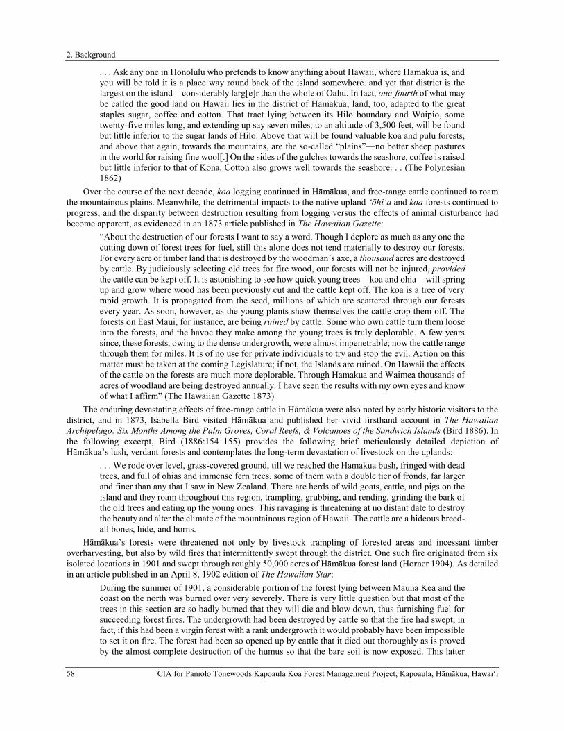
2. Background
58 CIA for Paniolo Tonewoods Kapoaula Koa Forest Management Project, Kapoaula, Hāmākua, Hawaiʻi
. . . Ask any one in Honolulu who pretends to know anything about Hawaii, where Hamakua is, and you will be told it is a place way round back of the island somewhere. and yet that district is the largest on the island—considerably larg[e]r than the whole of Oahu. In fact, one-fourth of what may be called the good land on Hawaii lies in the district of Hamakua; land, too, adapted to the great staples sugar, coffee and cotton. That tract lying between its Hilo boundary and Waipio, some twenty-five miles long, and extending up say seven miles, to an altitude of 3,500 feet, will be found but little inferior to the sugar lands of Hilo. Above that will be found valuable koa and pulu forests, and above that again, towards the mountains, are the so-called “plains”—no better sheep pastures in the world for raising fine wool[.] On the sides of the gulches towards the seashore, coffee is raised but little inferior to that of Kona. Cotton also grows well towards the seashore. . . (The Polynesian 1862)
Over the course of the next decade, koa logging continued in Hāmākua, and free-range cattle continued to roam the mountainous plains. Meanwhile, the detrimental impacts to the native upland ‘ōhi‘a and koa forests continued to progress, and the disparity between destruction resulting from logging versus the effects of animal disturbance had become apparent, as evidenced in an 1873 article published in The Hawaiian Gazette:
“About the destruction of our forests I want to say a word. Though I deplore as much as any one the cutting down of forest trees for fuel, still this alone does not tend materially to destroy our forests. For every acre of timber land that is destroyed by the woodman’s axe, a thousand acres are destroyed by cattle. By judiciously selecting old trees for fire wood, our forests will not be injured, provided the cattle can be kept off. It is astonishing to see how quick young trees—koa and ohia—will spring up and grow where wood has been previously cut and the cattle kept off. The koa is a tree of very rapid growth. It is propagated from the seed, millions of which are scattered through our forests every year. As soon, however, as the young plants show themselves the cattle crop them off. The forests on East Maui, for instance, are being ruined by cattle. Some who own cattle turn them loose into the forests, and the havoc they make among the young trees is truly deplorable. A few years since, these forests, owing to the dense undergrowth, were almost impenetrable; now the cattle range through them for miles. It is of no use for private individuals to try and stop the evil. Action on this matter must be taken at the coming Legislature; if not, the Islands are ruined. On Hawaii the effects of the cattle on the forests are much more deplorable. Through Hamakua and Waimea thousands of acres of woodland are being destroyed annually. I have seen the results with my own eyes and know of what I affirm” (The Hawaiian Gazette 1873)
The enduring devastating effects of free-range cattle in Hāmākua were also noted by early historic visitors to the district, and in 1873, Isabella Bird visited Hāmākua and published her vivid firsthand account in The Hawaiian Archipelago: Six Months Among the Palm Groves, Coral Reefs, & Volcanoes of the Sandwich Islands (Bird 1886). In the following excerpt, Bird (1886:154–155) provides the following brief meticulously detailed depiction of Hāmākua’s lush, verdant forests and contemplates the long-term devastation of livestock on the uplands:
. . . We rode over level, grass-covered ground, till we reached the Hamakua bush, fringed with dead trees, and full of ohias and immense fern trees, some of them with a double tier of fronds, far larger and finer than any that I saw in New Zealand. There are herds of wild goats, cattle, and pigs on the island and they roam throughout this region, trampling, grubbing, and rending, grinding the bark of the old trees and eating up the young ones. This ravaging is threatening at no distant date to destroy the beauty and alter the climate of the mountainous region of Hawaii. The cattle are a hideous breed-all bones, hide, and horns.
Hāmākua’s forests were threatened not only by livestock trampling of forested areas and incessant timber overharvesting, but also by wild fires that intermittently swept through the district. One such fire originated from six isolated locations in 1901 and swept through roughly 50,000 acres of Hāmākua forest land (Horner 1904). As detailed in an article published in an April 8, 1902 edition of The Hawaiian Star:
During the summer of 1901, a considerable portion of the forest lying between Mauna Kea and the coast on the north was burned over very severely. There is very little question but that most of the trees in this section are so badly burned that they will die and blow down, thus furnishing fuel for succeeding forest fires. The undergrowth had been destroyed by cattle so that the fire had swept; in fact, if this had been a virgin forest with a rank undergrowth it would probably have been impossible to set it on fire. The forest had been so opened up by cattle that it died out thoroughly as is proved by the almost complete destruction of the humus so that the bare soil is now exposed. This latter
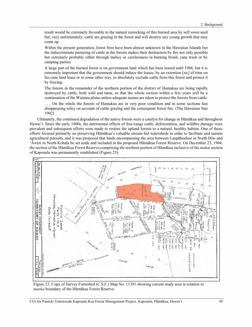
2. Background
CIA for Paniolo Tonewoods Kapoaula Koa Forest Management Project, Kapoaula, Hāmākua, Hawaiʻi 59
result would be extremely favorable to the natural restocking of this burned area by self sown seed but, very unfortunately, cattle are grazing in the forest and will destroy any young growth that may come up. Within the present generation, forest fires have been almost unknown in the Hawaiian Islands but the indiscriminate pasturing of cattle in the forests makes their destruction by fire not only possible but extremely probably either through malice or carelessness in burning brush, cane trash or by camping parties. A large part of the burned forest is on government land which has been leased until 1906, but it is extremely important that the government should induce the lessee, by an extention [sic] of time on his cane land lease or in some other way, to absolutely exclude cattle from this forest and protect it by fencing. The forests in the remainder of the northern portion of the district of Hamakua are being rapidly destroyed by cattle, both wild and tame, so that the whole section within a few years will be a continuation of the Waimea plains unless adequate means are taken to protect the forests from cattle. . . . On the whole the forests of Hamakua are in very poor condition and in some sections fast disappearing soley on account of cattle grazing and the consequent forest fire. (The Hawaiian Star 1902)
Ultimately, the continued degradation of the native forests were a catalyst for change in Hāmākua and throughout Hawai‘i. Since the early 1800s, the detrimental effects of free-range cattle, deforestation, and wildfire damage were prevalent and subsequent efforts were made to restore the upland forests to a natural, healthy habitat. One of these efforts focused primarily on preserving Hāmākua’s valuable stream-fed watersheds in order to facilitate and sustain agricultural pursuits, and it was proposed that lands encompassing the area between Laupāhoehoe in North Hilo and ‘Āwini in North Kohala be set aside and included in the proposed Hāmākua Forest Reserve. On December 23, 1904, the section of the Hāmākua Forest Reserve comprising the northern portion of Hāmākua inclusive of the makai section of Kapoaula was permanently established (Figure 23).
Figure 23. Copy of Survey Furnished (C.S.F.) Map No. 11391 showing current study area in relation to mauka boundary of the Hāmākua Forest Reserve.

2. Background
60 CIA for Paniolo Tonewoods Kapoaula Koa Forest Management Project, Kapoaula, Hāmākua, Hawaiʻi
A Concise History of the Honoka‘a Sugar Plantation
Following the signing of a reciprocity treaty between the Kingdom of Hawai‘i and the United States of America just three years later in 1876, sugarcane plantations developed and spread rapidly throughout the islands (Fong et al. 2005). Hāmākua’s rich soil and plentiful water supply made it the premier location for growing sugar on the island of Hawai‘i (Hazlett et al. 2007). The dawn of a new industry was born that year in Hāmākua, and nearly 200 acres of cane was being cultivated by the Honoka‘a Sugar Plantation, the forerunner to what would eventually become the Honokaa Sugar Companyin 1878:
HAMAKUA, HAWAII,—A correspondent, traveling on Hawaii, thus writes about this district: “For agricultural pursuits and new enterprises, Hamakua offers the most promising inducements. It possesses any quantity of fertile land. Coffee, cotton, corn, wheat, oats, are produced to perfection, and at Honokaa Plantation I saw some of the prettiest cane-fields to be found anywhere. The right principle is being pursued here—one party plants and another manufactures on equal shares. There is now about 170 acres of cane growing which will be ready for the mill at the end of the present year. There is room for a dozen plantations in this beautiful district.” (The Pacific Commercial Advertiser 1876)
Between 1876 and 1888, twenty sugar plantations sprang up along the Hāmākua coastline (Dorrance and Morgan 2000). The fields were originally unirrigated and for twenty-five years ratoon crops were grown in many areas because reaching the fields to replant was difficult. Eventually harvesting was accomplished using a combination of hand labor, flumes, and railroad (Dorrance and Morgan 2000). An 1877 account published in The Pacific Commercial Advertiser elucidates upon the newly blossoming sugar industry, and illustrates the district’s exceptional agricultural potential for not only the continued exploitation of the flourishing cane fields, but also for its capacity to support a large populace:
The District of Hamakua may become a most productive district. In commenting on lands we have spoken of them as sugar lands, as that will doubtless be the staple product; but there is almost no land that is not cultivatable, and everywhere the fruits of the tropics and many of the temperate zone can be raised. . . The fact that most all the finest lands back of the district are held by graziers, whose immense herds are already making inroads upon them, is full of danger to the prosperity of Hamakua, which should at any cost be saved from the fate of Waimea. The law under which the Commision acts, provides that cultivated lands should be taxed for improvements, but in a district like this it would be manifestly unjust that the small amount of cultivated land should pay taxes while the great bulk of the lands more valuable should escape because their proprietors fail to develop them; and your Commissioners would suggest that lands capable of cultivation should bear their taxation according to their value, as otherwise an unfair discrimination is made against industry and enterprise. Here, as elsewhere, the great requisite is population,—people to develop the resources of the district which ought to sustain a population of 10,000 in easy circumstances. Where mills are established on the factory principle of grinding for cultivators of small tracts, every encouragement should be given and aid extended in the way of the improvements suggested. As to the amount of land capable of cultivation, there are doubtless many thousands of acres, but in the absence of accurate surveys no estimate can be made. There is doubtless sufficient cane land to raise sugar cane enough for ten to fifteen mills. . . . As in the case of Hamakua District, good lands are spoken of as cane lands or coffee lands; but these lands are adapated to the cultivation, in many places, of oranges, limes and other fruits. Forests of Sumach are growing wild, and as this has been said to be the Sumach of commerce. . . The Districts of Hilo and Hamakua should support a population of 30,000 to 40,000, and the Commission are of opinion that the expense of introducing immigrants and inducing the settlement of these districts by the improvements suggested, will be fulling returned to the Government in the increasing revenues of the districts. (The Pacific Commercial Advertiser 1877)
By 1883 the Honokaa Sugar Company was prospering, having produced roughly 1,200 tons of sugar: From Mana to Honokaa, twelve miles, one rides two-thirds of the distance through a dead forest with an occasional glimpse of verdure in the form of living ferns; this changes suddenly to the very reverse, the native trees and vines look fresher by contrast, the grass is long and luxuriant, the cattle seem to be the picture of health and some native birds are overhead. I was told that from twelve to fifteen varieties of native woods may be found here, including the sandal wood which is becoming very scarce: most of these woods are specially adapted for making furniture. Honokaa is naturally

2. Background
CIA for Paniolo Tonewoods Kapoaula Koa Forest Management Project, Kapoaula, Hāmākua, Hawaiʻi 61
hilly with precipitous cliffs, some two hundred feet high, on the coast line. About 1,500 acres of land are utilized for growing cane which is manufactured at the Honokaa mill, which will produce this year 1,200 tons of sugar. The climate of Hamakua is very healthy, being tempered by the trade winds in the day time and by cool land breezes at night. Coffee and tobacco grow wild, but are not cultivated to any extent. Of fruits may be found the loquat, mango, orange, lime, citron, lemon, banana, breadfruit, tamarind, mountain apple and guava. . . (Buckland 1883)
Although many of the early agricultural pursuits attempted in Hāmākua were surmised to have been potentially “well nurtured by the plantation interests,” most fell victim to the dominant sugar industry that reigned over Hāmākua (Hilo Tribune 1905). However, although sugarcane interests held monopoly in the district, the thriving industry was not exempt from adversity. Incessant timber overharvesting and continued livestock trampling of forested areas continued to plague the district, generating a serious predicament for the Honokaa Sugar Company:
Manager Watt of Honokoa [Honoka‘a] plantation, Hamakua, Hawaii, writes to the Bureau of Agriculture concerning the deforestation that is going on in his district. He complains that the wild cattle and the Portuguese homesteaders living there, combined, are completely destroying the trees, and, unless something is done to stop this destruction, forests in Hamakua will be things of the past. The rainfall is getting less and less every year, and the plantation managers and owners are getting scared. (The Hawaiian Star 1893)
The current study area was not part of any sugar plantation, but instead became part of Parker Ranch. However, the seaward portions of Kapoaula (up to 1,400 feet elevation) are noted as the Kukuihaele Plantation Cane Fields for the Honokaa Sugar Company (Figure 24). Lands cultivated in sugarcane extended from Kahaupu Gulch between the ahupua‘a of Pā‘auhau and Kaao northeast of the study area, all the way to the edge of Waipi‘o Valley. As the sugar industry bloomed in the Honoka‘a region, the need for water to irrigate the fields and to transport cane via flumes were conceived and in 1889, the route for the proposed Upper Hāmākua Ditch was mapped (Figure 25). By the end of the 19th century, the Hamakua Ditch Company begun construction of an Upper Hāmākua Ditch to water the sugarcane fields in the area.
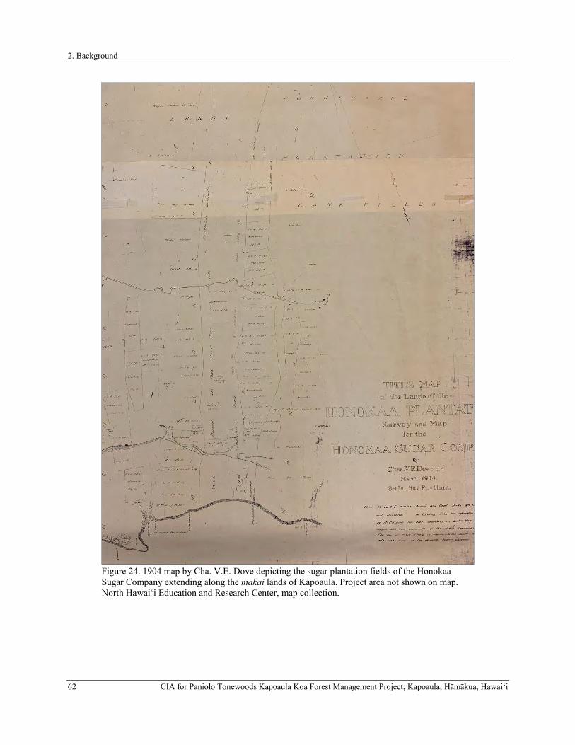
2. Background
62 CIA for Paniolo Tonewoods Kapoaula Koa Forest Management Project, Kapoaula, Hāmākua, Hawaiʻi
Figure 24. 1904 map by Cha. V.E. Dove depicting the sugar plantation fields of the Honokaa Sugar Company extending along the makai lands of Kapoaula. Project area not shown on map. North Hawai‘i Education and Research Center, map collection.

2. Background
CIA for Paniolo Tonewoods Kapoaula Koa Forest Management Project, Kapoaula, Hāmākua, Hawaiʻi 63
Figure 25. 1889 map showing the proposed route for the Upper Hāmākua Ditch by J. M. Lydgate with project area outlined in red. North Hawai‘i Education and Research Center, map collection.
The ditch, which brought water from Kawainui Stream in the Kohala Mountains to the Honoka‘a Plantation and beyond was completed in August of 1907 (Wilcox 1996). Charles Wickliffe Baldwin published a detailed description of Hāmākua in the Geography of the Hawaiian Island in 1908, and describes the Upper Hāmākua Ditch as well as the particulars of watering and transporting cane:
Hamakua.—Outside of the Waipio region Hamakua has no running streams, or even springs. This is due to the abrupt slope of this part of the island, which allows the water to run off readily, and to the fact that the gulches run up towards the Waimea plateau, thus having no good watershed back of them. Two ditches have been recently constructed, bringing the Waipio water upon the Hamakua lands. The plantations nearest the gulch use this water for irrigating and fluming their cane, and a portion is used for establishing waterworks for the different villages. Thus great changes have been brought

2. Background
64 CIA for Paniolo Tonewoods Kapoaula Koa Forest Management Project, Kapoaula, Hāmākua, Hawaiʻi
about in this district, for, while rain is abundant as a rule, at times there are severe droughts, when water is very scarce. Owing to the lack of streams of water and to the abrupt slope, the plantations of Hamakua have had great difficulty in finding means for transporting their cane to the mills. Kukaiau has constructed a complete system of trolley cables. The cane is tied up in bundles and fastened to a trolley which is then placed upon the wire, and so it glides swiftly to the mill. Paauilo has accomplished the difficult task of laying a railroad up through its fields. The other plantations of the district have built railroads out on either side of the mill, sending the cane down to these tracks by gravity roads or flumes. . . . . . Each mill has its own landing. The sugar is swung out to the boat or vessel by means of a derrick which is operated by a donkey engine. In rough weather these landings cannot be used at all. Next to Kona Hamakua is the chief coffee district of Hawaii. One of the finest coffee estates of the group is in this distrct, at Kalopa, above Paauhau—the Louisson Plantation. It is said that the trees of this plantation bear so heavily that when the berries are ripe, it appears as if a red blanket were spread over the field. The largest place in Hamakua is Honokaa. Paauhau, Paauilo, Waipio, and Kukuihaele are important places as well. (Baldwin 1908:69–71)
In 1909, the Hamakua Ditch Company became the Hawaiian Irrigation Company, and under that name work began on a second ditch, the Lower Hāmākua Ditch, which carried water from Waipi‘o Stream to the Honokaa Sugar Plantation and beyond. The Lower Hāmākua Ditch was completed in 1910 (Wilcox 1996). A 1909 map shows a network of tunnels, flumes, various ditches, reservoirs, the Old Māmalahoa Highway, and the alignment of the Lower Hāmākua Ditch in the makai portion of Kapoaula, and illustrates the relationship between the Honoka‘a Sugar Plantation lands in the makai portion of the ahupua‘a and the more mauka Parker Ranch lands that comprise the entirety of the current study area (Figure 26).
In 1928, the administration of the Honokaa Sugar Company and the Pacific Sugar Mill was brought under one manager. The partial merger was a success and soon yielded a ten-fold increase in production compared to the original harvest (Dorrance and Morgan 2000; Kalima 1993). A year later in 1929, the Honokaa Sugar Companybegan utilizing the Pacific Sugar Mill’s Kukuihaele Landing to direct ship raw sugar to San Francisco, and continued to use it until it was shut down during World War II (Dorrance and Morgan 2000). Following the war, after the 1946 tsunami destroyed the railroad rendering it inoperable, shipment resumed from Kukuihaele Landing until 1949 when bulk sugar began to be shipped via trucks for export from the port of Hilo (ibid.). In 1951, Theo Davies bought F.A. Schaefer & Company in order to acquire Honokaa Sugar Company. In 1972, Davies purchased Paauhau Sugar Company and merged it with Honokaa Sugar Company. And in 1979, the Honokaa Sugar Company was merged with Laupāhoehoe Sugar Company to form Davies’ Hamakua Sugar Company, which in 1984 was purchased by Francis Morgan who dropped Davies from the name and created Hamakua Sugar Company. Hamakua Sugar Company operated from 1984 until 1993, when the fields were harvested for the last time and the 36,000-acre plantation shut down for good.

2. Background
CIA for Paniolo Tonewoods Kapoaula Koa Forest Management Project, Kapoaula, Hāmākua, Hawaiʻi 65
Figure 26. Portion of 1909 Hawai‘i Registered Map No. 2640 by A.J. Williamson showing the study area within the lands of Parker Ranch and the lands of Honokaa Sugar Companyand Pacific Sugar Mill.

2. Background
66 CIA for Paniolo Tonewoods Kapoaula Koa Forest Management Project, Kapoaula, Hāmākua, Hawaiʻi
The Development of the Government Road (Alanui Aupuni) in Hāmākua and Land Use in the Study Area During the Early to Late Twentieth Century
The effects of disease and outmigration combined with changes in land tenure and the economy that occurred in Hāmākua during the middle of the 19th century ultimately led to a transition in conventional transportation methods. Initially, early mauka-makai trail systems served as idealized route of travel that, during the Precontact to early Historic Period, theoretically provided an important network that facilitated supplemental inter-ahupua‘a commodity exchange between coastal communities and upland regions (Mills 2002). Maly (2001)) relates that typically these alahele (trails) were referred to as “ala pi‘i uka or ala pi‘i mauna (trails which ascend to the uplands or mountain)”. Within Kapoaula and the current study area, a single mauka-makai trail is present which is referred to on historical maps as alanui pii uka i ka mauna (see Figures 14 and 15). Additionally, a short segment of a mauka-makai trail (alanui o Honokaia) belonging to the adjacent ahupua‘a of Honokaia intrudes slightly into the northeastern portion of the study area.
The earliest published depiction of a trail from Hilo to Hāmākua was published in the Pacific Commercial Advertiser on February 17, 1859 (Figure 27). The route appears as a solid line extending northwest from Hilo into Hāmākua, and two diverging trail segments that proceed in a southwesterly direction towards Mauna Kea where it adjoins another trail leading from the eastern flank of Mauna Kea to Kawaihae. However, the scale of the map, which was drawn to show the progress of the lava flow from the Mauna Loa eruption, does not allow for any detailed information about the route. While the position of the trail is shown in very general terms, the basic route segment across through the eastern portion of Hāmākua appears to have persisted at least until the turn of the 20th century, when the Belt Road redirected traffic across Hāmākua.
Figure 27. Map of Hawai’i Island published in the Pacific Commercial Advertiser on February17, 1859, showing a trail extending from Hilo into Hāmākua (The Pacific Commercial Advertiser 1859).
2. Background
CIA for Paniolo Tonewoods Kapoaula Koa Forest Management Project, Kapoaula, Hāmākua, Hawaiʻi 67
The introduction of horses to Hawai‘i eased arduous, long-distance travel and facilitated access to “mission stations, landings, and key areas of resource collection” (National Park Service Ala Kahakai National Historic Trail 2009), and as a result, narrower footpaths such as early mauka/makai trail networks and the alaloa largely fell into disuse, being abandoned for straighter, leveler, and wider paths that could accommodate larger groups of people, horses and horse-drawn carts while providing a more direct destination trajectory (Mills 2002); thus, the concept of a western-style Government Road (Alanui Aupuni) was born. The importance of having a well-maintained transportation network in the islands was emphasized in the following excerpt from The Pacific Commercial Advertiser:
Overview of Road Laws and Development in the Kingdom of Hawai‘i (1840-1857) Roads are the most accurate tests of the degree of civilization in every country. Their construction is one of the first indications of the emergence of a people from a savage state, and their improvement keeps pace with the advance of a nation in wealth and science. They are the veins and arteries through which flow the agricultural productions and commercial supplies, which are essential for the prosperity of the state. Agriculture is a great measure dependent upon good roads for its success and rewards. The history of road making in this kingdom does not date far back. The first law that we find recorded was enacted in 1840, which as well as the laws of 1846 and 1850 gave to the Governors a general control of the roads, with power to make new roads and employ prisoners in their construction. But no system of road making has ever been introduced, and the whole subject has been left to be executed as chance dictated. In 1852, road supervisors were made elective by the people, at the annual election in January. This change worked no improvement in the roads, as the road supervisors, in order to remain popular, required the least possible amount of labor, and in many districts an hour or two of work in the morning was considered as a compliance with the road law. Under this law the road supervisors were pretty much to themselves, and although accountable to the Minister of the Interior, they considered favor of their constituents of more importance. This law was found productive of more evil than good, and during the last session of the legislature a new road law was passed, which goes in to force on the 1st of January 1857. This new law gives to the Minister of the Interior the appointment of road supervisors throughout the Kingdom, who are subject to such general instructions (we suppose in regard to the construction of roads) as he may issue. . . (in Maly 1999:66)
Generally the condition of the late-19th century roadways on Hawai‘i Island left much to be desired, particularly in Hāmākua. Historic accounts of the old road leading from Waimea to Hilo through Hāmākua often characterize it as a perilous journey over rugged, meandering terrain along dangerous, flood-prone mountainous contours and chasms. The following excerpt elaborates on the district’s need for a formal road:
. . . I have thus particularized Hamakua as being not only one of the largest and most valuable districts, but as the one most in need of an outlet. The same drawback to the advancement of the country from the want of good roads is evident throughout the island, although in some districts where the face of the country is more favorable, and the people more thickly settled, and public spirited perhaps, the roads will be found in much better order, yet there is plenty of room for improvement. (The Polynesian 1862)
In prospecting Hāmākua for land suitable for development, a report was made by the Royal Commissioners on Development of Resources. Formed by King David Kalākaua in 1877, commissioners conducted examinations of lands along the Hāmākua/Hilo coastline and consulted with residents in an effort to learn about needs and natural resources. On February 27, 1877, Hāmākua was examined for its agricultural potential, and the following report summarizing the poor road conditions near the current study area was published in The Pacific Commercial Advertiser:
. . . The land of Kapulena is rough and stony on the lower part, though above the road it has several hundred acres of fair land for cane or coffee. . .The land is rolling, not so level as generally represented, and the Government road is an illustration of the folly of appointing incompetent road-makers and supervisors. There are no insuperable obstacles to the construction of a good cart road from Waipio to Paauhau, and it should be built. All the roads in the district show shameful neglect. (Carter et al. 1877)
In the last quarter of the 19th century, repairs of the existing Hāmākua-bound wagon roadway, particularly through the gulches, were proposed and it was recommended that a safer government-appropriated road providing access to

2. Background
68 CIA for Paniolo Tonewoods Kapoaula Koa Forest Management Project, Kapoaula, Hāmākua, Hawaiʻi
landings be constructed (The Pacific Commercial Advertiser 1878). The arduous journey along this road from Hilo to Hāmākua was further detailed by Dutton (1883:169):
Waimea is a starting point from which a journey may easily be made to the eastern coast in the district of Hamakua. This district is certainly one of the most curious in the world, and indeed its features could barely exist elsewhere than in a tropical island situated within the trade-wind belt. The slopes of Mauna Kea, descending at first swiftly—afterwards more gently—toward the sea, are suddenly terminated on the coat by cliffs ranging from 100 or 200 to 700 or 800 feet in height. These coastwise cliffs are exceedingly steep, approaching in many places the vertical, and plunging at once into water of considerable depth. Here the coast receives the full brunt of the long steady swell of the Pacific, rolling for thousands of miles before the powerful trade-wind. The erosive action of the sea-waves is probably as efficient here as in any part of the world, for it is very powerful and unremitting. That the waves have eaten into this coast for several miles does not seem to be in the least degree doubtful. The slopes leading inland from the crest of this cliff are for several miles very moderate, hardly exceeding 300 feet to the mile, suggesting a gently sloped and slightly diversified platform. This platform is deeply scored by a surprising number of large ravines, so abrupt that in many portions they may well be called canons. Their sides have slopes varying from thirty to forty-five degrees, and have sometimes a greater angle of acclivity. The number of these is very great, and they occur at intervals averaging a little more than half a mile. Along the coast between Hilo and Kohala and within a distance of about forty miles there are nearly seventy of these ravines, reckoning both great and small. A land journey coastwise through this Hamakua district would be quite impossible, had not a very fair horse-trail been excavated with much labor and expense. This trail could not have been built along the margin of the sea because the deep water washes the face of a vertical cliff. it could not have been easily built far inland on account of the jungle and quagmire. There was no better way than to descend and ascend every one of these sixty or seventy ravines by zigzag courses dug out of the sides of the ravine walls. The only difficulty is the great labor and exhaustion which they entail upon the pack-animals. A man can go easily up and down on foot leading his horse without the slightest sense of insecurity and with no more fatigue than would be incident to ascending and descending a very long series of stairways, but the pack-animal must carry his burden.
As the primary transportation artery for the island, the road leading through the Hāmākua District required strict maintenance to remain safe and operable. Over the course of the next two decades, the poor and unsafe condition of the road appears to have improved steadily, as attested to by an anonymous correspondent in 1889:
MR. EDITOR: Having had occasion to ride over a certain part of our Hamakua Government road, and contrasting their present state to the nonentity of a Government road heretofore, I would wish to make a few remarks. Our district of Hamakua, Hilo excepted, is probably as serrated a landscape as any on the Hawaiian Islands—it is literally a mass of hills and hollows. A few months ago it was almost an impossibility to drive over the road for a distance of six or eight miles. Now, thanks to the energetic work of our Road Board, we can easily gallop over our heretofore serrated hills and mud-bound hollows, passing over them as a vista of the past. It is strange, but still an undeniable fact, that our road supervisors in times past did not attend to our roads; possibly on account of no money or probably too much. A year ago should anyone have alluded to the possibility of a carriage running over our roads, the matter would be simply derided. Now, we can ride in carriages or gallop on horseback through Hamakua as easily as on the Island of Oahu. We can meet the energetic enterprise of our Road Board with grateful thanks, and we can also commend Mr. J.R. Mills (who has given much of his unoccupied time to the interests of our Hamakua Road Board), to strangers and friends who may possibly pass through our district, and who may make remarks about our recent improvements and our hitherto impassible roads. He will assuredly tell them that through the energetic endeavors of J.M. Horner at Kukaiau, of W.H. Rickard at Honokaa, and W. Horner at Kukuihaele (these gentlemen forming our Road Board) has ben consummated the reality of a pleasant carriage drive through Hamakua. Mr. Mills has had charge of most of the roads, and should these gentlemen have full power to act we firmly believe in two or three years there would be no difficulty in driving a steam road engine through our heretofore almost impassible district. (The Hawaiian Gazette 1889)

2. Background
CIA for Paniolo Tonewoods Kapoaula Koa Forest Management Project, Kapoaula, Hāmākua, Hawaiʻi 69
In 1881, Lieutenant Henry Whalley Nicholson sailed to Hawai‘i and visited the Hāmākua District. In his uncomplicated and candid narrative, Nicholson (1881:194) provided a succinct statement regarding the atrocious state of the road conditions, and specified that although “this tract of land [Hāmākua] has fine grazing qualities, and is well adapted to the cultivation of cane and coffee: but the few roads are execrable, and means of transport laborious”. However, by 1894, the Hāmākua road was described as being in “pretty fair condition, better than it ever was” (The Hawaiian Gazette 1894a). By this time, the Government was being petitioned to “put the prisoners at work on the Hamakua and Hilo Government roads” (The Hawaiian Gazette 1894b), and over the course of the next few years the development of the Hāmākua roadway in the stretch between Hilo, Honoka‘a, and Waipi‘o continued. In January 1898, $2,500.00 of government funds were appropriated for Hāmākua roadwork and $22,000.00 for the “re-grading main road and roads to landings” (Dole 1898:116).
By the end of the 19th century a “new” road to Waimea (the Old Government Road now currently known as the Old Māmālahoa Highway) was constructed across Kapoaula Ahupua‘a, forming the makai boundary of the current study area. However, over the next decade the growing exacerbation of many Hāmākua residents over the poor condition of the Government Road persisted, and in 1907 improvements to the road practically ceased altogether except for general patching repairs. A series of complaints raised by Honoka‘a community members culminated in May of that year in the reproach of road supervisor Samuel Kamae, Sr., criticizing him for his incompetency. However, William N. Purdy, a member of the Board of Supervisors for Hāmākua, contended that it was not Kamae’s incompetency that resulted in the poor condition of the road but rather the funding, manpower, and severe weather conditions that resulted in landslides.
Hāmākua visitor, American author Henry Kinney (1913:36), published an account of his journey through Hāmākua during the early 1900s in his book titled The Island of Hawaii. Kinney’s narrative acts as a virtual expedition through the district and includes a concise description of roadways (including the Old Government Road) in the vicinity of the study area:
From the north end of the village [Honoka‘a] a section of the belt road leads, through the AHUALOA homesteads, to Waimea (Kohala). The government road also runs northward, through the Honokaa cane fields, past the KAPULENA village. Beyond this several roads branch from it. AT a junction of two roads, from mauka, with the main road, a short distance above a reservoir, the south branch road is merely a plantation road of no purport to the traveler. The north branch joins Mud Lane further mauka (thus leading to Waimea). The same is the case with the next mauka branch road. Further on, by a warehouse, a road leads makai to the Kukuihaele landing.
A 1909 map (Hawai‘i Registered Map No. 2640) prepared by A.J. Williamson shows the location of the “new” road to Waimea (the Old Government Road/Old Māmalahoa Highway), a network plantation-related infrastructure associated with the Honoka‘a Sugar Plantation lands in the makai portion of Kapoaula and the Parker Ranch lands that encompass the mauka portion of the ahupua‘a including the current study area (see Figure 26).
Over the years, the state of the Old Government Road fell into deterioration, and by 1912 it was said to be “practically impassable for automobiles” (The Honolulu Advertiser 1912). Substantial changes to the area surrounding the study parcel began shortly thereafter with the formal development of the Old Māmalahoa Highway, which was constructed in the early 1900s and served as the primary Waimea-Hilo connector route (Figure 28). The condition of the roadway (identified in the general vicinity of the study area as the “Ahualoa” Road) was chronicled by a party of legislators and senators from Kaua‘i, O‘ahu, and Maui in 1925 during a jaunt from Hilo to Waimea:
The party had a late luncheon at Honokaa, later, while enroute to Waimea, inspecting the Ahualoa road. A resolution offered by Silva in the house recently asked that the work on this road be examined. Completed, only four months ago, the surface of the road shows already woeful deterioration and disintegration. It is charged the road will not last the life of the public loan bonds, the proceeds of which were used in its construction. (The Honolulu Advertiser 1925)
A later map that depicts only the makai portion of the current study area (Hawai‘i Registered Map No. 2761 prepared by Chas. L. Murray in 1927), shows that the road to Waimea (labeled “Government Road”) which is coterminous with the northern boundary of the study area, was realigned during the first quarter of the 20th century (Figure 29). Dates of construction for the bridges fronting the survey area along the current alignment of the Old Māmalahoa Highway indicate that the realignment occurred in 1924 (MKE Associates LLC and Fung Associates, Inc. 2013).
Due to the tough road conditions on the driver and automobile, the use of the Old Government Road was short lived, and the Government decided to begin construction on a wider, more improved road. The new Belt Road (Highway 19) as it passes through Hāmākua was finished in 1933 and passes makai of the study area. A description

2. Background
70 CIA for Paniolo Tonewoods Kapoaula Koa Forest Management Project, Kapoaula, Hāmākua, Hawaiʻi
of the new Belt Road was provided in an article in the July 1933 edition of The Friend newspaper, below is an excerpt from the article about the road finishing ceremony:
“The formal opening of the new belt road on the island of Hawaii, July 22, 1933, was an important occasion, attended by the Governor and his party from Honolulu and many excursionists. The proposal has been made that the new road be named “Mamalahoe,” commemorating the famous edict by King Kamehameha I, “the Law of the Splintered Paddle” making Hawaii’s highways safe for the traveler. A colorful celebration on Saturday was followed by a unique service of worship in the historic Kailua Church the following day. A sermon by the Rev H. P. Judd, broadcast by radio throughout the islands, was a feature of this service. . .” (The Friend Vol. CIII, No. 7, July 1933:147)
Incremental improvements to the Belt Road continued for the next four decades, with the new road closely mirroring the Old Government Road in many sections. According to Ruzicka (2010:6):
Except for this stretch [Hilo to Pā‘auilo], the belt road through Hamakua in the 1920s generally followed the same positioning as the railroad tracks only from Hilo northward to the area of Ookala. Here the roadway diverted inland along Kaula Gulch and then ran bout a mile inland of the shore to Paauilo. The path of the roadway angled slightly more inland the further up the coast from Paauilo it went, being about 1 ½ mile inland at Honokaa.
The section of Hawai‘i Belt Road extending between Honoka‘a and Waimea was completed in 1964, thereby allowing more direct access between the two locales (The Honolulu Advertiser 1964). For the remainder of the 20th century, the current study area was used almost exclusively as pasture. One exception to this was an experimental planting of tropical ash (Fraxinus sp.) trees in the central portion of the study area. More than 1,500 acres of tropical ash were planted in Hawai‘i beginning in 1924 (Whitesell et al. 1971). Information concerning the planting of this stand could not be located, but it is possible that the stand was planted in ca. 1930 by the Civilian Conservation Corps (CCC).
The stand of trees is also depicted on a 1951 Plat Map (Figure 30) of the parcel. This map also shows in detail the ranching infrastructure in the study area and the survey markers used to produce the survey. Survey markers shown include three concrete posts at parcel boundary corners and the “Kamakaukuapuu” triangulation station near the parcel’s western boundary makai of the ash stand. Ranching infrastructure includes a waterhole in the upper and lower portions of the study area and a network of cattle trails connecting these waterholes with others outside the current study area. This cattle trail network contrasts with the distinctly linear routes of the Alanui pii uka i ka mauna and the Alanui o Honokaia depicted on maps from a century before (see Figures 14 and 15). Although it is possible to follow the cattle trails in a mauka-makai direction, they do not appear to follow either of the older trails very closely. The tropical ash stand in also depicted, as is a gravel pit straddling the Old Māmalahoa Highway at the northern boundary of the study area. Based on aerial photographs taken in 1954 (Figure 31), the stand of trees was well established by mid-century, and these two features are also visible on the 1957 USGS quadrangle map (Figure 32). After being under ownership of Parker Ranch for over 135 years, the current study area was sold to the current landowner, Siglo Forest LLC, on March 2, 2018, and the entirety of the parcel has remained as undeveloped pasture throughout the twentieth century (Figure 33) and into the present day.

2. Background
CIA for Paniolo Tonewoods Kapoaula Koa Forest Management Project, Kapoaula, Hāmākua, Hawaiʻi 71
Figure 28. Portion of 1916 Waipio USGS quadrangle map with study area indicated in red.

2. Background
72 CIA for Paniolo Tonewoods Kapoaula Koa Forest Management Project, Kapoaula, Hāmākua, Hawaiʻi
Figure 29. Portion of 1927 Hawai‘i Registered Map No. 2761 by C.L. Murray showing portion of current study area and Kapoaula Ahupua‘a.
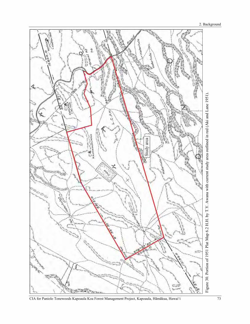
2. Background
CIA for Paniolo Tonewoods Kapoaula Koa Forest Management Project, Kapoaula, Hāmākua, Hawaiʻi 73 Fi
gure
30.
Por
tion
of 1
951
Plat
Map
6.2
H.H
. by
T.Y
. Aw
ana
with
cur
rent
stud
y ar
ea o
utlin
ed in
red
(Aki
and
Lan
e 19
51).

2. Background
74 CIA for Paniolo Tonewoods Kapoaula Koa Forest Management Project, Kapoaula, Hāmākua, Hawaiʻi
Figure 31. September 28, 1954 USGS aerial photograph of the study area (outlined in red).
Figure 32. Portion of 1957 Kukuihaele USGS quadrangle map showing stand of tropical ash trees (shaded green) (United States Geological Survey 1957).

2. Background
CIA for Paniolo Tonewoods Kapoaula Koa Forest Management Project, Kapoaula, Hāmākua, Hawaiʻi 75
Figure 33. January 7, 1977 USGS aerial photograph of the study area (outlined in red).
Figure 34. Portion of 1982 Kukuihaele USGS quadrangle map showing stand of tropical ash trees (shaded light green), water tank, and quarry site in study area (outlined in red).

2. Background
76 CIA for Paniolo Tonewoods Kapoaula Koa Forest Management Project, Kapoaula, Hāmākua, Hawaiʻi
SUMMARY OF ARCHAEOLOGICAL AND CULTURAL STUDIES CONDUCTED IN
THE VICINITY OF THE STUDY AREA
Very few formal archaeological studies have been conducted in the immediate vicinity of the current study area, although Cordy (1994) prepared A Regional Synthesis of the Hāmākua District, Island of Hawai‘i, in which he summarizes the general Precontact and early Historic land use patterns of the region (including the lands of the study area) in an effort to provide a predicative archaeological model for the district. The most relative and proximate of these studies are presented in Table 4 and Figure 35 and are summarized below.
Table 4. Archaeological studies conducted for Kapoaula and of general vicinity. Year Author(s) Type of Study Ahupua‘a 1994 Cordy Regional Synthesis Various 1999 Cleghorn Inventory Survey 2005 Fong et al. Literature Review, Field Check, Cultural Impact Evaluation Honokaia 2009 Rechtman Archaeological Survey and Limited Cultural Assessment Honokaia 2015 Clark et al. Inventory Survey Honokaia 2019 Kepa‘a and Barna Archaeological Assessment Kapoaula
Previous Archaeological Studies Conducted in the Vicinity of the Current Study Area
In A Regional Synthesis of the Hāmākua District, Island of Hawai‘i, Dr. Ross Cordy (1994) summarizes the general Precontact and early Historic land use patterns for the subregion of East Hāmākua, which includes Kapoaula Ahupuaʻa (Cordy 1994). The summary is based on a review of Māhele records and a detailed examination of archival historical information. Cordy (1994) defines four general environmental zones within East Hāmākua: (1) the Sea-shore, (2) the Seaward Upland Slopes, (3) the ‘Ōhi‘a-Koa Forest Zone, and (4) The Gulches. The current study area is located just above the Seaward Upland Slopes within the ‘Ōhi‘a-Koa Forest Zone. The Seaward Upland Slopes was the primary farming and residential zone of East Hāmākua. House sites in this zone were common between the sea cliffs and the cross-island trail (near the present-day Highway 19). Garden plots (māla, kīhāpai, and kula), which were generally non-irrigated, tended to be located in close proximity to the house lots. In the mauka regions of this zone, some scattered fields were present that were not associated with permanent residences. Dryland kalo was the dominant crop of The Seaward Upland Slopes, but sweet potatoes and bananas were also commonly grown (Cordy 1994).
In the ‘Ōhi‘a-Koa Forest Zone, the Precontact and early Historic peoples of East Hāmākua utilized the natural resources of the forest. Activities in this zone included gathering bark to make fishing nets, collecting māmaki to make kapa, and catching birds for their feathers. At lower elevations within the ‘Ōhi‘a-Koa Forest Zone small plantings of supplemental crops such as bananas and kalo were also present. Habitation in this zone typically occurred at caves and campsites that were occupied for short durations of time (Cordy 1994).
Cleghorn (1999) conducted an Archaeological Inventory Survey (AIS) at Inoino Bridge located along the Old Māmalahoa Highway to the northeast of the current study area comprising TMKs: (3) 4-6-011:037 and 038 (see Figure 35). As a result of the study, four small caves (Caves 1, 2, 3, and 4) in the ‘Ōhi‘a-Koa Forest Zone were identified. The caves, which were all recorded under the State Inventory of Historic Places (SIHP) designation Site 21405, are located in Kawela Ahupua‘a along its boundary with Honokaia Ahupua‘a. Each of caves contained stone constructions including platforms, walls, and alignments. Cleghorn (1999) suggested that the platforms within three of the caves, based on their formal attributes, may have been Precontact burial monuments. However, no excavations or structural dismantling was performed during the survey to determine if human remains were indeed present within the stone structures. Cleghorn (1999) also recorded the Historic Inoino Bridge across Inoino Gulch, which was replaced by a new Inoino Bridge subsequent to the completion of the study.
In 2005, Fong et al. (2005) conducted a literature review, field check and cultural impact evaluation for approximately 2,500 acres of Department of Hawaiian Home Lands (DHHL) Lands in Honokaia Ahupua‘a (TMKs: (3) 4-6-011: 003, 011, 012, and 013), to the east/southeast of the current study area (see Figure 35). The literature review included a study of archival sources, historic maps, Land Commission Awards (LCAw.), and previous archaeological studies relative to Honokaia. These resources were used to construct a history of land use within the ahupua‘a. The field inspection, which included limited pedestrian survey and aerial survey, was conducted by two archaeologists over a span of three days. The inspection was intended to identify any surface archaeological features present within the 2,500 acres and to assess the potential impacts to any such features so that sensitive areas that might require further investigation or mitigation prior to any development could be dealt with. As a result of the field check a single archaeological site – a Historic wall, possibly a dam or gulch crossing – was recorded, but was not considered

2. Background
CIA for Paniolo Tonewoods Kapoaula Koa Forest Management Project, Kapoaula, Hāmākua, Hawaiʻi 77
significant and as such, was not assigned an SIHP site number. Two other structures, a corral and a quarry, were noted within the survey area, but were determined to lack archaeological or historical significance, as both were less than fifty years old. Fong et al. (2005) did not provide a map showing the location of any of the potential archaeological features identified. Site 21405, previously recorded by Cleghorn (1999) within Inoino Gulch, was also relocated and inspected by Fong et al. (2005), and a fifth cave (Cave 5) containing two crude, mounded walls was identified at the site. As a result of the inspection, it was determined that all five of the caves were located just beyond the boundaries of the study area. Given the absence of significant sites within the Fong et al. (2005) study area, it was concluded that the development of the area would have no effect on historic resources.
In 2009, Rechtman Consulting, LLC (Rechtman et al. 2009) conducted an archaeological survey and limited cultural assessment for a roughly 1.3 kilometer-long access road across three parcels northeast of the current study area (see Figure 35). The study involved a visual inspection of the access road corridor along the eastern boundary of Honokaia Ahupua‘a from Highway 19 to the Old Māmalahoa Highway and phone interviews with five individuals from the Honokaia ‘Ohana group. No archaeological resources of any kind were observed during the pedestrian survey, and no resources (landforms, vegetation, etc.) of a traditional cultural nature were present. The individuals interviewed for the study had no information regarding significant cultural places or practices that may have occurred within the study area and the only recollection of the area was that it was previously used for ranching. Given the negative findings of the study, Rechtman et al. (2009) concluded that development of the proposed access road route would not significantly impact any known historic properties or any cultural resources and practices of a traditional and customary nature. It was therefore recommended that no further historic preservation work or mitigation was needed.
In 2015, ASM Affiliates (Clark et al. 2015) conducted an AIS a portion of a portion of TMK: (3) 4-6-013:001-046 in Honokaia Ahupua‘a to the east/southeast of the current study area for the proposed installation of a gravity-fed non-potable water system and appurtenances in the Honokaia Pastoral Lots Subdivision (see Figure 35). As a result of the study, a single archaeological site (Temporary Site 1), consisting of a short alignment of stacked boulders and cobbles on the northeastern slope of an intermittent drainage channel, was identified near the northern boundary of the study area. The site was fully documented during the study, however it was concluded by Clark et al. (2015) that much like a similar alignment previously identified by Fong et al. (2005), the site retained no integrity and was therefore not considered to be significant. As such, it was not assigned an SIHP Site number.
An archaeological inventory survey of the roughly 564-acre subject parcel (TMK: (3) 4-7-007-011) was completed in 2019 by ASM Affiliates (Kepa‘a and Barna 2019) for the proposed Kapoaula Koa Forest Management Plan. Although no archaeological sites or other historic properties were identified within the current study area, a detailed cultural-historical background was prepared, which identified two trail routes. Efforts to identify the physical routes of the trails were made, however, it was found that extensive cattle trampling, erosion, and the incursion of pasture grass since the mid-19th century had obscured these trail routes, leaving no physical trace of their existence. Given the negative findings for archaeological resources, an archaeological assessment report was prepared, which concluded that the proposed project would not impact any known historic properties.

2. Background
78 CIA for Paniolo Tonewoods Kapoaula Koa Forest Management Project, Kapoaula, Hāmākua, Hawaiʻi
Figu
re 3
5. P
revi
ous a
rcha
eolo
gica
l and
cul
tura
l stu
dies
con
duct
ed in
the
vici
nity
of t
he st
udy
area
.

2. Background
CIA for Paniolo Tonewoods Kapoaula Koa Forest Management Project, Kapoaula, Hāmākua, Hawaiʻi 79
Cultural Studies Conducted for Kapoaula and General Vicinity
There have been five culturally-based studies conducted in the vicinity of the current study area that focused on Kapouaula Ahupuaʻa, the adjacent land divisions of Honokaia, Malanahae, Kapulena and Hauko‘i, and the general interior mauka lands of Hāmākua (Table 5 and Figure 35). While none of these studies identified impacts to cultural resources and practices within the study area, the information garnered as a result provides pertinent information regarding general traditional and historical land-use practices, modes of transportation, and cultural activities in the region. The findings of these studies are summarized below.
Table 5. Cultural studies conducted for Kapoaula and of general vicinity. Year Author(s) Type of Study Ahupua‘a 2001 Rechtman Archaeological survey and Limited
Cultural Assessment Āhualoa
2005 Fong, Shideler, and Hammatt Literature Review, Field Check and Cultural Impact Evaluation
Honokaia
2009 Rechtman and Clark Archaeological and Limited Cultural Assessment
Honokaia
2009 Rechtman Cultural Assessment Hauko‘i 2010 Terry Final Environmental Assessment Lauka, Kuliaha‘i,
Koloaha, and Ahualoa 2011 Escott and Spear Cultural Impact Assessment Malanahae, Kapoaula,
Kapulena, Waiʻaleʻale 1st and 2nd, Niupuka, and
Hanapai
The earliest cultural study was conducted in 2001 by Rechtman Consulting, LLC (Rechtman 2001) as part of an Environmental Assessment (EA) associated with the placement of water tanks at two locations in the Āhualoa Homesteads (see Figure 35). The scope of the study concentrated on identifying cultural sites, past and ongoing traditional and Hawaiian activities, and included an examination of cultural and historical resources in addition to limited consultation. As a result, no historic sites were present during the archaeological survey and given the past land use for sugarcane cultivation, Rechtman (2001) concluded that the development of the water tank facilities would not adversely affect any historic or traditional cultural properties.
In 2005, Cultural Surveys Hawaiʻi, Inc. (Fong et al. 2005) conducted a cultural impact evaluation to accompany a literature review and field check for the Department of Hawaiian Home Lands (DHHL) in support of the Honokaia Pastoral Lots Development Project within the adjacent ahupuaʻa of Honokaia (see Figure 35). As part of this study, an attempt was made to contact individuals, organizations, and agencies from the Honokaia community. As part of the study of the DHHL Honokaia Lands, Fong et al. (2005) made an attempt to contact several individuals, organizations, and agencies by e-mail regarding traditional cultural properties in Honokaia. Only one organization, Hui Mālama O Nā Kūpuna O Hawai‘i Nei headed by Mr. Halealoha Ayau, responded to the e-mail. Mr. Ayau indicated that the members of the organization primarily wanted to make sure that cultural monitors were present during excavations to assure that applicable burial treatment laws would be adhered to (see Fong et al. 2005:36). Fong et al. (2005) reviewed several areas of possible cultural concerns for properties that could by impacted by the proposed development of the DHHL lands including archaeological sites, burials, gathering rights, hunting rights, trails, and storied places, but no traditional cultural properties were identified within the area, so no impacts were expected.
In November of 2009, Rechtman Consulting, LLC (Rechtman et al. 2009) conducted an archaeological and limited cultural assessment of a roughly 1.3 kilometer (4,400-ft.) long access road corridor in Honokaia Ahupua‘a (see Figure 35). The purpose of the proposed access road was to provide access for the installation and maintenance of a new power line. As part of the study, an attempt was made to contact several individuals, organizations, and agencies regarding traditional cultural properties in Honokaia. One organization, Hui Mālama O Nā Kūpuna O Hawai‘i Nei headed by Mr. Halealoha Ayau, responded. Mr. Ayau indicated that the members of the organization primarily wanted to make sure that cultural monitors were present during excavations to assure that applicable burial treatment laws would be adhered to. In addition, phone interviews with knowledgeable community members were conducted. Interviewees recalled the Rechtman et al. (2009) project area as being pasture and ranch lands, although no specific information regarding significant cultural places or practices was obtained. Given the extensive land use for cattle ranching throughout the late-19th and 20th centuries which has significantly altered the landscape, Rechtman
3. Consultation
80 CIA for Paniolo Tonewoods Kapoaula Koa Forest Management Project, Kapoaula, Hāmākua, Hawaiʻi
et al. (2009) concluded that development associated with the access road would not adversely affect any historic or traditional cultural properties.
In August 2009, Rechtman Consulting, LLC (Rechtman 2009) conducted a cultural assessment to accompany an EA associated with the development of the proposed Kapulena Well, a 0.3 million gallon (MG) water tank, and an associated 20-foot wide access/utility corridor within nearby Hauko‘i Ahupua‘a (see Figure 35). Intensive agricultural activities that previously occurred in the area over the course of more than 80 years has significantly altered the land. Thus, traditional cultural resources were not identified during this study. Consultation for this project involved a discussion with the landowner who explained that pig hunting was the only activity that occurred on the property. With prior consent, he allowed a few local hunters to access the macadamia orchard. The landowner had never observed or seen evidence of any traditional cultural activity on his property, nor had anyone ever sought his permission to conduct such activities on the property. As a result of the study, no cultural resources were identified within the Rechtman (2009) project area, and it was concluded that no historic properties would be affected by the development of the Kapulena Well.
In 2010, Geometrician Associates LLC prepared an EA (Geometrician Associates LLC 2010) for the proposed Transmission Waterline extending from Āhualoa to Honokaʻa (see Figure 35). The scope of work for the study included discussions with individuals and organizations who had knowledge of cultural resources, practices, and beliefs on lands in the vicinity of the study area. As a result of the study, members of the former Hawaiian Civic Club of Hāmākua, as well as the Office of Hawaiian Affairs (OHA) were contacted. Those consulted for the study were not aware of any cultural or historical resources along the route of the transmission waterline, and in a letter from SHPD to Ron Terry of Geometrician Associates, LLC (Aiu 2010), SHPD concluded that the proposed project would not affect historic properties.
Most recently, in 2011, Scientific Consultant Services, Inc. (Escott and Spear 2011) prepared a CIA as part of an EA for the proposed development of Kapulena Agricultural Park (see Figure 35). The scope of the study encompassed the ahupua‘a of Malanahae, Kapoaula, Kapulena, Waiʻaleʻale 1st and 2nd, Niupuka, and Hanapai. Consultation for this study was sought from the Director of Native Rights, Land and Culture, OHA, the Kuakini Civic Club, and the Kona Hawaiian Civic Club, however none of the aforementioned organizations responded with any information concerning cultural resources within the study area. Additionally, fourteen informants including descendants of families who were awarded Land Commission Awards, former Hāmākua Sugar Company employees, and individuals with long-standing connections to lands in the Hāmākua District were contacted. Of the fourteen individuals, twelve responded. Eight of those individuals had knowledge of the (Escott and Spear 2011) project area, however none recalled past or ongoing cultural practices occurring there. As a result of the study, it was concluded that no historic properties would be affected by the development the Kapulena Agricultural Park.
3. CONSULTATION
Gathering input from community members with genealogical ties and long-standing residency or relationships to the study area is vital to the process of assessing potential cultural impacts to resources, practices, and beliefs. It is precisely these individuals that ascribe meaning and value to traditional resources and practices. Community members often possess traditional knowledge and in-depth understanding that are unavailable elsewhere in the historical or cultural record of a place. As stated in the OEQC Guidelines for Assessing Cultural Impacts, the goal of the oral interview process is to identify potential cultural resources, practices, and beliefs associated with the affected project area. It is the present authors’ further contention that the oral interviews should also be used to augment the process of assessing the significance of any identified traditional cultural properties. Thus, it is the researcher’s responsibility to use the gathered information to identify and describe potential cultural impacts and propose appropriate mitigation as necessary.
In an effort to identify individuals knowledgeable about traditional cultural practices and/or uses associated with the current subject property, a public notice was submitted to the Office of Hawaiian Affairs (OHA) for publication in their newspaper, Ka Wai Ola. The notice was submitted via email on February 27th and was published on March 24, in the April 2019 publication (Appendix A).
Although no responses were received as a result of the Ka Wai Ola publication, eight individuals were contacted via email and/or phone: Leon No‘eau Peralto, Director for the nonprofit organization, Hui Mālama I Ke Ala ‘Ūlili based in Pa‘auilo, Hāmākua was contacted via email on March 8, 2019. In his email response, Mr. Peralto explained that he was not familiar with the Kapoaula area and declined the interview but recommended that ASM staff speak with Chauncey Kalā Lindsey AhSing from the Mauna Kea Forest Restoration Project. An email was sent to Mr. Lindsey AhSing on March 14, 2019. In his response, Mr. Lindsey AhSing stated that he was not familiar with the area

3. Consultation
CIA for Paniolo Tonewoods Kapoaula Koa Forest Management Project, Kapoaula, Hāmākua, Hawaiʻi 81
but provided comments regarding the proposed project. A summary of the consultation with Mr. Lindsey AhSing is provided below. Consultation letters were emailed to Pōmai Bertlemann on March 14, 2019 and to the group Mālama Hāmākua on March 27, 2019, from which no responses were received. Additional consultation effort were made to Connie Fay of the Ahualoa Community Association on April 1, 2019 and to date, no response has been received. ASM staff also contacted three former Parker Ranch employees: Dr. Billy Bergin, Gary Rapozo, and Alex Penowaroff. ASM staff contacted Dr. Billy Bergin on March 29, 2019 via phone. Dr. Bergin shared his knowledge of the study area and a summary of his interview is provided below. Gary Rapozo and Alex Penowaroff were contacted via phone on April 1, 2019. Both Gary and Alex responded to ASM staff on April 4, 2019. Mr. Rapozo shared his knowledge of the study area and a summary of his interview is noted below. Mr. Penowaroff stated that he had no knowledge of the study area and declined the interview.
Upon completion of the interview, Lokelani Brandt prepared an interview summary, which was emailed to the interviewees for review. Aside from the phone interview with Mr. Gary Rapozo, the remaining interviewees were asked to review the draft summary and make any necessary edits. With the approval of the interviewees, the finalized version of the summaries has been presented below.
CHAUNCEY KALĀ LINDSEY-AH SING
On March 14, Lokelani Brandt contacted Chauncy “Kalā” Lindsey-AhSing, the Mauna Kea Forest Restoration Project Coordinator regarding the proposed reforestation project. Kalā indicated that he was aware of the proposed reforestation project but explained that he was not familiar with the Kapoaula area and was therefore, not able to provide detailed information concerning any known Historic properties or any ongoing traditional cultural practices associated with the area. Although, no explicit information was provided, Kalā expressed via email that he “…supports native reforestation and the sustainable harvest of those resources in appropriate areas.”
DR. BILLY BERGIN
A phone interview was conducted on March 29, 2019, with the distinguished, Dr. Billy Bergin, a long-time Parker Ranch veterinarian who recalled spending much time at Kapoaula. Dr. Bergin stated that Kapoaula was within the Mānā Division of Parker Ranch and that this area was used almost exclusively for breeding cows. He explained that the last Super Intendent of the Mānā Division was Charlie Kimura, who had recently passed in March of 2019. With respect to the ancient history of the area, Dr. Bergin spoke of the name of the ahupua‘a and noted that typically ahupua‘a names commemorate significant events, persons, or things, however, he did not recall any such information being shared with him by other noted Parker Ranch paniolo such as Charlie Stevens or Sonny Keakealani. Although no explicit mo‘olelo are known that describes the naming of the place, Dr. Bergin explained that in the Hawaiian language, the word poa, which makes up a portion of the name Ka-poa-ula, is a paniolo term that refers to the gelding of male horses. He further explained that ula is associated with the color red. He suggested that the name Kapoaula may be interpreted as “the-red-gelding” and may perhaps be associated with some other significant event that occurred there but whose story has not been recollected.
GARY RAPOZO
On April 4, 2019, Aoloa Santos conducted a phone interview with Gary Rapozo, a former Parker Ranch paniolo. While working as a cowboy for 30 years with Parker Ranch, Mr. Rapozo specialized and received certificates in pregnancy checking, artificial insemination of pure breds, shipping cattle, market cattle amongst many other responsibilities. Gary indicated that his only knowledge of the area is that it was used for cattle grazing but was not aware of any historic properties or any ongoing traditional cultural practices associated with the area.
4. Identification and Mitigation of Potential Cultural Impacts
82 CIA for Paniolo Tonewoods Kapoaula Koa Forest Management Project, Kapoaula, Hāmākua, Hawaiʻi
4. IDENTIFICATION AND MITIGATION OF POTENTIAL
CULTURAL IMPACTS
The OEQC guidelines identify several possible types of cultural practices and beliefs that may potentially be impacted by a proposed action. These include subsistence, commercial, residential, agricultural, access-related, recreational, and religious and spiritual customs. The guidelines also identify the types of potential cultural resources that are associated with cultural practices and beliefs that are subject to assessment. These may be traditional cultural properties or other types of historic sites, both human-made and natural, including submerged cultural resources, which support such cultural practices and beliefs. A working definition of traditional cultural property is provided.
“Traditional cultural property” means any historic property associated with the traditional practices and beliefs of an ethnic community or members of that community for more than fifty years. These traditions shall be founded in an ethnic community’s history and contribute to maintaining the ethnic community’s cultural identity. Traditional associations are those demonstrating a continuity of practice or belief until present or those documented in historical source materials, or both.
The origin of the concept of traditional cultural property is found in National Register Bulletin 38 published by the U.S. Department of Interior-National Park Service. “Traditional” as it is used, implies a time depth of at least 50 years, and a generalized mode of transmission of information from one generation to the next, either orally or by act. “Cultural” refers to the beliefs, practices, lifeways, and social institutions of a given community. The use of the term “Property” defines this category of resource as an identifiable place. Traditional cultural properties are not intangible, they must have some kind of boundary; and are subject to the same kind of evaluation as any other historic resource, with one very important exception. By definition, the significance of traditional cultural properties should be determined by the community that values them.
It is however with the definition of “Property” wherein there lies an inherent contradiction, and corresponding difficulty in the process of identification and evaluation of potential Hawaiian traditional cultural properties, because it is precisely the concept of boundaries that runs counter to the traditional Hawaiian belief system. The sacredness of a particular landscape feature is often cosmologically tied to the rest of the landscape as well as to other features on it. To limit a property to a specifically defined area may actually partition it from what makes it significant in the first place. However offensive the concept of boundaries may be, it is nonetheless the regulatory benchmark for defining and assessing traditional cultural properties. As the OEQC guidelines do not contain criteria for assessing the significance for traditional cultural properties, this study will adopt the state criteria for evaluating the significance of historic properties, of which traditional cultural properties are a subset. To be significant the potential historic property or traditional cultural property must possess integrity of location, design, setting, materials, workmanship, feeling, and association and meet one or more of the following criteria:
a Be associated with events that have made an important contribution to the broad patterns of our history;
b Be associated with the lives of persons important in our past;
c Embody the distinctive characteristics of a type, period, or method of construction; represent the work of a master; or possess high artistic value;
d Have yielded, or is likely to yield, information important for research on prehistory or history;
e Have an important value to the native Hawaiian people or to another ethnic group of the state due to associations with cultural practices once carried out, or still carried out, at the property or due to associations with traditional beliefs, events or oral accounts—these associations being important to the group’s history and cultural identity.
While it is the practice of the DLNR-SHPD to consider most historic properties significant under Criterion d at a minimum, it is clear that traditional cultural properties by definition would also be significant under Criterion e.
A further analytical framework for addressing the preservation and protection of customary and traditional native practices specific to Hawaiian communities resulted from the Ka Pa‘akai O Ka ‘Āina v Land Use Commission court case. The court decision established a three-part process relative to evaluating such potential impacts: first, to identify whether any valued cultural, historical, or natural resources are present; and identify the extent to which any traditional and customary native Hawaiian rights are exercised; second, to identify the extent to which those resources and rights

4. Identification and Mitigation of Potential Cultural Impacts
CIA for Paniolo Tonewoods Kapoaula Koa Forest Management Project, Kapoaula, Hāmākua, Hawaiʻi 83
will be affected or impaired; and third, specify any mitigative actions to be taken to reasonably protect native Hawaiian rights if they are found to exist.
SUMMARY OF THE CULTURAL-HISTORIC BACKGROUND
A review of the cultural historical background literature provides abundant details about the various socio-political events that have transformed the mauka portion of Kapoaula from a dense thicket of koa-‘ōhi‘a forest into rolling pasturelands that have been continuously grazed since the mid- to late-19th century. Although explicit reference to Kapoaula Ahupua‘a is notably absent from most of the written accounts, information gathered about the neighboring lands and the greater Hāmākua District help to illustrate the Pre- and Postcontact cultural-historical context for this area. Traditional accounts of the area’s Precontact history describe a precipitous, well-watered, and once forested environment that swept along the northern flanks of Mauna Kea—an environment ultimately shaped the early settlement patterns of this region. The traditional account concerning the strong man Kapola‘ula, lends insight into what might perhaps be another name applied to this ahupua‘a. Historic land documents also list the name Kapa‘aula as being associated with the current study area.
The rolling forested uplands, wind-swept kula plains, and narrow gulches of Hāmākua Hikina (East Hāmākua), which includes the lands of Kapoaula, were well utilized during Precontact times. The extensive kukui grove that once blanketed the lowlands of Hāmākua Hikina (located below the proposed project area) is described as a kinolau or embodiment of the deity Kanepua‘a or Kamapua‘a—a manifestation of the deity Lono. It was within the kukui dominated lowlands that ancient Hawaiian horticulturalists grew some of their favored staple crops including ‘uala, mai‘a, kō, uhi, ‘ulu, and kalo utilizing regionally-based planting methods. Precontact residential areas were situated primarily near the rugged and steep coastline where early inbitants accessed an abundance of both marine and agricultural resources. The central portion of Kapoaula Ahupuaʻa (also located below the proposed project area) was once a part of the wind-swept kula lands, which were also cultivated during Precontact times. Further mauka was the vast and dense koa-‘ōhi‘a forest, which would have included the proposed project area. The forest provided various resources that supported the traditional subsistence lifestyle of the people. Forest resources that would have been gathered included the bark from māmaki (Pipturus sp.), ‘akolea fern (Athyrium sp.), and wauke (Broussonetia papyrifera), whose fibers were prepared and used to make items such as fish nets and kapa cloth. Forest birds were captured and select feathers were collected from the live birds to be assembled and fashioned into various insignia reserved exclusively for Hawaiian royalty. Timbers was also harvested, from which canoes, houses, and ki‘i (wooden images) were carved.
Significant changes to the environment and Hawaiian culture followed the introduction of cattle and other European livestock in 1789. By the mid-19th century, the unregulated population of livestock had become a nuisance to the native farmers and evidence of the impact on the greater environment became a major concern and had a profound effect on upland Hāmākua and neighboring lands in Kohala. In describing some of the efforts undertaken by native farmers to limit the damage from the wild ungulates, in his 1855, Waimea Station Report, missionary, Lorenzo Lyons writes:
The constant trouble & vexation arising from the inroads & exroads of quadrupeds became at length so intolerable as to drive those who had any notion of cultivating to do something by way of self defense. They must have some kind of enclosures or all their labor will be lost. Hence in some districts may be seen stone & wood enclosures of more or less extant. (Lyons 1855:2)
To bring the unrestrained population of livestock under control, in the 1830s, vaquero cowboys were brought to Hawai‘i to train Hawaiians in the handling of both horses and wild cattle. Although Hawaiians quickly adopted the newly introduced animal handling skills, organized ranching operations would not prosper in Hāmākua until the mid- to late-19th century. By 1847, two-acres of land in the area of Mānā was acquired by John Palmer Parker, the founder of Parker Ranch. A year later, the Māhele ‘Āina allowed the ruling monarch and his lesser chiefs to lay claim to entire ahupua‘a and ‘ili kūpuno lands and as a result, the entirety of Kapoaula was awarded to William Pitt Leleiōhoku. The passing of the Kuleana Act of 1850 allowed native tenants to make claims to their lands and although no kuleana land claims were granted within the immediate study area, nine awards were granted in the makai portion of the ahupua‘a. After his passing, Leleiōhoku’s lands, including Kapoaula, passed into the hands of his son, John William Pitt Kīna‘u, which eventually landed in the hands of his mother Ruth Ke‘elikōlani. Although some native tenants received lands, most did not, which ultimately led to the displacement of many Native Hawaiians. It was soon realized that the parcels of land that were awarded were not sufficient to sustain the traditional lifestyle of the native people who relied on the resources of an entire ahupua‘a. Early historical maps of Kapoaula also provide valuable information regarding land use and notes traditional place names within the proposed project area.

4. Identification and Mitigation of Potential Cultural Impacts
84 CIA for Paniolo Tonewoods Kapoaula Koa Forest Management Project, Kapoaula, Hāmākua, Hawaiʻi
The creation of private property culminated in a deviation away from the traditional mauka-to-makai management of whole ahupua‘a, as certain industries infiltrated into large swaths of land, such as livestock ranching into dwindling upper forests of Hāmākua and commercial sugarcane cultivation in more coastal areas. By the end of the 19th century, the burgeoning cattle industry, led primarily by Parker Ranch continued to expand its operations and the mauka portion of Kapoaula, including the proposed project area was established as the Mānā Division of Parker Ranch. Information gathered through the consultation efforts indicates that the Mānā Division was used primarily for cattle breeding. As the once forested uplands of Kapoaula succumbed to hordes of grazing cattle, the makai portion of the ahupua‘a was slowly plowed and converted into fields of sugarcane that by the 20th century extended throughout much of the coastal lands of Hāmākua. As these industries grew, so did the migrant populations and the need for improved roads to facilitate travel and the movement of goods and supplies through the district resulted in the alteration of some of the old trails into vehicular routes. Additionally, new roads were also constructed, which included the “Old Māmalahoa Highway,” which forms a portion of the makai most boundary of the proposed project area. By 1964, the curvilinear route of the Old Māmalahoa Highway was replaced with the much straighter and wider Hawai‘i Belt Road. Throughout the remainder of the 20th century, Kapoaula was used almost exclusively as pasture for Parker Ranch. However, sometime around the 1930s, an experimental planting of tropical ash trees was grown in the middle portion of the proposed project area.
There have been only five formal archaeological studies conducted within the immediate project area vicinity with the earliest dating back to 1994. Site types identified during these archaeological studies included caves containing platforms, walls, and alignments, which are believed to have been constructed during the Precontact era as well as Historic era structures, including walls, corrals, and a quarry. Additionally, since 2001, five cultural studies have been conducted within the project area vicinity. The consultation efforts that were included as part of these studies did not report any on-going cultural practices or Historic properties. However, the consulted individuals recalled that ranching was the only known activity taking place in the area.
IDENTIFIED CULTURAL IMPACTS AND PROPOSED MITIGATION MEASURES
No ongoing cultural traditions, beliefs, or practices were identified during the current consultation efforts and culture-historical background research, and no culturally-valued historic properties were identified during those efforts. Thus, no mitigation measures are proposed.
The proposed koa reforestation project, however, has the potential to compliment ongoing native reforestation and Hawaiian cultural revitalization efforts in Hāmākua. From the information obtained during this study, it is evident that the apparent absence of ongoing cultural traditions, beliefs, and practices is in part related to the transformation of the mauka portion of Kapoaula from a dense koa and ‘ōhi‘a forest to open pasture lands. This history of timber harvesting, ranching, and other associated agricultural endeavors in Hāmākua contributed to the demise of the natural resources that were vital to the traditional lifeways of the Hawaiian people of Hāmākua. Implementation of the proposed project would help re-introduce native plants and other resources that were once collected and used as part of Hawaiian cultural traditions. By reducing erosion, the proposed project also has the potential to enhance the condition of the surrounding watershed, which could improve the supply of fresh water, which itself is a profound cultural resource in Hawai‘i. These positive impacts of the proposed project can create opportunities to promote educational programs that would promote an understanding of Hawai‘i’s cultural heritage for residents and visitors alike.
In sum, the proposed project can have a net positive impact on cultural resources. By replacing non-native pasture land with native forest, the project promises the return of flora, fauna, and fresh water resources that were integrated into traditional Hawaiian cultural practice. The positive impacts may be further enhanced through the following recommendations concerning harvesting, educational opportunities, and potential reuse of the traditional mauka-makai route.
Reforestation and Harvesting
As the results of consultation indicate, there is a feeling that it is imperative that the history of deforestation and its historical impacts to Native Hawaiian culture be considered in the management of the new forest. The historical composition of the native flora that once grew in this region, as described in the historical records, should be considered in the proposed reforestation efforts, particularly when choosing plants to include in the mixed-species windbreaks. Additionally, if access to those mixed-forest resources, can be provided to education partners or cultural practitioners once the plants are established on the property, then the project’s positive impacts may extend directly to traditional Hawaiian cultural practices and beliefs. The use of sustainable harvest practices, as was pointed out by at least one consulted party, would also help make the project more culturally appropriate.

5. Conclusion
CIA for Paniolo Tonewoods Kapoaula Koa Forest Management Project, Kapoaula, Hāmākua, Hawaiʻi 85
Educational opportunities
Since 2006, following the realignment of Saddle Road, efforts to reforest the northern slopes of Mauna Kea have gained momentum and these areas have become important places of learning for the Hawai‘i Island communities. It is in these areas that youth and adults alike can perpetuate the practice of Aloha ‘Āina—a contemporary movement founded on traditional practices and beliefs that emphasizes the intimate relationship that exists between Hawaiians and the ‘āina (land). The practice of Aloha ‘Āina manifests in various forms but at its core helps to develop reverence for all things of the natural world. When translated into tangible actions, this belief promotes a reciprocal relationship between people and nature in that what is taken must be replenished and cared for.
The proposed reforestation project provides a unique opportunity to engage local youth, especially those from the Hāmākua District and the neighboring lands of Kohala, in developing an in-depth understanding of the cultural history of Kapoaula. It is recommended that educational opportunities be developed where feasible that would allow local students to participate in the reforestation and forest management efforts. These educational opportunities could be enhanced with culturally relevant interpretive programming that could include the sharing of traditional mo‘olelo that will inform visitors of the history of Kapoaula. Efforts should be made to initiate conversations with local public and charter schools who may have an interest in participating the proposed reforestation efforts.
As an oral culture, Hawaiians have for generations relied on the tradition of ha‘i mo‘olelo or the verbal presentation of stories and histories. Local paniolo, many of whom have an intimate knowledge of the mountainside and some of whom were consulted with during this study could also aid in the perpetuation of the history of Kapoaula and the neighboring lands. As the forest grows back, the physical evidence of the land’s ranching history will disappear, and moʻolelo and memories of these paniolo will be among the few sources of information about that ranching history. Given that the current project area was frequented by paniolo, many of whom have generational ties to these lands, it would be a great benefit to establish working relationships with such individuals. Their wealth of personal insight may be of value to educational outreach programs as well as future reforestation efforts.
Additionally, the educational opportunities provided by the proposed project could aid in the revitalization and perpetuation of the history of Kapoaula, which is at risk of being forgotten. One relatively easy way that the proposed project could help perpetuate Kapoaula’s history is to actively use the traditional place names that have been historically recorded. For example, traditional place names could be used in the designation of forest management areas, and also indicated on maps used by the proposed project. These place names could also be incorporated into formal educational outreach programs as well as informally “educating” the forest’s employees and contractors about the land in the course of the forest’s day-to-day operations.
Reuse of traditional trail alignment (Alanui pii uka i ka mauna)
Historical maps document a trail, the “alanui pii uka i ka mauna,” ascending through the proposed project area as the main mauka-makai route through Kapoaula. At present, no physical evidence of the trial exists, but the current two-track access road appears to partially follow the old trail alignment. As the project area becomes reforested, the proposed project’s access and logging roads will become the de facto mauka-makai route through this portion of Kapoaula. It would be considered a positive cultural impact if the traditional route through the ahupua‘a were incorporated into the logging and access roads. This could be achieved by designing the logging access roads so that it is possible to follow an approximation of the “alanui pii uka i ka mauna” from Old Māmalahoa Highway to the southwestern corner of the project area. As with the traditional place names, maps used within the forest could indicate this route and use the traditional name.
5. CONCLUSION
In conclusion, the proposed project has the potential to positively impact traditional Hawaiian cultural beliefs, practices. and resources. The recommendations provided in this document are intended to ensure that the proposed koa reforestation project considers the history of deforestation in Hāmākua, which has in part contributed to the figurative erosion of traditional Hawaiian cultural practices, beliefs, and traditions in the area. Although there were no explicit objections to the proposed project, those who participated in consultation expressed a desire for the project proponent to be mindful of the cultural, social, and environmental uniqueness of Hawai‘i. Conducting background research, consulting with community members, and providing tangible recommendations are done so in the spirit and practice of Aloha ‘Āina. If the project proponent assumes the responsibility to transform pasture land into usable forest, it is recommended that it be done in this same spirit and practice.

References Cited
86 CIA for Paniolo Tonewoods Kapoaula Koa Forest Management Project, Kapoaula, Hāmākua, Hawaiʻi
REFERENCES CITED
Abbott, I. 1992 La‘au Hawai‘i, Traditional Hawaiian Uses of Plants. Bishop Museum Press, Honolulu, Hawai‘i.
Aiu, P. 2010 Letter to Ron Terry regarding Chapter 6E-8 Historic Preservation Review, Water Line Ahualoa-
Honokaʻa, Multiple Ahupuaʻa, Hāmākua District, Island of Hawaiʻi.
Akana, C. L., and K. Gonzalez 2015 Hānau Ka Ua: Hawaiian Rain Names. Kamehameha Publishing, Honolulu, Hawai’i.
Alexander, A. C. 1920 Land Titles and Surveys in Hawaii. Paper read before the Honolulu Social Science Association,
March 1, 1920. https://ags.hawaii.gov/wp-content/uploads/2012/09/Land-Titles-and-Survey.pdf, accessed March 7, 2017.
Athens, J. S., T. Rieth, and T. Dye 2014 A Paleoenvironmental and Archaeological Model-Based Age Estimate for the Colonization of
Hawai’i. American Antiquity 79(1): 144–155.
Baldwin, C. W. 1908 Geography of the Hawaiian Islands. American Book Company, New York.
Barrera, W., Jr 1971 Archaeological Excavations and Survey at Keauhou, North Kona, Hawaii. Departmental Report
Series 71–10. Department of Anthropology, B.P. Bishop Museum, Honolulu.
1983 Saddle Road, Hawaii Island: Archaeological Reconnaissance. CHINIAGO INC. report. Prepared for EDAW INC., Honolulu, HI.
Beamer, K. 2014 No Mākou Ka Mana: Liberating the Nation. Kamehameha Publishing, Honolulu.
Beckwith, M. 1970 Hawaiian Mythology. University of Hawai’i Press, Honolulu.
Beckwith, M. W. 1917 Hawaiian Shark Aumakua. American Anthropologist N.S. 19: 503–517.
Bergin, B. 2004 Loyal to the Land: The Legendary Parker Ranch, 750-1950. University of Hawaii Press, Honolulu.
Bird, I. 1886 The Hawaiian Archipelago, Six Months among the Palm Groves, Coral Reefs, and Volcanoes of the
Sandwich Islands. Sixth. G.P. Putnam’s Sons, New York. https://books.google.com/books/about/The_Hawaiian_Archipelago.html?id=uH8FAAAAQAAJ&printsec=frontcover&source=kp_read_button#v=onepage&q=draped&f=false.
Brigham, W. 1899 Hawaiian Feather Work. Memoirs of the Bernice Pauahi Bishop Museum Volume 1, Number 1.
Bishop Museum Press, Honolulu.

References Cited
CIA for Paniolo Tonewoods Kapoaula Koa Forest Management Project, Kapoaula, Hāmākua, Hawaiʻi 87
1903 Additional Notes on Hawaiian Feather Work. Memoirs of the Bernice Pauahi Bishop Museum Volume 1, Number 3. Bishop Museum Press, Honolulu.
1911 Ka Hana Kapa: The Making of Barkcloth in Hawaii. Vol. III. Bishop Museum Press, Honolulu.
1918 Additional Notes on Hawaiian Feather Work: Second Supplement. Memoirs of the Bernice Pauahi Bishop Museum Volume 7. Bishop Museum Press, Honolulu.
Buck, P. H. 1944 The Local Evolution of Hawaiian Feather Capes and Cloaks. The Journal of the Polynesian Society
53(1): 1–16.
1957 Arts and Crafts of Hawaii. B. P. Bishop Museum Special Publication 45. Bishop Museum Press, Honolulu.
Buckland, C. 1883 Report of the Agent for the Boston Exhibition. The Pacific Commercial Advertiser, July 7, p. 3.
Buke Mahele 1848 Buke Kakau Paa no ka mahele aina i Hooholoia iwaena o Kamehameha III a me Na Lii a me Na
Konohiki ana. Hale Alii Honolulu.
Cartwright, B. 1933 Some Aliis of the Migratory Period. Bishop Museum Occasional Papers 10(7): 56–61.
Chinen, J. J. 1958 The Great Mahele: Hawaii’s Land Division of 1848. University of Hawaii Press, Honolulu.
1961 Original Land Titles in Hawaii. Privately published.
Clark, Jeffrey, and Patrick Kirch (editors). 1983 Archaeological Investigations of the Mudlane-Waimea-Kawaihae Road Corridor, Island of Hawai‘i.
An Interdisciplinary Study of an Environmental Transect. Departmental Report Series 83–1. Department of Anthropology, B.P. Bishop Museum, Honolulu. Prepared for Department of Transportation, State of Hawaii.
Clark, M., S. Plunkett, and R. Rechtman 2015 An Archaeological Assessment Survey of the Proposed DHHL Honokaia Pastoral Lots Subidivision
Non-Potable Water System, Portions of TMKs: (3) 4-6-013:001-005, 010, 013, 014, 020, 022, 024, 036, 044, 045, 046, and (3) 4-7-007:005, Honokaia Ahupua’a, Kamoku ’Okana, Hāmākua District, Island of Hawai’i. ASM Affiliates 23360.00. Prepared for Ron Terry, Geometrician Associates, LLC, Hilo.
Cleghorn, P. 1999 The Results of an Archaeological Inventory Survey at Inoino Bridge, Kawela, Hamakua, Hawai’i.
Honolulu. Honolulu.
Cordy, R. 1994 A Regional Synthesis of Hamakua District, Hawai‘i Island. Historic Preservation Division, DLNR,
State of Hawai‘i, Honolulu.
2000 Exalted Sits the Chief, The Ancient History of Hawai‘i Island. Mutual Publishing, Honolulu, Hawaiʻi.
2003 Who Made the Feather Cloaks? Some Additional Information. The Journal of the Polynesian Society 112(1): 157–161.

References Cited
88 CIA for Paniolo Tonewoods Kapoaula Koa Forest Management Project, Kapoaula, Hāmākua, Hawaiʻi
Cuddihy, L., and C. Stone 1990 Alteration of Native Hawaiian Vegetation: Effects of Humans, Their Activities, and Introductions.
Cooperative National Park Resources Studies Unit, University of Hawaii, Manoa.
Daily Honolulu Press 1882 Public Notice!. Daily Honolulu Press, October 28, p. 3.
D’arcy, P. 2018 Transforming Hawaii: Balancing Coercion and Consent in Eighteenth-Century Kānaka Maoli
Statecraft. Pacific. Australian National University Press.
Desha, S. 2000 Kamehameha and his warrior Kekūhaupiʻo. Translator Frances N. Frazier. Kamehameha Schools
Press, Honolulu.
Dickey, L. 1928 String Figures from Hawaii Including Some from New Herbrides and Gilbert Islands. Bulletin 54.
Bernice P Bishop Museum, Honolulu.
Dole, S. 1898 Laws of the Republic of Hawaii Passed by the Legislature at its Session, 1898. Hawaiian Gazette
Company’s Print, Honolulu.
Dorrance, W., and F. Morgan 2000 Sugar Islands: The 165-Year Story of Sugar in Hawaii. Mutual Publishing, Honolulu, Hawai‘i.
Doyle, E. L. 1953 Makua Laiana: The Story of Lorenzo Lyons. Honolulu Star Bulletin, Honolulu.
Dutton, C. 1883 Hamakua-Kohala-Hualalai. In Annual Report of the Secretary of the Interior on the Operations of
the Department for the Year Ended June 30, 1883, III, . Government Printing Office, Washington.
Ellis, W. 1917 [1827] Journal of William Ellis, Narrative of a Tour of Hawaii, or Owhyee; with remarks on the History,
Traditions, Manners, Customs and Language of the Inhabitants of the Sandwich Islands. The Advertiser Historical Series No. 2. Hawaiian Gazette Co., Ltd., Honolulu.
2004 Journal of William Ellis, Narrative of a Tour of Hawaii, or Owhyee; with remarks on the History, Traditions, Manners, Customs and Language of the Inhabitants of the Sandwich Islands. Advertiser Publishing Co., Ltd., Honolulu.
Emerson, J. S. 1892 The Lesser Hawaiian Gods. Second Annual Report of the Hawaiian Historical Society for the Year
1892 1: 1–24.
Emerson, N. B. 1894 The Bird Hunters of Ancient Hawaii. In Thrum’s Hawaiian Annual for 1895, edited by Thomas A.
Thrum, pp. 101–111. Thos. A Thrum, Honolulu, Hawaiʻi.
Escott, G., and R. Spear 2011 A Cultural Impact Assessment of 1,738.377 Acres in Malanahae, Kapoaula, Kapulena, Waiʻaleʻale
1st and 2nd, Niupuka, and Hanapai Ahupuaʻa, Hāmākua District, Island of Hawaiʻi, [TMK: (3) 4-

References Cited
CIA for Paniolo Tonewoods Kapoaula Koa Forest Management Project, Kapoaula, Hāmākua, Hawaiʻi 89
7-05:01, 02, and 03, and (3) 4-7-06: 01, 05, 06, 07, 10, 18, and 20 ]. SCS Project Number 1089-CIA-2. Prepared for PBR Hawaii & Associates, Honolulu, Hawai‘i.
Evening Bulletin 1885 The Pulu Trade. Evening Bulletin, April 18.
https://www.newspapers.com/image/467120083/?terms=hamakua%2Bpulu, accessed March 26, 2019.
Fong, J. W., D. W. Shideler, and H. Hammatt 2005 Literature Review, Field Check and Cultural Impact Evaluation For Approximately 2,500-Acres of
DHHL Lands at Honokaia Ahupua‘a, Hāmākua District, Hawaii Island, TMK: 4-6-11: 3, 11, 12, and 13. HONO 64. Honolulu, HI. Honolulu, HI.
Fornander, A. 1880 An Account of the Polynesian Race. Vol. II. Three volumes vols. Trübner & Co., London.
1918–1919 Fornander Collection of Hawaiian Antiquities and Folk-lore. Memoirs of the Bernice Pauahi Bishop Museum Volume V. Bishop Museum Press, Honolulu.
1969 An Account of the Polynesian Race: Its Origins and Migrations, and the Ancient History of the Hawaiian People to the Times of Kamehameha I. Ed. John F. G. Stokes. Charles Tuttle & Co., Inc., Tokyo.
1996 Ancient History of the Hawaiian People. Vol. II. Mutual Publishing, Australia.
Geometrician Associates LLC 2010 Final Environmental Assessment Ahualoa to Honoka‘a Transmission Waterline, Various County
and State Rights-of-Way, Within TMK (3rd.) Sections 4-5 and 4-6 Ahualoa and Honoka‘a, Hāmākua District, Hawai‘i Island, State of Hawai‘i. Department of Water Supply DWS JOB NO. 2008-945.
Giambelluca, T. W., Q. Chen, A. G. Frazier, J. P. Price, Y.-L. Chen, P.-S. Chu, J. K. Eischeid, and D. M. Delparte 2013 Online Rainfall Atlas of Hawai‘i. Bulletin of the American Meteorological Society 94(3): 313–316.
Gonschor, L., and K. Beamer 2014 Toward an Inventory of Ahupua’a in the Hawaiian Kingdom: A survey of Nineteenth- and early
Twentieth-Century Cartographic and Archival Records of the Island of Hawai’i. The Hawaiian Journal of History 48: 53–87.
Greene, L. 1993 A Cultural History of Three Traditional Hawaiian Sites on the West Coast of Hawai‘i Island. United
States Department of the Interior, National Park Service, Denver Service Center.
Gutmanis, J. 2015 The Secrets and Practice of Hawaiian Herbal Medicine. Island Heritage Publishing, Honolulu.
Handy, E. S. C. 1940 The Hawaiian Planter. B.P. Bishop Museum Bulletin No. 126. Bishop Museum Press, Honolulu.
Handy, E. S. C., and E. G. Handy 1972 Native Planters in Old Hawaii: Their Life, Lore, and Environment. Bernice P. Bishop Museum
Bulletin 233. Bishop Museum Press, Honolulu.
1991 Native Planters in Old Hawaii: Their Life, Lore, and Environment. Bernice P. Bishop Museum Bulletin 233. With the collaboration of Mary Kawena Pukui. Bishop Museum Press, Honolulu.

References Cited
90 CIA for Paniolo Tonewoods Kapoaula Koa Forest Management Project, Kapoaula, Hāmākua, Hawaiʻi
Handy, E. S. C., and M. K. Pukui 1998 The Polynesian Family System in Ka‘u, Hawai‘i. Mutual Publishing, Honolulu, Hawai‘i.
Hazlett, A., D. W. Shideler, and H. Hammatt 2007 Supplemental Archaeological Surveying, Recordation, Monitoring, Discovery, and Data Recovery
Plan for the Hamakua Ditch System, Lālākea, Kukuihaele, Kanahonua, Waio‘eko‘e, Kea‘ā, Pu‘u‘ōpaha, Kalakala‘ula, Mo‘oiki 1, Hanapai, Niupuka, Kana, Pa‘akō, Puanui, Papalapuka, Waikōloa, Wai‘ale‘ale, Kapulena, Ka‘auhuhu, Ke‘ahakea, Hauko‘i, Mo‘oiki 2, Manae, Kapoa‘ula, Malanahae and Honokai‘a Ahupua‘a, Hāmākua District, Hawai‘i Island, Portions of TMK: [3] 4-06, 4-07, and 4-08 LALAKEA 1. Honolulu, HI, October. Honolulu, HI.
Henke, L. 1929 A Survey of Livestock in Hawaii. University of Hawaiʻi Research Publication 5. University of
Hawaii, Honolulu.
Hilo Tribune 1905 The Tobacco Industry. Hilo Tribune, August 1, p. 2.
Hommon, R. 1976 The Formation of Primitive States in Pre-Contact Hawaii. Ph.D. Dissertation, Department of
Anthropology, University of Arizona, Tucson.
1986 Social Evolution in Ancient Hawai‘i. In Island Societies: Archaeological Approaches to Evolution and Transformation, edited by Patrick Kirch, pp. 55–88. Cambridge University Press, Cambridge, Massachusetts.
Honolulu Star-Bulletin 1931 Much Pulu Exported. Honolulu Star-Bulletin, October 3, p. 8.
Ho‘oulumāhiehie 2006a Ka Mo’olelo o Hi’iakaikapoliopele. Translated by M. Puakea Nogelmeier. Awaiaulu, Honolulu.
2006b The epic tale of Hi‘iakaikapoliopele. Translated by M. Puakea Nogelmeier. Awaiaulu, Honolulu.
Horner, J. 1904 Growing Forest For Use. Evening Bulletin, June 8, p. 7.
‘Ī‘ī, J. P. 1959 Fragment of Hawaiian History. B.P. Bishop Museum Special Publication 70. Bishop Museum Press,
Honolulu.
I‘i, J. P. 1963 Fragment of Hawaiian History. B.P. Bishop Museum Special Publication 70. Bishop Museum Press,
Honolulu.
Jarves, J. 1847 History of the Hawaiian Islands: embracing their antiquities, mythology, legends, discovery by
Europeans in the sixteenth century, re-discovery by Cook, with their civil, religious and political history, from the earliest traditionary period to the present time. C. E. Hitchcock, Honolulu.
Kaaiai, S. K. 1872 No Kauakunihi o Hamakua i Hawaii. Ka Nupepa Kuokoa (Honolulu), October 15, Buke XI, Helu
43, p. 1.

References Cited
CIA for Paniolo Tonewoods Kapoaula Koa Forest Management Project, Kapoaula, Hāmākua, Hawaiʻi 91
Kaaiakamanu, D. M., and J. K. Akina 1922 Hawaiian Herbs of Medicinal Value: Found Among the Mountains and Elsewhere in the Hawaiian
Islands, and Known to the Hawaiians to Possess Curative and Palliative Properties Most Effective in Removing Physical Ailments. Board of Health of the Territory of Hawaii.
Kalākaua, D. 1972 The Legends and Myths of Hawaii. The Fables and Folk-Lore of a Strange People. Charles E. Tuttle
Co., Inc., Rutland, Vermont and Tokyo, Japan.
Kalima, L. 1993 Appendix B, Historical Documentary Research, in Head H., and S. Goodfellow Archaeological
Inventory Survey Hamakua Sugar Company Waipio Lands, Lands of Lalakea, kanahonua, Waikoekoe, Keaa, and Kalakalaua, Hamakua District, Island of Hawaii (TMK: 4-8-01: 4, 5; 4-8-02: 4, 5; 4-8-03:6; 4-8-04:1, 2, 3; 4-8-05, 1, 2, 3, 4, 5, 6; 4-8-06:1, 2, 3, 7, 8, 9, 11, 13, 43; 4-8-08:19, 23). Paul H. Rosendahl, Ph.D. Inc. (PRHI). Prepared for Hamakua Sugar Company, Honolulu. Honolulu.
Kamakau, S. 1976 The Works of the People of Old, Na Hana a ka Po‘e Kahiko. B.P. Bishop Museum Special
Publication 61. Bishop Museum Press, Honolulu, Hawaiʻi.
1991 Tales and Traditions of the People of Old, Nā Mo‘olelo a ka Po‘e Kahiko. Bishop Museum Press, Honolulu, Hawaiʻi.
1992 Ruling Chiefs of Hawaii. Revised edition. Kamehameha Schools Press, Honolulu.
Kame‘eleihiwa, L. 1992 Native Land and Foreign Desires: How Shall We Live in Harmony? = Ko Hawaii Aina a Me Na
Koi Puumake a Ka Poe Haole. Bishop Museum Press, Honolulu.
Kent, N. 1983 Hawaii: Islands Under the Influence. University of Hawai‘i Press, Honolulu.
Keomakani, J. W. 1867 Pii ke kai ma Hamakua. Ka Nupepa Kuokoa (Honolulu), November 30, Buke Vi, Helu 48, p. 2.
Kepa‘a, L. M. U., and B. Barna 2019 An Archaeological Assessment of the Paniolo Tonewoods Kapoaula Koa Forest Management Plan.
ASM Affiliates ASM Report 31870. Prepared for Ron Terry, Geometrician Associates, LLC, Hilo.
Kepler, A. 1998 Hawaiian Heritage Plants. Revised Edition. University of Hawaii Press, Honolulu.
Kikiloi, K. 2010 Rebirth of an Archipelago: Sustaining a Hawaiian Cultural Identity for People and Homeland.
Hūlili: Multidisciplinary Research on Hawaiian Well-Being 6: 73–115.
King, R.
n.d. Hawaiian Land Titles. Manuscript. https://ags.hawaii.gov/wp-content/uploads.
Kinney, H. 1913 The Island of Hawaii. Hilo Board of Trade, Hilo, Hawaii.

References Cited
92 CIA for Paniolo Tonewoods Kapoaula Koa Forest Management Project, Kapoaula, Hāmākua, Hawaiʻi
Kirch, P. 1984 The Evolution of the Polynesian Chiefdoms. Cambridge University Press, New York.
1985 Feathered Gods and Fishhooks: An Introduction to Hawaiian Archaeology and Prehistory. University of Hawaii Press, Honolulu.
2011 When did the Polynesians Settle Hawai‘i? A Review of 150 Years of Scholarly Inquiry and a Tentative Answer. Hawaiian Archaeology 12: 3–26.
Krauss, B. 1993 Plants in Hawaiian Culture. University of Hawaii Press, Honolulu.
Kuykendall, R. 1938 The Hawaiian Kingdom 1778–1854. Foundation and Transformation. University Press of Hawaii,
Honolulu.
Kuykendall, R., and A. G. Day 1976 Hawaii: A History; From Polynesian Kingdom to American Statehood. Prentice-Hall, Englewood
Cliffs, New Jersey.
Lass, B. 1998 Crafts, Chiefs, and Commoners: Production and Control in Precontact Hawaiʻi. Archaeological
Papers of the American Anthropological Society 8: 19–30.
Lincoln, N.
In Press Kō: An Ethnobotanical Guide to Hawaiian Sugarcane Cultivars. University of Hawai’i Press, Honolulu.
Linnekin, J. 1988 Who Made the Feather Cloaks? A Problem in Hawaiian Gender Relations. The Journal of the
Polynesian Society 97(3): 265–280.
Louis, R. 2008 Hawaiian Place Names: Storied Symbols in Hawaiian Performace Cartographies. Dissertation,
University of Hawai‘i, Mānoa, Geography Department, Honolulu.
Lucas, L. 1982 Plants of Old Hawaii. The Bess Bress, Honolulu.
Lyons, C. J. 1853 Map of Kohala, Hawaii. Hawai‘i Land Survey Division, Registered Map No. 46.
http://ags.hawaii.gov/survey/map-search.
Lyons, L. 1855 Report of Waimea Station Hawaii for 1855. Hawaiian Mission Houses, Honolulu. Honolulu.
https://hmha.missionhouses.org/files/original/30554d155ee66c017ec0b93e3c62f83b.pdf, accessed April 4, 2019.
Malo, D. 1951 Hawaiian Antiquities. B. P. Bishop Museum Special Publication 2. Second edition. Translator
Nathaniel B. Emerson. B. P. Bishop Museum Press, Honolulu.
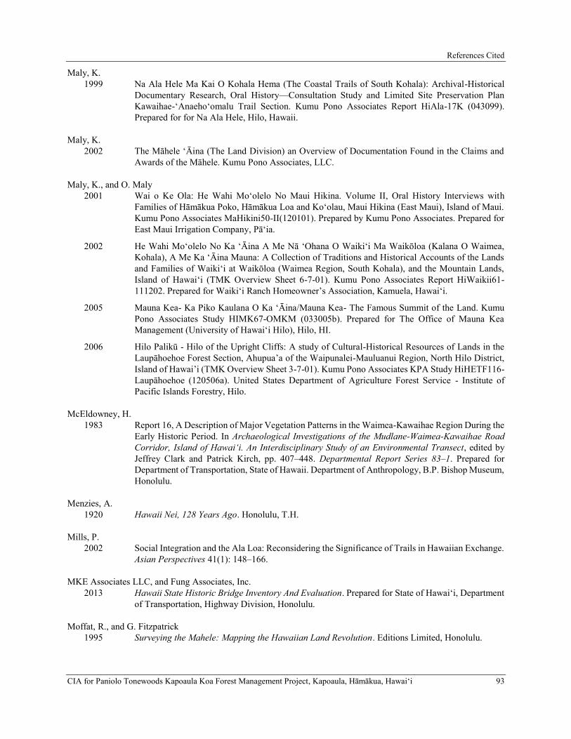
References Cited
CIA for Paniolo Tonewoods Kapoaula Koa Forest Management Project, Kapoaula, Hāmākua, Hawaiʻi 93
Maly, K. 1999 Na Ala Hele Ma Kai O Kohala Hema (The Coastal Trails of South Kohala): Archival-Historical
Documentary Research, Oral History—Consultation Study and Limited Site Preservation Plan Kawaihae-‘Anaeho‘omalu Trail Section. Kumu Pono Associates Report HiAla-17K (043099). Prepared for for Na Ala Hele, Hilo, Hawaii.
Maly, K. 2002 The Māhele ‘Āina (The Land Division) an Overview of Documentation Found in the Claims and
Awards of the Māhele. Kumu Pono Associates, LLC.
Maly, K., and O. Maly 2001 Wai o Ke Ola: He Wahi Mo‘olelo No Maui Hikina. Volume II, Oral History Interviews with
Families of Hāmākua Poko, Hāmākua Loa and Ko‘olau, Maui Hikina (East Maui), Island of Maui. Kumu Pono Associates MaHikini50-II(120101). Prepared by Kumu Pono Associates. Prepared for East Maui Irrigation Company, Pā‘ia.
2002 He Wahi Mo‘olelo No Ka ‘Āina A Me Nā ‘Ohana O Waiki‘i Ma Waikōloa (Kalana O Waimea, Kohala), A Me Ka ‘Āina Mauna: A Collection of Traditions and Historical Accounts of the Lands and Families of Waiki‘i at Waikōloa (Waimea Region, South Kohala), and the Mountain Lands, Island of Hawai‘i (TMK Overview Sheet 6-7-01). Kumu Pono Associates Report HiWaikii61-111202. Prepared for Waiki‘i Ranch Homeowner’s Association, Kamuela, Hawai‘i.
2005 Mauna Kea- Ka Piko Kaulana O Ka ʻĀina/Mauna Kea- The Famous Summit of the Land. Kumu Pono Associates Study HIMK67-OMKM (033005b). Prepared for The Office of Mauna Kea Management (University of Hawaiʻi Hilo), Hilo, HI.
2006 Hilo Palikū - Hilo of the Upright Cliffs: A study of Cultural-Historical Resources of Lands in the Laupāhoehoe Forest Section, Ahupua’a of the Waipunalei-Mauluanui Region, North Hilo District, Island of Hawai’i (TMK Overview Sheet 3-7-01). Kumu Pono Associates KPA Study HiHETF116-Laupāhoehoe (120506a). United States Department of Agriculture Forest Service - Institute of Pacific Islands Forestry, Hilo.
McEldowney, H. 1983 Report 16, A Description of Major Vegetation Patterns in the Waimea-Kawaihae Region During the
Early Historic Period. In Archaeological Investigations of the Mudlane-Waimea-Kawaihae Road Corridor, Island of Hawai‘i. An Interdisciplinary Study of an Environmental Transect, edited by Jeffrey Clark and Patrick Kirch, pp. 407–448. Departmental Report Series 83–1. Prepared for Department of Transportation, State of Hawaii. Department of Anthropology, B.P. Bishop Museum, Honolulu.
Menzies, A. 1920 Hawaii Nei, 128 Years Ago. Honolulu, T.H.
Mills, P. 2002 Social Integration and the Ala Loa: Reconsidering the Significance of Trails in Hawaiian Exchange.
Asian Perspectives 41(1): 148–166.
MKE Associates LLC, and Fung Associates, Inc. 2013 Hawaii State Historic Bridge Inventory And Evaluation. Prepared for State of Hawaiʻi, Department
of Transportation, Highway Division, Honolulu.
Moffat, R., and G. Fitzpatrick 1995 Surveying the Mahele: Mapping the Hawaiian Land Revolution. Editions Limited, Honolulu.

References Cited
94 CIA for Paniolo Tonewoods Kapoaula Koa Forest Management Project, Kapoaula, Hāmākua, Hawaiʻi
Nakuina, M. 2005 The Wind Gourd of La‘amaomao (translated by Esther T. Mookini & Sarah Nākoa). University of
Hawai’i Press, Honolulu.
National Park Service Ala Kahakai National Historic Trail 2009 Ala Kahakai National Historic Trail Comprehensive Management Plan. Hawaii. Hawaii.
Neal, M. 1965 In Gardens of Hawaii. Bishop Museum Press, Honolulu.
Nicholson, H. 1881 From Sword to Share; or a Fortune in Five Years at Hawaii. W.H. Allen & Co., London.
Office of the Commissioner of Public Lands of the Territory of Hawaii 1929 Indices of Awards Made by the Board of Commissioners to Quiet Land Titles in the Hawaiian
Islands. Star Bulletin Press, Honolulu.
Oliver, D. 1961 The Pacific Islands. University of Hawaii Press, Honolulu.
Olivera, K. 2009 Wahi a Kahiki: Place Names as Vehicles of Ancestral Memory.. AlterNative 5(2): 101–115.
Pogue, J. F. 1978 Moolelo of Ancient Hawaii. Translator Charles W. Kenn. Topgallant Press, Honolulu.
Puakō Historical Society 2000 Puakō An Affectionate History. Creative Connections Publishing, Vancouver, B.C.
Pukui, M. K., and S. H. Elbert 1986 Hawaiian Dictionary: Hawaiian-English, English-Hawaiian. Rev. and enl. ed. University of Hawaii
Press, Honolulu.
Pukui, Mary Kawena (editor). 1983 ʻOlelo Noʻeau: Hawaiian proverbs & poetical sayings. B. P. Bishop Museum Special Publication
71. Bishop Museum Press, Honolulu, Hawai’i.
Rechtman, R. 2001 Archaeological survey and limited cultural assessment of a development area associated with the
placement of water tanks, (TMK:3-4-6-07:81 and 3-4-6-08:48), Āhualoa Ahupua‘a, Hāmākua District, Island of Hawai‘i, Rechtman Consulting, LLC Report RC-0081.
Rechtman, R. B. 2009 Cultural Assessment Study Associated with the Development of the County of Hawai‘i Kapulena
Well, (TMKs: 3-4-5-02:029, 035 and 3-4-7-08:019). Hauko‘i Ahupua‘a, Hāmākua District, Island of Hawai‘i. Rechtman Consulting Report RC 0487. Planning Solutions, Inc., Honolulu, Hawai‘i.
Rechtman, R. B., and K. Maly 2003 Cultural Impact Assessment for the Proposed Development of TMK:3-7-3-9:22, ‘O‘oma 2nd
Ahupua‘a, North Kona District, Island of Hawai‘i, Volumes I and II. Rechtman Consulting Report RC-0154. Prepared for Helber Hastert & Fee, Honolulu, Hawai‘i.

References Cited
CIA for Paniolo Tonewoods Kapoaula Koa Forest Management Project, Kapoaula, Hāmākua, Hawaiʻi 95
Rechtman, R. R., M. R. Clark, and A. Dircks Ah Sam 2009 An Archaeological and Limited Cultural Assessment of a Planned Access Road Route across TMKs:
3-4-6-11:004, 006, and 044, Honokaia Ahupua‘a, Hāmākua District, Island of Hawai‘i. Rechtman Consulting report RC-0652. Honolulu. Honolulu.
Rosendahl, P. 1972 Aboriginal Agriculture and Domestic Residence Patterns in Upland Lapakahi, Island of Hawaii.
Ph.D. Dissertation, Department of Anthropology, University of Hawaii at Manoa, Honolulu.
Ruzicka, D. 2010 Historic American Engineering Record: Kawailii Bridge (Kawaili Stream Bridge) HAER No. HI-
94. Mason Architects, Inc.
Schilt, R., and A. Sinoto 1980 Limited Phase I Archaeological Survey of Mahukona Properties, North Kohala, Island of Hawaii.
Department of Anthropology, Bernice P. Bishop Museum Ms. 013180. Preprared for Belt Collins and Associates, Honolulu. Honolulu.
Soehren, L. 2005 A Catalog of Hawai‘i Place Names Compiled from the Records of the Boundary Commission and
the Board of Commissioners to Quiet Land Title of the Kingdom of Hawaii. Part 4: Ka‘ū. http://ulukau.org/cgi-bin/hpn?, accessed September 14, 2016.
Soil Survey Staff 2019 Web Soil Survey. United State Deparment of Agriculture, Natural Resources Conservation Service.
http://websoilsurvey.nrcs.usda.gov/, accessed March 4, 2019.
Tatar, E. 1982 Nineteenth Century Hawaiian Chant. Pacific Anthropological Records. Department of
Anthropology, B.P. Bishop Museum, Honolulu. Honolulu.
The Hawaiian Gazette 1873 Our Forests. The Hawaiian Gazette, November 26, p. 2.
The Hawaiian Gazette 1889 Hamakua Roads. The Hawaiian Gazette, February 12, p. 10.
The Hawaiian Gazette 1894a Latest News From Hamakua. The Hawaiian Gazette, January 9, p. 2.
1894b . The Hawaiian Gazette, May 8, p. 3.
The Hawaiian Star 1893 Forest Destruction. How it Affects the Rainfall at Hamakua, Hawaii. The Hawaiian Star, May 22,
p. 5.
1902 A Forest Force is Required: Cattle Made Hamakua Fire Possible and are Paving Way for Another. The Hawaiian Star, April 8, p. 1.
The Honolulu Advertiser 1912 Board of Health Head Keeps Busy: Pratt is Inspecting Multitude of Things on Tour of Big Island.
The Honolulu Advertiser, December 4. https://www.newspapers.com/image/257963822/?terms=ahualoa%2Broad, accessed March 21, 2019.

References Cited
96 CIA for Paniolo Tonewoods Kapoaula Koa Forest Management Project, Kapoaula, Hāmākua, Hawaiʻi
1925 Ahualoa Road Worn.. The Honolulu Advertiser Progress Edition, March 16, p. 1.
1964 More Progress on Big Isle. The Honolulu Advertiser Progress Edition, February 11, p. 5.
The Pacific Commercial Advertiser 1859 The Pacific Commercial Advertiser, February 17, p. 1.
1876 Hamakua, Hawaii. The Pacific Commercial Advertiser, February 26, p. 3.
1878 Hamakua, Hawaii. The Pacific Commercial Advertiser, January 19, p. 3.
The Pacific Commercial Advertiser, M. Kapena, and J. Maker 1877 Report of the Royal Commissioners on Development of Resources - Hamakua. The Pacific
Commercial Advertiser, May 5, p. 5.
The Polynesian 1853 The Polynesian, March 26, p. 3.
1857 The Polynesian, April 22, p. 99.
1860 Notice!!. The Polynesian, June 23, p. 4.
1862 CORRESPONDENCE.. The Polynesian, April 19, p. 2.
Thrum, T. 1883 Hawaiian Woods and Forest Trees. In Hawaiian Almanac and Annual for 1883, edited by Thomas
Thrum, pp. 33–35. Thos. G. Thrum, Honolulu.
Tomonari-Tuggle, M.-J. 1988 North Kohala: Perception of a Changing Community. A Cultural Resources Study. Prepared for
Division of State Parks, Outdoor Recreation, and Historic Sites, Department of Land and Natural Resources, State of Hawaii.
1996 Bird Catchers and Bullock Hunters in the Upland Mauna Kea Forest: A Cultural Resource Overview of the Hakalau Forest National Wildlife Refuge, Island of Hawaiʻi, Contract No. 10181-5-2193. International Archaeological Research Institute, Inc. report.
United States Geological Survey 1957 Kukuihaele Quadrangle. U.S. Department of the Interior, U.S. Geological Survey.
https://ngmdb.usgs.gov/topoview.
Vancouver, G. 1984 A Voyage of Discovery to the North Pacific Ocean and Round the World, 1791-1795: With an
Introduction and Appendices. Ed. William Kaye Lamb. Hakluyt Society, London.
Wellmon, B. B. 1969 The Parker Ranch: A History. Ph. D. dissertation, Department of History, Texas Christian
University. University Microfilms International, Ann Arbor, MI.
Whitesell, C., H. Wick, and N. Honda 1971 Growth Response of a Thinned Tropical Ash Stand in Hawaii...after 5 years. USDA Forest Service
Research Note PSW-227. Prepared by Forest Service, U.S. Department of Agriculture, Berkeley.
Wilcox, C. 1996 Sugar Water: Hawaii’s Plantation Ditches. University of Hawai’i Press, Honolulu.

CIA for Paniolo Tonewoods Kapoaula Koa Forest Management Project, Kapoaula, Hāmākua, Hawaiʻi 97
Wilkes, C. 1845 Narrative of the United States Exploring Expedition During the Years 1838. 1839, 1849, 1842. Vol.
Volume IV. Lea and Blanchard, Philadelphia.
Wilmshurst, J., T. Hunt, C. Lipo, and A. Anderson 2011 High-Precision Radiocarbon Dating Shows Recent and Rapid Colonization of East Polynesia.
Proceedings of the National Academy of Sciences 108: 1815–1820.

APPENDIX A.
KA WAI OLA PUBLIC NOTICE

Appendix A
CIA for Paniolo Tonewoods Kapoaula Koa Forest Management Project, Kapoaula, Hāmākua, Hawaiʻi A-1
Ka Wai Ola, Apelila (April) 2019, 36 (4):21

Kapoaula Koa Forest Management Plan Final Environmental Assessment August 2019
Page D-1 Appendix
APPENDIX D PHASE I ENVIRONMENTAL SITE ASSESSMENT

Kapoaula Koa Forest Management Plan Final Environmental Assessment August 2019
Page D-2 Appendix
This page intentionally left blank.

200 Kohola Street, Hilo, Hawaii, USA 96720 • 808.935.8727 99-1046 Iwaena Street, Suite 210A, Aiea, Hawaii, USA 96701 • 808.484.9214
PHASE I ENVIRONMENTAL SITE ASSESSMENT REPORT FORTMK (3) 4-7-007:011 WAIMEA, ISLAND OF HAWAII 96743
564.549 ACRES
MNA PROJECT 02529_5
MARCH 9, 2018
Environmental Studies and Consulting Services

This Phase I ESA report is prepared for: SIGLO FOREST LLC P.O. Box 490 Paauilo, Hawaii 96776
SIGNATURE PAGE
PHASE I ENVIRONMENTAL SITE ASSESSMENT REPORT FOR TMK (3) 4-7-007:011 WAIMEA, ISLAND OF HAWAII 96743 564.549 acres MNA Job No. 2529_5 March 9, 2018 I declare that, to the best of my professional knowledge and belief, I meet the definition of Environmental professional as defined in §312.10 of 40 CFR 312. I have the specific qualifications based on education, training, and experience to assess a property of the nature, history, and setting of the subject property. I have developed and performed the all appropriate inquiries in conformance with the standards and practices set forth in 40 CFR 312.
Myounghee Noh, Environmental Professional Principal Myounghee Noh & Associates, L.L.C. Environmental Studies and Consulting Services 200 Kohola Street, Hilo, HI 96720 Tel (808) 935-8727 www.noh-associates.com

SIGLO FOREST LLC – Phase I Environmental Site Assessment TMK (3) 4-7-007:011, Waimea, Hawaii
2529_5 iii Myounghee Noh & Associates, L.L.C.
TABLE OF CONTENTS SIGNATURE PAGE ...................................................................................................................... ii LIST OF ABBREVIATIONS ........................................................................................................ vi EXECUTIVE SUMMARY .......................................................................................................... vii
FINDINGS .............................................................................................................................................. vii RECOGNIZED ENVIRONMENTAL CONDITIONS ......................................................................... viii
1.0 INTRODUCTION ................................................................................................................ 1
1.1 PURPOSE ...................................................................................................................................... 1 1.2 DETAILED SCOPE OF SERVICES ............................................................................................. 1
1.2.1 Site History .............................................................................................................................. 1 1.2.2 Regulatory Records ................................................................................................................. 3 1.2.3 Site Reconnaissance ................................................................................................................ 3 1.2.4 Site Geology and Hydrogeology ............................................................................................. 3 1.2.5 Data Evaluation and Reporting .............................................................................................. 4
1.3 SIGNIFICANT ASSUMPTIONS .................................................................................................. 4 1.4 LIMITATIONS AND EXCEPTIONS ........................................................................................... 4 1.5 SPECIAL TERMS AND CONDITIONS....................................................................................... 4 1.6 USER RELIANCE ......................................................................................................................... 4
2.0 SITE DESCRIPTION ........................................................................................................... 5
2.1 LOCATION AND LEGAL DESCRIPTION ................................................................................. 5 2.2 SITE AND VICINITY GENERAL CHARACTERISTICS .......................................................... 5 2.3 GEOLOGY ..................................................................................................................................... 5 2.4 HYDROLOGY AND HYDROGEOLOGY ................................................................................... 7 2.5 CURRENT USE OF THE SUBJECT PROPERTY ....................................................................... 9 2.6 STRUCTURES, ROADS, AND OTHER IMPROVEMENTS ...................................................... 9 2.7 PAST USES OF THE SUBJECT PROPERTY ............................................................................. 9 2.8 CURRENT AND PAST USES OF ADJOINING PROPERTIES ............................................... 10
3.0 USER PROVIDED INFORMATION ................................................................................ 17
3.1 ENVIRONMENTAL LIENS OR ACTIVITY AND USE LIMITATIONS ................................ 17 3.2 SPECIALIZED KNOWLEDGE .................................................................................................. 17 3.3 VALUATION REDUCTION ...................................................................................................... 17 3.4 REASON FOR PERFORMING THE PHASE I ESA ................................................................. 17
4.0 RECORDS REVIEW.......................................................................................................... 17
4.1 STANDARD ENVIRONMENTAL RECORD SOURCES ......................................................... 17 4.1.1 Federal National Priorities List ............................................................................................ 18 4.1.2 Federal RCRA CORRACTS TSD Facilities List ................................................................... 18 4.1.3 Delisted NPL Site List ........................................................................................................... 18 4.1.4 Federal CERCLIS List .......................................................................................................... 18 4.1.5 Federal SEMS-Archive Site List ............................................................................................ 19 4.1.6 Federal RCRA non-CORRACTS TSD Facilities List ............................................................ 19 4.1.7 State Hazardous Waste Sites ................................................................................................. 19 4.1.8 State Landfill/Solid Waste Disposal Sites ............................................................................. 19 4.1.9 State Leaking UST List .......................................................................................................... 19 4.1.10 State Voluntary Cleanup Sites ............................................................................................... 19 4.1.11 State Brownfield Sites ........................................................................................................... 19 4.1.12 Federal RCRA Generators List ............................................................................................. 20 4.1.13 State Registered UST List ...................................................................................................... 20 4.1.14 Federal IC and EC Registries ............................................................................................... 20
SIGLO FOREST LLC – Phase I Environmental Site Assessment TMK (3) 4-7-007:011, Waimea, Hawaii
2529_5 iv Myounghee Noh & Associates, L.L.C.
4.1.15 Federal ERNS List ................................................................................................................. 20 4.1.16 State ICs and ECs Registries ................................................................................................. 21 4.1.17 U.S. Brownfields .................................................................................................................... 21 4.1.18 Facility Index System/Facility Registry System..................................................................... 21 4.1.19 Hazardous Materials Incident Reporting System .................................................................. 21
4.2 ADDITIONAL RECORD SOURCES ......................................................................................... 21 4.2.1 Subject Property .................................................................................................................... 21 4.2.2 Surrounding Properties ......................................................................................................... 22
4.3 HISTORICAL USE INFORMATION ON THE SUBJECT PROPERTY .................................. 23 4.3.1 Historical Aerial Photographs .............................................................................................. 23 4.3.2 Historical Topographic Maps ............................................................................................... 24 4.3.3 Sanborn Fire Insurance Map ................................................................................................ 24
5.0 SITE RECONNAISSANCE ............................................................................................... 25
5.1 METHODOLOGY AND LIMITING CONDITIONS ................................................................. 25 5.2 GENERAL SITE SETTING ........................................................................................................ 25 5.3 EXTERIOR OBSERVATIONS ................................................................................................... 25 5.4 INTERIOR OBSERVATIONS .................................................................................................... 27 5.5 HAZARDOUS SUBSTANCES AND PETROLEUM PRODUCTS........................................... 27 5.6 ABOVEGROUND AND UNDERGROUND STORAGE TANKS ............................................ 27
6.0 INTERVIEWS .................................................................................................................... 27
6.1 KEOKI WOOD, LIVESTOCK OPERATIONS MANAGER, PARKER RANCH .................... 27 6.2 HARRY “HAIA” AUWELOA, GRAZING UNIT RANCH HAND, PARKER RANCH .......... 27
7.0 DATA GAPS AND DEVIATIONS ................................................................................... 28
8.0 KEY FINDINGS AND OPINION...................................................................................... 28
8.1 SUBJECT PROPERTY ................................................................................................................ 28 8.1.1 Non-REC ............................................................................................................................... 28 8.1.2 REC ....................................................................................................................................... 29
8.2 SURROUNDING AREA ............................................................................................................. 29 8.2.1 Non-REC ............................................................................................................................... 29 8.2.2 REC ....................................................................................................................................... 29 8.2.3 HREC .................................................................................................................................... 29
9.0 CONCLUSION ................................................................................................................... 30
REFERENCES ............................................................................................................................. 31
FIGURES Figure 1. Site Location Map ....................................................................................................... 2 Figure 2. TMK Map ................................................................................................................... 6 Figure 3. Site Map .................................................................................................................... 26 TABLES Table 1. Subject Property Soil Types........................................................................................ 7 Table 2. Upper Honokaa Aquifer System ................................................................................. 8 Table 3. Lower Honokaa Aquifer System ................................................................................ 8 Table 4. Vicinity Well Information........................................................................................... 9 Table 5. Users and Primary Uses of Subject Property ............................................................ 10 Table 6. Users and Primary Uses of Adjoining Properties ..................................................... 10 Table 7. Aerial Photograph Details ......................................................................................... 23

SIGLO FOREST LLC – Phase I Environmental Site Assessment TMK (3) 4-7-007:011, Waimea, Hawaii
2529_5 v Myounghee Noh & Associates, L.L.C.
APPENDICES Appendix A Environmental Data Resources Report and Maps Appendix B Site Reconnaissance Photographs CONTRIBUTORS Project Coordinator Jennah Oshiro Site Assessors Jennah Oshiro and Adam Custer Report Writer Jennah Oshiro Drafter/Illustrator Kristin Cabanila Technical Editor Jessica Walsh, Environmental Professional QA Review Myounghee Noh, Environmental Professional

SIGLO FOREST LLC – Phase I Environmental Site Assessment TMK (3) 4-7-007:011, Waimea, Hawaii
2529_5 vi Myounghee Noh & Associates, L.L.C.
LIST OF ABBREVIATIONS AST Aboveground Storage Tank
CERCLA Comprehensive Environmental Response, Compensation, and Liability Act
CERCLIS Comprehensive Environmental Response, Compensation, and Liability Information System
CESQG Conditionally Exempt Small Quantity Generators
CORRACTS RCRA Facilities that are undergoing “corrective action”
EC / IC Engineering Control / Institutional Control
EDR Environmental Data Resources, Inc.
EPA Environmental Protection Agency
ERNS Emergency Response Notification System
ESA Environmental Site Assessment
HDOH State of Hawaii Department of Health
HEER Hazard Evaluation and Emergency Response
HELCO Hawaii Electric Light Company
HFD County of Hawaii Fire Department
HREC Historical Recognized Environmental Condition
LQG Large Quantity Generator
MNA Myounghee Noh & Associates, L.L.C.
NFA No Further Action
NFRAP No Further Remedial Action Planned
NLR No Longer Regulated Generators
NPL National Priorities List
RCRA Resource Conservation and Recovery Act
REC Recognized Environmental Condition
SEMS Superfund Enterprise Management System (Archive)
SHWB Solid and Hazardous Waste Branch
SQG Small Quantity Generator
SWD Solid Waste Division
TMK Tax Map Key
TSD Treatment, Storage, and Disposal
USGS United States Geological Survey
UIC Underground Injection Control
UST Underground Storage Tank
VRP Voluntary Response Program

SIGLO FOREST LLC – Phase I Environmental Site Assessment TMK (3) 4-7-007:011, Waimea, Hawaii
2529_5 vii Myounghee Noh & Associates, L.L.C.
EXECUTIVE SUMMARY
Myounghee Noh & Associates, L.L.C. (MNA), was retained in January 2018 to conduct a Phase I Environmental Site Assessment (ESA) for the subject property occupying 564.549 acres in Waimea, Island of Hawaii, identified by Tax Map Key (TMK) Island 3, Zone 4, Section 7, Plat 007, and Parcel 011 [TMK (3) 4-7-007:011]. The subject property is owned by the Parker Land Trust. This Phase I ESA was completed for SIGLO FOREST LLC, potential buyer of the subject property. The purpose of this Phase I ESA is to identify recognized environmental conditions (RECs) at the subject property, with respect to the range of contaminants within the scope of the Comprehensive Environmental Response, Compensation, and Liability Act (CERCLA) and petroleum products. The subject property is located in Waimea, in a high precipitation region in the north of the Island of Hawaii. Located approximately 1 mile south of State Route 19 (Mamalahoa Highway), the property is accessed via Old Mamalahoa Highway. A small dirt road from Old Mamalahoa Highway travels from the north through the center of the subject property to the south, and ends at approximately the center of the subject property.
FINDINGS
No records of National Priorities List (NPL) sites, Federal Resource Conservation and Recovery Act (RCRA) CORRACTS and Non-CORRACTS Treatment Storage Disposal Facilities, Delisted NPL sites, Federal Comprehensive Environmental Response, Compensation, and Liability Information System sites, landfill or solid waste disposal sites, State Voluntary Cleanup sites, Federal RCRA Generator sites, State registered underground storage tank sites, engineering control/institutional control registries, Federal Emergency Response Notification System list sites, or Federal or State Brownfields sites were identified at the subject property or surrounding area. No sites were identified by Environmental Data Resources Inc., for the standard environmental record sources. Review of U.S. Geological Survey topographic maps and historical aerial photographs for the subject property and surrounding properties did not indicate any RECs. There were no structures or indications of the past presence of structures on the subject property. The subject property was primarily grassland for cattle grazing, with an approximately 14-acre non-native forested area in the center. The property was subdivided into eight paddocks with fencing. Cattle were periodically rotated between the paddocks. No indications of RECs were observed during the site reconnaissance. A user questionnaire completed by SIGLO FOREST LLC representative, Nick Koch, indicated that there may be a green waste stockpile on the subject property. Documents in connection with the subject property were also provided by the client. On 24 June 2015, the State of Hawaii Department of Health (HDOH) Hazard Evaluation and Emergency Response (HEER) Office issued a letter to the property owner, Parker Land Trust, in regards to the parcel. The letter indicated that HEER Office was contacting landowners that the owner may be interested in being listed in their Brownfields Inventory for possible eligibility for Environmental Protection Agency redevelopment funding, due to the property being previously identified as an illegal dump site. Upon review of the HDOH Solid and Hazardous Waste Branch (SHWB) records, it was found that the adjoining property to the northwest, located at TMK (3) 4-7-007:090, contained an illegal dump. Additionally, no indications of an illegal dump were observed during the site reconnaissance or during review of aerial photographs of the subject property. MNA also conducted an interview with Harry “Haia” Auweloa, who stated that he was not aware of any green

SIGLO FOREST LLC – Phase I Environmental Site Assessment TMK (3) 4-7-007:011, Waimea, Hawaii
2529_5 viii Myounghee Noh & Associates, L.L.C.
waste or dump sites on the property. Because the adjoining property at TMK (3) 4-7-007:090 was formerly a part of the subject property, it was concluded that the “green waste” and “illegal dump” speculations in the user provided documents were the result of confusion stemming from the adjoining property previously being a part of the subject property TMK. According to review of the County of Hawaii tax records, the adjoining property was split from the subject property in 2004. As a result, it is presumed that there was no green waste or illegal dump at the subject property. In 2004, HDOH SHWB identified the illegal dump area at the northeast portion of the TMK (3) 4-7-007:090, adjacent to Old Mamalahoa Highway. Records indicated that the illegally dumped materials included green waste; construction and demolition waste including concrete, rebar, sheet metal, metal piping, plastic piping, and lumber; automotive debris including tires, axles, engine, and frame parts; and a small volume of household waste. No hazardous waste, toxic materials, or controlled substances were encountered. In 2008, the SHWB determined that No Further Action was necessary. More information on the illegal dump area and cleanup activities are included in Section 4.2.2. Based on the solid waste observed and cleaned up from the site, it is likely that petroleum products from the automobile debris were released to the site. Based on the relative distance of the illegal dump site to the subject property and apparent flooding in the area, it is possible that petroleum product residues from automotive parts entered the subject property. The groundwater quality at the subject property is unknown, and is considered a data gap. The potential petroleum product release from the illegal dump site to the subject property is an historical REC (HREC) which could lead to a REC, if the groundwater was impacted. An HREC is defined per ASTM E1527-13 as a past release of any hazardous substances or petroleum products that has occurred in connection with the property and has been addressed to the satisfaction of the applicable regulatory authority or meeting unrestricted use criteria established by a regulatory authority, without subjecting the property to any required controls (for example, property use restrictions, activity and use limitations, institutional controls, or engineering controls).
RECOGNIZED ENVIRONMENTAL CONDITIONS
MNA performed a Phase I Environmental Site Assessment in conformance with the scope and limitations of ASTM E 1527-13 of the 564.549-acre subject property identified as TMK (3) 4-7-007:011 in Waimea, Island of Hawaii. Any exceptions to, or deletions from, this practice are described in Section 7.0 of this report. This assessment has revealed no evidence of recognized environmental conditions, as defined by ASTM, in connection with the subject property, except the following:
• The potential petroleum product release from the illegal dump site to the subject property is an HREC which could lead to a REC, if the groundwater was impacted.

SIGLO FOREST LLC – Phase I Environmental Site Assessment TMK (3) 4-7-007:011, Waimea, Hawaii
2529_5 1 Myounghee Noh & Associates, L.L.C.
1.0 INTRODUCTION
This report presents the results of a Phase I Environmental Site Assessment (ESA) conducted during January through March 2018 for the subject property occupying a 564.549 acres of the parcel identified by Tax Map Key (TMK) Island 3, Zone 4, Section 7, Plat 007, and Parcel 011 [TMK (3) 4-7-007:011], Waimea, Island of Hawaii. The location of the subject property is identified in Figure 1.
This Phase I ESA was conducted by Myounghee Noh & Associates, L.L.C., herein referred to as MNA, for SIGLO FOREST LLC, potential buyer of the subject property. At the time of this Phase I ESA, the subject property was owned by the Parker Land Trust.
1.1 PURPOSE
The purpose of this Phase I ESA is to identify any recognized environmental conditions (RECs) at the subject property, with respect to a range of contaminants within the scope of the Comprehensive Environmental Response, Compensation, and Liability Act (CERCLA) and petroleum products. This practice is intended to permit a user to satisfy one of the requirements to qualify for the innocent landowner defense to CERCLA liability, “all appropriate inquiry into the previous ownership and uses of the site consistent with good commercial or customary practice.” The term recognized environmental condition denotes the presence, or likely presence, of any hazardous substances or petroleum products on the property under conditions that indicate an existing release, a past release, or a material threat of a release into structures on the property or into the ground, groundwater, or surface water of the property (ASTM International, 2013).
This report is part of the Phase I ESA conducted for the subject property. The assessment was conducted in accordance with the practices described in Standard Practice for Environmental Site Assessments: Phase I Environmental Site Assessment Process (ASTM International, 2013).
1.2 DETAILED SCOPE OF SERVICES
A Phase I ESA has four components: records review, site reconnaissance, interview, and report. MNA conducted this ESA using information sources with the potential to identify past or current releases of hazardous substances or petroleum products into the subject property. Adjoining properties were also evaluated for their potential to impact the subject property. Per the ASTM International Phase I ESA Standard, adjoining properties include parcels touching the subject property as well as those properties across a roadway (ASTM International, 2013).
1.2.1 Site History
Where available and as needed, MNA researched historical and current topographic maps, tax records, fire insurance maps, regulatory agency websites, and aerial photographs to identify previous and current uses of the property, adjoining properties, and the surrounding area.

Figure 1. Site Location MapPhase I Environmental Site Assessment
TMK (3) 4-7-007:011Waimea, Hawaii
March 2018
Page 22529_5 Myounghee Noh & Associates, L.L.C.
Site Location
M
a
m
a
la
h
o
a
H
ig
h
w
a
y
Subject Property
TMK (3) 4-7-007:011
Old
Mam
alahoa H
ighw
ay
Hilo
Kailua-
Kona
Scale
1,200 ft.

SIGLO FOREST LLC – Phase I Environmental Site Assessment TMK (3) 4-7-007:011, Waimea, Hawaii
2529_5 3 Myounghee Noh & Associates, L.L.C.
1.2.2 Regulatory Records
MNA examined government records with respect to environmental conditions, citations, complaints, and permits at the subject property, at adjoining properties, and within the surrounding area. MNA utilized a records search provided by Environmental Data Resources, Inc. (EDR), to review records from the following federal and state programs:
• National Priorities List (NPL) • Delisted NPL • Resource Conservation and Recovery Act (RCRA) facilities that are undergoing “corrective
action” (CORRACTS) • RCRA-Treatment, Storage, & Disposal (TSD) • Comprehensive Environmental Response, Compensation & Liability Information System
(CERCLIS) List • Superfund Enterprise Management System Archive [SEMS; formerly CERCLIS No Further
Remedial Action Planned (NFRAP) List] • Federal and Hawaii State Brownfields • Hawaii Solid Waste & Landfill • Leaking Underground Storage Tank (Leaking UST) • Underground Storage Tank (UST) • Emergency Response Notification System (ERNS) • RCRA – Generators, including those No Longer Regulated (NLR) • Hawaii Sites of Interest (State Hazardous Waste Sites) • Federal and state releases • Federal and Hawaii State Land Use Controls • Hawaii Voluntary Cleanup Sites
Additionally, MNA requested environmental case files from the Hawaii Department of Health (HDOH), the Hawaii Electric Light Company (HELCO), and the County of Hawaii Fire Department (HFD).
1.2.3 Site Reconnaissance
MNA performed a site reconnaissance to obtain information indicating the likelihood of contamination, to interview available site personnel, and to conduct a brief assessment of the adjoining properties. During the site reconnaissance, MNA looked for a variety of indicators of environmental hazards including, but not limited to, stained surface soil, dead or stressed vegetation, hazardous substances, aboveground and underground storage tanks, disposal areas, groundwater wells, drywells, and sumps. Sampling and testing of soil, surface water, or groundwater were not part of this assessment.
1.2.4 Site Geology and Hydrogeology
MNA reviewed published information for the property and surrounding area on surface and subsurface conditions such as topography, drainage, surface water bodies, subsurface geology, and groundwater. MNA used this information to assess the potential for migration and impact of the subject property by releases of hazardous substances or petroleum products at off-site properties.
SIGLO FOREST LLC – Phase I Environmental Site Assessment TMK (3) 4-7-007:011, Waimea, Hawaii
2529_5 4 Myounghee Noh & Associates, L.L.C.
1.2.5 Data Evaluation and Reporting
MNA evaluated the information collected, and prepared this report as part of the assessment. Section 2 presents the site background information; Section 3 user provided information; Section 4 information collected from records review; Section 5 site reconnaissance; Section 6 interviews; Section 7 data gaps; Section 8 key findings and opinion; and Section 9 conclusion.
1.3 SIGNIFICANT ASSUMPTIONS
The conclusion presented in this report is based upon the assumption that reasonably ascertainable and relevant information pertaining to the environmental condition of the subject property was made available to MNA during the assessment. Information obtained from government agencies and other resources is presumed to be accurate and updated. Additionally, information collected in interviews is collected in “good faith” and believed to be true and accurate to the best knowledge of the interviewee.
1.4 LIMITATIONS AND EXCEPTIONS
The Phase I ESA provides a “snapshot” of the property conditions at the time of the assessment. Findings, opinions, and conclusions apply to property conditions existing at the time of the investigation and those reasonably foreseeable. They do not apply to conditions at, or changes to, the property, of which MNA is not aware, could not reasonably be aware, and has not had the opportunity to evaluate. This report is based upon visual observations of the subject property and its vicinity, interpretation of the available historical and regulatory information and documents reviewed, and interviews of individuals with knowledge of the subject or surrounding property. MNA cannot ensure the accuracy of the historical or regulatory information. This report is intended exclusively for the purpose outlined and applies only to the subject property. This Phase I ESA excludes asbestos, lead paint, unexploded ordnance, munitions and explosives of concern, and investigation of geotechnical concerns. No surface or subsurface investigation was involved.
1.5 SPECIAL TERMS AND CONDITIONS
This Phase I ESA was conducted and prepared by MNA for the exclusive use of SIGLO FOREST LLC. This report shall not be relied upon or transferred to any other party without written authorization from SIGLO FOREST LLC.
1.6 USER RELIANCE
This report is an instrument of service of MNA, which summarizes its findings and opinions with respect to recognized environmental conditions at the subject property. Findings and opinions are predicated on information that MNA obtained on the dates and from individuals stated herein, from public records reviewed, a site reconnaissance, and ancillary Phase I ESA activities. This assessment relies upon the accuracy and completeness of the information provided. The information obtained for this assessment is used without extraordinary verification. It is possible that other information exists and is discovered, or environmental conditions change subsequent to the submittal of this Phase I ESA report, to which MNA shall not be held responsible for exclusion.

SIGLO FOREST LLC – Phase I Environmental Site Assessment TMK (3) 4-7-007:011, Waimea, Hawaii
2529_5 5 Myounghee Noh & Associates, L.L.C.
2.0 SITE DESCRIPTION
This section contains location and legal description; site and vicinity general characteristics; current subject property use; structures, roads, and other improvements; past subject property use; and current and past use of adjoining properties.
2.1 LOCATION AND LEGAL DESCRIPTION
The subject property is 564.549 acres of parcel TMK (3) 4-7-007:011, in the community of Waimea, Hamakua District, Island of Hawaii. According to the County of Hawaii tax records, the subject property does not have a physical address (County of Hawaii, 2018). The property is located adjacent to the south of Old Mamalahoa Highway, and approximately 1 mile south of State Highway 19 (Mamalahoa Highway). A TMK map is presented in Figure 2.
2.2 SITE AND VICINITY GENERAL CHARACTERISTICS
The subject property is located in a rural area, with commercial and public facilities available in Waimea (Kamuela), about 8.5-mile drive from the property. The subject property is approximately 5 miles south of the Pacific Ocean, in a high precipitation region in the north of the Island of Hawaii. The subject property is on the lower northern slopes of Mauna Kea in an area predominantly used as cattle pastureland. Waimea has a rich history of missionaries, livestock industry, native Hawaiians, paniolo (Hawaiian cowboys), and as home of well-known Parker Ranch. Its country living, relatively cool climate, astronomy observatory offices, schools, and verdant mountain beauty have attracted newcomers over the years; the U.S. Census counted 6,798 and 9,212 residents of Waimea town in 2000 and 2010, respectively. Waimea’s population includes farmers, ranchers, educators, astronomers and technicians, health professionals, realtors, contractors, architects, bankers, small business owners, and employees of the hotel, livestock, and lumber industries.
2.3 GEOLOGY
The Island of Hawaii is of volcanic origin and was accumulated by the combination of Kohala, Mauna Kea, Mauna Loa, Kilauea, and Hualalai volcanoes. The island is comprised of numerous thin, extremely permeable tholeiitic (relatively rich in silicon and iron) basalt lava flows (Stearns, 1985). Hawaii, the youngest and largest Hawaiian Island, is larger than all the other Hawaiian Islands combined. Hazlett and Hyndman (1996) describe the island as follows:
It [Hawaii Island] sprawls over an area the size of Connecticut, spanning 90 miles from north to south and 80 miles from east to west. Five large volcanoes coalesce to make the visible part of the Big Island; a sixth lies buried beneath the surface. The southern part of the island is still volcanically active and building out along much of the coastline. To the north, volcanism is in the waning stages. Of all the Hawaiian Islands, the Big Island shows the greatest diversity of rocks and landscapes (Hazlett & Hyndman, 1996).

Figure 2. TMK MapPhase I Environmental Site Assessment
TMK (3) 4-7-007:011Waimea, Hawaii
March 2018
Page 62529_5 Myounghee Noh & Associates, L.L.C.
Scale
1,500 ft.
Subject Property (3) 4-7-007:011
7-007:019
7-007:020
7-007:090
7-007:005 6-013:023
6-013:037
6-013:038
6-013:039
6-013:040
6-013:041
6-013:042
6-013:043
6-011:046
7-007:093
7-007:094
M
a
m
a
la
h
o
a
H
ig
h
w
a
y
O
ld
M
a
m
a
la
h
o
a
H
ig
h
w
a
y
A
la
n
u
i O
H
o
n
o
ka
ia
A
l
a
n
u
i
O
M
a
k
a
e
n
a
e
n
a
6-013:015

SIGLO FOREST LLC – Phase I Environmental Site Assessment TMK (3) 4-7-007:011, Waimea, Hawaii
2529_5 7 Myounghee Noh & Associates, L.L.C.
Mink and Lau described the geology in the Honokaa Aquifer System, as follows:
The Hamakua lavas are exposed throughout the aquifer system but in places are covered by Laupahoehoe Volcanics, mostly at higher elevations. Pahala Ash blankets much of the region. In addition, many local ash beds are layered within the main formation. No substantial sediments occur. Cliffs rise several hundred feet at the coast.
The subject property measures approximately 1.5 miles in length, with the northern boundary at 2,800 feet in elevation and the southern boundary at 3,200 feet in elevation (Environmental Data Resources, Inc., 2018). The subject property is located on the lower northern slope of the post-shield phase Mauna Kea volcano, the highest summit of the Hawaiian Islands, and the State’s only volcano known to have been glaciated. The subject property is underlain by lavas of the Hamakua Volcanics, basalt lava flows (Pleitocene) from Mauna Kea volcano and Laupahoehoe Volcanics lava flows (Pleitocene) (Sherrod, Sinton, Watkins, & Brunt, 2007).
The United States Department of Agriculture Natural Resources Conservation Service classifies five soil types at the subject property. Information for the soil types are provided in Table 1.
Table 1. Subject Property Soil Types
Soil Type
Percent of Subject Property
Capacity to Transmit Water
Drainage Class
Typical Profile (inches below ground surface)
Maile hydrous silt loam, 0-6% slopes 48.9%
Moderately high to high (0.20 to 1.98 in/hr)
Well drained
0-5: hydrous silt loam 5-8: ashy sandy loam 8-60: hydrous silty clay loam
Honokaa highly organic hydrous silty clay loam, 20-35% slopes
29.6% Moderately high to high (0.20 to 1.98 in/hr)
Well drained
0-7: highly organic hydrous silty clay loam 7-65: hydrous silty clay loam
Honokaa highly organic hydrous silty clay loam, 0-10% slopes
18.4% Moderately high to high (0.57 to 1.98 in/hr)
Well drained
0-7: highly organic hydrous silty clay loam 7-65: hydrous silty clay loam
Maile-Waiakea-Rock outcrop complex, 6-35% slopes
2.9% Moderately high to high (0.20 to 2.00 in/hr)
Well drained
0-5: hydrous silt loam 5-8: ashy sandy loam 8-60: hydrous silty clay loam
Honokaa highly organic hydrous silty clay loam, 10-20% slopes
0.3% Moderately high to high (0.57 to 1.98 in/hr)
Well drained
0-7: highly organic hydrous silty clay loam 7-65: hydrous silty clay loam
2.4 HYDROLOGY AND HYDROGEOLOGY
The HDOH Safe Drinking Water Branch established an Underground Injection Control (UIC) line to serve as a boundary between drinking water and non-drinking water portions of aquifers. Areas above (mountain side) the UIC line are within drinking water portions of the aquifer, while areas below (ocean side) the UIC line are in non-drinking water portions of the underlying aquifer. The subject property is above the UIC line in a drinking water portion of the aquifer (Hawaii Department of Health Safe Drinking Water Branch, 2014).

SIGLO FOREST LLC – Phase I Environmental Site Assessment TMK (3) 4-7-007:011, Waimea, Hawaii
2529_5 8 Myounghee Noh & Associates, L.L.C.
The hydraulic gradient, and therefore the expected direction of travel of the basal groundwater within the basaltic formation is, in general, from mountain areas to the shoreline. According to Mink and Lau (1993), the subject property is located above the Honokaa Aquifer System of the East Mauna Kea aquifer sector and described the hydrogeology and aquifer as follows:
Hydrology. At the coast the average annual rainfall is about 60 in. It increases to 120 in. at an elevation of about 3,500 ft, then diminishes to 20 in. at higher elevations. Streams are perennial in their upper reaches where they are fed by perched water, but most are non-perennial at the cost. Virtually no stream flow measurements have been made. Groundwater. Perched groundwater occurs on ash beds, and dike water at considerable depths occurs as the rift zones are approached. However, basal groundwater is the principal resource. The zone of basal water is about 10 miles wide. It is fresh and easily developed by deep wells.
Table 2 and Table 3 provide information about the Honokaa upper and lower aquifers (Mink & Lau, 1993).
Table 2. Upper Honokaa Aquifer System
mg/L Cl--milligrams per liter of chloride
Table 3. Lower Honokaa Aquifer System Aquifer Code 80201111 Island Code 8–Hawaii Aquifer Sector 02–East Mauna Kea Aquifer System 01–Honokaa Aquifer Type, hydrogeology 1–Basal, fresh water in contact with seawater Aquifer Condition 1–Unconfined, where water table is upper surface of saturated aquifer Aquifer Type, geology 1–Flank, horizontally extensive lavas Status Code 11112 Development Stage 1–Currently used Utility 1–Drinking Salinity 1–Fresh (<250 mg/L Cl-) Uniqueness 1–Irreplaceable Vulnerability to Contamination 2–Moderate
mg/L Cl--milligrams per liter of chloride
Aquifer Code 80201214 Island Code 8–Hawaii Aquifer Sector 02–East Mauna Kea Aquifer System 01–Honokaa Aquifer Type, hydrogeology 2–High Level, fresh water not in contact with sea water Aquifer Condition 1–Unconfined, where water table is upper surface of saturated aquifer Aquifer Type, geology 4–Perched, aquifer on an impermeable layer Status Code 21111 Development Stage 2–Potential Use Utility 1–Drinking Salinity 1–Fresh (<250 mg/L Cl-) Uniqueness 1–Irreplaceable Vulnerability to Contamination 1–High

SIGLO FOREST LLC – Phase I Environmental Site Assessment TMK (3) 4-7-007:011, Waimea, Hawaii
2529_5 9 Myounghee Noh & Associates, L.L.C.
According to the Hawaii Groundwater & Geothermal Resources Center, there are two wells in the vicinity of the subject property. Based on the nearby well data, it is estimated that groundwater at the subject property is located more than 1,000 feet below ground surface. Information for the two wells is included in Table 4 (University of Hawaii at Manoa, 2012).
Table 4. Vicinity Well Information Well ID
Well Information 6235-001 Waimea C C 6331-002 Ahualoa Deepwell
Latitude/Longitude 20.043/-155.596 20.05/-155.519 Owner Asia Pacific Group, LLC Dept. of Water Supply Hawaii-Hilo User Asia Pacific Group, LLC Dept. of Water Supply Hawaii-Hilo Spud Date 1991 2007 Elevation 2,814 ft. above msl 2,598 ft. above msl Well Depth 1,415 ft. above msl 1,700 ft. above msl Well Head 1,657 ft. above msl 1,324.91 ft. above msl Approximate distance/location to subject property 3 miles west 1.25 miles northeast
MNA estimated groundwater depth 1,157 ft. bgs 1,273.09 ft. bgs
Note: MNA estimated groundwater depth by elevation minus well head. This assumes that the well head is located near the top of the water table. Groundwater depth may vary. bgs below ground surface ID Identification msl mean sea level
The Federal Emergency Management Agency flood map for the area (1551660225FE, effective 9/29/2017) indicates that the subject property is Flood Zone X, or areas outside of the 500-year flood zone (Federal Emergency Management Agency, 1988).
2.5 CURRENT USE OF THE SUBJECT PROPERTY
The subject property was owned by the Parker Land Trust. The property was pastureland for cattle grazing.
2.6 STRUCTURES, ROADS, AND OTHER IMPROVEMENTS
One water tank was present on the southern portion of the subject property. The subject property was undeveloped pastureland. The subject property was accessed via Old Mamalahoa Highway by a light duty dirt road that traveled north to south through the property, and ended at approximately the center of the subject property.
2.7 PAST USES OF THE SUBJECT PROPERTY
Information regarding past uses of the subject property was obtained from a review of tax records (County of Hawaii, 2018), historic topographic maps and aerial photographs, and interviews. According to the County of Hawaii Real Property Tax Office, Parker Land Trust owns the subject property, and has since circa 1961. Mr. Richard Smart is Parker Ranch’s late owner. Table 5 summarizes available information regarding the historical use and users of the subject property.

SIGLO FOREST LLC – Phase I Environmental Site Assessment TMK (3) 4-7-007:011, Waimea, Hawaii
2529_5 10 Myounghee Noh & Associates, L.L.C.
Table 5. Users and Primary Uses of Subject Property
Period (approx.) Owner/Lessee Area (acres) Primary Use
TMK (3) 4-7-007:011, Old Mamalahoa Highway, Waimea 2004-Present Parker Land Trust 564.549 Ranching
2004 95 acres to new TMK (3) 4-7-007:090 2004 Area revised to 659.549 acres
1994-2004 Hawaii Meat Company, Ltd. 659.282 Ranching 1994 Area revised to 659.282 acres
1961-1994 Richard Smart Trust 647.1 Ranching Prior to 1961 A.W. Carter Trustee 647.1 Ranching
TMK - Tax Map Key
2.8 CURRENT AND PAST USES OF ADJOINING PROPERTIES
Information regarding past uses of the adjoining properties was obtained from review of tax records (County of Hawaii, 2018), historic topographic maps and aerial photographs, and interviews. The property use information is summarized in Table 6.
Table 6. Users and Primary Uses of Adjoining Properties Period
(approx.) Owner/Lessee Area (acres) Primary Use
TMK (3) 4-6-011:046; 46-4440 Old Mamalahoa Highway, Waimea Adjoining property to the Northeast
2006-Present Hawaiian Home Lands/ Paula Iwalani Boteilho 275.017 Ranching
2005-2006 Hawaiian Home Lands 275.017 Ranching 2005 TMK created from TMK (3) 4-6-011:004
1995-2005 Hawaiian Home Lands/ Honokaa Ranch, Inc. 650.755 Ranching
1991-1995 State of Hawaii DLNR/ Honokaa Ranch, Inc. 650.755 Ranching
1978-1991 State of Hawaii DLNR/ Brilhante Hawaii, Inc. 650.755 Ranching
1978 33.923 acres to TMK (3) 4-6-011:044
1975-1978 State of Hawaii/ William Brilhante 684.678 Ranching
1975 Area revised
1963-1975 State of Hawaii/ Richard Smart 687.667 Ranching
1963 8.523 acres into road, 80.81 acres to TMK (3) 4-6-011:005
1959-1963 State of Hawaii/ Richard Smart 777 Ranching
1952-1959 Territory of Hawaii/ Richard Smart 777 Ranching
1951-1952 Territory of Hawaii/ Hiroshi Kuwahara 777 Ranching
1951 Area revised
1944-1951 Territory of Hawaii/ Richard Smart 385.6 Ranching
Prior to 1944 Territory of Hawaii/ 385.6 Ranching

SIGLO FOREST LLC – Phase I Environmental Site Assessment TMK (3) 4-7-007:011, Waimea, Hawaii
2529_5 11 Myounghee Noh & Associates, L.L.C.
Period (approx.) Owner/Lessee Area (acres) Primary Use
A.W. Carter Trust TMK (3) 4-6-013:015; No street address, Waimea
Adjoining property to the East
2014-Present Hawaiian Home Lands/ Pamela Jean Ramos 14 Ranching
2011-2014 Hawaiian Home Lands/ Dolores Ramos 14 Ranching
2011 TMK created from TMK (3) 4-6-011:003 2005-2011 Hawaiian Home Lands 739.311 Ranching
1975-2005 State of Hawaii DLNR/ Richard Smart 739.311 Ranching
1975 Area revised
1959-1975 State of Hawaii/ Richard Smart 739 Ranching
1953-1959 Territory of Hawaii/ Richard Smart 739 Ranching
1951-1952 Territory of Hawaii/ Seichi Mukai 739 Ranching
1951 Various acreage to various TMKs
1944-1951 Territory of Hawaii/ Richard Smart 2,475.7 Ranching
Prior to 1944 Territory of Hawaii/ A.W. Carter Trust 2,475.7 Ranching
TMK (3) 4-6-013:023; No street address, Waimea Adjoining property to the Southeast
2011-Present Hawaiian Home Lands 225 Ranching 2011 TMK created from TMK (3) 4-6-013:016 2011 TMK (3) 4-6-013:016 created from TMK (3) 4-6-011:003
2005-2011 Hawaiian Home Lands 739.311 Ranching
1975-2005 State of Hawaii DLNR/ Richard Smart 739.311 Ranching
1975 Area revised
1959-1975 State of Hawaii/ Richard Smart 739 Ranching
1953-1959 Territory of Hawaii/ Richard Smart 739 Ranching
1951-1952 Territory of Hawaii/ Seichi Mukai 739 Ranching
1951 Various acreage to various TMKs
1944-1951 Territory of Hawaii/ Richard Smart 2,475.7 Ranching
Prior to 1944 Territory of Hawaii/ A.W. Carter Trust 2,475.7 Ranching
TMK (3) 4-6-013:037; No street address, Waimea Adjoining property to the East
2013-Present Hawaiian Home Lands/ Yvonne DeLuz 102.634 Ranching
2011-2013 Hawaiian Home Lands 102.634 Ranching

SIGLO FOREST LLC – Phase I Environmental Site Assessment TMK (3) 4-7-007:011, Waimea, Hawaii
2529_5 12 Myounghee Noh & Associates, L.L.C.
Period (approx.) Owner/Lessee Area (acres) Primary Use
2011 TMK created from TMK (3) 4-6-013:016 2011 TMK (3) 4-6-013:016 created from TMK (3) 4-6-011:003
2005-2011 Hawaiian Home Lands 739.311 Ranching
1975-2005 State of Hawaii DLNR/ Richard Smart 739.311 Ranching
1975 Area revised
1959-1975 State of Hawaii/ Richard Smart 739 Ranching
1953-1959 Territory of Hawaii/ Richard Smart 739 Ranching
1951-1952 Territory of Hawaii/ Seichi Mukai 739 Ranching
1951 Various acreage to various TMKs
1944-1951 Territory of Hawaii/ Richard Smart 2,475.7 Ranching
Prior to 1944 Territory of Hawaii A.W. Carter Trust 2,475.7 Ranching
TMK (3) 4-6-013:038; No street address, Waimea Adjoining property to the East
2011-Present Hawaiian Home Lands 50 Ranching 2011 TMK created from TMK (3) 4-6-013:016 2011 TMK (3) 4-6-013:016 created from TMK (3) 4-6-011:003
2005-2011 Hawaiian Home Lands 739.311 Ranching
1975-2005 State of Hawaii DLNR/ Richard Smart 739.311 Ranching
1975 Area revised
1959-1975 State of Hawaii/ Richard Smart 739 Ranching
1953-1959 Territory of Hawaii/ Richard Smart 739 Ranching
1951-1952 Territory of Hawaii/ Seichi Mukai 739 Ranching
1951 Various acreage to various TMKs
1944-1951 Territory of Hawaii/ Richard Smart 2,475.7 Ranching
Prior to 1944 Territory of Hawaii/ A.W. Carter Trust 2,475.7 Ranching
TMK (3) 4-6-013:039; No street address, Waimea Adjoining property to the East
2011-Present Hawaiian Home Lands 25 Ranching 2011 TMK created from TMK (3) 4-6-013:016 2011 TMK (3) 4-6-013:016 created from TMK (3) 4-6-011:003
2005-2011 Hawaiian Home Lands 739.311 Ranching
1975-2005 State of Hawaii DLNR/ Richard Smart 739.311 Ranching
1975 Area revised
1959-1975 State of Hawaii/ Richard Smart 739 Ranching

SIGLO FOREST LLC – Phase I Environmental Site Assessment TMK (3) 4-7-007:011, Waimea, Hawaii
2529_5 13 Myounghee Noh & Associates, L.L.C.
Period (approx.) Owner/Lessee Area (acres) Primary Use
1953-1959 Territory of Hawaii/ Richard Smart 739 Ranching
1951-1952 Territory of Hawaii/ Seichi Mukai 739 Ranching
1951 Various acreage to various TMKs
1944-1951 Territory of Hawaii/ Richard Smart 2,475.7 Ranching
Prior to 1944 Territory of Hawaii/ A.W. Carter Trust 2,475.7 Ranching
TMK (3) 4-6-013:040; No street address, Waimea Adjoining property to the East
2011-Present Hawaiian Home Lands 25 Ranching 2011 TMK created from TMK (3) 4-6-013:016 2011 TMK (3) 4-6-013:016 created from TMK (3) 4-6-011:003
2005-2011 Hawaiian Home Lands 739.311 Ranching
1975-2005 State of Hawaii DLNR/ Richard Smart 739.311 Ranching
1975 Area revised
1959-1975 State of Hawaii/ Richard Smart 739 Ranching
1953-1959 Territory of Hawaii/ Richard Smart 739 Ranching
1951-1952 Territory of Hawaii/ Seichi Mukai 739 Ranching
1951 Various acreage to various TMKs
1944-1951 Territory of Hawaii/ Richard Smart 2,475.7 Ranching
Prior to 1944 Territory of Hawaii/ A.W. Carter Trust 2,475.7 Ranching
TMK (3) 4-6-013:041; No street address, Waimea Adjoining property to the East
2011-Present Hawaiian Home Lands 50 Ranching 2011 TMK created from TMK (3) 4-6-013:016 2011 TMK (3) 4-6-013:016 created from TMK (3) 4-6-011:003
2005-2011 Hawaiian Home Lands 739.311 Ranching
1975-2005 State of Hawaii DLNR/ Richard Smart 739.311 Ranching
1975 Area revised
1959-1975 State of Hawaii/ Richard Smart 739 Ranching
1953-1959 Territory of Hawaii/ Richard Smart 739 Ranching
1951-1952 Territory of Hawaii/ Seichi Mukai 739 Ranching
1951 Various acreage to various TMKs
1944-1951 Territory of Hawaii/ Richard Smart 2,475.7 Ranching
Prior to 1944 Territory of Hawaii/ 2,475.7 Ranching

SIGLO FOREST LLC – Phase I Environmental Site Assessment TMK (3) 4-7-007:011, Waimea, Hawaii
2529_5 14 Myounghee Noh & Associates, L.L.C.
Period (approx.) Owner/Lessee Area (acres) Primary Use
A.W. Carter Trust TMK (3) 4-6-013:042; No street address, Waimea
Adjoining property to the East 2011-Present Hawaiian Home Lands 50 Ranching
2011 TMK created from TMK (3) 4-6-013:016 2011 TMK (3) 4-6-013:016 created from TMK (3) 4-6-011:003
2005-2011 Hawaiian Home Lands 739.311 Ranching
1975-2005 State of Hawaii DLNR/ Richard Smart 739.311 Ranching
1975 Area revised
1959-1975 State of Hawaii/ Richard Smart 739 Ranching
1953-1959 Territory of Hawaii/ Richard Smart 739 Ranching
1951-1952 Territory of Hawaii/ Seichi Mukai 739 Ranching
1951 Various acreage to various TMKs
1944-1951 Territory of Hawaii/ Richard Smart 2,475.7 Ranching
Prior to 1944 Territory of Hawaii/ A.W. Carter Trust 2,475.7 Ranching
TMK (3) 4-6-013:043; No street address, Waimea Adjoining property to the East
2011-Present Hawaiian Home Lands 36 Ranching 2011 TMK created from TMK (3) 4-6-013:016 2011 TMK (3) 4-6-013:016 created from TMK (3) 4-6-011:003
2005-2011 Hawaiian Home Lands 739.311 Ranching
1975-2005 State of Hawaii DLNR/ Richard Smart 739.311 Ranching
1975 Area revised
1959-1975 State of Hawaii/ Richard Smart 739 Ranching
1953-1959 Territory of Hawaii/ Richard Smart 739 Ranching
1951-1952 Territory of Hawaii/ Seichi Mukai 739 Ranching
1951 Various acreage to various TMKs
1944-1951 Territory of Hawaii/ Richard Smart 2,475.7 Ranching
Prior to 1944 Territory of Hawaii/ A.W. Carter Trust 2,475.7 Ranching
TMK (3) 4-7-007:005; No street address, Waimea Adjoining property to the South
2000-Present Hawaiian Home Lands/ Glenn Bertelmann 282.506 Ranching
1977-2000 Hawaiian Home Lands/ Beatrice Bertelmann 282.506 Ranching
1977 Area revised to 282.506 acres

SIGLO FOREST LLC – Phase I Environmental Site Assessment TMK (3) 4-7-007:011, Waimea, Hawaii
2529_5 15 Myounghee Noh & Associates, L.L.C.
Period (approx.) Owner/Lessee Area (acres) Primary Use
1972-1977 Hawaiian Homes Commission/ Beatrice Bertelmann 282 Ranching
1952-1971 Hawaiian Homes Commission/ Archibald Bertelmann 282 Ranching
1953 TMK dropped into TMK (3) 4-7-007:001 and resubdivided
1950-1953 Hawaiian Homes Commission/ Richard Smart 1,579 Ranching
1945-1950 Territory of Hawaii/ Richard Smart 1,579 Ranching
Prior to 1945 Territory of Hawaii/ A.W. Carter Trust 1,579 Ranching
TMK (3) 4-7-007:019; 47-4837 Old Mamalahoa Highway, Waimea Adjoining property to the West
2005-Present Hawaiian Home Lands/ Elizabeth Camara 271.724 Ranching
1991-2005 Hawaiian Home Lands/ Martin Daffodil 271.724 Ranching
1978-1991 Hawaiian Home Lands/ Martha Lazarus 271.724 Ranching
1977-1978 Hawaiian Home Lands/ Eleazer Lazarus 271.724 Ranching
1977 Area revised to 271.724 acres
1952-1977 Hawaiian Home Lands/ Eleazer Lazarus 275 Ranching
1952 TMK created from TMK (3) 4-7-007:001 1953 Hawaiian Homes Commission 3,055.13 Ranching
1948-1953 Territory of Hawaii 3,055.13 Ranching
Prior to 1948 Territory of Hawaii Hawaiian Irrigation Co., Ltd. 3,055.13 Ranching
TMK (3) 4-7-007:020; 47-4841 Old Mamalahoa Highway, Waimea Adjoining property to the West
2013-Present
Hawaiian Home Lands/ Paakaula and Kuuipookala
Kalawaianui Micah and Isaiah Kaaihui
271.304 Ranching
2012-2013
Hawaiian Home Lands/ Joseph Nakoa
Paakaula and Kuuipookala Kalawaianui
Micah and Isaiah Kaaihui
271.304 Ranching
2005-2012 Hawaiian Home Lands/ William Kalawaianui
Joseph Nakoa 271.304 Ranching
2005 Hawaiian Home Lands/ William Kalawaianui 271.304 Ranching
1993-2005 Hawaiian Home Lands/ Randolph Nakoa 271.304 Ranching
1952-1993 Hawaiian Home Lands/ William Kalawaianui 271.304 Ranching

SIGLO FOREST LLC – Phase I Environmental Site Assessment TMK (3) 4-7-007:011, Waimea, Hawaii
2529_5 16 Myounghee Noh & Associates, L.L.C.
Period (approx.) Owner/Lessee Area (acres) Primary Use
1977 Area revised to 271.304 acres
1953-1977 Hawaiian Home Lands/ William Kalawaianui 275 Ranching
1953 TMK created from TMK (3) 4-7-007:001 1953 Hawaiian Homes Commission 3,055.13 Ranching
1948-1953 Territory of Hawaii 3,055.13 Ranching
Prior to 1948 Territory of Hawaii/ Hawaiian Irrigation Co., Ltd. 3,055.13 Ranching
TMK (3) 4-7-007:090; No street address, Waimea Adjoining property to the Northwest
2004-Present Kapoaula Land, LLC 95 Quarry 2004 Parker Land Trust 95 Quarry 2004 TMK created from TMK (3) 4-7-007:011
1994-2004 Hawaii Meat Company, Ltd. 659.282 Quarry 1994 Area revised
1961-1994 Richard Smart Trust 647.1 Quarry/Ranching Prior to 1961 A.W. Carter Trustee 647.1 Ranching
TMK (3) 4-7-007:093; 47-4411 Hawaii Belt Road, Waimea Adjoining property to the North
2012-Present Cindy and Paul Andrade 104.532 Ranching
2011-2012 Alfred Jose Andrade Family LTD Partnership 104.532 Ranching
2011 TMK created from TMK (3) 4-7-007:010
2002-2011 Alfred Jose Andrade Family LTD Partnership 418.045 Ranching
1999-2002 Title Holdings 90115 LLC 418.045 Ranching 1999 Area revised
1994-1999 Hawaii Meat Company, Ltd. 417.989 Ranching 1994 Area revised for pipeline easement
1966-1994 Richard Smart Trust 451.675 Ranching 1966 8.685 acres dropped into road, acreage to TMK (3) 4-7-007:054 and :055
Prior to 1966 A.W. Carter Trustee 629.763 Ranching TMK (3) 4-7-007:094; 47-4411 Hawaii Belt Road, Waimea
Adjoining property to the Northwest 2012-Present Jolette Rapozo Trust 104.532 Ranching
2011-2012 Alfred Jose Andrade Family LTD Partnership 104.532 Ranching
2011 TMK created from TMK (3) 4-7-007:010
2002-2011 Alfred Jose Andrade Family LTD Partnership 418.045 Ranching
1999-2002 Title Holdings 90115 LLC 418.045 Ranching 1999 Area revised
1994-1999 Hawaii Meat Company, Ltd. 417.989 Ranching 1994 Area revised for pipeline easement
1966-1994 Richard Smart Trust 451.675 Ranching 1966 8.685 acres dropped into road, acreage to TMK (3) 4-7-007:054 and :055
Prior to 1966 A.W. Carter Trustee 629.763 Ranching DLNR Department of Land and Natural Resources TMK - Tax Map Key

SIGLO FOREST LLC – Phase I Environmental Site Assessment TMK (3) 4-7-007:011, Waimea, Hawaii
2529_5 17 Myounghee Noh & Associates, L.L.C.
3.0 USER PROVIDED INFORMATION
User provided information was obtained by having a representative of SIGLO FOREST LLC, Nick Koch, complete a “User Questionnaire” administered by MNA. The information in the following sections was obtained from the questionnaire.
3.1 ENVIRONMENTAL LIENS OR ACTIVITY AND USE LIMITATIONS
Mr. Koch was unaware of any environmental cleanup liens or activity and land use limitations for the subject property.
3.2 SPECIALIZED KNOWLEDGE
Mr. Koch indicated that he had no specialized knowledge or experience related to the property or nearby properties, nor did he have reasonably ascertainable information of any spills, chemical releases, or environmental cleanups at the site. He indicated that there is no known contamination believed to be present. Mr. Koch indicated that there may be green waste on the subject property.
3.3 VALUATION REDUCTION
The user had no information pertaining to the valuation reduction of the site. Mr. Koch indicated that the purchase price reflects fair market value.
3.4 REASON FOR PERFORMING THE PHASE I ESA
The purpose of this Phase I ESA is to identify any recognized environmental conditions at the subject property, within the scope of ASTM Standard 1527-13, for due diligence in connection with a Purchase Agreement between the Parker Land Trust (Seller) and SIGLO FOREST LLC.
4.0 RECORDS REVIEW
Under ASTM 1527-13, records are to be reviewed by the environmental professional who may help identify RECs in connection with the subject property.
4.1 STANDARD ENVIRONMENTAL RECORD SOURCES
MNA used Environmental Data Resources, Inc., to search standard federal and state government databases for hazardous substance or petroleum product releases that could impact the subject property. A copy of the EDR report is provided in Appendix A.
ASTM E 1527-13 specifies a minimum search distance for specific environmental record sources. The following sources are specified for incidents or sites within 1 mile of the subject property: • Federal NPL site list • Federal RCRA CORRACTS TSD facilities list • State-equivalent NPL
The following sources are specified for incidents or sites within ½ mile of the subject property: • Federal Delisted NPL site list • Federal CERCLIS list • Federal SEMS-Archive site list (formerly CERLIS-NFRAP)

SIGLO FOREST LLC – Phase I Environmental Site Assessment TMK (3) 4-7-007:011, Waimea, Hawaii
2529_5 18 Myounghee Noh & Associates, L.L.C.
• Federal RCRA non-CORRACTS TSD facilities list • State-equivalent CERCLIS • State landfill and/or solid waste disposal site list • State leaking UST list • State voluntary cleanup program sites • State Brownfield Sites
The following sources are for incidents on the subject and adjoining properties: • Federal RCRA generators list • State registered UST list
Finally, the following are for incidents for the subject property: • Federal Institutional Controls (IC) and Engineering Controls (EC) Registries • Federal ERNS list • State IC and EC Registries MNA also searches additional record sources including the following. • Federal Brownfields Sites within ½ mile of the subject property • Federal Release Sites (FINDS) for the subject property • State Releases list (SPILLS) for the subject property The following subsections summarize the results of the EDR records review for the datasets listed above (Environmental Data Resources, Inc., 2018).
4.1.1 Federal National Priorities List
The NPL, maintained by the U.S. Environmental Protection Agency (EPA), is a list of highly contaminated sites that have been identified by Superfund Amendments and Reauthorization Act of 1986. There were no NPL sites identified within 1 mile of the subject property (Environmental Data Resources, Inc., 2018).
4.1.2 Federal RCRA CORRACTS TSD Facilities List
The RCRA CORRACTS TSD facilities list maintained by the EPA contains generators, transporters, treaters, storers, and disposers of hazardous waste that have reported violations and are subject to corrective actions. There were no RCRA CORRACTS TSD within 1 mile of the subject property (Environmental Data Resources, Inc., 2018).
4.1.3 Delisted NPL Site List
This list, maintained by the EPA, contains delisted NPL sites. No delisted NPL sites were identified within ½ mile of the subject property (Environmental Data Resources, Inc., 2018).
4.1.4 Federal CERCLIS List
The CERCLIS list, maintained by the EPA, contains sites that are either proposed to be or are on the NPL list, as well as sites that are in the screening and assessment phase for possible inclusion

SIGLO FOREST LLC – Phase I Environmental Site Assessment TMK (3) 4-7-007:011, Waimea, Hawaii
2529_5 19 Myounghee Noh & Associates, L.L.C.
on the NPL. No federal CERCLIS sites were identified within ½ mile of the subject property (Environmental Data Resources, Inc., 2018).
4.1.5 Federal SEMS-Archive Site List
SEMS-Archive (Superfund Enterprise Management System Archive) tracks sites that have no further interest under the Federal Superfund Program based on available information. The list was formerly known as the CERCLIS-NFRAP, renamed to SEMS-Archive by the EPA in 2015. The SEMS-Archive list, maintained by the EPA, contains designated CERCLA sites that, to the best of the EPA’s knowledge, assessment has been completed and has determined that no further steps will be taken to list the sites on the NPL. No SEMS-Archive sites were identified within ½ mile of the subject property (Environmental Data Resources, Inc., 2018).
4.1.6 Federal RCRA non-CORRACTS TSD Facilities List
The RCRA non-CORRACTS TSD facilities list, maintained by the EPA, contains RCRA permitted facilities that treat, store, or dispose of hazardous waste. No RCRA TSD facilities listed were identified within ½ mile of the subject property (Environmental Data Resources, Inc., 2018).
4.1.7 State Hazardous Waste Sites
The SHWS records are the states’ equivalent to CERCLIS. In Hawaii, the CERLIS-equivalent is the Sites of Interest database, maintained by the HDOH Hazardous Evaluation and Emergency Response (HEER) Office. These sites may or may not already be listed on the federal CERCLIS list. Priority sites planned for cleanup using state funds are identified along with sites where cleanup will be paid for by responsible parties. No SHWS were identified within 1 mile of the subject property (Environmental Data Resources, Inc., 2018).
4.1.8 State Landfill/Solid Waste Disposal Sites
The HDOH records contain an inventory of permitted landfills in the State of Hawaii. No permitted solid waste landfills, incinerators, or transfer stations were identified within ½ mile of the subject property (Environmental Data Resources, Inc., 2018).
4.1.9 State Leaking UST List
This list, maintained by the HDOH Solid and Hazardous Waste Branch (SHWB), is an inventory of sites with Leaking USTs. No Leaking UST facilities were identified within ½ mile of the subject property (Environmental Data Resources, Inc., 2018).
4.1.10 State Voluntary Cleanup Sites
The state voluntary cleanup sites list, maintained by the HDOH HEER Office, contains sites participating in the state’s Voluntary Response Program (VRP). No facilities participating in the state VRP were identified within ½ mile of the subject property (Environmental Data Resources, Inc., 2018).
4.1.11 State Brownfield Sites
This database, maintained by the HDOH HEER Office, is an inventory of state designated brownfield sites. Under the Small Business Liability Relief and Brownfields Revitalization Act,

SIGLO FOREST LLC – Phase I Environmental Site Assessment TMK (3) 4-7-007:011, Waimea, Hawaii
2529_5 20 Myounghee Noh & Associates, L.L.C.
a brownfield is defined as “real property, the expansion, redevelopment, or reuse of which may be complicated by the presence or potential presence of a hazardous substance, pollutant, or contaminant.” The EPA provides grants and loans to state and local governments for the assessment, cleanup, and redevelopment of these properties. Properties located on the state brownfield list may have received federal funding under this program or be designated a brownfield for state administration or funding purposes. No state brownfield sites were identified within ½ mile of the subject property (Environmental Data Resources, Inc., 2018).
4.1.12 Federal RCRA Generators List
The RCRA Generators list, maintained by the EPA, contains small and large quantity generators of hazardous waste. The determination of generator size is used to establish the risk that the facility poses to public health and the environment and consequently, the amount of regulation and reporting required. Large Quantity Generators (LQG) are facilities that generate more than a 1,000 kg/month of hazardous waste and/or more than 1 kg/month of acute hazardous waste. Small Quantity Generators (SQG) are facilities that generate less than 1,000 kg/month but more than 100 kg/month of hazardous waste and/or less than 1 kg/month of acute hazardous waste.
Conditionally Exempt Small Quantity Generators (CESQG) are facilities that generate less than 100 kg/month of hazardous waste and/or less than 1 kg/month of acute hazardous waste. The EPA also maintains the RCRA NLR list. This list contains facilities that were once on the RCRA generators list, but are no longer in business, no longer in business at the listed address, or are no longer generating hazardous waste substances in quantities that require reporting. No LQG, SQG, CESQG, or NLR were identified within ¼ mile of the subject property (Environmental Data Resources, Inc., 2018).
4.1.13 State Registered UST List
The HDOH SHWB maintains a database of known USTs. No USTs were identfied within ¼ mile of the subject property (Environmental Data Resources, Inc., 2018).
4.1.14 Federal IC and EC Registries
The Federal IC and EC registries contain federally listed sites that are required to implement Institutional Controls (IC) or Engineering Controls (EC). Because the sites may continue to be impacted by past use, future use of the property may be restricted in order to protect human health and the environment. Land use controls can be either ICs or ECs. ICs are limitations on how the property may be used such as prevention of soil disturbance. ECs are physical structures or devices located on the property that contain or limit human or environmental exposure to contamination. ECs need to be maintained or protected to be effective. No Federal IC or EC sites were identified within ½ mile of the subject property (Environmental Data Resources, Inc., 2018).
4.1.15 Federal ERNS List
The ERNS list, maintained by the EPA, contains CERCLA hazardous substance releases or spills, as maintained at the National Response Center. No incidents were identified on the subject property (Environmental Data Resources, Inc., 2018).

SIGLO FOREST LLC – Phase I Environmental Site Assessment TMK (3) 4-7-007:011, Waimea, Hawaii
2529_5 21 Myounghee Noh & Associates, L.L.C.
4.1.16 State ICs and ECs Registries
The State IC and EC registries contain state listed sites that have either state-required ICs or ECs in place. Because the sites may continue to be impacted by past use, future use of the property may be restricted in order to protect human health and the environment. Land Use Controls can be either ICs or ECs. ICs are limitations on how the property may be used. ECs are physical structures or devices located on the property that contain or limit exposure to contamination. ECs need to be maintained or protected to be effective. No State IC or EC sites were identified within ½ mile of the subject property (Environmental Data Resources, Inc., 2018).
4.1.17 U.S. Brownfields
U.S. Brownfields are real property, of which the expansion, redevelopment, or reuse may be complicated by the presence of a hazardous substance, pollutant, or contaminant. No U.S. Brownfields sites were identified within one mile of the subject property (Environmental Data Resources, Inc., 2018).
4.1.18 Facility Index System/Facility Registry System
The FINDS is a centrally managed EPA database that identifies facilities, sites, or places of environmental interest in the United States. No FINDS sites were identified in proximity to the subject property (Environmental Data Resources, Inc., 2018).
4.1.19 Hazardous Materials Incident Reporting System
The Hazardous Materials Incident Reporting System, also called SPILLS or SPILLS90, includes hazardous materials spills that were reported to state Department of Transportation. No SPILLS sites were identified in proximity to the subject property (Environmental Data Resources, Inc., 2018).
4.2 ADDITIONAL RECORD SOURCES
MNA reviewed additional environmental records as needed and available. Additional record sources filed by the HDOH SHWB and the HEER Office, HFD, and HELCO were requested. MNA reviewed available online records for the subject and adjoining properties.
4.2.1 Subject Property
MNA requested records for review from the HDOH SHWB, HEER Office, HFD, and HELCO. HDOH and HFD responded that they had no records on file for the subject property. No transformers were observed on or adjacent to the subject property during the site reconnaissance. HELCO responded to the records request and confirmed that there were no oil-filled electrical equipment on the subject property.
MNA reviewed publicly available information posted on the HEER Office website and found that the subject property was not listed on the HEER Sites of Interest Lookup Spreadsheet or the Emergency Response Lookup Spreadsheet. MNA reviewed the HDOH Environmental Health Warehouse and found that there were no sites of interest shown on the subject property (State of Hawaii, Department of Health HEER Office, 2018).

SIGLO FOREST LLC – Phase I Environmental Site Assessment TMK (3) 4-7-007:011, Waimea, Hawaii
2529_5 22 Myounghee Noh & Associates, L.L.C.
Documents in connection with the subject property were provided by the client. On 24 June 2015, the HEER Office issued a letter to the property owner, Parker Land Trust, in regards to the subject property. The letter indicated that the department was reaching out to parties that may be interested in being listed in their Brownfields Inventory and may quality for EPA Brownfields grants to help with cleanup due to the property being listed as an illegal dump site.
4.2.2 Surrounding Properties
MNA requested records for review from the HDOH on 26 and 29 January 2018 for TMK (3) 4-7-007:090, the adjoining property to the northwest. The HEER Office responded that they had no records on file for the adjoining property.
MNA reviewed publicly available information posted on the HEER Office website and found that the adjoining properties were not listed on the HEER Sites of Interest Lookup Spreadsheet or the Emergency Response Lookup Spreadsheet. MNA reviewed the HDOH Environmental Health Warehouse and found that there were no sites of interest shown in the vicinity of the subject property (State of Hawaii, Department of Health HEER Office, 2018).
HDOH SHWB responded with records for review, as follows:
Kapoaula Gravel Quarry, Old Mamalahoa Highway, TMK (3) 4-7-007:090, (northwest adjoining property)
On 18 October 2004, the SHWB Solid Waste Division (SWD), notified DeLuz Trucking & Gravel, LLC, (DeLuz Trucking) that an inspection of the property conducted on 29 September 2004 indicated that the site may be operating as an illegal dump site for green waste, tires, and construction and demolition waste, on the northeast side gulch of the site. The site was owned by Kapoaula Land, LLC, and used by DeLuz Trucking as an aggregate quarry and crushing facility. On 11 July 2006, a formal letter from the SWD notified Edwin DeLuz of DeLuz Trucking that they were in violation of operating an unpermitted solid waste management system. During a previous site inspection, over six stockpiles of demolition waste such as used lumber, pallets, green waste material, concrete pylons, and metal were observed.
A November 2006 Work Plan by Tropical Marine Environments, Inc., detailed the proposed trenching, removal, and disposal activities for cleanup of the dump site. Target areas were identified at the east side near Old Mamalahoa Highway and the southeast slope of the gulch area. It was estimated that 858 tons of green waste; 100 cubic yards of metal stockpile; and an unknown quantity of lumber, metal, concrete slabs, rebar, and other solid wastes were at the site. The work plan proposed segregation of green waste from construction and demolition waste, proper disposal of green waste, disposal of construction and demolition waste at a permitted facility, visual observation for hazardous materials and controlled substances, recording of all activities, and analytical sampling if hazardous materials or controlled substances were encountered.
Monthly progress reports from December 2008 to January 2008 documented work conducted at the site. A letter dated 25 February 2008 from Tropical Marine Environments to the SWD stated that no work could be completed that month due to site flooding caused by heavy rainfall. Heavy rains resulted in as much as 4 feet of standing water starting from the third week of January to 22 February 2008, which halted work. Photographs were submitted and documented the site flooding.
A final report dated 12 October 2008 by Tropical Marine Environments indicated that waste removal began following acceptance of the work plan on 21 November 2006 and was completed

SIGLO FOREST LLC – Phase I Environmental Site Assessment TMK (3) 4-7-007:011, Waimea, Hawaii
2529_5 23 Myounghee Noh & Associates, L.L.C.
on 21 June 2008. Construction and demolition material were taken to the West Hawaii Landfill, tires were removed by Arizumi Tire Disposal, and scrap metal was taken to Hawaii Metal Recovery Corporation. The excavated work area was trapezoidal in shape and encompassed approximately 35,000 square feet. Solid waste encountered included green waste; construction and demolition waste including concrete, rebar, sheet metal, metal piping, plastic piping, and lumber; automotive debris including tires, axles, engine, and frame parts; and a small volume of household waste. No hazardous waste, toxic materials, or controlled substances were encountered. SWD inspected the site on 17 June 2008 and determined the cleanup substantially complete. Only some stockpiled wastes were left for removal from the site.
On 12 November 2008, the SHWB SWD determined that cleanup was complete and No Further Action was required at the site. Refer to Section 8.2 for determination of potential impact of the illegal dump site to the subject property.
4.3 HISTORICAL USE INFORMATION ON THE SUBJECT PROPERTY
MNA reviewed historical use information for the subject property, including aerial photographs and United States Geological Survey (USGS) topographic maps. No fire insurance maps were available.
4.3.1 Historical Aerial Photographs
Aerial photographs of the subject, adjoining, and surrounding properties were provided by EDR (Environmental Data Resources, Inc., 2018). Photographs from the years 1954, 1965, 1977, and 2002 were reviewed (Table 7). Included in this section are the details from those photos.
Table 7. Aerial Photograph Details Date Image Type Approximate Scale 1954 Black & White 1"=1,125’ 1965 Black & White 1"=1,125’ 1977 Black & White 1"=1,125’ 2002 False Color 1"=1,125’
For the aerial photographs, the following observations were made:
1954: Old Mamalahoa Highway is adjacent to the north of the subject property. A forested rectangular plot of land is located in the center of the subject property; a small pond is located to the east of the forested area. The remainder of the subject property and all surrounding properties appear to be grasslands.
1965: The pond is no longer visible on the subject property. Trails and fence lines are visible throughout the subject property. A small road is located to the north of the subject property and ends at the northern boundary. A quarry is located on the adjoining property to the northwest. Highway 19 is visible to the north of the subject property.
1977: No changes from the 1965 photograph were observed. 2002: Structures are visible on properties to the west and northeast. No structures are visible on
the subject property. MNA reviewed historical aerial imagery available from Google Earth. Photographs from the years 2010 and 2013 were reviewed. For the reviewed aerial imagery, the following observations were made:

SIGLO FOREST LLC – Phase I Environmental Site Assessment TMK (3) 4-7-007:011, Waimea, Hawaii
2529_5 24 Myounghee Noh & Associates, L.L.C.
2010: In this image dated 05 January 2010, the subject property appears to be grassland; no structures are visible. Trails and fence lines are visible throughout the subject property. A rectangular forested area is located in the center of the subject property. Numerous troughs were visible throughout property. One water tank was visible in the southern portion of the property. Old Mamalahoa Highway is adjacent to the north and State Highway 19 (Mamalahoa Highway) is located approximately 1 mile north of the subject property. A quarry is visible on the adjoining property to the northwest. The surrounding properties appear to be used as pasture for cattle grazing.
2013: In this image dated 18 January 2013, cattle were observed throughout the subject property. No other changes to the subject property or surrounding properties from the 2010 image are observed.
4.3.2 Historical Topographic Maps
USGS topographic maps that cover the subject property and vicinity were reviewed. Maps were available for the years 1916, 1930, 1957, 1982, 1995, and 2013 (Environmental Data Resources, Inc., 2018). A copy of the historical topographic maps provided by EDR is included in Appendix A. The maps of the subject property and surrounding area depicted the following:
1916: Old Mamalahoa Road is depicted adjacent to the north of the subject property. A stream is depicted running from the west and ending in the approximate center of the subject property. Several streams are depicted on the adjoining properties to the north, east, and west.
1930: There are more elevation gridlines depicted on the map. The streams are not depicted on this map. No other changes from the 1916 map are observed.
1957: Old Mamalahoa Highway is depicted as a secondary highway. A vegetated area is shown in the center of the subject property. Four small ponds are visible on the subject property, two in the center and two to the south. A water tank is depicted on the northern portion of the property. A jeep trail from the north ends at the northern boundary of the subject property, at a quarry. A cave and quarries are depicted on the adjoining property to the northwest. The subject property is depicted in a land area designated at “Kapoaula.” Elevation of the subject property is 2,800 ft at the northern end and 3,200 ft at the southern end.
1982: Only one of the four small ponds is depicted on the subject property. Old Mamalahoa Highway is identified as a light duty road. Highway 19 (Mamalahoa Highway) is located approximately 1 mile to the north of the subject property and is depicted as a primary highway. Several water tanks and corrals are depicted on the surrounding properties, indicating that the area was used for cattle ranching.
1995: Corrals are not depicted on the map. No other changes from the 1982 map are observed.
2013: Quarries and water tanks are not depicted on the map. Fewer landmarks are depicted. No other changes from the 1995 map are observed.
4.3.3 Sanborn Fire Insurance Map
No Sanborn Fire Insurance maps were available for the subject property.

SIGLO FOREST LLC – Phase I Environmental Site Assessment TMK (3) 4-7-007:011, Waimea, Hawaii
2529_5 25 Myounghee Noh & Associates, L.L.C.
5.0 SITE RECONNAISSANCE
The site reconnaissance was conducted by Jennah Oshiro and Adam Custer on 05 February 2018. The site reconnaissance focused on identifying recognized environmental conditions (RECs) with the ability to impact the subject property. A site map of the subject property is presented in Figure 3. Refer to Section 8.1 for determination of impact of the observations made during the site reconnaissance to the subject property.
5.1 METHODOLOGY AND LIMITING CONDITIONS
The site reconnaissance was conducted by visually inspecting the subject property while driving and on foot. MNA looked for a variety of environmental hazard indicators including, but not limited to, stained surface soil, dead or stressed vegetation, hazardous substances, aboveground and underground storage tanks, disposal areas, groundwater wells, drywells, and sumps. Figure 3 presents the path walked and other notable features. Photographs from the site reconnaissance are presented in Appendix B and are referred to within this section.
5.2 GENERAL SITE SETTING
The subject property was located adjacent to the south of Old Mamalahoa Highway (Photographs 1 and 2). The subject property was undeveloped, with no indications that structures have previously existed on the property. The adjoining property to the northwest was a quarry (Photographs 3 and 4). All other adjoining properties were undeveloped pastureland (Photographs 5 - 10).
5.3 EXTERIOR OBSERVATIONS
The subject property was accessed via Old Mamaloahoa Highway through a gated entrance on the northern border (Photograph 11). The gate was locked and the property was fenced, preventing unauthorized access. One light duty dirt road traveled north to south through the property, and ended at approximately the center of the subject property (Photograph 12). No other roads were present on the property. The subject property was delineated with boundary markers along the property boundaries. MNA observed survey markers at the northeast, southwest, and southeast corners of the subject property (Photographs 13 - 15). The subject property was subdivided into eight separate paddocks with cattle and electric fencing (Photographs 16 - 20). Cattle were observed grazing in a paddock, which included the forested area (Photograph 21). The property was pastureland with the exception of one forested area, in the center of the subject property (Photographs 22 and 23). Lines of trees were observed, indicating that the trees were planted (Photograph 24). Four small ponds were observed in the center of the property, near the forested area (Photographs 25 - 27).
One 400-gallon water tank was located on the subject property and is serviced by a private waterline that enters the subject property from the south (Photograph 28). Several troughs were located throughout the property and were manually filled (Photograph 29). No transformers were observed on or adjacent to the subject property.

Figure 3. Site MapPhase I Environmental Site Assessment
TMK (3) 4-7-007:011Waimea, Hawaii
March 2018
Page 262529_5 Myounghee Noh & Associates, L.L.C.
Scale
600 ft.
Quarry
Entrance
Gate
Forested Area
Paddock
containing
cattle
Old
Mam
alahoa H
ighw
ay
Approx. location of
illegal dump site - HREC
Potential to impact subject property
HREC - Historical Recognized Environmental Condition; defined as a past release of
any hazardous substances or petroleum products that has occured in connection with
the property and has been addressed to the satisfaction of the applicable regulatory
agency.
Light Duty Road
Subject Property Boundary
Path Taken
Pond (15 ft. x 15 ft.)
Water Tank
Fence line

SIGLO FOREST LLC – Phase I Environmental Site Assessment TMK (3) 4-7-007:011, Waimea, Hawaii
2529_5 27 Myounghee Noh & Associates, L.L.C.
5.4 INTERIOR OBSERVATIONS
No structures were observed on the subject property; therefore, no interior observations were made.
5.5 HAZARDOUS SUBSTANCES AND PETROLEUM PRODUCTS
No hazardous substances or petroleum products were observed on the subject property.
5.6 ABOVEGROUND AND UNDERGROUND STORAGE TANKS
One above ground water storage tank was observed. MNA observed no other indications of aboveground or underground storage tanks or associated accessories, such as vent pipes, fill ports, or dispensers, on the subject property.
6.0 INTERVIEWS
MNA interviewed Keoki Wood, Livestock Manager for Parker Ranch, via email on 27 February 2018. Harry “Haia” Auweloa, Grazing Unit Ranch Hand for Parker Ranch, was interviewed by MNA via telephone on 02 March 2018. Both interviews were administered by Jennah Oshiro. Three attempts were made to conduct an interview with an operator of the DeLuz Trucking for the adjoining property to the northwest. However, DeLuz Trucking had not responded to the request and therefore an interview with DeLuz Trucking was not conducted at the time of this writing.
6.1 KEOKI WOOD, LIVESTOCK OPERATIONS MANAGER, PARKER RANCH
On 27 February 2018, MNA interviewed Keoki Wood, Livestock Operations Manager of Parker Ranch. Mr. Wood stated that he has worked at the subject property since 2002 and since then, the property has only been used for cattle grazing. Mr. Wood indicated that there have been no past issues with the property, other than that there is no water meter associated with the property. He said that the property has always been considered a productive pasture. Mr. Wood indicated that he had no knowledge of any spills, chemical releases, environmental cleanups, environmental cleanup liens, engineering controls, land use restrictions, or institutional controls at the site.
6.2 HARRY “HAIA” AUWELOA, GRAZING UNIT RANCH HAND, PARKER RANCH
On 02 March 2018, MNA interviewed Harry “Haia” Auweloa, Grazing Unit Ranch Hand of Parker Ranch. Mr. Auweloa has worked on the subject property since September 2016, and is responsible for overseeing the general day to day operations of the cattle pasture. He said that to his knowledge, the subject property has always been used as pastureland for cattle grazing. The adjoining properties were also once all owned by Parker Ranch and used as pastureland. He indicated that approximately 15 years ago, many of the adjoining properties were acquired by Hawaiian Homelands and were subdivided. The properties remained to be used as pastureland. Mr. Auweloa indicated that there was one water aboveground storage tank on the site. He also stated that there were four year-round ponds on the site, and eight seasonal ponds. Mr. Auweloa said that there was no green waste or dump site on the subject property. Mr. Auweloa indicated that he had no knowledge of any spills, chemical releases, environmental cleanups, environmental cleanup liens, engineering controls, land use restrictions, or institutional controls at the site.

SIGLO FOREST LLC – Phase I Environmental Site Assessment TMK (3) 4-7-007:011, Waimea, Hawaii
2529_5 28 Myounghee Noh & Associates, L.L.C.
7.0 DATA GAPS AND DEVIATIONS
There were no deviations from the ASTM method during this Phase I ESA; however, the unknown groundwater quality at the subject property is considered a data gap.
8.0 KEY FINDINGS AND OPINION
This section evaluates the key findings of this assessment and makes a determination as to the presence of RECs, if any.
8.1 SUBJECT PROPERTY
8.1.1 Non-REC
No records of NPL sites, Federal RCRA CORRACTS and Non-CORRACTS Treatment Storage Disposal Facilities, Delisted NPL sites, Federal Comprehensive Environmental Response, Compensation, and Liability Information System sites, landfill or solid waste disposal sites, State Voluntary Cleanup sites, Federal RCRA Generator sites, State registered underground storage tank sites, IC/EC control registries, Federal Emergency Response Notification System list sites, or Federal or State Brownfields sites were identified at the subject property. A user questionnaire completed by SIGLO FOREST LLC representative, Nick Koch, indicated that there may be a green waste stockpile on the subject property. Documents in connection with the subject property were also provided by the client. On 24 June 2015, the HDOH (HEER Office issued a letter to the property owner, Parker Land Trust, in regards to the parcel. The letter indicated that HEER Office was contacting landowners that the owner may be interested in being listed in their Brownfields Inventory for possible eligibility for Environmental Protection Agency redevelopment funding, due to the property being previously identified as an illegal dump site. Upon review of the HDOH SHWB records, it was found that the adjoining property to the northwest, located at TMK (3) 4-7-007:090, contained an illegal dump. Additionally, no indications of an illegal dump were observed during the site reconnaissance or during review of aerial photographs of the subject property. MNA also conducted an interview with Harry “Haia” Auweloa, who stated that he was not aware of any green waste or dump sites on the property. Because the adjoining property at TMK (3) 4-7-007:090 was formerly a part of the subject property, it was concluded that the “green waste” and “illegal dump” speculations in the user provided documents were the result of confusion stemming from the adjoining property previously being a part of the subject property TMK. According to review of the County of Hawaii tax records, the adjoining property was split from the subject property in 2004. As a result, it is presumed that there was no green waste or illegal dump at the subject property. Review of U.S. Geological Survey topographic maps and historical aerial photographs for the subject property and surrounding properties did not indicate any RECs. There were no structures or indications of the past presence of structures on the subject property. The subject property was primarily grassland for cattle grazing, with an approximately 14-acre non-native forested area in the center. The property was subdivided into eight paddocks with fencing. Cattle were periodically rotated between the paddocks. No indications of RECs were observed during the site reconnaissance. The HDOH, HFD, and HELCO responded that they had no records or information regarding the subject property.

SIGLO FOREST LLC – Phase I Environmental Site Assessment TMK (3) 4-7-007:011, Waimea, Hawaii
2529_5 29 Myounghee Noh & Associates, L.L.C.
8.1.2 REC
There were no RECs identified on the subject property. However, the unknown groundwater quality resulting from an illegal dump site on the adjoining property could lead to a REC.
8.2 SURROUNDING AREA
8.2.1 Non-REC
No records of NPL sites, Federal RCRA CORRACTS and Non-CORRACTS Treatment Storage Disposal Facilities, Delisted NPL sites, Federal Comprehensive Environmental Response, Compensation, and Liability Information System sites, landfill or solid waste disposal sites, State Voluntary Cleanup sites, Federal RCRA Generator sites, State registered underground storage tank sites, engineering control/institutional control registries, Federal Emergency Response Notification System list sites, or Federal or State Brownfields sites were identified for the surrounding area. No sites were identified by Environmental Data Resources Inc., for the standard environmental record sources
Information provided as part of the interviews or user questionnaire did not indicate any RECs.
The HDOH HEER Office responded that they had no records or information regarding the adjoining property to the northwest.
8.2.2 REC
There were no RECs identified in the area surrounding the subject property. However, based on the previous illegal use of the land for waste disposal and apparent flooding of the areas, the groundwater may have been impacted by leachates, particularly from the industrial waste (Section 8.2.3).
8.2.3 HREC
In 2004, HDOH SHWB identified the illegal dump area at the northeast portion of the TMK (3) 4-7-007:090, adjacent to Old Mamalahoa Highway. Records indicated that the illegally dumped materials included green waste; construction and demolition waste including concrete, rebar, sheet metal, metal piping, plastic piping, and lumber; automotive debris including tires, axles, engine, and frame parts; and a small volume of household waste. No hazardous waste, toxic materials, or controlled substances were encountered. In 2008, the SHWB determined that No Further Action was necessary. More information on the illegal dump area and cleanup activities are included in Section 4.2.2. Based on the solid waste observed and cleaned up from the site, it is likely that petroleum products from the automobile debris were released to the site. Based on the relative distance of the illegal dump site to the subject property and apparent flooding in the area, it is possible that petroleum product residues from automotive parts entered the subject property. The groundwater quality at the subject property is unknown, and is considered a data gap. The potential petroleum product release from the illegal dump site to the subject property is an historical REC (HREC) which could lead to a REC, if the groundwater was impacted. An HREC is defined per ASTM E1527-13 as a past release of any hazardous substances or petroleum products that has occurred in connection with the property and has been addressed to the satisfaction of the applicable regulatory authority or meeting unrestricted use criteria established by a regulatory authority, without subjecting the property to any required controls (for

SIGLO FOREST LLC – Phase I Environmental Site Assessment TMK (3) 4-7-007:011, Waimea, Hawaii
2529_5 30 Myounghee Noh & Associates, L.L.C.
example, property use restrictions, activity and use limitations, institutional controls, or engineering controls).
9.0 CONCLUSION
MNA performed a Phase I Environmental Site Assessment in conformance with the scope and limitations of ASTM E 1527-13 of the 564.549-acre subject property identified as TMK (3) 4-7-007:011 in Waimea, Hawaii. Any exceptions to, or deletions from, this practice are described in Section 7.0 of this report. This assessment has revealed no evidence of recognized environmental conditions, as defined by ASTM, in connection with the subject property, except for the following:
• The presence of an illegal dump site on the adjoining property to the northwest is an HREC, with potential to impact groundwater quality at the subject property.

SIGLO FOREST LLC – Phase I Environmental Site Assessment TMK (3) 4-7-007:011, Waimea, Hawaii
2529_5 31 Myounghee Noh & Associates, L.L.C.
REFERENCES
ASTM International. (2013). Standard Practice for Environmental Site Assessments: Phase I Environmental Site Assessment Process. West Conshohocken: ASTM International.
County of Hawaii. (2018, January 26). Hawaii County Real Propery Tax Office Property Search. Retrieved from Hawaii County Real Property Tax Office: http://www.hawaiipropertytax.com
Environmental Data Resources, Inc. (2018a). EDR Historical Topo Map Report for Siglo Phase I ESA Waimea. Shelton: Environmental Data Resources, Inc.
Environmental Data Resources, Inc. (2018b). The EDR Radius Map Report for Siglo Phase I ESA Waimea. Shelton: Environmental Data Resources, Inc.
Environmental Data Resources, Inc. (2018c). The EDR Aerial Photo Decade Package for Siglo Phase I ESA Waimea. Shelton: Environmental Data Resources, Inc.
Federal Emergency Management Agency. (1988). FEMA Flood Map Service Center. Retrieved from https://msc.fema.gov/portal/
Hawaii Department of Health Safe Drinking Water Branch. (2014, November). UIC Map of Oahu. Retrieved from Underground Injection Control (UIC) Program: http://hawaii.gov/health/environmental/water/sdwb/uic/pdf/oahuic.pdf
Hazlett, R. W., & Hyndman, D. W. (1996). Roadside Geology of Hawai'i. Missoula, Montana: Montana Press Pubishing Company.
MacDonald, G. A., & Abott, A. T. (1996). Volcanoes in the Sea. Honolulu: Univeristy of Hawaii Press.
Mink, J. F., & Lau, L. S. (1993). Technical Report No. 191: Aquifer Identification and Classification for Hawai'i: Groundwater Protection Strategy for Hawai'i. University of Hawaii, Water Resources Research Center.
Sherrod, D. R., Sinton, J. M., Watkins, S. E., & Brunt, K. M. (2007). Geologic Map fo the State of Hawai'i, Sheet 8 - Island of Hawaii.
State of Hawaii, Department of Health HEER Office. (2017, March 16). HEER Emergency Response Lookup Spreadsheet. Retrieved from State of Hawaii, Department of Health Hazard Evaluation and Emergency Response Office: Public Records: http://eha-web.doh.hawaii.gov/eha-cma/Leaders/HEER/public-records
State of Hawaii, Department of Health HEER Office. (2018). Environmental Health Portal, iHEER System. Retrieved from State of Hawaii, Department of Health Hazard Evaluation and Emergency Response Office: Public Records: https://eha-cloud.doh.hawaii.gov/iheer/#/home
State of Hawaii, Department of Health HEER Office. (2018, January 23). HEER Sites of Interest Lookup Spreadsheet. Retrieved from State of Hawaii, Department of Health Hazard Evaluation and Emergency Response Office: Public Records: http://eha-web.doh.hawaii.gov/eha-cma/Leaders/HEER/public-records
Stearns, H. T. (1985). Geology of the State of Hawai'i. Palo Alto: Pacific Books. United States Department of Agriculture. (2017). Natural Resources Conservation Service.
Retrieved from Web Soil Survey: http://websoilsurvey.nrcs.usda.gov/app/HomePage.htm

SIGLO FOREST LLC – Phase I Environmental Site Assessment TMK (3) 4-7-007:011, Waimea, Hawaii
2529_5 32 Myounghee Noh & Associates, L.L.C.
University of Hawaii at Manoa. (2012, November). Hawaii State Water Wells. Retrieved from Hawaii Groundwater & Geothermal Resources Center: https://www.higp.hawaii.edu/hggrc/projects/hawaii-state-waterwells/

Siglo Forestry, LLC – Phase I Environmental Site Assessment TMK (3) 4-7-007:011, Waimea, Island of Hawaii
2529_5 A Myounghee Noh & Associates, L.L.C.
APPENDIX A Environmental Data Resources Report and Maps

FORM-LBD-RG
®kcehCoeG htiw tropeR ™paM suidaR RDE ehT
6 Armstrong Road, 4th floorShelton, CT 06484Toll Free: 800.352.0050www.edrnet.com
Siglo Phase I ESA Waimea66-1304 MAMALAHOA HWYHonokaa, HI 96727
Inquiry Number: 5168800.2sJanuary 25, 2018
SECTION PAGE
Executive Summary ES1
Overview Map 2
Detail Map 3
Map Findings Summary 4
Map Findings 8
Orphan Summary 9
Government Records Searched/Data Currency Tracking GR-1
GEOCHECK ADDENDUM
Physical Setting Source Addendum A-1
Physical Setting Source Summary A-2
Physical Setting SSURGO Soil Map A-5
Physical Setting Source Map A-9
Physical Setting Source Map Findings A-11
Physical Setting Source Records Searched PSGR-1
TC5168800.2s Page 1
Thank you for your business.Please contact EDR at 1-800-352-0050
with any questions or comments.
Disclaimer - Copyright and Trademark Notice
This Report contains certain information obtained from a variety of public and other sources reasonably available to Environmental DataResources, Inc. It cannot be concluded from this Report that coverage information for the target and surrounding properties does not exist fromother sources. NO WARRANTY EXPRESSED OR IMPLIED, IS MADE WHATSOEVER IN CONNECTION WITH THIS REPORT. ENVIRONMENTALDATA RESOURCES, INC. SPECIFICALLY DISCLAIMS THE MAKING OF ANY SUCH WARRANTIES, INCLUDING WITHOUT LIMITATION,MERCHANTABILITY OR FITNESS FOR A PARTICULAR USE OR PURPOSE. ALL RISK IS ASSUMED BY THE USER. IN NO EVENT SHALLENVIRONMENTAL DATA RESOURCES, INC. BE LIABLE TO ANYONE, WHETHER ARISING OUT OF ERRORS OR OMISSIONS, NEGLIGENCE,ACCIDENT OR ANY OTHER CAUSE, FOR ANY LOSS OF DAMAGE, INCLUDING, WITHOUT LIMITATION, SPECIAL, INCIDENTAL,CONSEQUENTIAL, OR EXEMPLARY DAMAGES. ANY LIABILITY ON THE PART OF ENVIRONMENTAL DATA RESOURCES, INC. IS STRICTLYLIMITED TO A REFUND OF THE AMOUNT PAID FOR THIS REPORT. Purchaser accepts this Report "AS IS". Any analyses, estimates, ratings,environmental risk levels or risk codes provided in this Report are provided for illustrative purposes only, and are not intended to provide, norshould they be interpreted as providing any facts regarding, or prediction or forecast of, any environmental risk for any property. Only a Phase IEnvironmental Site Assessment performed by an environmental professional can provide information regarding the environmental risk for anyproperty. Additionally, the information provided in this Report is not to be construed as legal advice.
Copyright 2018 by Environmental Data Resources, Inc. All rights reserved. Reproduction in any media or format, in wholeor in part, of any report or map of Environmental Data Resources, Inc., or its affiliates, is prohibited without prior written permission.
EDR and its logos (including Sanborn and Sanborn Map) are trademarks of Environmental Data Resources, Inc. or its affiliates. All othertrademarks used herein are the property of their respective owners.
TABLE OF CONTENTS

EXECUTIVE SUMMARY
TC5168800.2s EXECUTIVE SUMMARY 1
A search of available environmental records was conducted by Environmental Data Resources, Inc (EDR).The report was designed to assist parties seeking to meet the search requirements of EPA’s Standardsand Practices for All Appropriate Inquiries (40 CFR Part 312), the ASTM Standard Practice forEnvironmental Site Assessments (E 1527-13), the ASTM Standard Practice for Environmental SiteAssessments for Forestland or Rural Property (E 2247-16), the ASTM Standard Practice for LimitedEnvironmental Due Diligence: Transaction Screen Process (E 1528-14) or custom requirements developedfor the evaluation of environmental risk associated with a parcel of real estate.
TARGET PROPERTY INFORMATION
ADDRESS
66-1304 MAMALAHOA HWYHONOKAA, HI 96727
COORDINATES
20.0347470 - 20˚ 2’ 5.08’’Latitude (North): 155.5472230 - 155˚ 32’ 50.00’’Longitude (West): Zone 5Universal Tranverse Mercator: 233534.0UTM X (Meters): 2217224.8UTM Y (Meters): 3052 ft. above sea levelElevation:
USGS TOPOGRAPHIC MAP ASSOCIATED WITH TARGET PROPERTY
5949328 KUKUIHAELE, HITarget Property Map:2013Version Date:
5949264 MAKAHALAU, HISouth Map:2013Version Date:

5168800.2s Page 2
NO MAPPED SITES FOUND
MAPPED SITES SUMMARY
Target Property Address:66-1304 MAMALAHOA HWYHONOKAA, HI 96727
Click on Map ID to see full detail.
MAP RELATIVE DIST (ft. & mi.)ID DATABASE ACRONYMS ELEVATION DIRECTIONSITE NAME ADDRESS

EXECUTIVE SUMMARY
TC5168800.2s EXECUTIVE SUMMARY 3
TARGET PROPERTY SEARCH RESULTS
The target property was not listed in any of the databases searched by EDR.
DATABASES WITH NO MAPPED SITES
No mapped sites were found in EDR’s search of available ("reasonably ascertainable ") governmentrecords either on the target property or within the search radius around the target property for thefollowing databases:
STANDARD ENVIRONMENTAL RECORDS
Federal NPL site list
NPL National Priority ListProposed NPL Proposed National Priority List SitesNPL LIENS Federal Superfund Liens
Federal Delisted NPL site list
Delisted NPL National Priority List Deletions
Federal CERCLIS list
FEDERAL FACILITY Federal Facility Site Information listingSEMS Superfund Enterprise Management System
Federal CERCLIS NFRAP site list
SEMS-ARCHIVE Superfund Enterprise Management System Archive
Federal RCRA CORRACTS facilities list
CORRACTS Corrective Action Report
Federal RCRA non-CORRACTS TSD facilities list
RCRA-TSDF RCRA - Treatment, Storage and Disposal
Federal RCRA generators list
RCRA-LQG RCRA - Large Quantity GeneratorsRCRA-SQG RCRA - Small Quantity GeneratorsRCRA-CESQG RCRA - Conditionally Exempt Small Quantity Generator
Federal institutional controls / engineering controls registries
LUCIS Land Use Control Information SystemUS ENG CONTROLS Engineering Controls Sites List

EXECUTIVE SUMMARY
TC5168800.2s EXECUTIVE SUMMARY 4
US INST CONTROL Sites with Institutional Controls
Federal ERNS list
ERNS Emergency Response Notification System
State- and tribal - equivalent CERCLIS
SHWS Sites List
State and tribal landfill and/or solid waste disposal site lists
SWF/LF Permitted Landfills in the State of Hawaii
State and tribal leaking storage tank lists
LUST Leaking Underground Storage Tank DatabaseINDIAN LUST Leaking Underground Storage Tanks on Indian Land
State and tribal registered storage tank lists
FEMA UST Underground Storage Tank ListingUST Underground Storage Tank DatabaseINDIAN UST Underground Storage Tanks on Indian Land
State and tribal institutional control / engineering control registries
ENG CONTROLS Engineering Control SitesINST CONTROL Sites with Institutional Controls
State and tribal voluntary cleanup sites
VCP Voluntary Response Program SitesINDIAN VCP Voluntary Cleanup Priority Listing
State and tribal Brownfields sites
BROWNFIELDS Brownfields Sites
ADDITIONAL ENVIRONMENTAL RECORDS
Local Brownfield lists
US BROWNFIELDS A Listing of Brownfields Sites
Local Lists of Landfill / Solid Waste Disposal Sites
INDIAN ODI Report on the Status of Open Dumps on Indian LandsODI Open Dump InventoryDEBRIS REGION 9 Torres Martinez Reservation Illegal Dump Site LocationsIHS OPEN DUMPS Open Dumps on Indian Land
Local Lists of Hazardous waste / Contaminated Sites
US HIST CDL Delisted National Clandestine Laboratory Register

EXECUTIVE SUMMARY
TC5168800.2s EXECUTIVE SUMMARY 5
CDL Clandestine Drug Lab ListingUS CDL National Clandestine Laboratory Register
Local Land Records
LIENS 2 CERCLA Lien Information
Records of Emergency Release Reports
HMIRS Hazardous Materials Information Reporting SystemSPILLS Release NotificationsSPILLS 90 SPILLS 90 data from FirstSearch
Other Ascertainable Records
RCRA NonGen / NLR RCRA - Non Generators / No Longer RegulatedFUDS Formerly Used Defense SitesDOD Department of Defense SitesSCRD DRYCLEANERS State Coalition for Remediation of Drycleaners ListingUS FIN ASSUR Financial Assurance InformationEPA WATCH LIST EPA WATCH LIST2020 COR ACTION 2020 Corrective Action Program ListTSCA Toxic Substances Control ActTRIS Toxic Chemical Release Inventory SystemSSTS Section 7 Tracking SystemsROD Records Of DecisionRMP Risk Management PlansRAATS RCRA Administrative Action Tracking SystemPRP Potentially Responsible PartiesPADS PCB Activity Database SystemICIS Integrated Compliance Information SystemFTTS FIFRA/ TSCA Tracking System - FIFRA (Federal Insecticide, Fungicide, & Rodenticide Act)/TSCA (Toxic Substances Control Act)MLTS Material Licensing Tracking SystemCOAL ASH DOE Steam-Electric Plant Operation DataCOAL ASH EPA Coal Combustion Residues Surface Impoundments ListPCB TRANSFORMER PCB Transformer Registration DatabaseRADINFO Radiation Information DatabaseHIST FTTS FIFRA/TSCA Tracking System Administrative Case ListingDOT OPS Incident and Accident DataCONSENT Superfund (CERCLA) Consent DecreesINDIAN RESERV Indian ReservationsFUSRAP Formerly Utilized Sites Remedial Action ProgramUMTRA Uranium Mill Tailings SitesLEAD SMELTERS Lead Smelter SitesUS AIRS Aerometric Information Retrieval System Facility SubsystemUS MINES Mines Master Index FileABANDONED MINES Abandoned MinesFINDS Facility Index System/Facility Registry SystemDOCKET HWC Hazardous Waste Compliance Docket ListingUXO Unexploded Ordnance SitesECHO Enforcement & Compliance History InformationFUELS PROGRAM EPA Fuels Program Registered ListingAIRS List of Permitted FacilitiesDRYCLEANERS Permitted Drycleaner Facility Listing

EXECUTIVE SUMMARY
TC5168800.2s EXECUTIVE SUMMARY 6
Financial Assurance Financial Assurance Information ListingUIC Underground Injection Wells Listing
EDR HIGH RISK HISTORICAL RECORDS
EDR Exclusive Records
EDR MGP EDR Proprietary Manufactured Gas PlantsEDR Hist Auto EDR Exclusive Historical Auto StationsEDR Hist Cleaner EDR Exclusive Historical Cleaners
EDR RECOVERED GOVERNMENT ARCHIVES
Exclusive Recovered Govt. Archives
RGA HWS Recovered Government Archive State Hazardous Waste Facilities ListRGA LF Recovered Government Archive Solid Waste Facilities ListRGA LUST Recovered Government Archive Leaking Underground Storage Tank
SURROUNDING SITES: SEARCH RESULTS
Surrounding sites were not identified.
Unmappable (orphan) sites are not considered in the foregoing analysis.

EXECUTIVE SUMMARY
TC5168800.2s EXECUTIVE SUMMARY 7
There were no unmapped sites in this report.

EDR Inc.EDR Inc.EDR Inc.EDR Inc.EDR Inc.EDR Inc.EDR Inc.EDR Inc.EDR Inc.EDR Inc.EDR Inc.EDR Inc.EDR Inc.EDR Inc.EDR Inc.EDR Inc.EDR Inc.EDR Inc.EDR Inc.EDR Inc.EDR Inc.EDR Inc.EDR Inc.EDR Inc.EDR Inc.EDR Inc.EDR Inc.EDR Inc.EDR Inc.EDR Inc.EDR Inc.EDR Inc.EDR Inc.EDR Inc.EDR Inc.EDR Inc.EDR Inc.EDR Inc.EDR Inc.EDR Inc.
3600
3 60
0 3 6 0 0
3 4 0 0
34
00
3200
3 2 0 0
32 0 0
3 0 0 0
3 0 0 0
30
00
2 8 0 0
2 8 0 0
2 8 0 0
2 6 0 0
2
6 0 0
6 0 0
2400
2 4 0 0
2 4 0 0
2 2 0 0
22 0 0
2 0 0 0
1800
3500
3 5 0 0
33003 3 0 0
33 0 0
3100
31
00
2 9 0 02
90 0
2 9 0 0
2700
2 7 0 0
2 5 0 0
2500
2 3 0 0
2 3 0 0
2 1 0 0
1900
1 7 0 0
3 6 0 0
3 6 00
3
2 0 0 0 0
3 7 0 0
00

EDR Inc.EDR Inc.EDR Inc.EDR Inc.EDR Inc.EDR Inc.EDR Inc.EDR Inc.EDR Inc.EDR Inc.EDR Inc.EDR Inc.EDR Inc.EDR Inc.EDR Inc.EDR Inc.EDR Inc.EDR Inc.EDR Inc.EDR Inc.EDR Inc.EDR Inc.EDR Inc.EDR Inc.EDR Inc.EDR Inc.EDR Inc.EDR Inc.EDR Inc.EDR Inc.EDR Inc.EDR Inc.EDR Inc.EDR Inc.EDR Inc.EDR Inc.EDR Inc.EDR Inc.EDR Inc.EDR Inc.
2900
2700
2700

MAP FINDINGS SUMMARY
SearchTargetDistance Total
Database Property(Miles) < 1/8 1/8 - 1/4 1/4 - 1/2 1/2 - 1 > 1 Plotted
STANDARD ENVIRONMENTAL RECORDS
Federal NPL site list
0 0 0 0 0 0 1.125NPL 0 0 0 0 0 0 1.125Proposed NPL 0 NR NR NR NR 0 0.125NPL LIENS
Federal Delisted NPL site list
0 0 0 0 0 0 1.125Delisted NPL
Federal CERCLIS list
0 NR 0 0 0 0 0.625FEDERAL FACILITY 0 NR 0 0 0 0 0.625SEMS
Federal CERCLIS NFRAP site list
0 NR 0 0 0 0 0.625SEMS-ARCHIVE
Federal RCRA CORRACTS facilities list
0 0 0 0 0 0 1.125CORRACTS
Federal RCRA non-CORRACTS TSD facilities list
0 NR 0 0 0 0 0.625RCRA-TSDF
Federal RCRA generators list
0 NR NR 0 0 0 0.375RCRA-LQG 0 NR NR 0 0 0 0.375RCRA-SQG 0 NR NR 0 0 0 0.375RCRA-CESQG
Federal institutional controls /engineering controls registries
0 NR 0 0 0 0 0.625LUCIS 0 NR 0 0 0 0 0.625US ENG CONTROLS 0 NR 0 0 0 0 0.625US INST CONTROL
Federal ERNS list
0 NR NR NR NR 0 0.125ERNS
State- and tribal - equivalent CERCLIS
0 0 0 0 0 0 1.125SHWS
State and tribal landfill and/orsolid waste disposal site lists
0 NR 0 0 0 0 0.625SWF/LF
State and tribal leaking storage tank lists
0 NR 0 0 0 0 0.625LUST 0 NR 0 0 0 0 0.625INDIAN LUST
State and tribal registered storage tank lists
0 NR NR 0 0 0 0.375FEMA UST
TC5168800.2s Page 4

MAP FINDINGS SUMMARY
SearchTargetDistance Total
Database Property(Miles) < 1/8 1/8 - 1/4 1/4 - 1/2 1/2 - 1 > 1 Plotted
0 NR NR 0 0 0 0.375UST 0 NR NR 0 0 0 0.375INDIAN UST
State and tribal institutionalcontrol / engineering control registries
0 NR 0 0 0 0 0.625ENG CONTROLS 0 NR 0 0 0 0 0.625INST CONTROL
State and tribal voluntary cleanup sites
0 NR 0 0 0 0 0.625VCP 0 NR 0 0 0 0 0.625INDIAN VCP
State and tribal Brownfields sites
0 NR 0 0 0 0 0.625BROWNFIELDS
ADDITIONAL ENVIRONMENTAL RECORDS
Local Brownfield lists
0 NR 0 0 0 0 0.625US BROWNFIELDS
Local Lists of Landfill / SolidWaste Disposal Sites
0 NR 0 0 0 0 0.625INDIAN ODI 0 NR 0 0 0 0 0.625ODI 0 NR 0 0 0 0 0.625DEBRIS REGION 9 0 NR 0 0 0 0 0.625IHS OPEN DUMPS
Local Lists of Hazardous waste /Contaminated Sites
0 NR NR NR NR 0 0.125US HIST CDL 0 NR NR NR NR 0 0.125CDL 0 NR NR NR NR 0 0.125US CDL
Local Land Records
0 NR NR NR NR 0 0.125LIENS 2
Records of Emergency Release Reports
0 NR NR NR NR 0 0.125HMIRS 0 NR NR NR NR 0 0.125SPILLS 0 NR NR NR NR 0 0.125SPILLS 90
Other Ascertainable Records
0 NR NR 0 0 0 0.375RCRA NonGen / NLR 0 0 0 0 0 0 1.125FUDS 0 0 0 0 0 0 1.125DOD 0 NR 0 0 0 0 0.625SCRD DRYCLEANERS 0 NR NR NR NR 0 0.125US FIN ASSUR 0 NR NR NR NR 0 0.125EPA WATCH LIST 0 NR NR 0 0 0 0.3752020 COR ACTION 0 NR NR NR NR 0 0.125TSCA
TC5168800.2s Page 5

MAP FINDINGS SUMMARY
SearchTargetDistance Total
Database Property(Miles) < 1/8 1/8 - 1/4 1/4 - 1/2 1/2 - 1 > 1 Plotted
0 NR NR NR NR 0 0.125TRIS 0 NR NR NR NR 0 0.125SSTS 0 0 0 0 0 0 1.125ROD 0 NR NR NR NR 0 0.125RMP 0 NR NR NR NR 0 0.125RAATS 0 NR NR NR NR 0 0.125PRP 0 NR NR NR NR 0 0.125PADS 0 NR NR NR NR 0 0.125ICIS 0 NR NR NR NR 0 0.125FTTS 0 NR NR NR NR 0 0.125MLTS 0 NR NR NR NR 0 0.125COAL ASH DOE 0 NR 0 0 0 0 0.625COAL ASH EPA 0 NR NR NR NR 0 0.125PCB TRANSFORMER 0 NR NR NR NR 0 0.125RADINFO 0 NR NR NR NR 0 0.125HIST FTTS 0 NR NR NR NR 0 0.125DOT OPS 0 0 0 0 0 0 1.125CONSENT 0 0 0 0 0 0 1.125INDIAN RESERV 0 0 0 0 0 0 1.125FUSRAP 0 NR 0 0 0 0 0.625UMTRA 0 NR NR NR NR 0 0.125LEAD SMELTERS 0 NR NR NR NR 0 0.125US AIRS 0 NR NR 0 0 0 0.375US MINES 0 NR NR 0 0 0 0.375ABANDONED MINES 0 NR NR NR NR 0 0.125FINDS 0 NR NR NR NR 0 0.125DOCKET HWC 0 0 0 0 0 0 1.125UXO 0 NR NR NR NR 0 0.125ECHO 0 NR NR 0 0 0 0.375FUELS PROGRAM 0 NR NR NR NR 0 0.125AIRS 0 NR NR 0 0 0 0.375DRYCLEANERS 0 NR NR NR NR 0 0.125Financial Assurance 0 NR NR NR NR 0 0.125UIC
EDR HIGH RISK HISTORICAL RECORDS
EDR Exclusive Records
0 0 0 0 0 0 1.125EDR MGP 0 NR NR NR 0 0 0.250EDR Hist Auto 0 NR NR NR 0 0 0.250EDR Hist Cleaner
EDR RECOVERED GOVERNMENT ARCHIVES
Exclusive Recovered Govt. Archives
0 NR NR NR NR 0 0.125RGA HWS 0 NR NR NR NR 0 0.125RGA LF 0 NR NR NR NR 0 0.125RGA LUST
0 0 0 0 0 0 0- Totals --
TC5168800.2s Page 6

MAP FINDINGS SUMMARY
SearchTargetDistance Total
Database Property(Miles) < 1/8 1/8 - 1/4 1/4 - 1/2 1/2 - 1 > 1 Plotted
NOTES:
TP = Target Property
NR = Not Requested at this Search Distance
Sites may be listed in more than one database
TC5168800.2s Page 7

MAP FINDINGSMap IDDirection
EDR ID NumberDistanceEPA ID NumberDatabase(s)SiteElevation
NO SITES FOUND
TC5168800.2s Page 8

ORPHAN SUMMARY
City EDR ID Site Name Site Address Zip Database(s)
Count: 0 records.
NO SITES FOUND
TC5168800.2s Page 9

To maintain currency of the following federal and state databases, EDR contacts the appropriate governmental agencyon a monthly or quarterly basis, as required.
Number of Days to Update: Provides confirmation that EDR is reporting records that have been updated within 90 daysfrom the date the government agency made the information available to the public.
STANDARD ENVIRONMENTAL RECORDS
Federal NPL site list
NPL: National Priority ListNational Priorities List (Superfund). The NPL is a subset of CERCLIS and identifies over 1,200 sites for prioritycleanup under the Superfund Program. NPL sites may encompass relatively large areas. As such, EDR provides polygoncoverage for over 1,000 NPL site boundaries produced by EPA’s Environmental Photographic Interpretation Center(EPIC) and regional EPA offices.
Date of Government Version: 12/11/2017Date Data Arrived at EDR: 12/22/2017Date Made Active in Reports: 01/05/2018Number of Days to Update: 14
Source: EPATelephone: N/ALast EDR Contact: 12/22/2017Next Scheduled EDR Contact: 04/16/2018Data Release Frequency: Quarterly
NPL Site Boundaries
Sources:
EPA’s Environmental Photographic Interpretation Center (EPIC)Telephone: 202-564-7333
EPA Region 1 EPA Region 6Telephone 617-918-1143 Telephone: 214-655-6659
EPA Region 3 EPA Region 7Telephone 215-814-5418 Telephone: 913-551-7247
EPA Region 4 EPA Region 8Telephone 404-562-8033 Telephone: 303-312-6774
EPA Region 5 EPA Region 9Telephone 312-886-6686 Telephone: 415-947-4246
EPA Region 10Telephone 206-553-8665
Proposed NPL: Proposed National Priority List SitesA site that has been proposed for listing on the National Priorities List through the issuance of a proposed rulein the Federal Register. EPA then accepts public comments on the site, responds to the comments, and places onthe NPL those sites that continue to meet the requirements for listing.
Date of Government Version: 12/11/2017Date Data Arrived at EDR: 12/22/2017Date Made Active in Reports: 01/05/2018Number of Days to Update: 14
Source: EPATelephone: N/ALast EDR Contact: 12/22/2017Next Scheduled EDR Contact: 04/16/2018Data Release Frequency: Quarterly
NPL LIENS: Federal Superfund LiensFederal Superfund Liens. Under the authority granted the USEPA by CERCLA of 1980, the USEPA has the authorityto file liens against real property in order to recover remedial action expenditures or when the property ownerreceived notification of potential liability. USEPA compiles a listing of filed notices of Superfund Liens.
Date of Government Version: 10/15/1991Date Data Arrived at EDR: 02/02/1994Date Made Active in Reports: 03/30/1994Number of Days to Update: 56
Source: EPATelephone: 202-564-4267Last EDR Contact: 08/15/2011Next Scheduled EDR Contact: 11/28/2011Data Release Frequency: No Update Planned
TC5168800.2s Page GR-1
GOVERNMENT RECORDS SEARCHED / DATA CURRENCY TRACKING

Federal Delisted NPL site list
Delisted NPL: National Priority List DeletionsThe National Oil and Hazardous Substances Pollution Contingency Plan (NCP) establishes the criteria that theEPA uses to delete sites from the NPL. In accordance with 40 CFR 300.425.(e), sites may be deleted from theNPL where no further response is appropriate.
Date of Government Version: 12/11/2017Date Data Arrived at EDR: 12/22/2017Date Made Active in Reports: 01/05/2018Number of Days to Update: 14
Source: EPATelephone: N/ALast EDR Contact: 12/22/2017Next Scheduled EDR Contact: 04/16/2018Data Release Frequency: Quarterly
Federal CERCLIS list
FEDERAL FACILITY: Federal Facility Site Information listingA listing of National Priority List (NPL) and Base Realignment and Closure (BRAC) sites found in the ComprehensiveEnvironmental Response, Compensation and Liability Information System (CERCLIS) Database where EPA Federal FacilitiesRestoration and Reuse Office is involved in cleanup activities.
Date of Government Version: 11/07/2016Date Data Arrived at EDR: 01/05/2017Date Made Active in Reports: 04/07/2017Number of Days to Update: 92
Source: Environmental Protection AgencyTelephone: 703-603-8704Last EDR Contact: 01/05/2018Next Scheduled EDR Contact: 04/16/2018Data Release Frequency: Varies
SEMS: Superfund Enterprise Management SystemSEMS (Superfund Enterprise Management System) tracks hazardous waste sites, potentially hazardous waste sites,and remedial activities performed in support of EPA’s Superfund Program across the United States. The list wasformerly know as CERCLIS, renamed to SEMS by the EPA in 2015. The list contains data on potentially hazardouswaste sites that have been reported to the USEPA by states, municipalities, private companies and private persons,pursuant to Section 103 of the Comprehensive Environmental Response, Compensation, and Liability Act (CERCLA).This dataset also contains sites which are either proposed to or on the National Priorities List (NPL) and thesites which are in the screening and assessment phase for possible inclusion on the NPL.
Date of Government Version: 12/11/2017Date Data Arrived at EDR: 12/22/2017Date Made Active in Reports: 01/12/2018Number of Days to Update: 21
Source: EPATelephone: 800-424-9346Last EDR Contact: 01/17/2018Next Scheduled EDR Contact: 04/30/2018Data Release Frequency: Quarterly
Federal CERCLIS NFRAP site list
SEMS-ARCHIVE: Superfund Enterprise Management System Archive
TC5168800.2s Page GR-2
GOVERNMENT RECORDS SEARCHED / DATA CURRENCY TRACKING

SEMS-ARCHIVE (Superfund Enterprise Management System Archive) tracks sites that have no further interest underthe Federal Superfund Program based on available information. The list was formerly known as the CERCLIS-NFRAP,renamed to SEMS ARCHIVE by the EPA in 2015. EPA may perform a minimal level of assessment work at a site whileit is archived if site conditions change and/or new information becomes available. Archived sites have been removedand archived from the inventory of SEMS sites. Archived status indicates that, to the best of EPA’s knowledge,assessment at a site has been completed and that EPA has determined no further steps will be taken to list thesite on the National Priorities List (NPL), unless information indicates this decision was not appropriate orother considerations require a recommendation for listing at a later time. The decision does not necessarily meanthat there is no hazard associated with a given site; it only means that. based upon available information, thelocation is not judged to be potential NPL site.
Date of Government Version: 12/11/2017Date Data Arrived at EDR: 12/22/2017Date Made Active in Reports: 01/12/2018Number of Days to Update: 21
Source: EPATelephone: 800-424-9346Last EDR Contact: 01/17/2018Next Scheduled EDR Contact: 04/30/2018Data Release Frequency: Quarterly
Federal RCRA CORRACTS facilities list
CORRACTS: Corrective Action ReportCORRACTS identifies hazardous waste handlers with RCRA corrective action activity.
Date of Government Version: 09/13/2017Date Data Arrived at EDR: 09/26/2017Date Made Active in Reports: 10/06/2017Number of Days to Update: 10
Source: EPATelephone: 800-424-9346Last EDR Contact: 01/19/2018Next Scheduled EDR Contact: 04/09/2018Data Release Frequency: Quarterly
Federal RCRA non-CORRACTS TSD facilities list
RCRA-TSDF: RCRA - Treatment, Storage and DisposalRCRAInfo is EPA’s comprehensive information system, providing access to data supporting the Resource Conservationand Recovery Act (RCRA) of 1976 and the Hazardous and Solid Waste Amendments (HSWA) of 1984. The databaseincludes selective information on sites which generate, transport, store, treat and/or dispose of hazardous wasteas defined by the Resource Conservation and Recovery Act (RCRA). Transporters are individuals or entities thatmove hazardous waste from the generator offsite to a facility that can recycle, treat, store, or dispose of thewaste. TSDFs treat, store, or dispose of the waste.
Date of Government Version: 09/13/2017Date Data Arrived at EDR: 09/26/2017Date Made Active in Reports: 10/06/2017Number of Days to Update: 10
Source: Environmental Protection AgencyTelephone: (415) 495-8895Last EDR Contact: 01/19/2018Next Scheduled EDR Contact: 04/09/2018Data Release Frequency: Quarterly
Federal RCRA generators list
RCRA-LQG: RCRA - Large Quantity GeneratorsRCRAInfo is EPA’s comprehensive information system, providing access to data supporting the Resource Conservationand Recovery Act (RCRA) of 1976 and the Hazardous and Solid Waste Amendments (HSWA) of 1984. The databaseincludes selective information on sites which generate, transport, store, treat and/or dispose of hazardous wasteas defined by the Resource Conservation and Recovery Act (RCRA). Large quantity generators (LQGs) generateover 1,000 kilograms (kg) of hazardous waste, or over 1 kg of acutely hazardous waste per month.
Date of Government Version: 09/13/2017Date Data Arrived at EDR: 09/26/2017Date Made Active in Reports: 10/06/2017Number of Days to Update: 10
Source: Environmental Protection AgencyTelephone: (415) 495-8895Last EDR Contact: 01/19/2018Next Scheduled EDR Contact: 04/09/2018Data Release Frequency: Quarterly
TC5168800.2s Page GR-3
GOVERNMENT RECORDS SEARCHED / DATA CURRENCY TRACKING

RCRA-SQG: RCRA - Small Quantity GeneratorsRCRAInfo is EPA’s comprehensive information system, providing access to data supporting the Resource Conservationand Recovery Act (RCRA) of 1976 and the Hazardous and Solid Waste Amendments (HSWA) of 1984. The databaseincludes selective information on sites which generate, transport, store, treat and/or dispose of hazardous wasteas defined by the Resource Conservation and Recovery Act (RCRA). Small quantity generators (SQGs) generatebetween 100 kg and 1,000 kg of hazardous waste per month.
Date of Government Version: 09/13/2017Date Data Arrived at EDR: 09/26/2017Date Made Active in Reports: 10/06/2017Number of Days to Update: 10
Source: Environmental Protection AgencyTelephone: (415) 495-8895Last EDR Contact: 01/19/2018Next Scheduled EDR Contact: 04/09/2018Data Release Frequency: Quarterly
RCRA-CESQG: RCRA - Conditionally Exempt Small Quantity GeneratorsRCRAInfo is EPA’s comprehensive information system, providing access to data supporting the Resource Conservationand Recovery Act (RCRA) of 1976 and the Hazardous and Solid Waste Amendments (HSWA) of 1984. The databaseincludes selective information on sites which generate, transport, store, treat and/or dispose of hazardous wasteas defined by the Resource Conservation and Recovery Act (RCRA). Conditionally exempt small quantity generators(CESQGs) generate less than 100 kg of hazardous waste, or less than 1 kg of acutely hazardous waste per month.
Date of Government Version: 09/13/2017Date Data Arrived at EDR: 09/26/2017Date Made Active in Reports: 10/06/2017Number of Days to Update: 10
Source: Environmental Protection AgencyTelephone: (415) 495-8895Last EDR Contact: 01/19/2018Next Scheduled EDR Contact: 04/09/2018Data Release Frequency: Quarterly
Federal institutional controls / engineering controls registries
LUCIS: Land Use Control Information SystemLUCIS contains records of land use control information pertaining to the former Navy Base Realignment and Closureproperties.
Date of Government Version: 05/22/2017Date Data Arrived at EDR: 06/13/2017Date Made Active in Reports: 09/15/2017Number of Days to Update: 94
Source: Department of the NavyTelephone: 843-820-7326Last EDR Contact: 11/08/2017Next Scheduled EDR Contact: 02/26/2018Data Release Frequency: Varies
US ENG CONTROLS: Engineering Controls Sites ListA listing of sites with engineering controls in place. Engineering controls include various forms of caps, buildingfoundations, liners, and treatment methods to create pathway elimination for regulated substances to enter environmentalmedia or effect human health.
Date of Government Version: 08/10/2017Date Data Arrived at EDR: 08/30/2017Date Made Active in Reports: 10/13/2017Number of Days to Update: 44
Source: Environmental Protection AgencyTelephone: 703-603-0695Last EDR Contact: 01/19/2018Next Scheduled EDR Contact: 03/12/2018Data Release Frequency: Varies
US INST CONTROL: Sites with Institutional ControlsA listing of sites with institutional controls in place. Institutional controls include administrative measures,such as groundwater use restrictions, construction restrictions, property use restrictions, and post remediationcare requirements intended to prevent exposure to contaminants remaining on site. Deed restrictions are generallyrequired as part of the institutional controls.
Date of Government Version: 08/10/2017Date Data Arrived at EDR: 08/30/2017Date Made Active in Reports: 10/13/2017Number of Days to Update: 44
Source: Environmental Protection AgencyTelephone: 703-603-0695Last EDR Contact: 01/19/2018Next Scheduled EDR Contact: 03/12/2018Data Release Frequency: Varies
TC5168800.2s Page GR-4
GOVERNMENT RECORDS SEARCHED / DATA CURRENCY TRACKING

Federal ERNS list
ERNS: Emergency Response Notification SystemEmergency Response Notification System. ERNS records and stores information on reported releases of oil and hazardoussubstances.
Date of Government Version: 09/18/2017Date Data Arrived at EDR: 09/21/2017Date Made Active in Reports: 10/13/2017Number of Days to Update: 22
Source: National Response Center, United States Coast GuardTelephone: 202-267-2180Last EDR Contact: 01/19/2018Next Scheduled EDR Contact: 04/09/2018Data Release Frequency: Quarterly
State- and tribal - equivalent CERCLIS
SHWS: Sites ListFacilities, sites or areas in which the Office of Hazard Evaluation and Emergency Response has an interest, hasinvestigated or may investigate under HRS 128D (includes CERCLIS sites).
Date of Government Version: 03/16/2017Date Data Arrived at EDR: 03/17/2017Date Made Active in Reports: 09/15/2017Number of Days to Update: 182
Source: Department of HealthTelephone: 808-586-4249Last EDR Contact: 11/22/2017Next Scheduled EDR Contact: 03/05/2018Data Release Frequency: Semi-Annually
State and tribal landfill and/or solid waste disposal site lists
SWF/LF: Permitted Landfills in the State of HawaiiSolid Waste Facilities/Landfill Sites. SWF/LF type records typically contain an inventory of solid waste disposalfacilities or landfills in a particular state. Depending on the state, these may be active or inactive facilitiesor open dumps that failed to meet RCRA Subtitle D Section 4004 criteria for solid waste landfills or disposalsites.
Date of Government Version: 09/17/2012Date Data Arrived at EDR: 04/03/2013Date Made Active in Reports: 05/10/2013Number of Days to Update: 37
Source: Department of HealthTelephone: 808-586-4245Last EDR Contact: 12/28/2017Next Scheduled EDR Contact: 04/09/2018Data Release Frequency: Varies
State and tribal leaking storage tank lists
LUST: Leaking Underground Storage Tank DatabaseLeaking Underground Storage Tank Incident Reports. LUST records contain an inventory of reported leaking undergroundstorage tank incidents. Not all states maintain these records, and the information stored varies by state.
Date of Government Version: 08/01/2017Date Data Arrived at EDR: 08/30/2017Date Made Active in Reports: 09/15/2017Number of Days to Update: 16
Source: Department of HealthTelephone: 808-586-4228Last EDR Contact: 12/01/2017Next Scheduled EDR Contact: 03/12/2018Data Release Frequency: Semi-Annually
INDIAN LUST R8: Leaking Underground Storage Tanks on Indian LandLUSTs on Indian land in Colorado, Montana, North Dakota, South Dakota, Utah and Wyoming.
Date of Government Version: 05/01/2017Date Data Arrived at EDR: 07/27/2017Date Made Active in Reports: 10/13/2017Number of Days to Update: 78
Source: EPA Region 8Telephone: 303-312-6271Last EDR Contact: 01/23/2018Next Scheduled EDR Contact: 05/07/2018Data Release Frequency: Varies
TC5168800.2s Page GR-5
GOVERNMENT RECORDS SEARCHED / DATA CURRENCY TRACKING

INDIAN LUST R6: Leaking Underground Storage Tanks on Indian LandLUSTs on Indian land in New Mexico and Oklahoma.
Date of Government Version: 04/24/2017Date Data Arrived at EDR: 07/27/2017Date Made Active in Reports: 10/06/2017Number of Days to Update: 71
Source: EPA Region 6Telephone: 214-665-6597Last EDR Contact: 01/23/2018Next Scheduled EDR Contact: 05/07/2018Data Release Frequency: Varies
INDIAN LUST R10: Leaking Underground Storage Tanks on Indian LandLUSTs on Indian land in Alaska, Idaho, Oregon and Washington.
Date of Government Version: 04/25/2017Date Data Arrived at EDR: 11/07/2017Date Made Active in Reports: 12/08/2017Number of Days to Update: 31
Source: EPA Region 10Telephone: 206-553-2857Last EDR Contact: 01/23/2018Next Scheduled EDR Contact: 05/07/2018Data Release Frequency: Varies
INDIAN LUST R9: Leaking Underground Storage Tanks on Indian LandLUSTs on Indian land in Arizona, California, New Mexico and Nevada
Date of Government Version: 04/13/2017Date Data Arrived at EDR: 07/27/2017Date Made Active in Reports: 10/13/2017Number of Days to Update: 78
Source: Environmental Protection AgencyTelephone: 415-972-3372Last EDR Contact: 01/23/2018Next Scheduled EDR Contact: 05/07/2018Data Release Frequency: Varies
INDIAN LUST R7: Leaking Underground Storage Tanks on Indian LandLUSTs on Indian land in Iowa, Kansas, and Nebraska
Date of Government Version: 04/14/2017Date Data Arrived at EDR: 07/27/2017Date Made Active in Reports: 10/06/2017Number of Days to Update: 71
Source: EPA Region 7Telephone: 913-551-7003Last EDR Contact: 01/23/2018Next Scheduled EDR Contact: 05/07/2018Data Release Frequency: Varies
INDIAN LUST R5: Leaking Underground Storage Tanks on Indian LandLeaking underground storage tanks located on Indian Land in Michigan, Minnesota and Wisconsin.
Date of Government Version: 04/26/2017Date Data Arrived at EDR: 07/27/2017Date Made Active in Reports: 10/13/2017Number of Days to Update: 78
Source: EPA, Region 5Telephone: 312-886-7439Last EDR Contact: 01/23/2018Next Scheduled EDR Contact: 05/07/2018Data Release Frequency: Varies
INDIAN LUST R1: Leaking Underground Storage Tanks on Indian LandA listing of leaking underground storage tank locations on Indian Land.
Date of Government Version: 04/14/2017Date Data Arrived at EDR: 07/27/2017Date Made Active in Reports: 10/06/2017Number of Days to Update: 71
Source: EPA Region 1Telephone: 617-918-1313Last EDR Contact: 01/23/2018Next Scheduled EDR Contact: 05/07/2018Data Release Frequency: Varies
INDIAN LUST R4: Leaking Underground Storage Tanks on Indian LandLUSTs on Indian land in Florida, Mississippi and North Carolina.
Date of Government Version: 10/14/2016Date Data Arrived at EDR: 01/27/2017Date Made Active in Reports: 05/05/2017Number of Days to Update: 98
Source: EPA Region 4Telephone: 404-562-8677Last EDR Contact: 01/19/2018Next Scheduled EDR Contact: 05/07/2018Data Release Frequency: Semi-Annually
TC5168800.2s Page GR-6
GOVERNMENT RECORDS SEARCHED / DATA CURRENCY TRACKING
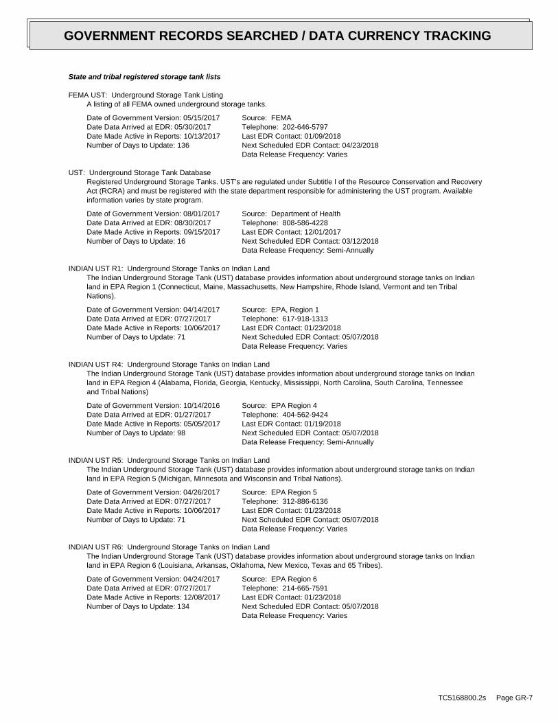
State and tribal registered storage tank lists
FEMA UST: Underground Storage Tank ListingA listing of all FEMA owned underground storage tanks.
Date of Government Version: 05/15/2017Date Data Arrived at EDR: 05/30/2017Date Made Active in Reports: 10/13/2017Number of Days to Update: 136
Source: FEMATelephone: 202-646-5797Last EDR Contact: 01/09/2018Next Scheduled EDR Contact: 04/23/2018Data Release Frequency: Varies
UST: Underground Storage Tank DatabaseRegistered Underground Storage Tanks. UST’s are regulated under Subtitle I of the Resource Conservation and RecoveryAct (RCRA) and must be registered with the state department responsible for administering the UST program. Availableinformation varies by state program.
Date of Government Version: 08/01/2017Date Data Arrived at EDR: 08/30/2017Date Made Active in Reports: 09/15/2017Number of Days to Update: 16
Source: Department of HealthTelephone: 808-586-4228Last EDR Contact: 12/01/2017Next Scheduled EDR Contact: 03/12/2018Data Release Frequency: Semi-Annually
INDIAN UST R1: Underground Storage Tanks on Indian LandThe Indian Underground Storage Tank (UST) database provides information about underground storage tanks on Indianland in EPA Region 1 (Connecticut, Maine, Massachusetts, New Hampshire, Rhode Island, Vermont and ten TribalNations).
Date of Government Version: 04/14/2017Date Data Arrived at EDR: 07/27/2017Date Made Active in Reports: 10/06/2017Number of Days to Update: 71
Source: EPA, Region 1Telephone: 617-918-1313Last EDR Contact: 01/23/2018Next Scheduled EDR Contact: 05/07/2018Data Release Frequency: Varies
INDIAN UST R4: Underground Storage Tanks on Indian LandThe Indian Underground Storage Tank (UST) database provides information about underground storage tanks on Indianland in EPA Region 4 (Alabama, Florida, Georgia, Kentucky, Mississippi, North Carolina, South Carolina, Tennesseeand Tribal Nations)
Date of Government Version: 10/14/2016Date Data Arrived at EDR: 01/27/2017Date Made Active in Reports: 05/05/2017Number of Days to Update: 98
Source: EPA Region 4Telephone: 404-562-9424Last EDR Contact: 01/19/2018Next Scheduled EDR Contact: 05/07/2018Data Release Frequency: Semi-Annually
INDIAN UST R5: Underground Storage Tanks on Indian LandThe Indian Underground Storage Tank (UST) database provides information about underground storage tanks on Indianland in EPA Region 5 (Michigan, Minnesota and Wisconsin and Tribal Nations).
Date of Government Version: 04/26/2017Date Data Arrived at EDR: 07/27/2017Date Made Active in Reports: 10/06/2017Number of Days to Update: 71
Source: EPA Region 5Telephone: 312-886-6136Last EDR Contact: 01/23/2018Next Scheduled EDR Contact: 05/07/2018Data Release Frequency: Varies
INDIAN UST R6: Underground Storage Tanks on Indian LandThe Indian Underground Storage Tank (UST) database provides information about underground storage tanks on Indianland in EPA Region 6 (Louisiana, Arkansas, Oklahoma, New Mexico, Texas and 65 Tribes).
Date of Government Version: 04/24/2017Date Data Arrived at EDR: 07/27/2017Date Made Active in Reports: 12/08/2017Number of Days to Update: 134
Source: EPA Region 6Telephone: 214-665-7591Last EDR Contact: 01/23/2018Next Scheduled EDR Contact: 05/07/2018Data Release Frequency: Varies
TC5168800.2s Page GR-7
GOVERNMENT RECORDS SEARCHED / DATA CURRENCY TRACKING
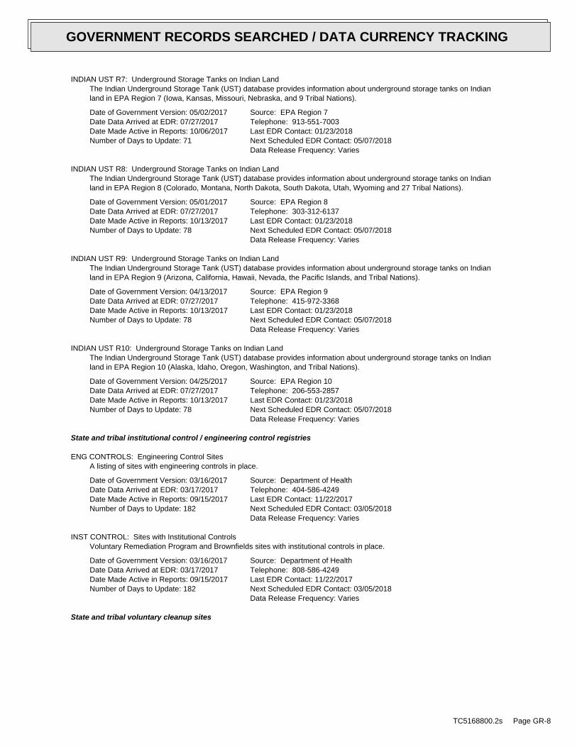
INDIAN UST R7: Underground Storage Tanks on Indian LandThe Indian Underground Storage Tank (UST) database provides information about underground storage tanks on Indianland in EPA Region 7 (Iowa, Kansas, Missouri, Nebraska, and 9 Tribal Nations).
Date of Government Version: 05/02/2017Date Data Arrived at EDR: 07/27/2017Date Made Active in Reports: 10/06/2017Number of Days to Update: 71
Source: EPA Region 7Telephone: 913-551-7003Last EDR Contact: 01/23/2018Next Scheduled EDR Contact: 05/07/2018Data Release Frequency: Varies
INDIAN UST R8: Underground Storage Tanks on Indian LandThe Indian Underground Storage Tank (UST) database provides information about underground storage tanks on Indianland in EPA Region 8 (Colorado, Montana, North Dakota, South Dakota, Utah, Wyoming and 27 Tribal Nations).
Date of Government Version: 05/01/2017Date Data Arrived at EDR: 07/27/2017Date Made Active in Reports: 10/13/2017Number of Days to Update: 78
Source: EPA Region 8Telephone: 303-312-6137Last EDR Contact: 01/23/2018Next Scheduled EDR Contact: 05/07/2018Data Release Frequency: Varies
INDIAN UST R9: Underground Storage Tanks on Indian LandThe Indian Underground Storage Tank (UST) database provides information about underground storage tanks on Indianland in EPA Region 9 (Arizona, California, Hawaii, Nevada, the Pacific Islands, and Tribal Nations).
Date of Government Version: 04/13/2017Date Data Arrived at EDR: 07/27/2017Date Made Active in Reports: 10/13/2017Number of Days to Update: 78
Source: EPA Region 9Telephone: 415-972-3368Last EDR Contact: 01/23/2018Next Scheduled EDR Contact: 05/07/2018Data Release Frequency: Varies
INDIAN UST R10: Underground Storage Tanks on Indian LandThe Indian Underground Storage Tank (UST) database provides information about underground storage tanks on Indianland in EPA Region 10 (Alaska, Idaho, Oregon, Washington, and Tribal Nations).
Date of Government Version: 04/25/2017Date Data Arrived at EDR: 07/27/2017Date Made Active in Reports: 10/13/2017Number of Days to Update: 78
Source: EPA Region 10Telephone: 206-553-2857Last EDR Contact: 01/23/2018Next Scheduled EDR Contact: 05/07/2018Data Release Frequency: Varies
State and tribal institutional control / engineering control registries
ENG CONTROLS: Engineering Control SitesA listing of sites with engineering controls in place.
Date of Government Version: 03/16/2017Date Data Arrived at EDR: 03/17/2017Date Made Active in Reports: 09/15/2017Number of Days to Update: 182
Source: Department of HealthTelephone: 404-586-4249Last EDR Contact: 11/22/2017Next Scheduled EDR Contact: 03/05/2018Data Release Frequency: Varies
INST CONTROL: Sites with Institutional ControlsVoluntary Remediation Program and Brownfields sites with institutional controls in place.
Date of Government Version: 03/16/2017Date Data Arrived at EDR: 03/17/2017Date Made Active in Reports: 09/15/2017Number of Days to Update: 182
Source: Department of HealthTelephone: 808-586-4249Last EDR Contact: 11/22/2017Next Scheduled EDR Contact: 03/05/2018Data Release Frequency: Varies
State and tribal voluntary cleanup sites
TC5168800.2s Page GR-8
GOVERNMENT RECORDS SEARCHED / DATA CURRENCY TRACKING

VCP: Voluntary Response Program SitesSites participating in the Voluntary Response Program. The purpose of the VRP is to streamline the cleanup processin a way that will encourage prospective developers, lenders, and purchasers to voluntarily cleanup properties.
Date of Government Version: 03/16/2017Date Data Arrived at EDR: 03/17/2017Date Made Active in Reports: 09/15/2017Number of Days to Update: 182
Source: Department of HealthTelephone: 808-586-4249Last EDR Contact: 11/22/2017Next Scheduled EDR Contact: 03/05/2018Data Release Frequency: Varies
INDIAN VCP R1: Voluntary Cleanup Priority ListingA listing of voluntary cleanup priority sites located on Indian Land located in Region 1.
Date of Government Version: 07/27/2015Date Data Arrived at EDR: 09/29/2015Date Made Active in Reports: 02/18/2016Number of Days to Update: 142
Source: EPA, Region 1Telephone: 617-918-1102Last EDR Contact: 12/20/2017Next Scheduled EDR Contact: 04/09/2018Data Release Frequency: Varies
INDIAN VCP R7: Voluntary Cleanup Priority LisitngA listing of voluntary cleanup priority sites located on Indian Land located in Region 7.
Date of Government Version: 03/20/2008Date Data Arrived at EDR: 04/22/2008Date Made Active in Reports: 05/19/2008Number of Days to Update: 27
Source: EPA, Region 7Telephone: 913-551-7365Last EDR Contact: 04/20/2009Next Scheduled EDR Contact: 07/20/2009Data Release Frequency: Varies
State and tribal Brownfields sites
BROWNFIELDS: Brownfields SitesWith certain legal exclusions and additions, the term ‘brownfield site’ means real property, the expansion, redevelopment,or reuse of which may be complicated by the presence or potential presence of a hazardous substance, pollutant,or contaminant.
Date of Government Version: 03/16/2017Date Data Arrived at EDR: 03/17/2017Date Made Active in Reports: 09/15/2017Number of Days to Update: 182
Source: Department of HealthTelephone: 808-586-4249Last EDR Contact: 11/22/2017Next Scheduled EDR Contact: 03/05/2018Data Release Frequency: Varies
ADDITIONAL ENVIRONMENTAL RECORDS
Local Brownfield lists
US BROWNFIELDS: A Listing of Brownfields SitesBrownfields are real property, the expansion, redevelopment, or reuse of which may be complicated by the presenceor potential presence of a hazardous substance, pollutant, or contaminant. Cleaning up and reinvesting in theseproperties takes development pressures off of undeveloped, open land, and both improves and protects the environment.Assessment, Cleanup and Redevelopment Exchange System (ACRES) stores information reported by EPA Brownfieldsgrant recipients on brownfields properties assessed or cleaned up with grant funding as well as information onTargeted Brownfields Assessments performed by EPA Regions. A listing of ACRES Brownfield sites is obtained fromCleanups in My Community. Cleanups in My Community provides information on Brownfields properties for which informationis reported back to EPA, as well as areas served by Brownfields grant programs.
Date of Government Version: 08/21/2017Date Data Arrived at EDR: 09/20/2017Date Made Active in Reports: 12/08/2017Number of Days to Update: 79
Source: Environmental Protection AgencyTelephone: 202-566-2777Last EDR Contact: 01/19/2018Next Scheduled EDR Contact: 04/02/2018Data Release Frequency: Semi-Annually
Local Lists of Landfill / Solid Waste Disposal Sites
TC5168800.2s Page GR-9
GOVERNMENT RECORDS SEARCHED / DATA CURRENCY TRACKING

INDIAN ODI: Report on the Status of Open Dumps on Indian LandsLocation of open dumps on Indian land.
Date of Government Version: 12/31/1998Date Data Arrived at EDR: 12/03/2007Date Made Active in Reports: 01/24/2008Number of Days to Update: 52
Source: Environmental Protection AgencyTelephone: 703-308-8245Last EDR Contact: 10/30/2017Next Scheduled EDR Contact: 02/12/2018Data Release Frequency: Varies
DEBRIS REGION 9: Torres Martinez Reservation Illegal Dump Site LocationsA listing of illegal dump sites location on the Torres Martinez Indian Reservation located in eastern RiversideCounty and northern Imperial County, California.
Date of Government Version: 01/12/2009Date Data Arrived at EDR: 05/07/2009Date Made Active in Reports: 09/21/2009Number of Days to Update: 137
Source: EPA, Region 9Telephone: 415-947-4219Last EDR Contact: 01/22/2018Next Scheduled EDR Contact: 05/07/2018Data Release Frequency: No Update Planned
ODI: Open Dump InventoryAn open dump is defined as a disposal facility that does not comply with one or more of the Part 257 or Part 258Subtitle D Criteria.
Date of Government Version: 06/30/1985Date Data Arrived at EDR: 08/09/2004Date Made Active in Reports: 09/17/2004Number of Days to Update: 39
Source: Environmental Protection AgencyTelephone: 800-424-9346Last EDR Contact: 06/09/2004Next Scheduled EDR Contact: N/AData Release Frequency: No Update Planned
IHS OPEN DUMPS: Open Dumps on Indian LandA listing of all open dumps located on Indian Land in the United States.
Date of Government Version: 04/01/2014Date Data Arrived at EDR: 08/06/2014Date Made Active in Reports: 01/29/2015Number of Days to Update: 176
Source: Department of Health & Human Serivces, Indian Health ServiceTelephone: 301-443-1452Last EDR Contact: 11/03/2017Next Scheduled EDR Contact: 02/12/2018Data Release Frequency: Varies
Local Lists of Hazardous waste / Contaminated Sites
US HIST CDL: National Clandestine Laboratory RegisterA listing of clandestine drug lab locations that have been removed from the DEAs National Clandestine LaboratoryRegister.
Date of Government Version: 07/13/2017Date Data Arrived at EDR: 09/06/2017Date Made Active in Reports: 10/06/2017Number of Days to Update: 30
Source: Drug Enforcement AdministrationTelephone: 202-307-1000Last EDR Contact: 11/28/2017Next Scheduled EDR Contact: 03/12/2018Data Release Frequency: No Update Planned
CDL: Clandestine Drug Lab ListingA listing of clandestine drug lab site locations.
Date of Government Version: 08/04/2010Date Data Arrived at EDR: 09/10/2010Date Made Active in Reports: 10/22/2010Number of Days to Update: 42
Source: Department of HealthTelephone: 808-586-4249Last EDR Contact: 11/21/2017Next Scheduled EDR Contact: 03/12/2018Data Release Frequency: Varies
TC5168800.2s Page GR-10
GOVERNMENT RECORDS SEARCHED / DATA CURRENCY TRACKING

US CDL: Clandestine Drug LabsA listing of clandestine drug lab locations. The U.S. Department of Justice ("the Department") provides thisweb site as a public service. It contains addresses of some locations where law enforcement agencies reportedthey found chemicals or other items that indicated the presence of either clandestine drug laboratories or dumpsites.In most cases, the source of the entries is not the Department, and the Department has not verified the entryand does not guarantee its accuracy. Members of the public must verify the accuracy of all entries by, for example,contacting local law enforcement and local health departments.
Date of Government Version: 07/13/2017Date Data Arrived at EDR: 09/06/2017Date Made Active in Reports: 10/06/2017Number of Days to Update: 30
Source: Drug Enforcement AdministrationTelephone: 202-307-1000Last EDR Contact: 01/19/2018Next Scheduled EDR Contact: 03/12/2018Data Release Frequency: Quarterly
Local Land Records
LIENS 2: CERCLA Lien InformationA Federal CERCLA (’Superfund’) lien can exist by operation of law at any site or property at which EPA has spentSuperfund monies. These monies are spent to investigate and address releases and threatened releases of contamination.CERCLIS provides information as to the identity of these sites and properties.
Date of Government Version: 12/11/2017Date Data Arrived at EDR: 12/22/2017Date Made Active in Reports: 01/12/2018Number of Days to Update: 21
Source: Environmental Protection AgencyTelephone: 202-564-6023Last EDR Contact: 12/22/2017Next Scheduled EDR Contact: 05/07/2018Data Release Frequency: Semi-Annually
Records of Emergency Release Reports
HMIRS: Hazardous Materials Information Reporting SystemHazardous Materials Incident Report System. HMIRS contains hazardous material spill incidents reported to DOT.
Date of Government Version: 09/21/2017Date Data Arrived at EDR: 09/21/2017Date Made Active in Reports: 10/13/2017Number of Days to Update: 22
Source: U.S. Department of TransportationTelephone: 202-366-4555Last EDR Contact: 01/19/2018Next Scheduled EDR Contact: 04/09/2018Data Release Frequency: Quarterly
SPILLS: Release NotificationsReleases of hazardous substances to the environment reported to the Office of Hazard Evaluation and EmergencyResponse since 1988.
Date of Government Version: 03/16/2017Date Data Arrived at EDR: 03/17/2017Date Made Active in Reports: 09/15/2017Number of Days to Update: 182
Source: Department of HealthTelephone: 808-586-4249Last EDR Contact: 11/22/2017Next Scheduled EDR Contact: 03/05/2018Data Release Frequency: Varies
SPILLS 90: SPILLS90 data from FirstSearchSpills 90 includes those spill and release records available exclusively from FirstSearch databases. Typically,they may include chemical, oil and/or hazardous substance spills recorded after 1990. Duplicate records that arealready included in EDR incident and release records are not included in Spills 90.
Date of Government Version: 03/10/2012Date Data Arrived at EDR: 01/03/2013Date Made Active in Reports: 02/11/2013Number of Days to Update: 39
Source: FirstSearchTelephone: N/ALast EDR Contact: 01/03/2013Next Scheduled EDR Contact: N/AData Release Frequency: No Update Planned
Other Ascertainable Records
TC5168800.2s Page GR-11
GOVERNMENT RECORDS SEARCHED / DATA CURRENCY TRACKING

RCRA NonGen / NLR: RCRA - Non Generators / No Longer RegulatedRCRAInfo is EPA’s comprehensive information system, providing access to data supporting the Resource Conservationand Recovery Act (RCRA) of 1976 and the Hazardous and Solid Waste Amendments (HSWA) of 1984. The databaseincludes selective information on sites which generate, transport, store, treat and/or dispose of hazardous wasteas defined by the Resource Conservation and Recovery Act (RCRA). Non-Generators do not presently generate hazardouswaste.
Date of Government Version: 09/13/2017Date Data Arrived at EDR: 09/26/2017Date Made Active in Reports: 10/06/2017Number of Days to Update: 10
Source: Environmental Protection AgencyTelephone: (415) 495-8895Last EDR Contact: 01/19/2018Next Scheduled EDR Contact: 04/09/2018Data Release Frequency: Quarterly
FUDS: Formerly Used Defense SitesThe listing includes locations of Formerly Used Defense Sites properties where the US Army Corps of Engineersis actively working or will take necessary cleanup actions.
Date of Government Version: 01/31/2015Date Data Arrived at EDR: 07/08/2015Date Made Active in Reports: 10/13/2015Number of Days to Update: 97
Source: U.S. Army Corps of EngineersTelephone: 202-528-4285Last EDR Contact: 11/22/2017Next Scheduled EDR Contact: 03/05/2018Data Release Frequency: Varies
DOD: Department of Defense SitesThis data set consists of federally owned or administered lands, administered by the Department of Defense, thathave any area equal to or greater than 640 acres of the United States, Puerto Rico, and the U.S. Virgin Islands.
Date of Government Version: 12/31/2005Date Data Arrived at EDR: 11/10/2006Date Made Active in Reports: 01/11/2007Number of Days to Update: 62
Source: USGSTelephone: 888-275-8747Last EDR Contact: 10/13/2017Next Scheduled EDR Contact: 01/22/2018Data Release Frequency: Semi-Annually
FEDLAND: Federal and Indian LandsFederally and Indian administrated lands of the United States. Lands included are administrated by: Army Corpsof Engineers, Bureau of Reclamation, National Wild and Scenic River, National Wildlife Refuge, Public Domain Land,Wilderness, Wilderness Study Area, Wildlife Management Area, Bureau of Indian Affairs, Bureau of Land Management,Department of Justice, Forest Service, Fish and Wildlife Service, National Park Service.
Date of Government Version: 12/31/2005Date Data Arrived at EDR: 02/06/2006Date Made Active in Reports: 01/11/2007Number of Days to Update: 339
Source: U.S. Geological SurveyTelephone: 888-275-8747Last EDR Contact: 10/11/2017Next Scheduled EDR Contact: 01/22/2018Data Release Frequency: N/A
SCRD DRYCLEANERS: State Coalition for Remediation of Drycleaners ListingThe State Coalition for Remediation of Drycleaners was established in 1998, with support from the U.S. EPA Officeof Superfund Remediation and Technology Innovation. It is comprised of representatives of states with establisheddrycleaner remediation programs. Currently the member states are Alabama, Connecticut, Florida, Illinois, Kansas,Minnesota, Missouri, North Carolina, Oregon, South Carolina, Tennessee, Texas, and Wisconsin.
Date of Government Version: 01/01/2017Date Data Arrived at EDR: 02/03/2017Date Made Active in Reports: 04/07/2017Number of Days to Update: 63
Source: Environmental Protection AgencyTelephone: 615-532-8599Last EDR Contact: 11/17/2017Next Scheduled EDR Contact: 02/26/2018Data Release Frequency: Varies
US FIN ASSUR: Financial Assurance InformationAll owners and operators of facilities that treat, store, or dispose of hazardous waste are required to provideproof that they will have sufficient funds to pay for the clean up, closure, and post-closure care of their facilities.
TC5168800.2s Page GR-12
GOVERNMENT RECORDS SEARCHED / DATA CURRENCY TRACKING

Date of Government Version: 10/17/2017Date Data Arrived at EDR: 11/01/2017Date Made Active in Reports: 12/08/2017Number of Days to Update: 37
Source: Environmental Protection AgencyTelephone: 202-566-1917Last EDR Contact: 01/19/2018Next Scheduled EDR Contact: 04/09/2018Data Release Frequency: Quarterly
EPA WATCH LIST: EPA WATCH LISTEPA maintains a "Watch List" to facilitate dialogue between EPA, state and local environmental agencies on enforcementmatters relating to facilities with alleged violations identified as either significant or high priority. Beingon the Watch List does not mean that the facility has actually violated the law only that an investigation byEPA or a state or local environmental agency has led those organizations to allege that an unproven violationhas in fact occurred. Being on the Watch List does not represent a higher level of concern regarding the allegedviolations that were detected, but instead indicates cases requiring additional dialogue between EPA, state andlocal agencies - primarily because of the length of time the alleged violation has gone unaddressed or unresolved.
Date of Government Version: 08/30/2013Date Data Arrived at EDR: 03/21/2014Date Made Active in Reports: 06/17/2014Number of Days to Update: 88
Source: Environmental Protection AgencyTelephone: 617-520-3000Last EDR Contact: 11/06/2017Next Scheduled EDR Contact: 02/19/2018Data Release Frequency: Quarterly
2020 COR ACTION: 2020 Corrective Action Program ListThe EPA has set ambitious goals for the RCRA Corrective Action program by creating the 2020 Corrective ActionUniverse. This RCRA cleanup baseline includes facilities expected to need corrective action. The 2020 universecontains a wide variety of sites. Some properties are heavily contaminated while others were contaminated buthave since been cleaned up. Still others have not been fully investigated yet, and may require little or no remediation.Inclusion in the 2020 Universe does not necessarily imply failure on the part of a facility to meet its RCRA obligations.
Date of Government Version: 04/22/2013Date Data Arrived at EDR: 03/03/2015Date Made Active in Reports: 03/09/2015Number of Days to Update: 6
Source: Environmental Protection AgencyTelephone: 703-308-4044Last EDR Contact: 11/09/2017Next Scheduled EDR Contact: 02/19/2018Data Release Frequency: Varies
TSCA: Toxic Substances Control ActToxic Substances Control Act. TSCA identifies manufacturers and importers of chemical substances included on theTSCA Chemical Substance Inventory list. It includes data on the production volume of these substances by plantsite.
Date of Government Version: 12/31/2016Date Data Arrived at EDR: 06/21/2017Date Made Active in Reports: 01/05/2018Number of Days to Update: 198
Source: EPATelephone: 202-260-5521Last EDR Contact: 12/22/2017Next Scheduled EDR Contact: 04/02/2018Data Release Frequency: Every 4 Years
TRIS: Toxic Chemical Release Inventory SystemToxic Release Inventory System. TRIS identifies facilities which release toxic chemicals to the air, water andland in reportable quantities under SARA Title III Section 313.
Date of Government Version: 12/31/2016Date Data Arrived at EDR: 01/10/2018Date Made Active in Reports: 01/12/2018Number of Days to Update: 2
Source: EPATelephone: 202-566-0250Last EDR Contact: 01/10/2018Next Scheduled EDR Contact: 03/05/2018Data Release Frequency: Annually
SSTS: Section 7 Tracking SystemsSection 7 of the Federal Insecticide, Fungicide and Rodenticide Act, as amended (92 Stat. 829) requires allregistered pesticide-producing establishments to submit a report to the Environmental Protection Agency by March1st each year. Each establishment must report the types and amounts of pesticides, active ingredients and devicesbeing produced, and those having been produced and sold or distributed in the past year.
TC5168800.2s Page GR-13
GOVERNMENT RECORDS SEARCHED / DATA CURRENCY TRACKING

Date of Government Version: 12/31/2009Date Data Arrived at EDR: 12/10/2010Date Made Active in Reports: 02/25/2011Number of Days to Update: 77
Source: EPATelephone: 202-564-4203Last EDR Contact: 10/27/2017Next Scheduled EDR Contact: 02/05/2018Data Release Frequency: Annually
ROD: Records Of DecisionRecord of Decision. ROD documents mandate a permanent remedy at an NPL (Superfund) site containing technicaland health information to aid in the cleanup.
Date of Government Version: 12/11/2017Date Data Arrived at EDR: 12/22/2017Date Made Active in Reports: 01/12/2018Number of Days to Update: 21
Source: EPATelephone: 703-416-0223Last EDR Contact: 12/22/2017Next Scheduled EDR Contact: 03/19/2018Data Release Frequency: Annually
RMP: Risk Management PlansWhen Congress passed the Clean Air Act Amendments of 1990, it required EPA to publish regulations and guidancefor chemical accident prevention at facilities using extremely hazardous substances. The Risk Management ProgramRule (RMP Rule) was written to implement Section 112(r) of these amendments. The rule, which built upon existingindustry codes and standards, requires companies of all sizes that use certain flammable and toxic substancesto develop a Risk Management Program, which includes a(n): Hazard assessment that details the potential effectsof an accidental release, an accident history of the last five years, and an evaluation of worst-case and alternativeaccidental releases; Prevention program that includes safety precautions and maintenance, monitoring, and employeetraining measures; and Emergency response program that spells out emergency health care, employee training measuresand procedures for informing the public and response agencies (e.g the fire department) should an accident occur.
Date of Government Version: 11/02/2017Date Data Arrived at EDR: 11/17/2017Date Made Active in Reports: 12/08/2017Number of Days to Update: 21
Source: Environmental Protection AgencyTelephone: 202-564-8600Last EDR Contact: 01/19/2018Next Scheduled EDR Contact: 05/07/2018Data Release Frequency: Varies
RAATS: RCRA Administrative Action Tracking SystemRCRA Administration Action Tracking System. RAATS contains records based on enforcement actions issued under RCRApertaining to major violators and includes administrative and civil actions brought by the EPA. For administrationactions after September 30, 1995, data entry in the RAATS database was discontinued. EPA will retain a copy ofthe database for historical records. It was necessary to terminate RAATS because a decrease in agency resourcesmade it impossible to continue to update the information contained in the database.
Date of Government Version: 04/17/1995Date Data Arrived at EDR: 07/03/1995Date Made Active in Reports: 08/07/1995Number of Days to Update: 35
Source: EPATelephone: 202-564-4104Last EDR Contact: 06/02/2008Next Scheduled EDR Contact: 09/01/2008Data Release Frequency: No Update Planned
PRP: Potentially Responsible PartiesA listing of verified Potentially Responsible Parties
Date of Government Version: 10/25/2013Date Data Arrived at EDR: 10/17/2014Date Made Active in Reports: 10/20/2014Number of Days to Update: 3
Source: EPATelephone: 202-564-6023Last EDR Contact: 12/22/2017Next Scheduled EDR Contact: 02/19/2018Data Release Frequency: Quarterly
PADS: PCB Activity Database SystemPCB Activity Database. PADS Identifies generators, transporters, commercial storers and/or brokers and disposersof PCB’s who are required to notify the EPA of such activities.
TC5168800.2s Page GR-14
GOVERNMENT RECORDS SEARCHED / DATA CURRENCY TRACKING
Date of Government Version: 06/01/2017Date Data Arrived at EDR: 06/09/2017Date Made Active in Reports: 10/13/2017Number of Days to Update: 126
Source: EPATelephone: 202-566-0500Last EDR Contact: 01/12/2018Next Scheduled EDR Contact: 04/23/2018Data Release Frequency: Annually
ICIS: Integrated Compliance Information SystemThe Integrated Compliance Information System (ICIS) supports the information needs of the national enforcementand compliance program as well as the unique needs of the National Pollutant Discharge Elimination System (NPDES)program.
Date of Government Version: 11/18/2016Date Data Arrived at EDR: 11/23/2016Date Made Active in Reports: 02/10/2017Number of Days to Update: 79
Source: Environmental Protection AgencyTelephone: 202-564-2501Last EDR Contact: 01/09/2018Next Scheduled EDR Contact: 04/23/2018Data Release Frequency: Quarterly
FTTS: FIFRA/ TSCA Tracking System - FIFRA (Federal Insecticide, Fungicide, & Rodenticide Act)/TSCA (Toxic Substances Control Act)FTTS tracks administrative cases and pesticide enforcement actions and compliance activities related to FIFRA,TSCA and EPCRA (Emergency Planning and Community Right-to-Know Act). To maintain currency, EDR contacts theAgency on a quarterly basis.
Date of Government Version: 04/09/2009Date Data Arrived at EDR: 04/16/2009Date Made Active in Reports: 05/11/2009Number of Days to Update: 25
Source: EPA/Office of Prevention, Pesticides and Toxic SubstancesTelephone: 202-566-1667Last EDR Contact: 08/18/2017Next Scheduled EDR Contact: 12/04/2017Data Release Frequency: Quarterly
FTTS INSP: FIFRA/ TSCA Tracking System - FIFRA (Federal Insecticide, Fungicide, & Rodenticide Act)/TSCA (Toxic Substances Control Act)A listing of FIFRA/TSCA Tracking System (FTTS) inspections and enforcements.
Date of Government Version: 04/09/2009Date Data Arrived at EDR: 04/16/2009Date Made Active in Reports: 05/11/2009Number of Days to Update: 25
Source: EPATelephone: 202-566-1667Last EDR Contact: 08/18/2017Next Scheduled EDR Contact: 12/04/2017Data Release Frequency: Quarterly
MLTS: Material Licensing Tracking SystemMLTS is maintained by the Nuclear Regulatory Commission and contains a list of approximately 8,100 sites whichpossess or use radioactive materials and which are subject to NRC licensing requirements. To maintain currency,EDR contacts the Agency on a quarterly basis.
Date of Government Version: 08/30/2016Date Data Arrived at EDR: 09/08/2016Date Made Active in Reports: 10/21/2016Number of Days to Update: 43
Source: Nuclear Regulatory CommissionTelephone: 301-415-7169Last EDR Contact: 01/19/2018Next Scheduled EDR Contact: 11/20/2017Data Release Frequency: Quarterly
COAL ASH DOE: Steam-Electric Plant Operation DataA listing of power plants that store ash in surface ponds.
Date of Government Version: 12/31/2005Date Data Arrived at EDR: 08/07/2009Date Made Active in Reports: 10/22/2009Number of Days to Update: 76
Source: Department of EnergyTelephone: 202-586-8719Last EDR Contact: 12/05/2017Next Scheduled EDR Contact: 03/19/2018Data Release Frequency: Varies
COAL ASH EPA: Coal Combustion Residues Surface Impoundments ListA listing of coal combustion residues surface impoundments with high hazard potential ratings.
TC5168800.2s Page GR-15
GOVERNMENT RECORDS SEARCHED / DATA CURRENCY TRACKING

Date of Government Version: 07/01/2014Date Data Arrived at EDR: 09/10/2014Date Made Active in Reports: 10/20/2014Number of Days to Update: 40
Source: Environmental Protection AgencyTelephone: N/ALast EDR Contact: 12/08/2017Next Scheduled EDR Contact: 03/19/2018Data Release Frequency: Varies
PCB TRANSFORMER: PCB Transformer Registration DatabaseThe database of PCB transformer registrations that includes all PCB registration submittals.
Date of Government Version: 05/24/2017Date Data Arrived at EDR: 11/30/2017Date Made Active in Reports: 12/15/2017Number of Days to Update: 15
Source: Environmental Protection AgencyTelephone: 202-566-0517Last EDR Contact: 10/26/2017Next Scheduled EDR Contact: 02/05/2018Data Release Frequency: Varies
RADINFO: Radiation Information DatabaseThe Radiation Information Database (RADINFO) contains information about facilities that are regulated by U.S.Environmental Protection Agency (EPA) regulations for radiation and radioactivity.
Date of Government Version: 10/02/2017Date Data Arrived at EDR: 10/05/2017Date Made Active in Reports: 10/13/2017Number of Days to Update: 8
Source: Environmental Protection AgencyTelephone: 202-343-9775Last EDR Contact: 01/04/2018Next Scheduled EDR Contact: 04/16/2018Data Release Frequency: Quarterly
HIST FTTS: FIFRA/TSCA Tracking System Administrative Case ListingA complete administrative case listing from the FIFRA/TSCA Tracking System (FTTS) for all ten EPA regions. Theinformation was obtained from the National Compliance Database (NCDB). NCDB supports the implementation of FIFRA(Federal Insecticide, Fungicide, and Rodenticide Act) and TSCA (Toxic Substances Control Act). Some EPA regionsare now closing out records. Because of that, and the fact that some EPA regions are not providing EPA Headquarterswith updated records, it was decided to create a HIST FTTS database. It included records that may not be includedin the newer FTTS database updates. This database is no longer updated.
Date of Government Version: 10/19/2006Date Data Arrived at EDR: 03/01/2007Date Made Active in Reports: 04/10/2007Number of Days to Update: 40
Source: Environmental Protection AgencyTelephone: 202-564-2501Last EDR Contact: 12/17/2007Next Scheduled EDR Contact: 03/17/2008Data Release Frequency: No Update Planned
HIST FTTS INSP: FIFRA/TSCA Tracking System Inspection & Enforcement Case ListingA complete inspection and enforcement case listing from the FIFRA/TSCA Tracking System (FTTS) for all ten EPAregions. The information was obtained from the National Compliance Database (NCDB). NCDB supports the implementationof FIFRA (Federal Insecticide, Fungicide, and Rodenticide Act) and TSCA (Toxic Substances Control Act). SomeEPA regions are now closing out records. Because of that, and the fact that some EPA regions are not providingEPA Headquarters with updated records, it was decided to create a HIST FTTS database. It included records thatmay not be included in the newer FTTS database updates. This database is no longer updated.
Date of Government Version: 10/19/2006Date Data Arrived at EDR: 03/01/2007Date Made Active in Reports: 04/10/2007Number of Days to Update: 40
Source: Environmental Protection AgencyTelephone: 202-564-2501Last EDR Contact: 12/17/2008Next Scheduled EDR Contact: 03/17/2008Data Release Frequency: No Update Planned
DOT OPS: Incident and Accident DataDepartment of Transporation, Office of Pipeline Safety Incident and Accident data.
Date of Government Version: 07/31/2012Date Data Arrived at EDR: 08/07/2012Date Made Active in Reports: 09/18/2012Number of Days to Update: 42
Source: Department of Transporation, Office of Pipeline SafetyTelephone: 202-366-4595Last EDR Contact: 01/19/2018Next Scheduled EDR Contact: 02/12/2018Data Release Frequency: Varies
TC5168800.2s Page GR-16
GOVERNMENT RECORDS SEARCHED / DATA CURRENCY TRACKING

CONSENT: Superfund (CERCLA) Consent DecreesMajor legal settlements that establish responsibility and standards for cleanup at NPL (Superfund) sites. Releasedperiodically by United States District Courts after settlement by parties to litigation matters.
Date of Government Version: 09/30/2017Date Data Arrived at EDR: 11/10/2017Date Made Active in Reports: 01/12/2018Number of Days to Update: 63
Source: Department of Justice, Consent Decree LibraryTelephone: VariesLast EDR Contact: 01/04/2018Next Scheduled EDR Contact: 04/02/2018Data Release Frequency: Varies
BRS: Biennial Reporting SystemThe Biennial Reporting System is a national system administered by the EPA that collects data on the generationand management of hazardous waste. BRS captures detailed data from two groups: Large Quantity Generators (LQG)and Treatment, Storage, and Disposal Facilities.
Date of Government Version: 12/31/2015Date Data Arrived at EDR: 02/22/2017Date Made Active in Reports: 09/28/2017Number of Days to Update: 218
Source: EPA/NTISTelephone: 800-424-9346Last EDR Contact: 11/20/2017Next Scheduled EDR Contact: 03/05/2018Data Release Frequency: Biennially
INDIAN RESERV: Indian ReservationsThis map layer portrays Indian administered lands of the United States that have any area equal to or greaterthan 640 acres.
Date of Government Version: 12/31/2014Date Data Arrived at EDR: 07/14/2015Date Made Active in Reports: 01/10/2017Number of Days to Update: 546
Source: USGSTelephone: 202-208-3710Last EDR Contact: 01/09/2018Next Scheduled EDR Contact: 04/23/2018Data Release Frequency: Semi-Annually
FUSRAP: Formerly Utilized Sites Remedial Action ProgramDOE established the Formerly Utilized Sites Remedial Action Program (FUSRAP) in 1974 to remediate sites whereradioactive contamination remained from Manhattan Project and early U.S. Atomic Energy Commission (AEC) operations.
Date of Government Version: 12/23/2016Date Data Arrived at EDR: 12/27/2016Date Made Active in Reports: 02/17/2017Number of Days to Update: 52
Source: Department of EnergyTelephone: 202-586-3559Last EDR Contact: 01/19/2018Next Scheduled EDR Contact: 02/19/2018Data Release Frequency: Varies
UMTRA: Uranium Mill Tailings SitesUranium ore was mined by private companies for federal government use in national defense programs. When the millsshut down, large piles of the sand-like material (mill tailings) remain after uranium has been extracted fromthe ore. Levels of human exposure to radioactive materials from the piles are low; however, in some cases tailingswere used as construction materials before the potential health hazards of the tailings were recognized.
Date of Government Version: 06/23/2017Date Data Arrived at EDR: 10/11/2017Date Made Active in Reports: 11/03/2017Number of Days to Update: 23
Source: Department of EnergyTelephone: 505-845-0011Last EDR Contact: 11/22/2017Next Scheduled EDR Contact: 03/05/2018Data Release Frequency: Varies
LEAD SMELTER 1: Lead Smelter SitesA listing of former lead smelter site locations.
Date of Government Version: 10/10/2017Date Data Arrived at EDR: 11/03/2017Date Made Active in Reports: 12/15/2017Number of Days to Update: 42
Source: Environmental Protection AgencyTelephone: 703-603-8787Last EDR Contact: 12/22/2017Next Scheduled EDR Contact: 04/16/2018Data Release Frequency: Varies
TC5168800.2s Page GR-17
GOVERNMENT RECORDS SEARCHED / DATA CURRENCY TRACKING

LEAD SMELTER 2: Lead Smelter SitesA list of several hundred sites in the U.S. where secondary lead smelting was done from 1931and 1964. These sitesmay pose a threat to public health through ingestion or inhalation of contaminated soil or dust
Date of Government Version: 04/05/2001Date Data Arrived at EDR: 10/27/2010Date Made Active in Reports: 12/02/2010Number of Days to Update: 36
Source: American Journal of Public HealthTelephone: 703-305-6451Last EDR Contact: 12/02/2009Next Scheduled EDR Contact: N/AData Release Frequency: No Update Planned
US AIRS (AFS): Aerometric Information Retrieval System Facility Subsystem (AFS)The database is a sub-system of Aerometric Information Retrieval System (AIRS). AFS contains compliance dataon air pollution point sources regulated by the U.S. EPA and/or state and local air regulatory agencies. Thisinformation comes from source reports by various stationary sources of air pollution, such as electric power plants,steel mills, factories, and universities, and provides information about the air pollutants they produce. Action,air program, air program pollutant, and general level plant data. It is used to track emissions and compliancedata from industrial plants.
Date of Government Version: 10/12/2016Date Data Arrived at EDR: 10/26/2016Date Made Active in Reports: 02/03/2017Number of Days to Update: 100
Source: EPATelephone: 202-564-2496Last EDR Contact: 09/26/2017Next Scheduled EDR Contact: 01/08/2018Data Release Frequency: Annually
US AIRS MINOR: Air Facility System DataA listing of minor source facilities.
Date of Government Version: 10/12/2016Date Data Arrived at EDR: 10/26/2016Date Made Active in Reports: 02/03/2017Number of Days to Update: 100
Source: EPATelephone: 202-564-2496Last EDR Contact: 09/26/2017Next Scheduled EDR Contact: 01/08/2018Data Release Frequency: Annually
US MINES: Mines Master Index FileContains all mine identification numbers issued for mines active or opened since 1971. The data also includesviolation information.
Date of Government Version: 10/29/2017Date Data Arrived at EDR: 11/28/2017Date Made Active in Reports: 01/12/2018Number of Days to Update: 45
Source: Department of Labor, Mine Safety and Health AdministrationTelephone: 303-231-5959Last EDR Contact: 11/28/2017Next Scheduled EDR Contact: 03/12/2018Data Release Frequency: Semi-Annually
US MINES 2: Ferrous and Nonferrous Metal Mines Database ListingThis map layer includes ferrous (ferrous metal mines are facilities that extract ferrous metals, such as ironore or molybdenum) and nonferrous (Nonferrous metal mines are facilities that extract nonferrous metals, suchas gold, silver, copper, zinc, and lead) metal mines in the United States.
Date of Government Version: 12/05/2005Date Data Arrived at EDR: 02/29/2008Date Made Active in Reports: 04/18/2008Number of Days to Update: 49
Source: USGSTelephone: 703-648-7709Last EDR Contact: 12/01/2017Next Scheduled EDR Contact: 03/12/2018Data Release Frequency: Varies
US MINES 3: Active Mines & Mineral Plants Database ListingActive Mines and Mineral Processing Plant operations for commodities monitored by the Minerals Information Teamof the USGS.
Date of Government Version: 04/14/2011Date Data Arrived at EDR: 06/08/2011Date Made Active in Reports: 09/13/2011Number of Days to Update: 97
Source: USGSTelephone: 703-648-7709Last EDR Contact: 12/01/2017Next Scheduled EDR Contact: 03/12/2018Data Release Frequency: Varies
TC5168800.2s Page GR-18
GOVERNMENT RECORDS SEARCHED / DATA CURRENCY TRACKING

ABANDONED MINES: Abandoned MinesAn inventory of land and water impacted by past mining (primarily coal mining) is maintained by OSMRE to provideinformation needed to implement the Surface Mining Control and Reclamation Act of 1977 (SMCRA). The inventorycontains information on the location, type, and extent of AML impacts, as well as, information on the cost associatedwith the reclamation of those problems. The inventory is based upon field surveys by State, Tribal, and OSMREprogram officials. It is dynamic to the extent that it is modified as new problems are identified and existingproblems are reclaimed.
Date of Government Version: 09/25/2017Date Data Arrived at EDR: 09/26/2017Date Made Active in Reports: 10/20/2017Number of Days to Update: 24
Source: Department of InteriorTelephone: 202-208-2609Last EDR Contact: 12/19/2017Next Scheduled EDR Contact: 03/26/2018Data Release Frequency: Quarterly
FINDS: Facility Index System/Facility Registry SystemFacility Index System. FINDS contains both facility information and ’pointers’ to other sources that contain moredetail. EDR includes the following FINDS databases in this report: PCS (Permit Compliance System), AIRS (AerometricInformation Retrieval System), DOCKET (Enforcement Docket used to manage and track information on civil judicialenforcement cases for all environmental statutes), FURS (Federal Underground Injection Control), C-DOCKET (CriminalDocket System used to track criminal enforcement actions for all environmental statutes), FFIS (Federal FacilitiesInformation System), STATE (State Environmental Laws and Statutes), and PADS (PCB Activity Data System).
Date of Government Version: 07/23/2017Date Data Arrived at EDR: 09/06/2017Date Made Active in Reports: 09/15/2017Number of Days to Update: 9
Source: EPATelephone: (415) 947-8000Last EDR Contact: 01/19/2018Next Scheduled EDR Contact: 03/19/2018Data Release Frequency: Quarterly
DOCKET HWC: Hazardous Waste Compliance Docket ListingA complete list of the Federal Agency Hazardous Waste Compliance Docket Facilities.
Date of Government Version: 06/27/2017Date Data Arrived at EDR: 11/21/2017Date Made Active in Reports: 01/12/2018Number of Days to Update: 52
Source: Environmental Protection AgencyTelephone: 202-564-0527Last EDR Contact: 01/19/2018Next Scheduled EDR Contact: 03/12/2018Data Release Frequency: Varies
UXO: Unexploded Ordnance SitesA listing of unexploded ordnance site locations
Date of Government Version: 09/30/2016Date Data Arrived at EDR: 10/31/2017Date Made Active in Reports: 01/12/2018Number of Days to Update: 73
Source: Department of DefenseTelephone: 703-704-1564Last EDR Contact: 01/02/2018Next Scheduled EDR Contact: 04/30/2018Data Release Frequency: Varies
ECHO: Enforcement & Compliance History InformationECHO provides integrated compliance and enforcement information for about 800,000 regulated facilities nationwide.
Date of Government Version: 09/02/2017Date Data Arrived at EDR: 09/06/2017Date Made Active in Reports: 10/20/2017Number of Days to Update: 44
Source: Environmental Protection AgencyTelephone: 202-564-2280Last EDR Contact: 01/19/2018Next Scheduled EDR Contact: 03/19/2018Data Release Frequency: Quarterly
FUELS PROGRAM: EPA Fuels Program Registered ListingThis listing includes facilities that are registered under the Part 80 (Code of Federal Regulations) EPA FuelsPrograms. All companies now are required to submit new and updated registrations.
TC5168800.2s Page GR-19
GOVERNMENT RECORDS SEARCHED / DATA CURRENCY TRACKING

Date of Government Version: 11/20/2017Date Data Arrived at EDR: 11/20/2017Date Made Active in Reports: 01/12/2018Number of Days to Update: 53
Source: EPATelephone: 800-385-6164Last EDR Contact: 01/19/2018Next Scheduled EDR Contact: 03/05/2018Data Release Frequency: Quarterly
AIRS: List of Permitted FacilitiesA listing of permitted facilities in the state.
Date of Government Version: 01/02/2018Date Data Arrived at EDR: 01/04/2018Date Made Active in Reports: 01/17/2018Number of Days to Update: 13
Source: Department of HealthTelephone: 808-586-4200Last EDR Contact: 01/02/2018Next Scheduled EDR Contact: 04/16/2018Data Release Frequency: Varies
DRYCLEANERS: Permitted Drycleaner Facility ListingA listing of permitted drycleaner facilities in the state.
Date of Government Version: 01/02/2018Date Data Arrived at EDR: 01/04/2018Date Made Active in Reports: 01/17/2018Number of Days to Update: 13
Source: Department of HealthTelephone: 808-586-4200Last EDR Contact: 01/02/2018Next Scheduled EDR Contact: 04/16/2018Data Release Frequency: Varies
Financial Assurance: Financial Assurance Information ListingA listing of financial assurance information for underground storage tank facilities. Financial assurance is intendedto ensure that resources are available to pay for the cost of closure, post-closure care, and corrective measuresif the owner or operator of a regulated facility is unable or unwilling to pay.
Date of Government Version: 12/18/2017Date Data Arrived at EDR: 12/26/2017Date Made Active in Reports: 01/16/2018Number of Days to Update: 21
Source: Department of HealthTelephone: 808-586-4226Last EDR Contact: 12/19/2017Next Scheduled EDR Contact: 03/26/2018Data Release Frequency: Varies
UIC: Underground Injection Wells ListingA listing of underground injection well locations.
Date of Government Version: 02/07/2013Date Data Arrived at EDR: 02/12/2013Date Made Active in Reports: 04/09/2013Number of Days to Update: 56
Source: Department of HealthTelephone: 808-586-4258Last EDR Contact: 11/21/2017Next Scheduled EDR Contact: 03/12/2018Data Release Frequency: Varies
EDR HIGH RISK HISTORICAL RECORDS
EDR Exclusive Records
EDR MGP: EDR Proprietary Manufactured Gas PlantsThe EDR Proprietary Manufactured Gas Plant Database includes records of coal gas plants (manufactured gas plants)compiled by EDR’s researchers. Manufactured gas sites were used in the United States from the 1800’s to 1950’sto produce a gas that could be distributed and used as fuel. These plants used whale oil, rosin, coal, or a mixtureof coal, oil, and water that also produced a significant amount of waste. Many of the byproducts of the gas production,such as coal tar (oily waste containing volatile and non-volatile chemicals), sludges, oils and other compoundsare potentially hazardous to human health and the environment. The byproduct from this process was frequentlydisposed of directly at the plant site and can remain or spread slowly, serving as a continuous source of soiland groundwater contamination.
Date of Government Version: N/ADate Data Arrived at EDR: N/ADate Made Active in Reports: N/ANumber of Days to Update: N/A
Source: EDR, Inc.Telephone: N/ALast EDR Contact: N/ANext Scheduled EDR Contact: N/AData Release Frequency: No Update Planned
TC5168800.2s Page GR-20
GOVERNMENT RECORDS SEARCHED / DATA CURRENCY TRACKING

EDR Hist Auto: EDR Exclusive Historical Auto StationsEDR has searched selected national collections of business directories and has collected listings of potentialgas station/filling station/service station sites that were available to EDR researchers. EDR’s review was limitedto those categories of sources that might, in EDR’s opinion, include gas station/filling station/service stationestablishments. The categories reviewed included, but were not limited to gas, gas station, gasoline station,filling station, auto, automobile repair, auto service station, service station, etc. This database falls withina category of information EDR classifies as "High Risk Historical Records", or HRHR. EDR’s HRHR effort presentsunique and sometimes proprietary data about past sites and operations that typically create environmental concerns,but may not show up in current government records searches.
Date of Government Version: N/ADate Data Arrived at EDR: N/ADate Made Active in Reports: N/ANumber of Days to Update: N/A
Source: EDR, Inc.Telephone: N/ALast EDR Contact: N/ANext Scheduled EDR Contact: N/AData Release Frequency: Varies
EDR Hist Cleaner: EDR Exclusive Historical CleanersEDR has searched selected national collections of business directories and has collected listings of potentialdry cleaner sites that were available to EDR researchers. EDR’s review was limited to those categories of sourcesthat might, in EDR’s opinion, include dry cleaning establishments. The categories reviewed included, but werenot limited to dry cleaners, cleaners, laundry, laundromat, cleaning/laundry, wash & dry etc. This database fallswithin a category of information EDR classifies as "High Risk Historical Records", or HRHR. EDR’s HRHR effortpresents unique and sometimes proprietary data about past sites and operations that typically create environmentalconcerns, but may not show up in current government records searches.
Date of Government Version: N/ADate Data Arrived at EDR: N/ADate Made Active in Reports: N/ANumber of Days to Update: N/A
Source: EDR, Inc.Telephone: N/ALast EDR Contact: N/ANext Scheduled EDR Contact: N/AData Release Frequency: Varies
EDR RECOVERED GOVERNMENT ARCHIVES
Exclusive Recovered Govt. Archives
RGA HWS: Recovered Government Archive State Hazardous Waste Facilities ListThe EDR Recovered Government Archive State Hazardous Waste database provides a list of SHWS incidents derivedfrom historical databases and includes many records that no longer appear in current government lists. Compiledfrom Records formerly available from the Department of Health in Hawaii.
Date of Government Version: N/ADate Data Arrived at EDR: 07/01/2013Date Made Active in Reports: 01/08/2014Number of Days to Update: 191
Source: Department of HealthTelephone: N/ALast EDR Contact: 06/01/2012Next Scheduled EDR Contact: N/AData Release Frequency: Varies
RGA LF: Recovered Government Archive Solid Waste Facilities ListThe EDR Recovered Government Archive Landfill database provides a list of landfills derived from historical databasesand includes many records that no longer appear in current government lists. Compiled from Records formerly availablefrom the Department of Health in Hawaii.
Date of Government Version: N/ADate Data Arrived at EDR: 07/01/2013Date Made Active in Reports: 01/17/2014Number of Days to Update: 200
Source: Department of HealthTelephone: N/ALast EDR Contact: 06/01/2012Next Scheduled EDR Contact: N/AData Release Frequency: Varies
RGA LUST: Recovered Government Archive Leaking Underground Storage TankThe EDR Recovered Government Archive Leaking Underground Storage Tank database provides a list of LUST incidentsderived from historical databases and includes many records that no longer appear in current government lists.Compiled from Records formerly available from the Department of Health in Hawaii.
TC5168800.2s Page GR-21
GOVERNMENT RECORDS SEARCHED / DATA CURRENCY TRACKING

Date of Government Version: N/ADate Data Arrived at EDR: 07/01/2013Date Made Active in Reports: 01/03/2014Number of Days to Update: 186
Source: Department of HealthTelephone: N/ALast EDR Contact: 06/01/2012Next Scheduled EDR Contact: N/AData Release Frequency: Varies
OTHER DATABASE(S)
Depending on the geographic area covered by this report, the data provided in these specialty databases may or may not becomplete. For example, the existence of wetlands information data in a specific report does not mean that all wetlands in thearea covered by the report are included. Moreover, the absence of any reported wetlands information does not necessarilymean that wetlands do not exist in the area covered by the report.
Oil/Gas PipelinesSource: PennWell CorporationPetroleum Bundle (Crude Oil, Refined Products, Petrochemicals, Gas Liquids (LPG/NGL), and SpecialtyGases (Miscellaneous)) N = Natural Gas Bundle (Natural Gas, Gas Liquids (LPG/NGL), and Specialty Gases(Miscellaneous)). This map includes information copyrighted by PennWell Corporation. This informationis provided on a best effort basis and PennWell Corporation does not guarantee its accuracy nor warrantits fitness for any particular purpose. Such information has been reprinted with the permission of PennWell.
Electric Power Transmission Line DataSource: PennWell CorporationThis map includes information copyrighted by PennWell Corporation. This information is provided on a besteffort basis and PennWell Corporation does not guarantee its accuracy nor warrant its fitness for anyparticular purpose. Such information has been reprinted with the permission of PennWell.
Sensitive Receptors: There are individuals deemed sensitive receptors due to their fragile immune systems and special sensitivityto environmental discharges. These sensitive receptors typically include the elderly, the sick, and children. While the location of allsensitive receptors cannot be determined, EDR indicates those buildings and facilities - schools, daycares, hospitals, medical centers,and nursing homes - where individuals who are sensitive receptors are likely to be located.
AHA Hospitals:Source: American Hospital Association, Inc.Telephone: 312-280-5991The database includes a listing of hospitals based on the American Hospital Association’s annual survey of hospitals.
Medical Centers: Provider of Services ListingSource: Centers for Medicare & Medicaid ServicesTelephone: 410-786-3000A listing of hospitals with Medicare provider number, produced by Centers of Medicare & Medicaid Services,a federal agency within the U.S. Department of Health and Human Services.
Nursing HomesSource: National Institutes of HealthTelephone: 301-594-6248Information on Medicare and Medicaid certified nursing homes in the United States.
Public SchoolsSource: National Center for Education StatisticsTelephone: 202-502-7300The National Center for Education Statistics’ primary database on elementaryand secondary public education in the United States. It is a comprehensive, annual, national statisticaldatabase of all public elementary and secondary schools and school districts, which contains data that arecomparable across all states.
Private SchoolsSource: National Center for Education StatisticsTelephone: 202-502-7300The National Center for Education Statistics’ primary database on private school locations in the United States.
Flood Zone Data: This data was obtained from the Federal Emergency Management Agency (FEMA). It depicts 100-year and500-year flood zones as defined by FEMA. It includes the National Flood Hazard Layer (NFHL) which incorporates FloodInsurance Rate Map (FIRM) data and Q3 data from FEMA in areas not covered by NFHL.
Source: FEMATelephone: 877-336-2627Date of Government Version: 2003, 2015
TC5168800.2s Page GR-22
GOVERNMENT RECORDS SEARCHED / DATA CURRENCY TRACKING

NWI: National Wetlands Inventory. This data, available in select counties across the country, was obtained by EDRin 2002, 2005 and 2010 from the U.S. Fish and Wildlife Service.
State Wetlands Data: Wetlands InventorySource: Office of PlanningTelephone: 808-587-2895
Current USGS 7.5 Minute Topographic MapSource: U.S. Geological Survey
STREET AND ADDRESS INFORMATION
© 2015 TomTom North America, Inc. All rights reserved. This material is proprietary and the subject of copyright protectionand other intellectual property rights owned by or licensed to Tele Atlas North America, Inc. The use of this material is subjectto the terms of a license agreement. You will be held liable for any unauthorized copying or disclosure of this material.
TC5168800.2s Page GR-23
GOVERNMENT RECORDS SEARCHED / DATA CURRENCY TRACKING

TC5168800.2s Page A-1
geologic strata.of the soil, and nearby wells. Groundwater flow velocity is generally impacted by the nature of theGroundwater flow direction may be impacted by surface topography, hydrology, hydrogeology, characteristics
2. Groundwater flow velocity. 1. Groundwater flow direction, and
Assessment of the impact of contaminant migration generally has two principal investigative components:
forming an opinion about the impact of potential contaminant migration.EDR’s GeoCheck Physical Setting Source Addendum is provided to assist the environmental professional in
2013Version Date:5949264 MAKAHALAU, HISouth Map:
2013Version Date:5949328 KUKUIHAELE, HITarget Property Map:
USGS TOPOGRAPHIC MAP
3052 ft. above sea levelElevation:2217224.8UTM Y (Meters): 233534.0UTM X (Meters): Zone 5Universal Tranverse Mercator: 155.547223 - 155˚ 32’ 50.00’’Longitude (West): 20.034747 - 20˚ 2’ 5.09’’Latitude (North):
TARGET PROPERTY COORDINATES
HONOKAA, HI 9672766-1304 MAMALAHOA HWYSIGLO PHASE I ESA WAIMEA
TARGET PROPERTY ADDRESS
®GEOCHECK - PHYSICAL SETTING SOURCE ADDENDUM®

TC5168800.2s Page A-2
should be field verified.on a relative (not an absolute) basis. Relative elevation information between sites of close proximitySource: Topography has been determined from the USGS 7.5’ Digital Elevation Model and should be evaluated
SURROUNDING TOPOGRAPHY: ELEVATION PROFILES
Ele
vatio
n (f
t)E
leva
tion
(ft)
TP
TP0 1/2 1 Miles
✩Target Property Elevation: 3052 ft.
North South
West East
3277
3245
3199
3170
3160
3141
3113
3089
3067
3052
3024
2986
2953
2923
2877
28532793
2748
27222878
2906
2949
2937
2904
2975
2962
3000
3027
3052 2961
2922
2930
2927
2911
2897
2914
2966
2921
General NNEGeneral Topographic Gradient:TARGET PROPERTY TOPOGRAPHY
should contamination exist on the target property, what downgradient sites might be impacted.assist the environmental professional in forming an opinion about the impact of nearby contaminated properties or,Surface topography may be indicative of the direction of surficial groundwater flow. This information can be used toTOPOGRAPHIC INFORMATION
collected on nearby properties, and regional groundwater flow information (from deep aquifers).sources of information, such as surface topographic information, hydrologic information, hydrogeologic datausing site-specific well data. If such data is not reasonably ascertainable, it may be necessary to rely on otherGroundwater flow direction for a particular site is best determined by a qualified environmental professionalGROUNDWATER FLOW DIRECTION INFORMATION
®GEOCHECK - PHYSICAL SETTING SOURCE SUMMARY®

TC5168800.2s Page A-3
Not Reported
GENERAL DIRECTIONLOCATIONGROUNDWATER FLOWFROM TPMAP ID
hydrogeologically, and the depth to water table.authorities at select sites and has extracted the date of the report, groundwater flow direction as determinedflow at specific points. EDR has reviewed reports submitted by environmental professionals to regulatoryEDR has developed the AQUIFLOW Information System to provide data on the general direction of groundwater
AQUIFLOW®
Search Radius: 1.000 Mile.
contamination exist on the target property, what downgradient sites might be impacted.environmental professional in forming an opinion about the impact of nearby contaminated properties or, shouldof groundwater flow direction in the immediate area. Such hydrogeologic information can be used to assist theHydrogeologic information obtained by installation of wells on a specific site can often be an indicatorHYDROGEOLOGIC INFORMATION
YES - refer to the Overview Map and Detail MapKUKUIHAELE
NATIONAL WETLAND INVENTORYNWI ElectronicData CoverageNWI Quad at Target Property
Not Reported
Additional Panels in search area: FEMA Source Type
FEMA Q3 Flood data1551660200C
Flood Plain Panel at Target Property FEMA Source Type
FEMA FLOOD ZONE
and bodies of water).Refer to the Physical Setting Source Map following this summary for hydrologic information (major waterways
contamination exist on the target property, what downgradient sites might be impacted.the environmental professional in forming an opinion about the impact of nearby contaminated properties or, shouldSurface water can act as a hydrologic barrier to groundwater flow. Such hydrologic information can be used to assistHYDROLOGIC INFORMATION
®GEOCHECK - PHYSICAL SETTING SOURCE SUMMARY®

TC5168800.2s Page A-4
Map, USGS Digital Data Series DDS - 11 (1994).of the Conterminous U.S. at 1:2,500,000 Scale - a digital representation of the 1974 P.B. King and H.M. BeikmanGeologic Age and Rock Stratigraphic Unit Source: P.G. Schruben, R.E. Arndt and W.J. Bawiec, Geology
ROCK STRATIGRAPHIC UNIT GEOLOGIC AGE IDENTIFICATION
-Category:-Era:-System:-Series:N/ACode: (decoded above as Era, System & Series)
at which contaminant migration may be occurring.Geologic information can be used by the environmental professional in forming an opinion about the relative speedGEOLOGIC INFORMATION IN GENERAL AREA OF TARGET PROPERTY
move more quickly through sandy-gravelly types of soils than silty-clayey types of soils.characteristics data collected on nearby properties and regional soil information. In general, contaminant plumesto rely on other sources of information, including geologic age identification, rock stratigraphic unit and soilusing site specific geologic and soil strata data. If such data are not reasonably ascertainable, it may be necessaryGroundwater flow velocity information for a particular site is best determined by a qualified environmental professionalGROUNDWATER FLOW VELOCITY INFORMATION
®GEOCHECK - PHYSICAL SETTING SOURCE SUMMARY®

EDR Inc.EDR Inc.EDR Inc.EDR Inc.EDR Inc.EDR Inc.EDR Inc.EDR Inc.EDR Inc.EDR Inc.EDR Inc.EDR Inc.EDR Inc.EDR Inc.EDR Inc.EDR Inc.EDR Inc.EDR Inc.EDR Inc.EDR Inc.EDR Inc.EDR Inc.EDR Inc.EDR Inc.EDR Inc.EDR Inc.EDR Inc.EDR Inc.EDR Inc.EDR Inc.EDR Inc.EDR Inc.EDR Inc.EDR Inc.EDR Inc.EDR Inc.EDR Inc.EDR Inc.EDR Inc.EDR Inc.
2
1
2
2
3
2
0 1/16 1/8 1/4 Miles

TC5168800.2s Page A-6
Well drainedSoil Drainage Class:
movement of water, or soils with moderately fine or fine textures.Class C - Slow infiltration rates. Soils with layers impeding downwardHydrologic Group:
silty clay loamSoil Surface Texture:
Rough broken landSoil Component Name:
Soil Map ID: 2
Min: 6.1Max: 7.3
Min: 1.41Max: 14.11 OH-T (proposed)
Soils.200), Clayeypassing No.than 35 pct.Materials (moreSilt-Claysilty clay loam59 inches14 inches 2
Min: 5.6Max: 7.3
Min: 5Max: 42 OH-T (proposed)
Soils.200), Clayeypassing No.than 35 pct.Materials (moreSilt-Claysilt loam14 inches 0 inches 1
Soil Layer Information
Boundary Classification Saturatedhydraulicconductivitymicro m/sec
Layer Upper Lower Soil Texture Class AASHTO Group Unified Soil Soil Reaction(pH)
> 0 inchesDepth to Watertable Min:
> 0 inchesDepth to Bedrock Min:
HighCorrosion Potential - Uncoated Steel:
Hydric Status: Not hydric
Well drainedSoil Drainage Class:
textures.moderately well and well drained soils with moderately coarseClass B - Moderate infiltration rates. Deep and moderately deep,Hydrologic Group:
silt loamSoil Surface Texture:
MaileSoil Component Name:
Soil Map ID: 1
in a landscape. The following information is based on Soil Conservation Service SSURGO data.for privately owned lands in the United States. A soil map in a soil survey is a representation of soil patternsSurvey (NCSS) and is responsible for collecting, storing, maintaining and distributing soil survey informationThe U.S. Department of Agriculture’s (USDA) Soil Conservation Service (SCS) leads the National Cooperative Soil
DOMINANT SOIL COMPOSITION IN GENERAL AREA OF TARGET PROPERTY
®GEOCHECK - PHYSICAL SETTING SOURCE SUMMARY®

TC5168800.2s Page A-7
> 0 inchesDepth to Watertable Min:
> 0 inchesDepth to Bedrock Min:
HighCorrosion Potential - Uncoated Steel:
Hydric Status: Not hydric
Well drainedSoil Drainage Class:
movement of water, or soils with moderately fine or fine textures.Class C - Slow infiltration rates. Soils with layers impeding downwardHydrologic Group:
silty clay loamSoil Surface Texture:
HonokaaSoil Component Name:
Soil Map ID: 3
Max: Min: Min: 0.02Max: 0.42 Not reportedNot reportedbedrock59 inches29 inches 3
5.1Max: 6 Min:
Min: 14Max: 141 OH-T (proposed)
Soils.200), Clayeypassing No.than 35 pct.Materials (moreSilt-Claysilty clay loam29 inches 9 inches 2
4.5Max: 5 Min:
Min: 14Max: 141 OH-T (proposed)
Soils.200), Clayeypassing No.than 35 pct.Materials (moreSilt-Claysilty clay loam 9 inches 0 inches 1
Soil Layer Information
Boundary Classification Saturatedhydraulicconductivitymicro m/sec
Layer Upper Lower Soil Texture Class AASHTO Group Unified Soil Soil Reaction(pH)
> 0 inchesDepth to Watertable Min:
> 0 inchesDepth to Bedrock Min:
HighCorrosion Potential - Uncoated Steel:
Hydric Status: Not hydric
®GEOCHECK - PHYSICAL SETTING SOURCE SUMMARY®

TC5168800.2s Page A-8
Note: PWS System location is not always the same as well location.
No PWS System Found
FEDERAL FRDS PUBLIC WATER SUPPLY SYSTEM INFORMATION
LOCATIONFROM TPWELL IDMAP ID
No Wells Found
FEDERAL USGS WELL INFORMATION
LOCATIONFROM TPWELL IDMAP ID
1.000State DatabaseNearest PWS within 1 mileFederal FRDS PWS1.000Federal USGS
WELL SEARCH DISTANCE INFORMATION
SEARCH DISTANCE (miles)DATABASE
opinion about the impact of contaminant migration on nearby drinking water wells.professional in assessing sources that may impact ground water flow direction, and in forming anEDR Local/Regional Water Agency records provide water well information to assist the environmental
LOCAL / REGIONAL WATER AGENCY RECORDS
Min: 5.6Max: 6.5
Min: 1.41Max: 4.23 OH-T (proposed)
Soils.200), Clayeypassing No.than 35 pct.Materials (moreSilt-Claysilty clay loam64 inches 5 inches 2
Min: 5.6Max: 6.5
Min: 14.11Max: 42.34 OH-T (proposed)
Soils.200), Clayeypassing No.than 35 pct.Materials (moreSilt-Claysilty clay loam 5 inches 0 inches 1
Soil Layer Information
Boundary Classification Saturatedhydraulicconductivitymicro m/sec
Layer Upper Lower Soil Texture Class AASHTO Group Unified Soil Soil Reaction(pH)
®GEOCHECK - PHYSICAL SETTING SOURCE SUMMARY®

TC5168800.2s Page A-9
No Wells Found
STATE DATABASE WELL INFORMATION
LOCATIONFROM TPWELL IDMAP ID
®GEOCHECK - PHYSICAL SETTING SOURCE SUMMARY®

EDR Inc.EDR Inc.EDR Inc.EDR Inc.EDR Inc.EDR Inc.EDR Inc.EDR Inc.EDR Inc.EDR Inc.EDR Inc.EDR Inc.EDR Inc.EDR Inc.EDR Inc.EDR Inc.EDR Inc.EDR Inc.EDR Inc.EDR Inc.EDR Inc.EDR Inc.EDR Inc.EDR Inc.EDR Inc.EDR Inc.EDR Inc.EDR Inc.EDR Inc.EDR Inc.EDR Inc.EDR Inc.EDR Inc.EDR Inc.EDR Inc.EDR Inc.EDR Inc.EDR Inc.EDR Inc.EDR Inc.

TC5168800.2s Page A-11
Not ReportedNot ReportedNot ReportedNot ReportedBasementNot ReportedNot ReportedNot ReportedNot ReportedLiving Area - 2nd Floor0%0%100%0.557 pCi/LLiving Area - 1st Floor
% >20 pCi/L% 4-20 pCi/L% <4 pCi/LAverage ActivityArea
Number of sites tested: 7
Federal Area Radon Information for Zip Code: 96727
: Zone 3 indoor average level < 2 pCi/L. : Zone 2 indoor average level >= 2 pCi/L and <= 4 pCi/L. Note: Zone 1 indoor average level > 4 pCi/L.
Federal EPA Radon Zone for HAWAII County: 3
AREA RADON INFORMATION
®GEOCHECK - PHYSICAL SETTING SOURCE MAP FINDINGSRADON
®

TOPOGRAPHIC INFORMATION
USGS 7.5’ Digital Elevation Model (DEM)Source: United States Geologic SurveyEDR acquired the USGS 7.5’ Digital Elevation Model in 2002 and updated it in 2006. The 7.5 minute DEM correspondsto the USGS 1:24,000- and 1:25,000-scale topographic quadrangle maps. The DEM provides elevation datawith consistent elevation units and projection.
Current USGS 7.5 Minute Topographic MapSource: U.S. Geological Survey
HYDROLOGIC INFORMATION
Flood Zone Data: This data was obtained from the Federal Emergency Management Agency (FEMA). It depicts 100-year and500-year flood zones as defined by FEMA. It includes the National Flood Hazard Layer (NFHL) which incorporates FloodInsurance Rate Map (FIRM) data and Q3 data from FEMA in areas not covered by NFHL.
Source: FEMATelephone: 877-336-2627Date of Government Version: 2003, 2015
NWI: National Wetlands Inventory. This data, available in select counties across the country, was obtained by EDRin 2002, 2005 and 2010 from the U.S. Fish and Wildlife Service.
State Wetlands Data: Wetlands InventorySource: Office of PlanningTelephone: 808-587-2895
HYDROGEOLOGIC INFORMATION
AQUIFLOW Information SystemR
Source: EDR proprietary database of groundwater flow informationEDR has developed the AQUIFLOW Information System (AIS) to provide data on the general direction of groundwater
flow at specific points. EDR has reviewed reports submitted to regulatory authorities at select sites and hasextracted the date of the report, hydrogeologically determined groundwater flow direction and depth to water tableinformation.
GEOLOGIC INFORMATION
Geologic Age and Rock Stratigraphic UnitSource: P.G. Schruben, R.E. Arndt and W.J. Bawiec, Geology of the Conterminous U.S. at 1:2,500,000 Scale - A digitalrepresentation of the 1974 P.B. King and H.M. Beikman Map, USGS Digital Data Series DDS - 11 (1994).
STATSGO: State Soil Geographic DatabaseSource: Department of Agriculture, Natural Resources Conservation Service (NRCS)The U.S. Department of Agriculture’s (USDA) Natural Resources Conservation Service (NRCS) leads the nationalConservation Soil Survey (NCSS) and is responsible for collecting, storing, maintaining and distributing soilsurvey information for privately owned lands in the United States. A soil map in a soil survey is a representationof soil patterns in a landscape. Soil maps for STATSGO are compiled by generalizing more detailed (SSURGO)soil survey maps.
SSURGO: Soil Survey Geographic DatabaseSource: Department of Agriculture, Natural Resources Conservation Service (NRCS)Telephone: 800-672-5559SSURGO is the most detailed level of mapping done by the Natural Resources Conservation Service, mappingscales generally range from 1:12,000 to 1:63,360. Field mapping methods using national standards are used toconstruct the soil maps in the Soil Survey Geographic (SSURGO) database. SSURGO digitizing duplicates theoriginal soil survey maps. This level of mapping is designed for use by landowners, townships and countynatural resource planning and management.
TC5168800.2s Page PSGR-1
PHYSICAL SETTING SOURCE RECORDS SEARCHED

LOCAL / REGIONAL WATER AGENCY RECORDS
FEDERAL WATER WELLS
PWS: Public Water SystemsSource: EPA/Office of Drinking WaterTelephone: 202-564-3750Public Water System data from the Federal Reporting Data System. A PWS is any water system which provides water to at
least 25 people for at least 60 days annually. PWSs provide water from wells, rivers and other sources.
PWS ENF: Public Water Systems Violation and Enforcement DataSource: EPA/Office of Drinking WaterTelephone: 202-564-3750Violation and Enforcement data for Public Water Systems from the Safe Drinking Water Information System (SDWIS) after
August 1995. Prior to August 1995, the data came from the Federal Reporting Data System (FRDS).
USGS Water Wells: USGS National Water Inventory System (NWIS)This database contains descriptive information on sites where the USGS collects or has collected data on surfacewater and/or groundwater. The groundwater data includes information on wells, springs, and other sources of groundwater.
STATE RECORDS
Well Index DatabaseSource: Commission on Water Resource ManagementTelephone: 808-587-0214CWRM maintains a Well Index Database to track specific information pertaining to the construction and installation
of production wells in Hawaii
OTHER STATE DATABASE INFORMATION
RADON
Area Radon InformationSource: USGSTelephone: 703-356-4020The National Radon Database has been developed by the U.S. Environmental Protection Agency(USEPA) and is a compilation of the EPA/State Residential Radon Survey and the National Residential Radon Survey.The study covers the years 1986 - 1992. Where necessary data has been supplemented by information collected atprivate sources such as universities and research institutions.
EPA Radon ZonesSource: EPATelephone: 703-356-4020Sections 307 & 309 of IRAA directed EPA to list and identify areas of U.S. with the potential for elevated indoorradon levels.
OTHER
Airport Landing Facilities: Private and public use landing facilitiesSource: Federal Aviation Administration, 800-457-6656
Epicenters: World earthquake epicenters, Richter 5 or greaterSource: Department of Commerce, National Oceanic and Atmospheric Administration
Earthquake Fault Lines: The fault lines displayed on EDR’s Topographic map are digitized quaternary faultlines, preparedin 1975 by the United State Geological Survey
TC5168800.2s Page PSGR-2
PHYSICAL SETTING SOURCE RECORDS SEARCHED

STREET AND ADDRESS INFORMATION
© 2015 TomTom North America, Inc. All rights reserved. This material is proprietary and the subject of copyright protectionand other intellectual property rights owned by or licensed to Tele Atlas North America, Inc. The use of this material is subjectto the terms of a license agreement. You will be held liable for any unauthorized copying or disclosure of this material.
TC5168800.2s Page PSGR-3
PHYSICAL SETTING SOURCE RECORDS SEARCHED

EDR Historical Topo Map Report
Inquiry Number:
6 Armstrong Road, 4th floor Shelton, CT 06484Toll Free: 800.352.0050 www.edrnet.com
with QuadMatch™
Siglo Phase I ESA Waimea
66-1304 MAMALAHOA HWY
Honokaa, HI 96727
January 26, 2018
5168800.8

EDR Historical Topo Map Report
EDR Inquiry #
Search Results:
P.O.# Project:
Maps Provided:
Disclaimer - Copyright and Trademark Notice
EDR and its logos (including Sanborn and Sanborn Map) are trademarks of Environmental Data Resources, Inc. or its affiliates. All other trademarks used herein are the property of their respective owners.
page-
Coordinates:
Latitude: Longitude: UTM Zone: UTM X Meters: UTM Y Meters: Elevation:
Contact:
Site Name: Client Name:
2013
1995
1982
1957
1930
1916
01/26/18
Siglo Phase I ESA Waimea Myounghee Noh and Associates66-1304 MAMALAHOA HWY 99-1046 Iwaena StreetHonokaa, HI 96727 Aiea, HI 96701
5168800.8 Jennah Oshiro
EDR Topographic Map Library has been searched by EDR and maps covering the target property location as provided byMyounghee Noh and Associates were identified for the years listed below. EDR’s Historical Topo Map Report is designed toassist professionals in evaluating potential liability on a target property resulting from past activities. EDRs Historical TopoMap Report includes a search of a collection of public and private color historical topographic maps, dating back to the late1800s.
NA 20.034747 20° 2' 5" North
Siglo Phase I ESA TMK 34700701 -155.547223 -155° 32' 50" WestZone 5 North233538.042217356.553053.99' above sea level
This Report contains certain information obtained from a variety of public and other sources reasonably available to Environmental Data Resources, Inc. It cannotbe concluded from this Report that coverage information for the target and surrounding properties does not exist from other sources. NO WARRANTYEXPRESSED OR IMPLIED, IS MADE WHATSOEVER IN CONNECTION WITH THIS REPORT. ENVIRONMENTAL DATA RESOURCES, INC. SPECIFICALLYDISCLAIMS THE MAKING OF ANY SUCH WARRANTIES, INCLUDING WITHOUT LIMITATION, MERCHANTABILITY OR FITNESS FOR A PARTICULAR USEOR PURPOSE. ALL RISK IS ASSUMED BY THE USER. IN NO EVENT SHALL ENVIRONMENTAL DATA RESOURCES, INC. BE LIABLE TO ANYONE,WHETHER ARISING OUT OF ERRORS OR OMISSIONS, NEGLIGENCE, ACCIDENT OR ANY OTHER CAUSE, FOR ANY LOSS OF DAMAGE, INCLUDING,WITHOUT LIMITATION, SPECIAL, INCIDENTAL, CONSEQUENTIAL, OR EXEMPLARY DAMAGES. ANY LIABILITY ON THE PART OF ENVIRONMENTALDATA RESOURCES, INC. IS STRICTLY LIMITED TO A REFUND OF THE AMOUNT PAID FOR THIS REPORT. Purchaser accepts this Report "AS IS". Anyanalyses, estimates, ratings, environmental risk levels or risk codes provided in this Report are provided for illustrative purposes only, and are not intended toprovide, nor should they be interpreted as providing any facts regarding, or prediction or forecast of, any environmental risk for any property. Only a Phase IEnvironmental Site Assessment performed by an environmental professional can provide information regarding the environmental risk for any property.Additionally, the information provided in this Report is not to be construed as legal advice.Copyright 2018 by Environmental Data Resources, Inc. All rights reserved. Reproduction in any media or format, in whole or in part, of any report or map ofEnvironmental Data Resources, Inc., or its affiliates, is prohibited without prior written permission.
5168800 8 2

page
Topo Sheet KeyThis EDR Topo Map Report is based upon the following USGS topographic map sheets.
-
2013 Source Sheets
2013Kukuihaele
7.5-minute, 24000
1995 Source Sheets
1995Kukuihaele
7.5-minute, 24000Aerial Photo Revised 1995
1982 Source Sheets
1982Kukuihaele
7.5-minute, 24000Aerial Photo Revised 1977
1957 Source Sheets
1957Kukuihaele
7.5-minute, 24000Aerial Photo Revised 1954
5168800 8 3

page
Topo Sheet KeyThis EDR Topo Map Report is based upon the following USGS topographic map sheets.
-
1930 Source Sheets
1930KUKUIHAELE
7.5-minute, 31680
1916 Source Sheets
1916Waipio
15-minute, 62500
5168800 8 4
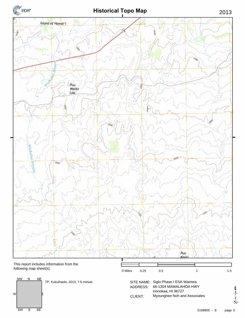
Historical Topo Map
page
SITE NAME: ADDRESS:
CLIENT:
This report includes information from the following map sheet(s).
-
EW
SW S SE
NW N NE
2013
0 Miles 0.25 0.5 1 1.5
Siglo Phase I ESA Waimea66-1304 MAMALAHOA HWYHonokaa, HI 96727Myounghee Noh and Associates
TP, Kukuihaele, 2013, 7.5-minute
5168800 8 5

Historical Topo Map
page
SITE NAME: ADDRESS:
CLIENT:
This report includes information from the following map sheet(s).
-
EW
SW S SE
NW N NE
1995
0 Miles 0.25 0.5 1 1.5
Siglo Phase I ESA Waimea66-1304 MAMALAHOA HWYHonokaa, HI 96727Myounghee Noh and Associates
TP, Kukuihaele, 1995, 7.5-minute
5168800 8 6

Historical Topo Map
page
SITE NAME: ADDRESS:
CLIENT:
This report includes information from the following map sheet(s).
-
EW
SW S SE
NW N NE
1982
0 Miles 0.25 0.5 1 1.5
Siglo Phase I ESA Waimea66-1304 MAMALAHOA HWYHonokaa, HI 96727Myounghee Noh and Associates
TP, Kukuihaele, 1982, 7.5-minute
5168800 8 7

Historical Topo Map
page
SITE NAME: ADDRESS:
CLIENT:
This report includes information from the following map sheet(s).
-
EW
SW S SE
NW N NE
1957
0 Miles 0.25 0.5 1 1.5
Siglo Phase I ESA Waimea66-1304 MAMALAHOA HWYHonokaa, HI 96727Myounghee Noh and Associates
TP, Kukuihaele, 1957, 7.5-minute
5168800 8 8
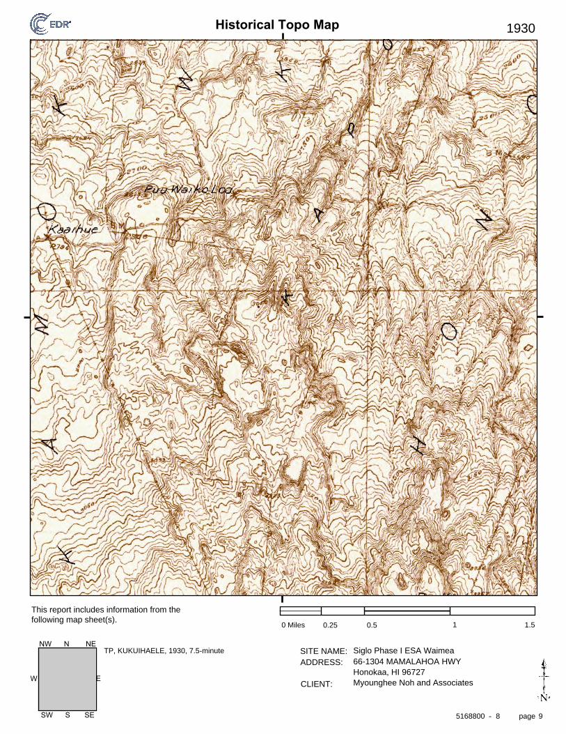
Historical Topo Map
page
SITE NAME: ADDRESS:
CLIENT:
This report includes information from the following map sheet(s).
-
EW
SW S SE
NW N NE
1930
0 Miles 0.25 0.5 1 1.5
Siglo Phase I ESA Waimea66-1304 MAMALAHOA HWYHonokaa, HI 96727Myounghee Noh and Associates
TP, KUKUIHAELE, 1930, 7.5-minute
5168800 8 9

Historical Topo Map
page
SITE NAME: ADDRESS:
CLIENT:
This report includes information from the following map sheet(s).
-
EW
SW S SE
NW N NE
1916
0 Miles 0.25 0.5 1 1.5
Siglo Phase I ESA Waimea66-1304 MAMALAHOA HWYHonokaa, HI 96727Myounghee Noh and Associates
TP, Waipio, 1916, 15-minute
5168800 8 10

Siglo Forestry, LLC – Phase I Environmental Site Assessment TMK (3) 4-7-007:011, Waimea, Island of Hawaii
2529_5 B Myounghee Noh & Associates, L.L.C.
APPENDIX B Photographs
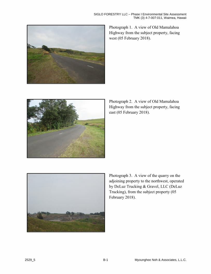
SIGLO FORESTRY LLC – Phase I Environmental Site Assessment TMK (3) 4-7-007:011, Waimea, Hawaii
2529_5 B-1 Myounghee Noh & Associates, L.L.C.
Photograph 1. A view of Old Mamalahoa Highway from the subject property, facing west (05 February 2018).
Photograph 2. A view of Old Mamalahoa Highway from the subject property, facing east (05 February 2018).
Photograph 3. A view of the quarry on the adjoining property to the northwest, operated by DeLuz Trucking & Gravel, LLC (DeLuz Trucking), from the subject property (05 February 2018).

SIGLO FORESTRY LLC – Phase I Environmental Site Assessment TMK (3) 4-7-007:011, Waimea, Hawaii
2529_5 B-2 Myounghee Noh & Associates, L.L.C.
Photograph 4. A view of the quarry on the adjoining property to the northwest, operated by DeLuz Trucking, from the property entrance on Old Mamalahoa Highway (05 February 2018).
Photograph 5. A view of the adjoining property to the north, adjacent to Old Mamalahoa Highway. The property was pastureland for cattle grazing (05 February 2018).
Photograph 6. A view of the adjoining property to the northeast, adjacent to Old Mamalahoa Highway. The property was pastureland for cattle grazing (05 February 2018).

SIGLO FORESTRY LLC – Phase I Environmental Site Assessment TMK (3) 4-7-007:011, Waimea, Hawaii
2529_5 B-3 Myounghee Noh & Associates, L.L.C.
Photograph 7. A view of the adjoining properties to the east, from the subject property. Land to the left of the fence (arrow) was the subject property, land to the right of the fence were adjoining properties. All eastern adjoining properties appeared to be pastureland for cattle grazing (05 February 2018).
Photograph 8. A view of the adjoining property to the south, from the subject property. The property was pastureland for cattle grazing (05 February 2018).
Photograph 9. A view of the adjoining property to the south, from the subject property. Cattle are visible on the property (05 February 2018).

SIGLO FORESTRY LLC – Phase I Environmental Site Assessment TMK (3) 4-7-007:011, Waimea, Hawaii
2529_5 B-4 Myounghee Noh & Associates, L.L.C.
Photograph 10. A view of the adjoining property to the west, from the subject property. The property was pastureland for cattle grazing (05 February 2018).
Photograph 11. A view of the entrance gate to the subject property, accessed via Old Mamalahoa Highway. The gate was locked and the property was fenced, preventing unauthorized access (05 February 2018).
Photograph 12. A view of the light duty dirt road that is used to access portions of the subject property. The road ran from the northern property boundary, through the center of the property to the south, and ended in the approximate center of the property (05 February 2018).

SIGLO FORESTRY LLC – Phase I Environmental Site Assessment TMK (3) 4-7-007:011, Waimea, Hawaii
2529_5 B-5 Myounghee Noh & Associates, L.L.C.
Photograph 13. A view of the northeast corner survey marker on the subject property, which was accessed to view adjoining properties (05 February 2018).
Photograph 14. A view of the southwest corner survey marker on the subject property, which was accessed to view adjoining properties (05 February 2018).
Photograph 15. A view of the southeast corner survey marker on the subject property, which was accessed to view adjoining properties (05 February 2018).

SIGLO FORESTRY LLC – Phase I Environmental Site Assessment TMK (3) 4-7-007:011, Waimea, Hawaii
2529_5 B-6 Myounghee Noh & Associates, L.L.C.
Photograph 16. A view the center of the subject property, taken from the center of the property facing west. This area was at a higher elevation and was used to view a larger area of the subject property. A water trough is visible (05 February 2018).
Photograph 17. A view the eastern portion of the subject property, taken from the center of the property facing east. This area was at a higher elevation and was used to view a larger area of the subject property (05 February 2018).
Photograph 18. A view the center of the subject property, taken from the center of the property facing north. This area was at a higher elevation and was used to view a larger area of the subject property. The forested area is visible in the background (05 February 2018).

SIGLO FORESTRY LLC – Phase I Environmental Site Assessment TMK (3) 4-7-007:011, Waimea, Hawaii
2529_5 B-7 Myounghee Noh & Associates, L.L.C.
Photograph 19. A view of the southern portion of the subject property, facing west. Land to the left of the fence is on the adjoining property to the south, land to the right of the fence is on the subject property (05 February 2018).
Photograph 20. A view of eastern portion of the subject property, facing north. This paddock was pastureland for cattle grazing (05 February 2018).
Photograph 21. A view of cattle in a paddock on the subject property. The paddock pictured also contained the forested area of the subject property (05 February 2018).

SIGLO FORESTRY LLC – Phase I Environmental Site Assessment TMK (3) 4-7-007:011, Waimea, Hawaii
2529_5 B-8 Myounghee Noh & Associates, L.L.C.
Photograph 22. A view of the forested area of the subject property, located in the center of the property (05 February 2018).
Photograph 23. A view of the forested area of the subject property, located in the center of the property (05 February 2018).
Photograph 24. A view of the forested area of the subject property. Lines of trees were observed, indicating that the trees were planted (05 February 2018).

SIGLO FORESTRY LLC – Phase I Environmental Site Assessment TMK (3) 4-7-007:011, Waimea, Hawaii
2529_5 B-9 Myounghee Noh & Associates, L.L.C.
Photograph 25. A view of one of the ponds observed in the center of the subject property (05 February 2018).
Photograph 26. A view of another one of the ponds observed in the center of the subject property (05 February 2018).
Photograph 27. A view of a dried up pond observed in the center of the subject property (05 February 2018).

SIGLO FORESTRY LLC – Phase I Environmental Site Assessment TMK (3) 4-7-007:011, Waimea, Hawaii
2529_5 B-10 Myounghee Noh & Associates, L.L.C.
Photograph 28. A view of the 400-gallon water tank observed on the subject property. The water tank was serviced by a private waterline that enters the subject property from the south (05 February 2018).
Photograph 29. A view of one the troughs observed on the subject property. The troughs are manually filled (05 February 2018).

Kapoaula Koa Forest Management Plan Final Environmental Assessment August 2019
Page E-1 Appendix E: Public Involvement Correspondence
APPENDIX E PUBLIC INVOLVEMENT CORRESPONDENCE E1 PRE-ASSESSMENT CONSULTATION E2 DRAFT EA COMMENTS AND REPONSES

Kapoaula Koa Forest Management Plan Final Environmental Assessment August 2019
Page E-2 Appendix E: Public Involvement Correspondence
This page intentionally left blank.

Kapoaula Koa Forest Management Plan Final Environmental Assessment August 2019
Page E-3 Appendix E: Public Involvement Correspondence
APPENDIX E1 PRE-ASSESSMENT CONSULTATION In preparation of the Draft EA, a pre-assessment consultation letter was sent to agencies and organizations on February 8, 2019. The distribution list and correspondence received is included in this Appendix E1 and summarized in Table E1. Key issues included:
If a date is not noted in that column, then Cardno did not receive a reply from that party during the pre-assessment comment period. Response letters to the pre-assessment consultation letter are included in this Appendix E1 following Table E1. The comments were considered during preparation of the Draft EA.
Table E1. Distribution List for Pre-Assessment Consultation Letter Date of Response – If Any Addressees State Parties
State of Hawai‘i Department of Health, Environmental Planning Office
P.O. Box 3378 Honolulu, HI 96801
State of Hawai‘i Department of Land and Natural Resources
P.O. Box 621 Honolulu, HI 96809
State of Hawai‘i Office of Hawaiian Affairs
75-1000 Henry St., Suite 205 Kailua-Kona, HI 96740
Emailed: [email protected] County Agencies and Officials
Talmadge Magno, Administrator Hawai‘i County. Civil Defense Agency
920 Ululani St. Hilo, HI 96720
March 5, 2019 Mitchell K. Kanehailua, Jr.
Assistant Police Chief Area I Operations Bureau
Police Chief, Paul Ferreira County of Hawai‘i Police Department 349 Kapiolani St. Hilo, HI 96720
Hawai‘i County Planning Department Michael Yee, Director 101 Pauahi St., Suite 3
Hilo, HI 96720 District 1, County Councilmember Valerie T. Poindexter
Emailed: [email protected] February 25, 2019
Ben Ishii, Division Chief Engineering Division
Hawai‘i County Department of Public Works David Yamamoto, Director
101 Pauahi St., Suite 7 Hilo, HI 96720
Fire Chief, Darren J. Rosario County of Hawai‘i Fire Department

Kapoaula Koa Forest Management Plan Final Environmental Assessment August 2019
Page E-4 Appendix E: Public Involvement Correspondence
Date of Response – If Any Addressees 25 Aupuni St.
Hilo, HI 96720 February 21, 2019 Hawai‘i County Department of Environmental Management
345 Kekūanāo‘a St., Suite 41 Hilo, HI 96720
Local Organizations Hawaiian Cultural Center of Hāmākua
P.O. Box 1981 Honoka‘a, HI 96727
Emailed: [email protected] Mālama Hāmākua
Emailed: [email protected] Cory Harden for Sierra Club
Emailed: [email protected] Parker Ranch Mauna Kea LLC
66-1304 Māmālahoa Hwy. Kamuela, HI 96743
Kapoaula Land LLC Manager: Kevin M. Balog
P.O. Box 9 Kamuela, HI 96743
Private Surrounding Individuals – Addresses not provided for privacy Dahana Ranch Glenn Bertelmann Jolette A. Rapozo Trust Pamela Jean Ramos Paula Iwalani Boteilho Yvonne L. K. Deluz Walter L. Jr. Puhi Irene L. Fergerstrom Paul, David, and Cindy Lou Andrade Kalawaianui, Paakaula Kalawaianui, Kuuipookala Kaaihue,
Micah Elizabeth B. Camara
Legend: HI = Hawai‘i; Hwy. = Highway; P.O. = post office; St. = Street.

Australia • Belgium • Canada • Colombia • Ecuador • Germany • Indonesia • Kenya • Myanmar • New Zealand • Nigeria • Papua New Guinea • Peru • Philippines • Singapore • Timor-Leste • United Kingdom • United States • Operations in over 100 countries
Cardno Pacific Guardian Center 737 Bishop Street Mauka Tower, Suite 3050 Honolulu, HI 96813 USA Phone: +1 808 528 1445 Fax: +1 808 528 0768 www.cardno.com
February 8, 2019 Subject: Early Consultation for Kapoaula Koa Forest (HRS) Forest Stewardship
Management Plan, Environmental Assessment, Island of Hawai`i, TMK–(3) 4-7-007-011
To Whom It May Concern, Our firm in association with Mr. Ron Terry owner of Geometrician Associates is in the process of preparing a Draft Environmental Assessment (EA) in compliance with Chapter 343, HRS, and Title 11, Chapter 200, HAR for a proposed project involving State funds to be utilized for implementation of an existing forest stewardship management plan. Siglo Forest, LLC acquired the 564-acre Kapoaula property from Parker Ranch to obtain long-term access for the purposes of planting koa trees. In an effort to convert pastureland back to a semblance of the native koa-ʻōhiʻa forest that once stood in this area and to provide, controlled future uses of the forest for commercial products (see map on following page). Forestry Solutions Inc. has authored a site-specific forestry management plan for the area. Through implementation of the site-specific forestry management plan, in approximately 50 years, the property will consist of a mixed-species native forest with steep sloped areas primarily for native species conservation and less steeply sloped, less erodible primarily used for timber production. The resulting koa forest will provide a sustainable, long-term, predictable source of instrument grade wood, produce high-quality wood for other uses, and provide habitat for native species, inspiring others to plant trees on their land for similar purposes. The ten-year objectives are as follows:
• Reforest the entire property with koa and a complement of associated native forest plants. • Improve the quality of wood to be harvested in the future by:
o planting seed from known, high-quality sources; and o utilizing cuttings propagated from trees identified as having superior color, figure and
form. • Intensive management of koa for saw timber on those areas of the property with slopes
less than 20%--accounting for 70% of the property or 390 acres. • Reforest the remaining upland areas with a multi-species native forest, utilizing koa as a
pioneer species—accounting for 30% of the area or 163 acres. • Protect planted forest from wind by planting fast-growing, cattle resistant windbreaks.
The areas of investigation in the EA will include but not be limited to the following: water quality assurance; wastewater treatment; flora, fauna, and ecosystems; traffic impacts; geology, soils, and hazards; flooding and drainage impacts; social, cultural and community impacts; cultural impacts; historic sites; and economic impacts.

February 8, 2019 Page 2 of 2
www.cardno.com
We would appreciate your comments on any special environmental conditions or impacts related to the project. Please contact me at [email protected] or (808) 349-0929 if you have any questions or require clarification. Kindly indicate whether you wish to receive notice of the availability of the EA when completed.
Sincerely,
Kerry Wells Project Manager Direct +1 808 349 0929 Email: [email protected]


Harry Kim
Mayor
March 5, 2019
County of Hawaii
POLICE DEPARTMENT
349KapiolaniStreet ■ Hilo, Hawaii 96720-3W8
(H()H)935-331L • Fix (80S] 961-K865
Kerry Wells, Project Manager
64-5266 Puu Nani Drive
Kamuela, HI 96743
Paul K. Ferrcira
Police chief
hum. Hi Bngado Jr.
Deputy Police Chief
Subject: Early Consultation for Kapoaula Koa Forest (HRS) Forest Stewardship
Management Plan, Environmental Assessment, Island of Hawai'i
TMK-{3) 4-7-007-011
Staff, upon reviewing the provided documents, does not anticipate any significant
impact to traffic and/or public safety concerns.
Thank you for allowing us the opportunity to comment.
We would like to receive notice of the availability of the EA when completed.
If there are any questions, please contact Captain Jason Cortez at (808) 775-7533.
hauua, jr.
assistant podce^chief
area i operations bureau
AJC1li/19HQ0193
"HaWHl'i County i> an Equn] Oppominily Pmviduiand Employer"
Kapoaula Koa Forest Management Plan Final Environmental Assessment August 2019
Page E-10 Appendix E: Public Involvement Correspondence
APPENDIX E2 DRAFT EA COMMENTS AND RESPONSES The Hawai‘i Office of Environmental Quality Control published DLNRs anticipated FONSI as a Draft EA in The Environmental Notice, which was available online and initiated a 30-day comment period. Comments were sent to Cardno as the applicant’s representative.
The Draft EA was published in the 23 June 2019 Office of Environmental Quality Control, Environmental Notice. Comment and response letters are included.
Comments were considered during preparation of this Final EA. Key issues included:
• (grass specific) herbicide application using the proposed herbicides, Fusillade and Assure.Specifically, to the resources of surface and ground water.
• The use of aerial spraying, and a comparison to other methods including costs associated withlabor.

Kapoaula Koa Forest Management Plan Final Environmental Assessment August 2019
Page E-11 Appendix E: Public Involvement Correspondence
Email comment from Mr. John Pipan on 25 July 2019:
Sir or Madame,
While projects supporting native forestry efforts should be supported I don’t believe the project as proposed will have no significant environmental impact. Many impacts involved with preparation and planting are short term and hard to avoid. However, (grass specific) herbicide application over dozens of acres indiscriminately by helicopter in an area with frequent rainfall and a very active surface drainage network should be better evaluated for potential impacts. The proposed herbicides, Fusilade and Assure, have potential hazards, both environmental and to humans and animals that were not addressed in the EA. Specifically, the threat to surface and ground water should be evaluated before undertaking application on such a scale.
Aerial spraying, though noted for its cost effectiveness in terms of labor, there are other costs that should be brought to the balance sheet and considered.
Best regards,
John Pipan

(J) Cardna
August 12, 2019
Cardno
Pacific Guardian Center737 Bishop StreetMauka Tower, Suite 3050
Subject: Comment to Kapoaula Koa Forest, Draft Environmental Assessment, Forest Honolulu, HI 96813Stewardship Management Plan, Island of Hawai’i, TMK—(3) 4-7-007-011 USA
Dear Mr. John Pipan, Phone: +1 808 528 1445Fax: +18085280768
The Division of Forestry and Wildlife (Division) would like to thank you for taking the time to reviewand comment on the Kapoaula Koa Forest Draft Environmental Assessment. We are responding Www.cardno.comto your comment in accordance with the State of Hawaii Revised Statutes, Chapter 343, and theState of Hawaii Administrative Rules Title 11, Chapter 200.
Mr. Nicholas Koch with Forest Solutions assisted with the response to your comment. He is aforester in Hawaii where he has practiced forestry for 18 years. He is a certified pesticideapplicator in 3 commercial categories, president of the Hawaii Forest Industry Association and anactive member of the Association of Consulting Foresters. Prior to Hawaii, Nick practicedcommercial plantation forestry in tropical Mexico and community forestry for the Peace Corps. inGuatemala. He earned a Bachelor’s degree in Forest Management in 1999 from the StateUniversity of New York.
Chemical pesticides, and particularly herbicides (which are used to control unwanted vegetation)in forest plantings is widely used throughout the world, especially those practiced at scales largerthan I or 2 acres and those located in tropical conditions where year-round growth and thespecies composition of weeds makes it necessary. In Hawaii, most of the native forest restorationprojects, including those intended exclusively for wildlife habitat and improvement of theenvironment, make use of herbicides to reduce weed competition, usually grasses. For example,the Hakalau National Wildlife Refuge, administered by the US Fish and Wildlife Service, usesherbicides in concert with other silvicultural techniques to control weeds within the refuge. Whileconventional hand-pulling and mechanical control are also employed, this is usually on projectsinvolving a few acres and/or highly sensitive species, such as around critically endangered plantsor in areas where the weed count is low enough that hand-weeding is an environmentally viableoption for control. For example, Forest Solutions uses manual weed pulling as a method of controlfor Miconia calvescens in South Kona, where the number of treated individuals hovers around300 weeds in a 2,000 acre area. For larger areas and aggressive grasses, such as this projectand Kikuyu grass (Cenchrus setaceus), this is a necessity. Planting trees and forests withoutcontrolling weeds is a recipe for failed stands, with high tree mortality and poor and unevengrowth. Even decades hence, a highly variable diameter distribution with uneven spacing of treesis indicative of a forest stand that had poor weed control in its infancy. Forest Solutions hasobserved that in early planted stands along the Hamakua coast, where operational control of theweeds was a known problem, and today it shows up in the diameter class distribution of the treesand overall volume.

August 12, 2019Page 2 of 2
Context
The use of pesticides in this project is part of an Integrated Pest Management (1PM) plan. While the managementplan and the documentation have a scheduled application of the materials as expected, it is really based on actualfield conditions at the time. The object of such application is to reduce (not eliminate) the weed and insectpopulation to a point at which it does not materially harm the trees. If the weeds and insects are not particularlyaggressive, or if the portion of the forest management unit displays low incidence of damage to the pests, then thepractices are not used in that area. The use of trained and experienced foresters (all of Forest Solutions’ forestershave over 10 years’ experience in Hawaii) is a key component to this strategy. Over applying is not onlyenvironmentally questionable, it is financially undesirable.
Both Fusillade (Fluazifop-P-butyl) and Assure (Quizalofop-p-ethyl) are grass-specific herbicides applied at low ratesonce per year during the second and third year of tree planting together with an insecticide to reduce the populationof the acacia psyllid (Psylla uncatoides). These two applications are the only expected use of these products in thetree planting project life of 50-60 years. Fusillade, in particular, is widely used by conservation groups to maintainnative plant cover precisely because most native plants, being broadleaves, are not affected. At the same time,non-native and aggressive pasture grasses are the largest threat to an incipient tree-planting project.
Alternatives
Alternatives for use of these herbicides on grasses include motor-manual and manual methods of control. Terrainconditions, although favorable for forestry, are not smooth enough to use traditional agricultural tractor-drawnmowing equipment. Motor-manual control of grasses involves the use of weed-eaters or string-trimmers by fieldpersonnel, while the manual method involves direct pulling or cutting of grasses with non-mechanized hand tools.The motor-manual method imposes an additional challenge of damaging the bark on young trees by the inadvertentcontact of the strings with the stem, either girdling or severing the sapling.
Costs for motor-manual control (weed eater) include a twice per year mowing at a cost of $291 per acre per entry,$582 per year. For the two years contemplated, the mowing would result in a total cost of $1,082 per acre. Manualcontrol, or pulling of weeds, is seldom practiced at this scale, yet experience at smaller scale projects indicates aper-entry cost of $540 per acre per entry with a similar sequence of entries totaling $2,160 per acre for the twoyears. Helicopter application, by contrast, aerial application results in an annual cost of $73.24 per acre, for a totalof $146.48 for the two-year period. In summary, the manual options result in a cost increase of between 1 Ox and2Ox relative to chemical means.
Neither of these operations deals with the acacia psyilid, a non-native insect pathogen that was introduced in thesecond half of the 20th century. The acacia psyllid, at high population levels, results in the mortality of the growingtips (meristems) of the koa trees. This, in turn, results in branchy, poorly formed trees and reduced vigor, both ofwhich negate the very reason for the project as a sustainable timber production from a planted native forest. Thecontrol of psyllids has been effective using a single application per year of a neonicotinoid pesticide in years 2 and 3to reduce the population to acceptable levels. The ground based alternative here control of which would requireeither a separate manual entry with high-pressure ground equipment. Aside from cost, this operation needlesslyexposes workers to overhead application of insect control pesticides, which is not reasonable given the availabilityof safer alternatives.
Site considerations
While rainfall is abundant on the project site, there are no year-round watercourses near or on the property. Thesingle blue-line stream on the NE corner of the property is intermittent and has not been observed flowing since theproject was started. The abundance of vegetation within the stream channel further indicates the lack of scouringand churn associated with frequent and active water flows. Another feature of the property is the depth of the soil,
www.cardno.com

August 12, 2019Page 2 of 2
which in addition to being the main reason for the purchase of the subject property for reforestation is also a bufferin the application of herbicides - numbering less than five in the 50-60 year lifespan of the project. Neither of theherbicides mentioned is a known groundwater pollutant and both adsorb readily onto soil, reducing their subsequentmovement.
“[Quizalofop ethyl] has a low potential to leach and contaminate groundwater and does not accumulate infish.” EPA Pesticide fact sheet June 10, 1988 available:https://nepis.epa.qov/Exe/ZyPDF.cgi/91 024L28. PDF?Dockey=91 024L28.PDF
The Division appreciates your review of the document. Please feel free to contact Tanya Rubenstein with the Divisionof Forestry and Wildlife at (808) 587-0027 should you have any additional questions regarding the project. If you havequestions about the EA, please contact Kerry Kylene Wells, Cardno, at Kerry.Wells~cardno-gs.com or (808) 349-0929.
Sincerely,
Kerry WellsProject ManagerDirect +1 808 349 0929Email: Kerrv.Wells~cardno-gscom
www.cardno.com