GLOBAL POSITIONING SYSTEMS Introduction to Problem/Opportunity
15
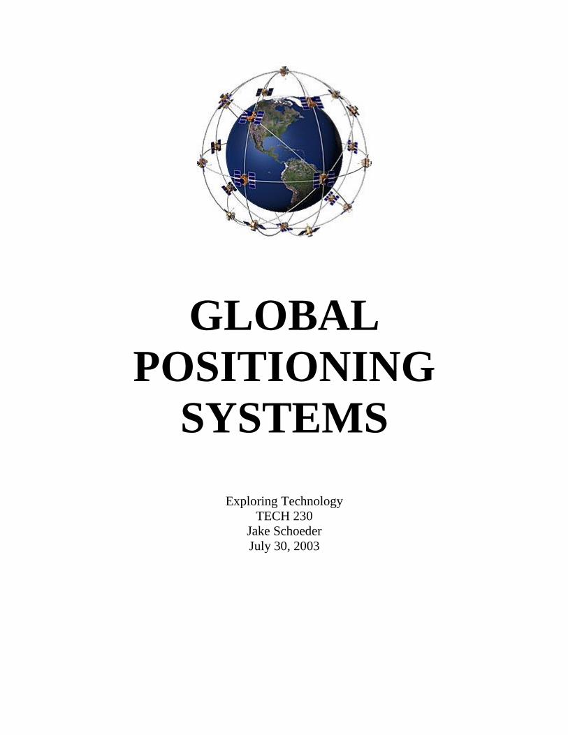
GLOBAL POSITIONING SYSTEMS Exploring Technology TECH 230 Jake Schoeder July 30, 2003
Transcript of GLOBAL POSITIONING SYSTEMS Introduction to Problem/Opportunity
GLOBAL
POSITIONING
SYSTEMS
Exploring Technology
TECH 230
Jake Schoeder
July 30, 2003
Introduction to Problem/Opportunity
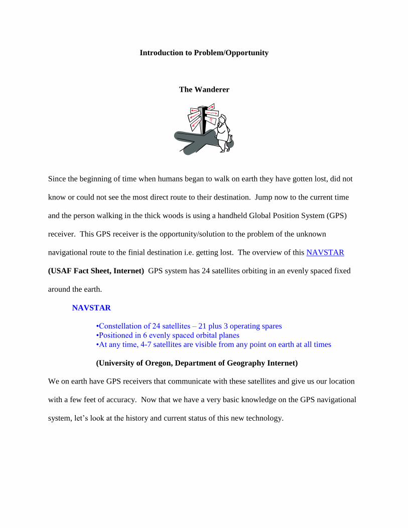
The Wanderer
Since the beginning of time when humans began to walk on earth they have gotten lost, did not
know or could not see the most direct route to their destination. Jump now to the current time
and the person walking in the thick woods is using a handheld Global Position System (GPS)
receiver. This GPS receiver is the opportunity/solution to the problem of the unknown
navigational route to the finial destination i.e. getting lost. The overview of this NAVSTAR
(USAF Fact Sheet, Internet) GPS system has 24 satellites orbiting in an evenly spaced fixed
around the earth.
NAVSTAR
•Constellation of 24 satellites – 21 plus 3 operating spares
•Positioned in 6 evenly spaced orbital planes
•At any time, 4-7 satellites are visible from any point on earth at all times
(University of Oregon, Department of Geography Internet)
We on earth have GPS receivers that communicate with these satellites and give us our location
with a few feet of accuracy. Now that we have a very basic knowledge on the GPS navigational
system, let’s look at the history and current status of this new technology.
History and Current Status of the Technology
In 1957 the Russians launched the Sputnik satellite. Scientists studying the orbit of this satellite
found that they could track the satellite by using its radio signal. This meant that a person on the
earth could find their position on the earth if he knew the exact orbit of the Sputnik. This was
the first GPS system, very crude, but it worked.
Later on in 1964 the Navy used the first satellite system called The Navigation Satellite System
or Transit. (Space Policy Project, Internet) This satellite system was thought up in the early
1960s to assist the precise navigation requirements of the Navy's fleet ballistic missile
submarines. This system was used by the United States submarines, but slow in how the
receiver calculate the users position with the usually wait time of 15 minutes and the sub had to
be standing still.
The United States Navy launched on May 31, 1967 the TIMATION I satellite (Spacecraft
Engineering Department 8200, Internet) This new technology was much better than the
TRANSIT system. The new Timation I satellite was embedded with an atomic clock. The user
then knew the distance to the satellite because the atomic clock could tell the user the length of
time it took each signal to leave the satellite and reach the receiver.. Most importantly, a
navigation vehicle did not have to stop.
(Mohawk College, Global Positioning System – History, Internet)
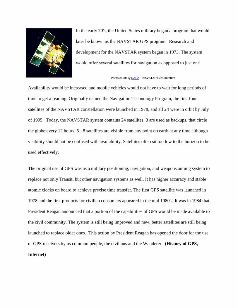
In the early 70's, the United States military began a program that would
later be known as the NAVSTAR GPS program. Research and
development for the NAVSTAR system began in 1973. The system
would offer several satellites for navigation as opposed to just one.
Photo courtesy NASA NAVSTAR GPS satellite
Availability would be increased and mobile vehicles would not have to wait for long periods of
time to get a reading. Originally named the Navigation Technology Program, the first four
satellites of the NAVSTAR constellation were launched in 1978, and all 24 were in orbit by July
of 1995. Today, the NAVSTAR system contains 24 satellites, 3 are used as backups, that circle
the globe every 12 hours. 5 - 8 satellites are visible from any point on earth at any time although
visibility should not be confused with availability. Satellites often sit too low to the horizon to be
used effectively.
The original use of GPS was as a military positioning, navigation, and weapons aiming system to
replace not only Transit, but other navigation systems as well. It has higher accuracy and stable
atomic clocks on board to achieve precise time transfer. The first GPS satellite was launched in
1978 and the first products for civilian consumers appeared in the mid 1980's. It was in 1984 that
President Reagan announced that a portion of the capabilities of GPS would be made available to
the civil community. The system is still being improved and new, better satellites are still being
launched to replace older ones. This action by President Reagan has opened the door for the use
of GPS receivers by us common people, the civilians and the Wanderer. (History of GPS,
Internet)
Systems
In this section I want to give you an understanding how the GPS system works.
GPS system has 3 parts: the space segment, the user segment, and the control segment. The
space segment consists of 24 satellites, each in its own orbit 11,000 nautical miles above the
Earth. The user segment consists of receivers that are us, which you can hold in your hand or
mount in your car. The control segment consists of ground stations (five of them, located around
the world) that make sure the satellites are working properly.
As I stated above, there are 24 satellites orbiting our earth. Each GPS satellite transmits data that
indicates its location and the current time. All GPS satellites synchronize operations so that these
repeating signals are transmitted at the same instant. The signals, moving at the speed of light,
arrive at your GPS receiver at slightly different times because some satellites are farther away
than others. The distance to the GPS satellites can be determined by estimating the amount of
time it takes for their signals to reach the receiver. When the receiver estimates the distance to at
least four GPS satellites, it can calculate its position in three dimensions. These satellites are
operated by the U.S. Air Force, and orbit our earth in with a period of 12 hours. Ground stations
manned by the U.S. Air Force are used to precisely track each satellite's orbit.
The following list of the NAVSTAT program is from the USAF web page. This information is
for the GPS satellites.
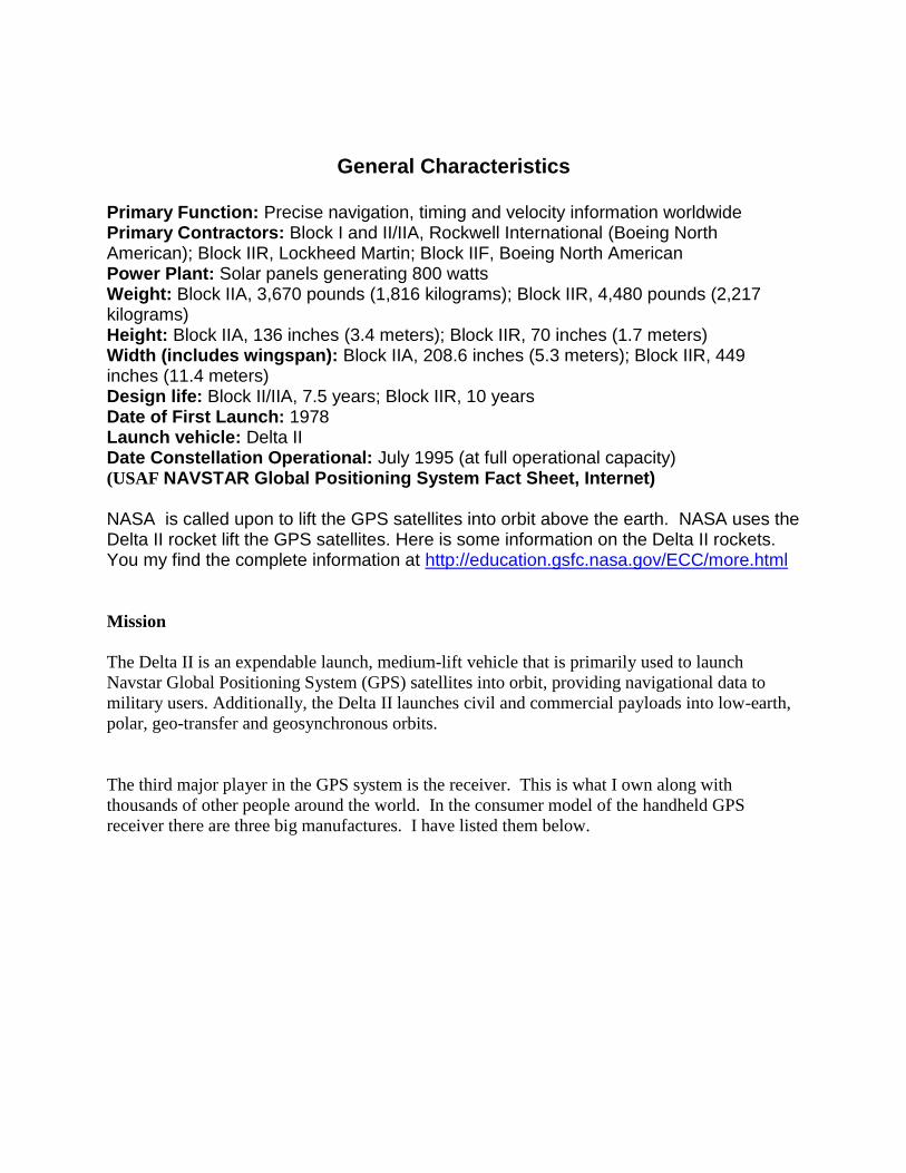
General Characteristics
Primary Function: Precise navigation, timing and velocity information worldwide Primary Contractors: Block I and II/IIA, Rockwell International (Boeing North American); Block IIR, Lockheed Martin; Block IIF, Boeing North American Power Plant: Solar panels generating 800 watts Weight: Block IIA, 3,670 pounds (1,816 kilograms); Block IIR, 4,480 pounds (2,217 kilograms) Height: Block IIA, 136 inches (3.4 meters); Block IIR, 70 inches (1.7 meters) Width (includes wingspan): Block IIA, 208.6 inches (5.3 meters); Block IIR, 449 inches (11.4 meters) Design life: Block II/IIA, 7.5 years; Block IIR, 10 years Date of First Launch: 1978 Launch vehicle: Delta II Date Constellation Operational: July 1995 (at full operational capacity) (USAF NAVSTAR Global Positioning System Fact Sheet, Internet) NASA is called upon to lift the GPS satellites into orbit above the earth. NASA uses the Delta II rocket lift the GPS satellites. Here is some information on the Delta II rockets. You my find the complete information at http://education.gsfc.nasa.gov/ECC/more.html
Mission
The Delta II is an expendable launch, medium-lift vehicle that is primarily used to launch
Navstar Global Positioning System (GPS) satellites into orbit, providing navigational data to
military users. Additionally, the Delta II launches civil and commercial payloads into low-earth,
polar, geo-transfer and geosynchronous orbits.
The third major player in the GPS system is the receiver. This is what I own along with
thousands of other people around the world. In the consumer model of the handheld GPS
receiver there are three big manufactures. I have listed them below.
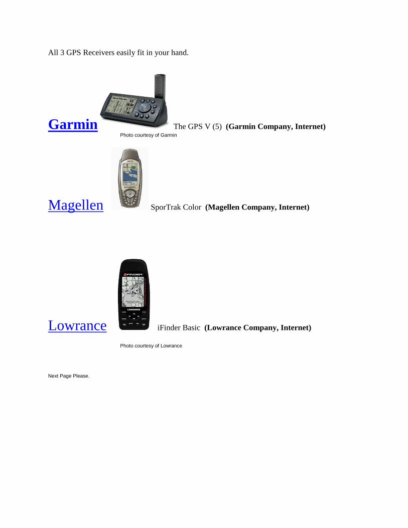
All 3 GPS Receivers easily fit in your hand.
Garmin The GPS V (5) (Garmin Company, Internet) Photo courtesy of Garmin
Magellen SporTrak Color (Magellen Company, Internet)
Lowrance iFinder Basic (Lowrance Company, Internet)
Photo courtesy of Lowrance
Next Page Please.
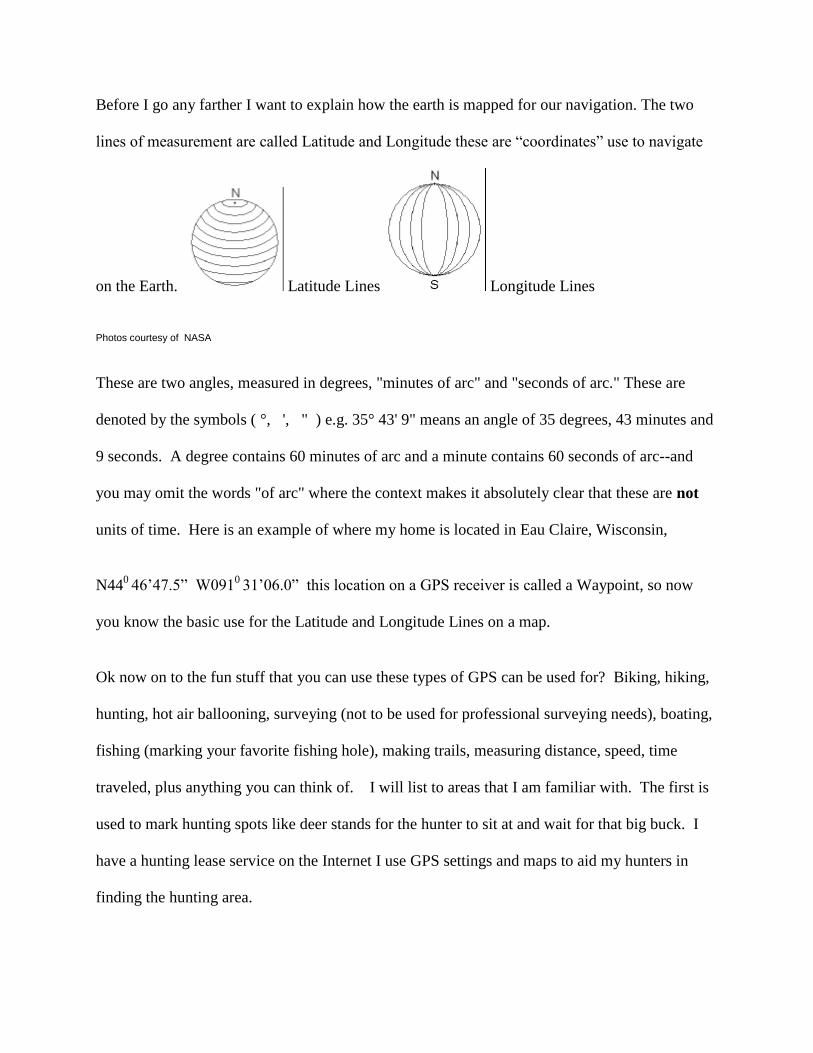
Before I go any farther I want to explain how the earth is mapped for our navigation. The two
lines of measurement are called Latitude and Longitude these are “coordinates” use to navigate
on the Earth. Latitude Lines Longitude Lines
Photos courtesy of NASA
These are two angles, measured in degrees, "minutes of arc" and "seconds of arc." These are
denoted by the symbols ( °, ', " ) e.g. 35° 43' 9" means an angle of 35 degrees, 43 minutes and
9 seconds. A degree contains 60 minutes of arc and a minute contains 60 seconds of arc--and
you may omit the words "of arc" where the context makes it absolutely clear that these are not
units of time. Here is an example of where my home is located in Eau Claire, Wisconsin,
N440
46’47.5” W0910 31’06.0” this location on a GPS receiver is called a Waypoint, so now
you know the basic use for the Latitude and Longitude Lines on a map.
Ok now on to the fun stuff that you can use these types of GPS can be used for? Biking, hiking,
hunting, hot air ballooning, surveying (not to be used for professional surveying needs), boating,
fishing (marking your favorite fishing hole), making trails, measuring distance, speed, time
traveled, plus anything you can think of. I will list to areas that I am familiar with. The first is
used to mark hunting spots like deer stands for the hunter to sit at and wait for that big buck. I
have a hunting lease service on the Internet I use GPS settings and maps to aid my hunters in
finding the hunting area.
Click the following link for an example of the map with a red X marking the Waypoint.
http://www.topozone.com/map.asp?lat=44.728655&lon=-92.201891&size=small&s=25
The second fun thing to do with your GPS receiver is a World Wide game called
GEOCACHING. Here is how it works, you take a weather proof container usually the size of an
ice cream bucket and you put little trinkets in it such as, a few quarters, pens, key chains, note
pad, penlight flashlight you then mark the bucket’s (or Cache) location with your GPS receiver
and store the Waypoint. When you get home go to the web site Geocaching
http://geocaching.com and enter you Cache for the whole world to see. You can leave hints of
its location but the idea is to have other people use their GPS receiver to find your Cache. When
the people find your cache then may take something and leave something new. The record their
visit in the log book in the Cache and on the web site Geocaching. This is a really fun game.
How do you learn to use a GPS? With these models the manually does a ok job on educating the
user. I was trained by the salesperson a Scheels All Sports and was very happy with the results.
An other way to receive training on your GPS receiver is to purchase a training video from a
store that does sell GPS receivers. And last but not least ask a person who already has a GPS
receiver.
Graphical Chronology
Timeline of the GPS Satellite System
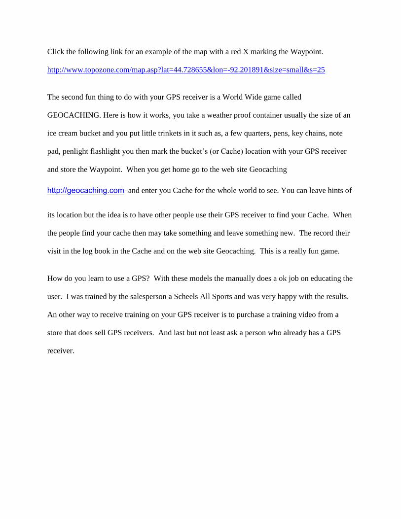
1957
In 1957 the Russians launched the Sputnik satellite. Scientists
studying the orbit of this satellite found that they could track the satellite by using its radio
signal.Photo courtesy of cwww.arrakis.es/~obaquero/ modulos1.htm
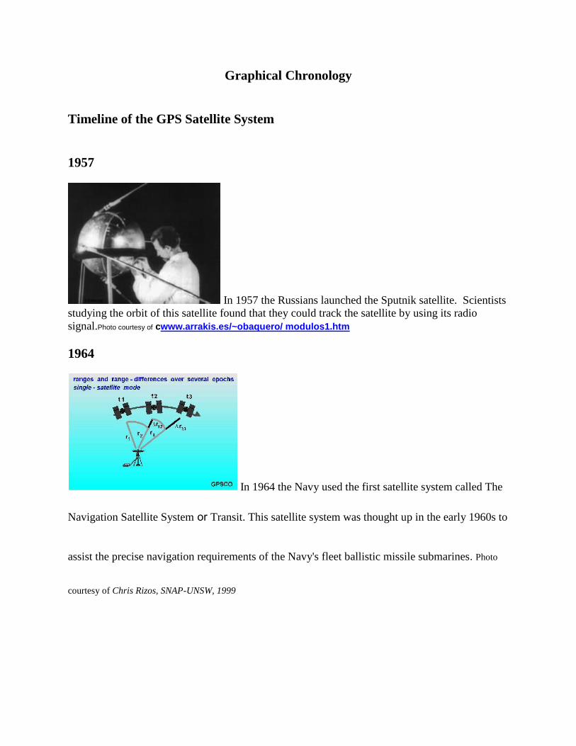
1964
In 1964 the Navy used the first satellite system called The
Navigation Satellite System or Transit. This satellite system was thought up in the early 1960s to
assist the precise navigation requirements of the Navy's fleet ballistic missile submarines. Photo
courtesy of Chris Rizos, SNAP-UNSW, 1999
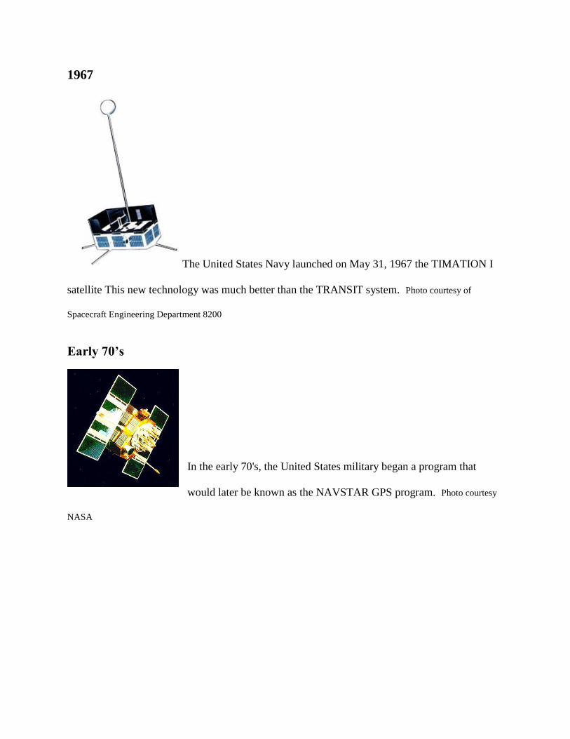
1967
The United States Navy launched on May 31, 1967 the TIMATION I
satellite This new technology was much better than the TRANSIT system. Photo courtesy of
Spacecraft Engineering Department 8200
Early 70’s
In the early 70's, the United States military began a program that
would later be known as the NAVSTAR GPS program. Photo courtesy
NASA
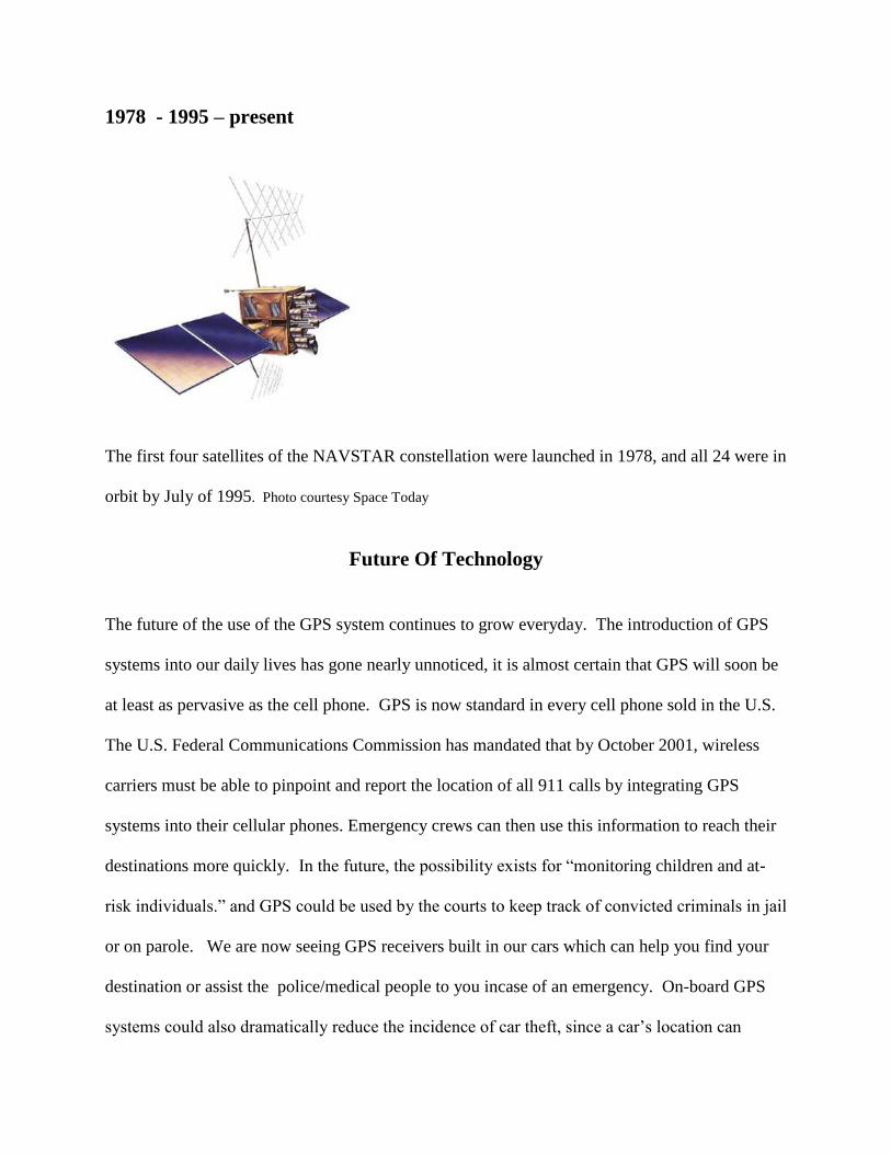
1978 - 1995 – present
The first four satellites of the NAVSTAR constellation were launched in 1978, and all 24 were in
orbit by July of 1995. Photo courtesy Space Today
Future Of Technology
The future of the use of the GPS system continues to grow everyday. The introduction of GPS
systems into our daily lives has gone nearly unnoticed, it is almost certain that GPS will soon be
at least as pervasive as the cell phone. GPS is now standard in every cell phone sold in the U.S.
The U.S. Federal Communications Commission has mandated that by October 2001, wireless
carriers must be able to pinpoint and report the location of all 911 calls by integrating GPS
systems into their cellular phones. Emergency crews can then use this information to reach their
destinations more quickly. In the future, the possibility exists for “monitoring children and at-
risk individuals.” and GPS could be used by the courts to keep track of convicted criminals in jail
or on parole. We are now seeing GPS receivers built in our cars which can help you find your
destination or assist the police/medical people to you incase of an emergency. On-board GPS
systems could also dramatically reduce the incidence of car theft, since a car’s location can
constantly be monitored. $7.6 billion is lost annually to vehicle theft this makes it the most costly
property crime in the United States. (The Future of GPS, Internet) A substantial reduction in
this figure would save the average driver hundreds of dollars each year in car insurance
premiums.
As you probably all ready know, GPS is really used big time with the U.S. Department of
Defense. If you watched any part of the Iraq mission on TV you heard about the GPS guided
bombs hitting there target. As you might guess, the Defense Department is certainly classified
and will never make public the total us of the GPS systems. (The Future of GPS, Internet)
Impacts Associated With The Use of Technology and Conclusion
GPS technology has a wide range of applications in terms of government, businesses and end
consumers such as the handheld units used for navigation and the game GEOCACHING, and is
constantly growing in terms of new products and sales. Some producers of GPS products include
companies such as Motorola, GARMIN International and Hewlett Packard Components Group. .
The diversified technology industry showed a market value of approximately $3.6 Billion
(Media General Financial Services, Internet).
The good vs. the bad when it comes to using GPS systems for tracking sex offenders had it pro
and con side. One group will say it is infringing on the person freedom do move around/travel in
his predetermined area while an other group will justify the need to always know where this
person is so he/she can be monitored all the time and prevent an other crime.
I think that the invention and wide use of GPS systems is a wonderful thing. I enjoy “playing”
with my GPS receiver and marking my land with waypoints. I have used my GPS receiver to
find my brother-in-law’s house in Ohio and it worked great. The GPS system is used many
times a day to make our world a better and safer place. From the air, sea, lake, woods and the
heart of big city GPS receivers are a part of our life. Do I think it works? YES and when we can
place a chip in each child and adult will then have no more missing people and that would be a
good thing. Yes, the positive out weigh the negatives by far in my options. If I could change
this technology I would have it be a law that chips be placed in you at birth so you may be
tracked when lost or kid napped and then have the option to have it removed at the age of 18. I
think the future of this technology holds unlimited uses from cars, ships, planes, pets, kids, and
packages. This has been a fun subject to research.
References:
University of Oregon, Department of Geography
Retrieved July 27th
, 2003
http://geography.uoregon.edu/buckley/teaching/ geog410-w03/lectures/lecture1.ppt
Mohawk College, Global Positioning System – History
Retrieved July 27th
, 2003
http://gibbdell.mohawkc.on.ca/newgps/History.htm
Space Policy Project
Retrieved July 27th
, 2003
http://www.fas.org/spp/military/program/nav/transit.htm
USAF Fact Sheet
Retrieved July 27th
, 2003
http://www.af.mil/news/factsheets/NAVSTAR_Global_Positioning_Sy.html
Spacecraft Engineering Department 8200
Retrieved July 27th
, 2003
http://code8200.nrl.navy.mil/nts.html
History of GPS, Internet
Retrieved July 27th
, 2003
http://www.nmt.edu/~mreece/gps/history.html#anchor386453
USAF NAVSTAR Global Positioning System Fact Sheet, Internet
Retrieved July 27th
, 2003
http://www.af.mil/news/factsheets/NAVSTAR_Global_Positioning_Sy.html
NASA
Retrieved July 27th
. 2003
http://education.gsfc.nasa.gov/ECC/more.html
Garmin Company
Retrieved July 28th
, 2003
http://www.garmin.com/
Magellen Company
Retrieved July 28th
, 2003
http://www.magellangps.com/en/
Lowrance Company
Retrieved July 28th
, 2003
http://www.lowrance.com/
The Future of GPS
Retrieved July 30th
, 2003
http://vcommerce.bus.msu.edu/mba823/projects/topic10/future.html
Media General Financial Services
Retrieved July 30th
, 2003
http://medialab.scu.edu/carlson/bts10/paper.htm