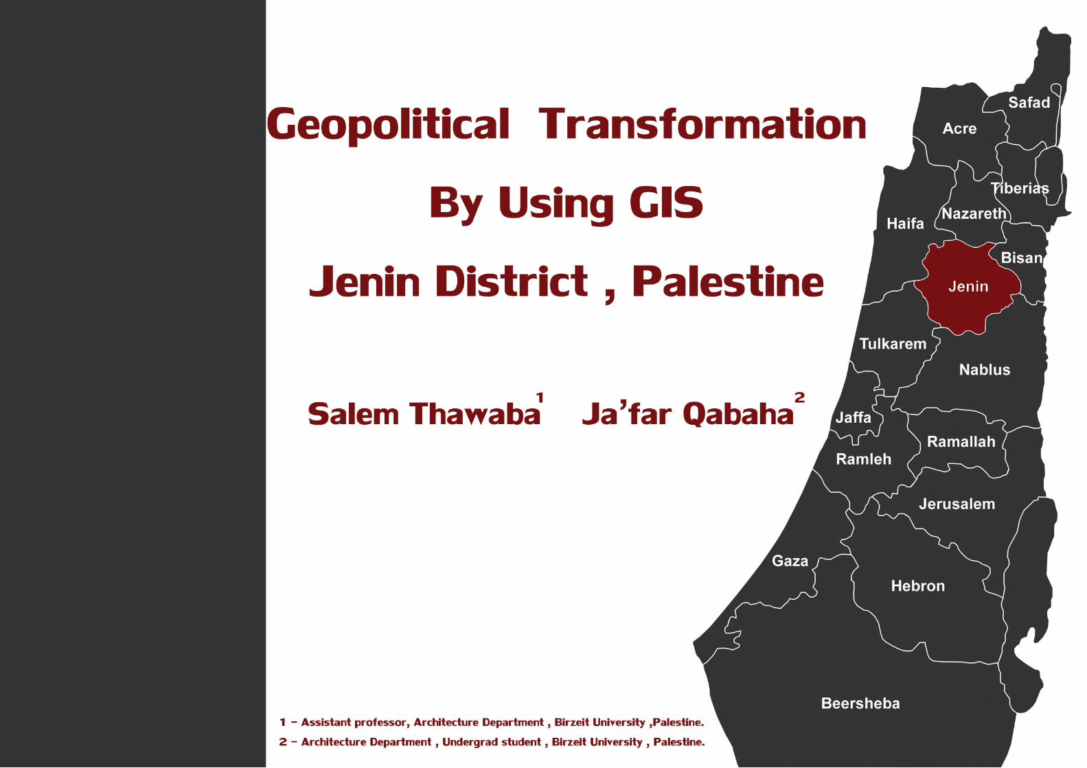
Geopolitical Transformation by using GIS, Jenin , Palestine
64
Transcript of Geopolitical Transformation by using GIS, Jenin , Palestine


Jenin ...1947

Before the catastrophe of Nakba 1948
Palestine provinces
Since the beginning of the era of the British Mandate over Palestine in 1917, the British administration began in the partition of Palestine to the provinces and brigades instead of Alsnagq and States that were prevalent during the reign of the Ottoman Empire, and proceeded to divide Palestine into 16 provinces, each province has worked to support the localities specified to form the center of the province. (Map:1:Palestine provinces during british mandate) . (Mahjoub,2009) .
Border
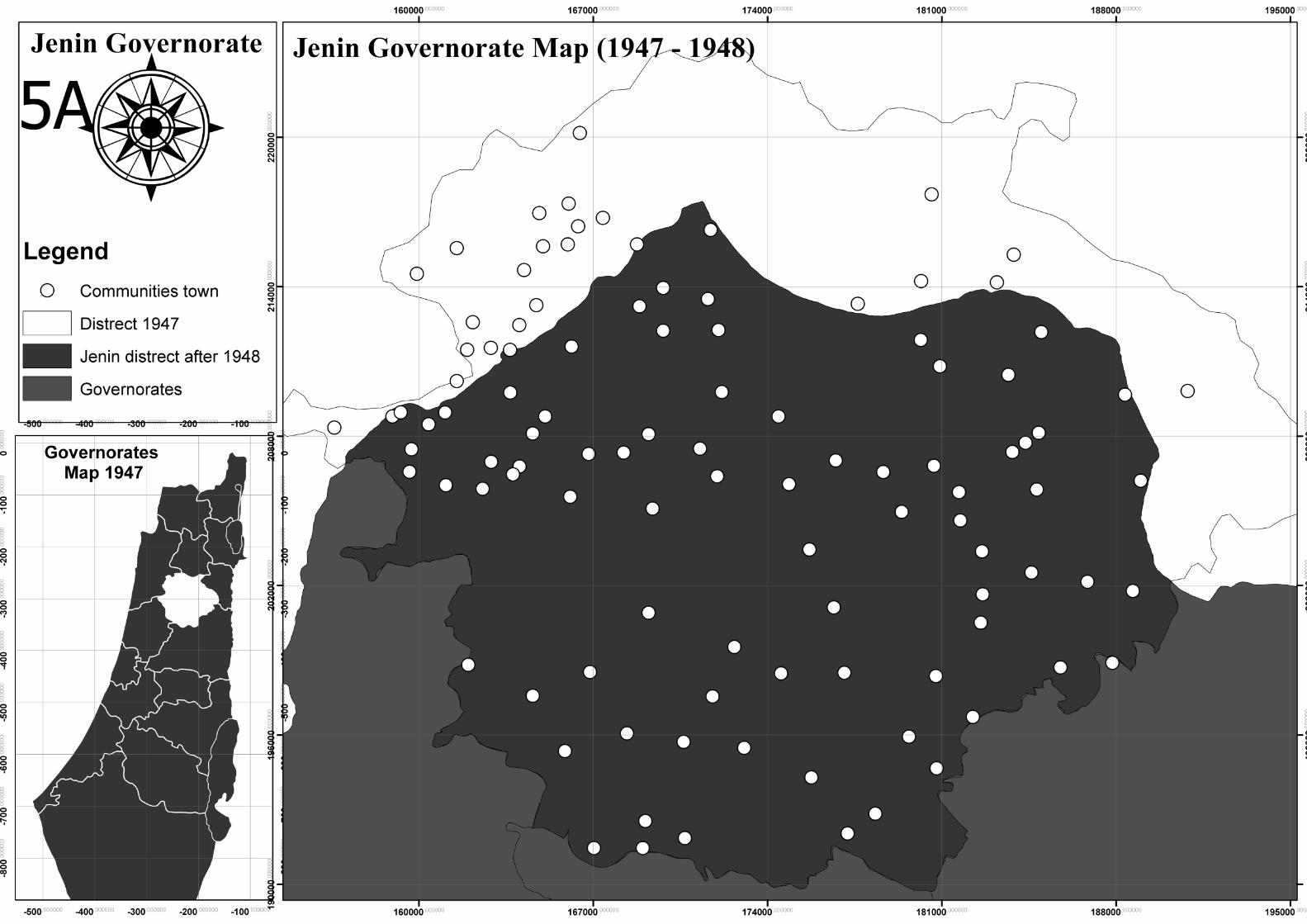
During the British Mandate Jenin was one of the governorates of north of Palestine , which was characterized by a common border with five of the most important provinces of Palestine at that time (Haifa, Bsaan, Nablus, Tulkarem and Nazareth) ,Area in that period was 826 square kilometers, the borders of the province at that period included 70 town between small and large, and has worked to support the city of Jenin and make it the center of the province through the development of administration centers and create different services. (Hnaity, 1993) .
The destruction Jenin city 1936
Palestine Flag during british mandate

Roads
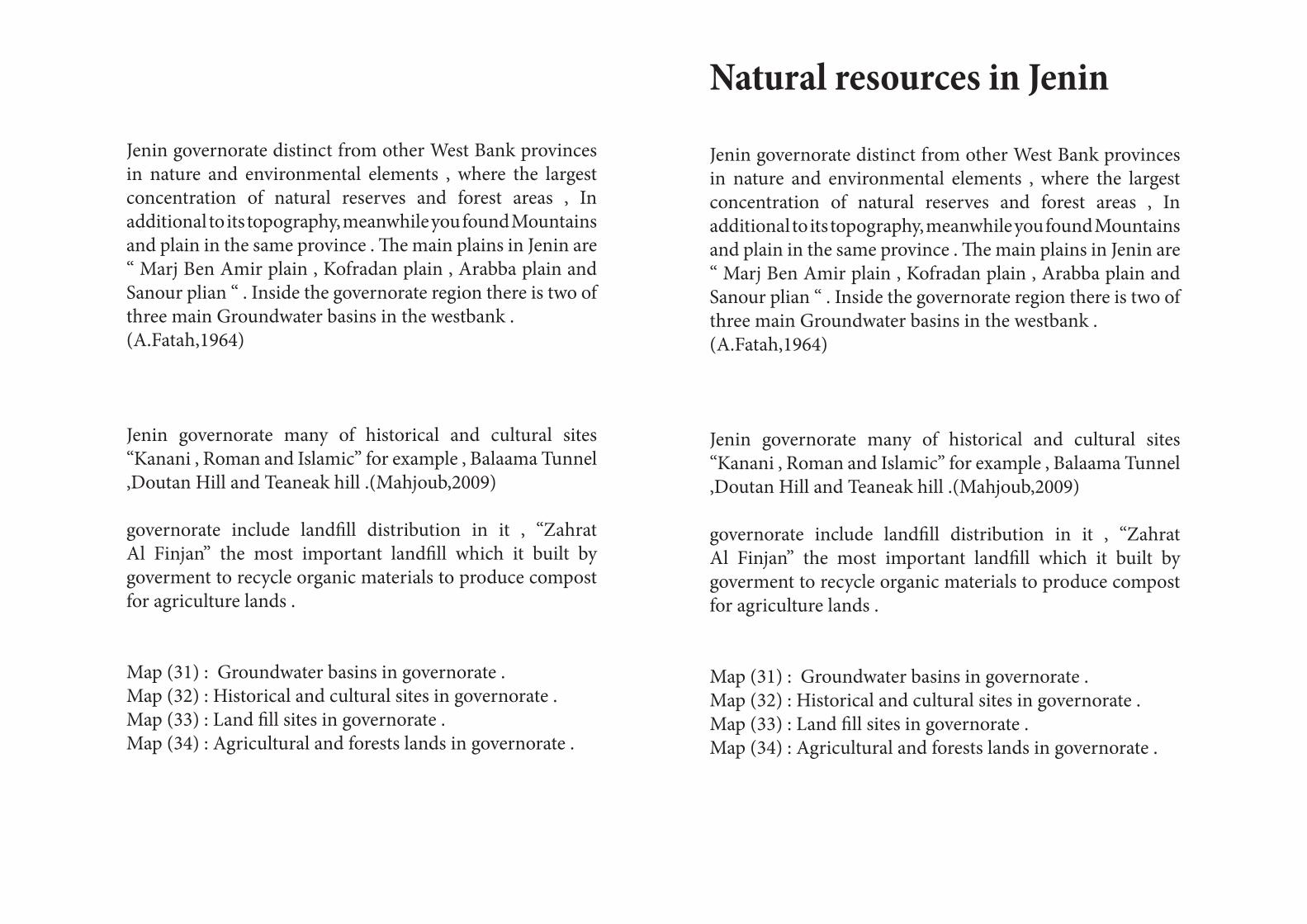
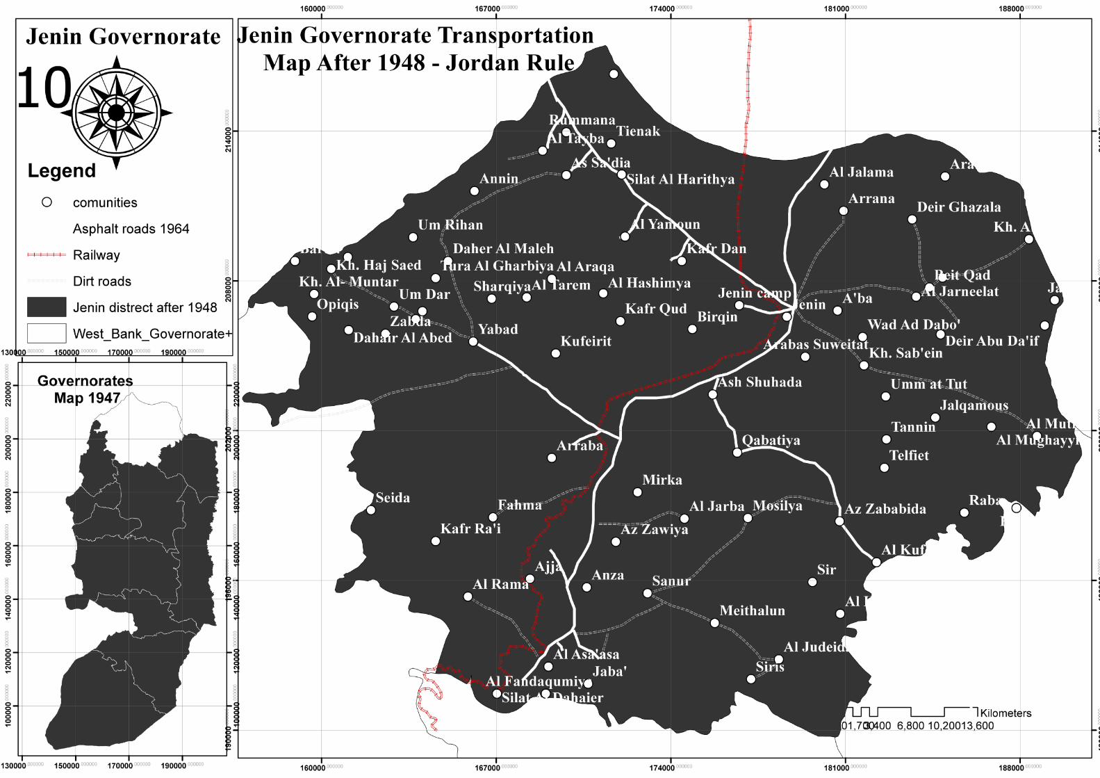
Roads have not characterized in Jenin any attention and care during the period of the Ottoman Empire, where their was not paved road in the province , the main access roads (Jenin Nazareth), (Jenin - Nablus) and (Jenin - Haifa) paved and well suited to the movement, Other roads were bumpy dirt roads. British Mandate army worked to pave the main roads connected Jenin in the early thirties of the last century, and especially after the assassination of the military governor of the city, in addition to taking Izz al-Din al-Qassam of the province and forests their headquarters, worked to pave roads to facilitate the transfer of soldiers. (Map:3,3A) . (A.Fatah,1964)
Railways
At the beginning of the last century, the Ottoman countries have begun to establish the railway lines in the state, the most important Railway was Hijaz railway line that connects Medina and Damascus city , from within the sub-networks in the Hejaz railway line is the Palestinian Railway network which had a large role in the transfer of pilgrims and travelers process over and from North Africa to the Hijaz and the Levant.What is known Marj Ben Ameir line was passing in Jenin and includes two major station , place the Jenin refugee camp currently station, substation near the town of Araba, stopped working in the railway at the end of 1930s , but during the period of the war in 1948, used to transport weapons and support for the Zionist forces. (Map:3,3A) . (Mahjoub ,2009)
population
The population of the province in that period mainly depend on their work in agriculture, a major income for them as a source, and the province was experiencing a population growth is weak to a great extent due to the migration of growing to major cities such as Haifa, Jaffa, for education and work in it , the population of the province during the year 1947 56800 people, 6% live in the city of Jenin, and 94% live in the town and 70 different localities.(Hnaity, 1993) .
The destruction Jenin city 1936
German souvenir
Jenin ... War and division
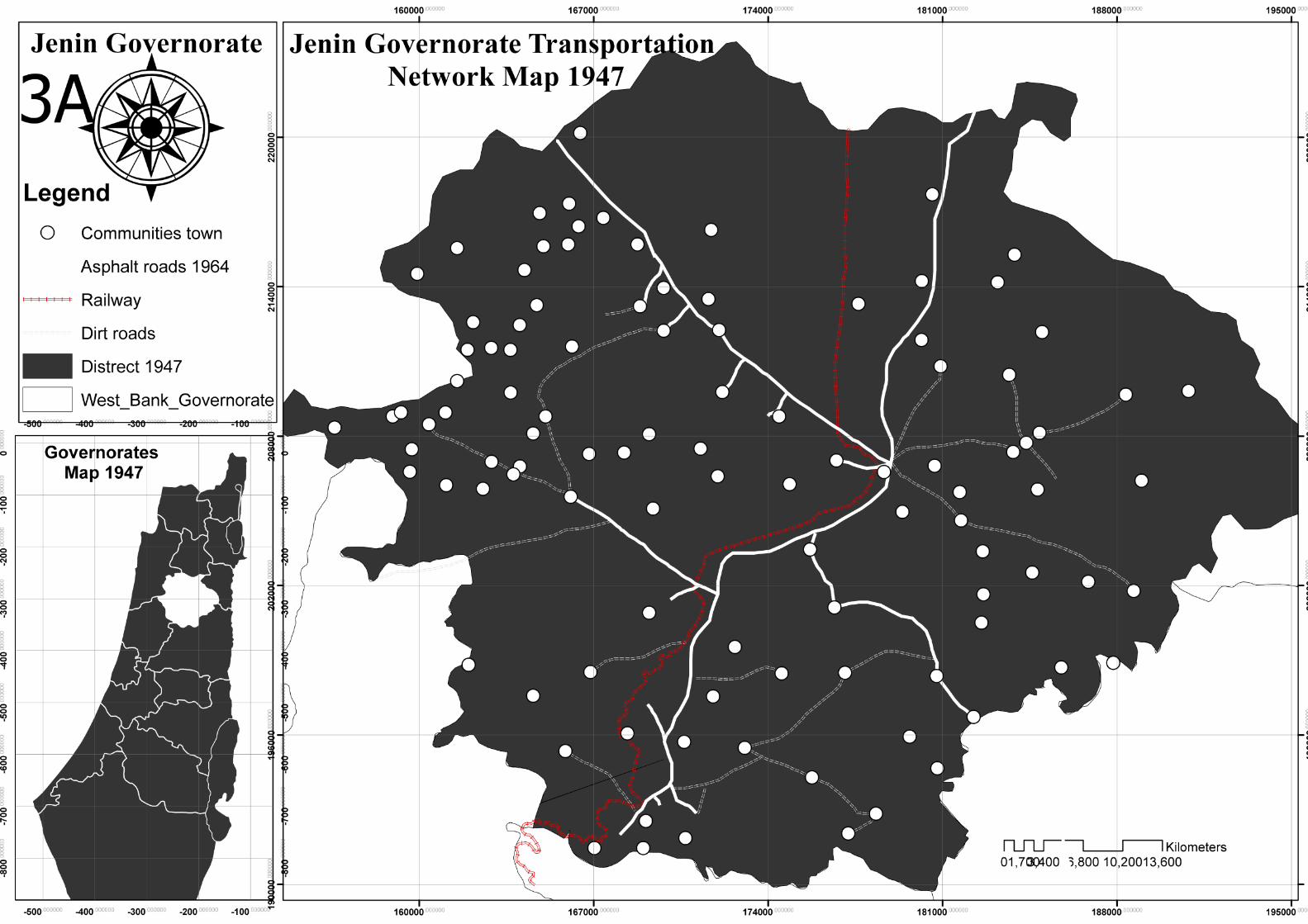
With the approach of the time of withdrawal of the forces of the British Mandate in Palestine, and increased Jewish immigration rates, division projects emerge again, where was released first partition resolution by the United Nations, Resolution No. 181 in November 1947 the partition of Palestine into two states, one for Arabs and one for Jews.(Map:A1:partition Map) .
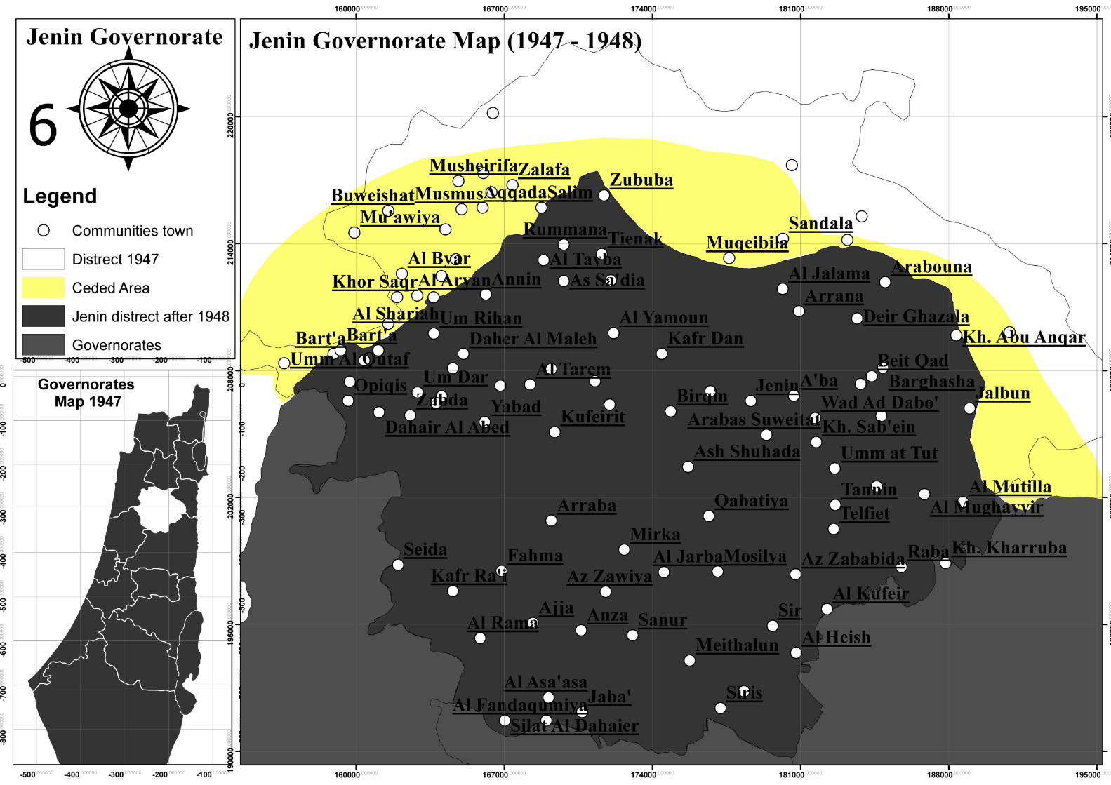
The impact of partition on the borders of Jenin was simple, where it was supposed to deduct parts of the west of the province, including one village only, And turn Jenin to link point between the Palestinian part of the Galilee and other parts remaining under the control of the Arabs. But the partition resolution did not apply at all . (Map:4: Jenin governorate & partition line 1947 ) .
Zionist gangs declared the state of Israel before the end of the British Mandate over Palestine on May 15, 1948, one day before the withdrawal of Britain, resulting in the beginning of the war the Nakba in 1948, where she worked for the Zionist gangs to destroy the villages and the occupation of Palestinian cities.
there was no settlement of the Jews within the boundaries of Jenin , but the Jews gangs Attacked towards the Jenin area to occupy the plain fertile Jezreel Valley, in the beginning of the war the Zionist forces were able to maintain the occupation of the northern areas and defrauded the northern villages, and abandon its inhabitants ,
But you can not progress much within easy area cheerful Ben Amer, even got support enabled them to defrauded easy Jezreel Valley and the city of Jenin forces. (Mahjoub,2009) .
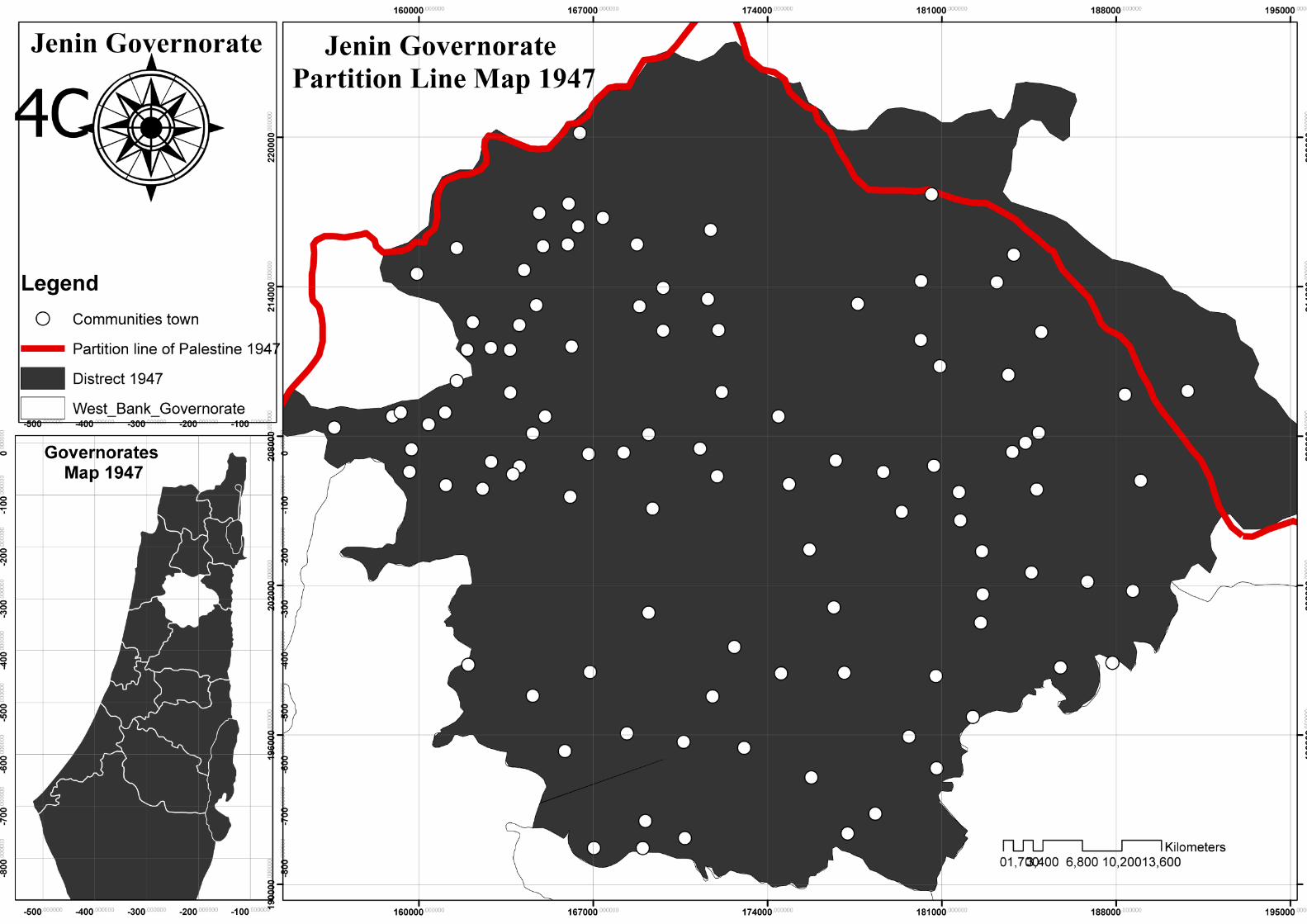
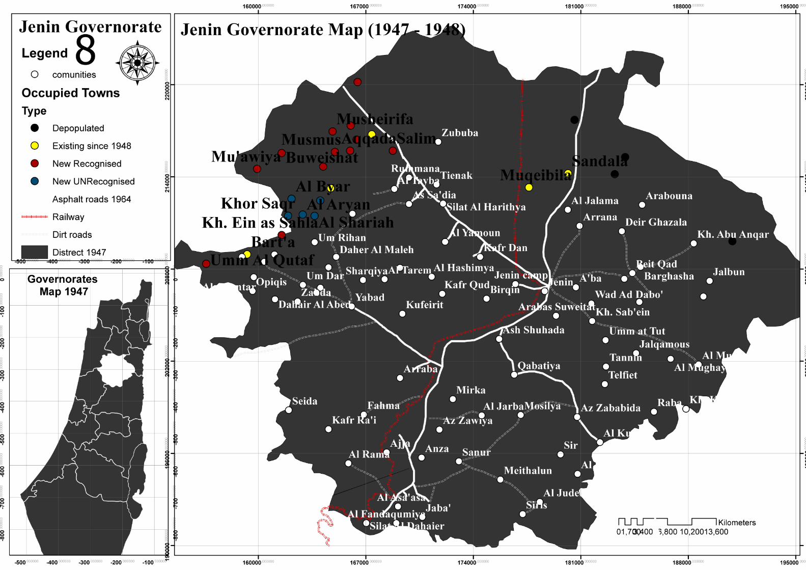
After the end of the truce Zionist occupation forces worked on larger tracts of Jenin until the signing of a permanent truce in Rhodes 1949 Convention, where, during which the demarcation of the borders of the region, or what is known as the Green Line between Alasraúaa and the Arab side side , And the agreement has worked to deliver more of the territory of Jenin forces of Zionism part Despite a survival under Arab control over the availability of the war, Where it was truncated approximately 243 sq km area of the province, the occupation of 25 Palestinian villages of the province ‘in addition to the division of the town into two half Barta Arab (Barta’a) and a half west (Western Barta). (Mahjoub,2009) .
Maps(6B):Towns that have been truncated parts of it in the Rhodes Agreement .
Maps(7): Occupied villages of Jenin 1948 .
Maps(7A): All the villages of Jenin show 1949 .Maps(8): villages of Jenin appear with the transport network 1949 .
Maps(8A): villages of Jenin appear with the transport network 1949 .

Jenin ...1948
Border after 1948
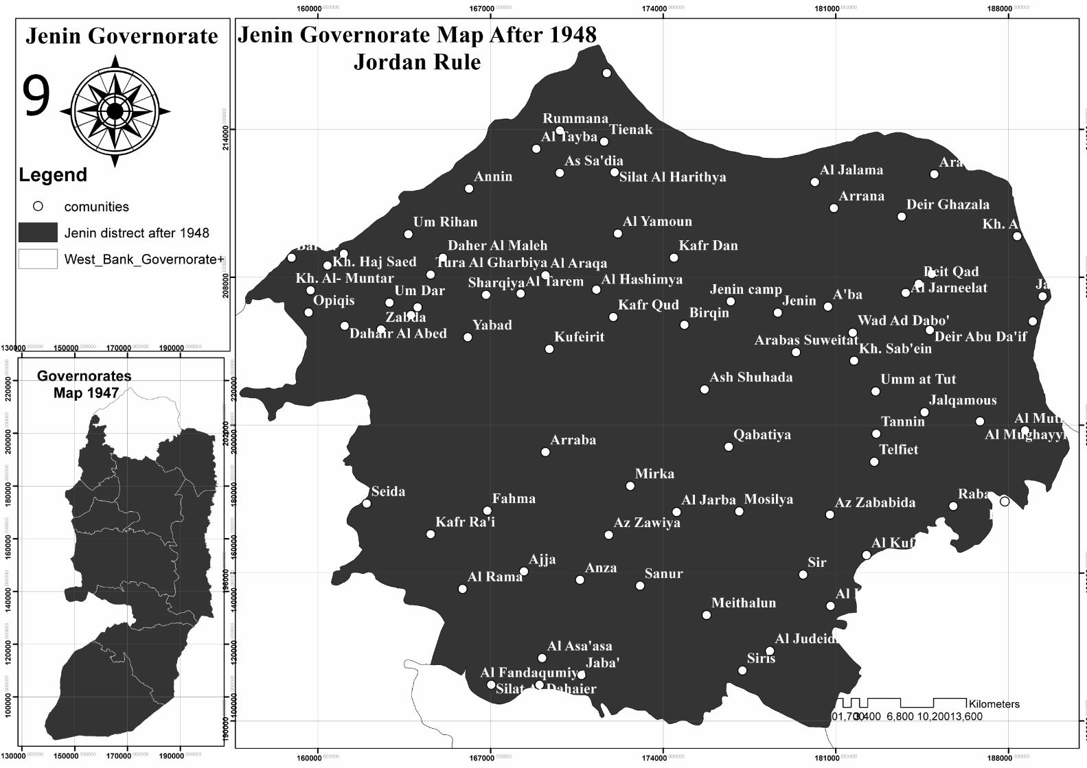
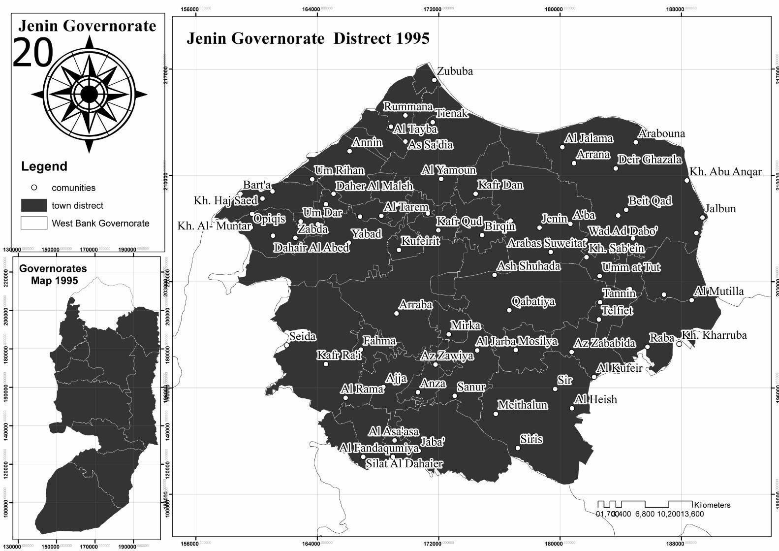
After the signing of Rhodes agreement in 1949, that worked on the demarcation of the border between the regions of the Arab control and Jewish areas . Palestinian territories or so-called “West Bank” Underwent Jordanian rule, Jenin within that region , which subject to the control of Jordan for 19 years until Israel’s occupation of the West Bank in 1967 .During the period of Jordanian rule was re-demarcation of the border between the provinces of the West Bank, the borders of Jenin has not changed from the south side ,But the change was the result of what has been its occupation during the Nakba war, and remain within the border of the province 55 town after defrauded 25 villages of Jenin (map 9:Border of Jenin after Rhodes Agreement) .
Road and transportation network
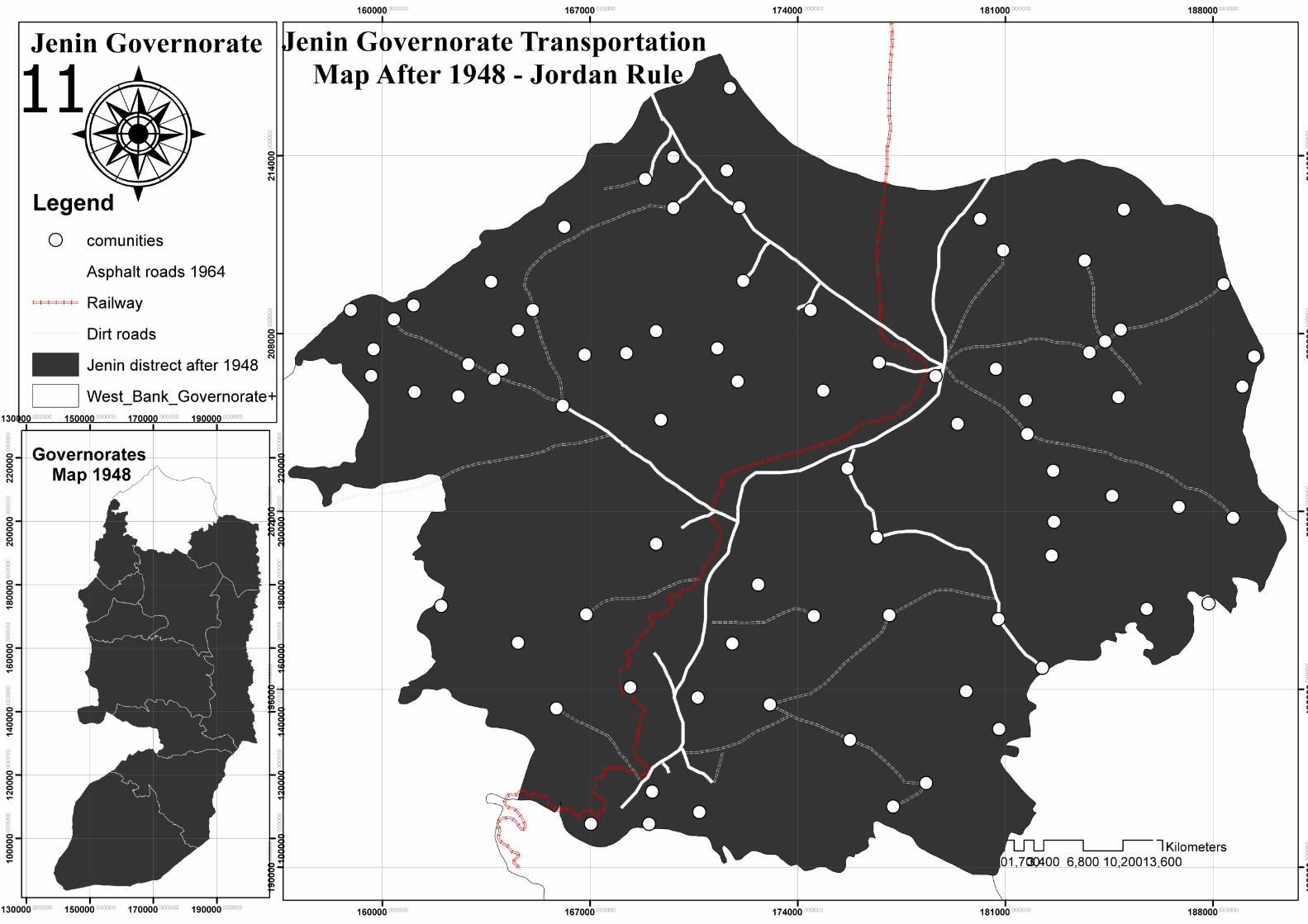
During the period of Jordanian rule Jenin lost its importance as a link between the Middle and north of Palestine, have not been through 19 years of Jordanian rule development of any roads or infrastructure in the West Bank. The railway stopped working, and roads northern of Jenin lost its importance.Map(10) : R esidential areas & Transportation network 1948 . (A.Fatah,1964)
Map(11) :Transportation network 1948 .
Population
After the war ended, and stability part of Palestinians Refugees in refugee camps (the UN refugee centers) , population in Jenin was up until it reached 80100 people, spread over 55 town and 9 refugee centers distributed in the province. 16% of the population is distributed in the city of Jenin and 84% in towns and camps. In the census of 1951 the number of refugees did not mention, and was counted in the population of the province naturally. The population dropped up to 79 thousand people in 1966, where the population has fallen as a result of the difficult living conditions and unemployment.(Hnaity, 1993) .
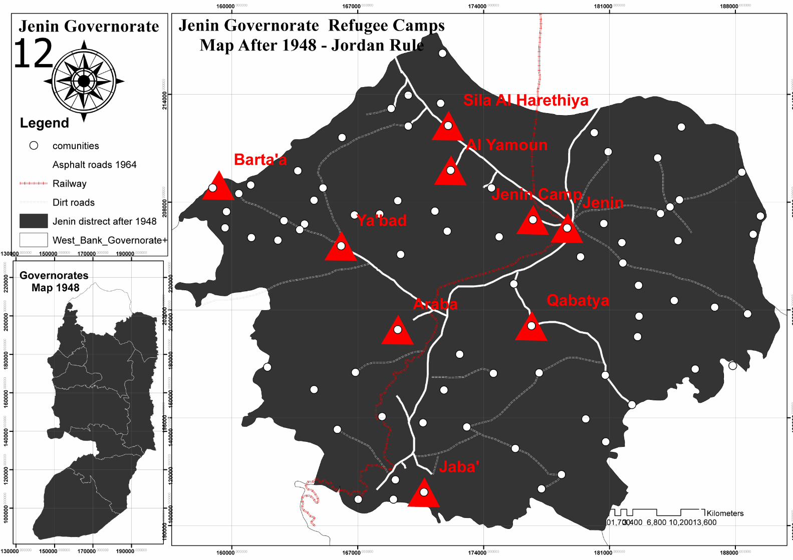
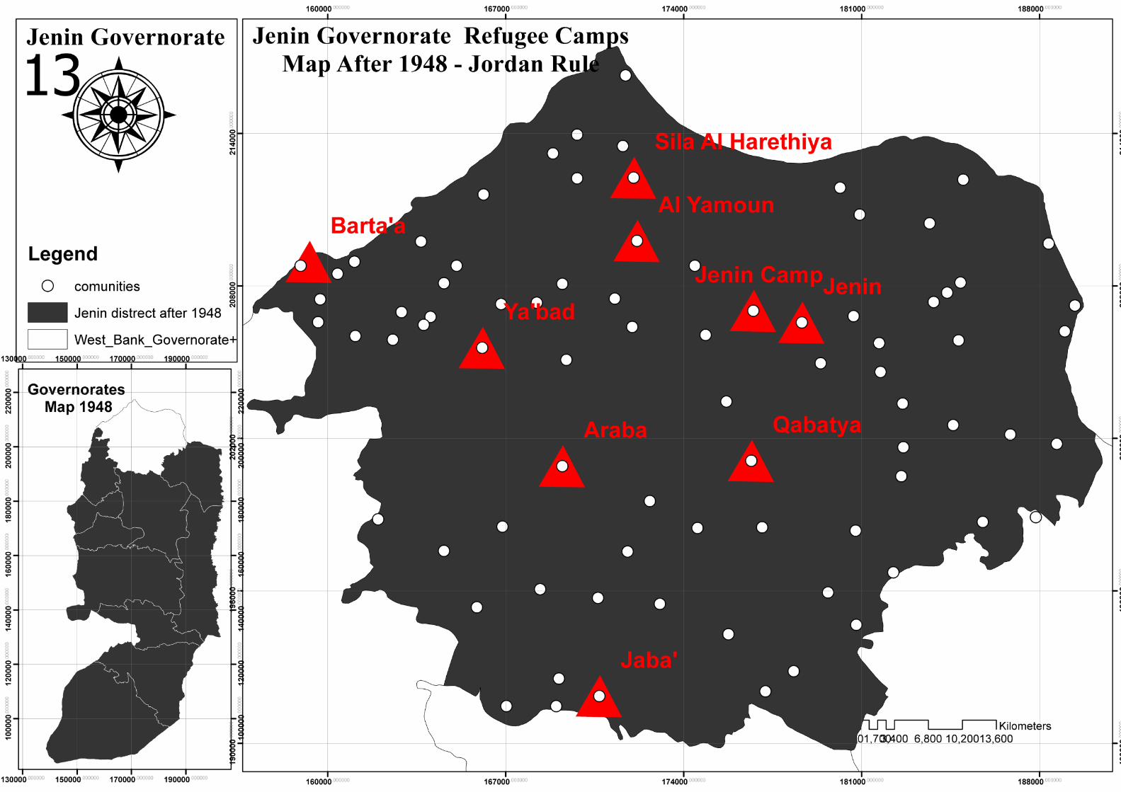
Camps
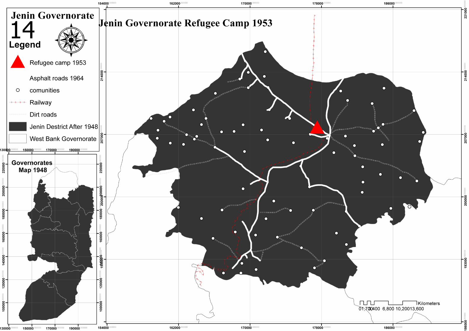
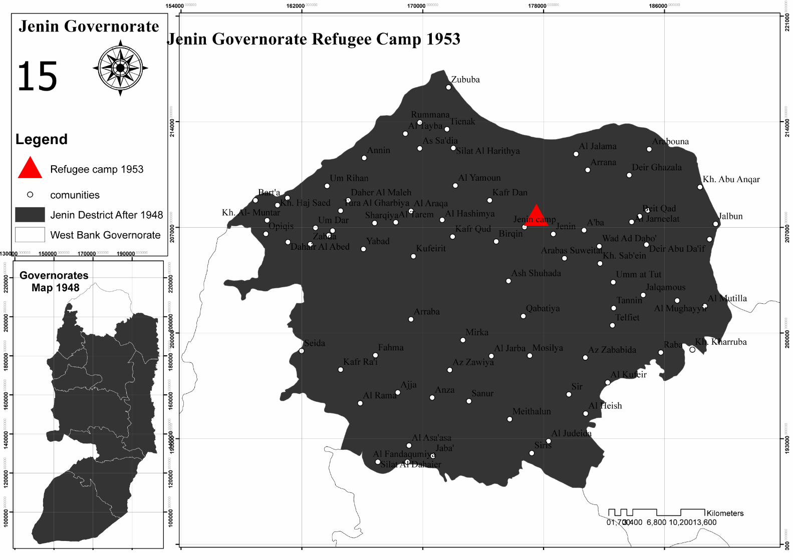
During the Nakba war and then between 1948 and 1951 , 9 refugee camps were established in Jenin for refugees how displaced from their homes, camps distributed in (Jenin city , Arraba , Yabbad , Barta, Jaba, Qabatiya, Yamoun and Seila Harthiya), these camps still until the year 1953, where refugees have been collected from all the camps and take them to the Ash-Shuhada to set up camp for them, but camp established west of Jenin city . (A.Fatah,1964)
Map(12): Refugee camps (1948 -1953) & transportation network .Map(13): Refugee camps (1948 -1953) .Map(14): Refugee camps (1953) & transportation network .Map(15): Refugee camps (1953) .Map(16): The borders of the province, the road network and communities .

Jenin...1968
After the war of 1967
Border after 1967
After the occupation of Gaza strip and westbank in 1967 , Israeli authority worked to change boundaries between Palestinians governorates , which lead to change Jenin governorate Border , at that time they add huge part of Nablus governorate to Jenin , Tubas governorate was a part of Jenin too ( Map 17) . (Hnaity, 1993) .
Road & transportation network .
After the end of 1967 war and during the Israeli occupation until 1994 , they paved of all major roads connecting all cities and villages, were the main reasons for paved were security and facilitate the movement of military patrols . Israeli Authority worked to move the railway from Jenin and the West Bank . Iron pieces were transferred to the Sinai on the Egyptian front to create a defensive Bar Lev Line . (Hnaity, 1993) .
Population
Unlike the Nakba war in 1948, which led to the displacement more than a million palestinian , the war in 1967 did not lead to a change in the number of population, Jenin population was 79,000 inhabitants did not change after the war. Population began growing, until it reached 110,000 inhabitants in 1980. After the 1967 war, there was no any additional camps. (Hnaity, 1993) .
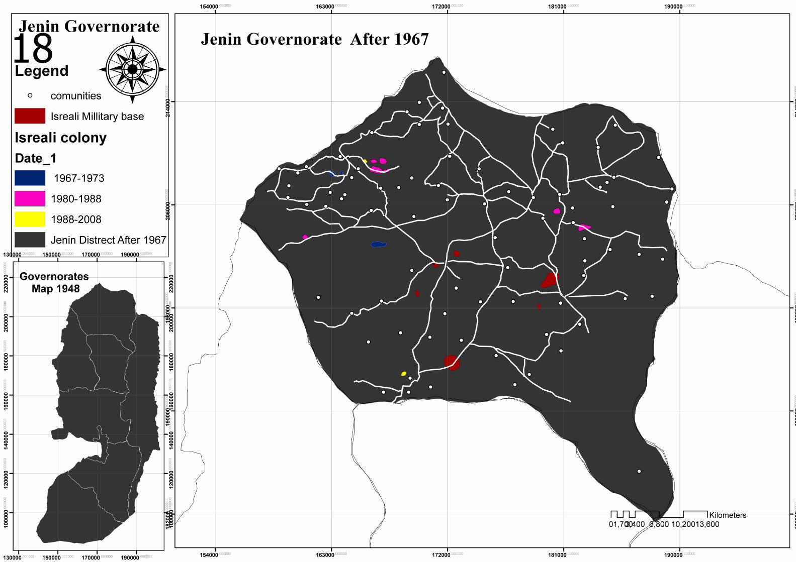
Israeli Colony
with the beginning of Westbank occupation , Israel planned to build colony in the important sites in governorates ,In addition to the establishment of military bases , which they turn all Jordanian military bases to Israeli military bases . Then built a colony nearby it. (Mahjoub , 2009) .
Israel’s colony started in Jenin in 1968 when they built “Doutan colony” near Yaabd town , then “Shakked” in 1971 & “Rehan” in 1973 (Map 18) .
There is many types of colony , there is Millitary colony , Civil colony , agriculture colony and religion colony ( Map 19) . after 1970 many of Colonial schemes appear , first schemes was Allon but it did not interfere with governorate boundary .Deobles plan (Map19A) , Sharoun plan 1992 ( Map 19B) .

Jenin...1994
Boundary After 1994
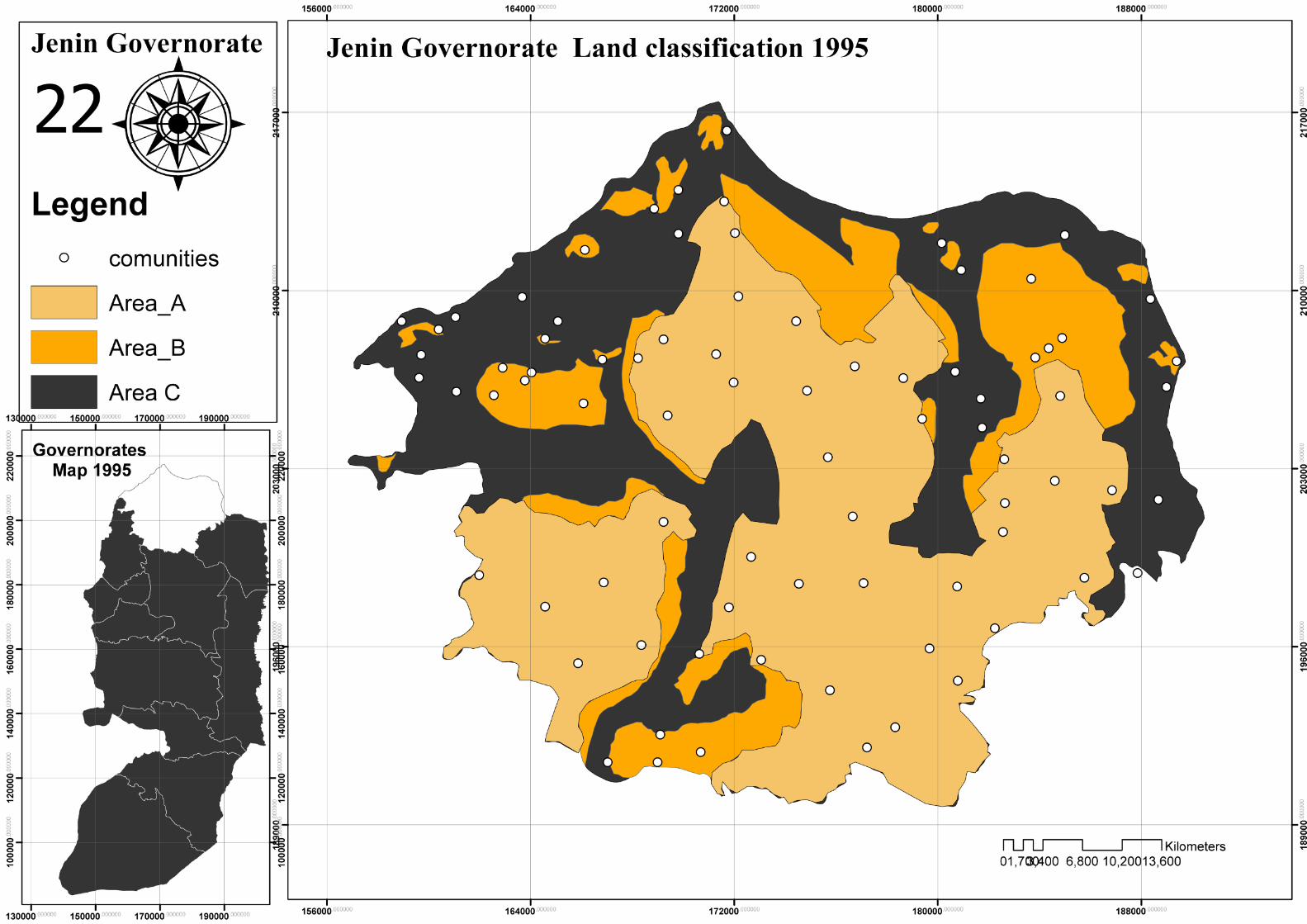
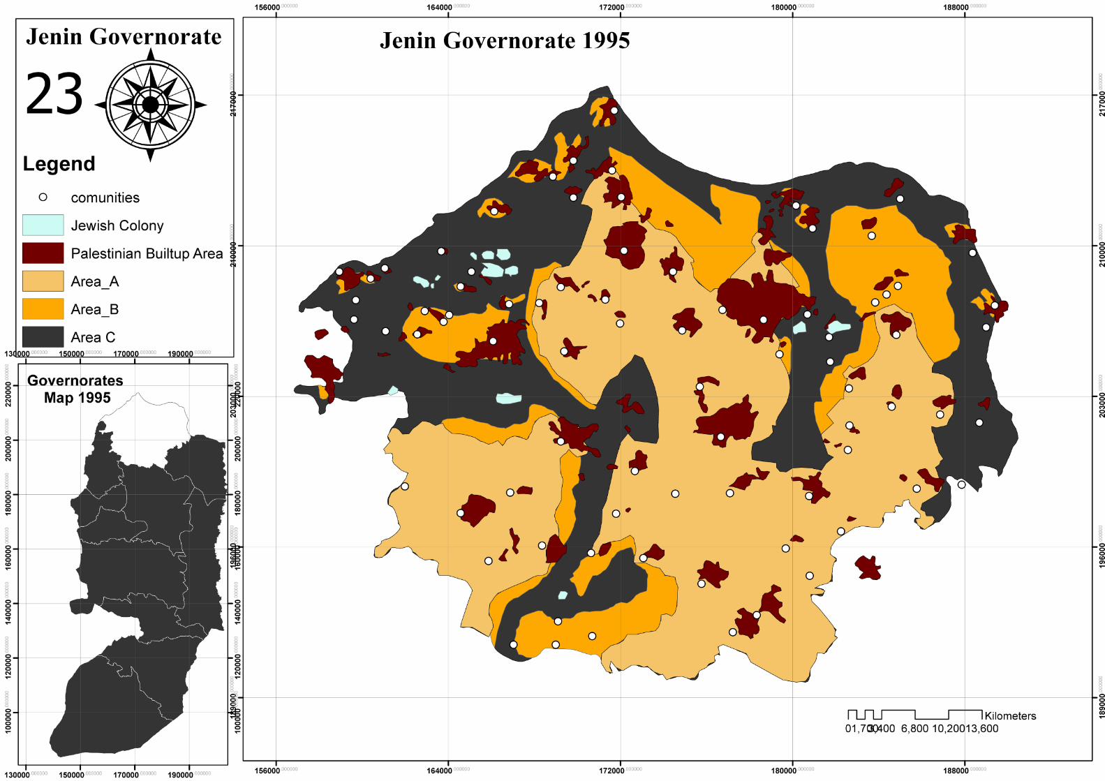
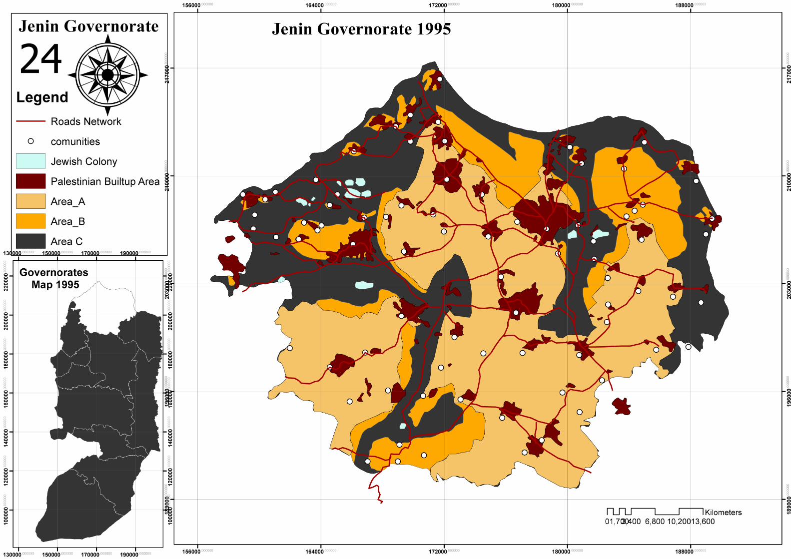
After Oslo agreement between PLO and Israel in 1994 ,agreement provides Palestinian to build their own state in West bank and Gaza . PLO took over control the Cities and towns Gradually , which they sorted west bank and Gaza to 3 types ( A , B ,C ) . (Mahjoub,2009) .
A: Full control for PLO .B: Joint control (PLO &Israel)C: Full control for Israel .
Map (19) : Boundary of Jenin and residential areas 1995 .Map (20) : Palestinian residential areas & Israeli colony .Map (21) : Land types (A,B,C).Map (22) : Land types (A,B,C),Palestinian residential areas & Israeli colony .Map (23) :Land types (A,B,C),Palestinian residential areas , Israeli colony & Transportation network .
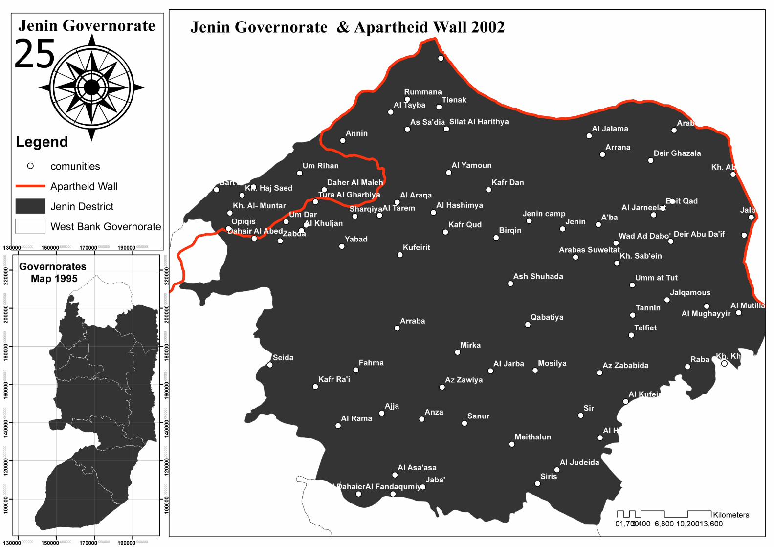
Boundary After 2002
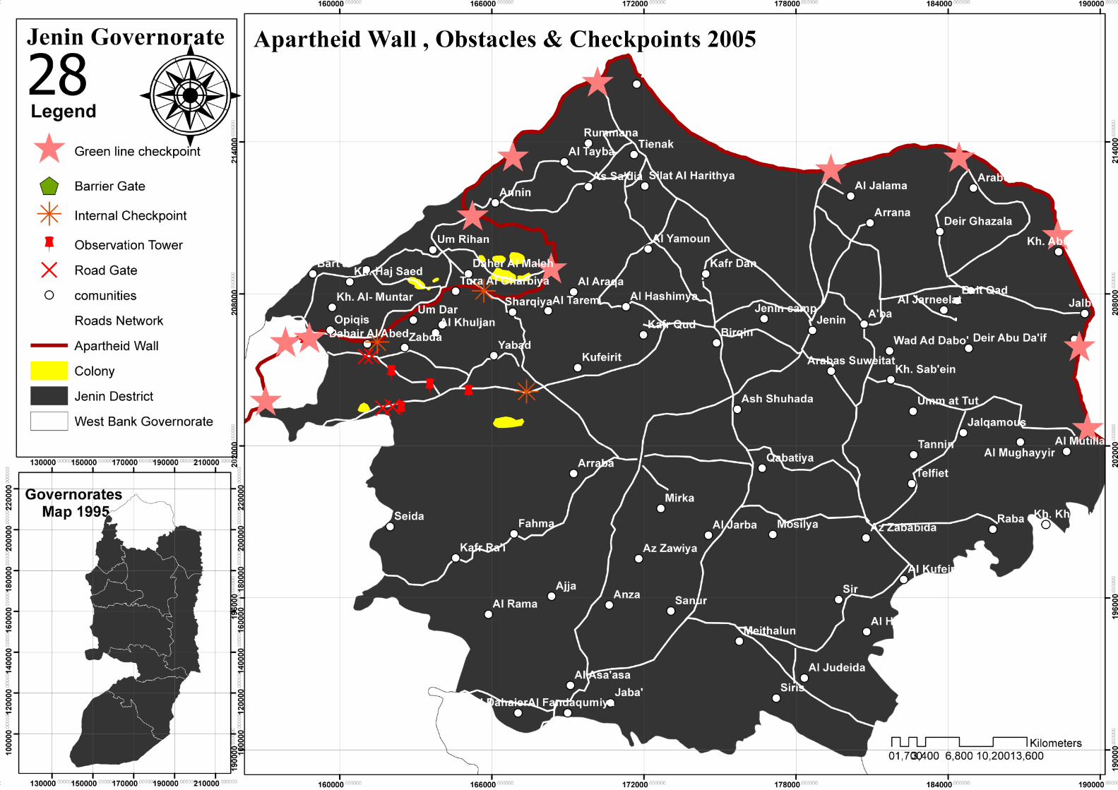
After the second Intefada in 2000 , Israel starting in build a Apartheid wall between wesbank and Israel , all parts of wall built over west bank land by Deductible Huge area of Lands , moreover wall besieged many villages .
Map(25) : Jenin governorate & Apartheid wall .Map(26) : Jenin governorate ,Apartheid wall and Israeli colony Map(27) : Jenin governorate ,Apartheid wall ,Israeli colony ,checkpoints and transportation network .
Boundary After 2005
At th beginning of 2005 , Palestinians and Israel sign “Sharm Al Shayekh” agreement , which consider the end of Intefada ,so Israel Opt out from some colony and remove many of their checkpoints , they Opt ou from 3 colony in Jenin ( Sanour , Janem and Qadem ) . (Mahjoub,2009).
Map(28) : Jenin governorate ,Apartheid wall ,Israeli colony ,checkpoints and transportation network Map(29) : Jenin governorate ,Apartheid wall ,Israeli colony ,checkpoints , transportation network and Palestinian residential areas Map(30) : Palestinian areas affected by the apartheid wall
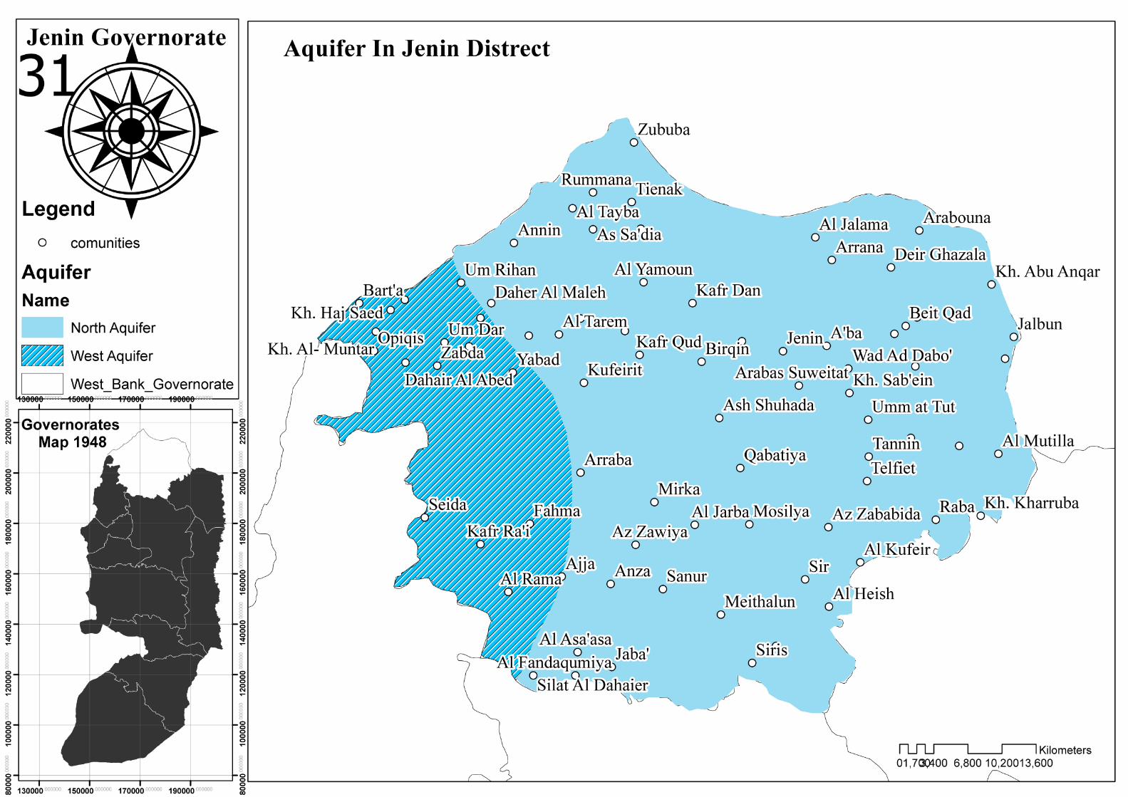
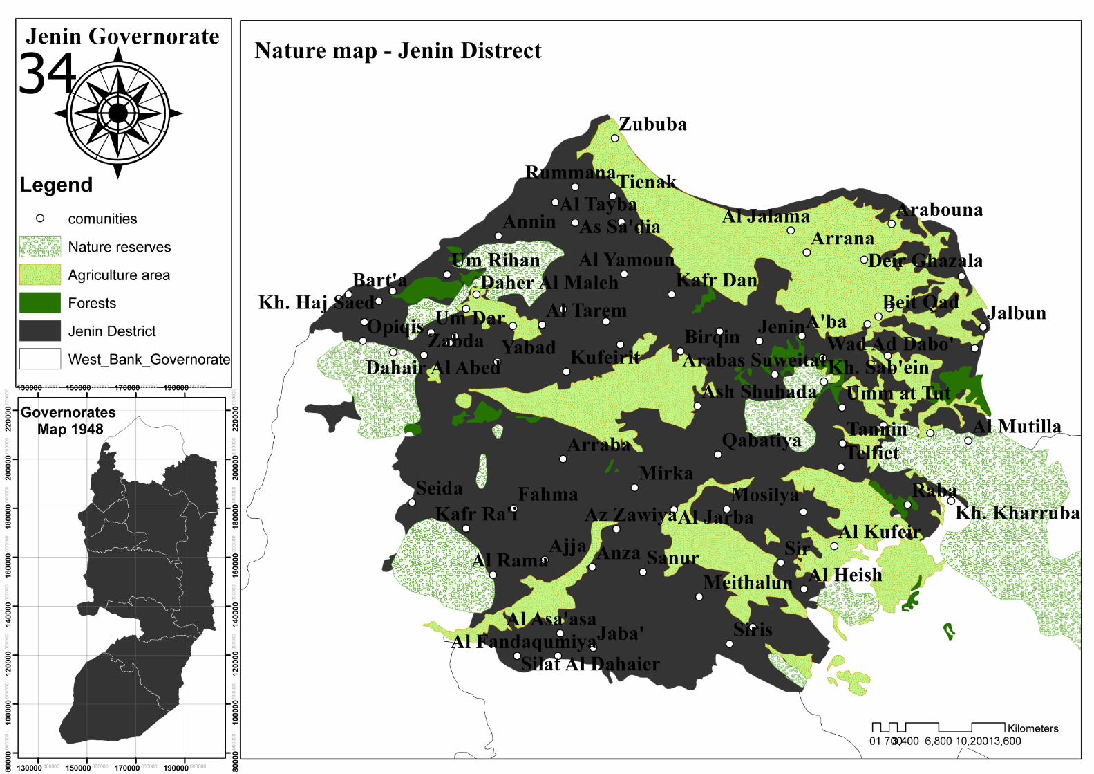
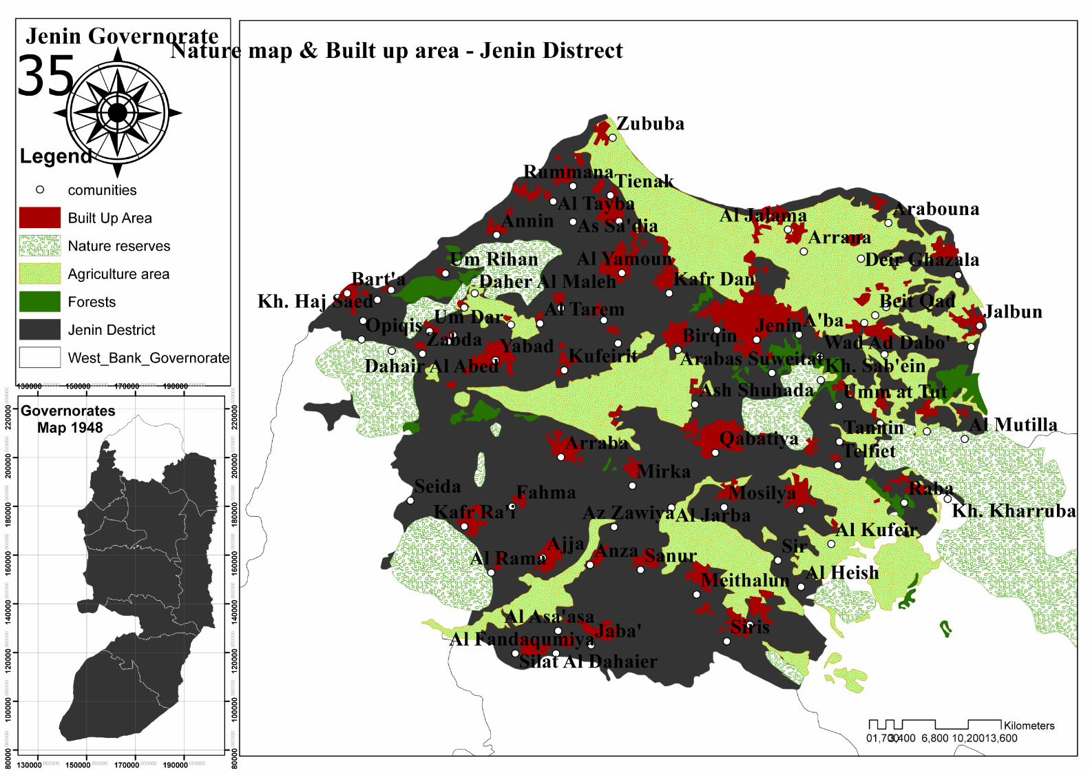
Jenin governorate distinct from other West Bank provinces in nature and environmental elements , where the largest concentration of natural reserves and forest areas , In additional to its topography, meanwhile you found Mountains and plain in the same province . The main plains in Jenin are “ Marj Ben Amir plain , Kofradan plain , Arabba plain and Sanour plian “ . Inside the governorate region there is two of three main Groundwater basins in the westbank .(A.Fatah,1964)
Jenin governorate many of historical and cultural sites “Kanani , Roman and Islamic” for example , Balaama Tunnel ,Doutan Hill and Teaneak hill .(Mahjoub,2009)
governorate include landfill distribution in it , “Zahrat Al Finjan” the most important landfill which it built by goverment to recycle organic materials to produce compost for agriculture lands .
Map (31) : Groundwater basins in governorate .Map (32) : Historical and cultural sites in governorate .Map (33) : Land fill sites in governorate . Map (34) : Agricultural and forests lands in governorate .
Natural resources in Jenin
Jenin governorate distinct from other West Bank provinces in nature and environmental elements , where the largest concentration of natural reserves and forest areas , In additional to its topography, meanwhile you found Mountains and plain in the same province . The main plains in Jenin are “ Marj Ben Amir plain , Kofradan plain , Arabba plain and Sanour plian “ . Inside the governorate region there is two of three main Groundwater basins in the westbank .(A.Fatah,1964)
Jenin governorate many of historical and cultural sites “Kanani , Roman and Islamic” for example , Balaama Tunnel ,Doutan Hill and Teaneak hill .(Mahjoub,2009)
governorate include landfill distribution in it , “Zahrat Al Finjan” the most important landfill which it built by goverment to recycle organic materials to produce compost for agriculture lands .
Map (31) : Groundwater basins in governorate .Map (32) : Historical and cultural sites in governorate .Map (33) : Land fill sites in governorate . Map (34) : Agricultural and forests lands in governorate .

Maps


Fatah , K.A (1964) . Damascus : Damascus University .
Hnaity ,Harb . (1996). The story of Jenin city . Tunis : The Arab Foundation for Education and Culture.
Mahjoub , M .(2009) . Jenin Past And Future . Jenin : Jenin Municipality Library .
The Westbank. Washington: Foundition for Middle .(1980) .Cody, W. C .East Peace .
The palestine question in maps. Jerusalem: PASSIA .(2014) .Hadi, M. A .
London: Palestine Land .1948 Atlas of Palestine .(2004) .Sitte, S. A Society.
References

End