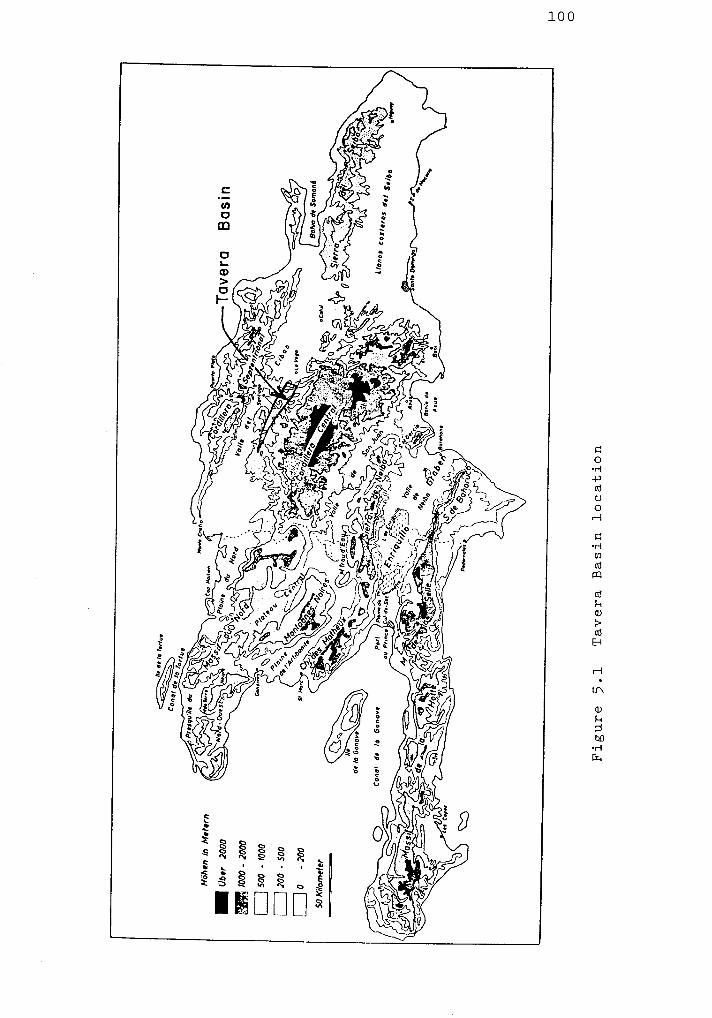
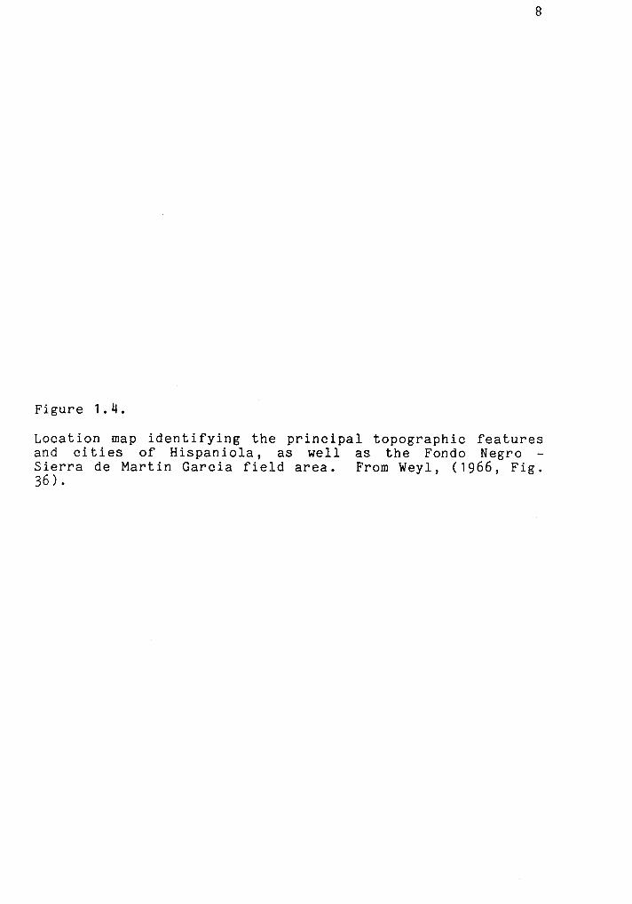
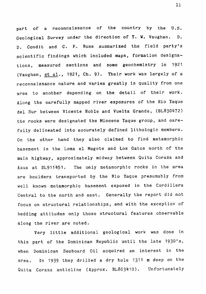
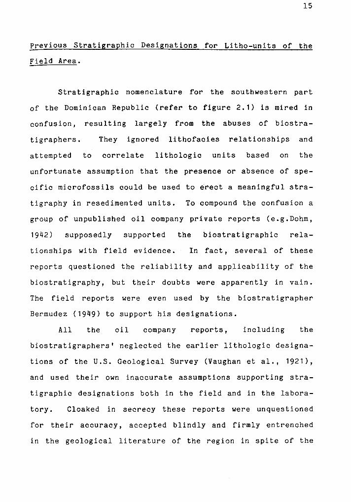
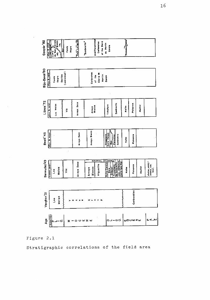
Geology of the Fondo Negro region, Dominican Republic
160
University at Albany, State University of New York University at Albany, State University of New York Scholars Archive Scholars Archive Geology Theses and Dissertations Atmospheric and Environmental Sciences 1983 Geology of the Fondo Negro region, Dominican Republic Geology of the Fondo Negro region, Dominican Republic J. Calvin Cooper University at Albany, State University of New York Follow this and additional works at: https://scholarsarchive.library.albany.edu/cas_daes_geology_etd Part of the Geology Commons, Sedimentology Commons, and the Tectonics and Structure Commons Recommended Citation Recommended Citation Cooper, J. Calvin, "Geology of the Fondo Negro region, Dominican Republic" (1983). Geology Theses and Dissertations. 17. https://scholarsarchive.library.albany.edu/cas_daes_geology_etd/17 This Thesis is brought to you for free and open access by the Atmospheric and Environmental Sciences at Scholars Archive. It has been accepted for inclusion in Geology Theses and Dissertations by an authorized administrator of Scholars Archive. For more information, please contact [email protected].
-
Upload
khangminh22 -
Category
Documents
-
view
1 -
download
0
Transcript of Geology of the Fondo Negro region, Dominican Republic
University at Albany, State University of New York University at Albany, State University of New York
Scholars Archive Scholars Archive
Geology Theses and Dissertations Atmospheric and Environmental Sciences
1983
Geology of the Fondo Negro region, Dominican Republic Geology of the Fondo Negro region, Dominican Republic
J. Calvin Cooper University at Albany, State University of New York
Follow this and additional works at: https://scholarsarchive.library.albany.edu/cas_daes_geology_etd
Part of the Geology Commons, Sedimentology Commons, and the Tectonics and Structure Commons
Recommended Citation Recommended Citation Cooper, J. Calvin, "Geology of the Fondo Negro region, Dominican Republic" (1983). Geology Theses and Dissertations. 17. https://scholarsarchive.library.albany.edu/cas_daes_geology_etd/17
This Thesis is brought to you for free and open access by the Atmospheric and Environmental Sciences at Scholars Archive. It has been accepted for inclusion in Geology Theses and Dissertations by an authorized administrator of Scholars Archive. For more information, please contact [email protected].


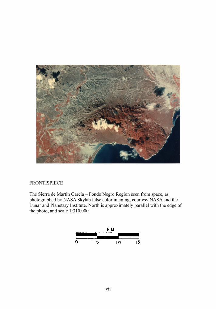
FRONTISPIECE
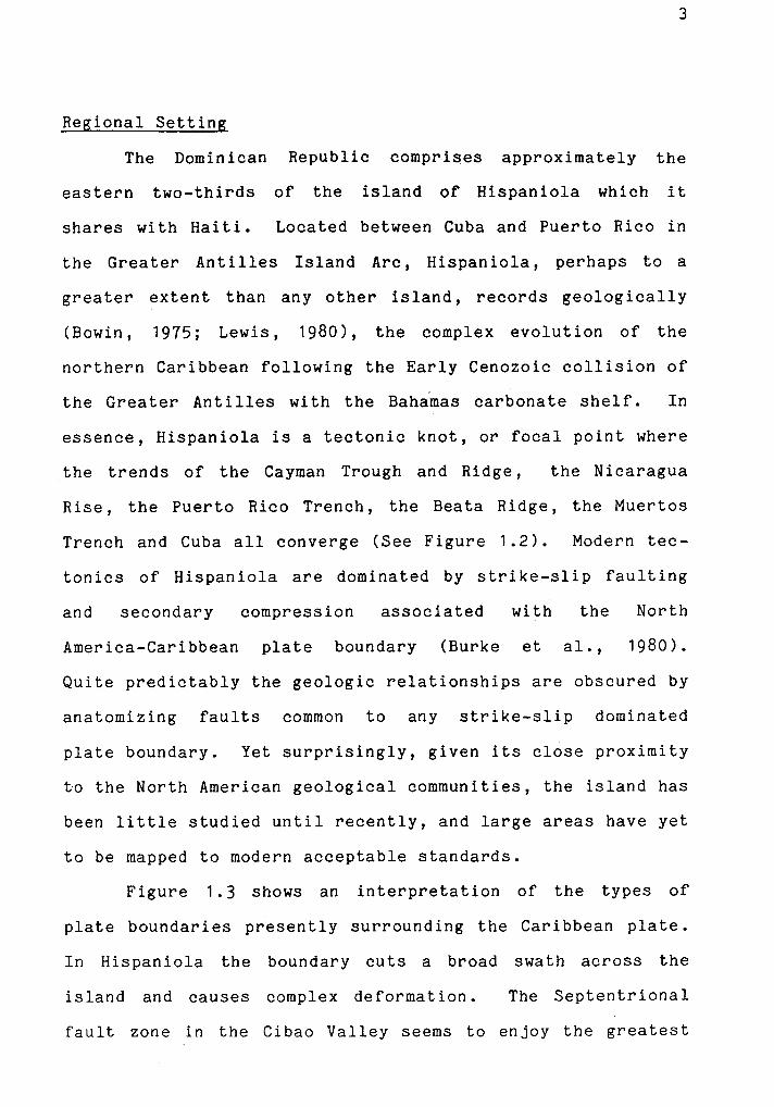
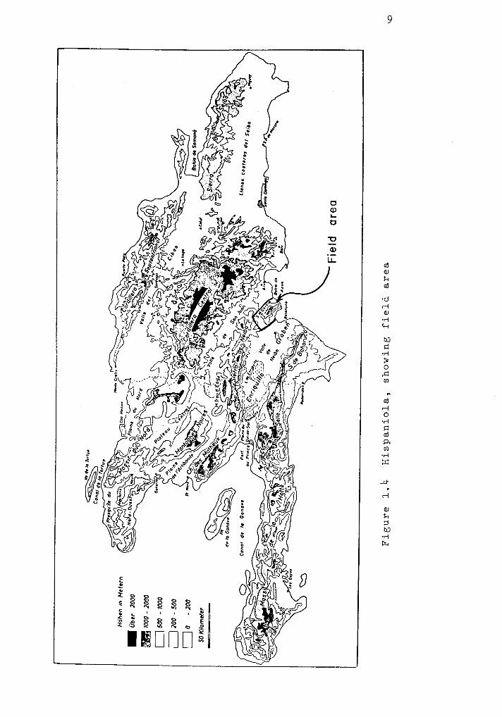
The Sierra de Martin Garcia – Fondo Negro Region seen from space, as photographed by NASA Skylab false color imaging, courtesy NASA and the Lunar and Planetary Institute. North is approximately parallel with the edge of the photo, and scale 1:310,000
vii


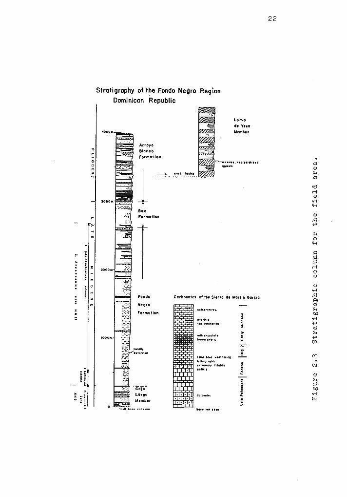
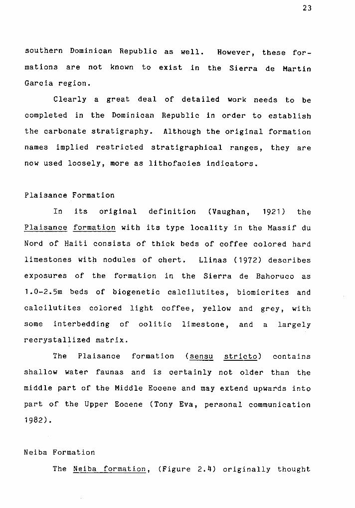

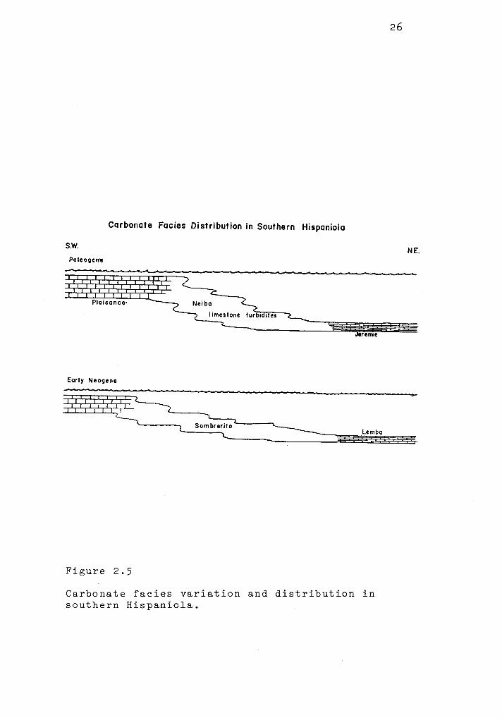
24
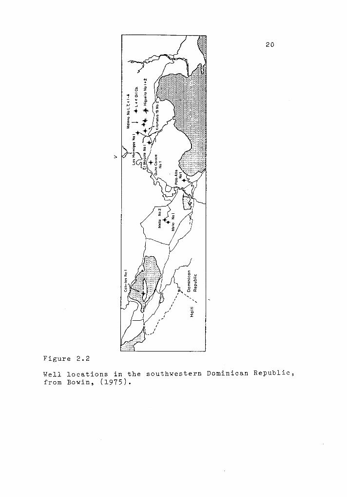
Figure 2.4
The Neiba limestone formation, exposed along the road north of Neiba to Guacate in the Sierra de Neiba (BL445482). Alternating deep and shallow water foraminiferal horizons combined with sharp bedding contacts, apparent channels, slight grading and laterally varying bed thicknesses (few cms. To a meter) suggest deposition as carbonate turbidites. Note the chocolate colored chert layer near the top of the picture.
These rocks are generally believed to be of late Eocene age.
31
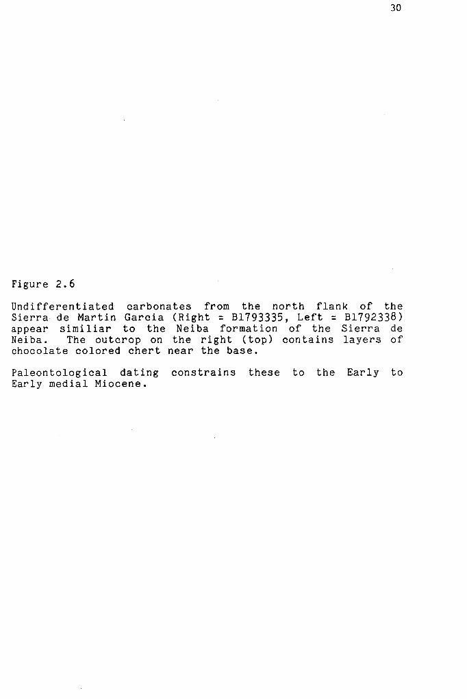
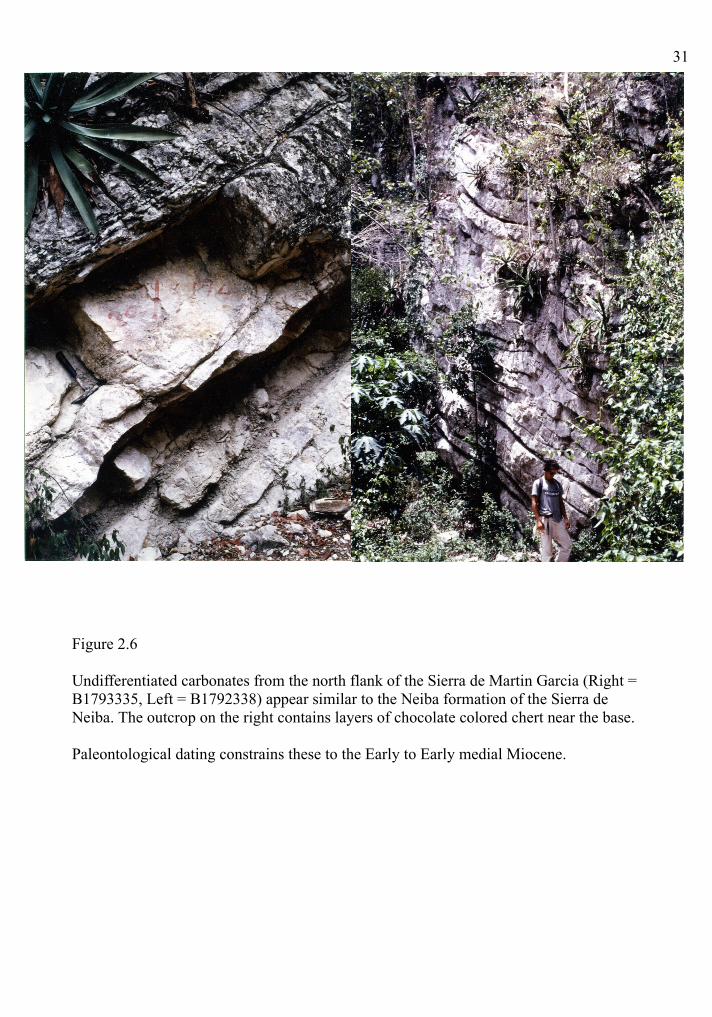
Figure 2.6
Undifferentiated carbonates from the north flank of the Sierra de Martin Garcia (Right = B1793335, Left = B1792338) appear similar to the Neiba formation of the Sierra de Neiba. The outcrop on the right contains layers of chocolate colored chert near the base.
Paleontological dating constrains these to the Early to Early medial Miocene.
32
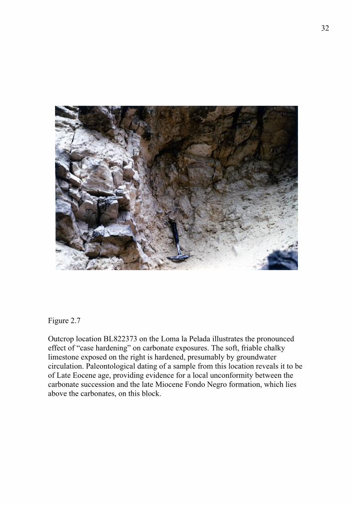
Figure 2.7
Outcrop location BL822373 on the Loma la Pelada illustrates the pronounced effect of “case hardening” on carbonate exposures. The soft, friable chalky limestone exposed on the right is hardened, presumably by groundwater circulation. Paleontological dating of a sample from this location reveals it to be of Late Eocene age, providing evidence for a local unconformity between the carbonate succession and the late Miocene Fondo Negro formation, which lies above the carbonates, on this block.

35
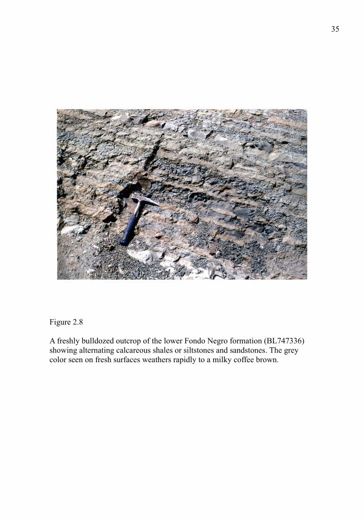
Figure 2.8
A freshly bulldozed outcrop of the lower Fondo Negro formation (BL747336) showing alternating calcareous shales or siltstones and sandstones. The grey color seen on fresh surfaces weathers rapidly to a milky coffee brown.

36
Figure 2.9
The top of the Fondo Negro formation (BL832438) is characterized by massive sandstones and shales capped by a conglomerate unit. Deposition was presumably by a channel fan system.
38
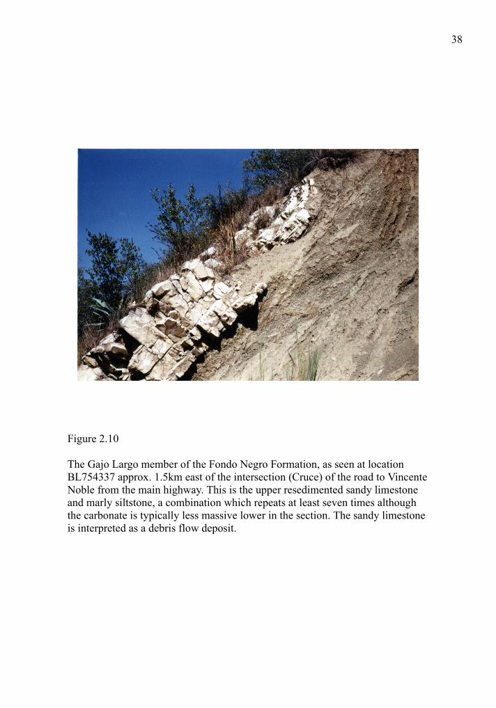
Figure 2.10
The Gajo Largo member of the Fondo Negro Formation, as seen at location BL754337 approx. 1.5km east of the intersection (Cruce) of the road to Vincente Noble from the main highway. This is the upper resedimented sandy limestone and marly siltstone, a combination which repeats at least seven times although the carbonate is typically less massive lower in the section. The sandy limestone is interpreted as a debris flow deposit.
40
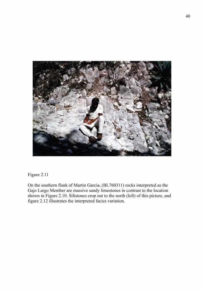
Figure 2.11
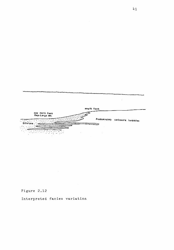
On the southern flank of Martin Garcia, (BL760311) rocks interpreted as the Gajo Largo Member are massive sandy limestones in contrast to the location shown in Figure 2.10. Siltstones crop out to the north (left) of this picture, and figure 2.12 illustrates the interpreted facies variation.


43
Figure 2.13
The Bao shale formation exposed along the river loop approximately 2.5 kilometers west of Fondo Negro (BL751383) consists of massive bluish grey calcareous shale with some graded, fining upwards laminar sandstones.


46
Figure 2.14
The lower Arroyo Blanco formation includes prominent horizons of resedimented carbonate shelf debris, and not unlike conglomerates in the Fondo Negro formation, they form the top of cuestas. The outcrop shown here occurs at BL 792435.
48
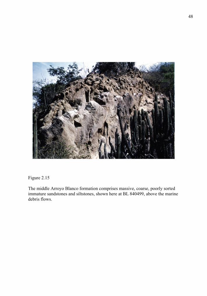
Figure 2.15
The middle Arroyo Blanco formation comprises massive, coarse, poorly sorted immature sandstones and siltstones, shown here at BL 840499, above the marine debris flows.
49
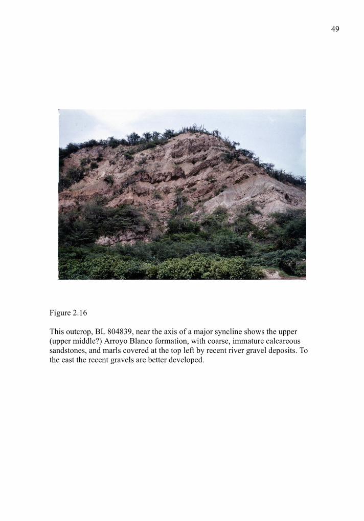
Figure 2.16
This outcrop, BL 804839, near the axis of a major syncline shows the upper (upper middle?) Arroyo Blanco formation, with coarse, immature calcareous sandstones, and marls covered at the top left by recent river gravel deposits. To the east the recent gravels are better developed.

51
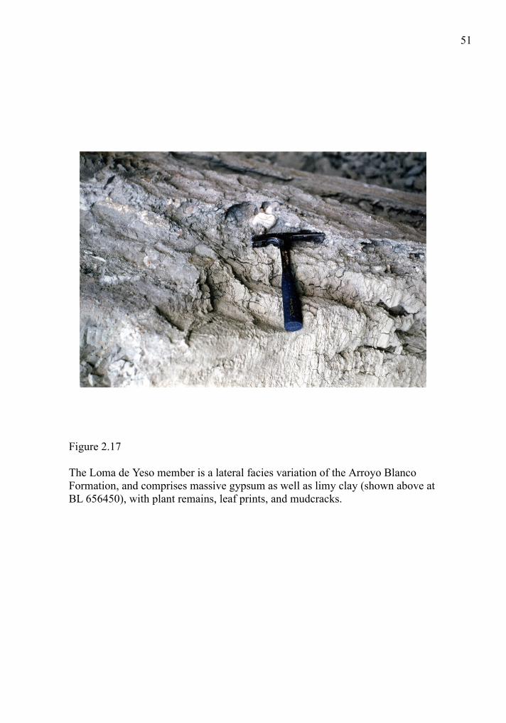
Figure 2.17
The Loma de Yeso member is a lateral facies variation of the Arroyo Blanco Formation, and comprises massive gypsum as well as limy clay (shown above at BL 656450), with plant remains, leaf prints, and mudcracks.
55
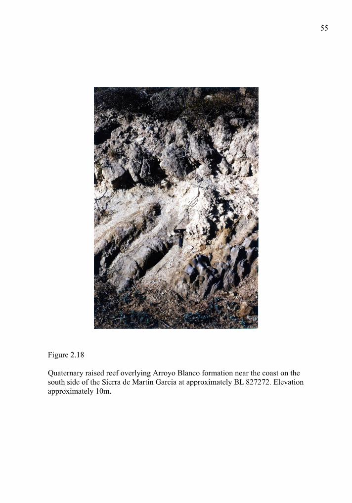
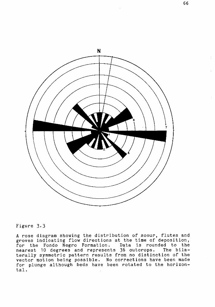
Figure 2.18
Quaternary raised reef overlying Arroyo Blanco formation near the coast on the south side of the Sierra de Martin Garcia at approximately BL 827272. Elevation approximately 10m.


65
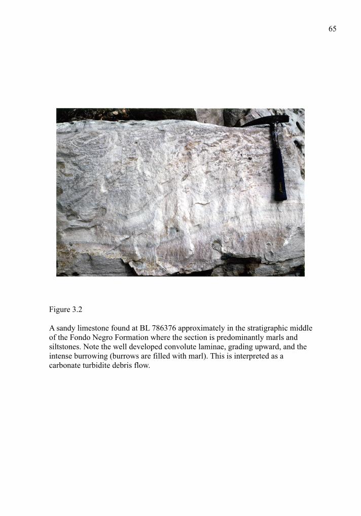
Figure 3.2
A sandy limestone found at BL 786376 approximately in the stratigraphic middle of the Fondo Negro Formation where the section is predominantly marls and siltstones. Note the well developed convolute laminae, grading upward, and the intense burrowing (burrows are filled with marl). This is interpreted as a carbonate turbidite debris flow.
68
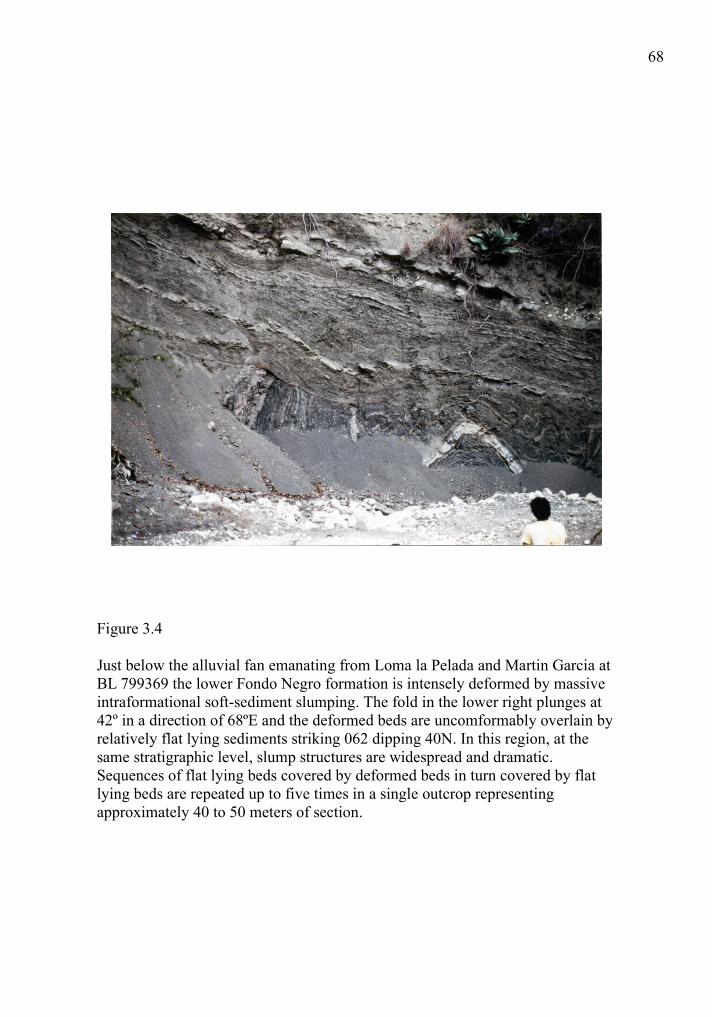
Figure 3.4
Just below the alluvial fan emanating from Loma la Pelada and Martin Garcia at BL 799369 the lower Fondo Negro formation is intensely deformed by massive intraformational soft-sediment slumping. The fold in the lower right plunges at 42º in a direction of 68ºE and the deformed beds are uncomformably overlain by relatively flat lying sediments striking 062 dipping 40N. In this region, at the same stratigraphic level, slump structures are widespread and dramatic. Sequences of flat lying beds covered by deformed beds in turn covered by flat lying beds are repeated up to five times in a single outcrop representing approximately 40 to 50 meters of section.
69
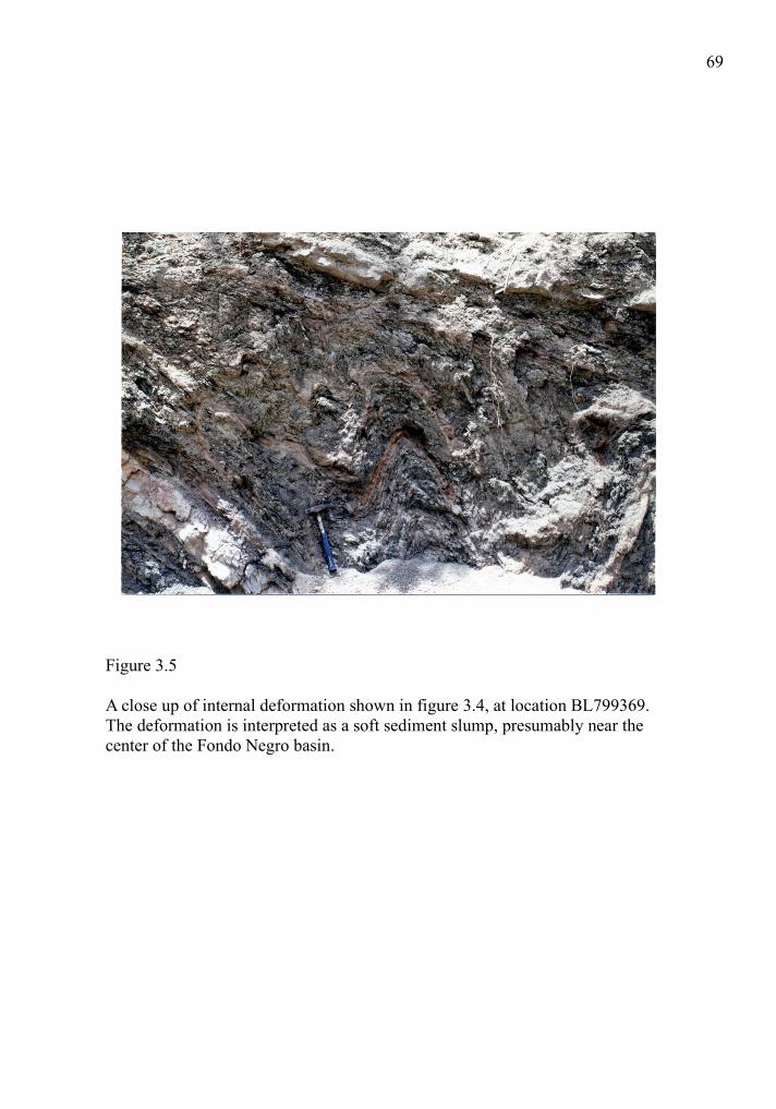
Figure 3.5
A close up of internal deformation shown in figure 3.4, at location BL799369. The deformation is interpreted as a soft sediment slump, presumably near the center of the Fondo Negro basin.


81
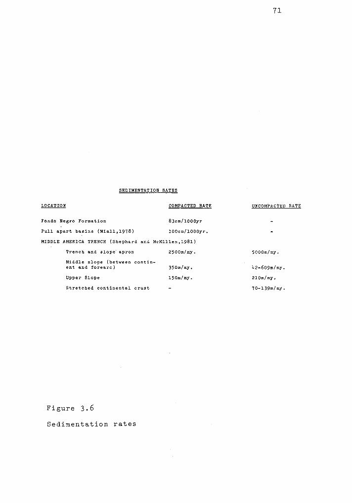
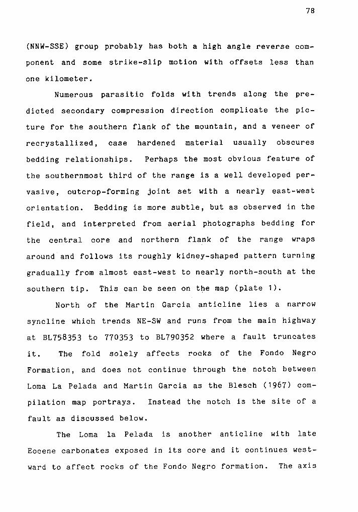
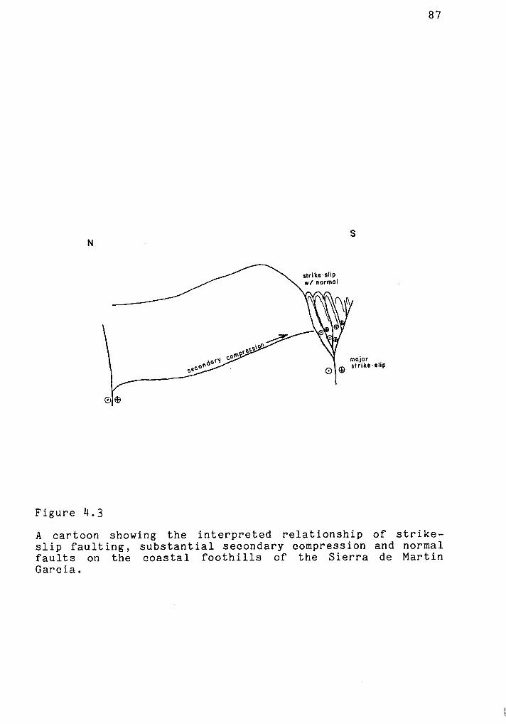
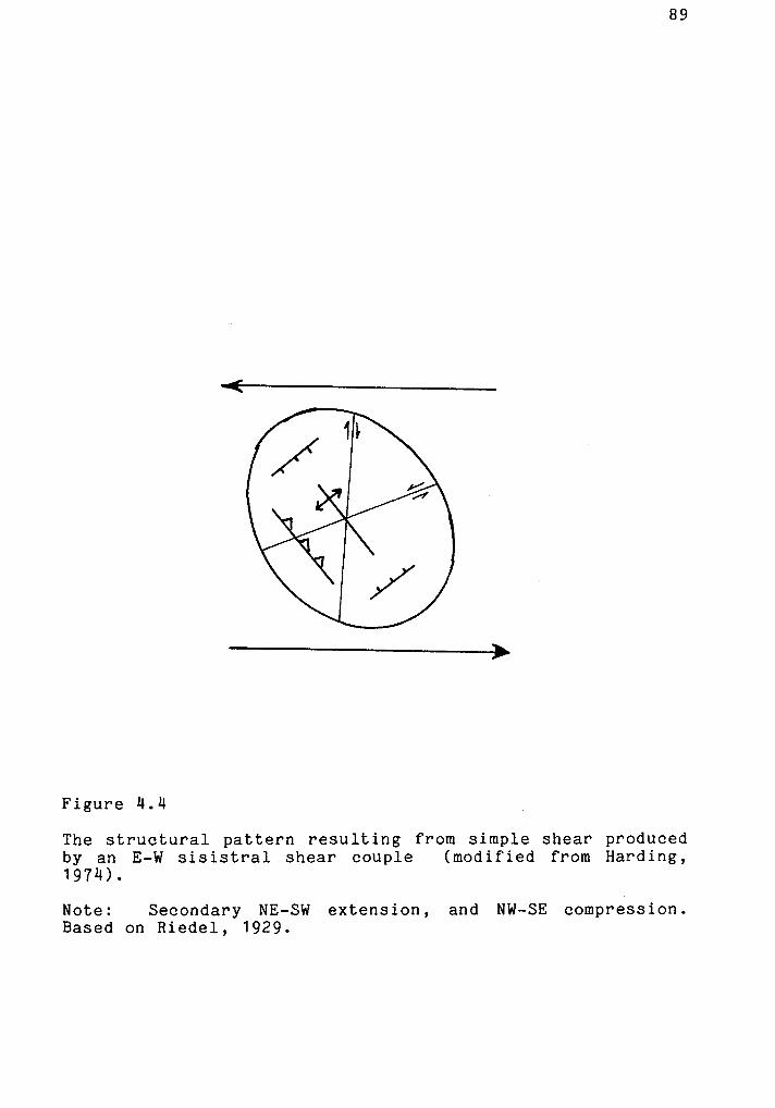
Figure 4.1
On the northwestern flank of the Sierra de Martin Garcia at least five tight anticlines trend NW in the predicted secondary compressional direction for left lateral strike-slip faults. This one occurs at BL790344 and can be followed along trend to BL803338. Others include BL793342 – 803337, BL793349 – 800345, BL803345 – 810342, and BL806346 – 813344, all shown on the map, plate 1.

83
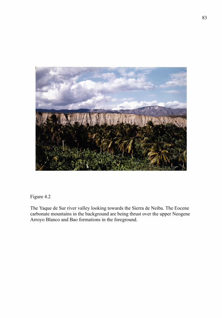
Figure 4.2
The Yaque de Sur river valley looking towards the Sierra de Neiba. The Eocene carbonate mountains in the background are being thrust over the upper Neogene Arroyo Blanco and Bao formations in the foreground.
91
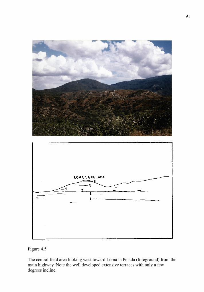
Figure 4.5
The central field area looking west toward Loma la Pelada (foreground) from the main highway. Note the well developed extensive terraces with only a few degrees incline.