From Tushpa to Militia. Further considerations on the Westward expansion of the Kingdom of Urartu
36
_____________________
Transcript of From Tushpa to Militia. Further considerations on the Westward expansion of the Kingdom of Urartu

_____________________


Association for Near Eastern and Caucasian Studies


AJNES VII/2, 2012, p. 54–83
From ušpA to mili iA. FurthEr CoNSidErAtioNS oN thE WEStWArd
ExpANSioN oF thE KiNgdom oF urArtu
Roberto Dan
The purpose of this paper is to discuss the historical and archaeological presence of Urartians in the regions west of Lake Van, in particular in the ‘corridor’ formed by the Murat Su valley until it reaches the Euphrates.1 The Euphrates marks the currently accepted limit for Urartian expansion westwards, and is in fact one of the clearest-cut geographical boundaries recognized for the kingdom.
The progressive westward expansion achieved by the Urartian kings emerges clearly from an examination of the epigraphic sources at our disposal.
The beginning of systematic westward expansion, analogous to what had occurred in Transcaucasia, may be attributed to the achievements of Minua (810-785/780 BC).2 These conquests certainly involved the movement of armies through the territories adjacent to the western shores of Lake Van. The first expedition against Alzi, in the area of modern Elâzığ,3 can be dated to the early years of Minua’s reign.
Here, according to the Aznavurtepe inscription (CTU A 5-11),4 a fortress was built near the town of Qutume, though this site has not been archaeologically identified. The subjugation of this territory required two armed interventions. The second of these included the conquest of the territories of atti, the plains of Za u and the valley of Eastern abur, and ended with the defeat of Qumenu (Kumme), which allowed the Urartians to reach the country of Aššur (CTU A 5-9).
The main result of this campaign was the crossing of the River Euphrates, where the king established the first contact with Neo-Hittite states. The physical evidence of
1 This study is a partial reworking and extension of previous work on these regions done for my PhD thesis (Dan 2012), presented on 2nd July 2012 at the “Sapienza” University of Rome. To the relationships between Urartu and the regions located to the west of Van Lake is also dedicated another investigation of historical geography, regarding the country of Urme, known from some Urartian inscriptions and probably – as far as can be understood – located in the region of the Muş plain (Dan, Neri in press). All the topographical data (coordinates and altitudes) regarding the sites mentioned in this text will be published in a book on landscape archaeology that is in preparation, covering all the areas occupied by Urartians.
2 For all the chronological references relating to Urartian kings in this article see Salvini 2008: 23.3 Nashef 1982: 27.4 In this paper all references to Urartian inscriptions are specified by the acronym CTU (Corpus dei
Testi Urartei, Salvini 2008) that precedes the inscription numbers.

From ušpa to Mili ia
55
Urartian presence in these regions consists of two inscriptions of Minua. The rock-cut inscription close to the fortress of Palu refers to the recently completed military activities,1 whereas a stela from the fortress of Bağın details the administrative organization of these territories.2
Minua’s son and successor, Argišti I (785/780-756 BC), also played a major role in the expansion of the kingdom’s borders beyond the confines of the River Euphrates, continuing the work begun by his father.3
In fact, as reported by his inscriptions, during the 3rd year of his reign the Neo-Hittite states were incorporated into the kingdom. This presence beyond their ‘natural border’ was made possible by the prior activity of Minua, through which a degree of stability was achieved in the area of Elâzığ. This may be contrasted to other regions, for example Diaue i to the north and Urme in the south-west, where the Urartians were unable to establish immediate territorial control.
After Argišti’s reign, the western regions were still a target of interest, this time under the leadership of Sarduri II (756-ca. 730 BC). Sarduri II’s first interventions were against the countries of Urme (CTU A 9-3 I r. 22) and Arme, which is known as Šubria in Assyrian texts (CTU A 9-1 Ld, r. 11). The intense diplomatic contacts with the Neo-Hittite states provoked a reaction from Assyria, which was currently ruled by Tiglath-Pileser III (744–727 BC), and culminated in the renowned pitched battle of Kištan and
alpi (743 BC), in an area located to the south of Malatya, Urartian Mili ia.4 Following these events, during the reign of Rusa I, no further information about the western area has been found in the surviving records. This is probably because Urartian efforts were mainly concentrated in the regions beyond the River Araxes and in the Urmia Basin. However, thanks to the administrative records from the archive of Sargon II,5 we know that all these regions were still firmly in the hands of Urartian governors.
The inscription of Kaleköy at Mazgirt is the only internal documentation regarding Urartian presence in the west during the 7th century BC (CTU A 12-6). Unfortunately, this text, which was left by Rusa II, is badly damaged and only a few lines are still legible. However, it is still possible to recognize the names of the country of upa, called Sophene in classical sources, and the city of usišili, which is not known from any other records.6 The absence of warfare in this area may be attributed to the degree of control achieved, rather than to loss of the territory.
1 In the military campaign the city of Šebeteria was probably defeated, and perhaps Palu itself (Lehmann- Haupt 1928-1935: 58); uzana is presumably located in the area of the Murat Su (Diakonoff, Kashkai 1981: 41-42) and upa/Sophene (Salvini 1972: 105-107). See CTU A 5-5.
2 Titia was nominated governor of the Šebeteria, uzana and upa areas (CTU A 5-8).3 It should be noted that military activities in these regions occupied only a few years of Argišti’s
reign, because – as is clear from his annals engraved on rock at the chamber known as the “great or or” and on two fragmentary stelae – the campaigns of this king were concentrated mainly in
Transcaucasia and the Lake Urmia basin (CTU A 8-1 - CTU A 8-3). 4 Astour 1979: 1-23; Dan 2010: 334.5 On this see SAA I and V.6 D al-di-[x x x KUR Û]u-pa-a URU u-si-ši-i-li (CTU A 12-6, r. 7).

Roberto Dan
56
For the purposes of this paper, epigraphic and archaeological data from five areas were analyzed:
the valley of the Murat Su, where a series of fortifications have been discovered that allowed the crossing of this vast region and constituted a veritable line of caravanserai;
the plains of Elâzığ and Altınova, important because they allowed the Euphrates to be reached, but also of great significance with regard to agriculture and mineral resources;
the area of Tunceli, characterized by the presence of impressive mountains containing many copper mines;
the area of Baskıl; together with the Euphrates valley, this was the real border with the Neo-Hittite states;
the areas of Malatya and Arguvan, that are located beyond the western boundary formed by the Euphrates, but show weak signs of Urartian influence.
Area 1. Murat Su valley (Muş – Elâzığ regions).
The valley of Murat Su was for Urartians the main and most convenient line of communication with the west. Minua was the first to take advantage of this road when he began the systematic conquest of the territories west of Lake Van; his victory was enshrined in two important outposts that were established in the Kovancılar and Karakocan/Mazgirt areas, namely Palu (CTU A 5-5) and Bağın (CTU A 5-8). The road remained under permanent Urartian control at least until the first half of the 7th century,1 as is proved by the presence of building work conducted by Rusa II in the Mazgirt/Kaleköy area (CTU A 12-6).
For about two centuries, then, the Urartian kings built along the course of the river and maintained in operation, a series of small fortifications placed at regular distances, which functioned as caravanserais (Figs. 1-2).2 Unfortunately, no epigraphic evidence is known from this area, except for the inscription of Sarduri II (A CTU 9-18) discovered at the small fortress of Bahçecik, but this refers to the construction of a susi temple to the god aldi and the construction of a fortress bearing the name of the king, Sarduri inili.3
It is evident that the small station of Bahçecik lacks the features of a royal city. This, if anything, should have been located further west, perhaps in the area of Elâzığ, and might have corresponded to the strongholds of Palu or Bağın, which probably, as has been suggested, were not founded by Minua.4
1 Sevin 1991: 98.2 Sevin 1988b: 550; idem. 1991: 98.3 The inscription also mentions the installation of a governor named Zaiani, which is discussed in
the next section.4 Payne, Sevin 2001: 116ff.

From ušpa to Mili ia
57
Of the five sites identified in this area, four are directly linked to the road system (Fig. 3). The road began from the plains of Varto / Muş and the first fortress that would have been encountered is now known by the name of Cankurtarantepe; it is dated to the Urartian period on the basis of architectural remains and pottery, in particular to the 7th century,1 but was certainly in function from the 8th century BC.
The subsequent fortress of Zulümtepe has been dated on the basis of pottery to 8th-7th century BC;2 nearby a stretch of a stone-paved road was identified that has been attributed by Veli Sevin to Urartian times,3 but which most likely belongs to the late Roman or Ottoman period.4 Kaleönü, and the nearby site of Samantepe Höyük, are located about 20 km to the west; the first is another small fortress with Urartian pottery,5 whereas Samantepe (a few kilometres south of Kaleönü)may be dated, thanks to the presence of Biainili pottery, to 8th-7th century BC6 and must have been a rural centre for the agricultural exploitation of the small plain of Bingöl which has an area of about 4,000 ha.
The fortress of Bahçecik II, located 40 km to the west, is once more dated on the basis of Biainili pottery to the 7th century BC, but was certainly in use in the 8th century, as is demonstrated by the inscription of Sarduri II (CTU A 9-18). This site is located at an important road junction that gave access to the fortress of Bağın and the area of Kaleköy/Mazgirt (to the north-west), as well as to the fort of Palu and the area of Elâzığ (to the south-west).
So overall, thanks to this series of forts that started in the Muş area and were spaced at between 20 and 30 km, it was possible to reach the Euphrates border by following a route of 260 km in length, with an estimated travel time of around eleven days on foot (Fig. 2, sites 1-5, 8-13), or to reach the area of Mazgirt after a week’s journey covering 150 km (Fig. 2, sites 1-7).
The western Urartian military road, from the area of Varto/Muş to Habibuşağı/Izolu (260 km - 11 days at an average of 23.6 km per day; Fig. 2, sites 1-5, 8-13)
Area Muş/Varto7 ► Cankurtarantepe 30/35 kmCankurtarantepe ► Zulümtepe 24 kmZulümtepe ► Kaleönü 19.5 km
1 Sevin 1988a: 5ff, Fig. 8-13; idem. 1989a: 454; idem. 1991: 98f.2 Sevin 1987: 285; idem. 1991: 98, 111.3 Immediately behind the site were also identified the remains of a small stone bridge, which was to
allow the crossing of the river that runs beside the fortress (Sevin 1988a: 6; idem. 1988b: 547ff.).4 Sinclair 1990: 424.5 On the surface of the site a large quantity of Urartian pithoi has been found (Kroll 1976: 140;
Sevin 1989a: 459).6 Başgelen, Özfirat 1996: 144f.; Köroğlu 1996: 66; Sevin 1989a: 458f.7 At the western end of the Muş plain there was probably a first fortress, not identified archaeologically, facilitating connection with the area of Varto.

Roberto Dan
58
Kaleönü ► ?1 ca. 20 km? ► Bahçecik II ca. 20 kmBahçecik II ► Palu 29 kmPalu ► Şimşat Kale 19 kmŞimşat Kale ► Norşuntepe 27 kmNorşuntepe ► Harput Kalesi 28 kmHarput Kalesi ► Haroğlu 30 kmHaroğlu ► Yazılıkaya T./Habibuşağı 27 km
The western Urartian military road, from the area of Varto/Muş to Kaleköy/Mazgirt (150 km - 7 days at an average of 21. 4 km per day; Fig. 2, sites 1-7).
Area Muş/Varto ► Cankurtarantepe 30/35 kmCankurtarantepe ► Zulümtepe 24 kmZulümtepe ► Kaleönü 19.5 kmKaleönü ► ? ca. 20 km? ► Bahçecik ca. 20 kmBahçecik ► Bağın 22 kmBağın ► Kaleköy/Mazgirt 27 km
Area 2. Elâzığ and Altınova plains.
The region of Elâzığ is bounded by the Taurus Mountains to the south and the River Murat Su to the north. The most important plain is that of Elâzığ/Altınova, which covers about 40,000 ha; its main sources of water are the Murat Su and the Hazar Gölü.2 The area is particularly rich in mineral resources, especially iron ore deposits.3
The region has unfortunately been geographically devastated by the lakes of the Güneydoğu Anadolu Projesi (GAP),4 in particular the Keban Barajı which has flooded almost the entire Altınova plain, leading to the destruction of important archaeological sites.
Historical information about this region is very scarce; only one Urartian inscription has been found in this vast territory, namely the rock-cut inscription of Minua at Palu (CTU A 5-5), which celebrates his victorious expeditions in the western regions of the kingdom:
1 Due to the mountainous nature of the territory between Kaleönü and Bahçecik, there was probably an intermediate fortress, archaeologically unidentified.
2 Harita Genel Müdürlüğü, 1:200,000, Elâzığ (Harput) sheet.3 Maden Tektik ve Arama Genel Müdürlüğü, Elâzığ sheet; Köroğlu 1996: 3. 4 For the archaeological activities connected to the construction of this dam, see the relevant books
published by the Orta Doğu Teknik Üniversitesi between 1970 and 1982.

From ušpa to Mili ia
59
“ aldi went (to war) with his spear (weapon), conquered the country/territory of the city of Šebeteria conquered the territory of the city of uzana conquered the country of upa (the Sophene). aldi is victorious (?), The spear of aldi is victorious (?). Thanks to the power of aldi went (in war) Minua, the son of Išpuini, conquered the country of the city of Šebeteria, conquered the country of the city of uzana conquered the country of upa. He came to the country of ati. He erected a stela to aldi. In the city of Šebeteria a chapel (?) of aldi he built. Near (?) the city of Šebeteria conquered/captured some ... On the king of Mili ia (Malatya), he imposed tribute.”1
It is generally accepted that the city of Palu was the Šebeteria mentioned in the inscription,2 and that upa, the Sophene of classical sources,3 is likely to be located in the region of Tunceli, where it is mentioned in the rock-cut inscription of Kaleköy, of Rusa II’s reign (CTU A 12-6), along with the territory of the city of uzana.4 The region of Elâzığ probably corresponds to the country of Alzi mentioned by Urartian sources and the Enzite of Assyrian sources,5 and was located somewhere between the western side of the headwaters of the Tigris and the Murat Su.6 The region was subjected several times to the expansionist ambitions of Minua, as we may learn from the so-called annals of Minua, in Surb Poģos at Van (CTU A 5-9), and the inscription carved on the façade of the susi temple at Aznavurtepe, in the Patnos plain (CTU A 5-11A), which might however refer to different historical events.
Information after Minua’s time comes from an inscription found in the Karakoçan at Bahçecik, and datable to Sarduri II (CTU A 9-18); we are told that the king, after having built a new fortress bearing his name, that is Sarduri inili, installed a governor named Zaiani to administer the territories up to Mili ia (and probably up to the natural boundary formed by the Euphrates).
As far as physical remains are concerned, a total of twenty archaeological sites has been identified with Urartian period occupation deposits; the sites are divided into two groups, those on the Murat Su and those located within or immediately behind the Altınova plain. An extensive network of Urartian fortresses ensured stable control of the territory; the most important of these were Haroğlu, Harput, Palu, Yıldıztepe7 and Mazgirt, the latter being located in the current province of Tunceli.
The most important site of those situated on the Murat Su and the principal regional centre, must have been the great fortress of Palu (Fig. 5). The fort, built on a steep rock outcrop bordered on three sides by the Murat Su, is characterized by rock-cut foundations and the remains of walls of the Urartian fortress with significant
1 Salvini 2008: 193; CTU A 5-5, rr. 1-17.2 Lehmann-Haupt 1928-1935: 58; Salvini 2006: 474.3 Salvini 1972: 105ff.4 Diakonoff, Kashkai 1981: 41f.5 Salvini 1967: 68.6 Diakonoff, Kashkai 1981: 7; Salvini 2006: 474; Yamada 2000: 279.7 Sevin 1991: 97.

Roberto Dan
60
medieval superstructures. A Treppentunnel (underground staircase) has been identified that connected the citadel to the river below, together with three rock-cut graves and a rock-cut moat similar to those of Van Kalesi and Çavuştepe;1 it is striking that Biainili pottery is visible on the surface.2 At Kumtepe, about 8 km north-west of Palu, a höyük has been identified with Biainili pottery on the surface.3
Another important fortress is that of Eski Pertek, set on an imposing rock outcrop which has now become an island due to the construction of the Keban dam (Fig. 6). The fortress, evidently much used during medieval times, still exhibits considerable evidence of Urartian rock-cut construction work; these are said to include cisterns, a long Treppentunnel, and the typical rock-cut stepped foundations. The fortress must have been built for the purpose of controlling a number of important mines, particularly for copper, which are present locally.4
A second fort was found 5 km to the west of Pertek; Tanrıvermiş is a small Urartian fortress whose function was linked to the defence of the larger fortress of Eski Pertek. In addition to the Biainili pottery found on the surface, its Urartian date is supported by the presence of notable rock-cut features including a rock-cut chamber, a platform and three cisterns.5 Another rock-cut chamber has been found in the area at Erbildi.6 Şimşat Kale was the subject of archaeological rescue excavations before being partially submerged by the waters of Lake Keban. During the excavation of the fortification walls, which in some places are very similar to Urartian constructions, it appears that Biainili pottery was found in association with Neo-Hittite pottery.7
The majority of the sites in the region are concentrated on the Altınova plain; the fortresses, necessary for the control and exploitation of the land, were strategically located at the edge of the plain, on the nearest hills, and the höyüks located in the centre of the plain.
Of the forts, that at Harput may have been one of the most important; it was certainly large, measuring 300 by 180 metres; the significant medieval levels have not completely hidden all signs of Urartian activity, of which are still visible the foundation steps and characteristic, though heavily damaged, rock-cut signs located
1 Charlesworth 1980: 91ff.; Danık 2007: 227; Genç 2008: 94; Sinclair 1989: 117ff.; Koroğlu 1996: 15f.; Von Gaal 1967: 516.
2 Çevik 2000: 117.3 Kleiss, Hauptmann 1976: 23.4 Işık 1987b: 497; Danık 2004: 145ff.; Kleiss, Hauptmann 1976: 14; Koroğlu 1996: 21. Pottery
similar to that of the Urartians was found in Kalaycık Tepe Höyüğü, about 35 km west of Pertek (Alkım 1971-1972: 71).
5 Çevik 2000: 68f., 129f.; Danık 2001: 19; Genç 2008: 99; Köroğlu 1996: 21, 43ff.; Sevin 1989a: 457f.
6 Çevik 1997: 431ff.; Çevik 2000: 127, Fig. 51-52; Danık 2004: 160; Genç 2008: 117f.; Köroğlu 1996: 45ff., Fig. 9; Köroğlu 2007: 448; Köroğlu 2008: 30; Sevin 1987: 287, Fig. 17f.; Sevin 1989a: 457; Sinclair 1989: 422.
7 In trench B a 10 metre long storeroom was identified, containing eight pithoi that, according to the excavator, differed from the classic Urartian models: they were smaller (1.60 m in diameter) and had different decorative bands (Alkım 1971-1972: 49ff.; Öğün 1970: 39ff.).

From ušpa to Mili ia
61
at the top of the rocky outcrop – today known as Kayabaşı – on which the structures are found. A rock-cut channel has also been identified, and an area with considerable remains of terraces and housings in the southern sector of the fortress; Biainili pottery was also found on the surface, although in rather small quantities.1
Yıldız Tepe was an equally important fortress in the Urartian era, but unfortunately once more profoundly marked by medieval activity; the remains of Urartian walls are however visible on the south-east side of the site. On the surface a considerable amount of Biainili and the local middle Iron Age pottery have been recovered.2
In the fortresses of Genefik and Deliktaş too, rock-cut features and surface pottery bear witness to important Urartian era structures. In Genefik steps, cisterns and platforms were identified, as well as Biainili pottery dated to the 7th century BC,3 while in Deliktaş a Treppentunnel was found.4
Among the sites situated in the centre of the plain, some of which were the subject of rescue excavations prior to construction of the Keban dam, three have furnished Urartian remains: Norşuntepe, Tülintepe and Tepecik.
Norşuntepe undoubtedly has yielded the most important architectural remains of the Urartian period (Fig. 7). Excavations have brought to light two Iron Age levels: level 2 dates to the early Iron Age (1150-800) and level 1 to the middle Iron Age (800-600).5 The Urartian era structures (level 1) have been identified in two separate places on the site: on top of the hill a quadrangular room supported by four pillars was found, and a partially exposed adjacent room containing two similar pillars; it is possible that this is the remains of an Urartian palace of supra-regional importance. At the southern foot of the hill, in the so-called southern terrace, more extensive investigation was conducted of a large building which contained mainly local middle Iron Age pottery, while Biainili pottery was less common.6
Inside the structure, which was equipped with buttresses placed at regular intervals, were rooms for storage with large pithoi for preserving food. It is very likely that it was a sort of caravanserai on the road to the Euphrates. A third large Urartian room was identified in the same southern terrace. The destruction of the complex has been dated to the late 7th century BC.7
1 Belli 1989: 74, 76, 95f.; Danık 2001: 18; Genç 2008: 94-95; Köroğlu 1996: 16f.; Sevin 1989a: 471; Sinclair 1989: 25. It has been suggested that this fortress might have been the city of Qu ume (Köroğlu 1996: 15).
2 Sevin 1989a: 460, 471, Fig. 40/4, 41/4, 7-9. Several fragments of this Urartian pottery resemble material from the southern terrace of Norşuntepe (Köroğlu 1996: 18f.).
3 Çilingiroğlu 1994: 53; Genç 2008: 98f.; Hauptmann 1969/1970: 27, 74; Kleiss, Hauptmann 1976: 17; Koroğlu 1996: 19; Sevin 1988a: 9; 1989a: 460; 1989b: 50; 1991: 98, 112, Fig. 07.10.1-2.
4 Huntington 1901: 186f.; Kleiss, Hauptmann 1976: 18; Köroğlu 1996: 23.5 Hauptmann 2001: 600.6 Hauptmann 2001: 603.7 Hauptmann 1969: 111ff.; idem. 1969/1970: 21ff.; idem. 1970a: 103ff.; idem. 1970b: 11ff.; idem.
1971a: 71ff.; idem. 1971b: 19ff.; idem. 1972a: 87ff.; idem. 1972b: 25ff.; idem. 1973: 49ff.; idem. 1974a: 71ff.; idem. 1974b: 59ff.; idem. 1974c: 43f.; idem. 1975: 35ff.; idem. 1976a: 41ff.; idem. 1976b: 9ff.; idem. 1976c: 65ff.; idem. 1979: 43ff.; idem. 1982: 15ff.
Roberto Dan
62
At Tülintepe, another important and deeply stratified site, Biainili pottery was found without any significant architectural remains;1 the same situation is extant at Tepecik, where there was also local middle Iron Age pottery.2 The höyüks, subject only to surface investigation, have yielded for the Iron III only Biainili pottery as in Tinazit, or Urartian ceramics associated with local material, as in Etminik, Kövenk, Könk and Sarpulu.3
At Kürdemlik there are two rock-cut chambers generally considered to have been built by the Urartians,4 whereas the date of the fortress of Koçkale is rather doubtful.5 Another fort, more isolated to the west along the road leading to Izolu and the Euphrates valley, is found at Haroğlu, and is distinguished by notable rock-cut features including cisterns, a chamber and a Treppentunnel.6
Urartian control of the region was likely to have been quite long-lived; the first military campaigns from Van were carried out by Minua, while the final annexation of the region occurred under Sarduri II.
The Urartian withdrawal from the area was certainly one of the consequences of the defeat in the 743 BC battle of Kištan and alpi against Tiglath-Pileser III, which was followed by further Assyrian military expeditions conducted by the same king7. Under Rusa II there was subsequently a further, but short-lived, occupation of the region, as attested by the inscription of Kaleköy (CTU A 12-6).
The area of Elâzığ was particularly important, not only from the point of view of agriculture and mining, but also because possession of it ensured control over one of the main routes to the western limits of the kingdom, the road that ran from the area of Muş/Varto to Habibuşağı/Izolu.
Archaeological sites in the Elâzığ and Altınova plains (Fig. 4)
1 Haroğlu 8 Kövenk 15 Könk2 Tanrıvermiş 9 Sarpulu 16 Tülintepe3 Eski Pertek 10 Kürdemlik 17 Norşuntepe4 Erbildi Mezarı 11 Yıldız Tepe 18 Deliktaş (Elâzığ)5 Harput Kalesi 12 Tepecik 19 Şimşat Kale6 Etminik 13 Koçkale 20 Kumtepe7 Tinazit 14 Genefik 21 Palu
1 Esin 2001a: 72.2 Esin 2001b: 106.3 Russell 1980: 46f. 4 Köroğlu 1996: 47; Sevin 1988a: 10.5 Kleiss and Hauptmann considered it to be Urartian (Kleiss, Hauptmann 1976: 17), but Veli Sevin,
who visited the site during one of the surveys he conducted in the area in the second half of the 1980s, found no evidence there for dating it to Urartian times (Sevin 1989a: 460).
6 Aşan 1989: 532f.; Danık 2005: 311. Genç 2008: 97; Kleiss, Hauptmann 1976: 21; Köroğlu 1996: 17, Fig. 17; Sevin 1988a: 11, Fig. 37-42; Sevin 1989b: 50; Sevin 1991: 97; Sinclair 1989: 106f.
7 Tadmor 1994: 127 (Summary Inscription I, rr. 34-36), 185 (Summary Inscription 9, r. 23’).
From ušpa to Mili ia.
63
Area 3. tunceli
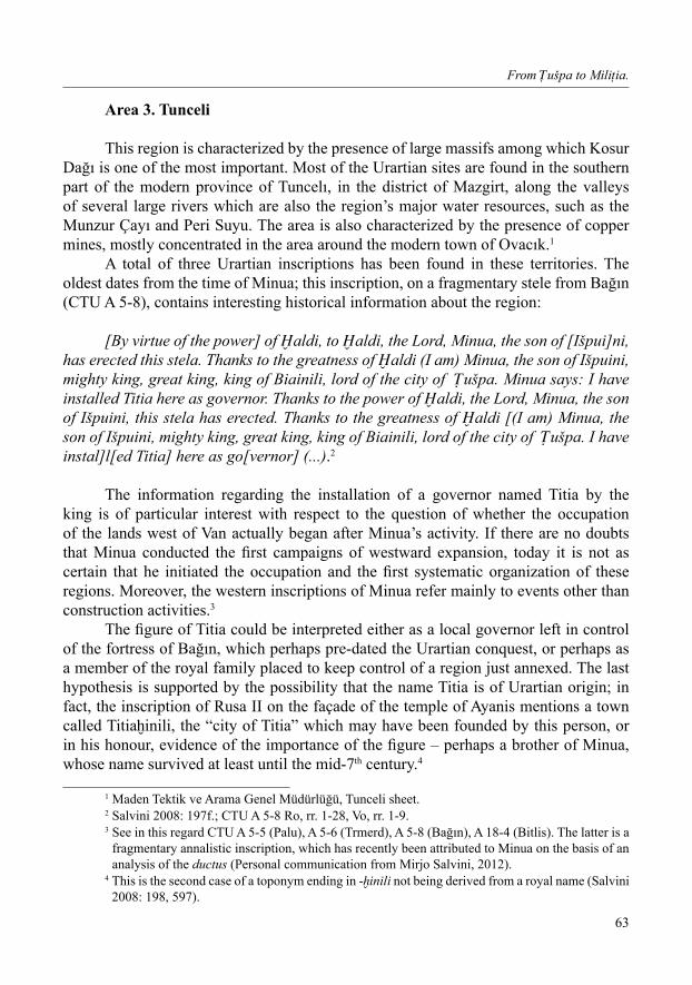
This region is characterized by the presence of large massifs among which Kosur Dağı is one of the most important. Most of the Urartian sites are found in the southern part of the modern province of Tuncelı, in the district of Mazgirt, along the valleys of several large rivers which are also the region’s major water resources, such as the Munzur Çayı and Peri Suyu. The area is also characterized by the presence of copper mines, mostly concentrated in the area around the modern town of Ovacık.1
A total of three Urartian inscriptions has been found in these territories. The oldest dates from the time of Minua; this inscription, on a fragmentary stele from Bağın (CTU A 5-8), contains interesting historical information about the region:
[By virtue of the power] of aldi, to aldi, the Lord, Minua, the son of [Išpui]ni, has erected this stela. Thanks to the greatness of aldi (I am) Minua, the son of Išpuini, mighty king, great king, king of Biainili, lord of the city of ušpa. Minua says: I have installed Titia here as governor. Thanks to the power of aldi, the Lord, Minua, the son of Išpuini, this stela has erected. Thanks to the greatness of aldi [(I am) Minua, the son of Išpuini, mighty king, great king, king of Biainili, lord of the city of ušpa. I have instal]l[ed Titia] here as go[vernor] (...).2
The information regarding the installation of a governor named Titia by the king is of particular interest with respect to the question of whether the occupation of the lands west of Van actually began after Minua’s activity. If there are no doubts that Minua conducted the first campaigns of westward expansion, today it is not as certain that he initiated the occupation and the first systematic organization of these regions. Moreover, the western inscriptions of Minua refer mainly to events other than construction activities.3
The figure of Titia could be interpreted either as a local governor left in control of the fortress of Bağın, which perhaps pre-dated the Urartian conquest, or perhaps as a member of the royal family placed to keep control of a region just annexed. The last hypothesis is supported by the possibility that the name Titia is of Urartian origin; in fact, the inscription of Rusa II on the façade of the temple of Ayanis mentions a town called Titia inili, the “city of Titia” which may have been founded by this person, or in his honour, evidence of the importance of the figure – perhaps a brother of Minua, whose name survived at least until the mid-7th century.4
1 Maden Tektik ve Arama Genel Müdürlüğü, Tunceli sheet.2 Salvini 2008: 197f.; CTU A 5-8 Ro, rr. 1-28, Vo, rr. 1-9.3 See in this regard CTU A 5-5 (Palu), A 5-6 (Trmerd), A 5-8 (Bağın), A 18-4 (Bitlis). The latter is a
fragmentary annalistic inscription, which has recently been attributed to Minua on the basis of an analysis of the ductus (Personal communication from Mirjo Salvini, 2012).
4 This is the second case of a toponym ending in - inili not being derived from a royal name (Salvini 2008: 198, 597).

Roberto Dan
64
An inscribed bronze helmet (CTU IV B 5-8), found in fortuitous circumstances at Burmageçit, also comes from Minua’s reign and is part of a large group of decorated metalwork.
Information concerning the Urartians from the area is extremely scarce; in fact, the only other inscription dates to the last years of the kingdom. This is an inscription engraved on the façade of a rock-cut chamber at Kaleköy, of the reign of Rusa II (CTU A 12-6).
The inscription, largely impossible to translate, refers in line 7 to KUR ]u-pa-a, Urartian Sophene, in whose territory the fortress of Kaleköy itself would seem to have been.1 The reference to the land of upani is particularly important since it allows us to integrate some information about the region. Firstly, the earliest Urartian mention of upa occurs during the reign of Minua, who claimed to have conquered it in the rock
inscription of Palu (CTU A 5-5). Also in the annals of Argišti at Van Kalesi, upa is mentioned together with atti
in the context of information relating to the construction of the fortress of Erebuni in the Araxes valley, for which were employed 6600 warriors deported from these areas. It is believed that the deportations date to the fourth year of the reign of Argišti, while military action in those lands was conducted in the previous year.2 These events can be explained by the desire to complete the territorial organization and pacification of the area as a continuation of the policy of expansion initiated by Minua.
The archaeological sites in the area with Urartian occupation deposits number thirteen (Fig. 8), none of which have been archaeologically investigated; almost all are characterized by the presence of significant rock-cut features, and can be divided into three geographically distinct groups. Two, the fortresses of Mazgirt and Kaleköy, are located in the area between the modern cities of Mazgirt and Gümüşgün.
Mazgirt is situated on an impregnable rock outcrop near the modern village of the same name (Fig. 10). The site contains large rock-cut features including two chambers with single rooms, a Treppentunnel and has been described as a worship area; the site also has medieval levels, and must have been one of the administrative centres of the region.3
Five kilometres to the east is the major site of Kaleköy, where the inscription of Rusa II mentioned above was discovered (Fig. 9). This site too possesses remarkable rock-cut features, including two chamber tombs, one single and one multi-chambered (the Urartian inscription is on the façade of the latter), a cistern and an extensive rock-cut area, probably used for cultic purposes, located on top of the rocky spur.4 The total
1 Salvini 1972: 105ff.; Salvini 1995: 50; Salvini 2008: 577f.2 CTU A 8-1 Vo, r. 22; A 8-3 II, r. 37; Salvini 1995: 61; Salvini 2006: 482.3 Çevik 2000: 128f., Tab. 57; Genç 2008: 118, Fig. 100-101; Kleiss, Hauptmann 1976: 17f.; Köroğlu
1996: 23; Sinclair 1989: 87ff.; Van Hulsteyn 1981: 21f.4 Çevik 2000: 119, Fig. 31-33; Genç 2008: 100, 115f.; Işik 1995: 5, 35, 46, Fig. 3, Abb. 4-9;
Kleiss, Hauptmann 1976: 17; Köroğlu 1996: 39ff.; Mellink 1979: 336; Öğün 1978a: 641ff., Fig. 9; Schäfer 1977: 259ff.; Van Hulsteyn 1981: 17ff.

From ušpa to Mili ia
65
size of the site is not known; the remains of walls and rock-cut terraces of Urartian date are clearly visible in a wide area around the outcrop. The surface pottery is Urartian, local middle Iron Age and medieval.1
At Aşağı Oyumca a rock-cut chamber carved into an isolated outcrop of rock is preserved; it is of likely Urartian date, but was reworked in the Middle Ages, when it probably became the refuge of an Armenian anchorite.2
The second group of sites is located along the banks of the Munzur Çayı; among these the most important is the medieval fortress of Vasgirt, built on an older Urartian fort. The main reason for dating this to the Urartian period is the considerable amount of rock-cut features identified, including five rock-cut chamber tombs, an open-air place of worship, two Treppentunnel and a number of water cisterns.3 Sinan Kalesi is a smaller fortress, almost completely destroyed, of which Urartian period rock-cut foundations are still recognizable.4
In 1985 the construction of a road adjacent to the village of Burmageçit led to the discovery of a considerable number of bronze artefacts, which were collected by the villagers and only later transported to the museum of Elâzığ. Unfortunately, nothing is known of the context in which they were found, but it is reasonable to think that the finds came from Urartian burials associated with a fortress located in the vicinity.5
Among the various artefacts, including weapons, horse harness and furniture fittings, of particular interest are the helmet with the inscription of Minua mentioned above, and fragments of nineteen bronze belts engraved with numerous iconographic motifs. On the basis of iconographic characteristics, this group of finds may be dated to the eighth century BC during the reigns of Argišti I and Sarduri II.6
Anbar Kalesi stands on a rock platform mainly occupied by the remains of medieval fortifications. Among the features that would suggest an Urartian occupation of the site is the presence of two rock-cut chambers that are today inaccessible, two cisterns probably also used in the Middle Ages, together with stone-cut steps and a cult area carved in the rock.7
The last site of this area is the fortress of Rabat, located in an isolated position in the mountains about 28 miles west of Burmageçit; the fortress is probably of Urartian date, but there are few data available.8
Other sites are located along the Peri Suyu valley; the most important among these is the fortress of Bağın, built on an imposing rocky outcrop overlooking the river
1 Erdoğan 2007: 33f.2 Çevik 2000: 27f., Fig. 73a-b, d; Danık 2004: 144, Fig. 5; Işık 1995: 65, Fig. 18, Abb. 167.3 The fort has been dated to the 7th century BC on the basis of architectural features of the rock-cut
chambers (Danık 2002: 83; Sinclair 1989: 86f.). 4 Danık 2004: 141ff., dis. 4, Fig. 4; Osmanoğlu 1966: 16.5 Belli 1993: 61-66.6 Yıldırım 1991: 131ff.; Zimansky 1998: 210f.7 Danık 2004: 140ff.8 Belli 1993: 62, 66.
Roberto Dan
66
and surmounted by the ruins of a medieval castle. In addition to the aforementioned inscription of Minua, its Urartian date is guaranteed by the presence of two rock-cut chambers, a Treppentunnel, cisterns and the remains of cyclopean walls.1
As we have seen, Bağın was the seat of a governor and was probably therefore the administrative centre of the entire area controlled by the Urartians (Fig. 11). Probable Urartian structures and terraces have also been identified at Til Kale,2 while at the localities of Çalakos3 and Mergamendi4 two single-roomed rock-cut tombs of uncertain date have been discovered. Another fortress associated with notable remains of rock-cut features is Yayladere Kalesi, located in the region of Bingöl in a more isolated position respect to the other Urartian sites.5
The Urartians reached the region of Tunceli, and in particular the fortresses of Bağın and Kaleköy, thanks to a road that started from the area of Muş/Varto and followed the valley of the Murat Su until the fortress of Bahçecik. As we have seen, this road – about 150 km long – was distinguished by the presence of caravanserais placed at regular distances.
In conclusion, the data allow us to reconstruct how this region was the subject of Urartian interest from the end of the 9th century, when Minua began the conquest of these territories and started to organize themby the creation of outposts and the installation of a governor. Argišti I continued the organization through deportations intended to pacify the area, although it is currently impossible to attribute any archaeological remains in these regions to him.
The documentary gap that followed the period of his reign was probably caused by the temporary retreat of the Urartians from the region following the defeat suffered by Sarduri II in the battle of Kištan and alpi of 743 BC against Tiglath-Pileser III. The inscription of Rusa II at Kaleköy attests the temporary Urartian reconquest of those areas immediately before the final fall of the kingdom.
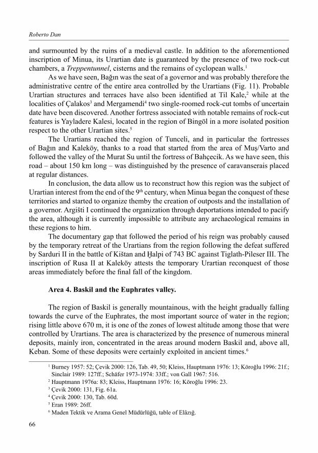
Area 4. Baskil and the Euphrates valley.
The region of Baskil is generally mountainous, with the height gradually falling towards the curve of the Euphrates, the most important source of water in the region; rising little above 670 m, it is one of the zones of lowest altitude among those that were controlled by Urartians. The area is characterized by the presence of numerous mineral deposits, mainly iron, concentrated in the areas around modern Baskil and, above all, Keban. Some of these deposits were certainly exploited in ancient times.6
1 Burney 1957: 52; Çevik 2000: 126, Tab. 49, 50; Kleiss, Hauptmann 1976: 13; Köroğlu 1996: 21f.; Sinclair 1989: 127ff.; Schäfer 1973-1974: 33ff.; von Gall 1967: 516.
2 Hauptmann 1976a: 83; Kleiss, Hauptmann 1976: 16; Köroğlu 1996: 23.3 Çevik 2000: 131, Fig. 61a.4 Çevik 2000: 130, Tab. 60d.5 Eran 1989: 26ff.6 Maden Tektik ve Arama Genel Müdürlüğü, table of Elâzığ.

From ušpa to Mili ia
67
Only one inscription has been found in this extensive region, the text engraved on the rock in the vicinity of the ancient ford over the Euphrates at Habibuşağı/Izolu (CTU A 9-4), now submerged under the waters of the Karakaya Barajı. It is the westernmost among the Urartian inscriptions known today.1 It was engraved by Sarduri II and is particularly important, as it contains historical information about the region:
aldi went with his spear, he defeated ilaruada, son of Ša u, king of the city of Mili ia, (he) threw the country at the feet of Sarduri, the son of Argišti. aldi is victorious(?), The spear/weapon of aldi is victorious(?). Departed to war Sarduri, the son of Argišti. Sarduri says: the river Euphrates was tuiš i. No king was here (before) encamped. I turned my prayers to aldi, the Lord, to the God of the storm, to the sun god and to (all) the gods of Biainili. By virtue of the greatness of the Lord ali abadi the gods listened to me, they paved the way for me, I camped with (my) soldiers in front of the city of umiški. That same day I set off for the village, on the right(?), I subjected the country of Qala’a, I came to the mountainous country of Karniši, on the left(?) of the city of Mili ia; I came to the village of Muša2 close (?) to the city of Zabša. 14 fortresses, 80(?) villages in a day I conquered, I destroyed the fortresses, I burnt the villages, 50 chariots I captured. I returned from the battle, I occupied(?) (ie the region), the city of Sasi; the royal city of ilaruada, which was (well) fortified, I conquered in battle, cattle, men and women I took away from there. Sarduri says: I advanced(?), I laid siege to the city of Militia. ilaruada came into my presence, prostrated himself, embraced my feet, . . .-to the (siluadi) 87 with him(?), I took away gold and silver and fat(?) cattle, and took(them) to Biainili. I subjugate him to tribute, 9 strongholds. . . to the (suduqubi) and I annexed to my country: aza, Gaura i, umiški, ’Asi, Maninu, Arusi, Qulbitarri, Taše, Queraitaše, Meluia. By virtue of the greatness of aldi (I am) Sarduri, the son of Argišti, mighty king, great king, king of the land of Biainili, lord of the city of ušpa.3
It seems clear that the main aim of the expedition was Mili ia and the establishment of stable control of over the Euphrates crossing that led to this important centre. had in fact been an Urartian objective from the time of the first expansion to the west of Lake Van conducted by Minua, who in the rock-cut inscription of Palu recorded that he had compelled the city to pay tribute (CTU A 5-5, r. 16). Mili ia is also mentioned indirectly in the annals of Argišti I (CTU A 8-3 II, r. 16), but the most frequent references are certainly those of Sarduri II, who mentions it in his annals engraved on the stela of Surb Poģos (CTU A 9-1), probably referring to the same events as the inscription of Izolu, given that the objectives were the same, namely umiški, Qala’a / Qala’ani and Sasi/Sasini, as well as Mili ia:
1 Salvini 1972: 107.2 According to Astour it could be the Roman Miasena or Mesena, 18 km from Melitene on the road to Samosata (Astour 1979: 4).
3 Salvini 2008: 432; CTU A 9-4, rr. 1-31.

Roberto Dan
68
“By virtue of the greatness of aldi ali abadi the gods listened to me, they made me (opened to me) the way: I camped (?) in front of the city of umiški. aldi is victorious(?), the spear of aldi is victorious(?). On the same day I went towards the country, on the left of the city [of Mili ia. . .] to the right of the country of Qala’ani I subjugated to tribute, up to the vicinity(?) of the city of Zabša. I captured 50 chariots in battle, 39 strongholds I destroyed(?). From the battle I returned and I conquered(?). The city of Sasini, royal city of ilaruada, in battle I conquered; fat(?) cattle, men, women from there I took away, villages and strongholds gave to the flames and I destroyed [. . .] Sarduri says: I marched(?) to besiege the city of Mili ia, came ilaruada, the king of Mili ia into my presence, embraced my feet, I subjugated him to tribute (...)” (…).1
It seems evident that the starting point of the expedition was the city of , that appears to have been conquered on that occasion along with nine other
strongholds, aza, Gaura i, ’Asi, Maninu, Arusi, Qulbitarri, Taše, Queraitaše and Meluia, presumably situated on both banks of the Euphrates. umiški, which was in the vicinity of has been identified as the classical Tomisa, east of Malatya,2 which corresponds approximately to the modern Čmšik/Çemiş-kezen,3 or was in any case in the area between Izoğlu and Kömürhan.4 The inscription of Bahçecik (CTU A 9-18), again of Sarduri, shows how the Euphrates was probably, leaving aside a few expeditions against the Neo-Hittite states, the Urartians’ true westernmost limit, since the last of the territories placed under the control of a governor named Zaiani was
“To the god aldi, the Lord, this susi temple Sarduri, the son of Argišti, has built and a fortress perfectly. Has given it the name of Sarduri inili. Sarduri says: I have installed here Zaiani as governor to administer (? mirtaršue) the region up to Mili ia, up to city(!) of Qu[ma a], up to the town of Ni ria, up to the village of Ar[me?], up to the country of ašime[ . . ]. (...).”5
After Sarduri II, Urartian sources no longer speak of these western regions; so it is possible, in fact, that after the reverses suffered by the Urartians against Tiglath-Pileser III in the battle of Kištan and alpi in 743 BC, places which were probably not far from the boundary of the Euphrates,6 the Urartians withdrew from this limit. At present, however, it is not possible to establish the exact dates of their presence on the Euphrates.
In the region Urartian occupation layers have been identified on a total of fourteen sites (Fig. 12); most are strategically placed on the Euphrates, while others are located further from the river. Unfortunately, most of the sites have been submerged by the waters
1 CTU A 9-1 Vo, rr. 10-30.2 Salvini 1972: 107ff.3 Diakonoff, Kashkai 1981: 88.4 Salvini 1972: 109.5 CTU A 9-18, rr. 1-11.6 For a hypothesis regarding the location of the battle, see Astour 1979.

From ušpa to Mili ia
69
of the Karakaya Barajı, which has irreparably altered the course of the Euphrates at this point; this event did, however, result in a series of archaeological rescue excavations that yielded information on Urartian occupation phases at several sites.
On top of the rocky outcrop that bears the inscription of Habibuşağı are the remains of a fortress first investigated by Lehmann-Haupt and Lohmann.1 An excavation was conducted on the site between 1982 and 1983 by Baki Öğün who discovered the remains of storage rooms, two Treppentunnel and some early Iron Age and Urartian cremation tombs. The surface finds included Biainili pottery.2 The strategic position of this fortress suggests that it probably served to control passage over the Euphrates at this point.
At Köşkerbaba Höyük, where a total of eight excavation campaigns between 1978 and 1985 were conducted by Önder Bilgi, there are four main archaeological phases (Fig. 13); the remains of a small Urartian fort (level III) were based directly on the ruins of early Iron Age buildings destroyed by Urartians. Urartian structures, distinguished by the presence of Biainili pottery of which some dated to the7th century BC, included the remains of storage rooms with rows of pithoi. The buildings show evidence of alterations that were interpreted as the result of a temporary abandonment of the site by Urartians due to pressure from the Neo-Hittites.3
During the excavations of İmamoğlu Höyük, conducted between 1980 and 1987 by Edibe Uzunoğlu, Biainili pottery and an Urartian seal were found in layer II of the Iron Age,4 pottery of Iron III has also been found at Kale III.5
At the site of Değirmentepe, excavated by Ufuk Esin between 1978 and 1986, there were eleven layers of which the third and fourth belonged to the Iron Age. At this date there was a small fort, certainly not Urartian, in which a small quantity of Biainili pottery was discovered.6
In Şemsiyetepe too, where eleven layers were identified, the middle Iron Age is represented by level III, which contained a small amount of Urartian material (Biainili pottery but not structures), limited to the north-west part of the site.7
In the fortress of Kaleköy, level III represents the middle Iron Age (Fig. 14); Urartian presence in the site is proven by the presence of Biainili pottery together with a series of remarkable rock-cut features.8 The fortress of Maltepe contains the remains
1 Salvini 1972: 110.2 Işık 1987a: 549ff.; Mellink 1983: 434; idem. 1984: 450; idem. 1989: 118f.; Öğün 1984: 237f.3 Bilgi 2001: 112-113. 4 Işın 1992: 21ff.; Ökse 1992: 31ff.; Uzunoğlu 1982: 17ff.; idem. 1983: 131ff.; idem. 1985: 235ff.;
idem. 1986: 181ff.5 Özdoğan 1977: 80; Sevin 1987: 281.6 Esin 1981: 91ff.; idem. 1982: 39ff.; idem. 1983: 39ff.; idem. 1984a: 71ff.; idem. 1984b: 175ff.;
idem. 1985: 11ff.7 Darga 2001: 116f. 8 Atalay 1987: 183ff.; Bakır 1981: 191f.; idem. 2007: 1ff.; Bakır, Çilingiroğlu 1980: 65ff.; Bakır, Çilingiroğlu 1987a: 157ff.; Bakır, Çilingiroğlu 1987b: 169ff.; Çilingiroğlu 1980: 219ff.; Işık 1995: 6f., 34, Fig. 4; Ökse 1988: abb. 702ff.
Roberto Dan
70
of wall foundations cut directly into the rock, a clear indication of possible Urartian presence.1
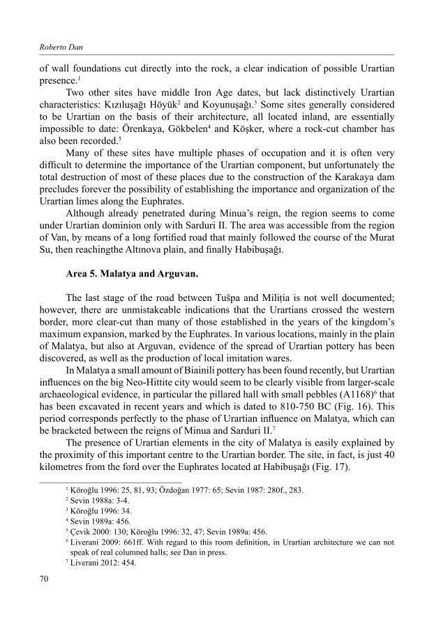
Two other sites have middle Iron Age dates, but lack distinctively Urartian characteristics: Kızıluşağı Höyük2 and Koyunuşağı.3 Some sites generally considered to be Urartian on the basis of their architecture, all located inland, are essentially impossible to date: Örenkaya, Gökbelen4 and Köşker, where a rock-cut chamber has also been recorded.5
Many of these sites have multiple phases of occupation and it is often very difficult to determine the importance of the Urartian component, but unfortunately the total destruction of most of these places due to the construction of the Karakaya dam precludes forever the possibility of establishing the importance and organization of the Urartian limes along the Euphrates.
Although already penetrated during Minua’s reign, the region seems to come under Urartian dominion only with Sarduri II. The area was accessible from the region of Van, by means of a long fortified road that mainly followed the course of the Murat Su, then reachingthe Altınova plain, and finally Habibuşağı.
Area 5. Malatya and Arguvan.
The last stage of the road between Tušpa and Mili ia is not well documented; however, there are unmistakeable indications that the Urartians crossed the western border, more clear-cut than many of those established in the years of the kingdom’s maximum expansion, marked by the Euphrates. In various locations, mainly in the plain of Malatya, but also at Arguvan, evidence of the spread of Urartian pottery has been discovered, as well as the production of local imitation wares.
In Malatya a small amount of Biainili pottery has been found recently, but Urartian influences on the big Neo-Hittite city would seem to be clearly visible from larger-scale archaeological evidence, in particular the pillared hall with small pebbles (A1168)6 that has been excavated in recent years and which is dated to 810-750 BC (Fig. 16). This period corresponds perfectly to the phase of Urartian influence on Malatya, which can be bracketed between the reigns of Minua and Sarduri II.7
The presence of Urartian elements in the city of Malatya is easily explained by the proximity of this important centre to the Urartian border. The site, in fact, is just 40 kilometres from the ford over the Euphrates located at Habibuşağı (Fig. 17).
1 Köroğlu 1996: 25, 81, 93; Özdoğan 1977: 65; Sevin 1987: 280f., 283.2 Sevin 1988a: 3-4.3 Köroğlu 1996: 34.4 Sevin 1989a: 456.5 Çevik 2000: 130; Köroğlu 1996: 32, 47; Sevin 1989a: 456.6 Liverani 2009: 661ff. With regard to this room definition, in Urartian architecture we can not
speak of real columned halls; see Dan in press.7 Liverani 2012: 454.

From ušpa to Mili ia
71
Possible local imitation of Urartian pottery has also been identified in three tells in the Malatya plain: İkinçiler, Ören and Furuncu, as well as in Karahüyük in the region of Arguvan (Fig. 15).1
The distribution of Urartian products, and the imitation of these, is a sign of some kind of influence or some form of control, probably indirect (treaties, alliances etc.), which the Urartians undoubtedly exercised, at certain times in their history, on the Neo-Hittite states.2
To date, though, it is the Neo-Hittite culture that seems to have had a greater impact, and not the reverse,3 as shown by the Urartian adoption of hieroglyphic writing, probably a variant of Neo-Hittite hieroglyphic, alongside cuneiform.4 Use of this different orthographic system may have occurred after the reign of Minua, the first Urartian ruler to have started expanding the kingdom to the west of Lake Van.
roberto danUniversity of Naples “l’Orientale’
Via Riccardo Grazioli Lante 500195, Roma
Italia
1 These are Red Slipped Wares (Group FF), considered to be possible imitations of Crimson Ware (Biainili), which is widespread only in the Malatya and Elâzığ regions (Russell 1980: 36f., 44f.); see the sites in Fig. 15.
2 This situation changed in 750-710 BC, with an Assyrian hegemony as result of the Kištan victory of Tiglath-pileser III over Sarduri II in 743 BC (Liverani 2012: 454).
3 However, a limited number of Urartian loans to Luwian hieroglyphics during the Iron Age have been identified (on this topic see Giusfredi 2012).
4 See Hawkins 2000: 588f.

Roberto Dan
72
BiBliogrAphy
Alkım H. 1971-1972, Explorations and Excavations in Turkey, 1969, “Anatolica” 4, 1-81.Arpaslan M. 2007 (ed.), Belkıs Dinçol and Ali Dinçol’a Armağan, Istanbul.Aşan M.B. 1989, Elazığ, Bingöl, Tunceli İlleri Ortaçağ Yüzey Araştırması, 1987, AST 6, 529-555.Astour M.C. 1979, The Arena of Tiglath-Pileser III’s Campaign against Sarduri II (743 B.C.), “Assur” 2,
1-23.Atalay İ. 1987, Kaleköy ve Yakın Çevresinin Jeolojisi ve Jeomorfolojisi, Aşağı Fırat Projesi 1978-79
Çalışmaları, 183-188.Bakır T. 1981, Kaleköy (Baskıl), AnSt 31, 191-192.Bakır T. 2007, Kale Köy (Elazığ) Kazıları Demir Çağ Buluntuları, in: Can, Işıklı 2007, 1-8.Bakır T., Çilingiroğlu A. 1980, Kaleköy Kazısı 1979 Sonuçları, KST 2, 65-67.Bakır T., Çilingiroğlu A. 1987a, Kaleköy (Baskil) Excavations, 1978, in: ODTÜ/METU, Aşağı Fırat Projesi
1978-1979 Yılı Çalışmaları / Lower Euphrates Project 1978-1979 (Aşağı Fırat Projesi Yayınları), Ankara, 157-159.
Bakır T., Çilingiroğlu A. 1987b, Kaleköy (Baskil) Excavations, 1979, in: ODTÜ/METU, Aşağı Fırat Projesi 1978-1979 Yılı Çalışmaları / Lower Euphrates Project 1978-1979 (Aşağı Fırat Projesi Yayınları), Ankara, 169-188.
Başgelen N., Özfirat A. 1996, Erzurum’da Bir Demir Çağı Merkezi: Toprakkale, AnAr 14, 143-158.Belli O. 1989, Urartu Kalelerindeki Anıtsal Kaya İşaretleri / Monumentale Felszeichen im Bereich
urartäischer Festungslagen, AnAr 11, 65-121.Belli O. 1993, Der Beschriftete Bronzehelm Des Königs Menua Aus Der Festung Burmageçit die Tunceli,
in: Mellink et al. 1993, 61-67.Belli O. 2001 (ed.), Istanbul University Contributions to Archaeology in Turkey (1932-2000), Istanbul.Bilgi Ö. 2001, Köskerbaba Excavations, in: Belli 2001, 110-114.Boehmer R.N., Hauptmann H. 1984 (eds.), Beiträge zur Altertumskunde Kleinasiens. Festschrift für Kurt
Bittel, Mainz am Rhein.Burney C.A. 1957, Urartian Fortresses and Town in the Van Region, AnSt 7, 38-53.Can B., Işıklı M. 2007 (eds.), Doğudan Yükselen Işık – Arkeoloji Yazıları, Atatürk Üniversitesi 50. Yıl
Kuruluş Yıldönümü Arkeoloji Bölümü Armağanı, İstanbul.Çevik N. 1997, Urartu Kaya Mezarlarında Ölü Kültüne İlişkin Mimari Elemanlar, TAD 31, 419-459.Çevik N. 2000, Urartu Kaya Mezarları Ölü Gömme Gelenekleri, Türk Tarih Kurumu Serie 6, n° 58, Ankara.Charlesworth M. 1980, Three Urartian Tombs at Palu in Turkey, AMI 13, 91-97.Çilingiroğlu A. 1980, Kaleköy, 1979, AnSt 30, 219-221.Çilingiroğlu A. 1994, Urartu Tarihi, Bornova - İzmir.Çilingiroğlu A., French D.H., 1991 (eds.), Anatolian Iron Ages. The Proceedings of the Second Anatolian
Iron Ages Colloquium held at İzmir, 4-8 May 1987, BIAA 13.Cotticelli Kurras P., Giorgieri M., Mora C., Rizza A. 2012 (eds.), Interferenze linguistiche e contatti
culturali in Anatolia tra II e I millennio a.C., Studi in onore di Onofrio Carruba in occasione del suo 80° compleanno.
Dan R. 2010, The Archaeological and Geographical Landscape of Urartu, in: Matthiae et al. 2010, 331-340. Dan R. 2012, Tra l’Eufrate e l’Arasse. Ricostruzione del paesaggio insediativo del regno di Biainili/Urartu,
Unpublished PhD Dissertation.Dan R. in press, From Armenian Highland to Iran. A Study on the Relation between the Kingdom of Urartu
and Achaemenid Empire.Dan R., Neri G., in press, In War Against Urme. Some Considerations on the Westward Expansion of the
Kingdom of Urartu, “Studies in Caucasian Archaeology” II.Danık E. 2001, Ortaçağda Harput Yüzey Araştırması 1999 Yılı Çalışmaları, AST 18/1, 17-30.Danık E. 2002, Yukarı Fırat Bölgesi 2000 Yılı Arkeolojik Yüzey Araştırması, AST 19/1, 79-92.Danık E. 2004, Yukarı Fırat Bölgesi 2002 Yılı Arkeolojik Yüzey Araştırması, AST 21/1, 139-155.

From ušpa to Mili ia
73
Danık E. 2005, Yukarı Fırat Bölgesi 2003 Yılı Arkeolojik Yüzey Araştırması, AST 22/1, 309-324.Danık E. 2007, Yukarı Fırat Bölgesi 2005 Yılı Arkeolojik Yüzey Araştırması, AST 24/2, 225-248.Darga M. 2001, Şemsiyetepe Excavations in the Lower Euphrates Basin 1978-1989, in: Belli 2001,
115-120.Diakonoff I.M., Kashkai S.M. 1981, Geographical Names According to Urartian Texts, RGTC 9, Wiesbaden.Eran Y. 1989, Bingöl Civarinda Yeni Bir Kale, ArS 42-45, 26-28.Erdoğan S. 2007, Tunceli-Mazgirt/Kaleköy, Yüksek Lisans Tezi, Van.Esin U. 1981, 1979 Değirmentepe Kazıları, KST 2,91-99. Esin U. 1982, 1980 Yılı Değirmentepe (Malatya) Kazısı Sonuçları, KST 3, 39-41.Esin U. 1983, Değirmentepe (Malatya) Kazısı 1980 Yılı Sonuçları, KST 4, 39-48.Esin U. 1984, 1982 Yılı Değirmentepe (Malatya) Kurtarma Kazısı, KST 5, 71-79. Esin U. 1984b, Zur Datierung der vorgeschichtlichen von Değirmentepe bei Malatya in der östlichen
Türkey, in: Boehmer, Hauptmann 1984, 175-190. Esin U. 1985, Değirmentepe (Malatya) Kurtarma Kazısı 1983 Yılı Raporu, KST 6,11-29.Esin U. 2001a, Salvage Excavations at Tülintepe, in: Belli 2001, 72-75.Esin U. 2001b, Salvage Excavations at Tepecik, in: Belli 2001, 102-107.Genç B. 2008, Yazılı Belgeler ve Arkeolojik Kalıntılar Işığında Urartu Krallığının Batı Yayılımı, Yüksek
Lisans Tezi, Van.Giusfredi F. 2012, Note sui prestiti accadici e urartei in luvio-geroglifico di età del Ferro, in: Cotticelli
Kurras et al. 2012, 153-171.Hauptmann H. 1969, Die Grabungen auf dem Norşun-Tepe 1969, TAD 18/2, 111-121.Hauptmann H. 1969/1970, Norşuntepe. Historische Geographie und Ergebnisse der Grabungen 1968/69,
IstM(itt.) 19/20, 21-78.Hauptmann H. 1970a, Norşun-Tepe 1968 Kazıları Ön Raporu/Die Grabungen auf dem Norşuntepe, 1969,
in ODTÜ/METU, 1968 Yaz Çalişmaları - 1968 Summer Work (Keban Project Publications I, 1), Ankara, 103-130.
Hauptmann H. 1970b, Recent Archaeological Research in Turkey, Norşun-Tepe, 1969, AnSt 20, 11-13.Hauptmann, H. 1971a, Norşun-Tepe Kazısı, 1969/Die Grabungen auf dem Norşuntepe, 1969, in:
ODTÜ/METU, Keban Projesi 1969, Çalişmaları - Keban Project 1969 Activities (Keban Project Publications I, 2), Ankara, 71-90.
Hauptmann H. 1971b, Recent Archaeological Research in Turkey, Norşun-Tepe, 1970, AnSt 21, 19-21.Hauptmann H. 1972a, Norşun-Tepe 1970 Kazısı / Die Grabungen auf dem Norşuntepe, 1970, in:
ODTÜ/METU, Keban Projesi 1970, Çalişmaları - Keban Project 1970 Activities (Keban Project Publications I, 3), Ankara, 87-117.
Hauptmann H. 1972b, Recent Archaeological Research in Turkey, Norşun-Tepe, 1971, AnSt 22, 25-27.Hauptmann H. 1973, Recent Archaeological Research in Turkey, Norşun-Tepe, 1972, AnSt 23, 49-52.Hauptmann H. 1974a, Norşun-Tepe Kazısı, 1971/Die Grabungen auf dem Norşuntepe, 1971, in: ODTÜ/
METU, Keban Projesi 1971, Çalişmaları - Keban Project 1971 Activities (Keban Project Publications I, 4),Ankara, 71-102.
Hauptmann H. 1974b, Die Grabungen auf dem Norşun-Tepe 1972. Bericht über die 5. Kampagne, TAD 21/1, 59-73.
Hauptmann H. 1974c, Recent Archaeological Research in Turkey, Norşun-Tepe, 1973, AnSt 24, 43-44.Hauptmann H. 1975, Recent Archaeological Research in Turkey, Norşun-Tepe, 1974, AnSt 25, 35-38.Hauptmann H. 1976a, Norşun-Tepe 1972 Kazıları/Die Grabungen auf dem Norşuntepe, 1972, in:
ODTÜ/METU, Keban Projesi 1972, Çalişmaları - Keban Project 1972 Activities (Keban Project Publications I, 5), Ankara, 41-100.
Hauptmann H. 1976b, Die Entwicklung der frühbronzezeitlischen Siedlung auf dem Norşun-Tepe in Ostanatolien, AK 6, 9-20.
Hauptmann H. 1976c, Die Grabungen auf dem Norşun-Tepe 1973. Bericht über die 6. Kampagne, TAD 23/1, 65-86.

Roberto Dan
74
Hauptmann H. 1979, Norşun-Tepe Kazıları, 1973/Die Grabungen auf dem Norşun-Tepe, 1973, in: ODTÜ/METU, Keban Projesi 1973, Çalişmaları - Keban Project 1973 Activities (Keban Project Publications I, 6), Ankara, 43-78.
Hauptmann H. 1982, Norşun-Tepe Kazıları, 1973/Die Grabungen auf dem Norşuntepe, 1973, in: ODTÜ/METU, Keban Projesi 1974-1975, Çalişmaları - Keban Project 1974-1975 Activities (Keban Project Publications I, 7), Ankara, 15-70.
Hauptmann H. 2001, Norşuntepe, RlA 9, 596-604.Hawkins J.D. 2000, Corpus of Hieroglyphic Luwian Inscriptions, Vol. I. Inscriptions of the Iron Age. Part
2, Studies in Indo-European Language and Culture 8.1, Berlin - New York.Huntington E. 1901, Weitere Berichte über Forschungen in Armenien und Commagene, ZfE 33, 173-209.Işık C. 1987a, Habibuşağı Nekropolü - Die Nekropole von Habibuşağı, “Belleten” 51/200, 549-580.Işık F. 1987b, Şirinlikale. Eine ubekannte urartäische Burg und Beobachtungen zu den Feldenkmälern eines
Schöpferischen Bergvolks Ostanatoliens, “Belleten” 51/200, 497-533.Işık F. 1995, Die Offenen Felsheiligtümer Urartus und ihre Beziehungen Zudenen Hethiter und Phrygen,
DocAs II, Roma.Işın M.A. 1992, İmamoğlu in der Eisenzeit: Architektur, IstM(itt.) 42, 21-29.Kleiss W., Hauptmann H. 1976, Topographische Karte von Urar‹u, Berlin.Köroğlu K. 1996, Urartu Krallığı Döneminde Elaziğ (Alzi) ve Çevresi, İstanbul.Köroğlu K. 2007, New Observations on the Origin of the Single-Roomed rock-cut Tombs of Eastern
Anatolia, in: Arpaslan 2007, 445-456.Köroğlu K. 2008, Urartu Kaya Mezar Geleneği ve Doğu Anadolu’daki Tek Odali Kaya Mezarlarının
Kökeni, ArS 127, 21-38.Kroll S. 1976, Keramik urartäischer Festungen in Iran, ein Beitrag zur Expansion Urartus in Ira-nisch-
Azarbaidjan, AMI (Erg.) 2, Berlin.Lanfranchi G.B., Morandi Bonacossi D., Pappi C., Ponchia S. 2012 (eds.), Leggo! Studies Presented to
Frederick Mario Fales on the Occasion of His 65th Birthday, Wiesbaden.Lehmann-Haupt C.F. 1928-1935, Corpus Inscriptionum Chaldicarum, Berlin-Leipzig.Liverani M. 2009, Il salone a pilastri nella Melid Neo-Hittita, Scienze dell’Antichità. “Storia Archeologia
Antropologia” 15, 649-675.Liverani M. 2012, From Melid through Bastam to Megiddo: Stables and Horses in Iron Age II, in:
Lanfranchi et al. 2012, 443-458.Manuelli F. 2010, Foreign Influences and Local Tradition in the Iron Age Pottery Production from
Arslantepe. Evidence from the New Excavations of the Neo-Hittite Levels, “Mesopotamia” 45, 71-84.
de Martino S. 2006 (ed.), Storia d’Europa e del Mediterraneo. Il mondo antico. I. La Preistoria dell’uomo. L’Oriente Mediterraneo. Vol. II Le Civiltà dell’Oriente mediterraneo, Roma.
Matthiae P., Pinnock F., Nigro L., Marchetti N. 2010 (eds.), Acts of 6th International Congress on the Archaeology of the Ancient Near East (ICAANE 6), Vol. 3.
Mellink M.J. 1983, Archaeology in Asia Minor, AJA 87, 427-442.Mellink M.J. 1984, Archaeology in Asia Minor, AJA 88, 441-459.Mellink M.J. 1989, Archaeology in Anatolia, AJA 93, 105-133.Mellink M.J., Porada E., Özgüç T. 1993 (eds.), Aspect of Art and Iconography: Anatolia and Its Neighbors,
Studies in Honour of Nimet Özgüç, Ankara.Nashef K. 1982, Die Orts und Gewässernamen der mittelbabylonischen und mittelassyrischen Zeit. RGTC
5, Wiesbaden.Öğün B. 1970, Haraba Kazıları, 1969, in: ODTÜ/METU, 1968 Yaz Çalişmaları - 1968 Summer Work
(Keban Project Pubblications I,1), Ankara, 39-46.Öğün B. 1984, Habibuşağı Kazısı, KST 5, 237-238.Ökse A.T. 1988, Mitteleisenzeitliche Keramik Zentral-Ostanatoliens mit dem Schwerpunkt Karakaya-
Staudammgebiet am Euphrat, Berliner Beiträge zum Vorderen Orient 9, Berlin.

From ušpa to Mili ia
75
Ökse A.T. 1992, İmamoğlu in der Eisenzeit: Keramik, IstM(itt.) 42, 31-66.Osmanoğlu C. 1966, Tunceli’nde Tarihi, Yeni Firat, Elaziğ. Özdoğan M. 1977, Aşağı Fırat Havzası 1977 Yüzey Araştırması, ODTÜ Aşağı Fırat Projesi Yayınları, Seri:
1, No: 2, Istanbul.Payne M., Sevin V. 2001, A New Urartian Inscription from Elaziğ/Bahçecik, Eastern Turkey, SMEA 43/1,
111-119.Russell H.F. 1980, Pre-Classical Pottery of Eastern Anatolia, BAR IS 85.SAA I = Parpola S. 1987, The Correspondence of Sargon II, Part I, State Archive of Assyria 1, Helsinki.SAA V = Parpola S. 1990, The Correspondence of Sargon II, Part II, State Archive of Assyria 5, Helsinki.Salvini M. 1967, Nairi e Ur(u)atri. Contributo alla storia della formazione del regno di Urar‹u, Roma.Salvini M. 1972, Le testimonianze storiche urartee sulle regioni del Medio Eufrate. Melitene, Kommagene,
Sofene, Tomisa, PdP 142-144, 100-111.Salvini M. 1995, Geschichte und Kultur der Urartäer, Darmstadt.Salvini M. 2006, Il Regno di Urartu (Biainili), in de Martino, S., (ed.), Storia d’Europa e del Mediterraneo.
Il mondo antico. I. La Preistoria dell’uomo. L’Oriente Mediterraneo, Vol. II. Le Civiltà dell’Oriente mediterraneo, Roma, 459-503.
Salvini M. 2008, Corpus dei Testi Urartei, Vol. I-III, Le iscrizioni su pietra e roccia, DocAs VIII, Roma.Schäfer H.P. 1973-1974, Zur Stele Menuas aus Bağın (Balın), IstM(itt.) 23-24, 33-37.Sevin V. 1987, Malatya-Elazığ-Bingöl Yüzey Araştırması 1985, AST 4, 1986, 279-300.Sevin V. 1988a, Elazığ-Bingöl Yüzey Araştırması, 1986, AST 5/2, 1-45.Sevin V. 1988b, The Oldest Highway: between the Regions of Van and Elazığ in Eastern Anatolia,
“Antiquity” 62, 547-551.Sevin V. 1989a, Elazığ-Bingöl Yüzey Araştırması, 1987, AST 6, 451-500.Sevin V. 1989b, Urartular’a Ait Dünyanın En Eski Karayolu, AnAr 11, 47-56.Sevin V. 1991, The Southwestward Expansion of Urartu: New Observations, in: Çilingiroğlu, French 1991,
97-112.Sinclair T.A. 1989, Eastern Turkey: an Archaeological and Architectural Survey, Vol. III, London.Sinclair T.A. 1990, Eastern Turkey: an Archaeological and Architectural Survey, Vol. IV, London.Tadmor H. 1994, The inscriptions of Tiglath-pileser III, King of Assyria. Critical Edition, with Introductions,
Translations and Commentary, Jerusalem.Uzunoğlu E. 1982, Malatya İmamoğlu Höyüğü 1980 Çalişmaları, KST 3, 17-19.Uzunoğlu E. 1983, İmamoğlu Höyüğü 1981 Çalişmaları, KST 4, 131-136.Uzunoğlu E. 1985, Malatya İmamoğlu Höyüğü 1983 Yılı Kazı Çalişmaları, KST 6, 235-243.Uzunoğlu E. 1986, İmamoğlu Kazıları 1984 Yılı Kazı Çalişmaları, KST 7, 181-199.Van Hulsteyn Y. 1981, Urartian Built and Rock-cut Tombs, Unpublished PhD Dissertation.von Gall H. 1967, Zu den Kleinasiatischen Treppentunneln, AA 82, 504-527.Yamada S. 2000, The Construction of the Assyrian Empire. A Historical Study of the Inscriptions of
Shalmaneser III (859-824 B.C.) Relating to His Campaigns to the West, Leiden – Boston – Köln.Yıldırım R. 1991, Urartian Belt Fragments From Burmagecit, Now on Display in Elazığ Museum, in:
Çilingiroğlu, French 1991, 131-148.Zimansky P. 1998, Ancient Ararat: A Handbook of Urartian Studies, Delmar, New York.

Roberto Dan
76
Fig. 1.
Fig. 2.

From ušpa to Mili ia
77
Fig. 3.
Fig. 4.

Roberto Dan
78
Fig. 5. Fig. 6.

From ušpa to Mili ia
79
Fig. 7.
Fig. 8.

Roberto Dan
80
Fig. 9.
Fig. 10.
Fig. 11.

From ušpa to Mili ia
81
Fig. 12.
Fig. 13.

Roberto Dan
82
Fig. 14.
Fig. 15.

From ušpa to Mili ia
83
Fig. 16.
Fig. 17.