Free flow: reaching water security through cooperation; 2013
331
F REE F LOW REACHING WATER SECURITY THROUGH COOPERATION UNESCO Publishing United Nations Educational, Scientific and Cultural Organization
-
Upload
khangminh22 -
Category
Documents
-
view
0 -
download
0
Transcript of Free flow: reaching water security through cooperation; 2013
FREE FLOWREACHING WATER SECURITY THROUGH COOPERATION
UNESCO
Publishing
United Nations
Educational, Scientific and
Cultural Organization

FREE FLOWREACHING WATER SECURITY THROUGH COOPERATION
UNESCO
Publishing
United Nations
���������� �������� ��
Cultural Organization
DISCLAIMERThe designations employed and the presentation of material throughout this publication do not imply the expression of any opinion whatsoever on the part of UNESCO concerning the legal status of any country,
territory, city or area or of its authorities, or concerning the delimitation of its frontiers or boundaries.
The ideas and opinions expressed in this publication are those of the authors; they are not necessarily those of UNESCO and do not commit the Organization.
ISBN 978-92-3-104256-0Original title: Free Flow - Reaching Water Security Through Cooperation
Text © UNESCO 2013. All rights reserved.Photographs © as per credits
Published in 2013 by the United Nations Educational, Scientific and Cultural Organization 7, place de Fontenoy, 75352 Paris 07 SP, France
and Co-publisher Tudor Rose www.tudor-rose.co.uk
UNESCO
Publishing
United Nations
���������� �������� ��
Cultural Organization

Aarhus Water
African Development Bank
Asia Pacific Centre for Ecohydrology (APCE)
Australian Agency for International Development (AusAID)
Australian Centre for Sustainable Catchments
Black & Veatch Corporation
Center for Eco-Smart Waterworks System, Yonsei University
Centre for the Sustainable Management of Water Resources in the Caribbean Island States (CEHICA)
Centre for Water Sensitive Cities, Monash University
Czech Hydrometeorological Institute
Disaster Prevention Research Institute (DPRI)
Dundee Centre for Water Law, Policy and Science
Environment Agency (EAD), United Arab Emirates
European Regional Centre for Ecohydrology (ERCE)
Federal Institute of Hydrology (BfG), Germany
FEMSA Foundation
Global Water Partnership (GWP)
Global Water System Project (GWSP)
HidroEX
Inter-American Development Bank
International Association for Water Law (AIDA)
International Center for Agricultural Research In Dry Areas (ICARDA)
International Center for Biosaline Agriculture (ICBA)
International Centre for Integrated Mountain Development (ICIMOD)
International Centre on Hydroinformatics (CIH)
International Crops Research Institute for the Semi-Arid Tropics (ICRISAT)
International Groundwater Centre (IGRAC)
International Network of Basin Organizations (INBO)
International Water Management Institute (IWMI)
International Water Resources Association (IWRA)
Irkutsk State University
Jaroslav �erni Institute for the Development of Water Resources (JCI)
Korea Environment Institute (KEI)
Korea Water Forum (KWF)
Korea Water Resources Association (KWRA)
Mekong River Commission (MRC)
Mexican Institute of Water Technology
Ministry for Foreign Affairs of the Republic of Hungary
Ministry of Foreign Affairs, the Netherlands
Ministry of Mines, Energy and Water Development (MMEWD), Zambia
Ministry of Water Resources and Irrigation, Egypt
Ministry of Water Resources, General Water Authority (GWA), Libya
Murray Darling Basin Authority (MDBA)
National Centre for Groundwater Research and Training, Australia
National Hydraulic Research Institute of Malaysia (NAHRIM)
National Institute of Hydrology, India
National Institute of Water and Atmospheric Research (NIWA), New Zealand
National Water Agency of Brazil (ANA)
National Water Commission, Australia
National Water Resources Institute (NWRI), Nigeria
Nile Basin Initiative Secretariat (NBI)
Oxyo-Water
Patel School of Global Sustainability, University of South Florida
Prince Sultan Bin Abdulaziz International Prize for Water (PSIPW)
Project WET Foundation
Public Utilities Board (PUB), Singapore
Research Center for Water Policy and Economy, K-Water Research Institute
Stockholm International Water Institute (SIWI)
Suez Environnement
Universiti Sains Malaysia (USM)
University of Belgrade, Faculty of Civil Engineering in Belgrade
University of Leicester
UN-Water Decade Programme on Capacity Development (UNW-DPC)
Water Center for Arid and Semi-Arid Zones in Latin America and the Caribbean (CAZALAC)
Water.org
Acknowledgements
Compiled by: Sean Nicklin, Ben Cornwell Edited by: Dr Jacqui Griffiths and Rebecca Lambert Designed by: Libby Sidebotham and Paul Robinson Project Manager: Stuart Fairbrother
Publication of this book was made possible by: Blanca Jimenez Cisneros, Miguel de França Doria and Alexander Otte at UNESCO-IHP
Cover design: Libby Sidebotham Cover image: Tânia Brito, HidroEX
Printed in the UK by: Butler, Tanner and Dennis
With thanks to all the authors listed in the contents section for their support in making Free Flow possible.
3 [ ]

IRINA BOKOVA, DIRECTOR-GENERAL OF UNESCO
Foreword
In this International Year for Water Cooperation, our position is clear. Water is the basic ingredient of life and a fundamental human right. Water is the common denominator of many global challenges – in health, farming, energy, and urban development. It can be the common solution also, holding the key to global sustainability – but this requires deeper commitment from all of us. Cooperation around water, for water and through water, must happen everywhere – between States and within them. This is more than a technical or scientific issue. Water cooperation is about fighting poverty and hunger, and protecting the environment. It is about saving children from disease. It is about allowing girls to go to school instead of walking kilometres to fetch water. It is about providing women and men with access to sanitation, wherever they live. Fundamentally, it is about peace, on the basis of dialogue between States and across regions. When we talk about water security, we are really talking about human rights and human dignity, about the sustainable development of all societies.
Water cooperation demands changes of attitude, a transformation in the way we use water and view our interests, and an evolution in the way we govern the management of this essential resource. This can only be nurtured through dialogue and mutual understanding, in order to create a solid basis of trust. These goals have always guided the United Nations Educational, Scientific and Cultural Organization (UNESCO) in its work through water diplomacy to help countries engage in the complex tasks of conflict resolution, mediation and water education for peace.
The same spirit underpins the International Year of Water Cooperation, designated by the United Nations General Assembly to raise the profile of water security on the agenda of world leaders, water professionals, the private sector as well as the wider public. This initiative builds on the 1992 Rio Declaration on Environment and Development, the 2000 Millennium Declaration as well as the International Decade for Action, Water for Life (2005-2015), and it will contribute to setting an ambitious global development agenda to follow 2015.
The 31 agencies of UN-Water chose UNESCO to coordinate the International Year of Water Cooperation, placing the organization at the forefront of a global partnership for water security. This draws on UNESCO’s long-standing experience in cross-sectoral approaches to building water cooperation and a unique ‘water family’ including UNESCO water-related centres, university chairs and global networks. With our partners in UN-Water, we are reaching out to civil society and the private sector to foster scientific and technical collaboration, to raise awareness, to develop capacities and to share good practices.
This publication, Free Flow: Reaching Water Security through Cooperation, bears testimony to our collective commitment to foster a lasting culture of cooperation among water practitioners, scientists and policymakers. I wish to thank our publishing partner, Tudor Rose, all members of the UNESCO ‘water family’ and all contributors, who helped to make this book possible. I am certain it will inspire many readers and guide us all forward.
Irina BokovaDirector-General of UNESCO
[ ]4
Imag
e: ©
UN
ES
CO
/Mic
hel R
avas
sard

[ ]5
MICHEL JARRAUD, CHAIR OF UN-WATER AND SECRETARY-GENERAL OF THE WORLD METEOROLOGICAL ORGANIZATION (WMO)
Water is a shared resource on which life, the environment and most human activities depend. Our planet has some 276 transboundary basins and as many transboundary aquifers, and 148 countries
share at least one basin with others. In many areas, water withdrawals are already exceeding the recharge capacity of the environment, and water availability is decreasing. Up to 90 per cent of wastewater in developing countries flows untreated into the environment, threatening health, food security, and access to safe drinking and bathing water.
In recent decades, competition for water has increased sharply due to growing demands to satisfy the needs of a growing population, while the resource appears to be scarcer in many areas. The global population is expected to grow from a little over 7 billion today to 8 billion by 2025, with water withdrawals increasing by half in developing countries and by 18 per cent in developed countries. At the same time, increasing variability in precipitation and an expected increase in droughts mean that, by the 2070s, the number of people affected by drought is expected to rise from 28 million to 44 million.
Water has rarely been the root of conflicts, but it can be an exacerbating factor where social and political tensions already exist. The interests of farmers, domestic users, hydropower generators, recreational users and ecosystems are often at odds regarding water, and international boundaries make the situation even more complex.
But while transboundary cooperation has often been difficult, experience has shown that sharing a resource as precious as water can be a catalyst for cooperation rather than conflicts. Across the world, hundreds of treaties have been signed between riparian states and the institutions created to manage and use transboundary waters in an equitable and sustainable manner. These agreements have often brought concrete social, economic and political benefits to countries and their populations.
By declaring 2013 the International Year of Water Cooperation, the United Nations General Assembly recognizes the broad benefits of cooperation in the water domain for achieving the Millennium Development Goals. That cooperation also plays an important role in contributing to the realisation of the human right to safe drinking water and adequate sanitation for all.
The United Nations Educational, Scientific and Cultural Organization has partnered with Tudor Rose to publish Free Flow, bringing together a broad range of water professionals and stakeholders to share their knowledge and experiences. The chapters in this book reflect the progress and challenges encountered in the fields of water management and cooperation around the world. I am confident that they will add to the growing body of evidence on the benefits of water cooperation and provide valuable insight into the experiences and practices that can make it a reality.
Michel JarraudChair of UN-WaterSecretary-General of the World Meteorological Organization (WMO)
Preface

[ ]6
Acknowledgements ............................................................................ 3
Foreword by Irina Bokova, Director-General, United Nations Educational, Scientific and Cultural Organization .............................. 4
Preface by Michel Jarraud, Chair of UN-Water and Secretary-General, World Meteorological Organization (WMO) ......... 5
Statement by Mr János Áder, President of the Republic of Hungary .10
Statement by Mr Emomali Rahmon, President of the Republic of Tajikistan ..................................................................... 11
Water security through science-based cooperation: UNESCO’s International Hydrological Programme ........................................... 12Blanca Jiménez-Cisneros, Alexander Otte, Miguel de França Doria, Giuseppe Arduino, Léna Salamé, Siegfried Demuth, Anil Mishra, Alice Aureli
IWATER DIPLOMACY
Transboundary water cooperation .................................................... 20Nick Bonvoisin, Secretary to the Convention on the Protection and Use of Transboundary Waters and International Lakes, and Co-Secretary to its Protocol on Water and Health, United Nations Economic Commission for Europe
Greater cooperation through water diplomacy and transboundary water management .......................................................................... 24Julia Marton-Lefèvre, Patrick MacQuarrie, Alejandro Iza and Mark Smith, International Union for Conservation of Nature
From the Dead Sea to an Israel/Palestine Water Accord: 20 years of water diplomacy in the Middle East ............................... 28Gidon Bromberg, Nader Khateeb and Munqeth Mehyar, Co-Directors, EcoPeace/Friends of the Earth Middle East
Transboundary water diplomacy in the Mekong region ................... 31Dr John Dore, Senior Regional Water Resources Sector Specialist, Australian Agency for International Development, Laos; and Dr Louis Lebel, Director, Unit for Social and Environmental Research, Chiang Mai University, Thailand
The Nile Basin Initiative: advancing transboundary cooperation and supporting riparian communities .............................................. 35Abdulkarim H. Seid, Wubalem Fekade, Emmanuel Olet, Nile Basin Initiative
IITRANSBOUNDARY WATER MANAGEMENT
Cooperation over transboundary aquifers: lessons learned from 10 years of experience ............................................................ 40Kirstin I. Conti, PhD Fellow, International Groundwater Resources Assessment Centre
Sustaining transboundary water management by investing in community cooperation .................................................................. 45Benjamin Noury, Associate Director, Oxyo Water
Transboundary water management – why it is important and why it needs to be developed .......................................................... 49Anders Jägerskog, Stockholm International Water Institute and United Nations Development Programme Shared Waters Partnership
Cooperation on small rivers can make a difference .......................... 53Jeff Smith for the International Water Management Institute
Efficient and effective cooperation in the River Rhine catchment ..... 57Dr J. Cullman, Federal Institute of Hydrology, Germany and Chairperson of UNESCO International Hydrology Programme; Eric Sprokkereef and Ute Menke, Ministry of Infrastructure and Environment, Rijkswaterstaat-CHR Secretariat, The Netherlands
Sharing water in Australia: a collaborative endeavour ...................... 61James Cameron, CEO, National Water Commission, Australia
Regional water cooperation in the Hindu Kush Himalayan region ... 65Arun B. Shrestha, Shahriar M. Wahid, Ramesh A. Vaidya, Mandira S. Shrestha and David J. Molden, International Centre for Integrated Mountain Development
The Mekong River Basin: practical experiences in transboundary water management .......................................................................... 70Hans Guttman, Chief Executive Officer, Mekong River Commission Secretariat
Participation in the management of the Niger, Senegal and Congo river basins ...................................................................................... 74Christophe Brachet and Daniel Valensuela, Deputy Secretaries, International Network of Basin Organizations
The Murray–Darling Basin Plan: cooperation in transboundary water management ......................................................................... 77Kerryn Molloy, Senior Science Writer, Murray–Darling Basin Authority
Mankind on the shores of the Baikal: the transboundary ecosystem of Russia and Mongolia ................................................................... 81E. I. Lishtovannii and A. N. Matveev, Irkutsk State University, Russia; B. Bayartogtokh, Mongolian State University; and T. Villemin, University of Savoie, France
Libya’s experience in the management of transboundary aquifers .... 85Omar Salem, Senior Hydrogeologist, General Water Authority – Ministry of Water Resources, Libya
Transboundary groundwater resources management implemented in the Kumamoto region of Japan ................................................... 88Tadashi Tanaka, Department of International Affairs, University of Tsukuba, Japan
Transboundary water management in the Zambezi and Congo river basins: a situation analysis ....................................................... 92Ngosa Howard Mpamba, Assistant Director, Water Resources Management and Christopher Chileshe, Director, Ministry of Mines, Energy and Water Development, Department of Water Affairs, Zambia
Interactive open source information systems for fostering transboundary water cooperation .................................................... 96J. Ganoulis, Coordinator and Ch. Skoulikaris, Secretary, United Nations Educational, Scientific and Cultural Organization Chair/International Network of Water-Environment Centres for the Balkans
Contents

IIIWATER EDUCATION AND
INSTITUTIONAL DEVELOPMENT
Capacity development for water cooperation ................................. 100Dr Reza Ardakanian and Lis Mullin Bernhardt, UN-Water Decade Programme on Capacity Development
Coping with extreme weather and water-related disasters .............. 103Kaoru Takara, Disaster Prevention Research Institute, Kyoto University, Japan
The Regional Centre for Training and Water Studies of Arid and Semi-arid Zones .....................................................................107Gamal Shaker, General Manager, Regional Department and Rasha El Gohary, Associate Professor, Development and Monitoring Department, Training and Human Development Sector, Ministry of Water Resources and Irrigation
Sustainable water education as a solution to global water challenges ............................................................................111Yoonjin Kim, Project Manager, International Affairs, Korea Water Forum
Long-term planning investments paying dividends: the Colorado River Basin Water Supply and Demand Study ................................ 115Carly Jerla, Co-Study Manager and Ken Nowak, Bureau of Reclamation; Kay Brothers, Co-Study Manager, Southern Nevada Water Authority consultant; Armin Munevar, CH2M Hill; Les Lampe, Black & Veatch; David Groves and Jordan Fischbach, RAND Corporation
HidroEX International Centre – an example of water cooperation .........................................................................119Tânia Brito, Director of Research, Richard Meganck, Romes Lopes, HidroEX International Centre
Application of water directives in small settlements ...................... 123Professor Jovan Despotovic, University of Belgrade Faculty of Civil Engineering and Serbian National Committee for the United Nations Educational, Scientific and Cultural Organization International Hydrological Programme; and Ljiljana Jankovic, CEng, University of Belgrade Faculty of Civil Engineering
From China to Uganda: educating and empowering people to take action .................................................................................126Dennis Nelson, President and CEO; John Etgen, Senior Vice President;
Nicole Rosenleaf Ritter, Communications Manager, Project WET Foundation
Speaking so that people understand: integrated water resources management in Guatemala ...........................................................130Joram Gil, United Nations Educational, Scientific and Cultural Organization Chair in Sustainable Water Resources, Guatemala
Water and development: a history of cooperation in the Dominican Republic ......................................................................134Fernando Rivera Colinton, Researcher, Centre for the Sustainable Management of Water Resources in the Caribbean Island States, National Water Research Institute (INDRHI)
Integrated water resources management in Peru through shared vision planning ...................................................................136Guillermo Mendoza and Hal Cardwell, International Center for Integrated Water Resources Management, Institute for Water Resources of the US Army Corps of Engineers; and Pedro Guerrero, Project for Modernization of Water Resources Management, National Water Authority of Peru, Ministry of Agriculture of Peru
Education and training for hydrology and water resources development and management in India ....................................... 140Rakesh Kumar and R. D. Singh, National Institute of Hydrology, India
Water education and cooperation initiatives at the National Water Resources Institute, Nigeria ................................... 144Dr Olusanjo A. Bamgboye, Executive Director/Chief Executive and Dr Omogbemi O. Yaya, Chief Lecturer, National Water Resources Institute, Kaduna, Nigeria
Sustainable management of lakes in Malaysia ............................... 148Zati Sharip, Senior Research Officer, Research Centre for Water Quality and Environment; Saim Suratman, Director, Research Centre for Geohydrology; and Ahmad Jamalluddin Shaaban, Director General, National Hydraulic Research Institute of Malaysia, Ministry of Natural Resources and Environment, Malaysia
Free open source software as a tool for water cooperation .............. 152Cicero Bley, Coordinator, International Centre on Hydroinformatics
IVFINANCING COOPERATION
Regional cooperation in the water and sanitation sector: Latin America and the Caribbean ..................................................156Miguel Campo Llopis, Anamaria Nunez and Jorge Ducci, Inter-American Development Bank
Poverty reduction and economic transformation through water cooperation .............................................................159Sering Jallow, Director, Water and Sanitation Department and African Water Facility, African Development Bank
WaterCredit: solving the global water crisis through community collaboration, government engagement and economic stimulation ............................................................163Gary White, CEO; Stephen Harris Jr, Grants Manager; and Rosemary Gudelj, Manager of Public Affairs, Water.org
Governance for cooperation and successful watershed conservation strategies: the Water Funds case .............................. 167Vidal Garza, Carlos Hurtado, Priscilla Treviño and Ilsa Ruiz, FEMSA Foundation
Contents
[ ]7

[ ]8
VLEGAL FRAMEWORK AT THE NATIONAL/
INTERNATIONAL LEVEL
Integrated water resource management – combining perspectives from law, policy and science .........................................................172Andrew Allan, Susan Baggett, Michael Bonell, Geoffrey Gooch, Sarah Hendry, Alistair Rieu-Clarke and Chris Spray, Dundee Centre for Water Law, Policy and Science, University of Dundee, Scotland
Community benefits achieved through developing legal frameworks at domestic and transboundary levels ........................ 176Stefano Burchi, Chairman, Executive Council, International Association for Water Law
New approaches to planning and decision-making for fresh water: cooperative water management in New Zealand ............................ 178Clive Howard-Williams, Chief Scientist, National Institute for Water and Atmospheric Research, Christchurch; Alastair Bisley, Chairman, Land and Water Forum, Ministry for the Environment, and Ken Taylor, Director Investigations and Monitoring, Canterbury Regional Council, New Zealand
The US-Mexico institutional arrangement for transboundary water governance ..........................................................................182Polioptro F. Martinez-Austria and Luis Ernesto Derbez, University of Las Americas Puebla, Mexico; and Maria Elena Giner, Border Environment Cooperation Commission, Mexico-United States
VIWATER COOPERATION, SUSTAINABILITY
AND POVERTY ERADICATION
Managing water: from local wisdom to modern science ................. 188Ignasius D. A. Sutapa, Executive Secretary, Asia Pacific Centre for Ecohydrology
Water for life: inspiring action and promoting best practices in local cooperation .......................................................................192Josefina Maestu and Pilar Gonzalez-Meyaui, United Nations Office to Support the International Decade for Action ‘Water for Life’ 2005-2015/UN-Water Decade Programme on Advocacy and Communication
International water cooperation ....................................................196Kitty van der Heijden, Ambassador, Sustainable Development and Director, Department for Climate, Energy, Environment and Water, Ministry of Foreign Affairs, The Netherlands
Cooperating to manage liquid waste in the Okavango Delta Ramsar Site ..........................................................................199Michael Ramaano, Project Manager, Global Water Partnership Botswana Secretariat; Nkobi Mpho Moleele, Project Manager, Okavango Research Institute
Water cooperation in Korea ...........................................................203Boosik Kang, Dept. of Civil & Environmental Engineering, Dankook University and Korea Water Resources Association
Water expertise and cooperation: Hungary’s international policy ...207Dr Gábor Baranyai, Chair of Organizing Committee, Budapest Water Summit, and Deputy State Secretary, EU Sectoral Policies, Ministry of Foreign Affairs, Hungary
Assessment of Lebanon’s shared water resources and the need for effective cooperation................................................................. 211Amin Shaban, Talal Darwich and Mouin Hamze, National Council for Scientific Research, Beirut, Lebanon
Alternative water resources in agriculture for improving production and poverty reduction ................................................. 215Shoaib Ismail, Ian McCann, Shabbir Shahid , Fiona Chandler and Mohamed Amrani International Center for Biosaline Agriculture, Dubai, United Arab Emirates
Managing water, sustainability and poverty reduction through collective community action .........................................................218Suhas P. Wani, K.H. Anantha and William D. Dar, International Crops Research Institute for the Semi-Arid Tropics
A blueprint for sustainable groundwater management in Balochistan, Pakistan ....................................................................222Shahbaz Mushtaq, Kathryn Reardon-Smith and Roger Stone, Australian Centre for Sustainable Catchments, University of Southern Queensland, Australia; and Syed Mohammad Khair, Balochistan University of Information, Technology, Engineering and Management Sciences, Quetta, Pakistan
Water cooperation – the Brazilian case ......................................... 225Paulo Augusto Cunha Libânio, Water Resources Specialist, National Water Agency, Brazil
Environmental rehabilitation of the Lake Pátzcuaro watershed, Michoacán, Mexico .......................................................................229Miguel A. Córdova, Appropriate and Industrial Technology Subdivision Head, Mexican Institute of Water Technology and Ramón Pérez Gil Salcido, Director, Water Program, Gonzalo Río Arronte Foundation
Suez Environnement’s contribution to water cooperation issues: he case of Algiers ..........................................................................233Jean-Louis Chaussade, CEO, Suez Environnement
Preparing Denmark for climate changes .........................................237Jan Tøibner, Aarhus Water Ltd.
Developing community water services and cooperation in Finland and the South ...............................................................................240Tapio S. Katko, UNESCO Chair in Sustainable Water Services, Tampere University of Technology; and Antti Rautavaara, Senior Water Advisor, Ministry for Foreign Affairs
Examples of cooperation in the Czech Republic flood forecasting and information service ................................................................245Jan Danhelka, Eva Soukalova and Lucie Brezkova, Czech Hydrometeorological Institute; and Jan Cernik, Czech Development Agency
Wetland cooperation is taking care of water .................................. 248Tobias Salathé, Senior Advisor, Ramsar Convention Secretariat
Better late than never .....................................................................252Dr Claudine Brelet, HDR
Contents

[ ]9
VIIECONOMIC DEVELOPMENT AND WATER
Water cooperation for sustainable utilization: Lake Naivasha, Kenya ....................................................................256Professor David M. Harper, Dr Nic Pacini, Dr Caroline Upton, Dr Ed H. J. Morrison, Mr Richard Fox, and Mr Enock Kiminta
Securing Australia’s groundwater future ........................................ 260Professor Craig T. Simmons, Director, National Centre for Groundwater Research and Training, Australia; and Neil Power, Director, State Research Coordination, Goyder Institute for Water Research, South Australia
Advancing sustainable groundwater management in Abu Dhabi, United Arab Emirates ....................................................................263Dr Mohamed Yousef Al Madfaei, Executive Director, Integrated Environmental Policy and Planning Sector; Eva Ramos, Director, Environmental Analysis and Economics; and Hessa Abdelsattar Banijabir, Environmental Analyst, Environment Agency-Abu Dhabi
Water resources management as an engine for economic growth in the Republic of Korea ...............................................................267Kyung-Jin Min, Director and Sunkyo Hong, Researcher, Research Center for Water Policy and Economy, K-water
PUB Singapore’s efforts in advancing water cooperation ............... 271Ms Quek Ai Choo, Deputy Director; Mr Bernard Tan, Senior Assistant Director; Mr Yeo Sheng Wei, Senior Manager; Ms Nawwar Syahirah, Communications Executive, PUB, Singapore
Towards water sensitive cities: a three-pillar approach ................... 275Tony H. F. Wong, Cooperative Research Centre for Water Sensitive Cities
Integrated urban water frameworks for emerging cities in sub-Saharan Africa ........................................................................279Kala Vairavamoorthy, Seneshaw Tsegaye and Jochen Eckart, Patel College of Global Sustainability, University of South Florida, USA
Water resources management on the island of Crete: lessons learned ..............................................................................283E. Baltas, Associate Professor, School of Civil Engineering, National Technical University of Athens; and O. Tzoraki, Assistant Professor, School of Environment, University of Aegean
VIIIINTERNATIONAL COOPERATION ON WATER
SCIENCES AND RESEARCH
Understanding the Global Water System for Water Cooperation ...288Sina Marx and Anik Bhaduri, Global Water System Project, International Project Office, Bonn, Germany
A use-inspired approach to sustainable water management ............ 291Omar Osman, Vice-Chancellor; Kamarulazizi Ibrahim, Director, Professor; Kanayathu Koshy, Professor of Sustainability, Centre for Global Sustainability Studies; Ismail Abustan, Professor, School of Civil Engineering, Universiti Sains Malaysia
KEI’s international collaboration on water-related research ........... 295Tae Ho Ro, Eulsaeng Cho and Jun Hyun Park, Korea Environment Institute
Ecohydrology – transdisciplinary sustainability science for multicultural cooperation ..............................................................299Professor Macej Zalewski, Katarzyna Izydorczyk, Iwona Wagner, Associate Professor Joanna Mankiewicz-Boczek, Magdalena Urbaniak, and Wojciech Fr tczak, European Regional Centre for Ecohydrology, Polish Academy of Sciences
Sharing water observations: turning local data into global information .................................................................304Dr Harry Dixon, Professor John Rodda and Professor Alan Jenkins, Centre for Ecology and Hydrology, UK; Professor Siegfried Demuth, United Nations Educational Scientific and Cultural Organization; and Ulrich Looser, Federal Institute of Hydrology, Germany
International cooperation on water sciences and research .............. 308Raya Marina Stephan, Chair, Publications Committee and Tom Soo, Executive Director, International Water Resources Association
The Eco-Smart Waterworks System ................................................311Soo Hong Noh, Centre for Eco-Smart Waterworks System, Yonsei University
Water and Livelihoods Initiative: scientific cooperation and collaboration across North Africa and the Middle East ................... 315C. King, Water and Livelihoods Initiative; S. Christiansen, Director, Office of Water Resources and Environment, United States Agency for International Development; T. Oweis, Director, Integrated Water and Land Management Program; and B. Dessalegn, Communication and Project Management specialist, International Center for Agricultural Research in the Dry Areas
Water for sustainable development and adaptation to climate change .................................................319Milan Dimkic, Miodrag Milovanovic and Radisav Pavlovic, Jaroslav Cerni Institute for the Development of Water Resources, Serbia
Cooperation on water sciences and research .................................. 322Christophe Cudennec, Gordon Young, Hubert Savenije, International Association of Hydrological Sciences
Ten years of awarding innovation ..................................................325Abdulmalek A. Al Alshaikh, General Secretary, Prince Sultan Bin Abdulaziz International Prize for Water
Notes and References ....................................................................328
Contents

[ ]10
MR JÁNOS ÁDER, PRESIDENT OF THE REPUBLIC OF HUNGARY
Looking at the future of our water resources, I am sure many readers of Free Flow will agree with the striking conclusion of Hungarian-born Nobel laureate physicist, Dénes Gábor: “Until today man has fought nature. From now on man has to fight his own nature.” Over the next few decades, 2 billion human beings will be added to the global population amid dramatically changing climatic conditions, and this will necessitate significant changes in the way we manage our waters.
I am convinced that the growing uncertainties surrounding the availability and quality of water can only be tackled successfully if all affected stakeholders – government, businesses, civil society and academia – act together. Mutual dependencies will only increase over time as regions and sectors exposed to water shortage rely more and more on waters controlled by others. Water must therefore be treated as a high political priority that is integrated into other policy areas. Needless to say, cooperation is essential – not only between sectors, but also across geographical and political boundaries.
In view of these objectives, at the United Nations Conference on Sustainable Development in Rio de Janiero in June 2012, I invited the international community to Budapest to better define an international water-related sustainable development goal. Hungary was honoured to host the Budapest Water Summit where decision makers, scientists, civil society activists and business people gathered to discuss the role of water in sustainable development.
Hungary has developed a strong tradition of prudent water management over the centuries. Our water experts have provided assistance to developing nations for decades. Given the hydrogeological conditions of the country, transboundary water cooperation is an unquestionable imperative for Hungary. Naturally, Hungary wishes to remain at the core of the global political discourse on water, as this discourse is a precondition to safeguard our water resources for future generations. We, Hungarians, stand ready to join other nations and share our experience to give the future a chance!
Mr János ÁderPresident of the Republic of Hungary

[ ]11
MR EMOMALI RAHMON, PRESIDENT OF THE REPUBLIC OF TAJIKISTAN
Over the past two decades humanity has made considerable progress in providing access to fresh water and sanitation, in managing water resources and establishing partnerships in these areas. However, in some parts of the world people do not yet have access to safe drinking water and sanitation. Moreover, climate change, increases in water consumption in various economic sectors (primarily in agriculture) and many other factors create additional difficulties for developing a complex approach towards the solution of water-related problems.
Under the current circumstances an urgent need has emerged to undertake coordinated and concerted actions for strengthening water partnership and dialogue. Tajikistan was guided by this particular consideration when, in 2010, it put forward the initiative to declare 2013 as the International Year of Water Cooperation (IYWC).
This year the international community has been actively involved in a multilateral process for the implementation of the decisions made by the United Nations Conference on Sustainable Development in Rio in 2012. It is impossible to attain sustainable development without giving comprehensive consideration to the water component in the sustainable development goals. Integrated and effective management of water resources, based on rational and wise policy reinforced by the required human and financial resources, can provide a foundation for achieving sustainable and equal access to safe drinking water and sanitation.
When initiating the IYWC, my country proceeded from the assumption that the year 2013 will make an additional contribution to the implementation of the International Decade for Action ‘Water for Life’ 2005-2015. The end of the Water Decade is at hand, and so is the timeframe identified for the implementation of the millennium development goals (MDGs). We are convinced that the IYWC will provide a unique opportunity for discussing the existing problems and drawbacks, as well as for enhancing the efforts towards a timely and complete achievement of the MDGs.
It is known that with population growth and economic development, the demand on water increases; so does competition among the economic sectors for water resources. The transboundary component of the water agenda is a serious issue that demands urgent and adequate measures. Lack of adequate cooperation in the basins of transboundary rivers entails serious risks and losses. There is no doubt that development of water cooperation at the transboundary level promotes the solution of these issues and contributes to the achievement of peace and security.
The implementation of the IYWC also provides a good opportunity to reconsider our attitude towards water resources, and to focus on establishing sustainable water partnership and dialogue, and on enhancing the means and ways of water diplomacy. The full range of these and other issues was considered at the International High-Level Conference on Water Cooperation in Dushanbe on 20-22 August. We hope that all the parties concerned will take an active part in inplementation of the IYWC.
Mr Emomali RahmonPresident of the Republic of Tajikistan

[ ]12
FREE FLOW
Water security through science-based cooperation: UNESCO’s International Hydrological Programme
Blanca Jiménez-Cisneros, Alexander Otte, Miguel de França Doria, Giuseppe Arduino, Léna Salamé, Siegfried Demuth, Anil Mishra, Alice Aureli
The International Year of Water Cooperation reflects the global recognition that fresh water is vital for human health, prosperity and peace and that internationally
agreed development objectives, in particular poverty eradica-tion, gender equality, food security and the safeguarding of ecosystems and their life-supporting functions, cannot be faced without resolving current and future water challenges.
In June 2012, the United Nations Conference on Sustainable Development underlined the need to address an array of water issues including extreme events, pollution and wastewater treatment. Heads of state, governments and high-level representatives stated in the outcome document The Future We Want that “water is at the core of sustainable development as it is closely linked to a number of key global challenges. We therefore reiterate the importance of integrating water in sustainable development... In order to achieve this end we stress the need for international assistance and cooperation.”1
Given its vital role, water has a specific target under the Millennium Development Goals (MDGs), is a thematic area under consultation for the post-2015 Sustainable Development Agenda and is recog-nized as a human right. While water is a distinctive feature of our planet, allowing life to flourish, freshwater is a limited resource and
is unevenly distributed in space and time. Billions of people are affected by water challenges including scar-city, water supply and sanitation.
Currently, 85 per cent of the world’s human popu-lation live in the drier half of the Earth. All regions – particularly Africa – face serious freshwater chal-lenges, albeit in different contexts. Our water resources are under increasingly severe pressures from climate change and other global changes such as urbaniza-tion, intensified agricultural and industrial production, and population growth. Combined with the current economic and financial crisis, this situation endangers the significant progress achieved over recent decades in providing safe drinking water and adequate sanitation.
Almost 800 million people still have no access to safe water; nearly 2.5 billion lack access to basic sanitation; and 6-8 million die each year from water-related disasters and diseases. Climate change is aggravating this situa-tion, as is the fact that almost 85 per cent of the world’s total wastewater is discharged without adequate or any treatment. Women, children and those living under conditions of poverty suffer most of the burdens caused by the water crisis. In some parts of the globe, they often walk for hours to fetch unsafe water, sometimes under life-threatening conditions, jeopardizing their chances for education. The water crisis contrasts with the goal of ‘water security’ – that is “the capacity of a population to safeguard access to adequate quantities of water of accept-able quality for sustaining human and ecosystem health on a watershed basis, and to ensure efficient protection of life and property against water-related hazards – floods, landslides, land subsidence, and droughts.”2
Water management must go beyond protection and restoration, and recognize the
carrying capacity of ecosystems in the face of increasing human impact
Imag
e: ©
Ale
xand
er O
tte/
UN
ES
CO
Facts and figures
• Groundwater is critical for the livelihoods of nearly 1.5 billion rural households in the poorer regions of Africa and Asia, and for domestic supplies of a large share of the world’s population elsewhere
• Almost 85 per cent of the world’s total wastewater is discharged without adequate or any treatment
• 145 nations have territories within at least one transboundary river basin
• The costs of adapting to climate change impacts on water are estimated to be around US$12 billion per year by 2050, with 83-90 per cent in developing countries.

Water cooperation is necessary to properly address a large number of management issues, such as water allocation decisions, upstream and downstream impacts of water pollution and water abstraction, infrastruc-ture development, overexploitation, and financing of water management. Water cooperation refers to the joint and organized management and use of freshwater resources at local, national, regional and international levels among various players and sectors. The concept of water coopera-tion entails working together towards a common goal, in a way that is mutually beneficial. It is based on broader forms of cooperation, such as the joint acquisition and sharing of water-related data, cooperation on the development of institutional and human capacities, and intergovernmen-tal cooperation on freshwater issues.
With this in mind, the United Nations General Assembly declared 2013 as the United Nations International Year of Water Cooperation.3 The 31 members of UN-Water officially appointed the United Nations Educational, Scientific and Cultural Organization (UNESCO) to lead preparations for both the 2013 International Year and World Water Day, in cooperation with the United Nations Economic Commission for Europe and with the support of the United Nations Department of Economic and Social Affairs, the UN-Water Decade Programme on Capacity Development and the UN-Water Decade Programme on Advocacy and Communication.
UNESCO has a long-standing commitment to promoting coopera-tion in fresh water through the International Hydrological Programme (IHP), which is governed by an Intergovernmental Council, a subsidi-ary body of UNESCO’s General Conference. IHP is implemented in phases developed through a comprehensive consultative process with 168 IHP National Committees, international scientific associations and other United Nations bodies, ensuring its continuous relevance and overall institutional coordination. Its eighth phase, IHP-VIII 2014-2021, covers ‘Water security: responses to local, regional, and social challenges’. As in previous phases, IHP will foster collaboration among UNESCO’s Member States on water issues identified through their IHP National Committees, joining forces with the ‘UNESCO water family’.
IHP activities are based on the priorities and needs expressed by UNESCO Member States and implemented in six-year phases. The focus of IHP-VII (2008-2013) was on ‘Water dependencies: systems under stress and societal responses’. IHP-VIII (2014-2021) concentrates on six knowledge areas to help Member States to properly manage and secure water, and to ensure the required human and institutional capacities. IHP-VIII is articulated along six themes, focusing on water-related disasters and hydrological change, groundwater, water scarcity and quality, water and human settlements, ecohydrology, and water education. This strategic plan focuses on three strategic axes: • Mobilizing international cooperation to improve knowledge
and innovation to address water security challenges• Strengthening the science-policy interface to reach water
security at local, national, regional and global levels• Developing institutional and human capacities for water
security and sustainability.
Axis 1: Mobilizing international cooperation History shows that cooperation at international, regional and national levels takes full expression in the context of fresh water. Such coop-eration is needed not only to avoid potential conflicts, but for the adequate management of transboundary basins and aquifers, for the advancement of knowledge, and for the development of human and institutional capacities. UNESCO endeavours to strengthen inter-national and regional cooperation in the field of water by fostering
alliances, building intellectual exchange, and encouraging knowledge sharing and operational partnerships for water security. UNESCO’s benchmarking activities, which are key to this axis, will be continued and enhanced through an improved annual World Water Development Report dedicated to specific topics of global importance.
Axis 2: Strengthening the science-policy interface Water security can only be attained through the develop-ment of suitable policies, based on sound knowledge of water and its interactions. The comprehensive mandate of UNESCO allows an integrated, multisectoral and interdisciplinary approach, including the mobilization of science, innovation and engineering. The intergovern-mental nature of IHP places UNESCO at the forefront of the science-policy interface. The organization rein-forces the cooperation between existing institutions and national partners within its water family and mobilizes the scientific community, including local experts in develop-ing countries, to build scientific consensus and provide guidance to policymakers for informed decision-making. Specific attention is given to traditional and indigenous knowledge, gender equality, social inclusion and poverty eradication. UNESCO continuously supports the devel-opment and implementation of international norms and standards, such as the Law of Transboundary Aquifers4 and the provision of guidance for the integrated manage-ment of water resources, among other issues.
Axis 3: Developing institutional and human capacities Water security cannot be reached without the develop-ment of adequate human and institutional capacities, both within and outside of the water sector. UNESCO will pursue the strengthening of water education at all levels, including aspects related to knowledge, skills and values. This includes the provision of formal and informal educa-tion, guidance on the development and evaluation of water education curricula, assistance on educational policies and the development of educational materials. The organiza-tion’s efforts in this field are multisectoral, involving a broad series of partners and programmes such as IHP, the UNESCO-IHE Institute for Water Education, Education for Sustainable Development, ASPnet, the UNESCO university twinning and networking system UNITWIN, Teacher Training, the UNESCO-UNEVOC international centre for technical and vocational education and training, youth initiatives, UNESCO chairs and centres. In terms of institutional capacities, UNESCO continues to support the establishment, strengthening and networking of national, regional and international water-related bodies.
These three axes have strong interlinkages and mutually reinforce each other. The complexity and multidimen-sional nature of water-related challenges will continue to be addressed through an interdisciplinary approach on topics including climate change and coastal zones; groundwater; disasters; youth; water as a human right; water education including contributions to the United Nations Decade of Education for Sustainable Development
[ ]13
FREE FLOW

[ ]14
FREE FLOW
(UN DESD); physical aspects of hydrology; training of media profes-sionals on water issues; water-related cultural and natural heritage and the cultural aspects of water.
In each axis, specific attention will be given to UNESCO’s global priorities of Africa and gender equality, and to youth and small island development states, South-South, North-South, North-North and triangular cooperation at the regional and global levels. UNESCO fosters existing partnerships with public and private partners and builds strategic partnerships to successfully address the complex challenges related to water security. UNESCO centres and chairs play an important role in this process, and IHP currently pursues the improvement of their geographical and thematic scope, also in the light of UNESCO’s global priorities of Africa and gender equality.
Due to global changes, high demographic pressure and the lack of effective governance and management of surface and groundwa-ter resources, many regions in Africa are particularly vulnerable to droughts and floods. It is crucial to continue supporting African countries in the domain of water sciences and cooperation, because developing the scientific understanding of hydrological processes and phenomena constitutes a source of socioeconomic development and regional and international solidarity. UNESCO gives special attention to water, peace and security; building up resilience to water-related disasters; capacity building; and the role that ground-
water resources play in rural areas for agriculture and in urban areas for regional development, notably in water-scarce areas and in the context of climate change.
Equality between women and men exists when both genders are able to share equally in the distribution of power and knowledge and have equal opportunities, rights and obligations. Gender equality is an essential component of human rights, and a key to development. Yet, of the world’s 1 billion poorest people, three fifths are women and girls. At the same time, women make up only one quarter of the world’s researchers.5
Access to freshwater resources directly influences women’s lives. Women represent the majority of people affected by unsafe water and sanitation; they are most often the collectors, users and managers of water in households and are heavily engaged in agricultural activities for food production. Their responsibility in using, providing and managing water for household and livelihoods means that women play a crucial role in the sustainable use and management of water resources.
UNESCO’s gender mainstreaming approach ensures that women and men benefit equally from programme and policy support. It aims at achieving all international
The UNESCO Water Family
Since its early focus on water, initiated in 1956, UNESCO has developed a comprehensive water family, comprising IHP and its 168 National Committees, UNESCO-IHE, the network of water-related centres under the auspices of UNESCO, UNESCO Chairs and WWAP. These structures involve a global workforce of approximately 1,000 water experts and graduate researchers at the service of Member States. This UNESCO network is regarded as the leading agency for freshwater sciences and policy, governance, and management advice.
IHP is the intergovernmental cooperation programme on water sciences, research, governance, management and education. It was created in 1975 as a follow-up to the International Hydrological Decade, and is governed by an Intergovernmental Council and implemented by 168 IHP National Committees.
The UNESCO-IHE Institute for Water Education in Delft, the Netherlands, formally became part of UNESCO in 2003. UNESCO-IHE is the largest postgraduate water education facility in the world. It confers fully
accredited Masters degrees and promotes PhDs. It has enhanced the capacities of 14,500 water professionals from over 160 countries.
WWAP, in Perugia, Italy, is a flagship programme of UN-Water, which brings together 30 United Nations agencies. It is housed, administered and led by UNESCO. Starting in 2014, WWAP will produce the periodic World Water Development Reports on an annual basis and on specific topics (such as water and energy), with a five-year global synthesis report.
The network of 18 established water-related centres under the auspices of UNESCO (category 2 institutes and centres) contributes to the implementation of IHP at the international and regional level. Eight additional centres were approved by the General Conference and are currently being established.
The 29 water-related UNESCO Chairs and UNITWIN networks promote intellectual cooperation through twinning and other linking arrangements among institutions and academics, to foster access to and sharing of knowledge.
The UNESCO water family worldwide
Imag
e: ©
UN
ES
CO

[ ]15
FREE FLOW
development goals, including those explicitly seeking to attain gender equality. Means include:• identifying gaps in gender equality through use of gender
analysis and sex-disaggregated data• raising awareness about gaps and building support for change
through advocacy and alliances/partnerships• developing strategies and programmes to close existing gaps• putting adequate resources and the necessary expertise into place• monitoring implementation• holding individuals and institutions accountable for results.
In the water sector, gender mainstreaming means integrating the gender equality perspective into the design, monitoring and evaluation of water resources management, water governance and educational, training and capacity-building activities; developing capacities on water-related issues and women’s empowerment; and fostering research projects to meet the global water challenges defined by the MDGs and beyond.
The implementation of the IHP is supported by cross-cutting programmes and initiatives, some of them conducted jointly with other UN agencies (e.g. WMO, UN-ISDR and UNU) and organi-zations (e.g. IAHS, IHA): Hydrology for the Environment, Life and Policy programme (HELP), Flow Regimes from International Experimental and Network Data programme (FRIEND), International Flood Initiative (IFI), International Drought Initiative (IDI), International Sediment Initiative (ISI), From Potential Conflict to Cooperation Potential (PCCP), Joint International Isotope Hydrology Programme (JIIHP), Internationally Shared Aquifer Resources Management (ISARM), Global Network on Water and Development Information in Arid Lands (G-WADI), Urban Water Management Programme (UWMP), International Initiative on Water Quality, World Hydrogeological Map (WHYMAP) and Groundwater Resources Assessment under the Pressures of Humanity and Climate Change (GRAPHIC).”
The broad range of IHP initiatives is always based on the principles of human solidarity, compassion and internationally agreed ethical
standards, and promotes water cooperation through scientific research and education. It aims at raising awareness about water in people’s minds and soliciting their ethical reference system to pave the way for sustain-able management decisions and solutions.
Two IHP initiatives focus specifically on the sound management of transboundary water resources, both groundwater and surface water: ISARM and PCCP. Grounded in a multidisciplinary approach which incor-porates scientific, legal, economic, political and social aspects, both programmes address challenges and opportunities related to shared water resources.
Internationally Shared Aquifers Resources Management Programme (ISARM)When it comes to considering regional and global water policy issues, the physical status and quality trends of groundwater resources have yet to be taken adequately into account. Because geological formations have no regard for water catchments or national boundaries, resources in many aquifers are shared by adjacent states and require transboundary management. ISARM creates tools comprising detailed technical guidelines, examples of legal and other institutional frameworks, mappings, a fully referenced database and extended assessments and case studies for example with the help of various partners, like the International Groundwater Resources Assessment Centre (for details see the article of IGRAC in this book, for example).
From Potential Conflict to Cooperation Potential (PCCP)In 2000, UNESCO launched the PCCP project to foster peace, cooperation and development related to the management of transboundary water resources. PCCP is an associated initiative of IHP and WWAP, which uses research and training as entry points to build confi-dence, trust and dialogue between users of shared water resources. PCCP facilitates multilevel and interdiscipli-nary dialogues. Under the umbrella of non-threatening and constructive joint work in research and education, it offers a forum for key players involved in the manage-ment of transboundary waters in order to shift them away from potential conflicts, towards cooperation potential. Such Track II avenues for water diplomacy lay the foundation for actual political cooperation and negotiations: when the level of trust is mature enough, and if all parties concerned are willing, UNESCO can use its intergovernmental leverage power to bring the dialogue to another level of negotiations.
Since its inception, PCCP has developed general train-ing material as well as material adapted to the regional specificities of Africa, Latin America, Asia, Europe and the Middle East with trainers from across the selected regions and a variety of disciplines. When finalized the material is made available to local training institutions for further use and dissemination. The initiative has developed and produced an unprecedented series of publications and online databases that support water
The Vaal dam, South Africa: scientific understanding of hydrological processes and
phenomena is key to socioeconomic development
Imag
e: ©
Ale
xand
er O
tte/
UN
ES
CO
[ ]
FREE FLOW
16
management professionals, researchers and students in engineering, economics, geography, geology and political science in their work on transboundary water management.
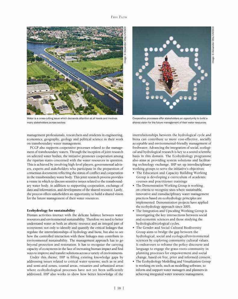
PCCP also supports cooperative processes related to the manage-ment of transboundary waters. Through the inception of joint research on selected water bodies, the initiative promotes cooperation among the riparian states concerned with the water resources in question. This is achieved by involving high-level players, governmental advis-ers, experts and stakeholders who participate in the preparation of consensus documents reflecting the status of conflict and cooperation in the transboundary water body. This joint research process provides a venue in which to discuss sensitive issues related to the transbound-ary water body, in addition to supporting cooperation, exchange of data and information, and development of the shared resource. Lastly, the process offers stakeholders an opportunity to build a shared vision for the future management of their water resources.
Ecohydrology for sustainabilityHuman activities interact with the delicate balance between water resources and environmental sustainability. Therefore we need to better understand water as both an abiotic resource and an integral part of ecosystems; not only to identify and quantify the critical linkages that regulate the interrelationships of hydrology and biota, but also to see how the controlled interaction with these linkages may contribute to environmental sustainability. The management approach has to go beyond protection and restoration. It has to recognize the carrying capacity of ecosystems in the face of increasing human impact and find ways to improve and transfer solutions across a variety of environments.
Under this theme, IHP is filling existing knowledge gaps by addressing issues related to critical water systems, such as in arid and semi-arid zones, coastal areas, estuaries and urbanized areas where ecohydrological processes have not yet been sufficiently addressed. IHP also works to show how better knowledge of the
interrelationships between the hydrological cycle and biota can contribute to more cost-effective, socially acceptable and environmental-friendly management of freshwater. Advancing the integration of social, ecologi-cal and hydrological research is key to a sound scientific basis in this domain. The Ecohydrology programme also aims at providing system solutions and facilitat-ing technology exchange. IHP set up interdisciplinary working groups to serve the initiative’s objectives:• The Education and Capacity Building Working
Group is developing a curriculum of academic courses and practitioner trainings
• The Demonstration Working Group is working on criteria to recognize sites where sustainable, innovative and transdisciplinary water management practices based on ecohydrology principles are implemented. Demonstration projects have applied the ecohydrology approach since 2005.
• The Integration and Upscaling Working Group is investigating the key intersections between social and economic sciences and those studying the hydrological/ecological cycles.
• The Gender and Social Cultural Biodiversity Group aims to bridge the gap between the hydrological, social and ecological/environmental sciences by exploring community cultural values. It endeavours to reframe the policy discourse and language to engage the grass-roots community in planning processes for empowerment and social change, based on free, prior and informed consent.
• The Ecohydrology Modelling and Visualization Group is working on tools, such as modelling software, to inform and support water managers and planners in achieving integrated water resource management.
Cooperative processes offer stakeholders an opportunity to build a
shared vision for the future management of their water resources
Water is a cross-cutting issue which demands attention at all levels and involves
many stakeholders across sectorsIm
age:
© A
lexa
nder
Ott
e/U
NE
SC
O
Imag
e: ©
Ale
xand
er O
tte/
UN
ES
CO
[ ]17
FREE FLOW
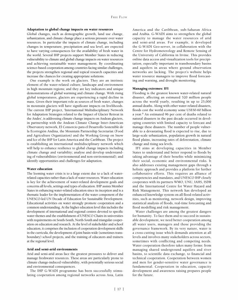
Adaptation to global change impacts on water resourcesGlobal changes, such as demographic growth, land use change, urbanization, and climate change place a serious pressure over water resources. In particular the impacts of climate change, including changes in temperature, precipitation and sea level, are expected to have varying consequences for the availability of fresh water in the world. Several IHP projects support Member States in reducing vulnerability to climate and global change impacts on water resources and achieving sustainable water management. By coordinating science-based cooperation among countries facing similar challenges, the projects strengthen regional and topical research capacities and increase the chances for creating appropriate solutions.
One example is the work on glaciers. They are an intrinsic element of the water-related culture, landscape and environment in high mountain regions; and they are key indicators and unique demonstrations of global warming and climate change. With rising global temperatures, glaciers are experiencing a rapid decline in mass. Given their important role as sources of fresh water, changes in mountain glaciers will have significant impacts on livelihoods. The current IHP project, ‘International Multidisciplinary Network for Adaptation Strategies related to the Impact of Glacier Retreat in the Andes’, is addressing climate change impacts on Andean glaciers, in partnership with the Andean Climate Change Inter-American Observatory network, El Consorcio para el Desarrollo Sostenible de la Ecorregión Andina, the Mountain Partnership Secretariat (Food and Agriculture Organization) and the Working Group on Snow and Ice of the IHP for Latin America and the Caribbean. The project is establishing an international multidisciplinary network which will help to enhance resilience to global change impacts including climate change and variability; analyse and develop understand-ing of vulnerabilities (environmental and non-environmental); and identify opportunities and challenges for adaptation.
Water educationThe looming water crisis is to a large extent due to a lack of water-related capacities rather than a lack of water resources. Water education is key for the achievement of water-related development goals and concerns all levels, settings and types of education. IHP assists Member States in enhancing water-related education since its inception and is a thematic leader for the implementation of the water component of the UNESCO-led UN Decade of Education for Sustainable Development. Educational activities on water strongly promote cooperation and a common understanding. At the higher education level this includes the development of international and regional centres devoted to specific water themes and the establishment of UNESCO Chairs in universities with requirements on South-South, North-South and triangular cooper-ation on education and research. At the level of stakeholder and school education, it comprises the inclusion of cooperation development skills in the curricula, the development of joint basin-wide (sometimes trans-boundary) school projects, and the training of educators and trainers at the regional level.
Arid and semi-arid environmentsArid and semi-arid areas face the greatest pressures to deliver and manage freshwater resources. These areas are particularly prone to climate change-induced vulnerability, with potentially serious social and environmental consequences.
The IHP G-WADI programme has been successfully stimu-lating cooperation among regional networks across Asia, Latin
America and the Caribbean, sub-Saharan Africa and Arabia. G-WADI aims to strengthen the global capacity to manage the water resources of arid and semi-arid areas. For example, it developed the G-WADI Geo-server, in collaboration with the Centre for Hydrometerology and Remote Sensing of the University of California in Irvine. This provides online data access and visualization tools for precipi-tation, especially important in transboundary basins and aquifers in areas where ground observation networks are lacking. The project’s website helps water resource managers to improve flood forecast-ing and warning, and drought monitoring.
Managing extremes: IFIFlooding is the greatest known water-related natural disaster, affecting an estimated 520 million people across the world yearly, resulting in up to 25,000 annual deaths. Along with other water-related disasters, floods cost the world economy some US$50-60 billion a year.6 An estimated 96 per cent of deaths related to natural disasters in the past decade occurred in devel-oping countries with limited capacity to forecast and manage these disasters. The number of people vulner-able to a devastating flood is expected to rise, due to large-scale urbanization, population growth in natural flood plains, increasing rates of deforestation, climate change and rising sea levels.
IFI aims at developing capacities in Member States to understand and better respond to floods by taking advantage of their benefits while minimizing their social, economic and environmental risks. It also addresses existing management gaps through a holistic approach and provides a platform for further collaborative efforts. This requires an alliance of competencies and mandates, and UNESCO IHP closely cooperates with its partners WMO, UNU, IAHS, ISDR and the International Centre for Water Hazard and Risk Management. This network has developed an enhanced knowledge system on all flood-related activ-ities, such as monitoring, network design, improving statistical analysis of floods, real-time forecasting and flood modelling and risk management.
Water challenges are among the greatest dangers for humanity. To face them and to succeed in sustain-able development, we need better cooperation among all water users, managers and those providing the governance framework. By its very nature, water is a cross-cutting issue which demands attention at all levels and involves many stakeholders across sectors, sometimes with conflicting and competing needs. Water cooperation therefore takes many forms: from managing shared underground aquifers and river basins, to scientific data exchange, to financial and technical cooperation. Cooperation between women and men for gender-sensitive water governance is fundamental. Cooperation in education, capacity development and awareness raising prepares people for the future.
IWater Diplomacy

[ ]20
Transboundary water cooperationNick Bonvoisin, Secretary to the Convention on the Protection and Use of Transboundary Waters and International Lakes,
and Co-Secretary to its Protocol on Water and Health, United Nations Economic Commission for Europe
Over half of the world’s precious freshwater flows in the catchment areas, or basins, of rivers, lakes and aqui-fers that cross national borders. These transboundary
basins are home to about 40 per cent of the world’s population. Whether and how countries cooperate in the protection and use of these water resources therefore has a profound impact on society, the economy, the environment and on the water resources themselves. Countries sharing a transboundary basin share interests, risks and opportunities in the joint develop-ment, use, management and protection of transboundary water resources. Where there is a lack of cooperation, and where disputes over water arise, water management is inefficient, impacting water quantity, quality and socioeconomic integrity, as well as raising political tension.
And water wars? The alarm bell has been rung many times but actual conflict seems rare. However, new research by the Strategic Foresight Group think tank suggests that “countries that have cooperative arrangements in shared water enjoy overall peace and cooperation even in non-water sectors. Conversely, the countries that do not have any or good water cooperation arrangements tend to have very
poor security environments and risk conflict and blood-shed for reasons not related to water.”
International water law provides a valuable frame-work for cooperation, and thus conflict prevention. Countries of the pan-European region, member states of the United Nations Economic Commission for Europe (UNECE), completed the negotiation of the Convention on the Protection and Use of Transboundary Waters and International Lakes as the Soviet Union came to an end. The convention was adopted and signed by coun-tries in Helsinki in 1992 – which is why it is sometimes called the Helsinki Convention – just as new borders appeared with the dissolution of first the Soviet Union and then Yugoslavia and Czechoslovakia. Rivers and lakes that had previously flowed within national borders now crossed new borders, and competing uses became international rather than domestic affairs.
The countries that subsequently joined the conven-tion (the parties) recognized that the protection and use of transboundary watercourses and international lakes are important and urgent tasks, the effective accom-plishment of which can only be ensured by enhanced cooperation. They were also concerned over the exist-ence and threats of adverse effects, in the short or long term, of changes in the conditions of transboundary watercourses and international lakes on the environ-ment, economies and well-being of countries.
The convention therefore requires its parties to take all appropriate measures to prevent, control and reduce transboundary impacts, and to ensure that transboundary waters are used in a reasonable and equitable way. But what brings into effect these fine demands is the further requirement that ripar-ian parties – countries that share a transboundary river or aquifer, or an international lake – establish joint agreements that foresee joint bodies responsi-ble for joint management. And this the parties and other countries have successfully done, negotiating new agreements across the pan-European region. For example, the convention has contributed to or served as a model for the treaties on the Chu-Talas, Danube, Dniester, Drin, Narva , Sava and Rhine rivers, as well as for agreements on the Kazakh-Russian, Russian-Ukrainian, Belarus-Russian, Belarus-Ukrainian, Russian-Mongolian and many other transboundary waters. States have also established joint bodies – including for the rivers Danube, Elbe, Meuse, Oder
WATER DIPLOMACY
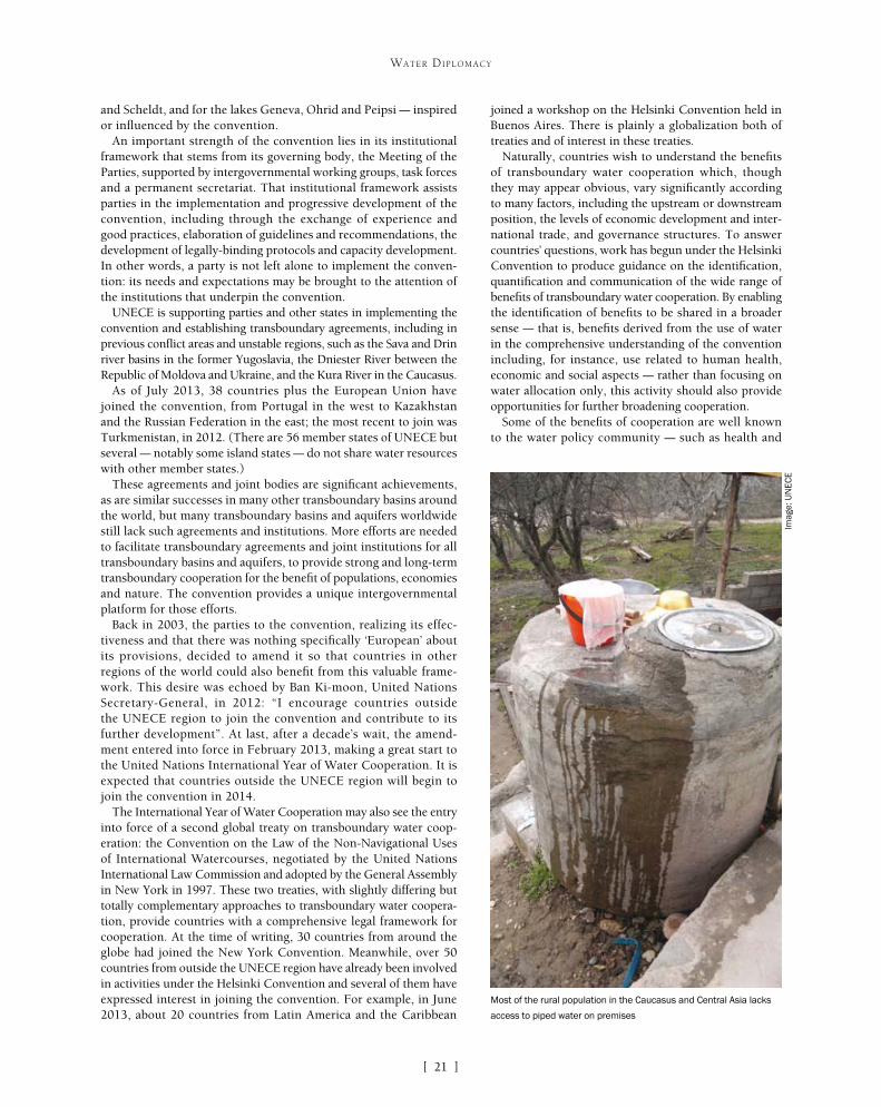
Safe drinking water is a universal right
Imag
e: U
NE
CE
[ ]21
WATER DIPLOMACY
joined a workshop on the Helsinki Convention held in Buenos Aires. There is plainly a globalization both of treaties and of interest in these treaties.
Naturally, countries wish to understand the benefits of transboundary water cooperation which, though they may appear obvious, vary significantly according to many factors, including the upstream or downstream position, the levels of economic development and inter-national trade, and governance structures. To answer countries’ questions, work has begun under the Helsinki Convention to produce guidance on the identification, quantification and communication of the wide range of benefits of transboundary water cooperation. By enabling the identification of benefits to be shared in a broader sense – that is, benefits derived from the use of water in the comprehensive understanding of the convention including, for instance, use related to human health, economic and social aspects – rather than focusing on water allocation only, this activity should also provide opportunities for further broadening cooperation.
Some of the benefits of cooperation are well known to the water policy community – such as health and
and Scheldt, and for the lakes Geneva, Ohrid and Peipsi – inspired or influenced by the convention.
An important strength of the convention lies in its institutional framework that stems from its governing body, the Meeting of the Parties, supported by intergovernmental working groups, task forces and a permanent secretariat. That institutional framework assists parties in the implementation and progressive development of the convention, including through the exchange of experience and good practices, elaboration of guidelines and recommendations, the development of legally-binding protocols and capacity development. In other words, a party is not left alone to implement the conven-tion: its needs and expectations may be brought to the attention of the institutions that underpin the convention.
UNECE is supporting parties and other states in implementing the convention and establishing transboundary agreements, including in previous conflict areas and unstable regions, such as the Sava and Drin river basins in the former Yugoslavia, the Dniester River between the Republic of Moldova and Ukraine, and the Kura River in the Caucasus.
As of July 2013, 38 countries plus the European Union have joined the convention, from Portugal in the west to Kazakhstan and the Russian Federation in the east; the most recent to join was Turkmenistan, in 2012. (There are 56 member states of UNECE but several – notably some island states – do not share water resources with other member states.)
These agreements and joint bodies are significant achievements, as are similar successes in many other transboundary basins around the world, but many transboundary basins and aquifers worldwide still lack such agreements and institutions. More efforts are needed to facilitate transboundary agreements and joint institutions for all transboundary basins and aquifers, to provide strong and long-term transboundary cooperation for the benefit of populations, economies and nature. The convention provides a unique intergovernmental platform for those efforts.
Back in 2003, the parties to the convention, realizing its effec-tiveness and that there was nothing specifically ‘European’ about its provisions, decided to amend it so that countries in other regions of the world could also benefit from this valuable frame-work. This desire was echoed by Ban Ki-moon, United Nations Secretary-General, in 2012: “I encourage countries outside the UNECE region to join the convention and contribute to its further development”. At last, after a decade’s wait, the amend-ment entered into force in February 2013, making a great start to the United Nations International Year of Water Cooperation. It is expected that countries outside the UNECE region will begin to join the convention in 2014.
The International Year of Water Cooperation may also see the entry into force of a second global treaty on transboundary water coop-eration: the Convention on the Law of the Non-Navigational Uses of International Watercourses, negotiated by the United Nations International Law Commission and adopted by the General Assembly in New York in 1997. These two treaties, with slightly differing but totally complementary approaches to transboundary water coopera-tion, provide countries with a comprehensive legal framework for cooperation. At the time of writing, 30 countries from around the globe had joined the New York Convention. Meanwhile, over 50 countries from outside the UNECE region have already been involved in activities under the Helsinki Convention and several of them have expressed interest in joining the convention. For example, in June 2013, about 20 countries from Latin America and the Caribbean
Most of the rural population in the Caucasus and Central Asia lacks
access to piped water on premises
Imag
e: U
NE
CE

[ ]22
WATER DIPLOMACY
biodiversity benefits generated by reduced water pollution, micro-economic impacts of improved water allocation (for example, for agricultural productivity) and economic gains from the development of large infrastructure for water storage, flood control or hydropower generation. Some of these benefits are manifest as reduced costs of water supply and power generation, or as reduced risks arising from floods, droughts and disease. Other benefits of cooperation are less well known – such as those related to reduced political tensions (ultimately leading to reduced defence spending), opening opportu-nities for cooperation in other areas (such as trade liberalization) or the macroeconomic impacts of improved water management facili-tated by cooperation.
On one hand, it is clear that there are significant benefits from cooperation. On the other, when countries fail to cooperate and instead compete for use of the water resource, the costs can be high. Aquifers draw down due to competing pumping, crops die as flows dip in the growing season and the land floods as water is released in the winter, ice flows disrupt navigation and power generation, polluted waters impact on the health of downstream communities and raise the costs of drinking water supply, reservoirs are silted up by sediments, and so on. Transboundary cooperation, based on the Helsinki and New York conventions, can help to prevent such costs.
Besides providing information on the benefits of cooperation internationally, water management – both nationally and in the trans-boundary context – needs intersectoral cooperation. A particularly successful approach to fostering the sort of intersectoral coopera-tion that forms an essential foundation for better water management is embodied by the national policy dialogues on integrated water resources management and water supply and sanitation, being held within the European Union Water Initiative. UNECE – focusing on water sector reforms to achieve integrated water resources manage-ment – is working with the Organization for Economic Cooperation and Development – which is focusing more on economic and finan-
cial analyses – to implement these dialogues in nine countries across Eastern Europe, the Caucasus and Central Asia. The objective of each policy dialogue is to facilitate the reform of water policies in a particu-lar country or region. Each policy dialogue involves high-level representatives of all key partners, including national and basin authorities, representatives of relevant international organizations, civil society (non-govern-mental organizations) and the private sector.
The national policy dialogues have also provided a forum for discussions on the setting of national targets relating to safe drinking water and adequate sanitation, the subject of the Helsinki Convention’s Protocol on Water and Health. The protocol, adopted and signed by 35 states in London in 1999, now has 26 contracting parties in the UNECE region. Each party has to set, and subsequently implement, targets in 20 areas covering the entire water cycle. For example, in relation to sani-tation, target areas cover access to sanitation, the level of performance of sanitation systems, the application of recognized good practices to the management of sanita-tion, and the disposal and reuse of sewage sludge from sanitation systems.
The process of target setting is flexible and adaptable to specific national conditions. Thus, the parties appre-ciate the target setting and reporting process as a useful policymaking and planning tool that enhances intersec-toral cooperation – which is where the national policy dialogue helps – and assists governments to express clearly and transparently their priorities in progressing towards universal access to safe water and sanitation.
Both globally and in the UNECE region, advances in access to water and sanitation are being made. But safe
The signing of the Treaty on the Dniester River Basin in Rome in 2012
Imag
e: U
NE
CE

[ ]23
WATER DIPLOMACY
ary basins. The nexus is where these sectors come together and compete, and where trade-offs are made. By better understanding the interactions between water, food, energy and ecosystems in transboundary basins, it is expected that synergies can be strengthened and policies made more coherent, with the aim of reduc-ing conflicts, promoting sustainability and helping to address and reduce trade-offs between these key sectors.
The legal framework provided by the Helsinki and New York conventions, and the numerous policy tools and good practices developed under the Helsinki Convention and its Protocol on Water and Health, show that solutions are available. They show that, with the political will and with opportunities for open dialogue, transboundary water cooperation can be the norm. They show also that countries can work together to address some of our greatest challenges, such as climate change and peaceful relations between neighbouring coun-tries. And the Protocol on Water and Health provides a unique international legal framework for translating the human right to safe drinking water and sanitation into a reality.
drinking water and improved sanitation cannot be taken for granted, even in the pan-European region. Overall progress in increasing access masks significant disparities within and between the coun-tries, between urban and rural areas, as well as between high- and low-income groups. Lower levels of access are evident among the poor, those belonging to the most vulnerable and marginalized groups, and rural populations, regardless of a country’s socioeco-nomic status. For example, in the Caucasus and Central Asia, 19 per cent of the rural population lacks access to improved drinking-water sources as opposed to only 4 per cent of urban dwellers; more dramatically, 72 per cent of the rural population lacks access to piped water on premises, whereas only 20 per cent of town and city residents are similarly disadvantaged.
These inequalities are recognized in the protocol, which requires that equitable access to water, adequate in terms of both quantity and quality, should be provided for all members of the population, especially those who suffer a disadvantage or social exclusion. To address equity, a publication on good practices was developed, titled No One Left Behind. In addition, a practical self-assessment tool, or scorecard, is to be launched at the third meeting of the protocol’s governing body in November 2013, to help states appraise the situation on national and subnational levels and to identify the priority areas for action to reduce disparities in access to water and sanitation.
The institutional arrangements under the Helsinki Convention, with regular intergovernmental meetings and numerous technical workshops, provide a similar platform for addressing emerging issues.
Several years ago, work began on adaptation to climate change in transboundary basins. The Helsinki Convention has been supporting countries in jointly adapting their water management to climate change since the preparation of a pioneering guidance document in 2007-2009. Since 2010, the use of the guidance was supported through a programme of pilot projects and a platform for exchanging experience on climate change adaptation in trans-boundary basins. Thanks to this work, the need for transboundary cooperation in climate change adaptation has been increasingly recognized. More and more countries sharing transboundary basins are starting to address these issues jointly. This has led to concrete results. For example, a pilot project on river basin management and climate change adaptation in the Neman River Basin has resulted in a joint assessment of water resources and climate change impacts in the basin, thereby enabling a renewal of cooperation between the riparian countries on the shared river basin. In the Dniester River pilot project, a first basin-wide impact and vulnerability assessment has been developed, as well as detailed flood risk modelling in two priority sites.
In 2013-2015, a collection of lessons learned and good prac-tices will be prepared, the programme of pilot projects will be transformed into a global network of basins working on climate change adaptation and a global platform for exchanging experi-ence is being established. In February 2013, a first meeting was held of the global network of rivers basins on climate change adaptation. The network of basins currently includes the basins of the Chu Talas, Congo, Danube, Dniester, Drin, Mekong, Meuse, Neman, Niger, Rhine, Sava, Senegal and Upper Paraguay rivers, the Amur/Argun/Daursky Biosphere Reserve and the Northern Sahara aquifer system.
The newest area of work under the Helsinki Convention is on assessing the water-food-energy-ecosystems nexus in transbound-
Water infrastructure can have multiple uses including hydropower
generation and flow regulation
Imag
e: U
NE
CE

[ ]24
Greater cooperation through water diplomacy and transboundary water management
Julia Marton-Lefèvre, Patrick MacQuarrie, Alejandro Iza and Mark Smith, International Union for Conservation of Nature
W ith over 275 transboundary basins on the planet, cooperation over water management is essential for the preservation of freshwater biodiversity and
healthy ecosystems. Approximately 40 per cent of the world’s population lives in river and lake basins that comprise two or more countries and, perhaps more significantly, over 90 per cent lives in countries that share basins. The complexities of sharing water between and among nations require innovation in approaches to water governance, with water diplomacy at multi-ple levels. In this regard water is unique. It connects fishermen to Prime Ministers, farmers to politicians, through a simple yet challenging common objective – to cooperatively manage our shared freshwater ecosystems and maintain the rich biodiversity that supports useful and productive livelihoods.
The International Union for Conservation of Nature (IUCN) contributes to the conservation of water biodiversity by promot-
ing, influencing and catalysing sustainable use and equitable sharing of resources, as well as protecting ecosystems. Promoting cooperation among countries in the management of transboundary waters is a key building block in protecting biodiversity while main-taining international security and regional stability. At the same time, water management is a local activ-ity because clean, safe and dependable water supply is intrinsic to the health, food security and economic opportunities needed for households and communi-ties to benefit from development. Failing to manage water sustainably results in losses of biodiversity, with direct negative impacts on poverty, disease, conflict and development.
Biodiversity is crucial to the reduction of poverty. More than 1.3 billion people depend on biodiversity and on basic ecosystem goods and services for their
WATER DIPLOMACY
In the Lake Titicaca basin, BRIDGE focused on fostering dialogue and cooperation through agreements on knowledge and information
Imag
e: ©
IUC
N\C
arla
Vau
cher

[ ]25
WATER DIPLOMACY
governments, requiring their ultimate agreement, but which also unlocks cooperation among multiple stakeholders, including municipalities and prov-inces. Working broadly as a multi-level governance process, water diplomacy can better integrate govern-ments’ priorities for national resource security and economic growth while providing a means to inte-grate biodiversity conservation into frameworks for water management.
Water management is also a technical issue that is strengthened by scientific knowledge and informa-tion. Effective water diplomacy is therefore the art of building and facilitating the convergence of technical expertise, information, stakeholder dialogue and local and international politics. It calls on national and local politicians, decision makers, scientific and technical experts to work together toward negotiated agreements on policies, laws and institutions that can be imple-mented for transboundary water management.
Building bridges for water cooperationIUCN’s Building River Dialogue and Governance (BRIDGE) project strengthens transboundary water cooperation by incorporating the interests of multi-ple stakeholders into dialogue and negotiation over transboundary waters, enhancing participation and building agreement between water users. This creates an environment and capacity where governments and stakeholders can work together to address priorities at local, national and regional levels. Water cooperation can then deliver a broader set of solutions than is likely through negotiations constrained to high-level, state-to-state processes.
livelihoods. Inland water ecosystems are subjected to massive changes due to multiple pressures, and biodiversity is lost more rapidly than in other types of ecosystem. More integrated manage-ment of freshwater ecosystems will help reduce negative impacts from competing pressures.
Protecting biodiversity depends on sustainable water manage-ment. This requires good governance which, in turn, requires water governance capacity. Without governance capacity, even given the greatest political will and motivation, poor management practices can persist leading to ecosystem degradation and reduced livelihoods. To build governance capacity, effective tools need to provide a sustainable connection between ecosystems and those managing them. Water diplomacy bridges the gap between sustain-able management practices, good governance and water users at multiple levels.
Water governance and cooperationWater governance sets the ‘rules of the game’ for the way water is managed. It determines how, or whether, water resources are managed sustainably. Poor water governance results in loss of biodiversity through degradation and over-allocation of water resources, and leads to weaker and less resilient livelihoods and economic growth.
Policies, laws and institutions are the three pillars of water govern-ance within a country and in a transboundary basin, where they are complemented by the agreements negotiated between basin coun-tries. For this governance to be effective, countries need to develop their own water governance capacity through transparent, coherent and cost-efficient policies, laws and institutions.
Experience from the IUCN Water and Nature Initiative shows that water governance capacity is built most effectively where all stakeholders participate, with coordination at local, national and transboundary levels.
In practical terms, the coordinated development and reform of policies, laws and institutions needed to build this capacity takes place through the integration of several elements:• demonstrating tangible benefits from improved water resource
management for social and economic development at local, national or river basin level
• learning, capacity building and knowledge exchange among decision makers and stakeholders
• multi-stakeholder dialogues and forums to build consensus and coordinate decisions
• support for national policy, legal and institutional reforms• international cooperation in transboundary basins.
Water diplomacyEver since two Sumerian city-states signed the first known water treaty in 2500 BC ending a water dispute along the Tigris River, water has been the subject of cooperation more often than conflict. Today, over 3,600 international water treaties exist.
Water diplomacy enables countries to negotiate agreements on water management. The importance of water for development and poverty reduction at local levels means that agreements among national governments often do not lead, by themselves, to imple-mentation. For transboundary agreements on water management to work on the ground, they need the agreement of water users at multiple levels of governance. Water diplomacy should be a process which operates under the authority of sovereign national
Imag
e: ©
IUC
N\N
azar
eth
Por
ras
In the Sixaola basin, shared between Panama and Costa Rica, efforts
to improve water governance capacity are paying off
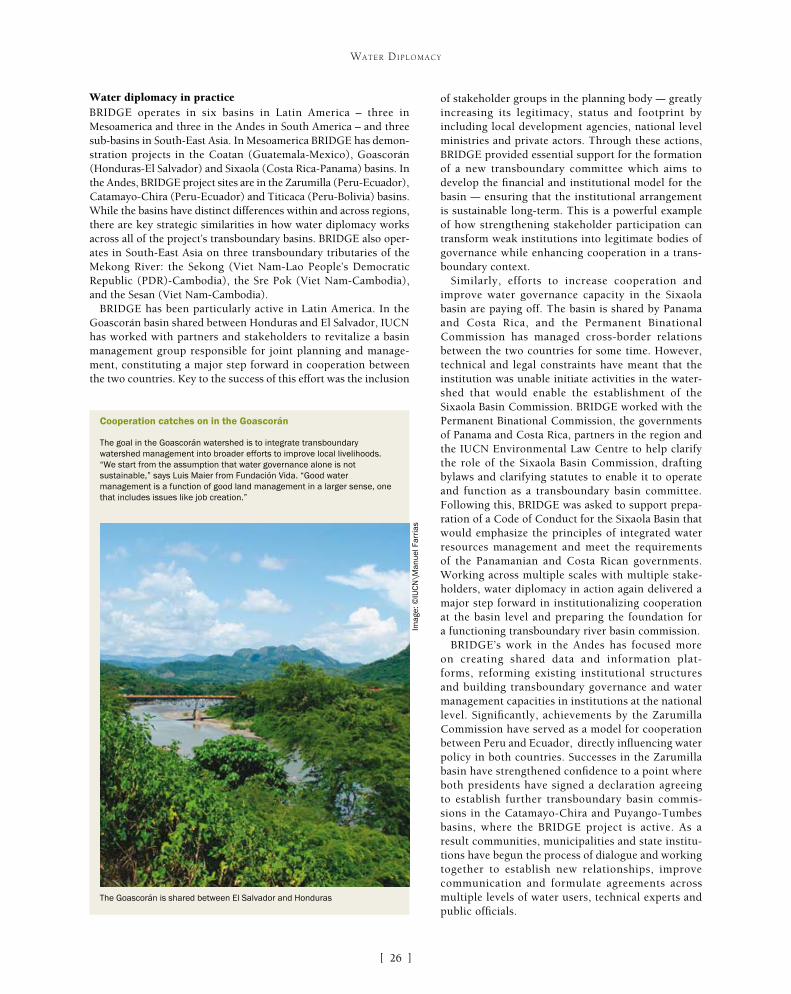
[ ]26
WATER DIPLOMACY
Water diplomacy in practiceBRIDGE operates in six basins in Latin America – three in Mesoamerica and three in the Andes in South America – and three sub-basins in South-East Asia. In Mesoamerica BRIDGE has demon-stration projects in the Coatan (Guatemala-Mexico), Goascorán (Honduras-El Salvador) and Sixaola (Costa Rica-Panama) basins. In the Andes, BRIDGE project sites are in the Zarumilla (Peru-Ecuador), Catamayo-Chira (Peru-Ecuador) and Titicaca (Peru-Bolivia) basins. While the basins have distinct differences within and across regions, there are key strategic similarities in how water diplomacy works across all of the project’s transboundary basins. BRIDGE also oper-ates in South-East Asia on three transboundary tributaries of the Mekong River: the Sekong (Viet Nam-Lao People’s Democratic Republic (PDR)-Cambodia), the Sre Pok (Viet Nam-Cambodia), and the Sesan (Viet Nam-Cambodia).
BRIDGE has been particularly active in Latin America. In the Goascorán basin shared between Honduras and El Salvador, IUCN has worked with partners and stakeholders to revitalize a basin management group responsible for joint planning and manage-ment, constituting a major step forward in cooperation between the two countries. Key to the success of this effort was the inclusion
of stakeholder groups in the planning body – greatly increasing its legitimacy, status and footprint by including local development agencies, national level ministries and private actors. Through these actions, BRIDGE provided essential support for the formation of a new transboundary committee which aims to develop the financial and institutional model for the basin – ensuring that the institutional arrangement is sustainable long-term. This is a powerful example of how strengthening stakeholder participation can transform weak institutions into legitimate bodies of governance while enhancing cooperation in a trans-boundary context.
Similarly, efforts to increase cooperation and improve water governance capacity in the Sixaola basin are paying off. The basin is shared by Panama and Costa Rica, and the Permanent Binational Commission has managed cross-border relations between the two countries for some time. However, technical and legal constraints have meant that the institution was unable initiate activities in the water-shed that would enable the establishment of the Sixaola Basin Commission. BRIDGE worked with the Permanent Binational Commission, the governments of Panama and Costa Rica, partners in the region and the IUCN Environmental Law Centre to help clarify the role of the Sixaola Basin Commission, drafting bylaws and clarifying statutes to enable it to operate and function as a transboundary basin committee. Following this, BRIDGE was asked to support prepa-ration of a Code of Conduct for the Sixaola Basin that would emphasize the principles of integrated water resources management and meet the requirements of the Panamanian and Costa Rican governments. Working across multiple scales with multiple stake-holders, water diplomacy in action again delivered a major step forward in institutionalizing cooperation at the basin level and preparing the foundation for a functioning transboundary river basin commission.
BRIDGE’s work in the Andes has focused more on creating shared data and information plat-forms, reforming existing institutional structures and building transboundary governance and water management capacities in institutions at the national level. Significantly, achievements by the Zarumilla Commission have served as a model for cooperation between Peru and Ecuador, directly influencing water policy in both countries. Successes in the Zarumilla basin have strengthened confidence to a point where both presidents have signed a declaration agreeing to establish further transboundary basin commis-sions in the Catamayo-Chira and Puyango-Tumbes basins, where the BRIDGE project is active. As a result communities, municipalities and state institu-tions have begun the process of dialogue and working together to establish new relationships, improve communication and formulate agreements across multiple levels of water users, technical experts and public officials.
Cooperation catches on in the Goascorán
The goal in the Goascorán watershed is to integrate transboundary watershed management into broader efforts to improve local livelihoods. “We start from the assumption that water governance alone is not sustainable,” says Luis Maier from Fundación Vida. “Good water management is a function of good land management in a larger sense, one that includes issues like job creation.”
The Goascorán is shared between El Salvador and Honduras
Imag
e: ©
IUC
N\M
anue
l Far
rias
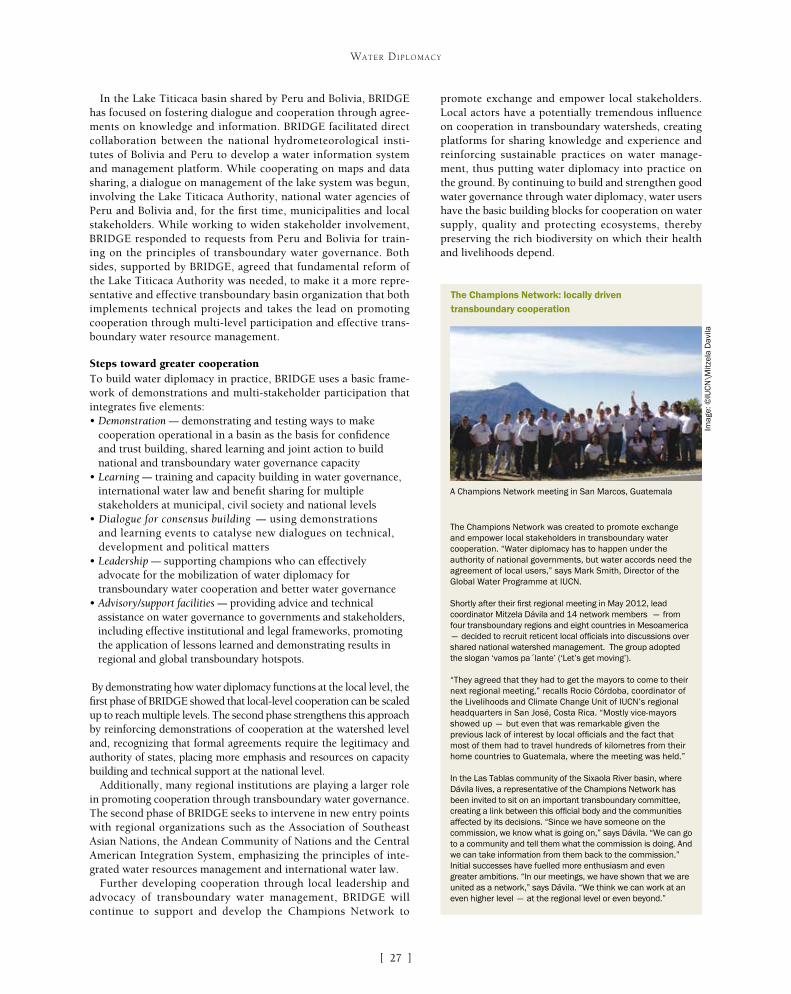
[ ]27
WATER DIPLOMACY
In the Lake Titicaca basin shared by Peru and Bolivia, BRIDGE has focused on fostering dialogue and cooperation through agree-ments on knowledge and information. BRIDGE facilitated direct collaboration between the national hydrometeorological insti-tutes of Bolivia and Peru to develop a water information system and management platform. While cooperating on maps and data sharing, a dialogue on management of the lake system was begun, involving the Lake Titicaca Authority, national water agencies of Peru and Bolivia and, for the first time, municipalities and local stakeholders. While working to widen stakeholder involvement, BRIDGE responded to requests from Peru and Bolivia for train-ing on the principles of transboundary water governance. Both sides, supported by BRIDGE, agreed that fundamental reform of the Lake Titicaca Authority was needed, to make it a more repre-sentative and effective transboundary basin organization that both implements technical projects and takes the lead on promoting cooperation through multi-level participation and effective trans-boundary water resource management.
Steps toward greater cooperationTo build water diplomacy in practice, BRIDGE uses a basic frame-work of demonstrations and multi-stakeholder participation that integrates five elements:• Demonstration – demonstrating and testing ways to make
cooperation operational in a basin as the basis for confidence and trust building, shared learning and joint action to build national and transboundary water governance capacity
• Learning – training and capacity building in water governance, international water law and benefit sharing for multiple stakeholders at municipal, civil society and national levels
• Dialogue for consensus building – using demonstrations and learning events to catalyse new dialogues on technical, development and political matters
• Leadership – supporting champions who can effectively advocate for the mobilization of water diplomacy for transboundary water cooperation and better water governance
• Advisory/support facilities – providing advice and technical assistance on water governance to governments and stakeholders, including effective institutional and legal frameworks, promoting the application of lessons learned and demonstrating results in regional and global transboundary hotspots.
By demonstrating how water diplomacy functions at the local level, the first phase of BRIDGE showed that local-level cooperation can be scaled up to reach multiple levels. The second phase strengthens this approach by reinforcing demonstrations of cooperation at the watershed level and, recognizing that formal agreements require the legitimacy and authority of states, placing more emphasis and resources on capacity building and technical support at the national level.
Additionally, many regional institutions are playing a larger role in promoting cooperation through transboundary water governance. The second phase of BRIDGE seeks to intervene in new entry points with regional organizations such as the Association of Southeast Asian Nations, the Andean Community of Nations and the Central American Integration System, emphasizing the principles of inte-grated water resources management and international water law.
Further developing cooperation through local leadership and advocacy of transboundary water management, BRIDGE will continue to support and develop the Champions Network to
promote exchange and empower local stakeholders. Local actors have a potentially tremendous influence on cooperation in transboundary watersheds, creating platforms for sharing knowledge and experience and reinforcing sustainable practices on water manage-ment, thus putting water diplomacy into practice on the ground. By continuing to build and strengthen good water governance through water diplomacy, water users have the basic building blocks for cooperation on water supply, quality and protecting ecosystems, thereby preserving the rich biodiversity on which their health and livelihoods depend.
The Champions Network: locally driven transboundary cooperation
The Champions Network was created to promote exchange and empower local stakeholders in transboundary water cooperation. “Water diplomacy has to happen under the authority of national governments, but water accords need the agreement of local users,” says Mark Smith, Director of the Global Water Programme at IUCN.
Shortly after their first regional meeting in May 2012, lead coordinator Mitzela Dávila and 14 network members – from four transboundary regions and eight countries in Mesoamerica – decided to recruit reticent local officials into discussions over shared national watershed management. The group adopted the slogan ‘vamos pa´lante’ (‘Let’s get moving’).
“They agreed that they had to get the mayors to come to their next regional meeting,” recalls Rocio Córdoba, coordinator of the Livelihoods and Climate Change Unit of IUCN’s regional headquarters in San José, Costa Rica. “Mostly vice-mayors showed up – but even that was remarkable given the previous lack of interest by local officials and the fact that most of them had to travel hundreds of kilometres from their home countries to Guatemala, where the meeting was held.”
In the Las Tablas community of the Sixaola River basin, where Dávila lives, a representative of the Champions Network has been invited to sit on an important transboundary committee, creating a link between this official body and the communities affected by its decisions. “Since we have someone on the commission, we know what is going on,” says Dávila. “We can go to a community and tell them what the commission is doing. And we can take information from them back to the commission.” Initial successes have fuelled more enthusiasm and even greater ambitions. “In our meetings, we have shown that we are united as a network,” says Dávila. “We think we can work at an even higher level – at the regional level or even beyond.”
A Champions Network meeting in San Marcos, Guatemala
Imag
e: ©
IUC
N\M
itzel
a D
avila
[ ]28
From the Dead Sea to an Israel/Palestine Water Accord: 20 years of water diplomacy
in the Middle EastGidon Bromberg, Nader Khateeb and Munqeth Mehyar, Co-Directors, EcoPeace/Friends of the Earth Middle East
E coPeace/Friends of the Earth Middle East (FoEME) is a unique organization that in 1994 for the very first time brought together Palestinian, Jordanian and Israeli
environmentalists to work together under a single board. Over the past 20 years the organization has grown from an all-voluntary staff working out of rooms in the offices of other organizations, to opening its own offices in Bethlehem, Amman and Tel-Aviv where today 80 paid professional staff members are employed and hundreds of volunteers involved. In this timespan the organization has reinvented itself in the face of significant shifts in political and social moods in the region. At the same time, it has learned to combine multiple models of action in order to pursue what has become its primary focus since the early years of the millennium – a water diplomacy designed to promote a just and sustainable cross-border coop-eration over shared water resources.
At the launch of the first United Nations Water Talks, on 24 April 2012, United Nations Educational, Scientific and Cultural Organization Director-General Irina Bokova called for a renewed commitment to water diplomacy: “We need new forms of water diplomacy – to integrate multiple perspectives and resolve prob-lems in ways that are informed by science and technology and that favour intercultural dialogue”.1 Over the past 20 years, FoEME has continuously leveraged its experience for the creation of a water diplomacy based on scientific expertise, top-down advocacy and bottom-up community-led action. Its aim has been resolving shared water problems in sustainable ways both between peoples and between people and nature in the midst of a conflict-ridden region.
FoEME was founded at a time of optimism, when there was belief in a process that people thought would shortly result in compre-hensive peace. Since obtaining ‘peace’ was considered doable, the organization focused on the quality of peace from an environmen-tal perspective. Its literature from that time highlighted the phrase ‘sustainable peace’, reflecting its belief that the peace being forged by our governments was ecologically unsustainable.
A classic environmental top-down advocacy organization at its inception, FoEME was predominately involved during these first years in leading efforts for developing sustainable livelihoods. The work of the organization was focused on protecting the environ-ment from the lack of cross-border cooperation related to conflict, and from overdevelopment being proposed within the framework of advancing the peace process.
During this period the organization advanced its objective of leading ‘sustainable peace’ focused on tradi-tional avenues of cross-border environmental advocacy. It saw an urgent need to advocate processes of sustain-able development, balancing the needs of people and nature, but recognizing that only a regional effort could result in the issue being placed on the political agenda of the Arab/Israeli peace process. From the early days of the organization, creating a common vision around a shared ecosystem by bringing together experts from the three countries involved was recognized as a necessary first step for advocacy purposes.
The lack of such a vision for the Dead Sea was one of FoEME’s first major concerns. As part of the efforts to promote regional peace and prosperity, the Dead Sea was marked by the region’s governments as a site for rapid development holding great economic potential. Among other proposals were the building of a conduit to fill with seawater, 50,000 new hotel rooms around it; an international eight-lane highway proposed along the Jordan Valley; and increased water extraction for the use of the potash industry.
Understanding that such developments might result in considerable ecological damage to this unique ecosystem, FoEME held two conferences during 1996 in Amman and Tel Aviv titled ‘The Dead Sea – Future Challenges’. These conferences highlighted the lack of coordination in planning processes between Israelis, Palestinians and Jordanians, and the need for cross-border cooperation in creating a unified vision for the sustainable development of the Dead Sea. As FoEME’s efforts at that time were mainly directed at develop-ing sustainable livelihoods, the question guiding these efforts within the context of the Dead Sea was how the political, economic and development activities in place can be altered so as to strike a more balanced approach both between the peoples sharing the ecosystem and between the needs of people and the needs of nature.
The period of pursuing sustainable peace, however, came to an end by 1998, when the belief that peace was indeed within reach had faded in the face of the Oslo Accords’ failure to stand up to people’s expectations. The peace process had by then became so sour that the
WATER DIPLOMACY

[ ]29
WATER DIPLOMACY
violence, loss of hope and trust and that it must speak to the immediate concerns of people. While FoEME’s series of policy papers on protecting the Mountain Aquifer from sewage and solid waste pollution reflect the continued top-down advocacy work carried out at this time, the idea of complementing these top-down advocacy efforts with bottom-up community-led activ-ism was born sometime during this interim phase. By coincidence, when funding was finally secured for the Good Water Neighbors project in late 2000, the new cross-border community-based effort was almost cancelled with the outbreak of all-out violence in 2001. Funders believed that cross-border efforts were no longer viable. However, FoEME was able to convince funders that community-level cooperation was possible and the project was launched in early 2001, initially involving 11 communities – five Palestinian, five Israeli and one Jordanian.
The inception of the Good Water Neighbors project marked the beginning of the third phase of FoEME’s work and launched the process of consolidating its water diplomacy. The organization had realized that in order to remain relevant, it had to complement its top-down approach with grass-roots actions undertaken through dialogue, confidence building and cooperation activi-ties focused on actual cross-border resources that could directly benefit people. The project was designed to raise awareness of the shared water problems of Palestinian, Jordanian and Israeli communities, and harness residents and municipal staff to the task of changing reality on the ground. Based on identifying cross-border communities and utilizing their mutual dependence on shared water resources as a basis for developing dialogue and coopera-
term ‘peace process’ itself was associated with negative connotations of increased violence and preserving the status quo. The ensuing changes in political conditions, public opinion and national mood among the three peoples have cast FoEME into a period of great turmoil both internally and externally. The overdevelopment that had been proposed by the governments was now seen as a pipe dream, not within reach and no longer politically relevant. FoEME itself was increasingly being condemned and attacked as an arm of this failed peace effort. In what can be seen now as a transi-tion period lasting until 2001, FoEME began focusing on how the renewed conflict was holding the need to more fairly allocate shared waters hostage to the lack of advancement of the peace process.
As part of this change, FoEME started to use its experience in addressing cross-border water issues to shape a coherent water diplo-macy designed to implement adaptive methods of joint management and allocation of shared waters, thus transforming shared waters from a source of conflict into one of cooperation. This approach was based on the understanding that all parties involved in the region should be convinced that water is a flexible resource, and that “by using processes and mechanisms to focus on building and enhanc-ing trust, even countries in conflict can reach agreements that satisfy their citizens’ water needs and their national interests”.2
FoEME’s early work on the issues of sustainable development of the Dead Sea can now be seen as an important milestone in the shaping of the organization’s water diplomacy during this interim period. The need for cross-border cooperation to create a holistic vision for a shared natural resource for the sake of the medium and long-term interests of the three peoples has remained a basic prin-ciple of its work on all shared waters in the region – albeit now as a challenge to create in the midst of continued occupation, conflict and violence. But even prior to the outbreak of the Second Intifada in 2001, FoEME understood that medium and long-term inter-ests were not sufficiently relevant in the midst of ever-increasing
FoEME’s community projects and advocacy efforts brought mayors from Israel,
Jordan and Palestine to an event in the Jordan River, with a clear and joint message
to their governments: “Rehabilitate the Jordan River!”
FoEME’s “Good Water Neighbors” project brings neighbouring
Palestinian and Israeli Mayors to sign on an MoU to cooperate over
shared water issues
Imag
e: F
oEM
E
Imag
e: F
oEM
E

[ ]30
WATER DIPLOMACY
tion on sustainable water management, the project today includes 28 communities (11 Palestinian, nine Israeli and eight Jordanian). When originally launched, the Good Water Neighbors project struggled to convince the 11 original participating communities that they would benefit through the cooperative activities launched. Today FoEME has more communities seeking to join the project than funds available to enable their participation.
The project has also supported the expanding geographical reach of the organization. Working in communities all along the borders between the three peoples has brought FoEME to deal with water issues relevant to all of the region’s shared water resources: the Dead Sea, the Jordan River, cross-border creeks, and the Mountain and Coastal Aquifers.
Having to deal with the conflicting and competing political, economic and social interests that exist both within each community and society and between cross-border communities and societies has made this third era far more integrative than ever before. This period reflects the very action-oriented approach of the organization as it exists today, having to show concrete results and benefits on an almost daily basis in order to maintain the trust of residents and community leaders. During the last 12 years FoEME has success-fully overcome the barrier of showing how communities can and are presently able to benefit from the cooperative relations estab-lished despite the continued conflict – politically, economically and socially, often all interlinked.
Through the synergy created within its water diplomacy by combin-ing top-down with bottom-up strategies, FoEME can today identify a host of major achievements. One of its major successes has been in placing the key regional issues of saving the Dead Sea and rehabilitat-ing the Jordan River on the decision-making table. In recent years, to a large extent as a result of FoEME’s efforts, the various water agencies of Israel, Palestine and Jordan have started to recognize the ecological, social, and economic importance of restoring the flow and quality of Jordan River waters – the diversion and pollution of which are primary factors in the demise of the Dead Sea. No less importantly, FoEME is a leading advocate for the recognition of Palestinian rights to Jordan River waters and the importance of the Jordan Valley for the Palestinian state. The civil society water diplomacy of FoEME has had a significant role in this change in perception, evident in master plans and water plans now being prepared, with fresh water flowing again from the Sea of Galilee to the river for the first time in 50 years, though still in insufficient quantities. Together with fresh-water release, no less importantly, sewage is coming out with progress made on sewage treatment plants on all sides of the Jordan Valley. Furthermore, FoEME is starting to see the results of its advocacy efforts impacting cross-border water management institutions. On 7 February 2013, for the very first time since the signing of the Jordan-Israel Peace Treaty in 1994, the bilateral Israeli-Jordanian Joint Water Committee discussed the rehabilitation of Jordan River.
Addressing water supply and sanitation issues has also been a focus of the Good Water Neighbors project. FoEME has so far leveraged over US$450 million invested or earmarked for the partici-pating communities – primarily as investments in water supply and sanitation projects, as well as in environmental education centers and ecotourism projects.
The combination of top-down advocacy and bottom-up community-based action, as the basis for FoEME’s water diplomacy, was built on the understanding that cross-border cooperation at the community level – between residents, professionals and municipal representatives
– is instrumental in the building of trust, which must be the basis for conflict resolution. Moreover, since FoEME’s community-led project is based on raising communities’ awareness of their mutual dependence as regards water issues, and their self-interests in cooperating over water, it is a powerful tool in changing reality on the ground. While changing the parties’ perceptions of each other is no less important to the creation of intercultural dialogue, empha-sizing self-interests that, if fulfilled, would yield mutual gains is a necessity in order to generate concrete action and political will. FoEME’s community-based activities are shaped to complement its top-down advocacy efforts by creating and empowering this will among local residents, in a way that would impact both municipal representatives and politicians, and influence the media and the broader public’s opinion as a result.
The same understanding of the need to identify self-interest advancing mutual gain is at the heart of FoEME’s endeavours on the national level, to promote a final Israeli-Palestinian Water Accord. Under the Oslo process, solving water issues has been held hostage to the failure to advance agreements on the other core issues of the peace process. Current management of water resources shared between Israel and Palestine – the principles of which were partly laid by the Oslo II accords – is detrimental to the interests of both parties. As Oslo II was signed as an interim agreement and not a final status accord, the arrangement for the joint management of the Mountain Aquifer – the only shared resource the agreement has dealt with – was meant to last for only five years. Due to the defunct political process it is still in place 20 years later, and failing to facilitate effective joint management and allocation of shared waters. Palestinians are not being supplied with water resources sufficient to their basic needs, and Israelis and Palestinians together are witness-ing the pollution of increasing amounts of shared waters. Given the dire Palestinian need for more water availability, Israel’s new water supply due to large scale desalina-tion and waste water reuse and a joint need to deal with untreated sewage, restarting negotiations with water as a first priority makes economic, ecological and, not least importantly, political sense. Israel is today a country with excess water at its disposal, making the sharing of natural waters more equitably no longer a win-lose situation for Israelis. A final water accord could enable both leaderships to present significant gains as it would greatly improve the current living conditions of both peoples. For Palestinians, it would increase freshwater availability in every home; for Israelis, it would remove pollutants from rivers and creeks that flow through its main cities.
FoEME has drafted a Model Accord delineating a possi-ble mechanism to replace the current Israeli-Palestinian Joint Water Committee, one which would facilitate sustainable and equitable joint management and alloca-tion of all shared water resources in the region. The idea of a water accord as a potential breakthrough in the polit-ical process is currently promoted by FoEME within the region’s governments and the international diplomatic community, as our latest effort in water diplomacy.
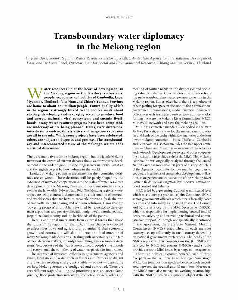
[ ]31
Transboundary water diplomacy in the Mekong region
Dr John Dore, Senior Regional Water Resources Sector Specialist, Australian Agency for International Development, Laos; and Dr Louis Lebel, Director, Unit for Social and Environmental Research, Chiang Mai University, Thailand
W ater resources lie at the heart of development in the Mekong region – the territory, ecosystems, people, economies and politics of Cambodia, Laos,
Myanmar, Thailand, Viet Nam and China’s Yunnan Province are home to about 260 million people. Future quality of life in the region is strongly linked to the choices made about sharing, developing and managing water to produce food and energy, maintain vital ecosystems and sustain liveli-hoods. Many water resource projects have been completed, are underway or are being planned. Dams, river diversions, inter-basin transfers, thirsty cities and irrigation expansion are all in the mix. While some projects have been celebrated, others are subject to disputes and protests. The transbound-ary and interconnected nature of the Mekong’s waters adds a critical dimension.
There are many rivers in the Mekong region, but the iconic Mekong River is at the centre of current debates about water resource devel-opment in the wider region. It is the longest river in South-East Asia and the eighth largest by flow volume in the world.
Leaders of Mekong countries are aware that their countries’ desti-nies are entwined. Those destinies will be partly shaped by the extension of increased cooperation into the realm of water resources development on the Mekong River and other transboundary rivers such as the Irrawaddy, Salween and Red. The Mekong region’s water-scapes are being contested, demonstrating a confrontation of interests and world views that are hard to reconcile despite a fresh rhetoric of trade-offs, benefit sharing and win-win solutions. Dams that are ‘powering progress’ and publicly justified by reference to develop-ment aspirations and poverty alleviation might well, simultaneously, jeopardize food security and the livelihoods of the poorest.
There is additional uncertainty from external forces that shape the future of the region. For example, climate change is expected to affect river flows and agricultural potential. Global economic growth and contraction will also influence the final outcome of many Mekong-made decisions. Dealing with uncertainty is the fate of most decision makers, not only those taking water resources deci-sions. Yet, because of the way it interconnects people’s livelihoods and ecosystems, the complexity of water has particular importance.
The interests of investors, officials in government agencies and small, local users of water such as fishers and farmers or distant city dwellers needing energy, are visible – or not – depending on how Mekong arenas are configured and controlled. There are very different ways of valuing and prioritizing uses and users. Some privilege flood protection and energy production services, others the
meeting of farmer needs in the dry season and secur-ing valuable fisheries. Governments at various levels are the main transboundary water governance actors in the Mekong region. But, as elsewhere, there is a plethora of others jostling for space in decision-making arenas: non-government organizations, media, business, financiers, policy research institutes, universities and networks. Among these are the Mekong River Commission (MRC), M-POWER network and Save the Mekong coalition.
MRC has a contested mandate – embodied in the 1995 Mekong River Agreement – for the mainstream, tributar-ies and lands of the basin within the territories of the four lower Mekong countries – Laos, Thailand, Cambodia and Viet Nam. It also now includes the two upper coun-tries – China and Myanmar – in some of its activities and outreach. Development partners and other cooperat-ing institutions also play a role in the MRC. This Mekong cooperation was originally catalysed through the United Nations and has more than 50 years of history. Article 1 of the Agreement commits the four member countries to cooperate in all fields of sustainable development, utiliza-tion, management and conservation of the Mekong River Basin in fields such as irrigation, hydropower, navigation, flood control and fisheries.
MRC is led by a governing Council at ministerial level which meets once per year, and a Joint Committee (JC) of senior government officials which meets formally twice per year and informally as the need arises. The Council and JC are serviced by the MRC Secretariat (MRCS), which is responsible for implementing council and JC decisions, advising and providing technical and admin-istrative support. Although not specifically mentioned in the agreement, there are also National Mekong Committees (NMCs) established in each member country, set up differently in each country depending on national government preferences. The heads of the NMCs represent their countries on the JC. NMCs are serviced by NMC Secretariats (NMCSs) and should provide access to MRC issues by a range of line agencies.
There is a political dynamic between each of these five parts – that is, there is no homogeneous single MRC. Any joint position needs to be collectively negoti-ated between the council and JC members. Moreover, the MRCS must also manage its working relationships with the NMCSs, which are quick to object if they feel
WATER DIPLOMACY

[ ]32
WATER DIPLOMACY
can help societies explore and adaptively reform water governance – rather than assuming that a single model fits all social and resource contexts.
From the outset, M-POWER made a deliberate choice to focus on the wider region, including several international and many domestic river basins, rather than to overly focus on the Mekong River Basin and thereby frame too much ‘in’ or ‘out’ of different political arenas. The first major public M-POWER cooperation was in November 2004 when network members convened, facilitated and provided catalytic knowledge inputs to a high-level roundtable on ‘Using Water, Caring for Environment: Challenges for the Mekong region’ at the World Conservation Congress in Bangkok. The event included ministers from five Mekong countries (all but Myanmar) as well as non-state actors. Sensitive issues were tabled for discussion – inter-basin water diversions into Thailand, Salween hydropower development in China’s Yunnan province, and threats to the Tonle Sap ecosystem that would be disastrous for Cambodia. At the time this was a significant achievement, specifically bringing China, Lower Mekong governments and non-state actors into the same arena. The event served to register the Salween hydropower, Thailand grid and Tonle Sap threats as transboundary issues of high impor-tance which deserved to be the subject of multi-country, multi-stakeholder deliberation.
Oppositional advocacy in (parts of) the Mekong region is well-developed. Local, national or transna-tional networks of activists that are organized to resist dominant institutions, interests and discourses can play a significant role in decision-making or decision-influ-encing processes. Under the slogan ‘Our River Feeds Millions’, the Save the Mekong coalition’s campaign is catalysed and galvanized by the resurgent interest in planned dams for the Lower Mekong mainstream. Campaign supporters argue that these dams pose extraordinary threats to local livelihoods, biodiver-sity and natural heritage as the flip-side to energy and income benefits. The campaign has successfully raised the profile of dam decision-making by Mekong govern-ments through the strategic use of photography, media, letter-writing and direct representation. For example, more than 23,000 signatures were attached to a peti-tion warning of the negative consequences of Lower Mekong mainstream dams, sent to the Prime Ministers of Cambodia, Laos, Thailand and Viet Nam on 19 October 2009. Due to strategic and persistent advocacy since 2009, word of the campaign has also reached distant parliaments in places such as the United States and Australia.
The Save the Mekong coalition has succeeded in heightening the understanding of risks to ecosystems and livelihoods, and is pressing governments – both in and outside the Mekong region – to take their responsi-bilities for project-affected people and nature seriously. A major achievement of the campaign has been to succeed, despite available science being inconclusive, in reframing the perceived dams threats from environ-mental protection to food security and the potential
left out of MRCS activities or perceive the MRCS to encroach on their national space. In turn, the NMCSs must also establish their own role and working space within their national polities, with their functional power much less than key water-related ministries and agencies in each country. As in any large family, it is not possible for all the interaction to be smooth. The vaunted ‘Mekong spirit’ of cooperation often seems optimistically overstated; but that is not to deny the importance of doing everything possible to encourage a constructive spirit between the countries sharing precious water resources, risks and opportunities.
The M-POWER network has been working since 2004 implement-ing a Mekong Program for Water Environment and Resilience. The vision for the network is for the region to realize an internation-ally accepted standard of democracy in water governance. A core objective is to make it normal practice for important national and transnational water-related options and decisions to be examined in the public sphere; another is to support the development of governance analysts with experience across the region. M-POWER takes a broad view of democratization, interpreted as encompass-ing issues of public participation and deliberation; separation of powers; accountability of public institutions; social and gender justice; protection of rights; representation; decentralization; and dissemination of information. Network members believe that action-research, facilitated dialogues and stronger knowledge networks
Organization of the Mekong River Commission
Government of Cambodia
Government of Lao PDR
Government of Thailand
Government of Viet Nam
Donor Consultative Group
Development partners and other
cooperating organizations
National MekongCommittees (NMCs)
NMC Secretariats
Line agencies
Dialogue Partners
MRC SecretariatTechnical and
administrative arm
Joint CommitteeMembers at Head
of Department level or higher
CouncilMembers at
Ministerial and Cabinet level
Government of China
Government of Myanmar
The organizational structure of the Mekong River Commission entails many
elements in a complex political dynamic
Source: Mekong River Commission

[ ]33
WATER DIPLOMACY
for economic disaster. This has contributed to greatly elevating the issues in the minds of regional and international policymakers.
Transboundary diplomacy is required and deliberation – debate and discussion aimed at producing reasonable, well-informed opin-ions – has been in short supply, despite decades of ‘cooperation’. Deliberation is an important process because it requires supporters of policies and projects to articulate their reasoning and identify which interests they serve or risks they create.
Decision support tools that support deliberation are increasingly being used to inform Mekong water-related diplomacy. These tools, used effectively, assist the exploration of options, examination of technical outputs and contestation of discourses. Tools that should be explicitly rooted in deliberation include multi-stakeholder plat-forms (MSPs), environmental flows (e-flows) and scenario-building.
MSPs can help routinize deliberation, enabling complex water issues to be more rigorously examined in better informed negotiations. This is not to say that MSPs are a panacea. For example, we have observed that MSPs can be captured by players who are able to frame and control the debate and keep it confined within the limits of their choice. We have also seen MSPs permitted to engage many stakeholders in good faith, only to be ignored in subsequent decision-making. Despite these caveats, we have found that networks and organizations with flexible and diverse links with governments, firms and civil society have been useful to convene and facilitate dialogues on sensitive but important topics for development in the Mekong region. The outcomes of these are not primarily in terms of direct decisions on projects, policies or institutional reform; but rather in making sure alternatives are consid-ered and assessed, a diversity of views and arguments recognized, and mutual understanding improved.
E-flow-setting requires the integration of a range of disciplines from across the social, political and natural sciences. Above all, it
requires processes of cooperative negotiation between various stakeholders that help bridge their different and often competing interests over water. Hence, e-flows are well-suited to MSP approaches. There have been few applications of e-flows in the Mekong region, but some with which the authors are very familiar include rapid e-flows assessments of the Huong River in Viet Nam and Songkhram River in Thailand, and an integrated basin flow management project of the Lower Mekong River. E-flow processes have substantial potential in the Mekong region to assist river basin managers as they grapple with competing demands, including the need for environmental sustainability. At present, however, the tool has only been used in academic or technical settings and has not yet been internalized into influential deci-sion-making arenas.
Deploying scenarios can enhance MSPs, e-flows and other deliberative forums. Scenarios should improve understanding of uncertainties, not hide them. The goal of formal scenario analysis is to generate contrasting stories of what the future of a geographical area, policy sector or organization might look like, depending on plausible combinations of known, but uncertain, social and envi-ronmental forces. The analyst and others participating in the process should gain insight into the contrast between alternative stories. Good scenarios are rigorous, self-reflex-ive narratives: they attempt to be internally coherent, to incorporate uncertainties and to be explicit about assump-tions and causality.
We observe that core decision-making processes about water in the Mekong region are still often opaque
A Mekong river fisherman at sunset in Vientiane, Lao People’s Democratic Republic
Imag
e: K
G H
ortle

[ ]34
WATER DIPLOMACY
• multi-stakeholder platforms exploring alternative futures are used to build the trust and cooperation needed for actors to work together to help resolve water allocation issues
• e-flow assessments are used to clarify risks and benefits of different flow regimes on different water users and ecosystems
• scenario building, with the participation of marginalized people’s representatives, is used to improve transparency by clarifying and probing actors’ assumptions and motivations
• strategic environmental assessment is used to explore the broad impacts of existing, proposed and alternative development policies and plans early on
• holistic modelling is used to quantitatively assess impacts of scenarios and development policies and to generate base information for impact assessments
• oppositional advocacy pressure is maintained to ensure that political space is available for civil society and concerned actors to safely contest and contribute to policies, proposals.
Transboundary water diplomacy is not only the province of state actors. Across the Mekong region, there is much diplomacy underway with multiple actors manoeuvring to try and shape development directions and decisions. This is increasing the likelihood that decisions will be the result of informed and negotiated processes that have assessed options and impacts, respected rights, accounted for risks, acknowledged responsibilities and sought to fairly distrib-ute rewards – the essence of deliberative water governance.
Imag
e: K
G H
ortle
to all but privileged insiders. Meaningful public deliberation is still the exception rather than the rule. Nevertheless, more recently, we have seen a deliberative turn and hopeful signs of water governance change, for example:• vibrant elements in the Chinese media interested in
understanding and reporting the water-related perspectives of neighbouring countries
• a pause and reconsideration of future development in a new era for Myanmar
• an increasingly inquisitive National Assembly in Laos• bold inputs to public policy-making debates by
Vietnamese scientists• increased space for civil society analysts in Cambodia to engage
in state irrigation policy debates• people’s environmental impact assessment in Thailand, building
on villager-led Tai Baan participatory action research and resulting in more participatory analyses of project merits.
Finally, Lower Mekong mainstream dams are now being exam-ined more openly. This is a result of many factors, including an MRC-commissioned strategic environmental assessment and a subsequent formal prior-consultation process facilitated by MRC, which has yielded various technical contributions and opened an intergovernmental window for more informed discussions between Lower Mekong countries. Each of these processes has been improved by advocacy from civil society, science, academia and governments –including MRC, M-POWER and Save the Mekong.
In the Mekong we have found that water diplomacy is improved by bringing different perspectives into arenas and fostering delibera-tion to inform and shape negotiations and decisions. Specifically, we suggest that transboundary diplomacy will be further improved when:
Bangkok, Thailand, the mega-city destination for much of the proposed hydropower energy production in the Lower Mekong

[ ]35
The Nile Basin Initiative: advancing transboundary cooperation and supporting riparian communities
Abdulkarim H. Seid, Wubalem Fekade, Emmanuel Olet, Nile Basin Initiative
T raversing a distance of 35 degrees latitude from the equa-torial region of Africa in the south to the Mediterranean Sea in the north, the Nile is one of the world’s longest
rivers. It is shared by 11 African countries and is a source of livelihood for over 200 million people. The Nile drains an area of 3.2 million square kilometres – about 10 per cent of Africa.
The Nile Basin Initiative (NBI) 2012 State of the Nile River Basin report subdivides the basin into 16 eco-regions. These feature large rivers, waterfalls, lakes, wetlands, floodplains, forests, savannahs, montane ecosystems, and arid and hyper-arid lands. One of the world’s largest freshwater wetlands, the Sudd, and the world’s second largest inland lake, Lake Victoria, are prominent features of the basin.
The Nile Basin hosts some of the world’s largest congre-gations of large mammals and flocks of migratory birds from Eurasia and other regions of Africa.
The Nile Basin is a relatively water-scarce region. The average annual flow at its entrance to Egypt is about 2,660 m3/s – about 6 per cent that of the Congo River at Inga. Most of the stream flow is generated from less than a third of the basin. The basin is prone to seasonal and inter-annual variability. Water resources develop-ment is needed at the upstream part (comprising seven of the 11 riparian countries) where nearly all river flow is generated is at its infancy. The downstream part (comprising two riparian countries), is almost entirely dependent on upstream flow and has relatively better developed water infrastructure and institutions.
The Nile Basin has hosted some of the oldest civiliza-tions of mankind. That notwithstanding, currently the Nile River and its associated ecosystems – the resource bases – are facing a number of threats. In the upper reaches the watersheds are undergoing continued and accelerating degradation. From the Ethiopian catchments alone where over 86 per cent of the river flow originates,
WATER DIPLOMACY
The Nile Basin eco-regions
Source: NBI State of the Basin report, 2012
Tana-Beles integrated watershed management project – Ethiopia
The Eastern Nile watershed management project has built a regional knowledge base which has been used to prepare fast-track projects worth about US$80 million.
One of these projects, in the upper Blue Nile in Ethiopia, has scored impressive results in natural resources management, improving the livelihoods of the local community, and capacity development.
Examples include the preparation and implementation of 163 community watershed plans; treatment of 821 ha of gully; rehabilitation of 16,000 ha of degraded hillside; development of 4,000 ha of community woodlot forestry; and 1,000 ha of small-scale irrigation in 14 schemes. In addition, 85 km of community access roads and a number of footbridges were constructed to improve market access; and 35 farmer training centres were established – with about 700 farmers trained on improved cereal, fruit tree cropping, vegetable gardening and marketing. The project also established 13 animal health posts; supplied 735 modern beehives and 163 pieces of apiculture equipment; and established 432 community water points and three village water schemes. The project is among the NBI achievements showcased during the 2013 Nile Day celebrations.

[ ]36
WATER DIPLOMACY
for clean hydropower development and power trade; for expanding agricultural production and increasing water use efficiency; for the preservation and ecotourism use of biospheres and designated hotspots of unique biologi-cal diversity; for utilizing the Nile as an entry point for broader economic-regional integration, promotion of regional peace and security; and not least for jointly ensuring the continued existence of the Nile through prudent and judicious utilization.
The Nile Basin InitiativeGrowing recognition of the above challenges, and the real-ization of the potential inter-riparian conflict that would ensue from poorly managed, increasingly shrinking and scarce Nile water resources, spurred the member coun-tries to formulate a shared vision1 and establish NBI in February 1999, with significant support from the inter-national community. NBI is headquartered in Entebbe, Uganda with two subsidiary action programme offices in Addis Ababa, Ethiopia and Kigali, Rwanda. NBI has three core functions, namely facilitating cooperation, water resources development and water resources management. NBI fills an important gap that has been a barrier to the joint and sustainable management of the common Nile Basin resources. It is a transitional mechanism that will phase out when the Nile River Commission is established.
NBI has had several key achievements in its three core functions, along with various challenges and lessons in transboundary cooperation.
Facilitating cooperationNBI has provided the first and only inclusive platform for dialogue among all riparian states. Given the earlier history of non-cooperation characteristic of the Nile Basin, creating an enabling environment was made a priority. This included building transboundary insti-tutions and raising awareness; building inter-riparian
for example, 157-207 million tons of topsoil is washed away annu-ally, resulting in economic loss upstream and downstream. In the midstream, important wetlands – critical in regulating the hydro-logical balance and river flow, hosting endangered flora and fauna, and providing environmental services to local communities – are shrinking. In the most downstream reaches in the delta, salt water intrusion into the Nile is posing growing challenges.
Across the entire Nile Basin, biodiversity hotspots and unique habi-tats are increasingly disappearing.Both due to sheer demographic pressure and demand driven by economic growth, the stress on the finite and fragile water resources of the Nile is likely to grow to unmanageable proportions. The problem is compounded by the fact that each riparian country plans and implements its national water resources development plan on the Nile in unilateral fashion. Limited understanding of the science of the river; institutional insufficiency at national and transboundary levels; and inadequate understanding of the impact of climate change on the Nile – all these add complexity to the management of the common resources of the Nile.
The Nile Basin has been characterized by a preponderance of intra and inter-country conflicts and political instabilities. Conflicts and civil strife related to electoral politics have been common features. The intensity and costliness of the conflicts has been aggravated by direct or proxy support of combatants across borders.
Alongside these challenges, the Nile Basin offers significant poten-tial for a win-win outcome from cooperative management and development. Among others, the basin harbours noteworthy potential
Flyways of selected birds dependent on the Nile Basin for a stop-over or over-wintering
Source: NBI State of the Basin report, 2012
Community watershed management project – Sudan
The Dinder and Lower Atbara watersheds are the focus areas of this fast-track watershed management project. The former, in the Blue Nile, is also home to the Dinder National Park – a designated biosphere. Pastoralists often encroach into the park on their way to find grazing land and watering points, which creates conflicts.
This project has scored remarkable achievements in a short period. Over 27,000 ha of degraded agricultural land has been rehabilitated; farm yield for dominant crops has shown significant improvement, with sorghum yield increasing from a baseline 519 kg/ha to 1,249 kg/ha in Dinder and from 1,249 kg/ha to 3,391kg/ha in Atbara. Similarly, sesame yield has increased from 202 kg/ha to 336 kg/ha in Dinder and white bean yield has increased from 887 kg/ha to 2,480 kg/ha in Lower Atbara. Over 300 km of livestock routes have been mapped, demarcated and opened for pastoralists, which will relieve en route conflicts. Over 5,010 ha of rangeland has been reseeded with nutritious and soil rehabilitating varieties of fodder. Fodder production has been initiated in 24 villages.
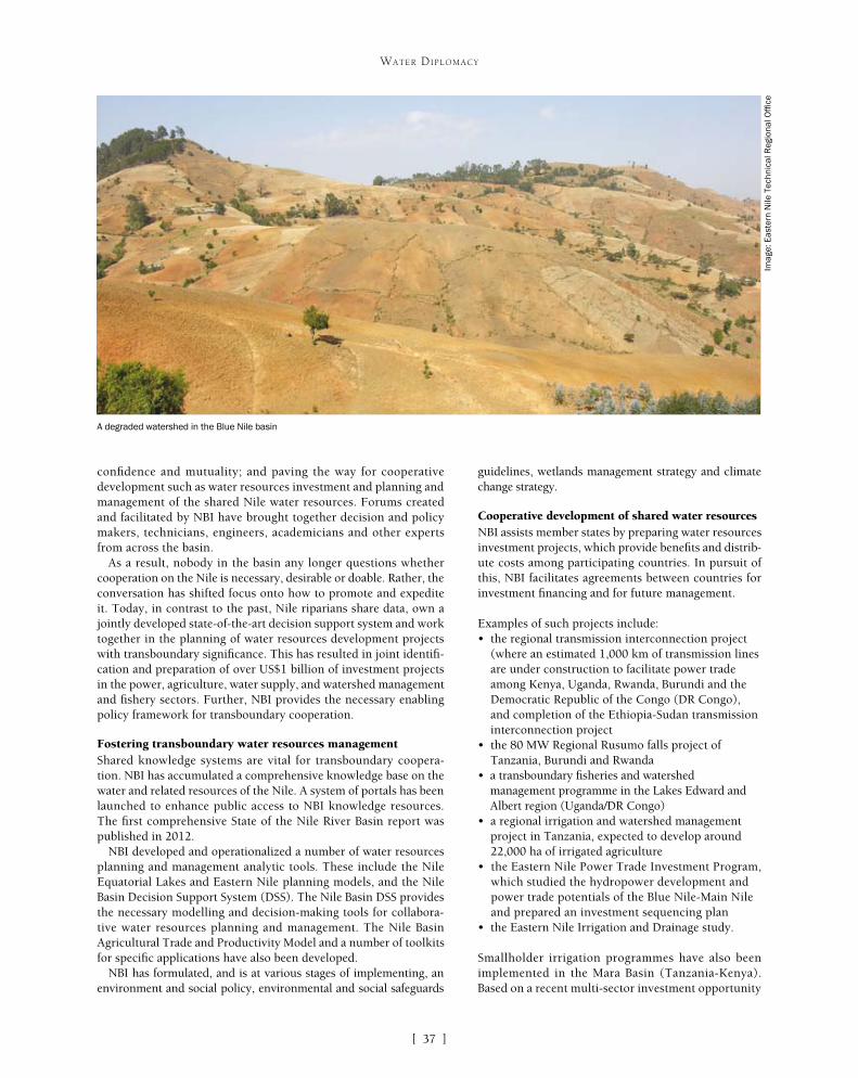
[ ]37
WATER DIPLOMACY
confidence and mutuality; and paving the way for cooperative development such as water resources investment and planning and management of the shared Nile water resources. Forums created and facilitated by NBI have brought together decision and policy makers, technicians, engineers, academicians and other experts from across the basin.
As a result, nobody in the basin any longer questions whether cooperation on the Nile is necessary, desirable or doable. Rather, the conversation has shifted focus onto how to promote and expedite it. Today, in contrast to the past, Nile riparians share data, own a jointly developed state-of-the-art decision support system and work together in the planning of water resources development projects with transboundary significance. This has resulted in joint identifi-cation and preparation of over US$1 billion of investment projects in the power, agriculture, water supply, and watershed management and fishery sectors. Further, NBI provides the necessary enabling policy framework for transboundary cooperation.
Fostering transboundary water resources managementShared knowledge systems are vital for transboundary coopera-tion. NBI has accumulated a comprehensive knowledge base on the water and related resources of the Nile. A system of portals has been launched to enhance public access to NBI knowledge resources. The first comprehensive State of the Nile River Basin report was published in 2012.
NBI developed and operationalized a number of water resources planning and management analytic tools. These include the Nile Equatorial Lakes and Eastern Nile planning models, and the Nile Basin Decision Support System (DSS). The Nile Basin DSS provides the necessary modelling and decision-making tools for collabora-tive water resources planning and management. The Nile Basin Agricultural Trade and Productivity Model and a number of toolkits for specific applications have also been developed.
NBI has formulated, and is at various stages of implementing, an environment and social policy, environmental and social safeguards
guidelines, wetlands management strategy and climate change strategy.
Cooperative development of shared water resourcesNBI assists member states by preparing water resources investment projects, which provide benefits and distrib-ute costs among participating countries. In pursuit of this, NBI facilitates agreements between countries for investment financing and for future management.
Examples of such projects include:• the regional transmission interconnection project
(where an estimated 1,000 km of transmission lines are under construction to facilitate power trade among Kenya, Uganda, Rwanda, Burundi and the Democratic Republic of the Congo (DR Congo), and completion of the Ethiopia-Sudan transmission interconnection project
• the 80 MW Regional Rusumo falls project of Tanzania, Burundi and Rwanda
• a transboundary fisheries and watershed management programme in the Lakes Edward and Albert region (Uganda/DR Congo)
• a regional irrigation and watershed management project in Tanzania, expected to develop around 22,000 ha of irrigated agriculture
• the Eastern Nile Power Trade Investment Program, which studied the hydropower development and power trade potentials of the Blue Nile-Main Nile and prepared an investment sequencing plan
• the Eastern Nile Irrigation and Drainage study.
Smallholder irrigation programmes have also been implemented in the Mara Basin (Tanzania-Kenya). Based on a recent multi-sector investment opportunity
A degraded watershed in the Blue Nile basin
Imag
e: E
aste
rn N
ile T
echn
ical
Reg
iona
l Offi
ce

[ ]38
WATER DIPLOMACY
building confidence, scientific knowledge, tools and sustainable institutions.
NBI has spearheaded the preparation of a number of water resources investment programmes that addressed growing energy and food production needs, promoted community-managed programmes, raised awareness among riparian countries and provided the necessary policy framework for sustainable transboundary water resources management.
The Nile riparians have negotiated their Cooperative Framework Agreement (CFA), for which ratification has recently started. It is expected that the riparian states will form the Nile Basin River Commission and advance their cooperation. Three of the NBI countries have not yet signed the CFA and, as a result, there is a potential challenge in finding a common platform for signatory and non-signatory states.
Most of the NBI programmes to date are financed through grants from the international community. With the planned closure of the Nile Basin Trust Fund in 2014, there is an urgent need for mobilizing funding to maintain the momentum and sustain the gains made. Diverse funding mechanisms such as grants, loans, public-private partnerships and riparian contributions need to be explored.
International practice shows that transboundary coop-eration is a protracted process. In the context of the Nile Basin, where the majority of upstream countries have embarked on rapid economic growth, delays in imple-menting water resources investments mean delays in meeting the demands of growing economies and popu-lations. This, in turn, can lead to an increasing number of major water resources investment projects, such as dams and power plants, planned and implemented unilaterally by individual riparian states. There is an urgent need to expedite the implementation of investment programmes prepared by NBI through participation of the riparian states, which will contribute to coordinated management and ultimately to the sustainability of the Nile itself.
Judging by experience worldwide, the all-inclusive Nile cooperation is still in its nascent stage. That is to say, the gains made so far should not be taken as irreversible. There is a need, therefore, for continued nurturing and deepening the cooperation process in order to consolidate the achievements of the Nile’s basin-wide cooperation.
analysis, these efforts are expected to be scaled up across the Nile Equatorial Lakes region, through promotion of an additional 6,000 MW of hydropower generation, linkages to the South African Power Pool through interconnectors, and promotion of an esti-mated development of 510,000 ha of irrigated agriculture by 2035.
Watershed managementNBI has been implementing a number of watershed management projects through its subsidiary action programmes. The projects involve local communities from inception to implementation. Key intervention areas include the improvement and diversification of productivity in rain-fed farming and the reversal of watershed degra-dation. Integrated watershed management has resulted in reduced loss of topsoil and increased crop yields at the farm level, while better water quality, reduced silt load and an improved hydrologi-cal regime will be witnessed at micro and macro catchment levels further downstream.
Watershed management programmes have also been prepared in the transboundary river basin management programmes of Mara, Kagera and Sio-Malaba-Malakisi, focusing on soil and land manage-ment, soil and water conservation, and the management of wetlands of transboundary significance. Investment programmes have also been prepared to restore the degraded Mau forest, a key catchment for the Mara River. Early implementation of livelihood-based water-shed management programmes in the Blue Nile basin in Ethiopia, Sudan and Egypt has registered impressive results.
Expanding access to potable waterA number of projects contributed towards the promotion of sustain-able and affordable access to safe water supply, sanitation and waste management services for communities. Schemes designed and constructed include Butihinda (Burundi), Nyagatare (Rwanda), Katuna (Uganda), Bomet and Angurai (Kenya), Mella (Uganda) and Karagwe (Burundi). The total population served by these water supply systems is estimated at 100,000.
Fostering sustainable water resources managementA number of Nile Basin environmental assets are transboundary or have transboundary significance and require cross-border coop-eration for their management and sustainable use. NBI has been providing this regional forum for member states, and has taken a number of measures to address the threats posed to these assets.
The measures range from high-level policy formulation to community-level awareness raising and the implementation of community-managed environmental restoration projects. The NBI Environment and Social Policy and Wetland Strategy have been endorsed by the Nile Council of Ministers. These documents will guide transboundary water resource development and management, including investment planning and implementation.
As part of the environmental education activities, for example, NBI promoted a Student Awards Competition through the public media that contributed to raising awareness on the most critical Nile envi-ronmental issues. Thousands of students in over 60 schools from all member countries took part in the national and regional competition.
Sustaining gains and addressing emerging challengesNBI has made considerable gains over the past decade. The most important achievements to be singled out are the promo-tion of riparian cooperation and mutuality over the Nile through
Lake Nasser-Nubia management project – Egypt
This transboundary project straddles Egypt and Sudan. The project objective is to develop a Lake Nasser-Nubia management framework and to establish a sediment and water quality monitoring system. The cumulative impacts of improved watershed management upstream, both in Ethiopia and Sudan, will be reflected in reduced sediment load on Lake Nasser-Nubia. The project has been conducting a biannual bathymetric survey of the lake to determine sediment levels, and has established a data and information management system.

IITransboundary
Water Management
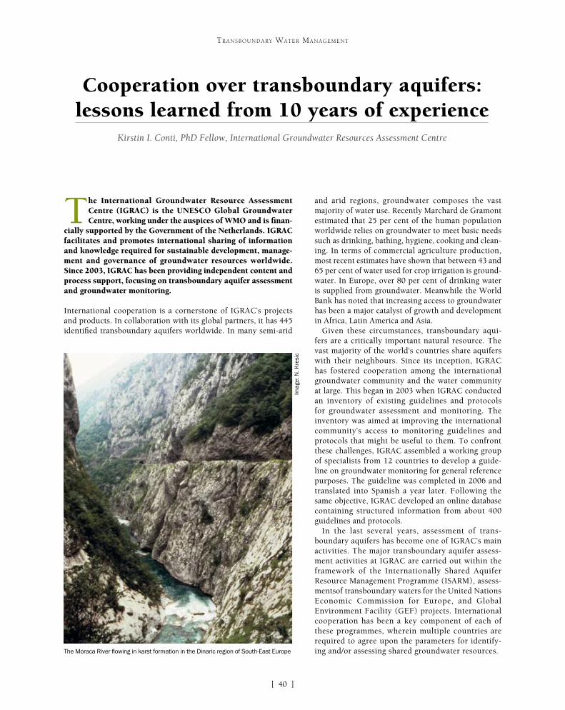
[ ]40
Cooperation over transboundary aquifers: lessons learned from 10 years of experience
Kirstin I. Conti, PhD Fellow, International Groundwater Resources Assessment Centre
The International Groundwater Resource Assessment Centre (IGRAC) is the UNESCO Global Groundwater Centre, working under the auspices of WMO and is finan-
cially supported by the Government of the Netherlands. IGRAC facilitates and promotes international sharing of information and knowledge required for sustainable development, manage-ment and governance of groundwater resources worldwide. Since 2003, IGRAC has been providing independent content and process support, focusing on transboundary aquifer assessment and groundwater monitoring.
International cooperation is a cornerstone of IGRAC’s projects and products. In collaboration with its global partners, it has 445 identified transboundary aquifers worldwide. In many semi-arid
and arid regions, groundwater composes the vast majority of water use. Recently Marchard de Gramont estimated that 25 per cent of the human population worldwide relies on groundwater to meet basic needs such as drinking, bathing, hygiene, cooking and clean-ing. In terms of commercial agriculture production, most recent estimates have shown that between 43 and 65 per cent of water used for crop irrigation is ground-water. In Europe, over 80 per cent of drinking water is supplied from groundwater. Meanwhile the World Bank has noted that increasing access to groundwater has been a major catalyst of growth and development in Africa, Latin America and Asia.
Given these circumstances, transboundary aqui-fers are a critically important natural resource. The vast majority of the world’s countries share aquifers with their neighbours. Since its inception, IGRAC has fostered cooperation among the international groundwater community and the water community at large. This began in 2003 when IGRAC conducted an inventory of existing guidelines and protocols for groundwater assessment and monitoring. The inventory was aimed at improving the international community’s access to monitoring guidelines and protocols that might be useful to them. To confront these challenges, IGRAC assembled a working group of specialists from 12 countries to develop a guide-line on groundwater monitoring for general reference purposes. The guideline was completed in 2006 and translated into Spanish a year later. Following the same objective, IGRAC developed an online database containing structured information from about 400 guidelines and protocols.
In the last several years, assessment of trans-boundary aquifers has become one of IGRAC’s main activities. The major transboundary aquifer assess-ment activities at IGRAC are carried out within the framework of the Internationally Shared Aquifer Resource Management Programme (ISARM), assess-mentsof transboundary waters for the United Nations Economic Commission for Europe, and Global Environment Facility (GEF) projects. International cooperation has been a key component of each of these programmes, wherein multiple countries are required to agree upon the parameters for identify-ing and/or assessing shared groundwater resources.
TRANSBOUNDARY WATER MANAGEMENT
The Moraca River flowing in karst formation in the Dinaric region of South-East Europe
Imag
e: N
. Kre
sic
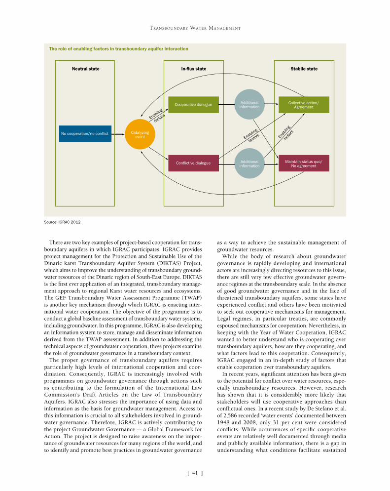
[ ]41
TRANSBOUNDARY WATER MANAGEMENT
as a way to achieve the sustainable management of groundwater resources.
While the body of research about groundwater governance is rapidly developing and international actors are increasingly directing resources to this issue, there are still very few effective groundwater govern-ance regimes at the transboundary scale. In the absence of good groundwater governance and in the face of threatened transboundary aquifers, some states have experienced conflict and others have been motivated to seek out cooperative mechanisms for management. Legal regimes, in particular treaties, are commonly espoused mechanisms for cooperation. Nevertheless, in keeping with the Year of Water Cooperation, IGRAC wanted to better understand who is cooperating over transboundary aquifers, how are they cooperating, and what factors lead to this cooperation. Consequently, IGRAC engaged in an in-depth study of factors that enable cooperation over transboundary aquifers.
In recent years, significant attention has been given to the potential for conflict over water resources, espe-cially transboundary resources. However, research has shown that it is considerably more likely that stakeholders will use cooperative approaches than conflictual ones. In a recent study by De Stefano et al. of 2,586 recorded ‘water events’ documented between 1948 and 2008, only 31 per cent were considered conflicts. While occurrences of specific cooperative events are relatively well documented through media and publicly available information, there is a gap in understanding what conditions facilitate sustained
There are two key examples of project-based cooperation for trans-boundary aquifers in which IGRAC participates. IGRAC provides project management for the Protection and Sustainable Use of the Dinaric karst Transboundary Aquifer System (DIKTAS) Project, which aims to improve the understanding of transboundary ground-water resources of the Dinaric region of South-East Europe. DIKTAS is the first ever application of an integrated, transboundary manage-ment approach to regional Karst water resources and ecosystems. The GEF Transboundary Water Assessment Programme (TWAP) is another key mechanism through which IGRAC is enacting inter-national water cooperation. The objective of the programme is to conduct a global baseline assessment of transboundary water systems, including groundwater. In this programme, IGRAC is also developing an information system to store, manage and disseminate information derived from the TWAP assessment. In addition to addressing the technical aspects of groundwater cooperation, these projects examine the role of groundwater governance in a transboundary context.
The proper governance of transboundary aquifers requires particularly high levels of international cooperation and coor-dination. Consequently, IGRAC is increasingly involved with programmes on groundwater governance through actions such as contributing to the formulation of the International Law Commission’s Draft Articles on the Law of Transboundary Aquifers. IGRAC also stresses the importance of using data and information as the basis for groundwater management. Access to this information is crucial to all stakeholders involved in ground-water governance. Therefore, IGRAC is actively contributing to the project Groundwater Governance – a Global Framework for Action. The project is designed to raise awareness on the impor-tance of groundwater resources for many regions of the world, and to identify and promote best practices in groundwater governance
No cooperation/no conflict
Neutral state In-flux state Stabile state
Catalyzingevent
Cooperative dialogue
Conflictive dialogue
Collective action/Agreement
Maintain status quo/No agreement
Additionalinformation
Additionalinformation
Enabling
factors
Enabling
factors Enab
ling
fact
ors
The role of enabling factors in transboundary aquifer interaction
Source: IGRAC 2012

[ ]42
TRANSBOUNDARY WATER MANAGEMENT
cooperation over water resources. This gap is even more evident when it comes to transboundary aquifers, since researchers and practitioners have given them less attention than their surface water counterparts.
The focus of current research on water conflict is about meth-odologies and best practices for dismantling existing water conflict. However, given that transboundary aquifers remain mostly ungoverned and conflict over groundwater has rarely risen to the international scale (as of yet), we at IGRAC wondered if this is the most useful paradigm. In light of this, we ques-tioned whether managing potential conflict is the appropriate goal for transboundary groundwater resources. Therefore, the focus of IGRAC’s research was on enabling cooperation since
most aquifer states (states sharing a transboundary aquifer) are not yet engaging about transboundary aquifers. Given the critical importance of groundwa-ter resources worldwide, the report presents a global analysis of factors that enable and facilitate coopera-tion over transboundary aquifers – that is, enabling factors for transboundary water cooperation.
It is critical to provide a definition for the term ‘enabling factor’ and to distinguish it from a ‘driver’ of cooperation. Much attention has been devoted to assessing drivers of cooperation. However, the intent of this report was to assess how these drivers manifest as concrete actions or ‘factors’. A driver
No. Aquifer [Group/System] Name Aquifer States
1 Abbotsford-Sumas Aquifer Canada, United States
2 Bolsón del Hueco-Valle de Juárez Mexico, United States
3 Carboniferous Aquifer Belgium, France
4 Châteauguay Aquifer Canada, United States
5 Aquifers of the Danube River Basin
Austria, Bosnia & Herzegovina, Bulgaria, Croatia, Czech Republic,
Germany, Hungary, Moldova, Montenegro, Romania, Serbia, Slovakia,
Slovenia, Ukraine
6 Dinaric Karst Transboundary System Albania, Bosnia & Herzegovina, Croatia, Italy, Greece, Montenegro,
Slovenia
7 Franco-Swiss Genevois Aquifer France, Switzerland
8 Guaraní Aquifer System Argentina, Brazil, Paraguay, Uruguay
9 Aquifers of Hispaniola Island Dominican Republic, Haiti
10 Kilimanjaro Aquifer Kenya, Tanzania
11 Lake Chad Aquifer System Cameroon, Chad, Central African Republic, Niger, Nigeria
12 Aquifers of the Mekong River Plain Cambodia, Laos, Thailand, Vietnam
13 Northwest Sahara Aquifer System Algeria, Libya, Tunisia
14 Nubian Sandstone Aquifer System Chad, Egypt, Libya, Sudan
15 Aquifers of the Orange-Senqu River Basin Botswana, Namibia, South Africa
16 Poplar Aquifer Canada, United States
17 Aquifers of the Sahel Region Algeria, Benin, Mali, Niger, Nigeria, Mauritania
18 Aquifers of the Sava River Basin Croatia, Slovenia, Bosnia & Herzegovina
19 Upper Rhine Aquifer France, Germany, Switzerland
Map of transboundary aquifer cooperation cases
Source: IGRAC 2012
Aquifer [Group/System] Name Aquifer States
Abbotsford-Sumas Aquifer Canada, United States
Bolsón del Hueco-Valle de Juárez Mexico, United States
f transboundary aquifer cooperation cases

[ ]43
TRANSBOUNDARY WATER MANAGEMENT
provides impulse or motivation and causes a particular phenom-enon to happen or develop. A factor is a circumstance, fact or influence that actively contributes to the production of a result. Therefore, in the context of cooperation, an enabling factor is a circumstance, fact or influence that actively contributes to the occurrence of a cooperative event or cooperative interactions. Distinguishing the terms in this manner makes clear that much attention has gone to analysing and/or hypothesising about various drivers such as power asymmetries, benefit sharing and costs of non-cooperation. Yet very few researchers have moved towards concretizing elements leading to cooperative action by characterizing them as factors, as defined here. Therefore, we asked, what are the enabling factors or the ‘ingredients’ in a recipe for cooperation?
A multi-step analysis was conducted to identify the enabling factors for transboundary aquifer cooperation. There were 19 cases used to identify the enabling factors. The objective of the case analysis was to provide as complete a picture as possible
of the circumstances that lead countries to cooper-ate over international aquifers. It was determined that a bottom-up approach was necessary given that enabling factors are most often characterized by concrete, on-the-ground actions. Therefore, each case was assembled and the conditions that spurred cooperation were assessed.
Analysis of the cases shows that cooperation occurs across a wide range of hydrogeological, geographi-cal, socioeconomic and political contexts. There are instances of cooperation over all types of aquifers including unconfined, confined, confined fossil and semi-confined, as well as two in karst formations. The aquifers vary greatly in terms of geologic extent with the smallest covering 19 km2 and the largest covering 2,199,000 km2. Hydrogeological conditions also vary greatly. In some instances, the aquifers face emergent challenges of severe contamination or over-exploita-
Enabling factor (number of aquifers where present)
Existing legal mechanisms (10)
Existing regional institutions (16)
Funding mechanisms (12)
High institutional capacity (8)
Previous water cooperation (15)
Scientific research (7)
Strong political will (8)
Third-party involvement (8)
Description
Includes both binding and non-binding legal mechanisms, which place specific obligations on aquifer states.
Involves an institution charged with promoting cooperation and coordination on issues of regional importance. Institution demonstrates some specific focus on groundwater.
Either the aquifer states or a third party provided the funding for a joint project or institution.
Organizations with the aquifer demonstrate the ability to deal with groundwater governance issues related to monitoring, modelling and/or management.
Involves past interactions regarding water resources between at least two of the aquifer states.
Research is conducted specifically for the assessment of transboundary impacts. Research provides significant new information to the aquifer states.
High-ranking government official(s) indicated the prioritization of groundwater management in the aquifer.
There were significant contributions to cooperation from entities outside of the aquifer states’ governments.
Patterns of influence
• Highly influential in North America, Europe and Africa
• Plays a key role in cases of moderate cooperation
• Global geographic influence• Strong influence in medium-sized aquifers
(10,000-1,000,000 km2), where there are more than two aquifer states and in cases of low cooperation
• Global geographic influence • Strong influence in large-scale aquifers
(�1,000,000 km2 and more than five aquifer states)
• Noticeable influence on high cooperation events
• Strongest in Europe and North America • Not critical to promoting any specific level
of cooperation
• Critical in small-sized aquifers (�10,000 km2)• Significant influence on cases of low cooperation
• Influential in North and South America; also has some influence in Africa
• Noticeable influence on low cooperation
• No geographic trend • Influential in high cooperation cases
• Noticeable role in the Global South• Highly influential for medium-scale
transboundary aquifers (10,000-1,000,000 km2 and 3-5 aquifer states)
A summary of enabling factors for transboundary aquifer cooperation
Source: IGRAC 2012

[ ]44
TRANSBOUNDARY WATER MANAGEMENT
were highly contextual and other critical dynamics were at play. Unfortunately these dynamics could not be adequately captured within the constraints of this study. Therefore, it is recommended that future research should further develop and refine the enabling factors; more closely examine the circumstances under which high levels of cooperation are born; and move towards generating actionable recommendations for parties seeking to intensify cooperation on trans-boundary aquifers.
As such, we recommend that the following actions are considered for enhancing transboundary aquifer cooperation. Aquifer states should enhance and strengthen existing legal mechanisms, prior to or at the same time as creating new mechanisms for trans-boundary aquifer management. Existing regional institutions, in which a high level of cooperation already exists, should be leveraged and motivated to address issues of groundwater management. Financing mechanisms should be integrated into cooperative efforts in order to fund activities in large-scale transboundary aquifers. Organizations should strengthen their institutional capacity for groundwater management through education and partnerships. Recognizing and capitalizing on previous water cooperation in organizations such as existing river basin organizations and interna-tional task forces for groundwater management can also catalyse transboundary aquifer cooperation. Additionally, extending scientific and technical efforts to groundwater resources research will serve as a basis for transboundary dialogue and manage-ment. Those seeking to elevate cooperation to a high level should foster strong political will by enhanc-ing education and communication mechanisms for politicians and government officials regarding groundwater resources. Finally, third-party organiza-tions that have the appropriate mandate, capacity and financing to facilitate cooperation over transbound-ary resource management should dedicate some of their efforts towards taking action for transboundary aquifer management.
This research was hopefully the beginning of greater research efforts on transboundary aquifer cooperation. The primary purpose of this research was explora-tory. As a result, the outcomes are mainly descriptive. Hypotheses about causal links between any of the enabling factors and cooperation were avoided. Nevertheless, IGRAC’s mission and projects will contribute directly to enhanced transboundary aquifer cooperation through offering tools which strengthen institutional capacity for groundwater. Further, our online data portal, the Global Groundwater Monitoring Network and Global Groundwater Information System aim to increase knowledge of transboundary aquifers through the dissemination of scientific and techni-cal information. We also look forward to continuing cooperation with international partners dedicated to the management of the world’s groundwater.
tion; while in others, cooperation occurred prior to any negative transboundary conditions manifesting. Cooperation occurred among some of the world’s least developed countries and some of the world’s most developed countries. Further, the instances of cooperation occurred under various political conditions, from times of peace to times of violence.
In reviewing available literature regarding transboundary water cooperation and conflict, it became clear that characterizing a particular transboundary aquifer in a binary way – as being in a state of cooperation or conflict – would be overly simplistic. The reality for transboundary aquifers is that governing them often incites both cooperation and conflict between the relevant stake-holders. Therefore, IGRAC combined several existing conceptual models for identifying and assessing transboundary water conflict and cooperation. In combining these models, we were able to integrate information about specific cooperative events relevant to transboundary aquifers; a range of interactions (both coopera-tive and conflictive) which occurred before and/or after these events; and the broader relationship dynamics among each of the actors in the aquifer. Using this analytical approach, each transboundary aquifer was then classified as being in a state of low, moderate or high cooperation. Analysis of the cases showed that there were eight enabling factors for transboundary aquifer cooperation: existing legal mechanisms, existing regional institu-tions, funding mechanisms, high institutional capacity, previous water cooperation, scientific research, strong political will and third-party involvement.
Once these eight enabling factors were identified, we described in more detail the interplay between the enabling factors, specific cooperative events related to groundwater, analysis of interactions between aquifer states, and the overall nature of transboundary relations. Conclusions about these interplays were discussed with respect to low, moderate and high levels of cooperation. This comparison showed that in the five cases classified as low coopera-tion, existing regional institutions and previous water cooperation are the enabling factors with the greatest influence. Seven cases were identified as moderate cooperation cases. Analysis showed that moderate cooperation required at least four enabling factors to be present and was highly influenced by existing legal mechanisms, existing regional institutions and previous water cooperation. There were seven high cooperation cases in which there was no observed correlation between the number of enabling factors and a high level of cooperation. However, high cooperation cases were primarily enabled by existing regional institutions, funding mecha-nisms and strong political will. We also observed the critical role of existing regional institutions in all three types of cases.
Based on this analysis there are several noteworthy conclusions. Overall, the research indicated that the enabling factors present in cooperative cases do have some relationship with the level of cooperation. Low cooperation is often motivated by scientific research, especially when a (potential) problem with the aquifer is identified and the states decide to begin interacting about it. Moderate cooperation is mainly birthed and/or supported by exist-ing regional institutions. This implies that having a functional forum for cooperation in conjunction with the desire to cooper-ate can result in concrete cooperative actions for transboundary aquifer governance. However, it seems that achieving high coop-eration is relatively complex. There did not appear to be any one influence that was critical. Rather, scenarios of high cooperation
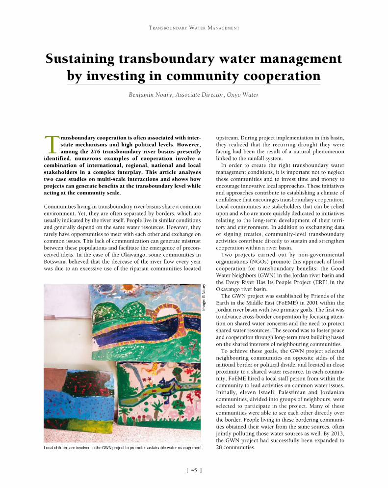
[ ]45
Sustaining transboundary water management by investing in community cooperation
Benjamin Noury, Associate Director, Oxyo Water
Transboundary cooperation is often associated with inter-state mechanisms and high political levels. However, among the 276 transboundary river basins presently
identified, numerous examples of cooperation involve a combination of international, regional, national and local stakeholders in a complex interplay. This article analyses two case studies on multi-scale interactions and shows how projects can generate benefits at the transboundary level while acting at the community scale.
Communities living in transboundary river basins share a common environment. Yet, they are often separated by borders, which are usually indicated by the river itself. People live in similar conditions and generally depend on the same water resources. However, they rarely have opportunities to meet with each other and exchange on common issues. This lack of communication can generate mistrust between these populations and facilitate the emergence of precon-ceived ideas. In the case of the Okavango, some communities in Botswana believed that the decrease of the river flow every year was due to an excessive use of the riparian communities located
upstream. During project implementation in this basin, they realized that the recurring drought they were facing had been the result of a natural phenomenon linked to the rainfall system.
In order to create the right transboundary water management conditions, it is important not to neglect these communities and to invest time and money to encourage innovative local approaches. These initiatives and approaches contribute to establishing a climate of confidence that encourages transboundary cooperation. Local communities are stakeholders that can be relied upon and who are more quickly dedicated to initiatives relating to the long-term development of their terri-tory and environment. In addition to exchanging data or signing treaties, community-level transboundary activities contribute directly to sustain and strengthen cooperation within a river basin.
Two projects carried out by non-governmental organizations (NGOs) promote this approach of local cooperation for transboundary benefits: the Good Water Neighbors (GWN) in the Jordan river basin and the Every River Has Its People Project (ERP) in the Okavango river basin.
The GWN project was established by Friends of the Earth in the Middle East (FoEME) in 2001 within the Jordan river basin with two primary goals. The first was to advance cross-border cooperation by focusing atten-tion on shared water concerns and the need to protect shared water resources. The second was to foster peace and cooperation through long-term trust building based on the shared interests of neighbouring communities.
To achieve these goals, the GWN project selected neighbouring communities on opposite sides of the national border or political divide, and located in close proximity to a shared water resource. In each commu-nity, FoEME hired a local staff person from within the community to lead activities on common water issues. Initially, eleven Israeli, Palestinian and Jordanian communities, divided into groups of neighbours, were selected to participate in the project. Many of these communities were able to see each other directly over the border. People living in these bordering communi-ties obtained their water from the same sources, often jointly polluting those water sources as well. By 2013, the GWN project had successfully been expanded to 28 communities.
TRANSBOUNDARY WATER MANAGEMENT
Local children are involved in the GWN project to promote sustainable water management
Imag
e: B
Nou
ry
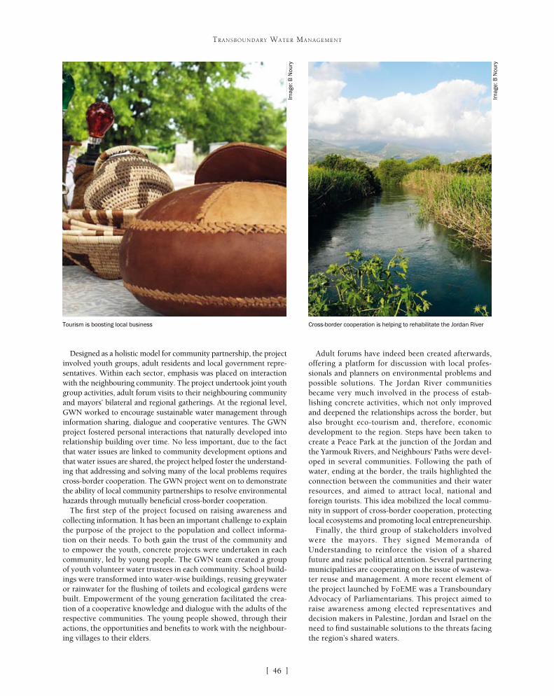
[ ]46
TRANSBOUNDARY WATER MANAGEMENT
Adult forums have indeed been created afterwards, offering a platform for discussion with local profes-sionals and planners on environmental problems and possible solutions. The Jordan River communities became very much involved in the process of estab-lishing concrete activities, which not only improved and deepened the relationships across the border, but also brought eco-tourism and, therefore, economic development to the region. Steps have been taken to create a Peace Park at the junction of the Jordan and the Yarmouk Rivers, and Neighbours‘ Paths were devel-oped in several communities. Following the path of water, ending at the border, the trails highlighted the connection between the communities and their water resources, and aimed to attract local, national and foreign tourists. This idea mobilized the local commu-nity in support of cross-border cooperation, protecting local ecosystems and promoting local entrepreneurship.
Finally, the third group of stakeholders involved were the mayors. They signed Memoranda of Understanding to reinforce the vision of a shared future and raise political attention. Several partnering municipalities are cooperating on the issue of wastewa-ter reuse and management. A more recent element of the project launched by FoEME was a Transboundary Advocacy of Parliamentarians. This project aimed to raise awareness among elected representatives and decision makers in Palestine, Jordan and Israel on the need to find sustainable solutions to the threats facing the region’s shared waters.
Designed as a holistic model for community partnership, the project involved youth groups, adult residents and local government repre-sentatives. Within each sector, emphasis was placed on interaction with the neighbouring community. The project undertook joint youth group activities, adult forum visits to their neighbouring community and mayors’ bilateral and regional gatherings. At the regional level, GWN worked to encourage sustainable water management through information sharing, dialogue and cooperative ventures. The GWN project fostered personal interactions that naturally developed into relationship building over time. No less important, due to the fact that water issues are linked to community development options and that water issues are shared, the project helped foster the understand-ing that addressing and solving many of the local problems requires cross-border cooperation. The GWN project went on to demonstrate the ability of local community partnerships to resolve environmental hazards through mutually beneficial cross-border cooperation.
The first step of the project focused on raising awareness and collecting information. It has been an important challenge to explain the purpose of the project to the population and collect informa-tion on their needs. To both gain the trust of the community and to empower the youth, concrete projects were undertaken in each community, led by young people. The GWN team created a group of youth volunteer water trustees in each community. School build-ings were transformed into water-wise buildings, reusing greywater or rainwater for the flushing of toilets and ecological gardens were built. Empowerment of the young generation facilitated the crea-tion of a cooperative knowledge and dialogue with the adults of the respective communities. The young people showed, through their actions, the opportunities and benefits to work with the neighbour-ing villages to their elders.
Tourism is boosting local business Cross-border cooperation is helping to rehabilitate the Jordan River
Imag
e: B
Nou
ry
Imag
e: B
Nou
ry

[ ]47
TRANSBOUNDARY WATER MANAGEMENT
As a key lesson, this GWN project outlines that raising awareness of the interdependence of environmental issues and the fact that solutions to environmental problems often concern neighbouring communities, will increase people’s willingness to cooperate.
In the Okavango River Basin, the ERP portrays a different model of transboundary cooperation while highlighting the importance of the involvement of local communities.
It is a regional project jointly coordinated by the Kalahari Conservation Society in Botswana, the Namibian Nature Foundation in Namibia and the Association for Environment Conservation and Integrated Rural Development in Angola. The project had two main phases and ran from 2000 to 2007. Its overall objective was to promote sustainable management of natural resources in the Okavango Basin and facilitate river basin stakeholders in decision-making processes concerning the basin.
The first phase focused on exchanging information, establishing links with relevant bodies, and promoting understanding between Okavango riparian communities and project staff. Through socio-ecological surveys, the project was introduced to communities and information about community-resource relationships was gathered. These interviews and focus groups carried out in the whole basin have been key in identifying the issues faced by the communities, determining the causes of these issues and suggest-ing possible solutions.
Based on this first assessment, the second phase of the project promoted the establishment of appropriate institutional mecha-nisms and capacity building for sustainable natural resource management in specific local communities. At the basin level, a Basin Wide Forum (BWF) was established. This is a consulta-tive forum of stakeholders coming from the communities living
along the Okavango River. In each riparian state, ten members are elected represented by one national representative. The BWF regional chairman partici-pates in the Okavango River Basin Water Commission (OKACOM) meetings with the commissioners. The BWF ensures dual flow of information by keeping both basin communities, including traditional leaders, as well as basin authorities, such as OKACOM, informed of each other’s opinions and initiatives. It ensures a common vision and understanding of the problems and challenges in the natural resources management of the Okavango River Basin.
At the local level, the ERP launched natural resources management activities and development projects within communities (campsites, trophy hunting, bird guiding, mokoro [canoe] trails, tradi-tional dances and so forth). Many of those activities were not directly linked to the water resources, but they generated income for the communities who subsequently took more interest in maintaining and managing their environment. For example, trophy hunting can earn up to USD20,000 for the community by allowing elephant hunting on its natural reserve. In order to respect hunting quotas, an agreement with the Ministry of Environment and Tourism was signed for each hunter by the Traditional Authority. The incomes generated by these activities are shared between all the members of the community.
These combined activities assist the ERP to achieve its development targets which fall broadly under the
Canoe trails along the Okavango River have been set up to generate local income
Imag
e: B
Nou
ry

[ ]48
TRANSBOUNDARY WATER MANAGEMENT
following categories: economic well-being; social and human develop-ment; education and training; and sustainable ecosystem and natural resources management.
These two initiatives demonstrate two different approaches to mobilizing local populations for transboundary water management. On one side, the GWN has favoured the twinning of communities, while on the other side the ERP has facilitated the emergence of a basin-wide network. These approaches have been designed firstly to match the characteristics and profiles of the territories where they have been implemented. In the political context of the Jordan basin, it is a challenge to organise regional meetings on a regular basis. The logistical and political constraints between Jordan, Israel and the Palestinian territories are the major obstacle to implementing such a mechanism in this basin.
NGOs played a key role in the achievement of these successful enterprises. They initiated the projects, supported and followed the communities by teaching them and showing them how to improve their environment, and facilitated the relations among and between the parties: communities, political authorities and international donors who funded these projects.
In both cases, the success of these initiatives has been built around three steps: identification of the population needs, capac-ity building and financial independence. Apart from the dedicated trainings and workshops, the participation of the communities in these projects was a capacity building programme by itself. Through the different activities implemented, the communities could develop their technical, administrative and negotiation knowledge and abilities. This allows them to play a more effective role in transboundary water interactions.
In both cases again, the NGOs looked for executing income-gener-ating activities to decrease communities’ dependence on external funding. Neighbours‘ Paths, trophy hunting or handicrafts have been
developed to provide a supplementary source of income to communities and to alleviate poverty in poor areas.
These community transboundary projects have enabled communities to: • Build a peaceful environment to manage
transboundary water resources• Improve water management at the local level with a
direct benefit for its inhabitants• Reduce poverty with participative practices and the
creation of new income generating activities• Strengthen relational and social learning among
communities from the different sides of the border• Develop communities’ knowledge and reflection on
their practices, their respective issues, their causes and their consequences.
Transboundary cooperation is not only a venue for high-level political players; local communities have a role to play as well. The participation processes applied in the Jordan and Okavango basins facilitated water cooperation, sustainability and poverty reduction. A community identity has arisen, not associated to a country, but to a river basin. An international NGO, the International Secretariat for Water, is promoting this ideal and has created a Blue Passport to reinforce citizenship awareness throughout river basins world-wide. All basiners can obtain their Blue Passport to affirm that they belong to a hydrographical ecosys-tem and to demonstrate their commitments for water in their river basin. In addition to being citizens of Namibia, Botswana or Angola, people can now claim their citizenship of the Okavango River Basin.
Ecological gardens have been built in local schools in the Jordan River Basin Water pump in Seronga, Botswana
Imag
e: B
Nou
ry
Imag
e: B
Nou
ry

[ ]49
Transboundary water management – why it is important and why it needs to be developed
Anders Jägerskog, Stockholm International Water Institute and United Nations Development Programme Shared Waters Partnership
In many aspects water is among the most ‘shared’ resources on Earth. Close to 50 per cent of the Earth’s land surface area is comprised of shared river and lake basins. Some
276 river basins cross the political boundaries of two or more countries, and about 40 per cent of the world’s population lives in river and lake basins that cross international borders.1 Globally, about 2 billion people depend on groundwater, which includes well over 300 transboundary aquifer systems. These facts represent the basic premise of the transboundary water management challenge facing the international community. Therefore, developing approaches that balance interdependen-cies of transboundary waters is a matter of high importance. The 2006 United Nations Development Programme (UNDP) Human Development Report2 acknowledges that “managing that inter-dependence is one of the great human development challenges
facing the international community.” Even so, about two thirds of the transboundary rivers do not have any cooperative management framework. It is clear that much remains to be done.
States that share transboundary waters are facing increasing demands for water, hydrologic variability, unilateral basin development and other conflicts that could contribute to tensions over transboundary water. Adding to these challenges, institutions for promot-ing joint management of shared water resources and managing differences are often missing. Where they do exist, they often remain ad-hoc, disparate and underfi-nanced. Among other challenges are a lack of common global platforms to advance joint management of
TRANSBOUNDARY WATER MANAGEMENT
A bridge in Croatia. Managing interdependencies of transboundary waters is one of the great human development challenges facing the international community
Imag
e: M
icha
el M
oore
, 20
06
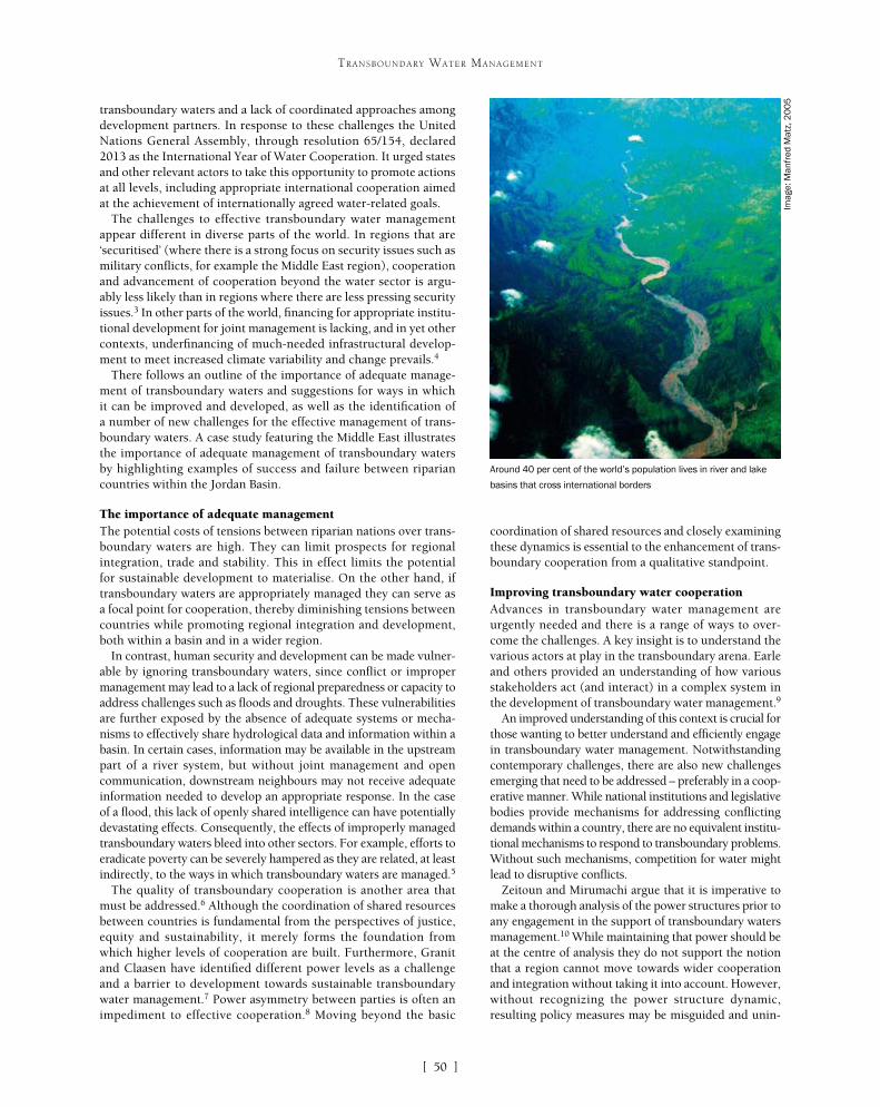
[ ]50
TRANSBOUNDARY WATER MANAGEMENT
coordination of shared resources and closely examining these dynamics is essential to the enhancement of trans-boundary cooperation from a qualitative standpoint.
Improving transboundary water cooperationAdvances in transboundary water management are urgently needed and there is a range of ways to over-come the challenges. A key insight is to understand the various actors at play in the transboundary arena. Earle and others provided an understanding of how various stakeholders act (and interact) in a complex system in the development of transboundary water management.9
An improved understanding of this context is crucial for those wanting to better understand and efficiently engage in transboundary water management. Notwithstanding contemporary challenges, there are also new challenges emerging that need to be addressed – preferably in a coop-erative manner. While national institutions and legislative bodies provide mechanisms for addressing conflicting demands within a country, there are no equivalent institu-tional mechanisms to respond to transboundary problems. Without such mechanisms, competition for water might lead to disruptive conflicts.
Zeitoun and Mirumachi argue that it is imperative to make a thorough analysis of the power structures prior to any engagement in the support of transboundary waters management.10 While maintaining that power should be at the centre of analysis they do not support the notion that a region cannot move towards wider cooperation and integration without taking it into account. However, without recognizing the power structure dynamic, resulting policy measures may be misguided and unin-
transboundary waters and a lack of coordinated approaches among development partners. In response to these challenges the United Nations General Assembly, through resolution 65/154, declared 2013 as the International Year of Water Cooperation. It urged states and other relevant actors to take this opportunity to promote actions at all levels, including appropriate international cooperation aimed at the achievement of internationally agreed water-related goals.
The challenges to effective transboundary water management appear different in diverse parts of the world. In regions that are ‘securitised’ (where there is a strong focus on security issues such as military conflicts, for example the Middle East region), cooperation and advancement of cooperation beyond the water sector is argu-ably less likely than in regions where there are less pressing security issues.3 In other parts of the world, financing for appropriate institu-tional development for joint management is lacking, and in yet other contexts, underfinancing of much-needed infrastructural develop-ment to meet increased climate variability and change prevails.4
There follows an outline of the importance of adequate manage-ment of transboundary waters and suggestions for ways in which it can be improved and developed, as well as the identification of a number of new challenges for the effective management of trans-boundary waters. A case study featuring the Middle East illustrates the importance of adequate management of transboundary waters by highlighting examples of success and failure between riparian countries within the Jordan Basin.
The importance of adequate managementThe potential costs of tensions between riparian nations over trans-boundary waters are high. They can limit prospects for regional integration, trade and stability. This in effect limits the potential for sustainable development to materialise. On the other hand, if transboundary waters are appropriately managed they can serve as a focal point for cooperation, thereby diminishing tensions between countries while promoting regional integration and development, both within a basin and in a wider region.
In contrast, human security and development can be made vulner-able by ignoring transboundary waters, since conflict or improper management may lead to a lack of regional preparedness or capacity to address challenges such as floods and droughts. These vulnerabilities are further exposed by the absence of adequate systems or mecha-nisms to effectively share hydrological data and information within a basin. In certain cases, information may be available in the upstream part of a river system, but without joint management and open communication, downstream neighbours may not receive adequate information needed to develop an appropriate response. In the case of a flood, this lack of openly shared intelligence can have potentially devastating effects. Consequently, the effects of improperly managed transboundary waters bleed into other sectors. For example, efforts to eradicate poverty can be severely hampered as they are related, at least indirectly, to the ways in which transboundary waters are managed.5
The quality of transboundary cooperation is another area that must be addressed.6 Although the coordination of shared resources between countries is fundamental from the perspectives of justice, equity and sustainability, it merely forms the foundation from which higher levels of cooperation are built. Furthermore, Granit and Claasen have identified different power levels as a challenge and a barrier to development towards sustainable transboundary water management.7 Power asymmetry between parties is often an impediment to effective cooperation.8 Moving beyond the basic
Around 40 per cent of the world’s population lives in river and lake
basins that cross international borders
Imag
e: M
anfr
ed M
atz,
20
05
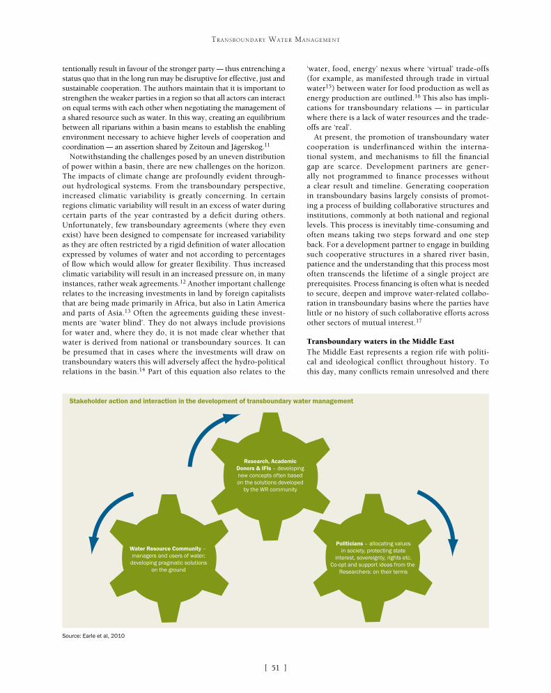
[ ]51
TRANSBOUNDARY WATER MANAGEMENT
tentionally result in favour of the stronger party – thus entrenching a status quo that in the long run may be disruptive for effective, just and sustainable cooperation. The authors maintain that it is important to strengthen the weaker parties in a region so that all actors can interact on equal terms with each other when negotiating the management of a shared resource such as water. In this way, creating an equilibrium between all riparians within a basin means to establish the enabling environment necessary to achieve higher levels of cooperation and coordination – an assertion shared by Zeitoun and Jägerskog.11
Notwithstanding the challenges posed by an uneven distribution of power within a basin, there are new challenges on the horizon. The impacts of climate change are profoundly evident through-out hydrological systems. From the transboundary perspective, increased climatic variability is greatly concerning. In certain regions climatic variability will result in an excess of water during certain parts of the year contrasted by a deficit during others. Unfortunately, few transboundary agreements (where they even exist) have been designed to compensate for increased variability as they are often restricted by a rigid definition of water allocation expressed by volumes of water and not according to percentages of flow which would allow for greater flexibility. Thus increased climatic variability will result in an increased pressure on, in many instances, rather weak agreements.12 Another important challenge relates to the increasing investments in land by foreign capitalists that are being made primarily in Africa, but also in Latin America and parts of Asia.13 Often the agreements guiding these invest-ments are ‘water blind’. They do not always include provisions for water and, where they do, it is not made clear whether that water is derived from national or transboundary sources. It can be presumed that in cases where the investments will draw on transboundary waters this will adversely affect the hydro-political relations in the basin.14 Part of this equation also relates to the
‘water, food, energy’ nexus where ‘virtual’ trade-offs (for example, as manifested through trade in virtual water15) between water for food production as well as energy production are outlined.16 This also has impli-cations for transboundary relations – in particular where there is a lack of water resources and the trade-offs are ‘real’.
At present, the promotion of transboundary water cooperation is underfinanced within the interna-tional system, and mechanisms to fill the financial gap are scarce. Development partners are gener-ally not programmed to finance processes without a clear result and timeline. Generating cooperation in transboundary basins largely consists of promot-ing a process of building collaborative structures and institutions, commonly at both national and regional levels. This process is inevitably time-consuming and often means taking two steps forward and one step back. For a development partner to engage in building such cooperative structures in a shared river basin, patience and the understanding that this process most often transcends the lifetime of a single project are prerequisites. Process financing is often what is needed to secure, deepen and improve water-related collabo-ration in transboundary basins where the parties have little or no history of such collaborative efforts across other sectors of mutual interest.17
Transboundary waters in the Middle EastThe Middle East represents a region rife with politi-cal and ideological conflict throughout history. To this day, many conflicts remain unresolved and there
Water Resource Community – managers and users of water;
developing pragmatic solutionson the ground
Research, AcademicDonors & IFIs – developingnew concepts often basedon the solutions developed
by the WR community
Politicians – allocating valuesin society, protecting state
interest, sovereignty, rights etc.Co-opt and support ideas from the
Researchers: on their terms
Stakeholder action and interaction in the development of transboundary water management
Source: Earle et al, 2010

[ ]52
TRANSBOUNDARY WATER MANAGEMENT
may be the case, it is clear that such an assertion should not be overextended.19 Phillips and others point out that the level of securitisation in a river basin is an impediment to a functionalist (cooperation leading to cooperation) approach since the preoccupation of the states will be on national security, thereby clearly limit-ing the room for regional perspectives.20 This is clearly evident in places like the Jordan Basin,21 but also in other regions with a strong security focus. This does not mean that cooperation cannot happen, but the asser-tion that this would almost automatically lead to wider cooperation is far-fetched.
The challenges faced by the international commu-nity are daunting. However, development partners can contribute to overcoming these challenges by supporting the processes of cooperation that underpin systems of best or ideal practice in transboundary water management. Staying for the long haul is essential to the achievement of sustainable and effective cooperative outcomes. Öjendal and others22 conclude that, given the challenges at hand – compounded by the uncer-tainties surrounding climate change and increased population growth – it is more relevant than ever to discuss transboundary water relations as a matter of continuous negotiation.
The Jordan River along the Jordan-Israel northern border: there are some encouraging signs of cooperation over shared waters in the Middle East
Imag
e: R
ami A
bdel
rahm
an, S
IWI 2
01
3
still exist deep cleavages between neighbouring nations. However, there are some encouraging signs of cooperation over shared waters. There are, in fact, situations where water seems to be the singular bond between countries that have been historically prone to conflict. For example, the Jordan Basin features a peace agreement between Israel and Jordan that regulates water alloca-tions stemming from the Jordan River to quite a large extent and even includes a provision for storing of Jordanian ‘winter water’ in Lake Tiberias in Israel for later release during the dry summer months when the water is needed. Since the signing of the agree-ment in 1994, there has been a functional relationship – albeit not always smooth – made possible by the parties’ arrangement to share water. Alternatively, the distinct power asymmetry between Israel and Palestine has prevented a similar arrangement between those two countries. Since Palestine does not have the same politi-cal clout regionally or internationally as Jordan, it is all too easy for Israel to dominate the water situation. Consequently, there is no fully-fledged agreement between them addressing water issues, either quantitatively or qualitatively, in great detail. Although it is noted in current agreements that the Palestinians have ‘water rights’– those rights are not clearly defined.18
ConclusionsIt has been suggested that regional cooperation over water as a shared resource can be a recipe for wider cooperation. While this
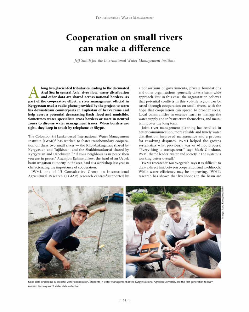
[ ]53
Cooperation on small rivers can make a difference
Jeff Smith for the International Water Management Institute
A long two glacier-fed tributaries leading to the decimated Aral Sea in central Asia, river flow, water distribution and other data are shared across national borders. As
part of the cooperative effort, a river management official in Kyrgyzstan used a radio phone provided by the project to warn his downstream counterparts in Tajikstan of heavy rains and help avert a potential devastating flash flood and mudslide. Sometimes water specialists cross borders or meet in neutral zones to discuss water management issues. When borders are tight, they keep in touch by telephone or Skype.
The Colombo, Sri Lanka-based International Water Management Institute (IWMI)1 has worked to foster transboundary coopera-tion on these two small rivers – the Khojabakirgansai shared by Kyrgyzstan and Tajikistan, and the Shakhimardansai shared by Kyrgyzstan and Uzbekistan.2 “If your neighbour is in peace then you are in peace,” A’zamjon Rahmatullaev, the head of an Uzbek basin irrigation authority in the area, said at a workshop last year in characterizing the importance of cooperation.
IWMI, one of 15 Consultative Group on International Agricultural Research (CGIAR) research centres3 supported by
a consortium of governments, private foundations and other organizations, generally takes a basin-wide approach. But in this case, the organization believes that potential conflicts in this volatile region can be eased through cooperation on small rivers, with the hope that cooperation can spread to broader areas. Local communities in essence learn to manage the water supply and infrastructure themselves, and main-tain it over the long term.
Joint river management planning has resulted in better communication, more reliable and timely water distribution, improved maintenance and a process for resolving disputes. IWMI helped the groups systematize what previously was an ad hoc process. “Everything is transparent,” says Mark Giordano, IWMI theme leader, water and society. “The system is working better overall.”
IWMI researcher Kai Wegerich says it is difficult to draw a direct link between cooperation and livelihoods. While water efficiency may be improving, IWMI’s research has shown that livelihoods in the basin are
TRANSBOUNDARY WATER MANAGEMENT
Good data underpins successful water cooperation. Students in water management at the Kyrgyz National Agrarian University are the first generation to learn
modern techniques of water data collection
Imag
e: Ik
uru
Kaw
ajim
a/IW
MI

[ ]54
TRANSBOUNDARY WATER MANAGEMENT
ments covering 276 international basins, Oregon State University’s Aaron Wolf and IWMI found that water cooperation trumps conflict, especially in cases where institutions have played a strong role.5 “There’s been a concern about water wars, but the reality on the ground is that countries have come up with many, many ways to cooperate over water,” says Giordano. “The many ways are not necessarily the theoretically correct ones.”
Wolf described the IWMI project as a great oppor-tunity to show how cooperation at a local level can spread upwards: “Given the complexities at the inter-section of hydrology and politics at even the smallest scale in this tense setting, IWMI’s work may well help towards easing tensions around one of the most difficult hydropolitical problems in the world.”
The Aral Sea regionWater management research in the region has gath-ered steam since the collapse of the Soviet Union in 1991, with efforts focused on the threatened Aral Sea and two main rivers leading to it – the Syr Darya and the Amu Darya.
being strained by climate change, increasing population, expanding farms and deteriorating water canal infrastructure.
IWMI has been involved in the tributary work since 2007 and a broader water resource management and agricultural produc-tivity programme in the Ferghana Valley since 2001. The Swiss Agency for Development and Cooperation is a key donor. IWMI’s regional partner is the Scientific Information Center of Inter-State Commission for Water Coordination.4
An explosive mix of ethnicities coexists in the basin, predomi-nantly Kyrgyz, Tajiks and Uzbeks, who rely heavily on agriculture and livestock. The mountains and plains are dry. The river-fed valley, often referred to as central Asia’s breadbasket, consumes a huge amount of water per capita because of inefficiencies and to irrigate cotton and commodity crops such as wheat. Livelihoods are therefore vulnerable to water variability. Poverty is high, as is labour migration, especially to Russia, in part because of the lack of economic opportunities and services. Water resource management on a regional scale remains unresolved. The region has been a politi-cal hotspot, marked by violent inter-ethnic clashes.
However, evidence is growing worldwide that shared water resources can be the catalyst for cooperation, rather than conflict. In a review of more than 500 international freshwater agree-
Turk
men
ista
nG
uya
naIr
aqU
zbek
ista
nK
yrgy
z R
epu
blic
Tajik
ista
nU
nite
d S
tate
sA
zerb
aija
nC
anad
aE
ston
iaK
azak
hsta
nS
uri
nam
eIr
an, I
slam
ic R
ep.
Su
dan
Uru
guay
New
Zea
land
Pak
ista
nE
cuad
orTi
mor
-Les
teA
ust
ralia
Sw
azila
nd
Viet
Nam
Arm
enia
Phi
lippi
nes
Sau
di A
rabi
aE
gypt
, Ara
b R
ep.
Ukr
ain
eG
reec
eTh
aila
ndS
yria
n A
rab
Rep
ublic
Bul
gari
aA
rgen
tina
Por
tuga
lIt
aly
Lith
uan
iaM
adag
asca
rJa
pan
Spa
inM
exic
oM
yan
mar
Lao
PD
RLi
bya
Cu
baP
eru
Chi
leN
ethe
rlan
dsS
ri La
nka
Indi
aN
orw
ayA
fgha
nist
an
Water use/capita [m3 / year]K
yrgy
z R
epub
licTa
jikis
tan
Mad
agas
car
Uzb
ekis
tan
Tim
or-L
este
Afg
hani
stan
Turk
men
ista
nP
akis
tan
Iraq
Viet
Nam
Guy
ana
Mal
iN
epal
Lao
PD
RS
udan
Zim
babw
eIn
dia
Mau
rita
nia
Nig
erP
hilip
pine
sB
angl
ades
hG
uine
aM
oldo
vaE
gypt
, Ara
b R
ep.
Arm
enia
Syr
ian
Ara
b R
epub
licU
krai
ne
Sw
azila
ndE
ritr
eaE
cuad
orS
ri La
nka
Sie
rra
Leon
eAz
erba
ijan
Tanz
ania
Bhu
tan
Gui
nea-
Bis
sau
Eth
iopi
aC
ambo
dia
Hai
tiTh
aila
ndM
alaw
iS
eneg
alIn
don
esia
Geo
rgia
Alb
ania
Sur
inam
eN
icar
agu
aK
azak
hsta
nB
urun
di
Mor
occo
Water use/GDP [m3 / USD]
0
0
0.5
1
1.5
2
2.5
2000
4000
6000
The world’s top 50 water consuming nations per capita (top) and per produced GDP (bottom)
Source: IWMI. Data: World Bank (2013)

[ ]55
TRANSBOUNDARY WATER MANAGEMENT
The Aral Sea has been considered one of the world’s biggest environmental disasters. The lake, one of the largest in the world in the 1960s, was nearly sapped dry by a Soviet plan to divert water to irrigate vast cotton fields. The shrinking of the Aral Sea virtually destroyed the region’s fishing industry, an important ecosystem, left a legacy of pollution with health implications, and is believed to have led to more extreme weather.
The 2,200 km Syr Darya is the longest river in Central Asia. It starts with the confluence of two tributaries in the Tien Shan mountains in Kyrgyzstan and flows downstream into the Ferghana Valley in Uzbekistan. Within the Ferghana Valley, 33 tributar-ies contribute to the river flow that enters Tajikistan and fills the Kairakkum Reservoir. Tajikistan lifts water from the reservoir to irrigate area farms. From the reservoir, the Syr Darya flows back into Uzbekistan and across southern Kazakhstan before terminat-ing in the Aral Sea.
Under the Soviet regime, crops were mainly grown in the down-stream plains, with livestock primarily raised in the upstream mountains. Although an extensive amount of water management infrastructure existed downstream, there was mainly large-scale infrastructure upstream on the main tributaries and very little on the small transboundary tributaries. For example, only about half
a dozen tributaries have seasonal upstream dams, and they are poorly maintained.
In the Syr Darya basin, nearly 80 per cent of the water was lost due to infrastructure problems compared with an average of 60 per cent in developing countries, according to IWMI research published in 2004.
Water user associations (WUAs)consisting primar-ily of farmers were established in the Kyrgyz part of the two basins in the late 1990s as part of a World Bank-financed project. Within the two basins IWMI started to promote the associations on the Tajik as well as Uzbek side in 2007, as well as strengthening the existing WUAs in Kyrgyzstan. The goal was for association members to make key decisions on opera-tions, development plans and strategy.
IWMI started work on the two tributaries as pilot projects in 2007, organizing workshops to extend cooperation across borders and discuss technical matters of mutual interest. Critical times were iden-tified, such as the water-scarce months of the early spring and autumn, and the heavy rain months which might cause mud-flows.
Livelihoods in the region are vulnerable to water variability
Imag
e: Ik
uru
Kaw
ajim
a/IW
MI

[ ]56
TRANSBOUNDARY WATER MANAGEMENT
Cooperation at local levelThere was reason to focus cooperation efforts on the small tributaries flowing into the Syr Darya. Water sharing in these ‘subcatchments’ is a local, bilateral issue with infrastructure shared by bordering countries. The setting can also be ideal to demonstrate what strate-gies might work on other tributaries.
Research also showed that cooperation on water management could exist at the local level even amid tension at the national level. For example, Uzbekistan and Tajikstan were in disagree-ment regarding the construction of a large hydroelectric dam, while Uzbekistan and Kyrgyzstan grappled over water and natural gas trades.
The Soviet break-up has both simplified and complicated matters, with former Soviet colleagues now working on opposite sides of the border. Abdukhakim Abdusaminov, chairman of a Tajik water users’ group on Khojabakirgansai and former head of Jabbor Rasulov district, recalled at one workshop that before the Soviet split-up, it was quite easy to coordinate and monitor water allocations, agree on maintenance projects, and discuss emerging issues. The IWMI project, in essence, has solidified those informal relationships through regular meetings.
Jusipbek Kazbekov, an IWMI researcher in central Asia, recalls some key river management operators hurriedly leaving the workshop room one day as clouds looked ominous so they could coordinate safeguards to the systems. A warning of possible flash floods, for example, can spark downstream operators to close water intake structures and open flood management dams, canals and channels to avoid costly damages.
To aid in transboundary cooperation, IWMI, with partners, has also collected Soviet and post-independence water agreements and proto-cols, with particular focus on the 33 small transboundary tributaries within the Ferghana Valley.The documents cover a wide range of topics including water sharing, infrastructure maintenance, border demarcations, transboundary infrastructure property rights, land exchanges, pasture use and water withdrawals. Plans are to create a website that provides the ability to search and download documents and data, as well as maps. The documents provide information on long-term patterns in the region, and lessons for the future.
At a workshop last year in Ferghana, Uzbekistan, IWMI staff talked about the different ways the parties could institutionalize joint water governance for the Shakhimardansai tributary. Attendees partici-pated in a group exercise to discuss the options. The participants agreed that a more systematic approach was needed, and established a river-wide water commission consisting of board members from sub-basin water committees on both sides of the river with appropri-ate support from the respective governments.
Later that month, IWMI held a similar workshop in Bishkek, Krygyzstan for the Khojabakirgansai tributary, the vast majority of which lies in upstream Kyrgyzstan. After flowing into Tajikstan, the river flows into the Plotina Dam, which is used from March through October to divert water into a canal to irrigate fields.
An agreement signed in 1962 calls for 79 per cent of Khojabakirgansai’s annual flow to be distributed in the arid Tajik basin. Kyrgystan has had plans since the 1970s to build a dam to double its irrigated land upstream. The plan has yet to receive funding but is a subject for discussion with the Tajiks as part of cooperative effort. While there remains tension over water alloca-tion, there now is a joint plan to discuss river management issues and cooperation during the critical periods.
Kazbekov says the tributary cooperation has resulted in better communication between farmers and authorities. Until recently, water was heavily subsidized or free in central Asia. Now water users have to pay in Kyrgyzstan and Tajikistan, making them more motivated to ensure the system is in good working order.
However, Wegerich and other researchers urge central Asia also to look beyond agriculture.6 The region is often viewed as water scarce, but in reality, the freshwater carried by the Syr Darya and Amu Darya exceed commonly used water shortage standards, according to researchers. The problem, they say, is that water is being used primarily to cultivate crops such as water-gobbling cotton.
Economies are beginning to become less dependent on agriculture, but the transition away from natural resources to service-based and knowledge-based industries such as information technology needs to accelerate. IWMI researchers argue that such a strat-egy is needed not only for the sake of future water resources amid climate change; it would also make the region more politically secure by offering more promising social and economic opportunities.
The framework for water cooperation also can be broadened. The next logical step, IWMI researchers say, is to replicate the small transboundary tributary cooperation in other places, and encourage regional organizations to set up special funds to support such efforts. In the words of IWMI’s Wegerich: “This project has the potential to trigger wider cooperation and actu-ally build cooperation from the grassroots.”
IWMI’s transboundary water management approach
IWMI generally takes a basin-scale approach to improve water management for food production, livelihoods and the environment. In the volatile Ferghana Valley in central Asia, IWMI has taken a ‘second best’ approach – working to develop cooperation along small transboundary tributaries where decisions are made locally and infrastructure is shared. The hope is that such bottom-up cooperation can be replicated on a broader scale.
IWMI’s research on transboundary issues focuses on five main areas: • Creating analytical tools and resources that assist
researchers, policymakers and practitioners in assessing and managing transboundary river basins. An example is the collection of historical water management agreements.7
• Identifying and answering research questions central to the improved management of transboundary waters.
• Undertaking research projects aimed at developing practical policy and management recommendations at the local level as well as generic suggestions with global relevance.
• Developing partnerships with institutions through research activities and involving and supporting graduate students and interns interested in transboundary water research.
• Ensuring rigour in its work by publishing findings in major international, peer-reviewed journals.

[ ]57
Efficient and effective cooperation in the River Rhine catchment
Dr J. Cullman, Federal Institute of Hydrology, Germany and Chairperson of UNESCO International Hydrology Programme; Eric Sprokkereef and Ute Menke, Ministry of Infrastructure and Environment, Rijkswaterstaat-CHR Secretariat, The Netherlands
The International Commission for the Hydrology of the Rhine Basin (CHR)1 was founded in 1970 by the National Committees of Switzerland, Austria, Germany, France,
Luxembourg and the Netherlands in the framework of the United Nations Educational, Scientific and Cultural Organization (UNESCO) International Hydrological Decade. It is responsible for carrying out the UNESCO recommendation to strengthen and to support cooperation in the Rhine catchment area and other river catchments.
CHR’s mission is to foster knowledge about the hydrology of the Rhine river basin and to contribute to the solution of transbound-ary hydrological problems. The commission coordinates diverse joint researches and often functions as a feedback group. An impor-tant aspect is the exchange of data, methods and information as well as the development of standards. CHR has no connections to politics in the various member states. As a relatively small group, it can act quite fast, contributing to decision-making processes.
CHR involves mainly scientific institutes focused on the development and implementation of hydrological measures to ensure sustainable devel-opment of the Rhine basin. Activities take place within the framework of the UNESCO International Hydrological Programme (IHP) and the
Hydrological and the World Meteorological Organization (WMO) Water Resources Programme. Working alliances undertake research on various themes such as:• hydrological interests in water economy and
flood control• sediment management• hydrological forecasts and models• comparison of methods and measuring equipment• studies on climatic changes and their possible effects• registration of the interactive relationships between
influencing factors on the hydrological regime of the Rhine basin.
CHR creates synergy through cooperation in various studies in the catchment. Its two publication series focus on the findings of the official CHR working groups (Series I) and CHR-related work or research incorporating financial contribution only (Series II).
The Rhine catchment areaThe Rhine’s catchment2 of 185,000 km2 is home to around 60 million people and comprises nine states includ-ing a small tip of Italian territory north of Chiavenna, Switzerland, Liechtenstein, Austria, Germany, France, Belgium, Luxembourg and the Netherlands. Of the 1,230 km course of the river, a stretch of about 800 km from Basel to Rotterdam is navigable. This stretch is one of the busiest waterways in the world, playing a vital role for its riparians in terms of transporting goods.
The main river and its tributaries supply countless industrial plants with process water and provide cooling water for numerous thermal power stations, both nuclear and fossil-fuel driven. In water-operated power plants or power plants on reservoirs of the catchment, however, the power of the streaming water produces a substantial amount of electricity. Furthermore, the Rhine is a major supplier of drinking and process water. Stuttgart and other municipalities in the Neckar region are supplied through lines from Lake Constance, while numerous other cities and communities are provided with river bank filtrate. In the end, the river has to absorb all sewage, albeit cleaned. Despite these strains imposed by civilization, ‘the romantic Rhine’ continues to attract tourists from across the world.
For all these reasons, it is crucial to know whether and how the water levels of the Rhine will change in future. But
TRANSBOUNDARY WATER MANAGEMENT
The Rhine fall near the city of Schaffhausen at high discharge, 11 June, 2006
Imag
e: C
HR

[ ]58
TRANSBOUNDARY WATER MANAGEMENT
onwards, pluvial elements prevail. Now the highest run-off occurs in February, the lowest in September.
Past achievementsThe Rhine Alarm model was developed with ICPR. It was initiated by the Rhine Ministers conference after the Sandoz accident in 1986 and accepted during the 8th Conference of Rhine Ministers. Participating institutes are the Federal Office for the Environment in Bern (Switzerland), the Service de la Navigation in Strasbourg (France), the Federal Institute of Hydrology (BfG)in Koblenz, the Albert-Ludwigs-University of Freiburg in Germany and Dutch organizations such as Rijkswaterstaat in Lelystad and the Technical University and Deltares in Delft.
The Rhine Alarm model delivers effective forecasts at various alarm stations in cases of strong water pollu-tion in the catchment. Forecasts of the travel time and distribution of harmful substances are highly impor-tant for all water users such as water boards and water supply companies, in order to implement the necessary measures in time.
The model covers the Rhine River from Lake Constance to the North Sea, including the main tribu-taries such as the Aar, Neckar, Main and Moselle. Input to the model calculations includes the location and conditions of the initial pollution, decomposition and drift capacity of the harmful substances, discharges and/or water levels, geometry and dispersion. Calibration of the model was done by tracer tests. The model calcu-lates, the concentration as a function of time as well as the point of time and scope of the maximum concen-tration for every alarm station along the Rhine. The forecasts of progress time and concentrations are accu-rate to about 89 per cent and 95 per cent respectively.
The knowledge of the Rhine Alarm model was incor-porated into the set-up of the model for the Danube River. For the Danube model a cross-flow of the pollu-tion module has been implemented which is also included in the latest version of the Rhine Alarm model. So, what has started with a catastrophe in the past has resulted in a well-implemented alarm model which helps ensure better, timely reaction in urgent situations.
Knowledge exchange with other river basins (South America to the Rio Bermejo) in Argentina took place through a twinning project, with a site-mission and a symposium held in 2007.3 CHR’s counterpart was the Binational Commission for the Development of the Bermejo River Basin (COBINABE) in Argentina. During the field visit the sediment problems in the upper part and middle reach of the Bermejo river basin were addressed.
The basin of the Rio Bermejo has various types of climates, with precipitation ranging from 200 mm/year to over 2,000 mm/year within a few dozen kilometres. Population density is quite low in terms of central European countries. Main traffic routes are constructed along the river stretches and are prone to natural hazard activities. Soil loss and adequate land use is a major problem for local populations in the river basin. Traffic
well-founded prognoses can only be made if the processes in the river system are understood. This, in turn, requires a thorough knowledge of the historical development of hydrological parameters. Therefore, CHR has undertaken a detailed analysis of changes in the run-off regimes of the Rhine and its tributaries in the twentieth century and their potential causes: natural climate fluctuations, anthropogenic climate change and direct human interventions such as river regulations and embankments, barrage weirs, reservoirs, water transfers and changes in land use.
Run-off regimeThe flow of a watercourse, whether it is a small brook or large river, strongly depends on the amount of precipitation in the catchment. The water volume that is not lost to evaporation or plant transpira-tion eventually runs off; fluctuations in run-off are controlled by the temporal distribution of precipitation and evaporation. If precipita-tion falls as snow, it is released with a time delay when melting or stored as ice in glaciers for even longer periods of time. In a nutshell, ‘run-off regime’ means the intra-annual run-off of a stream that can be regularly expected.
The major tributaries in Germany (Neckar, Main and Moselle) consistently show a pluvial regime. Due to the distribution of rain-fall and the seasonal differences in evaporation intensity, mean run-off reaches its maximum in the winter months and its minimum in August and September. As the river proceeds, the run-off regime of the Rhine reflects the natural and man-made impacts resulting from its gradual catchment expansion. In the process, none of the joining tributaries succeeds in imposing its own regime character on it – but the plethora of feeding rivers downstream increases the complexity of the run-off regime in the Rhine.
Owing to the dominant alpine influence, the Basel Rhine gauge shows a typical nival regime that is superimposed by tributaries with a pluvial character further downstream. As these tributaries bear signifi-cantly less water than the Rhine, the basic nival character of the Rhine regime continues to exist up to the confluence with the Main river. Not until reaching the Middle Rhine do the rivers Main and Moselle eventually cause major changes. From the Andernach gauging station
Restoration of gravel banks of the Thur River, a tributary of the Rhine in Switzerland
Imag
e: C
HR

[ ]59
TRANSBOUNDARY WATER MANAGEMENT
routes are prone to fall out of function due to natural hazards. Many river defence works have been undertaken in the past to locally reduce natural hazard impact, such as retention dams to protect the main road from lateral landslides. The river system shows a variety of natural hazards. Lateral hazards such as debris flows and landslides constantly threaten to dam the main river, causing a lake behind the obstacle and an outburst to infrastructure below it. Some precipitation and discharge measurements are done, but the denser network needed for detailed information does not exist. Therefore, information about precipitation and discharge are not sufficiently available for local use.
Regarding the possibilities for future cooperation between COBINABE and CHR it was stated that in the Rhine basin a lot of experiences are available in the field of economic, social and ecologi-cal impacts of sediments. Much information related to institutional, administrative and legal aspects can be transferred and adapted to other regions. COBINABE emphasized that many investigations were carried out in the Bermejo basin, but that many unsolved problems remain. Exchange of know-how, methods and procedures between CHR and COBINABE could help to solve these problems, and COBINABE is interested in working together on a project basis. Although cooperation between CHR and COBINABE would be very helpful, it has not been realized until now.4
Current projectsThe contract for a study on ‘Discharge percentage from snow and glacier melt in the Rhine River and its tributaries’ was signed in December 2012. The project team is a consortium compris-ing the Albert Ludwigs University of Freiburg, the University of Zurich and consultancy HYDRON GmbH. Important from an organizational aspect is the incorporation of the Federal State of Baden-Württemberg, through the State Institute for Environment, Measurements and Nature Conservation (LUBW) in the project. LUBW provides the high-resolution water management model LARSIM 1x1 km.
The present activities focus on the collection and accessibility of data sources, and on the methodologi-cal aspects of the data processing. The latter relates to questions concerning climatic reconstruction since 1901; processing of snow data in the catchment up to Basel (by cooperation partner SLF-CH); and activities related to (empirical) data analysis with a conceptual aim. In Basel, work is in progress to develop a suitable method for the transfer of snow water equivalents that are calculated from snow heights in a plain area to the ‘real’ catchment, especially for high mountain regions. Regarding empiri-cal data analysis, representative influencing variables for the melting and accumulation processes of ice and snow in the upper catchments should be identified through the catchment overlapping comparison of processes. This might help to transfer gained knowledge to modelled data series in a later stage of the project.
Parallel consultations between the BfG and HYDRON are taking place about a project-orientated further development of the model LARSIM-ME (5x5 km). In this part of the Rhine basin north of Basel, a separate BfG contract will be assigned to improve height zoning. In this way more height zones are designated in the grid elements and temperatures are recalculated, resulting in better reproduction of the modelled snow dynamics. After the model improvement through height zoning simulation, a simplified uncertainty analysis will be carried out, so different model variants can be compared and additional calibrations performed if necessary.
‘From source to mouth – A Sediment Budget of the River Rhine’ is a project that runs from July 2012 until the end of 2014. Under the auspices of CHR, BfG, in cooperation with the Aachen University Institute of Hydraulic Engineering and Water Resource Management, is in charge of the project.
The river bed in the Rio Bermejo basin
Imag
e: C
HR

[ ]60
TRANSBOUNDARY WATER MANAGEMENT
the climate model output used for IPCC AR5. Each institution brings its own expertise, observed data and models. One question to be answered with this analy-sis relates to the RheinBlick2050 results and the extent to which these are still valid with regard to IPCC AR5.
CHR eventsIn recent decades CHR has organized several conferences, symposia and workshops, with themes selected from a scientific point of view or as the closing events of large CHR studies. They include workshops on sediment transport (2003, 2007 and 2008), climate change (2003), extreme discharges (2005) and flood forecasting and ensemble predictions (2006 and 2010), as well as the closing sympo-sium of the RheinBlick2050 project in 2010.6
Future projects and tasksIn spring 2014 CHR will organize the new first spring seminar in combination with biannual CHR meeting in Austria. The series of spring seminars will start with the ‘Impact of socioeconomic changes to the discharge regime in the Rhine catchment’. The seminar output may lead to a new project.
Concerning the future, the tasks agreed during CHR’s foundation are still valid and important, while the commission’s approach has become increasingly multi-functional and multidisciplinary. The need for enough water of good quality, as well as for maintaining a safe environment for livelihoods, is still growing.
Another special event will come in 2020, when a new monograph on the Rhine will be published celebrating the 50th anniversary of CHR – and commemorating the fact that all CHR member states will have been taking care of the catchment and solving problems together for half a century.
The starting point for morphological analyses is bed level surveys. These are combined with sediment transport measurements in order to get data on the sediment load and on the mechanism of sedi-ment transport. Echo soundings and transport measurements will not answer questions such as where the sediments come from and where are they going, or how changes in one part of the catchment are related to other regions. Therefore, a sediment budget is needed, incorporating the collection of data and analyses to check the quality of measurements and available datasets, fill in the data gaps and identify sources and sinks. This action incorporates quite a challenge because maximum data density is found in the navigation channel but data density is at a minimum next to the navigation channel, in floodplains and groyne fields and at tributaries. Another challenge lies in the varying quality and methods used in the several river reaches and countries. Due to the number of existing gaps (data, data gaps and a need for regional data), a variety of assumptions were made. A strategy has been developed based on a status quo combined with ideas on how to improve the situation around the gaps.
Continuation of the RheinBlick2050 study is planned under the umbrella of ‘Climate impact studies in the Rhine basin’. Compared to the regional climate models used in RheinBlick2050,5 there is now a much larger ensemble (~200 runs) of new global climate models available in the Coupled Model Intercomparison Project Phase 5 (CIMP5) data repository. These models are also used for the Intergovernmental Panel on Climate Change (IPCC) Fifth Assessment Report (AR5), to be published in 2013.
The Royal Netherlands Meteorological Institute (KNMI) is analysing the CIMP5 data in order to use it in updating the KNMI climate scenar-ios. Cooperation with BfG and Deltares has begun to analyse this data set and calculate corresponding river discharges for representative sets of runs. The new KNMI scenarios will be published in autumn 2013.
The scope of this cooperation is, however, broader. It targets the comparison methodologies and coordination involved in deriving a common set of climate and discharge scenarios for the interna-tional basins of the Elbe, Rhine and Meuse. It is largely based on
River regulation works in the Lütschine basin in Switzerland
Imag
e: C
HR
The works in the Polder Ingelheim, north of Mainz in Germany
Imag
e: C
HR

[ ]61
Sharing water in Australia: a collaborative endeavour James Cameron, CEO, National Water Commission, Australia
Sharing water between competing users continues to be one of the world’s hallmark challenges of the twenty-first century. This is no less true in Australia, the driest inhab-
ited continent on Earth.
Australia has a challenging hydrology. Highly variable and often irregular rainfall and high rates of evaporation result in the lowest run-off of inhabited continents. About 65 per cent of Australia’s run-off is in the three drainage divisions located in the sparsely-populated tropical north. Irrigated agriculture is concentrated in the Murray-Darling Basin to the south-east where only 6.1 per cent of national run-off occurs. The basin comprises about 14 per cent of Australia’s land area, accounts for 65 per cent of Australia’s total irrigated land and provides 39 per cent of the total Australian value of agricultural commodities.1
Most inland Australian rivers are naturally intermit-tent and are unreliable water sources. The ratio between the maximum and minimum annual flows in Australian rivers is much higher than most major rivers across the world. For the Yangtze in China, that ratio is two. For the Darling River in Australia, the ratio is almost 5,000.
Groundwater usage also varies from region to region, on average supplying around 30 per cent of total water use in Australia. Consequently, Australia depends on water storage more than any other developed country and stores more water per head of population than anywhere else in the world. Yet Australia has relatively few sites for efficient dams. The Australian continent is characterized by a lack of high mountains, and many water storages are inefficient, shallow and wide.
TRANSBOUNDARY WATER MANAGEMENT
Irrigation of the Murray River
Imag
e: c
ourt
esy
of t
he M
urra
y-D
arlin
g B
asin
Aut
hori
ty

[ ]62
TRANSBOUNDARY WATER MANAGEMENT
In the 1990s, environmental degradation saw a 1,000 km-long toxic blue-green algae bloom in the Darling River system and increasing algal blooms throughout the whole Murray-Darling Basin. Increasing water demand was also contributing to rising water salinity, declining biodiversity and less frequent beneficial flooding in floodplains and surrounding streams. Recognizing this, govern-ing jurisdictions agreed to cap their allocations for consumptive use from the system at 1994 levels. The cap meant that new surface water demand could only be satisfied through trading. This important policy decision recognized that the limits of sustainability had been overreached.
This period was also marked by significant micro-economic reform in Australia and water became part of that broader appetite for national change. In 1994, all governments committed to the Council of Australian Governments Water Reform Framework, which was designed to make water management more environ-mentally sustainable and economically efficient. The key elements of subsequent reforms were founded in that agreement. They included recognition of the water needs of the environment, handing irrigation systems over to irrigators to manage, tradable water rights, and the separation of the regulatory, policy and service delivery functions of water authorities.
In the 1990s the nation began to feel the effects of what would become the 12-year-long ‘Millennium’ drought, triggering a renewal of focus on effective management of Australia’s resources. In some commu-nities, the drought came close to putting water for basic
Australia, like other countries, faces increasing pressures for water to be made available for productive agriculture, economic growth, the growing needs of cities and the environment. Not only are the demands on water resources escalating, but a changing climate means that in many regions there is less water to go around.
Managing water and supply security in Australia is a shared challenge. It has many players, very different local circumstances and no single government agency has sole authority.
Unlike international transboundary water issues that focus on intercountry negotiations, Australia’s transboundary water issues are domestic – but no less complex. Under Australian water laws it is not the federal government that determines the conditions on which water is available for use, but the six state and two territory governments. Local government also has an important role in water delivery, stormwater and drainage, which increasingly feature in urban supply and demand management.
Yet there are national imperatives for water management. Most notably in Australia, these have been to share physical water resources among states, to protect nationally significant environ-mental assets and to foster interstate water markets. Attempts to achieve these goals have been complicated by different legislative and administrative arrangements between states, and by the different character of hydrological systems and water-dependent ecosystems both within and between states.
Following the federation of Australia’s states in 1901, initial steps towards intergovernmental cooperation on water resources focused on developing water supply systems and increasing water storage capacity. By the 1980s, the limitations of this approach were being observed in many parts of rural Australia – with diminishing returns on subsidized infrastructure, rapidly rising water extrac-tion challenging the capacity of water systems, and increasing and obvious environmental degradation.
Distribution of Australia’s mean annual run-off
Source: Water and the Australian Economy, April 1999

[ ]63
TRANSBOUNDARY WATER MANAGEMENT
human needs at risk – a position that shocked Australians. The drought not only highlighted the vulnerability of businesses and communities, it also demonstrated the implications of neglecting the water needs of the environment.
In 2000, a major national land and water audit found that almost a third of the continent’s surface and groundwater resources were close to being overused, or were overused compared to their esti-mated sustainable flow regimes.2
The Council of Australian Governments again stepped in. In 2004, the council members signed off on the Intergovernmental Agreement on a National Water Initiative (NWI), which set out detailed commit-ments to improve institutional water sharing arrangements and to overcome some of the seemingly intractable differences between states that shared water resources. It established as an overarching goal the optimization of economic, social and environmental outcomes.
Under the NWI the Council of Australian Governments created a new body – the National Water Commission – to oversee imple-mentation of the reform programme and to provide regular reviews. This type of institutionalized, regular review framework is unusual and has been instrumental in driving ongoing improvements in the delivery of a truly national water reform agenda.
The NWI comprises different types of commitments that together will improve water management in Australia. There are state-specific commitments and commitments applicable to groups of states, such as water trading among the southern Murray-Darling Basin states. There are also commitments that can only be delivered through cooperation by all states.
Just as importantly, the NWI commits governments to genuinely engage with people and groups affected by water management changes when developing water plans that balance the competing needs and values of water users with the desired outcomes for the environment in particular water systems. This is beneficial because it makes decisions regarding water allocation and use transparent,
and provides an opportunity for interested parties to be part of the decision-making process.
In the eight years since the NWI was signed, the agree-ment has come to be recognized internationally as a model for sound water governance, for addressing the challenges of cross-jurisdictional management of shared resources, and for harnessing the power of markets and price signals to encourage efficient water use and investment.
In an assessment of Australia’s environmen-tal performance since 1998, the Organisation for Economic Co-operation and Development concluded that the NWI, backed by significant government investment, was delivering real progress toward reform, including setting environmental flow regimes.3 As the Australian State of the Environment Report 20114 observed, “the past decade has been the most dynamic and significant in modern Australia’s water history. It has been a period of ambitious water policy reform at the same time as the worst and longest drought Australia has ever seen. There have also been massive public and private investments in water infrastructure, significant new foundations for water knowledge at a national scale, and the widespread acceptance by the public and by govern-ments that Australia’s climate has changed and will continue to change.”
The Australian approach acknowledges that success-ful reform requires cross-agency and cross-government collaborative effort. Behind these concepts are coop-erative, multilayered and evolving relationships; albeit relationships underpinned by a sound legislative and accountability framework that is supported by robust systems and processes.
The NWI explicitly recognizes the interests of indigenous people in water managementIm
age:
Nat
iona
l Wat
er C
omm
issi
on, A
rthu
r M
oste
ad
Indigenous engagement
The NWI is the first intergovernmental water agreement in Australia that explicitly recognizes the interests of indigenous people in water management. Since 2004 most Australian jurisdictions have established consultative mechanisms intended to engage indigenous people in water planning, and there is increased recognition of the cultural values of water resources.
In 2010 the National Water Commission brokered the formation of the First People’s Water Engagement Council. The group’s remit was to provide a vehicle for Aboriginal voices and water aspirations to be heard.
The council consulted widely with stakeholders and held its first water summit in 2012. From these processes, the council developed policy and advisory statements. When the council ended its tenure in 2012, an Indigenous Water Advisory Council was formed to continue building on the First People’s Water Engagement Council’s initial work, taking on an even larger role as national adviser to the federal government.
The advisory council, along with other indigenous working groups, indigenous community facilitation networks, and projects aimed at improving drinking water and increasing research opportunities, will continue to provide an important foundation for improving knowledge and understanding of indigenous Australians’ water-related cultural, social and economic aspirations.

[ ]64
TRANSBOUNDARY WATER MANAGEMENT
Relationship management has therefore become recognized as a core component of the reform process. This requires a good under-standing of the synergies that exist between the parties involved in collaboration. It has also been critical to be flexible and to adjust governance arrangements when necessary.
The Australian experience has shown that governance and relation-ship structures must facilitate, and not hinder collaboration. A number of elements have enabled a more constructive and collegiate approach to be developed in federal/state relationships. Firstly, there has been a collective imperative to act, through the catalyst of the millennium drought which affected the entire nation. This has prompted a national focus with state and federal government leaders recognizing that water management often requires tough decisions, trade-offs and discipline not to intervene on an ad-hoc basis. Secondly, there has been a national blueprint, the NWI, which has driven nationally compatible approaches to water planning and management, coupled with important statutory reforms in most jurisdictions.
Thirdly, institutional arrangements have been put in place to influ-ence the way that players and entities interact with each other in governance and decision-making. There must be clarity about specific roles and responsibilities to ensure that arrangements enhance the final outcome and relationships continue to work as effectively as possible. There are different views at the table, but institutional arrangements allow for these views to be voiced and worked through, and in this way ensure that effective collaboration can occur.
And finally, NWI reform was supported by very substantial and sustained government investment to help advance water reform objec-tives and outcomes. Investments by governments in data collection, monitoring and metering have in turn delivered better information to inform the decisions of government and water users.
Achieving sustainable water management is a long-haul game. Australia’s experience has shown that implementing water reform is challenging, resource-intensive and complex. It requires strong leadership to build and sustain the case for change across affected communities and to make difficult decisions that are in the public interest. This is particularly so where rebalancing is required to address historic overallocation of water rights. Along the way, Australian water managers have also learned lessons about main-taining the momentum of such an unprecedented and ambitious reform programme.
A strategy for skill development needs to be an early action – not an afterthought. An integrated water management system needs science, expertise and capability beyond technical and engineering expertise. This means that new skills need to be developed and skills seconded from other sectors.
There should be no assumption that there is a ‘common’ language about water. Misunderstandings about terminology not only undermine confidence and certainty, but can also hinder productive interaction between research, policy development and implementation.
Making decisions about water allocation cannot be politically expedi-ent. They must be supported by thorough, rigorous and independent science. Government policy is fundamental, but policy alone does not produce results. What actually happens depends on the daily actions of all those individuals and entities that are in the business of using water. Their choices may be constrained or incentivized by the policy envi-ronment. Within those guardrails, there is enormous discretion to be prudent or profligate with the resource, to be considerate or careless of the interests of others.
Even the best plans need to be monitored and meas-ured, and plans on their own cannot deliver results. Plans need to be implemented and water actually needs to be managed according to the plan; the words need to become actions.
Overallocated water systems cannot fix themselves. The real test of water management systems occurs during drought periods. It is tempting to relax during wet periods, but this will make the next drought harder. It is detrimental to allocate water resources before the hydrology of systems and the environmental flow requirements are properly understood.
While there are significant differences in the water management issues faced across the country, it is important to harness the legitimate ownership that local communities and state and regional institutions have in managing their water resources. The NWI is very much about rational, logical and timely planning, but it works within the more subtle and fluid universe of people’s values, ideas, emotions and culture.
The challenges in implementing reform commit-ments continue to be dynamic and evolving, with the most difficult issues yet to be resolved. They centre on the contest between water for the environment and water for production and development; the restoration of overallocated water systems; explicit recognition of the social and economic impacts of water planning; private sector participation; and the nexus between water, climate change, energy and natural resource management.
The next step-change in the way we govern and manage water resources in Australia’s largest and most important river system is currently unfolding following the making of the historic Murray-Darling Basin Plan in November 2012.
Water reform affects many people, takes time to do well, will always be contentious and has no natural end point. Yet the journey requires strong commitment to building and maintaining relationships in the face of difficult decisions to balance economic, social and envi-ronmental outcomes, and to nourish real engagement with communities.
WaterAid Australia
Recognizing that its responsibility to help people secure access to clean water extends beyond the nation’s boundaries, Australia has been an active member of the global WaterAid community since 2004. In 2010 it was one of four founding members of WaterAid International.
Australia adds its technical water expertise to the development experience and knowledge of the overseas aid sector, working primarily in south Asia and Africa on practical, locally-sustainable solutions that provide communities with secure access to clean water.
In the past 12 months, WaterAid Australia has delivered $A 5.5 million of projects that have resulted in more than 200,000 people in Ethiopia, Malawi, Mozambique, Bangladesh, India and Timor-Leste receiving access to clean water and more than 85,000 people gaining access to adequate sanitation.
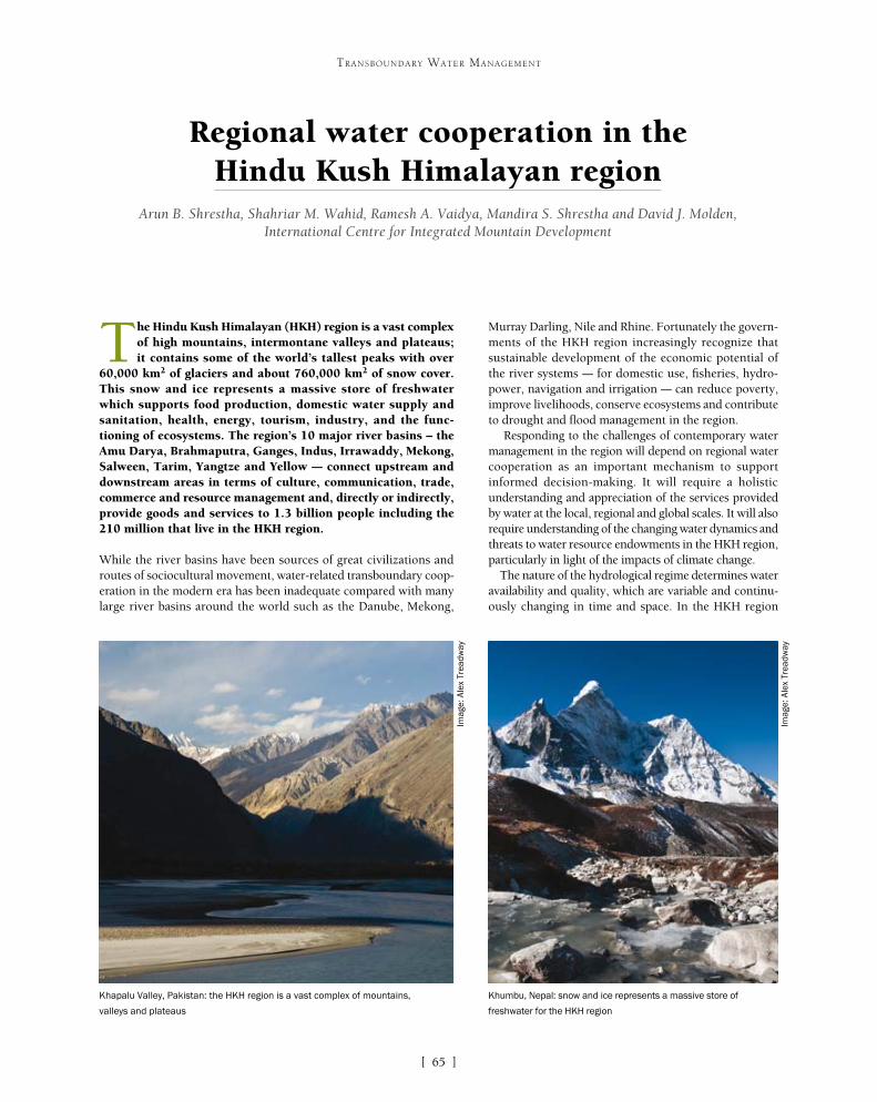
[ ]65
Regional water cooperation in the Hindu Kush Himalayan region
Arun B. Shrestha, Shahriar M. Wahid, Ramesh A. Vaidya, Mandira S. Shrestha and David J. Molden, International Centre for Integrated Mountain Development
The Hindu Kush Himalayan (HKH) region is a vast complex of high mountains, intermontane valleys and plateaus; it contains some of the world’s tallest peaks with over
60,000 km2 of glaciers and about 760,000 km2 of snow cover. This snow and ice represents a massive store of freshwater which supports food production, domestic water supply and sanitation, health, energy, tourism, industry, and the func-tioning of ecosystems. The region’s 10 major river basins – the Amu Darya, Brahmaputra, Ganges, Indus, Irrawaddy, Mekong, Salween, Tarim, Yangtze and Yellow – connect upstream and downstream areas in terms of culture, communication, trade, commerce and resource management and, directly or indirectly, provide goods and services to 1.3 billion people including the 210 million that live in the HKH region.
While the river basins have been sources of great civilizations and routes of sociocultural movement, water-related transboundary coop-eration in the modern era has been inadequate compared with many large river basins around the world such as the Danube, Mekong,
Murray Darling, Nile and Rhine. Fortunately the govern-ments of the HKH region increasingly recognize that sustainable development of the economic potential of the river systems – for domestic use, fisheries, hydro-power, navigation and irrigation – can reduce poverty, improve livelihoods, conserve ecosystems and contribute to drought and flood management in the region.
Responding to the challenges of contemporary water management in the region will depend on regional water cooperation as an important mechanism to support informed decision-making. It will require a holistic understanding and appreciation of the services provided by water at the local, regional and global scales. It will also require understanding of the changing water dynamics and threats to water resource endowments in the HKH region, particularly in light of the impacts of climate change.
The nature of the hydrological regime determines water availability and quality, which are variable and continu-ously changing in time and space. In the HKH region
TRANSBOUNDARY WATER MANAGEMENT
Khapalu Valley, Pakistan: the HKH region is a vast complex of mountains,
valleys and plateaus
Khumbu, Nepal: snow and ice represents a massive store of
freshwater for the HKH region
Imag
e: A
lex
Trea
dway
Imag
e: A
lex
Trea
dway

[ ]66
TRANSBOUNDARY WATER MANAGEMENT
Brahmaputra, Ganges and Salween basins are categorized as areas of economic water scarcity.
Climate change and associated changes could have a serious impact on the stability of water supply in the region. Observed warming in the region ranges from 0.01 to 0.06° C per year. The Intergovernmental Panel on Climate Change (IPCC) has projected that tempera-tures will be about 3° C warmer than the baseline by the middle of the twenty-first century and about 4° C warmer by the end of the century. Models project about 20 and 30 per cent increases in annual precipitation in the eastern Himalayas, with increased interannual and
the peaks in water availability usually do not coincide with the high demand periods. The eastern river basins depend mainly on monsoon precipitation, while the western basins are dominated by westerlies and heavily reliant on meltwater. While the region is known for its abun-dance of water resources, some areas are already water scarce, either physically (with more than 75 per cent of river flows withdrawn for agriculture, industry and domestic purposes) or economically (meaning that less than 25 per cent of water from rivers is withdrawn for human purposes, but significant improvements are needed in existing water infrastructure and management to make the water resources available for use). The western Himalayas and a large part of the Indus basin are recognized as physically water stressed areas. Large parts of the
Map of 10 major river basins and seasonal variations in flow of selected rivers in the HKH region
0
10,000
20,000
30,000
40,000
50,000
1 2 3 4 5 6 7 8 9 101112
Dis
cha
rge
[m3/s
]
Time [Month]
Ganges at Farakka
0
10,000
20,000
30,000
40,000
50,000
1 2 3 4 5 6 7 8 9 101112
Dis
char
ge [m
3/s
]
Time [Month]
Kabul atWarshak
0
10,000
20,000
30,000
40,000
50,000
1 2 3 4 5 6 7 8 9 101112
Dis
char
ge [m
3/s
]
Time [Month]
Indus at Besham Quila
0
10,000
20,000
30,000
40,000
50,000
1 2 3 4 5 6 7 8 9 101112
Dis
cha
rge
[m3/s
]
Time [Month]
Brahmaputraat Bahudarabad
0
10,000
20,000
30,000
40,000
50,000
1 2 3 4 5 6 7 8 9 101112
Dis
char
ge [m
3/s
]
Time [Month]
Yangtze atHonkau
0
10,000
20,000
30,000
40,000
50,000
1 2 3 4 5 6 7 8 9 101112
Dis
cha
rge
[m3/s
]
Time [Month]
Irrawadi at Sagaing
0
10,000
20,000
30,000
40,000
50,000
1 2 3 4 5 6 7 8 9 101112
Dis
char
ge [m
3/s
]
Time [Month]
Mekong atKratao
YangtseIndus
Tarim
Ganges
Yellow River
Mekong
Amudarya
Irrawady
Salween
Brahmaputra
Source: ICIMOD

[ ]67
TRANSBOUNDARY WATER MANAGEMENT
seasonal variability by the middle and end of the century respectively. The recession of HKH glaciers is a matter of great concern, particu-larly since the release of the IPCC’s Fourth Assessment Report (AR4) in 2007. Several recent studies indicate that the rates of retreat are less than those originally suggested by the AR4, but across the region more glaciers show shrinking trends than advancing trends.
The region is also undergoing remarkable socioeconomic trans-formation. Consequently water demand has increased over the past decades and will continue to increase into the future. For example, the International Water Management Institute projects that in South Asia the annual water withdrawals for agriculture will increase by 9 per cent between 2000 and 2050, while non-agricultural water use will increase by a factor of five in the same period under an optimistic ‘comprehensive assessment’ scenario. Such a dramatic increase, coupled with environmental and socioeconomic changes, gives reason for major concern about the availability of an adequate quantity and quality of water to meet the demand.
Water vulnerability is uneven across the region. The Amu Darya and Indus river basins appear to be the most vulnerable to changes in water availability. Furthermore, water vulnerability has different causes; one study showed that vulnerability in India and Bangladesh stems from hydrological and ecological factors, while in Nepal it is linked more to poverty and lack of economic development. Poor political govern-ance and underinvestment in the water sector add to vulnerability in Bangladesh and Nepal. Overall, Bangladesh was found to be the most vulnerable country, and Nepal that with the least capacity to adapt.
The changing HKH waterscape amply illustrates that the manage-ment challenges of today and tomorrow greatly differ from those of the past. Resource utilization today is vastly expanded and intensified through new technology, emerging markets and systems of govern-ance, with decisions in one place influencing people and resources elsewhere. Thus there is a strong case for interaction and reconcilia-
tion of the interests of the various actors in the region. A more focused cooperative approach will entail a shift in the water resource development paradigm from ‘develop-ment only’ to ‘cooperative development and management’ in addressing water needs.
To date, water resource management approaches in the HKH river basins have not fully accounted for the social, cultural and political implications of water management and climate change adaptation interven-tions. Water management has traditionally been handled at the state level, denying the transboundary nature of the resource endowment and the need to accommodate the interests of many actors, especially in addressing challenges extending beyond stringent political bounda-ries. The rigid hierarchical management regimes do not support flexible, cooperative approaches for coping with the ever-changing environmental and sociopolitical landscape, especially changes related to transboundary waters and climate change. Furthermore, such regimes are not effective for meeting local or regional needs. The highly regulated data and information sharing proto-cols are counterproductive to good governance and fail to support informed decision-making. Lack of coop-eration in information exchange and in the sharing of appropriate technology seriously hinders water resource development and management in the region.
The ecological and sociopolitical issues related to water management in the region are complex and do not easily lend themselves to agreement and collaboration among countries. A case in point is ‘green’ hydropower devel-opment. The hydropower potential of the HKH region is estimated to be more than 500 GW, much of which
Panjshir Valley, Afghanistan: water management has traditionally been handled at
state level, denying the transboundary nature of the resource
Settlements along the Indus river: river basins have been sources of
great civilizations and routes of sociocultural movement
Imag
e: A
lex
Trea
dway
Imag
e: B
iren
dra
Baj
rach
arya
[ ]68
TRANSBOUNDARY WATER MANAGEMENT
is not harnessed. While touted by some as an important ‘passport out of poverty’ in the face of rising energy demands and fossil fuel prices, green hydropower development remains controversial and contested in the region, partly because of lack of knowledge of risks due to envi-ronmental change such as glacial lake outburst floods (GLOFs) or meltwater change; concerns about impacts on the water regime (such as downstream water availability) and on fisheries, livelihoods, aquatic ecosystems and environmental services as a whole; and unresolved mechanisms of benefit sharing. At the regional level, hydropower projects raise new questions about sharing transboundary water resources between countries, which has long been a source of dispute. Yet the ferocity of the debate around hydropower development should not defeat efforts to understand how development trajectories might reallocate regional land and water resources, incomes and risks, and the various consequences for different social groups in time and space. The challenge is largely to address the question of how different countries can initiate and sustain coordinated and collaborative actions to harness hydropower. This will require attention to the structure and interre-lationships of organizations, sharing of strategies, and a sophisticated monitoring, communication and coordination mechanism.
Thus it is clear that regional cooperation requires both an adequate understanding of the potential hydro-economic benefits and a governance framework for extensive regional engagement for water resources management to overcome national or bilateral inter-ests and address shared concerns in a concerted manner.
The notion of regional cooperation to ensure sustainable and equi-table use of natural resources is not new. Regional strategic political and economic processes offer opportunities to link water manage-ment to emerging regional economic, energy and food security issues. Indeed the heads of state of the South Asian Association for Regional Cooperation at successive summits have reiterated the need to strengthen and intensify regional cooperation to preserve, protect and manage the diverse and fragile ecosystems of South Asia, and to address the challenges posed by climate change and natural disasters.
The countries of the HKH region have had some success in sharing real-time hydrological data, primarily through bilateral agreements, and this has proved useful in flood forecasting. However, achieve-ments have been limited with regard to the sharing of real-time data and information on a regional scale, so critical for flood management.
Water cooperation has often been hindered by the lack of a sound knowledge base on the availability of resources and their distribution over space and time, and a lack of understanding on the impacts of various drivers of change on the supply of and demand for resources – for example, the impacts of climate change on stream flow vari-ability, sedimentation and potential GLOF events. Regional hubs such as the International Centre for Integrated Mountain Development (ICIMOD) – whose members are the eight countries of the Hindu Kush Himalayan region (Afghanistan, Bangladesh, Bhutan, China, India, Myanmar, Nepal and Pakistan) – can promote collaboration among knowledge institutions in the region and contribute to the development of the requisite knowledge and understanding. Such regional centres can also facilitate representation and participation and provide technical support for regional discussions. Over the past three decades, ICIMOD has provided a common platform for regional cooperation where policy makers, experts, planners and practitioners exchange scientific data, information, ideas and perspectives towards achieving common solutions at regional levels. Water issues, along with concerns of livelihoods and ecosystems, are integrated across ICIMOD’s regional programmes addressing adaptation to change, transboundary
landscapes, river basins, cryosphere and atmosphere, and regional information collection and sharing. ICIMOD also supports transboundary collaborative research among its regional member countries through its projects. Such regional initiatives could be further strengthened through establishment of an adequately mandated regional group or body, hosted by a relevant organization, to indepen-dently facilitate and coordinate regional dialogue and strategic processes of regional water governance.
At the river basin level, where externalities are unidi-rectional from upstream to downstream, early success in regional cooperation can be achieved by identifying priority actions expected to provide common benefits across borders, for example hazard risk reduction. The non-structural flood management approach of providing end-to-end flood forecasting and warning services has the greatest potential for regional cooperation. Greater sharing of knowledge on the cryosphere is another area of potential cooperation that could improve understand-ing of cryosphere dynamics and possible downstream impacts. This is especially important for river basins highly dependent on meltwater.
Regional cooperation may also provide important opportunities for overcoming the economic, environ-mental, technological, financial and institutional barriers to hydropower development. Power trade and exchange between the Himalayan region and the core industrial belts of China and India could improve the capacity utilization factor of the power plants in the region, thus enabling the countries to supply power to their households at afford-able prices. To enable the less industrialized countries in the region to trade power with the more industrialized ones, cross-border grid interconnections are vital.
In this regard there have been positive experiences in the region. Bhutan and India have engaged in some bilateral cooperation in developing hydropower. Construction companies in China and India have rich experience in hydropower development. Power grid interconnections in India were expanded from the local and provincial levels to the regional and national levels in the 1990s, facilitating cross-border interconnections to the grid networks. Furthermore, India has promoted the establishment of power trading companies, both public and private. More recently, electricity exchange markets have also been started in India.
Another entry point for cooperation may lie in trans-forming natural systems of water storage. The region is blessed with a host of such systems including snow cover and permafrost, glacial lakes, wetlands and groundwater aquifers. Transforming natural systems into planned active systems may have important externalities for downstream users including control of uncertain river flows, recharg-ing of groundwater aquifers, sediment trapping, nutrient recycling and maintenance of the quality and quantity of the water cycle. However, the cost is high relative to returns, and the externalities are typically undervalued and not compensated. The introduction of policies for compensation for ecosystem services could help mountain people maintain healthy lives in a healthy environment
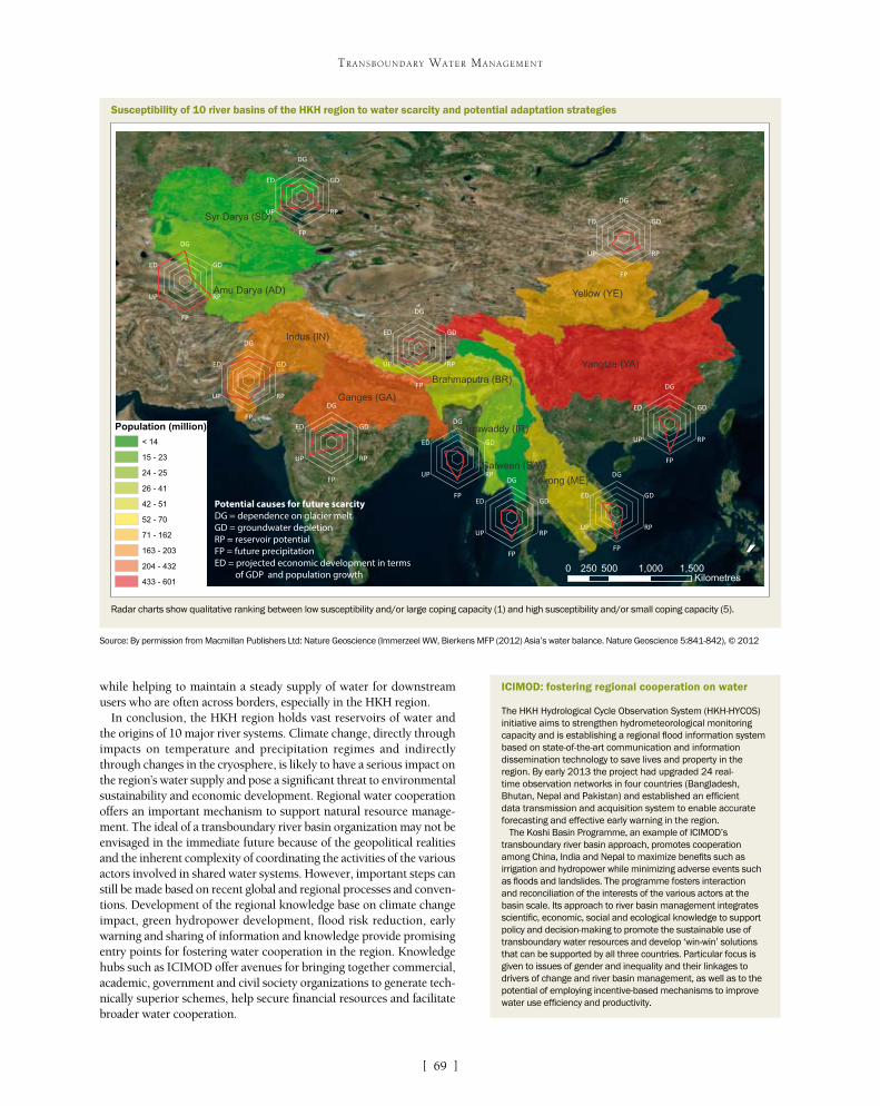
[ ]69
TRANSBOUNDARY WATER MANAGEMENT
while helping to maintain a steady supply of water for downstream users who are often across borders, especially in the HKH region.
In conclusion, the HKH region holds vast reservoirs of water and the origins of 10 major river systems. Climate change, directly through impacts on temperature and precipitation regimes and indirectly through changes in the cryosphere, is likely to have a serious impact on the region’s water supply and pose a significant threat to environmental sustainability and economic development. Regional water cooperation offers an important mechanism to support natural resource manage-ment. The ideal of a transboundary river basin organization may not be envisaged in the immediate future because of the geopolitical realities and the inherent complexity of coordinating the activities of the various actors involved in shared water systems. However, important steps can still be made based on recent global and regional processes and conven-tions. Development of the regional knowledge base on climate change impact, green hydropower development, flood risk reduction, early warning and sharing of information and knowledge provide promising entry points for fostering water cooperation in the region. Knowledge hubs such as ICIMOD offer avenues for bringing together commercial, academic, government and civil society organizations to generate tech-nically superior schemes, help secure financial resources and facilitate broader water cooperation.
ICIMOD: fostering regional cooperation on water
The HKH Hydrological Cycle Observation System (HKH-HYCOS) initiative aims to strengthen hydrometeorological monitoring capacity and is establishing a regional flood information system based on state-of-the-art communication and information dissemination technology to save lives and property in the region. By early 2013 the project had upgraded 24 real-time observation networks in four countries (Bangladesh, Bhutan, Nepal and Pakistan) and established an efficient data transmission and acquisition system to enable accurate forecasting and effective early warning in the region.
The Koshi Basin Programme, an example of ICIMOD’s transboundary river basin approach, promotes cooperation among China, India and Nepal to maximize benefits such as irrigation and hydropower while minimizing adverse events such as floods and landslides. The programme fosters interaction and reconciliation of the interests of the various actors at the basin scale. Its approach to river basin management integrates scientific, economic, social and ecological knowledge to support policy and decision-making to promote the sustainable use of transboundary water resources and develop ‘win-win’ solutions that can be supported by all three countries. Particular focus is given to issues of gender and inequality and their linkages to drivers of change and river basin management, as well as to the potential of employing incentive-based mechanisms to improve water use efficiency and productivity.
Susceptibility of 10 river basins of the HKH region to water scarcity and potential adaptation strategies
Potential causes for future scarcity DG = dependence on glacier meltGD = groundwater depletion RP = reservoir potential FP = future precipitationED = projected economic development in terms of GDP and population growth
Yangtze (YA)
Indus (IN)
Yellow (YE)
Syr Darya (SD)
Ganges (GA)
Amu Darya (AD)
Mekong (ME)
Brahmaputra (BR)
Irrawaddy (IR)
Salween (SA)
Population (million)
< 14
15 - 23
24 - 25
26 - 41
42 - 51
52 - 70
71 - 162
163 - 203
204 - 432
433 - 601
DG
GD
RP
FP
UP
ED
DG
GD
RP
FP
UP
ED
DG
GD
RP
FP
UP
ED
DG
GD
RP
FP
UP
ED
DG
GD
RP
FP
UP
ED
DG
GD
RP
FP
UP
ED
DG
GD
RP
FP
UP
ED
DG
GD
RP
FP
UP
ED
DG
GD
RP
FP
UP
ED
DG
GD
RP
FP
UP
ED
´0 500 1,000 1,500250
Kilometres
Source: By permission from Macmillan Publishers Ltd: Nature Geoscience (Immerzeel WW, Bierkens MFP (2012) Asia’s water balance. Nature Geoscience 5:841-842), © 2012
Radar charts show qualitative ranking between low susceptibility and/or large coping capacity (1) and high susceptibility and/or small coping capacity (5).

[ ]70
The Mekong River Basin: practical experiences in transboundary water management
Hans Guttman, Chief Executive Officer, Mekong River Commission Secretariat
The Mekong River Basin covers almost 800,000 km2. The main stem of the river stretches some 4,800 km from the glaciers in the Chinese Himalayas, through Myanmar,
Lao People’s Democratic Republic (Lao PDR), Thailand and Cambodia, meeting the sea in the vast delta in southern Viet Nam. The river has high inter-seasonal variation in flows (varying up to fifty-fold between wet and dry seasons), fed by the south-west monsoon. The cycling of flooding and drought has created a rich ecology, but also difficult conditions for human settlement. The Lower Mekong River Basin (LMB) comprises over 60 million people.
International cooperation in the use and development of the Mekong’s water was first formalized through the establishment of the Mekong Committee (MC) in 1957 under the auspices of the United Nations. The committee’s work was in part founded on the success of the Tennessee Valley Authority in the United States, demonstrating how the promotion of infrastructure development around water and other natural resources can rapidly support development.
The main focus of the MC was infrastructure devel-opment through the Indicative Basin Plan, which in the 1970s proposed tributary and mainstream develop-ment in 180 projects. This included 700,000 hectares of irrigation expansion and 3,300 MW of tributary hydro-power in the short term (10 years), and 17,000 MW of hydropower, including mainstream dams and extend-ing navigation by 800 km, in the long term.
Lao PDR, Thailand and Viet Nam established the Interim Mekong Committee in 1977; Cambodia was to be absent for 14 years, restricting further consid-eration of actions on the mainstream. In 1995 the Mekong Agreement, a new treaty signed by Cambodia, Lao PDR, Thailand and Viet Nam, created the Mekong River Commission (MRC) and provided a solid basis for cooperation in the sustainable development of the basin’s resources.
In order to turn the Mekong Agreement into a practical framework for cooperation, MRC began to
TRANSBOUNDARY WATER MANAGEMENT
If infrastructure development is promoted around water and other natural resources,
it can rapidly support development
Imag
e: M
RC
Mekong overview
Source: MRC
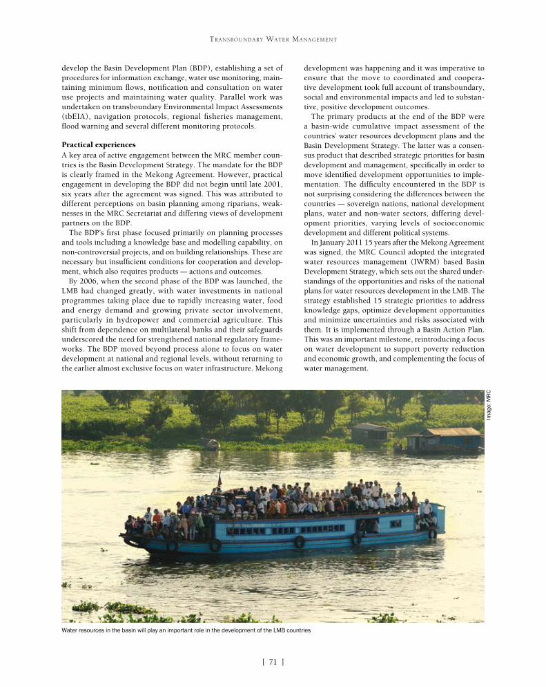
[ ]71
TRANSBOUNDARY WATER MANAGEMENT
development was happening and it was imperative to ensure that the move to coordinated and coopera-tive development took full account of transboundary, social and environmental impacts and led to substan-tive, positive development outcomes.
The primary products at the end of the BDP were a basin-wide cumulative impact assessment of the countries’ water resources development plans and the Basin Development Strategy. The latter was a consen-sus product that described strategic priorities for basin development and management, specifically in order to move identified development opportunities to imple-mentation. The difficulty encountered in the BDP is not surprising considering the differences between the countries – sovereign nations, national development plans, water and non-water sectors, differing devel-opment priorities, varying levels of socioeconomic development and different political systems.
In January 2011 15 years after the Mekong Agreement was signed, the MRC Council adopted the integrated water resources management (IWRM) based Basin Development Strategy, which sets out the shared under-standings of the opportunities and risks of the national plans for water resources development in the LMB. The strategy established 15 strategic priorities to address knowledge gaps, optimize development opportunities and minimize uncertainties and risks associated with them. It is implemented through a Basin Action Plan. This was an important milestone, reintroducing a focus on water development to support poverty reduction and economic growth, and complementing the focus of water management.
develop the Basin Development Plan (BDP), establishing a set of procedures for information exchange, water use monitoring, main-taining minimum flows, notification and consultation on water use projects and maintaining water quality. Parallel work was undertaken on transboundary Environmental Impact Assessments (tbEIA), navigation protocols, regional fisheries management, flood warning and several different monitoring protocols.
Practical experiencesA key area of active engagement between the MRC member coun-tries is the Basin Development Strategy. The mandate for the BDP is clearly framed in the Mekong Agreement. However, practical engagement in developing the BDP did not begin until late 2001, six years after the agreement was signed. This was attributed to different perceptions on basin planning among riparians, weak-nesses in the MRC Secretariat and differing views of development partners on the BDP.
The BDP’s first phase focused primarily on planning processes and tools including a knowledge base and modelling capability, on non-controversial projects, and on building relationships. These are necessary but insufficient conditions for cooperation and develop-ment, which also requires products – actions and outcomes.
By 2006, when the second phase of the BDP was launched, the LMB had changed greatly, with water investments in national programmes taking place due to rapidly increasing water, food and energy demand and growing private sector involvement, particularly in hydropower and commercial agriculture. This shift from dependence on multilateral banks and their safeguards underscored the need for strengthened national regulatory frame-works. The BDP moved beyond process alone to focus on water development at national and regional levels, without returning to the earlier almost exclusive focus on water infrastructure. Mekong
Water resources in the basin will play an important role in the development of the LMB countries
Imag
e: M
RC

[ ]72
TRANSBOUNDARY WATER MANAGEMENT
The MRC Secretariat is overseeing the implementation of the strategy, working with national line agencies, river basin organi-zations and others. The third phase of BDP programme leads the work on addressing the avoidance and mitigation of adverse impacts of water resources development and exploring a mecha-nism for sharing the transboundary benefits, impacts and risks of current and planned developments.
The implementation of the Basin Action Plan by MRC Programmes and national agencies provides a common direction for greater align-ment between regional and national planning, and the opportunity to decentralize the core river basin management function activities that can be better implemented at the national level. Knowledge gaps are reducing, which will enrich the next update of the Basin Development Strategy and enable MRC to better undertake its mission to promote and coordinate sustainable development and management of the basin’s water and related resources.
Many of the central elements of the Basin Development Strategy will remain relevant in the next planning cycle (2016-2020). Stakeholder consultations indicate opportunities to broaden the scope of the strategy in line with commitments of MRC countries to enhance regional integration. MRC’s ongoing analysis of current and future options for regional benefit sharing will provide useful inputs in this regard. The updated strategy will also more clearly identify the basin’s development opportunities, with a view to attracting funding for priority projects.
The Procedures for Notification, Prior Consultation and Agreement (PNPCA) were developed to address the issue of keeping tabs on the new projects using the basin’s water. For water use in the tributaries, the proponent country is required to notify the other countries of its proposed use. For water use on the main stream in the dry season, the proponent country is also requested to initiate a prior consultation which aims to identify concerns
with respect to impacts on neighbouring countries and reach agreement on how these can be avoided, mini-mized or mitigated.
Although over 40 projects on the tributaries have been notified, the first to go through a prior consul-tation was the mainstream Xayaburi Hydropower Project proposed by Lao PDR in 2010. This triggered a process of sharing information and discussions about the potential impact the project may have on other riparian countries. In the six-month consultation, facilitated by the MRC Secretariat, the downstream countries of Cambodia and Viet Nam expressed concern over the uncertainty of impacts and proposed that further studies were undertaken before the project went ahead. At a final meeting in April 2011 the coun-tries did not reach an agreement on measures to avoid, minimize and mitigate impacts (as was envisioned in the PNPCA), but neither did the member countries agree on whether the process was to be extended. The issue was referred to the MRC Council (the highest level in the MRC cooperation), which agreed that further studies were needed on the sustainable devel-opment of the Mekong, but did not address the issue of completing the PNPCA process.
During 2012 and continuing in 2013, the Lao Government engaged international consultants to assist in addressing the concerns expressed by the other ripar-ian countries and made several modifications to the design to reduce the impacts on sediment transport, fish migration, dam safety and navigation locks. In late 2012, it decided to go ahead with the project. Although the process did not proceed as envisaged in the PNPCA
The Basin Action Plan provides a common direction for greater alignment between
regional and national planning
MRC provides a practical framework for its member countries to
cooperate in developing the basin’s resources
Imag
e: M
RC
Imag
e: M
RC
[ ]73
TRANSBOUNDARY WATER MANAGEMENT
the most advanced system, but other examples were also drawn upon. In order to provide a picture of the requirements from proponent and affected countries, a number of hypothetical case studies around actual projects were undertaken.
However, while the technical agencies could agree on practical steps in identifying projects which may require tbEIA, the required process, mechanisms to address additional costs and so on, the major hurdle was on a legal and political level. From a legal point of view the problems were twofold. First, for Thailand and Viet Nam where the Mekong River Basin covers only part of their national territory, reconciling the require-ments of tbEIA in the basin with requirements outside it and with non-MRC member countries (Malaysia and Myanmar for Thailand and China for Viet Nam) would add complexity to the implementation. Second, national EIA legislation does cover all types of projects, whereas the MRC-supported tbEIA would focus on water resources issues. Thus a tbEIA protocol would cover some types of impacts and not others, such as air pollution. The terminology used in the protocol remains a difficult issue and a balance is needed to specify actions without contradicting national legisla-tion related to EIA.
What the future holdsAs the region develops, the water resources in the basin will play an important role in the development of the LMB countries. This will inevitably result in potentially conflicting demands and requires additional efforts by the member countries in finding the balance between national priorities, basin-wide considerations and the rights of all riparian countries.
MRC provides a practical framework for its member countries to cooperate in the sustainable development of the basin’s resources. In some areas cooperation is easier. Over the past 17 years the framework has devel-oped into a set of processes and strategies that allows the countries to discuss technical aspects of the devel-opment and management of the basin’s resources, which in turn underpins the political decisions made in the countries’ socioeconomic development plans.
It is clear that the 1995 Mekong Agreement is working, although there are high and differing expectations from different stakeholders. MRC’s past experiences provide important lessons in how to move forward and show the difficulties involved in balanc-ing the national priorities of sovereign countries with aims to cooperate in the basin’s development. The coming decade will without doubt further test MRC’s ability to provide a framework for cooperation in the increased use of shared resources.
This article is the opinion of the author and does not necessarily relflect the MRC Member Countries’ view on the issues discussed. The author would like to acknowl-edge the input from Ton Lennaerts, BDP and Lieven Geerinck, NAP.
as the member countries did not reach an agreement, it allowed Lao to hear the concerns from its neighbours and respond by modifying the design to reduce the negative impacts. The MRC Secretariat is facilitating continued information sharing on the project.
A further example of effective cooperation is the case for develop-ment of a bilateral agreement for the promotion of navigation between Viet Nam and Cambodia. Although Cambodia is not a landlocked country, the capital Phnom Penh is situated along the Mekong River, some distance from the coast. Thus, a lot of the capital’s supplies of imports have to either be trucked in from the coastal port of Sihanoukville (320 km from Phnom Penh) or shipped through the Vietnamese delta of the Mekong upriver to Phnom Penh. The Mekong Agreement provides for freedom of navigation. However, it is not easy to turn this general provision into a practical protocol for allowing maritime vessels from overseas and inland barges between Cambodia and Viet Nam, through the heavily populated delta in a structured way which allows for free passage without opening up for ‘free-for-all’ smuggling, ensures enforceable regulations against accidents and pollution, and complies with customs and immigration requirements.
In 1998 the governments of Cambodia and Viet Nam worked on an Agreement on Waterway Transportation for the navigational use of the Mekong River. However, the draft agreement, prepared by Viet Nam, was not ratified by Cambodia. There is a clear mandate to promote navigation in the Mekong Agreement, and the MRC Navigation Strategy (2003) included a legal component which was considered important in promoting freedom of navigation and increasing international trade opportunities for the MRC member countries’ mutual benefit.
In 2006 the governments of Cambodia and Viet Nam agreed that MRC would enter the scene as main facilitator to draft a new navigation agreement and assist in negotiating its contents. This was successfully done through the establishment of national legal taskforces in the two countries, which met regularly to work on a base draft agreement prepared by the MRC Navigation Programme. Several national and regional consultations and workshops were held to include the opinion of relevant stakeholders such as customs, immigration, river police, waterway departments, and the ministries of environment and commerce.
The Agreement Between the Royal Government of Cambodia and the Government of the Socialist Republic of Viet Nam on Waterway Transportation was signed on 17 December 2009, and ratified by both governments in January 2010. MRC is now supporting its implementation.
A number of lessons were learned in this process. All agencies that will be affected by the agreement need to be involved, which is necessary but costly and time-consuming. For proper imple-mentation of the agreement, it is not only a requisite to include an implementation road map, but also to bind its milestones legally in the agreement. Finally, it is clear that it is better to be patient and provide the highest quality agreement than to rush into the formula-tion process, as the negotiations may fail if not prepared well.
ChallengesHowever, there are also areas where cooperation has proved more difficult – for example, the development of a tbEIA proto-col. Beginning in 2001 the member countries began reviewing the experiences of tbEIA globally, and the secretariat engaged a number of experts to draft outlines for a tbEIA protocol for the Mekong. The experience of the Espoo convention was used as
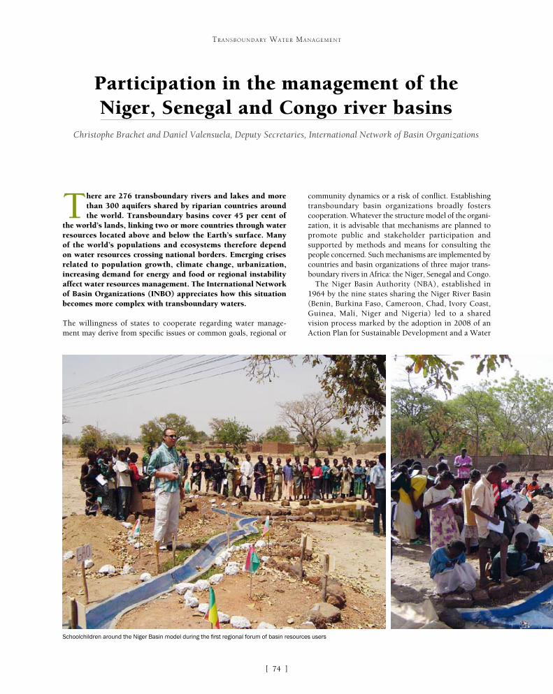
[ ]74
Participation in the management of the Niger, Senegal and Congo river basins
Christophe Brachet and Daniel Valensuela, Deputy Secretaries, International Network of Basin Organizations
There are 276 transboundary rivers and lakes and more than 300 aquifers shared by riparian countries around the world. Transboundary basins cover 45 per cent of
the world’s lands, linking two or more countries through water resources located above and below the Earth’s surface. Many of the world’s populations and ecosystems therefore depend on water resources crossing national borders. Emerging crises related to population growth, climate change, urbanization, increasing demand for energy and food or regional instability affect water resources management. The International Network of Basin Organizations (INBO) appreciates how this situation becomes more complex with transboundary waters.
The willingness of states to cooperate regarding water manage-ment may derive from specific issues or common goals, regional or
community dynamics or a risk of conflict. Establishing transboundary basin organizations broadly fosters cooperation. Whatever the structure model of the organi-zation, it is advisable that mechanisms are planned to promote public and stakeholder participation and supported by methods and means for consulting the people concerned. Such mechanisms are implemented by countries and basin organizations of three major trans-boundary rivers in Africa: the Niger, Senegal and Congo.
The Niger Basin Authority (NBA), established in 1964 by the nine states sharing the Niger River Basin (Benin, Burkina Faso, Cameroon, Chad, Ivory Coast, Guinea, Mali, Niger and Nigeria) led to a shared vision process marked by the adoption in 2008 of an Action Plan for Sustainable Development and a Water
TRANSBOUNDARY WATER MANAGEMENT
Schoolchildren around the Niger Basin model during the first regional forum of basin resources users
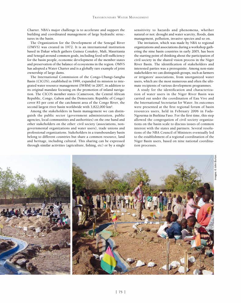
[ ]75
TRANSBOUNDARY WATER MANAGEMENT
sensitivity to hazards and phenomena, whether natural or not: drought and water scarcity, floods, dam management, pollution, invasive species and so on.
The invitation, which was made by NBA to regional organizations and associations during a workshop gath-ering the nine basin countries in early 2005, has been the starting point of thinking about the participation of civil society in the shared vision process in the Niger River Basin. The identification of stakeholders and interested parties was a prerequisite. Among non-state stakeholders we can distinguish groups, such as farmers or irrigators’ associations, from unorganized water users, which are the most numerous and often the ulti-mate recipients of various development programmes.
A study for the identification and characteriza-tion of water users in the Niger River Basin was carried out under the coordination of Eau Vive and the International Secretariat for Water. Its outcomes were presented at the first regional forum of basin resources users, held in February 2006 in Fada-Ngourma in Burkina Faso. For the first time, this step allowed the congregation of civil society organiza-tions on the basin scale to discuss issues of common interest with the states and partners. Several resolu-tions of the NBA Council of Ministers eventually led to the establishment of a regional coordination of the Niger Basin users, based on nine national coordina-tion processes.
Charter. NBA’s major challenge is to accelerate and support the building and coordinated management of large hydraulic struc-tures in the basin.
The Organization for the Development of the Senegal River (OMVS) was created in 1972. It is an international institution based in Dakar which gathers Guinea Conakry, Mali, Mauritania and Senegal around common goals, including food self-sufficiency for the basin people, economic development of the member states and preservation of the balance of ecosystems in the region. OMVS has adopted a Water Charter and is a globally rare example of joint ownership of large dams.
The International Commission of the Congo-Ubangi-Sangha Basin (CICOS), established in 1999, expanded its mission to inte-grated water resource management (IWRM) in 2007, in addition to its original mandate focusing on the promotion of inland naviga-tion. The CICOS member states (Cameroon, the Central African Republic, Congo, Gabon and the Democratic Republic of Congo) cover 83 per cent of the catchment area of the Congo River, the second largest river basin worldwide with 3,822,000 km².
Among the stakeholders in basin management we can distin-guish the public sector (government administration, public agencies, local communities and authorities) on the one hand and other stakeholders on the other: civil society (associations, non-governmental organizations and water users), trade unions and professional organizations. Stakeholders in a transboundary basin belong to different countries but share a common resource, land and heritage, including cultural. This sharing can be expressed through similar activities (agriculture, fishing, etc) or by a single
Imag
es: ©
Joh
n B
urto
n

[ ]76
TRANSBOUNDARY WATER MANAGEMENT
One major challenge, in terms of scale, of a large transbound-ary river basin like the Niger, Senegal and Congo lies in obtaining true stakeholder representation. The solution proposed in the Niger River Basin was to identify representatives per topic (agriculture, fisheries, water and sanitation, environment, hydropower and so on) while ensuring that each country is represented. The representa-tives’ legitimacy must also be gained and a democratic process may be initiated for stakeholder groups to choose their representatives. Cultural aspects can offer enabling conditions for participation.
Another difficulty is the need to ascend and descend from the local to the international basin level, through the national level. These processes are facilitated when civil society participation is already acquired in each IWRM (national process). The information flowing up from local communities is then presented per country, with consolidation at the basin level.
In Burkina Faso, the water agencies established in each national sub-basin apply the principles of integrated water resources manage-ment and people’s participation. The Nakanbe Water Agency for instance created local water committees. Their third annual forum was held in December 2012 with the participation of the French Loire-Brittany Water Agency, a partner of the Nakanbe agency under decentralized cooperation. In France, users’ participation has been institutionalized and increased through the European Water Framework Directive enacted in 2000.
Transboundary basin organizations are likely to play a significant role in the mechanisms for exchange with civil society on differ-ent scales, which may require some changes in their organizational culture. This ultimately means providing ‘seats’ to the people’s representatives in the institutional meetings of the basin organiza-tion to achieve active participation (associated to decision making) and not a mere consultation.
In the Niger River Basin, representatives of users’ regional coor-dination regularly participate in various meetings of NBA bodies. Their representation has been formalized in some bodies such as the Permanent Technical Committee, a new advisory body to the NBA Council of Ministers.
The OMVS Master Plan for Water Development and Management was also drafted in a participatory manner. The assessment validated in 2009, a true knowledge base shared between all stake-holders, is based on a rich bibliography of studies on the one hand and, on the other, on meetings organized with the water stakehold-ers in each country.
The participatory approach implemented by OMVS has helped to involve people (often illiterate) in the drafting of the Master Plan, a complex and technical document. An informative ‘image box’ guide for people has been developed especially to facilitate the drafting and appropriation of the plan. Radio programmes have also been used and strong support was provided by local facilitators trained by the project team.
The financial resources devoted to civil society participation should be sufficient and can pass through basin organizations. As in the Senegal River Basin, these organizations may provide technical assistance and facilitation, especially for unorganized users, so that stakeholders can familiarize themselves with issues through work-shops or specific media. The technical and financial partners can play a catalytic role, as happened in the Niger River Basin through French and Canadian cooperation, joined by German cooperation and the European Union. Continuity in supporting stakeholders’ participation is also required.
The Congo River Basin approach started in 2012 through a project funded by the European Union and implemented by the International Office for Water (IOWater), Eau vive and Solidarité Eau Europe. The activities carried out in early 2013 with CICOS were:• meeting with and awareness-raising of the
various partners• assessing the involvement of non-state stakeholders
in the past and future activities of the institution• drafting a list of the support to provide them• identifying the beneficiaries• assessing the feasibility, in time and in the Congo
Basin, of participation in the development of the CICOS Master Plan.
In all cases, the establishment of water information systems, organized in each riparian country and federated at the large basin level, is a prerequisite to allow a true dialogue between stakeholders and create the conditions for genuine dialogue based on trust between partners.
The International Network of Basin Organizations (INBO) has drafted a World Pact for Better Basin Management which, on the basis of positive experi-ences developed worldwide, especially recommends “to organize a dialogue with stakeholders recognized at basin level and ensure their active participation in order to achieve a truly shared vision of the future, to identify the necessary agreements on priorities and the means to mobilize, to coordinate projects and initia-tives, to analyse the results.”
Climate change, transboundary waters and participation
Climate change has already been affecting Africa for decades. In the Sahel, there has been a reduction in rainfall and an increase in intra-seasonal and inter-annual variability since 1970. In the Congo River Basin, the river flow rates tend to decrease in the south and the north of the basin, leading to disruptions of navigation on the Ubangi River among other things. The situation also generates impacts on groundwater, which are sometimes added to the overexploitation of aquifers, as in the North-Eastern Sahara Aquifer System.
In this context, NBA, OMVS, CICOS and the Sahara and Sahel Observatory have became members of the Global Network of Basins engaged in a process of adaptation to climate change, a network established and jointly managed by INBO and the United Nations Economic Commission for Europe.
Exchanges between the members of this network show that to facilitate the preparation of climate change adaptation plans to be included in multi-annual basin management plans, and to make effective their derived programmes of measures and action plans, they need to enable the participation of stakeholders through mechanisms to be developed or invented.
OMVS, for example, has established several consultative bodies to support this participation: the Standing Water Commission, a body giving advice to the ministers of the member states; the Basin Committee; the National Coordinating Committees, an interface between national and regional levels; and Local Coordinating Committees established to be closer to users’ and stakeholders’ concerns and interests.
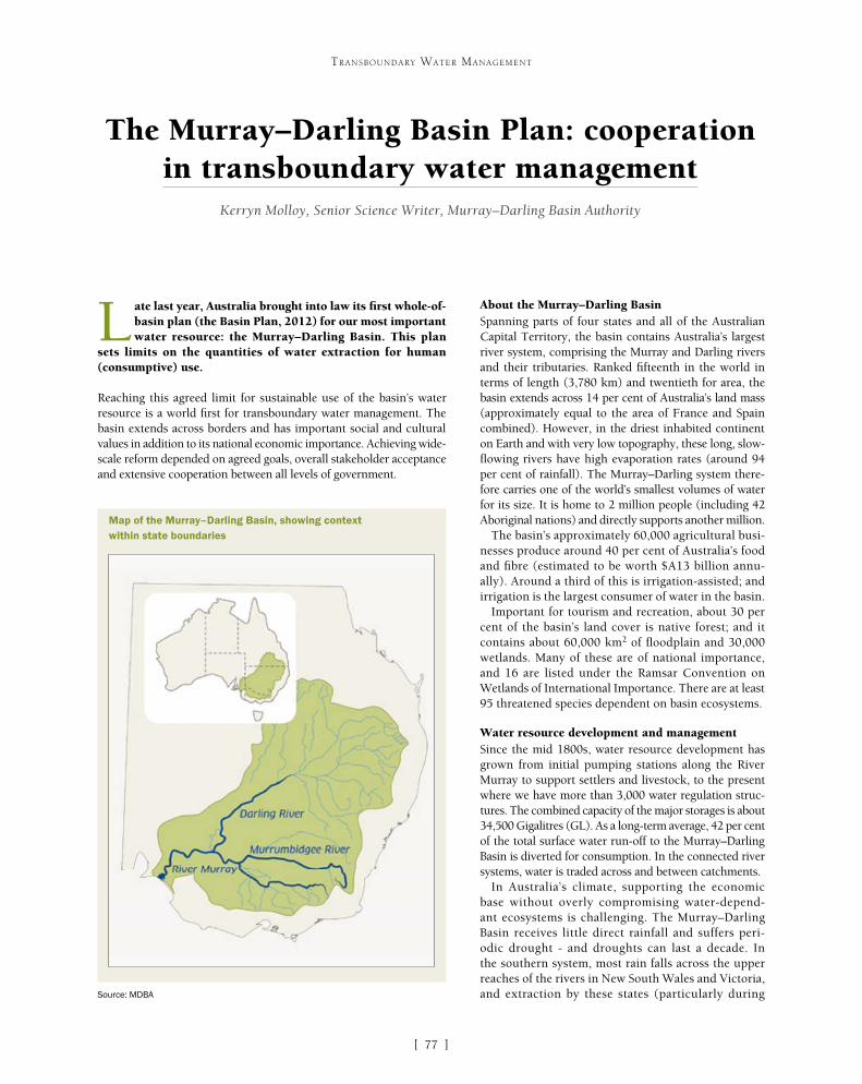
[ ]77
The Murray–Darling Basin Plan: cooperation in transboundary water management
Kerryn Molloy, Senior Science Writer, Murray–Darling Basin Authority
L ate last year, Australia brought into law its first whole-of-basin plan (the Basin Plan, 2012) for our most important water resource: the Murray–Darling Basin. This plan
sets limits on the quantities of water extraction for human (consumptive) use.
Reaching this agreed limit for sustainable use of the basin’s water resource is a world first for transboundary water management. The basin extends across borders and has important social and cultural values in addition to its national economic importance. Achieving wide-scale reform depended on agreed goals, overall stakeholder acceptance and extensive cooperation between all levels of government.
About the Murray–Darling BasinSpanning parts of four states and all of the Australian Capital Territory, the basin contains Australia’s largest river system, comprising the Murray and Darling rivers and their tributaries. Ranked fifteenth in the world in terms of length (3,780 km) and twentieth for area, the basin extends across 14 per cent of Australia’s land mass (approximately equal to the area of France and Spain combined). However, in the driest inhabited continent on Earth and with very low topography, these long, slow-flowing rivers have high evaporation rates (around 94 per cent of rainfall). The Murray–Darling system there-fore carries one of the world’s smallest volumes of water for its size. It is home to 2 million people (including 42 Aboriginal nations) and directly supports another million.
The basin’s approximately 60,000 agricultural busi-nesses produce around 40 per cent of Australia’s food and fibre (estimated to be worth $A13 billion annu-ally). Around a third of this is irrigation-assisted; and irrigation is the largest consumer of water in the basin.
Important for tourism and recreation, about 30 per cent of the basin’s land cover is native forest; and it contains about 60,000 km2 of floodplain and 30,000 wetlands. Many of these are of national importance, and 16 are listed under the Ramsar Convention on Wetlands of International Importance. There are at least 95 threatened species dependent on basin ecosystems.
Water resource development and managementSince the mid 1800s, water resource development has grown from initial pumping stations along the River Murray to support settlers and livestock, to the present where we have more than 3,000 water regulation struc-tures. The combined capacity of the major storages is about 34,500 Gigalitres (GL). As a long-term average, 42 per cent of the total surface water run-off to the Murray–Darling Basin is diverted for consumption. In the connected river systems, water is traded across and between catchments.
In Australia’s climate, supporting the economic base without overly compromising water-depend-ant ecosystems is challenging. The Murray–Darling Basin receives little direct rainfall and suffers peri-odic drought - and droughts can last a decade. In the southern system, most rain falls across the upper reaches of the rivers in New South Wales and Victoria, and extraction by these states (particularly during
TRANSBOUNDARY WATER MANAGEMENT
Map of the Murray–Darling Basin, showing context within state boundaries
Source: MDBA

[ ]78
TRANSBOUNDARY WATER MANAGEMENT
lower reaches of the system, many wetlands experi-ence ‘man-made droughts’ in over 60 per cent of years (compared to 5 per cent natural droughts pre-develop-ment). Consequently, there is a reduced area of healthy wetland, frequent algal blooms and (without flow trig-gers for spawning) declining native fish numbers. The removal of tree cover combined with irrigation led to rising water tables, mobilizing yet more salt.
First steps towards wider cooperationDeveloping environmental consciousness has been spurred by periodic droughts. For example, in the 1980s one such severe drought over the eastern half of the continent (initiating dust storms, water restrictions and horrific fires) resulted in economic loss of around $A3 billion. Accompanied by mounting evidence of decline, this episode instigated many inquiries, reports and calls for action. Essentially, a shared understanding developed that consumption levels were more than the river system could stand year-by-year; and there was a sufficiently compelling case for wider cooperation for the greater good.
As a more holistic view developed of the intercon-nectedness of all the water resources and the people dependent upon them, the signatories to the then Murray–Darling Basin Agreement began working towards more effective, coordinated and equitable plan-
drought) can result in limited flow to the floodplains of the lower reaches and out of the Murray mouth in South Australia.
Sufficient flow is vital as, in an average year, 2 million tonnes of salt leaches out of old soils and rocks and flows down the Murray–Darling. Without flushing flows salinity levels quickly build up, causing ecosystem damage, threatening agricultural production and reducing drinking water quality. Since the European development of the basin, flow has reduced by 75 per cent on average. The Murray mouth silts up and, during drought, remains open only by constant dredging of a narrow channel.
In Australia’s federal system (whereby independent colonies became states, which then joined to become the Commonwealth in 1901), water management has until very recently remained a power of the individual state/territory governments. While these governments have cooperated to jointly manage the basin’s water resource (through two key agreements: the River Murray Waters Agreement of 1914 and the Murray–Darling Basin Agreement of 1987 and 1992), the primary focus has been on the fair distribu-tion of water for consumption. States and the Commonwealth also worked together to construct dams, locks and weirs to secure water supplies, prevent undesirable flooding and improve navigability.
However, this river regulation and a quadrupling of surface water consumption between the 1930s and 1990s unintentionally resulted in escalating environmental problems. Water storage and consumption has disrupted the pattern of flow and prevents most naturally occurring small-to-medium-sized flood events. In the
Case study: environmental benefit from cooperative effort
The above image shows the Coorong during the millennium drought. The bright orange patches indicate the presence of iron sulphide. If
left undisturbed and covered with water, sulphidic sediments pose little threat. However, when exposed to oxygen, such as under drought
conditions, chemical reactions may lead to the generation of sulphuric acid. When this is wet again and released back into the rivers, it
causes substantial environmental damage and serious impacts on water supplies and human health
Imag
e: A
rthu
r M
oste
ad, 2
00
8

[ ]79
TRANSBOUNDARY WATER MANAGEMENT
ning. Indeed, the tagline for the new cooperative effort was: ‘Six governments working in partnership with the community’.
Functional institutions developed to underpin this (reflecting the aim of political, bureaucratic and community-level coopera-tion). These were the Murray–Darling Basin Ministerial Council (political arm); the Murray–Darling Basin Commission (bureau-cratic arm) and a Community Advisory Committee. In practice, while this cooperation produced many good initiatives including a successful salinity and drainage strategy, improvements in algae management and better water accounting, it did not prevent an overall increase in water extraction as this was driven by national and global market forces.
Another intense drought in 1991-95 reduced average rural industry production by around 10 per cent, despite diversions actually increasing by about 8 per cent to support the northern basin’s expanding cotton industry.
With awareness that further increases could not be supported, this crisis created an opportunity to ‘make good’ on earlier commit-ments. This time, the Murray–Darling Basin Act 1993 gave legal force to a new cross-jurisdictional, cooperative governance model. The Council of Australian Governments (COAG) formed to oversee national-level cooperation on issues of strategic importance and cross-jurisdictional concern, including the environment. COAG (consisting of the Prime Minister, State Premiers, Territory Chief Ministers and the President of the Australian Local Government Association) was underpinned by a Murray–Darling Basin Ministerial
Council (MinCo) which had the responsibility of bring-ing the Murray–Darling Basin Act to life.
Cooperative reform to limit consumptionThe partnership embodied in MinCo initiated the first thor-ough basin-wide audit of water use, completed in 1995. Confirming that river health issues would become critical if diversions increased (likely under the existing allocation system), the audit also predicted risks to long-term water security for existing irrigators and critical human use. This prompted MinCo, after independent review, to institute the first ever limit (the ‘Cap’) on consumptive water extrac-tion. This was an important initial step towards finding a sustainable limit for extraction. However, it reflected capping at existing consumption levels rather than any thorough investigation. Indeed, despite Queensland joining the Murray–Darling Basin Agreement in 1996 and the Australian Capital Territory in 1998 (meaning that all basin governments were signatories for the first time), overall diversions actually continued to increase until 1999 through the legacy of over-allocated entitlements to water and different state accounting systems.
The National Water Initiative (2004) followed: a blueprint for reform towards addressing over-allo-cation, enhancing security of water access rights and removing the remaining barriers to trade.
From July 2012 to January 2013, around 1.2 billion litres of stored environmental water was released, coordinated to maximize outcomes and efficiency. Firstly, it improved instream health along the Murrumbidgee, Goulburn and Murray rivers as flows moved downstream. Through mobilizing carbon and reducing nutrient loads and salinity, conditions improved for native fish and riverine vegetation. Secondly, a timed pulse of water (December 2012) acted as a trigger for spawning and recruitment in large-bodied native fish. Finally, on reaching the end of the River Murray system, flows were sufficient to breach weirs, flush wetlands and improve the estuary (important for migratory fish movement). With increased food for wading birds in the Ramsar-listed Coorong near the Murray Mouth, aerial waterbird surveys detected an increase in waterbird diversity and increased breeding due to a marked increase in mudflat food sources and habitat. The endangered southern bell frog has also been recorded in a number of wetlands.
This complex delivery involved cross-jurisdictional accounting and the passage of large flows through four river systems and across borders. Its achievement drew on many cooperative relationships, with water contributed by the Commonwealth Environmental Water Holder, MDBA (through TLM), state governments and private donations. Its delivery was made possible by ecological and technical experts working together with water delivery partners (such as catchment management authorities) and river operators responsible for controlling storage releases.
This cooperative effort produced the largest ever targeted delivery for environmental benefit purposes.
A healthier Coorong (a TLM icon site) after rainfall and environmental water releases reconnected the
Lower Lakes with the sea
Imag
e: D
enis
e Fo
wle
r, 2
01
1

[ ]80
TRANSBOUNDARY WATER MANAGEMENT
Implementing targeted recovery actionThe concept of ‘environmental water’ entered water policy consider-ations in the early 2000s. Referring broadly to water used to improve or maintain the health of a river system – including dependent plants and animals – such water has timing, duration and volume aspects. For example, a certain flow volume may be required over several weeks to support fish migration.
In 2001, MinCo developed 15 objectives for a healthy working River Murray and released a discussion paper which stimulated extensive public comment from irrigators, residents, governments, scientists and traditional owners. The information generated informed the establishment of The Living Murray (TLM) programme, managed by the Murray–Darling Basin Commission (which later became the Murray–Darling Basin Authority or MDBA). Encapsulating the power of cooperative effort and the strength of community-wide partici-pation, this jointly-funded partnership of the basin governments (excluding Queensland) and the Australian Government, set out for the first time to recover 500 GL of additional flow in the river.
Investing almost $A1 billion since 2004, TLM has funded research, on-farm efficiencies (such as better irrigation systems) and improved infrastructure (for example, pipelining previously open water channels), thus delivering real gains towards meeting our consumptive needs with less water. The recovered water has been used for the restoration of six ‘icon’ sites on the River Murray – those jointly agreed as of the highest ecological value and cultural significance – as well as improving instream health. In addition, TLM has supported upgrades or installation of fishways to improve fish passage through dams and weirs, and has fostered many partner-ships, including with and between indigenous nations in the basin.
Stimulus for national coordinationDespite all the united effort to improve trade, efficiency and river health, the worst drought on record (2000-2009) highlighted the continuing overall inequity between consumption and conservation. The effects resonated throughout the country as irrigated agricul-tural production fell by an estimated 20 per cent with flow-on effects to jobs. Tourism, recreation, cultural and spiritual practices were impacted as many rivers experienced flows almost 40 per cent below previous records; and flow to the Murray Mouth fell by up to 96 per cent. An iconic and loved species, the river red gum tree portrayed a graphic illustration of a critically declining environment as it began dying over extensive areas.
Widespread public debate raged about equitable management of the basin’s water resources. The Prime Minister ultimately recog-nized that for water resources to be managed holistically and for the long-term, hard decisions must be taken that would affect large numbers of people, requiring national governance. In 2007, at the height of the drought, the Australian Government announced major reform to deliver a basin-wide sustainable level of water diversion, supported by a $A10 billion package of initiatives.
Products of national reformThis reform was enshrined in legislation (the Water Act 2007) and supported by an Intergovernmental Agreement (2008), under which states referred sufficient powers to the Commonwealth to progress the reform. The independent MDBA was charged with developing the basin-wide strategic management plan (the Basin Plan).
For the first time, a thoroughly investigated and considered limit on overall extraction from the basin’s surface and groundwater was
determined and, under this, regional planning level limits were set. Known as the sustainable diversion limits (SDLs), these were derived after first determin-ing an ‘environmentally-sustainable level of take’, representing the amount of water that must remain in the system to support the health of key ecosystems and ecosystem functions in the basin (10,870 GL). It was determined using data from numerous scientific and economic studies, a 114-year climate record, a hydro-logic computer modelling platform and a rigorous, peer reviewed process.
Despite all existing cooperative mechanisms, achiev-ing an enforceable limit wasn’t easy and negotiations took four years. The main area of discord, which polar-ized irrigators and environmentalists, was determining what constituted ‘sustainable’ extraction. Other issues included where and how the ‘environmental’ water should be reclaimed (with states and regions concerned about securing enough water for their industries) and whether an upstream catchment should be responsi-ble for the passage of volumes of water downstream to benefit areas outside their jurisdiction.
Factors critical to the work’s progress included bipartisan support from Australia’s two major politi-cal parties and general high-level consensus on the compelling need to achieve sustainability. A process that gave all stakeholders a voice was vital, including mechanisms for their views to influence the outcome. For this purpose, MDBA staff toured the basin several times conducting hundreds of consultation sessions, and then responded to thousands of submis-sions. MinCo met frequently, allowing jurisdictional views to be expressed and negotiating agreed policy. Updated scientific advice and data drove revisions to the hydrologic modelling method, and together with well-considered submissions led to several revisions of the draft Basin Plan.
Ultimately, while the scientific analysis indicated the overarching sustainable diversion limit, the final recov-ery determination (2,750 GL) reflected a balanced decision that would deliver a ‘healthy, working basin’ through optimizing the environmental, economic and social outcomes. With acceptance by sufficient stake-holders, the Basin Plan became law in 2012, with a transition period before SDLs are enforceable in 2019.
On-ground outcomesEnvironmental water recovery is occurring through the Commonwealth government’s $A12.9 billion Water for the Future initiative. Water savings accrued from infrastructure works and modernization projects and direct purchasing of water rights (from volunteer sellers at market price) are held by a statutory ‘water holder’. This body delivers the environmental water consistent with the Basin Plan. Through such initia-tives, together with earlier water recovery such as TLM, over 3,500 GL (about 20-25 per cent of historical consumptive water use) has already been made avail-able for targeted purposeful environmental watering.
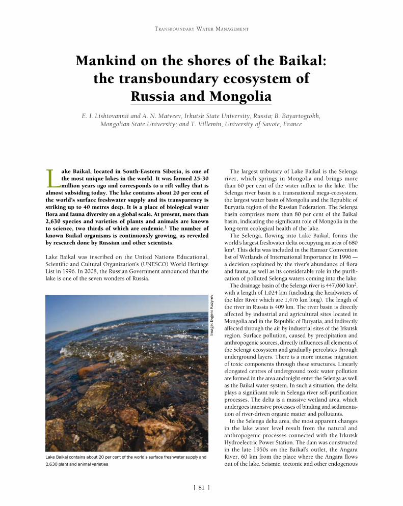
[ ]81
Mankind on the shores of the Baikal: the transboundary ecosystem of
Russia and Mongolia E. I. Lishtovannii and A. N. Matveev, Irkutsk State University, Russia; B. Bayartogtokh,
Mongolian State University; and T. Villemin, University of Savoie, France
Lake Baikal, located in South-Eastern Siberia, is one of the most unique lakes in the world. It was formed 25-30 million years ago and corresponds to a rift valley that is
almost subsiding today. The lake contains about 20 per cent of the world’s surface freshwater supply and its transparency is striking up to 40 metres deep. It is a place of biological water flora and fauna diversity on a global scale. At present, more than 2,630 species and varieties of plants and animals are known to science, two thirds of which are endemic.1 The number of known Baikal organisms is continuously growing, as revealed by research done by Russian and other scientists.
Lake Baikal was inscribed on the United Nations Educational, Scientific and Cultural Organization’s (UNESCO) World Heritage List in 1996. In 2008, the Russian Government announced that the lake is one of the seven wonders of Russia.
The largest tributary of Lake Baikal is the Selenga river, which springs in Mongolia and brings more than 60 per cent of the water influx to the lake. The Selenga river basin is a transnational mega-ecosystem, the largest water basin of Mongolia and the Republic of Buryatia region of the Russian Federation. The Selenga basin comprises more than 80 per cent of the Baikal basin, indicating the significant role of Mongolia in the long-term ecological health of the lake.
The Selenga, flowing into Lake Baikal, forms the world’s largest freshwater delta occupying an area of 680 km². This delta was included in the Ramsar Convention list of Wetlands of International Importance in 1996 – a decision explained by the river’s abundance of flora and fauna, as well as its considerable role in the purifi-cation of polluted Selenga waters coming into the lake.
The drainage basin of the Selenga river is 447,060 km2, with a length of 1,024 km (including the headwaters of the Ider River which are 1,476 km long). The length of the river in Russia is 409 km. The river basin is directly affected by industrial and agricultural sites located in Mongolia and in the Republic of Buryatia, and indirectly affected through the air by industrial sites of the Irkutsk region. Surface pollution, caused by precipitation and anthropogenic sources, directly influences all elements of the Selenga ecosystem and gradually percolates through underground layers. There is a more intense migration of toxic components through these structures. Linearly elongated centres of underground toxic water pollution are formed in the area and might enter the Selenga as well as the Baikal water system. In such a situation, the delta plays a significant role in Selenga river self-purification processes. The delta is a massive wetland area, which undergoes intensive processes of binding and sedimenta-tion of river-driven organic matter and pollutants.
In the Selenga delta area, the most apparent changes in the lake water level result from the natural and anthropogenic processes connected with the Irkutsk Hydroelectric Power Station. The dam was constructed in the late 1950s on the Baikal’s outlet, the Angara River, 60 km from the place where the Angara flows out of the lake. Seismic, tectonic and other endogenous
TRANSBOUNDARY WATER MANAGEMENT
Lake Baikal contains about 20 per cent of the world’s surface freshwater supply and
2,630 plant and animal varieties
Imag
e: E
vgen
i Koz
yrev

[ ]82
TRANSBOUNDARY WATER MANAGEMENT
the condition of its ecosystem. Nonetheless, preserva-tion of the lake is impossible without the joint efforts of both Russia and Mongolia. There is a clear need for joint support and activities aimed at the preservation of biodiversity and the health of water and land ecosys-tems to ensure that the systems can sustain required functions for future generations.
Before detailing current mutual efforts to preserve this valuable resource, it is important to clarify how past generations of people who have lived in the Baikal region have perceived the sanctity of the lake and preserved the natural objects that surround it.
Ecological traditions of the Baikal region’s aboriginal people developed over time and had their own history. The nature of the Baikal was always acknowledged in the Central Asian world. For example, according to Genghis Khan’s edict, the area around Lake Baikal was proclaimed a reserve. Any activity causing harm to nature and the gods was outlawed. A prohibition list was created, which was in essence an ecological code of that time. Siberian people attributed a soul to nature. They had practiced careful treatment of the Baikal and its adjacent territories for centuries. Developing the idea of man’s reliance on natural powers, indigenous people and Russian newcomers deemed that any disease, including any accidental and minor ailment, was nothing but punishment from the local spirits who protected the Baikal. People, in their turn, longed for the Baikal’s protection, using adjacent unique natural objects such as minerals, springs and therapeutic mud. The indigenous populations of the Baikal region adapted their households to the local natural conditions.
Humans developed a special attitude towards objects of a colossal scale that engendered a terrifying supersti-tion. Such objects were seen as sacred, and myths were created around them. Lake Baikal is a huge water reser-voir, surrounded by high mountain ridges on almost all sides. Therefore, the myths created by people who inhabited the pre-Baikal area in ancient times were focused on the spiritualization of water and mountains; a feature that is especially notable in Buryat myths. This idea can be traced in a series of cosmogonic myths. In all cases the action takes place on Lake Baikal or in its waters. In this regard, water is seen as an original, crea-tive element and a medium of conception and creation.
Mountains are inseparable from water in myths, and the two are merged into a twofold invigorating source. It was quite natural that the heroes of ancient Buryat myths asked their ‘parents’ (the elements that created them) for protection and salvation. They formed an original unanimity of water and mountainous powers, which was reflected in the process of giving names to natural objects. With the development of shamanism, which arose in the ancient historical epochs, human life was related to water which, being valued as a source of life, was saturated with greater sacral diversity. ‘Khaty’ or water spirits appeared, living near the lake and a concept of ‘water tsars’ was formed. These had a celestial origin and were light and virtuous. There is a
phenomena, characterizing contemporary geological activity, are the most apparent in this area. The main threats to the Baikal and Selenga basins are climate change, industrial development, increas-ing pollutants, destruction of habitat, reduction of biodiversity, and influx and adaptation of alien species.
The length of the border between the Russian Federation and Mongolia is 3,488 km. In Mongolia, 25 rivers flow in to the Selenga and the main part of the Selenga river basin lies on the frontier with Russia. This part of Mongolia, called the Han-hai, is the core of the country’s economy. It plays an important role in addressing social development issues and has great potential for economic growth and favourable conditions for living.
The total area of the region is 343.2 km2, or 20 per cent of the overall Mongolian territory. It includes 122 districts (somons) and eight provinces (aimaks) partially or fully. The average population density of Mongolia is 1.8 people per square kilometre; but along the Selenga river basin, it is 4.4 people per square kilometre. In 2011, the overall population of the Selenga river basin was 2.1 million people, representing 73.6 per cent of the total population of Mongolia. The number of city residents of the region has notably increased.
Major industrial cities of the country are located on the shores of the Selenga tributaries. The largest industries are located in Ulaanbaatar, Erdenet and Darkhan. These include the Erdenet, Gobi and Darkhan metallurgical companies, carpet and cashmere wool companies, lambskin coat factories and meat processing and packing plants. Such a concentration of people and economic resources leads to an intensified anthropogenic impact and ecological problems.
It is clear that the Selenga river plays an important role in forming the hydrological, hydrochemical and hydrobiological regimen of Lake Baikal. Its delta is a natural biofilter and indicator of the lake’s condition, and this necessitates a complex scientific assessment of
The nature of the Baikal was held sacred by local people and there are many
monuments in the region
Imag
e: E
vgen
i Koz
yrev

[ ]83
TRANSBOUNDARY WATER MANAGEMENT
relatively large number of water tsars, as well as masters of moun-tain peaks, and all their names are unknown. However, according to some ethnological data, a considerable number of names reflect the physical properties of water.
Notably, shaman categories and concepts formed by natives living near the lake further intensified the parameters for perceiving the surrounding space. The creation of myths by Siberian indigenous peoples and their shamanistic culture as a whole prove the current opinion of scientists on the joint process of developing the area around Lake Baikal. When Russians came to the area, the spiritual part of the lake’s perception did not change but was transformed to some extent. In Siberian Russian-speaking folklore stories, legends, and songs, Baikal, called the ‘Holy Sea’, is presented as an epic hero, personifying the beauty and strength of Siberia.
Hence, nature plays an important role both in Mongolian and Russian cultures and a traditional way of life is built on great respect for the environment. Until recently, there was a taboo against living on the shores of the Holy Sea. In the Republic of Butyatia there are 111 water monuments, including three glaciers, 61 springs, two rivers, 33 lakes and 12 waterfalls. A 5.7 million km2 area of Lake Baikal’s basin in Mongolia (18.9 per cent of the overall protected area in the country) has ‘protected’ status. The Mongolian Government took the responsibility of enlarging the network of protected sites on Lake Baikal and included a few more in 2011. At present, there are five specially protected nature sites, 10 national parks, four nature
reserves and four monuments of natural and historical heritage along the Selenga in Mongolia.2
In the twentieth century, the Russian and Mongolian governments concluded a number of transboundary agreements aimed at the preservation of natural resources for people living around the Baikal region. In 1995, the bilateral agreement ‘On Conservation and Use of Tansboundary Water Resources’ was signed. Prior to this, agreements signed in 1974 and 1988 were enforced. In 2000, an agreement between the Academy of Sciences of Mongolia (ASM) and the Russian Academy of Sciences (RAS) on scientific cooperation was signed. Within the framework of the agreement, the Mongolian water ecosys-tem study programme was adopted. In July 2001, the 4th Meeting of the Authorized Representatives of the Russian and Mongolian Governments in Ulan-Bator approved a programme of joint ichthyologic research on fish reserves in the Selenga river within Mongolia and Buryatia.
Mongolia and Russia exchange information on a regular basis. In 2006, joint planning of water basin management was discussed. In 2008, a broadened list of pollutants was made, with agreement that the dumping of pollutants should be controlled by both parties. In 2011, a meeting was held in line with the agreement ‘On Conservation and Use of Tansboundary
Recognizing human beings as part of the ecosystem is a key component of natural resources management
Imag
e: E
vgen
i Koz
yrev
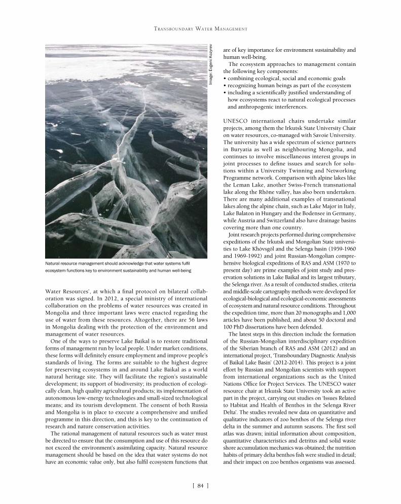
[ ]84
TRANSBOUNDARY WATER MANAGEMENT
are of key importance for environment sustainability and human well-being.
The ecosystem approaches to management contain the following key components:• combining ecological, social and economic goals• recognizing human beings as part of the ecosystem• including a scientifically justified understanding of
how ecosystems react to natural ecological processes and anthropogenic interferences.
UNESCO international chairs undertake similar projects, among them the Irkutsk State University Chair on water resources, co-managed with Savoie University. The university has a wide spectrum of science partners in Buryatia as well as neighbouring Mongolia, and continues to involve miscellaneous interest groups in joint processes to define issues and search for solu-tions within a University Twinning and Networking Programme network. Comparison with alpine lakes like the Leman Lake, another Swiss-French transnational lake along the Rhône valley, has also been undertaken. There are many additional examples of transnational lakes along the alpine chain, such as Lake Major in Italy, Lake Balaton in Hungary and the Bodensee in Germany, while Austria and Switzerland also have drainage basins covering more than one country.
Joint research projects performed during comprehensive expeditions of the Irkutsk and Mongolian State universi-ties to Lake Khövsgöl and the Selenga basin (1959-1960 and 1969-1992) and joint Russian-Mongolian compre-hensive biological expeditions of RAS and ASM (1970 to present day) are prime examples of joint study and pres-ervation solutions in Lake Baikal and its largest tributary, the Selenga river. As a result of conducted studies, criteria and middle-scale cartography methods were developed for ecological-biological and ecological-economic assessments of ecosystem and natural resource conditions. Throughout the expedition time, more than 20 monographs and 1,000 articles have been published, and about 50 doctoral and 100 PhD dissertations have been defended.
The latest steps in this direction include the formation of the Russian-Mongolian interdisciplinary expedition of the Siberian branch of RAS and ASM (2012) and an international project, ‘Transboundary Diagnostic Analysis of Baikal Lake Basin’ (2012-2014). This project is a joint effort by Russian and Mongolian scientists with support from international organizations such as the United Nations Office for Project Services. The UNESCO water resource chair at Irkutsk State University took an active part in the project, carrying out studies on ‘Issues Related to Habitat and Health of Benthos in the Selenga River Delta’. The studies revealed new data on quantitative and qualitative indicators of zoo benthos of the Selenga river delta in the summer and autumn seasons. The first soil atlas was drawn; initial information about composition, quantitative characteristics and detritus and solid waste shore accumulation mechanics was obtained; the nutrition habits of primary delta benthos fish were studied in detail; and their impact on zoo benthos organisms was assessed.
Water Resources’, at which a final protocol on bilateral collab-oration was signed. In 2012, a special ministry of international collaboration on the problems of water resources was created in Mongolia and three important laws were enacted regarding the use of water from these resources. Altogether, there are 56 laws in Mongolia dealing with the protection of the environment and management of water resources.
One of the ways to preserve Lake Baikal is to restore traditional forms of management run by local people. Under market conditions, these forms will definitely ensure employment and improve people’s standards of living. The forms are suitable to the highest degree for preserving ecosystems in and around Lake Baikal as a world natural heritage site. They will facilitate the region’s sustainable development; its support of biodiversity; its production of ecologi-cally clean, high quality agricultural products; its implementation of autonomous low-energy technologies and small-sized technological means; and its tourism development. The consent of both Russia and Mongolia is in place to execute a comprehensive and unified programme in this direction, and this is key to the continuation of research and nature conservation activities.
The rational management of natural resources such as water must be directed to ensure that the consumption and use of this resource do not exceed the environment’s assimilating capacity. Natural resource management should be based on the idea that water systems do not have an economic value only, but also fulfil ecosystem functions that
Natural resource management should acknowledge that water systems fulfil
ecosystem functions key to environment sustainability and human well-being
Imag
e: E
vgen
i Koz
yrev
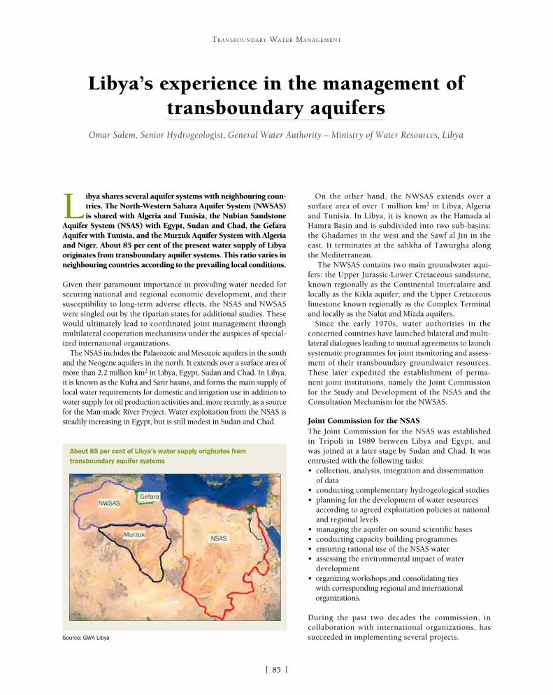
[ ]85
Libya’s experience in the management of transboundary aquifers
Omar Salem, Senior Hydrogeologist, General Water Authority – Ministry of Water Resources, Libya
L ibya shares several aquifer systems with neighbouring coun-tries. The North-Western Sahara Aquifer System (NWSAS) is shared with Algeria and Tunisia, the Nubian Sandstone
Aquifer System (NSAS) with Egypt, Sudan and Chad, the Gefara Aquifer with Tunisia, and the Murzuk Aquifer System with Algeria and Niger. About 85 per cent of the present water supply of Libya originates from transboundary aquifer systems. This ratio varies in neighbouring countries according to the prevailing local conditions.
Given their paramount importance in providing water needed for securing national and regional economic development, and their susceptibility to long-term adverse effects, the NSAS and NWSAS were singled out by the riparian states for additional studies. These would ultimately lead to coordinated joint management through multilateral cooperation mechanisms under the auspices of special-ized international organizations.
The NSAS includes the Palaeozoic and Mesozoic aquifers in the south and the Neogene aquifers in the north. It extends over a surface area of more than 2.2 million km2 in Libya, Egypt, Sudan and Chad. In Libya, it is known as the Kufra and Sarir basins, and forms the main supply of local water requirements for domestic and irrigation use in addition to water supply for oil production activities and, more recently, as a source for the Man-made River Project. Water exploitation from the NSAS is steadily increasing in Egypt, but is still modest in Sudan and Chad.
On the other hand, the NWSAS extends over a surface area of over 1 million km2 in Libya, Algeria and Tunisia. In Libya, it is known as the Hamada al Hamra Basin and is subdivided into two sub-basins: the Ghadames in the west and the Sawf al Jin in the east. It terminates at the sabkha of Tawurgha along the Mediterranean.
The NWSAS contains two main groundwater aqui-fers: the Upper Jurassic-Lower Cretaceous sandstone, known regionally as the Continental Intercalaire and locally as the Kikla aquifer; and the Upper Cretaceous limestone known regionally as the Complex Terminal and locally as the Nalut and Mizda aquifers.
Since the early 1970s, water authorities in the concerned countries have launched bilateral and multi-lateral dialogues leading to mutual agreements to launch systematic programmes for joint monitoring and assess-ment of their transboundary groundwater resources. These later expedited the establishment of perma-nent joint institutions, namely the Joint Commission for the Study and Development of the NSAS and the Consultation Mechanism for the NWSAS.
Joint Commission for the NSASThe Joint Commission for the NSAS was established in Tripoli in 1989 between Libya and Egypt, and was joined at a later stage by Sudan and Chad. It was entrusted with the following tasks:• collection, analysis, integration and dissemination
of data• conducting complementary hydrogeological studies • planning for the development of water resources
according to agreed exploitation policies at national and regional levels
• managing the aquifer on sound scientific bases• conducting capacity building programmes• ensuring rational use of the NSAS water• assessing the environmental impact of water
development• organizing workshops and consolidating ties
with corresponding regional and international organizations.
During the past two decades the commission, in collaboration with international organizations, has succeeded in implementing several projects.
TRANSBOUNDARY WATER MANAGEMENT
About 85 per cent of Libya’s water supply originates from transboundary aquifer systems
Source: GWA Libya

[ ]86
TRANSBOUNDARY WATER MANAGEMENT
The project succeeded in defining the technical param-eters of the aquifer system and in building a common geographic information system controlled data base. A mathematical model to simulate aquifer response to future development schemes was developed for later use by the water authorities in the three countries as a valuable management tool.
At the end of this phase, the three countries signed an agreement to establish a consultation mechanism to be hosted by the Sahara and Sahel Observatory in Tunisia and financially supported by the member countries. A Coordination Unit was appointed in 2002 and was commissioned to carry out the following tasks:• manage and update the data base and the
simulation model• develop and monitor a reference observation network• process, analyse and validate data • develop databases on socioeconomic activities
related to water use • develop and publish indicators on the use of
water resources • promote and facilitate the conduct of joint studies
and research• formulate and implement training programmes• update the NWSAS model periodically.
The NWSAS Project – Phase 2Under phase 2, complementary studies covering related hydrogeological components were conducted. These were studies of the Libyan-Tunisian Gefara Plain aquifer system; the Algerian and Tunisian Shotts; the Western Erg in Algeria; and a socioeconomic study.
The NSAS Joint Commission and the NWSAS Consultation Mechanism represent a step on the right track for the sound management of transboundary aquifers in the region. However, more efforts should be devoted to strengthening the technical capac-ity of the competent institutions with special focus on governance, transparency and legislation. Future initiatives will primarily focus on securing political and financial support; periodical updating of databases and models; and harmonizing legislation and policies.
A regional centreIn recognition of the importance of sound management of shared aquifers, Libya has requested the International Hydrological Programme (IHP) council to establish a regional centre under the auspices of the United Nations Educational, Scientific and Cultural Organization (UNESCO). This will be devoted to the management of shared aquifer resources in Africa and the Arab region, with the aim of providing training facilities to African experts and organizing seminars and meetings to facili-tate the dissemination of knowledge among African countries. During its fifteenth session in June 2002, the Intergovernmental Council of IHP adopted resolution XV-10 welcoming the establishment of the centre. An agreement for the establishment of the centre was signed in Tripoli by the Director-General of UNESCO and the
Regional strategy for the utilization of the NSASThe NSAS Regional Strategy project, launched in 1998, was financed in its first phase by the International Fund for Agricultural Development (IFAD) and executed by the Centre for Environment and Development for the Arab Region and Europe. The project aims at reviewing previous studies, preparing a regional hydrogeological study, establishing a common data base and preparing a math-ematical model to simulate future aquifer behaviour in response to national development schemes. A second phase of the project covered the socioeconomic component and was financed by the Islamic Development Bank.
The NSAS ProjectThe project was launched in 2005 by the International Atomic Energy Agency and the Global Environment Facility as executing agencies and the United Nations Development Programme as the implementation agency. The long-term goal of the project was to realize a rational and equitable management of the NSAS for sustain-able socioeconomic development and the protection of biodiversity and land resources. The immediate objectives are to strengthen and consolidate the management consultation mechanism between the four countries; to expand, update and consolidate the common database and mathematical model; and to create an enabling envi-ronment to secure sustainable management of the NSAS.
Consultation Mechanism for the NWSASLikewise, cooperation between Libya, Algeria and Tunisia in manag-ing shared aquifers dates back to the mid 1970s in the form of bilateral and trilateral committees for the exchange of hydrogeo-logical information and the coordination of planned development activities. This collaboration resulted in the creation of a permanent Consultation Mechanism for the NWSAS. Key achievements include the implementation of the two phases of the NWSAS project.
The NWSAS Project – Phase 1Phase 1 of the NWSAS project started in July 1999 and was initially financed by the International Fund for Agricultural Development.
Coordinated joint management of Libya’s shared aquifer systems is achieved through
multilateral cooperation mechanisms
Imag
e: G
WA
Lib
ya

[ ]87
TRANSBOUNDARY WATER MANAGEMENT
Secretary of Agriculture of Libya in 2007. The centre assumed its duties in 2008 in Tripoli after the ratification of the agreement by the Libyan authorities.
Key objectives were defined for the centre. It aims to generate and provide scientific and technical information and support the exchange of information on shared groundwater management issues, with emphasis on Africa and the Arab states. It will promote cooperation on multidisciplinary research and the compilation of case studies on shared groundwater management in the region involving international institutions and networks, especially those under the UNESCO/IHP and World Meteorological Organization auspices. It will undertake capacity building on integrated water and agriculture management within the African region at institutional, professional and educational levels, including awareness raising activities to the general public and to specific targeted audiences. In addition to seeking and responding to invitations for cooperation with international institutions and centres, it will advance methodology in the field of shared groundwater manage-ment, support and cooperation with the IHP Internationally Shared Aquifer Resources Management (ISARM) project.
Addressing transboundary aquifer issuesDuring the past three decades and in coordination with relevant inter-national organizations, particularly UNESCO, Libya has hosted a number of technical and political conferences of paramount importance in addressing transboundary aquifer issues in Africa and the world.
Apart from active participation in international and regional events on groundwater management in general and transboundary aquifers in particular, the Libyan IHP national committee, in coordination with UNESCO, organized three international conferences. The first was the International Conference on Regional Aquifer Systems in Arid Zones – Managing Non-renewable Resources, held in Tripoli in November 1999. The conference marked a milestone in the discussion of the emerging concept of regional aquifers and provided a general understanding of non-renewable groundwater resources. It was also instrumental in launching the UNESCO ISARM initiative.
The other two main events are the International Conferences on Managing Shared Aquifer Resources in Africa, held in Tripoli in June 2002 and May 2008. These conferences focused more specifically on the technical components of transboundary aquifers in Africa and succeeded in providing sound scientific data. They have also contrib-
uted to the creation of networks of experts who, over the years, have continued to engage with the realization of rational management and sustainable development issues of transboundary aquifers in the continent. They succeeded in providing a suitable atmosphere for African and international experts to debate issues related to shared aquifers in the region, and formed a platform to highlight and discuss the activities of the UNESCO ISARM initiative in Africa with emphasis on expanding the existing network of experts and making proposals for new subregional activities. The technical sessions reviewed experiences on existing scientific knowledge, leading to the establishment of a plan of action for shared aquifer resources management in Africa.
At the political level and in collaboration with the African Union, Food and Agriculture Organization and a number of competent organizations, Libya managed to organize two major events, namely the Extraordinary Summit of the African General Assembly of the Heads of State and Government on Agriculture and Water (Sirte, 2004) and the High Level Conference on Water for Agriculture and Energy in Africa – The Challenges of Climate Change (Sirte, 2008). Item six of the Sirte Declaration of the African Union extraordinary summit urged member states to “encourage bilateral agreement on shared water management.”
Management of shared aquifers faces major challenges, with serious implications for the progress of hydrogeo-logical studies and data collection campaigns as a result of their wide geographical spread under barren desert conditions. For economic and technical reasons, the bulk of extracted water originates from shallow and inter-mediate aquifers and rarely from deeper horizons. This raises the degree of uncertainty in mathematical models. Nevertheless, geological, geophysical and hydrogeological data generated by oil exploration activities are invaluable in filling gaps while conducting regional studies. Other challenges that still need to be properly addressed include the lack of necessary funds needed to carry out special technical tasks and provide training for competent indi-viduals. An equally important challenge is the lack of a binding legal framework. National legislation often defines priorities for water use in view of available alternatives. In Libya as in some other countries, for example, water scarcity led to the justification of groundwater mining as a transitory solution to close the gap between supply and demand, a matter that needs to be properly addressed by the joint consultation mechanisms.
Libya has acquired broad experience in the manage-ment of shared aquifer systems through a long history of close and transparent collaboration with neighbouring countries. This culminated in the establishment of joint institutions focusing on the exchange of information, conducting regional studies and planning for rational exploitation of the resource. Libya is looking forward to the enactment of an international law that supersedes national legislation with regard to transboundary aquifers and governs the equitable use and protection of the shared resources to achieve sustainable development for all.
Capacity building on integrated water and agriculture management is one objective
of the UNESCO IHP regional centre
Imag
e: G
WA
Lib
ya

[ ]88
Transboundary groundwater resources management implemented in the
Kumamoto region of Japan Tadashi Tanaka, Department of International Affairs, University of Tsukuba, Japan
The Transboundary Groundwater Resources Management system is a typical groundwater management system implemented in the Kumamoto region of Japan. The
system was introduced in 2004 and, in cooperation with neigh-bouring municipalities, the Kumamoto City government has created a unique funding system to encourage artificial ground-water recharge projects through abandoned rice paddy fields in neighbouring towns outside the city boundary. These will enable sustainable use and management of regional groundwa-ter resources and the passing down of this precious resource to future generations. The groundwater management system is regulated by the Kumamoto City, local governments and the city people. It provides a good example for assessing and manag-ing aquifer systems crossing regional administrative boundaries within a given country, as well as of a typical self-governance system for managing regional groundwater resources.
In addition to aquifers that continental countries share with other countries, there are aquifers crossing regional administrative bounda-ries within a given country. These aquifers are distributed in different parts of Japan which have diverse regulations and social conditions.
The monitoring and management of such aquifers need at least the same amount attention as those of trans-boundary aquifers between national boundaries.
There is currently no unified national law in Japan to manage groundwater resources except for preservation of the land against subsidence. Therefore, the right of groundwater resources belongs to the landowners.
Two groundwater laws, the Industrial Water Law introduced in 1956 and the Law on Regulating the Extraction of Groundwater for Use in Buildings intro-duced in 1962, are effective across Japan, but practical application of these laws to a specific area has been decided by local government. For example, the Tokyo Metropolitan Government has succeeded in reduc-ing the rate of land subsidence by converting water resources for industrial use from groundwater to surface water, and by providing legislative guidance to save groundwater resources in factories and build-ings depending on these two laws. However, bordering prefectures are still suffering from land subsidence.
Besides preservation of the land against subsid-ence, however, a new concept is now growing among Japanese municipalities, communities and citizens. They see groundwater as a shared natural resource that needs to be managed on that basis. One typical groundwater management system is the Transboundary Groundwater Resources Management system implemented in the Kumamoto region of Japan. The artificial groundwater recharge project proposed by this system, using abandoned rice paddy fields, is considered an excellent example of ground-water management in Japan.
The vast groundwater reservoir and regional groundwater flow system cover 13 local governments including Kumamoto City, with an area of around 1,040 km2 and 1 million residents. All the water for the city’s residents is supplied from these abundant, pure and crystal-clean groundwater resources. Most of the region is covered by pyroclastic deposits created by the four major eruptions of Mount Aso between 0.26 Ma and 0.09 Ma. There are two main aquifer systems, namely the unconfined aquifer (No. 1 aquifer) and the confined aquifer (No. 2 aquifer). The No. 2 aquifer
TRANSBOUNDARY WATER MANAGEMENT
Transboundary aquifer crossing 13 local governments in the Kumamoto region
Source: T. Tanaka
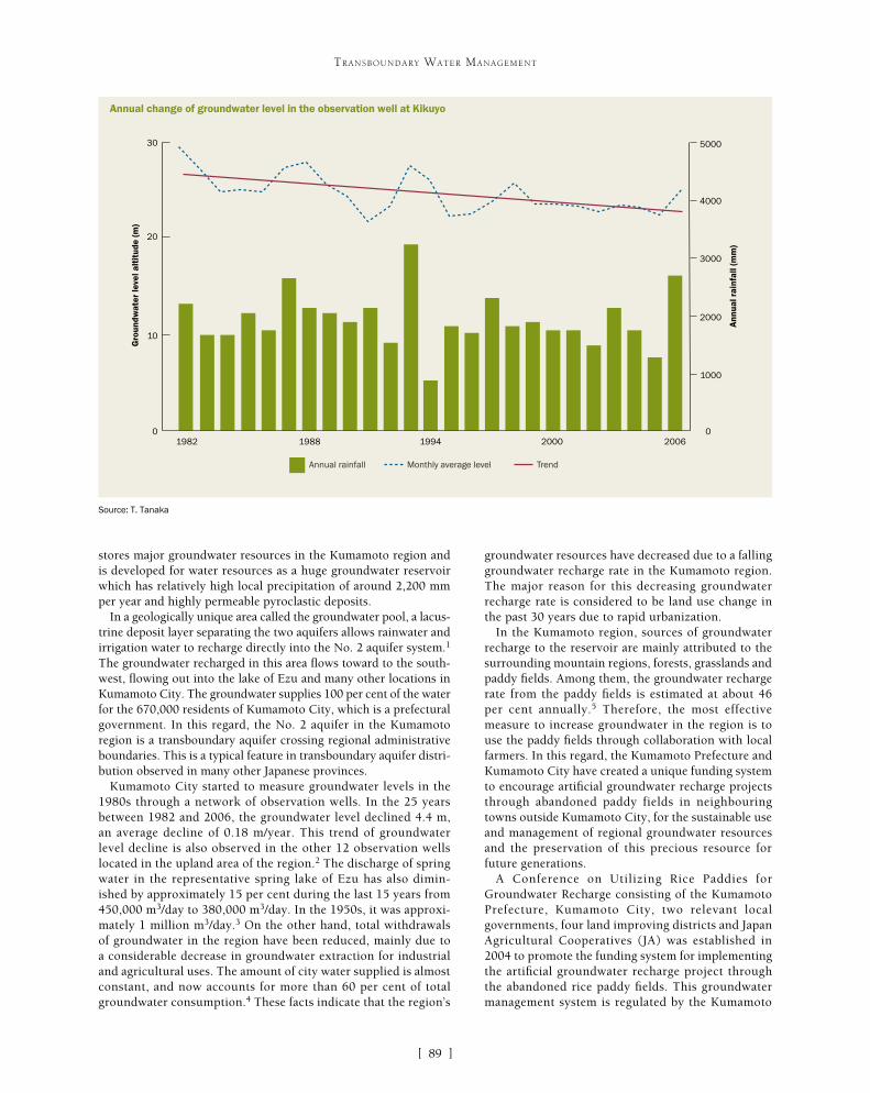
[ ]89
TRANSBOUNDARY WATER MANAGEMENT
groundwater resources have decreased due to a falling groundwater recharge rate in the Kumamoto region. The major reason for this decreasing groundwater recharge rate is considered to be land use change in the past 30 years due to rapid urbanization.
In the Kumamoto region, sources of groundwater recharge to the reservoir are mainly attributed to the surrounding mountain regions, forests, grasslands and paddy fields. Among them, the groundwater recharge rate from the paddy fields is estimated at about 46 per cent annually.5 Therefore, the most effective measure to increase groundwater in the region is to use the paddy fields through collaboration with local farmers. In this regard, the Kumamoto Prefecture and Kumamoto City have created a unique funding system to encourage artificial groundwater recharge projects through abandoned paddy fields in neighbouring towns outside Kumamoto City, for the sustainable use and management of regional groundwater resources and the preservation of this precious resource for future generations.
A Conference on Utilizing Rice Paddies for Groundwater Recharge consisting of the Kumamoto Prefecture, Kumamoto City, two relevant local governments, four land improving districts and Japan Agricultural Cooperatives (JA) was established in 2004 to promote the funding system for implementing the artificial groundwater recharge project through the abandoned rice paddy fields. This groundwater management system is regulated by the Kumamoto
stores major groundwater resources in the Kumamoto region and is developed for water resources as a huge groundwater reservoir which has relatively high local precipitation of around 2,200 mm per year and highly permeable pyroclastic deposits.
In a geologically unique area called the groundwater pool, a lacus-trine deposit layer separating the two aquifers allows rainwater and irrigation water to recharge directly into the No. 2 aquifer system.1 The groundwater recharged in this area flows toward to the south-west, flowing out into the lake of Ezu and many other locations in Kumamoto City. The groundwater supplies 100 per cent of the water for the 670,000 residents of Kumamoto City, which is a prefectural government. In this regard, the No. 2 aquifer in the Kumamoto region is a transboundary aquifer crossing regional administrative boundaries. This is a typical feature in transboundary aquifer distri-bution observed in many other Japanese provinces.
Kumamoto City started to measure groundwater levels in the 1980s through a network of observation wells. In the 25 years between 1982 and 2006, the groundwater level declined 4.4 m, an average decline of 0.18 m/year. This trend of groundwater level decline is also observed in the other 12 observation wells located in the upland area of the region.2 The discharge of spring water in the representative spring lake of Ezu has also dimin-ished by approximately 15 per cent during the last 15 years from 450,000 m3/day to 380,000 m3/day. In the 1950s, it was approxi-mately 1 million m3/day.3 On the other hand, total withdrawals of groundwater in the region have been reduced, mainly due to a considerable decrease in groundwater extraction for industrial and agricultural uses. The amount of city water supplied is almost constant, and now accounts for more than 60 per cent of total groundwater consumption.4 These facts indicate that the region’s
Annual change of groundwater level in the observation well at Kikuyo
Source: T. Tanaka
0
30
10
20
0
5000
4000
Gro
undw
ater
leve
l alt
itud
e (m
)
Ann
ual r
ainf
all (
mm
)
1982 1988 1994 2000 2006
3000
2000
1000
Annual rainfall Monthly average level Trend

[ ]90
TRANSBOUNDARY WATER MANAGEMENT
City, two local governments and the large groundwater users in the city areas to support the funding system. Each year the Kumamoto Prefecture, Kumamoto City and two local governments together with JA discuss development initiatives and the preservation of groundwater resources in the region. During the six years 2004-20096 the system increased the recharged area of abandoned paddy fields from 255 hectares per month to around 550 hectares per month, while esti-mated groundwater recharge amounts increased from 8.73 million m3/year to 16.77 million m3/year. As a result, the spring discharge rate in Lake Ezu, which is located in the discharge area of the groundwater flow system in the Kumamoto region, has recovered to a level of around 12 years before.
Accepting those fruitful effects of the system for groundwater recharge, the Kumamoto Prefecture and 13 local governments made a long-term groundwater management plan in 2008, for which the target year is 2024. According to a report by Kumamoto City, the target groundwater recharge amount in 2024 has been set at 73 million m3/year, with reduced groundwa-ter withdrawals set at 16 million m3/year. This target groundwater recharge amount for the Kumamoto
Artificial groundwater recharge through an abandoned rice paddy field (left: before flooding, right: after flooding)
Conference on Utilizing Rice Paddies for Groundwater Recharge in the Kumamoto region
Conference on Utilizing Rice Paddies for Groundwater Recharge
(Consisting of Kumamoto Pref.,Kumamoto City, relevant two local
governments, four local land improving districts and JA)
Kumamoto City
Corporative farmers
Conf. on Proc Agricul.of Water Cycle Type
(Relevant two local governments, four local
land improving districts and JA)
Effective recharge to groundwater reservoir
Proceeding and adjustment of the project
Discharge Recharge
Financial support
Financial support
Make an application and report
Make an application
Source: T. Tanaka
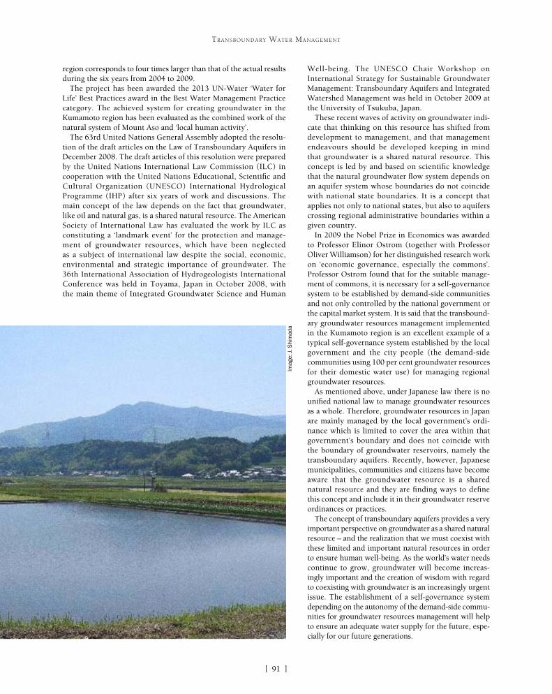
[ ]91
TRANSBOUNDARY WATER MANAGEMENT
region corresponds to four times larger than that of the actual results during the six years from 2004 to 2009.
The project has been awarded the 2013 UN-Water ‘Water for Life’ Best Practices award in the Best Water Management Practice category. The achieved system for creating groundwater in the Kumamoto region has been evaluated as the combined work of the natural system of Mount Aso and ‘local human activity’.
The 63rd United Nations General Assembly adopted the resolu-tion of the draft articles on the Law of Transboundary Aquifers in December 2008. The draft articles of this resolution were prepared by the United Nations International Law Commission (ILC) in cooperation with the United Nations Educational, Scientific and Cultural Organization (UNESCO) International Hydrological Programme (IHP) after six years of work and discussions. The main concept of the law depends on the fact that groundwater, like oil and natural gas, is a shared natural resource. The American Society of International Law has evaluated the work by ILC as constituting a ‘landmark event’ for the protection and manage-ment of groundwater resources, which have been neglected as a subject of international law despite the social, economic, environmental and strategic importance of groundwater. The 36th International Association of Hydrogeologists International Conference was held in Toyama, Japan in October 2008, with the main theme of Integrated Groundwater Science and Human
Well-being. The UNESCO Chair Workshop on International Strategy for Sustainable Groundwater Management: Transboundary Aquifers and Integrated Watershed Management was held in October 2009 at the University of Tsukuba, Japan.
These recent waves of activity on groundwater indi-cate that thinking on this resource has shifted from development to management, and that management endeavours should be developed keeping in mind that groundwater is a shared natural resource. This concept is led by and based on scientific knowledge that the natural groundwater flow system depends on an aquifer system whose boundaries do not coincide with national state boundaries. It is a concept that applies not only to national states, but also to aquifers crossing regional administrative boundaries within a given country.
In 2009 the Nobel Prize in Economics was awarded to Professor Elinor Ostrom (together with Professor Oliver Williamson) for her distinguished research work on ‘economic governance, especially the commons’. Professor Ostrom found that for the suitable manage-ment of commons, it is necessary for a self-governance system to be established by demand-side communities and not only controlled by the national government or the capital market system. It is said that the transbound-ary groundwater resources management implemented in the Kumamoto region is an excellent example of a typical self-governance system established by the local government and the city people (the demand-side communities using 100 per cent groundwater resources for their domestic water use) for managing regional groundwater resources.
As mentioned above, under Japanese law there is no unified national law to manage groundwater resources as a whole. Therefore, groundwater resources in Japan are mainly managed by the local government’s ordi-nance which is limited to cover the area within that government’s boundary and does not coincide with the boundary of groundwater reservoirs, namely the transboundary aquifers. Recently, however, Japanese municipalities, communities and citizens have become aware that the groundwater resource is a shared natural resource and they are finding ways to define this concept and include it in their groundwater reserve ordinances or practices.
The concept of transboundary aquifers provides a very important perspective on groundwater as a shared natural resource – and the realization that we must coexist with these limited and important natural resources in order to ensure human well-being. As the world’s water needs continue to grow, groundwater will become increas-ingly important and the creation of wisdom with regard to coexisting with groundwater is an increasingly urgent issue. The establishment of a self-governance system depending on the autonomy of the demand-side commu-nities for groundwater resources management will help to ensure an adequate water supply for the future, espe-cially for our future generations.
Imag
e: J
. Shi
mad
a

[ ]92
Transboundary water management in the Zambezi and Congo river basins: a situation analysis
Ngosa Howard Mpamba, Assistant Director, Water Resources Management and Christopher Chileshe, Director, Ministry of Mines, Energy and Water Development, Department of Water Affairs, Zambia
The Republic of Zambia lies entirely within two of Africa’s major transboundary river basins, the Zambezi River Basin and the Congo River Basin. Zambia is also the
source of these two internationally important river systems. The Zambezi basin is shared by eight countries, while 10 countries share the Congo basin, underlining the importance of trans-boundary water management in the region.
The Zambezi River Basin is shared by countries such as Zambia, Angola, Namibia, Zimbabwe, Mozambique, Malawi and Tanzania. It has more than 40 million inhabitants and covers an area of 1.39 million km2. The river flows into the Indian Ocean after traversing a distance of 2,574 km from a source located in the north-western part of Zambia.
The Congo River Basin is shared by countries such as Zambia, the Democratic Republic of the Congo, Angola, Burundi, Cameroon, the Central African Republic, Republic of the Congo, Rwanda and Tanzania. It covers an area of just over 4 million km2. The Congo river crosses a distance of 4,700 km from its source in the north-eastern part of Zambia before flowing into the Atlantic Ocean.
According to the water resources master plan for Zambia, 75 per cent of the country’s territory is in the Zambezi River Basin
and 25 per cent in the Congo River Basin. Within the boundaries of Zambia, the Zambezi River Basin comprises three major river systems: the upper main Zambezi, Kafue and Luangwa. The Congo River Basin comprises two major river systems, namely the Chambeshi-Luapula and Tanganyika. The Chambeshi river whose source is in the north-eastern part of Zambia, and the Zambezi River whose source is in the north-western part of Zambia, are generally considered the source of the Zambezi and Congo rivers respectively. This is in line with the worldwide acceptable hydrological practice of using the longest tributary to define the source of a river. The internally-generated renewable water resources in Zambia are estimated at 100 km3 of surface water and 49.6 km3 of groundwater, and represent 8,700 m3 per person per year. The Kafue river system has the highest population distribution followed by the Zambezi river system, with the Luangwa river system ranking third.
A situation analysis will outline Zambia’s prepar-edness and participation in transboundary water management. This is based on the national legal
TRANSBOUNDARY WATER MANAGEMENT
The Congo and Zambezi river basins
Dem. Rep. Congo
Tanzania
Mozambique
MalawiZambiaAngola
Atlantic Ocean
Rep. Congo
Gabon
Eq. Guinea
Cameroon
NigeriaChad
Central African RepublicSudan Ethiopia
KenyaUganda
RwandaBurundi
Tanzania
Malawi
Mozambique
Indian Ocean
ZimbabweZambezi Rive
r
Zambia
BotswanaNamibia
Angola
Source: World Water Congress, 2008, SADC, 1995 & Phiri, 2007

[ ]93
TRANSBOUNDARY WATER MANAGEMENT
Convention on the Law of Non-Navigational Uses of International Watercourses, the Ramsar Convention, the United Nations Framework Convention on Climate Change and the United Nations Convention on Biological Diversity. Furthermore, it is also a signatory to two international agreements on the shared management of Lake Tanganyika and the Kariba Dam on the Zambezi river. Lack of provi-sion for the management of international waters in the 1949 Water Act created a dilemma for Zambia over whether to sign the Zambezi Watercourse Management Commission (ZamCom) agreement in 2004. As such, Zambia needed to consult its stake-holders before signing the agreement. However, as part of the efforts to facilitate benefit sharing in the Zambezi River Basin, Zambia embarked on water sector reforms. Technical cooperation in the Zambezi River Basin also exists among the large hydropower dam operators and government institutions through the Joint Operations Technical Committee involving Zambia, Zimbabwe and Mozambique. Furthermore, frequent droughts and floods have brought in another dimension of technical cooperation on hydrological data exchange between Zambia and Mozambique.
Two key government ministries are directly involved in Zambia’s water sector reforms. One is the Ministry of Mines, Energy and Water Development which is currently responsible for water, under which the Department of Water Affairs (DWA) has been performing water resources management functions. The other is the Ministry of Local Government and Housing (MLGH), under which the Department of Housing and Infrastructure Development (DHID) is responsible for water supply and sanitation functions. In the early 1970s, the Government of the Republic of Zambia (GRZ) initiated a dialogue on water sector reforms. Three key reports were prepared:• the DWA report on the proposed Zambia National
Water Authority (July 1979)• the report by Zambia Industrial and Mining
Corporation on the establishment of the proposed National Water Authority (1985)
• the report by the Ministry of Decentralization on the Reorganization Study of the Water and Sanitation Sector in Zambia (1988).
However, it was not until 1994 that GRZ officially embarked on the implementation of the water sector reforms with regard to policy formulation, re-examin-ing the legal and institutional framework and bringing it in line with modern principles of water governance and other pieces of legislation.
The first National Water Policy was adopted in 1994, primarily to guide the restructuring of the water sector with a focus on the water supply and sanitation subsec-tor. Hence, water supply and sanitation functions were transferred from the ministry responsible for water to the MLGH. This was followed by major achievements in the development of the legal and institutional framework,
framework, secondary data, reports, publications, key informant interviews and presentations shared at the Sub-Saharan Africa Water Sector Reform Consultative Meeting organized by the Republic of Zambia in Lusaka in June 2013. A further examination of the water sector reform process in Zambia, with respect to the existing regional and international water resources management instru-ments, will enable an evaluation of how these have influenced and shaped the water sector reforms.
Until October 2012, the Water Act Cap 198 of 1949 was the principal act for the allocation of surface water resources through the system of water rights. The major constraints of this law were that it did not elaborate on sustainable water resource manage-ment practices and never provided for groundwater regulation and international water resource management. However, at the regional and international levels, Zambia has been a signatory to a number of international treaties related to the water sector. These include the Southern African Development Community (SADC) revised protocol on shared watercourses, the United Nations
Major river system in Zambia
Zambezi
Kafue
Luangwa
Chambeshi-Luapula
Tanganyika
Population distribution (%)
23.72
39.98
18.3
16.88
1.13
Population of Zambia’s major river systems
Source: Modified after JICA Report, 1995
The six catchments in Zambia
DEMOCRATIC REPUBLIC OF CONGO
ANGOLA
Kwando
ZAMBEZI
Zam
bezi
Kaoma
Sioma Ngwezi N.P.
NAMIBIA BOTSWANALivingstone
ZIMBABWE
ZAMBIA
KAFUEKafue N.P. Kabwe
Lusaka
LUANGWA
CHAMBESHILUAPULA
TANGANYIKA
NdolaLuanshya
MufuliraChingola
LumbumbashiMwinilunga
KolweziLikasi
Vila do Zumbo
MOZAMBIQUE
MALAWI
Muc
hing
a M
ount
ains
Luap
ula
L. Mweru
L. Tanganyika TANZANIA
Chambeshi
L. Bangweulu
L. Kariba National Parks
International boundary
Roads
Source: National Water Policy, 2010

[ ]94
TRANSBOUNDARY WATER MANAGEMENT
as evidenced by the Water Supply and Sanitation Act of 1997; the establishment of the National Water Supply and Sanitation Council (NWASCO) as a regulator for service provision under the water supply and sanitation subsector; the creation of commercial utilities (CUs) owned by local authorities for improved water supply and sanitation service provision in urban and peri-urban areas; the establishment of the Devolution Trust Fund (a pro-poor fund currently supported by cooperating partners to facilitate investment for improved water supply and sanitation service provision in peri-urban areas by CUs); and the provision of support for the sustainable operation and main-tenance of rural water supply facilities by user communities. Water sector reforms in Zambia have been guided by the following seven sector principles adopted by GRZ in 1994:• separation of water resources management
from water supply and sanitation• separation of regulatory and executive functions• devolution of authority to local authorities and
private enterprises• full cost recovery in the long term• human resources development leading to more effective
institutions• technology appropriate to local conditions • increased GRZ priority and budget spending to the sector.
More importantly, Zambia can now state that 61 per cent of the rural population have access to improved safe water supply sources and 48 per cent have access to adequate sanitation. The statistics for urban areas are 78 per cent and 50 per cent respectively.
In order to address shortcomings and enhance service provision in the water resources manage-ment subsector, the 1994 National Water Policy was revised in 2010. The revised policy now has provisions for the management of water resources at catchment level in the country to ensure efficiency, and provisions for the development of a legal and institutional framework for management of interna-tional waters. It also recognizes that water is a scarce and precious resource, and thereby outlines the broad principles that govern the management of the country’s water resources in a sustainable manner. Most importantly, the policy reinforces integrated water resources management as the guiding princi-ple to optimally harness water resources for efficient and sustainable utilization for enhanced economic productivity and poverty reduction. The country is now subdivided into six catchments: Zambezi, Kafue, Luangwa, Chambeshi, Luapula and Tanganyika.
To complete the water sector reforms that started in 1994 with the water supply and sanitation subsector, the Zambian parliament enacted the Water Resources Management (WRM) Act, No. 21 of 2011 as a new legal framework for the water resources management subsector. Unlike the 1949 Water Act, the new legal framework specifically includes the regulation of groundwater and provides for the establishment of institutions responsible for water resources manage-
Community dam management meeting in Gwembe District A rural water supply borehole in Gwembe District
Imag
e: N
.H. M
pam
ba
Imag
e: N
.H. M
pam
ba
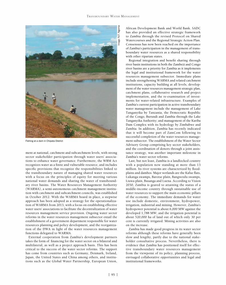
[ ]95
TRANSBOUNDARY WATER MANAGEMENT
African Development Bank and World Bank. SADC has also provided an effective strategic framework to Zambia through the revised Protocol on Shared Watercourses and the Regional Strategic Action Plan. Consensus has now been reached on the importance of Zambia’s participation in the management of trans-boundary water resources as a shared responsibility with other riparian states.
Regional integration and benefit sharing through river basin institutions in both the Zambezi and Congo river basins are a priority for Zambia as it implements the legal and institutional framework for the water resources management subsector. Immediate plans include strengthening WARMA and related catchment institutions, capacity building at all levels, develop-ment of the water resources management strategic plan, catchment plans, collaborative research and project implementation, and the re-examination of invest-ments for water-related infrastructure. Examples of Zambia’s current participation in active transboundary water management include the management of Lake Tanganyika by Tanzania, the Democratic Republic of the Congo, Burundi and Zambia through the Lake Tanganyika Authority; and management of the Kariba Dam Complex with its hydrology by Zimbabwe and Zambia. In addition, Zambia has recently indicated that it will become part of ZamCom following its successful completion of the water resources manage-ment subsector. The establishment of the Water Sector Advisory Group comprising key sector stakeholders, and the coordination of donors through a joint assis-tance strategy, was another important milestone in Zambia’s water sector reforms.
Last, but not least, Zambia is a landlocked country with a population now standing at more than 13 million. Its river systems are characterized by flood-plains and dambos. Major wetlands are the Kafue flats, Lukanga swamps, Barotse plain, Bangweulu swamps, Liuwa plain, Busanga and Luena. According to Vision 2030, Zambia is geared to attaining the status of a middle-income country through sustainable use of water resources to support the main economic pillars of the economy. The immediate demands for water use include domestic, environment, hydropower, irrigation, industrial and mining. However, Zambia’s hydropower potential is about 6,000 MW against the developed 1,788 MW; and the irrigation potential is about 520,000 ha of land out of which only 30 per cent is currently irrigated. Mining activities are also on the increase.
Zambia has made good progress in its water sector reforms although these reforms have generally been slow and lengthy, partly due to the national stake-holder consultative process. Nevertheless, there is evidence that Zambia has positioned itself for effec-tive transboundary water resources management from the viewpoint of its policy, planning process, envisaged collaborative opportunities and legal and institutional frameworks.
ment at national, catchment and subcatchment levels, with strong sector stakeholder participation through water users’ associa-tions to enhance water governance. Furthermore, the WRM Act recognizes water as a finite and vulnerable resource, and includes specific provisions that recognize the responsibilities linked to the transboundary nature of managing shared water resources with a focus on the principles of equity for meeting various national water demands and sharing the water of transbound-ary river basins. The Water Resources Management Authority (WARMA), a semi-autonomous catchment management institu-tion with catchment and subcatchment councils, was established in October 2012. With the WARMA board in place, a stepwise approach has been adopted as a strategy for the operationaliza-tion of WARMA from 2013, with a focus on establishing effective water users’ associations to facilitate the decentralization of water resources management service provision. Ongoing water sector reforms in the water resources management subsector entail the establishment of a government department responsible for water resources planning and policy development, and the reorganiza-tion of the DWA in light of the water resources management functions delegated to WARMA.
External cooperation from Zambia’s development partners takes the form of financing for the water sector on a bilateral and multilateral, as well as a project approach basis. This has been critical to the success of the water sector reforms. The support has come from countries such as Germany, Denmark, Ireland, Japan, the United States and China among others, and institu-tions such as the Global Water Partnership, European Union,
Fishing at a dam in Chipata District
Imag
e: N
.F. N
gom
a

[ ]96
Interactive open source information systems for fostering transboundary water cooperation
J. Ganoulis, Coordinator and Ch. Skoulikaris, Secretary, United Nations Educational, Scientific and Cultural Organization Chair/International Network of Water-Environment Centres for the Balkans
The world is undergoing a historic transformation with the explosion of new information and communication tech-nologies (ICTs) which have drastically changed methods
of international cooperation through the development of intra- and inter-electronic networks. The use of new web-based technologies for regional networking and distance cooperation presents an opportunity to face challenges in a new way.
The case of internationally shared water resources management and governance is of particular interest, because it combines physical, techni-cal, environmental, economical and political issues on regional, national, international and multicultural scales, and because it requires a multi-disciplinary approach at every level. The United Nations Educational, Scientific and Cultural Organization (UNESCO) Chair/International Network of Water-Environment Centres for the Balkans (INWEB) has developed and maintains on its website different geo-referenced open-source cooperative information systems, with the principal aim of facilitating cooperation and exchange of experience between scientists and stakeholders working in different socioeconomic environments, on the management and governance of transboundary water resources.1
Open source cooperative information systemsThe world is witnessing a revolution in the way information is shared and how communication takes place. With the recent exponential progress
of science and technology and the global communications revolution spearheaded by the Internet, innovations in organization, operational methods and communication have been adopted by the vast majority of economic activi-ties. New materials, products and software all appear on the market so fast that it has become difficult to keep up to date.
In the late 1970s, when software became independent from the hardware that had been used to create the first IBM computers in the early 1950s, different groups initi-ated the ‘open source’ software movement. In the 1990s, the well-known Unix and Linux open source operating systems clearly differentiated open source licenses from commercial ones. Open source software makes the source code avail-able for anybody to use or modify and it is very suitable for promoting cooperation, learning and understanding. With open source software such as Open Office, users are granted not only the right of functionality, as in the use of Microsoft Office, but can also own and modify the methodology. Examples of popular open source software products include Mozilla Firefox and Thunderbird, Google Chrome, Android and the Apache Open Office Suite. Google is one of the biggest companies supporting the open source movement and has developed more than 500 open source projects.
In the international environment, cooperation among scientific communities and countries is vital for the protec-tion and management of shared water resource systems that cross national boundaries, to safeguard against pollu-tion and floods, and to plan major infrastructure works for the development of internationally shared water basins. Successful regional cooperation requires that all partici-pants understand the importance of sharing information and knowledge at the appropriate time.
Information systems for water cooperationThe UNESCO Chair/INWEB is an international network of experts that aims to facilitate the exchange of information in the field of transboundary water; develop and maintain online inventories, information systems and databases; promote training and profes-sional education possibly by using new media and distance learning; and contribute to public education and sensitization in the field of water-environment.
One of INWEB’s early activities was to develop inven-tories of transboundary surface waters in South-Eastern Europe (SEE). Transboundary river and lake basins
TRANSBOUNDARY WATER MANAGEMENT
An inventory of transboundary non-Danubian surface waters in SEE
Source: UNESCO Chair/INWEB

[ ]97
TRANSBOUNDARY WATER MANAGEMENT
by the national experts of the countries participating in the project, the initial georeferenced information system was updated (Version 2 of the system). The final version couples a Google cloud database, in which all the relative information is stored, with Google Fusion Tables tech-nology, in order to spatially distribute the information on the total study area. JavaScript and the HTML5 program-ming languages were used for the creation of the platform. Furthermore, both these languages were used for sending requests and exchanging data asynchronously between browser and server to avoid full page reloads. Geographic information systems tools were used for the homogeniza-tion of the different vector files representing the aquifers (namely shape files) and for their projection to a common projection system (namely WGS 84).
The final version of the system incorporates all the attributes and characteristics of the second version as well as including:• presentation of a summary of the main data on each
basin (excerpts from questionnaires)• option to download descriptive information on the
basins in pdf format (questionnaires)• option to download the national reports on each
aquifer in pdf format• pop-up box with attributes for each country
participating in the project• integration of a ‘search’ module• selection between four different background
thematic Google maps• visualization of the spatial extent of the basins• demonstration of a comprehensive legend tool• ability to leave comments, either of a general nature
or related to a specific geolocation• automated e-mail notification to the identified
project recipients whenever comments are made.
located outside the Danube watershed were identified. The Mesta/Nestos River, shared by Bulgaria and Greece, and the Prespa Lakes, shared by three SEE countries, were two cases aimed at enhancing cooperation that gave promising results.
The main difficulties arising in transboundary water resources management and governance are a lack of:• political willingness for cooperation from countries on one or
both sides of the border and limited or non-effective exchange of data and information
• communication and understanding between scientists, water professionals, decision makers, stakeholders and the general public.
The principal aim of the developed georeferenced systems and plat-forms was to provide the appropriate tools needed to strengthen the capacity of water management institutions in the SEE region to implement sustainable forms of utilization, management and protec-tion of transboundary water resources.
The structure of the information systems, and the technologies used for their construction and design aim to:• facilitate water users to retrieve data related to transboundary
water resources• enable the national experts responsible for a country’s water
resources to use the system’s capabilities to update in real time information about the water bodies available on the platform
• support public participation by allowing users to provide comments (either general comments or those related to a specific geolocation) on the shared water basins that appear on the base map
• automatically generate e-mails to the workgroup whenever comments are made.
During the project implementation, an interactive map using Google Maps and Google Earth technologies was initially developed. This was based on existing maps indicating basic geographic informa-tion on transboundary water basins (location, boundaries, extent) (Version 1 of the georeferenced information system). After collecting and working on the data and the descriptive questionnaires submitted
Case study: the Prespa Lakes
Prespa Park is situated on the borders of Albania, Greece and the Former Yugoslav Republic of Macedonia (FYROM). The area of 2,519 km2 consists of two lakes: Micro Prespa and Macro Prespa, and the surrounding forested mountain slopes. It has no surface outflow, but a subterraneous water flow brings water from the Macro Prespa into the Ohrid Lake basin, and from there to the Adriatic Sea. It is best known for its natural beauty, its great biodiversity and its populations of rare water birds –including the largest breeding colony of the Dalmatian pelican in the world. The area is also remarkable for its cultural sites, including Byzantine monuments and examples of traditional architecture.
The Prespa Lakes provide an excellent example of how transboundary environmental issues and conflict can be the way to encourage international cooperation among neighbouring nations2.
On World Wetlands Day on 2 February 2000, the prime ministers of Albania, Greece, and FYROM decided to make the Prespa Park the first transboundary protected area in SEE and declared it a Ramsar Protected Site. The declaration has been followed by enhanced cooperation among competent authorities in the three countries with regard to environmental matters. In this context, joint actions have been considered in order to:• maintain and protect the unique ecological values of the Prespa Park • prevent and/or reverse the causes of its habitat degradation • explore appropriate management methods for the sustainable use
of the Prespa Lakes water• ensure that the Prespa Park becomes and remains a model of its
kind as well as being an example of peaceful collaboration among the three countries.Geographical location of the Prespa Lakes
Imag
e: U
NE
SC
O C
hair
/IN
WE
B

[ ]98
TRANSBOUNDARY WATER MANAGEMENT
The main features of an open source interactive information system are detailed below.
Data catalogue (data layers) The data catalogue is a listing of available datasets including infor-mation about the layers which are overlaid on the map. The specific module enables the activation and deactivation of layers related to the extent of the river basin and the project countries.
View window (thematic maps)The specific module is the viewer of the mapping interface. It includes the four different types of base maps: standard, satellite, hybrid and terrain maps. These are supported by the Google Maps web mapping service application and technology provided by Google. It also includes navigation tools (zoom in, zoom out and the pan arrows) and a scale bar both in kilometres and miles. Moreover, the mapping interface supports the overlaying of the countries’ boundaries and extents as well as the overlaying of the identified aquifer’s extent.
Information window The window also integrates links with synoptic and detailed summary information, descriptive information and country reports on the river basins.
Search tool and feedback menuThe feedback menu, appears when users click on the button ‘Click here to give feedback’. In order for a comment to be sent to the project participants, the person making the comments has to provide their full name and e-mail address. There are two types of comments: general comments and comments referring to a specific geolocation. In the latter case, users should click on the map, so that the coordinates of the specific location are automatically integrated into the comments form.
Different georeferenced information systems for trans-boundary waters are hosted on the UNESCO Chair/INWEB portal under the ‘Databases’ menu tab. This menu contains similar interactive databases on trans-boundary surface and groundwater in SEE, Northern Africa and the Middle East.
Collaboration is the key to transcending and cross-ing boundaries between countries or between different administrations, institutions and groups of stakehold-ers within the same country. When rivers, lakes and aquifer systems cross political boundaries, the issue of having good governance for water resources manage-ment becomes very complex and difficult to attain. Again the key for resolving such problems is collabo-ration between institutes, decision-making authorities, water professionals and stakeholders.
Modern ICTs can facilitate distance dialogue between the above parties, by providing interactively on the Internet spatially distributed data and distance-based collaborative tools. New tools and interactive maps can be put together by using open source soft-ware such as Google Maps, Google API and Google Fusion Tables technologies.
The progress made in developing such collaborative tools is shown in the case studies from SEE. By using specially tailored collaborative information systems, the data collected from different countries were communi-cated to stakeholders at a local level in such a way as to facilitate their involvement in the decision-making process. Different aggregations of conflicting multiple criteria can help in producing alternative solutions for sustainable groundwater resources management.
Case study: the Mesta/Nestos River
The transboundary Mesta/Nestos River watershed extends over Bulgaria and Greece. The Mesta River springs out from the Rila and Pirin mountain ranges and flows into a graben plain bordered by the granite formation of the Rhodopes mountains. Changing its name into Nestos when crossing the border between the two countries, the river cuts its gorges through the vast marble karstic formation of the Lekani. Its course finally ends in a highly irrigated deltaic plain before reaching the Agean Sea. The Mesta/Nestos Basin extends over 5,751 km2, of which 2,314 km2 are situated in Greece.
The Bulgarian part of the basin is primarily a mountainous agriculture region, although there are several urban areas and the recent development of ski resorts. Being one of the few high-quality freshwater resources in South-West Bulgaria, the Mesta river basin is the site of storage dams and
water diversions, both in the present and planned for the future. On the Greek side, there are several large and recently constructed hydropower dams in the Upper Nestos River. Further extensions of this dam complex are under study as part of an irrigation development project which could serve the areas of Drama, Xanthi and the Nestos Delta.
In the past, Bulgaria and Greece signed a bilateral treaty regulating the amount of water used for serving their national interests. Both Greece and Bulgaria are obliged to apply the European Union (EU) Water Framework Directive as they are EU member states, Bulgaria having joined in 2007.
Good cooperation exists between the two countries and several water-related projects have been developed in the basin, which is one of the UNESCO/Hydrology, Environment, Life and Policy programme’s demonstration basins.3
The Mesta/Nestos downstream gorges in Greece The Mesta/Nestos river basin
Imag
e: U
NE
SC
O C
hair
/IN
WE
B
Imag
e: J
. Gan
oulis
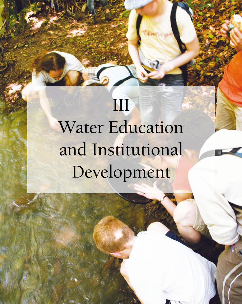
IIIWater Education and Institutional
Development
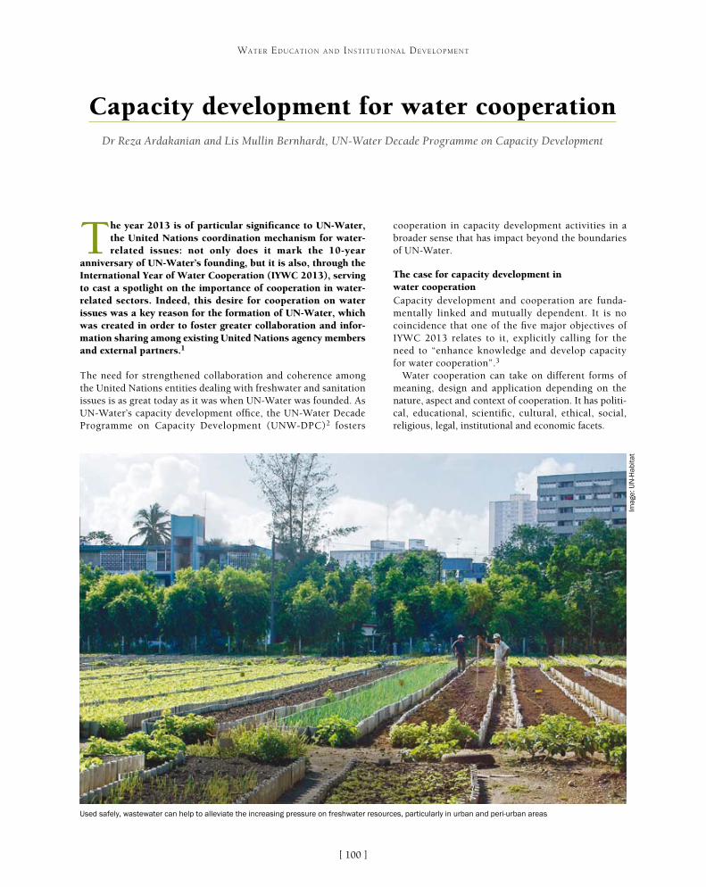
[ ]100
Capacity development for water cooperationDr Reza Ardakanian and Lis Mullin Bernhardt, UN-Water Decade Programme on Capacity Development
The year 2013 is of particular significance to UN-Water, the United Nations coordination mechanism for water-related issues: not only does it mark the 10-year
anniversary of UN-Water’s founding, but it is also, through the International Year of Water Cooperation (IYWC 2013), serving to cast a spotlight on the importance of cooperation in water-related sectors. Indeed, this desire for cooperation on water issues was a key reason for the formation of UN-Water, which was created in order to foster greater collaboration and infor-mation sharing among existing United Nations agency members and external partners.1
The need for strengthened collaboration and coherence among the United Nations entities dealing with freshwater and sanitation issues is as great today as it was when UN-Water was founded. As UN-Water’s capacity development office, the UN-Water Decade Programme on Capacity Development (UNW-DPC)2 fosters
cooperation in capacity development activities in a broader sense that has impact beyond the boundaries of UN-Water.
The case for capacity development in water cooperation Capacity development and cooperation are funda-mentally linked and mutually dependent. It is no coincidence that one of the five major objectives of IYWC 2013 relates to it, explicitly calling for the need to “enhance knowledge and develop capacity for water cooperation”.3
Water cooperation can take on different forms of meaning, design and application depending on the nature, aspect and context of cooperation. It has politi-cal, educational, scientific, cultural, ethical, social, religious, legal, institutional and economic facets.
WATER EDUCATION AND INSTITUTIONAL DEVELOPMENT
Used safely, wastewater can help to alleviate the increasing pressure on freshwater resources, particularly in urban and peri-urban areas
Imag
e: U
N-H
abita
t

[ ]101
WATER EDUCATION AND INSTITUTIONAL DEVELOPMENT
International Water Management Institute. SUWA facilitates improved capacities among stakeholders, decision makers and experts by creating a common platform for the exchange of knowledge and experi-ence.
The aim of the project is to address issues related to wastewater use in agriculture with a sustainable, effective and less risky approach, to formulate a capacity development action plan, and to dissemi-nate training materials and learning methods at the country level. To ensure success and sustainability for water cooperation schemes, a common understanding of the needs and challenges surrounding the issue of wastewater is required. Implementing SUWA entails multidimensional cooperation and concerted efforts from various disciplines.
The level of cooperation required to execute a project like SUWA is considerable, not only between the part-ners involved at the United Nations level, but also between those at the national level. Indeed, address-ing wastewater use in a safe and productive way for agriculture necessarily involves many partners and stakeholders who need to be engaged in the deci-sion-making process, across a range of sectors. It also requires different levels of cooperation between policy-makers, communities and water use associations.
Cooperation in SUWA: levels and dimensionsCapacity development in SUWA is understood as “the process through which relevant stakeholders, especially those from sanitation, agriculture, environment and
Two capacity development projects of UN-Water demonstrate the educational and capacity building aspects of water coopera-tion. In doing so, they highlight the importance of collaborating at different levels and the varied forms of cooperation needed in the water sector.
Safe Use of Wastewater in AgricultureCompetition for water and the growing focus on food security, espe-cially in urban and peri-urban areas, are increasing the pressure on (fresh)water resources exponentially. Wastewater is a resource which can, when used safely, alleviate this pressure. But to make use of it safely, national policies and strategies need to be in place. Despite an interest in using certain wastewaters in agriculture, many nations have difficulties implementing the available guidelines and developing the right strategies. At the same time, it is clear that there is a large amount of unknown (or unreported) use of wastewater in countries which might not understand the potential health and environmental risks associated with it.
UNW-DPC, under the auspices of UN-Water, is addressing this issue by bundling the competences and experiences of its members and partners, entering into an intense dialogue with countries from around the world. The Safe Use of Wastewater in Agriculture (SUWA) project brings together and facilitates cooperation among experts from six UN-Water members and partners from different fields including agriculture, water treat-ment, irrigation, health, environment and related themes. The six entities involved are the World Health Organization, the Food and Agriculture Organization of the United Nations (FAO), the United Nations Environment Programme, the United Nations University Institute for Water, Environment and Health, the International Commission on Irrigation and Drainage, and the
Addressing wastewater use in a safe and productive way for agriculture involves
many partners and stakeholders
Imag
e: U
NU
-UN
W-D
PC
Wastewater use in agriculture may be planned or unplanned – its
safe use requires capacity development and education
Imag
e: IR
RI

[ ]102
WATER EDUCATION AND INSTITUTIONAL DEVELOPMENT
consumer sectors, improve their abilities to perform their core roles and responsibilities, solve problems, define and achieve objectives, understand and address needs and effectively work together in order to ensure the safe and productive use of wastewater in agriculture”.4
This definition carries important implications for the differ-ent levels of cooperation and capacity development activities at the individual, organizational and system levels. At the system level, several government ministries with their own policies, laws, regulations and standards cooperate and exchange experi-ences on wastewater use in agriculture to raise awareness among each other and learn from successful policies in similar contexts. At the organizational level, government agencies and institu-tions such as ministries of agriculture, water, environment and health can cooperate and capitalize on their experiences from the diverse nature of the respective ministries with respect to infra-structure, human, financial and information resources. At the individual level, various skilled professionals from public health, agriculture, research, engineering, education and other sectors can exchange experiences and share lessons with each other.
Cooperation is at the heart of the SUWA project structure: between individuals, between institutions and organizations, and between governments. Through its regional workshops and online platform5, the project has:• drawn on the international expertise, standards and innovations
of various expert groups and research institutes involved in the spirit of cooperation work
• enabled knowledge and technology sharing among participants and learning from each others’ experience of best practice implementation, especially those between planning and management bodies from various developing countries
• ensured the cooperation of UN-Water members and partners as well as other collaborative partners of the project
• improved knowledge and skills on the safe use of wastewater in agriculture, also acquired through the exchange of lessons learned and the cooperation of participants with each other.
Capacity Development to Support National Drought Management Policies initiativeDrought is one of the world’s worst natural hazards,6 with long-term social, economic and environmental impacts, and often referred to as a “creeping phenom-enon”.7 Generally, droughts emanate from a deficiency of precipitation extended over a long period of time. Yet there is no single, universally accepted definition of drought because of its multifaceted nature and its diverse impacts across regions.
What is clear, however, is that the impacts of drought are diverse and complex in nature. The most direct impacts include reduced crop yield, diminished rangeland and forest productivity and low water levels. Drought threatens livestock as well as wildlife and fish habitats while it increases fire hazard. According to the International Decade for Natural Disaster Reduction in 1995, drought accounts for 33 per cent of the people affected by natural disasters, 22 per cent of the damage from disasters and 3 per cent of the number of deaths attributed to natural hazards. Though drought affects virtually all climatic regions, those most affected include the horn of Africa, Australia, Brazil, Central Asia, China, England and Wales, India, South-Eastern Europe and the United States of America. Drought is expected to increase in frequency and extent due to climate change. The fraction of land surface area expe-riencing drought conditions had grown from 10-15 per cent in the early 1970s to more than 30 per cent by early 2000.8
The newly started UN-Water initiative on Capacity Development to Support National Drought Management Policies was launched in March 2013. Under UN-Water, the World Meteorological Organization, United Nations Convention to Combat Desertification, FAO and UNW-DPC will cooperate in this initiative throughout 2012-2013 to raise the capacity of stakeholders at all levels to support the development of risk-based national drought manage-ment policies, based on elements proposed in the compendium of drought management policy.9
Despite the repeated occurrence of drought and its tremendous effects on livelihoods and economies throughout human history, few concerted efforts are taking place to formulate and adopt national drought management policies. Moving countries away from crisis management to a more proactive, risk-based approach to national drought management policies requires the involvement of stakeholders at different levels. To ensure the effectiveness of a transition to the new paradigm, capacities need to be developed in various ministries and national institutions.
The differences between countries in terms of their vulnerability and institutional capacities will call for different drought management policies. As drought management strategies need to take into account the specific national contexts of existing capacities and priorities, no single, optimal drought management strategy can be prescribed for all countries.10
The impacts of drought are diverse and complex, threatening crop yields,
productivity, livestock and wildlife
Imag
e: C
urt
Car
nem
ark
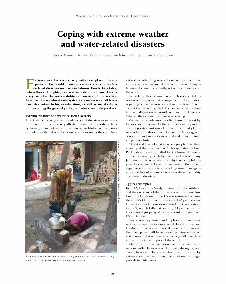
[ ]103
Coping with extreme weather and water-related disasters
Kaoru Takara, Disaster Prevention Research Institute, Kyoto University, Japan
Extreme weather events frequently take place in many parts of the world, causing various kinds of water-related disasters such as wind storms, floods, high tides,
debris flows, droughts, and water-quality problems. This is a key issue for the sustainability and survival of our society. Interdisciplinary educational systems are necessary at all levels from elementary to higher education, as well as social educa-tion including the general public, industries and policymakers.
Extreme weather and water-related disastersThe Asia-Pacific region is one of the most disaster-prone areas in the world. It is adversely affected by natural hazards such as cyclones (typhoons), rainstorms, floods, landslides, and tsunamis caused by earthquakes and volcanic eruptions under the sea. These
natural hazards bring severe disasters to all countries in the region where social change, in terms of popu-lation and economic growth, is the most dynamic in the world.1
Growth in this region has not, however, led to advances in disaster risk management. The situation is getting worse because infrastructure development cannot keep up with growth. Policies for poverty reduc-tion and alleviation are insufficient and the difference between the rich and the poor is increasing.
Vulnerable populations are often those hit worst by hazards and disasters. As the world’s cities expand to occupy greater portions of the world’s flood plains, riversides and shorelines, the risk of flooding will continue to outpace both structural and non-structural mitigation efforts.
“A natural hazard strikes when people lose their memory of the previous one.” This quotation is from Dr Torahiko Terada (1878–1935), a former Professor of the University of Tokyo who influenced many Japanese people as an educator, physicist and philoso-pher. People tend to forget bad memories if they do not experience a similar event for a long time. This igno-rance and lack of experience increases the vulnerability of society to disasters.
Typical examplesIn 2012, Hurricane Sandy hit areas of the Caribbean and the east coast of the United States. Economic loss from this hurricane in the US was estimated at more than US$50 billion and more than 170 people were killed. Another famous example is Hurricane Katrina in 2005, which killed at least 1,833 people and for which total property damage is said to have been US$81 billion.
Hurricanes, cyclones and typhoons often cause serious damage due to strong wind, heavy rainfall and flooding in riverine and coastal areas. It is often said that their power will be increased by climate change, which means that more serious damage will take place in the future in many parts of the world.
African countries and other arid and semi-arid regions suffer from water shortages, droughts, and desertification. These are also brought about by extreme weather conditions that continue for longer periods in wider areas.
WATER EDUCATION AND INSTITUTIONAL DEVELOPMENT
A community water post in a slum community in Ahmedabad, India; the community
set the tap below ground level to improve water pressure
Imag
e: D
r A
khile
sh S
urja
n, G
SS
Pro
gram
me,
Kyo
to U
nive
rsity

[ ]104
WATER EDUCATION AND INSTITUTIONAL DEVELOPMENT
The snow accumulated in the Alps melted and caused flood disasters.
A very severe heat wave then came to Europe. It killed a total of 35,118 people in France (14,802), Germany (7,000), Spain (4,230), Italy (4,175), Portugal (1,316), Wales, UK (2,045), the Netherlands (1,400) and Belgium (150), according to the Earth Policy Institute. A maximum air temperature of more than 35 °C continued from 4-13 August 2003, increasing the death toll day by day with a peak of 2,197 on 12 August. Even in developed European countries, such a tragedy happened because many aged people lived in houses where there was no air conditioning. In 2010, the northern hemisphere again faced significant damage from heat waves.
Examples in Japan – tragedy in an ‘aged’ societyLikewise, the Asia-Pacific region is also affected by extreme weather. Ten typhoons directly hit Japan in 2004, for example, while the overall annual average number of typhoons to hit the country is usually fewer than three. The Japanese Meteorological Agency reported that 326 people were killed in 2004 by these typhoons, other rainstorms and resultant flood events.
Japan is now an ‘aged’ society (severer than an ‘ageing’ society). In Niigata, in July 2004, flooding killed 15
Higher fluctuation examples in EuropeExtreme meteorological variation is taking place. Europeans may clearly remember the floods of 2002, severe snowfall events during the winters of 2002 and 2003 and the heat waves in 2003.
During the 2002 floods, Europe received approximately 500 mm of rainfall produced by a low pressure that moved from the United Kingdom to central Europe during 9-12 August. The Elbe and Danube rivers caused much damage. Major urban areas of Dresden and Prague, located respectively along the Elbe River and the Vltava River upstream, were inundated by flooding, which was said to be caused by an outdated irrigation system upstream. After this event the Czech and German governments discussed how to avoid a repeat of this kind of flood disaster. The Elbe River has long been contam-inated by industrial wastewater including heavy metals such as mercury, cadmium and lead, as well as chlorides. The management of water in this river is of great importance to the countries situated along it. Rainstorm events from the end of May to the beginning of June in 2013 damaged these rivers by resultant floods, which were smaller (3,200 m3/s) than the devastating flood event of 2002 with more than 5,000 m3/s.
In south-east France, a heavy rainfall of 687 mm in 24 hours on 8-9 September 2002 caused severe flooding in the Gard River basin (2,070 km2). There were 24 deaths, half of which occurred in privately owned cars, and economic loss of about €1.12 billion. These flood events were followed by heavy snowfall in the winter of 2002-2003, which was the second heaviest snow since 1967.
Year
2002
2003
2004
2004
2004
2005
2007
2008
2008
2009
2010
2010
2010
2011
2011
Location
Central Europe
Central Europe
Haiti, Dominique, etc.
India, Bangladesh, Nepal, etc.
Indonesia + 13 countries
USA
Bangladesh
Myanmar
USA + Caribbean countries
Taiwan
Chile
Russia
Pakistan
Japan
Thailand
Economic Loss(Million US$)
20,000+
13,000+
9,000
N/A
14,000
14,400
1,700
10,000
4,000
3,300
3,100
15,000
43,000
235,000
4,000
Death toll(people)
69
70,000+
3,025+
3,076
230,000
1,322
3,447
138,366
170
678
525+
55,000+
1,781+
15,840
813
Hazard type
Flood
Heat wave
Flood, Hurricane Jeanne
Flood
Indian Ocean earthquake and tsunami
Hurricane Katrina
Cyclone Sidr
Cyclone Nargis
Hurricanes Gustav and Ike
Typhoon Morakot, landslide
Earthquake, tsunami
Heat wave
Flood
Earthquake, tsunami
Flood
Major natural hazards and disasters in the twenty-first century
Source: Munich Re, The Economist (14 January 2012), Wikipedia, etc.
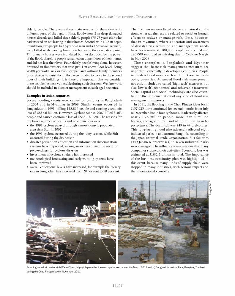
[ ]105
WATER EDUCATION AND INSTITUTIONAL DEVELOPMENT
elderly people. There were three main reasons for these deaths in different parts of the region. First, floodwaters 3 m deep damaged houses directly and killed three elderly people (75-78 years old) who had insisted on not leaving in their homes. Second, with a 1.5 m depth inundation, two people (a 37-year-old man and a 42-year-old woman) were killed while moving from their houses to the evacuation point. Third, many houses were inundated but not destroyed by the power of the flood; therefore people remained on upper floors of their homes and did not lose their lives. Four elderly people living alone, however, drowned in floodwaters that rose just 1 m above floor level. Being 76-88 years-old, sick or handicapped and without family members or caretakers to assist them, they were unable to move to the second floor of their buildings. It is therefore important that we consider these people the most vulnerable during such disasters. Welfare work should be included in disaster management in such aged societies.
Examples in Asian countries Severe flooding events were caused by cyclones in Bangladesh in 2007 and in Myanmar in 2008. Similar events occurred in Bangladesh in 1991, killing 138,866 people and causing economic loss of US$7.6 billion. However, Cyclone Sidr in 2007 killed 3,363 people and caused economic loss of US$3.1 billion. The reasons for the lower number of deaths and economic loss were:• the 1991 cyclone passed through a more densely populated
area than Sidr in 2007• the 1991 cyclone occurred during the rainy season, while Sidr
occurred during the dry season• disaster prevention education and information dissemination
systems have improved, raising awareness of and the need for preparedness for cyclone disasters
• investment in cyclone shelters has increased• meteorological forecasting and early warning systems have
been improved• overall educational levels have increased, for example the literacy
rate in Bangladesh has increased from 20 per cent to 50 per cent.
The first two reasons listed above are natural condi-tions, whereas the rest are related to social or human efforts to reduce or manage risk. Note, however, that in Myanmar, where education and awareness of disaster risk reduction and management needs have been minimal, 100,000 people were killed and 220,000 recorded as missing due to Cyclone Nargis in May 2008.
These examples in Bangladesh and Myanmar suggest that basic risk management measures are important, especially in developing countries. People in the developed world can learn from those in devel-oping countries. Advanced flood risk management not only includes so-called ‘high-tech’ measures but also ‘low-tech’, economical and achievable measures. Social capital and social technology are also essen-tial for the implementation of any kind of flood risk management measures.
In 2011, the flooding in the Chao Phraya River basin (157,925 km2) continued for several months from July to December due to four typhoons. It adversely affected nearly 13.5 million people, more than 4 million houses, and agricultural land of 1.8 million ha in 65 prefectures. The death toll was 749 in 44 prefectures. This long-lasting flood also adversely affected eight industrial parks in and around Bangkok. According to the Japan External Trade Organization, 804 factories (449 Japanese enterprises) in seven industrial parks were damaged. The influence was so serious that many companies stopped their activities. Economic loss was estimated at US$2.2 billion in total. The importance of the business continuity plan was highlighted in this event, because many kinds of supply chain were stopped in many industries, with serious impacts on the international economy.
Pumping cars drain water at (l) Watari Town, Miyagi, Japan after the earthquake and tsunami in March 2011 and (r) Bangkadi Industrial Park, Bangkok, Thailand
during the Chao Phraya flood in November 2011
Imag
es: M
LIT

[ ]106
WATER EDUCATION AND INSTITUTIONAL DEVELOPMENT
ered. Many cooperation activities for water-related disaster risk reduction are implemented through international programmes such as UN Water and the United Nations Educational, Scientific and Cultural Organization International Hydrological Programme, of which the eighth phase (2014-2021) will deal with water security issues.3
Academic contributionsInterdisciplinary approaches at university (gradu-ate school) level include the Global COE Program for ‘Sustainability/Survivability Science for a Resilient Society Adaptable to Extreme Weather Conditions’ (GCOE-ARS), implemented by the Disaster Prevention Research Institute (DPRI) at Kyoto University, Japan.4 This programme focuses on how human beings and human society could adapt to global-scale changes including climate change that incur extreme weather and changes in the Earth’s water cycle, population increase, urbanization, land use change, rural develop-ment, desertification and so on. It especially emphasizes scientific explanation and the prediction of weather and hydrological disasters as well as social adaptation to these events.
In Asia, as stated above, located in a humid climate and tectonic zone, overpopulation and land develop-ment are escalating. Africa has arid and semi-arid regions as well as tropical rainforests. The environ-mental conditions in these areas are more severe than elsewhere in the world in terms of social and natural aspects, and thus especially sensitive and vulnerable to extreme weather. The people’s living and economy in these areas provide implications for the survivability of humans on Earth, while at the same time requir-ing adaptation strategies to cope with more difficult conditions expected in the future. GCOE-ARS pursues sustainability science for survivability of humankind and fosters world-leading experts by developing practi-cal research in these areas in the world.
Another similar programme is ‘Inter-Graduate School Program for Sustainable Development and Survival Societies’ (Global Survivability Studies (GSS) Programme), which was launched in 2011 to form a strong interdisciplinary graduate school educational system. This programme deals with four major areas: • catastrophic natural hazards and disasters• man-made accidents and disasters• regional environment change and degradation• food security.
These challenges of academic research and education, led by DPRI, are intended to involve cooperation on water-related disaster risk reduction with many over-seas or international institutions and organizations, as well as with local communities around the world. We believe that this transdisciplinary approach can be strongly connected to policy or real-world issues and contribute to disaster risk reduction for sustainable development of our Earth system.
Water cooperation and disaster risk reductionMany kinds of cooperation activities have been implemented in terms of water. Japanese official development assistance has been contributing to developing countries by constructing water resources systems, flood control facilities and other infrastructures, such as dams, channels, water supply and irrigation systems in coop-eration with the Japan International Cooperation Agency (JICA). These structural measures have prevented or mitigated water-related disasters and their risk.
In addition to these, another type of contribution includes emer-gency management. After the Great Earthquake and Tsunami disasters in east Japan, including Iwate, Miyagi and Fukushima prefectures, there was land subsidence in a number of low-lying areas where water inundation in residential districts, as well as in agricultural lands, was a serious problem. The pumping cars, which were prepared by the Ministry of Land, Infrastructure, Transport and Tourism of Japan (MLIT), played a significant role in the drainage of inundated water. The pumping cars were also dispatched to the Chao Phraya River in order to drain floodwa-ter in Bangkok and surrounding areas. This was a notable water cooperation activity made by MLIT and JICA. Other water cooper-ation examples can be seen in activities by the Japan Water Forum (JWF), which carries out water supply and sanitation activities at the grass-roots level through assistance to non-governmental organizations and collaboration with local partners in develop-ing countries. The JWF Fund awards grants of up to US$1,000 to approximately 15 grass-roots organizations in developing coun-tries every year, to support their activities and projects to improve access to water and sanitation.2
It is also important to bear in mind that risk communication measures are useful in raising public awareness and preparedness for coping with floods and droughts as well as waterborne disas-ters including epidemiological infectious diseases such as malaria, which are triggered by environmental or climatic drivers. Literacy, communication skills and gender issues must be seriously consid-
Women collect water from surface sources in the coastal Satkhira district of
Bangladesh, where water bodies are mostly saline
Imag
e: D
r R
ajib
Sha
w, G
SS
Pro
gram
me,
Kyo
to U
nive
rsity
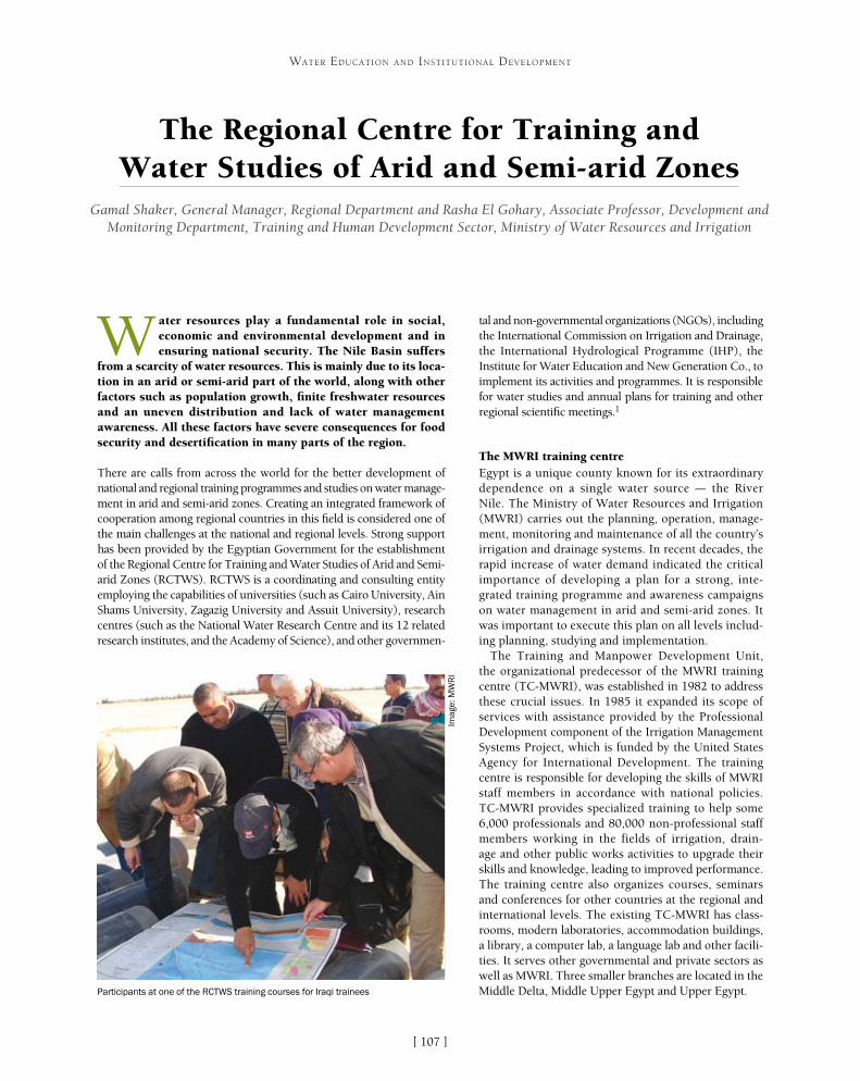
[ ]107
The Regional Centre for Training and Water Studies of Arid and Semi-arid Zones
Gamal Shaker, General Manager, Regional Department and Rasha El Gohary, Associate Professor, Development and Monitoring Department, Training and Human Development Sector, Ministry of Water Resources and Irrigation
W ater resources play a fundamental role in social, economic and environmental development and in ensuring national security. The Nile Basin suffers
from a scarcity of water resources. This is mainly due to its loca-tion in an arid or semi-arid part of the world, along with other factors such as population growth, finite freshwater resources and an uneven distribution and lack of water management awareness. All these factors have severe consequences for food security and desertification in many parts of the region.
There are calls from across the world for the better development of national and regional training programmes and studies on water manage-ment in arid and semi-arid zones. Creating an integrated framework of cooperation among regional countries in this field is considered one of the main challenges at the national and regional levels. Strong support has been provided by the Egyptian Government for the establishment of the Regional Centre for Training and Water Studies of Arid and Semi-arid Zones (RCTWS). RCTWS is a coordinating and consulting entity employing the capabilities of universities (such as Cairo University, Ain Shams University, Zagazig University and Assuit University), research centres (such as the National Water Research Centre and its 12 related research institutes, and the Academy of Science), and other governmen-
tal and non-governmental organizations (NGOs), including the International Commission on Irrigation and Drainage, the International Hydrological Programme (IHP), the Institute for Water Education and New Generation Co., to implement its activities and programmes. It is responsible for water studies and annual plans for training and other regional scientific meetings.1
The MWRI training centreEgypt is a unique county known for its extraordinary dependence on a single water source – the River Nile. The Ministry of Water Resources and Irrigation (MWRI) carries out the planning, operation, manage-ment, monitoring and maintenance of all the country’s irrigation and drainage systems. In recent decades, the rapid increase of water demand indicated the critical importance of developing a plan for a strong, inte-grated training programme and awareness campaigns on water management in arid and semi-arid zones. It was important to execute this plan on all levels includ-ing planning, studying and implementation.
The Training and Manpower Development Unit, the organizational predecessor of the MWRI training centre (TC-MWRI), was established in 1982 to address these crucial issues. In 1985 it expanded its scope of services with assistance provided by the Professional Development component of the Irrigation Management Systems Project, which is funded by the United States Agency for International Development. The training centre is responsible for developing the skills of MWRI staff members in accordance with national policies. TC-MWRI provides specialized training to help some 6,000 professionals and 80,000 non-professional staff members working in the fields of irrigation, drain-age and other public works activities to upgrade their skills and knowledge, leading to improved performance. The training centre also organizes courses, seminars and conferences for other countries at the regional and international levels. The existing TC-MWRI has class-rooms, modern laboratories, accommodation buildings, a library, a computer lab, a language lab and other facili-ties. It serves other governmental and private sectors as well as MWRI. Three smaller branches are located in the Middle Delta, Middle Upper Egypt and Upper Egypt.
WATER EDUCATION AND INSTITUTIONAL DEVELOPMENT
Participants at one of the RCTWS training courses for Iraqi trainees
Imag
e: M
WR
I

[ ]108
WATER EDUCATION AND INSTITUTIONAL DEVELOPMENT
issues. A regional library and media unit for water studies provide training programmes and professional and tech-nical publications. Updated technical and computer laboratories equipped with high-quality devices enable the practical application of learning and promote partici-pants’ understanding and capabilities.
Annual scientific, technical and practical training programmes are provided to increase the knowledge and capabilities of manpower in all targeted countries. The centre promotes the scientific study of issues relating to water management in the region’s arid and semi-arid zones. It aims to develop and coordinate cooperative research and study activities on these issues, taking advantage of the region’s installed scientific and profes-sional capacity and the relevant IHP networks and NGOs. Knowledge and information transfer events are organ-ized, including international training courses, symposia and workshops, to engage in awareness-raising activities.
TargetsRCTWS-Egypt aims to realize interaction among the peoples of the Nile Basin countries to provide a mecha-nism for fostering peaceful coexistence and avoiding conflicts. It recognizes the importance of finding wider frameworks for dialogue and societal interaction that extend these beyond official dialogue to reach the elite, the young, societal leaders and the heads of tribes.
Various institutions and ministries have contributed to training programmes to ensure the role of civil society in fostering cooperation and communication. The centre also aims to contribute to training and awareness-raising among clerics and experts who travel to African coun-tries so that their role can extend to social and cultural responsibilities beyond their actual jobs.
Countries such as Egypt should not only rely on the civil society institutions of the Nile Basin countries, but should also interact with the existing African-Egyptian forums and councils and with the Egyptian civil societies interested in African affairs. That said, civil society insti-tutions among the Nile Basin countries have taken some important actions. These include establishing a regional union (the Nile Basin Trade Union) that aims to protect and improve the conditions of workers, preserving water security and benefiting from the humanitarian and national resources in development projects. An interna-tional forum has also been established for the Nile Basin countries. This is considered a strong network of civil society organizations representing the 10 African coun-tries of the Nile Basin. It seeks to effect a positive change through implementing various projects and programmes.
RCTWS-Egypt also focuses on following up the Nile Basin Initiative (NBI). Among the objectives adopted in this context is the realization of real and sustainable development for the NBI. The mechanisms of mutual cooperation among the Nile Basin countries will be fostered while paying due attention to the issues of erad-icating poverty and fostering economic development among those countries. The centre will contribute to NBI-related activities and study the negative and positive
RCTWS-EgyptThe main objectives of RCTWS-Egypt are:• generating and providing scientific and technical information on
arid and semi-arid issues in the region to enable the formulation of sound policies leading to sustainable integrated water resources management (IWRM) at the local, national and regional levels
• undertaking effective training and capacity building activities at institutional and professional levels in the region, as well as awareness-raising activities targeting audiences including the general public
• promoting applied skills on water studies, water management, socioeconomic and environmental issues through regional cooperative arrangements to strengthen local capabilities and involve regional and international institutions in one integrated network
• integrating learning and quality network experiences to train engineers and professional staff on current responsibilities and future targets
• providing management and training resources for the self-education of engineers and graduate staff
• upgrading the practical and operational skills and attitudes of individuals and groups of technicians by developing implemented and technical field training programmes
• increasing cooperation among the region and other countries, as well as capacity building at institutional and professional levels
• raising environmental awareness through activities among various audiences including the general public, in order to enhance the sustainable management of water resources.
The centre’s main functions are aimed at enabling coordination, cooperation, collaboration and communication among water studies stakeholders in the region. These include organizing and support-ing a regional water studies network for the exchange of scientific and technical capabilities through interactive and creative learning methods. The centre seeks to develop a strong programme of advisory services and information transfer activities, using applied research findings for the region’s countries in the field of water management
Raising environmental awareness among beneficiaries: targeting various audiences
is key to the sustainable management of water resources
Imag
e: M
WR
I

[ ]109
WATER EDUCATION AND INSTITUTIONAL DEVELOPMENT
effects of the projects on the citizens of Nile Basin countries. National forums will be established and evaluated within each state to foster the contribution of civil society in the region.
Since its declaration in 1999, the NBI has fostered the role of society by increasing people’s awareness of the requirements for developing the Nile Basin countries. In this respect, the Nile Basin Discourse has been established under the sponsorship of the International Union for the Conservation of Nature to encourage partnership between civil society organizations and governments, especially as regards the NBI. In this context, the National Nile Basin Discourse Forums have contributed to implementing a set of activi-ties in Egypt with a focus on activating dialogue, raising awareness of the importance of preserving the Nile water, and fostering the role of civil society in enhancing peace and avoiding conflicts and wars.
Stakeholder participationInadequate dissemination of information, along with poor commu-nication between government institutions and non-governmental stakeholders, is unduly complicating the water distribution process and constraining dialogue on water policies and programmes. While the Government, through MWRI, remains responsible for the deliv-ery of irrigation water to farmers free of a service charge, farmers have no clear roles and responsibilities for contributing to the planning and management of the irrigation system. It should even-tually be possible for many water management issues to be resolved directly at the local level between organizations representing water users, without much government involvement.2
Public awareness and economic incentivesPublic awareness is weak regarding the current and growing water short-ages and pollution problems facing Egypt. Illegal rice cultivation and unauthorized agricultural expansion and fish farming often are blamed on this poor appreciation of the adverse environmental and social impacts of such actions, but the real problems are related to the economic status of inhabitants, lack of enforcement of existing regulations and the fact that farmers are simply responding to the economic incentives they face. Effective public awareness necessitates actions that take into account the complex interaction between economic status, enforcement of water management regulations and the need for appropriate economic incen-tives to affect individual and institutional behaviour.3
MWRI human resources developmentTraining and human resources development constitute an important dimension of strengthening institutional capac-ity for the improved management of MWRI operations. Achieving the objectives of comprehensive human resource development is a long-term process, and training is one component of such a comprehensive programme. The main objectives of this human resources development are indi-vidual growth; integrating the objectives of individuals with those of MWRI; attracting high-calibre employees; increas-ing the clarity of career paths for engineers, researchers, specialists and administrators; correlating career prospects, training and individual development; and developing objective performance appraisal and incentive systems.4
RCTWS achievementsOn a regional level, RCTWS has implemented many events though bilateral agreements with the Nile Basin countries which were funded by the Egyptian Government to support cooperation. In addition, the centre still participates in activities for the initiation of the Global Network – Water and Development Information for Arid Lands. It continues to welcome cooperation with other donors in implementing courses for participants from Nile Basin, Middle East and Arab countries.
RCTWS has also contributed to events in other coun-tries in the region, including participation in the Global Network for Water and Development Information for Arid Lands meetings in 2010 and 2011 and the 8th Governing Board Meeting at the Regional Centre on Urban Water Management in Tehran in 2012. Side meetings of the fourth Africa Water Week were held at RCTWS in May 2012 for the discussion of methods needed to support cooperation between Category 2 centres. These were attended by the Minister of Water for Libya, the United Nations Educational, Scientific and Cultural Organization Officer for Category 2 centres in Africa and the Director of the International Center for Integrated Water Resources Management in the United States.
Participants at one of the RCTWS training courses for Nile Basin countries
Imag
e: M
WR
I

[ ]110
WATER EDUCATION AND INSTITUTIONAL DEVELOPMENT
of an important management programme. Today, four trainers who were qualified through this project still train MWRI senior staff and leaders on management within the regular annual plan of the centre.
Future strategyThe overall strategy for RCTWS until 2050 is to become a state-of-the-art learning provider, using advanced technologies and a learning process based on the most recent research findings in cognitive science. The centre aims to become an outstanding knowledge base and learning facilitator, capable of providing knowledge services in a wide range of technologies to stakehold-ers in the Egyptian water sector. It will continue to develop training courses and other learning activities to support MWRI, working closely with subject matter experts within the ministry and knowledge institutes. The centre will also work to develop the expertise of people within MWRI, enabling a connection between learning and work based on the current and future needs of employees.
In the future, training should be carried out within a broader framework that includes developing the management capacity within ministry departments and projects. There is growing recognition that irrigation technology must also take into account environmental considerations and sociological characteristics such as farmers’ behaviour. Human resources development programmes for MWRl should also include training in planning (including corporate strategy, organization and financial planning); IWRM; participatory irrigation management; environmental engineering and water quality; public participation in decision-making; leadership and management skills; and information management.5
Course title
Earth and civil constructions
IWRM
Check of lateral instruments
Soil salinity management
IWRM
Control and monitoring of silt in Lake Nasser-Nobia
On-farm water management
ARC GIS
Flash flood management
Two courses on groundwater and artificial recharge
Financed by
Electricity Company, Egypt
Nile Sector, Egypt
Ministry of Water Resources, Iraq
International Center for Agricultural
Research in the Dry Areas
Nile Sector, Egypt
Nile Sector, Egypt
Japan International Cooperation Agency (JICA)
JICA
JICA
Participants from
Sudan
Democratic Republic of the Congo
Iraq
Iraq
Tanzania
Egypt and Sudan
Nile Basin countries
Iraq
Iraq
Arab countries
Courses provided by RCTWS and donors for participants from Nile Basin, Middle East and Arab countries in 2012
Source: MWRI
On a national level, 361 courses were implemented between 2009 and 2011 for participants from MWRI, providing training for more than 2,000 staff per year. In addition, some special courses were tailored for senior MWRI staff to qualify them in the fields of English, information technology and management.
The 2012-2017 RCTWS strategy was developed in 2011, iden-tifying the four main pillars of financial perspective, customer perspective, internal processes and growth and learning. An organization chart was developed to fit this strategy. A primary study relating to ‘track change training’ was prepared to qualify MWRI temporary staff. Renovations and improvements were also carried out in the Kafr Elshiekh, Fayoum, Menia and Esna branches to upgrade and enhance their capacity to achieve the centre’s strategy
In January 2007, an agreement was signed between RCTWS and the German Society for International Cooperation for the initiation
Employees take part in on-the-job training provided by RCTWS to Nile Basin countries
Imag
e: M
WR
I
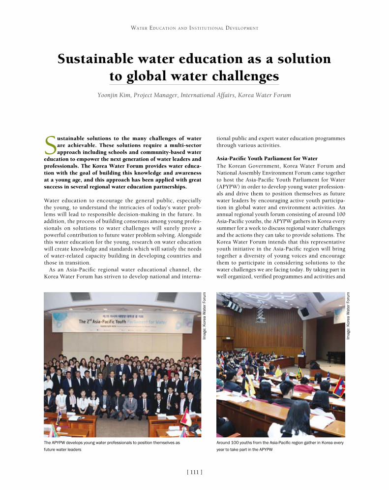
[ ]111
Sustainable water education as a solution to global water challenges
Yoonjin Kim, Project Manager, International Affairs, Korea Water Forum
Sustainable solutions to the many challenges of water are achievable. These solutions require a multi-sector approach including schools and community-based water
education to empower the next generation of water leaders and professionals. The Korea Water Forum provides water educa-tion with the goal of building this knowledge and awareness at a young age, and this approach has been applied with great success in several regional water education partnerships.
Water education to encourage the general public, especially the young, to understand the intricacies of today’s water prob-lems will lead to responsible decision-making in the future. In addition, the process of building consensus among young profes-sionals on solutions to water challenges will surely prove a powerful contribution to future water problem solving. Alongside this water education for the young, research on water education will create knowledge and standards which will satisfy the needs of water-related capacity building in developing countries and those in transition.
As an Asia-Pacific regional water educational channel, the Korea Water Forum has striven to develop national and interna-
tional public and expert water education programmes through various activities.
Asia-Pacific Youth Parliament for WaterThe Korean Government, Korea Water Forum and National Assembly Environment Forum came together to host the Asia-Pacific Youth Parliament for Water (APYPW) in order to develop young water profession-als and drive them to position themselves as future water leaders by encouraging active youth participa-tion in global water and environment activities. An annual regional youth forum consisting of around 100 Asia-Pacific youths, the APYPW gathers in Korea every summer for a week to discuss regional water challenges and the actions they can take to provide solutions. The Korea Water Forum intends that this representative youth initiative in the Asia-Pacific region will bring together a diversity of young voices and encourage them to participate in considering solutions to the water challenges we are facing today. By taking part in well organized, verified programmes and activities and
WATER EDUCATION AND INSTITUTIONAL DEVELOPMENT
The APYPW develops young water professionals to position themselves as
future water leaders
Around 100 youths from the Asia-Pacific region gather in Korea every
year to take part in the APYPW
Imag
e: K
orea
Wat
er F
orum
Imag
e: K
orea
Wat
er F
orum
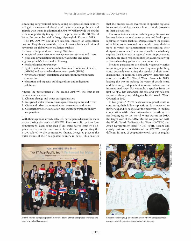
[ ]112
WATER EDUCATION AND INSTITUTIONAL DEVELOPMENT
that the process raises awareness of specific regional issues and that delegates learn how to build consensus in their discussions.
The commission sessions include group discussions, lectures by international water experts and field trips at local water-related facilities. Delegates learn the process of building consensus and creating their own declara-tions as youth parliamentarians representing their designated countries. The sessions enable them to freely express their interests in regional water improvement, and they are given responsibilities for leading follow-up actions when they go back to their countries.
Previous participants are already vigorously active in running regular web-based meetings and publishing youth journals containing the results of their water discussions. In addition, some APYPW delegates will take part in the 7th World Water Forum in 2015, leading the way in making the voice of youth heard and becoming independent opinion makers on the international stage. For example, a speaker from the first APYPW has expanded his role and was selected as one of three youth delegates by the World Water Council in 2012.
In two years, APYPW has boosted regional youth in continuing their follow-up actions. It is expected to further expand its scope over the next year, to include cooperation with other international youth activi-ties leading up to the World Water Forum in 2015, the target year of the SDG. Mutual cooperation with the World Youth Parliament for Water (WYPW) and Asian Development Bank (ADB) Youth Forum will closely link to the activities of the APYPW through different formats of cooperative work, such as regular
simulating congressional action, young delegates of each country will gain awareness of global and regional water problems and grapple with them. In addition, the APYPW will provide the youths with an opportunity to experience the processes of the 7th World Water Forum, to be held in Daegu Gyeongbuk, Korea in 2015.
The 100 APYPW youths are selected through an application process. They then choose their area of interest from a selection of key issues on global water challenges such as:• climate change and water storage/disasters• integrated water resources management/ecosystems and rivers• cities and urbanization/sanitation, wastewater and reuse• green growth/science and technology• food and agriculture/energy• right to water and Sanitation/Millennium Development Goals
(MDGs) and sustainable development goals (SDGs)• governance/policy, legislation and institution/transboundary
cooperation• education and capacity building/culture and indigenous
solutions.
Among the participants of the second APYPW, the four most popular courses were:1. Climate change and water storage/disasters2. Integrated water resource management/ecosystems and rivers3. Cities and urbanization/sanitation, wastewater and reuse4. Governance/policy, legislation and institution/transboundary
cooperation.
With their agendas already selected, participants discuss the main issues during the week of APYPW. They are split up into four commissions, each composed of different paired country dele-gates, to discuss the four issues. In addition to presenting the issues related to the commission theme, delegates present the water issues of their designated country in pairs. This ensures
APYPW country delegates present the water issues of their designated countries and
learn how to build consensus
Sessions include group discussions where APYPW delegates freely
express their interests in regional water improvement
Imag
e: K
orea
Wat
er F
orum
Imag
e: K
orea
Wat
er F
orum

[ ]113
WATER EDUCATION AND INSTITUTIONAL DEVELOPMENT
meetings among representatives of each activity to draw outlines for their next actions.
The Korea Water Forum is continuously developing the APYPW programmes to make them more helpful in enabling youths to gain the knowledge and experiences to contribute to better water in the future. Harmonious cooperation with international partners on youth water education is a key focus of these endeavours.
Korea Junior Water PrizeThe Korea Junior Water Prize (KJWP) was born in 2009 as an annual national water essay competition co-organized by the Korean Government and the Korea Water Forum. Every year around 50 teams compete with their ideas on solutions for water challenges. The essays mainly cover unique and creative solu-tions for resolving local or global water challenges. The quality of resolutions researched by the participants improves every year and evaluators have a hard time selecting the best ones. Winners receive a minister’s award as well as the opportunity to be a Korean delegate at the Stockholm Junior Water Prize. This gives them a precious chance to discuss common interests and share their ideas and experiences with future water sector leaders during the Stockholm World Water Week. KJWP participants also have a close link to participating in the APYPW through the social networks that APYPW parliamentarians have set up as part of their follow-up actions.
Project Water Education for TeachersAs a close partner organization of the Project Water Education for Teachers (WET) Foundation, the Korea Water Forum carries out regular and irregular water training for teachers with customized
text and toolkits. The aim of the education is to build capacity for sustainable development by disseminat-ing proper tools for water education and raising public awareness on water issues so that more people get involved in actions to improve water and the water environment. The Korea Water Forum aims to train more than 100 facilitators and educators in a year.
Co-organizing international water educationIn September 2013, the Korea Water Forum with the Korean Government and the United Nations Environment Programme (UNEP) Regional Office for Asia-Pacific (ROAP) will work with the Korean Ministry of Environment and Andong City, Republic of Korea to co-organize Training for Trainers. Using the newly introduced UNEP-International Institute for Sustainable Development Ecosystem Management Manual, water experts and public officials from different countries in the Asia-Pacific region will be trained for local-scale implementation.
The cooperation with UNEP ROAP is a trigger for expanding the scope of the Korea Water Forum’s water education, with the goal of finding firm and effective chan-nels to establish partnerships on regional water education.
Youth initiative in the World Water ForumOn the basis of youth activities in the various water educa-tion programmes above, the Korea Water Forum and the national committee for the 7th World Water Forum are seeking to find the right place and time for youth to get involved in the processes of the World Water Forum in
KJWP winners are given the opportunity to be a Korean delegate at the
Stockholm Junior Water Prize
Imag
e: K
orea
Wat
er F
orum
Imag
e: K
orea
Wat
er F
orum
Around 50 teams compete every year in the KJWP, creating solutions
to resolve global water challenges

[ ]114
WATER EDUCATION AND INSTITUTIONAL DEVELOPMENT
The Korea Water Forum and our young participants of previous water education activities will take a leading role in disseminating the importance of water education and the process of raising public awareness through various channels, especially in terms of young voices and actions.
2015. Youth supporters joined in the kick-off meeting held in Daegu Gyeongbuk, Korea in May 2013. APYPW parliamentarians, KJWP participants and all the youth delegates from our international water education partners such as the Project WET Foundation, WYPW, UNEP and the ADB Youth Forum have the capacity to lead the youth movement through the forum process.
The World Water Forum has four main pillars which are: thematic, regional, political and science and technology. Civil activities are also considered as a main programme. Well-trained youth who are waiting for their chances to make their voice heard on water will be exposed as more vigorous actors in the biggest international water forum.
As a main supporting organization of the national committee for the 7th World Water Forum, the Korea Water Forum will share its precious experiences and knowledge from previous international water forums, including the World Water Forum, Istanbul World Water Forum, Stockholm World Water Week, Asia Water Week and Singapore International Water Week. Its aim is to enhance aware-ness of the importance of the voice of youth, and of educating them.
Our national and international cooperation on water education will be sustained as long as there is a potential young voice in the world. Through our efforts in actively researching and organizing improved water education programmes, we will continue to develop ways to educate youth to be future leaders on water.
As a North-East Asia regional coordinator to the Asia-Pacific regional process of the 6th World Water Forum, the Korea Water Forum suggested the target that ‘by 2018, Asia-Pacific countries will have committed to establish and manage a training centre for water research, education and education for teachers’. This goal will be continuously discussed at future World Water Forums to determine follow-up actions through cooperative plans with our partners.
The 7th World Water Forum
The 7th World Water Forum will take place in Daegu Gyeongbuk, Repbulic of Korea, from 12 to 17 April in 2015.
The 7th Forum shows a spirit of cooperation with the water community in order to contribute to a better future for the planet by discovering how to implement discussed solutions together and by sharing knowledge and experience. Implementation, the core value of the 7th Forum, will make a link between the solutions and practical actions.
As the 7th Edition of the world’s largest water event is open to all as a multi-stakeholder platform, it expects the involvement of governmental, inter-governmental, scientific, technical, industry, civil society and representatives from fields such as agriculture, energy, etc. Over 30,000 people will enjoy high-quality sessions, intense debates and informative workshops, Water Expo, Water Fair, etc. for six days.
The 7th World Water Forum Kick-off meeting took place in Seoul and Daegu, Republic of Korea on 13-15 May, 2013. Around 500 water experts and high-level representatives, including 150 international participants from 41 countries, participated in the official lunch of the 7th Forum, the beginning of a two-year preparatory process.
You can find a Kick-off meeting summary report and keep up to date with the latest information on the 7th World Water Forum on its official website: worldwaterforum7.org/en.
Young participants of previous water education activities take a leading role in raising awareness on the importance of water education
Imag
e: K
orea
Wat
er F
orum
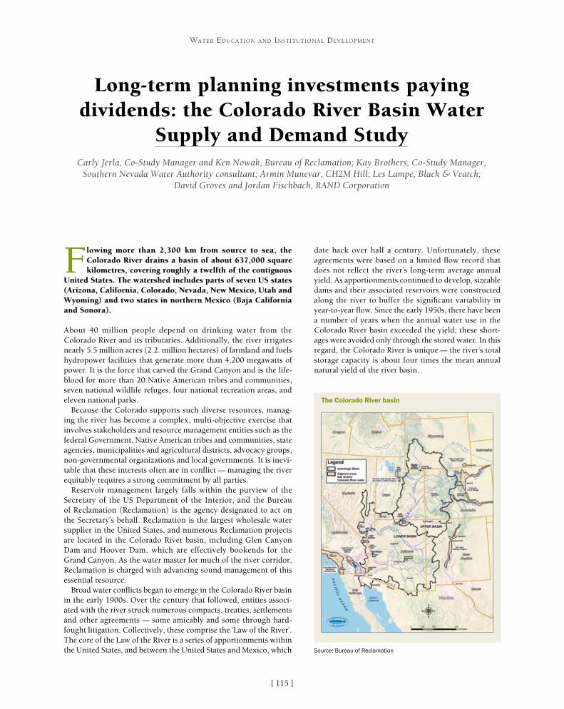
[ ]115
Long-term planning investments paying dividends: the Colorado River Basin Water
Supply and Demand StudyCarly Jerla, Co-Study Manager and Ken Nowak, Bureau of Reclamation; Kay Brothers, Co-Study Manager,
Southern Nevada Water Authority consultant; Armin Munevar, CH2M Hill; Les Lampe, Black & Veatch; David Groves and Jordan Fischbach, RAND Corporation
Flowing more than 2,300 km from source to sea, the Colorado River drains a basin of about 637,000 square kilometres, covering roughly a twelfth of the contiguous
United States. The watershed includes parts of seven US states (Arizona, California, Colorado, Nevada, New Mexico, Utah and Wyoming) and two states in northern Mexico (Baja California and Sonora).
About 40 million people depend on drinking water from the Colorado River and its tributaries. Additionally, the river irrigates nearly 5.5 million acres (2.2. million hectares) of farmland and fuels hydropower facilities that generate more than 4,200 megawatts of power. It is the force that carved the Grand Canyon and is the life-blood for more than 20 Native American tribes and communities, seven national wildlife refuges, four national recreation areas, and eleven national parks.
Because the Colorado supports such diverse resources, manag-ing the river has become a complex, multi-objective exercise that involves stakeholders and resource management entities such as the federal Government, Native American tribes and communities, state agencies, municipalities and agricultural districts, advocacy groups, non-governmental organizations and local governments. It is inevi-table that these interests often are in conflict – managing the river equitably requires a strong commitment by all parties.
Reservoir management largely falls within the purview of the Secretary of the US Department of the Interior, and the Bureau of Reclamation (Reclamation) is the agency designated to act on the Secretary’s behalf. Reclamation is the largest wholesale water supplier in the United States, and numerous Reclamation projects are located in the Colorado River basin, including Glen Canyon Dam and Hoover Dam, which are effectively bookends for the Grand Canyon. As the water master for much of the river corridor, Reclamation is charged with advancing sound management of this essential resource.
Broad water conflicts began to emerge in the Colorado River basin in the early 1900s. Over the century that followed, entities associ-ated with the river struck numerous compacts, treaties, settlements and other agreements – some amicably and some through hard-fought litigation. Collectively, these comprise the ‘Law of the River’. The core of the Law of the River is a series of apportionments within the United States, and between the United States and Mexico, which
date back over half a century. Unfortunately, these agreements were based on a limited flow record that does not reflect the river’s long-term average annual yield. As apportionments continued to develop, sizeable dams and their associated reservoirs were constructed along the river to buffer the significant variability in year-to-year flow. Since the early 1950s, there have been a number of years when the annual water use in the Colorado River basin exceeded the yield; these short-ages were avoided only through the stored water. In this regard, the Colorado River is unique – the river’s total storage capacity is about four times the mean annual natural yield of the river basin.
WATER EDUCATION AND INSTITUTIONAL DEVELOPMENT
The Colorado River basin
Source: Bureau of Reclamation

[ ]116
WATER EDUCATION AND INSTITUTIONAL DEVELOPMENT
with Reclamation, the Tennessee Valley Authority and the US Army Corps of Engineers, the software employs a ‘click and drag’ graphical user interface that greatly improves usability. Moving to an alternative platform was a sizeable task requiring considerable commit-ment to redevelop a model that exactly reproduced the FORTRAN results. Ultimately, this investment led to a significant expansion of CRSS use, both within Reclamation and with stakeholders. The new model also enables the incorporation of new operational polices, increased detail and new model needs, all with relative ease.
Commensurate with the commitment to long-term planning tools and capabilities is the commitment to strong relationships within Reclamation and other federal agencies, and across the broad range of state, local and non-government stakeholder groups. Acceptance of a common modelling platform and regular discussion has helped foster mutual trust among the players involved in managing – and using – the river’s resources, evident through numerous success-ful undertakings in recent decades. These collaborative efforts have received high praise in the past several years, twice culminating in the US Department of the Interior’s Partners in Conservation Award. Given poten-tial pitfalls, varying objectives and the ever-changing dynamic of the Colorado River basin, maintaining exist-ing partnerships and cultivating new ones continues to be a high priority for Reclamation.
Under the auspices of the US Department of the Interior’s WaterSMART programme, Reclamation and the seven US basin states commenced the Colorado River Basin Water Supply and Demand Study in 2010 in collaboration with a broad range of stakeholders
Even with this phenomenal water capacity, the Colorado has become strained in recent decades due to the combined effect of overallocation of water and an unprecedented drought that continues today. With climate change threatening to reduce flows even further, long-term planning is more important than ever. In response, the US Department of the Interior launched several programmes that focus on climate adaptation and long-term plan-ning, programmes that incorporate forward thinking, collaboration and expanded science to elevate water planning and management to new – and needed – levels.
For these programmes to succeed, benefits from previous invest-ments, buy-in from stakeholders and significant groundwork by the entities involved are all necessary. Although Reclamation oper-ates many of the large water storage and conveyance projects in the western United States, the water is apportioned at the state level; hence, involvement from those respective state agency representa-tives is especially critical. Owing to the complexity and size of the basin, Reclamation has made investments over recent decades in long-term planning on the Colorado, both in technical tools and stakeholder relationships. They are the essential foundation for comprehensive management and long-term planning.
Approximately 35 years ago, Reclamation began developing a computer model of the Colorado River basin, the Colorado River Simulation System (CRSS), to address the many ‘what if’ questions arising from proposed development or changes in river opera-tions. For roughly the first 20 years of its existence, the model used FORTRAN programming language. Over time, it evolved in size and complexity, growing to tens of thousands of lines of code and a commensurate associated data.
In the mid 1990s, the model was implemented in the RiverWareTM modelling platform to better accommodate the intricacies of the Colorado River system and promote stakeholder access. Developed at the University of Colorado’s Center for Advanced Decision Support for Water and Environmental Systems and in conjunction
Lake Mead, seen from the Hoover Dam – low water levels reveal the ‘bathtub ring’
Imag
e: L
ori W
arre
n, B
lack
& V
eatc
h

[ ]117
WATER EDUCATION AND INSTITUTIONAL DEVELOPMENT
throughout the basin. The study aimed to identify potential supply and demand imbalances facing the Colorado River basin within the United States over the next 50 years, and to explore options and strategies for resolving those imbalances. The study is the most comprehensive effort of its type to date and was designed around four major components: future supply (hydrologic conditions), future demand, evaluation of options and strategies, and vulner-ability analysis.
Given the size of this undertaking, a consultant team that included private sector firms CH2M Hill, Black & Veatch and the RAND Corporation assisted throughout the three-year effort, providing technical expertise, analysis and report production. Stakeholder rela-tionships and technical tools were critical to the study’s success. For many of the study facets, multi-stakeholder work groups convened to develop consensus on complex topics. Incorporating major view-points from various stakeholders resulted in creative alternatives, which benefited the study overall.
The first phases of the study were water supply and demand assessment. A scenario planning approach was employed to consider the full range of possible futures, rather than just attempting to determine what was most likely to occur. This produced several scenarios for both supply and demand. When coupled, the various combinations of supply and demand scenarios represent a broad range of possible futures.
Ultimately, four supply scenarios were agreed on. The scenarios reflect hydrologic conditions based on: • paleo reconstructed (tree-ring) streamflow• gauge flow from the last century• a hybrid of reconstructed and gauge flow• modelled future conditions using data from climate
model projections.
Each scenario has unique characteristics regarding mean flow, variability and drought (surplus) magnitude and persistence. Although stakeholders were familiar with several of the scenarios from previous processes, care was taken to dedicate sufficient time to introduce and explain new hydrology data and methods. This helped build stakeholder confidence before proceed-ing with other study phases. Stakeholder interest and investment in understanding these new approaches were equally important to this process.
Demand scenarios were rooted in a storyline devel-opment approach. Collectively, through discussions, narratives of possible future demand conditions were crafted, considering factors such as the economy, popu-lation growth and location, environmental awareness and agricultural practices. Appropriate stakeholders then
The Colorado River is the force that carved the Grand Canyon and the lifeblood for communities, wildlife and recreation areas
Imag
e: L
ori W
arre
n, B
lack
& V
eatc
h
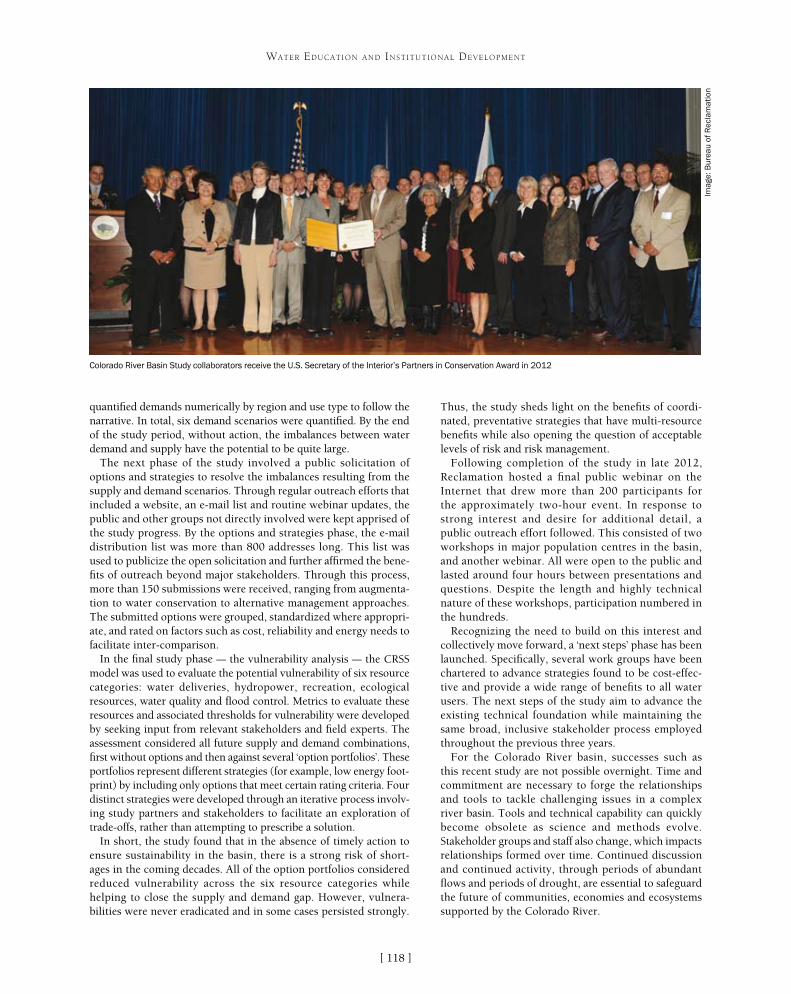
[ ]118
WATER EDUCATION AND INSTITUTIONAL DEVELOPMENT
Thus, the study sheds light on the benefits of coordi-nated, preventative strategies that have multi-resource benefits while also opening the question of acceptable levels of risk and risk management.
Following completion of the study in late 2012, Reclamation hosted a final public webinar on the Internet that drew more than 200 participants for the approximately two-hour event. In response to strong interest and desire for additional detail, a public outreach effort followed. This consisted of two workshops in major population centres in the basin, and another webinar. All were open to the public and lasted around four hours between presentations and questions. Despite the length and highly technical nature of these workshops, participation numbered in the hundreds.
Recognizing the need to build on this interest and collectively move forward, a ‘next steps’ phase has been launched. Specifically, several work groups have been chartered to advance strategies found to be cost-effec-tive and provide a wide range of benefits to all water users. The next steps of the study aim to advance the existing technical foundation while maintaining the same broad, inclusive stakeholder process employed throughout the previous three years.
For the Colorado River basin, successes such as this recent study are not possible overnight. Time and commitment are necessary to forge the relationships and tools to tackle challenging issues in a complex river basin. Tools and technical capability can quickly become obsolete as science and methods evolve. Stakeholder groups and staff also change, which impacts relationships formed over time. Continued discussion and continued activity, through periods of abundant flows and periods of drought, are essential to safeguard the future of communities, economies and ecosystems supported by the Colorado River.
quantified demands numerically by region and use type to follow the narrative. In total, six demand scenarios were quantified. By the end of the study period, without action, the imbalances between water demand and supply have the potential to be quite large.
The next phase of the study involved a public solicitation of options and strategies to resolve the imbalances resulting from the supply and demand scenarios. Through regular outreach efforts that included a website, an e-mail list and routine webinar updates, the public and other groups not directly involved were kept apprised of the study progress. By the options and strategies phase, the e-mail distribution list was more than 800 addresses long. This list was used to publicize the open solicitation and further affirmed the bene-fits of outreach beyond major stakeholders. Through this process, more than 150 submissions were received, ranging from augmenta-tion to water conservation to alternative management approaches. The submitted options were grouped, standardized where appropri-ate, and rated on factors such as cost, reliability and energy needs to facilitate inter-comparison.
In the final study phase – the vulnerability analysis – the CRSS model was used to evaluate the potential vulnerability of six resource categories: water deliveries, hydropower, recreation, ecological resources, water quality and flood control. Metrics to evaluate these resources and associated thresholds for vulnerability were developed by seeking input from relevant stakeholders and field experts. The assessment considered all future supply and demand combinations, first without options and then against several ‘option portfolios’. These portfolios represent different strategies (for example, low energy foot-print) by including only options that meet certain rating criteria. Four distinct strategies were developed through an iterative process involv-ing study partners and stakeholders to facilitate an exploration of trade-offs, rather than attempting to prescribe a solution.
In short, the study found that in the absence of timely action to ensure sustainability in the basin, there is a strong risk of short-ages in the coming decades. All of the option portfolios considered reduced vulnerability across the six resource categories while helping to close the supply and demand gap. However, vulnera-bilities were never eradicated and in some cases persisted strongly.
Colorado River Basin Study collaborators receive the U.S. Secretary of the Interior’s Partners in Conservation Award in 2012
Imag
e: B
urea
u of
Rec
lam
atio
n

[ ]119
HidroEX International Centre – an example of water cooperation
Tânia Brito, Director of Research, Richard Meganck, Romes Lopes, HidroEX International Centre
Although considered a common heritage of mankind, an essential element for life, water resources have been under increasing pressure as a result of both misuse
and mismanagement. This reality is the underlying reason for the establishment of the International Centre for Education, Capacity-Building and Applied Research in Water (HidroEX).1 Its mission is to contribute to resolving the burgeoning water crises that threaten the world as a whole, with a special focus on Latin America and Portuguese-speaking Africa. By helping to train the next generation of water leaders, the foundation looks towards a time when water resources will be shared in an equitable fashion and managed in a sustainable context.
HidroEX International Centre is a public law foundation created by the Government of Minas Gerais, in partnership with The Federal Government of Brazil, and it is subordinate to the Secretary for Science, Technology and Higher Education. Established under the auspices of the United Nations Educational, Scientific and Cultural Organization (UNESCO), the HidroEX International Centre has the responsibility for implementing sustainable development programmes
focusing on water preservation and management of water resources through educational, research and capac-ity building initiatives. HidroEX is one of UNESCO’s Category II centres which understands that encouraging the operation of water education centres in a network is as important as establishing the centres. Networked operation will enable the centres to avoid the overlap of efforts, leading to greater economy of scale and technical and economic efficiency in implementing water-related projects. Defending this position, HidroEX has initiated a number of national and international partnerships committed to networking in a great effort towards water education, in accordance with the guidelines established in the International Hydrological Programme (IHP).
Following UNESCO’s recommendation, a key responsibility of HidroEX is to foster interna-tional water cooperation with Latin American and Portuguese-speaking African countries, working in close relationship with the Community of Portuguese Speaking Countries (CPLP).
WATER EDUCATION AND INSTITUTIONAL DEVELOPMENT
Everyone is responsible for sustainable water use and the learning process starts in schools, homes, communities and basins
Imag
es: T
ânia
Bri
to (l
eft)
; Mar
ia C
arol
ina
Haz
in (r
ight
)
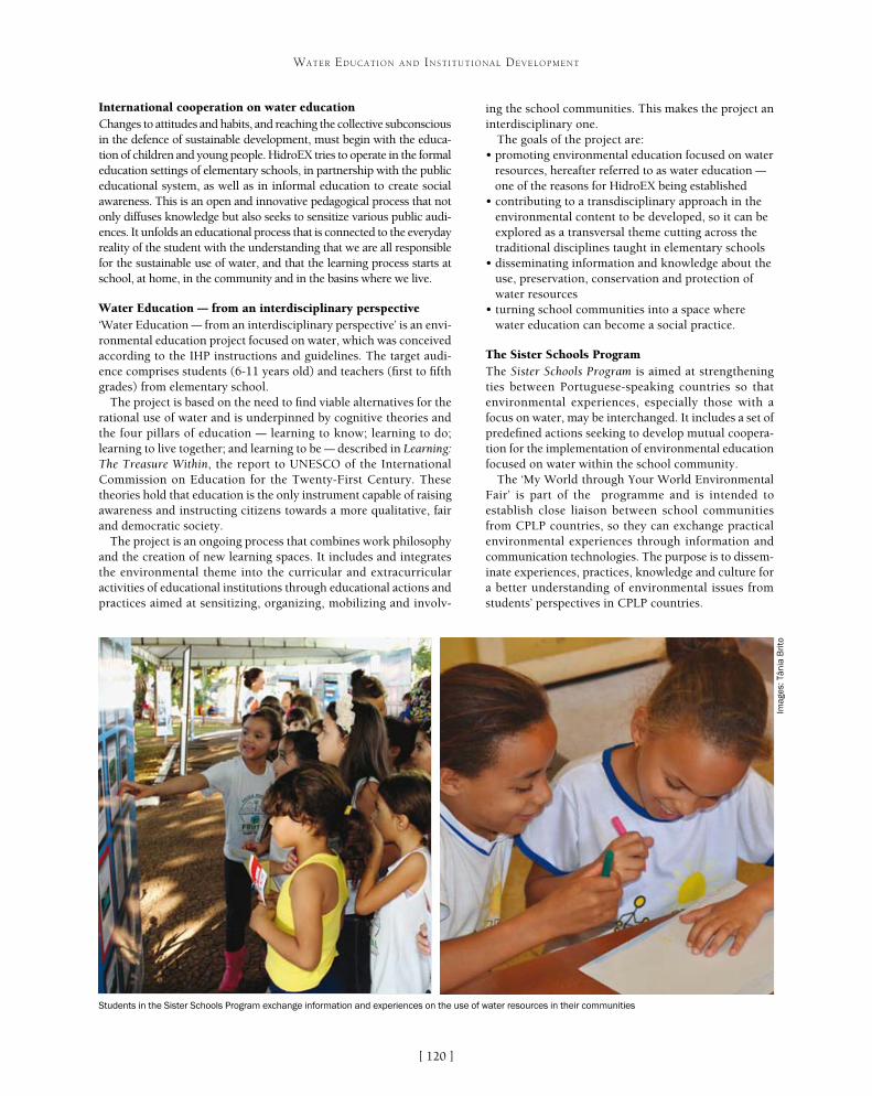
[ ]120
WATER EDUCATION AND INSTITUTIONAL DEVELOPMENT
ing the school communities. This makes the project an interdisciplinary one.
The goals of the project are:• promoting environmental education focused on water
resources, hereafter referred to as water education – one of the reasons for HidroEX being established
• contributing to a transdisciplinary approach in the environmental content to be developed, so it can be explored as a transversal theme cutting across the traditional disciplines taught in elementary schools
• disseminating information and knowledge about the use, preservation, conservation and protection of water resources
• turning school communities into a space where water education can become a social practice.
The Sister Schools ProgramThe Sister Schools Program is aimed at strengthening ties between Portuguese-speaking countries so that environmental experiences, especially those with a focus on water, may be interchanged. It includes a set of predefined actions seeking to develop mutual coopera-tion for the implementation of environmental education focused on water within the school community.
The ‘My World through Your World Environmental Fair’ is part of the programme and is intended to establish close liaison between school communities from CPLP countries, so they can exchange practical environmental experiences through information and communication technologies. The purpose is to dissem-inate experiences, practices, knowledge and culture for a better understanding of environmental issues from students’ perspectives in CPLP countries.
International cooperation on water education Changes to attitudes and habits, and reaching the collective subconscious in the defence of sustainable development, must begin with the educa-tion of children and young people. HidroEX tries to operate in the formal education settings of elementary schools, in partnership with the public educational system, as well as in informal education to create social awareness. This is an open and innovative pedagogical process that not only diffuses knowledge but also seeks to sensitize various public audi-ences. It unfolds an educational process that is connected to the everyday reality of the student with the understanding that we are all responsible for the sustainable use of water, and that the learning process starts at school, at home, in the community and in the basins where we live.
Water Education – from an interdisciplinary perspective‘Water Education – from an interdisciplinary perspective’ is an envi-ronmental education project focused on water, which was conceived according to the IHP instructions and guidelines. The target audi-ence comprises students (6-11 years old) and teachers (first to fifth grades) from elementary school.
The project is based on the need to find viable alternatives for the rational use of water and is underpinned by cognitive theories and the four pillars of education – learning to know; learning to do; learning to live together; and learning to be – described in Learning: The Treasure Within, the report to UNESCO of the International Commission on Education for the Twenty-First Century. These theories hold that education is the only instrument capable of raising awareness and instructing citizens towards a more qualitative, fair and democratic society.
The project is an ongoing process that combines work philosophy and the creation of new learning spaces. It includes and integrates the environmental theme into the curricular and extracurricular activities of educational institutions through educational actions and practices aimed at sensitizing, organizing, mobilizing and involv-
Students in the Sister Schools Program exchange information and experiences on the use of water resources in their communities
Imag
es: T
ânia
Bri
to
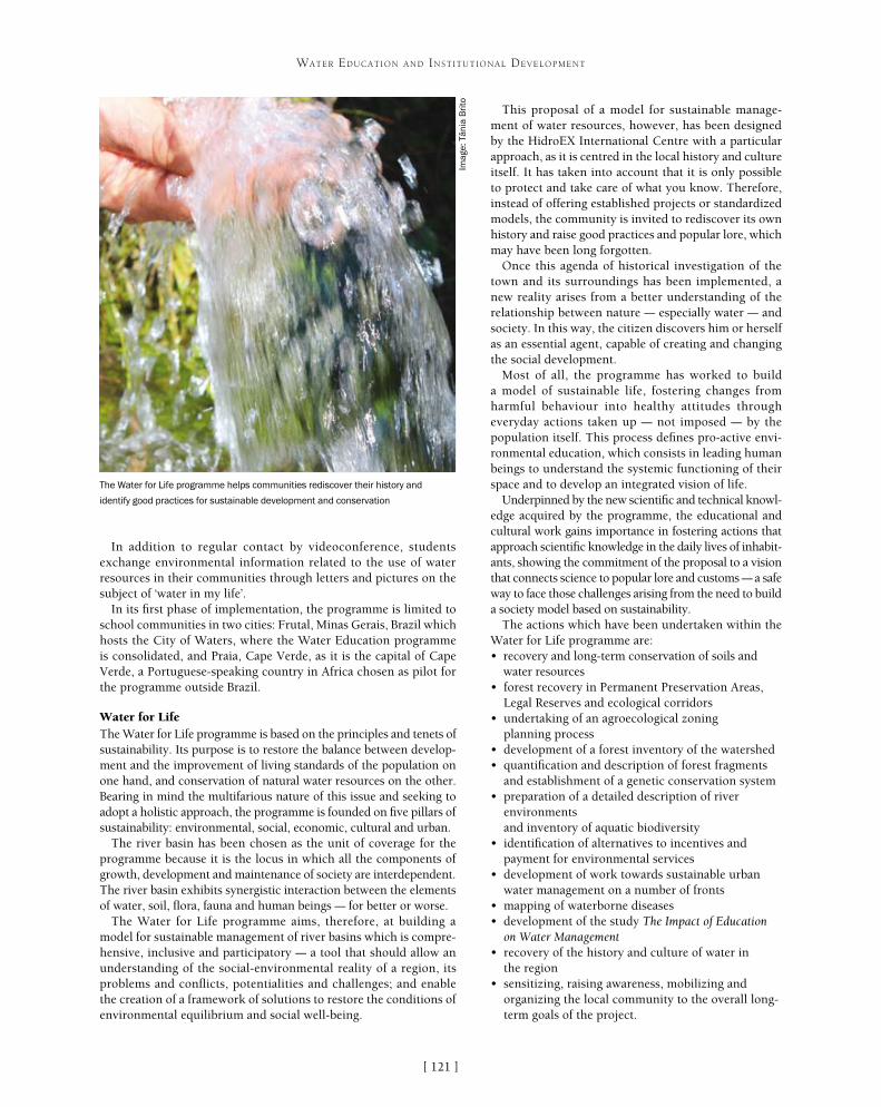
[ ]121
WATER EDUCATION AND INSTITUTIONAL DEVELOPMENT
In addition to regular contact by videoconference, students exchange environmental information related to the use of water resources in their communities through letters and pictures on the subject of ‘water in my life’.
In its first phase of implementation, the programme is limited to school communities in two cities: Frutal, Minas Gerais, Brazil which hosts the City of Waters, where the Water Education programme is consolidated, and Praia, Cape Verde, as it is the capital of Cape Verde, a Portuguese-speaking country in Africa chosen as pilot for the programme outside Brazil.
Water for LifeThe Water for Life programme is based on the principles and tenets of sustainability. Its purpose is to restore the balance between develop-ment and the improvement of living standards of the population on one hand, and conservation of natural water resources on the other. Bearing in mind the multifarious nature of this issue and seeking to adopt a holistic approach, the programme is founded on five pillars of sustainability: environmental, social, economic, cultural and urban.
The river basin has been chosen as the unit of coverage for the programme because it is the locus in which all the components of growth, development and maintenance of society are interdependent. The river basin exhibits synergistic interaction between the elements of water, soil, flora, fauna and human beings – for better or worse.
The Water for Life programme aims, therefore, at building a model for sustainable management of river basins which is compre-hensive, inclusive and participatory – a tool that should allow an understanding of the social-environmental reality of a region, its problems and conflicts, potentialities and challenges; and enable the creation of a framework of solutions to restore the conditions of environmental equilibrium and social well-being.
This proposal of a model for sustainable manage-ment of water resources, however, has been designed by the HidroEX International Centre with a particular approach, as it is centred in the local history and culture itself. It has taken into account that it is only possible to protect and take care of what you know. Therefore, instead of offering established projects or standardized models, the community is invited to rediscover its own history and raise good practices and popular lore, which may have been long forgotten.
Once this agenda of historical investigation of the town and its surroundings has been implemented, a new reality arises from a better understanding of the relationship between nature – especially water – and society. In this way, the citizen discovers him or herself as an essential agent, capable of creating and changing the social development.
Most of all, the programme has worked to build a model of sustainable life, fostering changes from harmful behaviour into healthy attitudes through everyday actions taken up – not imposed – by the population itself. This process defines pro-active envi-ronmental education, which consists in leading human beings to understand the systemic functioning of their space and to develop an integrated vision of life.
Underpinned by the new scientific and technical knowl-edge acquired by the programme, the educational and cultural work gains importance in fostering actions that approach scientific knowledge in the daily lives of inhabit-ants, showing the commitment of the proposal to a vision that connects science to popular lore and customs – a safe way to face those challenges arising from the need to build a society model based on sustainability.
The actions which have been undertaken within the Water for Life programme are:• recovery and long-term conservation of soils and
water resources• forest recovery in Permanent Preservation Areas,
Legal Reserves and ecological corridors• undertaking of an agroecological zoning
planning process• development of a forest inventory of the watershed • quantification and description of forest fragments
and establishment of a genetic conservation system• preparation of a detailed description of river
environments and inventory of aquatic biodiversity
• identification of alternatives to incentives and payment for environmental services
• development of work towards sustainable urban water management on a number of fronts
• mapping of waterborne diseases• development of the study The Impact of Education
on Water Management• recovery of the history and culture of water in
the region• sensitizing, raising awareness, mobilizing and
organizing the local community to the overall long-term goals of the project.
The Water for Life programme helps communities rediscover their history and
identify good practices for sustainable development and conservation
Imag
e: T
ânia
Bri
to

[ ]122
WATER EDUCATION AND INSTITUTIONAL DEVELOPMENT
A simple schematization of the process of putting science into action can be seen as the interaction of science and society as presented in IHP VIII. Science deals with the water-related issues of the IHP VIII themes and produces reports, review papers and training. Society – which consists of professionals and researchers dealing with climate-related issues, policymakers and the general public – promotes the connection of people that is facilitated by the organ-ization of workshops, conferences and networking that use social learning. Such opportunities and connections are crucial to incubate the trust of citi-zens and policymakers in water professionals, which is indispensable if the knowledge and information provided by these professionals is to be utilized effec-tively in society.
In such a scheme, the bulk of the process is repre-sented by the intermediate level: the ‘society- science interface’, which will function as an interface between society and science by producing databases, tool-boxes, guidance documents and knowledge platforms. These and other similar complex issues are part of the research agenda of HidroEX as an excellent centre in water, under the auspices of UNESCO.
City of Waters – a venue for water cooperationSharing synergy, common interests and infrastructure with several water research institutions are some of the objectives of a pioneer project named City of Waters. In the Brazilian city of Frutal, in the State of Minas Gerais, universities and research institutions are establishing a centre for advanced studies in water preservation and sustainable management of water resources. The project is also committed to education at all levels and the formation of a new generation of leaders for sustainable development.
The Water CondominiumOne of the main objectives of the eighth phase of the IHP (IHP VIII)2 is to put science into action. This is achieved by promoting the process of transforming information and experience into answering local and regional needs for tools to adapt integrated water resources management to global changes, and building competences to meet the challenges of today’s global water challenges. To this end, it is essen-tial to establish knowledge platforms where stakeholders, researchers, local institutions, policymakers and education entities can exchange and share information, communicate with each other and develop new ideas in support of policymaking and decision processes. In this context, a Thematic Condominium on Water joining 16 higher education and research institutions (so far) around an anchor entity – the HidroEX International Centre – was created to face the chal-lenge of bringing together different fields of knowledge and enhance existing skills on water issues. The partner research and higher educa-tion institutions are: HidroEX; Minas Gerais Federal University; Ouro Preto Federal University; the State University of Minas Gerais; Uberlândia Federal University; Triângulo Mineiro Federal University; Lavras Federal University; Alfenas Federal University; Viçosa Federal University; Itajubá Federal University; Cousteau Society; the Pontifical Catholic University of Minas Gerais; São João Del Rey Federal University; Vales do Jequitinhonha e Mucuri Federal University; Minas Gerais Technological Center Foundation; Brazilian National Water Agency and Brazilian Agricultural Research Corporation.
The Water Condominium provides offices, laboratories, library and support services to scientists sharing a research interest in a common theme of importance. It involves 10 thematic cores – water govern-ance and management; hydrogeology; ecohydrology; environmental hydrology; water and agriculture; water and energy; environmental technologies; geomatics; water and education; and water history and culture. The idea is to offer a synergistic environment in which scientists can exchange ideas and field test such concepts. Scientists are resident in Brazil for indeterminate periods and share the results of their research on common themes with colleague scientists from around the world. The project’s outputs aim to expand a holistic approach to water governance and management by balancing compet-ing demands from diverse interests such as agricultural, industrial, domestic and environmental stakeholders within the context of climate change, population growth and other realities confronting human progress. The goal is to help member states adapt new strate-gies that will make both their ecosystems and socioeconomic systems more resilient to such changes and offer decision makers clear indica-tions of the implications of decision they are confronting.
Communication between scientists and stakeholders is an impor-tant step towards the development of community understanding and ownership of risk. Scientists have a responsibility to educate the community they serve regarding the risks facing that community, and possible actions the community can take to reduce those risks.
Water quality/scarcityWater related disasters
Human settlementsGroundwaterEcohydrology
ReportsPapersTraining
Synthesis of experiences
Science
DatabasesToolboxes
Guidance documentsKnowledge platforms
Society-Science interface
WorkshopsConferencingNetworking
Mobile phones Radio
ProfessionalsResearchersPolicymakers
General public
Connecting people
Society
The interaction of science and society as presented in IHP VIII
Source: HidroEX International Centre
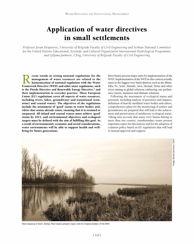
[ ]123
Application of water directives in small settlements
Professor Jovan Despotovic, University of Belgrade Faculty of Civil Engineering and Serbian National Committee for the United Nations Educational, Scientific and Cultural Organization International Hydrological Programme;
and Ljiljana Jankovic, CEng, University of Belgrade Faculty of Civil Engineering
R ecent trends in setting national regulations for the management of water resources are related to the harmonization of national regulation with the Water
Framework Directive (WFD) and other sister regulations, such is the Floods Directive and Renewable Energy Directive,1 and their implementation in everyday practice. These European Union (EU) regulations cover all aspects of water resources, including rivers, lakes, groundwater and transitional (estu-arine) and coastal waters. The objectives of the regulations include the attainment of ‘good’ status in water bodies and, where that status already exists, ensuring that it is retained or surpassed. All inland and coastal waters must achieve ‘good’ status by 2015, and environmental objectives and ecological targets must be defined with the aim of fulfilling this goal. As a result of environmental, economic and social considerations, water environments will be able to support health and well-being for future generations.
River basins present major units for implementation of the WFD. Implementation of the WFD in this context actually starts in the biggest river basin districts such as the Rhine, Elba, Po, Seine, Danube, Sava, Hernad, Drina and other rivers aiming at global solutions embracing vast prelimi-nary visions, measures and ultimate solutions.
Following the assessment of ecological status and potential, including analysis of pressures and impacts, definition of heavily modified water bodies and others, comprehensive plans for the monitoring of surface and groundwater are prepared that will lead to the achieve-ment and preservation of satisfactory ecological status. Taking into account that many river basins belong to more than one country, transboundary issues present important topics for discussions and for the adoption of common policy based on EU regulations that will lead to mutual approval and support.
WATER EDUCATION AND INSTITUTIONAL DEVELOPMENT
River Zasavica in Srem, Serbia. River basins present major units for implementation of the WFD
Imag
e: N
enad
Jac
imov
ic, 2
00
7

[ ]124
WATER EDUCATION AND INSTITUTIONAL DEVELOPMENT
Current knowledge and practice is mainly imple-mented in large urban areas where educated people live and access to information is easy. Even in large cities where urban sprawl occurs, especially during turbu-lent times when uncontrolled urbanization phenomena take place, a lack of proper planning and construction of infrastructure systems – particularly sanitation –means that the implementation of regulations related to water leaves a lot to be desired. The Urban Waste Water Treatment Directive2 has been implemented despite difficulties due to economy problems, underbuilt water and sewage systems and especially a complete lack of wastewater treatment plants.
On the other hand, vast populations live in rural areas or small towns where procedures and standards applied in everyday practice belong to traditional ways of living rather than to up-to-date accomplishments and regula-tions. If we take for an example the situation in Serbia, more than 95 per cent of water professionals live in five large cities – Belgrade, Nis, Novi Sad, Kragujevac and Subotica – according to data from the Serbian Chamber of Engineers. Governmental and intergovernmental insti-tutions and projects should foster a policy of permanent education, employment opportunities and technical improvement in less developed regions in order to create the conditions for environment preservation.
European directives are quite restrictive in terms of further development that would be of benefit for the environment. In that regard, the implementation of directives should be extended to sustainable use of water through irrigation, energy production and naviga-tion, but also through recreational use of water such as water sports, boating and so on.
Ecological status in river basins depends on population occupancies and the human activities practiced. Urban areas and industrial centres alter natural conditions in the basins and could put extensive pressure on the environment. Urbanization is an emerging process induced by many causes such as job opportunities, young people seeking educa-tion, social status, medical security and cultural facilities. Due to the occupancies of large areas with urban amenities, more farmland and wildlife habitats are displaced by impervious surfaces. At the same time, increases in pollution sources such as soot, industrial fumes and motor vehicle exhaust gases directly impact all environmental aspects, such as water and air pollution, the water cycle, flora and fauna.
Via Militaris
Serbia’s Via Militaris is the focus of a project to connect archaeological and
historical heritage with water resources
Source: Faculty of Civil Engineering, Belgrade
The River Temska (left) and Stara Mountain (right) in Eastern Serbia are areas with abundant water resources, flora and fauna
Imag
e: T
amar
a Ja
nkov
ic, 2
01
2

[ ]125
WATER EDUCATION AND INSTITUTIONAL DEVELOPMENT
As an extension of this idea, the project for the connection of archaeological and historical heritage with water resources along the Roman Via Militaris in Serbia was launched in 2012. The project is based on strengthening the network of countries that share common natural and historical sites located in boundary regions – the first at the boundary region of South-East Serbia and the second in North-West Serbia. The South-East Serbia region covers the Vlasina area and Bela Palanka in Serbia, Kunstendil in South-West Bulgaria and Macedonia. The North-West region includes Western Serbia (Srem), East Croatia, the East Republic of Srpska, Bosnia and Herzegovina (Semberija).
Border areas located in North-West and South-East Serbia are rich with natural resources and cultural-historical heritage, and present exceptional potential for transboundary cooperation in various areas such as environmental protection and tourism. Catchments of the rivers Sava, Bosut and Studva in the west and Nisava, Pcinja and Dragovistica in the east are characterized with abundant water resources, flora and fauna, and certain areas are declared as protected areas by international associations for nature protection. The River Zasavica is located in Srem and is a habitat for about 700 plant species, 187 bird species and 24 fish species, some of which are endemic to the area. Obedska bara on a left bank of the Sava river is an oasis for important ecosystems including bird fauna with 220 species.
In addition, historical heritage found in these areas originates back to the Neolithic period, with most of the finds coming from the Roman Empire. At the time of the Roman Empire, Fruska Gora became a border area where Sirmium (today Sremska Mitrovica) was developed. Seven Roman emperors were born in Sirmium, and this is the beginning of the so-called settlement itinerarium Romanum Serbia which links significant sites of the ancient Roman period and four settlements (Sirmium, Singidunum, Felix Romuliana and Naisus Belkin) in the territory of Serbia, including the birthplaces of 17 Roman emperors.
This combination of natural resources and cultural-historical heritage is an excellent base for the development of tourism and other commercial fields. The aim of this project is to stimulate new research and cooperation among different scientific fields that will give direction for the research of interdependence between natural resources and rich historical heritage.
In this regard, there is a strong need for networking at all levels of education, from an elementary level through university education and research. Education in the water resources and environment domain consists of the imple-mentation of information and knowledge in achieving requirements which are defined and set within regula-tory and legal documentation at numerous levels. These include the International Hydrological Programme (IHP), the United Nations Educational, Scientific and Cultural Organization (UNESCO), the EU, the International Commission for the Protection of the Danube River, the International Sava River Basin Commission or any other internationally recognized level, such as transborder water-shed or basin level, regional level, state level or lesser areas.
Recognized institutions that promote an integrated system of research and training and foster transbound-ary cooperation in the region include the International Research and Training Centre for Urban Drainage (under UNESCO auspices), the UNESCO Chair in Water for Ecologically Sustainable Development at the University of Belgrade, the Serbian National IHP Committee and the Black Sea Universities Network among others. The Chair in Water for Ecologically Sustainable Development promotes an integrated system of research, training, information and documentation on sustanable water resources management, hydro-informatics and eco-hydrology in Central Asia and Africa.
Border areas in North-West and South-East Serbia are rich in historical heritage from the Roman Empire
Imag
e: a
eter
nita
s-nu
mis
mat
ics.
blog
spot
.com

[ ]126
From China to Uganda: educating and empowering people to take action
Dennis Nelson, President and CEO; John Etgen, Senior Vice President; Nicole Rosenleaf Ritter, Communications Manager, Project WET Foundation
In Entebbe, Uganda, it started with one teacher. Fed up with the toll that waterborne diseases were taking on his pupils and the school at large, Lake Victoria Primary School
teacher Aggrey Oluka jumped at the chance to participate in the development of water, sanitation and hygiene (WASH) educa-tion materials that could improve his students’ health.
At a workshop in Uganda’s second largest city Jinja, Oluka and other educators worked with the Project Water Education for Teachers (WET) Foundation to develop WASH education materi-als to use across six African countries. While he expected to lend his expertise to creating locally relevant materials that would appeal to students and teachers around Africa, Oluka couldn’t have known the impact his participation would have on his community and the wider world. The successful implementa-tion of the materials he helped create would ultimately lead to safer water resources, increased water source protection and even improvement in Lake Victoria Primary School’s bottom line. The experiences of Oluka and Lake Victoria Primary School show how cooperation on WASH education can lead to significant
institutional development – and demonstrate the potential of scaling up water education.
Aggrey Oluka had seen waterborne diseases devastate Lake Victoria Primary School. Enrolment at the 2,000-pupil school plummeted to 400 during one cholera epidemic, and even when cholera was not present, typhoid and other diarrhoeal diseases were. His pupils often missed school or had to leave class to visit the school health clinic when they felt sick. As a science teacher, he knew that waterborne illnesses can often be prevented, but there was no programme in place to teach children – or even train teachers – to protect themselves.
Around the same time, the United States Agency for International Development (USAID) had noticed a similar lack of WASH education resources for Africa. Formal water education was virtually non-existent and the lack of a systematic programme meant that preventable waterborne diseases continued to prolif-erate unchecked. Measures that can reduce disease transmission – hand washing, boiling water and water
WATER EDUCATION AND INSTITUTIONAL DEVELOPMENT
Children at Lake Victoria School in Uganda play a game that teaches them how to avoid catching common waterborne diseases
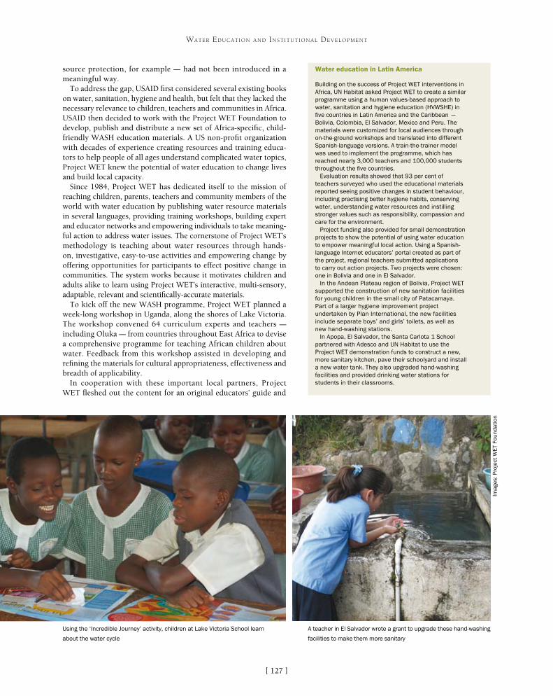
[ ]127
WATER EDUCATION AND INSTITUTIONAL DEVELOPMENT
source protection, for example – had not been introduced in a meaningful way.
To address the gap, USAID first considered several existing books on water, sanitation, hygiene and health, but felt that they lacked the necessary relevance to children, teachers and communities in Africa. USAID then decided to work with the Project WET Foundation to develop, publish and distribute a new set of Africa-specific, child-friendly WASH education materials. A US non-profit organization with decades of experience creating resources and training educa-tors to help people of all ages understand complicated water topics, Project WET knew the potential of water education to change lives and build local capacity.
Since 1984, Project WET has dedicated itself to the mission of reaching children, parents, teachers and community members of the world with water education by publishing water resource materials in several languages, providing training workshops, building expert and educator networks and empowering individuals to take meaning-ful action to address water issues. The cornerstone of Project WET’s methodology is teaching about water resources through hands-on, investigative, easy-to-use activities and empowering change by offering opportunities for participants to effect positive change in communities. The system works because it motivates children and adults alike to learn using Project WET’s interactive, multi-sensory, adaptable, relevant and scientifically-accurate materials.
To kick off the new WASH programme, Project WET planned a week-long workshop in Uganda, along the shores of Lake Victoria. The workshop convened 64 curriculum experts and teachers – including Oluka – from countries throughout East Africa to devise a comprehensive programme for teaching African children about water. Feedback from this workshop assisted in developing and refining the materials for cultural appropriateness, effectiveness and breadth of applicability.
In cooperation with these important local partners, Project WET fleshed out the content for an original educators’ guide and
Water education in Latin America
Building on the success of Project WET interventions in Africa, UN Habitat asked Project WET to create a similar programme using a human values-based approach to water, sanitation and hygiene education (HVWSHE) in five countries in Latin America and the Caribbean – Bolivia, Colombia, El Salvador, Mexico and Peru. The materials were customized for local audiences through on-the-ground workshops and translated into different Spanish-language versions. A train-the-trainer model was used to implement the programme, which has reached nearly 3,000 teachers and 100,000 students throughout the five countries.
Evaluation results showed that 93 per cent of teachers surveyed who used the educational materials reported seeing positive changes in student behaviour, including practising better hygiene habits, conserving water, understanding water resources and instilling stronger values such as responsibility, compassion and care for the environment.
Project funding also provided for small demonstration projects to show the potential of using water education to empower meaningful local action. Using a Spanish-language Internet educators’ portal created as part of the project, regional teachers submitted applications to carry out action projects. Two projects were chosen: one in Bolivia and one in El Salvador.
In the Andean Plateau region of Bolivia, Project WET supported the construction of new sanitation facilities for young children in the small city of Patacamaya. Part of a larger hygiene improvement project undertaken by Plan International, the new facilities include separate boys’ and girls’ toilets, as well as new hand-washing stations.
In Apopa, El Salvador, the Santa Carlota 1 School partnered with Adesco and UN Habitat to use the Project WET demonstration funds to construct a new, more sanitary kitchen, pave their schoolyard and install a new water tank. They also upgraded hand-washing facilities and provided drinking water stations for students in their classrooms.
Imag
es: P
roje
ct W
ET
Foun
datio
n
A teacher in El Salvador wrote a grant to upgrade these hand-washing
facilities to make them more sanitary
Using the ‘Incredible Journey’ activity, children at Lake Victoria School learn
about the water cycle

[ ]128
WATER EDUCATION AND INSTITUTIONAL DEVELOPMENT
companion student activity book on water, health, sanitation and disease prevention, as well as water cycle and watershed posters and companion student activity books. The materials would be distrib-uted through a train-the-trainer process, with Project WET working with core groups of local education leaders in Northern Uganda, Rwanda and Tanzania, not only to use the new resources but also to help their fellow teachers implement the programme.
Keenly interested in getting the new resources to his colleagues and to the pupils at Lake Victoria Primary School, Oluka waited for the materials to be finished and implemented them swiftly once he had them in hand. Focusing first on the biggest problem – the unchecked spread of waterborne diseases – Oluka and his fellow teachers worked to improve children’s water use habits, stressing hand washing, water purification and water source protection. According to Oluka, things started to change for the better.
“The efforts of Project WET in my school have been realized from the change of behaviour in the pupils’ use of water, which wasn’t the case previously,” Oluka said. “This has led to the reduction of so many waterborne diseases, especially diarrhoea and typhoid, and it has also changed the hygiene of the pupils and the sanitation of the school.
With students’ health improving, Oluka felt ready to move beyond the classroom to empower students to make meaningful changes in their school and community. One of the main areas of difficulty was the amount of water available to the school: now that the students knew the importance of hand washing with soap, they needed more safe water with which to do it. Unfortunately, the school’s water bill was already more than US$600 a month, a huge sum in a country where the World Bank estimates the annual per capita gross national income is just US$1,310.
Working with students from his classroom and in after-school clubs, Oluka asked Lake Victoria Primary School leaders if they could set up a rainwater harvest-ing system using a 10,000-litre water tank that had been left idle. Oluka and his students were granted permission and set up the system with help from the community. The school’s available water increased substantially, even as their water bill dropped dramati-cally, to around US$30 a month.
And Oluka and his students did not stop there.After learning about the impact of improperly disposed
trash on water resources in their Project WET lessons, the students launched a campus-wide clean-up, which led to a paper recycling programme when they noticed that much of what they were collecting was waste paper. They then used the paper to make cardboard pieces from which they could hang teaching materials.
“The impact of this is that there is reduction in compound littering. We are also able to sell some of this cardboard we produce to sustain our project,” Oluka explained.
Increased enrolment (and an increase in the number of teachers), ready access to boiled water for safe consump-tion, multiple hand-washing stations and higher scores on the Ugandan National Exams are additional positive changes documented at Lake Victoria School through follow-up interviews with students and teachers.1
The results have made Aggrey Oluka a strong advo-cate for water education after seeing its potential to
At a workshop in Uganda, teachers find out how to incorporate highly interactive pedagogical methods to teach about water resources

[ ]129
WATER EDUCATION AND INSTITUTIONAL DEVELOPMENT
improve schools and communities. Inspired by his experiences, he has even enrolled in a degree programme in Environment and Natural Resource Management.
After winning a 2010 African Ministers’ Council on Water AfricaSan Award in recognition of his outstanding work at Lake Victoria School and beyond through the scaling up of the WASH programme he helped develop, Oluka said: “I call upon the Government of Uganda and other governments in Africa to also include water education in school curricula at all levels so as to make our pupils have positive behavioural change towards sanita-tion, hygiene and sustainable usage of water.”
In many ways, his call has been heeded, and not just in Africa where the USAID-Project WET WASH programme has ultimately reached tens of thousands of teachers and millions of students in 21 countries. UN Habitat has sponsored an adaptation of the programme in five Latin American countries, as well as in India, and other partners have extended the scope to include Brazil, Cambodia, Afghanistan and Haiti. The materials are now available in English, French, Spanish, Portuguese, Kiswahili, Kannada (a language of India), Dari and French Creole – and most can be freely down-loaded from the Project WET website.
As Oluka sees it, it makes sense to start with children to begin to solve vexing water issues.
“Whenever there is a disaster as a result of water, whether short-age or use of contaminated water, it is mainly the children who suffer the consequences through diseases and even walking long distances looking for water,” he noted. “And children are very excel-lent in spreading news, even to the adults, about sustainable water usage and control of diseases that are common in our communities.”
Water education in China
Not all of the water education programmes in which Project WET is involved in internationally revolve around water, sanitation and hygiene topics. China is one of several countries in which Project WET has been invited by institutional sponsor Nestlé Waters to share hands-on methods to teach children about water conservation and protection, as well as healthy hydration choices.
In partnership with Nestlé Waters and the Shanghai Ministry of Education, Project WET China launched in January 2010 with 17 Shanghai schools. Project WET materials were translated into Chinese and implemented through a train-the-trainer process, which has included not only Project WET staff but also Nestlé Waters China employees. With a focus on environmental education and various after-school activities, the priority of the programme is to raise local students’ awareness of the importance of environmental protection – a topic of great importance in China.
In China, too, educators and local partners have taken the lessons learned in the classroom outside of the school walls and into the community. On World Water Day 2011, students taking part in Project WET China broke the Guinness World Record for plastic recycling, turning in nearly 9,000 kilograms of plastic bottles in a single day. Subsequent community projects have included a water activity carnival and glass recycling activities.
Shanghai Project WET facilitators have begun training teachers outside of the city to scale up the programme. The programme launched in Beijing in March 2012 and Hunan Province in August 2012, and other NGOs from around China are now joining the effort to bring water education to China.
Students in China play a game called ‘Blue Planet’ to learn how much water covers Earth Aggrey Oluka with some of the waste collected by students for recycling
Imag
es: P
roje
ct W
ET
Foun
datio
n

[ ]130
Speaking so that people understand: integrated water resources management in Guatemala
Joram Gil, United Nations Educational, Scientific and Cultural Organization Chair in Sustainable Water Resources, Guatemala
Poor environmental management is a priority issue in the Republic of Guatemala. Among its causes is the widespread indifference of citizens, authorities and insti-
tutions. Inadequate management of the municipal territories has brought consequences such as illegal logging, irrational use of natural resources and a passive attitude to their management. In addition, a conformist culture of inaction and indifference on the part of citizens and policymakers, combined with a lack of knowledge and capacities, means that there are limited develop-ment alternatives for improving living conditions.
Poor land use planning is another problem, caused by a lack of respect for environmental regulations and a weakness in the coordinated participation of organizations and government. Accelerated defor-estation, degradation and fragmentation of habitats, unmanaged changes in the use of soil and the loss of ancestral knowledge complete the problems of the country.
All this has resulted in increased socio-environ-mental vulnerability, the contamination and loss
WATER EDUCATION AND INSTITUTIONAL DEVELOPMENT
Educational materials for IWRM in the Naranjo watershed
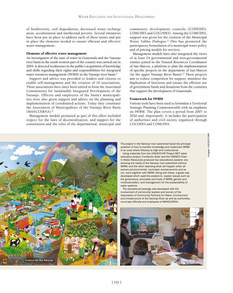
[ ]131
WATER EDUCATION AND INSTITUTIONAL DEVELOPMENT
community development councils (CODEDES, COMUDES and COCODES). Among the COMUDES, support was given for the creation of the Municipal Water Tables Dialogue.3 This has promoted the participatory formulation of a municipal water policy and of pricing models for services.
Management models have also integrated the views of at least 14 governmental and non-governmental entities joined in the Natural Resources Coordinator of San Marcos, a platform to plan the implementation of specific projects in the department of San Marcos (In the upper Naranjo River Basin).4 These projects aim to reduce competition for support, minimize the duplication of functions and ensure the efficient use of government funds and donations from the countries that support the development of Guatemala.
Framework for IWRMVarious tools have been used to formulate a Territorial Strategic Planning Commonwealth with an emphasis on IWRM. The plan covers a period from 2007 to 2020 and, importantly, it includes the participation of authorities and civil society organized through COCODES and COMUDES.
of biodiversity, soil degradation, decreased water recharge areas, acculturation and intellectual poverty. Several initiatives have been put in place to address each of these issues and put in place the elements needed to ensure efficient and effective water management.
Elements of effective water managementAn investigation of the state of water in Guatemala and the Naranjo river basin in the south-western part of the country was carried out in 2004. It detected weaknesses in the public’s acquisition of knowledge and skills regarding their rights and responsibilities for integrated water resources management (IWRM) in the Naranjo river basin.1
Support and advice was provided to leaders and citizens to enable self-management and the creation of 10 associations. These associations have since been united to form the Associated Communities for Sustainable Integrated Development of the Naranjo. Officers and employees of the basin’s municipali-ties were also given support and advice on the planning and implementation of coordinated actions. Today they constitute the Association of Municipalities of the Naranjo River Basin (MANCUERNA).2
Management models promoted as part of this effort included respect for the laws of decentralization, and support for the constitution and the roles of the departmental, municipal and
The project in the Naranjo river watershed faced the principal question of how to transfer knowledge and implement IWRM in an area where illiteracy is high and multicultural.
Using materials from the UNESCO-IHP Project WET water education project, Fundación Solar and the UNESCO Chair in Water Resources produced two educational posters: one showing the reality of the Naranjo river watershed without IWRM, and the other depicting what will happen when all sectors (environmental, municipal, socioeconomic and so on), work together with IWRM. Along with these, a guide was developed which used the posters to explain issues such as the governance, principles and tools of IWRM, gender and multiculturalism, and management for the sustainability of water systems.
The educational package was developed with the involvement of community leaders and women of the Association of Community Partners for Water, Environment and Infrastructure of the Naranjo River as well as authorities, municipal officials and employees of MANCUERNA.
Imag
es: U
NE
SC
O-C
WR

[ ]132
WATER EDUCATION AND INSTITUTIONAL DEVELOPMENT
The plan includes:• treatment of solid waste from the five municipalities of the basin
valley in the central part of the department of San Marcos and three municipalities in the department of Quetzaltenango
• implementation of the studies of 12 wastewater treatment plants at strategic locations
• recovery and preservation of 1,478 hectares of forest cover including commercially valuable plantations (hemlock, energy forests, orchards)
• improved drinking water coverage (quality and quantity)• rehabilitation of power generation units (La Castalia and Granja
Eólica del Rodeo, among others).
In 2004, 10 associations were organized to support water resources management. MANCUERNA and government institutions signed the Declaration of Miralvalle, establishing the Municipal Water Tables Dialogue system to provide a forum for dialogue on IWRM.
Several steps were entailed in building the system of water dialogues and putting it into operation:• direct involvement of the water sector, national authorities,
local authorities and organized population• socioeconomic and environmental diagnosis of the municipalities• administrative diagnostics of municipalities• associative diagnostics• generation of a geographic information system from the basin
hydrological study • capacity building• involvement and advocacy at the local, municipal and
regional levels.
Municipal and community development councils, in conjunction with community partnerships, devel-oped the proposed Municipal Water Policy, which is promoted and in most cases supported by municipal authorities. The policy is the basis for the preparation of strategic development plans for both the municipalities and the commonwealth.
Economic Development, Tourism, Environment and Natural Resources CommissionBy 2013 the Municipal Water Tables Dialogue system had evolved to become institutionalized as a manda-tory committee, known as the Economic Development, Tourism, Environment and Natural Resources Commission, in each municipality of the urban and rural development councils framework. The policy has enabled several IWRM initiatives to be put into practice:• sensitization and training in IWRM• formulation of municipal water policies • establishment of the Municipal Water Tables Dialogue• generation and management of information on
water resources• social participation as a guarantor of sustainability• implementation of a water inventory for the amount
and quality of the resource.
Associations for cooperation in IWRMOne of the first decisions taken at the beginning of the decade was to promote the development of rural and
Imag
e: U
NE
SC
O-C
WR
Today, through a number of workshops and meetings, people can express their appreciation of water by exchange of information and local knowledge

[ ]133
WATER EDUCATION AND INSTITUTIONAL DEVELOPMENT
intervenes. It is also important to contact local men’s and women’s leaders and municipal authorities. These contacts were key to initiating the implementation of the Naranjo river basin project.
During the project, dimensions of human reality and social circumstances emerged that were diffi-cult to predict at the planning stage. The language, restrictions on the participation of women, short-term expectations, the existence of conflicts, commu-nity motivation and the strength of the municipal authorities, among others, were factors that forced adjustments to the project. These factors transformed the project into an exercise of reorganization, intro-duction of changes and constant learning.
The understanding of political will is often simpli-fied as a matter of convincing the mayor. However, historical evidence shows that success depends more on perseverance with a fixed idea and clear objective than it does on the characteristics, interests or voca-tions of the authorities. Success is contagious and, in this case, the efficacy of the organization processes and the training in some municipalities captured the political will of others. The existence of the MANCUERNA organizations suggests the sustain-ability of that political will.
Although it was possible to use the natural inter-ests of civil society and the authorities in water and its management as a topic, it was also necessary to provide the tools required to transform those inter-ests into processes and results. Making those tools accessible to communities was another factor in the project’s success.
Informed dialoguePreconceived ideas, prejudices and interpretations or personal interests can act as distractions with more weight than the objective elements of the issue. In this context, the study on the state of water in the basin provided a valuable input to standardize participants’ knowledge of water and its manage-ment. The study of the results as a baseline shows that distractions were diminished to enable a focus on the objective analysis of the situation and the development of alternatives.
Empowering womenIn the reconstruction of a project experience it is common to find arguments or testimonies about the active role of women in the proper use of water for productive purposes and in everyday life.
In a social organization like the basin, with traditional roles for men and women and a privileged position for men, it is usual to find intolerance and discrimina-tion towards the participation of women. Empowering women will remain a challenge for organizations and future initiatives. These initiatives should bring posi-tive results for everyone and place women on a higher development level without returning them to the subju-gated roles of the past.
urban associations in each of the eight municipalities of the upper Naranjo River Basin, as well as the associations represented by each municipality government to elaborate policies, programmes and projects for coordinated water management. This effort involves community associations and municipalities to ensure water resources are recognized as a cross-cutting issue. It has been supported by the implementation of participative diagnostics to establish the guide-lines of municipal water policies that trigger multiple processes – of which we are now seeing the initial results.
The objectives of the association at the top of the Naranjo river basin have been to take measures to operationalize water policies; seek agreements on the management of waste solids, water contami-nation and recovery of water recharge areas; and promote productive special uses of water resources. All this is done through dialogue and cooperation between key stakeholders including authorities, society, associations and public institutions.
Institutional arrangementsA key example of this cooperation can be found in the joint efforts between universities, non-governmental organizations, private sector companies and government institutions. A decision was taken to conduct learning and demonstration projects (PADs), working together with communities and institutions in the sector. This process is aimed at enabling the systematization of experi-ences, knowledge transfer and construction methodologies that can be replicated in different regions in western Guatemala, inter-relating these efforts with the Municipal Water Tables Dialogue. The strategy needs to incorporate, among other elements, monitor-ing systems and the prevention of critical situations; sustainable management of natural resources; access to water, sanitation and primary health services; communication systems; and access to sources of income.
Since ancient times people have expressed their appreciation of water through their culture. Today, that cultural aspect is comple-mented by a political connotation and focused on the representative participation of society. This new participatory model, through a number of workshops and meetings with stakeholders in Spanish and native languages, seeks to understand reality; identify the cultural changes needed to integrate and strengthen the legal and institutional framework for management; and enable the continuous exchange of information and local knowledge.
The PADs are based in the concept of Team Learning Projects.5 PADs open up protected areas for the construction and adapta-tion of knowledge to solve complex problems such as those of IWRM. They provide an answer to the complexity of development processes and the need to create spaces that promote sustainable human development.
Committee strategies involve the formation of an interdisci-plinary, inter-agency and intersectoral team, which looks for professional members from the technical, social sciences, admin-istrative and economics fields. A key component of the strategy is the sensitization and training of key actors in civil society and the municipal governments, to enable the creation of a favourable attitude and the development of knowledge and skills to intervene in water resources management.
Knowledge: the base of interventionExperience shows that developing an effective IWRM strategy begins with deepening understanding of the reality on which the strategy

[ ]134
Water and development: a history of cooperation in the Dominican Republic
Fernando Rivera Colinton, Researcher, Centre for the Sustainable Management of Water Resources in the Caribbean Island States, National Water Research Institute (INDRHI)
W ater cooperation and conflict over water use must have begun in the Dominican Republic (DR) with the arrival of the Spanish conquerors in the fifteenth century.
However, the development of modern water exploitation and coop-eration began in the late nineteenth century when one Spanish man, Juan Caballero, initiated the construction of an irrigation channel in the south. At the beginning of the twentieth century Luis L. Bogaert, of French origin, built the first channel with technical criteria in the north-west region. In 1917 an American company began the construction of an irrigation system in the south, which later became the first irrigation district in DR. Before this point, the private sector had been the main constructor of infrastructure for water use. In 1924 the state began to develop its water sector, and most of the country’s channels and dams were built using internal financial resources between then and the late 1970s.
Cooperation programmesDuring the 1980s DR, like most Latin American and Caribbean coun-tries, experienced economic constraint. The irrigation system was inefficient, with low crop productivity and deterioration of the infra-structure due to neglected maintenance as a result of lack of funds. As a consequence the Government, in collaboration with bilateral and multi-lateral agencies, decided to organize water user associations and transfer
to them responsibility for rebuilding the infrastructure of the irrigation systems. The first project of this type began in 1987. It was financed by the United States Agency for International Development with the technical assistance of Utah State University in two pilot areas: Ysura in the south and Ulises Francisco Espiallat in the north. This project was followed by others, giving birth to a programme that was extended to all irrigated areas.
Some of the key projects implemented during this time include:• the AGLIPO I and AGLIPO II Agricultural
Development Projects and the Project for Technological Improvement of Irrigated Agriculture, financed by the Japan Bank International Corporation with the technical assistance of the Japan International Cooperation Agency
• the San Juan Agricultural Development Project, aided by the Inter-American Development Bank (IDB) and IEDF
• the Irrigated Land and Basin Management Project, funded by the World Bank
• the Management Program for Irrigation Systems for Water User Associations, funded by IDB
• the Program for Reconstruction and Improvement of Damages of Hurricane George, funded by IDB.
DR has received cooperation in water education and institutional development and in water cooperation, sustainability and poverty eradication from many other institution and organizations, both national and inter-national, including the German Technical Cooperation; the USA Corp of Engineers; Brigham Young University, USA; and organizations from Israel, Holland, Mexico, Chile, Brazil and Spain.
One of the most interesting examples of water educa-tion, cooperation and institutional development is the Water Culture Program initiated in 1997 with the main objective of raising awareness about the importance of water preservation among the population. In order to create this programme an inter-institutional agreement was signed between all the institutions in the DR water sector and some in the educational sector. These included the Water Resources National Institute, the Secretary of State for Education, Fine Arts and Culture, the Secretary of State for Health and Welfare, the National Institute of
WATER EDUCATION AND INSTITUTIONAL DEVELOPMENT
The country now produces more than 80 per cent of the food it needs
Imag
e: J
osé
Del
Car
men
Cab
rera

[ ]135
WATER EDUCATION AND INSTITUTIONAL DEVELOPMENT
sponsored by ADESJO are a good example. ADESJO has been accompanying these communities for 40 years. Today, the leaders in the 83 communities are the sons and daughters of the founders of the first organizations and they will pass this responsibility to their own children.
While there have been notable successes, many prob-lems remain unsolved. There is a need to reduce the waste of water. Irrigation efficiency must increase from its current 25 per cent, and there is a need to reduce the 50 per cent water loss from aqueducts in most major cities. The sources and quality of water must be preserved. Most basins are facing deforestation and contamination with pesticides and untreated water. And people need to be conscious of the real economic value of water and willing to pay for it.
Water and Sewerage, the Water and Sewerage Corporation of Santo Domingo, the Water and Sewerage Corporation of Santiago, and the Water and Sewerage Corporation of La Romana. A key success of the programme has been the creation of educational guidelines on water that are used in schools from the first to the eighth grade. The programme has also implemented the Water Quality Watcher project which integrates civil society in the gathering of physical, chemical and bacteriological information on water quality. The programme organizes lectures in different communities and has a Hall of Water Culture that is visited by many students.
Water cooperation and education resultsSome key results from this process have been:• the organization of all 89,000 users into 32 water users’
associations• a reduction of conflicts over the use of water
due to better organization and increased administrative capacity• increases in distribution efficiency• a contribution to a democratic culture in rural areas• increased recovery of maintenance costs from an average
of 17 per cent when the systems were administered by the Government, to an average of 80 per cent now that it is administered by water users’ associations
• the construction of new water infrastructure and improvement of some of the existing infrastructure.
As a result of all these efforts in DR the irrigated lands, which represent 11 per cent of agricultural land, now produce 60 per cent of agriculture production. The country is producing more than 80 per cent of the food needed to feed its own population and more than 4 million tourists every year. This has contributed to reducing poverty and improving the health of the population with better access to food at a lower price.
One of the most interesting institutions involved in water coopera-tion, sustainability and poverty eradication in DR is the San Jose de Ocoa Development Association (ADESJO). This non-governmental organization was founded by father Jose Luis Quinn from Canada in the 1970s and it operates in the San Jose province located in the south part of the country’s Central Mountain area. The success of ADESJO centres on people involvement and horizontal cooperation among intended beneficiaries. ADESJO has promoted a strong community involvement in its own development process. In each of the 83 communities in San Jose de Ocoa, it has promoted the creation of a Community Board that is in charge of planning and coordinating community development projects. It also has specialized committees on irrigation, reforestation, forest monitoring, producer associations and women’s associations. All of these committees do voluntary work in community projects and in the plot of each farmer through a rotatory scheme. The philosophy that promotes ADESJO is self reliance and mutual help.
Lessons learned and challengesThe lessons learned are that cooperation is key component for water development success: cooperation between north and south, south and south, country cooperation and above all, horizontal cooperation at the community level. People involvement at all stages of the devel-opment process through an interactive approach can create a better understanding of the problem and more commitment to contributing to the solution. True development requires an extended commitment to develop a self-management culture that allows individuals and commu-nities to take action on their own. Los Martinez and other projects
Case study: Los Martinez
Los Martinez is an interesting example of community development. It was founded in the early 1900s, 15 km away from San Jose de Ocoa at an altitude of 400-900 metres above sea level. Until 1980 it suffered extreme poverty with an unemployment rate of about 50 per cent and high levels of illiteracy. Housing was often inadequate and most people did not own any land, or the land was unsuitable for agriculture due to steep slopes. The community did not have roads, schools or health facilities. Most people made a living from migratory agriculture and wood coal production – resulting in the deforestation and soil degradation of 80 per cent of the land.
With the help of ADESJO the community organized a farmers’ association called ‘La Vencedora’ (The Winner); a women’s association called La Nueva Esperanza (The New Hope); a community board, an irrigation committee, a reforestation committee, a forest monitoring committee and an association of Fathers and Friends of the School.
Much has been accomplished by the Los Martinez community, which comprises 47 families and approximately 235 inhabitants. They initiated a ‘Private Agrarian Reform’ that extended to other communities in San Jose de Ocoa. Those who have land share up to 50 per cent of it with those who do not. In return, they receive access to an irrigation system that makes their land more productive and profitable. In addition, the community now has a school, health centre, aqueduct, new houses for the poorest people, a soil conservation programme, a fruit tree planting programme, a small fish farm, a mini hydroelectric centre that generates 15 KW and provides every home with energy 24 hours a day for US$2.5 per month, a small honey production farm for women, an Internet centre and full employment.
Agricultural production covers almost 41 ha, with landowners
sharing their land in return for access to an irrigation system
Imag
e: J
osé
Del
Car
men
Cab
rera

[ ]136
Integrated water resources management in Peru through shared vision planning
Guillermo Mendoza and Hal Cardwell, International Center for Integrated Water Resources Management, Institute for Water Resources of the US Army Corps of Engineers; and Pedro Guerrero, Project for Modernization
of Water Resources Management, National Water Authority of Peru, Ministry of Agriculture of Peru
Water is Peru’s new gold. In the past decade, Peru has been going through a dramatic transformation with high economic growth and a growing prosper-
ous population. However, water is in the wrong place and the country recognizes the need to develop sustainable solutions for water management. With more than 80 per cent of its water falling in the Andes, hundreds of miles from the growing popula-tion centres along the arid coast, and hydrology already being radically altered by melting glaciers, Peru needed to act. In 2009 the country passed a new water law and set out on an ambitious plan to develop locally-driven solutions for water sustainabil-ity. In effect, the law states that water is both an economic and social good, and that integrated water resources manage-ment (IWRM) incorporates social, cultural and environmental values with the goal to maximize social and economic well-being without compromising the sustainability of vital ecosystems. Easier said than done.
Shortly after the law was passed, the newly-created National Water Authority of Peru (ANA) initiated pilots at six basins to decentralize water resources management, create river basin councils and imple-ment transparent and participatory planning. A key aspect of the pilots was the use of a collaborative, tech-nically-informed planning process known as shared vision planning (SVP) to develop IWRM plans that recognized the multiple interests of a growing society. These water resources planning efforts are history in the making, as Peru integrates planning principles, struc-tured participation and systems modelling to support decision-making at river basin scales.
Peru’s major water management challengesThe challenges faced by Peru are significant on three counts. First, it was unclear how to implement the 2009 Water Resources Law. Integration and public participa-tion have become standard goals for water resources management worldwide. However, the logistical, technical and socio-institutional complexity of water problems in Peru, as elsewhere, make it difficult to find many successes in the implemention of collaborative planning, trade-off analysis and decision-making for IWRM at the river basin scale.
Second, water resources management in Peru had historically been a centralized process largely focused on agriculture. In contrast, the new law requires new regional governance institutions such as river basin councils, that have authority to develop and validate participatory IWRM plans. The development of these IWRM plans will require that the councils make deci-sions on social and economic well-being trade-offs with participation of the various interests in a basin. Investments and planning in Peru’s water resources will have to meet multisectoral demands on water and Pacific draining basins, support unprecedented economic growth, and enhance social equity because many Peruvians, especially in the headwaters of the basins, continue to live below the poverty line.
Third, water conflicts are real social stressors to an economy that is one of the world’s fastest growing (gross domestic product (GDP) grew 9.8 per cent in 2008 and 6.3 per cent in 2013), but that occurs largely along an arid
WATER EDUCATION AND INSTITUTIONAL DEVELOPMENT
The Chili River Basin outside Arequipa: the new water law broadens stakeholder
participation and seeks to internalize the costs of water pollution
Imag
e: G
uille
rmo
F. M
endo
za

[ ]137
WATER EDUCATION AND INSTITUTIONAL DEVELOPMENT
coast (15 mm average rainfall) with 30 per cent employ-ment in the agricultural sector (13 per cent of GDP). This wealth has enabled increases in public and private investments. But it may have in turn triggered a record 189 social conflicts recorded in 2008 by the ombudsman’s office of Peru, which are associated with infrastructure in resource-rich areas of the Andean highlands.1 Transparent and participatory processes can actually hinder negotia-tions related to natural resources, especially when interest groups are inflexible. The challenge is to develop a mech-anism that can structure transparency and participation, involving a broad range of stakeholders while minimizing rancour and needless delays in decision-making.
SVP in PeruThe challenges listed above are not unique to Peru, but in fact routinely confront water planners and managers in the United States and around the world. In response, the US Army Corps of Engineers (USACE) developed SVP as a collaborative planning process that integrates systems modelling, structured public participation and traditional water resources planning methods into a practical approach to solve water resource problems.2
SVP helps to facilitate agreement between diverse inter-est groups on the facts, multiple objectives and values related to a watershed or basin.
SVP has its origins in a response to severe droughts in much of the US West, South-East and the Missouri-Mississippi valley in the 1980s. The National Drought Study developed a drought preparedness method that was based on a systems analysis approach designed by the Harvard Water Program of the early 1960s, which shaped the basic principles and standards that guide federal water resources investment. The drought preparedness method, however, required planners to cooperate with decision makers and stakeholders to determine the criteria used to accept or reject a drought plan and to develop metrics to evaluate alternatives; and this collaborative technical analysis method eventually evolved into SVP. SVP is part of a growing trend towards collaborative modelling for decision support in water resources, with an increasing number of water manag-ers looking towards cooperation in technical analysis as a solid and useful approach for water solutions.
In 2011, the Project for Modernization of Water Resources Management (PMGRH), a section of ANA, initiated six IWRM pilot basins to evaluate execution of Peru’s 2009 Water Resources Law.3 To do this, PMGRH selected and adapted the USACE-SVP framework as the process for transparent governance of natural resources and participatory modelling. The framework would be used in IWRM plan development by each of the six river basin councils in the Chancay-Lambayeque, Chira-Piura, Puyango-Tumbes, Chancay-Huaral, Chili-Quilca and Locumba river basins.
Structured collaborationSVP provides a framework to facilitate stakeholder and decision maker collaboration in the iterative
Model builders (Level 1):Technical Coordinators of
the basin, Consultant Firm, President of RBC, AAA
Model Validators (Level 2):Technical Working groups
Interest Groups (Level 3):Water user associations,
municipalities, institutions, universities, NGOs,
professional societies
Decision Maker (Level 4):River Basin Council (RBC)
The circles of influence applied by SVP in Peru to develop IWRM plans at the six pilot basins
Source: ANA
The six PMRGH pilot basins currently implementing SVP to develop IWRM plans that are validated by river basin councils
Source: ANA

[ ]138
WATER EDUCATION AND INSTITUTIONAL DEVELOPMENT
formulation and technical analysis of alternatives, so that the needs of participants in the planning process solutions are better defined and understood, and solutions are developed to meet them. The collaborative process is structured through ‘circles of influence’ that define roles, commitments, communication chan-nels, rules of engagement and, importantly, the two-way flow of technical information between interest groups, model builders and analysts. The circles of influence concept enforces a para-digm shift by placing the model builders at the inner-lowest level, to be directed by stakeholders and decision makers at the highest. This is meant to ensure that a decision model is built starting from the decision objectives that matter, and that complexity is kept at a minimum to ensure that decisions of interest can be made by stakeholders and those within the scope of the deci-sion makers. Uncertain variables are examined first to determine whether their further understanding would affect the outcome of a decision. At an ongoing SVP process facilitated by USACE in the Nam Gam sub-basin of the Mekong River in Thailand, all modelling is done with Excel because all members of the river working group have access to it.
The members of level 1 (the model builders), are typically salaried and have the ability to develop sophisticated analyses and models of the water resources system of interest. In Peru the model builders consist of the technical coordinators of the river basin council, a consultant firm, the president of the river basin council and the autonomous water authority, which is a regional office of ANA. In these pilots, leaders of the inter-est groups represent themes of Peru’s national water strategy (financing, water quality, risk and climate change, institutions
and culture of water, and water resources benefits) in level 2 (model validation), to test and help define the decision metrics, objectives and measures to be evaluated with respect to the problem statements and interests of their constituents. These first two groups meet with high frequency in technical work sessions. The broad interest groups (level 3) and decision makers (level 4) meet at lower frequency during structured workshops to further provide values and interests, and decision scope (such as consideration of national or regional strategies, politics and master plans) respectively. In these Peru pilots, the deci-sion makers are engaged three times to validate the progress of the IWRM planning process and to mark official completion of the state of the basin (‘what do we have?’), identification of measures to undertake (‘what do we want?’), and selection of measures to implement (‘what is possible?’). Through these three iterations the decision makers become familiar with the IWRM decision model for the basin, and collabo-rate to define and understand the trade-offs that will have to be made.
Integrated water resources planning and systems modellingPlanning is a structured approach to problem solving that provides a rational framework for decision-making. In general, planning starts by defining the problems and opportunities for change, defining objectives and criteria,
A working session with ANA in 2011, illustrating a simulation model
with objectives and metrics identified in a mock workshop
Agricultural, municipal, industry and subsistence husbandry stakeholders at an
inception stage stakeholder workshop for the Chili-Quilca river basin in 2011
Imag
e: G
uille
rmo
F. M
endo
za
Imag
e: A
elix
Ser
rat
Cap
devi
la

[ ]139
WATER EDUCATION AND INSTITUTIONAL DEVELOPMENT
working groups of stakeholders and interest groups have been tasked to support and facilitate IWRM, but they do not have the required training or guid-ance. The working groups have an understanding of their problems and needs, and of their current water systems, but not of management options, impacts or decision-making frameworks. By empowering local technical people with tools and a structured collabo-rative planning process, SVP can help interest groups learn about their system and options and jointly move towards sustainable solutions.
The need to adapt to a changing climate has spurred additional interest in SVP as a way to engage a broad set of stakeholders in the technical and value discussions inherent in developing sustainable water solutions in the face of climate change. SVP provides a decision-scaling framework whereby water resources managers can focus on all the climate states that their system is vulnerable to and develop plans and likeli-hood analyses around watershed objectives in respect of these vulnerabilities. These vulnerabilities need to be defined in a stakeholder process and then linked through technical analysis to potential alternatives. The concept of starting with stakeholder-determined vulnerability thresholds contrasts with more tradition top-down climate adaptation analyses that start by developing forecasts of future climate states.
The niche exists because, across the world, many countries are promoting ambitious initiatives for participatory IWRM planning with river basin coun-cils. However, there exists little practical guidance on how to make decisions and perform the trade-offs that are needed to evaluate IWRM strategies. The integration of social and engineering principles is key to the success of SVP. Most social scientists do not have experience in developing the simulation models and technical analyses required to evalu-ate the impact of alternatives and trade-offs. Most engineers are not accustomed to being guided by stakeholders who provide the multi-objective values and interests that ultimately drive decision-making. SVP integrates these different fields and provides a structured framework for IWRM.
The common misconception about IWRM is that it is about simply integrating stakeholders of all sectors. We posit that IWRM is about planning under at least four types of objective categories: financial sustain-ability, economic growth, social well-being and environmental quality. A diversity of water sector stakeholders is important only because it allows the adequate definition of the metrics and objectives under each of these categories. SVP provides a forum that will probably not provide an optimal solution, but it is one that will facilitate decision-making under complex and conflictive environments. This is one reason why this work is being well received in Peru and Thailand. At the end of the day, river basin councils have to make trade-offs with limited budgets, diverse interests and high uncertainty.
formulating alternatives to consider, evaluating how well each alterna-tive meets the objectives and criteria and, finally, looking at trade-offs to choose a preferred alternative. Generally, planning is an iterative process with objectives, criteria and alternatives all being modified as new information is gained.
SVP intimately melds the planning process with technical analysis and structured collaboration using a collaboratively developed and vetted technical model of the system. For example, the problem statement and objectives provide information on the types of models, analysis, visualization and complexity required. In Peru, the planning process is designed to last 18 months, with three itera-tion phases of six months each. Integrants of levels 2, 3 and 4 of the circles of influence establish metrics for the evaluation catego-rized into four IWRM ‘accounts’: economic growth, environmental quality, financial sustainability and social equity. Different stake-holders understand these IWRM accounts through various metrics that are identified, agreed upon and modelled.
The planning group develops the technical analysis model with direction and inputs from the many workshops and working meet-ings. In order to build capacity and consistency within ANA and the PMGRH project, a water evaluation and planning model is being used to characterize the hydrology and hydraulic system. Excel and STELLA are used to model the impact of different alternatives, the trade-offs and the evaluation metrics.
The challenges to implement IWRM are often not technical issues. Rather, they are institutional drivers that are often unique to the different sectors to be coordinated, such as environment, flood management, energy, mining, municipal and industry. These sectors not only have conflicting interests, but also differing public support or understanding. SVP provides rules and techniques to structure collaboration, and the means to communicate and simulate planning alternatives that take into account the diverse planning objectives and sectoral values.
Promotion of best practicesSVP was introduced to ANA in 2009 as an option to execute the six IWRM pilots. After a week-long workshop with ANA’s tech-nical staff, SVP would become the approach to develop IWRM plans. Over a year, the International Center for Integrated Water Resources Management (ICIWaRM), a United Nations Educational, Scientific and Cultural Organization category II centre, worked with ANA to adjust the methodology and provided training to key staff who became counterparts to an implementing consultant firm. ICIWaRM helped develop the terms of reference for implementation by private consultant firms, and led capacity building, initial inception and methodology adjustment workshops with national and regional ANA staff and stakeholders. The incep-tion workshops included representatives of municipal, irrigation, hydropower and subsistence farming and husbandry sectors. The goal of these workshops was to prepare and familiarize stakehold-ers with an upcoming participatory planning effort for IWRM.
The future of SVP for water resources managementICIWaRM has been replicating this US Corps of Engineers collabo-rative modelling approach with river working groups in Thailand and Mongolia. Upon request by the Thailand National Mekong River Commission to explore this collaborative modelling and negotiation framework, ICIWaRM has begun an SVP study in the Nam Kam sub-basin of the Mekong River. In Thailand, sub-basin

[ ]140
Education and training for hydrology and water resources development and management in India
Rakesh Kumar and R. D. Singh, National Institute of Hydrology, India
Presently, India is facing innumerable challenges in plan-ning, development and management of water resources. Well-trained manpower is required to meet these
challenges. However, water resources have been a relatively neglected subject for education and training in developing countries like India.
In these developing countries, a general hydrology course is normally offered in the areas of civil engineering, agricultural engineering, geology and geography. Most of the academic institutions concentrate on scientific education, leaving the applications of knowledge to be learned through on-the-job training. However, no amount of training can substitute for a well-planned and executed education programme, which should enable fresh degree holders to become well-trained and skilled professionals at various levels. Hydrology and water resources include interdisciplinary subjects such as civil engineering, agri-cultural engineering, atmospheric science, meteorology, geology, geophysics, mathematics, computer science, chemistry, ecology and geo-informatics. Thus, solving complex hydrological and water prob-lems involves multidisciplinary approaches. However, at present most organizations lack the adequate manpower, competence and skills needed to adopt multidisciplinary approaches and new technologies for solving complex water issues based on the concept of integrated water resources management for sustainable development.
Undergraduate education currently gives varying levels of coverage to the water resources subjects in civil and agricultural engineer-
ing. Postgraduate education in hydrology and water resources is also inadequate in its response to the issues. Educational programmes in schools do not adequately include evolving methodologies for assessment and integrated management of water resources to meet the needs of economic and social development and approaches for conservation and management of water resources. At present, a substantial part of the subject of water resources is being dealt with under geography, biology and chemistry. An immediate and substantial task is to decide on the curriculum and course syllabi and prepare the necessary study materials. Slight changes would be required in subjects like geography to intro-duce geomorphology and climate change, and in biology, social sciences and chemistry to include the availability and management of water including rainwater harvest-ing, water conservation, wastewater treatment, ecological conservation and the interaction of man and biosphere.
Currently, undergraduate education gives varying levels of coverage to water resources subjects, mainly in civil engineering and agricultural engineering disci-plines. Undergraduate courses should be designed to impart basic and applied knowledge to students about water resources problems and their solutions. Efforts should be made to provide in-depth knowledge about the basic theories involved in water resources planning, design and management. Some of the basic courses should be made compulsory; whereas advanced courses should be elective. Subjects like hydrology and water resources should be introduced as part of the curric-ulum for undergraduate students. Undergraduates should also be introduced to hydrologic design criteria and to the procedures and practices for the planning, design and management of various water resources projects being followed in India and the world over. For this purpose, the data requirements and infrastructure facilities required for providing solutions to the various hydrological and water resources problems should be covered. Specialized courses in hydrology and water resources at both undergraduate and diploma level should be designed and run at educational institutes to provide in-depth and focused knowledge of the required subjects for hydrologic analyses and water resources planning, development and management. Adequate infrastructural facilities including placement of well-educated, trained and competent faculty staff as well
WATER EDUCATION AND INSTITUTIONAL DEVELOPMENT
Suitable education and training is needed for hydrologists at all levels
Imag
e: N
atio
nal I
nstit
ute
of H
ydro
logy

[ ]141
WATER EDUCATION AND INSTITUTIONAL DEVELOPMENT
courses should be framed with a six-month or one-year project, wherein students are given water resources problems to solve after reviewing existing knowledge in the area. This could be a research project or the devel-opment of software integrating the latest knowledge in the courses leading to the integrated planning, develop-ment and management of water resources.
In order to meet the needs of short-term and long-term plans for water resources development and management in the country, the creation of suitable mechanisms for education and training of hydrolo-gists is not only necessary at degree and postgraduate level, but also at junior levels, such as junior engineers, technicians or observers. Adequate trained manpower is necessary to improve the capabilities of operational organizations at the centre and in the states with regard to observations as well as primary and second-ary processing of hydrological data. Though there is no regular course for technicians training in hydrology, meteorology and other related fields, various organi-zations like the Central Water Commission (CWC), India Meteorological Department (IMD), Central Ground Water Board (CGWB) and the state irrigation departments, which deal with subjects related to water resources, have created facilities for on-the-job and in-service training of personnel. However, the training programmes for technicians and observers are highly inadequate. There is only partial coverage of hydrology and water resources as a subject under civil engineering diploma courses to provide background to personnel at junior hydrologist level. The education and train-ing programmes for observers and technicians may be taken up by polytechnic institutes, industrial training
as the establishment of the required laboratory and computational facilities should be a priority. Laboratories should be well-provided with state-of-the-art equipment. Training in traditional computer programming is not adequate to prepare water resources students to deal with the available computing technology. There is a criti-cal need to formalize the computing curriculum in water resources education to meet the challenges of this fast-growing technology.
Postgraduate education in hydrology and water resources in India is being imparted at a number of academic organizations. The syllabi of these postgraduate courses are revised keeping in view past deliberations which later came up as the recommendations of international organizations. However, a lot more needs to be done in view of the challenges being faced in the area of hydrology and water resources considering anthropogenic changes to global water and energy cycles, natural periodicity and climate change. Considering the present day requirements of water resources in the country, there is a need to strengthen postgraduate-level programmes by includ-ing some advanced level courses such as coastal hydrology, snow and glacier hydrology, arid zone hydrology, forest hydrology, urban hydrology, environmental hydrology and eco-hydrology in addition to the conventional courses of surface water hydrology, groundwa-ter hydrology and watershed management. Furthermore, courses are needed on the application of modern tools and soft computing techniques in hydrology and water resources, covering geographi-cal information system (GIS) technology; remote sensing; isotopic techniques; laboratory-based soil investigations; hydraulic and hydrological investigations; water quality; hydrological instrumenta-tion; the development and applications of software and information technology; operational research and soft computing techniques like artificial neural networks, fuzzy logic and genetic algorithms; basic concepts of artificial intelligence; integrated flood management; decision support systems (DSSs) and their applications; and inte-grated water resources development and management. Postgraduate
Continuing education programmes, summer courses and refresher courses are being organized by a wide range of institutions
Imag
e: N
atio
nal I
nstit
ute
of H
ydro
logy

[ ]142
WATER EDUCATION AND INSTITUTIONAL DEVELOPMENT
institutes (ITIs) and various data collecting organizations such as CWC, IMD, CGWB, the Central Water and Power Research Station, the Central Pollution Control Board and various state irrigation and water resources organizations.
Continuing education programmes, summer courses and refresher courses are being organized to provide an overview of the new technologies and their applications in hydrology and water resources. Such programmes are not only being organized by academic institutions like IITs and engineering colleges, but also by some of the central and state government organizations such as the National Water Academy, CWC, Rajiv Gandhi National Ground Water Training and Research Institute, CGWB, National Institute of Hydrology, Central Water and Power Research Station, IMD; Department of Hydrology, Department of Water Resources Development and Management and National Remote Sensing Centre. Courses are also organized by water and land management institutes, technical teacher training institutes, staff training and irrigation research institutes in states, the Karnataka Engineer Staff Training College at Krishnarajasagar, the Engineering Staff College at Nasik and other similar state institutes for training in-service personnel in various areas of water resources.
The National Institute of Hydrology, Roorkee has made a remark-able contribution through the organization of short-duration training workshops and courses at Roorkee and in various states for the transfer of technology, with an emphasis on the latest devel-opments in hydrological analysis, design and software applications. The institute has also organized a number of training programmes for middle-level officers of the central and state organizations which have participated in the World Bank funded Hydrology Project Phase-I and Phase-II. The institute has provided training for a large number of participants from central government, state govern-ments and academic organizations under its technological transfer and capacity building programmes. Some important areas covered by the training programmes include observation, processing and analysis of precipitation data; flood frequency analysis; groundwa-
ter modelling; flood routing and forecasting; reservoir operation; urban hydrology; GIS and remote sensing applications in hydrology; snow and glacier hydrology; water quality modelling; and the assessment of climate change impacts on water resources.
For senior level officers, refresher courses of one or two days duration should be organized on specialized topics of technological advancement. In such courses the officers may learn about the latest developments in computational facilities and the role and applications of information technology. Some of the specialized topics on which refresher courses could be organized include hydrological design aids, software applications, infor-mation technology applications for data management, applications of GIS and remote sensing techniques, modern tools for hydrological investigations and analysis, and decision DSSs. This would be helpful in making the officers aware of existing gaps in the prac-tices being followed and the availability of improved procedures and methodologies for the planning, design and management of water resources. It would also help to develop the required infrastructure facilities and well-trained manpower for better development and management of water resources.
In India a large number of regional languages are in practice and in order to reach the masses, empha-sis should be placed on activities that create public awareness in people’s own languages along with Hindi and English. Pamphlets on water awareness should be prepared in different languages and public awareness should be created in a well-planned and coordinated manner. Video films should be prepared on topics of public interest, and these should be screened at large gatherings. In India, the literacy rate of women is quite low, so women’s participation in the public aware-ness programmes should be given due emphasis. The message of the importance of water and its intercon-nectedness with the environment around us, and all that the various organizations in the country are doing in this context, needs to be imprinted in the minds of upcoming generations. Effective programmes must start in the elementary schools and continue through secondary and higher secondary schools. A participa-tory approach should be adopted to making the people of various sections of society aware about the different issues of water resources management. Mass communi-cation programmes should be launched using modern methods of communication to educate people about water conservation and efficient utilization of water.
Capacity building should be perceived as the process whereby a community equips itself to become an active and well-informed partner in decision-making. The process of capacity building must be aimed at both increasing access to water resources and changing the power relationships between stakeholders. Capacity building is not only limited to officials and technicians, but must also include the general awareness of the local population regarding their responsibilities in the sustain-able management of water resources. Policy decisions in
Short training workshops and courses are emphasizing the latest developments in
hydrological analyses, design and software applications
Imag
e: N
atio
nal I
nstit
ute
of H
ydro
logy

[ ]143
WATER EDUCATION AND INSTITUTIONAL DEVELOPMENT
techniques, hydrological modelling, soft computing, water quality modelling, assessment of the impact of climate change and downscaling of climate data. Similar efforts are being made by the educational and research institutions, which are providing continuing educa-tion and training to the engineers and academicians of organizations engaged in water resources planning and development. Some international training courses are also organized for participants from South Asian Association for Regional Cooperation, African and Afro-Asian countries. Some of the scientists and engi-neers receive training from developed Asian, European and American organizations. Such efforts are leading to improvements in the capabilities of operational and research organizations at the centre and in the states in the water resources sector.
To make the educational and training programmes more effective, brainstorming sessions, workshops and seminars should be organized to indentify the constraints, bottlenecks and difficulties facing field engineers, practitioners, planners, researchers, academ-ics and other related professionals in adopting new and emerging technologies and water cooperation for solving complex water issues. Modern audio-visual aids, including videoconferencing facilities, should be created and effectively used by the various organiza-tions for training personnel under distance learning programmes. Large-scale awareness and effective partic-ipation in water resources management practices must be encouraged by the creation of public awareness in local languages and in English. Also, there should be close interaction and coordination among the various organizations involved in coordinating educational and training programmes, in order to avoid the duplication of efforts in training and capacity building.
water resources projects should be directed to improve knowledge, attitudes and practices concerning the linkages between health and hygiene; provide higher water supply service levels; and improve the environment through safe disposal of human waste based on ethical concepts of water utilization and water conservation.
Information, education and communication (IEC) activities which include mass awareness programmes for water conservation, rain-water harvesting and water quality conservation are being organized by the various organizations of the Ministry of Water Resources, Government of India with the active cooperation of various stake-holders and schoolchildren. Such IEC activities are being especially organized on the occasions of large gatherings of people, such as during the kumbh mela held at Haridwar in which millions of people participated. Through such activities the public is becoming aware of the importance of water and its conservation.
In order to meet the needs of short-term and long-term plans for water resources planning, development and management in the country, there is a need to evolve a long-term plan and suitable mechanism for the education and training of water resources engi-neers, scientists, observers and technicians, and for strengthening cooperation among the various institutions and improving individual communities in real ways. Water education and training imparted to the field engineers of various state water resources departments and irrigation departments, as well as the faculties of educational institutions, is helping to provide well-trained manpower for the planning, development and management of water resources. It is facilitating better planning, development and operation of water resources projects. For example, a DSS (Planning) (DSS (P)) is being developed by the international DSS (P) consultants for the identified river basins of the nine states of India with the support of the World Bank and scientists, and engineers are being trained on the DSS (P) software for integrated water resources develop-ment and management. There is active cooperation among some of the organizations and institutes that are involved in the application of emerging techniques such as GIS and remote sensing, isotopic
Participants from African countries and faculty of the training course on Project Hydrology
Imag
e: N
atio
nal I
nstit
ute
of H
ydro
logy
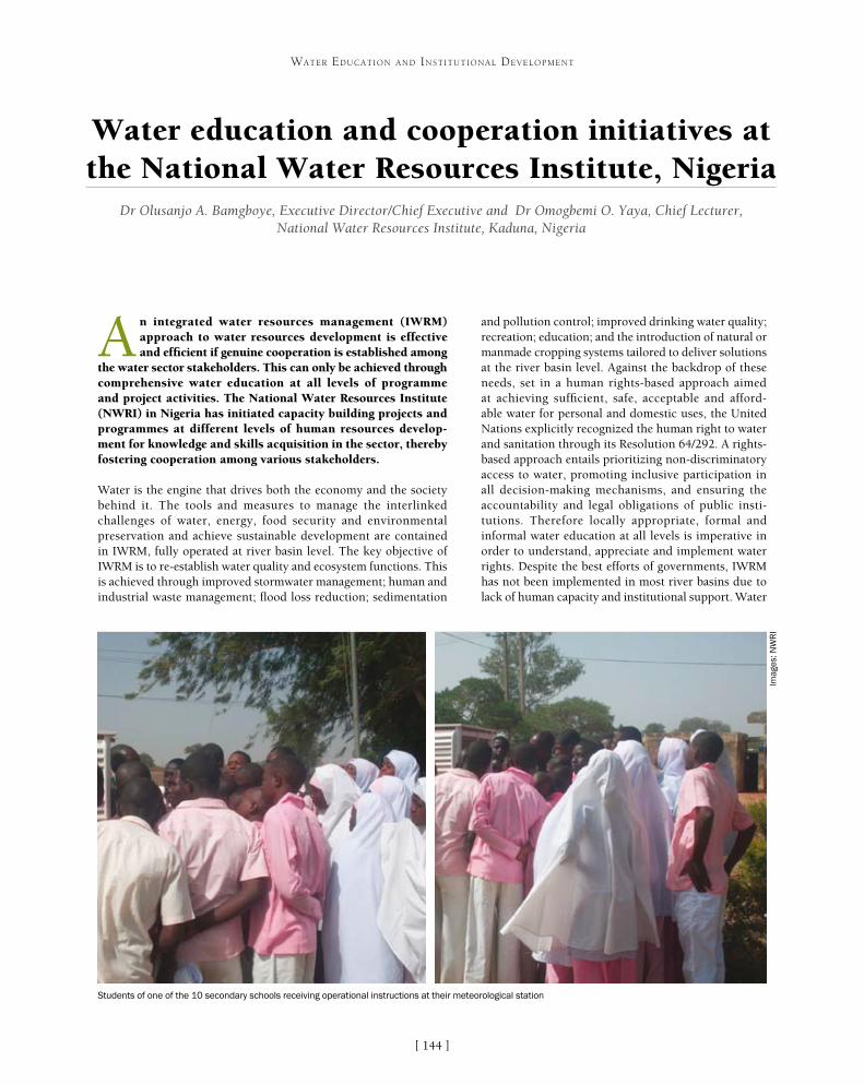
[ ]144
Water education and cooperation initiatives at the National Water Resources Institute, Nigeria
Dr Olusanjo A. Bamgboye, Executive Director/Chief Executive and Dr Omogbemi O. Yaya, Chief Lecturer, National Water Resources Institute, Kaduna, Nigeria
A n integrated water resources management (IWRM) approach to water resources development is effective and efficient if genuine cooperation is established among
the water sector stakeholders. This can only be achieved through comprehensive water education at all levels of programme and project activities. The National Water Resources Institute (NWRI) in Nigeria has initiated capacity building projects and programmes at different levels of human resources develop-ment for knowledge and skills acquisition in the sector, thereby fostering cooperation among various stakeholders.
Water is the engine that drives both the economy and the society behind it. The tools and measures to manage the interlinked challenges of water, energy, food security and environmental preservation and achieve sustainable development are contained in IWRM, fully operated at river basin level. The key objective of IWRM is to re-establish water quality and ecosystem functions. This is achieved through improved stormwater management; human and industrial waste management; flood loss reduction; sedimentation
and pollution control; improved drinking water quality; recreation; education; and the introduction of natural or manmade cropping systems tailored to deliver solutions at the river basin level. Against the backdrop of these needs, set in a human rights-based approach aimed at achieving sufficient, safe, acceptable and afford-able water for personal and domestic uses, the United Nations explicitly recognized the human right to water and sanitation through its Resolution 64/292. A rights-based approach entails prioritizing non-discriminatory access to water, promoting inclusive participation in all decision-making mechanisms, and ensuring the accountability and legal obligations of public insti-tutions. Therefore locally appropriate, formal and informal water education at all levels is imperative in order to understand, appreciate and implement water rights. Despite the best efforts of governments, IWRM has not been implemented in most river basins due to lack of human capacity and institutional support. Water
WATER EDUCATION AND INSTITUTIONAL DEVELOPMENT
Students of one of the 10 secondary schools receiving operational instructions at their meteorological station
Imag
es: N
WR
I
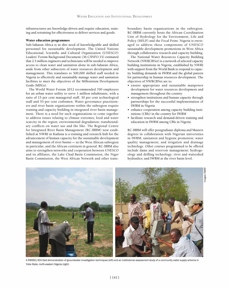
[ ]145
WATER EDUCATION AND INSTITUTIONAL DEVELOPMENT
boundary basin organizations in the subregion. RC-IRBM currently hosts the African Coordination Unit of Hydrology for the Environment, Life and Policy (HELP) and the Focal Point. Nigeria is envis-aged to address these components of UNESCO sustainable development promotions in West Africa through collaborative research and capacity building.
The National Water Resources Capacity Building Network (NWRCBNet) is a network of selected capacity building institutions in Nigeria, established by NWRI with support from the World Bank to respond to capac-ity building demands in IWRM and the global pattern for partnership in human resources development. The objectives of NWRCBNet are to:• ensure appropriate and sustainable manpower
development for water resources development and management throughout the country
• strengthen institutions and human capacity through partnerships for the successful implementation of IWRM in Nigeria
• enhance cooperation among capacity building insti-tutions (CBIs) in the country for IWRM
• facilitate research and demand-driven training and education in IWRM among CBIs in Nigeria.
RC-IRBM will offer postgraduate diploma and Masters degrees in collaboration with Nigerian universities in IWRM; sanitation and hygiene promotion; water quality management; and irrigation and drainage technology. Other courses programmed to be offered include dams and reservoir management; hydroge-ology and drilling technology; river and watershed hydraulics; and IWRM at the river basin level.
infrastructures are knowledge-driven and require education, train-ing and retraining for effectiveness to deliver services and goods.
Water education programmesSub-Saharan Africa is in dire need of knowledgeable and skilled personnel for sustainable development. The United Nations Educational, Scientific and Cultural Organization (UNESCO) Leaders’ Forum Background Document (36 C/INFO.15) estimated that 2.5 million engineers and technicians will be needed to improve access to clean water and sanitation alone in sub-Saharan Africa, aside from other subsectors of water resources development and management. This translates to 500,000 skilled staff needed in Nigeria to effectively and sustainably manage water and sanitation facilities to meet the objectives of the Millennium Development Goals (MDGs).
The World Water Forum 2012 recommended 700 employees for an urban water utility to serve 1 million inhabitants, with a ratio of 15 per cent managerial staff, 30 per cent technological staff and 55 per cent craftsmen. Water governance practition-ers and river basin organizations within the subregion require training and capacity building in integrated river basin manage-ment. There is a need for such organizations to come together to address issues relating to climate extremes; food and water scarcity in the region; environmental degradation; transbound-ary conflicts on water use and the like. The Regional Centre for Integrated River Basin Management (RC-IRBM) now estab-lished at NWRI in Kaduna is a training and research hub for the advancement of human capacity for the sustainable development and management of river basins – in the West African subregion in particular, and the African continent in general. RC-IRBM also aims to strengthen networks and cooperation between UNESCO and its affiliates, the Lake Chad Basin Commission, the Niger Basin Commission, the West African Network and other trans-
A RWSSC/JICA field demonstration of groundwater investigation techniques (left) and an institutional assessment study of a community water supply scheme in
Yobe State, north-eastern Nigeria (right)
Imag
es: N
WR
I

[ ]146
WATER EDUCATION AND INSTITUTIONAL DEVELOPMENT
In the past two years RC-IRBM has, in collaboration with UNESCO in Paris, organized two international workshops aimed at the develop-ment and implementation of modular curricula for tertiary, technical and vocational water education in IWRM in Nigeria. The workshops brought together renowned international water experts and profession-als from different scientific backgrounds in Nigeria, Namibia, Sudan, Senegal, Tanzania, Zimbabwe, Egypt, Ghana, Serbia, South Korea and China. The experts put together their experience in water education aspects and fashioned a common and shared strategy which led to the development of curricula for water education on IWRM for tertiary, technical and vocational institutions in Nigeria and West Africa.
The Jaroslav Cerni Institute has signed a Memorandum of Understanding (MoU) with RC-IRBM for collaboration in research and staff exchange. The collaborative research study designates the Gurara River Basin in north-central Nigeria as a HELP basin. Water demand allocation and management is the main focus of the research. RC-IRBM was also represented at the Groundwater Governance Regional Consultative and Global Groundwater Monitoring Network workshops held in Nairobi, Kenya.
UNESCO’s Abuja Office has collaborated with RC-IRBM to hold a workshop on ‘Strengthening the UNESCO International Hydrological Programme (IHP) and Man and Biosphere Programme National Committees for effective water governance, biosphere reservation management and biodiversity conservation’. The workshop was hosted by RC-IRBM and attended by about 43 participants from government ministries, departments and agencies, academic insti-tutions and non-governmental organizations, as well as private
individuals. The main objective of the workshop was to strengthen the capacities of the national committees to play active roles and contribute meaningfully to national and international issues that relate to water, biodiversity and environmental management.
The UNESCO African Regional Office in Nairobi has initiated preparation of an African Water Resources Capacity Building Programme in line with the framework of UNESCO-IHP which follows a recommendation by the third regional meeting of national IHP committees of sub-Saharan Africa. RC-IRBM has been commissioned by the regional office to coordinate the programme at national and regional levels. An MoU to that effect has been signed and the programme execution has commenced.
In order to raise and encourage an army of interested youths who, as future leaders, will commit themselves to water-related careers and safeguard our precious resource, the Nigerian Junior Water Price Competition was established. The event brings together young and bright scientists from Nigerian high schools and tertiary institutions to stimulate their interest in solving chal-lenges in the water sector; produce a credible selection system in which the young scientists can produce inno-vative scientific projects; and encourage them to aspire to compete with young people from other nations in the area of scientific problem solving for global solu-tions to water-related challenges. Furthermore, NWRI has established meteorological stations in 10 schools in Kaduna metropolis for teaching and research purposes. It has encouraged the schools to imbibe the culture of weather monitoring and data recording and, at the same time, interpret results and develop skills in weather forecasting. Youth empowerment training courses are being run for unemployed young engineers and scien-tists, bicycle repairers and other technicians in the areas of water well drilling, fabrication of water well drilling rigs, plumbing works, household water infrastructure and hand pump maintenance.
To improve rural water supply and sanitation in Nigeria, NWRI is currently collaborating with the Japan International Cooperation Agency (JICA) to execute a training and research project at the insti-tute called ‘The Project for Enhancing the Function of Rural Water Supply and Sanitation Centres for Capacity Development’ (RWSSC). The vision of the centre is to be the hub for rural water supply and sanitation, capacity development and information dissemination in Nigeria. The main objectives of this project are to:• produce capacity development plans of sector
organizations for improved services delivery• provide training courses appropriate to the various
sector stakeholders• develop and produce appropriate training modules
and manuals, monograms and extension materials• establish and effectively manage NWRCBNet• support the production and upgrading of
hydrogeological maps• establish a national water resources website
accessible to all stakeholders.
0
5
10
15
20
25
30
Fur
ther
Edu
catio
nal
Tra
inin
g (F
ET)
Hig
her
Edu
catio
nal
Tra
inin
g (H
ET)
In s
ervi
ce t
rain
ing
Bur
sary
sup
port
Inte
rnsh
ips
Men
tors
hip
Rec
ogni
tion
of p
rior
lear
ning
(RP
L) s
hort
cou
rses
Cap
acity
bui
ldin
g st
rate
gy a
nd f
inan
cing
Oth
er
Approaches to skills development in the water sector in Nigeria
Source: NWRI
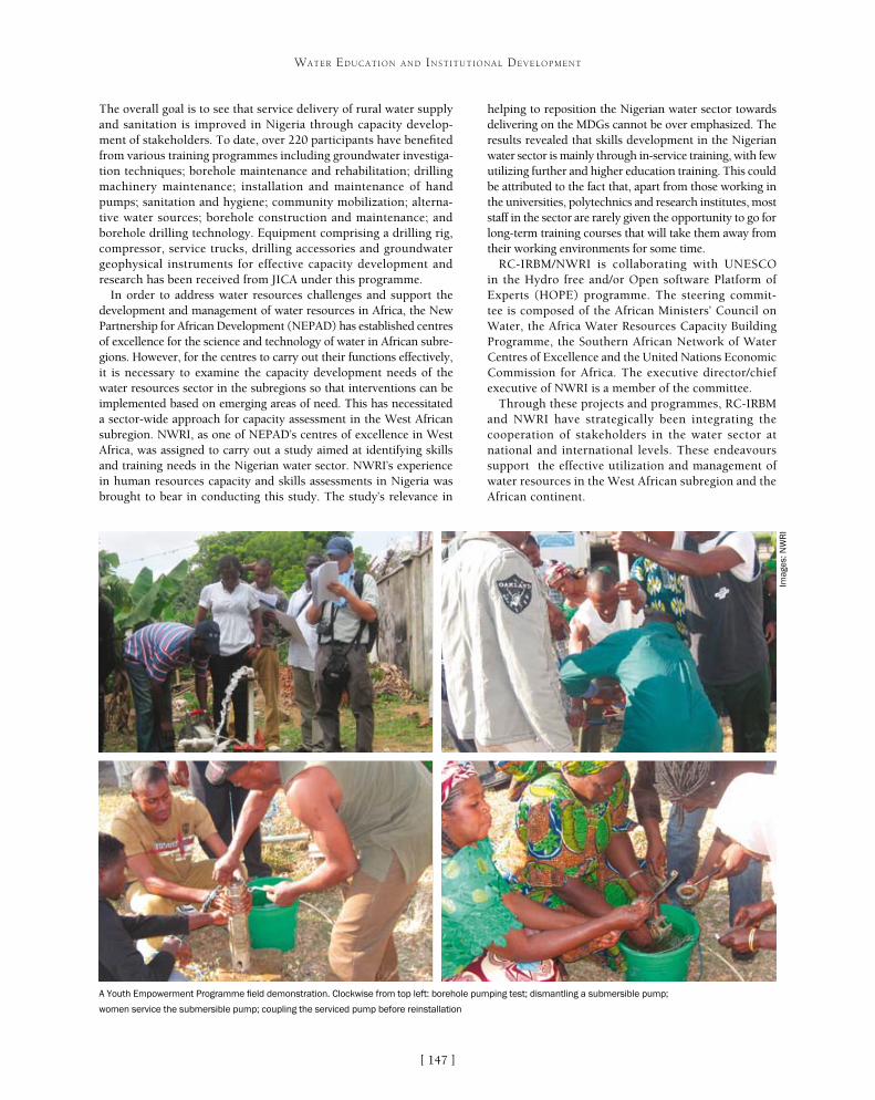
[ ]147
WATER EDUCATION AND INSTITUTIONAL DEVELOPMENT
helping to reposition the Nigerian water sector towards delivering on the MDGs cannot be over emphasized. The results revealed that skills development in the Nigerian water sector is mainly through in-service training, with few utilizing further and higher education training. This could be attributed to the fact that, apart from those working in the universities, polytechnics and research institutes, most staff in the sector are rarely given the opportunity to go for long-term training courses that will take them away from their working environments for some time.
RC-IRBM/NWRI is collaborating with UNESCO in the Hydro free and/or Open software Platform of Experts (HOPE) programme. The steering commit-tee is composed of the African Ministers’ Council on Water, the Africa Water Resources Capacity Building Programme, the Southern African Network of Water Centres of Excellence and the United Nations Economic Commission for Africa. The executive director/chief executive of NWRI is a member of the committee.
Through these projects and programmes, RC-IRBM and NWRI have strategically been integrating the cooperation of stakeholders in the water sector at national and international levels. These endeavours support the effective utilization and management of water resources in the West African subregion and the African continent.
The overall goal is to see that service delivery of rural water supply and sanitation is improved in Nigeria through capacity develop-ment of stakeholders. To date, over 220 participants have benefited from various training programmes including groundwater investiga-tion techniques; borehole maintenance and rehabilitation; drilling machinery maintenance; installation and maintenance of hand pumps; sanitation and hygiene; community mobilization; alterna-tive water sources; borehole construction and maintenance; and borehole drilling technology. Equipment comprising a drilling rig, compressor, service trucks, drilling accessories and groundwater geophysical instruments for effective capacity development and research has been received from JICA under this programme.
In order to address water resources challenges and support the development and management of water resources in Africa, the New Partnership for African Development (NEPAD) has established centres of excellence for the science and technology of water in African subre-gions. However, for the centres to carry out their functions effectively, it is necessary to examine the capacity development needs of the water resources sector in the subregions so that interventions can be implemented based on emerging areas of need. This has necessitated a sector-wide approach for capacity assessment in the West African subregion. NWRI, as one of NEPAD’s centres of excellence in West Africa, was assigned to carry out a study aimed at identifying skills and training needs in the Nigerian water sector. NWRI’s experience in human resources capacity and skills assessments in Nigeria was brought to bear in conducting this study. The study’s relevance in
A Youth Empowerment Programme field demonstration. Clockwise from top left: borehole pumping test; dismantling a submersible pump;
women service the submersible pump; coupling the serviced pump before reinstallation
Imag
es: N
WR
I

[ ]148
Sustainable management of lakes in Malaysia Zati Sharip, Senior Research Officer, Research Centre for Water Quality and Environment;
Saim Suratman, Director, Research Centre for Geohydrology; and Ahmad Jamalluddin Shaaban, Director General, National Hydraulic Research Institute of Malaysia, Ministry of Natural Resources and Environment, Malaysia
Lakes, natural or man-made, are important water resources for Malaysia. These inland water bodies cover an area of over 10,000 hectares and contain more than 30 billion
cubic metres of water. Most of these water bodies have multiple functions including the provision of water supply for domestic, industrial and agricultural needs, hydroelectricity generation, flood mitigation, and recreational and tourism destinations. However, deterioration of water quality in Malaysia’s freshwater systems including lakes, resulting from rapid development within the catchment, is a serious concern.
According to a preliminary assessment on the status of eutrophication of lakes in Malaysia, conducted by the National Hydraulic Research Institute of Malaysia (NAHRIM) in collaboration with the Academy of Sciences Malaysia (ASM) in 2005, about 62 per cent of 90 major lakes that were studied were in a nutrient-rich or eutrophic state, while the rest were categorised as nutrient-balance or mesotrophic. Some of the eutrophic lakes, such as Lake Aman in Selangor and Lake Sembrong in Johor, are threatened by algae bloom incidents,
while Lake Chini in Pahang is vulnerable to excessive growth of aquatic plants. The excess nutrients were largely induced by point sources and non-point sources originating from natural and anthropogenic activities within the lake catchment. Concerted efforts in the form of national cooperation among government agencies, departments and private sectors were crucial to address-ing these serious eutrophication issues, and these efforts have been initiated and fostered since 2007.
Sustainable lake managementA two-day colloquium among stakeholders on the theme of Status and Issues of Lakes and Reservoirs Management in Malaysia was jointly organized by NAHRIM (under the auspices of the Ministry of Natural Resources and Environment or NRE), ASM, the Inter Academy Panel and the Japan Science and Technology Agency at NRE in August 2007. Its aim was to advo-cate greater understanding on the status and issues
WATER EDUCATION AND INSTITUTIONAL DEVELOPMENT
Temenggor Lake is one of the biggest man-made lakes in Peninsular Malaysia
Imag
e: A
cade
my
of S
cien
ces
Mal
aysi
a

[ ]149
WATER EDUCATION AND INSTITUTIONAL DEVELOPMENT
Reservoirs were finally developed, based on the analysis and findings in the conceptual framework plan and six component plans.
This strategic plan, which incorporates the Integrated Lake Basin Management (ILBM) principles, was completed in 2009 and set the direction for future concerted action by all stakeholders to sustainably manage the inland water resources in the country. The national strategic plan was tabled to the National Water Resources Council in 2012, where the strategies were deliberated and endorsed for implementation. Among the national strategies advocated in the national strategic plan is the setting up of a steer-ing committee at federal level and a lake management committee at the state level, to oversee the implementa-tion of lake management based on an integrated lake basin approach throughout the country. As with other countries that comprise federated nations, fragmented authority and conflicting mandates are common challenges in Malaysia. The national lake and reservoir management committee will become a platform to improve coordination and coop-eration between different ministries, federal agencies and water-related institutions. The committee will also look into the provision of legislation, sufficient financing and political commitment through the development of poli-cies on lakes. At the state level, local coordination is being strengthened through a central state committee that will address lake issues at the catchment scale by engaging with stakeholders and communities on matters related to land and water in its jurisdiction. A detailed plan of action for managing lakes and reservoirs is also being prepared to provide a road map for implementing ILBM for the health of the country’s inland water resources.
pertaining to lakes and reservoirs in the country. This national collo-quium was the first step towards dealing with the issues causing the degradation of these important inland water resources, providing a platform for meaningful discussion as well as knowledge-shar-ing among the various participants. Subsequently, the colloquium provided the initial inputs, and enabled further collaboration for consequent action, towards the formulation of a national framework and consolidated plan for sound lake management in Malaysia.
A Technical Committee on Lake Management was later jointly estab-lished by ASM and NAHRIM to move the national agenda forward and articulate strategies to support the sustainable management of lakes and reservoirs in Malaysia. A framework for action was undertaken in 2008 to establish a comprehensive plan using a multi-stakeholder consultative planning approach, beginning with a preliminary concep-tual framework plan. The first multi-sector workshop involving stakeholders from government agencies, the public and private sectors and non-governmental organizations (NGOs) was held at NAHRIM in January 2008 to institute the Conceptual Framework for Lakes and Reservoirs Management. The ‘logical framework approach’ was used as a planning instrument to guide stakeholders in the workshop in their analysis of the prevailing situation and any proposed measures to be undertaken. The final conceptual framework Plan provided the input for the draft of the vision and mission statement of the Strategic Plan.
Preparation of more detailed component plans was synthesized from thematic position papers which were subsequently consolidated to further refine the conceptual framework Plan. A fresh round of stakeholder consultations was held for each of the six themes: govern-ance, management, research and development, capacity building, information management and community stakeholder participation. These consultations helped to refine the earlier findings and formu-late plans of action for each component. The final National Strategic Plan for the Sustainable Development and Management of Lakes and
Chini Lake, the second largest freshwater natural lake in Malaysia. The lake shores
are inhabited by the aborigine Jakun tribe
Imag
e: N
AH
RIM
Perdana Lake in Perdana Botanical Gardens, the oldest and most
popular park in Kuala Lumpur
Imag
e: N
AH
RIM

[ ]150
WATER EDUCATION AND INSTITUTIONAL DEVELOPMENT
In preparation for ILBM implementation, the development of a lake brief began in 2009, comprising data on the basic features and environ-mental state of the lakes and information on management and governance challenges. The lake brief was developed based on the template and ques-tionnaire introduced by the International Lake Environment Committee (ILEC) in 2008. To ensure the successful development of lake briefs, NAHRIM conducted meetings where lake managers were identified in consultation with the stakeholders, and were subsequently guided on template and lake brief requirements. Suitable avenues for discussion and presentation in the form of meetings and seminars were held to enable the lake managers to present their lake brief. A total of 26 lake briefs – covering 28 lakes across the country – have been prepared to date by various stakeholders and compiled by NAHRIM. The lake briefs, which provide an analysis of the state of basin governance for the respec-tive lake, have become an important component of the ILBM platform process, which addresses the six pillars of lake basin governance:• institution• finance• policies• stakeholder participation• technology• information.
The lake brief assessment not only provides baseline information on the health of the water bodies, but also enables lake managers to improve their management approach by prescribing effective manage-ment solutions to overcome lake issues and monitor their health.
Stakeholder participation is crucial for the success of a management approach in any type of water body. Lake communities are an essential part of many lakes as they inhabit many of these natural or man-made systems. In natural lakes, native communities have been living in and around the lakes for a long time and are thus dependent on the lake
for their livelihoods. In man-made lakes, especially in urban areas, most of the lakes have been developed as recreational areas where surrounding communities can spend their leisure time. Understanding the importance of community participation, stakeholders including NGOs have been engaged in the colloquium and included in many of the workshops, and their role has been incor-porated as one of the national strategies for sustainable lake management. In some lakes, community stakeholder committees such as ‘friends of the lake’ (also known as ‘rakan tasik’ in Malay) have been established by NGOs. These committees should be promoted to assist in the management of the lakes and their landscape.
Sustainable management action requires sound and scientifically-based information. In order to enhance the management of lake data, a central National Lakes Inventory (NLI) was developed by NAHRIM in 2007 based on inputs and recommendations from workshops. The inventory comprises summary information and data for each lake, and assessments based on the preliminary eutrophication study. The structure of the NLI was adapted from the World Lakes Database developed by ILEC. An introduction to this lake inventory, which is known as the National Lake Information Database (NLID), was presented to stakeholders – mainly lake managers and researchers – so they could make contributions to the database. The lake inventory has been enhanced to become a lake data-base which applies spatial data in geographical information system format to support non-spatial data storage. This enhanced NLID involves cooperation, with data input and updates performed by various lake managers while the data-base is manned by NAHRIM. The database will eventually
Putrajaya Lake has attracted recreational, sports and tourism activities
Imag
e: P
utra
jaya
Cor
pora
tion
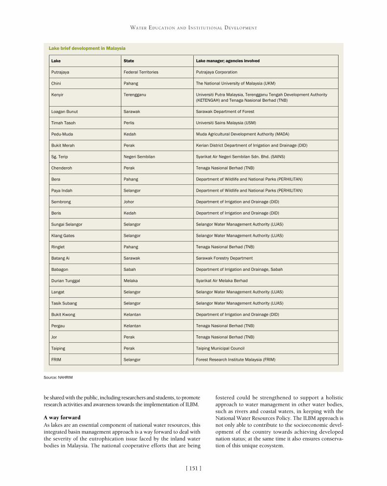
[ ]151
WATER EDUCATION AND INSTITUTIONAL DEVELOPMENT
be shared with the public, including researchers and students, to promote research activities and awareness towards the implementation of ILBM.
A way forwardAs lakes are an essential component of national water resources, this integrated basin management approach is a way forward to deal with the severity of the eutrophication issue faced by the inland water bodies in Malaysia. The national cooperative efforts that are being
fostered could be strengthened to support a holistic approach to water management in other water bodies, such as rivers and coastal waters, in keeping with the National Water Resources Policy. The ILBM approach is not only able to contribute to the socioeconomic devel-opment of the country towards achieving developed nation status; at the same time it also ensures conserva-tion of this unique ecosystem.
Lake
Putrajaya
Chini
Kenyir
Loagan Bunut
Timah Tasoh
Pedu-Muda
Bukit Merah
Sg. Terip
Chenderoh
Bera
Paya Indah
Sembrong
Beris
Sungai Selangor
Klang Gates
Ringlet
Batang Ai
Babagon
Durian Tunggal
Langat
Tasik Subang
Bukit Kwong
Pergau
Jor
Taiping
FRIM
State
Federal Territories
Pahang
Terengganu
Sarawak
Perlis
Kedah
Perak
Negeri Sembilan
Perak
Pahang
Selangor
Johor
Kedah
Selangor
Selangor
Pahang
Sarawak
Sabah
Melaka
Selangor
Selangor
Kelantan
Kelantan
Perak
Perak
Selangor
Lake manager; agencies involved
Putrajaya Corporation
The National University of Malaysia (UKM)
Universiti Putra Malaysia, Terengganu Tengah Development Authority (KETENGAH) and Tenaga Nasional Berhad (TNB)
Sarawak Department of Forest
Universiti Sains Malaysia (USM)
Muda Agricultural Development Authority (MADA)
Kerian District Department of Irrigation and Drainage (DID)
Syarikat Air Negeri Sembilan Sdn. Bhd. (SAINS)
Tenaga Nasional Berhad (TNB)
Department of Wildlife and National Parks (PERHILITAN)
Department of Wildlife and National Parks (PERHILITAN)
Department of Irrigation and Drainage (DID)
Department of Irrigation and Drainage (DID)
Selangor Water Management Authority (LUAS)
Selangor Water Management Authority (LUAS)
Tenaga Nasional Berhad (TNB)
Sarawak Forestry Department
Department of Irrigation and Drainage, Sabah
Syarikat Air Melaka Berhad
Selangor Water Management Authority (LUAS)
Selangor Water Management Authority (LUAS)
Department of Irrigation and Drainage (DID)
Tenaga Nasional Berhad (TNB)
Tenaga Nasional Berhad (TNB)
Taiping Municipal Council
Forest Research Institute Malaysia (FRIM)
Lake brief development in Malaysia
Source: NAHRIM

[ ]152
Free open source software as a tool for water cooperation
Cicero Bley, Coordinator, International Centre on Hydroinformatics
Information technology for geographic information systems (GIS) has remained somewhat hermetic and inaccessible to most non-specialists. The high costs of acquiring operating
licences also inhibit the use of this type of technology for many initiatives. Free open source software (FOSS) provides alterna-tives to the universal use of GIS, but is often surrounded by prejudices related to low credibility regarding security. FOSS offers benefits for people in developing countries, including facilitating access to increasing ownership of information and communications technologies for human development.
The FOSS model provides alternative tools and processes with which people can create, exchange, share and exploit applications and knowl-edge efficiently and effectively. In addition to the fact that FOSS can be used in GIS, there are huge possibilities for it in embedded systems, in terms of lowering the cost of the intelligent systems that enable these. This characteristic can be crucial to the deployment of short-term equipment in industries and services that use computer circuits.
It is important to consider that activities using information technol-ogy entail complex, non-polluting, labour-saving and high value-added end products, even in the case of non-proprietary software – a type of
development that is desirable in any region of the world. The networks of developers that form around each soft-ware are practically voluntary, communicate using the Internet, and are called on to participate in the events of their own groups only on specific occasions. To enable access to free codes, it is necessary that the interested contact centres and related professional developers are committed to sharing advances in relation to the soft-ware’s application to new situations. In other words, the only payment required to obtain FOSS is a commitment to sharing the results, thus forming a network of profes-sionals, each committed to improving the work of others in an undeniable demonstration of solidarity.
Applications of FOSS in water management are of great value. There is nothing more efficient in water management than the conscious involvement of an informed society that coexists with the river. A mini-mally trained operator can operate FOSS and locate all activities in the watershed with a potential impact on water quality. Each activity has its own characteristics, which are registered in a database and georeferenced.
WATER EDUCATION AND INSTITUTIONAL DEVELOPMENT
Groups of trainees often gather in churches, clubs and public buildings to take part in CIH training
Imag
e: C
IH

[ ]153
WATER EDUCATION AND INSTITUTIONAL DEVELOPMENT
planners, teachers and students the ability to identify various human activities and their relationships with a water source within its own territories. In the case of energy sources, the tools are able to identify the relation-ships between available sources of renewable energy and potential consumers in the same territory. Because the management tools are made in FOSS, they enable access even for managers who have little familiarity with GIS.
Touched by the technological gap that separates Africa from the rest of the world, the United Nations Educational, Scientific and Cultural Organization (UNESCO) has called on international experts in FOSS, creating a committee to suggest the best options to African coaches. A continent the size of Africa, living with the paradox of shortage in an abundance of water, food and energy, needs instruments that facili-tate management more than any other. The UNESCO International Hydrological Programme (IHP) Hydro free and/or Open-source software Platform of Experts (HOPE) initiative aims to establish FOSS development and the dissemination of innovative practices in water management. These can be built into the Africa Water Vision for 2025, helping prepare people to take on the green jobs that will certainly be generated by an initiative of this magnitude. CIH recently joined the UNESCO-IHP HOPE programme, in an initiative to provide African countries with GIS tools in open source software. This is an opportunity to offer to the African countries the same access to GIS that developed coun-tries enjoy. CIH is part of UNESCO’s Category 2 Centre network, and is honoured to be assisting UNESCO in helping African managers and technicians to observe the territories in which they live, and manage the water resources they need.
These are related by the operating system software, and the processed data is used to inform a list of activities in different segments of the watershed territory. The stored and geoprocessed data composes a set of information that can be used on different scales for a range of regional planning activities. Thus, FOSS can be used to draw up plans for watershed conservation, to monitor their physical and financial execution, and then to monitor the results, facilitating the implementation of corrective measures to establish a cycle of continuous improvement. In relation to monitoring – a crucial matter in watershed planning – FOSS enables, organizes and facilitates community involvement in effective programmes, such as the monitoring of benthic macroinvertebrates and establishing the microfauna of rivers, as indicators of the quality of their water. The programs developed in FOSS can be made available on the web, reducing storage costs and maintenance and universalizing access. Another important aspect is capacity building for the use of FOSS, both in developing the software and customizing it for a specific use.
The International Centre on Hydroinformatics (CIH) has a good and functional infrastructure, and a team of young and dedicated profes-sionals committed to the development of FOSS. The centre has already customized several GIS programs for communities with varied degrees of capacity to manage software. Training is a major concern, and CIH has an available computer lab with the capacity to cater to groups of 25 students. In addition to theoretical knowledge, students finish the course with almost-complete systems to apply in real situations in their regions. The training is done by distance learning, using the web, as most of the trainees are volunteers who only have their spare time to empower themselves. Collective rooms can be established with institu-tions such as churches, clubs and public buildings so that students can learn in groups, which always produces good results.
Based on this, CIH has been requested to cooperate with other coun-tries in Latin America, in the management of water resources and of renewable energy in microgeneration systems with management tools based on FOSS technologies. This offers decision makers, managers,
Sharing FOSS development and innovative practices in water management can help prepare people to take on the green jobs that will be
generated by the UNESCO-IHP HOPE initiative
Imag
e: C
IH

IVFinancing Cooperation

[ ]156
Regional cooperation in the water and sanitation sector: Latin America and the Caribbean
Miguel Campo Llopis, Anamaria Nunez and Jorge Ducci, Inter-American Development Bank
Since its creation in 1959, the Inter-American Development Bank (IDB or ‘the bank’) has provided financial and techni-cal support for the improvement of water and sanitation
services in Latin America and the Caribbean. From 2007, with the creation of the Water and Sanitation Division, IDB has worked jointly with the countries in the region1 for the fulfilment of the Millennium Development Goals (MDGs) and beyond; to ensure universal, quality access to suitable water and sanitation services.
With regard to the water and sanitation sector, the MDGs are to halve the number of people without access to safe drinking water2 sources and improved sanitation3 by 2015, using 1990 as the base year. The most recent data on the whole region from 2010 show that the goal of 93 per cent of access to safe drinking water sources has been overcome, but the goal of ensuring improved sanitation has not (coverage in the region is 79 per cent and the goal is 84 per cent). These coverage levels translate into 34 million people without access to safe drinking water sources and almost 124 million people without access to improved sanitation.4
In terms of funding, IDB’s commitment has been trans-lated into financial support tools such as investment loans and donations, for a sum of around US$7 billion. These resources have been allocated to funding activities such as the expansion and rehabilitation of water supply networks and sewage; basic rural sanitation and water systems; wastewater treatment plants; works for flood prevention and drainage; and construction of sanitary landfills.
In order to be able to respond adequately to the demands of countries in the context of climate change, the bank has reinforced its knowledge product range to emphasize issues related to the political economy and water resource management, strengthening of the sectoral institutional framework and incorporation of new work methodologies, among others. In addition, the IDB has put its technical and financial capacity at the service of regional dialogue. It has established stra-tegic alliances with other multilateral institutions and bilateral agencies, and increased the impact of the inter-
FINANCING COOPERATION
1990 1995 2000 2005 2010 2015
20
40
60
80
100
Safe drinking water
Improved sanitation
Per
cen
t
The evolution of drinking water and sanitation coverage in Latin America and the Caribbean, and the MDG for 2015
Source: IDB

[ ]157
FINANCING COOPERATION
to enable the commitment of donors and recipient countries to achieving the MDG.
Therefore, on 22 October 2008, an agreement was signed. Spain, through the Spanish Agency for International Cooperation for Development (AECID), and the IDB, through the Water and Sanitation Division, agreed to work jointly to solve the region’s challenges with regard to water and sanitation by means of the FCAS in Latin America and the Caribbean (FECASALC) Fund managed by the IDB. The agreement was signed
ventions and support processes to governments in the region in their investment challenges and new opportunities.5
The Water Fund: an example of cooperationIn 2007 a new stage of cooperation took place in the water and sanita-tion sector in Latin America and the Caribbean, between the Spanish Government and the IDB. The Spanish authorities created the US$1.5 billion Cooperation Fund for Water and Sanitation (FCAS), an unprec-edented initiative in this region.6 The Spanish Government and IDB combined both their financial and technical capacities in a strategic vision
Paraguay
In the Republic of Paraguay poverty affects almost 35.6 per cent of the population, with 19.4 per cent in a situation of extreme poverty. Poverty levels are related to low levels of education and development, and mostly to a lack of access to means of production and basic social services such as health, education and sanitation. Poverty affects urban and rural areas equally, but extreme poverty mainly affects rural areas, where 24.4 per cent are in this situation.
InterventionsTwo operations aim to increase access to drinking water and sanitation, focusing on:• rural and native communities with less
than 2,000 inhabitants (all provinces except Neembucu and Misiones)
• indigenous and poor peoples of the Chaco and intermediate cities of the Oriental region.
They will be executed by the National Service for Environmental Sanitation and the Ministry of Public Works and Communications.
MilestonesParaguay is one country where the Fund’s comprehensive approach is having more impact. In addition to the rural and indigenous operation, a monitoring system for rural systems has been developed through mobile telephony. One of the impact studies for measuring the effect of water supply and sanitation in rural systems is being carried out. The other operation, conducted in intermediate cities, will be executed shortly. Here, the unconventional sanitation model known as condominial will be implemented, which has allowed a 25 per cent increase in the number of beneficiaries.
Funding (total US$148 m) US$ (millions) Per cent of total
Fund donation 100 67
IDB loan 32 21
Local contribution 16 12
Paraguay is one country where the Fund’s comprehensive approach is having more impact
Imag
e: ID
B
Haiti
The level of access to drinking water and sanitation services in Haiti is among the lowest in Latin America and the Caribbean. In general terms, the situation of Haiti’s water and sanitation sector is alarming: only 8.5 per cent of households are connected to a water distribution system and sanitation services are practically non-existent, with only 30 per cent of the population having access to them.
InterventionsFour operations are aimed at providing drinking water and sanitation services:• intervention in six intermediate cities:
Saint-Marc, Port-De Paix, Les Cayes, Jacmel, Ouanaminthe and Cap-Haïtien
• strengthening of service provision capacity of the Autonomous Metropolitan Drinking Water Station of Port-au-Prince Central
• improving the quality of life and sanitary conditions of the rural communities in the department of Artibonite
• contributing to the Cholera Inter-Sector Response Strategy adopted by the Government with a view to reducing morbidity and mortality.
These will be executed by the Direction Nationale de l’Eau Potable et de l’Assainissement.
MilestonesThe strategy for Haiti has been conceived from a comprehensive point of view. Apart from working in rural areas, intermediate cities and Port-au-Prince, great efforts are being made towards reforming the sector. This reform was described in Haiti’s Framework Law on Drinking Water and Sanitation, passed in 2009. It involves sector restructuring at national level, which is being conducted with the support of the fund. In addition to bank-managed funds, AECID has an additional US$100 million. Haiti is one of the best examples of a complementary and harmonized approach to resources, where the interventions of both IDB and AECID come together as one.
Funding (total US$119 m) US$ (millions) Per cent of total
Fund donation 70 58
IDB donation 49 42
Water and sanitation service provision capacity is being strengthened in Port-au-Prince
Imag
e: ID
B
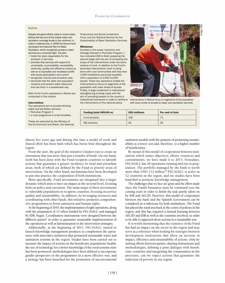
[ ]158
FINANCING COOPERATION
almost five years ago and during this time a model of work and shared effort has been built which has borne fruit throughout the region.
From the start, the goal of the initiative’s leaders was to create an instrument that was more than just a transfer of funds. On one hand, work has been done with the Fund recipient countries to identify actions that guarantee a greater incidence in rural and periurban areas, both of which are defined by the Fund as priority areas of intervention. On the other hand, mechanisms have been developed to put into practice the cooperation of both institutions.
More specifically, Fund investments are integrated into a larger dynamic which aims to have an impact at the sectoral level, focusing both on policy and execution. The main target of these investments is vulnerable populations in recipient countries, focusing on service quality and sustainability. In addition, by leveraging resources and coordinating with other funds, this initiative promotes comprehen-sive programmes to boost sanitation and human rights.
At the beginning of 2010, the implementation of eight operations, along with the preparation of 13 others funded by FECASALC and managed by IDB, began. Coordination instruments were designed between the different parties7 in order to guarantee sustainable implementation of the operations as well as harmonization in the intervention strategies.
Additionally, at the beginning of 2011, FECASALC started to launch knowledge management products to complement the opera-tions with innovative initiatives that promoted sustainable water and sanitation systems in the region. Studies have been carried out to measure the impact of actions on the beneficiary populations’ health; the use of technology for a better knowledge of the rural systems state has been promoted; methodologies have been defined to incorporate gender perspective in the programmes in a more effective way; and a strategy has been launched for the promotion of unconventional
sanitation models with the purpose of promoting sustain-ability at a lower cost and, therefore, to a higher number of beneficiaries.
By means of this model of cooperation between insti-tutions which unites objectives, efforts, resources and commitments, we have made it to 2013. Nowadays, FECASALC has 20 operations running and one in prep-aration. The portfolio managed by the bank is worth more than US$1.112 million.8 FECASALC is active in 12 countries in the region, and six studies have been launched to promote knowledge management.
The challenges that we face are great and the effort made since the Fund’s formation must be continued over the coming years in order to finish the task jointly taken on by IDB and AECID. However, this model of cooperation between the bank and the Spanish Government can be considered as a milestone for both institutions. The Fund has placed the rural area back at the centre of policies in the region, and this has required a mutual learning between AECID and IDB as well as the countries involved, in order to be able to approach those actions in a sustainable way.
It is worth mentioning that the existence of the Fund has had an impact on the sector in the region and may serve as a reference when looking for synergies between development institutions that allow an increase in impact, efficiency and sustainability of actions. Only by uniting efforts between parties, sharing instruments and methodologies, defining a joint dialogue with benefi-ciary countries and integrating the communities in the processes, can we expect actions that guarantee the reduction of poverty in our region.
Bolivia
Despite the great efforts made in recent years, Bolivia still has one of the lowest water and sanitation coverage levels in the continent. In order to address this, in 2008 the Government developed the National Plan for Basic Sanitation, which recognizes access to water services as a universal right. The plan:• holds the state responsible for the
provision of services• provides that services will respond to
universality, accountability, accessibility, continuity, quality and efficiency criteria as well as to equitable and necessary tariffs with social participation and control
• recognizes cultural and ancestral uses• demands that the state and population
conserve and protect water resources and use them in a sustainable way.
Both of the Fund’s operations in Bolivia are conducted in this context.
InterventionsTwo operations aim to provide drinking water and sanitation services:• Periurban Program 1• a rural programme in small localities.
These are executed by the Ministry of the Environment and Water, the National
Productivity and Social Investment Fund, and the National Service for the Sustainability of Basic Sanitation Services.
MilestonesSuccess in the scope, execution and strategy followed in Periurban Program 1 has motivated IDB to finish preparing the second stage with the aim of increasing the scope of the interventions under the same scheme of work. In addition to the Fund’s periurban interventions, work is being done with rural communities with less than 2,000 inhabitants and small localities with a population of 2,000-10,000 people. These two operations enable the interventions to focus on segments of the population with lower levels of access. Finally, a large investment in institutional strengthening is being made with the aim of providing support to the country’s institutional framework in order to reinforce the interventions of the national policy.
Funding (total US$140 m) US$ (millions) Per cent of total
Fund donation 100 71
IDB donation 40 29
Interventions in Bolivia focus on segments of the population with lower levels of access to water and sanitation services
Imag
e: ID
B
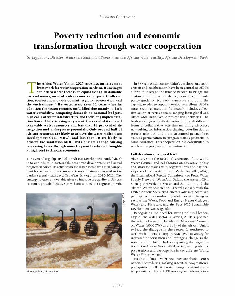
[ ]159
Poverty reduction and economic transformation through water cooperation
Sering Jallow, Director, Water and Sanitation Department and African Water Facility, African Development Bank
The Africa Water Vision 2025 provides an important framework for water cooperation in Africa. It envisages “an Africa where there is an equitable and sustainable
use and management of water resources for poverty allevia-tion, socioeconomic development, regional cooperation and the environment.” However, more than 12 years after its adoption the vision remains unfulfilled due mainly to high water variability, competing demands on national budgets, high costs of water infrastructure and their long implementa-tion times. Africa is using only about 5 per cent of its annual renewable water resources and less than 10 per cent of its irrigation and hydropower potentials. Only around half of African countries are likely to achieve the water Millennium Development Goal (MDG), and less than 10 are likely to achieve the sanitation MDG, with climate change causing increasing havoc through more frequent floods and droughts at high cost to African economies.
The overarching objective of the African Development Bank (AfDB) is to contribute to sustainable economic development and social progress in Africa. Its activities in the water sector are a vital compo-nent for achieving the economic transformation envisaged in the bank’s recently launched Ten-Year Strategy for 2013-2022. The strategy focuses on two objectives to improve the quality of Africa’s economic growth: inclusive growth and a transition to green growth.
In 48 years of supporting Africa’s development, coop-eration and collaboration have been central to AfDB’s efforts to leverage the finance needed to bridge the continent’s infrastructure deficit, as well as to provide policy guidance, technical assistance and build the capacity needed to support development efforts. AfDB’s water sector cooperation framework includes collec-tive action at various scales ranging from global and Africa-wide initiatives to project-level activities. The bank also engages with its partners through different forms of collaborative activities including advocacy, networking for information sharing, coordination of project activities, and more structured partnerships such as participation in programmatic operations in some countries. This cooperation has contributed to much of the progress on the continent.
Collaboration at regional levelAfDB serves on the Board of Governors of the World Water Council and collaborates on advocacy, policy and strategic issues with organizations and partner-ships such as Sanitation and Water for All (SWA), the International Rescue Committee, the Rural Water Supply Network, WaterAid, Oxfam, the African Civil Society Network on Water and Sanitation and the African Water Association. It works closely with the United Nations Secretary-General’s Advisory Board and participates in a number of global thematic dialogues such as the Water, Food and Energy Nexus dialogue, Water and Disasters, and the Post-2015 Sustainable Development Goals agenda.
Recognizing the need for strong political leader-ship of the water sector in Africa, AfDB supported the establishment of the African Ministers’ Council on Water (AMCOW) as a body of the African Union to lead the dialogue in the sector. It continues to work with donors to support AMCOW’s advocacy for increased prioritization and leveraging change in the water sector. This includes supporting the organiza-tion of the African Water Week series, leading Africa’s preparations and participation in the different World Water Forum events.
Much of Africa’s water resources are shared across national boundaries, making interstate cooperation a prerequisite for effective water management and avoid-ing potential conflicts. AfDB sees regional infrastructure
FINANCING COOPERATION
Massingir Dam, Mozambique
Imag
e: A
fDB

[ ]160
FINANCING COOPERATION
as an important means of supporting Africa’s development and is collaborating with the African Union Commission, the United Nations Economic Commission for Africa and the New Partnership for Africa’s Development (NEPAD) Planning and Coordinating Agency in the development and implementation of the Programme for Infrastructure Development in Africa (PIDA). The water-related components of the programme target the development of multi-purpose dams, exploitation of extensive transboundary aquifers, and capacity building for Africa’s lake and river basin organizations so they can plan and develop hydraulic infrastructure to improve Africa’s water and food security. PIDA allows for developing the continent’s huge hydropower potential for its industrial transforma-tion, as well as increasing access to safe drinking water for addressing health, education and gender-related issues. Water infrastructure is also contributing to mitigation of the water-related challenges posed by climate change and variability.
In order to address the very low access rates for rural water supply and sanitation (RWSS) services, AfDB initiated the Rural Water Supply and Sanitation Initiative (RWSSI) in 2003. RWSSI is a regional initiative which provides a common collaboration frame-work between African governments and international development partners for resource mobilization and investment to meet the MDGs and Africa Water Vision 2025 targets. By the end of 2012, AfDB had invested about US$1.3 billion in financing 37 rural water supply and sanitation programmes in 27 countries. Several donors are support-ing the initiative through their bilateral or multilateral channels, and an estimated US$4.2 billion has been leveraged through the support of other donors and the African governments. This collaborative effort has so far contributed to bringing access to rural water supply and sanitation to 56 million and 41 million people respectively.
Regional water initiatives supported by AfDB include those under the East African Community, the Economic Community of West African States, the Intergovernmental Authority on Development, the Southern African Development Community (SADC) and all the major river and lake basins (Nile, Volta, Congo, Niger, Senegal, Gambia, Lake Chad and Lake Victoria). These initiatives involve developing integrated water resources management (IWRM) plans, financing feasibility studies, capac-ity building activities and investments. AfDB is leading resource mobilization initiatives for a number of regional and subregional entities such as the Permanent Inter-State Committee for Drought Control in the Sahel and the Lake Chad Basin Commission. In East Africa AfDB is collaborating with the United Nations Human Settlements Programme (UNHABITAT) and the Lake Victoria Basin Commission through a major regional water and sanitation programme that targets 15 urban centres in the immediate vicinity of the lake in the five riparian countries. The bank is also working with SADC to support three of its member countries (Tanzania, Zimbabwe and Mozambique) through the Shared Watercourses Support Project for Buzi, Save and Ruvuma River Basins.
Collaboration at country level At the country level, cooperation with regional member countries (RMCs) and their development partners plays an important role in the way AfDB supports the water sector. Many of the 62 water and sanitation projects in 35 countries with about US$3 billion of bank financing in the current portfolio were developed in collaboration with other donors or are co-financed with them. Through its decen-tralized structure and in line with the Paris Declaration principles
AfDB collaboration at country level
Mali – AfDB currently leads a group of 14 donors within the consultative framework that brings together government and donors to jointly support the national water and sanitation programme (Programme Sectoriel d’Eau et Assainissment). The framework is based on a three-year rolling medium-term expenditure framework that establishes the financing required to meet sector objectives, takes into account existing government and donor commitments and identifies the financing gaps to be addressed by partners.
Sierra Leone – AfDB is a member of the Development Partners forum, which enables information sharing and discussion of issues regarding support to Sierra Leone’s development agenda, including the water and sanitation sector. The bank is now working closely with the Government, the Department for International Development (DfID), the Global Environment Fund and RWSSI Trust Fund partners to support a Rural Water Supply and Sanitation Project with an estimated cost of US$43 million. DfID’s funding will be channelled through AfDB’s Fragile States Facility.
Tanzania – AfDB and other partners (KfW, World Bank, Agence Française de Développement, DfID, UNICEF, European Union, Millennium Challenge Corporation, Water Aid and the governments of Belgium, Japan, South Korea and Norway) are supporting the water sector SWAp through the Government’s Water Sector Development Programme. AfDB funding is earmarked for rural water supply and sanitation.
Uganda – within Uganda’s broader donor coordination framework and SWAp for the WSS sector, AfDB is a member of the Water and Sanitation Sector Development Partners Group which enables the bank, in collaboration with several other development partners, to jointly enhance the efficiency, effectiveness and coherence of their assistance to the sector. AfDB is currently involved in joint technical sector reviews for the Uganda Water and Sanitation Project and is co-financing the Kampala Sanitation Programme with KfW.
A joint sector review meeting in Uganda
Imag
e: A
fDB

[ ]161
FINANCING COOPERATION
on aid effectiveness, AfDB is playing an increasingly prominent role in donor coordination activities and in joint sector operations such as sector reviews, especially in those countries where a sector-wide approach (SWAp) is being implemented.
AfDB values cooperation with non-governmental organizations (NGOs) in view of their positive impacts on project development and implementation. For example, on the Kibera Water Supply and Sanitation Programme in Kenya, NGOs with expertise in slum areas are engaged in capacity building and coordination of the construction of water and sewer lines and ablution blocks. The NGOs’ intervention has enabled the bank and the water utility to better address a number of social issues including the resettlement of displaced persons. Cooperation with NGOs is also common on rural water supply and sanitation projects financed by AfDB, as they are often involved in working with communities on project planning and implementation.
Cooperation through trust fundsTrust funds provide an additional technical and financial instrument for cooperation and support, complementing AfDB’s traditional lending activities. The Water and Sanitation Department (OWAS) manages three trust funds, each contributing in different ways towards the bank’s objectives.
The Multi Donor Water Partnership Programme (MDWPP), estab-lished in 2002, has been supported by three donors (Canada, Denmark and the Netherlands) and has the broad objective of operationalizing AfDB’s IWRM policy within the bank and in the RMCs. The MDWPP
supports the work of several sector departments includ-ing OWAS, Agriculture and Agribusiness, NEPAD and Regional Integration, and Energy, Environment and Climate Change (ONEC). The MDWPP has contrib-uted significantly towards strengthening AfDB’s IWRM capacity, building awareness of IWRM issues within and outside the bank, improving knowledge on IWRM issues and facilitating sector dialogue.
As part of its role in leveraging funds for Africa’s water sector, AfDB supported AMCOW to establish the African Water Facility (AWF) in 2004. AWF represents a major cooperation effort between 15 bilateral donors, multi-lateral financial institutions, foundations and African governments (Algeria, Australia, Austria, the Bill and Melinda Gates Foundation, Burkina Faso, Canada, Denmark, the European Union, France, Norway, Senegal, Spain, Sweden, the United Kingdom, and AfDB). It is hosted and managed by the bank. AWF mainly supports project preparation designed to attract follow-up invest-ment. By the end of 2012 it had attracted EUR20 for every euro invested, bringing the total financing lever-aged to EUR714 million.
AWF is implementing much of AfDB’s work in transboundary water resources management (TWRM) across the continent by promoting the development of cooperative legislative frameworks for effective TWRM, strengthening inter-basin and intra-basin
Collaboration with the World Bank
Collaboration between AfDB, the World Bank and WSP was formalized in 2006 and led to a WSP liaison office being opened at AfDB headquarters in Tunis in 2007 for a three-year period. Collaboration during this period included the following.
On knowledge sharing and capacity building, joint workshops were held and joint publications produced. At the operational level, there were joint supervision missions with appraisals in eight countries and mutual contributions to project preparation. There were also 12 joint sector reviews, joint financing of budgetary reviews in three countries and co-financing of water sector projects in seven countries.
AfricaSan 2008 led to a joint review of the sanitation and hygiene status in 32 countries and the eThekwini Declaration with its call for country action plans to address the sanitation MDG. The first Africa Water Week resulted in outputs endorsed by the African Union and G8 summits. AfDB and WSP contributed to the launch of the Pan-African Monitoring and Evaluation Assessment in Tunis in 2006. Country Status Overviews were carried out in 16 countries and a Sector Information Management Workshop was held in Nairobi in 2007.
Credit rating assessments were produced for seven African utilities with a view to contributing towards increased operational efficiency and preparing water utilities for accessing market finance. WSP and AWF also supported the setting up of the Water Operators Partnership – Africa.
AfDB is continuing its cooperation with the World Bank on WSS issues. Current plans include joint financing of the Port Harcourt Urban Water Supply and Sanitation Project in Nigeria, joint support for a water sector SWAp in Ethiopia and a joint programme evaluation mission in Tanzania. A working session between AfDB and WSP in Tunis
Imag
e: A
fDB

[ ]162
FINANCING COOPERATION
The RWSSI is in line with the bank’s emphasis on inclu-siveness and is an effective means for building resilience and climate proofing against drought.
Cooperation with multilateral organizationsAfDB views collaboration with other multilateral organizations as important for supporting joint country-level and regional activities, eliminat-ing duplication of efforts and avoiding conflicting approaches. Within the framework of the bank’s collaboration agreements with the United Nations and the World Bank, the water department has developed joint working arrangements with several agencies, notable among which are those with UNHABITAT, the United Nations Children’s Fund (UNICEF) and the Water and Sanitation Programme (WSP) of the World Bank .
Water sector cooperation between AfDB and UNICEF focuses on the RWSS subsector, leveraging the respec-tive comparative advantages in the following areas:• supporting continental and regional initiatives• access to sanitation (including water, sanitation and
hygiene in schools)• sustaining services and behaviours• monitoring and knowledge management.
The working arrangements include regular cross-polli-nation meetings and joint plans at country level.
Looking aheadTransforming Africa’s economic fortunes in a way that includes the poor can only be achieved through extensive long-term cooperation among the various actors. AfDB will therefore continue to pursue its multilevel and multifaceted cooperation and collabo-ration strategy through:• participing in global and Africa-wide sector dialogue• engaging with various partners in the development
and execution of its lending operations at regional and country levels
• cooperating with donors through special purpose trust funds
• partnering with other multilateral organizations. • collaborating with unique knowledge institutions
that help governments accelerate reforms that ensure sustainable water resources management in support of long term national development and economic growth.
The bank is also enhancing its efforts to help African countries create the enabling environment that will attract private sector financing to bridge the financing gap.
Collaboration with other organizations is a dynamic process making it necessary to engage in continuous reassessment in meeting joint objectives and aspira-tions. AfDB therefore welcomes the opportunities availed by the International Year of Water Cooperation to renew its commitment to cooperation as an essential element of the international development agenda.
AfDB collaboration with SADC - Shared Watercourses Support Project (Buzi River
Basin, Mozambique)
Imag
e: S
wec
o
cooperation and coordination among basin states, and supporting strategic and investment planning and resource mobilization in basin development organizations. AWF support for strengthening the African Network of Basin Organizations is a good example of this work. The facility also contributes towards AfDB’s efforts to create a favourable environment for effective and sustainable investments and promoting water sector knowledge. In addition to traditional partnerships with governments and donor agencies, AWF’s financing procedures provide opportunities for increas-ing cooperation with private operators, financiers, professional networks, academia, NGOs and civil society.
AfDB is cooperating with a number of donors including France, Switzerland, Canada, Denmark, the Netherlands, Italy and Burkina Faso through the RWSSI Trust Fund in order to add a quality dimension to the RWSSI through focused support for the ‘softer’ aspects of RWSS implementation. The trust fund addresses issues such as:• improving RWSS governance and enabling environment• ensuring that projects and programmes to be funded have
the requisite institutional arrangements and capacities for sustainable service delivery
• providing a platform for knowledge management, communication and sharing good practice at the regional and national levels
• selectively and strategically providing investment funds for rural water supply and sanitation for fragile and post-conflict African states.

[ ]163
WaterCredit: solving the global water crisis through community collaboration, government
engagement and economic stimulation Gary White, CEO; Stephen Harris Jr, Grants Manager; and Rosemary Gudelj, Manager of Public Affairs, Water.org
The global water, sanitation and hygiene (WASH) crisis is acute. According to the Joint Monitoring Programme, at least 11 per cent of the world’s population – 780 million
people – still lack access to improved drinking water and 37 per cent – 2.5 billion people – lack access to proper sanitation facilities. Lack of WASH access constitutes a ‘silent emergency’ in which people are denied access to one of the most important determinants of public health. The human toll of this global challenge includes illness, reduced income for families and even the death of an estimated three children every minute.
Diarrhoeal diseases kill more than 2 million people every year and 5,000 children under the age of five a day. The World Health Organization (WHO) estimates that other water-borne diseases infect about 10 per cent of the population of the developing world, causing malnutrition, anemia and stunted growth. Over and above the severe loss of life, water- and sanitation-related diseases severely constrain productivity and take a significant economic toll on
affected populations. WHO estimates that improved water and sanitation services would yield avoided health-related costs of US$7.3 billion per year, and US$750 million from gained adult working days.
Although the world met the Millennium Development Goal (MDG) target of halfing the proportion of people without sustainable access to safe drinking water early in 2012, water and sanitation access is not advancing quickly enough to meet the needs of billions of people. Though many issues contribute to this challenge, a major bottleneck is simply lack of household finan-cial liquidity. Globally, people are spending up to 20 per cent of their income on water because long-term, sustainable solutions (such as household water connec-tions or rainwater harvesting tanks) are not affordable due to the up-front cost. However, the poor who are classified as living in the ‘base of the pyramid’ (BOP) are able to pay for these WASH products and services
FINANCING COOPERATION
Unsanitary latrines hang over a flooded area in Dhaka
Imag
e: W
ater
.org
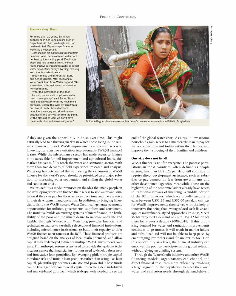
[ ]164
FINANCING COOPERATION
end of the global water crisis. As a result, low income households gain access to a microcredit loan to pay for water connections and toilets within their homes, and improve the well-being of their families and children.
One size does not fit allWASH finance is not for everyone. The poorest popu-lations in most countries, often defined as people earning less than US$1.25 per day, will continue to require direct development assistance, such as subsi-dies to pay connection fees from governments and other development agencies. Meanwhile, those on the higher rung of the economic ladder already have access to traditional streams of financing. A middle portion of the BOP, however, which we broadly assume to earn between US$1.25 and US$5.00 per day, can pay for WASH improvements themselves with the help of innovative financing that leverages local cash flows and applies microfinance-styled approaches. In 2008, Meera Mehta projected a demand of up to US$ 12 billion for these loans over a decade (2008-2018). If this prom-ising demand for water and sanitation improvements continues to go unmet, it will result in market failure and subsidized aid will not be able to keep pace. By encouraging promoters and financiers to focus on this opportunity as a lever, the financial industry can empower the poor to participate in the global solution without relying on a failing system.
Through the WaterCredit initiative and other WASH financing models, organizations can channel and direct financial resources more efficiently, enabling a large segment of the population to meet their own water and sanitation needs through demand-driven,
if they are given the opportunity to do so over time. This might naturally lead to a thriving market in which those living in the BOP are empowered to seek WASH improvements – however, access to financing for water or sanitation improvements (WASH finance) is rare. While the microfinance sector has made access to finance more accessible for self-improvement and agricultural loans, this market has yet to fully reach the water and sanitation sector. With more than two decades of field experience, research and analysis, Water.org has determined that supporting the expansion of WASH finance for the world’s poor should be prioritized as a major solu-tion for increasing water cooperation and ending the global water and sanitation crisis.
WaterCredit is a model premised on the idea that many people in the developing world can finance their access to safe water and sani-tation if they can pay for these services over time and have a voice in their development and operation. In addition, by bringing finan-cial tools to the WASH sector, WaterCredit can generate economic opportunities for utilities, governments, suppliers and consumers. The initiative builds on existing systems of microfinance, the bank-ability of the poor and the innate desire to improve one’s life and health. Through WaterCredit, Water.org provides financial and technical assistance to carefully selected local financial institutions, including microfinance institutions, to build their capacity to offer WASH finance to customers at the BOP. These financial products are designed based on the analysis of local market demand, and allow capital to be redeployed to finance multiple WASH investments over time. Philanthropic resources are used to provide the up-front tech-nical assistance that financial institutions need to develop these new and innovative loan portfolios. By leveraging philanthropic capital to reduce risk and initiate loan products rather than using it as loan capital, philanthropy becomes catalytic and powerful. These funds can be leveraged for commercial capital to create a demand-driven and market-based approach which is desperately needed to see the
Success story: Banu
For more than 20 years, Banu has been living in her Bangladeshi slum of Begunbari with her two daughters. Her husband died 15 years ago. She now works as a housemaid.
Because she did not have a water system near her home, Banu collected water from her best option – a dirty pond 20 minutes away. She had to make this 40 minute round trip two or three times a day to collect water for all of her family’s bathing, cleaning and other household needs.
Today, things are different for Banu and her daughters. After receiving a WaterCredit loan from Water.org and DSK, a new deep tube well was completed in her community.
“After the installation of the deep tube well, we are able to get safe water much more quickly,” said Banu. “Now I have enough water for all my household purposes. Before this well, my daughters and I would suffer from diarrhoea, jaundice, dysentery and skin diseases because of the dirty water from the pond. By the blessing of God, we don’t have these water-borne diseases anymore.” Golbanu Begum cleans vessels at her home’s new water connection in Pallabi, Bangladesh
Imag
e: W
ater
.org

[ ]165
FINANCING COOPERATION
market-based services. This model can bring together various (and often unconventional) actors to affect sustainable change.
Case study: BangladeshBangladesh has one of the highest population densities in the world, with a population of approximately 160 million people and a land mass smaller than the nation of Greece. According to the Joint Monitoring Programme in 2010, more than 28 million people in Bangladesh lack access to an improved water source and 66 million lack access to proper sanitation. This problem is especially acute in the capital city Dhaka, which is widely described as a sprawling megacity by aid institutions. With a population of more than 12 million and an annual population growth rate of more than 5 per cent, Dhaka has experienced enormous difficulties in meeting water and sanitation needs. Approximately 85 per cent of urban slum residents in Dhaka do not have access to safe water, and an estimated 40 per cent do not have a toilet.
Due to rapid urbanization in Dhaka and other major cities, the Government of Bangladesh has emphasized access to safe drink-ing water and sanitation facilities in urban areas. Nearly a third of Dhaka’s population lives in urban slums and lacks legal access to safe water connections. According to local laws, community resi-dents need city approval before they can connect to city water pipes, and this is only given to residents who can provide proof of land ownership. While government agencies wanted to increase access in slums, legal restrictions left the Dhaka Water Supply and Sewerage Authority (DWASA) without the ability to carry out its mandate.
One of Water.org’s partners in Bangladesh – Dushtha Shasthya Kendra (DSK) a local non-governmental organization (NGO) in Dhaka – stepped in to help fill this critical gap. DSK’s founder, Dr Dibalok Singha, saw that slum residents were forced to pay high prices for unsafe water supplied by slumlords, or they bought expensive bottled water from the ‘water mafia’ in Dhaka, often at 15 times the rate that DWASA charged legal water customers. Dr Singha met with DWASA’s leader-ship to figure out how they could cooperate and reach those without safe water access. DSK had a simple solution to a complex problem:
empower the poor to become water and sanitation customers, and rely on their desire to improve their lives. Dr Singha convinced DWASA that slum residents would repay water and sanitation loans if given the opportunity. In the end, he successfully lobbied the city to provide a water licence to his NGO on behalf of participating slum communities. Philanthropic grant funding enabled staff to build water and sanitation infrastructure, such as house-hold water connections and toilets.
In 2004, after witnessing the powerful relationship between DSK and DWASA, Water.org realized there was an opportunity for its new WaterCredit initia-tive. After reaching an agreement, Water.org provided a philanthropic grant or initial ‘smart subsidies’ to DSK, designed to attract and leverage additional social, commercial and civic capital and to cover fixed costs for starting up the new loan development process and enhancements to its loan tracking system. This enabled DSK to pilot and roll out water and sanitation loans in target slum communities. The staff also learned that additional capital could grow and further scale the loan programmes, thus creating a natural ‘multiplier effect’. By taking this crucial first step and believing in the intrinsic power of the poor, Water.org, Dr Singha and DSK were able to reach more underserved communities with critical services, and increase the focus on the level and nature of demand.
In this particular WaterCredit programme, DSK provides loans for both community and household-level water and sanitation improvements. To initiate the process, DSK’s staff works with the slum commu-nity to help form gender-balanced water and sanitation committees. Each committee then pays to install water pumps or toilets, and the costs of operation and main-tenance. The committees also collect and pay the water
Borrowers are given loan cards to track their loan balance and repayments
Rose Nungari uses her rehabilitated well and storage tank, obtained
with a WaterCredit loan, for household use and to irrigate a garden
Imag
e: W
ater
.org
Imag
e: W
ater
.org
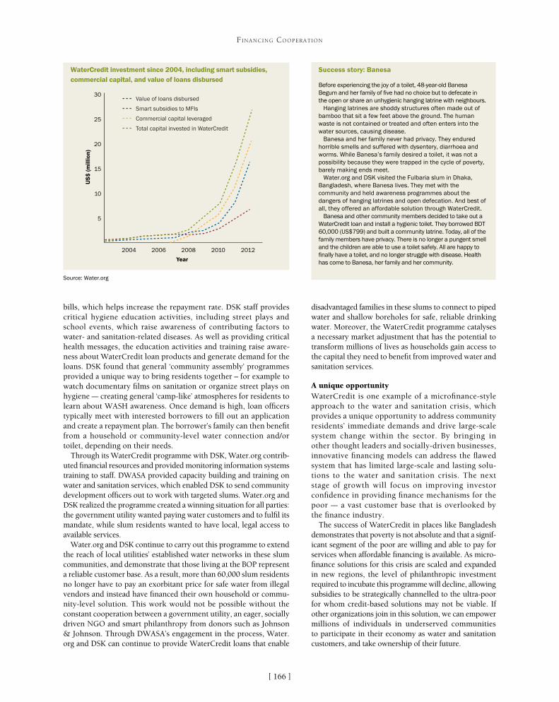
[ ]166
FINANCING COOPERATION
disadvantaged families in these slums to connect to piped water and shallow boreholes for safe, reliable drinking water. Moreover, the WaterCredit programme catalyses a necessary market adjustment that has the potential to transform millions of lives as households gain access to the capital they need to benefit from improved water and sanitation services.
A unique opportunityWaterCredit is one example of a microfinance-style approach to the water and sanitation crisis, which provides a unique opportunity to address community residents’ immediate demands and drive large-scale system change within the sector. By bringing in other thought leaders and socially-driven businesses, innovative financing models can address the flawed system that has limited large-scale and lasting solu-tions to the water and sanitation crisis. The next stage of growth will focus on improving investor confidence in providing finance mechanisms for the poor – a vast customer base that is overlooked by the finance industry.
The success of WaterCredit in places like Bangladesh demonstrates that poverty is not absolute and that a signif-icant segment of the poor are willing and able to pay for services when affordable financing is available. As micro-finance solutions for this crisis are scaled and expanded in new regions, the level of philanthropic investment required to incubate this programme will decline, allowing subsidies to be strategically channelled to the ultra-poor for whom credit-based solutions may not be viable. If other organizations join in this solution, we can empower millions of individuals in underserved communities to participate in their economy as water and sanitation customers, and take ownership of their future.
bills, which helps increase the repayment rate. DSK staff provides critical hygiene education activities, including street plays and school events, which raise awareness of contributing factors to water- and sanitation-related diseases. As well as providing critical health messages, the education activities and training raise aware-ness about WaterCredit loan products and generate demand for the loans. DSK found that general ‘community assembly’ programmes provided a unique way to bring residents together – for example to watch documentary films on sanitation or organize street plays on hygiene – creating general ‘camp-like’ atmospheres for residents to learn about WASH awareness. Once demand is high, loan officers typically meet with interested borrowers to fill out an application and create a repayment plan. The borrower’s family can then benefit from a household or community-level water connection and/or toilet, depending on their needs.
Through its WaterCredit programme with DSK, Water.org contrib-uted financial resources and provided monitoring information systems training to staff. DWASA provided capacity building and training on water and sanitation services, which enabled DSK to send community development officers out to work with targeted slums. Water.org and DSK realized the programme created a winning situation for all parties: the government utility wanted paying water customers and to fulfil its mandate, while slum residents wanted to have local, legal access to available services.
Water.org and DSK continue to carry out this programme to extend the reach of local utilities’ established water networks in these slum communities, and demonstrate that those living at the BOP represent a reliable customer base. As a result, more than 60,000 slum residents no longer have to pay an exorbitant price for safe water from illegal vendors and instead have financed their own household or commu-nity-level solution. This work would not be possible without the constant cooperation between a government utility, an eager, socially driven NGO and smart philanthropy from donors such as Johnson & Johnson. Through DWASA’s engagement in the process, Water.org and DSK can continue to provide WaterCredit loans that enable
Value of loans disbursed
5
10
15
20
25
30
US
$ (m
illio
n)
Year
2004 2006 2008 2010 2012
Smart subsidies to MFIs
Commercial capital leveraged
Total capital invested in WaterCredit
WaterCredit investment since 2004, including smart subsidies, commercial capital, and value of loans disbursed
Source: Water.org
Success story: Banesa
Before experiencing the joy of a toilet, 48-year-old Banesa Begum and her family of five had no choice but to defecate in the open or share an unhygienic hanging latrine with neighbours.
Hanging latrines are shoddy structures often made out of bamboo that sit a few feet above the ground. The human waste is not contained or treated and often enters into the water sources, causing disease.
Banesa and her family never had privacy. They endured horrible smells and suffered with dysentery, diarrhoea and worms. While Banesa’s family desired a toilet, it was not a possibility because they were trapped in the cycle of poverty, barely making ends meet.
Water.org and DSK visited the Fulbaria slum in Dhaka, Bangladesh, where Banesa lives. They met with the community and held awareness programmes about the dangers of hanging latrines and open defecation. And best of all, they offered an affordable solution through WaterCredit.
Banesa and other community members decided to take out a WaterCredit loan and install a hygienic toilet. They borrowed BDT 60,000 (US$799) and built a community latrine. Today, all of the family members have privacy. There is no longer a pungent smell and the children are able to use a toilet safely. All are happy to finally have a toilet, and no longer struggle with disease. Health has come to Banesa, her family and her community.

[ ]167
Governance for cooperation and successful watershed conservation strategies:
the Water Funds case Vidal Garza, Carlos Hurtado, Priscilla Treviño and Ilsa Ruiz, FEMSA Foundation
Watershed conservation is a priority that has been exacerbated by climate change. The delicate balance of nature, which offers vital ecosystem services to
society, has been compromised in several parts of the world. The problem is a substantial one. An estimated 50 per cent of the world’s wetlands have been lost since 19001. Finding a solution to this is not straightforward though; usually any conservation initiative requires cooperation and coordina-tion between multiple stakeholders for it to be successful and sustainable. In Latin America, several approaches have been taken to tackle watershed conservation, including Water Funds – innovative governance and financial structures that enable downstream beneficiaries to invest in upstream conser-vation, which is needed to help secure water availability and other environmental services.
FEMSA Foundation, together with The Nature Conservancy (TNC), the Inter-American Development Bank (IDB), and the Global Environment Fund, developed the Latin American Water Funds Partnership in 2011. Their main goal is to create at least 32 success-ful Water Funds in Latin America by 2016. These Water Funds could support the conservation of over seven million acres of water-sheds that supply water to cities with a population of approximately 50 million people. In order to achieve this, the partnership promotes
the collaboration between the private, public and social sectors of society, and is committed to improving rela-tions between local Water Funds.
The establishment of a regional governance structure is a key objective for the partnership. It believes that this will help to boost effective cooperation between different stakeholders. This cooperation, together with the Partnerships regional influence, can improve the effectiveness of local Water Funds and the water conservation as a whole by promoting: • Efficiency through scientific tools, which promote
the allocation and execution of resources to maxi-mize return on investment.
• Financing through seed capital, which can be matched by public resources, invested on the finan-cial market or used to develop local Water Funds; fundraising capabilities with local and international interested investors; and development of innovative financial mechanisms.
• Collaborative learning, which encourages Water Funds to share best practices, develop regional scientific studies, and gain knowledge from interna-tionally-renowned experts to provide guidance on ongoing developments.
FINANCING COOPERATION
What is a Water Fund?
As defined in the report Water Funds: Conserving green infrastructure, published by The Nature Conservancy in collaboration with other organizations including FEMSA Foundation, “Water Funds are an innovative way of paying and compensating for the services that nature provides to humans. They attract capital contributions from large water users such as water supply companies, hydropower plants, irrigation districts and agricultural associations, among others, in an organized and transparent manner, adequately investing these resources to maximize their return on investment. The funds are invested in the financial market through trust funds, and the financial returns are invested to leverage public and private funds to conserve the watershed, to create or strengthen public protected areas, to pay for conservation easements, to obtain financial and technical support to promote more eco-friendly agriculture and livestock systems that improve productivity, and to develop community initiatives.”
Imag
e: ©
Shi
rley
Sáe
nz /
The
Nat
ure
Con
serv
ancy

[ ]168
FINANCING COOPERATION
cent of all water required by the city. They participate in either a promoting or technical group, based on their expertise, interests and contribution to the Water Fund. The promoting group works closely with all the parties involved in the watershed, including public and private stakeholders, to provide expertise, knowledge and resources to the Water Fund. The technical group are tasked with creating sound action plans for conservation purposes, ensuring that investment decisions align with the conservation and management plans, programmes and conservation projects in the watershed.
Taking into account all the different interests and opinions of the involved parties can be a challenge, especially when it comes to defining common goals. Scientific factors can be useful in this respect, as they define the most important needs of the watershed and highlight key environmental issues – such as water supply and the impact of natural disasters. With this in mind, FAMM’s stakeholders have agreed on the follow-ing environmental-related goals:• Flood control: the target is to lower peak flow
in the upper watershed by as much as 750 cubic metres per second during extreme events. This will prevent natural disasters in the city basin, which have increased in Monterrey in recent years as a result of climate change
• Water infiltration: the target is to increase the water available for infiltration by reducing surface run-off by at least 20 per cent.
Other goals to restore and conserve the watershed are set by the stakeholder group, based on their expert assessments.
Promoting social awareness is also a key objective for FAMM. Making citizens more aware of their impact on the watershed can help to encourage responsible behaviour and drive further sustainability initiatives led by local communities. In addition, FAMM is keen to highlight that parties that get involved with local restoration and preservation field projects can receive financial support from public authorities.
Science determines more than the strategic direction of FAMM’s resources and efforts; it directly influences the intervention plan of the Water Fund. Critical areas that require intervention are identified and prioritized based on scientific models to ensure the greatest returns on invest-ment in terms of the environmental services provided. Field actions are also defined based on these strategies.
In addition, science factors provide a compelling argument for the execution of public resources in accordance with FAMM’s strategic plan, as they dictate what conservation efforts will be most effective. In general, demand for resources far exceeds what’s actu-ally available. Usually, FAMM can only offer around ten per cent of the required resource per year to work with, meaning that all activities and initiatives need to be carefully prioritised. It’s worth noting that the Water Fund itself should also be looking to gain addi-tional resources from other parties, such as government bodies and other local stakeholders.
The Latin American Water Funds Partnership has already begun developing a governance structure to promote regional coopera-tion and align efforts and resources for the effective, large-scale and efficient conservation of watershed in the region. Although some Water Funds and related initiatives are already up and running, the partnership expects this governance structure to further improve existing activities and strengthen the impact of new Water Funds in the future.
The partnership recognises that, as with any initiative where several stakeholders are involved to achieve a common goal, it is very important to determine the Water Fund’s structure, define the responsibilities of each stakeholder and manage individual expectations. Ensuring everybody is involved in decision-making is key – whether they are providing seed capital or other assets/resources to the Fund. Including public authorities is very impor-tant, as watershed is a public resource – but this can be complex, especially when they are subject to political influences and electoral cycles, which can jeopardise long-term efforts. Given the number of parties that can be involved, as well as their different motives for contributing to a local Water Fund, it’s important that participation incentives are also governed. Ultimately, the structure, or institu-tional arrangement, of a Water Fund should be tailored according to local requirements.
Metropolitan Water Fund of MonterreyLocated in northeast México, Monterrey is an industrial city charac-terized by a thriving private sector, involved public authorities and social organizations that are passionate about natural conservation. The Metropolitan Water Fund (FAMM using its Spanish acronym) has 19 stakeholders, representing private companies, public institutions, non-profit organizations and academia. All of them have interests in and influence on the local San Juan watershed, which provides 80 per
Monterrey, Nuevo León, Mexico
Monterrey, capital city of Nuevo León, Mexico, has experienced numerous cases
of flooding and drought throughout its history

[ ]169
FINANCING COOPERATION
Science is therefore one of the most relevant governance instruments for the Water Fund. It helps coordinate private and public resources, define common interests, and promote strategic cooperation.
Some of the challenges that FAMM faces are directly associated with the complex relationships between the different parties and groups involved in the Water Fund, as well as their individual motives. In 2010, for example, Monterrey was hit by hurricane Alex. This caused widespread flooding, which devastated the city and resulted in millions of dollars’ worth of damage. Stakeholders got together in different groups and tried to tackle the immediate problem in different ways, with varying degrees of success. Three years later, the city is experiencing one of the worst droughts in its history. Again, stakeholders are having to act quickly to find the best solution to help affected communities.
FAMM helps various stakeholders come together to draw up a long-term vision, which also takes into account management of short-term issues such as catastrophic flooding or drought. The science-based actions ensure that the best interests of the watershed are always FAMM’s first priority. The Water Fund serves as a common ground for different sectors to come together, negotiate and define key objec-tives, and then work together in a transparent manner.
By involving external consulting agencies, such as Baker&McKenzie and KPMG, the Water Fund aims to demonstrate that it is managed through secure and transparent financial mechanisms that can be sustained in the long term. The involvement of these world-class firms helps to build trust among contrib-utors to the Fund and improve cooperation between them. To demonstrate that it is operating in the most effective manner and that the objectives of the key stakeholders are being met, FAMM also carries out annual audits of its internal processes. Transparency and accountability mechanisms such as the ones mentioned before help strengthen the main goal of FAMM’s governance structure: sustainable coopera-tion in the long-term.
FEMSA Foundation is currently working together with TNC and IDB to develop organization and opera-tion manuals to define the operation of FAMM and to ensure that the Water Fund continues to protect natural resources in a sustainable manner for the benefit of us all.
Initiatives supported by FAMM include ditch construction in the Canoas community
Imag
e: ©
Cue
ncas
y C
iuda
des

VLegal Framework at the National/International
Level

[ ]172
Integrated water resource management – combining perspectives from
law, policy and science Andrew Allan, Susan Baggett, Michael Bonell, Geoffrey Gooch, Sarah Hendry, Alistair Rieu-Clarke and Chris Spray, Dundee Centre for Water Law, Policy and Science, University of Dundee, Scotland
Water resource management is a complex issue faced with significant challenges, both in the United Kingdom and abroad. In order to succeed in dealing
with these challenges policymakers, water managers and water professionals need access to concise information and research results that can help them make efficient and equitable deci-sions over water. The Dundee Centre for Water Law, Policy and Science is the UK’s only Category 2 United Nations Educational, Scientific and Cultural Organization (UNESCO) Centre. Its far-reaching research activities encompass the links between water governance, science and policy. The centre’s work is carried out with partners worldwide including in Africa, Asia, Latin America and Europe as well as in Scotland and the UK.
Key challengesWater professionals, policymakers and managers face significant challenges including adaption to existing legal and policy systems, the special problems involved in water management in develop-ing countries, transboundary water management, interconnections between land and water, sustainability, climate change, and stake-holder and public participation.
One of the main challenges facing water management is the inte-gration of different sectors and different levels of management and administration in the context of both developed and developing countries. This integration is often termed integrated water resource management (IWRM). Water resource management in a European context has been considered within a framework of extensive legis-lation in the field of environment and water since 1972. As well as general issues around creating a level playing field for trade and business, since the 1970s the European Union (EU) has increasingly been concerned with environmental protection to restore environ-ments damaged by industrial pollution, improve public health and quality of life, ensure that the polluter pays, and contribute to sustainable development. The challenges include water polluted by industry and agriculture, both current and historic; increasing water scarcity, especially in the southern states; and increasingly unpre-dictable water events such as floods and droughts.
In order to address these problems, the EU has taken a number of different approaches – sometimes characterized as the ‘three waves’ of EU water law – over the past 40 years. In the third wave, the EU has been introducing a system of IWRM under its Water Framework Directive (WFD). The WFD requires states to organize their water
management on hydrological boundaries (river basins) even where these cross national boundaries, and to seek cooperation with third-party states. It requires monitor-ing and assessment of the uses to which water is put, and an explicit recognition of the trade-offs that are made. It also requires integrated management of inland surface waters, groundwater and coastal waters; abstrac-tion controls; full cost recovery for all water uses, not just urban supply; and mandatory public consultation on draft river basin plans. Most of these features are common to all IWRM systems.
As well as bringing in IWRM, the WFD also has an overall objective of ‘good ecological status’. While IWRM is being introduced in many states following agreement at the Johannesburg Summit on Sustainable Development in 2002, a goal of improved ecologi-cal water quality is an ambitious concept which not all states would currently wish to attempt. Thus the EU is still at the forefront of developing environment and water law concepts worldwide. Its work is being further developed through the ‘water blueprint’ which will allow the continued refinement of IWRM in Europe with greater focus on water scarcity, flood and drought, and water efficiency.
Developing countries, on the other hand, face rather more difficulty than developed nations in implement-ing IWRM at the national level. IWRM is an expensive approach to put into practice in any event, and demands that a certain level of administrative and infrastruc-tural capacity is in place for its operation. Despite the differences in national physical, social and economic environments, many developing countries face common problems in applying an IWRM approach to improve the management of their water resources. These are affected by the three key (financial, infrastructural and human) elements of water resource management, where lack of capacity in any or all three may impede success-ful implementation of IWRM.
The world water crisis has often been described as one of poor governance. While inadequate governance arrangements pervade all levels of water resources, one of the greatest challenges – and a potential catalyst for
LEGAL FRAMEWORK AT THE NATIONAL/INTERNATIONAL LEVEL
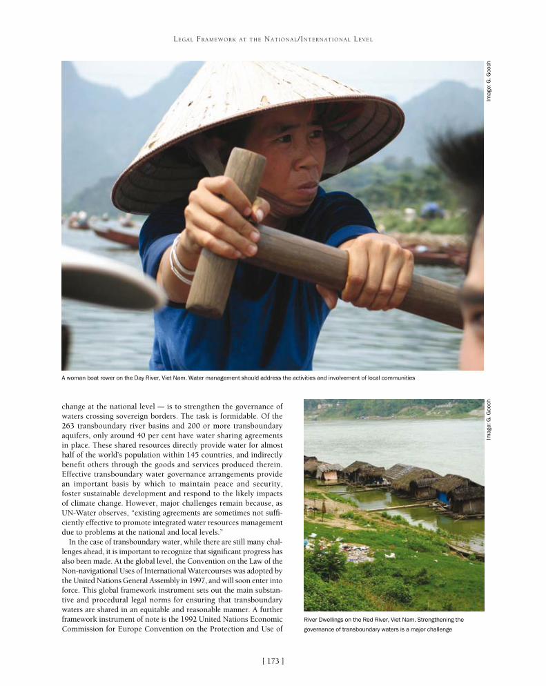
[ ]173
LEGAL FRAMEWORK AT THE NATIONAL/INTERNATIONAL LEVEL
change at the national level – is to strengthen the governance of waters crossing sovereign borders. The task is formidable. Of the 263 transboundary river basins and 200 or more transboundary aquifers, only around 40 per cent have water sharing agreements in place. These shared resources directly provide water for almost half of the world’s population within 145 countries, and indirectly benefit others through the goods and services produced therein. Effective transboundary water governance arrangements provide an important basis by which to maintain peace and security, foster sustainable development and respond to the likely impacts of climate change. However, major challenges remain because, as UN-Water observes, “existing agreements are sometimes not suffi-ciently effective to promote integrated water resources management due to problems at the national and local levels.”
In the case of transboundary water, while there are still many chal-lenges ahead, it is important to recognize that significant progress has also been made. At the global level, the Convention on the Law of the Non-navigational Uses of International Watercourses was adopted by the United Nations General Assembly in 1997, and will soon enter into force. This global framework instrument sets out the main substan-tive and procedural legal norms for ensuring that transboundary waters are shared in an equitable and reasonable manner. A further framework instrument of note is the 1992 United Nations Economic Commission for Europe Convention on the Protection and Use of
River Dwellings on the Red River, Viet Nam. Strengthening the
governance of transboundary waters is a major challenge
Imag
e: G
. Goo
ch
A woman boat rower on the Day River, Viet Nam. Water management should address the activities and involvement of local communities
Imag
e: G
. Goo
ch

[ ]174
LEGAL FRAMEWORK AT THE NATIONAL/INTERNATIONAL LEVEL
Transboundary Watercourses and International Lakes which, after 20 years of successful implementation at a regional level, will soon be open for all United Nations member states to join. Both these frame-work instruments, as well as the United Nations General Assembly’s Resolution on the Law of Transboundary Aquifers, provide an impor-tant basis by which to enhance the legitimacy of international water law and strengthen the political will to enter into agreements at the basin level. Ultimately, the effectiveness of any transboundary water governance arrangement will depend on there being a shared under-standing about who gets what water, when and why.
Hydrological impacts of land use, especially degraded lands, and the implications therein regarding appropriate land-water manage-ment policies is also an important issue. For example, the water use of fast-growing tree plantations tends to be much higher than that of the degraded vegetation they typically replace – particularly where tree roots have access to groundwater. Aside from these hydrological considerations – and in contrast to, for example, forest plantation monocultures in developed countries – forest land in developing
countries also has to provide a variety of goods and services (such as timber and fuel wood plus non-timber products including water, fodder and litter for animal bedding) to local communities in support of their subsistence farming systems. Consequently, access to land of this kind by these local communities is manda-tory and such incursions have potential hydrological impacts which are presently less well known. This is an additional dimension to an already complex process of community management embedded within integrated catchment management. It will pose a considerable chal-lenge to both local communities and the government in fine-tuning water management policy.
Increasingly, non-governmental participatory catchment organizations are being seen as key to the effective delivery of both national water legislation and the desires of local communities for a better quality of life. This is true in the UK where, as with other
A girl fetching water in the Vendha, South Africa. Shared resources provide water for almost half the global population
Imag
e: G
. Goo
ch
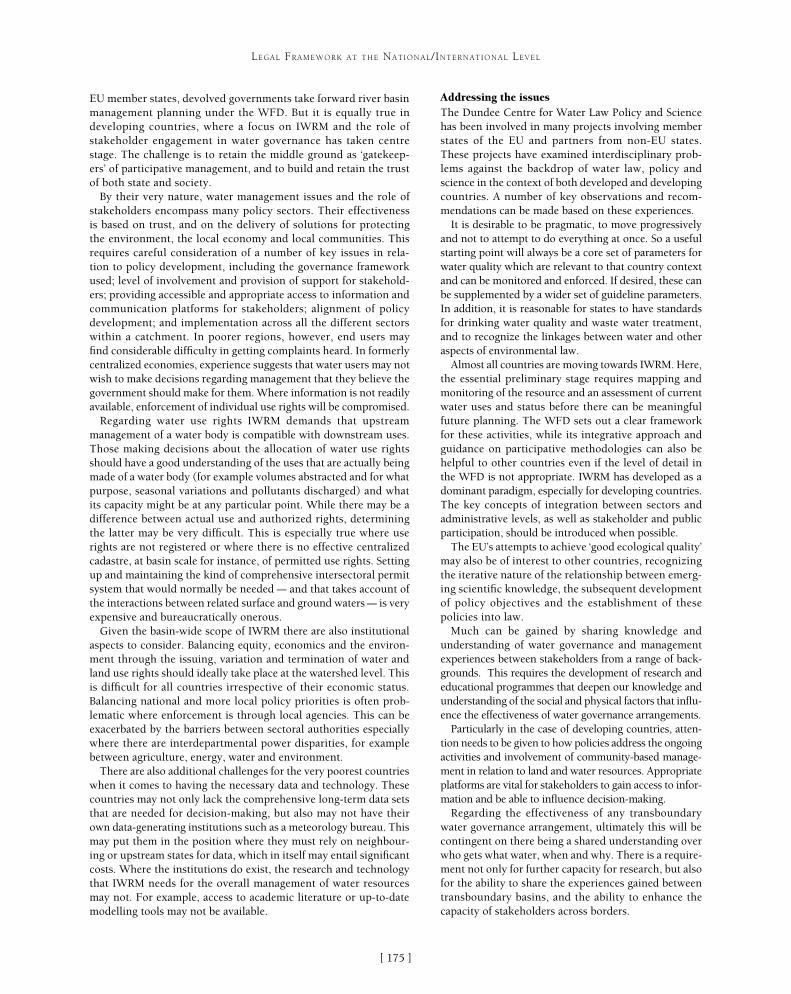
[ ]175
LEGAL FRAMEWORK AT THE NATIONAL/INTERNATIONAL LEVEL
EU member states, devolved governments take forward river basin management planning under the WFD. But it is equally true in developing countries, where a focus on IWRM and the role of stakeholder engagement in water governance has taken centre stage. The challenge is to retain the middle ground as ‘gatekeep-ers’ of participative management, and to build and retain the trust of both state and society.
By their very nature, water management issues and the role of stakeholders encompass many policy sectors. Their effectiveness is based on trust, and on the delivery of solutions for protecting the environment, the local economy and local communities. This requires careful consideration of a number of key issues in rela-tion to policy development, including the governance framework used; level of involvement and provision of support for stakehold-ers; providing accessible and appropriate access to information and communication platforms for stakeholders; alignment of policy development; and implementation across all the different sectors within a catchment. In poorer regions, however, end users may find considerable difficulty in getting complaints heard. In formerly centralized economies, experience suggests that water users may not wish to make decisions regarding management that they believe the government should make for them. Where information is not readily available, enforcement of individual use rights will be compromised.
Regarding water use rights IWRM demands that upstream management of a water body is compatible with downstream uses. Those making decisions about the allocation of water use rights should have a good understanding of the uses that are actually being made of a water body (for example volumes abstracted and for what purpose, seasonal variations and pollutants discharged) and what its capacity might be at any particular point. While there may be a difference between actual use and authorized rights, determining the latter may be very difficult. This is especially true where use rights are not registered or where there is no effective centralized cadastre, at basin scale for instance, of permitted use rights. Setting up and maintaining the kind of comprehensive intersectoral permit system that would normally be needed – and that takes account of the interactions between related surface and ground waters – is very expensive and bureaucratically onerous.
Given the basin-wide scope of IWRM there are also institutional aspects to consider. Balancing equity, economics and the environ-ment through the issuing, variation and termination of water and land use rights should ideally take place at the watershed level. This is difficult for all countries irrespective of their economic status. Balancing national and more local policy priorities is often prob-lematic where enforcement is through local agencies. This can be exacerbated by the barriers between sectoral authorities especially where there are interdepartmental power disparities, for example between agriculture, energy, water and environment.
There are also additional challenges for the very poorest countries when it comes to having the necessary data and technology. These countries may not only lack the comprehensive long-term data sets that are needed for decision-making, but also may not have their own data-generating institutions such as a meteorology bureau. This may put them in the position where they must rely on neighbour-ing or upstream states for data, which in itself may entail significant costs. Where the institutions do exist, the research and technology that IWRM needs for the overall management of water resources may not. For example, access to academic literature or up-to-date modelling tools may not be available.
Addressing the issuesThe Dundee Centre for Water Law Policy and Science has been involved in many projects involving member states of the EU and partners from non-EU states. These projects have examined interdisciplinary prob-lems against the backdrop of water law, policy and science in the context of both developed and developing countries. A number of key observations and recom-mendations can be made based on these experiences.
It is desirable to be pragmatic, to move progressively and not to attempt to do everything at once. So a useful starting point will always be a core set of parameters for water quality which are relevant to that country context and can be monitored and enforced. If desired, these can be supplemented by a wider set of guideline parameters. In addition, it is reasonable for states to have standards for drinking water quality and waste water treatment, and to recognize the linkages between water and other aspects of environmental law.
Almost all countries are moving towards IWRM. Here, the essential preliminary stage requires mapping and monitoring of the resource and an assessment of current water uses and status before there can be meaningful future planning. The WFD sets out a clear framework for these activities, while its integrative approach and guidance on participative methodologies can also be helpful to other countries even if the level of detail in the WFD is not appropriate. IWRM has developed as a dominant paradigm, especially for developing countries. The key concepts of integration between sectors and administrative levels, as well as stakeholder and public participation, should be introduced when possible.
The EU’s attempts to achieve ‘good ecological quality’ may also be of interest to other countries, recognizing the iterative nature of the relationship between emerg-ing scientific knowledge, the subsequent development of policy objectives and the establishment of these policies into law.
Much can be gained by sharing knowledge and understanding of water governance and management experiences between stakeholders from a range of back-grounds. This requires the development of research and educational programmes that deepen our knowledge and understanding of the social and physical factors that influ-ence the effectiveness of water governance arrangements.
Particularly in the case of developing countries, atten-tion needs to be given to how policies address the ongoing activities and involvement of community-based manage-ment in relation to land and water resources. Appropriate platforms are vital for stakeholders to gain access to infor-mation and be able to influence decision-making.
Regarding the effectiveness of any transboundary water governance arrangement, ultimately this will be contingent on there being a shared understanding over who gets what water, when and why. There is a require-ment not only for further capacity for research, but also for the ability to share the experiences gained between transboundary basins, and the ability to enhance the capacity of stakeholders across borders.

[ ]176
Community benefits achieved through developing legal frameworks at domestic
and transboundary levels Stefano Burchi, Chairman, Executive Council, International Association for Water Law
Water resources are found above and below the land surface. Thus, water is almost instinctively associ-ated with land ownership. Groundwater in particular
has long been associated with private property, with landown-ers claiming the freedom to pump as much water as they please under the legal ‘rule of capture’, regardless of the effects on resource stocks and on their neighbours.
Although the rule of capture can be said to invite indiscriminate water pumping, it is possible to limit its destructive potential. For example, although the rule of capture prevails in the state of Texas, United States, state water legislation also provides for the creation of groundwater conservation districts with a mandate to protect groundwater from indiscriminate pumping. This legislation enables districts to set spacing requirements for wells, production limitations and production fees. Many districts above the giant Ogallala aquifer have adopted spacing requirements, while Houston and San Antonio have set limits on the amount of groundwater that can be extracted from each well. The Harris-Galveston Coastal Subsidence District has opted for a fee schedule aimed at discouraging groundwater pumping. And in Northern Texas, the High Plains Underground Water Conservation District has implemented a successful overdraft management approach based on education and the promotion of conservation technologies.1 In each case, water laws enabling and empowering groundwater conservation districts are enabling local communities to benefit from sustainable groundwater withdrawals from relevant aquifers.
India has also experienced serious groundwater over-extraction problems, precipitated and made increasingly worse by the same legal rule of capture that prevails in Texas. In response to the threat posed by indiscriminate groundwater pumping, the state of Punjab passed legislation in 2009 restricting the timing of paddy nursery sowing and paddy transplanting by farmers. All farmers, whether they are owners, tenants or share croppers engaging in agriculture, horticulture, agroforestry or similar economic activities, face severe fines if they breach the restrictions. This simple and straightforward measure has had an impact, with farmers responding well to the new regulations.
A different basic water law prevails in Spain, where groundwa-ter is public property. Nonetheless, it is reckoned that there is a lot of illegal water pumping in the country. Like Texas, Spain has responded to the problem with legislation that provides for the formation of groundwater user associations which are empowered to monitor and police pumping restrictions. For example, in 1997 the
groundwater users’ association of the Mancha Oriental aquifer and the local basin authority agreed not to allow any new water users until all existing users held proper groundwater extraction rights. Since then, the associa-tion has been proactive in monitoring and reporting all illegal groundwater use.2 The success of the Mancha Oriental groundwater users’ association in ensuring sustainable water withdrawals from the aquifer can be attributed to the legislation that enables this type of association to exist and to function, and provides them with the power needed to accomplish their goals.
Many laws on water resources provide mechanisms and opportunities for the public and for local communi-
LEGAL FRAMEWORK AT THE NATIONAL/INTERNATIONAL LEVEL
Water legislation can help to limit the destructive potential of
indiscriminate groundwater pumping
Imag
e: In
t. A
ssoc
. for
Wat
er L
aw
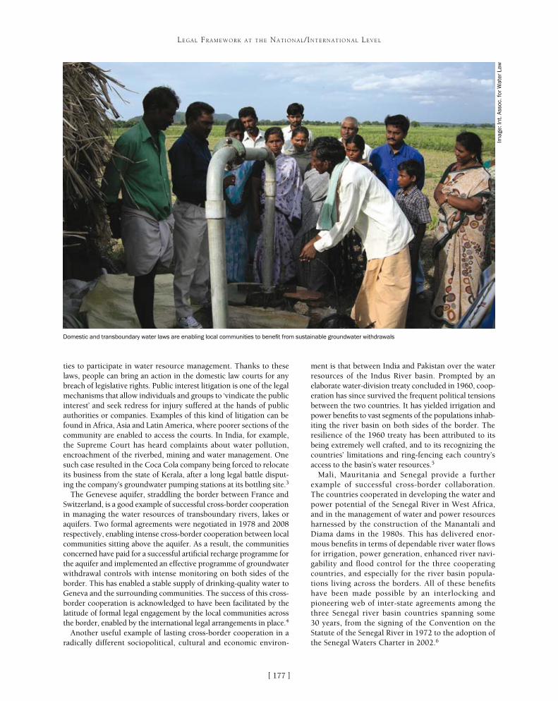
[ ]177
LEGAL FRAMEWORK AT THE NATIONAL/INTERNATIONAL LEVEL
ment is that between India and Pakistan over the water resources of the Indus River basin. Prompted by an elaborate water-division treaty concluded in 1960, coop-eration has since survived the frequent political tensions between the two countries. It has yielded irrigation and power benefits to vast segments of the populations inhab-iting the river basin on both sides of the border. The resilience of the 1960 treaty has been attributed to its being extremely well crafted, and to its recognizing the countries’ limitations and ring-fencing each country’s access to the basin’s water resources.5
Mali, Mauritania and Senegal provide a further example of successful cross-border collaboration. The countries cooperated in developing the water and power potential of the Senegal River in West Africa, and in the management of water and power resources harnessed by the construction of the Manantali and Diama dams in the 1980s. This has delivered enor-mous benefits in terms of dependable river water flows for irrigation, power generation, enhanced river navi-gability and flood control for the three cooperating countries, and especially for the river basin popula-tions living across the borders. All of these benefits have been made possible by an interlocking and pioneering web of inter-state agreements among the three Senegal river basin countries spanning some 30 years, from the signing of the Convention on the Statute of the Senegal River in 1972 to the adoption of the Senegal Waters Charter in 2002.6
ties to participate in water resource management. Thanks to these laws, people can bring an action in the domestic law courts for any breach of legislative rights. Public interest litigation is one of the legal mechanisms that allow individuals and groups to ‘vindicate the public interest’ and seek redress for injury suffered at the hands of public authorities or companies. Examples of this kind of litigation can be found in Africa, Asia and Latin America, where poorer sections of the community are enabled to access the courts. In India, for example, the Supreme Court has heard complaints about water pollution, encroachment of the riverbed, mining and water management. One such case resulted in the Coca Cola company being forced to relocate its business from the state of Kerala, after a long legal battle disput-ing the company’s groundwater pumping stations at its bottling site.3
The Genevese aquifer, straddling the border between France and Switzerland, is a good example of successful cross-border cooperation in managing the water resources of transboundary rivers, lakes or aquifers. Two formal agreements were negotiated in 1978 and 2008 respectively, enabling intense cross-border cooperation between local communities sitting above the aquifer. As a result, the communities concerned have paid for a successful artificial recharge programme for the aquifer and implemented an effective programme of groundwater withdrawal controls with intense monitoring on both sides of the border. This has enabled a stable supply of drinking-quality water to Geneva and the surrounding communities. The success of this cross-border cooperation is acknowledged to have been facilitated by the latitude of formal legal engagement by the local communities across the border, enabled by the international legal arrangements in place.4
Another useful example of lasting cross-border cooperation in a radically different sociopolitical, cultural and economic environ-
Domestic and transboundary water laws are enabling local communities to benefit from sustainable groundwater withdrawals
Imag
e: In
t. A
ssoc
. for
Wat
er L
aw

[ ]178
New approaches to planning and decision-making for fresh water: cooperative
water management in New Zealand Clive Howard-Williams, Chief Scientist, National Institute for Water and Atmospheric Research, Christchurch;
Alastair Bisley, Chairman, Land and Water Forum, Ministry for the Environment, and Ken Taylor, Director Investigations and Monitoring, Canterbury Regional Council, New Zealand
Despite its clean and green image, New Zealand has expe-rienced many of the same disputes over water quantity and degrading water quality that are found in other
nations. Adversarial processes and litigation have dominated water allocation and permit applications, leading to stalemate and inaction. In 2008 stakeholders agreed at the national level to embark on a collaborative process to improve freshwater management and governance. Successful experimentation with collaborative processes has also proceeded at the regional level, especially in the Canterbury region.
New Zealand’s water resourcesNew Zealand’s natural landscape, including mountains and natural forest, occupies 43 per cent of its surface and contains near-pris-tine rivers, lakes and wetlands. The remaining land area comprises planted forest (5 per cent) farmland (52 per cent) and urban devel-opment, mostly in lowlands that are now almost devoid of natural vegetation.1 New Zealand’s economy depends significantly on pasto-ral, arable and horticultural farming. Given the intensification of land use over the last 20 years, it is not surprising that the country experiences problems with both the quality and quantity of water.2
Abundant fresh water is seen as one of New Zealand’s greatest economic resources.3 By international standards, New Zealand has a high level of clean fresh water per person with a total renewable water resource of 84,000 m3 per person per year. Current annual water consumption is less than 5 per cent of the New Zealand supply (runoff to the sea) and yet:• there are sometimes shortages in some places• the areas where water resources are fully allocated are increasing • occasional droughts occur across large areas of the country with
significant impacts on the national economy• water quality degradation is putting increasing pressure on the
freshwater environment.
Problems with water managementAs in most countries there are multiple interests in water. These include cultural, spiritual and identity; recreational, social and personal; environmental; and economic interests. Sometimes they complement each other and at others they compete.
New Zealand’s Resource Management Act of 1991 introduced an effects-based approach in which permits for water uses (takes
and discharges) are based on the effects of the use. Although permits are time-limited, existing permit holders “enjoy significant protection of their prior-ity over newer entrants.”4 Once effects indicate that the resource is fully allocated, no new entrants to the resource are permitted. But regulatory barriers to the transfer of permits make it difficult for water to move to the most productive users. Furthermore, effects-based consenting often allows the provision of permits to already compromised water bodies on the basis that the new consent will have only minor effects – resulting in continuing and worsening cumulative effects.
The debate about economic uses of water has been difficult to resolve and processes for allocating water have been the subject of litigation in many catchments. Several principal issues needed to be resolved:• competing interests where the parties seldom
engaged except in court• the effective exclusion of M�ori from governance
and management in many catchments• inconsistent policy and planning• poor use of science and knowledge• lack of acknowledgement of the need to set and
manage within limits – the only policy mechanism we know of to deal with cumulative effects.
Responses at the national levelIn response to the difficulties of managing water in a liti-gious environment, a group of around 50 key stakeholders from all sides of the debate established the Land and Water Forum (LWF) in 2008. Their approach was sparked by a report on Scandinavian collaborative approaches to the resolution of complex and contested environmental issues, which suggested that they could be fruitfully applied in New Zealand.5 There was also a sense that unless all the parties were prepared to engage with each other directly over the whole range of freshwater issues, conflict and stalemate would persist with damaging consequences for the environment and economy.
The LWF consisted of a plenary group of over 50 organ-izations and agencies with a stake in water management
LEGAL FRAMEWORK AT THE NATIONAL/INTERNATIONAL LEVEL
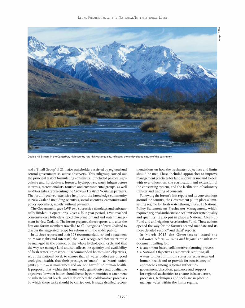
[ ]179
LEGAL FRAMEWORK AT THE NATIONAL/INTERNATIONAL LEVEL
mendations on how the freshwater objectives and limits should be met. These included approaches to improve management practices for land and water use and to deal with over-allocation, the clarification and extension of the consenting system, and the facilitation of voluntary transfer and trading of consents.
Following the forum’s first report and its conversations around the country, the Government put in place a limit-setting regime for fresh water through its 2011 National Policy Statement on Freshwater Management, which required regional authorities to set limits for water quality and quantity. It also put in place a National Clean-up Fund and an Irrigation Acceleration Fund. These actions opened the way for the forum’s second mandate and its more detailed second6 and third7 reports.
In March 2013 the Government issued the Freshwater reform – 2013 and beyond consultation document calling for:• a catchment-based collaborative planning process• a National Objectives Framework requiring all
waters to meet minimum states for ecosystem and human health and to provide for consistency of approaches among regional authorities
• government direction, guidance and support for regional authorities to ensure infrastructure, processes, techniques and tools are in place to manage water within the limits regime.
and a ‘Small Group’ of 21 major stakeholders assisted by regional and central government as ‘active observers’. This subgroup carried out the principal task of formulating consensus. It included pastoral agri-culture and horticulture, forestry, hydropower, water infrastructure interests, recreationalists, tourism and environmental groups, as well as M�ori tribes representing the Crown’s Treaty of Waitangi partners. The forum received extensive help from the knowledge community in New Zealand including scientists, social scientists, economists and policy specialists, mostly without payment.
The Government gave LWF two successive mandates and substan-tially funded its operations. Over a four year period, LWF reached consensus on a fully-developed blueprint for land and water manage-ment in New Zealand. The forum prepared three reports, and after the first one forum members travelled to all 16 regions of New Zealand to discuss the suggested recipe for reform with the wider public.
In its three reports and their 158 recommendations (and a statement on M�ori rights and interests) the LWF recognized that water must be managed in the context of the whole hydrological cycle and that the way we manage land and soil affects the quantity and availability of fresh water. In essence, it recommended bottom-line objectives, set at the national level, to ensure that all water bodies are of good ecological health, that their prestige, or 'mana' – as M�ori patici-pants put it – is maintained and are not harmful to human health. It proposed that within this framework, quantitative and qualitative objectives for water bodies should be set by communities at catchment or subcatchment levels, and it described the collaborative processes by which these tasks should be carried out. It made detailed recom-
Double Hill Stream in the Canterbury high country has high water quality, reflecting the undeveloped nature of the catchment
Imag
e: N
IWA

[ ]180
LEGAL FRAMEWORK AT THE NATIONAL/INTERNATIONAL LEVEL
Several regional councils are already engaged in implementing the National Policy Statement on Freshwater Management and the Government is finalizing the details of its further freshwater reform package stemming from proposals based on, and consistent with, LWF’s recommendations.
Responses at the regional level The Canterbury region on the east side of New Zealand’s South Island has relatively low rainfall, but with major agricultural investments and significant growth opportunities if more water is available and water quality can be maintained. While LWF was deliberating at a national level, the Canterbury Regional Council and its associated district councils had already embarked on a collaborative form of regional water governance and manage-ment. This is now at a stage where it will greatly facilitate the LWF recommendations, the requirements of the National Policy Statement on Freshwater Management and any new government water reforms.
Water disputes in Canterbury have been particularly acrimoni-ous in the past, resulting in a series of major court cases largely due to the “breakdown of trust and confidence between environmen-tal/conservation and farming/irrigation interests in the context of unprecedented pressure on the water resource and the lack of a clear strategic approach to water management.”8 To address this, the Canterbury Regional Council (in concert with local district councils) called for a better way forward based on “collabora-tion and integrated management to maximize the opportunities for the environment, economy and community of Canterbury in the years ahead.” This was the genesis of the Canterbury Water Management Strategy (CWMS),9 addressing challenges such as
the pressure on river systems (especially lowland streams) and aquifer systems, cumulative effects on ecosystems, cultural health of waterways, water use efficiency, climate change, water quality impairment and infrastructure issues.
The new strategyA paradigm shift was needed in the way water is allo-cated and managed with the following changes:• a shift from effects-based management of individual
consents to integrated management based on large community and catchment-oriented water management zones
• management of the cumulative effects of water abstraction and land use intensification
• water allocation decisions that address sustainable environmental limits and climate variability
• actions to protect and restore freshwater biodiversity, amenity values and natural character.
The CWMS is underpinned by a set of guiding prin-ciples (which have legal status under the legislation that mandates governance of the Canterbury Regional Council) and 10 targets.10 Principles and targets encom-pass cultural, economic and social aspirations as well as environmental ones, but the requirement to manage the water resource sustainably is a ‘first order’ principle.
Key to the implementation of the CWMS was the establishment of 10 cooperatively managed water management zones. Zones involve one or more major
The Canterbury Plains and Lake Ellesmere /Te Waihora. The lake’s water quality depends on cooperative management under the CWMS
Imag
e: C
ante
rbur
y R
egio
nal C
ounc
il

[ ]181
LEGAL FRAMEWORK AT THE NATIONAL/INTERNATIONAL LEVEL
catchment and are based loosely on hydrological and administrative boundaries. Each zone is large enough to enable the management of abstraction from surface and groundwater systems to be integrated with the management of the irrigated areas where the water is used, but small enough to ensure that committee deliberations take full account of local catchment issues.
Cooperation is encouraged through public participation in the decision-making process of Zone Water Management Committees, which coordinate the development of a Zone Implementation Programme. Zone committees comprise 7-10 members who are locally based or have a special relationship with the zone. Members are drawn from the regional council, local authorities with an inter-est in the zone, M�ori communities, and community members such as consent-holder representatives and water resource stakeholders. Community members are selected based on their demonstrated ability to collaborate and the need to ensure a balance of interests and geographic spread. A Regional Water Management Committee handles issues that are common across the region. This committee brings together representatives of local government, central govern-ment, the M�ori authority and water stakeholders.
Next stepsZone Implementation Programmes have been developed for each of the 10 zones, and zone committees have an ongoing role in oversee-ing the implementation of their programmes. Integration across the zones is provided by a regional Land and Water Plan that deals with common issues and sets the regional context.Zone Implementation Programmes address:• environmental restoration and development• land use intensification/reduction• zone scale infrastructure and its environmental impact• reconfiguration of allocations between surface and groundwater• water brokerage and efficiency improvement• water quality and quantity• customary use• recreational and amenity provision.
In effect, the Zone Implementation Programmes are social contracts in which all parties agree on a way forward to enable community and economic wellbeing while safeguarding the ecosystems on which they depend. The key objective is to provide long-term planning stability, including recommendations to the regional council as to the regu-latory framework they would like to see governing water resource management in their zone. These sets of rules constitute sub-regional plans, which are essentially zone-specific extensions of the Regional Land and Water Plan.
Current statusOne sub-regional plan has been completed, and three other zones are deliberating on their approach to setting quantity and quality limits. Council planners work closely with the zone committees to ensure that their recommendations can be trans-lated into workable policies and rules. Most importantly, the regional council decision makers have undertaken to represent as faithfully as possible the wishes of the zone committees in the plan development process. Before plans become operational they are subject to a public hearing conducted by an independ-ent panel appointed by the council. Thus the final form of the plan is, in theory, beyond the direct influence of either commit-
tee or council. In practice, it reflects the cooperative community engagement process by which it was developed, representing the outcome of collaborative thinking across a wide range of community values and interests and a consensus approach to solving complex problems.
Making collaboration workCollaborative water management in New Zealand has taken off in the last five years at national and regional levels. We expect these early successes to ensure ongoing momentum.
Collaborative management requires that parties that do not agree on a complex problem are given a mandate to talk to each other systematically and intensively over a considerable time, aiming to reach consensus on how the problem should be resolved. To commit themselves to this task, participants must feel that their responsi-bility is real, inescapable and unconstrained, and that decision-makers want them to agree and will have serious regard for the conclusions they reach.
In the experience of LWF, issues that will benefit from a collaborative process are likely to be complex, requiring enduring solutions and involving multiple stakeholders. They may require adaptive management solutions, where outcomes are expected to evolve over time in response to changing knowledge of a resource.
LWF’s second report made detailed recommendations for collaborative processes for freshwater management. In summary, collaborative processes should:• allow all interested groups to send their own
representatives and include M�ori representation• operate with a consensus rule • have a skilled independent facilitator/chairperson• allow options to be articulated where consensus
cannot be reached• be supported by information on economic, social,
cultural and environmental aspects of resources and their management, and by scientific information about them
• have a mandate from a public decision-making body to address issues, and report to that body
• have a realistic timetable for completing the work• have resources for doing the work, for example
with funding from the decision-making body and participants
• occur early in government or local government planning processes or, in particular applications from developers, at a stage when a range of options is still open
• engage decision-makers as servants of the process.
In New Zealand, collaborative processes at both national and regional levels have refocused the freshwa-ter debate. Our focus is no longer on disputing whether or not there is a problem, but on the best options – coop-eratively arrived at – for solving the problem. Through collaboration, we see a challenging but rosier future for the state and the use of New Zealand’s fresh waters.
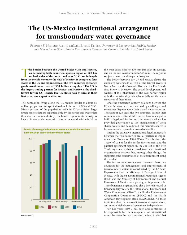
[ ]182
The US-Mexico institutional arrangement for transboundary water governance
Polioptro F. Martinez-Austria and Luis Ernesto Derbez, University of Las Americas Puebla, Mexico; and Maria Elena Giner, Border Environment Cooperation Commission, Mexico-United States
The border between the United States (US) and Mexico, as defined by both countries, spans a region of 100 km on both sides of the border and runs 3,141 km in length
from the Pacific Ocean to the Gulf of Mexico. It comprises four states in the US and six in Mexico. The two countries exchange goods worth more than a US$1 billion every day.1 The US is the largest trading partner for Mexico, and Mexico is the third-largest for the US. Twenty-two US states have Mexico as their first or second export destination.
The population living along the US-Mexico border is about 13 million people, and is expected to double between 2025 and 2030. Ninety per cent of the population reside in 15 ‘twin cities’, large urban centres that are separated only by the border and aware that they share a common destiny. The border region, in its entirety, is located in one of the more arid areas in the world, with rainfall on
the west coast close to 270 mm per year on average, and on the east coast around to 575 mm. The region is subject to severe and frequent droughts.2
The border between the US and Mexico shares the extensive watersheds of two of the largest rivers in North America: the Colorado River and the Rio Grande (Rio Bravo in Mexico). The social development and welfare of the inhabitants of the vast border region of both countries depends substantially on the water resources of these rivers.
Since the nineteenth century, relations between the US and Mexico have been marked by challenges, and sometimes disputes about their shared water resources. Throughout 125 years the two countries, despite their economic and cultural differences, have managed to build a legal and institutional framework which has provided governance to the management of these shared waters, and has allowed this natural resource to be a source of cooperation instead of conflict.
Within the extensive international legal framework between the two countries are, of particular impor-tance, the Treaty of 1944 Water Distribution, the Treaty of La Paz for the Border Environment and the parallel agreement signed in the context of the Free Trade Agreement that created two new binational organizations responsible, among other things, for supporting the conservation of the environment along the border.
The institutional arrangement between these two countries for the management and improvement of transboundary waters is coordinated by the US State Department and the Ministry of Foreign Affairs of Mexico, with the US Environmental Protection Agency (EPA) and the Ministry of Environment and Natural Resources of Mexico also playing an important role. Three binational organizations play a key role related to transboundary waters: the International Boundary and Water Commission (IBWC), the Border Environment Cooperation Commission (BECC) and the North American Development Bank (NADBANK). All these institutions have the status of international organizations, and enjoy a high degree of operational independence.
For 123 years, IBWC has been and continues to be responsible for the management of international waters between the two countries, defined in the 1944
LEGAL FRAMEWORK AT THE NATIONAL/INTERNATIONAL LEVEL
1995 2006 2010 2012
0
20
40
60
80
100
Drinking water Urban drainage Water treatment
Growth of coverage indicators for water and sanitation services in the Mexican border with the United States
Source: BECC
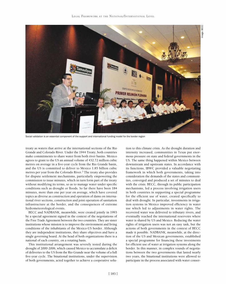
[ ]183
LEGAL FRAMEWORK AT THE NATIONAL/INTERNATIONAL LEVEL
tion to this climate crisis. As the drought duration and intensity increased, communities in Texas put enor-mous pressure on state and federal governments in the US. The same thing happened within Mexico between downstream and upstream states. In accordance with its functions, IBWC provided a valuable negotiating framework in which both governments, taking into consideration the demands of the states and communi-ties, converged and produced a set of minutes to deal with the crisis. BECC, through its public participation mechanisms, led a process involving irrigation users in both countries in supporting a special programme for the efficient use of water, created specifically to deal with drought. In particular, investments in irriga-tion systems in Mexico improved efficiency in water use which led to adjustments in water rights. The recovered water was delivered to tributary rivers, and eventually reached the international reservoirs where water is shared by US and Mexico. Reducing the water rights of irrigation users was not an easy task, but the actions of both governments in the context of BECC made it possible. NADBANK, meanwhile, at the direc-tion of the US and Mexican governments, established a special programme for financing these investments for efficient use of water at irrigation systems along the border. In this manner, in complex rounds of negotia-tions between the two governments that lasted nearly two years, the binational institutions were allowed to participate in the process associated with water conser-
treaty as waters that arrive at the international sections of the Rio Grande and Colorado River. Under the 1944 Treaty, both countries make commitments to share water from both river basins. Mexico agrees to grant to the US an annual volume of 432.72 million cubic metres on average in a five-year cycle from the Rio Grande basin, and the US is committed to deliver to Mexico 1.85 billion cubic metres per year from the Colorado River.3 The treaty also provides for dispute settlement mechanisms, particularly empowering the commission to issue minutes, which in turn form part of the treaty without modifying its terms, so as to manage water under specific conditions such as drought or floods. So far there have been 184 minutes, more than one per year on average, which have covered topics as diverse as construction and operation of dams on interna-tional river sections, construction and joint operation of sanitation infrastructure at the border, and the consequences of extreme hydrometeorological events.
BECC and NADBANK, meanwhile, were created jointly in 1993 by a special agreement signed in the context of the negotiations of the Free Trade Agreement between the two countries. They are sister institutions whose mission is to improve the environment and living conditions of the inhabitants of the Mexico-US border. Although they are independent institutions, they share objectives and have a single governing board. At the head of both organizations there is a national of each country, on a rotating basis.
This institutional arrangement was severely tested during the drought of 2000-2006, which caused Mexico to accumulate a deficit of deliveries to the US from the Rio Grande near the volume of a full five-year cycle. The binational institutions, under the supervision of both governments, acted together to achieve a cooperative solu-
Social validation is an essential component of the support and international funding model for the border region
Imag
e: B
EC
C

[ ]184
LEGAL FRAMEWORK AT THE NATIONAL/INTERNATIONAL LEVEL
vation infrastructure until satisfactory agreements for both countries were reached. Confrontation was avoided and the problem moved from the conflict zone into the area of cooperation. Currently, this institutional arrangement is being tested again by the most severe drought in the past 70 years. Now, the drought affects the entire border region, endangering the almost unique sources of water for the inhabitants of the border region.
One of the greatest achievements of this cooperation scheme has been the border programme of water and sanitation infrastruc-ture, led by the EPA and its counterpart in Mexico, the National Water Commission. The purpose of the programme is to improve the coverage and quality of water services, and therefore health, in the border area. To this end, the EPA established the Border Water Infrastructure Program,4 which in turn funds the Environmental Infrastructure Fund (BEIF) and the Project Development Assistance Program that are managed by NADBANK and BECC respectively to support studies, designs and construction. In a few years, this border infrastructure programme has obtained remarkable results in indica-tors such as coverage of water and sanitation services. Through this programme, the US invested in water and sanitation infrastructure at the border, not only within its country but also within Mexican territory. Mexico, for the projects selected for the BEIF programme, must match the funds invested by the US using federal, state or municipal funding. To access these investments, communities in the border region of both countries must be approved through a project certification process that is completed through BECC, a unique mechanism to obtain the BIEF funds. Once approved, funds are deposited with NADBANK as well as the Mexican matching counterpart. This certification means that the approved projects are
sustainable, technically and financially feasible, with operation and maintenance plans, and are understood and supported by the communities.
This bilateral cooperation scheme is unique in the world, establishing an organization which directly identi-fies the needs of the communities, supports their proposals to meet certification criteria – a body of technical and financial requirements – with a long-term planning perspective and with social validation. At the same time, both governments devote resources to this border region, supporting and funding these projects, mainly channelled by NADBANK. This process also includes the coordina-tion and participation of various levels of the federal, state and municipal governments of both countries along with members of the public and private sectors.
In Mexico, a distinctive component of this scheme has been a successful public participation process indepen-dently conducted by BECC. The process serves not only the technical components of projects, but also meets the specific needs of the communities and addresses their points of view and concerns. This approach has made a huge difference in this type of infrastructure projects in Mexico. Virtually no case of strong opposi-tion during construction of certified projects has been registered, because projects were agreed to in advance by the communities. Instead, the process has made possible the obtaining of public support on controver-sial issues such as the increase of service fees, which has happened in many border cities to ensure sustainable
A successful public participation process in Mexico helps projects to meet the specific needs of communities
Imag
e: B
EC
C
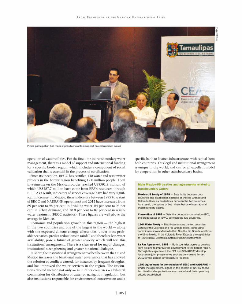
[ ]185
LEGAL FRAMEWORK AT THE NATIONAL/INTERNATIONAL LEVEL
specific bank to finance infrastructure, with capital from both countries. This legal and institutional arrangement is unique in the world, and can be an excellent model for cooperation in other transboundary basins.
operation of water utilities. For the first time in transboundary water management, there is a model of support and international funding for a specific border region, which includes a component of social validation that is essential in the process of certification.
Since its inception, BECC has certified 130 water and wastewater projects in the border region benefiting 12.8 million people. Total investments on the Mexican border reached US$591.9 million, of which US$287.7 million have come from EPA’s resources through BEIF. As a result, indicators of service coverage have had very signif-icant increases. In Mexico, these indicators between 1995 (the start of BECC and NADBANK operations) and 2012 have increased from 89 per cent to 98 per cent in drinking water, 64 per cent to 93 per cent in urban drainage, and 20.8 per cent to 87 per cent in waste-water treatment (BECC statistics). These figures are well above the average in Mexico.
Economic and population growth in this region – the highest in the two countries and one of the largest in the world – along with the expected climate change effects that, under most prob-able scenarios, predict reductions in rainfall and therefore less water availability, pose a future of greater scarcity which will test this institutional arrangement. There is a clear need for major changes, institutional strengthening and greater binational dialogue.
In short, the institutional arrangement reached between the US and Mexico increases the binational water governance that has allowed the solution of conflicts caused, for instance, by frequent droughts, and has improved the water services in the region. The institu-tions created include not only – as in other countries – a bilateral commission for distribution of water or navigation regulation, but also institutions responsible for environmental conservation and a
Main Mexico-US treaties and agreements related to transboundary waters
Mexico-US Treaty of 1848 – Sets limits between both countries and establishes sections of the Rio Grande and Colorado River as borderlines between the two countries. As a result, the basins of both rivers become international transboundary basins.
Convention of 1889 – Sets the boundary commission (IBC), the predecessor of IBWC, between the two countries.
1944 Water Treaty – Distributes among the two countries waters of the Colorado and Rio Grande rivers, introducing commitments from Mexico to the US in the Rio Grande and from the US to Mexico in the Colorado River. Extends the capabilities of IBC to IBWC. Creates a system of dispute settlement.
La Paz Agreement, 1983 – Both countries agree to develop joint actions to improve the environment in the border region. Through this agreement the EPA and SEMARNAT develop long-range joint programmes such as the current Border 2012 or the Border Infrastructure Program.
1993 Agreement for the creation of BECC and NADBANK – Under the agreement, signed in the context of NAFTA, these two binational organizations are created and their operating criteria established.
Public participation has made it possible to obtain support on controversial issues
Imag
e: B
EC
C

VIWater Cooperation, Sustainability and
Poverty Eradication

[ ]188
Managing water: from local wisdom to modern science
Ignasius D. A. Sutapa, Executive Secretary, Asia Pacific Centre for Ecohydrology
The Asia Pacific Centre for Ecohydrology (APCE) is a category II centre of the United Nations Educational, Scientific and Cultural Organization (UNESCO). It
focuses on ecological approaches to water resources manage-ment, to provide sustainable water for the people by harnessing science and technology, education and culture. APCE is commit-ted to contributing towards overcoming current and important issues of national, regional and global interest, such as poverty, climate change adaptation and disaster risk reduction.
Several activities have been planned to help achieve this objective. These activities benefit from the results of past and current research activities conducted by the Indonesian Institute of Sciences (LIPI) and its partners.
APCE has and develops expertise and experience in:• relationships between ecological pattern and hydrological process• disturbance and dynamics in natural and anthropogenic ecology
and hydrology• ecohydrological approaches to biodiversity conservation,
environmental management and ecological restoration
• integrating hydrology with ecological planning, design and architecture
• transdisciplinary studies of regional sustainability from the perspectives of ecohydrology, ecology or both.
Some recent activities are detailed below.
Integrated Flood Analysis System courseThe Asia and Pacific region has various climate char-acteristics that put it at risk from hydrometeorological hazards which are often associated with extreme events. Some countries in the region are vulnerable to floods, and the annual flood losses are too high for any govern-ment to bear.
A technical course was organized based on the frame-work of the Flood Forecasting and Warning System which was conducted in 10 countries (Australia, Cambodia, China, Indonesia, Lao People’s Democratic Republic, Malaysia, the Philippines, the Republic of Korea, Thailand and Vietnam). This Integrated Flood
WATER COOPERATION, SUSTAINABILITY AND POVERTY ERADICATION
One of the constructed wetlands used to improve domestic wastewater treatment
Imag
e: A
PC
E

[ ]189
WATER COOPERATION, SUSTAINABILITY AND POVERTY ERADICATION
expected to transfer knowledge outside the community relatively easily through personal communication.• The pesantren generally covers primary to senior
high school levels of education, and the demo site provides one way to introduce education about water resources in these schools.
• There are about 26,000 pesantren in Indonesia. Although the exact number has not been recorded with certainty, the overall estimated pesantren in the country could empower up to 20 million people. The success of socialization and the campaign for sustainable management of water resources in the school community demo site location will be used as a model for other Islamic communities and, ultimately, the general public.
Pesantren Ar-Risalah in the Kudat district was selected as one of the locations for demo site development. This has been done in 2012 and activity will continue in 2013. The Pesantren Ar-Risalah project involved approximately 2,700 people consisting of boarding students, teachers and support personnel who are mostly local people.
Water resources used to meet the daily needs of the boarders come from groundwater and river water in Cijantung. Groundwater is used by means of arte-sian wells, while the river water goes through simple processing tanks for coagulation, flocculation and filtration. The quality of the river water used needs attention, to make sure it meets quality standards for the allotment of domestic activities such as hygiene and sanitation. Sewage disposal systems in boarding schools are still open, or there is open dumping in the environ-
Analysis System (IFAS) course was realized in collaboration with the International Centre for Water Hazard and Risk Management, the UNESCO Jakarta Office and LIPI. The objective is to enable government agencies to use appropriate software (IFAS) for flood forecasting and warning systems that lead to increasing capacity in managing water resources under climatic variability and related extreme phenomena. The course entails the provision of national digital geographic information system data for the creation of models at the target river basin as well as local hydrological/hydraulic data for run-off analyses and model validation.
Demo site for community-based water managementThe objective of the demo site for ecohydrology development is to act as a field station for the implementation of ecohydrology concepts in the field. The demo site ecohydrology campaign is expected to be significant in socializing the sustainable management of water resources in accordance with the concept of ecohydrology. It will also serve as a natural laboratory for the future development of ecohydrol-ogy, especially as a tropical Indonesian concern. Ecohydrology demo site development in Indonesia will be directed to a location demo site representing the concept of sustainable water resources management in several different groups, namely an ecohydrology demo site for the community-based management of water resources.
Community is an important factor in supporting the sustainable management of water resources. Community groups are expected to be agents of change in an effort commonly referred to as integrated water resources management. In 2012, the ecohydrology demo site for community-based development on water management was estab-lished at community-based public schools.
Pesantren – traditional Islamic boarding schools – are very common in Indonesia. They provide a community that is in a strong position in society, led by a Kiai (a respected Islamic leader). Members of this community are generally role models in society, and can be
Local people studying water management
Imag
e: A
PC
E
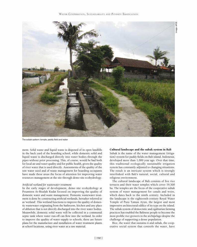
[ ]190
WATER COOPERATION, SUSTAINABILITY AND POVERTY ERADICATION
ment. Solid waste and liquid waste is disposed of in open landfills in the back yard of the boarding school, while domestic solid and liquid waste is discharged directly into water bodies through the pipes without prior processing. This, of course, would be bad both for local air and water quality and for public health, given the quality of river water that is used directly. Assessments of the quality of the raw water used and of waste management for boarding occupants have made these areas the focus of attention for improving water resources management at the site through demo site ecohydrology.
Artificial wetland for wastewater treatmentIn the early stages of development, demo site ecohydrology at Pesantren Ar-Risalah Kudat focused on improving the quality of domestic water and waste management. Domestic wastewater treat-ment is done by constructing artificial wetlands, hereafter referred to as ‘wetland’. This wetland functions to improve the quality of domes-tic wastewater originating from the bathroom, kitchen and any place of ablution that is not directly discharged into the river water bodies. Meanwhile, domestic solid waste will be collected in a communal septic tank where water run-off can flow into the wetland. In order to improve the quality of water supply to schools, there are future plans for the manufacture and installation of water treatment plants at school locations, using river water as a raw material.
Cultural landscape and the subak system in BaliSubak is the name of the water management (irriga-tion) system for paddy fields on Bali island, Indonesia, developed more than 1,000 year ago. Over that time, this traditional ecologically sustainable irrigation system has constantly adjusted to changing situations. The result is an intricate system which is strongly interlinked with Bali’s natural, social, cultural and religious environment.
The cultural landscape of Bali consists of five rice terraces and their water temples which cover 19,500 ha. The temples are the focus of the cooperative subak system of water management for canals and weirs, which dates back to the ninth century. Included in the landscape is the eighteenth-century Royal Water Temple of Pura Taman Ayun, the largest and most impressive architectural edifice of its type on the island. The subak system of democratic and egalitarian farming practices has enabled the Balinese people to become the most prolific rice growers in the archipelago despite the challenge of supporting a dense population.
Rice, the water that sustains it and subak, the coop-erative social system that controls the water, have
The subak system: temple, paddy field and water
Imag
e: A
PC
E

[ ]191
WATER COOPERATION, SUSTAINABILITY AND POVERTY ERADICATION
IPAG60: alternative technology for clean water in peatland areasIndonesia’s attention to the issue of environmen-tal damage is increasingly intensifying. One cause of the worsening environmental conditions is the management of natural resources that either cannot be renewed or that are renewable but have exceeded their capacity. Environmental sustainability and ecosystem levels have not been maintained and the parties involved – in this case, the private and state enterprises, governments and communities – need to develop good cooperation and synergy for sustainable environmental management.
If the quality of the social life of the community in question is good enough, then its ability to support environmental conservation programmes will be better. Regional development in buffer zones and transition areas should be done to create economic activities that benefit the community in the region in order to preserve and protect the core area. Activities undertaken include the development and application of appropriate technologies that can meet the basic needs of communities around the reserve, including water supply and other economic resources. Economic development implementation programmes in buffer zones and transition areas are expected to balance the interests of conservation with the economic interests of the development of biosphere reserves.
The majority of areas in Riau Province and Central Kalimantan Province have land with peat surface water, which characteristically has:• low pH levels (2-4), making it highly acidic• high levels of organic matter• high levels of iron and manganese• yellow or dark brown colour.
This kind of surface water is basically not suitable as raw water for drinking. Compared with freshwa-ter surface water, the water from the turf needs to be processed specifically through several additional stages. Improving the efficiency of water treatment plants requires a review of potential issues that may arise in every phase of the water treatment process. Meanwhile, the first phase of the IPAG60 research activity aims to conduct field observations in order to determine the location of IPAG and to learn about the readiness and willingness of local communities to adopt appropriate technologies that will be implemented.
Peat water treatment technology that has been estab-lished in previous studies (2009-2011), by Ignasius D.A. Sutapa and team enables peat areas to have peat water treatment facilities for the drinking water supply. During the implementation and testing of the water treatment facility, this is limited to the area of Katingan, Central Kalimantan province. However, a lot of territory in some areas in Indonesia – especially Sumatra and Kalimantan – have clean water source issues. Implementation of this technology in the wider area is necessary to support the increase in water services in the region.
together shaped the landscape over the past thousand years and are an integral part of religious life. Rice is seen as the gift of God, and the subak system is part of temple culture. Water from springs and canals flows through the temples and out onto the rice paddy fields. Water temples are the focus of cooperative water resource management by a group of subaks. Since the eleventh century the water temple networks have managed the ecology of rice terraces at the scale of whole watersheds. They provide a unique response to the challenge of supporting a dense population on a rugged volcanic island.
In total, Bali has about 1,200 water collectives, and between 50 and 400 farmers manage the water supply from one source of water. The property consists of five sites that exemplify the interconnected natural, religious and cultural components of the traditional subak system – where the subak system is still fully functioning, where farmers still grow traditional Balinese rice without the aid of fertilis-ers or pesticides, and where the landscapes overall are seen to have sacred connotations.
The subak is a mixture of different units: • Technologically, it includes a dam and an intricate system of
collectively owned irrigation canals• Physically, it comprises all rice terraces within clearly
defined subak boundaries. These boundaries are defined by all rice fields which receive irrigation water from the subak irrigation infrastructure
• Socially, it consists of all farmers who cultivate land within the subak boundaries and receive water from the subak irrigation infrastructure
• Religiously, it includes ceremonies on individual, subak and inter-subak levels. The ceremonies are linked to a hierarchical order of water temples which play an important role in the coordination of irrigation water and pest management.1
Clean water produced by local people using IPAG60
Imag
e: A
PC
E
[ ]192
Water for life: inspiring action and promoting best practices in local cooperation
Josefina Maestu and Pilar Gonzalez-Meyaui, United Nations Office to Support the International Decade for Action ‘Water for Life’ 2005-2015/UN-Water Decade Programme on Advocacy and Communication
To achieve water security and sustainability, concerted efforts must be made to promote water cooperation not only in transboundary river basins and at river basin
scale, but also at local scale, including between irrigation districts and cities. Cooperation is necessary to deal with major issues such as the upstream and downstream impacts of water pollution and water abstraction.
The United Nations Office to Support the International Decade for Action ‘Water for Life’ 2005-2015/UN-Water Decade Programme on Advocacy and Communication has supported the International Year of Water Cooperation through UN-Water’s Water for Life Award and the International Annual UN-Water Zaragoza Conference. In 2013 both these events aimed to promote best practices and the recogni-tion of outstanding projects and programmes in water cooperation.
The award is open to projects or programmes achieving particularly effective results in the field of water management or in raising awareness on water issues. The International Annual
UN-Water Zaragoza Conference of 2013 identified the tools and approaches to promote water coopera-tion by sharing lessons from recent experiences. The conference introduced the key skills required for water cooperation, with particular attention to their importance in the process of negotiation and media-tion and examples of their application in national and international water settings.
Local cooperationThe importance of local cooperation was highlighted at the Annual Zaragoza Conference in 2013. It was recognized that at the local level, coping with the growing needs of water and sanitation services in cities is one of the most pressing issues of this century. Sustainable, efficient and equitable urban water management has never been as important as it is today. Half of humanity now lives in cities and in two decades three out of five inhabitants of the planet will be urban dwellers. This urban growth is faster in the developing world and it creates unprecedented challenges. The relationship between water and cities is crucial. Cities require a very large input of fresh water and in turn have a huge impact on freshwater systems.
Cities have proved to be sources of innovation in water management, creating new models for water and sani-tation service delivery and financing. High demand for better services and pressures on scarce resources can drive innovation and improvements or lead to real hardships and environmental damage. The pressures are especially acute in the peri-urban periphery where governance defi-cits are frequent. Stakeholder engagement and public participation are key to the coordination of various actors and interests in cities.1 Many problems can only be solved by ensuring collaboration among different stakeholders. Urban water management faces some terrible problems, but it is possible to facilitate improvements in horizon-tal and vertical cooperation at global, national, city and community/local platform levels.
Award-winning projects of the 2013 Water for Life Award have also focused on water cooperation. They have shown how reaching out to others beyond munici-pal boundaries and engaging stakeholders to overcome obstacles can be powerful in solving problems and ensuring a sustainable future.
WATER COOPERATION, SUSTAINABILITY AND POVERTY ERADICATION
Stakeholder cooperation in Zaragoza
Stakeholder cooperation in Zaragoza has been built through seven initiatives:• saving 1 Hm3 in domestic water consumption in one year in Zaragoza
(mainly focused on habit changes)• training the city: 50 good practices (technological changes)• 160,000 public commitments to water saving• solving water conflicts through social mediation• a scream for water as a human right: the Pavilion for Citizen Initiatives, El
Faro• ZINNAE, urban cluster for water efficiency• a water alliance for Central America: Water Nexus.
A number of lessons have been learned from these experiences. For example, it is necessary to invest time and resources in order to build trust among the actors participating in these multi-sector projects. Identifying a collective and shared challenge and ensuring that objectives are simple, concrete and achievable is crucial to success. Objectives also need to be attractive to the general public.
‘Triple therapy’ (new public regulation, civic awareness/active citizens and responsible market instruments) requires a cooperative environment between three main actors: public administrations, NGOs and business entities. It is important to create a motivational core of entities committed to the project, and the role of the facilitator is crucial in translating cultures, integrating different approaches, mediating between partners with conflicting views and managing the egos of partners and other involved entities. It is also important to identify an active minority that can become a network of allies for change. In addition to all these elements, patience is essential to build up the revolution we need in water management.3
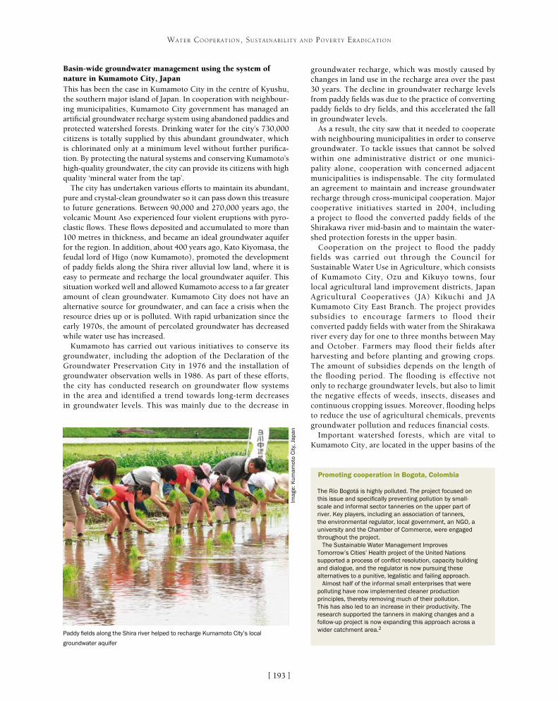
[ ]193
WATER COOPERATION, SUSTAINABILITY AND POVERTY ERADICATION
groundwater recharge, which was mostly caused by changes in land use in the recharge area over the past 30 years. The decline in groundwater recharge levels from paddy fields was due to the practice of converting paddy fields to dry fields, and this accelerated the fall in groundwater levels.
As a result, the city saw that it needed to cooperate with neighbouring municipalities in order to conserve groundwater. To tackle issues that cannot be solved within one administrative district or one munici-pality alone, cooperation with concerned adjacent municipalities is indispensable. The city formulated an agreement to maintain and increase groundwater recharge through cross-municipal cooperation. Major cooperative initiatives started in 2004, including a project to flood the converted paddy fields of the Shirakawa river mid-basin and to maintain the water-shed protection forests in the upper basin.
Cooperation on the project to flood the paddy fields was carried out through the Council for Sustainable Water Use in Agriculture, which consists of Kumamoto City, Ozu and Kikuyo towns, four local agricultural land improvement districts, Japan Agricultural Cooperatives (JA) Kikuchi and JA Kumamoto City East Branch. The project provides subsidies to encourage farmers to flood their converted paddy fields with water from the Shirakawa river every day for one to three months between May and October. Farmers may flood their fields after harvesting and before planting and growing crops. The amount of subsidies depends on the length of the flooding period. The flooding is effective not only to recharge groundwater levels, but also to limit the negative effects of weeds, insects, diseases and continuous cropping issues. Moreover, flooding helps to reduce the use of agricultural chemicals, prevents groundwater pollution and reduces financial costs.
Important watershed forests, which are vital to Kumamoto City, are located in the upper basins of the
Basin-wide groundwater management using the system of nature in Kumamoto City, JapanThis has been the case in Kumamoto City in the centre of Kyushu, the southern major island of Japan. In cooperation with neighbour-ing municipalities, Kumamoto City government has managed an artificial groundwater recharge system using abandoned paddies and protected watershed forests. Drinking water for the city’s 730,000 citizens is totally supplied by this abundant groundwater, which is chlorinated only at a minimum level without further purifica-tion. By protecting the natural systems and conserving Kumamoto’s high-quality groundwater, the city can provide its citizens with high quality ‘mineral water from the tap’.
The city has undertaken various efforts to maintain its abundant, pure and crystal-clean groundwater so it can pass down this treasure to future generations. Between 90,000 and 270,000 years ago, the volcanic Mount Aso experienced four violent eruptions with pyro-clastic flows. These flows deposited and accumulated to more than 100 metres in thickness, and became an ideal groundwater aquifer for the region. In addition, about 400 years ago, Kato Kiyomasa, the feudal lord of Higo (now Kumamoto), promoted the development of paddy fields along the Shira river alluvial low land, where it is easy to permeate and recharge the local groundwater aquifer. This situation worked well and allowed Kumamoto access to a far greater amount of clean groundwater. Kumamoto City does not have an alternative source for groundwater, and can face a crisis when the resource dries up or is polluted. With rapid urbanization since the early 1970s, the amount of percolated groundwater has decreased while water use has increased.
Kumamoto has carried out various initiatives to conserve its groundwater, including the adoption of the Declaration of the Groundwater Preservation City in 1976 and the installation of groundwater observation wells in 1986. As part of these efforts, the city has conducted research on groundwater flow systems in the area and identified a trend towards long-term decreases in groundwater levels. This was mainly due to the decrease in
Promoting cooperation in Bogota, Colombia
The Río Bogotá is highly polluted. The project focused on this issue and specifically preventing pollution by small-scale and informal sector tanneries on the upper part of river. Key players, including an association of tanners, the environmental regulator, local government, an NGO, a university and the Chamber of Commerce, were engaged throughout the project.
The Sustainable Water Management Improves Tomorrow’s Cities’ Health project of the United Nations supported a process of conflict resolution, capacity building and dialogue, and the regulator is now pursuing these alternatives to a punitive, legalistic and failing approach.
Almost half of the informal small enterprises that were polluting have now implemented cleaner production principles, thereby removing much of their pollution. This has also led to an increase in their productivity. The research supported the tanners in making changes and a follow-up project is now expanding this approach across a wider catchment area.2Paddy fields along the Shira river helped to recharge Kumamoto City’s local
groundwater aquifer
Imag
e: K
umam
oto
City
, Jap
an
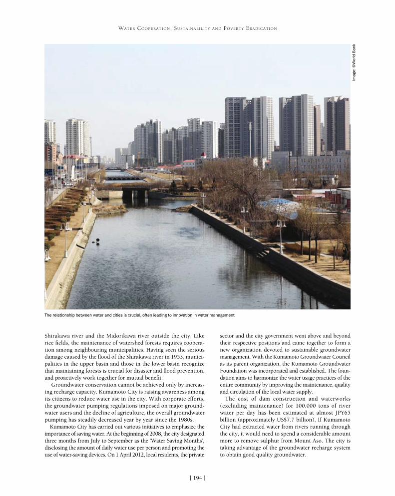
[ ]194
WATER COOPERATION, SUSTAINABILITY AND POVERTY ERADICATION
Shirakawa river and the Midorikawa river outside the city. Like rice fields, the maintenance of watershed forests requires coopera-tion among neighbouring municipalities. Having seen the serious damage caused by the flood of the Shirakawa river in 1953, munici-palities in the upper basin and those in the lower basin recognize that maintaining forests is crucial for disaster and flood prevention, and proactively work together for mutual benefit.
Groundwater conservation cannot be achieved only by increas-ing recharge capacity. Kumamoto City is raising awareness among its citizens to reduce water use in the city. With corporate efforts, the groundwater pumping regulations imposed on major ground-water users and the decline of agriculture, the overall groundwater pumping has steadily decreased year by year since the 1980s.
Kumamoto City has carried out various initiatives to emphasize the importance of saving water. At the beginning of 2008, the city designated three months from July to September as the ‘Water Saving Months’, disclosing the amount of daily water use per person and promoting the use of water-saving devices. On 1 April 2012, local residents, the private
sector and the city government went above and beyond their respective positions and came together to form a new organization devoted to sustainable groundwater management. With the Kumamoto Groundwater Council as its parent organization, the Kumamoto Groundwater Foundation was incorporated and established. The foun-dation aims to harmonize the water usage practices of the entire community by improving the maintenance, quality and circulation of the local water supply.
The cost of dam construction and waterworks (excluding maintenance) for 100,000 tons of river water per day has been estimated at almost JPY65 billion (approximately US$7.7 billion). If Kumamoto City had extracted water from rivers running through the city, it would need to spend a considerable amount more to remove sulphur from Mount Aso. The city is taking advantage of the groundwater recharge system to obtain good quality groundwater.
The relationship between water and cities is crucial, often leading to innovation in water management
Imag
e: ©
Wor
ld B
ank

improve the situation in rural Moldova by mobiliz-ing citizens and authorities to realize and respect the right to access safe water and sanitation through the sustainable management of local resources. Such imple-mentations included maintaining clean water sources to improve human health, which helps to maintain the environmental integrity of aquatic ecosystems.
The main strategy for achieving these objectives was to promote the participatory practice of includ-ing the local population in educational (workshops, training) and practical activities (testing and mapping the wells, identifying sources of pollution, cleaning), and demonstrating solutions (such as Ecosan toilets) for effective and affordable water protection in rural areas. In each community a village committee was established which included the mayor, the school director, one or two teachers, one or two parents, and children’s representatives involved in a water safety plan (WSP). The village committee was responsible for project activities, implementation and commu-nication with the village inhabitants and the local NGO partner.
The water quality measures were shown on maps which were available in the village halls, and people can now avoid the most polluted sources of water. The activities had a visible impact on the community’s behaviour: no more solid waste is dumped near the public or private wells. Spring cleaning of wells is once again a tradition in the communities where awareness was raised during the project. The number of leaflets distributed, wells tested, and meetings and workshops held, have all superseded the original planned numbers and now serve as parts of a toolbox for the people of the Republic of Moldova.
Public participation was a determinant factor in the success of the project. Another factor was the authori-ties’ support and participation. The initiative involved local, regional and national authorities in all the activi-ties and found that their support motivated public participation. In this particular project, the importance of involving authorities in the activities was crucial for achieving the project objectives and ensuring sustain-ability. Developing activities with national authorities at all levels was a way to guarantee that activities were both coherent with the local community’s needs and sustainable after the project was finished.
Public institutions, the regional council and the teaching inspectorate supported project activities, and their regional representatives were present in the communities during the core activities. This strat-egy was sent to the ministries of environment and health and some of the proposals were integrated in the national strategy for water protection: the WSPs were recognized by the national authorities as an effective tool in water protection at community scale and are recommended by national authorities to be implemented in rural communities in order to protect water resources by identifying risks and reducing sources of pollution.
The Safe Water and Sanitation for all in Moldova InitiativeThe Republic of Moldova, with a total population of 3.56 million people, is one the poorest countries in Europe, with a gross domestic product (GDP) of US$7 billion. According to World Bank data in 2005, only 4 per cent of the rural population had a sewerage connec-tion and only 55 per cent of the total population had access to basic sanitation (a pit latrine with a lid). However, even having access to a house connection did not mean having access to safe water. Indeed, the Moldovan National Environmental Action Plan calcu-lated the social and economic impact of water pollution and reached the conclusion that polluted drinking water (rural and urban) led to between 950 and 1,850 premature deaths and 2-4 million sick days annually. The cost to the economy was assessed to be 5-10 per cent of GDP. According to Moldova’s Ministry of Health, poor water quality is responsible for 25 per cent of acute diarrhoeal diseases, hepatitis A, and 15 per cent of non-infectious diseases registered in the republic. The most widespread diseases caused by the consump-tion of poor quality water are chronic nitrate intoxication, dental fluorosis and gastrointestinal diseases.
Rural citizens in the Republic of Moldova rely on small-scale water supply systems or shallow wells which can be contaminated with microorganisms and nitrates. In rural Moldavian communities, severe nitrate contamination of wells is common and animal and human excreta are the main sources of contamination. Illegal waste dumping, of which 45-50 per cent is animal waste, often leads to surface water pollution and unsightly areas.
The Safe Water and Sanitation for all in Moldova initiative was started by non-governmental organization (NGO) Ormax to
Protecting natural systems can help ensure a high-quality water supply
Imag
e: O
rmax
AC
T
WATER COOPERATION, SUSTAINABILITY AND POVERTY ERADICATION
195

[ ]196
International water cooperation Kitty van der Heijden, Ambassador, Sustainable Development and Director,
Department for Climate, Energy, Environment and Water, Ministry of Foreign Affairs, The Netherlands
L ook at poverty, one of the persistent disgraces of our time, and you will see water. Still today, 1.1 billion people lack access to clean, safe drinking water, using less than
5 litres (1.5 gallons) per day, and over 2.5 billion people are living without adequate sanitation. Lack of safe water and adequate sanitation is the world’s single largest cause of illness, and 5,000 children die every day from diseases from tainted drinking water.1 Sub-Saharan Africa has the largest number of water-stressed countries of any region. Growing out of poverty requires increases in food, manufacturing and energy – all of which in turn depend heavily on sound water management.
But water scarcity isn’t just poverty related. In 2008, the tanker Sichem Defender arrived at the port of Barcelona carrying something far more precious than its usual cargo of chemicals.2 The nearly 23 million litres of drinking water – enough for 180,000 people for a day – was the first delivery in an unprecedented emergency plan to help Spain, suffering its worst drought since records began 60 years ago. After months without adequate rainfall its reservoirs were down to just over a quarter of normal capacity. A year ago they stood at almost double that.
The above is a grim reminder of what a world without water can look like – and how a lack of water destroys ecosystems, causes economic distress and aggravates poverty. The water that exists today on Earth is roughly the same as the water present at the time dinosaurs roamed the Earth, though its form and location have shifted constantly across the global hydrologic cycle. Yet pressures on water resources are mounting. And as pressing as water issues are now, they will become even more important in the near future. Experts predict that by 2025, less than 15 years from now, nearly two thirds of the world’s popula-tion will experience some form of water stress. With the existing climate change scenario, some estimates suggest that by 2030 demand for water could be 40 per cent greater than current sustainable supplies. Nearly half the world’s population will live in severely water stressed areas, to the point at which a lack of water will impede and even reverse social and economic develop-ment. Fragile states in northern Africa and the Middle East are most likely to experience water shortages, but China and India are also vulnerable.3
About 70 per cent of the water used in develop-ing countries goes to agriculture. Without proper soil management, watershed management, and integrated management of water supply and demand, sufficient clean water will not be available to meet the needs of people, agriculture and ecosystems. Water with-drawal by the energy sector is expected to rise by one fifth through 2035, while the amount consumed (not returned directly to the environment) increases by a more dramatic 85 per cent.4 Higher rates of urbani-zation will increase demand for drinking water and industrial use with consequent higher waste disposal and treatment, also requiring greater energy use. Collection of used water, separation of polluted water from less polluted waters, and prevention and management of wastewater pollution including treatment of used water, are becoming increasingly important to protect populations and ecosystems as well as to facilitate economic development. In the face of the growing demands on finite water resources, it will become necessary to consider wastewater as an additional resource.
Adapting to climate change is largely about water. More frequent and heavier rainfall will flush more pollutants into water systems, for example due to over-
WATER COOPERATION, SUSTAINABILITY AND POVERTY ERADICATION
A sand dam in East Ethiopia which creates enough groundwater to supply the
nomadic population and its cattle with safe water the whole year through
Imag
e: P
aul v
an K
oppe
n
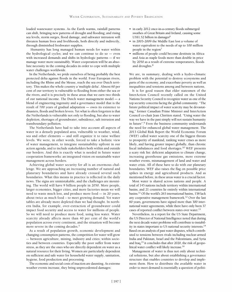
[ ]197
WATER COOPERATION, SUSTAINABILITY AND POVERTY ERADICATION
• in early 2012 once-in-a-century floods submerged swathes of Great Britain and Ireland, causing some US$1.52 billion in damages6
• in 2003-2009 the Middle East lost a volume of water equivalent to the needs of up to 100 million people in the region7
• millions of people could become destitute in Africa and Asia as staple foods more than double in price by 2050 as a result of extreme temperatures, floods and droughts.8
We are, in summary, dealing with a hydro-climatic problem with the potential to destroy ecosystems and parts of the economy, and exacerbate poverty as well as inequalities and tensions among and between nations.
It is for good reason that elder statesmen of the InterAction Council recently called on the United Nations Security Council to recognize water as one of the top security concerns facing the global community. “The future political impact of water scarcity may be devastat-ing,” former Canadian Prime Minister and InterAction Council co-chair Jean Chrétien stated. “Using water the way we have in the past simply will not sustain humanity in future”.9 Even the business community understands the need for enhanced global water management. The 2013 Global Risk Report the World Economic Forum (WEF) called water scarcity one of the biggest threats to prosperity of mankind, ranking water crises as more likely, and having greater impact globally, than chronic fiscal imbalances and food shortages.10 WEF presents a scary risk list: deficient adaptation to climate change, increasing greenhouse gas emissions, more extreme weather events, mismanagement of land and water and water crisis. All of these have to do with our planetary boundaries. WEF also raises the flag on possible price spikes in energy and agricultural products. And as mentioned before, in these areas water is a crucial factor.
Most water is shared across nations and people. A total of 145 nations include territory within international basins, and 21 countries lie entirely within international basins.11 Of the world’s 263 international basins, 158 lack any cooperative management framework.12 Over the last 60 years, governments have signed more than 300 inter-national water agreements, while there have only been 37 cases of reported conflict between states over water.13
Nevertheless, in a report for the US State Department, the US Director of National Intelligence noted that during the next decade water problems will contribute to instabil-ity in states important to US national security interests.14 Based on an analysis of past water disputes, which contrib-uted to tensions between rivals including nuclear-armed India and Pakistan, Israel and the Palestinians, and Syria and Iraq,15 it concludes that after 2020, the risk of geopo-litical water conflict will likely increase.16
Management of water is thus not only about techni-cal solutions, but also about establishing a governance structure that enables countries to develop and imple-ment them. How to distribute the available water in order to meet demand is essentially a question of politi-
loaded wastewater systems. As the Earth warms, rainfall patterns can shift, bringing new patterns of drought and flooding; and rising sea levels, storm surges, flood damage, and saltwater intrusion will threaten human lives and livelihoods, both directly and indirectly, through diminished freshwater supplies.
Humanity has long managed human needs for water within the hydrological cycles; and we can continue to do so – even with increased demands and shifts in hydrologic patterns – if we manage water more sustainably. Water cooperation will be an abso-lute necessity in the coming decades in order to cope with multiple water challenges worldwide.
In the Netherlands, we pride ourselves of being probably the best protected delta against floods in the world. Four European rivers, including the Rhine and the Meuse, reach the sea over Dutch terri-tory. This makes the whole country a ‘multiple delta’. Almost 60 per cent of our territory is vulnerable to flooding from either the sea or the rivers, and it is precisely in these areas that we earn two thirds of our national income. The Dutch water management model – a blend of engineering ingenuity and a governance model that is the result of 700 years of gradual adaptation – owes its existence to disasters, floods and broken levees. Yet what is often forgotten is that the Netherlands is vulnerable not only to flooding, but also to water depletion, shortages of groundwater, subsidence, salt intrusion and transboundary pollution.
The Netherlands have had to take into account all aspects of water in a densely populated area, vulnerable to weather, wind, sea and other elements – and still organize it to raise welfare levels. We were, in other words, forced to take a holistic view of water management, to integrate sustainability upfront in our action agenda, and to include stakeholders both within and outside our borders. And this is exactly what is needed in future water cooperation frameworks: an integrated vision on sustainable water management across borders.
Achieving global water security for all is an enormous chal-lenge. We are approaching an increasing number of natural and planetary boundaries and have already crossed several such boundaries. What this means in practice is reflected in the daily news. The signs are unmistakable, and the challenges are mount-ing. The world will have 9 billion people in 2050. More people, larger economies, bigger cities, and more factories mean we will need to waste much less, and produce more food – in 20 years, about twice as much food – to meet growing demand. Yet water tables are already more depleted than we had thought. In north-ern India, for example, over-extraction of groundwater could impact food security and access to water for millions of people. So we will need to produce more food, using less water. Water scarcity already affects more than 40 per cent of the world’s population across every continent, and the situation will become more severe in the coming decades.5
As a result of population growth, economic development and changing consumption patterns, the competition for water will grow – between agriculture, mining, industry and cities; within socie-ties and between countries. Especially the poor suffer from water stress, as they are the ones who are directly dependent on water as a natural resource for their living. Women are particularly dependent on sufficient and safe water for household water supply, sanitation, hygiene, food production and processing.
The economic and social costs of inaction are daunting. As extreme weather events increase, they bring unprecedented damages:
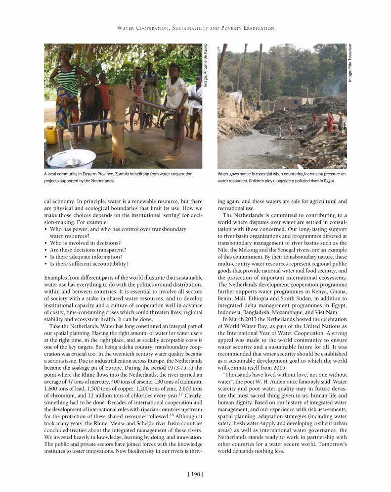
[ ]198
WATER COOPERATION, SUSTAINABILITY AND POVERTY ERADICATION
cal economy. In principle, water is a renewable resource, but there are physical and ecological boundaries that limit its use. How we make those choices depends on the institutional ‘setting’ for deci-sion-making. For example:• Who has power, and who has control over transboundary
water resources?• Who is involved in decisions?• Are these decisions transparent?• Is there adequate information?• Is there sufficient accountability?
Examples from different parts of the world illustrate that sustainable water use has everything to do with the politics around distribution, within and between countries. It is essential to involve all sectors of society with a stake in shared water resources, and to develop institutional capacity and a culture of cooperation well in advance of costly, time-consuming crises which could threaten lives, regional stability and ecosystem health. It can be done.
Take the Netherlands. Water has long constituted an integral part of our spatial planning. Having the right amount of water for water users at the right time, in the right place, and at socially acceptable costs is one of the key targets. But being a delta country, transboundary coop-eration was crucial too. In the twentieth century water quality became a serious issue. Due to industrialization across Europe, the Netherlands became the soakage pit of Europe. During the period 1973-75, at the point where the Rhine flows into the Netherlands, the river carried an average of 47 tons of mercury, 400 tons of arsenic, 130 tons of cadmium, 1,600 tons of lead, 1,500 tons of copper, 1,200 tons of zinc, 2,600 tons of chromium, and 12 million tons of chlorides every year.17 Clearly, something had to be done. Decades of international cooperation and the development of international rules with riparian countries upstream for the protection of these shared resources followed.18 Although it took many years, the Rhine, Meuse and Schelde river basin countries concluded treaties about the integrated management of these rivers. We invested heavily in knowledge, learning by doing, and innovation. The public and private sectors have joined forces with the knowledge institutes to foster innovations. Now biodiversity in our rivers is thriv-
ing again, and these waters are safe for agricultural and recreational use.
The Netherlands is committed to contributing to a world where disputes over water are settled in consul-tation with those concerned. Our long-lasting support to river basin organizations and programmes directed at transboundary management of river basins such as the Nile, the Mekong and the Senegal rivers, are an example of this commitment. By their transboundary nature, these multi-country water resources represent regional public goods that provide national water and food security, and the protection of important international ecosystems. The Netherlands development cooperation programme further supports water programmes in Kenya, Ghana, Benin, Mali, Ethiopia and South Sudan, in addition to integrated delta management programmes in Egypt, Indonesia, Bangladesh, Mozambique, and Viet Nam.
In March 2013 the Netherlands hosted the celebration of World Water Day, as part of the United Nations as the International Year of Water Cooperation. A strong appeal was made to the world community to ensure water security and a sustainable future for all. It was recommended that water security should be established as a sustainable development goal to which the world will commit itself from 2015.
“Thousands have lived without love, not one without water”, the poet W. H. Auden once famously said. Water scarcity and poor water quality may in future devas-tate the most sacred thing given to us: human life and human dignity. Based on our history of integrated water management, and our experience with risk assessments, spatial planning, adaptation strategies (including water safety, fresh water supply and developing resilient urban areas) as well as international water governance, the Netherlands stands ready to work in partnership with other countries for a water secure world. Tomorrow’s world demands nothing less.
A local community in Eastern Province, Zambia benefitting from water cooperation
projects supported by the Netherlands
Water governance is essential when countering increasing pressure on
water resources. Children play alongside a polluted river in Egypt
Imag
e: R
ita T
esse
laar
Imag
e: A
nton
ie d
e K
emp
[ ]199
Cooperating to manage liquid waste in the Okavango Delta Ramsar Site
Michael Ramaano, Project Manager, Global Water Partnership Botswana Secretariat; Nkobi Mpho Moleele, Project Manager, Okavango Research Institute
The Okavango Delta, in Botswana, is one of the world’s largest inland water systems and was placed on the Ramsar list of wetlands of international importance
in 1997. While the ecological integrity of this wetland is still largely intact, there are signs that anthropogenic pressures endanger this. For instance, as the population grows and urbanizes, risks associated with the disposal of liquid waste and transport of hazardous substances, such as petrol and diesel, are of increasing concern.
The Okavango Delta Ramsar Site covers nearly one tenth of Botswana and is the heart of the country’s tourism industry, hosting many camps and facilities for visitors to the wetlands. For the Okavango to continue supporting its inhabitants, its unique biodiversity and the tourist industry, which accounts for 12 per cent of Botswana’s gross domestic product, activities within the Delta must protect the environment from harm.
The Okavango Delta is a diverse, complex ecosystem with a wide range of resources and users, governed by many institutions under numerous national laws, policies and guidelines, regional and inter-national conventions, agreements and protocols. Pollution is a major potential threat. Of the various rules and regulations on waste disposal and hazardous substances, none specifically address the issues of managing liquid waste, or transporting, handling and storing danger-ous substances in the Okavango. There was, therefore, a need for a set of guidelines to be created, tailored to the special requirements of the Okavango Delta Ramsar Site. Such guidelines could guide communities and tourist operations within the Delta in preventing pollution. The biggest challenge in developing these kinds of guide-lines, however, is getting buy-in from those interested or affected.
Since its establishment in 1996, the Global Water Partnership (GWP), an international network of organizations working on water-related issues, has spearheaded cooperation initiatives to bring together individuals, communities, institutions and govern-ments to tackle complex challenges related to water resources management, sanitation and pollution across the globe. GWP provides a neutral space for stakeholders to share ideas and solve problems. The partnership is also a channel for coopera-tion. GWP fosters the exchange of knowledge and skills between communities and countries, helping them to adapt and implement successful water management solutions to maximize economic and social welfare without compromising the sustainability of environmental systems. The GWP network has 13 Regional Water Partnerships, 84 Country Water Partnerships and 2,770 partner organizations in 167 countries.
Very aware that liquid waste could lead to consider-able pollution in the Okavango, GWP Botswana grasped a window of opportunity offered by the Integrated Water Resource Management – Water Efficiency Project, and Building Local Capacity for the Sustainable Use and Conservation of Biodiversity in the Okavango Delta (Biokavango) Project. Both of these projects are spon-sored by the Global Environment Fund, United Nations Development Programme and the Government of Botswana to foster the cooperation needed to tackle the potential problem.
As a first step, the partners set out to map the magnitude of the problem and the various stakehold-ers. With an understanding of who was involved and their concerns, the next step was to bring stakeholders together to find acceptable solutions, which they would be likely to take on board.
Stakeholders included officials from the Department of Waste Management and Pollution Control, Department of Water Affairs, Department of Environmental Affairs, Department of Wildlife and National Parks, North West District Council, Tawana Land Board and the Department of Tourism. Each of these government bodies has regulations covering various aspects of water or pollution. Private sector stakeholders, such as tourist guides and companies that operate tourist facilities and transport hazardous substances within the Delta, have a commercial inter-est. Non-governmental organizations such as Sankuyo Tshwaragano Management Trust, Khwai Development Trust, Mababe Conservation Trust, Okavango Polers Trust and Kalahari Conservation Society represent civil society concerns. Parastatal institutions such as the Botswana Tourism Organisation and Botswana Meat Commission are concerned with economic development. Local and regional development projects active in the Delta, such as the United States Agency for International Development-sponsored Southern African Regional Environment Programme, are inter-ested in both social and economic development. The Okavango Research Institute, a wing of the University of Botswana, is a centre for the study and conservation of wetland ecosystems. Each of these various groups has a stake in managing liquid waste and dangerous substances to protect the Okavango from pollution.
WATER COOPERATION, SUSTAINABILITY AND POVERTY ERADICATION

[ ]200
WATER COOPERATION, SUSTAINABILITY AND POVERTY ERADICATION
the Okavango – as different eco-environments need different approaches to wastewater treatment – and recommended that requirements for managing liquid waste should become stricter from dry land to wetland. In open fresh water and perennial swamps, there should be no discharge of liquid waste at all.
The guidelines also took account of the enormous variation in the amounts of liquid waste produced and treated, ranging from large volumes by council waste-water treatment plants, schools, hospitals, commerce and hotels, to small volumes by lodges and camps, camp sites, mobile operators, rural communities and private homes. The different set ups vary in the volume of waste they generate and each requires different guidelines. The guidelines considered site conditions, expected wastewater generation rates, desirable effluent quality, construction costs and maintenance requirements – everything from selecting sites for treatment plants to developing, operating and decommissioning them. Sophisticated liquid waste treatment facilities would need to be serviced and maintained by skilled staff and would create difficulties in small isolated communities. In these cases, low-maintenance septic tank soak-away systems could be more reliable. Powered sludge systems would not be suitable for off-grid areas or where solar electricity would be too costly to install.
As well as the need to manage liquid waste, there is a need to manage the storage and movement of
Open and inclusive discussions arranged by GWP Botswana as part of the two projects allowed these different parties to voice their concerns and explore ways of keeping the risk of pollution to a minimum. Representatives of the tourist industry, for example, explained that their difficulties in dealing with liquid waste lay in operating in remote areas, the plethora of different institutions they had to deal with and unfamiliarity with some of the technical issues in treating liquid waste.
The outcome of the discussions was agreement that it would be useful to produce a set of guidelines for managing liquid waste in the Okavango Delta Ramsar Site. Following up on this, the Integrated Water Resource Management-Water Efficiency Project, GWP Botswana and Biokavango Project approached the North West District Council, Department of Water Affairs and the Department of Waste Management and Pollution Control with a proposal to develop such a set of guidelines. The guidelines would be a step towards safeguarding water quality and the environment by mini-mizing contamination from inadequately treated sewage and other liquid waste.
A Botswana consultancy Ecosurv was tasked with developing the guidelines. In drawing up the guidelines, the consultants ensured they conformed to national standards and international obligations. The Okavango Delta Management Plan Waste Management Strategy and a 2008 Biokavango Project Report assessing liquid waste systems in tourism establishments and transport, and handling and storage of hazardous substances in the Okavango Delta, provided a solid foundation for Ecosurv to develop recommendations for the guidelines. The guidelines considered the main ecotypes in
The Okavango Delta Ramsar Site in Botswana is being protected from the risk of pollution
Imag
e: C
laud
ia U
ribe
/Pho
todi
sc/G
etty
Imag
es
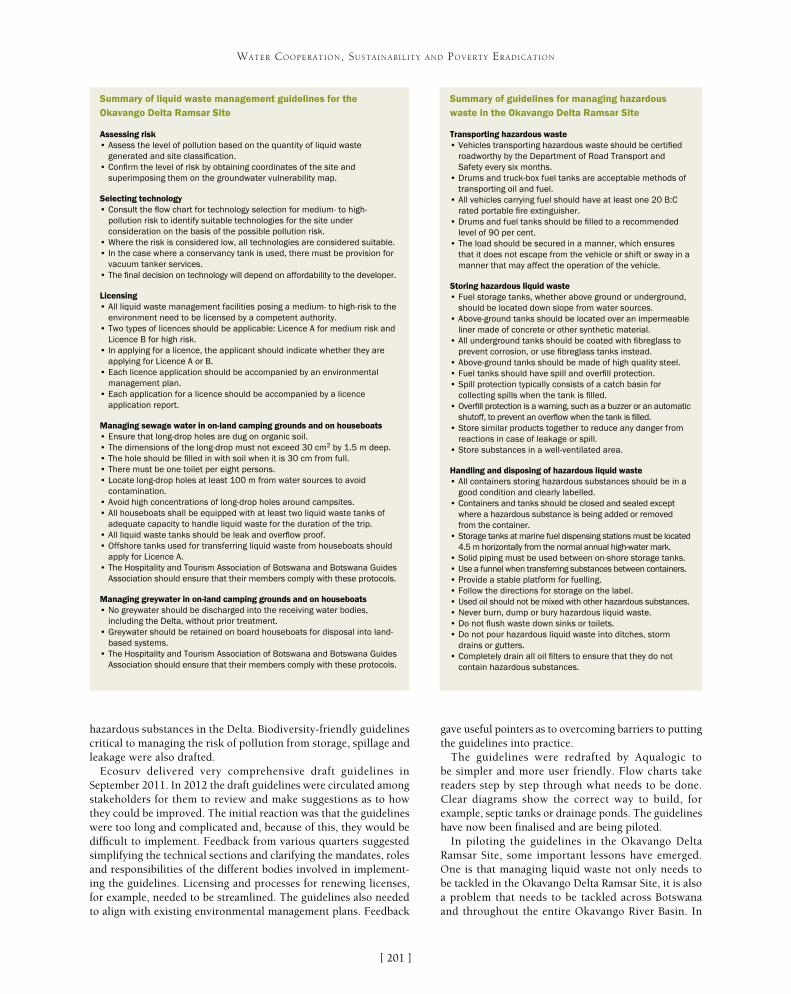
[ ]201
WATER COOPERATION, SUSTAINABILITY AND POVERTY ERADICATION
hazardous substances in the Delta. Biodiversity-friendly guidelines critical to managing the risk of pollution from storage, spillage and leakage were also drafted.
Ecosurv delivered very comprehensive draft guidelines in September 2011. In 2012 the draft guidelines were circulated among stakeholders for them to review and make suggestions as to how they could be improved. The initial reaction was that the guidelines were too long and complicated and, because of this, they would be difficult to implement. Feedback from various quarters suggested simplifying the technical sections and clarifying the mandates, roles and responsibilities of the different bodies involved in implement-ing the guidelines. Licensing and processes for renewing licenses, for example, needed to be streamlined. The guidelines also needed to align with existing environmental management plans. Feedback
gave useful pointers as to overcoming barriers to putting the guidelines into practice.
The guidelines were redrafted by Aqualogic to be simpler and more user friendly. Flow charts take readers step by step through what needs to be done. Clear diagrams show the correct way to build, for example, septic tanks or drainage ponds. The guidelines have now been finalised and are being piloted.
In piloting the guidelines in the Okavango Delta Ramsar Site, some important lessons have emerged. One is that managing liquid waste not only needs to be tackled in the Okavango Delta Ramsar Site, it is also a problem that needs to be tackled across Botswana and throughout the entire Okavango River Basin. In
Summary of liquid waste management guidelines for the Okavango Delta Ramsar Site
Summary of guidelines for managing hazardous waste in the Okavango Delta Ramsar Site
Assessing risk• Assess the level of pollution based on the quantity of liquid waste
generated and site classification.• Confirm the level of risk by obtaining coordinates of the site and
superimposing them on the groundwater vulnerability map.
Selecting technology• Consult the flow chart for technology selection for medium- to high-
pollution risk to identify suitable technologies for the site under consideration on the basis of the possible pollution risk.
• Where the risk is considered low, all technologies are considered suitable.• In the case where a conservancy tank is used, there must be provision for
vacuum tanker services.• The final decision on technology will depend on affordability to the developer.
Licensing• All liquid waste management facilities posing a medium- to high-risk to the
environment need to be licensed by a competent authority.• Two types of licences should be applicable: Licence A for medium risk and
Licence B for high risk.• In applying for a licence, the applicant should indicate whether they are
applying for Licence A or B. • Each licence application should be accompanied by an environmental
management plan. • Each application for a licence should be accompanied by a licence
application report.
Managing sewage water in on-land camping grounds and on houseboats• Ensure that long-drop holes are dug on organic soil.• The dimensions of the long-drop must not exceed 30 cm2 by 1.5 m deep.• The hole should be filled in with soil when it is 30 cm from full.• There must be one toilet per eight persons.• Locate long-drop holes at least 100 m from water sources to avoid
contamination.• Avoid high concentrations of long-drop holes around campsites.• All houseboats shall be equipped with at least two liquid waste tanks of
adequate capacity to handle liquid waste for the duration of the trip.• All liquid waste tanks should be leak and overflow proof.• Offshore tanks used for transferring liquid waste from houseboats should
apply for Licence A.• The Hospitality and Tourism Association of Botswana and Botswana Guides
Association should ensure that their members comply with these protocols.
Managing greywater in on-land camping grounds and on houseboats• No greywater should be discharged into the receiving water bodies,
including the Delta, without prior treatment.• Greywater should be retained on board houseboats for disposal into land-
based systems.• The Hospitality and Tourism Association of Botswana and Botswana Guides
Association should ensure that their members comply with these protocols.
Transporting hazardous waste• Vehicles transporting hazardous waste should be certified
roadworthy by the Department of Road Transport and Safety every six months.
• Drums and truck-box fuel tanks are acceptable methods of transporting oil and fuel.
• All vehicles carrying fuel should have at least one 20 B:C rated portable fire extinguisher.
• Drums and fuel tanks should be filled to a recommended level of 90 per cent.
• The load should be secured in a manner, which ensures that it does not escape from the vehicle or shift or sway in a manner that may affect the operation of the vehicle.
Storing hazardous liquid waste• Fuel storage tanks, whether above ground or underground,
should be located down slope from water sources.• Above-ground tanks should be located over an impermeable
liner made of concrete or other synthetic material.• All underground tanks should be coated with fibreglass to
prevent corrosion, or use fibreglass tanks instead.• Above-ground tanks should be made of high quality steel.• Fuel tanks should have spill and overfill protection.• Spill protection typically consists of a catch basin for
collecting spills when the tank is filled.• Overfill protection is a warning, such as a buzzer or an automatic
shutoff, to prevent an overflow when the tank is filled.• Store similar products together to reduce any danger from
reactions in case of leakage or spill.• Store substances in a well-ventilated area.
Handling and disposing of hazardous liquid waste• All containers storing hazardous substances should be in a
good condition and clearly labelled.• Containers and tanks should be closed and sealed except
where a hazardous substance is being added or removed from the container.
• Storage tanks at marine fuel dispensing stations must be located 4.5 m horizontally from the normal annual high-water mark.
• Solid piping must be used between on-shore storage tanks.• Use a funnel when transferring substances between containers.• Provide a stable platform for fuelling.• Follow the directions for storage on the label.• Used oil should not be mixed with other hazardous substances.• Never burn, dump or bury hazardous liquid waste.• Do not flush waste down sinks or toilets.• Do not pour hazardous liquid waste into ditches, storm
drains or gutters.• Completely drain all oil filters to ensure that they do not
contain hazardous substances.
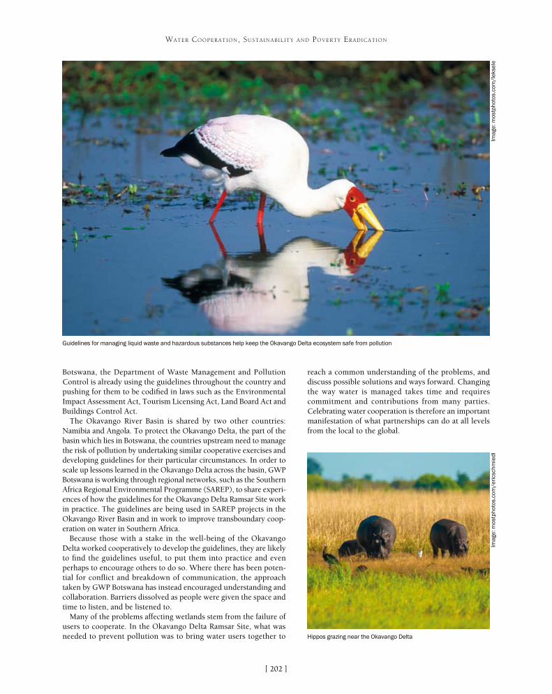
[ ]202
WATER COOPERATION, SUSTAINABILITY AND POVERTY ERADICATION
Botswana, the Department of Waste Management and Pollution Control is already using the guidelines throughout the country and pushing for them to be codified in laws such as the Environmental Impact Assessment Act, Tourism Licensing Act, Land Board Act and Buildings Control Act.
The Okavango River Basin is shared by two other countries: Namibia and Angola. To protect the Okavango Delta, the part of the basin which lies in Botswana, the countries upstream need to manage the risk of pollution by undertaking similar cooperative exercises and developing guidelines for their particular circumstances. In order to scale up lessons learned in the Okavango Delta across the basin, GWP Botswana is working through regional networks, such as the Southern Africa Regional Environmental Programme (SAREP), to share experi-ences of how the guidelines for the Okavango Delta Ramsar Site work in practice. The guidelines are being used in SAREP projects in the Okavango River Basin and in work to improve transboundary coop-eration on water in Southern Africa.
Because those with a stake in the well-being of the Okavango Delta worked cooperatively to develop the guidelines, they are likely to find the guidelines useful, to put them into practice and even perhaps to encourage others to do so. Where there has been poten-tial for conflict and breakdown of communication, the approach taken by GWP Botswana has instead encouraged understanding and collaboration. Barriers dissolved as people were given the space and time to listen, and be listened to.
Many of the problems affecting wetlands stem from the failure of users to cooperate. In the Okavango Delta Ramsar Site, what was needed to prevent pollution was to bring water users together to
reach a common understanding of the problems, and discuss possible solutions and ways forward. Changing the way water is managed takes time and requires commitment and contributions from many parties. Celebrating water cooperation is therefore an important manifestation of what partnerships can do at all levels from the local to the global.
Guidelines for managing liquid waste and hazardous substances help keep the Okavango Delta ecosystem safe from pollution
Imag
e: m
ostp
hoto
s.co
m/l
ekse
leIm
age:
mos
tpho
tos.
com
/eri
csch
mie
dl
Hippos grazing near the Okavango Delta
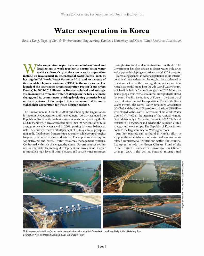
[ ]203
Water cooperation in KoreaBoosik Kang, Dept. of Civil & Environmental Engineering, Dankook University and Korea Water Resources Association
Water cooperation requires a series of international and local actors to work together to secure better water services. Korea’s practices on water cooperation
include its involvement in international water events, such as hosting the 7th World Water Forum in 2015, and an increase of its official development assistance (ODA) in the water sector. The launch of the Four Major Rivers Restoration Project (Four Rivers Project) in 2009-2012 illustrates Korea’s technical and strategic vision on how to overcome water challenges in the face of climate change, and its commitment to aiding developing countries based on its experience of the project. Korea is committed to multi-stakeholder cooperation for water decision-making.
The Environmental Outlook to 2050 published by the Organisation for Economic Cooperation and Development (OECD) evaluated the Republic of Korea as the highest water-stressed country among the 34 OECD members. Korea abstracted more than 40 per cent of its total average renewable water yield in 2009, putting its water balance at risk. The country receives 60-70 per cent of its total annual precipita-tion in the flood season from June to September, while severe droughts frequently occur in spring and winter. These phenomena require sophisticated and careful water resources management systems. Confronted with such challenges, the Korean Government has contin-ued to undertake technology development and investment in order to provide a high level of water services and secure water resources
through structural and non-structural methods. The Government has also striven to foster water industries and support developing countries through ODA projects.
Korea’s engagement in water cooperation at the interna-tional level has a rather short history, but has accelerated in recent years. One of the most significant achievements is Korea’s successful bid to host the 7th World Water Forum, which will be held in Daegu-Gyeongbuk in 2015. More than 30,000 people from over 200 countries are expected to attend the event. The five institutions of Korea – the Ministry of Land, Infrastructure and Transportation, K-water, the Korea Water Forum, the Korea Water Resources Association (KWRA) and the Global Green Growth Institute (GGGI) – were elected to the Board of Governors of the World Water Council (WWC) at the meeting of the United Nations General Assembly in Marseilles, France in 2012. The board consists of 36 members and advises the council’s overall strategy and work scope. The Republic of Korea is now home to the largest number of WWC governors.
Another example can be found in Korea’s effort to support the establishment of water and environment-related international institutions within the country. Examples include the Green Climate Fund of the United Nations Framework Convention on Climate Change; GGGI; the United Nations International
WATER COOPERATION, SUSTAINABILITY AND POVERTY ERADICATION
Multipurpose weirs in Korea’s four major rivers, clockwise from top left: Yeoju Weir, Han River; Chilgok Weir, Nakdong River;
Seungchon Weir, Youngsan River; and Buyeo Weir, Geum River
Imag
es: M
inis
try
of L
and,
Infr
astr
uctu
re a
nd T
rans
port

[ ]204
WATER COOPERATION, SUSTAINABILITY AND POVERTY ERADICATION
prevention, water and sanitation projects and agricultural water security in South-East Asia, dam construction for agricultural water supply, and the construction and reno-vation of irrigation canals in Central and South America. Korea is investing a significant amount in research and development in the water sector to transfer advanced technologies, management know-how and institutional frameworks to developing countries.
The noticeable economic growth of APEC, the politi-cal stability of the Commonwealth of Independent States and the rapid growth of Chinese capital markets have improved the political and economic status of surrounding countries. Therefore, it is essential to promote long-term international water cooperation in order to maximize the national benefit by exchanging experiences and tech-nologies among countries facing increasing need for the planning, construction, operation and management of water infrastructure. Despite the volatile political status between North and South Korea, there is also undeniably a new era of cooperation, with an increasing need for infra-
Strategy for Disaster Reduction North-East Asian Office; the Asia-Pacific Economic Cooperation (APEC) Climate Center; and the International Water Association’s North-East Asia Office.
Korea received about US$12.7 billion of foreign aid between 1945 and 1999, but paid off all the loans to the World Bank in 1995. Since then, it has become a donor country. This unprecedented transforma-tion from aid recipient to donor country culminated in Korea’s joining the OECD Development Assistance Committee in 2009. Korea has continued to show its commitment to socioeconomic development as well as environmental protection in various fields such as water resources management, environmental protection, poverty eradication, public health improvement, help for refugees and support for women’s development. Relevant programmes and projects have been conducted by the Korea International Cooperation Agency (KOICA). Even though Korean ODA was estimated as 0.12 per cent of gross national income (GNI) in 2012, which is less than that of Japan and the United States, the country has pledged to double its ODA budget until 2015.
With regard to Korea’s ODA towards the water sector, relevant programmes promote various water projects for developing countries in a variety of fields, including drinking water development in Africa, flood
Period
1993-4
2000-2
1996-7
1997
2006-7
2004-6
1994-6
2002-4
2004-5
2006-8
1997-9
1995-6
2006
2007-8
2006-7
2007-9
2006-8
2004-6
2005-7
Budget (US$ million)
0.73
0.63
0.18
0.36
0.80
1.52
0.79
1.37
0.74
1.49
0.20
0.80
0.25
1.75
0.37
2.42
1.50
0.70
6.00
Grant
Detailed design of hydropower plant in River Modi, Nepal
Detailed design of Chamelia Hydropower Plant, Nepal
Feasibility study of Tadsalen Hydropower, Laos
Levee construction in River Mekong, Laos
Levee restoration and water park, Vientiane, Laos
Feasibility study and detailed design of Karian Multipurpose Dam, Indonesia
Watershed survey of River Bunha; Feasibility study of Maiyeker Dam, China
Restoration of multipurpose reservoirs, Cambodia
Water resources development in the Krang Ponley Basin, Cambodia
Integrated water resources development planning, Cambodia
Construction of Muana Small Hydropower Plant
Potable water development, Ethiopia
Borena well development, Ethiopia
Potable water development in Kiltheaurello, Tigria, Ethiopia
Well development and maintenance, Kenya
Assembo water purification plant, Kenya
Potable water development, Tanzania
Feasibility study of portable water development and water supply systems, Peri
Modernization of water supply and sewage system, Iraq
Primary grants awarded by KOICA
Source: KOICA

[ ]205
WATER COOPERATION, SUSTAINABILITY AND POVERTY ERADICATION
structure in Unified Korea. In addition, the socioeconomic growth of South Korea has led to increasing needs for water resources and sani-tary facilities. Since 1999, when South Korea became a donor country, opportunities for international water cooperation have increased.
In 1991, KOICA was established to set up a grant for developing and underdeveloped countries. International water cooperation in Korea can be divided into direct and indirect cooperation. Direct cooperation is divided into a grant and a concessional loan. The grant is managed by KOICA and the loan is managed by the Export-Import Bank of Korea. Indirect cooperation is managed by the Ministry of Foreign Affairs and the Ministry of Strategy and Finance. The number of primary grants is rapidly increasing today.
In addition, the International Hydrological Programme (IHP) of the United Nations started with the support of the Ministry of Construction and Transport in 1997, and is now in its seventh phase entitled ‘Water Dependencies: Systems under Stress and Societal Responses’. South Korea has been listed on the IHP National Committee since 2002, and was re-elected in 2010. It is now an executive member of the Asia-Pacific region (Group IV) along with Japan, the Philippines, Malaysia, Pakistan, Iran and North Korea. In 2003, South Korea also joined the Network of Asian River Basin Organizations, which helps water resources-related organizations and government agencies such as river basin organizations in developing countries to promote technological exchange programmes on water resources operation and management.
In Thailand, the National Water Resources and Flood Policy Committee (NWRFPC), led by the Prime Minister, was established in 2012. Since the great flood in 2001, NWRFPC has been working on the integrated water resources management of 25 rivers in Thailand including the Chao Phraya River, in which a number of Korean organizations are involved. Moreover, the experience of the Four Rivers Project in Korea triggered international technical exchange programmes among other countries such as Morocco and Paraguay.
In order to facilitate transboundary water cooperation in the Mekong River Basin, GGGI and KWRA have been working together since 2012 on the Green Growth Framework for Water Resources Management in the Mekong River Basin project. The overall objective of the project is to enhance the capacity of the riparian countries (Cambodia, Lao
People’s Democratic Republic, Thailand and Viet Nam) and the Mekong River Commission Secretariat to imple-ment the green growth policy framework in relation to water resources development at the national and basin levels. The project is expected to establish an appropriate water and green growth framework model that can be applied to transboundary water basins at the global level.
It is worth taking a closer look at the most significant water project, the Four Rivers Project in Korea. The project aims to restore the ecological functions of the four major rivers, which have been degraded and disturbed by anthropogenic activities, especially during the period of industrialization since the 1960s. It is regarded as a useful reference for developing countries. The project has been evaluated as good practice in the OECD Environmental Outlook to 2050, which praised it as a comprehensive approach to managing water resources in rivers and achiev-ing green growth through water. The Four Rivers Project is a multipurpose water project to achieve water security and prevent water-related natural disasters such as floods and droughts that often take place owing to climate change.
The Four Rivers Project provides a total solution for river restoration. Its five key objectives are to:• implement comprehensive flood control• secure a sufficient amount of water resources
against potential water scarcity• improve water quality and restore the ecosystems in
and around the rivers• create multifunctional areas for local residents• prepare for further revitalization of the river
systems by local authorities in the future.
The project will renew and rehabilitate a total 929 km of the four rivers. Subsequent projects, which will be admin-istered by local governments, will restore more than 10,000 km of local streams and 39 riparian wetlands. The total budget for the project is estimated at US$ 19.2 billion.
Flood control
Water security
Water quality improvement
Ecological restoration
Waterfront development
Measures
Dredging: 450 million m3
Detentions: 5 places Reinforcing dilapidated levees: 784 km
Movable weirs: 16Dams: 2Elevating agricultural reservoir banks: 96
Sewage treatment facilities: 1,281 Total-phosphorus treatment facilities: 233
Ecological wetlands: 11.8 million m2
Fish-ways: 33 sites
Bicycle paths: 1,757 kmTourist attraction sites: 36
Effects
Lowering flood water levels (2-4 m)
Secure 1.3 billion m3 of water
Swimmable water 76% - 86%
Improve natural ecology & promote eco-tourism
Better quality of life
The Four Rivers Project: measures and effects
Source: MLTM, 2009

Case study: the Four Rivers Project
[ ]206
WATER COOPERATION, SUSTAINABILITY AND POVERTY ERADICATION
it was a sound social learning process in which the state, civil society, experts and ordinary citizens understood different parties’ interests and concerns. The experience also implies an establishment of democratic decision-making in which stakeholders became more accustomed to reaching a consensus through persuasion and discus-sion. More importantly, this exercise had culminated in the creation of the centre-local network for water coop-eration, and central government officials began to have a good understanding of local water issues.
Korea’s contribution to the promotion of water coop-eration at the international level has gradually increased, and this trend will continue. There is growing recogni-tion within the country that it is time for Korea to commit itself to aiding the international community, particularly developing countries, in supporting socioeconomic devel-opment and environmental sustainability. Institutional and technical experiences in sustainable water manage-ment in Korea will pave the way for developing countries to emulate management practices for their own long-term economic, societal and environmental development.
Flood hazard mitigation is a prime objective for the project. Climate change has triggered record highs in torrential rainfall and large-scale typhoons in recent years. For example, in 2011 more than 1,800 mm of annual precipitation was recorded in Korea, which usually receives an average annual precipitation of around 1,240 mm. Thanks to the project, flood water levels under the heavy summer storms were reduced by 1.31 m on average and 4.45 m at the maximum. An extraordinary flood event like the one in 2011 could occur at any time due to climate change. The outcomes of the Four Rivers Project will continue to be monitored and evaluated in the future.
Rivers are the arteries of a nation and the foundation for soci-oeconomic development. The Four Rivers Project will be able to incorporate the overall enhancement of water supply, flood preven-tion, water quality and ecosystems into culture, tourism and history at the local level to buttress local economies with an emphasis on each riparian characteristic. The project provides an example of how green initiatives can revive the environment, economy and society.
In spite of the global economic downturn beginning in 2008, Korea has invested 2 per cent of gross domestic product every year in the green sector from 2009 to 2013, and has allocated US$19.2 billion to the Four Rivers Project in order to promote economic growth and advanced water management. In response to the growing interest of developing countries in emulating Korean water management practices, the Korean Government has been in contact with Algeria and Thailand to help resolve complex water challenges based on experience of the project.
In a national context, one of the recent policy efforts to facilitate water cooperation in Korea was the revision of the Korea Water Vision (2000-2010) in 2006. This case delineates the extent to which water cooperation between the Government and civil society can create demo-cratic decision-making mechanisms based on governance. The vision was first established in 1999 in accordance with the River Law, but had been heavily criticized by non-state actors, particularly environ-mental non-governmental organizations (NGOs), for its undemocratic decision-making process. As a result, environmental NGOs and other social groups refused to accept the statistics and figures in the vision, particularly in terms of the level of water scarcity the country might face in a decade. They were concerned that such data might legitimize the Government’s conventional approach to resolving water supply issues by augmenting more dams in the future regardless of the dams’ detri-mental impacts on overall ecosystems.
Faced with such criticism, the central Government decided to invite diverse stakeholders at both central and local levels and began establish-ing water cooperation mechanisms based on consensus building through multi-stakeholder dialogue. In 2003, initiated by the Government, the Water Supply Preparation Committee was set up, comprising relevant ministries, research institutions and groups from civil society, and the Korea Water Vision Committee was also created in May 2004.
It was emphasized that the new system should encourage all the rele-vant stakeholders to take an active part not only in exchanging their views and opinions, but also in the early stage of planning. For instance, the expert subcommittee appointed a chairperson who convened meet-ings. All the stakeholders were given related data and information on water supply and explored options based on thorough analyses and evaluations. Such practices effectively reflected important principles of water cooperation based on governance – namely multi-stakeholder participation, transparency and information sharing – and entailed the removal of distrust between the state and civil society.
Some 45 subcommittee meetings took place in two years. The process of decision-making was painstaking and time consuming, but
Imag
es: M
inis
try
of L
and,
Infr
astr
uctu
re a
nd T
rans
port
Before restoration (top): the Nakdong River’s narrow width
means the the upper reaches suffer from droughts while
the lower reaches are prone to floods.
After restoration (bottom): the Four Rivers Project will
begin at the Nakdong River, revitalizing cities and creating
a world-class tourism belt

[ ]207
Water expertise and cooperation: Hungary’s international policy
Dr Gábor Baranyai, Chair of Organizing Committee, Budapest Water Summit, and Deputy State Secretary, EU Sectoral Policies, Ministry of Foreign Affairs, Hungary
Hungarians’ special relationship with water must flow from the particular geographical features of the country. Hungary is a landlocked country lying in the middle
of one of the world’s largest closed topographical units: the Carpathian Basin. The Alpine ranges surrounding Hungary discharge water through 24 watercourses into the predominantly flat country, but water leaves only through three major rivers: the River Danube and two of its tributaries, the rivers Tisza and Dráva. As a result, one quarter of the country is exposed to floods, which is exceptional in Europe. However, this abundance of water is counterbalanced by the relatively dry continental climate of the basin. Thus, floods and droughts may follow each other with a frequency unknown in other parts of the world.
Hungary is also rich in groundwater resources. The huge unpol-luted underground reserves along the Danube, north and south of
the capital city of Budapest, provide affordable drink-ing water for almost 3 million people. The region’s abundant thermal water resources have also been exploited since Roman times. Alone in Budapest, over 68 million litres of water bubble into 118 springs and boreholes every day. The ‘city of spas’ offers an astounding array of baths, from the Ottoman hamam to neo-baroque bathing palaces.
As a result of its outstanding exposure to diverse hydrological challenges, Hungary has historically developed significant expertise in water manage-ment. To safeguard its water resources, the country has introduced a stringent legal regime and a solid institutional framework in water and sanitation management. Centuries of tradition in this area have been supported by a solid academic, educational and
WATER COOPERATION, SUSTAINABILITY AND POVERTY ERADICATION
The Carpathian Basin
Source: Somlyódy, 2002
Hungary’s geography has created a special relationship with water
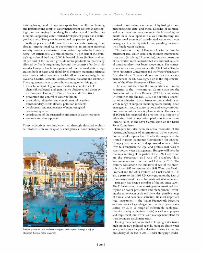
[ ]208
WATER COOPERATION, SUSTAINABILITY AND POVERTY ERADICATION
control, monitoring, exchange of hydrological and meteorological data, and more. Decades of technical and expert-level cooperation under the bilateral agree-ments have developed into a well-functioning and professional system of coordinated water resources management, a prerequisite for safeguarding the coun-try’s fragile water balance.
The entire territory of Hungary lies in the Danube catchment area, which is not only the most international river basin (involving 19 countries), but also boasts one of the world’s most sophisticated institutional systems of transboundary river basin cooperation. The corner-stones of such cooperation are the 1994 Sofia Danube River Protection Convention and the Water Framework Directive of the EU (even those countries that are not members of the EU have signed up to the implementa-tion of the Water Framework Directive).
The main interface for the cooperation of Danube countries is the International Commission for the Protection of the River Danube (ICPDR), comprising 14 countries and the EU. ICPDR is not only a coordi-nation mechanism; it also issues recommendations on a wide range of subjects including water quality, flood management, nature conservation and energy produc-tion, and monitors their implementation. The success of ICPDR has inspired the creation of a number of other river basin cooperation platforms in south-east Europe, such as the Sava Commission or the Drina River Committee.
Hungary has also been an active promoter of the institutionalization of international water coopera-tion at pan-European level. Under the auspices of the United Nations Economic Commission for Europe, Hungary has launched and sponsored several initia-tives to strengthen the legal and professional basis of cross-border water management. Hungary will host the triannual meeting of the parties of the 1992 Convention on the Protection and Use of Transboundary Watercourses and International Lakes in 2015. The country was among the initiators of two of the proto-cols of the 1992 convention: the 1999 Water and Health Protocol and the 2003 Protocol on Civil Liability. It is also a party to the 1997 UN Convention on the Law of Non-navigational Uses of International Watercourses.
Hungary has been a member of the EU since 2004. The EU maintains the most stringent international legal regime on water protection and management, cover-ing the entire water cycle and the widest possible range of human and economic activities. Its most important legal instrument – the Water Framework Directive – introduces a legal obligation to achieve ‘good water status’ by 2015 (a range of measurable ecological, chemical and quantitative criteria) as well as to prepare and implement joint river basin management plans for transboundary catchment areas.
Having remained committed to keeping water issues high on the EU’s political agenda, Hungary chose water as a priority area for political action during its rotating presidency of the EU in 2011. Under Hungary’s leader-
training background. Hungarian experts have excelled in planning and implementing complex water management systems in develop-ing countries ranging from Mongolia to Algeria, and from Brazil to Ethiopia. Supporting water-related development projects is a distin-guished area of Hungary’s international cooperation policy.
With 96 per cent of the country’s surface water arriving from abroad, international water cooperation is an eminent national security, economic and nature conservation imperative for Hungary. Some 700 settlements, 2.5 million people, 40 per cent of the coun-try’s agricultural land and 2,000 industrial plants (indirectly about 30 per cent of the nation’s gross domestic product) are potentially affected by floods originating beyond the country’s borders. No wonder Hungary has been a pioneer of international water coop-eration both at basin and global level. Hungary maintains bilateral water cooperation agreements with all of its seven neighbours (Austria, Croatia, Romania, Serbia, Slovakia, Slovenia and Ukraine). These agreements aim to contribute, among other things, to:• the achievement of ‘good water status’ (a complex set of
chemical, ecological and quantitative objectives laid down by the European Union (EU) Water Framework Directive)
• prevention and control of water pollution• prevention, mitigation and containment of negative
transboundary effects (floods, pollution incidents)• development and maintenance of monitoring and
evaluation systems• coordination of the sustainable utilization of water resources• research and development.
These objectives are implemented through detailed techni-cal protocols on water quality emergencies, flood management
Széchenyi thermal bath and swimming pool in Budapest: the region enjoys
abundant thermal water resources
Imag
e: H
unga
rian
Inve
stm
ent
and
Trad
e A
genc
y

[ ]209
WATER COOPERATION, SUSTAINABILITY AND POVERTY ERADICATION
ship the EU’s environment and international development ministers adopted conclusions highlighting the challenges, objectives and means of the union’s internal and external water-related activities. Ministers also renewed their commitment to the EU Water Initiative, the flagship European international development policy tool in the field of water and sanitation.
Hungary plays a central role in the implementation of the EU’s comprehensive development strategy for the entire region: the Danube Region Strategy, adopted by the union’s leader during the Hungarian presidency in June 2011. It is a macroregional strategy of 14 EU, accession and neighbourhood countries situated in the basin and sub-basins of the Danube River. Its main priorities are socioeconomic development; the improvement of competitiveness; environmental management and resource efficiency; security; and the modernization of transport corridors. These are implemented through priority areas and concrete actions. Hungary acts as priority area coor-dinator for two important, water-related topics of the Danube Region Strategy: water quality and the management of environmental risks.
Understanding that transboundary river basins have great poten-tial for cooperation irrespective of how geographically distant they are from each other, Hungary organized the first Asia-Europe Meeting Sustainable Development Seminar on the Role of Water in Sustainable Regional Development Strategies in June 2012. The seminar used the showcase of the Danube Region Strategy and the Greater Mekong Subregion as a basis for future cooperation and comprehensive interaction among regional development strategies. At the seminar, great emphasis was placed on sustainable water management and the role of water in other development-related
issues, as well as on possible interregional cooperation and experience sharing between the macroregions of the Danube and Mekong river valleys.
Naturally, Hungary does not see water as an isolated subject, but as an integral part of global sustain-able development policy. Thus in the run-up to the 2012 United Nations Conference on Sustainable Development (Rio+20) Hungary, as a steering commit-tee member of the Friends of Water Group in New York, took an active role in promoting water in the pre-conference political discussions. The group has organized thematic discussions prior to the Rio+20 conference, with the goal of bringing added value to formal sustainable development deliberations through pragmatic and results-oriented presentations. As co-chair of the United Nations General Assembly Open Working Group on Sustainable Development Goals (SDGs), Hungary remains a driver of the elabo-ration of a water-related SDG. To that end the country has organized the 2013 Budapest Water Summit, a key international gathering aiming to shape the content of a stand-alone SDG on water.
Against this background, it is only natural that water-related projects have been at the core of Hungarian international development assistance for decades. Between 1975 and 1990 experts of the former Water Resources Management Centre (VIKÖZ, later VGI), together with Mongolian partners, prepared the Water
The Danube catchment area
The 19 countries of the Danube catchment area have a sophisticated transboundary river basin cooperation system
Source: INTERACT Programme

[ ]210
WATER COOPERATION, SUSTAINABILITY AND POVERTY ERADICATION
the construction of the River Moulouya and Rabat region irrigation systems. Since the 1980s Hungarian consultants VIZITERV and MÉLYÉPTERV have taken part in differ-ent irrigation projects in Algeria and Tunisia (irrigation of palm groves), Yemen (Tihama and Taiz projects), Sudan (Djebel Marra project) and Iran (Gorgan Valley).
Recent water related development projects implemented by Hungarian Government assistance include the creation of a water management and irrigation system in the Kobo Girana valley in Ethiopia as well as training for local experts in the framework of development cooperation. Hungary also contributed to the establishment of a sanitation centre providing basic hygienic facilities and clean water in one of the slum areas of Mombasa in Kenya. Hungarian water experts developed the framework for the Herlen river basin in Mongolia and are helping to develop a complex strategy for the water management of the Eastern Mongolian drain-age basin to mitigate the effects of climate change.
Education and capacity building are of critical impor-tance for the ability to apply new technologies aimed at efficient use of resources. Therefore, Hungary intends to take a leading role in disseminating knowledge about sustainable water use and increase consciousness of water at all levels. Hungary supports multilateral efforts to promote education on water related issues, particularly sanitation. Hungary is ready to offer capacity building trainings, and share knowledge in the field of sustainable water resource management.
Management Master Plan of Mongolia and the regional master plans for the following basins:• Mongolian Great Lakes• River Khovd• River Dzabhan• River Kherlen (Kerulen)• Ongijn• Taats • Baidrag rivers.
The Mongolian parliament appraised this activity as the ‘Project of the Century’ many years after the Hungarian experts had finished their projects and the Hungarian-Mongolian Water Management Cooperation Agreement was renewed in 2008. Hungarian experts have executed master plans in Tanzania, Nigeria and Morocco, where they also managed reservoir construction. Experts have similarly served as high-level advisers in Algeria and Kuwait. By 1980, Hungarian hydrolo-gists and engineers had assisted Mongolia in solving water problems on the steppe. Hungarian engineers and hydrologists trained and worked closely with Mongolian young professionals. By 1970, 225 new wells had been drilled to a depth of 100-200 metres. In connection with water prospecting, the experts executed geophysical exploration on an area of 21,000 km2. In the 1970s Hungarian experts provided help in Viet Nam and in Mongolia, installing MA-200 type irrigation equipment (about 150 pumping plants across Mongolia, and in the Ba Vi irrigation system in Viet Nam). They provided training and services for maintaining the installed irrigation capacities. In Morocco, in the frame of international, technical and scientific cooperation, Hungarian experts were involved in
Hungary’s water pioneers
Pál Vásárhelyi (1795-1846) elaborated, among others, the plans of the Iron Gate (Vaskapu) on the River Danube regulation and the River Tisza regulation. By 1846 he had prepared a comprehensive regulation concept currently known as Vásárhelyi’s Tisza Regulation Plan.
As an engineer of hydraulics, the name of Emil Mosonyi (1910-2009) is connected to dams and hydropower plants around the world. He was honorary professor at a number of universities and a member of various science academies. The University of Auckland in New Zealand established the Mosonyi Prize to honour his work in the field of sustainable hydropower development.
In the second half of the nineteenth century, Vilmos Zsigmondy (1821-1888) drilled a well in Budapest (City Park). The well, which was 970 metres deep and had a capacity of 2,200 litres per hour at 74oC, was the second largest in Europe at that time and was considered something of a sensation.
Imag
es: T
he H
unga
rian
Wat
er a
nd S
anita
tion
Indu
stry
in th
e 21
st ce
ntur
y, H
ITA
, 20
13
Water-related projects have been at the centre of Hungarian international
development assistance for decades
Imag
e: V
IKU
V W
ater
Pro
spec
ting
and
Dri
lling
Joi
nt-s
tock
Com
pany

[ ]211
Assessment of Lebanon’s shared water resources and the need for effective cooperation
Amin Shaban, Talal Darwich and Mouin Hamze, National Council for Scientific Research, Beirut, Lebanon
L ebanon, a Middle Eastern country with an area of about 10,400 km2, is known for its plentiful water resources. The precipitation rate averages about 900 mm, thus 15
rivers exist and more than 2,000 major springs, in addition to a number of potential groundwater reservoirs. However, the country faces several challenges resulting from water stress that stems from both natural and human driving forces. In addi-tion to climate change, pollution, and over-exploitation, the mismanagement of transboundary water resources is the most significant issue. A lack of effective cooperative water manage-ment approaches at local, regional and even international levels, means that shared water is neglected and uncontrolled.
About three quarters of Lebanon’s border is shared with neighbouring countries, and thus it has many shared water resources. Yet no creditable measures have been reported on cross-border water. There are two transboundary rivers between Lebanon and Syria in the north and one river feeding Lake Tebria and the Jordan River to the south. In addition, the three major aquifers of Lebanon extend to neighbouring regions. There is only one water treaty with Syria on the Orontes River, established in 1994. This has proved a successful aspect of cooperation. However, the rest of Lebanon’s transboundary water resources
WATER COOPERATION, SUSTAINABILITY AND POVERTY ERADICATION
Uncontrolled use of transboundary river water along the Al-Kabir River
Imag
e: N
atio
nal C
ounc
il of
Sci
entifi
c R
esea
rch
(CN
RS
), Le
bano
n

[ ]212
WATER COOPERATION, SUSTAINABILITY AND POVERTY ERADICATION
deterioration. In addition, the lack of cross-border cooperation makes it difficult to assess hydrologi-cal measures. This often leads to conflicts at different levels, whether between the adjacent inhabitants or between governments. There is an urgent need for bilateral agreements to join assessments between the neighbouring regions, in order to reach a comprehen-sive figure on water resources and a hydrological regime for effective water use.
There are about 215 international rivers and 300 groundwater basins that are shared by two or more countries.4 However, transboundary water resources have many different aspects and a wide range of scales.
Normally, aquifers and rivers are the only hydrologi-cal components considered as shared water resources. However, other components, such as streams and springs, are also important and must be included in hydrological investigation.
are still ignored and subjected to exhaustion – particularly the Al-Kabir River in the north and the El-Wazzani River in the south. To date, however, there has been no credible study to assess and allocate the transboundary water resources that Lebanon shares with neighbouring countries. Consequently, geopolitical conflicts frequently exist due to the obscure nature of the hydrological conditions.
There follows an assessment of the principal hydrological aspects of Lebanon’s transboundary water resources, including quantitative measures and geospatial delineations. This can be used as first-hand information to highlight the urgent need for effective cooperation at local, regional and international levels upon which bilateral agree-ments can be established.
Lebanon is characterized by two adjacent mountain ranges which are separated by the Bekaa plain. The three units trend north-north-east to south-south-west. The rock succession of Lebanon is well-defined by carbonate rocks (mainly limestone) building up the largest part of the stratigraphic column.1
The existence of elevated mountain ranges, especially those facing the Mediterranean, has created a climatic barrier that receives cold air masses from the west, resulting in a high precipi-tation rate which reaches up to 1,500 mm per year. This makes Lebanon a water-rich country, once described as ‘the water tower of the Middle East’. It is a unique region in the Middle East where snow cover remains for a couple of months on the mountain crests, occupying about 2,500 km2. In addition, there are more than 2,000 major springs, with discharge exceeding 10 litres per second, and around 60 major submarine springs issue offshore.2 Lebanon is also well known for its karstic cavities, which consti-tute a major source of groundwater.
Recently, Lebanon became a country under water stress, notably in the context of climatic variability and population growth. There has been an obvious volumetric decrease in the available water resources in the last few decades, estimated at an average of 40 per cent.3
Even though Lebanon has a small land area (around 10,400 km2), a large part of its water resources is shared with neighbouring coun-tries. Hence, out of the 882 km border perimeter, approximately 559 km (63 per cent) is shared with Syria in the north and east; and 98 km (11 per cent) with is shared with other countries in the south and partly to the east. The other 225 km faces the Mediterranean Sea. In several localities, however, geographical landmarks such as mountains and valleys often coincide with political borders between the three countries. There is an obvious lack of joint implementa-tions to conserve water resources that extend between these regions, and this in turn results in many aspects of water loss and quality
Lebanon’s border, topography and border rocks
Source: National Council of Scientific Research (CNRS), Lebanon
River
Al-Kabir
El-Assi
El-Wazzani
Length (in Lebanon)
60 km
65 km
75 km
Catchment area (in Lebanon)
295 km2
1,900 km2
625 km2
Origin
Shared
Lebanon
Lebanon
Major exploitation
65% Syria
Syria, Turkey
PT
To
Mediterranean
Syria, Turkey
PT
Fundamental characterizations of Lebanon’s shared rivers
Source: National Council of Scientific Research (CNRS), Lebanon

[ ]213
WATER COOPERATION, SUSTAINABILITY AND POVERTY ERADICATION
Therefore, the aspects of transboundary water must include perennial and temporary resources of different scales.5 They can be summarized as follows:• groundwater reservoirs (aquifers) where groundwater is stored in
rocks that extend for large areas (several hundred kilometres) and have considerable thickness exceeding several hundred metres
• rivers – as permanent watercourses these usually run along sloping topography and then transect different countries
• springs are usually considered as essential water sources; several springs are located near political borders and issue water from one country to another
• streams are temporary watercourses that also transect different regions.
Usually, the tools used to identify and assess shared water resources include topographic and cadastre maps. The combination of these two maps in conjunction with geological and hydrological data can help adjoining countries to diagnose their shared waters. However, erroneous delineation and readings of these maps can create conflict between countries.
The assessment of Lebanon’s water resources in this study followed a number of approaches and utilized advanced techniques either in computerizing maps or in the analysis of geospatial data. The applied steps can be summarized as follows: • Harmonizing the available maps (topography, geology and
cadastre) in digital forms, including the adjacent regions between Lebanon and its neighbouring countries
• Joining together the data and information on maps with attributed tables (database) in the geographic information system in order to be able to modify, update and measure the required information.
• Fixing the measures and dimensions of geospatial data for the shared sources including rivers, streams, geological boundaries, location of springs and so on.
• Using remotely sensed data, especially in monitoring the extent of snow cover. For this purpose, MODIS-Terra satellite images were analyzed. In some cases, high-resolution images were processed (such as Ikonos, Aster and Landsat).
• Applying filed surveys, whenever applicable, to generate the names, ownership and other related data on shared water resources at the border area.
Following this approach, water resources shared by Lebanon with neighbouring regions could be identi-fied as follows.
Shared groundwater in aquiferous rock formations between Lebanon and the neighbouring regions is composed largely of carbonate rocks (92 per cent), basalt and alluvial deposits (8 per cent). About 87 per cent of Lebanon’s border is shared with Syria and the other 13 per cent with its southern neighbours. These rock formations are almost all carbonate rocks with high fracture and karstic systems.
The major fracture systems (faults) in these rock formations were identified from satellite images. Thus, 185 major faults were identified. These faults work as hydrological channels transporting groundwater between Lebanon and adjacent regions.
There are three shared rivers between Lebanon its neighbouring countries, two rivers with Syria and one with the southern countries. These are the Al-Kabir River (150 million cubic metres) along the northern border of Lebanon with Syria, the Orontes (locally called El-Assi, 500 million cubic metres) which origi-nates in Lebanon and extends to Syria to the north and then to Turkey, and the third is the El-Wazzani (220 million cubic metres) which runs from Lebanon down-stream though the Galilee.
The origin of springs in Lebanon is identified, but the run-off routes are almost unrecognized, notably when they run towards the neighbouring regions. These springs are fed mainly from snowmelt. The survey obtained from the topographic maps identi-fied 77 major shared springs in Lebanon. However, springs are chaotically utilized by the inhabitants, since the ownerships of these resources is not well identified, and there is no common manner of water use from these springs. Thus, the shared springs are not controlled and they are subjected to many pollu-tion aspects and overexploitation.
Streams were not counted in this assessment because they do not issue water permanently. However, they appear as a geopolitical issue when dams are built along them and running water becomes restricted only to the upstream country. In the study, only the major shared streams were identified among their catchment areas.
Like many regions worldwide, Lebanon has recently given great concern to its water resources, which became threatened in the light of the challenging climatic regime and the increased population size. However, studies in this respect are still too rare to make a detailed assessment of Lebanese shared water resources. This study extends to a brief discussion on the major elements of the Lebanese water resources and approaches for assessment and monitoring. However, if such a study is applied in the neigh-bouring regions, the integration of different data and information, as well as cooperation on the regional level, will enable a clear figure for each country’s water quota and the avoidance of future conflicts on water resources in the Middle East region.
Preparing available data
Comprehensive andcomplete data
Datacorrection
Data manipulation(in GIS)
Remote sensingapplication
Applying measures,calculations and
cartography
Remote sensingapplication
The method used for transboundary water resources assessment
Source: National Council of Scientific Research (CNRS), Lebanon
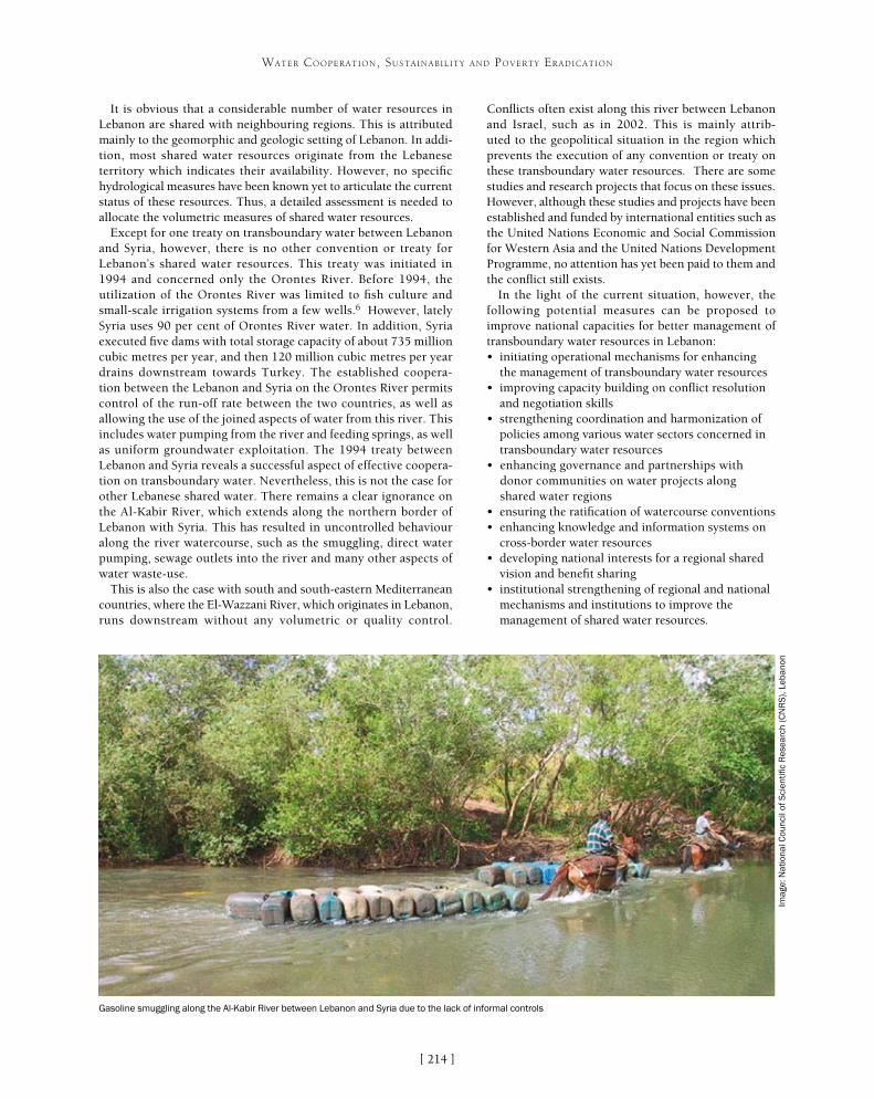
[ ]214
WATER COOPERATION, SUSTAINABILITY AND POVERTY ERADICATION
Conflicts often exist along this river between Lebanon and Israel, such as in 2002. This is mainly attrib-uted to the geopolitical situation in the region which prevents the execution of any convention or treaty on these transboundary water resources. There are some studies and research projects that focus on these issues. However, although these studies and projects have been established and funded by international entities such as the United Nations Economic and Social Commission for Western Asia and the United Nations Development Programme, no attention has yet been paid to them and the conflict still exists.
In the light of the current situation, however, the following potential measures can be proposed to improve national capacities for better management of transboundary water resources in Lebanon:• initiating operational mechanisms for enhancing
the management of transboundary water resources• improving capacity building on conflict resolution
and negotiation skills• strengthening coordination and harmonization of
policies among various water sectors concerned in transboundary water resources
• enhancing governance and partnerships with donor communities on water projects along shared water regions
• ensuring the ratification of watercourse conventions• enhancing knowledge and information systems on
cross-border water resources• developing national interests for a regional shared
vision and benefit sharing• institutional strengthening of regional and national
mechanisms and institutions to improve the management of shared water resources.
It is obvious that a considerable number of water resources in Lebanon are shared with neighbouring regions. This is attributed mainly to the geomorphic and geologic setting of Lebanon. In addi-tion, most shared water resources originate from the Lebanese territory which indicates their availability. However, no specific hydrological measures have been known yet to articulate the current status of these resources. Thus, a detailed assessment is needed to allocate the volumetric measures of shared water resources.
Except for one treaty on transboundary water between Lebanon and Syria, however, there is no other convention or treaty for Lebanon’s shared water resources. This treaty was initiated in 1994 and concerned only the Orontes River. Before 1994, the utilization of the Orontes River was limited to fish culture and small-scale irrigation systems from a few wells.6 However, lately Syria uses 90 per cent of Orontes River water. In addition, Syria executed five dams with total storage capacity of about 735 million cubic metres per year, and then 120 million cubic metres per year drains downstream towards Turkey. The established coopera-tion between the Lebanon and Syria on the Orontes River permits control of the run-off rate between the two countries, as well as allowing the use of the joined aspects of water from this river. This includes water pumping from the river and feeding springs, as well as uniform groundwater exploitation. The 1994 treaty between Lebanon and Syria reveals a successful aspect of effective coopera-tion on transboundary water. Nevertheless, this is not the case for other Lebanese shared water. There remains a clear ignorance on the Al-Kabir River, which extends along the northern border of Lebanon with Syria. This has resulted in uncontrolled behaviour along the river watercourse, such as the smuggling, direct water pumping, sewage outlets into the river and many other aspects of water waste-use.
This is also the case with south and south-eastern Mediterranean countries, where the El-Wazzani River, which originates in Lebanon, runs downstream without any volumetric or quality control.
Gasoline smuggling along the Al-Kabir River between Lebanon and Syria due to the lack of informal controls
Imag
e: N
atio
nal C
ounc
il of
Sci
entifi
c R
esea
rch
(CN
RS
), Le
bano
n

[ ]215
Alternative water resources in agriculture for improving production and poverty reduction
Shoaib Ismail, Ian McCann, Shabbir Shahid , Fiona Chandler and Mohamed Amrani International Center for Biosaline Agriculture, Dubai, United Arab Emirates
For many countries, especially in the developing world, agriculture is the engine of growth, and food security and poverty alleviation are largely dependent on the rural
agricultural economy. Water and land are the most fundamental resources required for agricultural production and environmen-tal goods and services. Management of land and water is critical in overcoming the development challenges of poverty, food and nutrition insecurity, water scarcity and environmental degra-dation. So far, land and water management systems have been able to meet the demands placed on them. However, recent Food and Agriculture Organization estimates indicate that in order to meet the projected demand for food in 2050, global agricultural production must be 60 per cent above the level of 2005-2007.
Food production accounts for 90 per cent of water use in most of the developing countries. Therefore water resources, in both quan-
tity and quality, are a major factor limiting agricultural sustainability, poverty reduction and economic develop-ment in many countries. Despite increasingly efficient water use, the demand for fresh water has continued to climb as the world’s population and economic activity have expanded. According to some recent projections, in 2025 two thirds of the world’s population will be suffering moderate to high water stress and about half of the population will face real constraints in their water supply. This is especially true in the Middle East and North Africa (MENA) region, where almost all conven-tional water resources have already been exploited.
At the same time energy, investments and human resources are required to make the best use of the water that is available, especially considering popu-lation growth and the adverse impacts of projected
WATER COOPERATION, SUSTAINABILITY AND POVERTY ERADICATION
Case study: Rhodes grass reduction in Abu Dhabi emirate
The Abu Dhabi Government has set a target of reducing water consumption in the agricultural sector by 40 per cent. One strategy to meet this target was to minimize the planting of Rhodes grass which is an excessive water consumer. Nearly 10,500 Rhodes grass farms in the emirate were irrigated with more than 59 per cent of the 1.5 billion m3 of water that is used for irrigation each year. In most cases, the grass grown was reported to be irrigated with between 40,000-50,000 m3 ha-1. However, the annual gross water demand for Rhodes grass (under modest efficiency) was estimated to be about 30,000 m3 ha-1 resulting in water wastage. Furthermore, Rhodes grass is not very salt-tolerant and many of the farms in the Abu Dhabi emirate (especially in the Western region) had become salinized and could not sustain economic productivity.
There are many other salt-tolerant forages that could grow under higher salinities (>20 dS m-1, >14,000 parts per million) and have better nutrient quality. The ICBA-Abu Dhabi Farmers Service Center project is an initiative to re-vegetate abandoned saline lands with salt-tolerant forages as an alternative to Rhodes grass. The project aims to develop demonstration farms where the farmers and policymakers will be able to witness how appropriate crops and crop management can turn productivity around. The project liaises between the research, extension, end user and implementing agencies. The outcomes are linked to the capacity building of research and extension staff and farmers, both on new and emerging crops and forages for salt-affected farms and on the local production of seeds (salt-tolerant forages) for the farmers.
The ICBA-Abu Dhabi Farmers Service Center project is helping to re-vegetate abandoned
saline lands with salt-tolerant forages
Imag
e: IC
BA
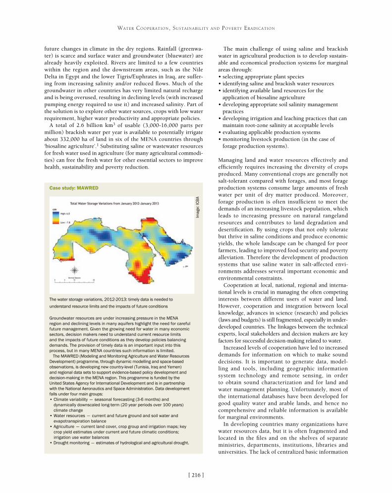
[ ]216
WATER COOPERATION, SUSTAINABILITY AND POVERTY ERADICATION
The main challenge of using saline and brackish water in agricultural production is to develop sustain-able and economical production systems for marginal areas through:• selecting appropriate plant species• identifying saline and brackish water resources• identifying available land resources for the
application of biosaline agriculture• developing appropriate soil salinity management
practices• developing irrigation and leaching practices that can
maintain root-zone salinity at acceptable levels• evaluating applicable production systems• monitoring livestock production (in the case of
forage production systems).
Managing land and water resources effectively and efficiently requires increasing the diversity of crops produced. Many conventional crops are generally not salt-tolerant compared with forages, and most forage production systems consume large amounts of fresh water per unit of dry matter produced. Moreover, forage production is often insufficient to meet the demands of an increasing livestock population, which leads to increasing pressure on natural rangeland resources and contributes to land degradation and desertification. By using crops that not only tolerate but thrive in saline conditions and produce economic yields, the whole landscape can be changed for poor farmers, leading to improved food security and poverty alleviation. Therefore the development of production systems that use saline water in salt-affected envi-ronments addresses several important economic and environmental constraints.
Cooperation at local, national, regional and interna-tional levels is crucial in managing the often competing interests between different users of water and land. However, cooperation and integration between local knowledge, advances in science (research) and policies (laws and budgets) is still fragmented, especially in under-developed countries. The linkages between the technical experts, local stakeholders and decision makers are key factors for successful decision-making related to water.
Increased levels of cooperation have led to increased demands for information on which to make sound decisions. It is important to generate data, model-ling and tools, including geographic information system technology and remote sensing, in order to obtain sound characterization and for land and water management planning. Unfortunately, most of the international databases have been developed for good quality water and arable lands, and hence no comprehensive and reliable information is available for marginal environments.
In developing countries many organizations have water resources data, but it is often fragmented and located in the files and on the shelves of separate ministries, departments, institutions, libraries and universities. The lack of centralized basic information
future changes in climate in the dry regions. Rainfall (greenwa-ter) is scarce and surface water and groundwater (bluewater) are already heavily exploited. Rivers are limited to a few countries within the region and the downstream areas, such as the Nile Delta in Egypt and the lower Tigris/Euphrates in Iraq, are suffer-ing from increasing salinity and/or reduced flows. Much of the groundwater in other countries has very limited natural recharge and is being overused, resulting in declining levels (with increased pumping energy required to use it) and increased salinity. Part of the solution is to explore other water sources, crops with low water requirement, higher water productivity and appropriate policies.
A total of 2.6 billion km3 of usable (3,000-16,000 parts per million) brackish water per year is available to potentially irrigate about 332,000 ha of land in six of the MENA countries through ‘biosaline agriculture’.1 Substituting saline or wastewater resources for fresh water used in agriculture (for many agricultural commodi-ties) can free the fresh water for other essential sectors to improve health, sustainability and poverty reduction.
Case study: MAWRED
Groundwater resources are under increasing pressure in the MENA region and declining levels in many aquifers highlight the need for careful future management. Given the growing need for water in many economic sectors, decision makers need to understand current resource limits and the impacts of future conditions as they develop policies balancing demands. The provision of timely data is an important input into this process, but in many MENA countries such information is limited.
The MAWRED (Modeling and Monitoring Agriculture and Water Resources Development) programme, through dynamic modelling and space-based observations, is developing new country-level (Tunisia, Iraq and Yemen) and regional data sets to support evidence-based policy development and decision-making in the MENA region. This programme is funded by the United States Agency for International Development and is in partnership with the National Aeronautics and Space Administration. Data development falls under four main groups:• Climate variability – seasonal forecasting (3-6 months) and
dynamically downscaled long-term (20 year periods over 100 years) climate change
• Water resources – current and future ground and soil water and evapotranspiration balance
• Agriculture – current land cover, crop group and irrigation maps; key crop yield estimates under current and future climatic conditions; irrigation use water balances
• Drought monitoring – estimates of hydrological and agricultural drought.
The water storage variations, 2012-2013: timely data is needed to
understand resource limits and the impacts of future conditions
Imag
e: IC
BA

[ ]217
WATER COOPERATION, SUSTAINABILITY AND POVERTY ERADICATION
and data is one of challenges facing water resources manage-ment. Under such conditions it is essential to find out what data already exists, who owns it and how is it stored, and to transform this into a usable form for decision-making. Integrating soil and water databases can allow users to view soil and water informa-tion together. For example, someone interested in identifying areas best suited for irrigated agriculture can select the data layer showing the distribution of groundwater quality in the same area. When such databases are linked with international databases or with those of other countries that face similar challenges and have relevant knowledge, their usefulness can be increased. A good example is the Modeling and Monitoring Agriculture and Water Resources Development (MAWRED) programme at the International Center for Biosaline Agriculture (ICBA),2 which provides data across national boundaries and provides downscal-ing to local levels.
In the least developed countries where marginal lands and water resources are under pressure and agricultural practices are non-sustainable, there is a strong need to develop, review or revise soil, water and agricultural policies based on the food and water demands of an increasing population and the challenges of climate change. Without good policies across an agroecological region that may encompass multiple countries and production systems, it is unlikely that sustainable progress can be made. Furthermore, even where clear policies do exist, when it comes to marginal water, these are mostly limited to general standard guidelines, which are related to heavy metals and pathogens but not to salts or other minerals.
Water is a shared resource. In order to ensure a future where we all have access to water and sanitation it is essential that we cooper-ate. And while it often is the responsibility of government to regulate land and water use, everyone – including farmers and farming busi-nesses – has a role to play in managing and using water responsibly and supporting the public sector.
Many resource-poor farmers are not able to continue profitable agriculture with low to intermediate levels of inputs and lack of knowledge. Ameliorative measures require new crops and manage-ment with new skills and expertise to make it sustainable and profitable. The necessary know-how originates from the national and international research and development centres, and has to move from the research organizations to the relevant ministries and extension services. Unfortunately, in many countries and regions, this appears to be the weakest link and new and innovative technol-ogies do not reach the end users so they can implement appropriate measures at the right time.
Although scientific research has produced large amounts of information on water and land management, the linkages between research and extension are usually weak in most developing countries. As a consequence, research results are often not based on extension recommendations, and do not reflect the needs of farmers. New helpful, appropriate and innovative technologies must reach farmers soon after release. Partnerships and coopera-tion with private industry can be very useful. For example, the widespread availability of mobile telephones, even in poor commu-nities, provides an opportunity to deliver information and tools. Such applications are generally developed by the private sector with the expectation that some income can be made. Partnering such expertise with technical know-how from extension and research and with farmers’ knowledge and participation can be
powerful and result in income generation for both providers and customers within a community. As a case in point, on-farm research in water productiv-ity can be conducted using instrumentation or market information that provides data over the Internet, and this data can be processed and delivered to farmers rapidly in a way that is understandable and useful. Cooperation at many levels is required for success, but the potential for real and demonstrated income increases will provide the incentive and interest.
Case study: Combating salinity through national strategy
The national strategy to combat salinity and protect water resources from pollution and salinity in Oman was launched on 2 October 2012 by Sheikh Fadl bin Mohammed Al Harthy, Secretary-General of the Oman Council of Ministers. ICBA developed the strategy over a rigorous two-year process that included five technical teams working on different aspects: water resources and modelling, agricultural status and salinity impact, socioeconomic assessment, governance, legal/regulatory frameworks and policies, and capacity development. The process included continuous consultation with key ministries, government agencies and local and international specialists.
The study indicated that excessive water use is the prime cause of salinization of agricultural soils. In many areas water demand exceeded supply, resulting in the intrusion of saline water into the aquifers. Even when the groundwater was considered good quality, poor on-farm management complicated the problems by causing salinization of the soil. The study recommends alternative strategies to improve water use and monitoring, soil management and agricultural production in the different types of soil and water conditions; strategic options to reduce seawater intrusion; and tactics (in the short, medium and long term) to implement solutions across the Sultanate of Oman.
Oman’s national salinity strategy recommends
alternative ways to improve water use and monitoring,
soil management and agricultural production
Imag
e: IC
BA

[ ]218
Managing water, sustainability and poverty reduction through collective community action Suhas P. Wani, K. H. Anantha and William D. Dar, International Crops Research Institute for the Semi-Arid Tropics
Access to and management of land and water resources need to improve significantly to ensure sustainable and inclusive development. With increasing demand for food production
to meet the needs of the growing population, increasing incomes and changing food habits, water scarcity will intensify. Estimates indicate that present food production requires some 7,000 km3/year of consumptive fresh water. Of this, 1,800 km3/year origi-nates from bluewater (run-off) use in irrigation and the remaining 5,200 km3/year from direct greenwater (rainwater as soil mois-ture) use in rain-fed agriculture.
Two hot-spot regions of the world emerge in terms of water needs for food and livelihoods: Sub-Saharan Africa (SSA) and Asia. For SSA indications suggest a tripling of agricultural water demand by 2025, and an almost five-fold increase by 2050.1 By 2025, an estimated 1.8 billion people will live in countries or regions with absolute water scarcity, with almost half of the world living in conditions of water stress. Nearly 1.2 billion people across the world live in areas of physical water scarcity, while another 1.6 billion face what can be called economic water shortage. The situation is only expected to worsen as population growth, climate change, investment and management shortfalls restrict the amount of water available to people. Land degradation and moisture stress have largely resulted in low crop yields, as the current farmers’ yields are two to five times lower than achievable crop yields in Asia and Africa.2 At the same time climate change brings additional risks and further unpredict-ability of returns for farmers. This calls for improved governance of land and water resources and a closer integration of policies, combined with increased and more strategic investment targeting food security and poverty alleviation.3
Need for a holistic approachIn this regard, a major concern is to rehabilitate existing vast tracts of degraded land and manage water resources efficiently to ensure livelihood support for rural populations in these regions. Considering the existing mismatch between resource availability and management, the International Crops Research Institute for the Semi-Arid Tropics (ICRISAT) and its partners have demonstrated several innovative up-scalable options to effectively tackle the problem at micro-level. The integrated watershed management approach aims at applying a holistic approach to water management that acknowledges the vital role played by both greenwater and bluewater flows in sustaining direct and indirect ecological functions and services benefiting humans.4 Both greenwater and bluewater are generated in the landscape, and integrated water resource management is the key for sustainable development and management of water at small catchment scale,
which is recommended for enhancing the efficiency of water in rain-fed areas.5 Indications are that greenwater dominates food production, as consumptive use of green-water is four times larger than that of bluewater. Field measurements of rain-fed grain yields and actual green-water flows indicated that by doubling yields from 1 to 2 t ha-1 in semi-arid tropical agroecosystems, greenwater productivity may improve from approximately 3,500 m3 t-1 to less than 2,000 m3 t-1. Further, the conventional sectoral approach to water management produced low water use efficiencies resulting in increased demand for water to produce food. Therefore, there is a need for a holistic approach based on converging all the necessary aspects of natural resource conservation, their efficient use, production functions through enabling policies and much-needed investment in fragile areas. This calls for a community-based approach involving stakeholders as decision makers.
Innovative model for watershed management ICRISAT has developed and adopted a consortium model of watershed management. This espouses the principles of collective action, convergence, coopera-tion and capacity building with technical backstopping by a consortium of institutions comprising national agricultural research systems, development agencies like government line departments, and non-govern-mental organizations (NGOs) to address the issues of equity, efficiency, economics and environment.6 The new integrated community watershed model provides technological options for the management of run-off, water harvesting, in-situ conservation of rainwater for groundwater recharging and supplemental irrigation, appropriate nutrient and soil management practices, waterway systems, crop production technology, and appropriate farming systems with income-generating micro-enterprises for improving livelihoods while protecting the environment. The current model of watershed management adopted by ICRISAT and its partners involves environment-friendly options and the use of new science tools which, along with the concept of the consortium approach, emphasise empowering farmers through capacity building and adopt a concept of convergence in every activity in the watershed.7
To provide the necessary knowledge to farmers, an ICRISAT-led consortium provided technical backstopping
WATER COOPERATION, SUSTAINABILITY AND POVERTY ERADICATION

[ ]219
WATER COOPERATION, SUSTAINABILITY AND POVERTY ERADICATION
The scaling-up of these innovations has been attempted in countries like India, Vietnam, Thailand and China. In India, the new model has been scaled up through a Department for International Development-supported Andhra Pradesh Rural Livelihood Project in the state of Andhra Pradesh. This approach puts the people living in the watershed at the centre of development and involves not only soil and water conservation, but also the efficient and sustainable use of resources to improve the livelihoods of people including women and the landless. In this programme, the scaling-up approach has been extended to 50 watersheds (10 nucleus and 40 satellite) in three districts of Andhra Pradesh. With support from the Sir Dorabji Tata Trust it has been extended to nine districts of Madhya Pradesh and seven districts in Rajasthan, India. Further, the World Bank-assisted Sujala watersheds and Adarsha watershed, Kothapally, have served as benchmark or nucleus watersheds and demonstrated the benefits of integrated watershed management. The technology has been adopted in the watersheds of neighbouring villages and other areas by farmers with little techni-cal support from the consortium. This approach was also implemented in China, Thailand and Vietnam with support from the Asian Development Bank. The Bureau of Agricultural Research in the Philippines is adopting a similar approach for scaling-out the benefits of produc-tivity enhancement in watersheds.
The recent comprehensive assessment of watershed programmes in India9 led by ICRISAT and its partners has clearly shown the potential of these programmes in the country, and the new Common guidelines for watershed management10 have adopted this approach for addressing natural resource management along with improving livelihoods. Based on Sujala watershed experiences, ICRISAT and the GoK have taken a knowl-
to the community. Soil health assessment, stress-tolerant high yielding cultivars, water analysis and so on were used as an entry point for build-ing a rapport with the community. Improved rainwater management and harvesting resulted in increased efficiency in greenwater use as well as augmenting water resources (ground and surface water) through low-cost water harvesting structures.
Knowledge-sharing systemIn the watershed, knowledge-based entry point activities have enhanced the farmers’ capacity and improved their participation in programme activities. Collective action in soil sampling, varietal selection and water management has ensured the sustainability of the system in the region. For example, the diagnostic farmers’ partic-ipatory soil health assessment in the watershed revealed widespread deficiencies of zinc, boron and sulphur in farmers’ fields which were holding back the potential of rain-fed agriculture in the region.8 Through the participatory approach nearly 100,000 soil samples were collected across 30 districts of Karnataka in India under the Bhoochetana initiative, and taluk-wise and crop-wise recommenda-tions were developed based on the soil analysis for micro and macro nutrients. This approach resulted in increased crop yields of 20-66 per cent over farmers’ management, and ensured an increased agri-cultural growth rate for the state. Similarly, under a Government of Karnataka (GoK) Sujala-ICRISAT initiative, farmers selected improved varieties of ragi (finger millet) and groundnut along with improved hybrids of maize, sunflower and soybean through partici-patory varietal evaluation, and produced increased yields over their varieties. The economic benefits of improved management practices in crops varied from Rs6,300 ha-1 in the case of finger millet to Rs21,000 ha-1 in the case of sunflowers.
Scaling-up processThe innovative integrated watershed management model has demonstrated that with proper management of natural resources the system’s productivity can be enhanced and poverty can be reduced without causing further degradation of the natural resource base.
Efficient management of water resources is needed to ensure livelihood support
Imag
e: IC
RIS
AT
A drain diversion into a well
Imag
e: IC
RIS
AT

[ ]220
WATER COOPERATION, SUSTAINABILITY AND POVERTY ERADICATION
edge-based approach to bridging yield gaps with a mission-mode initiative, forming a consortium and a network for stakeholders to share their knowledge about the weather, soil health and improved management practices across all 30 districts in the state. The overwhelming impact has strengthened the partnership between ICRISAT and the GoK, and eight major Consultative Group on International Agricultural Research (CGIAR) centres have been invited, along with AVRDC (the World Vegetable Center), to work towards improving rural livelihood systems in four benchmark districts representing different agroecological zones in the state.
Up-scaling the benefits of integrated watershed management necessitates an articulated strategy based on the main pillar of capacity building of all stakeholders, including farmers, research-ers, development workers, policymakers and development investors. New scientific tools such as remote sensing, geographical informa-tion systems and crop simulation modelling for the analysis of long-term potential productivity, need to be used as the planning tools. These tools provide the capabilities for extrapolating and implementing the technologies to other larger watersheds.
The ICRISAT consortium focused on training farmers, personnel from development agencies and NGOs through demonstrations of different technologies on benchmark watersheds, and acts as a mentor for technology backstopping. The farmers’ community, through village institutions, took responsibility for all activities of implemen-tation and monitoring. Government and non-governmental agencies catalyzed the process. The important aspect while evaluating and scaling-out this approach is that the relevant government line depart-ments must be included in the consortium along with other partners. The role of policymakers and development investors is critical, and
sensitization of these stakeholders played a major role in scaling-out the benefits in Asia.
Impacts and outcomesAn innovative integrated watershed management model developed by ICRISAT and its partners produced a wide range of impacts. Close monitoring of groundwater resources in different watersheds in India confirmed that water harvesting structures sustained good ground-water yield even after the rainy season. For instance, in the Lalatora watershed in Madhya Pradesh, the ground-water level in the treated area registered an average rise of 7.3 metres; at Bundi watershed in Rajasthan a 5.7 metre increase was observed, and at the Adarsha watershed, Kothapally in Andhra Pradesh, a 4.2 metre rise in groundwater was recorded. In Adarsha water-shed, a study showed that nearly 60 per cent of the run-off water was harvested through agricultural water management interventions which also recharged shallow aquifers. Water harvesting structures (WHS) resulted in a total 6 metre rise in the water table during the monsoon. At the field scale, WHS recharged open wells at a 200 to 400 metre spatial scale.11 The various WHS resulted in an average contribution of seasonal rainfall to groundwater during the normal rainfall year of 27-34 per cent in Rajasamadhiyala and Shekta water-sheds.12 In the Adarsha watershed, due to additional groundwater recharge, a total of 200 ha were irrigated in the kharif (autumn) season and 100 ha in the rabi
Rainfall Near check dam
Adrasha watershed, Andhra Pradesh Bundi watershed, Rajasthan
18
0
12
6
Wat
erle
vel i
n w
ell (
m)
Rai
nfal
l (m
m)
Rai
nfal
l (m
m)
0
1500
500
1000
Away from check dam
2000 2003 2006 200918
12
6
0
Wat
erle
vel i
n w
ell (
m)
0
500
1000
2002 2004 2006
Mean annual groundwater levels in wells as influenced by the water harvesting structures at Kothapally and Bundi watersheds
Source: Wani et al., 2010

[ ]221
WATER COOPERATION, SUSTAINABILITY AND POVERTY ERADICATION
(spring) season, mostly to vegetables and flowers. Overall, in the 65 community watersheds, implementing best-bet practices with better water management resulted in significant yield advantages in sorghum (35-270 per cent), maize (30-174 per cent), pearl millet (72-242 per cent), groundnut (28-179 per cent), sole pigeonpea (97-204 per cent), and intercropped pigeonpea (40-110 per cent).
Integrated watershed management in India, primarily through water conservation and management compounded with various in-situ and ex-situ interventions and improved practices, have shown a significant increase in productivity, cropping intensity and income while controlling degradation of natural resources. The increase in cropping intensity, benefit-to-cost ratio and per capita income ranged between 30-55 per cent, 45-88 per cent and 19-78 per cent respectively in different community watersheds after the implementation of watershed interventions over the baseline period. In all these watersheds, the key driver for remarkable change is an increasing quantity of greenwater and bluewater resources in the form of soil moisture through groundwater recharge initiatives such as ex-situ and in-situ interventions. These interventions have built resilience during drought years. As evident from the data at Adarsha watershed in Andhra Pradesh, the share of agricultural income to total family income remained the same in the 2002 drought year, whereas non-watershed villages experienced a drastic reduction in agricultural income from 44 per cent to 12 per cent of family income. Families in these villages had to migrate to supplement their livelihoods, whereas in Kothapally, farmers could manage their livelihoods in the village itself.
The participatory collective action approach adopted for bridg-ing the yield gaps in the state of Karnataka has demonstrated the
vast potential of dryland agriculture for increasing the crop yields and incomes of millions of small farmers. The unique mechanism of scaling-up with comprehen-sive planning, review and monitoring along with new institutions like Farm Facilitators, Raitha Samparka Kendras and supporting policies enabled the consor-tium to cover 3.73 million hectares of rain-fed area in the state. Under the Bhoochetana programme, soil-test-based nutrient management interventions along with improved seeds, seed treatments and use of biofertilizers resulted in 35-66 per cent increases in yield levels of dryland crops during the 2009 rainy season in different districts. During the 2011 rainy season with an unfavourable rainfall situation, the programme resulted in increases of 21-66 per cent in major crop yields and 23-42 per cent in oilseeds over farmers’ practice. For the GoK, this translated to an annual agricultural growth rate of 5.9 per cent during 2009/10, and 11.6 per cent during 2010/11. During 2011, 3 million hectares were covered in the rainy season and economic returns were to the tune of US$130 million. In spite of an unfavourable rain-fall situation in the state, farmers harvested increased crop yields with improved management practices, contributing to the economy of the state. This has demonstrated the power of science-led interventions to achieve sustainability in the management of natural resources for food security and poverty reduction in fragile areas.
Achieving food security and resilienceWater scarcity and land degradation are the main constraints to realizing higher productivity and improv-ing rural livelihoods in the semi-arid regions. The integrated community watershed management approach is a well tested strategy to address the issues of water and soil degradation along with equity, efficiency and environment. Scarcity of water and knowledge sharing through the participatory monitoring of increased groundwater made farmers more receptive towards efficient water use technologies such as drips and sprin-klers, and enabled them to take appropriate decisions about suitable crops and areas to be planted. The new common guidelines have provided a framework to bring people to centre stage in taking decisions to improve productivity and livelihoods through sustainable use of natural resources. Within the watersheds, stratified soil sampling and soil-test-based nutrient management provides economic solutions to address soil degrada-tion. Model watersheds and Bhoochetana in India have demonstrated the role of a science-led approach in changing farm-based livelihoods. However, policies and institutional mechanisms played a greater role in opera-tionalizing the strategy. To achieve the overall goal of food security and resilience in the semi-arid regions, we need to promote the adoption of science-led tech-nologies through appropriate institutional and policy support, increased awareness and capacity building at different levels.
0
30
60
90
120
150
GW recharge during monsoon GW availability at beginning of monsoon
AWMDry year
(following a wet year)
NI AWMDry year
(following a dry year)
NI AWMNormal year
(following a wet year)
NI AWMNormal year
(following a dry year)
NI
GW
ava
ilabi
lity
at e
nd o
f th
e m
onso
on (m
m)
Groundwater availability and recharge during different rainfall and management conditions in Adarsha watershed, Andhra Pradesh
Source: Garg and Wani, 2012
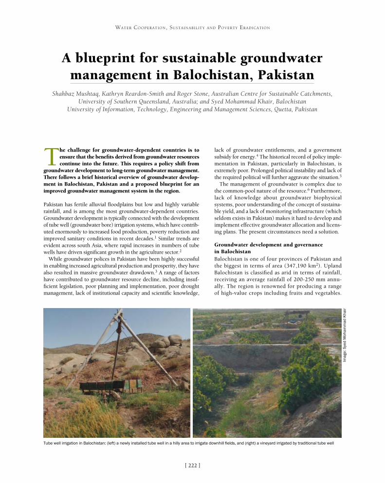
[ ]222
A blueprint for sustainable groundwater management in Balochistan, Pakistan
Shahbaz Mushtaq, Kathryn Reardon-Smith and Roger Stone, Australian Centre for Sustainable Catchments, University of Southern Queensland, Australia; and Syed Mohammad Khair, Balochistan
University of Information, Technology, Engineering and Management Sciences, Quetta, Pakistan
The challenge for groundwater-dependent countries is to ensure that the benefits derived from groundwater resources continue into the future. This requires a policy shift from
groundwater development to long-term groundwater management. There follows a brief historical overview of groundwater develop-ment in Balochistan, Pakistan and a proposed blueprint for an improved groundwater management system in the region.
Pakistan has fertile alluvial floodplains but low and highly variable rainfall, and is among the most groundwater-dependent countries. Groundwater development is typically connected with the development of tube well (groundwater bore) irrigation systems, which have contrib-uted enormously to increased food production, poverty reduction and improved sanitary conditions in recent decades.1 Similar trends are evident across south Asia, where rapid increases in numbers of tube wells have driven significant growth in the agriculture sector.2
While groundwater polices in Pakistan have been highly successful in enabling increased agricultural production and prosperity, they have also resulted in massive groundwater drawdown.3 A range of factors have contributed to groundwater resource decline, including insuf-ficient legislation, poor planning and implementation, poor drought management, lack of institutional capacity and scientific knowledge,
lack of groundwater entitlements, and a government subsidy for energy.4 The historical record of policy imple-mentation in Pakistan, particularly in Balochistan, is extremely poor. Prolonged political instability and lack of the required political will further aggravate the situation.5
The management of groundwater is complex due to the common-pool nature of the resource.6 Furthermore, lack of knowledge about groundwater biophysical systems, poor understanding of the concept of sustaina-ble yield, and a lack of monitoring infrastructure (which seldom exists in Pakistan) makes it hard to develop and implement effective groundwater allocation and licens-ing plans. The present circumstances need a solution.
Groundwater development and governance in BalochistanBalochistan is one of four provinces of Pakistan and the biggest in terms of area (347,190 km2). Upland Balochistan is classified as arid in terms of rainfall, receiving an average rainfall of 200-250 mm annu-ally. The region is renowned for producing a range of high-value crops including fruits and vegetables.
WATER COOPERATION, SUSTAINABILITY AND POVERTY ERADICATION
Tube well irrigation in Balochistan: (left) a newly installed tube well in a hilly area to irrigate downhill fields, and (right) a vineyard irrigated by traditional tube well
Imag
e: S
yed
Moh
amm
ad K
hair
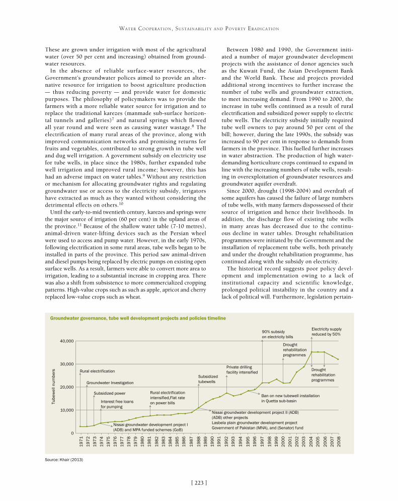
[ ]223
WATER COOPERATION, SUSTAINABILITY AND POVERTY ERADICATION
Between 1980 and 1990, the Government initi-ated a number of major groundwater development projects with the assistance of donor agencies such as the Kuwait Fund, the Asian Development Bank and the World Bank. These aid projects provided additional strong incentives to further increase the number of tube wells and groundwater extraction, to meet increasing demand. From 1990 to 2000, the increase in tube wells continued as a result of rural electrification and subsidized power supply to electric tube wells. The electricity subsidy initially required tube well owners to pay around 50 per cent of the bill; however, during the late 1990s, the subsidy was increased to 90 per cent in response to demands from farmers in the province. This fuelled further increases in water abstraction. The production of high water-demanding horticulture crops continued to expand in line with the increasing numbers of tube wells, result-ing in overexploitation of groundwater resources and groundwater aquifer overdraft.
Since 2000, drought (1998-2004) and overdraft of some aquifers has caused the failure of large numbers of tube wells, with many farmers dispossessed of their source of irrigation and hence their livelihoods. In addition, the discharge flow of existing tube wells in many areas has decreased due to the continu-ous decline in water tables. Drought rehabilitation programmes were initiated by the Government and the installation of replacement tube wells, both privately and under the drought rehabilitation programme, has continued along with the subsidy on electricity.
The historical record suggests poor policy devel-opment and implementation owing to a lack of institutional capacity and scientific knowledge, prolonged political instability in the country and a lack of political will. Furthermore, legislation pertain-
These are grown under irrigation with most of the agricultural water (over 50 per cent and increasing) obtained from ground-water resources.
In the absence of reliable surface-water resources, the Government’s groundwater polices aimed to provide an alter-native resource for irrigation to boost agriculture production – thus reducing poverty – and provide water for domestic purposes. The philosophy of policymakers was to provide the farmers with a more reliable water source for irrigation and to replace the traditional karezes (manmade sub-surface horizon-tal tunnels and galleries)7 and natural springs which flowed all year round and were seen as causing water wastage.8 The electrification of many rural areas of the province, along with improved communication networks and promising returns for fruits and vegetables, contributed to strong growth in tube well and dug well irrigation. A government subsidy on electricity use for tube wells, in place since the 1980s, further expanded tube well irrigation and improved rural income; however, this has had an adverse impact on water tables.9 Without any restriction or mechanism for allocating groundwater rights and regulating groundwater use or access to the electricity subsidy, irrigators have extracted as much as they wanted without considering the detrimental effects on others.10
Until the early-to-mid twentieth century, karezes and springs were the major source of irrigation (60 per cent) in the upland areas of the province.11 Because of the shallow water table (7-10 metres), animal-driven water-lifting devices such as the Persian wheel were used to access and pump water. However, in the early 1970s, following electrification in some rural areas, tube wells began to be installed in parts of the province. This period saw animal-driven and diesel pumps being replaced by electric pumps on existing open surface wells. As a result, farmers were able to convert more area to irrigation, leading to a substantial increase in cropping area. There was also a shift from subsistence to more commercialized cropping patterns. High-value crops such as such as apple, apricot and cherry replaced low-value crops such as wheat.
Groundwater governance, tube well development projects and policies timeline
Source: Khair (2013)
19
71
19
72
19
73
19
74
19
75
19
76
19
77
19
78
19
79
19
80
19
81
19
82
19
83
19
84
19
85
19
86
19
87
19
88
19
89
19
90
19
91
19
92
19
93
19
94
19
95
19
96
19
97
19
98
19
99
20
00
20
01
20
02
20
03
20
04
20
05
20
06
20
07
20
08
0
10,000
20,000
30,000
40,000
Tub
ewel
l nu
mb
ers Rural electrification
Groundwater Investigation
Subsidized power
Interest free loans for pumping
Nissai groundwater development project I (ADB) and MPA funded schemes (GoB)
Rural electrification intensified,Flat rate on power bills
Subsidized tubewells
Nissai groundwater development project II (ADB)(ADB) other projectsLasbela plain groundwater development projectGovernment of Pakistan (MNA), and (Senator) fund
Private drilling facility intensified
Ban on new tubewell installation in Quetta sub-basin
90% subsidy on electricity bills
Drought rehabilitationprogrammes
Electricity supply reduced by 50%
Drought rehabilitationprogrammes

[ ]224
WATER COOPERATION, SUSTAINABILITY AND POVERTY ERADICATION
ing to the governance and sustainable management of groundwater is largely inadequate. In addition, a key challenge for integrated groundwater planning is sectoral division, with the traditionally vertical, compartmentalized structures of government tending to limit information flows among agencies, thereby impeding coor-dinated action. Integrated water resource management (IWRM) also needs to be conducted at a range of spatial scales. Without coordination and collaboration, there is a real danger of losing effectiveness and efficiency.12
Blueprint for sustainable groundwater management The proposed blueprint for groundwater management is based on five fundamental elements:• improved governance and effectiveness of institutions• demand-side groundwater management• supply-side groundwater management options• social adoption by the community• effective coordination and cooperation.
Improved governance and effectiveness of institutions includes increased focus on strengthening and enforcing groundwater laws, including establishing clear and tradable property rights for water; better quantification of groundwater yield followed by appropriate groundwater licensing and enforcement to prevent over-extraction of groundwater; establishing appropriate systems for resource monitoring on a regular basis at the basin and sub-basin levels; and rigorous collabo-ration between various departments (such as the Irrigation Department, the Agricultural Department, the Balochistan Development Authority, the Public Health Engineering Department and the Water and Power Development Authority) to improve decision-making.
Demand-side groundwater management should include a rational pricing system for efficient water use; replacement of water demand-ing crops with water-use efficient crops; and the adoption of modern water-saving irrigation technologies and practice.
Supply-side groundwater management options should include rainwater harvesting and surface-water use for increasing ground-
water recharge; promoting conjunctive water use where possible; and groundwater markets with suitable insti-tutional mechanisms to augment water supply.
Social adoption by the community includes provid-ing a sense of ownership of the regional groundwater resources and developing basin-wide groundwater users’ associations with responsibilities to conserve, protect, develop and manage groundwater resources to increase community welfare. It entails the strengthening of coordination among various stakeholders (including government departments), developing a community vision of groundwater management through better information, knowledge-sharing and communications for social adoption and efficient water use. Social norms and rules must be developed (some already exist) to prevent any illegal water extraction for agriculture and other purposes.
Development of sustainable groundwater plans will require the cooperation and coordination of a number of government agencies and key stakeholder groups. The blueprint for sustainable groundwater management would require the community to provide significant input into the management planning process, particu-larly advising on appropriate uses and values of the local groundwater systems. In order to enhance coopera-tion and coordination, as suggested by Pahl-Wostl and Kranz,13 some degree of decentralization combined with effective vertical integration of different levels of govern-ment (provincial and local) that share responsibility for a resource, and horizontal integration within government levels, would be required.
Social adoption and changing groundwater cultures offer considerable potential to internalize externalities (factors which received inadequate attention in previous IWRM plans) and are key elements of this blueprint for sustain-able groundwater management in Balochistan. However, it is worth noting that without firm political commit-ment and effective coordination of different elements of the blueprint, it would be extremely difficult to achieve sustainable management of groundwater resources.
Moving from development to managementGroundwater is the subject of growing social concern around the globe, and this is especially so in Pakistan. While they are successful in enhanc-ing agricultural production, groundwater policies in Pakistan and, most particularly, in the province of Balochistan are not well designed to handle ground-water sustainability issues. They are based on a lack of geophysical knowledge and are also poorly implemented due to poor governance, inadequate institutional arrangements and lack of political determination. With groundwater systems seriously degrading in the region, there is a critical need for a shift from groundwater development policies to groundwater management policies accompanied by sound hydrological planning. The five fundamental components proposed above should be part of any IWRM approach proposed and developed in Pakistan.
The five fundamental elements of the proposed blueprint for sustainable groundwater management in Balochistan, Pakistan
Effective coordination & cooperation
Institutional reform & improved
governance
Supply side groundwater
management
Community acceptance & adoption
Demand side groundwater management
External environment
Political stability & political will
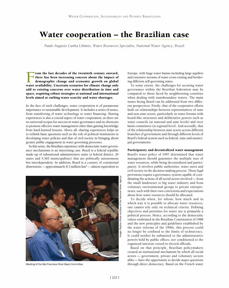
[ ]225
Water cooperation – the Brazilian case Paulo Augusto Cunha Libânio, Water Resources Specialist, National Water Agency, Brazil
From the last decades of the twentieth century onward, there has been increasing concern about the impact of demographic change and economic growth on global
water availability. Uncertain scenarios for climate change only add to existing concerns over water distribution in time and space, requiring robust strategies at national and international levels aimed at curbing water scarcity and water shortages.
In the face of such challenges, water cooperation is of paramount importance to sustainable development. It includes a series of issues, from transferring of water technology to water financing. Sharing experiences is also a crucial aspect of water cooperation, as there are no universal recipes for success in water governance and no shortcuts to promote effective water management other than gaining knowledge from hard-learned lessons. Above all, sharing experiences helps us to rethink basic questions such as the role of political institutions in developing water policies and that of civil society in bringing about greater public engagement in water governing processes.
In this sense, the Brazilian experience with democratic water govern-ance mechanisms is an interesting case. Brazil is a federal republic made up of subnational administrative units (a federal district, 26 states and 5,565 municipalities) that are politically autonomous but interdependent. In addition, Brazil is a country of continental dimensions – approximately 8.5 million km2 – almost equivalent to
Europe, with huge water basins including large aquifers and extensive streams of water cross-cutting and border-ing different self-governing states.
To some extent, the challenges for securing water governance within the Brazilian federation may be compared to those faced by neighbouring countries when dealing with transboundary waters. The main issues facing Brazil can be addressed from two differ-ent perspectives. Firstly, that of the cooperative efforts built on relationships between representatives of state and non-state actors, particularly in water forums with board-like structures and deliberative powers such as water councils (at national and state levels) and river basin committees (at regional level). And secondly, that of the relationship between state actors across different branches of government and through different levels of Brazil’s federal system such as federal, state and munici-pal governments.
Participatory and decentralized water management Brazil’s water policy of 1997 determined that water management should guarantee the multiple uses of water resources, while being decentralized and partici-patory. It involves public authorities, water users and civil society in the decision-making process. These legal provisions require a governance system capable of coor-dinating the actions of all social actors involved – from the small landowner to big water industry and from voluntary environmental groups to private entrepre-neurs, each with their own convictions and expectations about how water resources should be allocated.
To decide when, for whom, how much and in which way it is possible to allocate water resources, one cannot rely only on technical criteria. Defining objectives and priorities for water use is primarily a political process. Hence, according to the democratic values enshrined in the Brazilian Constitution of 1988 and the new principles and guidelines established by the water reforms of the 1990s, this process could no longer be confined to the limits of technocracy. It could neither be submitted to the administrative powers held by public offices, nor conditioned to the organized interests vested in elected officials.
Based on that principle, Brazilian policymakers created an institutional mechanism by which all social actors – government, private and voluntary sectors alike – have the opportunity to decide major questions through direct democracy. Based on the French water
WATER COOPERATION, SUSTAINABILITY AND POVERTY ERADICATION
Imag
e: R
aylto
n A
lves
cou
rtes
y of
the
Nat
iona
l Wat
er A
genc
y
Meeting of the São Francisco River Basin Committee

[ ]226
WATER COOPERATION, SUSTAINABILITY AND POVERTY ERADICATION
management model, board-like structures with tripartite compo-sition – public authorities, water users and civil society – were structured not only as a platform for public debate but, above all, as permanent water forums endowed with deliberative powers to steer the implementation of planning and economic instruments.
Over the past 25 years, almost 200 river basin committees have been established throughout the country covering an area of more than 2.1 million km2, almost a quarter of Brazil’s territory. During that same period, water councils with a composition similar to that of river basin committees have been established in all states and at the federal level.
These forums function as ‘water parliaments’ and today they consti-tute the main political arena for integrating water-related policy sectors. An estimated 9,800 people are currently involved with the political activities carried out in water councils and river basin committees, of whom more than 3,000 are representatives of organizations in civil society including non-government organizations, professional associa-tions and centres of higher education and research.
Despite the operational difficulties of running a decentralized system in such a vast territory, including high transaction costs and acute asymmetries of knowledge and organization among stakeholders, the benefits of transition from centralized, state-led policymaking to the current model are undeniable. For the first time non-state actors, particularly small community organizations, have had an opportunity to influence high-level political processes. They can have their say in matters of public and private investments in water infrastructure, the definition of environmental standards for protection of surface and groundwater, and allocation of water resources among different sectors of the economy.
Besides providing institutional channels for citizen participation in the decision-making process, these water councils and river basin committees also created an enabling environment for collaborative water governance. New forms of intersectoral and inter-institutional partnerships have been developed around distinct forms of water cooperation: public-public, private-private and public-private.
One example is the River Basin Clean-Up Program (PRODES) that offers output-based aid (OBA) for sanitation services, binding public funding of sanitary infrastructure with decisions on water pollution control made collectively by members of these water forums. Another example is the Water Producer Program which offers technical and financial support for payment for environmental services (PES) initiatives, many of them carried out at the watershed level. The existence of an operative river basin committee is a key factor for success in PES schemes, as they contribute to bringing potential buyers and sellers together and facilitate the crafting of multi-stakeholder agreements. Once the institutional arrangements are in place, it is possible to overcome often-observed conflicts that usually stem from the use of coercive instruments under command-and-control strategies.
Integrated water managementBoth the division of inland waters between federal and state jurisdictions and the establishment of a national system of water management as set out in the Federal Constitution of 1988 have posed a great challenge for water governance in Brazil. The challenge is intensified when one considers that, according to the National Water Act of 1997, watersheds are the basic territorial units for implementing water policies.
It demands Herculean efforts to establish permanent and effective means for integrated water resources management (IWRM) nation-
PRODES
Objective: Improve water quality in urban areas by reducing water pollution from discharge of untreated sewage and incentivizing implementation of water policy instruments
Strategy: OBA
Water sectors/users involved: Sanitation services (wastewater treatment)
PRODES offers OBA-type subsidies to reimburse up to 100 per cent of capital costs for the construction of new wastewater treatment plants or improvement of existing facilities. Once OBA contracts are signed, the funds are transferred from the National Treasury to specific escrow accounts. Service providers have then two years to finish construction and start operation. From this moment, a three-year certification process is initiated, with evaluation of operational performance every three months. Disbursement of federal grants is conditional on the achievement of performance goals in wastewater treatment facilities, with incumbent operators bearing all the risk of non-performance.
From its launch in 2001, PRODES aimed at integrating sanitation and water management policies, for which a set of measures were adopted. For example, river basin committees were tasked with approving proposals for investment and operational performance goals presented by sanitation services operating in their areas. Proposals were selected on the basis of a more holistic view over water quality problems, considering their adequacy with the overall strategy set by river basin committees. Criteria for selecting proposals were linked to water policy goals, favouring those located in regions that had advanced further in the implementation of water policy instruments.
Key resultsFrom 2001 to 2012, PRODES provided approximately US$129 million to sanitation services that fulfilled their contractual obligations in terms of water pollution control in Brazil. In all, 58 projects were supported in areas with critical conditions of water quality. These facilities have a total operational capacity to remove 106,000 tons of organic pollutant load per day, serving a population of approximately 5.3 million.
Imag
e: Z
ig K
och
cour
tesy
of
the
Nat
iona
l Wat
er A
genc
y
São Francisco River near the Paulo Afonso Hydropower Plant

[ ]227
WATER COOPERATION, SUSTAINABILITY AND POVERTY ERADICATION
wide. On one hand, the envisioned system of water governance in Brazil must be capable of avoiding gaps or overlaps in the regula-tion of water uses across federal and state water jurisdictions. On the other, it must reach out to local actors and municipal govern-ments that, despite not being in charge of regulating water users, are directly responsible for strategic water-related policies such as water supply, sanitation and urban planning.
Coordination among local actors is facilitated by collaborative water governance strategies applied at the regional level by deliber-ative water forums. Nevertheless, there is still a vacuum of political agreements between the federal government and the states, the latter exercising an overwhelming control over water resources in Brazil. Progress in this direction has been hampered by many factors – for instance, party politics have narrowed the opportuni-ties for long-standing alliances throughout election cycles. But by looking ahead we can see new possibilities for water cooperation in Brazil’s federal system.
First, it is necessary to recognize that state water systems are the main gears of Brazil’s water governance engine. Apart from the streams of water shared by two or more states and reservoirs built by the federal government, all inland waters, including all
groundwater reserves, fall under state jurisdiction. Strengthening water governance at the state level is, therefore, the starting point for any future progress toward IWRM in Brazil. Only then will it be possible to integrate the actions undergone by the states in a coherent way, according to a long-term view and under a broad national strategy.
This is the rationale behind the most recent political agreement between federal and state water authorities. The National Pact for Water Resources Management represents an outstanding political achievement, revealing that state water managers are keen to make commitments under a national agreement as long as they retain autonomy to implement their water policies and have an opportunity to improve their own systems.
Most important, however, is the strategy outlined for the National Pact’s implementation. State governments will be invited to sign up to it on a voluntary basis. They will issue state decrees to formalize their commitments to cooperate with federal and other state water authori-ties. Then, another process will be initiated at the state
Tree planting campaign involving school children
Imag
e: R
ossi
ni S
ena
cour
tesy
of
the
Nat
iona
l Wat
er A
genc
y

[ ]228
WATER COOPERATION, SUSTAINABILITY AND POVERTY ERADICATION
level involving all stakeholders represented in state water councils. Members of state councils will be responsible for establishing policy goals for their own state systems based on the major water chal-lenges identified in their regions. In addition, state water councils will be in charge of overseeing compliance with these goals on an annual basis, a condition that will determine whether or not state public authorities receive federal grants.
This is part of a new goal-oriented initiative called Progestão (Pro-management). In this case, however, the ultimate goal is not to improve water quality by intervening on water-related policies but to induce continuing advancements in water policy through a permanent cooperation effort between the federal government and the states.
Only states that become a party to the National Pact will be eligi-ble to receive funds from Progestão. Individual contracts will be signed with each partner state, in which agreed water policy goals will be translated into contractual goals and obligations for a five-year period. Funds will be made available to state public authorities at the beginning of each fiscal year, according to the policy goals they have achieved the previous year.
As such, non-state actors will play a greater role in Brazil’s water policy. Water cooperation among federal and state public authorities will no longer be restricted to isolated, dissociated and time-limited initiatives.
Challenges aheadKeeping to the old course of state-led and centralized water policymaking would certainly be an easier political option in a newly-borne democratic regime. From the beginning, it was evident that involving citizens in water-related decision-making processes and coordinating state action in a three-tier system of government would be a challenging task. Nonetheless, that was the option taken in 1988 by the framers of the new Brazilian Constitution and by lawmakers that, a few years later, enacted the first state water laws and the National Water Act in 1997.
It is still too early to say whether water managers in Brazil will cope with the challenge of implementing the envisioned water governance model. But it is certain that their chances of success depend on their cooperation with each other. Water cooperation in Brazil will be crucial to securing the democratic values embedded in its legal framework.
Important steps have been taken in the right direction. Periodic meetings and face-to-face interactions in councils and committees have provided some of the cement that made state and non-state actors cooperate with each other – and cooperation among them improved significantly over time. The continuing exercise of politi-cal judgement, of questioning each other’s view on matters of water management, of agreeing to disagree, of trying to build consensus and majorities – all this has contributed to reaching a new level of water governance in Brazil.
But an even bigger challenge lies ahead: to promote coopera-tion on water throughout the federal system and across different branches of the public sector. Goal-oriented strategies such as OBA and PES have been used to integrate water-related policies with posi-tive results so far. Now another results-driven programme will be tested as a mechanism for integrating federal and state actions. Will it work? It is not possible to say at this moment, but considering that IWRM is the missing part of Brazil’s democratic governance model, it is worth trying.
Water Producer Program
Objective: Improve water quality by tackling nonpoint sources of pollution in rural areas
Strategy: PES
Water sectors/users involved: Irrigated agriculture and water supply systems
The Water Producer Program was launched by the National Water Agency of Brazil in 2006 with three main objectives: conservation of riparian forests, improvement of soil management in rural areas and recovery of degraded areas in watersheds. It aims to substitute costly instruments of control based on coercive and regulatory actions with the use of less hands-on public governance tactics that rely on economic instruments and inter-organization networks. Payment is taken for watershed services as a strategy to overcome common barriers to resolving disputes, bringing stakeholders together as partners in joint projects to prevent environmental degradation.
The first steps of the programme involve a general assessment of major environmental problems, investment needs and, most importantly, potential buyers and sellers. This initial assessment is a key element in defining targets, service baselines and overall procedures for monitoring and assessing compliance. Negotiations then take place between upstream service providers (landowners) and downstream water users (water supply systems) and, if agreement is reached, payment schemes are set up for recovering degraded areas or preventing environmental damage.
Key resultsFrom 2006 to 2012, the programme supported 20 PES initiatives in 13 different states. These include the Water Conservationist Project, the first water PES scheme established in Brazil, which is known for its strong engagement of municipal government and local stakeholders. In all, these initiatives cover an area of 306,000 hectares, including regions that supply water to seven state capital cities (São Paulo, Rio de Janeiro, Brasilia, Rio Branco, Palmas, Campo Grande and Goiania). Around 2,000 landowners are presently receiving payments for watershed services.
Imag
e: R
ui F
aqui
ni c
ourt
esy
of t
he N
atio
nal W
ater
Age
ncy
Mexiana Island in the Amazon Basin

[ ]229
Environmental rehabilitation of the Lake Pátzcuaro watershed, Michoacán, Mexico Miguel A. Córdova, Appropriate and Industrial Technology Subdivision Head, Mexican Institute of Water Technology
and Ramón Pérez Gil Salcido, Director, Water Program, Gonzalo Río Arronte Foundation
With water as its pivotal element, a comprehensive programme was developed to establish a basis for attaining the sustainable development of the Lake
Pátzcuaro watershed.
The programme’s main goals are:• enhancing and promoting environmental awareness and culture
among the watershed’s inhabitants• seeking consensus regarding the main problems and their solutions• increasing the knowledge of natural resources availability and use• establishing criteria for prioritizing actions• performing and promoting the execution of projects and
structural works that generate tangible benefits for the watershed and its communities
• managing and channelling investments to ensure the sustainability of the environmental rehabilitation process.
In order to achieve this, it was necessary to define and implement a strategic plan based on the identification, prioritization and execu-tion of actions agreed on by the different stakeholders.
The Lake Pátzcuaro watershed is located in the state of Michoacán, Mexico. It is a closed basin, with an area of 929 km2. Altitudes range from 2,035 to 3,300 metres above sea level (masl), with an average altitude of 2,369 masl. Mean precipitation in the area is 775 mm, while mean evapora-tion is 1,393 mm. The lake covers an area of 126.4 km2 and has an average depth of 4.9 m, with a storage volume of 619.4 Hm3. The population of the watershed is estimated at 120,000 inhabitants. Its economy is based mainly on tourism, forestry, fishing and craftsmanship, and recently on money remittances from its immigrants working in the USA. Due to its singular beauty and historical relevance, going back to pre-Hispanic times, the region is considered as one of Mexico’s most emblematic and culturally rich. The indigenous Purépechas people are an important part of the population.
With the aim of contributing to the solution of the watershed’s environmental problems, which have been caused by years of deterioration and ecological abuse, an agreement was signed in 2003, which gave
WATER COOPERATION, SUSTAINABILITY AND POVERTY ERADICATION
Local educators and community leaders participating in activities to develop the ‘Discover a Watershed: Lake Pátzcuaro’ educator’s guide
Imag
e: R
ita V
ázqu
ez, I
MTA

[ ]230
WATER COOPERATION, SUSTAINABILITY AND POVERTY ERADICATION
Development in Pátzcuaro, and at the Biotechnology Unit of Tzurumútaro, demonstrative areas were developed for the transfer of appropriate water tech-nologies. Four environmental education areas (known as ecological houses) were installed in the four lake-side municipalities of the watershed: Pátzcuaro, Erongarícuaro, Quiroga and Tzintzuntzan. A dedicated website was created and several radio and televi-sion programmes were produced. All of these efforts have helped reach out to the population at all levels, which has led to an increasingly participative, better-informed society with more openness and interest in the programme.
In compliance with the National Water Law, the Lake Pátzcuaro Watershed Commission was created with support from the programme. It was installed on 18 May 2004 as an ancillary body of the Lerma-Chapala Watershed Council to help identify problems and solution proposals, and support decision-making. The commission comprises representatives of all the sectors and water users involved in the watershed. Among their first actions, its members made a formal commitment to the programme in order to ensure its continuity and take on the responsibility of its follow-up and evalua-tion, so that guidelines could be issued to attain and maintain the sustainable development of the watershed.
In order to improve and increase infrastructure and practices for treating the wastewater generated in the watershed that flows into the lake, several studies were developed that have enabled the analysis and assessment, using hydrodynamic models, of proposals for contamina-tion control. Water collectors have been rehabilitated and five wetlands have been created for the treatment of rural wastewater. Prominent among these are Cucuchucho, Santa Fe de la Laguna, Erongarícuaro, San Jerónimo Purenchécuaro and San Francisco Uricho, whose treated wastewater quality now exceeds the requirements of the official Mexican standards. In addition, part of the treated wastewater is used for small-scale agricultural production and the plants that grow there, such as reed and chuspata (a type of thin cane), are used for producing local hand-crafts. In the same context, the rehabilitation of existing infrastructure has been promoted and supported, as in the case of the San Jerónimo Purenchécuaro biodigester. Together, these small rural works and actions benefit more than 10,000 inhabitants in rural areas, around 40 per cent of the population with the highest level of poverty. Treating wastewater also contributes to the reduction of waterborne diseases which especially affect the child population, and enhances the image and quality of touristic services.
Noteworthy projects in the area of sanitation include the main collector of the Guani River and the rehabili-tation of the San Pedrito and Las Garzas wastewater treatment plants in Pátzcuaro. With these works, 120 litres per second (l/s) of wastewater can be treated, which represents close to 60 per cent of the total discharges within the watershed. Since both plants comply with regulatory requirements, they were
rise to the Program for the Environmental Rehabilitation of the Lake Pátzcuaro Watershed. This programme incorporates efforts, resources and wills from:• the federal Government through the Ministry of Environment
and Natural Resources, the National Water Commission and the Mexican Institute of Water Technology (IMTA)
• the Government of the State of Michoacán through the Ministry of Urbanism and Environment
• the municipal governments of Pátzcuaro, Quiroga, Tzintzuntzan, Erongarícuaro and Huiramba
• the University of Michoacán at San Nicolás de Hidalgo• the Autonomous University of Zacatecas• different non-governmental organizations (NGOs), notably the
Gonzalo Rio Arronte Foundation• civil society at large.
The agreement was ratified by all parties involved on 26 February 2008 and concluded in 2011.
In order to promote the programme and foster the participation of the population, several cultural activities were developed, espe-cially among children. One of these was a workshop titled ‘Uno, dos, tres por mí y por toda la Cuenca’ (‘One, two, three for me and all the watershed’)1, which took place in the city of Quiroga with the participation of more than 300 children. Other work-shops on environmental education included ‘Encaucemos el Agua’ (‘Let’s Give Water a Course’), ‘Water Culture for Children’, envi-ronmental education workshops with a gender approach for men and women of the four lakeside municipalities, training of trainers workshops, environmental and water culture workshops, and the special workshop ‘Discover a watershed: Lake Pátzcuaro’. The latter was inspired on the Discover a Watershed series from the USA-based International Project Water Education for Teachers, a guide for which was published by IMTA in collaboration with the Ministry of Environment and Natural Resources and the Government of the State of Michoacán, with the financial support of the Gonzalo Río Arronte Foundation.
Some 225 courses and workshops have been imparted, covering diverse topics such as fostering social participation, environmental education and culture, training needs, management and operation of wastewater treatment plants, adaptation and transfer of appro-priate water technologies, and training of trainers. To date, more than 2,500 people have been trained, among them 1,206 primary education teachers.
With the aim of raising awareness on environmental problems among the population, motivating social participation and dissemi-nating achievements, a brochure for promoting the campaign for the management of solid waste was produced with a print run of 110,000 copies. Ten thousand copies of the children’s booklet Discover Lake Pátzcuaro were produced and distributed and 100 sets of the board game Discover a Watershed: Lake Pátzcuaro were produced. Three video documentaries – Water, the Lake, Our Life; What we Know about our Forests; and The Lake that Drinks from the Trees – were produced and 100 copies of each distributed. And 100 copies of the multimedia Discover a Watershed: Lake Pátzcuaro were produced and distributed for use in public schools.
The Information Centre on the Mexican Salamander (an endangered species known locally as ‘achoque’) was improved, equipped and provided with additional bibliographical material. At the Regional Centre of Education and Training for Sustainable

[ ]231
WATER COOPERATION, SUSTAINABILITY AND POVERTY ERADICATION
accepted for receiving financial aid from the Fund for the Treatment of Wastewater in Touristic Areas, which will help consolidate their self-sufficiency. Some of the wetlands (Cucuchucho, Santa Fe de la Laguna and Erongarícuaro, which produce 8 l/s in total) are also eligible for this fund.
The water utilities of Pátzcuaro, Quiroga, Erongarícuaro and Tzintzuntzan have worked on the detection and repairing of leaks, which has resulted in preventing losses of more than 75 l/s in the four townships. For example, in Quiroga, losses due to leaks have been reduced by 25 l/s and water pressure was increased in the network, thus considerably improving drinking water services to the population. In Pátzcuaro, three of the 10 hydrometric districts were divided in sectors, and with the partial rehabilitation of the San Gregorio Aqueduct, losses were reduced by 15 l/s. In the four town-ships, wells were equipped with macrometers and user records were updated. These works and the actions deriving from them benefit more than 70,000 inhabitants, close to 60 per cent of the total popu-lation of the watershed. In addition several studies and actions were made in order to improve and update water and sanitation rates, which have helped to significantly increase the revenues of water utilities in Pátzcuaro and Erongarícuaro.
Some 24 water springs have been located, rehabilitated and protected. Three of them were habilitated to be used as drink-ing water supply sources. For example, from the Las Palmas and Tzentzénguaro springs, 12 l/s and 10 l/s are channelled to the communities of Quiroga and Tzentzénguaro respectively.
In order to reduce the problems associated with extreme poverty, the transfer and appropriation of water technologies has been promoted. In this regard, 4,749 houses have been adapted with several systems for water harvesting, extraction, conduction, storage, purification and consumption. These include rainwater harvesting systems, pedal-powered pumps, cisterns, solar disinfection systems,
biofilters and family orchards equipped with self-operating irrigation systems. During this process, the participation of indigenous Purépecha women has been crucial. Thus, the basic water and sanitation require-ments of more than 1,222 rural and indigenous families have been covered.
In the upper part of the watershed, several projects have been implemented to support reforestation and control soil erosion. A series of practices have been transferred and adapted for the conservation of 10 priority microwatersheds. Specifically, this includes forest rehabilitation in more than 1,649 hectares. This has entailed planting species such as Pinus pseudos-trobus, Pinus greggii and Pinus michoacana using both traditional excavation methods and drilling machinery in Pátzcuaro, Huiramba, Lagunillas, Erongarícuaro, Tzintzuntzan, Quiroga and Salvador Escalante. The survival rate after the rainy season was over 80 per cent. Reforestation actions were taken along the borders of farms, grasslands and cattle-raising ranches by plant-ing 46 km of live fences of white cedar (Cupressus lusitánica). Infiltration ditches and diversion ditches were excavated in the townships of Ichupio, Cerritos and Crucero de Chapultepec, thus achieving the infil-tration of 11,352 km3 of water between 2008 and 2011.
In general terms, there are now 56,786 hectares of non-eroded land with an adequate forest cover (60.55 per cent of tree vegetation/watershed surface area). It is worth noting that in the municipality of Pátzcuaro, at the Francisco J. Mújica tree nursery, there is a highly-technified module with the capacity to produce up to 600,000 plants per year.
A bicycle adapted as a pedal-powered pump for irrigation purposes in the community
of San Pedro, Pátzcuaro
The technified module at the Francisco J. Mújica tree nursery, which
can produce up to 600,000 plants per year
Imag
e: M
igue
l A. C
órdo
va
Imag
e: R
ober
to M
enén
dez,
IMTA

[ ]232
WATER COOPERATION, SUSTAINABILITY AND POVERTY ERADICATION
shed). In the same period, sewerage services went from 83 per cent to 90 per cent. The water quality index of the lake went from 54.5 in 2003 to 62.9 in 2011, which means that today, the current water quality of the lake is adequate for fishing activities. Fish production went from 50 tons in 2003 to 155 tons in 2011. The number of inhabitants with water supply services went from 1,500 in 2005 to 9,115 in 2011 and those with basic sanitation rose from 2,000 in 2005 to 6,135 in 2011. The number of poverty-stricken inhabitants with self-consumption food production systems went from 750 in 2005 to 5,580 in 2011.
What has been briefly described here represents only a few examples of the many and diverse actions that have been taken to transform this watershed for the benefit of all its inhabitants. This transformation has been possible thanks to the cooperation of federal, state and municipal government authorities; of federal agencies such as the National Water Commission and the Mexican Institute of Water Technology; of private organizations and NGOs, most notably the Gonzalo Río Arronte Foundation; of local schools and academic institutions; and last, but certainly not least, of the inhabitants of the lakeside communities, who with good will and enthusiasm have collaborated to make this programme a success. The achievements attained by this programme testify to the fact that social and inter-institutional cooperation, following a multidisciplinary methodology, constitutes the best strategy for reverting environmental deteriora-tion, and demonstrates that tackling water issues with an integrated watershed approach is the best way to solve the socioenvironmental problems of a given region.
Fishing activities thrive again in Lake Pátzcuaro, with the famous island of Janitzio in the background
Imag
e: R
ober
to M
enén
dez,
IMTA
Regarding fish production and species protection, the breeding of white fish (Chirostoma estor estor) and the Pátzcuaro Chub (Algansea lacustris) has been developed in the township of Urandén de Morelos in the municipality of Pátzcuaro. Thus, more than 15.1 million fish were bred and released into the lake between 2003 and 2011. A module with four ponds was built for breeding white fish in the community of Ichupio and 26 fishing organizations were supported with the provision of 735 nets for fishing carp. This activity, together with programmes for improving fishing practices, the removal of aquatic weeds and silt, and the rehabilitation and conservation of navigable canals and reproduc-tion areas, has enabled a significant improvement in the conditions and capacity for fish production in Lake Pátzcuaro.
The Lake Pátzcuaro watershed has been equipped with 11 weather stations: five digital pluviometers and six complete climatological stations that measure variables such as precipitation, temperature, relative humidity, solar radiation, and wind direction and veloc-ity. As for land use, there was an increase in agricultural land and in urban areas, mainly in the subwatersheds of Pátzcuaro and Tzurumútaro compared to 2008. One of the main variables of the water balance is evapotranspiration, which decreased in four subwa-tersheds, while surface run-off increased in Ajuno, San Jerónimo and Erongarícuaro.
Thanks to the efforts and results associated with more than 250 specific actions and projects, it can be proudly said that there has been a series of tangible benefits for the watershed and its inhabitants.
While the results obtained so far are very encouraging, it is impor-tant to give continuity to and reinforce the actions foreseen in the programme. In this regard, it is worth mentioning the battery of indicators that have been adopted to follow up the rehabilitation of the watershed. For instance, from 2003 to 2011, treated waste-water flows went from 52 l/s to 172.5 l/s (23 per cent and 78 per cent respectively, from the total wastewater generated in the water-

[ ]233
Suez Environnement’s contribution to water cooperation issues: the case of Algiers
Jean-Louis Chaussade, CEO, Suez Environnement
Today, more than one billion people still do not have access to drinking water and 2.5 billion live without basic sani-tation. For many years, Suez Environnement has worked
to address the challenge of providing sustainable access to water and sanitation services, and has supported policy makers in achieving this goal.
Suez Environnement strongly believes in the “human right to water and sanitation,” and welcomes the decision made by the United Nations General Assembly in 2010 to recognize access to drinking water and sanitation as a fundamental human right. Moreover, the group is fully behind the Millennium Development Goals, a resolu-tion adopted in September 2000 by the member states of the UN, which seeks, among other things, to halve the number of people without access to drinking water and basic sanitation by 2015.
Since 1990, Suez Environnement has been involved in facilitating access to drinking water and sanitation facilities around the world. Through the ‘Water for all’ programme, Suez Environnement has used its expertise to help implement innovative solutions that are adapted to specific regional situations and co-developed with the populations and the local authorities concerned. So far, the group has given access to drinking water to an addi-tional 12.8 million people and given access to sanitation to 6.6 million people.
To achieve this success, Suez Environnement encourages the establishment of public-private part-nerships to enlist the help of local stakeholders and find suitable solutions to the challenges and prob-lems they face. In line with this, the group facilitates
WATER COOPERATION, SUSTAINABILITY AND POVERTY ERADICATION
Today, 100 per cent of the water that is distributed in Algiers is drinkable and available 24/7
Imag
e: S
uez
Env
iron
nem
ent,
Kri
sta
Bog
gs
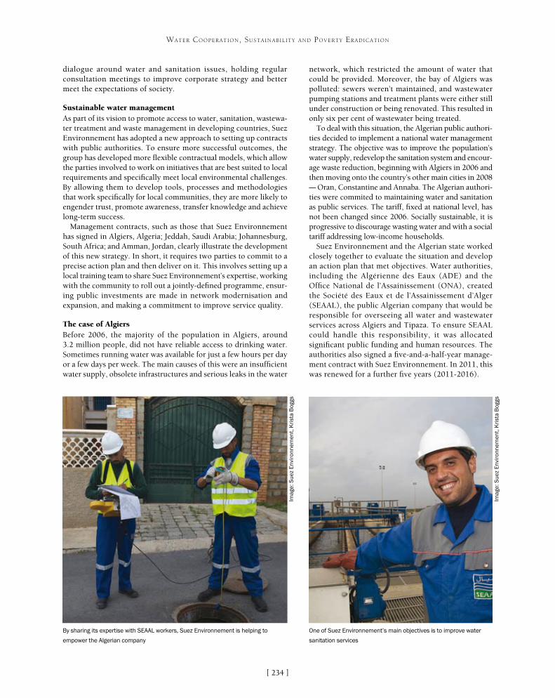
[ ]234
WATER COOPERATION, SUSTAINABILITY AND POVERTY ERADICATION
network, which restricted the amount of water that could be provided. Moreover, the bay of Algiers was polluted: sewers weren’t maintained, and wastewater pumping stations and treatment plants were either still under construction or being renovated. This resulted in only six per cent of wastewater being treated.
To deal with this situation, the Algerian public authori-ties decided to implement a national water management strategy. The objective was to improve the population’s water supply, redevelop the sanitation system and encour-age waste reduction, beginning with Algiers in 2006 and then moving onto the country’s other main cities in 2008 – Oran, Constantine and Annaba. The Algerian authori-ties were commited to maintaining water and sanitation as public services. The tariff, fixed at national level, has not been changed since 2006. Socially sustainable, it is progressive to discourage wasting water and with a social tariff addressing low-income households.
Suez Environnement and the Algerian state worked closely together to evaluate the situation and develop an action plan that met objectives. Water authorities, including the Algérienne des Eaux (ADE) and the Office National de l’Assainissement (ONA), created the Société des Eaux et de l’Assainissement d’Alger (SEAAL), the public Algerian company that would be responsible for overseeing all water and wastewater services across Algiers and Tipaza. To ensure SEAAL could handle this responsibility, it was allocated significant public funding and human resources. The authorities also signed a five-and-a-half-year manage-ment contract with Suez Environnement. In 2011, this was renewed for a further five years (2011-2016).
dialogue around water and sanitation issues, holding regular consultation meetings to improve corporate strategy and better meet the expectations of society.
Sustainable water management As part of its vision to promote access to water, sanitation, wastewa-ter treatment and waste management in developing countries, Suez Environnement has adopted a new approach to setting up contracts with public authorities. To ensure more successful outcomes, the group has developed more flexible contractual models, which allow the parties involved to work on initiatives that are best suited to local requirements and specifically meet local environmental challenges. By allowing them to develop tools, processes and methodologies that work specifically for local communities, they are more likely to engender trust, promote awareness, transfer knowledge and achieve long-term success.
Management contracts, such as those that Suez Environnement has signed in Algiers, Algeria; Jeddah, Saudi Arabia; Johannesburg, South Africa; and Amman, Jordan, clearly illustrate the development of this new strategy. In short, it requires two parties to commit to a precise action plan and then deliver on it. This involves setting up a local training team to share Suez Environnement’s expertise, working with the community to roll out a jointly-defined programme, ensur-ing public investments are made in network modernisation and expansion, and making a commitment to improve service quality.
The case of AlgiersBefore 2006, the majority of the population in Algiers, around 3.2 million people, did not have reliable access to drinking water. Sometimes running water was available for just a few hours per day or a few days per week. The main causes of this were an insufficient water supply, obsolete infrastructures and serious leaks in the water
By sharing its expertise with SEAAL workers, Suez Environnement is helping to
empower the Algerian company
One of Suez Environnement’s main objectives is to improve water
sanitation services
Imag
e: S
uez
Env
iron
nem
ent,
Kri
sta
Bog
gs
Imag
e: S
uez
Env
iron
nem
ent,
Kri
sta
Bog
gs

[ ]235
WATER COOPERATION, SUSTAINABILITY AND POVERTY ERADICATION
Suez Environnement committed to four main operational objec-tives: to establish quality water distribution, 24/7; to improve the operation of the sanitation systems and contribute to improving bathing and coastal water quality in Algiers; to retrofit and manage the water and wastewater assets in a sustainable manner; and to put in place a modern and efficient customer management system to improve customer satisfaction levels. The other main objective was for Suez Environnement to share its expertise with the local SEAAL teams.
A major axis of this public-private partnership also consisted of supporting growth in performance. The authorities constantly follow the perfomance of services through monthly detailed report-ing, a management tool monitoring contractual indicators shared by the partners and management bodies. The aim is to analyse every service from the customer’s point of view and ensure it meets their expectations.
A contract creating local expertiseEnhancing the business and managerial skills of the SEAAL staff is a key criterion in Suez Environnement’s contract. By sharing its exper-tise with SEAAL workers, Suez Environnement is helping to empower the public entity and ensure the project is a long-term success.
In Algiers, Suez Environnement has developed a global meth-odology called Water International Knowledge Transfer Initiative (WIKTI) to help transfer its knowledge of the management of water and wastewater services to the local workers. This initiative is the first of its kind that is taking place on such a large scale.
Using WIKTI, Suez Environnement experts started off by conduct-ing an initial analysis and diagnosis of each of the water services. Then, working with Algerian stakeholders, they quantified the
performance targets of services, and defined mid-term strategic action plans for each activity.
Suez Environnement has provided daily support to SEAAL staff on the ground, supplying 27 full-time experts and offering focused technical assistance, to improve oper-ational practices and modernize all management tools.
In addition to WIKTI, the Optimizing Personal Talents methodology was developed in 2011 to assess manage-rial performance. This methodology uses a framework that focuses on managerial and personal skills (the SEAAL Managers Charter), using international stand-ards and adapted to the Algerian socio-cultural context. Each manager has to commit to an individual five-year roadmap, which involves both practical and personal-ized managerial actions that they need to master. Each manager can progress and master these managerial skills on a step-by-step basis, prioritising the areas they most want to work on first. The aim is to enhance managerial skills and maximize the potential of Algerian manag-ers. Ultimately, this approach helps to build leadership performance and create transferable best practices that can be adopted throughout the entire company.
The managerial maturity should allow local teams to guarantee the continuity and the quality of the public service in accordance with international standards, after the departure of Suez Environnement.
Visible results for the inhabitants of Algiers Since this public-private partnership was forged seven years ago, noticeable and measurable improvements
Suez Environnement has played a key role in helping to improve the quality of water in Algiers
Imag
e: S
uez
Env
iron
nem
ent,
Kri
sta
Bog
gs
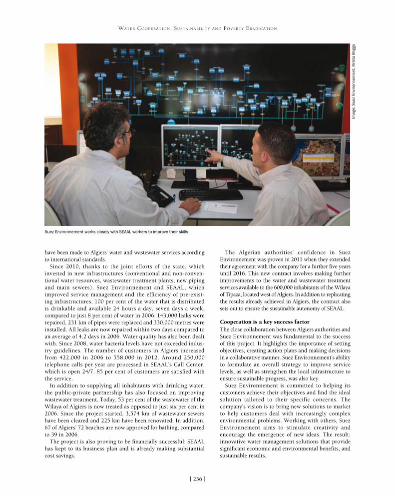
[ ]236
WATER COOPERATION, SUSTAINABILITY AND POVERTY ERADICATION
have been made to Algiers’ water and wastewater services according to international standards.
Since 2010, thanks to the joint efforts of the state, which invested in new infrastructures (conventional and non-conven-tional water resources, wastewater treatment plants, new piping and main sewers), Suez Environnement and SEAAL, which improved service management and the efficiency of pre-exist-ing infrastructures, 100 per cent of the water that is distributed is drinkable and available 24 hours a day, seven days a week, compared to just 8 per cent of water in 2006. 143,000 leaks were repaired, 231 km of pipes were replaced and 330,000 metres were installed. All leaks are now repaired within two days compared to an average of 4.2 days in 2006. Water quality has also been dealt with. Since 2008, water bacteria levels have not exceeded indus-try guidelines. The number of customers in Algiers increased from 422,000 in 2006 to 558,000 in 2012. Around 250,000 telephone calls per year are processed in SEAAL’s Call Center, which is open 24/7. 85 per cent of customers are satisfied with the service.
In addition to supplying all inhabitants with drinking water, the public-private partnership has also focused on improving wastewater treatment. Today, 53 per cent of the wastewater of the Wilaya of Algiers is now treated as opposed to just six per cent in 2006. Since the project started, 3,574 km of wastewater sewers have been cleared and 225 km have been renovated. In addition, 67 of Algiers’ 72 beaches are now approved for bathing, compared to 39 in 2006.
The project is also proving to be financially successful: SEAAL has kept to its business plan and is already making substantial cost savings.
The Algerian authorities’ confidence in Suez Environnement was proven in 2011 when they extended their agreement with the company for a further five years until 2016. This new contract involves making further improvements to the water and wastewater treatment services available to the 600,000 inhabitants of the Wilaya of Tipaza, located west of Algiers. In addition to replicating the results already achieved in Algiers, the contract also sets out to ensure the sustainable autonomy of SEAAL.
Cooperation is a key success factorThe close collaboration between Algiers authorities and Suez Environnement was fundamental to the success of this project. It highlights the importance of setting objectives, creating action plans and making decisions in a collaborative manner. Suez Environnement’s ability to formulate an overall strategy to improve service levels, as well as strengthen the local infrastructure to ensure sustainable progress, was also key.
Suez Environnement is committed to helping its customers achieve their objectives and find the ideal solution tailored to their specific concerns. The company’s vision is to bring new solutions to market to help customers deal with increasingly complex environmental problems. Working with others, Suez Environnement aims to stimulate creativity and encourage the emergence of new ideas. The result: innovative water management solutions that provide significant economic and environmental benefits, and sustainable results.
Suez Environnement works closely with SEAAL workers to improve their skills
Imag
e: S
uez
Env
iron
nem
ent,
Kri
sta
Bog
gs

[ ]237
Preparing Denmark for climate changesJan Tøibner, Aarhus Water Ltd.
Denmark is among the best in the world when it comes to water supply and wastewater purification. Among other things, this is due to a close and fruitful coopera-
tion between public water supply companies, forward-looking municipalities, high-tech companies in the water industry and innovative research and educational institutions. Danish water solutions resonate internationally, and the country’s largest suppliers of water and wastewater are ready to contribute internationally with the most recent knowledge and solutions in climate adaptation, energy optimization, green energy produc-tion, reduction of water consumption and improvement of drinking water quality.
One of the biggest issues facing the Danish water industry at present is handling the global climate changes which affect the low-lying parts of Denmark in the event of torrential rainstorms and rising water levels. Even though the country benefits from large groundwa-ter reservoirs, its water resources are constrained. These challenges transgress municipal boundaries. Therefore, efforts now focus on establishing greater units and new collaborations, so that water supply companies will be better prepared to meet the challenges of the future – both in terms of competence and technology – by working together nationally. For example, the three largest water supply companies in Denmark, Hofor, Vandcenter Syd and Aarhus Vand, have started working together regionally, nationally and internationally in the fields of security of supply, the environment, energy and sustainability to name a few. One aim of this cooperation is to contribute to the establishment of sustainable cities and smart cities, for instance by exploiting rainwater.
Working with the entire water life cycleAarhus Vand A/S (Aarhus Water Ltd.) is one of the leading compa-nies in the Danish water industry, and it works with the entire life cycle of water – from consumers turning on the tap for a drink of fresh water, to the return of purified wastewater from households and industries to nature. The company operates in the field of drinking water and wastewater treatment in the city and its surrounding rural areas, working with the treatment, distribu-tion and collection of wastewater. Cooperating closely with Aarhus Kommune, Aarhus Vand is in charge of planning and executing a wide variety of environmental and urban development projects which take climate changes into consideration.
This requires Aarhus Vand to develop intelligent and future-proof solutions. Therefore, the company has a long-standing tradition of taking part in research and development projects at home and abroad. It aims to be at the forefront of both knowledge and tech-nology in the water and wastewater industry, and to ensure that it continues to attract the foremost experts in the water sector.
These projects will support and improve Aarhus Vand’s knowledge of the activities it wants to initiate to obtain not only better and cheaper plants, products, services and working processes, but also an environmental gain.
The purpose of taking part in research and develop-ment projects is that they lead to the implementation of new technology and methods. Many good and usable results have been brought about by Aarhus Vand’s close cooperation with researchers, advisers and internation-ally-focused companies in the water industry. One example is the testing of a new and efficient bottom aeration system and the advanced online control of one of the company’s water treatment plants, resulting in a 45 per cent reduction in CO2 emissions and power consumption in wastewater treatment.
Another example is the full-scale system the company has installed to remove phosphorus from wastewater based on a pilot project. This system reduces the oper-ating costs of the water treatment plant and produces struvite, a clean and environmentally friendly fertilizer containing high levels of phosphorus, which is a scarce resource. The plant is a lighthouse project and the only one of its kind in Denmark.
A third example is the Energy Smart Water Utilities project, which includes an examination of the energy potential of water by Aarhus Vand and several partners across the water and energy sector. This is done by using water pressure to produce power and by moving power consumption in the water industry from day to night, thereby exploiting renewable energy in the water sector.
Another important topic for Aarhus Vand is to make water visible in the town. The company benefits from more than 10 years of experience in opening up the city of Aarhus and making water visible, facilitat-ing the use of water as a recreational element. At the same time, this visibility also protects the city against floods caused by torrential downpour. Examples include the uncovering of the river that runs through Aarhus city centre and the creation of the two lakes, Aarslev Engsø and Egå Engsø, which purify water from fields while also serving as large reservoirs. At a national level, Aarhus Vand takes part in the ‘Vand i byer’ (Water in cities) project along with Aarhus Kommune among others. This is the biggest Danish research project with an overall focus on the climate adaptation of Danish cities, their infrastructure and their water supply structure.
WATER COOPERATION, SUSTAINABILITY AND POVERTY ERADICATION

[ ]238
WATER COOPERATION, SUSTAINABILITY AND POVERTY ERADICATION
ture and more extreme events. The Prepared project addresses the practical problems and decisions that the urban water utilities have to deal with. In the project, researchers, universities and technology suppliers work together with urban utilities to produce an advanced strategy to meet the future challenges for water supply and sanitation brought about by climate change.
The Prepared project originates from the WSSTP thematic working group, Sustainable Water Management in Urban Areas. Over a period of five years, Prepared will work with a number of urban utilities in Europe and worldwide to develop advanced strategies to meet anticipated challenges, brought about by climate change, in the water supply and sanitation sectors. The project will provide a framework that links comprehen-sive research with development programmes in these utilities. The Prepared vision will provide significant synergistic opportunities that the utilities can use to improve their preparedness for ongoing changes relat-ing to the provision of water supply and sanitation. Project outcomes will be used as input for the planning and rehabilitation programmes of participating cities, and the experience gained by the utilities will then be shared with other players in the European water sector.
The ultimate objective is rehabilitation based on concern for the environment and investment programmes for water supply and sanitation systems (including storm-water). The cities and utilities involved will be prepared and resilient to the effects of climate change in the short and long term. Implementation of the project started in February 2010 and is expected to end in January 2014. Three years into the project, Prepared has completed the research and testing of solutions to challenges related to
PartneringAt a regional level, Aarhus Vand has used partnering since 2006 as a cooperative way of working when renovating drainpipes, and since 2008 when renovating water mains. By cooperating in this way, the company pulls together with its partners because all have agreed on clear and common objectives. If the objectives are met, both parties are due a cash bonus. This is cooperation based on dialogue, trust and openness, and it keeps the company constantly focused on development and improvements. Through structured knowledge-sharing, the partners are focused on finding the right solution the first time – in terms of both technology and process.
The results of this cooperative way of working speak for themselves. Aarhus Vand’s documentation shows that partnering has brought about a notable lowering of unit prices: 18 per cent on average on drainpipes (after four years) and 7 per cent on average on water mains (after two years). It has led to improved quality of the work, greater satisfaction for citizens and improved cooperation, which means that both Aarhus Vand’s employees and those of its partners are now pursuing assignments that are carried out using partnering.
Prepared – Enabling ChangeAt a European level, Aarhus Vand and the consultancy and research organization DHI head an international consortium called Prepared – Enabling Change, which consists of 35 countries and partners. The consortium is carrying out the largest collaborative environmen-tal project in the European Union on the research and development of technology for climate adaptation in the fields of water supply and wastewater management. Its purpose is especially to exchange knowledge and experience at the highest international level while striving to halt the consequences of climate changes such as down-pours and increases in temperature. The European water sector needs to prepare itself for climate changes that may affect the sector in different ways, such as flooding, droughts, changes in tempera-
Measures such as separating rainwater from wastewater help to improve water hygiene Tree-planting helps to protect Denmark’s groundwater reservoirsIm
age:
Aar
hus
Vand
Imag
e: A
arhu
s Va
nd

[ ]239
WATER COOPERATION, SUSTAINABILITY AND POVERTY ERADICATION
climate change that the urban water sector needs to address. The final year of the project is dedicated to the demonstration of real-life situ-ations at the Prepared water utilities. Successful cooperation between researchers, technology suppliers and water utilities has resulted in approximately 30 on-site demonstrations. The final conference will be held in January 2014 in Aarhus, Denmark.
Contributing knowledge and expertiseAarhus Vand leads the way globally when it comes to effective wastewa-ter management. Alongside DHI, it contributes to the Prepared project with its knowledge and expertise from the Aarhus Å-projektet (Aarhus River project). This project is about flood prevention and preventing wastewater from overflowing into lakes, streams and bays by creating large basins and ensuring optimal control of basins, sewerage plants and water treatment plants. It is a full-scale project, fully financed and therefore ideal in this context. Along parts of the Aarhus River and on the Port of Aarhus, urban development is rapid and will continue at a fast pace in the coming years. The Aarhus River was previously covered, but it is now uncovered and has become a recreational element in the city. The part of the harbour close to Aarhus has been converted from industrial harbour to new city areas. Here, too, water and canals will be important recreational elements. In 2005, the Municipality of Aarhus decided to improve the quality of water hygiene in receiving waters through the Aarhus River project, in order to support opportunities for the recreational use of Lake Brabrand (Brabrand Sø), the Aarhus River and the Port of Aarhus. In more measurable terms, this decision is driven by the Water Framework Directive and the Bathing Water Directive and the planned solution must be adapted to the expected climate change scenario.
As an integrated part of the Aarhus River project, Arhus Vand has implemented one of the world’s most advanced systems in which the control of all installations is coordi-nated from one point. A challenge for the city of Aarhus is the recreational area, Lake Brabrand, which is close to the city centre and is connected to Aarhus Harbour through the small Aarhus River. The water in the lake, river and harbour was adversely affected by combined sewer overflow, stormwater drains and effluent from wastewater treatment plants. Efficient and flexible opera-tion, especially during rainfall events, will be secured by new integrated control and an early warning system. This will improve water hygiene, including during expected climate change scenarios like intense rainfall and rising sea levels. The demonstration will involve improved rainfall monitoring, integrated control of sewer and wastewater treatment plants, and early warnings on the water quality of receiving waters. By taking the chal-lenges posed by climate change into account, excellent water quality will be produced by implementing the designed solution of sufficient basin volume, sufficiently high water quality through increased hydraulic capacity, and disinfection at the wastewater treatment plant.
As part of the Prepared project, the Aarhus River project has resulted in improved cooperation with colleagues from Lyon, Berlin and Barcelona. It enables international envi-ronmental research to be applied concretely and locally, with the intention of cooperating across borders using the latest technology in the fight against climate changes.
Rapid urban development has made effective wastewater management a priority in the city of Aarhus
Imag
e: A
arhu
s W
ater

[ ]240
Developing community water services and cooperation in Finland and the South
Tapio S. Katko, UNESCO Chair in Sustainable Water Services, Tampere University of Technology; and Antti Rautavaara, Senior Water Advisor, Ministry for Foreign Affairs
In water management it is important to distinguish between water resources and water services. Water use for various purposes is managed at several levels – from international
treaties and transboundary rivers and groundwater areas to water courses of various sizes. Some 270 transboundary rivers flow and 450 groundwater areas are located in at least two sovereign countries.
In this article, water services refer to community water supply, sewer-age and, to some extent, stormwater management. These are typically managed at lower levels: from the inter-municipal level to cities and communities, villages and on-site systems. These systems can also be linked to each other. Water services involve a large number of stake-holders: citizens, communities, municipal decision makers, water utilities, professional and other associations, educational and training institutions, ministries and other authorities, and research sponsors. The challenge is how to promote smooth collaboration between these various partners and find appropriate roles for each of them.
In Finland, municipalities are in charge of provid-ing water services while municipality-owned utilities mainly produce the actual services. There is also a long tradition of smaller, water cooperative-run systems in rural areas. The experience gained from a diversity of options is perhaps one of Finland’s major strengths and is reflected in the activities supported by the Finnish Government in developing economies, especially Africa.
Finnish development cooperation and policy Finland’s human rights-based development policy and cooperation focus on four priority areas: a democratic and accountable society that promotes human rights; an inclusive green economy that promotes employment; sustainable management of natural resources and envi-ronmental protection; and human development. The water sector, with all its levels and sub-sectors, fits well within this policy frame.
WATER COOPERATION, SUSTAINABILITY AND POVERTY ERADICATION
WATER RESOURCES MANAGEMENT
WATER SERVICES MANAGEMENT
“Global Village”
Transboundary waters
States
Regions
MunicipalitiesManagement at the
lowest appropriate level
Global policy frameworks
Transboundary commissions
Central ministries
River basin bodies
Water and wastewaterundertakings
User associations
On-site systemsProperty owner
Communities
Households
Multilevel governance and relations between water resources and water services
Source: Pekka Pietilä

[ ]241
WATER COOPERATION, SUSTAINABILITY AND POVERTY ERADICATION
for the needs of developing countries was conducted at Helsinki University of Technology (1972-74), followed by six courses in 1979-1992 at Tampere University of Technology (TUT). Participants in the latter courses wrote their MSc theses mainly in their home countries. A special BSc civil engineering programme was also run for 14 Namibian students at TUT before the country gained independence.
Current development cooperation supported by the Finnish Government in the water sector uses various forms and instruments. In addition to the bilateral activ-ities described below, Finland supports many activities in the sector through international agencies, academia and non-governmental organizations (NGOs).
Collaboration projects The Finnish Government started to support bilateral projects after sending out individual experts in the late 1960s and early 1970s. The first long-term project was in Southern Tanzania in 1970-1993. Such projects have also been undertaken in Sri Lanka, Kenya, Viet Nam, Egypt, Mozambique, Nepal, Namibia, Ethiopia, Sudan and Southern Sudan.
In the 1980s these projects started to change from construction orientation (supply-driven) to expert-based and development activities (demand-driven). Gradually, sanitation and hygiene education were included in the projects, and policy coherence between water, education and health became integral to the operations. The main focus has been on rural coop-eration, but since the 1990s urban water supply and sewerage have also been supported in Viet Nam, Egypt and Mozambique. Since 2007 urban projects have focused on small towns in Palestine and Viet Nam.
EthiopiaAfter the fall of the communist military regime in Ethiopia, a Finnish-supported water and environ-ment project was conducted in the Amhara region (1994-2011) and replicated in the Benishangul-Gumuz regions (2008-13). Both aimed to increase capacity and community ownership of community-based water, sanitation and hygiene (WASH) structures. These were mainly shallow wells and spring protections, with Community-Led Total Sanitation as the main channel for sanitation support. Thereafter the Community-Led Accelerated WASH programme institutionalized the community managed project (CMP) model, which has become accepted as one of the national financial models for rural WASH.
CMP has solved the issue of managing local funding and optimal allocation of roles and responsibilities in the WASH process. The investment funds needed for construction are channelled to communities by a local microfinance institution. The CMP approach is also used in projects implemented and financed by the Ethiopian Government as well as the United Nations Children’s Fund (UNICEF) in some regions. The approach has proved successful and has gained inter-
Since the mid-1960s, the water sector – particularly water supply and sanitation – has been one of the major targets of Finnish devel-opment policy and cooperation. Official development assistance (ODA) increased in the 1980s and peaked in 1991 at 0.8 per cent of gross national income. This upward trend was followed by a deep trough in the early 1990s which cut resources by half and was later followed by an instrumental shift from project-based aid towards sector-wide approaches where funds were increasingly channelled through multilateral trust funds. At this juncture some innovative and functional ODA instruments also ceased to exist, such as univer-sity collaboration.
In the early part of the millennium the water sector accounted for some 2-5 per cent of bilateral cooperation activities, but its share increased steeply in 2007-2011 as a result of the policy shift. Currently, water sector ODA is almost EUR 60 million a year or around 5 per cent of total ODA; in 2012-2016 the water sector will be the single largest sector of cooperation in the main partner coun-tries. The focus has also shifted to multiple use of development cooperation instruments and, geographically, to fragile and post-conflict countries.
Finnish development cooperation in water servicesOfficial water sector development cooperation supported by the Finnish Government has progressed gradually based on lessons learned. In Eastern Africa many new independent governments had ambitious plans and policies including the free water policy. Although understandable based on the political passions of the day, this policy soon proved unrealistic, though it took decades for many countries to abandon it.
In the late 1960s and early 1970s individual experts were stationed at the national water authorities of recipient countries in Ethiopia, Kenya and Tanzania. A postgraduate programme designed
Improved water supply in the Amhara Region of Ethiopia
Imag
e: H
arri
Mat
tila
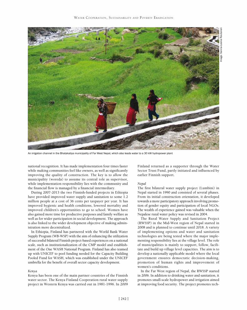
[ ]242
WATER COOPERATION, SUSTAINABILITY AND POVERTY ERADICATION
national recognition. It has made implementation four times faster while making communities feel like owners, as well as significantly improving the quality of construction. The key is to allow the municipality (woreda) to assume its central role as supervisor, while implementation responsibility lies with the community and the financial flow is managed by a financial intermediary.
During 2007-2013 the two Finnish-funded projects in Ethiopia have provided improved water supply and sanitation to some 1.2 million people at a cost of 36 cents per taxpayer per year. It has improved hygienic and health conditions, lowered mortality and improved children’s opportunities to go to school. Women have also gained more time for productive purposes and family welfare as well as for wider participation in social development. The approach is also linked to the wider development objective of making admin-istration more decentralized.
In Ethiopia, Finland has partnered with the World Bank Water Supply Program (WB-WSP) with the aim of enhancing the utilization of successful bilateral Finnish project-based experiences on a national scale, such as institutionalization of the CMP model and establish-ment of the One WASH National Program. Finland has also teamed up with UNICEF to pool funding needed for the Capacity Building Pooled Fund for WASH, which was established under the UNICEF umbrella for the benefit of overall sector capacity development.
KenyaKenya has been one of the main partner countries of the Finnish water sector. The Kenya Finland Cooperation rural water supply project in Western Kenya was carried out in 1981-1996. In 2009
Finland returned as a supporter through the Water Sector Trust Fund, partly initiated and influenced by earlier Finnish support.
NepalThe first bilateral water supply project (Lumbini) in Nepal started in 1990 and consisted of several phases. From its initial construction orientation, it developed towards a more participatory approach involving promo-tion of gender equity and participation of local NGOs. The wealth of experience gained was valuable when the Nepalese rural water policy was revised in 2004.
The Rural Water Supply and Sanitation Project (RWSSP) in the Mid-West region of Nepal started in 2008 and is planned to continue until 2018. A variety of implementing options and water and sanitation technologies are being tested where the major imple-menting responsibility lies at the village level. The role of municipalities is mainly to support, follow, facili-tate and build up village level capacities. The aim is to develop a nationally applicable model where the local government ensures democratic decision-making, promotion of human rights and improvement of women’s conditions.
In the Far West region of Nepal, the RWSSP started in 2006. In addition to drinking water and sanitation, it promotes small-scale hydropower and irrigation aimed at improving food security. The project promotes tech-
An irrigation channel in the Bhatakatiya municipality of Far West Nepal, which also leads water to a 30 kW hydropower plant
Imag
e: S
anna
-Lee
na R
auta
nen

[ ]243
WATER COOPERATION, SUSTAINABILITY AND POVERTY ERADICATION
Water users, especially women, were considered in the planning, distribution and management of water services. The autonomy of water utilities was increased, water tariffs were set at a reasonable level, water meters were installed, and water leakages were reduced.
Finnish support to Hanoi Water Works ended in 2000 and for Haiphong in 2004. Thereafter, the latter has been supported by concessional credits (inter-est-subsidized loans). Haiphong Water Works has improved its operations considerably, and its bench-mark indicators are of a high international level. In 2003 the Water and Sanitation Programme for Small Towns (WSPST) started, originally in 22 townships. Experience has taught that building adequate capacities in conditions like these takes more time than antici-pated as all the same steps need to be taken irrespective of the town’s size. The key lesson taught by the WSPST is that while secure water supply is very high on the agenda of communities, sanitation places much lower. In the current policy and regulatory framework it is also difficult to place management of wastewater treatment facilities on a sustainable footing.
In Viet Nam, Finland also cooperates closely with the WB-WSP, as it is partly funded by Finland and is in a strong position to create key sector knowledge and influence the regulatory framework effectively. Finnish experience is at the disposal of the Government of Viet Nam and other development partners.
nologies that will enable multiple use of services and use of water resources for productive purposes. The key requirement for support is a village-level Water Uses Master Plan that allows the prioritiza-tion and optimization of water resources use. The project is based on a step-by-step approach through learning on the spot and other external support. In the second phase (2010-15) cooperatives have been – and will increasingly be – established with the aim of promoting small-scale farming by households.
Finland has also supported the UNICEF WASH programme in Nepal. By partnering with this multilateral organization, Finland aims to upscale the bilateral lessons it has learned on the national level and support the move towards a sectoral programme in Nepal.
Viet NamIn 1986 Viet Nam started to reform its planned communist economy. Finnish support to Hanoi Water Works started in 1985 and Haiphong followed in 1990. Both projects lasted some 15 years and involved several phases. They began with crisis support for key areas of the networks in urgent need of rehabilitation and expansion, and developed towards building an independent and operationally sustainable utility.
In 1993 a long-term general plan was prepared for Haiphong, after which the World Bank became the major financier while Finland supported planning, supervision and management, and govern-ance development. The commitment to long-term support proved important. Other preconditions for success included trust in Finnish know-how and maintaining a balance between construction, lead-ership, financial management and human resources development.
The Dry Toilet project in Zambia
Imag
e: S
ari H
uuht
anen

[ ]244
WATER COOPERATION, SUSTAINABILITY AND POVERTY ERADICATION
that the Finnish Government has recently introduced some programmes that will also promote North-South collaboration as part of the general policy of emphasiz-ing international education and research.
Domestic cooperation in the water sectorThe majority, if not all water sector actors have organ-ized themselves under the Finnish Water Forum umbrella organization.1 It has a mandate to both export and develop, which makes it instrumental in bringing together sector actors and enabling them to cooper-ate smoothly in the highly competitive water service markets. The latest social forum for sector profession-als is on LinkedIn at ‘Finnish Water Professionals for Development’ – a discussion forum allowing Finnish professionals to engage in professional dialogue from the mountains of Nepal to the rural town of Gilgel-Beles in Ethiopia. Horizontal learning and dialogue are still key in bridging knowledge gaps.
Lessons learnedAllowing for some inaccuracy, the commonly cited results of the Finnish-funded ODA show that some 6 million people been served with safe water supply and many more with improved sanitation. For example, the World Bank recently estimated that almost 700,000 people in Amhara, Ethiopia were served with sanita-tion through the Finnish-funded WSP single donor trust fund.
An evaluation of the Finnish-supported water sector ODA was carried out in 2010, covering activities from 1995-2009. It presented the following key findings:• Finnish cooperation in the water sector contributes
directly to improved living conditions for the targeted beneficiaries
• some inadequacies were observed, particularly in project cycle management and the policy framework
• in the visited countries, most of the Finnish projects have proved remarkable successes
• upscaling and replication of positive experiences are also becoming major challenges: they should be incorporated into the design of successive project phases.
A more recent meta-evaluation compiling evaluations from many sectors indicates that the water sector has been quite successful and suggests that additional resources should be allocated to the sector for future collaboration.
Especially in water services, local political, economic, social, technological, environmental and legislative conditions have to be taken into account. Yet we seem to have many common challenges. One of the most demanding ones is the question of ageing infrastructure, its renovation need and related costs. Another common interest is to improve services and conditions through various types of reforms and development work. Thus, we have many lessons to learn and share. We are in the same proverbial boat, so why not fish together?
SanitationThe Global Dry Toilet Association of Finland, a professional NGO, was established in 2002. It promotes the use of dry toilets (DT) as a sanitation option through advocacy, research, surveys, seminars and more. In addition to national activities, the association organ-ized four international DT conferences between 2003 and 2012. It has also conducted several projects in the developing economies of Zambia and Swaziland, as well as in Finland and other parts of Europe. The association tries to raise awareness that water-borne sanitation is not the only option and that alternatives should be seriously considered, especially in areas where water is scarce or the risk of contaminating water bodies exists.
EducationThe Finnish-African Water Alumni, consisting of over 100 water experts from Ethiopia, Eritrea, Kenya, Namibia, Tanzania and Zambia, is a substantial and unique network. The alumni have gained key positions, for instance in ministries, public institu-tions, water utilities, consulting engineering companies, private consultants, contracting companies, universities, other training institutes, international agencies and even as leading politicians. The positive impact of education is best shown by the fact that in 2012 a TUT alumnus, Hailemariam Desalegn, was appointed Prime Minister of Ethiopia. Since 2013 he has been the Chair of the African Union.
Since the programme ended in 1992, North-South collaboration has been maintained at some level and it will hopefully become more active in the future. The challenge of human resources development is the long time frame required by the activities. Interestingly, the collaborating countries in the South seem to have a similar type of generation gap in terms of professionals. Within the next few years many professionals will retire, making it necessary to educate a new generation as soon as possible. A positive development is
The current Ethiopian Prime Minister, Ato Hailemariam Desalegn, visiting his old
university in Tampere as Foreign Minister in 2012Im
age:
Vir
pi A
nder
sin
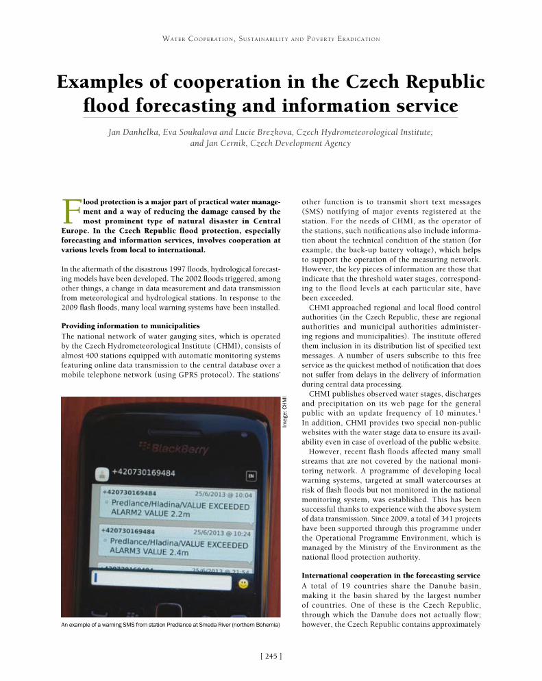
[ ]245
Examples of cooperation in the Czech Republic flood forecasting and information service
Jan Danhelka, Eva Soukalova and Lucie Brezkova, Czech Hydrometeorological Institute; and Jan Cernik, Czech Development Agency
Flood protection is a major part of practical water manage-ment and a way of reducing the damage caused by the most prominent type of natural disaster in Central
Europe. In the Czech Republic flood protection, especially forecasting and information services, involves cooperation at various levels from local to international.
In the aftermath of the disastrous 1997 floods, hydrological forecast-ing models have been developed. The 2002 floods triggered, among other things, a change in data measurement and data transmission from meteorological and hydrological stations. In response to the 2009 flash floods, many local warning systems have been installed.
Providing information to municipalitiesThe national network of water gauging sites, which is operated by the Czech Hydrometeorological Institute (CHMI), consists of almost 400 stations equipped with automatic monitoring systems featuring online data transmission to the central database over a mobile telephone network (using GPRS protocol). The stations’
other function is to transmit short text messages (SMS) notifying of major events registered at the station. For the needs of CHMI, as the operator of the stations, such notifications also include informa-tion about the technical condition of the station (for example, the back-up battery voltage), which helps to support the operation of the measuring network. However, the key pieces of information are those that indicate that the threshold water stages, correspond-ing to the flood levels at each particular site, have been exceeded.
CHMI approached regional and local flood control authorities (in the Czech Republic, these are regional authorities and municipal authorities administer-ing regions and municipalities). The institute offered them inclusion in its distribution list of specified text messages. A number of users subscribe to this free service as the quickest method of notification that does not suffer from delays in the delivery of information during central data processing.
CHMI publishes observed water stages, discharges and precipitation on its web page for the general public with an update frequency of 10 minutes.1 In addition, CHMI provides two special non-public websites with the water stage data to ensure its avail-ability even in case of overload of the public website.
However, recent flash floods affected many small streams that are not covered by the national moni-toring network. A programme of developing local warning systems, targeted at small watercourses at risk of flash floods but not monitored in the national monitoring system, was established. This has been successful thanks to experience with the above system of data transmission. Since 2009, a total of 341 projects have been supported through this programme under the Operational Programme Environment, which is managed by the Ministry of the Environment as the national flood protection authority.
International cooperation in the forecasting service A total of 19 countries share the Danube basin, making it the basin shared by the largest number of countries. One of these is the Czech Republic, through which the Danube does not actually flow; however, the Czech Republic contains approximately
WATER COOPERATION, SUSTAINABILITY AND POVERTY ERADICATION
An example of a warning SMS from station Predlance at Smeda River (northern Bohemia)
Imag
e: C
HM
I
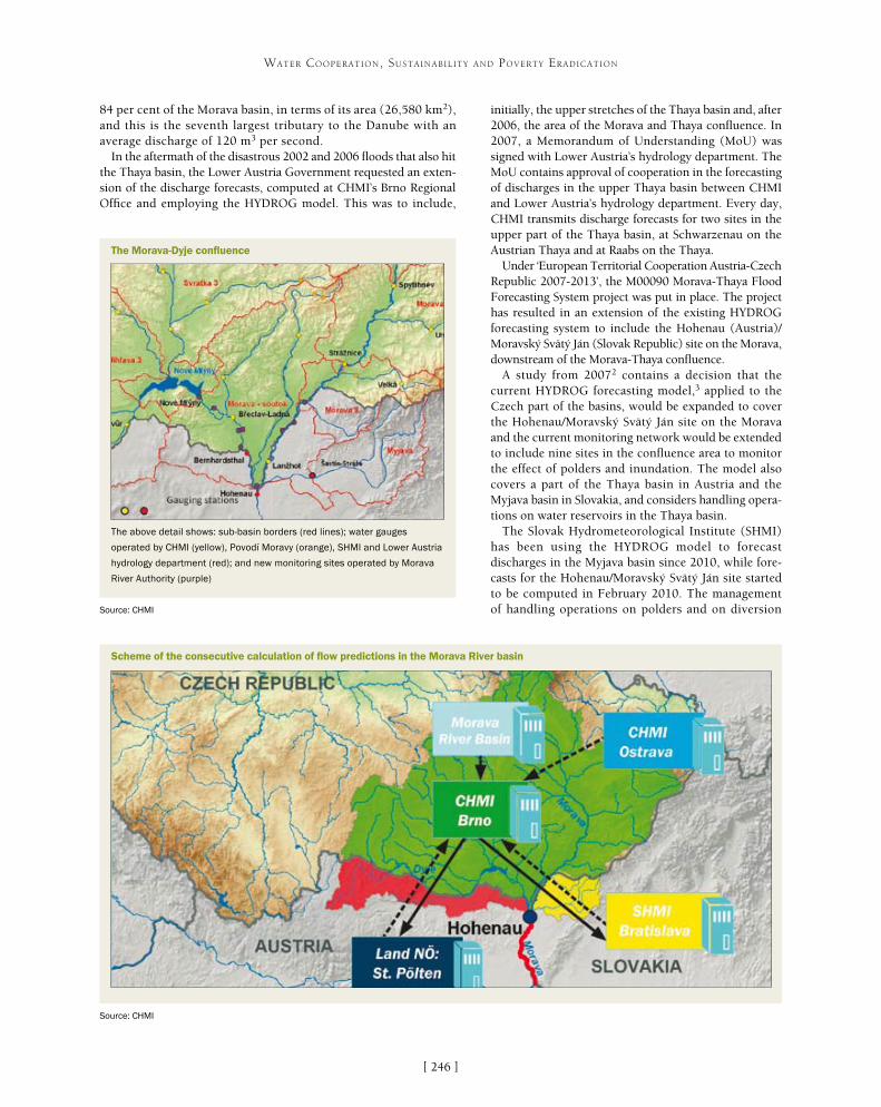
[ ]246
WATER COOPERATION, SUSTAINABILITY AND POVERTY ERADICATION
initially, the upper stretches of the Thaya basin and, after 2006, the area of the Morava and Thaya confluence. In 2007, a Memorandum of Understanding (MoU) was signed with Lower Austria’s hydrology department. The MoU contains approval of cooperation in the forecasting of discharges in the upper Thaya basin between CHMI and Lower Austria’s hydrology department. Every day, CHMI transmits discharge forecasts for two sites in the upper part of the Thaya basin, at Schwarzenau on the Austrian Thaya and at Raabs on the Thaya.
Under ‘European Territorial Cooperation Austria-Czech Republic 2007-2013’, the M00090 Morava-Thaya Flood Forecasting System project was put in place. The project has resulted in an extension of the existing HYDROG forecasting system to include the Hohenau (Austria)/Moravský Svätý Ján (Slovak Republic) site on the Morava, downstream of the Morava-Thaya confluence.
A study from 20072 contains a decision that the current HYDROG forecasting model,3 applied to the Czech part of the basins, would be expanded to cover the Hohenau/Moravský Svätý Ján site on the Morava and the current monitoring network would be extended to include nine sites in the confluence area to monitor the effect of polders and inundation. The model also covers a part of the Thaya basin in Austria and the Myjava basin in Slovakia, and considers handling opera-tions on water reservoirs in the Thaya basin.
The Slovak Hydrometeorological Institute (SHMI) has been using the HYDROG model to forecast discharges in the Myjava basin since 2010, while fore-casts for the Hohenau/Moravský Svätý Ján site started to be computed in February 2010. The management of handling operations on polders and on diversion
84 per cent of the Morava basin, in terms of its area (26,580 km2), and this is the seventh largest tributary to the Danube with an average discharge of 120 m3 per second.
In the aftermath of the disastrous 2002 and 2006 floods that also hit the Thaya basin, the Lower Austria Government requested an exten-sion of the discharge forecasts, computed at CHMI’s Brno Regional Office and employing the HYDROG model. This was to include,
Scheme of the consecutive calculation of flow predictions in the Morava River basin
Source: CHMI
The Morava-Dyje confluence
Source: CHMI
The above detail shows: sub-basin borders (red lines); water gauges
operated by CHMI (yellow), Povodí Moravy (orange), SHMI and Lower Austria
hydrology department (red); and new monitoring sites operated by Morava
River Authority (purple)
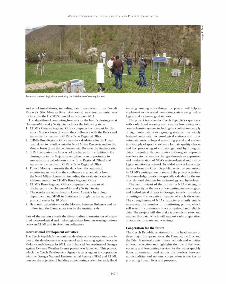
[ ]247
WATER COOPERATION, SUSTAINABILITY AND POVERTY ERADICATION
and relief installations, including data transmission from Povodí Moravy’s (the Morava River Authority) new instruments, was included in the HYDROG model in February 2011.
The algorithm of computing forecasts for the basin’s closing site at Hohenau/Moravský Svätý Ján includes the following steps: 1. CHMI’s Ostrava Regional Office computes the forecast for the
upper Morava basin down to the confluence with the Be�va and transmits the results to CHMI’s Brno Regional Office
2. CHMI’s Brno Regional Office runs the calculations for the Thaya basin down to its inflow into the Nové Mlýny Reservoir and for the Morava basin (from the confluence with Be�va to the Strážnice site)
3. SHMI computes the forecast of discharge for the Šaštín-Stráže closing site in the Myjava basin (there is an opportunity to run substitute calculations at the Brno Regional Office) and transmits the results to CHMI’s Brno Regional Office
4. Povodí Moravy transmits the data from the automatic monitoring network in the confluence area and data from the Nové Mlýny Reservoir, including the evaluated expected 48-hour run-off, to CHMI’s Brno Regional Office
5. CHMI’s Brno Regional Office computes the forecast of discharge for the Hohenau/Moravský Svätý Ján site
6. The results are transmitted to Lower Austria’s hydrology department and SHMI in Bratislava through the file transfer protocol server by 10.00am
7. Hydraulic calculations for the Morava, between Hohenau and its inflow into the Danube, are run by the Austrian side.
Part of the system entails the direct online transmission of meas-ured meteorological and hydrological data from measuring stations between CHMI and its Austrian colleagues.
International development activities The Czech Republic’s international development cooperation contrib-utes to the development of a system of early warning against floods in Moldova and Georgia. In 2011, the Enhanced Preparedness of Georgia against Extreme Weather Events project was launched. This project, which the Czech Development Agency is carrying out in cooperation with the Georgia National Environmental Agency (NEA) and CHMI, pursues the objective of building a monitoring system for early flood
warning. Among other things, the project will help to implement an integrated monitoring system using hydro-logical and meteorological stations.
The project transfers the Czech Republic’s experience with early flood warning and weather forecasting in a comprehensive system, including data collection (supply of eight automatic water gauging stations, five widely featured automatic meteorological stations and three automatic meteorological measuring posts) and evalua-tion (supply of specific software for data quality checks and the processing of climatologic and hydrological data). It significantly contributes to Georgia’s prepared-ness for extreme weather changes through an expansion and modernization of NEA’s meteorological and hydro-logical monitoring network. Its added value is knowledge transfer from the Czech Republic, which is guaranteed by CHMI’s participation in some of the project activities. This knowledge transfer is especially valuable for the use of a relational database for meteorology and hydrology.
The main output of the project is NEA’s strength-ened capacity in the area of forecasting meteorological and hydrological threats in Georgia, in order to reduce or mitigate the negative impacts of such disasters. The strengthening of NEA’s capacity primarily entails increasing the number of monitoring points, which will result in continuous flows of updated and reliable data. The project will also make it possible to store and analyse this data, which will support early preparation of accurate forecasts and warnings.
Cooperation for the futureThe Czech Republic is situated in the head waters of three major European rivers: the Danube, the Elbe and the Oder. It naturally determines methods and activities in flood protection and highlights the role of the flood warning and forecasting service. As the water quickly flows downstream and across the borders between municipalities and nations, cooperation is the key to protecting human lives and property.
Pasanauri meteorological station during the installation of new equipment
Imag
e: P
. Ser
cl
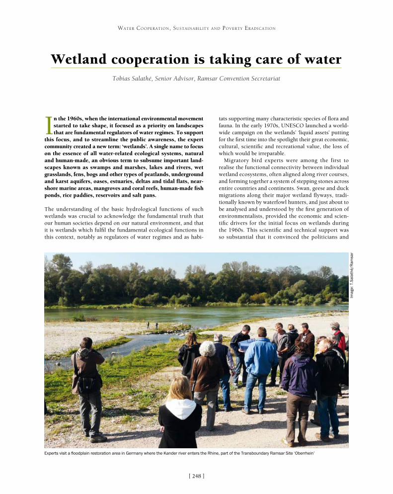
[ ]248
Wetland cooperation is taking care of water Tobias Salathé, Senior Advisor, Ramsar Convention Secretariat
In the 1960s, when the international environmental movement started to take shape, it focused as a priority on landscapes that are fundamental regulators of water regimes. To support
this focus, and to streamline the public awareness, the expert community created a new term: ‘wetlands’. A single name to focus on the essence of all water-related ecological systems, natural and human-made, an obvious term to subsume important land-scapes known as swamps and marshes, lakes and rivers, wet grasslands, fens, bogs and other types of peatlands, underground and karst aquifers, oases, estuaries, deltas and tidal flats, near-shore marine areas, mangroves and coral reefs, human-made fish ponds, rice paddies, reservoirs and salt pans.
The understanding of the basic hydrological functions of such wetlands was crucial to acknowledge the fundamental truth that our human societies depend on our natural environment, and that it is wetlands which fulfil the fundamental ecological functions in this context, notably as regulators of water regimes and as habi-
tats supporting many characteristic species of flora and fauna. In the early 1970s, UNESCO launched a world-wide campaign on the wetlands’ ‘liquid assets’ putting for the first time into the spotlight their great economic, cultural, scientific and recreational value, the loss of which would be irreparable.
Migratory bird experts were among the first to realise the functional connectivity between individual wetland ecosystems, often aligned along river courses, and forming together a system of stepping stones across entire countries and continents. Swan, geese and duck migrations along their major wetland flyways, tradi-tionally known by waterfowl hunters, and just about to be analysed and understood by the first generation of environmentalists, provided the economic and scien-tific drivers for the initial focus on wetlands during the 1960s. This scientific and technical support was so substantial that it convinced the politicians and
WATER COOPERATION, SUSTAINABILITY AND POVERTY ERADICATION
Experts visit a floodplain restoration area in Germany where the Kander river enters the Rhine, part of the Transboundary Ramsar Site ‘Oberrhein’
Imag
e: T
.Sal
athé
/Ram
sar

[ ]249
WATER COOPERATION, SUSTAINABILITY AND POVERTY ERADICATION
in fertile soils, feeds underground aquifers and finishes in springs or is stored in all sorts of wetland types. Almost everywhere, our drinking water resources are delivered through wetlands. And our local communities, as well as urban societies, profit from specific wetland ecosys-tem services, such as water purification, retention and release, and the production of wetland food, fish and fibre. Wetlands help with erosion control and sediment transport, thereby contributing to land formation and increasing resilience to storms. The final Rio+20 decla-ration on ‘the future we want’, clearly recognizes the role of ecosystems in the supply of water and its quality.
The Ramsar Convention in particular encourages and obliges its member states to cooperate when it comes to wetlands and river basins that are shared between neighbouring countries, concerning shared species that migrate from one country to the next, and concerning development projects that might affect wetlands in a neighbouring or third country. The Ramsar Convention created and continues to support the global concern and the recognition of a shared responsibility for these ecosystems that provide us with multiple benefits for large cities as well as rural communities. Over the years, the Convention has elaborated operational tools on how to integrate wetland site management for the benefit of the functioning of specific ecosystems within broad-scale environmental planning at the scales of entire river basins and coastal areas. Tools designed to clarify
eventually led to the establishment of the first modern environmen-tal cooperation treaty. Eighteen countries sent their plenipotentiary governmental delegations to an international conference in the Iranian seaside resort of Ramsar, at the shores of the Caspian Sea (itself a globally important wetland), to sign an intergovernmental text, based on the shared confidence that far-sighted national poli-cies and coordinated international action are needed to maintain and to manage in a sustainable way these important ecological systems that were longtime neglected, drained and destroyed. The new treaty with a global reach, signed in Ramsar on 3 February 1971 was the first of its kind. It is since colloquially known as the ‘Ramsar Convention on Wetlands’. Today, it is rapidly reaching its full global coverage. Already, its member states have together listed more than 2100 ‘Wetlands of International Importance’ (also known as Ramsar Sites), in more than 165 countries, and covering together well beyond 200 million hectares. The Ramsar Sites form the largest network of protected areas across the globe.
Wetlands are the earth’s natural water infrastructure. They provide a clean source and store of freshwater, thus assuring the security of water supply in dry regions and during drought seasons, while inversely also mitigating flood and storm damage through their water retention capacities. During the international year of water coopera-tion, the message on World Wetlands Day (2 February 2013) was clear: wetlands take care of water – they provide the natural infra-structure to capture, filter, store, transport and release water. Wetlands are the critical arteries in the water cycle, the hydrological cycle that keeps human societies supplied with water. Rain evaporates rapidly and returns back into the atmosphere, as long as it is not soaked up
Confluence of the Morava with the Danube seen from Devin castle, Slovakia, part of the Transboundary Ramsar Site ‘Floodplains of the Morava-Dyje-Danube confluence’
Imag
e: T
.Sal
athé
/Ram
sar

[ ]250
WATER COOPERATION, SUSTAINABILITY AND POVERTY ERADICATION
the sustainable development objectives of different stakeholders, to identify the ecological, economic and social factors that affect, or may affect, a given site, tools to resolve conflicts, and to obtain resources to find sustainable solutions.
Where wetlands and their water catchment basins are shared between different countries, or different administrative areas, cooperation for the long-term use of their resources at a transboundary level, taking the needs of the entire ecosystem and water catchment into account, is an urgent need. And such cooperation is a process that develops, often passing different steps that may individually take much time to be achieved, in order to move on to the next level of integration and coordinated action. Local non-governmental stakeholder organizations are often among the first ones to understand the need for common approaches and coordinated action, and to make the first moves. Ideally they will do so with the support of local authorities, enabling the creation of the first formal contacts across artificial borders. This should lead to regular consultations, agreements on cooperation, and joint activities. The next steps of integration proposed in the Ramsar guidance are joint planning exercises and the elaboration of common management plans and interventions. Eventually, shared sites and catchment basins would be administered jointly by the respective institutions in charge in each country concerned.
Real life experience shows the most challenging initial factors to be the need to create trust, mutual trust among the neighbours and the different administrations concerned. Confidence and trust among the partners, the vision and belief that together, they can identify shared and common vital interests, and at the same time acknowl-edging that there can easily be potentially harmful side effects and
consequences, created through activities that support only unilateral interests. As well as political vision and will, transboundary cooperation needs dedicated staff, sufficient time and patience. One of the primary needs is to find a common language. Speaking literally about the same idiom, but also in terms of expressions that need to be understood in the same sense by stakehold-ers and geographical neighbours who have possibly very differing backgrounds and individual histories. Information and data, as well as their analyses, need to be shared in a transparent way. This is likely to trigger and to be followed by common monitoring and research programmes. Hopefully, these are benefiting from a pragmatic exchange of equipment and services. Such exchange can lead to the joint development of rules and responsibilities, including joint management plans. Undertaking joint training, regular exchange of staff and disseminating concrete experiences rapidly increases the know-how and intervention capacities, notably at transboundary level. In this way, mutual benefits can be achieved and be recognized more widely. The dissemi-nation of best case and other success stories benefits the raising of awareness and implementation capacities.
On the European continent – where many, often smaller, countries meet in a restricted continental space – national borders are abundant. This can result in the splitting of functional water catchment basins and indi-vidual wetland sites into two artificial entities, which
A view of the Romanian section of the Danube Delta, part of a potential Transboundary Ramsar Site shared between Moldova, Romania and Ukraine
Imag
e: T
.Sal
athé
/Ram
sar
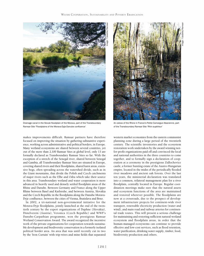
[ ]251
WATER COOPERATION, SUSTAINABILITY AND POVERTY ERADICATION
makes improvements difficult. Ramsar partners have therefore focused on improving the situation by gathering substantive experi-ence, working across administrative and political borders, in Europe. Many wetland ecosystems are shared between several countries, yet out of the more than 2,100 Ramsar Sites at global level, only 13 are formally declared as Transboundary Ramsar Sites so far. With the exception of a stretch of the Senegal river, shared between Senegal and Gambia, all Transboundary Ramsar Sites are situated in Europe, covering shared rivers and their floodplains, shared karst areas, exten-sive bogs, often spreading across the watershed divide, such as in the Giant mountains, that divide the Polish and Czech catchments of major rivers such as the Elbe and Odra which take their source in this area. Transboundary wetland and water cooperation is more advanced in heavily used and densely settled floodplain areas of the Rhine and Danube. Between Germany and France along the Upper Rhine between Basel and Karlsruhe, and between Austria, Slovakia and the Czech Republic in the floodplains along the Danube-Morava-Dyje confluence, between the cities of Vienna, Bratislava and Brno.
In 2002, a tri-national non-governmental initiative for the Morava-Dyje floodplains, jointly launched at the end of the twen-tieth century by the expert organizations of Daphne (Slovakia), Distelverein (Austria), Veronica (Czech Republic) and WWF’s Danube-Carpathian programme, won the prestigious Ramsar Wetland Conservation Award. The award recognized the incentive work of the private organizations for cooperation towards sustaina-ble development and biodiversity conservation in a formerly isolated political border area. An area that was until recently cut in two by the ‘Iron Curtain’ with trip-wires and mine fields that separated
western market economies from the eastern communist planning zone during a large period of the twentieth century. The scientific inventories and the ecosystem restoration work undertaken by the award winning not-for-profit organizations paid off and convinced the local and national authorities in the three countries to come together, and to formally sign a declaration of coop-eration at a ceremony in the prestigious Zidlochovice castle, a former hunting estate of the Austro-Hungarian empire, located in the midst of the periodically flooded river meadows and ancient oak forests. Over the last ten years, the ministerial declaration was translated into a common, trilateral management plan for a river floodplain, centrally located in Europe. Regular coor-dination meetings make sure that the natural assets and ecosystem functions of the area are maintained and restored wherever possible. The floodplains are now at a crossroads, due to the prospect of develop-ment infrastructure projects for continent-wide river transport, renewable electricity production (water and wind), and main road and railway arteries for continen-tal trade routes. This will present a serious challenge for maintaining and restoring sufficient natural wetland ecosystem and floodplain areas, in order that the human-managed ecosystems can continue to provide effective and low-cost services, such as flood retention, water purification, drinking water supply, timber, food, biodiversity production and others.
An oxbow of the Rhine in France’s Petite Camargue Alsacienne, part
of the Transboundary Ramsar Site ‘Rhin supérieur’
Drainage canal in the Slovak floodplain of the Morava, part of the Transboundary
Ramsar Site ‘Floodplains of the Morava-Dyje-Danube confluence’
Imag
e: T
.Sal
athé
/Ram
sar
Imag
e: T
.Sal
athé
/Ram
sar

[ ]252
Better late than neverDr Claudine Brelet, HDR
The Oxford English Dictionary defines the word ‘coopera-tion’ as “working or acting together to the same end” for a common purpose or benefit. Unfortunately, this process
does not always take into account all the cultures involved or what it means for them, whatever virtuous intentions are proclaimed. Who can say that most international cooperation projects to ensure sustainability and poverty eradication respect local cultural practices and values?
In the water sector, the approach is still too often based only on hydrological and climatological data, on modelling and engineer-ing, all relying on the application of scientific and mathematical principles to practical ends such as the design, manufacture and operation of efficient and economical structures, machines, processes and systems. Economy, too, is not sufficient to under-
stand cultural practices linked to water. However brilliantly designed international cooperation water projects are, too many have eventually failed to meet the tangible and intangible needs of local communities on a long-term basis because they did not integrate cultural practices linked to water.
Integration means the participation and involve-ment of all individuals, especially the poor, from the beginning of a project’s planning process to its manage-ment, monitoring and maintenance. Achieving true integration entails valuing the experiences, knowledge and narratives of women and men who live with and because of water. Integration also means transparency: access to clear information is necessary to ensure that local communities can understand the changes they may have to face in their traditional lifestyles. It can also ensure that one interested party will not disadvan-tage others. It is easy to publish figures and numbers, but these fail to ensure that a project is successfully integrated because they do not take into account living human reality, especially its intangible dimensions. A common challenge for experts is to translate scientific terms and concepts in a way that is understandable to civil society, especially when communities have a life-style that relies on beliefs that largely differ from those of modern science.
The modern scientific paradigm does not take into account the way populations view themselves, their own paradigm or ‘cosmovision’ that gives a meaning to their place in the universe and in nature – in short, their culture. Too often, international experts forget that the term ‘culture’ does not mean the liter-ary and artistic achievements of ‘cultured’ elites only. Culture involves the social, spiritual and technologi-cal dimensions of human life, learned patterns of behaviour, thought, normative values, knowledge – namely a way of life – which for generations have been shared by the members of a society to meet its basic tangible and intangible needs. The World Conference on Cultural Policies1 adopted the cele-brated anthropological definition of culture that links it so irrevocably to development. According to this definition, culture is “the whole complex of distinc-tive spiritual, material, intellectual and emotional features that characterize a society or social group. It includes not only arts and letters, but also modes of life, the fundamental rights of the human being, value systems, traditions and beliefs.”
WATER COOPERATION, SUSTAINABILITY AND POVERTY ERADICATION
Polyomyelitis and cholera are among the pathogens caused by inappropriate
sanitation measures
Imag
e: C
. Bre
let

[ ]253
WATER COOPERATION, SUSTAINABILITY AND POVERTY ERADICATION
to compare a local culture with the ‘modern’ one. Distinguishing between local views and interpretation and those of the water professionals is not only useful in ensuring that an international water cooperation project will be locally appropriate; it can also avoid ethnocen-trism, a common human tendency generally leading to the conclusion that traditional cultures are inferior to the ‘modern’ one. For example, an ethnocentric atti-tude would condemn as counterproductive the Hindu taboo against cattle slaughter whereas it has positive effects on agricultural productivity in India. In the same manner, understanding the family structure, the domestic division of labour and education, roles related to age and gender and domestic hierarchies, helps to build an understanding of how basic production and consumption within a community – all activities that would not be possible without water – are organized. Because domestic economy relies on water, all these factors have a serious impact on the ways that water resources are allocated and used.
The observation of living reality greatly contributes to improving a water and sanitation project. To this effect and at the request of Professor Szollozi-Nagy, then
Anthropology is unique among social and human sciences because its transdisciplinary, systemic and cybernetic approach does not only include history, oral literature and linguistics. It also embraces all the components and processes of social life – the physical envi-ronment, systems of production, technological knowledge and tools, family patterns, the political system, religious customs and symbols, and artistic activities. And it highlights the interconnectedness and interactions of the multiple aspects of culture. Hence anthropology offers a unified framework, both theoretical and practical, based on the premise that biological needs and material constraints, such as the environment and technology, are primary forces in the evolu-tion of sociocultural systems. Focusing on the interaction between the biological and cultural environments of a community can help to reduce many social problems and impacts when a system and/or technology of water distribution has to be transformed or replaced by more effective ones. This is especially important when new management, laws and economic regulations would inevita-bly impact a community’s social organization, affect sensitive issues such as social inequality, sexism and gender equity, exploitation, poverty and underdevelopment, and generate new patterns of domestic organization and even new political institutions.
Anthropologists collect and organize cultural data in relation to recurrent aspects or parts of local sociocultural systems in order
Broken modern pipes create a health hazard for local populations
Imag
e: C
. Bre
let

[ ]254
WATER COOPERATION, SUSTAINABILITY AND POVERTY ERADICATION
director of the United Nations Educational, Scientific and Cultural Organization (UNESCO) division of water sciences, I designed the concept of an international and interactive electronic network open both to water and anthropology professionals. The result-ing Network of Water Anthropology (NETWA) was endorsed in June 2002 by the 6th Programme of the International Hydrological Programme to fit into its proposed new paradigm and themes. The paradigm was based on the integration of culture, in its broad meaning, in water sciences and their practical applications, with themes including Water and Society; Water, Civilization and Ethics; Water Education and Building Local Capacities; and particularly Institutional Development and Creation of Networks for Water Education and Training. I presented the framework during the third World Water Forum in Kyoto in 2003, in the session titled Translating the Cultural Dimension of Water into Action, and during the fourth World Water Forum in Mexico, 2006, focused on Local Actions for a Global Challenge.2
When I was assigned to go to Mali as a UNESCO Senior Expert consultant, working in the frame of World Heritage, Professor Szollozi-Nagy thought it appropriate to root the NETWA project in this Sahelian country. Mali is one of the poorest countries in the world; it also faces the cruel impacts of climatic change, droughts and floods affecting local people’s health and resources. A few decades ago, the Niger river had made Mali the storehouse of West Africa for cereal, fish, rice and meat, but today it barely feeds its own. Today, the river is collapsing under the weight of human action and natural effects. Riverside societies survive thanks to internal and external migration. Those staying on its banks try to adapt to climate change through the diversification of their activities (for example, choosing agriculture over commerce). The Dean of the Faculty of Literature, Languages and
Social and Human Sciences at the University of Bamako, Dr Salif Berthe, enthusiastically welcomed the NETWA project3 and mobilized human and material resources to open a research centre on Water Anthropology as early as February 2008, with the goal of promoting the cultural practices of the Niger riverside societies.4
In some places, the explosive growth of main water and sewage systems designed by some international cooperation projects has not improved local commu-nities’ health and well-being. Mali is a region where more than three quarters of the population live below the poverty line and literacy and healthcare indices are among the worst in the world. The two-storey houses of the city of Djenné (listed as a UNESCO World Heritage Site in 2005) are built exclusively of mud bricks5 and their stylish Sudanese architecture includes dry toilets in cabins on roof terraces, usually on the second floors. The excreta are stored in pipes built along a parapet wall, covered with the same mixture of laterite mud and organic material which is oil-soaked to increase tensile strength and render the roofs impermeable. This is the same material used to coat the walls of the houses.
In this semi-arid area, with low annual precipita-tion and dry seasons lasting for 8-11 months a year, temperatures can reach more than 40° C and are rarely below 32° C. About every 20 years, the dry toilet wall is opened and its contents collected and used as compost in the fields. In the same way that solar radiation is used for disinfecting water, and recommended by the World Health Organization as a viable method for household water treatment and safe storage, this traditional sanita-tion technology uses cumulative solar energy that can raise the temperature far above 50° C inside the storing pipe, thus destroying the cell structures of bacteria. By not ejecting excreta in the streets, the system limits faecal contamination in the city.
A scientific study of the technology, involving the local masson masters and aimed at scientifically updating this traditional sanitation system, would have avoided various inappropriate sanitation measures that have been used – the open channels for the disposal of wastewater and rainwater, and the easily breakable modern pipes and collector lids designed by ‘North’s experts’ alone. Deeper channels are traps into which infants, ageing people and cattle fall, and some drown. All have been the direct cause of numerous avoidable pathogens in the city, namely in ascending order (according to the local health centre): malaria, diarrhoea, leptospirosis (rats feeding in the accumulation of waste) and cholera, which peak when the channels overflow during the rainy season – not to mention the harmattan winds that carry germs that spread eye infections, colds and meningitis, and a scarcity of labour that is badly needed to meet the local community’s basic needs.
Let us hope that Mali will soon regain its traditional peace and that the installation of new water and sani-tation systems as planned by the Aga Khan Trust for Culture will restore Djenné’s cultural splendour. Better late than never.
Djenné’s stylish Sudanese architecture includes dry toilets in cabins on the roof
terraces of houses
Imag
e: C
. Bre
let

VIIEconomic Development
and Water
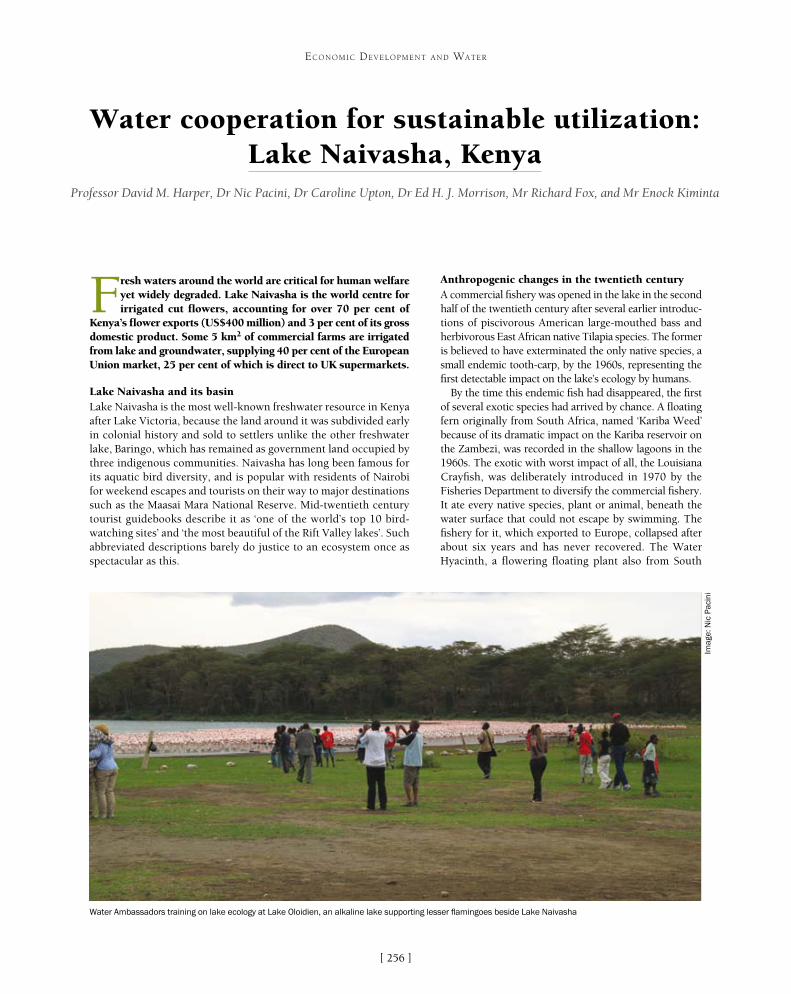
[ ]256
Water cooperation for sustainable utilization: Lake Naivasha, Kenya
Professor David M. Harper, Dr Nic Pacini, Dr Caroline Upton, Dr Ed H. J. Morrison, Mr Richard Fox, and Mr Enock Kiminta
Fresh waters around the world are critical for human welfare yet widely degraded. Lake Naivasha is the world centre for irrigated cut flowers, accounting for over 70 per cent of
Kenya’s flower exports (US$400 million) and 3 per cent of its gross domestic product. Some 5 km2 of commercial farms are irrigated from lake and groundwater, supplying 40 per cent of the European Union market, 25 per cent of which is direct to UK supermarkets.
Lake Naivasha and its basinLake Naivasha is the most well-known freshwater resource in Kenya after Lake Victoria, because the land around it was subdivided early in colonial history and sold to settlers unlike the other freshwater lake, Baringo, which has remained as government land occupied by three indigenous communities. Naivasha has long been famous for its aquatic bird diversity, and is popular with residents of Nairobi for weekend escapes and tourists on their way to major destinations such as the Maasai Mara National Reserve. Mid-twentieth century tourist guidebooks describe it as ‘one of the world’s top 10 bird-watching sites’ and ‘the most beautiful of the Rift Valley lakes’. Such abbreviated descriptions barely do justice to an ecosystem once as spectacular as this.
Anthropogenic changes in the twentieth centuryA commercial fishery was opened in the lake in the second half of the twentieth century after several earlier introduc-tions of piscivorous American large-mouthed bass and herbivorous East African native Tilapia species. The former is believed to have exterminated the only native species, a small endemic tooth-carp, by the 1960s, representing the first detectable impact on the lake’s ecology by humans.
By the time this endemic fish had disappeared, the first of several exotic species had arrived by chance. A floating fern originally from South Africa, named ‘Kariba Weed’ because of its dramatic impact on the Kariba reservoir on the Zambezi, was recorded in the shallow lagoons in the 1960s. The exotic with worst impact of all, the Louisiana Crayfish, was deliberately introduced in 1970 by the Fisheries Department to diversify the commercial fishery. It ate every native species, plant or animal, beneath the water surface that could not escape by swimming. The fishery for it, which exported to Europe, collapsed after about six years and has never recovered. The Water Hyacinth, a flowering floating plant also from South
ECONOMIC DEVELOPMENT AND WATER
Water Ambassadors training on lake ecology at Lake Oloidien, an alkaline lake supporting lesser flamingoes beside Lake Naivasha
Imag
e: N
ic P
acin
i
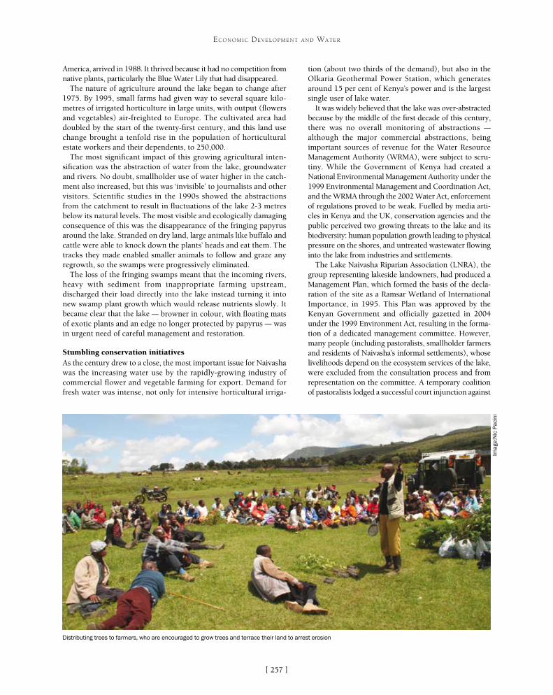
[ ]257
ECONOMIC DEVELOPMENT AND WATER
tion (about two thirds of the demand), but also in the Olkaria Geothermal Power Station, which generates around 15 per cent of Kenya’s power and is the largest single user of lake water.
It was widely believed that the lake was over-abstracted because by the middle of the first decade of this century, there was no overall monitoring of abstractions – although the major commercial abstractions, being important sources of revenue for the Water Resource Management Authority (WRMA), were subject to scru-tiny. While the Government of Kenya had created a National Environmental Management Authority under the 1999 Environmental Management and Coordination Act, and the WRMA through the 2002 Water Act, enforcement of regulations proved to be weak. Fuelled by media arti-cles in Kenya and the UK, conservation agencies and the public perceived two growing threats to the lake and its biodiversity: human population growth leading to physical pressure on the shores, and untreated wastewater flowing into the lake from industries and settlements.
The Lake Naivasha Riparian Association (LNRA), the group representing lakeside landowners, had produced a Management Plan, which formed the basis of the decla-ration of the site as a Ramsar Wetland of International Importance, in 1995. This Plan was approved by the Kenyan Government and officially gazetted in 2004 under the 1999 Environment Act, resulting in the forma-tion of a dedicated management committee. However, many people (including pastoralists, smallholder farmers and residents of Naivasha’s informal settlements), whose livelihoods depend on the ecosystem services of the lake, were excluded from the consultation process and from representation on the committee. A temporary coalition of pastoralists lodged a successful court injunction against
America, arrived in 1988. It thrived because it had no competition from native plants, particularly the Blue Water Lily that had disappeared.
The nature of agriculture around the lake began to change after 1975. By 1995, small farms had given way to several square kilo-metres of irrigated horticulture in large units, with output (flowers and vegetables) air-freighted to Europe. The cultivated area had doubled by the start of the twenty-first century, and this land use change brought a tenfold rise in the population of horticultural estate workers and their dependents, to 250,000.
The most significant impact of this growing agricultural inten-sification was the abstraction of water from the lake, groundwater and rivers. No doubt, smallholder use of water higher in the catch-ment also increased, but this was ‘invisible’ to journalists and other visitors. Scientific studies in the 1990s showed the abstractions from the catchment to result in fluctuations of the lake 2-3 metres below its natural levels. The most visible and ecologically damaging consequence of this was the disappearance of the fringing papyrus around the lake. Stranded on dry land, large animals like buffalo and cattle were able to knock down the plants’ heads and eat them. The tracks they made enabled smaller animals to follow and graze any regrowth, so the swamps were progressively eliminated.
The loss of the fringing swamps meant that the incoming rivers, heavy with sediment from inappropriate farming upstream, discharged their load directly into the lake instead turning it into new swamp plant growth which would release nutrients slowly. It became clear that the lake – browner in colour, with floating mats of exotic plants and an edge no longer protected by papyrus – was in urgent need of careful management and restoration.
Stumbling conservation initiativesAs the century drew to a close, the most important issue for Naivasha was the increasing water use by the rapidly-growing industry of commercial flower and vegetable farming for export. Demand for fresh water was intense, not only for intensive horticultural irriga-
Distributing trees to farmers, who are encouraged to grow trees and terrace their land to arrest erosion
Imag
e:N
ic P
acin
i

[ ]258
ECONOMIC DEVELOPMENT AND WATER
the plan and members of LNRA, on the grounds that they did not repre-sent the interests of all stakeholders, and it was stalled just as it became apparent that the lake was continuing to deteriorate. Evidence of its ecosystem disruption by exotic species and loss of papyrus was already clear, but now its eutrophication – enrichment – by the combined impacts of soil erosion from catchment smallholder cultivations, nutri-ent run-off from lakeside farms, and the impact of thousands of people living without sanitation within a mile of the lake’s edge, was made obvious by cyclical blooms of noxious blue-green algae.
Strengthening water cooperationThe first organization to take a positive initiative towards sustain-able management of the lake in the new century – reviving water cooperation – was the Lake Naivasha Growers Group (LNGG), consisting of the major horticultural companies, some of whom were also members of LNRA. LNGG commissioned consultants to conduct an accurate water balance, which could form the basis of a sustainable abstraction policy. By this time it was known that the 2002 Water Act would soon become law, so the policy could be developed under this and not the stalled Management Plan.
The Water Act, implemented in 2005, was the country’s first legislation to enable community participation since independ-ence in 1963. It established a new authority, WRMA, with seven basins within Kenya. WRMA was charged with establishing Water Resource User Associations (WRUAs), to comprise all ‘legitimate stakeholders’ for subcatchments within these basins. The catchment of Lake Naivasha is within the Rift Valley basin with 12 WRUAs, the most advanced of which is the Lake Naivasha WRUA (LaNaWRUA), due to the history of moves to achieve sustainable use of the lake. LaNaWRUA was registered as a society in June 2007 and elected its first officials in October; in 2008 it signed a memorandum of under-standing with WRMA to promote sustainable water management in the catchment; in April 2009 it submitted a Water Allocation Plan and Sub-Catchment Management Plan (SCMP) based on the commissioned hydrological study.
WRUAs are open to membership of any water user who has or should have a permit for extraction. LaNaWRUA has six categories of water users – individuals, water service providers, tourist operators, irrigators (divided into groundwater and surface water), commercial users (such as fish farming, power generation), and pastoralists. The executive committee consists of two representa-tives from each category, elected by category members. LaNaWRUA has non-user members, called Observer Members, without voting rights. LaNaWRUA recognizes a wide range of stakeholders and seeks to enrol them in local environmental management. It recently prepared an SCMP which lists 42 stakeholders represented by other WRUAs. These were slower to become constituted than LaNaWRUA, but by 2010 all were in operation, being guided under an ‘umbrella’ of all WRUAs, by Naivasha.
Over the same period, LNGG began to develop a Payment for Ecosystem Services (PES) project. This was originally conceived as a means of restoring the papyrus that had been destroyed around the lake, so that the growers would have a clear link between their payments and the ecosystem service they were restoring. It was later developed into payments for upper catchment small farmers at the foot of the Aberdare mountains, who were thus encouraged to grow trees and terrace their land to arrest erosion. The scheme has proved successful with the farmers, who have developed alter-native livelihood streams as well as holding back their soils, but it has not been possible to measure any subse-quent improvements in the river or lake waters.
Water cooperation blossomsDuring these developments, Kenya experienced a prolonged drought. Between mid-2007 and the end of 2009 the water levels of Lake Naivasha dropped almost 3 metres, to a level that had not been experienced since 1946. This aroused international concern from the media, irrigators, the customers of the cut flower produc-ers and their governments. The WRUAs were too young and inexperienced to respond with the required rapid-ity, but three series of events were unfolding that helped them to manage the crisis and come out stronger.
Firstly, organizations alarmed by news coverage such as European governments and international non-govern-mental organizations like the World Wide Fund for Nature (WWF), were encouraged to contribute to indi-vidual aspects of the solution. WWF and LNGG funded LaNaWRUA to complete the first ever basin-wide survey of water abstractors, which found that almost 97 per cent were either unlicensed or their licences had expired. All the WRUAs, as agents for WRMA, began registering abstractors and collecting their licence fees. LaNaWRUA organized and agreed with abstractors, through the other WRUAs, a ‘traffic lights’ system of lake water use: at the red level all abstraction ceased; at amber, abstraction was reduced; and at green, abstractions could continue to the level that the licence allowed.
Secondly, in early 2010 Kenyan Prime Minister Raila Odinga talked with HRH the Prince of Wales at an inter-
A floating island planted with papyrus at the wastewater lagoon of one of
Finlays’ flower farms
Imag
e: D
avid
M. H
arpe
r
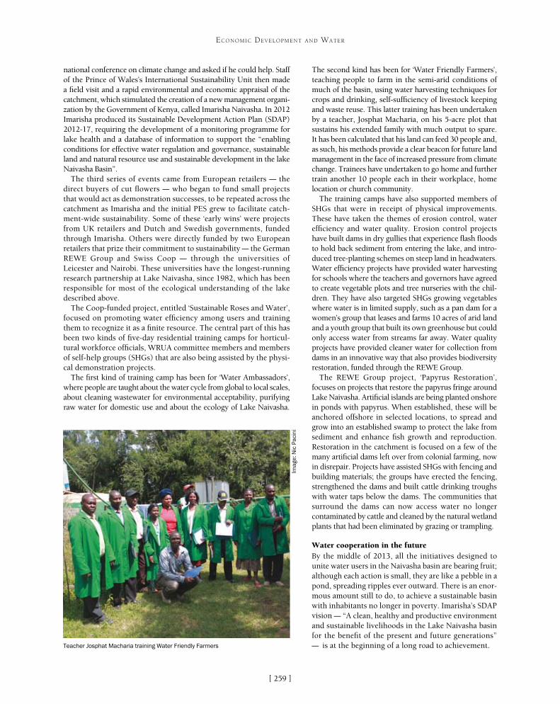
[ ]259
ECONOMIC DEVELOPMENT AND WATER
The second kind has been for ‘Water Friendly Farmers’, teaching people to farm in the semi-arid conditions of much of the basin, using water harvesting techniques for crops and drinking, self-sufficiency of livestock keeping and waste reuse. This latter training has been undertaken by a teacher, Josphat Macharia, on his 5-acre plot that sustains his extended family with much output to spare. It has been calculated that his land can feed 30 people and, as such, his methods provide a clear beacon for future land management in the face of increased pressure from climate change. Trainees have undertaken to go home and further train another 10 people each in their workplace, home location or church community.
The training camps have also supported members of SHGs that were in receipt of physical improvements. These have taken the themes of erosion control, water efficiency and water quality. Erosion control projects have built dams in dry gullies that experience flash floods to hold back sediment from entering the lake, and intro-duced tree-planting schemes on steep land in headwaters. Water efficiency projects have provided water harvesting for schools where the teachers and governors have agreed to create vegetable plots and tree nurseries with the chil-dren. They have also targeted SHGs growing vegetables where water is in limited supply, such as a pan dam for a women’s group that leases and farms 10 acres of arid land and a youth group that built its own greenhouse but could only access water from streams far away. Water quality projects have provided cleaner water for collection from dams in an innovative way that also provides biodiversity restoration, funded through the REWE Group.
The REWE Group project, ‘Papyrus Restoration’, focuses on projects that restore the papyrus fringe around Lake Naivasha. Artificial islands are being planted onshore in ponds with papyrus. When established, these will be anchored offshore in selected locations, to spread and grow into an established swamp to protect the lake from sediment and enhance fish growth and reproduction. Restoration in the catchment is focused on a few of the many artificial dams left over from colonial farming, now in disrepair. Projects have assisted SHGs with fencing and building materials; the groups have erected the fencing, strengthened the dams and built cattle drinking troughs with water taps below the dams. The communities that surround the dams can now access water no longer contaminated by cattle and cleaned by the natural wetland plants that had been eliminated by grazing or trampling.
Water cooperation in the futureBy the middle of 2013, all the initiatives designed to unite water users in the Naivasha basin are bearing fruit; although each action is small, they are like a pebble in a pond, spreading ripples ever outward. There is an enor-mous amount still to do, to achieve a sustainable basin with inhabitants no longer in poverty. Imarisha’s SDAP vision – “A clean, healthy and productive environment and sustainable livelihoods in the Lake Naivasha basin for the benefit of the present and future generations” – is at the beginning of a long road to achievement.
national conference on climate change and asked if he could help. Staff of the Prince of Wales’s International Sustainability Unit then made a field visit and a rapid environmental and economic appraisal of the catchment, which stimulated the creation of a new management organi-zation by the Government of Kenya, called Imarisha Naivasha. In 2012 Imarisha produced its Sustainable Development Action Plan (SDAP) 2012-17, requiring the development of a monitoring programme for lake health and a database of information to support the “enabling conditions for effective water regulation and governance, sustainable land and natural resource use and sustainable development in the lake Naivasha Basin”.
The third series of events came from European retailers – the direct buyers of cut flowers – who began to fund small projects that would act as demonstration successes, to be repeated across the catchment as Imarisha and the initial PES grew to facilitate catch-ment-wide sustainability. Some of these ‘early wins’ were projects from UK retailers and Dutch and Swedish governments, funded through Imarisha. Others were directly funded by two European retailers that prize their commitment to sustainability – the German REWE Group and Swiss Coop – through the universities of Leicester and Nairobi. These universities have the longest-running research partnership at Lake Naivasha, since 1982, which has been responsible for most of the ecological understanding of the lake described above.
The Coop-funded project, entitled ‘Sustainable Roses and Water’, focused on promoting water efficiency among users and training them to recognize it as a finite resource. The central part of this has been two kinds of five-day residential training camps for horticul-tural workforce officials, WRUA committee members and members of self-help groups (SHGs) that are also being assisted by the physi-cal demonstration projects.
The first kind of training camp has been for ‘Water Ambassadors’, where people are taught about the water cycle from global to local scales, about cleaning wastewater for environmental acceptability, purifying raw water for domestic use and about the ecology of Lake Naivasha.
Teacher Josphat Macharia training Water Friendly Farmers
Imag
e: N
ic P
acin
i
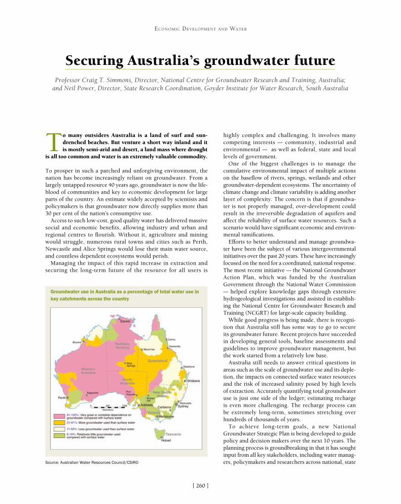
[ ]260
Securing Australia’s groundwater future Professor Craig T. Simmons, Director, National Centre for Groundwater Research and Training, Australia;
and Neil Power, Director, State Research Coordination, Goyder Institute for Water Research, South Australia
To many outsiders Australia is a land of surf and sun-drenched beaches. But venture a short way inland and it is mostly semi-arid and desert, a land mass where drought
is all too common and water is an extremely valuable commodity.
To prosper in such a parched and unforgiving environment, the nation has become increasingly reliant on groundwater. From a largely untapped resource 40 years ago, groundwater is now the life-blood of communities and key to economic development for large parts of the country. An estimate widely accepted by scientists and policymakers is that groundwater now directly supplies more than 30 per cent of the nation’s consumptive use.
Access to such low-cost, good quality water has delivered massive social and economic benefits, allowing industry and urban and regional centres to flourish. Without it, agriculture and mining would struggle, numerous rural towns and cities such as Perth, Newcastle and Alice Springs would lose their main water source, and countless dependent ecosystems would perish.
Managing the impact of this rapid increase in extraction and securing the long-term future of the resource for all users is
highly complex and challenging. It involves many competing interests – community, industrial and environmental – as well as federal, state and local levels of government.
One of the biggest challenges is to manage the cumulative environmental impact of multiple actions on the baseflow of rivers, springs, wetlands and other groundwater-dependent ecosystems. The uncertainty of climate change and climate variability is adding another layer of complexity. The concern is that if groundwa-ter is not properly managed, over-development could result in the irreversible degradation of aquifers and affect the reliability of surface water resources. Such a scenario would have significant economic and environ-mental ramifications.
Efforts to better understand and manage groundwa-ter have been the subject of various intergovernmental initiatives over the past 20 years. These have increasingly focused on the need for a coordinated, national response. The most recent initiative – the National Groundwater Action Plan, which was funded by the Australian Government through the National Water Commission – helped explore knowledge gaps through extensive hydrogeological investigations and assisted in establish-ing the National Centre for Groundwater Research and Training (NCGRT) for large-scale capacity building.
While good progress is being made, there is recogni-tion that Australia still has some way to go to secure its groundwater future. Recent projects have succeeded in developing general tools, baseline assessments and guidelines to improve groundwater management, but the work started from a relatively low base.
Australia still needs to answer critical questions in areas such as the scale of groundwater use and its deple-tion, the impacts on connected surface water resources and the risk of increased salinity posed by high levels of extraction. Accurately quantifying total groundwater use is just one side of the ledger; estimating recharge is even more challenging. The recharge process can be extremely long-term, sometimes stretching over hundreds of thousands of years.
To achieve long-term goals, a new National Groundwater Strategic Plan is being developed to guide policy and decision makers over the next 10 years. The planning process is groundbreaking in that it has sought input from all key stakeholders, including water manag-ers, policymakers and researchers across national, state
ECONOMIC DEVELOPMENT AND WATER
Groundwater use in Australia as a percentage of total water use in key catchments across the country
Source: Australian Water Resources Council/CSIRO

[ ]261
ECONOMIC DEVELOPMENT AND WATER
modelling frameworks to use all available data, and establishing clear links to inform groundwater plan-ning, policy and management.
Targeted investigations and sustained monitor-ing are also key to understanding hydrogeology and groundwater flow processes, as well as the connectiv-ity of groundwater systems with other water resources. This in turn requires investment in meters, monitor-ing and compliance regimes which take into account the system’s characteristics, the level of use, potential demand and associated levels of risk.
There is a degree of urgency in having these meas-ures in place quickly because demand for groundwater continues to increase as Australia’s population grows. Intensive mining development in Australia over the past decade, together with the development of new energy sources and technologies, has also intensified usage and the impacts on groundwater resources.
The mining and energy sectors are heavily depend-ent on groundwater as a water source, particularly in arid parts of Australia. They are now also using high-salinity groundwater through desalination, making use of resources previously considered unusable or of low beneficial value.
and territory jurisdictions. It is a collaborative approach which aims to capitalize on significant advances already made and provides a strategic vision for groundwater security and sustainability for future generations.
The plan is expected to be finalized by the end of 2013 and focuses on three priority objectives: sustainable extraction and optimal use, providing investment confidence, and planning and managing now for the future. Following endorsement of the National Groundwater Strategic Plan, state and territory jurisdictions will develop actions to better coordinate and improve groundwater management in Australia.
A key element of any successful strategic planning programme is knowledge, and that requires extensive research to build a deep understanding of the resource and its many variables. Due to their underground nature, groundwater systems are highly complex, which makes sustainable extraction regimes challenging to define.
Advancing the science of modelling to better understand and predict intricate groundwater processes is essential. While model-ling has improved considerably in Australia over the past 10 years, there are many technical and policy issues still to address in order to improve reliability and to find the right balance between simplicity and complexity. The development of national model-ling guidelines has been an integral part of a coordinated effort to achieve leading practice in groundwater modelling. Future priority areas highlighted in the strategic plan include integrating
Champagne Springs in the Kimberley region of Western Australia: securing Australia’s groundwater future is a complex challenge
Imag
e: N
CG
RT

[ ]262
ECONOMIC DEVELOPMENT AND WATER
There are concerns about the cumulative effect on the Great Artesian Basin (GAB) and other aquifers from both traditional mining and the rapid expansion of coal seam gas and geothermal energy programmes, and planned shale gas mining. These risks have been recognized nationally, with the Australian Government investing AU$200 million to fund the Independent Expert Scientific Committee on Coal Seam Gas and Large Coal Mining Development. The committee is charged with delivering scientific advice to deci-sion makers on the impact that coal seam gas and large coal mining may have on Australia’s water resources.
The GAB is one of the largest and deepest artesian basins in the world, stretching over 1.7 million square kilometres and providing the only reliable source of freshwater throughout much of central and eastern inland Australia. It is of cultural significance to many indigenous Australians, and numerous communities and sensitive ecosystems depend on it for survival.
While steps have been taken to limit extraction and to improve the integrity of wells in Australia, adverse impacts can be significant before they become apparent. There are concerns that in some cases such drawdowns may be irreversible in terms of aquifer depletion, water quality degradation and pollution.
As Australia searches for new water options to meet increasing demands, conjunctive use has emerged as a cost-effective alterna-tive to reduce reliance on traditional water supplies. Groundwater is increasingly being used in conjunction with surface water and other water sources, such as treated stormwater and recycled wastewaters, and as a storage medium through managed aquifer recharge schemes.
Such approaches provide increased water supply flexibility and security, particularly during periods of drought. But they also raise questions about combined management of water sources, which have traditionally been managed separately, and issues surround-ing water ownership and water property rights.
A further concern arising from the huge increase in groundwater use in Australia is the impact on the quality of the water. The draft National Groundwater Strategic Plan highlights a paucity of infor-mation in this area. Increased extraction poses a serious risk to many groundwater systems due to inter-aquifer leakage or accessions of more saline irrigation drainage – issues which should be taken into account when setting sustainable extraction limits.
Similarly, seawater intrusion due to a greater demand for fresh water along Australia’s increasingly populated coastal rim is also a largely unknown factor. Such scenarios require a much better balance between quantity and quality in groundwater hydrology, with learnings embedded in planning and management processes.
To support consistent groundwater management across Australia, the Bureau of Meteorology is developing a national information system to collate and standardize groundwater information. It aims to deliver uniformity in data sets between jurisdictions, with quality information readily available to water authorities through a common platform.
Access to such data helps underpin good governance and allows the development of more efficient regulatory processes for a risk-based management system. The goal is cost-effective water planning which reaches a balance between competing economic, social and environmental interests, while protecting the long-term sustainabil-ity of groundwater systems.
It is critical that those who use the resource have clarity in respect of the legal nature of water entitlements, and that the rules and costs governing its extraction are transparent and accountable. Water reforms in Australia since the mid 1990s have resulted in state and
territory jurisdictions moving towards agreed principles for water management through legally enforceable plans, but inconsistencies still persist. Further work is now needed to better understand the nature of these differ-ences, in order to secure a truly harmonized approach.
The adoption of fully integrated development approval systems by jurisdictions will ensure that issues are addressed holistically between regulatory agencies, providing greater levels of community confidence. This is particularly important where groundwater is connected to other water resources or dependent envi-ronments, and where multiple developments have a cumulative impact.
With groundwater out of sight and for many out of mind, raising awareness of its value to society, our economy and environment is vital to achieving public acceptance of policies and regulation for better manage-ment and sustainable use. Australia is a land renowned for long periods of devastating drought followed by intermittent periods of higher rainfall and floods, when pressure to secure our precious groundwater reserves inevitably eases. But we must not relax our commitment.
There is an urgent need to shatter the misconception that groundwater is a more or less unlimited resource. Australia is on track to more than double its water use by mid-century and there are no new big water resources to be found. It is imperative that as a nation we become far smarter in the way we manage what we have.
Research and training
Since it was established in 2009 the NCGRT has played a central role in expanding Australia’s knowledge of its groundwater systems. The centre represents a significant investment in groundwater capacity building through a comprehensive research and training programme which cuts across disciplines.
Headquartered at Flinders University in Adelaide and co-funded by the Australian Research Council and National Water Commission, the NCGRT is addressing a national skills shortage in groundwater expertise through extensive training and up-skilling. It currently has about 140 chief investigators, postdoctoral researchers and PhD candidates, and promotes global collaboration between nearly 200 Australian and international researchers who are undertaking projects conducted by the centre. Strong collaborative links have been developed with the Commonwealth Scientific and Industrial Research Organisation (CSIRO), universities and other research institutions in Australia and overseas, as well as with industry and government partners.
Research at the NCGRT is focused on major national groundwater management issues identified by resource managers and industry, and includes field-based projects that deliver research in support of management and policy needs. The research is grouped into key areas around the characteristics of aquifers and aquitards, hydrodynamics and modelling, surface water and groundwater interactions, and interactions between groundwater, vegetation and the atmosphere. A fifth research stream is investigating the social, economic, legal and policy dimensions of groundwater resource management, including community attitudes. It provides vital integration between social and biophysical research.
The NCGRT is a wide-ranging research centre that is instrumental in helping to shape innovative and effective policy and governance for the sustainable management of Australia’s groundwater future.
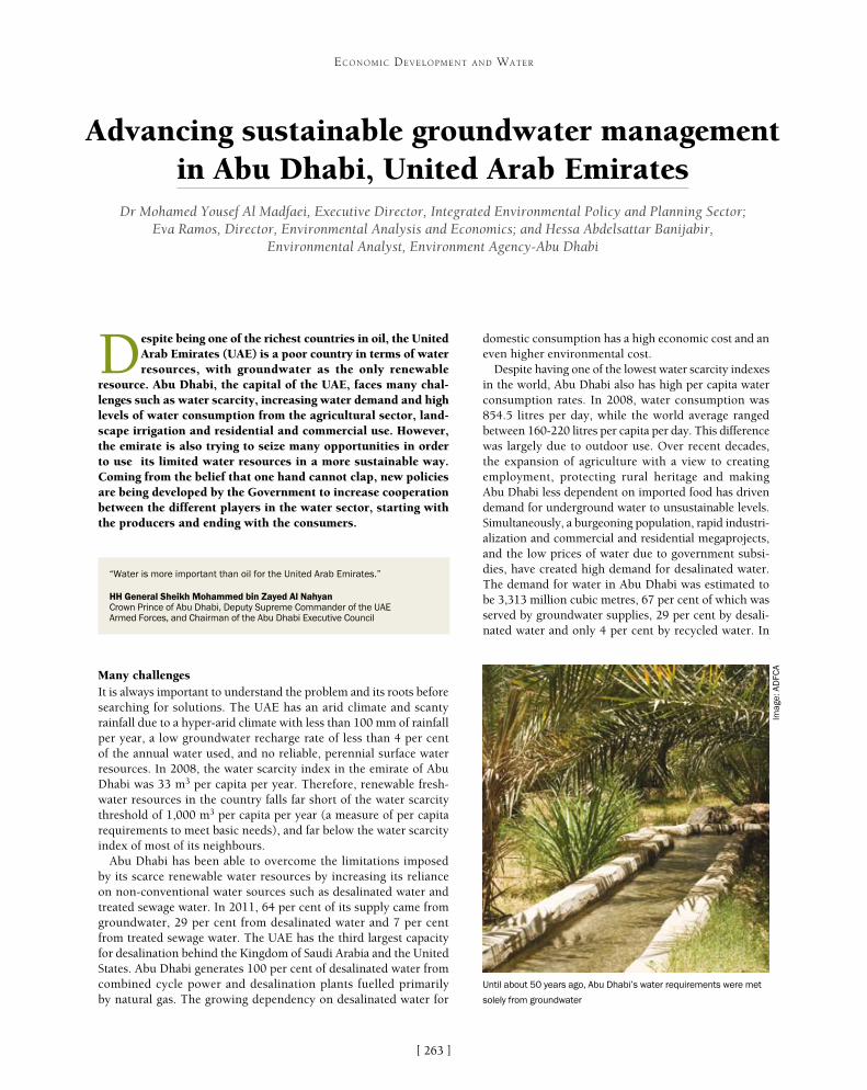
[ ]263
Advancing sustainable groundwater management in Abu Dhabi, United Arab Emirates
Dr Mohamed Yousef Al Madfaei, Executive Director, Integrated Environmental Policy and Planning Sector; Eva Ramos, Director, Environmental Analysis and Economics; and Hessa Abdelsattar Banijabir,
Environmental Analyst, Environment Agency-Abu Dhabi
Despite being one of the richest countries in oil, the United Arab Emirates (UAE) is a poor country in terms of water resources, with groundwater as the only renewable
resource. Abu Dhabi, the capital of the UAE, faces many chal-lenges such as water scarcity, increasing water demand and high levels of water consumption from the agricultural sector, land-scape irrigation and residential and commercial use. However, the emirate is also trying to seize many opportunities in order to use its limited water resources in a more sustainable way. Coming from the belief that one hand cannot clap, new policies are being developed by the Government to increase cooperation between the different players in the water sector, starting with the producers and ending with the consumers.
Many challengesIt is always important to understand the problem and its roots before searching for solutions. The UAE has an arid climate and scanty rainfall due to a hyper-arid climate with less than 100 mm of rainfall per year, a low groundwater recharge rate of less than 4 per cent of the annual water used, and no reliable, perennial surface water resources. In 2008, the water scarcity index in the emirate of Abu Dhabi was 33 m3 per capita per year. Therefore, renewable fresh-water resources in the country falls far short of the water scarcity threshold of 1,000 m3 per capita per year (a measure of per capita requirements to meet basic needs), and far below the water scarcity index of most of its neighbours.
Abu Dhabi has been able to overcome the limitations imposed by its scarce renewable water resources by increasing its reliance on non-conventional water sources such as desalinated water and treated sewage water. In 2011, 64 per cent of its supply came from groundwater, 29 per cent from desalinated water and 7 per cent from treated sewage water. The UAE has the third largest capacity for desalination behind the Kingdom of Saudi Arabia and the United States. Abu Dhabi generates 100 per cent of desalinated water from combined cycle power and desalination plants fuelled primarily by natural gas. The growing dependency on desalinated water for
domestic consumption has a high economic cost and an even higher environmental cost.
Despite having one of the lowest water scarcity indexes in the world, Abu Dhabi also has high per capita water consumption rates. In 2008, water consumption was 854.5 litres per day, while the world average ranged between 160-220 litres per capita per day. This difference was largely due to outdoor use. Over recent decades, the expansion of agriculture with a view to creating employment, protecting rural heritage and making Abu Dhabi less dependent on imported food has driven demand for underground water to unsustainable levels. Simultaneously, a burgeoning population, rapid industri-alization and commercial and residential megaprojects, and the low prices of water due to government subsi-dies, have created high demand for desalinated water. The demand for water in Abu Dhabi was estimated to be 3,313 million cubic metres, 67 per cent of which was served by groundwater supplies, 29 per cent by desali-nated water and only 4 per cent by recycled water. In
ECONOMIC DEVELOPMENT AND WATER
“Water is more important than oil for the United Arab Emirates.”
HH General Sheikh Mohammed bin Zayed Al Nahyan Crown Prince of Abu Dhabi, Deputy Supreme Commander of the UAE Armed Forces, and Chairman of the Abu Dhabi Executive Council
Until about 50 years ago, Abu Dhabi’s water requirements were met
solely from groundwater
Imag
e: A
DFC
A
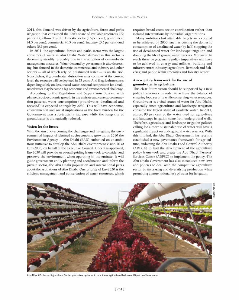
[ ]264
ECONOMIC DEVELOPMENT AND WATER
requires broad cross-sector coordination rather than isolated interventions by individual organizations.
Many ambitious but attainable targets are expected to be achieved by 2030, such as cutting the domestic consumption of desalinated water by half, stopping the use of desalinated water for landscape irrigation and doubling the life of groundwater reserves. Moreover, to reach these targets, many policy imperatives will have to be achieved in energy and utilities; building and infrastructure; industry; agriculture, livestock and fish-eries; and public realm amenities and forestry sector.
A new policy framework for the use of groundwater in agricultureThis clear future vision should be supported by a new policy framework in order to achieve the balance of ensuring food security while conserving water resources. Groundwater is a vital source of water for Abu Dhabi, especially since agriculture and landscape irrigation consume the largest share of available water. In 2011, almost 93 per cent of the water used for agriculture and landscape irrigation came from underground wells. Therefore, agriculture and landscape irrigation policies calling for a more sustainable use of water will have a significant impact on underground water reserves. With this in mind, the Abu Dhabi Government has recently established a new governance framework for agricul-ture, endorsing the Abu Dhabi Food Control Authority (ADFCA) to lead the development of the agriculture policy framework and create the Abu Dhabi Farmers’ Services Centre (ADFSC) to implement the policy. The Abu Dhabi Government has also introduced new laws and policies to deal with the competitive agriculture sector by increasing and diversifying production while promoting a more rational use of water for irrigation.
2011, this demand was driven by the agriculture, forest and parks irrigation that consumed the lion’s share of available resources (72 per cent), followed by the domestic sector (16 per cent), government (4.5 per cent), commercial (6.5 per cent), industry (0.5 per cent) and others (0.5 per cent).
In 2011, the agriculture, forests and parks sector was the largest consumer of water in Abu Dhabi. Water demand in this sector is decreasing steadily, probably due to the adoption of demand-side management measures. Water demand by government is also decreas-ing, but demand in the domestic, commercial and industry and other sectors – all of which rely on desalinated water – is on the rise. Nonetheless, if groundwater abstraction rates continue at the current level, the resource will be depleted in 55 years. And if agriculture starts depending solely on desalinated water, sectoral competition for desali-nated water may become a big economic and environmental challenge.
According to the Regulation and Supervision Bureau, with planned socioeconomic growth in the emirate and current consump-tion patterns, water consumption (groundwater, desalinated and recycled) is expected to triple by 2030. This will have economic, environmental and social implications as the fiscal burden for the Government may substantially increase while the longevity of groundwater is dramatically reduced.
Vision for the futureWith the aim of overcoming the challenges and mitigating the envi-ronmental impact of planned socioeconomic growth, in 2010 the Environment Agency – Abu Dhabi (EAD) embarked on an ambi-tious initiative to develop the Abu Dhabi environment vision 2030 (Env2030) on behalf of the Executive Council. Once it is approved, Env2030 will provide an overall guiding framework to consider and preserve the environment when operating in the emirate. It will guide government entity planning and coordination and inform the private sector, the Abu Dhabi population and international peers about the aspirations of Abu Dhabi. One priority of Env2030 is the efficient management and conservation of water resources, which
Abu Dhabi Protected Agriculture Center promotes hydroponic or soilless agriculture that uses 90 per cent less water
Imag
e: A
DFC
A

[ ]265
ECONOMIC DEVELOPMENT AND WATER
Law No. 9 of 2007 Establishing the Department of Municipal Affairs transferred powers and mandates around agriculture to ADFCA, making it the competent authority for agriculture. ADFCA developed the agricultural policy and prepared the plans for achiev-ing sustainable agricultural growth, while mitigating the harmful effects of certain improper agricultural practices on the environment. Law No. 4 of 2009 established the ADFSC with the responsibility for implementing Abu Dhabi’s agricultural policy by engaging farmers to adopt best agricultural practices.
With the Agriculture and Food Safety Policy (2011), ADFCA embarked on an ambitious programme of policy development, expanding responsibility for the entire food chain from farm to fork including the safety of foods imported into the emirate. This new policy consists of 11 general policies and 15 agriculture poli-cies. The Agriculture Policy recognizes the challenge of supporting agriculture growth in a context of water scarcity and addresses the potential environmental concerns in the Agricultural Land Use Policy, Agricultural Water Use Policy and Production Choice Policy.
The Agriculture Water Use Policy (2011) has the objective to maximize efficiency and support sustainability by covering barriers to efficient agricultural water use; water targets for use; water use impact assessment to address economic, social and environmental factors in reaching decisions on agriculture activities using water; data for water impact assessments; and liaison with other depart-ments and agencies. The policy will also combine supply-side and demand-side management measures, so that the supply-side meas-ures focus on increasing the availability of water for crop irrigation and demand-side measures focus on developing and implementing programmes to use water resources more efficiently.
A new governance and regulatory framework for groundwater managementHaving a clear vision and developing new policies requires the support of a strong governance framework to achieve the implementation of
any proposed actions in water management. The current system of water governance in the emirate of Abu Dhabi has reasonably clear lines of demarcation between the enti-ties responsible for each type of water. However, in the area of groundwater management, limited communication between the various management organizations and user groups has led to overlaps and gaps between the activi-ties of the various federal and emirate-level environmental organizations – such as establishing regulations, control-ling resource use, and collecting and managing data.
To address these issues, the Abu Dhabi Government has made significant progress towards providing an effective governance framework that clarifies the roles and responsibilities of the entities managing groundwa-ter, and improves coordination to help streamline water management and regulations to control the abstractions. Executive decisions numbers 14 (session 8/2005) and 4 (session 17/2005) commissioned EAD to undertake an assessment of groundwater resources by making it the competent authority for managing groundwater in Abu Dhabi, including water security initiatives.
Law No. 6 of 2006 for Drilling of Wells, and subse-quent by-laws and amendments, authorized EAD to regulate the licensing and drilling of water wells and to monitor usage. It also gave EAD employees powers to access any land, farm or facility to conduct research or collect data on deep water resources. Since then, a licence must be obtained before carrying out any works, including drilling of new wells and deepening of exist-ing wells. In addition, this law is currently is being reviewed to enable prosecution and penalties for illegal abstraction and selling of underground water.
The Water Resource Master Plan (2009) was devel-oped by EAD with the aim of improving the quantity and
EAD is constructing experimental solar desalination plants that transform saline water from groundwater aquifers into fresh water
Imag
e: E
AD

[ ]266
ECONOMIC DEVELOPMENT AND WATER
This water is used as watering holes for wild animals and to irrigate natural vegetation to create food and shelter. These projects provide information about the feasibility of using renewable energy to supply future water needs.
There is no doubt that managing the demand can be a more cost-efficient option than managing the supply, since this will require large infrastructure develop-ment projects. In recent years, the Government of Abu Dhabi has attempted to rationalize water consump-tion through demand-side management initiatives. For example, in 2011, the ADFSC had the responsibility for implementing a strategic plan for farmers. The plan aims to achieve a 40 per cent presence of locally-produced fruits and vegetables in the markets of the emirate by 2015 (from the current share of about 15 per cent), and to reduce water consumption by 40 per cent by 2013. These targets will be achieved through providing agricultural services to the farmers and strengthening their awareness, as well as helping them marketing their products. Another initiative, regulation number 7 of 2010, aims to phase out subsidies for the cultiva-tion of crops with high water consumption, especially Rhodes grass, which was found to consume more that 59 per cent of water in agriculture. On the other hand, the ADFSC is working with other entities to introduce feed that have high tolerance to salinity and drought. It is also working on rationalizing the use of water irriga-tion for palm trees, which is the second highest water consumer at almost 34 per cent of water consumption, by providing farms with modern irrigation networks.
ADFCA is also looking into the use of recycled water in agriculture and is currently implementing a project to irrigate 216 farms with it, as it is used well below its potential in Abu Dhabi. In 2009, only 55 per cent of recycled water was used for irrigation, while 45 per cent was discharged to the Arabian Gulf due to the lack of proper infrastructure for transmission.
Believing in the importance and the effectiveness of the integrated work and planning, ADFCA and EAD have collaborated to set up the Abu Dhabi Protected Agriculture centre to adopt new technologies and promote the use of greenhouses and soilless agricul-ture, which uses 90 per cent less water for the same volume of crops produced. ADFCA and EAD have also recently joined forces to develop a high-level strategy and action plan to balance the needs of agriculture with water availability.
Overall, it is clear that Abu Dhabi is dealing with many challenges that are threatening water security in the country, especially with having groundwater as the only renewable resource. With these challenges come many solutions and opportunities to conserve water resources while supporting food security and economic development, mainly by improving cooperation between the different players in the water sector. The growing collaboration between ADFCA and EAD, in spite of their different interests, shows the way forward to ensure a more rational use of this precious resource that is more important than oil to meet our basic vital needs.
quality of water resources in an economically and environmentally friendly way. It highlighted the current farming system and how its role in food security cannot be maintained because at the current rate of abstraction it is estimated that groundwater will be depleted in 55 years. It also proposed institutional and governance reforms.
In line with the aspirations of the emirate of Abu Dhabi to inte-grate efforts for the efficient management and conservation of water resources, a permanent committee for water and agriculture resources was established by decree number 87 of 24 December 2009. In 2012 the committee approved the creation of a water council which would be responsible for strategic planning and development across all the water sources and users. It will play a regulatory and supervisory role as well as a coordination role between its member entities to ensure integrated and coherent water policies in the future. In addition, it will oversee the implementation of strategies and projects to address existing gaps in the mandate of entities, and provide the independent guidance and oversight to come up with the economically best solutions to meet water needs across the many economic sectors.
Supply-side and demand-side initiatives need to be combined to be more cost-efficientUntil recently, water policy in Abu Dhabi has been largely based on infrastructure developments to ensure water supply, water security and food security. As water scarcity will always be a challenge for the emirate no matter how well water is managed, the Abu Dhabi Water and Electricity Authority led a project to create a strategic water reserve to use in the case of an emergency in cooperation with EAD. In 2012, 17 billion litres of desalinated water were injected into the Liwa groundwater aquifer, increasing the capacity to supply Abu Dhabi’s emergency water needs from 30 to 90 days.
As desalinated water will always play an important role in ensuring access to water in Abu Dhabi, new clean water generation tech-nologies will play a major role in the next few decades to address demand. EAD has initiated the construction of 22 experimental solar desalination plants that use brackish saline water from groundwater aquifers and transform it into fresh water through reverse osmosis.
Abu Dhabi groundwater assessment project provided information that was used to
improve the regulatory framework protecting groundwater
Imag
e: E
AD

[ ]267
Water resources management as an engine for economic growth in the Republic of Korea
Kyung-Jin Min, Director and Sunkyo Hong, Researcher, Research Center for Water Policy and Economy, K-water
The Republic of Korea today enjoys a high standard of living and produces cutting-edge technology, as well as creating and exporting high quality consumer electronics. In terms
of numbers, Korea is the world’s thirteenth-largest economy and its twenty-fifth most populous country.1 However, just 50 years ago, Korea was one of the poorest countries in the world, with a gross domestic product (GDP) per capita of less than US$100 at the beginning of the 1960s.2 This economic transformation from indigence to modern economic powerhouse has come to be known as ‘the Miracle on the Han River’, which is the river that flows through Seoul, Korea’s capital. This is an appropriate name, as it suggests that the river played a part in the transformation. Indeed, Korea’s rapid growth and development would not have been possible without the water resources and their development.
There follows an account of how the management and develop-ment of water resources has served as an engine for growth in Korea through the various phases of its development history. An explora-tion of the institutional framework for water resources development will be followed by examples of cooperation among interest groups.
These various aspects of Korea’s water development are explored with reference to the role of the Korea Water Resources Corporation, or K-water.
Korea’s economic development history can be viewed in terms of decadal phases: post-war reconstruction in the 1950s following the Korean War, the building of light industries in the 1960s, large investments in the heavy and chemical industries and the modernization of agriculture in the 1970s, economic liberalization in the 1980s, and globalization and aid regulation in the 1990s.3 The first phase, the 1950s, was the period following the Korean War. The Korean economy during this time depended heavily on foreign aid, most of it from the United States, and economic policy was one of import substitution. The flour, sugar and cotton-spinning industries received special attention,4 but given the aid-dependent nature of the economy, the import substitution policy was at best a modest success, recording annual growth of 3.9 per cent.5
The next two decades saw the launch of great economic progress under a new government and new economic policy. Policy during this period and until the mid-1980s was guided by five-year economic and social develop-ment plans drafted by the Economic Planning Board (EPB) established in 1961. Under the EPB’s guidance, GDP in the 1960s grew 8.5 per cent annually, manufac-turing (mainly from light industries) grew 17 per cent annually, and gross national product per capita tripled from US$82 in 1961 to US$253 in 1970. Unemployment also fell from 8.1 per cent in 1963 to 4.4 per cent in 1970. A strongly export-oriented strategy and favoura-ble foreign trade environment drove this growth, which despite rising inflation reduced absolute poverty and secured the foundations for a self-sustaining economy.6
The nurturing of six heavy and chemical industries (HCI) – steel, shipbuilding, machinery, electronics, petrochemistry and nonferrous metals – and the ambi-tious goals to raise the per capita income to US$1,000 and achieve US$10 billion in exports defined the 1970s.7 During this period, Korea saw the modernization of its agriculture and the launch of the Saemaeul Undong, or New Village Movement, a nationwide effort to develop and improve standard of living. The economy continued to enjoy rapid growth, averaging 9.1 per cent between 1971 and 1980. HCI’s share of manufacturing’s contribu-tion to GDP increased from 37.8 per cent to 57.5 per cent between the beginning and end of the decade.8
ECONOMIC DEVELOPMENT AND WATER
The headquarters of the Korea Water Resources Corporation (K-water)
Imag
e: K
-wat
er

[ ]268
ECONOMIC DEVELOPMENT AND WATER
degradation. However, following the phenol accident in 1991 and the environmental awareness it raised, water policy began to seriously consider water quality in addi-tion to quantity. Following this trend of environmental awareness, water policy since 2000 has been directed to eco-friendly and sustainable water management. This has involved building medium-sized and small dams rather than large ones, water demand management, and restoring rivers. Korea, through its Ministry of Land, Transport and Maritime Affairs (now the Ministry of Land, Infrastructure and Transport) and K-water, has managed to reduce flood damage by a factor of 10 through the Four Major Rivers Restoration Project.11 Moreover, Korea has secured a six times larger water supply compared to 1965.12 This securing of water supply has important implications for economic growth, as water is an essential resource in economic activity. The amount of water that can be stored serves as an upper limit to industrial output, which directly contributes to national income.
These policies have occurred within the institutional framework for water resources management provided by various plans.13 The National Territorial Plan and the National Environmental Plan, which were directed by the Five-Year Economic and Social Development Plan, are those under which more specific water plans have been drafted. The National Water Resources Plan, the National Water Supply Plan and the National Sewerage Plan fall under these two plans. The Long-term Plan for Dam Construction falls under the National Water Resources Plan, the Maintenance Plan for Water Supply under the National Water Supply Plan, and the Maintenance Plan for Sewerage under the National Sewerage Plan. Thus, the institutional framework for water resources manage-ment in Korea consists of three areas.
Working within this framework are a number of bodies that implement the management of water
While the Government had commandeered the economy in the previous decades, with the growth of the economy and the develop-ment of the private sector, the Government took on a lesser role, ushering in liberalization in the 1980s. Along with liberalization, the main economic policy was maintaining price stability. Through these policies, the Korean economy continued to enjoy high growth, achiev-ing a low of 6.8 per cent in 1989 and a high of 12.3 per cent in 1987.9
The latter years of the 1980s saw a change in policy from price stability to preference for growth – a change that served as the policy context of the following decade. Within this policy environment, regulations were lifted for Korea’s large corporations, which took on a large volume of loans in their aggressive expansion attempts in the context of globalization. This economic modus operandi was rudely interrupted by the Asian financial crisis of 1997, as a result of which Korea submitted to loans from the International Monetary Fund and their associated conditionalities. Following the crisis and from the 2000s on, Korea has continued to grow to its currently respected status, though not at the same growth rates it achieved in the past.
An integral part of Korea’s development was the development of its water resources. Water resources development has a number of objectives which may be prioritized according to a country’s immedi-ate needs. In Korea’s case, building basic water infrastructure was the primary objective early on from the mid-1960s through to the 1980s. In 1973, the Soyanggang Dam was constructed and in 1977, the Andong Dam. These and other multipurpose dams secured water, generated hydropower and reduced damage from floods. Securing water was an important goal, as demonstrated by the tripling of total water consump-tion from 5 billion cubic metres in 1965 to 15 billion cubic metres in 1980.10 The 1980s was a period of unbalanced growth and water quality
The long-term plan for
dam construction
The maintenance plan for
water supply
The maintenance plan for
sewerage
The national water resources
plan
The national water supply plan
The national sewerage plan
The national territorial
plan
The national environmental
plan
Korea’s institutional framework for water administration
Source: Min, The Role of the State and the Market, p268, figure 36
0
5,000
10,000
15,000
20,000
25,000
0
2,000
4,000
6,000
8,000
10,000
GN
I (U
S$
)
Wat
er s
tora
ge (1
06
m3)
19701960 1980 1990 2000 2010
Year
GNI Water source
Water storage and gross national income in Korea
Source: K-water
The amount of water stored serves as an upper limit to industrial output

[ ]269
ECONOMIC DEVELOPMENT AND WATER
resources.14 K-water is the public corporation directly responsible for Korea’s water administration, with its activities influenced by three ministries: Security and Public Administration, Environment, and Land, Infrastructure and Transport (MOLIT). These minis-tries consult with each other granting approval, setting regulation, establishing the national plans and providing subsidies for the operation of water services and projects. K-water is accountable to MOLIT, which oversees its operations. In turn, K-water provides water to industrial consumers and contracts with local govern-ments to provide them with water through the multi-regional systems. Local governments then provide water and sewerage services to households and industry. Thus, the very organizational framework of water management in Korea involves close coopera-tion among government agencies, K-water, local governments and the private sector.
Cooperation was an essential part of Korea’s development. The iconic example is the Saemaeul Undong, or New Village Movement, during the 1970s. The movement began with the aim of improving the living environment of rural farming communities. Due to its early success, the movement was expanded to a nationwide scale with more ambitious goals. Village communities were categorized into three groups depend-ing on their level of self-improvement, with more aid allocated to the more successful groups. This movement rallied the national spirit to diligence, self-improvement and collective efforts while at the same time increasing the competitiveness of villages for government aid. Among the KRW 3.4 trillion invested in the movement during the 1970s, nearly half was contributed by residents themselves.15 Furthermore, the move-ment expanded far beyond the scope of agriculture, giving rise to the
Urban Saemaeul Undong, Regional Saemaeul Undong, Women’s Saemaeul Undong, Workplace Saemaeul Undong, Factory Saemaeul Undong, Saemaeul Teenagers Undong and a number of other Saemaeul movements.16 As a result of the movement, besides increases in agricultural productivity, basic infrastructure was laid through the paving of roads, maintaining of small rivers and streams, installation of waterworks and drainage systems, and provision of electricity and telephones to every village.
More pertinently, the involvement of the private sector in national water resources development exem-plifies cooperation for national economic growth. In the case of the Soyanggang Dam, Hyundai Engineering and Construction was contracted to build the dam. The project began in 1967 with actual construction beginning the following year, and finished in 1973, upon which the dam became the motive force for the Miracle on the Han River.17 Initially, a Japanese construction company had proposed building a concrete dam, but given Korea’s limited cement production capacity, and upon Hyundai’s proposal for a rock-filled dam that would cost the nation far less, Hyundai became the private constructor. The construction was a notable feat, given the notion that a rock-filled dam could only be feasible economically up to a height of 30 metres. At a height of 123 metres, the Soyanggang Dam is the tallest dam in Korea. An additional, and perhaps greater, significance of the
The Gangjeong Goryeong Weir before (left) and after (right)
Imag
e: K
-wat
er
River restoration and sustainable water management
An example of sustainable water management is the Four Major Rivers Restoration Project.21 As its name implies, restoring the health of the rivers is among the large-scale project’s holistic aims, which also include resilience to extreme weather events and the economic and cultural stimulation of riverside communities. The project involves the construction of 16 multi-purpose barrages or weirs (completed in 2012) and dredging, as well as the revitalization of the riverside into ecological parks, camping sites, sports facilities, docks and nearly 1,800 km of cycle paths. These recreational areas have increased the value of the rivers and adjacent land and have
promoted economic activity. Natural waterways and fish paths have also been restored. The barrages or weirs have led to the decrease in flood level of the main river by 2-4 metres despite record rainfall. Flood damage has been greatly reduced as a result, even though four typhoons passed through the country in 2012. The project has also secured 1.17 billion m3 of water resources, ensuring stable water supply despite the severe droughts of May and June the same year. Thus, the project symbolizes green growth through reduced economic loss, economic stimulation in the waterfront areas, and improved water quality and restored natural waterway function.

and development. Water-related issues are inextricably intertwined with economic, social and environmental issues, and as global issues (for example in the form of water disasters stemming from climate change), they require the close cooperation of all the relevant players, including governments, international institu-tions, non-governmental organizations (NGOs) and the public and private sectors, if they are to be solved or managed. The key role of effective water resources management in Korea’s development can provide a good example to developing countries seeking ways to develop and manage their water resources. Moreover, at the core of this effective water manage-ment has been K-water, which from its founding has been working in cooperation with related organiza-tions and NGOs. This cooperation has not only been in the area of water resources management, but also in the area of cooperation with countries concerned with economic development.
Soyanggang Dam case is that it employed a domestic company to undertake the large-scale project, thereby promoting indus-trialization and strengthening the government-business ties that became the hallmark of Korea’s development.
More recently, since 2006, the Government through the Ministry of Environment has enabled investments from the private sector into the sewerage business. The objective of this measure is to increase the competitiveness of the sewerage business through the incorporation of private sector funds and technology. Through this public-private partnership, investments of KRW 243.8 billion won (US$220 million) have been made in the sewerage of Gimpo City,18 and plans are in place to invest KRW 172.3 billion (US$150 million) in Gunja City’s sewer-age.19 According to 2011 figures, among the 496 sewage disposal plants that handle over 500 tons of waste daily, 70 per cent operate through consigned management while the remaining 30 per cent are directly operated by local governments. Among these, 17 per cent, or 85 loca-tions, are build-transfer-operate projects.20
As Korea’s development experience shows, effective, cooperative water resources management has been an essential part of growth
The Soyanggang Dam exemplifies the government-business cooperation at the heart of Korea’s development
Imag
e: K
-wat
er
270
ECONOMIC DEVELOPMENT AND WATER
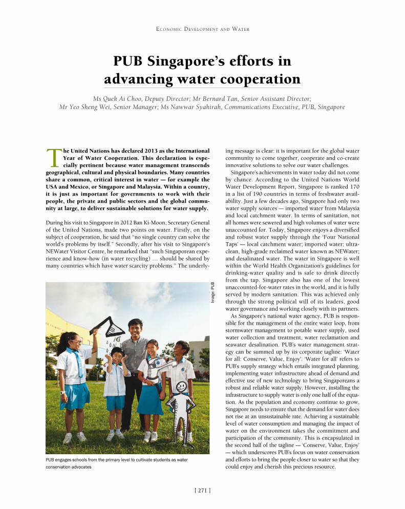
[ ]271
PUB Singapore’s efforts in advancing water cooperation
Ms Quek Ai Choo, Deputy Director; Mr Bernard Tan, Senior Assistant Director; Mr Yeo Sheng Wei, Senior Manager; Ms Nawwar Syahirah, Communications Executive, PUB, Singapore
The United Nations has declared 2013 as the International Year of Water Cooperation. This declaration is espe-cially pertinent because water management transcends
geographical, cultural and physical boundaries. Many countries share a common, critical interest in water – for example the USA and Mexico, or Singapore and Malaysia. Within a country, it is just as important for governments to work with their people, the private and public sectors and the global commu-nity at large, to deliver sustainable solutions for water supply.
During his visit to Singapore in 2012 Ban Ki-Moon, Secretary General of the United Nations, made two points on water. Firstly, on the subject of cooperation, he said that “no single country can solve the world’s problems by itself.” Secondly, after his visit to Singapore’s NEWater Visitor Centre, he remarked that “such Singaporean expe-rience and know-how (in water recycling) … should be shared by many countries which have water scarcity problems.” The underly-
ing message is clear: it is important for the global water community to come together, cooperate and co-create innovative solutions to solve our water challenges.
Singapore’s achievements in water today did not come by chance. According to the United Nations World Water Development Report, Singapore is ranked 170 in a list of 190 countries in terms of freshwater avail-ability. Just a few decades ago, Singapore had only two water supply sources – imported water from Malaysia and local catchment water. In terms of sanitation, not all homes were sewered and high volumes of water were unaccounted for. Today, Singapore enjoys a diversified and robust water supply through the ‘Four National Taps’ – local catchment water; imported water; ultra-clean, high-grade reclaimed water known as NEWater; and desalinated water. The water in Singapore is well within the World Health Organization’s guidelines for drinking-water quality and is safe to drink directly from the tap. Singapore also has one of the lowest unaccounted-for-water rates in the world, and it is fully served by modern sanitation. This was achieved only through the strong political will of its leaders, good water governance and working closely with its partners.
As Singapore’s national water agency, PUB is respon-sible for the management of the entire water loop, from stormwater management to potable water supply, used water collection and treatment, water reclamation and seawater desalination. PUB’s water management strat-egy can be summed up by its corporate tagline: ‘Water for all: Conserve, Value, Enjoy’. ‘Water for all’ refers to PUB’s supply strategy which entails integrated planning, implementing water infrastructure ahead of demand and effective use of new technology to bring Singaporeans a robust and reliable water supply. However, installing the infrastructure to supply water is only one half of the equa-tion. As the population and economy continue to grow, Singapore needs to ensure that the demand for water does not rise at an unsustainable rate. Achieving a sustainable level of water consumption and managing the impact of water on the environment takes the commitment and participation of the community. This is encapsulated in the second half of the tagline – ‘Conserve, Value, Enjoy’ – which underscores PUB’s focus on water conservation and efforts to bring the people closer to water so that they could enjoy and cherish this precious resource.
ECONOMIC DEVELOPMENT AND WATER
PUB engages schools from the primary level to cultivate students as water
conservation advocates
Imag
e: P
UB

[ ]272
ECONOMIC DEVELOPMENT AND WATER
PUB therefore works closely with companies like Keppel Seghers and Siemens, and research institu-tions such as the Nanyang Environment and Water Research Institute and the NUS Environmental Research Institute, with the long-term goal of reduc-ing the energy consumed during desalination as much as possible. This will strengthen the viability of desali-nated water as an affordable water source not just for Singapore, but for the world.
Cooperation is a double coincidence of wants: PUB also works closely with the global water industry to come up with new, innovative ideas that may make a difference to the water world. It encourages water companies to leverage Singapore as a ‘living laboratory’ to test-bed and commercialize cutting-edge technology. PUB opens its facilities for companies to test-bed their technologies under actual site conditions, which will help fast-track the commercialization of their technologies. This also helps PUB to assess the latest technologies that are suit-able to solve its water challenges.
Cooperation is about building relationships: Through advances in communication technology, the world as we know it is getting smaller. Many people are now a phone call, text message or e-mail away. Singapore has established friendships with many other countries facing water challenges through PUB’s sharing of its urban water management knowledge. In partnership with organizations such as the Singapore Cooperation Enterprise and Temasek Foundation, PUB has assisted other nations such as the Government of Mauritius and India’s Delhi Jal Board in areas such as non-reve-nue water, water reuse and community engagement.
PUB’s experience in water management over the years shows that technology and research and development (R&D) were key to over-coming Singapore’s natural vulnerabilities and achieving an adequate and secure water supply. For example, NEWater and desalination were made possible by technological breakthroughs following decades of research efforts. R&D will continue to be vital in ensur-ing a sustainable water supply for the future. With the challenges of climate change effects and increasing energy costs, governments and water utilities must find innovative ways to contain the rising costs of treating and producing water and identifying new sources. This is where water cooperation can bring about several benefits.
Cooperation is about short circuiting the solutions development process: Sir Isaac Newton once said: “If I have seen farther, it is by standing on the shoulders of giants.” As countries develop at different paces, some may encounter the same issues that others have faced before. For example, as part of the NEWater development process, Singapore looked to the United States, where reclaimed water was already used in places such as California and Arizona to replenish underground aquifers and surface reservoirs. The opportunity to learn from others around the world was instrumental to Singapore’s success in develop-ing NEWater as a viable source of water. Today, NEWater, or recycled used water, can meet 30 per cent of Singapore’s total water needs, and that figure is expected to reach up to 55 per cent by 2060.
Cooperation is about finding solutions to meet new challenges: According to the International Desalination Association Desalination Yearbook 2009-2010, there are almost 15,000 desalination plants worldwide. Among Singapore’s four sources of water, desalinated water is the most expensive source due to its high energy requirement and the increasing costs of energy. As pointed out by Dr Vivian Balakrishnan, Minister for the Environment and Water Resources, Singapore, “Singapore has translated a dependence on water into a dependence on energy.” Finding ways to reduce energy costs represents one of PUB’s biggest challenges.
Dr Vivian Balakrishnan, Minister for the Environment and Water Resources, Singapore and Mr Chew Men Leong, Chief Executive, PUB Singapore (centre, both in
white) posing for pictures with the community after engaging in water activities by the Singapore River during World Water Day 2012
Imag
e: P
UB
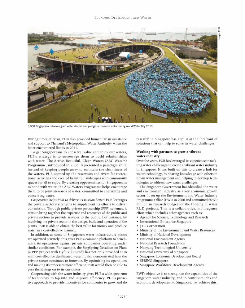
[ ]273
ECONOMIC DEVELOPMENT AND WATER
During times of crisis, PUB also provided humanitarian assistance and support to Thailand’s Metropolitan Water Authority when the latter encountered floods in 2011.
To get Singaporeans to conserve, value and enjoy our waters, PUB’s strategy is to encourage them to build relationships with water. The Active, Beautiful, Clean Waters (ABC Waters) Programme, introduced in 2006, represented a paradigm shift: instead of keeping people away to maintain the cleanliness of the waters, PUB opened up the reservoirs and rivers for recrea-tional activities and created beautiful landscapes with community spaces for all to enjoy. By creating opportunities for Singaporeans to bond with water, the ABC Waters Programme helps encourage them to be joint stewards of water, committed to cherishing and conserving water.
Cooperation helps PUB to deliver its mission better: PUB leverages the private sector’s strengths to supplement its efforts to deliver our mission. Through public-private partnership (PPP) schemes, it aims to bring together the expertise and resources of the public and private sectors to provide services to the public. For instance, by involving the private sector in the design, build and operation of the plants, PUB is able to obtain the best value for money and produce water in a cost-effective manner.
In addition, as some of Singapore’s water infrastructure plants are operated privately, this gives PUB a common platform to bench-mark its operations against private companies operating under similar conditions. For example, the SingSpring Desalination Plant (a PPP project with Hyflux Limited) has not only provided PUB with cost-effective desalinated water, it also demonstrated how the private sector continues to innovate. By optimizing its operations and making its processes more efficient, PUB would then be able to pass the savings on to its customers.
Cooperating with the water industry gives PUB a wide spectrum of technology to tap into and improve efficiency. PUB’s proac-tive approach to provide incentives for companies to grow and do
research in Singapore has kept it at the forefront of solutions that can help to solve its water challenges.
Working with partners to grow a vibrant water industryOver the years, PUB has leveraged its experience in tack-ling water challenges to create a vibrant water industry in Singapore. It has built on this to create a hub for water technology, by sharing knowledge with others in urban water management and helping to develop tech-nologies to address new water challenges.
The Singapore Government has identified the water and environment industry as a key economic growth sector. It set up the Environment and Water Industry Programme Office (EWI) in 2006 and committed S$470 million in research budget for the funding of water R&D projects. This is a collaborative, multi-agency effort which includes other agencies such as:• Agency for Science, Technology and Research• International Enterprise Singapore• JTC Corporation• Ministry of the Environment and Water Resources• Ministry of National Development• National Environment Agency• National Research Foundation• Nanyang Technological University• National University of Singapore• Singapore Economic Development Board• SPRING Singapore• Singapore Workforce Development Agency.
EWI’s objective is to strengthen the capabilities of the Singapore water industry, and to contribute jobs and economic development to Singapore. To achieve this,
3,000 Singaporeans form a giant water droplet and pledge to conserve water during World Water Day 2013
Imag
e: P
UB

[ ]274
ECONOMIC DEVELOPMENT AND WATER
it has three key strategic goals: to grow a vibrant base of water companies and research institutions; to develop the human and technical capabilities of Singapore’s water industry; and to profile and export the capabilities of Singapore-based water companies. EWI is on track to achieve its goals. From 2006 to 2012, the cluster of water companies in Singapore has doubled to 100, alongside 25 research institutions. More than 120 test-bedding projects have been conducted at PUB’s facilities. Singapore-based water compa-nies have secured almost S$9 billion worth of overseas projects in the same period.
Co-creating solutions with the global water industryThe Singapore International Water Week (SIWW) represents all of PUB’s water cooperation efforts combined into one global plat-form. SIWW is a key initiative to profile and grow the Singapore water industry. The first event was held in 2008, and saw 8,500 participants from 79 countries. Over the past five years the event has gained traction. The 2012 event saw a strong turnout of more than 19,000 participants from 104 countries and regions, with over 750 participating companies. From 2012 onward, the event will be held in conjunction with the World Cities Summit (focused on urban solutions) and the CleanEnviro Summit Singapore (focused on environmental solutions), a unique three-in-one event focused on urban sustainability.
Positioned as the global platform for sharing and co-creation of innovative water solutions, SIWW focuses on municipal, industrial, integrated city-water-environment issues, and on forward-looking challenges and solutions. With key events focused on different sectors of the water value chain, the events reinforce each other to encourage participation from the various stakeholders.
An important value proposition of water conferences is for participants to build relationships and explore collaboration opportunities with a myriad of stakeholders. Thus, one of SIWW’s strengths lies in its strong emphasis on networking and business matchmaking for its participants. Co-location with the World Cities Summit and CleanEnviro Summit Singapore allows water, environment and urban professionals to discuss integrated issues and challenges. Other key events such as TechXchange and the Industrial Water Solutions Forum allow for technology providers,
venture capitalists, buyers and sellers to match their needs with solutions. SIWW’s dedicated networking platforms, such as Connect@SIWW, also help to facili-tate interaction; over 300 meetings were organized via Connect@SIWW in 2012.
With almost 1,300 articles generated across print, broadcast, online and trade from local and interna-tional media during the 2012 event, the intense media spotlight on SIWW makes it an excellent platform to share collaboration intentions and make announce-ments. Some examples of announcements made during SIWW 2012 include the opening of Hyflux’s Innovation Centre, the signing of a memorandum of understanding between PUB and Rand Water, and an announcement by Saudi Arabia’s National Water Company that it would be investing approximately S$11 billion on capital expenditure up to 2017. In all, these contributed to S$13.6 billion worth of announcements at the event.
The next SIWW will be held from 1-5 June 2014. In the lead-up to the event, PUB is organizing the SIWW Water Utilities Leaders Forum for leaders from the global water utilities sector to share issues and chal-lenges, and chart future directions and strategies to improve each other’s operations. Held in Singapore in September 2013, the invitation-only event will target 150 leaders from the global water utilities sector. With in-depth discussions focused on key issues for effec-tive water and wastewater management, the forum will be another excellent opportunity for global water utility leaders to build relationships and share ideas to improve their respective operations.
With water challenges getting increasingly complex, crossing boundaries and transcending sectors, the need for water cooperation has never been more important. To this end, PUB is pleased to support the United Nations commitment for greater water cooperation, and looks forward to exploring collaborations with interested parties to co-create innovative water solutions to meet future challenges.
Programme
Lee Kuan Yew Water Prize
Water Leaders Summit
Water Convention
Water Expo
Business Forums
Concept
An international water prize to recognize the achievements of individuals and/or organizations in the development of breakthrough water technologies or policies and programmes which benefit humanity
A by-invitation, high-level event bringing together global water leaders to discuss pertinent water issues and policy solutions
A leading-edge international technology and water systems management conference to share and discuss technical solutions
An international water technologies exhibition showcasing leading water technologies, products and case studies of integrated urban solutions
A platform for networking, business matching and sharing of global market opportunities
Key Events of SIWW, focusing on different sectors of the water value chain
Source: PUB

[ ]275
Towards water sensitive cities: a three-pillar approach
Tony H. F. Wong, Cooperative Research Centre for Water Sensitive Cities
W hat is a water sensitive city? It is a city that interacts with the hydrological cycle to provide the water secu-rity essential for sustained economic prosperity – by
efficient and well-researched use of resources, including some that have been overlooked by earlier generations of experts. It is a city that enhances and protects the health of watercourses and wetlands. It factors into all of its planning the risk of looming drought and rising sea levels – and equally, the risk of sudden and unforeseeable floods. Such a city creates public spaces that harvest, clean and recycle water. Its management of water contributes to biodiversity, carbon sequestration and the reduction of urban ‘heat islands’. A water sensitive city is one where water’s journey through the urban landscape is managed with regard for its origins and its destinations – and where its spiritual and cultural significance is celebrated. That city meets challenges to the supply of life-giving water with integrity (not evasion), breadth of vision (not the expedient perspectives of sectional interests), and evidence-based practice (not slogans from the past, nor borrowings from some imagined future).
What policies will yield these results? Three pillars emerge to support such development – as affirmed by research at the Cooperative Research Centre for Water Sensitive Cities, an Australian Government initiative to forge partnerships between research institutions and industry, to find solutions to global challenges. These three pillars are overarching principles for meeting the challenge of developing sustainable and resilient urban water systems:• cities as water-supply catchments• cities that provide ecosystem services• cities with the social and institutional capital for
sustainability, resilience and liveability.
Far from being abstractions or mere theoretical under-pinnings, these pillars respond to a real need for real change. They are eminently practical. We accept as a given the energy and the bursting vitality of modern cities. That is not simply a part of the problem; it is also a significant part of the solution – so long as the three pillars are firmly established. And crucially, there are implications for less developed cities.
The first of our three pillars, cities as water-supply catchments, stands in direct opposition to the tradi-tional model in which a city’s needs are passively served by catchments external to it. Cities typically depend exclusively on the capture of rainfall run-off from rural or forested catchments and/or on depleting groundwater resources; but the evidence is that such a one-way trans-action is far from optimal. It is certainly not sustainable as a universal solution. Communities become hostage to increasing temperatures and drying soils – prob-lems that are all the more pressing because of ‘normal’ climate variability, progressively worsened by the reality of long-term climate change. Reflex reliance on the conventional approach (“just build another dam”) is no longer sufficient. The effects of climate change are uncertain, and rainfall is not invariably reduced. But overall, it is established that global temperatures continue to trend higher. Drier catchments are no longer a feature of one projected future among many; they are an inevitability. And drier catchments mean decreased run-off. Our precarious dependency on soil moisture in external catchment areas has to be broken.
This situation calls for a radically new model. Cities themselves have enormous potential as catchments,
ECONOMIC DEVELOPMENT AND WATER
Our cities are water supply catchments – as illustrated by the Royal Park Wetland in
Melbourne, used for harvesting and treating urban stormwater
Imag
e: T
ony
H. F
. Won
g

[ ]276
ECONOMIC DEVELOPMENT AND WATER
city must provide green infrastructure more generally, not just a sustainable water catchment for itself – the imperative upheld by the first pillar.
Landscapes are the product of both natural and human forces, interacting in regional ecosystems and beyond. Public spaces are essential to public amenity – or putting it differently, to the material conditions that enable human flourishing. However, urban landscapes must be functional beyond provid-ing amenity. Our conception of the value inherent in open space needs to be enlarged, by consideration of the ecological functioning of urban landscapes. This expanded view encompasses great diversity: sustain-able water management, microclimate influences, facilitation of carbon sinks, use of ‘low-mileage’ food production, environments for wildlife and more. Excluding the urban environment from this interwo-ven fabric is yet another reductive, binary-thinking notion that has outstayed its welcome. Three broad themes characterize the ecological design objectives for urban landscapes: nature conservation (building and conserving biodiversity, in terrestrial and aquatic environments of the city); urban-rural interface management (protecting and rehabilitating high-conservation areas regardless of where they are found, and mitigating the environmental impacts of urbaniza-tion); and urban ecology (urban design incorporating
to reduce their dependency on externally sourced water, includ-ing desalination of seawater, by accessing locally derived water in a portfolio of water sources. A serious departure from nine-teenth and twentieth century thinking? Yes. The old plans and precepts are unworkable, as even the current state of cities makes clear. Traditional mechanisms of governance yield fragmented infrastructure and compartmentalized service provision. These reductive ‘either/or’ approaches have had their day and new, holis-tic, integrated solutions are called for. We need more sophisticated perceptions of system boundaries, whereby a city may be seen as both a generator and a consumer of essential resources. Embracing the concept of diverse water supplies and mixed infrastructures will give cities enormous flexibility, freeing them to access a wealth of sources at minimal cost. Each of the alternative water sources will have its own level of reliability and its own environmental cost-and-risk profile. In a future water sensitive city, each source can be optimized through diversified and parallel infrastructures – for water harvesting, water treatment and new ways of storage and delivery. Depending on a city’s particular conformation and needs, the mix might include both centralized and decentralized elements – from a simple rainwater tank for non-potable use to large-scale schemes for redirecting or reusing water.
The second pillar supporting water sensitive cities, cities provid-ing ecosystem services, has a place close to the first. Like it, this pillar stands against traditional ways that have outworn their useful-ness; but now the principle is broader. We may consider it under the heading ‘water sensitive urban design’ (WSUD). The water sensitive
Green corridors and constructed wetlands are multifunctional green infrastructure, providing ecosystem services including water quality improvement,
micro-climate enhancement, flood conveyance and increasing biodiversity
Imag
e: T
ony
H. F
. Won
g
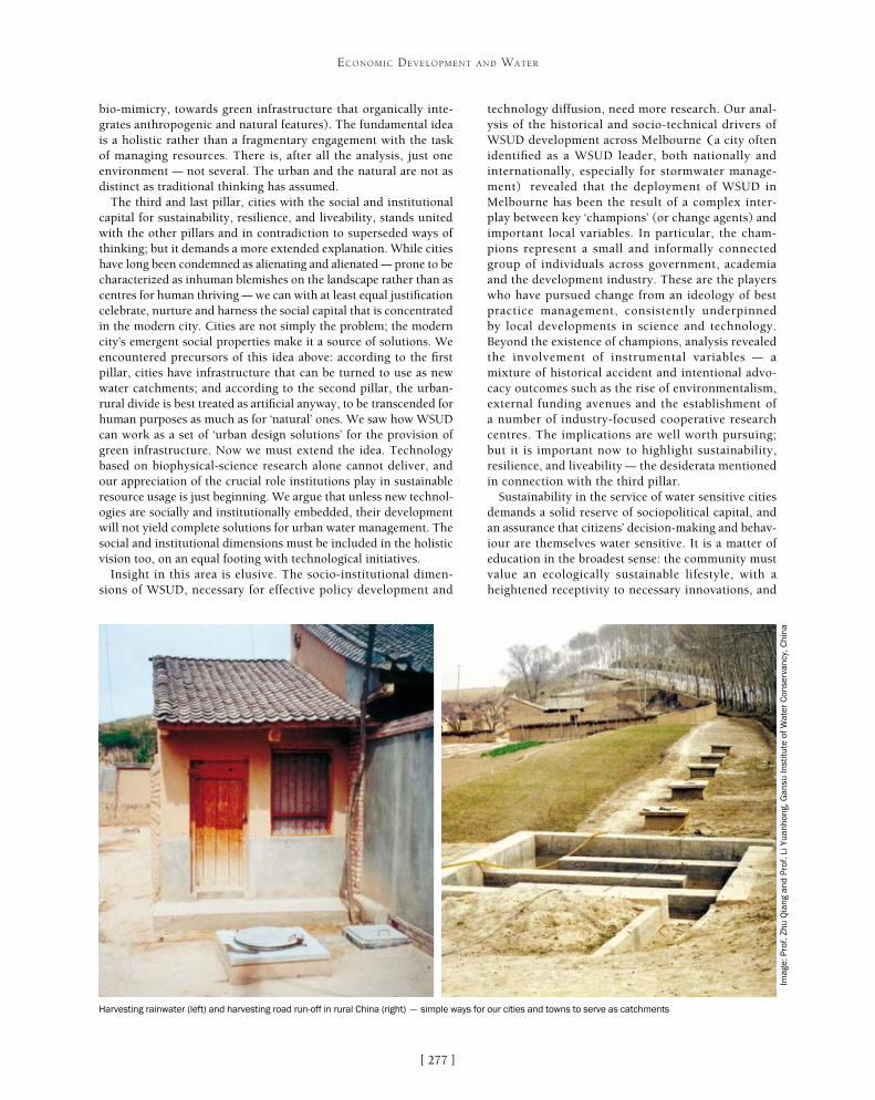
[ ]277
ECONOMIC DEVELOPMENT AND WATER
bio-mimicry, towards green infrastructure that organically inte-grates anthropogenic and natural features). The fundamental idea is a holistic rather than a fragmentary engagement with the task of managing resources. There is, after all the analysis, just one environment – not several. The urban and the natural are not as distinct as traditional thinking has assumed.
The third and last pillar, cities with the social and institutional capital for sustainability, resilience, and liveability, stands united with the other pillars and in contradiction to superseded ways of thinking; but it demands a more extended explanation. While cities have long been condemned as alienating and alienated – prone to be characterized as inhuman blemishes on the landscape rather than as centres for human thriving – we can with at least equal justification celebrate, nurture and harness the social capital that is concentrated in the modern city. Cities are not simply the problem; the modern city’s emergent social properties make it a source of solutions. We encountered precursors of this idea above: according to the first pillar, cities have infrastructure that can be turned to use as new water catchments; and according to the second pillar, the urban-rural divide is best treated as artificial anyway, to be transcended for human purposes as much as for ‘natural’ ones. We saw how WSUD can work as a set of ‘urban design solutions’ for the provision of green infrastructure. Now we must extend the idea. Technology based on biophysical-science research alone cannot deliver, and our appreciation of the crucial role institutions play in sustainable resource usage is just beginning. We argue that unless new technol-ogies are socially and institutionally embedded, their development will not yield complete solutions for urban water management. The social and institutional dimensions must be included in the holistic vision too, on an equal footing with technological initiatives.
Insight in this area is elusive. The socio-institutional dimen-sions of WSUD, necessary for effective policy development and
technology diffusion, need more research. Our anal-ysis of the historical and socio-technical drivers of WSUD development across Melbourne (a city often identified as a WSUD leader, both nationally and internationally, especially for stormwater manage-ment) revealed that the deployment of WSUD in Melbourne has been the result of a complex inter-play between key ‘champions’ (or change agents) and important local variables. In particular, the cham-pions represent a small and informally connected group of individuals across government, academia and the development industry. These are the players who have pursued change from an ideology of best practice management, consistently underpinned by local developments in science and technology. Beyond the existence of champions, analysis revealed the involvement of instrumental variables – a mixture of historical accident and intentional advo-cacy outcomes such as the rise of environmentalism, external funding avenues and the establishment of a number of industry-focused cooperative research centres. The implications are well worth pursuing; but it is important now to highlight sustainability, resilience, and liveability – the desiderata mentioned in connection with the third pillar.
Sustainability in the service of water sensitive cities demands a solid reserve of sociopolitical capital, and an assurance that citizens’ decision-making and behav-iour are themselves water sensitive. It is a matter of education in the broadest sense: the community must value an ecologically sustainable lifestyle, with a heightened receptivity to necessary innovations, and
Harvesting rainwater (left) and harvesting road run-off in rural China (right) – simple ways for our cities and towns to serve as catchments
Imag
e: P
rof.
Zhu
Qia
ng a
nd P
rof.
Li Y
uanh
ong,
Gan
su In
stitu
te o
f W
ater
Con
serv
ancy
, Chi
na

[ ]278
ECONOMIC DEVELOPMENT AND WATER
tific and physical-scientific implementation of WSUD must unequivocally be enabled, if there is to be durable improvement.
Developing countries, where infrastructure and institutions are not well established, are fortu-nate in at least two respects: retrofitting of a city is frequently not an option, because material infrastruc-ture for water management may be either absent or apt for wholesale replacement; and the social infra-structure is often readier to accommodate the new WSUD strategies. It is imperative that international aid programmes avoid inadvertently exporting preju-dices that inform traditional design of water systems. The greenfield opportunities afforded in developing countries present substantial challenges, and these must be met with new thinking. In return, they provide opportunities for learning that can be applied in developed countries.
The nexus between food security and water security is a salient concern in the urban context. Efficient use of natural resources, such as recovery and recycling of water and nutrients, is vital for securing food production. Cities and towns are home to 70 per cent of the world’s population, and vastly more food is consumed in them than in rural areas – from which the bulk of food must be transported. Communities must bear responsibility for their inef-ficient consumption of food, water and energy. We throw away more than 30 per cent of food produced; and we have scarcely begun to capture wastewater for appropriate reuse, let alone ‘waste heat’ from electricity production. Urban sewerage systems carry substantial nutrient residues, and the recovery of these will be important to sustaining productive landscapes. Sewage treatment plants must become resource recovery plants. Transforming our cities towards efficient consumption requires innovation and socio-technical synergies, starting with concerted efforts at behavioural change and community aware-ness. District-level trigeneration, reticulation of hot water and the use of available heat for water disin-fection are simple examples of pioneering ‘catalytic’ initiatives that exploit the water-energy nexus in urban development.
The creation of productive landscapes emerges as a key to developing green urban infrastructure. Cities are water catchments: in most Australian cities, the combined stormwater and wastewater resources exceed the water consumption. These resources could support greener cities for a multitude of liveability objectives, including community gardens, orchards and urban forests.
The challenges of effective, equitable water management are among the most serious that the world community faces. Like problems of popula-tion and climate change, they must be faced together by a free flow of experience and knowledge. These problems belong to no community in isolation, and the solutions must similarly be shared.
appreciate the need for balance between consumption and conser-vation of the city’s natural resources. The goal of sustainability represents a paradigm shift in urban design – as much in the citizens as in the ‘experts’.
Resilience for water sensitive cities rests on enlightened risk management, looking beyond the month, the year or the decade. In developed countries, strategies to meet emerging challenges are often encumbered by ‘path-dependent lock-in’: narrow horizons and an institutional legacy that limits the range of acceptable inter-ventions to those that fit old paradigms. But the old paradigms for water management have broken down, and there is no turning back. Many attempted solutions address only the efficiency of existing urban water systems; but that is not enough. To borrow from Aesop’s well-known fable, the oak that simply grows larger and thicker does not gain resilience – which comes, after all, from flexibility accompanied by a sense of scale and balance. Resilience is responsiveness. It is adaptation to new scenarios, new visions and new prospective solutions. Successful urban communities are extremely complex socio-physical systems that are fully integrated and constantly evolving. Harmony of the built, social and natural environments within a city depends on interactions between social capital and natural resources. Urban communities must be designed for resilience in the face of climate change, particularly allowing for the sustainable management of water resources and the protection of water environments. The ‘wicked problem’ we face in building water resilience against increased climatic vari-ability and uncertainty is multifaceted. It cannot be narrowly or exclusively focused on water management, or on hard separation of any traditional categories; sustainable solutions will be holistic interdisciplinary solutions.
Liveability in water sensitive cities may be an outcome, but it is also a prerequisite. The human-friendly quality of public spaces is necessary if urban landscape is to enjoy the respect of city-dwellers. The ecological functioning of the urban landscapes – capturing the essence of sustainable water management, microclimate influences, facilitation of carbon sinks and use for food production – cannot proceed unless it is harmonized with the natural human need for freedom of access, ease of movement and space for play and refresh-ment. Liveable spaces are sustainable spaces; they will be designed to enhance social engagement and cultural expression – incorpo-rating, for example, water-art features – and the establishment of biodiversity in terrestrial and aquatic corridors.
Assuming that the three pillars are now in place, there remain questions of implementation. Some broad observations follow.
Greenfield implementation of WSUD is the ‘express’ pathway to transforming our cities and towns; but there is often an ingrained conservatism in greenfield development. A reluctance to take responsibility for innovation leads to avoidance of the challenge altogether, so that old structures are replicated – forcing retro-fitting in the long term. Furthermore, retrofitting to implement institutional and material change for WSUD is always prob-lematic; but very often there is no alternative. In the end, the best of greenfield and the best of retrofitting options must be used harmoniously; they go hand-in-hand for a truly integrated approach to the organic renewal of cities. To achieve this integra-tion, accurate policy settings are essential. Policy that enables, not policy that micromanages, is a necessity for WSUD. Policy that micromanages in a direct attempt to solve complex problems defies the very definition of ‘policy’; the apolitical social-scien-

[ ]279
Integrated urban water frameworks for emerging cities in sub-Saharan Africa
Kala Vairavamoorthy, Seneshaw Tsegaye and Jochen Eckart, Patel College of Global Sustainability, University of South Florida, USA
It is widely accepted that one of the major challenges of the twenty-first century is to provide safe drinking water and basic sanitation for all. Presently, more than 1 billion people
lack access to improved water sources, and over 2.6 billion people lack access to basic sanitation – and nearly all of these people live in developing countries. In sub-Saharan Africa, water supply coverage is around 61 per cent and access to improved sanitation around 30 per cent.1
Providing adequate water supply and sanitation, particularly in urban areas, is a challenging task for governments throughout the world. Already, half of the world’s population lives in cities, most of which have inadequate infrastructure and resources to address water and wastewater management in an efficient and sustain-able way. This task is made even more difficult due to predicted dramatic global changes. For example, climate change is predicted
to cause significant changes in precipitation patterns and their variability, affecting the availability of water; technological and financial constraints present chal-lenges in maintaining and upgrading infrastructure assets to deliver water to all sectors while maintaining the quality of water distributed to the various users; and population growth, urbanization and industrial activities are leading to a dramatic increase in water consumption and wastewater discharge.
Under the aforementioned circumstances, current models of urban water management and their corre-sponding infrastructure have already failed or are on the verge of collapse from the perspective of cost effectiveness, performance and sustainability. Hence, urbanizing areas are now faced with difficult future strategic decisions – do they continue business as usual following a conventional technical, institutional and economic approach for water and sanitation? Or do they look for a new paradigm?
Sub-Saharan Africa is urbanizing faster than any other continent, and most of this urbanization is taking place in emerging towns and villages.2 These areas have a unique, but fleeting opportunity to change the way they think about water and how they develop their infrastruc-ture. Further, these emerging urban areas often do not have mature infrastructure and governance structures. These conditions create an opportunity to implement radically different urban water systems based on the key principles of integrated urban water management (IUWM). IUWM principles include: resilience of urban water systems to global change pressures; interventions over the entire urban water cycle; reconsideration of the way water is used (and reused); and greater application of natural systems for water and wastewater treatment. Critical to the implementation of IUWM principles is the early and continuous integration of all stakehold-ers in the decision-making and implementation process. Furthermore, institutional and governance changes are required to promote a more integrated approach to urban water management. Current trends suggest that future water systems will shift from being linear (open loop) centralized systems to closed loop, semi-central-ized systems that maximize opportunities for water reuse and recycling, and the generation of energy and nutrients from used water.
ECONOMIC DEVELOPMENT AND WATER
Current and future population in African cities exposed to drought
Source: World Bank, 2012
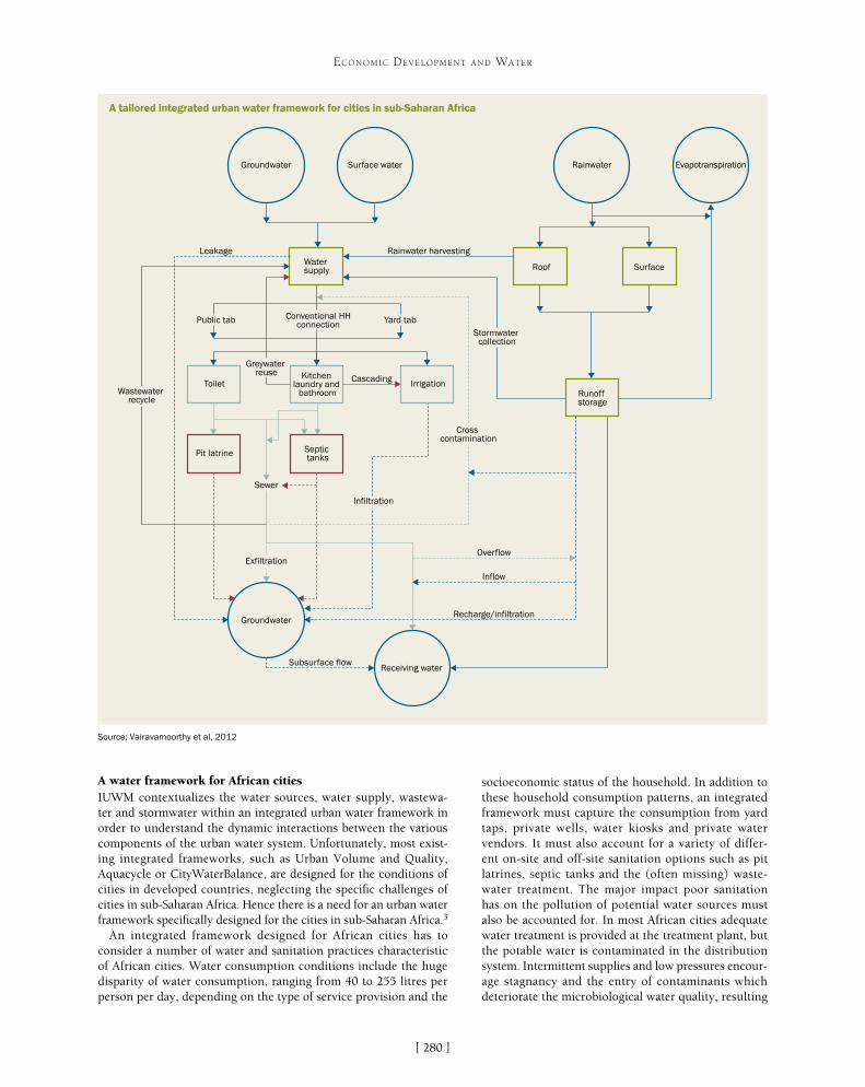
[ ]280
ECONOMIC DEVELOPMENT AND WATER
socioeconomic status of the household. In addition to these household consumption patterns, an integrated framework must capture the consumption from yard taps, private wells, water kiosks and private water vendors. It must also account for a variety of differ-ent on-site and off-site sanitation options such as pit latrines, septic tanks and the (often missing) waste-water treatment. The major impact poor sanitation has on the pollution of potential water sources must also be accounted for. In most African cities adequate water treatment is provided at the treatment plant, but the potable water is contaminated in the distribution system. Intermittent supplies and low pressures encour-age stagnancy and the entry of contaminants which deteriorate the microbiological water quality, resulting
A water framework for African citiesIUWM contextualizes the water sources, water supply, wastewa-ter and stormwater within an integrated urban water framework in order to understand the dynamic interactions between the various components of the urban water system. Unfortunately, most exist-ing integrated frameworks, such as Urban Volume and Quality, Aquacycle or CityWaterBalance, are designed for the conditions of cities in developed countries, neglecting the specific challenges of cities in sub-Saharan Africa. Hence there is a need for an urban water framework specifically designed for the cities in sub-Saharan Africa.3
An integrated framework designed for African cities has to consider a number of water and sanitation practices characteristic of African cities. Water consumption conditions include the huge disparity of water consumption, ranging from 40 to 255 litres per person per day, depending on the type of service provision and the
Groundwater
Groundwater
Surface water
Receiving water
Rainwater Evapotranspiration
Water supply Roof Surface
Runoff storage
Kitchen laundry and
bathroomToilet Irrigation
Pit latrine Septic tanks
Rainwater harvestingLeakage
Public tab Yard tabConventional HHconnection
Wastewater recycle
Exfiltration
Sewer
Infiltration
Overflow
Inflow
Recharge/infiltration
Subsurface flow
Cross contamination
Stormwater collection
Cascading
Greywater reuse
A tailored integrated urban water framework for cities in sub-Saharan Africa
Source: Vairavamoorthy et al, 2012

[ ]281
ECONOMIC DEVELOPMENT AND WATER
in huge public health risks. Finally, there is cascading use of waste-water for irrigation of urban agriculture, a common practice in many cities in sub-Saharan Africa. The cascading use of wastewater has the advantage that the scarce water resources are used multiple times, but it increases public health risks by spreading the pathogens in the wastewater. The integrated framework designed for sub-Saharan Africa must explore solutions for safe cascading use of wastewater for urban agriculture.
Because the infrastructure is often different in sub-Saharan Africa than in developed countries, many water demand management meas-ures that are applicable in the latter cannot be implemented in these developing countries.4 An integrated urban water framework designed specifically for African cities must recognize these differences and the limitations they create. For example, many African cities have a very old water distribution infrastructure which creates leakage levels of 30-50 per cent. Under these conditions, leakage management programmes provide a huge opportunity for IUWM in African cities. Unfortunately, when the water supply is intermittent and distribution pressures are low, many water-saving devices for toilets, bathrooms and kitchens may not be effective. Further, in water-scarce conditions where the population already uses water efficiently, the potential for further water-saving measures is limited. An IUWM framework designed specifically for African conditions must select technologies which are suitable for the conditions in African cities. For example, treatment technologies which could not work with intermittent energy supply (such as acti-vated sludge) are not applicable and more robust technologies such as stabilization ponds should be applied.
By improving the understanding of the highly complex interactions between the different parts of the African urban water cycle, an IUWM framework designed for Africa facilitates a structured and integrated analysis and supports an integrated decision-making process.
IUWM strategies for AruaAlthough the integrated framework may seem straightforward, its application on the ground is chal-lenging. The new integrated approach to urban water management has been applied in a recently prepared feasibility study for Arua, Uganda, funded by the World Bank.5 Comparable concepts are proposed for feasibility studies in Mbale, Uganda and Nairobi, Kenya. Arua is a rapidly emerging town located in northern Uganda. It is experiencing a critical short-age of water and the main water source, the Enyau River, is affected by the increasing water demands of upstream users, exacerbating the water shortage problem. The current water supply is not sufficient to meet the existing demand, and with an estimated population growth of up to 200 per cent in the next 20 years the problem will increase. In addition to the water shortage problem, Arua also lacks adequate sanitation provisions, with dysfunctional pit latrines, open defecation and untreated wastewater posing both health risks and water pollution risks. In order to cope with these challenges, a feasibility study for future water supply and sanitation was developed applying the integrated framework.
Based on the integrated framework, the feasi-bility study proposes that in Arua surface water, groundwater, artificial aquifer recharge and recycled wastewater (grey and black) should all be consid-ered as potential water sources, resulting in increased water security (security by diversity). This strategy includes changing the way we think and the way we
20,000
18,000
16,000
14,000
12,000
10,000
8,000
6,000
4,000
2,000
0
20
12
20
13
20
14
20
15
20
16
20
17
20
18
20
19
20
20
20
21
20
22
20
23
20
24
20
25
20
26
20
27
20
28
20
29
20
30
20
31
20
32
Surface water – Anyau River (existing operating capacity)
Groundwater
Surface water (upgrading abstraction from Enyau River)
Greywater (Cluster 6, 8 and 9)
Greywater (Cluster 1, 2 and 7)
Waste water reuse (Cluster 3, 4 and 5)
Surface water (Dam at Enyau River)
= Water demand
Estimated water demand and proposed water resources for Arua
Source: Vairavamoorthy et al, 2012

[ ]282
ECONOMIC DEVELOPMENT AND WATER
build infrastructure. We need a change in mindset about wastewater; we should stop viewing it as waste and a burden, but rather see it as a resource that could be effectively utilized to augment water sources. And building a decentralized system for wastewater recycling, using innovative options such as the Decentralized Wastewater Treatment System6 and Soil Aquifer Treatment, can both improve sanitation and generate additional water sources. Decentralized systems allow water to be used and reused closer to where it is produced and where it is needed. Decentralized systems can also lower energy demand and reduce operational and mainte-nance costs, making them especially well suited to conditions in sub-Saharan Africa. In addition, the decentralized treatment options and the resulting clusters optimize the adaptive capacity of the emerg-ing urban space by allowing infrastructure growth to be staged in a way that traces the urban growth trajectory more carefully. The IUWM strategy also promotes the development of a strong watershed protection plan where the needs and wishes of all upstream and downstream stakeholders in the water-shed are considered.
It is possible that this IUWM strategy could provide sufficient water resources to meet the increasing demand in the next 20 years. Allocation of the differ-ent water resources is prioritized from a cost-benefit perspective. The feasibility study estimates that for Arua, the average unit costs for the proposed IUWM scenario are US$0.57 per cubic metre, while the unit costs for the traditional approach of using water from conventional surface water sources 20 km away is US$0.74 per cubic metre.
A unique opportunityIn conclusion, we need to recognize that global change pressures will affect our ability to manage urban water in the city of the future. We all live, and our cities exist, in a rapidly changing environment. The think-ing behind much urban planning today predates these changes and the time has come to think fresh! We cannot continue investing in water infrastructure that is unsuited to future societal needs. At the same time we have to find new ways of catering for more people, with more needs, with the same quantity of water. All this has to be achieved while reducing our ecological footprints. This complicated challenge calls for a real paradigm shift in urban water management. In emerg-ing urban areas in Africa where water infrastructure is still in its infancy, there is a unique but fleeting opportunity to implement radically different urban water systems based on the principles of IUWM. The conclusion from the Arua case study is that IUWM is a powerful approach to managing freshwater and wastewater (and stormwater), and provides the poten-tial to satisfy the water needs of communities at the lowest cost while minimizing adverse environmental and social impacts.
Emerging technologies that maximize opportunities for water reuse
and recycling from used water
Imag
e:A
qua
Ser
vice
s an
d E
ngin
eeri
ng, 2
01
3
The geographic location of Arua town, Uganda
Source: Vairavamoorthy et al, 2012
Congo, DRC
RwandaTanzania
Kenya
Sudan
Uganda
ARUA

[ ]283
Water resources management on the island of Crete: lessons learned
E. Baltas, Associate Professor, School of Civil Engineering, National Technical University of Athens; and O. Tzoraki, Assistant Professor, School of Environment, University of Aegean
The island of Crete has limited water resources and growing water demands. Therefore, an important goal of water resources management on the island is to achieve
a hydrological balance and promote understanding in the local community about the problem of water shortage. Lack of coop-eration among Crete’s several water authorities, institutions and services has often meant that water issues enter a ‘labyrinth’, but a process of stakeholder participation at all stages of manage-ment plan creation has resulted in a real influence on policy design and implementation. In addition to effective cooperation among end users, measures such as managed aquifer recharge, village connection to wastewater treatment plants, ecological river flow, erosion elimination and flood control are now being considered to prevent drought and ecological problems.
In Mediterranean countries and especially in Greece, demand on fresh water is continuously increasing due to population growth, improving living standards and economic development.1 The fact that the major-ity of rainfall events occur during the autumn and winter months, and
that water demand increases during the summer, creates a discrepancy between water supply and demand. The small drainage areas in many Greek islands, in combination with high slopes and restricted rainfall volumes, result in the desiccation of rivers and wetlands during the summer. Common measures in the face water shortage include dam construction, river abstractions and overexploitation of groundwater.2 The threat of seawater intrusion prohib-its the use of existing, near-shore aquifers. At the same time, climate change has limited water resource avail-ability. The Intergovernmental Panel on Climate Change expects that by 2050,the annual average river flow will have decreased by 10-30 per cent over some dry regions at mid-latitudes and semi-arid low latitudes.3 Consequently, extended areas of southern Europe are going to suffer from water stress and desertification. These complexities are posing great challenges to decision makers and water managers who are working to maintain both economic development and environmental protection.
ECONOMIC DEVELOPMENT AND WATER
Mean annual precipitation on the island of Crete
Source: Ministry of Environment, 2013

[ ]284
ECONOMIC DEVELOPMENT AND WATER
west side to 20 oC in the south of the island. Precipitation patterns are highly varied, with mean precipitation ranging from 327 mm in coastal areas to 2,161 mm in the headwaters of the White mountains.6 The highest precip-itation is observed in the mountains, with much less on the north coast of the Chania prefecture and south part of Irakleion. During recent decades a decreasing trend in annual precipitation has been observed, with the largest reductions in higher elevations.7
The combination of the Cretan mountainous relief, complex geology, long coastline and the remoteness of some biotopes has led to great diversity and the existence of many endemic and rare animal and plant species. The national Woodland of Samaria (4,850 ha) has been categorized as a Biosphere Reserve by the United Nations Educational, Scientific and Cultural Organization, and was awarded a European Diploma of Protected Areas (Category A) by the Council of Europe. In 1994, a survey by the Greek Biotope/Wetland Centre recorded 37 biotopes including 14 river estuaries, one spring, one lake, six wetlands, nine rivers, three arti-ficial lakes and three sealakes. Many sites in Crete have been included in the Natura 2000 network and many national and European projects have targeted the protection, restoration and sustainable management of these areas. A key issue of Cretan ecological protection is the safeguarding of its water resources.
Water management in the pastIn ancient times, water supply was covered by spring and river water and shallow groundwater. Water storage was achieved by a dense system of drainage networks and cisterns. The complicated water supply and sewage system of the Palace of Knossos was greatly admired in prehistoric Crete, even though most of its features were destroyed and little is known about its main opera-tion. Some hypotheses assume that this system is the complicated labyrinth mentioned in the Greek myths of later periods. Aqueducts of gravity-flow and pressure-piped systems were designed in the palace, revealing a deep knowledge of water management techniques. In the palace of Phaistos, terracotta pipes were in use, comprising one of the earliest applications of hydro-static law in communication vessels.8
Today’s water resources balance A mean annual precipitation of 934 mm corresponds to a water volume of 7,700 hm3. Due to high temperatures it is estimated that almost 72 per cent (5,544 hm3) of the rainwater is subject to evapotranspiration, with only 12.5 per cent generating surface flow (962 hm3) and 15.5 per cent (1,194 hm3) filtering into the soil.9 An estimated 593 hm3 of groundwater enters the surface flow as spring water. The major springs are found in the north-west part of Crete (maximum recorded flow 6,000 m3/hr) in contrast to the south-east part, where springs flow at 15-70 m3/hr.
Annual freshwater needs in the Cretan region reach 515 hm3. Of this, human water supply demands around
Crete faces limited natural water supply and increased seasonal demand, especially in the summer for agricultural and touristic use. A key issue of concern is the allocation of water resources to ensure sufficient water for all demands. During recent decades several hydraulic projects such as reservoirs and water pipe systems have been constructed to serve water needs, drastically altering the natural regime of rivers and aquifers. There is a conflict between users’ demand and the rational use and protection of the island’s existing water resources.
The island of CreteGreece covers an area of 130,000 km2 in the Mediterranean region in the south of Europe. The island of Crete occupies the southern part of Greece with an area of 8,265 km2 and is divided into four prefectures: Lassithi (1,810 km2), Heraklion (2,626 km2), Rethymno (1,487 km2) and Chania (2,342 km2). Agricultural areas cover 37.9 per cent of the island (3,134 km2). Permanent trees (mostly olive and orange trees) occupy 1,901 km2, arable land 300 km2, vegeta-bles and other horticultural crops 86 km2, grapes and raisins 255 km2, and 592 km2 is fallow land. The permanent population of the island is 601,131.4 In 2006, the livestock population on the island was counted as 2,000 heads of cattle, 65,000 pigs, around 1.3 million sheep, 635,000 goats, 6,000 horses, over 1 million heads of poultry, 544,000 rabbits and 158,000 beehives.
Four mountain ranges run west to east: the White mountains in the west (2453 m), Idis mountain (2,456 m) in the centre, Asterousia (1,280 m) in south Irakleion and Dikti (2,148 m) in the east. The geology of Crete is comprised of limestone, which allows water to penetrate, creating major karstic formations.5 Crete stands on the verge of the tectonic trough of the Mediterranean and the Aegean volcanic bow, giving the island high seismic activity.
Crete has a typical Mediterranean climate with cool winters and hot summers. The mean annual temperature ranges from 18.5 oC in the
Water storage in ancient Greece: an ancient courtyard with a
cistern in the foreground
Imag
e: w
ww
.min
oanc
rete
.com
/cha
mai
zi.h
tm

[ ]285
ECONOMIC DEVELOPMENT AND WATER
65 hm3 while 6.2 hm3 is for livestock, 440 hm3 for agriculture, 0.9 hm3 for olive mills and 3.2 hm3 for industrial purposes. Around the half (46 per cent) of the total water requirement is requested by the Irakleion prefecture. The available water volume on an annual basis is estimated to be 372 hm3, leaving a water deficit of about 143 hm3. Increased water demand for agricultural use on the island, (approximately 85 per cent of water use) cannot always be met.10 Great efforts have been made to promote rational use of water by the agricultural sector, even though irrigated water exceeds 500 mm annually (a mean rate for agriculture).
Groundwater resources in Crete are overexploited, especially in the Messara aquifer in South Irakleion where an estimated 51 hm3 of water is extracted each year, exceeding aquifer yield by 10 hm3.11 Nowadays water needs are covered by a dense network of pipes that transfer water from springs, reservoirs and groundwater bodies to villages and coastal cities. For instance in the Rethimno prefecture the Potami dam, with a reservoir capacity of 23 hm3, covers the irrigation needs of the Amari valley. A substantial amount of water is reused and becomes available for agricultural and urban needs. Eight of the 18 domestic wastewater treatment plants in Crete reuse water to satisfy agricultural water needs. In addition, during recent years, desalination technology has started to be used for obtaining small quantities of water for domestic supply, although this is recog-nized as a very expensive solution.
Issues of water management, spatial planning and agriculture were historically administered by distinct organizational bodies such as the Eastern Crete Development Organization and the Western Crete Development Organization, the municipalities, water associations and several local land reclamation services without any coopera-tion between them. The main problem was that the western part of the island experiences water surplus and the eastern part suffers from water deficit, but the administrative structures were not organ-ized in a way that allowed water transfer from the one part of the island to the other. Many environmental problems have arisen due to water deficit, such as seawater intrusion into the coastal aquifer, river dryness, lowering of groundwater levels in many valleys, and
related ecological problems such as the loss of endemic biodiversity and increased salinity of fresh water. Cretan wetlands are currently under threat due to overexploita-tion of water resources. Coastal marshes in particular are endangered as a result of the expansion of urban and touristic settlements.12 In order to minimize the water shortage problem, effective cooperation is neces-sary among the different water use sectors, as well as among the communities which belong to different basins. Especially in cases where hydraulic works have to be conducted for transferring water from one region to another, approaches are needed to convince the local communities involved.
In the past, environmental issues arising from water management were not acknowledged as the main responsibility of any water-related organiza-tion. However, the adoption of the European Union Water Framework Directive in national legislation ushered in the creation of water districts. Crete is recognized as WD13 and the responsibility for water management belongs to the Water Department of the Decentralized Administration of Crete. The prepara-tion of river basin management plans and suggested programmes of measures are under public consulta-tion at the time of writing, especially actions focused on preventing drought, which Crete faces quite often, and flood. Public participation is a prerequisite in all stages of management plan creation, so all interested parties are actively involved. Even water authori-ties which were inexperienced in participatory and cooperative forms of governance have supervised several stakeholder groups. The main outcome of this participatory process has been effective linkages between the various water use sectors. Some forms of interaction and cooperation were generated between associations managing irrigation water and public water supply services. Public awareness resulted in a deeper understanding of water issues,13 allow-ing water allocation from the west to the east part of Crete. Current policies identify the maintenance of domestic and municipal water supply as the first priority, followed by agricultural needs. Perennial crops are the first priority of the agricultural sector, ahead of seasonal vegetables.
Towards sustainable managementCrete is moving towards the sustainable management of existing water resources with the aim of achieving maximum yields and optimal utilization. Balancing demand and supply is an important goal in light of the limited available resources and growing demand in the urban and touristic sectors. Measures such as managed aquifer recharge, village connections to wastewater treatment plants, river ecological flow, erosion elimi-nation and flood control should be taken to prevent ecological problems. Cooperation among the different water use sectors and the communities which belong to different basins will help to minimize the water short-age problem.
The main springs in Crete and their maximum recorded discharge
Source: IGME, Water Points Recording – Crete Water District (2009)

VIIIInternational
Cooperation on Water Sciences and Research
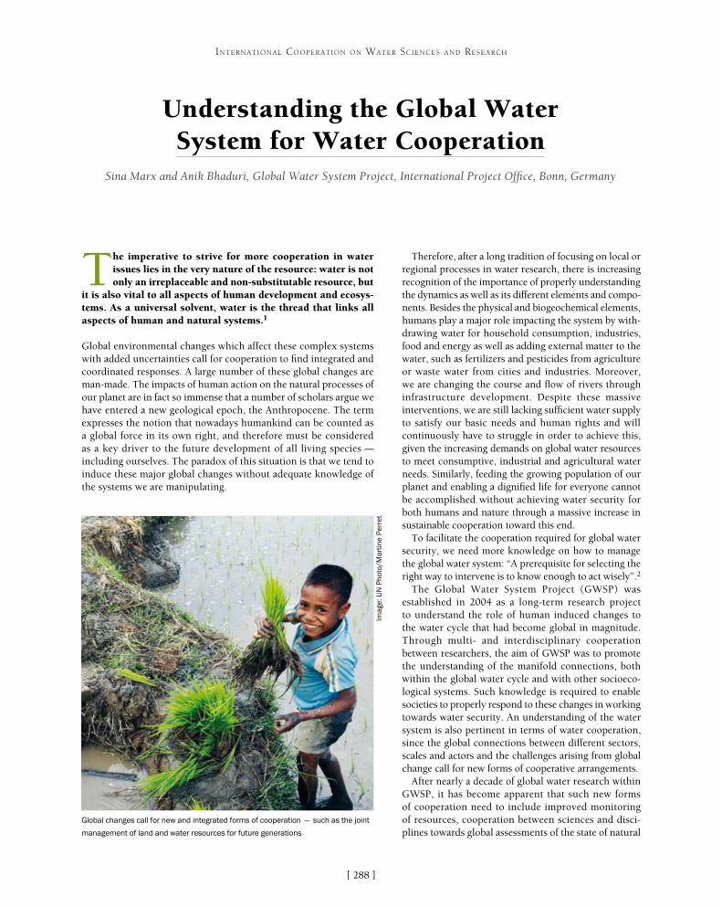
[ ]288
Understanding the Global Water System for Water Cooperation
Sina Marx and Anik Bhaduri, Global Water System Project, International Project Office, Bonn, Germany
The imperative to strive for more cooperation in water issues lies in the very nature of the resource: water is not only an irreplaceable and non-substitutable resource, but
it is also vital to all aspects of human development and ecosys-tems. As a universal solvent, water is the thread that links all aspects of human and natural systems.1
Global environmental changes which affect these complex systems with added uncertainties call for cooperation to find integrated and coordinated responses. A large number of these global changes are man-made. The impacts of human action on the natural processes of our planet are in fact so immense that a number of scholars argue we have entered a new geological epoch, the Anthropocene. The term expresses the notion that nowadays humankind can be counted as a global force in its own right, and therefore must be considered as a key driver to the future development of all living species – including ourselves. The paradox of this situation is that we tend to induce these major global changes without adequate knowledge of the systems we are manipulating.
Therefore, after a long tradition of focusing on local or regional processes in water research, there is increasing recognition of the importance of properly understanding the dynamics as well as its different elements and compo-nents. Besides the physical and biogeochemical elements, humans play a major role impacting the system by with-drawing water for household consumption, industries, food and energy as well as adding external matter to the water, such as fertilizers and pesticides from agriculture or waste water from cities and industries. Moreover, we are changing the course and flow of rivers through infrastructure development. Despite these massive interventions, we are still lacking sufficient water supply to satisfy our basic needs and human rights and will continuously have to struggle in order to achieve this, given the increasing demands on global water resources to meet consumptive, industrial and agricultural water needs. Similarly, feeding the growing population of our planet and enabling a dignified life for everyone cannot be accomplished without achieving water security for both humans and nature through a massive increase in sustainable cooperation toward this end.
To facilitate the cooperation required for global water security, we need more knowledge on how to manage the global water system: “A prerequisite for selecting the right way to intervene is to know enough to act wisely”.2
The Global Water System Project (GWSP) was established in 2004 as a long-term research project to understand the role of human induced changes to the water cycle that had become global in magnitude. Through multi- and interdisciplinary cooperation between researchers, the aim of GWSP was to promote the understanding of the manifold connections, both within the global water cycle and with other socioeco-logical systems. Such knowledge is required to enable societies to properly respond to these changes in working towards water security. An understanding of the water system is also pertinent in terms of water cooperation, since the global connections between different sectors, scales and actors and the challenges arising from global change call for new forms of cooperative arrangements.
After nearly a decade of global water research within GWSP, it has become apparent that such new forms of cooperation need to include improved monitoring of resources, cooperation between sciences and disci-plines towards global assessments of the state of natural
INTERNATIONAL COOPERATION ON WATER SCIENCES AND RESEARCH
Global changes call for new and integrated forms of cooperation – such as the joint
management of land and water resources for future generations
Imag
e: U
N P
hoto
/Mar
tine
Per
ret

[ ]289
INTERNATIONAL COOPERATION ON WATER SCIENCES AND RESEARCH
nical and managerial, were often applied to very diverse locations, irrespective of whether or not they fitted the specific situation. The most influential paradigm for the cooperative management of water resources today, namely Integrated Water Resource Management (IWRM), is a great step towards integrating complexity in water manage-ment. However, the priorities for implementing IWRM are still often generalized, without explicitly taking differences into account. For instance, setting up integrated river basin management plans might not be practicable for countries with limited institutional capacities.
This discrepancy between theory and feasibility in implementation is one reason why IWRM has fallen short of initial expectations. To overcome these difficulties, one has to examine the potential forms of cooperation which are best suited in different settings while taking into account that the values and priorities associated with water and development vary tremendously between socie-ties. Therefore, the relevant issue is to identify the factors and circumstances that induce or encourage cooperation.
While the public debate over competing needs and demands for international water resources largely focuses on the extreme of ‘water wars’ as opposed to ‘water cooperation’, there is a much wider variety in the forms and levels of potential cooperative behaviour between actors than those two aspects. The spectrum of cooperation ranges from sharing data and infor-mation to the joint management of a water resource. Especially in the case of transboundary rivers, one has to recognize that the benefits for nation states do not necessarily increase with the level of coopera-tion.4 Cooperation also comes at a cost, and there is a need to identify conditions where the benefits of such cooperative behaviour outweigh its costs. The poten-tial costs and benefits also depend on physical, social and economic factors which differ from basin to basin. However, little is known about how water governance and management systems perform in different socio-economic and environmental contexts.
To close this gap, the Twin2Go project endorsed by GWSP conducted a comparative analysis of complex water governance and management systems in 29 river basins around the globe. It was found that forms of governance with polycentric cooperative arrangements show the best performance – that is, those governance structures which favour the sharing of power between different centres without losing the coordination between them. The distribution among several centres enables more flexible responses that fit the specific situation and place of action, which makes it easier to deal with uncertainties.
Such studies can help to make adaptive governance of river basins work in the sense of an IWRM. However, IWRM conceptually assumes cooperative behaviour between stakeholders without further questioning whether cooperation actually exists, or whether it is desir-able for a certain actor. Cooperation is a prerequisite for good water governance but it cannot be taken for granted. While new theories in economics have shown that the exploitation of shared resources, in the sense of a Tragedy
resources, and the sharing of information and data on all levels – including the global scale.
For instance, a recent GWSP study3 on global threats to human water security and river biodiversity found that almost 80 per cent of the world’s population faces high levels of water security threat. Immense technological investments enable rich states to counterbal-ance these threats without acting upon the root causes, whereas less wealthy countries remain exposed and vulnerable. Similarly, biodi-versity is jeopardized by a lack of preventive action. The framework developed by Charles Vörösmarty, and others, helps to prioritize potential cooperative responses to this crisis in terms of policy, management and governance.
From a governance perspective, new forms of multidimensional cooperation are needed – between sectors of industries and services, between and within nation states and non-governmental institutions – to provide water security for everybody, without jeopardizing the natural resource base on which the world depends.
However, while it is easy to call for cooperation, in reality, effective and sustainable cooperation on the management of resources can be hard to achieve. This is particularly the case when adequate knowl-edge of the processes needed to establish such cooperative behaviour in different settings is lacking. In the past, universal remedies, both tech-
Global assessments are needed to properly understand anthropogenic and
environmental changes in the water cycle
Imag
e: N
AS
A
The Bonn Declaration on Global Water Security
The water community assembled in Bonn for the GWSP Conference “Water in the Anthropocene” in May 2013, urged a united front to form a strategic partnership of scientists, public stakeholders, decision- makers and the private sector. The declaration calls for more cooperation in order to develop a broad, community-consensus blueprint for a reality-based, multi-perspective, and multi-scale knowledge-to-action water agenda.
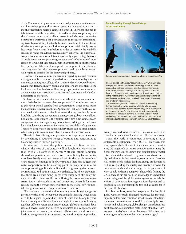
[ ]290
INTERNATIONAL COOPERATION ON WATER SCIENCES AND RESEARCH
of the Commons, is by no means a universal phenomenon, the notion that human beings as well as nation states are interested in maximiz-ing their respective benefits cannot be ignored. Therefore one has to take into account the respective costs and benefits of cooperating on a shared water resource to be able to assess in which cases cooperative behaviour is worthwhile for a certain actor. In the case of transbound-ary river basins, it might actually be more beneficial to the upstream riparian not to cooperate at all, since cooperation might imply getting less water from a river than before in order to increase the available amount of water for a downstream country. Likewise, the existence of cooperative measures as such is not necessarily a ‘good thing’. In terms of implementation, cooperative agreements need to be examined more closely as to whether they actually help in achieving the goals they have been put up for. Likewise, if a cooperative arrangement clearly favours one party over the other, non-cooperation could be the better option with regard to benefits for the disadvantaged party.
However, the cost of non-cooperation regarding natural resource management in terms of degradation or water scarcity can be immense, and negative effects often transcend international borders. Given that transboundary basins and aquifers are essential to the livelihoods of hundreds of millions of people, water creates mutual dependencies across societies, countries and continents which often necessitate cooperation.
So how to overcome a situation in which non-cooperation seems more desirable for an actor than cooperation? One solution can be to talk about overall benefits from cooperation on water issues rather than about mere water quantities. Approaches that focus on the collec-tive benefits that users receive from water sharing can thus be more fruitful in stimulating cooperation than negotiating about water alloca-tion alone. Issue linkage is the notion that if two sides cannot reach an agreement when negotiating on one issue, adding a second issue for a simultaneous discussion increases the probability of agreement. Therefore, cooperation on transboundary rivers can be strengthened when taking into account more than the issue of water use alone.
Therefore, issue linkage can prevent non-cooperative behaviour by broadening a country’s range of options and contributes to balancing uneven ‘power’ potentials.
As mentioned above, the public debate has often discussed whether the wars of this century will be fought over water rather than over oil. However, as Aaron Wolf and others famously showed, cooperation over water exceeds conflict by far and water wars have barely ever been recorded within the last thousands of years. Research findings both of GWSP and others also suggest that water cooperation can be a starting point for cooperation in other areas, preventing political conflict and strengthening ties between communities and nation states. Nevertheless, the above statement that there are no wars being fought over water does obviously not mean that there is no conflict or suffering due to increasing water stress. Rather, the accelerating and competing demands for water resources and the growing uncertainties due to global environmen-tal changes necessitate cooperation more than ever.
Effective water cooperation does not only mean bringing together those actors that need to cooperate, but similarly knowing which issues need to be aligned. A joint discussion of issues that belong together but are usually not discussed as such might in turn require bringing together different actors than before. Recent global assessments have revealed several issues that need to be discussed in a cooperative and joint manner: we urgently need more collaboration to address water, food and energy issues in an integrated way as well as a joint approach to
manage land and water resources. These issues need to be taken into account when framing the policies of tomorrow.
Today the world is committed to creating a set of sustainable development goals (SDGs). However, this task is particularly difficult in the area of water, consid-ering the magnitude of human activities transforming the global water system. We know that competition for water between societal needs and ecosystem demands will inten-sify in the future. At the same time, securing water for other vital human needs such as food and energy production, as well as safeguarding the quality and quantity of water for the ecosystem, should not be neglected in pursuance of water supply and sanitation goals. Thus, while framing the SDGs, there is further need for knowledge to understand how to safeguard the global water system on which the welfare of current and future generations depends and to establish stategic partnerships to this end, as called for in the Bonn Declaration.
Last but not least, from the perspective of a decade of global water research, financial resources for research, capacity building and education are a key element to facili-tate water cooperation and a fruitful relationship between science and policy. Facing global change, this relationship must become a collaborative partnership of mutual learn-ing to meet today’s and future challenges. What is needed is ‘managing to learn in order to learn to manage’.5
Benefit sharing through issue linkage in the Volta Basin
Recent studies on transboundary rivers show in which way issue linkages – for example of water and energy – can improve cooperation between upstream and downstream riparians. A case study6 on transboundary water sharing between Burkina Faso and Ghana, the major upstream and downstream countries in the Volta River Basin, illustrates that the interdependency of riparians can lead to mutual benefits if more issues than water use are taken into account.
While Ghana gets the chance to increase the currently limited amount of water used for agricultural purposes, Burkina Faso benefits from cheaper energy from hydropower as a compensation for constraining its water consumption. In this case, collective benefits of issue linkages of water and energy can result in improved welfare for both countries, making a sustainable cooperation commonly advantageous.
Interdependency and issue linkage can lead to mutual benefits
Imag
e: U
N P
hoto
/Log
an A
bass
i

[ ]291
A use-inspired approach to sustainable water management
Omar Osman, Vice-Chancellor; Kamarulazizi Ibrahim, Director, Professor; Kanayathu Koshy, Professor of Sustainability, Centre for Global Sustainability Studies; Ismail Abustan, Professor,
School of Civil Engineering, Universiti Sains Malaysia
In a world threatened by climate change and a burgeon-ing global population, government alone cannot address the challenges arising from increasing demand for water
access. Universities must play a key role by helping govern-ments determine how to manage and allocate water resources and provide water services. Recognizing this, Universiti Sains Malaysia (USM) has been taking proactive measures to play its part, focusing on research initiatives and education-based capacity-building. USM’s approach to water research is guided by the identified sustainability challenges that a wide spectrum of water users is currently experiencing. Our research is proac-tively designed to be need-based and is inspired by the goal of putting the results to immediate use in finding solutions.
There follows an account of USM’s experiences in integrated approaches to river and stormwater management, modelling for scenario generation1 and our ongoing Polar Research Initiative, [email protected] These illustrate the need for science and values-based decision-making for people-centred water cooperation as a new paradigm for integrated water management.
BackgroundEnsuring the free flow of water for all is a major sustain-ability challenge that is felt across the world. In order to manage one of the most crucial natural resources for human survival effectively and to ensure the “water future we want” the United Nations Conference on Sustainable Development was held in Rio in 2012. Here, the global community “reaffirmed the commit-ment made in the Johannesburg Plan of Implementation and the Millennium Declaration regarding halving by 2015 the proportion of people without access to safe drinking water and basic sanitation and the develop-ment of integrated water resource management and water efficiency plans, ensuring sustainable water use.”3 By declaring 2013 the International Year of Water Cooperation, the United Nations has specifically acknowledged the urgency of mainstreaming “water and sanitation as a sustainable development goal that corresponds and responds to multidimensional chal-lenges.”4 UN-Water has called upon the United Nations
INTERNATIONAL COOPERATION ON WATER SCIENCES AND RESEARCH
BIOECODS approaches to integrated water management
Imag
e: R
ED
AC
US
M

[ ]292
INTERNATIONAL COOPERATION ON WATER SCIENCES AND RESEARCH
prioritize it for their own purposes, resulting in compet-ing demands. This inevitably creates complex pressures on the water system, and integrated approaches are required to find solutions. Government has traditionally been responsible for managing rivers, but increasingly the public, non-governmental organizations, industri-alists, farmers and other stakeholders are also playing greater roles. In a 2005 paper, Weng explains at length the need for the involvement of multiple players who are strategic, need-based and inspired by a vision for finding practical solutions to water issues.6 Weng proposes ‘PEOPLE’ as an acronym standing for the ingredients necessary for integrated river manage-ment to work most effectively: Public participation; Environmental conservation; Ordeals; Politics and pollution; Learning; Equity; and Economics. He then expands on each of these elements, citing numerous examples of existing problems and of ongoing projects in sustainable river management. The important point here is that the involvement of multiple players has to be strategic, need-based and inspired by a vision for finding practical solutions to water issues.
In Malaysia, natural and man-made waterways are interconnected, especially in the more devel-oped areas of Peninsular Malaysia. They include the various river systems, of which there are 89 in Peninsular Malaysia, 22 in Sarawak and 78 in Sabah;7 several artificial water infrastructures consisting of large lakes such as Kenyir Lake and Temenggor Lake in Terengganu; and many smaller ponds, swales and urban drainages. Water from all these sources must support agriculture, domestic and other indus-trial uses as well as various engineering projects such as hydroelectric and wastewater treatment. To help meet this challenge, USM researchers from the
Educational, Scientific and Cultural Organization (UNESCO) to lead the International Year of Water Cooperation activities.
Despite the vital importance of water to life on Earth, there are major gaps in our understanding of water availability, quality and dynamics, and of the impact of global changes on water systems. Through place-based research and integrative modelling, USM has been pursuing education- and research-based capacity-building and policy interactions to enhance our understanding of water system and land use changes, the built environment, ecosystem functions and services and climate change and variability, and to predict how each of these will impact the others.
Flooding is the most common natural disaster encountered in Malaysia. Both monsoon floods and flash floods are frequent. The Department of Irrigation and Drainage in Malaysia has estimated that about 29,000 km2 (9 per cent of the total land area) and more than 4.82 million people (22 per cent of the population) are affected by flooding annually. The damage caused by flooding is estimated to be about RM 915 million (£160 million). Monsoon floods are caused by long durations of heavy rainfall, but more localized flooding, which occurs especially in newly developed town areas, is part of the dynamics of the built environment. The River Engineering and Urban Drainage Research Centre (REDAC), the School of Engineering, the School of Biology, the Geography Department, and the Centre for Global Sustainability Studies (CGSS) are among the sections of USM currently active in the research and capacity-building area of water management. In order to facilitate international cooperation, since 2004, REDAC has been holding a triennial international conference on rivers.5
Use-inspired research for water cooperation Integrated river management, stormwater management and computer modelling are three areas of active research at USM.
Integrated river management The sustainable management of Malaysia’s waterways is a central issue for national development. Various users of river water want to
Modelling for digital flood mapping, erosion and sediment control in Malaysia
Imag
e: R
ED
AC
US
M

[ ]293
INTERNATIONAL COOPERATION ON WATER SCIENCES AND RESEARCH
biological sciences, humanities and engineering schools, particu-larly REDAC and CGSS, have been working on:• flood forecasting, digital mapping, risk studies and
flood mitigations• simulation of tsunami currents, for example Merbok Estuary
in Kedah • assisting government agencies like the Department of
Drainage Malaysia on water issues such as preparing the new version of MSMA, the Urban Storm Water Management Manual for Malaysia
• rehabilitation of degraded and polluted rivers• sustainable urban drainage systems• community-based vulnerability and adaptation to flood
and food security (Kuala Nerang, Kedah).
An integrated and sustainable urban drainage system, known as Bio-Ecological Drainage Systems (BIOECODS), was designed by REDAC and subsequently constructed in 2002 at the USM Engineering Campus in Penang to help address the issues of flash floods, river pollution and water scarcity.8
Another important area of research concerns community-based adaptation and disaster risk management (DRM) in response to climate change-induced floods and food security issues. DRM must be defined inclusively to cover both ‘rapid-onset, high-impact’ events such as floods and ‘slow-onset, high-impact’ disasters such as climate change and poverty. Recognizing that most present-day sustainable development (SD) challenges belong to the latter category, CGSS conducted a community-based climate adaptation and food security project in Kuala Nerang, Kedah, in Northern Peninsular Malaysia. This project involved stakeholder consultation and capacity-building; assess-ment of community vulnerability to flood-related food insecurity and prospects for adaptation to climate change; and community empowerment through physical and process-based adaptation implementation assistance. For the long term, a new pathway that connects DRM to SD (Neo DRM-SD) could be found that addresses poverty, debilitating disasters and diseases, rapid loss of biodiversity, and depleting capital within an integrated and cooperative regime.9
Stormwater managementThe volume of stormwater, the timing of surges within the system and the contaminants that stormwater may contain present the most severe challenges to urban water management. Other environmental issues caused by stormwater include increased turbidity from erosion, habitat destruction and heightened seasonal variation in water levels. USM scientists have developed the BIOECODS integrated solution for sustainable urban drainage systems to address these multiple challenges. The application of several best management practice options including swales, wet ponds, detention ponds and wetlands, allows BIOECODS to remove stormwater pollutants effectively. Bioecological swales target urban rooftops and car parks, while underground bioecological deten-tion storages and bioecological dry ponds help restore water quality.10
Computer modellingUSM has been working closely with Malaysian water authorities and stakeholder groups to provide them with water scenarios for the future. We are using a variety of computer modelling approaches to study issues relating to scour, sediment transport, land use changes,
flood levels and tsunamis. The 2011 REDAC Profile11 includes examples such as scour modelling, integrated river basin management, flood plain modelling and tsunami modelling.
Scour modelling – using soft computing techniques such as artificial neural networks, ANFIS and Gene expression programming, researchers have modelled scour problems and conducted training based on their findings.
Integrated river basin management – geographic information system-assisted models have been used for water quantity (flood) and sediment yield from the catchment area of the Bukit Merah dam using HEC-HMS and SWAT methodologies. The results show that land-use projections through 2015 are suitable for flow but not for sediment yield. This has implications for the management of the catchment, dam operations and land management.
Flood plain modelling – USM researchers often use computational and numerical models to predict water flow and quality, sediment transport and toxic contami-nant concentration in river and estuarine basins and catchment areas. For example, using modelling results for flood levels along Sungai Selangor (~106 km long) and its flood plains between cross-section km 53 to km 67, shows that the areas flooded are 736 and 889 hectares for 50-year and 100-year floods respectively. Such river flood risk maps are useful for development planning in the river basin.12
Tsunami modelling – USM researchers have modelled the role of mangrove trees on the hydrodynamic processes of tsunami waves and studied the potential effects of tsunami waves from the South China Sea on the east coast of Malaysia.13
Field research on water quality
Imag
e: R
ED
AC
US
M
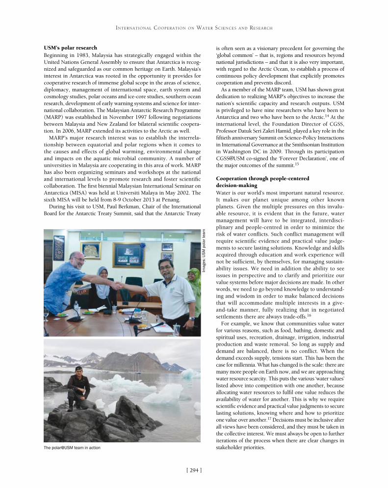
[ ]294
INTERNATIONAL COOPERATION ON WATER SCIENCES AND RESEARCH
USM’s polar research Beginning in 1983, Malaysia has strategically engaged within the United Nations General Assembly to ensure that Antarctica is recog-nized and safeguarded as our common heritage on Earth. Malaysia’s interest in Antarctica was rooted in the opportunity it provides for cooperative research of immense global scope in the areas of science, diplomacy, management of international space, earth system and cosmology studies, polar oceans and ice-core studies, southern ocean research, development of early warning systems and science for inter-national collaboration. The Malaysian Antarctic Research Programme (MARP) was established in November 1997 following negotiations between Malaysia and New Zealand for bilateral scientific coopera-tion. In 2006, MARP extended its activities to the Arctic as well.
MARP’s major research interest was to establish the interrela-tionship between equatorial and polar regions when it comes to the causes and effects of global warming, environmental change and impacts on the aquatic microbial community. A number of universities in Malaysia are cooperating in this area of work. MARP has also been organizing seminars and workshops at the national and international levels to promote research and foster scientific collaboration. The first biennial Malaysian International Seminar on Antarctica (MISA) was held at Universiti Malaya in May 2002. The sixth MISA will be held from 8-9 October 2013 at Penang.
During his visit to USM, Paul Berkman, Chair of the International Board for the Antarctic Treaty Summit, said that the Antarctic Treaty
is often seen as a visionary precedent for governing the ‘global common’ – that is, regions and resources beyond national jurisdictions – and that it is also very important, with regard to the Arctic Ocean, to establish a process of continuous policy development that explicitly promotes cooperation and prevents discord.
As a member of the MARP team, USM has shown great dedication to realizing MARP’s objectives to increase the nation’s scientific capacity and research outputs. USM is privileged to have nine researchers who have been to Antarctica and two who have been to the Arctic.14 At the international level, the Foundation Director of CGSS, Professor Datuk Seri Zakri Hamid, played a key role in the fiftieth anniversary Summit on Science-Policy Interactions in International Governance at the Smithsonian Institution in Washington DC in 2009. Through its participation CGSS@USM co-signed the ‘Forever Declaration’, one of the major outcomes of the summit.15
Cooperation through people-centered decision-makingWater is our world’s most important natural resource. It makes our planet unique among other known planets. Given the multiple pressures on this invalu-able resource, it is evident that in the future, water management will have to be integrated, interdisci-plinary and people-centred in order to minimize the risk of water conflicts. Such conflict management will require scientific evidence and practical value judge-ments to secure lasting solutions. Knowledge and skills acquired through education and work experience will not be sufficient, by themselves, for managing sustain-ability issues. We need in addition the ability to see issues in perspective and to clarify and prioritize our value systems before major decisions are made. In other words, we need to go beyond knowledge to understand-ing and wisdom in order to make balanced decisions that will accommodate multiple interests in a give-and-take manner, fully realizing that in negotiated settlements there are always trade-offs.16
For example, we know that communities value water for various reasons, such as food, bathing, domestic and spiritual uses, recreation, drainage, irrigation, industrial production and waste removal. So long as supply and demand are balanced, there is no conflict. When the demand exceeds supply, tensions start. This has been the case for millennia. What has changed is the scale: there are many more people on Earth now, and we are approaching water resource scarcity. This puts the various ‘water values’ listed above into competition with one another, because allocating water resources to fulfil one value reduces the availability of water for another. This is why we require scientific evidence and practical value judgments to secure lasting solutions, knowing where and how to prioritize one value over another.17 Decisions must be inclusive after all views have been considered, and they must be taken in the collective interest. We must always be open to further iterations of the process when there are clear changes in stakeholder priorities. The polar@USM team in action
Imag
es: U
SM
pol
ar t
eam

[ ]295
KEI’s international collaboration on water-related research
Tae Ho Ro, Eulsaeng Cho and Jun Hyun Park, Korea Environment Institute
The Korea Environment Institute (KEI) is a leading national think tank on environmental policies and envi-ronmental impact assessment. KEI was established by
the Korean Government in 1993 as a public research institute. It has been at the heart of development of the environmental agenda in Korea for the past 20 years. As part of the Korea Council of Economic and Social Research Institutes under the Prime Minister’s Office, KEI strives to be a world-class environment policy research institute pioneering a sustainable society. Through cutting-edge research and rigorous analysis, KEI is dedicated to providing future-oriented environment policy research that can benefit humanity. KEI’s research programmes focus on environmental economics, climate change and air quality, environmental assessment, water environment, natural resource conservation, land planning, resource circulation and environmental health.
Building on its 20 years of experience in environment policy research, KEI has taken its work to a new level through interna-tional joint research and partnerships. With a growing recognition
of the need for enhanced collaboration and coordina-tion beyond the national level, KEI launched its Global Strategy Center (GSC) in June 2010 to extend its body of work to regional and global levels. GSC works as the main implementing arm of KEI’s global partnership and outreach activities, focusing especially on technical cooperation and knowledge-sharing with developing countries. It is intended that GSC will become a sustain-able development cooperation hub, which will serve as a global gateway for KEI and provide a platform for joint research and knowledge-sharing.
Research activities: water resourcesIn recent years, the issue of water security has been discussed on the global political agenda, earning attention from national governments at the highest level. Recent events and discussions have highlighted that water security issues have implications for devel-opment and poverty eradication. In particular, The Future We Want – the outcome document of the
INTERNATIONAL COOPERATION ON WATER SCIENCES AND RESEARCH
As a sustainable development cooperation hub, GSC provide a platform for joint research and knowledge-sharing
Source: KEI

[ ]296
INTERNATIONAL COOPERATION ON WATER SCIENCES AND RESEARCH
Development (NISD). These institutions play a leading role in helping countries address the challenges of sustainable development by enhancing information exchange, capacity building, outreach activities and the dissemination of publications for sustainable development. Since the network was established, a number of activities have been initiated by KEI.
The Selenge River BasinOne of KEI’s key NISD partnership projects is the Integrated Water Management Model (IWMM) on the Selenge River Basin, in collaboration with the Institute of Geoecology of the Mongolian Academy of Science (IGMAS), the Baikal Institute of Nature Management (BINM) and the Siberian branch of the Russian Academy of Sciences. The objective of the project was to build an IWMM that could serve as an important policy tool for sustainable management of the water source of the Selenge River Basin. The project also aimed to contrib-ute to the peaceful settlement of water-related disputes on local, regional and international levels by providing a systematic analysis of the growing problems in the basin’s management.
The research project was conducted over three phases. The first phase focused on collecting data to examine the water quality of the Selenge River.1 In the second phase, the transboundary water management issues between Mongolia and the Russian Federation were analysed.2 The final phase of the project was aimed at the development and proposal of an inter-national cooperation project for an IWMM for the Selenge River Basin.3 The project resulted in the development of a solid research partnership between KEI, IGMAS and BINM. Furthermore, the three years of intensive joint research activities contributed to the enhancement of IGMAS and BINM’s research capacities. Currently, IGMAS and BINM are jointly conducting follow-up activities for the transboundary diagnostic analysis in the Baikal Basin.
2012 United Nations Conference on Sustainable Development (Rio+20) – called for the provision of universal coverage for safe drinking water and adequate sanitation services. The global community is expected to meet again in 2015 to agree on the post-2015 development agenda and define the sustainable devel-opment goals (SDGs). In this upcoming SDG agenda, water is expected to feature prominently.
As part of KEI’s efforts to contribute to the global community, GSC aims to address water resource issues through coordinated multidisciplinary research using advanced information and networking systems. GSC is working to expand its analytical work internationally through its partnership research. Since 2004, KEI and the Economics and Trade Branch of the United Nations Environment Programme have entered into agreements with a number of institutions including national training and research institutes, regional organizations, universities, international organizations and non-governmental organizations with a view to establishing a collaborative Network of Institutions for Sustainable
IWMM on the Selenge River Basin: members of the joint partnership research team
Imag
e: K
EI
A map of the Selenge River Basin project
Source: KEI, IGMAS, Baikal Institute of Nature Management

[ ]297
INTERNATIONAL COOPERATION ON WATER SCIENCES AND RESEARCH
Joint research in north-east AsiaKEI and the Far Eastern Branch of the Russian Academy of Sciences conducted joint research aimed at establishing an information exchange system. This would enable the sharing of freshwater environmental data to deal with transboundary environmental problems in the freshwater basins between neighbouring countries in the region.4 The research included situational analysis of envi-ronmental protection in the Primorskiy region and a field survey of the Kedrovaya River. The field survey aimed to establish a baseline for comparing the aquatic ecosystems of Far-East Russia and Korea by examining the ecological conditions of the Kedrovaya River, including the distribution of invertebrate fauna and other monitor-ing measurements. The research contributed to the standardization of the biomonitoring methodology for international watercourse systems in north-east Asia and systemization of the ecosystem health assessment methodology.
In addition to the field survey, the research involved a compar-ative assessment of the Korean and Russian environmental assessment systems to contribute to the strengthening of trans-boundary environmental governance issues in north-east Asia. The assessment identified some of the weaknesses of the environ-mental assessment system in Russia and proposed development agendas for environmental monitoring and management in the country. These proposals included the enhancement of capacities for environmental impact assessment (EIA), particularly in water management. As part of its efforts to support the development of EIA in Russia, KEI organizes EIA capacity building programmes and periodical transboundary EIA workshops to share best prac-tices and discuss cutting-edge development issues in EIA with international scholars.
Reservoir management in EthiopiaKEI also launched the Ethiopian Water Resource Development NISD partnership research project, with the University of Connecticut and the Ethiopia Institute of Water Resources of Addis Ababa University, to expand its research work to the developing countries of Africa. The two-year project, conducted from January 2011 to December 2012, includes two volumes of research publications, one focusing on sediment and reservoir control and the other on analysis of the external effects of climate change and downstream areas.5
The project focused on the development of a hydro-economics model called the Soil and Reservoir Conservation (S-RESCON) model. The S-RESCON approach is based on the Reservoir Conservation Model (RESCON), which was developed jointly with the World Bank and the University of Connecticut for the economic and engineering evaluation of alternative strategies for managing sedimentation in storage reservoirs. Unlike RESCON, which limits its main focus to reservoir sedi-mentation management, S-RESCON extends its attention to upstream soil conservation management. In the first year of the project, the S-RESCON model was applied to the Koka Reservoir basin in Ethiopia. The Koka Reservoir was established in 1959 as a result of the construction of the Koka Dam across the Awash River to supply hydro-power for Addis Ababa. Its basin was selected as the research area for applying S-RESCON as the reservoir is threatened by increasing sedimentation caused by envi-ronmental degradation.
In the second year of the project, the research focused on an integrated model of watershed and reservoir management that incorporates externalities and future climate change with a view to proposing an adaptation scheme. The S-RESCON model was reinforced to address sedimentation problems as soil from the upstream agricultural land was being deposited in downstream reservoirs. The S-RESCON model allowed researchers to consider the dynamic process between upstream soil loss and downstream sediment deposits. Furthermore, the model includes various climatic factors such as the amount of incoming flow, reservoir evaporation rate and stream flow variation. Based on these climatic factors, the model simulates the effect of climate change on watershed management. For the project, the model has been applied to the Nile watershed, covering Egypt as the downstream watershed and Ethiopia as the upstream watershed.
The major outcome of the research over the two-year period is the development of the S-RESCON model co-developed by KEI and the University of Connecticut. This model can be applied to any reservoir with sedi-mentation management challenges, considering the effect of climate change on watershed management. KEI is expected to apply the model to other sites in the developing countries to propose a sustainable reservoir management scheme. A database is under construction for collecting hydrological data on water resources in the developing countries.
Furthermore, among KEI’s efforts to share knowl-edge and experience relating to water management, the Ethiopian Water Resource Development Project also provided a capacity building programme in Addis Ababa, Ethiopia. The programme, co-organized by KEI, the University of Connecticut and Addis Ababa University, was designed to develop institutional capacities on climate change, green growth and water management. The training workshop attracted decision makers and public officials from the Ministry of Water and Energy, Environmental Protection Authority, and researchers and water practitioners from the various states in Ethiopia.
Researchers from KEI and the Russian Academy of Sciences Far Eastern Branch
in north-east Asia
Imag
e: K
EI
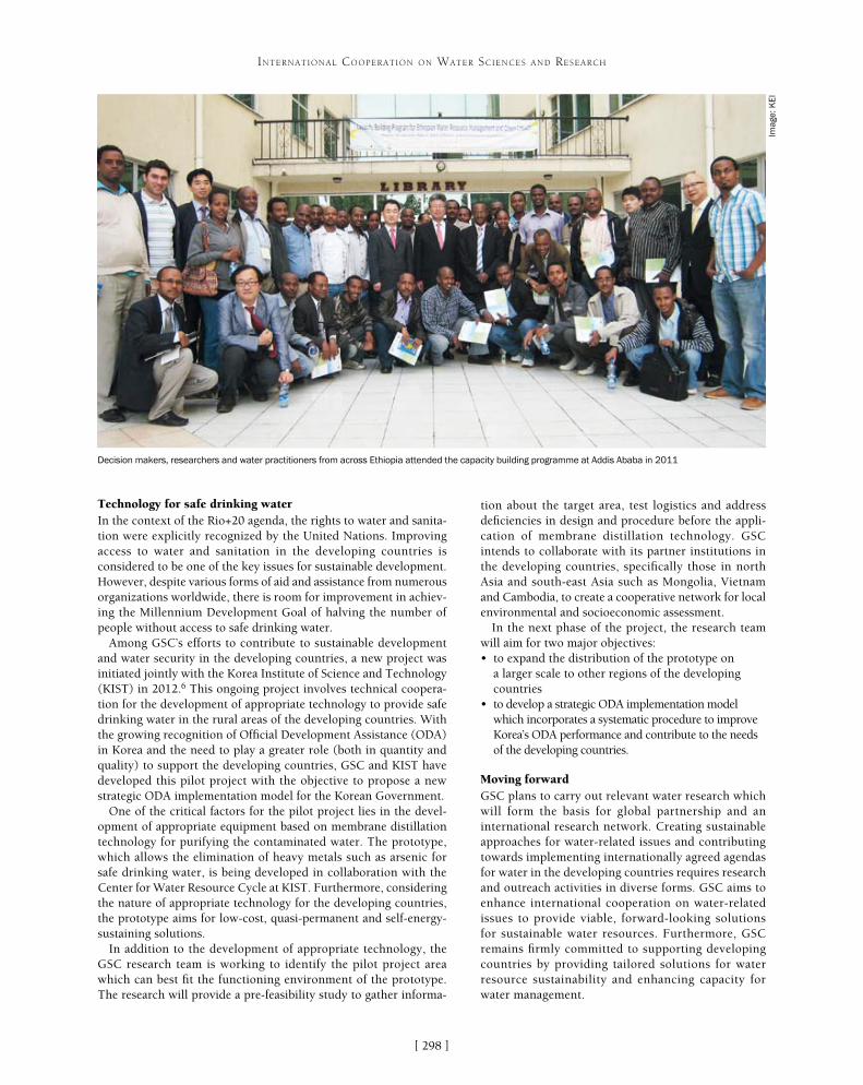
[ ]298
INTERNATIONAL COOPERATION ON WATER SCIENCES AND RESEARCH
tion about the target area, test logistics and address deficiencies in design and procedure before the appli-cation of membrane distillation technology. GSC intends to collaborate with its partner institutions in the developing countries, specifically those in north Asia and south-east Asia such as Mongolia, Vietnam and Cambodia, to create a cooperative network for local environmental and socioeconomic assessment.
In the next phase of the project, the research team will aim for two major objectives:• to expand the distribution of the prototype on
a larger scale to other regions of the developing countries
• to develop a strategic ODA implementation model which incorporates a systematic procedure to improve Korea’s ODA performance and contribute to the needs of the developing countries.
Moving forwardGSC plans to carry out relevant water research which will form the basis for global partnership and an international research network. Creating sustainable approaches for water-related issues and contributing towards implementing internationally agreed agendas for water in the developing countries requires research and outreach activities in diverse forms. GSC aims to enhance international cooperation on water-related issues to provide viable, forward-looking solutions for sustainable water resources. Furthermore, GSC remains firmly committed to supporting developing countries by providing tailored solutions for water resource sustainability and enhancing capacity for water management.
Decision makers, researchers and water practitioners from across Ethiopia attended the capacity building programme at Addis Ababa in 2011
Imag
e: K
EI
Technology for safe drinking water In the context of the Rio+20 agenda, the rights to water and sanita-tion were explicitly recognized by the United Nations. Improving access to water and sanitation in the developing countries is considered to be one of the key issues for sustainable development. However, despite various forms of aid and assistance from numerous organizations worldwide, there is room for improvement in achiev-ing the Millennium Development Goal of halving the number of people without access to safe drinking water.
Among GSC’s efforts to contribute to sustainable development and water security in the developing countries, a new project was initiated jointly with the Korea Institute of Science and Technology (KIST) in 2012.6 This ongoing project involves technical coopera-tion for the development of appropriate technology to provide safe drinking water in the rural areas of the developing countries. With the growing recognition of Official Development Assistance (ODA) in Korea and the need to play a greater role (both in quantity and quality) to support the developing countries, GSC and KIST have developed this pilot project with the objective to propose a new strategic ODA implementation model for the Korean Government.
One of the critical factors for the pilot project lies in the devel-opment of appropriate equipment based on membrane distillation technology for purifying the contaminated water. The prototype, which allows the elimination of heavy metals such as arsenic for safe drinking water, is being developed in collaboration with the Center for Water Resource Cycle at KIST. Furthermore, considering the nature of appropriate technology for the developing countries, the prototype aims for low-cost, quasi-permanent and self-energy-sustaining solutions.
In addition to the development of appropriate technology, the GSC research team is working to identify the pilot project area which can best fit the functioning environment of the prototype. The research will provide a pre-feasibility study to gather informa-

[ ]299
Ecohydrology – transdisciplinary sustainability science for multicultural cooperation
Professor Macej Zalewski, Katarzyna Izydorczyk, Iwona Wagner, Associate Professor Joanna Mankiewicz-Boczek, Magdalena Urbaniak, and Wojciech Fr�tczak, European Regional Centre for Ecohydrology, Polish Academy of Sciences
Globalization has accelerated development and, in general, improved the quality of life of humanity. However, interconnected socioeconomic systems have
also accelerated and amplified the exploitation of natural resources, which increases the risk of conflict.
Harmonizing human needs with the potential of the biosphere is the primary challenge in achieving a sustainable future.1 In order to achieve global sustainability by reducing the overexploitation of natural resources, there is an urgent need to replace competition for resource use with competition for resource use efficiency. This is especially rele-vant for water and ecosystem resources, as water is a primary factor of biosphere dynamics. A sustainable approach must be based on integra-tive science, with a focus on the integration of hydrology and ecology.
Ecohydrology is an integrative, transdisciplinary, problem-solving science which focuses on the regulation of processes. It is based on the general theories of physics, hydrology and ecology, whose implicit goal is to achieve sustainability.2 It also considers geophysics, geology, molecular biology, genetics, geo-information techniques, mathematical modelling with socioeconomic concepts
(such as foresight) and aspects of law.3 Ecohydrology is based on two assumptions:• water is the major driver of biogeosphere evolution,
since all ecological processes depend on water and temperature4
• on the basin scale, the hydrological cycle is a framework for quantifying hydrological and biological processes and identifying various forms of human impact.
An understanding of those two factors, and of the func-tional interrelationships between hydrology and biota at the catchment scale, should enable the regulation of ecological processes from the molecular to the landscape scale; the ultimate aim being to harmonize society’s needs with an enhanced carrying capacity for ecosystems.5
With this in mind, understanding the dependence of ecosystem dynamics on soil water availability is a fundamental step towards developing a methodology and system approach at the river basin level.6 Effective
INTERNATIONAL COOPERATION ON WATER SCIENCES AND RESEARCH
Primary school students measuring the concentration of
nutrients in groundwater
Brainstorming with decision makers involved in water resources, agriculture, urban
areas, forests, planning and NGOs in the Pilica catchment
Imag
e: E
RC
E
Imag
e: E
RC
E
[ ]300
INTERNATIONAL COOPERATION ON WATER SCIENCES AND RESEARCH
every year.12 During the bloom accumulation, the total microcystin (cyanobacterial hepatotoxin) concentration in the water could increase up to 30 μg L-1.13 Studies using sensitive molecular methods based on the detec-tion of genes involved in the synthesis of microcystin showed that the genotypes of microcystin-producing cyanobacteria occurred throughout the period of moni-toring, and their number increased with deteriorating environmental conditions for the development of cyano-bacteria.14 This demonstrates that the availability of phosphorus is a driving factor determining the intensity of cyanobacterial blooms in the reservoir.15 Phosphorus concentration (annual average: 0.078- 0.215 mg TP/l) strongly depends on the discharge pattern of the main tributaries and the chemical composition of the river’s water, which both determine the nutrient load entering the reservoir (average 87-693 t TP/year).
The reduction of nutrient fluxes from the catchment is a fundamental measure for reducing toxic blooms. Due to various cumulative impacts from agriculture, urban zones and recreation, actions aimed at reducing the development of cyanobacterial blooms must be based on cooperation between scientists, decision makers and stakeholders.
In order to reverse eutrophication of a reservoir, its water balance and nutrient flows should be considered in the context of a whole catchment basin. The MONERIS model for the Pilica River Basin showed that only around 6.5 per cent of the phosphorus loads were from point sources, with around 18.4 per cent from urban areas. Three quarters of the phosphorus load came from the landscape, mainly associated with soil particles and organic material eroded during flow events.
Reducing the nutrient loads coming from the landscape due to a high complexity of water-soil-plant-society inter-actions has been much more complicated than controlling the loads originating from the point sources. The preser-vation or construction of riparian land/water buffer zones (ecotones) is widely recommended to reduce the impact of nutrients present in the landscape on freshwater ecosys-tems. These linear belts of permanent vegetation adjacent to an aquatic ecosystem permit the improvement of water quality by trapping and removing various non-point source pollutants from both overland and shallow subsur-face flow pathways. Phosphorus retention in ecotones is controlled by a range of physical, geochemical and biologi-cal processes, including sediment deposition, adsorption to iron and aluminium oxides or precipitation of calcium phosphates, and plant uptake.
Highly effective buffer zones were designed and imple-mented in the direct catchment of the Sulejów Reservoir, an area characterized by heavy groundwater pollution, with phosphorus arising from non-point source pollu-tion from illegally leaking septic tanks. This demo site of the LIFE+EKOROB project16 is located in a recreational area, where the shoreline is surrounded by cottages. The seepage of groundwater heavily contaminated with phos-phorus was observed below the water level in the reservoir shoreline. Average phosphate concentration in groundwa-ter reached 3.1 mg PO4/l, exceeding the threshold value
management of water and nutrient dynamics from the landscape to aquatic ecosystems, with the ecohydrological aim of enhancing carrying capacity, must take place through harmonizing traditional hydroengineering solutions with biotechnology.7 Due to the complex-ity of synergetic and mutually interacting hydrological processes, the implementation of biotechnological solutions to ensure the regulation of catchment-scale water must lead to enhancement of the self-organi-zation function of ecosystem/nutrient dynamics,8 and must be carried out using an adaptive assessment and management methodology.9
Recently applied scientific approaches and the methodologies used in conservation, restoration, ecological engineering and ecohy-drology represent progress in understanding the ecological structure and dynamics of ecosystems and the impact of human activities. They embody a move from a species-structure-oriented perspective towards a more progressively process-oriented approach, exempli-fied by ecological engineering and ecohydrology.10
The goal of ecohydrology as a problem-solving science is to deter-mine why the biosphere is drying and soil fertility is declining, and how these trends can be reversed. The major challenges are:• slowing the transfer of water from the atmosphere to the sea
(prioritizing flood and drought control)• reducing input and regulating the allocation of excess nutrients
and pollutants in aquatic ecosystems to improve water quality, biodiversity and human health
• enhancing ecosystem carrying capacity (water resources, biodiversity, ecosystem services for society and resilience) by dual regulation towards harmonization with societal needs.
The proposed highly-complex approach must be transferred to society, decision makers and politicians through transdisciplinary education.
In the case of the highly-complex environmental problems that we experience today there is an urgent need to move away from special-ization in education and add a knowledge integrating element, enabling a broader understanding of the complexity of environmen-tal processes. Integration of the knowledge garnered across different disciplines should be facilitated on the basis of a common methodo-logical background. Parallel educational efforts are needed to raise the consciousness of society concerning possible realistic scenarios for harmonizing societal needs with enhanced ecosystem potential: water, biodiversity, ecosystem services for society and resilience.
Reducing cyanobacterial blooms: Sulejów ReservoirModification of the biogeochemical cycles on a catchment scale – resulting from degraded biocenosis structure and increased emissions of nutrient and pollutants combined with climate change – seems to be the main reason for acceleration of the eutrophication process, including the presence of cyanobacterial blooms in freshwater and coastal ecosystems. An important indicator for assessing the threat of cyanobacteria to the environment and humans is the activity of toxic genotypes, which are responsible for producing cyanotoxins that can cause skin irritation, impaired breathing (neurotoxin), diarrhoea, acute gastroenteritis, and kidney and liver damage (hepato- and cyto-toxins).11 Thus, the molecular monitoring of toxigenic strains of cyanobacteria acts as a precise indicator of the possible health threat.
The Pilica River in Central Poland is a global reference site for ecohydrology under the United Nations Educational, Scientific and Cultural Organization International Hydrological Programme. The river’s Sulejów Reservoir is a dam reservoir with progressive anthro-pogenic eutrophication, in which cyanobacterial blooms appear

[ ]301
INTERNATIONAL COOPERATION ON WATER SCIENCES AND RESEARCH
that triggers the formation of cyanobacterial bloom. Due to the high concentration of phosphate in the groundwater and seepage water, a limestone-based biogeochemical barrier was constructed to reduce phosphorus levels through absorption and precipitation. Preliminary results indicate that phosphate concentration in the groundwater was reduced by 58 per cent after it flowed through the barrier.
The shoreline is intensively used for recreational purposes, and the lack of tourist infrastructure in the sites contributes to devasta-tion of the vegetation buffer zones. Following the ecohydrological aim of harmonizing society’s needs with the enhanced ecosystem potential,17 restoration of the mosaic ecotone zones was combined with the construction of recreational infrastructures, such as jetties for fishing and boating.
Individual ecohydrological methods can be synergistically linked into the system solutions to complement existing hydrotechnical solutions for water resources management, contributing to enhancement of the overall resilience of a catchment and its ability to provide ecosystem services. The action plan to reduce diffuse pollution in the Pilica River basin has been developed in cooperation with the Regional Water Management Authority in Warsaw, which is responsible for water management of the Vistula River catchment and for the implementa-tion of European Commission water directives.
Stakeholders (regional authorities, local authorities, non-govern-mental organizations (NGOs), universities etc) were identified and integrated through a multi-stakeholder platform which helps to create an independent space for discussion and exchange of experi-ence and knowledge. Additionally, measures have been organized to
raise ecological awareness among the local community and decision makers concerning the prevention of diffuse agricultural pollution. Public meetings for local people, educational activities for schoolchildren and training for specialists, decision makers and teachers have been held.
Blue-green city: urban ecohydrologyThe increasing global rate of urbanization and concurrent global climate changes create new challenges, but also stimulate new approaches to the management of cities.18 Achieving sustainable development under increasing global pressures will depend to a great extent on how cities manage their natural and water resources. A key challenge is insufficient space for water circulation in the city landscape, due to uncontrolled or out-of-date urban development schemes. Rapid, damaging flash floods followed by long-lasting dryness, the formation of urban heat islands and the lowering of air humidity are some of the major consequences, contributing to higher incidence of asthma and allergies in city dwellers.19 This negative tendency can be reversed by changing the paradigm for the management of stormwater, which is the only renewable source of water for cities. This valuable resource should be consciously retained in city landscapes by rehabilitating their blue and green infrastructure.
A functional approach towards achieving this goal, by including urban ecosystems in holistic water manage-
Reducing phosphorus pollution by enhancing plant buffer zones with biogeochemical barriers: LIFE+ EKOROB project Zarz�cin demo site
Source: Izydorczyk K. 2013. ‘Chemical barrier for enhancement of buffer zone toward reduction of diffuse pollution by phosphorus - preliminary results’. Ecohydrol. &
Hydrobiol. Article in press
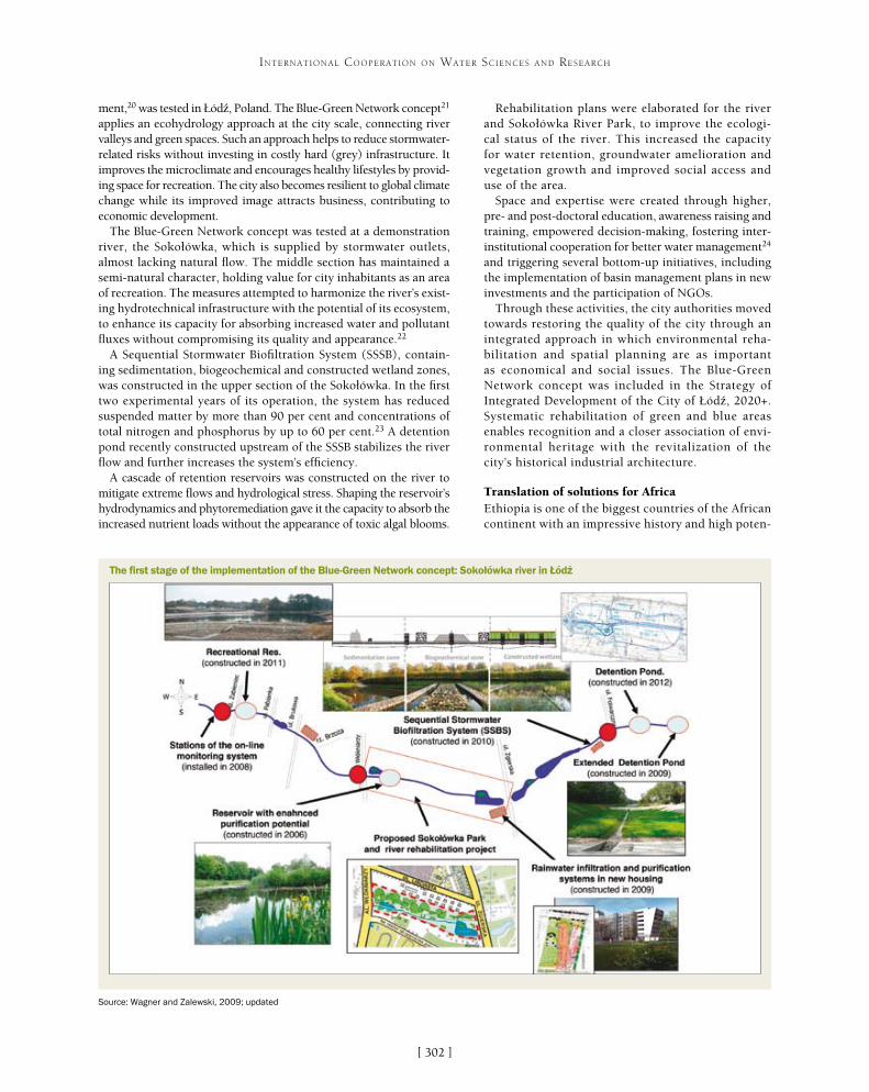
[ ]302
INTERNATIONAL COOPERATION ON WATER SCIENCES AND RESEARCH
Rehabilitation plans were elaborated for the river and Sokołówka River Park, to improve the ecologi-cal status of the river. This increased the capacity for water retention, groundwater amelioration and vegetation growth and improved social access and use of the area.
Space and expertise were created through higher, pre- and post-doctoral education, awareness raising and training, empowered decision-making, fostering inter-institutional cooperation for better water management24 and triggering several bottom-up initiatives, including the implementation of basin management plans in new investments and the participation of NGOs.
Through these activities, the city authorities moved towards restoring the quality of the city through an integrated approach in which environmental reha-bilitation and spatial planning are as important as economical and social issues. The Blue-Green Network concept was included in the Strategy of Integrated Development of the City of Łód�, 2020+. Systematic rehabilitation of green and blue areas enables recognition and a closer association of envi-ronmental heritage with the revitalization of the city’s historical industrial architecture.
Translation of solutions for AfricaEthiopia is one of the biggest countries of the African continent with an impressive history and high poten-
ment,20 was tested in Łód�, Poland. The Blue-Green Network concept21 applies an ecohydrology approach at the city scale, connecting river valleys and green spaces. Such an approach helps to reduce stormwater-related risks without investing in costly hard (grey) infrastructure. It improves the microclimate and encourages healthy lifestyles by provid-ing space for recreation. The city also becomes resilient to global climate change while its improved image attracts business, contributing to economic development.
The Blue-Green Network concept was tested at a demonstration river, the Sokołówka, which is supplied by stormwater outlets, almost lacking natural flow. The middle section has maintained a semi-natural character, holding value for city inhabitants as an area of recreation. The measures attempted to harmonize the river’s exist-ing hydrotechnical infrastructure with the potential of its ecosystem, to enhance its capacity for absorbing increased water and pollutant fluxes without compromising its quality and appearance.22
A Sequential Stormwater Biofiltration System (SSSB), contain-ing sedimentation, biogeochemical and constructed wetland zones, was constructed in the upper section of the Sokołówka. In the first two experimental years of its operation, the system has reduced suspended matter by more than 90 per cent and concentrations of total nitrogen and phosphorus by up to 60 per cent.23 A detention pond recently constructed upstream of the SSSB stabilizes the river flow and further increases the system’s efficiency.
A cascade of retention reservoirs was constructed on the river to mitigate extreme flows and hydrological stress. Shaping the reservoir’s hydrodynamics and phytoremediation gave it the capacity to absorb the increased nutrient loads without the appearance of toxic algal blooms.
The first stage of the implementation of the Blue-Green Network concept: Sokołówka river in Łód�
Source: Wagner and Zalewski, 2009; updated
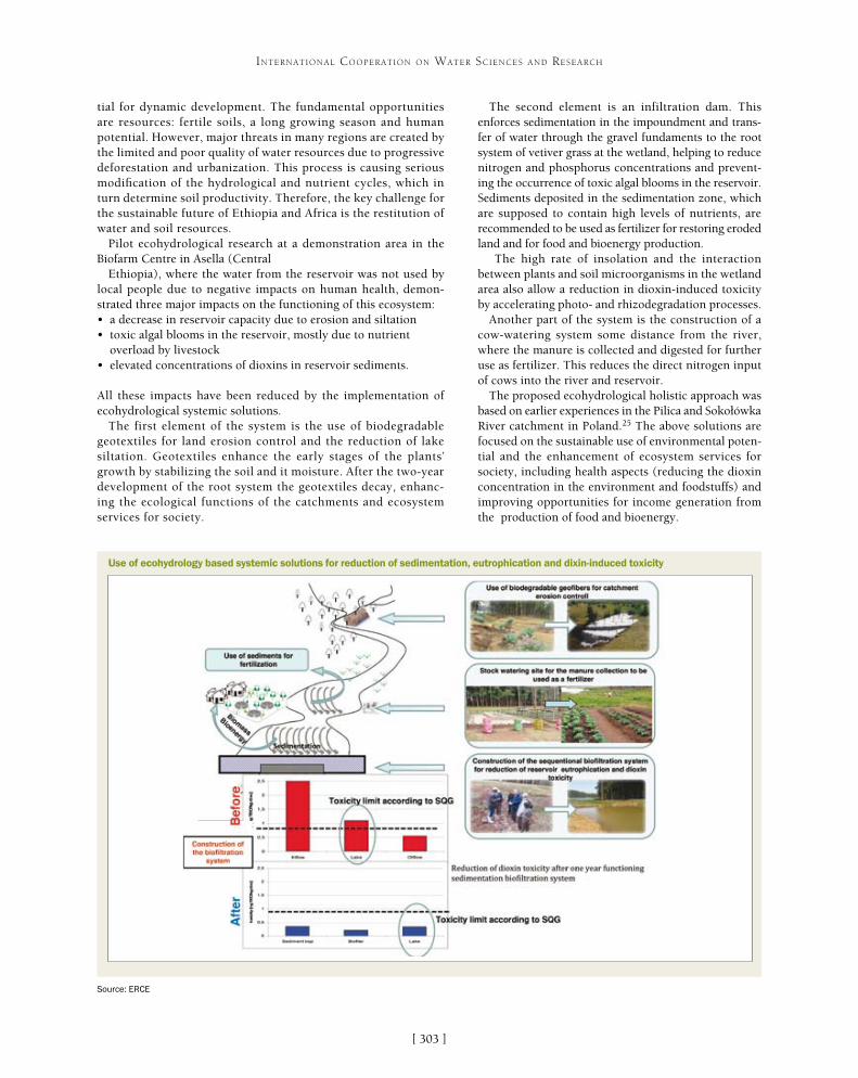
[ ]303
INTERNATIONAL COOPERATION ON WATER SCIENCES AND RESEARCH
The second element is an infiltration dam. This enforces sedimentation in the impoundment and trans-fer of water through the gravel fundaments to the root system of vetiver grass at the wetland, helping to reduce nitrogen and phosphorus concentrations and prevent-ing the occurrence of toxic algal blooms in the reservoir. Sediments deposited in the sedimentation zone, which are supposed to contain high levels of nutrients, are recommended to be used as fertilizer for restoring eroded land and for food and bioenergy production.
The high rate of insolation and the interaction between plants and soil microorganisms in the wetland area also allow a reduction in dioxin-induced toxicity by accelerating photo- and rhizodegradation processes.
Another part of the system is the construction of a cow-watering system some distance from the river, where the manure is collected and digested for further use as fertilizer. This reduces the direct nitrogen input of cows into the river and reservoir.
The proposed ecohydrological holistic approach was based on earlier experiences in the Pilica and Sokołówka River catchment in Poland.25 The above solutions are focused on the sustainable use of environmental poten-tial and the enhancement of ecosystem services for society, including health aspects (reducing the dioxin concentration in the environment and foodstuffs) and improving opportunities for income generation from the production of food and bioenergy.
tial for dynamic development. The fundamental opportunities are resources: fertile soils, a long growing season and human potential. However, major threats in many regions are created by the limited and poor quality of water resources due to progressive deforestation and urbanization. This process is causing serious modification of the hydrological and nutrient cycles, which in turn determine soil productivity. Therefore, the key challenge for the sustainable future of Ethiopia and Africa is the restitution of water and soil resources.
Pilot ecohydrological research at a demonstration area in the Biofarm Centre in Asella (Central
Ethiopia), where the water from the reservoir was not used by local people due to negative impacts on human health, demon-strated three major impacts on the functioning of this ecosystem: • a decrease in reservoir capacity due to erosion and siltation• toxic algal blooms in the reservoir, mostly due to nutrient
overload by livestock• elevated concentrations of dioxins in reservoir sediments.
All these impacts have been reduced by the implementation of ecohydrological systemic solutions.
The first element of the system is the use of biodegradable geotextiles for land erosion control and the reduction of lake siltation. Geotextiles enhance the early stages of the plants’ growth by stabilizing the soil and it moisture. After the two-year development of the root system the geotextiles decay, enhanc-ing the ecological functions of the catchments and ecosystem services for society.
Source: ERCE
Use of ecohydrology based systemic solutions for reduction of sedimentation, eutrophication and dixin-induced toxicity
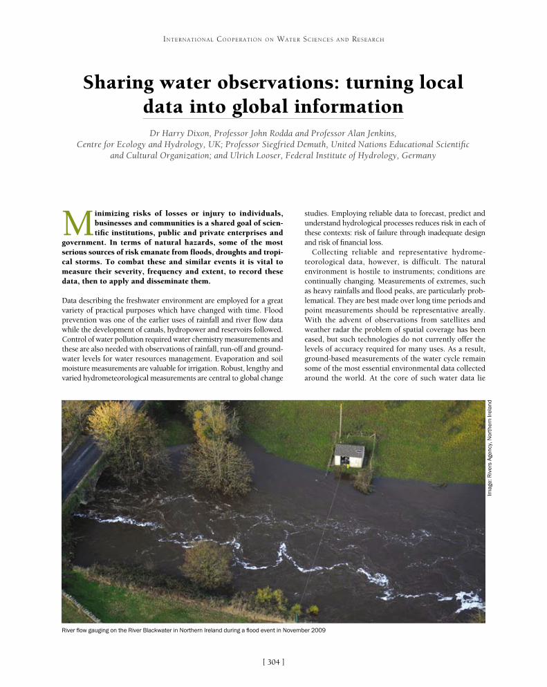
[ ]304
Sharing water observations: turning local data into global information
Dr Harry Dixon, Professor John Rodda and Professor Alan Jenkins, Centre for Ecology and Hydrology, UK; Professor Siegfried Demuth, United Nations Educational Scientific
and Cultural Organization; and Ulrich Looser, Federal Institute of Hydrology, Germany
Minimizing risks of losses or injury to individuals, businesses and communities is a shared goal of scien-tific institutions, public and private enterprises and
government. In terms of natural hazards, some of the most serious sources of risk emanate from floods, droughts and tropi-cal storms. To combat these and similar events it is vital to measure their severity, frequency and extent, to record these data, then to apply and disseminate them.
Data describing the freshwater environment are employed for a great variety of practical purposes which have changed with time. Flood prevention was one of the earlier uses of rainfall and river flow data while the development of canals, hydropower and reservoirs followed. Control of water pollution required water chemistry measurements and these are also needed with observations of rainfall, run-off and ground-water levels for water resources management. Evaporation and soil moisture measurements are valuable for irrigation. Robust, lengthy and varied hydrometeorological measurements are central to global change
studies. Employing reliable data to forecast, predict and understand hydrological processes reduces risk in each of these contexts: risk of failure through inadequate design and risk of financial loss.
Collecting reliable and representative hydrome-teorological data, however, is difficult. The natural environment is hostile to instruments; conditions are continually changing. Measurements of extremes, such as heavy rainfalls and flood peaks, are particularly prob-lematical. They are best made over long time periods and point measurements should be representative areally. With the advent of observations from satellites and weather radar the problem of spatial coverage has been eased, but such technologies do not currently offer the levels of accuracy required for many uses. As a result, ground-based measurements of the water cycle remain some of the most essential environmental data collected around the world. At the core of such water data lie
INTERNATIONAL COOPERATION ON WATER SCIENCES AND RESEARCH
River flow gauging on the River Blackwater in Northern Ireland during a flood event in November 2009
Imag
e: R
iver
s A
genc
y, N
orth
ern
Irel
and

[ ]305
INTERNATIONAL COOPERATION ON WATER SCIENCES AND RESEARCH
ties have resulted in a decline in some river gauging station networks, while concerns about misuse of data, commercial drivers, political sensitivities about transboundary resources and an overarching lack of understanding about the value of river flow informa-tion limit the exchange of the hydrological data that is collected. The 5th World Water Forum in 2009 concluded that, as a result, many operational water managers lack adequate information to inform deci-sion-making.
Scientific researchers also lack sufficient observa-tional evidence, with a 2010 paper by Hannah and others noting that large-scale international archives of water data are insufficiently populated in some areas of the world.1 Freshwater environments, their drivers, controls and impacts are not constrained by national boundaries and hence international cooperation is vital to provide the information needed to further our understanding of hydrological systems. Such problems are ever more acute in the light of increasing global concerns surrounding hydrological variability.
observations of river flow, the integrated output of all environmental processes and human interactions occurring within a catchment.
Observational information on river flows underpins informed deci-sion-making in areas such as flood risk estimation, water resources management, hydro-ecological assessment and hydropower genera-tion. Policy decisions across almost every sector of social, economic and environmental development are driven by the analysis of this fresh-water information. In light of this widespread importance, such data has assumed a high political prominence in some areas of the world, with accurate information on the state of water resources crucial to avoid-ing and resolving conflicts between individuals, organizations and even states. Its wide ranging utility, coupled with escalating analytical capa-bilities and information dissemination methods, has resulted in a rapid growth in demand for such data over the early years of the twenty-first century and this trend looks set to continue in the near future.
Recognition of the fundamental importance of observational fresh-water data led to a growth in river monitoring networks in many parts of the world in the second half of the twentieth century. More recently, developments in hydrometry (the science of water measure-ment) and the widespread adoption of digital recording coupled with the growth of information technologies, in particular the development of the Internet, have provided the tools for more efficient data collec-tion and exchange. At the same time, escalating analytical capabilities and a heightened awareness of the changing environment have further increased the demand for access to such information.
In spite of recent developments, however, the availability of hydrometric information continues to constrain both research and operational hydrology across the globe. The third edition of the United Nations World Water Development Report (WWDR3) highlighted that “worldwide, water observation networks provide incomplete and incompatible data on water quantity and quality for managing water resources and predicting future needs.” Globally, funding constraints and changing governmental priori-
Case study: UK National River Flow Archive
The National River Flow Archive is a publically funded focal centre for hydrometric information storage, analysis and dissemination.2 It provides access to river flow data and associated information, and knowledge, advice and decision support on a range of hydrological issues. The archive serves a wide user community incorporating water management professionals, scientific researchers, educational users, government bodies and international organizations.
Under the UK’s distributed model for delivering hydrological services, river flows are monitored across a dense network of gauging stations by four separate bodies with responsibilities to different areas of government. Their mandates include monitoring network installation and upkeep, data collection, data processing and initial data validation. Following this, data are provided at regular intervals to the National River Flow Archive, maintained by the Centre for Ecology and Hydrology. Here, they undergo secondary validation before being combined with auxiliary information and added to the national archive for long-term storage and dissemination.
While the archive exists in a separate organizational structure to the major national and regional hydrometric measuring authorities, it is delivered through close collaboration between stakeholders including the scientific research community, other data analysts, policymakers and national government. This cooperation is rooted in the long-standing need to assess water resources across the United Kingdom as a whole and recognition that river flow information collected in one area of the country is valuable in managing freshwater issues in other hydrologically similar catchments which may be geographically and politically removed. Industry-standard regionalization methodologies have been developed to predict river flow characteristics at locations where they are not monitored, through extrapolation in space from locations where data is available. By pooling data across organizations, regions and countries, the UK is able to better estimate river flows at ungauged sites and manage the risks posed by hydrological extremes.
A river monitoring station on the River Tywi in South Wales, UK
Imag
e: U
K N
atio
nal R
iver
Flo
w A
rchi
ve

[ ]306
INTERNATIONAL COOPERATION ON WATER SCIENCES AND RESEARCH
In light of this dearth of information there is a pressing require-ment to address the inadequacies in river gauging networks and improve hydrometric practices to ensure flows are accurately recorded. Around the world, monitoring of rainfall, river flow, groundwater and other water stores remains lacking in many water-stressed catchments. While targeted investment of international aid financing has helped to expand monitoring programmes in many regions where they were previously deficient, there is a need to support the ongoing maintenance of networks and development of local expertise to ensure the longevity of such initiatives. Long-term political, institutional and financial support for water monitoring must be established and fostered around the world.
Notwithstanding this need to improve the underlying monitor-ing, the opportunity currently exists to significantly advance global water science and management through improving cooperation on existing water data at all levels. At this time of both enhanced demand for river flow data and increasing financial pressure on the organizations tasked with maintaining networks, methods of coop-eration which maximize the societal benefits of current hydrometric monitoring are of crucial importance.
The interconnected nature of freshwater systems, widespread implications of water management decisions and the often complex web of stakeholders mean that river flow data can rarely be collected, analysed and utilized within one single organization in isolation. Information on river flows in one location may impact upon water resource management decisions required under a separate jurisdic-tion at another, geographically remote location. Furthermore, data can often be used to help understand and manage freshwater issues besides those for which they were originally collected. For example, river flow data collected by a local landowner to inform the design and operation of a small-scale hydropower scheme may be of significant value to researchers investigating the implications of changing land management practices on run-off generation in order to inform policy development. Readily accessible, interchangeable hydrometric data are therefore highly valuable not only to the initial monitoring body, but also to a wide community of users.
Maximizing the value gleaned from data that is collected, and ensuring that freshwater decisions are based on all available monitoring informa-
tion, demands more open data policies, standardization of monitoring practices, efficient data management and effec-tive data sharing. Cooperation at institutional, national and international scales is central to providing such access to coherent, high-quality river flow information.
Two examples of water data sharing which have deliv-ered significant advantages to water management are outlined in the case studies on these pages. They are:• the United Kingdom’s experiences of cooperation
between organizations operating with differing responsibilities across geographical and political divides to ensure coherent access to national-scale hydrometric information
• the European Water Archive, which provides hydrological researchers working under the United Nations Educational, Scientific and Cultural Organization (UNESCO) umbrella with the access to pan-European river flow information required to answer continental-scale scientific questions.
Both case studies highlight the benefits and opportu-nities in relation to cooperation between individual hydrologists, organizations and governments on the issue of water data. By bringing their monitoring data and expertise together, the various stakeholders are able to benefit from a richer shared information source and enhance the value of their individual operations.
Nationally, there is an underlying need to support improved hydrometric data management and dissemina-tion. These are crucial to the success of state-scale water management and underpin international initiatives to combat global water problems. Internationally, while achievements to date should not be overlooked, further improvements on hydrological data sharing are needed. Where data is collected, data policies, security concerns, commercial considerations and a lack of agreed protocols for sharing were all identified by WWDR3 as issues which often hamper the sharing of hydrological information.
Intergovernmental support for data sharing is an impor-tant foundation for improving cooperation and to this end, in 1999, the World Meteorological Organization (WMO) Congress adopted Resolution 25 (Cg-XIII) – Exchange of Hydrological Data and Products – establishing the policy and practice for international exchange of hydrological data and products. Regionally too, in some of the over 260 trans-boundary river basins that exist worldwide, international agreements have been reached over the free exchange of data to aid navigation, flood protection, pollution preven-tion and power production. In doing so, the international community recognized the potential benefits of enhanced exchange of hydrological data, and adopted a commitment to broaden and enhance, whenever possible, the free and unrestricted exchange of such information. To realize these benefits, national and organizational data policies must also be reviewed to ensure that they recognize the high utility of water data beyond its initial intended use and the benefits and efficiencies enabled by greater cooperation.
Aside from government-funded freshwater monitor-ing, opportunities to improve cooperation on water
Water information
services
Monitoring and network design
Data validation and archival
Data sensing and recording
Information usage and decision making
Data synthesis and analysis
Information dissemination
An integrated system of hydrological data sensing, manipulation and use to transform locally collected monitoring data into comprehensive information for managing freshwater systems
Source: Dixon, Hannaford and Fry, 20132

[ ]307
INTERNATIONAL COOPERATION ON WATER SCIENCES AND RESEARCH
ment techniques resulted in the establishment, in 1964, of the International Organization for Standardization Technical Committee on Hydrometry – which has since published over 70 international standards on water measurement.
Viewed together, these technical, organizational and political opportunities to further increase inter-national cooperation on water data represent the possibility of a step-change in freshwater information sharing around the globe. If coupled with initiatives to improve the underlying hydrological monitoring, the availability of quantitative observation data to support water science, management and policy devel-opment can be greatly enhanced. The United Nations International Year of Water Cooperation provides a backdrop against which organizations, individual nations and the international community must renew and further support initiatives aimed at turning local water data into global water information.
information also exist in the commercial sector. A recent report by the World Business Council for Sustainable Development identified the development and accessing of shared scientific data as key to the implementation of catchment-scale water stewardship. Adopting such an approach could provide significant commercial benefits to businesses, including mitigation of risks to long-term water security and opportunities for cost savings and revenue growth.
In tandem with policy development, another vital route towards improving international cooperation lies in the sharing of knowledge between hydrologists to build global monitoring capacity, develop common understanding around data and provide mutual techni-cal support. A wide range of initiatives are currently underway to address the technical barriers to data exchange and harmonize data practices and it is vital that these are supported both now and into the future. For example, water data experts from around the world, working under the umbrella of WMO and the Open Geospatial Consortium, have come together to seek technical solutions to the challenge of describing and exchanging surface and groundwater data. Similarly, the need for harmonization of global water measure-
Case study: UNESCO FRIEND-Water European Water Archive
The UNESCO Flow Regimes from International Experimental and Network Data (FRIEND-Water) programme3 is a long-standing international collaborative study in regional hydrology. One of the most successful initiatives developed by UNESCO’s International Hydrological Programme (IHP), FRIEND-Water has expanded from seven European countries in 1985 to encompass 162 countries in 2010. It supports a diverse body of hydrological research around the globe, bringing up a new generation of scientists working together and sharing data, scientific knowledge and techniques across political borders.
A central feature of FRIEND-Water activities is scientific cooperation in relation to sharing hydrological data for research purposes. Through its eight regional groups, the programme has established regional databases which have grown over the years and are regularly updated in order to meet new research challenges. These hydrological databases are a cornerstone for FRIEND-Water research activities.
The European Water Archive (EWA) represents the central database for the EURO-FRIEND-Water group and contains river flow records from over 4,000 monitoring stations across 30 countries. It has grown to become one of the most comprehensive hydrological archives in Europe. Originally hosted by the Centre for Ecology and Hydrology in the UK, five regional data centres were established across Europe to assist in the acquisition of data for the FRIEND-Water project. In 2004, maintenance of the EWA passed to the Global Runoff Data Centre at the Federal Institute of Hydrology in Germany.
Data archived in the EWA have been supplied on a voluntary basis and free of charge by hydrometric agencies across Europe. The EWA is freely available for use by FRIEND-Water group members for research purposes and now supports international research in fields such as low flow and drought, large-scale hydrological variations, techniques for extreme rainfall and flood run-off estimation, and catchment hydrological and biogeochemical processes.
River flow monitoring stations for which data are included in the UNESCO IHP FRIEND-Water European Water Archive
Imag
e: G
loba
l Run
off
Dat
a C
entr
e
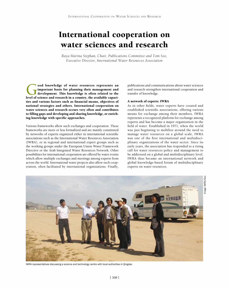
[ ]308
International cooperation on water sciences and researchRaya Marina Stephan, Chair, Publications Committee and Tom Soo,
Executive Director, International Water Resources Association
Good knowledge of water resources represents an important basis for planning their management and development. This knowledge is often related to the
level of science and research in a country, the available capaci-ties and various factors such as financial means, objectives of national strategies and others. International cooperation on water sciences and research occurs very often and contributes to filling gaps and developing and sharing knowledge, or enrich-ing knowledge with specific approaches.
Various frameworks allow such exchanges and cooperation. These frameworks are more or less formalized and are mainly constituted by networks of experts organized either in international scientific associations such as the International Water Resources Association (IWRA), or in regional and international expert groups such as the working groups under the European Union Water Framework Directive or the Arab Integrated Water Resources Network. Other possibilities for international cooperation are offered by water events which allow multiple exchanges and meetings among experts from across the world. International water projects also allow such coop-eration, often facilitated by international organizations. Finally,
publications and communications about water sciences and research strengthen international cooperation and transfer of knowledge.
A network of experts: IWRAAs in other fields, water experts have created and established scientific associations, offering various means for exchange among their members. IWRA represents a recognized platform for exchange among experts and has become a major organization in the field of water. Established in 1971, when the world was just beginning to mobilize around the need to manage water resources on a global scale, IWRA was one of the first international and multidisci-plinary organizations of the water sector. Since its early years, the association has responded to a rising call for water resources policy and management to be addressed on a global and multidisciplinary level. IWRA thus became an international network and global knowledge-based forum of multidisciplinary experts on water resources.
INTERNATIONAL COOPERATION ON WATER SCIENCES AND RESEARCH
IWRA representatives discussing a science and technology centre with local authorities in Qingdao
Imag
e: IW
RA
/Soo
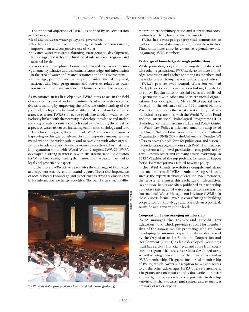
[ ]309
INTERNATIONAL COOPERATION ON WATER SCIENCES AND RESEARCH
requires interdisciplinary action and international coop-eration is a driving force behind the association.
IWRA has developed geographical committees to further implement its mission and focus its activities. These committees allow for extensive regional network-ing among IWRA members.
Exchange of knowledge through publicationsWhile promoting cooperation among its members and with other organizations, IWRA seeks to facilitate knowl-edge generation and exchange among its members and the wider public through several publishing activities.
IWRA’s peer-reviewed journal, Water International (WI), places a specific emphasis on linking knowledge to policy. Regular series of special issues are published in partnership with other major international organi-zations. For example, the March 2013 special issue focused on the relevance of the 1997 United Nations Water Convention in the twenty-first century and was published in partnership with the World Wildlife Fund and the International Hydrological Programme (IHP) Hydrology for the Environment, Life and Policy Centre for Water Law, Policy and Science, under the auspices of the United Nations Educational, Scientific and Cultural Organization (UNESCO) at the University of Dundee. WI offers an accessible platform for publication and dissemi-nation to various organizations such IWMI. Furthermore it represents a high-level publication, being published by a well-known editor and enjoying a wide readership. In 2012 WI achieved the top position, in terms of impact factor, for water journals related to water policy.
The IWRA Update newsletters compile and share information from all IWRA members. Along with tools such as the experts database offered for IWRA members, the newsletter ensures this exchange of information. In addition, books are often published in partnership with other international water organizations such as the International Water Management Institute (IWMI). In these various forms, IWRA is contributing to building cooperation on knowledge and research on a political, scientific and a wider public level.
Cooperation by encouraging membershipIWRA manages the Toyoko and Hiroshi Hori Education Fund which provides support for member-ship of the association for promising scholars from developing economies, especially those designated by the Organisation for Economic Cooperation and Development (OECD) as least developed. Recipients must have a clear financial need, and come from coun-tries or regions that are OECD least developed areas as well as being areas significantly underrepresented in IWRA membership. The grants include full membership of IWRA, which covers subscription to WI and access to all the other advantages IWRA offers its members. The grants are a means at an individual scale to transfer knowledge to experts who show potential to develop activities in their country and region, and to create a network of water experts.
The principal objectives of IWRA, as defined by its constitution and bylaws, are to:• lead and influence water policy and governance• develop and publicize methodological tools for assessment,
improvement and conjunctive use of water• advance water resources planning, management, development,
technology, research and education at international, regional and national levels
• provide a multidisciplinary forum to address and discuss water issues• generate, synthesize and disseminate knowledge and information
in the area of water and related resources and the environment• encourage, promote and participate in international, regional,
national and local programmes and activities related to water resources for the common benefit of humankind and the biosphere.
As mentioned in its first objective, IWRA aims to act in the field of water policy, and it seeks to continually advance water resource decision-making by improving the collective understanding of the physical, ecological, chemical, institutional, social and economic aspects of water. IWRA’s objective of playing a role in water policy is closely linked with the necessity to develop knowledge and under-standing of water resources, which implies developing the scientific aspects of water resources including economics, sociology and law.
To achieve its goals, the actions of IWRA are oriented towards improving exchanges of information and expertise among its own members and the wider public, and networking with other organi-zations to advance and develop common objectives. For instance, in preparation of its 14th World Water Congress (WWC), IWRA developed a strong partnership with the International Association for Water Law, strengthening the themes and the sessions related to legal and governance aspects.
Furthermore, IWRA actively promotes the exchange of knowledge and experiences across countries and regions. The critical importance of locally-based knowledge and experience is strongly emphasized in its information exchange activities. The belief that sustainability
The World Water Congress provides a forum for global knowledge-sharing
Imag
e: IW
RA
/Soo
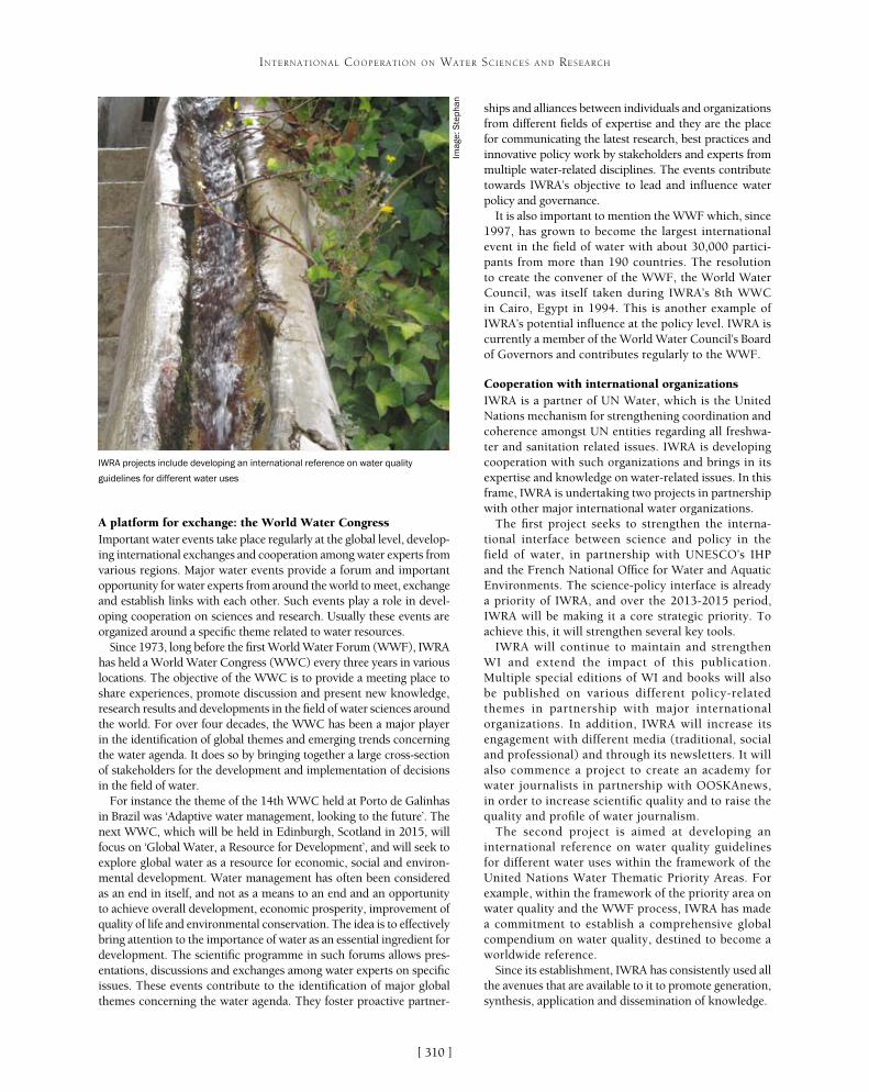
[ ]310
INTERNATIONAL COOPERATION ON WATER SCIENCES AND RESEARCH
A platform for exchange: the World Water Congress Important water events take place regularly at the global level, develop-ing international exchanges and cooperation among water experts from various regions. Major water events provide a forum and important opportunity for water experts from around the world to meet, exchange and establish links with each other. Such events play a role in devel-oping cooperation on sciences and research. Usually these events are organized around a specific theme related to water resources.
Since 1973, long before the first World Water Forum (WWF), IWRA has held a World Water Congress (WWC) every three years in various locations. The objective of the WWC is to provide a meeting place to share experiences, promote discussion and present new knowledge, research results and developments in the field of water sciences around the world. For over four decades, the WWC has been a major player in the identification of global themes and emerging trends concerning the water agenda. It does so by bringing together a large cross-section of stakeholders for the development and implementation of decisions in the field of water.
For instance the theme of the 14th WWC held at Porto de Galinhas in Brazil was ‘Adaptive water management, looking to the future’. The next WWC, which will be held in Edinburgh, Scotland in 2015, will focus on ‘Global Water, a Resource for Development’, and will seek to explore global water as a resource for economic, social and environ-mental development. Water management has often been considered as an end in itself, and not as a means to an end and an opportunity to achieve overall development, economic prosperity, improvement of quality of life and environmental conservation. The idea is to effectively bring attention to the importance of water as an essential ingredient for development. The scientific programme in such forums allows pres-entations, discussions and exchanges among water experts on specific issues. These events contribute to the identification of major global themes concerning the water agenda. They foster proactive partner-
ships and alliances between individuals and organizations from different fields of expertise and they are the place for communicating the latest research, best practices and innovative policy work by stakeholders and experts from multiple water-related disciplines. The events contribute towards IWRA’s objective to lead and influence water policy and governance.
It is also important to mention the WWF which, since 1997, has grown to become the largest international event in the field of water with about 30,000 partici-pants from more than 190 countries. The resolution to create the convener of the WWF, the World Water Council, was itself taken during IWRA’s 8th WWC in Cairo, Egypt in 1994. This is another example of IWRA’s potential influence at the policy level. IWRA is currently a member of the World Water Council’s Board of Governors and contributes regularly to the WWF.
Cooperation with international organizationsIWRA is a partner of UN Water, which is the United Nations mechanism for strengthening coordination and coherence amongst UN entities regarding all freshwa-ter and sanitation related issues. IWRA is developing cooperation with such organizations and brings in its expertise and knowledge on water-related issues. In this frame, IWRA is undertaking two projects in partnership with other major international water organizations.
The first project seeks to strengthen the interna-tional interface between science and policy in the field of water, in partnership with UNESCO’s IHP and the French National Office for Water and Aquatic Environments. The science-policy interface is already a priority of IWRA, and over the 2013-2015 period, IWRA will be making it a core strategic priority. To achieve this, it will strengthen several key tools.
IWRA will continue to maintain and strengthen WI and extend the impact of this publication. Multiple special editions of WI and books will also be published on various different policy-related themes in partnership with major international organizations. In addition, IWRA will increase its engagement with different media (traditional, social and professional) and through its newsletters. It will also commence a project to create an academy for water journalists in partnership with OOSKAnews, in order to increase scientific quality and to raise the quality and profile of water journalism.
The second project is aimed at developing an international reference on water quality guidelines for different water uses within the framework of the United Nations Water Thematic Priority Areas. For example, within the framework of the priority area on water quality and the WWF process, IWRA has made a commitment to establish a comprehensive global compendium on water quality, destined to become a worldwide reference.
Since its establishment, IWRA has consistently used all the avenues that are available to it to promote generation, synthesis, application and dissemination of knowledge.
IWRA projects include developing an international reference on water quality
guidelines for different water uses
Imag
e: S
teph
an

[ ]311
The Eco-Smart Waterworks SystemSoo Hong Noh, Centre for Eco-Smart Waterworks System, Yonsei University
The global water shortage and uneven water supply and demand problems are getting serious. According to a UN-Water analytical brief in 2013, one in six people world-
wide does not have access to improved drinking water sources.1 Climate change dramatically affects water environments, causing increases in frequent and heavy rainfall events, high turbidity in water and algal blooms. In Korea, the concentrations of taste and odour-causing substances such as geosmin and 2-Methylisoborneol (2-MIB) in raw water have increased up to 1,000 nanograms per litre (ng/L) during the summer season. Conventional drinking water treatment processes could not remove high turbidity or the taste and odour-causing substances effectively. Climate change is an increasingly significant challenge in water supply.
The Centre for Eco-Smart Waterworks System at Yonsei University was established in May 2011 and funded by the Ministry of Environment of Korea as a part of 10-year Global Top Project.2 The centre has more than 50 academics and industrial partners and an overall budget of US$72 million for five years. Its main goals are to:• develop advanced hybrid membrane water treatment systems
for safe and sustainable water supply• develop total solution processes based on ET-IT-NT integrated
technology covering the entire process from raw water intake to water treatment plant to the tap
• promote the growth of global water companies.
The global water market has rapidly expanded over recent decades and is expected to grow even faster in the coming years. The Korean Government has desig-nated water business as a new growth engine and, like many countries, has been building national strategies for promoting the water industry.
The centre develops world-class membrane technol-ogy, a high-tech intelligent optimized water treatment system, and a water treatment process optimized for export markets. Its three main technologies for the drinking water industry are:• fouling and chemical-resistant membrane modules
with less energy consumption• hybrid membrane processes for the treatment of
drinking water from various water sources• the Eco-Smart Waterworks System with a total
solution based on ET-IT-NT technology.
Korean engineering and construction companies have extensive experience in the design and construction of waterworks systems in domestic and oversea markets. However, they have limited experience in the opera-tion and maintenance of waterworks. The centre has supported participating companies to obtain opera-tion and maintenance experience with the cooperation of local governments such as Seoul and Daegu. This
INTERNATIONAL COOPERATION ON WATER SCIENCES AND RESEARCH
Yeongdeungpo waterworks: the DIMS pressured membrane (left) and HTM submerged membrane (right)
Imag
es: D
aew
oo E
&C
(lef
t); H
anw
ha E
&C
(rig
ht)

[ ]312
INTERNATIONAL COOPERATION ON WATER SCIENCES AND RESEARCH
ops analytical methods for CECs and has established a database for CEC concentration in raw water. The Korea Water Resources Corporation has established a database of source water quality and develops tools for water treatment processes optimized for source water. In addition, the company develops retrofitting technol-ogy for the conventional water treatment process.
GS E&C and nine other companies develop tech-nology for the design, construction and operation of intelligent integrated waterworks systems using IT-ET integrated processes from source water to the tap. Test beds with a capacity of 1,000-5,000 m3 per day have been constructed at eight waterworks in six of Korea’s local governments to develop advanced water treatment systems based on the membrane-AOP hybrid processes.
cooperation is expected to lead Korean water companies to the global water market.
Woongjin Chemical and Cheil Industries develop microfiltration and ultrafiltration membranes and modules with high porosity, high strength, low energy consumption and resistance to fouling. Econity develops membranes and modules optimized for highly concen-trated backwash water treatment. Keimyung University develops next-generation membrane for water treatment using nanofibres and graphemes. Daelim Industrial, the Waterworks Research Institute of the Seoul Metropolitan Government and the Korea Institute of Construction Technology (KICT) develop highly efficient, low-energy membrane-advanced oxidation process (AOP) hybrid water purification systems in response to the issue of constituents of emerging concerns (CECs) in water. In particular, the Waterworks Research Institute of the Seoul Metropolitan Government devel-
Project
Project #1
Project #2
Project #3
Project #4
Project #5
5-1
5-2
Project #6
Project #7
7-1
7-2
7-3
7-4
7-5
7-6
7-7
7-8
7-9
Project #8
Title of project
Development of microfilter membrane module with energy saving and low fouling
Development of UF membrane and module with high permeability and high strength
Development of membrane and module for treating highly concentrated backwash water
Development of next-generation membrane and module for water purification
Development of a novel water treatment technology to remove CECs
Development of analytical methods and a database for contaminants of emerging concern drinking water systems
Development of decision support system for optimization of advanced water treatment process
Development of water treatment process for tailored water quality
Design, construction & operation of smart water system as a total solution (Newly construct and improve big city’s water supply system
Upgrade of large scale waterworks system
Development of eco-smart water supply system as a total solution
Constructing metropolitan waterworks system
Small and medium city’s water supply system improvement
Drinking water system construction for small and medium-sized cities
Technical development of smart membrane drinking water treatment integration system for medium/small city
Development of optimized operation for developing countries water treatment system
Retrofitting for an existing water supply system in big cities
Optimal intelligent advanced water treatment plant technology developments
Development of multi-purpose small-scale water treatment package system
Organization
Woongjin Chemical
Samsung, Cheil Industries
Econity
Keimyung University
Daelim Industrial
Waterworks Research Institute, Seoul Metropolitan Government
Korea Institute of Construction Technology
Korea Water Resources Corporation
GS E&C
Daewoo E&C
Hanwha E&C
POSCO E&C
Daelim Industrial
Coway
POSCO ICT
Hyundai Engineering
SK E&C
STI C&D
Korea Institute of Construction Technology
Eco-Smart Waterworks System projects
Source: Centre for Eco-smart Waterworks System
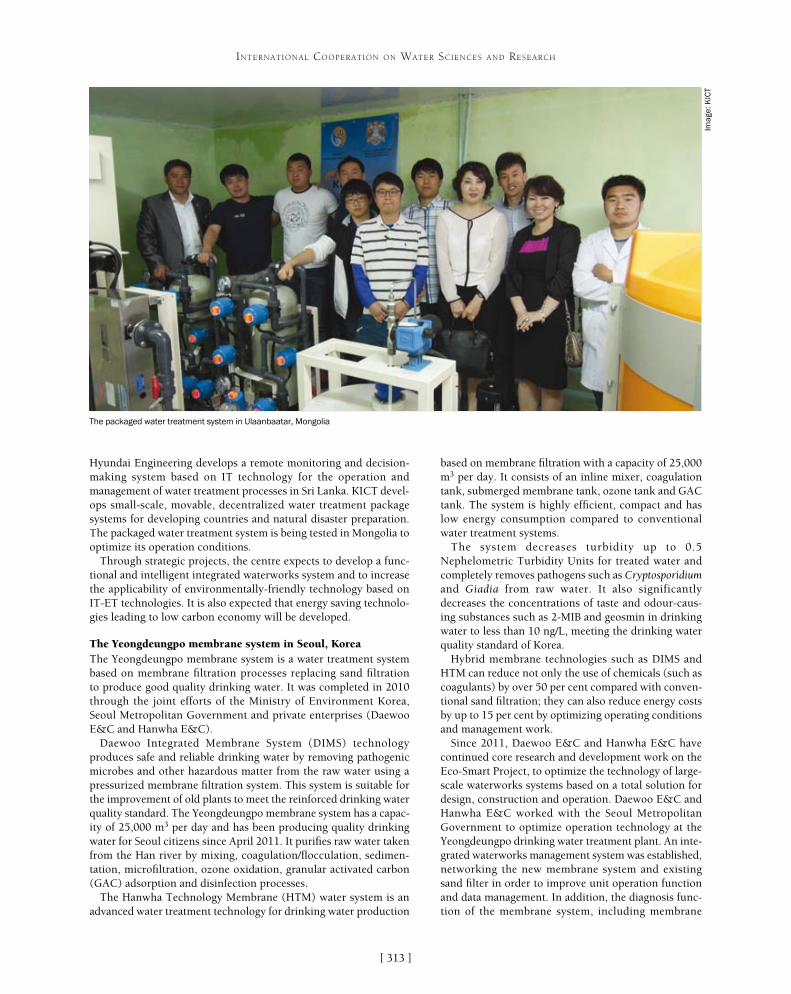
[ ]313
INTERNATIONAL COOPERATION ON WATER SCIENCES AND RESEARCH
Hyundai Engineering develops a remote monitoring and decision-making system based on IT technology for the operation and management of water treatment processes in Sri Lanka. KICT devel-ops small-scale, movable, decentralized water treatment package systems for developing countries and natural disaster preparation. The packaged water treatment system is being tested in Mongolia to optimize its operation conditions.
Through strategic projects, the centre expects to develop a func-tional and intelligent integrated waterworks system and to increase the applicability of environmentally-friendly technology based on IT-ET technologies. It is also expected that energy saving technolo-gies leading to low carbon economy will be developed.
The Yeongdeungpo membrane system in Seoul, KoreaThe Yeongdeungpo membrane system is a water treatment system based on membrane filtration processes replacing sand filtration to produce good quality drinking water. It was completed in 2010 through the joint efforts of the Ministry of Environment Korea, Seoul Metropolitan Government and private enterprises (Daewoo E&C and Hanwha E&C).
Daewoo Integrated Membrane System (DIMS) technology produces safe and reliable drinking water by removing pathogenic microbes and other hazardous matter from the raw water using a pressurized membrane filtration system. This system is suitable for the improvement of old plants to meet the reinforced drinking water quality standard. The Yeongdeungpo membrane system has a capac-ity of 25,000 m3 per day and has been producing quality drinking water for Seoul citizens since April 2011. It purifies raw water taken from the Han river by mixing, coagulation/flocculation, sedimen-tation, microfiltration, ozone oxidation, granular activated carbon (GAC) adsorption and disinfection processes.
The Hanwha Technology Membrane (HTM) water system is an advanced water treatment technology for drinking water production
based on membrane filtration with a capacity of 25,000 m3 per day. It consists of an inline mixer, coagulation tank, submerged membrane tank, ozone tank and GAC tank. The system is highly efficient, compact and has low energy consumption compared to conventional water treatment systems.
The system decreases turbidity up to 0.5 Nephelometric Turbidity Units for treated water and completely removes pathogens such as Cryptosporidium and Giadia from raw water. It also significantly decreases the concentrations of taste and odour-caus-ing substances such as 2-MIB and geosmin in drinking water to less than 10 ng/L, meeting the drinking water quality standard of Korea.
Hybrid membrane technologies such as DIMS and HTM can reduce not only the use of chemicals (such as coagulants) by over 50 per cent compared with conven-tional sand filtration; they can also reduce energy costs by up to 15 per cent by optimizing operating conditions and management work.
Since 2011, Daewoo E&C and Hanwha E&C have continued core research and development work on the Eco-Smart Project, to optimize the technology of large-scale waterworks systems based on a total solution for design, construction and operation. Daewoo E&C and Hanwha E&C worked with the Seoul Metropolitan Government to optimize operation technology at the Yeongdeungpo drinking water treatment plant. An inte-grated waterworks management system was established, networking the new membrane system and existing sand filter in order to improve unit operation function and data management. In addition, the diagnosis func-tion of the membrane system, including membrane
The packaged water treatment system in Ulaanbaatar, Mongolia
Imag
e: K
ICT

[ ]314
INTERNATIONAL COOPERATION ON WATER SCIENCES AND RESEARCH
such as turbidity, dissolved organic carbon, residual chlorine, NH4-N, NO3-N, NO2-N, oxidation reduc-tion potential and so on are automatically monitored by sensors installed at intake, water treatment plant, distribution reservoirs, distribution pipelines and taps. The expert decision system consists of automatic control dosing systems for coagulant and chlorine, and a water supply pump schedule system. The system assists the operator to make fast and accurate deci-sions for optimum operation.
The H-Eco system is expected to reduce operation costs (chemicals, electricity and so on) through a remote control system. It is also expected to provide stable operation of the water treatment plant through a real-time monitoring and remote expert decision-making system.
Packaged water treatment system in Ulaanbaatar, MongoliaKICT has developed multi-purpose small-scale water treatment package systems: a regionally customized water treatment system, a mobile emergency water treatment package system, and an integrated manage-ment system for distributed water treatment plants.
This project has set targets such as selecting a suitable water quality guideline and drawing up key technology applicable to local areas. The system is named the ‘E3 system’ because it achieves the three targets of high efficiency, cost-effectiveness and low energy consumption.
Mongolia was chosen as a target country in which to test the operational safety of the system under various weather conditions, due to its intense cold in winter. An active on-site investigation was carried out at Ulaanbaatar by building cooperation with the Mongolian Government. As a result of the water quality analysis, a skid-type pilot system was targeted to control manganese and bacteria. The system was installed in a 20-foot container compliant with International Organization for Standardization stand-ards. A manganese-coated sand filter was chosen to control manganese and particle contaminants in the water. The ultraviolet disinfection system followed to remove pathogens. The water treatment package system was designed with a capacity of 24 m3 per day, supplying safe drinking water to between 3,000 and 6,000 people in a day, assuming that one person typi-cally consume 4-8 litres of water daily.
KICT has a plan to improve system performance through the long-term operation. This operational know-how is expected to provide Mongolia with safe and reliable water distribution by providing locally-available resources and an operating manual for sustainable operation and maintenance. In addition, technological support and business interchange with the Mongolian Government will be carried forward in a scheme established by mutual agreement. This corporation is expected to be helpful to water industry development between Korea and Mongolia.
integrity, was reinforced. An economical maintenance process was achieved by optimization and modification in part of the pump operation, membrane cleaning procedures and membrane operation modes. The total waterworks system including distribution lines was also improved.
The H-Eco water supply control system in Polonnaruwa, Sri LankaThe Polonnaruwa drinking water treatment plant was designed and constructed at Polonnaruwa, Sri Lanka in 2012 by Hyundai Engineering with support from the Asian Development Bank and the Government of Sri Lanka. The plant purifies river water by a conventional process of intake, coagulation, sedimentation, sand filtration and disinfection. Its capacity is 13,500 m3 per day and it supplies safe drinking water to the people of Polonnaruwa city.
In many cases, water treatment plants in developing countries are not operated properly due to problems such as a lack of skilled oper-ators and maintenance experience. In order to solve this problem, Hyundai Engineering has developed the H-Eco water supply control system, which is a remote monitoring and operator support system. The system collects the water quality and flow rate data from sensors installed in intake, water treatment plant, distribution pipelines and taps. The collected data are analysed and assist the operator to manage the water treatment system efficiently by providing online information about optimal operating conditions in the water treat-ment plant. The H-Eco system networks several water treatment plants scattered around the world with the main office of Hyundai Engineering in Seoul. It also provides solutions for operation and maintenance to the operators in the plants.
The H-Eco system consists of a water quality and water flow rate monitoring system, a remote expert decision system and remote monitoring and operator support system. In the water quality and flow rate monitoring system, water flow rate and water quality
Polonnaruwa drinking water treatment plant in Sri LankaIm
age:
Hyu
ndai
Eng
inee
ring

[ ]315
Water and Livelihoods Initiative: scientific cooperation and collaboration across North Africa and the Middle East
C. King, Water and Livelihoods Initiative; S. Christiansen, Director, Office of Water Resources and Environment, United States Agency for International Development; T. Oweis, Director, Integrated Water and Land Management Program; and B. Dessalegn,
Communication and Project Management specialist, International Center for Agricultural Research in the Dry Areas
Across the Middle East and North Africa (MENA), water scarcity presents societies and individuals with choices to either compete or collaborate with one another.
Cumulative water demands for domestic, industrial and agri-cultural needs have always exceeded the volume of resource available in this region. Water has long been cycled and recy-cled along the canals and drainage systems of the Nile and the Euphrates. An ever-increasing complexity of innovations for water distribution and purification has evolved to make every drop count time and again. Without technical knowledge of these water management solutions, collaboration and mutual trust, individuals are vulnerable to persistent disturbances affecting their climate, hydrological, social, economic and agro-ecological systems.
Public scientific and technical cooperation has transformed lives and landscapes across the MENA region, from the Maarib Dam in Yemen
to Lake Nasser in Egypt and the Man-Made River in Libya. More recently, a technological explosion of private wells, plastic tunnels, social media and cellular phones has changed many of the rules of rural water manage-ment in agricultural societies. New demands for export production introduce new choices, benefits and risks to rural households. Pooling of intellectual resources and research funds across public and private sectors is urgently needed to address the deepening problems of insufficient food and water supplies and continue the regional tradition of scientific innovation. But despite the ongoing technological and communications revo-lutions, scientific assessments tend to be short-lived, project-based and under-funded. Intellectual property is jealously guarded from critics and colleagues alike, and scaling the walls of institutional and disciplinary silos is not for the faint-hearted. MENA’s young scientists need
INTERNATIONAL COOPERATION ON WATER SCIENCES AND RESEARCH
CGIAR centres
US Universities andUSDA/ARS
Regional Universities
National Universities
CBOs and individual farmers
The WLI collaborative model for research partnership
Source: WLI 2013 MENA Platform document http://temp.icarda.org/wli/pdfsA farmer in Lebanon: WLI research is often carried out with farmers on their own land
Imag
e: T
. Ow
eis

[ ]316
INTERNATIONAL COOPERATION ON WATER SCIENCES AND RESEARCH
Through WLI, knowledge generated by NARES in Egypt, Iraq, Jordan, Lebanon, Palestine, Syria, Tunisia and Yemen is harnessed with insights drawn from regional and international partners including:• three CGIAR centres (ICARDA, the International
Water Management Institute (IWMI) and the International Food Policy Research Institute)
• a consortium of six United States universities (University of Florida, Utah State University, University of Illinois at Urbana Champaign, Texas A&M University and University of California Davis)
• regional and national universities• the United States Department of Agriculture,
Agricultural Research Service• community-based organizations (CBOs) such
as private enterprises, cooperatives, producers’ organizations, fishing associations, water users’ associations, women’s groups, trade and business associations and others focused on natural resource management.
WLI has faced challenges to develop integrated scientific agendas for land and water management cooperation and collaboration across MENA. Many of these are similar to the challenges encountered by previous single-donor initiatives at the land-water interface, including the multi-donor Regional Initiative for Dryland Management and the Flemish-funded United Nations Educational, Scientific and Cultural Organization, United Nations University and ICARDA international cooperative research project on sustainable management of the marginal drylands. In each case, there is a need to set common agendas, identify objectives and ensure that partners’ progress towards them is recognized. Regional platforms and multi-donor undertakings addressing
and deserve all the support they can get, to collaborate as research partners and continue the tradition of innovation in this region.
International partners seeking to build peace, prosperity and strong economic ties across the region know that they need to move beyond emergency assistance to restore and rejuvenate the lands once considered to be the breadbasket of Europe. In a world full of new uncertainties at home and abroad, many donors are understandably reluctant to jeopardize public funds and repu-tations in pursuit of research that may not yield instant results. Some feel obliged to stick with instant ‘band-aid’ solutions, but others might be willing to consider research and innovation. Experienced research partners with a long-term stake in successful water management research can use their accumulated knowledge to capitalize on emerging discoveries and accelerate the effective-ness of assistance to research for development, reducing the risks for donors. Pooling of resources among multilateral and bilateral partners in support of promising research and extension successes could further encourage regional research institutions to incubate and explore new technological solutions and foster the enhanced long-term thinking needed to address regional climate change, water scarcity and food security challenges.
The Water and Livelihoods InitiativeThe United States Agency for International Development’s (USAID’s) best-bet solution for activating accumulated knowledge to address water scarcity and land degradation is its longstanding collaboration with the International Center for Agricultural Research in the Dry Areas (ICARDA) and its established cooperative ties to National Agricultural Research and Extension Systems (NARES) across the region. Together, ICARDA, USAID and the NARES have established the Water and Livelihoods Initiative (WLI), which offers donors the opportunity to contribute to a collaborative multi-partner under-taking where the anticipated impacts of improved scientific water resources management are systematically verifiable, and underwrit-ten through participation by USAID and other cooperative partners.
Asset/capital
Human
Physical
Natural
Financial
Social
Verifiable indicator in use or under consideration
Number of men and women benefiting from short-term training delivered through WLI
Number of scientific publications resulting from long-term scientific research supported through WLI
Agricultural land in the benchmark sites (ha, tons and value of dominant and target crops)
Land under pilot testing of improved land and water management strategies and techniques
Water balance in the target watershed/irrigation district (available water resources compared to existing water use)
Agricultural water use volumes (m3/ha) measured in the field under unimproved and improved management practices
On-farm income (gross margin per hectare from selected crops with and without improved management) Total household income in relation to the rural poverty line with and without water management improvements
Producers’ organizations, water users’ associations, women’s groups, trade associations and CBOs receiving assistance
(disaggregation of data on all above indicators by gender)
Reporting
2012-
2012-
2014-
2012-
2014-
2014-
2014-
2014-
2012-
2012-
Sustainable water and livelihoods framework for sharing success in scientific cooperation to enhance rural land and water management
Source: Water and Livelihoods Initiative 1st Quarterly Report. Available online at http://temp.icarda.org/wli/pdfs/WLIFirstQuarterProgressReport_2013.pdf

[ ]317
INTERNATIONAL COOPERATION ON WATER SCIENCES AND RESEARCH
land degradation an water scarcity in drylands also face these chal-lenges, and have sometimes had to admit collective failure. Following these experiences, considerable comparative achievements have been made through WLI so far, and the lessons learned may be useful in enabling the transition from a single-donor initiative to a successful multi-donor scientific cooperation and collaboration across MENA.
The available literature on communities of practice and collective action highlights the need for groups to identify common objectives and establish trust through standard procedures for evidence-based decision-making and an agreed plan of action. Three years of consultation enabled WLI to develop a set of common objectives to demonstrate that integrated land and water management can improve the livelihoods of rural households. Another three years of seed-funded collaborative field testing work by ICARDA, NARES and US and MENA universities has nurtured a budding research for devel-opment initiative, which could bear fruit. There is now a need for this to be collectively recognized and projected across an appropriate
timeframe for sustainable land and water management impact – i.e. at least 10 years.
Innovative approaches for research and developmentWLI is a grounded, site-based initiative that brings inter-national partners to the field, not just the debating table. It follows the proven ‘Water Benchmarks’ approach estab-lished by ICARDA for various agro-ecologies, whereby scientific cooperation concentrates donor support for pilot testing of integrated water, land use and livelihood strategies developed at selected sites across the region. The critical mass and layering of successive investigations at these sites ensures that a strong body of data and analysis from different disciplines is available to track and verify the effects of land and water management strategies and technologies, and evaluate their suitability for scaling up/out to other areas of rain-fed, irrigated and rangeland agro-ecosystems. Much of the research is participatory, and is often carried out with farmers on their own land.
WLI donors and partners are committed to working together in the drylands and enjoy spending time in the field with collaborators and beneficiaries. However, some WLI sites are in areas difficult to access. To keep track of the WLI research teams’ progress and share information among research partners, beneficiaries, donors and the public, WLI has established a monitoring and evaluation system using USAID’s Feed the Future indicators.
Moving beyond the tracking of progress, USAID has championed the projection and measurement of liveli-hood impacts from improved land and water management through WLI in the belief that these are at the heart of every-one’s development agendas. The WLI teams have adopted only a small number of indicators that are already opera-tional or can be operationalized during the coming year, without resorting to using an over-burdensome system. Although no indicator alone captures impact, together they provide the best available means to do so. Other international scientific initiatives, including several funded through the European Union and the Global Environment Facility, have previously designed and operationalized such a system, but were not able to design a system that would be acceptable to all concerned national governments and donors. Through WLI, instead of endlessly searching for a perfect blueprint, the system can be declared operational when it is already in place across the region. This is thanks to scientific support from ICARDA and participating universities, which has given the NARES the confidence to adopt workable methodologies and benefit from a network of peer-reviewers to improve them.
Cooperation to measure impactsCreating an operational system for monitoring progress in integrated land and water management to improve rural livelihoods was a daunting task that none of the partners could have achieved alone. Although research-ers and resource managers intuitively knew that they were improving rural livelihoods by enhancing land and water management, most were not well-equipped
Imag
e: T
. Ow
eis
Modelling the effects of improved on-farm water management at the basin scale
Land and water management technologies, such as the microcatchment water harvesting technique practised in Jordan, use the landform to collect scarce water resources, conserving them in the soil and increasing water availability for natural plant growth or crop production. Collected water is used to supply barley fields and shrubs through a series of constructed basins and outlets. Farmers have to be prepared to invest labour in construction and maintenance of the systems, and require skills to evaluate and maximize their effectiveness. The Jordanian National Center for Agricultural Research and Extension (NCARE) works in collaboration with farmers and farmers’ associations to demonstrate and transfer these skills through practical experimentation on farmers’ own land, and organizes field days for farmers and decision-makers to view the results. Methodological support for the use of focus groups and other rapid appraisal techniques is provided through collaboration with the University of Florida and ICARDA’s Socioeconomic, Gender and Policy Research Program.
Collaborative studies undertaken with the Jordanian University of Science and Technology and Texas A&M have introduced a soil water assessment tool to model the effects of the water harvesting on hydrology, erosion and vegetation. Scientific exchanges involving WLI research teams from other countries, ICARDA and IWMI have introduced the research team to water evaluation and planning tools for assessment of the water balance at basin scale. Researchers from the University of Illinois at Urbana Champaign have introduced consideration of downscaled global climate models and climate change scenarios. From 2014 collaborative research and cooperation will enable the WLI teams to project future basin-level water balance scenarios with and without water harvesting and other integrated land and other water management practices.
Water harvesting involves the collection and conservation of scarce rainwater
resources to increase water availability for plant growth and combat desertification

[ ]318
INTERNATIONAL COOPERATION ON WATER SCIENCES AND RESEARCH
hoods framework, they should look forward to engaging further additional support through a multi-donor initiative. This is needed to scale out the innovations achieved in MENA so far. The key to successful coop-eration in the water sector is ensuring that everybody wins, especially the most vulnerable rural households in water-scarce areas, whose livelihoods mainly depend on agricultural water management. To succeed in this, a wider collaboration involving more scientific partners donors, and rural communities will be needed.
Imag
e: C
arol
ine
Kin
g
to measure these impacts. In the eyes of potential donors, this was a problem that prevented investment in scientific cooperation and collaboration – a problem that is now solved within WLI.
To share the WLI solution with other donors and benefit other collaborative scientific initiatives across MENA, a series of chal-lenges still remain, and cooperative work among a widening range of partners and parallel initiatives will be needed. National experts in land and water management are not familiar with the tools and concepts of livelihood assessment, and often feel unqualified or reluctant to use them. On the other hand, development partners are well-versed in analyzing the determinants of poverty and economic development, but often do not have a practical understanding of the complex pathways through which these may be affected by a particular plant variety or cultivation practice. They also struggle to comprehend the possible effects of confounding factors, and may be uncertain about whether their support would ever be able to demonstrate that it has achieved any solidly attributable benefit. Land and water managers need to be able to reassure them of this.
Collaborative work through WLI has focused on the shared challenge of identifying the best available scientific methods for capturing and measuring livelihood impacts from innovative land and water manage-ment. With technical guidance and support from USAID and ICARDA through WLI, reporting of the first five indicators in the sustainable water and livelihoods framework by collaborating research teams began during 2012. This included target-setting for the coming three years in terms of technological development, capacity building and implementa-tion of improved management strategies in the field. For the remaining five indicators, scientific cooperation is enabling WLI to develop neces-sary methodological guidance. This will equip the research teams to use, critique and improve available scientific methods for the estimation and tracking of agricultural water management and productivity, basin-scale water management and effects on the income of rural households.
Rewarding international cooperationFrom 2014 it is anticipated that baselines and targets for quantifiable, verifiable and collectively recognizable success in improving land, water and livelihoods will be in place for all 10 indicators in the framework. Where impacts are systematically recognizable, shared, quantifiable and underwritten through USAID participation, it is hoped that more part-ners will decide to invest their support, and share the common success.
Ongoing collaborative work among WLI partners demonstrates the progress made towards the operational use of the remaining five indicators needed to connect water management innovations to measurable impacts on livelihoods. Work remains to be done on the framework and indicators, but the collaborative approach among scientific and development partners is the surest way to achieve it. Scientific exchange and collaborative work is also the best way to ensure that measurement methods meet universally applicable standards of scientific rigour and reliability. Collective methodological and measurement challenges will no doubt remain, in order to refine the indicators and enhance the quality and specificity of results to meet all stakeholders’ expectations. Appropriate methods for assessment of rural livelihoods, poverty and income generation are sensitive topics for public debate and national policy attention, as well as priority concerns for the inter-national donor communities.
Partners collaborating in WLI so far have a lot to be proud of and, finally, a great system for sharing their achievements with others. Over the coming years, thanks to the sustainable water and liveli-
Field monitoring of agricultural land and water productivity
NARES are well-experienced in recording hectares of land under agricultural uses, and assessing the volumes and values of crop production. But they do not systematically combine these statistics with water use and water productivity assessments to calculate the full potential water savings that could be achieved through innovative water management practices.
Fruit trees offer a less water-intensive alternative to cereals, and can be cultivated at the water-scarce tail-ends of irrigation canals or under drip irrigation. The WLI research team in Lebanon is working to raise the value of the more drought-tolerant indigenous soft fruit varieties by classifying and certifying them, promoting their tastes and qualities for export, and mentoring farmers in integrated pest management techniques, among other things.
Researchers are interested to learn how controlled water stress introduced to fruit crops through deficit irrigation can enhance their productivity and flavour. The WLI research teams are uniquely placed to observe these stresses, and ensure that producers in their countries can benefit from research findings. Knowledge exchanges with ICARDA scientists and US university partners focused on modelling crop-water requirements and productivity. WLI researchers in Tunisia are seeking knowledge from university partners in Florida and Spain to help them to model the effects of climate change on citrus production.
Collaborative work among the Egyptian Water Management Research Institute, Agricultural Research Institute, American University in Cairo and citrus producers’ agricultural associations is already enabling WLI researchers in Egypt to connect their collective research capacities, and record effects on water productivity in US dollars per hectare and per cubic metre of water. WLI is now preparing to report these impacts from integrated land and water management research to USAID and any other interested donors on an annual basis.
WLI researchers in Egypt are working to raise the water
productivity of citrus fruit trees

[ ]319
Water for sustainable development and adaptation to climate change
Milan Dimkic, Miodrag Milovanovic and Radisav Pavlovic, Jaroslav Cerni Institute for the Development of Water Resources, Serbia
The establishment of a United Nations Educational, Scientific and Cultural Organization (UNESCO) Category II Centre for Water for Sustainable Development and
Adaptation to Climate Change was approved in 2012. The centre is expected to enhance scientific cooperation at the regional level and to contribute to international sciences on water research, management and knowledge transfer, with a valuable contribu-tion to the current seventh phase of the International Hydrological Programme (IHP) and to the upcoming eighth phase. It has been operational since 2013, and is hosted by the Jaroslav Cerni Institute (JCI) for the Development of Water Resources.
JCI’s origins date back more than 60 years. It was initially an experi-mental hydraulics laboratory which provided scientific support for the development of the country’s first hydroelectric power plants. Over the years, JCI grew and expanded its research, investigation, planning, design and engineering activities to encompass all water management segments in the former Yugoslavia. In addition to its domestic activities, JCI successfully undertook diverse projects in more than 20 countries across the world.
Today, JCI is the focal institution in Serbia’s water sector, in terms of professional capacity and scope. It is also Serbia’s leading research organization. In addition to high-level research, JCI performs a wide variety of other activities which constitute its core functions. These include the planning and engineering of water and hydropower
infrastructures; engineer oversight of hydraulic projects; consulting services associated with the management of water resources, facilities, and systems; development of strategic planning documents; expert evaluations; and assistance in the drafting of national legislation, stand-ards, methodologies and guidelines.
JCI currently employs some 250 individuals, most of whom are university graduates with PhD and MSc degrees in various disciplines (civil/hydraulic and struc-tural, hydrogeological, chemical, environmental, forest, mechanical, electrical, mathematical and biological engi-neers; architects, economists, lawyers and so on). JCI also maintains close ties with domestic and international universities, organizations and experts. The extraordi-nary human resources of the institute ensure a very high level of studies and projects in different fields of water and energy sectors and environmental protection.
JCI has a number of laboratories for hydraulic, water quality, biochemical, soil and sediment research, and cutting-edge instrumentation for field measurements and analyses in areas such as geophysics, hydrogeology and hydrochemistry. It also operates a state-of-the-art information system and possesses a large library of advanced software used in water research and manage-ment. JCI has itself developed sophisticated software to address specific problems.
Needs of Serbia’s water sectorSerbia is currently faced with extremely important and extensive tasks in its water sector. Dramatically reduced spending over the past 25 years has led to a significant falling behind in the construction of necessary water infrastructures and, to some extent, in the very organi-zation and structuring of Serbia’s water sector. Water sector investment needs are currently estimated at a minimum of €6-8 billion.
Investments and efficient water sector management arrangements are indispensable for appropriate action and the achievement of targeted status in the areas of water protection, water use, and protection against the adverse effects of water. Serbia has enacted a new Water Law and is currently drafting a series of related by-laws. In parallel, it needs to upgrade government and economic capacities and undertake extremely impor-tant reforms in its economic and finance sectors. In
INTERNATIONAL COOPERATION ON WATER SCIENCES AND RESEARCH
The Jaroslav Cerni Institute is the focal institution in Serbia’s water sector
Imag
e: J
CI

[ ]320
INTERNATIONAL COOPERATION ON WATER SCIENCES AND RESEARCH
The main activities of the centre include networking in water management knowledge dissemination, with a focus on capacity building and problem solving in economic transition countries and taking into account climate change and socioeconomic transformation. The centre provides highly-specialized human resources and management capacity building, and assists in the devel-opment of baseline studies and water management plans.
Expected benefitsSeveral benefits are expected from the outcomes of the centre’s activities. At the country level, these include management capacity building at centralized and municipal institutions in charge of water management and the establishment of closer ties with scientific and professional organizations, both from countries within the region and beyond. The integration and enhance-ment of water management capacities and knowledge, and assistance in the development of studies and master plans, are also key benefits expected at this level.
At the regional level, the centre will enable the networking of institutions and all resources involved in water manage-ment development and climate change programmes. These activities include study and awareness raising about the impact of economic transition and climate change on water management, and capacity building.
Under UNESCO-IHP, the centre will enable advances in capacity building and networking. Activities will be aimed at identifying the impact of climate change on water resources, and raising awareness of the issues of transition countries and the impact of such issues on water management. The centre will also focus on improving north-south water management coopera-tion in circumstances involving socioeconomic and climate changes.
summary, major efforts need to be made during the next 15-20 years to harmonize Serbia’s water sector arrangements with European Union requirements, and at the same time achieve a water status which reflects legitimate societal needs.
JCI actively monitors developments in the international arena and has established close ties with a number of international institutions.
International cooperationSpecial emphasis is placed on the following activities:• collaboration with international associations such as the
International Water Association (IWA) and the International Association of Water Supply Companies in the Danube River Catchment Area (IAWD)
• cooperation with international commissions including the International Commission for the Protection of the Danube River (ICPDR) and the International Sava River Basin Commission (Sava Commission)
• participation in international projects (FP, SEE etc)• organization and hosting of international conferences:
• Groundwater Management in Large River Basins (2007)• Planning and Management of Water Resources Systems (2008)• Balkans Regional Young Water Professionals Conference (2010)• IWA Specialist Groundwater Conference (2011).
JCI has made and continues to make significant scientific contribu-tions. For example, it is actively involved in long-term research on the ageing of wells and other groundwater abstraction facilities, in relation to the aerobic state of the aquifer.
UNESCO Category II CentreIn order to satisfy Serbia’s water sector need, and to facilitate networking and capacity building at the regional and international levels, in 2012 UNESCO approved the opening of its new Category II Centre for Water for Sustainable Development and Adaptation to Climate Change at JCI. The centre has been operational since 2013.
The Krupac Water Spring in Eastern Serbia A spillway on the Prvonek Dam in Southern Serbia
Imag
e: J
CI
Imag
e: J
CI

[ ]321
INTERNATIONAL COOPERATION ON WATER SCIENCES AND RESEARCH
Ongoing north-south cooperation JCI has taken part in a number of UNESCO’s ongoing activities. These include the Training and planning workshop to develop a roadmap for integrated disaster management in Namibia, in May 2012 - an activity that will continue in late 2013. In May 2012 JCI took part in the international workshop on implementing modular curricula for tertiary technical and vocational education in IWRM, in Kaduna, Nigeria. In March 2013 the institute participated at the national capacity building workshop on hydro-disaster risk manage-ment and preparation of a national action plan, in Cotonou, Benin; and in May 2013 at the training and planning workshop to develop a roadmap for IWRM and flood risk control in South Sudan.
Memoranda of Understanding have been signed with the Regional Centre on Integrated River Basin Management in Kaduna, Nigeria; the UNESCO Chair in Hydroinformatics at Capital Normal University in Beijing, China; and the International Engineering Institute of Water and Environment in Ouagadougou, Burkina Faso.
2013 conferences The ‘UNESCO Symposium-cum-Experts Meeting’ was held in Belgrade on 9-11 July 2013, covering the following four topics:• analytical methods for the detection of emerging pollutants and
their transformation products• toxicity of emerging pollutants and their water-related properties
(degradability, solubility, sorption)• emissions and treatment of emerging pollutants• occurrence and fate of emerging pollutants in surface water and
groundwater, and mathematical modelling.
The contributions by leading experts in the matter, including key recommendations and conclusions, will be soon published by UNESCO.
From 17-18 October 2013, the centre is organizing the International Conference on Climate Change Impacts on Water Resources which will cover the following topics:
• climate change and global changes: factors that cause them, observed changes and predictions
• the impact of global changes on water resources – observed changes and different prediction methodologies (the importance of data quality, cooperation and monitoring; the impact of differ-ent factors on river discharges and trends such as climate change in meteorological data, various human activities and influences on water resources, land use changes, and so on)
• water scarcity (water use and agriculture under global changes; adaptation measures for water management; frameworks and policies)
• water resources management under global change conditions (regional and transboundary river basin management; floods; the role of ecosystem services and so on).
JCI and its UNESCO Category II Centre will continue along the path of ongoing capacity development and enhancement, and regional collaboration.
Networking
One of JCI and the UNESCO centre’s development goals is enhanced networking with international and national institutions. JCI maintains close ties with many organizations which also strongly supported the establishment of the UNESCO centre.
At the international level, JCI has close ties with the following:• World Water Assessment Programme• Centre for Ecology and Hydrology, Wallingford• UNESCO IHE• International Sediment Initiative• International Flood Initiative• World Meteorological Organization (WMO)• United Nations University• International Association of Hydrological Sciences• International Strategy for Disaster Reduction• International Groundwater Assessment Centre• European Regional Centre for Ecohydrology• IHP-HELP Centre• International Centre for Water Hazard
and Risk Management• WMO World Climate Program - Water• Water Technology Center, Karlsruhe• International Commission for the Protection of the Danube River• International Association of the Waterworks in the Danube
Catchment Area• Sava Commission• Slovak National Committee for the UNESCO-IHP• Bulgarian National Committee for the UNESCO-IHP• Water Institute of the Republic of Slovenia• University of Banja Luka, Faculty of Architecture and Civil
Engineering, Bosnia and Herzegovina• Hydrometeorological Institute of Montenegro• University of Skopje, Macedonia, Institute of Biology and
Faculties of Civil Engineering, Forestry, Natural Sciences and Mathematics, and Agricultural Sciences and Food.
At the national level, ties include the:• University of Belgrade Faculties of Mining and Geology
and Civil Engineering• Sinisa Stankovic Institute of Biological Research• University of Novi Sad, Faculty of Technical Sciences• University of Nis, Faculty of Civil Engineering
and Architecture.
The IWA Specialist Groundwater Conference in Belgrade, 2011
Imag
e: J
CI

[ ]322
Cooperation on water sciences and researchChristophe Cudennec, Gordon Young, Hubert Savenije, International Association of Hydrological Sciences
W ater is the basis of life. It is fundamental to maintain-ing human health and for sustaining all animal and plant life on Earth. Water underpins food produc-
tion, is vital for health, is used by many industries, is needed for the production of energy and is essential for the sustenance of the natural ecosystems on which we all depend. Paradoxically, water is also a threat to life and livelihoods – too much water can produce disastrous floods, too little can produce drought conditions, depriving natural and human systems of vital nour-ishment. In addition, pollution spills can cause degradation of life support systems.
As human populations grow and as large segments of the popula-tion acquire more wealth, the use of water increases. And as more demands are put on the resource, competition between uses and users also increases, requiring decisions to be made on equita-ble and fair allocation procedures. At the same time, more people find themselves living in flood-prone locations – on flood plains and in low lying coastal regions – putting themselves at growing levels of risk. Conversely, in many arid regions, the prevalence
of drought is increasing, rendering large numbers of people at risk of water scarcity. Efficient and effective water management is of greater importance in decid-ing how to best allocate scarce resources and how to mitigate and adapt to floods and droughts.
Accurately predicting and forecasting water availabil-ity and the likelihood of too much or too little water is dependent on understanding how hydrological systems function. And, as better understanding of hydrological systems leads to more informed management decisions, this understanding is of fundamental importance to effi-cient and effective management of the resource.
In 2012, the International Association of Hydrological Sciences (IAHS) celebrated 90 years of catalysing and structuring the development and flow of hydrological sciences based on a worldwide scope and community, and leading to the consolidation of knowledge through time. Through the work of its ten Commissions and three Working Groups, IAHS covers research into all aspects of hydrological systems and water manage-
INTERNATIONAL COOPERATION ON WATER SCIENCES AND RESEARCH
Section of Iguassu Falls, Brazil
Imag
e: G
. You
ng

[ ]323
INTERNATIONAL COOPERATION ON WATER SCIENCES AND RESEARCH
prints for the representation of processes including change and will focus on advanced monitoring and data analysis techniques. An interdisciplinary path will be sought by bridging with socio-economic sciences and geosciences in general.
Panta Rhei fits well within the much broader ‘Future Earth’ initiative. This major ten-year programme started in 2013 and brings together natural and social sciences through cooperation between the International Council for Science (ICSU), the International Social Sciences Council (ISSC) and the Belmont Forum, along with several other major international organizations including UNESCO. As water is a key element underpinning sustain-ability for society, seeking the connection and synthesizing the research findings from the two initiatives will provide a unique opportunity to promote interdisciplinarity.
Panta Rhei: three clear objectivesUnderstanding. This has always been the essence of hydrology as a science. Improving our knowledge of hydrological systems and their responses to changing environmental (including anthropomorphic) condi-tions, and in particular variability and indeterminacy, is a key step in deciphering change and the interac-tion with society. Special attention is to be devoted to complex systems like mountain areas, urban areas, alluvial fans, deltas, intensive agricultural areas, and to the specification of new measurement and data analysis techniques, which will allow the development of new understanding of coevolution processes.
Estimation and prediction. This is closely related to understanding, and it is the essence of hydrologic engi-neering and hydrological applications, embracing flood risk mitigation and water resources management. This objective includes estimation of design variables under change and uncertainty assessment that is a crucial step to support risk evaluation.
Science in practice. This signifies that Panta Rhei aims to include humans in the study of hydrological systems and therefore aims to achieve an iterative exchange between science, technology and society. Science in practice is science for people. It is, therefore, relevant to science (both fundamental and applied) and relevant to water technology. It includes policymaking and imple-
ment practices. In the past decade (2003-2012), IAHS has focused its research on Prediction in Ungauged Basins (PUB), developing models to better predict availability of water in diverse climatic and economic circumstances and water-use settings, and to better fore-cast and predict floods and droughts in basins and regions in which there has been little or inadequate data on which to base models. The PUB decade has resulted in three major publications: Runoff Prediction in Ungauged Basins – Synthesis across Processes, Places and Scales, published by Cambridge University Press; a summary article in the Hydrological Sciences Journal ‘A decade of Predictions in Ungauged Basins (PUB) – a review’; and Putting PUB into Practice (in press as of April 2013). These publications combine advancing the predictive capability and fundamental understanding of hydro-logical processes with making the findings relevant to the needs of societies in basins of all scales. The PUB initiative has brought together scientists, practitioners and policy makers from around the world and from many organizations, including UNESCO, in a cooperative effort.
Currently, IAHS is developing a new scientific decade for 2013-2022, entitled ‘Panta Rhei – Everything Flows’. The initiative is dedicated to research activities on change in hydrology and society. The purpose of Panta Rhei is to reach an improved interpretation of the processes governing the water cycle by focusing on their shifting dynamics in connection with rapidly changing human systems. The practical aim is to improve our capability to make predictions of water resources dynamics to support sustainable societal development in a changing environment. The concept implies a focus on hydrological systems as a changing interface between environment and society, whose dynamics are essential for determining water security, human safety and devel-opment, and for setting priorities for environmental management. The scientific decade 2013-2022 will devise innovative theoretical blue-
Hydrology and water security
As defined by UNESCO (1964), hydrology is the science that deals with the waters of the Earth; their occurrence, circulation and distribution on the planet; their physical and chemical properties; and their interactions with the physical and biological environment, including their responses to human activity.
Water security is defined as the capacity of a population to safeguard sustainable access to adequate quantities of acceptable quality water for sustaining livelihoods, human well-being, and socio-economic development; for ensuring protection against water-borne pollution and water-related disasters; and for preserving ecosystems in a climate of peace and political stability.
Drinking water supply in Kibera, Nairobi, Kenya
Imag
e: G
. You
ng
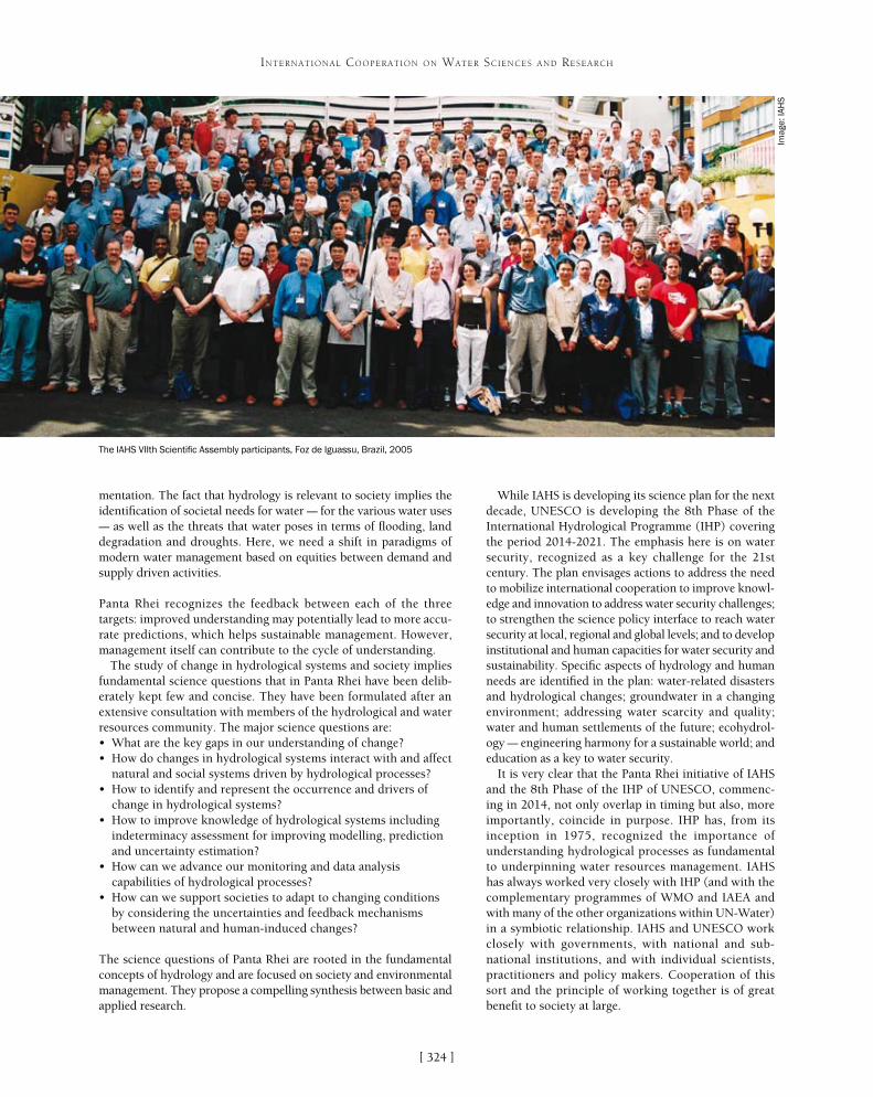
While IAHS is developing its science plan for the next decade, UNESCO is developing the 8th Phase of the International Hydrological Programme (IHP) covering the period 2014-2021. The emphasis here is on water security, recognized as a key challenge for the 21st century. The plan envisages actions to address the need to mobilize international cooperation to improve knowl-edge and innovation to address water security challenges; to strengthen the science policy interface to reach water security at local, regional and global levels; and to develop institutional and human capacities for water security and sustainability. Specific aspects of hydrology and human needs are identified in the plan: water-related disasters and hydrological changes; groundwater in a changing environment; addressing water scarcity and quality; water and human settlements of the future; ecohydrol-ogy – engineering harmony for a sustainable world; and education as a key to water security.
It is very clear that the Panta Rhei initiative of IAHS and the 8th Phase of the IHP of UNESCO, commenc-ing in 2014, not only overlap in timing but also, more importantly, coincide in purpose. IHP has, from its inception in 1975, recognized the importance of understanding hydrological processes as fundamental to underpinning water resources management. IAHS has always worked very closely with IHP (and with the complementary programmes of WMO and IAEA and with many of the other organizations within UN-Water) in a symbiotic relationship. IAHS and UNESCO work closely with governments, with national and sub-national institutions, and with individual scientists, practitioners and policy makers. Cooperation of this sort and the principle of working together is of great benefit to society at large.
mentation. The fact that hydrology is relevant to society implies the identification of societal needs for water – for the various water uses – as well as the threats that water poses in terms of flooding, land degradation and droughts. Here, we need a shift in paradigms of modern water management based on equities between demand and supply driven activities.
Panta Rhei recognizes the feedback between each of the three targets: improved understanding may potentially lead to more accu-rate predictions, which helps sustainable management. However, management itself can contribute to the cycle of understanding.
The study of change in hydrological systems and society implies fundamental science questions that in Panta Rhei have been delib-erately kept few and concise. They have been formulated after an extensive consultation with members of the hydrological and water resources community. The major science questions are:• What are the key gaps in our understanding of change?• How do changes in hydrological systems interact with and affect
natural and social systems driven by hydrological processes?• How to identify and represent the occurrence and drivers of
change in hydrological systems?• How to improve knowledge of hydrological systems including
indeterminacy assessment for improving modelling, prediction and uncertainty estimation?
• How can we advance our monitoring and data analysis capabilities of hydrological processes?
• How can we support societies to adapt to changing conditions by considering the uncertainties and feedback mechanisms between natural and human-induced changes?
The science questions of Panta Rhei are rooted in the fundamental concepts of hydrology and are focused on society and environmental management. They propose a compelling synthesis between basic and applied research.
The IAHS VIIth Scientific Assembly participants, Foz de Iguassu, Brazil, 2005
Imag
e: IA
HS
[ ]324
INTERNATIONAL COOPERATION ON WATER SCIENCES AND RESEARCH
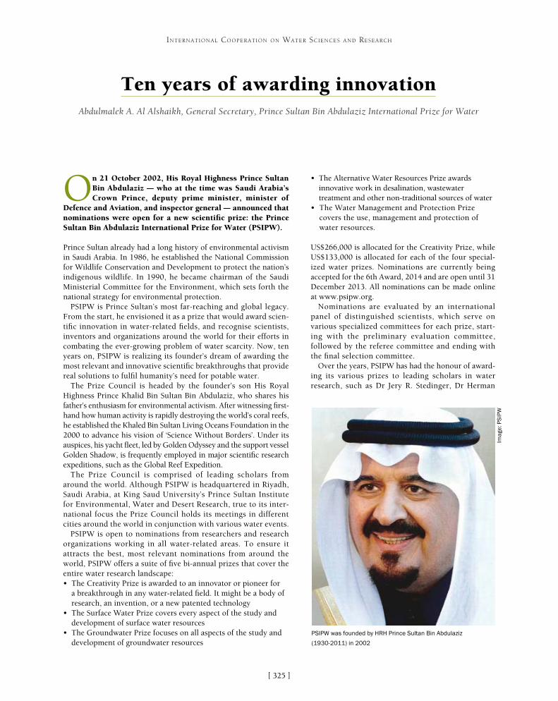
[ ]325
Ten years of awarding innovationAbdulmalek A. Al Alshaikh, General Secretary, Prince Sultan Bin Abdulaziz International Prize for Water
On 21 October 2002, His Royal Highness Prince Sultan Bin Abdulaziz – who at the time was Saudi Arabia’s Crown Prince, deputy prime minister, minister of
Defence and Aviation, and inspector general – announced that nominations were open for a new scientific prize: the Prince Sultan Bin Abdulaziz International Prize for Water (PSIPW).
Prince Sultan already had a long history of environmental activism in Saudi Arabia. In 1986, he established the National Commission for Wildlife Conservation and Development to protect the nation’s indigenous wildlife. In 1990, he became chairman of the Saudi Ministerial Committee for the Environment, which sets forth the national strategy for environmental protection.
PSIPW is Prince Sultan’s most far-reaching and global legacy. From the start, he envisioned it as a prize that would award scien-tific innovation in water-related fields, and recognise scientists, inventors and organizations around the world for their efforts in combating the ever-growing problem of water scarcity. Now, ten years on, PSIPW is realizing its founder’s dream of awarding the most relevant and innovative scientific breakthroughs that provide real solutions to fulfil humanity’s need for potable water.
The Prize Council is headed by the founder’s son His Royal Highness Prince Khalid Bin Sultan Bin Abdulaziz, who shares his father’s enthusiasm for environmental activism. After witnessing first-hand how human activity is rapidly destroying the world’s coral reefs, he established the Khaled Bin Sultan Living Oceans Foundation in the 2000 to advance his vision of ‘Science Without Borders’. Under its auspices, his yacht fleet, led by Golden Odyssey and the support vessel Golden Shadow, is frequently employed in major scientific research expeditions, such as the Global Reef Expedition.
The Prize Council is comprised of leading scholars from around the world. Although PSIPW is headquartered in Riyadh, Saudi Arabia, at King Saud University’s Prince Sultan Institute for Environmental, Water and Desert Research, true to its inter-national focus the Prize Council holds its meetings in different cities around the world in conjunction with various water events.
PSIPW is open to nominations from researchers and research organizations working in all water-related areas. To ensure it attracts the best, most relevant nominations from around the world, PSIPW offers a suite of five bi-annual prizes that cover the entire water research landscape:• The Creativity Prize is awarded to an innovator or pioneer for
a breakthrough in any water-related field. It might be a body of research, an invention, or a new patented technology
• The Surface Water Prize covers every aspect of the study and development of surface water resources
• The Groundwater Prize focuses on all aspects of the study and development of groundwater resources
• The Alternative Water Resources Prize awards innovative work in desalination, wastewater treatment and other non-traditional sources of water
• The Water Management and Protection Prize covers the use, management and protection of water resources.
US$266,000 is allocated for the Creativity Prize, while US$133,000 is allocated for each of the four special-ized water prizes. Nominations are currently being accepted for the 6th Award, 2014 and are open until 31 December 2013. All nominations can be made online at www.psipw.org.
Nominations are evaluated by an international panel of distinguished scientists, which serve on various specialized committees for each prize, start-ing with the preliminary evaluation committee, followed by the referee committee and ending with the final selection committee.
Over the years, PSIPW has had the honour of award-ing its various prizes to leading scholars in water research, such as Dr Jery R. Stedinger, Dr Herman
INTERNATIONAL COOPERATION ON WATER SCIENCES AND RESEARCH
PSIPW was founded by HRH Prince Sultan Bin Abdulaziz
(1930-2011) in 2002
Imag
e: P
SIP
W

[ ]326
INTERNATIONAL COOPERATION ON WATER SCIENCES AND RESEARCH
(mathematical modelling), interpretation of past and present biological records, and field experimentation. The joint Princeton-Lausanne research group, which the two prizewinners built through years of collabo-ration, has produced exemplary work. Some of their research shows how river networks act as ecologi-cal corridors and how they influence the spread of a water-borne disease like cholera, which still plagues society today.
Other 4th Award prize winners included Bart Van der Bruggen (Katholieke Universiteit, Leuven), who won the Alternative Water Resources Prize for his work in the use of nanofiltration membrane technol-ogy for industrial water recycling; and Dr Soroosh Sorooshian (University of California, Irvine), who won the Water Management and Protection Prize for his development and refinement of the Precipitation Estimation from Remotely Sensed Information using Artificial Neural Networks (PERSIANN) system. This is a method that uses artificial neural networks – a form of artificial intelligence – and infrared (GOES IR) and TRMM satellite data to estimate global precipita-tion from remotely sensed data.
Prizewinners for the 5th Award, 2012PSIPW again honoured major water-related innova-tive research in its 5th Award. Dr Ashok Gadgil and his team at the University of California, Berkeley, won the Creativity Prize for developing Electrochemical Arsenic Remediation (ECAR), an innovative and effec-tive method of treating the arsenic contamination of
Bouwer, Dr Howard S. Wheater, Dr Patricia Gober, Dr Wolfgang Kinzelbach and many other prestigious water scientists. In 2010, at its 4th Award, PSIPW reached a turning point in its history when it presented the Creativity Prize for the first time. This newly-inau-gurated prize was shared by two teams of researchers for two very different water-related achievements.
One of the joint prizewinners of the 4th Award was the team of Dr Marek Zreda (University of Arizona) and Dr Darin Desilets (Sandia National Laboratory, United States). They were awarded for their groundbreaking work on the Cosmic Ray Probe, a tech-nology that uses cosmic-ray neutrons to measure soil moisture content and snow pack thickness over an area of tens of hectares – passively, non-invasively and economically. These measurements provide hydrologists and atmospheric scientists with an entirely new perspective on water near the interface between the ground and the atmosphere, as well as giving water managers, engineers and agricul-turalists an invaluable but economical new tool to monitor a critical part of the hydrologic cycle. Before their invention, measuring tech-niques only operated at the point scale (for example, invasive probes inserted into soil or snow) or at the kilometre scale (for example, satellite and airborne remote sensing images). However, many hydrologic processes operate at a scale of tens to hundreds of metres – and it is this critical ‘blind spot’ that the Cosmic Ray Probe reveals.
The second team to share the Creativity Prize was that of Dr Ignacio Rodriguez-Iturbe (Princeton University) and Dr Andrea Rinaldo (École Polytechnique Fédérale de Lausan). They were honoured for inventing and developing the science of Ecohydrology. Bridging the gap between the physical and life sciences, Ecohydrology is a multi-disciplinary research field borrowing from a number of classic disciplines in the physi-cal and life sciences, which aims to achieve a unified picture of water-supported biological dispersion. In practical terms, this new research field presents itself as a comprehensive blend of theory
Imag
e: P
SIP
W
HRH Prince Khaled Bin Sultan Bin Abdulaziz heads the Prize Council of PSIPW
5th Award: focus on arsenic
In 2012, PSIPW recognized two research teams whose work relates to the arsenic contamination of ground water, a crisis threatening the lives of millions of people worldwide – particularly in Bangladesh where it is causing what may be the greatest mass poisoning in human history.
Why is it happening? Dr Charles Franklin Harvey of MIT and Dr Abu Borhan Badruzzaman of the Bangladesh University of Engineering and Technology won the Groundwater Prize for providing the answer. What they found, after a decade of painstaking research, is that a relatively recent shift in geochemical conditions is mobilizing arsenic from the sediments. Though the quantity of arsenic is not particular large in the contaminated areas, a large proportion is being dissolved in the water, creating toxic concentrations. They also learned how land-use changes and groundwater pumping affect arsenic levels. Understanding these processes provides guidance for where wells can be placed and how deep they need to be to extract safe water.
The second critical question is: what can be done to provide safe water for people in affected areas? Dr Ashok Gadgil and his team at the University of California, Berkley won the Creativity Prize for developing an innovative, cost-effective method of treating arsenic contamination using electrocoagulation, ECAR. They did not stop with technological development. They also considered the disposal of wastes and conducted a thorough analysis of ECAR’s implementation in society. The estimated price of safe ground water at four US cents per ten litres is comparatively low and acceptable even for the very poor.

[ ]327
INTERNATIONAL COOPERATION ON WATER SCIENCES AND RESEARCH
groundwater using electrocoagulation. They produced a work of fundamental and applied science running the complete course from initial research to functioning prototype, while addressing one of the most serious drinking water problems confronting the human popu-lation in developing countries. Currently, one in five adult deaths in Bangladesh is caused by chronic arsenic poisoning.
The Surface Water Prize was awarded to Dr Kevin Trenberth and Dr Aiguo Dai of America’s National Centre for Atmospheric Research for groundbreaking work that provides a powerful estimate of the effects of climate change on the global hydrological cycle, with a clear explanation of the global water budget.
The Groundwater Prize was awarded to Dr Charles Franklin Harvey (Massachusetts Institute of Technology) and Dr Abu Borhan Mohammad Badruzzaman (Bangladesh University of Engineering and Technology) for developing a complete diagnostic and concep-tual model for understanding the arsenic contamination of ground water. In doing so, they have answered a major puzzle in ground-water hydrology and more generally demonstrated how complex natural systems can be understood.
Dr Mohamed Khayet Souhaimi (University Complutense, Madrid) won the Alternative Water Resources Prize for his work in pioneering and promoting membrane distillation for water recovery using alternative renewable energy sources. This process is relevant both for water recovery from alternative sources (not only sea water but also concentrates from industrial production) and energy-friendly separation processes (using waste heat, for example). The process is now being used for large-scale applica-tions in Singapore and elsewhere. In many other countries, plans for using this or related processes are mushrooming.
Dr Damià Barceló (Catalan Institute for Water Research, Spain) won the Water Management and Protection Prize for work at the leading edge of water science in understanding the effect of pharma-ceuticals in the water environment. He also developed new methods for future risk assessment and the management of emerging contami-nants, as well as for the investigation of water quality in intensively used basins. Dr Barceló’s research demonstrates that a broad spectrum of pharmaceuticals act as widespread pollutants in aquatic environ-ments and shows that wastewater treatment plant outlets are major
contributors to the problem. At the same time, his work highlights how the final treatment steps in these plants can considerably reduce the load of pharmaceuticals pollutants in outlets prior to their release, paving the way for more effective treatment processes to control the adverse impact of pharmaceutical pollutants.
PSIPW evaluation procedure
Source: PSIPW
Preliminary screening
Evaluation Approval
Originality
Applicability
Potential impact
50%
20%
30%
Alignment with PSIPW vision
Integrity of evaluation process
Legitimacy of nominator according to guidelines
Eligibility criteria for nominee
Sufficient quality to warrant being evaluated
PSIPW’s other activities
PSIPW is a non-profit, non-governmental organization and though its primary purpose is to encourage scientific innovation through its suite of prizes, it also promotes a wide range of innovative water-related work around the world. Among its most important activities are the following:• PSIPW is an observing member of the United Nations’
Committee on the Peaceful Uses of Outer Space, which holds bi-annual meetings in Vienna
• PSIPW is a member of the Arab Water Council’s Board of Governors, and as such actively participates in all of the council’s meetings and conferences. It also provides support for some of the Arab Water Council’s activities
• PSIPW provides financing and support for the Prince Sultan Bin Abdulaziz International Prize’s Chair for Water Research located at the Prince Sultan Institute for Environmental, Water and Desert Research
• In cooperation with the United Nations, PSIPW has recently established the International Water Portal (http://water-portal.com), which aspires to become the world’s largest international interactive database for water research and will provide extensive networking opportunities for experts and organizations working in the field
• PSIPW, along with King Saud University and the Saudi Ministry of Water and Electricity, organizes the International Conference on Water Resources and Arid Environments bi-annually, in conjunction with the PSIPW awards ceremony
• PSIPW, in conjunction with the United Nations and other international organizations, arranges the International Conference on the Use of Space Technology for Water Management, which is held in various countries around the world.

[ ]328
I. Water Diplomacy
Transboundary water cooperationThe author thanks colleagues in the UNECE Water Team: Sonja Koeppel, Iulia Trombitcaia, Alisher Mamadzhanov, Chantal Demilecamps and others.
Greater cooperation through water diplomacy and transboundary water managementIn addition to the authors, we are grateful for contributions from Claire Warmenbol and Rebecca Welling from the Global Water Programme, IUCN.
From the Dead Sea to an Israel/Palestine Water Accord: 20 years of water diplomacy in the Middle East1. UNESCO Makes the Case for Water Diplomacy – Press Release from the UNESCO
Website, 25/4/2012: http://www.unesco.org/new/en/media-services/single-view/news/unesco_makes_the_case_for_water_diplomacy/. Accessed 15/07/2013.
2. Lawrence Susskind, Shafiqul Islam. ‘Water Diplomacy: Creating Value and Building Trust in Trans Boundary Water Negotiations’, in: Science and Diplomacy, Vol. 1, No. 3 (September 2012).
For more information visit www.foeme.org.
Transboundary water diplomacy in the Mekong region For further Mekong reading, from which this chapter is drawn, see:- Dore J and Lazarus K (2009) ‘Demarginalizing the Mekong River Commission’ in
F Molle, T Foran and M Käkönen (eds.) Contested Waterscapes in the Mekong Region: Hydropower, Livelihoods and Governance. Earthscan, London, 357-382.
- Dore J and Lebel L (2010) ‘Deliberation and scale in Mekong Region water governance’, Environmental Management 46:1, 60-80.
- Dore J, Lebel L and Molle F (2012) ‘A framework for analyzing transboundary water governance complexes, illustrated in the Mekong Region’, Journal of Hydrology 466-467, 23-36.
- ICEM (2010) MRC Strategic Environmental Assessment of Hydropower on the Mekong Mainstream. Produced for Mekong River Commission by ICEM (International Centre for Environmental Management). http://www.mrcmekong.org/ish/SEA.htm.
- M-POWER (2011) M-POWER Strategic Guide 2011: Action-researchers, dialogue facilitators, knowledge brokers. Mekong Program on Water Environment and Resilience, Vientiane, 15. www.mpowernetwork.org.
- Save the Mekong coalition: www.savethemekong.org.
The Nile Basin Initiative: Advancing transboundary cooperation and supporting riparian communities1. NBI Shared Vision reads: “To achieve sustainable socioeconomic development through
the equitable utilization of and benefit from the common Nile Basin Water resources”.
II. Transboundary Water Management
Cooperation over transboundary aquifers: lessons learned from 10 years of experienceKirstin Conti is a PhD Research Fellow with the Amsterdam Institute of Social Science Research at University of Amsterdam and the International Groundwater Resources Assessment Centre (IGRAC).
Transboundary water management – why it is important and why it needs to be developedThis paper is based on and has partly been published as the background paper prepared by Anders Jägerskog as part of UNDP Shared Waters Partnership Programme work for the Ministerial Roundtable on Transboundary Waters at the World Water Forum in Marseille, France, 13 March 2012.1. www.unwater.org/water-cooperation-2013/water-cooperation/facts-and-figures/en.2. UNDP (2006), ‘Beyond scarcity: Power, poverty and the global water crisis’,
Human Development Report (NY: UNDP).3. Phillips, D.J.H., M. Daoudy, J. Öjendal, S. McCaffrey and A.R. Turton. (2006).
Trans-boundary Water Cooperation as a Tool for Conflict Prevention and Broader Benefit-Sharing. Stockholm: Swedish Ministry for Foreign Affairs.
4. Earle, A., Jägerskog, A. and Öjendal J., Eds., (2010) Transboundary Water Management: Principles and Practice. Earthscan, London (July 2010).
5. Zeitoun, M and Jägerskog, A. (2011), Addressing Power Asymmetry: How Transboundary Water Management May Serve to Reduce Poverty, Report Nr 29, SIWI, Stockholm.
6. Zeitoun, M, and N. Mirumachi (2008) ‘Transboundary water interaction 1. Reconsidering conflict and cooperation’. International Environmental Agreements 8: 297-316.
7. Granit, J. and Claasen, M (2009) ‘A path towards realising tangible benefits in transboundary river basins’, in Jägerskog, A and Zeitoun, M. Getting Transboundary Water Right: Theory and Practice for Effective Cooperation, Report Nr 25, SIWI, Stockholm.
8. Zeitoun and Mirumachi (2008) op. cit.9. Earle, A. et al (2010) op. cit.10. Zeitoun and Mirumachi (2008) op. cit.11. Zeitoun, M and Jägerskog, A. (2011) op. cit.12. Falkenmark M., and Jägerskog, A., (2010) ‘Sustainability of Transnational Water
Agreements in the Face of Socio-Economic and Environmental Change’ in Earle, A., Jägerskog, A. and Öjendal, Eds., (2010) Transboundary Water Management: Principles and Practice. Earthscan, London (July 2010).
13. Cotula, L. (2011), Land deals in Africa: What is in the contracts?, (London: IIED).14. Jägerskog, A., Cascao, A., Hårsmar, M. and Kim. K., (2012), Land Acquisitions:
How Will They Impact Transboundary Waters? Report Nr. 30, SIWI, Stockholm.15. Allan, J.A (2011), Virtual Water: Tackling the Threat to Our Planet’s Most Precious
Resource (London: I.B.Tauris).16. Mekong 2 Rio Message: www.mrcmekong.org/assets/Events/Mekong2Rio/Final-
Mekong2Rio-Message.pdf.17. Nicol, A., van Steenbergen, F. et al., Transboundary Water Management as an
International Public Good, Development Financing 2000 Study 2001:1 (Stockholm: for the Swedish Ministry for Foreign Affairs, 2001).
18. Jägerskog, 2003.19. Jägerskog, 2003.20. Phillips, D.J.H., M. Daoudy, J. Öjendal, S. McCaffrey and A.R. Turton. (2006) op. cit.21. Jägerskog, 2007.22. Öjendal J., Earle, A. and Jägerskog, A. (2010), ‘Towards an Conceptual
Framework for Transboundary Water Management’ in Earle, A., Jägerskog, A. and Öjendal, Eds., (2010) Transboundary Water Management: Principles and Practice. Earthscan, London (July 2010).
Further reading:- Zeitoun, M. and Jägerskog, A. (2009) ‘Confronting Power: Strategies to Support
Less Powerful States’ in Jägerskog. A, and Zeitoun, M. (editors, 2009) Getting Transboundary Water Right: Theory and Practice for Effective Cooperation. Report Nr. 25. SIWI, Stockholm.
Cooperation on small rivers can make a difference1. IWMI: www.iwmi.cgiar.org.2. Regional Program for Sustainable Agricultural Development in Central Asia and
the Caucasus: http://cac-program.org/news.asp?id=257.3. CGIAR research centres: www.cgiar.org/cgiar-consortium/research-centers.4. IWMI in Central Asia: http://centralasia.iwmi.org.5. Oregon State University, International Freshwater Treaties Database: www.
transboundarywaters.orst.edu/database/interfreshtreatdata.html.6. Solving a Rubik’s Cube: Water and security in Central Asia: www.iwmi.cgiar.org/
News_Room/Archives/Water_and_Security_in_Central_Asia.7. www.transboundarywaters.orst.edu/database/interfreshtreatdata.html.
Efficient and effective cooperation in the River Rhine catchment1. CHR is a permanent, autonomous international commission, registered as a
foundation in the Netherlands. Its presidency alternates between the member states. In 2012, Professor Hans Moser of the Federal Institute of Hydrology in Koblenz, Germany, took over the presidency from Professor Manfred Spreafico of Switzerland, who had been President for 22 years. The CHR secretariat is permanently financed and hosted by the Netherlands and is carried out by Rijkswaterstaat in Lelystad. Each member state is represented by one official representative from a national hydrological institute. If desired, each country can delegate other representatives, for example from research institutes. CHR members meet twice a year to discuss selected themes in detail, with the venue alternating between member states. The secretary of the International Commission for the Protection of the River Rhine (ICPR) and a WMO representative are invited to attend the meetings as observers, and CHR members take part in ICPR working or expert groups. Please contact the CHR secretariat for further information: [email protected].
2. From Jörg Uwe Belz, The discharge regime of the Rhine and its tributaries in the 20th century – Analysis, Changes, Trends: http://www.khr-chr.org/files/Extended_Abstract_I_22_E.pdf.
3. UNESCO-IHP report at: http://www.irtces.org/isi/isi_document/coming_event_ISI_LAC.pdf.
4. The United Nations Environment Programme evaluation report dating from October 2011 is available at: http://www.unep.org/eou/Portals/52/Reports/Bermejo_TE_Final_Report.pdf.
Notes and References
[ ]329
5. See final report at: http://www.khr-chr.org/files/CHR_I-23.pdf.6. The results and recommendations of these events are available through the CHR
website: www.chr-khr.org.
Sharing water in Australia: a collaborative endeavour1. Australian Bureau of Statistics 2008, Water and the Murray-Darling Basin – A
Statistical Profile, 2000–01 to 2005–06, Catalogue 4610.0.55.007, ABS.2. Land and Water Australia (2001), Australian Water Resources Assessment 2000.
Surface water and groundwater — availability and quality, Canberra, p iv.3. Organisation for Economic Co-operation and Development. OECD environmental
performance review 2007. Paris: OECD, 2008.4. State of the Environment 2011 Committee. Australia state of the environment
2011. Independent report to the Australian Government Minister for Sustainability, Environment, Water, Population and Communities. Canberra: DSEWPaC, 2011.
Regional water cooperation in the Hindu Kush Himalayan region: challenges and opportunitiesSuggested reading:- Babel, MS; Wahid, SM (2011) ‘Hydrology, management and rising water
vulnerability in the Ganges-Brahmaputra-Meghna River basin.’ Water International 36 (3): 340-356.
- Bajracharya, SR; Shrestha, B (eds) (2011) The status of glaciers in the Hindu Kush-Himalayan region. Kathmandu, Nepal: ICIMOD.
- Bolch, T, Kulkarni, A, Kaab, A, Huggel, C, Paul, F, Cogley, JG, Frey, H, Kargel, JS, Fujita, K, Scheel, M, Bajracharya, S and Stoffel, M (2011) ‘The state and fate of Himalayan glaciers.’ Science 336 (6079): 310-314.
- Crow, B, Singh, N (2009) ‘The management of international rivers as demands grow and supplies tighten: India, China, Nepal, Pakistan, Bangladesh.’ India Review 8: 306-339.
- Rangachari, R and Verghese, BG (2001) ‘Making water work to translate poverty into prosperity: The Ganga-Brahmaputra-Barak region.’ In Ahmad, QK, Biswas, Asit K, Rangachari, R; Sainju, MM (eds), Ganges-Brahmaputra-Meghna region: A framework for sustainable development, pp 81-142. Dhaka, Bangladesh: The University Press Limited.
- Shrestha AB (2008) ‘Climate change in the Hindu Kush-Himalayas and its impacts on water and hazards.’ ICIMOD APMN Bulletin (Newsletter of the Asia Pacific Mountain Network) 9: 1-5.
- Vaidya, R (2012) ‘Water and hydropower in the green economy and sustainable development of the Hindu Kush-Himalayan region.’ Hydro Nepal: Journal of Water, Energy and Environment 10: 11-19.
The Mekong River Basin: practical experiences in transboundary water managementThis article is the opinion of the author and does not necessarily reflect the MRC member countries’ views on the issues discussed. The author would also like to acknowledge the input of Ton Lennarts of the BDP and Lieven Geerinck of NAP.
Mankind on the shores of Baikal: the transboundary ecosystem of Russia and Mongolia1. Timoshkin, O. A. ‘Lake Baikal: diversity of fauna, problems of its non-miscibility
and origin, ecology, and “exotic” groups’: Annotation list of Lake Baikal’s fauna and its catchment basin. Novosibirsk: Science (2001) 1:1. 17-73.
2. Transboundary Diagnostic Analysis of Baikal Lake Basin, April 2013.
Libya’s experience in the management of transboundary aquifers- CEDARE. 2001. Regional Strategy for the Utilization of the Nubian Sandstone
Aquifer System. Draft Final Report.- OSS. 2002. Systeme Aquifere du Sahara Septentrional. Definition ET Realization
des simulations exploratoires.- Salem, O. 2007. ‘Management of Shared Groundwater Basins in Libya’. African
Water Journal, Vol.1, No.1.- Salem, O. 2008. Transboundary Aquifer Resources Management – General
Overview and Objectives of the Conference. 3rd International Conference on Managing Shared Aquifer Resources in Africa; Tripoli 25-27 May 2008.
- Salem, O. 2010. Challenges Facing the Management of Shared Aquifers. ISARM 2010 International Conference on Transboundary Aquifers – Challenges and New Directions. Paris 6-8 December 2010.
- UN General Assembly. 2009. The Law of Transboundary Aquifers, A/Res/63/124.
Transboundary groundwater resources management implemented in the Kumamoto region of Japan1. Shimada, J. (2008): ‘Sustainable management of groundwater resources for over
700,000 residents in Kumamoto area, Japan’. Proceedings of Symposium on Integrated Groundwater Sciences and Human Well-being, 36th IAH, Toyama, Japan, 104-111.
2. Kumamoto Prefecture (2009): Integrated Groundwater Reserve Management Plan. Digest Edition, 15p. (in Japanese).
3. Shimada, J. (2008). Op. cit.4. Kumamoto Prefecture (2009). Op. cit.5. Kumamoto City (2008): Groundwater Recharge Project using Rice Paddy Fields.
Pamphlet, 5p. (in Japanese).6. Endo, T. (2011): Public policy in connection with groundwater. Taniguchi, M. ed.
Groundwater Flow, Kyoritsu Shuppan, Tokyo, 204-221. (in Japanese).Further reading:- Shimada, J. (2011): ‘Groundwater flow in Monsoon Asia’. Taniguchi, M. ed.
Groundwater Flow, Kyoritsu Shuppan, Tokyo, 1-24. (in Japanese).- Japan Geotechnical Consultants Association (2008): Basic Concept on Sustainable
Utilization of Groundwater in the Urban Area. Pamphlet, 4p.
Transboundary water management in the Zambezi and Congo river basins: a situation analysis- Chenov CD (1978) Groundwater Resources Inventory of Zambia. Unesco /Norad
Water Zambia, pp. 1–21.- CMMU (1997) Community Management and Monitoring Report: National
water point inventory and water point database. Ministry of Energy and Water Development, Lusaka, Zambia.
- Government of the Republic of Zambia MEWD (1994, 2010) National Water Policy, Lusaka, Zambia.
- Government of the Republic of Zambia MACO (2003) Strategic plan for Irrigation Development, Period 2002-2006, Lusaka, Zambia.
- Government of the Republic of Zambia MFNP (2006) Fifth National Development Plan, Period 2006-2010, Lusaka, Zambia.
- JICA (1995) The Study on the National Water Resources Master Plan in The Republic of Zambia. Ministry of Energy and Water Development, YEC. Vol. 1–3.
- NWASCO (2005-2011) Urban and Peri-urban Water Supply and Sanitation Sector Reports, Lusaka, Zambia.
- WRAP (2003) Report on the National Water Resources Action Programme Consultative Forum: The Proposed Institutional and Legal Framework for the Use, Development and Management of Water Resources in Zambia, Ministry of Energy and Water Development, Water Resources Action Programme, Lusaka, Zambia, pp. 2–87.
- WRAP (2003) Groundwater Management in Zambia, Discussion paper. Ministry of Energy and Water Development, Water Resources Action Programme, Lusaka, Zambia.
- WRAP (2005) Zambia Water resources Management Sector Report for 2004, Water Resources Action Programme, Ministry of Energy and Water Development, Zambia, pp. 1–37.
- World Bank (2009) Zambezi River Basin Multi-Sector Investment Opportunities Analysis, Preliminary Report.
Interactive open source information systems for fostering transboundary water cooperation1. www.inweb.gr.2. Mantziou D. and Gletsos, M. (2011) The Development of Transboundary
Cooperation in the Prespa Lakes Basin In: Ganoulis J. et al. (eds) Transboundary Water Resources Management: A Multidisciplinary Approach, WILEY-VCH, Weinheim, pp 247-253.
3. Ganoulis, J., Skoulikaris, H., and Monget, J.M. (2008) Involving Stakeholders In Transboundary Water Resources Management: The Mesta/Nestos ‘HELP’ Basin, Water SA Journal, Vol. 34 No. 4 (Special HELP edition), pp 461-467.
Selected bibliography:- Ganoulis J., Aureli, A. & J. Fried (eds) (2011) Transboundary Water Resources
Management: A Multidisciplinary Approach, WILEY-VCH, Weinheim, 446 p.- INWEB (2008) Inventories of Transboundary Groundwater Aquifers in the Balkans,
UNESCO Chair and Network INWEB, Thessaloniki, Greece www.inweb.gr.- UN WWDR (2006) Water: a shared responsibility, UNESCO Publishing, 7, Place
de Fontenoy, Paris ISBN: 92-3-104006-5. www.unesco.org/water/wwap/wwdr.- UN WWDR (2009) Water in a changing world, UNESCO Publishing, 7, Place de
Fontenoy, Paris ISBN: 978-9-23104-095-5. www.unesco.org/water/wwap/wwdr.- World Bank (1987) Water Resources Management in South Eastern Europe,
Volume I, Issues and Directions.
Notes and References
[ ]330
III. Water Education and Institutional Development
Capacity development for water cooperation1. UN-Water website: www.unwater.org.2. International Year of Water Cooperation 2013 website: www.
watercooperation2013.org.3. Ardakanian, R., Sewilam, H., and Liebe, J. (eds), 2012, Mid-Term Proceedings
on Capacity Development for the Safe Use of Wastewater in Agriculture. A Collaboration of UN-Water Members & Partners: Midterm proceedings.
4. Further information on this multi-year project can be found at www.ais.unwater.org/wastewater.
5. Bryant, E.A., 1991, Natural Hazards, Cambridge University Press, Cambridge, England.6. Wilhite, D. A., 2011, ‘National Drought Policies: Addressing impacts and societal
vulnerability’, in Sivakumar, M. V. K., Motha, R. P., Wilhite, D. A., and Qu, J. J., 2011 (eds.), Towards a Compendium on National Drought Policy: Proceedings of an expert meeting, July 14-15, 2011, Washington DC., USA.
7. Dai A., Trenberth, K.E., and Qian, T, 2004, ‘A global set of Palmer Drought Severity Index for 1870 to 2002: Relationship with soil moisture and effects of surface warming,’ in Journal of Hydrometeorology 5:1117-1130.
8. Sivakumar, M. V. K., Motha, R. P., Wilhite, D. A., and Qu, J. J., 2011 (eds.), Towards a Compendium on National Drought Policy: Proceedings of an expert meeting, July 14-15, 2011, Washington DC., USA.
9. Further reading at www.ais.unwater.org/droughtmanagement.
Coping with extreme weather and water-related disasters1. Takara, K. and H. Hayashi, ‘Extreme Weather and Water-Related Disasters: A Key
Issue for the Sustainability and Survivability of Our Society,’ Journal of Disaster Research, Fuji Technology Press, Tokyo, Japan, Vol. 8, No. 1, pp. 3-6, 2013.
2. See www.waterforum.jp/en/what_we_do/pages/grass_roots_activities.php#fund.3. United Nations Educational, Scientific and Cultural Organization (UNESCO),
International Hydrological Programme (IHP) Eighth Phase ‘Water Security: Responses to Local, Regional, and Global Challenges’ Strategic Plan, IHP-VIII 2014-2021, Final Version, August 2012.
4. Takara, K., ‘Sustainability/Survivability Science for a Resilient Society Adaptable to Extreme Weather Conditions,’ Asian Journal of Environment and Disaster Management, Research Publishing Services, Vol. 3, No. 2, pp. 123-136, 2011.
The Regional Centre for Training and Water Studies of Arid and Semi-arid Zones1. International Irrigation Management Institutes, Sri Lanka An Action Plan for
Strengthening Irrigation Management in Egypt. Final Report, 1995.2. Ministry of Water Resources and Irrigation, WPRP/USAID Water Policy Review
and Integration Study. Working Paper, 2002.3. The World Bank USAID, Irrigation Training in the Public Sector, 1989.4. Ministry of Water Resources and Irrigation, Training Needs Assessment Study
(Phase 1), Egypt, Water Policy Reform project, Report No. 73, 2003.5. Regional Center for Training and Water Studies, National Training Plan 2009-2010.
HidroEX Foundation – an example of water cooperation1. HidroEX is a UNESCO Category II Center formally approved in October 2009
and currently under development in the City of Frutal, Minas Gerais, Brazil. It will eventually offer post graduate education to students from Brazil, Latin America and Portuguese-speaking African nations in-line with the overall guidelines of the IHP and in coordination with UNESCO-IHE, Delft, the Netherlands.
2. UNESCO, International Hydrological Programme. 2012. Draft Strategic Plan of the Eighth Phase of the IHP (2014-2021), IHP/IC-XX/Inf.4. Paris, 4-7 June.
Application of water directives in small settlements1. Water Framework Directive: Directive 2000/60/EC; Floods Directive: Directive
2007/60/EC; Renewable Energy Directive: Directive 2009/28/EC.2. Urban Waste Water Treatment Directive: Directive 91/271/EEC.
Speaking so that people understand: integrated water resources management in Guatemala1. Colom, E. 2004 The State of Water in the Naranjo River Basin, in press.2. Morataya, M., Pérez, O. 2007 Action plans for the municipalities of the Upper
Naranjo River Basin, 150 pp.3. Aragón, G. 2006 Governance Report of the components under the project ‘Integrated
Management of Water Resources in the top of the Naranjo River Basin’, in press.4. Herrera, N. 2007. Strategic Plan for the Natural Resources Coordinator of San
Marcos. 30 pp.5. Restrepo, I. 2001 Team Learning Projects and Demonstration, CINARA /
UNIVALLE Cali, Colombia.
Further reading:- Gil Joram, 2011 Strategy for the construction of the organizational framework for
the water management in the upper part of the Naranjo River Basin.- Mux, V. 2006. Narrative Report for the Embassy of the Kingdom of the Netherlands
in the framework of the project ‘Integrated Water Resources Management’.- Mux Caná, V. L.; Tovar, R.; Orozco, J. 2007 Building from the grassroots the
guiding framework and management models for water and sanitation, Tikalia, FAUSAC.
- Orozco, E. 2007 Hydrological Study of the Upper Naranjo River Basin.
Integrated water resources management in Peru through shared vision planning1. ‘To the barricades: The politics of non-stop protest’. The Economist. 4
December 2008.2. Lorie, M.A. and Cardwell, H.E. 2006. ‘Collaborative Modeling for Water
Management’. Southwest Hydrology. July/August 2006. pp26-27.3. Congreso del Peru 2009. Ley de Recursos Hídricos, Ley N° 29338. Mar, 2009.
IV. Financing Cooperation
Regional cooperation in the water and sanitation sector: Latin America and the Caribbean1. The term ‘region’ refers to the Latin American and Caribbean countries, including
IDB non-member countries.2. The MDGs consider safe or improved sources of drinking water to be piped water
services (piped connections to a dwelling, plot or yard and other improved sources protected from outdoor contamination, such as taps or public water sources, borehole or drilled wells, protected dug wells, protected sources and rainwater collection.
3. Improved sanitation includes facilities that ensure hygienic separation of human excreta from human contact. Among them: a toilet/latrine with a tank or siphon connected to a piped sewer system, a septic tank or a pit latrine; a ventilated improved pit latrine; a pit latrine with slab; a composting toilet.
4. Perroni, Alejandra et.al, Drinking water, sanitation and the Millennium Development Goals in Latin America and the Caribbean.
5. Water and Sanitation Initiative of the Inter-American Development Bank, 2007. Available at: iadb.org/water.
6. The Fund has two windows. One of them is directly managed by the Spanish Agency for International Cooperation for Development (AECID) with the recipient countries, and the other one is managed by IDB on behalf of the Spanish Government.
7. Headquarters and field offices of AECID and IDB and executing entities.8. US$ 581 million of contribution of the donation fund, US$ 342 million of loans
granted by IDB and US$ 196 million of local contributions.
Governance for cooperation and successful watershed conservation strategies: the Water Funds case1. www.unwater.org/statistics_pollu.html.
V. Legal Framework at the
National/International Level
Integrated water resource management – combining perspectives from law, policy and scienceThe chapter by the Dundee Centre for Water Law, Policy and Science is based on a Policy Brief prepared for and funded by the UK National Commission for UNESCO.
Community benefits achieved through developing legal frameworks at domestic and transboundary levels1. S. Burchi, M. Nanni, ‘How groundwater ownership and rights influence groundwater
intensive use management’, in Intensive Use of Groundwater – Challenges and Opportunities, R. Llamas and E. Custodio editors, Balkema, 2003, p. 230.
2. S. Hendry, ‘The implementation of the Groundwater Directive in Spain – Legal Analysis of the GENESIS case study’, in The Journal of Water Law, vol.22, issue 4 (2011), p. 166.
3. J. Razzaque, ‘Public participation in water governance’, in The Evolution of the Law and Politics of Water, J. Dellapenna, J. Gupta editors, Springer, 2008, p. 362-363.
4. G. de los Cobos, ‘Transboundary water resources and international law: the example of the aquifer management of the Geneva region (Switzerland and
Notes and References
[ ]331
France)’, in International Law and Freshwater – The Multiple Challenge, L. Boisson de Chazournes, C. Leb, and M. Tignino editors, Elgar, 2013, p. 179-195.
5. U. Alam, ‘India and Pakistan’s truculent cooperation: can it continue?’, in International Law and Freshwater – The Multiple Challenge, L. Boisson de Chazournes, C. Leb, and M. Tignino editors, Elgar, 2013, p. 420.
6. M. M. Mbengue, ‘The Senegal River legal regime and its contribution to the development of the law of international watercourses in Africa’, in International Law and Freshwater – The Multiple Challenge, L. Boisson de Chazournes, C. Leb, and M. Tignino editors, Elgar, 2013, p. 217-236.
New approaches to planning and decision-making for fresh water: cooperative water management in New Zealand1. Howard-Williams, C., R. Davies-Colley, K. Rutherford and R. Wilcock (2011)
‘Diffuse pollution and freshwater degradation: New Zealand Perspectives’ in Plenary Proceedings of the IWA Diffuse Pollution Conference, Quebec, Canada, Sept 2010. OECD, and reprinted in 2012 in Water 172, 56-66.
2. New Start for Fresh Water, (2009). New Zealand Government decision paper – Ministry for the Environment: www.mfe.govt.nz/issues/water/freshwater/new-start-fresh-water.html.
3. KPMG Agribusiness Agenda: Realising global potential (2010): www.kpmg.com/NZ/en/IssuesAndInsights/ArticlesPublications/agribusiness-agenda/Documents/Agribusiness-Agenda-2011.pdf.
4. Land and Water Forum (2010). Land and Water Forum First Report: Fresh start for fresh water: www.landandwater.org.nz.
5. Salmon, G W (2007). ‘Collaborative governance for sustainable development: Lessons from the Nordic countries’. NZ Surveyor 297, 36-40.
6. Land and Water Forum (2012). Land and Water Forum Second Report: Setting limits for water quality and quantity; Freshwater policy and plan-making through collaboration: www.landandwater.org.nz.
7. Land and Water Forum (2012). Land and Water Forum Third Report: Managing water quality and allocating water: www.landandwater.org.nz.
8. CWMS (2009). Canterbury Water Management Strategy: Strategic Framework. Published by Canterbury Mayoral Forum and Environment Canterbury: www.ecan.govt.nz.
9. CWMS (2009). Canterbury Water Management Strategy: Strategic Framework. Ibid.
10. Environment Canterbury (2011). Canterbury water – the regional context. Supporting the Canterbury Water Management Strategy: www.ecan.govt.nz/get-involved/Canterbury water/Key documents/Pages/CWMS.aspx.
The US-Mexico institutional arrangement for transboundary water governance1. US Chamber of Commerce (2010) Steps to a 21st Century U.S.-Mexico Border. A
U.S. Chamber of Commerce Border Report.2. Aparicio J., Ortega E., Hidalgo J., Aldama A. (2009) Water resources in the
northern border. Mexican Institute of Water Technology. Mexico. (In Spanish).3. Utilization of waters of the Colorado en Tijuana Rivers and of the Rio Grande
Treaty between the United States and Mexico. Signed at Washington February 3, 1944, and Protocol signed at Washington November 14, 1944. Treaty Series 994, US Dept. of State. US Government printing office. Washington 1946.
4. EPA (2013). US-Mexico Border Water Infrastructure Program. Annual Report 2012. United States Environmental Agency. EPA-830-R-13-001.
VI. Water Cooperation, Sustainability
and Poverty Eradication
Managing water: from local wisdom to modern science1. Geertz,1972; Lansing, 1991; Pitana, 1993; Sutawan, 2000.
Water for life: inspiring action and promoting best practices in local cooperation1. Butterworth et al, 2007.2. Source: Sanz, M. & Osorio, L. (2011).3. Source: ECODES, Zaragoza, Spain.
International water cooperation1. Fishman, Charles. The big thirst: the secret life and turbulent future of water.
New York: Free Press, 2011.2. Barcelona forced to import emergency water, http://www.guardian.co.uk/
world/2008/may/14/spain.water (accessed 26 July 2003).
3. Global Trends 2030: Alternative Worlds, National Intelligence Council. http://info.publicintelligence.net/GlobalTrends2030.pdf (accessed 26 July 2003).
4. ‘IEA - Water-Energy Nexus’. IEA - World Energy Outlook. http://www.worldenergyoutlook.org/resources/water-energynexus/ (accessed 26 July 2013).
5. Food and Agriculture Organization of the United Nations. FAO Statistical Yearbook 2013. FAO.org. http://www.fao.org/docrep/018/i3107e/i3107e00.pdf (accessed 26 July 2013).
6. 24 May 2013 # Climate Damage Costs http://news.nationalgeographic.com/news/2013/13/130524-australia-extreme-weather-climate-change-heat-wave-science-world.
7. 15 March 2013 # Water Crisis Loss http://m.upi.com/story/UPI-67421363375974.
8. 13 April 2013 # Climate Food Starvation Agriculture m.guardian.co.uk/global-development/2013/apr/13/climate-change-millions-starvation-scientists.
9. World confronts serious water crisis, former heads of government and experts warn in new report. InterAction Council. http://www.interactioncouncil.org/world-confronts-serious-water-crisis-former-heads-government-and-experts-warn-new-report (accessed 26 July 2013).
10. World Economic Forum. Global Risks 2013 Eighth Edition. World Economic Forum Insight Report. http://www3.weforum.org/docs/WEF_GlobalRisks_Report_2013.pdf (accessed 26 July 2013).
11. ‘Transboundary waters/International Decade for Action “Water for Life” 2005-2015.’ Welcome to the United Nations: It’s Your World. http://www.un.org/waterforlifedecade/transboundary_waters.shtml (accessed 26 July 2013).
12. Transboundary Waters Programme. United Nations Development Programme. http://www.undp.org/content/undp/en/home/ourwork/environmentandenergy/focus_areas/water_and_ocean_governance/transboundary-waters (accessed 26 July 2013).
13. ‘Transboundary waters/International Decade for Action “Water for Life” 2005-2015’ op cit.
14. Office of the Director of National Intelligence. Global Water Security. Intelligence Community Assessment. https://s3.amazonaws.com/s3.documentcloud.org/documents/327371/report-warns-that-water-shortages-could-threaten.pdf (accessed 26 July 2013): ii.
15. ‘Global Water Security’ Intelligence Community Assessment ICA 2012-08, 2 February 2012. http://www.hydrology.nl/images/docs/alg/2012.03_Global_Water_Security.pdf.
16. Clapper, James R. Worldwide Threat Assessment of the US Intelligence Community. Senate Select Committee on Intelligence. http://www.circleofblue.org/waternews/wp-content/uploads/2013/03/DNI_threat-assessment-2013.pdf (accessed 26 July 2013).
17. van der Veen, ‘L’etat du Rhin’, Report of the Conference interparlementaire sur la pollution du Rhin 10 (24-25February 1977) in Kiss, Alexandre ‘The protection of the Rhine against pollution’. Natural Resources Journal, Vol 25, July 1985 – see http://lawlibrary.unm.edu/nrj/25/3/03_kiss_protection.pdf.
18. Kiss, Alexandre ‘The protection of the Rhine against pollution’. Natural Resources Journal, Vol 25, July 1985 – see http://lawlibrary.unm.edu/nrj/25/3/03_kiss_protection.pdf.
Assessment of Lebanon’s shared water resources and the need for effective cooperation1. Beydoun, Z., 1977. Petroleum prospects of Lebanon: re-evaluation. American
Association of Petroleum Geologists, 61, 43-64.2. Shaban, A. 2003. Etude de l’hydroélogie au Liban Occidental: Utilisation de la
télédétection. PhD dissertation. Bordeaux 1 Université. 202p.3. Shaban, A. 2011. ‘Analyzing climatic and hydrologic trends in Lebanon’. Journal
of Environmental Science and Engineering, No.3, Vol. 5, 2011.4. ADB (Asian Development Bank). 2008. Shared water resources. Whose
water, available at: http://www.bgr.bund.de/nn_459046/EN/Themen/TZ/Politikberatung__GW/Downloads/klingbeil__transboundarygw,templateId=raw,property=publicationFile.pdf/klingbeil_transboundarygw.pdf.
5. Shaban, A. and Douglas, E. 2008. Transboundary water resources of Lebanon: Monitoring and assessment. Regional Meeting on Water in the Mediterranean Basin. University of Near East. Lefkosa. North Cyprus, 9-11/10/2008.
6. Comair, F. 2008. ‘Gestion et hydroplomatic de l’eau au Proche-Orient’. L’Orient du Jour.
Alternative water resources in agriculture for improving production and poverty reduction1. Stenhouse J. and Kijne J. W. (2006). Prospects for productive use of saline water
in West Asia and North Africa. Comprehensive Assessment Research Report no.11. Colombo, Sri Lanka: Comprehensive Assessment Secretariat.
2. ICBA: www.biosaline.org.ae.
Notes and References

[ ]332
Managing water, sustainability and poverty reduction through collective community action1. Falkenmark M, Rockstrom J (2004) Balancing Water for Humans and nature,
Earthscan Publications, London.2. Rockstrom J, Nuhu Hatibu, Theib Oweis and Wani SP. 2007. ‘Managing Water
in Rainfed Agriculture’ in Water for Food, Water for Life: A Comprehensive Assessment of Water Management in Agriculture (ed. David Molden). London, UK: Earthscan and Colombo, Srilanka: IWMI. Pages 315-348.
3. Wani SP, Sreedevi TK, Rockström J and Ramakrishna YS. 2009. ‘Rainfed agriculture: Past trend and future prospects’. In: Wani S.P, Rockström J and Oweis T (eds) Rain-fed agriculture: Unlocking the Potential. Comprehensive Assessment of Water Management in Agriculture Series. CAB International, Wallingford, UK. Pages 1-35.
4. Wani SP, Yin Dixin, Zhong Li, Dar WD and Girish Chander, 2012. ‘Enhancing agricultural productivity and rural incomes through sustainable use of natural resources in the semi-arid tropics’. Journal of the Science of Food and Agriculture, 92. Pages 1054–1063.
5. Rockstrom J, Louise Karlberg, Wani SP, Jenni Barron, Nuhu Hatibu, Theib Oweis, Adriana Bruggeman, Jalali Farahani and Zhu Qiang. 2010. ‘Managing water in rainfed agriculture – The need for a paradigm shift’. Agricultural Water Management. 97: 543-550.
6. Wani SP, Ramakrishna YS, Sreedevi TK, Long TD, Thawilkal Wangkahart, Shiferaw B, Pathak P and Keshava Rao AVR. 2006. ‘Issues, Concept, Approaches Practices in the Integrated Watershed Management: Experience and lessons from Asia. In: Integrated Management of Watershed for Agricultural Diversification and Sustainable Livelihoods in Eastern and Central Africa: Lessons and Experiences from Semi-Arid South Asia. Proceedings of the International Workshop held during 6-7 December 2004 at Nairobi, Kenya, pages 17-36.
7. Sreedevi TK, Shiferaw B and Wani SP. 2004. Adarsha watershed in Kothapally: understanding the drivers of higher impact. Global Theme on Agroecosystems Report no. 10. Patancheru 502 324, Andhra Pradesh, India: ICRISAT. 24 pp.
8. Sahrawat KL, Rego TJ, Wani SP and Pardhasaradhi G. 2008. ‘Stretching soil sampling to watersheds: Evaluation of soil-test parameters in a semi-arid tropical watershed’. Communication in Soil Science and Plant Analysis, 39: 2950-2960.
9. Wani SP, Joshi PK, Raju KV, Sreedevi TK, Mike Wilson, Amita Shah, Diwakar PG, Palanisami K, Marimuthu S, Ramakrishna YS, Meenakshi Sundaram SS, Marcella D’Souza (2008). Community Watershed as Growth Engine for Development of Dry land Areas: A Comprehensive Assessment of Watershed Programs in India. Patancheru 502324, AP, India, ICRISAT.
10. Government of India. 2008. Common guidelines for watershed development projects. Department of Land Resources, Ministry of Rural Development, Government of India, New Delhi.
11. Garg K.K. and Wani S.P. 2012. Opportunities to build groundwater resilience in the semi-arid tropics. Groundwater, DOI-10.1111/j.1745-6584.2012.01007.
12. Sreedevi TK, Wani SP, Sudi R, Patel MS, Jayesh T, Singh SN and Tushah Shah. 2006. On-site and Off-site Impact of Watershed Development: A Case Study of Rajasamadhiyala, Gujarat, India. GTAES Report No. 20. Patancheru 502324, AP, India: ICRISAT. 48 pp.
Figure Sources:- Wani SP, Sreedevi TK, Sudi R, Pathak P and Marcella D’Souza. 2010. Groundwater
Management an Important Driver for Sustainable Development and Management of Watersheds in Dryland Areas. 2nd National Ground Water Congress. Govt. of India. Ministry of Resources. 22 March 2010. New Delhi. pp. 195-209.
- Kaushal K. Garg and Suhas P. Wani. 2012 Opportunities to Build Groundwater Resilience in the Semi-Arid Tropics. GROUNDWATER, National GroundWater Association. doi: 10.1111/j.1745-6584.2012.01007.x.
A blueprint for sustainable groundwater management in Balochistan, Pakistan1. Custodio, E., Kretsinger, V. and Llamas, M.R. (2005). ‘Intensive development of
groundwater: concept, facts and suggestions’. Water Policy 7, 151–162.2. Shah, T., Roy, A.D., Qureshi, A.S. and Wang, J. (2003). ‘Sustaining Asia’s groundwater
boom: an overview of issues and evidence’. Natural Resources Forum 27, 130–141 Mukherji, A. and Shah, T. (2005). ‘Groundwater socio-ecology and governance: a review of institutions and polices in selected countries’. Hydrogeology Journal 13, 328–345 Shah, T., Singh, O.P. and Mukherji, A. (2006). ‘Some aspects of South Asia’s groundwater irrigation economy: analyses from a survey in India, Pakistan, Nepal Terai and Bangladesh’. Hydrogeology Journal (2006) 14: 286–309 Qureshi, A.S., Gill, M.A. and Sarwar, A. (2010). ‘Sustainable groundwater management in Pakistan: challenges and opportunities’. Irrigation and Drainage 59, 107–116.
3. Khair, M.S, Mushtaq, S., Culas, R.J. and Hafeez, M. (2012). ‘Groundwater markets under the water scarcity and declining watertable conditions: the upland Balochistan Regiona of Pakistan’. Agricultural Systems 107, 21–32.
4. Van Steenbergen, F. and Oliemens, W. (2002). ‘A review of polices in groundwater management in Pakistan 1950–2000’. Water Policy 4, 323–344
Van Steenbergen, F. (2006). ‘Promoting local management in groundwater’. Hydrogeology Journal 14, 380–391 Theesfeld, I. (2010). ‘Institutional challenges for national groundwater governance: policies and issues’. Ground Water 48, 131–142. Khair et al (2012) op cit.
5. Van Steenbergen (2006) op cit. Altaf, Z., Jasra, A.W., Aujla, K.M. and Khan S.A. (1999). ‘Implication of government policies on water resources development and management for value added agriculture in western mountains of Pakistan’. International Journal of Agriculture & Biology 3, 154–158. Mustafa, D. and Qazi, M.U. (2007). ‘Transition from karez to tubewell irrigation: development, modernization and social capital in Balochistan, Pakistan’. World Development 35, 1796–1813.
6. Gardner, R., Ostrom, E. and Walker, J.M. (1990). ‘The nature of common-pool resource problems’. Rationality and Society 2, 335–358. Madani, K. and Dinar, A. (2011). ‘Policy implications of institutional arrangements for sustainable management of common pool resources: the case of groundwater’. Bearing Knowledge for Sustainability, World Environmental and Water Resources Congress 2011, 981.
7. Karezes are manmade sub-surface horizontal tunnels/galleries constructed to tap groundwater in the upper limits of the valley floor/piedmont plan and eventually deliver it at lower level lands by gravity. A well called the mother well is dug near the foot of the mountain where groundwater is available. This is followed by a series of wells at intervals of 60-100 metres; all of these wells are connected by an underground tunnel. Source: Water and Power Development Authority (WAPDA) (1993). Groundwater resources of Balochistan Province, Pakistan. WAPDA, Lahore.
8. Van Steenbergen (2006) op cit.9. Altaf et al (1999) op cit. Verheijen, O. (1998). Community irrigation systems in
the Province of Balochistan. International Water Management Institute, Lahore.10. Qureshi et al (2010) op cit.11. International Union for Conservation of Nature and Natural Resources (IUCN)
Pakistan and Government of Balochistan (2000). Balochistan conservation strategy. Karachi, Pakistan: IUCN Pakistan and Government of Balochistan.
12. Nielsen, H.Ø., Frederiksen, P., Saarikoski, H., Rytkönen, A.-M. and Pedersen, A.B. (2013). ‘How different institutional arrangements promote integrated river basin management. Evidence from the Baltic Sea Region’. Land Use Policy 30, 437–445. Nesheim, I., McNeill, D., Joy, K.J., Manasi, S., Nhung, D.T.K., Portela, M.M. and Paranjape, S. (2010). ‘The challenge and status of IWRM in four river basins in Europe and Asia’. Irrigation and Drainage Systems 24, 205–221.
13. Pahl-Wostl, C. and Kranz, N. (2010). ‘Water governance in times of change’. Environmental Science & Policy 13, 567–570.
Image source:- ‘Groundwater governance, tubewell development projects and policies over time’
image source:- Khair M.S (2013). The Efficacy of Groundwater Markets on Agricultural
Productivity and Resource Use Sustainability: Evidence from the Upland Balochistan Region of Pakistan. Unpublished PhD thesis, Charles Sturt University, Wagga Wagga, NSW, Australia.
Environmental rehabilitation of the Lake Pátzcuaro watershed, Michoacán, Mexico English translation: Emilio García Díaz, IMTA.1. The workshop was based on a popular hide-and-seek game where children hide
from the seeker and then, by cooperating in distracting the seeker one of them tries to avoid him/her in order to reach a previously-agreed ‘safe spot’ yelling “one, two, three for me and all my friends” – thus being safe from the seeker and saving all the other members of the team. The idea here is to teach children to cooperate to save the watershed.
Preparing Denmark for climate changesThe Prepared project: www.prepared-fp7.eu; Aarhus Vand: www.aarhusvand.dk
Developing community water services and cooperation in Finland and the South1. Finnish Water Forum: www.finnishwaterforum.fi/fi/etusivu/
Examples of cooperation in the Czech Republic flood forecasting and information service1. http://hydro.chmi.cz/hpps.2. Scientec, Flussmanagement GmbH. (2007) Feasibility study – Langfrist-
Hochwasserprognose March, Brno, St. Pölten, Bratislava, Linz. 3. Starý, M. (1991–2008) ‚HYDROG – Program system for the simulation, operative
forecast and operative control of water runoff during the passage of floods‘. Táborská 110, Brno, Czech Republic. www.hysoft.cz.
Better late than never1. World Conference on Cultural Policies (MONDIACULT), Mexico City, 06 August
1982: http://portal.unesco.org/culture/en/files/12762/11295421661mexico_en.pdf/mexico_en.pdf.
Notes and References

[ ]333
2. Global Network of Water Anthropology for Local Action. Paris, UNESCO, 2005: http://unesdoc.unesco.org/images/0014/001459/145948e.pdf.
3. See: www.netwa-bamako.org.4. The centre was inaugurated with the support of a Niger-Loire Project orchestrated
by Bamako UNESCO Cluster Office (of Burkina Faso, Guinea, Mali and Niger) in Bamako, and of the World Heritage Centre (UNESCO Headquarters, Paris).
5. http://etudesafricaines.revues.org/14398.
VII. Economic Development and Water
Water cooperation for sustainable utilization: Lake Naivasha, KenyaAuthor details:- Professor David M. Harper, Dr Caroline Upton and Dr Ed Morrison, Centre for
Landscape & Climate Research, University of Leicester, UK.- Dr Nic Pacini, Centre for Landscape & Climate Research, University of Leicester
and University of Calabria, Arcavacata di Rende (CS), Italy.- Mr Richard Fox, Sustainability Director, Finlays Horticulture Kenya Ltd and
Chairman, Imarisha Naivasha, Kenya.- Mr Enock Kiminta, Pastoralists Outreach Services & Lake Naivasha Water Resource
User Association, Naivasha.The authors all work together on the research and sustainable management of Lake Naivasha, through Imarisha, which is a unique private-public-people partnership for the sustainable future of the entire basin.
Water resources management as an engine for economic growth in the Republic of Korea1. CIA, ‘Korea, South’, The World Factbook, last updated May 7, 2013, https://
www.cia.gov/library/publications/the-world-factbook/geos/ks.html.2. Jeok-gyo Kim, Korean Economic Development, Seoul: PYBook, 2012, 2.3. See for example Kim, Korean Economic Development (ibid), 8.4. Kim, Korean Economic Development (op cit), 23.5. Ibid, 79-80.6. Ibid, 35-6.7. Ibid, 38.8. Kim, Korean Economic Development (op cit), 47.9. Ibid, 52, Table 2-14.10. MOCT, Water Vision 2020, 2001, 34.11. Korea Times, ‘People, Nature Converge at 4 Major Rivers’, July 19, 2012, www.
koreatimes.co.kr/www/news/special/2012/07/370_115502.html.12. Ministry of Environment, Water Resources of Korea, accessed June 7, 2013,
http://eng.me.go.kr/content.do?method=moveContent&menuCode=pol_wat_sta_korea.
13. Kyung-Jin Min, ‘The Role of the State and the Market in the Korean Water Sector: Strategic Decision Making Approach for Good Governance’, PhD thesis, University of Bath, 2011, 266-68.
14. Min, ‘The Role of the State and the Market’, 263-65.15. Kim, Korean Economic Development, 45.16. Saemaeul Undong (New Village Movement), Nate Baekgwasajeon, accessed June
5, 2013, http://100.nate.com/dicsearch/pentry.html?s=K&i=297273&v=45.17. Korea Water Resources Corporation, Hankuk Soojawongongsa 25Nyeonsa (Korea
Water Resources Corporation 25-Year History), Daejeon: Korea Water Resources Corporation, 1994, 314.
18. NewsPim, ‘Jeongbu, Gimpo-si Hasudo Siseol(BTO)e 174eog Won Jeungeg’ (‘Government, Gimpo City Sewerage Facilities Increase in Cost by 17.4 billion Won’), May 10, 2013, www.newspim.com/view.jsp?newsId=20130510000797.
19. Jungbu Ilbo, ‘Gunja Sindosi, “Bangsan Hasudo Siseol” Mingantujasaeob (BTO) Hwakjeong’ (‘Gunja New City, “Complete Sewerage Facilities” Private Sector BTO Confirmed’), July 25, 2012, www.joongboo.com/news/articleView.html?idxno=799861.
20. CNews, ‘Gonggong Hasudo Mingan Saeobjaga “Chaegim Daehaeng”… “Unyeong Siljeok Ssaha Haeoe Jinchul”’ (‘Private Operators of Public Sewerage “Gain [Public] Responsibility”… “Earn Performance Credibility to Expand Overseas”’), January 14, 2013, www.cnews.co.kr/uhtml/read.jsp?idxno=201301141528218490140.
21. K-water, 2012 Annual Report, http://english.kwater.or.kr/, 23.
Integrated urban water frameworks for emerging cities in sub-Saharan Africa1. United Nations (2012). The Millenium Development Goals Report 2012.2. UNFPA. (2007). State of the World Population. ‘People in Cities: Hope
Countering Desolation’ (Chapter 2). http://www.unfpa.org/swp/2007/english/chapter_2.
UN_HABITAT and UNEP (2010). The state of African Cities 2010: Governance, Inequality and Urban land markets http://www.unhabitat.org/documents/SOAC10/SOAC-PR1-en.pdf (Accessed 30 July 2013).
3. Jacobsen, M., Webster, M., Vairavamoorthy K. (ed.) (2012). The Future of Water in African Cities: Why Waste Water? The World Bank, Washington DC 2012.
4. Sharma, S. and Vairavamoorthy, K. (2009). ‘Urban Water Demand Management: Prospects and Challenges for the Developing Countries.’ Journal of Water and Environmental Management, Vol 23(3), pp 210-218.
5. Vairavamoorthy, K., Eckart, J., Ghebremichael, K., Khatri, K., Tsegaye, S, Kizito, F., Mutikanga, H., Rabaça J. (2012). Final Report - Integrated Urban Water management for Mbale, Uganda, Prepared for the World Bank, April 2012.
6. Ulrich, A., Reuter, S., and Gutterer, B. (2009). Decentralized Wastewater Treatment System (DEWATS) and Sanitation in Developing Countries: A Practical Guide. Water Engineering and Development Centre (WEDC), Loughborough University of Technology, UK.
Further reading:- Pilgrim, N. R. (2007). Water Working Notes: Principles of Town Water Supply and
Sanitation, Part 1: Water Supply. Water Supply and Sanitation Sector Board of the Infrastructure Network, World Bank Group.
- Vairavamoorthy, K., Gorantiwar, S.D. and Mohan, S. (2007). ‘Intermittent water supply under water scarcity situations’, Water International, Vol. 32 (1): pp 121 -132.
Water resources management on the island of Crete: lessons learned1. M. A. Mimikou, E. Baltas, E. Varanou, and K. Pantazis, ‘Regional impacts of
climate change on water resources quantity and quality indicators’, Journal of Hydrology, 234 [1-2] 95-109 (2000).
2. M. S. Krol, M. J. de Vries, P. R. van Oel, and J. C. de Araújo, ‘Sustainability of Small Reservoirs and Large Scale Water Availability Under Current Conditions and Climate Change’, Water Resources Management, 25 [12] 3017-26 (2011). O. Tzoraki, G. Dörflinger, C. Dimitriou, and P. Polykarpou, Controlling Pollution Risk of an important Drinking Water Reservoir in a strongly human altered and climatically induced semi-arid environment, 3rd International Conference on Industrial and Hazardous Waste Management, 10-14 September [Chania, Crete] (2012).
3. Lanen et al., 2007.4. Greek statistical service, 2011.5. N. P. Nikolaidis, F. Bouraoui, and G. Bidoglio, ‘Hydrologic and geochemical
modeling of a karstic Mediterranean watershed’, Journal of Hydrology, 477 [0] 129-38 (2013).
6. E. A. Baltas and M. A. Mimikou, ‘The Water Framework Directive for the Determination of New Hydrologic Prefectures in Greece’ , New Medit, V [3] 59-64 (2006).
7. S. Naoum and I. K. Tsanis, ‘Temporal and spatial variation of annual rainfall on the island of Crete, Greece’, Hydrological Processes, 17 [10] 1899-922 (2003).
8. A. N. Angelakis, Y. M. Sawakis, and G. Charalampakis, Aqueducts during the Minoan era, pp. 95-101. in, Vol. 7. 2007.
9. A. G. Koutroulis, I. K. Tsanis, I. N. Daliakopoulos, and D. Jacob, ‘Impact of climate change on water resources status: A case study for Crete Island, Greece’, Journal of Hydrology, 479 146-58 (2013).
10. A. G. Koutroulis, A. E. K. Vrohidou, andI. K. Tsanis, ‘Spatiotemporal characteristics of meteorological drought for the Island of Crete’, Journal of Hydrometeorology, 12 [2] 206-26 (2011).
11. M. Kritsotakis and I. Tsanis, ‘An integrated approach for sustainable water resources management of Messara basin, Crete, Greece’, European Water, 27/28 15-30 (2009).
12. E. Bergmeier and S. Abrahamczyk, ‘Current and historical diversity and new records of wetland plants in Crete, Greece’, Willdenowia, 38 433-53 (2008).
13. L. Demetropoulou, N. Nikolaidis, V. Papadoulakis, K. Tsakiris, T. Koussouris, N. Kalogerakis, K. Koukaras, A. Chatzinikolaou, and K. Theodoropoulos, ‘Water framework directive implementation in Greece: Introducing participation in water governance - the Case of the Evrotas River Basin management plan’, Environmental Policy and Governance, 20[5] 336-49 (2010).
VIII. International Cooperation on Water Sciences and Research
Understanding the Global Water System for Water Cooperation1. Global Water System Project. (2011): Water security for a planet under pressure:
Transition to sustainability: Interconnected challenges and solutions. London: Planet Under Pressure.
Notes and References

[ ]334
2. Alcamo, J (2008): ‘Managing the Global Water System’. In: Simon, L., et al. (Eds). 2008. Princeton Guide to Ecology. Princeton University Press.
3. C.J. Vorosmarty, P.B. McIntyre, M.O. Gessner, D. Dudgeon, A. Prusevich, P. Green, S. Glidden, S.E. Bunn, C.A. Sullivan, C. Reidy Liermann, and P.M. Davies (2010): Global threats to human water security and river biodiversity. Nature 467, 555-561.
4. Claudia W. Sadoff and David Grey (2005): ‘Cooperation on International Rivers’, Water International, 30:4, 420-427.
5. Pahl-Wostl, C. 2006. ‘The importance of social learning in restoring the multifunctionality of rivers and floodplains’. Ecology and Society 11(1): 10.
6. Bhaduri, A. and Liebe, J. (2013). ‘Cooperation in Transboundary Water Sharing with Issue Linkage: Game-Theoretical Case Study in the Volta Basin’. J. Water Resour. Plann. Manage., 139(3), 235–245.
A use-inspired approach to sustainable water management: USM’s experiences of cooperation through research and capacity-building Acknowledgement:The authors are very grateful to Ahmad Firdaus Ahmad Shabudin and Norshah Rizal Ali for the assistance with researched information and photographs; Christopher Smith for editing the initial draft; USM for becoming a partner of the UNESCO-Tudor Rose ‘Free Flow Project’ and all others who have assisted in the preparation of this paper, directly or indirectly, but remain anonymous. 1. Ghani, A., Zakaria, A., Abdullah, R., Ahamad, M., Intl. J. River Basin Management
Vol. 3, No. 3 (2005), p. 143-144 © 2005 IAHR & INBO).2. Wan Omar, W., (Editor, 2002). Polar@USM: Profile of polar research at
Universiti Sains Malaysia, Published jointly by Malaysian Antarctic Research Programme, Akademi Sains Malaysia and Universiti Sains Malaysia, 11100 Pulau Pinang, Malaysia.
3. United Nations, (2012). The future we want, A/CONF.216/L.1, United Nations Conference on Sustainable Development outcome document, 20-22 June 2012, Rio de Janeiro, Brazil. ‘Water and Sanitation’ section, paragraph 120.
4. United Nations, (2013). Budapest Water summit, http://www.un.org/waterforlifedecade.
5. Kiat, C., (Editor, 2011). REDAC Profile, 10th anniversary 2001-2011, Perpustakaan Negara Malaysia Cataloguing-in-Publication Data, ISBN 978-983-3067-36-7.
6. Weng, C., (2005). ‘Sustainable management of rivers in Malaysia: Involving all stakeholders’, Intl. J. River Basin Management Vol. 3, No. 3 (2005), pp. 147–162 © 2005 IAHR & INBO. Referred to in Ghani, A. et al (2005) op cit.
7. http://www.water.gov.my8. Ghani, A., Zakaria, A., Abdullah, R., Yusof, F., Sidek, L., Kassim & Ainan.,
(2004). BIO-Ecological Drainage System (BIOECODS): Concept, Design and Construction, the 6th International Conference on Hydroscience and Engineering (ICHE-2004), May 30th -June 3rd, Brisbane, Australia.
9. Nor, N., Gapor, S., Jegatesen, G., and Khelghat-Doost, H., (2012). ‘A Sustainable Strategy for Gauging Rural Vulnerability and Promoting Sustainable Rural and Urban Lifestyles’, Sustainable Development at Universities: New Horizons, Chapter 52, Edited by Walter Leal Filho, Series: Environmental Education, Communication and Sustainability, Peter Lang Scientific Publishers: Frankfurt am Main, Berlin, Bern, Brussels, New York, Oxford, Vienna, 2012. ISBN 978-3-631-62560-6.
10. Zakaria, N., Ghani, A., Abdullah, R., Yusof, F., Sidek, L., Kassim & Ainan., (2004). BIO-Ecological Drainage System (BIOECODS): Concept, Design and Construction, the 6th International Conference on Hydroscience and Engineering (ICHE-2004), May 30th -June 3rd, Brisbane, Australia.
11. Kiat, C., (Editor, 2011) op cit.12. Kiat, C., (Editor, 2011) ibid.
Teo, Y., Falconer, A, and Lin, B., (2009). ‘Modelling effects of mangroves on tsunamis’. Proceedings of the Institution of Civil Engineers, Water Management. Thomas Telford, London, 2009, 162, No. 1, 5–14, doi: 10.1680/wama.2009.162.1.5.
13. Koh, H., (2011). Su Yean Teh, Koh Hock Lye, and Yi Ting Moh, Tsunami Simulations for Impact Assessment, Modelling scenarios of tsunami in south China sea; Ed Koh Hock Lye et al, Penerbit Universiti Sains Malaysia, ISBN 978-983-861-498-6.
14. Polar@USM - http://polar.usm.my/index.php/en.15. Koshy, K., (2002). The Antarctic Treaty Summit 2009: P13-15, Profile of polar
research at Universiti Sains Malaysia, Published jointly by Malaysian Antarctic Research Programme, Akademi Sains Malaysia and Universiti Sains Malaysia, 11100 Pulau Pinang, Malaysia.
16. Koshy, K., Corcoran, P., Hezri, A., Hollingsdhead, B., Weakland, J., and Hamid, Z., (2012). The Ethical Dimensions of Sustainability in Higher Education – Applying the Principles of Earth Charter in Malaysia & Beyond; Perpustakan Negara Malaysia, ISBN 978-967-394-040-0.
17. Sharp, T., (2013). Personal communication; Strategic Policy Advisor, Hawke’s Bay Regional Council, 159 Dalton Street, Napier 4142, New Zealand.
Further reading:- Hollingshead, B., Corcoran, P., Koshy, K., Hezri, H., Weakland, J., and Hamid, Z.
(2012). The Ethical Dimension of Sustainability in Higher Education: Applying the Principles of the Earth Charter in Malaysia and Beyond; Sustainable Development at Universities: New Horizons, Chapter 45, Edited by Walter Leal Filho, Series: Environmental Education, Communication and Sustainability, Peter Lang Scientific Publishers: Frankfurt am Main, Berlin, Bern, Brussels, New York, Oxford, Vienna, 2012. ISBN 978-3-631-62560-6.
KEI: international water-related research for sustainable development1. Mun, Y., et al. (2008). Integrated Water Management Model on the Selenge River
Basin: Status Survey and Investigation (Phase 1). Korea Environment Institute.2. Chu, J., et al. (2009). Integrated Water Management Model on the Selenge
River Basin: Basin Assessment and Integrated Analysis (Phase 2). Korea Environment Institute.
3. Chu, J., et al. (2010). Integrated Water Management Model on the Selenge River Basin: Development and Evaluation of the IWMM on the SRB (Phase 3). Korea Environment Institute.
4. Ro, T., et al. (2008). Joint Research between Korea and Russia on Networking for Freshwater Biomonitoring and Ecosystem Health Assessment in Northeast Asia. Korea Environment Institute.
5. Lee, Y., et al. (2011). Ethiopian Water Resource Development-Sediment & Reservoir Control. Korea Environment Institute. Lee, Y., et al. (2012). Ethiopian Water Resource Development: Analysis of External Effect of Climate Change & Downstream Areas. Korea Environment Institute.
6. Ro, T. et al. (2012). Development of Green-Growth Strategies of Developing Countries in East Asia. Korea Environment Institute.
Ecohydrology – transdisciplinary sustainability science for multicultural cooperationAuthor details:- Professor Macej Zalewski, European Regional Centre for Ecohydrology of the
Polish Academy of Sciences, and University of Lodz, Department of Applied Ecology, Poland.
- PhD Katarzyna Izydorczyk, European Regional Centre for Ecohydrology of the Polish Academy of Sciences.
- PhD Iwona Wagner, European Regional Centre for Ecohydrology of the Polish Academy of Sciences, and University of Lodz, Department of Applied Ecology, Poland.
- Associate Professor Joanna Mankiewicz-Boczek, European Regional Centre for Ecohydrology of the Polish Academy of Sciences, and University of Lodz, Department of Applied Ecology, Poland.
- PhD Magdalena Urbaniak, European Regional Centre for Ecohydrology of the Polish Academy of Sciences, and University of Lodz, Department of Applied Ecology, Poland.
- MSc Wojciech Fr�tczak, European Regional Centre for Ecohydrology of the Polish Academy of Sciences, and Regional Water Management Authority, Warsaw, Poland.
Acknowledgements:The research and implementation has been conducted within the EU Project SWITCH (IP 6 PR UE, GOCE 018530 2006-2011), further supported by the Grant of the City of Lodz Mayor (Ed.VII.4346/G-19/2009 z 12.08.2009), continued now by the EU projects: EH-REK (LIFE08 ENV/PL/000517) and POIG.01.01.02-10-106/09-04, ‘Innovative recourses and effective methods of safety improvement and durability of buildings and transport infrastructure in the sustainable development’, financed by the EU from the European Fund of Regional Development based on the Operational Program of the Innovative Economy.‘Innovative resources and effective methods of safety improvement and durability of buildings and transport infrastructure in the sustainable development’ is financed by the European Union from the European Fund of Regional Development based on the Operational Program of the Innovative Economy, POIG.01.01.02-10-106/09.LIFE08 ENV/PL/000517 EH-REK Ecohydrological rehabilitation of recreational vessels ‘Arturówek’ (Lodz) as a model approach to urban reclamation tanks.LIFE+EKOROB project: Ecotones for reduction of diffuse pollutions (LIFE08 ENV/PL/000519) , Nr N R14 0061 06.1. Burdyuzha, V. 2006. The Future of Life and Future of our Civilization. Springer.
Universitat Frankfurt am Main.2. Zalewski, M., Janauer, G. A., Jolankai G. 1997. ‘Ecohydrology: a new paradigm
for the sustainable use of aquatic resources’. In Conceptual Background, Working Hypothesis, Rationale and Scientific Guidelines for the Implementation of the IHP-V Projects 2.3/2.4. UNESCO, Paris, Technical Documents in Hydrology No. 7. Paris: UNESCO. Zalewski, M., Wagner-Lotkowska I., Tarczynska M. 2000. ‘Ecohydrological approaches to the elimination of toxic algal blooms in a lowland reservoir’. Verh. Internat. Verein. Limnol. 27, 3176-3183. Zalewski, M. 2011. Book Review of Hydroecology and Ecohydrology: Past, Present
Notes and References
[ ]335
and Future. (edited by Wood P.J, Hannah D. M. & Sadler J. P., 2008, John Wiley & Sons, Ltd, Chichester, UK). In: Vad Zon. J. 9, 1-5.
3. The extended version of this manuscript will appear in the Ecohydrology & Hydrobiology Journal 2013:2.
4. Zalewski, M. 2002, ‘Ecohydrology – the use of ecological and hydrological processes for sustainable management of water resources’. Hydrol. Sci. J. 47 (5), s. 825–834.
5. Zalewski, M. 2006. ‘Ecohydrology – an interdisciplinary tool for integrated protection and management of water bodies’. Archiv für Hydrobiologie , Supplement 158: 613-622. Zalewski, M. 2011 op cit.
6. Porporato, A., D’Odorico, P., Laio, F., Ridolfi, L., Rodriguez-Iturbe I. 2002. ‘Ecohydrology of water-controlled ecosystems’. Adv. in Wat. Res. vol 25 no. 8-12, pp. 1335 – 1348. Loik, M., Breshears, D.D., Lauenroth, W., Belnap, J. 2004. ‘Multi-scale perspective of water pulses in dryland ecosystems: climatology and ecohydrology of the western USA’. Oecol. 141, 269–281, 10.1007/s00442-004-1570-y.
7. Mitsch, W.J.,1993. ‘Ecological engineering – a cooperative role with the planetary life support’. Environ. Sci. Technol. 27, 438-445. Mitsch, W.J.,2012. ‘What is ecological engineering?’. Ecol. Eng. 45(2012), 5-12. Bednarek, A., Stolarska, M., Ubraniak, M., Zalewski M. 2010. ‘Application of permeable reactive barrier for reduction of nitrogen load in the agricultural areas – preliminary results’. Ecohyd. & Hydrobiol. 10, no. 2-4: 355-362.
8. Odum , H. T., 1983. System Ecology. John Wiley & Sons, Inc., New York (reprinted in 1994 by University Press of Colorado, Niwot, CO).
9. Gunderson, L.H, Holling C.S., 2001. Panarchy: Understanding Transformations in Systems of Humans and Nature. Island Press, Washington on DC.
10. Zalewski 2013 ‘Ecohydrology process-oriented thinking, towards sustainable river basins’. Ecohydrol. & Biohydrol. Article in press.
11. Mankiewicz-Boczek J. 2012. ‘Diagnosing and possibilities of limiting toxic cyanobacterial blooms’. In: Zalewski M. and Urbaniak M. [Eds.] Adaptation of ecohydrological system solutions and biotechnologies for Africa. IIPAS – ERCE u/a UNESCO, Lodz, pp. 75-90.
12. Tarczy�ska M., Zalewski M. 1994. ‘Toxicity of cyanobacterial blooms in eutrophic reservoirs. Toksyczno�� zakwitów sinicowych w eutroficznych zbiornikach’. In: Zalewski M. [Ed.] Zintegrowana Strategia Ochrony i Zagospodarowania Ekosystemów Wodnych. [In Polish]. Biblioteka Monitoringu �rodowiska Łód�, pp. 79-89. Tarczy�ska, M., Romanowska-Duda, Z., Jurczak, T., Zalewski, M., 2001. ‘Toxic cyanobacterial blooms in a drinking water reservoir - causes, consequences and management strategy’. Water Sci. Technol. Water Supply 1 (2), 237–246. Jurczak, T., Tarczy�ska, M., Izydorczyk, K., Mankiewicz, J., Zalewski, M., Meriluoto, J., 2005. ‘Elimination of microcystins by water treatment processes — examples from Sulejow Reservoir’, Poland. Water Res. 39 (11), 2394–2406. Mankiewicz-Boczek, J., Izydorczyk, K., Romanowska-Duda, Z., Jurczak, T., Stefaniak, K., Kokoci�ski, M., 2006a. ‘Detection and monitoring toxigenicity of cyanobacteria by application of molecular methods’. Environ. Toxicol. 21 (4), 380–387. Mankiewicz-Boczek, J., Urbaniak, M., Romanowska-Duda, Z., Izydorczyk, K., 2006b. ‘Toxic Cyanobacteria strains in lowland dam reservoir (Sulejow Res., Central Poland): Amplification of mcy genes for detection and identification’. Pol. J. Ecol. 54 (2), 171–180. 23. Izydorczyk, K., Jurczak, T., Wojtal-Frankiewicz, A., Skowron, A., Mankiewicz-Boczek, J., Tarczy�ska, M., 2008. ‘Influence of abiotic and biotic factors on microcystin content in Microcystis aeruginosa cells in a eutrophic temperate reservoir’. J. Plankton Res. 30 (4), 393–400.
13. Jurczak, T., 2006. Use of cyanobacterial toxins monitoring in order to optimize water treatment and remediation strategies of dam reservoirs. Zastosowanie monitoringu toksyn sinicowych w celu optymalizacji technologii uzdatniania wody oraz strategii rekultywacji zbiorników zaporowych. [In Polish]. Ph.D. dissertation, University of Lodz.
14. Mankiewicz-Boczek et al., 2006 a; 2006b op cit. G�gała I., Izydorczyk K., Skowron A., Kamecka-Plaskota D., Stefaniak K., Kokoci�ski M., Mankiewicz-Boczek J. 2010. ‘Appearance of toxigenic cyanobacteria in two Polish lakes dominated by Microcystis aeruginosa and Planktothrix agardhii and environmental factors influence’. Ecohydrology & Hydrobiology 10 (1): 25-34. G�gała I., Izydorczyk K., Jurczak T., Pawełczyk J., Dziadek J., Wojtal-Frankiewicz A., Jó�wik A., Mankiewicz-Boczek J. 2013. ‘Role of Environmental Factors and Toxic Genotypes in The Regulation of Microcystins-Producing Cyanobacterial Blooms’. Microbial. Ecol. – initially accepted.
15. Tarczy�ska and Zalewski, 1994 op cit. Zalewski et al., 2000 op cit. Izydorczyk et al., 2008 op cit. Wagner, I., Zalewski, M. 2009. ‘Ecohydrology as a Basis for the Sustainable City Strategic Planning Focus on Lodz, Poland’. Rev Environ Sci Biotechnol. 8: 209-217. DOI 10.1007/s11157-009-9169-8. G�gała et al., 2013 op cit.
16. LIFE08 ENV/PL/000519, www.ekorob.pl.
17. Zalewski, 2006; 2011 op cit. EcoSummit., Columbus Declaration., http://www.ecosummit2012.org.
18. Zalewski, M., Wagner I. 2005. ‘Ecohydrology – the use of water and ecosystem processes for healthy urban environments’. In: Special issue: Aquatic Habitats in Integrated Urban Water Management. Ecohydrol. & Hydrobiol., Vol. 5, No 4, 263-268. Novotny, V., 2010. ‘Footprints tools for cities of the future:moving towards sustainable urban use’. Water 21, 14-16. ICLEI, 2012, Resilient Cities 2012: Congress Report, ICLEI, Bonn, Germany, pp, 24.
19. Kuprys-Lipinska,I, Elgalal,A, Kuna P. 2009. ‘Urban-rural differences in the prevalence of atopic diseases in the general population in Lodz Province (Poland)’. Post Dermatol Alergol 2009; XXVI, 5: 249–256.
20. Wagner I., Pascal, B., 2013. ‘Ecohydrology for the City of the Future’. Ecohydrol. & Biotechnol. Article in Press. Zalewski, M., Wagner I. 2005 op cit.
21. Zalewski, M., Wagner, I. 2012. ‘Blue-Green City for compensating Global Climate Change’. The Parliam. Mag. Issue 350.
22. Wagner, I., Zalewski, M. 2009 op cit.23. Zalewski et al., 2012 op cit.24. Wagner, I., da Silva Wells, C., Butterworth, J., Dzi�gielewska-Geitz, M., 2010.
Reflection on the achievements and lessons from the SWITCH urban water management initiative in Łód�, Poland. SWITCH city assessment paper., In: http://www.irc.nl/page/61360. Wagner, I., da Silva Wells, C., Butterworth, J., Dzi�gielewska-Geitz, M., 2011. Łód�:city of water. In: Butterworth, J., McIntyre, P., da Silva Wells, C., (Eds.) SWITCH in the City. Putting Urban Water Management to the Test, IRC International water and Sanitation Centre. The Hague, The Netherlands, pp.210-221.
25. Zalewski 2000 op cit. Zalewski 2002 op cit. Zalewski, M., Santiago-Fandino, V., Neate, J. 2003. ‘Energy, water, plant interactions: “Green feedback” as a mechanism for environmental management and control through the application of phytotechnology and Ecohydrology’. Hydrol. Proc. 17(14), 2753-2767.
Sharing water observations: turning local data into global informationAuthor details:- Dr Harry Dixon, Senior Hydrologist, Centre for Ecology and Hydrology, Natural
Environment Research Council (NERC), UK.- Professor John Rodda, Fellow, NERC Centre for Ecology and Hydrology, UK.- Professor Alan Jenkins, Deputy Director, NERC Centre for Ecology and
Hydrology, UK.- Professor Siegfried Demuth, Chief of Section, Hydrological Systems and Climate
Change, UNESCO.- Ulrich Looser, Head, Global Runoff Data Centre, Federal Institute of Hydrology,
Germany.1. Hannah, D. M., Demuth S., Van Lanen, H. A. J., Looser, U., Prudhomme, C.,
Rees, R., Stahl, K. and Tallaksen, L. M. (2010) ‘Large-scale river flow archives: importance, current status and future needs’. Hydrol. Processes, 25, 1191–1200.
2. Dixon, H., Hannaford, J. and Fry, M. J. (2013). ‘The effective management of national hydrometric data – experiences from the United Kingdom’, Hydrological Sciences Journal, DOI:10.1080/02626667.2013.787486.
3. Huang, Y. and Demuth. S. (Eds.) (2010) FRIEND: A Global Perspective 2006-2010, UNESCO International Hydrological Programme, German IHP/HWRP Secretariat, Koblenz, Germany, 147 pp.
The Eco-Smart Waterworks System1. United Nations University Institute for Water, Environment & Health (UNU-
INWEH), Water Security & the Global Water Agenda, A UN-water analytical brief, pp. 12 (2013).
2. Soo Hong Noh, Eco-Smart Waterworks System for Climate change, The 8th Conference of Aseanian Membrane Society, Xi’an, China, (2013).
Notes and References