Flood Hazard and Risk Assessment in Robe Watershed Using ...
11
IOSR Journal Of Humanities And Social Science (IOSR-JHSS) Volume 23, Issue 8, Ver. 3 (August. 2018) PP 34-44 e-ISSN: 2279-0837, p-ISSN: 2279-0845. www.iosrjournals.org DOI: 10.9790/0837-2308033444 www.iosrjournals.org 34 | Page Flood Hazard and Risk Assessment in Robe Watershed Using GIS and Remote Sensing, North Shewa Zone, Amhara Region In Ethiopia Ali Gebeyehu Msc 1 *, Getinet Teshome Msc 2 , Hailemariam Birke Phd 3 1 Department Of Geography And Environmental Studies, College Of Social Sciences And Humanities, Debre Berhan University, Ethiopia 2 Department Of Geography And Environmental Studies, College Of Social Sciences And Humanities, Debre Berhan University, Ethiopia 3 Department Of Geography And Environmental Studies, College Of Social Sciences And Humanities, Debre Berhan University, Ethiopia * Corresponding author: Ali Gebeyehu Msc 1 Abstract: The main objective of this research was to investigate and map vulnerable and risk area of flood in Robe watershed. Moreover, it incorporated the major cause of flood; and it identified the area for rehabilitation of forest in the study area. Robe watershed is found in North Shewa Zone of Amhara Regional State in Ethiopia. The Town of Shewa Robet is also found in the lower side of Robe watershed. In this research, physical and human factors have been integrated in GIS environment. Of those, hydrologic, land use, Normalized Difference Vegetation Index (NDVI) value, soil, geology, population density, slope, and elevation data were integrated spatially. As a result, 3,281.7 hectare (ha) (11.1%) area of the watershed was highly vulnerable; 23,901.0 ha (80.9 %,) was moderately vulnerable; 1,388.6 ha (4.7%) was low vulnerable, and 980.7 ha (3.3%) was the area for which no data of flooding was identified. Land use, NDVI value and socio economic data analysis indicated that there was decreasing of forest and vegetation cover in the watershed. To minimize flood in Robe watershed, increasing vegetation cover should be done. Furthermore, the livelihood of the community should be changed from crop production and animal rearing to environmentally friend activity to generate their income in Robe watershed. To realize this activity on the ground, attitudinal change of the people and forest rehabilitation project should be done to minimize and to control flooding in the watershed particularly Shewa Robet Town. Key words: Flood, GIS and Remote Sensing, vulnerable and risk, Multi criteria Analysis. --------------------------------------------------------------------------------------------------------------------------------------- Date of Submission: 24-07-2018 Date of acceptance: 11-08-2018 --------------------------------------------------------------------------------------------------------------------------------------- I. INTRODUCTION 1.1 Background of the study Flood is occurred when the capacity of channel fills and the water flow out of the channel. Several factors influence whether or not flood occur on the particular area. These factors include the total amount of rainfall over the watershed, spatial variation, rainfall intensity and duration (the temporal variation), antecedent watershed and weather conditions, ground cover, and the capacity of the drainage system to contain the water (Woubet, 2007). Flood was one of the problems of the low land area of Ethiopia that near to the high land with highly rain fall variable and land degradation. It was also series problems in Robe watershed of Shewa Robet Town since Tarmaber highland in the watershed was highly stressed by population pressure and land degradation. Flooding was affecting the life of the people, their properties and physical infrastructure that support the life of the people. The problem was occurring frequently through time in Robe watershed. That was why this study investigates flood vulnerable and risk area and the forest rehabilitation sites to minimize and to control flood particularly to Shewa Robet Town. 1.2 Objectives of the study The general objective of the study was identified and prepared flood hazard and risk maps using muilticritera decision method in Robe watershed. The specific objectives were: To map the major flood vulnerable area in Robe watershed To identify the cause of flooding in Robe watershed
-
Upload
khangminh22 -
Category
Documents
-
view
0 -
download
0
Transcript of Flood Hazard and Risk Assessment in Robe Watershed Using ...

IOSR Journal Of Humanities And Social Science (IOSR-JHSS)
Volume 23, Issue 8, Ver. 3 (August. 2018) PP 34-44
e-ISSN: 2279-0837, p-ISSN: 2279-0845.
www.iosrjournals.org
DOI: 10.9790/0837-2308033444 www.iosrjournals.org 34 | Page
Flood Hazard and Risk Assessment in Robe Watershed Using
GIS and Remote Sensing, North Shewa Zone, Amhara Region In
Ethiopia
Ali Gebeyehu Msc 1*, Getinet Teshome Msc
2, Hailemariam Birke Phd
3
1 Department Of Geography And Environmental Studies, College Of Social Sciences And Humanities, Debre
Berhan University, Ethiopia 2 Department Of Geography And Environmental Studies, College Of Social Sciences And Humanities, Debre
Berhan University, Ethiopia 3 Department Of Geography And Environmental Studies, College Of Social Sciences And Humanities, Debre
Berhan University, Ethiopia
* Corresponding author: Ali Gebeyehu Msc 1
Abstract: The main objective of this research was to investigate and map vulnerable and risk area of flood in
Robe watershed. Moreover, it incorporated the major cause of flood; and it identified the area for rehabilitation
of forest in the study area. Robe watershed is found in North Shewa Zone of Amhara Regional State in Ethiopia.
The Town of Shewa Robet is also found in the lower side of Robe watershed. In this research, physical and
human factors have been integrated in GIS environment. Of those, hydrologic, land use, Normalized Difference
Vegetation Index (NDVI) value, soil, geology, population density, slope, and elevation data were integrated
spatially. As a result, 3,281.7 hectare (ha) (11.1%) area of the watershed was highly vulnerable; 23,901.0 ha
(80.9 %,) was moderately vulnerable; 1,388.6 ha (4.7%) was low vulnerable, and 980.7 ha (3.3%) was the area
for which no data of flooding was identified. Land use, NDVI value and socio economic data analysis indicated
that there was decreasing of forest and vegetation cover in the watershed. To minimize flood in Robe watershed,
increasing vegetation cover should be done. Furthermore, the livelihood of the community should be changed
from crop production and animal rearing to environmentally friend activity to generate their income in Robe
watershed. To realize this activity on the ground, attitudinal change of the people and forest rehabilitation
project should be done to minimize and to control flooding in the watershed particularly Shewa Robet Town.
Key words: Flood, GIS and Remote Sensing, vulnerable and risk, Multi criteria Analysis. ---------------------------------------------------------------------------------------------------------------------------------------
Date of Submission: 24-07-2018 Date of acceptance: 11-08-2018
---------------------------------------------------------------------------------------------------------------------------------------
I. INTRODUCTION 1.1 Background of the study
Flood is occurred when the capacity of channel fills and the water flow out of the channel. Several
factors influence whether or not flood occur on the particular area. These factors include the total amount of
rainfall over the watershed, spatial variation, rainfall intensity and duration (the temporal variation), antecedent
watershed and weather conditions, ground cover, and the capacity of the drainage system to contain the water
(Woubet, 2007).
Flood was one of the problems of the low land area of Ethiopia that near to the high land with highly rain fall
variable and land degradation. It was also series problems in Robe watershed of Shewa Robet Town since
Tarmaber highland in the watershed was highly stressed by population pressure and land degradation. Flooding
was affecting the life of the people, their properties and physical infrastructure that support the life of the
people. The problem was occurring frequently through time in Robe watershed. That was why this study
investigates flood vulnerable and risk area and the forest rehabilitation sites to minimize and to control flood
particularly to Shewa Robet Town.
1.2 Objectives of the study
The general objective of the study was identified and prepared flood hazard and risk maps using muilticritera
decision method in Robe watershed.
The specific objectives were:
To map the major flood vulnerable area in Robe watershed
To identify the cause of flooding in Robe watershed

Flood Hazard and Risk Assessment in Robe Watershed using GIS and Remote Sensing
DOI: 10.9790/0837-2308033444 www.iosrjournals.org 35 | Page
To prepare priority map for forest rehabilitation to reduce flooding in Robe watershed
1.3 Significance of the study
The output of this research is very important for the planner and practitioner who will work on flooding. It also
contributes for the communities to minimize this natural hazard in the watershed. Moreover, the output will be
used for Governmental, Nongovernmental Organization and other who will work on environmental conservation
in the watershed. In addition to the above, it will be used as a base line for other research and project.
II. MATERIALS AND METHODOLOGY 2.1 Location of the study area
Robe watershed is found in Kewet and Tarmaber woreda in North Shoa Zone of Amhara Regional
State in Ethiopia. Most part of the watershed highly affected with flooding was found in kewot Woreda while
some part of the area was found upper watershed in Tarmaber Woreda. Besides, the absolute location of the
watershed extended from 9.830N to 10.08
0N latitude and from 39.67
0E to 40.08
0E longitude. The Area coverage
of the study was 29,552 Hectares. The stream flows from South West to North East which is towards the Town
of Shewa Robet.
Source: watershed from DEM https://earthexplorer.usgs.gov/ and shape file from EtioGIS
Figure1: Location Map of Robe watershed
1.2 Topography and slope of the study area
The Slope has been great change in the study area with small horizontal distance; there has been
immense change of vertical distance particularly at the upper side of the watershed that is the South West area
where the stream orders starts. The very shallow gradient slope has been found toward the Town of Shewa
Robet. The elevation of the watershed has extended from 1190 m to 3191 m.a.s.l.
2.3 Weather and climate of the study area
The spatial distributions of climatic data of the study area had great change according to the
topography; the maximum and minimum temperature of the study area was 310c and 10
0c, respectively.
Moreover, the maximum and minimum annual rain fall of the study area was 1388.48 and 1179.37 mm,
respectively (EMO, 2017). The study area is found at the area of the West escarpment of the Great Rift Valley.
North East part has characterized hot area while South West area has illustrated cold area of Tarmaber highland.
2.4 Demographic characteristics of the study area
Robe watershed has contained some portion of the two woredas which were kewet and Tarmaber and
the whole part of Shewa Robet Town. This has been clearly seen on the location map of the study area. The

Flood Hazard and Risk Assessment in Robe Watershed using GIS and Remote Sensing
DOI: 10.9790/0837-2308033444 www.iosrjournals.org 36 | Page
population of the watershed was also similar to the geographical coverage. The rural administration kebeles and
their population were listed below in the watershed from the two woredas and Shewa Robet Town.
Table1: Population Shewa Robet Town with kebele level in 2007
Kebele Both male female House hold
01 10,265 5,168 5,097 3,563
02 2,732 1,280 1,452 908
03 4,578 2426 2,152 1,402
total 17,575 8874 8,701 5,873
Source: CSA, 2007
According to Andarge (2013), Shewa Robet Town had 9 kebeles (lowest Administrative unit) and
several villages (sub units of Kebeles). The Town had a total population of 42,208 and 10,048 households, with
the average of 4.5 family sizes.
Table2: kebeles which were found in Kewet woreda and in Robe watershed and their population in
2007
Kebele which were include in the watershed Both male female House hold
Aya ber( Half area in watershed) 2952 1509 1443 649
Alolo Wenbeiya (Half area in watershed) 3596 1908 1688 803
Abomsana Wuruba (half area in watershed) 3836 1981 1855 873
Mariyena insirt(Half area in watershed) 4519 2312 2207 1190
Jib Amba(All area in watershed) 4590 2415 2175 1031
Agam ber(All area in watershed) 6092 3167 2925 1510
Debir(All area in watershed) 4,255 2,180 2,075 896
Menigistina Wedaj(Half area in watershed) 3701 1917 1784 781
Shewa Robet Town(All Town) 17,575 8874 8701 5873
Table3: Kebeles which were found in Tarma Ber woreda and in Robe watershed and their population in 2007
Kebele Both male female House hold
Adoke(Half area in watershed) 3010 1517 1493 625
Yzaba Weyin(Half area in watershed) 4782 2448 2334 1005
Shotel Amba(all area in watershed) 3606 1828 1778 788
Argagana Asfachew(All area in watershed) 4249 2155 2094 1094
Mafud(Half area in watershed) 4490 2313 2177 1012
ArmaniyaHhalf area in watershed) 5425 2745 2676 1324
Dokek it (Half area in watershed) 5343 2843 2500 1149
Sina Zuria(Half area in watershed) 3716 1833 1883 850
Wein Ber(Half area in watershed) 2532 1239 1293 510
Debresina Town(Half area in the watershed) 8676 4133 4543 2910
Mezezo Town(Half area in the watershed) 1628 728 901 550
Source: Table 1and 2 CSA, 2007
2.5 Software used for the study
In this study, different software’s were used to facilitate the research work and to analysis the spatial
and non spatial data. The following softwares were used: ERDAS 14, Arc GIS 10.4, 3D Analyst extension, Arc
Hydro and IDRISI and ENVI.
2.6 Data sources and collection methods
In this research, the data sources ware categorized as primarily and secondary data sources. The
primarily data sources were GPS, satellite image and socio economic data. While the secondary data sources
were hydrological data, Existing topographic maps, different shape file and Digital Elevation Model (DEM)
which had 30 m spatial resolution was downloaded from USGS website and used to express the elevation,
orientation of the slope, to delineate the watershed, and to develop drainage pattern of the watershed.
Furthermore, Administrative boundaries and other spatial layers were used from Ethio-GIS. Existing census data
that explained demographic characteristics of the societies was obtained from Central Statistical Agency and
used in this study.

Flood Hazard and Risk Assessment in Robe Watershed using GIS and Remote Sensing
DOI: 10.9790/0837-2308033444 www.iosrjournals.org 37 | Page
The socio economic data also were collected with questionnaires, with interview as well as with group
discussion and with researchers’ observation going through Robe watershed. The spatial data like GPS data
were collected from the watershed by data collectors and the researchers. Like wises, other georefernced spatial
data like topomap which has the scale of 1: 50,000 has been used from Ethiopian Mapping Agency for
verification of the satellite image and for creation of drainage pattern in the watershed. In addition, some of the
spatial data available in website obtained from different organizations was used. Soil, geologic and climate data
were used.
The whole spatial as well as non spatial data ware integrated in digital form with geo-referenced
framework in GIS environment to create spatial information for better decision making of flood controlling and
reducing in the study area. The flow chart was an indication of the whole work from spatial data acquisition,
research process to the final output production of the research.
Satellite Image SRTM data GPS DataSocio Economic
Data
Topography and
watershadeSpot points Socio economic
Land use Land
cover and NDVI
Organized in
Spatial Data
Base
Weighted
overlay
Analysis in
Georefernced
manner
Priority map for forest
rehabilitation
Physical elements
(Soil, geology)
Classification of
Soil and Geology)
Precipitation and
Temperature
Distribution
Hydrological data
(precipitation of
the catchment)
Flood Vulnerable and Risk
Map
Figure 2: Flow Chart of the study developed by the researchers
III. DATA ANALYSIS, RESULT AND DISCUSSION 3.1 Human factors for flooding in the watershed
3.1.1 Land use dynamic in the watershed
As we have seen before, the area coverage of the watershed was 29,552 Ha. This was the only area
that drains surface water to Robe watershed and affect flooding to Shewa Robe Town. So that the effect of land
use land cover in this area was highly determinant factor for minimizing and controlling flood in the Town.
Moreover, it was also one of the indications of human influences on land of natural resource. Analysis and
interpretation of land use land cover was crucial to determine intensity, control and manage flood in Robe
watershed.
Image analysis within 20 years from 1995 to 2015 years indicated that agricultural land was increasing
with the expense of grass land. The NDVI value also indicated that vegetation was decreasing since the value of
NDVI was decreasing. It illustrated that livelihood of the societies were significantly depending on the natural
resource.

Flood Hazard and Risk Assessment in Robe Watershed using GIS and Remote Sensing
DOI: 10.9790/0837-2308033444 www.iosrjournals.org 38 | Page
The agricultural land was increasing as the result of the cost of grass land to cultivate crops for their
food. This degradation of grass land leads to increase flooding in the watershed. The increment of population
was one of the most critical driving forces for the observed land dynamics in Robe Watershed.
Figure 3: Land use land cover of Robe Watershed in 1995 and in 2015
Table4: Percentage of land use Land Cover of Robe Watershed in 1995and 2015
3.1.2 Vegetation index in the watershed
In addition to the land use change, vegetation cover of the Robe watershed was examined with
Normalized difference vegetation index (NDVI) which is one of the indications of the vegetation cover of the
earth’s surface. It is computed with the formula: NDVI= (NIR-R) / (NIR+R)
Where: NDVI=Normalized Difference Vegetation Index
NIR=Near Infra Ray Band
R= Red Band
The NDVI value is between -1 to 1. The highest value is the vegetated area since it reflects high near
infra ray and low in visible ray. The bare soil and the rocky area equal reflectance in both bands result around
1995 2015
Land use land Cover (Ha) % (Ha) %
Forest land( settlement) 2848.94 9.64 3369.6 11.4
Bare land 6142.0 20.78 7032.1 23.8
Agriculture Land 8754.0 29.62 8844.34 29.93
Grass land 8044.3 27.22 4789.96 16.20
Shireb Land 3757.0 12.71 5511.2 18.65
Non classified 6.0 0.02 4.8 0.02
Total 29,552 100 29,552 100

Flood Hazard and Risk Assessment in Robe Watershed using GIS and Remote Sensing
DOI: 10.9790/0837-2308033444 www.iosrjournals.org 39 | Page
zero value. While clouds, water, and snow have larger visible reflectance than the near infra ray result negative
value (Lillesand and Kiefer, 2000).
In Robe watershed, the NDVI value of 1995 year was extend from 0.377 to -0.412 and that of 2015
year was from 0.340 to -0.164. The value was deceasing from 0.377 to 0.340. This value indicated that
deceasing vegetation in the watershed with the given time. The NDVI value was increasing from -0.412 to -
0.164 in 1995 to 2015 year, respectively. It was indicating that the hydrologic characteristics were deceasing
within the given time and the area was converted to bare soil and rock area.
Figure 4: NDVI value of Robe Watershed in 1995 and in 2015
3.1.3 Population density as a factor of flooding
Population density has an impact on earth surface particularly in rural area of developing country and
an implication for the utilization of the forest and vegetation. Higher density population was found at the upper
side of Robe watershed so that the upper side was higher susceptible area for flooding based on the human
pressure except the Town of shewa Robet that is found in the lower area of Robe watershed.
3.2 Physical factors for flooding in the watershed As we have seen before, flood and surface water flow to Shewa Robet Town came from the area of
29,552 Ha of land. Identification of the physical area coverage of the watershed that drains the area is critical
issue to minimize and control flood that affect in the Town of Shewa Robet frequently. The first thing in
watershed flood controlling strategy is that to determine the area coverage that drains the watershed. The second
one is identification of the physical and human factors and their characteristics should be clearly determined
spatially accordingly their impact for flooding. And lastly integrate the spatial data to get the vulnerable area to
take measurement.
3.2.1 Slope as factor of flooding
The inclination of the land from the horizontal plan is known as slope that can be evaluated with the
ratio of vertical distance to the horizontal distance. This inclination of the earth surface is one of the factors for
flooding. The higher the slope of the area, the higher the potential energy for water to flow in the stream so that

Flood Hazard and Risk Assessment in Robe Watershed using GIS and Remote Sensing
DOI: 10.9790/0837-2308033444 www.iosrjournals.org 40 | Page
the higher cause of flooding while the lower slope area has the lower speed of water flow which is higher
percolation of rain water to the soil. In this study the upper watershed is higher slope than the lower watershed
then the upper area has given higher weight than the lower area in weighted overlay.
3.2.2 Soil as the factor of flooding
Robe watershed has three types of soil based on FAO classification. These are Eutric Cambisols (Cme),
Eutric Leptosols (Lpe) and Lithic Leptosols (Lpq) soils. The area coverage of the soil types were 6539 ha, 60 ha
and 22952 ha; their percentage were 22.1%, 0.2 % and 77.7 %, respectively. Most of the watershed was covered
with lithic leptosols. So that in terms of the soil characteristics the watershed has almost similar properties of the
soil. The other two are too small relative to the lithic leptosols.
3.2.3 Geology as factor of flooding
The study area has two types of lithological units. These are Alajae Formation, and Tarmaber-Gussa
and Tarmaber-Megezez Formations. The area coverage of these lithological units was 25854 and 3696 ha,
respectively (Ethiopian geological survey, 1996). The area covered was 87.5% and 12.5% of the watershed,
respectively. Alajae Formation: The Alajae Formation mainly consists of aphyric flood basalts associated with
rhyolite (ignimbrites) and subordinate trachytes. This formation ranges in age between 36-13 Ma. Tarmaber-
Gussa and Tarmaber-Megezez Formations: Tarmaber Formation represents Oligocene to Miocene basaltic
shield volcanism on the Northwestern and Southeastern plateaus. The Tarmaber Megezez Formation represents
younger shield volcanoes with an absolute age range from 16 to 13 Ma.
Based on their age and the formation of the basement of the lithology, the relative susceptibility to soil
erosion has been given. As a result, the higher number was given for the higher susceptible to soil erosion while
the lower number for the reverse. Younger geologic unit which was more susceptible for flooding is too small
that has 12.5 % but most part of the watershed was relatively resistance for flooding that has an area coverage
was 87.5% in Robe Watershed.
3.2.4 Drainage pattern as factor of flooding
Drainage Pattern is the arrangement of channels in an area. The pattern of stream or the river usually
gives an indication of rock structure, composition, and an indication of whether the region has underlined by one
or several rock types and at the same time the susceptibility of the structure for erosion. Drainage Pattern is
developed along zones where rock type and the structure are most easily eroded.
The patterns produced by drainage networks are a useful guide to underlying soils and geology which is very
important for the presence of vegetation cover on the particular area. It is also an indication of the presence and
amount of precipitation present in the watershed. Based on the drainage pattern different zone have been
created. The First zone that near to the stream pattern was more affected area for flooding so that during
weighted overlay; it should be given the higher value than the far distance from the stream network. River side
forest should be protected for defending soil erosion, and these forests also care for the meandering of the river
which affects the settlement and productive land.
3.2.5 Spatial distribution of rain fall as a factor of flooding
The spatial distribution of rainfall indicated that there was spatial deviation of rainfall in the watershed.
This difference was important to know flood magnitude on the spatial dimension in the study area. Although
other physical factors have decisive role for the occurrence of flooding, the presence of rainfall in a particular
area has a line share of it. The high land which is the South West area has relatively high rain fall than the
lowland which is the North Eest that incorporate the Town of Shewa Robet. It was clearly marked with map
spatially. Therefore, to protect flood which occurred on Shewa Robet Town and to minimize the runoff at the
upper watershed is important knowing of spatial distribution of rain fall.
IV. WEIGHTED OVERLAY ANALYSIS 4.1 Flood vulnerable and risk area in robe watershed
In this study, flood controlling factors like drainage pattern, rain fall, land use, vegetation cover, slope,
geology, and soil data were used and integrated in GIS environment to produce flood vulnerable and risk area in
Robe watershed particularly Shewa Robet Town. The relative vulnerability of each spatial layer have been
identified and mapped before overlay analysis and we created all to raster format with their respective weight;
there should be integrated to produce the final output. Based on the integrated and weighted overlay analysis of
the above spatial data and verification with field data together with socio economic activities of the watershed,
the research identified flood vulnerable area. Those were highly vulnerable, moderately vulnerable, low
vulnerable and no data for which was obtained for flooding. The areas of them were 3281.7, 23,901.0, 1388.6
and 980.7 Ha; and their percentages were 11.1 %, 80.9 %, 4.7 and 3.3 %, respectively.

Flood Hazard and Risk Assessment in Robe Watershed using GIS and Remote Sensing
DOI: 10.9790/0837-2308033444 www.iosrjournals.org 41 | Page
Table5: flood factors and their weighted
Factors Weight
Slope 0.20
Elevation 0.20
NDVI 0.15
Rain Fall 0.15
Population
Density
0.10
River 0.10
Land Use 0.50
Temperature 0.50
Total 1.00
Figure5: Map of flood vulnerability area in Robe Watershed
Table6: Area coverage of Vulnerability for flooding
Class of flooding Area (Ha) %
More vulnerable 3281.7 11.1
Moderate vulnerable 23901.0 80.9
Low vulnerable 1338.1 4.7
No data 980.7 3.3
Total 29,552.0 100
4.2 Forest rehabilitation in robe watershed
In watershed management, one of the critical activities is vegetation rehabilitation in the area. It should
be very important for reducing flood in the area. To reduce flood vulnerable and risk settlement, first
rehabilitation area should be identified. In this research, however; three different forest rehabilitation areas were
identified with the integration of the physical and human factors. As a result, first priority, second priority and
third priority area for forest rehabilitation was identified. From the first priority area for forest rehabilitation in
Robe watershed, 6 rural administrative kebeles were identified. From Kewet Woreda, three kebeles were under

Flood Hazard and Risk Assessment in Robe Watershed using GIS and Remote Sensing
DOI: 10.9790/0837-2308033444 www.iosrjournals.org 42 | Page
this category. They were Debir, Aya ber and Alolo Wenberiya. Additionally, from Tarma ber Woreda,Sina
Zuria, Shotel Amba and some part of Armania kebeles were laid in the first priority for forest rehabilitation. So
to minimize cost and to be effective control of flooding in Robe watershed particularly Shewa Robet Town,
forest rehabilitation program should be done on those first priority rural administrative kebeles.
Table 7: factors and their weight for forest Rehabilitation
Factors Weight
Slope 0.30
Elevation 0.20
River 0.20
Land Use 0.10
Rain Fall 0.10
Temperature 0.10
Total 1.00
Figure 6: Priority map for forest rehabilitation
4.3 Impact of Flood on the society in Robe Watershed
The perception of Community about flooding has been collected, analyzed and interpreted in addition
to the physical integration. As the result, the effects of flooding were clearly demonstrated and investigated. One
of the impacts of flooding was that psychological in addition to destruction of properties and loses of life. The
societies who lived in the Town have created great image in their mind more than the real world. They consider
the watershed was too large. According to respondents 75% (60 respondents) told as that the source of flooding
was too wide which was starting from Menz particularly Guasa area. Only 25% (20 respondents) told that the
source of flooding was not far from the Town of Shewa Robet. As we have seen on the map, Robe watershed
cover only some portion of the two woredas i.e. Kewet and Tarma ber only. The expectations of the people were
the watershed covers more wordas. Flooding occurred in Shewa Robet Town at different time was creating
psychological impact to the societies who lived in the Town. Flooding which occurred in the Town of Shewa
Robet is Manageable if the integration work should be done since the watershed is small not as large as the
community expected.
Flood Hazard and Risk Assessment in Robe Watershed using GIS and Remote Sensing
DOI: 10.9790/0837-2308033444 www.iosrjournals.org 43 | Page
They also told that the participation of natural resource development project near to their home but not
the upper watershed. For minimizing and controlling flood in the watershed particularly to the people of Shewa
Robet Town and the people who live in the lower watershed should be participate to rehabilitation of the upper
watershed for their survival.
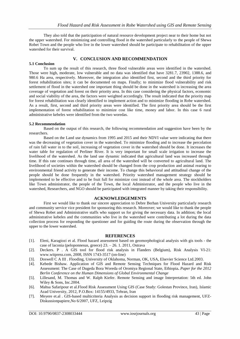
V. CONCLUSION AND RECOMMENDATION 5.1 Conclusion
To sum up the result of this research, three flood vulnerable areas were identified in the watershed.
Those were high, moderate, low vulnerable and no data was identified that have 3281.7, 23902, 1388.6, and
980.6 Ha area, respectively. Moreover, the integration also identified first, second and the third priority for
forest rehabilitation sites; it can be documented on maps. Finally; to minimize flood vulnerability and risk
settlement of flood in the watershed one important thing should be done in the watershed is increasing the area
coverage of vegetation and forest on their priority area. In this case considering the physical factors, economic
and social viability of the area, the factors were weighted accordingly. The result indicated that the priority map
for forest rehabilitation was clearly identified to implement action and to minimize flooding in Robe watershed.
As a result, first, second and third priority areas were identified. The first priority area should be the first
implementation of forest rehabilitation to minimize cost like time, money and labor. In this case 6 rural
administrative kebeles were identified from the two woredas.
5.2 Recommendation
Based on the output of this research, the following recommendation and suggestion have been by the
researchers.
Based on the Land use dynamics from 1995 and 2015 and their NDVI value were indicating that there
was the decreasing of vegetation cover in the watershed. To minimize flooding and to increase the percolation
of rain fall water in to the soil, increasing of vegetation cover in the watershed should be done. It increases the
water table for regulation of Perliner River. It is very important for small scale irrigation to increase the
livelihood of the watershed. As the land use dynamic indicated that agricultural land was increased through
time. If this rate continues through time, all area of the watershed will be converted to agricultural land. The
livelihood of societies within the watershed should be changed from the crop production and animal rearing to
environmental friend activity to generate their income. To change this behavioral and attitudinal change of the
people should be done frequently in the watershed. Priority watershed management strategy should be
implemented to be effective and to be fruit full for minimize cost instead of the whole area. The stockholders
like Town administrator, the people of the Town, the local Administrator, and the people who live in the
watershed, Researchers, and NGO should be participated with integrated manner by taking their responsibility.
ACKNOWLEDGEMENTS First we would like to thank our sincere appreciation to Debre Berhan University particularly research
and community service vice president for sponsoring this research. Moreover; we would like to thank the people
of Shewa Robet and Administrative staffs who support us for giving the necessary data. In addition; the local
administrative kebeles and the communities who live in the watershed were contributing a lot during the data
collection process for responding the questioner and for guiding the route during the observation through the
upper to the lower watershed.
REFERENCES [1]. Eleni, Karagiozi et al. Flood hazard assessment based on geomorphological analysis with gis tools - the
case of laconia (peloponnesus, greece) 23. – 26. 1. 2011, Ostrava
[2]. Deckers. P . A GIS tool for flood risk analysis in Flanders (Belgium), Risk Analysis VI-21:
www.witpress.com, 2008, ISSN 1743-3517 (on-line)
[3]. Doswell C A III . Flooding, University of Oklahoma, Norman, OK, USA, Elsevier Science Ltd.2003.
[4]. Kebede Bishaw. Application of GIS and Remote Sensing Techniques for Flood Hazard and Risk
Assessment: The Case of Dugeda Bora Woreda of Oromiya Regional State, Ethiopia. Paper for the 2012
Berlin Conference on the Human Dimensions of Global Environmental Change
[5]. Lillesand, M. Thomas and W. Ralph Kiefer. Remote Sensing and image Interpretation: 5th ed. John
Wiley & Sons, Inc.2004.
[6]. Mahsa Safaripour et al.Flood Risk Assessment Using GIS (Case Study: Golestan Province, Iran), Islamic
Azad University, 2012, P.O.Box: 14155/4933, Tehran, Iran
[7]. Meyere et.al . GIS-based multicriteria Analysis as decision support in flooding risk management, UFZ-
Diskussionpapiere,No 6/2007, UFZ, Leipzig

Flood Hazard and Risk Assessment in Robe Watershed using GIS and Remote Sensing
DOI: 10.9790/0837-2308033444 www.iosrjournals.org 44 | Page
[8]. Idelbert Dagbégnon Behanzin1, GIS-Based Mapping of Flood Vulnerability and Risk in the Bénin Niger
River Valley, International journal of Geomatics and Geosciences volume 6, no 3, 2015
[9]. IJIRSET. Flood Hazard and Risk Assessment in Chamoli District, Uttarakhand Using Satellite Remote
Sensing and GIS Techniques, Vol. 3, Issue 8, August 2014
[10]. Oludare Hakeem Adedeji1. Building capabilities for flood disaster and hazard preparedness and risk
reduction in Nigeria: need for spatial planning and land management, journal of sustainable development
in Africa (volume 14, no.1, 2012)
[11]. OMAR AL-AZZAM (ND). Flood Prediction and Risk Assessment Using Advanced Geo-Visualization
and Data Mining Techniques: A Case Study in the Red-Lake Valley, Department of Math, Science and
Technology University of Minnesota, Crookston 2900 University Ave., Crookston, MN 56716 UNITED
STATES OF AMERICA
[12]. R.K.Khanna (2002). Remote sensing and gis applications in flood Management, New Delhi Mr. P.C.
Senarathne, Learning to live with FLOODS Natural Hazards and Disasters, Thailand
[13]. Volker Meyer. GIS-based Multicriteria Analysis as Decision Support in Flood Risk Management, UFZ-
Diskussionspapiere,2007
[14]. Woubet . Flood Hazard and Risk Assessment in Fogera Woreda using GIS & Remote Sensing, 2007, pp
14-73.Addis Ababa, Ethiopia.
[15]. WHO . Floods: climate change and adaptation strategies for human health, Report on a WHO meeting
London, United Kingdom 30 June – 2 July 2002SITE: HTTP://WWW.EURO.WHO.IN
Ali Gebeyehu Msc Flood Hazard and Risk Assessment in Robe Watershed Using GIS and
Remote Sensing, North Shewa Zone, Amhara Region In Ethiopia.” IOSR Journal Of
Humanities And Social Science (IOSR-JHSS). vol. 23 no. 08, 2018, pp. 34-44.