Exploring University Morphology. Bergamo as case study.
10
1001 Exploring university morphology. Bergamo as case study Luísa Cannas da Silva, Teresa Valsassina Heitor ICIST – Instituto de Engenharia de Estruturas, Território e Construção, Instituto Superior Técnico, Lisboa. E-mail: [email protected], [email protected] Abstract. Universities have a preponderant role in today’s societal models especially under the influence of the knowledge economy. They have been in the core of development — economical, social, inter alia — and their role within urban context has changed in order to respond to the third strand of the university mission — that of civic engagement. Whether conceived as autonomous entities or diffused within the urban fabric, universities are a key element in urban dynamics and policies and they are progressively more included in strategic plans and development actions worldwide. Therefore, it has become significant to understand the extent of university integration within urban territories. This paper aims at exploring an analytical framework for university precincts within urban fabrics, understanding the different types of urban insertion and connections established with local and regional players. The focus is placed on the impact of the university precinct at the level of the adjacent urban fabrics, on an attempt to understand the ways universities can relate to their hosting cities, from a morphological point of view. The University of Bergamo, Italy is used as a case study, for the diversity present in the urban insertion of its physical premises. Key Words: University precinct; urban integration; campus; knowledge economy; university morphology Introduction This paper focuses on universities and their precincts and the role they perform in urban context. It relies on the premise that universities are a key element in urban dynamics and urban policies and that they have the ability to be powerful urban generators, attracting people and flows, and creating urban vitality (Calder & Greenstein, 2001). Their physical settings act, thus, as the first vehicle through which universities can interact with their hosting city. Within the context of the knowledge economy, universities are progressively being perceived as one of the most influential elements in society, since they impact on city development on several levels (Wiewel & Perry, 2008). They have the ability to change city demographics, to act as economical developers and to impact on several ways on society in general. Besides, universities can contribute to urban regeneration, by directly improving the quality of the urban fabric, and helping to reclaim parts of cities and leverage funds from public regional players. Therefore, it is urgent to understand the full extent of their impact, and to explore university-city relationships. This paper aims at analysing these university physical settings, on an attempt to understand their impact on the universities’ vicinity, and the ability they have to promote synergies and relationships with their urban surroundings. In order to better explore these matters, the University of Bergamo, located in the north of Italy was chosen as a case study, for its morphological features and insertion in the urban fabric of its hosting city. This paper is organized in three parts: the first explores the university general context and the key themes involving university facilities planning. The second explores the morphology of Bergamo recurring to space syntax tools, always focusing on the university and its relationship
Transcript of Exploring University Morphology. Bergamo as case study.

1001
Exploring university morphology. Bergamo as case study
Luísa Cannas da Silva, Teresa Valsassina Heitor ICIST – Instituto de Engenharia de Estruturas, Território e Construção, Instituto
Superior Técnico, Lisboa. E-mail: [email protected], [email protected]
Abstract. Universities have a preponderant role in today’s societal models especially under the influence of the knowledge economy. They have been in the core of development — economical, social, inter alia — and their role within urban context has changed in order to respond to the third strand of the university mission — that of civic engagement. Whether conceived as autonomous entities or diffused within the urban fabric, universities are a key element in urban dynamics and policies and they are progressively more included in strategic plans and development actions worldwide. Therefore, it has become significant to understand the extent of university integration within urban territories. This paper aims at exploring an analytical framework for university precincts within urban fabrics, understanding the different types of urban insertion and connections established with local and regional players. The focus is placed on the impact of the university precinct at the level of the adjacent urban fabrics, on an attempt to understand the ways universities can relate to their hosting cities, from a morphological point of view. The University of Bergamo, Italy is used as a case study, for the diversity present in the urban insertion of its physical premises.
Key Words: University precinct; urban integration; campus; knowledge economy; university morphology Introduction This paper focuses on universities and their precincts and the role they perform in urban context. It relies on the premise that universities are a key element in urban dynamics and urban policies and that they have the ability to be powerful urban generators, attracting people and flows, and creating urban vitality (Calder & Greenstein, 2001). Their physical settings act, thus, as the first vehicle through which universities can interact with their hosting city.
Within the context of the knowledge economy, universities are progressively being perceived as one of the most influential elements in society, since they impact on city development on several levels (Wiewel & Perry, 2008). They have the ability to change city demographics, to act as economical developers and to impact on several ways on society in general. Besides, universities can contribute to urban regeneration, by directly improving the quality of the urban fabric, and helping to reclaim parts of cities and leverage funds from public regional players. Therefore, it is urgent to understand the full extent of their impact, and to explore university-city relationships.
This paper aims at analysing these university physical settings, on an attempt to understand their impact on the universities’ vicinity, and the ability they have to promote synergies and relationships with their urban surroundings.
In order to better explore these matters, the University of Bergamo, located in the north of Italy was chosen as a case study, for its morphological features and insertion in the urban fabric of its hosting city.
This paper is organized in three parts: the first explores the university general context and the key themes involving university facilities planning. The second explores the morphology of Bergamo recurring to space syntax tools, always focusing on the university and its relationship

1002 to the city. The third summarizes an experiential mapping contrasting the results of these observations with the syntactic analysis performed. Context It is argued that universities are one of the driving economic forces in contemporary societies (Duderstadt, 1999; Conceição & Heitor, 1999). Their role is not only related to the production and sharing of knowledge, but has progressively developed towards their social involvement and responsibility. Whether conceived as autonomous entities or diffused within the urban fabric, universities are a key element in urban dynamics and policies and are progressively more included in strategic plans and development actions worldwide, thus providing an opportunity for change and new perspectives towards their role in contemporary societies.
Along with the traditional strands of their mission (research, learning and teaching) a third one, that of civic engagement is becoming significantly more important in today’s university (Berglund, 2009). This may have substantial implications for the built environment since it approaches academia and the wider community, from simple actions such as allowing the latter to have access and make use of university facilities, to deep mutual involvement and engagement in several activities. Therefore, besides rethinking university-learning spaces at the architectural design scale, it becomes critical to reassess university facilities in terms of their spatial integration within the urban territory, considering both the metropolitan area scale and the city-university interaction. This interaction should be understood as an inevitable component of university collective life (Campos Calvo-Sotelo, 2010).
The research question is focused on how the university precinct turns out to be integrated in the urban tissue.
Nowadays, universities are required to balance between two trends: while it is considered that when conceived as autonomous entities, universities’ facilities cause the isolation of academic communities, highlighting ruptures within the urban fabric and originating unsustainable mobility patterns;; one can argue that, on the other hand, when universities’ facilities are built within the city core, the preservation of their uniqueness and distinctive features may be easily affected by the surrounding environment thus requiring special consideration.
The “campus” should preserve its necessary distinctiveness (Trani & Holsworth, 2010), but also to be open to the city to foster processes of social and economic integration to the community. It is argued that university precincts can no longer be considered secluded places, where non-academic people feel rejected and not welcomed.
Therefore, this work aims at analysing different integration models and their repercussions, in order to better understand to what extent does campus morphology influence the interactions established between the university and the city.
The activities of the university impact their surroundings and wider communities (Alexander, 1965) to the mutual benefit of both society and academia. Therefore, the university precinct must be perceived in its urban dimension, as physical element that acts as conveyor of information, knowledge and an image of higher education, while assuming an important role in the dynamics established between the university and the city where it is embedded.
It is critical to understand the demands that the university requires the city to fulfil, along with the role that the university can play in order to contribute to urban regeneration, by directly improving the quality of the urban fabric and promoting cohesion of social territories.
1003
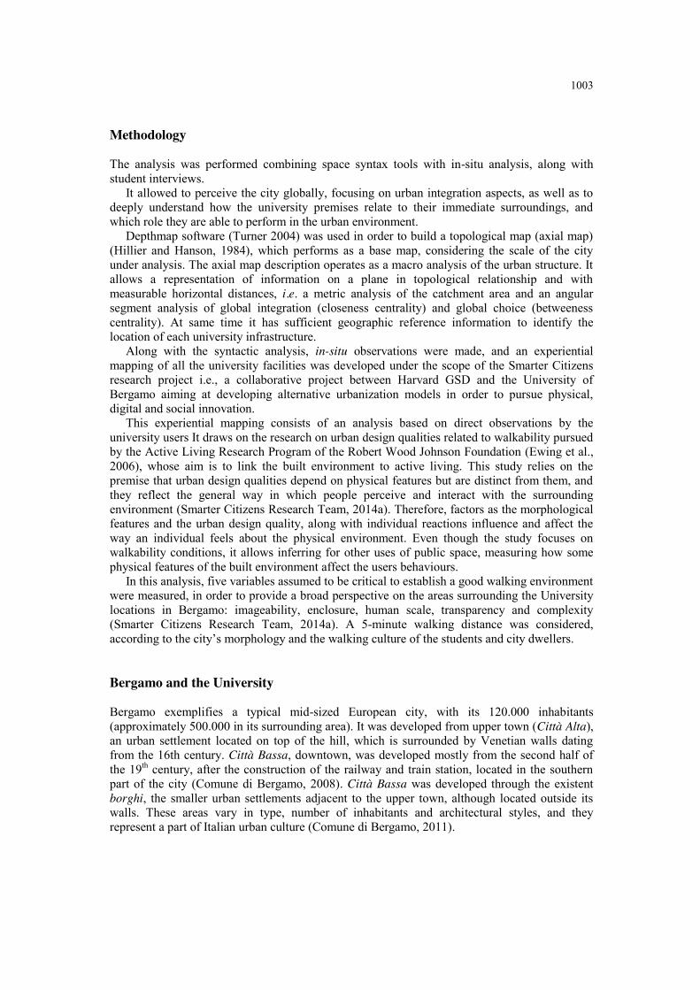
Methodology The analysis was performed combining space syntax tools with in-situ analysis, along with student interviews.
It allowed to perceive the city globally, focusing on urban integration aspects, as well as to deeply understand how the university premises relate to their immediate surroundings, and which role they are able to perform in the urban environment.
Depthmap software (Turner 2004) was used in order to build a topological map (axial map) (Hillier and Hanson, 1984), which performs as a base map, considering the scale of the city under analysis. The axial map description operates as a macro analysis of the urban structure. It allows a representation of information on a plane in topological relationship and with measurable horizontal distances, i.e. a metric analysis of the catchment area and an angular segment analysis of global integration (closeness centrality) and global choice (betweeness centrality). At same time it has sufficient geographic reference information to identify the location of each university infrastructure.
Along with the syntactic analysis, in-situ observations were made, and an experiential mapping of all the university facilities was developed under the scope of the Smarter Citizens research project i.e., a collaborative project between Harvard GSD and the University of Bergamo aiming at developing alternative urbanization models in order to pursue physical, digital and social innovation.
This experiential mapping consists of an analysis based on direct observations by the university users It draws on the research on urban design qualities related to walkability pursued by the Active Living Research Program of the Robert Wood Johnson Foundation (Ewing et al., 2006), whose aim is to link the built environment to active living. This study relies on the premise that urban design qualities depend on physical features but are distinct from them, and they reflect the general way in which people perceive and interact with the surrounding environment (Smarter Citizens Research Team, 2014a). Therefore, factors as the morphological features and the urban design quality, along with individual reactions influence and affect the way an individual feels about the physical environment. Even though the study focuses on walkability conditions, it allows inferring for other uses of public space, measuring how some physical features of the built environment affect the users behaviours.
In this analysis, five variables assumed to be critical to establish a good walking environment were measured, in order to provide a broad perspective on the areas surrounding the University locations in Bergamo: imageability, enclosure, human scale, transparency and complexity (Smarter Citizens Research Team, 2014a). A 5-minute walking distance was considered, according to the city’s morphology and the walking culture of the students and city dwellers. Bergamo and the University Bergamo exemplifies a typical mid-sized European city, with its 120.000 inhabitants (approximately 500.000 in its surrounding area). It was developed from upper town (Città Alta), an urban settlement located on top of the hill, which is surrounded by Venetian walls dating from the 16th century. Città Bassa, downtown, was developed mostly from the second half of the 19th century, after the construction of the railway and train station, located in the southern part of the city (Comune di Bergamo, 2008). Città Bassa was developed through the existent borghi, the smaller urban settlements adjacent to the upper town, although located outside its walls. These areas vary in type, number of inhabitants and architectural styles, and they represent a part of Italian urban culture (Comune di Bergamo, 2011).

1004
Figure 1. Bergamo urban mapping (Smarter Citizens Research Team, 2014b) (1) Città Alta . uptown; (2) Città Bassa – downtown.
The University, Università degli Studi di Bergamo, dates back to 1961, even though it only
achieved university status by the end of the 1960s. Nowadays it hosts approximately 15.000 students, among its six departments (Università degli Studi di Bergamo, 2013b).
The university is spread within the city in several different locations, both in Città Alta and Città Bassa, and also in the outskirts (Università degli Studi di Bergamo, 2013a). Different locations host different areas of study, for the four main locations of the university. Thus, all the locations within Città Alta are dedicated to the Humanities, while in Città Bassa is located the Economy department. Finally, the Engineering department is located in Dalmine, a smaller city situated about 10km from Bergamo. The university is also a partner of Kilometro Rosso, the technological park, owning one of its buildings. In this facility, most of the areas are only used for research but some of the spaces are available for specific purposes, even though there are no regularly scheduled academic activities.
In the upper town, the university occupies 7 different locations, spread around the main areas of the centre. Most of these host academic spaces within. Students travel around to attend classes, which can be seen as an opportunity or a threat. On the one hand it allows for more dynamism within the area, caused by students presence in different places during the day, but on the other hand requires more resources and can provide distractions from the academic environment.
In Città Bassa, the university location hosts more functions and provides more services, thus being used not only by the students who attend classes there, unlike what happens in Città Alta.
Both the university premises in Kilometro Rosso and the Engineering campus in Dalmine, are not going to be considered in the framework of this paper, since only university premises located within the city’s boundaries and hosting academic areas were considered.
The dispersion of the University is a defining feature for Bergamo, and can be perceived both as an attractor and as a negative feature while characterizing the university. On the one hand, the dispersion allows the university to reach more areas of the city, and to interact with different environments. On the other hand, the university is not perceived globally, and it does not become clear to both city users and students themselves what is the role the university is

1005
playing in urban context. Its premises are unknown and disconnected, even though located in some of the most central and important areas of the city.
Figure 2. University of Bergamo spatial distribution and organizational structure.
Figure 3. University locations in Bergamo (1) Città Alta, (2) Caniana – Città Alta; (3) Kilometro Rosso – Città Bassa.

1006 Axial analysis The city fabric shows strong morphological differences between Città Alta and Città Bassa, which can be easily recognised in the axial map. As can be observed in the picture, the upper town shows relatively low values for integration, which are consistent with the perception of the territory obtained through the empirical observations. One of the justifications for this fact might be the topography of the area, mountainous and steeper on the northern side of the hill where Città Alta is located, opposed to the flat land in which Città Bassa was developed through the borghi.
Figure 4. Integration HH Bergamo, with the university locations.
Nevertheless, Città Alta presents a historically and culturally rich environment, very
propitious for the location of an academic institution. The area’s lack of integration is resolved through the use of cable cars, which increased global integration of the whole system by approximately 25%. However, this increase only affects pedestrian accessibility.
In Città Bassa, however, the university’s premises are located in one of the most integrated axis of the city and are easily reached by any other street in the urban system. Experiential Mapping The experiential mapping consists of an analysis built on direct observations by a group of 13 students from University of Bergamo involved in the Smarter Citizens research project. This group includes students with different backgrounds and from different areas of study,
This experiential mapping analysis was based on the research on urban design qualities related to walkability pursued by the Active Living Research Program of the Robert Wood Johnson Foundation (Ewing et al., 2006), whose aim is to link the built environment to active living. The analysis does not focus specifically on the university buildings, but instead on the

1007
whole area on a 5-minute walking distance from them. This approach allows a better understanding of the integration and the morphological features of the surrounding environment of the university. It allows also recognising some aspects of the university’s urban insertion and connections. A scale from 0 to 2 was used to quantify all of the variables, 0 being the lowest level, and 2 the highest (Smarter Citizens Research Team, 2014a). Thus, the university facilities and locations with academic functions were evaluated for the above-mentioned criteria: (1) Imageability – as the quality that makes a space memorable and recognizable (Lynch, 1960), depending on how the physical elements and their arrangement are able to draw attention, arouse feelings and create a lasting impression; (2) Enclosure – the degree to which the public space is visually defined by vertical elements (Cullen, 1961), such as buildings, trees, walls, among other elements; (3) Human scale – referring to elements that are perceptible to humans while walking in a specific area (Ewing et al., 2006). These can be materialized in different textures and elements, but matching human size and scale, as well as rhythm and speed of dislocations and movements; (4) Transparency - the degree to which people can see or perceive objects and activities beyond the edge of a street; (5) Complexity – the visual richness of a place (Apopod, 1990 apud Ewing et al., 2006). A place complexity depends on the variety of elements and articulations present on the physical environment.
For the university locations in Città Alta, the 5 premises with academic functions were analysed, and the result is summarized in the picture and table below.
Figure 5. Locations of the experiential mapping – Città Alta (1) Rosate; (2) Salvecchio; (3) Sat’Agostino;; (4) Pignolo;; (5) Tassis.
Table 1. Experiential mapping summary - Città Alta
Criteria /Location Imageability Enclosure Human Scale Transparency Complexity Total Score
Rosate 1 1 1 1 2 6
Salvecchio 1 2 2 1 2 8
Sant'Agostino 2 0 1 2 2 7
Pignolo 0 1 2 1 1 5
Tassis 1 2 1 0 1 5
Average Città Alta 1,2 1,2 1,4 1 1,6 6,4
As can be perceived from the axial map, the majority of university facilities are not located
in highly integrated areas. Within the limits of the upper town, though, because of the small scale and proximity among the facilities, this fact would not be problematic, if the university was able to make up for the lack of integration with other strategies, such as improving its visibility and imageability within the public realm.
From the experiential mapping, we can perceive the importance that is attributed to features such as the complexity and the human scale of the urban environment, which is consistent with

1008 the urban fabric and the historical morphological characteristics of the area. Nevertheless, the imageability evaluation of the university shows, in general, low values which seems paradoxal. A possible explanation would be the visual richness of the whole area, which creates difficulty in the recognition of each individual building. Moreover, this evaluation is dependent on the students’ perception. It is relevant to mention that none of the students who engaged in the project comes from architecture or any related field of studies.
Also, if compared to similar analysis in different cities, it might show different results, since the whole city performs very well for most of the chosen variables.
As far as Città Bassa is concerned, the university presents a different type of physical setting, behaving as a campus-like structure within the urban fabric. It doesn’t consist of isolated dispersed buildings like in Città Alta. It is a clearly defined precinct, comprising two different buildings. Thus, for the experiential mapping, in order to enrich the analysis, four locations around the campus were chosen: (1) Caniana, as the main entrance and more representative informal meeting space around campus; (2) Lower San Bernardino, the area where most shops and services are located, therefore extremely used by students; (3) Upper San Bernardino, where the library is located, and also restaurants, cafes and bars, making it a highly frequented area; (4) Moroni, the area around the secondary campus entrance, which, in comparison to the other three described areas, is less used and visible from the premises and hosts less services and commercial activities.
Figure 6. Locations of the experiential mapping – Città Bassa (1) Caniana; (2) Lower San Bernardino; (3) Upper San Bernardino; (4) Moroni.
Table 5. Experiential mapping summary - Città Bassa
Criteria /Location Imageability Enclosure Human Scale Transparency Complexity Total Score
Caniana 2 0 2 2 1 7
Lower San Bernardino 1 0 1 2 1 5
Upper San Bernardino 1 2 1 0 2 6
Moroni 0 1 0 1 0 2
Average 1,0 0,8 1,0 1,3 1,0 5,0

1009
Globally, these locations show lower values in all the attributes, even though they are more integrated than all the university locations in Città Alta.
The principles of the educational campus (Campos Calvo-Sotelo, 2009), establish a comprehensive framework of analysis for university precincts. Analyzing the University of Bergamo under this scope, it becomes clear that some of the traditional physical features are not present, or do not assume the necessary importance. As far as utopia, integral planning and spatial harmony are concerned, the university does not follow the principles, for most of its facilities occupy previously existing buildings. Nevertheless, it would be possible to solve this lack of spatial harmony, if there was a coherent unifying strategy among all of the university premises.
The learning community is not sufficiently encouraged, and the dispersion of the facilities works in a negative way towards this objective. Also the affective and intellectual embracement is not attained through the physical premises, diminishing the impact of the university physical settings on obtaining a strong learning community. The university also needs to improve the morphological features with impact on its visibility and legibility.
Regarding the incorporation of nature and art within the university premises, there is sufficient offer within Città Alta, and the university users are able to benefit from it, despite the lack of integration and connections between university and city. Besides, the rich cultural and historical settings present a stimulating learning environment, while represent and enhance the city’s and the university’s collective memory. Notwithstanding, in Città Bassa there is a lack of both artistic and natural landscapes, and the university premises are not fulfilling this need. Conclusions The combination of space syntax tools with direct observations has proven a suitable method for analysing university-city relationships, for it allows understanding simultaneously the impact of integration, morphological features and university dynamism on the creation and improvement of synergies between the two entities.
Bergamo presents a very peculiar university environment, with its diversity in morphologies, insertion types, connections, urban fabrics and relationships established between different entities. Nevertheless, the relation between the university and the city should be improved, reinforcing the presence of university users within the social and urban context. A more synergetic environment would be valuable to foster innovation and improve the knowledge creation, sharing and acquisition.
The dispersion of the buildings and locations of the university of Bergamo can be perceived either as a threat or as an opportunity. On the one hand, it can cause the dispersion of the academic community, decreasing the serendipity and the amount of interaction opportunities and chance encounters on an interdepartmental basis. Also, it creates unpractical mobility patterns and raises management difficulties. Nevertheless, the need for the academic community to access different locations and premises could help creating positive flows of movement that would benefit the whole city, as long as there were better connections and attractor areas among different university premises, for “(...) the learning campus is one that maximizes the probability of chance encounters, and encourages lingering once an encounter - whether by chance or by plan - takes place”(Kenney et al., 2005, p.39). Considering that, in the case of Bergamo, the whole city is the campus, success may rely in the creation of attractors among the different university locations for “the true success for a city or town lies in the creation and maintenance of a network of spaces that support a variety of uses and users”(Space Syntax, 2006, p.4). Thus, the scattered facilities offer opportunities for better integration and creation of synergies between the university and the city as long as there is the necessary will to do it.

1010 Acknowledgments This paper was carried out on the framework of the author’s PhD research, funded by FCT – Fundação para a Ciência e a Tecnologia. We would like to thank the whole Smarter Citizens Research Team for their cooperation and contributions, specially Katia Passera, from the University of Bergamo and the students who engaged in the One Univer[city] project, namely Egle Carobbio and Stefano Terranova. References Alexander C (1965) A City is not a Tree (Part II). Architectural Forum. 122 (1), 58–62. Available at:
http://www.rudi.net/books/5613. Berglund E (2009) Growing by degrees: Universities in the future of urban development. Available at:
http://www.buildingfutures.org.uk/projects/building-futures/universities (accessed 11/01/13). Calder A and Greenstein R (2001) Universities as Developers. Land Lines. (July). Available at: Calder,
A. & Greenstein, R., 2001. Universities as Developers ( Land Lines Article ) Article Article. , (July). Campos Calvo-Sotelo P (2009) An innovative concept for the transformation of Universities and their relation to Cities: the “Educational Campus.” In: Higher Education Spaces and Places: For Learning, Innovation and Knowledge Exchange. Riga. 1–3.
Campos Calvo-Sotelo P (2010) The concept of “Educational Campus” and its application in Spanish universities. Exchange Organizational Behavior Teaching Journal.
Comune di Bergamo (2008) Ceni Historici. [Online] Available at: http://www.comune.bergamo.it/servizi/Menu/dinamica.aspx?idSezione=3786&idArea=1181&idCat=1190&ID=1243&TipoElemento=categoria (accessed 02/05/14).
Comune di Bergamo (2011) I Borghi. [Online] Conceição P and Heitor M (1999) On the role of the university in the knowledge economy. Science and
Public Policy. 26 (1), 37–51. Available at: http://spp.oxfordjournals.org/content/26/1/37.short (accessed 05/11/12).
Cullen G (1961) The Concise Townscape. New York Duderstadt JJ (1999) New Roles for the 21st-Century University - Changing times demand a new social
contract between society and the institutions of higher education. Science and Technology. (Winter). Available at: http://www.issues.org/16.2/duderstadt.htm.
Ewing R, Clemente O, Handy S, Brownson RC and Winston E (2006) Identifying and Measuring Urban Design Qualities Related to Walkability. Journal of Physical …. (July). Available at: http://search.ebscohost.com/login.aspx?direct=true&profile=ehost&scope=site&authtype=crawler&jrnl=15433080&AN=20971318&h=46tQDeJOb4XkboYgxoXpPJvTcJPkgTG9GnOHtWKuSY24IYWBKF%2BNaY2vKCMvaW7TvyaEiSV3d4S3VQfNRzPqQA%3D%3D&crl=c (accessed 20/05/14).
Hillier B and Hanson J (1984) The Social Logic of Space. Cambridge: Cambridge University Press Available at: http://ebooks.cambridge.org/ref/id/CBO9780511597237.
Kenney DR, Dummont R and Kenney G (2005) Mission and place. Strengthening learning and community trough campus design. Westport: Praeger Publishers
Lynch K (1960) The Image of the City. Cambridge, MA: MIT Press Smarter Citizens Research Team (2014a) University Experiential Mapping. [Online] Available at:
http://futureofcities.wikispaces.com/Experiential+Mapping (accessed 23/03/13). Smarter Citizens Research Team (2014b) Urban Mapping. [Online] Available at:
http://futureofcities.wikispaces.com/Urban+Mapping (accessed 09/04/14). Space Syntax (2006) Walkability , Movement and Safety for the City of Berkeley. london Trani EP and Holsworth RD (2010) The Indispensable University - Higher Education, Economic
Development, and the Knowledge EconomyAmerican C. Lanham, Plymouth: Rowman & Littlefield Publishers, Inc
Università degli Studi di Bergamo (2013a) Sedi Universitarie. [Online] Available at: http://www.unibg.it/struttura/struttura.asp?cerca=ateneo_sedi_intro (accessed 02/05/14).
Università degli Studi di Bergamo (2013b) Storia dell’Ateneo e delle Facoltà. [Online] Available at: http://www.unibg.it/struttura/struttura.asp?cerca=storiateneo (accessed 02/05/14).
Wiewel W and Perry DC (2008) Global Universities and urban development. Case studies and analysis. W. Wiewel & D. C. Perry eds. Armonk, New York: Lincoln Institute of Land Policy