Paleosols and paleoenvironments of the middle Miocene, Maboko Formation, Kenya

at SciVerse ScienceDirect
Quaternary International 274 (2012) 38e54
Contents lists available
Quaternary International
journal homepage: www.elsevier .com/locate/quaint
Early MIS 3 occupation of Mochena Borago Rockshelter, Southwest EthiopianHighlands: Implications for Late Pleistocene archaeology, paleoenvironmentsand modern human dispersals
Steven A. Brandt a, Erich C. Fisher b, Elisabeth A. Hildebrand c, Ralf Vogelsang d,*, Stanley H. Ambrose e,Joséphine Lesur f, Hong Wang g
aDepartment of Anthropology, 1112 Turlington Hall, University of Florida, Gainesville, FL 32611-7305, USAb Institute of Human Origins, School of Human Evolution and Social Change, PO Box 872402, Arizona State University, Tempe, AZ 85287-2402, USAcAnthropology Department & Turkana Basin Institute, Stony Brook University, NY 11794-4364, USAd Institute of Prehistoric Archaeology, University of Cologne, Weyertal 125, 50923 Köln, GermanyeDepartment of Anthropology, University of Illinois, 109 Davenport Hall, 607 South Mathews Avenue, Urbana, IL 61801, USAfUMR 7209, Archéozoologie, Archéobotanique Sociétés, Pratiques et Environnements, CNRS e Muséum National d’Histoire Naturelle,Case Postale N� 55 (Bâtiments d’Anatomie Comparée), 55 rue Buffon, 75231 Paris cedex 05, Franceg Illinois State Geological Survey, University of Illinois at Urbana-Champaign, 615 E. Peabody Drive, Champaign, IL 61820, USA
a r t i c l e i n f o
Article history:Available online 30 March 2012
* Corresponding author.E-mail addresses: [email protected] (S.A. Br
(E.C. Fisher), [email protected] (E.A. Hkoeln.de (R. Vogelsang), [email protected] (S.H.(J. Lesur), [email protected] (H. Wang).
1040-6182/$ e see front matter � 2012 Elsevier Ltd adoi:10.1016/j.quaint.2012.03.047
a b s t r a c t
Between 70 and 50 ka BP, anatomically modern humans dispersed across and out of Africa to eventuallypopulate all inhabitable continents. Knowledge of paleoenvironments and human behavioral patterns inAfrica prior to and during these dispersals is crucial for understanding how and why hunter-gathererswere able to adapt rapidly to the new environments they encountered. However, few well-dated sitesfrom this time period are known from the Horn of Africa, one of the purported staging areas for pop-ulation movements into southern Arabia and Asia. Excavations at Mochena Borago Rockshelter, situatedon the western slopes of a dormant volcano where the SW Ethiopian Highlands meet the Ethiopian Rift,have yielded the first securely dated archaeological sequence for later periods of the dispersal. Threemajor lithostratigraphic groups incorporating occupational episodes have yielded charcoal radiocarbonages w53e38 ka calBP; deeper deposits have been tested but remain undated. Archaeological assem-blages consist mainly of obsidian flaked stone artifacts manufactured from small, minimally prepared,single- to multi-platform flake cores; radially prepared cores are rare and blade cores are absent. Smallunifacial to bifacial points from non-radial cores dominate the earliest shaped tool assemblages, andbacked pieces first appear by w45 ka calBP. By w43 ka calBP, scrapers and backed pieces are predom-inant, rather than points. However, there is little evidence for technological change other than theappearance of bipolar technology. Mochena Borago’s archaeological sequence thus cannot be neatlyclassified as Middle Stone Age, Later Stone Age or “transitional” and calls into question some of theprinciples by which archaeologists have attempted to classify African toolmaking traditions.
� 2012 Elsevier Ltd and INQUA. All rights reserved.
1. Introduction
The dispersals of Homo sapiens out of Africa w70 and 50 ka BP(uncalibrated dates appear as ka BP; calibrated dates, based onCalPal-2007 Hulu (Weninger and Jöris, 2008) appear as ka calBP)
andt), [email protected]), r.vogelsang@uni-Ambrose), [email protected]
nd INQUA. All rights reserved.
were landmarks in human history, signaling an evolutionaryprocess responsible for the world’s present genetic and culturaldiversity. The subsequent rapid spread of anatomically modernhumans into the new environments of Australia, Asia, Europe andeventually the Americas, would have posed novel challenges andopportunities requiring not just technological, social, and culturalinnovations, but great behavioral flexibility, creativity, cooperation,and planning (Ambrose, 2002; Mellars et al., 2007; Hoffecker,2009).
Archaeologists investigating this event have focused on twomain topics: determining whether modern humans left Africa via
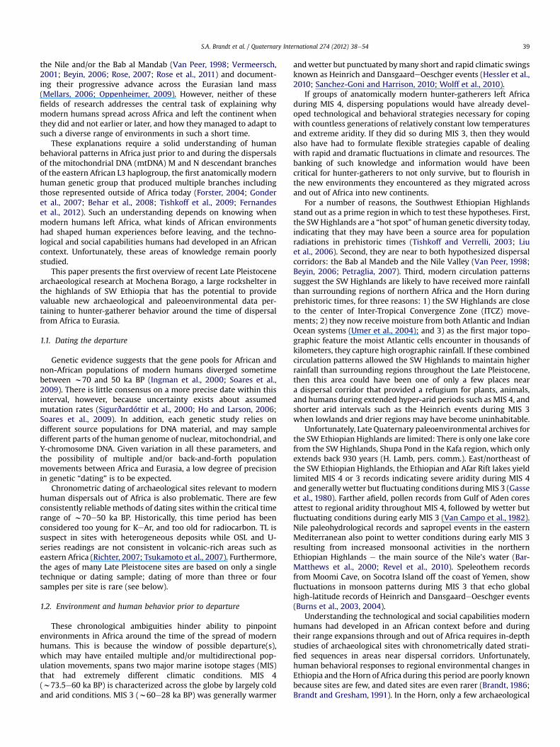
S.A. Brandt et al. / Quaternary International 274 (2012) 38e54 39
the Nile and/or the Bab al Mandab (Van Peer, 1998; Vermeersch,2001; Beyin, 2006; Rose, 2007; Rose et al., 2011) and document-ing their progressive advance across the Eurasian land mass(Mellars, 2006; Oppenheimer, 2009). However, neither of thesefields of research addresses the central task of explaining whymodern humans spread across Africa and left the continent whenthey did and not earlier or later, and how they managed to adapt tosuch a diverse range of environments in such a short time.
These explanations require a solid understanding of humanbehavioral patterns in Africa just prior to and during the dispersalsof the mitochondrial DNA (mtDNA) M and N descendant branchesof the eastern African L3 haplogroup, the first anatomically modernhuman genetic group that produced multiple branches includingthose represented outside of Africa today (Forster, 2004; Gonderet al., 2007; Behar et al., 2008; Tishkoff et al., 2009; Fernandeset al., 2012). Such an understanding depends on knowing whenmodern humans left Africa, what kinds of African environmentshad shaped human experiences before leaving, and the techno-logical and social capabilities humans had developed in an Africancontext. Unfortunately, these areas of knowledge remain poorlystudied.
This paper presents the first overview of recent Late Pleistocenearchaeological research at Mochena Borago, a large rockshelter inthe highlands of SW Ethiopia that has the potential to providevaluable new archaeological and paleoenvironmental data per-taining to hunter-gatherer behavior around the time of dispersalfrom Africa to Eurasia.
1.1. Dating the departure
Genetic evidence suggests that the gene pools for African andnon-African populations of modern humans diverged sometimebetween w70 and 50 ka BP (Ingman et al., 2000; Soares et al.,2009). There is little consensus on a more precise date within thisinterval, however, because uncertainty exists about assumedmutation rates (Sigurðardóttir et al., 2000; Ho and Larson, 2006;Soares et al., 2009). In addition, each genetic study relies ondifferent source populations for DNA material, and may sampledifferent parts of the human genome of nuclear, mitochondrial, andY-chromosome DNA. Given variation in all these parameters, andthe possibility of multiple and/or back-and-forth populationmovements between Africa and Eurasia, a low degree of precisionin genetic “dating” is to be expected.
Chronometric dating of archaeological sites relevant to modernhuman dispersals out of Africa is also problematic. There are fewconsistently reliable methods of dating sites within the critical timerange of w70e50 ka BP. Historically, this time period has beenconsidered too young for KeAr, and too old for radiocarbon. TL issuspect in sites with heterogeneous deposits while OSL and U-series readings are not consistent in volcanic-rich areas such aseastern Africa (Richter, 2007; Tsukamoto et al., 2007). Furthermore,the ages of many Late Pleistocene sites are based on only a singletechnique or dating sample; dating of more than three or foursamples per site is rare (see below).
1.2. Environment and human behavior prior to departure
These chronological ambiguities hinder ability to pinpointenvironments in Africa around the time of the spread of modernhumans. This is because the window of possible departure(s),which may have entailed multiple and/or multidirectional pop-ulation movements, spans two major marine isotope stages (MIS)that had extremely different climatic conditions. MIS 4(w73.5e60 ka BP) is characterized across the globe by largely coldand arid conditions. MIS 3 (w60e28 ka BP) was generally warmer
andwetter but punctuated bymany short and rapid climatic swingsknown as Heinrich and DansgaardeOeschger events (Hessler et al.,2010; Sanchez-Goni and Harrison, 2010; Wolff et al., 2010).
If groups of anatomically modern hunter-gatherers left Africaduring MIS 4, dispersing populations would have already devel-oped technological and behavioral strategies necessary for copingwith countless generations of relatively constant low temperaturesand extreme aridity. If they did so during MIS 3, then they wouldalso have had to formulate flexible strategies capable of dealingwith rapid and dramatic fluctuations in climate and resources. Thebanking of such knowledge and information would have beencritical for hunter-gatherers to not only survive, but to flourish inthe new environments they encountered as they migrated acrossand out of Africa into new continents.
For a number of reasons, the Southwest Ethiopian Highlandsstand out as a prime region in which to test these hypotheses. First,the SWHighlands are a “hot spot” of human genetic diversity today,indicating that they may have been a source area for populationradiations in prehistoric times (Tishkoff and Verrelli, 2003; Liuet al., 2006). Second, they are near to both hypothesized dispersalcorridors: the Bab al Mandeb and the Nile Valley (Van Peer, 1998;Beyin, 2006; Petraglia, 2007). Third, modern circulation patternssuggest the SW Highlands are likely to have received more rainfallthan surrounding regions of northern Africa and the Horn duringprehistoric times, for three reasons: 1) the SW Highlands are closeto the center of Inter-Tropical Convergence Zone (ITCZ) move-ments; 2) they now receive moisture from both Atlantic and IndianOcean systems (Umer et al., 2004); and 3) as the first major topo-graphic feature the moist Atlantic cells encounter in thousands ofkilometers, they capture high orographic rainfall. If these combinedcirculation patterns allowed the SW Highlands to maintain higherrainfall than surrounding regions throughout the Late Pleistocene,then this area could have been one of only a few places neara dispersal corridor that provided a refugium for plants, animals,and humans during extended hyper-arid periods such as MIS 4, andshorter arid intervals such as the Heinrich events during MIS 3when lowlands and drier regions may have become uninhabitable.
Unfortunately, Late Quaternary paleoenvironmental archives forthe SW Ethiopian Highlands are limited: There is only one lake corefrom the SW Highlands, Shupa Pond in the Kafa region, which onlyextends back 930 years (H. Lamb, pers. comm.). East/northeast ofthe SW Ethiopian Highlands, the Ethiopian and Afar Rift lakes yieldlimited MIS 4 or 3 records indicating severe aridity during MIS 4and generallywetter but fluctuating conditions duringMIS 3 (Gasseet al., 1980). Farther afield, pollen records from Gulf of Aden coresattest to regional aridity throughout MIS 4, followed by wetter butfluctuating conditions during early MIS 3 (Van Campo et al., 1982).Nile paleohydrological records and sapropel events in the easternMediterranean also point to wetter conditions during early MIS 3resulting from increased monsoonal activities in the northernEthiopian Highlands e the main source of the Nile’s water (Bar-Matthews et al., 2000; Revel et al., 2010). Speleothem recordsfrom Moomi Cave, on Socotra Island off the coast of Yemen, showfluctuations in monsoon patterns during MIS 3 that echo globalhigh-latitude records of Heinrich and DansgaardeOeschger events(Burns et al., 2003, 2004).
Understanding the technological and social capabilities modernhumans had developed in an African context before and duringtheir range expansions through and out of Africa requires in-depthstudies of archaeological sites with chronometrically dated strati-fied sequences in areas near dispersal corridors. Unfortunately,human behavioral responses to regional environmental changes inEthiopia and the Horn of Africa during this period are poorly knownbecause sites are few, and dated sites are even rarer (Brandt, 1986;Brandt and Gresham, 1991). In the Horn, only a few archaeological

S.A. Brandt et al. / Quaternary International 274 (2012) 38e5440
occurrences can be attributed to MIS 4/early MIS 3 (Fig. 1): Innorthern Somalia, GudeGud Cave has a small sample of chertartifacts in a stratum radiocarbon dated to >40 ka, while theyoungest Levallois-based Middle Stone Age (MSA) levels at Mid-hishi 2 Shelter are also radiocarbon dated to >40,000 BP (Brandtand Brook, 1984; Brandt, 1986). On eastern Ethiopia’s rift escarp-ment, Porc Epic Rockshelter contains material from MIS 4 and 3.Unfortunately, the complicated stratigraphy, the excavationmethods employed there four decades ago, and the unreliability ofobsidian hydration dates together impede accurate dating of thesite (Clark and Williamson, 1984; Brandt, 1986; Pleurdeau, 2001,2003, 2005). Near the junction of the Ethiopian Rift and the AfarDepression, K’one caldera encompasses a number of undated open-air MSA sites eroding from stratified sediments. Although lowerportions of the sequence are thought to date to MIS 5e3, onlya Later Stone Age (LSA) site in the upper strata has been radio-carbon dated, yielding a terminal Pleistocene age (Kurashina, 1978;Brandt, 1986). In the SW Ethiopian Highlands, the open-air site ofLiben Bore in the Gilgel Gibe Valley has assemblages of flaked stoneartifacts (“lithics”) in the lower strata that could date toMIS 4 and 3,but these strata remain chronometrically undated (Brandt, 2001).
Recent excavations at Mochena Borago Rockshelter, an archae-ological site on the eastern edge of the SW Ethiopian Highlands,have established the first well-dated archaeological sequence formuch of MIS 3 in the Horn of Africa. The lowest excavated depositsin Mochena Borago correspond to the latest possible period ofinitial modern human movements out of Africa, but deeper strataremain to be excavated.
Fig. 1. Archeological sites in the Horn of Africa with assemblages attributed to MIS 4/earlyLiben Bore.
2. Mochena Borago Rockshelter
Mochena Borago Rockshelter is situated on the southwest flanksof Mount Damota, a large trachytic volcano that rises steeply out ofthe surrounding plains w320 km south of Addis Ababa in south-west Ethiopia (Fig. 2). According to oral history, it was named afterMoche Borago, a prominent late 19th century local leader who wasadvisor to T’ona, the last king of the Wolaita people (Fisher, 2010, p.65). Researchers who initiated work at the site recorded the nameas “Moche Borago” in accordance with government information atthe time (Gutherz et al., 2002), but updated official records andlocal residents confirm “Mochena Borago” as the correct name.
2.1. Geographical context
At 2908 m asl, Mt. Damota forms the boundary between theSouthwest Ethiopian Highlands to the west and the southern MainEthiopian Rift Valley to the east. Its slopes provide striking views ofthe central Main Ethiopian Rift Valley lakes to the distant north, theBilate River and the southern Main Ethiopian Rift Valley to the east,Lake Abaya to the south, the Gibe/Omo River valley to the south-west, and the Wolayta Highlands to the west (Fig. 2). At thesouthern foot of the mountain lies the town of Sodo, the adminis-trative and political capital of Wolayta Zone.
During the Plio-Pleistocene, many major trachytic volcaniccomplexes formed along the Rift’s margins, including now-dormant Mt. Damota. These continued to be active during theLate Quaternary (WoldeGabriel et al., 1990, p. 447). On the
MIS 3: 1 e GudeGud; 2 e Midhishi Shelter; 3 e Porc Epic Rockshelter; 4 e K’one; 5 e

Fig. 2. Location of Mount Damota, Mochena Borago Rockshelter (MB) and the two known Humbo area obsidian sources (Loc. 1 and Loc. 2).
S.A. Brandt et al. / Quaternary International 274 (2012) 38e54 41
southwestern face of Mt. Damota, successive flow basalts haveformed a complex ridge-and-ravine geomorphology, structuringthe natural drainage system. These drainages often exhibita broadly-stepped profile, possibly due to isolated truncations orterminations of the underlying basalts.
The entrance to Mochena Borago Rockshelter is at the head ofsuch a steep ravine about halfway up a w20 m high cliff. A small,seasonally active waterfall flows over the shelter’s mouth into theravine, contributing to a stream that forms an important watersource for local farmers. The shelter is large e almost 70 m wide,12 m high and 20 m deep e and can easily hold hundreds of peoplestanding on the loose to compact sediments that cover the largely
Fig. 3. Spherical panorama of Mochena Borago Rockshelter, w
flat floor (Fig. 3). The shelter remains dry throughout the year,except during the peak months of the rainy season when waterseeps through the back wall, dampening a small area at the rear ofthe shelter. Heavy rainstorms and high winds can also causewaterfall spray to splash onto a small area at the front of the shelter.
2.2. Local climate and ecology
Both the equatorial Atlantic and Indian Ocean climaticsystems contribute to the research area’s unimodal precipitationpattern. Rainfall usually falls throughout the year, with themajority accumulating from June to September (>200 mm/
ith the “Block Excavation Area” (BXA) in the foreground.

10
15
20
25
30
35
40
45
1
2 34
5
6
78
910
11
H9
G9
G10
1: C9 2: G9 3: G10 4: H9 5: I10 6: K13 7: M13 8: M15 9: TU2N10: TU2S11: N42E38
back wall
S.A. Brandt et al. / Quaternary International 274 (2012) 38e5442
month). Less than 50 mm/month falls NovembereFebruary, and90e150 mm/month during the remaining months. Due toorographic effects, mean annual rainfall is highest on Mt. Damota(w1400 mm) while Sodo receives w1200 mm (EMA, 1988; WorldVision Australia, 2000). Rainfall declines sharply toward the eastwhere the Bilate River, 40 km E/NE of Damota in the southernMain Ethiopian Rift, averages only 750 mm/year (Beles, 2009).
Population pressure, intensive farming and heavy erosion haveimpacted Damota’s natural landscape to the extent that naturalvegetation and wild bovids, carnivores and other large animals areonly witnessed in and near ravines, rocky outcrops, steep slopesand other areas too difficult to settle, plow or hoe. Three of themajor agro-ecological zones recognized by Ethiopian farmers onthe basis of altitudinal changes in precipitation, temperature, soilsand crop suitability (Hurni, 1998, pp. 18e19) are found on Mt.Damota: dega, woyna dega and kolla. Natural floral distributionsseem to parallel these traditional agro-ecological zones. Mt. Dam-ota’s steep upper slopes, deep gorges, gentle lower flanks and otherphysiographic features also contribute to variation in vegetationwithin short distances. Knowledge of present potential vegetationnear the site is useful when considering possible prehistoric envi-ronments in the area.
The dega (highland) zone prevails in the upper reaches of Mt.Damota w2900e2600 m asl. There, Afromontane vegetation(sensu Friis, 1992), comprising shrubs, grasslands and remnantconiferous forests of Podocarpus and Juniperus, flourishes in thecool (w20e10 �C) moist highlands. Below w2600 m the woynadega (mid-altitude) zone has warmer, slightly drier conditions. Asone descends through this zone, relict patches of natural vege-tation are characterized initially by bamboo thickets (Arundinariaalpina), then by deciduous closed woodlands, and finally by openwoodlands and grasslands with Terminalia, and Acacia at lowerelevations. At w2200 m asl, Mochena Borago Rockshelter iswithin the upper elevations of woyna dega, with bamboogrowing nearby. Below the foot of Mt. Damota (w1900 m), lower-elevation portions of woyna dega continue down to w1500 m aslto encompass flat fertile farmlands dissected by numerousstreams, marshes and seasonal lakes fed by runoff from themountain.
Hotter, more arid conditions of the kolla (lowland) zone arepresent to the east, below w1500 m asl, in the southern MainEthiopian Rift Valley. Here, arid-adapted species of openwoodland,bushland and grasses support pastoral nomads and a diverse arrayof wild “savanna” game. Thirty km SE of Mt. Damota, Ethiopia’slargest rift lake, Lake Abaya, lies within the kolla zone at 1169 m asl.It covers more than 1100 km2 and forms another significantregional biotope (Awulachew, 2006).
In summary, numerous vertical ecozones are compressedwithina small geographic distance on and around Mt. Damota. Like otherregions of the Southwest Ethiopian Highlands (Hildebrand et al.,2010), the area around Mochena Borago has offered high biodi-versity and an abundant supply of natural and domesticated faunaland floral resources for exploitation by contemporary and pasthuman populations (Lesur et al., 2007). The rockshelter’s large size,easy accessibility, and flat, mostly dry interior would have made itattractive for human use and habitation.
0 5 10 15 20 250
5
N
Fig. 4. Floor plan of Mochena Borago Rockshelter. Areas demarcated by black linescorrespond to original GEPCA trenches. Numbered and/or lighter areas demarcatelocations of CRC 806/SWEAP excavations. Detail shows position of the section drawing(Fig. 5).
3. Research history and methods
Since its initial documentation more than a decade ago,Mochena Borago has seen excavations bymultiple teams interestedin distinct research questions and time periods. This sectionreviews the history of research at the site, and the excavation anddating methods used by the current team.
3.1. Research history
In 1995, the French archaeological research teamGEPCA (Groupepour l’Etude de la Protohistoire de la Corne de l’Afrique) begana survey of the Wolayta region of SW Ethiopia under the directionof R. Joussaume (University of Nantes), which led to the docu-mentation of many sites including Mochena Borago Rockshelter. In1998, Joussaume directed test excavations at Mochena Borago thatrevealed almost 2 m of stratified Later Pleistocene and Holocenedeposits. In February 2000, X. Gutherz (University of Montpellier)led the first of three GEPCA field campaigns to expand excavationsat Mochena Borago, returning in November 2000 and December2001 (Gutherz, 2000; Gutherz et al., 2002).
Because GEPCA’s primary research objective was to recoverevidence for early food production, Gutherz and his team concen-trated on excavating the Holocene deposits, which extended w1 mbelow surface. They excavated >20 m2 in the NW part of therockshelter, hereafter called the “Block Excavation Area” (BXA). TheGEPCA team exposed Holocene deposits in two areas e the BXA,and a 1� 2m test unit (TU2) near the center of the shelter (Fig. 4)eand an additional w0.8 m of Later Pleistocene deposits in a 1.5 m2
test unit within the BXA (Gutherz, 2000; Gutherz et al., 2002).These Late Pleistocene deposits attracted the interest of the
Southwest Ethiopia Archaeological Project (SWEAP), under thedirectionof S. Brandt (Universityof Florida) andE.Hildebrand (StonyBrook University). SWEAP’s main research objective was to test the

S.A. Brandt et al. / Quaternary International 274 (2012) 38e54 43
hypothesis that the SW Ethiopian Highlands were a major envi-ronmental refugiumduring cold, arid periodswithin the last 70,000years. In 2006 and 2007, S. Brandt and E. Hildebrand directedexcavations of the Late Pleistocene deposits; E. Fisher carried outmore focused doctoral fieldwork in 2008 (Fisher, 2010). SWEAPactivities concentrated on three areas: BXA, TU2, and a new series ofunits (N42) in the SE part of the shelter that exposed both Holoceneand Late Pleistocene deposits (Fig. 4).
Since 2009, this work has continued within the framework ofthe University of Cologne’s Collaborative Research Centre 806 (CRC806, http://www.sfb806.uni-koeln.de) on the theme Our Way toEurope. CRC 806 examines the cultural processes and environ-mental contexts of the dispersal of modern humans from Africa toEurope during the Late Pleistocene. Eastern Africa, as a potentialsource region for modern humans, is key to exploring these issues,and Mochena Borago presents one of the most complete records ofhuman occupation in eastern Africa during the critical time periodw60e40 ka. Under the co-direction of S. Brandt and R. Vogelsang,CRC 806/SWEAP carried out additional fieldwork in 2010 and 2011.The main goals of these two six-week field seasons were to clarifythe shelter’s complex depositional history and to expand excava-tions of its oldest archaeological levels. This paper presents the firstsynthesis of CRC 806/SWEAP investigations at Mochena Borago.
3.2. Excavation methods
Mochena Borago presents archaeologists with several chal-lenges: excavating a large rockshelter capable of having manydifferent activity areas; untangling a complex stratigraphy withvolcanic, aeolian, colluvial, fluvial, and cultural formation processes;documenting high densities of cultural materials; and examininga period in which the nature of technological change is poorlyunderstood. Its large size, dry interior, and relatively easy access,however, have allowed CRC 806/SWEAP to use advanced methodsfor spatial and vertical data collection, curation, and analysis.
In areasof the shelteroriginallyexcavatedbyGEPCA, the 1m2gridstructure is arbitrarily alignedw30� from true north (in linewith therockshelter), and their alphanumeric grid coding system (e.g. “G10”).To achieve geodetic control over new excavation areas, and to enablefuture researchers to easily tie into the coordinates, new controlpoints were established throughout the shelter using a 1 m2 gridpattern aligned to the global Universal Transverse Mercator (UTM)coordinate system. Within this new grid, each square meter isdenoted by the coordinates of its SW corner (e.g. N42E38¼Northing762542.0, Easting 362438.0). These control points and grid systemallow each of the two total stations (Trimble TS-305 and Leica TS02)to triangulate exact 3D positions of any location or object within theshelter, resulting in highly precise and accurate documentation ofarchaeological, geomorphological, and geochronological data.
Depending on the number of site personnel, field time andartifact volume, each 1 m2 grid unit is either excavated wholly orsplit into four 50� 50 cm quadrants that are excavated individually.Excavations follow natural stratigraphic units subdivided verticallyinto maximum 5 cm “levels” until another natural stratum isdetected. Using trowels and smaller implements, excavators aim toleave in situ artifacts and ecofacts >5 mm in size. These are thenpiece-plotted using total stations connected to handheld datacollectors that record provenience information such as grid unit,depth, level, and stratum, as well as material type (e.g. stone, bone,charcoal), orientation, and other attributes. Each find is then bag-ged individually and assigned a unique identification number.Materials <5 mm remain within the excavated matrix, and arerecovered via dry sieving using 2 mm mesh size.
Total stations are employed to map each stratum, feature ornatural disturbance as it is exposed, and forms record information
on sedimentology, spatial and vertical configurations and otherrelevant data. Micromorphology samples are taken at key locations,as are bulk sediment samples from each stratum to support lateranalyses of magnetic susceptibility, geochemistry, and macro- andmicrobotanical remains. Stratigraphic profiles are mapped by thetotal station and on grid paper, while digital photographs ofstratigraphic plan views and profiles use targeting chits to enablethe photos to be geo-rectified.
All excavation data are stored in a MS Access database that linksthe spatial data recorded for each archaeological find or strati-graphic layer to non-spatial attributes such as artifact descriptions,photos or analyses. These data are, in turn, integrated into a multi-dimensional GIS database that shows the rockshelter and eachexcavation unit in 3D alongside piece-plots of all archaeological andfaunal materials, 2.5D surfaces of each stratigraphic unit, 3D geo-rectified stratigraphic section drawings, as well as 3D geo-rectifieddigital photography mosaics of most stratigraphic profiles.
These excavation strategies reflect recent methodologicalimprovements that require a slower pace of excavation, but yieldgreat dividends in terms of the quality of research strategies anddatasets (Marean et al., 2004; McPherron et al., 2005; Dibble et al.,2007). Immediate access to 3D GIS data in the field allows teammembers to recognize complex anthropogenic and geogenicfeatures, understand their spatial relations, and use these dataduring day-to-day decisions about excavation. Obtaining precisespatial data also improves the quality of specialist analyses (e.g. byrevealing concentrated areas or horizons of lithic artifacts) andchronological control (e.g. by showing precise locations of datingsamples relative to complex stratigraphy). Piece-plotting all arti-facts and ecofacts allows typological, technological, and tapho-nomic datasets to be linked to spatial-temporal distributions innovel ways that reveal human behavioral patterns.
3.3. Dating methods
Deposits relevant to the question of human dispersal out ofAfrica are difficult to date because they are chronologically close tothe radiocarbon “dating barrier,” historically regarded as w40 kaBP. Recently, improved sample pre-treatment procedures, applica-tion of AMS technology, and longer and more accurate calibrationcurves that use high-resolution cave speleothem and marine coralrecords have allowed radiocarbon dating of materials >50 ka BP inage (Hughen et al., 2006; Weninger and Jöris, 2008; Reimer et al.,2009; Rebollo et al., 2011). At the same time, novel datingmethods such as OSL have become available, and 40Ar/39Ar hasbeen successfully applied to materials as young as 2 ka BP (Renneet al., 1997; Fattahi and Stokes, 2003; Wintle, 2008).
With these advances in mind, CRC 806/SWEAP team haspursued the use of several dating methods to build a secure chro-nological framework for the site. Because charcoal is abundant inmost anthropogenic layers at Mochena Borago, the most intensiveefforts have focused on radiocarbon. They have yielded 31 AMS and6 conventional dates on charcoal recovered during CRC 806/SWEAPexcavations between 2006 and 2011. These dates range in age fromw133 years to 53,224 ka calBP, with 19 dates >40 ka calBP. Allradiocarbon ages presented here are calibrated using CologneCalPal-2007 Hulu (Weninger and Jöris, 2008).
Criteria and techniques for radiocarbon sample collectionchanged as excavations progressed. During thefirst CRC 806/SWEAPfield season (2006), charcoal pieces were plotted that were >4 mmand structurally intact, thinking only these would have sufficientmass after cleaning to generate an AMS date. Smaller and morefragmented charcoal pieces found in the sieve were collected ina single bag for each level. Both piece-plotted and sieve sampleswere submitted to the Radiocarbon Dating Laboratory of the Illinois

S.A. Brandt et al. / Quaternary International 274 (2012) 38e5444
State Geological Survey, University of Illinois for dating. Piece-plotted samples yielded ages consistent with each other and withexpectations, whereas sieve samples varied substantially and inunexpected ways that suggested they were vulnerable to contami-nation. In addition, the2006 sampleswere larger than theminimummass required for dating. Given the limited utility of sieve samplesand the possibility to date smaller plotted samples, in 2007 it wasdecided to piece-plot all charcoal fragments >2 mm in size.
Standard acid-base-acid (ABA) pre-treatment was used for AMS14C dating of Mochena Borago charcoal samples: All samples wereboiled for 1 h in 2M HCl and rinsed to neutrality using distilledwater; then soaked in cool 0.125 M NaOH for 1 h and rinsed toneutrality using distilled water; then soaked in 2M HCl for 30 minand rinsed to pH 6 using distilled water. Samples were dried in anoven overnight at 80 �C. About 3e5 mg materials of charcoalsamples and wood background and working standards were placedinto preheated quartz tubes with Cu granules for sealed quartz tubecombustion. The combustion was programmed for 2 h at 800 �C.Then quartz tubes were cooled from 800 �C to 600 �C for 6 h toallow Cu to reduce the nitrogen oxides to nitrogen gas. The samepre-treatment was also applied to the ISGS 14C-free wood back-ground and wood working standard samples that include IAEA C5(Two Creek forest wood), FIRI-D (Fifth International RadiocarbonInter-comparison D wood), and ISGS Reiley AC (about 3 half-lifewood) samples (Wang et al., 2003).
Following combustion and cooling, purified CO2 was submittedto the Keck Carbon Cycle AMS Laboratory of the University ofCalifornia-Irvine for AMS 14C analysis using the hydrogen-ironreduction method. A split of purified CO2 was also analyzed ford13C values at the ISGS using a Finnegan MAT 252 IRMS (isotoperatio mass spectrometer) with a dual inlet device. All results havebeen corrected for isotopic fractionation according to the conven-tions of Stuiver and Polach (1977), with d13C values measured onprepared graphite using the AMS spectrometer.
The AMS analysis indicated that all working standards are within1e2 standard deviations, and background samples are older than53,30014CyrBP (>57,000 calBP;Hughenet al., 2006) against internalbackground of AMS facility. This suggests that charcoal sampleswith14C ages from 41,580 (45,082 calBP) up to 48,850 (53,224 calBP) aretrue ages. The full list of dates, and their association with specificstratigraphic units at Mochena Borago, will be published elsewhere.Here, radiocarbonages are presented as a series of “weightedmeans”for each major stratigraphic grouping. Weighted mean ages arecalculated using a Central Age Model, which considers both theaverage and standard deviations of a population of samples that areassumed to have similar external influences (Galbraith and Laslett,1993; Van der Touw et al., 1997; Galbraith et al., 1999, 2005).
In addition to radiocarbon, three other dating methods wereattempted: 40Ar/39Ar, OSL, and ESR. 40Ar/39Ar seemed a promisingmethod to use on Mochena Borago’s four distinct tephra layers.However, feldspar crystals from BWT, a tephra at the base of theHolocene strata, yielded an age >3 ma, suggesting that thesecrystals were in fact derived from the roof and walls (see Section4.1) (L. Morgan, Berkeley Geochronology Lab, pers. comm.).Seventeen OSL samples were collected from Late Pleistocene andHolocene deposits in the BXA. However, they did not yield reliableOSL and IRSL age determinations due to the volcanic nature of someof the sediments, the lack of quartz and feldspar grains, the dimnessof the luminescence signals from the minerals that were present,and the high rates of anomalous fading observed from feldspars(Gliganic, 2011). ESR sampling was confined to a single tooth fromnear the base of the BXA, which unfortunately was lost in transport(R. Grun, Australia National University, pers. comm.). Althoughnone of these three additional dating methods were successful,they may merit further consideration in the future.
4. Formation processes
The depositional and occupational history of Mochena BoragoRockshelter is complex, incompletely understood, and still understudy. The site’s lithostratigraphic sequences reflect complex inputsfrom volcanic, fluvial, colluvial, and aeolian processes, mechanicaland chemical erosion, and human activities. This section summa-rizes current perspectives on how the formed, and offers an initialview of the natural and cultural processes that shaped the depo-sition of sediments inside the shelter.
4.1. Formation processes of Mochena Borago Rockshelter
Mochena Borago Rockshelter formed within three layers ofvolcanic rock. A thick mafic lava flow of indeterminate thicknessand age was overlain by a debris flow consisting of softer, vesicu-lated volcaniclastic materials w12 m thick, which in turn wascapped by another mafic lava flow w10 m thick. The rocksheltercavity formed only within the soft debris flow that, judging byoccasional well-rounded 7e10 cm wide pumice clasts, may bea non-welded ignimbrite. The debris flow, which constitutesportions of the roof and walls of the rockshelter, has not been dateddirectly, but is believed to be the source of feldspar crystals found ina Holocene tephra (BWT, see below). The feldspars yielded an40Ar/39Ar age of 3.16 � 0.07 ma (L. Morgan, pers. comm.), which issimilar in age to other Plio-Pleistocene volcanic events along themargins of the central and southern sectors of the Main EthiopianRift (WoldeGabriel et al., 1990).
Observations suggest that the rockshelter cavity formed largelyas the result of fluvial activities that caused mechanical andchemical erosion of the soft debris flow. Corrasional back-rearingfrom one or more waterfalls likely initiated the cutting of therockshelter; spray andmist have continued to shape deposits at thefront of the site until today. Gypsum deposits on the rockshelterwalls show that the debris flow is also hydrated. Thus, the deepercutting of the shelter is attributed to secondary phreatic corrosionfrom water percolating through these rocks. These processes havenot completely removed the upper reaches of the debris flow thatforms the roof, however, and eroding chunks of it have beenincorporated into sediments accumulating inside the shelter.
4.2. Deposits within Mochena Borago Rockshelter
Current excavations show that each of the excavation areas hasits own distinct lithostratigraphic sequence resulting from diver-gent processes in different parts of the rockshelter. Understandingthe relations between these sequences is challenging. Therefore,this initial overview of Mochena Borago’s deposits only outlines themajor stratigraphic groups within BXA, the main “block excavationarea” (Fig. 5). Many of these groups consist of several distinctstratigraphic units that will be described individually in subsequentpublications.
� DF-Group, which appears in one 1 m2 unit in the BXA, iscurrently the oldest deposit exposed. It is at least 1m thick, andcharacterized by a very hard yellowish brown (10YR4/4) claymatrix with abundant glass, semi-angular ash, and lapilliinclusions. These deposits are volcanic in origin, currentlyundated and archaeologically sterile. It is not yet clear whatkind(s) of volcanic activity they represent.
� T-Group sediments (w40 cm thick) unconformably overlie theDF-Group. The spatial extent of T-Group sediments is unknownoutside of the BXA. The T-Group has been subdivided intoUpper and Lower facies, based on vertical changes insediments:

A
B
C
D
E
F
G
HI
0
-0.5
-1.0
-1.5
-2.0 m
H9 East G9 East / G10 West G10 North
1.0 2.0 3.0 m0 0.5 1.5 2.5
Fig. 5. Section drawing H9 East, G9 East/G10 West, G10 North, showing the major stratigraphic groups: A e Holocene deposits; B e BWT tephra; C e R-Group; D e YBS mud flow; Ee S-Group; F e YBT tephra; G e Upper T-Group; H e Lower T-Group; I e DF-Group.
S.A. Brandt et al. / Quaternary International 274 (2012) 38e54 45
Lower T-Group deposits are hard, gravelly ashes and clay-rich sands that appear to be more heavily weathered thanoverlying deposits. Reworked clay fillings visible in thin sectionsfrom the Lower T-Group suggest that water was also periodicallypresent in the rockshelter around the time of deposition.Abundant lithics, fragmented faunal remains, and rare charcoaland ochre pieces from this deposit are, so far, the earliestdefinitive evidence of human occupation at the site. A singleAMS charcoal date of 53,224 � 2662 calBP from near the top ofthese deposits provides a minimum age for Lower T-Group.
Upper T-Group deposits have higher clay content and reddercoloration. Micromorphology shows that numerous compactedaggregates of fine, iron-rich illuvial clay bands were depositedthrough colluvial activities. Several burning episodes createda banded wall profile. The upper surfaces of some of the claybands appear to have been moderately eroded and stabilized.Upper T-Group deposits contain the same range of artifacts asLower T-Group, but with higher frequencies of charcoal. Theweighted mean of three charcoal AMS dates from UpperT-Group is 45,164 � 982 calBP.� The YBT tephra conformably overlies T-Group. 20 cm of yellow-brown (2.5YR6/3), prominently graded ash (silt particle size) isvariably intermixed with soil aggregates that include somesand-sized particles. Thin clay laminae suggest synsedimentarydeposition in a fluvial environment, due to either sub-aerialprecipitation during the volcanic activity and/or pre-existingdeposits of water in the rockshelter. Three charcoal AMSsamples provide a calibrated weighted mean age of43,403 � 1213 calBP. With only a handful of artifacts, all ofwhich appear to be in secondary context, YBT represents thefirst major occupational hiatus after deposition of the T-Group.
� The S-Group is a w30 cm thick deposit of clay-rich silts thatconformably overlie YBT. They appear to have been variablyreworked by fluvial processes, with a paleofluvial channelcross-cutting S-Group deposits in G10. Outside the channel,however, S-Group deposits in parts of G10 and in H9 exhibitmuch less evidence for fluvial activities, suggesting fluvial
channels were localized. Micromorphology shows that depositsadjacent to the paleofluvial channel contain an unsortedheterogeneous mix of charcoal, phytoliths, and bone fragments,indicating colluviation and possible trampling (P. Goldberg,pers. comm.). The S-Group contains dense concentrations oflithics, some natural and worked ochre, and poorly preservedfaunal remains. Some levels show significant artifact abrasion,particularly those in and near the paleofluvial channel. Otherlevels have lithics withminimal abrasion, no visible size-sortingor orientation to the assemblages, abundant smaller fractions ofsediments (clays and silts) and anthropogenic materials (char-coal, bone fragments, and micro-debitage). This suggests thatfluvial activity in these latter levels may have been low-energywith minimal, if any, post-depositional artifact disturbance.Three charcoal samples taken from a w20 cm vertical spanwithin S-Group layers provide a tightly constrained weightedmean age of 43,480 � 443 calBP.
� YBS is an ash- and gravel-rich volcaniclastic mud flow w12 cmthick that conformably overlies the S-Group. YBS has a mineralmagnetic character identical to the underlying clay and siltdeposits because it has undergone mixing, likely as the tephraslurry washed into the rockshelter. Currently, there is only onedated radiocarbon sample from YBS, providing a calibrated ageestimate of 43,121 � 692 calBP. The few lithics from thisstratum were recovered in secondary context, suggesting thatYBS represents a second occupational hiatus.
� R-Group deposits overlie YBS. About 30 cm thick, they are verydark brown (7.5YR2.5/2) clay and silt sediments with a distinctreddish hue that may be due to sub-aerial oxidation of iron.Rounded to sub-rounded gravel lag deposits are also common.Micromorphological analysis has shown a porous microstruc-ture in upper R-Group layers, with voids filled by oriented andlaminated reddish orange clay particles. These structures,along with the change in iron oxidation, high clay content, andgravels, together suggest that low-energy pools of water mayhave been located in various areas across the site. R-Groupdeposits have high frequencies of lithics. Eleven radiocarbon

Table 1Frequency and percentage of flaked stone artifacts (lithics).
Flaked Stone Lower T-Group Upper T-Group S-Group Total
N % N % N % N %
CoresRadial
(Discoidal/Levallois)3 2 1 6
Single/Double/Multi Platform
14 16 13 43
Bipolar e e 7 7Other/Irregular e e 1 1Fragments e e 5 9Total 17 1.6 18 0.9 27 0.8 62 1.0DebitageAngular
Waste/Shatter4 50 142 196
Burin Spalls 1 6 7Core Trimming Flakes 9 12 38 59Levallois Flakes 3 2 5Levallois Points e e 1 1Flakes/Blades 174 364 801 1339Flake/Blade
Fragments815 1398 2073 4286
Total 1006 95.0 1826 93.5 3061 94.3 5893 94.2Unshaped ToolsModified 7 12 28 47Utilized 8 44 61 113Total 15 1.4 56 2.9 89 2.7 160 2.6Shaped ToolsBacked Pieces e 11 24 35Scrapers 7 11 30 48Points 13 23 10 46Drills/Awls/Becs e 2 2 4Notches e 1 e 1Burins 1 3 2 6Irregular/Fragments e 2 e 7Total 21 2.0 53 2.7 68 2.1 142 2.3Total Lithics 1059 1953 3245 6257
Table 2Frequency and percentage of lithic raw materials.
Raw Materials Lower T-Group Upper T-Group S-Group Total
N % N % N % N %
Obsidian 1000 94.3 1894 96.9 3239 99.8 6133 98.0Non-Obsidian
Volcanics31 2.7 55 2.9 1 <0.1 87 1.4
CryptocrystallineSilicates
28 2.9 4 0.2 4 0.1 36 0.6
Quartzite e e 1 <0.1 1 <0.1Total Lithics 1059 1953 3245 6257
S.A. Brandt et al. / Quaternary International 274 (2012) 38e5446
ages provide a weighted mean age estimate of 41,159 � 783calBP.
� The BWT tephra caps a major unconformity in the Late Pleis-tocene sequence. This early Holocene deposit is a dense,homogeneous, white ash with thin clay laminae about 20 cmthick. Thin sections show that the base of BWT is weatheredand iron-stained. Six radiocarbon ages on charcoal providea weighted mean age estimate of 7589 � 689 calBP. Why theLate Pleistocene sequence is missingw33,000 years of depositsis unknown, but excavations in other areas of the shelter mayresolve this question.
� Early to Late Holocene deposits excavated largely by the GECPAteam overlie BWT and have a complex stratigraphy spanningmore than a meter (Gutherz et al., 2002). Excavations haveexposed additional early to mid Holocene sediments, artifacts,and fauna, which are currently undergoing analyses.
5. The archaeological sequence
CRC 806/SWEAP excavations of the Late Pleistocene depositshave yielded more than 30,000 lithics, groundstone fragments andworked ochre from five 1 m2 units excavated to varying depths. Sofar, detailed typological and attribute analyses are confined toa total of 6257 lithics recovered from the T-Group and S-Groupdeposits of two BXA excavation units: G10 (N ¼ 2886) and H9(N ¼ 3371). Erich Fisher analyzed all lithics from G10 as a majorcomponent of his dissertation (Fisher, 2010), while S. Brandt and R.Vogelsang examined the H9 lithics. This analysis excluded lithicsfrom a few levels that might be in secondary context, pendingfurther sedimentological study. Analyses of R-Group lithics are onlyin the beginning stages and are not included here. The lithics ofexcavation units G10 and H9 (Table 1) form the analytical sampleused here to provisionally describe and compare assemblages fromthe Lower T, Upper T and S-Group lithological units that alsodemarcate distinct periods of human occupation andabandonment.
5.1. Lithic raw materials
Almost all of the lithics (w98%) are made from obsidian(Table 2). Artifacts flaked from other volcanic rawmaterials such asbasalt and rhyolite comprise less than 2% of the total sample.Cryptocrystalline silicates (CCS: e.g. chert, jasper, and chalcedony)and a single quartzite flake fragment from the S-Group form theresidual 0.6% of rawmaterials. Most of the CCS is gray in colore butalso present are brown, red and pink lithics, a few of which showsigns of thermal alteration. The vast majority of the obsidian isa homogeneous, shiny, jet-black type (w94%), with the remaindergray (w5%), green, or brown in color.
Preliminary field results of a portable X-Ray Fluorescence (pXRF;Bruker IIIeV Tracerþ) analysis of black obsidian samples fromMochena Borago suggest that most obsidian artifacts may sharea common and distinctive chemical signature (Warren, 2010).Possible sources for the obsidian may lie within an extensive seriesof obsidian flows and quarries in Humbo Woreda (District) (Wor-eda) w20 km SE of Mochena Borago at the foot of the SouthernMain Ethiopian Rift (Fig. 2). However, identification of any specificobsidian quarry as the source for Mochena Borago obsidian artifactsmust be considered tentative until planned systematic regionalsurveys for obsidian are conducted.
Although Mt. Damota, and perhaps even the shelter walls ofMochena Borago itself may be sources of non-obsidian volcanic rawmaterials, specific sources have yet to be identified. Quartzite andCCS sources also remain unknown. Because the closest limestoneformations are hundreds of kilometers away fromMochena Borago
and no river systems in the vicinity of Mt. Damota drain throughthese formations (Kazmin, 1972), Mochena Borago’s CCS artifactsmay derive from distant sources.
An alternative explanation is that CCS comes from more localinorganic sources formed by silicification within volcanic cavitiesand lacustrine deposits (Hesse, 1989; Kerrich et al., 2002). Onepossible source could be the Upper Omo/Gibe Valley w28 kmwestof Mt. Damotawhere red CSS was observed in situ in basalt depositsjust above the current river bed (S. Ambrose and W. Schultz, pers.comm.). Other possible sources may include the surroundings ofLake Abaya, as well as sources used by the hideworkers of Gamo,w60 km SSW of Mochena Borago, who still regularly manufactureCSS scrapers for processing hides (Brandt, 1996; Weedman, 2006).
Virtually all non-obsidian artifacts, including CCS of possibleexotic origin and non-obsidian volcanics of probable local origin,are debitage and none are shaped tools. The only exceptions are thethree utilized pieces of basalt and rhyolite from the Lower T-Groupdeposits, and a basalt core from the lowest levels of the Upper T-Group deposits.

S.A. Brandt et al. / Quaternary International 274 (2012) 38e54 47
Some evidence for temporal shifts in raw material use can beseen in the frequency of non-obsidian raw materials. Thesecomprise 6% of the lithics in the Lower T-Group sample, but drop tow3% in the Upper T-Group and then virtually disappear in the S-Group (Fig. 6). In the Upper T-Group deposits this reduction is duelargely to a decrease in CCS artifacts, and by S-Group times, interestin non-obsidian raw materials seems to have vanished except forone CCS and one quartzite flake fragment. Non-black obsidianreveals a similar trend, with the highest percentage in Lower T-Group and the lowest in the S-Group. Whether these small fluc-tuations in the proportion of non-obsidian artifacts reflectsampling biases, possible shifts in mobility patterns or changes intechnological, functional and/or cultural demands for certain rawmaterials, will remain uncertain until ongoing lithic analyses andsourcing studies are completed.
5.2. Lower T-Group lithic assemblages (>53 ka calBP)
The 1059 flaked stone artifacts from the Lower T-Group depositsin G10 represent the earliest dated evidence of human occupationat Mochena Borago. Debitage forms 95% of the sample. The balanceis comprised of cores, unshaped (informal) tools and shaped(formal) tools (Table 1; Fig. 7). Unshaped tools are defined as havingminimally invasive edge damage/retouch (‘utilized’) or irregular,discontinuous retouch (‘modified’), whereas shaped tools havemore invasive, patterned, and repetitive retouch.
Most cores are tabular-shaped single, double and multi-platform (“SDM”) types with minimal platform preparation. Theyusually yield ovate to elongated flakes; more rarely, blades arestruck by direct, probably hard hammer percussion. The 13complete SDM cores are small on average (w25 mm), althougha few are longer than 35 mm. Flake removal patterns dominate onSDM cores, with only 6% of removals indicative of blades or bla-delets (length � 2 � breadth). Complete flakes reveal the samepattern: they are small on average (w20 mm) and rarely exceed35 mm in length, while only w10% can be considered blades withlength/breadth (‘L/B’) ratios of 2.0 or greater (Fig. 8). Radially-prepared discoidal and Levallois cores (Fig. 9.11) and flakes exem-plify the other major core reduction strategy, but they are repre-sented by only one discoidal core, one Levallois core, and threeLevallois flakes. Both cores are small, as are the flakes.
The 15 unshaped tools are evenly divided in frequency between‘utilized’ (Fig. 10.5) and ‘modified’ tools. Most unshaped tools aremade on ovate end-struck flakes from SDM cores. They are onaverage the longest of any tool class (31 mm), perhaps indicatingdifferential selection of long flakes for specific, as yet undeterminedfunctions.
90 % 92 % 94 %
S-GROUP (N = 198)
UPPER T-GROUP (N = 245)
LOWER T-GROUP (N = 157)
Fig. 6. Frequency and percenta
Shaped tools are restricted to 21 artifacts from only threeclasses: points, scrapers and burins. Over 60% are small points thate judging from striking platforms, dorsal scar patterns and primaryblank types when visible e are made on small ovate or triangular-shaped end-struck flakes from SDM cores. Only three of the 13points are whole, the rest being proximal, medial, distal andindeterminate point fragments in fairly equal proportions. None ofthe whole or fragmentary points are longer than 29 mm, but thethree complete points are more elongate than most other shapedtools. All have their widest measurements near the butt, taperingsymmetrically toward the tip. More than 60% are unifacial pointswith marginal to semi-invasive retouch, followed by parti-bifacial(29%) and bifacial points displaying semi to fully invasive retouchproduced by direct percussion with a soft or controlled hardhammer. Some of the points show repetitive morphologiessuggestive of a specific functional and stylistic pattern, such as thetwo triangular-shaped parti-bifacial points: platforms are plain andbroad, retouch is finer toward the tip, and lateral edges may showshallow notching above the base, possibly for hafting. Others aremore “teardrop” in shape and have ventral bulbs partially orcompletely trimmed, again suggestive of hafting (Fisher, 2010).
Scrapers form the second largest class of shaped tools (N ¼ 7)and include small end, side and denticulated types (Fig. 9.15). Allare made on flakes from SDM cores, except one side scraper ona Levallois flake. The only other shaped tools are a small dihedralburin on an end-struck flake (Fig. 9.16), and three indeterminatefragments.
5.3. Upper T-Group lithic assemblages (w45 ka calBP)
The proportion of major artifact classes is fairly consistentbetween Lower and Upper T-Group assemblages (Table 1), as aretheir sizes and shapes. Core reduction patterns, blank types andplan forms are also similar. Small SDM cores make up almost 90% ofall cores (Fig. 9.12e14). Among SDM cores, single platform typesdominate. The only other cores are two radial forms: a NubianLevallois point core and a discoidal core that, at 15� 49� 43mm, isthe largest formal core from Mochena Borago.
Debitage patterns also show strong continuity with Lower T-Group assemblages in emphasizing the removal of small, end-struck, ovate shaped flakes from SDM cores. A few small Levalloisflakes attest to the continued, but rare, use of radial core reduction.Core trimming flakes are still rare, and burin spalls are absent. Thepercentage of angular waste or shatter increases slightly fromLower T-Group to Upper T-Group. However, there is still littleevidence (e.g. cortical fragments, core trimming flakes) for signifi-cant core reduction taking place in this area of the site.
96 % 98 % 100 %
Obsidian
Other Volcanic
Chert
ge of lithic raw materials.

0 % 20 % 40 % 60 % 80 % 100 %
S-GROUP (N = 68)
UPPER T-GROUP (N = 63)
LOWER T-GROUP (N = 21)
Backed Pieces
Scrapers/Notches
Points
Drills/Awls/Becs
Notches
Burins
Irregular/Fragments
Fig. 7. Frequency and percentage of shaped tools.
S.A. Brandt et al. / Quaternary International 274 (2012) 38e5448
Unshaped tools are generally of the same size and shape asthose from Lower T-Group, and change little in percentage. UpperT-Group’s shaped tool sample is again dominated by points(Fig. 9.3,4,7,9). They exhibit the same patterns in core reduction(end-struck flakes from SDM cores), retouch (>60% are unifacial),plan form (ovate and triangular), size, and shape as the Lower T-Group points.
Backed tools (N ¼ 11) make their earliest appearance atMochena Borago in the middle levels of the Upper T-Groupdeposits. They form, along with scrapers, the second highestproportion of shaped tools. Although all but one are broken andnon-conjoinable, most backed pieces appear to be made on smallelongated end-struck flakes from SDM cores. The only completeexample is a crescent measuring 30 � 8 � 3 mm (Fig. 9.5). Nofragmentary piece is >35 mm in length. Most are straight-backedforms, but curved and irregular backed pieces are also present.
Scrapers from Upper T-Group display essentially the same types(end, side, notched) and percentages as those from Lower T-Group.However, the seven complete scrapers are on average longer andmore laminar, including a notched scraper 51 � 17 � 6 mm.Excluding fragments, three burins, two awls and one notchcomplete the shaped tool sample. The burins are unusually longand laminar, perhaps suggesting that either some of the discardedor exhausted SDM cores were once considerably longer, or that longblades were struck from cores elsewhere and brought to the shelter.
5.4. S-Group lithic assemblages (w43 ka calBP)
From a technological and morphological perspective, the 3245lithics from the S-Group deposits differ little from the T-Group
0 % 20 % 40 %
S-GROUP (N = 198)
UPPER T-GROUP (N = 245)
LOWER T-GROUP (N = 157)
Fig. 8. Length/Breadth (L/B)
assemblages, with one important exception. Like the T-Groupassemblages, small SDM cores dominate core types. However, thereis a reduction in percentage of SDM cores from>80% of the T-Groupcores to <50% in the S-Group. This is due largely to the earliestappearance at Mochena Borago of bipolar technology in the form ofseven small obsidian bipolar cores that comprise 25% of all S-Groupcores (Fig. 10.4). A few of these bipolar cores appear to have beenfirst used as SDM cores, perhaps indicating that bipolar technologymay have been initially employed as away of extending the use-lifeof an SDM core, rather than as a method of generating flakes fromnodules at the initial stage of core reduction. As in the T-Group,a single Levallois core (29 � 19 mm; Fig. 10.6) and one Levalloispoint 45 mm in length (L/B ratio ¼ 1.6) attest to the continued e
albeit extremely rare e use of radially prepared cores during S-Group times.
A sample of 198 flakes from G10 and H9 points to the continuedproduction of small flakes averaging w20 mm in length. Platformsand dorsal scar patterns suggest that the flakes were struck largelyfrom SDM cores using direct percussion. L/B scatter plots and ratios(Fig. 8) provide little evidence for a focus upon blade production,although rare blades are present, including one more than 55 mmin length (L/B ratio > 4). The absence of cores that could producesuch large blades, together with the low frequency of all cores,angular waste and core trimming flakes, lends little support forextensive core reduction, and in particular large blade core reduc-tion in this part of the BXA.
Small, modified and utilized unshaped toolsw23mm in averagelength (L/B ratio ¼ 1.6), continue to represent 2e3% of all artifacts,as do the shaped tools. None of the shaped tool types show anymajor change in size: Artifacts from each type are usually less than
60 % 80 % 100 %
L/B Ratio < 1.0
L/B Ratio 1.0−1.49
L/B Ratio 1.50−1.99
L/B Ratio ≥ 2.0
ratios of flake samples.

Fig. 9. T-Group lithics: 1 Blade fragment; 2 parti-bifacial point; 3 unifacial point fragment; 4 parti-bifacial point; 5 crescent; 6 backed piece; 7 unifacial point fragment; 8 end andsidescraper; 9 unifacial point; 10 core; 11 Levallois (point?) core; 12 double-platform core; 13, 14 multi-platform cores; 15 double sidescraper; 16 dihedral burin. 1 and 10 are madefrom non-obsidian volcanics; all others obsidian.
S.A. Brandt et al. / Quaternary International 274 (2012) 38e54 49

Fig. 10. S-Group lithics: 1 Unifacial point; 2 endscraper and dihedral burin; 3 parti-bifacial point; 4 bipolar core; 5 utilized blade; 6 Levallois core; 7 double platform core. All aremade from obsidian.
S.A. Brandt et al. / Quaternary International 274 (2012) 38e5450
30 cm in length with mean L/B ratios similar to those in T-Groupdeposits. Backed pieces continue to increase in frequency over time,as do scrapers. Both are, for the first time, found in greaterfrequencies than points. Small end scrapers with an average lengthof 22 mm (L/B ratio ¼ 1.3) form the highest percentage of this class,although side, end-and-side, and notched examples are alsopresent. Curved backed pieces dominate this class, followed bystraight-backed forms and truncations. Geometric forms areabsent. The one complete curved backed piece is 31 mm in length(L/B ratio ¼ 2.0), while the one complete straight-backed exampleis 20 mm long (L/B Ratio ¼ 2.1). Points comprise only 15% of thetotal shaped tools e a significant decrease from the 40e60% of
shaped tools they represent in the Lower and Upper T-Groupassemblages. Unifacial forms dominate but bifacial and parti-backed types also occur. The S-Group points reveal only subtledifferences in size andmorphology from T-Group forms, suggestingtemporal continuity (Fig. 10.1 and 3).
6. Paleoecology and subsistence
Sedimentological observations within the Mochena Boragosequence hint at changes in local moisture between >53 and 41 kaBP. Although direct indications of local vegetation and animalcommunitieswould help flesh out this picture, organic preservation

S.A. Brandt et al. / Quaternary International 274 (2012) 38e54 51
is poor in the Pleistocene layers at Mochena Borago excavated thusfar. This sectionoutlines recoveryefforts todate andcomplementarypaleoecological sampling undertaken in the surrounding area.
6.1. Faunal remains within the rockshelter deposits
Of faunal remains recovered from Pleistocene deposits, onlyspecimens from basal layers up to and including YBS have beenanalyzed so far. Of 1569 bones that were recovered from theselayers, 99.4% are unidentified.
This low identification rate is due to poor bone preservation inthe Pleistocene layers. A quarter of the analyzed specimens showsurface damage via sediment corrosion. More than half are black-ened and/or calcined, indicating intensive burning. In addition,sediment compaction provoked a very strong fragmentation.Because 80% of the specimens are <1 cm long, and 92% of them areonly splinters, few remains can be identified. Furthermore,anthropic marks on bones (e.g. cut marks) have been completelyobliterated by post-depositional surface alteration.
Only nine bones have been identified to body part and taxon, allfrom a single layer within Upper T-Group. They consist of onecervical vertebra (Bovini), five cheek teeth (one Hippotragini andfour Alcelaphini), one talus (Bovidae Size Class 4), and a horn coreand cheek tooth only classifiable as Bovidae.
Species belonging to the three tribes identified are predomi-nantly grazers and live inwooded to open grasslands with access towater, suggesting a landscape similar to, or slightly drier than, thepresent one. Analysis of much better-preserved fauna from Holo-cene layers of Mochena Borago deposits (Lesur, 2007) has shownstrong continuity in species representation through several well-documented fluctuations in regional environmental conditions,suggesting that changes in local ecology on Mt. Damota weremuted. The limited number of identifiable taxa from Pleistocenelayers does not contradict this impression. However, a much largerfaunal sample will be needed to fully test this hypothesis.
6.2. Macrobotanical remains and wood charcoal within rockshelterdeposits
A series of 10-L sediment samples has been collected from eachstratigraphic group for the purposes of archaeobotanical recovery.Only a few of these, from upper stratigraphic groups, have beensubject to flotation at the time of writing, and analysis of floatedsamples is ongoing. Despite the preliminary stage of this work,a few observations are possible.
First, some clayey aeolian/anthropic sediments such as thosefrom the R-Group yield charred material, but in small quantities. Sofar, the plant material has not included reproductive parts identi-fiable as portions of seeds and fruits that could have been dietaryelements. Rather, archaeobotanical assemblages viewed to dateconsist of wood, stem, and/or unidentifiable tissue. The small size ofcharred wood pieces (most <1 mm in floated samples) makes fora dubious prospect of identifying sufficient material to assessspatial and diachronic variation.
Second, preservation of plant remains in Mochena Borago’santhropic deposits is much poorer in Pleistocene portions than inHolocene layers, which yield significant quantities of dried andcharred macrobotanical remains and wood charcoal. Inferiorpreservation of plants in Pleistocene deposits is probably due inpart to the greater elapsed time since deposition. High moistureduring depositional episodes within the R-Group may havecontributed to the destruction of botanical material.
It is still possible that wood charcoal may be recovered insufficient size and quantity for identification and meaningfulcomparison across space and time. Analysis of phytoliths from
rockshelter deposits, though not yet undertaken, may also revealdiachronic or spatial differences. However, assemblages of eithermaterial would result from a complex interplay of human actionsand natural processes that could pose interpretive dilemmas. Forexample, variable representation of wood taxa might point tochanges in local ecology, or to people selecting certain taxa for firesbuilt for different purposes at different times.
6.3. Paleoecological investigations outside the rockshelter
Sampling for paleoecological indicators away from the rock-shelter is advantageous because one can assume that naturalprocesses, rather than human actions, were shaping the vegetation.118 soil and volcanic ash samples were collected for the purposes ofanalysing stable carbon isotopes, providing material to otherspecialists interested in pollen and phytolith research, and correla-tion with volcanic layers in the Mochena Borago sequence. Theseanalyses may also provide an environmental baseline with which tocompare more human-impacted assemblages from inside MochenaBorago. Sampleswere collected in eight excavated step trencheswithdepths ranging from1.5 to 5.5mbelow themodern soil surface alongan altitudinal transect from1224m, above the edge of theOmoRivergorge c. 28 km west of Mt. Damota, to 2912 m near Mt. Damota’ssummit. Eight sections contain a total of 16 volcanic ash and pumicehorizons thatmay in the future be found to correlatewith each otherandwith one ormore of the tephraswithinMochena Borago shelter;chemical comparison of the various tephras is ongoing (G. Wolde-Gabriel, pers. comm.). Carbon isotopic analyses were performed onHCl-treated soil organic matter (SOM) and humic acids (HAF)prepared using methods described in Ambrose and Sikes (1991).
Carbon isotope ratios of SOMandHAFcorrelate closely, and showthat sites below 1935 m have the highest 13C/12C ratios, reflectingpredominantly C4 grass biomass. Sites above 2130 m have lower13C/12C ratios, reflecting higher proportions of C3 plants, includingwoody plants and high elevation cold-adapted C3 grasses. There areno systematic directional shifts in carbon isotope ratios withinstratigraphic sections. Therefore, there is not yet clear evidence forshifts in altitudinal boundaries between local vegetation zones thatdiffer in their proportions of trees to grasses (C3 and C4 photosyn-thetic pathways). However, there is a large gap in this transectbetween 2150 and 2850m. Previous soil isotope researchhas shownthat shifts in the savanna-montane forest ecotone in the EthiopianHighlands and Kenya Rift Valley occurred in soil sections between2300 and 2800 m (Ambrose and Sikes, 1991; Eshetu and Högberg,2000; Eshetu, 2002). Future soil isotope research on the Damotaelevation transect should concentrate on filling this gap.
7. Discussion and conclusion
Although analyses are still ongoing, it is evident that data fromMochena Borago Rockshelter have the potential to reshapeconversations about modern human dispersals across and out ofAfrica in several fundamental ways:
1) refining the chronology for the Horn of Africa so that it extendsback into early MIS 3 or possibly MIS 4;
2) furnishing the first chronologically secure and detailed earlyMIS 3 environmental sequence for an area near a dispersalcorridor; and
3) documenting changes in technology, landscape use, and otheraspects of human behavior around the time of range expansionof the L3, M and N haplogroups out of Africa.
Refined laboratory preparation methods and AMS datings ofplotted charcoal have established the first secure radiocarbon

S.A. Brandt et al. / Quaternary International 274 (2012) 38e5452
sequence for the Horn of Africa that extends beyond 40 ka BP,thereby providing a better understanding of early MIS 3 humanbehavior and paleoenvironments at the time of modern humandispersals acrossandoutof Africa. LatePleistocenehunter-gatherersoccupied Mochena Borago Rockshelter at varying times and inten-sities between w53 and 38 ka calBP. However, the earliest date of53,226 � 2662 calBP from the Lower T-Group deposits must beviewed as a minimal age for initial use of the shelter, as more than20 cm of undated deposits lie below the dated level before reachingthe archaeologically sterile DF-Group deposits. It would not besurprising if additional radiocarbon dates from the Lower T-Groupdeposits push back the earliest occupation of the shelter toward thebeginning of MIS 3 (i.e.w 60 ka BP), or perhaps even into MIS 4.
Mochena Borago’s complex lithostratigraphic sequencesuggests that human populations encountered frequent, sudden,and unpredictable changes in living conditions, triggered by localand regional changes in volcanism, hydrology, and climates. Thetephras and mud flows within the rockshelter attest to periodicvolcanic events that must have had dramatic effects upon local, ifnot regional, natural and cultural landscapes, environments, andresources (e.g. Fedele et al., 2008). Fluctuations in moisture withinMochena Borago may reflect geological events on Mt. Damota and/or shifts in local rainfall patterns. Further paleoenvironmentalinvestigations outside the rockshelter, combined with additionalradiocarbon ages and amore precise chronometric sequencewithinthe shelter, will clarify and enlarge understanding of these events.This could allow comparison of the data to well-established marineand speleothem records of early MIS 3 paleoclimatic sequences,including such short-term fluctuations as the Heinrich andDansgaardeOeschger events (Burns et al., 2003; Huber et al., 2006).
Attempts to recover floral and faunal remains from MochenaBorago’s Late Pleistocene deposits have met with issues of poorpreservation, difficulties in identification, and interpretive dilemmasthat are not easily resolved. Diversifying excavation areas to includedifferent depositional contexts within the rockshelter, and con-trastingdata drawn fromarchaeological vs. paleoecological contexts,may yield a more robust local picture. The present study is not alonein facing these challenges. To the authors’ knowledge, no otherarchaeological site in eastern Africa has provided a securely datedfloral or faunal record for early MIS 3 or 4 (Willoughby, 2007, pp.246e267), from which models of hunter-gatherer subsistence andsettlement can be developed and tested against regional, continentaland global terrestrial, lacustrine, fluvial and marine paleoenvir-onmental proxies (Marean, 1997). Only one other site in the Horn ofAfrica has yielded identifiable fauna potentially dating to earlyMIS 3or 4: Porc Epic Rockshelter, which is situated at a lower elevation ina drier environment than Mochena Borago (Fig. 1). Dominated bybovids, including Bovini and Alcelaphini (Assefa, 2006), Porc Epic’sassemblage of several hundred elements suggests a more open,grassland-dominated habitat than is present today. However, thesite’s chronology is too insecure to reconstruct diachronic changes orcompare with other sites (Brandt, 1986). The nine identifiable bonesrecovered from Mochena Borago do not permit detailed faunalreconstruction, but include Alcelaphini suggestive of environmentssimilar to or slightly drier than today, at least for the periodw45 ka.
Analysis of Mochena Borago’s flaked stone assemblages suggeststhat the earliest occupants of the shelter were manufacturing,deploying, andmaintaining a distinctive lithic industry. They focusedupon using direct percussion, probably with hammerstones, toproduce elongated flakes from small, tabular-shaped and minimallyprepared single to multi-platform obsidian cores. Radial corereduction strategies were present, but rarely practiced. Prismatic/pyramidal blade cores are absent fromundisturbed contexts inT- andS-Group deposits, suggesting that most blades/bladelets wereproduced fortuitously and infrequently from SDM cores.
Although lithic technology changed little during the w15,000years of Late Pleistocene site use, shifts in the frequency of specificartifact types probably reflect changing activities, functional needs,and/or stylistic preferences. In the earliest excavated Lower T-Groupdeposits, shaped tools include scrapers and burins, but are domi-nated by small unifacial and bifacial points, a few of which showrepetitive morphologies suggestive of functional and/or stylisticpatterning. InUpper T-Group assemblages this pattern continues, buttool kits begin to incorporate small backed pieces by w45 ka calBP.Following a brief abandonment of the site caused by a massivevolcanic mud flow into the shelter w43 ka calBP, S-Group assem-blages document the re-occupation of Mochena Borago by hunter-gatherers bearing a lithic tradition technologically and typologi-cally almost identical to earlier T-Group assemblagese including thecontinued, albeit very rare use of radial core technology. However,scrapers and backed pieces now supercede small points in frequency.Determining what functions points, backed pieces, and scrapers mayhave served (e.g. as hafted elements of composite tools as part ofhunting, gathering, or processing activities) is the subject of ongoingmicrowear studies (V. Rots, pers. comm.) along the lines of others forthe region (Ambrose, 2010; Shea and Sisk, 2010; Rots et al., 2011).
An industry of this age, whose shaped tools are dominated byunifacial and bifacial points, and with radial technology present,would usually be classified in eastern Africa as “Middle Stone Age”(Clark,1982). However, Mochena Borago’s flintknappers emphasizedsmall, non-radialflake core reduction, even formaking points. On theother hand, industries with small backed pieces are usually classifiedas “Later Stone Age” (Ambrose, 1998). At Mochena Borago, backedpieces first appear in assemblages exhibiting strong technologicalcontinuity with earlier, prevailing reduction methods: non-radialflake cores, rare radial cores, and small flake-derived points.Although the site’s deposits showclear contextual integrity, nomajorchange in lithic technology appears suddenly or gradually at any time53e43 ka BP.Mochena Borago’s archaeological sequence thus cannotbe neatly classified as “MSA” or “LSA.” The authors are not suggestingthat there is an absence of technological change at Mochena Boragobased on the limited samples size presented here, but there is noevidence for technological changes that can be described as an“MSAeLSA transition” (Marks and Conard, 2008; Hovers, 2009).Furthermore, Clark’s (1969) scheme of technological “modes” doesnot apply well to Mochena Borago, because its assemblages cannotbe easily classified asMode 3 (radial core), Mode 4 (prismatic blade),or Mode 5 (geometric microlith) technologies. Late Pleistocene lithicassemblages from Mochena Borago thus may challenge some of thefundamental principles by which archaeologists have attempted toclassify African toolmaking traditions, and suggest these principlesmerit reexamination (see also Diez-Martín et al., 2009).
Comparison of Mochena Borago lithic assemblages with thosefrom nearby regions is ongoing (Fig. 1). The oldest “MSA” assem-blages in the region, drawn from sites at Gademotta, OmoKibish, andK’one havemore prominent use of radial technology, and lack backedpieces (Wendorf and Schild, 1974; Kurashina, 1978; Shea, 2008).Somewhat younger “MSA” sites at Aduma and Porc Epic appear tohave smaller components thatmay resemblematerial fromMochenaBorago, but dates for these sites remain insecure (Michels andMarean, 1984; Pleurdeau, 2001; Yellen et al., 2005). These chrono-logical and comparative dilemmas within the Horn of Africa aredaunting: It will take many years to develop a securely dated LatePleistocene culture-historical sequence, as well as significantlyimprove understanding of prehistoric hunter-gatherer behavior.However, these challenges underscore the fact that Mochena Boragooffers the first anchor for comparing paleoenvironments and well-dated archaeological assemblages from MIS 4 or 3 sites near Africandispersal sources, to those of the first diaspora populations beyondthe Red Sea and Indian Ocean (Petraglia et al., 2009; Rose et al., 2011).

S.A. Brandt et al. / Quaternary International 274 (2012) 38e54 53
Acknowledgments
We dedicate this article to the memory of Mohammed UmerMohammed, whowas a vital member of early efforts of the CRC 806project, a dynamic colleague during fieldwork, and a leader in thedevelopment of Ethiopian scholarship on paleoenvironmentalreconstruction.
We thank the people of Wolayta, and especially the local resi-dents of Mt. Damota for their support and participation in fieldresearch. The Ethiopian Authority for Research and Conservation ofCultural Heritage and regional and zonal cultural bureaus facili-tated fieldwork andmuseum studies.We are particularly grateful torepresentatives Minassie Girma, Sewagenew Shiferaw, and HailuZeleke for support over the years. Special thanks to Luke Gliganic,Paul Goldberg, Rainer Grün, Andy Harris, Oliver Bödeker, LeahMorgan, Richard Roberts, Veerle Rots, Wilfried Schulz, and GidayWoldeGabriel for sharing unpublished information and usefulperspectives on aspects of the project. Funding was provided by theUS National Science Foundation (BCS #0553371 to S. Brandt and E.Hildebrand for 2006e7 fieldwork and 2008 lab work), the US StateDepartment Fulbright Program (fellowship to E. Fisher for 2008dissertation fieldwork), and the Deutsche Forschungsgemeinschaft(CRC 806 for 2010e11 field and lab work). We thank Bruce Kaiser ofBruker Elemental for the use of pXRF instruments, Andreas Boltonfor the maps, and Ingrid Koch for inking lithic drawings by ErichFisher and Elisabeth Hildebrand. Finally, we are grateful to ourrespective home institutions for administrative support, and thetwo anonymous reviewers for their helpful comments on themanuscript.
References
Ambrose, S.H., Sikes, N.E., 1991. Soil carbon isotope evidence for Holocene habitatchange in the Kenya Rift Valley. Science 253, 1402e1405.
Ambrose, S.H., 1998. Chronology of the Later Stone Age and food production in EastAfrica. Journal of Archaeological Science 25, 377e392.
Ambrose, S.H., 2002. Small things remembered: origins of early microlithic indus-tries in Sub-Saharan Africa. Archeological Papers of the American Anthropo-logical Association 12, 9e29.
Ambrose, S.H., 2010. Coevolution of composite tool technology, constructivememory and language: implications for the evolution of modern humanbehavior. Current Anthropology 51 (Suppl. 1), S135eS147.
Assefa, Z., 2006. Faunal remains from Porc-Epic: paleoecological and zooarchaeo-logical investigations from a Middle Stone Age site in southeastern Ethiopia.Journal of Human Evolution 51, 50e75.
Awulachew, S.B., 2006. Investigation of physical and bathymetric characteristics ofLakes Abaya and Chamo, Ethiopia, and their management implications. Lakesand Reservoirs Research and Management 11 (3), 133e140.
Bar-Matthews, M., Ayalon, A., Kaufman, A., 2000. Timing and hydrological condi-tions of Sapropel events in the Eastern Mediterranean, as evident from spe-leothems, Soreq Cave, Israel. Chemical Geology 169, 145e156.
Behar, D.M., Villems, R., Soodyall, H., Blue-Smith, J., Pereira, L., Metspalu, E., Scozzari, R.,Makkan, H., Tzur, S., Comas, D., Bertranpetit, J., Quintana-Murci, L., Tyler-Smith, C.,Wells, R.S., Rosset, S., The Genographic Consortium, 2008. The dawn of humanmatrilineal diversity. The American Journal of Human Genetics 82, 1130e1140.
Beles, A., 2009. Climate Change Impact on Lake Abaya Water Level. Unpublished MAthesis. Addis Ababa University, Addis Ababa.
Beyin, A., 2006. The Bab al Mandab vs the Nile-Levant: an appraisal of the twodispersal routes for early modern humans out of Africa. African ArchaeologicalReview 23, 5e30.
Brandt, S.A., Brook, G.A., 1984. Archaeological and paleoenvironmental research inNorthern Somalia. Current Anthropology 25 (1), 119e121.
Brandt, S.A., Gresham, T.H., 1991. L’age de la pierre en Somalie. L’Anthropologie 93,222e233.
Brandt, S.A., 1986. The upper Pleistocene and early Holocene prehistory of the Hornof Africa. African Archaeological Review 4, 41e82.
Brandt, S.A., 1996. The Ethnoarchaeology of Flaked Stone Tool Use in SouthernEthiopia. In: Pwiti, G., Soper, R. (Eds.), Aspects of African Archaeology. Univer-sity of Zimbabwe Publications, Harare, pp. 733e738.
Brandt, S.A., 2001. Emergency Archaeological Investigations at Gilgel Gibe Hydro-electric Project. Report to the Ethiopian Authority for Research and Conserva-tion of the Cultural Heritage, Addis Ababa, Ethiopia.
Burns, S.J., Fleitmann, D., Matter, A., Kramers, J., Al-Subbary, A.A., 2003. IndianOcean climate and an absolute chronology over Dansgaard/Oeschger events 9to 13. Science 301, 1365e1367.
Burns, S.J., Fleitmann, D., Matter, A., Kramers, J., Al-Subbary, A.A., 2004. Correctionsand clarifications. Science 305, 1567a. doi:10.1126/science.305.5690.1567a.
Clark, J.D.,Williamson, K.D.,1984. AMiddle Stone Age occupation site at Porc Epic cave,Dire Dawa (east-central Ethiopia), part I. African Archaeological Review 2, 37e64.
Clark, G., 1969. World Prehistory: A New Synthesis. Cambridge University Press,Cambridge.
Clark, J.D., 1982. The cultures of the Middle Paleolithic/Middle Stone Age. In:Clark, J.D. (Ed.), The Cambridge History of Africa. From the Earliest Times to c.500 BC, vol. I. Cambridge University Press, Cambridge, pp. 248e341.
Dibble, H., Marean, C., McPherron, S., 2007. The use of barcodes in excavationprojects: examples from Mossel Bay (South Africa) and Roc de Marsal (France).The SAA (Society for American Archaeology) Archaeological Record 7, 33e38.
Diez-Martín, F., Domínguez-Rodrigo, M., Sánchez, P., Mabulla, A.Z.P., Tarriño, R.B.,Prendergast, M.E., de Luque, L., 2009. The Middle to Later Stone Age techno-logical transition in East Africa. New data from Mumba Rockshelter Bed V(Tanzania) and their implications for the origin of modern human behavior.Journal of African Archaeology 7 (2), 147e173.
EMA (Ethiopian Mapping Authority), 1988. National Atlas of Ethiopia. EthiopianMapping Agency, Addis Ababa.
Eshetu, Z., Högberg, P., 2000. Reconstruction of forest site history in Ethiopianhighlands based on 13C natural abundance of soils. Ambio 29, 83e89.
Eshetu, Z., 2002. Historical C3eC4 vegetation pattern on forested mountain slopes:its implication for ecological rehabilitation of degraded highlands of Ethiopia byafforestation. Journal of Tropical Ecology 18, 743e758.
Fattahi, M., Stokes, S., 2003. Dating volcanic and related sediments by luminescencemethods: a review. Earth Science Reviews 62, 229e264.
Fedele, F.G., Giaccio, B., Hajdas, I., 2008. Timescales and cultural process at 40,000BP: in the light of the Campanian ignimbrite eruption, western Eurasia. Journalof Human Evolution 55, 834e857.
Fernandes, V., Alshamali, F., Alves, M., Costa, M.D., Pereira, J.B., Silva, N.M., Cherni, L.,Harich, N., Cerny, V., Soares, P., Richards, M.B., Pereira, L., 2012. The Arabiancradle: mitochondrial relicts of the first steps along the southern route out ofAfrica. The American Journal of Human Genetics 90 (2), 347e355.
Fisher, E., 2010. Late Pleistocene Technological Change and HuntereGathererBehavior at Moche Borago Rockshelter, Sodo-Wolayta, Ethiopia: Flaked StoneArtifacts from the Early OIS 3 (60e43 ka) Deposits. Unpublished PhD thesis,University of Florida, Gainesville.
Forster, P., 2004. Ice ages and themitochondrial DNA chronology of human dispersals:a review. Philosophical Transactions of the Royal Society, London, B 359, 255e264.
Friis, I., 1992. Forests and Forest Trees of Northeast Tropical Africa: Their NaturalHabitats and Distribution Patterns in Ethiopia, Djibouti, and Somalia. KewBulletin, Additional Series 15, Her Majesty’s Stationery Office (HMSO), London.
Galbraith, R.F., Laslett, G.M., 1993. Statistical models for mixed fission track ages.Nuclear Tracks and Radiation Measurements 21, 459e470.
Galbraith, R.F., Roberts, R.G., Laslett, G.M., Yoshida, H., Olley, J.M., 1999. Optical dating ofsingle and multiple grains of quartz from Jinmium rock shelter, northern Australia,part I: experimental design and statistical models. Archaeometry 41, 339e364.
Galbraith, R.F., Roberts, R.G., Yoshida, H., 2005. Error variation in OSL palaeodoseestimates from single aliquots of quartz: a factorial experiment. RadiationMeasurements 39, 289e307.
Gasse, F., Rognon, R., Street, F.A., 1980. Quaternary History of the Afar and EthiopianRift Lakes. In: Williams, M.A.J., Faure, H. (Eds.), The Sahara and the Nile. A.A.Balkema, Rotterdam, pp. 361e400.
Gliganic, L.A.G., 2011. Optically and Infrared Stimulated Luminescence Investiga-tions of the Middle and Later Stone Age in East Africa. Unpublished PhD thesis,University of Wollongong, Wollongong/Australia.
Gonder, M.K., Mortensen, H.M., Reed, F.A., de Sousa, A., Tishkoff, S.A., 2007. Whole-mtDNA genome sequence analysis of ancient African lineages. MolecularBiology and Evolution 24, 757e768.
Gutherz, X., Jallot, L., Lesur, J., Pouzolles, G., Sordoillet, D., 2002. Les fouilles de l’abri-sous-roche de Moche Borago (Soddo, Wolyata), Premier bilan. Annalesd’Ethiopie XVIII, 181e190.
Gutherz, X., 2000. Sondages dans l’abri sous-roche de Moche Borago Gongolo dansle Wolayta (Ethiopie). Annales d’Ethiopie XVI, 35e38.
Hesse, R., 1989. Silica diagenesis: origin of inorganic and replacement cherts. EarthScience Reviews 26, 253e284.
Hessler, I., Dupont, L., Bonnefille, R., Behling, H., González, C., Helmens, K.F.,Hooghiemstra, H., Lebamba, J., Ledru, M.-P., Lezine, A.-M., Maley, J., Marret, F.,Vincens, A., 2010. Millennial-scale changes in vegetation records from tropicalAfrica and South America during the last glacial. Quaternary Science Reviews 29(21e22), 2882e2899.
Hildebrand, E., Brandt, S., Lesur-Gebremariam, J., 2010. The Holocene archaeology ofSouthwest Ethiopia: new insights from the Kafa archaeological project. AfricanArchaeological Review 27, 255e289.
Ho, S.Y.W., Larson, G., 2006. Molecular clocks: when times are a-changin’. Trends inGenetics 22, 79e83.
Hoffecker, J.F., 2009. The spread of modern humans in Europe. Proceedings of theNational Academy of Sciences (PNAS) 106, 16040e16045.
Hovers, E., 2009. The Middle to Upper Paleolithic Transition: What News? In:Camps, N., Chauhan, P. (Eds.), Sourcebook of Paleolithic Transitions. Springer,New York, pp. 455e462.
Huber, C., Leuenberger, M., Spahni, R., Fluckiger, J., Schwander, J., Stocker, T.F.,Johnsen, S., Landais, A., Jouzel, J., 2006. Isotope calibrated Greenland tempera-ture record over Marine Isotope Stage 3 and its relation to CH4. Earth andPlanetary Science Letters 243, 504e519.

S.A. Brandt et al. / Quaternary International 274 (2012) 38e5454
Hughen, K., Southon, J., Lehman, S., Bertrand, C., Turnbull, J., 2006. Marine-derived14C calibration and activity record for the past 50,000 years updated fromCariaco Basin. Quaternary Science Reviews 25, 3216e3227.
Hurni, H., 1998. Agroecological Belts of Ethiopia: Explanatory Notes on Three Mapsat a Scale of 1:1,000,000. Research Report for the Soil Conservation ResearchProgramme, Ethiopia. Centre for Development and Environment. University ofBern, Switzerland, in association with The Ministry of Agriculture, Ethiopia.http://www.cde.unibe.ch/CDE/pdf/Hurni%201998_Agroecological%20Belts%20of%20Ethiopia.pdf.
Ingman, M., Kaessmann, H., Pääbo, S., Gyllensten, U., 2000. Mitochondrial genomevariation and the origin of modern humans. Nature 408, 708e713.
Kazmin, V., 1972. Geological map of Ethiopia. Geological Survey of Ethiopia,Ministry of Mines, Energy and Water Resources, Addis Ababa.
Kerrich, R., Renaut, R.W., Bonli, T., 2002. Trace-element composition of cherts fromalkaline lakes in the East African Rift: a probe for ancient counterparts. In:Renault, R.W., Ashley, G.M. (Eds.), Sedimentation in Continental Rifts. SEPMSociety for Sedimentary Geology, Special Publication 73, pp. 275e294.
Kurashina, H., 1978. An Examination of Prehistoric Lithic Technology in East-CentralEthiopia. Unpublished PhD thesis, University of California, Berkeley.
Lesur, J., Vigne, J.-D., Gutherz, X., 2007. Exploitation of wild animals in South-westEthiopia during the Holocene (4000 BCe500 AD): the finds from Moche Boragoshelter (Wolayta). Environmental Archaeology 12 (2), 139e159.
Lesur, J., 2007. Chasse et élevage dans la Corne de l’Afrique entre le Néolithique etles temps historiques. In: Cambridge Monographs in African Archaeology 68.British Archaeological Reports S1602. Archaeopress, Oxford.
Liu, H., Prugnolle, F., Manica, A., Balloux, F., 2006. A geographically explicit geneticmodel of worldwide human-settlement history. The American Journal ofHuman Genetics 79 (2), 230e237.
Marean, C., Nilssen, P.J., Brown, K., Jerardino, K., Stynder, D., 2004. Paleoanthropo-logical investigations of Middle Stone Age sites at Pinnacle Point, Mossel Bay(South Africa): archaeology and hominid remains from the 2000 field season.PaleoAnthropology 2, 14e83.
Marean, C., 1997. Hunter-gatherer foraging strategies in tropical grasslands: modelbuilding and testing in the East African Middle and Later Stone Age. Journal ofAnthropological Archaeology 16, 189e225.
Marks, A., Conard, N., 2008. The case for and against a transition from the MSA to theLSA at Mumba cave, Tanzania. In: Aubry, T., Almeida, F., Araujo, A.C., Tiffagom, M.(Eds.), Space and Time: Which Diachronies, Which Synchronies, Which Scales?British Archaeological Reports S1831. Archaeopress, Oxford, pp. 123e131.
McPherron, S.J.P., Dibble, H.L., Goldberg, P., 2005. Z. Geoarchaeology, vol. 20.doi:10.1002/gea.20048. 243e262.
Mellars, P., Boyle, K., Bar-Yosef, O., Stringer, C. (Eds.), 2007. Rethinking the HumanRevolution:NewBehavioural andBiologicalPerspectivesontheOriginandDispersalof Modern Humans. McDonald Institute for Archaeological Research, Cambridge.
Mellars, P., 2006. Going east: new genetic and archaeological perspectives on themodern human colonization of Eurasia. Science 313, 796e800.
Michels, J.W.,Marean, C.W.,1984. AMiddle StoneAge occupation site at Porc Epic cave,Dire Dawa (east-central Ethiopia), part 2. African Archaeological Review 2, 65e71.
Oppenheimer, S., 2009. The great arc of dispersal of modern humans: Africa toAustralia. Quaternary International 202, 2e13.
Petraglia, M., Clarkson, C., Boivin, N., Haslam, M., Korisettar, R., Chaubey, G.,Ditchfield, P., Fuller, D., James, H., Jones, S., Kivisild, T., Koshy, J., MirazónLahr, M., Metspalu, M., Roberts, R., Arnold, L., 2009. Population increase andenvironmental deterioration correspond with microlithic innovations in SouthAsia ca. 35,000 years ago. Proceedings of the National Academy of Sciences(PNAS) 106 (30), 12261e12266.
Petraglia, M.D., 2007. Mind the gap: factoring the Arabian Peninsula and the Indiansubcontinent into out of Africa models. In: Mellars, P., Boyle, K., Bar-Yosef, O.,Stringer, C. (Eds.), Rethinking the Human Revolution. McDonald Institute forArchaeological Research, Cambridge, pp. 383e394.
Pleurdeau, D., 2001. Gestion des matiéres premiéres et comportements techniquesdans le Middle Stone Age Africain: Les assemblages lithiques de la Grotte duPorc Épic (Dire Dawa, Éthiopie). Unpublished PhD thesis, Muséum Nationald’Histoire Naturelle, Paris.
Pleurdeau, D., 2003. Le Middle Stone Age de la grotte du Porc-Épic (Dire Dawa,Éthiopie): gestion des matières premières et comportements techniques.L’Anthropologie 107, 15e48.
Pleurdeau, D., 2005. Human technical behavior in the African Middle Stone Age: thelithic assemblage of Porc-Epic cave (Dire Dawa, Ethiopia). African Archaeolog-ical Review 22, 177e197.
Rebollo, N.R., Weiner, S., Brock, F., Meignen, L., Goldberg, P., Belfer-Cohen, A., Bar-Yosef, O., Boaretto, E., 2011. New radiocarbon dating of the transition from theMiddle to the Upper Paleolithic in Kebara cave, Israel. Journal of ArchaeologicalScience 38, 2424e2433.
Reimer, P.J., Baillie, M.G.L., Bard, E., Bayliss, A., Beck, J.W., Blackwell, P.G., Ramsey, C.B.,Buck, C.E., Burr, G.S., Edwards, R.L., Friedrich, M., Grootes, P.M., Guilderson, T.P.,Hajdas, I., Heaton, T.J., Hogg, A.G., Hughen, K.A., Kaiser, K.F., Kromer, B.,McCormac, F.G., Manning, S.W., Reimer, R.W., Richards, D.A., Southon, J.R., Talamo, S.,Turney, C.S.M., van der Plicht, J., Weyhenmeye, C.E., 2009. Intcal09 and Marine09radiocarbon age calibration curves, 0e50,000 years cal BP. Radiocarbon 51,1111e1150.
Renne, P.R., Sharp,W.D., Deino, A.L., Orsi, G., Civetta, L., 1997. 40Ar/39Ar dating into thehistorical realm: calibration against Pliny the Younger. Science 277, 1279e1280.
Revel, M., Ducassou, E., Grousset, F.E., Bernasconi, S.M., Migeon, S., Revillon, S.,Mascle, J., Murat, A., Zaragosi, S., Bosch, D., 2010. 100,000 years of African
monsoon variability recorded in sediments of the Nile margin. QuaternaryScience Reviews 29, 1342e1362.
Richter, D., 2007. Advantages and limitations of thermoluminescence dating ofheated flint from Paleolithic sites. Geoarchaeology 22, 671e683.
Rose, J.I., Usik, V.I., Marks, A.E., Hilbert, Y.H., Galletti, C.S., Parton, A., Geiling, J.M.,Cerny, V., Morley, M.W., Roberts, R.G., 2011. The Nubian complex of Dhofar,Oman: an African Middle Stone Age industry in southern Arabia. Public Libraryof Science (PLoS) One 6 (11). doi:10.1371/journal.pone.0028239. e28239.
Rose, J.I., 2007. The Arabian corridor migration model: archaeological evidence forhominin dispersals into Oman during the Middle and Upper Pleistocene.Proceedings of the Seminar for Arabian Studies 37, 1e19.
Rots, V., Van Peer, P., Vermeersch, P.M., 2011. Aspects of tool production, use, andhafting in Palaeolithic assemblages from Northeast Africa. Journal of HumanEvolution 60, 637e664.
Sanchez-Goni, M.F., Harrison, S.P., 2010. Millennial-scale climate variability andvegetation changes during the Last Glacial: concepts and terminology.Quaternary Science Reviews 29, 2823e2980.
Shea, J.J., Sisk, M., 2010. Complex projectile technology and Homo sapiens dispersalinto Western Eurasia. PaleoAnthropology 2010, 100e122.
Shea, J.J., 2008. The Middle Stone Age archaeology of the Lower Omo Valley Kibishformation: excavations, lithic assemblages, and inferred patterns of early Homosapiens behavior. Journal of Human Evolution 55 (3), 448e485.
Sigurðardóttir, S., Helgason, A., Gulcher, J.R., Stefansson, K., Donnelly, P., 2000. Themutation rate in the human mtDNA control region. The American Journal ofGenetics 66, 1599e1609.
Soares, P., Ermini, L., Thomson, N., Mormina, M., Rito, T., Röhl, A., Salas, A.,Oppenheimer, S., Macaulay, V., Richards, M., 2009. Correcting for purifyingselection: an improved human mitochondrial molecular clock. The AmericanJournal of Genetics 84, 740e759.
Stuiver, M., Polach, H., 1977. Reporting of 14C data. Radiocarbon 19, 355e363.Tishkoff, S.A., Verrelli, B.C., 2003. Patterns of human genetic diversity: implications
for human evolutionary history and disease. Annual Review of Genomics andHuman Genetics 4, 293e340.
Tishkoff, S.A., Reed, F.A., Friedlaender, F.R., Ehret, C., Ranciaro, A., Froment, A.,Hirbo, J.B., Amowoyi, A.A., Bodo, J.-M., Doumbo, O., Ibrahim, M., Juma, A.T.,Kotze, M.J., Lema, G., Moore, J., Mortensen, H., Nyambo, T.B., Omar, S.A.,Powell, K., Pretorius, G.S., Smith, M.W., Thera, M.A., Wambebe, C., Weber, J.L.,Williams, S.M., 2009. The genetic structure and history of Africans and AfricanAmericans. Science 324, 1035e1044.
Tsukamoto, S., Murray, A.S., Huot, S., Watanuki, T., Denby, P.M., Bøtter-Jensen, L.,2007. Luminescence property of volcanic quartz and the use of red isothermalTL for dating tephras. Radiation Measurements 42 (2), 190e197.
Umer, M., Legesse, D., Gasse, F., Bonnefille, R., Lamb, H.F., Leng, M.J., Lamb, A., 2004.Late Quaternary Climate Changes in the Horn of Africa. In: Battarbee, R.W.,Gasse, F., Stickley, C.E. (Eds.), Past Climate Variability Through Europe andAfrica. Springer, Dordrecht, pp. 159e180.
Van Campo, E., Duplessy, J.C., Rossignol-Strick, M., 1982. Climatic conditions froma150-kyr oxygen isotope-pollen record from theArabian Sea. Nature 296, 56e59.
Van der Touw, T., Crawford, A.B., Wheatley, J.R., 1997. Effects of a synthetic lungsurfactant on pharyngeal patency in awake human subjects. Journal of AppliedPhysiology 82, 78e85.
Van Peer, P., 1998. The River Nile corridor and Out of Africa: an examination of thearchaeological record. Current Anthropology 39, 115e140.
Vermeersch, P.M., 2001. ‘Out of Africa’ from an Egyptian point of view. QuaternaryInternational 75, 103e112.
Wang, H., Hackley, K.C., Panno, S.V., Coleman, D.D., Liu, J.C.-L., Brown, J., 2003.Pyrolysis combustion 14C dating of soil organic matter. Quaternary Research 60,348e355.
Warren, A., 2010. Preliminary Characterization and Provenance of Obsidian Artifactsfrom Ethiopian Archaeological Sites using Portable X-Ray Fluorescence.Unpublished BA thesis, University of Florida, Gainesville.
Weedman, K., 2006. An ethnoarchaeological study of hafting and stone tools amongthe Gamo of southern Ethiopia. Journal of Archaeological Method and Theory13, 188e237.
Wendorf, F., Schild, R., 1974. A Middle Stone Age sequence from the Central RiftValley, Ethiopia. Instytut Historii Kultury Materialnej (Polska Akademia Nauk).Zak1ad Narodowy im, Ossoli�nskich, Warsaw.
Weninger, B., Jöris, O., 2008. A 14C age calibration curve for the last 60 ka: theGreenland-Hulu U/Th timescale and its impact on understanding the Middle toUpper Paleolithic transition in Western Eurasia. Journal of Human Evolution 55,772e781.
Willoughby, P., 2007. The Evolution of Modern Humans in Africa: A comprehensiveGuide. AltaMira Press, Lanham, Maryland.
Wintle, A.G., 2008. Fifty years of luminescence dating. Archaeometry 50, 276e312.WoldeGabriel, G., Aronson, J.L., Walter, R.C., 1990. Geology, geochronology, and rift
basin development in the central sector of the Main Ethiopia Rift. GeologicalSociety of America Bulletin 102, 439e458.
Wolff, E.W., Chappellaz, J., Blunier, T., Rasmussen, S.O., Svensson, A., 2010. Millen-nial-scale variability during the last glacial: the ice core record. QuaternaryScience Reviews 29, 2828e2838.
World Vision Australia, 2000. Climate Projects e Sodo Ethiopia (access: September2011). http://www.climateprojects.info/ET-SDO/.
Yellen, J., Brooks, A., Helgren, D., Tappen, M., 2005. The archaeology of AdumaMiddle Stone Age sites in the Awash valley, Ethiopia,. PaleoAnthropology 3,25e100.
Copyright © 2022 FDOKUMEN