Digital Documentation Platform on the Medieval Urban Development of Vienna
12
Digital Documentation Platform on the Medieval Urban Development of Vienna Claudiu SILVESTRU Vienna University of Technology Abstract: The essence of the city rests in its coherence. Therefore urban history research examines the relation between different stages of development of the city, between several scales of urban structures as well as between the different media (text, image, architecture) which store information on a city's history. The book-like publication medium implies a linear structure and hinders the readability of data across multiple development stages and urban scales. Further, the scientific publication limits the dissemination of information by addressing mainly a professional audience. In order to attract other target groups, such as residents or visitors, it lacks the dynamism and interactivity to which the consumer aspires. Digital media can comply with these requirements and offer cross-linked data through timeline-navigation, reconstructions of city layouts and access to requested detailed information. The direct switching between contents and the constant availability of information transform the documentation of research in an accessible and traceable base for further projects. The paper at hand presents a digital documentation platform which relates the current state of research on medieval Vienna to new reconstructions of the historic urban layout and allows a free, non-linear navigation through the content. The graphical framework - the reconstructed city plans – is based on the overlay of existing punctual research results on the urban development of medieval Vienna with the information content of historical maps and the preserved medieval architecture. The documentation platform provides a solid extensible base for research on medieval urban history, at the same time making knowledge on Viennese history attractive to a wide audience and stimulating the examination of the touristic potential of the medieval architecture of Vienna. Keywords: urban pattern, digital documentation, interactivity Introduction The medieval development of Vienna spans over several centuries. It commences with the partial reuse of a previously abandoned roman castrum around the 9 th century and ends with the ottoman siege 1529. The state of the art on this period consists in isolated research results and provides - from the point of view of urban history research - only a fragmented image of the historical urban landscape. To date there is no publication which centralizes all archeological and historical research results on medieval Vienna by correlating them through city plan reconstructions. The author attempted through his PhD-thesis a reconstruction of the medieval Viennese public space merging all available research results on the period. The digital documentation platform on the medieval urban development of Vienna (DDP-UMDV) presented in this paper provides an interactive database
Transcript of Digital Documentation Platform on the Medieval Urban Development of Vienna
Digital Documentation Platform on the Medieval Urba n Development of
Vienna
Claudiu SILVESTRU
Vienna University of Technology
Abstract: The essence of the city rests in its coherence. Therefore urban history research examines the
relation between different stages of development of the city, between several scales of urban structures as
well as between the different media (text, image, architecture) which store information on a city's history. The
book-like publication medium implies a linear structure and hinders the readability of data across multiple
development stages and urban scales. Further, the scientific publication limits the dissemination of
information by addressing mainly a professional audience. In order to attract other target groups, such as
residents or visitors, it lacks the dynamism and interactivity to which the consumer aspires. Digital media can
comply with these requirements and offer cross-linked data through timeline-navigation, reconstructions of
city layouts and access to requested detailed information. The direct switching between contents and the
constant availability of information transform the documentation of research in an accessible and traceable
base for further projects.
The paper at hand presents a digital documentation platform which relates the current state of research on
medieval Vienna to new reconstructions of the historic urban layout and allows a free, non-linear navigation
through the content. The graphical framework - the reconstructed city plans – is based on the overlay of
existing punctual research results on the urban development of medieval Vienna with the information content
of historical maps and the preserved medieval architecture. The documentation platform provides a solid
extensible base for research on medieval urban history, at the same time making knowledge on Viennese
history attractive to a wide audience and stimulating the examination of the touristic potential of the medieval
architecture of Vienna.
Keywords: urban pattern, digital documentation, interactivity
Introduction
The medieval development of Vienna spans over several centuries. It commences with the partial reuse of a
previously abandoned roman castrum around the 9th century and ends with the ottoman siege 1529. The
state of the art on this period consists in isolated research results and provides - from the point of view of
urban history research - only a fragmented image of the historical urban landscape. To date there is no
publication which centralizes all archeological and historical research results on medieval Vienna by
correlating them through city plan reconstructions.
The author attempted through his PhD-thesis a reconstruction of the medieval Viennese public space
merging all available research results on the period. The digital documentation platform on the medieval
urban development of Vienna (DDP-UMDV) presented in this paper provides an interactive database
International Conference on Cultural Heritage and New Technologies | Vienna | 2013
2
mapping the used information on those reconstructions. The first part of the paper describes the goals of the
project by addressing the advantages of the use of digital media in the documentation of urban history
research. The second part offers an overview of the reconstruction methodology used to obtain the graphical
framework of the platform. Finally the third part describes the structure and the functionality of the several
elements of the platform.
The DDPUMDV provides a solid resource for research and teaching on medieval Vienna acknowledging and
emphasizing at the same time the touristic potential of the medieval heritage of the city.
Analogue vs. Interactive
The PhD-project with the title “Staging the Past” - currently conducted by the author at the Vienna University
of Technology - spans over several research fields by investigating the potential of interventions for
interpretation and presentation of the Viennese medieval cultural heritage. A consistent thematic part deals
with the reconstruction and analysis of the medieval street pattern. Since there is no summarizing publication
on this topic available, an extensive literature research had to be conducted. In the analogue thesis the data
used for the reconstructions of the medieval public space has been synthesized and mapped on the plans
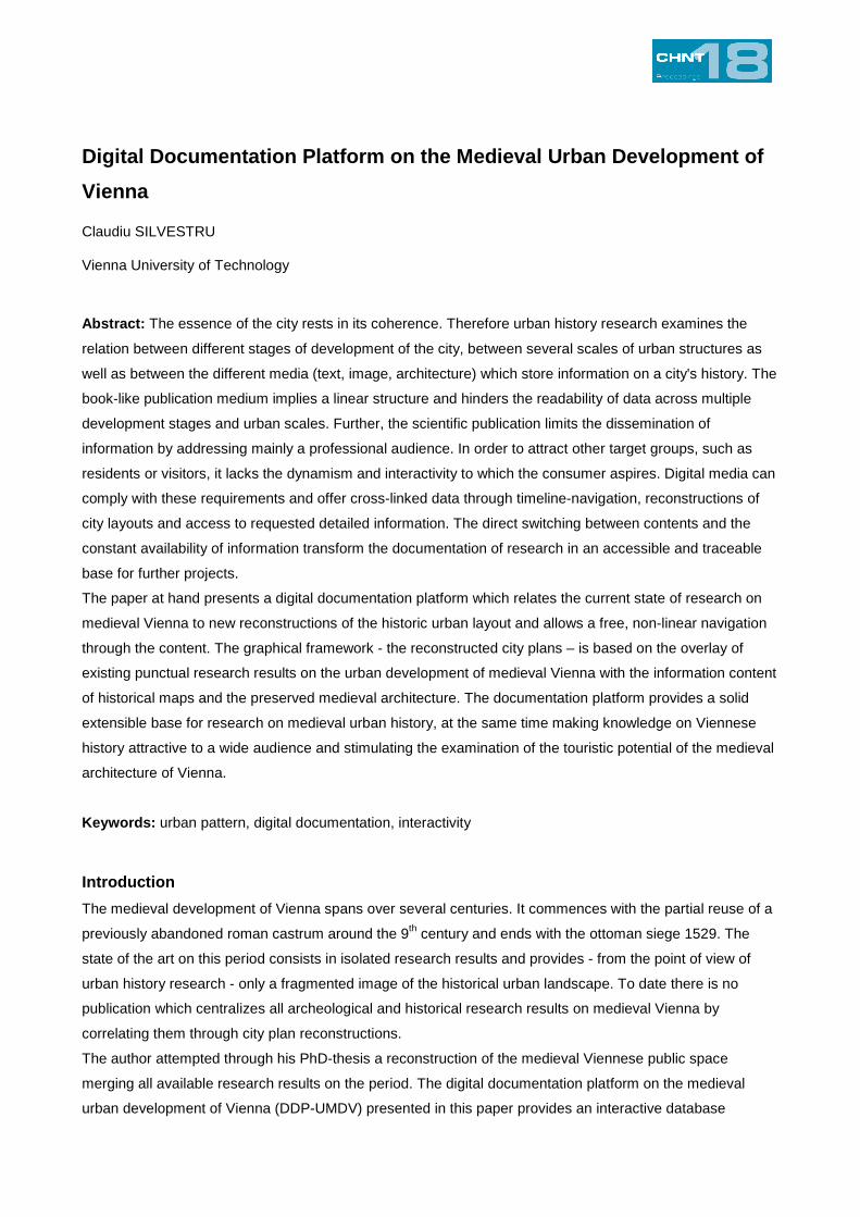
through hatches, symbols and labels. By determining a linear structure the medium “book” doesn't allow a
reading of this data across several developing stages and urban scales (fig. 1).
Fig. 1 – The medium “book”: the linear structure allows only a singular predefined reading flow (Copyright Claudiu Silvestru)
In the digital era those formal constraints lead to limitations both for wide cultural presentation and promotion
and the usage of results in further research. In this context an additional digital dissemination project was
conducted in order to exhaust the potential of the gathered and already synthesized data by making it
available to a wider audience. The result of the project is the DDP-UMDV which allows an interactive non-
linear browsing through the development of the whole urban area of Vienna and its components over several
centuries of the middle ages. The production of the website had to meet following demands:
(I) cross-linking for further research
(II) support for cultural representation and promotion
(III) minimal effort for the development of content
(IV) traceability of information
(I) Cross-linking for Further Research
Urban history research projects benefit from an interactive cross-linked documentation for multiple reasons: it
basically addresses
Silvestru – Digital Documentation Platform on the Medieval Urban Development of Vienna
3
• (1) several development stages that concern
• (2) several urban scales and which are preserved in
• (3) different types of media.
The navigation through this categories i.e. the consideration of their content according to individual needs is
essential for the comprehension of historical urban development.
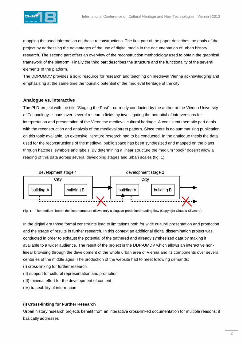
(1) Urban history research is history research. Therefor interpretations of different temporal stages of the
same topic have to be considered and compared. In this context the classification of data through a timeline
is useful (fig. 2).
Fig. 2 – Development stages (Copyright Claudiu Silvestru)
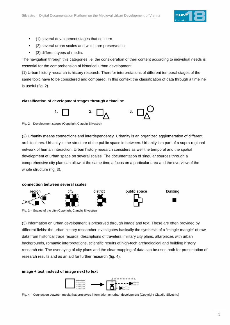
(2) Urbanity means connections and interdependency. Urbanity is an organized agglomeration of different
architectures. Urbanity is the structure of the public space in between. Urbanity is a part of a supra-regional
network of human interaction. Urban history research considers as well the temporal and the spatial
development of urban space on several scales. The documentation of singular sources through a
comprehensive city plan can allow at the same time a focus on a particular area and the overview of the
whole structure (fig. 3).
Fig. 3 – Scales of the city (Copyright Claudiu Silvestru)
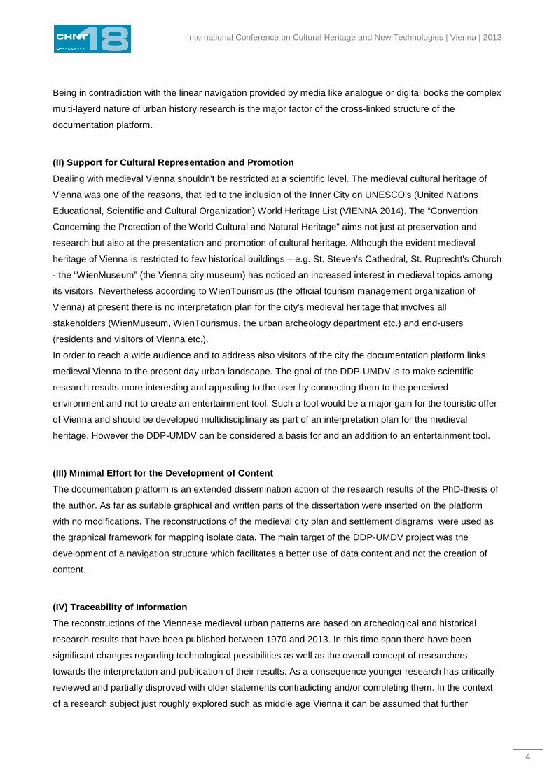
(3) Information on urban development is preserved through image and text. These are often provided by
different fields: the urban history researcher investigates basically the synthesis of a “mingle-mangle” of raw
data from historical trade records, descriptions of travelers, military city plans, altarpieces with urban
backgrounds, romantic interpretations, scientific results of high-tech archeological and building history
research etc. The overlaying of city plans and the clear mapping of data can be used both for presentation of
research results and as an aid for further research (fig. 4).
Fig. 4 – Connection between media that preserves information on urban development (Copyright Claudiu Silvestru)
International Conference on Cultural Heritage and New Technologies | Vienna | 2013
4
Being in contradiction with the linear navigation provided by media like analogue or digital books the complex
multi-layerd nature of urban history research is the major factor of the cross-linked structure of the
documentation platform.
(II) Support for Cultural Representation and Promot ion
Dealing with medieval Vienna shouldn't be restricted at a scientific level. The medieval cultural heritage of
Vienna was one of the reasons, that led to the inclusion of the Inner City on UNESCO's (United Nations
Educational, Scientific and Cultural Organization) World Heritage List (VIENNA 2014). The “Convention
Concerning the Protection of the World Cultural and Natural Heritage” aims not just at preservation and
research but also at the presentation and promotion of cultural heritage. Although the evident medieval
heritage of Vienna is restricted to few historical buildings – e.g. St. Steven's Cathedral, St. Ruprecht's Church
- the “WienMuseum” (the Vienna city museum) has noticed an increased interest in medieval topics among
its visitors. Nevertheless according to WienTourismus (the official tourism management organization of
Vienna) at present there is no interpretation plan for the city's medieval heritage that involves all
stakeholders (WienMuseum, WienTourismus, the urban archeology department etc.) and end-users
(residents and visitors of Vienna etc.).
In order to reach a wide audience and to address also visitors of the city the documentation platform links
medieval Vienna to the present day urban landscape. The goal of the DDP-UMDV is to make scientific
research results more interesting and appealing to the user by connecting them to the perceived
environment and not to create an entertainment tool. Such a tool would be a major gain for the touristic offer
of Vienna and should be developed multidisciplinary as part of an interpretation plan for the medieval
heritage. However the DDP-UMDV can be considered a basis for and an addition to an entertainment tool.
(III) Minimal Effort for the Development of Content
The documentation platform is an extended dissemination action of the research results of the PhD-thesis of
the author. As far as suitable graphical and written parts of the dissertation were inserted on the platform
with no modifications. The reconstructions of the medieval city plan and settlement diagrams were used as
the graphical framework for mapping isolate data. The main target of the DDP-UMDV project was the
development of a navigation structure which facilitates a better use of data content and not the creation of
content.
(IV) Traceability of Information
The reconstructions of the Viennese medieval urban patterns are based on archeological and historical
research results that have been published between 1970 and 2013. In this time span there have been
significant changes regarding technological possibilities as well as the overall concept of researchers
towards the interpretation and publication of their results. As a consequence younger research has critically
reviewed and partially disproved with older statements contradicting and/or completing them. In the context
of a research subject just roughly explored such as middle age Vienna it can be assumed that further
Silvestru – Digital Documentation Platform on the Medieval Urban Development of Vienna
5
findings will follow continuously. Taking all this into consideration it becomes necessary to link all content to
the original publications in order to make information instantly traceable and updatable.
The Layout of the Public Space in Medieval Vienna – a Reconstruction Project
The reconstruction of the Viennese public space in the middle ages is based on available results of
archeological and historical research as well as on historical city plans.
The oldest plan representations of Vienna date back to 1547 and were drawn by master mason Bonifaz
Wolmuet resp. artist and cartographer Augustin Hirschvogel. Both depict the city of Vienna after the ottoman
siege at the brink of renaissance. The urban area is surrounded by a new modern fortification with bastions
that has been probably in planing and partially in construction at that time.
A specific feature of Wolmuets city plan is its high level of detail. In addition to the outline of the public space
– the streets and squares - it shows also the lot and building structure of the blocks. Even gateways to
courtyards and the vault structures of sacral buildings are represented schematically. A further feature of the
plan is the depictions of the new bastions as an addition to the late medieval city wall, making its course
roughly traceable. At the same time the plan has strong disproportions grounded most likely in the inaccurate
survey techniques. Furthermore the street layout is geometrized, minor deviations from the orthogonal are
neglected and organic street courses are rectified. This results in a city plan that reflects quite well the main
characteristics of the Viennese mid 16th century urban pattern but can be used at best as a detailed diagram
for further research.
The city plan of Hirschvogel shows a more organic yet even more disproportionate layout of the public
space. At the same time it lacks the detail of Wolmuets document not showing the lots and their building
structure. Only outlines of sacral buildings are schematically drawn. For the representation of the fortification
area the author switches from 2D plan graphics to a perspective view of the wall, its gates, towers and
bastions as well as the dukes castle. Although providing valuable information on the third dimension, this
approach further reduces the usability of Hirschvogels plan for accurate reconstructions.
The representations of Wolmuet and Hirschvogel are characterized by major disproportion and inaccuracies
justified by the survey techniques of the time. An overlaying with the present day street layout shows that
squares and streets preserved in their shape from the late middle ages are distorted and rotated. Because of
this the younger and more accurate plan of the fortress master builder Werner Arnold Steinhausen was used
as a basis plan for the reconstruction of the late medieval urban pattern. The financial pressure caused by
the reconstruction after two ottoman sieges (1529 and 1683) as well as the Thirty Years' War (1618-1648)
has led to just a few significant changes of the urban structure. Therefor the representation of Vienna at the
beginning of the 18th century includes a great amount of information on the city's late medieval street layout.
Steinhausens document is a highly detailed city plan of Vienna around 1710. The overlaying with the present
day street layout shows that this is the oldest accurate representation of the urban area (FISCHER 1990).
The content of the blocks (lot and building structure) are depicted as well as sacral buildings. An important
feature of the plan is the distinctive identification of fragments of the late medieval wall preserved and
included either in the modern fortifications or in other built structures. Because of this vast parts of the city
wall can be accurately mapped in the reconstructions.
International Conference on Cultural Heritage and New Technologies | Vienna | 2013
6
The first step of the reconstruction process consisted in georeferencing Steinhausens plan on the basis of
historical architecture. To this end buildings and fragments were used, which are preserved at least since
1710 according to the building age plan (WEHDORN 2011). Subsequently the result was vectorized in order
to allow further processing.
The next step involved the information of the Wolmuet and Hirschvogel plans. Taking into consideration
archeological and historical research results urban areas that have been altered in the 16th and 17th century
were adjusted. For example the areas of the university, the dukes castle and the southern part of the Neuer
Markt were carefully reconstructed. The accurate representation of the building structure in Steinhausens
plan made precise modifications possible restricted to particular lots verifiable in the current state.
The outcome is a reconstruction of the Viennese public space around 1529 on which all used archeological
and historical research results were mapped. Starting from this representation documented previous
changes of the urban structure were successively reduced in reverse chronological order producing
reconstructions of the street layout at the end of the 15th, 14th resp. 13th century. Since the available
research results are insufficient for accurate reconstructions of the high and early medieval periods, only
settlement diagrams were created for the 12th, 11th resp. 10th century.
The reconstruction process required an extensive literature research. The available data on the medieval
urban development of Vienna offers a colorful picture joining suppositions and assumptions, harmonized
reconstructions, spatially and temporally restricted findings and concrete yet isolated research results. The
DDP-UMDV centralizes this divers data and maps it both on the historical and present day urban pattern.
The Digital Documentation Platform – dissemination and research tool
Every scientific project is closely connected to extensive preliminary literature research. This applies even
more if the objective involves the synthesis of available research results. In the case of the reconstructions of
the medieval street layout of Vienna a large amount of findings were gathered and mapped. The linear
reading of the dissertation (fig. 1) conditioned by the “book”-medium has led to a structure of the data that
doesn't exploit the whole potential of the material in terms of support for further research. This structure
follows directly the reconstruction methodology: all happenings of a certain century are presented within a
chapter moving then on to the previous century in the next chapter. This procedure preserves the holistic
picture to the reader providing continuous information on all urban development stages. At the same time
following the changes of a certain building through the centuries is not fluent due to constant turn overs
through the chapters.
The DDP-UMDV cancels this restrictions and allows a more fluent and customizable usage of the information
according to the individual needs and objectives of the user. Generally speaking when considering the
design of the platform two aspects have to be highlighted. The graphic layout (I) distributes the information
across the screen. The structural aspect (II) concerns the interactivity and navigation possibilities through the
data.
Silvestru – Digital Documentation Platform on the Medieval Urban Development of Vienna
7
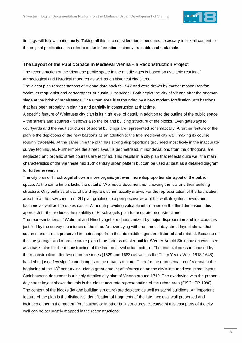
(I) The Graphic Layout
In terms of graphic design the platform has a simple clean layout divided in two main parts (fig. 5). The left
hand side is occupied by the interactive city plan panel including a timeline which allow the user to relate the
accessed data to the whole urban area of a certain development stage. The right hand side has three
elements: a typical navigation bar, the specific text and image information on a certain object and an
overlaying tool which enables a direct comparison of two development stages. The individual elements will
be described below while detailing the structure of the platform.
Fig. 5 – Graphic layout (Copyright Claudiu Silvestru)
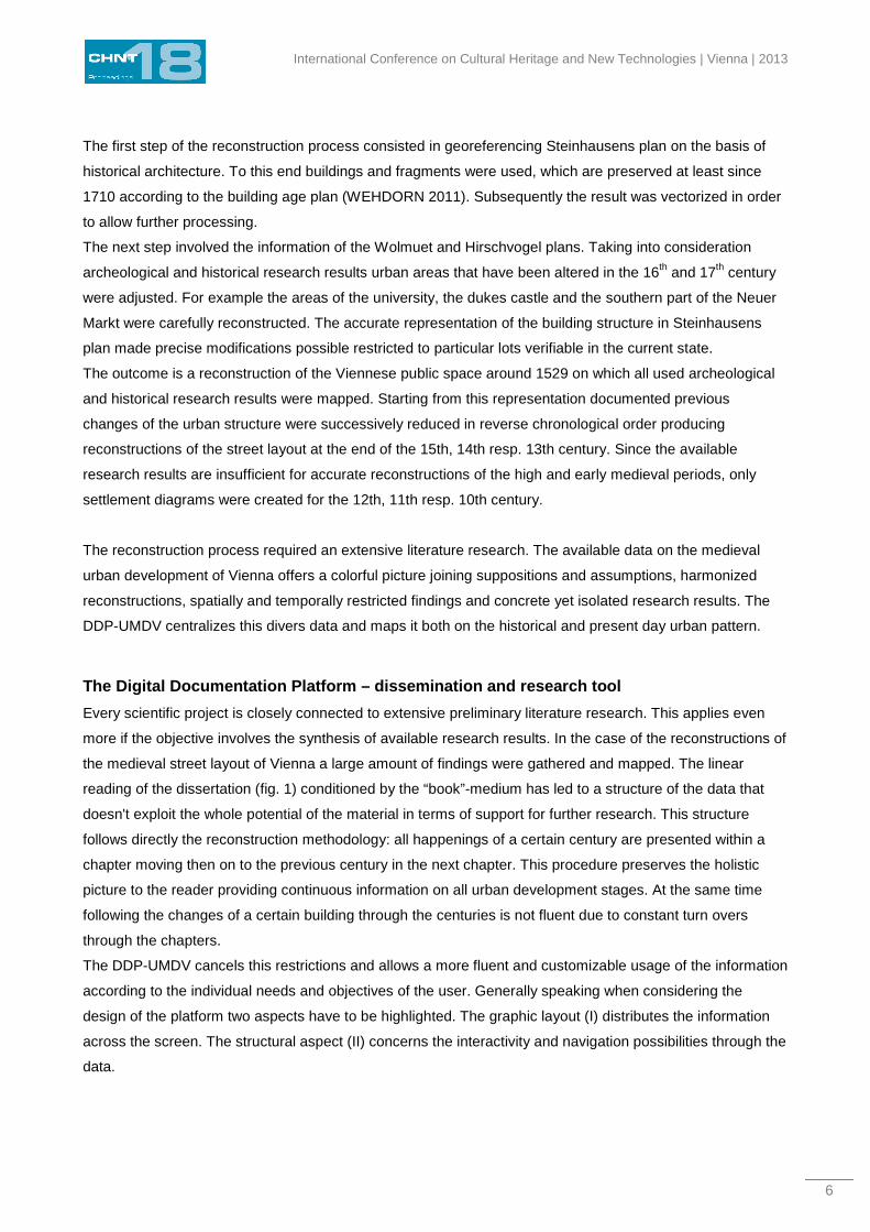
(II) The Functional Structure
Fig. 6 shows the functional relationship between the essential elements of the platform:
(1) navigation bar
(2) timeline
(3) city plan panel
(4) overlaying tool
(5) data on constructions and sites
(6) images of the current state
(7) bibliography
International Conference on Cultural Heritage and New Technologies | Vienna | 2013
8
Fig. 6 – Functional structure of the platform (Copyright Claudiu Silvestru)
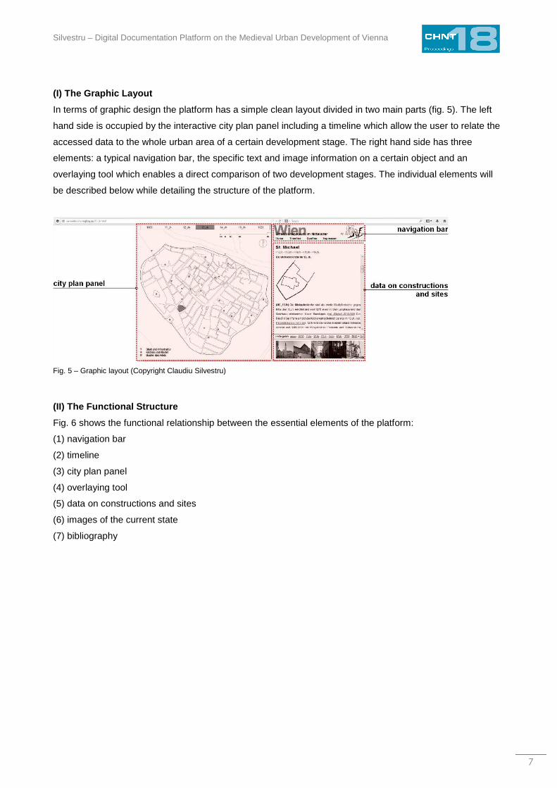
(1) Navigation Bar
The navigation bar allows a quick switch between the platform itself (the timeline button) and two
complementary pages. The first merges all basic information on the reconstructions: complete list of used
literature, links to the employed historical city plans on the homepage of the city of Vienna as well as a brief
description of the reconstruction methodology (fig. 7). The other page contains the legal details and a
disclaimer on the connection between platform and PhD-thesis “Staging the Past”.
Fig. 7 – Page with the basic information on the reconstructions (Copyright Claudiu Silvestru)
(2) Timeline
Time is an essential dimension when considering the development of urban areas. Through the interactive
timeline the user can access the settlement diagrams and the street layout plans of Vienna at the end of the
11th and 12th century resp. 13th, 14th and 15th century. Further the settlement diagram at the turn of the
millennium and the street layout at the end of the Viennese Middle Ages 1529 can be displayed. The timeline
is an integrated part of the city plan panel within which the reconstructions are shown.
Silvestru – Digital Documentation Platform on the Medieval Urban Development of Vienna
9
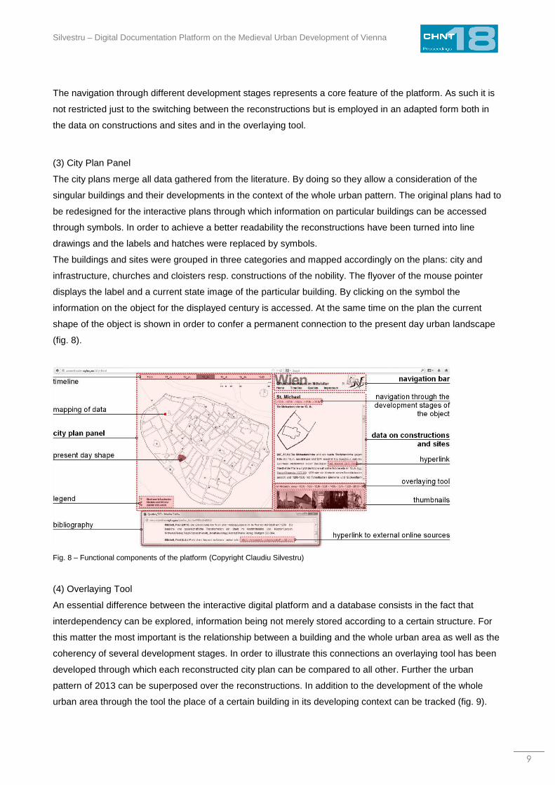
The navigation through different development stages represents a core feature of the platform. As such it is
not restricted just to the switching between the reconstructions but is employed in an adapted form both in
the data on constructions and sites and in the overlaying tool.
(3) City Plan Panel
The city plans merge all data gathered from the literature. By doing so they allow a consideration of the
singular buildings and their developments in the context of the whole urban pattern. The original plans had to
be redesigned for the interactive plans through which information on particular buildings can be accessed
through symbols. In order to achieve a better readability the reconstructions have been turned into line
drawings and the labels and hatches were replaced by symbols.
The buildings and sites were grouped in three categories and mapped accordingly on the plans: city and
infrastructure, churches and cloisters resp. constructions of the nobility. The flyover of the mouse pointer
displays the label and a current state image of the particular building. By clicking on the symbol the
information on the object for the displayed century is accessed. At the same time on the plan the current
shape of the object is shown in order to confer a permanent connection to the present day urban landscape
(fig. 8).
Fig. 8 – Functional components of the platform (Copyright Claudiu Silvestru)
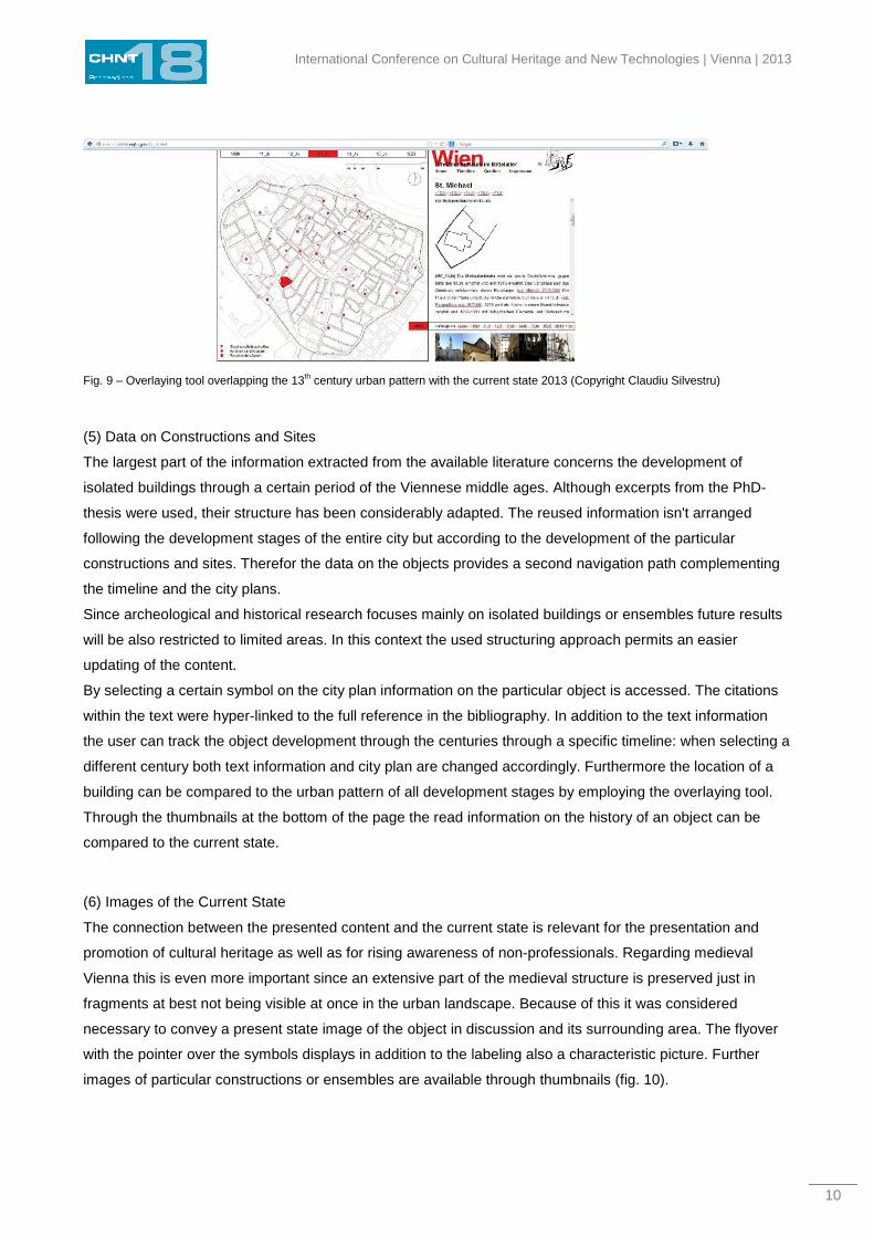
(4) Overlaying Tool
An essential difference between the interactive digital platform and a database consists in the fact that
interdependency can be explored, information being not merely stored according to a certain structure. For
this matter the most important is the relationship between a building and the whole urban area as well as the
coherency of several development stages. In order to illustrate this connections an overlaying tool has been
developed through which each reconstructed city plan can be compared to all other. Further the urban
pattern of 2013 can be superposed over the reconstructions. In addition to the development of the whole
urban area through the tool the place of a certain building in its developing context can be tracked (fig. 9).
International Conference on Cultural Heritage and New Technologies | Vienna | 2013
10
Fig. 9 – Overlaying tool overlapping the 13th century urban pattern with the current state 2013 (Copyright Claudiu Silvestru)
(5) Data on Constructions and Sites
The largest part of the information extracted from the available literature concerns the development of
isolated buildings through a certain period of the Viennese middle ages. Although excerpts from the PhD-
thesis were used, their structure has been considerably adapted. The reused information isn't arranged
following the development stages of the entire city but according to the development of the particular
constructions and sites. Therefor the data on the objects provides a second navigation path complementing
the timeline and the city plans.
Since archeological and historical research focuses mainly on isolated buildings or ensembles future results
will be also restricted to limited areas. In this context the used structuring approach permits an easier
updating of the content.
By selecting a certain symbol on the city plan information on the particular object is accessed. The citations
within the text were hyper-linked to the full reference in the bibliography. In addition to the text information
the user can track the object development through the centuries through a specific timeline: when selecting a
different century both text information and city plan are changed accordingly. Furthermore the location of a
building can be compared to the urban pattern of all development stages by employing the overlaying tool.
Through the thumbnails at the bottom of the page the read information on the history of an object can be
compared to the current state.
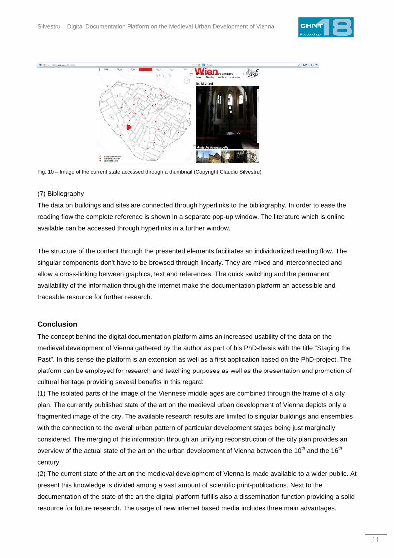
(6) Images of the Current State
The connection between the presented content and the current state is relevant for the presentation and
promotion of cultural heritage as well as for rising awareness of non-professionals. Regarding medieval
Vienna this is even more important since an extensive part of the medieval structure is preserved just in
fragments at best not being visible at once in the urban landscape. Because of this it was considered
necessary to convey a present state image of the object in discussion and its surrounding area. The flyover
with the pointer over the symbols displays in addition to the labeling also a characteristic picture. Further
images of particular constructions or ensembles are available through thumbnails (fig. 10).
Silvestru – Digital Documentation Platform on the Medieval Urban Development of Vienna
11
Fig. 10 – Image of the current state accessed through a thumbnail (Copyright Claudiu Silvestru)
(7) Bibliography
The data on buildings and sites are connected through hyperlinks to the bibliography. In order to ease the
reading flow the complete reference is shown in a separate pop-up window. The literature which is online
available can be accessed through hyperlinks in a further window.
The structure of the content through the presented elements facilitates an individualized reading flow. The
singular components don't have to be browsed through linearly. They are mixed and interconnected and
allow a cross-linking between graphics, text and references. The quick switching and the permanent
availability of the information through the internet make the documentation platform an accessible and
traceable resource for further research.
Conclusion
The concept behind the digital documentation platform aims an increased usability of the data on the
medieval development of Vienna gathered by the author as part of his PhD-thesis with the title “Staging the
Past”. In this sense the platform is an extension as well as a first application based on the PhD-project. The
platform can be employed for research and teaching purposes as well as the presentation and promotion of
cultural heritage providing several benefits in this regard:
(1) The isolated parts of the image of the Viennese middle ages are combined through the frame of a city
plan. The currently published state of the art on the medieval urban development of Vienna depicts only a
fragmented image of the city. The available research results are limited to singular buildings and ensembles
with the connection to the overall urban pattern of particular development stages being just marginally
considered. The merging of this information through an unifying reconstruction of the city plan provides an
overview of the actual state of the art on the urban development of Vienna between the 10th and the 16th
century.
(2) The current state of the art on the medieval development of Vienna is made available to a wider public. At
present this knowledge is divided among a vast amount of scientific print-publications. Next to the
documentation of the state of the art the digital platform fulfills also a dissemination function providing a solid
resource for future research. The usage of new internet based media includes three main advantages.
International Conference on Cultural Heritage and New Technologies | Vienna | 2013
12
− First new media doesn't force a linear, reading the user being able to navigate at his pace through
the cross-linked content.
− Second extensive online information is available everywhere and at all time through “smart” mobile
devices.
− Third the information can be updated faster and easier than in the case of print-media.
(3) Middle age Vienna can become a niche-attraction within the touristic offer of the city. To the regular
visitor to whom the “imperial heritage” is the main attraction, the platform provides information on the
medieval foundations on which the Baroque facades are build upon as well as on the hour of birth of the
“imperial capital”. Furthermore the platform offers an overview of the medieval assets of the city before,
during and after the visit.
Being the product of a project supported by the city of Vienna the digital documentation platform on the
medieval urban development of Vienna intends to make research results on the medieval development more
accessible to an audience including researchers, teachers, scholars, students, tourists etc. Regarding its
long-term impact the platform can stimulate a deeper scientific, cultural and/or entertainment based
confrontation with one of the most important periods of Viennese history.
The platform is available online at: http://wienmittelalter.ragfrog.eu
Acknowledgments
Special Thanks to the Cultural Department of the city of Vienna who supported this project through the
science and research scholarship.
References FISCHER, Karl (1990) Daniel Suttinger und der frühe Wiener Stadtplan. Vienna: Verein für Geschichte der Stadt Wien.
WEHDORN, Manfred (2011) Baualtersplan Wien - Innere Stadt. Vienna: Freytag & Berndt.
VIENNA (2014): Historical city center – world heritage Vienna. online at
http://www.wien.gv.at/stadtentwicklung/grundlagen/weltkulturerbe/zentrum.html
Imprint:
Proceedings of the 18th International Conference on Cultural Heritage and New Technologies 2013 (CHNT 18, 2013)
Vienna 2014
http://www.chnt.at/proceedings-chnt-18/
ISBN 978-3-200-03676-5
Editor/Publisher: Museen der Stadt Wien – Stadtarchäologie
Editorial Team: Wolfgang Börner, Susanne Uhlirz
The editor’s office is not responsible for the linguistic correctness of the manuscripts.
Authors are responsible for the contents and copyrights of the illustrations/photographs.