Delaware School District Organization & Boundaries
53
-
Upload
khangminh22 -
Category
Documents
-
view
2 -
download
0
Transcript of Delaware School District Organization & Boundaries


DEPARTMENT OF EDUCATION STATE OF DELAWARE
DELAWARE SCHOOL DISTRICT ORGANIZATION & BOUNDARIES:
CLOSING THE GAP
Published by University of Delaware
Institute for Public Administration &
Delaware Department of Education

ii
Delaware Department of Education State Board
Joseph A. Pika, Ph.D., President
Jean W. Allen, Vice-President Robert J. Gilsdorf
Mary B. Graham, Esquire Valerie Pepper
Dennis J. Savage Clairbourne D. Smith, Ph.D.
Valerie A. Woodruff, Executive Secretary Ann C. Case, State Board Policy Analyst
Delaware Department of Education
Valerie A. Woodruff, Secretary Dorcell Spence, Deputy Secretary
Robin R. Taylor, Associate Secretary Assessment & Accountability Branch
Mark A. Dufendach, Ph.D., Associate Secretary Finance & Administrative Services Branch
Nancy J. Wilson, Ph.D., Associate Secretary Curriculum & Instructional Improvement Branch
Lew Atkinson, Associate Secretary Adult Education & Work Force Development Branch

iii
INSTITUTE FOR PUBLIC ADMINISTRATION The following document was prepared by the Institute for Public Administration (IPA) in the College of Human Services, Education & Public Policy at the University of Delaware in collaboration with the State of Delaware Department of Education (DOE). IPA is a public service, education, and research center that links the resource capacities of the University of Delaware with the complex public policy and management needs of governments and related nonprofit and private organizations. IPA provides direct staff assistance, research, policy analysis, training, and forums while contributing to the scholarly body of knowledge. IPA Director Jerome R. Lewis, Ph.D. Project Analysis Team Vern C. Svatos, Associate Policy Scientist Jarrod S. Doucette. GIS Analyst Nicole M. Minni, Graphics Specialist / GIS Analyst IPA Review and Assistance Mark Deshon Lisa Moreland

iv
Table of Contents
Introduction & Methodology................................................................................1 School District Consolidations, 1974 – Present ...................................................3 Laws Governing School District Boundaries and Consolidations.....................5 District Boundary Decisions, 1974 – Present.......................................................6 Bibliography ...........................................................................................................7 Appendix A: District Boundary Descriptions ....................................................8
Brandywine – Red Clay.....................................................9 Brandywine – Christina (East) .........................................9 Brandywine – Colonial ......................................................9 Red Clay Consolidated – Christina (East).......................9 Colonial – Christina (East)..............................................10 Red Clay Consolidated – Colonial..................................10 Red Clay Consolidated– Christina (West).....................10 Christina (West) – Colonial.............................................11 Christina (West) – Appoquinimink................................12 Appoquinimink – Colonial ..............................................12 Smyrna – Appoquinimink...............................................13 Capital – Smyrna .............................................................14 Caesar Rodney – Capital.................................................15 Lake Forest – Caesar Rodney.........................................16 Milford – Lake Forest......................................................17 Milford – Woodbridge.....................................................18 Lake Forest – Woodbridge..............................................18 Woodbridge – Seaford.....................................................19 Laurel – Seaford...............................................................19 Laurel – Delmar ...............................................................20 Indian River – Delmar.....................................................21 Laurel – Indian River ......................................................21 Indian River – Seaford ....................................................21 Woodbridge – Indian River ............................................22 Milford – Indian River ....................................................22 Indian River – Cape Henlopen .......................................22 Cape Henlopen – Milford................................................23
Appendix B: District Maps, State of Delaware ................................................25
Public School Districts.....................................................26 Vo-Tech School Districts .................................................27 Appoquinimink ................................................................28 Brandywine.......................................................................29
v
Caesar Rodney .................................................................30 Capital...............................................................................31 Cape Henlopen .................................................................32 Christina ...........................................................................33 Colonial .............................................................................34 Delmar...............................................................................35 Indian River......................................................................36 Lake Forest .......................................................................37 Laurel ................................................................................38 Milford ..............................................................................39 New Castle County Vo-Tech...........................................40 Polytech.............................................................................41 Red Clay............................................................................42 Seaford ..............................................................................43 Smyrna..............................................................................44 Sussex Technical...............................................................45 Woodbridge ......................................................................46

1
Introduction & Methodology
In 1974, Roger Mowrey, Administrative Assistant to State Superintendent of Public Instruction, published a document titled, “Delaware School District Organization and Boundaries.” In his words it was “an attempt to bring together under one cover the disparate sections of law, records and minutes detailing boundary decisions and school district unions, consolidations, divisions, and incorporations.” The publication was a success and has been referenced for information for 28 years. Mowrey’s publication also included a “Review of Delaware Education” which gives an explanation of the five distinct periods of organization that Delaware’s educational system has experienced. Copies of the review along with additional information about the history of Delaware education are available by contacting the Department of Education. This publication is meant as a follow-up to the Mowrey publication and not a replacement of it. It includes a short history covering the period from 1974 to 2002 and a description of the current school district boundaries. A major portion of the project was the creation of Geographic Information System (GIS) datasets of public school locations and school district boundaries. These datasets are used to establish graphical pictures of current school district boundaries as well as being building blocks upon which to create a geodatabase to be used by the Department of Education and other state agencies in the future. District Maps One thing that Mowrey did not provide in his work was school location data. To locate the schools within the state school districts, a number of decisions had to be made as to whether to include a school on the map. Information was obtained using the Department of Education’s website and the individual schools’ websites for guidance in this matter. The final decision as to which facilities would be located on the maps was made by the Department of Education. Individual school buildings, not programs within buildings, are represented on each map. Some schools shown on the maps have not been built, but it was thought best to include them on the maps at this time for future planning. The benefit of having the most current school district maps included in a geodatabase is that new schools and facilities can be added in the future with minimal work. Important throughout this project was the fact that we were not only creating maps of school locations but also creating a database for use in a GIS. All school points on the map have geographic coordinates. GIS users can zoom in on a street file, parcel file, or geo-referenced aerial image, to see that the school symbol is centered on the actual location of the school in geographic space. For each point (school) on the map, there is a database entry that identifies for that point, the school name, school type (elementary, middle, special, etc.), school district, and county. Additional data can be added easily to this file or it can be linked to other files containing other school information. The data can be mapped or used in future analyses.

2
District Boundaries The drawing of the district boundaries presented us with a more difficult problem. Because we had at our disposal technological tools not available in 1974, we decided to use them to completely revise district boundary maps using GIS and other computer graphics techniques. School redistricting that occurred in New Castle County post-1974 resulted not only in new district boundaries but also new districts. These changes could not, at that time, be portrayed with the accuracy now possible with a geographic information system. An additional benefit of using a GIS is that future changes can be made easily so that district boundaries and school locations can be investigated, added, modified or deleted, and new maps can be produced quickly. Mowrey’s work includes copies of district maps, at different scales, created by drawing the boundaries on paper maps, cutting out the districts, and making copies of the cutouts. At the time this was the only available technology. The original district boundary descriptions, most of which were written in 1974, had to be modified for this project because today they are found often to be confusing and ambiguous. This problem becomes readily apparent when one tries to reconcile the narrative description with what is actually seen when looking at property parcel lines or the physical environment as seen on an orthophoto (geo-referenced aerial photo). The problem is also evidenced by the requests made of county planning departments to clarify whether or not a parcel is in a certain district. Any line modification that later proves to have resulted in any property parcel being moved from district to another was completely unintended. The best available data were used to determine where the line should be. Two sources were used to create boundary lines in a format usable for a GIS. The first was the boundary descriptions found in Mowrey with any additional information provided by the individual school districts. This process, while not completely accurate, sufficed for the districts outside New Castle County since they had been the least affected since 1974. However, this method was not entirely satisfactory for creating the boundaries of the Red Clay Consolidated, Brandywine, Christina, and Colonial Districts in New Castle County. Our second source was the census digital boundary file. This file had been created at a much smaller scale and required extensive editing, but it was a good guide to the districts that had not experienced redistricting. The second source was the staff of the Data Service Center (DSC) in New Castle County, who provided us with their extensive knowledge and experience in this area. With their assistance, the current census line data was edited on-screen, and the boundaries were realigned to more accurately represent their intended location. On-screen background references used for the line realignment were the orthophotos and New Castle County digital parcel line data. While the maps created for this project and included in this report are at a scale too small to notice modifications, they would become much more evident if they were viewed at a much larger scale in a GIS. The modifications included such things as moving a boundary from a land area to the center of a stream, moving a boundary that crossed the center of a block rather than following a street centerline, or modifying a boundary that passed through what was once open land and is now a housing development. However, these boundaries still require
3
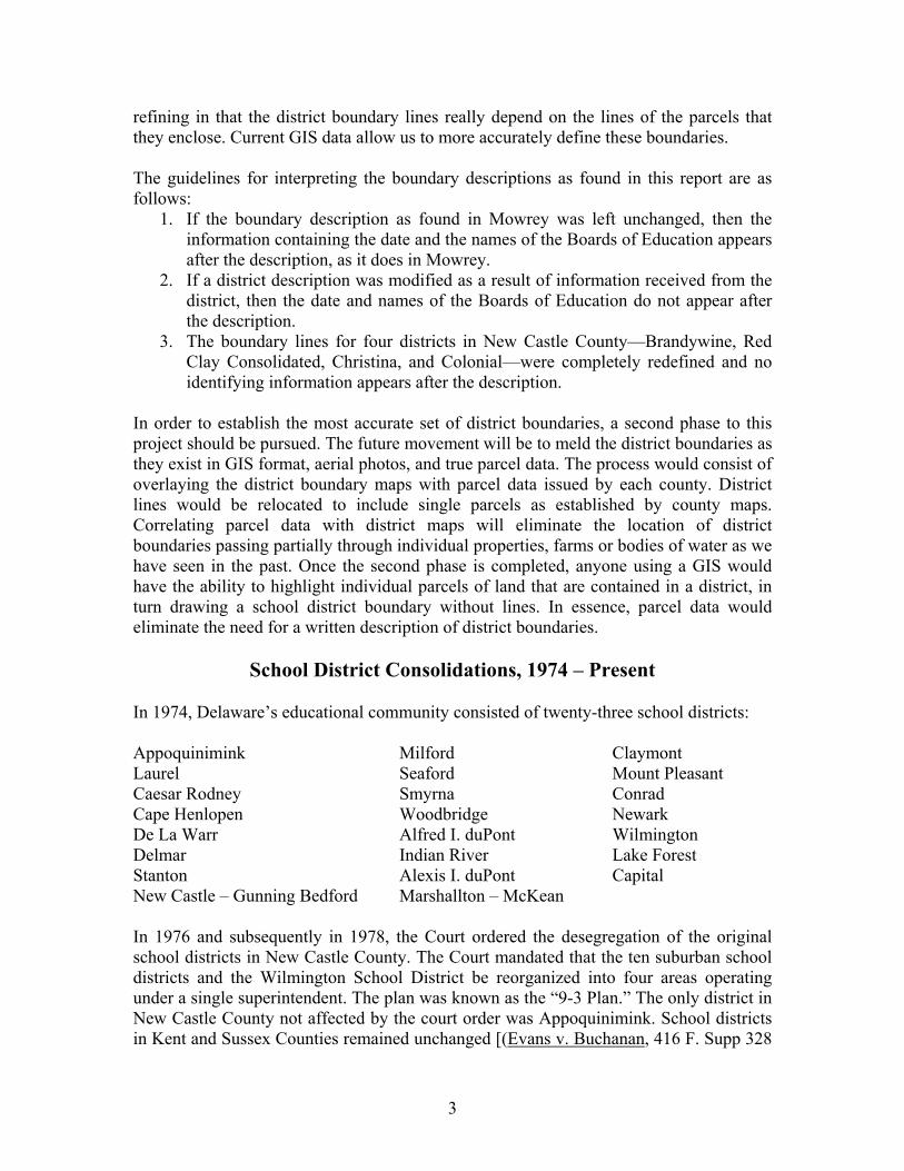
refining in that the district boundary lines really depend on the lines of the parcels that they enclose. Current GIS data allow us to more accurately define these boundaries. The guidelines for interpreting the boundary descriptions as found in this report are as follows:
1. If the boundary description as found in Mowrey was left unchanged, then the information containing the date and the names of the Boards of Education appears after the description, as it does in Mowrey.
2. If a district description was modified as a result of information received from the district, then the date and names of the Boards of Education do not appear after the description.
3. The boundary lines for four districts in New Castle County—Brandywine, Red Clay Consolidated, Christina, and Colonial—were completely redefined and no identifying information appears after the description.
In order to establish the most accurate set of district boundaries, a second phase to this project should be pursued. The future movement will be to meld the district boundaries as they exist in GIS format, aerial photos, and true parcel data. The process would consist of overlaying the district boundary maps with parcel data issued by each county. District lines would be relocated to include single parcels as established by county maps. Correlating parcel data with district maps will eliminate the location of district boundaries passing partially through individual properties, farms or bodies of water as we have seen in the past. Once the second phase is completed, anyone using a GIS would have the ability to highlight individual parcels of land that are contained in a district, in turn drawing a school district boundary without lines. In essence, parcel data would eliminate the need for a written description of district boundaries.
School District Consolidations, 1974 – Present In 1974, Delaware’s educational community consisted of twenty-three school districts: Appoquinimink Milford Claymont Laurel Seaford Mount Pleasant Caesar Rodney Smyrna Conrad Cape Henlopen Woodbridge Newark De La Warr Alfred I. duPont Wilmington Delmar Indian River Lake Forest Stanton Alexis I. duPont Capital New Castle – Gunning Bedford Marshallton – McKean In 1976 and subsequently in 1978, the Court ordered the desegregation of the original school districts in New Castle County. The Court mandated that the ten suburban school districts and the Wilmington School District be reorganized into four areas operating under a single superintendent. The plan was known as the “9-3 Plan.” The only district in New Castle County not affected by the court order was Appoquinimink. School districts in Kent and Sussex Counties remained unchanged [(Evans v. Buchanan, 416 F. Supp 328

4
(D.Del. 1976), aff’d 555 F. 2d 373 (3d Cir.), cert. denied, 434 U.S. 880 (1977)) & (vans v. Buchanan , 447 F. Supp. 982 (D. Del.), aff’d, 582 F.2d 750 (3d Cir. 1978), cert. denied, 446 U.S. 923 (1980)]. In 1978, Delaware’s educational community consisted of thirteen school districts: Appoquinimink Milford Laurel Seaford Caesar Rodney Smyrna Cape Henlopen Woodbridge Delmar New Castle County Indian River Lake Forest Capital In 1981 the General Assembly passed legislation authorizing the Delaware State Board of Education to ensure compliance with the 1978 Order. The State Board proposed the abolishment of the four service areas under one superintendent, and the establishment of four distinct school districts. Each of the four newly formed districts would serve a portion of Wilmington. In 1981, Delaware’s educational community consisted of sixteen school districts. Four of these in New Castle County were new districts. These latter were created from nine former districts as explained below: Appoquinimink Laurel Caesar Rodney Cape Henlopen Delmar Lake Forest Milford Seaford Smyrna Woodbridge Indian River Capital Colonial: created by combining the former De La Warr and New Castle-Gunning
Bedford districts with sections of the Stanton and Wilmington districts. Brandywine: created by combining the former Alfred I. duPont, Claymont, and Mt.
Pleasant districts with a section of the Wilmington district. Red Clay Consolidated: created by combining the former Alexis I. duPont, Conrad, and
Marshallton-McKean,districts with sections of the Stanton and Wilmington districts.
Christina: created from the former Newark district.

5
From the 1960s to 1990, Delaware operated a shared-time vocational school program. The shared-time program offered students the opportunity to acquire technical job skills in addition to the academic core curriculum. Students attended high school in their primary school district for a part of the day, and then attend a vocational technical school for the remainder of the day. The current Delaware educational community consists of 19 independent school districts: Appoquinimink Milford Laurel Seaford Caesar Rodney Smyrna Cape Henlopen Woodbridge Delmar Indian River Lake Forest Capital Colonial Brandywine Red Clay Consolidated Christina New Castle County Vo-Tech Polytech Sussex Technical In 1990, a decision by the State Board of Education and the General Assembly turned the shared-time vocational technical schools into full-time academic high school programs. Students were offered the opportunity to attend a vocational technical high school for the entire day, learning both academic and technical skills. This decision brought about the establishment of Delaware’s three vocational technical (county-based) school districts (New Castle County Vo-Tech, Polytech, Sussex Technical). In 1998, Delaware began another movement in an effort to provide an alternative to traditional public schools. A system of independent “charter schools” that operate as independent public schools was initiated. There are eleven charter schools in operation in Delaware as of December 2002.
Laws Governing School District Boundaries and Consolidations These laws are included as a point of reference only. Delaware School Laws should be referenced for the complete and governing language. Delaware Code Title 14 § 1025 Fixing doubtful or disputed boundaries of reorganized school districts
- In case of dispute or controversy as to the correct location of the existing boundary of any district, the State Board of Education shall establish boundaries after examining all available records.
Delaware Code Title 14 § 1026 Changing boundaries, vocational-technical school districts; City of Wilmington
- The State Board of Education may, in accordance with this section, change or alter the boundaries of any reorganized school district …. Before making
6
changes in the boundaries of a district the State Board shall consult with the school boards of the districts affected. Thereafter, the State Board shall submit the proposed change for approval or rejection to the qualified voters.
Delaware Code Title 14 § 1027 Consolidation of reorganized or vocational-technical school districts
- The State Board in its judgment finds it practicable and desirable to consolidate 2 or more reorganized school districts which are contiguous, in cases other than vocational-technical school districts, the State Board shall submit the proposed change for approval or rejection to the qualified voters. Unless a dispute arises all boundary decisions shall be determined by the local patrons and school board.
Boundary Decisions – 1974 to Present
Appoquinimink & Colonial The district boundary line between Appoquinimink and Colonial divided several proposed building lots in the residential area of Mounthope. The district line caused various lots to have property in both school districts. Mounthope is located just south of the Chesapeake and Delaware Canal, and approximately 1.2 miles west of U.S. Route 13 on Lorewood Grove Road. School district officials representing both boards of education consulted each other and recommended a reasonable adjustment to the boundary line dividing Mounthope to follow street and/or property lines on the approved map. (Map on file with both school districts and Department of Education.) Appoquinimink & Colonial On July 14 and 22, 1992, a public hearing was held in this matter pursuant to 29 Del.C., Sec. 10125 of the Administrative Procedures Act, and the applicable provisions of 14 Del.C., Sec. 1026(d), as amended by Senate Bill 318. On August 14, 1992, Dr. James L. Spartz, Deputy State Superintendent, issued a Proposed Decision and Transition Plan recommending that the petition be granted and that the boundary line separating the Appoquinimink and Colonial School Districts be modified such that the entire development of Grande View Farms would be in the Appoquinimink School District. Christina & Colonial The line separating both districts split the Christina Meadows development in two. A portion of the development would attend Christina and the other would attend Colonial. A joint resolution was drafted by both school districts to make new Route 1 the school district boundary line between Route 40 and School Bell Road. The entire development of Christiana Meadows falls in the Colonial School District. Milford & Cape Henlopen The boundary in question is located in the development known as The Meadows at Cubbage Pond. Before the land was developed, the boundary line ran from a point in the center of Route 224 by a direct line north 30 degrees west to Cedar Creek. When the farm was divided into building lots, the boundary line split individual lots between the

7
two school districts. After consulting with the developer, Cape Henlopen and Milford School Districts worked out a more detailed boundary description. (Map on file with both school districts.)
Lake Forest & Woodbridge The State Board issued the following decision on May 19, 1977. The survey of Mr. Charles D. Murphy, Jr. establishes the true and correct contiguous boundary between the Lake Forest and Woodbridge School Districts from the westernmost to the easternmost termini of said line. The original copy of this Decision and Order and its exhibits shall be preserved in a special book to be kept by the Department of Public Instruction for that purpose pursuant to 14 Del. C. §1025(b). Copies of this Decision and Order and its exhibits shall be filed with the Board of Assessment of the appropriate county and shall be transmitted to the Executive Secretaries of the Lake Forest and Woodbridge Boards of Education.
Bibliography
Consent Order, In the United States District Court for the District of Delaware, The Coalition To Save Our Children v. Board of Education of the State of Delaware, Nos. 56-CV-1816-1822 NMS. Mowrey, Roger C., “Delaware School District Organization and Boundaries,” 1974. Colonial School District, Joint Resolution, June 27, 1988. Colonial School District, Final Order, In the Matter of the Concerned Residence of Grande View Farms Petition for Change of School District Boundaries, State Board, September 10, 1992. Milford School District, Board of Education Meeting Minutes, March 22, 1993, page 14. Woodbridge School District, Decision and Final Order, In the Matter of the Fixing of the Contiguous Boundary Line Between the Lake Forest and Woodbridge School Districts, State Board, March 18, 1982.

8
APPENDIX A: District Boundary Descriptions
9
BRANDYWINE – RED CLAY CONSOLIDATED Beginning at the intersection of the Pennsylvania border and the Brandywine Creek, south following the centerline of the Brandywine Creek to a point approximately 850 feet south of the intersection of Husbands Run and the Brandywine Creek; Then southeast by a line approximately 1180 feet to a point at the centerline of Powder Mill Rd (Route 141) at a distance of approximately 1060 feet southwest of the intersection of Powder Mill Road and Alapocas Drive; Then northeast following the centerline of Powder Mill Road to its intersection with Alapocas Drive; Then southeast following the centerline of Alapocas drive to the southeastern boundary extended of parcel 0612600002 (DuPont Experimental Station); Then southwest along the parcel boundary to the midpoint of the Brandywine Creek; Then east following the City of Wilmington boundary to its intersection with the CSX railroad tracks; Then northeast following the CSX railroad to its intersection with 30th street extended; Then southeast along 30th Street to its intersection with Market Street; Then southwest along Market Street to its intersection with the Brandywine Creek.
BRANDYWINE – CHRISTINA (EAST)
Beginning at the intersection of Market Street and the Brandywine Creek, southeast following the centerline of the Brandywine Creek to its intersection with Northeast Boulevard (Route. 13); Then northeast following the centerline of Northeast Boulevard to its intersection with Vandever Avenue.
BRANDYWINE – COLONIAL Beginning at the intersection of Northeast Boulevard and Vandever Avenue, northeast following the centerline of Northeast Boulevard to the City of Wilmington boundary; Then southeast following the City of Wilmington boundary to the Delaware River.
RED CLAY CONSOLIDATED – CHRISTINA (EAST) Beginning at the intersection of Market St. and the Brandywine Creek, south following the centerline of the Market St. to its intersection with King St. and 15th St.; Then west following the centerline of Market St. to its intersection with 14th St.; Then northwest by a line to the intersection of 14th St. and Orange St.; Then southwest following the centerline of Orange St. to its intersection with 13th St.; Then northwest following the centerline of 13th St. to its intersection with Chippey St.; Then southwest following the centerline of Chippey St. to its intersection with 12th St.; Then northwest following the centerline of 12th St. to its intersection with Delaware Ave.; Then northwest following the centerline of Delaware Ave. to its intersection with Adams St.; Then southwest following the centerline of Adams St. to its intersection with Lancaster Ave.; Then northwest following the centerline of Lancaster Ave. to its intersection with Union St.; Then southwest following the centerline of Union St. becoming Kirkwood Highway (Rte. 2) to the City of Wilmington boundary;
10
Then in a southeasterly direction by the City of Wilmington boundary to a point where it intersects the Amtrak Railroad; Then northeast following the Amtrak Railroad to its intersection with Beech St.; Then southeast by a straight line, coincident with the southern boundary of parcel 2604900005, to a point at which said line intersects the centerline of the Christina River; Then south by the centerline of the Christina River to its intersection with the City of Wilmington boundary.
COLONIAL – CHRISTINA (EAST) Beginning at the intersection of Northeast Blvd. and Vandever Ave., southeast following the centerline of Vandever Ave. approximately 1000 feet to the Amtrak Railroad; Then southwest following the centerline of the Amtrak Railroad to the intersection of Church St. and Christina Ave.; Then southeast following the centerline of Christina Ave. to its intersection with the Christina River; Then east and south following the centerline of the Christina River to its intersection with the Conrail Railroad; Then west following the centerline of the Conrail Railroad to its intersection with New Castle Ave.; Then south following the centerline of New Castle Ave. to its intersection with the City of Wilmington boundary; Then northwest by the City of Wilmington boundary to its intersection with the Christina River.
RED CLAY CONSOLIDATED – COLONIAL Beginning at the intersection of the City of Wilmington boundary and the Christina River, southwest following the centerline of the Christina River to its intersection with White Clay Creek; Then west following the centerline of White Clay Creek to its intersection with Choate Creek.
RED CLAY CONSOLIDATED – CHRISTINA (WEST) Beginning at the intersection of White Clay Creek and Choate Creek, northwest following the centerline of White Clay Creek to the southern corner of parcel 0805500002 (YMCA, Western Branch); Then northwest along the boundary of the aforementioned parcel extended to the centerline of Kirkwood Highway (Rte. 2); Then southwest following the centerline of Kirkwood Highway approximately 360 ft. to the eastern boundary line of the Peikin Park Subdivision extended; Then northwest along the boundary of Peikin Park to the northern corner of the Peikin Park Subdivision; Then southwest by a line approximately 1900 ft. coincident with the northwestern boundary of Peikin Park to a point 200 ft. east of Upper Pike Creek Road and 200 feet north of Route 2; Then north to the northern corner of parcel 0804930026; Then northwest along the boundary of the Crossan Pointe Subdivision to Route 316; Then west to the intersection of Route 316 and Upper Pike Creek Rd.;
11
Then northwest following the centerline of Upper Pike Creek Rd. to its intersection with Paper Mill Rd.; Then northeast approximately 300 ft. following the centerline of Paper Mill Rd. to its intersection with Pike Creek; Then northwest following the centerline of Pike Creek to its intersection with Crossan Rd. about 100 ft. west of Stirrup Run; Then west following the centerline of Crossan Rd. to its intersection with Doe Run Rd.; Then north following the centerline of Doe Run Rd. to the eastern parcel boundary of the Sunset Valley Subdivision; Then in a westerly direction along the southern parcel boundary of the Sunset Valley Subdivision to parcel 0802200041; Then west along the southern boundary of parcel 0802200041 to the Merestone Subdivision; Then west along the southern boundary of the Merestone Subdivision to the Delaware-Pennsylvania border.
CHRISTINA (WEST) – COLONIAL Beginning at the intersection of Choate Creek and White Clay Creek, south following the centerline of Choate Creek south and southeast to its intersection with Route 4; Then southeast by a line to a point at the intersection of the middle branch of Eagle Run Creek and I-95, approximately 3700 feet northeast of Route 273; Then southeast following the centerline of the middle branch of Eagle Run Creek to its intersection with the Christina River; Then east following the centerline of the Christina River to the northeast corner of parcel 1002800025; Then south along the aforementioned parcel line extended to its southeast corner; Then southwest by a line to the northwest corner of parcel 1002910032; Then south along the boundary of the aforementioned parcel to the Wedgewood subdivision boundary; Then east and southeast along the Wedgewood subdivision to the intersection of the northeastern Wedgewood subdivision boundary extended and Winburne Dr.; Then northeast following the centerline of Winburne Dr. to its intersection with Appleby Rd.; Then southeast following the centerline of Appleby Rd. to the southern boundary extended of parcel 1002910099; Then west and southwest along the southern boundary of the aforementioned parcel and the Wedgewood subdivision to the northern corner of parcel 1002800055; Then southwest along the northern boundary of the aforementioned parcel to its westernmost point; Then southwest by a line to the centerline of School Bell Rd. (Rd. 344); Then southeast following the centerline of School Bell Rd. to its intersection with the northern boundary extended of the Whethersfield subdivision; Then southwest along the boundary of the Whethersfield subdivision to the western corner of the Whethersfield subdivision(Across Route 1); Then southeast along the boundary of the Whethersfield subdivision (Across Route 1) to a point at which it meets with parcel 1003340033; Then southwest by a line to a point in the center of Route 40, approximately 450 ft. southwest of its intersection with Route 1; Then southeast by a line to a point on the western boundary of parcel 1003900046, approximately 740 ft. from the northwestern corner of the aforementioned parcel; Then south along the boundary of the aforementioned parcel to its southern corner;

12
Then northeast by a line approximately 1285 ft. to a point on the centerline of the Conrail Railroad; Then southwest and south following the centerline of the Conrail Railroad (Continue straight at the forks in the railroad) to its intersection with the northeastern boundary line of parcel 1103800275 extended; Then northwest and southwest along the boundary of parcel 1103800275 to the western corner of the parcel; Then south by a line to the southeastern boundary of parcel 1103800166; Then west by a line to the southeastern corner of parcel 1103800242; Then west by a line to the intersection of Woods Rd. and the northern boundary extended of parcel 1103800052.
CHRISTINA (WEST) – APPOQUINIMINK Beginning at the intersection of Woods Rd. and the northern boundary extended of parcel 1103800052, west following the boundary of the Mansion Farms subdivision to the southeastern corner of parcel 1103200024; Then north along the boundary of the aforementioned parcel 1300 ft. to a point approximately 240 feet short of the centerline of Porter Rd; Then west to the southeastern corner of parcel 1103200021; Then south to a point in the middle of the southern boundary of parcel 1103200024; Then west along the southern boundaries of parcels 1103200024, 1103200019, 1103200018, and 1103200017 to the southwest corner of parcel 1103200017; Then north along the boundary of parcel 1103200017 to the intersection of the western boundary extended of parcel 1103200017 and Porter Rd; Then west along the centerline of Porter Rd. to its intersection with the southbound lane of Route 301; Then north by a line to the northeastern corner of parcel 1103200002; Then west along the boundary of the aforementioned parcel and the Marabou Meadows subdivision (southern boundary of Marabou Meadows 2) to the northwestern corner of the Marabou Meadows subdivision; Then south along the boundary of the Marabou Meadows subdivision to the southwestern corner of the Marabou Meadows subdivision; Then west along the boundary of the Farmington Subdivision to the intersection of the northern boundary extended of the Farmington Subdivision and Frazer Rd. (Rd. 391); Then north following the centerline of Frazer Rd. to its intersection with Frenchtown Rd.; Then west following the centerline of Frenchtown Rd. to the Delaware-Maryland Border.
APPOQUINIMINK – COLONIAL Beginning at the intersection of Woods Rd. and the northern boundary extended of parcel 1103800052, south following the centerline of Woods Rd. to its intersection with Howell School Rd.; Then south by a line to the intersection of Buck Jersey Rd. and a stream flowing into the northern-most part of Lum’s Pond (Approximately 2230 feet south of the intersection of Howell School Rd. and Buck Jersey Rd.); The south by the centerline of the previously mentioned stream into Lum’s Pond approximately 4200 ft. to another small stream;
13
Then south by the centerline of the previously mentioned stream, across Red Lion Rd. to the origin of the stream approximately 300 ft. west of the Conrail Railroad; Then west by a line, roughly paralleling the slough to its south, approximately 2350 ft. to a point; Then south by a line to the centerline of the aforementioned slough; Then east by the centerline of the slough to its eastern shore; Then east by a line to the westernmost point of the ox bow; Then southeast by the centerline of the ox bow to the southern shore of the ox bow; Then south by a line to the centerline of the C&D Canal (approximately 3000 ft. from the Conrail Railroad bridge); Then east by the centerline of the C&D Canal to a point where it intersects the extension of a creek that flows through the eastern part of parcel 1300200012; Then south following the centerline of the aforementioned creek to its intersection with Lorewood Grove Rd. (Rd. 412); Then east by a line to the western corner of the Mount Hope Development; Then south along the boundary of the Mount Hope Development to the westernmost corner of parcel 1300330006; Then northeast and southeast along the northern boundary of parcel 1300330006 to the eastern corner of this parcel; Then southeast by a line to the northwestern corner of parcel 1300340062; Then east along the boundary of the aforementioned parcel to the western boundary of parcel 1300340043; Then south along the western boundary of parcels 1300340043, 1300340044, 1300340068, 1300340045, 1300340053, and 1300340054 to the southern corner of parcel 1300340054; Then southeast by a line to the western corner of parcel 1300340019; Then southeast and east along the southern boundary of parcel 1300340019 to the eastern corner of this parcel; Then southeast along the eastern boundary of the Mount Hope subdivision to the eastern corner of parcel 1300820007; Then southwest along the southeastern boundary of the Mount Hope subdivision approximately 295 ft to a point; Then southeast by a line approximately 690 ft. to a point on Scott’s Run, approximately 600 ft. south from the northeastern boundary of parcel 1300800026; Then southwest by Scott’s Run to its intersection with the southwestern boundary of parcel 1300800036; Then southeast by a line to the western corner of the Asbury Chase subdivision; Then east along the boundary of the Asbury Chase subdivision to the northeastern corner of the Grande View Farms subdivision; Then south, southeast, and east along the boundary of the Grande View Farms subdivision to the northeastern corner of parcel 1301320049; Then southeast by a line approximately 100 feet to the intersection of Route 13 and Augustine Creek; Then east following the centerline of Augustine Creek to its intersection with the Delaware River.
SMYRNA – APPOQUINIMINK
Beginning on the Delaware River at the mouth of Blackbird Creek, the junction of Smyrna and Appoquinimink; by Blackbird Creek southwest across Route 449 to a point just east of the mouth of Beaver Branch;

14
by a direct line southeast, which line crosses Route 51 at a point 6/10 mile west of Route 45, to the Sawmill Branch bridge at Route 45, but not crossing Route 45; by the Sawmill Branch southwest across Route 465 to Route 469 at a point 6/10 mile east of Route 13; by the center of Route 469 southwest across Routes 13 and 470 to the intersection with Route 484; by a direct line as an extension of Route 469 southwest to the southeast corner of the Blackbird State Forest; by the south boundary of Blackbird State Forest west to Route 471; by the center of Route 471 south to Route 47; by the center of Route 47 northwest to Route 474; by the center of Route 474 southwest to the Maryland-Delaware line, the junction of Smyrna and Capital.
Approved by: Appoquinimink Board of Education
February 10, 1970 Smyrna Board of Education
February 26, 1970
CAPITAL – SMYRNA
Beginning at the mouth of the Leipsic River where it enters Delaware Bay, the junction of Smyrna and Capital; by the Leipsic River northwest to Route 9; by Little Duck Creek at Route 9 west to the Penn Central Railroad; by the Penn Central Railroad southeast to Alston Branch; by a line in the rear of all properties fronting on Route 42 west to the Nelson Dill property at Seven Hickories; by a line between the properties of Nelson Dill and William H. Faulkner south to Route 42; by Route 42 west to the William H. Faulkner and Caroline Ridgeway property line; by a line extended from the Faulkner-Ridgeway boundary south to the rear of the Noah Mast property at Fork Branch (all properties fronting on Route 168 being in the Smyrna School District); by Fork Branch west to Route 166; by the Frank Russell property boundary west to Route 165; by a line west to Route 170 at the Wallace Hughes-Harry Benson property boundary; by a direct line northwest to the intersection of Routes 11 and 169; by a line southwest to the northeastern corner of the Julia Jackson property at Ford's Corner in the Capital School District so that all properties fronting on Route 11 are in the Capital School District; by the Jackson property eastern boundary south to Route 98; by this line across Route 98 south to include the Lillian Hackett property located in front of the Jackson property south of Route 98; by the Hackett property boundaries back to Route 98; by Route 98 southwest to the Stanley Iplenski property located in the Smyrna School District to Gravelly Run; by Gravelly Run (the western boundary of the Iplenski property) northwest across Route 98 to the fork in the run at the back of the Frank Sydel property, located in the Capital School District;

15
By a direct line through the intersection of Routes 44 and 180 southwest to the Delaware-Maryland line, the junction of Smyrna and Capital.
Approved by: Capital Board of Education
July 22, 1970 Smyrna Board of Education
July 22, 1970
CAESAR RODNEY – CAPITAL
Beginning at the mouth of the Little River on the Delaware Bay, the junction of Capital and Caesar Rodney; by the Little River west to the northwest corner of Little Creek Wildlife Area about 2/10 mile east of Route 9; by the western boundary of the Little Creek Wildlife Area south to Route 9; by a line along Route 9 north to include the Vera H. Dulin property in the Caesar Rodney School District; by a line along Route 9 south to the northern boundary of the C. Fred Stites property and to the Anthony Jackewicz property line; by the eastern and southern boundaries of the Jackewicz property to the Dover Air Force Base; by the northern and western boundaries of the Dover Air Force Base to the St. Jones River; by the St. Jones River northwest to Puncheon Run; by Puncheon Run west to Route 13A; by Route 13A south to the boundary of the Mayfair-Crossgates Development; by the Mayfair-Crossgates boundary northwest to Puncheon Run; by Puncheon Run west under Route 195 to the northern boundary of the Papen farm, formerly the Jergins Property; by the northern boundary of the former Jergins property west to the western boundary of the George F. Papen farm at the Olin Raughley property; by the Olin Raughley property boundary south and west to Route 203; by Route 203 north to Route 73; by Route 73 west to the eastern boundary of the A. James McCabe farm; by the east and north boundaries of the McCabe property to Route 198; by the western boundary of the McCabe property south across Route 73 to a fork of the Isaac Branch; by the Isaac Branch fork southwest to Route 204; by Route 204 north to Route 73; by Route 73 west to the eastern boundary of the Jonas I. Yoder property; by the Yoder property eastern boundary north to the eastern boundary of the Emma Byler property; by the Byler property eastern boundary north to Route 200; by Route 200 west Route 199 to the Mahlon E. Miller farm; by the Miller farm boundaries to include the entire farm in the Caesar Rodney School District to the Simon S. Troyer farm; by the Troyer farm property eastern boundary to the W. L. Mifflin property; by the Mifflin property southern boundary to the property line between the Andy Miller and Eli Swartzentruber properties; by a line across Route 101 and the northern boundaries of the Eli Swartzentruber, Kelly Sheppard, and Gladys Owens properties to the intersection of Routes 200 and 201;

16
by a line across Route 201 and the northern and western boundaries of the Delsie Carlisle property to Route 103; by a line across Route 103 and the western boundary of the Peter DeMarie property to the northern boundary of the Rudolph Jass property; by the northern boundary of the Jass property to Route 217; by a line across Route 217 and the southern boundary of the John G. Van Emburg property to the Howard Bryant property; by the eastern and northern boundaries of the Bryant property to Route 218; by a line across 218 and the southern boundaries of the Clark Thompson, William H. Melvin, and Forrest W. Snelling properties to Route 220; by a line across Route 200 and the northern and western boundaries of the Howard Tuxward property to the Harry Nolette property; by the eastern boundary of the Nolette property across Route 222 and the southern boundaries of the Frank Rooney and Leslie Morgan properties to Route 224; by a line across Route 224 and the southern boundaries of the Frederick Grozier and Francis Kosco properties to Route 208; by a line across Route 208 at Route 209 and the southern boundary of the John J. Steele property to the Delaware-Maryland line, the junction of Caesar Rodney and Capital.
Approved by: Caesar Rodney Board of Education
September 10, 1973 Capital Board of Education
March 20, 1974
LAKE FOREST – CAESAR RODNEY Beginning on Route 10 at its intersection with the Maryland-Delaware line, the western junction of Lake Forest and Caesar Rodney; By Route 10 east approximately 5/10 mile to the western boundary of the David T. Hoffner property; By the northern boundary of the Hoffner property (old Route 10) east to Route 10; By Route 10 east to Route 56; By Route 56 southwest to the western boundary of the C. B. Cohee property; By the western boundary of the Cohee property north to Horse Pen Ditch; By Horse Pen Ditch to its intersection with Route 252, crossing Route 253 about 5/10 mile south of Route 10; by Route 252 northeast to Route 251; by Route 251 southeast to Route 249; by Route 249 northeast to Route 108; by Route 108 east to the Petersburg Wildlife Area boundary; by this boundary northeast to its intersection with Route 246; by Route 246 north to Route 54; by Route 54 northeast to Route 235; by Route 235 southeast to its intersection with and abandoned section of Route 237, which is the northeastern boundary of the Purnal F. Friedel property; by the Friedel boundary northeast to the Penn Central Railroad right-of-way; by the Friedel boundary south to Route 236; by Route 236 east and north across Route 240 to Route 13A; by Route 13A north approximately 200 feet to the southern branch of Double Run;
17
by Double Run east across Routes 13A and 370 to the eastern boundary of the Natalie Robbins property, which is also the western boundary of the Joseph Kowalski property; by the Robbins boundary south across Route 31 to the boundary of the Jennie Maris property; by the Maris boundary east and south to Route 381; by Route 381 south across Route 371 to Hudson Branch; by Hudson Branch and McGinnis Pond northeast to Route 378; by Route 378 north across Route 371 to the northern boundary of the Benjamin Betts property which at that point is also the southern boundary of the Lawrence M. Jarrell property; by this boundary east to northern boundary of the Joseph C. Effinger property, also the southern boundary of the Jarrell property; by the Effinger northern boundary to the southern boundary of the James W. Kerbin, Jr. property; by the Kerbin southern boundary to the northern boundary of the William S. Greenley, Sr. property; by the Greenley northern boundary to the common northern boundary of the Wilbur D. Burton property and southern boundary of the Homer W. Torbert property; by the Burton-Torbert common boundary to the King Cole Corporation southern boundary; by the King Cole Corporation-Hudson common boundary to the William Leonard property northwest boundary; by the King Cole Corporation-Leonard common boundary to the Jacob Strahle property western boundary; by the Strahle boundary to the William H. Boyer property western boundary; by a line across the Strahle property southeast to the southwest corner to the Elmer Grunwell lot on Route 376; by Route 376 northeast to U.S. 113A; by Route 113A southeast to Route 373; by Route 373 east to Route 113; by Route 113 north approximately 100 feet to the southern branch of Klunk Ditch; by Klunk Ditch northeast to the St. Jones River; by the St. Jones River east to the Delaware Bay, the eastern junction of Lake Forest and Caesar Rodney. (NOTE: The boundary description above from the western boundary of the Cohee property on Route 56 to the intersection of Routes 246 and 54 was determined by the State Board of Education on April 18, 1963.) Approved by:
Caesar Rodney Board of Education October 20, 1970
Lake Forest Board of Education October 19, 1970
MILFORD – LAKE FOREST Beginning at the mouth of the Murderkill River in the Delaware Bay, the junction of Milford and Lake Forest; By the Murderkill River, Browns’s Branch, and McCauley Pond southwest to the eastern boundary of the property presently owned by Nyle Callaway, Jr.; by the eastern boundary of the aforesaid property south to the south side of Route 398; by the south side of Route 398 west to the intersection of Routes 397 and 398; by a direct line southeast to the intersection of Routes 395 and 396; by a direct line west to Route 384 about 3/10 mile north of Route 14; by the western side of Route 384 southeast to the southern side of the Penn Central Railroad;

18
by a direct line parallel to the Penn Central Railroad (on the southern side) west to Route 429; by the western side of Route 429 southeast to Route 436; by a direct line south to Route 437 and 6/10 mile southwest of the intersection of Routes 429 and 437, which point on Route 437 is the junction of Lake Forest, Milford, and Woodbridge.
State Board of Education Resolutions June 10, 1953 June 3, 1969
Approved by: Milford Board of Education
April 29, 1974
MILFORD – WOODBRIDGE
Beginning in Route 437 about 6/10 mile southwest of the intersection of Routes 429 and 437, which point on Route 437 is the junction of Woodbridge, Lake Forest, and Milford; by a direct line southeast to Route 384 at the Kent-Sussex line; by the Kent-Sussex line southwest 3/10 mile to a point due north of Staytonville; by a direct line south to Staytonville and Route 224; by Route 224 southeast to Route 594; by a direct line southeast to the intersection of Routes 16 and 604; by Route 604 southeast 3/10 mile; by a direct line southwest to the end of Route 603; by a direct line southeast to the intersection of Routes 42 and 595; by the north side of Route 595 and an extended line southeast to the west branch of Maple Branch; by Maple Branch southeast across Route 593 to Gravelly Run near the western boundary of Redden State Forest about 3/10 mile east of Route 593 and about 5/10 mile northwest of Route 40, the junction of Milford, Indian River, and Woodbridge.
Approved by: Woodbridge Board of Education
March 20, 1974 Milford Board of Education
April 29, 1974
LAKE FOREST – WOODBRIDGE
Beginning at Route 113 on the Delaware-Maryland line, the junction of Woodbridge and Lake Forest; by the south side of Route 113 northeast to the south side of the intersection of Route 113 and 308; by a line southeast to a branch of Marshyhope Ditch about 2/10 mile south of Route 307; by the east side of this Marshyhope Ditch branch northwest crossing Route 307 6/10 mile east of Route 113 to a point 6/10 mile northwest of Route 307; by a line east crossing Route 304 2/10 mile north of its intersection with Route 307 to Route 114 at a point 9/10 mile north of its intersection with Route 304; by a line east to Route 313 at a point 4/10 mile south of Route 311; by a line southeast to Route 312 at a point 8/10 mile southwest to Route 311;

19
by a line northeast to Route 13 at a point 4/10 mile north of Route 61; by a line southeast to Route 434 at a point 3/10 miles north of Route 117; by a line east to Route 438 at a point 8/10 mile north of Route 439; by a line east to Route 437 at a point 4/10 mile north of Route 439, the junction of Woodbridge, Milford, and Lake Forest.
Approved by:
Woodbridge Board of Education March 20, 1974
Lake Forest Board of Education October 19, 1970
WOODBRIDGE – SEAFORD
Beginning at the top of the curve (bottom of a loop) in Gravelly Fork about 3/10 mile west of Route 527 (about 5/10 mile north of the intersection of Routes 526, 527, and 516), the junction of Seaford, Woodbridge, and Indian River; by Gravelly Fork south and west to the intersection with a branch of Gravelly Fork leading from Green's Pond; by this Gravelly Fork branch north to Route 18 at Green's Pond; by Route 18 northwest to Route 404; by Route 18 southwest to Route 13 at Bowden's Garage; by the back lot line of properties on the west side of Route 13 north about 5/10 mile; by a line southwest to the Clear Stream; by this stream south to Route 18, with the Baker property located in Woodbridge; by a direct line southwest to the point where Bucks Branch enters Hearn's Pond just east of the Penn Central Railroad; by Bucks Branch northwest across Route 561 to Route 554; by the back lot line of Route 554 to a fork in the Bucks Branch on that back lot line; by this Bucks Branch fork west to Route 30; by a direct line slightly southwest to a point about 4/10 mile south of Route 18, with the Clifford Mereiden property located in Woodbridge; by a direct line west to the Delaware-Maryland line about 4/10 mile south of Route 18, the junction of Seaford and Woodbridge.
Approved by: Woodbridge Board of Education
March 20, 1974 Seaford Board of Education
April 29, 1974
LAUREL – SEAFORD Beginning at the point where the Nanticoke River crosses the Delaware-Maryland state line, the junction of Laurel and Seaford; by the Nanticoke River northeast to the mouth of Gum Branch; by Gum Branch east and northeast to a point about 8/10 mile east of Route 13 where the branch turns sharply to the southeast and terminates;

20
by a straight line from this right angle in the branch northeast to the intersection of Routes 488 and 479; by a line skirting north of the house at the head of the T intersection and then directly southeast to the intersection of Routes 480 and 474; by Route 474 southeast to Route 28; by Route 28 northeast to the first stream flowing to Concord Pond about 1.2 miles southwest of Route 20; by a direct line east to the intersection of Routes 446 and 477; by a direct line east to the bridge over a fork of Tyndall Branch on Route 20 about 1/10 mile east of Route 473; by a direct line north to Tyndall Branch about 3/10 mile west of Route 444, the junction of Laurel, Seaford, and Indian River.
Approved by: Laurel Board of Education
April 24, 1974 Seaford Board of Education
April 29, 1974
LAUREL – DELMAR Beginning on the north fork of Raccoon Prong about 1/10 mile east of Route 62, the junction of Laurel, Delmar, and Indian River; by this stream west across Route 62 to the next fork of the stream, and an extended direct line to the point where another branch of Raccoon Prong crosses Route 451 on a curve about 1 mile northwest of Route 62; by Route 451 northwest to James Branch about 5/10 mile east of Route 70; by a line almost due west across Route 70 along the southern boundary of the church property about 2/10 mile south of Route 451 and across Route 68 about 3/10 mile south of Route 451 to the fork of the stream flowing to Horsey's Pond, following this stream for about 3/10 mile to Route 13; by the stream to the next fork and then a direct line southwest to a point on Route 13A about 1/10 mile south of Route 515 where cement property line markers appear on each side of the highway; by a direct line southwest to Route 501 where a ditch crosses under the road 1/4 mile south of Route 515; by a direct line southwest to a point on Route 510 where a ditch crosses under the road about 1/10 mile north of Route 511, with all properties facing Route 511 located in Delmar; by a direct line southwest crossing Route 504 about 7/10 mile from Route 509 to Route 509 at a point about 8/10 mile south of Route 504, with the southernmost Barr property as recorded April 1, 1974 located in Laurel; by a line west to the end of Route 505A; by a curved line north to the intersection of two forks of Cod Branch so that the arc includes the properties on both sides of Route 505A in the Delmar School District, the line crossing Route 505 2/10 mile east of Route 505A; by a curved line north to the fork in Cod Branch about 3/10 mile south of Route 24; by Cod Branch north to Route 24, with the Ralph property located at the southwest corner of the intersection of the Branch and Route 24 being in Delmar; by Route 24 west to the Delaware-Maryland line, the junction of Delmar and Laurel.

21
Approved by: Delmar Board of Education
March 11, 1974 Laurel Board of Education
April 24, 1974
INDIAN RIVER – DELMAR Beginning in Raccoon Prong about 1/10 mile east of Route 62, the junction of Laurel, Delmar, and Indian River; by a direct line south to the intersection of Routes 62, 427, and 428 with properties fronting on Route 62 from Raccoon Prong to said intersection being located in the Delmar School District; by the center of Route 62 south to the Delaware-Maryland line with all pupils on the west side of Route 62 being located in the Delmar School District and all pupils on the east side of Route 62 being located in the Indian River School District, the center of Route 62 at the Delaware-Maryland line being the junction of Indian River and Delmar.
Approved by: Delmar Board of Education
March 11, 1974 Indian River Board of Education
March 26, 1974
LAUREL – INDIAN RIVER Beginning on Tyndall Branch about 3/10 mile west of Route 444, the junction of Seaford, Laurel, and Indian River; by Tyndall Branch southeast to Route 62 about 7/10 mile northeast of Route 20; by a direct line southeast form this point to Pusey's Crossroads at Route 472, crossing Route 74 approximately 8/10 mile west of Route 20; by Route 472 east 2/10 mile to a branch of the Pocomoke River; by Pocomoke River southeast across Routes 424 and 24 to a fork in the river about 1/10 mile west of Route 413B and 8/10 mile south of Route 24; by a direct line southwest to Raccoon Prong at a point about 1/10 mile east of Route 62, the junction of Laurel, Delmar, and Indian River.
Approved by: Indian River Board of Education
March 26, 1974 Laurel Board of Education
April 24, 1974
INDIAN RIVER – SEAFORD Beginning in the Fleetwood Pond Branch about 3/10 mile west of Route 444, the junction of Seaford, Laurel, and Indian River; by Fleetwood Pond Branch, Fleetwood Pont, and Tyndall Branch northwest to Route 46 at the bridge 1/10 mile east of Route 529;

22
by a direct line from the bridge northwest to the intersection of Routes 516, 526, and 527, Old Furnace Mill being located in Seaford; by a line north to the top of a curve (bottom of a loop) in Gravelly Fork about 3/10 mile west of Route 527, the junction of Seaford, Indian River, and Woodbridge.
Approved by: Indian River Board of Education
March 26, 1974 Laurel Board of Education
April 24, 1974
WOODBRIDGE – INDIAN RIVER
Beginning on Gravelly Run near the western boundary of Redden State Forest about 4/10 mile east of Route 593 and about 5/10 mile northwest of Route 40, the junction of Milford, Woodbridge, and Indian River; by Gravelly Run and Collins Pond southwest across Route 18 to the bottom of a loop (top of a curve) in Gravelly Fork about 5/10 mile north of the intersection of Routes 526, 527, and 516 (about 3/10 miles west of Route 529), the junction of Woodbridge, Seaford, and Indian River.
Approved by: Indian River Board of Education
March 26, 1974 Woodbridge Board of Education
March 20, 1974
MILFORD – INDIAN RIVER
Beginning in Gravelly Run where Route 238 crosses this stream, the junction of Milford, Cape Henlopen, and Indian River; by Gravelly Run, the southern boundary of Ellendale State Forest, and the northern and western boundary of Redden State Forest generally west to Maple Branch, the junction of Milford, Woodbridge, and Indian River.
Approved by: Indian River Board of Education
March 26, 1974 Milford Board of Education
April 19, 1974
INDIAN RIVER – CAPE HENLOPEN
Beginning at the Indian River Inlet, the junction of Cape Henlopen and Indian River; by Indian River Bay and Rehoboth Bay by a line west of Burton and Bush Islands to the mouth of Herring Creek; by Herring Creek, the south branch of Herring Creek and Unity Branch to Route 301 about 3/10 mile east of its intersection with Route 302;
23
by a direct line southwest to a point on Route 5 about 2/10 mile southeast of its intersection with Route 307; by a direct line southwest to Route 305 about 2/10 mile north of its intersection with Route 306, the dance hall property being located in Cape Henlopen; by a direct line southwest to Route 305 to its intersection with Routes 48 and 302; Then northwest by a line to the eastern corner of parcel 235-030.00-00-0058.05; Then northwest following the boundary of the aforementioned parcel to its northern corner; Then northwest by a line to the southern corner of parcel 235-030.00-00-0030.00; Then northwest following the boundary of the aforementioned parcel to its western corner; Then northeast by a line to the intersection of Route 259 and Beaverdam Creek; Then southwest by a line to the intersection of Routes 254 and 255; by a direct line southwest to the intersection of Routes 254 and 255, crossing Route 5 about 8/10 mile south of its intersection with Route 259; by Route 254 northwest to Route 30; by Route 30 northwest to Route 249; by a direct line southwest to Route 319 at Waples Branch; by a direct line west to the intersection of Routes 244 and 246; by a direct line through Redden State Forest northwest to a stream at the northwest corner of the forest; by this stream north along the boundary of Redden State Forest to Routes 565 and 239; by Route 239 north to Route 238; by Route 238 northwest to Gravelly Run, the junction of Milford, Cape Henlopen, and Indian River.
CAPE HENLOPEN – MILFORD
Beginning on Route 238 where Gravelly Branch crosses the road, the junction of Cape Henlopen, Indian River and Milford; by Gravelly Branch north to a point which lies south 82° west from the corners of the properties of Walter J. Fisher, Elizabeth and Mary Houston, and Florence McKenney on Route 240; by this line north 82° east to the aforesaid property corners on Route 240; by the property line between Walter J. Fisher and Houston sisters north 82° east to the property line of W. Carpenter; by a line from the Fisher-Houston-Carpenter corner northeast across the Carpenter farm to the point where it corners with the Clyde Betts farm; by the Betts-Carpenter boundary and a line ditch north 20° east to the center of Route 16; by Route 16 east about 2/10 mile to the property corner of Herman Dolloff and the R. W. Neilson gas station; by the Dolloff-Neilson property line to the Richard Wagamon property line; by the Dolloff-Wagamon property line north 19° east to a corner of same; by a line north 19° east across the Wagamon and Douglas Hudson properties to a bridge over Sowbridge Branch on Route 231; by the Sowbridge Branch east to the corner of the Hettie Roach and William B. Carpenter properties; by the Roach-Carpenter boundary line north 20° west to the center of Route 227; by the center of Route 227 northwest about 3/10 mile to a right angle left turn in the road and the William B. Carpenter Farm; by the Carpenter line north 63 1/2° east about 300 feet and then north 28 1/2° west to the Walter Biedeman and Dorothy Isaacs Hall properties;
24
by the Biedeman-Hall property line northeast to a corner with the D.C. Draper property; by the Draper-Hall property line north 9 1/2° east to the center of Route 38; by the center of Route 38 west to the eastern line of the Workman property on the north side of the road; by the eastern Workman property line north and west to the Wilson-Parker properties; by the eastern side of the Wilson-Parker-Draper properties northeast and north to the corner of the D.C. Draper farm; by a line north 46 1/2° west across the Draper Cannery property to the corner of the lands of Charles H. Carpenter and Woodrow Morgan and by these lands to the center of Route 224; Then southwest following the centerline of Route 224 to its intersection with the southwestern boundary extended of parcel 230-013.00-00-0327.00; Then northeast along the aforementioned parcel boundary to its intersection with Holly Lane West; Then northwest following the centerline of Holly Lane West to its intersection with the southeastern boundary extended of parcel 230-013.00-00-0302.00; Then northeast along the aforementioned parcel to its eastern corner; Then northwest along the boundary of parcels 230-013.00-00-0302.00, 230-013.00-00-0303.00, 230-013.00-00-0304.00, 230-013.00-00-0305.00, 230-013.00-00-0306.00, 230-013.00-00-0307.00, 230-013.00-00-0308.00, 230-013.00-00-0309.00, 230-013.00-00-0310.00, 230-013.00-00-0311.00, and 230-013.00-00-0312.00 to the northern corner of parcel 230-013.00-00-0312.00; Then northwest by a line to the eastern boundary of parcel 230-013.00-00-0347.00; Then northwest along the boundary of the aforementioned parcel to its northern corner; Then northwest by a line to a point on Cedar Creek River approximately 1900 ft. northeast of its intersection with Clendaniel Pond Rd; Then northeast following the centerline of Cedar Creek to a point where Route 216A intersects said creek (approximately 440 ft. north of the intersection of Route 216A and Creek View Rd); by a direct line southeast to the intersection of Routes 627 and 224; by the center of Route 627 southeast to Route 215; by center of Route 215 east to the western boundaries of the properties of Hanson Young, Clifford Harris, and Robert Young; by the western boundaries of the aforesaid properties south to the southwest corner of the Robert Young property on Slaughter Creek one mile west of Route 14; by Slaughter Creek east and northeast to Slaughter Neck Ditch about one mile south of Fowler Beach Road, Route 221A; by Slaughter Neck Ditch north to Fowler Beach Road, Route 221A; by Fowler Beach Road (Route 221A) northeast to the Delaware Bay, the junction of Milford and Cape Henlopen.

25
APPENDIX B: District Maps

State of DelawarePublic School Districts
0 10 20
Miles
March 2004
NOTE:School location data and district
boundary data are not yet finalizedand are subject to revision.
1122
33
55
44
66
77
88
99
1414
1111
1313
1212
1515
1616
1010
33
1 Brandywine2 Red Clay Consolidated3 Christina4 Colonial
5 Appoquinimink6 Smyrna7 Capital8 Caesar Rodney
9 Lake Forest10 Woodbridge11 Seaford12 Laurel
13 Delmar14 Milford15 Cape Henlopen16 Indian River
Roads
District Boundary
Municipalities
26

State of DelawareVo-Tech School Districts
1 New Castle County Vo-Tech
0 10 20
Miles
March 2004
NOTE:School location data and district
boundary data are not yet finalizedand are subject to revision.
11
22
33
2 Polytech 3 Sussex Technical
Roads
District Boundary
Municipalities
27

13
299
71
896
Middletown
Delaware City
Townsend
Odessa
8
3
9
7 6 4
5
2
1
State of DelawareAppoquinimink School District
1 Olive Loss Elementary2 Cedar Lane Elementary3 Brick Mill Elementary
4 Middletown High5 Redding Middle6 Silver Lake Elementary
7 Everett Meredith Middle8 Early Childhood Center9 Townsend Elementary
March 2004
Legend
Schools
Roads
Water
District Boundary
Other Districts
Municipalities
0 2 4
Miles
28

State of Delaware
95
495
202
Wilmington
Elsmere
Arden
Ardentown
Bellefonte
Ardencroft9
8
6
24 5
3
1
7
1615
1817
12
13
14
1110
Brandywine School District1 Concord High2 Hanby Middle3 Brandywood Elementary4 Lancashire Elementary5 Talley Middle6 Darley Road Elementary
7 Bush Early Educational 8 Springer Middle 9 Brandywine High10 Forwood Elementary11 Claymont Elementary12 Lombardy Elementary
13 Carrcroft Elementary14 Maple Lane Elementary15 P.S. duPont Elementary16 Harlan Elementary17 Mt. Pleasant High18 Mt. Pleasant Elementary
March 2004
Legend
Schools
Roads
Water
District Boundary
Other Districts
Municipalities
0 1 2
Miles
29

State of Delaware
13
113
10
Dover
Camden
FredericaFelton
Wyoming
Viola
Bowers BeachMagnolia
Woodside
Hartly
Little Creek
8
73654
2
1
12
13
91110
Caesar Rodney School District
0 2 4
Miles
6 Welch Elementary7 Arnold Elementary8 Nellie Stokes Elementary 9 Star Hill Elementary
1 Reilly Brown Elementary 2 W.B. Simpson Elementary 3 Fifer Middle4 Caesar Rodney High5 Dover Air Force Base Middle
10 Charlton Special School11 Frear Elementary12 Postlethwait Middle13 Mcllvaine Elementary
March 2004
Legend
Schools
Roads
Water
District Boundary
Other Districts
Municipalities
30

State of Delaware
13
1
8
9
Dover
Camden
Wyoming
Cheswold
Leipsic
Kenton
HartlyLittle Creek9
67
81 5
32 4
11
10
Capital School District
1 Hartly Elementary2 North Dover Elementary3 Dover High4 Towne Point Elementary
0 2 4
Miles
5 Fairview Elementary6 Kent County Community 7 William Henry Middle 8 Central Middle
9 Booker T. Washington Elementary10 East Dover Elementary11 South Dover Elementary
March 2004
Legend
Schools
Roads
Water
District Boundary
Other Districts
Municipalities
31

State of Delaware
1
9
16Lewes
Georgetown
Milton
Rehoboth Beach
Dewey Beach
Ellendale
Henlopen Acres
8
3
9
765
421
Cape Henlopen School District
1 Brittingham Elementary2 Milton Middle3 Route 5 Middle
4 Sussex Consortium5 Lewes Middle6 Shields Elementary
7 Cape Henlopen High8 Route 24 Middle9 Rehoboth Elementary
March 2004
Legend
Schools
Roads
Water
District Boundary
Other Districts
Municipalities
0 3 6
Miles
32

95
40
2
Wilmington
Newark
New Castle
Elsmere
Delaware City
Newport
9
7
84
53
61
2
26
1011
2116
17
18
131412
15
2924
22
25
272328
20
19
State of DelawareChristina School District
1 Maclary Elementary2 Wilson Elementary3 Downes Elementary4 West Park Elementary5 Newark High6 Shue-Medill Middle
7 McVey Elementary8 Brookside Elementary9 Delaware Autistic Program10 Jennie Smith Elementary11 Margaret Sterck 12 Kirk Middle
13 Gauger-Cobbs Middle14 Christiana High15 Gallaher Elementary16 Brader Elementary17 Glasgow High18 Marshall Elementary
25 Pyle Elementary26 Drew Elementary27 Bancroft Elementary28 Stubbs Elementary29 Elbert-Palmer Elementary
March 2004
0 2 4
Miles
19 Albert Jones Elementary20 William Keene Elementary21 Leasure Elementary22 Douglass Specialty23 Bayard Elementary24 Pulaski Elementary
Legend
Schools
Roads
Water
District Boundary
Other Districts
Municipalities
33

1
29595
9
Wilmington
Newark
New Castle
Elsmere
Delaware City
Newport
5
12
86
74 3
2
1
15
1314
1110
9
State of DelawareColonial School District
1 Martin Luther King, Jr. Elementary2 Calvin McCullough Middle3 Harry I. Eisenberg Middle4 Colwyck Elementary5 John G. Leach Specialty
6 Castle Hills Elementary 7 Wilmington Manor Elementary 8 George Read Middle 9 Pleasantville Elementary10 William Penn High
11 Carrie Downie Elementary12 New Castle Middle13 Southern Elementary14 Gunning Bedford Middle15 Commodore MacDonough
March 2004
Legend
Schools
Roads
Water
District Boundary
Other Districts
Municipalities
0 2 4
Miles
34

State of Delaware
13
54
Laurel
Delmar
Delmar School District
0 1 2
Miles
1 Delmar Junior-Senior High
March 2004
Legend
Schools
Roads
Water
District Boundary
Other Districts
Municipalities
1
35

113
9
24
54
26
Lewes
Seaford
Georgetown
Laurel
Millsboro
Milton
Ocean View
Selbyville
Dagsboro
Delmar
Rehoboth Beach
Bethany Beach
Bridgeville
Frankford
Bethel
Millville
Blades
South Bethany
Dewey Beach
Fenwick Island
Henlopen Acres
7
56
9
8
43
2
1
11
1615
17
1312
14
10
12State of DelawareIndian River School District
0 3 6
Miles
1 North Georgetown Elementary2 Howard T. Ennis School3 Georgetown Elementary 4 Sussex Central High5 North Georgetown Middle6 Richard Allen School
7 Future Sussex Central High 8 Long Neck Elementary 9 Sussex Central Middle 10 East Millsboro Elementary 11 Future Indian River High12 Indian River High
13 Frankford Elementary14 Lord Baltimore Elementary15 Selbyville Middle16 Showell Elementary17 Southern Delaware School of the Arts
March 2004
Legend
Schools
Roads
Water
District Boundary
Other Districts
Municipalities
36

State of Delaware
13
14
113
12
MilfordHarrington
Frederica
Felton
Slaughter BeachHouston
Viola
Bowers BeachMagnolia
Woodside
Farmington
3
65
4
21
Lake Forest School District
1 Lake Forest North Elementary2 Lake Forest East Elementary
5 Chipman Middle6 Lake Forest South Elementary
3 Lake Forest Central Elementary5 Lake Forest High
March 2004
0 2.5 5
Miles
Legend
Schools
Roads
Water
District Boundary
Other Districts
Municipalities
37

State of Delaware
24
13
4
3
2
1
Laurel
Delmar
Bethel
Blades
Laurel School District
1 North Laurel Elementary2 Dunbar Elementary
0 2 4
Miles
3 Laurel Central Middle4 Laurel High
March 2004
Legend
Schools
Roads
Water
District Boundary
Other Districts
Municipalities
38

State of Delaware
113
1
14
5
4 3
2
1
Milford
Milton
Frederica
Slaughter Beach
Houston
Ellendale
Bowers Beach
Milford School District
1 Milford Senior High2 Banneker Elementary
0 2 4
Miles
5 Morris Early Childhood Center
3 Ross Elementary4 Milford Middle
March 2004
Legend
Schools
Roads
Water
District Boundary
Other Districts
Municipalities
39

95
13
202
40
299
Wilmington
Newark
Middletown
Smyrna
New Castle
Clayton
Elsmere
Delaware City
Townsend
Odessa
Newport
Arden
Bellefonte
Ardentown
Ardencroft
4
3
1
2
State of DelawareNew Castle County Vo-Tech School District
1 Howard High School of Technology2 Delcastle Technical High School
3 Hodgson Vo-Tech High School4 St. Georges Technical High School
0 4 8
Miles
March 2004
Legend
Schools
Roads
Water
District Boundary
Other Districts
Municipalities
40

113
13
1
1
Dover
Milford
Smyrna
Camden
Harrington
Clayton
FredericaFelton
Slaughter Beach
Townsend
Wyoming
Cheswold
Greenwood
Leipsic
Houston
Viola
Ellendale
Kenton
Bowers Beach
MagnoliaWoodside
Hartly Little Creek
Farmington
State of DelawarePolytech School District
1 POLYTECH High
0 3 6
Miles
March 2004
Legend
Schools
Roads
Water
District Boundary
Other Districts
Municipalities
41
41

2
41
52
48
Wilmington
Newark New Castle
Elsmere
Newport
8
9 7 6
543
2
1
19
17
1820
2123
252416
15
1411 10
12
13
State of DelawareRed Clay Consolidated School District
1 H. B. duPont Middle2 A. I. duPont High3 A. I. duPont Middle4 Highlands Elementary5 Warner Elementary6 Shortlidge Elementary7 William C. Lewis Elementary
8 Wilmington Campus 9 Austin Baltz Elementary10 Marbrook Elementary11 Anna P. Mote Elementary12 Brandywine Springs Elementary13 Thomas McKean High
14 Linden Hill Elementary15 Skyline Middle16 Heritage Elementary17 Dickinson High18 Meadowood Specialty19 Forest Oak Elementary
20 Telegraph Road Learning Center21 Stanton Middle22 Richey Elementary23 Conrad Middle24 Richardson Park Elementary
March 2004
Legend
Schools
Roads
Water
District Boundary
Other Districts
Municipalities
0 2 4
Miles
42

State of Delaware
13
20
Seaford
Laurel
Bethel
Blades
7
6543
21
Seaford School District
1 Seaford Central Elementary2 Seaford High3 Seaford Middle
0 2 4
Miles
4 Sussex Orthopedic Facility & Visually Handicapped Unit5 Douglass Intermediate
6 West Seaford Elementary7 Blades Elementary
March 2004
Legend
Schools
Roads
Water
District Boundary
Other Districts
Municipalities
43

State of Delaware
13
6
9
300
Dover
Middletown
Smyrna
Clayton
Townsend
Cheswold
Leipsic
Kenton
7
65
43
1
2
Smyrna School District
1 Clayton Elementary2 Smyrna High3 Smyrna Middle
6 Moore Middle7 Smyrna Kindergarten Center
4 North Smyrna Elementary5 Smyrna Elementary
March 2004
Legend
Schools
Roads
Water
District Boundary
Other Districts
Municipalities
0 2 4
Miles
44

State of Delaware
113
13
20
18
7
6
54
32
1
53
4
2
1
8
765
4
32
1
Milford
Lewes
Seaford
Georgetown
Laurel
Millsboro
Milton
Ocean View
Harrington
Selbyville
Dagsboro
Delmar
Rehoboth Beach
Slaughter Beach
Bethany Beach
Bridgeville
Frankford
BethelMillville
Blades
Greenwood
Houston
South Bethany
Dewey Beach
Fenwick Island
Ellendale
Henlopen Acres
Farmington
1
Sussex Technical School District
0 5 10Miles
1 Sussex Technical High School
March 2004
Legend
Schools
Roads
Water
District Boundary
Other Districts
Municipalities
45

State of Delaware
13
404
18
16
Georgetown
Bridgeville
Greenwood Ellendale
Farmington
3
4
2
1
Woodbridge School District
1 Woodbridge Elementary2 Woodbridge E.C.E.C.
3 Woodbridge Middle4 Woodbridge High
March 2004
Legend
Schools
Roads
Water
District Boundary
Other Districts
Municipalities
0 2 4
Miles
46

Institute for Public AdministrationCollege of Human Services, Education & Public Policy
University of Delaware180 Graham Hall
Newark, DE 19716-7380
phone: 302-831-8971 e-mail: [email protected] fax: 302-831-3488
www.ipa.udel.edu
The Institute for Public Administration (IPA) is a public service, education and research center that links the resourcecapacities of the University of Delaware with the complex public policy and management needs of governments andrelated nonprofit and private organizations. IPA provides direct staff assistance, research, policy analysis, training,and forums while contributing to the scholarly body of knowledge. Program areas include civic education, conflictresolution, health care policy, land use planning, organizational development, school leadership, state and localmanagement, water resources planning, and women's leadership. IPA supports and enhances the educationalexperiences of students through the effective integration of applied research, professional development opportunities,and internships. Jerome Lewis is the director of the Institute and can be reached at 302-831-8971.
An Equal Opportunity/Affirmative Action EmployerThe University of Delaware is committed to assuring equal opportunity to all persons and does not discriminate on the basisof race, color, gender, religion, ancestry, national origin, sexual orientation, veteran status, age, or disability in its educationalprograms, activities, admissions, or employment practices as required by Title IX of the Education Amendments of 1972, TitleVI of the Civil Rights Act of 1964, the Rehabilitation Act of 1973, the Americans with Disabilities Act, other applicable statutesand University policy. Inquiries concerning these statutes and information regarding campus accessibility should be referred tothe Affirmative Action Officer, 305 Hullihen Hall, (302) 831-2835 (voice), (302) 831-4563 (TDD).