Communicating with SRS and EESS Satellites - ITU
17
Communicating with SRS and EESS Satellites Bradford A. Kaufman (USA) Deputy Director, NASA Spectrum Policy and Planning Chairman ITU-R WP 7B
-
Upload
khangminh22 -
Category
Documents
-
view
4 -
download
0
Transcript of Communicating with SRS and EESS Satellites - ITU
Communicating with SRS and EESS Satellites
Bradford A. Kaufman (USA) Deputy Director, NASA Spectrum Policy
and Planning Chairman ITU-R WP 7B
Definitions
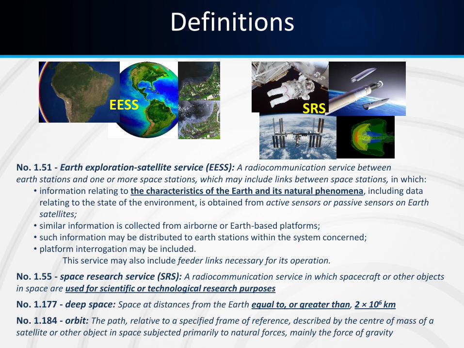
No. 1.51 - Earth exploration-satellite service (EESS): A radiocommunication service between earth stations and one or more space stations, which may include links between space stations, in which:
• information relating to the characteristics of the Earth and its natural phenomena, including data relating to the state of the environment, is obtained from active sensors or passive sensors on Earth satellites;
• similar information is collected from airborne or Earth-based platforms; • such information may be distributed to earth stations within the system concerned; • platform interrogation may be included.
This service may also include feeder links necessary for its operation.
No. 1.55 - space research service (SRS): A radiocommunication service in which spacecraft or other objects in space are used for scientific or technological research purposes
No. 1.177 - deep space: Space at distances from the Earth equal to, or greater than, 2 × 10⁶ km
No. 1.184 - orbit: The path, relative to a specified frame of reference, described by the centre of mass of a satellite or other object in space subjected primarily to natural forces, mainly the force of gravity
EESS SRS
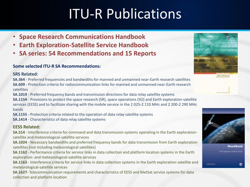
• Space Research Communications Handbook • Earth Exploration-Satellite Service Handbook • SA series: 54 Recommendations and 15 Reports Some selected ITU-R SA Recommendations:
SRS Related: SA.364 - Preferred frequencies and bandwidths for manned and unmanned near-Earth research satellites SA.609 - Protection criteria for radiocommunication links for manned and unmanned near-Earth research satellites SA.1019 - Preferred frequency bands and transmission directions for data relay satellite systems SA.1154 - Provisions to protect the space research (SR), space operations (SO) and Earth exploration-satellite services (EESS) and to facilitate sharing with the mobile service in the 2 025-2 110 MHz and 2 200-2 290 MHz bands SA.1155 - Protection criteria related to the operation of data relay satellite systems SA.1414 - Characteristics of data relay satellite systems
EESS Related: SA.514 - Interference criteria for command and data transmission systems operating in the Earth exploration-satellite and meteorological-satellite services SA.1024 - Necessary bandwidths and preferred frequency bands for data transmission from Earth exploration satellites (not including meteorological satellites) SA.1162 - Performance criteria for service links in data collection and platform location systems in the Earth exploration- and meteorological-satellite services SA.1163 - Interference criteria for service links in data collection systems in the Earth exploration-satellite and meteorological-satellite services SA.1627- Telecommunication requirements and characteristics of EESS and MetSat service systems for data collection and platform location
ITU-R Publications
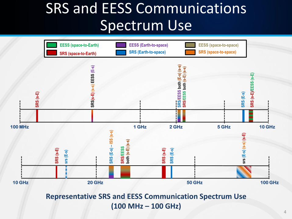
EESS (space-to-Earth)
SRS (space-to-Earth) SRS (Earth-to-space)
EESS (Earth-to-space) EESS (space-to-space)
SRS (space-to-space)
Representative SRS and EESS Communication Spectrum Use (100 MHz – 100 GHz)
SRS and EESS Communications Spectrum Use
srs
(E-s
) (s
-s)
(s-E
)
20 GHz 10 GHz 50 GHz 100 GHz
SR
S (
s-E
)
SR
S (
E-s
)
srs
(E-s
)
SR
S (
s-E
)
SR
S (
E-s
) –
ISS
(s-
s)
SR
S/E
ES
S
bo
th (
s-E
) (s
-s)
SR
S/E
ES
S b
oth
(E
-s)
(s-s
)
SR
S/E
ES
S b
oth
(s-
E)
(s-s
)
SR
S(s
-E)
(s-s
) E
ES
S (
E-s
)
5 GHz 1 GHz 100 MHz 10 GHz 2 GHz
SR
S (
s-E
)/E
ES
S (
s-E
)
SR
S (
E-s
)
SR
S (
s-E
)
4
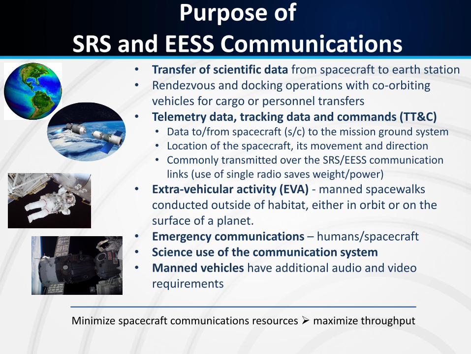
Purpose of SRS and EESS Communications
• Transfer of scientific data from spacecraft to earth station • Rendezvous and docking operations with co-orbiting
vehicles for cargo or personnel transfers • Telemetry data, tracking data and commands (TT&C)
• Data to/from spacecraft (s/c) to the mission ground system • Location of the spacecraft, its movement and direction • Commonly transmitted over the SRS/EESS communication
links (use of single radio saves weight/power)
• Extra-vehicular activity (EVA) - manned spacewalks conducted outside of habitat, either in orbit or on the surface of a planet.
• Emergency communications – humans/spacecraft • Science use of the communication system • Manned vehicles have additional audio and video
requirements
Minimize spacecraft communications resources maximize throughput
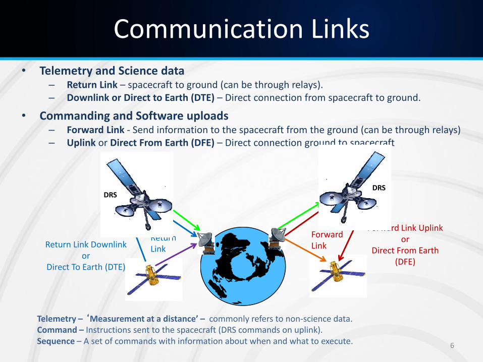
Communication Links • Telemetry and Science data
– Return Link – spacecraft to ground (can be through relays). – Downlink or Direct to Earth (DTE) – Direct connection from spacecraft to ground.
• Commanding and Software uploads – Forward Link - Send information to the spacecraft from the ground (can be through relays) – Uplink or Direct From Earth (DFE) – Direct connection ground to spacecraft
Telemetry – ‘Measurement at a distance’ – commonly refers to non-science data. Command – Instructions sent to the spacecraft (DRS commands on uplink). Sequence – A set of commands with information about when and what to execute. 6
Return Link Downlink or
Direct To Earth (DTE)
Return Link
DRS
Forward Link
Forward Link Uplink or
Direct From Earth (DFE)
DRS
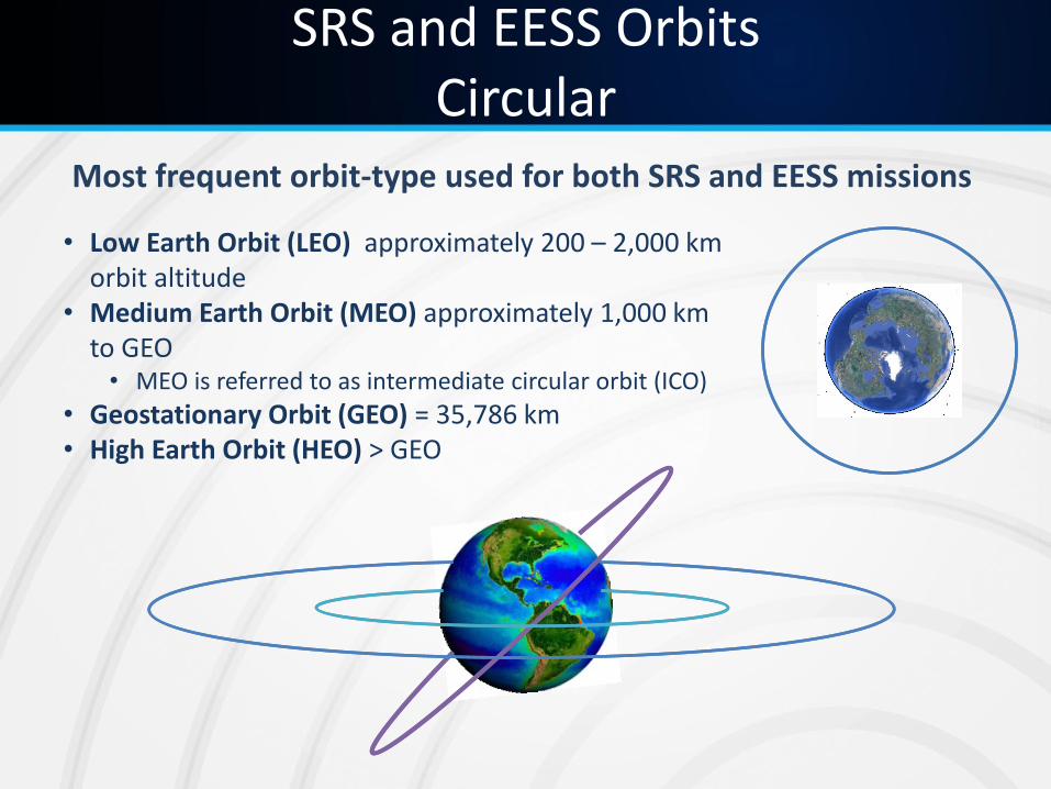
SRS and EESS Orbits Circular
• Low Earth Orbit (LEO) approximately 200 – 2,000 km orbit altitude
• Medium Earth Orbit (MEO) approximately 1,000 km to GEO • MEO is referred to as intermediate circular orbit (ICO)
• Geostationary Orbit (GEO) = 35,786 km • High Earth Orbit (HEO) > GEO
Most frequent orbit-type used for both SRS and EESS missions
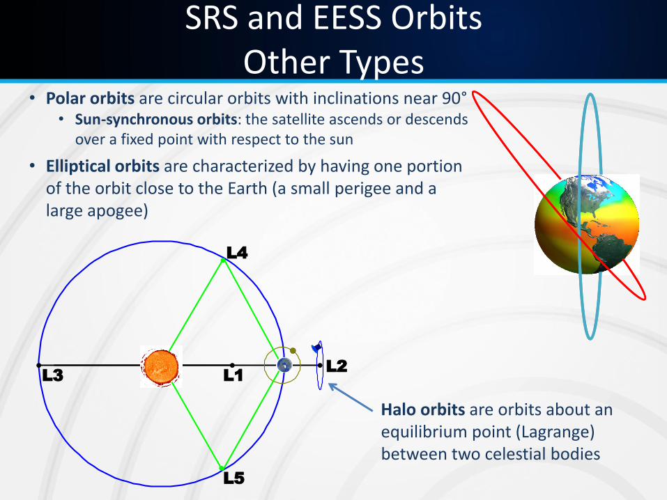
SRS and EESS Orbits Other Types
• Polar orbits are circular orbits with inclinations near 90° • Sun-synchronous orbits: the satellite ascends or descends
over a fixed point with respect to the sun
• Elliptical orbits are characterized by having one portion of the orbit close to the Earth (a small perigee and a large apogee)
L3
L5
L4
L1L2
Halo orbits are orbits about an equilibrium point (Lagrange) between two celestial bodies
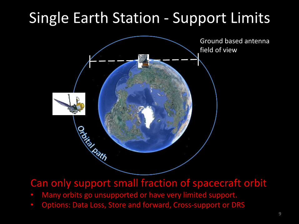
Single Earth Station - Support Limits
9
Can only support small fraction of spacecraft orbit • Many orbits go unsupported or have very limited support. • Options: Data Loss, Store and forward, Cross-support or DRS
Ground based antenna field of view
10
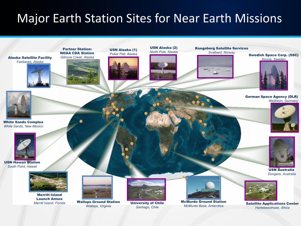
Major Earth Station Sites for Near Earth Missions
McMurdo Ground Station
McMurdo Base, Antarctica
Wallops Ground Station
Wallops, Virginia
Kongsberg Satellite Services
Svalbard, Norway
USN Australia
Dongara, Australia
University of Chile
Santiago, Chile
Merritt Island
Launch Annex
Merritt Island, Florida
USN Alaska (1)
Poker Flat, Alaska Alaska Satellite Facility
Fairbanks, Alaska
Partner Station:
NOAA CDA Station
Gilmore Creek, Alaska
USN Hawaii Station
South Point, Hawaii
USN Alaska (2)
North Pole, Alaska
Satellite Applications Center
Hartebeesthoek, Africa
White Sands Complex
White Sands, New Mexico
Swedish Space Corp. (SSC)
Kiruna, Sweden
German Space Agency (DLR)
Weilheim, Germany
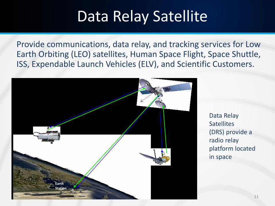
Data Relay Satellite
Provide communications, data relay, and tracking services for Low Earth Orbiting (LEO) satellites, Human Space Flight, Space Shuttle, ISS, Expendable Launch Vehicles (ELV), and Scientific Customers.
Earth Station
Data Relay Satellites (DRS) provide a radio relay platform located in space
11
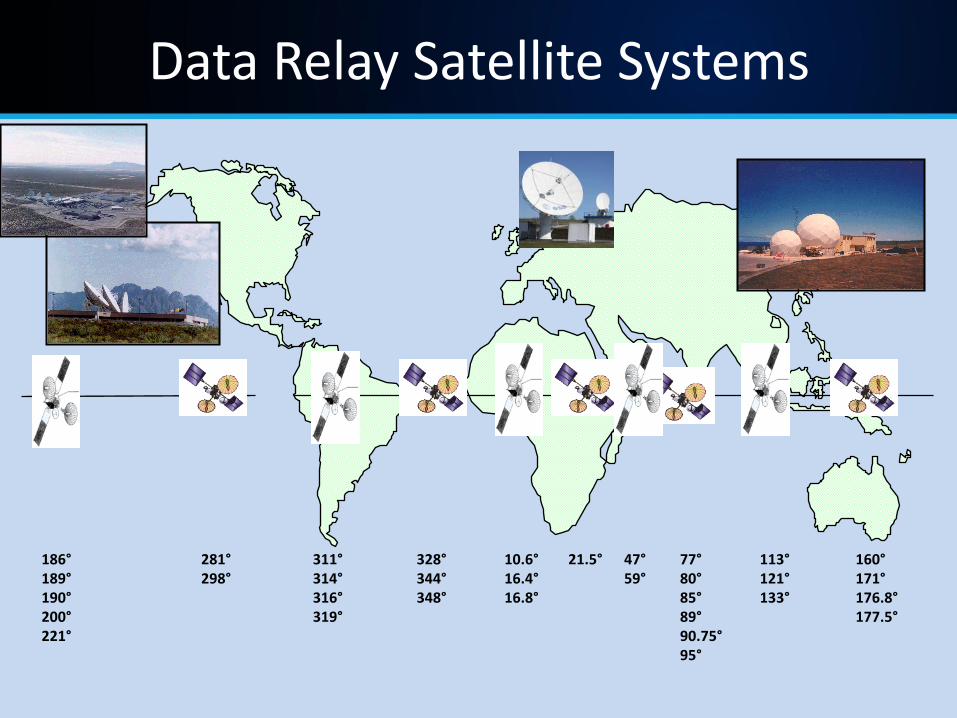
Data Relay Satellite Systems
281° 298°
47° 59°
10.6°16.4° 16.8°
160° 171° 176.8° 177.5°
77° 80° 85° 89° 90.75°95°
186° 189° 190° 200° 221°
311° 314° 316° 319°
21.5° 113° 121° 133°
328° 344° 348°

Anatomy of a Data Relay Satellite (notional)
Forward (FWD): link from DRS Ground Station through DRS to Spacecraft Return (RTN): link from Spacecraft through DRS to DRS Ground Station
Space-to-Space Access Antenna Communications and tracking functions:
• 2025-2110 MHz FWD • 2200-2290 MHz RTN • 22.55-23.55 GHz FWD • 25.5-27 GHz RTN
4.9 meter shaped reflector assembly Two axis gimbaling
Space-to-Ground-Link Antenna DRS downlink 2.0 meter parabolic reflector Two axis gimbaled
Omni Antenna and Solar Sail 2025-2110 MHz FWD 2200-2290 MHz RTN
Multiple Access Antenna 30 helices:
• 12 diplexers for transmit • 30 receive body mounted
Single commanded beam, transmit 20 adapted beams for receive Ground implemented receive function
Solar array for Power
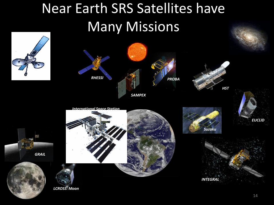
Near Earth SRS Satellites have Many Missions
ERBS
14
TDRS
INTEGRAL
LCROSS: Moon
EUCLID
Suzaku
GRAIL
HST
SAMPEX
RHESSI PROBA
International Space Station
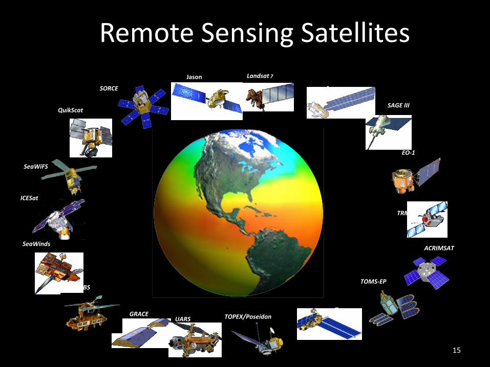
Remote Sensing Satellites
ERBS
Terra
Aqua
GRACE
QuikScat SAGE III
SeaWinds
TRMM
TOMS-EP
UARS
Jason Landsat 7
SORCE
ACRIMSAT
EO-1
TOPEX/Poseidon
SeaWiFS
ICESat
15
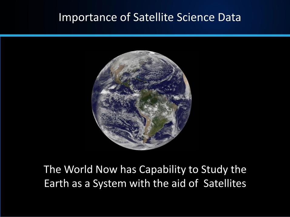
The World Now has Capability to Study the Earth as a System with the aid of Satellites
Importance of Satellite Science Data