CASE STUDIES - ICOMOS Open Archive
220
Patan, Nepal • • Taishun, China • • Nyanza, Rwanda Aleppo, Syria • • San Pedro de Alcántara, O’Higgins Region, Chile WH Cultural Landscape Wachau, Austria • • San Luis Potosí, México ICOMOS-ICCROM ANALYSIS OF CASE STUDIES IN RECOVERY AND RECONSTRUCTION CASE STUDIES VOL. 2 2020
-
Upload
khangminh22 -
Category
Documents
-
view
6 -
download
0
Transcript of CASE STUDIES - ICOMOS Open Archive

Patan, Nepal •• Taishun, China •• Nyanza, Rwanda
Aleppo, Syria •• San Pedro de Alcántara, O’Higgins Region, Chile
WH Cultural Landscape Wachau, Austria •• San Luis Potosí, México
ICOMOS-ICCROM
ANALYSIS OF CASE STUDIES IN RECOVERY AND RECONSTRUCTION
CASE STUDIES
VO
L. 22020


VOL. 2Patan, Nepal •• Taishun, China •• Nyanza, Rwanda
Aleppo, Syria •• San Pedro de Alcántara, O’Higgins Region, Chile
WH Cultural Landscape Wachau, Austria •• San Luis Potosí, México
ICOMOS-ICCROM
ANALYSIS OF CASE STUDIES IN RECOVERY AND RECONSTRUCTION
CASE STUDIES
ICOMOS (International Secretariat, Paris) and ICCROM (Regional Office, Sharjah)
Published by ICCROM (Regional Office, Sharjah) and ICOMOS (International Council of Monuments and Sites).
All rights reserved.© ICCROM and ICOMOS, 2021ISBN 978-92-9077-305-4
This publication is available in Open Access under the Attribution-NonCommercial-ShareAlike 4.0 International (CC BY-NC-SA 4.0) license (https://creativecommons.org/licenses/by-nc-sa/4.0/). By using the content of this publication, the users accept to be bound by the terms of use of any future ICCROM Open Access Repository and that of ICOMOS.
The designations employed and the presentation of material throughout this publication do not imply the expression of any opinion whatsoever on the part of ICCROM and ICOMOS concerning the legal status of any country, territory, city or area or of its authorities, or concerning the delimitation of its frontiers or boundaries. The ideas and opinions expressed in this publication are those of the authors; they are not necessarily those of ICCROM and ICOMOS and do not commit the Organizations.
ICCROM-Sharjah P.O. BOX 48777, Sharjah United Arab Emirates Tel: +971 (0)6 555 2250 Email: [email protected] www.iccrom.org/athar
ICCROM Via di San Michele 13 I-00153 Rome Italy Tel: +39 06 585-531 Email: [email protected] www.iccrom.org
ICOMOS International Secretariat11 rue du Séminaire de Conflans94 220 Charenton-le-PontFranceTel : 33 (0) 1 41 94 17 59Email : [email protected]://icomos.org
Graphic design: Mohammed Irqsosy

Foreword
ICCROM and ICOMOS have closely worked together for the protection of cultural heritage, especially in the field of the World Heritage. We are pleased that the case studies project for reconstruction and recovery of cultural heritage added a new dimension to the relationship of the two organisations. The secretariats as well as the experts selected by the two institutions met physically and virtually on regular basis over a period of two years to have this work produced and contribute to knowledge in this field.
We discussed every aspect of the project, from the text of every case study included in the two volumes to our joint letters, until we agreed on all required steps together. This collection of case studies is an outcome of such fruitful collaboration between the two organisations. We are convinced that each case study report, which was carefully and rigorously peer reviewed by a team experts, will stimulate and promote further research and analysis. We look forward to the resonances of this joint work.
Last but not least, we express our sincere gratitude to all colleagues who worked in this project, including the ICCROM-ICOMOS experts and researchers who worked on this volume, for their wonderful contributions. We do hope that other similar joint projects will further be developed by the two organisations in the near future.
For ICOMOS, Toshiyuki Kono, Honorary PresidentMarie-Laure Lavenir, Director General
For ICCROM, Webber Ndoro, Director GeneralZaki Aslan, ICCROM-Sharjah Director
03ANALYSIS OF CASE STUDIES IN RECOVERY AND RECONSTRUCTION |
IntroductionAnalysis of Case Studies in Recovery and Reconstruction
The scale, intensity and frequency of catastrophic events affecting cultural property have been a subject of international concern. Efforts at recovery and reconstruction of damaged communities and environments have increasingly attracted attention, from the perspective of supporting peoples impacted by such events while attempting to maintain the cultural significance of places. This project arose from the decision of the World Heritage Committee of 24 June 2018, directing the attention of advisory bodies towards the examination of case studies. The need to learn from the experiences captured through case studies had been apparent for some time.
Separately, ICCROM and ICOMOS have addressed the issues involved in post trauma recovery and reconstruction in the context of cultural heritage. The Project, Analysis of Case Studies in Recovery and Reconstruction, was a joint endeavour that sought to bring the knowledge and capacities of both bodies to bear, in order to enhance understanding of experience with the aim of clarifying issues and improving guidance. The Project was launched in 2019 for completion in 2020. It was managed through a joint Working Group comprising members of both organisations and administered through the ICOMOS Secretariat in Paris and the office of ICCROM Sharjah.
The Project commissioned a range of case studies that represented a comprehensive set of factors, namely geographical, cultural and causational, utilising the ICOMOS Matrix for the Compilation of Case Studies to provide a common structuring framework for compilation and analysis. Eleven case studies were analysed, covering sixteen significant sites and buildings. The project was able to draw from the case studies lessons
that have wider application, and its findings are published online in ICOMOS-ICCROM Project. Analysis of Case Studies of Recovery and Reconstruction. Report
The case studies that were the subject of analysis are published in two volumes.
Case Studies Volume 1.Mostar, Bosnia and HerzegovinaNablus, PalestineL’Aquila, ItalyChristchurch, New Zealand
Case Studies Volume 2.Patan, NepalTaishun, ChinaNyanza, RwandaAleppo, SyriaSan Pedro de Alcántara, O’Higgins Region, ChileWH Cultural Landscape Wachau, AustriaSan Luis Potosí, México
ICOMOS-ICCROM: Analysis of Case Studies of Recovery and Reconstruction
ICOMOS-ICCROM Analysis of Case Studies in Recovery and Reconstruction: Working GroupLoughlin Kealy (Coordinator), Zaki Aslan, Luisa de Marco, Amra Hadzimuhamedovic, Toshiyuki Kono, Marie-Laure Lavenir, Trevor Marchand.
With the support of Maureen Thibault, Alyssa Rose Gregory, Ahmed Suleiman.
Editorial groupLoughlin Kealy, Luisa de Marco, Amra Hadzimuhamedovic, Trevor Marchand, Alyssa Rose Gregory, supported by Angelique Ploteau.
04 | ICOMOS-ICCROM PROJECT CASE STUDY

Volume 2
TABLE OF CONTENTS
Post-Earthquake Recovery and Conservation-Restoration in Patan, Nepal Martina Haselberger, Rohit Ranjitkar and Gabriela Krist 06
Recovery and Restoration of the Taishun Wooden Arch Bridges – Wenzhong Bridge, Xuezhai Bridge, and Wenxing BridgeHuang Zi 38
The Interpretative Reconstruction of the Royal Capital in Nyanza, Rwanda Maya Ishizawa and Jérôme Karangwa 60
Post-War Recovery of the Old City of Aleppo: The Rehabilitation of Suq al-Saqatiyya as a Pilot Project Ruba Kasmo and Lina Kutiefan 90
New Approaches for Rebuilding and Preserving Rural Heritage: The Case of San Pedro de Alcántara, O’Higgins Region, ChileMaria de los Angeles Muñoz Martinez 116
Flood Protection Provisions in the World Heritage Cultural Landscape Wachau, Following the Flood of 2002 Michael Schimek 152
Reconstruction of the Symbolic and Physical Space of the Temple of Nuestra Señora de la Asunción of Santa María Acapulco, San Luis Potosí, México Renata Schneider 184
05ANALYSIS OF CASE STUDIES IN RECOVERY AND RECONSTRUCTION |

POST-EARTHQUAKE RECOVERY AND CONSERVATION-RESTORATION
IN PATAN, NEPAL
Martina Haselberger, Rohit Ranjitkar, Gabriela Krist
TABLE OF CONTENTS
List of Illustrations 08
Acknowledgements 08
1. The Heritage Resource and its Context Before the Impacting Event(s) 09
1.1 Description, Designation and Recognition 09
1.1.1. General Description 09
1.1.2. Form, Function, Creation and Subsequent Transformations 11
1.1.3. Official Designation or Inscription 14
1.1.4. Scholarly Recognition 15
1.1.5. Popular Recognition 16
1.2 History and Context 18
1.2.1. History, Ownership and Environment 18
1.2.2. Social and Economic Setting 19
1.2.3. Frameworks, Agents and Communication 20
2. The Nature of the Impacting Events 20
2.1. General Description 20
2.2. General Impact of the Events 21
2.3. Impact on the Significance and Values of the Resource 21
2.4. Emergency Documentation and Repairs 23
3. Post-Event Appraisals 24
3.1. Post-Event Documentation 24
3.2. Impact Assessment 24
3.3. Challenges for Recovery 26
3.4. Responses and Recovery Programme 26
3.5. Values and Sustainability 28
3.6. Drivers, Agents and Governance 30
4. Response Actions, Timeframes, Resources and Costs 30
4.1. Actual Implementation and Timescales for the Recovery Programme 30
4.2. Resources and Costs of Implementation 30
5. The Outcomes and Effects 31
5.1. Assessment of the Outcomes with Regard to the Recovery 31
6. Details of the Expert(s) Completing the Case Study 34
Bibliography 35
07POST-EARTHQUAKE RECOVERY AND CONSERVATION-RESTORATION IN PATAN, NEPAL |

List of Illustrations
Fig. 1. Aerial view of Patan Durbar Square
Fig. 2. Patan Durbar Square before the earthquake
2015
Fig. 3. Patan Durbar Square before the earthquake
2015
Fig. 4. View of Durbar Square with the Royal Palace on
the right-hand side in 2017
Fig. 5. Example of a tiered temple: Harishankara
Temple on Patan Durbar Square before the
earthquake in 2015
Fig. 6. Example of a Shikhara-style temple: Krishna
Mandir on Patan Durbar Square before the
earthquake in 2015
Fig. 7. View of the Pillar of Yoganarendra Malla
(left) and the Royal Palace (right) before the
earthquake in 2015
Fig. 8. Patan Royal Palace Complex, existing west
elevation
Fig. 9. Patan Durbar Square, Gustave Le Bon, 1885
Fig. 10. Historic structures in the square are used as
recreation areas and meeting places
Fig. 11. Sculptures and idols on the square are
worshipped throughout the year
Fig. 12. One of the many festivals that take place on
Patan Durbar Square
Fig. 13. Patan Durbar Square in the immediate
aftermath of the earthquake in May 2015
Fig. 14. One of the main monuments, Harishankara
Temple, collapsed completely during the
earthquake
Fig. 15. The two mandapas in the square collapsed
Fig. 16. The Pillar of Yoganarendra Malla partly collapsed
Fig. 17. Artefacts and decorative components were
manually recovered from the debris of collapsed
temples
Fig. 18. The recovery of elements was jointly carried
out with the help of local stakeholders, the local
community, the Nepal Army, the Armed Police
Force and the Police
Fig. 19. Salvaged elements were brought to the palace
courtyards
Fig. 20. Salvaged elements were documented and
inventoried in a safe environment
Fig. 21. View of the newly erected storage shelters in
the palace garden
Fig. 22. View of the open-air workshops, which were
created next to the storage shelters
Fig. 23. Vishveshvara Temple in the square was
temporarily shored up with wooden props
Fig. 24. The damaged wings of the Royal Palace were
covered with tarpaulins
Fig. 25. Historical elements were re-used, and only
badly damaged parts were partially replaced –
in this case the top profile was replaced with a
stone indent made by a local stone mason
Fig. 26. Highly skilled craftsmen are engaged in the
recovery process
Fig. 27. Conservators of the IoC impart basic knowledge
in conservation and restoration to craftsmen
Fig. 28. The Pillar of Yoganarendra Malla after the
earthquake (left) and after its successful
conservation and re-erection (right)
Fig. 29. Worshipping of the idol at Charnarayana
Temple continued although the temple building
collapsed completely
Map 1. Site plan depicting the numerous monuments on
Durbar Square (left) and the Royal Palace with its
courtyards and the adjacent garden (right)
Map 2. Patan Durbar Square Monument Zone. Proposed
Redefinition of core and buffer zone boundary
Acknowledgements
We would like to express our gratitude to the Austrian Development Agency (ADA), the Federal Chancellery of
Austria (BKA), the Austrian Federal Ministry for Europe, Integration and Foreign Affairs (BMEIA), the Eurasia-Pacific
Uninet (EPU) and the University of Applied Arts Vienna for financial support. Further, we would like to thank Christian
Manhart, Director of the UNESCO Office in Kathmandu, and his staff for input to compile this case study. Special thanks
go the staff of KVPT and the staff, Alumni and students of IoC, who have participated in the campaigns, for their
support, cooperation and commitment.
08 | ICOMOS-ICCROM PROJECT CASE STUDY

1. The Heritage Resource and its Context Before the Impacting Event(s)
1.1 Description, Designation and Recognition
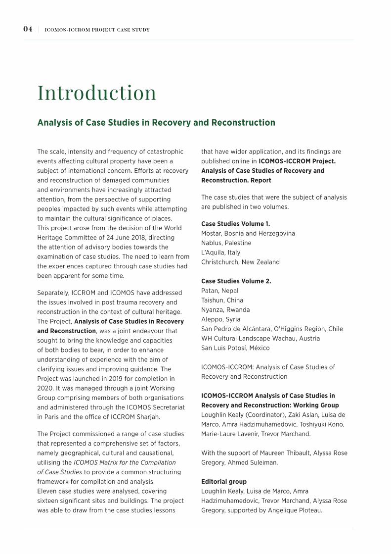
1.1.1. General DescriptionPatan Durbar Square with its temples and the Royal
Palace is the functioning core as well as the urban
and cultural centre of the former royal city of Patan
(Lalitpur) and since 1979 it has been inscribed on the
UNESCO World Heritage List as part of the Kathmandu
World Heritage Property (fig. 1, Map 1). Embedded in the
Kathmandu Valley in the midlands of Nepal, directly at
the trans-Himalayan trade route between India and Tibet,
it boasts a rich tangible and intangible cultural heritage.
On an area of approximately 160 x 70 metres, the
site comprises a cluster of around fifteen larger and a
range of smaller monuments (Korn 1976). The building
typologies range from tiered and shikhara-style temples,
free-standing pillars, stupa and mandapa to water-
wells. The Royal Palace facing the square includes major
temples (Degutale, Taleju and Agam Temple) and three
main courtyards (Mul Chowk, Sundari Chowk, Keshav
Narayan Chowk) housing precious artworks and the
Patan Museum, which ranks among South Asia’s finest
art museums (figg. 2-4). The architectural elements are
of great artistic significance and their ornamentation and
decorations display the high level of craftsmanship of
the local Newars in brick, stone, timber and bronze. The
overall harmonious co-existence of Hindu and Buddhist
buildings is considered unique (Pruscha 2015: 30).
The square was and, regardless of the catastrophic
earthquake in 2015, still is an important public space
for urban life that takes place here. It is a place for
social interaction, exchange of goods and labour and
acquiring income (market stands, souvenirs shops,
etc.) as well as major tourist hotspots. Its monuments
are background nuclei and an integral part of daily
offerings, rituals, worship and commemoration as well
as countless local traditions and seasonal festivities.
From left to right: Fig. 1. Aerial view of the Patan Durbar Square (Kathmandu Valley Preservation Trust)Map. 1. Site plan depicting the numerous monuments on the Durbar Square (left) and the Royal Palace with its courtyards and the adjacent garden (right) (Kathmandu Valley Preservation Trust)
09POST-EARTHQUAKE RECOVERY AND CONSERVATION-RESTORATION IN PATAN, NEPAL |
From top to bottom: Fig. 2. Patan Durbar Square before the earhtquake 2015 (Kathmandu Valley Preservation Trust, 2008, photo by Stanislaw Klimek)Fig. 3. Patan Durbar Square before the earthquake 2015 (Institute of Conservation, University of Applied Arts Vienna, 2013)Fig. 4. View at the Durbar Square with the Royal Palace on the right-hand side in 2017 (Institute of Conservation, University of Applied Arts Vienna, 2017, photo by Christoph Schleßmann)
10 | ICOMOS-ICCROM PROJECT CASE STUDY

Cultural and daily life thus revolve around the
monuments and the living culture is closely associated
with the tangible cultural heritage, which make Patan
a living heritage site. The intensity of activity and
interchange is not only due to the high concentration of
important monuments in the square but also due to its
location at literally the crossroads of the city – in many
cases the shortest and most conventient path leads
through Durbar Square (Sekler 1979: 104).
1.1.2. Form, Function, Creation and Subsequent TransformationsAmong the three durbar squares in the Kathmandu
Valley, the one in Patan can be considered best preserved
with regard to its original form, layout and design (Korn
1976: 80).
It shows a rectangular layout, whereby the temples and
smaller monuments are arranged opposite the around
100 m long west façade of the Royal Palace on the brick-
paved square. Either their entrance or their main doors face
the palace. In the eastward direction, behind the palace,
the garden extends approximately 200 m, and houses the
Bhandarkhal tank water reservoir. The monument zone is
enclosed by adjacent dwellings and traditional houses.
Brick, tile, wood and stone are the prevailing materials of
the monuments. Bricks are made from different clays and
available in different shapes (e.g. common, trapezoidal
cut) or with ornaments in relief (Bonapace, Sestini
2003). The most common wood species used for the
construction of the monuments is Sal, a high quality and
very strong and durable wood (Bonapace, Sestini 2003).
With regard to stone, two varieties have been used in the
context of built cultural heritage in Patan: a fine-grained
sandstone (Fuchs 2013; Leiner 2010), for stone walls,
multi-piece sculptures and finely carved reliefs, and a
metamorphic stone variety, a kind of schist (Kaipf 2017),
for load-bearing structural components, free-standing
pillar shafts and monolithic sculptures.
The buildings and monuments comprising the site vary
in size and style, whereby the prevailing building type
are tiered temples, so-called mandir (Nepalese) or dega
(Newar).1 for which the Kathmandu World Heritage
Property is well-known (fig. 5). Erected on stepped brick
plinths, these often multi-tiered temples are mostly built
of fired bricks with mud mortar and structural elements
made of timber. Their projecting roofs are covered with
small overlapping terracotta tiles and capped with fire-
gilded pinnacles. The wooden posts, windows, doorways
and struts have rich decorative carvings.
The other existing temple typology is the Shikhara-style
temple, a Nepalese adaption of the Indian stone temples,
of which three are located on the square (Korn 1976:
80; Bonapace, Sestini 2003: 9). Two of them are built of
small stone blocks pointed with mortars (fig. 6), whereby
varying mixtures were applied in the framework of
previous restoration and repair work. The remaining one
is built of brick. Lime plaster was later added to prevent
biological growth.
From left to right:Fig. 5. Example of a tiered temple: Harishankara Temple at the Patan Durbar Square before the earthquake 2015 (Institute of Conservation, University of Applied Arts Vienna, 2017, photo by Christoph Schleßmann)Fig. 6. Example of a Shikhara-style temple: Krishna Mandir at Patan Durbar Square before the earthquake 2015 (Kathmandu Valley Preservation Trust, 2008, photo by Stanislaw Klimek)
11POST-EARTHQUAKE RECOVERY AND CONSERVATION-RESTORATION IN PATAN, NEPAL |
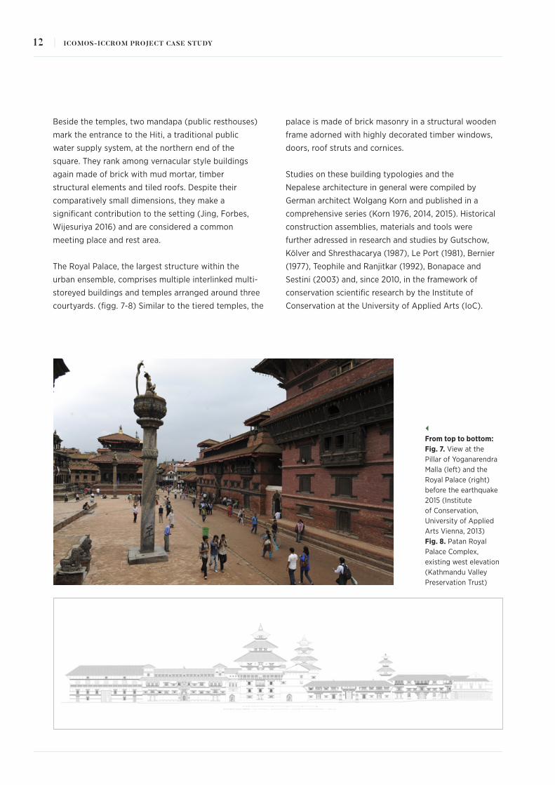
Beside the temples, two mandapa (public resthouses)
mark the entrance to the Hiti, a traditional public
water supply system, at the northern end of the
square. They rank among vernacular style buildings
again made of brick with mud mortar, timber
structural elements and tiled roofs. Despite their
comparatively small dimensions, they make a
significant contribution to the setting (Jing, Forbes,
Wijesuriya 2016) and are considered a common
meeting place and rest area.
The Royal Palace, the largest structure within the
urban ensemble, comprises multiple interlinked multi-
storeyed buildings and temples arranged around three
courtyards. (figg. 7-8) Similar to the tiered temples, the
palace is made of brick masonry in a structural wooden
frame adorned with highly decorated timber windows,
doors, roof struts and cornices.
Studies on these building typologies and the
Nepalese architecture in general were compiled by
German architect Wolgang Korn and published in a
comprehensive series (Korn 1976, 2014, 2015). Historical
construction assemblies, materials and tools were
further adressed in research and studies by Gutschow,
Kölver and Shresthacarya (1987), Le Port (1981), Bernier
(1977), Teophile and Ranjitkar (1992), Bonapace and
Sestini (2003) and, since 2010, in the framework of
conservation scientific research by the Institute of
Conservation at the University of Applied Arts (IoC).
From top to bottom: Fig. 7. View at the Pillar of Yoganarendra Malla (left) and the Royal Palace (right) before the earthquake 2015 (Institute of Conservation, University of Applied Arts Vienna, 2013) Fig. 8. Patan Royal Palace Complex, existing west elevation (Kathmandu Valley Preservation Trust)
12 | ICOMOS-ICCROM PROJECT CASE STUDY

The creators and builders of these monuments have
been inhabitants from the Kathmandu Valley, particularly
from the ethnic group of Newars, who are renowned for
their craftsmanship and artistry particularly in wood,
metal and stone. Many of the craft skills still exist today
as they have been handed down from generation to
generation and are available in the term of practitioners
from Bhaktapur and Patan. A number of them, explicitly
master carpenters, wood carvers and masons from
Bhaktapur, as well as stone carvers and metal workers
from Patan, have been engaged in rebuilding and
reconstruction work after the 2015 earthquakes (KVPT
2016: 13). What has partly changed over the centuries
are the tools used, methods of processing and the
way craftsmen work. For example, the practice of
planking and nailing is an only recently used technology.
Traditionally, laths were just laid over the rafters without
nailing. Another traditional method was made like
roof tiles, which is referred to as chilaapa in Newari
(Gutschow, Kölver, Shresthacarya 1987:156–157). Planking
and nailing as it is practiced today, was only introduced
in the 1970s, when waterproofing membranes were
introduced on the roofs, which needed a plain surface.
The majority of the monuments, shaping today’s
cityscape, can be dated from the middle of the sixteenth
to the mid-eighteenth-century, during the reign of the
Malla Dynasty (c.1201-1769).2 A century earlier, in the
middle of the fifteenth-century, the Nepali empire was
divided into the three kingdoms of Kantipur, Lalitpur and
Bhaktapur. In terms of cultural heritage, the subsequent
constant rivalry and competitive behaviour between the
three rulers led to a golden period of art and vigorous
building activities, also resulting in the erection and
expansion of the monuments in Patan.
Furthermore, the Royal Palace took its present form in
the seventeenth-century, while its previous building dates
back to the twelfth-century and had been constantly
adapted and extended (Korn 1976: 82). Courtyards were
either designated to be the palace of the royal family
(as was the case with the Sundari Chowk) or intended
to house sancutaries and provide space for dances and
ceremonies (e.g. Mul Chowk).
Most of the temples on the square were erected by
the kings in memory of their relatives or as offerings
to certain deities or tutelary gods and godesses (Korn
1976: 80). These monuments are still widely used by
the local residents in the context of rituals and festive
occasions, in the the same way their forefathers used to
do (Ranjitkar 2018: 22).
With the establishment of Kathmandu as the capital
of Nepal in 1769 and the move of the monarch, the
Royal Palace in Patan lost its function. On one hand,
this abandonment spared the palace from extensive
modifications and expansion of its layout, as was the
case in Kathmandu, which served another 200 years as
the seat of the royals and/or government (Korn 1976:
89). On the other hand, it resulted in neglect and lack
of maintenance and care. Over a period until 1993, the
palace housed various administrative and governmental
offices, amongst others a police station (Korn 1976: 73).
This new use required adaptions mainly in the interior
layout, for example whitewash was applied frequently on
the interior walls and covered important wall paintings
(Gutschow, Roka 2017; KVPT 2016: 12).
Throughout history, the structures were subject
to transformation due to repairs, demolition and
reconstruction following earthquakes. In particular
cases it is known that affected temples and houses
were rebuilt using a simplified or completely different
design (Ranjitkar 2018: 25). For instance, the Baidegah
Temple on Patan Durbar Square, an originally tiered
temple that was damaged in the 1934 earthquake, was
replaced with a domed temple in the aftermath. In this
case, the transformation had some positive impact on
the seismic response. The downsizing of the monument
and the waiving of the roof overhangs causing heavy
load and the timber column arcade on the ground
floor, both features of the preceding tiered temple,
improved seismic resistance. Negative impacts of the
transformations of monuments are the loss of traditional
configurations, architectural form and technologies
together with traditionally applied skills. Fortunately,
the intangible heritage is usually not affected by these
transformations as the building type is not relevant
for devotees.
Another important aspect is the living culture and
traditions in Nepal that constantly shaped the
appearance of monuments and historic structures.
13POST-EARTHQUAKE RECOVERY AND CONSERVATION-RESTORATION IN PATAN, NEPAL |

New layers, decorations or embellishments were added
as votive offerings. These are prevalent concepts in
Buddhism and Hinduism to earn good karma or to
remind posterity of one’s deed. Such offerings include
marble tiles, shiny metal roofs, canopies, railings, iron
grids or new lighting system, interventions that are often
detrimental to the historic fabric (Ranjitkar 2018: 22;
KVPT 2016: 40–41). With the opening of the country to
the outside world in the 1950s, foreign influences grew
and imported new ideas as well as materials. These
materials were added to the monuments both as part
of votive offerings and of construction measures. In
particular, cement was introduced mainly in the course
of repair work and influenced the appearance of historic
buildings (Korn 1976).
1.1.3. Official Designation or InscriptionThe complex’s outstanding universal value was
recognised by being added to the UNESCO World
Heritage List in 1979 as part of the Kathmandu World
Heritage Property, the first one to be listed in Asia.
(map 2) The brief synthesis of the World Heritage
inscription states:
<<Located in the foothills of the Himalayas, the Kathmandu
Valley World Heritage property is inscribed as seven
Monument Zones. These monument zones are the Durbar
squares or urban centres with their palaces, temples and
public spaces of the three cities of Kathmandu (Hanuman
Dhoka), Patan and Bhaktapur, and the religious ensembles
of Swayambhu, Bauddhanath, Pashupati and Changu
Narayan. […] These monuments were defined by the
outstanding cultural traditions of the Newars, manifested
in their unique urban settlements, buildings and structures
with intricate ornamentation displaying outstanding
craftsmanship in brick, stone, timber and bronze that are
some of the most highly developed in the world.>>
In addition, the complex is declared a Protected
Monument Zone (PMZ) under the Ancient Monument
Preservation Act 1956 and thus enjoys the highest level
of national protection.3
Map. 2. Patan Durbar Square Monument Zone. Proposed Redefinition of core and buffer zone boundary (UNESCO, ICOMOS Evaluation, 2006)
14 | ICOMOS-ICCROM PROJECT CASE STUDY

The Kathmandu World Heritage Property was inscribed
based on criteria (iii), (iv) and (vi), which focus on the
living culture and traditions, the exceptional architectural
ensemble and the association to belief, art and other
intangible attributes of outstanding universal significance.
More explicitly, the significant features, elements
and attributes that express the outstanding universal
value, are summarised in the Integrated Management
Framework IMF) for the Kathmandu World Heritage
Property, (Department of Archaeology 2007):
<<The unique architectural style of the palaces,
temples, stupas and other monuments that are defined
by their form, scale, structure and materials; The
highly developed craftsmanship of the structures and
ornamentation; The urban structure, the character of
urban fabric and the distinct natural environment that
create the context within which the monuments are
situated; And the traditions and functions that bind the
monuments to their distinct context, in particular the
beliefs, legends, rituals and festivals.>>
The IMF is an integrated and comprehensive management
plan for the entire property and also forms the legal
framework for the conservation and maintenance of
the listed and protected monuments within the World
Heritage sites. Therein the guiding conservation principles
are <<to preserve and maintain all those elements and
attributes that contribute to the value of the historic
building / structure for which the monument has been
listed and classified in the inventory>> and <<to ascertain
that all other elements and attributes are compatible and
appropriate to the building / structure and its context>>
in respect to <<mass (height, coverage and form) and
exterior (material, colour, texture, order, scale and
proportions)>> (Department of Archaeology 2017: 23).
During the recovery process after the earthquake in 2015,
these designations have been taken into account, although
in Patan it was thought to consider and treat World
Heritage and other built cultural heritage as equal in value.
1.1.4. Scholarly RecognitionThe Kathmandu Valley is well-known for the wealth,
variety and quantity of its architectural heritage
gathered in a small area. The remarkable character of
the monuments and ensembles is highly recognised by
international scholars. The Patan Monument Zone has
attracted international scholars since the nineteenth-
century (fig. 9). It is addressed in records and
publications compiled in the course of expeditions by
the British Royal Geographical Society (e.g. Johnston
& Hoffmann 1883), the Royal Asiatic Society London,
as well as by individuals including Henry Ambrose
Oldfield (on site between 1850 and 1863),
Fig. 9. Patan Durbar Square, (Gustave Le Bon, 1885, published in Le Bon, G., 1886. Voyage au Nepal, Le Tour du Monde. Paris.)
15POST-EARTHQUAKE RECOVERY AND CONSERVATION-RESTORATION IN PATAN, NEPAL |

Gustave Le Bon (1886), Kurt Boeck (on site 1899,
publication in 1903), Perceval Landon (1928) and Rajman
Singh. With the opening of the country in the 1950s
and the inscription of the seven sites in the list of World
Heritage, the cultural heritage in the Valley and at the
Patan Durbar Square finally moved into the centre of
global attention and interest.
Worth mentioning are the studies on the country and
people of Nepal by Daniel Wright (1877) and on the
unique architecture and its attributes found in the
Valley by N. R. Banerjee (1980), Niels Gutschow (1982,
1997, 2011), John Sanday (1979) and Wolfgang Korn
(1976, 2014, 2015). Particularly the highly elaborated
iconographic programme depicted in the monuments’
complex ornamentation and decoration has attracted
researchers (compare publications by Niels Gutschow,
Mary Slusser, Adalbert J. Gail). Archaeological surveys
in Patan were mainly compiled by archaeologist Sukra
Sagar Shrestha.
Nepalese art and culture as well as rituals, traditions and
religion have been equally recognised by scholars. Worth
mentioning is the research done by Mary Slusser and the
books of Saphalya Amatya.
Austrian architectural historian Eduard F. Sekler drafted
the first and only Master Plan for the Conservation
of Cultural Heritage in the Kathmandu Valley (1977)
and dedicated his research to the safeguarding and
preservation of its outstanding cultural heritage. Likewise
future-orientated was the research of the Austrian
architect Carl Pruscha, who focused on town planning
and physical development of the Kathmandu Valley. He
compiled the first complete Kathmandu Valley Protective
Inventory (1975, rev. 2015), which is still valid today. Rohit
Ranjitkar (1997) analysed the preservation efforts in the
Kathmandu Valley in recent decades for the first time.
Monument conservation in Nepal is discussed by Amatya
(2007). Major revitalisation and restoration projects
in the Valley are adressed in the publications of Götz
Hagmüller (2003).
Craftsmanship is addressed by Bonapace and Sestini
(2003) and in more detail by Vaidya and Gajurel (1984).
Less attention has been paid so far to conservation
scientific reserach. To date, research carried out by
Gabriela Krist and her team of the IoC since 2010 and
compiled in publications and diploma thesis comprises
the main source in this context.
1.1.5. Popular RecognitionDurbar Square in Patan is highly valued by the locals and
the people of Nepal.
It is a vivid example of is a living cultural heritage. Unlike the
situations that pertain in many parts of the industrialised
world, it plays an important role for the community and is
intensively used by the resident population and visitors.
The square is the background and stage of daily life.
Open spaces and rest houses are important recreation
areas and social meeting places (fig. 10). The significance
of the monuments particularly results from their religious
function and the associated traditions (figg. 11-12).
Throughout the year, worshipping and important multi-
day events, such as the processions during the chariot
festival of Rato Matsyendranath, take place (Sekler 1979:
100). Some monuments are thereby more important than
others, depending on the deity they are dedicated to or the
beliefs and festivals associated with them.
The community is not only interested in the use of the
built cultural heritage but is also closely involved in its
preservation. In former times, care and conservation of
the monuments was a community-based responsibility
that was assumed by the Guthis. Guthis are associations
of people with different responsibilities ranging from
performing everyday rituals and caring for temples
to the organisation of big events. This system can be
traced back to the fifth-century CE (Maharjan n.y.). With
the nationalisation of Guthis in 1964 their participation
and activity in this field has decreased (Department of
Archaeology 2007: 31). Today, many Guthis no longer
perform this responsibility or are struggling for members
among the younger generations.
The monuments on Durbar Square are also repositories
of traditional knowledge and workplaces for a wide range
of locals. Following the concept of cyclical renewal, which
has been sustained in the region over centuries, damaged
elements or monuments have always been replaced or
rebuilt by craftspeople (Jing, Forbes, Wijesuriya 2016:
6; Shrestha 2018: 111). This approach goes beyond the
response to the devastating impact of the two main
16 | ICOMOS-ICCROM PROJECT CASE STUDY

natural hazards the monuments are exposed to –
dampness and earthquakes (Department of Archaeology
2007: 5). The cyclical renewal also gives the descendants
of the creators of built cultural heritage the chance to
perform their skills and craftsmanship using their own
experiences. This has kept craftsmanship alive and
guaranteed its continued practice. Further, new additions
in technology or materials to decorate or strengthen
the monuments can be introduced. Both should either
reflect contemporary needs and taste or help to improve
the monuments to achieve primarily greater earthquake
resistance (UNESCO, Weise 2015: 39; Shrestha 2018: 111).
Today, the practice of cyclical renewal is considered
as an inherent aspect defining the character of the
monuments and plays an important role in the recovery
and reconstruction after the earthquake (Department of
Archaeology 2007).
For the global audience, particularly tourists, the heritage
site is mainly recognised as one of the main attractions
in the Valley. This is also reflected in the fact that it is a
popular photo motif4 and illustration in travel brochures
and advertising, and that its monuments are featured in
the business logo of the Nepal Tourism Board.
Images, Clockwise from top left: Fig. 10. Historic structures at the square are used as recreation areas and meeting place (Institute of Conservation, University of Applied Arts Vienna, 2019)Fig. 11. Sculptures and idols at the square are worshipped throughout the year (Institute of Conservation, University of Applied Arts Vienna, 2017, photo by Christoph Schleßmann)Fig. 12. One of the countless festivals taking place at the Patan Durbar Square (Institute of Conservation, University of Applied Arts Vienna, 2018)
17POST-EARTHQUAKE RECOVERY AND CONSERVATION-RESTORATION IN PATAN, NEPAL |

1.2 History and Context
1.2.1. History, Ownership and EnvironmentPatan is considered the most ancient among the three
main cities of the Kathmandu Valley. At the time of
construction its Durbar Square was in a rural to peri-
urban setting, but already at the intersection of two
main roads (Sekler 1979: 99). Today, the square is
located within the vibrant urban heart of Patan.
The beginnings of Nepal’s history are told in the realms
of myths and legends. Following a number of dynasties,
which ruled the country from the fourth to the third
centuries BC, the Licchavi dynasty was the first where
knowledge is on firmer ground. The main contributors
to the Nepalese cultural heritage however were the
Mallas (c.1201–1769). In the eighteenth-century the Shah
dynasty took power and consolidated the state into the
modern and unified Kingdom of Nepal. It was only in the
middle of the nineteenth-century that increased contacts
with the outside world and Europe were established. In
the following decades the effective government of the
country was wrested from the Shah king by the Rana
family (Sekler 1977: Appendix V). With the Local Self
Governance Act 1999 Patan came under the jurisdiction
of the Lalitpur Sub-metropolitan City (Department
of Archaeology 2007: 2). Today, the temples and
monuments belong to government, although they are
mainly managed and used by the community.
A chronological history and overview of conservation
and restoration interventions carried out in the
twentieth-century in the Kathmandu Valley is available
in the dissertation of Rohit Ranjitkar (1997).
Ranking among the most disaster-prone countries
in the world, Nepal has been highly susceptible to a
wide range of natural disasters, such as earthquakes,
landslides and floods (Ghimire 2015: 37–57). Earthquakes
are considered the main natural hazard. They have
caused great damage to cultural property in almost
every century. The seismic vulnerability of the region is
mainly due to its geographic location and to tectonic
movements as well as the soil sedimentation (Maskey
2015: 284).
Some historic structures are also vulnerable in
themselves due to the traditional way of building.
Masonry structures have strong behaviour in
compression but are generally weak in tension and thus
less earthquake resistant (Kuinkel, Sukubhatu, Shrestha
2019: 160). To counteract this, in Nepal a simple plan
configuration (regular shape, low rise, limited area of
openings), a symmetry of design and timber to reinforce
the brick masonries have been used (Maskey 2015:
285). However, the use of low-quality material and lack
of regular maintenance caused collapses in the recent
earthquake. Another problematic area is the threshold
level (base) of tiered temples: The lack of horizontal
connection between threshold base stones allows them
to shift and move independently during an earthquake.
The vertical connection between the timber columns
and the base are usually made with tenons, which are
often undersized and pull out during an earthquake.
Both can lead to collapse of the whole structure. Further,
the composition of the brick masonry walls (exterior
and interior brick layer with rubble infill between
and no proper bonding) as well as the heavy roof
structures combined with weak connections between
roof overhangs and supporting struts are considered
problematic construction patterns (KVPT 2016: 55-61).
Nepal’s built cultural heritage is also particularly
vulnerable to dampness. It is favoured by the climatic
conditions in Nepal with humid summers and heavy
precipitation during monsoon periods from June
to September.5 Both cause frequent water ingress
and moisture penetration in building materials and
accelerated weakening and deterioration (e.g. rotting
timber). A major vulnerability of traditional construction
systems is that they very seldom include damp-proof
layers, humidity isolation or vapour barriers towards the
ground (Korn 1976: 149; KVPT 2016: 59).
In addition, human activities and man-triggered hazards
pose considerable threats to the heritage resource.
As in other less-developed and developing countries,
the historic structures are particularly threatened
by urbanisation, infrastructure development and
population growth. These hazards manifest themselves
in urban sprawl, loss of open space, uncontrolled rise
of concrete structures and various forms of pollution.
Another possible threat is migration as it creates a
more heterogeneous composition of population and
18 | ICOMOS-ICCROM PROJECT CASE STUDY

in turn might lead to disconnection of the community
with its heritage (KC, Karuppannan, Sivam 2019: 434).
Heavy traffic causes vibrations damaging weak walls
and foundations. Due to the threat of uncontrolled
development, the heritage site, as part of the
Kathmandu Valley World Heritage Property, was already
added to the List of World Heritage in Danger in 2003
(Jing, Forbes, Wijesuriya 2016).
Being a major tourist attraction, the heritage site is
further vulnerable to adverse impacts of mass tourism.
For better illustration: in 1964 a total of c. 9,500 visitors
came to Nepal, in 2014 already 790,118, in 2015 due to
the earthquake only 538,970 and in 2018 Nepal received
a record 1,173,072 visitors (Nepal Tourism Statistics,
Government of Nepal). The uncontrolled establishment
of shops at and around Patan Durbar Square, building
booms and increased wear are well-known problems.
Another weakness is inadequate restoration and repair
measures using inadequate or poor materials. After the
earthquake in 1934, restoration work suffered from lack
of resources and materials. Consequently, often inferior
quality materials were used. The use of improperly
fired bricks of substandard quality is reported. Further,
the widespread and ill-considered use of pure cement
for restoration and pointing purposes was detrimental
to the physical environment of the heritage resource
(Krist, Milchin, Haselberger 2016; Leiner 2011). Salvaged
elements were re-integrated in reconstruction work,
but not necessarily in the correct position or manner
(UNESCO, Weise 2015: 39). In some cases, rebuilding
was done in great haste to satisfy immediate needs (e.g.
Fasi Dega temple, 55-Window Palace both in Bhaktapur)
or in poor quality (e.g. Sundari Chowk of Patan Royal
Palace) (KVPT 2016: 12).
A recurring problem is lack of continuous care and
maintenance of monuments, which causes increased
deterioration of building materials, especially during
the monsoon. Although it is acknowledged among local
experts that regular care and maintenance have to be
considered, attempts to introduce care and maintenance
concepts in recent years have so far failed. The widely
distributed assumption is that these kinds of activities,
namely the implementation of protective, regular
measures to keep a monument in good condition and
minimise the amount of wear, are not part of important
work in the local context. It seems that maintenance is
somehow not an interesting issue for people in Nepal,
as can also be observed elsewhere in Asia. People
prefer to build new temples in new areas or contribute
new elements to existing temples in order to earn good
karma or publicity than to do small works and repairs
that are less rewarded. Furthermore, some craftsmen
prefer to make their own design rather than copying old
details or pieces. They further believe that it is easier to
produce something new rather than replicate worn out
originals with barely visible details.
It is hard to say how important a role care and
maintenance played in the past. Some historic
photographs and sketches from the nineteenth-century
reveal monuments that are neglected and not well cared
for. Nevertheless, it is assumed that there was a regular
maintenance carried out by Guthis, which were well
established at that time.
Today, the main maintenance carried out is on damaged
or non-functional elements which are renewed and
replaced using traditional craft skills. Endeavours
are made by KVPT together with the community
and partners to strengthen the concept of regular
maintenance and care in the local context (refer to 3.5.).
1.2.2. Social and Economic SettingIn 2019, Nepal’s population amounts to 28.61 million
– Patan is among the most populated cities (World
Population Review 2019). The population can be
described as multi-ethnic and houses different cultures.
In the Kathmandu Valley the major ethnic group are
the Newars. They are a core community with regard to
the local living heritage, rituals, festivals and activities
(KC, Karuppannan, Sivam 2019: 434) and are further
known for their highly developed craftsmanship and
their contributions to culture, art, literature, trade and
agriculture (Lieberman 1995). Their skills, particularly
in the field of crafts, are a major resource in the
reconstruction process.
With regard to the economic settings, Nepal is one of
the least developed nations in the world. Agriculture
is the mainstay of the economy and most of the
population is engaged in it (Rose 2019).
19POST-EARTHQUAKE RECOVERY AND CONSERVATION-RESTORATION IN PATAN, NEPAL |

The tourism sector is an expanding branch in Nepal
and an important source of income and employment,
particularly in the Kathmandu Valley (GSIDS 2016). The
earthquakes in 2015 set back economic development
considerably (Nepal Economy Profile 2018).
1.2.3. Frameworks, Agents and CommunicationIn 1977 the UNESCO Master Plan for the Conservation of
the Cultural Heritage in the Kathmandu Valley compiled
by Eduard F. Sekler was adopted as official government
policy. It deals with legal and organisational measures,
planning and implementation of conservation and the
improvement of infrastructure (Sekler 1979: 104).
Another framework is the Integrated Management
Framework (IMF). It was prepared by the Government
of Nepal and the Department of Archaeology in close
collaboration with the World Heritage Centre and the
UNESCO-Kathmandu Office in 2007 to comply with the
request of UNESCO and the Operational Guidelines for
the Implementation of the World Heritage Convention of
2005 (UNESCO 2005: 26; Jing, Forbes, Wijesuriya 2016).
The IMF specifies and enumerates responsibilities and
authorities in the management of the Monument Zone.
It is supplemented by the Integrated Plan of Action and
Management Handbooks.
Relevant key agents and stakeholders are disseminated
on all levels. The authority within the Central Government
that is responsible for protected monuments and the
World Heritage sites as well as heritage conservation,
monitoring, maintaining inventories and coordination is
the Department of Archaeology (DoA) under the Ministry
of Culture, Tourism and Civil Aviation. The municipality
(Lalitpur Metropolitan City) provides grants and advice
for restoration and recovery projects (e.g. Bhimsen
Temple, Baidegah Temple).
A particularly important actor in the heritage sector is
the community. Today, it is active in the form of small
organisations (e.g. Cultural Heritage Conservation
Group in Patan), who implement their own restoration
projects (e.g. Baidegah Temple). In former times, the
management and preservation of monuments constituted
a community-based approach and were carried out by
Guthis. As previously mentioned, most of them became
non-operational after their nationalisation in 1964 to
a centrally organised unit, the Guthi Sansthan. Due to
diminished community support and lack of funds since
then, the Guthi Sansthan’s role has been considerably
reduced to basically performing religious festivals (IMF).
The main INGO involved in heritage conservation and
preservation in the Patan Monument Zone since 1991 is
the Kathmandu Valley Preservation Trust (KVPT). It is a
qualified national player in the field of preservation with
the mission to safeguard the cultural and architectural
heritage of the Kathmandu Valley.6
Other international actors present in Patan contribute
financial support, technical advice and assistance
or practical support in conservation-restoration
and recovery. The latter applies to the Institute of
Conservation at the University of Applied Arts (IoC),
which has been collaborating with the KVPT in the
conservation of cultural heritage on Patan Durbar Square
since 2010.7
An important channel of communication among the
stakeholders is the KVPT Steering Committee, which is
chaired by the DoA and comprises representatives of the
DoA, the KVPT, the municipality (Heritage Department)
and the Patan Museum as well as local wards chairmen,
district officers and other stakeholders from the area. It
brings the community together regularly, which enables
problem solving and enhances understanding and
acceptance among the community.
2. The Nature of the Impacting Events
2.1. General Description
The Kathmandu Valley and its cultural property have
been vulnerable to earthquakes throughout history. In
the past, great earthquakes have occurred approximately
every 80 to 100 years, with major events being recorded
in 1408, 1681, 1810, 1833, 1866, 1934, 1980, 1988, and 2011
(KC, Karuppannan, Sivam 2019: 434; Dahal 2015: 1-2;
Weise 2018: 79).
On 25 April 2015, shortly before noon, the most recent
disastrous earthquake struck the valley, measuring a
20 | ICOMOS-ICCROM PROJECT CASE STUDY

magnitude of 7.8 and lasting approximately two minutes.
Its epicentre was located 81 km northwest of Kathmandu
at a depth of 15 km (USGS 2019). This so-called Gorkha
Earthquake is considered the first great quake after
the 1934 Bihar earthquake (Shrestha 2018: 105). In the
aftermath, the region was haunted by daily smaller
aftershocks, with a major one occurring on 12 May
(magnitude of 7.3) (USGS 2019).
2.2. General Impact of the Events
Beside the humanitarian catastrophe with almost 9,000
deaths and 22,000 injured (APP 2018: 21), the earthquake
caused enormous damage to vernacular architecture
and historic structures of cultural and religious value.
According to the Post Disaster Needs Assessment
(2015) about 2,900 structures of cultural, historical or
religious value were affected. Altogether 691 historic
buildings in 16 districts were damaged, among them 131
fully collapsed (Government of Nepal National Planning
Commission 2015; Manhart 2018). The built cultural
heritage in all seven monument zones comprising the
Kathmandu World Heritage Property suffered damage.
A well-rounded view of the damage, loss and recovery
needs and analysis of the overall impact of the
earthquake is provided in the Post Disaster Needs
Assessment.
The earthquake hit the country in the middle of the
first of two high tourism seasons and immediately
discouraged cultural and other forms of tourism. Many
workers in the tourism sector (tourist guides, restaurant
and hotel staff, etc.) thus lost their jobs. As tourism is
considered to form the backbone of Nepal’s present
economy, the country suffered major economic losses
in the following years (Government of Nepal National
Planning Commission 2015: 117, Vol. B). From almost
800,000 tourists in 2014, the number of tourist arrivals
declined by 32 per cent to about 540,000 in 2015, as
indicated in the Nepal Tourism Statistics issued by the
Government of Nepal.
Another effect is that a large number of workers left
urban centres to provide relief support to their families
and communities in the villages (Government of Nepal
National Planning Commission 2015: 217, Vol. B). Others
were preoccupied with the effects of the disaster on
their own livelihood and committed to the recovery of
their own private houses. Both resulted in decreased
availability of human resources for the safeguarding of
common cultural heritage in the urban area.
The earthquake also had a considerable impact on social,
religious or ritual practice(s) and customs. Pilgrimages
came to an almost complete halt as people were either
busy with the repair of damage caused by the disaster
or because roads to sites had been cut off (Government
of Nepal National Planning Commission 2015: 69, Vol.
B). Due to the destruction or inaccessibility of certain
monuments and sites, worship and rituals were impeded.
2.3. Impact on the Significance and Values of the Resource
The earthquake affected both tangible and intangible
significance-defining elements of Patan’s heritage
site (fig. 13). It caused the complete destruction of
some of its oldest historical structures, including the
Charnarayana Temple (1565) and the Harishankara
Temple (1706), leaving only their plinths more or less
intact (fig. 14). Other buildings were severely damaged
and although still standing were classified as unstable
(KVPT 2016). The two mandapas, located north of
the palace complex, dating from the fifteenth to the
seventeenth centuries, also collapsed (fig. 15).
Two of the three free-standing stone pillars crowned
by fire-gilded metal sculptures partially collapsed and
caused breakages of pillar elements and deformations
of the delicate sculptures – among them also the Pillar
of Yoganarendra Malla (fig. 16). The fact that this former
ruler of Patan added many tangible and intangible facets
to the city of Patan during his reign still makes him a
recognised personality in the valley and his memorial is
probably the most significant feature of the square.
The Royal Palace suffered equally. One wing of Sundari
Chowk collapsed completely and the three historic wings
of Keshav Narayan Chowk, which houses the Patan
Museum, were severely affected. Masonries lost internal
integrity, façades of all wings are bulging outwards,
wooden windows are deformed, timber elements such
as cornices are broken, and bricks dislodged.
21POST-EARTHQUAKE RECOVERY AND CONSERVATION-RESTORATION IN PATAN, NEPAL |

Images, Clockwise from top left: Fig. 13. The Patan Durbar Square in the immediate aftermath of the earthquake in May 2015 (Kathmandu Valley Preservation Trust, 2015)Fig. 14. One of the main monuments, the Harishankara Temple, collapsed completely during the earthquake (Kathmandu Valley Preservation Trust, 2015)Fig. 15. The two mandapas at the square collapsed (Kathmandu Valley Preservation Trust, 2015)Fig. 16. The Pillar of Yoganarendra Malla partly collapsed (Kathmandu Valley Preservation Trust, 2015)
Two roof structures of the Taleju Temples, which are
integrated into the structure of the Royal Palace, partly
collapsed and had to be dismantled.
The physical destruction and damage simultaneously
affected intangible cultural heritage, which is strongly
linked to the built structures.
Offerings and rituals were interrupted at temples that
collapsed (e.g. Harishankara and Charnarayna Temple)
and were hampered at still standing, but classified
as unstable, monuments (e.g. Krishna Mandir) due
to temporary barriers. As the two public resthouses
on Durbar Square collapsed, important places for
meetings and transmission of oral narratives were lost.
Despite these immediate constraints in accessibility,
worship and festivals were rather quickly resumed in
the aftermath of the earthquake. Daily offerings were
brought to the idols of gods or other sacred objects
still standing at the centres of collapsed temples or
shrines. Some of the major festivals took place in the
same year. A community leader of Lalitpur stated in
this context:
<<After the earthquake, we made a lot of changes to
22 | ICOMOS-ICCROM PROJECT CASE STUDY

our festivals and processions, but we did continue them.
This ensured the social and cultural continuity. […] the
community is willing to make changes to continue with
their cultural heritage. This also shows that heritage
helped people to come out of the traumatic situation and
bring communities together.>> (KC, Karuppannan, Sivam
2019: 437)
2.4. Emergency Documentation and Repairs
Emergency documentation of the condition and impact
of the earthquake on Patan Durbar Square was mainly
done in the form of digital photographs carried out by
staff of the KVPT and the Patan Museum. The focus was to
capture as much as possible with the available equipment
(e.g. mobile phones) and human resources. Although this
documentation followed no clear scientific procedure, it is
a valuable source today. Its evaluation enables to assign
damage patterns to the earthquake and differentiate them
from damage resulting from the recovery. Further, it gives
hints on the cause of collapse (e.g. direction of tilting of
monuments) and allows to identify theft or vandalism.
It is notable that in the immediate aftermath of the
earthquake well-organised local communities started
not only to rescue human beings but also to recover
and secure unique architectural elements like statues
and carved wooden elements (Manhart 2018). Some
local people even rushed to the site immediately
after the earthquake to protect artefacts from theft.
The overall rescue and recovery of works of art was
coordinated by the DoA together with the KVPT. It
was carried out with the help of local stakeholders, the
local community and the Nepal Army, the Armed Police
Force and the Police (figg. 17-18).
From top to bottom: Fig. 17. Artefacts and decorative components were manually recovered from the debris of collapsed temples (Thomas Schrom, 2015)Fig. 18. The recovery of elements was jointly carried out with the help of local stakeholders, the local community, the Nepal Army, the Armed Police Force and the Police (Kathmandu Valley Preservation Trust, 2015)
23POST-EARTHQUAKE RECOVERY AND CONSERVATION-RESTORATION IN PATAN, NEPAL |

Artefacts and decorative components from collapsed
temples were manually recovered from the rubble and
debris. The use of heavy machinery was avoided. The
salvaged components were documented and subsequently
stored in a safe environment (figg. 19-20). For this purpose,
temporary storage facilities (metal shelters) were erected
in the palace garden by KVPT (fig. 21). The shelters
are locked up and the garden is only accessible via the
entrances to the museum which enables access control.
Further, the location provides enough free space away from
other monuments in danger of collapsing. The erection
of the shelters was one of the first and most important
response measures. It was substantially supported by the
Austrian partner. Later open-air workshops were integrated
to store, study, re-assemble and repair or replicate
architectural pieces (KVPT 2016: 13) (fig. 22).
Still standing, but affected monuments were
temporarily shored and stabilised with wooden
and steel props (fig. 23). Buildings with damaged
roofs were covered with tarpaulins to prevent water
infiltration and particularly to prepare them for
the heavy rains of the approaching monsoon (fig.
24). Damaged monuments were fenced and access
restricted for safety reasons.
From today´s point of view these immediate activities
proved to be very important for the preservation. They
prevented not only further loss, theft or vandalism to
exposed decorative and structural components, but
also avoided accelerated weathering of unprotected
works of art caused by water infiltration, biological
growth and salination in the monsoon period.
Further, the salvage of construction materials meant
considerable time and cost savings in the current phase
of recovery and reconstruction as fewer new materials
had to be purchased.
3. Post-Event Appraisals
3.1. Post-Event Documentation
In parallel to the emergency response measures,
the documentation process was continued in the
weeks after the earthquake. The main focus was on
monuments that were in danger of collapsing. In light
of probable aftershocks, their documentation from
different views and angles was important.
An in-depth documentation of individual monuments
has been compiled in the framework of their treatment.
Each conservation-restoration and rebuilding effort is
accompanied by detailed visual, graphic and written
documentation. It includes photographic records,
drawings, mappings and plans. The documentation is
stored in the archive of the KVPT.
Among the existing pre-earthquake documentation,
Wolfgang Korn’s architectural studies and drawings
from the 1970s, the comprehensive photographic
documentation with complete views and close-ups
of ornamentation of some monuments by Stanislaw
Klimek (2007 and 2008) and records (plans, drawings,
photographs) prepared by the KVPT since its
establishment in 1991 as well as conservation reports of
the IoC were of great value.
For specific monuments, which lacked pre-earthquake
documentation, the in-depth survey and assessment
of their foundations and (recovered) building elements
provided sufficient evidence to reconstruct layouts,
dimensions and forms.
3.2. Impact Assessment
Until now, there exists no detailed impact assessment
for Patan Durbar Square. Assessments were carried
out by DoA and UNESCO teams (Government of Nepal
National Planning Commission 2015: 69, Vol. B). Due
to the limited time reserved for this venture (1 day),
the assessment remained quite superficial and is not
sufficient for technical purposes.
An additional assessment was carried out by the IoC
in the framework of a fact-finding mission in June
2015. It comprises visual (photographs) and a short-
written documentation of the state of condition (minor
damage, major damage, collapse). It provided the main
base for the application for funding.
A general impact assessment constitutes the Post
Disaster Needs Assessment (PDNA), which was
conducted in July 2015.8
24 | ICOMOS-ICCROM PROJECT CASE STUDY

Images, Clockwise from top left: Fig. 19. Salvaged elements were brought to the palace courtyards (Kathmandu Valley Preservation Trust, 2015) Fig. 20. Salvaged elements were documented and inventoried in a safe environment (Thomas Schrom, 2015)Fig. 21. View into the newly erected storages (shelters) in the palace garden (Institute of Conservation, University of Applied Arts Vienna, 2016)Fig. 22. View at the open-air workshops, which were created next to the storage (Institute of Conservation, University of Applied Arts Vienna, 2017) Fig. 23. The affected Vishveshvara Temple at the square was temporarily shored with wooden props (Institute of Conservation, University of Applied Arts Vienna, 2015)Fig. 24. The damaged wings of the Royal Palace were covered with tarpaulins (Institute of Conservation, University of Applied Arts Vienna, 2015)
25POST-EARTHQUAKE RECOVERY AND CONSERVATION-RESTORATION IN PATAN, NEPAL |

This assessment is a documentation and analysis of
recovery and development needs covering 21 sectors.
The appraisal for the cultural heritage sector was
accomplished with major inputs from the Kathmandu
UNESCO office, but also lacks detailed surveys and
technical data of individual monuments.
3.3. Challenges for Recovery
The complexity of the recovery and the large number
of monuments affected have implied several challenges
on the organisational, administrative and executive
level since 2015.
In the aftermath of the earthquake, the blockage of
the border with India, which was triggered by the
proclamation of the revised constitution, resulted
in a considerable shortage of goods and a fuel
crisis. It augmented the already existing scarcity of
resources and impeded recovery and reconstruction
efforts. Long-lasting bureaucratic procedures and
governmental approval procedures as well as lobbying
against seismic strengthening have posed a continuous
obstacle to recovery.
From the technical perspective, one of the biggest
challenges is to weigh the use of traditional technology
and materials against the demands for increased safety.
Some votes insist on the sole use of traditional materials
and techniques, although they might not withstand
seismic events. Others are only worried about improved
earthquake resistance and safety issues. They accept
the complete demolishment of historic structures and
their reconstruction with modern materials. These two
interests must be balanced.
Further, the living character of the monuments has to be
considered. The Basic Guidelines for the Preservation and
Rebuilding of Monuments Damaged by the Earthquake
issued by the Nepalese Government stated in this context
that <<while restoring or rebuilding, arrangements should
be made to implement and continue intangible cultural
heritage, preserving the traditions, rituals, or norms and
values attached to such monuments>> (Government of
Nepal 2016). At the same time this respect of intangible
cultural heritage and religious issues can restrict
accessibility or cause work interruption. Throughout the
overall recovery, the threat of aftershocks is omnipresent
and adequate safety precautions have to be taken (e.g.
shoring, safety briefings of people working on site, etc.).
3.4. Responses and Recovery Programme
The KVPT and the IoC have been collaborating in the
preservation of built cultural heritage in and around Patan
Durbar Square since 2010. After the earthquake they
agreed to continue and intensify their joint efforts and
contribute to the overall response and recovery. In order
to place the project on a solid financial base the University
of Applied Arts Vienna approached the Austrian Federal
Chancellery and the Austrian Foreign Ministry to request
financial assistance in the recovery of cultural heritage in
Patan. Austria and Nepal look back on a long history of
collaborative relationship. Nepal had not only been a focus
of Austrian development aid, but the Austrian government
has also supported major revitalisation and restoration
projects of cultural heritage in the past (i.e. Patan
Museum). A considerable number of Austrian scholars
were and still are active in researching, studying and
safeguarding cultural heritage (i.e. E. F. Sekler, C. Pruscha,
G. Hagmüller). This background guided the decision of the
Austrian government to award grant funds in a whole-off
government approach to be spent on the recovery and
conservation of Patan Durbar Square and the Royal Palace.
It was the starting point for the joint project.
The action plan of the project was aligned with the
5-year response and recovery programme elaborated
by the KVPT (Patan Darbar Earthquake Response
Campaign). This in turn is orientated towards the overall
recovery plan for Nepal, which proposed six years for
the restoration and reconstruction of all damaged and
collapsed historic buildings (Government of Nepal
National Planning Commission 2015).
For the Patan Darbar Earthquake Response Campaign
a manageable number of twenty restoration and
reconstruction projects was selected, which could
be concluded in the foreseen time in an appropriate
manner. Among them the focus is on the five most
significant structures of the square – the Royal Palace,
the Charnarayana Temple, the Harishankara Temple, the
Visveshvara Temple, and Krishna Mandir – and the two
manimandapas. Three of these focal monuments, the
26 | ICOMOS-ICCROM PROJECT CASE STUDY

Charnarayana, the Vishveshvara and the manimandapas,
were chosen as model projects for seismic strengthening.
They exemplify issues common to many other historic
structures, which collapsed or suffered damage in the
earthquake. Thus, they are used to target the typical
key challenges Nepal faces in the current earthquake
response. The campaign relies on the collaboration of
international actors from the cultural heritage sector,
with the IoC as the main partner in conservation, and the
employment of adequately trained craftsmen to sustain
the high level of traditional craftsmanship.
The guiding philosophy of the recovery programme
adheres to accepted international charters and principles,
namely the Venice Charter and the Nara Document on
Authenticity and follows the concept of Building Back
Better through the use of high grade materials and
seismic strengthening. It aims at the:
a) preservation of the monuments in their authentic
composition and appearance,
b) rebuilding of collapsed structures and the recovery of
the pre-earthquake condition, and
c) reinforcement and retrofitting of still-standing
monuments, which are significantly weakened.
One objective is thereby to use a maximum of historical
(original) material. Salvaged decorative and building
components are re-used for reconstruction or rebuilding.
Elements are only replaced if they are considerably
damaged and their load-bearing properties thus
reduced (fig. 25).
Traditional materials and construction techniques are
employed as much as possible. They are characterised in
the course of a condition survey and damage assessment.
For instance, interlocking techniques with timber and
plug-in systems with stone dowels are re-used for
mounting and re-assembling. If the traditional methods
or materials fail or create a weak point in the structure,
reinforcement, retrofitting and the introduction of
modern materials (e.g. stainless steel) are considered, in
line with the recommendations of the Venice Charter and
the Nara Document on Authenticity. In many cases, the
method of construction needs adaption. The connecting
elements, such as dowels or pins, are dimensioned
too small or are rotten and decayed, which is why the
connections released during the seismic event. They are
thus either renewed or an additional strengthening is
introduced (e.g. stainless steel pins). Connections that are
particularly stiff proved unsuitable in resisting the seismic
forces. Their stiffness is often due to mortars and glues
introduced in the framework of repairs in the twentieth-
century. In the current re-assembling and rebuilding
flexible connections are thus favoured to allow a certain
lateral movement in the case of earthquakes.
Fig. 25. Historical elements were re-used and only considerably damaged parts were partially replaced – in this case the top profile was replaced with a stone indent made by a local stone mason (Institute of Conservation, University of Applied Arts Vienna, 2018)
27POST-EARTHQUAKE RECOVERY AND CONSERVATION-RESTORATION IN PATAN, NEPAL |

All adaptions should make the monuments more
seismic-resistant and therefore as safe as possible to
withstand future earthquakes. They are in line with the
need for disaster risk reduction.
An integral part of the programme is preliminary
research, condition survey and planning. This included
visual inspections supported by non- and low-invasive
investigations and scientific analyses to determine
the building materials, understand the construction
methods and assess and characterise the damage
patterns and deterioration mechanisms. Further,
vulnerabilities and weaknesses could be defined. Based
on this knowledge, tailored conservation concepts are
jointly elaborated by the conservators of the KVPT and
the IoC for each monument.
With regard to the choice of conservation materials
and methods, the project team could refer to their
working experience on site and knowledge gained
from regular evaluation and monitoring of conservation
measures implemented since 2010. The compatibility
of applied materials with local building materials was
tested in advance in Vienna. Test series and scientific
investigations were done in the framework of a pre-
diploma and diploma thesis. Their sustainability in the
given environment and climatic conditions has been
checked by regular visual inspections. In this way, for
instance, recipes for pointing mortars could be further
developed and refined in the recent decade. The
earthquake performance of conservation measures was
assessed in a condition survey after the earthquake
in 2015. Thereby, the effectiveness of reinforcement
measures (e.g. introduction of pins and clamps to
connect individual blocks) could be proven.
The probably most important objective of the overall
recovery programme is the creation of careful and
extensive documentation of all efforts (prior status,
working progress, final state) that will enable future
generations to track the design and construction
process (KVPT 2016: 13).
So far, it has been possible to fully recover the
manimandapas and three of the five significant
structures on the square. The Harishankara Temple
and the manimandapas have been reconstructed.
The historical configurations were restored. Salvaged
structural and decorative elements of the collapsed
monuments were largely re-used. Problems typical
to the multi-tiered temples (compare 1.2.1.) were
addressed by strengthening techniques (e.g.
reinforcement of connections using stainless steel
dowels and plates, insertion of damp-proof layers).
The IoC focused their support on the conservation of
the temple’s stone base and on the main idols and
sculptures, which were situated inside the collapsed
structures. At the Vishveshvara Temple and Krishna
Mandir in situ repairs to stabilise and reinforce the
affected structures were carried out. At the same
time historic fabric was preserved. While the KVPT
assumed the static restoration work, the IoC was
entrusted with the conservation of the stone elements
(base at Vishveshvara Temple and surfaces at Krishna
Mandir) and the pointing of joints (Krishna Mandir).
Reconstruction work at Charnarayana Temple is still
in progress. The restoration work at the Royal Palace
is only partly complete: so far the pinnacles of the
North and South Taleju Temples, the collapsed wing
of Sundari Chowk and one affected wing of Keshav
Narayan Chowk have been treated.
In addition, it has also been possible to conclude several
other conservation and restoration projects, such as the
Lion Pillar and the Pillar of Yoganarendra Malla, or the
works are in progress.
3.5. Values and Sustainability
Throughout the whole recovery process, sustainability
is pursued in many ways. First, capacity building is
an integral part. The KVPT links the employment
of highly skilled craftsmen to capacity building to
grow the community of craftspeople and enable
transmission of knowledge to the younger generation.
The IoC regularly includes craftsmen, staff of the
Patan Museum and students of Nepalese universities
(e.g. since 2018 students from Lumbini University) in
the annual conservation work campaigns. In this way
the participants gain knowledge and insights in basic
conservation and restoration. Knowledge in these
fields is not really available in Nepal due to lack of
training and education (figg. 26-27).
28 | ICOMOS-ICCROM PROJECT CASE STUDY

Second, the development of models in conservation,
rebuilding and reinforcement comprise sustainable
outputs of the recovery process. The Harishankara
and the Charnarayana Temple have acted as (seismic)
model projects to design schemes for the rebuilding
and reconstruction of two variations of the multi-
tiered temple (common and arcaded – with an open
colonnade with pillars surrounding the sanctum –
configuration). The reconstruction of the open timber-
pillared manimandapas illustrated the challenges in
<<balancing historical and technical, authenticity and
seismic integrity>> (KVPT 2016: 84). The final design
can be considered a model-like historically sensitive
and earthquake-resistant solution. A range of structural
improvements, seismic strengthening techniques and
models for retrofitting, as opposed to demolition
and overall rebuilding, have been elaborated in the
framework of the treatment of Vishveshvara Temple
and Krishna Mandir. Conservation efforts have been
accompanied by detailed documentation, which can be
used as reference in similar approaches. All of them can
serve as guidance in future projects.
The maintenance and care of the recovered heritage
resource has also been discussed. Currently they
are of rather low significance in the common belief
(compare 1.2.1.), which is why the KVPT aims to use
stable and low-maintenance technology and materials
in the reconstruction and recovery (KVPT 2016). In the
long term the objective should be to strengthen the
concept of maintenance and care and anchor it in the
heritage sector in Nepal. The challenge hereby is that
this venture is a balancing act between preserving
living heritage and historic fabric. Many monuments
have been actively used since the day they were built.
This use in turn can cause deterioration and damage.
Banning or restricting the use for the sake of preserving
the substance is not compatible with the idea of
preserving traditions and intangible heritage. What
has been done to solve this issue is that certain parts
or rooms, that were no longer used, were adapted to
generate income (i.e. as museum galleries). This income
again helps to make the monument self-sustained and
is used to maintain it. If this approach is not feasible,
the KVPT works together with local stakeholders and
communities to use a certain percentage of the entry
fees to the World Heritage zone, which are collected
by the Patan Metropolitan City from tourists, for
maintaining the monuments. A maintenance plan for
Patan Durbar Square, which was already proposed by
the IoC in 2014 (Fuchs 2014), builds a valuable base for
the efforts in this direction.
From left to right:Fig. 26. Highly skilled craftsmen are engaged in the recovery process (Kathmandu Valley Preservation Trust, 2018)Fig. 27. Conservators of the IoC impart basic knowledge in conservation and restoration to craftsmen (Institute of Conservation, University of Applied Arts Vienna, 2018)
29POST-EARTHQUAKE RECOVERY AND CONSERVATION-RESTORATION IN PATAN, NEPAL |

3.6. Drivers, Agents and Governance
Due to the long-term presence on site, the KVPT in
coordination with the DoA is one of the main initiators
and drivers of recovery at Patan Durbar Square. In
addition, the local community of Patan is driving the
recovery forward and initiates its own projects.
The IoC has been involved in almost all of the projects
within the recovery process. It has provided technical
support and advice and implemented assigned projects
such as the conservation of specific parts of the
monuments (e.g. base, roof, embellishment, etc.) or the
conservation and re-erection of entire small monuments
(e.g. free-standing pillars).
While this conservation work has been carried out by
teams of experienced senior and junior conservators
together with the KVPT, local craftsmen and external
students, more comprehensive restoration work required
the inclusion of building contractors. This applied for
instance to the restoration of the Patan Museum building.
A problematic issue in this context is that according to
the Procurement Act and Procurement Regulations an
open tender has to be called for construction work, and
this also applies to interventions at historic structures.
Due to this restrictive government law and limited
funding, the DoA is obliged to accept the lowest bidder.
This causes problems, because any contractors can
place themselves in the bidding processes and many of
the low-cost contractors are not sufficiently trained in
heritage restoration. The problem is further exacerbated
by the fact that some contractors try to make a profit by
using the cheapest materials available and completing
projects as quickly as possible (Pun 2018).
4. Response Actions, Timeframes, Resources and Costs
4.1. Actual Implementation and Timescales for the Recovery Programme
The project initially covered a period of three years, but
was later prolonged until the end of 2019 due to delays
in the implementation of certain projects and money
reserves through the economical use of the funding. It
was agreed that detailed annual action plans would be
elaborated each year as long-term forecasting is not
really possible. This means that individual conservation
projects could be favoured, postponed or abandoned.
Others could be easily added. For example, several small
objects and works of art were found during clean-up
efforts that need conservation treatment.
In general, the funding partners have been very
responsive and showed the necessary flexibility
with regard to the extension of project durations,
postponement of deadlines or amendments in the
time schedule. These were mainly required due to
the following constraints: long decision-making and
bureaucratic procedures as well as the limited work
opportunities on site of the Austrian conservators
(lecture-free time, not during monsoon).
Currently, the application for a three-year follow-up
project is under preparation.
4.2. Resources and Costs of Implementation
The KVPT and the IoC both provided adequate human
resources and technical and organisational capacities for
the implementation of the project.
The Institute of Conservation is a renowned centre of
competence in the field of cultural heritage preservation.
Its head Gabriela Krist has held the UNESCO Chair on
Conservation and Preservation of Tangible Cultural
Heritage since 2019. The Institute is highly regarded both
nationally and internationally not only for its training
and education of academic conservators in the fields of
stone, object, textile and paintings conservation but also
for its international conservation (research) programmes
in South and East Asia, i. e. in India, Mongolia and
especially in Nepal.9 The team from the Institute consists
of experienced senior conservators, heritage scientists
and photographers. Infrastructural capacities include
workshops and laboratories equipped with up-to-date
investigation and working tools.
The KVPT is an international not-for-profit organisation
dedicated to safeguarding Nepal’s extraordinary
architectural heritage. Founded in 1991 by architectural
30 | ICOMOS-ICCROM PROJECT CASE STUDY

historian Eduard F. Sekler, the KVPT today employs
permanent staff members (i.e. conservation architects,
engineers, etc.), external consultants as well as
experienced craftsmen to maintain a good quality of work.
It has profound experience in safeguarding, conservation
and adaptive reuse of historic structures in Nepal with a
particular work priority on the Patan Royal Palace.10 An
archive of architectural research and documentation
maintained by the KVPT provides an important source for
conservation and reconstruction measures.
Due to the long presence of the KVPT and the IoC on
site, costs for materials and labour as well as expenses
arising from travel and accommodation have been known
and the gained experiences were transferred to the
calculation of costs for the project.
5. The Outcomes and Effects
5.1. Assessment of the Outcomes with Regard to the Recovery
The outcome of the recovery to date meets the
expectations and plans formulated at the beginning of
the project.
The achievements so far comprise the thorough
conservation, restoration and reconstruction of most
of the significant structures that are integral parts
of Patan Durbar Square (compare 3.4.). The Krishna
Mandir and Vishveshvara Temple underwent structural
rehabilitation and conservation, the Harishankara Temple
was reconstructed, the reconstruction of Charnarayana
Temple is still in full progress and work at the Royal
Palace was partly accomplished. Apart from the work
on these priorities, the conservation and re-assembling
of two partly collapsed free-standing pillars together
with their crowning sculptures (Lion Pillar and Pillar of
Yoganarendra Malla) are among the main achievements
(fig. 28).
Original and salvaged structural and decorative
components of monuments could be re-used to a large
extent after non-invasive investigations (e.g. ultrasound
velocity measurements) verified sufficient strength and
following their adequate conservation. Non-reusable
elements were equally conserved and partly exhibited in
the museum galleries.
All these achievements are considered an important
contribution to the recovery of this site of outstanding
universal value and testament of Nepal’s living heritage.
Currently the next project phase of recovery, which
directly attaches to the current response and will last
until 2023, is under development (KVPT 2017: 6).
Systematic condition surveys and investigations further
resulted in new insights with respect to building
materials, construction methods and conservation history
enlarging the overall knowledge on the heritage site.
Sustainability objectives with regard to capacity building
were achieved. Each year between eight to seventeen
craftsmen collaborated with the conservators and
benefited from the on-the-job-training scheme in basic
conservation. Furthermore, two staff members from the
museum and four students from Lumbini University were
integrated into the conservation work and trained.
All conservation-restoration projects were carefully
documented in the form of reports that are available in
the archive of KVPT. Selected projects were addressed,
a diploma and two pre-diploma theses11 were presented
and disseminated at international conferences and
symposia and published in postprints.12 Conservation
strategies and concepts are thus accessible and open for
the interested community and can serve as orientation
for future efforts in Nepal.
The recovery is perceived as positive from the local
communities attached to the site and has positive
implications for their social life and the local economy.
KVPT’s announcement of plans for reconstruction within
a week after the 2015 earthquake was perceived as a
symbol of hope. The first restoration project, the re-
assembling of the Lion Pillar, was already completed
by spring 2016, on the one-year anniversary of Nepal’s
earthquake.
The visible and rather rapid progress on the square
has given the local communities and neighbourhoods
encouragement and energy to start their own initiatives.
31POST-EARTHQUAKE RECOVERY AND CONSERVATION-RESTORATION IN PATAN, NEPAL |

Fig. 28. The Pillar of Yoganarendra Malla after the earthquake (left) and after its successful conservation and re-erection (right) (Institute of Conservation, University of Applied Arts Vienna, 2015-2017)
32 | ICOMOS-ICCROM PROJECT CASE STUDY

Local working committees are restoring and rebuilding
with technical support from the KVPT at their sites.
The progress also satisfies donors and gives them the
feeling that their funds are well spent.
Restored as well as reconstructed monuments are in
use and fully re-integrated in religious practice and
daily life. Several monuments were already being
used again and frequented by locals prior to their
rebuilding or during their conservation and restoration.
For instance, even without a temple building people
worshipped Charnarayana, because the idol was on
site (fig. 29). While conservators and engineers were
working at the top level of Krishna Mandir for example,
rituals and offerings were performed by priests and
worshippers on the floors below. For devotees it is not
important that the monument is in place – the holy site
and the idol are important.
As progress was made in the recovery, the return of
tourists and visitors could also be observed, which
contributed to the economic recovery. In contrast
to other cities such as Kathmandu, Patan recorded
more visitors as most of the main monuments, which
were damaged or had collapsed in 2015, were already
rebuilt. This in turn boosts tourism in and around the
square and increases revenues from entry fees to the
square and the Patan Museum.
Fig. 29. The worshipping of the idol at Charnarayana Temple continued although the temple building collapsed completely (Kathmandu Valley Preservation Trust)
33POST-EARTHQUAKE RECOVERY AND CONSERVATION-RESTORATION IN PATAN, NEPAL |

One learning outcome is that the potential impact and
influence of local communities in any recovery process
should not be underestimated. In Nepal their protests
and disputes among them have resulted in delays
and complete stops of projects at some places. For
instance, the restoration of temples in Hanuman Dhoka
in Kathmandu was stopped and the reconstruction of
Kasthamandap has only recently started due to that
(Pun 2018). Thus, communication on all levels has been
emphasised within the project to allow a high degree of
transparency. Dialogue and exchange were particularly
promoted with the local residents, tourist guides and
religious leaders in Patan to generate acceptance and
endorsement among the public.
To sum up, the good collaboration between all involved
international parties enabled the successful recovery of
the earthquake-affected square within a short period of
time. In contrast, in other areas of the Kathmandu Valley
and the cities of Kathmandu and Bhaktapur, these
results have not been achieved so far. In some cases,
recovery has not even started.
6. Details of the Expert(s) Completing the Case Study
Prof. Mag. Dr Gabriela Krist has been head of the
Institute of Conservation since 1999. She has also worked
as programme officer at ICCROM and the Austrian
Federal Monuments Office. Her research interests focus
on conservation and technical art history aiming at
developing object-based preservation and conservation
concepts as well as preventive conservation and
collection care. Spanning more than 45 years, her career
has brought substantial working experience in South
and South East Asia (Nepal, India, Mongolia, Myanmar,
Thailand) and leadership of interdisciplinary research
projects. Since 2019 she has held the UNESCO Chair
on Conservation and Preservation of Tangible Cultural
Heritage.
Mag. Martina Haselberger, an academically trained
stone conservator, is a university assistant at the
Institute and has participated in fieldwork in Nepal, India
and Mongolia. Her research interests include theory
and practice in stone conservation, cultural heritage
protection and disaster preparedness. Since 2017 she
has been attending a Master Course in Cultural Heritage
Protection at the Danube University in Krems, Lower
Austria, intensifying her expertise in this specific field.
Dr Rohit Ranjitkar, an architect and preservation
consultant, serves as the Nepal Programme Director
of the Kathmandu Valley Preservation Trust (KVPT).
His research includes the documentation and study of
conservation practices in Nepal. He has worked in the
field of architectural conservation with the KVPT since
its establishment in 1991 and is responsible for the
selection, design, and implementation of the restoration
projects as well as fundraising, training and negotiations
with local officials and communities. In addition, he
implements new architectural projects with a focus on
the adaptive reuse of old houses.
34 | ICOMOS-ICCROM PROJECT CASE STUDY

BibliographyAmatya, S., 2007. Monument Conservation in Nepal. Kathmandu.
APP, 2018. Regional Synthesis Report, Baseline of Humanitarian Ecosystems in Selected Countries in Asia. Bangkok.
Banerjee, N. R., 1980. Nepalese architecture. New Delhi.
Bernier, R. M., 1979. The Nepalese Pagoda. New Delhi.
Boeck, K., 1903. Durch Indien ins verschlossene Land Nepal. Leipzig.
Bonapace, C., Sestini, V., 2003. Traditional Materials and Construction Technologies used in the Kathmandu Valley.
UNESCO, Paris.
Climatemps, 2012-2015. Kathmandu Climate & Temperature. [online] Climatemps. Available at: <http://www.
climatemps.com/> [accessed 6 September 2019].
Dahal, R, K., 2015. "Engineering Geological Issues after Gorkha Earthquake 2015 in Nepal – a preliminary
understanding", in IAEG, 2015. Proceedings of the 10th Asian Regional Conference of IAEG. Kyoto.
Department of Archaeology, 2007. Integrated Management Framework, Kathmandu Valley World Heritage Site, 1 June
2007. Kathmandu.
Donner, W., 2010. Ins verbotene Land: frühe Reisende in Nepal. Berlin.
Fuchs, K., 2013. Bitumen Coating on Stone, a Nepalese Problem? The Conservation of Two Stone Relief Gates at the
Nasal Chowk, Patan Royal Palace. Unpublished Pre-Thesis, University of Applied Arts. Vienna.
Fuchs, K., 2014. The Royal Palace in Patan, Nepal. The Evaluation of Conservation Treatments and a Recommendation for
a Maintenance Program. Unpublished Diploma Thesis, University of Applied Arts. Vienna.
Gail, A. J., 1984. Tempel in Nepal. Vol. 2. Graz.
Ghimire, H. L., 2015. "Disaster Management and Post-earthquake Impact on Tourism in Nepal", in Journal of Tourism and
Hospitality. Vol. 7, 37–57.
Government of Nepal, 2016. Basic Guidelines for the Preservation and Rebuilding of Monuments Damaged by the Earthquake, 2072 (2016). Kathmandu.
Government of Nepal National Planning Commission, 2015. Nepal Earthquake 2015, Post Disaster Needs Assessment,
Executive Summary, Vol. A: Key Findings, Vol. B: Sector Reports. Kathmandu.
GSIDS, 2016. District Human Development Report Patan. Gujarat.
Notes
1 The term "pagoda" used in the European context for these multi-tiered temples is widely unknown in Nepal. See Korn
1976: 99.2 Further described in Gutschow 1982 and Donner 2010.3 The other monuments zones comprising the World Heritage are equally protected under national law (Jing, Forbes,
Wijesuriya 2016: 16).4 For instance, there are more than 17,000 posts on Twitter with the hashtag #patandurbarsquare. 5 Compare the climate data for Nepal available at Climatemps 2012-2015.6 Refer to chapter 4. Resources and Costs of Implementation. 7 Refer to chapter 4. Resources and Costs of Implementation. 8 See also: Government of Nepal National Planning Commission 2015: Executive Summary and Vol A.9 Compare Krist 2019.10 A complete list of projects can be found on the homepage of KVPT.11 See Paric 2018, Treml 2018 and Kaipf 2017.12 Lectures at the the IIC Nordic Group Conference in Iceland 2018 (Haselberger, Krist, Milchin 2019), at the Conference in
Litomysl 2018 (Haselberger, Krist (forthcoming)), at the AIC/CAC Conference in Montreal 2016, at the Stone Congress
in Glasgow 2016 (Krist, Haselberger, Milchin 2016), and forthcoming at the IIC Congress in Edinburgh 2020.
35POST-EARTHQUAKE RECOVERY AND CONSERVATION-RESTORATION IN PATAN, NEPAL |

Gutschow, N., 1982. Stadtraum und Ritual der newarischen Städte im Kathmandu Tal. Eine architekturanthropologische
Untersuchung. Stuttgart.
Gutschow, N., 1997. The Nepalese Caitya. 1500 years of Buddhist votive architecture in the Kathmandu Valley. Stuttgart.
Gutschow, N., 2011. Architecture of the Newars. A History of Building typologies and Details in Nepal. 3 Volumes. Chicago.
Gutschow, N., Kölver, B., Shresthacarya, I., 1987. Newar Towns and Buildings: An Illustrated Dictionary Newārī-English.
Sankt Augustin.
Gutschow, N., Roka, R., eds., 2017. Nepal Patan Palace – The Restoration of Sundari Cok 2006-2016, Kathmandu Valley
Preservation Trust. Kathmandu.
Hagmüller, G., 2003. Patan Museum: the transformation of a royal palace in Nepal (in association with the Patan
Museum). Chicago.
Haselberger, M., Krist, G., (forthcoming). "Earthquake Response and Conservation Measures at the Royal Palace and
Durbar Square in Patan, Nepal. Review and forecast", In Univerzita Pardubice, (forthcoming). Quo vadis,
cultural heritage preservation, International Conference Litomyšl, 8–9 November 2018, Litomyšl, Česko.
Haselberger, M., Krist, G., Milchin, M., 2019. "Nepal and the Earthquake 2015 – Summary of Three Years Earthquake
Response at the Patan Durbar Square", in Walser, J. W., ed., 2019. Cultural heritage facing catastrophe:
Prevention and recoveries, XXI International NKF Congress IIC-Nordic Group, 26-28 September 2018,
Reykjavík. 143-147. Available at: <https://nkfisland.files.wordpress.com/2019/03/nkf_xxi_cultural_
heritage_facing_catastrophe-new.pdf>
Jing, F., Forbes, C., Wijesuriya, G., 2016. "Report on the Joint World Heritage Centre/ICOMOS/ICCROM Reactive
Monitoring Mission to the Kathmandu Valley (Nepal, C 121bis), 40 COM, 27 June 2016". Paris.
Kaipf, L., 2017. "The Pillar of Yoganarendra Malla. Condition Survey, Conservation Treatment and Re-erection". Unpublished Pre-Thesis, University of Applied Arts. Vienna.
KC, C., Karuppannan, S., Sivam, A., 2019. "Importance of Cultural Heritage in a Post-Disaster Setting: Perspectives from
the Kathmandu Valley", in Journal of Social and Political Sciences. Vol. 2/No.2. 429-442. DOI: 10.31014/
aior.1991.02.02.82.
Korn, W., 1976. The Traditional Newar Architecture of the Kathmandu Valley. Reprint 2016. Kathmandu.
Korn, W., 2014. The Traditional Newar Architecture of the Kathmandu Valley: The Sikharas. Kathmandu.
Korn, W., 2015. The Traditional Newar Architecture of the Kathmandu Valley: The Stupas and the Chaityas. Kathmandu.
Krist, G., 2019. Beyond Borders – Conservation goes International. Vienna.
Krist, G., Milchin, M., Haselberger, M., 2016. "The Durbar Square and the Royal Palace of Patan, Nepal – Stone
Conservation before and after the Great Earthquake of April 2015", in Hughes, J. H., Howind, T.,
eds., 2016. Science and Art: A future for Stone, Proceedings of the 13th International Congress on the
Deterioration and Conservation of Stone, 6-10 September 2016, Glasgow, Volume II. Paisley. 1171–1180.
Kuinkel, M. S., Sukubhatu, S., Shrestha, R., 2019. "Physical Performance of Traditional Brick Mud Masonry", in Khwopa
Engineering College & Khwopa College of Engineering, 2019. Proceedings of the International Conference
on Earthquake Engineering and Post Disaster Reconstruction Planning, 25–27 April 2019. Bhaktapur.
KVPT, 2016. Nepal Patan Durbar, Earthquake Response Campaign, Documentation of work to date. Kathmandu.
KVPT, 2017. Patan Darbar Earthquake Response Campaign and Patan Darber Square UNESCO World Heritage Site.
Kathmandu.
KVPT, 2019. [Online]. Kathmandu Valley Preservation Trust. Available at: <www.kvptnepal.org/> [accessed 15 October
2019].
Landon, P., 1928. Nepal. 2 Volumes. London.
Le Bon, G., 1886. Voyage au Népal. Paris.
Le Port, M., 1981. Les Constructions traditionelle newar de la Vallée de Kathmandou, in "L’Homme et la Maison en
Himalaya". Paris.
Leiner, S., 2010. Der Pavilion am Bhandarkhal Tank, Palastkomplex Patan, Nepal. Unpubliziertes Vordiplom, Universität
für angewandte Kunst Wien. Wien.
36 | ICOMOS-ICCROM PROJECT CASE STUDY
Lieberman, M. R., 1995. „The Artistry of the Newars", in The New York Times. April 9 1995. Available at: https://www.
nytimes.com/1995/04/09/travel/the-artistry-of-the-newars.html [accessed 10 December 2019]
Maharjan, M., n.y. "Indigenous Practices of Heritage Conservation: The Guthi System of Kathmandu Valley", in ICH
Courier (Intangible Cultural Heritage Courier of Asia and the Pacific), Volume 36. 26-27.
Manhart, C., 2018. "Nepal Post Earthquake Cultural Heritage Rehabiliation", in Kruhl J., Adhikari R., Dorka U. (eds), 2018.
Living Under the Threat of Earthquakes. Springer Natural Hazards. Cham.
Maskey, P. N., 2015. "Disaster risk of cultural heritage sites of the Kathmandu Valley" in UNESCO, Weise, K., ed., 2015.
Revisiting Kathmandu. Safeguarding Living Urban Heritage. Proceedings of the International Symposium
Kathmandu Valley, 25-29 November 2013. Kathmandu. 283–290.
Nepal Economy Profile 2018. [Online] Indexmundi. Available at: www.indexmundi.com/nepal/economy_profile.html|
[accessed 15 September 2019]
Oldfield, H. A., 1880. Sketches from Nipal. 2 Volumes. London.
Paric, M., 2017. The Ivory Windows of the Sundari Chowk at the Royal Palace in Patan, Nepal. Conservation and
Reconstruction. Unpublished diploma thesis, University of Applied Arts. Vienna.
Pruscha, C., 2015. (repr.). Kathmandu Valley, The Preservation of Physical Environment and Cultural Heritage, Protective
Inventory. 2 Volumes. Kathmandu.
Pun, S., 2018. "Nepal’s Heritage Reconstruction after the Earthquake", in Spotlight. Vol. 12/No.10.
Ranjitkar, R., 1997. Analysis of Restoration Work in Kathmandu.PhD thesis, Byelorussian State Polytechnic Academy.
Ranjitkar, R., 2018. "For the God’s House, Votive Offerings, an ongoing tradition", in OCHSPA, 2018. The Cultural
Heritage of Nepal, before, during and after the 2015 Earthquakes. Current and Future Challenges.
Kathmandu. 21–28.
Rose, L. E., 2019. History. [Online] Encyclopædia Britannica, Inc. Available at: https://www.britannica.com/place/Nepal/
History [accessed 16 September 2019]
Sanday, J., 1979. Monuments of the Kathmandu Valley. UNESCO. Paris.
Sekler, E. F., 1977. Master Plan for the Conservation of Cultural Heritage in the Kathmandu Valley. Paris.
Sekler, E. F., 1979. "Use of collective space in Patan and other historic towns of the Kathmandu Valley, Nepal", in
Monumentum, Volume XVIII-XIX. 97–107.
Shrestha, S. S., 2018. "Post-Earthquake Response to Cultural Heritage: Tradition of Cyclical Renewal", in OCHSPA,
2018. The Cultural Heritage of Nepal, before, during and after the 2015 Earthquakes. Current and Future
Challenges. Kathmandu. 105–114.
Slusser, M. S., 1982. Nepal Mandala: A cultural study of the Kathmandu Valley. 2 Volumes. Princeton.
Teophile, E., Ranjitkar, R., 1992. "Timber Conservation Problems of the Nepalese Pagoda Temple", in Larsen, K.E.,
Marstein, N., eds., 1992. Proceedings of the 8th International Symposium of ICOMOS International Wood
Committee, 23–25. November 1992. Kathmandu. 85–124.
Treml, M., 2018. The Throne of the Patan Kings in the Patan Museum. Unpublished pre-diploma thesis, University of
Applied Arts. Vienna.
UNESCO, 2005. Operational Guidelines for the Implementation of the World Heritage Convention, WHC.05/2. Paris.
UNESCO, Weise, K., ed., 2015. Revisiting Kathmandu. Safeguarding Living Urban Heritage. Proceedings of the
International Symposium Kathmandu Valley, 25–29 November 2013. Kathmandu.
USGS, 2019. Earthquakes. [Online] U.S. Geological Survey. Available at/ [accessed 10 August 2019].
Vaidya, K. K., Gajurel, C. L., 1984. Traditional Arts and Crafts of Nepal. New Delhi.
Weise, K. 2018. "Cultural Continuity and Community, Responding to the 2015 Earthquake in Nepal" in OCHSPA, 2018.
The Cultural Heritage of Nepal, before, during and after the 2015 Earthquakes. Current and Future
Challenges. Kathmandu. 78–90.
World Population Review, 2019. Nepal Population 2019. [online] World Population Review. Available at :http://
worldpopulationreview.com/countries/nepal/ [accessed 13 August 2019]
Wright, D., 1877. History of Nepal. London, Cambridge.
37POST-EARTHQUAKE RECOVERY AND CONSERVATION-RESTORATION IN PATAN, NEPAL |
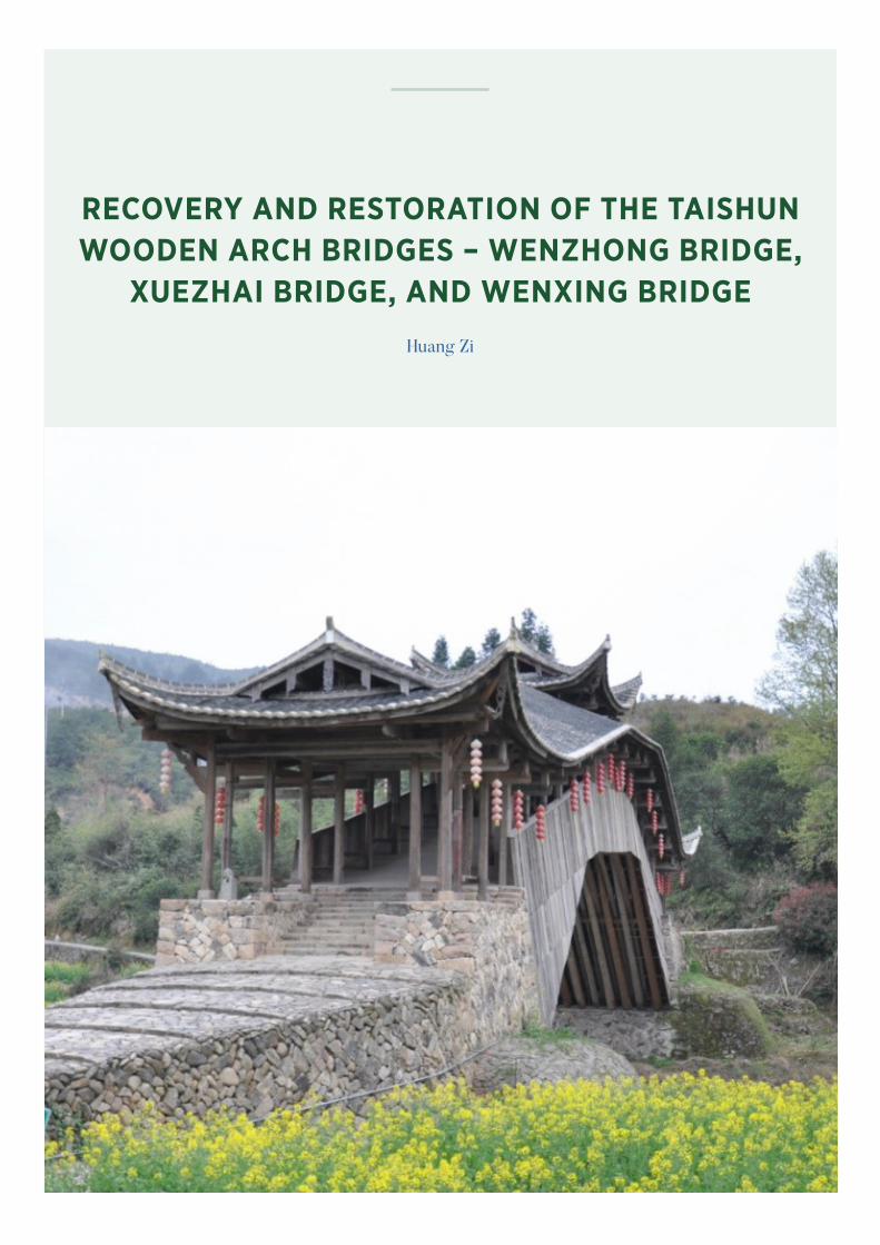
RECOVERY AND RESTORATION OF THE TAISHUN WOODEN ARCH BRIDGES – WENZHONG BRIDGE,
XUEZHAI BRIDGE, AND WENXING BRIDGE
Huang Zi

TABLE OF CONTENTS
List of Illustrations 40
1. The Heritage Resource and its Context Before the Impacting Event(s) 41
1.1 Description, Designation and Recognition 41
1.2 History and Context 50
2. The Nature of the Impacting Event(s) 51
2.1 General Description 51
2.2 General Impact of the Event(s) 51
2.3 Impact on the Significance and Values of the Resource 52
2.4 Emergency Repair(s) to Date 52
2.5 Documentation and Narratives 52
3. Post–Event Appraisals 52
3.1 Impact Assessment 52
3.2 Post-Event Documentation 53
3.3 Challenges for Recovery 53
3.4 Responses and Recovery Programme 53
3.5 Values and Sustainability 54
3.6 Drivers, Agents and Governance 54
4. Documenting Response Actions, Timeframes, Resources and Costs 54
4.1 Actual Implementation and Timescales for the Recovery Programme 54
4.2 Resources and Costs of Implementation 55
5. Documenting the Outcomes and Effects 56
5.1 Assessment of the Outcomes with Regard to the Recovery of the Heritage Resource 56
5.2 Ownership of the Results 56
5.3 Documenting the Recovery Programme 57
6. Details of the Expert(s) Completing this Case Study 58
Bibliography 59
39RECOVERY AND RESTORATION OF THE TAISHUN WOODEN ARCH BRIDGES |

List of Illustrations
Fig. 1 Xuezhai Bridge
Fig. 2 Wenzhong Bridge
Fig. 3 Wenxing Bridge
Fig. 4 Location of 22 Wooden Arch Bridges in Fujian
and Zhejiang
Fig. 5 Aerial photograph of Wenzhong Bridge
Fig. 6 Wenxing Bridge
Fig. 7 Bridge body
Fig. 8 Covered house of Wenxing Bridge
Fig. 9 Bridge house
Fig. 10 Surroundings of Wenxing Bridge
Fig. 11 Wenzhong Bridge
Fig. 12 Bridge body of Wenzhong Bridge
Fig. 13 Covered houses of Wenzhong Bridge
Fig. 14 Surroundings of Wenzhong Bridge
Fig. 15 Xuezhai Bridge
Fig. 16 Bridge body of Xuezhai Bridge
Fig. 17 Surroundings of Xuezhai Bridge
Fig. 18 Niche for a statue of the Buddha of Wenxing
Bridge
Fig. 19 Stones for the construction of the bridge deck
Fig. 20 Carpenter guides the assembly of the beam
frame
Fig. 21 Mortise and tenon joint
Fig. 22 Timber component
Fig. 23 Inheritors of intangible cultural heritage (from
top to bottom: Wenxing Bridge: Zeng Jiakai,
Wenzhong Bridge: Lai Yongbin, Xuezhai Bridge:
Zhe Changgui)
Fig. 24 The List of Intangible Cultural Heritage in Need
of Urgent Safeguarding
Fig. 25 Putting up the main beams
Fig. 26 Ji Haibo documenting the restoration process
Fig. 27 Cover of the engineering report on the recovery
of the three wooden arch bridges
40 | ICOMOS-ICCROM PROJECT CASE STUDY

1. The Heritage Resource and its Context Before the Impacting Event(s)
1.1 Description, Designation and Recognition
1.1.1 General Description This case study describes the reconstruction of Wenxing
Bridge, Wenzhong Bridge and Xuezhai Bridge, (figg. 1–3)
three key component bridges of Taishun wooden arch
bridges, which was declared a Major Historical and
Cultural Site Protected at the National Level in 2006. Of
these three bridges, Wenxing Bridge being one of 22
<<wooden arch bridges in Fujian and Zhejiang>> (fig. 4)
was included in China’s Tentative List of World Cultural
Heritage in 2012.
All three covered bridges are located in Taishun County,
Wenzhou City, Zhejiang Province of China. Taishun
is a county in Wenzhou’s mountainous area south of
Zhejiang, surrounded by high mountains, dense forest
and deep ravines. The area is characterised by warm
weather, abundant water, torrential rivers and streams,
dangerous shoals and gorges. There are traditional
villages nearby the covered bridges. In history, a covered
bridge was an important means of transportation for
villagers living on either side of the bridge.
The heritage composition of the three wooden arch
bridges includes the physical bridge and intangible
heritage. The physical bridge consists of two parts:
the bridge and its subsidiary part. The bridge consists
of the abutment (pier), bridge body (wooden arches)
and covered house; The subsidiary part includes the
surrounding water system, barges, ancient roads,
bridge houses, rural landscape, as well as inscriptions,
plaques, niche for a statue of the Buddha and
inscriptions on a stone tablet related to the wooden
arch bridge. The intangible heritage includes bridge
building customs, building techniques, building families
and stories. The mountainous terrain itself underlies all
aspects of this heritage. These bridges are mainly used
as small ritual spaces.
From top to bottom:Fig. 1. Xuezhai BridgeFig. 2. Wenzhong BridgeFig. 3. Wenxing Bridge
41RECOVERY AND RESTORATION OF THE TAISHUN WOODEN ARCH BRIDGES |

Numerous traditional villages are related to these three
bridges. For example, on both sides of Wenzhong Bridge
there are Chinese historical and cultural villages (fig. 5).These villages have a large number of traditional
buildings, such as folk houses, ancestral halls, etc. Some
of them have been designated as national, provincial,
county or city heritage.
1.1.2 Form, Function, Creation and Subsequent Transformation
1) Wenxing BridgeBuilt in 1857, Wenxing Bridge is a wooden arch bridge
lying in a northwest-southeast direction. It has a total
length of 40.2 metres and is 5 metres wide with a single
span of 29.6 metres. It stands 11.5 metres above the
standing water level with twelve steps at the head of the
bridge on the east side (fig. 6).
Abutment: Both sides of the bridge deck are chair-
shaped and made of stone masonry.
Bridge body: The arch is erected by interlacing three-
lines polygonal arc ribs, five-lines polygonal arch ribs
and X-bracings, out of which, three-lines polygonal arch
ribs have nine parallel members connected to tenons and
mortises, five-lines polygonal arc ribs have eight parallel
members (fig. 7).
Covered house: A total of seventeen bays, consisted of
eighty columns. Each truss is a post-and-lintel structure
composed of seven beams. On the side of the bay in
Images, Clockwise from top left: Fig. 4. Location of 22 Wooden Arch Bridges in Fujian and ZhejiangFig. 5. Aerial photograph of Wenzhong BridgeFig. 6. Wenxing BridgeFig. 7. Bridge body
42 | ICOMOS-ICCROM PROJECT CASE STUDY

front of the covered house facing the river is a niche
for a statue of the Buddha with: <<On September 13
in the Year of Ding Si (1857) of Xianfeng Reign of Qing
Dynasty>> inscribed on the upper part of the truss. The
vaulted three bays (Central Bay, Second Bay) form the
gable and hip pavilion with double eaves (fig. 8).
Bridge house: Located at the north-western end of the
bridge and was built to protect Wenxing Bridge (fig. 9).
Surroundings: Wenxing Bridge in located to the
northwest of the town of Xiaocun; it spans the Yu
Stream with Wentai Highway 200 metres to its east. Yu
Stream is a tributary of the Feiyun River flowing into
the Shanxi Reservoir (Feiyun Lake) to the north. On the
two ends of the bridge, the ancient road at the mouth
of the river and farmlands on its south side are well-
preserved (fig. 10).
Images, Clockwise from top left: Fig. 8. Covered house of Wenxing BridgeFig. 9. Bridge houseFig. 10. Surroundings of Wenxing Bridge
43RECOVERY AND RESTORATION OF THE TAISHUN WOODEN ARCH BRIDGES |

2) Wenzhong Bridge Wenzhong Bridge is a two-span bidirectional wooden beam
covered bridge stretching from east to west like a long arm.
The bridge is supported by a pier at the centre (fig. 11).
Abutment/pier: The abutment is built of rubble stone, the
piers are of cut stone.
Bridge body: Built by interlacing long-arm beams,
wooden flat beams and deck slabs 4 long arm beams for
the first layer, 2 wooden flat beams for the second layer, 9 long arm beams for the third layer, 19 wooden flat
beams for the fourth layer (fig. 12).
Covered house: This is 25.4 metres long, 4.17 metres
wide, and has eleven bays built of forty-six columns. Each
column-and-tie truss is composed of seven purlins and
four posts. The three bays in the centre are raised to form
an overhanging garble roof, while the bays on the two
sides have a gable and hip roof (fig. 13).
Surroundings: Wenzhong Bridge is located in Taishun
County, at the mouth of the river in Dongyang village of
Xiaocun Town and spans Yu Stream. It has the same river
system as the Wenxing Bridge. The two bridges are 2–3
kilometres apart. On the east side of Wenzhong Bridge
there are mountains connected by ancient roads, paddy
fields on its west side, and a backwater bay not far from
the southeast where the Yu Stream flows through.
Images, Clockwise from top left: Fig. 11. Wenzhong BridgeFig. 12. Bridge body of Wenzhong BridgeFig. 13. Covered houses of Wenzhong Bridge
44 | ICOMOS-ICCROM PROJECT CASE STUDY

3) Xuezhai Bridge Xuezhai Bridge is a wooden arch covered bridge lying in a
southwest-northeast direction. It is 51 metres long and 5.1
metres wide. A single span is 28.12 metres long. The bridge
stands 10.5 metres above the standing water level (fig. 15).
Abutment: The decking on both sides of the bridge is
trapezoidal in form and built of stone masonry.
Bridge body: erected by interlacing three-lines polygonal
arc ribs, five-lines polygonal arch ribs and X-bracings, out
of which, three-lines polygonal arch ribs have nine parallel
members connected to tenons and mortises, five-lines
polygonal arc ribs have eight parallel members (fig. 16).
Covered house: 33.52 metres long, 4.98 metres wide,
total fifteen bays built of sixty-four Columns. Each truss is
composed of nine purlins and four posts. The central bay
of 3.2 metres wide is used as the passageway. Bays on the
two sides are 0.82 metres wide respectively, long wooden
benches are provided for passers-by to sit and rest.
Surroundings: Xuezhai Bridge is located in the centre of
the town, to the east and west of the bridge there are brick
buildings. The relatively shabby landscape is a marked
contrast to the historic environment of the bridge. The
bridge was not originally built in the centre of the town but
was gradually surrounded by new folk houses (fig. 17).
Purposes of the construction of the wooden arch bridges:
Firstly, to facilitate transportation. Taishun area has
many mountainous valleys and the bridges facilitate the
traffic and communication of the surrounding villages to
build bridges, not mainly for trade, but also as a resting
place for passers-by. Secondly, for religious reason; the
villagers set up shrines, worship gods and hold rituals in
the porch houses.
Other purposes include geomancy and fengshui to
satisfy the traditional setting that the villagers want to
create, blessing for villagers to amass fortune, to remove
ill fortune, blessing for villagers to give new birth, for
clans and families to flourish. Another purpose is to
provide a gathering site for villagers. Many folk customs
and market activities are held at the covered bridges and
nearby villages (fig. 18).
Images, Clockwise from top left: Fig. 15. 15 Xuezhai BridgeFig. 16. Bridge body of Xuezhai BridgeFig. 17. Surroundings of Xuezhai BridgeFig. 18. Niche for a statue of the Buddha of Wenxing Bridge
45RECOVERY AND RESTORATION OF THE TAISHUN WOODEN ARCH BRIDGES |

The bridge continues to be used for transportation, but
its transportation function has been weakened with
respect to the important rural tangible cultural heritage
of Taishun area – newly formed traffic system in the
vicinity, without affecting the wooden arch bridges.
1) Material: Local traditional building materials, mainly
stone (such as rubble stones or blocked stones, for
different positions)(fig. 19), wood (cedar wood, pine
wood, old fir wood, black catalpa wood), tile (small
hand-baked greyish green tile) and oyster shell powder
(binding agent baked from shells), China wood oil.
2) Building techniques: Traditional construction
technology of wooden arch bridges. For more details,
see "List of Intangible Cultural Heritage in Need of
Urgent Safeguarding – Traditional design and practices
for building Chinese wooden arch bridges" (UNESCO
2009) or carpentry of Chinese wood-made technologies. The carpenter is a master woodworker with the skills to
create a wooden arch bridge (fig. 20).
3) Structural solutions: Without any proven support
of structural mechanics, craftworkers in ancient
China invented wooden arch bridges based on their
experience, using small, short wooden components
connected by tenon and mortise joints which are
essential in building a stable and scientific wooden arch
bridge. This simple, yet, sophisticated structure solved
the ancient transportation problem where columns could
not be anchored to cross over wide rivers and mountain
creeks, and the gap was thus filled by building long-
span wooden structures in ancient China. Moreover, the
bidirectional long-arm wooden flat beams made use of
interwoven longitudinal and transverse wooden straight
logs to increase the length of the main span so as to
minimise the number of piers (fig. 21).
The bridges have been built and destroyed many times
owing to natural disasters. The construction technology
and materials are still available today, using local
traditional materials and techniques of Taishun.
Images, Clockwise from top left: Fig. 19. Stones for the construction of the bridge deckFig. 20. Carpenter guides the assembly of the beam frameFig. 21. Mortise and tenon jointFig. 22. Timber component
46 | ICOMOS-ICCROM PROJECT CASE STUDY

Materials are basically sourced in Taishun. However,
it might be difficult to source the original materials
nowadays due to policies to protect the environment
and forests. In Taishun, there is an inheritors group of
intangible cultural heritage (fig. 23). The government
respects the skills and knowledge of this group and
provides opportunities for them to apply their expertise
in protecting the bridges. Funds are also provided for
their effort. The restoration of the three covered bridges
is the result of cooperation between heritage teams and
intangible heritage successors. The State, province and
county extend funding depending on the circumstances.
The construction of the bridges needs to understand
the traditional skills and techniques in building wooden
arch bridges. These skills and techniques are still
available, and in recent years particularly, there has been
some demand for the construction of covered bridges.
Currently, the carpenters are mainly distributed in the
areas between Fujian Province and Zhejiang Province.
They are only about fifty in number of which there are
more than ten in Taishun.
Fig. 23. Inheritors of intangible cultural heritage (from top to bottom: Wenxing Bridge: Zeng Jiakai, Wenzhong Bridge: Lai Yongbin, Xuezhai Bridge: Zhe Changgui).
47RECOVERY AND RESTORATION OF THE TAISHUN WOODEN ARCH BRIDGES |

1.1.3 Official Designation or InscriptionIn 1991, the People’s Government of Taishun County
declared the three wooden bridges to be cultural relic
units for protection at the county level. In 2006, the
People’s Government of Zheijiang Province declared
nineteen wooden arch bridges as cultural relic units
for protection within Zheijiang province. In 2006,
the State Council declared the Taishun wooden arch
bridges as National Heritage objects. There are fifteen
wooden arch bridges so designated, among which
Wenxing Bridge, Wenzhong Bride and Xuezhai Bridge
are considered particularly important. In 2012, Wenxing
bridge, one of twenty-two <<wooden arch covered
bridges in Fujian and Zhejiang>> was included in
China’s Tentative List of World Cultural Heritage.
In 2009, the traditional design and practices for building
Chinese wooden arch bridges was inscribed on the
List of Intangible Cultural Heritage in Need of Urgent
Safeguarding by UNESCO due to the challenges in the
availability of skills and too few inheritors.
The designations apply exclusively to the heritage itself,
although its surrounding environment is an important
part of it.
UNESCO’s remark on <<Intangible Cultural Heritage in
Urgent Need of Safeguarding – Traditional design and
practices for building Chinese wooden arch bridges>> is
quoted below:
<<Wooden arch bridges are found in Fujian Province
and Zhejiang Province, along China’s south east coast.
The traditional design and practices for building
these bridges combine the use of wood, traditional
architectural tools, craftsmanship, the core technologies
of "beam-weaving" and mortise and tenon joints,
and an experienced woodworker’s understanding of
different environments and the necessary structural
mechanics……. As carriers of traditional craftsmanship, the arch bridges function as both communication tools
and worship venues. They are important gathering
places for local residents to exchange information,
entertain, relax, worship and deepen relationships and
cultural identity. The cultural space created by traditional
Chinese arch bridges has provided an environment
for encouraging communication, understanding and
respect among human beings. The tradition has declined
however in recent years due to rapid urbanization,
change in transportation means and ways in exchanging
information, all of which to combine to threaten its
transmission and survival.>>
1.1.4.Scholarly RecognitionThe following is abstracted from the Nomination Dossier
for inscription of Wooden Arch Bridges in Fujian and
Zhejiang on the China Tentative List of World Cultural
Heritage.
The wooden arch covered bridges in Fujian and Zhejiang
were built by craftworkers in ancient China based
From left to right: Fig. 24. Certificate of inscription: The List of Intangible Cultural Heritage in Need of Urgent Safeguarding
48 | ICOMOS-ICCROM PROJECT CASE STUDY

on their experience without any proven support by
structural mechanics. The ancient craftworkers used
small, short wooden components connected to tenon
and mortise joints which were essential in building a
stable and scientific wooden arch bridge. This simple yet
sophisticated structure solved the ancient transportation
problem that a column cannot be anchored to cross
over wide rivers and mountain creeks, filling the gap of
building long-span wooden structure in ancient China.
The bridges represented the creativity of Chinese people
in ancient times.
The wooden arch covered bridges in Fujian and Zhejiang
have similar wooden arch structures as the Rainbow
Bridge drawn by Zhang Zeduan, an artist living in
Northern Song Dynasty, in his famous painting Riverside
Scene at Qingming Festival. All these bridges bear
testimony to Chinese wooden arch bridges and reflect
the advanced and sophisticated construction technology
of wooden arch bridges in the Northern Song Dynasty.
Similarly, the numerous wooden arch covered bridges
surviving in Fujian-Zhejiang mountainous areas are a
special witness to the continuation and evolution of
construction technology of Chinese wooden arch bridges.
1.1.5. Popular RecognitionThe following is abstracted from the Nomination
Dossier for inscription of Wooden Arch Bridges in
Fujian and Zhejiang on the China Tentative List of World
Cultural Heritage.
<<The wooden arch covered bridges in Fujian and
Zhejiang are an exceptional example of the rural culture
of remote hill villagers. In selecting the materials, and
location for the bridges to building the bridges, it shows
how mountain villagers in ancient China draw on local
resources, adapt to local situation>>, how to comply with
nature, fight against nature throughout a long period.
The bridges are symbols and signs, representing the
fengshui culture in Fujian-Zhejiang hilly areas that has
lasted until today. They are public spaces in villages, a
reflection of social structure, economic organisation and
self-governance in ancient villages. Despite enormous
pressure to protect these wooden arch bridges in
Fujian and Zhejiang, their heritage value and symbolic
significance cannot be ignored.
Being the spiritual space for villagers, the Fujian-Zhejiang
wooden arch covered bridges carry the faith of mountain
villagers to pray for blessing, to escape from harm. They
are directly associated with the folk belief of mountain
people that has lasted until today>>.
From building the wooden arch bridges to completion,
the whole process is manifested in a series of cultural and
folklore activities, e.g. choosing an auspicious date on
which to start the construction, preparing the main beams,
a ceremony to offer sacrifice to the rivers, selecting trees
of suitable size, cheers for putting up the main beams,
taking coins and rewarding workers, first step on the
bridge, blessing of the main beam, final ceremony for
completion and arranging a place for the shrine.
Fig. 25. Putting up the main beams
49RECOVERY AND RESTORATION OF THE TAISHUN WOODEN ARCH BRIDGES |

The bridge building practices are still continued today,
mainly by the master carpenter through the pedigree
of a clan.
1.2 History and Context
1.2.1 History, Ownership and Environment
1) Wenxing Bridge
First built in 1857 (7th year of Xianfeng Reign of the
Qing Dynasty) by master carpenters Wang Guangyi,
Wu Guangjie, Wu Wanchou, Wu Chengyi, Lin Ruizhi
and Wu Shikuan. In 1930 (19th year of the Republic
of China), villagers raised a total of 262 silver dollars
to have the bridge rebuilt by master carpenters Wu
Shengpin and Wu Zhengyi. In 1990, the bridge was
rebuilt again after the allocation of RMB1000 by
Taishun Museum together with the funds raised by
Lin Shengying and villagers. In August 2010, Zhejiang
Provincial Cultural Heritage Bureau allocated funds to
overhaul the bridge. Damaged by Typhoon Meranti the
bridge was swept away by a flood in September 2016
and reconstructed in December 2017.
2) Wenzhong Bridge
First built in 1745 (10th year of Qianlong Reign of the
Qing Dynasty), destroyed and rebuilt many times, and
rebuilt in 1921 (10th year of the Republic of China).
Damaged by Typhoon Meranti the bridge was swept
away by a flood in September 2016 and reconstructed in
December 2017.
3) Xuezhai Bridge
First built in 1512 (7th year of Zhengde Reign of the Ming
Dynasty), destroyed by floods and rebuilt many times
until a bridge was built in 1856 (6th year of Xianfeng
Reign of the Qing Dynasty). In 1986, the bridge was
rebuilt using the 13,000 Yuan raised by Xue Jiamei
and villagers, a subsidy of 13,000 Yuan from Zhejiang
Provincial Cultural Heritage Administration and 1,000
Yuan from the Bureau of Transportation of Taishun
County. Damaged by Typhoon Meranti the bridge
was swept away by a flood in September 2016 and
reconstructed in December 2017.
Ownership of the heritage resource: the bridges and
roads are the property of the State and open to the public.
The land within the boundary of the bridges is owned by
communities or individuals.
The bridges are located in villages or nearby. They are
closely linked to the development of the villages. Due
to modernisation, some of the traditional buildings
have been converted to brick-and-concrete residential
houses. The modern bridges, drainage system, dam and
electricity stations around the covered bridges have
created changes to the immediate setting of the heritage.
There is a lack of infrastructure facilities and fire safety
measures around the countryside.
The surroundings of the three bridges are very nice.
Before the flood, the bridges were well-preserved.
However, threatened by natural disasters, the bridge
bodies pose certain vulnerabilities, mainly: 1) The bridge
structure has limited tolerance to natural disasters,
especially during super typhoons or massive flooding;
2) Natural ageing of the components greatly reduces
the stability of the bridges, as a result, the bridges are
more vulnerable to natural disasters; 3) The geographical
environment around the covered bridges is easily
infected by pests, causing the bridge components to
corrode easily; 4) The covered bridges are not located
in areas that are accessible from outside, therefore, it is
difficult to obtain immediate support in case of a disaster.
1.2.2 Social and Economic Setting
1.2.2.1 Socioeconomic conditions of the area
Wenxing Bridge and Wenzhong Bridge are located in
Xiaocun Town, a famous historical and cultural town
and an ecological town of Zhejiang Province, located
in the mid-northern region of Taishun County. Covering
an area of around 80 square kilometres, the town has
a population of 15,000. With an agricultural-based
economy, Xiaocun Town is a famous tea plantation base
in Taishun County. Industrial production in Xiaocun Town
is small, mainly wooden toys, wood and stone processing.
There are villages all around the two bridges.
Xuezhai Bridge is located in Sankui Town a commercial
and transportation hub in central Taishun County,
covering an area of 69.60 square kilometres with one
residential district and sixteen administrative villages
under its jurisdiction. Rich in tourism resources, the town’s
50 | ICOMOS-ICCROM PROJECT CASE STUDY

economy is growing fast, fuelled by agriculture and
aquaculture. The town centre is around the heritage site.
1.2.3 Frameworks, Agents and Communication
Conservation and Management Framework:
1) Law of the People’s Republic of China on the
Protection of Cultural Relics
2) Regulations for the Implementation of the Law of
the People’s Republic of China on the Protection of
Cultural Relics
3) Regulations on the Conservation and Management of
Cultural Heritage Sites in Zhejiang Province
4) Measures on the Conservation and Management of
Cultural Heritage Sites in Wenzhou City
5) Measures on the Protection of Cultural Heritage in
Taishun County
6) Principles of Conservation and Management of World
Cultural Heritage
7) Regulations on the Protection of Famous Historical
and Cultural Cities, Towns, Villages (applicable to
Xiaocun Town)
Taishun wooden arch bridges are managed by Taishun
County Office for the Protection and Management of
Cultural Heritage (under the Bureau of Culture, Radio,
Press and Publication of Taishun County), cultural
workstation and part-time heritage preservationist in
Xiaocun Town.
2. The Nature of the Impacting Event(s)
2.1 General Description
Typhoon Meranti occurred in 2016. The heavy rainfall
of up to 300 mm in a very short period of time, caused
the stream to surge. While this was a unique experience,
the area is prone to flooding and has been subject to
significant flooding in the past.
Taishun belongs to a subtropical monsoon climate
zone featuring four distinct seasons, which can be hot,
humid and have abundant precipitation. Taishun has an
average of 2015 mm of rainfall. Annual precipitation is
unevenly distributed with 2 rainy seasons in a year. The
first rainy season is in May–June which encourages the
formation of mould. Thunderstorms, rainstorms or even
torrential rain are frequent, accounting for 25.96 per
cent of annual precipitation. The second rainy season
in August–September, is known as the flood season,
which is often accompanied by thunderstorms, heavy
rainstorms and even extra heavy rainstorms, accounting
for 26.54 per cent of the annual precipitation. Because of
its topography and climate, the formation of narrow river
valleys, scattered tributaries, steep riverbeds, large river
channels, precipitation, short and turbulent sources, rapid
flooding and other characteristics, including typhoons
are the main factors in the formation of regional flooding.
This has resulted in a steep increase in water volume and
a sharp rise in water levels.
2.2 General Impact of the Event(s)
Typhoon Meranti caused the Xuezhai Bridge, Wenzhong
Bridge and Wenxing Bridge, to be washed away one
after the other; other bridges were also affected to
varying degrees. The typhoon had a big impact on the
community. There were three deaths and two people
went missing. Of a population of 163,000, 12,900 had to
be relocated. Seventeen houses collapsed, and the area
suffered direct economic losses of 896.35 million yuan.
Tourism has suffered for the two years since the typhoon.
Abutments of the three covered bridges all had one
side swept away, while the other side remained intact.
The middle pier of Wenzhong Bridge was destroyed.
The flood wiped out its bridge body and covered house.
After emergency salvage, 30-60 per cent of the wooden
components were recovered. Some of the recovered
components were cracked or had missing parts, tenons
broke off, the surface layer of wooden components split
and rotted. Some components of covered house were
missing, small carpentry, the niche for a statue of the
Buddha, internal inscriptions are also missing.
The bridges have all been recovered. Craftworkers
and woodworkers in Taishun restored the salvaged
components as required. However, after recovery, the
bridge body and the covered house of the bridges are not
as stable as previously. The bridge deck and abutments
were structurally strengthened during the restoration.
51RECOVERY AND RESTORATION OF THE TAISHUN WOODEN ARCH BRIDGES |

The surrounding environment is also vulnerable to floods.
The barges to which it is connected are not reinforced or
have been damaged at a later stage, Moreover, villagers’
daily life and production also affect the bridges which
makes conservation more difficult.
Work started on the bridges straight away and this has
had a positive impact on the community and soothed the
psyche of the local villagers.
2.3 Impact on the Significance and Values of the Resource
The disaster has not had a major impact on the
authenticity of the heritage objects. Each bridge is
restored in place according to the shape and original
carpentry, using salvaged members and restoring the
members to the original specifications.
2.4 Emergency Repair(s) to Date
Right after the typhoon, the Bureau of Culture, Radio,
Press and Publication of Taishun County made an
Emergency Announcement on "Collecting Wooden
Components of Destroyed Covered Bridges". Villagers
living along the rivers set out immediately to rescue
the wooden components of covered bridges wiped
out by the flood. All rescued components were placed
in a temporary shelter and treated with anti-corrosion
agents or corrosion-inhibition agents. The original
components of covered bridges that were salvaged
were repaired by the carpenters (inheritors of intangible
cultural heritage) immediately; this emergency
protection measure opened up the possibility of
reconstructing the bridges later.
2.5 Documentation and Narratives
2.5.1 DocumentationEverything was documented using videos, photos, texts,
including people who rescued the bridges from the
flood, number of salvaged components, donations. All
emergency documentation has been shared with the
relevant key agents and stakeholders.
2.5.2 NarrativesThe bridges have been restored and the people around
them have been involved to further deepen its imprint
on them. The floods caused rapid and violent rises in
water flow, resulting in the destruction of the bridge
deck or piers, causing the entire bridge to be swept out.
The bridge decks and abutments have been repaired
and structurally reinforced, and the heritage resource
is in a safe condition, the arches and covered houses
are not as integrated as before because of the use of
damaged and repaired components.
3. Post–Event Appraisals
3.1 Impact Assessment
The villagers communicated verbally with the local
heritage authorities on the restoration programme.
Part of the bridge deck was damaged and the location
was clear, the file was complete, salvage components
accounted for a large proportion, the local bridge skills
heritage and other factors then determined the "Taishun
Wooden Arch Bridge-Wenxing Bridge repair project
design", "Taishun Wooden Arch Bridge-Wenzhong
Bridge repair project design", "Taishun Wooden Arch
Bridge-Xuezhai Bridge repair project design". In these
programmes, the destroyed bridge deck is restored
and strengthened, and the bridge bodies and covered
houses are repaired according to the original form.
The preparation process was timely and effective
in communicating with expert leadership and local
heritage departments.
Three well-known local inheritors of intangible cultural
heritage and traditional craftsmen who are masters
of the traditional design and practices for building
wooden arch bridges worked together to restore the
three bridges, using traditional construction skills and
techniques. Different stages of bridge building have
different ceremonies such as earth moving, logging,
etc., and the niche of the bridge is mainly for blessing
and peace.
The first priority is to ensure the integrity of the
covered bridges, next is their immediate surroundings.
Control through delineation of protected areas and
construction control.
52 | ICOMOS-ICCROM PROJECT CASE STUDY

3.2 Post-Event Documentation
The recovery process has been documented by Ji
Haibo, director of Taishun County Intangible Cultural
Heritage Centre. He used photographs to document the
restoration process, special components, and the skills
of the inheritors of intangible cultural heritage.
The documentation is kept in Taishun County Office
for the Protection and Management of Cultural
Heritage, the head of the Institute is responsible for
keeping them; all parties, including the people who
live around the bridges, are aware of the existence
of archival records: Historic photos, drawings, "Four
documentation", 3D scanning data for Xuezhai Bridge,
Wenxing Bridge.
3.3 Challenges for Recovery
Technology: Too many salvaged wooden components
make it difficult to find out where they were originally
located. The inheritors of intangible cultural heritage,
cultural and technical personnel and local carpenters
have identified pieces many times. Moreover, these
wooden components have been severely damaged.
The percentage of original components is 40-70 per
cent; damage is repaired through pier joint, patching,
patching and other ways.
Social dimension: There is a high level of social concern
and an urgent desire for reconstruction.
Decision-making: There is some controversy over
whether the destroyed bridge is still an artefact after it
has been repaired. One party believes that the bridge is
no longer in existence after it has been destroyed, while
the other party believes that the location is clear, most of
the components remain, and technology is passed on.
3.4 Responses and Recovery Programme
The programme for the restoration project was
completed in October 2016, the preliminary formalities
were completed in six months, the restoration
process and restoration plan were developed, and the
restoration work was completed on schedule at the end
of 2017. Fig. 26. Ji Haibo documenting the restoration process
The recovery programme was prepared by Zhejiang
Design Institute of Ancient Architecture, implemented by
the Bureau of Culture, Broadcasting, Tourism and Sports
of Taishun County (Taishun Bureau of Cultural Heritage).
The community, which had a "basic" understanding of
the recovery of heritage resources, was kept informed of
progress at all stages
Purposes: Recover the three bridges to their pre-damaged forms
(form, structure, workmanship, materials), and recover
the authenticity and integrity of the heritage.
Guiding principles: Use original components, original materials, original
skills and techniques as much as possible. Recover the
original fabric of abutments and piers to ensure their
authenticity. Recover immediate setting of the bridges,
traditional design and practices, folk customs to ensure
their integrity. Employ appropriate technologies to
reinforce the bridge structure. Combine recovery with
intangible heritage for passing on the tradition to future
generations. There are also involvements of professional
technicians, managers, heritage companies, inheritors of
intangible cultural heritage.
53RECOVERY AND RESTORATION OF THE TAISHUN WOODEN ARCH BRIDGES |

The programme of restoration and non-restoration was
fully discussed, and experts in heritage conservation
were organised to conduct expert examinations, and the
decision was finally made by the State and provincial
antiquities bureaus, which decided to carry out in-situ
restoration of the three bridges and restore them to their
original state.
Some studies on the recovered bridges have not yet been
completed, e.g. the report on the recovery of covered
bridges after the typhoon is still under preparation.
Documenting the entire process of restoration and
conducting in-depth research are still ongoing.
3.5 Values and Sustainability
The general environment in which the bridges are located
is important, and it is clear that the bridge deck and piers
are the weak part of the bridge. At that time, the bridge
decks and abutments were washed away first, causing
the entire bridge to be washed away.
The financial, human and social costs of the recovery
programme and future management/maintenance of the
recovered bridges have been effectively addressed. The
Taishun government and villagers are concerned about
sustainability, whether economic, social or environmental.
They take initiatives to protect the bridges.
3.6 Drivers, Agents and Governance
The main drivers for recovery were the government’s
decision-making support; the close involvement of all
parts of society; the active participation and support of
local villagers, etc., to actively promote the concept of
cultural relics, policies, and unify thinking.
Financial support and social donations also played an
important role in the restoration of the heritage. Funds
were raised through the internet, television and radio,
etc., and with a dedicated door-to-door collection.
While ensuring the stability of the bridges, the recovery
is required to use original components whenever
possible. Priorities and requirements are identified and
assessed by the Design Institution according to national
laws and regulations. The purposes are to retain the
historical information of the bridges as much as possible,
to recover the original structure and style of covered
bridges, and to meet the authenticity and integrity of the
heritage.
Local communities/stakeholders were not involved in
drafting the recovery/restoration programme. The local
villagers wanted to restore the bridge as soon as possible
to a brand new look and assessed their expectations
on the technical aspects of the need and feasibility of
restoration.
All levels (State/Province/City) of cultural heritage
departments played an important role in decision-making
and approval of the recovery programme. Funds were
provided by numerous associations. Taishun Intangible
Heritage Centre and Design Institution provided technical
support.
Building contractors did not play a role in the recovery
programme, however, inheritors of intangible cultural
heritage (carpenters who are skilled in building
traditional wooden arch bridges) were involved in
the design of the overall wooden components of the
unit, from the arrangement, identification and repair
of wooden components, and the positioning of the
components, to the overall restoration of the bridge.
As part of the post-event governance framework there
are pre-plans for different situations. In particular,
there are measures in place for flooding. Following the
typhoon, Taishun County established a special leadership
group to manage the situation at local and national
level. Instructions flow along the chain of command
from Bureau of Culture, Radio, Press and Publication
of Taishun County, to Taishun County Office for the
Protection and Management of Cultural Heritage.
4. Documenting Response Actions, Timeframes, Resources and Costs
4.1 Actual Implementation and Timescales for the Recovery Programme
During the 8-month implementation phase from March
to December 2017, abutments and piers were rebuilt
54 | ICOMOS-ICCROM PROJECT CASE STUDY

before the flood season in June. The next phase was to
recover the upper parts of the bridges.
Recovery began as the floodwaters receded. Taishun
government and local villagers set out immediately to
salvage the wooden components. Officials of all levels
rushed to the site to give clear instructions and unify the
effort. The Design Institution (the most famous cultural
heritage conservation research institute in Zhejiang
Province, responsible for cultural heritage restoration,
heritage declaration) also came to the site immediately
to conduct surveys despite tedious procedures (such as
establishment of projects, approval of programmes at
different levels, multiple validations, etc.) and scarcity of
information. The recovery programme was established
soon after the project was submitted for approval. Due
to the efforts of all parties, the recovery programme
was approved very quickly. After completion of the
drawings and plans, tenders were immediately issued
to invite three contractors, who worked with intangible
heritage successors in Taishun, to recover the covered
bridges. The three contractors were: Hangzhou Heritage
Construction Company Limited, Shaoxing Ancient
Architecture and Garden Landscaping Company Limited,
and Yongjia Nanxijiang Construction Company Limited.
All three companies are qualified to work on cultural
relics. Wood and tiles were procured locally to replace
those wiped out by the flood. The construction of
the bridge deck and piers could not proceed during
the flood season, so time was very tight. The wooden
structure part of the repair was more difficult; in order
to speed up progress, repair of the wooden arch was
carried out simultaneously. It was planned to complete
the repair works within 8 months, with the aim of
completing the recovery before December 2017.
Intangible heritage successors demonstrated the
traditional design and practices for building wooden
arch covered bridges. Thus, the reinforcement method
of the members of the bridges is generated. Some
values and attributes could not be recovered, however,
since some of the physical components of the covered
bridges wiped out by the flood were gone forever.
Those that were salvaged were often damaged beyond
repair. The historic inscriptions inside the bridges
were also lost. (These bridges are not periodically
washed out; they are also 100 years old and restoration
maximises the preservation of authenticity in
accordance with heritage principles)
4.2 Resources and Costs of Implementation
The Design Institution and Construction unit jointly used
equipment to test the stress waves and note the resistance
of the salvaged wooden components. Geological and
water reconnaissance were conducted by Zhejiang 7th
Reconnaissance Team and Zhejiang Design Institute of
Water and Electricity Reconnaissance respectively.
The construction unit worked with craftsmen who are
experienced in building wooden arch covered bridges
using construction technology. They recovered the
damaged covered bridges using traditional design and
practices.
The Design Institution and Construction unit used
scientific structural reinforcement measures, with the
three bridges retaining between 60 and 80 per cent
of their members, and there were discussions about
whether to repair or replace them, as the members had
varying degrees of damage. The damaged members have
been repaired by pier jointing, patching, ticking, etc.
The Bureau of Culture, Radio, Press and Publication of
Taishun County, the Design Institution, Construction
unit and local villagers were actively involved in the
recovery of the covered bridges. Local villagers dictated
information about the bridge to specialists, provided their
own opinions on the repair programme, and supervised
the bridge repair process. The local government set up
a dedicated leadership group to oversee the recovery
programme. All of the above parties had experienced
technical staff to collaborate on this. The materials were
basically sourced locally, especially pine (horsetail pine)
and willow fir, which are important components of the
bridge. Due to the large size of the materials used for the
bridge, the history of the bridge is generally taken from
local materials due to traffic problems, and the length,
strength, etc. meet the requirements.
All levels of government supported the recovery of
the covered bridges and took costs into account in the
planning, including the donations in money and kind
from villagers, about a third of the total.
55RECOVERY AND RESTORATION OF THE TAISHUN WOODEN ARCH BRIDGES |

All parties tracked each phase of the recovery
programme and the technical services during the entire
implementation phase. Where technical problems arose,
these were resolved on site. Among them, the design unit
was the core force in the repair process.
5. Documenting the Outcomes and Effects
5.1 Assessment of the Outcomes with Regard to the Recovery of the Heritage Resource
According to the original form and structure, a large
number of original components have been adopted and
inheritance techniques have been adopted to restore
the form and style of the heritage before the disaster.
The authenticity and integrity of cultural relics have
been guaranteed. The inner spiritual home of the local
villagers was restored.
The actions have been very effective. All levels of
government departments and all sectors of society
recognise the recovery. ICOMOS China named the
recovery of Taishun Covered Bridges as a <<National
Distinguished Conservation Site>>, leading to a wave of
<<conserve the heritage, inherit the heritage>> among
the public, igniting a passion of <<love our bridges,
protect our bridges>> among local villagers.
Planned sustainability objectives have been achieved.
The wooden arch bridge technique has been inherited,
and the wooden arch bridge reappears above the
stream.
There have been no conflicting views about the project.
It is considered a successful restoration project, with the
participation of everyone in resolving contradictions in
the restoration process.
The integrity, original shape and style of the physical
bridges and immediate setting have been recovered.
The intangible elements of the bridges (construction
technology of wooden arch covered bridges) have
also been employed and inherited during the recovery
process. Those that could not be recovered are
components swept away by the flood and damaged
components losing load-carrying capability, including
Buddha niches and inscriptions. The space for the niche
was restored, but the statue was not, which gradually
weakened the influence on the villagers’ lives.
The significance of the three covered bridges continues
to be acknowledged. The surrounding villagers are more
familiar with the heritage than before. The bridges have
become part of their daily lives again. For local villages,
the recovery of the bridges arouses a sense of belonging
and identity deep inside their heart. Now, they pay more
attention to culture, bringing new life to local culture,
tourism and economic development.
The guidance of government departments
(communicate effectively with different groups to
determine the direction of restoration), full engagement
from the villagers (Love bridge, bridge, a lot of
enthusiasm), technical aspect backed up by professional
teams (one of the best teams in the country) and
inheritance of intangible skills and techniques, together
with the efforts of all parties, all played an important
role in the entire process of recovering the covered
bridges damaged by the flood.
We will further strengthen protection, strengthen
preventive monitoring and improve management. As
an important participant in the scheme system, the
proposal of the wooden arch bridge will attract great
attention from the local community mainly from the
perspective of how to protect it.
5.2 Ownership of the Results
The Bureau of Culture, Broadcasting, Tourism and Sports
of Taishun County (Taishun Bureau of Cultural Heritage)
owns the result of the recovery programme. The local
people have a strong sense of ownership, and the bridge
is a part of their life, they also actively cooperated with
the director of cultural relics to do a good job on the
restoration.
There is a shift in value perception in the post-recovery
phase. In the heart of local villagers, a covered bridge
is not simply a bridge in front of their home, but a
covered bridge of Outstanding Universal Value. Villagers,
56 | ICOMOS-ICCROM PROJECT CASE STUDY

intangible heritage successors all understand that
heritage rules and requirements must be followed to
recover the covered bridges. Components cannot be
replaced as one wishes.
5.3 Documenting the Recovery Programme
5.3.1 Main documentation needed: 1) Taishun Covered Bridges – Approval for Recovery
of 10 damaged bridges including Wenxing Bridge
(Heritage Conservation [2016] No. 1915)
2) Zhejiang Provincial Cultural Heritage Administration –
Approval of the Programme for Recovery of National
Heritage: Xuezhai Bridge, Wenxing Bridge and
Wenzhong Bridge (Zhejiang Cultural Heritage [2017]
No. 29)
3) Minutes of Meeting for Assessment of the Programme
for Recovery of National Heritage: Xuezhai Bridge,
Wenxing Bridge and Wenzhong Bridge (February 2017)
4) Taishun Covered Bridges – Programme for Recovery
of Wenxing Bridge and construction drawings
5) Taishun Covered Bridges – Programme for Recovery
of Wenzhong Bridge and construction drawings
6) Taishun Covered Bridges – Programme for Recovery
of Xuezhai Bridge and construction drawings
Other documentation can be obtained from Taishun
County Office for the Protection and Management of
Cultural Heritage.
The recovery process has been documented. Both
written and electronic records on acceptance test and
supervision are available from contractors.
"Taishun wooden arch Bridges – Report on Recovery
of Wenzhong Bridge", "Taishun wooden arch Bridges –
Report on Recovery of Xuezhai Bridge, Wenxing Bridge"
(Published in 2020 as planned).
New information was produced during the recovery
phase. Xuezhai Bridge and Wenzhong Bridge had never
been overhauled since being rebuilt over a century ago.
The recovery this time identified the tenon and mortise
works and structures hidden inside. This information is
not yet public as it is still in the internal discussion phase.
Engineering reports will be published and made available
to the public.
The documentation accurately records in detail the entire
process of recovering the covered bridges damaged
by the flood, including the traditional construction
technology and underlying data of the three covered
bridges. The documentation provides key information for
future actions to improve the level of effectiveness.
Fig. 27. Cover of the engineering report on the recovery of the three wooden arch bridges
57RECOVERY AND RESTORATION OF THE TAISHUN WOODEN ARCH BRIDGES |

6. Details of the Expert(s) Completing this Case Study
Huang Zi, a certified architect (Grade II), is the Director
of Zhejiang Design Institute of Ancient Architecture, a
part-time researcher in Zhejiang University, a tutor to
master’s degree students, member of ICOMOS/China,
Vice Chairman of China Association of Cultural Heritage
Conservation Technology and Director of the Academic
Committee for Traditional Construction Technology of
Wooden Architecture in State Administration of Cultural
Heritage Research Hub. He has been involved in the
study of heritage preservation since 1980.
In that time Huang Zi has undertaken a number of
projects:
• National projects in China (Aid to Tibet, Disaster
Relief and Rehabilitation of Sichuan, Three Gorges
Heritage Conservation);
• Overseas projects ("The China Temple" in Nepal,
"Thousand Trees Villa", a Chinese Classical Garden in
Los Angeles, USA);
• Aid projects to foreign countries (Ta Keo Temole in
Cambodia);
• Conservation projects for National Heritage (Feiying
Pagoda in Huzhou, Shisi Temple in Jingning She
Automonous Region, Haishen Temple in Haining
City, Loyal King Mansion in Suzhou, Yanfu Temple in
Zhejiang Wuyi County, Yanqing Pagoda in Zhejiang
Songyang County);• Large recovery projects (Ancient architectural
Complex in Ningbo Cicheng, Temple of King Qian
in Hangzhou, Gongchen Bridge Historical Streets,
Zhongshan East Road in Hangzhou);
• World Heritage Nomination projects (Hangzhou West
Lake, China Grand Canal, Archaeological Ruins of
Liangzhu City);
• National "13th Fifth Year" project ("Scientific Study
of Traditional Construction Technology of Ancient
Architecture" (2012-2014));
• Specification for heritage conservation
documentation, budget standard for conservation of
heritage architecture.
On 17 September 2016, after the Taishun Wooden
Arch Bridges – Wenzhong Bridge, Xuezhai Bridge, and
Wenxing Bridge were swept away by the flood, Huang
Zi rushed to the site to instruct local people on how to
protect the wooden components and follow-up actions.
During the preparation of the recovery programme,
Huang Zi was the person in charge of final details. He
set out recovery principles, technological path, and
provided guidelines for designers to resolve technical
problems. During the implementation phase, Huang
Zi helped technical staff address technical issues. In
the compilation of final reports, he finalised the report
framework and offered numerous suggestions.
58 | ICOMOS-ICCROM PROJECT CASE STUDY

Bibliography
Dai Zhijian, 2005. Chinese Covered Bridges, Fujian People’s Press.Du Liansheng, 1979. A History of Bridges – Rainbow Bridge in Bianjing, Shanghai Science and Technology Press.Liu Jie, Li Yuxiang, 2001. Indigenous China – Taishun, SDX Joint Publishing.Liu Jie, Shen Weiping, 2005. Taishun Covered Bridges, Shanghai People’s Fine Arts Press.Mao Yisheng, 1986. A History of Chinese Ancient Bridge Technology, Beijing Press.Taishun County History Editorial Committee, 1998. Taishun County History, Zhejiang People’s Press.Tang Huancheng, 2010. Bridges in Ancient China, China Architecture and Building Press Beijing.Tang Huancheng, 2009. Chinese Wooden Arch Bridge, China Architecture and Building Press, Beijing.UNESCO, 2009. List of Intangible Cultural Heritage in Need of Urgent Safeguarding – Traditional design and practices for
building Chinese wooden arch bridges" .Available at https://unesdoc.unesco.org/ark:/48223/pf0000188329
Wu Songdi, Liu Jie, 2009. Chinese Traditional Villages: International Study on the History and Culture of Taishun in
Zhejiang, Qilu Bookstore, Jinan.Wu Songdi, Liu Jie, 2009. Chinese Traditional Villages: International Study on the History and Culture of Taishun in
Zhejiang, Qilu Bookstore, Jinan.Zhang Qin, 2003. Indigenous Wenzhou, Zhejiang Chinese Classics Publishing House.Zhou Fenfang, Lu Zeqi, Su Xudong, 2011. Construction Technology of Traditional Chinese Wooden Arch Bridges.
Zhejiang People’s Press, Hangzhou.
Journal articles/Dissertations:Bi Sheng, 2003. Wooden Arch Bridge – A Study on Building Cultural Heritage in China, A Dissertation for master’s
degree in Nanjing University.Bi Sheng, Zhao Chen, 2003. "Zhejiang-Fujian Wooden Arch Bridges – Culture of Human Settlement", in South East
Culture, 7.Cao Chunping, 2009. "Wooden Arch Covered Bridges in Fujian and Zhejiang", in Fujian Architecture, 9.Chen Qi, 2005. A Preliminary Study on Taishun Wooden Arch Covered Bridges, Zhejiang Art and Craft, 12.Chen Yungen, 2003. "Structure and Origin of Wooden Arch Bridges in South Zhejiang", in South East Culture, 9.Chun Qing, Hu Shi, 2011. "Taishun Covered Bridges – Structural Damage of Wenxing Bridge and Recovery", in
Architectural Technology, 6.Fang Yong, 1995. "Rainbow Bridge", in Journal of Architecture, 11.Feng Hua, 2003. "Taishun Covered Bridges", in Architecture Knowledge, 2.Liu Xiufeng, 2009. "Traditions and Culture of Wooden Arch Covered Bridges in South Zhejiang", in Social Science Frontline, 12.Liu Yan, 2011. "Types of Wooden Arch Bridges in Zhejiang and Fujian - Polygonal Arch Systems:, in Journal of Southeast
University (Natural Science), 3. Proceedings of the First International Symposium on Chinese Covered
Bridges, Taishun, 2005.Su Xudong, Liu Yan, 2010. "Double Three-Lines Polygonal" Wooden Arch Bridge – Important Evolution of Wooden Arch
Bridge", in Central China Architecture, 10.Xu Zhemin,2009. "Current State and Conservation of Wooden Arch Covered Bridges in South Zhejiang", Architecture
and Culture, 5.Xue Yiquan, Su Weiqian, 2010. Hiding in the Mountains to "World Heritage" – Traditional Construction Technology for
Building Taishun Wooden Arch Covered Bridges inscribed on the List of Intangible Cultural Heritage,
Today’s Zhejiang, 04.
Zhang Guangying, 2010. "Wooden Arch Bridges in northeast Fujian and southwest Zhejiang in the context of World
Cultural Heritage," in Journal of Yangtze University (Social Science), 2.Zhang Jun, 2001. "Evolution and History of Taishun Covered Bridges" in, Small Town Construction, 9.Zhu Yi, Liu Jie, 2007.
"Conservation and Development of Sixi Town Covered Bridge Cultural Park", in Central China Architecture, 4.
59RECOVERY AND RESTORATION OF THE TAISHUN WOODEN ARCH BRIDGES |

THE INTERPRETATIVE RECONSTRUCTION OF THE ROYAL CAPITAL IN NYANZA, RWANDARe-assembling Heritage Fragments for Post-Genocide Recovery
Maya Ishizawa, Senior Research Fellow, Institute of National Museums of Rwanda-INMR1 Jérôme Karangwa, Director of Research and Publication Unit, Institute of National
Museums of Rwanda-INMR

TABLE OF CONTENTS
List of Illustrations 62
1. The Heritage Resource and its Context Before the Impacting Event 63
1.1 Description, Designation and Recognition 63
1.1.1. Description 63
1.1.2. Designation 69
1.1.3. Recognition 70
1.2 History and Context 71
1.2.1. History 71
1.2.2 Context 72
2. The Nature of the Impacting Event 75
3. Post-Event Appraisals 77
4. Response Actions, Timeframes, Resources and Costs 78
5. The Outcomes and Effects 81
6. Additional Comments 85
7. Details of the Experts Completing the Case Study 86
Bibliography 88
61THE INTERPRETATIVE RECONSTRUCTION OF THE ROYAL CAPITAL IN NYANZA, RWANDA |

List of Illustrations
Fig. 1a Example of temporary royal settlement
Fig. 1b King Musinga at his palace
Fig. 2 Ensemble of reconstructed huts in Rukari hill
Fig. 3 Part of the former home of Hubert Ngenzi,
which was dismantle and reassembled in the
Museum of Rwanda
Fig. 4 Two trees mark the enclosure of the former
Royal residence
Fig. 5 Ceiling (Ipfundo) of a traditional hut
Fig. 6 Diamond-shaped capitels linking the wooden
pillars to the ceiling of the Hubert Ngenzi hut
in the Museum of Rwanda
Fig. 7 Typical hearth in the centre of the Hubert
Ngenzi hut in the Museum of Rwanda
Fig. 8 Plan for the proposed reconstruction of the
Royal Capital as described in Lugan’s account
Fig. 9 Women maintaining the clay, dung and paint
elements in the Igitabo
Fig. 10 King Christ Catholic Church situated in the
area where the Royal Capital used to stand
Fig. 11 Ficus tree and well – all that remain of the
former Royal Capital
Fig. 12 École Ménagère
Fig. 13 "Land of a thousand hills"
Fig. 14 Royal settlements were typically located on
the top of a hill overlooking such plains
Fig. 15 Palace of King Mutara III Rudahigwa
Fig. 16 Home Grown Solutions Museum (formerly the
National Art Gallery)
Fig. 17 Mausoleum where Rudahigwa and Kigeri V
Ndahindurwa, his brother and the Queen
Rosalie Gicanda are buried, in Mwima
Fig. 18a Re-distributing scarce land to cater for people
returning from exile and for the growing
population is a continuing challenge
Fig. 18b The campaign for housing: among its aims is
to replace traditional thatch with corrugated
iron or tiles
Fig. 19 Skilled elders
Fig. 20a-e Building three huts in the traditional style
Fig. 21 Traditional hut on Rukari hill built for the
National Ballet
Fig. 22 Layout of the first three huts reconstructed
for the Royal Capital following Luga’s
description
Fig. 23 Native cows (Inyambo)
Fig. 24 Eco-lodges for tourism, inspired by the Royal
huts in Rukari hill
Fig. 25 Kigali Convention Centre in the distance
Fig. 26 Terraces in the hills
Map 1 Map showing the Lake Muhazi valley
Map 2 Map showing Rwesero, Rukari, Mwima,
and Nyanza hills explains how the cultural
landscape was organised in the past
62 | ICOMOS-ICCROM PROJECT CASE STUDY

1. The Heritage Resource and its Context Before the Impacting Event
1.1 Description, Designation and Recognition
1.1.1. DescriptionIn the royal tradition of Rwandan kings that went from
the fourteenth to the twentieth centuries, the Royal
Capital, which consisted of the residence where the kings
lived with their extended families, service and court,
was a temporary settlement composed of several huts
made of perishable materials (fig. 1a). Every king would
have itinerant capitals whose locations were designated
by abiiru, the king’s advisors, keepers of royal secrets,
clairvoyants, and magicians. They were in charge of
performing the rituals to select the hills where the
residence of the king would be established.
The Royal Capital in Nyanza was the last established
by King Yuhi V Musinga (1896-1931) in 1899, and the
last capital built following the traditional architectural
and belief system of pre-colonial Rwanda. Furthermore,
this was one of the few royal capitals experienced by
Europeans:2 The settlement has been described by
travellers, functionaries and missionaries that lived and
worked in Rwanda during the German3 and Belgian4
occupations. Based on these accounts, French historian
Bernard Lugan, described in his article "Nyanza,
une capitale royale du Rwanda ancien" [Nyanza, a
Royal Capital of Ancient Rwanda] (Lugan 1980), the
organisation of the Royal Capital in Nyanza. It is based
on Lugan’s interpretation, that the reconstruction of
the Royal Capital was projected in the aftermath of
the Genocide against the Tutsi which occurred in 1994
(hereafter referred to as the Genocide). So far, only an
ensemble of three huts has been reconstructed in Rukari
hill, (fig. 2) a neighbouring hill to the one of Nyanza, also
in Nyanza district, in the Southern Province of Rwanda,
between 2003 and 2008.
Descriptions from Coupez and Kamanzi (Coupez and
Kamanzi 1962) and cited by Lugan assert that the Royal
Capital was composed of multiple enclosures that would
form, in their view, a sort of labyrinth. The main house
where the king lived and received his guests was called
Kambere, and the second important house was called
Rugend. (fig. 1b). A hut was also reserved for the royal
drum Karinga, and other dynastic drums. One other hut
was used for conserving the sacred fire from the mythical
King Gihanga, from which all the kings would descend.
Other huts were dedicated to the souls of former kings
and one enclosure would belong to the dynastic bull
Rusanga and its cows Insanga, descendants of those
living in the reign of King Gihanga.
Images, Clockwise from top left: Fig. 1a. Example of temporary royal settlementFig. 1b. King Musinga at his palaceFig. 2. Ensemble of reconstructed huts in Rukari hill
63THE INTERPRETATIVE RECONSTRUCTION OF THE ROYAL CAPITAL IN NYANZA, RWANDA |

The enclosure of the king was connected to the public
square called Akarubanda (literally meaning, <<from the
people>>). Surrounding this enclosure, there were several
houses and temporary huts for guests and servants.
Urugo in Kinyarwanda is the word for house. The
circular layout of the Urugo rw’ Ibwami (house of the
king) was the model for all houses, which reflects the
traditional way that huts were constructed in different
regions and different social classes. The largest and
most elaborated were those from kings and secondly,
those from chiefs. The residence of King Musinga
consisted of sixteen huts inside the main enclosure, but
the settlement counted 34 in total (Kanimba Misago
and Van Pee 2008: 20).
Professor Célestin Kanimba Misago, archaeologist and
former director of the Institute of National Museums of
Rwanda (INMR) and Lode Van Pee, Belgian architect,
published a book entitled Rwanda Traditional dwelling
in 2008 where they described the process of building
a traditional hut, based on their research on Rwandan
vernacular architecture. Professor Kanimba Misago was
in charge of the reconstruction of the Royal Capital, and
in this book, he described the royal huts reconstructed
in Rukari hill. The design of these royal huts is based on
another traditional hut, which in 1955, was part of the
home of Mr Hubert Ngenzi. Mr Ngenzi was the second
in chief, igisonga, of Rwamiko, today in Nyaruguru
district, Southern Province of Rwanda. The hut was
the second in importance for a lavish compound. In
1957, the hut was dismantled and rebuilt in the Musée
du pays du Rwanda (Museum of Rwanda).5 Certain
elements of the roof were therefore cut off so that
the hut could be brought into the museum building.
However, the dome of the roof, inkoko y’igisenge, was
left intact. Some pillars and the thatch roof cover were
replaced, and all these materials were used to re-install
the hut at the Ethnographic Museum in 1989 (fig. 3).
The assumption was that all huts follow the same
construction techniques and basic design, would
become more complex and more decorated when the
hut belongs to a person of higher hierarchy and with
more resources. One element that differentiated the
king’s hut from others were the two antennas on top
of the entrance (fig. 1b). Kanimba Misago and Van
Pee (2008) explained that in Rwanda, the traditional
dwelling was composed of two basic units, the hut and
the compound which were both of a circular layout.
The hut was totally or partially enclosed by the walled
compound that defined an entrance courtyard in front
of the residential hut. The entrance to both the hut
and the enclosure were aligned so it was possible to
see from the hut directly to the enclosure entrance.
The royal residence enclosure is thought to have
been approximately 200 metres long, and between
80 metres and 140 metres wide, made of reed woven
with rush and euphorbia. Its entrance was framed by
two sacred trees, one ficus and one red-hot poker tree
(erythrina abyssinica) for protection and planted when
the site was chosen. These two trees are the markers of
the emplacement of the royal residence that lasted after
all the structures vanished into nature (fig. 4).
From left to right: Fig. 3. Part of the former home of Hubert Ngenzi, which was dismantled and reassembled in the Museum of RwandaFig. 4. Two trees mark the enclosure of the former Royal residence
64 | ICOMOS-ICCROM PROJECT CASE STUDY

According to Kanimba Misago and Van Pee (Ibid.), the
most important element of the structure of a traditional
hut was the ceiling called Ipfundo, (fig. 5) the size of which
determined the size of the building. The reconstruction of
the royal huts in Rukari followed the same process: The
central part is woven with basket patterns. This central
part is surrounded by four woven rings representing the
universe. The first one represents Heaven or the world
where Imana (God) lives called Ijuru. The second represents
the world of celestial bodies and is called Ikirere. The
third one represents the world of people and is called Isi.
The fourth represents the world of death and is called
Ikuzimu. After these symbolic rings, the ceiling was woven
circularly by binding together stems of shrubs (desmodium
mauritianum). The name of this circular woven structure
was Imbabaza, and it was done following a technique
called ubuhuruture (Ibid.: 26–32). Depending on the
wealth of families, they would develop more elaborated
roofs, mats, larger huts and with more units of huts and
enclosures. The techniques for weaving the different
elements of the huts are still conserved but the most
elaborated are only known by some surviving masters.
A crosspiece called urubaruro rwa koma is the junction
between the roof and the lower part of the hut. This
piece had magical functions for protecting the hut
from bad luck and bad spells. The assembling of the
prefabricated woven ceiling and the lower part of the
house was called kwakira inzu (to receive the house) and
was performed following special rituals. After this, the
pillars were installed inside the hut and this action was
called guterura inkingi. The pillars support the ceiling and
have a diamond-shaped capitel that links the wooden
pillar with the ceiling (fig. 6). Finally, the roof was
covered with thatch made of plants such as urukangaga
(miscanthus sp.), umukenke (hyparrhenia sp.) or ishinge
(eragrostis blepharoglumis). The thatching began at the
bottom of the hut and finished at the top, and after it
was completed, ceremonies used to be performed to
inaugurate the house.
The traditional huts were designed for protecting and
taking advantage from the environmental conditions.
Without any other opening besides the entrance, the hut
maintained itself fresh inside during the day and warmer
at night. They used to have a central hearth for giving
light inside the hut, reducing the humidity and warming
up the space (fig. 7). The smoke would go out through the
entrance. This smoke was useful for keeping mosquitoes
and other insects away from the interior of the huts.
Images, Clockwise from top left: Fig. 5. Ceiling (Ipfundo) of a traditional hutFig. 6. Diamond-shaped capitels linking the wooden pillars to the ceiling of the Hubert Ngenzi hut in the Museum of RwandaFig. 7. Typical hearth in the centre of the Hubert Ngenzi hut in the Museum of Rwanda
65THE INTERPRETATIVE RECONSTRUCTION OF THE ROYAL CAPITAL IN NYANZA, RWANDA |

Kanimba Misago and Van Pee (Ibid.) also described
the process for building the traditional huts. The first
step was the choice of the site for the construction
called ikibanza. This process required, as in the case of
a Royal Capital, the intervention of soothsayers who
would recommend the best place that would not present
danger for the future occupants of the house or they
would perform a ceremony to banish any bad luck for
the future occupants. The second step was the gathering
of the materials for construction and preparation of the
site. The materials used were tree trunks or branches for
the pillars, which before the introduction of eucalyptus
were selected according to the region: umusave
(markhami platycalyx), umubilizi (vernonia amygdalina),
and umuvumu (ficus sp.). The cross-pieces or imbariro
were made with flexible branches such as umuseke (a
kind of fine reed phragmites mauritianus), urubingo (a
kind of ordinary reed pennisetum purpureum), imbabaza
(shrubs of desmodium mauritanum), umusororo (shrubs
of indigofera erecta), umunaba, umutilitili, umucundura
(shrubs of waltheria indica), umukindo (palm tree
pheonix reclinata) and igishurushuru (fern pteridium
aqualium). The plants used for thatching and ropes were
umukenke (hyparrhenia filipendula family), uruguhu
(eragrostis olivacea) or ishinge (blepharoglumis family),
plants from the marshes urukangaga (cyperius latifolius),
or amasaka (sorghum bicolor used by poorer families).
The plants that served for producing ropes by stripping
and twisting were umuhotora (papyrus bark), imigozi
y’umuvumu (ficus bark), ibirere (banana tree bark),
umugozi w’umuka (blackwater bark acacia de curens),
named also barakatsi. Finally, the construction was
carried out in several steps of which the main ones were:
laying out the site gusiza ikibanza, drawing a circular
line that would be the circumference of the house called
umugero, and weaving the ceiling, kuboha igisenge,
which was the start of the construction.
The different parts of the traditional hut, which are
reproduced in the reconstructed royal huts, are named as
follows in Kinyarwanda:6
• Inside the hut:
− inkomanizo z’umuryango: the uprights surrounding
the house’s entrance; their role is to ensure privacy
by preventing indiscreet glances from outside;
− imfuruka ebyiri: two corners, in the northern and
southern sides of the house, where visitors were
received;
− umugendo: the space for walking between the
hearth, urubumbiro, and the wall opposite the bed;
− uruhimbi: shelf for milk pots, located along the
wall opposite the bed in the umugendo;
− ikirambi: the central part of the house where the
head of the family and his close friends would sit
during evening gatherings;
− urubumbiro: a circular hearth made of clay used as
a fireplace and for decoration;
− ku rwuririro: entrance for the bed towards ikirambi;
− uburiri: bed, a place for sleeping;
− ivure: the side of the bed that is close to the wall
of the house;
− ku kagege: a kind of table or dresser located at the
head of the bed where utensils were placed;
− mu mirambizo: space at the foot of the bed.
• Outside the hut:
− irebe ry’umuryango: the entrance to the vestibule
or porch;
− igitabo cy’inkomane: the threshold made of clay
which was constructed under the entrance canopy
in order to stop the rain from flowing into the
house;
− uruhamo rw’umuryango: the vestibule or porch of
the house;
− igitabo cya nyirantarengwa: the entrance of the
house;
− igitabo by’inzu: external projections of the wall on
each side of the house’s entrance;
− agasongero: a pointed wooden stick protruding
from the centre top of the house and serving as a
fixation point for the thatch;
− amashyoro: two pointed sticks protruding above
the thatching on either side of the porch roof.
Tree trunks were used as pillars inside the house and had
specific names according to their location:
− inkingi ya kanagazi: pillar placed in the centre of
the entrance and supporting the roof covering the
entrance to the hut;
− inkingi ya mbonabihita: the first pillar in semi-circular
66 | ICOMOS-ICCROM PROJECT CASE STUDY

line of pillars supporting the partitions ending near
the head of the bed and closing off the central
area of the hut;
− inkingi y’akageege: a partition pillar located at
the head of the bed and used as support for that
partition;
− inkingi y’amacumu: a pillar for spears located on
the left side of the entrance to the bed and from
which rings were tied to keep the spears standing
upright;
− inkingi y’imbere: the first pillar supporting a semi-
circular partition (to the left of the central area)
that ended at the foot of the bed;
− inkingi y’indamurano: a partition pillar located at
the foot of the bed and used as support for that
partition;
− inkingi y’isoni: discretion pillar, located on the right
side of the entrance to the bed;
− inkingi y’iziko: hearth pillar, the four pillars which
surrounded the hearth.
The traditional huts of the Royal Capital described in
Lugan’s account and which it is planned to reconstruct
are the following sixteen: (fig. 8)
1. Hut I: Close to the central entrance of the residence,
it was the largest hut, called Kambere and dedicated
to the Mwami (King) Kigeri IV Rwabugiri (1853–1895),
father of Musinga. This hut was between 14 metres
and 16 metres in diameter and 7 metres high. It had
an Igitabo, which was an entrance made of clay and
which was 30 cm. high and semi-circular; it protected
the entrance to the hut from water and humidity. A
small hut dedicated to the Inzu, the lineage ancestor,
was used for rituals where the descendants gathered
and gave offerings to calm their ancestor’s spirit.
Fig. 8. Plan for the proposed reconstruction of the Royal Capital as described in Lugan’s account
67THE INTERPRETATIVE RECONSTRUCTION OF THE ROYAL CAPITAL IN NYANZA, RWANDA |

2. Hut II: This hut was built behind the hut called
Kambere, and it was called Ihangiro, which was where
the king lived. It was smaller than Kambere and did
not have a backyard.
3. Hut III: It was dedicated to Mutura II Rwogera, former
King (1830–1853) and was located to the left of the
Kambere. It was where the royal guards stayed.
4. Hut IV: This hut was called Rugendo and was for the
use of the king. The traditional layout was composed
of one hut which accessed two courtyards.
5. Hut V: This hut was for the Rwakagara, the father
of the Queen Mother Nyirayuhi Kanjogera, mother
of Yuhi V Musinga. It had double access, over the
residence and to the public square.
6. Hut VI: Belonged to the brother of Musinga, Munana,
and it was similar to Hut V.
7. Hut VII: It was located outside of the residence, and it
conserved the sacred fire umuriro wa Gihanga, from
the mythical founder of the royal lineage.
8. Hut VIII: This hut was dedicated to Cyrima II Rujugira
and it was located outside the residence, next to
the public square. It hosted Karinga and the other
dynastic drums. Other huts dedicated to other
ancestors of the royal lineage were located around
this area, but their exact location is not clear.
9. Hut IX: This was the hut of the guardians of the
sacred monkey, and it was located outside of the
residence.
10. Hut X: This was the hut for the guardians of the fire
abanyamuriro, and it was located outside of the
residence.
11. Hut XI: Called Urugarama, it was located inside the
residence, but open to the exterior. It had access to
the public square and the residence. This is where all
the royalties paid in the form of food and supplies
from every region of the kingdom and paying tribute
were stored.
12. Hut XII: The hut for the beer service, accompanied
by ten smaller huts where the different categories of
beer were stored.
13. Hut XIII: The hut for the milk service, accompanied by
thirty smaller huts to store the milk.
14. Hut XIV: The enclosure for the servants.
15. Hut XV: The hut for the cooks.
16. Hut XVI: The kitchen.
Besides these sixteen huts, the king’s wives lived in
adjacent hills, and not in the residence, so there was
also a special hut for the gatherings between the royal
spouses and the Queen Mother, who was the decision-
maker according to the established royal system.7 There
were other huts for other servants, such as smiths,
builders of the royal enclosure, farmers of the court
fields, ficus tailors among others. The royal cattle used to
wander and graze in the neighbouring hills.
According to the tradition, the royal capitals were itinerant
and would change from place to place several times a year.
Once abandoned, they could not be occupied by another
king, and they became sacred places. Even though, most
of the material would perish naturally, the sacred trees
protecting the entrance would remain as symbols and
natural monuments of the location of the capital.
The first and only Royal Capital to become permanent
was Nyanza. The Germans and, later the Belgians, also
established political bases to maintain relations with the
king in the area. Traditionally, there were maintenance
works on the royal huts because all materials were
vulnerable to atmospheric conditions and decay
(branches, wooden pillars, clay, cow dung, etc.). As
shown by some photographs of the beginning of the
twentieth-century, women were in charge of maintaining
clay, dung and painting elements in the Igitabo (fig.
9). However, during the Belgian colonisation, it is said
that <<the decline of royal power was reflected in the
deterioration of the royal premises in Nyanza. The king
lost a big fraction of his material wealth and was unable
to refurbish his residence.>> (NURC 2016: 243-4).
In 1931, King Musinga was deposed by the Belgian colonial
rule, and the place of the Royal Capital in Nyanza was
abandoned. The process of deterioration of the royal huts
and other structures has not been recorded. In 1935, the
Catholic mission of the White Fathers was established in
Nyanza. Subsequently, the church, currently called King
Christ Catholic Church, where Rwanda was consecrated
to Christianity in 1946 by Musinga’s successor, Charles
Rudahigwa (Mutara III Rudahigwa) and the, today, Groupe
Scolaire Mater Dei, were built in the area where the Royal
Capital used to stand (figg. 10, 12). Hence, before the
Genocide occurred, the traces of the Royal Capital had
already been covered, leaving behind only two mementos
of its presence: a ficus tree and a well (fig. 11).
68 | ICOMOS-ICCROM PROJECT CASE STUDY

1.1.2. DesignationThe authors postulate that royal capitals represent
a traditional system of inhabitation distinctive to
Rwandans which formed a unique, ephemeral and
continuously regenerating cultural landscape. The
strategy used for identifying the location, selecting
the materials and developing the construction system
responds to the specific conditions and characteristics
of the mountainous landscape of Rwanda’s geography
and its people’s beliefs, knowledge system, and socio-
political organisation. Rwandans appropriated a
challenging geographical space that showed constraints
for both settling and carrying out agro-pastoral and
forestry activities for survival and growth.
Even though royal capitals have not been designated
officially as cultural landscapes nor valued as
cultural landscapes, the authors aim to show the
importance of the reconstruction of the Royal Capital
of Musinga in Nyanza as a starting point to recover
heritage values of the Rwandan cultural landscape.
The authors suggest that royal capitals reflect the
Rwandan worldview and a characteristic settlement
design.8 Thus, the reconstruction of the Royal Capital
in Nyanza consisted of the interpretation of available
heritage fragments and the use of cultural memory
for rebuilding national identity, recovering values and
giving significance to a society hurt by a traumatic
event such as the Genocide.
Images, Clockwise from top left: Fig. 9. Women maintaining the clay, dung and paint elements in the IgitaboFig. 10. King Christ Catholic Church situated in the area where the Royal Capital used to standFig. 11. Ficus tree and well – all that remain of the former Royal CapitalFig. 12. École Ménagère
69THE INTERPRETATIVE RECONSTRUCTION OF THE ROYAL CAPITAL IN NYANZA, RWANDA |

Even though the Royal Capital represents only an
ensemble of architectural elements of what used to be the
cultural landscape in pre-colonial Rwanda, it is a central
organisational element, and represents a core for Rwandan
society, as the king was seen as a God-like leader.
Because the materials in which the royal capitals and
in general, huts were constructed were perishable,
there was not an acknowledged system for conserving
historical buildings or sites before the German
colonisation of Rwanda. The first protected areas were
national parks created during Belgian rule with the
Volcanoes National Park, first gazetted in 1925, to protect
the mountain gorillas from poachers. This area was part
of the first national park established in Africa, the Albert
National Park (now Virunga National Park), when both
the Democratic Republic of Congo and Rwanda were
Belgian colonies. The Institut des Parcs Nationaux du
Congo Belge (Institute of National Parks of the Belgian
Congo) was founded in 1934, and Akagera National
Park established. Currently, there are two more national
parks in Rwanda: the Nyungwe Forest National Park,9
established in 2004 and the Gishwati Mukura National
Park, established in 2015. All these natural protected
areas have been inhabited traditionally by indigenous
peoples, hunter-gatherers, some of them containing
sacred forests, and being the source of materials used
for the construction of royal capitals and other ritual
elements, such as drums.
Later, in 1955, the Institut de la Recherche Scientifique en
Afrique Centrale (IRSAC – Institute of Scientific Research
in Central Africa) was created. Then, the Department
of Social Sciences based in Huye10 started collecting
materials and artefacts from Rwanda, Burundi and
Eastern Congo. These collections of objects followed
an ethnographic approach, characteristic of European
colonisers and scientists of the time (anthropologists,
ethno-ecologists, botanists). The collection and studies
were focused on movable artefacts, including plants and
their uses. With the exception of the above-mentioned
traditional hut brought to the IRSAC in 1955 from
Nyaruguru district (which happened to be movable),
there was no focus on immovable heritage. However,
these artefacts were not studied or conserved as cultural
heritage but as ethnographic objects, following the
museographic/collection approach, and not following
a holistic heritage conservation approach, that would
also consider establishing a legal protection for the
places where these were found. There was no typology
or categorisation of places or sites that needed to be
conserved, such as the royal capitals or other pre-colonial
and vernacular architectural constructions. Their value
was not recognised, and it is only recently that a law
has been passed to protect cultural heritage including
movable and immovable, as well as intangible cultural
heritage. This first ever law to protect heritage sites in
Rwanda came into force in 2016 – Law no. 28/2016 of
22/7/2016 (Ministry of Culture of Rwanda 2016). Yet,
an inventory of the cultural heritage of Rwanda is still
in process (Institute of National Museums of Rwanda
2017), and further elaboration of categories and models
of protection for heritage places and resources are
projected.
1.1.3. RecognitionAdded to the lack of identification of and protection
to cultural heritage and heritage places, the history of
Rwanda during the twentieth-century has been one of
conflicts and political instability that culminated with
the Genocide. Along with waves of migration (1956–
1962, 1973 and 1990–1994) caused by civil conflict, the
cultural landscape has undergone important changes:
abandonment of land and property, restructuring and
modernisation of the agricultural system, focus on
the cultivation of cash crops (e.g. coffee), soil erosion,
villagisation and urbanisation (Ford 1990). But the
heritage value has not been acknowledged and therefore,
neither the whole nor elements of the cultural landscape
have been protected. The recognition of the values of the
Royal Capital as an architectural ensemble representing a
symbol of Rwandan identity only came after the Genocide
and through the recovery process. Yet, the remains of the
Royal Capital of King Musinga have not been excavated
and the only material evidence of the location of the
ancient capital are the above-mentioned sacred tree and
well, kept inside the school occupying the area where
the Royal Capital is thought to have been standing.
The source of this information is oral tradition and
testimonies of Nyanza elders. Other evidence, besides the
travellers’ narratives and functionaries’ accounts, include
photographs of the beginning of last century. Due to the
lack of resources and due to the occupation of the hill
by the church facilities and the subsequent urbanisation
70 | ICOMOS-ICCROM PROJECT CASE STUDY

process, a further exploration for scientific evidence of the
Royal Capital has not yet been undertaken.
For local communities, the royal capitals or royal
residences are the one typology that remain significant
across the country (Institute of National Museums of
Rwanda 2017). Still, their ephemeral existence and
immaterial evidence based only on oral history make
their designation and official recognition challenging.
Furthermore, the lack of resources has not allowed for
an in-depth search of material evidence in the location
as recalled by elders and in traditional oral narratives.
The case of the Royal Capital in Nyanza is one among
other royal capitals and chief residences, but it is the
most documented case. This particular situation raises
an essential question for heritage conservation, since it
is not clear what are the heritage resources that should
be conserved, and how to delimit an area for protection.
In some cases, testimonies assert that a royal or a
chief residence was established in what presently is an
agricultural field. Therefore, ownership issues also arise,
and in order to clearly designate and recognise these
areas, further archaeological research is required.
1.2 History and Context
1.2.1. HistoryAccording to historians (National Unity and
Reconciliation Commission 2016), the Kingdom of
Rwanda started from a nucleus in the Gasabo hill,
located in the present district of Gasabo in Kigali
city, the current capital of Rwanda, along the valley
of Lake Muhazi (Map 1). It is important to note that
the history of Rwanda, as a kingdom, is based on oral
history which is composed of several categories of
narratives, which are fluid and interrelate without a
strict chronological order that can speak of a linear
history. An absolute history of the events that took
place in the territory of what is now modern Rwanda,
has been attempted by scholars such as Jan Vansina,
J. K. Rennie, and they are based on contrasting sources
from Alexis Kagame, a Rwandan priest and scholar
descendant from the abiiru, with oral narratives from
elders (Kagame 1959, Rennie 1972, Vansina 1962).
What is widely accepted is that the first king ruling
the Kingdom of Rwanda was King Ruganzu I Bwimba,11
who belonged to the Abanyiginya clan.
Map. 1. Map showing the Lake Muhazi valley
71THE INTERPRETATIVE RECONSTRUCTION OF THE ROYAL CAPITAL IN NYANZA, RWANDA |
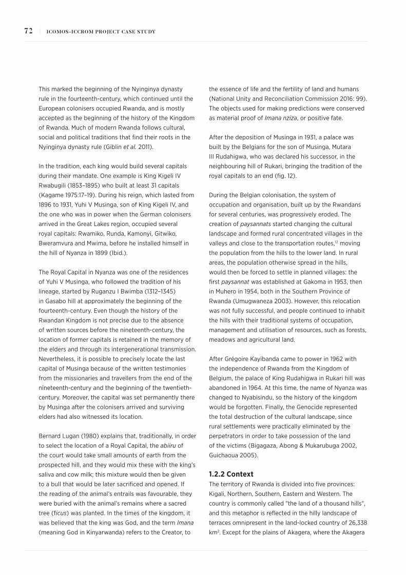
This marked the beginning of the Nyinginya dynasty
rule in the fourteenth-century, which continued until the
European colonisers occupied Rwanda, and is mostly
accepted as the beginning of the history of the Kingdom
of Rwanda. Much of modern Rwanda follows cultural,
social and political traditions that find their roots in the
Nyinginya dynasty rule (Giblin et al. 2011).
In the tradition, each king would build several capitals
during their mandate. One example is King Kigeli IV
Rwabugili (1853–1895) who built at least 31 capitals
(Kagame 1975:17–19). During his reign, which lasted from
1896 to 1931, Yuhi V Musinga, son of King Kigeli IV, and
the one who was in power when the German colonisers
arrived in the Great Lakes region, occupied several
royal capitals: Rwamiko, Runda, Kamonyi, Gitwiko,
Bweramvura and Mwima, before he installed himself in
the hill of Nyanza in 1899 (Ibid.).
The Royal Capital in Nyanza was one of the residences
of Yuhi V Musinga, who followed the tradition of his
lineage, started by Ruganzu I Bwimba (1312–1345)
in Gasabo hill at approximately the beginning of the
fourteenth-century. Even though the history of the
Rwandan Kingdom is not precise due to the absence
of written sources before the nineteenth-century, the
location of former capitals is retained in the memory of
the elders and through its intergenerational transmission.
Nevertheless, it is possible to precisely locate the last
capital of Musinga because of the written testimonies
from the missionaries and travellers from the end of the
nineteenth-century and the beginning of the twentieth-
century. Moreover, the capital was set permanently there
by Musinga after the colonisers arrived and surviving
elders had also witnessed its location.
Bernard Lugan (1980) explains that, traditionally, in order
to select the location of a Royal Capital, the abiiru of
the court would take small amounts of earth from the
prospected hill, and they would mix these with the king’s
saliva and cow milk; this mixture would then be given
to a bull that would be later sacrificed and opened. If
the reading of the animal’s entrails was favourable, they
were buried with the animal’s remains where a sacred
tree (ficus) was planted. In the times of the kingdom, it
was believed that the king was God, and the term Imana
(meaning God in Kinyarwanda) refers to the Creator, to
the essence of life and the fertility of land and humans
(National Unity and Reconciliation Commission 2016: 99).
The objects used for making predictions were conserved
as material proof of Imana nziza, or positive fate.
After the deposition of Musinga in 1931, a palace was
built by the Belgians for the son of Musinga, Mutara
III Rudahigwa, who was declared his successor, in the
neighbouring hill of Rukari, bringing the tradition of the
royal capitals to an end (fig. 12).
During the Belgian colonisation, the system of
occupation and organisation, built up by the Rwandans
for several centuries, was progressively eroded. The
creation of paysannats started changing the cultural
landscape and formed rural concentrated villages in the
valleys and close to the transportation routes,12 moving
the population from the hills to the lower land. In rural
areas, the population otherwise spread in the hills,
would then be forced to settle in planned villages: the
first paysannat was established at Gakoma in 1953, then
in Muhero in 1954, both in the Southern Province of
Rwanda (Umugwaneza 2003). However, this relocation
was not fully successful, and people continued to inhabit
the hills with their traditional systems of occupation,
management and utilisation of resources, such as forests,
meadows and agricultural land.
After Grégoire Kayibanda came to power in 1962 with
the independence of Rwanda from the Kingdom of
Belgium, the palace of King Rudahigwa in Rukari hill was
abandoned in 1964. At this time, the name of Nyanza was
changed to Nyabisindu, so the history of the kingdom
would be forgotten. Finally, the Genocide represented
the total destruction of the cultural landscape, since
rural settlements were practically eliminated by the
perpetrators in order to take possession of the land
of the victims (Bigagaza, Abong & Mukarubuga 2002,
Guichaoua 2005).
1.2.2 Context The territory of Rwanda is divided into five provinces:
Kigali, Northern, Southern, Eastern and Western. The
country is commonly called "the land of a thousand hills",
and this metaphor is reflected in the hilly landscape of
terraces omnipresent in the land-locked country of 26,338
km2. Except for the plains of Akagera, where the Akagera
72 | ICOMOS-ICCROM PROJECT CASE STUDY

National Park is located, in the Eastern Province in the
border with Tanzania, Rwanda’s geography is populated
by hills (fig. 13). Behind the land of a thousand hills
slogan lies a historical strategy to inhabit this complex
geography where hills represented a unit of land for
organising the territory and its population.
In the hills of what is now the district of Nyanza, several
kings established: <<(...) the Bami (Kings) of the eighteenth
and nineteenth centuries settled in this country (Nyanza)
rich in its population of farmers and its numerous herds
of cattle. The woods that remain in many places mark the
location of the residences of Bami Mazimpaka, Rujugira,
Ndabarasa, Gahindiro, Rwogera, etc.>> (Anonymous 1956:
54). The most important hills were Rwesero, Nyanza,
Rukari and Mwima13 where the father of King Musinga,
King Kigeli IV Rwabugili lived, close to Mushirarungu hill.
In the time of the Royal Capital in Nyanza, the hills of
Mugonzi, Gatsinsino, Gakenyeri, Mwima, Rwesero, Kavumu,
Gihisi, and Nyamagana were also populated by traditional
huts (Kanimba Misago and Van Pee 2008: 21). This image
tells how people traditionally lived in Rwanda, spread huts
among terraces and plantations located on the slopes of
hills, and not in the valleys that were used for agriculture
or grazing. As explained by Kanimba Misago and Van Pee
(Ibid.), the residences of Rwandans were established on
the top of the hills, or in the gentle slopes, as the marshes
and forests <<were considered inhospitable because of
mosquitoes>> (Ibid.: 12) and were used for other activities
such as hunting, farming and pasture.
The population used to be settled in specific hills
according to their lineage which belonged to a specific
clan. Each lineage (umuryango) would occupy several
hills and each extended family would occupy one
hill. And each hill would have a chief of army, a chief
of cattle and a chief of agriculture. As stated by the
historians commissioned to write the History of Rwanda
by the National Unity and Reconciliation Commission:
<<Reforms of traditional administration started in 1926
with the abolition of the system of three chiefs. This had a
profound impact on social relations>>. (NURC 2016: 250).
Meschi describes how the hill system was still working
for a lineage of mainly farmers in the 1970s (Meschi
1974). She mentions in a note that: <<Rwanda is a
mountainous country; the multiple hills constitute
natural habitat and exploitation units. Rwandans used
the term umusozi "la colline" for designating the place
where they live and they own land>>14 (Ibid.: 39).
Fig. 13. "Land of a thousand hills"
73THE INTERPRETATIVE RECONSTRUCTION OF THE ROYAL CAPITAL IN NYANZA, RWANDA |

The name of the property of one lineage in Kinyarwanda,
the national language, is umugogo refers to the action of
clearing up the land (Jacob 1984: 377). Meschi described
how that land was the property of a lineage and was
acquired by the founder of the lineage, the first one to
inhabit the hill that defined a space for himself and for
his descendants. She explained in this way, the real estate
system going back for several generations and showed
how the population growth and the system of inheritance
had a big impact on social and economic relations of the
Rwandan population at the time she did her research.
This particular system of occupation directly related
to the geographical conditions is reflected in the
architecture and nature of royal capitals. As seen in the
photographic archives of the INMR, and the exhibitions
in the Kandt House Museum of Natural History, the
Ethnographic Museum in Huye and the King’s Palace in
Rukari, the Royal Capital of King Musinga was located
on the top of the hill, in a plain (fig. 14) large enough
so that a settlement could be established. The hill
commonly known as Nyanza is surrounded by several
other hills that are visually connected and where King
Musinga’s successor established his residence after
him: Rwesero, Rukari, and Mwima. In Rukari, the palace
of King Mutara III Rudahigwa, successor and son of
King Musinga, was erected by the Belgians, following
a European architectural style (fig. 15). This location
developed into the King’s Palace Museum, and next to
it, the reconstruction of the Royal Capital was started. In
Rwesero, the building of what was planned to be his new
palace is still standing (formerly, the National Art Gallery,
currently to be re-inaugurated as the Home Grown
Solutions Museum in 2020 fig. 16). Rudahigwa could
Images, Clockwise from top left: Fig. 14. Royal settlements were typically located on the top of a hill overlooking such plainsFig. 15. Palace of King Mutara III RudahigwaFig. 16. Home Grown Solutions Museum (formerly the National Art Gallery)
74 | ICOMOS-ICCROM PROJECT CASE STUDY

never dwell in this building because he passed away
before its completion. The mausoleum where Rudahigwa
and Kigeri V Ndahindurwa, his brother and the Queen
Rosalie Gicanda are buried (fig. 17) is located in Mwima.
2. The Nature of the Impacting Event
In 1994, the Genocide against the Tutsi was the dramatic
event that ended the civil war which had unfolded in
Rwanda in 1990. After Juvénal Habyarimana’s plane, then
president of Rwanda, was shot down in the evening of 6
April 1994, the killings began. In 100 days, from 7 April
to 4 July, 1,074,056 people lost their lives,15 and towns
and villages were ravaged. Especially in the rural areas
and the remote hills, property was shattered. This conflict
was based on ethnic distinctions between Tutsi and Hutu
that some scholars and functionaries (National Unity and
Reconciliation Commission 2016) claimed did not exist
until the establishment of Rwanda as a Belgian colony at
the beginning of the twentieth-century. Other theories
point at a fluid socioeconomic system operating during
the times of the kingdom, where the different groups
were not distinguished as ethnic, but socioeconomic,
sometimes rooted in clan distinctions, by which members
of one could become members of the other and vice
versa (Saur 2014). Nevertheless, this distinction was used
during the colonial rule to separate the population and
create a permanent environment of distrust.
The destruction of the cultural landscape of Rwanda
had been already underway, since colonisation. Three
main stages have been identified: the Belgian colonial
rule (1916–1961) with the dismantling of the traditional
land organisation and governance system, reinforced
by the establishment of paysannats (reflected on the
abandonment of the Royal Capital and occupation of
Nyanza hill by the Church), the Republican government
and the continuation of the restructuring of rural
Rwanda (continuation of the paysannats policy and
industrialisation of agriculture), and finally the Genocide,
when the rural settlements in the hills were completely
destroyed (total destruction of the hill system including
traditional huts, cattle and agricultural land).
The Genocide looked at not only the elimination of Tutsi
and moderate Hutu in the whole country, but also, at
destroying their property and overtaking their land.
Fig. 17. Mausoleum where Rudahigwa and Kigeri V Ndahindurwa, his brother and the Queen Rosalie Gicanda are buried, in Mwima
75THE INTERPRETATIVE RECONSTRUCTION OF THE ROYAL CAPITAL IN NYANZA, RWANDA |

From the tradition, pastoralists that were associated
with Tutsi and former rulers of the kingdom, occupied
large extensions of lands where they used to feed their
cattle. The farming way of life, associated with the Hutu
majority tended to use small plots of land, and as time
passed by, there were smaller plots for larger families
which needed to be divided and inherited, creating
land pressure, as explained by Meschi (1974). Thus, the
idea of a pastoralist landscape and its related cultural
practices were perceived as opposed to the agricultural
landscape and its related cultural practices, even
though, agricultural and pastoral were complementary
traditions, and ecologically also linked to forestry, which
relates to the cultural practices of hunter-gatherers (i.e.
Twa people). However, the ethnic differences enforced
during the colonial rule have been reflected in the land
use and the perception over the landscape as pastoral
distinct from agricultural. This conceptual cultural
division between pastoralists and farmers emphasised
at the same time the ethnic distinctions and contributed
to polarisation in a context of increasing land scarcity
(Bigagaza et al. 2002). For instance, during the rule
of President Kayibanda (1962–1973) and President
Habyarimana (1973–1994), the farming culture was
promoted, and modernisation of agriculture was a
political and economic priority that was also encouraged
by international cooperation projects (Ibid.).
As a result, the destruction of the cultural landscape
during the Genocide also consisted of destroying
family properties and eliminating all members of entire
families so that there would be no descendants that
could claim back the land.
The Royal Capital in Nyanza was already covered by
the Catholic Church during the Genocide, however, the
traditional way of life that the Royal Capital represented,
and that was mostly surviving in the rural areas of
Rwanda, was destroyed at this time. The Royal Capital
and the life of the Rwandan Kingdom represented to the
perpetrators, an epoch of subordination to the minority
that they were trying to eliminate. The symbol of the
kingdom represented by the memories and images of the
Royal Capital and the royal court endured. Perpetrators
were focused on destroying lives and private property,
which included any remains of constructions, whether
traditional or not. Heritage resources were neglected and
people carrying the traditional knowledge were killed.
The destabilisation of Rwanda based on the destruction
of culture, cultural heritage, traditional leaders,
traditional institutions, traditional organisation – which
were founded on a local evolution and constituted
a particular cultural landscape – that started with
colonisation was almost achieved during the Genocide.
In the aftermath of the Genocide, the government
initiated a villagisation strategy, called Imidugudu
(figg. 18a-b) to redistribute the scarce land to people
returning to Rwanda after exile and as a more effective
land management policy, since one of the main
challenges has been to distribute land equally to the
growing population (Hilhorts and Leuween 2009,
Ministry of Infrastructure, Republic of Rwanda 2009).
In parallel, the government undertook a campaign
in 2011 to eradicate the traditional thatched roofs
(commonly referred to in a derogatory manner as
From left to right: Fig. 18a. Re-distributing scarce land to cater for people returning from exile and for the growing population is a continuing challengeFig. 18b. The campaign for housing: among its aims is to replace traditional thatch with corrugated iron or tiles
76 | ICOMOS-ICCROM PROJECT CASE STUDY

Nyakatsi) to be replaced by corrugated iron or tiles,
wishing to develop modern housing for all Rwandans
(Ministry of Infrastructure, Republic of Rwanda 2015).
These strategies that originated as a way to boost the
economy, recovered hygienic conditions and improved
social ties in the population, had the unexpected
effect of overlooking the value of heritage and the
importance of traditions, local knowledge and the
cultural landscape, and its potential for recovery
and reconstruction, in social, environmental, and
economical aspects.
3. Post-Event Appraisals
After the Genocide, there was much confusion and
shock in Rwandan society. The crisis continued for
several years. It has been a process of recovery in all
aspects, although heritage sites were not a priority at
the beginning. As there was no law that would protect
cultural heritage at the time, many potential historical
sites were destroyed, as were testimonies of vernacular
architecture in the settlements of rural areas that were
still occupied in traditional ways until the Genocide.
Several assessments have been carried out by the
Government of Rwanda, by international donors, and
by international agencies; these have mostly focused
on the economic impacts of the war and Genocide and
the psychological impacts on the population. The United
Nations commissioned an independent report in order
to establish the role of the organisation and its agencies
during the Genocide (Carlsson et al. 1999). In the
aftermath of the Genocide, besides focusing on finding
justice, with the establishment of the International
Criminal Tribunal for Rwanda in November 1994 by the
United Nations Security Council (Resolution 955),16 the
government searched for the economic reconstruction
of Rwanda looking for a stability that would enable
reconciliation.
The National Unity and Reconciliation Commission
was created in 1999 as the institution responsible for
supporting the building of a united country, changing
the governance regime based on discrimination and
exclusion. In 2001, the new government released
"Vision 2020",17 a strategy for the recovery of Rwanda
which would focus on economic development, with an
emphasis on decentralisation and the development of
rural areas, so that further conflicts would be prevented.
A new constitution was adopted in 2003.
Because the Royal Capital as such no longer existed
there has not been further assessment of its loss. The
cultural landscape, characterised by the traditional
huts on the hills, suffered damage during and after
the Genocide. Yet, no assessment of damages from a
cultural heritage perspective has been undertaken, due
to the lack of identification, designation and recognition.
As explained above, the villagisation projects, developed
in the rural areas as a way to reconstruct the society,
hinder the regeneration of traditional land occupation
and organisation. The 2011 ban on thatched roofs
impeded the regeneration of traditional architecture.
These recovery measures have resulted in the erosion of
traditional knowledge and intergenerational transmission
of traditional techniques.
Since the main source for disunion was perceived to
have been introduced during the colonial rules with
artificial ideas of division, the conclusion of the new
government’s assessments was that going back to pre-
colonial ideas of Rwandanness were necessary. In order
to look for unity and heal the wounds and scars from
almost half a century of conflict, Rwandans needed to
remember and embrace their pre-colonial past. To aid
this, <<home grown approaches>>18 have been promoted.
The Kinyarwanda language and traditional practices used
by all Rwandans were the first elements of the cultural
heritage that were promoted and used for the recovery
process; this included Gacaca courts19 for restorative
justice and Umuganda, a support system for general
cleaning, tree planting, road works, building houses
for vulnerable groups, construction of schools, health
centres, organised by communities in neighbourhoods.
These traditional practices have been instrumental for
recovery and reconstruction, although, as some scholars
point out, these have been <<re-invented>> or adapted
to the new circumstances and political agendas (see
Ingelaere, 2008 on the Gacaca courts; Uwimbabazi and
Lawrence, 2013 on Umuganda). Nevertheless, these
researchers also find that both Gacaca and Umuganda
are closer to the hearts of Rwandans than other foreign
approaches to justice or reconciliation.
77THE INTERPRETATIVE RECONSTRUCTION OF THE ROYAL CAPITAL IN NYANZA, RWANDA |

It was in this context that the value of the Royal Capital in
Nyanza as a symbol of Rwandanness was recalled. Even
so, documentation regarding the decision to reconstruct
the Royal Capital is missing as well as an assessment that
would justify the selection of this particular heritage site,
which was at the time only kept in the memory of the
elders and the archive photographs of colonial missions.
Currently, the institution in charge of the identification,
protection, management and conservation of cultural
heritage is the Institute of National Museums of Rwanda
(INMR), whose history starts with the Ethnographic
Museum in Huye in 1989. After the Genocide and in the
process of recovery, the INMR constituted itself as a
network of museums from 2004, under the mandate of
the Ministry of Sports and Culture. The reconstruction
process has been re-traced through investigating the
INMR archives and requesting information from the staff
working at the time that the reconstruction project was
carried out.
4. Response Actions, Timeframes, Resources and Costs
In the context of recovering a Rwandan national identity,
the idea of the reconstruction of the Royal Capital in
Nyanza emerged. The idea behind it was that restoring
the cultural value of the last Royal Capital of pre-colonial
Rwanda could tangibly show the originality of traditional
Rwandan architecture. This project was led by the
former Director of the Institute of National Museums of
Rwanda-INMR, Professor Dr Célestin Kanimba Misago,
an archaeologist educated at Lubumbashi University in
the Democratic Republic of Congo with a PhD obtained
in Hamburg, Germany. Professor Kanimba Misago held
the top post at the INMR from 1996 and in 2008, he was
elected President of the Board of Commissioners of the
National Commission for the Fight Against Genocide
(CNLG for its initials in French: Commission Nationale
de Lutte contre le Génocide). He passed away on 20
July 2010, having achieved the reconstruction of three
traditional huts.
Professor Kanimba Misago was a recognised scholar
and important figure during the recovery process. He
read descriptions and accounts of the capital in Nyanza,
and invited elders who lived in Nyanza with whom he
discussed the possible layout. Even though there is
no record of the decision, it is clear by looking at the
reconstruction that the design was adapted from the
traditional hut kept in the Ethnographic Museum in Huye,
where Professor Kanimba Misago was based. However,
the hut in Huye was much smaller than what Professor
Kanimba Misago envisioned for Musinga’s Royal Hut.
According to the photographs of the beginning of the
twentieth-century, the Royal Hut was much larger than
the one showcased in Huye. The traditional knowledge
on building techniques had been neglected after
the Genocide, and at the first construction attempt,
the building collapsed. With skilled elders known as
Abagorozi (architect in traditional Rwanda) led by Mr
Eulam Mugananganzo from Kabagari, (fig. 19) in central
Rwanda and engineers trained in Germany, led by Mr
Alphonse Kalisa Setako, Professor Kanimba Misago
managed to build the present structures of the three
traditional huts (figg. 20 a-d). The original idea was to
reconstruct the ensemble of sixteen huts as these were
described by Bernard Lugan’s account referred to above.
In the context of modernisation and economical
reconstitution as a priority for Rwanda after the
Genocide, Professor Kanimba Misago’s project was a way
to use culture for recovery. It was not the first attempt at
reconstituting this cultural element; in the late 1980s, on
the same Rukari hill, a traditional hut was constructed to
be used by the national ballet, Urukerereza in its cultural
performances. Materials were collected from the hills
around Rukari by members of the ballet and Abagorozi
guided the construction works according to Mr Jean
Baptiste Nkurikiyinka, a staff member of the National
Ballet (fig. 21). These materials were made of urubingo
(pennisetum purpurem), urukangaga (cyperius latifolius),
and uruguhu (miscanthus sp). Today, such materials are
only found more than 100 km. from Rukari.
Because it was not possible to use the original location
in Nyanza hill, the Royal Capital had to be reconstructed
in a different area, where there would be enough space
to reconstruct the whole with its main sixteen huts. The
area chosen was next to the palace in Rukari built in 1932
for King Charles Mutara III Rudahigwa, and where his
first traditional huts were located when he succeeded his
father King Musinga.
78 | ICOMOS-ICCROM PROJECT CASE STUDY

Images, Clockwise from top left: Fig. 19. Skilled eldersFig. 20a-e. Building three huts in the traditional styleFig. 21. Traditional hut on Rukari hill built for the National Ballet
79THE INTERPRETATIVE RECONSTRUCTION OF THE ROYAL CAPITAL IN NYANZA, RWANDA |

In this way, the project of reconstruction did not
follow the traditional system of selecting the hill or not
constructing in a sacred area where a previous king used
to live. Nevertheless, the reconstruction required an
in-depth research on the traditional building system in
which King Musinga’s huts were originally constructed.
This implied research on the materials, techniques and
processes for construction. However, no documentation
of the research or the reconstruction plan remain,
besides the publication of 2008 referred to above
which does not state specifically that it describes the
reconstruction of Musinga’s Royal huts.
A fundraising campaign was carried out in order
to collect funds for the reconstruction of the Royal
Capital. It was organised by natives and their friends
from Nyanza and surrounding areas and held in
December 2003 in Kigali. The idea was to combine the
reconstruction of the Royal Capital with the construction
of an Olympic city in Nyanza.20 With the aim to follow
the tradition of keeping the royal court as a centre
for the development of different artistic and sporting
activities, the plan was that Nyanza would become a
hub for Rwandan athletes and a repository for Rwanda’s
traditional performances (dances, music, poems).
Approximately RFr76 million (roughly equivalent to
US$139,000 at the time) were raised for setting up this
project as a cultural tourism attraction.
With that amount, some people were expropriated from
earmarked areas to build the museum and areas for sport
activities. But the proposal for sport facilities never came
up and only the Museum’s proposal was carried on at
Rukari hill.
The main activities were carried out from 2003 to 2007:
expropriation for land extension, reconstruction of three
traditional huts, rehabilitation of the 1932 building or
King’s Palace, creation of pedestrian paths, a garden,
construction of an admission house, and the lighting of
the site. Development of the King’s Palace Museum at
Rukari hill was estimated to cost around US$450,810 for
this first phase.
From 2010, other activities were undertaken such as
further expropriation and the introduction of traditional
cows – Inyambo – at the reconstruction site.
The first three huts reconstructed for the Royal Capital –
following Lugan’s description – are Hut II, where the King
lived, Hut XII where the beer was stored, and Hut XIII
where the milk was kept. Figure 22 shows the layout of
these three huts.
The beer and milk huts were the first ones to follow the
reconstruction of the main hut due to their functions.
For instance, milk used to be the sacred drink to feed
the king and his close assistants. This relates to customs
of traditional Rwanda, where nobles would not eat like
ordinary people, but were thought to live on milk. This
tradition is directly connected to the important position
of the native cows (fig. 23) in pre-colonial Rwanda
and the pastoralist traditions related to their breeding
(Rugeyo and Van Pee 2018: 43–83).
Fig. 22. Layout of the first three huts reconstructed for the Royal Capital following Luga’s description
80 | ICOMOS-ICCROM PROJECT CASE STUDY
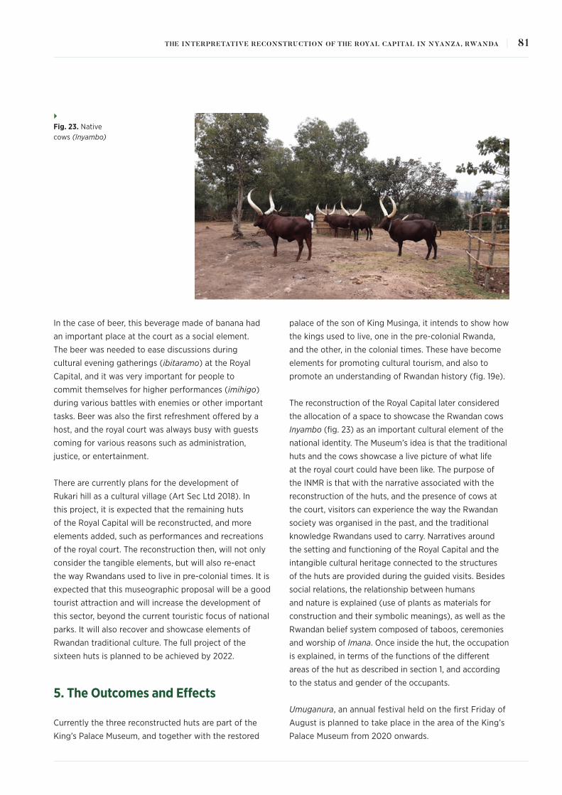
In the case of beer, this beverage made of banana had
an important place at the court as a social element.
The beer was needed to ease discussions during
cultural evening gatherings (ibitaramo) at the Royal
Capital, and it was very important for people to
commit themselves for higher performances (imihigo)
during various battles with enemies or other important
tasks. Beer was also the first refreshment offered by a
host, and the royal court was always busy with guests
coming for various reasons such as administration,
justice, or entertainment.
There are currently plans for the development of
Rukari hill as a cultural village (Art Sec Ltd 2018). In
this project, it is expected that the remaining huts
of the Royal Capital will be reconstructed, and more
elements added, such as performances and recreations
of the royal court. The reconstruction then, will not only
consider the tangible elements, but will also re-enact
the way Rwandans used to live in pre-colonial times. It is
expected that this museographic proposal will be a good
tourist attraction and will increase the development of
this sector, beyond the current touristic focus of national
parks. It will also recover and showcase elements of
Rwandan traditional culture. The full project of the
sixteen huts is planned to be achieved by 2022.
5. The Outcomes and Effects
Currently the three reconstructed huts are part of the
King’s Palace Museum, and together with the restored
palace of the son of King Musinga, it intends to show how
the kings used to live, one in the pre-colonial Rwanda,
and the other, in the colonial times. These have become
elements for promoting cultural tourism, and also to
promote an understanding of Rwandan history (fig. 19e).
The reconstruction of the Royal Capital later considered
the allocation of a space to showcase the Rwandan cows
Inyambo (fig. 23) as an important cultural element of the
national identity. The Museum’s idea is that the traditional
huts and the cows showcase a live picture of what life
at the royal court could have been like. The purpose of
the INMR is that with the narrative associated with the
reconstruction of the huts, and the presence of cows at
the court, visitors can experience the way the Rwandan
society was organised in the past, and the traditional
knowledge Rwandans used to carry. Narratives around
the setting and functioning of the Royal Capital and the
intangible cultural heritage connected to the structures
of the huts are provided during the guided visits. Besides
social relations, the relationship between humans
and nature is explained (use of plants as materials for
construction and their symbolic meanings), as well as the
Rwandan belief system composed of taboos, ceremonies
and worship of Imana. Once inside the hut, the occupation
is explained, in terms of the functions of the different
areas of the hut as described in section 1, and according
to the status and gender of the occupants.
Umuganura, an annual festival held on the first Friday of
August is planned to take place in the area of the King’s
Palace Museum from 2020 onwards.
Fig. 23. Native cows (Inyambo)
81THE INTERPRETATIVE RECONSTRUCTION OF THE ROYAL CAPITAL IN NYANZA, RWANDA |

This practice was established in relation to the
implementation of the UNESCO 2005 Convention for
the Protection and Promotion of the Diversity of Cultural
Expressions since 2017, led by the Ministry of Sports and
Culture. One of the objectives in re-creating this festival
has been to preserve Rwandan culture by educating
the youth on the importance of safeguarding Rwandan
cultural heritage, related to agricultural practices. The
establishment of Umuganura or harvest celebrations
has not only contributed to the rebirth of national pride
and sustainable agricultural practices but has also
been adapted to serve as a platform for reflection and
adoption of bottom-up solutions for sustainable socio-
cultural development.
However, in terms of the principles of authenticity, the
reconstruction of the Royal Capital in Nyanza does not
comply with the truthfulness of materials, substance,
form, function, location, setting, or even spirit and feeling,
as it is based on an interpretation of what the Royal
Capital might have been. The reconstruction follows a
projection of the description of Bernard Lugan contrasted
with testimonies of Nyanza elders, and is not based on
written documents or recorded layouts. With the support
of pictures that were taken at the time of King Musinga at
the beginning of the twentieth-century, the approximate
calculation of the size of the huts was established. As the
project was desacralised from its original and traditional
context, the original purpose as the residence of the
King has been changed, and furthermore, the design of
the hut was based on a different existing hut, it could
be asserted that the reconstruction of the Royal Capital
is the hypothetical reconstitution of a symbol using
fragments of heritage. These reassembled pieces attempt
to restore a certain architectural essence that the original
buildings could have had. However, certain materials that
were traditionally used, such as the cow dung, for the
floors inside the huts and the entrance (Igitabo), have
been replaced by cement in order to protect the huts
from humidity and eventual flooding, as well as to avoid
the characteristic strong smell of the original material.
Nonetheless, all materials used for building the Royal huts
were new, because of the total destruction of the original,
and its intrinsic impermanence.
Therefore, the reconstruction of the Royal Capital
raises questions on how much the oral tradition can be
regarded as truthful in terms of classical authenticity
principles, or how this could be tested in an objective or
scientific manner. Moreover, it questions the relevance
of authenticity in a context of social recovery, and when
the purpose of the reconstruction is one of healing and
rebuilding national identity, and not intended to be
dominated by accuracy.
Since the few historical buildings remaining after the
Genocide belong to the colonial rule (Kandt House
Museum built in 1908–1910, the King’s Palace built in
1932, and the former Kigali Central Prison21 built in the
1930s), the Royal huts aim to illustrate the architecture
of pre-colonial Rwanda, and the significance of their
reconstruction lies in this. Due to post-Genocide policies
of modernisation explained in section 2, there are no
other remnants of the Rwandan vernacular architecture
(except for the traditional hut in the Ethnographic
Museum, as explained above).
However, an outcome of this reconstruction is the
replication of the Royal huts for tourism development
and attraction. For example, some eco-lodges were
directly inspired by the Royal huts in Rukari hill (fig. 24)
and were intended to recreate the traditional architecture
so as to be attractive to the public. Clear authenticity
issues arise, especially when the re-transmission of
the source is also unclear. Hence, the replicating of the
reconstructed Royal huts, without an understanding
of the construction system and the sources could lead
to the problematic transmission and interpretation of
Rwandan vernacular architecture. Therefore, it would
be important for the presentation and interpretation of
the reconstructed heritage resources, that the history
of the reconstruction and the re-assembling of different
elements as heritage fragments are acknowledged and
explained, as it is in this recount.
The reconstruction of the Royal huts has also inspired
a contemporary icon in Rwanda – the symbol of the
recovery of the country and the opening of Kigali as a
host city for international events – namely the Kigali
Convention Centre. This building was designed by
German architect Roland Dieterle and inaugurated in
2016 (fig. 25). Thus, the reconstruction of the Royal
huts is also affecting contemporary architecture and
recognition of the traditional hut as a symbol of Rwanda.
82 | ICOMOS-ICCROM PROJECT CASE STUDY

From top to bottom: Fig. 24. Eco-lodges for tourism, inspired by the Royal huts in Rukari hillFig. 25. Kigali Convention Centre in the distance
83THE INTERPRETATIVE RECONSTRUCTION OF THE ROYAL CAPITAL IN NYANZA, RWANDA |

Following the National Policy of Unity and Reconciliation
(NURC 2007), ethnicity cannot be addressed, as the
purpose is to form a united Rwandan identity. Therefore,
understanding how the selection on the reconstruction
of the Royal Capital to symbolise "Rwandanness"
is perceived by different communities and different
stakeholders cannot be openly questioned. Moreover,
even if the Royal Capital was the residence of the
King, and represented the way of life of an elite, the
reconstructed Royal huts represent first and foremost
the architectural tradition of Rwanda, proper to the hilly
landscape and adapted to the environmental conditions
of its geography and climate. By recognising that the
inspiration for its architecture lies in a typical traditional
hut, it should be clarified that the reconstruction of
the Royal huts synthesises a Rwandan inhabitation
strategy, that varied from region to region according to
materials at hand and slightly different environmental
specificities. In that sense, the Royal huts embody a
key for understanding the Rwandan cultural landscape
characterised by the hill system.
Learning to read the Nyanza landscape could support
the understanding of the history of Rwanda from the
kingdom to the present. The hills of Rwesero, Rukari,
Mwima, and Nyanza form a system that could be used to
effectively explain to nationals and foreigners how the
cultural landscape was organised in the past (Map 2).
Together with the former site of the Royal Capital, where
the sacred ficus stands and the church remains, these
sacred sites, now cultural spaces, are connected visually
and through their interrelations, narrate a piece of the
history of Rwanda, which is little known. The creation
of a cultural itinerary that would further connect this to
the Nyanza Genocide Memorial, which commemorates
the approximately 12,000 people that were killed in
the school that stood on the site, and the Imidugudu in
Rwesero, (fig. 25) would support further the transmission
of the evolution of Rwanda’s landscape.
To look beyond the architectural elements and think
about the larger cultural landscape would mean
recognition of the value of the terraces in the hills,
Map. 2. Map showing Rwesero, Rukari, Mwima, and Nyanza hills explains how the cultural landscape was organised in the past
84 | ICOMOS-ICCROM PROJECT CASE STUDY

which are historical remnants still appreciated in the
present (fig. 26). Furthermore, reconsidering and
valuing both the agricultural and pastoralist landscapes,
including agroforestry, would also contribute to
avoiding soil erosion and retaining water, issues of
utmost relevance in the face of climate change, and
the degradation of Rwandan agricultural land. The hill
system represented a holistic system of adapting to the
geographic conditions, considering not only cultural,
social, but mostly environmental conditions. So far, in
this reconstruction project, attention has not been paid
to the hill system, focusing only on the reconstruction
of pieces of it. To reinforce the interrelations found in
the hill system, acknowledging the interdependence
between the different landscape practices could
potentially contribute to the building of a stronger path
for reconciliation.
6. Additional Comments
This research attempted to understand the recovery
process of the cultural landscape in Rwanda after the
Genocide. In the course of the investigation, it was found
that the reconstruction of the Royal Capital in Nyanza
was the clearest effort to re-value and reconstitute
Rwandan cultural heritage in the aftermath of the
Genocide. However, the inquiry on the reconstruction
led the authors to realise the existing gaps and research
needs in order to comprehend Rwanda’s past and
cultural heritage. The lack of records documenting the
reconstruction process hinders the understanding of
construction techniques, as well as the planning and
funding processes for this endeavour. There do not seem
to have been any approaches to international bodies or
international cultural heritage experts that could have
kept records or documentation during the process.
Therefore, this research became the re-assembling of a
puzzle that still has missing pieces. The authors would
like to acknowledge these limitations.
Furthermore, the reconstruction of the Royal Capital
in Nyanza points at recurrent issues in the heritage
conservation field and at some lessons for recovery
and reconstruction in post-trauma contexts. First, the
selection of what to reconstruct and recover comes to
mind, when, at first glance, the idea of reconstructing
a Royal Capital which represents the lifestyle of an
elite and a minority that was in power in pre-colonial
times could be questioned by communities which
do not identify with this specific group. Even if this
decision could be contentious by not having followed
a larger consultation at a national level, the findings
of this research, point at the model used for this
reconstruction: a traditional hut. The focus then shifts
from the idea of celebrating the royal to the idea
of recognising and remembering the fundamental
worldview of inhabiting this particular geography.
Fig. 26. Terraces in the hills
85THE INTERPRETATIVE RECONSTRUCTION OF THE ROYAL CAPITAL IN NYANZA, RWANDA |

Second, the reconstruction of this particular architectural
element brings back an important body of knowledge that
does not refer to a specific group, but to the fundamental
relationship between communities inhabiting Rwanda
in pre-colonial times and which has been resilient to
colonial rule and war. By undertaking the reconstruction,
the symbolic significance of the architectural elements
in the building of a traditional hut are recorded. What
becomes relevant in this process of reconstruction is how
it became a space for recovering traditional experience
and local capacity with the use of traditional techniques
and skills. Locals and especially elders were consulted, and
it shows a different approach to reconstruction, one that
is informed by its own cultural practices. Third, the official
statutory heritage designations become problematic in
a context where significant places do not necessarily
retain material evidence, but where the recognition of
value is related to oral narratives and elders’ traditional
knowledge. Added to this, the question also entails the
understanding of heritage for diverse communities, such
as in this context, where significant places are observed as
sacred places as they save the memory of an event or the
residence of an important leader. Elements are ephemeral,
and heritage is conveyed through oral narratives. It is a
place, but its boundaries and components are not distinct.
Fourth, the idea of an ephemeral heritage remains to
be scientifically documented and questions the classic
conservation approach that focuses on the material.
When the documentation is not available, where should
the focus of reconstruction efforts go? The interpretative
reconstruction of the Royal Capital shows the limitations of
the application of the concept of authenticity in the case
of ephemeral heritage resources. It raises the question of
how authenticity could be addressed scientifically in cases
where the heritage resource is inaccessible, the research
funds are limited, and the sources of information rely on
oral history, traditional knowledge and elders’ testimonies.
Even though reconstructing the traditional huts as a way
of life and as a way of recovering the cultural landscape
is neither feasible nor desirable, learning from the
traditional knowledge they transmit could be helpful for
developing strategies connected to the Rwandan culture
as it evolved in this territory. In this way, heritage could
inform a development that does not break with history
and that relies on resilient practices. Yet, the recovery and
reconciliation processes that underpin development need
to recur to an open dialogue with the diverse communities
inhabiting Rwandan territory for it to be sustainable.
7. Details of the Experts Completing the Case Study
Maya Ishizawa is a Peruvian architect with a master’s
degree in Media and Governance from Keio University,
Tokyo, Japan, and a PhD in Heritage Studies from
BTU Cottbus-Senftenberg, Germany. Her research has
focused on issues related to the conservation of cultural
landscapes, especially in mountain areas of the Andes,
the Pyrenees and Japan. She has been in charge of
coordinating the activities of the UNESCO Chair on
Nature-Culture Linkages in Heritage Conservation at the
University of Tsukuba, Japan, where she engaged in the
training of cultural and natural heritage practitioners
in Asia and the Pacific, looking at developing a
comprehensive approach to heritage conservation.
Currently, as a senior research fellow at the Institute of
National Museums of Rwanda-INMR, she is interested
in exploring the cultural landscape of Rwanda, as a
way to understand the history of a country ravaged
by colonisation, civil conflict and genocide. She is the
leading author of this case study.
Jérôme Karangwa is the Director of the Research and
Publications Unit of the Institute of National Museums
of Rwanda-INMR. He is a historian from the National
University of Rwanda, with a post-graduate diploma in
Museums and Heritage Studies from the University of the
Western Cape, Capetown, South Africa. He has also been
trained under the Africa 2009 Programme on nominations
to the World Heritage List. He possesses extensive
research experience in Rwanda, studying the country’s
heritage sites and their remnants of colonial influence. He
has managed research teams, contributed to exhibitions
and publications, and held leadership positions at the
Ethnographic Museum, Museum of Environment, and the
new Rwanda Art Museum at Kanombe in Kigali City. He
was assistant to the Director General of the INMR, Dr.
Célestin Kanimba Misago when he started the project of
the reconstruction of the Royal Capital in Nyanza. He has
contributed to this case study with his local and scientific
knowledge, as well as with his personal experience in the
process of reconstruction and further plans of the INMR.
86 | ICOMOS-ICCROM PROJECT CASE STUDY

Notes
1 From 28 August 2020, INMR has been absorbed by a new institution called Rwanda Cultural Herit-age Academy
that comprises Rwanda Museums, Heritage sites, National Archives and Library and the responsibilities of the former
Rwanda Academy of Language and Culture.2 Another case is a royal capital seen by Adolf von Götzen, German explorer and Governor of German East Africa, in
1894 when he was received by King Rwabugili, father of Yuhi V Musinga, in his royal residence in Kageyo, Ngororero,
Western Province of Rwanda (Von Götzen 1899; NURC 2016: 167).3 In 1897, Richard Kandt arrived to Rwanda, as an explorer of the Great Lakes region in search of the source of the
river Nile. In 1899, Rwanda was incorporated to German East Africa. After the First World War, the German imperial
rule in Rwanda came to an end.4 The Belgian colonial rule started in May 1916 with a military occupation.5 By then, a department of the Institute of Scientific Research in Central Africa (IRSAC).
6 Description taken from Kanimba Misago & Van Pee 2008, pp. 35–39.7 In the tradition of the Kingdom of Rwanda, the rulers were the King and the Queen Mother, mother of the King. The
king was a representative figure and symbol of God (Imana) on Earth, while the queen mother was his principal
advisor.8 As pointed out by Lugan, similar settlement patterns have been found in Burundi, a neighbouring country of
Rwanda in the South. Archaeologist John Giblin also asserts that similar pre-historic and pre-colonial archaeological
structures can be found both in Rwanda and Burundi (Giblin et al. 2011).9 Originally this national park was a forest reserve designated by German administration in 1903.10 At the time, Huye (Butare), capital of Huye District in the Southern Province of Rwanda was called Astrida, in honor
of Queen Astrid of Belgium.11 His mother was Nyiraruganzu Nyakanga (Abasinga clan) and his wife Nyakiyaga (Abega clan). In parallel, the
Bugesera Kingdom was ruled by Nsoro Bihembe and the Gisaka Kingdom by Kimenyi Musaya.12 Paysannat land settlement system consisted of a re-organisation strategy from the Belgian colonial rule to locate the
rural population spread in the hills, in areas closer to transportation routes and concentrated in small villages. In this
way, the population was easily controlled and organised.13 These are the present names of these hills. In the past these names may have been different.14 Authors’ free translation from French original text.15 This is the official number according to the government census.16 The ICTR was officially closed on 31 December 2015 (https://unictr.irmct.org/en/).17 Vision 2020 is the government strategy for Rwanda to transition from a low-income, agricultural-based economy to
a lower-middle income, knowledge-based economy by 2020.18 Also called "Home grown solutions" or "Home grown initiatives". 19 In 2002 Gacaca courts were revived by the Rwandan Government, as a way to process the millions of criminal
cases that arose following the 1994 Genocide committed against Tutsi. See the Organic Law N° 40/2000 of 26
2001 setting up "Gacaca Jurisdictions" and organising prosecutions for offences constituting the crime of Genocide
or crimes against humanity, committed between 1 October 1990 and 31 December 1994. Gacaca is defined as a
traditional Rwandan restorative justice which has been revived to deal with genocide cases. Their original objective
was to find out truth, rather than punishment, and to reconcile perpetrators and victims. Gacaca judges known as
Inyangamugayo were elected on the basis of integrity. Abunzi are the community reconcilers who resolve day-to-day
conflicts before referring them to the ordinary jurisdictions. Umuganda is a traditional community support system
for individual and national causes, which has been revived in the interest of national reconstruction.20 The Olympic city, a project later called <<Olympafrica>>, aimed at community development through sports activities
and was launched in 2009 by the Rwandan National Olympic Committee (RNOC). The project was planned as two
main premises: one would contain basketball, handball, and volleyball courts and the second one would be composed
87THE INTERPRETATIVE RECONSTRUCTION OF THE ROYAL CAPITAL IN NYANZA, RWANDA |

Bibliography
Anonymous, 1956. Historique et chronologie du Rwanda. Kabgayi.
Art Sec Ltd, 2018. Feasibility Study of the Extension and Development Plan of Rikali and Rehabilitation Study of
Rwesero Museum. Draft Report One.
Bigagaza, J., Abong, C., and Mukarubuga, C., 2002. Land Scarcity, Distribution and Conflict in Rwanda. Scarcity and
Surfeit. The Ecology of Africa’s Conflicts. Pretoria: Institute for Security Studies. (Accessed 15 October
2019).
Carlsson, I., Han, S. J., & Kupolati, R. M., 1999. Report of the Independent Inquiry into the actions of the United Nations
during the 1994 genocide in Rwanda.
Chrétien, J. P., 2003. The Great Lakes of Africa, Two Thousand Years of History. Translated by Scott Straus (Original in
French, 2000). New York: Zone Books.
Coupez, A. and Kamanzi, T., 1962. Récits historiques rwanda. Tervuren: Musée royale de l’Afrique centrale.
Ford, R. E., 1990. The Dynamics of Human-Environment Interactions in the Tropical Montane Agrosystems of
Rwanda: Implications for Economic Development and Environmental Stability, Mountain Research and
Development, årg. 10, nr. 1, 43–63.
Giblin, J., Humphris, J., Mugabowagahunde, M., Ntagwabira, A., 2011. Challenges for Pre-Colonial Archaeological Site
Management in Rwanda in Conservation and Management of Archaeological Sites, Vol. 13, Nos 2-3, 174-
188. DOI 10.1179/175355211X13179154166079 (Accessed 18 November 2019).
Guichaoua, A., 2005. Rwanda 1994: les politiques du génocide à Butare. Paris: Karthala.
Hilhorst, D. and Leeuwen, M. van, 1999. Imidugudu, Villagisation in Rwanda. A Case of Emergency Development?,
Disaster Sites, årg. No. 2.
Ingelaere, B., 2008. The Gacaca Courts in Rwanda. Traditional Justice and Reconciliation after Violent Conflict: Learning
from African Experiences. Stockholm: International Institute for Democracy and Electoral Assistance,
26–59.
Institute of National Museums of Rwanda-INMR, 2017 (Draft). Rwanda, Umusogongero ku hantu ndangamurage. Igitablo
cya mbere (Rwanda, Introduction on heritage sites. The first book). Kigali: INMR.
Jacob, I., 1984. Dictionnaire Rwandais-Français en 3 volumes. Tome Premier. Kigali: Institut National de Recherche
Scientifique.
Kagame, A., 1959. La notion de génération appliquée à la généalogie dynastique du Rwanda des Xe-XIe siècles à nos
jours.
Kagame, A., 1975. Un Abrégé de l’Histoire du Rwanda de 1853 à 1972. Tome deuxième. Butare: Editions Universitaires du
Rwanda.
Kanimba Misago, C. and Van Pee, L., 2008. Rwanda its cultural heritage. Past and Present. Bruxelles: New Goff.
Kanimba Misago, C. and Van Pee, L., 2008. Rwanda Traditional dwelling. Bruxelles: Africalia.
Kayitankore, J. B., 1986. L’évolution du monde rural de Nyanza. Le cas de la colline Umugonzi. Butare: Université
Nationale du Rwanda.
Lugan, B., 1980. Nyanza: une capitale royale du Rwanda ancien, Africa-Tervuren, årg. XXVI, nr. 4, 98–112.
Maquet, J. J., 1967. La tenure des terres dans l’État rwanda traditionnel, in cahiers d’études africaines, Vol.
7, No 28, 1967, 624–636. DOI: https://doi.org/10.3406/cea.1967.3113 (Accessed September 13, 2019).
of the Mini-football pitch and athletics (The New Times, 14 August 2009, "Olympafrica project gets underway" https://
www.newtimes.co.rw/section/read/9981). Unfortunately, the project was called off due to disagreements between
entities in charge, and currently in Nyanza district there is only a stadium that was there before the Genocide.21 The building of the former Kigali Central Prison is currently being demolished to make way for a new development of
Kigali city.
88 | ICOMOS-ICCROM PROJECT CASE STUDY

Meschi, L., 1974. Evolution des structures foncières au Rwanda: le cas d’un lignage hutu, Cahiers d’études africaines,
årg. 14, nr. 53, 39–51. DOI: https://doi.org/10.3406/cea.1974.2662 (Accessed 2 August 2019).
Ministry of Culture of Rwanda, 2016. Official Gazette no. 33 of 15 August 2016.
Ministry of Infrastructure, Republic of Rwanda, 2009. Updated Version of the National Human Settlement Policy in
Rwanda. Ministry of Infrastructure.
Ministry of Infrastructure, Republic of Rwanda, 2015. National Housing Policy. Ministry of Infrastructure.
Ministry of Sports and Culture, Republic of Rwanda, 2008. Policy on Cultural Heritage. Ministry of Sports and Culture.
National Unity and Reconciliation Commission (NURC), 2002. Report of the National Summit on Unity and Reconciliation,
Kigali, October 26-28, 2002.
National Unity and Reconciliation Commission, (NURC), 2007. The National Policy on Unity and Reconciliation.
National Unity and Reconciliation Commission (NURC), 2016. History of Rwanda, from the beginning to the end of the
twentieth century. Kigali: National Unity and Reconciliation Commission.
Rennie, J. K., 1972. "The precolonial kingdom of Rwanda: a reinterpretation", in Transafrican Journal of History, årg. 2, nr. 2,
11–54.
Rugeyo, M. R. and Van Pee, L., 2018. Rwanda, pastoral evolution and the place of Inyambo. Bruxelles.
Saur, L., 2014. "Hutu" et "Tutsi": des mots pour quoi dire?, Histoires, mode et cultures religieuses, årg. 2, nr. 30, 119–138.
Umugwaneza, A., 2003. Evolution de l’habitat rural au Rwanda de 1897 à 1978, Mémore de Licence en Histoire, Université
Nationale du Rwanda. Butare: Université Nationale du Rwanda.
Uwimbabazi, P. and Lawrence, R., 2013. "Indigenous Practice, Power and Social Control: The Paradox of the Practice of
Umuganda in Rwanda, Alternation", in Interdisciplinary Journal for the Study of the Arts and Humanities in
Southern Africa, årg. 20, nr. 1, 248–272.
Vansina, J., 1962. L’évolution du royaume du Rwanda des origines à 1900.
Von Götzen, G. A., 1899. Durch Afrika von Ost nach West. Berlin: Zweite Auflage.
89THE INTERPRETATIVE RECONSTRUCTION OF THE ROYAL CAPITAL IN NYANZA, RWANDA |

POST-WAR RECOVERY OF THE OLD CITY OF ALEPPO: THE REHABILITATION OF SUQ
AL-SAQATIYYA AS A PILOT PROJECT
Ruba Kasmo and Lina Kutiefan

TABLE OF CONTENTS
List of Illustrations 92
Acknowledgements 92
1. The Heritage Resource and its Context Before the Impacting Event(s) 93
1.1 Description, Designation and Its Context Before the Impacting Event(s) 93
1.2 History and Context 94
1.2.1 Bibliography of Documentation 98
2. The Nature of the Impacting Event(s) 99
3. Post-Event Appraisals 100
4. Response Actions, Timeframes, Resources and Costs 105
5. The Outcomes and Effects 111
6. Additional Comments 112
7. Details of the Expert(s) completing the Case Study 113
Bibliography 115
91POST-WAR RECOVERY OF THE OLD CITY OF ALEPPO |

List of Illustrations
Fig. 1 The central commercial zone of the Old City
and the location of Suq al-Saqatiyya, prepared
by the author based on the map of Gaube and
Wirth 1984
Fig. 2 The plan and sections of Suq al-Saqatiyya, from
the architectural survey conducted by the AKTC
team in 2018, (courtesy of AKTC)
Fig. 3 The map of the Old City of Aleppo showing the
borders of the World Heritage Site, the buffer
zone and the location of Suq al-Saqatiyya,
(courtesy of DGAM)
Fig. 4 The Central Commercial Zone: the levels of
damage based on the assessment carried out by
AKTC in 2017, (courtesy of AKTC)
Fig. 5 The timeframe of the Reconstruction and
Recovery Process of the Ancient City of Aleppo,
a) the short term, b) the mid-term and c) the
long term, (courtesy of DGAM)
Fig. 6 A sample of the damage assessment surveys of
Suq al-Saqatiyya, (courtesy of AKTC)
Fig. 7 A sample of the proposed interventions in Suq
al-Saqatiyya, (courtesy of AKTC)
Fig. 8 The installation of support scaffolding for the
destroyed and disintegrated sections, (courtesy
of DGAM)
Fig. 9 The removal of new claddings and incompatible
elements, (courtesy of DGAM)
Fig. 10 The removal of worn joints and plasters,
(courtesy of DGAM)
Fig. 11 One dome after dismantling, (courtesy of
DGAM)
Fig. 12 A general view of the central passage of the suq
after restoration, (courtesy of DGAM)
Fig. 13 The western wooden door of the suq before and
after restoration, (courtesy of DGAM)
Fig. 14 One of the shops after restoration, (courtesy of
DGAM)
Fig. 15 A general view of the upper roof before and
after restoration, (courtesy of DGAM)
Acknowledgements
The authors would like to thank the team of the Agha Khan Trust for Culture represented by Dr Ali Esmaiel and Arch.
Thierry Grandin for their full cooperation by providing all the information and materials regarding the project. Thanks
also to the Directorate General of Antiquities and Museums for granting permission to use the archival materials
regarding the World Heritage Site of the Ancient City of Aleppo. We would also like to express our gratitude to the
many professionals working in the Old City for their personal feedback on the project and future actions.
92 | ICOMOS-ICCROM PROJECT CASE STUDY

1. The Heritage Resource and its Context Before the Impacting Event(s)
1.1 Description, Designation and Its Context Before the Impacting Event(s)
Suq al-Saqatiyya is one of the numerous suqs (markets)
located in the central commercial zone of the Old City
of Aleppo (fig. 1). The zone covers an approximate
area of 16 hectares and has been the core of public life
in the city since ancient times. This core is filled with
markets, commercial facilities, manufacturing units,
religious buildings and public services. Starting from the
thirteenth-century, the zone became the international
face of Aleppo which hosted the trade caravans,
merchants, European communities, consulates and
religious missionaries. The diversity of functions and
buildings provided the zone with a vital and dynamic
atmosphere during the days and nights despite the
continuous changes of its socioeconomic role within
the city. Until very recently, the zone was a major trade
centre for both daily and tourist goods.
The two backbones of this zone as an urban core are the
thoroughfare, which connects the city’s citadel in the
east and the Antioch Gate in the west, and the large plot
on its northern side where the Great Umayyad Mosque
is located today. In his hypothetical reconstruction of
ancient Aleppo, Sauvaget proposed that it had a regular
Hippodamean plan, with the main route (via Recta)
extending from the city’s western gate to the Acropolis.
He also proposed the presence of an agora (on the site
of the Great Mosque) and a temple to its west. In the
Roman period, the Hellenistic via Recta became the main
Decumanus. In the sixth-century, the temple was replaced
by the Byzantine cathedral of Saint Helena and the main
avenue started to be a market area. After the Islamic
conquest, the Great Umayyad Mosque was built around
717 AD beside the Byzantine cathedral and constituted
the focal point around which the suqs started to grow
(Sauvaget 1941: 41–46). The suqs were vast, sumptuous
and provided with timber roofing to shade the shoppers.
However, they have burnt down several times and been
consistently rebuilt in the same area. The oldest remaining
suqs in the commercial zone today cannot be dated earlier
than the late fourteenth-century when the Mamluks built
several vaulted suqs to the east and the south of the
Great Mosque. These suqs are small and constricted, with
frequent turns and breaks. Their barrel vaults rarely exceed
the breadth of a single shop below (Kasmo 2013: 23).
Fig. 1. The central commercial zone of the Old City and the location of Suq al Saqatiyya, prepared by the author based on the map of Gaube and Wirth 1984
93POST-WAR RECOVERY OF THE OLD CITY OF ALEPPO |

The geopolitical changes in the region during the
fifteenth-century gave an important boost to Aleppo’s
position as an international trade centre. The need
arose to establish a commercial zone that can offer
well-maintained amenities as well as protection to the
merchants traveling with the caravans. Consequently,
the central market zone expanded to include large
khans, established by the city’s governors and officials,
in association with retail suqs (Kasmo 2013: 24). The
favourable conditions continued during the sixteenth-
century and fuelled the city’s economic, demographic
and urban growth to become the third city of the
Ottoman Empire after Istanbul and Cairo. The demand
for space for commercial and production activities was
strong; and the large Ottoman complexes answered this
demand. These complexes, by their extensive size, their
architectural quality and the diversity of occupations
they accommodated, doubled the commercial core
of Aleppo and transformed it into an economic
quarter called "el-Mdineh"1 (Raymond 1984: 28). This
commercial core consisted of interlocking streets, filled
with shops, workshops, mosques, baths, khans,2 and
qaysariyyas,3 all under one contiguous roof.
Within this context, Suq al-Saqatiyya was built in 1574
as a revenue-generating property belonging to the
foundation of Sokullu Muhammed Pasha4 (al-Ghazzi
1992: 2: 416-423). The suq constitutes an architectonic
integral structure of a complex comprising Khan al
Gumruk (The Custom Caravanserai), two qaysariyyas
(manufacturing facilities) and three suqs and covering
an approximate area of 1 hectare. While Khan al Gumruk
was a centre for long-distance trade and attracted
consulates, the suqs and the qaysariyyas housed local
activities. Due to its location, overlooking the main
thoroughfare of the central commercial zone, there is a
big probability that Suq al-Saqatiyya has been dealing
with the daily needs since its construction. Its name is
derived from "saqatat" which means organ meats or
offal in Arabic. About half of its shops were occupied
by butchers while the rest were selling nuts, pistachio,
fruits and vegetables (Hretani 2006: 78-79).
The layout of the suq follows the typical layout of
the linear suqs where shops are arranged along the
two sides of a central passage (Figure 2). However,
being a part of a grandiose waqf, the suq surpasses its
counters in the commercial zone with its dimensions
and monumentality. It is a two-story high structure
covering an approximate area of 1,500 square metres
with a length of 98 metres and an approximate width
of 4.8 metres. The main passage is covered with a
series of cross vaults punctuated by four domes with
oculi. Beneath each vault, there are two shops in the
ground floor topped with a pair of windows looking
out from the upper storerooms. All of the shops are
roofed with vaults. The suq has three entrances closed
by large wooden doors; two at the western and eastern
ends of the central passage and one in the middle of
the suq’s southern side connecting it with the parallel
Suq Khan Al Gumruk. The suq is built using finely cut
limestone for walls, rubble limestone with lime-based
mortar for vaults, bricks for domes and basalt for the
pavements. The binders and plasters are all made of
lime-based mixtures. Timber is limitedly used for the
shops’ lintels. The limestone is used as dressed blocks
(ashlars) for walls and pendentives. For the walls inside
the shops and the vaults, the blocks are roughly hewn
and covered with lime-based plaster. The cores of the
structural elements are filled with rubbles mixed with
mortar. The domes are built with rows of brick blocks
and plastered. A traditional mixture of boiled soap and
water is applied on the external surface of the plaster
to enhance its resistance to weathering and cracking.
1.2 History and Context
The central commercial zone developed in a coherent
urban pattern and maintained its traditional features
up to the early twentieth-century. Although, the
earthquake of 1822 had caused severe damages in some
parts of the commercial centre, the reconstruction
and restoration works seemed always to follow the
traditional building techniques. The master plans
of the twentieth-century had their repercussion on
the historic commercial centre. This started with the
partial implementation of Gutton’s plan of 1954 which
proposed to separate the centre from the surrounding
urban fabric by an interior ring road in order to give
it a direct vehicular access. In fact, the isolation of
the centre and clearing of its surrounding fabric
corresponded to the idea of "exposing" a monument
to spectators (Bianca et al. 1980: 28). The execution of
the first phase of Gutton’s proposal led to the full or
94 | ICOMOS-ICCROM PROJECT CASE STUDY

partial destruction of some of the centre’s important
monuments and forced development pressures right
into its heart. The newly opened streets, on the
northern, eastern and western sides, cut the traditional
thoroughfares leading from the centre to the city’s
gates, thus breaking the long established link with the
extramural historic centres that had developed outside
these gates. Through traffic created new commercial
activities along the sides of the new streets and
encouraged the replacement of old buildings with high-
rise blocks causing the disruption of the traditional
urban pattern. The 1974 Banshoya plan did not alter the
basic concepts of Gutton’s plan but tried to respond to
its shortcomings.
Fig. 2. The plan and sections of Suq al-Saqatiyya, from the architectural survey conducted by the AKTC team in 2018, (courtesy of AKTC)
95POST-WAR RECOVERY OF THE OLD CITY OF ALEPPO |

The inner ring road was eliminated and replaced by a
number of dead access ways in order to maintain the
coherence of the fabric and to improve vehicular access
(Bianca et al. 1980: 31). However, the Ministry of Culture
declared the intramural part of Old Aleppo, including its
commercial centre, as a national historic area in 1976 and
ceased the implementation of the plans.
Later on, the Old City, with both its intramural and
extramural parts, was declared a UNESCO World Heritage
Site in 1986, based on two of the criteria foreseen in the
Operational Guidelines (Criteria III and IV), reflecting the
exceptional importance of its cultural traditions and of its
past and living civilisations and the outstanding quality
of the architectural outcomes of the different stages
of its history (fig. 3). The brief synthesis of the site’s
Outstanding Universal Value refers to Aleppo’s role as
a trade city <<ocated at the crossroads of several trade
routes since the 2nd millennium BC>> and to the suqs as
<<a part of the city’s cohesive and unique urban fabric
that contribute to the Outstanding Universal Value>>
and <<represents an exceptional reflection of the social,
cultural and economic aspects of what was once one of
the richest cities of all humanity>> (UNESCO-WHC 1986).
Although these actions succeeded in stopping further
demolition, they did not reverse the damage that had
already occurred and the decline of the commercial zone.
The government’s approach to development started
in the mid-1980s with the promotion of development-
oriented cooperation with international and regional
counterparts. Thus, Aleppo’s municipality sought
funding to rehabilitate its Old City. Both the German
Development Agency (GTZ, now GIZ) and the Arab
Fund for Social and Economic Development agreed to
contribute funds and a new project (The Rehabilitation
Fig. 3. The map of the Old City of Aleppo showing the borders of the World Heritage Site, the buffer zone and the location of Suq al-Saqatiyya, (courtesy of DGAM)
96 | ICOMOS-ICCROM PROJECT CASE STUDY

project for the Old City of Aleppo) was launched in 1992.
In 1998, the "Old City Development Plan" was issued
to document the rehabilitation project’s vision, goals,
objectives and framework. Since its issue, it has become
the key instrument for guiding the development process
of the Old City. The proposed measures for the historic
commercial centre were:
• The area’s boundary to be defined.
• Restoration, renovation, modernisation, decoration
and maintenance works to be regulated for shops,
buildings and streets. Classification of buildings
should be developed.
• Retailers and warehouses with heavy supply traffic
should be relocated outside the centre. Industrial
activities (more than 50 workers and 10 machines)
with bad impact to be relocated outside the centre.
• Service traffic to be regulated (time restrictions).
Small vehicles and carts for servicing are allowed only
(DOC-GTZ 1998: 102).
In the following year, the Directorate of the Old City
(DOC) was formed to follow up on all rehabilitation
activities. DOC works through two committees; the
Protection Committee which includes the key actors
in the Old City and is responsible for the coordination
of rehabilitation plans, and the Technical Committee
which is responsible for issuing the permits after
checking the submitted restoration studies. In 2002, the
"Land Use Plan" was ratified to be the most important
spatial instrument in regulating the urban changes. It
defined the allowable uses for buildings in the historic
commercial centre as: commercial and retail operations,
small offices, essentially non-disruptive businesses,
traditional service facilities (e.g. public baths) and in
exceptional cases, small traditional restaurants and
small businesses providing accommodation in khans
(DOC-GTZ 1998: 20).
It is undeniable that the conservation efforts of DOC
had achieved significant results. Still, there were many
obstacles that limited the desired impacts. These
obstacles derived from legal, financial and social
constraints. The main problem was the fragmented
ownership. The four stakeholders that share the
properties within the historic commercial centre are
private owners, the General Directorate of Endowments,
the Directorate General of Antiquities and Museums
(DGAM) and finally the municipality. The stakeholders
are responsible for maintaining and restoring their
properties under the supervision of DGAM and after
obtaining the required permits from DOC. Among these
stakeholders, the private owners had the largest share.
Generally, the private shares are open to continuous
division through inheritance and selling, causing further
ownership fragmentation. Moreover, only marginal
sections are occupied by the owners themselves; the
majority of the properties are rented and tenants
were quasi-owners with significant interests in their
properties. Theoretically, the tenants were able to apply
for maintenance works and the owners may be involved
in funding, however, the high cost of work and the long
bureaucratic procedures de-motivated many tenants.
On the other hand, owners did not have the legal or
administrative instruments to compel tenants to carry
out maintenance works. In principle, owners and tenants
could agree on joint maintenance or investment but, in
practice, such agreements were difficult to implement;
as different interests resulted in decision-making
paralysis. Another important issue was that neither
owner, nor tenant could use their shares in the Old City
as collateral to secure loans from banks. This made it
more difficult to mobilise resources for preservation.
When there was a mutual willingness for maintenance,
the works were limited to the private unit and unlikely to
share or support major preservation of the structure as a
whole (Rabenau 2003). In fact, municipal interventions
have been performed for street paving, façade cleaning,
and the unification of shopfronts and awnings in some
sections of the central commercial zone. However,
the practicality of these initiatives and their response
to people’s needs were questionable and generated
controversial reactions among the occupants. While
some have appreciated the improvements to the public
space, others have criticised them for being superficial
beautification that does not solve the real problems.
They argued that streets were repaved before fixing
the leakage of the deteriorated sewage infrastructure
and façades restored before repairing the dilapidated
structural elements. Therefore, it can be summarised
that the poor infrastructure, the insufficient services
and the high maintenance cost had de-motivated many
of the owners and the tenants from undertaking major
investment in maintenance.
97POST-WAR RECOVERY OF THE OLD CITY OF ALEPPO |

1.2.1 Bibliography of Documentation
1.2.1.1 Studies on the history and urban development of Aleppo including its commercial centre: Gaube, H. and Wirth, E., 1984. Aleppo: Historische
und geographische beitrege zur baulichen
gestaltung, zur sozialen organisation und zur
wirtschaftlichen dynamik einer vorderasiatischen
Fernhandelsmetropole. Germany: Tubingen
University Press.
Sauvaget, J., 1941. Alep: Essai sur le développement d’une
grande ville syrienne, des origines au milieu du XIX
e siècle. Paris: Librairie Orientaliste Paul Geuthner.
1.2.1.2 Studies focused on the urban and architectural development during the sixteenth-century which witnessed the largest building campaign in the central commercial zone:Raymond, A., (1984). The Great Arab Cities in the 16th-
18th centuries, New York: New York University
Press.
Watenpaugh, H., 2004. The Image of an Ottoman City:
imperial architecture and urban experience in
Aleppo in the 16th and 17th centuries. New York:
Brill.
Wolf, S., 2005. The Construction of Ottoman Aleppo:
modes and meanings of urban re-organization.
Unpublished Ph.D. Diss., Harvard University, USA.
1.2.1.3 Typological and comparatives studies that put the central commercial zone of Aleppo within its regional context:Cezar, M., 1983. Typical Commercial Buildings of the
Ottoman Classical Period and the Ottoman
Construction System, Istanbul: Turkiye Is Bankasi.
Scharabi, M., 1985. Der Bazar: Das traditionelle
Stadtzentrum im Nahen Osten und seine
Handelseinrichtungen. Germany: E. Wasmuth
.
1.2.1.4 Studies on monuments of Aleppo including those located in the central commercial zone:Al-Asadi, M., 2006. Ahyaa Halab wa Aswquha. Aleppo:
Ray Publishers.
David, J., 1991. Domaines et limites de l’architecture
d’empire dans une capitale provincial. In Revue du
Monde Musulman et de la Méditerranée. No. 62:
169-194. Paris: Institut du Monde Arabe.
David, J., 1994. Le patrimoine, architectures et espaces,
pratiques et comportements, les suqs et les khans
d’Alep. In Revue du Monde Musulman et de la
Méditerranée. No. 73: pp. 189–205. Paris: Institut
du Monde Arabe.
David, J. and Grandin, T., 1994. L’habitat permanent des
grands commerçants dans les khans’ d’Alep à
l’époque Ottomane, in D. Panzac (ed.), Les Villes
dans l’Empire Ottoman: activités et societies. Vol.
2, Paris: CNRS Press, 84-124.
Herzfeld, E., 1955. Matériaux pour un corpus inscriptionum
arabicarum, Deuxième partie: Syrie du Nord,
Inscriptions et monuments d’Alep. 2 Vols. Cairo:
Institut Français d’Archéologie Orientale.
Talas, M. A., 1956. Al-Athar al-Islamiyya wa al-Tarikhiyya
fi Halab. Damascus: The Ministry of Culture
Publications.
1.2.1.5 Studies on the socioeconomic conditions of Aleppo and the role of the central commercial zone in the urban life of the city:Hretani, M., 2006. Halab: Aswaq al-Mdineh 1927–1980.
Aleppo: Ray Publishers.
Marcus, A., 1989. The Middle East on the Eve of Modernity:
Aleppo in the Eighteenth-century. New York:
Columbia University Press.
Masters, B., 1988. The Origins of Western Economic
Dominance in the Middle East: Mercantilism and
the Islamic Economy in Aleppo, 1600–1750. New
York: New York University Press.
Wirth, E., 1991. Alep dans la premie’re moitie’ du XIXe
sie’cle, In Revue du Monde Musulman et de la
Mediterranee. No. 62. Paris: Institut du Monde
Arabe. 131-149.
1.2.1.6 Studies on the conservation problems of the Old City of Aleppo and its commercial centre:Bianca, S., David, J-C., Rizzardi, G., Béton, Y. and
Chauffert- Yvart, B., 1980. "The Conservation of the
Old City of Aleppo"
http://unesdoc.unesco.org/
images/0004/000421/042161eo.pdf
DOC-GTZ., 1998. Development Plan, project for the
Rehabilitation of the Old City of Aleppo, Aleppo:
Directorate of the Old City.
Rabenau, B., 2003. Old City of Aleppo: Economic Development.
Aleppo: The Directorate of the Old City.
98 | ICOMOS-ICCROM PROJECT CASE STUDY

2. The Nature of the Impacting Event(s)
Following the outbreak of the crisis in March 2011, an
armed conflict started in many regions in Syria. The
conflict reached Aleppo in July 2012 and continued till
December 2016. These five years of fighting resulted
in a vast humanitarian crisis in Aleppo with loss of life
and displacement of a section of the local population.
Although there are no definite statistics, the authorities
estimated that of a population of about 2.7 million people
before the events, over a third have left the city during
the war. At the same time, 800,000 refugees have fled
to the city seeking safe settlement (DGAM 2018b: 6). On
the physical scale, the conflict has also resulted in major
destruction of the urban fabric and infrastructure which
further disrupted the social and economic life of the city.
The World Heritage Site was particularly affected
because the rebellious military groups controlled the
eastern section of Aleppo while the western section
remained under the government’s control leaving the
historic city in the middle as a battle frontline. Moreover,
the urban fabric of the historic city with its narrow,
breaking and covered alleys encouraged street combats.
At the beginning, the fight concentrated around the
citadel and then spread to cover the Great Mosque,
the commercial zone and the surrounding residential
neighbourhoods. The first severe damage within the
commercial zone happened in September 2012, when
a huge fire erupted in the covered suqs located at the
eastern side of the Great Mosque causing the burning of
about 1,500 shops. The roofs of several suqs collapsed
while some other suqs were completely destroyed.
Although there was no official statement about the cause
of this fire, the local narratives indicate that the area had
been set on fire by an electrical short circuit during the
heavy fighting. The nature of the stored goods in the
suqs such as textiles helped the fire to spread fast before
it was brought under control. In the following months,
the battle to take control of the Great Mosque caused
additional destruction and heavy damage to the suqs
and many monuments in the zone. The biggest loss was
in April 2013 when the minaret of the Great Mosque,
a masterpiece of Islamic architecture, collapsed. The
damage in the commercial zone represented not only
the disappearance of unique pieces of cultural heritage
but also the destruction of the emblem of Aleppo as a
city of commerce. Therefore, it was considered by the
population as a dramatic loss for the city patrimony.
The fight escalated exponentially in the following years
and extended to cover different locations in the city
where numerous monuments were severely damaged
or destroyed as a result of bombardments, underground
bombs, shelling, fires and street combats.
Since the beginning of the war, DGAM, in collaboration
with UNESCO, has deployed many efforts to preserve
the cultural heritage of Aleppo, to rescue works of
art and relocate the Museums’ objects in safe havens.
However, the increasing rate of damage in the city and
the other Syrian World Heritage Sites prompted the
World Heritage Committee in 2013 to inscribe them in
the World Heritage List in Danger and to address their
situation in the annual meetings as a clear expression
of the concern of the international community for the
conservation of their Outstanding Universal Value. The
inscription has triggered many international initiatives
to support training activities and raise awareness of
the drastic condition of the cultural heritage of these
sites. In particular, UNESCO in collaboration with
ICOMOS and ICCROM, has implemented since 2014, an
EU-funded programme, to conduct several technical
meetings to discuss the situation in Aleppo. These
annual meetings helped to bring the experts together,
follow the condition of the cultural heritage of the city
and prompt emergencies.
During the conflict years, it was difficult to access the
site to conduct any surveys or damage assessments.
The news on destroyed monuments was appearing
on the online platforms, news reports and shared
among people. Photos taken by some volunteers
were also available. In addition, DGAM and several
other international initiatives were publishing reports
trying to describe the damage and to analyse them.
However, none of these reports could provide solid and
comprehensive information on the extent of the damage.
The first documentation that provided such a thorough
accounting of the impact of the war was done through a
joint work of UNITAR and UNESCO. The UNITAR-UNOSAT
analysts used the available commercial satellite imagery
to assess the state before-during-and in the wake of the
war providing a cumulative view of all visible damage.
99POST-WAR RECOVERY OF THE OLD CITY OF ALEPPO |

Parallel to the physical assessment, the historical value
of each building was assessed by UNESCO experts to
determine the severity of the historical loss resulting
from the destruction of key historical elements within
a broader cultural site (UNESCO-UNITAR 2018: 25–26).
The analysis of 518 cadastral plotted buildings showed
that more than 10 per cent of the historic buildings
of Aleppo were destroyed. More importantly, it was
revealed that 51 per cent of the assessed buildings
are moderately damaged and might be partially
reconstructed or restored. The report emphasised the
need for urgent interventions in the damaged buildings
which are exposed to weathering and internal structural
degradation over time (UNESCO-UNITAR 2018: 135).
Therefore, the report was a tool to document the losses
of the cultural heritage of the Ancient City of Aleppo
on one side and to mobilise the decision-makers as well
as the general public on the urgent need to safeguard
and restore the remaining cultural properties on the
other side. The results of the documentation were
published in a comprehensive report in December
2018. The report, together with the other assessments,
constituted an essential starting point to address the
complex task of the recovery and to prepare an overall
strategy for this process.
3. Post-Event Appraisals
Soon after the war had stopped, a technical coordination
meeting was organised by UNESCO in Beirut on 2–3
March 2017 with the participation of all the concerned
authorities and stakeholders. This meeting addressed
the situation and recommended a first set of urgent
actions aiming at stabilising and safeguarding the
damaged monuments, preparing the restoration
activities and reorganising the local capacities (DGAM
2018a: 15–16). The World Heritage Committee in 2017
recommended the implementation of the technical
meeting’s decisions and called on the local authority to
urgently prepare a strategic plan to monitor the recovery
process. The Committee has also addressed the issue
of funding, calling upon UNESCO Member States to
support emergency safeguarding measures through the
UNESCO Heritage Emergency Fund. In response, the
Syrian government set up the "National Higher Steering
Committee for the Restoration of the Old City of Aleppo"
headed by the Ministry of Culture and represented by the
General Directorate of Antiquities and Museums (DGAM),
the Ministry of Public Works, Ministry of Housing,
Ministry of Tourism, experts in the field of archaeology
and restoration, the Aga Khan Foundation for Culture
(AKTC), the NGO Syrian Trust for Development (STD) and
representatives of the local community (DGAM 2018a: 16).
The Steering Committee worked on three parallel tracks;
the urgent interventions, the needs assessments and the
development of a strategy for the recovery process of
Aleppo. Within the framework of the urgent interventions,
the main roads in the historic city were cleaned and
re-opened. The debris of the destroyed and damaged
buildings was removed, under the supervision of DGAM,
with the support of UNESCO and UNDP (DGAM 2019: 5).
The ruins were sorted and the valuable parts were fenced
and protected. In addition, some urgent consolidation
works were conducted on several monuments.
As regards the needs assessments, the AKTC, one of
the international organisations that were active in the
rehabilitation efforts of the historic city before the
conflict, contributed to the damage assessment actions
as soon as the war had finished. The team of the trust, in
coordination with DGAM, conducted an analysis of three
areas within the historic city from October to December
2017. These areas: the central commercial zone, the citadel
and its surroundings, and the residential neighbourhoods
of Bab al-Ahmar and al-Bayyada, were chosen because
they have a central location within the historic city,
contain the major monuments and have witnessed the
worst damage. The analyses were conducted on the
basis of the photographic records observable on the
ICONEM digital platform. The latter consists of a 3D
database and set of aerial views obtained from a drone-
operated camera flying at low altitude (AKTC 2018: 5).
This assessment gave more detailed information on
the level of damage in the selected areas and came
up with preliminary proposals for interventions and
costs. In addition, two successive surveys of "Major Key
Restoration Projects" and "Other Important Restoration
Projects" have been requested from local inhabitants,
including architects, historians, engineers and staff of the
related authorities. As a result, two lists, twenty-five major
projects and forty-five important ones, were prepared.
Every project was prepared in a monograph format that
contains a brief description of the building, an overall
100 | ICOMOS-ICCROM PROJECT CASE STUDY

damage assessment; a timeframe and a cost estimate.
The accumulated results of the damage assessments
were not taken as a substitute for the field inspections
but rather as a guiding tool for addressing the needs and
priorities. As for the central commercial zone, it was found
that over 40 per cent of the structures in the zone had
been either lost or severely damaged, requiring either full
or partial reconstruction. The most significant loss was the
destruction of the minaret of the Great Umayyad Mosque
in 2013, while the mosque itself suffered considerable
damage and spoliation. The remaining historic fabric
(roughly 60 per cent) was affected by partial or limited
damage, requiring some form of limited reconstruction
or either full or partial rehabilitation (fig. 4). The
reconstruction and rehabilitation cost for the central
commercial zone was estimated roughly between US$50
and US$72 million (AKTC 2018: 27).
The UNESCO technical meeting had also recommended
a set of assessments beyond the physical condition of
the buildings and infrastructure. These assessments
included the damage to the housing stock, the capacities
of the local and national construction industry to
acquire, produce and deliver building materials and
to implement construction programmes, the social
situation of the city and the war impacts on the
intangible cultural heritage of the city, and finally the
damage to the economic infrastructure in the city.
All these assessments are to be mapped in order to
have a good knowledge of the situation in the post-
conflict phase at both the metropolitan level and World
Heritage Site level, to facilitate the engagement of all
the stakeholders in the recovery process and to allow the
best possible use of the local resources (DGAM 2018b:
11–12). Although these assessments are not finished
yet, it was clear from the first discussions that there is
an urgent need for a workforce that is well trained in
traditional building techniques and stone construction
to reproduce the high-level finishes and decorative
details of the damaged buildings. Therefore, a special
meeting on traditional building materials and techniques
was organised by UNESCO on 10–11 August in Aleppo.
Fig. 4. The Central Commercial Zone: the levels of damage based on the assessment carried out by AKTC in 2017, (courtesy of AKTC)
101POST-WAR RECOVERY OF THE OLD CITY OF ALEPPO |

The meeting aimed at estimating, based on available
damage assessments and analyses, the needs in terms of
traditional building materials and techniques and taking
stock of the remaining craftsmen. After the meeting,
a training workshop was conducted in the citadel by
AKTC, in collaboration with DGAM, STD, and UNESCO,
for stonemasons with the aim of engaging them in the
future restoration works (DGAM 2018a: 16–17). During
the workshop, the trainees contributed to the restoration
of some structures in the citadel including the Ottoman
windmill and the Ayyubid Royal Palace. In addition,
training seminars on stone building and restoration
techniques were conducted for local architects, engineers
and other professionals.
Parallel to these actions, the Steering Committee worked
on preparing a strategy for the recovery process of
Aleppo. This strategy was issued as "The Reconstruction
and Recovery of the World Heritage City of Aleppo:
Vision and Planning Framework" in October 2018.
The strategy: 1) envisioned a new and appropriate
governance structure that can effectively manage the
recovery process, 2) addressed the necessary planning
frameworks that will be the basic tool to recognise
the needs and facilitate the recovery process, 3) gave
insights on the building of new operational and financial
tools to support and promote the recovery process.
In doing so, reference was made to the approach
proposed by the 2011 UNESCO Recommendation on the
Historic Urban Landscape and the previous international
recovery experiences. The strategy acknowledged that
the recovery of the historic city will overlap with those
of the wider metropolis, referred to as "Greater Aleppo",
and will require a joint approach. The strategy also
acknowledged that the recovery process will require
many years of work. Therefore, it established a timeline
which consists of three phases: short-term (2018–2020),
mid-term (2020–2024) and long term (2025–2034+)
for all the activities to be implemented (fig. 5). Once
the recovery process has advanced, the Universal
Outstanding Value of the World Heritage property has
to be reassessed and a Management Plan has to be
prepared to address the practices needed to preserve
this value.
102 | ICOMOS-ICCROM PROJECT CASE STUDY

Fig. 5. The timeframe of the Reconstruction and Recovery Process of the Ancient City of Aleppo, a) the short term, b) the mid-term and c) the long term, (courtesy of DGAM)
103POST-WAR RECOVERY OF THE OLD CITY OF ALEPPO |

Within the new governance framework, a general
committee (the Recovery Committee) and a specialised
agency (the Recovery Agency) for the Reconstruction
and Recovery of the Ancient City of Aleppo were
established. The Recovery Committee includes the key
actors in the recovery process, i.e. the national and local
authorities as well as other significant national and
international partners. Its main task is to coordinate
all the future interventions in the historic urban area
as well as to generate consensus among the different
stakeholders on the priorities and on the key decisions.
The Recovery Agency, on the other side, is based on a
collaborative framework among the technical bodies
including The Directorate General for Antiquities and
Museums, The Directorate for the Old City of Aleppo,
The Syria Trust for Development and The Aga Khan Trust
for Culture. The main task of the agency is to coordinate
and execute all the necessary actions, to provide the
Recovery Committee with the information and to report
on the advancement of the recovery process (DGAM
2018b: 21-23).
As for the planning framework, the strategy has
highlighted the "Recovery Master Plan" as the main
guiding tool for all the activities to be implemented.
The plan will be prepared and implemented by the
newly established Recovery Agency and will address
the civic participation, the reconstruction activities, the
regulatory processes, and the building laws in order
to facilitate the recovery works (DGAM 2018b: 21-23).
However, due to the constraints and the complexity of
this task, the strategy has noted that the implementation
of the Master Plan will be done, in short- and mid-term
phases, through Special Area Plans of intervention.
These plans will provide a booster for the reconstruction
and recovery process of the entire city and will allow
the implementation of interventions that can be later
replicated by other stakeholders. After the Recovery
Master Plan is completed and activated, the Special Area
Plans can be applied when the condition will require
highly specialised technical aids (DGAM 2018b: 21–23).
The special area plans that were identified in the
short and mid-term phases have already witnessed
some urgent interventions and initial assessments.
Their selection was derived from their symbolic and
significant role in the life of the local community. Thus,
their reconstruction can strengthen the local spirit and
accelerate the recovery of the city. The two plans closely
relating to the case study are:
1. The restoration of the Great Umayyad Mosque and reconstruction of its minaret
Soon after the conflict, DGAM and the General
Directorate of Islamic Endowments (AWQAF) provided
protective measures at the site such as safeguarding the
building, cleaning the debris, collecting and ordering
the remains and constructing urgent scaffoldings. A
fund was donated by the Chechen Republic to support
the restoration study which was prepared by professors
from Aleppo University and the implementation which
is currently supervised and conducted by local experts
and staff. The restoration study and works started at the
end of 2018 and will continue till the end of the mid-
term phase.
2. The reconstruction and rehabilitation of the suqs in the central commercial zone
As explained before, the central commercial zone is
an urban core consisting of a network of historic suqs
and commercial facilities in addition to numerous
monuments and traditional public buildings. Therefore,
the zone should be reconstructed and rehabilitated as
a historic urban landscape in line with the standards
required in the World Heritage Sites. Within this
framework, priority was given to the suqs as they
are the arteries connecting the different sections of
the zone, the major urban hub for locals and their
restoration and rehabilitation would speed the recovery
of the economic activities within the zone.
In response to the special plan of reconstruction and
rehabilitation of the central suqs, AKTC donated a fund
to prepare the required studies to restore a section
of the suqs and to provide technical supervision in
collaboration with the DGAM staff. In the light of all the
constraints mentioned previously, it was necessary to
divide the work into several phases of implementation
and to start with a pilot project through which the level
of coordination and management can be examined. Suq
al-Saqatiyya was chosen for this purpose taking into
consideration several points such as its central location
104 | ICOMOS-ICCROM PROJECT CASE STUDY

within the urban fabric of the commercial zone which
allows a balanced extension of future restoration and
reconstruction works in the surrounding suqs, its function
which is directly related with the daily local needs of
Aleppo’s inhabitants, its stylistic unity which decreases
the time needed for the restoration study compared
with some other suqs that incorporate different historic
layers and building techniques, and finally its moderate
rate of damage which decreases the time needed for
implementation.
4. Response Actions, Timeframes, Resources and Costs
Soon after a memorandum of understanding was signed
between the Agency of Recovery and AKTC, the staff
of the latter started with the documentation of the suq
in order to assess the damage and decide the suitable
interventions. The documentation included historical
and archival research, architectural survey, 3D modelling,
photographing and field inspections (fig. 6). The results
of the documentation showed the following:
1) A partial destruction of some structural elements:
Three of the four domes that are covering the main
passage of the suq were affected by shells and partly
destroyed. In two domes, the destruction was limited
to some sections of the domes themselves, while in
the third dome the destruction incorporated also a
section of the supporting walls and the pendentives.
In addition, some points in the upper roof were
affected where sections of the stone vaults and the
covering concrete screed were destroyed. Finally, the
western entrance of the suq was heavily damaged.
The vault, the arch of the entrance and some sections
of its walls were destroyed or disintegrated.
2) Multiple levels of deterioration of building
materials and architectural elements: Some of the
deteriorations were caused by the conflict while
others resulted from the lack of maintenance or
incompatible interventions and additions. The stone
surfaces were dirty and full of holes and bullet traces.
Some stones were severely cracked. The plasters and
mortars were worn and loose. The wooden gates of
the suq were very dilapidated. The covering screeds
of the upper roof were cracked.
Fig. 6. A sample of the damage assessment surveys of Suq al-Saqatiyya, (courtesy of AKTC)
105POST-WAR RECOVERY OF THE OLD CITY OF ALEPPO |
3) An excessive usage of new cladding materials
and architectural elements: Over the years, the
shopkeepers have conducted several interventions to
renovate their shops and adapt them to their needs.
Every shop had a different type of new shutters,
shopfront, sign, and claddings. Some of these
interventions have caused physical damage to the
original building materials while others have degraded
the historic and architectural value of the suq.
4) Poor infrastructure and random installation of the
service networks.
5) Parallel to the documentation work, the Syrian Trust
for Development (STD), in collaboration with Aleppo
Governorate and Chamber of Commerce, initiated a
series of meetings with the shopkeepers to explain
the project, listen to their concerns and needs, and
accordingly assist them to restore their shops. It
was found that some of the shopkeepers had moved
out either to other cities in Syria or abroad. As they
have already established works there, some of these
shopkeepers do not plan to come back before the
socioeconomic condition is settled and recovered.
The ones who were in the city expressed concern
about the high cost of works in the light of the high
prices of building materials and the shortage of
some. They were also worried that they would not
benefit after re-opening their shops as the historical
commercial centre is still not functioning and the
economic condition is insecure. Their other concern
were the complicated procedures for obtaining the
required permits. This was particularly applicable to
the butchers and restaurants who need to meet both
the requirements of the General Health Department
and the Directorate of the Old City at the same time.
Even after obtaining the permits, they were not
sure whether or they could implement the works as
required. Regarding the requests, the shopkeepers
asked for the infrastructure of the suq to be upgraded
and their shops to be provided with all needed
services (electricity, water, telephone, ventilation, fire,
etc.). They specifically requested an efficient alarm
system as the suq will be the first to function and
there will not be enough security.
In response to the results of the documentation works
and the meetings with the shopkeepers, DGAM, AKTC
and STD decided the following:
1) The common spaces of the suq (the main passage,
the entrances, and the upper roof) will be restored by
AKTC under the supervision of DGAM and DOC. The
works will include the reconstruction of the destroyed
elements, the restoration of the damaged materials
and architectural elements, the removal of the new
shopfronts and any additions on the façades of the
main passage and replacing them with new ones
that respect the historical and architectural values
of the suq. The designs and materials of the new
elements will be discussed with shopkeepers and the
supervising departments. These works will be totally
funded by AKTC.
2) The infrastructure and service networks will be
upgraded by AKTC in collaboration with the
Department of Technical Services under the
supervision of DGAM. These works will be funded
by AKTC.
3) The restoration of the shop interiors will be left to
their owners under the supervision of DGAM and
DOC. STD will help the shopkeepers to obtain the
required permits and provide financial subsidies for
those who prove they cannot afford the restoration
costs. On the other side, AKTC will choose some
shops that exhibit a wide range of problems and
restore them as models for other shops to follow.
It will also provide technical assistance to the
shopkeepers wherever needed.
4) With all data gathered and decisions taken, the staff
of the AKTC built a Historical Building Information
Modelling (HBIM) and prepared the restoration
project of the suq with all the proposed works
and technical specifications (fig. 7). The work was
assigned to a local specialised contractor who had
previously worked on several projects with AKTC in
order to guarantee the quality of the implementation.
The size of the necessary works was manageable
and thus the problem of the shortage of workers
and building materials, which is still one of the main
challenges facing the restoration projects in the Old
City, could be solved. The workers, about 60 persons,
were all locals. Some of them had been previously
trained in workshops conducted by AKTC while
others had worked with the contractor on previous
106 | ICOMOS-ICCROM PROJECT CASE STUDY

projects. The necessary building materials could be
provided, yet at high prices, after several spots of the
surrounding rural settlements became secure. Stone
and lime were provided from the countryside while
the brick blocks were fabricated and supplied from
the province of Hama.
5) The implementation started on 1 November 2018. To
ensure the smooth flow of the works, the project was
divided into five intersected parts; 1) The works of
the main passage, 2) The infrastructure works, 3) The
works of the upper roof, 4) The works of two model
shops, and finally 5) The lighting and power supply
system. As in any other project, the works of the five
parts overlapped. However, it will be grouped under
main categories for the sake of easier presentation.
a. Preparing the site: The works started with cleaning
the debris and sorting the dismantled original
stones and bricks that could be reused in the
reconstruction. Necessary scaffolding to support
the destroyed and disintegrated sections was
installed (fig. 8). The cleaning works continued with
removal of all the new cladding materials, elements,
and installations and handing them to their owners
(fig. 9). Within this phase, some of the upper
windows that had been blocked up were re-opened
after negotiations with the shopkeepers. The worn
joints were purged and the cracking screeds of the
upper roof and the flaking plasters were removed
(fig. 10). The removal works were done manually as
much as possible to minimise additional damage to
the original materials.
b. Reconstructing the destroyed sections: The
destroyed sections were rebuilt following the
traditional local techniques and using the
remaining usable materials in addition to new ones
when needed. The new bricks were fabricated
following the same dimensions and specifications
of the original ones. The stone blocks were chosen
to be as geologically similar to the original ones
as far as possible. They were dressed using the
same traditional tools and techniques. One of
the partially destroyed domes was completely
dismantled and rebuilt together with destroyed
sections of its supporting walls and pendentives in
order to ensure its structural stability (fig. 11).
Fig. 7. A sample of the proposed interventions in Suq al-Saqatiyya, (courtesy of AKTC)
107POST-WAR RECOVERY OF THE OLD CITY OF ALEPPO |

Images, Clockwise from top left: Fig. 8. The installation of support scaffolding for the destroyed and disintegrated sections, (courtesy of DGAM)Fig. 9. The removal of new claddings and incompatible elements, (courtesy of DGAM)Fig. 10. The removal of worn joints and plasters, (courtesy of DGAM) Fig. 11. One dome after dismantling, (courtesy of DGAM) Fig. 12. A general view of the central passage of the suq after restoration, (courtesy of DGAM)
108 | ICOMOS-ICCROM PROJECT CASE STUDY

c. Restoration works: The works were limited to
the necessary interventions and used traditional
techniques and materials as much as possible. The
damaged stones were restored using different
techniques as needed including filling the holes
with rubble and lime-based mortar, reinstalling
the detached parts using stainless steel pins and
adhesive materials, and injecting fragile blocks
with lime water. Only a few severely damaged
and irreparable blocks were replaced by new
ones. The stone surfaces were also cleaned
gently using water and fine brushes. The stones
bearing decorative carvings were repaired by
patching with resins, cleaned with poultices of
water and suitable solvents and then consolidated
by injecting lime water. Lime-based traditional
mixtures were used to grout the cracks, point
the open joints and plaster the domes and vaults
(fig. 12). The wooden gates of the suq were
restored and re-installed to their original positions
under the close supervision of DGAM staff (fig. 13).
d. Renovation works: These works were limited to
the shops and implemented once agreement was
reached between the shopkeepers and DGAM
staff on the materials and designs. Regarding the
shop façades overlooking the main passage, new
wooden shutters of neutral designs were installed
and the concrete thresholds were replaced by
new ones of basalt stone similar to the original
pavement of the suq (fig. 14). Regarding the
shop interiors, several alternatives of possible
claddings and equipment were proposed to the
shopkeepers. In the shops that are dealing with
butchery, the walls can be covered with cladding
stone or marble to meet the requirement of the
Health Department while in other shops the
squared stones of the walls can be plastered or
left without any covering. One of the two model
shops that was restored by AKTC was equipped
with a fixed table with a marble surface and the
other with wooden partitions and cupboards
according to the requests of their owners.
e. Infrastructure and technical services: After several
meetings with the shopkeepers and the technical
departments concerned, the decision was taken
to provide every shop with a technical shaft that is
hidden in the thickness of the walls and continues
from the ground floor to the upper roof. Also, the
distribution boxes (electricity, telephone, fire, alarm
and solar-energy supplying system) were placed
within recesses created inside the stone walls and
the wiring was hidden under floor pavements. The
drainage system in the upper roofs and in the main
passage was completely renovated (fig. 15).
The continuous and effective coordination made it
possible to finish the project within the planned time
frame which was set as 11 months and the allocated
budget which was around US$450,000. After completion,
a maintenance manual was prepared and delivered to
DGAM and the shopkeepers to ensure the quality of any
future repairs or interventions. However, the official reports
of the project have not been published or circulated
among the professionals working in the Old City.
As already explained, the project left the restoration of
the shops to their owners. Till now, thirty-three shops
have been restored including those restored by AKTC
as models. STD has helped the shopkeepers of these
shops to obtain the official ownership papers and
required permits. It has also provided a financial aid of
SP2,000,000 to help eleven shopkeepers cover the costs
of restoration. AKTC has also contributed by providing
the necessary traditional building materials and the
technical assistance when needed. In fact, seventeen
shopkeepers have contracted the same contractor and
workmen who were working on the project to conduct
the restoration works of their shops. This was a positive
factor that enhanced the overall quality of the works and
the architectural integrity of the suq.
Having completed the pilot project of Suq al-Saqatiyya,
AKTC staff began the western extension of the project
to re-establish the traditional connection from the suq
towards the north. Works are currently taking place
in Suq Khan al-Harir and Suq Abrak. The STD, using
the experience gained from the pilot project, is still
working to mobilise funds and assist shopkeepers in
restoring their shops. On a wider scope, the Recovery
Agency is developing a plan for the social and economic
rehabilitation of the historic suqs based on the results of
need assessments.
109POST-WAR RECOVERY OF THE OLD CITY OF ALEPPO |

Images, Clockwise from top left: Fig. 13. The western wooden door of the suq before and after restoration, (courtesy of DGAM) Fig. 14. One of the shops after restoration, (courtesy of DGAM) Fig. 15. A general view of the upper roof before and after restoration, (courtesy of DGAM)
110 | ICOMOS-ICCROM PROJECT CASE STUDY

5. The Outcomes and Effects
So, what has been achieved? A single suq which is located
amid a network of historical suqs and was moderately
damaged has been physically restored in a way that
respected its historical and architectural values within the
planned time frame and the allocated budget. From its
fifty-three shops, thirty-three have been restored and put
again to serve their original functions. However, the suq
has not yet regained its full socioeconomic activity for
different reasons. The historical commercial zone has lost
a considerable portion of their clients; namely, the people
who used to come from the towns and villages, people
from the severely destructed neighbourhoods in the Old
City, and tourists. Many shopkeepers and business owners
are either out of the city or cannot afford the costs of
re-opening their works without guarantees or incentives.
Wide sections of the zone are still under restoration while
others are still in ruins. Therefore, it can be said that the
tangible values of Suq al-Saqatiyya were restored while
the intangible ones, the economic activity and social
spirit, are still questionable. In any case, Suq al-Saqatiyya
has gained a new symbolic value being the first project
accomplished within the post-war recovery process of
Aleppo and this will always be a point to be remembered
in future scholarly literature.
Before evaluating the outcomes of the rehabilitation
project of Suq al-Saqatiyya, it is important to remember
that it was only a pilot project chosen according to
specific criteria to examine the ability of the different
stakeholders to coordinate and adopt a participatory
approach within the context of the numerous constraints
of the recovery process. These constraints have been
discussed in the Recovery Strategy. They will necessitate
long-term and wide-scope governmental actions before
they are fully solved; a matter which is beyond the
scope of a single project. Having said this, the evaluation
of the project will be done firstly through presenting
and discussing the different local responses after its
inauguration and secondly through pointing out the
factors that played a role in its successful implementation
and comparing it with the other restoration projects that
are currently taking place in the historic suqs.
In general, the inauguration of the project was received
positively by the public who considered it a first step
in the recovery of the central commercial zone and
the Old City. Some were very optimistic envisioning,
smooth and rapid steps, while others had more
realistic expectations and considered the project as
one successful step in a tedious and long process. On
the other side, some of the responses were critical
of the process. Some people criticised the fact that
Suq al-Saqatiyya was prioritised over the seriously
damaged suqs or those that had been destroyed and
described it as a <<shiny bride at a funeral>>. Some
other critics were technical. Some people argued that
vaults should not be plastered because there are several
old photos of the suqs showing the roofing vaults
without plaster. Some others criticised the decision to
unify the shopfronts arguing that the old suqs were
always famous for the rich variety of the architectural
elements. Finally, some people criticised the large size
of the solar-energy units that have been installed on the
upper roof arguing that it will disturb the general view
of the roofs of the central commercial zone if they are
installed for every suq.
These negative responses, pointed to the lack of
communication with the public and the promotion of the
project, its context, its objectives, and its implementation.
The Recovery Strategy was indeed presented in Aleppo
for the departments, stakeholders and specialists
concerned, but it has not been yet presented to the
public or discussed with them. Specifically, it seems
that the special plan for the "the reconstruction and
rehabilitation of the suqs in the central commercial
zone" and its successive phases were inadequately
explained. Maybe this could be justified in the case of
Suq al-Saqatiyya because there was a need to rush and
to experiment with the tools available. However, the
following steps should be discussed thoroughly with
the local community which will open the chance to
exchange the expectations, needs and visions. On the
other side, the technical negative responses, whether
they have valid arguments or not, are an indicator that
the project has succeeded in creating an impact among
the professionals. This emphasises the need to publish
the technical report of the project which explains the
decisions that were taken, the techniques that were
applied and the challenges that were met. Every detail
should be discussed so that good practices can be
spread and wrong practices avoided in future projects.
111POST-WAR RECOVERY OF THE OLD CITY OF ALEPPO |
When compared to the other restoration projects that are
currently taking place in the historical suqs, the following
success factors can be highlighted:
1) On the regulatory level, the decision that has been
taken by STD to help the shopkeepers in obtaining
the required permits proved to be one of the most
important factors that facilitated the project. On one
side, the shopkeepers were relieved of a complicated
procedure which hinders many of the owners from
restoring their shops and on the other side it allowed
a homogeneous implementation of the works in terms
of the building materials and techniques used, and the
new additions and services installed. Unfortunately,
this could not be achieved in many other restorations
where separate individual permits are given to the
shops that are located within one suq without taking
into consideration the historical, architectural and
physical integrity of the suq. In this context, it should
be also mentioned that the building codes and
regulatory tools that currently control the interventions
in the Old City are the same as which were applied
before the war without any modifications.
2) It is undeniable that the project team succeeded in
building full coordination among the shopkeepers,
the heritage authorities, and the other departments
concerned. The regular meetings have engaged the
shopkeepers in all the phases. Their requests and
needs were taken into consideration and affected the
interventions in some cases as was shown previously.
This approach has motivated the shopkeepers to
restore their units and increased their sense of
common responsibility. Here, it is worth mentioning
that the feedback from the shopkeepers after the
project was completed was totally positive. However,
this level of coordination is still lacking in some other
restoration projects.
3) Another success factor of the project was the high
quality of the restoration study that was prepared
by experienced specialists. This sheds light on the
capacity building programmes and their content.
Till now, most of the programmes offered focused
on the implementation techniques. They ranged
from workshops of traditional building materials
and techniques targeting craftsmen to training
courses on structural interventions targeting heritage
professionals. Needless to say, while these topics
are extremely important; there is nevertheless a
critical shortage of architects who can prepare a
full restoration study according to international
standards. The majority of the local architects and
engineers have not been fully introduced to the
international concepts and principals of conservation
and are thus incapable of making correct decisions
regarding the optimal level of intervention or suitable
techniques. It is also mentioning that up to now there
is neither an academic programme nor a department
of restoration at Aleppo University nor public or
private vocational schools in this field.
4) The efficient supervision of the implementation
both from the AKTC, DGAM, and DOC staff. This
also sheds light on the shortage of DGAM staff
(both quantitatively and qualitatively) that is
able to supervise all the projects currently being
implemented in the Old City which creates delays and
sometime inappropriate implementations.
5) The high quality of the implemented works compared
to other projects. This was because of the technical
specifications that have been developed over the
years through the previous work in Aleppo and
the know-how/best practice with stones, mortars,
plasters, wood, etc. For sustainable results, these
specifications should be published and circulated
among the specialists and professionals working in
the Old City. In the longer term, these specifications
together with the ones gained from other projects
can be prepared in the formats of manuals or
technical guidelines that can ensure the quality of all
the interventions in the Old City.
6. Additional Comments
The Suq al-Saqatiyya project has proved that despite
all constraints, it is possible to successfully conduct
medium-sized and low-budget projects in the short-
term phase once the coordination among all concern
stakeholders is fully efficient. To ensure sustainable
outcomes, the initiatives that were followed in this
project and proved to be effective should be adopted
112 | ICOMOS-ICCROM PROJECT CASE STUDY

by the Recovery Agency and formulated into tools and
mechanisms that can help in facilitating the recovery
activities in the mid- and long-term phases. Once this is
achieved, we can say that the Suq al-Saqatiyya project
has succeeded to in meeting its main objective as a
pilot project.
As already mentioned, the Recovery Agency is now
developing a plan to revitalise the economy and social life
in historic suqs. This plan should emphasise the functions
that meet the direct needs of the remaining population
of the city in the short term. This can be somewhat
challenging because while a large portion of this
population lives in the metropolitan city, it was not the
main daily client of the historic suqs but rather a seasonal
one. The main clients would be expected to come back
in the long term after the reconstruction of the damaged
neighbourhoods, the securing and rehabilitating of the
nearby towns and villages, and the revival of domestic
and international tourism. In doing so, priority should be
given to the works run by individuals and micro-sized
enterprises, and legal, regulatory, financial and technical
incentive packages should be offered. Nonetheless,
it should be expected that some work owners and
shopkeepers will not come back before the economy
of the city is considerably revived. Unfortunately, the
available data is still inadequate to fully understand the
impacts of the conflict on the social and economic life of
the city and consequently on its tangible and intangible
cultural heritage. Therefore, it is now a paramount priority
for the Recovery Agency to complete the mapping and
the evaluation of the need assessments to accomplish the
Recovery Master Plan and direct both the national and
international efforts and contributions. Here, it is worth
mentioning that cost estimates prepared for the recovery
of the central commercial zone were limited only to the
restoration and reconstruction of the physical structures.
Indeed, additional investments will be necessary to
rehabilitate the zone; however, these costs cannot be
estimated right now.
The Recovery of the Old City of Aleppo is undoubtedly a
major challenge for the Syrian people and government.
the Recovery Committee has to coordinate the
restoration of the monuments, the rebuilding of the
urban fabric, as well as the regeneration of the social and
economic life within the constraints of attracting funds,
mobilising local capital, and developing the necessary
tools. A positive point that can always be the main
motivator during this process is the shared values the
Aleppines have for their heritage. It is true that during
the war, there was an ongoing argument among people
concerning the prioritisation between the humanitarian
loss and the historical loss. Even now, people still argue
over the prioritisation of the cultural heritage among
the other urgent needs. However, the tangible and
intangible heritage that has been accumulated during
the ages of mutual living and tolerance is still a source
of pride to any Aleppine regardless of the political
view or the current place of residency. This shared and
collective appreciation has become stronger after the
devastating damage to the city’s cultural assets. The
issue of prioritisation can be solved by placing culture
at the core of the recovery process and engaging the
local community in all of its phases. There is a hope
among many experts involved in the process that the
Outstanding Universal Value of the Ancient City of
Aleppo as a diverse, open and culturally rich city can be
largely recovered in the years to come.
7. Details of the Expert(s) completing the Case Study
Ruba Kasmo, Arch., PhD, is an architect specialised in
the conservation of cultural heritage and the history
of Islamic architecture with a special emphasis on
Syria and the Arab region. Between 2001 and 2005,
she participated in training and voluntary activities
coordinated by the Rehabilitation project of the Old City
of Aleppo and worked on the AKTC-DGAM Conservation
project of the Citadel of Aleppo. She participated in
research projects on the cultural heritage of Aleppo in
collaboration with IRCICA (2013–2017), UNESCO-WHC
(2015–2017), and the Museum of Islamic Arts in Berlin
(2018–present). She was a member of the UNESCO-
UNITAR-UNOSAT joint international team on assessing
the damages to the cultural heritage in the Old City of
Aleppo during the years of the conflict.
Ruba Kasmo holds a BSc in Architectural Engineering
and an MA in the History of Architecture from Aleppo
University, and an MSc and PhD. in Architectural and
Urban Conservation from Istanbul Technical University.
113POST-WAR RECOVERY OF THE OLD CITY OF ALEPPO |

Her doctoral dissertation examined the conservation
problems of the central commercial zone of the Old City
of Aleppo and its khans. Currently, she is an assistant
professor affiliated with the Department of Architecture,
Fatih Sultan Mehmet Waqf University in Istanbul.
Lina Kutiefan, Arch. has worked in the Directorate
General of Antiquities & Museums (DGAM) in Syria since
1989. She was a Site Manager of several restoration
projects in Tekkiye Salimya and Damascus Citadel. In
2001, she worked as deputy director of the Historical
Monuments and Documentation department and was
one of the team responsible for the registration files on
the World Heritage Lists (Crac des Chevaliers and Qal’at
Salah El-Din – 2006 and Ancient Villages of Northern
Syria – 2011). In 2007, she was appointed as Director
of the Syrian World Heritage Sites in DGAM, during
the Syrian crisis, she was responsible for assessing the
damage in the World Heritage Sites including Aleppo
Ancient City. She was a coordinator for the damage
assessment project financed by UNESCO in Aleppo
in 2017.
She has been a Consultant Architect at the Syrian
Engineers Syndicate since 2011, a member of ICOMOS
since 2014 and focal point in DGAM for the UNESCO
World Heritage Convention 1972. She holds a BA in
Architecture from Damascus University, and is now a PhD
student in Pázmány Péter Catholic University – faculty of
History – in Budapest.
Notes
1 A local pronunciation derived from Al Madinah (the city). This local term reflects the importance of the commercial
zone and its vital role in the life of the local community. It was a city inside a city.2 The khans are multifunctional buildings serving as warehouses, places for commercial transactions and brief stay
for travelling merchants. Generally, the plan of the khans has not varied in the course of time nor has their functions.
They usually comprise rooms on the ground floor for storing goods and rooms upstairs for the merchants’ lodgings,
all arranged around a courtyard. The flourishing of long-distance trade and the commercial capitulations granted
to Europeans caused a substantial increase in the number of foreigners in Aleppo starting from the early sixteenth-
century. Most of the merchants, consulates and religious missionaries were accommodated in the khans.3 The qaysariyya is a type of commercial building that acquired different functions and designs over the centuries. In
the medieval historic accounts of Aleppo, the term was used to describe suqs. From the descriptions, it seems that
there were two forms of qaysariyyas. The first one was reserved for valuable goods and consisted of shops arranged
around a central courtyard, while the second one had a linear design. Those qaysariyyas may be distinguished from
the ordinary suqs by their greater size and by their several covered passages, while the suqs consisted only of a single
passage. In the sixteenth-century, the qaysariyyas acquired a manufacturing function and were located close to the
khans or suqs that deal with the same products. Some of those qaysariyyas were free-standing structures taking the
form of miniature khans while others were embedded in grand khans and suqs. They were situated on in the upper
floors and took the form of distributive corridors giving way to small cells on either side. The manufacturing function
of the qaysariyyas developed considerably during the seventeenth and eighteenth centuries, so they became large
structures enclosing vast workshops and in some cases providing cheap and modest lodging for workers.4 Born in Bosnia, Sokullu Mehmed Pasha (1505-79) was one of the famous Ottoman Grand Viziers and the only one
to have held this position uninterruptedly under three successive sultans, Suleiman, Selim II, and Murad III, from 1565
to 1579. Sokullu Pasha established numerous pious foundations in Istanbul and all across the empire. His building
campaign in Aleppo encompassed many structures in different locations. Considerable numbers of these structures
have been demolished due to the urban interventions in the twentieth-century, however; his monumental buildings in
the central commercial zone have survived and are considered valuable examples of the civic commercial architecture
in the city.
114 | ICOMOS-ICCROM PROJECT CASE STUDY

Bibliography
AKTC, 2018. Old City of Aleppo: Building Information and Preliminary Damage Assessment in Three Pilot Conservation
Areas, [unpublished report]. Available in DGAM archive.
Bianca, S., David, J-C., Rizzardi, G., Béton, Y. and Chauffert- Yvart, B., 1980. "The Conservation of the Old City of Aleppo",
a report prepared for the Government of the Syrian Arab Republic by UNESCO, [online], available at: http://
unesdoc.unesco.org/ images/0004/000421/042161eo.pdf
DGAM, 2019. "State Party Report: On the State of Conservation of the Syrian Cultural Heritage Sites", [online]. Available at
DGAM, 2018a. "State Party Report: On the State of Conservation of the Syrian Cultural Heritage Sites", [online]. Available
at: https://whc.unesco.org/document/165430
DGAM, 2018b. "The Reconstruction and Recovery of the World Heritage City of Aleppo – Vision and Planning Framework",
[unpublished], Available in DGAM archive.
DOC-GTZ, 1998. "Development Plan, project for the Rehabilitation of the Old City of Aleppo", Aleppo: Directorate of the
Old City.
Gaube, H. and Wirth, E., 1984. Aleppo: Historische und geographische beitrege zur baulichen gestaltung, zur sozialen
organisation und zur wirtschaftlichen dynamik einer vorderasiatischen Fernhandelsmetropole. Germany:
Tubingen University Press.
Al-Ghazzi, K., 1992. Nahr al-Zahab fi Tarikh Halab. 3 vols. Aleppo: Dar al-Qalam al-Arabi Publications.
Hretani, M., 2006. Halab: Aswaq al-Mdineh 1927–1980. Aleppo: Ray Publishers.
Kasmo, R., 2013. "Conservation of a World Heritage Site: A Conservation Framework for the Khans in the Historic
Commercial Center of the Old City of Aleppo". [Unpublished PhD Diss.], Graduate School of Science,
Engineering, and Technology, Istanbul Technical University.
Rabenau, B., 2003. "Old City of Aleppo: Economic Development". [Unpublished working report]. Aleppo: The Directorate
of the Old City.
Raymond, A., 1984. The Great Arab Cities in the 16th–18th centuries. New York: New York University Press.
Sauvaget, J., 1941. Alep: Essai sur le développement d’une grande ville syrienne, des origines au milieu du XIX e siècle. Paris:
Librairie Orientaliste Paul Geuthner.
UNESCO-UNITAR, 2018. FIVE YEARS OF CONFLICT: The State of Cultural Heritage in the Ancient City of Aleppo UNESCO/
UNITAR Publishing, Paris.
UNESCO-WHC, 1986. Ancient City of Aleppo [online]. Available at: https://whc.unesco.org/en/list/21.
115POST-WAR RECOVERY OF THE OLD CITY OF ALEPPO |

NEW APPROACHES FOR REBUILDING AND PRESERVING RURAL HERITAGE: THE CASE OF SAN PEDRO DE ALCÁNTARA, O’HIGGINS REGION, CHILE
Maria de los Angeles Muñoz Martinez

TABLE OF CONTENTS
List of Illustrations 118
List of Acronyms 120
Acknowledgments 120
1. The Heritage Resource and its Context Before the Impacting Event(s) 121
1.1 Description, Designation and Recognition 121
1.2 History of San Pedro de Alcántara 122
1.2.1 The Foundation of San Pedro de Alcántara 124
1.3 San Pedro de Alcántara’s Designation as a Typical Area 126
1.4 Social and Economic Setting 126
2. The Nature of the Impacting Event(s) 128
3. Post-Event Appraisals 129
3.1 The 2010 earthquake in San Pedro de Alcántara 130
4. Response Actions, Timeframes, Resources and Costs 130
4.1 A National Rebuilding Programme 130
4.2 The Case of the O’Higgins Region 131
4.3 Management and Organisations Involved 132
4.4 Legal and Financial Tools 133
4.5 Timeframe 134
4.6 Implementation in the O’Higgins Region 135
4.6.1 Community Outreach 135
4.6.2 Damages and Subsidies 136
4.6.3 Design Review and Construction Monitoring 138
4.6.4 Technical Solutions 139
5. The Outcomes and Effects 143
5.1 San Pedro’s Experience 144
6. Additional Comments 145
7. Details of the Expert(s) completing the Case Study 146
Bibliography 150
117NEW APPROACHES FOR REBUILDING AND PRESERVING RURAL HERITAGE |
List of Illustrations
Fig. 1 Aerial view of San Pedro de Alcántara, and
location of Paredones in the O’Higgins
Region and in Chile. (Author, Wikipedia
Commons and Google Maps, 2018)
Fig. 2 Intersection between San Francisco and
Alessandri Streets, San Pedro de Alcántara.
(Author 2019)
Fig. 3 Houses at Manuel Rodriguez Street, San
Pedro de Alcántara. (Author 2018)
Fig. 4 House at Alessandri Street, San Pedro de
Alcántara. (Author 2019)
Fig. 5 Houses at Llico Street, San Pedro de
Alcántara. (courtesy of CMN 2017)
Fig. 6 View of San Pedro de Alcántara’s Church,
grotto and esplanade. (courtesy of CMN
2017)
Fig. 7 Map of the boundaries of the Typical Area
of San Pedro de Alcántara, showing the two
main areas of development the foundational
area (yellow) and the "new town" built after
the 1900 flood (purple). (Author, based on the
original drawing from the land deed of 1690,
with boundaries drawn by CMN in 1996)
Fig. 8 Map of the three touristic trails created by
the Ministry of National Assets (MBN) based
on the what is believed were the routes of
the Royal Roads Camino de la Costa (coastal
road) in red; Camino del Centro (centre
road) in purple; and Camino de la Frontera
(frontier road) in orange. (Author, based on
data from the MBN, 2019)
Fig. 9 (top) View of the current church from
the grotto. (bottom) View of the original
church from the grotto. Drawings based on
historic data collected by Claudio Ferrari
for the article "El Convento Franciscano de
San Pedro de Alcántara en el Siglo XVIII y
Comienzos del Siglo XIX", Revista Historia,
1970
Figg. 10–12 Aerial views of San Pedro de Alcántara
in 1978, 1994, and in 2019, zooming into
the central blocks of the town. Blocks
remained mostly unchanged after the 1985
earthquake, but considerable changes can
be seen in block composition after the
2010 earthquake, with several buildings
disappearing. (courtesy of Servicio
Aerofotogramétrico de Chile)
Fig. 13 Location of San Pedro de Alcántara (bottom
circle) in relation to Paredones (top left
circle) and Lolol (right circle). (Author,
based on Google Maps)
Fig. 14 Population growth over the last 36 years in
Chile, the O’Higgins Region, and Paredones
commune (where San Pedro is located).
(Author, based on census data)
Fig. 15 Rural population growth over the last 36
years in the Chile, O’Higgins Region, and
Paredones commune (where San Pedro is
located). (Author, based on census data)
Fig. 16 Predominant materials in housing units
at national, regional, communal and town
level. (Author, based on census data)
Fig. 17 National total of damaged housing units by
predominant material. (Author, based on
information by MINVU, 2011)
Fig. 18 Distribution of damage in adobe structures
by region. (Author, based on information by
MINVU, 2011)
Fig. 19 Map showing the areas of implementation
of the Heritage Rebuilding Programme in
the O’Higgins Region. Includes designated
(red) and proposed (orange) historic
areas under the National Monuments Law,
designated and proposed historic areas
under zoning laws (yellow), and the new
category of Heritage Value Areas (purple)
created only for the purposes of this
programme. (courtesy of SEREMI MINVU
O’Higgins, 2011)
Fig. 20 Professors from Universidad de Chile’s
School of Architecture during a site visit
to San Pedro de Alcántara. (courtesy of
SEREMI MINVU, 2011)
Fig. 21 New houses designed by the architectural
firm Polis for the historic centre of Talca, in
the Maule region. (Plataforma Arquitectura,
2011)
Fig. 22 Construction work in Lota, BioBio región.
(courtesy of MINVU, n.d.)
118 | ICOMOS-ICCROM PROJECT CASE STUDY

Fig. 23 Community meeting in Lolol about
the Heritage Rebuilding Programme,
with representatives of MINVU and the
Municipality. (courtesy of SEREMI MINVU,
2011)
Fig. 24 Community meeting in Paredones about
the Heritage Rebuilding Programme,
with representatives of MINVU and the
Municipality. (courtesy of SEREMI MINVU,
2011)
Fig. 25 Relationship between rebuilding efforts and
sources of funding. (courtesy of SEREMI
MINVU O’Higgins, 2014)
Fig. 26 Types of subsidies utilised, amounts and
increases for Heritage Areas. (courtesy of
MINVU, translated by author)
Fig. 27 Timeline for housing reconstruction within
the National Rebuilding Plan, showing
that the total of housing units would be
completed by February of 2014 (highlighted
row). (courtesy of MINVU)
Fig. 28 Community meeting in San Pedro about
the Heritage Rebuilding Programme,
with representatives of MINVU and CMN.
(courtesy of SEREMI MINVU, 2011)
Fig. 29 Banner installed by MINVU with information
about San Pedro’s participation in the
Heritage Rebuilding Programme. (courtesy
of MINVU, 2011)
Fig. 30 Workshop in mud stuccos held in Quinta de
Tilcoco. (courtesy of SEREMI MINVU, 2011)
Fig. 31 "Involucrándonos con la Vivienda" workshop
in San Pedro de Alcántara. (courtesy of
SEREMI MINVU, 2011)
Figg. 32–33 View of Ive Correa’s house, located in
the corner of Llico and San Francisco
Streets, before the earthquake and during
construction. (courtesy of MINVU)
Figg. 34–36 Site visits by SERVIU professionals to
monitor construction progress and project
modifications. (courtesy of SEREMI MINVU
O’Higgins)
Figg. 37–38 View of Leonardo Peñaloza’s house in
Manuel Rodriguez Street, before and after
repairs were completed. (courtesy of UChile
and CMN)
Figg. 39–41 Construction process of one of the new
houses designed by Larrain & Rodway
Architects in Chepica. (courtesy of SEREMI
MINVU, 2011)
Figg. 42–43 Construction process of one of the
new houses designed by Miguel Galvez
Engineering & Builders in Miraflores Street,
Chimbarongo commune. (courtesy of
SEREMI MINVU, 2012)
Figg. 44–45 Construction process in one of the houses
restored by Altiplano Foundation in
Peralillo. (courtesy of SEREMI MINVU, 2012)
Figg. 46–48 Example of the process of installing electro-
welded mesh as reinforcement for adobe
houses of the town of Lolol. (courtesy of
SEREMI MINVU, 2013)
119NEW APPROACHES FOR REBUILDING AND PRESERVING RURAL HERITAGE |
Acknowledgments
This research would not have been possible without the
contributions made by Jorge Silva, Antonia Scarella,
Paula Ramorino, Cristian Alvarado, Eduardo Contreras
(R.I.P.) and Patricio Olate. To all of you, thank you for
your time and insights. I would also like to acknowledge
the work done by all the professionals that participated
in the design and implementation of the Heritage
Rebuilding Programme in the O’Higgins Region. You
are proof that collaboration between public and private
organisations is not only possible, but necessary, and that
preservation is far more than just repairing buildings.
Special thanks to the community of San Pedro de
Alcántara, most notably Ive Correa and Isabel Guerra,
for opening their homes and sharing their experience
with me. I consider myself lucky to have witnessed
your journey from 2010 until today and hope that
you continue growing and safekeeping our country’s
traditions and identity.
I would also like to thank the faculty at Pratt Institute,
especially Beth Bingham, Vicki Weiner and Lisa
Ackerman. Your constant support and encouragement
gave me not only the confidence to write about this
experience, but also motivated me to look for platforms
to share it with others, so that we can build back better
cities and protect our identity.
To my family, thank you for showing me the way and
trusting me unconditionally.
To my husband, thank you for being the best partner I
could ever wish for.
List of Acronyms
CMN National Monuments Council (Consejo de Monumentos Nacionales)
INE Institute of National Statistics (Instituto Nacional de Estadísticas)
MBN Ministry of National Assets (Ministerio de Bienes Nacionales)
MINVU Ministry of Housing and Urban Development (Ministerio de Vivienda y Urbanismo)
SERVIU Housing and Urban Development Service (Servicio de Vivienda y Urbanismo)
SEREMI Housing Ministry’s Regional Secretariat (Secretaría Regional Ministerial de Vivienda)
120 | ICOMOS-ICCROM PROJECT CASE STUDY

1. The Heritage Resource and Its Context Before the Impacting Event(s)
1.1 Description, Designation and Recognition
San Pedro de Alcántara is a Chilean town, located 155
miles south-west of Santiago, on the coastal dry lands
of the O’Higgins Region, where the coastal mountain
range meets the central valley (fig. 1). It is part of the
Paredones commune, and according to data from the
2017 census, it has a population of 1,341 inhabitants. Of
that total, 19.1 per cent is over 65 years of age, surpassing
the national average of 11.4 per cent (Instituto Nacional
de Estadísticas 2018a).
The main street is San Francisco Street (fig. 2), around
which the ten blocks that make up the town are organised,
following the topography of the land (Consejo de
Monumentos Nacionales 2011). The existing buildings are
arranged according to an octagonal or checkerboard plan,
which gives the town a uniform and continuous image,
typical of the rural areas of the central valley of Chile.
From top to bottom: Fig. 1. Aerial view of San Pedro de Alcántara, and location of Paredones in the O’Higgins Region and in Chile. (Author, Wikipedia Commons and Google Maps, 2018)Fig. 2. Intersection between San Francisco and Alessandri Streets, San Pedro de Alcántara. (Author 2019)
121NEW APPROACHES FOR REBUILDING AND PRESERVING RURAL HERITAGE |

The houses are one-storey rectangular buildings, with
adobe walls and partitions, clay tiles and wooden roofs.
Windows and doors are tall, vertical and narrow, due
to the structural restrictions of adobe, and distributed
evenly through the wall’s extension, mostly in a
symmetric layout. The houses usually have interior
courtyards, with corridors acting as transition spaces
between the interior and the exterior (figg. 3–5).
Two main areas can be identified in this town, according
to their historical, urban and architectural characteristics.
The first one corresponds to the foundational layout
adjacent to the San Pedro de Alcántara esplanade, built
at the end of the seventeenth-century. It includes the
church and monastery, as well as a few remaining adobe
houses from the old town (CMN n.d.). The church has
a single nave layout, with adobe walls, counterforts,
and a wooden gable roof covered by clay tiles. The
façade showcases a porch with four wooden pillars on
stone bases, a lateral corridor of similar structure, and
a wooden tower protruding from the front half of the
roof. This design is similar to the one from the original
church – destroyed by an earthquake in 1906 – although
its location within the complex changed and an exterior
corridor and porch were added (fig. 6) (Ferrari 1970).
This area was designated a Typical Area (Zona Típica)
on 7 January 1974, one of the five categories of historic
sites or monuments established by the National
Monuments Law of 1970 – see section 1.3.
The second area is located south of the Las Garzas creek,
and was developed in 1906 after a flood destroyed the
old village. It showcases large properties with detached
adobe houses, alongside some continuous construction,
also in adobe. This area was included in the boundaries
of the Typical Area in 1996 (fig. 7).
1.2 History of San Pedro de Alcántara
After the destruction of the cities south of the Biobio
river at the end of the sixteenth-century, Spanish
inhabitants moved towards the northern areas where
conflict with natives had ended.1
Images, Clockwise from top left: Fig. 3. Houses at Manuel Rodriguez Street, San Pedro de Alcántara. (Author 2018)Fig. 4. House at Alessandri Street, San Pedro de Alcántara. (Author 2019)Fig. 5. Houses at Llico Street, San Pedro de Alcántara. (courtesy of CMN 2017)Fig. 6. View of San Pedro de Alcántara’s Church, grotto and esplanade. (courtesy of CMN 2017)
122 | ICOMOS-ICCROM PROJECT CASE STUDY

Encomenderos2 and landowners were first attracted to
the coastal area of what is now the Colchagua and Curico
provinces, in the central valley of Chile. This area, at the
time, offered more advantages in terms of agricultural
production. The mild weather made it a preferred
location for Aboriginal settlements, who were seen as
labour by the Spaniards, and there were gold placers at
some creeks in the Vichuquen area (Ferrari 1970).
From the sixteenth to the nineteenth-century, Santiago,
Concepción and the cities south of the Biobio were
connected through three routes: The Border, Centre
and Coastal Royal Roads (fig. 8). The most used route
during the colonisation time was the Centre road, since it
facilitated the crossing of rivers and avoided wading the
dangerous Teno river (Ferrari 1970). It was followed in
popularity by the coastal road, which avoided the winter
mudslides and the dust of the valleys in the summers,
and was the only route connected to the Valparaiso port
(Ministerio de Bienes Nacionales 2014).
From top to bottom: Fig. 7. Map of the boundaries of the Typical Area of San Pedro de Alcántara, showing the two main areas of development: the foundational area (yellow) and the "new town" built after the 1900 flood (purple). (Author, based on the original drawing from the land deed of 1690, with boundaries drawn by CMN in 1996)Fig. 8. Map of the three touristic trails created by the Ministry of National Assets (MBN) based on what is believed were the routes of the Royal Roads Camino de la Costa (coastal road) in red; Camino del Centro (centre road) in purple; and Camino de la Frontera (frontier road) in orange. (Author, based on data from the MBN, 2019)
123NEW APPROACHES FOR REBUILDING AND PRESERVING RURAL HERITAGE |

Land grants (mercedes de tierras)3 began in this area
around 1559, and Vichuquen started as a settlement
around 1585. A parish was constructed between 1646 and
1658 under the leadership of Father Martin de Oyarzún,
and had under its jurisdiction three chapels, one of them
being Nuestra Señora de las Nieves, also known as Capilla
de las Paredes, which was to give rise in 1778 to the
parish and town of Paredones (Ferrari 1970).
1.2.1 The Foundation of San Pedro de AlcántaraDespite the fact that the Spanish crown had prohibited
the establishment of monasteries where there were
already clergy assigned by Bishops or Archbishops, a
mission from the Franciscan Order was founded about
20 Km (12 miles) northeast of the Vichuquen parish.
The land – known as San Antonio de Quen-Quen – was
part of the dowry of Francisca Muñoz de Gormaz, who
donated it to the order in 1690. The following year, Fray
Bernardo de Hormeño arrived with other friars to start
construction of a small lodge to shelter priests travelling
to the missionary houses they had further south.
In 1711, plans began to build a church and monastery. The
task required authorisation from the Real Audiencia4 in
Spain, and after a series of allegations the King ratified
in 1717 the establishment of the mission and approved
the building of a monastery. Construction began shortly
afterwards, thanks to donations made by the community,
and soon the old town began to form around it. Twenty-
four Chilean palms were planted in the esplanade, and
the order acquired more land. The monastery received
a steady income from capellaníás5 and primicias6 that
came even from distant towns and parishes, as well as
donations made by community members. In 1778, the
parish of Paredones was created, and the monastery fell
under its jurisdiction.
During the first years of the Republic7 the monastery had
already been in existence for over 100 years. The parish
complex had an orchard, a small vineyard and a school,
and in 1826 the church received donations to build an
altar and to purchase a bell (Ferrari 1970). If in 1740,
there were nine priests in the monastery, by 1825 there
were fifty-eight (CMN n.d.).
However, the second half of the nineteenth-century
marked the monastery’s decline. In 1900, an overflow
from Las Garzas creek destroyed most of the houses in
the old town and caused considerable damage to the
monastery. Six years later, an earthquake completely
destroyed the church.
The following year, as the Franciscan Order left town,
San Pedro de Alcántara was designated a parish, and
construction of a new church began. The building was
completed in 1914 (fig. 9).
It is not clear when the church cemetery disappeared,
although some tombstones have been found (Ferrari
1970).
As a way to prevent future losses, the town was rebuilt
on higher grounds south of the creek. One of the alleys
of the old town still exists, and some markers of the old
property lines can still be identified (Ferrari 1970).
Fig. 9. (top) View of the current church from the grotto. (bottom) View of the original church from the grotto. Drawings based on historic data collected by Claudio Ferrari for the article "El Convento Franciscano de San Pedro de Alcántara en el Siglo XVIII y Comienzos del Siglo XIX", Revista Historia, 1970
124 | ICOMOS-ICCROM PROJECT CASE STUDY

Some of the Chilean palms that were planted during
construction of the original church still remain as the
main features of the esplanade in front of the monastery.
They were included within the boundaries of the area
designated in 1974, and therefore have the same level of
legal protection as the buildings around them. Each spring,
they witness the pilgrimage of farmers and devotees from
all corners of the O’Higgins Region that come to the San
Francisco Festival, one of the main events of San Pedro.
The town survived weather ravages and seismic activity
with relative ease during the twentieth-century (figg.
10–12), until the 2010 earthquake, when several houses
and the church suffered considerable damages.
Figg. 10–12. Aerial views of San Pedro de Alcántara in 1978, 1994, and in 2019, zooming into the central blocks of the town. Blocks remained mostly unchanged after the 1985 earthquake, but considerable changes can be seen in block composition after the 2010 earthquake, with several buildings disappearing. (courtesy of Servicio Aerofotogramétrico de Chile)
125NEW APPROACHES FOR REBUILDING AND PRESERVING RURAL HERITAGE |

1.3 San Pedro de Alcántara’s Designation as a Typical Area
Chile’s main law regarding the preservation of historic
sites is known as the "National Monuments Law" (Ley
17.288 de Monumentos Nacionales), which was enacted in
1970 to replace an existing decree from 1925.8 Although
this new law expanded the designation typologies, it
mostly condensed old regulations and included few
modifications in comparison with its predecessors
(Skoknic 2015).
The law establishes five categories of historic sites or
monuments: Historic Monuments (movable or immovable
property); Public Monuments (structures and/or objects
located in public spaces); Typical Areas (groups of
buildings or structures); Nature Sanctuaries (terrestrial or
maritime sites); and Archeological Monuments (movable
or immovable property below the surface).9 They all
are under the control and supervision of the National
Monuments Council (CMN) (Ministerio de Educación
1970), a technical agency within the Ministry of Culture,
Arts and Heritage.10 The Council has twenty-two Council
members11 that meet at least once a month12 at their
offices in Santiago. Regional offices act as advisors for
the Council and the public, but their testimony is not
binding (CMN n.d.).
San Pedro de Alcántara’s church was designated as
a Historic Monument in 1972, being one of the first
buildings protected under the National Monuments Law.
Because of this, there was no framework established
to nominate a site, thus the Designation Decree only
includes the name and location of the church13 without
further documentation. The same applies to the
designation of the old town as a Typical Area in 1974,
only this time the Decree14 noted as the basis for the
designation <<the need to preserve the environmental
characteristics of the town>>. However, the boundaries
of the Typical Area were not established, so in 1996 a
new Decree15 annexed a map that included the new town
developed after the 1900 flood (fig. 7).
At the time of the 2010 earthquake, the National
Monuments Law presented three main challenges that
needed to be addressed in order to implement any
rebuilding effort:
1) Neither the law, nor its subsequent modifications,
consider any form of financial incentive for property
owners.16
2) All conservation, repair or restoration work
on any designated monument is subject to
prior authorisation from the Council.17 Current
interpretations of the law establish that this includes
the interior of a building, its structure and its exterior.18
3) To obtain said authorisation, the owner of the
property must submit a technical dossier sponsored
by an architect or a professional from a related
field, regardless of the type of work. The file is
reviewed by a staff member at the Council’s central
office in Santiago, and discussed by a committee
before it is presented to the Council for a final
decision19 CMN 2011).
As for design guidelines, no such tool existed for
San Pedro or any of the other ten rural settlements
designated as Typical Areas that were affected by the
earthquake.20 The National Monuments Council quickly
acknowledged this and distributed general guidelines to
government officials and municipalities in those regions.
They also developed protocols with other government
institutions to expedite project reviews and agree on
criteria for project evaluation until specific guidelines for
each area were developed.21
In June of 2011, the Architecture and Urban Heritage
Committee of CMN published design guidelines for
San Pedro de Alcántara, based on the work done by a
group of students from Universidad de Chile’s School
of Architecture as part of their professional internship
during 2010 (Vargas 2018).
1.4 Social and Economic Setting
San Pedro is a rural town in a rural commune.22 Even
though it is one of the oldest settlements in the area, the
main services and local government offices are located
in the town of Paredones, 24 Km (15 miles) north and
accessible by only three routes. Public transportation
only works during weekdays, and mainly goes to the
neighbouring town of Lolol23 – located 19 Km (12 miles)
to the east (fig. 13).
126 | ICOMOS-ICCROM PROJECT CASE STUDY

San Pedro’s dependence on Paredones, means that
residents usually leave town to run errands, go shopping
or to work.24
Paredones is facing depopulation. According to National
Institute of Statistics (INE) census data, Chile’s total
population has progressively increased over the last 35
years, but the commune’s numbers have been decreasing
since 2002 (INE 2018b) (fig. 14).
This is even more dramatic when we focus only on rural
population. National and regional averages have shown
little fluctuation over the last 35 years, but there has
been a continuous decline in the population of rural
Paredones. The area went from 5,045 people in 1982,
to 4,346 people in 2017 (INE 2018a). This is a 13 per
cent decrease in population (fig. 15).
From top to bottom: Fig. 13. Location of San Pedro de Alcántara (bottom circle) in relation to Paredones (top left circle) and Lolol (right circle). (Author, based on Google Maps)Fig. 14. Population growth over the last 36 years in Chile, the O’Higgins Region, and Paredones commune (where San Pedro is located). (Author, based on census data)Fig. 15. Rural population growth over the last 36 years in Chile, the O’Higgins Region, and Paredones commune (where San Pedro is located). (Author, based on census data)
127NEW APPROACHES FOR REBUILDING AND PRESERVING RURAL HERITAGE |

If we consider that rural population has shown a 6
per cent growth during this period, and that urban
population has increased by 65 per cent (INE 2018b),
it becomes clear that this is a serious issue. Rural
communes like Paredones might be facing a halt in
growth, but rural towns like San Pedro are in fact
shrinking at a fast pace.
As for economic activities, San Pedro is a town
predominantly devoted to agriculture (INE 2018a). There
are not many other options for young people, especially
since more attractive occupations and wages are
available in larger cities.25
Census data also shows that 19.3 per cent of the
surveyed population are retired and/or living on a
pension, and 25.9 per cent do unpaid housework. This
puts San Pedro in a difficult position when facing a
rebuilding process, since older adults cannot actively
participate in making repairs nor can they afford to
hire help,26 and households with a single income will
probably have to go into debt in order to do so.
As for the housing stock, a total of 489 units were
identified in the census of 2017. Of this total, 34.1 per
cent are adobe structures, considerably surpassing the
regional total of 5.1 per cent and the national total of 2.2
per cent (INE, 2018a). (fig. 16)
This is also indicative of how national policies can have
dramatically different results when analysed from two
different scales: policies that are designed considering
that only 2.2 per cent of the housing stock is built in
adobe will have a significantly different result in areas
where 34.1 per cent of the houses are built in adobe.
2. The Nature of the Impacting Event(s)
On 27 February 2010 an earthquake with a magnitude
of 8.8 hit six regions in south-central Chile at 3:34 AM,
local time. It was soon followed by a tsunami that caused
major damage to more than 310,000 miles of coastline,
affecting a geographic area where 80 per cent of the total
population lives. Together, they resulted in 526 deaths,
millions of dollars’ worth of damaged infrastructure, and
370,000 destroyed homes in over 900 cities and towns
(Ministerio de Vivienda y Urbanismo 2011).
This was the strongest earthquake to strike the region
since 1960, when the city of Valdivia was destroyed by
what is considered to be the most intense earthquake
ever recorded by seismographs.
In the O’Higgins Region, rural communities were isolated
for several days. Access to drinking water was restricted
Fig. 16. Predominant materials in housing units at a national, regional, communal and town level. (Author, based on census data)
128 | ICOMOS-ICCROM PROJECT CASE STUDY

due to the collapse of pipelines and power outages that
affected pumping systems. (Unidad de Evaluación de
Desastres CEPAL 2010).
On the coastline, the tsunami flooded several blocks
inland of the city of Pichilemu, and up to 2,000 ft. in the
town of Bucalemu. Road and rail infrastructure suffered
considerable damage, with highways, bridges and
crossings destroyed in several locations in the Region.
The wine industry suffered considerable losses due
to the destruction of storage facilities and the lack of
irrigation for the vineyards. The majority of hospitals and
healthcare facilities remained operational, but only 3 per
cent of schools were left in good condition. (CEPAL 2010)
3. Post-Event AppraisalsInitial reports prepared by the Ministry of Housing
and Urban Development (MINVU) showed that in
the six affected regions, a total of 370,000 homes
suffered serious damage. Of that total, 135,000 were
built in adobe and located mostly in rural areas. Later
evaluations would determine that 27 per cent of the
damaged houses corresponded to adobe structures
(fig. 17), indicating that this typology had become more
vulnerable to seismic activity.
At a regional level, the O’Higgins and Maule Regions
had the highest percentage of adobe houses damaged
(fig. 18), also indicating that rebuilding efforts would be
different in each region from a technical perspective.
As for heritage areas, it was noted that there were no
up-to-date or accurate records in the zoning maps of
the designated buildings and areas, therefore extensive
work had to be done to share information between the
different organisations and government agencies that
document heritage sites and structures (MINVU 2011).
This resulted in a database (fig. 19) that compiled all the
buildings and areas that were protected either by the
National Monuments Law27 or the Municipality’s current
zoning law.28 It also included areas and buildings that
were in the process of being designated by one of these
tools at the time of the earthquake (Muñoz 2014a).
Images, Clockwise from top left: Fig. 17. National total of damaged housing units by predominant material. (Author, based on information by MINVU, 2011)Fig. 18. Distribution of damage in adobe structures by region. (Author, based on information by MINVU, 2011)Fig. 19. Map showing the areas of implementation of the Heritage Rebuilding Programme in the O’Higgins Region. Includes designated (red) and proposed (orange) historic areas under the National Monuments Law, designated and proposed historic areas under zoning laws (yellow), and the new category of Heritage Value Areas (purple) created only for the purposes of this programme. (courtesy of SEREMI MINVU O’Higgins, 2011)
129NEW APPROACHES FOR REBUILDING AND PRESERVING RURAL HERITAGE |

3.1 The 2010 Earthquake in San Pedro de Alcántara
In San Pedro de Alcántara, basic services (electricity,
drinking water) were interrupted for several days, with
people staying in tents in their backyards for over a
month, fearing their homes would collapse but not
wanting to leave them. Municipality officials visited the
town and quickly established protocols for distributing
aid, with help from representatives of the San Pedro de
Alcántara parish (Vargas 2018).
Damage evaluations began shortly after the
earthquake, with houses being visited by professionals
from the municipality and/or volunteers (fig. 20).
Because San Pedro had been a designated Typical Area
for over 35 years, homeowners and local authorities
were familiar with the protocols and regulations, so
they waited for damage evaluations to be done by
specialised professionals before making any decision
about total or partial demolition. Unfortunately,
this was not the case for many other historic areas29
(Vargas 2018).
Residents remember their homes being evaluated by
at least one group of professionals, either from the
municipality or from the consultants that developed
their restoration/reconstruction projects. Some of them
even mentioned that so many people came that they
could not identify anyone in particular.
As for the San Pedro de Alcántara church, it was
undergoing restoration work at the time of the
earthquake. This prevented the complete collapse of
the parish complex, with only areas of the church and
auxiliary structures suffering more severe damage
(partial collapse of walls, diagonal cracks on walls,
vertical cracks in corners, horizontal cracks between
roof beams, etc.).
4. Response Actions, Timeframes, Resources and Costs
4.1 A National Rebuilding Programme
Chile is by definition a seismic country. To date, there
have been 113 earthquakes of magnitudes above 7.0
Ms (Universidad de Chile n.d.), placing it among the
countries with the highest risk of natural disasters
(Institute for Environment and Human Security 2016).
This has had a strong impact on building tradition
and legislation and has become part of the collective
identity of Chileans.
Fig. 20. Professors from Universidad de Chile’s School of Architecture during a site visit to San Pedro de Alcántara. (courtesy of SEREMI MINVU, 2011)
130 | ICOMOS-ICCROM PROJECT CASE STUDY
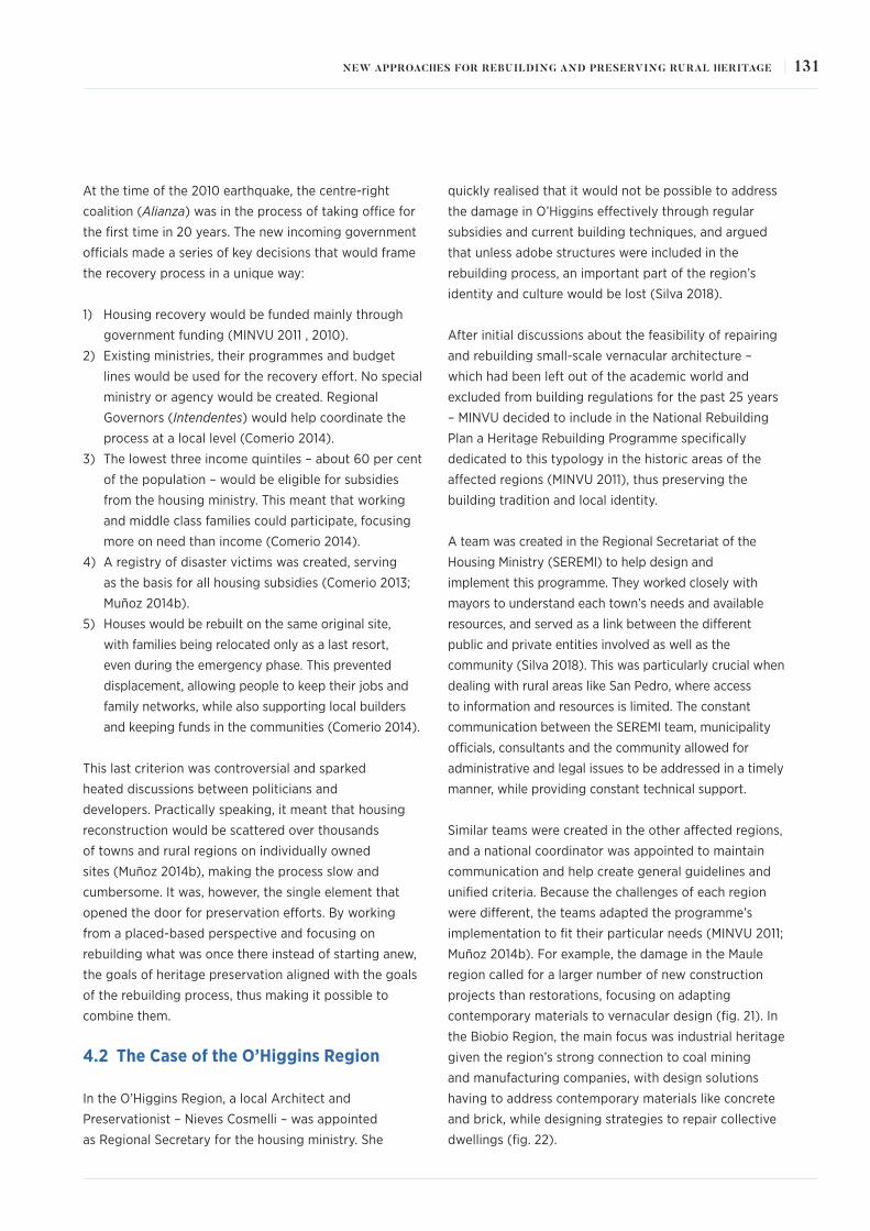
At the time of the 2010 earthquake, the centre-right
coalition (Alianza) was in the process of taking office for
the first time in 20 years. The new incoming government
officials made a series of key decisions that would frame
the recovery process in a unique way:
1) Housing recovery would be funded mainly through
government funding (MINVU 2011 , 2010).
2) Existing ministries, their programmes and budget
lines would be used for the recovery effort. No special
ministry or agency would be created. Regional
Governors (Intendentes) would help coordinate the
process at a local level (Comerio 2014).
3) The lowest three income quintiles – about 60 per cent
of the population – would be eligible for subsidies
from the housing ministry. This meant that working
and middle class families could participate, focusing
more on need than income (Comerio 2014).
4) A registry of disaster victims was created, serving
as the basis for all housing subsidies (Comerio 2013;
Muñoz 2014b).
5) Houses would be rebuilt on the same original site,
with families being relocated only as a last resort,
even during the emergency phase. This prevented
displacement, allowing people to keep their jobs and
family networks, while also supporting local builders
and keeping funds in the communities (Comerio 2014).
This last criterion was controversial and sparked
heated discussions between politicians and
developers. Practically speaking, it meant that housing
reconstruction would be scattered over thousands
of towns and rural regions on individually owned
sites (Muñoz 2014b), making the process slow and
cumbersome. It was, however, the single element that
opened the door for preservation efforts. By working
from a placed-based perspective and focusing on
rebuilding what was once there instead of starting anew,
the goals of heritage preservation aligned with the goals
of the rebuilding process, thus making it possible to
combine them.
4.2 The Case of the O’Higgins Region
In the O’Higgins Region, a local Architect and
Preservationist – Nieves Cosmelli – was appointed
as Regional Secretary for the housing ministry. She
quickly realised that it would not be possible to address
the damage in O’Higgins effectively through regular
subsidies and current building techniques, and argued
that unless adobe structures were included in the
rebuilding process, an important part of the region’s
identity and culture would be lost (Silva 2018).
After initial discussions about the feasibility of repairing
and rebuilding small-scale vernacular architecture –
which had been left out of the academic world and
excluded from building regulations for the past 25 years
– MINVU decided to include in the National Rebuilding
Plan a Heritage Rebuilding Programme specifically
dedicated to this typology in the historic areas of the
affected regions (MINVU 2011), thus preserving the
building tradition and local identity.
A team was created in the Regional Secretariat of the
Housing Ministry (SEREMI) to help design and
implement this programme. They worked closely with
mayors to understand each town’s needs and available
resources, and served as a link between the different
public and private entities involved as well as the
community (Silva 2018). This was particularly crucial when
dealing with rural areas like San Pedro, where access
to information and resources is limited. The constant
communication between the SEREMI team, municipality
officials, consultants and the community allowed for
administrative and legal issues to be addressed in a timely
manner, while providing constant technical support.
Similar teams were created in the other affected regions,
and a national coordinator was appointed to maintain
communication and help create general guidelines and
unified criteria. Because the challenges of each region
were different, the teams adapted the programme’s
implementation to fit their particular needs (MINVU 2011;
Muñoz 2014b). For example, the damage in the Maule
region called for a larger number of new construction
projects than restorations, focusing on adapting
contemporary materials to vernacular design (fig. 21). In
the Biobio Region, the main focus was industrial heritage
given the region’s strong connection to coal mining
and manufacturing companies, with design solutions
having to address contemporary materials like concrete
and brick, while designing strategies to repair collective
dwellings (fig. 22).
131NEW APPROACHES FOR REBUILDING AND PRESERVING RURAL HERITAGE |
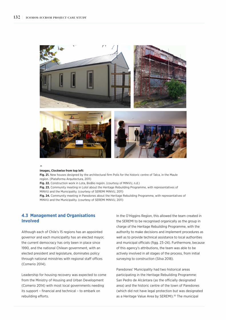
4.3 Management and Organisations Involved
Although each of Chile’s 15 regions has an appointed
governor and each municipality has an elected mayor,
the current democracy has only been in place since
1990, and the national Chilean government, with an
elected president and legislature, dominates policy
through national ministries with regional staff offices
(Comerio 2014).
Leadership for housing recovery was expected to come
from the Ministry of Housing and Urban Development
(Comerio 2014) with most local governments needing
its support – financial and technical – to embark on
rebuilding efforts.
In the O’Higgins Region, this allowed the team created in
the SEREMI to be recognised organically as the group in
charge of the Heritage Rebuilding Programme, with the
authority to make decisions and implement procedures as
well as to provide technical assistance to local authorities
and municipal officials (figg. 23–24). Furthermore, because
of this agency’s attributions, the team was able to be
actively involved in all stages of the process, from initial
surveying to construction (Silva 2018).
Paredones’ Municipality had two historical areas
participating in the Heritage Rebuilding Programme:
San Pedro de Alcántara (as the officially designated
area) and the historic centre of the town of Paredones
(which did not have legal protection but was designated
as a Heritage Value Area by SEREMI).30 The municipal
Images, Clockwise from top left: Fig. 21. New houses designed by the architectural firm Polis for the historic centre of Talca, in the Maule region. (Plataforma Arquitectura, 2011)Fig. 22. Construction work in Lota, BioBio región. (courtesy of MINVU, n.d.)Fig. 23. Community meeting in Lolol about the Heritage Rebuilding Programme, with representatives of MINVU and the Municipality. (courtesy of SEREMI MINVU, 2011)Fig. 24. Community meeting in Paredones about the Heritage Rebuilding Programme, with representatives of MINVU and the Municipality. (courtesy of SEREMI MINVU, 2011)
132 | ICOMOS-ICCROM PROJECT CASE STUDY

team was tasked with channelling applications for the
subsidies and hiring consultants to develop projects.
However, they did not actively participate in the
design or construction process, thus the community
communicated directly with the consultants and/or
the SEREMI team. A couple of community members of
San Pedro acted as liaisons and kept people informed,
enacting spontaneous or situational leadership.
Unfortunately, this organisational structure was not
consolidated or sustained over time.
4.4 Legal and Financial Tools
The main concern about the feasibility of the Heritage
Rebuilding Programme was the lack of a Chilean building
code for adobe structures (MINVU 2011). Existing
regulations allowed for the use of foreign codes, but it
required an architect or engineer to sponsor its use,31
thus increasing costs and the time required to develop
a proposal. Also, building permits had requisites and a
timeframe incompatible with an emergency phase, and
building standards were not applicable to historic houses.
In order to solve this, the ministry started to work with
the National Institute for Standardisation (INN) on a
building code for adobe structures,32 and in parallel,
worked with SEREMI and each region’s Housing and
Urban Development Service (SERVIU) to identify ways to
use the existing regulations to bypass this requirement,
and to create specific emergency building permits that
made certain exceptions and expedited processes.33
As for funding, the strategy used was to pool together
resources (figg. 25–26). Regional government funds
assigned to each municipality for infrastructure every
year34 were used to cover design costs, since a different
level of expertise was needed (Muñoz 2014b). MINVU’s
existing housing subsidies underwent an extensive
process of adaptation regarding application and
project requirements, and an increase of US$8,000 was
given to projects that preserved the building’s historic
architectural features. These funds were intended to
cover construction costs (Muñoz 2014b).
Since the available funds were – of course – not enough
to restore entire properties, projects were designed in
stages: the first phase was destined to restore the house’s
habitability (as minimum, a living/dining room, kitchen,
bathroom and bedroom should be repaired); and a second
phase would include extra rooms, interior finishes and
other non-structural work. Some exceptions were made
when the rooms mentioned above suffered minor or no
damage35 (i.e. if the bathroom and kitchen were in good
condition, there was no need to include them in the first
phase of the project). Also, the specific needs of each
owner were considered when determining priorities and
stages of work. For example, houses where older adults
lived prioritised accessibility and safety improvements.
Fig. 25. Relationship between rebuilding efforts and sources of funding. (courtesy of SEREMI MINVU O’Higgins, 2014)
133NEW APPROACHES FOR REBUILDING AND PRESERVING RURAL HERITAGE |

This strategy was aligned with the "pooling together
resources" criteria established for the rebuilding process,
which in cases like San Pedro was the only way to
undertake such a task. The experience and knowledge
acquired during the first stage allowed the owner,
builders and consultants to face a second stage from a
better standpoint, optimising future resources.
4.5 Timeframe
Chile’s National Rebuilding Plan stated that housing and
neighbourhoods would be recovered in four years (fig.
27), leaving public space projects to be completed by
2018 (MINVU 2010). The main deadline coincided with the
government’s term, a fact that was – and still is – criticised
by experts in the area (Diario UChile 2017), opening the
door to constant questioning about the validity of the
figures reported by public agencies (Bustamante 2012).
The Heritage Rebuilding Programme was grouped with
the housing targets, and the initial calendar stated that
construction work would start in June 2011 (MINVU
2010). This conflicted with the level of complexity of
the projects and the scale of the construction phase.
Compared with new social housing developments,
projects from the Heritage Rebuilding Programme were
always "slower", since each house needed a preliminary
evaluation, several proposal reviews and approvals from
organisations like the National Monuments Council,
before starting construction.
When interviewed, professionals who participated in
the programme agree that the process took too long,
mainly because this was a new topic in housing policies,
From top to bottom: Fig. 26. Types of subsidies utilised, amounts and increases for Heritage Areas. (courtesy of MINVU, translated by author)Fig. 27. Timeline for housing reconstruction within the National Rebuilding Plan, showing that the total of housing units would be completed by February of 2014 (highlighted row). (courtesy of MINVU)
134 | ICOMOS-ICCROM PROJECT CASE STUDY
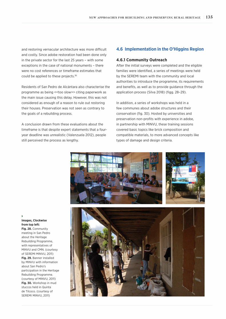
and restoring vernacular architecture was more difficult
and costly. Since adobe restoration had been done only
in the private sector for the last 25 years – with some
exceptions in the case of national monuments – there
were no cost references or timeframe estimates that
could be applied to these projects.36
Residents of San Pedro de Alcántara also characterise the
programme as being <<too slow>> citing paperwork as
the main issue causing this delay. However, this was not
considered as enough of a reason to rule out restoring
their houses. Preservation was not seen as contrary to
the goals of a rebuilding process.
A conclusion drawn from these evaluations about the
timeframe is that despite expert statements that a four-
year deadline was unrealistic (Valenzuela 2012), people
still perceived the process as lengthy.
4.6 Implementation in the O’Higgins Region
4.6.1 Community OutreachAfter the initial surveys were completed and the eligible
families were identified, a series of meetings were held
by the SEREMI team with the community and local
authorities to introduce the programme, its requirements
and benefits, as well as to provide guidance through the
application process (Silva 2018) (figg. 28–29).
In addition, a series of workshops was held in a
few communes about adobe structures and their
conservation (fig. 30). Hosted by universities and
preservation non-profits with experience in adobe,
in partnership with MINVU, these training sessions
covered basic topics like brick composition and
compatible materials, to more advanced concepts like
types of damage and design criteria.
Images, Clockwise from top left: Fig. 28. Community meeting in San Pedro about the Heritage Rebuilding Programme, with representatives of MINVU and CMN. (courtesy of SEREMI MINVU, 2011)Fig. 29. Banner installed by MINVU with information about San Pedro’s participation in the Heritage Rebuilding Programme. (courtesy of MINVU, 2011)Fig. 30. Workshop in mud stuccos held in Quinta de Tilcoco. (courtesy of SEREMI MINVU, 2011)
135NEW APPROACHES FOR REBUILDING AND PRESERVING RURAL HERITAGE |

This allowed for a more unified technical language and
helped debunk myths and misconceptions about adobe
structures caused by the abandonment of building
tradition after the 1985 earthquake. It also contributed
to the creation of local networks of specialised
professionals, contractors and workers (Silva 2018).
Of the forty-four buildings surveyed in San Pedro de
Alcántara’s designated area, thirty-one families initially
applied for subsidies from the Heritage Rebuilding
Programme. Due to legal difficulties and other personal
conflicts, six people resigned or were not able to use
their subsidies, bringing the final number of participants
to twenty-five.
A total of five consultants were hired for the
development of projects in San Pedro de Alcántara:
Culturas Constructivas Collective, Universidad de Chile’s
Centre for External Projects, Zócalo Architects, Architect
Paz Gálvez, and Architect Pablo Cárdenas. Each family
worked with a consultant to develop their individual
project, and most of them stayed in touch during the
construction phase.
Two of those consultants – Culturas Constructivas
Collective (represented by Javiera Demetrio) and
Universidad de Chile’s Centre for External Projects –
developed two workshops as part of their methodology:
• The first one was Involucrándonos con la Vivienda
(getting involved with our house) and was held in July
2011. It focused on explaining how these subsidies
worked, the types of building techniques that were
allowed, and the steps involved when going from
sketches to technical drawings (Vargas 2018) (fig. 31).
• The second one was held in September 2011 and
was entitled Así se Construirá mi Casa (How will my
house be repaired?). Here, consultants presented the
proposals developed with each owner over the past
few months (Vargas 2018).
After those activities, each family continued their
communication with the consultants according to
their needs and availability. Other consultants worked
individually with each family from the beginning.
4.6.2 Damages and SubsidiesAs part of the initial surveys, buildings were evaluated by
local professionals to establish the level of damage that
each one suffered, categorising it as "minor" (damage to
finishes, windows, doors, roof tiles, etc.), "major" (visible
cracks, damage to the roof structure, wall tilting, etc.)
and "uninhabitable" (wall collapse, roof collapse, etc.).
Fig. 31. Involucrándonos con la Vivienda workshop in San Pedro de Alcántara. (courtesy of SEREMI MINVU, 2011)
136 | ICOMOS-ICCROM PROJECT CASE STUDY

The reports resulting from this evaluation established
what kind of subsidy was applicable (MINVU 2011, 2010),
but in the case of adobe structures they were not always
accurate (Ramorino 2018).
As a way to solve this, the SEREMI team established
a protocol that required each consultant to undertake
their own evaluation of the property before determining
what type of project would be developed – repairs or
new construction. Demolition – total or partial – was
only authorised when the damage was too extensive
or structural repairs would not be possible with the
available funds (Ramorino 2018).
In San Pedro, all the houses that participated in the
programme were categorised as "inhabitable", meaning
they could access the highest subsidy available.
Because of the difficulties in connectivity and small
number of projects, priority was given to DS40
subsidies (see fig. 26). These were owner-driven
reconstruction (ODR) subsidies, allowing owners to hire
local contractors or independent workers directly (figg.
32–33). However, it also required them to make the initial
investment, which would be refunded by MINVU once the
work was finished and a certificate of completion was
issued by the municipality (Muñoz 2014b).
From top to bottom: Fig. 32–33 View of Ive Correa’s house, located in the corner of Llico and San Francisco Streets, before the earthquake and during construction. (courtesy of MINVU)
137NEW APPROACHES FOR REBUILDING AND PRESERVING RURAL HERITAGE |

4.6.3 Design Review and Construction MonitoringDue to the high number of projects that would be
developed through this programme, systems of
collaboration were established between consultants
and the agencies responsible for the design review, in
order to generate unified criteria and expedite processes
(MINVU 2014). Checklists were simplified, formats were
homogenised and a system of weekly technical meetings
was implemented to discuss technical issues and the
solutions proposed by consultants (Ramorino 2018).
A partner team was then created at SERVIU, with
specialised professionals to review projects and supervise
construction work (figg. 34–36). The team would later
expand to take on administrative work for cases where
municipalities did not have enough capacity to do so
(Muñoz 2014b).
Projects in San Pedro were reviewed according to
the design criteria developed in 2011 by CMN.37 The
document was based on a detailed analysis of the
architectural features and morphology of the existing
buildings, stating that any restoration work or new
construction must follow the same parameters. It also
established that traditional building techniques (adobe
masonry and quincha [seismic-resistant wood & reed,
or giant cane, structures covered with mud plaster])
were the preferred option. The use of brick, reinforced
concrete and other contemporary techniques would only
be permitted in exceptional cases, individually evaluated
by the Council (CMN 2011).
Monitoring the work was mostly in the hands of
the MINVU team (SEREMI and SERVIU), with some
consultants actively participating in the process. Funds
devoted to this task were insufficient in a town as
isolated as San Pedro, so it was up to the consultants to
determine how involved in the process they could be.
Work in San Pedro began in 2012, after the first project
was approved by CMN and the consultant was able to
secure a local contractor. The process is described as very
difficult by the architect in charge, due to the builder’s
breach of contract by leaving town before finishing the
work. Although the builder eventually returned,
Images, Clockwise from top left: Figg. 34–36 Site visits by SERVIU professionals to monitor construction progress and project modifications. (courtesy of SEREMI MINVU O’Higgins)
138 | ICOMOS-ICCROM PROJECT CASE STUDY

the architect opted to move to San Pedro to oversee the
work closely, optimising the already scarce resources
available. The experience however, proved to be
extremely positive in reassuring other homeowners
that repairing their homes was possible, promoting
collaboration among neighbours when builders were not
available (Vargas 2018).
When evaluating the experience, most of the owners
see it as positive, especially for those who maintained a
good relationship with the consultants and were able to
make adjustments during the construction phase (figg.
37–38).
Unfortunately, most of the homeowners were not able to
continue repairing the rest of their property38 due to lack
of funds. This is particularly challenging for older adults
who live alone or with a spouse (which make up half the
population of San Pedro’s Typical Area),39 who would not
be able to take on this task unless supported in technical,
financial and administrative matters. Some families have
been able to continue repairs at a slow pace, with one
resident – Ive Correa – restoring one room per year.
These families have support networks in and outside the
town, accessing information and resources on a more
regular basis.
4.6.4 Technical SolutionsTechnical solutions implemented by consultants in the
O’Higgins Region varied according to type of subsidy,
type of damage, where the property was located, the
consultant’s experience, homeowner’s preferences,
among other factors. This meant that there were
multiple ways of approaching a new construction or
a restoration project, and technical criteria needed to
consider multiple aspects when deciding which solution
was the best.
Within this wide range of solutions, a few can be
highlighted as representative of the technical abilities of
consultants and the socio-cultural context where they
were developed in:
From top to bottom: Figg. 37–38 View of Leonardo Peñaloza’s house in Manuel Rodriguez Street, before and after repairs were completed. (courtesy of UChile and CMN)
139NEW APPROACHES FOR REBUILDING AND PRESERVING RURAL HERITAGE |

• In the Chepica commune, projects were developed
by Larrain & Rodway Architects. The firm designed a
house typology using a timber structure with straw
bales as filling to achieve the wall thickness of an
adobe structure (figg. 39–41). Traditional materials
were used for exterior finishes (mud stucco for
walls, clay roof tiles, wooden windows, etc.) and
compatible materials were used to uphold current
building standards (drywall for interior walls and
ceilings, ceramic tiles in kitchen and bathroom,
terracotta floor tiles, etc.).
The design received ample praise for its ability to
maintain a harmonious relationship with existing
structures, while bringing new building techniques
to social housing subsidies. The community,
however, took time to fully embrace the design and
required constant reassurance of the quality and
safety of it.
The architects also developed seismic retrofitting
projects using electro-welded mesh and wooden
pillars inserted in the adobe walls. They implemented
this solution in all their restoration projects in
Chepica, Lolol, Paredones and San Fernando.
• In the Chimbarongo commune, new construction
projects were developed by Miguel Galvez
Engineering & Builders. The company was a long-time
builder of social housing developments and agreed
to participate in the Heritage Rebuilding Programme
as a new challenge. They were commissioned
with designing new houses – using contemporary
materials – that would replace severely damaged
adobe houses in the town’s main street, Miraflores.
This request came after homeowners refused to
repair them because they considered adobe as being
<<unsafe>> or <<too difficult to maintain>>. Since
Miraflores Street is not a designated area, there was
no legal tool to deny this request.
The design reproduced the architectural features of
typical adobe houses in the street and used finishes
that resembled traditional materials (figg. 42–43).
It also included the design for an expansion that
completed the continuous façade, typical of this
area. Despite not being an "ideal" solution, this case
proved that builders have the capacity to develop
designs that take into consideration their context.
Homeowners were an active part of the process and
celebrated together every time a house was finished.
Images, Clockwise from top: Figg. 39–41 Construction process of one of the new houses designed by Larrain & Rodway Architects in Chepica. (courtesy of SEREMI MINVU, 2011)
140 | ICOMOS-ICCROM PROJECT CASE STUDY

They remained a cohesive group and applied for
funding to build the designed expansions.
• In the Peralillo commune, one of the consultants
hired to develop seismic retrofitting projects was the
Altiplano Foundation. This organisation had ample
experience working with churches in the Arica region,
specialising in the use of Biaxial Polypropylene Geogrid
as reinforcement for adobe walls. In Peralillo, they
developed eight projects using this technique, also
implementing their "school-workshop" methodology
which prioritised hiring community members and using
each project as a training opportunity for them, thus
increasing local capacity (figg. 44–45).
Their work was highly praised, and the organisation
continued working in the region as consultants for the
restoration of the Hacienda el Huique Museum, one
of the largest remaining Haciendas in the O’Higgins
Region, which suffered considerable damage during
the 2010 earthquake.40
Technical solutions in San Pedro de Alcántara were
framed within the town’s available resources and
limitations. First, being a designated area meant that
demolition – total or partial – would only be approved
as a last resource by CMN. Emphasis was then put
on repair work, and only four cases required new
construction.
The use of traditional materials was also required
by CMN. Reusing available elements – such as
windows, doors, pillars, clay roof tiles, etc. – was
prioritised over new ones when possible, and new
materials could only be employed on interiors or
when traditional ones were unavailable. An exception
was made for cement stucco, since at the time there
was no consensus over how compatible this material
was. Some solutions included quicklime to allow the
cement to "breathe", and others specified that the
layer applied would not exceed 1cm (0.39 inches).
As for reinforcement solutions, the town’s distance from
large cities made it necessary to use materials that were
available in most hardware depots on a regular basis,
since "buying in bulk" was not an option for homeowners
or small local contractors. The most utilised material was
electro-welded mesh – used commonly for reinforced
concrete walls, floors, foundations, etc. – which is easy to
transport, store and install.
Images, Clockwise from top left: Figg. 42–43 Construction process of one of the new houses designed by Miguel Galvez Engineering & Builders in Miraflores Street, Chimbarongo commune. (courtesy of SEREMI MINVU, 2012)Figg. 44–45 Construction process in one of the houses restored by Altiplano Foundation in Peralillo. (courtesy of SEREMI MINVU, 2012)
141NEW APPROACHES FOR REBUILDING AND PRESERVING RURAL HERITAGE |

The technical solution entailed removing all wall rendering
to expose the adobe bricks, onto which the metal
mesh was installed on both sides of the wall to create a
continuous envelope, and anchored to a horizontal timber
beam at the top of the wall (viga de coronación) and –
when necessary – to a timber beam inserted at the base of
the wall. Perforations were made in the wall through which
metal connectors were introduced to secure the mesh on
both sides. A first layer of mud plaster is then applied, to
ensure the verticality of the wall, followed by a second
layer of fine mud plaster, or in some cases cement (figg.
46–48).
Since this technique was relatively simple to
implement, it was quickly adopted by contractors and
homeowners in many of the towns participating in
the Heritage Rebuilding Programme. It was one of the
techniques that was feasible in all locations, regardless
of how isolated or well-connected it was, and was
financially plausible for a group of projects as well as
for individual ones.
As for water damage, the relocation of the town to
higher grounds after the 1900 flood has prevented such
events from happening again, which added to houses
being built on stone or concrete platforms (zócalos)
to adapt to the slope of the terrain and has protected
them from damage by capillary moisture. However, a
significant number of houses suffered damage caused
by roof leaks.41 This required thorough inspections to
determine what work needed to be done, but in most
cases only damaged roof components needed replacing,
and new components were incorporated to improve the
structural resistance and to comply with current safety
standards.42 More severe cases required the entire roof
to be replaced.
Images, Clockwise from top left: Figg. 46–48 Example of the process of installing electro-welded mesh as reinforcement for adobe houses of the town of Lolol. (courtesy of SEREMI MINVU, 2013)
142 | ICOMOS-ICCROM PROJECT CASE STUDY

5. The Outcomes and Effects
By 2014, the Heritage Rebuilding Programme had
been implemented in 140 towns or cities within
five regions,43 with 5,463 subsidies granted for a
total of US$92 million (MINVU 2014). A number of
public–private partnerships had been created, and
collaboration between government agencies resulted
in a series of complementary investments that not
only rebuilt homes, but also boosted growth and
improved quality of life.
During this final year of implementation, a preliminary
analysis was done by the ministry to identify the main
challenges and contributions made by it. This allowed
for a series of conclusions to be drawn, that could
inform future rebuilding efforts:
• Because the areas more affected by the earthquake
were scattered in the territory, standard social
housing solutions were not applicable, therefore
individual projects needed to be developed. This
resulted in adjusted timeframes and new strategies
for lowering costs, such as using local contractors
and purchasing from local vendors. Other necessary
modifications needed to implement this programme
and preserve small scale vernacular architecture
included: changes in the ministry’s administrative
processes, allowing adjustments to the project
during construction, having specialised professionals
for inspections, and expediting payments to
contractors and/or homeowners.
These adjustments not only demonstrated that the
housing ministry – and housing subsidies – could
in fact move away from standardised design and
work from a local perspective, but also proved that
this institution can be a relevant participant in the
conservation and enhancement of architectural
heritage.
• The lack of a Chilean building code for adobe
was singled out as the main challenge while
designing and implementing this rebuilding
programme. Although a series of strategies was
developed to overcome this issue during its years
of implementation – see section 4.4 – a unified
structural criterion for interventions was needed
on a permanent basis. By May of 2014, two new
building regulations for adobe had been published:
NT002, published by MINVU to provide basic criteria
to evaluate an existing adobe structure; and Nch
3332, published by the National Association of
Engineers to provide standard calculations for the
reinforcement of adobe structures and also basic
criteria on materials compatibility and design.
Although they were not available for the
development of projects on this programme, they
are an invaluable tool for preparing and responding
to the next earthquake.44
• The abandonment of building tradition after
the 1985 earthquake resulted in a shortage of
architects, engineers, contractors and manpower
with knowledge of adobe structures. This made the
process of project design and construction slower
than expected, more expensive in some cases, and
vulnerable to setbacks due to the inexperience of
consultants.
However, this also transformed the Heritage
Rebuilding Programme into an opportunity to train
local contractors and professionals in techniques
to repair and reinforce earthen architecture, and to
educate owners about suitable maintenance and
intervention criteria for this type of building. It also
provided a platform to implement and promote new
restoration and reinforcement techniques for adobe
structures, as well as protecting tradition.
Teams of trained professionals who were aware
of the importance of preservation and its role in
community development, cultural identity and social
stability were also created within the ministry
• Protecting historic neighbourhoods and towns
can be a social stabiliser, preserve cultural
identity and build resiliency. By rebuilding on the
original sites and focusing on liveability rather
than merely prioritising architectural value, the
Heritage Rebuilding Programme helped maintain
the residential use of properties, protect the social
fabric of historic towns and prevent displacement.
143NEW APPROACHES FOR REBUILDING AND PRESERVING RURAL HERITAGE |

A number of projects and ideas arose from this analysis,
especially concerning the internal organisation of the
ministry and intersections with other programmes.
A new department within the Ministry’s Urban
Development Division was created to focus on heritage
preservation and historic sites, with representatives from
each region meeting to discuss challenges and share
experiences. This department would work transversally
with all the ministry’s divisions, as well as collaborate
with other government agencies to identify funding
sources and project overlap. Unfortunately, this initiative
was short lived, and other projects did not materialise
(Scarella 2018).
In November 2013, the centre-left coalition (Nueva
Mayoria) won the presidential election and assumed
office in March 2014. The programmes created for the
rebuilding process were wrapped up, but none were
renewed or reformulated to become permanent policy.
The concept of heritage being an active part of housing
policies was dropped, and the teams and operational
structures created were dismantled and absorbed by
other departments.
Although the housing ministry has been working in
the past years on developing housing subsidies for
rural and heritage areas and compiling the testimony
of former government officials who worked on the
rebuilding processes, it remains to be seen how these
initiatives will be implemented by local governments
and communities to protect their homes and prepare for
the next earthquake. The recent creation of a Ministry
of Culture has opened a door for introducing disaster
preparedness as a key element for heritage conservation,
but specific policies and permanent programmes are yet
to be announced.45
5.1 San Pedro’s Experience
The experience of San Pedro de Alcántara provides
a number of key considerations when discussing
approaches to rebuilding in a rural area with historic
significance:
• Access to information and resources is critical when
implementing a rebuilding programme or policy in
rural areas. Channels of communication differ from
what is available in large cities, therefore strategies
for transmitting information must be adapted. In the
case of San Pedro, the field work done by the local
government, consultants and government agencies
was essential for the participation of the community
in the Heritage Rebuilding Programme. Workshops
and community meetings played a significant role in
keeping people informed and helping to solve issues,
as well as supporting community leadership that
could channel concerns and good practices.
• Residents of San Pedro were – and still are – unlikely
to rebuild unless supported technically, financially
and administratively. The inclusion of an active form
of advising and monitoring was key to implementing
the Heritage Rebuilding Programme, and it allowed
the SEREMI team to have a more comprehensive
idea of the needs and desires of the community,
thereby optimising resources and time. The existence
of this team also allowed for learning to be shared
between town and communities, thereby promoting
continuous improvement to the programme.
• Having simplified administrative processes proved
especially relevant in San Pedro. Considering that
laws and policies are predominantly developed with
the needs and resources of urban areas in mind, it
is not surprising that some of them are detrimental
or inapplicable to rural environments. Abbreviating
the design review process conducted by CMN – see
section 1.3 and section 4.6.3 – allowed construction to
begin sooner, and new building permits – see section
4.4 – made adobe restoration projects eligible for
housing subsidies.
• Community organising and local leadership are
crucial elements when facing natural disaster or other
kinds of crisis in a rural environment. For the Heritage
Rebuilding Programme, the work done by the
community liaisons was not consolidated or sustained
over time. Although the mayor was/is identified as
a figure of authority, emphasis needs to be put on
supporting and strengthening community organising.
The rebuilding process of San Pedro required an
identifiable local counterpart to be implemented,
as will any other policy or programme for disaster
preparedness.
144 | ICOMOS-ICCROM PROJECT CASE STUDY

This also applies for local government capacity.
Small municipalities such as Paredones have limited
resources and struggle to meet the community’s
needs. The development of the municipality’s
capacity needs to be prioritised in order for it to play
an active role in future policies and programmes that
address disaster management. This is especially so
since a number of current funding opportunities are
only accessible through local government.46
• The life-cycle of rural vernacular architecture in
Chile always included maintenance work, which
in some cases involved culturally significant social
interactions.47 Over the years, due to social and
cultural changes, many homeowners did not know
how to properly maintain their houses, resulting in
the damage seen after the 2010 earthquake. The
Heritage Rebuilding Programme was an educational
experience for all those involved and helped revitalise
building tradition and craftsmanship. There are still
many homeowners, however, who still do not know
how to maintain or alter adobe structures. This implies
that future maintenance work still needs technical
assistance, and that further training is necessary.
• Owner participation in all stages of this programme
helped promote a sense of personal responsibility
towards the maintenance of adobe houses. Learning
from experience about the requirements and
limitations of the work needed, costs and timeframe,
allowed homeowners to utilise their resources more
efficiently. It also prepared them for the next stages,
now with more tools and a different perspective. Many
were able to continue repairing and improving their
homes over the next few years, and some even sought
out sources for funding. Overall, there was a sense of a
"work in progress" rather than "unfinished work".
• Disaster management is a cycle with different phases
and goals. As Bernard Feilden eloquently stated
<<we are living between two earthquakes>>, so our
programmes and policies should reflect that. The time
and resources invested in developing a reconstruction
programmes like the Heritage Rebuilding Programme
is not sustainable if it needs to be recreated every
two or three years. San Pedro’s residents unanimously
agree on the need to have a permanent programme to
support maintenance work, and to which participating
professionals would add emergency, reconstruction
and preparation stages, thereby increasing resilience.
This would reduce the time needed to recover from
disasters and for preparing for the next one.
6. Additional Comments
The implementation of Chile’s Heritage Rebuilding
Programme after the 2010 earthquake proved that
vernacular architecture is a feasible subject for housing
subsidies, and that its preservation requires innovation
as much as it needs to reclaim building traditions. It also
showed, however, that existing tools and regulations are
inadequate for addressing the issues that rural areas face.
Land use regulations are developed only for urban
areas. Preservation tools are valued in urban built
environments, but struggle to effectively protect rural
landscapes. Disaster management plans have mostly
focused on technical aspects, failing to envision the long-
term consequences of these events in ecosystems that
were fragile to begin with.
Those of us involved in these processes acknowledge
the need to approach planning, preservation and
disaster management from a regional and more inclusive
perspective that considers the needs of different
geographies and landscapes.
Analysing and sharing experiences such as San Pedro’s are
unique opportunities to steer the dialogue about how to
develop new strategies for addressing rural areas from a
holistic perspective, identifying what are the values, codes
and dynamics that shape these communities, and how
those elements are harboured by the built environment.
San Pedro’s community is proof that disasters can be
an opportunity, and preservation is not the opposite
of development. Residents proudly refer to their town
as <<important because we are part of our country’s
heritage>> and work together to protect it. Even
with limited tools and resources, this community’s
experience is a tangible example that this is not a
utopia, but a viable option on how to prepare and deal
with the next disaster.
145NEW APPROACHES FOR REBUILDING AND PRESERVING RURAL HERITAGE |

7. Details of the Expert(s) Completing the Case Study
Maria de los Angeles Muñoz is a Chilean Architect and
preservationist specialised in earthen structures, with
a professional focus on community development and
social equity. She has worked in the public and private
sector, most notably in the Ministry of Housing and Urban
Development where she was Regional Heritage Manager
for the 2010 rebuilding process. She holds a professional
degree in architecture from Universidad de Chile, and
an MSc in Historic Preservation from Pratt Institute. She
received a Fulbright scholarship for her graduate studies,
and a grant from Chile’s Ministry of Culture for her thesis
on the rebuilding process of rural areas.
146 | ICOMOS-ICCROM PROJECT CASE STUDY
Notes1 This event is known by historians as "The Destruction of the Seven Cities" (La Destrucción de las Siete Ciudades) where
seven of the major Spanish outposts in southern Chile were destroyed or abandoned due to the Mapuche and Huilliche
uprising of 1598. It is considered as the end of the Conquest period, and the beginning of the Colonisation period.
(Guarda 1978).2 Encomiendas were a Spanish labour system, where the Crown granted conquerors a specified number of natives as
labour. In return, the Encomendero would provide infrastructure, instruction on the Catholic faith and in the Spanish
language, as well as protection against warring tribes or other threats.(Guarda 1978; Lockhart and Schwartz 1983). 3 Land grants, known in Chile as mercedes de tierra, were a legal institution used by the Spanish Crown to award land
to nearly any Spaniard who migrated to the Americas during the fifteenth and sixteenth centuries. It was used as an
incentive to colonise the conquered land, and soon the estates rivalled those of the Encomenderos, despite them not
receiving Natives or any labour as part of the grant.(Lockhart and Schwartz 1983).4 The Royal Hearing (Real Audiencia) was the highest judicial court of appeal in the Indies, as it had civil and criminal
jurisdiction and extensive jurisdiction extended even to the ecclesiastical field. The creation of the Indian Audiences
had as its main objective to reaffirm the supremacy of the justice of the king over that of the governors. The first Indian
Hearing was established in Santo Domingo in 1511. From 1527 until 1563, the founding of new audiences in Mexico,
Panama, Guatemala, Lima, Guadalajara, Santa Fe, Charcas, Quito and Chile marked the process of colonisation and
monarchical power in America.(Rosati n.d.).5 The founding of a Chaplaincy (Capellanía de Misa) was a very common practice during the Colonial period in Latin
America. A person, the founder, donated a fund to support a chaplain and said chaplain would have the obligation to
say a certain number of masses on behalf of the founder and/or those he/she designated as beneficiary. Capellanías
were designed to be perpetual: the chaplain’s obligations were transferable and the funds were based on revenues, not
capital. They served a religious purpose, but also had economic and social functions since the chaplains in charge of
them could be ordained through them and receive a life-time income.(Wobeser 1998).6 Primicias (first fruits) became a significant part of the Catholic Church finances, especially in rural areas, and were in
use until well into the nineteenth-century.7 Chile gained its independence from Spain in 1818, although the process started in 1810 and was finalised in 1823.
The following years were dedicated to organising and consolidating the Republic, ending with a civil war and the
establishment of the Conservative Republic in 1930.8 Decreto de Ley 615 de 1925. This decree established three categories of monuments (Historic Monuments, Public
Monuments and Archaeological Excavations), created a registry for museums, and established a technical agency for
the protection and tuition of monumental heritage: the National Monuments Council.9 Law 17.288, Titles III, IV, V, VI and VII.10 The Ministry of Culture, Arts and Heritage was only created in 2017. Previously, and since its creation, the Council was
under the jurisdiction of the Ministry of Education, with an Executive Secretariat created in 1994 that allowed for a
certain level of administrative autonomy.11 Council members are representatives of different public and private organisations. Although each one is free to
determine who will be their representative, in some cases the law specifies the position that the Council member must
have in said organisation.12 Frequency of the sessions is not determined by law, except a minimum of attendance for its members (once a month).13 Decree 17.813, November of 1972.14 Decree 106, January of 1974.15 Decree 390, July of 1996.16 Some complementary laws have been created to provide tax credits for donations to eligible projects on designated
sites (Ley de Donaciones con Fines Culturales, Law 18.895, Article 8), and land tax exemptions are available for
residential properties (DFL 119, 1953).17 Law 17.288, Title III, Art. 11, 12 and 30.
147NEW APPROACHES FOR REBUILDING AND PRESERVING RURAL HERITAGE |

18 The legitimacy of these attributions has been questioned for many years, since its effects on property rights have been
deemed unconstitutional (Skoknic 2015).19 At any of these stages, modifications or supplementary information can be required, which will restart the process.
The law doesn’t establish a timeframe for it, but administrative processes have a deadline of three months each. This
deadline only applies for each administrative process, meaning that after the dossier is submitted, the Council has
three months to either request more information or to inform a decision about the project. Any response from the
applicant afterwards is considered a new administrative process, thus starting a new three-month deadline.20 In the O’Higgins Region: Guacarhue’s historic center, El Huique Hacienda, San Pedro de Alcántara’s historic center,
town of Zúñiga, and Lolol’s historic center. In the Maule Region: town of Vichuquén, Villa Alegre’s historic center, town
of Nirivilo, Yerbas Buenas’ historic center, town of Chanco. In the Biobío Region: Cobquecura’s historic centre.21 General criteria were sent by CMN as an official letter on 30 December 2010 (Ord. 6305/10). The protocol was finalised
and signed by CMN and MINVU in January of 2011 (Ord. 402/11).22 According to the 2017 census, Paredones has 70.2 per cent of its population living in rural areas. The national
percentage is only 12.2 per cent.23 The town of Lolol is also a Typical Area protected by the National Monument’s Law. Designated in 2003, it was the
third rural area in the region to receive legal protection. Unlike San Pedro de Alcantara, Lolol has received public and
private investments to preserve its architectural features and develop tourism over the years and has been the focus of
scholarly research. There are multiple reasons for this, but the main one mentioned by different stakeholders has been
connectivity. Lolol has always been more accessible than San Pedro.24 During July of 2018, the author conducted a series of interviews with the community as part of her research for her
Master’s Degree Thesis.25 According to data from the 2017 census, activities related to mining, communications, finances, professional and
technical services, arts and entertainment, and organisations exist in small percentages in Paredones, but are
nonexistent in San Pedro.26 According to statistics from the Ministry of Social Development, in Chile 8.5 per cent of elder adults live in poverty.
Government pensions for people who don’t have access to retirement plans are US$167 a month, which is barely 40
per cent of what is established as the minimum wage in Chile (US$450 a month).27 Law 17.288 of 1970.28 Art. 60 of the General Law for Building and Urban Design (LGUC).29 The town of Chanco, in the Maule Region, was designated as a Typical Area in the year 2000. Two weeks after the
earthquake, the municipality began to demolish damaged houses without authorisation or evaluation by the National
Monuments Council. Other historic towns in the O’Higgins Region also suffered from unnecessary demolitions,
especially those without any legal protection. Preservationists called the phenomenon "the second earthquake", which
caused more losses to the historic fabric than the first one.30 At the time of the earthquake, most of the affected areas in the central valley didn’t have any legal protection or
acknowledgement of their historic value, and design guidelines were scarce. This made it very difficult for any
government policy that included historic value to be implemented in enough areas to be considered representative.
Since utilising existing designation alternatives was out of the question because of incompatible timeframes and
resources available, a new category was created to make the Heritage Rebuilding Program feasible: the Heritage Value
Areas (AVP).
Since this new area designation was created specifically for the purposes of accessing subsidies, there were no
permanent regulations required to be followed by owners. If they chose to apply to a subsidy from the Heritage
Rebuilding Programme, the amount of funds for design and construction would be higher and they would have a
specific project for their home. If not, they could access any of the regular subsidy programmes with standard designs
and requirements, but with a smaller budget.
As for the design criteria for these areas, a list of characteristics called "Heritage Values" (Valores Patrimoniales) was
established by the SEREMI Team after a period of research, site visits and collaboration with local stakeholders. The
148 | ICOMOS-ICCROM PROJECT CASE STUDY

inventory made by the O’Higgins’ team was also used by the Maule Region’s team, but other regions created their own.31 General Ordinance for Urban Planning and Construction (OGUC), Articles 5.1.25 and 5.1.27.32 This building code was published officially in 2013 as "NCh 3332 Structural design – Retrofitting of historic earth
buildings – Requirements for the structural design planning". The same year, the Housing Ministry published a
simplified version as "NTM 002 – Establishes conditions for structural intervention of earthen structures".33 Urban Development Division (División de Desarrollo Urbano) Circular 2011/242, 2011/245, 2012/248 and 2014/276.34 In 2010 a new category was created for emergency work and heritage rebuilding.35 Housing subsidies establish as mandatory for any project the construction of a kitchen, one bathroom, two bedrooms
and a living/dining room. Since these criteria wasn’t applicable to repair projects, exceptions were given to the projects
in the Heritage Rebuilding Program.36 An important element to consider was that adobe manufacturing and construction is a seasonal process. The work
is done mostly during warm seasons (Chile’s spring and summer) and is halted during cold or rainy seasons (Chile’s
winter), causing delays not usually seen on projects that use contemporary materials.37 The full document can be found at http://admminvuv57.minvu.cl/incjs/download.aspx?glb_cod_
nodo=20110311113300&hdd_nom_archivo=Lineamientos per cent 20de per cent 20San per cent 20Pedro per cent 20de
per cent 20Alc per cent C3 per cent A1ntara.pdf (in Spanish).38 Houses in San Pedro averaged 4,000 ft2, and restoration projects averaged 1,000 ft2. Basic living spaces needed to be
included in the project funded through the subsidy, thus guaranteeing liveability. However, still a large part of some
properties remains untouched, with families having to adjust to the available space.39 According to a survey done in July of 2018, 64 per cent of the residents of San Pedro’s Typical Area are older adults, 52
per cent live alone or with a spouse, 84 per cent are retired, all own their property and 64 per cent have lived there all
their life. (Munoz, Maria de los Angeles 2019).40 Hacienda San José del Carmen el Huique was designated a National Monument in 1971, and its surrounding houses
were designated as a Typical Area in 1996. Both of them are currently in Chile’s tentative list for nomination as World
Heritage Sites.41 During the 1985 earthquake, a number of deaths were caused by clay shingles falling on people’s heads. Motivated by
the fear of this happening again, homeowners started removing clay tiles and replacing them with galvanised steel
or asphalt roof panels. This not only affected the overall seismic resistance of adobe houses but contributed to the
change in the culture of maintaining them.42 In general, bracing diagonals between beams were included as well as fire-resistant and water barriers. Clay tiles were
reinstalled when necessary, tied together with wire.43 The IX Region, Araucanía, didn’t participate in the Heritage Rebuilding Program.44 In February 2020, a new complementary regulation was published by the National Association of Engineers: NCh 3389
Seismic Stabilization of Historical and Existing Buildings - Requirements for the Structural Design.45 In 2019, the Housing Ministry launched a new subsidy for home and neighborhood improvements that included an
increase for designated historic areas (DS27). A pilot was announced to be implemented in the Coquimbo region. 46 A Rural Housing Subsidy was launched in 2015 by the Housing Ministry. It was designed to <<solve the housing and
environment needs of families living in rural locations in which the Ministry has a lower presence, or where it has a
limited portfolio of projects, mainly in those territories with significant degrees of geographic isolation.>> Among its
requirements is that applications can only be done through a "Rural Management Entity". These entities can be private,
or Municipalities can act as them.47 For example, Chile’s Independence Day is September 18th – the last days of winter – and includes festivals and parades.
Historically, homeowners prepared for this day by painting their houses with quicklime, a material that was inexpensive
and protected adobe from water damage during the winter. This tradition has somehow been lost, with newer
materials becoming more common and affecting how adobe structures are maintained.
149NEW APPROACHES FOR REBUILDING AND PRESERVING RURAL HERITAGE |

References
Bustamante, R., 2012. Chile a dos años del sismo: la pelea por las cifras de la reconstrucción. BBC World News.
Comerio, M. C., 2014. "Housing Recovery Lessons From Chile", in Journal of the American Planning Association 80, 340–
350. https://doi.org/10.1080/01944363.2014.968188.
Comerio, M. C., 2013. Housing Recovery in Chile: A Qualitative Mid-program Review (No. PEER 2013/01). Pacific
Earthquake Engineering Research Center, University of California Berkeley.
Consejo de Monumentos Nacionales, 2011. Criterios y lineamientos técnicos para las obras de reconstrucción, y
reparación en la Zona Típica "Pueblo de San Pedro de Alcántara."
Consejo de Monumentos Nacionales, n.d. Pueblo de San Pedro de Alcántara [WWW Document]. URL http://www.
monumentos.cl/monumentos/zonas-tipicas/pueblo-san-pedro-Alcántara (accessed 11.20.18a).
Consejo de Monumentos Nacionales, n.d. Iglesia San Pedro de Alcántara [WWW Document]. URL https://www.
monumentos.gob.cl/monumentos/monumentos-historicos/iglesia-san-pedro-Alcántara (accessed 9.8.19b).
Consejo de Monumentos Nacionales, n.d. Historia [WWW Document]. URL https://www.monumentos.gob.cl/acerca/
historia (accessed 9.12.19c).
Diario UChile, 2017. Reconstrucción incompleta: a 7 años del terremoto, 2.500 familias esperan sus viviendas. Diario
Universidad de Chile.
Ferrari, C.A., 1970. El Convento Franciscano de San Pedro de Alcántara en el Siglo XVII y Comienzos del Siglo XIX.
Revista Historia 37–64.
Guarda, G., 1978. Historia urbana del reino de Chile. Andres Bello.
Institute for Environment and Human Security, 2016. "2016 World Risk Report". United Nations University.
Instituto Nacional de Estadisticas, 2018a. Censo 2017 Microdatos [WWW Document]. URL http://www.censo2017.cl/
microdatos/
Instituto Nacional de Estadisticas, 2018b. Censos de Población y Vivienda 1992-2002 [WWW Document]. URL http://
www.ine.cl/estadisticas/censos/censos-de-poblacion-y-vivienda
Lockhart, J., Schwartz, S. B., 1983. Early Latin America: A History of Colonial Spanish America and Brazil. Cambridge
University Press.
Ministerio de Bienes Nacionales, 2014. Secano costero, Camino real de la costa - Ruta Patrimonial No40 [WWW
Document]. Rutas Patrimoniales. URL https://www.google.com/maps/d/viewer?mid=1pFBgTQQ6ju-cEh-
vhavz0sDAcXc (accessed 9 August 2019).
Ministerio de Educación, 1970. Ley de Monumentos Nacionales, 28892.
Ministerio de Vivienda y Urbanismo, 2014. Reconstruyendo el Patrimonio de Chile. Ministerio de Vivienda y Urbanismo.
Ministerio de Vivienda y Urbanismo, 2011. Plan de Reconstrucción Patrimonial MINVU. Gobierno de Chile.
Ministerio de Vivienda y Urbanismo, 2010. Plan de Reconstrucción MINVU. Ministerio de Vivienda y Urbanismo.
Munoz, M., 2014a. Programa de Reconstrucción Patrimonial.
Munoz, M., 2014b. Análisis implementación Plan de Reconstrucción Patrimonial, Región de O’Higgins.
Munoz, Maria de los Angeles, 2019. Preserving Rural Heritage: Learning from Chile’s 2010 Rebuilding Process. Pratt
Institute, Brooklyn, NY.
Ramorino, P., 2018.
Rosati, H., n.d. La America Española Colonial, siglos XVI - XVII y XVIII [WWW Document]. URL http://www7.uc.cl/
sw_educ/historia/america/html/1_2_2.html (accessed 9 June 2019).
Scarella, A., 2018.
Silva, J., 2018.
Skoknic, M., 2015. Regulación Chilena del Patrimonio Arquitectónico Urbano: Marco Jurídico y Análisis Crítico de la Ley
17.288 de Monumentos Nacionales. Universidad de Chile, Santiago.
Unidad de Evaluación de Desastres, CEPAL, 2010. Terremoto en Chile, una primera mirada al 10 de Marzo de 2010.
Naciones Unidas, Santiago de Chile.
150 | ICOMOS-ICCROM PROJECT CASE STUDY

Universidad de Chile, n.d. Centro Sismológico Nacional [WWW Document]. URL http://www.csn.uchile.cl/sismologia/
grandes-terremotos-en-chile/ (accessed 11.6.18).
Valenzuela, N., 2012. ¿Cómo evaluar una política de reconstrucción? Una mirada multi-dimensional a dos años del
terremoto del 27 de febrero de 2010 en Chile. Puntos de Referencia 351.
Vargas, F., 2018. San Pedro de Alcántara: La Tradición Por Sobre la Emergencia, Políticas de Conservación Histórica.
Universidad Católica, Santiago.
Wobeser, G.V., 1998. La fundación de capellanías de misas, una costumbre arraigada entre las familias novohispanas.
Siglos XVI-XVIII. Jahrbuch für Geschichte Lateinamerikas 35, 25–44.
151NEW APPROACHES FOR REBUILDING AND PRESERVING RURAL HERITAGE |

FLOOD PROTECTION PROVISIONS IN THE WORLD HERITAGE CULTURAL LANDSCAPE
WACHAU, FOLLOWING THE FLOOD OF 2002
Michael Schimek, Dipl.-Ing. MA

TABLE OF CONTENTS
List of Illustrations 154
1. The Heritage Resource and Its Context Before the Impacting Event 155
1.1. Description, Designation and Recognition 155
1.2. History and Context 156
2. The Nature of the Impacting Event 157
2.1. The Hydrological Aspects of the Flood 157
2.2. Lack of Practical Experience with a 100-yearly Flood 159
2.3. Damage Witnessed 159
3. Post-Event Appraisals 160
4. Response Actions, Timeframes, Resources and Costs 163
4.1. Immediate Action 163
4.1.1. Cleaning rUp 163
4.1.2. Financing the Recovery of Damaged Houses and Furniture 163
4.1.3. Recovery of the Dry Stone Wall Terraces 163
4.2. Preventive Actions from 2002 to 2013 164
4.2.1. Provisions for Civil Protection 164
4.2.2. Nature Protection Projects 164
4.2.3. Flood Protection Systems 164
4.3. The Giant Flood of 2013 172
4.4. Actions from Around 2013 to 2019 173
4.4.1. Additional Financial Means for the Remaining Projects 173
4.4.2. Implemented Additional Flood Protection Projects 173
4.4.3. Not yet Finished Protection Projects 176
5. The Outcomes and Effects 178
6. Additional Comments 178
7. Details of the Expert Completing the Case Study 179
Bibliography 182
153FLOOD PROTECTION PROVISIONS IN THE WORLD HERITAGE CULTURAL LANDSCAPE WACHAU |

List of Illustrations
Fig. 1 The World Heritage region Wachau, in: Zech et al.
2017, 24–25
Fig. 2 Flood marks at the house Oberarnsdorf 16
(M. Schimek 2019)
Fig. 3 The flood 2002 at the Kamp river, in: Godina et al.
2004, 19
Fig. 4 The August 2002 flood on the Danube, in: Godina
et al. 2004, 32
Fig. 5 Flood levels in August 2002 from the Wachau
downwards, in: Godina et al. 2004, 33
Fig. 6 Flood marks inside Gasthaus Reiböck in Spitz
– the house itself is raised about a meter above
street level (M. Schimek 2019)
Fig. 7 Dry stone walls still are the backbone of wine
production in the Wachau (M. Schimek 2006)
Fig. 8 The base walls of the flood protection systems
should about equal the height of the guard rails
along the main road (M. Schimek 2019)
Fig. 9 Trial mounting of the flood protection system at
Oberarnsdorf (R. Schütz 2012)
Fig. 10 Trial mounting of the flood protection system
near Melk (P. Strobl 2019)
Fig. 11 Grounding of the walls near Rührsdorf (R. Schütz
2011)
Fig. 12 Location of the pump house at Emmersdorf
(M. Schimek 2019)
Fig. 13 Different wall designs (M. Schimek 2019)
Fig. 14 Flood protection system at Luberegg (Google
Maps, cartography M. Schimek 2019)
Fig. 15 Luberegg castle and the flood protection wall
(M. Schimek 2019)
Fig. 16 The flood wall replaced the garden wall
(M. Schimek 2019)
Fig. 17 Flood gate at Luberegg (M. Schimek 2019)
Fig. 18 Flood protection system at Hundsheim (Google
Maps, cartography M. Schimek 2019)
Fig. 19 Hundsheim chapel and the flood protection
solution around (M. Schimek 2019)
Fig. 20 Upper corner of the flood protection at
Hundsheim (M. Schimek 2019)
Fig. 21 Flood protection system at Weißenkirchen,
Joching, and Wösendorf (Google Maps,
cartography M. Schimek 2019)
Fig. 22 Flood wall in the relatively open land near
Joching (M. Schimek 2019)
Fig. 23 The flood gate at Wösendorf (M. Schimek 2019)
Fig. 24 Aluminum panel storage hall near Joching
(M. Schimek 2019)
Fig. 25 Flood protection system at Spitz (Google Maps,
cartography M. Schimek, 2019)
Fig. 26 The double paneled flood gate at Hinterhaus
(M. Schimek 2019)
Fig. 27 Storage halls at Spitz (M. Schimek 2019)
Fig. 28 Flood walls surrounding the Spitzer Bach mouth
(M. Schimek 2019)
Fig. 29 New design of the Spitz landing (M. Schimek 2019)
Fig. 30 Flood protection system at Oberarnsdorf (Google
Maps, cartography M. Schimek, 2019)
Fig. 31 Center part of the Oberarnsdorf flood protection
(M. Schimek 2019)
Fig. 32 Part of the new "village square" along the
Danube in Oberarnsdorf (M. Schimek 2019)
Fig. 33 Storage hall seen from the main road (M. Schimek
2019)
Fig. 34 Flood protection system at Rührsdorf (Google
Maps, cartography M. Schimek, 2019)
Fig. 35 Walls are needed deep into the vineyards
because of the flat land surrounding Rührsdorf
(M. Schimek 2019)
Fig. 36 Aluminum panel washing machine at work
during a practice with the Austrian army in
Weißenkirchen (M. Schimek 2019)
Fig. 37 The June 2013 flood on the Danube, in: Godina et
al. 2014, 32
Fig. 38 Design elements along the main square in Melk
(M. Schimek 2019)
Fig. 39 The "World Heritage Lens" enhances the visibility
of the baroque abbey from the Danube landing
(M. Schimek 2019)
Fig. 40 Emergency lane at Unterloiben (M. Schimek 2019)
Fig. 41 Massive walls at the upstream part of the flood
protection in Unterloiben (M. Schimek 2019)
Fig. 42 Location of the flood protection walls in
Emmersdorf directly at the Danube (M. Schimek
2019)
Fig. 43 Newly designed bus waiting zone at Seegarten
(M. Schimek 2019)
Fig. 44 The World Heritage region Wachau, in: Zech et
al. 2017, 24-25, cartography M. Schimek, 2019,
Overview over all flood protection projects
154 | ICOMOS-ICCROM PROJECT CASE STUDY

1. The Heritage Resource and Its Context Before the Impacting Event
1.1. Description, Designation and Recognition
The World Heritage cultural landscape of Wachau in
Lower Austria is a riverine landscape along the Danube.
Generally, the Danube in south-eastern Bavaria and most
of Austria follows the southern fringe of the medium high
mountains that make up the so-called Bohemian Massif.
On some occasions, though, it runs through the mountain
range, cutting off small parts and creating scenic valleys.
The peaks along the Danube in the Wachau are usually
around 500 m above the sea level of the river, which in
turn is about 200 m above the sea. The location between
two large climate zones – Atlantic and Continental – and
the specific features of the landscape – aspect, geology,
sunshine hours – have created a landscape which
features many rare warmth-loving animals and plants and
a certain Mediterranean flair which is unique in Austria.
The Roman Empire used the Danube as its northern
border and introduced wine growing in the region.
During the Middle Ages, monasteries upstream
colonialised the Wachau as their major wine growing
area. Wine growing still accounts for about two thirds
of the landscape, on dry stone terraces cultivated and
maintained mostly manually. Despite the economically
challenging way of working, the wine growing area has
stayed constant during the last 50 years. White wines
from the Wachau rank among the best worldwide and
achieve prices which allow the wine growers to continue
working and make a reasonable living out of it on the
historic terraces.
The Wachau valley was already designated as a
Protected Landscape under the Lower Austrian Nature
Protection Act in 1955. In the 1970s, a large citizen
movement successfully opposed plans to destroy the
landscape by building a hydroelectrical power plant
opposite the medieval town of Dürnstein. Since 1994, it
has been awarded the European Diploma for Protected
Areas by the Council of Europe under the condition
that all plans for such a power plant are banned
forever. Subsequently, the Wachau was enlisted as a
cultural landscape into UNESCO’s World Heritage List
in 2000 (fig. 1).
Fig. 1. The World Heritage region Wachau, in: Zech et al. 2017, 24-25
155FLOOD PROTECTION PROVISIONS IN THE WORLD HERITAGE CULTURAL LANDSCAPE WACHAU |

Today, the Wachau is commonly described as the part
of the Danube valley which starts and ends at the cities
of Melk and Krems. It is framed by two famous baroque
monasteries – Melk and Göttweig – and is about 36 km
long. At least a part of the World Heritage perimeter is
held by fifteen different municipalities. They are organised
in a voluntary association which has been assigned
the task of managing the World Heritage status in the
World Heritage Management Plan which was issued in
2016. The association currently employs five people who
are responsible for protecting and carefully developing
the region. The management is jointly financed by the
Republic of Austria, the Federal State of Lower Austria and
the municipalities. For specific projects, it makes use of a
wide variety of national and European grant schemes.
1.2. History and Context
Like any river in the world, the people living close to
the Danube have witnessed a number of smaller and
higher floods during their lives. Many towns and villages
in the Wachau valley are located so that they are safe
from flood risk, or at least from minor events, except for
some villages which served as harbour cities which were
therefore flooded more frequently.
Really big flood events were a rare occurrence. The
biggest flood in recent history was the flood around 15
August 1501. Calculations from the 1930s estimated the
peak flow of this event at around 14,000 m³/s in the
town of Krems-Stein.1 As a comparison: Currently, the
average flow of water (MQ) in the Danube in the Wachau
is at 1,880 m³/s, the average lowest flow during the last
10 years amounts to 812 m³/s.2
Around 1800, there were again a number of rather large
floods, such as in 1787, 1830, and 1862, partly caused
by ice jams (see fig. 2).3 At the same time, the use of
the Danube followed the industrialisation of society,
meaning the river should become more reliable for
navigation and at the same time safer for the local
people in the event of a flood. This is why the Danube
in Austria was, as it was called, "regulated" (reguliert)
during the second half of the nineteenth-century, which
mostly meant cutting off side branches, putting the
water into one rectified river bed and securing the banks
with big rocks.
At some places, people became a little careless, building
closer to the river than they should have. However, it
soon became clear that floods would still be a regular
part of their life. Both 1897 and especially 1899 saw large
floods putting wide parts of the newly built areas under
water. The next huge flood only took place in 1954, with
the water levels rising to the same height as those in the
nineteenth-century.
Fig. 2. M. Schimek, 2019, Flood marks at the house Oberarnsdorf 16
156 | ICOMOS-ICCROM PROJECT CASE STUDY

After that, circumstances changed once again. Between
1956 and 1998, a total of ten hydroelectric power dams
were built in the Austrian Danube.4 There are now only
two stretches of the Austrian Danube where the water
is not dammed: The Wachau, now a UNESCO World
Heritage, and the part between Vienna and Bratislava,
now a National Park. Both the opportunities of the
newly created retaining capacities behind the power
dams and the necessities of proper gravel management
– the rubble transport of the Danube is blocked by the
power dams now and only takes place in the freely
flowing river sections, resulting in gravel accumulation
where the freely flowing river ends and the dammed-
up areas start – had to be tested out.
This is why the effects of the flood in August 1991
turned out to be more severe than expected in the case
of the historic city of Stein. During the building of the
downstream power dam at Altenwörth, along the city
of Stein a wall had been erected which kept smaller
floods away from the city. In this case, because of gravel
accumulations and the late reduction of the water level at
Altenwörth, they were almost a metre too low,5 though,
so the flood severely damaged the historic city.
This is why the municipality of Krems (to which Stein
belongs) decided to build a higher flood protection
system following the role model of the City of Cologne
in Germany, which had built a special form of flood
protection infrastructure during the 1980s.6 In case
of danger, aluminium panels can be mounted on top
of relatively low walls following the riverbed and
which have little influence on the perception of the
townscape of the old town of Cologne. The new flood
protection system for Krems and Stein was completed
in 1996, at a cost of about €12 million (ATS165 million).
It runs over a length of 1.69 km, out of which about half
is constructed in the same way as the one in Cologne
(the remaining part, aside from the historic city centre,
is made up by dams and permanent walls).7
2. The Nature of the Impacting Event
2.1. The Hydrological Aspects of the Flood
The year 2002 brought a number of flood events all over
Austria. In the case of the Wachau, in March there was a
medium-sized flood which came close to the extent of
the flood from 1991.8 But this was overshadowed by the
enormous flood that hit parts of Austria – the same flood
hit western Czech Republic and northeastern Germany –
in August 2002.
In the end, it was two events within a week that caused
the enormous impact of the flood in the Wachau in
August 2002. The first event took place on 6 and 7
August. 2002. Extremely heavy rainfall north of the
Danube – in some places there was almost three times
as much rain in 48 hours than there usually was for the
whole month of August9 – caused a 1000-yearly flood
(fig. 3) in some places.
Fig. 3. The flood 2002 at the Kamp river, in: Godina et al. 2004, 19
157FLOOD PROTECTION PROVISIONS IN THE WORLD HERITAGE CULTURAL LANDSCAPE WACHAU |

Dams along the rivers broke, wide areas in the flatlands
were flooded. Initially the situation seemed to improve,
but then between 11 and 13 August there was again
heavy rainfall, this time not only north of the Danube,
but also in the Alps, especially in Salzburg, Upper Styria,
and Upper Austria, causing extreme floods along the
main tributaries of the Danube in this area, for example,
Salzach, Traun, Enns, and Ybbs. This second flood wave
built on the already high water levels from the first flood
wave, causing the highest water levels in 200 years.
For the Wachau, it proved crucial that the highest floods
on the tributaries happened on rivers entering the
Danube rather close to the valley. In many cases, floods
on the Danube have to do with extreme precipitation
events along the Bavarian Danube and its tributaries, for
example particularly on the Inn River. In August 2002,
the most extreme floods happened more to the east of
Austria. The enormous influx from the Enns River showed
that the water level rose from 5 m to more than 8 m
within just a few hours on 12 August on the water level
metre of the Danube at Mauthausen, opposite the mouth
of the Enns into the Danube (fig. 4).
This is why a flood which was only classified as a
30-yearly event until Mauthausen had become a
100-yearly flood from Mauthausen to Vienna.10 For the
Wachau, this meant the worst flood since 1954. Because
of the nature of the event, the flood came relatively
quickly. It only took about 36 hours from reaching basic
flood level at a flow level of 5,150 m³/s11 to the peak at
11,300 m³/s (fig. 5).12
From top to bottom:Fig. 4. The August 2002 flood on the Danube, in: Godina et al. 2004, 32Fig. 5. Flood levels in August 2002 from the Wachau downwards, in: Godina et al. 2004, 33
158 | ICOMOS-ICCROM PROJECT CASE STUDY

2.2. Lack of Practical Experience with a 100-yearly Flood
This meant relatively little time to prepare the villages
for the unavoidable. Added to this was the fact that at
that time, the official forecasts were only prepared for
a few hours ahead, which meant that the anticipated
peak level of the flood was constantly raised with any
new forecast. There were unofficial reports that precisely
forecast the final peak level, but they were not officially
communicated, probably because of fear of liability
issues. This meant that many people checking the
forecasts themselves on the internet lost precious time to
safeguard their properties since they first believed that
they would not be affected at all.
Furthermore, as this was the first really big flood in
almost 50 years, not many of the people in charge in
2002 had already witnessed the 1954 event. Operation
plans for the blue light organisations had not been
updated for a long time. People had become careless,
using lower-lying parts of their house as living spaces or
for storage of valuable items. Many house owners had
installed central heating since 1954, usually in places
that were flooded this time. In particular broken oil tanks
proved to be an additional hazard.
2.3. Damage Witnessed
In the end, the flood waters rose as high as 3 metres or
in some places even higher, which in these cases meant
that the water reached the second floor of the houses
(fig. 6). In most cases, though, the local residents could
stay on the second floor of their houses but had to be
supplied with food and drinking water from fire brigades
on boats. None of the flooded houses collapsed, since
generally speaking the historic buildings are built in a
way that they survive a few days in the water – many old
houses use Danube stones in the lower part of the wall
construction, which means that they do not soak up the
water, timber structures in the walls are extremely rare
– but of course a lot of the interior fabric was severely
damaged.
The most severe damage occurred to one of the most
important features of the World Heritage cultural
landscape, the traditional dry stone wall wine terraces,
many of them dating back almost 1,000 years and still
successfully maintained for wine production (fig. 7).
Because of the extreme rainfall, 150,000 m² of them had
been severely damaged or had even collapsed. Recovery
of the terraces started immediately after the flood but, of
course, this took longer than cleaning up the houses and
streets.
The only town which was not flooded in 2002, though,
was Krems-Stein, since they had already built a new flood
protection facility after the flood of 1991. Although the
aluminium panels screwed to the top of the base walls
proved to be too low, the fire brigade and local people
managed to put enough bags of sand on top of the
aluminium walls to keep the water out of the city.
From left to right:Fig. 6. M. Schimek, 2019, Flood marks inside Gasthaus Reiböck in Spitz – the house itself is raised about a meter above street levelFig. 7. M. Schimek, 2006, Dry stone walls still are the backbone of wine production in the Wachau
159FLOOD PROTECTION PROVISIONS IN THE WORLD HERITAGE CULTURAL LANDSCAPE WACHAU |

3. Post-Event Appraisals
Apart from the immediate recovery and help to the
affected people, thoughts centred around ideas on what
to do in the future, if a similar event happened again.
A week after the flood, the head of the region and
mayor of Spitz, Dr Hannes Hirtzberger, was invited
onto a TV show where he postulated that the public
sector had to accept floods like these and fully
compensate all affected owners in the future. This was
not very well received by a lot of the local people,
but especially by the Governor of Lower Austria. Even
though it was merely pure luck, the example of Krems-
Stein avoiding devastation in their town by technical
means, was perceived as a great success and a role
model for the future.
Hirtzberger stressed the fact that technical infrastructure
alone would never provide 100 per cent security, which
means that people might become careless again, and
he was afraid that the recently acquired World Heritage
status might be jeopardised by major constructions
significantly altering the landscape. Not all the other
mayors in the Wachau held the same opinion. In
particular, the mayor of Weißenkirchen publicly called
for additional flood protection systems. The Lower
Austrian government offered those who were ready to
invest in such a system additional money – 50 per cent
of the cost from the Republic of Austria, 37.5 per cent
from the State of Lower Austria, and only 12.5 per cent
from the municipalities,13 all of them small communities
of between 1,500 and 3,000 inhabitants. Plans for a
potential flood protection system had already been
drafted in the 1990s for all the affected villages, so the
calls for a more detailed planning and implementation of
those plans became louder and louder.
In the end, Hirtzberger agreed on more detailed
planning, but he made almost all of the other mayors
agree on common rules for the future flood protection
systems. If possible, they should all follow the example
of Krems-Stein, i.e. construct a relatively low wall of
about 80 cm in height which would in many cases
replace the similarly high guard rails along the roads
(fig. 8), and put aluminium panels on top only when
they were needed (figg. 9, 10). Thus, the high water is
kept behind the system in the riverbed creating a dry
polder inside.14
Most of the infrastructure is not visible, though. The
walls that show 80 cm above the surface need to be
grounded some metres deep in order to prevent ground
water from intruding into the polder (fig. 11). Since a
certain amount of influx into the ground water body
still needs to be possible, not all ground water can
be blocked. The remaining water, therefore, has to be
pumped out of the polder during the flood. For this a
number of pump houses had to be built. The decision
was taken to put all those pump houses underground,
so that they did not intrude on the landscape. The only
visible sign of the pump houses usually is a strange
array of locks on the street surface (fig. 12).
All drafts should not only be done by technical planners,
but also by a professional architect watching over the
aesthetical appearance of the walls and additional
infrastructure necessary, such as the storage halls for
the aluminium panels. The final decision on the details
of the planned devices was taken by an advisory board
that was composed not only of technicians, politicians,
and the architect, but also a delegate from ICOMOS
Austria. Since every decision had to take into account
different conditions, they could not be taken at the same
time, and since the same people were not involved in
every single project (e.g. it was a free decision of each
municipality to decide on the architect in charge), there
was an advisory board for each village respectively.
The discussion process in the advisory board meetings
tried to ensure that all necessary decisions were
supported by all members of the boards, so if any
doubts were raised by any member of the board, the
current drafts were worked over to make sure that
everybody could agree on the final solutions in the end.
Only in exceptional cases, a majority vote took place,
in which each of the board members (also the ICOMOS
delegate) had one vote, following standard legal
procedures for public commissions in Austria.
The local people of the affected villages were informed
on a number of occasions in public meetings and had
the opportunity to discuss the plans with the planners
and their municipality representatives.
160 | ICOMOS-ICCROM PROJECT CASE STUDY

Images, Clockwise from top left: Fig. 8. M. Schimek, 2019, The base walls of the flood protection systems should about equal the height of the guard rails along the main roadFig. 9. R. Schütz, 2012, Trial mounting of the flood protection system at OberarnsdorfFig. 10. P. Strobl, 2019, Trial mounting of the flood protection system near MelkFig. 11. R. Schütz, 2011, Grounding of the walls near RührsdorfFig. 12. M. Schimek, 2019, Location of the pump house at Emmersdorf
161FLOOD PROTECTION PROVISIONS IN THE WORLD HERITAGE CULTURAL LANDSCAPE WACHAU |

They did not send any additional people to the advisory
board, though. Since most of the affected municipalities
have a population of around 1,500 people (the
largest 5,500), the mayor and the other municipality
representatives have a very close connection to their
inhabitants and are, generally speaking, trusted by them.
Since the mayors have no interest in public unrest, they
tried to make sure that the ideas of the local people
were taken into account as much as possible.
To allow for all necessary projects to be financed, the
State of Lower Austria created a list of priorities for
all municipalities. In this list, the projected costs were
compared with the potential damage of a similar flood
event like the one in 2002, thus creating a cost-utility-
ratio for each village. This number made clear which
plans create the highest utility if implemented – if
the costs of building a flood protection system were
potentially already covered by preventing the damage
stemming from one or two similar floods (so creating
a ratio of below or slightly above 1), those plans were
prioritised first. The villages with a higher ratio had to
accept that their systems would come later.
Since the different flood protection systems were built
consecutively, each municipality learned from the examples
erected before them. Some were luckier than others – since
the rule was that the reconstruction of everything that had
to be destroyed because of building underground – road
surfaces, smaller green areas, but no valuable historic
substance – was jointly financed by the Republic of Austria,
the State of Lower Austria, and the municipality involved,
some could do more for the new design of the affected
places than others. It was the job of the architect to make
sure that also these interventions are taken with respect
to the World Heritage status of the region and the historic
substance, in each case. In some cases, asphalted street
surfaces were replaced by cobblestone. In any case, the
modernised situation means that the public space is of a
better quality in visual and useability terms for both the
local people and visitors to the area.
As for the design of the walls, the decision was taken that
they should be recognisable as a twenty-first-century
intervention and not be designed in a historicising manner.
This led to different aesthetic solutions, though, depending
on which architect the municipality chose for the job (fig. 13).
Fig. 13. M. Schimek, 2019, Different wall designs
162 | ICOMOS-ICCROM PROJECT CASE STUDY

4. Response Actions, Timeframes, Resources and Costs
4.1. Immediate Action
4.1.1. Cleaning UpAs the flood waters recede, they leave millions of cubic
metres of mud in the houses, gardens, and on the streets.
It is crucial to get rid of the mud as quickly as possible,
since it gets solid and hard as concrete when it is drying
out. Since almost all the affected houses were still
inhabited, people had a huge interest in quickly making
their houses inhabitable again, so they started cleaning
up immediately and tried to make sure that the walls
dried quickly. Wheelbarrows, snow shovels and drying
devices for houses were sold out within hours.
The local residents were supported by fire brigades from
neighbouring villages and the Austrian army who were
sent to the flooded areas to help. In addition, thousands
of volunteers from all over Austria supported the local
people, many equipped with their own shovels and
carts. Special trains from Vienna for volunteers were
organised in cooperation with radio stations. The result
was overwhelming: On the first weekend after the flood,
so many people had come that the mayors had to ask the
people who had not arrived yet to stay at home, since
there was no way of dealing with them properly. The
number of volunteers even outnumbered the number of
inhabitants in some of the villages.
This is how the immediate cleaning up job was done
within a week of the end of the flood everywhere. Drying
the walls took a little longer, of course. The local people
cooperated a lot in sharing machinery and supporting
each other.
4.1.2. Financing the Recovery of Damaged Houses and FurnitureThe Republic of Austria has set aside some of its revenue
from income and corporate tax in a so-called Catastrophe
Fund. It may be paid out to private households who have
suffered from natural disasters.15 The fund is administered
by the federal states, which also have the right to issue
procedures on how the money is assigned.16
In Lower Austria, money from the catastrophe fund is
mainly paid out for damage to houses, agricultural land,
and forests. For these cases, each municipality has to
form commissions straight after the event who visit each
affected household and record the amount of damage.
These commissions include the mayor of the municipality,
the head of the second largest political party delegation
in the municipality council, and a number of certified
experts, depending on the kind of properties affected.
The commission agrees on the amount of damage and
notes how much may be covered by private insurance.
It is then the job of the federal state administration
to decide on the final amount of money paid out to
the individual households. The general rule is that 20
per cent of the costs remaining after the deduction of
private insurance payments are covered by the public. In
case of socially disadvantaged people or other special
circumstances, the amount may be raised to 50 per cent
of the remaining costs.
One problem was that some of the house owners who
live close to the river that are flooded more regularly,
or suffer other minor events, no longer had private
insurance since they could not afford the high annual
insurance rates. This was one of the reasons for
discussing ways of dealing with the situation in the case
of similar floods in the future (see chapter 3).
4.1.3. Recovery of the Dry Stone Wall TerracesImmediately after the catastrophic loss of the dry stone
terraces because of the heavy rainfall, negotiations for
additional public funding of their restoration started.
it was necessary to restore the terraces not only from a
World Heritage point of view, but also to maintain the
worldwide fame of wine growing in the Wachau. Luckily,
the economically healthy and prosperous wine economy
of the Wachau managed to afford the necessary
restoration works.
So, by 2004, almost all of the collapsed or damaged walls
had been rebuilt in the traditional dry stone style, using
the original materials and technique which has proven to
be the best possible way to build such terraces in order
to grow wine on them. Most of the work was done by the
wine growers themselves, in many cases supported by
volunteers who were actively recruited by the region.
163FLOOD PROTECTION PROVISIONS IN THE WORLD HERITAGE CULTURAL LANDSCAPE WACHAU |

4.2. Preventive Actions from 2002 to 2013
4.2.1. Provisions for Civil ProtectionApart from the catastrophic nature of the flood itself
in 2002, some of the problems arose from the fact
that the Wachau had not witnessed a similar event for
almost 50 years and the general circumstances had
changed tremendously in between because of the
building of the power dams upstream and downstream
and the general alteration of the surroundings of the
river that simply happen over a span of 50 years. This
is why all the institutions involved thoroughly recorded
all the shortcomings of the civil protection plans from
2002 and created significantly improved disaster
response plans for the local people, the municipalities,
the blue light organisations, especially the volunteer
fire brigades run by the local people themselves,
and the Austrian army specialises in helping out with
inland disasters.
At the same time, the public authorities agreed on
investing in a better forecasting model that would
also provide the affected people with a forecast on
the maximum height of a pending flood. The minor
events following the 2002 flood showed that the new
forecasting models were very accurate and significantly
improved the response of the public authorities.
Generally speaking, floods along the Danube take two
to three days to reach their peak, so if anticipated early
and precisely, this leaves enough time for everybody to
prepare properly for the event.
4.2.2. Nature Protection ProjectsAnother large project had additional positive effects on
the flooding situation in parts of the Wachau valley. The
regional development authorities had been granted an
EU-funded LIFE Nature project from 2003 to 2008.17 A
major part of the project dealt with reconnecting cut-off
side branches of the Danube to the main river, making
them part of the natural regime of the river again, mainly
for ecological reasons.
During the works, a significant amount of gravel that
had previously accumulated there was dug out of the
side branches and relocated in the riverbed. After the
2009 flood event, the fire brigades in Dürnstein, opposite
the largest reconnection project site, witnessed that
the water flow measured during the flood should have
resulted in a 20 cm higher water level, according to
measurements recorded at former events.18
4.2.3. Flood Protection Systems
4.2.3.1. Luberegg (fig. 14)The first new flood protection system that was built
happened without any involvement of the regional level
and without the support of the local municipality. It was
privately erected by the owners of Luberegg castle, the
Pichler family.
The late baroque castle of Luberegg, at the outermost
fringe of the World Heritage area, had been built
around 1780 by an early industrial entrepreneur,
Fig. 14. Google Maps, cartography M. Schimek, 2019, Flood protection system at Luberegg
164 | ICOMOS-ICCROM PROJECT CASE STUDY

Joseph Freiherr von Fürstenberg, as the logistical
hub for his timber trading company. It was severely
impacted during the 2002 flood.19
In 2003, Josef Pichler, owner of a number of hotels
in the municipality of Emmersdorf, bought the estate
and directly after that started to look for funding
for protecting the castle from future floods. He was
supported by the Republic of Austria and the federal
state of Lower Austria. The protection infrastructure
was designed in the style of most of the other public
protection systems later (fig. 15), in this case replacing
the garden walls of the castle by a low concrete wall
on which aluminium panels can be screwed for the final
height of the system (fig. 16). Only in the westernmost
corner and to the side of the already existing Landhof
Hotel were higher walls erected (fig. 17).
The aluminium panels are privately stored and
mounted in case of emergency. The system was
finished in 2006.20 The whole infrastructure is about
500 m long.21
Images, Clockwise from top left: Fig. 15. M. Schimek, 2019, Luberegg castle and the flood protection wallFig. 16. M. Schimek, 2019, The flood wall replaced the garden wallFig. 17. M. Schimek, 2019, Flood gate at Luberegg
165FLOOD PROTECTION PROVISIONS IN THE WORLD HERITAGE CULTURAL LANDSCAPE WACHAU |

4.2.3.2. Hundsheim (fig. 18)The small village of Hundsheim belongs to the town of
Mautern, opposite the town of Krems-Stein. In this case,
the municipality council of Mautern started their plans
to build a flood protection system without discussing
it with the regional board. Thus, everybody was very
surprised when they presented a draft which planned to
build only fixed walls, most of them 3 to 5 m high.
The personal effort of the officer-in-charge of
the Federal Monument Protection Authority
(Bundesdenkmalamt) made those plans public and
caused a redesign of the initial draft. In front of the
historic chapel of Hundsheim, the fixed wall was
replaced by the lower wall and aluminium panel version
(fig. 19).
The infrastructure served as a role model for the ones
coming after. It became clear however, that it was
necessary for static reasons to build a fixed concrete
wall at the beginning and end of the systems (fig. 20).
The construction of the flood protection system at
Hundsheim started in 2006.22 It was officially opened
in February 2008.23 The whole infrastructure cost
€6.95 million24 and is about 700 m long.25
Images, Clockwise from top: Fig. 18. Google Maps, cartography M. Schimek, 2019, Flood protection system at HundsheimFig. 19. M. Schimek, 2019, Hundsheim chapel and the flood protection solution aroundFig. 20. M. Schimek, 2019, Upper corner of the flood protection at Hundsheim
166 | ICOMOS-ICCROM PROJECT CASE STUDY

4.2.3.3. Weißenkirchen, Joching, and Wösendorf (fig. 21)The first flood protection system that was built
following public discussion was also the longest so far.
It protects the three villages Wösendorf, Joching, and
Weißenkirchen in the municipality of Weißenkirchen.
Since there is no clear limit between the built structure
of the three villages, the decision was taken not to
erect three discrete polders, but one single long
infrastructure. The wall was built on the Danube side
of the main road, replacing the guard rails, so that the
main road can be used for maintenance of the system
in the event of a flood. The walls are between 80 cm
and 100 cm high (fig. 22). There was some criticism of
the fact that the height of the wall does not follow a
certain water level but is instead kept constant despite
some minor level differences along the road.
Because of this design method, the whole system
only requires a single, relatively small flood
gate at Wösendorf (fig. 23). At the other end, in
Weißenkirchen, the street rises high enough so that the
wall can simply end there.
A very good solution could be found for the enormous
storage capacity that is needed for the aluminium
panels. A new storage hall was erected between
Wösendorf and Joching. It is not visible from the
main road and is built into the wine hills, thus only a
relatively small front stands out into the landscape and
most of the building is hidden (fig. 24).
Images, Clockwise from top left: Fig. 21. Google Maps, cartography M. Schimek, 2019, Flood protection system at Weißenkirchen, Joching, and WösendorfFig. 22. M. Schimek, 2019, Flood wall in the relatively open land near JochingFig. 23. M. Schimek, 2019, The flood gate at WösendorfFig. 24. M. Schimek, 2019, Aluminum panel storage hall near Joching
167FLOOD PROTECTION PROVISIONS IN THE WORLD HERITAGE CULTURAL LANDSCAPE WACHAU |
At the time of the planning, the Republic and the
federal state made it clear that only those parts of the
protection system that were absolutely needed would be
publicly financed. This is why Weißenkirchen missed the
chance to redesign its connection between the village
and the Danube, and the area between the road and the
Danube stayed more or less unchanged.
The discussions in Weißenkirchen took some years,
so building was officially started in March 2008.26 The
construction site was therefore once flooded by a
medium high flood in June 2009. It was opened in 2010.27
The whole infrastructure cost about €25 million28
(€27 million in other online sources29) and is 3 km long.30
4.2.3.4. Spitz (fig. 25)Likewise, in the municipality of Spitz, there were lengthy
discussions on the construction of a flood protection
system. Once Weißenkirchen had successfully started
building its system however, similar plans were also
enforced in Spitz.
Initially, the system in Spitz seemed to be especially
fragile, since the village lies in the outside corner of a
45° Danube bend, which means that the system has
to take a higher kinetic force than other devices inside
the bends of the river. In the end, the system looks
very similar to the one in Weißenkirchen, though, only
the flood gate on the upper end at the village part of
Hinterhaus was built using a double wall of aluminium
panels to be mounted over the main road (fig. 26). On
the other hand, from the ferry port downwards and
opposite the historic building of the Danube Navigation
Company ("Agentiegebäude"), the walls were built even
a little lower in order to allow ship passengers to have a
good view on the building. The soccer field of the local
football club was not integrated into the system but got
a dam of its own towards the Danube.
On the lower end, along the mouth of the Mieslingbach
creek, Spitz decided on a massive wall, since the
maintenance of the aluminium panels would be rather
difficult there, and the place needs to be kept safe since
the storage halls for the panels are also located there.
ICOMOS Austria took a particular interest in the site and
architecture of the storage halls. Initially it was planned
to build the halls in the hinterland, some kilometres away
from the Danube, but then the municipality managed to
acquire a plot of land near the Mieslingbach, at the lower
entrance to the village, and decided to relocate the storage
halls without further discussion (fig. 27). ICOMOS Austria
reported its disagreement with the solution but had to
accept the majority decision of the advisory board. No
further action was taken by the World Heritage committee.
Another particular element of the flood protection
system is the mouth of the Spitzer Bach creek, the
largest tributary in the inner Wachau, which had to be
made safe as well. This is why in addition to the walls
near the Danube, another circular wall had to be built
around the creek. In this case also, a decision was taken
to use the wall-aluminium panel solution (fig. 28).
Unlike Weißenkirchen, Spitz used the opportunity of the
flood protection building to redesign the public space
between the wall and the Danube. A number of leisure
elements were integrated into the wall (fig. 29); a new
service house replaced the former ship cruise ticketing
shed, and the design of the waiting zones for the public
buses was similar to the other new buildings along the
Danube. The area around the storage halls was turned
into visitor parking for people coming to Spitz – an
added benefit as there was previously a severe shortage
of parking spaces.
In addition, Spitz implemented a number of
contemporary works of art along the Danube with
the support of the Lower Austrian initiative for Arts in
Public Space. Near the centre of the village, the "Spitz
von Spitz" by Gottfried Bechtold, a slim golden needle,
marks the peak of the 2002 flood, giving an impression
of the incredible height of the water at the time. Near
the storage halls, Anita Leisz built a landscape art
intervention called "HWS Wiese", commenting on the
typical elements of the newly designed Danube landing.31
And all along the landing, Siegrun Appelt created a
system of streetlamps specifically designed for the spot,
which minimise light pollution and light the Danube
landing in a reduced way, thus allowing to keep a visual
connection between the river and the land also at night.
Building the system in Spitz started in 201032 and
took two years.33 It cost about €28 million34 and is
1.8 km long.35
168 | ICOMOS-ICCROM PROJECT CASE STUDY

Images, Clockwise from top left: Fig. 25. Google Maps, cartography M. Schimek, 2019, Flood protection system at SpitzFig. 26. M. Schimek, 2019, The double planked flood gate at HinterhausFig. 27. M. Schimek, 2019, Storage halls at SpitzFig. 28. M. Schimek, 2019, Flood walls surrounding the Spitzer Bach mouthFig. 29. M. Schimek, 2019, New design of the Spitz landing
169FLOOD PROTECTION PROVISIONS IN THE WORLD HERITAGE CULTURAL LANDSCAPE WACHAU |

4.2.3.5. Oberarnsdorf (fig. 30)Oberarnsdorf is the lowest lying village in the whole
Wachau, which means that it was affected by the 2002
flood the worst. Many houses were flooded up to the
second floor, making them uninhabitable for quite
some time.
The solution for Oberarnsdorf had to take into
account building a safe flood protection system
while not changing the typical townscape of the old
houses lying next to the Danube to any great extent
(fig. 31).
The usual wall-aluminium solution was chosen for the
front of the village centre. To the side of the village,
though, they are somewhat removed from the Danube
and in fact quite big in places. The bonus for the village
is that the area between the old houses and the Danube
was widened a little, thus creating a kind of new village
square which may be used for a variety of purposes,
like charity fests for the local firefighters or the annual
summer solstice celebrations, which is a huge traditional
event in the Wachau (fig. 32).
The storage facility for the aluminium panels was located
in the backyard of one of the old village houses. It was
built into a steep gradient from the main road, so that the
building looks modest from the street side (fig. 33). The
real extent is only visible when driving down the hill –
this view is obstructed from the village and the Danube,
though, so it does not have any impact on the visibility of
the World Heritage site.
Building the system in Oberarnsdorf started in 2011 and
was finished in 2012. It cost about €9.7 million36 and is
870 m long.37
Images, Clockwise from top left: Fig. 30. Google Maps, cartography M. Schimek, 2019, Flood protection system at OberarnsdorfFig. 31. M. Schimek, 2019, Center part of the Oberarnsdorf flood protectionFig. 32. M. Schimek, 2019, Part of the new "village square" along the Danube in OberarnsdorfFig. 33. M. Schimek, 2019, Storage hall seen from the main road
170 | ICOMOS-ICCROM PROJECT CASE STUDY

4.2.3.6. Rührsdorf (fig. 34)Rührsdorf, another village of the municipality of Rossatz-
Arnsdorf, started to build its flood protection system at
the same time as Oberarnsdorf.
The situation in Rührsdorf is significantly different to
Oberarnsdorf. The village is larger and lies on a flat area
to the inside of a large Danube bend. It is not directly
located on the Danube, but on a side branch which was
recently reconnected to the main river. This is why it
floods relatively late, but when it does flood a very large
area is affected.
The initial discussions centred on whether to build
the whole structure as a dam or to only have very
high walls. The final decision was to erect the central
part of the structure using the wall-aluminium
scheme. At the northern end of the structure, an
existing dam was used to keep the waters away
and this was supplemented by a fixed wall in the
vineyards. East of the village rather high walls
are needed because of the flat nature of the land
surrounding the village (fig. 35).
Since the aluminium panel section at Rührsdorf is
rather short, not a lot of storage space is needed. The
existing firefighter station in the village was therefore
adapted for storage in historicising style.
As in Oberarnsdorf, construction of the system
started in 2011 and was finished in 2012. It cost
€9.85 million38 and is about 1,100 m long.39
From top to bottom:Fig. 34. Google Maps, cartography M. Schimek, 2019, Flood protection system at RührsdorfFig. 35. M. Schimek, 2019, Walls are needed deep into the vineyards because of the flat land surrounding Rührsdorf
171FLOOD PROTECTION PROVISIONS IN THE WORLD HERITAGE CULTURAL LANDSCAPE WACHAU |

4.2.3.7. Krems-SteinSince the original flood protection system proved to
be too low during the 2002 flood, the city of Krems
invested in upgrading the existing schemes. The walls
were left unchanged, but the aluminium panel add-ons
were made taller so that there would be no need to add
sand bags to the top in case of a major flood.
In addition, the Austrian Waterway Authorities agreed
to dig out more gravel than planned from the Danube,
since during the 2002 event they discovered that more
gravel than expected had accumulated in the riverbed in
front of the city. This was due to the significantly reduced
flow of water at Krems-Stein because of the effects of
the next hydropower dam downstream at Altenwörth.
Therefore the normal water level of the Danube could be
additionally reduced, providing more space for the water
in case of a flood event.
4.2.3.8. Maintenance of the flood protection infrastructuresA big issue for the functionality of the flood protection
systems is maintenance. In order to work properly,
the aluminium panels are filled with Danube water
after mounting. When the flood recedes, sand and
mud stay in the panels. They must be cleaned as
quickly as possible after a flood event, to remove the
mud before it dries. Two teenage students from the
Technical Secondary School in Hollabrunn – one from
Weißenkirchen – developed a machine which allows the
fire brigade to clean the panels in an automatised way,
using only a fraction of the time and resources, such as
water, usually necessary.40 The device is still used and
frequently tested by the fire brigade and the Austrian
army in joint practice sessions (fig. 36).41
4.3. The Giant Flood of 2013
Only 11 years after the catastrophe of 2002, another
similar huge flood event hit the Wachau between 3 and
9 June 2013.
The unusually high amount of precipitation in the
Austrian and Bavarian Alps was the cause of the flood.
In the Wachau itself, almost no rainfall was recorded
this time. The precipitation initially fell as snow in the
higher Alpine regions. Shortly after, temperatures rose
again, making the snow melt. In 2013, the flood waves
of the Bavarian Danube and the Inn cumulated, as in
1954. The water peak was aggravated by the influx from
the Traun and Enns river.42
Because of the "modified release" of the precipitation
that first fell as snow, the whole flood event lasted for
six days this time, similar to the flood of 1954 (fig. 37).
The maximum amount of water passing through the
Wachau was calculated at 11,450 m³/s, which was even
slightly more than in 2002. Nevertheless, the maximum
Fig. 36. M. Schimek, 2019, Aluminum plank washing machine at work during a practice with the Austrian army in Weißenkirchen
172 | ICOMOS-ICCROM PROJECT CASE STUDY

peak of the flood was recorded at 10.81 m at the
measuring station in Kienstock, which was 12 cm less
than in 2002.43
Of course, all the villages not so far protected were
flooded again as in 2002. Where a flood protection
system already had been built, however, the devices fully
functioned and kept the water and the mud out of the
inhabited areas. Furthermore, the new forecasting models
and disaster response plans proved to be extremely well
done and helped relieve the impact on those affected
significantly. Since there was no catastrophic event in
the hinterland this time, all the fire brigades from around
were available to assist the local blue light organisations
and the army in handling the event.
4.4. Actions from Around 2013 to 2019
4.4.1. Additional Financial Means for the Remaining ProjectsSince the already existing flood protection systems
proved ultimately successful during the 2013 flood,
the public authorities agreed that implementing the
remaining flood protection projects needed to be done
with a higher priority than originally planned. This is why
the Republic of Austria and the federal states signed the
"15a agreement" ruling on efforts to be financed by the
republic and the federal states jointly according to Article
15a of the Austrian Constitution.
As before, the Republic of Austria would contribute 50
per cent of the necessary finances to the scheme; 30
per cent would come from the federal states and 20
per cent from the municipalities. It is possible however
that there might be a problem with this; the Republic of
Austria basically guaranteed 50 per cent of the costs,
but also explicitly capped the maximum expenses at 50
per cent of the total costs reported by the federal states
in 2013, with no way of extending its share. So where
projects prove to be more expensive than projected, the
difference has to be covered by the federal states and the
municipalities without the support of the republic, which
was of course not really good news for the municipalities
and the federal state but a rule which, at least at the
moment, is not discussed.44
4.4.2. Implemented Additional Flood Protection Projects
4.4.2.1. MelkMelk, the second largest city of the Wachau region,
world famous for its magnificent baroque monastery,
had already started building their flood protection in
February 2013,45 making use of the financial rules from
2002 to 2013 (additional 7.5 per cent of the costs taken
over by the federal state of Lower Austria). Unfortunately,
the 2013 flood came too early in this case, as the city was
still unprotected, and the construction site was badly
damaged by the event.
Fig. 37. The June 2013 flood on the Danube, in: Godina et al. 2014, 32
173FLOOD PROTECTION PROVISIONS IN THE WORLD HERITAGE CULTURAL LANDSCAPE WACHAU |

The flood protection itself is 540 m long and all
constructed in the wall-aluminium version.46 It cost
€10.1 million.47 The aluminium panels are stored in the new
fire brigade house which was built some kilometres from the
city at the motorway exit, outside the World Heritage area.
One particular issue with the flood protection in Melk is
that the Weierbach creek runs straight through the city
in a tube. This tube, partly located under century-old
houses, had to be renewed. Therefore, the construction
site was not only right at the Danube, but also quite far
inside the historic city centre, so a lot of care had to be
taken not to damage the historic substance. The City of
Melk took the opportunity to invest another €4.1 million48
into redesigning the Danube landing and into a total
reconstruction of the Hauptplatz (Main Square) and the
Kremser Straße and Linzer Straße, which had to be totally
dug up because of the Weierbach creek issue.
Cables and canal were renewed underground, car traffic
and parking were reduced, asphalted street surfaces were
replaced by cobblestone, and the main square was turned
into a "meeting point"49 which can be used in multiple
ways for events, presentations and cultural purposes (fig.
38). A special feature implemented is the so-called "World
Heritage Lens", a platform partly built above the water
providing visitors to the city with an improved viewpoint
to the front of the baroque abbey (fig. 39). The lens was
additionally funded from the World Heritage budget of the
republic in order to ensure that the protection system is
more aligned with the World Heritage status of the city.50
The flood of 2013 caused damage amounting to
€5.5 million.51 So, technically speaking the new protection
system will have paid for itself after two to three more
floods in the future. The finishing of the project was
celebrated with a weekend-long festival in September
2014.52
4.4.2.2. Oberloiben, Unterloiben, and DürnsteinBoth Oberloiben and Unterloiben have a similar location
to Rührsdorf – rather high up, but on flat land, where the
water may reach far into the land. This is why for both
villages some longer side walls had to be planned.
The flood protection in Oberloiben was built in the usual
style – walls plus aluminium panels on the outside of the
main road towards the Danube, flood gates at either end,
plus a third flood gate on a crossing leading down to the
river. The upper flood gate is constructed like the one in
Spitz so that two panels walls can be inserted into the
gate. All the walls were built in the same style as in Spitz
and Weißenkirchen.
The protection schemes in Unterloiben differ quite
a lot from most of the other ones so far erected. In
Unterloiben, the decision was taken to integrate the
walls into existing garden and vineyard walls, on the
inner side of the main road, seen from the village.
This is why the main road remains flooded in case of
an event and cannot be used for maintenance of the
system in an emergency. Downstream from the parish
church, houses of private landowners are located
From left to right:Fig. 38. M. Schimek, 2019, Design elements along the main square in MelkFig. 39. M. Schimek, 2019, The "World Heritage Lens" enhances the visibility of the baroque abbey from the Danube landing
174 | ICOMOS-ICCROM PROJECT CASE STUDY

further away from the Danube. This is why they agreed
on an emergency lane to be built inside the walls on
their land (fig. 40), which allowed the municipality to
follow the usual concept of walls and aluminium panels,
though on higher base walls than usual, since the wall
was integrated into an existing vineyard wall at the
lower end of the village.
Upstream from the parish church, there was less space
between the road and the houses, so here the whole
protection was built as a very tall wall, which led to a
lot of public discussion. People had forgotten, though,
that there had been a similar wall here previously, but
because it was overgrown with ivy it had not been
perceived as a tall wall. The new wall was in fact, only
about a metre higher than the previous one, which was
clearly marked out by the new design (fig. 41). It was
agreed that the new wall would also be covered with
vegetation. However, the new bushes were planted in
the extremely hot summer of 2015, and not all of them
survived, so it will probably take a bit more time before
the wall looks as it did before 2013.
Since the base walls downstream from the parish church
were meant to look like the vineyard walls they were
integrated into, most of these walls were, as in Krems-
Stein, covered with brick stones.
A positive effect of the tall wall solution is that the
storage facility for the aluminium panels could be kept
very modest. It was built inside the village of Unterloiben,
next to the kindergarten, and does not detract from the
townscape of the village. Another reason for reducing the
number of aluminium panels is that Dürnstein, unlike the
other municipalities on the left bank of the Danube, has
no road into its hinterland, which makes it difficult for fire
brigades from the hinterland to support the local people in
building the scheme, so maintenance of the system has to
be undertaken by the currently less than 850 inhabitants
of the municipality themselves.
Building in Oberloiben and Unterloiben started in
2014, the protection system was finished in 2015. The
projected costs amounted to €14.75 million. The whole
system is 1.7 km long.53
From top to bottom:Fig. 40. M. Schimek, 2019, Emergency lane at UnterloibenFig. 41. M. Schimek, 2019, Massive walls at the upstream part of the flood protection in Unterloiben
175FLOOD PROTECTION PROVISIONS IN THE WORLD HERITAGE CULTURAL LANDSCAPE WACHAU |

An additional short protection wall for some of the houses
upstream from the old town of Dürnstein was erected in
2016. This wall was also covered with brick stones, like the
walls in the downstream part of Unterloiben.
4.4.2.3. EmmersdorfThe flood protection in the municipality of Emmersdorf,
opposite Melk, should have been built later, since the
village lies about a metre higher than the affected parts
of Spitz and Weißenkirchen. In 2013, however, the whole
historic village centre of Emmersdorf was severely
flooded, necessitating the speeding up of plans.
So far, the protection for the villages of Emmersdorf and
the small settlement of Seegarten have been finished. In
Emmersdorf, the scheme is 650 m long.54 Except for a
short part at the camping site, which is built as a tall wall,
all other parts were constructed in the wall-aluminium
style, with flood gates on both ends. The storage halls
were built next to the camping site. A public toilet and an
ATM desk were also integrated into the building. Since the
walls in Emmersdorf were built on the outer side of the
main road from the village, it was not possible to plant
bushes, due to the steep gradient towards the Danube and
the fact that the so-called Treppelweg, the maintenance
road for the waterways authorities, is located between the
Danube and the flood protection walls (fig. 42).
The protection system for the settlement of Seegarten is
460 m long.55 The storage hall for the aluminium panels
was built into an existing dam close to the alluvial forest.
In some corners, tall walls were chosen, the rest of the
structure is the usual wall-aluminium design, in order
to keep a connection to the river and one of the best
viewpoints on the Abbey of Melk from the other side of
the Danube.
At Seegarten, the opportunity of building the flood
protection system was used to create a proper
turnaround for the public buses that go from Emmersdorf
to Seegarten before returning to Emmersdorf and then
on to Melk. Previously, the buses had to reverse on the
main road. A particular feature of the flood protection in
Emmersdorf are the specially designed waiting zones for
the public buses, which were integrated into the design
of the flood protection (fig. 43).
Both parts of the flood protection in Emmersdorf were
started at the end of 2015 and took about three years.
They cost €16.7 million.56
4.4.3. Not yet Finished Protection Projects
4.4.3.1. Schönbühel-AggsbachThe largest flood protection system in a single
municipality has just been started. The infrastructure in
the municipality of Schönbühel-Aggsbach will consist of
five single polders, at Schönbühel, Aggsbach Dorf, at the
historic Aggsteinerhof and the two separate parts of the
village of Aggstein. In total, these protection elements
will cost almost €45 million, financed by the new treaty
between the republic and the federal states.57
From left to right:Fig. 42. M. Schimek, 2019, Location of the flood protection walls in Emmersdorf directly at the DanubeFig. 43. M. Schimek, 2019, Newly designed bus waiting zone at Seegarten
176 | ICOMOS-ICCROM PROJECT CASE STUDY

Currently, the two polders around Schönbühel and
Aggsbach Dorf are under construction. The walls in
Schönbühel will run along the village from its upstream
end until the rock on which Schönbühel castle is situated
using the wall-aluminium panel design and be similar
in look to the schemes at Spitz and Weißenkirchen. The
storage halls are being built off the main road.
Aggsbach Dorf needs a shorter wall along the Danube.
On the other hand, the walls have to follow the Aggsbach
creek almost a kilometre inland, since the area there is
rather flat. The municipality will use the opportunity to
erect a new village centre building, including storage
facilities for the panels, a new municipality office and
public housing, near the creek.
The other remaining polders have not yet been started,
except for the storage hall, which is needed because all
necessary panels were bought at the same time, reducing
the price per item.58 The storage hall is built into the
mountain opposite the Aggsteinerhof, some metres away
from the main road.
4.4.3.2. Remaining projects (fig. 44)In the municipality of Rossatz-Arnsdorf, the next
construction site, at the village of Rossatzbach, is
scheduled for 2020 if the bidding process yields acceptable
results.59 The projects at Bacharnsdorf, Mitterarnsdorf, and
Hofarnsdorf, and at Rossatz have all been launched with
planning and bidding. The two tiny villages of St. Johann
im Mauerthale and St. Lorenz, both with historically very
interesting churches, will remain unprotected, though.60
In Emmersdorf, the village of Schallemmersdorf is still
not protected. During the bidding phase some problems
with higher costs than expected arose; but they should
be cleared soon.61
The last municipality which might start building is the
small municipality of Aggsbach Markt, opposite Aggsbach
Dorf. The bidding procedure there did not yield the
expected number of valid bids, and those which were
submitted were far beyond the calculated costs. In case
of implementation, the village of Aggsbach Markt will be
protected by a wall similar to the one in Schönbühel.62
Fig. 44. The World Heritage region Wachau, in: Zech et al. 2017, 24-25, cartography M. Schimek, 2019, Overview over all flood protection projects
177FLOOD PROTECTION PROVISIONS IN THE WORLD HERITAGE CULTURAL LANDSCAPE WACHAU |
5. The Outcomes and Effects
In the end, all the flood protection systems in the World
Heritage region Wachau that were built after the flood
of 2002 were planned and implemented following
common rules that were discussed on a regional level.
Some exceptions are justifiable, looking at the various
local circumstances and environments which vary from
village to village.
All flood protection systems that were already finished
by 2013 fully functioned during the huge flood of June
2013. This experience stopped almost all discussions
about the feasibility of the infrastructures and forced
the public authorities to speed up implementation of
the remaining flood protection schemes.
The involvement of a wide range of local stakeholders,
including ICOMOS Austria and skilled architects,
assured that all flood protection schemes were, in as
far as possible, built with a lot of respect for the World
Heritage landscape. Decisions were taken at a local
level and based on widespread agreement. All projects
so far have been implemented without becoming
subject of a State of Conservation Report or causing the
official involvement of UNESCO. The fact that a number
of historic buildings are now safe from being flooded
frequently – something which would, taking into
account the ongoing discussion about the effects of
climate change, be rather likely – strengthens the World
Heritage status of the cultural landscape and is a major
relief to the private house owners in the region. This
effect definitely creates more of an asset to the World
Heritage than the loss of significance the unavoidable
slight alteration of the landscape caused.
Even though many villages are protected now, there
will never be 100 per cent security. This is why
disaster management plans still include the necessity
of evacuating people. If a similar situation to what
occurred in 2002 were to happen, it is still unclear if
the support of other fire brigades from the hinterland,
as laid down in the disaster management plans, would
really be available. Trainings on mounting the aluminium
panels to the walls and checking the functionality of
the disaster management plan are carried out every
year, in order to ensure those involved (most of them
volunteers) are fully aware of what to do in the face
of a possible future disaster. Furthermore, the newly
acquired high level of security helps landowners to
obtain insurance for their property, something which
was without the flood protection systems. The flood of
2013 showed that the costs of building and maintaining
the flood protection systems will be amortised over the
prevention of two to three floods at the most.
So far, the follow-up costs of maintaining the flood
protection infrastructures are moderate and amount
to around €10,000 to 20,000 a year per municipality.63
Of course, after a certain period the municipalities
will have to face additional costs for the replacement
of elements of the infrastructures, like pumps or
aluminium panels, but so far the follow-up costs are
far below the initially (2004) anticipated 1 per cent of
the building costs. The municipalities are, in addition,
financially supported by the federal state of Lower
Austria in covering these costs.
Of course, the building of the flood protection systems
means a certain alteration of the traditional protected
landscape of the World Heritage region Wachau.
The older examples, for example in Luberegg or
Weißenkirchen, show however, that aging and the
growth of vegetation will help to relieve the visual
impact of the infrastructures on the landscape. It is still
the traditional townscapes and the magnificent views
on the cultural landscape that are in the foreground for
people passing through the valley.
6. Additional Comments
Uncredited details of the events from 2002 until today
come from the personal experience of the author, who
served as the World Heritage site manager from May
2002 to September 2018 and therefore witnessed all
developments described personally.
178 | ICOMOS-ICCROM PROJECT CASE STUDY

7. Details of the Expert Completing the Case Study
Michael Schimek, Dipl.-Ing. MA was born in Vienna,
Austria in 1972. He studied Spatial Planning at the
Technical University of Vienna, Austria, from 1992 to
1998. He then studied Landscape Architecture, at the
Swedish Agricultural University at Alnarp, Sweden from
1996 to 1998. He studied Music Management, at Danube
University Krems, Austria from 2014 to 2017.
He gained professional experience as a planner for
municipalities (local development plans, zoning plans,
expertise on townscape and landscape issues) from
1998 to 2002. From May 2002 to September 2018, he
was manager of the regional development agencies
for the World Heritage cultural landscape Wachau,
Austria, and was thus in charge of World Heritage site
management. He is editor-in-charge for the current site
management plan.
Since 2018 he has been a freelance consultant in
regional development, with a focus on cultural
management and World Heritage issues.
179FLOOD PROTECTION PROVISIONS IN THE WORLD HERITAGE CULTURAL LANDSCAPE WACHAU |

Notes
1 https://de.wikipedia.org/wiki/Hochwasser_in_Mitteleuropa_1501.2 http://www.noe.gv.at/wasserstand/#/de/Messstellen/Details/207357/ DurchflussPrognose/48Stunden.3 comp. Strasser 2017, 9; flood marks on house Oberarnsdorf 16, own photgraphy.4 https://de.wikipedia.org/wiki/%C3%96sterreichische_Donaukraftwerke5 Strasser 2017, 25.6 https://www.steb-koeln.de/hochwasser-und-ueberflutungsschutz/hochwasser/Hochwassergeschichte/
Hochwassergeschichte.jsp7 Strasser 2017, 37.8 http://www.noe.gv.at/wasserstand/#/de/Messstellen/Details/207357/ DurchflussPrognose/48Stunden9 Godina et al. 2004, 15.10 Godina et al. 2004, 34.11 http://www.noe.gv.at/wasserstand/#/de/Messstellen/Details/207357/ DurchflussPrognose/48Stunden.12 Godina et al. 2004, 33.13 http://krems.vpnoe.at/startseite/news-detail/article/hochwasserschutz-in-spitz-an-der-donau.html14 For the functionality of those systems comp. the following YouTube video: https://www.youtube.com/
watch?v=VhIV9ivrJ9w [accessed 28 Sep. 2019].15 https://www.ris.bka.gv.at/Dokumente/Bundesnormen/NOR11005084/ NOR11005084.pdf16 http://www.noe.gv.at/noe/Landwirtschaft/Richtlinien_Katastrophenschaeden.pdf17 https://www.weltkulturerbe-wachau.at/naturschutz/life-projekte/life-wachau.18 personal information by Barbara Schwarz, mayor of Dürnstein 2004-2011, in 2010.19 https://de.wikipedia.org/wiki/Schloss_Luberegg.20 https://www.bmvit.gv.at/verkehr/schifffahrt/hochwasserschutz/15aBVG.html21 Measured in Google Maps.22 https://www.hydro-ing.at/hws-hundsheim.html23 https://www.bmvit.gv.at/verkehr/schifffahrt/hochwasserschutz/15aBVG.html24 https://www.hydro-ing.at/hws-hundsheim.html25 Measured in Google Maps.26 https://www.ots.at/presseaussendung/OTS_20080305_OTS0291/spatenstich-fuer-hochwasserschutz-weissenkirchen27 https://www.bmvit.gv.at/verkehr/schifffahrt/hochwasserschutz/15aBVG.html28 http://www.wasseraktiv.at/resources/files/2012/3/14/2160/15-tag2-vortrag-bodenstein-brandstetter.pdf29 https://austria-forum.org/af/AustriaWiki/Wei%C3%9Fenkirchen_in_der_Wachau30 Measured in Google Maps.31 Traditionally, along the Austrian Danube, ships didn’t land in a harbour area, but all along the riverbank. This is why the
roads along the riverbank in Austrian German are called "Lände". There isn’t a really proper English translation for this
word, so "landing" was used (since it also has the same meaning and similar language roots).32 https://porr.at/projekte/hochwasserschutz-spitz-an-der-donau/33 https://www.bmvit.gv.at/verkehr/schifffahrt/hochwasserschutz/15aBVG.html34 personal information by Norbert Notz, manager of the municipality office of Spitz, 22 Aug. 2019.35 Measured in Google Maps.36 https://www.hydro-ing.at/hws-oberarnsdorf.html37 Measured in Google Maps.38 https://www.hydro-ing.at/hws-ruehrsdorf.html39 Measured in Google Maps.40 https://www.jugendinnovativ.at/projekt-teams/projekte/projekt/projekt/dammbalkenreinigungsanlage-fuer-den-
hochwasserschutz-weissenkirchen/
180 | ICOMOS-ICCROM PROJECT CASE STUDY

41 https://www.noen.at/krems/rekruten-trainierten-mobilen-hochwasserschutzaufbau-in-noe-435464942 Godina et al. 2014, 31–32.43 Godina et al. 2014, 32.44 https://www.ris.bka.gv.at/GeltendeFassung.wxe?Abfrage=Bundesnormen& Gesetzesnummer=2000861345 http://www.melk.gv.at/de/Spatenstich_Hochwasserschutz_Melk46 NÖN 2014, 2.47 NÖN 2014, 4.48 NÖN 2014, 4.49 NÖN 2014, 8.50 NÖN 2014, 10.51 NÖN 2014, 3.52 NÖN 2014, 2.53 Schopf 2014.54 Schweiger 2018.55 Schweiger 2018.56 Schweiger 2018.57 Butter 2019.58 Personal information by Erich Ringseis, mayor of Schönbühel-Aggsbach, 05 Sep. 2019.59 personal information by Mayor Erich Polz, January 2020.60 personal information by Robert Schütz, manager of the municipality office of Rossatz-Arnsdorf, September 2019.61 personal information by Josef Kronsteiner, mayor of Emmersdorf, September 2019.62 personal information by Hannes Ottendorfer, mayor of Aggsbach, September 2019.63 personal information by Norbert Notz, manager of the municipality office of Spitz, and Robert Schütz, manager of the
municipality office of Rossatz-Arnsdorf, 22 Aug. 2019.
181FLOOD PROTECTION PROVISIONS IN THE WORLD HERITAGE CULTURAL LANDSCAPE WACHAU |

Bibliography
austria-forum.org, 2019. Weißenkirchen in der Wachau. [online] Available at: https://austria-forum.org/af/AustriaWiki/
Wei%C3%9Fenkirchen_in_der_Wachau [accessed 7 October 2019]
Bodenstein, A., Brandstetter, F., 2009. Hochwasserschutz Donau mit Schwerpunkt Wachau. [online]
Bundesministerium für Nachhaltigkeit und Tourismus. Available at http://www.wasseraktiv.at/resources/
files/2012/3/14/2160/15-tag2-vortrag-bodenstein-brandstetter.pdf [accessed 7 October 2019]
Butter, D., 2019. Teuerster Wasserschutz ist nun fertig finanziert. [online] Bezirksblätter. Available at: https://www.
meinbezirk.at/melk/c-politik/teuerster-wasserschutz-ist-nun-fertig-finanziert_a3179730 [accessed 9
October 2019]
de.wikipedia.org, 2019. Hochwasser in Mitteleuropa 1501. [online] Available at: https://de.wikipedia.org/wiki/
Hochwasser_in_Mitteleuropa_1501 [accessed 19 September 2019]
de.wikipedia.org, 2019. Österreichische Donaukraftwerke. [online] Available at: https://de.wikipedia.org/
wiki/%C3%96sterreichische_Donaukraftwerke [accessed 19 September 2019]
de.wikipedia.org, 2019. Schloss Luberegg. [online] Available at: https://de.wikipedia.org/wiki/Schloss_Luberegg
[accessed 7 October 2019]
Godina, R., Lalk, P., Lorenz, P., Müller, G., and Weilguni, V., 2004. Die Hochwasserereignisse im Jahr 2002 in Österreich.
[online] Lebensministerium. Available at: https://www.bmnt.gv.at/dam/jcr:237b2ce8-a089-4cdb-adea-
8652c628dd4d/Hochwasser2002.pdf [accessed 16 August 2019]
Godina, R., Müller, G., et al., 2014. Hochwasser im Juni 2013 – die hydrographische Analyse. [online] Ministerium
für ein lebenswertes Österreich. Available at: https://www.bmnt.gv.at/wasser/wasser-oesterreich/
wasserkreislauf/hydrograph_charakt_extrema/hw2013hydroanalyse.html [accessed 16 August 2019]
krems.vpnoe.at, 2010. Hochwasserschutz in Spitz an der Donau. [online] Volkspartei Niederösterreich. Available at:
http://krems.vpnoe.at/startseite/news-detail/article/hochwasserschutz-in-spitz-an-der-donau.html
[accessed 28 September 2019]
NÖN, 2014. Hochwasserschutz für die Stadt Melk. [online] Niederösterreichische Nachrichten. Available at: http://www.
melk.gv.at/de/LEBEN_in_MELK/ Hochwasserschutz [accessed 08 October 2019]
porr.at, 2019. Hochwasserschutz Spitz an der Donau. [online] Porr. Available at: https://porr.at/projekte/
hochwasserschutz-spitz-an-der-donau/ [accessed 7 October 2019]
Schopf, G., 2014. Schutzbau laut Plan. [online] Niederösterreichische Nachrichten. Available at: https://www.noen.at/
krems/schutzbau-laut-plan-donau-hochwasserschutz-spatenstich-4352604 [accessed 9 October 2019]
Schweiger, D., 2018. Mega-Projekt: Angst vor den Fluten hat ein Ende. [online] Niederösterreichische Nachrichten.
Available at: https://www.noen.at/melk/emmersdorf-mega-projekt-angst-vor-den-fluten-hat-ein-ende-
hochwasserschutz-josef-kronsteiner-121978699 [accessed 9 October 2019]
Strasser, W., 2017. Modellstadt Hochwasserschutz Krems/Donau. [online] Feuerwehr Krems. Available at: https://www.
feuerwehr-krems.at/Berichte/0/1/0/ 3/0/9/1703061836_cc003970_Pr%C3%A4sentation%20Mobiler%20
Hochwasserschutz%20neu%202017.pdf [accessed 16 August 2019]
www.blovsky.at, 2019. Hochwasserschutz. [online] Blovsky Geotechnik. Available at: https://www.blovsky.at/653_
Referenzen_Hochwasserschutz [accessed 09 October 2019]
www.bmvit.gv.at, 2019. Nationaler Aktionsplan Donauschifffahrt (NAP). [online] Bundesministerium für Verkehr,
Innovation und Technologie (BMVIT). Available at: https://www.bmvit.gv.at/service/publikationen/
verkehr/schifffahrt/nap.html [accessed 9 October 2019]
www.bmvit.gv.at, 2019. Vorhaben der Vereinbarungen nach Artikel 15a Bundesverfassungsgesetz (B-VG). [online]
Bundesministerium für Verkehr, Innovation und Technologie (BMVIT). Available at: https://www.bmvit.
gv.at/ verkehr/schifffahrt/hochwasserschutz/15aBVG.html [accessed 28 September 2019]
www.hydro-ing.at, 2019. Donau-Hochwasserschutz Hundsheim. [online] Hydro-Ingenieure. Available at: https://www.
hydro-ing.at/hws-hundsheim.html [accessed 28 September 2019]
182 | ICOMOS-ICCROM PROJECT CASE STUDY
http://www.wasseraktiv.at/resources/files/2012/3/14/2160/15-tag2-vortrag-bodenstein-brandstetter.pdf

www.hydro-ing.at, 2019. Donau-Hochwasserschutz Oberarnsdorf. [online] Hydro-Ingenieure. Available at: https://www.
hydro-ing.at/hws-oberarnsdorf.html [accessed 8 October 2019]
www.hydro-ing.at, 2019. Donau-Hochwasserschutz Rührsdorf. [online] Hydro-Ingenieure. Available at: https://www.
hydro-ing.at/hws-ruehrsdorf.html [accessed 8 October 2019]
www.jugendinnovativ.at, 2013. Dammbalkenreinigungsanlage für den Hochwasserschutz Weißenkirchen. [online]
Jugend innovativ. Available at: https://www.jugendinnovativ.at/projekt-teams/projekte/projekt/projekt/
dammbalkenreinigungsanlage-fuer-den-hochwasserschutz-weissenkirchen/ [accessed 8 October 2019]
www.melk.gv.at, 2013. Spatenstich Hochwasserschutz Melk. [online] Stadt Melk. Available at: http://www.melk.gv.at/de/
Spatenstich_Hochwasserschutz_Melk [accessed 8 October 2019]
www.noe.gv.at, 2019. Kienstock – Durchfluss Prognose. [online] Amt der NÖ Landesregierung. Available at: http://www.
noe.gv.at/wasserstand/#/de/ Messstellen/Details/207357/DurchflussPrognose/48Stunden [accessed 19
September 2019]
www.noe.gv.at, 2020. Richtlinien für die Gewährung von Beihilfen zur Behebung von Katastrophenschäden. [online]
Amt der NÖ Landesregierung. Available at: http://www.noe.gv.at/noe/Landwirtschaft/Richtlinien_
Katastrophenschaeden.pdf [accessed 9 January 2020]
www.noen.at, 2013. Rekruten trainierten mobilen Hochwasserschutzaufbau in NÖ. [online] Niederösterreichische
Nachrichten. Available at: https://www.noen.at/krems/rekruten-trainierten-mobilen-
hochwasserschutzaufbau-in-noe-4354649 [accessed 8 October 2019]
www.ots.at, 2008. Spatenstich für Hochwasserschutz Weißenkirchen. [online] Austria Presse Agentur (APA). Available
at: https://www.ots.at/presseaussendung/OTS_20080305_OTS0291/spatenstich-fuer-hochwasserschutz-
weissenkirchen [accessed 7 October 2019]
wxe?Abfrage=Bundesnormen&Gesetzesnummer=20008613 [accessed 8 October 2019]
www.ris.bka.gv.at, 2013. Bundesgesetz über Maßnahmen zur Vorbeugung und Beseitigung von Katastrophenschäden
(Katastrophenfondsgesetz 1996). [online] Austrian Federal Law Gazette No. 201/1996. Available at:
https://www.ris.bka.gv.at/Dokumente/Bundesnormen/NOR11005084/NOR11005084.pdf [accessed 9
January 2020]
www.steb-koeln.de, 2019. Hochwassergeschichte. [online] StEB Köln. Available at: https://www.steb-koeln.de/
hochwasser-und-ueberflutungsschutz/hochwasser/Hochwassergeschichte/Hochwassergeschichte.jsp
[accessed 19 September 2019]
www.weltkulturerbe-wachau.at, 2019. LIFE-Projekt WACHAU – lebendige Donau, Trockenrasen, Naturwald. [online]
Verein Welterbegemeinden Wachau. Available at: https://www.weltkulturerbe-wachau.at/naturschutz/
life-projekte/life-wachau [accessed 8 October 2019]
Zech, S., Bork, H., Klingler, S., Müllehner, S., and Schimek, M., 2017. Managementplan Welterbe Wachau. [online] Verein
Welterbegemeinden Wachau. Available at: https://www.weltkulturerbe-wachau.at/fileadmin/Bibliothek/
projects/ _Projekte/WachauProjekte/ManagementplanWelterbeWachau_20170621.pdf [accessed 27
September 2019]
www.ris.bka.gv.at, 2013. Vereinbarung gemäß Artikel 15a B-VG zwischen dem Bund und den Ländern Niederösterreich,
Oberösterreich und Wien über Vorhaben des Hochwasserschutzes im Bereich der österreichischen
Donau. [online] Austrian Federal Law Gazette I No 201/2013. Available at: https://www.ris.bka.gv.at/
GeltendeFassung
183FLOOD PROTECTION PROVISIONS IN THE WORLD HERITAGE CULTURAL LANDSCAPE WACHAU |

RECONSTRUCTION OF THE SYMBOLIC AND PHYSICAL SPACE OF THE TEMPLE OF NUESTRA
SEÑORA DE LA ASUNCIÓN OF SANTA MARÍA ACAPULCO, SAN LUIS POTOSÍ, MÉXICO
Renata Schneider INAH

TABLE OF CONTENTS
List of Illustrations 186
Acknowledgements 187
1. The Heritage Resource and its Context Before the 2007 Disaster 188
1.1 Description Designation and Recognition 188
1.2 History and Context 190
2. The Nature of the Impacting Event 194
The Fire 194
3. Post–Event Appraisals 196
4. Response Actions, Timeframes, Resources and Costs 198
5. Outcomes and Effects 210
6. Details of the Expert Completing the Study 212
Bibliography 214
185RECONSTRUCTION OF THE SYMBOLIC AND PHYSICAL SPACE OF THE TEMPLE OF NUESTRA SEÑORA DE LA ASUNCIÓN |

List of Illustrations
Fig. 1 The religious complex. (Image by Renata
Schneider)
Fig. 2 The interior of the temple in 2006. (Image by
Renata Schneider)
Fig. 3 Localisation of Santa María Acapulco within
México
Fig. 4 Pame women during 2008 Holy week. (Image
by Renata Schneider)
Fig. 5 Mourning Offerings (July 2006). (Image by
Renata Schneider)
Fig. 6 A. Main Altar in 2006. (Image by Gabriel
Martínez)
B. Main Altar in August 2007. (Image by Renata
Schneider)
Fig. 7 Pedro Durán and his drawing of the fire, August
2007. (Image by Imelda Aguirre)
Fig. 8 Religious Complex. (Drawing by Begoña Garay)
Fig. 9 A. Plan of the wooden roof. (Drawing by
Begoña Garay)
B. Plan of the wooden ceiling and the bearing
structure. (Drawing by Begoña Garay)
C. Diagrams of the church’s layout. (Drawing by
Begoña Garay)
Fig. 10 Working on the Roof.( Image by Norma García)
Fig. 11 Conservation treatments in mural paintings.
(Image by Juan José Beltrán)
Fig. 12 Mural Paintings: Chromatic Intervention
Processes. (Images by Verónica Roque)
A. Old Picture projection
B. Decal
C. Pencil drawing
D. Final aspect
Fig. 13 A. Intervention of sculptures. (Image by Norma
García)
B. Painting after intervention. (Image by Martha
Amparo Fernández)
Fig. 14 Consultation meeting. (Image by Diego
Ángeles)
Fig. 15 A. Pame girl during her custodian course.
(Image by Renata Schneider)
B. Kids taking courses in 2008. (Image by
Norma García)
C. A Santa María girl during a course. (Image by
Norma García)
Fig. 16 Example of a register file
Fig. 17 A. The façade in 2006. (Image by Renata
Schneider)
B. The façade in July 2007. (Image by Renata
Schneider)
C. The façade in 2016. (Image by Julio Martínez)
Fig. 18 Detail of the altarpiece of the Seven Sorrows of
the Virgin and the Passion of Christ
A. Original, December 2006. (Image by Gabriel
Martínez)
B. Reproduction, March 2013. (Image by Julio
Martínez)
Fig. 19 A. Offerings on re-consecration day; January
29, 2014
B. People visiting their temple on the day of its
re-consecration, 29 January 2014.
Fig. 20 A. The temple nave in 2006. (Image by Gabriel
Martínez)
B. The temple nave in 2007, after being struck
by lightning. (Image by Renata Schneider)
C. The temple nave in 2015. (Image by Renata
Schneider)
Fig. 21 The Santa María Temple after the intervention.
(Image by Renata Schneider)
186 | ICOMOS-ICCROM PROJECT CASE STUDY

Acknowledgements
Over 25 restorers collaborated in this project during different moments and times. It is difficult to name them all now,
but they deserve full acknowledgement, both individually and as a whole, and can be recognised among the pages
of the technical reports. It is important to point out that their work, as already noted, not only involved technical
intervention, but also the organisation and implementation of workshops, registration and documentation, selection
and testing of materials, and collaboration in different ceremonial activities, in addition to an outstanding good sense
of humour and sensitivity towards the needs and customs of the settlement. Martha Amparo Fernández, Verónica
Roque, Juan José Arias, Norma Alicia García, Hugo Orendain, Diego Ángeles and Norma Peña were essential team
members working on the interventions and their commitment to the project was outstanding. Marie Vander Meeren
and Diana Velázquez, along with other conservators of the CNCPC workshop for graphic documents, were in charge of
the intervention on documents and books. Susana Miranda, Carla Coello and Claudia de la Fuente worked on the silk
dress of the Virgin of Dolores.
The Xi’ói restoration team (especially Porfirio Montero, Juan González Y, Heliodora Rubio, Gudelia Hernández, Angelina
Hernández, Adrián Durán, Juan González M., Loreto Mendoza, Teodoro García, Eusebia Montero y Sixto Rubio), and
the roof crew leaders (especially Baldomero Montero and Isabel Correa+) who took part in the project have also been
numerous: those who have worked directly with our area and those who contributed to the architecture area (over 50
people). Their work was always exceptional. Additionally, the support of the traditional governors who were in office
between 2007 and 2014 was invaluable. These were Félix Rubio, Lucio Durán and Santos Nieto. Also, contributions by
Professor Lucía Reyes, her sister Dominga Reyes and principal Odilón García, were invaluable.
We also counted on the outstanding collaboration of anthropologists Hugo Cotonieto (mostly), Alejandro Vázquez,
Mirza Mendoza and Imelda Aguirre (at the beginning). The physical anthropology work was carried out by Minerva
López. The micro-chemical, petrography, resistance of materials and material characterisation testing, among many
other qualitative and quantitative analyses, were carried out by various national public universities, highlighting above
all, the support of UNAM’s Institute of Physics. Rosario Granados was our history of art advisor.
The reproduction of altarpieces was the work of the Cuauhtemoc Soto workshop, and the canvases were painted by
Roberto Giles.
Support received by various authorities and colleagues of the CNPCP and the INAH Center in San Luis Potosí, as well as
that of several officials representing the ministries of Culture and Public Works of the State of San Luis Potosí during all
those years, allowed us to carry out our work without delay or big issues.
Last but not least, this project would not have been possible without Begoña Garay’s invaluable work, good sense of
humour, intelligence and direction in the area of architectural rehabilitation.
187RECONSTRUCTION OF THE SYMBOLIC AND PHYSICAL SPACE OF THE TEMPLE OF NUESTRA SEÑORA DE LA ASUNCIÓN |

1. The Heritage Resource and its Context Before the 2007 Disaster
1.1 Description Designation and Recognition
On 1 July 2007, lightning struck the palm roof of the
church of Nuestra Señora de la Asunción in Santa
María Acapulco, Santa Catarina, San Luis Potosí,
México. The church was founded by Franciscan friars, in
approximately 1750 (fig. 1). This was not the first time this
had happened: the building had experienced a similar
lightning strike at the beginning of the twentieth-century,
which had destroyed the niches and central sculptures on
the church’s façade. On this occasion, within five hours
all immovable cultural heritage contained in the building
was irretrievably lost: the roof burnt within a few minutes
and collapsed soon after. The inside of the temple was
completely burnt, and altarpieces, the pulpit, benches,
beams and the coffered ceiling were destroyed.
The National Institute of Anthropology and History
(INAH)1, through the INAH Center in San Luis Potosí
and the National Cultural Heritage Conservation
Coordination (CNCPC) which had been working together
for several months in Santa María Acapulco since
2006, accompanied the village’s inhabitants in their
mourning, while also initiating the necessary procedure
to collect disaster insurance compensation managed at
the federal level, which insures most of the country’s
historical monuments. Likewise, it programmed a series
of interventions to be carried out within eight years
encompassing total rehabilitation, conservation and
restoration of the temple.
This case study describes these interventions and how
they were implemented with the community, respecting
its own decision systems. But mostly, it describes
how the rehabilitation of the building later enabled
the continuity of the village’s religious, civil and daily
life, generating additional questions about customs,
activities and group decisions of the Pame of Santa María
Acapulco (fig. 2).
The church in question is a unique building in México,
founded by the Franciscan order in the middle of the
eighteenth-century as a visiting (or secondary) church of
the region of the Sierra Gorda mountain range in México.
The building is constructed of soil and stone, plastered
with lime and clay, and covered with a palm roof placed
asymmetrically over the geometry of the property.
The temple shares the space with the parish building
made with the same materials, within a large atrium
demarcated by a simple superimposed stone wall. This
complex occupies the centre of the Santa María Acapulco
village and is visible from a great distance within the
mountain range. Inside it was elaborately decorated
in a baroque style evident mainly in its four wooden
altarpieces, decorated with various sculptures and
canvases, and covered in silver leaf, as well as a wooden
coffer plastered and decorated with rich iconography.
From left to right:Fig. 1. The religious complex. (Image by Renata Schneider)Fig. 2. The interior of the temple in 2006. (Image by Renata Schneider)
188 | ICOMOS-ICCROM PROJECT CASE STUDY

Santa María Acapulco is a community founded circa 1665
in the Sierra Gorda mountain range in central México
(fig. 3). Its inhabitants are indigenous Pame (Xi’ói) who
were extremely isolated from the rest of the country until
recently. The village temple is the seat of the civil and
religious authorities of the ethnic group in the central
area of the group’s habitat. Thus, of the almost 17,000
Pame who currently live in México (INEGI 2015), about
half are dependent on this settlement.
The village, as such, houses around 800 people. The rest
of the 7,000 inhabitants live in more than twenty-two
communities that make up, together with the county
town, the urban centres of the ejido of Santa María
Acapulco, an important part of the municipality of Santa
Catarina. The county town did not have electricity until
1999 and its first paved road was only built in 2006. The
settlement configuration follows a dispersed pattern,
product of a farming tradition of hundreds of years.
The high poverty rate that characterises the municipality
of Santa Catarina (which occupies the fortieth most
marginalised position of the 2,454 municipalities
throughout the country and the first one in San Luis
Potosí), makes it almost impossible for each community
to have the most basic services. Housing and education
conditions are incredibly precarious: according to the
2010 National Population and Housing Count, 20.86 per
cent of its inhabitants live without electricity and 57.32
per cent without access to piped water; 85.35 per cent
live with less than two minimum wages a day, and 49 out
of every 1,000 children die during childbirth or shortly
after. According to the National Institute of Indigenous
Peoples’ Atlas (2019), almost 3,000 people are illiterate.
The community has a government system parallel to that
of municipal authorities: they are basically governed by a
"traditional governor", a judge, a prosecutor (or fiscal) and
a sacristán, and each one has two substitutes, in addition
to an indigenous trustee in the municipality, and a number
of ejido authorities elected each year. The governor, the
fiscal and the sacristán are responsible for organising all
religious celebrations and for taking care of the temple,
as well as covering the cost of every activity that takes
place in it. They are assisted by a council of elders, "the
principals" (principales), whose members, in general, have
been governors before. The governor and judge see to
matters related to the ejido’s daily life, community tasks
and delivery of justice. The ejido delegate is the authority
on land matters and farming credit applications. As for
the parish priest, he visits sporadically, every two or three
months. During his stay, marriages and collective baptisms
are held, and sometimes there are masses to celebrate
weddings or individual baptisms (fig. 4).
From left to right:Fig. 3. Localisation of Santa María Acapulco within MexicoFig. 4. Pame women during 2008 Holy week. (Image by Renata Schneider)
189RECONSTRUCTION OF THE SYMBOLIC AND PHYSICAL SPACE OF THE TEMPLE OF NUESTRA SEÑORA DE LA ASUNCIÓN |

This type of community organisation was established in
México during the nineteenth-century and not during
colonial times, as is generally believed (Chance and
Taylor 1985): it is a complex system that involves and
weaves the village in an intersubjective manner, as
young people are designated to fulfil obligations in
minor positions (policemen, messengers, etc.), climbing
up the ladder through the years until they reach higher
positions and eventually become principals. The
traditional government of Santa María is parallel to
the national one and is recognised by the laws of the
country. It is structured around what is known in the
sphere of Mexican anthropology as a "cargo (position)
system" and it is very common in almost all indigenous
communities of the country and Central America (with
regional and local differences that make it impossible
to say that one village is organised similarly to another,
or that it has the same number of positions as others).
Usually, although increasingly less so, because it
involves an investment in time and resources with no
remuneration, it is considered an honour to "serve" in
the community. In Santa María, cargos change annually
and all of them are reassigned, except for the role of
prosecutor and sacristán who do not have a pre-defined
period of time to fulfil or leave their position.
On the contrary, the organisation during colonial times
was neither internal nor democratic:
<<…in the colonial period, the religious missions, also
called ‘reductions’, had the expectation of serving
as a means of acculturation or westernization of the
indigenous groups. Following a model that had been
imposed in Europe since the foundation of Catholicism
itself, it was hoped that through the knowledge
and adoption of the faith, the incorporation of the
neophytes or new converts into the social order
imposed by military force would be easier […] The
colonial order imposed by the Spanish crown assumed
that the indigenous people had to be ‘reduced,’ not
necessarily in number, but in terms of the space
where they lived: by forcing them to develop their
communities around mission chapels, a more effective
control over their productive and social activities
was exercised and thus resulting in a successful
internal control of colonized individuals (Cummins
and Rappaport 1998). In the case of the Pame, the
mere idea of creating a definitive settlement was
radically against their cultural practices, characterised
by nomadism and by living mainly by hunting and
gathering>> (Granados 2015: 8).
That is, a mission was a village. It was comprised of a
temple and buildings around it, which were occupied
by the friars and some Spanish settlers. Indigenous
people lived in the vicinity in their family cornfields or
milpas. With the secularisation experienced in México
in the nineteenth-century and, above all, because of the
weakness and lack of a strong administrative system
in the new country, cargos were opened to cover
those absences. In the case of Santa María, as in many
villages in the north of the country, the people chosen
by the community to occupy the traditional positions
subsequently went on to live in the urban centre,
somehow occupying the place of the friars and the
representatives of the Crown, returning to the family
milpas at the end of their term of office and transferring
the position to a substitute. In the twentieth-century,
compulsory education led them to gather and form
denser villages, although the organisational and
management system continued to be this rotating and
dispersed system (Chemin 1985).
Materially speaking, the small village/mission of
Santa María Acapulco was comprised, until recently,
of a few houses built from reed structures that were
filled with limestone and then covered with mud, and
subsequently roofed with palm branches (Félix Rubio
and Teodoro García, personal communication 2006).
1.2 History and Context
The first church of Santa María Acapulco must have
been a simple construction of perishable material,
serving as a visiting temple of the network of churches
in the custody of San Salvador de Tampico, but by 1753
there is already evidence on the status of Santa María
Acapulco as an independent mission (Granados 2015).
It is likely that the remains of mural painting that we
found on the gable wall of the current building after the
2007 fire were part of this first moment of importance
of the mission,2 when the dispersed settlement was
concentrated in a smaller territory than the one the Xi’ói
originally had in the early years of the Colony and, of
190 | ICOMOS-ICCROM PROJECT CASE STUDY

course, before it. The building was already what we see
today: a large temple, a single nave, built of limestone
ashlars grouted with mud and plastered with a poor
mixture of lime, clay and sand. It was probably covered
with a thatched roof, as it is today (figg. 1 and 17A).
In those same years, Santa María Acapulco was a
relevant settlement close to the commercial road
that connected the Sierra Gorda mountain range with
Tampico. This route was useful as a way to colonise the
Gulf of México coast. The abuses committed against the
Pame people during this colonisation campaign were
terrible. For example, they were transferred on foot,
walking in a row tied by the neck (Gallardo Arias 2011:
110–111; Granados 2015).
Therefore, because of the reasons mentioned above,
(constant poverty, invasions and land reductions, poor
living conditions, abuses committed by the white
population and forced migrations), it is surprising
to see the degree of decorative material wealth
contained inside the mission of Santa María Acapulco.
Unfortunately, there are no colonial references or
sources regarding the church and its elaboration
process.
The platform where the religious ensemble of
Nuestra Señora de la Asunción is located was placed
and artificially levelled resulting in the large atrium
(currently subdivided by sharing its space with the
primary school since the 1970s), which houses the
parish building and the temple with its annexes.
Atypically, the parish building was not part of these
premises. It is located on the other side of the atrium
and is a two-room building, made of limestone and
mud covered with a scissors truss structure made of
reed and palm elements. An atrial cross and a large
tree indicate the midpoint between the church and this
building (Garay 2014).
The church has a rectangular plan with a western
orientation. It measures 22.70 x 7.40 metres. The nave
is rectangular, without crossings. The presbytery is
defined from a high podium, which is accessed only
by members of the traditional government. A single
window illuminates the nave on the south side (Garay
2014; Corvera 1999).
A simple wooden choir covers the sotocoro of the main
entrance. The sacristy and the pre-sacristy are placed
laterally on the north side and are protected by a porch
of wooden masts that generate a protective covering
on that façade. The walls are made of sedimentary
stone from the region, 1.00 meter thick. This entire
structure is covered with a scissors truss structure made
of wood and palm. The entire nave, inside, is covered
and protected with a "coffer" or a false wooden vaulted
ceiling. Above this, the gabled structure made of
regional wood extended towards the annex, supporting
the upper structure made of palm branches. This cover is
asymmetrical when descending along the north side to
the annexes, lower than the nave, a unique feature that
is not repeated in other example of religious architecture
in the region. The floor of the nave and annexes are
made of rammed earth. It has never had a clay or stone
tile floor (Garay 2014: 6).
Until now it has been believed that the church’s façade
(made of lime and sand and decorated with lime,
gypsum plaster and adobe core sculptures) copies the
iconographic pattern of the façade of the relatively
nearby church of Santa María de las Aguas de Landa,
much greater in importance and of Immaculist style
(Granados 2015).
The inside had four altarpieces and a choir with a
canopy covered with silver leaf and some gold leaf
details, several oil paintings and many carvings; as well
as mural paintings representing saints and martyrs and
some scattered scenes. The wooden coffer had a very
rich tempera iconography painted over a plaster layer,
calcium carbonate and glue.
The inside of the temple could be part of a donation
of altarpieces that were replaced by neoclassical
altarpieces in a settlement with more money
(Granados 2015). Despite this, the beautiful wooden
coffer was specifically made for the temple with a
very rich iconographic and even doctrinal discourse.
Unfortunately, beyond a few research works conducted
by Heidi Chemín (1984), Dominique Chemin (1996),
Corvera (1999), Patricia Gallardo (2011) and Rosario
Granados (2015), practically nothing is known about
the history of the settlement, and, much less, about the
construction and subsequent renovations of the church.
191RECONSTRUCTION OF THE SYMBOLIC AND PHYSICAL SPACE OF THE TEMPLE OF NUESTRA SEÑORA DE LA ASUNCIÓN |

Unfortunately, these authors, despite having consulted
several (and scattered) sources from the eighteenth
and nineteenth centuries, have not been able to find
the work contract for the renovation of the temple and,
due to the remoteness and isolated location of the
settlement, they have not found documents to develop
chronologies or extensive stories about the building
or the settlement either. They have therefore focused
more on the rebellions that Pames took part in, data
on the Pame culture in general, or much more recent
anthropological studies.
Afterwards, over the years, the church was filled with
pieces from other places; for example, during the period
of the Mexican Revolution (1910–1917) the saints of the
chapel of a landowner in the region were transferred
to Santa María, given its geographical isolation, as a
measure of protection. Also, many contemporary pieces
of plaster pastes or plastic have been added to the
temple’s initial collection.
It is important to point out that the construction of
the church does not correspond to the vernacular
building techniques in the area: although it was made
with materials from the region, it was not conceived by
the local population, but by the friars and the Spanish
settlers. The palm cover and its structure do correspond
to the constructive local tradition.3
The state of conservation of the temple and of these
movable elements previously described was – upon our
arrival in 2006, as a team of CNCPC-INAH restoration
specialists – in very bad condition: several parts of the
decorated coffer were detached or already fallen; the
sculptures were very dirty and in some cases without
upper or lower extremities, or even without eyes (which
did not prevent them from being taken out in processions
and fulfilling their functions as sacred pieces). The
altarpieces had evidence of bark beetle attacks and
several structural failures.
Both the façade and some movable property had already
been subject to previous interventions in the early 1990s.
Conservator Cecilia Carreras was responsible for working
on some paintings, many of them irretrievably lost during
the fire. Thanks to her help we were able to count on
several essential photographs to reproduce canvases
and panel paintings after the fire. Carreras was hired by
the Ministry of Human Settlements and Public Works
(SAHOP), an agency that carried out work on the façade.
The façade underwent an intervention of very poor
quality and appearance, carried out with a poor mixture
of lime-sand and a vinyl-based polymer: it urgently
required work to eliminate the remains of previous
interventions, consolidation, replacement of plastering
and chromatic restitution. It is worth mentioning that
we were never able to locate a single file that gave an
account of the work done on the façade, not even the
company’s name or the contract conditions.
The palm cover could not prevent serious leaks into
the coffer. In 2005, the state government of San Luis
Potosí intervened and repaired some damaged parts of
the building and restored six paintings from two of the
altarpieces.4
Despite this, or perhaps because of this, the feeling
inside the temple was virtually that of a sacred space
of the end of the eighteenth or beginning of the
nineteenth-century, especially because very few of its
parts had been touched or altered since the end of the
eighteenth-century.
That year, in order to respect that "aura" and waiting
to make a decision about whether or not to do works
on the temple, and how to do so, professional photo
documentation was carried out in every corner of the
church, and the conservation process of the façade
and two polychrome sculptures began. Four external
professional conservators from INAH and ten locals were
included as assistants and coordinated by the author of
this text.
In addition, two workshops were conducted concurrently:
one to create an inventory of movable and immovable
property by destination,5 and another one to introduce
the notion of local heritage. The first workshop was
extremely difficult to carry out due to the low literacy
rate of the Xi’óis in Spanish (and also in Pame, which is
almost non-existent in printed texts).6 each inventory
card took us between half a morning and a day to
complete. In this case, plastic modern or contemporary
pieces and instruments of local power were also
192 | ICOMOS-ICCROM PROJECT CASE STUDY

registered, given that for the community they are as
valuable – sacred – as the objects from colonial times.
This work was invaluable: later it was used for the piece
by piece insurance collection.
The heritage approach workshop was very challenging.
The Xi’ói authorities and interested people who attended
out of curiosity, did not actively participate in any
of the exercises proposed, and very technical words
such as "heritage", "valuation" and "culture", among
others, which in mestizo communities worked very well,
meant absolutely nothing to them: for the Pame there
is no separation between "culture", as a concept, from
everyday life, as an activity. Their festivities and visual,
textile, musical, ritual manifestations, seen as culture
by westerners, are for them part of the objective and
intersubjective imbrication that gives rise to the world.
It is impossible to separate agriculture or mathematical
knowledge from festivities or dance. To say that you
have to take care of culture is equivalent to telling them
that you have to take care of life, something that seems
obvious and redundant.
In this sense, when asking rural educated Pame teachers
in the city what their word for culture could be, the
answer was peuk se tu’ueiñ kuan ("our way of living")
(Felipa Montero, personal communication 2016; Lucía
Reyes, personal communication 2013). By informally
questioning people during assemblies, lunch invitations,
walks, and other types of gatherings, on what things or
actions could represent their way of living, the answer
was always that it was " el costumbre " (the custom), that
is social and religious rules and precepts all drive their
social organisation and are closely related to life and
seasonal cycles (among them, the agricultural one).
Culture for the Xi’ói is not placed, as in any given culture,
in things but rather in the people; taking care of things
does not make much sense because they transform,
the same as people and their activities, what does
not change is the seasonal cycle and the harvest, for
example, and therefore all material/symbolic tools that
are needed to be reproduced year after year should be
kept at hand, whenever possible.
Subsequently, when trying to talk about the existence of
a "national cultural heritage" and the existence of laws,
such as those concerning health, school attendance
or land registration, which require that built cultural
heritage and performative cultural heritage be protected
and cared for by the State, we had other problems,
raised by them more or less as the following: Are
things yours or are they ours? Do you make decisions
concerning things to be conserved and restored or do
we make them freely? Why does the government say
they belong to us but allocates money to take care of
them? Or the opposite, why do you say they are yours,
but you want us to do it without giving us money
directly? (Schneider 2018).
This does not mean that there was not a good rapport
between "both parties": traditional authorities (governor,
the principales and other annual cargos) and INAH
representatives. For example, while defining the scope
of the façade’s interventions, we had fruitful discussions
on how much would be repaired and reintegrated; in
general, inhabitants of rural communities want temples
to look "brand new", because this implies that they have
made money and thus, they can honour their saints with
more luxurious and beautiful things. But because it is
such a conservative community and, above all, because
their daily life depends on the reproduction of activities
that are related to the materiality of the elements of
the church (elements that require "activation" in order
to obtain good harvests or divine favours, for example),
we reached an agreement in Santa María regarding
which plasters would be worked on more; for example
or, in the case of reintegration – although minimal and
not very invasive – we decided to highlight the main
iconographic motifs, without chromatically restoring
everything, or falsifying the extremities of the images
(of which we did not even have a historical photograph
where they could be fully appreciated). I will give more
details about this below.
This first approach was very important for what
came next, although many of these questions remain
unanswered and are still brought up from time to time,
six years after all work on the temple was completed. The
first CNCPC work season took place from October 2006
to January 2007. The plan was to return in September
that same year, after securing sufficient resources to
complete the façade and define the scope of the work
inside the church.
193RECONSTRUCTION OF THE SYMBOLIC AND PHYSICAL SPACE OF THE TEMPLE OF NUESTRA SEÑORA DE LA ASUNCIÓN |
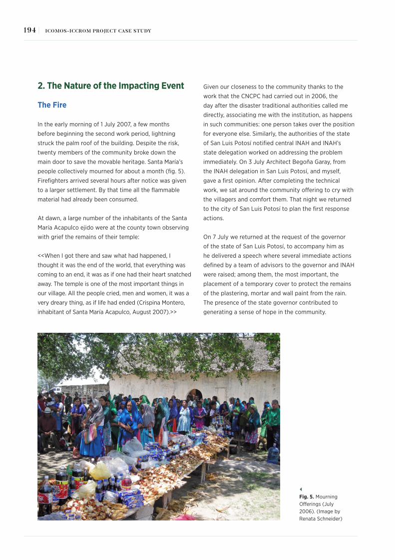
2. The Nature of the Impacting Event
The Fire
In the early morning of 1 July 2007, a few months
before beginning the second work period, lightning
struck the palm roof of the building. Despite the risk,
twenty members of the community broke down the
main door to save the movable heritage. Santa María’s
people collectively mourned for about a month (fig. 5).
Firefighters arrived several hours after notice was given
to a larger settlement. By that time all the flammable
material had already been consumed.
At dawn, a large number of the inhabitants of the Santa
María Acapulco ejido were at the county town observing
with grief the remains of their temple:
<<When I got there and saw what had happened, I
thought it was the end of the world, that everything was
coming to an end, it was as if one had their heart snatched
away. The temple is one of the most important things in
our village. All the people cried, men and women, it was a
very dreary thing, as if life had ended (Crispina Montero,
inhabitant of Santa María Acapulco, August 2007).>>
Given our closeness to the community thanks to the
work that the CNCPC had carried out in 2006, the
day after the disaster traditional authorities called me
directly, associating me with the institution, as happens
in such communities: one person takes over the position
for everyone else. Similarly, the authorities of the state
of San Luis Potosí notified central INAH and INAH’s
state delegation worked on addressing the problem
immediately. On 3 July Architect Begoña Garay, from
the INAH delegation in San Luis Potosí, and myself,
gave a first opinion. After completing the technical
work, we sat around the community offering to cry with
the villagers and comfort them. That night we returned
to the city of San Luis Potosí to plan the first response
actions.
On 7 July we returned at the request of the governor
of the state of San Luis Potosí, to accompany him as
he delivered a speech where several immediate actions
defined by a team of advisors to the governor and INAH
were raised; among them, the most important, the
placement of a temporary cover to protect the remains
of the plastering, mortar and wall paint from the rain.
The presence of the state governor contributed to
generating a sense of hope in the community.
Fig. 5. Mourning Offerings (July 2006). (Image by Renata Schneider)
194 | ICOMOS-ICCROM PROJECT CASE STUDY

Due to the fact that the INAH has disaster insurance
that covers all of the nation’s assets, we were able
to obtain financial resources to return the material
elements that support several of the Xi’ói’s cultural
traditions. Architect Begoña Garay was responsible for
the architectural restoration and has also contributed
important information to complete this case study. The
work was divided into two complementary areas, since
INAH administratively and legally separates the work of
architectural heritage conservation, from that regarding
movable and immovable property by destination (refer
to note V). The first was conducted by Architect Garay
and the other by myself, as a conservator-restorer.
Subsequently, both areas generated equal projects
in conception, objectives and goals, differing only in
technical and administrative implementations.
Much damage was caused by the fire and the damage
was often different in nature. The most damaged parts,
from a structural and architectural point of view, were
the choir, the roof and coffered ceiling, which were
completely destroyed, and the circular wood beam
enclosures of all the temple’s bays, which were totally
or partially scorched. The walls retained their structural
capacity, thanks to their original strength and the newly
integrated construction joints of lime-sand mixture on
the stone outside which had been completed in 2005.
As for the destiny of movable and immovable property
by destination, the doors, windows, altarpieces, pulpit
confessional, were irreparably lost. The only exception
was the mural decoration, of which 20 per cent was lost
(it suffered profound changes in the tones of its pictorial
palette as the pigments underwent a redox reaction, and
some of the backgrounds, probably made of a mixture
of inks and pigments, vanished completely); 80 per cent
of the altars, baptismal fonts and plaster ornaments
were lost (in several cases losing material integrity
and decoration, and many times complete structural
parts). Sacred objects, including sculptures, canvases,
and textiles, among many others, were considerably
damaged, as were graphic documents and several
pieces of furniture, including benches, chairs, podiums,
etc. In these cases, the damage was unequal and was
treated in different ways, as will be explained later;
but the community interest in the intervention process
was driven by how soon things could be used rather
than in a programme defined by the severity of their
damage, although initially they all received first aid and
stabilisation treatments (figg. 6A and 6B).
Due to lack of time, a detailed record of each part of the
temple or of the salvaged movable property was not
carried out. However, Begoña Garay gave a preliminary
opinion of the structural damage, and an inventory and
a series of general file cards for parts and immovable
property by destination were produced, recording their
problems and needs. This was required in order to request
the advance insurance payment and to start work by
mid-August at the very latest. After receiving the advance
of almost $4 million (assigned almost entirely to the
architecture area since its emerging actions were more
vital), in January 2018, insurance and claims adjusters
authorised the final budget that will be discussed later.
From left to right:Fig. 6. A. Main Altar in 2006. (Image by Gabriel Martínez) B. Main Altar in August 2007. (Image by Renata Schneider)
195RECONSTRUCTION OF THE SYMBOLIC AND PHYSICAL SPACE OF THE TEMPLE OF NUESTRA SEÑORA DE LA ASUNCIÓN |

3. Post–Event Appraisals
With the first tranche of the insurance money, both
areas were able to schedule the emerging activities to
save the areas in danger of collapsing, almost 20 days
after the event (support posts and trusses were placed
where lintels and other enclosures had been burnt,
accesses were blocked, damaged paint was veiled, and
saved objects were separated, cleaned and gathered in
one safe place, among other actions).
After this, and after the community removed the ashes
from inside the church in August 2007, the emergent
conservation work per se began in September,
beginning with the placement of a temporary roofing
sheet paid for by the government of the state of San
Luis Potosí to protect the plastering and the altars that
were at risk of being lost due to rainwater entering the
nave. It should be noted that there was some delay in
placing the cover so certain elements of the temple,
mainly the altars’ sun-dried brick bases, suffered
collapses and microbial deterioration.
It is important to mention here that the removal of
ashes helped the inhabitants of the village to face
the issue of the recovery of their property for the first
time: Previously they were stuck in their grief and were
somewhat in a state of paralysis, interrupted only by
the rituals of "amends" and forgiveness to God and
agricultural deities (especially thunder). The work
was carried out only by the men of the community,
although initially the movable property restoration
team was allowed to suggest logistics and help. Per
our recommendation, the community decided at the
end of 2008 to mix the ashes with the materials of the
new rammed earth floor (the placement of which was
completed in 2009). During this work several human
skeletal remains were found, which were also studied,
registered and preserved. Similarly, on the main altar
we found the remains of a cherub’s face, which was
restored in the 2011 season. The face was placed again
on the reproduction of the main altarpiece in 2011,
which generated great joy among the community.
The CNCPC requested help from the INAH’s delegation
in Querétaro, where there is a group of anthropologists
specialised in the Pame ethnic group, so that during
the festivities of Nuestra Señora de la Asunción, on
15 August, they would accompany us and carry out
analysis of particular consequences of the fire for the
community and, above all, explore what expectations
the community had regarding the future of its sacred
property.
To achieve this, the anthropologists carried out several
unstructured interviews and a series of pictorial
workshops with the children (fig. 7). The mission lasted
about 10 days. The result of this work appeared in an
essay published in December 2007 in INAH’s journal
Diario de Campo. Needless to say, this short season and
its results largely defined the technical proposal for the
intervention of the building and its objects
The disaster radically changed the conception of the
project, not only from a technical standpoint. From
this testimony, and as I have emphasised in the first
Fig. 7. Pedro Duran and his drawing of the fire, August 2007. (Image by Imelda Aguirre)
196 | ICOMOS-ICCROM PROJECT CASE STUDY

section of this text, one can deduce that for the Xi’ói
"the church" is not only the material property, the
building and its content (although it also includes
it); it is the whole ceremonial aspect that constitutes
it as a sacred space; as are the veiling ceremony,
the dances to favour rain and fertility, the minuete
traditional music, the placement of offerings, etc.
On certain occasions, it even becomes the symbolic
representation of the human body, with sections of the
building taking the form of some organ or member.
Unfortunately, destruction of the physical space and
its material content also entailed the disappearance
of a series of substantial community activities for the
sociocultural reproduction of the group. <<We know
that the temple will not be the same, but we want
that the work done, such as that on the altar, is as
close to what it used to be, with its carvings, with the
same colours… although we also know that this is very
difficult>> (Odilón García, principal, August 2007).
After the tragedy, it became evident how important
it was for the community to reproduce the objects
lost during the fire; especially those that entailed
a very clear type of liturgical worship related to
the "costumbre", such as altarpieces and their
corresponding canvases and sculptures. Based on the
testimonies collected during August 2007, we decided
that it was essential, along with the restoration of
the saved property, to recover most of the symbolic
context of the temple that was placed in the matter
consumed by the fire, as well as its general function
and aesthetics, thereby contributing to return that
which enables the cosmogonic and ritual presence in
the indigenous sacred space. However, in conservation
and restoration the reproduction of objects or spaces
usually generates controversy in the name of material
authenticity.
The work chosen to be carried out in Santa María
Acapulco, was grounded on a good anthropological
base, with specialists who guided us step by step on
the scope of our technical activities and who asked
the right questions to the right people, not only to the
traditional authorities but also to various groups and
contexts of people (rural teachers, farming groups,
principals of the ranches, dependents on Santa María,
etc.).
In México there is a whole legal framework that
was established precisely as a way of systematising
or guiding valuation decisions and this was
another issue that both the architecture and the
conservation-restoration areas faced, in addition to
the "theoretical" dimension of the restoration itself
and the anthropological and social elements that must
define and solve a particular problem of this nature.
For this, we must also rely on the charters, documents
or treaties that México has signed or enacted on
(such as the 1972 Federal Law on Monuments and
Archaeological, Artistic, and Historical Zones or INAH’s
Organic Law) and, at the same time, reflect on the
basis of those ratified or approved texts (such as the
Athens and the Venice Charters or the Nara Document
on Authenticity, The Riga Charter on Authenticity and
Historical Reconstruction in Relationship to Cultural
Heritage, among many others).
In the case of the architecture area, it was not
necessary to justify the work to be done before INAH’s
Council of Historical Monuments because it consisted
in structurally rehabilitating the building components
(although the choir and the material part of the
coffer would have to be redone also). The project was
approved by INAH’s central area almost immediately.
The CNCPC needed to elaborate a more detailed
proposal to show that the reconstruction of
altarpieces and other immovable property by
destination was based on the basic premise that
separation of material heritage and intangible
heritage is artificial in this type of community (and
probably anywhere else) and given that the main
users of the temple were the Pame it was necessary to
act according to their conceptions. The document was
presented in November 2017 before INAH’s Council
for the Conservation of Movable and Immovable
Property by Destination and after a few weeks of
deliberation it was approved at the beginning of 2018.
In this particular case, the Nara Document and The
Riga Charter were very helpful, given that Mexican
laws privilege the matter and are very conservative
when it comes to reconstruction; in line with older
charters such as those of Athens and Venice (the most
important Mexican law, mentioned above, dates from
1972, although it has been modified a few times).
197RECONSTRUCTION OF THE SYMBOLIC AND PHYSICAL SPACE OF THE TEMPLE OF NUESTRA SEÑORA DE LA ASUNCIÓN |

Fortunately, by these consensual and normative
means – whether legally binding or not – it is possible
to effectively regulate our work, making it a social
obligation.
The following criteria were established for the
intervention:
1) In the case of graphic documents and immovable
property by destination that were totally or partially
saved (mural paintings, altars, gypsum fleurons,
clay and plaster figures on the façade, etc.), we
decided to completely conserve them, minimising
the restoration process, so that the remains of
the temple and all eighteenth-century documents
could be acknowledged immediately as historical
remnants, even to the untrained eye. In this sense,
only when mural paintings presented scenes with
an important theological programme (both the
strictly Catholic and the one that the Xi’ói have for
every scene, which often do not have the same
meaning – please refer to note VI for an example
of this matter), were detailed but recognisable
chromatic restitutions made, based on the pointillism
technique.
2) Movable property that was subject to significant
worship and was damaged during the fire
(especially sculptures) underwent the least invasive
conservation and restoration treatments possible;
each process was identified and documented
through photographs and drawings, but with
a certain degree of mimicry, given the great
significance they have for the community. A simple
stabilisation treatment would not be meaningful
in these cases. For example, not restoring the
arm of a Virgin who grants her blessing during a
specific celebration simply means that there is no
celebration.
3) We decided that reproduced property was to be
materially equal to the original, but no aging patinas
of any kind were applied to them, so that they
were easily identifiable as new. Also, a small hidden
plaque was placed on each property, identifying it
as an object that materially and formally reproduces
one that disappeared in the 2007 fire, as well as
recording the year of placement in the temple. The
patina will gradually appear, but it will not constitute
false history. It is worth noting that in the reproduced
coffered ceiling the original painted scenes were not
included, since available photographs were not of
sufficient quality to establish proportions, details in
certain scenes or even chromatic spectrum. In that
sense, it was agreed with traditional authorities that
if the Xi’ói wish to re-paint the coffered ceiling with
the original motifs, or some new ones determined
by them, the decision will be entirely theirs and the
INAH will not be further involved in the process
other than at a consulting level. So far, they have
not made a decision and every time we carry out
monitoring visits, we discuss the issue. Most likely,
what we need is more time to be able to come up
with an agreement.
4) The church remained a functioning site of worship
throughout the conservation process. For example,
the community considers the church as an extension
of the human body, as mentioned before, and thus
we kept all medicinal offerings (eggs and corn, for
instance) placed in different parts of the temple until
they degraded naturally as is intended. We decided
to move them during the working hours and return
them to their original positions at the close of the
day so that the offerings could fulfil their healing
function during the conservation and restoration
processes.
4. Response Actions, Timeframes, Resources and Costs
Ready to begin with long-term work, we decided to
divide the project into annual periods of work of 3
and 4 months, so that we could gradually measure the
results of our work (except for the first year during
which we worked almost continuously to save as much
evidence of the volumetric mortars and wall painting as
possible), especially to:
Evaluate the community’s acceptance of the processes
by conducting open interviews with different groups
of the community every year and observing consensus
about the acceptance – or non-acceptance – of the
degree of mimicry in the reproduction of certain
pieces. For example, one of the altarpieces had two
small carved figures that were hidden behind acanthus
198 | ICOMOS-ICCROM PROJECT CASE STUDY

branches: for the population of Santa María Acapulco
they represent the temporary migrants who try to cross
the border unseen into the United States; a lack of
precision in the figures could involve a bad omen in the
border crossing (fortunately it passed the test). Another
example that we thought could cause conflicting
views was the lack of colour reposition in the pictorial
backgrounds after the restoration of the mural painting,
since during the fire the polychromy had colour
alterations and its palette was reduced; we expected
complaints but there were none).
Analyse the transformations that took place in religious
rituals and ceremonies involving each restored and
reproduced object (coffered ceiling, roof, choir,
altarpieces with their canvases, itinerant canvases for
the blessing of cornfields, baptismal font, etc.). The
anthropology team carried out most of this work. To
mention an example, they recorded how ceremonies of
agricultural appropriation were executed when there
was no ritual space (that is, the temple) to perform
dances and if these changed in form and substance
when performed in different spaces, when they were
later given access to the inside of the building, they
were integrated in the same way that the costumbre
dictated or they were given a new meaning.
Better understand the wishes and needs of the
community regarding the use of certain damaged and
not yet restored images, for example, and to be able
to carry out temporary preventive measures for their
veneration during a celebration.
Correct the course of work if community rules were
transgressed or if it was necessary to establish
new dialogues, etc. This turned out to be essential,
since one of the most serious problems that both
parties experienced (traditional authorities and the
conservation-restoration team) was that we had to
climb and step on the main altar – an absolutely sacred
space – to work on it. What was even worse, was that
many times it was women who did consolidation work
in that area; forbidden for our gender (in this case,
the second error was solved; the first was impossible
to deal with but finally the traditional governor gave
his consent, although several times he requested an
amends prayer).
This division into stages, which to us as INAH
specialists seemed fundamental (and that to date
I believe was the right thing to do), sometimes
caused much despair among traditional authorities
and people in general because advances were very
gradual. Nevertheless, they were firm advances, which
did not make the project expensive. Once the temple
was reoccupied at the end of 2009, that confusion
gap was over.
Most of the architectural intervention work was carried
out by members belonging to the community that
responded to the work possibility announced by the
INAH along with the traditional governor and the
judge. Specifically, they worked on the replacement
of the palm roof, the coffered ceiling and choir, since
they have a more thorough knowledge of techniques
used in building wooden structures, still valid in local
vernacular architecture.
Bricklayers specialised in building restoration that
have worked for the INAH for many years in different
parts of the country and have learnt the trade by
accumulating experience (divided into helper, official
bricklayer and foreman) gave support with technical
work for the consolidation of walls, parapet correction,
and reintegration of wooden enclosures, since
knowledge of masonry and restoration specifications,
unknown locally, were required. In the case of
restoration of objects and immovable property by
destination, there was a team of professional restorers,
some with a position in INAH, others hired, that varied
between twelve people during the first three years and
six in the following years, assisted by a team of ten
people from the community always composed of the
same members who had been trained by the CNCPC
since 2006.
In the case of structural rescue interventions, the team
began with the reintegration of wooden enclosures or
lintels in the upper part of the bays where the original
beams were scorched. Likewise, the adjacent stone
detached from this area was mounted, as were several
other areas that had lost movable elements. The crown
of the upper parapet was also strengthened, and the
battens and dormers were framed to support the
coffered ceiling on the sidewalls of the main nave.
199RECONSTRUCTION OF THE SYMBOLIC AND PHYSICAL SPACE OF THE TEMPLE OF NUESTRA SEÑORA DE LA ASUNCIÓN |

The cracks present in the nave’s gable wall were also
repaired, for this an extensive and comprehensive
drawing register was needed (fig. 8). This intervention
was carried out by injecting two vertical cracks
present in both corners or ridges of the wall, in a
downward path, 5 metres long. The intervention was
complemented by integrating stone pieces as a sealing
or "sewing", injecting a lime-sand fluid mixture. More
than 600 litres of lime grout were injected per crack.
The roof reintegration process went through several
stages (figg. 9a–9c). It is important to say that to date
there is no similar reference – either in the Michoacán
temples, or in those of the Huasteca or other nearby
regions – where this covering solution is replicated:
the first step was to gather a local work team. Using
photographs of the original roof (obtained from
different archives), and with the support of the then
traditional governor and the ejido commissioner who
showed and distributed them among the different ejido
rancherias, the INAH architectural conservation group
was able to bring together several of those responsible
for the ritual maintenance of the roof (many of them
with experience in cutting and treating wood for
external or local sale, and also, and specifically, in
the placement of palm fronds for the church roof, a
communal activity held every ten years). Thus, a first
leading team, named at the time "Roof Reconstruction
Committee", was put together. Begoña Garay, as
mentioned before, was in charge of all this work.
This group was the one that brought together the
rest of the cutting and preparation team, which was
joined by young people from Santa María and the
other villages of the ejido who worked with wood for
the first time, and who served as apprentices. The
team remained the same in general terms, with some
member changes throughout the project.
Fig. 8. Religious Complex. (Drawing by Begoña Garay)
200 | ICOMOS-ICCROM PROJECT CASE STUDY

SAN LUIS POTOSÍ
DIRECTOR DEL CENTRO INAH EN SAN LUIS POTOSI
LIC. JUAN MANUEL FRAUSTO FRANCO
SAN LUIS POTOSÍ
EEEE
CORTE -E - E´-ARTEZON Y TECHUMBRE CON CUBIERTA DE PALMA esc. 1:125
SAN LUIS POTOSÍ
DIRECTOR DEL CENTRO INAH EN SAN LUIS POTOSI
LIC. JUAN MANUEL FRAUSTO FRANCO
SAN LUIS POTOSÍ
PLANTA -ESTRUCTURA PORTANTE Y CUBIERTA DE PALMA-
B' B
A' A
B
C
AE
D
5 2 1
10 9
65
32 147810 9
AC
ED
0 1 2 3 4 5 10
NOTAS Y SIMBOLOGIA
NORTE
ARQUITECTONICO.PLATAS
.CONJUNTO
TEMPLO.DE.NUESTRA.SRA.DE.LA.ASUNCION
SANTA.MARIA.ACAPULCO.MUNICIPIO.DE.SANTA.CATARINA.
SANLUISPOTOSI
ARQ.MARIA.CONCEPCION.NAVA.MUÑIZ.
PATRIMONIO.ARQUITECTONICO.Y.CULTURAL.
SECRETARIA.DE.CULTURA.DE.SAN.LUI.POTOSI. 1:100
C:/TRABAJO/PLANOS
D EC
9
10
8
7
4
1
2
6
9
10
4
1
3
5
D EB
PLANTA -ENTRE PISO Y ARTESON-
D ECA
9
10
8
7
4
1
23
5 6
9
10
1
2
5
D EA
C
B A
A'
B
B'
PLANTA -ESTRUCTURA PORTANTE YCUBIERTA DE PALMA-
D ECA
10
1
10
1
A'
B'
5.212.74
D ECA
9
10
8
7
4
1
2
6
0.84
0.95
5.07 1.90 6.90 1.80
16.27
1.30
1.30 2.60
9
10
4
1
3
5
D EA B
SOTOCOROBAUTISTERIO
NAVE
VELATORIO / ANTESACRISTIA
SACRISTIA
PRESBITERIO
S
S
2
1
1
2
3
4
5
6 7 8 9 10 11 12 13 1514
1
S1
2
3
4
5
B
S
5.88 8.10
4.60
9.10
7.00
19.81
5.00
4.96
0.80
8.33
1.40
4.32
1.90
5.19
6.40
S
4.50
0.95
24.90
2.80
7.20
8.36
5.04
1.20
3.20
1.40
1.44
1.00
6.85
1.00
2.96
1.40
2.96
1.10
0.40
0.34
3.51
4.50
1
B
BCAMPANARIO
CORO
VACIO
VACIO
VACIO
0.70
0.60
0.84
0.85
1.50
1.30
0.70
2.00
4.24
1.63 1.73 1.17 8.10
5.87 8.10
14.97
7.00
2.101.203.50
4.50
7.18
2.82
5.04
8.36
0.95
0.90
3.40
1.401.65
1.32
1.00
6.80
1.00
2.96
1.40
2.96
1.10
0.40
20.25
0.90
1.20
0.75
0.40 0.50
1.80
10.00
5.01
7.39
21.90
1.10
0.96
0.79 0.74 0.99 0.74
1.50 1.60 1.11 1.37 1.11 1.60 2.00
0.80
0.56
3.37
0.56
0.53
0.85
0.20
0.370.85
0.200.41
2.62
0.15
0.50
0.24
0.50
0.36
0.36
2.78
0.16
0.521.22
0.20
2.80
1.00
19.81
3.50
1.50
0.90
6.90
3.10
5.11
1.99
1.80
4.50
0.95
VACIO
VACIO
21.90
28.00
9.70
17.00 7.50
5.60 1.40
1.10
0.50
17.00
7.50
ARCOS DEL ARTESONADO
PARES. ESTRUCTURA PORTANTE
CONTRAPARES. ESTRUCTURA PORTANTE
CUBIERTA DE PLAMA
ESTERAS Y CABIOS.
PLANTA
1.64
2.42
0.90
2.25
2.21
3.29
2.92
2.92
3.44
2.44
2.44
7.31
1.00
6.85
1.00
6.04
1.20
0.30
D ECA B
A'
B'
11 11
60.40
22.44
30.80
60.00
14.54
1.00
14.45
PLANTA -CONJUNTO-
ATRIO.
CRUZ ATRIAL
12
34
51.00
1.50
1.40
From top to bottom:Fig. 9. A. Plan of the wooden roof. (Drawing by Begoña Garay)B. Plan of the wooden ceiling and the bearing structure. (Drawing by Begoña Garay)C. Diagrams of the church’s layout. (Drawing by Begoña Garay)
201RECONSTRUCTION OF THE SYMBOLIC AND PHYSICAL SPACE OF THE TEMPLE OF NUESTRA SEÑORA DE LA ASUNCIÓN |

Based on a series of work meetings where the temple’s
photographs and records were thoroughly analysed,
the basic work plan was proposed: wood cutting and
preparation; main structure placement; secondary
structure placement; rod collection and placement;
palm frond gathering and drying, and subsequent
placement (fig. 10).
Once the roof was finished and the first lightning rod
was placed, the choir replacement began. For this work,
Garay and her team made the most of a collapsed
Montezuma cypress (Taxodium mucronatum), which was
found in a place near Paso de Botello, a community of
the ejido of Santa María Acapulco. The work to replace
the coffered ceiling turned out to be more complex than
expected, because no vestige or modulation of the truss
(cerchón) was preserved for its own structure, nor was
the modulation between sections. The only reference
available was the inside of putlog holes in the gable
and façade walls, where the built in of the joint stiles
between trusses was still there, which did not comprise a
regular arc shape. After an exhaustive work meeting with
the team members and the traditional governor, it was
determined that the modulation between longitudinal
stiles should be equal to the one indicated by the putlog
holes, without "standardising" geometry and trace of the
reconstructed coffered ceiling (fig. 20C).
Mesquite tree wood was used, since the coffered ceiling
was originally made with it. This material was identified
in a test carried out in 2004 for the government of the
state of San Luis Potosí by Engineer Cruz León from
the University of Michoacán de Hidalgo, a nationally
renowned wood specialist, who at that time expressed an
opinion on the state of conservation of the wood, since it
was intended to replace almost all the beams.
As a final finish, a caulking layer or protective plaster
coating, calcium carbonate, gelatin and rabbit-skin glue
– all established as the base of the original preparation
– were placed through the intrados by our team, this
mixture was very similar to that of the altarpieces but
without the application of Bol on the silver gilt (this
could be determined through the micro-chemical
testing carried out in 2004 on fallen fragments of the
coffered ceiling).
Parallel to the architectural rehabilitation work, mural
paintings and severely altered bi-chromed plastered
surfaces were restored over 18 months (fig. 11). During
From left to right:Fig. 10. Working on the Roof.( Image by Norma García)Fig. 11. Conservation treatments in mural paintings. (Image by Juan José Beltrán)
202 | ICOMOS-ICCROM PROJECT CASE STUDY

the last days of 2008 and throughout 2009, the scenes
were chromatically restored based on acrylics and also
with lime mixed with diluted sugars from cacti and
mineral pigments applied using the pointillism technique
on borders and repairs of lime, with sand and clay of the
region. The reintegration was supported at all times using
the photographic documentation carried out in 2006
(figg. 12A, 12B, 12C and 12D).
From September 2007, the four altars damaged by the
rain were stabilised and volumetrically restored using
the same kind of material used to build them, that is,
sun-dried brick and lime and sand plaster (enabling them
to be ready to receive their corresponding altarpieces).
Likewise, three mortar elements were worked on, and
the presbytery bench and the general floor of the nave,
the sacristy and the baptistery were consolidated and
levelled. The façade was completed in 2012.
These activities were carried out in situ with the help
of trained community assistants and professional
restorers. Furthermore, in the CNCPC’s workshops,
all graphic documents, ranging from the seventeenth
to the end of the eighteenth-century, were worked
on. Due to the delicate nature of the paper and
bookbinding intervention processes, graphic
documents cannot be kept locally and require
specialised materials and equipment. The same applies
to the silk dress of the main Virgin of Dolores figure. In
all cases, sculptures, for example, showed interesting
data including clothing of the nineteenth and twentieth
centuries, or even the use of originally masculine
Images, Clockwise from top left: Fig. 12. Mural Paintings: Chromatic Intervention Processes. (Images by Verónica Roque) A. Old Picture projectionB. DecalC. Pencil drawingD. Final aspect
203RECONSTRUCTION OF THE SYMBOLIC AND PHYSICAL SPACE OF THE TEMPLE OF NUESTRA SEÑORA DE LA ASUNCIÓN |

images as virgins.
The processes on sculptures and canvases consisted
basically, in the first case, of consolidations with
rabbit-skin glue and polyvinyl acetate, according to
each case and problem, repairs of calcium carbonate
and/or sawdust mixed with polyvinyl acetate and
reintegrations with varnish paint (figg. 13A, and B). In
the case of paintings, since they were relined it was
only necessary to do chemical cleaning, wax-resin
repairs and reintegration with varnish paint.
In all cases it is necessary to observe the traditional
use of surviving sacred objects and integrate it into the
conservation proposal of each property. For example,
and despite their importance, books are constantly
manipulated, sometimes people even eat, smoke or drink
near them, therefore, they must have thick and resistant
bindings (whether or not they had them originally) to
protect them during processions, since they are not (and
are not intended to be) documents in an archive with
controlled climate and limited access for consultation.
This is why the anthropology team worked around five
aspects proposed by the restoration area. These were:
1) To identify the uses, interpretations and customs
associated with the mural decoration, the images on
the façade and the sculptures and canvases of the
church; 2) To analyse the features of all the communal
and individual offerings that are made in the church;
3) To determine what the Xi’ói think and expect
of the temple’s rehabilitation and of the possible
transformations that could occur in the community
after the work is completed (this considering the
entire ejido, not only the main town); 4) To collect
events, real and mythical, related to the use of the
building and its sacred goods; and 5) To define the
social and community implications of the prosecutor
and sacristan, since they are the main managers of the
temple and in charge of the manipulation of its objects.
Concurrently, and not less important, regular meetings
at the municipal house or the atrium of the religious
complex were held with traditional authorities to agree
on preservation and conservation actions (usually
the decisions on materials and procedures were
determined by the INAH working groups, in those that
the community recognised technical knowledge, but
not so on the specific times or forms of intervention
or the introduction of new preventive elements that
they considered unnecessary and aggressive, such
as the proposal to mount wooden racks in front of
From left to right:Fig. 13. A. Intervention of sculptures. (Image by Norma García)B. Painting after intervention. (Image by Martha Amparo Fernández)
204 | ICOMOS-ICCROM PROJECT CASE STUDY

the altarpieces to avoid the proximity of candles
and wooden pieces in the future, which took several
meetings to achieve).7
Several workshops were held for elementary and
middle school children on the function, effectiveness
and meaning of the activities performed, an aspect
that involved them in carrying out interviews with
members of their community that were part of the
team of conservators-restorers on the processes
and intervention for their school homework, or the
art historian and the CNCPC team on aspects of the
foundation and history of the community.
Likewise, the community’s traditional authorities,
directly in charge of the sacred pieces, took two short
courses on preventive management of sculptures
during processions and dressing of sculptures. Thanks
to the collaboration of anthropologists specialised
in the Pame group, very precise ethnographies have
been developed revealing much of the symbolic and
functional dimension of the church and defining a
significant part of the guidelines on how and for
what reason each object and part of the temple was
intervened and presented (fig. 14).
A programme for "local heritage custodian children"
was also implemented; it began with a playful
exercise of discovering the pieces in 2007 and
continued with a brief course on paper and graphic
document handling and the making of follow-up
logbooks, in addition to the assignment of an object
or piece of furniture per child. This is not at all a
local tradition; in practice, the sacristán is the one
who should traditionally take care of the pieces, but
this was suggested as a way to integrate the young
population in the care of local heritage and as a
way to have a written and continuous record of the
conservation state of objects within certain periods of
time. Although distrustful, the traditional authorities
allowed the programme to continue and promoted
the participation of children in the activities, although
they stated that they do not plan to allow them
to dress the images or "clean" them ceremonially.
The programme was not completely successful:
the literacy rate of children is as low as that of the
elders: some write very well in Spanish (they are not
schooled in their mother tongue), and others do not
Fig. 14. Consultation meeting. (Image by Diego Ángeles)
205RECONSTRUCTION OF THE SYMBOLIC AND PHYSICAL SPACE OF THE TEMPLE OF NUESTRA SEÑORA DE LA ASUNCIÓN |

seem to know how to do it, even if they are in the
same elementary school year.
However, their interest in the subject was, and is, very
broad, playful and committed (figg. 15A, 15B and 15C).
Back to technical matters, the reproduction work
was not carried out by restorers but by professional
reproducers chosen by the CNCPC Restoration
Council’s prior invitation, examining and direct
awarding process. On 14 December 2009, the first
reproduced altarpiece (of the Virgin of Guadalupe)
was inaugurated and the building was reopened for
worship. All sacred objects and figures were returned
to its interior.
Specifically, the restoration work of movable and
immovable property by destination included an
intervention on two canvases, thirty-two wood carvings
(including sculptures and furniture), an altar stone,
eight printed books of the eighteenth-century, nine
parochial books (four of baptisms, one of deaths, three
of marriages and one of the account and expenses
of the mission), as well as the nineteenth-century
copy of the title of the land composition of Santa
María Acapulco, and a handwritten promise hidden
in the sleeve of a sculpture. Work was also done on
a silk dress from the end of the nineteenth-century.
Four batons, several ceremonial pieces or of Catholic
liturgy, two bells and a human skull were only subject
to preventive action (all actions performed on each
item can be found in the technical reports generated
by the INAH. The file also includes examples of the
intervention graphics and the conservation status of
each cultural asset before the work was done) (fig. 1).
A total of 759.54 m2 of mural paintings were worked
on (162.73 m2 correspond to the façade and 596.81
m2 to the inside), in addition to ten volumetric mortar
elements (façade figures, inside pyxides, among other
Images, Clockwise from top left: Fig. 15. A. Pame girl during her custodian course. (Image by Renata Schneider)B. Kids taking courses in 2008. (Image by Norma García)C. A Santa María girl during a course. (Image by Norma García)
206 | ICOMOS-ICCROM PROJECT CASE STUDY

From top to bottom: Fig. 16. Example of a register fileFig. 17. (Left) A. The façade in 2006. (Image by Renata Schneider)(Right) B. The façade in July 2007. (Image by Renata Schneider)(Bottom) C. The façade in 2016. (Image by Julio Martínez)
207RECONSTRUCTION OF THE SYMBOLIC AND PHYSICAL SPACE OF THE TEMPLE OF NUESTRA SEÑORA DE LA ASUNCIÓN |

elements), a baptismal font, a holy water font that
includes a relief in mortar and four masonry altars that
serve as altarpiece bases (figg. 17A, 17B and 17C).
And finally, under the coordination of the movable
property team, four altarpieces were reproduced,
with their respective canvases or corresponding panel
paintings. In the case of the altarpiece of the Seven
Sorrows of the Virgin and the Passion of Christ, a copy of
the sculpture of the large crucified Jesus, of the images
of the Virgin of la Asunción and San Francisco in the
main altarpiece were also made, in addition to a pulpit
(ambon and canopy), and a painting of the Virgin of
Guadalupe. The main door, the access door to the chapel
of rest (or pre-sacristy) and the window-lattice of the
presbytery were also reproduced by local carpenters.
The temple continues without electricity, as always
(figg. 18A and 18B).
In 2011 the government of the state of San Luis Potosí
installed a lightning rod in the north-western corner of
the atrium, which was concealed as much as possible.
From top to bottm:Fig. 18. Detail of the altarpiece of the Seven Sorrows of the Virgin and the Passion of ChristA. Original, December 2006. (Image by Gabriel Martínez)B. Reproduction, March 2013. (Image by Julio Martínez)
208 | ICOMOS-ICCROM PROJECT CASE STUDY

The church was officially re-consecrated on 29 January
2014. To correct possible logistical and cult-related
issues, a list of festivities and a mixed custody and
maintenance programme for celebrations and Sundays
have also been carefully scheduled, although it has not
been completely fulfilled. Concurrently, the community,
through its principals discussed and is slowly "building"
a renewal of the "costumbre" (an aspect they believe
is the most immediate positive result of the fire: a
possibility of ritual renewal firmly anchored in the
tradition and objects that reflect it. Very soon it will
be time to research and register these changes, since
the first six years since the work was concluded have
already passed) (figg. 19A and 19B).
After the fire, the patron Virgin of the village flew away
and took shelter at the church of Tancoyol, a mestizo
community (but of Pame origin) in the neighbouring
state of Querétaro. When the restoration was finished,
she returned to her place inside the temple and found
herself at home. The people of Santa María Acapulco
saw her "in the form of a beautiful bird" when she left,
and also when she returned (Heliodora Rubio, personal
communication 2014; Hugo Cotonieto, personal
communication 2016).
The documentary material produced by the CNCPC
project was handed to the community in reports
divided by seasons that gradually describe the technical
advances of the work. These reports are delivered both
physically and digitally. The printed material is stored
in a wooden box that is kept in the church along with
all other religious artefacts, furniture and pieces. This is
done this way because usually the Pame do not handle
paper documentation, which usually deteriorates
quickly in houses, where there are no cabinets or
furniture, and each person’s official documents are
stored in simple plastic envelopes that hang from
the walls along with farming tools. The traditional
governor’s house/office does not function as a legal
estate either, so keeping them in the church is the most
appropriate thing to do, next to the chest where the
already restored historical documents are kept. In 2015
they were also given an inventory of all cultural objects
From left to right:Fig. 19. A. Offerings on re-consecration day; January 29, 2014B. People visiting their temple on the day of its re-consecration, 29 January 2014.
209RECONSTRUCTION OF THE SYMBOLIC AND PHYSICAL SPACE OF THE TEMPLE OF NUESTRA SEÑORA DE LA ASUNCIÓN |

belonging to the church and sections on the historical
background and art history, the results of the physical
anthropology tests and the three texts resulting from
ethnographic work and applied anthropology.
All this documentary collection is also available for
open consultation at the CNCPC and at the INAH
offices in San Luis Potosí (except for the inventory,
whose consultation depends on the express approval
of the traditional authorities).
Every year an inspection visit by the CNCPC takes
place; we do not interfere in any way if not consulted,
we just record and describe the changes and the state
of conservation of each object. So far, the agreement
is simply to monitor; the temple has once again
become the subject of conservation exclusively for the
community. Issues such as the pictorial future of the
coffer and the installation of light inside, continue to
be a matter of mutual debate.
The estimated total cost of the project was MX$20
million of that time (approximately US$1.2 million).
MX$16.6 million were destined to implement activities
under my supervision, while the rest went to the
architectural rehabilitation of the temple and parish
building conducted by Begoña Garay (figg. 20A, 20B
and 20C).
5. Outcomes and Effects
The temple of Santa María Acapulco is not composed of
a structure, its architectural finishing and/or of a series
of movable or immovable property by destination; above
all it is the core of Xi’ói every day and festive life. Each
object has a reason for being and a specific use, and
each corner symbolically represents spaces of the family
home, the cuamil (slanted field), the hills, the territory of
the ethnic group or the world.
I hope that the Santa María Acapulco project shows why
it is important to institutionally and federally envision
the conservation of the cultural heritage of marginalised
indigenous settlements and of course, how to proceed
in cases of disaster that can lead to reconstruction
interventions of symbolic and material spaces. If it is
not possible to work in other places as thoroughly as it
210 | ICOMOS-ICCROM PROJECT CASE STUDY

has been possible to work in this case, it can be done
through courses where the conservation of the legacy of
each site can be viewed from a perspective that includes
both pedagogical, evaluative and social development
aspects, as well as of preservation, restoration and
maintenance of cultural goods, so that communities are
supported to carry out the necessary cultural changes,
from their own perspective and paths, providing them
with certain basic management elements.
In cases like these, it is also vital to avoid, as far as
possible, seeking methodological delimitations aimed
at satisfying professional and institutional needs and,
instead, to take time to describe the social realities
found. That is, do not try to standardise concepts and
methods, but try to standardise analysis and meeting
processes. To take time in meetings and processes
is obviously very difficult and faces the increasingly
constant language of institutions’ administrative
indicators and regulatory concepts. However, allowing
the long-term analysis of the greatest number of
everyday and religious aspects of such a group, gives
us the opportunity to glimpse what rural communities
look for in the restoration of their worship objects and in
turn allows us to communicate what we want from the
conservation, rehabilitation, restoration or reconstruction
of a monument as representatives of national agencies.
One issue that remains to be explored is the vertical
relationship that always exists when one party
provides work for another, or manages the money,
such as happened here where a federal institution paid
for the entire work and recovery process of the temple
and a large part of the local population received a
salary. For example: Did the traditional authorities
and the community accept our suggestions for fear of
losing work or help? How is it possible to detect this if
the anthropologist who conducts the interviews is part
of the group that holds the resources? Now, some time
after carrying out the work, is it perhaps appropriate
to start this type of anthropological survey? So,
although we tried to minimise it, it is a process that
existed and that should be reviewed: to believe that
after doing work of this nature (and for such a long
time) we do not contribute to the social and economic
tensions of such a poor community is a mistake.
On the contrary, it is an aspect that must be better
analysed and reflected upon: marginalisation should
From left to right:Fig. 20. A. The temple nave in 2006. (Image by Gabriel Martínez)B. The temple nave in 2007, after being struck by lightning. (Image by Renata Schneider)C. The temple nave in 2015. (Image by Renata Schneider)
211RECONSTRUCTION OF THE SYMBOLIC AND PHYSICAL SPACE OF THE TEMPLE OF NUESTRA SEÑORA DE LA ASUNCIÓN |

not be seen as that which enables cultural otherness
and the conservation of symbolic contents and objects
themselves, it is the representation of very deep
material deficiencies that must be taken into account
in any intervention. When possible, we should think of
alternatives to minimise it.
Likewise, during the intervention, we did not delve into
the distances that exist between the ideas an institution
may have about a reconstruction process and the way
they are reinterpreted locally, as is the case with any
government programme in this type of community for
the community do we rebuild, recover or rehabilitate?
Is that difference important to them? Do they have
their own words to describe the process or the notion
of reconstruction? Do they consider it important to
name it? It would be vital to know how the process is
interpreted locally today, in five years’ time or more
after its conclusion.
Another vital point in the discussion has been
to confirm that the tangible cultural heritage
found in settlements with high rates of economic
marginalisation, although it has managed to survive
over time especially thanks to its important role as
a means of regional, social and cultural cohesion,
has gradually lost weight in the face of the new
social processes that marginalisation itself and mass
migration produce and develop in the country. So,
our job as part of a federal institution dedicated to
culture is not to preserve at any cost the traditional
customs of a settlement, but to ensure that these
transformations follow internal decisions and not
exclusively external forces.
I wanted to show some of the aspects that could
be followed nationally in terms of planning and
organisation, after a long-term analysis: the recognition
and respect for traditional technical knowledge of
the community and its use; training of inhabitants
in preventive conservation of their heritage; the
approximation to the multiple senses embodied in
heritage; integration of young people in the traditional
custody of heritage (either by existing means in
each community or through "new programmes");
empowering workshops based on heritage symbols;
and collaboration with social science areas in the
definition of processes and scope, etc., show other
non-traditional ways of developing the discipline of
conservation and restoration, etc.
The essential idea, in any case, is to generate an
inter-institutional work model that ensures that once
technical interventions have been carried out after big
disasters, both the communities, as well as the other
government agencies and institutions related to the
care and dissemination of the heritage of a locality,
can work together on certain common goals that do
not interfere with the ritual and daily use of cultural
property, an aspect that only the Pame, in this case,
had the responsibility to define: all the INAH team
thank the inhabitants of Santa María, and the great and
beautiful bird that agreed to come back to her temple
when the intervention was completed, for the trust
granted to us (fig. 21).
6. Details of the Expert Completing the Study
Renata Schneider is a senior restorer from the Instituto
Nacional de Antropología e Historia of México, where
she has worked since 1993; devoting herself to the
management, conservation and restoration of sacred
heritage in rural and indigenous communities and to
the conservation and restoration of mural paintings,
earthen architecture and architectural ceramic
materials. She holds a BA in restoration from the
Escuela Nacional de Conservación, Restauración y
Museografía "Manuel del Castillo Negrete", as well as
an MA in political philosophy from the Universidad
Nacional Autónoma de México (UNAM). She specialised
in ceramic materials applied to architecture at the
Museu Nacional do Azulejo, in Lisbon, Portugal, and
in ethnographic research techniques at the UNAM’s
Instituto de Investigaciones Antropológicas. She has
twice received the "Paul Coremans" award for the best
conservation and restoration.
212 | ICOMOS-ICCROM PROJECT CASE STUDY

Fig. 21. The Santa María Temple after the intervention. (Image by Renata Schneider)
Notes
1 INAH is the institution in charge of protecting Mexico’s cultural heritage, with almost 6,800 employees. It has local
offices in each state of the country and some central instances settled in Mexico City.2 See fig. 6B.3 The palm was ceremonially renewed every ten years until the authorities of the state of San Luis Potosí began to
pay the people of the village to do this, supposedly in order to preserve the "Pame culture", and deeply altering
the community organisation, to the point that if people did not receive money, they refused to participate in the
renovation. It should not be forgotten that liquid money is a highly sought-after resource in the ejido.4 It is important to mention that having experienced lightning strikes at the beginning of the past century, it is very hard
to believe that when the INAH and the government of the state of San Luis Potosí took over the protection of the
building, more or less around 1970, they did not place a lightning rod, but alas, they did not. 5 That is, altarpieces, mural painting, decorated mortar, carved doors, lattices, tiles, etc.: non-architectural elements
but inextricably associated with architecture and considered as "immovable property by destination" or "furniture
associated with immovable property" by Mexican law in the matter.6 The ethnonym Xi’ói gives an account on the Pame in the area of Santa María Acapulco (Pame being the exonym; which
also designates the inhabitants of the other geographical pole of the ethnic group, that of the Xi’uy, towards the area
of Ciudad del Maíz, Alaquines and La Palma, San Luis Potosí, where approximately another 7,000-8,000 members of
the ethnic group live).7 For this one occasion the traditional governor remained in his position for three additional years, until the inauguration
in 2009 of the first altarpiece.
213RECONSTRUCTION OF THE SYMBOLIC AND PHYSICAL SPACE OF THE TEMPLE OF NUESTRA SEÑORA DE LA ASUNCIÓN |

Bibliography
Australian Heritage Commission, 2002. Ask First. A guide to respecting Indigenous heritage places and values, Australia.
Barabás, Alicia. ed., 2003. Diálogos con el territorio. Simbolizaciones sobre el espacio en las culturas indígenas de México,
4 volumes, Mexico.
Brandi, Cesare, 1988. Teoría de la restauración, Spain.
Carrasco, Pedro, 1975. "La transformación de la cultura indígena durante la colonia", in Historia Mexicana, 175–203.
Chemin-Bassler, Heidi, 1984. Los pames septentrionales de San Luís Potosí, Mexico.
Chemin, Dominique, 1994. fig n Pame Xi´oi, Mexico.
Chemin, Dominique, 1996. "Unas consideraciones sobre los Pames y su historia", in XI’OI Coloquio Pame: Los pames de San
Luis Potosí y Querétaro, Mexico, 29–42.
Clavir, Miriam, 2002. Preserving what is Valued. Museums, Conservation and First Nations, Canada.
CONAPO, 2205. Encuesta Nacional de Ocupación y Empleo, Mexico.
CONEVAL 2011, Medición de la pobreza en los municipios de México, Mexico.
CONAPO, 2012. Índice de Declaración por Marginalidad 2010, Mexico.
Corvera Poiré, Marcela, 1999. "La misión de Santa María Acapulco, S. L. P.", in Cuadrante, pp. 76–97.
Cotonieto, Hugo, 2013. "Expresiones de política indígena en la (re)construcción de la territorialidad xi´iuy (pame). San
Luis Potosí, México", presentation at the X Reunión de Antropología del Mercosur, unpublished typed
manuscript, Argentina, July, 10–13.
Cotonieto, Hugo, 2009-2010-2011. "Reporte de etnografía aplicada para el proyecto de conservación y restauración de
los bienes muebles e inmuebles por destino del templo de Nuestra Señora de la Asunción de la comunidad
pame (xi’ói) de Santa María Acapulco, Santa Catarina, SLP", unpublished typed manuscript, Mexico.
Cotonieto, Hugo, 2007. No tenemos las mejores tierras, ni vivimos en los mejores pueblos… pero acá seguimos. Ritual
agrícola, organización social y cosmovisión de los pames del norte, Mexico.
Cruz de León, José, 2006. Manual para la conservación y preservación de madera estructural en edificios históricos, Mexico.
Friedlander, Judith, 1986. "The National Indigenist Institute of Mexico Reinvents the Indian: The Pame Example", in
American Etnologist, vol. 13, no. 2, May.
Gallardo Arias, Patricia, 2011. Los Pames Coloniales: un grupo de fronteras, Mexico.
Garay, Begoña, 2014. Proyecto de restauracion arquitectonica emergente del templo de Nuestra Señora de la Asuncion de
Santa Maria Acapulco, unpublished typed manuscript, INAH, Mexico.
Granados Salinas, Rosario Inés, 2015. Las cenizas no se llevaron la memoria: Bosquejo histórico de una iglesia misional
durante los años del virreinato, unpublished typed manuscript, Mexico.
Granados Salinas, Rosario Inés 2011, "La iglesia misional de Santa María Acapulco, patrimonio cultural que no muere", in La
idea de nuestro patrimonio histórico y cultural, Mexico, pp. 362–371.
INEGI, 2002. Síntesis de Información Geográfica del Estado de San Luis Potosí, México.
INEGI, 2005. II Conteo de Población y Vivienda, Mexico.
INEGI, 2010, XII Censo General de Población y Vivienda, Mexico.
INEGI, 2015. Encuesta intercensal de Población y Vivienda, Mexico.
INPI, 2019. Atlas de los pueblos indígenas de México [online] http://atlas.cdi.gob.mx/, 02/X/2019.
Jaspersen, Giovana, 2010. La restauración como una intervención cultural, Mexico.
Jokilehto, Jukka and Joseph King, 2000. "Authenticity and Integrity", in Summary of ICCROM Position Paper, Holland.
Larsen, Knut ed., 1995. Nara Conference on Authenticity. Proceedings, Norway.
Mora, Paulo and Laura M, 1984. Conservation of Wall Paintings, UK.
Munjeri, Dawson, 2004. "Tangible and Intangible Heritage: from Difference to Convergence", in Museum International, vol.
5, pp. 12–20.
Muñoz Collazos, María de los Ángeles, 2006. "Gestión participativa del patrimonio: un caso boliviano", in Cuadernos de
Antropología y Patrimonio Cultural, complete separatta in the journal Diario de Campo, Mexico.
214 | ICOMOS-ICCROM PROJECT CASE STUDY
Schneider, Renata, 2014. "Conservation and Restoration of the Church of Nuestra Senora de la Asuncion at the Pame
Community of Santa Maria Acapulco, San Luis Potosi (Mexico)", in e-dialogos, 25–39.
Schneider, Renata, 2018. "Function, cultural difference and community life: conservation and restoration projects in
indigenous places in Mexico", in Conversaciones, number 6.
Soustelle, Jacques, 1993. La familia otomí-pame del México central, Mexico.
Stovel, Herb, ed., 2005. Conservation of Living Religious Heritage. Italy.
Sully, Dean, 2013. "Conservation theory and practice: materials, values, and people in heritage conservation", in The
international handbooks of museum studies, 4 volumes, USA, pp. 293-314.
Vázquez, Alejandro et al., 2007. "Del trueno a las cenizas". Reporte etnográfico en torno a la catástrofe acaecida en el
templo pame de Nuestra Señora de la Asunción de Santa María Acapulco, San Luís Potosí", in Diario de
Campo, November-December Issue, Mexico, 32–41.
VV. AA., 1931. Carta internacional para la restauración de monumentos históricos (Carta de Atenas), Grece.
VV. AA., 1964. Carta internacional sobre la conservación y restauración de monumentos y sitios (Carta de Venecia), Italia.
VV. AA., 1972. Carta del Restauro, Italy.
VV. AA., 1979. Carta del ICOMOS australiano para sitios de significación cultural (Carta de Burra), Australia.
VV. AA., 1986 (1972). Ley Federal sobre Monumentos y Zonas Arqueológicos, Artísticos e Históricos, México.
VV. AA., 1994. Documento de Nara sobre la autenticidad Cultural, Japan.
VV. AA., 2000. The Riga Charter on Authenticity and Historical Reconstruction in Relationship to Cultural Heritage, Letvia.
VV. AA., 2002. Directrices profesionales de E.C.C.O: la profesión y su código ético, documento promovido por la
Confederación Europea de Organizaciones de conservadores-restauradores y aprobado por su Asamblea
General, Bélgica.
VV. AA. 2004. Dictamen del Templo de Santa María Acapulco (Oficio No. 401-8124-3026/04), unplublished manuscrip,
Mexico.
Wijesuriya, Gamini, 2013. Living heritage: a summary, unpublished paper, Italy.
*Typed manuscripts of various federal, state and municipal institutions answering questions from the INAH San Luis Potosí
Center and the CNCPC for the generation of the management and development plan. January 2008–October 2009 (these
documents can be consulted in the technical archive of the INAH San Luis Potosí Center).
+++ For further inquiries about this work we recommend visiting the following website (there are also several academic
papers published, which are easy to access and consult on the internet, and all technical work reports by season can also
be found in the archives of the CNCPC, the INAH SLP Center, the archive/library of the municipality of Santa Catarina, SLP
and the "report chest", protected in the temple of Nuestra Señora de la Asunción):
http://youtu.be/s-HUT4JvOC0.
Medios INAH dissemination video on the conclusion of the conservation, restoration and rehabilitation of the temple of
Nuestra Señora de la Asunción de Santa María Acapulco, Santa Catarina, S.L.P. February 2014.
215RECONSTRUCTION OF THE SYMBOLIC AND PHYSICAL SPACE OF THE TEMPLE OF NUESTRA SEÑORA DE LA ASUNCIÓN |


9 789290 773054
ISBN 978-92-9077-305-4
P.O. BOX 48777, Sharjah United Arab Emirates
Tel: +971 (0)6 555 2250 Email: [email protected]
www.iccrom.org/athar
ICOMOS International Secretariat11 rue du Séminaire de Conflans94 220 Charenton-le-PontFranceTel : 33 (0) 1 41 94 17 59Email : [email protected]://icomos.org
The Joint ICOMOS-ICCROM Project “Analysis of Case Studies in Recovery and Reconstruction” sought to harness the knowledge and capacities of both bodies to explore how best to learn from experience. Its objective was to clarify issues of recovery and reconstruction and to provide insights that could improve guidance. The project involved the commissioning of a range of case studies, chosen to represent a comprehensive set of factors, namely geographical, cultural and causational. The project was managed through a joint Working Group comprising members of both organizations and administered through both the ICOMOS Secretariat and the ICCROM-Sharjah Regional Office.
Published by ICCROM (Regional Office, Sharjah) and ICOMOS (International Council of Monuments and Sites).
© ICCROM and ICOMOS, 2021
ICOMOS-ICCROM
ANALYSIS OF CASE STUDIES IN RECOVERY AND RECONSTRUCTION