Arabian GIS GPS Software (Arabic version)
36
ج عربى لنظم برنامت الجغرافيةمعلوما ال متوافق مع المفتوحه و مصادرهات الدوليهمعلوما شبكة الhttp://FreeSmartGIS.blogspot.com/ 1
-
Upload
independent -
Category
Documents
-
view
4 -
download
0
Transcript of Arabian GIS GPS Software (Arabic version)
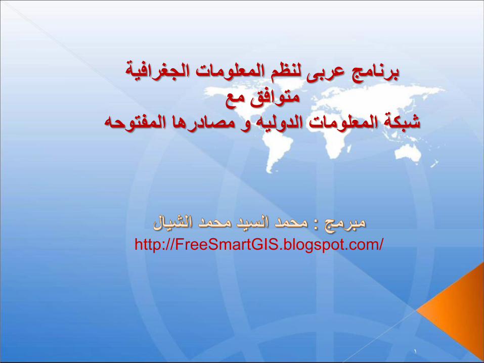
المعلومات الجغرافية برنامج عربى لنظم
متوافق مع
شبكة المعلومات الدوليه و مصادرها المفتوحه
http://FreeSmartGIS.blogspot.com/
1
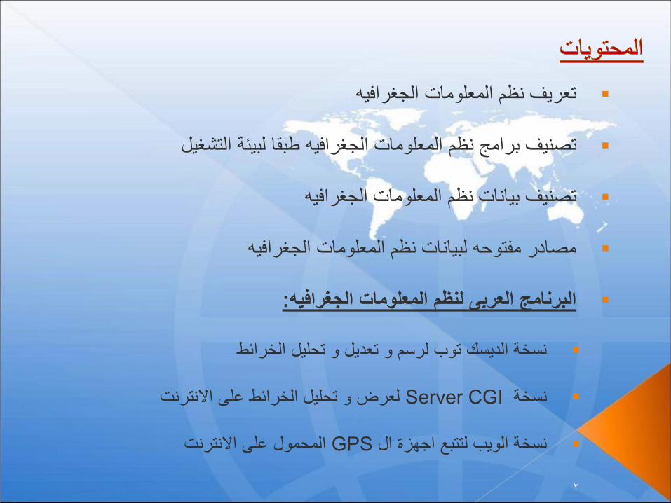
تعريف نظم المعلومات الجغرافيه
تصنيف برامج نظم المعلومات الجغرافيه طبقا لبيئة التشغيل
تصنيف بيانات نظم المعلومات الجغرافيه
مصادر مفتوحه لبيانات نظم المعلومات الجغرافيه
البرنامج العربى لنظم المعلومات الجغرافيه:
نسخة الديسك توب لرسم و تعديل و تحليل الخرائط
نسخةServer CGI لعرض و تحليل الخرائط على االنترنت
نسخة الويب لتتبع اجهزة الGPS المحمول على االنترنت
2

نظم المعلومات الجغرافيه هو برنامج حاسوبي لتخزين و استرجاع و تحليل و عرض
:البيانات الجغرافيه
(الكتابه –الرسم ) تخزين
(تعامل مع الملفات)استرجاع
تحليل اقصر –تحليل اسطح –تحليل مكانى –تحليل قواعد بيانات ) تحليل
(الخ -طريق
(سرعة التفاعل –أنظمة إحداثيات جغرافية )عرض البيانات
3

نظم وشبكات الحاسبات ولغات البرمجة المختلفة.
نظم ادارة قواعد البيانات.
العلوم المساحية والجغرافية.
(.المستوية والكرية)علوم الهندسة وحساب المثلثات
علوم بحوث العمليات
4

برامج تعمل على اجهزة الديسك توبDeskTop و هى عادة تقوم بكافة .وظائف نظم المعلومات الجغرافيه
برامج تعمل على خادم االنترنتInternet Server او الموبايل و هى .عادة تقوم فقط بوظائف العرض و التحليل
5

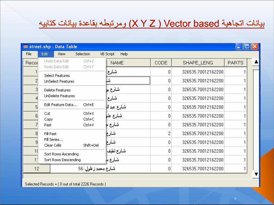
بيانات اتجاهيةVector based (X Y Z )ومرتبطه بقاعدة بيانات كتابيه.
صور بيكسل و محدد نقاط اسقاطها على الخريطه
نقاط ارتفاعات و مناسيب و محدد نقاط اسقاطها على الخريطه
6

7
8

World File Format
Line 1: A: pixel size in the x-direction in map units/pixel
Line 2: D: rotation about y-axis
Line 3: B: rotation about x-axis
Line 4: E: pixel size in the y-direction in map units, almost always negative
Line 5: C: x-coordinate of the center of the upper left pixel
Line 6: F: y-coordinate of the center of the upper left pixel
9

10

Shapefile extracts by country http://download.cloudmade.com/
ASTER GDEM search system http://gdem.ersdac.jspacesystems.or.jp/search.jsp
Downloading Rectified Google Earth maps
11

12
12

13

14

15

16
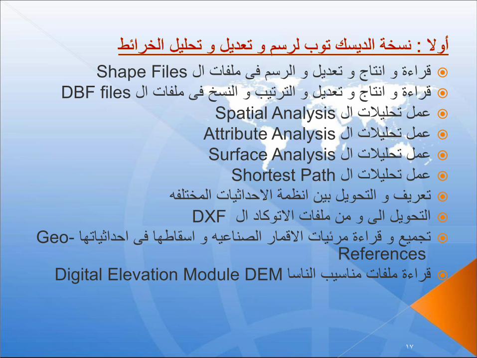
قراءة و انتاج و تعديل و الرسم فى ملفات الShape Files
قراءة و انتاج و تعديل و الترتيب و النسخ فى ملفات الDBF files
عمل تحليالت الSpatial Analysis
عمل تحليالت الAttribute Analysis
عمل تحليالت الSurface Analysis
عمل تحليالت الShortest Path
تعريف و التحويل بين انظمة االحداثيات المختلفه
التحويل الى و من ملفات االتوكاد الDXF
تجميع و قراءة مرئيات االقمار الصناعيه و اسقاطها فى احداثياتهاGeo-References
قراءة ملفات مناسيب الناساDigital Elevation Module DEM
17

18

19

20

21

22

23

24

http://egygpstracking.com/GIS/ElshayalSmartserver.exe?MapFile=gis\Map_world\world.arb&HtmlFile=gis\Map_world\world.Html&SaveTempDir=Temp\&HtmlTempDir=..\Temp\&ImgExt=gif&ImgW=675&ImgH=600&Mode=2&Scale=17000000
MapFile=gis\Map_world\world.arb HtmlFile=gis\Map_world\world.Html SaveTempDir=Temp\ HtmlTempDir=..\Temp\ ImgExt=gif or jpg or png Quality=80 ImgW=675 ImgH=600 LayerNo=0 FieldNo=0 Relation= (1 for like) (2 for =) (3 for >) (4 for <) (5 for >=) (6 for <=) (7 for <>) FieldValue= Scale=10000 MapLeft=51.3375187934919 MapTop=35.6997012042009 MapRight=51.3375187934919 MapBottom=35.6997012042009
25

[Elshayal Smart GIS Map] -> Return by the map image
[MapImageSrc] -> Return by the Map image link
[MapXCenter] -> Return by the Center Lon or X value of the map
[MapYCenter] -> Return by the Center Lat or Y value of the map
[Scale] -> Return by the Zoom and Scale of the map
[LayerNo] -> Return by the Query searching Layer No
[FieldNo] -> Return by the Query searching Fileld No
[Relation] -> Return by the Query searching relation
(1 for like) (2 for =) (3 for >) (4 for <) (5 for >=) (6 for <=) (7 for <>)
[FieldValue] -> Return by the Query searching value
26

27

function DoPan(zleft , ztop , zright , zbottom)
function DoZoomIn(zleft , ztop , zright , zbottom)
function DoZoomOut(zleft , ztop , zright , zbottom)
function DoGoto(XLonPos , YLatPos , Scale)
function DoFind(LyrNo , FldNo , RelNo , TxtVal , Scale)
BUTTON
onClick="JavaScript:DoFind(document.getElementById('mnuLayerNo').value,
document.getElementById('mnuFieldNo').value,document.getElementById('mn
uRelation').value,document.getElementById('mnuFieldValue').value,
document.getElementById('mnuScale').value) ;"> Find </BUTTON>
<BUTTON
onClick="JavaScript:DoGoto(document.getElementById('GotoXLon').value ,
document.getElementById('GotoYLat').value ,
document.getElementById('GotoScale').value) ;"> Goto </BUTTON>
28

29

Internet
Data Base
Server
Client
Html
Application
Mobile
GPS
Devices
Google &
KML Shape
files
Server
CGI
Software
30

Windows Server IIS 5 or later 6,7,8
CGI supported Server
GPS users locations Data Base CGI Engine
GIS Shape file to KML CGI Engine
Google Maps – free web mapping provided by Google
GIS Shape files (Spatial and attribute data) of requested area
Search tools for both (Google Geo-coding and KML GIS Shape files )
Client HTML5 supported Browser
Client Java Script supported Browser
HTML and Java Script Designed web site
Mobile GPS devices (Android, IPhone, IPad, etc.)
High bandwidth Server with Windows IIS on it
Good internet Connections
31

32

33

34
35

http://FreeSmartGIS.blogspot.com/
36