Affordable housing: Rising demand in GTA suburbs
32
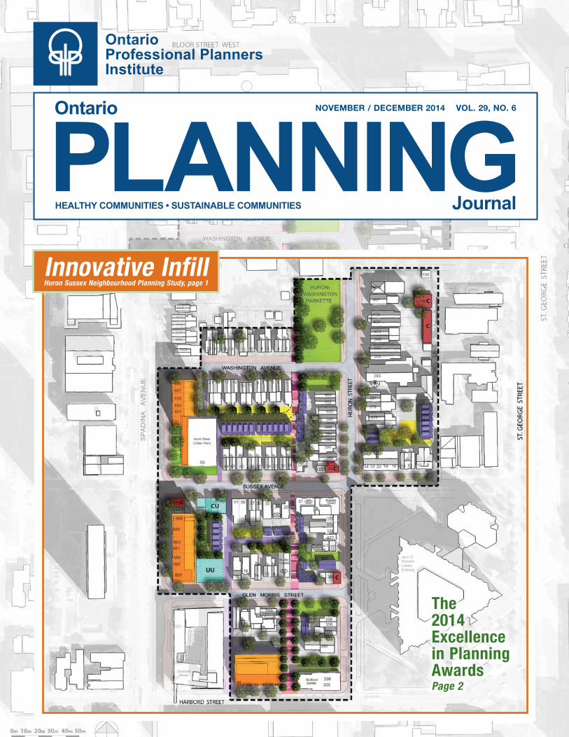
PLANNING Ontario Ontario Professional Planners Institute HEALTHY COMMUNITIES • SUSTAINABLE COMMUNITIES Journal NOVEMBER / DECEMBER 2014 VOL. 29, NO. 6 Innovative Infill Huron Sussex Neighbourhood Planning Study, page 1 The 2014 Excellence in Planning Awards Page 2
Transcript of Affordable housing: Rising demand in GTA suburbs
PLANNINGOntario
Ontario Professional Planners Institute
HEALTHY COMMUNITIES • SUSTAINABLE COMMUNITIES Journal
November / December 2014 vol. 29, No. 6
Innovative InfillHuron Sussex Neighbourhood Planning Study, page 1
The 2014 Excellence in Planning AwardsPage 2

FeaturesRe-imagining a neighbourhood ........... 1EIP awards ............................................... 2Landowner stewardship guide .............. 4Sustainability metrics ............................. 6Caledon East plan ................................... 9
Intelligent communities ............................ 11Public health and planning ...................... 13Medical marihuana ................................... 14
Districts & PeopleLakeland District ....................................... 16Toronto District ......................................... 17People .......................................................... 17MYPAC ....................................................... 17
CommentaryLitigate or mediate? ................................... 18Can I rent my cottage? .............................. 19Hong Kong transit ..................................... 20In Print ........................................................ 21Greenbelt Route ......................................... 22 Affordable housing .................................... 23Letter to the editor .................................... 24
DepartmentsPresident’s message ................................... 25ELTO ........................................................... 25Ontario’s planning system ........................ 26CIP ............................................................... 27Professional practice ................................. 28OPPI Learning Strategy ............................ 29
B i l l B o a r D
Co n t e n t s
HEALTHY COMMUNITIES • SUSTAINABLE COMMUNITIES
Loretta Ryan MCIP, RPP, CAEDirector, Public Affairs
[email protected] x2261.800.668.1448Mobile 416.668.8469ontarioplanners.ca
234 Eglington Avenue East, Suite 201, Toronto, ON, M4P 1K5
Institut des planificateurs professionnels de l’Ontario
Ontario Professional Planners Institute
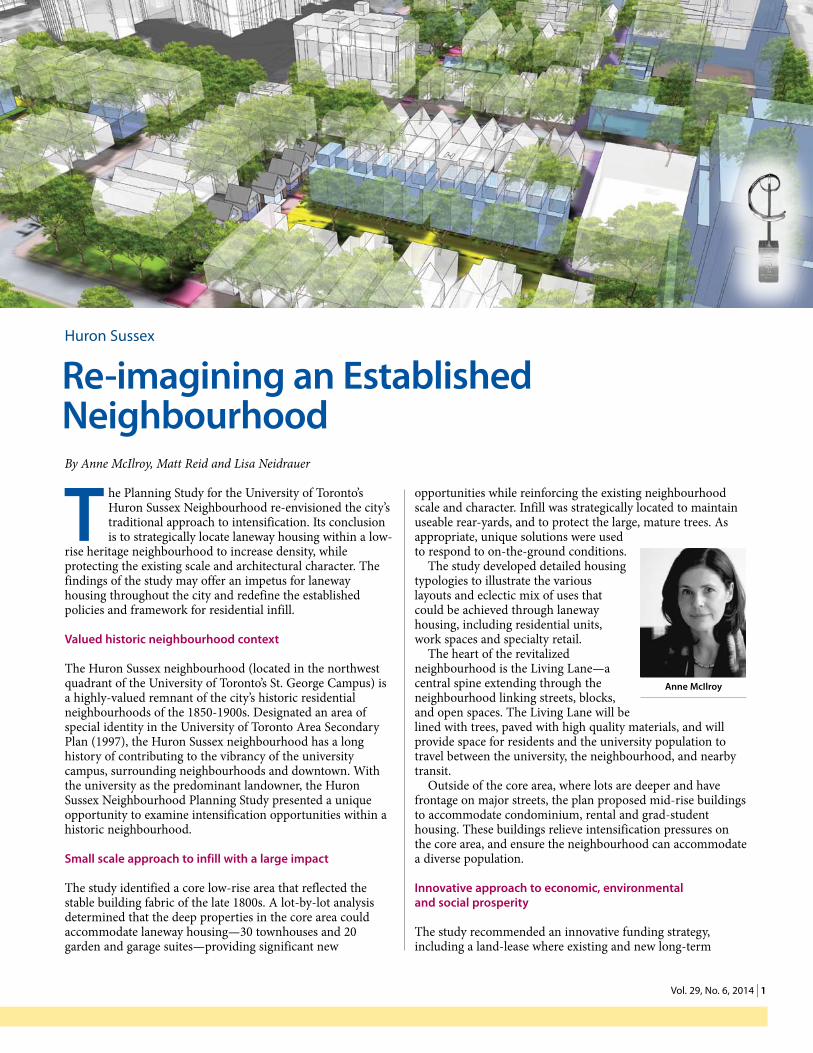
Cover: The huron SuSSex neighbourhood Planning STudy, a 2014 exCellenCe in Planning award winner
Celebrating the winners of the 2014 excellence in Planning awards
The eight winners of the 2014 Excellence in Planning Awards have been announced. Read about four of them in this issue of OPJ. The remaining four will be highlighted in upcoming issues.
World town Planning Day
On and around November 8th, professional planning organizations around the world will mark World Town Planning Day 2014 with an international online conference on Equality in the City – Making Cities Socially Cohesive. Be sure to attend World Town Planning Day events in your area.
Call for Presentations
Submit your online proposal for a 2015 Conference session. The online form closes at 5 p.m. EST on November 28th, 2014. OPPI Conference is being held on October 6-8, 2015. Profile your work amongst your planning colleagues!
Follow oPPi using social media
OPPI’s LinkedIn page is a great place to network with members of the planning profession. Follow OPPI on Twitter @OntarioPlanners. Not on Twitter? You can still check out the tweets posted on OPPI’s homepage. Using facebook? ‘Like’ OPPI and follow the posts. On the go? Access our mobile site.
Further information is available on the oPPi website at
www.ontarioplanners.ca
HEALTHY COMMUNITIES • SUSTAINABLE COMMUNITIES
Loretta Ryan MCIP, RPP, CAEDirector, Public Affairs
[email protected] x2261.800.668.1448Mobile 416.668.8469ontarioplanners.ca
234 Eglington Avenue East, Suite 201, Toronto, ON, M4P 1K5
Institut des planificateurs professionnels de l’Ontario
Ontario Professional Planners Institute
201 - 234 Eglinton Ave. East, Toronto, Ontario, M4P 1K5 (416) 483-1873 or 1-800-668-1448 Fax: (416) 483-7830 E-mail: [email protected] Web: www.ontarioplanners.caPresidentPaul J. Stagl, MCIP, RPP [email protected], 416-784-2952President ElectAndrea Bourrie, MCIP, RPP [email protected], 416-616-5502DirectorsDirector (Secretary/ Treasurer) Jeffery Leunissen, MCIP, RPP [email protected], 1-519-661-2500 x5349Director, Darryl Bird, MCIP, RPP [email protected], 905-882-1100 x6843Director, Charles Lanktree, MCIP, RPP [email protected], 1-613-580-2424 x13859Director, Diana Rusnov, MCIP, RPP [email protected], 905-615-3200 x5421Director, Scott Tousaw, MCIP, RPP [email protected], 1-519-524-8394 x3Director, Bob Forhan, MCIP, RPP [email protected], 1-905-235-5072Director, Jason Ferrigan, MCIP, RPP [email protected], 1-705-674-4455 x4298Director, Bill Janssen, MCIP, RPP [email protected], 1-905-546-2424 x1261Director (Public Interest Representative) Cheryl Horrobin, [email protected], 1-519-326-576101District Leadership Team ChairsToronto, Justine Giancola, MCIP, RPP [email protected], 416-229-4647 x2422Northern, Leslie McEachern, MCIP, RPP [email protected], 807-625-2833Western Lake Ontario, Kira Dolch, MCIP, RPP [email protected], 905-871-1600 x2502Oak Ridges, Angela Dietrich, MCIP, RPP [email protected], 905-615-3200 x5510Southwest, Maureen Zunti, MCIP, RPP [email protected], 519-434-1000 x238Eastern, Colleen Sauriol, MCIP, RPP [email protected], 613-735-6821 x1301Lakeland, Brandi Clement, MCIP, RPP [email protected], 705-734-2538 x224Staff Executive Director Mary Ann Rangam, x223Director, Finance & Administration Robert Fraser, x224Director, Public Affairs Loretta Ryan, MCIP, RPP, x226 Registrar & Director, Member Relations Brian Brophey, x229Communications Coordinator Shannon Vaughan, x0Member Engagement Manager Rupendra Pant, x222 Education Manager Ryan Des Roches, x227Administrative Coordinator Maria Go, x225Ontario Planning JournalEditor, Lynn Morrow, MCIP, RPP [email protected] Director, Brian SmithThe Journal is published six times a year by the Ontario Professional Planners Institute. ISSN 0840-786XSubscription and advertising rates can be found at www.ontarioplanners.ca. Go to the “Knowledge Centre” tab and click on the Ontario Planning Journal page.
1 vol. 29, no. 6, 2014 | 1
huron Sussex
re-imagining an established neighbourhood By Anne McIlroy, Matt Reid and Lisa Neidrauer
opportunities while reinforcing the existing neighbourhood scale and character. Infill was strategically located to maintain useable rear-yards, and to protect the large, mature trees. As appropriate, unique solutions were used to respond to on-the-ground conditions.
The study developed detailed housing typologies to illustrate the various layouts and eclectic mix of uses that could be achieved through laneway housing, including residential units, work spaces and specialty retail.
The heart of the revitalized neighbourhood is the Living Lane—a central spine extending through the neighbourhood linking streets, blocks, and open spaces. The Living Lane will be lined with trees, paved with high quality materials, and will provide space for residents and the university population to travel between the university, the neighbourhood, and nearby transit.
Outside of the core area, where lots are deeper and have frontage on major streets, the plan proposed mid-rise buildings to accommodate condominium, rental and grad-student housing. These buildings relieve intensification pressures on the core area, and ensure the neighbourhood can accommodate a diverse population.
innovative approach to economic, environmental and social prosperity
The study recommended an innovative funding strategy, including a land-lease where existing and new long-term
t he Planning Study for the University of Toronto’s Huron Sussex Neighbourhood re-envisioned the city’s traditional approach to intensification. Its conclusion is to strategically locate laneway housing within a low-
rise heritage neighbourhood to increase density, while protecting the existing scale and architectural character. The findings of the study may offer an impetus for laneway housing throughout the city and redefine the established policies and framework for residential infill.
Valued historic neighbourhood context
The Huron Sussex neighbourhood (located in the northwest quadrant of the University of Toronto’s St. George Campus) is a highly-valued remnant of the city’s historic residential neighbourhoods of the 1850-1900s. Designated an area of special identity in the University of Toronto Area Secondary Plan (1997), the Huron Sussex neighbourhood has a long history of contributing to the vibrancy of the university campus, surrounding neighbourhoods and downtown. With the university as the predominant landowner, the Huron Sussex Neighbourhood Planning Study presented a unique opportunity to examine intensification opportunities within a historic neighbourhood.
small scale approach to infill with a large impact
The study identified a core low-rise area that reflected the stable building fabric of the late 1800s. A lot-by-lot analysis determined that the deep properties in the core area could accommodate laneway housing—30 townhouses and 20 garden and garage suites—providing significant new
anne Mcilroy

2 | ONTARIO PLANNING JOURNAL 2
tenants are given the opportunity to purchase their homes with the University maintaining ownership of the land. Within the new mid-rise buildings, opportunities for affordable ownership of units could similarly alleviate the University’s long-term maintenance and management costs. Finally, the study recommended new sources of revenue for the University, such as the funding mortgages on favourable terms. This creative financing solution provides a delivery model that addresses campus housing needs while recognizing the increasingly limited capital and maintenance budgets available to universities across Canada.
To further the revitalization of the neighbourhood, the University is committed to the integration of a District Energy System. This system is thoroughly integrated into the development plan, with the primary infrastructure located under the Living Lane, and within below-grade parking areas, where it can be accessed with minimal disruption to the public realm.
Common vision founded on community consultation
An exceptional level of collaboration was required to address such a sensitive area, and was critical in developing a plan that has garnered equal support from the university, the neighbourhood and local councillors. This approach serves as a model for future working relationships between universities and neighbourhood associations.
Performance guidelines respond to local context
Laneway housing is an accepted and encouraged form of intensification in many North American communities, but has yet to be embraced in a broad context in Toronto. The study was founded on an extensive review and evaluation of existing laneway communities, and the local policies and strategies that support them.
Detailed performance guidelines were prepared that respond to the lot and neighbourhood-specific characteristics of the neighbourhood. They provide detailed, but flexible, public and private realm directions, including critical elements such as rear-yard depths, setbacks from neighbouring properties, unit dimensions, access, and façade design. As new infill occurs, these guidelines will be an invaluable tool for the university and private owners who will be developing the laneway housing, as well as for the city, who have limited experience in evaluating development applications for laneway housing. Anne McIlroy, MCIP, RPP, is a Principal of Brook McIlroy, an award-winning architecture, urban design, landscape architecture and planning firm with offices in Toronto and Thunder Bay. Matt Reid, MCIP, RPP, is an urban designer and planner in Brook McIlroy’s Toronto office. Lisa Neidrauer, OAA, MCIP, RPP, is a senior planner at the University of Toronto’s campus & facilities planning office. Huron Sussex Neighbourhood Planning Study is a 2014 Excellence in Planning winner in the Research/ New Directions category.
Matt Reid Lisa Neidrauer
Urban / Community DesignUrban Strategies Inc., First Capital Realty, Tridel Humbertown Master Plan
Municipal Statutory Planning Studies, Reports, DocumentsCity of Ottawa City of Ottawa Transportation Master Plan
Town of Caledon, MMM Group Limited and Region of Peel -Public Health
Caledon East Community Improvement Plan: an Innovative Tool to Promote Healthy Lifestyles
Community Planning & Development Studies/ReportsCity of Markham City of Markham’s Bird Friendly GuidelinesRegional Municipality of York New Communities Guidelines
Research/ New DirectionsCity of Brampton Planning and Infrastructure Services,
Town of Richmond Hill Planning and Regulatory Services, and City of Vaughan Planning
Measuring the Sustainability Performance of New Developments in Brampton, Richmond Hill and Vaughan
Brook McIlroy, N. Barry Lyon Consultants, the University of Toronto, and the Huron Sussex Residents Association
The Huron Sussex Neighbourhood Planning Study
Communications / Public EducationSchool of Environmental Design and Rural
Development, University of Guelph Rural Landowner Stewardship Guide for the Ontario
Landscape
OPPI and Heart & Stroke Foundation of Ontario’s Healthy Communities Award
Town of Caledon, MMM Group Limited and Region of Peel -Public Health
Caledon East Community Improvement Plan: an Innovative Tool to Promote Healthy Lifestyles
On behalf of the Ontario Professional Planners Institute’s Council, we would like to extend a sincere thank-you to those who served on the 2014 Jury for the Excellence in Planning Awards:
Ontario Professional Planners Institute’s
2014 Excellence in Planning Awards
Michael Boughton, MCIP, RPP Rory Baksh, MCIP, RPP Ruth Marland, MCIP, RPP Heather Watt, MCIP, RPP David Wood Adrian Smith, MCIP, RPP Paul Ferris Beverley Hillier, MCIP, RPP
Kevin StolarickDave Aston, MCIP, RPPPat FisherRobert Dowler, MCIP, RPPMatt Pearson, MCIP, RPPMichael Roschlau

3 vol. 29, no. 6, 2014 | 3
1 of 1, .67
SHAPING GREAT COMMUNITIES
PLANNERS
URBAN DESIGNERS
LANDSCAPE ARCHITECTS
www.gspgroup.ca
KITCHENER 72 VICTORIA ST. S., SUITE 201 P 519.569.8883
HAMILTON 29 REBECCA ST., SUITE 200 P 905.572.7477
Specializing in Rural Planning and Development
• zoning by-laws• official plans• land development and redevelopment• growth management• policy formulation• expert testimonywww.ecovueconsulting.com
WE’V
E MOVED
311 George St. N. Suite 200, Peterborough, ON K9J 3H3 - Tel: 705.876.8340 Fax: 705.742.8343
PLANNING & URBAN DESIGN
OTTAWA613.730.5709
KINGSTON613.542.5454 FOTENN.com
Moving communities forward.

4 | ONTARIO PLANNING JOURNAL 4
T he Rural Landowner Stewardship (RLS) Guide recognizes the challenges associated with making environmental improvements to property through regulation alone. As planners we frequently establish regulatory criteria to
ensure environmental protection, but how do we encourage voluntary landowner actions? The RLS Guide provides an educational toolkit for planners, municipalities and others involved in conservation to mobilize landowners.
The RLS Guide is an action-oriented workbook that serves as a self-assessment tool for environmental issues. It is formulated as an easy to read and understandable guidebook and can be used by individual property owners or as a hands-on tool in facilitated workshop settings.
The RLS Guide is general enough to be used across Ontario; however, it can also be customized to various municipalities or watersheds. In fact, at least 10 different guides have been formulated for individual watershed areas (e.g., Credit Valley, Lake Simcoe) and topic areas (e.g., horse owners) across the province.
RLS Guide
The RLS Guide is directed to rural property owners as a workbook with action items covering 14 topic areas and nearly 200 possible improvement / environmental consideration areas for a property (the RLS Guide is oriented to non-farmers as farmers have access to the Environmental Farm Plan workbook). It is provides general
information on the physiography of the Ontario landscape, the significance of the water cycle and importance of environmental stewardship. Additionally it offers worksheets with background information and individual ranking score sheets for the following general topic areas: what to consider when buying or building on
a rural property; private well water supplies; wastewater and septic systems; gardening and landscaping; waste management; storage and handling of chemicals; living with wildlife; working with ecosystems; managing property access; lake recreation; lowering your energy bill; and water runoff.
The RLS Guide is used as a tool by property owners to self-assess how well they are doing with respect to each of the topic areas as it applies to their properties. The worksheets have a ranked scoring system, with criteria ranging from ‘needs immediate consideration’ to
‘adequately addressed’. There are action planning sheets for short- and long-term initiatives. The guide also contains tips and notes throughout, black and white artwork and illustrations, and helpful resources lists (e.g., glossary of terms, specialized topic publications).
The RLS Guide has a dedicated website where it can be downloaded for free. The website also has other associated resources that can assist a property owner and/or environmental organization to get further direction or inspiration to initiate environmental stewardship endeavors (e.g., incentivized action examples, specialized guides for site specific watersheds and topic areas).
Rural Landowner Stewardship Guide
Mobilizing landownersBy Wayne Caldwell, Karen Landman and Paul Kraehling
Example illustration from the guide—Working with ecosystems on your land
ImA
GeS
cO
URT
eSy
Of
The
AU
ThO
RS
RLS Guide cover

5 vol. 29, no. 6, 2014 | 5
Background
The 2013 RLS Guide represents a new and improved second edition of the document, which was originally prepared in 2006 to primarily address water quality issues for non-farm property owners living along the Lake Huron shoreline. The guide was then adapted and revised for other geographies in Ontario. The 2013 edition has been updated to recognize the significant changes in government regulation that have taken place over the past several years, and the increasing interest in significant long-term planning issues such as natural heritage area protection, climate change impacts, and biodiversity protection. The revision was made possible through funding from the OMAF/MRA KTT (Knowledge Translation and Transfer) program.
Decisions as to what to include in a guidebook involving such a broad topic as environmental stewardship, and what would be relevant to rural property owners was based on surveys and feedback from conservation specialists across Ontario. A collaborative approach to preparing the RLS Guide involved compiling input from many environmental specialists in the province (OMAF/MRA, MNR, conservation authorities). The draft material was vetted through a number of focus group sessions and environmental workshops (e.g., Latornell Symposium). At the end of it all, the original intent of preparing a user-friendly, action-oriented guidebook patterned after the 20-year-old successful Environmental Farm Plan workbook was achieved.
Wayne Caldwell, PhD, MCIP, RPP, is the Stewardship Guide Project co-director, director of the School of Environmental Design and Rural Development and professor, University of Guelph. Karen Landman, PhD, MCIP, RPP, Stewardship Guide project co-director, associate professor, School of Environmental Design and Rural Development, University of Guelph. Paul Kraehling, MCIP, RPP, is a PhD student at the School of Environmental Design and Rural Development, University of Guelph. The Rural Landowner Stewardship Guide is a 2014 Excellence in Planning winner in the Communications / Public Education Reports category.

6 | onTario Planning Journal 6
# 3
t here’s so much more that now can be done by bringing in more teams, more players…[and] we’ve got to do the same thing with the built environment…and that collaboration, that
partnership can be very strong if you have the right players at the table.”
—Excerpt from “Dan Burden On Collaboration” (OPPI August 6, 2014)
Planners continue to struggle fundamental questions in the evolution of our built environment: Can we effectively use sustainability measurement for all new developments? Is there a way to level the playing field for the development industry by creating a consistent set of sustainability metrics? What is the role of a local municipality in helping to clarify what types of sustainability metrics it is looking for? This article summarizes one approach to establishing consistent sustainability metrics and flexible implementation across three municipalities—Brampton, Richmond Hill and Vaughan.
sustainable design in community planning
There are currently over 3,600 registered projects in Canada seeking to attain the Leadership in Energy and Environmental Design (LEED) standard. More importantly, the business case is clear—incorporating sustainable design in built form can, among other benefits, improve the health of residents and employee productivity, and reduce energy costs.
Integrating sustainability metrics into the development review process provides municipal governments the opportunity to achieve incremental gains from numerous
smaller improvements to the built environment that, over time, will benefit human and ecological health.
The cities of Brampton and Vaughan and the Town of Richmond Hill partnered to produce an innovative set of sustainability metrics to use as part of their planning process. The partnership established a funding and collaboration model to leverage resources across political boundaries towards a common purpose, including receiving partial funding through the Federation of Canadian Municipalities’ Green Municipal Fund.
A 2009 article in the Ontario Planning Journal (Vol. 24, No 1) described sustainable design guidelines being used by five GTA municipalities—East Gwillimbury, Markham, Mississauga, Pickering and Toronto. Brampton, Vaughan and Richmond Hill built on this initiative and added value in three key areas: focus on quantitative metrics to make interpretation easier; consistent set of metrics to level the playing field across municipalities; user-friendly Excel-based implementation tool to score the sustainability performance of proposed developments.
Metrics development
Developing the sustainability metrics was completed in two phases. Phase One focused on the preparation of qualitative sustainability guidelines and was led by Brampton. The Sustainable Community Development Guidelines are now a new chapter in Brampton’s Development Design Guidelines. Richmond Hill used the guidelines to inform its town-wide Urban Design Guidelines, approved in November 2013. Vaughan will use the guidelines to inform its future city-wide urban design guideline project.
Building on the Phase One guidelines, Phase Two
Using Partnerships to implement sustainability MetricsBy Michelle Dobbie, Michael Hoy and Tony Iacobelli
site Plan Metrics table
Site (S) Metrics
MetricMetricIndicatorIndicatorCategoryCategory Metric #Metric # Mandatory TargetMandatory Target
25Storm water
Quan ty
MetricMetric
Storm water Quan ty
Retain runo� volume from the 5mm rainfall event on site. Provide quan ty or flood control in accordance with applicable Municipal and conserva on authority
requirements
Storm water
Recommended Minimum Target
Single Family Home
Commercial/Retail/ Inst
Single Family Homes
Commercial/Retail/ Inst
Total Available
Points
Total Available
Points
6
Retain runo� volume from the 10mm rainfall
event on site. (3 POINTS)
Retain runo� volume from the 15mm rainfall
event on site. (3 POINTS)
Buildings(>3 storeys)
Mul -Fam ti Mul -Fam Buildings
(>3 storeys)
ti
Aspira onal Targetti
Site (S) Metrics
Nat
ural
Env
ironm
ent
& O
pen
Spac
e
ima
ge
Cou
rTeS
y o
F Th
e a
uTh
orS

7 vol. 29, no. 6, 2014 | 7
prioritizes key quantitative sustainability metrics for integration into the Sustainability Tools. Led by Vaughan, Phase two involved the consulting firms of Halsall Associates and The Planning Partnership. The Sustainability Tools comprise quantitative targets used to guide the review of block plan, draft plan of subdivision and site plan applications.
sustainability tools for development review
The sustainability tools are designed to be effectively and efficiently integrated into the municipal development review process. They represent a design solution targeting technical disciplines (e.g., planning, engineering, urban design, landscape architecture, etc.) responsible for reviewing planning applications. The end products are tools that all municipal and agency staff and councils involved in the development review process can support and champion. A brief description of the tools follows.
Static Tables—Two Static Tables organize the sustainability metrics into four broad categories (i.e., built environment, mobility, natural environment & open space and infrastructure & buildings) and the type of planning application to which the metrics apply (i.e., Table 1: Block Plan and Draft Plan of Subdivision Metrics; and Table 2: Site Plan Metrics). These provide applicants and reviewers with a convenient listing of all the metrics. Precedents used as a rationale for each metric are also included.
Each metric includes mandatory, recommended Minimum and aspirational targets. The mandatory targets represent the existing municipal standard or required policy, which all planning applications are currently required to satisfy (e.g., Ontario Building Code, official plan). No points are allocated to achieving the mandatory target. Points are allocated to applications that achieve recommended minimum or aspirational targets for select metrics. (An example is shown in the Site Plan Metrics Table.)
Similar to LEED certification, the tables enable an applicant to calculate an overall sustainability score for a development proposal based on the target level achieved from the menu of select metrics. Each municipality has certainty that a baseline sustainability performance is being met by establishing a sustainability threshold score for each type of application.
The tables and threshold scores enable a flexible approach to
achieving a more sustainable built environment. Applicants can pick and choose metrics to achieve the recommended minimum and aspirational targets, while ensuring a minimum gain to the built environment is achieved by meeting the sustainability threshold score. This flexible approach resulted from dialogue with the development industry early in the project.
Excel-based Implementation tool—The metrics outlined in the static tables are translated into an Excel-based implementation tool using a series of questions with Yes, No and Not Applicable responses. The tool provides a user-friendly interface for applicants. By entering information about the nature of the application (e.g., residential vs. mixed use, greenfield vs. intensification area, etc.), the tool filters out and highlights only those sustainability metrics applicable to the proposed development. The tool is currently available from the Town of Richmond Hill and the City of Brampton websites.
The Excel tool is supported by a guidebook/glossary that explains how to enter information into the spreadsheet, the intent of the metric and how and where to demonstrate compliance (e.g., Landscape Plan).
implementation
The municipal partners are working collaboratively to implement the Sustainability Tools, although the timing reflects municipal priorities and council approvals. Richmond Hill council approved minimum sustainability threshold scores in February 2014, which are required to be met as part of a complete application.
Brampton has launched a testing phase of the Sustainability Tools for 2014, and Vaughan’s testing phase will be initiated before the end of 2014. During the testing phase, submission of sustainability scores will be a component of a complete application. Monitoring and tracking of sustainability scores in the testing phase will be used to inform the development of sustainability threshold scores that will be brought forward to council in 2015 for approval.
A number of benefits result from incorporating the Sustainability Tools into the development review process: Similar sustainability metrics are used across the three municipalities offering consistency. Explicitly detailing the municipality’s sustainability priorities and expectations for
site Plan Metrics table (cont.)
Site (S) Metrics
MetricMetricIndicatorIndicatorCategoryCategory Metric #Metric # Mandatory TargetMandatory Target
25Storm water
Quan ty
MetricMetric
Storm water Quan ty
Retain runo� volume from the 5mm rainfall event on site. Provide quan ty or flood control in accordance with applicable Municipal and conserva on authority
requirements
Storm water
Recommended Minimum Target
Single Family Home
Commercial/Retail/ Inst
Single Family Homes
Commercial/Retail/ Inst
Total Available
Points
Total Available
Points
6
Retain runo� volume from the 10mm rainfall
event on site. (3 POINTS)
Retain runo� volume from the 15mm rainfall
event on site. (3 POINTS)
Buildings(>3 storeys)
Mul -Fam ti Mul -Fam Buildings
(>3 storeys)
ti
Aspira onal Targetti
Site (S) Metrics
Nat
ural
Env
ironm
ent
& O
pen
Spac
e

8 | onTario Planning Journal 8
WNDplanning + urban design
associates
90 Eglinton Avenue East, Suite 970 Toronto, ON M4P 2Y3416-968-3511 www.wndplan.com
Walker, Nott, Dragicevic Associates Limited
First Canadian Place100 King Street West, Suite 5600
Toronto, ON M5X 1C9T. 416.560.1152
The Admiral BuildingOne First Street, Suite 224Collingwood, ON L9Y 1A1
T. 705.445.1200
Informed and practical planning law advice and representation, since 1988.
www.hardystevenson.com @hardystevenson
Socio-Economic Impact Assessment, Environmental and Land Use Planning, Public Consultation and Facilitation, Project Management, Implementation.
364 Davenport Rd. Toronto, ON M5R 1K6 416-944-8444 or 1-877-267-7794
development applications upfront adds to clarity. The menu of metrics gives applicants the flexibility to choose their own path towards sustainability. The Excel-based implementation tool provides a user-friendly interface that produces a sustainability score, which is easily verifiable by both internal and external stakeholders.
Refining the planning process to focus on measurable actions upfront using sustainability metrics has the potential to achieve a more sustainable community. Working in partnership lends credibility and rigour to the Sustainability Tools and continued collaboration will help ensure effective implementation. In time, perhaps a common set of Sustainability Tools could help to achieve a more sustainable built form across Ontario.
Michelle Dobbie, MCIP, RPP, Michael Hoy, MCIP, RPP, and Tony Iacobelli, MSc, MCIP, RPP, wish to thank Susan Jorgenson, MCIP, RPP, Paul Freeman, MCIP, RPP, and Rob Bayley, OALA, CSLA for their peer review of this paper. Michelle is a senior policy planner at the Town of Richmond Hill and a member of OPPI’s Community Design Working Group. Michael is a senior environmental policy planner at the City of Brampton. Tony is a senior environmental policy planner at the City of Vaughan. Measuring the Sustainability Performance of New Developments in Brampton, Richmond Hill and Vaughan is a 2014 Excellence in Planning winner in the Research/ New Directions category.
9 Vol. 29, No. 6, 2014 | 9
T he Caledon East Community Improvement Plan (CIP) is distinguished by its integration of healthy development principles and its action-oriented approach to enhancing Caledon East as a
community that facilitates active, healthy living. It was prepared through a unique partnership between the Town of Caledon Development Approval and Planning Policy Department and the Region of Peel Public Health Department. Prepared in association with MMM Group Limited, the Caledon East CIP is a comprehensive revitalization tool, intended to address a broad range of issues and offer solutions for both private and public properties. Like many CIPs, the plan uses a broad suite of financial incentives to promote private property improvement and investment. Additionally, the plan provides a series of policies to guide and support the design and improvement of the public realm.
Designing communities to promote healthy lifestyles and encourage walkability is an important and growing subject area in community planning. While CIPs have frequently been used to support sustainable design principles, such as the inclusion
of financial incentives for energy efficiency improvements, they have not been used to explicitly address factors that influence the health of a community. Over the course of this
project it became clear that a CIP is a logical mechanism for supporting and advancing health in a stable environment.
CIP supports health and active living
Peel Region has conducted extensive evidence-based research, linking urban form and community design with human health. As an outcome of its research, the region has prepared and contributed to numerous guidelines and policies to support the development of healthy,
more active communities, including its most recent strategic plan update Creating Supportive Environments for Healthy Living. While many municipalities have extensively considered how healthy design principles may be implemented in the context of developing new, greenfield communities, a key challenge and distinguishing aspect of the Caledon East CIP study was the implementation of
Caledon East Community Improvement Plan
Supporting active, healthy livingBy Paula Strachan, Chris Tyrrell and Bobby Gauthier
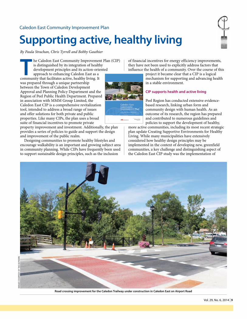
Road crossing improvement for the Caledon Trailway under construction in Caledon East on Airport Road
Ima
gEs
Co
urt
Esy
of
thE
au
tho
rs
10 | ONTARIO PLANNING JOURNAL 1 0
Markham • Calgary • Kingston • Kitchener • London • Niagara Falls • Ottawa • Vancouver • Victoria
70 years ofaward-winning service
www.parsons.com
healthy design principles in a stable, established community. Located in central Caledon in Peel Region, Caledon East was
chosen for the study based on its planning framework for growth, its unique natural heritage assets and its location at the crossroads of the Oak Ridges Moraine and Niagara Escarpment. Also, it was recognized to have potential for enhanced walkability and alternative modes of transportation based on its compact, contiguous structure.
The Caledon East CIP supports healthy communities through action-oriented solutions as well as policies and guidelines. The plan outlines financial incentives that directly encourage active transportation modes (e.g., financial incentives, bicycle parking, accessibility improvements, and improvements to landscaping, sidewalks and building access) and promote aesthetic improvements to the streetscape, an important component of active transportation. It supports a wide range of town and regional improvements to the public realm, with an emphasis on creating safe, comfortable, attractive and walkable streets and providing alternative modes of transportation. It includes design guidelines to ensure that both private and public property improvements are consistent with the relevant elements and standards described in the Health Background Study Framework. The CIP outlines a monitoring and evaluation program to assess the success of the plan, including indicators that relate to healthy, active communities and includes a marketing program to promote and advance the plan’s implementation.
The Caledon East CIP represents an important step forward in advancing the agenda of designing healthy, active communities. There is a critical need for planners and other professionals to work alongside local health departments to take action on rapidly increasing obesity rates, associated with certain urban design characteristics. While progress has been made by planners and
other professionals to advance the healthy communities agenda in greenfield settings, there is a need to understand how existing communities can be retrofitted into healthier, more walkable communities.
The Caledon East CIP takes a comprehensive, action-oriented approach to advancing Peel Region’s healthy community development objectives in the context of an existing community. Its success was, in part, due to the active involvement of planners and professionals from Peel Region, Town of Caledon, Peel District School Board, Dufferin-Peel Catholic District School Board and residents. Inclusive, representative consultation was essential to developing innovative solutions, programs and actions.
The Caledon East CIP presents an innovative, forward-thinking approach that supports physical activity through active transportation. It optimizes the health-promoting potential of Caledon East through a comprehensive set of projects, incentives and design guidelines.
Town of Caledon council unanimously approved the Caledon East CIP on January 14, 2014 and the plan is currently being implemented.
Paula Strachan, MCIP, RPP, OALA, CSLA, is a senior development planner/urban designer with the design and engineering team, Development Approval & Planning Policy for the Town of Caledon. Chris Tyrrell, MCIP, RPP, is the manager, planning & environmental design with MMM Group Limited. Bobby Gauthier, MCIP, RPP, is a senior planner, planning & environmental design, infrastructure & environment with the MMM Group Limited. Caledon East Community Improvement Plan is a 2014 Excellence in Planning winner in the Municipal Statutory Planning Studies and Reports and the OPPI and Heart & Stroke Foundation of Ontario’s Healthy Communities categories.
THEBUTLERGROUPCONSULTANTS INC.Land Planning Services
David A. Butler, MCIP, RPP
President
397 Brunswick Avenue, Unit 6
Toronto, Ontario M5R 2Z2
416.926.8796
E-mail [email protected]
THEBUTLERGROUPCONSULTANTS INC.Land Planning Services
David A. Butler, MCIP, RPP
President
397 Brunswick Avenue, Unit 6
Toronto, Ontario M5R 2Z2
416.926.8796
E-mail [email protected]
Butler Card_Butler Card 14-04-28 4:13 PM Page 1
1 1 Vol. 29, No. 6, 2014 | 11
I ntelligent Communities range in size, organizational structure and geography. What they all hold in common is a collaborative approach to strategic planning that brings together governments, universities and private sector companies to
create a unique innovation ecosystem, which attracts and retains talent and investment.
Intelligent Communities develop talent and knowledge workers specifically geared for the highly competitive knowledge-centric businesses and promote creativity and innovation in their communities. They train their citizens to become digitally involved. They are uniquely differentiated by a competitive advantage that has helped them develop, attract and retain talent and create an extremely powerful brand that attracts people and foreign direct investment to their communities.
Smart Cities to Intelligent Communities
There are thousands of Smart Cities around the world that have turned to advancements in technology, high-speed broadband and analysis of big and open data to improve municipal efficiencies and enhance asset and budget management as a way to improve their public services.
Many communities have seized on the Smart City concept as a sustainable and cost-effective solution to their urban problems. Smart Cities improve the way cities work. Government leadership and creative technology vendors are cooperating to drive advancement in municipal asset management, traffic control and water and air pollution data monitoring. This is essential work and a major part of creating an Intelligent Community.
Other communities have opted to immediately pursue the more holistic and strategic approach advocated by the Intelligent Community movement. Intelligent Communities are those unique towns, cities and regions which—through crisis or foresight—have come to recognize the enormous challenges of today’s evolving economies and societal needs. Consequently, they have taken steps to plan for and create an economy, society and ecosystem capable of prospering in this context. Whereas Smart Cities make cities work better, Intelligent Communities create better cities in which their citizens can thrive and prosper.
Intelligent communities have strategically transformed themselves. But they weren’t successful because of their technology companies and broadband capabilities alone. Through strategic planning and multi-sector collaboration they have created a unique ecosystem which attracts and retains talent and investment in their regions and raises their global reputations.
Global examples
Since the late 1990s, 126 globally-unique Intelligent Communities have been recognized by the Intelligent Community Forum. These represent examples from every corner of the globe. They are at the forefront of innovation and have greater resiliance to withstand economic downturns.
In Chattanooga, Tennessee, the municipally-owned utility built a fiber-to-the-premises network to enable advanced smart grid solutions. Ultimately, the savings from the smart grid
justified a 1 gigabit/second broadband network that resulted in attracting some of America’s most sought-after businesses to their community. But the infrastructure alone did not attract these investments. Chattanooga also revitalized its city centre and nurtured innovation, which helped attract companies such as Amazon, Volkswagen, the Sim Center, Blue Cross and Blue Shield, and many others.
Stockholm, Sweden has a substantial municipally-owned network, which it
creatively built without municipal funds based on an open-access model. Its operator, Stokab, built and operates the infrastructure, but competitive providers deliver a variety of services over its network. This has resulted in a 30 per cent increase in business growth, capital investments and job creation.
In Eindhoven, Netherlands, its homegrown multinational corporation, Philips, relocated to Amsterdam, creating a crisis that ultimately resulted in development of a highly proactive economic development organization called Brainport. This organization works closely with its innovative community to drive local prosperity and global competitiveness. Through the concept of open innovation, Eindhoven planners focused on R&D in a planned business park, targeting innovation opportunities. They generated tens of thousands of new jobs, rebuilding their confidence as a centre for innovation and winning the Intelligent Community of the Year award in 2011.
In Canada, 20 cities have been honoured with this designation to date. They include Burlington, Calgary, Edmonton, Fredericton, Kenora, Kingston, Moncton, Nunavut, Ottawa-Gatineau, Quebec City, Stratford, St. John, Sudbury, Toronto, Vancouver, Waterloo, Western Valley (Nova Scotia),Windsor-Essex and Winnipeg.
On June 5, 2014, Toronto councillor Michael Thompson pulled his speech from his vest pocket, wiped a small tear from his eye and
Branding innovation
Intelligent Communities By John G. Jung
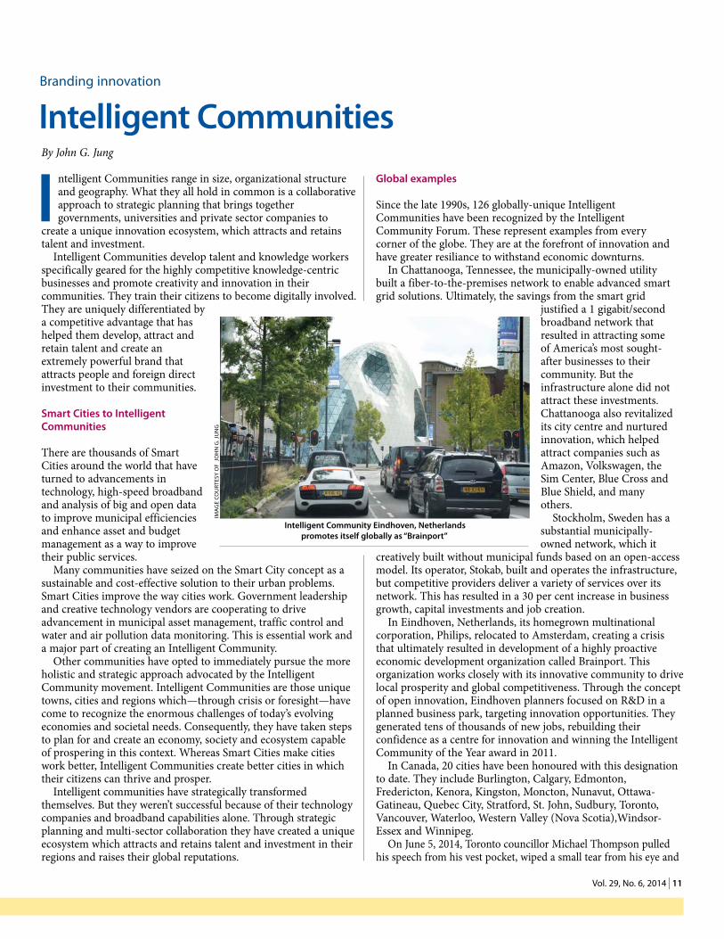
Intelligent Community Eindhoven, Netherlands promotes itself globally as “Brainport”
ImA
Ge
cOU
RTes
y O
f J
Oh
N G
. JU
NG

12 | ONTARIO PLANNING JOURNAL 1 2
began to praise his city. It had been a hard 10 years of effort, but finally, it had won the right to be called Intelligent Community of the Year. Toronto’s win, announced in New York City by the global think tank, the Intelligent Community Forum, reflects the city’s evolution as a hotspot for research and innovation, digital inclusion and its ability to collaborate among its diverse community partners. Among its stellar credentials is the ultra high-speed gigabit broadband strategy introduced on Toronto’s waterfront, which is designed to attract and retain talent and investment in one of the world’s largest knowledge-centric redevelopment schemes.
Seven years earlier, in 2007, the City of Waterloo had won the same right. Waterloo Region built on this distinguished brand over the years to become globally known as Canada’s Technology Triangle and renowned for its advanced manufacturing, high tech companies and start-ups. Its university sector, especially the University of Waterloo’s Co-op program, its unique IP policy and its unrelenting push for innovation were central to a theme of innovation and collaboration among a myriad of players. The Perimeter Institute, the Centre for International Governance Innovation, Waterloo Accelerator and other evidence-based success stories also contributed to its global recognition which has garnered Waterloo the reputation as one of the world’s most unique innovation ecosystems.
To pursue the planning and development of Smart Cities and Intelligent Communities in Ontario, planning professionals must become front and centre in the discussion.
John G. Jung, MCIP, RPP, is the CEO of Canada’s Technology Triangle Inc., chairman and co-founder of the Intelligent Community Forum, president of its Foundation, ICFF and co-author of a third book, called Brain Gain—how innovative cities create job growth in an age of disruption. John was a keynote speaker at the OPPI Symposium October 1 & 2 in Niagara Falls.
Five criteria identify an Intelligent Community
Infrastructure: Excellence in all infrastructure, especially the deployment of affordable and accessible high speed broadband connectivity, which has become the new essential utility, as vital to economic growth as clean water and good roads.
Knowledge workforce: Ability to develop and retain a talented workforce qualified to perform knowledge work.
Innovation: Creating an accessible innovation ecosystem will differentiate cities to attract investors and talent.
Digital inclusion: Policies and funding programs to provide all citizens with access to digital technology, broadband and training.
Marketing and advocacy: Communicating their competitive advantages and establishing good public policies providing investor confidence.
THE BUTLER GROUP CONSULTANTS INC.Land Planning Services
David A. Butler, MCIP, RPP
announces the relocation of their offices to
397 Brunswick Avenue, Unit 6
Toronto, Ontario M5R 2Z2
Telephone 416 926.8796
Celebrating 40 years of professional planning practice
1 3 vol. 29, no. 6, 2014 | 13
W hen John Snow mapped the cholera outbreak around the Broad Street pump in London in 1854, it marked the closest point in history between the fields of public health and modern planning. Planners and urban thinkers had
an intimate understanding of public health concerns and their spatial dimensions. That understanding resulted in the introduction of zoning, development controls and radical utopian plans to reshape the city and improve public health.
Since then, the fields have diverged somewhat, but they are rapidly realigning. Regular readers of this journal will be aware of this realignment based on the number of past issues devoted to the link between planning and health. As a graduate student in planning, I have learned that this relationship is vital to understanding the future of our practice. For the past four months, I had the opportunity to work with a team of planners and epidemiologists from across the province to build indicators describing the link between the built environments and health. These are intended for use by public health and planning practitioners throughout Ontario.
Past indicators developed by the team have examined the influence of the built environment on physical activity but most recently we have focused on building a suite of food environment indicators.
These are important because environmental exposure to food influences individual dietary decisions. Ontarians are facing increasing risks of obesity and diet-related illnesses like diabetes and cardiovascular disease. Uneven distribution of food retail opportunities combined with geographies of socio-economic deprivation compound these risks. Research has demonstrated that having grocery stores selling healthy, affordable food near homes and workplaces increases the likelihood that residents will consume a healthier diet (Minaker et al., 2013).
The broader food environment is characterized by food availability, affordability, quality and access (Health Canada, 2013). All of which may have an influence on the dietary decisions of area residents.
The study team has identified three food environment indicators that are easily replicated using Geographic Information Systems: food deserts, food swamps and a retail food environment index. The team is also exploring the accumulative effects of these indicators. This approach provides a standardized representation of the food environment that could help to monitor changes, develop zoning for accessible foods and offer advice on the creation of healthy food community programs.
In Ontario, municipalities have started to develop initiatives to influence the food environment. For example, the Toronto Board of Health is engaging the community through the Toronto Food Policy Council, which has already experienced success in providing affordable, healthy food through its Healthy Corner Store pilot project. In the Region of Waterloo, planners, public health practitioners and academics collaborated to conduct a community food system assessment and develop a food system plan for the region, which provides healthy, local produce through food retailers and farmers’ markets.
Given the link between built form and diet-related illness, there is a need to enhance our understanding of the food environment in
Ontario cities for the benefit of all who live in them. You can view a full range of built environment core indicators online.
Robert Walter-Joseph is a graduate candidate for Master of Arts in Planning (MA) at the University of Waterloo. For the past four months, he has worked for the Public Health Agency of Canada in Toronto as part of the Association of Public Health Epidemiologists in Ontario Built Environment Working Group. He is a Student Member of OPPI and can be reached at [email protected]. The author would like to thank Dr. Jennifer Dean for reviewing this article prior to submission.
references
Cummins, S., Flint, E., & Matthews, S. A. (2014). New neighborhood grocery store increased awareness of food access but did not alter dietary habits or obesity. Health Affairs, 33(2), 283-291.
Health Canada. (2013). Measuring the food environment in Canada (No. 978-1-100-2097-6). Ottawa, ON.
Minaker, L. M., Raine, K. D., Wild, T. C., Nykiforuk, C. I., Thompson, M. E., & Frank, L. D. (2013). Objective food environments and health outcomes. American journal of preventive medicine, 45(3), 289-296.
realigning Public health and Planning
Food environmental indicatorsBy Robert Walter-Joseph
GLOBAL EXPERIENCE LOCALLY INSPIRED SOLUTIONS
IBI Group is a multi-disciplinary organization offering professional services in four core disciplines: Urban Land | Facilities | Transportation | Intelligent Systems
• LAND USE PLANNING
•URBAN DESIGN
• LANDSCAPE ARCHITECTURE
•MUNICIPAL FINANCE
•REAL ESTATE RESEARCH
• FINANCIAL FEASIBILITY
www.ibigroup.com

14 | onTario Planning Journal 1 4
H ealth Canada enacted new Marihuana for Medical Purposes Regulations this year to govern the commercial production and distribution of medical marihuana. Under the new regulatory regime, the commercial production of
marihuana is licensed and home production will no longer be permitted.
While the new regulation provides greater certainty regarding the location of medical marihuana production facilities, there are still uncertainties about how it will be interpreted and implemented. For example, the regulation provides guidance on security and building requirements, but exact technical specifications have not been included. Clarification as to which municipal officials are to be notified under the regulation, in a manner similar to the regulations under the Planning Act, would also aid in interpretation (Ward, 2014). Additionally, legal interpretations surrounding the implication of municipal land use controls over a federally regulated controlled substance, has created some confusion (Rifkind, 2014).
land use planning considerations
With the implementation of the regulation, municipalities are getting an influx of license inquiries in the form of requests for zoning compliance letters or interpretations of planning documents.
In updating the regulations, Health Canada has effectively created a new land use, which bears similarities to more familiar land uses, but is varied enough to create challenges within existing planning documents.
Traditionally, crop production is most commonly considered in agricultural areas. However, under the regulation medical marihuana needs to be grown entirely indoors in highly secure
facilities. While many municipal planning documents would permit greenhouses in agricultural zones, the nuances of a medical marihuana operation, including security, laboratory, processing and shipping facilities, may be slightly different than that of a standard greenhouse. The need for bio-security and specialized indoor growing conditions, including climate control, facilities and ventilation, are not unique to medical marihuana facilities and are common in modern agricultural operations such as poultry production.
From a policy perspective some municipalities have considered the processing of medical marihuana to be an agriculturally-related use, similar to on-farm processing of more traditional crops. They are currently considering whether there is sufficient direction in their zoning by-laws in rural areas to either issue or deny a building permit for medical marihuana facilities.
Heavy requirements for hydro and gas, proximity to emergency services, scale of the proposed operation, as well as access to a skilled labour force may negate some rural locations from commercial medical marihuana production (Wever, 2014). The combined suite of production with ancillary uses, such as on-site laboratories, shipping and processing facilities, is being viewed as an industrial or employment use in some municipalities (Ward, 2014).
The availability of existing vacant industrial buildings with large floor spaces has lead to proposals in industrial areas (Wever, 2014). Where medical marihuana facilities have been proposed in employment zones, questions have been raised as to whether the term ‘growing’ can be considered synonymous with ‘production’ or ‘manufacturing’. In comparison, a pharmaceutical production facility, using similar processes to medical marihuana production (e.g., growing cultures), would most often be sited in an employment or business park (Wever, 2014).
The Town of Caledon recently tabled a draft comprehensive zoning by-law update which contemplates medical marihuana facilities to be an industrial land use in the prestige industrial or serviced industrial zones. The City of Ottawa is also considering zoning provisions for medical marihuana facilities in industrial zones.
Siting medical marihuana facilities in settlement areas has raised concerns over the appropriate separation distances between such uses and sensitive land uses, including residential dwellings or schools. Some municipalities have utilized the Ministry of the Environment D-6 Guidelines to guide separation distances between sensitive land uses and medical marihuana facilities.
While there is no unanimity on the issue, municipalities seem to be interpreting medical marihuana facilities as either Class One or Class Two industrial facilities (Bayovo, 2014), while others have chosen their own approaches to ensuring adequate separation distances from medical marihuana facilities and sensitive land uses.
The Town of Caledon is proposing a separation distance of 150 metres between medical marihuana production facilities and sensitive land uses, and a 90-metre setback between individual medical marihuana production facilities (Ward, 2014). A similar
medical marihuana regulations
Planning implications By Scott Taylor
#7
scott taylor

1 5 vol. 29, no. 6, 2014 | 15
The Planning PartnershipThe Planning Partnership
1255 Bay Street, Suite 201 I Toronto I Ontario I M5R 2A9t:416.975.1556 I [email protected]
www.planpart.ca
Urban Design . Landscape Architecture . Planning . CommunicationsUrban Design . Landscape Architecture . Planning . Communications
1255 Bay Street, Suite 201 I Toronto I Ontario I M5R 2A9t:416.975.1556 I [email protected]
www.planpart.ca
P L A N N I N G | D E S I G N | A R C H I T E C T U R E
planningAlliancepA
regionalArchitectsrA
www.planningal l iance .cain fo@p lann inga l l i ance . cat 416.593.6499
www.reg iona larch i tec ts .cominfo@reg ionalarch i tec t s .comt 416.593.5933
KING CITY-HEAD OFFICE22 Fisher St., PO Box 280King City, Ontario, L7B 1A6
T 905-833-1244F 905-833-1255
CAMBRIDGE445 Thompson Drive, Unit 2
Cambridge, Ontario, N1T 2K7T 519-622-3300F 519-622-3310
• EnvironmentalAssessmentandPlanning• Aquatic,Terrestrial,Wetland andMarineStudies
• WatershedRestorationandNaturalChannelDesign
• GIS,GPSandRemoteSensing• EnvironmentalPermitting,Inspections
and Monitoring• SiteandRouteSelection• Airport/LandfillBird/WildlifeManagementandControl
Since1971
150-metre setback is also being used by the City of Ottawa. Mississauga staff researched municipal approaches to separation distances between medical marihuana facilities and sensitive land uses and found a broad spectrum of setbacks ranging between 70 and 200 metres (Bayovo, 2014).
economic benefits
From an economic development standpoint the repurposing of former industrial sites and the creation of jobs can be attractive. The production of medical marihuana is on the rise and it is estimated that production facilities need about 1 employee per 1,000 square feet (Rifkind, 2014). This does not include the ancillary benefits of local construction.
Health Canada has estimated a price per gram of $12.00 and thereafter dropping to $8.00 over the course of a few years (Rifkind, 2014). This means that a modestly sized facility of 20,000 sq.ft. reasonably producing 100 pounds a month could be a large financially stable business that could breathe new economic life into a town (Rifkind, 2014).
Perhaps the most high profile example of a medical marihuana facility to date has been the conversion of a portion of the former Hershey’s plant in the Town of Smiths Falls to a licensed production facility. The facility is currently zoned M2 light industrial and was permitted through a section 44(2) interpretation of the Planning Act by the town’s committee of adjustment. Municipal staff has noted that the reaction to the facility has generally been positive and it is expected to generate about 100 new jobs for the town (Niki McKernan, correspondence).
Conclusion
In considering such uses municipal officials need to understand how medical marihuana facilities fit within existing planning documents. Among urban municipalities there is a general consensus that medical marihuana production facilities should be located within employment or industrial zones. Some municipalities have been requiring re-zonings or are completing updates to their comprehensive zoning by-laws, while others have permitted such facilities within existing zones. Within municipalities which have a mix of urban and rural lands, there still appears to be a divide as to whether or not this use can be considered in rural areas, or whether it is better suited to settlement areas.
Planners, building officials and economic development officials recently came together in Thornbury for a Lakelands District OPPI Continuous Professional Learning event to discuss the implications of the new Marihuana for Medical Purposes Regulations. Presentations by Sharleen Bayovo (City of Mississauga), Brandon Ward (Town of Caledon), Steve Wever (GSP Group Inc.) and solicitor Yigal Rifkind provided an excellent background and have largely informed this article. Copies of their presentations can be obtained by contacting the author of this article.
Scott Taylor, MCIP, RPP, is the senior planner with the County of Grey, and assists with Lakelands District programming. Scott can be reached at [email protected].

16 | onTario Planning Journal 1 6
Districts People&
Ice, the largest ice-calving event ever recorded, with a map of Manhattan superimposed on the crumbling Greenland glacier for scale. This was followed by a video from the Planning 101 series on the design basics of active transportation.
Groups of the grade seven and eight students were then asked to design their ideal neighbourhood, which they did with gusto. One group proved to be budding planners. They meticulously outlined the task, their design concepts, along with a colour-coded map. Another group built, rebuilt, and built again their town with blocks. Others studiously drew, coloured, mapped and constructed the shops, recreation features and homes they wanted included. The volunteers were gratified when three teams skipped recess to finish their designs!
The day ended with each team presenting its concepts to the rest of the class. Hopefully, the exuberance of this experience will inspire further student charettes in the Lakeland District. I would like to extend a thank you to everyone who participated in the day, including education assistant Rhonda Lauer, teachers Barb Crowther, Dave Marwick and Sandra Stevens, student teacher Rachel Carrier.
David J. Stinson, MCIP, RPP, is part of the program committee for Lakeland District and is a partner in Incite Planning.
LakeLand district
Water, Mr. Rango, WaterBy David Stinson
Without it there’s dust and decay. But with water, there’s life . . . .
this clip from the animated feature Rango kicked off May’s celebration
of World Town Planning Day at Monsignor Lee Catholic School in Orillia. It focused on the theme of water, with some of the many floods and droughts from last year being noted. Incite Planning geographer Colette Isaac engaged the students by asking them to identify the location of these events on a map of the world. We then explored the link between extreme weather and suburban sprawl, along with the design principles that would help counter this trend. The on-line tool Walkscore was used to illustrate the principle of walkability.
Simcoe Muskoka Catholic District School Board planner Kristin Dibble Pechkovsky and Simcoe County District School Board planner Holly Spacek helped guide a neighbourhood walkabout. City of Orillia planner Jeff Duggan joined them and talked about the city’s active transportation plan. The relevance of the topic was highlighted by a student who reported that her mother drove 50km from the cottage that morning to spare her a less than 500m walk in the rain.
The remainder of the day was taken up with a design exercise, for which the City of Orillia provided neighbourhood maps. It started with a clip from the documentary Chasing
Movie Night SocialBy Alisha Buitenhuis
in response to OPPI’s Call to Action regarding healthy communities and
planning for active transportation, Lakeland District hosted a film night focused on cycle-friendly communities. The film shown was Bike City, Great City, which highlights cities that are successful in implementing active transportation strategies. The film was followed by lively discussion and a dinner at a local restaurant.
This event was unique in that it was open to the public. Advertisements
were posted at various establishments in the City of Owen Sound and invitations were sent to cycling clubs. The majority of the audience was made up of cyclists, with
public health staff and planners making up the rest. It was an excellent opportunity for members of the public to ask questions about how to become more involved in planning for active transportation.
If other Lakeland District members are interested in showing this film, please contact me for further details.
Alisha Buitenhuis, BES, is a planner with Grey County and is a Candidate Member of OPPI.
David stinson alisha Buitenhuis
Budding planners, 23 May, 2014
ima
ge
Cou
rTeS
y o
F d
avid
STi
nSo
n

1 7 vol. 29, no. 6, 2014 | 17
PeoPLe toronto district
Distillery District Walking TourBy Daniel Woolfson
in June OPPI Toronto District held its first walking tour of 2014 at the
historic Distillery District in downtown Toronto. Led by City of Toronto senior planner Willie Macrae,
the tour was well attended. Willie, the planner responsible for the Distillery District, captivated the audience with interesting planning and historical facts. Not even the downpour of rain could slow down the tour.
Participants learned some interesting facts about the Distillery District, including:• Retail chain stores are avoided to
maintain a unique feel to the district• City of Toronto maintains several
registered heritage easements in the district that ensures protection for the building volumes and façades, windows, interiors and even the exterior piping and signage
• Distillery District remains privately owned, but is open to the public
• There are 40 designated heritage buildings in the district.
After the tour, a majority of the group gathered at the Mill Street Brew Hall to continue the discussion about the district and planning topics in general, over some delicious local craft beer and food.
The Toronto District extends a big thank you to Willie Macrae for his excellent walking tour. If you would like to contact Willie about his knowledge of the area or you have questions about the Distillery District drop him an email.
Daniel Woolfson is a planner with the City of Vaughan, a candidate (provisional) Member of OPPI and the program chair for OPPI’s Toronto District.
District toronto edited Woolfson Walking tour
ima
ge
Cou
rTeS
y o
F d
an
iel
wo
olF
Son
Paul Chronis MCiP, rPP
Jennifer Passy MCiP, rPP
Valerie Cranmer MCiP, rPP
stephen Willis MCiP, rPP
left to right: adam Zendel (Cadillac Fairview), laura taylor (York University), ruth rendon (City of Markham), Jason Bevan (Hemson), sonia Dhir (trCa), Jane McFarlane (Weston), Caroline
samuel (MaH), robert Jefferson (Cassels Brock), Peter Kulkarni (shoppers Drug Mart)
Ph
oTo
Co
urT
eSy
Son
ia d
hir
the Masters in Environmental Studies York University Planning
Alumni Committee (MYPAC)
celebrated its 10-year anniversary on June 26th at the Park Hyatt Toronto.
MYPac
Christine newbold MCiP, rPP
O P P I2 0 1 4M e M b e RSeRvIceA W A R DWINNeRS
J eff Celentano, MCIP, RPP, has been appointed chair of the North
Bay-Mattawa Drinking Water Source Protection Committee by the Ontario Minister of the Environment and Climate Change.
Since 2007, the nine-member
source water protection committee has overseen the identification of potential risks to water quality in the local municipal drinking water sources, as well as the creation of a Source Protection Plan to address these identified risks.
18 | onTario Planning Journal 1 8
# 19 edited
i n this third and final part of a series on the Ontario system of land use planning dispute resolution processes, the future of the Ontario Municipal Board is explored. I contend that it is time for Ontario to consider embracing a new form of land use
planning and municipal planning decision-making.Land use and municipal decision making is often framed as a
discretionary exercise of choice. The perennial question is: with whom should that choice rest?
Since 1946, or even earlier, Ontario has chosen a hierarchical land use planning regime. At the top of the pyramid is the board as the “final” decision maker in cases of dispute/appeal. This system leaves the discretionary power of decisions very often in the hands of appointed single individuals. It is not a system that has been replicated elsewhere and has not been immune to criticism.
To the lay person, finality should rest with accountability in the elected council. To councillors, finality should rest with them, except in the all too often circumstances where reasons exist for non-decisions or the heat of a controversial matter can be conveniently deferred to the board. To the building, land and development industry, there is growing support for changes in political accountability, more mediation and risk avoidance, timelier and less costly decision making.
Municipal councils are intended to reflect community values, the attitudinal biases of their constituent communities. Within their statutory powers and subject to provincial policy oversight, legal authority, the judiciary and the electorate, however, municipalities have limited ability to differentiate themselves.
Between 1946 and now, there have been changes to government
intervention in private investment in land development in Ontario. Land use regulatory and policy controls are universal. Provincial intervention is now limited to finite areas and policy directions have evolved to express provincial interests. Indeed, legislative responses have shown increasing effectiveness (e.g., development charges, heritage protection and conservation, environment protection and assessment, affordability, accessibility and design control). During this time period provincial-municipal relations have stabilized and municipal fiscal responsibility and professionalism is far more evident than in the past.
While this is not a new debate, its scope, significance and relevant features may have changed. The Ontario economy is lagging, municipalities lack fiscal resources, governments of all stripes, sizes and capacities are being called upon to deliver better service value for the tax dollar, and the citizenry is disillusioned as to whether governance is local, representative, fiscally responsible and responsive.
If the decision is to keep the board, then it must be staffed and scoped more suitably to the present time. The current approach of successive governments to weaken its complement and continue to avoid performance evaluations, is reprehensible and a disservice to the public. Perpetual study and issue avoidance only reinforce systemic cracks.
If the decision is to reform or eliminate the board, a complete strategy for change or endorsed evolution needs to be apparent. Likely there is enough assessment and intellect around the provincial decision-making table to develop a strategy for either option—reform or eliminate—without the delay of a further review. This is not to say that agency review and public debate and disclosure should be avoided. Rather, change is warranted and it is time to move on.
The Ontario land use planning and municipal decision-making system needs to evolve in the context of a strategy that brings contemporary values and an ability and willingness to accept adaptability and change. After all, communities elsewhere have learned to live with their local decisions.
Ian James Lord, M.Sc.(Pl.), LLB, is a mediator, municipal planning law and counsel at WeirFoulds, LLP. The views expressed in this article are those of the author and do not necessarily reflect those of WeirFoulds, the publication or the Ontario Professional Planners Institute. Lord is a practitioner and lecturer in planning and municipal law with over 35 years’ experience. He can be reached at [email protected]. The full text of each installment will be available after publication at
.
litigate or mediate?
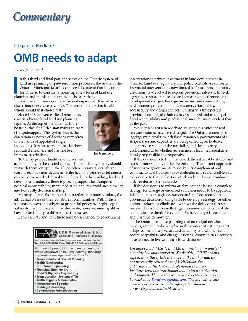
oMB needs to adaptBy Ian James Lord
Commentary
ian James lord
1 9 vol. 29, no. 6, 2014 | 19
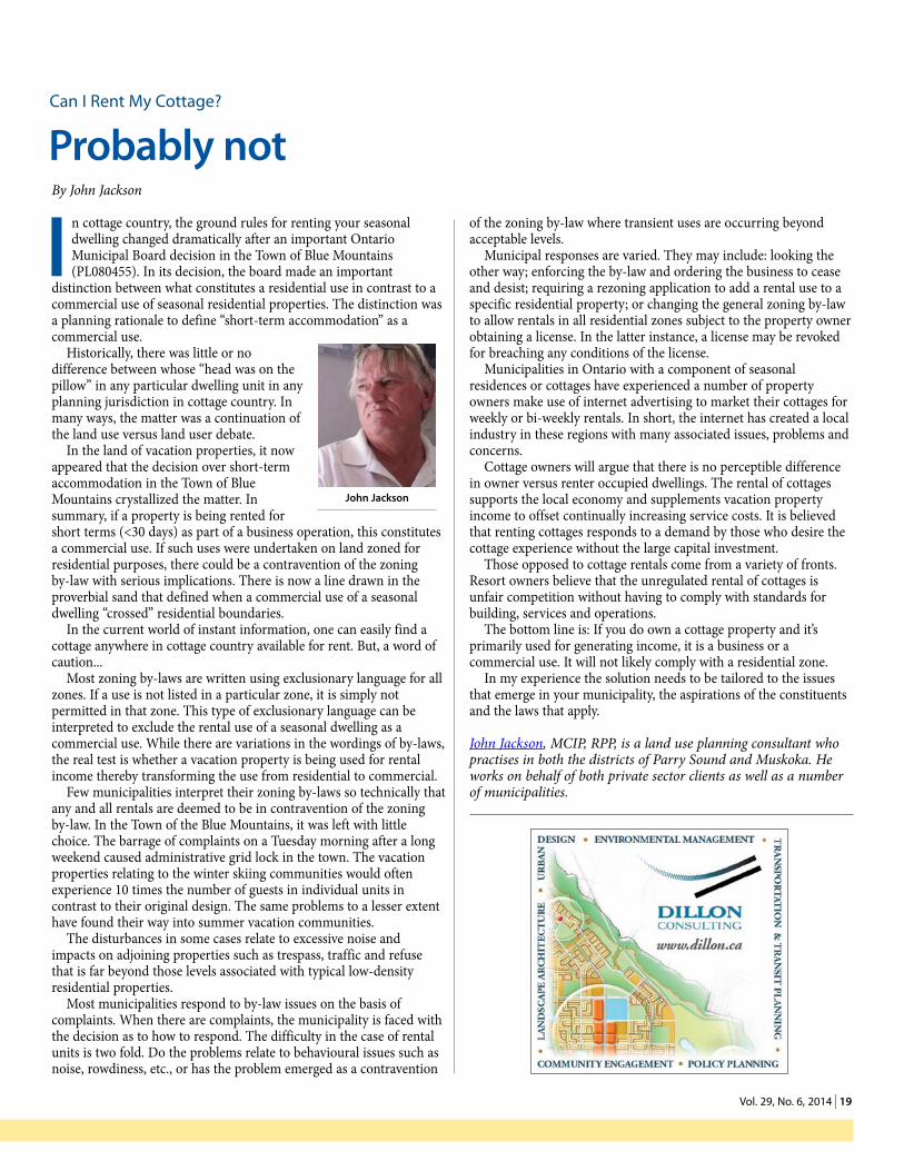
i n cottage country, the ground rules for renting your seasonal dwelling changed dramatically after an important Ontario Municipal Board decision in the Town of Blue Mountains (PL080455). In its decision, the board made an important
distinction between what constitutes a residential use in contrast to a commercial use of seasonal residential properties. The distinction was a planning rationale to define “short-term accommodation” as a commercial use.
Historically, there was little or no difference between whose “head was on the pillow” in any particular dwelling unit in any planning jurisdiction in cottage country. In many ways, the matter was a continuation of the land use versus land user debate.
In the land of vacation properties, it now appeared that the decision over short-term accommodation in the Town of Blue Mountains crystallized the matter. In summary, if a property is being rented for short terms (<30 days) as part of a business operation, this constitutes a commercial use. If such uses were undertaken on land zoned for residential purposes, there could be a contravention of the zoning by-law with serious implications. There is now a line drawn in the proverbial sand that defined when a commercial use of a seasonal dwelling “crossed” residential boundaries.
In the current world of instant information, one can easily find a cottage anywhere in cottage country available for rent. But, a word of caution...
Most zoning by-laws are written using exclusionary language for all zones. If a use is not listed in a particular zone, it is simply not permitted in that zone. This type of exclusionary language can be interpreted to exclude the rental use of a seasonal dwelling as a commercial use. While there are variations in the wordings of by-laws, the real test is whether a vacation property is being used for rental income thereby transforming the use from residential to commercial.
Few municipalities interpret their zoning by-laws so technically that any and all rentals are deemed to be in contravention of the zoning by-law. In the Town of the Blue Mountains, it was left with little choice. The barrage of complaints on a Tuesday morning after a long weekend caused administrative grid lock in the town. The vacation properties relating to the winter skiing communities would often experience 10 times the number of guests in individual units in contrast to their original design. The same problems to a lesser extent have found their way into summer vacation communities.
The disturbances in some cases relate to excessive noise and impacts on adjoining properties such as trespass, traffic and refuse that is far beyond those levels associated with typical low-density residential properties.
Most municipalities respond to by-law issues on the basis of complaints. When there are complaints, the municipality is faced with the decision as to how to respond. The difficulty in the case of rental units is two fold. Do the problems relate to behavioural issues such as noise, rowdiness, etc., or has the problem emerged as a contravention
of the zoning by-law where transient uses are occurring beyond acceptable levels.
Municipal responses are varied. They may include: looking the other way; enforcing the by-law and ordering the business to cease and desist; requiring a rezoning application to add a rental use to a specific residential property; or changing the general zoning by-law to allow rentals in all residential zones subject to the property owner obtaining a license. In the latter instance, a license may be revoked for breaching any conditions of the license.
Municipalities in Ontario with a component of seasonal residences or cottages have experienced a number of property owners make use of internet advertising to market their cottages for weekly or bi-weekly rentals. In short, the internet has created a local industry in these regions with many associated issues, problems and concerns.
Cottage owners will argue that there is no perceptible difference in owner versus renter occupied dwellings. The rental of cottages supports the local economy and supplements vacation property income to offset continually increasing service costs. It is believed that renting cottages responds to a demand by those who desire the cottage experience without the large capital investment.
Those opposed to cottage rentals come from a variety of fronts. Resort owners believe that the unregulated rental of cottages is unfair competition without having to comply with standards for building, services and operations.
The bottom line is: If you do own a cottage property and it’s primarily used for generating income, it is a business or a commercial use. It will not likely comply with a residential zone.
In my experience the solution needs to be tailored to the issues that emerge in your municipality, the aspirations of the constituents and the laws that apply.
John Jackson, MCIP, RPP, is a land use planning consultant who practises in both the districts of Parry Sound and Muskoka. He works on behalf of both private sector clients as well as a number of municipalities.
Can i rent my Cottage?
Probably notBy John Jackson
John Jackson

20 | onTario Planning Journal 2 0
t o an outsider the current Toronto transit debate is perplexing. There seems to be a lot of wheel spinning.
Perhaps it is a good time to consider whether there is a model elsewhere that might help. Hong Kong and Toronto
have some remarkable similarities. Both share a British colonial past that has handed down effective public institutions and practices that continue in public governance, legal, and administrative processes including land use and transportation planning.
As city regions they are both exposed to similar influences, challenges and opportunities. They have remarkably similar planning frameworks. They use similar planning vocabulary. They have similar planning objectives, and they use similar planning tools. A planner from Toronto could be transferred to Hong Kong and feel right at home, and vice versa.
When the Hong Kong government set up the Mass Transit Railway (MTR) in the early 1970s to build and operate its subway system it required that it be run using prudent business practices that would not require subsidies. Its sustainable funding model rests on granting the MTR the development rights to the space above its stations and lands around them. Central Hong Kong is home to some of the world’s priciest real estate.
Revenue from leasing, managing and servicing those buildings enables the MTR to work with developers and other stakeholders to create residential complexes in outlying areas complete with schools, parks and social centres; all with easy access to stations. In this way, the MTR has a three-part mandate—moving people, developing property and building communities.
Linking transit stations into the community rather than separating them benefits both the MTR as a business enterprise and local residents who need easy access to public transit. As transportation nodes and community hubs, stations boost MTR passenger revenue. About 5-million riders use the system each weekday.
Since the daily commute is convenient, affordable and easy, workers arrive each morning ready to work which makes employers happy. Retailers prosper from shoppers streaming past their stores. And the community gains from reduced traffic
congestion while increasing environmental sustainability since most Hong Kong residents rely on public transit not cars to get around the city.
In planning terms, the MTR leverages urban density while benefiting financially from future land value uplift. For the record, the MTR is now an independent, publicly traded company of which the government owns 77 per cent of the equity.
By linking property and rail, the Hong Kong government has handed the MTR an almost fail proof land-value recapture strategy.
Hong Kong is a low-taxation, lightly regulated jurisdiction that relies more on free markets than government intervention. As a result, the MTR operates under an unusual mandate—moving people, developing property and building communities. Almost all other transit systems around the world, including the TTC, have just one—moving people.
Toronto-based freelance writer Ken Mark is a 2013-2014 Asia Pacific Foundation of Canada Media Fellow supported in part by Cathay Pacific Airways. Alan Gummo, MCIP, RPP (Ret), worked for some years in regional and local planning policy in the Greater Golden Horseshoe. He maintains an interest in effective planning strategies from home bases in Kingston, Ontario, and Sao Paulo, Brazil.
examples from afar
Hong Kong transitBy Ken Mark and Alan Gummo
Mtr, “Caring for life’s journeys”
ima
ge
Cou
rTeS
y Ke
n m
arK
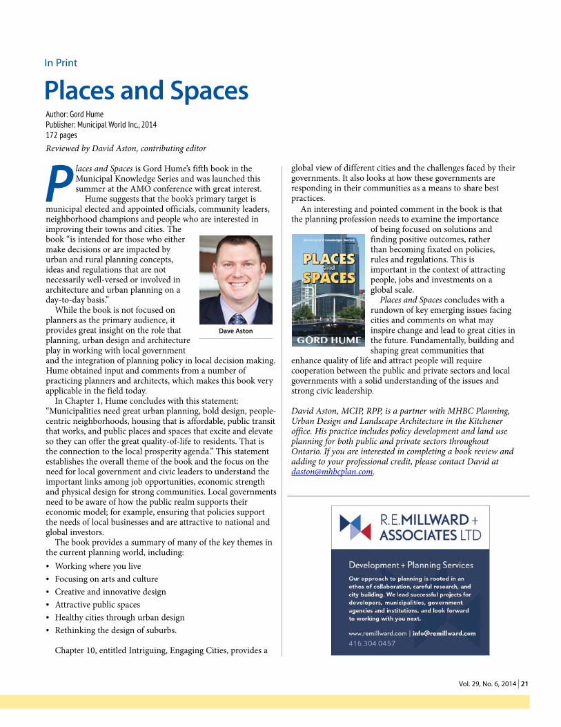
2 1 vol. 29, no. 6, 2014 | 21
2 of 2, .75
P laces and Spaces is Gord Hume’s fifth book in the Municipal Knowledge Series and was launched this summer at the AMO conference with great interest.
Hume suggests that the book’s primary target is municipal elected and appointed officials, community leaders, neighborhood champions and people who are interested in improving their towns and cities. The book “is intended for those who either make decisions or are impacted by urban and rural planning concepts, ideas and regulations that are not necessarily well-versed or involved in architecture and urban planning on a day-to-day basis.”
While the book is not focused on planners as the primary audience, it provides great insight on the role that planning, urban design and architecture play in working with local government and the integration of planning policy in local decision making. Hume obtained input and comments from a number of practicing planners and architects, which makes this book very applicable in the field today.
In Chapter 1, Hume concludes with this statement: “Municipalities need great urban planning, bold design, people-centric neighborhoods, housing that is affordable, public transit that works, and public places and spaces that excite and elevate so they can offer the great quality-of-life to residents. That is the connection to the local prosperity agenda.” This statement establishes the overall theme of the book and the focus on the need for local government and civic leaders to understand the important links among job opportunities, economic strength and physical design for strong communities. Local governments need to be aware of how the public realm supports their economic model; for example, ensuring that policies support the needs of local businesses and are attractive to national and global investors.
The book provides a summary of many of the key themes in the current planning world, including:• Working where you live• Focusing on arts and culture• Creative and innovative design • Attractive public spaces• Healthy cities through urban design• Rethinking the design of suburbs.
Chapter 10, entitled Intriguing, Engaging Cities, provides a
global view of different cities and the challenges faced by their governments. It also looks at how these governments are responding in their communities as a means to share best practices.
An interesting and pointed comment in the book is that the planning profession needs to examine the importance
of being focused on solutions and finding positive outcomes, rather than becoming fixated on policies, rules and regulations. This is important in the context of attracting people, jobs and investments on a global scale.
Places and Spaces concludes with a rundown of key emerging issues facing cities and comments on what may inspire change and lead to great cities in the future. Fundamentally, building and shaping great communities that
enhance quality of life and attract people will require cooperation between the public and private sectors and local governments with a solid understanding of the issues and strong civic leadership.
David Aston, MCIP, RPP, is a partner with MHBC Planning, Urban Design and Landscape Architecture in the Kitchener office. His practice includes policy development and land use planning for both public and private sectors throughout Ontario. If you are interested in completing a book review and adding to your professional credit, please contact David at [email protected].
in Print
Places and spaces Author: Gord HumePublisher: Municipal World Inc., 2014172 pagesReviewed by David Aston, contributing editor
Dave aston

22 | onTario Planning Journal 2 2
#23
W e test drive a car. Rent before we buy. Date before we marry. Trying something before taking it home is not new. But test driving a 460 km bicycle route that traverses the world’s largest greenbelt? That’s not so
common. Yet for six cool days in early May over 200 trail and cycling leaders from Niagara to Northumberland hit the dirt, pavement and other surfaces to see for themselves how bike-worthy the new Greenbelt Route is. The results? “Outstanding.” “Beautiful.” “A legacy.”
Ontario’s Greenbelt comprises lush virgin forests, bountiful farmers’ fields, historic small towns and protected countryside. The signed Greenbelt Route, connecting the headwaters of the Greenbelt’s waterways with the Ontario waterfront, will be launched in 2015 to celebrate the 10th anniversary of the Greenbelt. It will offer a number of benefits.
It will make the Greenbelt more accessible to Ontarians and visitors. According to a Share the Road Coalition poll, 70 per cent of Ontarians want to cycle more often. The Greenbelt Route is their chance.
It will offer opportunities for economic benefits to the local communities along its route. Municipalities are seeing the value in positioning local projects as part of a larger route network and are tapping into recently announced funding for cycling infrastructure.
It will make Ontario a premium bicycling destination, one of the most rapidly-growing tourism activities today. In 2010, two million Canadian visitors cycled while travelling in Ontario (an increase of 25 per cent from 2009) and spent $391-million (an increase of 18
per cent over 2009). Ontario by Bike, a growing network of almost 900 cycle-friendly accommodations and service providers, is providing cycle tourism workshops and engaging local businesses to promote the route.
It will benefit local farmers by connecting people to the food they eat. The Greenbelt contains over 5,500 farms and generates $4.5-billion in agricultural activity, yet the average distance travelled by food eaten in Ontario typically exceeds 2,500 km.
Using existing infrastructure, the Greenbelt Route will highlight five cycling connections with the Lake Ontario Waterfront Trail. Potential routes include the Welland Canal in St. Catharines, Red Hill Valley Trail in Hamilton, Etobicoke Creek Trail in Toronto and Peel Region, the Lake to Lake Cycling Route in Toronto and York Region, and the future Duffin’s Creek route through Pickering and Ajax. Each will create a regional loop that will greatly expand cycling opportunities in Ontario.
The Greenbelt Route will offer a way to explore the Greenbelt, to enable active and healthy lifestyles and to connect Ontarians with local farm produce. It also presents opportunities for local economic development along its path. It is full of possibility.
Peter Lipscombe managed the Greenbelt Route project at the Waterfront Regeneration Trust until July 2014 and is now pursuing a MSc Planning at UBC. The project is funded by the Friends of the Greenbelt Foundation. More information can be found at www.greenbeltcycles.com.
greenbelt route
Full of possibilitiesBy Peter Lipscombe
Cycling route basemap, with connectors
ima
ge
Cou
rTeS
y o
F Pe
Ter
liPS
Com
be
Cyclists test drive ontario’s Greenbelt route
Pho
To C
ou
rTeS
y o
F Pe
Trin
a T
uli
SSi
Peter exploring possibilitiesPh
oTo
Co
urT
eSy
oF
PeTe
r li
PSCo
mbe

2 3 Vol. 29, No. 6, 2014 | 23
O n the heels of York Region’s Make Rental Happen campaign a revived discussion of the challenges of affordable housing in suburbs seems appropriate.
Demand for a supply of housing with a varied range of types and options in York Region continues to grow rapidly, as does the price point of the current stock, which is well beyond the financial means of many households. With consistently low vacancy rates, property values increased 27.2 per cent between 2008 and 2012.
By 2031, the population of the region is projected to increase by approximately 40 per cent, creating a greater demand for varied housing options. Affordable housing provides necessary choices and is a key factor in creating complete healthy communities that are fully inclusive.
In a Canadian context, housing that costs less than 30 per cent of before-tax household income is the standard definition of affordable housing. The Ontario Housing Policy Statement enacted January 1st, 2014, directs municipal service managers to have comprehensive housing plans with long- and short-term targets, comprehensive homelessness strategies based on a housing first approach and integrated human and community services planning.
The region’s first Municipal Housing Facilities By-law approved in December 2002 is the basis for current efforts to provide affordable housing in York Region. It is intended to facilitate the development of affordable rental housing that integrates rent-geared-to-income (RGI) and market units through partnerships with local housing developers. The following are examples of affordable housing projects that have resulted: Armitage Gardens with 52 RGI units, Blue Willow Terrace with 42 RGI units, Mapleglen Residences with 50 RGI units and the Reena Community Residence with 30 supportive housing units.
When compared with the costs of institutional responses to homelessness, affordable housing offers a significantly less expensive and sustainable response. While benefitting the region as a whole, it increases the economic potential of individuals and families who are able to access affordable housing locally. However, the commitment of all levels of government is essential if communities are to be able to offer affordable housing options.
The lack of a national comprehensive housing strategy remains a critical issue in all Canadian municipalities.
Amanda Napoli, MES, is currently acting as a senior portfolio lead in the Realty Division of the Ministry of Economic Development, Employment and Infrastructure. She can be reached at [email protected].
Sources
http://www.thestar.com/news/gta/article/1270187--york-region-property-values-up-27-2-since-2008
http://archive.canequity.com/mortgage-news/archive/2004/2004-09-14_CMHC-armitage_gardens_official_opening.stm
www.cmhc-schl.gc.ca/en/inpr/afhoce/hoawpr/upload/111840_2.pdfhttp://cmhc.beyond2020.com/HiCODefinitions_EN.html#_Affordable_ dwellings_1http://tomorrowcampaign.com/?camp_id=3http://www.yorkregion.com/news/
article/1502801--30-new-affordable-housing-units-released-in-vaughanMinistry of Municipal Affairs and Housing. (2010). Ontario’s Long-Term
Affordable Housing Strategy. Building Foundations: Building Futures.http://www.cmhc-schl.gc.ca/en/corp/nero/nere/2007/2007-06-29-0930.cfmPreston, V., Murdie, R., Wedlock, J., Kwak, M. J., D’Addario, S., Logan, J., et
al. (2009). At Risk in Canada’s Outer Suburbs: A Pilot Study of Immigrants and Homelessness in York Region. Finding Home: Policy Options for Addressing Homelessness in Canada, 5(3), 1-15.
http://www.reena.org/ news/reena-community-residence-apartments-now-renting
www.onpha.on.ca/Content/Conference/2008/handouts/102_timelines.pdfYork Region. (2009). Where’s Home? 2008 Ontario Non-Profit Housing Association
and Co-operative Housing Federation Canada Ontario Region Report on Housing Need in Ontario. Report No. 4 of the Community Services and Housing Committee.
Affordable Housing
Rising demand in GTA suburbsBy Amanda Napoli
LeTTeRs TO The ediTOR Members are encouraged to send letters about content in the Ontario Planning Journal to the editor ([email protected]). Please direct comments or questions about Institute activities to the OPPI president at the OPPI office or by email to [email protected]. Keep letters under 150 words. Letters may be edited for length and clarity.
#24
Amanda Napoli
Reena Community Residence
PHO
tO c
Ou
rteS
y O
f BO
Nd
fIeL
d c
ON
Stru
ctI
ON
Mapleglen Residences
PHO
tO c
Ou
rteS
y O
f yO
rK r
egIO
N
24 | onTario Planning Journal 2 4
Tunnock Consulting Ltd.
Dedicated to Innovation and Excellence in Community Planning
Serving community planning needs across Ontario since 1988
Official Plans Zoning By-laws Community Improvement Plans Planning and Building Fee Reviews Development Charges Studies
Land Development
Contact our North Bay Head Office Today
Tel: (705) 475-0040 Fax: (705) 475-0030
Toll Free: 1 (800) 924-0128 Email: Glenn Tunnock, President: [email protected]
David Welwood, Planner: [email protected] Mail: 247 Hearst Street, North Bay, Ontario P1B 8Z2 Or visit us today at www.tunnockconsulting.ca
services en français
letter to the editorRe: Dear Dilemma – Fairness and Consideration, Vol. 29, No. 5, 2014
Let’s break this scenario down. Planner X has refused to provide certain information about an application to an agency planner and has accused the agency planner—in writing to municipal officials no less—of abuse of process. The Institute’s response is to find lack of clarity in the agency planner’s query. The Institute finds that Planner X’s behavior does “not seem to be so excessive and malicious as to constitute a breach of the code.”
However, refusal to provide information undermines sound decision-making in the public interest. It undermines one of the key objectives of the profession. This is especially the case when an unanticipated issue arises in the review of an application.
Furthermore, use of untruths, half truths and attacks on a colleague undermine the colleague. Threats, whether overt or implied, are bullying. Abuse of process is a very serious accusation. It constitutes a threat because of the subsequent actions that may arise from it. It should not be allowed to fall into the category of reasonable disagreement.
Unfortunately the behaviors described in this query are far too common in Ontario, and are seldom as understated as described in the Dear Dilemma column. None of them reflect well on the members of the Institute or contribute to public confidence in the profession. The Institute needs to take ownership of its code and its disciplinary mechanism.
Tolerance of the behaviors described in this scenario by the Institute demonstrates that the Institute is still not ready to take on the responsibilities of self-regulation, no matter how many government relations consultants we hire to help us get there.
—Alan Gummo, MCIP, RPP (Ret.)

2 5 vol. 29, no. 6, 2014 | 25
Departments
PreSidenT’S meSSage
Dilemmas unpackedBy Paul J. Stagl
e ver have to contend with a professional practice or ethics situation and had no one to turn to for advice and guidance? Many professional planners, at least early in their
careers, have found themselves in this situation. OPPI wants to ensure this doesn’t happen in the future.
By leveraging the considerable expertise among members OPPI is launching a professional mentoring program. Intended to ensure all members have easy access advice and the lessons learned from others’ experiences, the program will comprise supportive infrastructure and a network of volunteer practitioners to assist professional planners throughout their careers.
Informally members are already providing opportunities for experience sharing, office and intra-office tutorials and lunch-and-learns, which address project experiences and not just project details. Get involved. There are lots of ways to contribute: write a Dear Dilemma scenario and share your experience; log into your Member Profile click on “Volunteer Opportunities” and then “Programs” to indicate your interest; organize a session to share a professional practice or ethics experience with a colleague. If you have an idea about innovative ways to share mentoring experiences, let the OPPI office know so it can be shared more broadly.
—Paul Stagl
P.S. I also wanted to take this opportunity to commend all OPPI members who have embraced CIP’s call for input on the current realignment by participating in the September town hall meetings, District conversations or through member feedback directly to CIP.
From what I am hearing, CIP Council will have a broad spectrum of input to consider. This ranges from very supportive, to maintaining the status quo, to let’s go back to the way things were before, to the changes don’t go far enough. Some comments are rehashing of old themes and others reflect support for the governance changes that will finally facilitate full participation by our Quebec colleagues at a national level.
Whatever your point of view, it is important to participate. Offer your comments to help CIP Council make an informed decision on the best governance model for the profession’s national presence over the coming 25 years.
elTo
Planners and lobbying
Where are the lines?By Ian Flett
t he City of Hamilton recently joined Ottawa and Toronto as a municipality requiring lobbyists to register at City Hall. With fines of up to $25,000 (in Toronto) for failing to register,
these policies have important implications for planners practicing in those jurisdictions, including with respect to their roles as experts before the Ontario Municipal Board.
Lobbying is widely understood as communication intended to influence an elected official to choose a certain course of action. For some it also carries the stigma of murky dealings behind closed doors. However, when done transparently, lobbyists make important contributions to public policy by providing research, intellectual capital and competing perspectives on the issues of the day.
Hamilton council defines the verb “lobby” as communication with a public office holder with “the goal of advancing a business or financial interest.”
Ottawa’s definition of lobbying is more specific. It applies to all communications with public office holders by an individual who represents a business or financial interest “with the goal of influencing any legislative action.” It also includes arranging a meeting between a public office holder and a third party.
By contrast, Toronto uses the broadest definition by capturing “any communication” with a public office holder. The by-law then proceeds to carve out exclusions from this definition.
All three municipalities exclude several forms of communication, including communication at public meetings where it would form a part of the public record or where it is sponsored by the municipality for public consultation.
ian Flett
Paul stagl
26 | onTario Planning Journal 2 6
Requests for general information and the filing of applications are also excluded.
Of particular application to planners are provisions that exclude the provision of general information to a public office holder. And this is where planners who are in contact with public office holders may need to exercise caution.
The line between providing general information and influencing a public office holder is likely thin. Planners who have no intention of influencing a public officer may do so inadvertently by answering a question or preferring a client’s proposal over a competing vision. In some cases, planners may view their roles as champions for a particular proposal (assuming it meets the public interest criteria of the OPPI Code of Practice).
In the context of planning, the City of Toronto interprets the line crossed when a person promotes or attempts to persuade as to the merits of an application, advocates for its acceptance, rejection or amendment or solicits a public office holder to support or not actively oppose an application. There is nothing inherently wrong with any of these communications, the by-law merely requires they be registered.
However, this presents a catch-22 for planners. A planner may accept to advance a development application that requires planning approvals. S/he may choose to advocate for the merits of an application. The better s/he does her job, the more likely it is the municipality will approve the application, the less likely it is s/he will be asked to provide expert testimony on an appeal before the Ontario Municipal Board.
However, in the event an application finds its way to the Ontario Municipal Board, planners who have crossed that line may find they have compromised their ability to uphold the duties of expert witnesses. Planners, when qualified as such before the board, are expected to provide opinion evidence that is “fair, objective and non-partisan.” It may be nearly impossible to reconcile the role of advocate with the role of non-partisan expert in this situation.
We have encountered planners who deal with this conundrum in different ways. In some cases, planners refuse to meet with public office holders in private, only expressing their opinions to such individuals in public forums.
In other cases, planners register as lobbyists out of an abundance of caution whether or not they are hired to influence a public office holder. This approach is prevalent in Toronto as a result of its broad definition of lobbying, notwithstanding its own interpretation bulletins, which set out what is and what is not lobbying. The problem with over-registering is that the mere fact of registering suggests some influencing occurred and a planner may be called upon to explain what the purpose of the registered meeting was.
The intersection of a planner’s role as a lobbyist and as a potential expert creates an interesting challenge for planners and lawyers alike. Our office has argued that, above all, planners should be transparent about their lobbying activities in describing their retainer. This approach allows the board to determine for itself whether to qualify a proposed expert witness and how to weigh the opinions advanced by those experts.
This article is not meant to provide legal advice. The City of Hamilton has not yet implemented its lobbyist registry. The in
force by-laws in Ottawa and Toronto are somewhat complex and planners should obtain their own independent legal advice to determine how best to comply with lobbying regulations.
Ian Flett is a fifth year associate lawyer at Eric K. Gillespie Professional Corporation. Eric and the other lawyers at his Toronto-based firm practice primarily in the environmental and land use planning area. Eric Gillespie is an OPJ contributing editor. Readers with suggestions for future articles or who wish to contribute their comments are encouraged to contact him at any time. He can be reached at [email protected].
reviewing onTario’S land uSe Planning SySTem
Prime agricultural lands
the case for a provincial policy interventionBy Nick McDonald
t he only way viable agricultural lands can be maintained over the long term is to establish a planning framework that is very clear on the long-term use of the lands. At the present time, municipal
official plans are unable to provide farmers with any sense of permanency since municipalities must review their plans every five years and the urban land supply in the ‘whitebelt’ is finite.
natural resources, aggregates trump agriculture in PPs
To a very large extent, the combination of the provincial Greenbelt Plan and the Growth Plan for the Greater Golden Horseshoe has created a circumstance where a long-term urban boundary for the Greater Toronto Area has been created. Lands to the south of this Greenbelt Plan boundary are known as the whitebelt and it is within this area that over two-million additional people are expected to live and where over one-million jobs are to be created by 2031.
Within this whitebelt the province requires municipalities to plan for expected growth. However, there is also an expectation that agricultural, environmental and mineral aggregate resource areas be protected. But, there is a clear distinction in the Provincial Policy Statement on the importance of these three resource areas and how they should be protected.
nick McDonald
2 7 vol. 29, no. 6, 2014 | 27
www.7oakstreecare.caTree Inventories � Preservation Plans � Hazard Assessments � OMB & Litigation
P.O. Box 2453 (Stn. B) � Richmond Hill, ON L4E 1A5t: (905) 773-1733 f: (905) 773-9319 e: [email protected]
Serving the Land Development Community Since 1986
Specifically, the PPS requires that significant natural heritage features be protected for the long term, extending beyond the planning period. Development and site alteration is also prohibited in certain features. With respect to aggregate resources, the PPS also requires that significant resource areas be protected and mapped, since the protection of such resources for potential future extraction is of provincial interest.
There is no similar provincial policy requirement for the protection of prime agricultural land. While the PPS does say they are to be protected, it clearly indicates that such lands can be utilized for non-agricultural purposes provided appropriate justification is made.
Much of the whitebelt area is considered to be prime agricultural land as defined by the PPS. It is a given that some of this prime agricultural land will be required for urban development before and after 2031, and the PPS permits such lands to be used in this manner, provided an appropriate planning process has been undertaken.
Building out the whitebelt
Given the province’s long-term population and employment projections will continue to move outwards at five-year increments, it is entirely conceivable that the entire whitebelt area will be planned for urban development at some point in the future, with certain lands protected for natural heritage purposes and others protected for aggregate extraction. No certainty can be provided to the agricultural industry or the farmers that their lands will not be required for urban development at some point in the future.
From a practical perspective, the farmer can choose to continue farming in perpetuity and not sell his or her land for urban development. However, as urban development encroaches and overwhelms agricultural areas, it becomes very difficult from a logistical perspective to continue farming. While it is recognized that the Right to Farm legislation allows farmers to carry out farming provided normal farm practices are adhered to, the challenges the farmer will have in an increasingly urbanized community will be quite significant. Furthermore, there will be a significant increase in the value of any agricultural land that is not urbanized in the first, second or third official plan reviews beyond 2012. This upward pressure on prices will make it much more difficult for anyone wishing to continue farming
to ignore the financial benefits that s/he will receive if the lands are sold for urban development. This has already occurred throughout the GTA. Once prime agricultural land is sold to a landowner with no long-term interest in agriculture, the viability of the land for agricultural purposes begins to decline.
In other words, the only way permanency can be achieved for viable agricultural operations over the long term is to establish a planning framework that is very clear on the long-term use of those lands. Given the frequency of official plan reviews and the limited supply of land in the whitebelt, a provincial policy intervention is needed. An example of this type of policy intervention is found in the Oak Ridges Moraine Conservation Plan, the Niagara Escarpment Plan and the Greenbelt Plan. While lands subject to the Niagara Escarpment Plan can be urbanized subject to provincial approval, new lands cannot be urbanized within the ORMCP and Greenbelt Plan areas. Urban expansions are also not permitted in specialty crop areas.
Nick McDonald, MCIP, RPP, is the principal of Meridian Planning Consultants and is responsible for a number of policy review projects in the GTA.
CanaDian institUte oF PlanninG
a sustainable futureBy Andrea Bourrie
W ith an unprecedented level of engagement and an energized spirit of partnership, CIP and the provincial/territorial associations/institutes (PITAs) reached a shared
conclusion: CIP needs to realign its mandate and governance structure to focus on the future of the planning profession. This decision was premised on extensive research and advice by governance experts, and was accelerated by changes to the Canada Not-for-profit Corporations Act. According to the federal legislation the

28 | onTario Planning Journal 2 8
structure and by-laws for the renewed organization must be adopted before July 2015.
But this is about so much more than organization charts. It is about charting a course for the future of the planning profession in Canada. And the status quo is not an option. Now is the time to move forward if we want a strong and relevant national voice for the planning profession.
I would like to share with you some of the benefits OPPI Council believes the proposed mandate and structure bring: It will support a sustainable national organization, which is accountable to the profession and which will adapt to future challenges. It will facilitate the achievement of the goals and objectives in the Articles of Continuance, which received the support of 94 per cent of Members who voted. It addresses the need for a national and international professional voice/role. An inclusive model, it no longer excludes Quebec OUQ members, which is currently the case. It doesn’t compete with the PITAs in the delivery of direct services, but provides a strong national voice, promoting, supporting and advocating for the profession of planning.
CIP Council and the PITAs have worked to create a consensus recommendation that creates a strong national planning organization and will deliver a sustainable Institute. Voice your support for a renewed CIP and a strong future for the profession.
Andrea Bourrie, MCIP, RPP, is President Elect on OPPI Council and Council’s representative on CIP Council.
ProFeSSional PraCTiCe
Full disclosureDear Dilemma,
i ’m a seasoned RPP and work for an upper-tier municipality. I was recently approached by a private firm to consult for them on a project outside the jurisdiction for which I work. I was approached by the firm because
it has a client with whom I have some familiarity as I have reviewed its client’s planning applications in the course of my job.
I’d really like to be part of the firm’s consulting team on this particular project. My concern is that if I took on the project, while continuing to work at the city, I may put myself in a conflict situation. I would appreciate your advice on this matter.
Sincerely, Torn Between Interests
Dear torn Between interests,
You need to ask yourself two basic questions: Will I be financially compensated for working on the project? Am I able to remain objective processing a planning application for a specific landowner in one municipality and be part of a team working on another planning application for the same landowner in a different municipality?
As a professional planner, whose primary responsibility is to act in the public interest, and with proper disclosure to your employer, you should be able to take on the project while continuing with your job. However, your colleagues, employer, and members of the public may question your ability to maintain objectivity. The OPPI Professional Code of Practice is quite clear regarding the planner’s responsibility to clients and employers:
“An Ontario Professional Planners Institute member shall not, as an employee of a public planning agency, give professional planning advice for compensation to a private client or employer within the jurisdiction of the public agency without written consent and disclosure to the agency.” (sec. 2.11)
To avoid any real or potential conflict of interest or the appearance of impropriety, your safest course is to decline the invitation to work on this project. If you decide to pursue the work, be sure to fully disclose to your employer and the firm’s client. Be sure to review the Professional Code of Practice, with particular attention to the Conflicts of Interest Standard in advance of making a decision. If you have any questions consult a professional colleague and/or contact the OPPI offices.
Professionally Yours, Dilemma
Whatever the outcome of this CIP realignment, it will not affect your RPP interests in Ontario:
• Membershipstandardsarenow,andwillcontinuetobe,managedthroughourpartnershipbetweentheparticipatingPITAsandCIP,throughtheProfessionalStandardsBoard(PSB)andtheProfessionalStandardsCommittee(PSC).
• JobportabilityacrossthecountryisnowguaranteedbyfederallegislationandourPSB/PSCpartnershiponstandardsensuresthatweallhaveequalstandardsandqualificationswhereverwepractice.
• Professionalregulationis,andwillcontinuetobe,securedatthePTIAlevel.
• OPPImembershipanduseoftheRPPdesignationisnotcontingentonmembershipinCIPandthatwouldcontinueforward.CIPmembershipis,however,contingentonbeingaqualifiedPTIAmember.

2 9 vol. 29, no. 6, 2014 | 29
oPPi learning STraTegy
rolling out the programBy Ryan Des Roches
t o support members in meeting their Continuous Professional Learning requirements, OPPI is committed to offering and facilitating a broad array of programs. These are intended to help members maintain or increase
knowledge, skills and professional performance standards, keep current with changes in the profession and stay informed about innovations and leading practices.
To fulfill this commitment OPPI has developed a Learning Strategy. It is anticipated this will be an evolving document: as elements are implemented adjustments will be made to reflect feedback and changing priorities. The strategy is based on 12 priorities identified by the membership and fine tuned by members of the Quality Practice Strategy Group and the Planning Knowledge Exchange Committee. Ages, stages, sectors, geography, interests and learning preferences were all taken into consideration.
As OPPI’s education manager, my job includes fleshing out these priorities and developing content in a variety of media—print, digital, in person. Content that will invite your participation, pique your curiosity and inspire your learning plans.
As the strategy unfolds over the coming years, I want to hear from you: providing feedback on the offered resources, insights about the topics, content and formats, and ideas for new educational platforms. While I hope you find the learning package stimulating, members are not obligated to focus their CPL on OPPI programs. But, I would be interested in hearing about the offerings of other organizations that you find attractive.
Ryan Des Roches is responsible for the development and implementation of the OPPI Learning Strategy. He oversees the development and delivery of learning programs that strategically advance the body of professional planning knowledge and support members in fulfilling their continuous professional learning requirements.
ryan Des roches
2015 MeMbership renewal
OPPI’s 2015 Membership Renewal begins in November. This year renewal notices will arrive by email. In advance, please login to your profile at ontarioplanners.ca/member-login to ensure that your email on file with OPPI is current.
Once you receive your renewal notice, your profile page will display a “Renew My Membership” button.
The TeamSPlanning Knowledge Exchange Committee includes Brad Bradford, Matthew Cory, Paul Hicks, Elizabeth Buckton, Beverley Hillier, Rosalind Minaji and Douglas Stewart. Quality Practice Strategy Group includes Elizabeth Buckton, Wayne Caldwell, Chris De Sousa, Gillian Mason, Lynn Morrow, Lesley Pavan, Glenn Scheels and Chris Tyrrell.
The STraTegyOPPI Learning Strategy
Management/Leadership• Change management• Planner as integrator• Succession planning
Communication• Plain language• Presentation skills• Storytelling
Community Engagement• Social media partnerships
Infrastructure Resiliency• Climate change• Emergency planning
Economics/Finance• Community improvement plans,
incentives• Development proformas• Municipal finance
Fundamentals of Community Design• Basic skills (architecture,
landscape)• Designing in context
Political Administrative Interface Trends in Zoning
Conflict Resolution Culture/Diversity• First Nation• Accessibility for Ontarians with
Disabilities Act, 2002• Diversity (age, gender, ethnicity)
Environmental Planning & Issues Ethics
OPPI Learning Strategy
Management/Leadership• Change management• Planner as integrator• Succession planning
Communication• Plain language• Presentation skills• Storytelling
Community Engagement• Social media partnerships
Infrastructure Resiliency• Climate change• Emergency planning
Economics/Finance• Community improvement plans,
incentives• Development proformas• Municipal finance
Fundamentals of Community Design• Basic skills (architecture,
landscape)• Designing in context
Political Administrative Interface Trends in Zoning
Conflict Resolution Culture/Diversity• First Nation• Accessibility for Ontarians with
Disabilities Act, 2002• Diversity (age, gender, ethnicity)
Environmental Planning & Issues Ethics
Consulting Services include:
❑ Growth Management Strategies
❑ Land Needs Studies, Demographics and Fiscal/Economic Impact Analysis
❑ Asset Management Strategy and PSAB 3150 Compliance
❑ Pupil Forecasting, School Requirements and Long Range Financial Planning for Boards
❑ Water/Sewer Rate Setting, Planning Approval and Building Permit Fees and Service Feasibility Studies
❑ Municipal/Education Development Charge Policy and Landowner Cost Sharing
Plaza Three, 101-2000 Argentia Rd. Mississauga, Ontario L5N 1V9
Tel: (905) 272-3600 Fax: (905) 272-3602
e-mail:
Consulting Services include:
Land Market Needs Studies, Demographics and Fiscal/Economic Impact
Asset Management Strategy and PSAB 3150 Compliance
Pupil Forecasting, School Requirements and Long Range Financial Planning for Boards
Water/Sewer Rate Setting, Planning Approval and Building Permit Fees and Service Feasibility Studies
Municipal/Education Development Charge Policy and Landowner Cost Sharing
Plaza Three, 101-2000 Argentia Rd. Mississauga, Ontario L5N 1V9
Tel: (905) 272-3600 Fax: (905) 272-3602
e-mail: [email protected]
PrinTed on reCyCled PaPer
185 Carlton Street Toronto, Ontario
M5A 2K7 P: (416) 323‐1444 F: (416) 323‐0388
Paul E. Johnston, MCIP, RPP [email protected]
Ext. 222
Adrian R. Litavski, MCIP, RPP [email protected]
Ext. 223
Project Management Land Use / Policy Planning
Development Approvals Expert Testimony
www.planners.to
Urban Design
Expert Testimony
Community Planning
Landscape Architecture
Visual Impact Assessment
Architectural Design Guidance
MBTW_OPPI_Feb2014.indd 1 2/12/2014 2:49:55 PM