นักหอสมุดกล าง
282
CULTURAL TOURISM ROUTE OF THAI WAY OF LIFE ALONG BANGKOK CANAL By Miss Tinikan Prakraiwan A Thesis Submitted in Partial Fulfillment of the Requirements for the Degree Doctor of Philosophy Program in Architectural Heritage Management and Tourism (International Program) Graduate School, Silpakorn University Academic Year 2012 Copyright of Graduate School, Silpakorn University ส ำ น ั ก หอ ส ม ุ ด ก ล า ง
-
Upload
khangminh22 -
Category
Documents
-
view
0 -
download
0
Transcript of นักหอสมุดกล าง
CULTURAL TOURISM ROUTE OF THAI WAY OF LIFE ALONG BANGKOK CANAL
By Miss Tinikan Prakraiwan
A Thesis Submitted in Partial Fulfillment of the Requirements for the Degree Doctor of Philosophy Program in Architectural Heritage Management and Tourism
(International Program) Graduate School, Silpakorn University
Academic Year 2012 Copyright of Graduate School, Silpakorn University
สำนกัหอ
สมุดกลาง
The Graduate School, Silpakorn University has approved and accredited the Thesis title of “Cultural Tourism Route of Thai Way of Life along Bangkok Canal.” submitted by Ms.Tinikan Prakraiwan as a partial fulfillment of the requirements for the degree of Doctor of Philosophy in Architectural Heritage Management and Tourism
……........................................................................ (Assistant Professor Panjai Tantatsanawong, Ph.D.)
Dean of Graduate School ........../..................../..........
The Thesis Advisor Donald Ellsmore, D. Phil The Thesis Examination Committee .................................................... Chairman (Professor Emeritus Trungjai Buranasomphob, Ph.D.) ............/......................../.............. .................................................... Member (Assistant Professor Pibul Jinawath, Ph.D.) ............/......................../.............. .................................................... Member (Donald Ellsmore, D. Phil) ............/......................../..............
สำนกัหอ
สมุดกลาง
iii
51056969: MAJOR: ARCHITECTURAL HERITAGE MANAGEMENT AND TOURISM KEY WORD: CULTURAL TOURISM / CULTURAL TOURISM ROUTE / BANGKOK
CANAL TINIKAN PRAKRAIWAN: CULTURAL TOURISM ROUTE OF THAI WAY OF LIFE ALONG BANGKOK CANAL. THESIS ADVISOR: DR. DONALD ELLSMORE, D. Phil, 206 pp.
This dissertation aims to develop an understanding of the important places, valuable in terms of social values, for example, temples, communities, houses, floating markets which lined along the Bangkok canal in order to comprehend the ways of life of people in the past that closely related to river and how they should be interpreted by arranging a tourism route on Bangkok Canal.
The author used both quantitative and qualitative research methods collect data. In-depth study of historical, physical, economical and socio-cultural data was collected from secondary research and indirect observation.
Cultural tourism route is a term used in this study to mean a tour routing which brings tourists to visit the area with historical and cultural values, still reflects local way of life through everyday living activities and values and way of life are inherited to younger generation. Cultural tourism route connects cultural attractions in the area to allow visitors to experience true local tradition and exchange their knowledge with local people and create understanding among locals and visitors. The cultural tourism route will benefit both visitors, in terms of enjoyment, and at the same time benefit locals with more income and pride of their culture which will eventually lead to sustainable conservation. After detailed consideration, Bangkok Canal may be not described as a cultural route but the characteristics exist for it to be developed as a cultural tourism route. The values are too crucial to just discard the area. The author therefore proposes a new term ‘Cultural Tourism Route’ to describe Bangkok Canal.
The result of the study confirms that Bangkok Canal has potential to be developed as a cultural tourism route. The area possesses the important places, is valuable in terms of cultural values, for example, temples, communities, houses, floating markets which lined along the Bangkok canal and it presents way of life of people from the past to present.
The author found out that main characteristic of Bangkok Canal waterfront area and in order to develop Bangkok Canal into cultural tourism route, the area must keep all characteristics.
The author recommends several tourism routes and activities - boat tour, walking tour, bicycle tour and combined tour. These tours are designed according to a principle for a cultural tourism route, theoretically and practically, to enable visitors to experience and enjoy a cultural experience.
Program of Architectural Heritage Management and Tourism Graduate School, Silpakorn University Student's signature ........................................ Academic Year 2012 Thesis Advisor's signature ........................................
สำนกัหอ
สมุดกลาง
iv
Acknowledgments
This dissertation was financially supported by the University Development
Committee (UDC), of the Commission on Higher Education of Thailand.
First of all, I would like to express my gratitude to the Faculty of Management
and Tourism, Burapha University who gave me an opportunity to continue my Ph.D.
in Architectural Heritage Management and Tourism, the International Program at
Silpakorn University.
My special thanks to Dr. Donald Ellsmore who has given me valuable advice,
guidance, encouragement and most of all his time throughout the whole process of my
research. Dr. Ellsmore’s support has inspired me to do my best.
Furthermore, I am grateful to Professor Emeritus Trungjai Buranasomphop for
starting this program and all lectures of Ph.D. Program, Professor Ken Taylor, Dr.
Russell Staiff, Dr. Colin Long, and Professor Dr. William R. Chapman for their
knowledge and insight. I also would like to thank Ms. Thienrat Sakasuparek for her
administrative support.
Thank you very much all my friends for being there when I needed to take a
break from my research. Your supportive and kind words encouraged me to keep on
working.
Finally, I would like to thank my father, mother, grandfather, grandmother,
uncle, aunt, sisters and brothers who have supported and given me unconditional love
and support. My success would not have been realised without my mother and I
dedicate this work to her, my heroine. I love you mom.
สำนกัหอ
สมุดกลาง
v
Table of Contents
Page
Abstract………………………………………………………………………… iii
Acknowledgments……………………………………………………………... iv
List of Tables…………………………………………………………………... vii
List of Figures………………………………………………………………….. viii
Chapter
1 Introduction……………………………………………………………. 1
Statements of the problem……………………………………....... 1
Hypothesis………………………………………………………… 11
Research Question………………………………………………… 11
Goals and objectives……………………………………………… 11
Scope of the study………………………………………………… 12
Research methodology…………………………………………… 13
Process of the study………………………………………………. 14
Limitations of the study………………………………………....... 15
Synopsis of Chapters…………………………………………....... 15
Definitions………………………………………………………… 16
2 Literature Review…………………………………………………….... 19
The value of Cultural Heritage Management (CHM) in sustaining
tourism…………………………………………………………….. 19
Models for sustainable tourism……………………………………. 23
Models for interpreting cultural values in support of cultural
Tourism……………………………………………………………. 27
Cultural Tourism Route……………………………………………. 31
Cultural Routes versus Cultural Tourism Routes………………….. 34
Studies of Bangkok Noi……………………………………………. 35
3 Bangkok canal: Waterway of Life for the people of Bangkok…………. 38
Bangkok Canel: Retrace of the History…………………………… 40
Physical conditions of Bangkok Canal……………………………. 44
Bangkok Canal Community Way of Life…………………………. 54
สำนกัหอ
สมุดกลาง
vi
Page
Cultural and architectural attractions along Bangkok Canal………. 60
4 Analysis of Cultrual significance of Bangkok Canal…………………… 121
Values Deriving From the History………………………………… 121
Aesthetic Values of the Bangkok Canal Environment……………. 124
Social Values in the Community…………………………………... 126
Evidence of how the Bangkok Canal were built…………………… 128
5 Research Methodology…………………………………………………. 185
Scope of geographical study area………………………………….. 185
Scope of Data Collection and Target Groups……………………… 185
Scope of study context…………………………………………….. 186
Research methodology and Data Analysis………………………… 187
Conclude Results…………………………………………………… 197
6 Analysis of results………………………………………………………. 198
Results of Geographical Study Area (Waterfrom Area)…………… 198
Results of Waterfront Communities and Related Government
Agencies Study…………………………………………………….. 199
Tourists………..…………………………………………………… 206
7 Recommendation of Cultural Tourism Route for Bangkok Canal and
Conclustion……………………………………………………………... 227
Tourism Routes................................................................................. 227
Summary of expected benefits of promoting Bangkok Canal as
cultural tourism route........................................................................ 243
Proposal for the development of sustainable cultural tourism route
In balance with the community and their cultural values…………. 243
Conclusion………………………………………………………… 249
Suggestion for further study………………………………………. 250
References 251
สำนกัหอ
สมุดกลาง
vii
Page
Appendic 259
Appendix A: Interview Questions for Waterfront communities and
Related government agencies………………………….
260
Appendix B: Questionnaire for tourists and visitors………………… 263
Biography………………………………………………………………………. 269
สำนกัหอ
สมุดกลาง
vii
List of Tables
Tables Page
1 Criteria of Cultural Route VS Cultural Tourism Route………………... 35
2 List of main public roads in the area of Bangkok Canal……………….. 51
3 List of secondary public roads in the area of Bangkok Canal………… 52
4 Analysis of Cultural Significance vulue of Attractions in Bangkok
Canal……………………………………………………………….. 137
5 Relationship between scopes of study, tools and analysis……………... 189
6 Relationship between key research questions to questionnaire and
in-depth interview questions……………………………………….. 190
7 Comparison of Criteria for Cultural Tourism Versus Cultural
Tourism Route…………………………………………………….. 198
8 Visitor’s Gender………………………………………………………... 206
9 Visitor’s Ranges of age………………………………………………… 207
10 Visitor’s Continent of Origin………………………………………….. 207
11 Visitor’s Country of Origin…………………………………………….. 208
12 Visitor’s Euducation…………………………………………………… 210
13 Visitor’s Traveling Style.……………………………………………… 211
14 Visitor’s Repeat Visit…..……………………………………………… 211
15 Visitor’s Duration of Visit..…………………………………………… 212
16 Why do you choose to visit here?............................................................................. 213
17 Things that visitor see during Bangkok Canal Tour…………………… 214
18 Visitor’s opinions of visitors on the historical value………………….. 216
19 Characteristics of Bangkok Canal important for the development of
Cultural Tourism Route…………………………………………… 217
20 Promotion of Bangkok canal as Cultural Tourism Route……………… 220
21 Benefit...................................................................................................... 222
22 Relationship between key research questions and the questions
Prepared for an in-depth interview questions……………………… 223
สำนกัหอ
สมุดกลาง
viii
List of Figures
Figures Page
1 Maps of Klong Lat Construction..…………………………………….. 3
2 Scope of study area…………………………………………………….. 6
3 Sample picture of Villager House on Bangkok Noi canal……………... 7
4 Sample picture of Thai Traditional House on Bangkok Noi canal…….. 8
5 Sample picture of Hip Rook House on Bangkok Noi canal…………… 8
6 Sample picture of contemporary House on Bangkok Noi canal………. 9
7 Sample picture of Retail Shop House on Bangkok Noi canal…………. 9
8 Sample picture of ancient temples located on Bangkok Noi canal…….. 10
9 The Structure of research………………………………………………. 14
10 The communication process……………………………………………. 28
11 Factor affecting behaviour……………………………………………... 30
12 Scope of study area, the whole area shaded is considered in this study
although it is focused maily on the immerdiate canal side areas…… 39
13 Water transport of transportation for both inter and intra communities
Communication…………………………………………………… 43
14 Markets and trading places were established along the waterways……. 44
15 Territory of Bangkok Canal……………………………………………. 45
16 Private small boat with non-motorised…………………………………. 50
17 Private small boat is selling goods to tourists………………………….. 50
18 Past photo of Bangkok Canal waterway………………………………... 55
19 Present Photo of Bangkok Canal waterway…………………………….. 56
20 Map of cultural and architectural attractions with historical values along
Bangkok canal……………………………………………………… 60
21 Map of important museum along Bangkok Canal……………………… 61
22 Royal Barge national Museum…………………………………………. 62
23 Sirirat Museum…………………………………………………………. 64
24 Bangkok Noi Museum………………………………………………….. 65
25 Map of important marketplaces along Bangkok canal…………………. 67
26 Taling Chan Floating Market…………………………………………… 68
สำนกัหอ
สมุดกลาง
ix
Figures Page
27 Sala Nam Ron Market………………………………………………….. 69
28 Sala Namyen Market…………………………………………………… 70
29 Bangkhun Sri Market…………………………………………………… 71
30 Phran Nok Market………………………………………………………. 72
31 Map of important houses and communities of Bangkok Canal………… 73
32 Muslim Community at Bangkok Noi Making Traditional Mattress……. 74
33 Ban Bu Community…………………………………………………….. 75
34 Bam Chang Lor Community……………………………………………. 76
35 Trok Matoom Community, a man is preparing bael fruit in syrup……… 77
36 Trok Kao Mao or the shredded rice grain community………………….. 78
37 Map of important temples along Bangkok Canal……………………….. 79
38 Royal Barge National Museum…………………………………………. 80
39 Wat Suwannaram……………………………………………………….. 81
40 Wat Srisudaram…………………………………………………………. 82
41 Wat Noi Rong…………………………………………………………… 83
42 Wat Pawanagitaram……………………………………………………... 84
43 Wat Suwankhiri…………………………………………………………. 85
44 Wat Taling Chan………………………………………………………… 86
45 Wat Chang Lek………………………………………………………….. 87
46 Wat Ray Rai……………………………………………………………... 88
47 Wat Pachoenglane………………………………………………………. 89
48 Wat Wichitrakarnnimit………………………………………………….. 90
49 Wat Bot-ithisarnpeth…………………………………………………….. 91
50 Wat Khuhasawan Worawihan…………………………………………... 92
51 Wat Kamphaeng………………………………………………………… 93
52 Wat Nuannoradit………………………………………………………… 95
53 Wat Pradoo Chimplee…………………………………………………… 96
54 Wat Paknam……………………………………………………………... 97
55 Wat Rachakru Worawihan (Wat Mon)………………………………….. 98
56 Wat Chantaran Worawihan (Wat Tah Sung)……………………………. 99
สำนกัหอ
สมุดกลาง
x
Figures Page
57 Wat Intaram Worawihan………………………………………………... 100
58 Wat Weruachin………………………………………………………….. 101
59 Wat Sungkrajai………………………………………………………….. 102
60 Wat Pradittharam………………………………………………………... 103
61 Wat Hongrattanaram Ratchaworawihan………………………………… 104
62 Wat Molilokayaram……………………………………………………... 106
63 Wat Arun………………………………………………………………... 107
64 Wat Rakhang Kositaram………………………………………………… 109
65 Map of important marketplaces along Bangkok Canal…………………. 110
66 Ansorissunnah royal mosque……………………………………………. 111
67 H.R.H. Admiral Krom Luang Chumphon Khet Udomsak Monument…. 112
68 Nandhauttayan Palace…………………………………………………… 113
69 Bangkok Noi Railway Station…………………………………………... 114
70 Patrawadi Theater……………………………………………………….. 115
71 Wichaiprasit Fort………………………………………………………... 116
72 Phra Racha Wang Derm or Thon Buri Palace…………………………... 118
73 Baan Silapin or Artist’s House………………………………………….. 119
74 Water transport in community…………………………………………... 124
75 Wooden boats can still be seen docking near the houses……………….. 126
76 Temple built scattered along the banks of Bangkok Canal……………... 128
77 Stone-polished of Bu community………………………………………. 132
78 Map of Boat Tour Route............................................................................ 230
79 Map of Walking Tour................................................................................ 233
80 Map of Experience glamorous life of Bangkok Canal’s people and their
Dality activities......................................................................................... 236
81 Experience glamorous life of Bangkok Canal’s people and their
Dality activities......................................................................................... 239
82 The real Bangkok Canal way of life by bike (Enlarged).......................... 241
83 The real Bangkok Canal way of life by bike............................................ 242
84 Visitor Centre and Pier............................................................................. 246
สำนกัหอ
สมุดกลาง
xi
Figures Page
85 Pier............................................................................................................ 246
86 Floor Plan of Visitor Centre and Pier....................................................... 247
สำนกัหอ
สมุดกลาง
1
CHAPTER 1
INTRODUCTION
1.1 Statements of the problem
Rivers, canals and waterways have an important place in traditional Thai
culture. Inland waterways have played many roles in Thai life from domestic
consumption, agriculture to transportation for commuters, trades and strategic defense
system. Bangkok, the capital city of Thailand, was established in 1782, on the Chao
Phraya River for strategic reasons. Bangkokkiens have had a close association with
the river ever since. After more than 200 years, the river is still part of the people’s
daily life. It is like the heart and soul of the Thai people of Bangkok. From a small
river settlement to a capital city of the country, Bangkok was gradually shaped
through a unique culture of river and canal settlement and this culture is passed on
from generation to generation. The people express their culture both directly and
indirectly through everyday living along the Chao Phraya and web of many natural
and man-made canals of Bangkok, earning itself one a name of ‘the Venice of the
East’1. The Chao Phraya begins at the confluence of the Ping and Nan rivers at Pak
Nam Phoe district in front of the modern dam in Nakhon Savan province. At the
confluence, the difference between the two rivers is clear; the Nan River is quite red
whereas the Ping River is quite green. The river then flows 370 kilometers south
through many provinces in central region down to Bangkok and exits in Gulf of
Thailand at Pak Nam district in Samutprakarn province2.
1 Department of Fine Art. (1991). Bangkok Flashback. Bangkok: Department of Fine Art, 7.
2 The Thai Wisdom Treasury. (2012). Thai Wisdom. Accessed November 11, 2012. Avaiable from
http://www.panyathai.or.th/wiki/index.php.
สำนกัหอ
สมุดกลาง
2
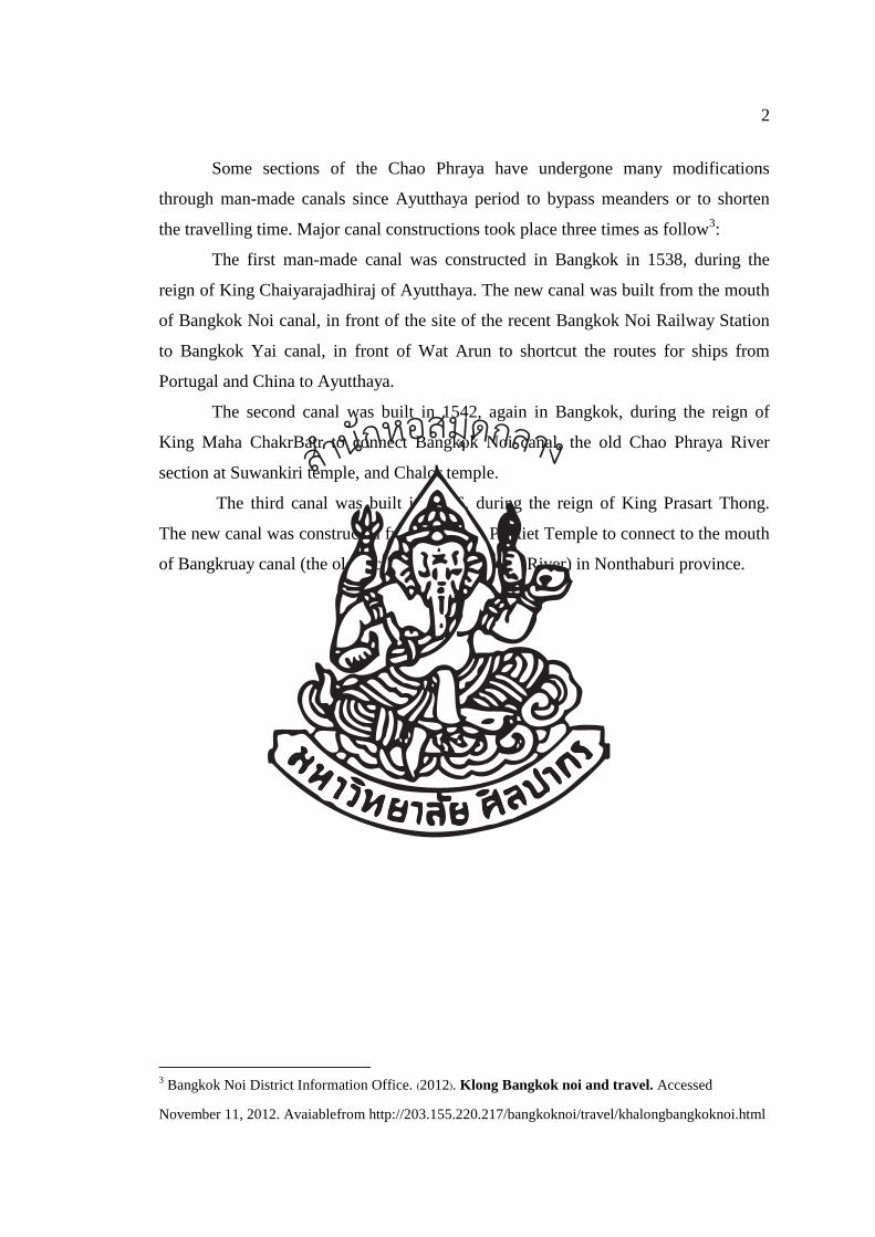
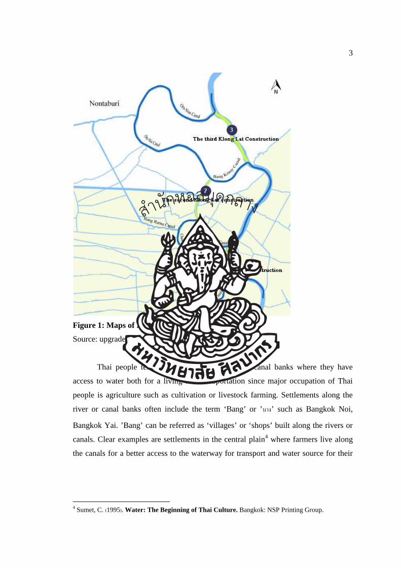
Some sections of the Chao Phraya have undergone many modifications
through man-made canals since Ayutthaya period to bypass meanders or to shorten
the travelling time. Major canal constructions took place three times as follow3:
The first man-made canal was constructed in Bangkok in 1538, during the
reign of King Chaiyarajadhiraj of Ayutthaya. The new canal was built from the mouth
of Bangkok Noi canal, in front of the site of the recent Bangkok Noi Railway Station
to Bangkok Yai canal, in front of Wat Arun to shortcut the routes for ships from
Portugal and China to Ayutthaya.
The second canal was built in 1542, again in Bangkok, during the reign of
King Maha ChakrBatr to connect Bangkok Noi canal, the old Chao Phraya River
section at Suwankiri temple, and Chalor temple.
The third canal was built in 1596, during the reign of King Prasart Thong.
The new canal was constructed from Chalerm Prakiet Temple to connect to the mouth
of Bangkruay canal (the old section of Chao Phraya River) in Nonthaburi province.
3 Bangkok Noi District Information Office. (2012). Klong Bangkok noi and travel. Accessed
November 11, 2012. Avaiablefrom http://203.155.220.217/bangkoknoi/travel/khalongbangkoknoi.html
สำนกัหอ
สมุดกลาง
3
Figure 1: Maps of Klong Lat Construction
Source: upgraded from www.wikipedia.com
Thai people tend to settle along the river or canal banks where they have
access to water both for a living and transportation since major occupation of Thai
people is agriculture such as cultivation or livestock farming. Settlements along the
river or canal banks often include the term ‘Bang’ or ’���’ such as Bangkok Noi,
Bangkok Yai. ’Bang’ can be referred as ‘villages’ or ‘shops’ built along the rivers or
canals. Clear examples are settlements in the central plain4 where farmers live along
the canals for a better access to the waterway for transport and water source for their
4 Sumet, C. (1995). Water: The Beginning of Thai Culture. Bangkok: NSP Printing Group.
สำนกัหอ
สมุดกลาง
4
cultivation5. Inhabitants of the settlement conducted commercial activities, exchanged
goods along the canal. River and canals have been part of everyday living, gradually
social and cultural unity was formed and by word of mouth, these common cultures
and values were spread. Members of the community were aware of the four needs
shared by all inhabitants6.
In this study of “Cultural Tourism Routes of Thai Lifestyle along Bangkok
Canal”, the research focuses on the life along three canals:
a. Bangkok Noi canal located in Bangkok Noi district, Bangkok
b. Chak Phra canal located in Taling Chan district, Bangkok
c. Bangkok Yai canal located in Bangkok Yai district, Bangkok
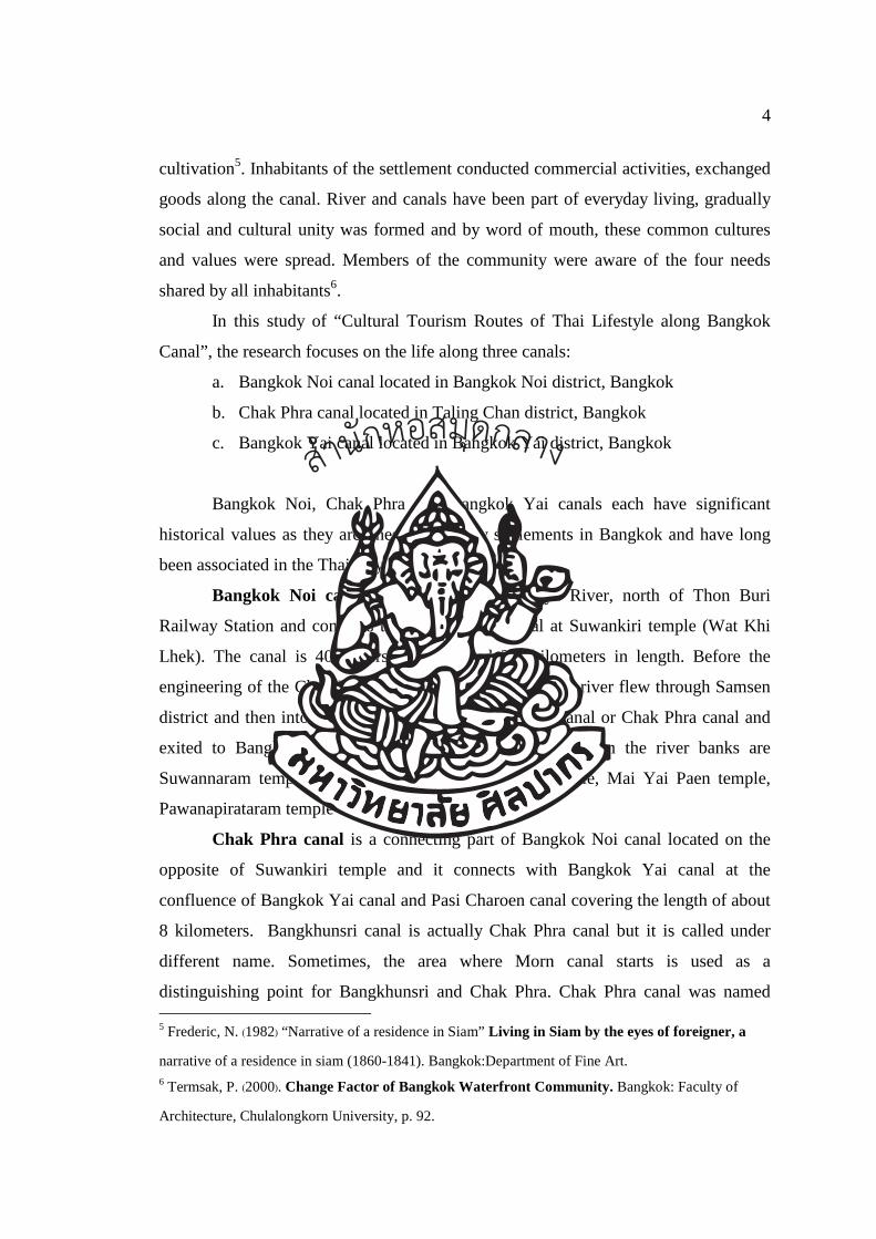
Bangkok Noi, Chak Phra and Bangkok Yai canals each have significant
historical values as they are ones of the early settlements in Bangkok and have long
been associated in the Thai ways of life (Figure 2).
Bangkok Noi canal starts from Chao Phraya River, north of Thon Buri
Railway Station and connects to Bang Khunsri canal at Suwankiri temple (Wat Khi
Lhek). The canal is 40 meters in width and 3.3 kilometers in length. Before the
engineering of the Chao Phraya, the orginal section of the river flew through Samsen
district and then into Bangkok Noi canal, Bangkhunsri canal or Chak Phra canal and
exited to Bangkok Yai canal. Important temples located on the river banks are
Suwannaram temple, Srisudaram temple, Nai Rong temple, Mai Yai Paen temple,
Pawanapirataram temple and Suwankiri temple.
Chak Phra canal is a connecting part of Bangkok Noi canal located on the
opposite of Suwankiri temple and it connects with Bangkok Yai canal at the
confluence of Bangkok Yai canal and Pasi Charoen canal covering the length of about
8 kilometers. Bangkhunsri canal is actually Chak Phra canal but it is called under
different name. Sometimes, the area where Morn canal starts is used as a
distinguishing point for Bangkhunsri and Chak Phra. Chak Phra canal was named 5 Frederic, N. (1982) “Narrative of a residence in Siam” Living in Siam by the eyes of foreigner, a
narrative of a residence in siam (1860-1841). Bangkok:Department of Fine Art. 6 Termsak, P. (2000). Change Factor of Bangkok Waterfront Community. Bangkok: Faculty of
Architecture, Chulalongkorn University, p. 92.
สำนกัหอ
สมุดกลาง
5
after a Chak Phra ceremony which took place on the 2nd wane moon day in the 12th
lunar month. Chak Phra means towing a Buddha image. During this ceremony, a
Buddha image is enshrined and decorated on a boat, this boat would be towed from
Nang Chi temple along the river heading up northward to the mouth of Bangkok Noi
canal, then turned right into the Chao Phraya River and headed back to Bangkok Yai
and then returned to Nang Chi temple. Chak Phra or Bangkhunsri canal is one of a
major canal receiving water from smaller canals such as Taling Chan canal, Bang
Ramad canal, Bang Phrom canal, Bang Saothong canal or Bang Chuek Nhung canal,
Bang Vaek canal, and Pasi Charoen canal. Important temples located along the canal
are Bang Vaek temple, Nok temple, Thong Sala Ngam temple, Kam Paeng temple,
Kuhasawan temple, Nuan Noradit temple and Pradoo Chimplee temple.
Bangkok Yai Canal The length of Bangkok Yai canal starting from the right
of Vichaiprasit fort where it separates from Chao Phraya River to the mouth of Pasi
Charoen canal is approximately 3.5 kilometers. There are several important canals
that join and connect to Bangkok Yai canal such as Baan Somdej canal, Bang Sai Kai
canal, Sum Re canal, Bang Num Chon canal, Bang Sakae canal and Taan canal.
Interesting temples located on the canal banks are Kanlayanamitr temple,
Hongsrattanaram temple, Sangkrajai temple, Velurachin temple, Indhraram temple,
Chandhraram temple, Rajchakruet temple and Paknam Pasi Charoen temple.
After short-cut canals were constructed in the reign of King Chaiyarajadhiraj
of Ayuttaya (1538 AD) and up until early Rattanakosin, the course of the Chao
Phraya was changed resulting in changes of Bangkok (East of the Chao Phraya) and
Thonburi (West of the Chao Phraya). The original sections of the Chao Phraya
became Bangkok Noi, Chak Phra and Bangkok Yai canals in the present day. With
such changes on the river banks, residential buildings were constructed along both
sides of the canals for many generations. Folk wisdom created by local communities7
related to ways of life on the river is applied in everyday life. This folk wisdom is
expresses physically through accommodation building and daily routines that depends
on the environmental surroundings of Bangkok Noi canal bank.
7Ekkawit Na Talang, Folk Wisdom in 4 Regions: Life and Learning Villagers of Thailand (Bangkok:
Sukhothaithammathirat University, 2540), p.49.
สำนกัหอ
สมุดกลาง
6
Figure 2: Scope of study area
Source: www. googlemaps.com
The traditional waterfront house, therefore, is considered as the indicator of
the state of society, ways of life, activities and occupations of local people. The
physical conditions of residential buildings along Bangkok Noi cananl, Chak Phra
canal and Bangkok Yai canal can be categorized into 5 styles. 8
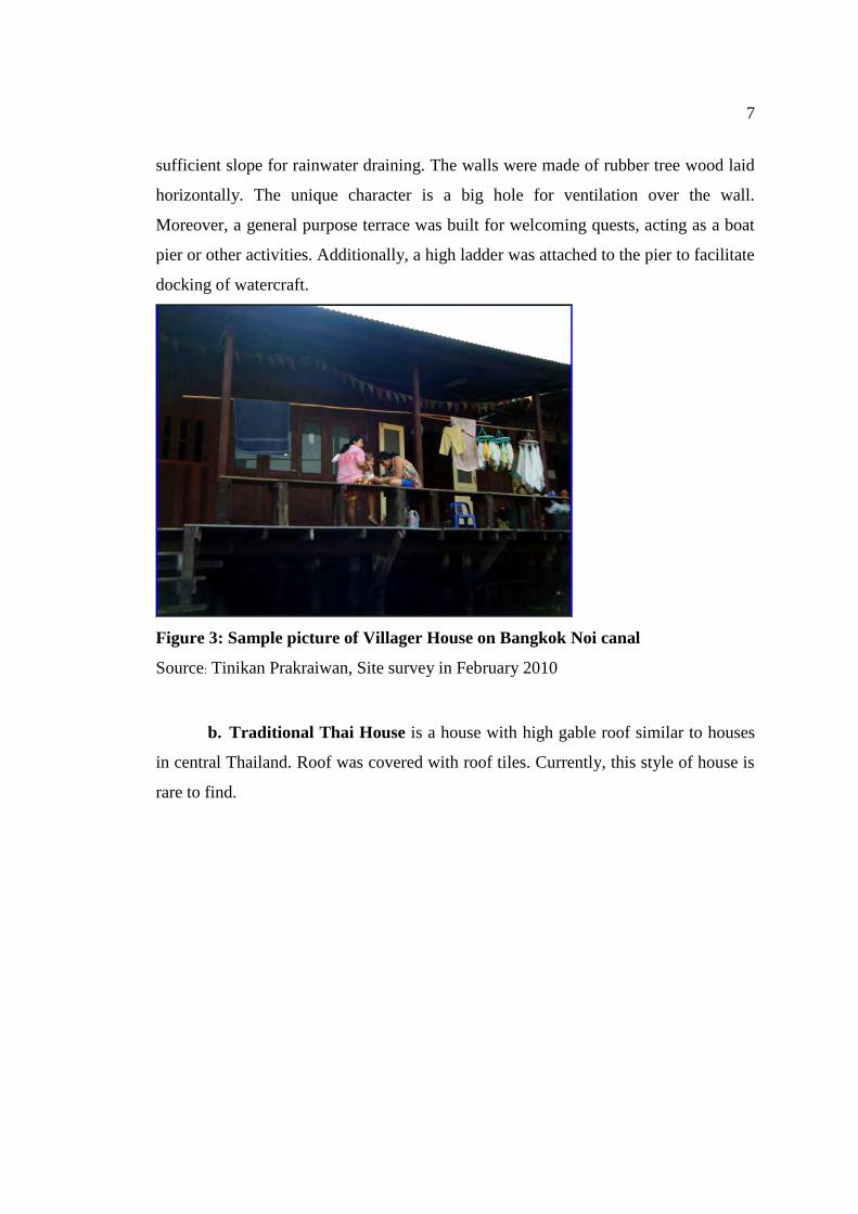
a. Common housing of canal-side residents was built by the local house-
builders with knowledge passed on from generation to generation. Design was then
copied and transferred to other houses. House owner may request for changes. Each
house is built close to one another. The roof of the house was in gable shape with
8 Onsiri, P. (1996). House and Local Villages. Bangkok: Thammasat Printing, 151.
7
sufficient slope for rainwater draining. The walls were made of rubber tree wood laid
horizontally. The unique character is a big hole for ventilation over the wall.
Moreover, a general purpose terrace was built for welcoming quests, acting as a boat
pier or other activities. Additionally, a high ladder was attached to the pier to facilitate
docking of watercraft.
Figure 3: Sample picture of Villager House on Bangkok Noi canal
Source: Tinikan Prakraiwan, Site survey in February 2010
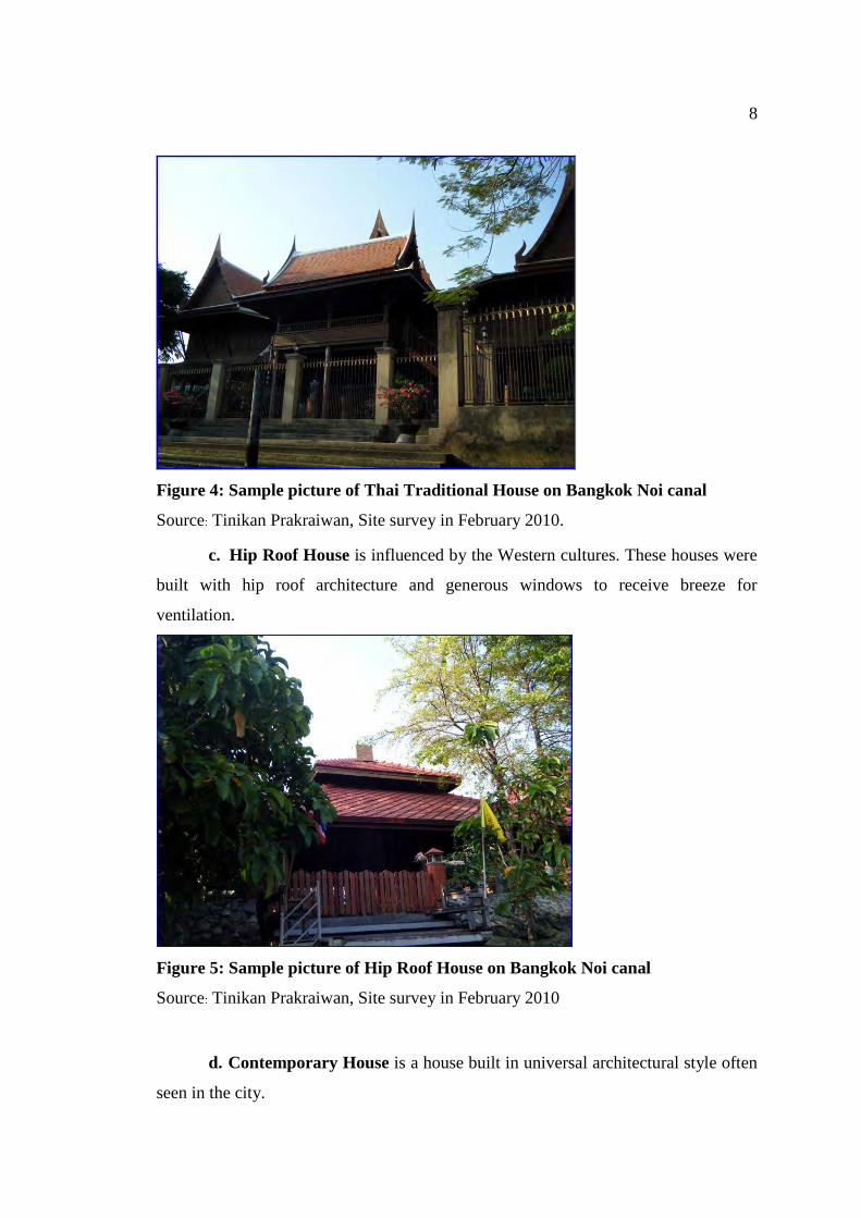
b. Traditional Thai House is a house with high gable roof similar to houses
in central Thailand. Roof was covered with roof tiles. Currently, this style of house is
rare to find.
8
Figure 4: Sample picture of Thai Traditional House on Bangkok Noi canal
Source: Tinikan Prakraiwan, Site survey in February 2010.
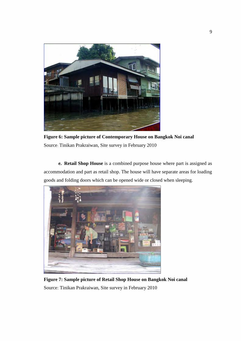
c. Hip Roof House is influenced by the Western cultures. These houses were
built with hip roof architecture and generous windows to receive breeze for
ventilation.
Figure 5: Sample picture of Hip Roof House on Bangkok Noi canal
Source: Tinikan Prakraiwan, Site survey in February 2010
d. Contemporary House is a house built in universal architectural style often
seen in the city.
9
Figure 6: Sample picture of Contemporary House on Bangkok Noi canal
Source: Tinikan Prakraiwan, Site survey in February 2010
e. Retail Shop House is a combined purpose house where part is assigned as
accommodation and part as retail shop. The house will have separate areas for loading
goods and folding doors which can be opened wide or closed when sleeping.
Figure 7: Sample picture of Retail Shop House on Bangkok Noi canal
Source: Tinikan Prakraiwan, Site survey in February 2010
10
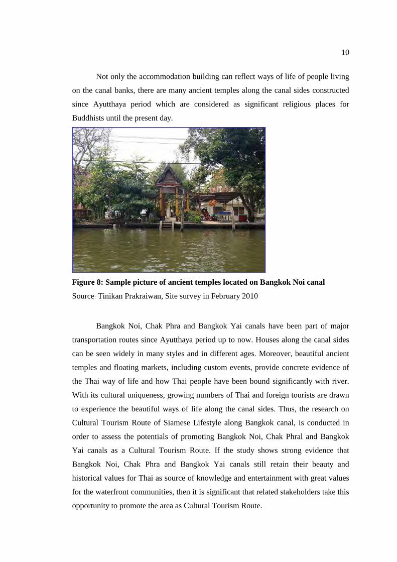
Not only the accommodation building can reflect ways of life of people living
on the canal banks, there are many ancient temples along the canal sides constructed
since Ayutthaya period which are considered as significant religious places for
Buddhists until the present day.
Figure 8: Sample picture of ancient temples located on Bangkok Noi canal
Source: Tinikan Prakraiwan, Site survey in February 2010
Bangkok Noi, Chak Phra and Bangkok Yai canals have been part of major
transportation routes since Ayutthaya period up to now. Houses along the canal sides
can be seen widely in many styles and in different ages. Moreover, beautiful ancient
temples and floating markets, including custom events, provide concrete evidence of
the Thai way of life and how Thai people have been bound significantly with river.
With its cultural uniqueness, growing numbers of Thai and foreign tourists are drawn
to experience the beautiful ways of life along the canal sides. Thus, the research on
Cultural Tourism Route of Siamese Lifestyle along Bangkok canal, is conducted in
order to assess the potentials of promoting Bangkok Noi, Chak Phral and Bangkok
Yai canals as a Cultural Tourism Route. If the study shows strong evidence that
Bangkok Noi, Chak Phra and Bangkok Yai canals still retain their beauty and
historical values for Thai as source of knowledge and entertainment with great values
for the waterfront communities, then it is significant that related stakeholders take this
opportunity to promote the area as Cultural Tourism Route.
11
1.2 Hypothesis
If waterfront community has significant key values then it can be developed into
water cultural tourism route.
1.3 Research Question
a. Does Bangkok canal still reflect traditional cultural values of the traditional
Thai life?
b. What key values, features or characteristics of Bangkok Canal are important
for the development of cultural tourism route?
c. What elements must the key values possess before they can be used to
indicate the capacity of Bangkok Canal as cultural tourism route (for
example community, temple, local culture, inter-communities
communication)?
d. Which groups of tourist would be interested in Bangkok canal water
cultural tourism route?
e. How could Bangkok canal be developed and promoted as a Cultural
Tourism Route, reflecting both historical and cultural values of Thailand?
1.4 Goals and objectives
Goals: To develop an understanding of the important places, valuable in terms
of social values, for example, temples, communities, houses, floating markets which
lined along the Bangkok canal in order to comprehend the ways of life of people in
the past that closely related to river and how they should be interpreted by arranging a
tourism route on Bangkok Canal. The further goal will be to develop a cultural
tourism route theoretically and practically to be followed, experienced or enjoyed as
part of a cultural tourism route experience to be integrated in to the existing
community structure.
Objectives
1. To research the cultural key values, features or characteristics and traditions
of Thai people living on the canal bank of Bangkok Canal
สำนกัหอ
สมุดกลาง
12
2. To identify the value of ancient architectures on the canal bank to be
retained and interpreted.
3. To develop a model for cultural tourism routing to explain the way of life in
the old times that is bound with rivers and canals with the aim of providing
a tourism program on a cultural tourism route.
4. To recommend a cultural tourism route in balance with the community and
their cultural values.
1.5 Scope of the study
a. Scope of geographical study area
Geographical area of study covers the waterfront communities of Bangkok
Noi, Chak Phra and Bangkok Yai canals in three different administration districts
which are Bangkok Noi, Bangkok Yai and Taling Chan (as shown in the
accompanying map).
b. Scope of study context
i) Waterfront area
The study covers history, physic, economy and social and culture based on
secondary data analysis to demonstrate potentials to promote the area as a sustainable
culture tourism route. The study covers:
• Tourism and cultural contexts of living conditions and cultural origins
and traditions of Thai people living on the canal bank of Bangkok Noi , Chak Phra
and Bangkok Yai canals.
• The sustainable tourism development capacity of the canal bank of
Bangkok Noi, Chak Phra and Bangkok Yai canals. This aspect includes the
components of sustainable tourism development.
ii) Waterfront communities and related government agencies
This section discusses the needs of Bangkok canal waterfront communities
in terms of types of activities and expectations of community members toward
becoming a culture tourism route. Stakeholders include household leaders,
community leaders, local community members, government agencies responsible for
tourism industry, and business owners.
สำนกัหอ
สมุดกลาง
13
iii) Tourists
The study explores expectations as well as types of activities tourists
expect to see from a culture tourism route.
iv) Recommendation of Cultural Tourism Routing
This section covers the study of tourism context by applying theory and
interpretation model to analyse and process data in order to generate guidelines for
appropriate format of sustainable waterway culture tourism route program.
c. Scope of data collection and target group
Target group for data collection will be all tourists visiting the study site in
Bangkok Noi, Bangkok Yai and Taling Chan districts by waterway between May to
October 2012.
1.6 Research methodology
a. Undertake background study of secondary data such as literatures, reports,
media, and the Internet in order to project the scope of investigation for the purpose of
this research.
b. Gather all relevant data and information about Thai people living on the
canal bank of Bangkok Noi, Chak Phra and Bangkok Yai canals.
c. Field research
1. Site visits, Surveys, Pictures Taking
2. Participant and Non – participant Observation
3. In depth Interview with Key Informants such as of three groups as
Stakeholders of the site, local communities, and government officials.
4. Questionnaire design and collection for study tourists’ attitude.
d. Assess the ancient architectural values on the canal bank of Bangkok Noi,
Chak Phra and Bangkok Yai canals.
e. Analyse raw data collected
f. Develop an interpretation model to explain the way of life in the old times
that is bound with rivers and canals with the aim of providing a tourism program on a
cultural tourism route.
g. Provide recommendations on a sustainable cultural tourism route in balance
with the community and their cultural values.
สำนกัหอ
สมุดกลาง
14
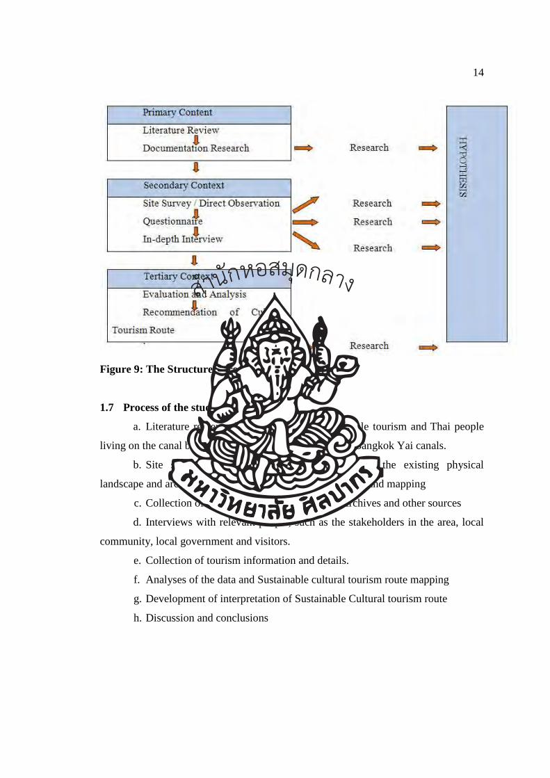
Figure 9: The Structure of research
1.7 Process of the study
a. Literature review of cultural tourism, sustainable tourism and Thai people
living on the canal bank of Bangkok Noi, Chak Phra and Bangkok Yai canals.
b. Site survey: to gather general information on the existing physical
landscape and architectural heritage, including photography and mapping
c. Collection of information from the national Archives and other sources
d. Interviews with relevant people, such as the stakeholders in the area, local
community, local government and visitors.
e. Collection of tourism information and details.
f. Analyses of the data and Sustainable cultural tourism route mapping
g. Development of interpretation of Sustainable Cultural tourism route
h. Discussion and conclusions
สำนกัหอ
สมุดกลาง
15
1.8 Limitations of the study
a. This study covers the waterfront communities along the Bangkok Noi,
Chak Phra and Bangkok Yai canals. It does not include all waterfront communities in
Bangkok.
b. This study focuses on history, society and culture of waterfront
communities in Rattanakosin period only.
1.9 Synopsis of Chapters
Chapter 1: Introduction
This chapter introduces and states the significance of the problem, goals,
hypothesis, research questions, objectives, research context, research methodology
and process of study. It briefly explains the concept of this dissertation and how it has
been conducted to achieve its goals.
Chapter 2: Literature Review
This chapter considers the value of Cultural Heritage Management in
sustaining tourism, models for sustainable tourism, models for Interpreting cultural
values in support of cultural tourism, related studies on Klong Bangkok Noi and the
definition and use of cultural routes.
Chapter 3: Bangkok Canal: Waterway of Life For The People Of Bangkok
This chapter describes the history and background of Bangkok Canal, physical
conditions community way of life, cultural and architectural attractions and other
landmarks along Bangkok Canal.
Chapter 4: Analys Cultural Significance of Bangkok Canal
This chapter covers the discussion on significance values of Bangkok Canal.
The chapter begins with the discussion on the values deriving from the history to
reflects its historic value, then aesthetic values of the Bangkok Canal environment is
discussed to describe the aesthetic value, followed by the discussion of social values
in the community and lastly the evidence of how the Bangkok Canal were built which
reflects its scientific values.
Chapter 5: Research Methodology
This chapter explains research methodology used for data collection.
สำนกัหอ
สมุดกลาง
16
Chapter 6: Analysis of Cultural Tourism Route for Bangkok Canal
This chapter analyse data collected both from an in-depth interview and
questionnaire. Findings are presented and discussed in details.
Chapter 7: Recommendation of Cultural Tourism Route for Bangkok Canal
and Conclusion
This chapter concludes the outcome of hypothesis test, presents answer to key
research question and draws a conclusion for the study. Recommendation is as well
given as practice guide.
1.10 Definitions
a) Bangkok canal
Bangkok canal refers to study area which covers Bangkok Noi, Chak Phra and
Bangkok Yai canals. The area starts from the mouth of Bangkok Noi canal until the
end of Bangkok Yai canal with total length of 14.8 kilometres in three different
administration districts which are Bangkok Noi, Bangkok Yai and Taling Chan.
Bangkok canal will used when referring to study area in the next chapter.
b) Siam and Siamese
Siam and Siamese refers to kingdom of Siam and the people of the kingdom
of Siam living in the Chao Phraya River basin in South East Asia. Siamese migrated
back and forth between the two sides of the Mekhong until they eventually settle at
the central plain between the lower Northern area and the West of Chao Phraya River.
Siam is the old name of Thailand known by the West (Europeans and
Persians) and the East. The term Siam appeared on the ancient map and it was
assumed that the term was derived from Mon and Malay languages in which they
called this land Scerno, Ansia, Davasian, Judia, Judea or Royaume de Siam.
The historical kingdoms referred to by the name of Siam include Ayutthaya
Kingdom (1351–1767), Thonburi Kingdom (1768–1782) and Rattanakosin Kingdom
(1782–present). The king of this kingdom was referred to as the King of Siam.
In 1767, centre of administration shifted from Ayutthaya which the Burmese
referred to as Odia to Bangkok or Banckok until 1932 when the absolute monarchy
สำนกัหอ
สมุดกลาง
17
was abolished, the constitution installed on 10th December 1932 still referred to this
country as “Siam”9.
c) Waterfront community
Waterfront community refers to settlement along the water in which water is
an important factor for cultivation, consumption and transportation. Trade and
exchange of goods are conducted along the waterway. Social and culture are unified
and the population of community shares common beliefs and values.
d) Rattanakosin period
Rattanakosin kingdom is the fourth kingdom of Thailand. It was established
by King Buddha Yodfa Chulaloke (Rama I, the first king of Chakri dynasty) when the
capital was moved from Thonburi to the eastern bank and the city pillar was erected
on 6th April 1872. Todays, Rattanakosin is in the reign of King Bhumibol Adulyadej
(Rama 9). The kingdom of Thailand has long history dating back more than 800
years, the kingdom changes its capital (center of administration and governing)
location four times from Sukhothai, Ayutthaya, Thonburi and currently
Rattanakosin.10
e) Cultural heritage
The ways of living developed by a community and passed on from generation
to generation, including customs, practices, place, objects artistic expressions and
values11.
f) Heritage significance
The aesthetic, historic, research, social, spiritual or other special values a place
may have for present or future generations. Heritage significance recognizes both the
natural and cultural importance of places.12
9 Poem Association of Thailand. (2012). Meaning of Siam and Siamese. Accessed November 12,
2012. Available from http://www.thaipoet.net/index.php.
10 Bangkok Information Centre. (2012). Meaning of Rattanakosin period. Accessed November 12,
2012. Available from http://203.155.220.230/info/passbkk/frame.asp
11 The Australian Heritage Commission and Tourism Council Australia. (2001). Successful Tourism at
heritage Place. Canberra: Department of Industry and Resources, 58.
12 __________. (2001). Successful Tourism at heritage Place. Canberra: Department of Industry and
Resources, 59.
สำนกัหอ
สมุดกลาง
18
g) Interpretation
A means of communication of ideas and feelings which help people
understand more about themselves, their environment and other cultures. The process
is commonly facilitated by guides, displays, on-site signage, brochures and electronic
media.13
h) Sustainable tourism
Sustainable tourism refers to tourism that can be sustained over the long term
because it results in a net benefit for present and future economic and social
wellbeing. 14
i) Cultural tourism route
Cultural tourism route is a tourism route that possess aspects of interaction;
promotion of cross-fertilisation of cultures in space and time; and integration of
historic relations and cultural properties into dynamic system but lacks some aspect as
such human intercultural links and diversity of cultural heritage.
13 The Australian Heritage Commission and Tourism Council Australia. (2001). “Successful Tourism
at heritage Place”. Canberra: Department of Industry and Resources, 60.
14 __________. (2001). Successful Tourism at heritage Place. Canberra: Department of Industry and
Resources, 62.
สำนกัหอ
สมุดกลาง
19
CHAPTER 2
LITERATURE REVIEW
The concept of Cultural Tourism Routes is new and it involves many aspects.
Though its name suggests similarity to Cultural Routes and Cultural Tourism however
there are some aspects that can be used to differentiate the three terms. In order to
gain understanding of this new concept, it is necessary that thorough understanding of
Cultural Routes and Cultural Tourism are reviewed. Thus the purpose of this literature
review is to gain knowledge and insight into the current understanding of the Cultural
Routes and Cultural Tourism concept which have been previously studied by
professionals and scholars. Furthermore, concepts of sustainable tourism and cultural
values are reviewed as well. This chapter reviews the literature on the following
topics;
1. The role of cultural heritage management in sustaining tourism
2. Models for sustainable tourism
3. Models for Interpreting cultural values in support of cultural tourism
4. Related studies on Klong Bangkok Noi
5. The definition and use of cultural routes
2.1 The role of Cultural Heritage Management (CHM) in sustaining tourism
Cultural heritage as defined by United Nations Educational, Scientific and
Cultural Organization (UNESCO) is a product and process that provides society with
physical and intangible, movable and immovable attributes that are either inherited
from past generations or created in the present and bestowed for the benefit of future
generations. It can also be seen as production as well as a dynamic process that
สำนกัหอ
สมุดกลาง
20
undergoes continuous change and that has changing values.15 The mutual dependence
that exists between tourism and cultural heritage is also becoming more evident.16
Cultural heritage provides foundation for tourism on the other hand; tourism has the
power to generate funds that make cultural heritage conservation possible. Thus
without proper cultural heritage management (CHM), tourism loses its potential to
grow and sustainable tourism will be difficult to achieve.
CHM is a concept that aims to maintain resources and assets such as heritage
places, cultural property and other tangible traditional assets in a community17
.Cultural heritage values refer to qualities and feature possessed by places or items
that have aesthetic, historic, scientific or social value for past, present and future
generations. These values may be seen in places and physical features but can also be
associated with intangible qualities such as people’s associations with or feeling for a
place or item, or in other elements such as cultural practices, knowledge, traditional
and history.
CHM is a relatively new discipline involving global information sharing and
professional discipline. It has been recognised worldwide through a number of
multidisciplinary organisations with charters for management practice, for instance
UNESCO and the Venice Charter.
According to the World Heritage Convention (1972) 18 is one of the most well-
known legal instruments in heritage preservation. It is endorsed by 187 countries. In
2012 there are 890 areas protected around the world under this system. Each party
signatory to this convention is responsible for ensuring the identification, protection,
conservation, presentation and transmission to future generations of the cultural and 15 UNESCO. (2012). Towards a UNESCO culture and development indicators suite. Accessed
November 2, 2012. Available from
http://www.unesco.org/fileadmin/MULTIMEDIA/HQ/CLT/creativity/pdf. 16 NWHO Nordic World Heritage Foundation. (1999). Sustainable Tourism and Cultural Heritage.
Accessed November 2, 2012 Available from http://www.nwhf.no/index. 17 Cros. (2007). Cultural heritage management in China: preserving the cities of the Pearl River
Delta. NY, USA: Routledge. 18 Rossler. (2010). World heritage and cultural heritage management: New conservation
challenges. Accesed April 10,2011. Available from
http://ises.hu/webimages/Mechtild_Rossler_World_Heritage_and_Cultural__Heritage_Management.pdf.
สำนกัหอ
สมุดกลาง
21
natural heritage, which includes architecture works, painting or any universal value
from the historical, art and science perspective19. Each party in this convention is
required to;
a. Implement a common policy that intends to protect and maintain cultural
and natural heritage as well as to combine the protection of the heritage
with an inclusive planning programs.
b. Develop one or more service for the protection and conservation and
presentation of the natural and cultural heritage with a competence staff.
c. Initiate technical and methodological studies and researches in order to
provide operation and procedure methods that help state capable of
handling the damages or dangers that intimidate its cultural and natural
heritage.
d. Utilize the appropriate legal, registration, technical, administrative and
financial for protection, conservation, presentation and rehabilitation of
cultural and natural heritage.
e. Promote and support the establishment of national or local institute for
training in protection, conservation and presentation of the cultural and
natural heritage as well as to motivate technical research and study in this
field.
In 2006, an international panel comprised of members of the preservation-
minded community gathered for a symposium to “share secrets” with each other so as
to better help other countries protect their sites of cultural and natural heritage by
passing on what they had learned20. One of the most critical conclusions to come from
that gathering was the understanding that there is no one way to protect all sites in all
nations; rather, each country must determine for itself the best ways to preserve (and
present) its own national treasures, and that transparency in methodology is critical if
nations are to commit to preservation of heritage beyond their own borders.
19 United Nations Educational, Scientific and Cultural Organization (UNESCO). (1972). Convention
concerning the protection of the world cultural and natural heritage, General conference. Accesed
April 13,2011. Available from http://whc.unesco.org/archive/convention-en.pdf. 20 Reich. (2007). Gathering new ideas for the practice of preservation through international
discussion. APT Bulletin, 37(4), 5-11.
สำนกัหอ
สมุดกลาง
22
The kind of flexibility endorsed by the symposium is critical when one
considers that each nation has its own unique mix of social, political, cultural,
environmental, and other concerns. This can be especially true in developing nations,
which are "challenged by conflicting demands of preservation, economic
development and social equity" (Fletcher, Johnson, Bruce, & Khun-Neay21. Such
challenges can be met, and overcome, by ensuring the "buy-in" of local communities
so that resistance is minimized, and that national governments can be reassured that
gaps caused by diversity and other differences in populations have been put aside in
an effort to protect a commonly-valued site, artwork, or other piece of heritage.
While this is indeed the case – that engagement at the local level can bridge
divides -- it is also the case that this is not always possible, or easy. As Campbell
notes, "What makes such work difficult is the fact that multiple groups may have
historical memories connected to a site. Representing these different interests fairly
and accurately (i.e., in a way that recognizes complexity and relativity, not "just the
facts") is a serious challenge for preservationists"22. While Campbell was writing
about a project in Texas, a place in the US notorious for its divisions between
indigenous people, people of Latin descent, and people of European descent, this kind
of challenge exists in every nation. Cultural heritage management thus can be as much
a political, or socio-cultural, endeavour as much as, say, an eco-tourist or
archaeological one.
The subject of archaeology is critical in this context, given that it is common
knowledge that it has traditionally robbed countless nations and peoples of their
cultural treasures in a quest to fill museums (and pockets). It is therefore comforting
that such projects as "community-based archaeology" are taking place in locations
like Australia, where Aboriginal community members have a chance to participate in
any and all site-specific work, thus ensuring that any artefact of cultural import are
21 Fletcher, R.Johnson, I., Bruce, E., and Khun-Neay, K. (2007).Living with heritage: Site monitoring
and heritage values in greater Angkor and the Angkor World Heritage Site, Cambodia. The
Archaeology of World Heritage , 39(3), 85-405. 22 Campbell, H. (2005). The Socorro Mission: Culture, economic development, and the politics of
historic preservation along the Río Grande/Río Bravo. Latin American Perspectives, 32(6), 8-27.
สำนกัหอ
สมุดกลาง
23
preserved in a fashion that also preserves their integrity23. Such models of inter-
institutional cooperation, undertaken at the community level, can and should be
reproduced where possible as an integral aspect of cultural heritage management.
2.2 Models for sustainable tourism
Tourism is growing and with its growth rate, some argue that, tourism industry
is moving toward to becoming one of the biggest or the biggest industry in the
world.24 In 1999, the World Travel and Tourism Council (WTTC) estimated tourism
would contribute a 12% share to the global GDP with an annual growth rate of 3%
from 1999 to 2010. At the World Tourism Trends and the Way Ahead - WYSETC
Convention 2011 Barcelona, Spain, the World Tourism Organisation (UNWTO)
reported an average growth rate of tourism to be 3.3% from 2000 to 2010. It is clear
that tourism’s economic impact is significant and its growth has impact on cultural
heritage. Thus it is crucial that sustainability is introduced to tourism sector.
Sustainability is a concept that has become popular in recent years and is
being adopted widely in every sector, including the tourism sector because of the
rapid rise in tourist numbers and their impacts on places of high value to
communities, nations and, in some cases, the world community. The concept of
sustainability in tourism has been embraced by the tourism industry in order to protect
and preserve national resources for the future generations. The basic concept of
sustainability is to operate tourism activities in a manner that will preserve the balance
of the economic, environment and social values. In other words, this concept is aimed
at preserving the environment with social care and good economic returns to those
who are most directly affected by the tourism activities. These ideas are not new but
they are becoming more urgent with every passing day because of the phenomenal
growth of tourism in the last few years. Even so, sustainability in tourism is a
complex and challenging issue, as can be observed by a review of what is written on
this critical and urgent issue. 23 Greer, S., Harrison, R., and McIntyre-Tamwpy, S. (2002). Community-based archaeology in
Australia .Community Archaeology, 34(2), 265-287. 24 NWHO Nordic World Heritage Foundation. (1999). Sustainable Tourism and Cultural Heritage.
Accessed November 2, 2012 Available from http://www.nwhf.no/index.
สำนกัหอ
สมุดกลาง
24
Most sustainable development model employed in Thailand are mostly
adopted from European countries such as the model developed by Council of Europe
and the Slovenian Ministry of Environment and Physical Planning. The Council of
Europe and the Slovenian Ministry of Environment and Physical Planning initiated
the sustainable tourism project called “Sustainable Tourism Development” which
aims to bring the positive result of development without any harm or negative impact
to the nature25. The concept focuses on using or reusing limited resource and
maintaining the environment together with social development. The model suggests
that visitors to tourism sites should not make waste, pollution and any kind that may
harm the place they visit. On the other hand, the visitors should leave the value or
benefit to the place where they visit. They also advocate that in order to successfully
implement the sustainable tourism concept, the heritage administrative body should
encourage tourists to understand and participate in the project.
UNESCO also suggests a model for sustainable management of cultural
heritage for development which attempts to examine the relationships between the
processes of conservation, restoration and interpretation of cultural heritage and
sustainable development. The model also includes care for heritage, sustainable
benefits gained from heritage as well as ways of access and enjoyment of heritage.26
Indicators for sustainable management of cultural heritage tourism site that have been
fully developed include:
a. Register of cultural heritage assets
b. Employment in the cultural heritage sector
c. Public attitude towards heritage
d. Participation in heritage related activities
However, there are still some indicators that need to be further developed
such as:
25 Council of Europe Counsel del’ Europe. (1996). Sustainable tourism development: conciliation of
economic, cultural of economic, cultural, social, scientific and environmental
interests.Environment encounters 34, Maribor; Slovenia, 12-14. 26 United Nations Educational, Scientific and Cultural Organization (UNESCO).. (2012). Towards a
UNESCO culture and development indicators suite. Accessed November 2,2012. Availabla from
http://www.unesco.org/fileadmin/MULTIMEDIA/HQ/CLT/creativity/pdf.
สำนกัหอ
สมุดกลาง
25
e. Government resources dedicated to heritage
f. The existence and status of heritage legislation in the various countries
g. The status of the implementation of UNESCO conventions
h. Experiences in the participatory heritage management
According to report from UNESCO, sustainability will be achieved when
environmental, social and economic sustainability that meets the needs of the present
without compromising the ability of future generations to meet their own needs is
fulfilled in a long run. Even though, the relative importance of each component may
change from time to time and in different circumstances.
Narasaiah27defined the sustainable tourism as the recognized of the
stakeholders about the tourism development need to activate base on the sustainable
and environmental friendly. They advise that some nations have developed laws and
regulations aim at controlling the tourism industry in order to progress without
damaging the natural environment. All parties need to be concerned about the
sustainable development of tourism and with internationally coordinate it can lead to
the success of keeping nature for following generations to experience and enjoy as we
can today.
Some writers in Asia have been observing that the party which has the greatest
stake in most sustainable tourism enterprises is the immediate community — the
people who live in the areas to which tourists come, or through which they flow —
the hosts. For example, how should they feel about these people coming through the
places where they live? Do they trust that the tourists will truly care for their lands, as
well as their cultural heritage sites and artefacts, as they do (or, should we say, will
they act as if they care as much as they do)? After all, the definition of sustainable
tourism is “tourism which meets the needs of present tourists and host regions while
protecting and enhancing opportunity for the future”. Yu, Chancellor and Cole28
27 Narasaiah, M.L. (2004). Globalization and sustainable tourism development, New Delhi.
India:Discovery Publishing House. 28 Yu, C.P.S., Chancellor, H.C., and Cole, S.T. (2011). “Measuring residents’ attitudes toward
sustainable tourism: A reexamination of the sustainable tourism attitude scale.”Journal of Travel
Research,2011. 50(1), 57–63.
สำนกัหอ
สมุดกลาง
26
suggest that to be truly sustainable, all parties involved need to feel comfortable and
accepting of the process. Interestingly, one recent study found that for the tourists
themselves to have an appropriately respectful attitude toward the places through
which they were travelling, the residents themselves needed to show attitudes which
were conducive to that kind of respect. In other words, the approach of the members
of the communities through which "sustainable" tourists are travelling has a
significant impact upon the attitude and behaviour of the tourists themselves. This
makes sense, if only in a common-sense fashion, but has large ramifications for those
countries, especially developing ones, that are planning large-scale sustainable tourist
ventures to both preserve cultural heritage sites and artefacts and also boost economic
development. If members of local communities are not "on board" with the decision
to create such opportunities, they might well fall flat on both ends (meaning, tourists
will not be happy, and local communities will see their treasured sites being treated
with disrespect).
Perhaps before anyone can be brought "on board," as it were, the very
definition of sustainable tourism needs to be defined for any given geographical area.
This is a point of agreement between experts that even though, as explained above,
the World Tourism Organization has defined sustainable tourism, there are terms
which are vague within the very definition itself29.
For example, Butler30 argued that there is lack of specificity of human needs,
time period to determine if human needs have been satisfactorily met and
uncertainties in situations where needs may be conflicting. Similarly, other authors
argue that ST [sustainable tourism] tends to be defined as a single rather than a multi-
sectoral approach, emphasizing growth in order for viability to be maintained.
This makes intuitive sense, and is especially relevant given that the very
places and things which cultural heritage management seeks to protect (in part,
through sustainable tourism) have suffered tremendously due to untrammelled
29 Lu, J., and Nepal, S.K. (2009). Sustainable tourism research: An analysis of papers published in the
Journal of Sustainable Tourism. Journal of Sustainable Tourism, 17(1), 5-16.
30 Butler, J. (1999). Gender Trouble: Feminism and the Subversion of Identity. NewYork:
Routledge, 9–11, 45–9.
สำนกัหอ
สมุดกลาง
27
growth, development, and just general carelessness regarding their worth. If citizens
of countries, especially developing nations, wish to protect their current cultural
assets, they would do well to not rush to embrace the promise of sustainable tourism
without first defining exactly what "needs" such tourist feel they have. In such cases
where those needs contradict the need of community members to protect their cultural
heritage, then sustainable tourism turns out to be the opposite indeed. Similarly,
without considering all of the variables inherent in a seemingly simple construct, local
communities once more stand to lose. For example, if the stop-overs are all in
protected areas on a particular sustainable tour, but the roads travelled are vulnerable
to overuse and degrade over time, then this is a situation of winning on the one hand
and losing on the other. For this reason, sustainable tourism must be a concept that is
fully understood, and fully defined, for each context for which it is developed.
Otherwise, we will end up with the very thing that cultural heritage preservationists
are trying to avoid.
2.3 Models for Interpreting cultural values in support of cultural tourism
In order to understand cultural values, it is essential to first clarify the terms
“culture” and “value”. According to Rokeach, culture refers to the total pattern of
human behaviour in society and values are often defined as a set of “an enduring
belief that one mode of conduct or end-state of existence”31 thus “cultural values” can
be regarded as “the governing ideas and guiding principles for thought and action in a
given society and a powerful force shaping one’ motivation, lifestyle and making
choices32.
Systems for interpreting cultural values have been developed in different
forms and for different purposes. Major use of such systems is such to assist visitors
to national parks in the USA, to provide information in museums and cultural places
in order to raise awareness and increase satisfactory experience for visitors to new
31 Rokeach, M. (1973). The nature of human values. New York: Free Press. 32 Tse, D., R. W. Belk, et al. (1989). “Becoming a consumer society: A longitudinal and cross-cultural
content analysis of print ads from Hong Kong, the People’s Republic of China, and Taiwan”. Journal
of Consumer Research March 15, 1989, 457-472.
สำนกัหอ
สมุดกลาง
28
places. Attempts have been made to define and explain how to interpret cultural
values.
Generally, interpretation is described as a form of communication. The
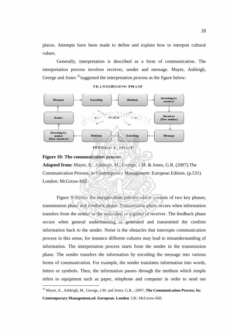
interpretation process involves receiver, sender and message. Mayer, Ashleigh,
George and Jones 33suggested the interpretation process as the figure below:
Figure 10: The communication process
Adapted from: Mayer, E., Ashleigh, M., George, J.M. & Jones, G.R. (2007).The
Communication Process. In Contemporary Management: European Edition. (p.531).
London: McGrraw-Hill.
Figure 9 depicts the interpretation process which consists of two key phases;
transmission phase and feedback phase. Transmission phase occurs when information
transfers from the sender to the individual or a group of receiver. The feedback phase
occurs when general understanding is generated and transmitted the confirm
information back to the sender. Noise is the obstacles that interrupts communication
process in this sense, for instance different cultures may lead to misunderstanding of
information. The interpretation process starts from the sender in the transmission
phase. The sender transfers the information by encoding the message into various
forms of communication. For example, the sender translates information into words,
letters or symbols. Then, the information passes through the medium which simple
refers to equipment such as paper, telephone and computer in order to send out 33 Mayer, E., Ashleigh, M., George, J.M. and Jones, G.R., (2007). The Communication Process. In:
Contemporary Management,ed. European. London. UK: McGrraw-Hill.
สำนกัหอ
สมุดกลาง
29
message to the receiver. In the next step, the receiver attempts to understand the
message called decoding. This stage is a critical part of communication as it can
indicate whether communication is successful. In additional, Ajzen and
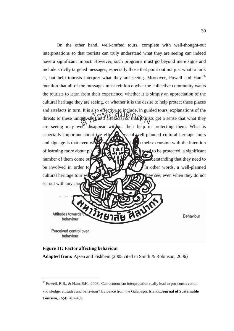
Fishbein34developed the theory to demonstrate that interpretation often aims to
encourage the audience to follow the behaviour pattern (Figure 2). Their theory
illustrates that there are some factors that can impact on the audience behaviour. They
believed that people is the socialize creature which most likely to behave in the
manner that the social has approved. However, the attitude toward the interpretation
depends on the individual control and perception.
When considering cultural heritage sites, there are a variety of communication
avenues which are available to assist tourists to interpret the sites appropriately.
According to Prentice35 “interpretation is ‘a process of communicating to people the
significance of a place so that they can enjoy it more, understand its importance, and
develop a positive attitude towards conservation. Prentice argues that interpretation
may be used to ‘enhance the enjoyment of place, to convey symbolic meanings, and
to facilitate attitudinal or behavioural change”.
In short, interpretation is now seen as a critical aspect of tourism as it relates to
the protection of culturally significant sites and artefacts. Along cultural heritage
routes, or at specific cultural heritage sites, one of the more common ways
communication about the particular site is expressed is through the use of signage. Is
this particular method effective in helping tourists to interpret those sites as they need
to? One study found that, in fact, it might not be. Many tourists simply walk past such
signage, especially at sites that are free to the public, while more tend to read the signs
at commercial sites.
This might suggest that interpretation, at least with some tourists, is concurrent
with perceived value; meaning, if the signs are free to read, then perhaps they don't
see any value in reading them.
34 Ajzen, I. and Fishbein, M. in Smith, M.K., & Robinson, M. (2006). Cultural tourism in a changing
world: politics, participation and (Re) presentation. NY, USA; Channel View Publications. 35 McNamara, K.E., and Prideaux, J. (2010). Reading, learning and enacting: interpretation at
visitor sites in theWet Tropics rainforest of Australia. Environmental Education Research, 16(2),
173-188.
สำนกัหอ
สมุดกลาง
30
On the other hand, well-crafted tours, complete with well-thought-out
interpretations so that tourists can truly understand what they are seeing can indeed
have a significant impact. However, such programs must go beyond mere signs and
include strictly targeted messages, especially those that point out not just what to look
at, but help tourists interpret what they are seeing. Moreover, Powell and Ham36
mention that all of the messages must reinforce what the collective community wants
the tourists to learn from their experience, whether it is simply an appreciation of the
cultural heritage they are seeing, or whether it is the desire to help protect these places
and artefacts in turn. It is also effective to include, in guided tours, explanations of the
threats to these unique sites and artefacts, so that tourists get a sense that what they
are seeing may well disappear without their help in protecting them. What is
especially important about the effectiveness of well-planned cultural heritage tours
and signage is that even when tourists do not begin their excursion with the intention
of learning more about places that are in danger and need to be protected, a significant
number of them come out of their experience with the understanding that they need to
be involved in order to help protect these places. In other words, a well-planned
cultural heritage tour will help tourists interpret what they see, even when they do not
set out with any care whatsoever to do so.
Figure 11: Factor affecting behaviour
Adapted from: Ajzen and Fishbein (2005 cited in Smith & Robinson, 2006)
36 Powell, R.B., & Ham, S.H. (2008). Can ecotourism interpretation really lead to pro-conservation
knowledge, attitudes and behaviour? Evidence from the Galapagos Islands.Journal of Sustainable
Tourism, 16(4), 467-489.
สำนกัหอ
สมุดกลาง
31
2.4 Cultural Tourism Route
Definition of Cultural Routes
The identification, definition and interpretation of cultural routes are the
subject of a growing field of research in relation to new tourism and sustainable forms
of cultural tourism. There are several definitions of the term “cultural routes”.
Starting from 1987, the Council of Europe37 was the first to explore the
concept of cultural routes aiming to demonstrate how different cultures and heritages
of countries in Europe contribute to a shared cultural heritage. Later, in 2010, by
resolution of the Council of Europe’s Committee of Ministers “cultural routes” were
defined as:
“A cultural, educational heritage and tourism co-operation project aiming at
the development and promotion of an itinerary or a series of itineraries based on a
historic route, a cultural concept, figure or phenomenon with a transnational
importance and significance for the understanding and respect of common European
values”38
According to the Council of Europe, cultural routes should reflect common
values, history and cultural concept. Richards39stated to confirm that a cultural route
is a themed route which focuses on the cultural value and cultural heritage.
At the Madrid Meetings in 2003, ICOMOS-CIIC has as well described its own
definition of cultural routes as:
“A cultural route is a land, water, mixed or other type of route, which is
physically determined and characterised by having its own specific and historic
dynamics and functionality; showing interactive moments of people as well as
multidimensional, continuous and reciprocal exchanges of goods, ideas, knowledge,
and values within or between countries and regions over significant periods of time;
37 Council of Europe Cultural Route(COE). (2011). Cultural Route. Accesed April 11, 2011. Available
from http://www.coe.int/t/dg4/cultureheritage/culture/Routes/defualt_en.aps. 38 Council of Europe (COE). (2010). Committee of Ministers Resolution. Accessed July 11,2012.
Available from https://wcd.coe.int/ViewDoc. 39 Richards, G. (2007). Cultural tourism: global and local perspectives. NY,USA: The Haworth
Hospitality Press.
สำนกัหอ
สมุดกลาง
32
and thereby generating a cross-fertilisation of the cultures in space and time, which is
reflected both in tangible and intangible heritage” (ICOMOS, 2004; p.3)40
This implies that a cultural route should reflect both tangible and intangible
heritage. It should as well show the interaction of people along the route; reflect
continuity and cross-culture of involved countries or regions. Furthermore, cultural
routes can be connected by land, water or mixed.
To further define cultural routes, ICOMOS-CIIC has defined elements of
cultural routes as follow;
1. Context : natural and / or cultural context
2. Content : tangible elements to confirm cultural heritage and existence
3. cross-cultural significance as a whole: shared values and characteristics,
linking of peoples, countries, regions and continents
4. dynamic character: cultural phenomenon, spirit and traditions, spatial and
historical dimensions
5. Setting: geographical and territorial settings, landscapes, relationship with
nature etc.
To make it clear and distinct, ICOMOS-CIIC has classified cultural routes into
six different types according to;
1. Territorial scope (local, national, regional, continental, or intercontinental)
2. Cultural scope (within the same cultural region or across different region
contributing to formation of cultural values)
3. Goal or function (social, economic, political or cultural characteristics)
4. Duration in time (no longer used or continue to develop)
5. Structural configuration (linear, circular, cruciform, radial or network)
6. Natural environment (land, aquatic, mixed or other physical settings)
Examples of places acknowledged as Cultural Routes
There are countless examples of cultural routes, especially in areas where
trade between nations was popular or in areas which were colonised by the imperialist
40 ICOMOS . (2004). Meeting of experts on cultural route in Madrid 30-31 May 2003. Accessed
April 10,2011. Available from http://www.icomos-ciic.org.
สำนกัหอ
สมุดกลาง
33
power. Obviously the movement of people in trade had the effect of linking people
who formerly lived in isolation and spreading common ideas. Those cultural routes,
when protected by institutions focused upon cultural heritage, can be instructive in
teaching about not just the areas traversed by mentioned routes, but also about the
lands through which they passed. One good example is a study by Haines41 on the
British colonial state in India which was labeled as the Gilgit Agency.
Perhaps an even more famous example is the Silk Road, which was in use for
almost 2,000 years. The Silk Road was an overland and maritime complex of 'roads',
which connected China in the east with Siberia in the north and the (circum)
Mediterranean in the west. This complex of trade, migration, and cultural diffusion
was the lifeline or circulatory system of Eurasian development for over 2,000 years.
Silk was only one of the items, which travelled through this system42 .
While at the time the quote above was written in (1990), only fragments of the
Silk Road were still in existence, and the entire route almost lost to history, a renewed
interest in this cultural route has revived awareness of it, sometimes in unexpected
ways. The Silk Road is one of the best-known cultural routes which resonate in the
imaginations of many people due to its exotic and historic connotations. For example,
the famous Chinese cellist Yo-Yo Ma has dedicated a suite of music and an
interpretation of the Silk route through Music. Ma's "Silk Road Project" has as its goal
the collaboration and making of community among artists, preservationists, historians,
and others interested in ensuring that the cultural heritage of the Silk Road is kept
alive as much as possible (A Silk Road Project Discography)43. This example is
especially relevant given the multiplicity of ways in which cultural heritage
management must be approached, particularly when it applies to cultural routes which
may no longer be in existence in their entireties any longer.
41Haines, C. (2004). Colonial routes: Reorienting the northern frontier of British India. Ethnohistory,
51(3), 535-565. 42Frank, A.G.(1990). On the Silk Road: An 'academic' travelogue. Economic and Political Weekly,
25(46), 2536-2539. 43A Silk Road Project Discography. (2006). World Literature Today , 80(4), 9.
สำนกัหอ
สมุดกลาง
34
2.5 Cultural Routes versus Cultural Tourism Routes
Visit Britain defines cultural tourism as:
“Visits to enjoy visual and performing arts, museum, galleries, heritage
attractions, artists’ open studios, art fairs, auctions, public art and architecture,
festivals, films and other cultural events”44 They believe that visitors want to “enjoy
exhibitions and performances, to sample local food and learn about local customs, to
enjoy the atmosphere of a place and to learn something. They enjoy experiences that
fire their imagination or offer a chance to connect with the past”. However, Stebbins45
writes, "Cultural tourism is a genre of special interest tourism based on the search for
and participation in new and deep cultural experiences, whether aesthetic, intellectual,
emotional, or psychological".
After examination of definitions of cultural routes by the Council of Europe
and ICOMOS-CIIC, it may be concluded that cultural routes should represent human
intercultural links that reflect the rich diversity of the contributions of different
peoples to cultural heritage46. It may as well be concluded that cultural routes should
possess aspects of interaction; promotion of cross-fertilisation of cultures in space and
time; and integration of historic relations and cultural properties into dynamic system.
Bangkok Canal may not be categorised under cultural routes as it lacks some aspect as
defined by ICOMOS those are such human intercultural links and diversity of cultural
heritage. However, Bangkok Noi canal has more characteristics than described in
cultural tourism as shown in table below.
44The Audience agency. (2012). Cultural Tourism . Accessed November 15,2012. Available from
http://www.audienceslondon.org. 45Stebbins, R.A. (1996). Cultural Tourism as Serious Leisure, Annals of Tourism Research v23 n4:
948 46 International Council on Monuments and Sites (ICOMOS). (2008). The Icomos Charter on Cultural
Route. Accesed October 15,2011. Available from
http://www.international.icomos.org/charters/culturalroutes_e.pdf.
สำนกัหอ
สมุดกลาง
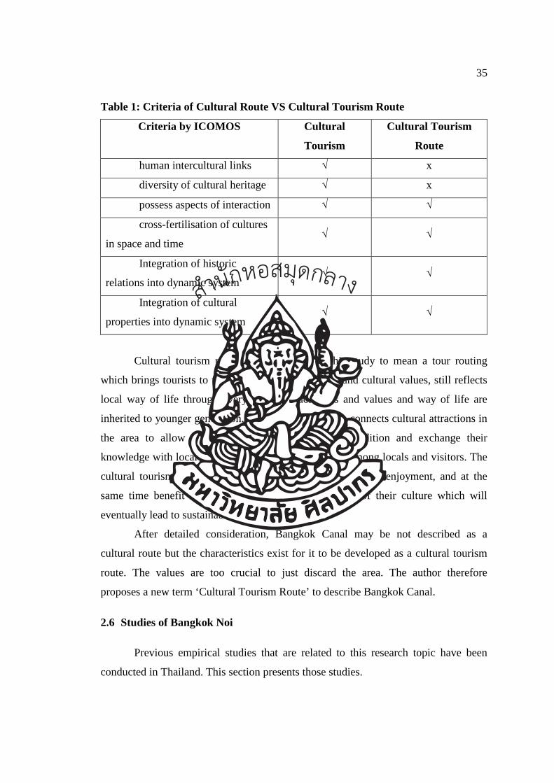
35
Table 1: Criteria of Cultural Route VS Cultural Tourism Route
Criteria by ICOMOS Cultural
Tourism
Cultural Tourism
Route
human intercultural links √ x
diversity of cultural heritage √ x
possess aspects of interaction √ √
cross-fertilisation of cultures
in space and time √ √
Integration of historic
relations into dynamic system √ √
Integration of cultural
properties into dynamic system √ √
Cultural tourism route is a term used in this study to mean a tour routing
which brings tourists to visit the area with historical and cultural values, still reflects
local way of life through everyday living activities and values and way of life are
inherited to younger generation. Cultural tourism route connects cultural attractions in
the area to allow visitors to experience true local tradition and exchange their
knowledge with local people and create understanding among locals and visitors. The
cultural tourism route will benefit both visitors, in terms of enjoyment, and at the
same time benefit locals with more income and pride of their culture which will
eventually lead to sustainable conservation.
After detailed consideration, Bangkok Canal may be not described as a
cultural route but the characteristics exist for it to be developed as a cultural tourism
route. The values are too crucial to just discard the area. The author therefore
proposes a new term ‘Cultural Tourism Route’ to describe Bangkok Canal.
2.6 Studies of Bangkok Noi
Previous empirical studies that are related to this research topic have been
conducted in Thailand. This section presents those studies.
สำนกัหอ
สมุดกลาง
36
Paninon et al.47 previously conducted a survey on the topic of characteristics
and conditions of residence in the area of Klong Bangkok Noi. The researchers
adopted qualitative research approach to examine environmental condition from
Klong Bangkok Noi to Klong Bang Yai. It aims of their research is mainly to provide
solutions to preserve physical environment in the area. There were five objectives of
this study as follow:
a. To physically study locals’ life styles as well as building conditions in the
area
b. To study a relationship between society and culture in the area that is
contributed by water transportation
c. To investigate different shape/structure of building located by the canal
d. To investigate effectiveness of environmental preservation and buildings
located by the canal
e. To provide solutions for preserving environment and buildings in the area
by considering approaches and methods that are not contradicted with the
authority’s policies and regulations.
The result indicated that there is a clear opportunity for protecting
environmental conditions in the area. Specifically, the study provided two
suggestions. First, the authority should better provide public utility as well as manage
public area. Second, knowledge and suggestions with respect to physical
characteristics of building that is mostly suitable for the area should be provided to the
residence.
Taechakitkajorn48 conducted a research study to investigate living condition of
locals who live in the Southern area of Chao Phraya River. Khu Wiang floating
market and surrounding areas were targeted as the area of the investigation.
Taechakitkajorn (1998) mentioned that in particular, the research delved into the area
of Klong Bangkok Noi which is located alongside with Khu Wiang floating river by
47 Paninon, A., (1983). To study the characteristics and conditions of residence in the area of Klong
Bangkok Noi. Bangkok:Silpakorn University. 48 Taechakitkajorn, T. (1998). The study of living condition of locals who live in the Southern area
of Chao Phraya River. Independent study in Architecture. Issue 2. Bangkok:Chulalongkorn
University.
สำนกัหอ
สมุดกลาง
37
employing only document review. Main techniques that were employed to achieve the
purpose of this study were documentary review, cadastral survey as well as interview
with local residents. There were three main research objectives as follows:
a. To analyse component and relationship of physical condition of locals in the
present situation
b. To analyse changes in the area, problems as well as factors that contribute to
those changes
c. To provide suggestions to resolve problems in the area
The result from this study revealed that the connection among cannel
community, fruit farm, and cannel network was help balancing the change in
community. These changes affect the people attitude and perception toward the area
such as the people attitude toward fruit farm.
สำนกัหอ
สมุดกลาง
38
CHAPTER 3
BANGKOK CANAL: WATERWAY OF LIFE FOR THE PEOPLE OF
BANGKOK
In the study of Cultural Tourism Route of Thai Lifestyle along Bangkok
Canal, a certain area of Bangkok Canal is selected and studied. Bangkok Canal in this
study covers the canal side area of Bangkok Noi, Chak Phra and Bangkok Yai canals.
All three canals are connected and flow to the same direction starting from Bangkok
Noi canal, Chak Phra canal and finally Bangkok Yai canal with total distance of 14.8
kilometres. A study of the waterfront areas along both banks of the canal including an
inland area of 23.40 square kilometres surrounded by Bangkok Canal was examined
in detail. The study area is shown in Figure 11. In this chapter, history of Bangkok
Canal, geography, arts and cultures of the communities along the canals as well as
cultural and architectural attractions along the canals are considered in order to
develop a Cultural Tourism Route reflecting historical values of Thailand. Visitors
will not only enjoy the charm of Thai people but also learn about Thai culture which
in turn will benefit the local communities along Bangkok Canal through engagement
in the development and management of the cultural tourism route.
สำนกัหอ
สมุดกลาง
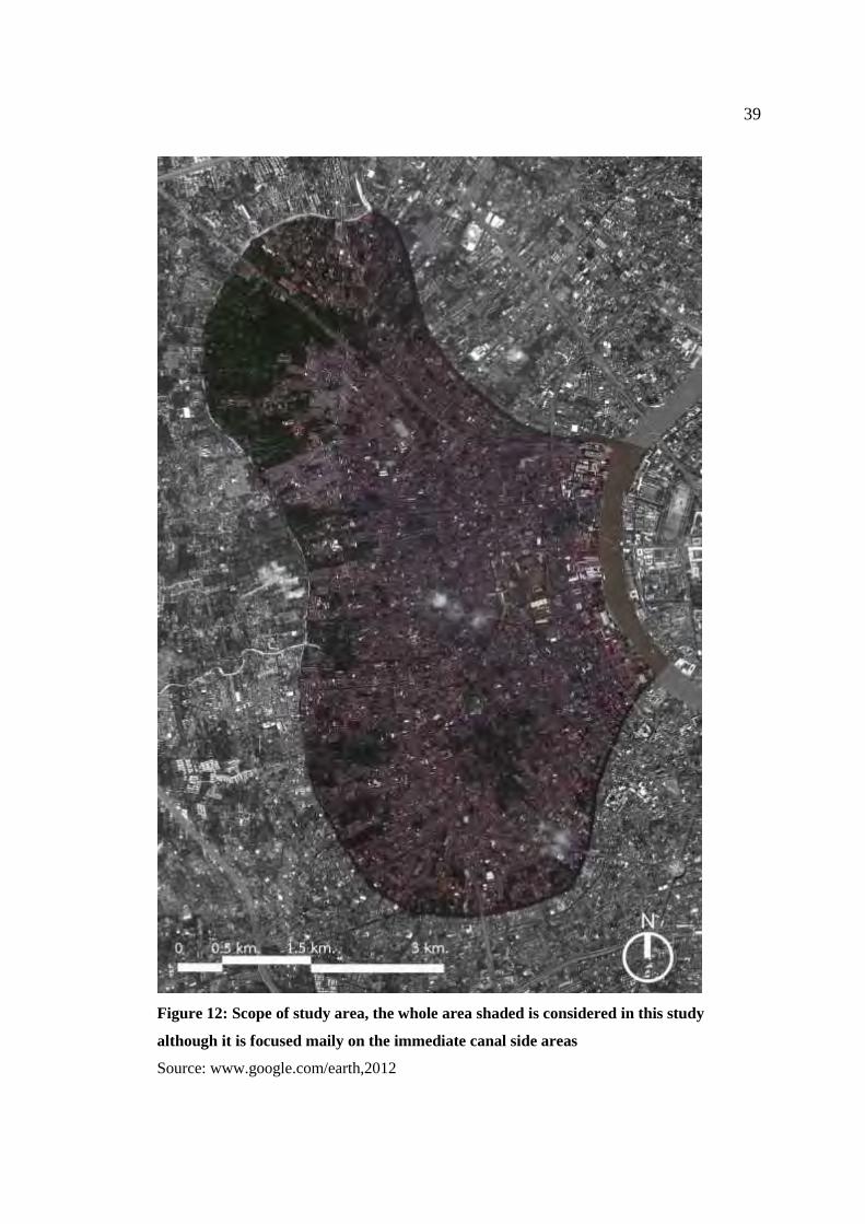
39
Figure 12: Scope of study area, the whole area shaded is considered in this study
although it is focused maily on the immediate canal side areas
Source: www.google.com/earth,2012
40
3.1 Bangkok Canal: Retrace of the History
Thonburi was the third capital of the kingdom during 1767 to 1782 and during
Thonburi period, Bangkok referred to the area of the West side of the Chao Phraya
River. At that time, the Chao Phraya River had a completely different course than it
does today. The Chao Phraya had a horseshoe shape that is similar to the current
course of the Bangkok Noi and Bangkok Yai canals. One theory on the origin of the
name is that Bangkok came from "Bang Ko", which means "island village" in Thai,
referring to the village that was almost completely surrounded by the Chao Phraya
River49.
Bangkok was the first part of Thonburi that people settled since Ayutthaya
period (the second capital of the kingdom during 1440 to 1767). The location of
Bangkok was a convenient storage point for trade ships that sailed north towards
Ayutthaya50.
The reason behind fast expansion of this settlement51 and becoming trading
centre of the country was because Bangkok was appointed a tax collection port and
customs office for foreign traders sailing to Ayutthaya. The horseshoe shape of the
Chao Phraya River slowed down trade ships, therefore ships must stop at Bangkok
before proceeding to Ayutthaya, increasing the importance of this settlement. The
more trades Ayutthaya made with foreign ships, the more important Bangkok grew
resulting in the expansion of this settlement in the reign of King Rachathirat the
second (King Sam Phraya).
49Tipawan, C. (2006). “Thonburi from past to present.” Brief History of Thonburi. Bangkok:
Art&Culture office Dhonburi Ratjabhat University, p.5.
50Tipawan, C. (2006). “Thonburi from past to present.” Brief History of Thonburi. Bangkok:
Art&Culture office Dhonburi Ratjabhat University, p.7.
51 Bangkok Noi Administration Office. (2010). History of Bangkok. Accessed August 26,2010.
Available from http://203.155.220.217/bangkoknoi/travel/khalongbangkoknoi.htm.
41
Short-Cut canal or Klong Lat Constructions “Bangkok Canal”
When Ayutthaya was established as the capital in 1350, some sections of the
Chao Phraya have undergone many modifications through man-made canals in
Bangkok area to shorten the travelling time from the Gulf of Thailand to Ayutthaya.
Major canal constructions occured three times. The study of Cultural Tourism Route
of Thai lifestyle along Bangkok Canal will focus on 2 short-cut canal constructions52
which are;
i. The first man-made canal or Klong Lat was constructed in 1522, during
the reign of King Chaiyarajadhiraj of Ayutthaya. The new canal was built
from the mouth of Bangkok Noi canal, in front of Bangkok Noi Railway
Station to Bangkok Yai canal, in front of Wat Arun to shortcut the routes
for ships from Portugal and China to Ayutthaya. The completion of Klong
Lat construction resulted in a new course of the Chao Phraya River. The
former parts of the river became a canal whereas the new Klong Lat
widened and became the new Chao Phraya River. King Chaiyarajadhiraj
gave the new Klong Lat as “Klong Lat Bangkok Yai” and the former Klong
Lat was called “Klong Lat Bangkok Noi”.
ii) The second Klong Lat was built in 1538 by the order of King Maha
Chakra Batr to connect Bangkok Noi canal, the old Chao Phraya River
section at Suwankiri temple, and Bang Krauy at Chalor temple.
After the completion of Klong Lat Bangkok in the reign of King
Chaiyarajadhiraj of Ayutthaya, Bangkok became an import port town and an outpost
town for Ayutthaya. King Maha Chakraphat made Bangkok a check point and trading
ships must stop here to report their journey as well as paying taxes both for upstream
and downstream trips53. Bangkok was the very first tax point and was called “Kanon
Bangkok”. Ayutthaya trades with foreigners were prosperous. Bangkok Noi and
52 Wikipidia. (2010). Short-Cut Canal Construction. Accessed August 26, 2010. Available from
http://th.wikipedia.org. 53 Bangkok Noi Administration Office. (2010). History of Bangkok. Accessed August 26,2010.
Available from http://203.155.220.217/bangkoknoi/travel/khalongbangkoknoi.htm.
42
Bangkok Yai canals were the main waterways for goods transportation and were
important connecting points (for example to Klong Dan and Klong Bang Chuak
Nung) to surrounding towns and exit to the sea.
Archaeological evidence shows that communities along Bangkok Yai,
Bangkok Noi and Chak Phra canals during this period consisted of many large scale
temples. Some area lined several temples in a row. This suggests a dense settlement
along the canals. When considering from the locations of temples scattered all along
the waterfront, it is clear that communities were established along major waterways.
Based on historical and archaeological information, settlement of community can be
categorised into 2 stages54 as follow;
i) Before the construction of Klong Lat Bangkok
Area of Bangkok Noi, Bangkoi Yai and Chak Phra canals was suitable for
agriculture. Settlement along Bangkok Yai canal was of waterfront community.
Residential houses were built scattered along both sides of canal and land at the back
of the house was used to plant fruits. Network of minor canals were built to bring
water into the fruit plantation.
ii) After the construction of Klong Lat Bangkok
After Klong Lat Bangkok and Wichaprasit Fort were built in the reign of King
Chaiyarajadhiraj of Ayutthaya, Bangkok became important port town and strategic
trading location with several waterways to shorten travelling time. Settlement and
population of town increased. Migration of people and soldiers from Ayutthaya was
made. Pattern of settlement remains unchanged but settlement at the mouth of the new
Klong Lat was denser.
Pattern of settlement in the old area of Bangkok, in which houses were built
along the river and canal banks, shows that water plays a very important role for both
transportation and occupation especially agriculture55. Simple and local materials
54 Nattakorn, B. (2003). Study of Muslim Communities along Bangkok Yai canal. Bangkok:
Silpakorn University, p.97. 55 Terdsak, T. (1999), “Study of waterfront communities along the middle section of Chao Phraya River
central area at Bang Ku Wiang floating market”. Journal of Architectural Research and Studies
2541 Volume 2. Bangkok: Chulalongkorn University, p.248.
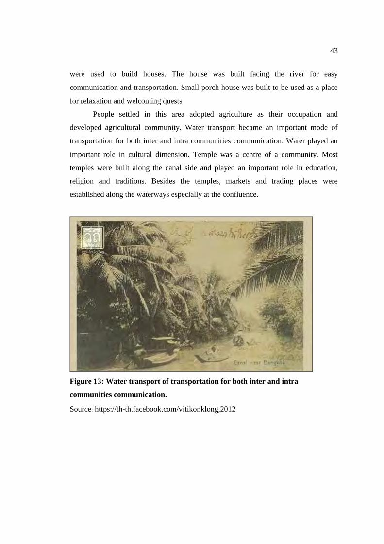
43
were used to build houses. The house was built facing the river for easy
communication and transportation. Small porch house was built to be used as a place
for relaxation and welcoming quests
People settled in this area adopted agriculture as their occupation and
developed agricultural community. Water transport became an important mode of
transportation for both inter and intra communities communication. Water played an
important role in cultural dimension. Temple was a centre of a community. Most
temples were built along the canal side and played an important role in education,
religion and traditions. Besides the temples, markets and trading places were
established along the waterways especially at the confluence.
Figure 13: Water transport of transportation for both inter and intra
communities communication.
Source: https://th-th.facebook.com/vitikonklong,2012
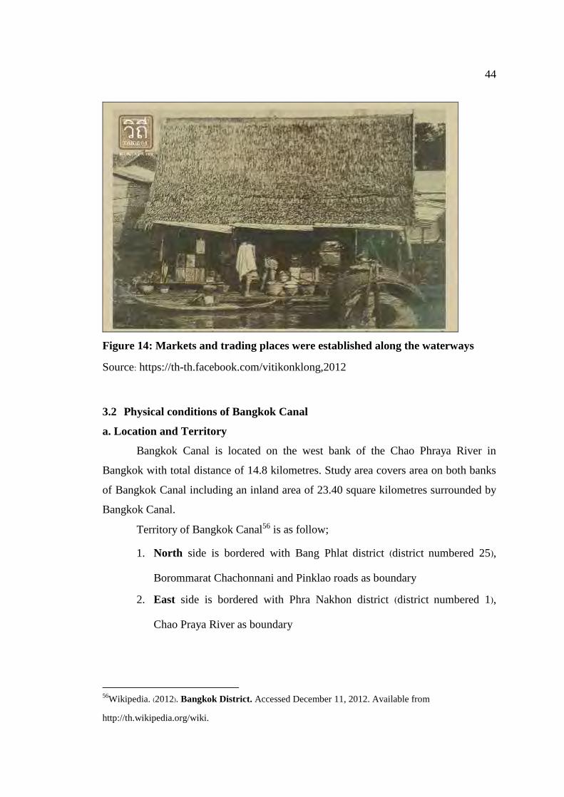
44
Figure 14: Markets and trading places were established along the waterways
Source: https://th-th.facebook.com/vitikonklong,2012
3.2 Physical conditions of Bangkok Canal
a. Location and Territory
Bangkok Canal is located on the west bank of the Chao Phraya River in
Bangkok with total distance of 14.8 kilometres. Study area covers area on both banks
of Bangkok Canal including an inland area of 23.40 square kilometres surrounded by
Bangkok Canal.
Territory of Bangkok Canal56 is as follow;
1. North side is bordered with Bang Phlat district (district numbered 25),
Borommarat Chachonnani and Pinklao roads as boundary
2. East side is bordered with Phra Nakhon district (district numbered 1),
Chao Praya River as boundary
56Wikipedia. (2012). Bangkok District. Accessed December 11, 2012. Available from
http://th.wikipedia.org/wiki.
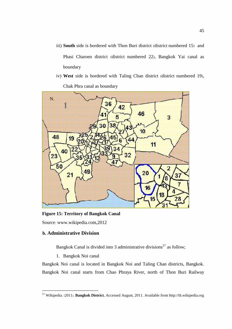
45
iii) South side is bordered with Thon Buri district (district numbered 15) and
Phasi Charoen district (district numbered 22), Bangkok Yai canal as
boundary
iv) West side is bordered with Taling Chan district (district numbered 19),
Chak Phra canal as boundary
Figure 15: Territory of Bangkok Canal
Source: www.wikipedia.com,2012
b. Administrative Division
Bangkok Canal is divided into 3 administrative divisions57 as follow;
1. Bangkok Noi canal
Bangkok Noi canal is located in Bangkok Noi and Taling Chan districts, Bangkok.
Bangkok Noi canal starts from Chao Phraya River, north of Thon Buri Railway
57 Wikipedia. (2011). Bangkok District. Accessed August, 2011. Available from http://th.wikipedia.org
N.
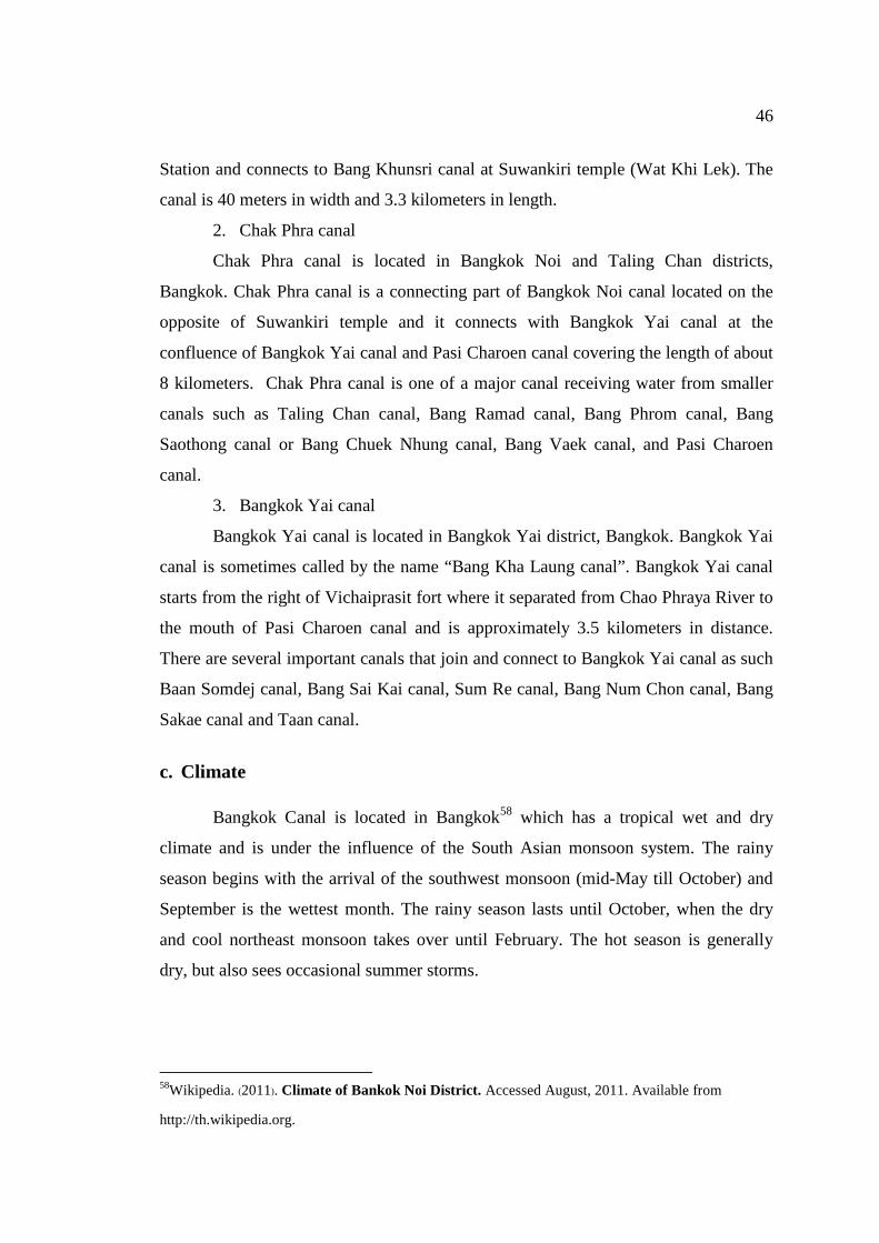
46
Station and connects to Bang Khunsri canal at Suwankiri temple (Wat Khi Lek). The
canal is 40 meters in width and 3.3 kilometers in length.
2. Chak Phra canal
Chak Phra canal is located in Bangkok Noi and Taling Chan districts,
Bangkok. Chak Phra canal is a connecting part of Bangkok Noi canal located on the
opposite of Suwankiri temple and it connects with Bangkok Yai canal at the
confluence of Bangkok Yai canal and Pasi Charoen canal covering the length of about
8 kilometers. Chak Phra canal is one of a major canal receiving water from smaller
canals such as Taling Chan canal, Bang Ramad canal, Bang Phrom canal, Bang
Saothong canal or Bang Chuek Nhung canal, Bang Vaek canal, and Pasi Charoen
canal.
3. Bangkok Yai canal
Bangkok Yai canal is located in Bangkok Yai district, Bangkok. Bangkok Yai
canal is sometimes called by the name “Bang Kha Laung canal”. Bangkok Yai canal
starts from the right of Vichaiprasit fort where it separated from Chao Phraya River to
the mouth of Pasi Charoen canal and is approximately 3.5 kilometers in distance.
There are several important canals that join and connect to Bangkok Yai canal as such
Baan Somdej canal, Bang Sai Kai canal, Sum Re canal, Bang Num Chon canal, Bang
Sakae canal and Taan canal.
c. Climate
Bangkok Canal is located in Bangkok58 which has a tropical wet and dry
climate and is under the influence of the South Asian monsoon system. The rainy
season begins with the arrival of the southwest monsoon (mid-May till October) and
September is the wettest month. The rainy season lasts until October, when the dry
and cool northeast monsoon takes over until February. The hot season is generally
dry, but also sees occasional summer storms.
58Wikipedia. (2011). Climate of Bankok Noi District. Accessed August, 2011. Available from
http://th.wikipedia.org.
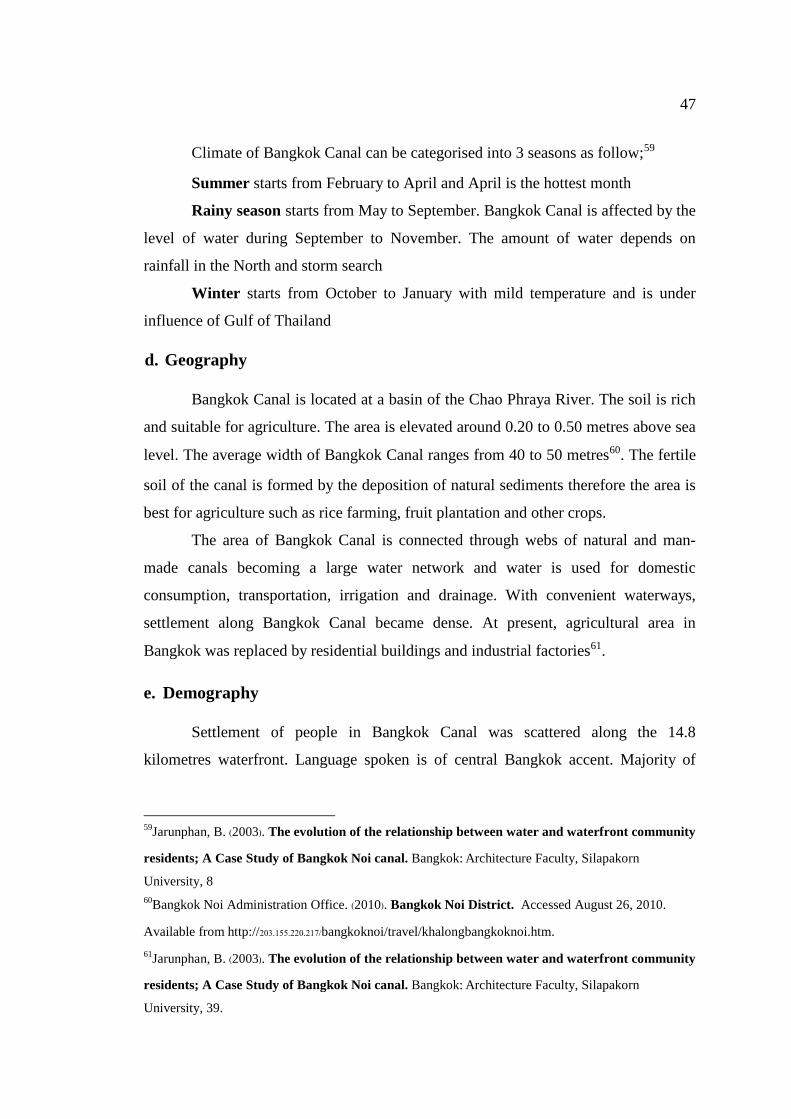
47
Climate of Bangkok Canal can be categorised into 3 seasons as follow;59
Summer starts from February to April and April is the hottest month
Rainy season starts from May to September. Bangkok Canal is affected by the
level of water during September to November. The amount of water depends on
rainfall in the North and storm search
Winter starts from October to January with mild temperature and is under
influence of Gulf of Thailand
d. Geography
Bangkok Canal is located at a basin of the Chao Phraya River. The soil is rich
and suitable for agriculture. The area is elevated around 0.20 to 0.50 metres above sea
level. The average width of Bangkok Canal ranges from 40 to 50 metres60. The fertile
soil of the canal is formed by the deposition of natural sediments therefore the area is
best for agriculture such as rice farming, fruit plantation and other crops.
The area of Bangkok Canal is connected through webs of natural and man-
made canals becoming a large water network and water is used for domestic
consumption, transportation, irrigation and drainage. With convenient waterways,
settlement along Bangkok Canal became dense. At present, agricultural area in
Bangkok was replaced by residential buildings and industrial factories61.
e. Demography
Settlement of people in Bangkok Canal was scattered along the 14.8
kilometres waterfront. Language spoken is of central Bangkok accent. Majority of
59Jarunphan, B. (2003). The evolution of the relationship between water and waterfront community
residents; A Case Study of Bangkok Noi canal. Bangkok: Architecture Faculty, Silapakorn
University, 8
60Bangkok Noi Administration Office. (2010). Bangkok Noi District. Accessed August 26, 2010.
Available from http://203.155.220.217/bangkoknoi/travel/khalongbangkoknoi.htm.
61Jarunphan, B. (2003). The evolution of the relationship between water and waterfront community
residents; A Case Study of Bangkok Noi canal. Bangkok: Architecture Faculty, Silapakorn
University, 39.
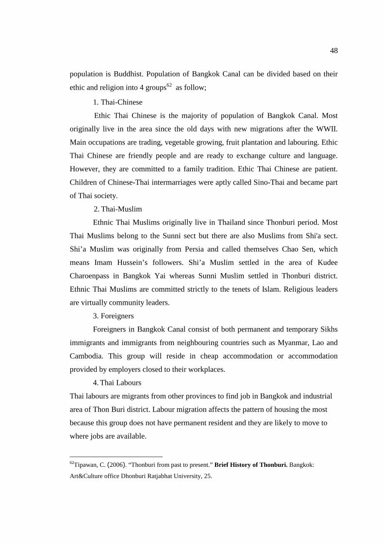
48
population is Buddhist. Population of Bangkok Canal can be divided based on their
ethic and religion into 4 groups62 as follow;
1. Thai-Chinese
Ethic Thai Chinese is the majority of population of Bangkok Canal. Most
originally live in the area since the old days with new migrations after the WWII.
Main occupations are trading, vegetable growing, fruit plantation and labouring. Ethic
Thai Chinese are friendly people and are ready to exchange culture and language.
However, they are committed to a family tradition. Ethic Thai Chinese are patient.
Children of Chinese-Thai intermarriages were aptly called Sino-Thai and became part
of Thai society.
2. Thai-Muslim
Ethnic Thai Muslims originally live in Thailand since Thonburi period. Most
Thai Muslims belong to the Sunni sect but there are also Muslims from Shi'a sect.
Shi’a Muslim was originally from Persia and called themselves Chao Sen, which
means Imam Hussein’s followers. Shi’a Muslim settled in the area of Kudee
Charoenpass in Bangkok Yai whereas Sunni Muslim settled in Thonburi district.
Ethnic Thai Muslims are committed strictly to the tenets of Islam. Religious leaders
are virtually community leaders.
3. Foreigners
Foreigners in Bangkok Canal consist of both permanent and temporary Sikhs
immigrants and immigrants from neighbouring countries such as Myanmar, Lao and
Cambodia. This group will reside in cheap accommodation or accommodation
provided by employers closed to their workplaces.
4. Thai Labours
Thai labours are migrants from other provinces to find job in Bangkok and industrial
area of Thon Buri district. Labour migration affects the pattern of housing the most
because this group does not have permanent resident and they are likely to move to
where jobs are available.
62Tipawan, C. (2006). “Thonburi from past to present.” Brief History of Thonburi. Bangkok:
Art&Culture office Dhonburi Ratjabhat University, 25.
49
Distribution of population: population of Bangkok Canal is concentrated along the
canal side and the area with roads pass by or in the area near road sides. Density of
population decreases in the area off the road sides or further into the end of canal.
f. Transport System
1. Water Transport
There are 4 types of water transport in Bangkok Canal63;
i) Public long tail boat transfers passengers from Bangkok Canal area into
Bangkok metropolitan. The boat stops at both public and private piers.
ii) Speed boat is smaller than long tail boat and normally takes passengers on
a charter basis. Passengers can make arrangement over the phone then the
boat will pick up them from their private piers. Passengers can arrange
pick-up time at their convenience. Speed boat is faster and noisier then
long tail boat.
iii) Private small boat can be both motorised and non-motorised. This boat is
normally used for short trip and rarely seen at present. Mostly, the boat is
used as a mobile shop selling goods to people in the local area.
iv) Tourist boat is quite big in size. This boat is normally used for big tour
group. The boat normally travels at slower speed to allow tourists to enjoy
the charms of Bangkok Canal. Tourist can get on or off the boat at assigned
piers.
63 Peeraphan, H. (2005). The Design of Residential Buildings along Bangkok Noi canal: A Case
Study of Bang Krauy Community. Bangkok: Architecture Faculty, Silapakorn University, 35
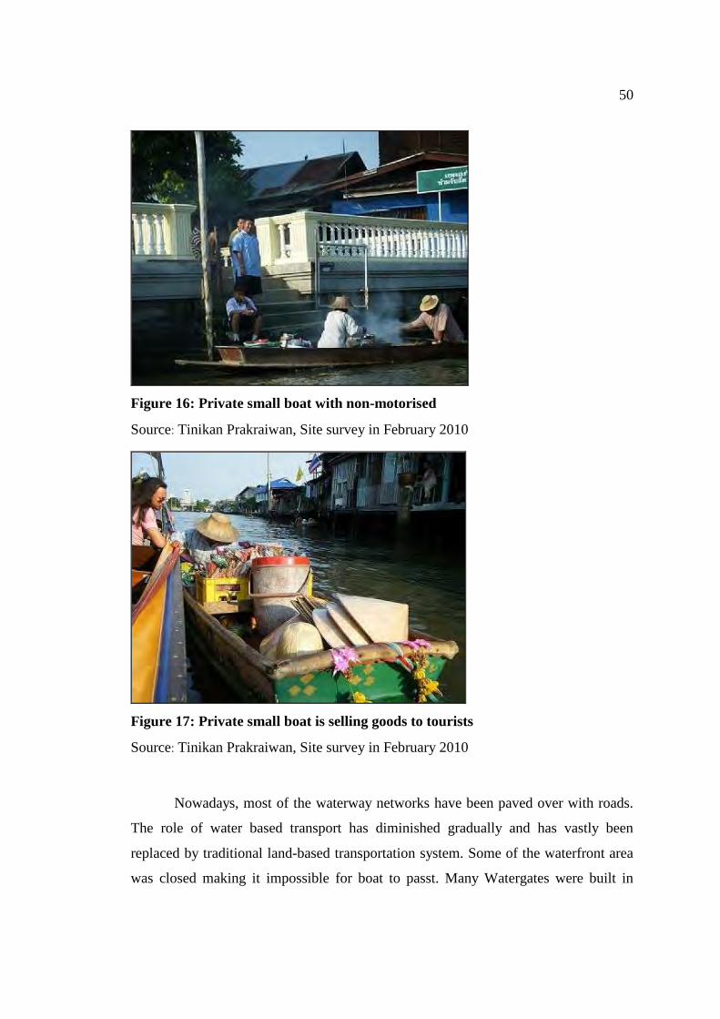
50
Figure 16: Private small boat with non-motorised
Source: Tinikan Prakraiwan, Site survey in February 2010
Figure 17: Private small boat is selling goods to tourists
Source: Tinikan Prakraiwan, Site survey in February 2010
Nowadays, most of the waterway networks have been paved over with roads.
The role of water based transport has diminished gradually and has vastly been
replaced by traditional land-based transportation system. Some of the waterfront area
was closed making it impossible for boat to passt. Many Watergates were built in
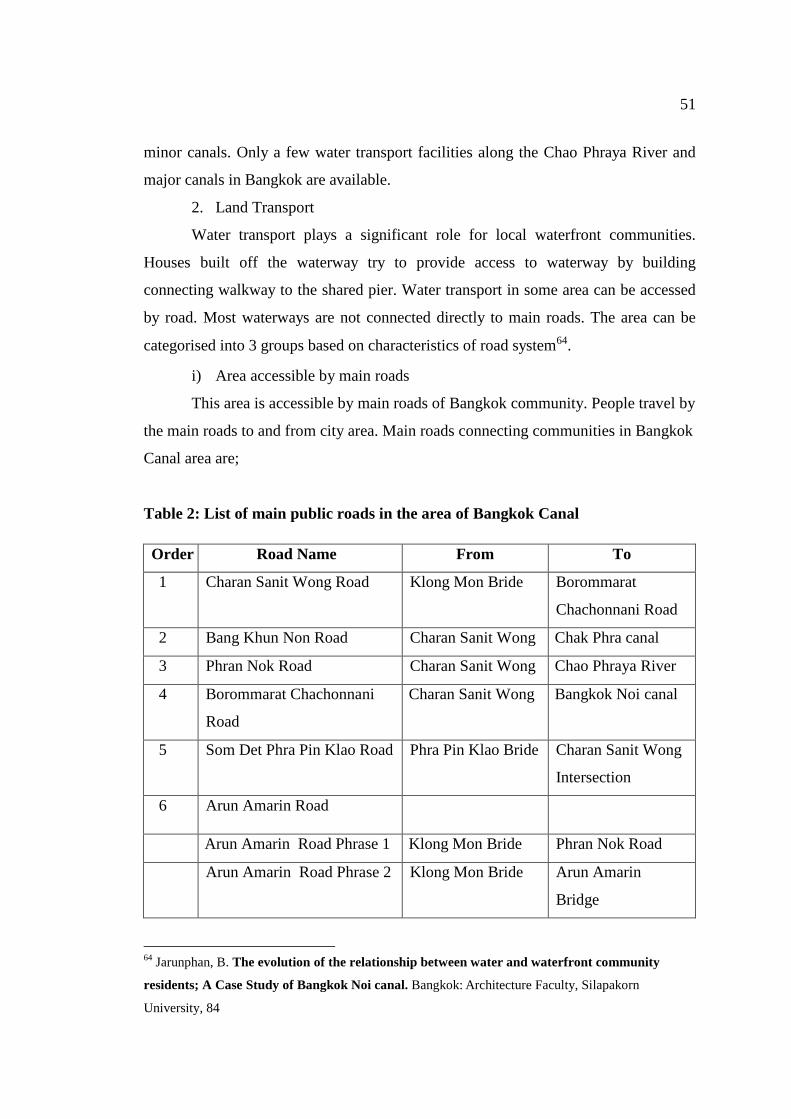
51
minor canals. Only a few water transport facilities along the Chao Phraya River and
major canals in Bangkok are available.
2. Land Transport
Water transport plays a significant role for local waterfront communities.
Houses built off the waterway try to provide access to waterway by building
connecting walkway to the shared pier. Water transport in some area can be accessed
by road. Most waterways are not connected directly to main roads. The area can be
categorised into 3 groups based on characteristics of road system64.
i) Area accessible by main roads
This area is accessible by main roads of Bangkok community. People travel by
the main roads to and from city area. Main roads connecting communities in Bangkok
Canal area are;
Table 2: List of main public roads in the area of Bangkok Canal
Order Road Name From To
1 Charan Sanit Wong Road Klong Mon Bride Borommarat
Chachonnani Road
2 Bang Khun Non Road Charan Sanit Wong Chak Phra canal
3 Phran Nok Road Charan Sanit Wong Chao Phraya River
4 Borommarat Chachonnani
Road
Charan Sanit Wong Bangkok Noi canal
5 Som Det Phra Pin Klao Road Phra Pin Klao Bride Charan Sanit Wong
Intersection
6 Arun Amarin Road
Arun Amarin Road Phrase 1 Klong Mon Bride Phran Nok Road
Arun Amarin Road Phrase 2 Klong Mon Bride Arun Amarin
Bridge
64 Jarunphan, B. The evolution of the relationship between water and waterfront community
residents; A Case Study of Bangkok Noi canal. Bangkok: Architecture Faculty, Silapakorn
University, 84
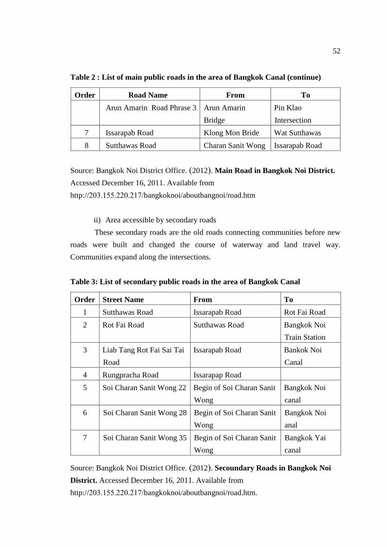
52
Table 2 : List of main public roads in the area of Bangkok Canal (continue)
Order Road Name From To
Arun Amarin Road Phrase 3 Arun Amarin
Bridge
Pin Klao
Intersection
7 Issarapab Road Klong Mon Bride Wat Sutthawas
8 Sutthawas Road Charan Sanit Wong Issarapab Road
Source: Bangkok Noi District Office. (2012). Main Road in Bangkok Noi District.
Accessed December 16, 2011. Available from
http://203.155.220.217/bangkoknoi/aboutbangnoi/road.htm
ii) Area accessible by secondary roads
These secondary roads are the old roads connecting communities before new
roads were built and changed the course of waterway and land travel way.
Communities expand along the intersections.
Table 3: List of secondary public roads in the area of Bangkok Canal
Order Street Name From To
1 Sutthawas Road Issarapab Road Rot Fai Road
2 Rot Fai Road Sutthawas Road Bangkok Noi
Train Station
3 Liab Tang Rot Fai Sai Tai
Road
Issarapab Road Bankok Noi
Canal
4 Rungpracha Road Issarapap Road
5 Soi Charan Sanit Wong 22 Begin of Soi Charan Sanit
Wong
Bangkok Noi
canal
6 Soi Charan Sanit Wong 28 Begin of Soi Charan Sanit
Wong
Bangkok Noi
anal
7 Soi Charan Sanit Wong 35 Begin of Soi Charan Sanit
Wong
Bangkok Yai
canal
Source: Bangkok Noi District Office. (2012). Secoundary Roads in Bangkok Noi
District. Accessed December 16, 2011. Available from
http://203.155.220.217/bangkoknoi/aboutbangnoi/road.htm.
53
iii) Area with roads running parallel with canals
Normally roads were built off the canal sides by 100-200 metres with
connecting path to waterways.
It can be concluded that commuters in Bangkok Canal are able to use both
water and inland transportation system. Modern transportation networks have been
well developed than the pass resulting economic, social and cultural impacts to the
area. New forms of tourism along the waterway were developed to provide benefits to
the locals as well.
g. Public Utilities and Facilities
Basic utilities and facilities provided in Bangkok Canal area are as follow65;
1. Healthcare
Temple played a role as healthcare centre for people in waterfront
communities in the old days. Monks used herbs, traditional medicines and black
magic for therapy. Later, modern health centre and hospital were built, decreasing the
old forms of medical treatment.
2. Electricity
Electricity was available to all households. Remote houses could access to
electricity by connecting power line from the power posts to their houses. At present,
electricity distribution system is built along the roads instead of waterways. Lighting
is provided along the waterways but decision is made by local administrative office.
3. Tap Water
Tap water distribution system is built both on land and in water. The system of
old area was built in water while the new system was built on land. At present, some
households use water from the canal for washing and gardening. Drinking water is
purchased. Quality of water in canals was not as clean as it used to be.
4. Telephone and Internet
Telephone lines were installed along with power lines to every household.
However, mobile telephones are now available with several service providers to cover 65 Bangkok Noi District Office. (2012). Bangkok Noi District. Accessed December 16, 2011.
Available from http://203.155.220.217/bangkoknoi/aboutbangnoi/htm.
54
all areas. Internet is available to all areas, covered service areas depend on each
service providers.
5. Garbage Collection System
In the old days, each household would have their own waste disposal area.
Some degradable garbage could just be thrown directly into the water. However,
when community grew with more households, more garbage was littered into canals
causing water pollution. Campaigns were started to educate people with aims to
restore the conditions of canal water. Garbage collection is divided into 2 divisions; 1)
waterway waste collection by a vessel responsible by local administrative office,
collecting garbage 3 times a week and; 2) road waste collection by garbage truck
every second day.
Bangkok Canal area is well equipped with necessary utilities. Each district
also defines clear responsible area. Bangkok Canal is located in the Bangkok
Metropolitan Administration (BMA), making access to basic utilities easier. Besides,
BMA has provided rest areas or public parks for local communities for a better quality
of life and living condition.
3.3 Bangkok Canal Community Way of Life
a. Family
Family of Bangkok Canal community is a big and extended family where all
household members are related66. People in community, if not related, have known
each other for a long time since grandparent generation forming a close and warm
relationship among members and strong community.
Transportation of the old days was made by mean waterway or taking walk
path connecting neighbours through fruit plantations. Main mode of water transport
was by local boat. There were several types of boat used in the old days67 such as Rua
66 Bangkok Noi Administration Office. (2555). “Guides to important landmarks and tourist attractions
in Bangkok Noi”. Bangkok Noi Focus. Bangkok: Bangkok Noi Administration Office, 45.
67 Jarunphan, B. The evolution of the relationship between water and waterfront community
residents; A Case Study of Bangkok Noi canal. Bangkok: Architecture Faculty, Silapakorn
University, 56.
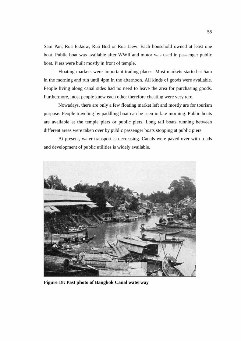
55
Sam Pan, Rua E-Jaew, Rua Bod or Rua Jaew. Each household owned at least one
boat. Public boat was available after WWII and motor was used in passenger public
boat. Piers were built mostly in front of temple.
Floating markets were important trading places. Most markets started at 5am
in the morning and run until 4pm in the afternoon. All kinds of goods were available.
People living along canal sides had no need to leave the area for purchasing goods.
Furthermore, most people knew each other therefore cheating were very rare.
Nowadays, there are only a few floating market left and mostly are for tourism
purpose. People traveling by paddling boat can be seen in late morning. Public boats
are available at the temple piers or public piers. Long tail boats running between
different areas were taken over by public passenger boats stopping at public piers.
At present, water transport is decreasing. Canals were paved over with roads
and development of public utilities is widely available.
Figure 18: Past photo of Bangkok Canal waterway
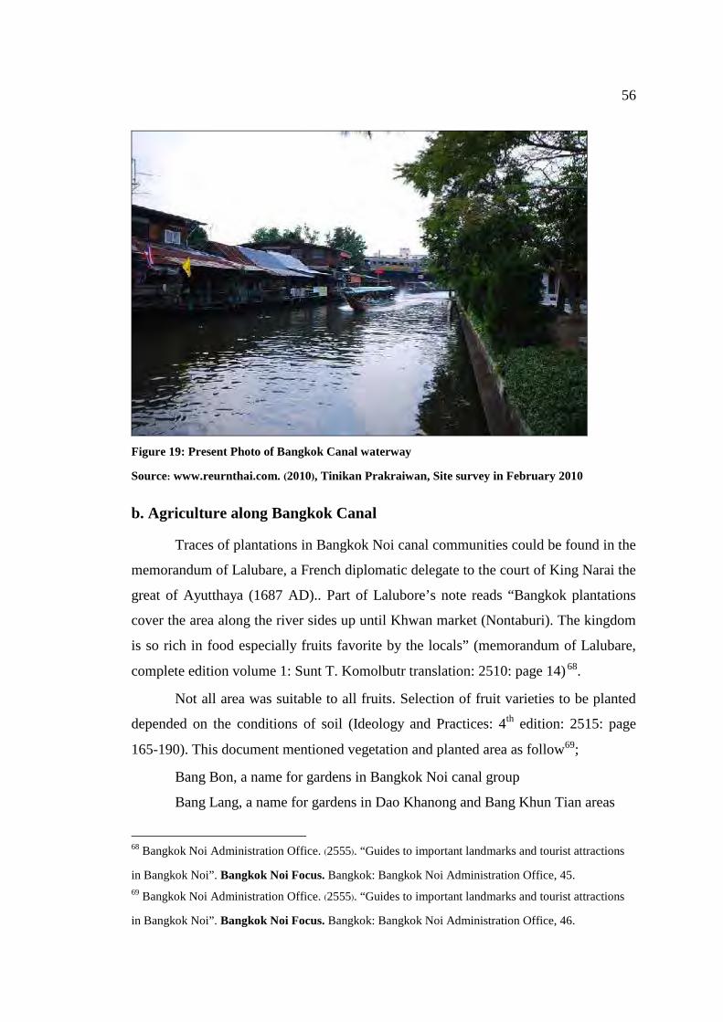
56
Figure 19: Present Photo of Bangkok Canal waterway
Source: www.reurnthai.com. (2010), Tinikan Prakraiwan, Site survey in February 2010
b. Agriculture along Bangkok Canal
Traces of plantations in Bangkok Noi canal communities could be found in the
memorandum of Lalubare, a French diplomatic delegate to the court of King Narai the
great of Ayutthaya (1687 AD).. Part of Lalubore’s note reads “Bangkok plantations
cover the area along the river sides up until Khwan market (Nontaburi). The kingdom
is so rich in food especially fruits favorite by the locals” (memorandum of Lalubare,
complete edition volume 1: Sunt T. Komolbutr translation: 2510: page 14) 68.
Not all area was suitable to all fruits. Selection of fruit varieties to be planted
depended on the conditions of soil (Ideology and Practices: 4th edition: 2515: page
165-190). This document mentioned vegetation and planted area as follow69;
Bang Bon, a name for gardens in Bangkok Noi canal group
Bang Lang, a name for gardens in Dao Khanong and Bang Khun Tian areas
68 Bangkok Noi Administration Office. (2555). “Guides to important landmarks and tourist attractions
in Bangkok Noi”. Bangkok Noi Focus. Bangkok: Bangkok Noi Administration Office, 45.
69 Bangkok Noi Administration Office. (2555). “Guides to important landmarks and tourist attractions
in Bangkok Noi”. Bangkok Noi Focus. Bangkok: Bangkok Noi Administration Office, 46.
57
Farmers from both Bang Bon and Bang Lang produced similar produces such
as durian and betel nut however, tastes of produces from different were different.
Saun Nai means to plantation area along the Chao Phraya River starting from
Maung Nontaburi (Nontaburi Province), Maung Thonburi or Bangkok (Bangkok)
until Maung Phra Pradaeng (Samut Prakarn Province).
Saun Nok means to plantation area along Mae Klong river (Samut Songkram
Province).
From above evidence, it is safe to conclude that soil of Bangkok Canal in the
old days was so fertile that plantations were abundant and farmers from both Bang
Bon and Bang Lang could produce high quality agricultural produces.
c. Folklores and Beliefs of People in Bangkok
As mentioned earlier, one of the main occupations of people along Bangkok
Canal was fruit plantation. Farmers would set up a spirit house in the plantation plot.
At the first harvesting season, farmers would offer the best quality fruits from their
farm together with flowers and other offerings to the spirit house and request abetter
season the next year. Some farmers requested Buddha image at Wat Pikul-Ngern for
at least 50,000 baht income from their harvest. If the request was fulfilled, they would
bring durian to the temple as promised. These beliefs and practices indicated concerns
for risk in their occupation as such fruit plantation. Making a request to holy object
was one way to boost hope and confidence.
d. Tradition and Culture
Most traditions and festivals practiced by Bangkok Canal community were
similar to other regions in the country such as Song Kran, Beginning of Vassa Day or
Buddhist Lent Day or Loy Kratong. Only a few traditions were practiced differently
according to local geography and those traditions were related to water.
i. Asalha Puja or Beginning of Vassa Day
This festival is held in the full moon of 8th Thai lunar month or first waning
moon, 8th Thai lunar month. Elaborate of the traditional parading of candles to temple
58
is common practice70. The parade can be by water or land. In Bang Krauy district,
there are 48 old temples and each temple is located on the canal banks. People of
Bang Krauy therefore prefer to travel by boat to the temple for merit making. Every
year, traditional parading of candles to the temple is organised by waterway.
ii. End of Vassa Day
This festival is held in the full moon of 11th Thai lunar month. Monks will be
collecting alms by boat71. This tradition has its origins in Pak Kret district by Mon
people living along the Chao Phray River. The Mon people started this tradition
which they practiced when Mon state still existed. Every year, at the End of Vassa
Day, the people will offer food to monks who travel along by boat. The Mon calls this
tradition “Pua Who” meaning tradition of 11th month. This tradition has been passed
down from generation to generation and is still practiced in Pak Kret district every
year.
iii. Tamboon Tak Batr 108 (108 merit making tradition)72.
This tradition has been practiced by people living along Bangkok Noi canal
for a long time. Several temples such as Wat Thai Charoen, Wat Bang Krai Nok, Wat
Uttayan, Wat Bot and Wat Bang Krai Nai will set the same date for this tradition. The
ceremony starts on the afternoon of 7th waning moon, 12th Thai lunar month. Main
Buddha Images of each temple will paraded by beautiful elaborated boats along the
canals. Dancing is also organised. The purpose of the parade is to promote the
beginning of the Tamboon Tak Batr 108. People can start offering food from 5am in
the morning. Those who would like to offer food as a merit making must also travel
by boat. Every year, thousands of people gathered for this merit making tradition.
70 Thai Post Newspaper. (2010). “End of Vassa Day Festival.” Thai Post. Accessed April 10,2010.
Available from http://www.ryt9.com/s/tpd/945712.
71 City municipal of Pak Kred. (2010). Pak kret District. Accessed April 10, 2010. Available from
http://www.pakkretcity.go.th/OLD_File/OLD_Travel/OLD_TR2.htm. 72 Office of Nonthaburi Provincial Administration. (2010). Nonthaburi in commemoration of
Bangkok Bicentennial Cerebration, Nonthaburi: Office of Nonthaburi Provincial Administration,
146.

59
iv. Chak Phra Ceremony. Chak Phra ceremony is held on the 2nd wane moon
day in the 12th lunar month. Chak Phra means towing a Buddha image. Apart from
Buddha image, sometimes Buddha relic was enshrined in a throne and hauled along
canals. Chak Phra ceremony is held annually, temple fair and other activities such as
boat racing and flower boat parade are also held in the same period. It is clear that
temple is a centre in every settlement in Thailand.
60
3.4 Cultural and architectural attractions along Bangkok Canal
Figure 20: Map of cultural and architectural attractions with historical values
along Bangkok Canal
Source: www.google/earth.com, 2012 base map
61
Site survey shows that there are many cultural and architectural attractions
with historical values along Bangkok Canal starting from the mouth of Bangkok Noi
canal to Bangkok Yai canal. Those attractions can be categorised as follow;
a. Museum
Figure 21: Map of important museum along Bangkok Canal
Source: www.google/earth.com, 2012
62
A museum is an institution that conserves a collection of artifacts and other
objects of scientific, artistic, cultural, or historical importance and makes them
available for public viewing through exhibits that may be permanent or temporary.
Important museum along Bangkok Canal are;
1. National Museum of Royal Barges
Figure 22: Royal Barge National Museum
Source: Tinikan Prakraiwan, Site survey in January 2013
Royal Barge National Museum is located on the northern rim of Bangkok Noi
canal within Bangkok Noi district. Some historical royal barges of the Royal Barge
Procession are kept at the museum. The Royal Barge Procession began since
Ayutthaya period and is a ceremony of both religious and royal significance including
warfare. The Royal Barges National Museum was previously called the Royal Barge
Dockyard which was built in the reign of King Taksin, the great.
The Royal Barge Procession, in the present, consists of 52 barges: 51
historical Barges, and the Royal Barge, the Narai Song Suban. These barges are
63
manned by 2,082 oarsmen. The Procession proceeds down the Chao Phraya River,
from the Wasukri Royal Landing Place in Khet Dusit, Bangkok, passes the Temple of
the Emerald Buddha, the Grand Palace, Wat Po, and finally arrives at Wat Arun
(temple of Dawn).
The Royal Barges
The Royal Barge Suphannahong ("the Golden Swan" or the "Phoenix") was
built in 1911 during the reign of Rama VI with a bow resembling a mythical swan, or
hong, adorned with gold lacquer and glass jewels, with a crystalline ball and tassle
dangling from her mouth. This 46-meter craft was carved from a single trunk of
teakwood, and was launched 13 November 1911. There is a golden pavilion on board
to house the king and his immediate royal family.
The World Ship Trust, in 1992, named the Royal Barge Suphannahong a
Maritime World Heritage73
.
The original the Royal Barge Anantanakkharat ("Ananta, the King of
Serpents") was built during the reign of Rama III (King Nangklao). It was used as the
primary Royal Barge of Rama IV (King Mongkut). The current Anantanakkharat was
built during the Reign of Rama VI (King Vajiravudh), and launched on 14 April 1914.
The bow is carved into the 7-headed Nakkharat, the mystical snake-like creature, in
gold lacquer and glass jewels.
The Royal Barge Anekkachatphuchong ("the Variety of Serpents") is the
oldest of the four Royal Barges, being the actual barge built in the late 19th century
during the reign of Rama V (King Chulalongkorn). While no mythical figure is
readily visible on the bow, numerous small ornamental Naga figures are carved into
the bow.
The Royal Barge Narai Song Suban Ratchakan Thi Kao or the Royal Barge
Narai Song Suban HM King Rama IX ("God Narayana on his carrier, Garuda") is
the only barge built during the reign of Bhumibol Adulyadej, who laid the keel in
1994. It was built under commission by the Royal Thai Navy and the Thai
Department of Fine Arts and was launched 6 May 1996 to coincide with the
73 World Ship Trust. (2011). Royal Barge of Thailand. Accessed June 4, 2010. Available from
http://www.worldshiptrust.org.
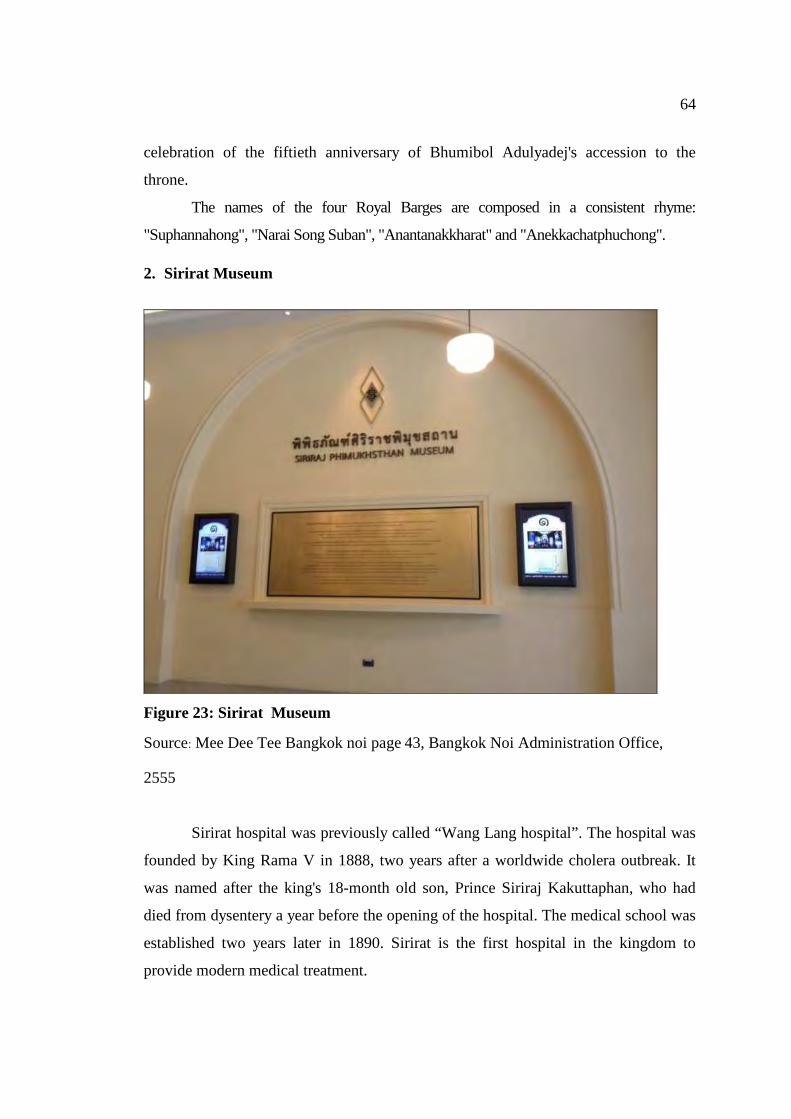
64
celebration of the fiftieth anniversary of Bhumibol Adulyadej's accession to the
throne.
The names of the four Royal Barges are composed in a consistent rhyme:
"Suphannahong", "Narai Song Suban", "Anantanakkharat" and "Anekkachatphuchong".
2. Sirirat Museum
Figure 23: Sirirat Museum
Source: Mee Dee Tee Bangkok noi page 43, Bangkok Noi Administration Office,
2555
Sirirat hospital was previously called “Wang Lang hospital”. The hospital was
founded by King Rama V in 1888, two years after a worldwide cholera outbreak. It
was named after the king's 18-month old son, Prince Siriraj Kakuttaphan, who had
died from dysentery a year before the opening of the hospital. The medical school was
established two years later in 1890. Sirirat is the first hospital in the kingdom to
provide modern medical treatment.
65
Currently, the world's fourth largest hospital, which treats royalty, the hospital
has six small academic museums. The Si Ouey Forensic Medicine Museum
(department of forensic medicine, 2nd floor) contains skulls, pickled organs, stillborn
babies, crime scene photographs and the body of the notorious murderer Si Ouey. The
Congdon Anatomical Museum (anatomy department, 3rd floor) displays human
organs and bones from embryo to maturity, including Siamese twins. Two floors
down, the Sood Sangvichien Prehistoric Museum & Laboratory looks at evolution.
The Ellis Pathological Museum (department of pathology, 2nd floor) explains
diseases, while the Parasitology Museum (parasitology department, 2nd floor) shows
preserved worms with their adopted organs. The Ouay Ketusingh Museum of History
of Thai Medicine (department of pharmacology, 1st floor) examines indigenous
healing techniques.
3. Bangkok Noi Museum
Figure 24: Bangkok Noi Museum
Source: Tinikan Prakraiwan, Site survey in January 2013
66
Bangkok Noi Museum is located on Charan Sanitwong road next to Wat
Suwannaram and close to the Bangkok Noi canal. The museum exhibits the history of
Bangkok Noi and the village of "Bangkok" that used to be located here. Bangkok Noi
was an important trading centre in the Ayutthaya Period, and briefly the capital of
Thailand in the Thonburi Period. The Rattanakosin Period has also been covered,
when most of Bangkok Noi consisted of fruit orchards. Many people worked as
craftsmen, including those making bronze bowls. These fruits and bowls are on
display in the museum. Over time, Thonburi became more urbanised, but here you
can still see what it used to be like

67
b. Market
Figure 25: Map of important marketplaces along Bangkok Canal
Source: www.google/earth.com, 2012
Waterway transport was once major mode of transportation for people of Bangkok
Canal. Markets and trading places were established along the waterway especially at the
confluence74. Important marketplaces along Bangkok Canal are listed below; 74 Jarunphan Bunjongpak, The evolution of the relationship between water and waterfront community
residents; A Case Study of Bangkok Noi canal (Bangkok: Architecture Faculty, Silapakorn University),
2546 page 56
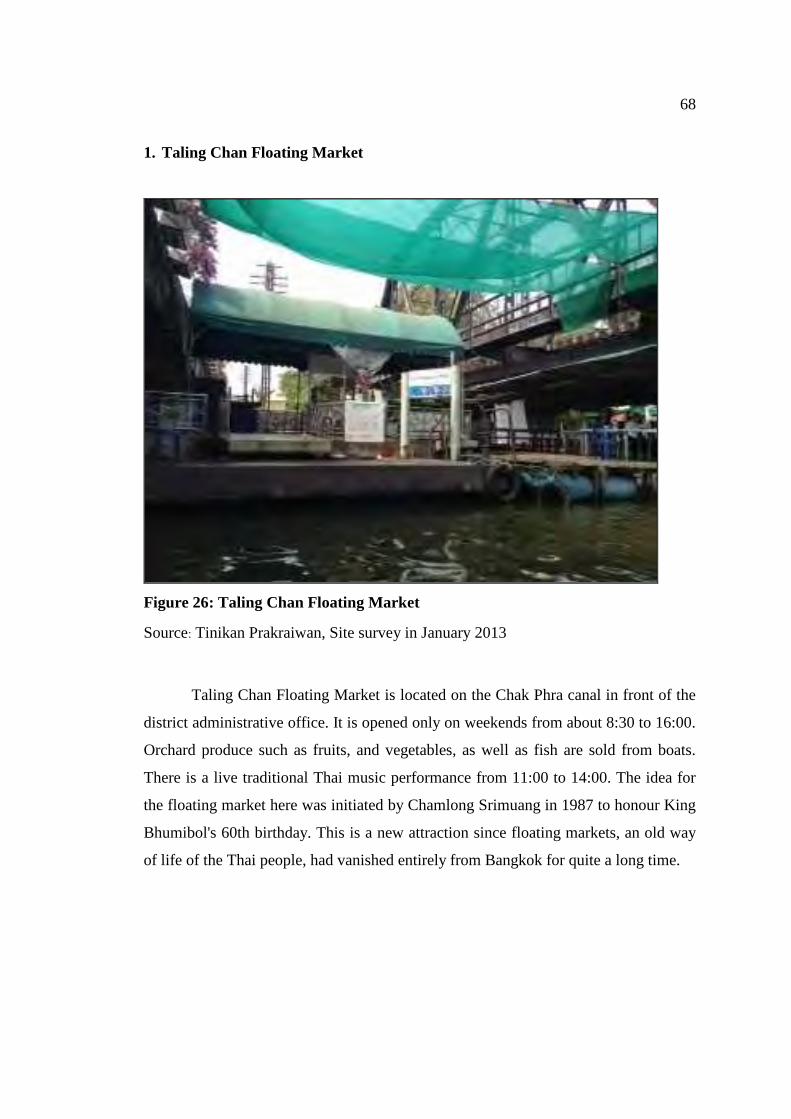
68
1. Taling Chan Floating Market
Figure 26: Taling Chan Floating Market
Source: Tinikan Prakraiwan, Site survey in January 2013
Taling Chan Floating Market is located on the Chak Phra canal in front of the
district administrative office. It is opened only on weekends from about 8:30 to 16:00.
Orchard produce such as fruits, and vegetables, as well as fish are sold from boats.
There is a live traditional Thai music performance from 11:00 to 14:00. The idea for
the floating market here was initiated by Chamlong Srimuang in 1987 to honour King
Bhumibol's 60th birthday. This is a new attraction since floating markets, an old way
of life of the Thai people, had vanished entirely from Bangkok for quite a long time.
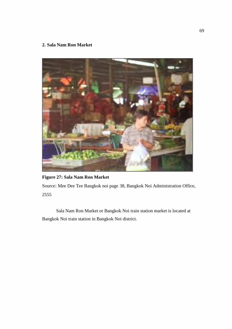
69
2. Sala Nam Ron Market
Figure 27: Sala Nam Ron Market
Source: Mee Dee Tee Bangkok noi page 38, Bangkok Noi Administration Office,
2555
Sala Nam Ron Market or Bangkok Noi train station market is located at
Bangkok Noi train station in Bangkok Noi district.
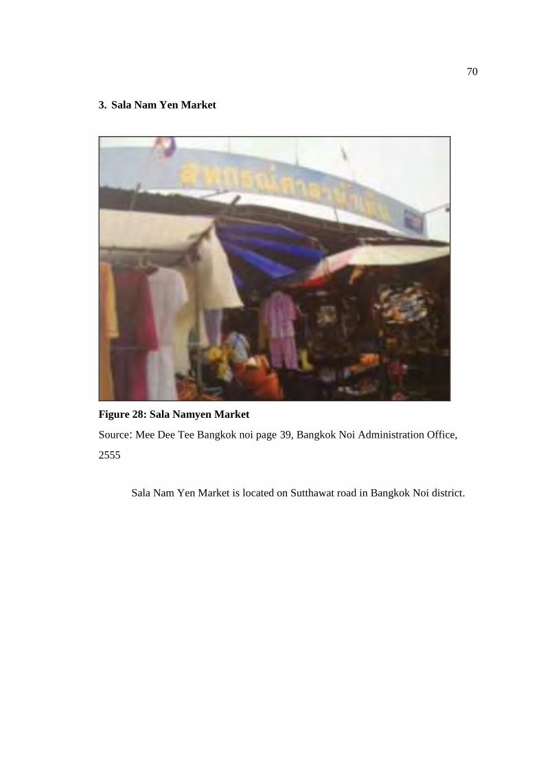
70
3. Sala Nam Yen Market
Figure 28: Sala Namyen Market
Source: Mee Dee Tee Bangkok noi page 39, Bangkok Noi Administration Office,
2555
Sala Nam Yen Market is located on Sutthawat road in Bangkok Noi district.
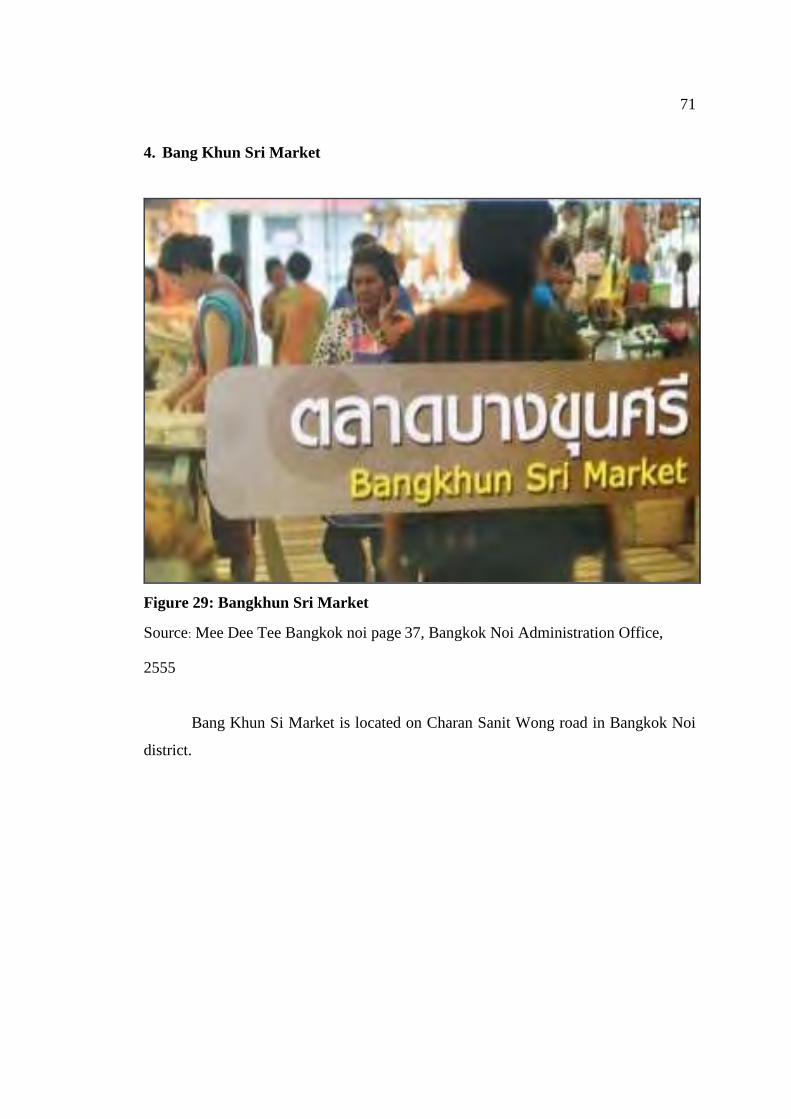
71
4. Bang Khun Sri Market
Figure 29: Bangkhun Sri Market
Source: Mee Dee Tee Bangkok noi page 37, Bangkok Noi Administration Office,
2555
Bang Khun Si Market is located on Charan Sanit Wong road in Bangkok Noi
district.
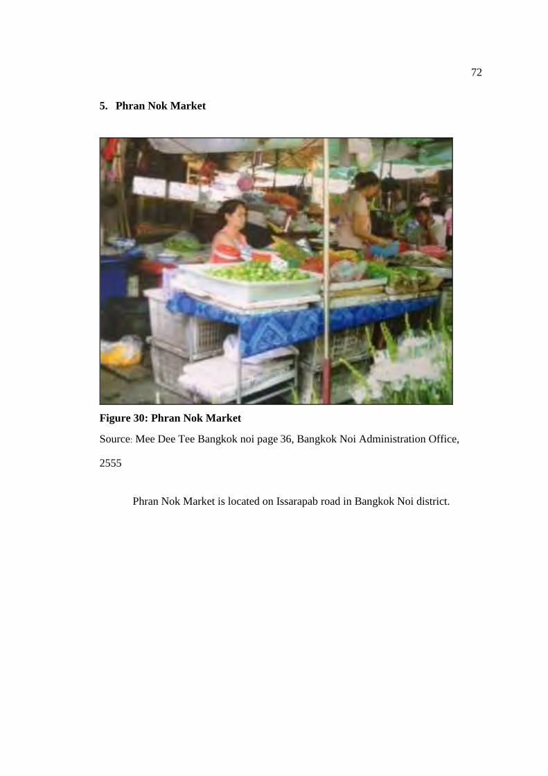
72
5. Phran Nok Market
Figure 30: Phran Nok Market
Source: Mee Dee Tee Bangkok noi page 36, Bangkok Noi Administration Office,
2555
Phran Nok Market is located on Issarapab road in Bangkok Noi district.
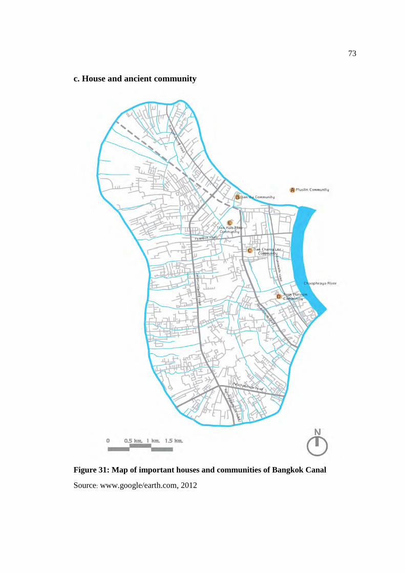
73
c. House and ancient community
Figure 31: Map of important houses and communities of Bangkok Canal
Source: www.google/earth.com, 2012
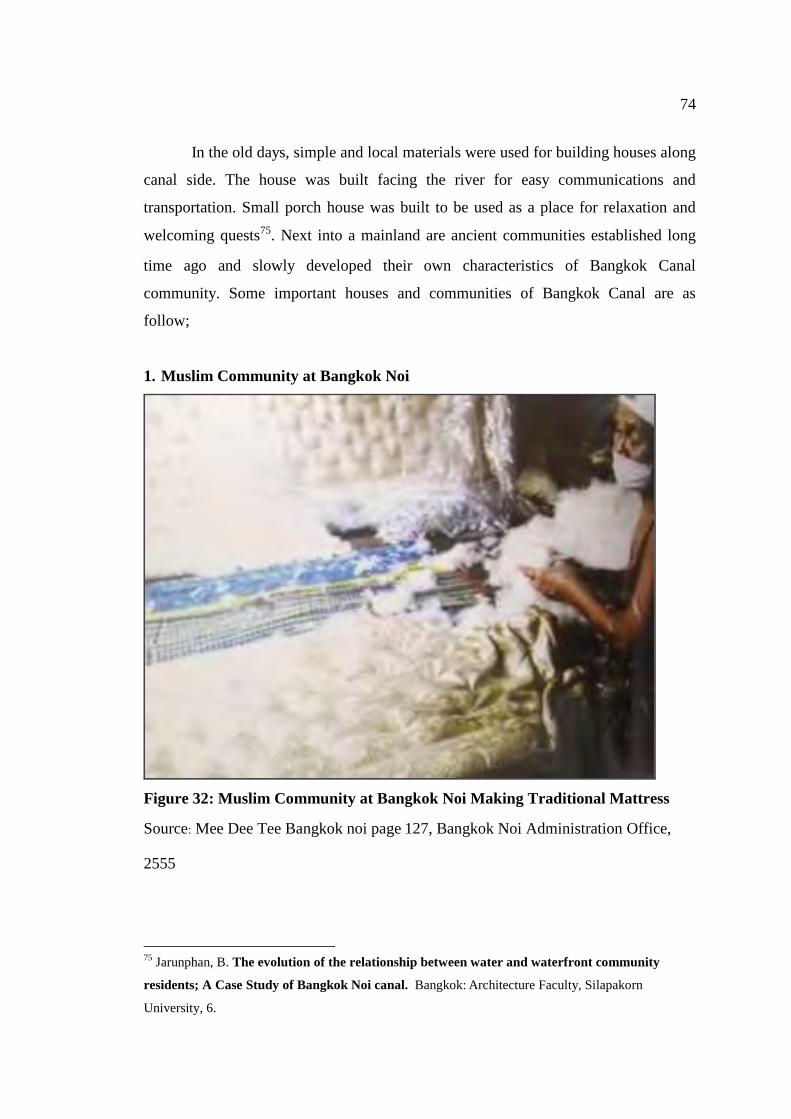
74
In the old days, simple and local materials were used for building houses along
canal side. The house was built facing the river for easy communications and
transportation. Small porch house was built to be used as a place for relaxation and
welcoming quests75. Next into a mainland are ancient communities established long
time ago and slowly developed their own characteristics of Bangkok Canal
community. Some important houses and communities of Bangkok Canal are as
follow;
1. Muslim Community at Bangkok Noi
Figure 32: Muslim Community at Bangkok Noi Making Traditional Mattress
Source: Mee Dee Tee Bangkok noi page 127, Bangkok Noi Administration Office,
2555
75 Jarunphan, B. The evolution of the relationship between water and waterfront community
residents; A Case Study of Bangkok Noi canal. Bangkok: Architecture Faculty, Silapakorn
University, 6.
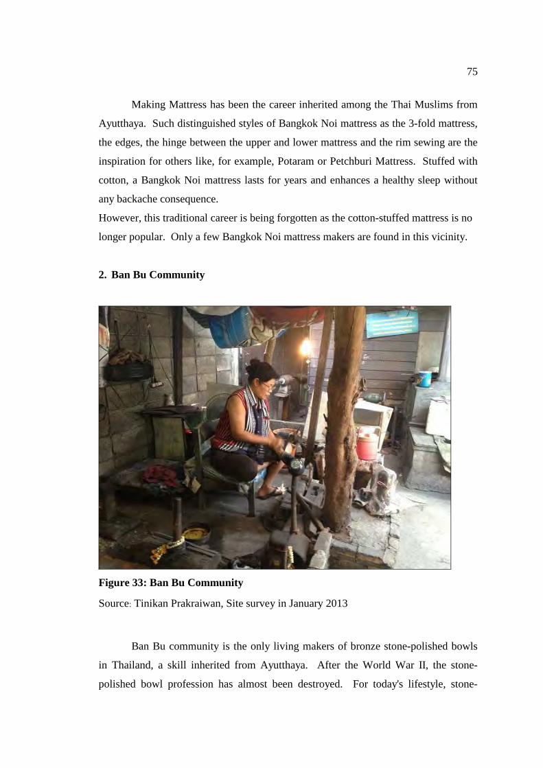
75
Making Mattress has been the career inherited among the Thai Muslims from
Ayutthaya. Such distinguished styles of Bangkok Noi mattress as the 3-fold mattress,
the edges, the hinge between the upper and lower mattress and the rim sewing are the
inspiration for others like, for example, Potaram or Petchburi Mattress. Stuffed with
cotton, a Bangkok Noi mattress lasts for years and enhances a healthy sleep without
any backache consequence.
However, this traditional career is being forgotten as the cotton-stuffed mattress is no
longer popular. Only a few Bangkok Noi mattress makers are found in this vicinity.
2. Ban Bu Community
Figure 33: Ban Bu Community
Source: Tinikan Prakraiwan, Site survey in January 2013
Ban Bu community is the only living makers of bronze stone-polished bowls
in Thailand, a skill inherited from Ayutthaya. After the World War II, the stone-
polished bowl profession has almost been destroyed. For today's lifestyle, stone-
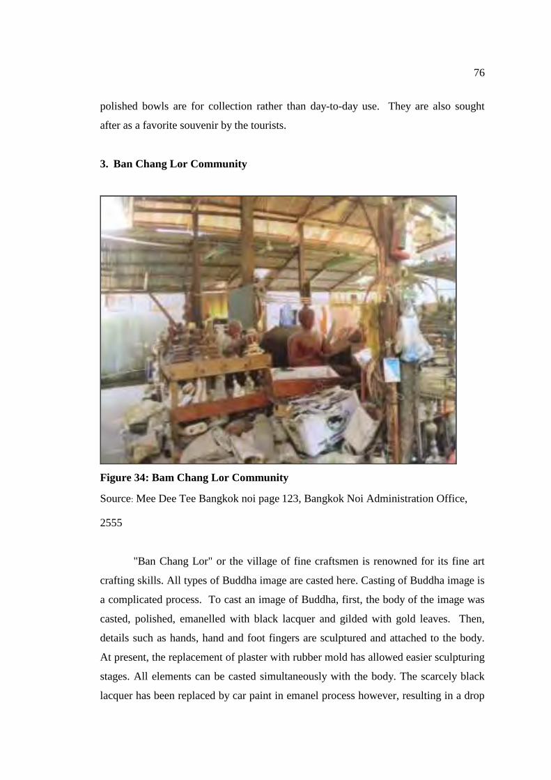
76
polished bowls are for collection rather than day-to-day use. They are also sought
after as a favorite souvenir by the tourists.
3. Ban Chang Lor Community
Figure 34: Bam Chang Lor Community
Source: Mee Dee Tee Bangkok noi page 123, Bangkok Noi Administration Office,
2555
"Ban Chang Lor" or the village of fine craftsmen is renowned for its fine art
crafting skills. All types of Buddha image are casted here. Casting of Buddha image is
a complicated process. To cast an image of Buddha, first, the body of the image was
casted, polished, emanelled with black lacquer and gilded with gold leaves. Then,
details such as hands, hand and foot fingers are sculptured and attached to the body.
At present, the replacement of plaster with rubber mold has allowed easier sculpturing
stages. All elements can be casted simultaneously with the body. The scarcely black
lacquer has been replaced by car paint in emanel process however, resulting in a drop
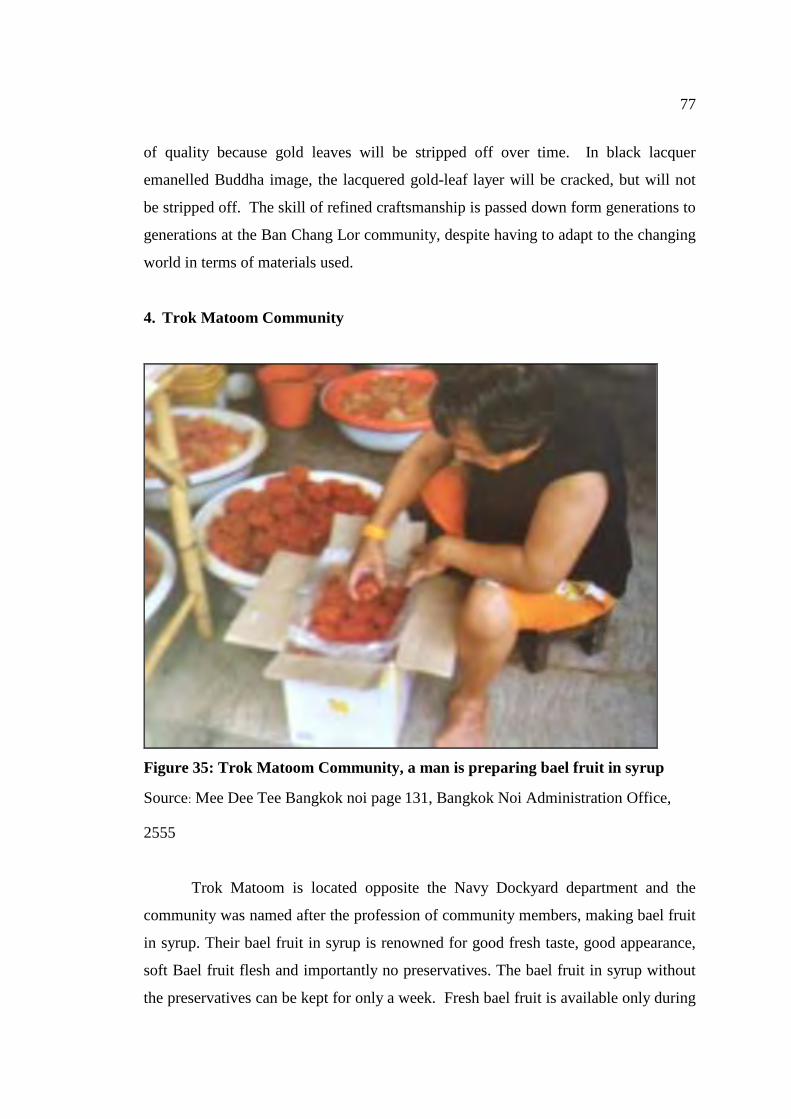
77
of quality because gold leaves will be stripped off over time. In black lacquer
emanelled Buddha image, the lacquered gold-leaf layer will be cracked, but will not
be stripped off. The skill of refined craftsmanship is passed down form generations to
generations at the Ban Chang Lor community, despite having to adapt to the changing
world in terms of materials used.
4. Trok Matoom Community
Figure 35: Trok Matoom Community, a man is preparing bael fruit in syrup
Source: Mee Dee Tee Bangkok noi page 131, Bangkok Noi Administration Office,
2555
Trok Matoom is located opposite the Navy Dockyard department and the
community was named after the profession of community members, making bael fruit
in syrup. Their bael fruit in syrup is renowned for good fresh taste, good appearance,
soft Bael fruit flesh and importantly no preservatives. The bael fruit in syrup without
the preservatives can be kept for only a week. Fresh bael fruit is available only during
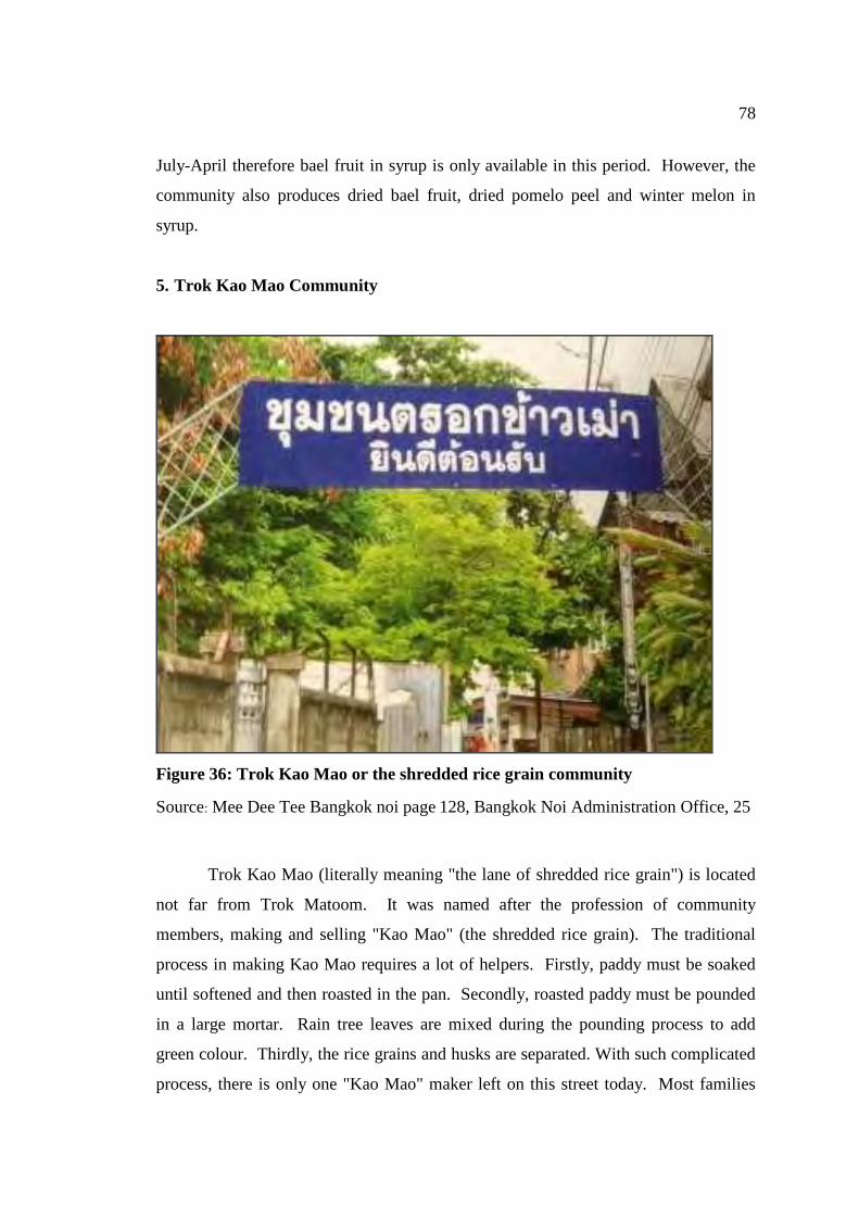
78
July-April therefore bael fruit in syrup is only available in this period. However, the
community also produces dried bael fruit, dried pomelo peel and winter melon in
syrup.
5. Trok Kao Mao Community
Figure 36: Trok Kao Mao or the shredded rice grain community
Source: Mee Dee Tee Bangkok noi page 128, Bangkok Noi Administration Office, 25
Trok Kao Mao (literally meaning "the lane of shredded rice grain") is located
not far from Trok Matoom. It was named after the profession of community
members, making and selling "Kao Mao" (the shredded rice grain). The traditional
process in making Kao Mao requires a lot of helpers. Firstly, paddy must be soaked
until softened and then roasted in the pan. Secondly, roasted paddy must be pounded
in a large mortar. Rain tree leaves are mixed during the pounding process to add
green colour. Thirdly, the rice grains and husks are separated. With such complicated
process, there is only one "Kao Mao" maker left on this street today. Most families
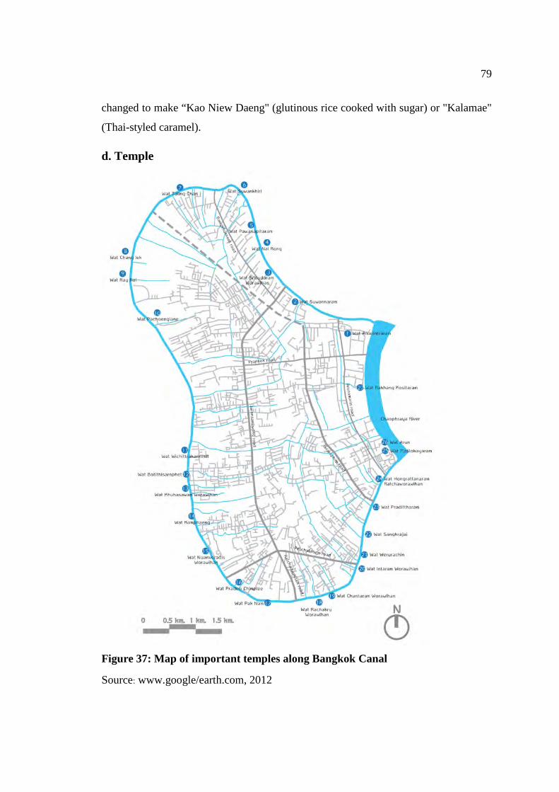
79
changed to make “Kao Niew Daeng" (glutinous rice cooked with sugar) or "Kalamae"
(Thai-styled caramel).
d. Temple
Figure 37: Map of important temples along Bangkok Canal
Source: www.google/earth.com, 2012
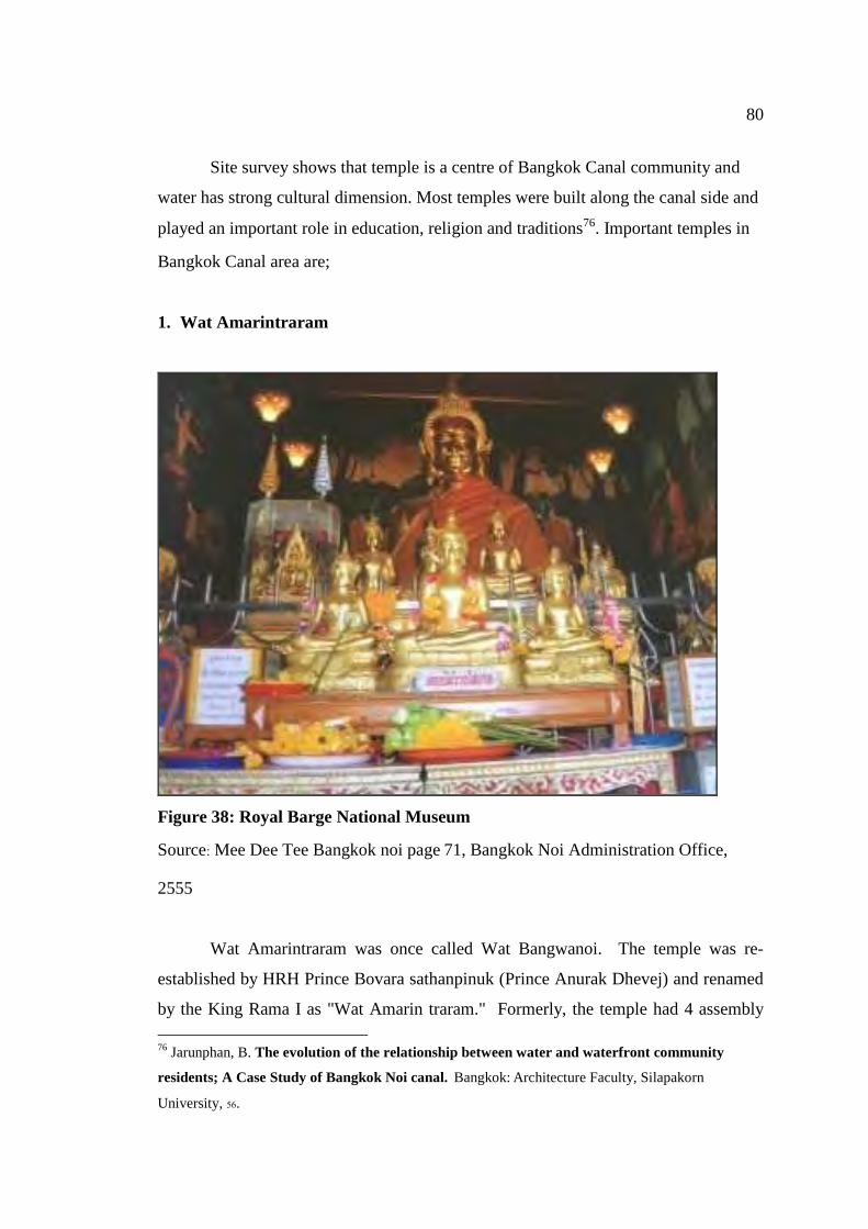
80
Site survey shows that temple is a centre of Bangkok Canal community and
water has strong cultural dimension. Most temples were built along the canal side and
played an important role in education, religion and traditions76. Important temples in
Bangkok Canal area are;
1. Wat Amarintraram
Figure 38: Royal Barge National Museum
Source: Mee Dee Tee Bangkok noi page 71, Bangkok Noi Administration Office,
2555
Wat Amarintraram was once called Wat Bangwanoi. The temple was re-
established by HRH Prince Bovara sathanpinuk (Prince Anurak Dhevej) and renamed
by the King Rama I as "Wat Amarin traram." Formerly, the temple had 4 assembly
76 Jarunphan, B. The evolution of the relationship between water and waterfront community
residents; A Case Study of Bangkok Noi canal. Bangkok: Architecture Faculty, Silapakorn
University, 56.
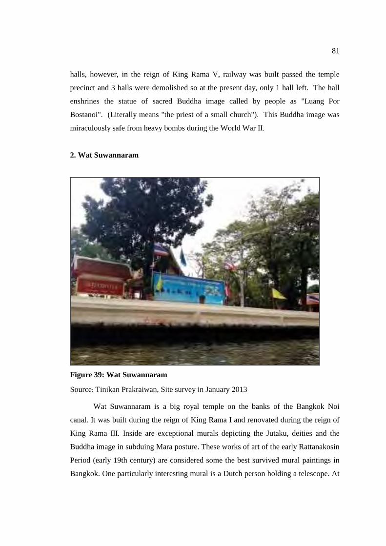
81
halls, however, in the reign of King Rama V, railway was built passed the temple
precinct and 3 halls were demolished so at the present day, only 1 hall left. The hall
enshrines the statue of sacred Buddha image called by people as "Luang Por
Bostanoi". (Literally means "the priest of a small church"). This Buddha image was
miraculously safe from heavy bombs during the World War II.
2. Wat Suwannaram
Figure 39: Wat Suwannaram
Source: Tinikan Prakraiwan, Site survey in January 2013
Wat Suwannaram is a big royal temple on the banks of the Bangkok Noi
canal. It was built during the reign of King Rama I and renovated during the reign of
King Rama III. Inside are exceptional murals depicting the Jutaku, deities and the
Buddha image in subduing Mara posture. These works of art of the early Rattanakosin
Period (early 19th century) are considered some the best survived mural paintings in
Bangkok. One particularly interesting mural is a Dutch person holding a telescope. At
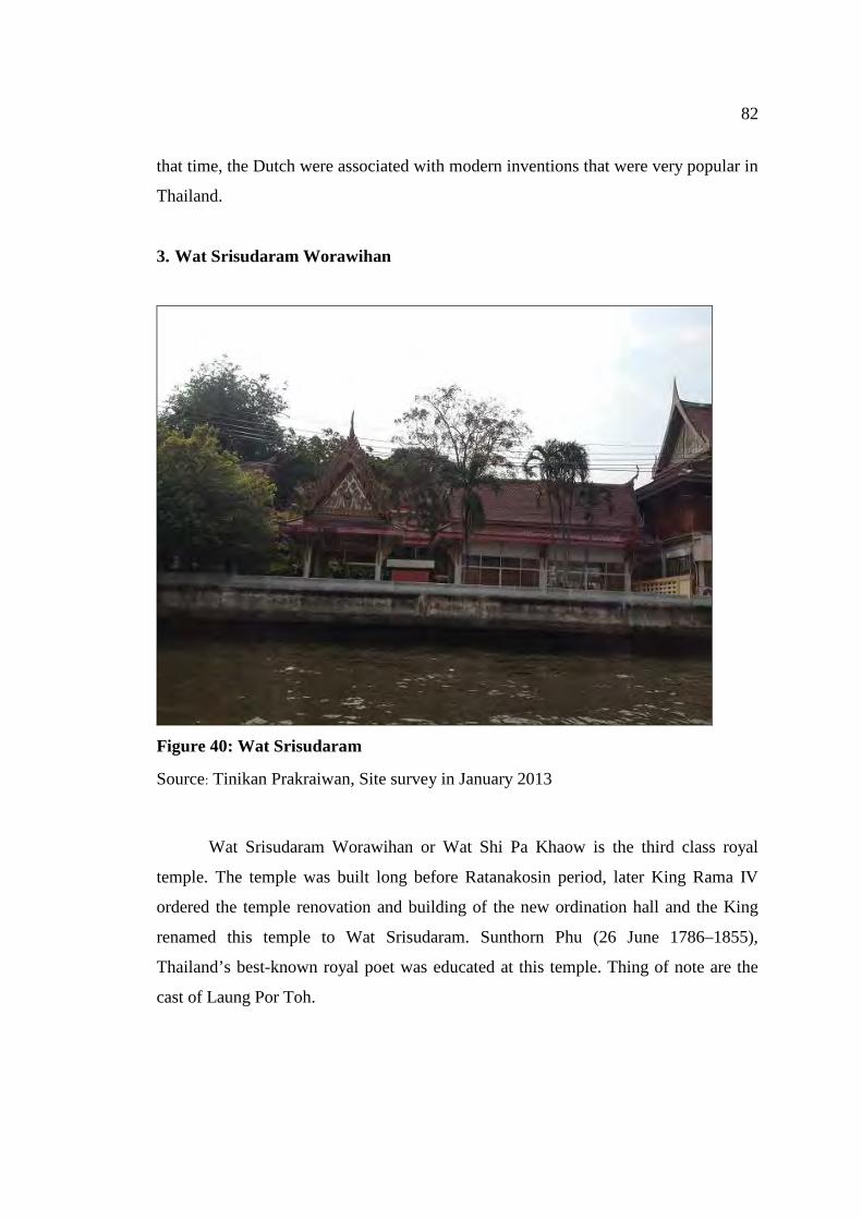
82
that time, the Dutch were associated with modern inventions that were very popular in
Thailand.
3. Wat Srisudaram Worawihan
Figure 40: Wat Srisudaram
Source: Tinikan Prakraiwan, Site survey in January 2013
Wat Srisudaram Worawihan or Wat Shi Pa Khaow is the third class royal
temple. The temple was built long before Ratanakosin period, later King Rama IV
ordered the temple renovation and building of the new ordination hall and the King
renamed this temple to Wat Srisudaram. Sunthorn Phu (26 June 1786–1855),
Thailand’s best-known royal poet was educated at this temple. Thing of note are the
cast of Laung Por Toh.
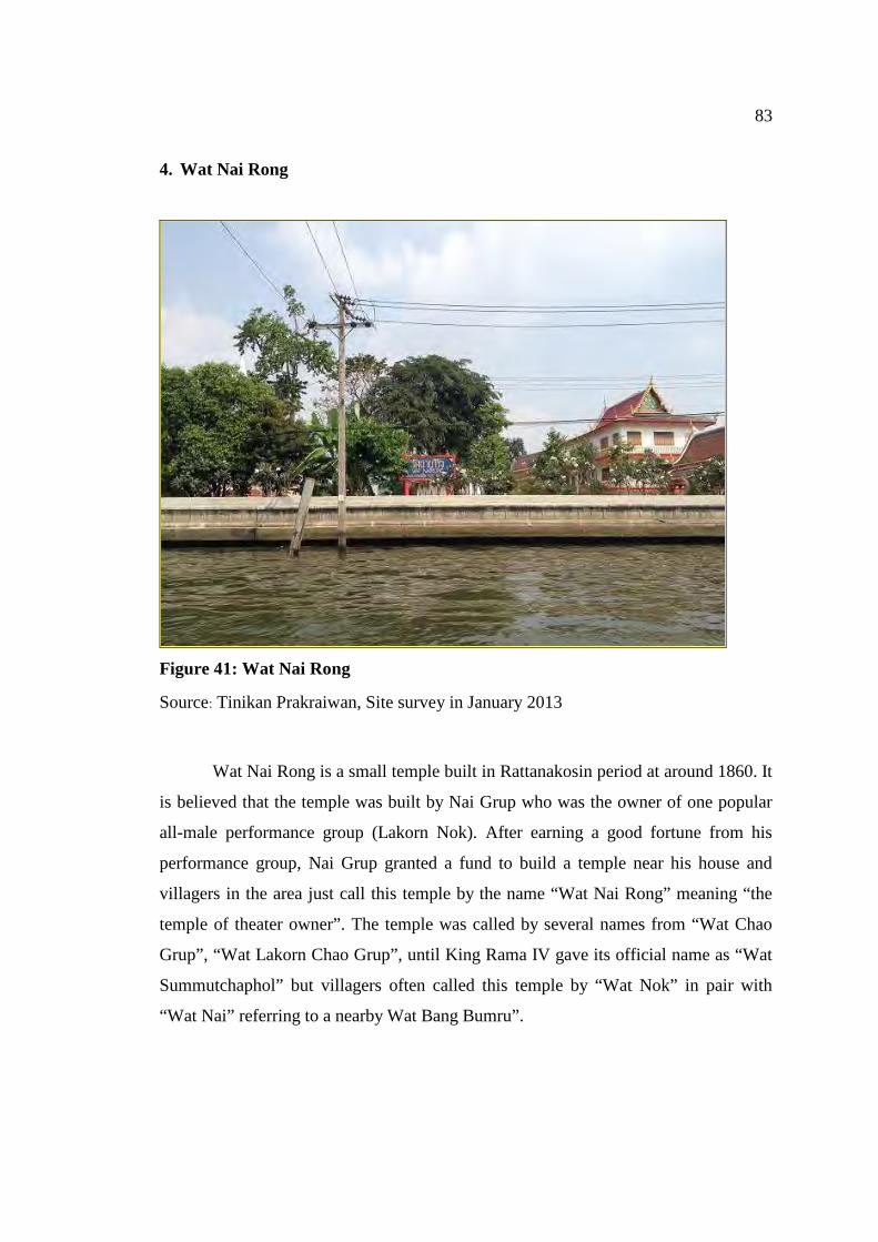
83
4. Wat Nai Rong
Figure 41: Wat Nai Rong
Source: Tinikan Prakraiwan, Site survey in January 2013
Wat Nai Rong is a small temple built in Rattanakosin period at around 1860. It
is believed that the temple was built by Nai Grup who was the owner of one popular
all-male performance group (Lakorn Nok). After earning a good fortune from his
performance group, Nai Grup granted a fund to build a temple near his house and
villagers in the area just call this temple by the name “Wat Nai Rong” meaning “the
temple of theater owner”. The temple was called by several names from “Wat Chao
Grup”, “Wat Lakorn Chao Grup”, until King Rama IV gave its official name as “Wat
Summutchaphol” but villagers often called this temple by “Wat Nok” in pair with
“Wat Nai” referring to a nearby Wat Bang Bumru”.
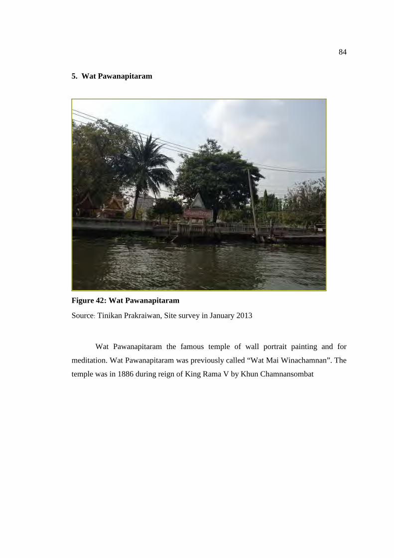
84
5. Wat Pawanapitaram
Figure 42: Wat Pawanapitaram
Source: Tinikan Prakraiwan, Site survey in January 2013
Wat Pawanapitaram the famous temple of wall portrait painting and for
meditation. Wat Pawanapitaram was previously called “Wat Mai Winachamnan”. The
temple was in 1886 during reign of King Rama V by Khun Chamnansombat
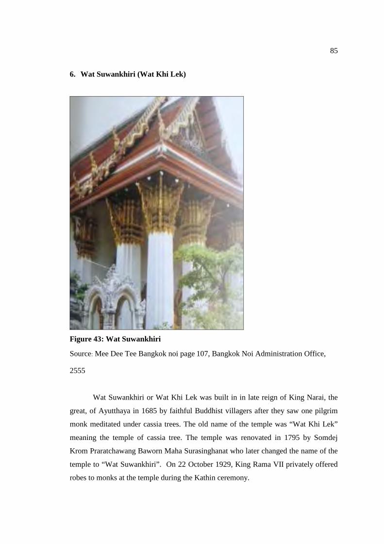
85
6. Wat Suwankhiri (Wat Khi Lek)
Figure 43: Wat Suwankhiri
Source: Mee Dee Tee Bangkok noi page 107, Bangkok Noi Administration Office,
2555
Wat Suwankhiri or Wat Khi Lek was built in in late reign of King Narai, the
great, of Ayutthaya in 1685 by faithful Buddhist villagers after they saw one pilgrim
monk meditated under cassia trees. The old name of the temple was “Wat Khi Lek”
meaning the temple of cassia tree. The temple was renovated in 1795 by Somdej
Krom Praratchawang Baworn Maha Surasinghanat who later changed the name of the
temple to “Wat Suwankhiri”. On 22 October 1929, King Rama VII privately offered
robes to monks at the temple during the Kathin ceremony.
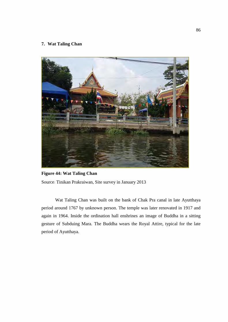
86
7. Wat Taling Chan
Figure 44: Wat Taling Chan
Source: Tinikan Prakraiwan, Site survey in January 2013
Wat Taling Chan was built on the bank of Chak Pra canal in late Ayutthaya
period around 1767 by unknown person. The temple was later renovated in 1917 and
again in 1964. Inside the ordination hall enshrines an image of Buddha in a sitting
gesture of Subduing Mara. The Buddha wears the Royal Attire, typical for the late
period of Ayutthaya.
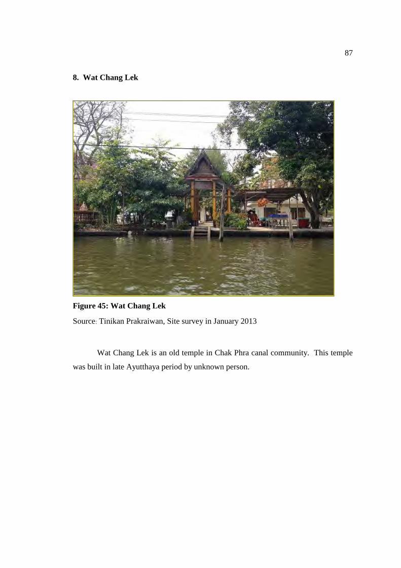
87
8. Wat Chang Lek
Figure 45: Wat Chang Lek
Source: Tinikan Prakraiwan, Site survey in January 2013
Wat Chang Lek is an old temple in Chak Phra canal community. This temple
was built in late Ayutthaya period by unknown person.
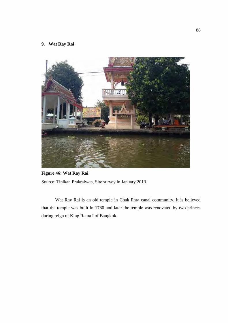
88
9. Wat Ray Rai
Figure 46: Wat Ray Rai
Source: Tinikan Prakraiwan, Site survey in January 2013
Wat Ray Rai is an old temple in Chak Phra canal community. It is believed
that the temple was built in 1780 and later the temple was renovated by two princes
during reign of King Rama I of Bangkok.
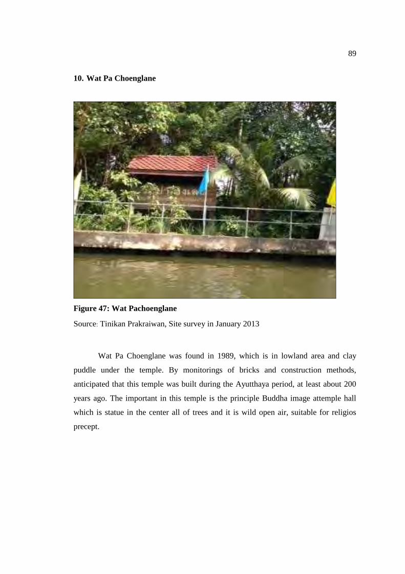
89
10. Wat Pa Choenglane
Figure 47: Wat Pachoenglane
Source: Tinikan Prakraiwan, Site survey in January 2013
Wat Pa Choenglane was found in 1989, which is in lowland area and clay
puddle under the temple. By monitorings of bricks and construction methods,
anticipated that this temple was built during the Ayutthaya period, at least about 200
years ago. The important in this temple is the principle Buddha image attemple hall
which is statue in the center all of trees and it is wild open air, suitable for religios
precept.
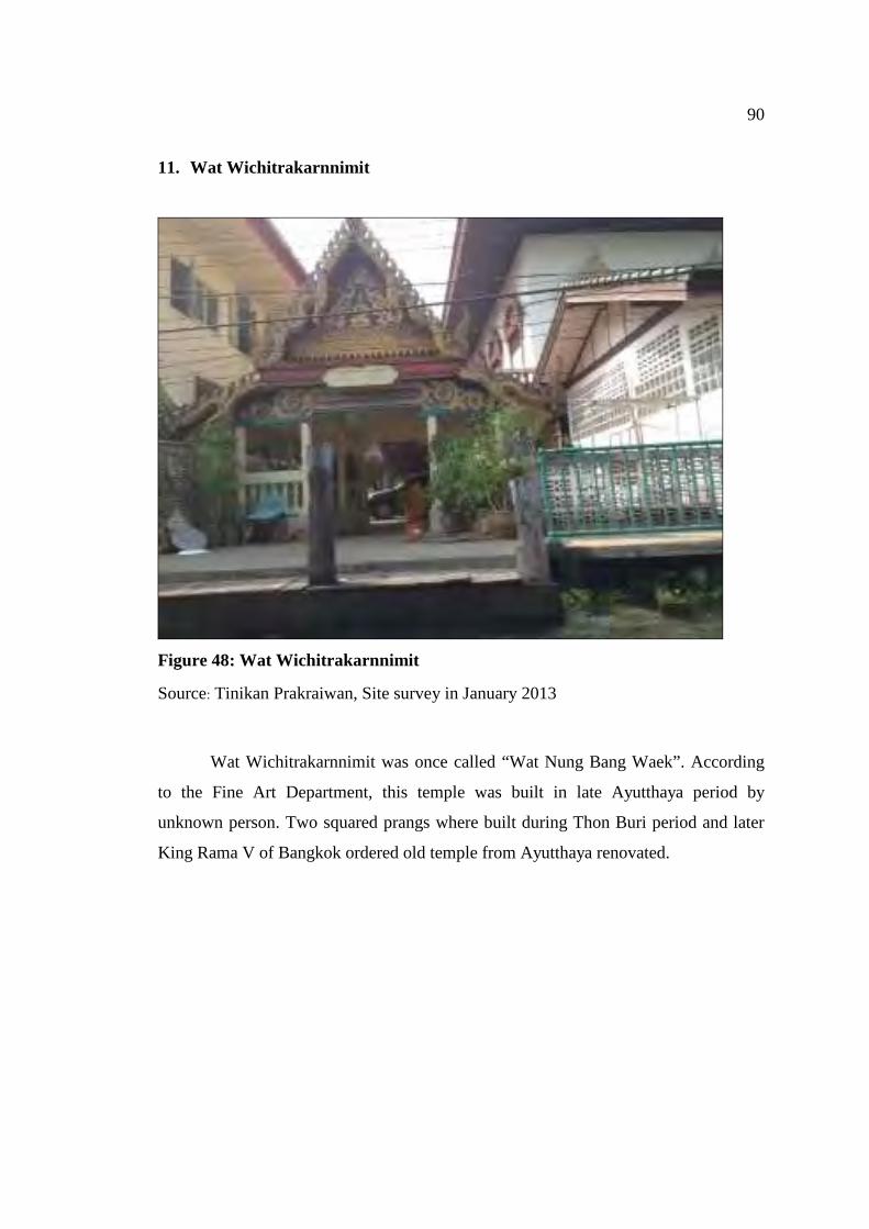
90
11. Wat Wichitrakarnnimit
Figure 48: Wat Wichitrakarnnimit
Source: Tinikan Prakraiwan, Site survey in January 2013
Wat Wichitrakarnnimit was once called “Wat Nung Bang Waek”. According
to the Fine Art Department, this temple was built in late Ayutthaya period by
unknown person. Two squared prangs where built during Thon Buri period and later
King Rama V of Bangkok ordered old temple from Ayutthaya renovated.
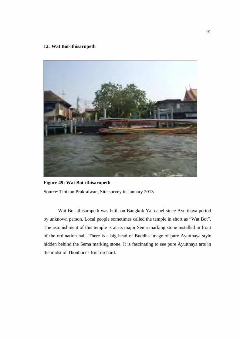
91
12. Wat Bot-ithisarnpeth
Figure 49: Wat Bot-ithisarnpeth
Source: Tinikan Prakraiwan, Site survey in January 2013
Wat Bot-ithisarnpeth was built on Bangkok Yai canel since Ayutthaya period
by unknown person. Local people sometimes called the temple in short as “Wat Bot”.
The astonishment of this temple is at its major Sema marking stone installed in front
of the ordination hall. There is a big head of Buddha image of pure Ayutthaya style
hidden behind the Sema marking stone. It is fascinating to see pure Ayutthaya arts in
the midst of Thonburi’s fruit orchard.

92
13. Wat Khuhasawan Worawihan
Figure 50: Wat Khuhasawan Worawihan
Source: http://mahosot.com/klongbangluang-floating-market.html,2012
Wat Khuhasawan Worawihan is the third class royal temple. The temple was
built on the bank of Bangkok Yai canal since Ayutthaya period however the
construction date was unknown. According to map of Ayutthaya period, the temple
was called “Wat Sala Si Na”. King Rama I renamed the temple to “Wat Khuhasawan”
and promoted the temple to the third class royal temple.
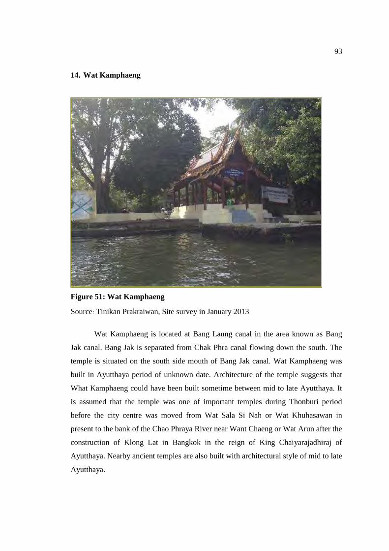
93
14. Wat Kamphaeng
Figure 51: Wat Kamphaeng
Source: Tinikan Prakraiwan, Site survey in January 2013
Wat Kamphaeng is located at Bang Laung canal in the area known as Bang
Jak canal. Bang Jak is separated from Chak Phra canal flowing down the south. The
temple is situated on the south side mouth of Bang Jak canal. Wat Kamphaeng was
built in Ayutthaya period of unknown date. Architecture of the temple suggests that
What Kamphaeng could have been built sometime between mid to late Ayutthaya. It
is assumed that the temple was one of important temples during Thonburi period
before the city centre was moved from Wat Sala Si Nah or Wat Khuhasawan in
present to the bank of the Chao Phraya River near Want Chaeng or Wat Arun after the
construction of Klong Lat in Bangkok in the reign of King Chaiyarajadhiraj of
Ayutthaya. Nearby ancient temples are also built with architectural style of mid to late
Ayutthaya.
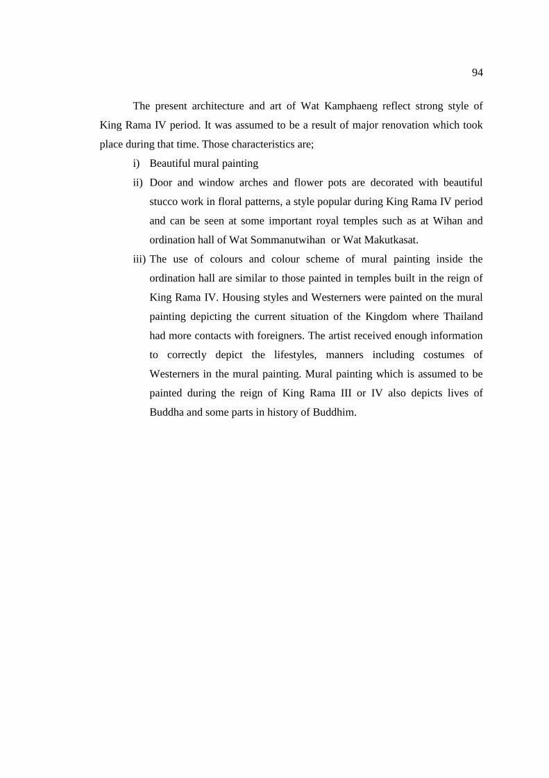
94
The present architecture and art of Wat Kamphaeng reflect strong style of
King Rama IV period. It was assumed to be a result of major renovation which took
place during that time. Those characteristics are;
i) Beautiful mural painting
ii) Door and window arches and flower pots are decorated with beautiful
stucco work in floral patterns, a style popular during King Rama IV period
and can be seen at some important royal temples such as at Wihan and
ordination hall of Wat Sommanutwihan or Wat Makutkasat.
iii) The use of colours and colour scheme of mural painting inside the
ordination hall are similar to those painted in temples built in the reign of
King Rama IV. Housing styles and Westerners were painted on the mural
painting depicting the current situation of the Kingdom where Thailand
had more contacts with foreigners. The artist received enough information
to correctly depict the lifestyles, manners including costumes of
Westerners in the mural painting. Mural painting which is assumed to be
painted during the reign of King Rama III or IV also depicts lives of
Buddha and some parts in history of Buddhim.
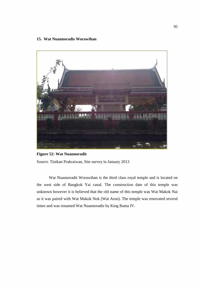
95
15. Wat Nuannoradis Worawihan
Figure 52: Wat Nuannoradit
Source: Tinikan Prakraiwan, Site survey in January 2013
Wat Nuannoradit Worawihan is the third class royal temple and is located on
the west side of Bangkok Yai canal. The construction date of this temple was
unknown however it is believed that the old name of this temple was Wat Makok Nai
as it was paired with Wat Makok Nok (Wat Arun). The temple was renovated several
times and was renamed Wat Nuannoradis by King Rama IV.
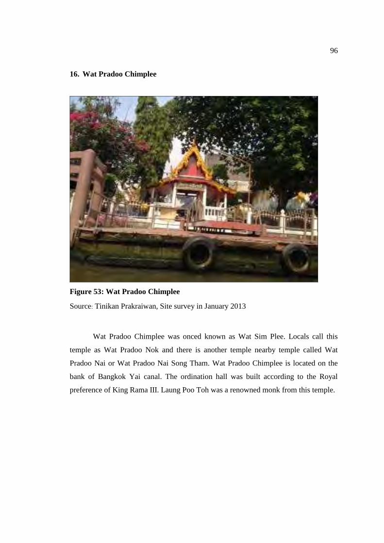
96
16. Wat Pradoo Chimplee
Figure 53: Wat Pradoo Chimplee
Source: Tinikan Prakraiwan, Site survey in January 2013
Wat Pradoo Chimplee was onced known as Wat Sim Plee. Locals call this
temple as Wat Pradoo Nok and there is another temple nearby temple called Wat
Pradoo Nai or Wat Pradoo Nai Song Tham. Wat Pradoo Chimplee is located on the
bank of Bangkok Yai canal. The ordination hall was built according to the Royal
preference of King Rama III. Laung Poo Toh was a renowned monk from this temple.
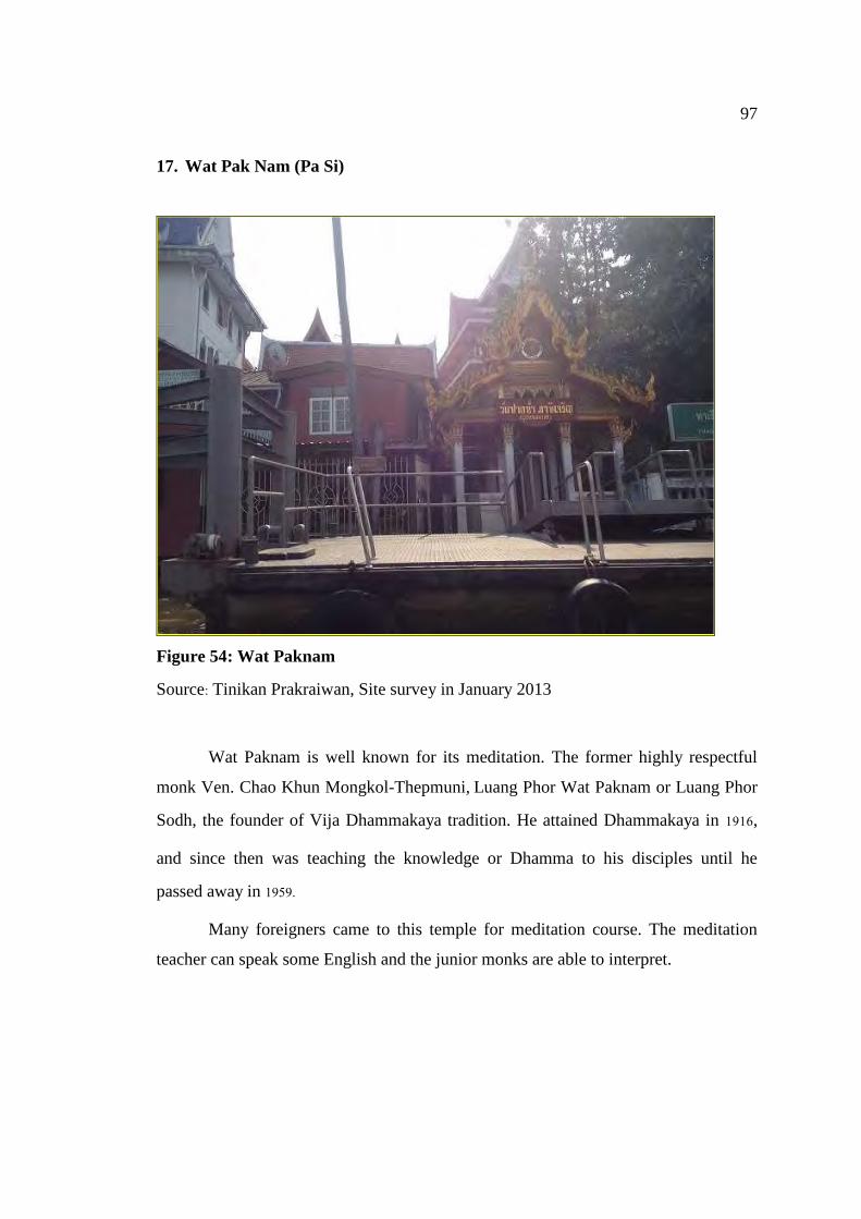
97
17. Wat Pak Nam (Pa Si)
Figure 54: Wat Paknam
Source: Tinikan Prakraiwan, Site survey in January 2013
Wat Paknam is well known for its meditation. The former highly respectful
monk Ven. Chao Khun Mongkol-Thepmuni, Luang Phor Wat Paknam or Luang Phor
Sodh, the founder of Vija Dhammakaya tradition. He attained Dhammakaya in 1916,
and since then was teaching the knowledge or Dhamma to his disciples until he
passed away in 1959.
Many foreigners came to this temple for meditation course. The meditation
teacher can speak some English and the junior monks are able to interpret.
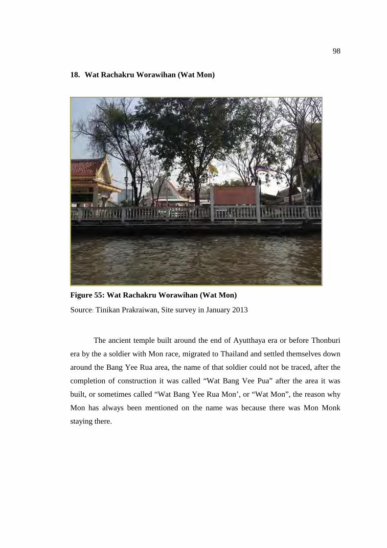
98
18. Wat Rachakru Worawihan (Wat Mon)
Figure 55: Wat Rachakru Worawihan (Wat Mon)
Source: Tinikan Prakraiwan, Site survey in January 2013
The ancient temple built around the end of Ayutthaya era or before Thonburi
era by the a soldier with Mon race, migrated to Thailand and settled themselves down
around the Bang Yee Rua area, the name of that soldier could not be traced, after the
completion of construction it was called “Wat Bang Vee Pua” after the area it was
built, or sometimes called “Wat Bang Yee Rua Mon’, or “Wat Mon”, the reason why
Mon has always been mentioned on the name was because there was Mon Monk
staying there.
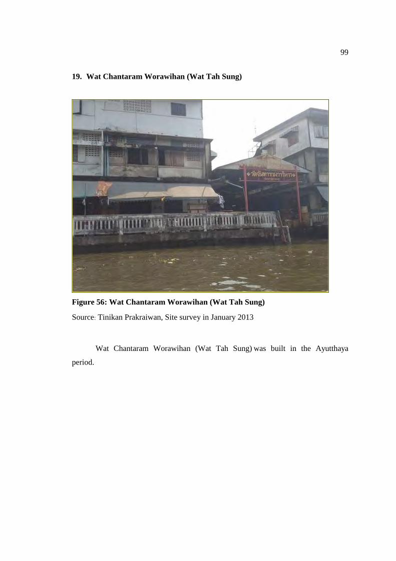
99
19. Wat Chantaram Worawihan (Wat Tah Sung)
Figure 56: Wat Chantaram Worawihan (Wat Tah Sung)
Source: Tinikan Prakraiwan, Site survey in January 2013
Wat Chantaram Worawihan (Wat Tah Sung) was built in the Ayutthaya
period.
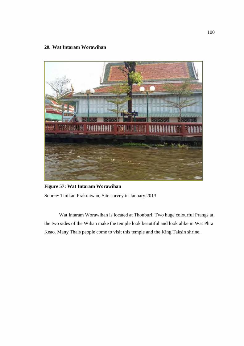
100
20. Wat Intaram Worawihan
Figure 57: Wat Intaram Worawihan
Source: Tinikan Prakraiwan, Site survey in January 2013
Wat Intaram Worawihan is located at Thonburi. Two huge colourful Prangs at
the two sides of the Wihan make the temple look beautiful and look alike in Wat Phra
Keao. Many Thais people come to visit this temple and the King Taksin shrine.
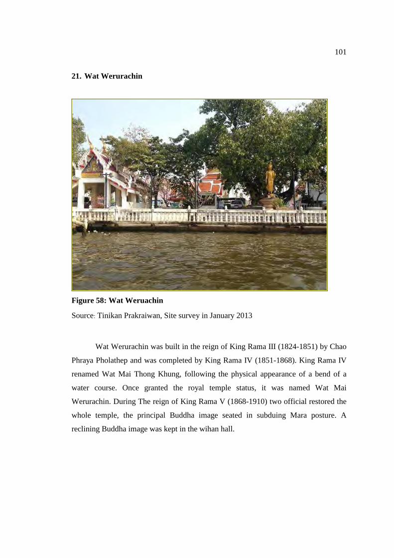
101
21. Wat Werurachin
Figure 58: Wat Weruachin
Source: Tinikan Prakraiwan, Site survey in January 2013
Wat Werurachin was built in the reign of King Rama III (1824-1851) by Chao
Phraya Pholathep and was completed by King Rama IV (1851-1868). King Rama IV
renamed Wat Mai Thong Khung, following the physical appearance of a bend of a
water course. Once granted the royal temple status, it was named Wat Mai
Werurachin. During The reign of King Rama V (1868-1910) two official restored the
whole temple, the principal Buddha image seated in subduing Mara posture. A
reclining Buddha image was kept in the wihan hall.
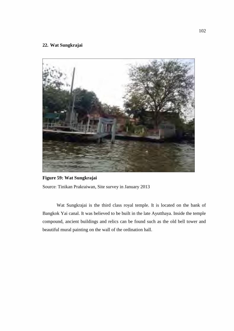
102
22. Wat Sungkrajai
Figure 59: Wat Sungkrajai
Source: Tinikan Prakraiwan, Site survey in January 2013
Wat Sungkrajai is the third class royal temple. It is located on the bank of
Bangkok Yai canal. It was believed to be built in the late Ayutthaya. Inside the temple
compound, ancient buildings and relics can be found such as the old bell tower and
beautiful mural painting on the wall of the ordination hall.
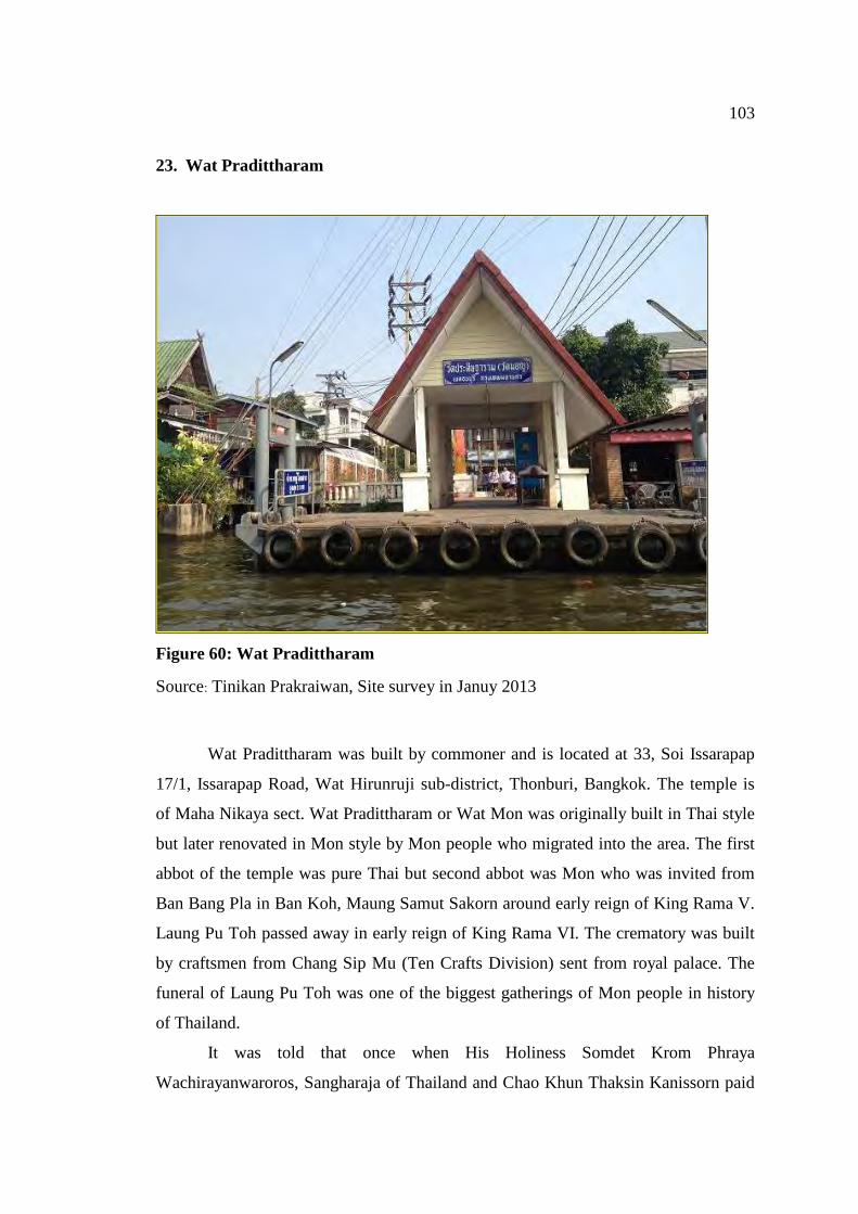
103
23. Wat Pradittharam
Figure 60: Wat Pradittharam
Source: Tinikan Prakraiwan, Site survey in Januy 2013
Wat Pradittharam was built by commoner and is located at 33, Soi Issarapap
17/1, Issarapap Road, Wat Hirunruji sub-district, Thonburi, Bangkok. The temple is
of Maha Nikaya sect. Wat Pradittharam or Wat Mon was originally built in Thai style
but later renovated in Mon style by Mon people who migrated into the area. The first
abbot of the temple was pure Thai but second abbot was Mon who was invited from
Ban Bang Pla in Ban Koh, Maung Samut Sakorn around early reign of King Rama V.
Laung Pu Toh passed away in early reign of King Rama VI. The crematory was built
by craftsmen from Chang Sip Mu (Ten Crafts Division) sent from royal palace. The
funeral of Laung Pu Toh was one of the biggest gatherings of Mon people in history
of Thailand.
It was told that once when His Holiness Somdet Krom Phraya
Wachirayanwaroros, Sangharaja of Thailand and Chao Khun Thaksin Kanissorn paid
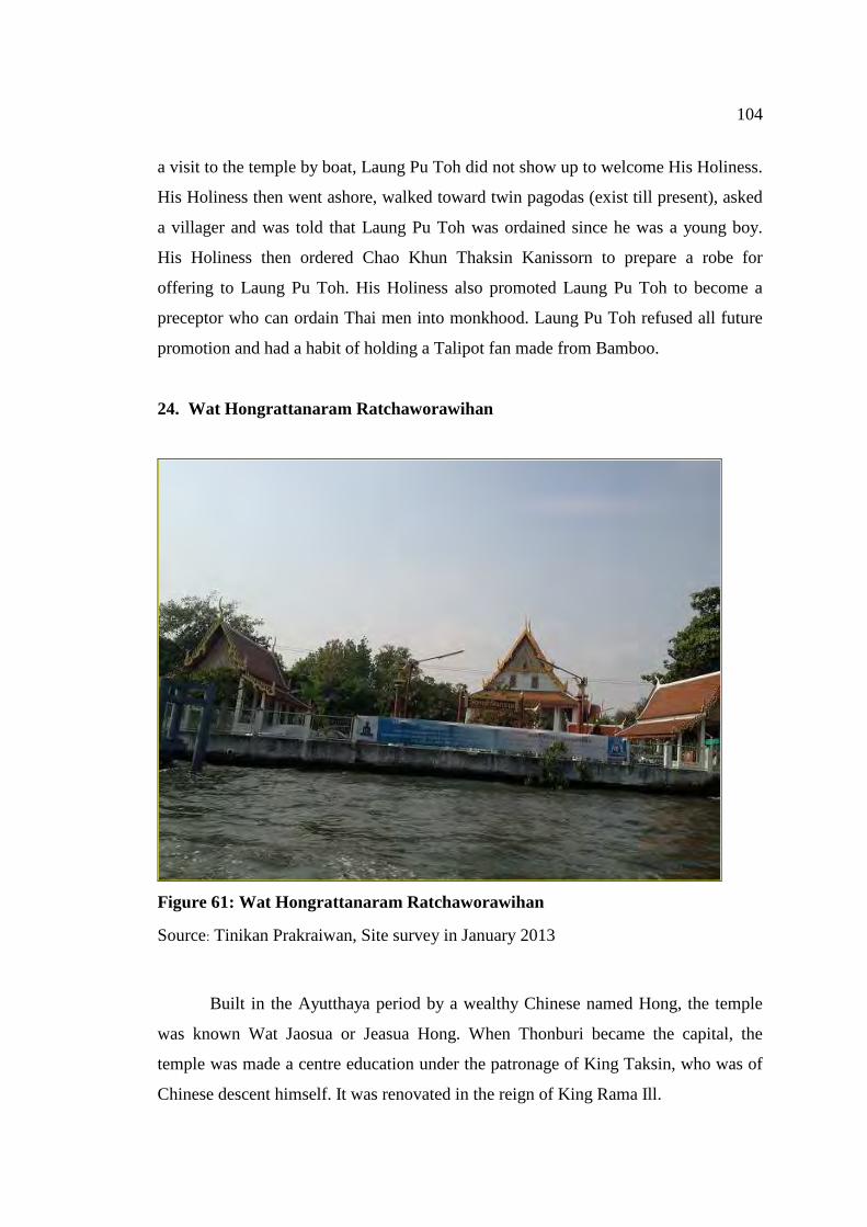
104
a visit to the temple by boat, Laung Pu Toh did not show up to welcome His Holiness.
His Holiness then went ashore, walked toward twin pagodas (exist till present), asked
a villager and was told that Laung Pu Toh was ordained since he was a young boy.
His Holiness then ordered Chao Khun Thaksin Kanissorn to prepare a robe for
offering to Laung Pu Toh. His Holiness also promoted Laung Pu Toh to become a
preceptor who can ordain Thai men into monkhood. Laung Pu Toh refused all future
promotion and had a habit of holding a Talipot fan made from Bamboo.
24. Wat Hongrattanaram Ratchaworawihan
Figure 61: Wat Hongrattanaram Ratchaworawihan
Source: Tinikan Prakraiwan, Site survey in January 2013
Built in the Ayutthaya period by a wealthy Chinese named Hong, the temple
was known Wat Jaosua or Jeasua Hong. When Thonburi became the capital, the
temple was made a centre education under the patronage of King Taksin, who was of
Chinese descent himself. It was renovated in the reign of King Rama Ill.
105
Ubosot or ordination hall of the temple is a combination of Chinese an
European style stucco reliefs adorning the do and window arches of the ubosot are
some of finest of their kind. The interior murals paint in the Third and Fourth Reigns
tell the story Ratthanapimphawong, or the Emerald Buddha story.
Hor Trai of the temple is the room housing the Buddhi scripture which is kept
in gilded black lacquer panels. The door was carved in a krauthao-style, a scroll floral
motifs in the reign of King Rama I.
For many years was believed that the ancient Golden Buddha image was made
of limestone, but when the casing fell off and the inside was revealed it was seen to be
made of high quality gold in Sukhothai style The old U-thong alphabet was found
inscribed the base.
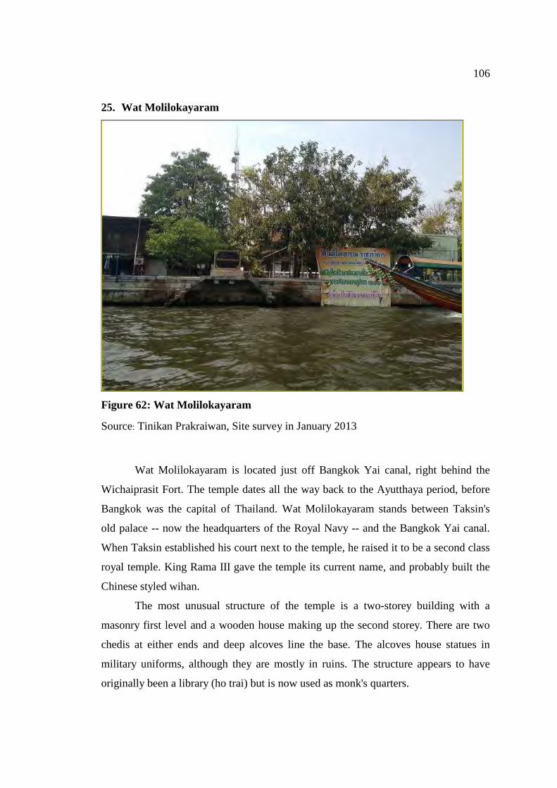
106
25. Wat Molilokayaram
Figure 62: Wat Molilokayaram
Source: Tinikan Prakraiwan, Site survey in January 2013
Wat Molilokayaram is located just off Bangkok Yai canal, right behind the
Wichaiprasit Fort. The temple dates all the way back to the Ayutthaya period, before
Bangkok was the capital of Thailand. Wat Molilokayaram stands between Taksin's
old palace -- now the headquarters of the Royal Navy -- and the Bangkok Yai canal.
When Taksin established his court next to the temple, he raised it to be a second class
royal temple. King Rama III gave the temple its current name, and probably built the
Chinese styled wihan.
The most unusual structure of the temple is a two-storey building with a
masonry first level and a wooden house making up the second storey. There are two
chedis at either ends and deep alcoves line the base. The alcoves house statues in
military uniforms, although they are mostly in ruins. The structure appears to have
originally been a library (ho trai) but is now used as monk's quarters.
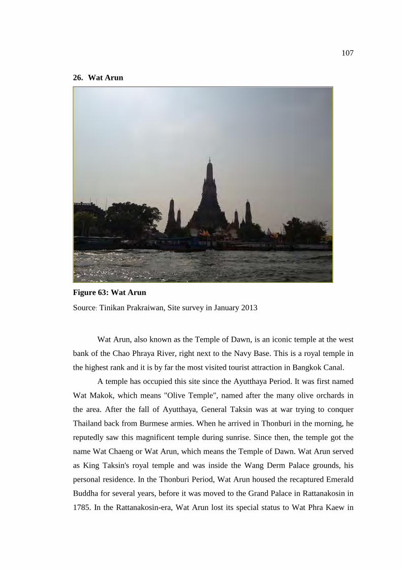
107
26. Wat Arun
Figure 63: Wat Arun
Source: Tinikan Prakraiwan, Site survey in January 2013
Wat Arun, also known as the Temple of Dawn, is an iconic temple at the west
bank of the Chao Phraya River, right next to the Navy Base. This is a royal temple in
the highest rank and it is by far the most visited tourist attraction in Bangkok Canal.
A temple has occupied this site since the Ayutthaya Period. It was first named
Wat Makok, which means "Olive Temple", named after the many olive orchards in
the area. After the fall of Ayutthaya, General Taksin was at war trying to conquer
Thailand back from Burmese armies. When he arrived in Thonburi in the morning, he
reputedly saw this magnificent temple during sunrise. Since then, the temple got the
name Wat Chaeng or Wat Arun, which means the Temple of Dawn. Wat Arun served
as King Taksin's royal temple and was inside the Wang Derm Palace grounds, his
personal residence. In the Thonburi Period, Wat Arun housed the recaptured Emerald
Buddha for several years, before it was moved to the Grand Palace in Rattanakosin in
1785. In the Rattanakosin-era, Wat Arun lost its special status to Wat Phra Kaew in
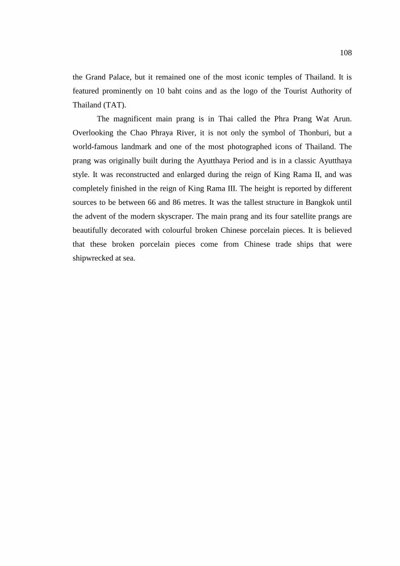
108
the Grand Palace, but it remained one of the most iconic temples of Thailand. It is
featured prominently on 10 baht coins and as the logo of the Tourist Authority of
Thailand (TAT).
The magnificent main prang is in Thai called the Phra Prang Wat Arun.
Overlooking the Chao Phraya River, it is not only the symbol of Thonburi, but a
world-famous landmark and one of the most photographed icons of Thailand. The
prang was originally built during the Ayutthaya Period and is in a classic Ayutthaya
style. It was reconstructed and enlarged during the reign of King Rama II, and was
completely finished in the reign of King Rama III. The height is reported by different
sources to be between 66 and 86 metres. It was the tallest structure in Bangkok until
the advent of the modern skyscraper. The main prang and its four satellite prangs are
beautifully decorated with colourful broken Chinese porcelain pieces. It is believed
that these broken porcelain pieces come from Chinese trade ships that were
shipwrecked at sea.
109
27. Wat Rakhang Kositaram
Figure 64: Wat Rakhang Kositaram
Source: Tinikan Prakraiwan, Site survey in January 2013
Wat Rakhang Kositaram was built during the Ayutthaya Period, later it was
reconstructed and upgraded as a royal temple by King Taksin. The temple was named
the "Temple of the Bells" due to the discovery of a huge bell at this temple in the
reign of King Rama I. This significant temple was the residence of many supreme
patriarchs of the Rattankosin Period, including Somdej Toh, a highly respected monk
in the reign of King Rama V. Things of note are the beautiful mural paintings in the
ordination hall, the image hall and the bell tower. Outside is a row of bells lined up. It
is believed that ringing all of them in a row will bring good luck. The front of the
building is right at the banks of the Chao Phraya River, and it is beautifully lit at
nighttime.
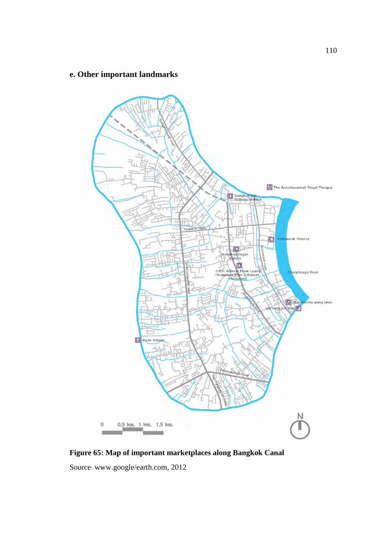
110
e. Other important landmarks
Figure 65: Map of important marketplaces along Bangkok Canal
Source: www.google/earth.com, 2012
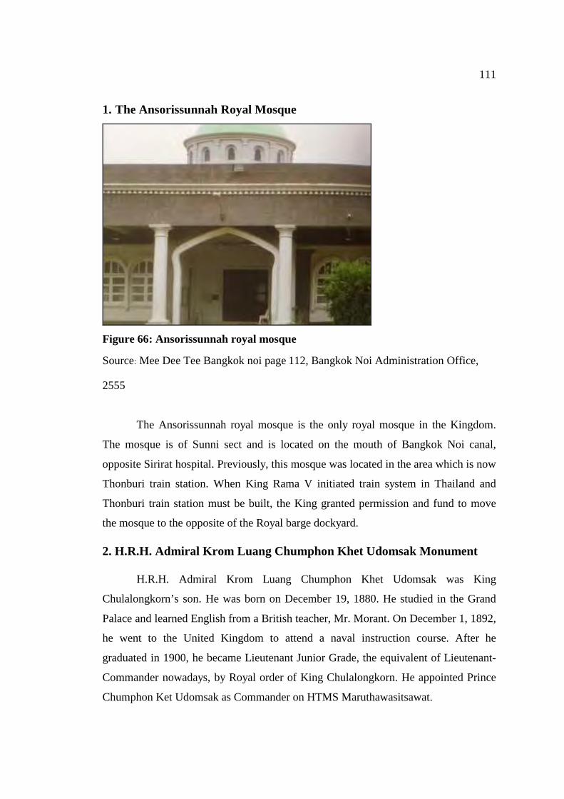
111
1. The Ansorissunnah Royal Mosque
Figure 66: Ansorissunnah royal mosque
Source: Mee Dee Tee Bangkok noi page 112, Bangkok Noi Administration Office,
2555
The Ansorissunnah royal mosque is the only royal mosque in the Kingdom.
The mosque is of Sunni sect and is located on the mouth of Bangkok Noi canal,
opposite Sirirat hospital. Previously, this mosque was located in the area which is now
Thonburi train station. When King Rama V initiated train system in Thailand and
Thonburi train station must be built, the King granted permission and fund to move
the mosque to the opposite of the Royal barge dockyard.
2. H.R.H. Admiral Krom Luang Chumphon Khet Udomsak Monument
H.R.H. Admiral Krom Luang Chumphon Khet Udomsak was King
Chulalongkorn’s son. He was born on December 19, 1880. He studied in the Grand
Palace and learned English from a British teacher, Mr. Morant. On December 1, 1892,
he went to the United Kingdom to attend a naval instruction course. After he
graduated in 1900, he became Lieutenant Junior Grade, the equivalent of Lieutenant-
Commander nowadays, by Royal order of King Chulalongkorn. He appointed Prince
Chumphon Ket Udomsak as Commander on HTMS Maruthawasitsawat.
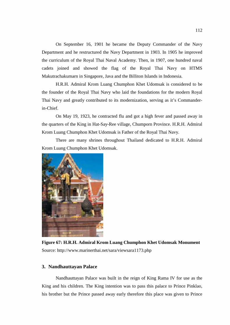
112
On September 16, 1901 he became the Deputy Commander of the Navy
Department and he restructured the Navy Department in 1903. In 1905 he improved
the curriculum of the Royal Thai Naval Academy. Then, in 1907, one hundred naval
cadets joined and showed the flag of the Royal Thai Navy on HTMS
Makutrachakumarn in Singapore, Java and the Billiton Islands in Indonesia.
H.R.H. Admiral Krom Luang Chumphon Khet Udomsak is considered to be
the founder of the Royal Thai Navy who laid the foundations for the modern Royal
Thai Navy and greatly contributed to its modernization, serving as it’s Commander-
in-Chief.
On May 19, 1923, he contracted flu and got a high fever and passed away in
the quarters of the King in Hat-Say-Ree village, Chumporn Province. H.R.H. Admiral
Krom Luang Chumphon Khet Udomsak is Father of the Royal Thai Navy.
There are many shrines throughout Thailand dedicated to H.R.H. Admiral
Krom Luang Chumphon Khet Udomsak.
Figure 67: H.R.H. Admiral Krom Luang Chumphon Khet Udomsak Monument
Source: http://www.marinerthai.net/sara/viewsara1173.php
3. Nandhauttayan Palace
Nandhauttayan Palace was built in the reign of King Rama IV for use as the
King and his children. The King intention was to pass this palace to Prince Pinklao,
his brother but the Prince passed away early therefore this place was given to Prince
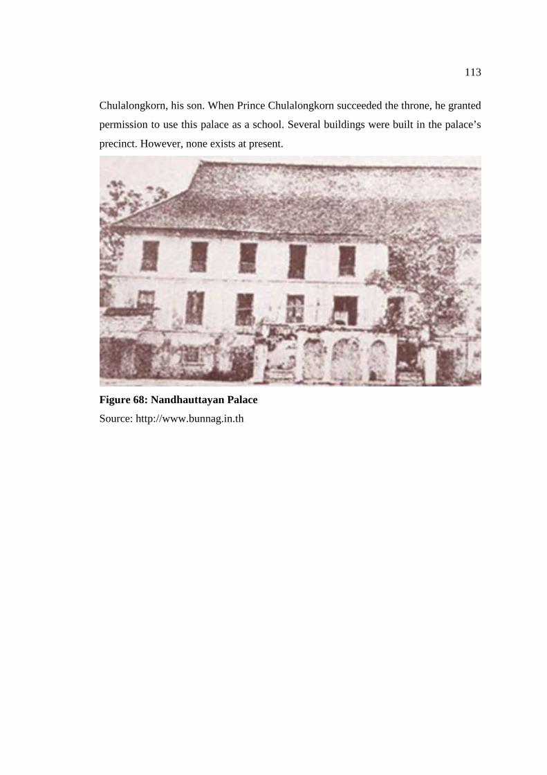
113
Chulalongkorn, his son. When Prince Chulalongkorn succeeded the throne, he granted
permission to use this palace as a school. Several buildings were built in the palace’s
precinct. However, none exists at present.
Figure 68: Nandhauttayan Palace
Source: http://www.bunnag.in.th
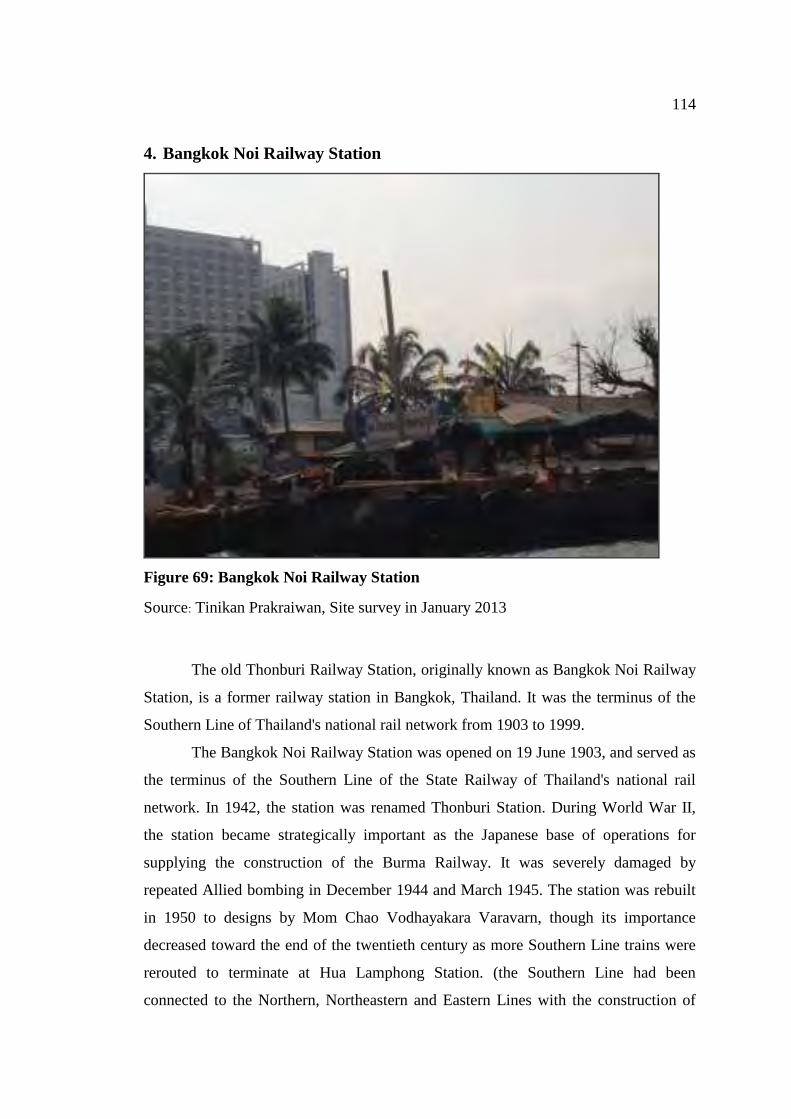
114
4. Bangkok Noi Railway Station
Figure 69: Bangkok Noi Railway Station
Source: Tinikan Prakraiwan, Site survey in January 2013
The old Thonburi Railway Station, originally known as Bangkok Noi Railway
Station, is a former railway station in Bangkok, Thailand. It was the terminus of the
Southern Line of Thailand's national rail network from 1903 to 1999.
The Bangkok Noi Railway Station was opened on 19 June 1903, and served as
the terminus of the Southern Line of the State Railway of Thailand's national rail
network. In 1942, the station was renamed Thonburi Station. During World War II,
the station became strategically important as the Japanese base of operations for
supplying the construction of the Burma Railway. It was severely damaged by
repeated Allied bombing in December 1944 and March 1945. The station was rebuilt
in 1950 to designs by Mom Chao Vodhayakara Varavarn, though its importance
decreased toward the end of the twentieth century as more Southern Line trains were
rerouted to terminate at Hua Lamphong Station. (the Southern Line had been
connected to the Northern, Northeastern and Eastern Lines with the construction of
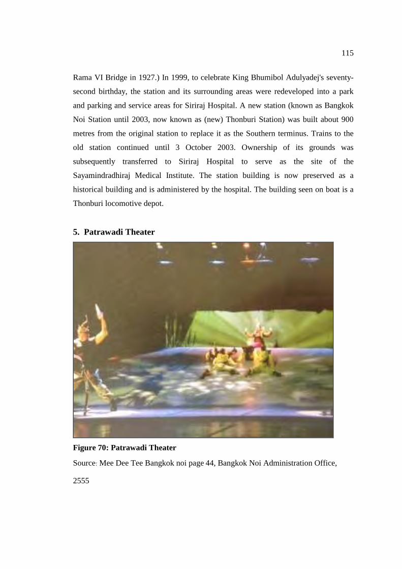
115
Rama VI Bridge in 1927.) In 1999, to celebrate King Bhumibol Adulyadej's seventy-
second birthday, the station and its surrounding areas were redeveloped into a park
and parking and service areas for Siriraj Hospital. A new station (known as Bangkok
Noi Station until 2003, now known as (new) Thonburi Station) was built about 900
metres from the original station to replace it as the Southern terminus. Trains to the
old station continued until 3 October 2003. Ownership of its grounds was
subsequently transferred to Siriraj Hospital to serve as the site of the
Sayamindradhiraj Medical Institute. The station building is now preserved as a
historical building and is administered by the hospital. The building seen on boat is a
Thonburi locomotive depot.
5. Patrawadi Theater
Figure 70: Patrawadi Theater
Source: Mee Dee Tee Bangkok noi page 44, Bangkok Noi Administration Office,
2555
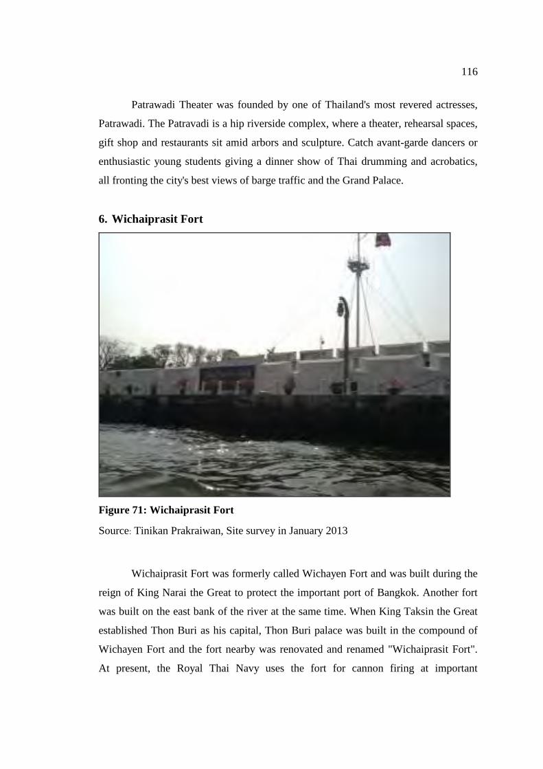
116
Patrawadi Theater was founded by one of Thailand's most revered actresses,
Patrawadi. The Patravadi is a hip riverside complex, where a theater, rehearsal spaces,
gift shop and restaurants sit amid arbors and sculpture. Catch avant-garde dancers or
enthusiastic young students giving a dinner show of Thai drumming and acrobatics,
all fronting the city's best views of barge traffic and the Grand Palace.
6. Wichaiprasit Fort
Figure 71: Wichaiprasit Fort
Source: Tinikan Prakraiwan, Site survey in January 2013
Wichaiprasit Fort was formerly called Wichayen Fort and was built during the
reign of King Narai the Great to protect the important port of Bangkok. Another fort
was built on the east bank of the river at the same time. When King Taksin the Great
established Thon Buri as his capital, Thon Buri palace was built in the compound of
Wichayen Fort and the fort nearby was renovated and renamed "Wichaiprasit Fort".
At present, the Royal Thai Navy uses the fort for cannon firing at important
117
ceremonies.The flags of the Commander-in-Chief and the Royal Thai Navy fly from
the flag pole installed there.
7. Phra Racha Wang Derm or Thon Buri Palace
Phra Racha Wang Derm or Thon Buri Palace is the only palace built by King
Taksin the great in 1768. It was built on the west bank of the Chao Phraya River near
the old Wichayen Fort which was later renamed Wichaiprasit Fort to the canal north
of Arun Rajawararam temple (Nakornban canal) and included Wat Chaeng (Arun
Rajawararam Temple) and Wat Tai Talad (Wat Moli Lokayaram) within its borders.
Later, when King Rama I ascended the throne, the capital was moved to the east bank
of the Chao Phraya River, and a new royal palace was constructed. Thon Buri Palace
became known as Phra Racha Wang Derm (the original palace). King Rama I reduced
the area of the palace by excluding the two temples from the palace grounds.
Three Kings were born at Phra Racha Wang Derm during the reign of King
Rama I, all of them sons of King Rama II who at the time held the title of Prince
Khrom Luang Isara Sunthorn.
When Prince Chakrapadipongse, the last occupant, passed away, King Rama
V graciously bestowed the palace to the Royal Thai Navy to be used as the site of the
Naval Academy. Specific instructions were given to preserve ancient sites such as the
Throne Hall, King Pinklao's residence, King Taksin's Shrine and the Whale Head
Shrine. The Naval Academy remained at Phra Racha Wang Derm until 1944 when it
was moved to Sattahip and Kledkaew. Then it was moved to its current location at
Samutprakarn in 1952. The Academy building, which was originally built in western
style, was remodeled into a Thai style and has housed the Royal Thai Navy
Headquarters up to the present.
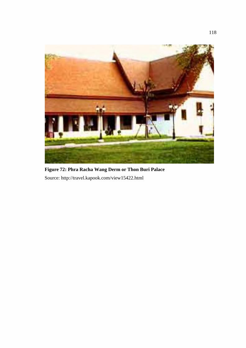
118
Figure 72: Phra Racha Wang Derm or Thon Buri Palace
Source: http://travel.kapook.com/view15422.html
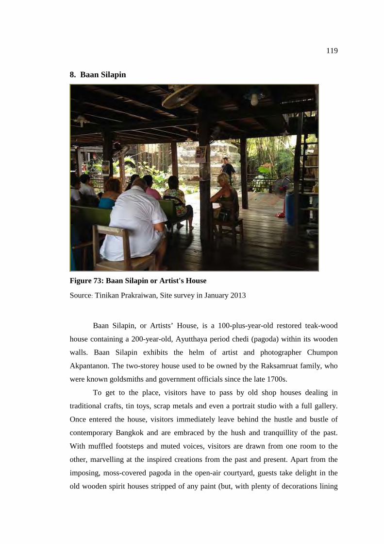
119
8. Baan Silapin
Figure 73: Baan Silapin or Artist's House
Source: Tinikan Prakraiwan, Site survey in January 2013
Baan Silapin, or Artists’ House, is a 100-plus-year-old restored teak-wood
house containing a 200-year-old, Ayutthaya period chedi (pagoda) within its wooden
walls. Baan Silapin exhibits the helm of artist and photographer Chumpon
Akpantanon. The two-storey house used to be owned by the Raksamruat family, who
were known goldsmiths and government officials since the late 1700s.
To get to the place, visitors have to pass by old shop houses dealing in
traditional crafts, tin toys, scrap metals and even a portrait studio with a full gallery.
Once entered the house, visitors immediately leave behind the hustle and bustle of
contemporary Bangkok and are embraced by the hush and tranquillity of the past.
With muffled footsteps and muted voices, visitors are drawn from one room to the
other, marvelling at the inspired creations from the past and present. Apart from the
imposing, moss-covered pagoda in the open-air courtyard, guests take delight in the
old wooden spirit houses stripped of any paint (but, with plenty of decorations lining
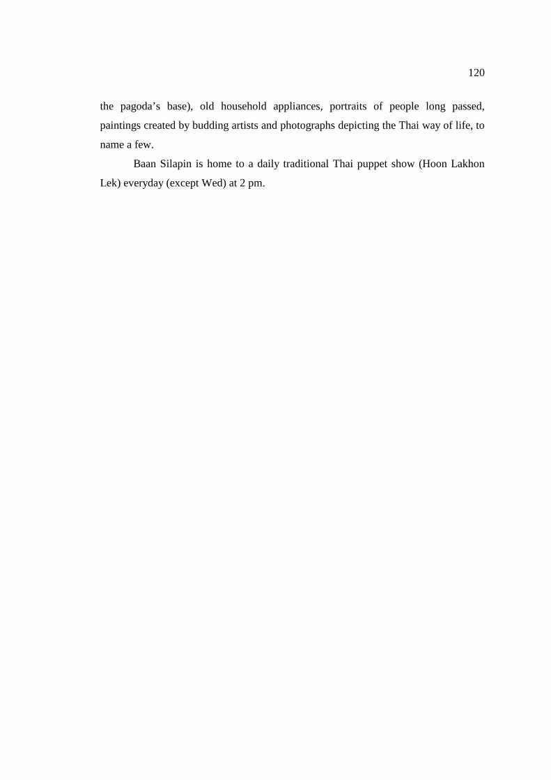
120
the pagoda’s base), old household appliances, portraits of people long passed,
paintings created by budding artists and photographs depicting the Thai way of life, to
name a few.
Baan Silapin is home to a daily traditional Thai puppet show (Hoon Lakhon
Lek) everyday (except Wed) at 2 pm.
121
CHAPTER 4
ANALYSIS OF CULTURAL SIGNIFICANCE OF BANGKOK CANAL
Featherstone (1991, p. 95) stated that each city or country has its own culture
in the sense that culture can produce distinctive cultural products, buildings, artifacts
and way of life of people. Moreover, cultural significance is a concept which helps in
estimating the value of places. The places those are likely to enrich the present, and
which will be value to future generations. As a cultural tourism route the values should be managed in accordance with a
cultural system such as the Burra Charter which recognises cultural significance as a
’aesthetic, historic, scientific or social value for past, present or future generations’
(Australia ICOMOS1999).
After careful assessment and analysis of data collected on Bangkok Canal,
significance values can be categorised as follow;
4.1 Values Deriving From the History (Historic Value)
The Burra Charter describes the meaning of historical value as having historic
value because it has influenced, or has been influenced by, an historic figure, event,
phase or activity. (Australia ICOMOS 1999). Bangkok Canal plays an important part
in Thailand history with evidence which can be traced back to the reign of King
Chaiyarajadhiraj of Ayutthaya77 when the King ordered to have the new canal built
and changed the course of the Choa Phraya River when the former parts of the river
became a canal whereas the new Klong Lat widened and became the new Chao
Phraya River. Therefore historic significance is established.
The new short-cut canal plays an important role in the local community where
natural canals failed to respond to the need of local people’s everyday living because
77 Wikipedia. (2010). Thailand History. Accesed August 26, 2010. Avialble
from"http://th.wikipedia.org.
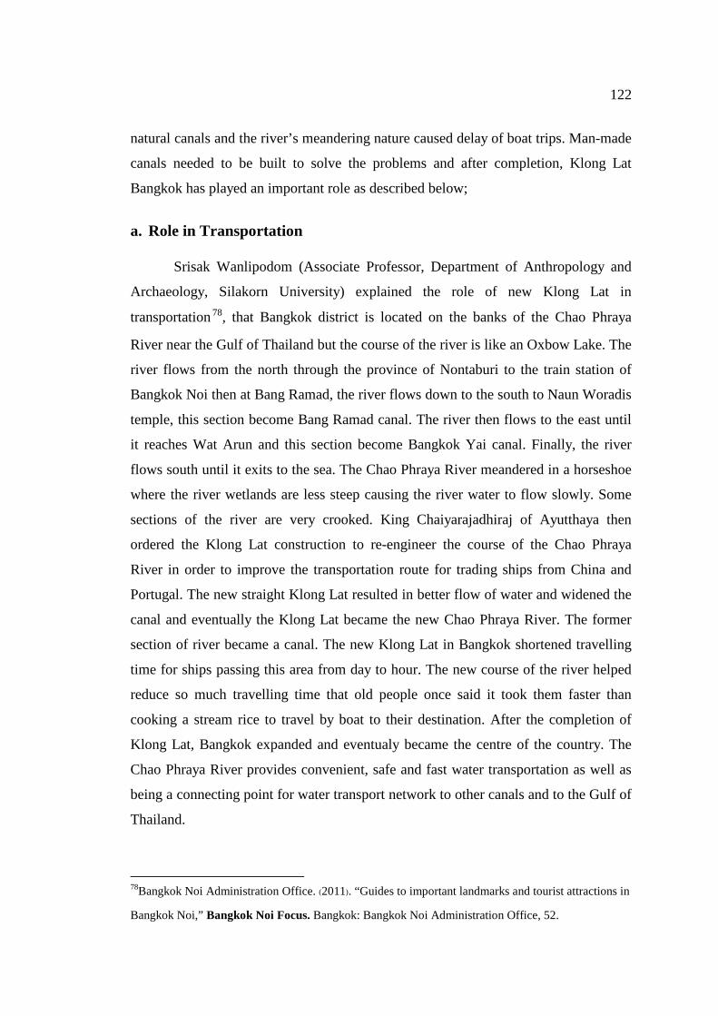
122
natural canals and the river’s meandering nature caused delay of boat trips. Man-made
canals needed to be built to solve the problems and after completion, Klong Lat
Bangkok has played an important role as described below;
a. Role in Transportation
Srisak Wanlipodom (Associate Professor, Department of Anthropology and
Archaeology, Silakorn University) explained the role of new Klong Lat in
transportation 78, that Bangkok district is located on the banks of the Chao Phraya
River near the Gulf of Thailand but the course of the river is like an Oxbow Lake. The
river flows from the north through the province of Nontaburi to the train station of
Bangkok Noi then at Bang Ramad, the river flows down to the south to Naun Woradis
temple, this section become Bang Ramad canal. The river then flows to the east until
it reaches Wat Arun and this section become Bangkok Yai canal. Finally, the river
flows south until it exits to the sea. The Chao Phraya River meandered in a horseshoe
where the river wetlands are less steep causing the river water to flow slowly. Some
sections of the river are very crooked. King Chaiyarajadhiraj of Ayutthaya then
ordered the Klong Lat construction to re-engineer the course of the Chao Phraya
River in order to improve the transportation route for trading ships from China and
Portugal. The new straight Klong Lat resulted in better flow of water and widened the
canal and eventually the Klong Lat became the new Chao Phraya River. The former
section of river became a canal. The new Klong Lat in Bangkok shortened travelling
time for ships passing this area from day to hour. The new course of the river helped
reduce so much travelling time that old people once said it took them faster than
cooking a stream rice to travel by boat to their destination. After the completion of
Klong Lat, Bangkok expanded and eventualy became the centre of the country. The
Chao Phraya River provides convenient, safe and fast water transportation as well as
being a connecting point for water transport network to other canals and to the Gulf of
Thailand.
78Bangkok Noi Administration Office. (2011). “Guides to important landmarks and tourist attractions in
Bangkok Noi,” Bangkok Noi Focus. Bangkok: Bangkok Noi Administration Office, 52.
123
b. Role in Economy
The Chao Phraya River was an important water transport route for many cities
during eighteenth to nineteenth centuries including Ayutthaya, the capital of Thailand
in the nineteeth century. Ships traveling from the mouth of the river to Ayutthaya
must pass by many local communities along the river banks. Bangkok was situated in
a good location as a stopover point for ships traveling to/from Ayutthaya due to the
nature of the river. The district of Bangkok became increasingly important to the
economy. And the community grew even larger.
Situated in a strategic location for economy, the construction of Klong Lat
also increased the importance of Bangkok. Bangkok became an import port town and
an outpost town for Ayutthaya. King Maha Chakraphat made Bangkok a check point
and trading ships must stop here to report their journey as well as paying taxes both
for upstream and downstream trips79. Bangkok was the very first tax point and was
called “Kanon Bangkok”. Ayutthaya trading with foreigners was prosperous.
Bangkok Canal was the main waterway for goods transportation. Bangkok grew at a
rapid rate and became the centre of the country because the Chao Phraya River serves
the city as the main water transport route both for domestic and external transport.
c. Role in Society
After the completion of Klong Lat, the area near Wat Arun became an island
and its community expanded. Settlement along the river banks and canal sides
increased. Houses were built on the waterfront whereas the land off the backyard was
used for agriculture80. Small communities along the Chao Phraya River banks
developed into towns indicating that water has a very important role in society during
that period. Slowly, this community developed their unique water culture. Water
transport became an important mode of transportation for both inter- and intra-
79 Bangkok Noi Administration Office. (2011). “Guides to important landmarks and tourist attractions
in Bangkok Noi,” Bangkok Noi Focus. Bangkok: Bangkok Noi Administration Office, 52. 80 Terdsak, T. “Study of waterfront communities along the middle section of Chao Phraya River central
area at Bang Ku Wiang floating market”. Journal of Architectural Research and Studies 2541
Volume 2 Bangkok: Chulalongkorn University, 248.
124
communities communication. Water played an important role in cultural dimension.
The temple was a centre of a community. Most temples were built along the canal
side and played an important role in education, religion and traditions. Besides the
temples, markets and trading places were established along the waterways especially
at the confluence.
Figure 74: Water transport in community
Source: Tinikan Prakraiwan, Site survey in January 2013
4.2 Aesthetic Values of the Bangkok Canal Environment (Aesthetic Value)
The term ‘aesthetic value’ is described in Burra Charter as a visual beauty of
form, scale, color, texture and material of fabric. Water has an important place in
traditional Thai culture and water has played many roles in Thai life from domestic
consumption, agriculture, transportation and housing. Villages were usually set up
along banks of canals and often villages or communities were named with the word
“bang” which means villages or shop houses built along the waterway for example
“Bangkok Noi”, “Bangkok Yai”. As the people of Bangkok Canal live in harmony
125
with water from past to present, water has blended into their everyday life therefore
they are sometimes referred to as “people of water81”. Along both banks of Bangkok
Canal lined the beautiful scenery of Thai houses and the Thai way of living reflecting
its aesthetic value to the eyes of visitors. People of Bangkok Canal rely on water for
transportation and commerce. Agricultural produces were transferred in a boat and
farmer paddle the mobile market boat along canals to sell their produces for
waterfront households providing convenience and floating market was formed. All
kinds of goods were available. People living along banks of canal had no need to
leave the area to purchase goods. Furthermore, most people knew each other therefore
cheating were very rare82.
At present, Bangkok Canal not only serves locals as a transport route and
drainage system but also it is becoming an increasingly important tourist attraction.
Many temples, mosques and houses built on the banks of the canal together with
everyday activities of the people reflect the Thai way of living. Visitors can witness
children playing in canal water at dusk, locals sitting at the house terraces enjoying
evening breezes or farmers paddling their wooden boats full with agricultural
products for sell. Many beautiful traditional Thai houses were built along the canals.
Art lovers can enjoy the beauty of mural painting and architecture at ancient temples
dated back to Ayutthaya period. Museum, ancient communities, floating market as
well as local festivals are all at Bangkok Canal attracting both Thai and foreign
visitors to appreciate the atmosphere and their waterfront culture.
The life of people living along the Bangkok Canal may have changed to some
extent however; people are still living their everyday life as in the past ten or twenty
years. Many homes still use boat as secondary mean of transportation. Wooden boats
can still be seen docking near the houses. Water-related festivals still exist such as
Tamboon Tak Batr 108 (108 merit making tradition) or monks traveling on boats to
collect alms. Their unique culture and beautiful way of life attracts visitors both Thai 81 Jeerapong, J.and group. (2009). “Rattakosin on the Chao Phraya bank”. Waterfront Way of Life:
Local Wisdom Passed Down from Ayutthaya. Bangkok: Plus Place Co., Ltd, 6.
82 Jarunphan, B. (2003). The evolution of the relationship between water and waterfront
community residents; A Case Study of Bangkok Noi canal. Bangkok: Architecture Faculty,
Silapakorn University, 61.
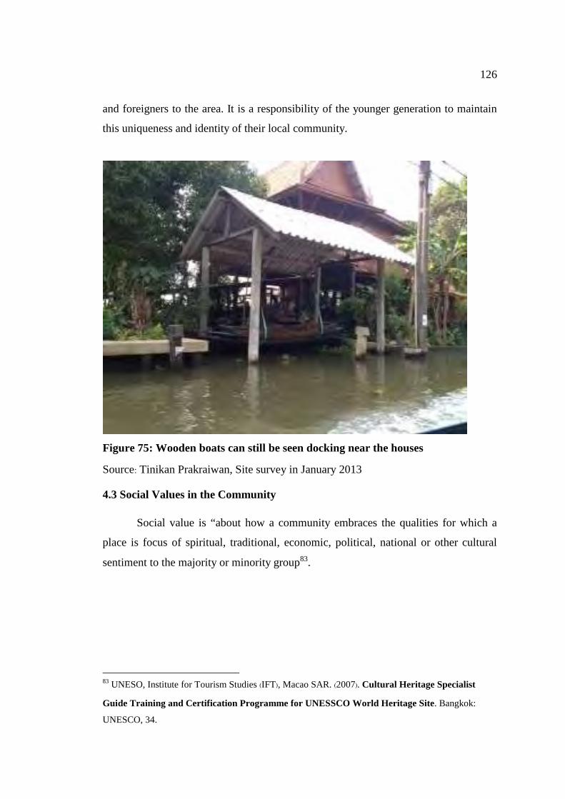
126
and foreigners to the area. It is a responsibility of the younger generation to maintain
this uniqueness and identity of their local community.
Figure 75: Wooden boats can still be seen docking near the houses
Source: Tinikan Prakraiwan, Site survey in January 2013
4.3 Social Values in the Community
Social value is “about how a community embraces the qualities for which a
place is focus of spiritual, traditional, economic, political, national or other cultural
sentiment to the majority or minority group83.
83 UNESO, Institute for Tourism Studies (IFT), Macao SAR. (2007). Cultural Heritage Specialist
Guide Training and Certification Programme for UNESSCO World Heritage Site. Bangkok:
UNESCO, 34.
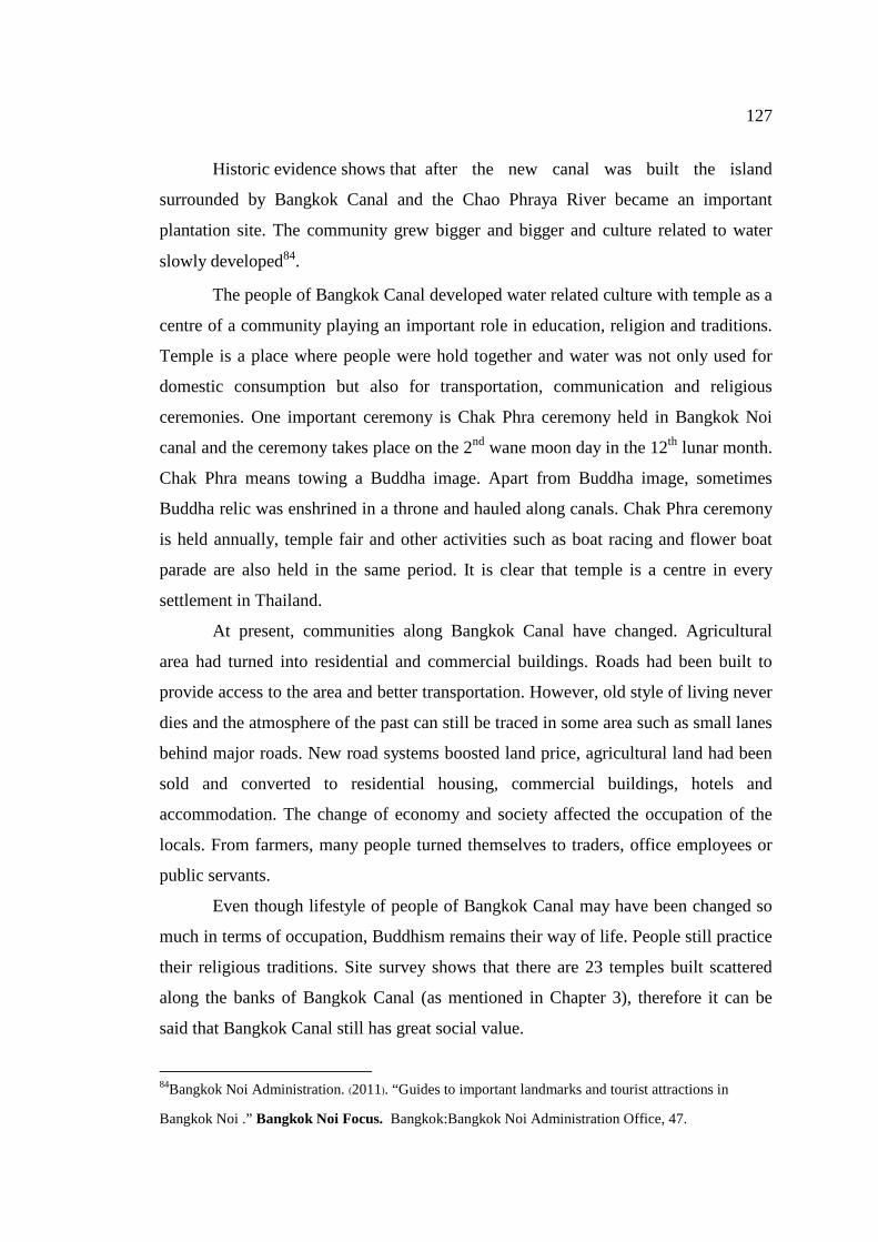
127
Historic evidence shows that after the new canal was built the island
surrounded by Bangkok Canal and the Chao Phraya River became an important
plantation site. The community grew bigger and bigger and culture related to water
slowly developed84.
The people of Bangkok Canal developed water related culture with temple as a
centre of a community playing an important role in education, religion and traditions.
Temple is a place where people were hold together and water was not only used for
domestic consumption but also for transportation, communication and religious
ceremonies. One important ceremony is Chak Phra ceremony held in Bangkok Noi
canal and the ceremony takes place on the 2nd wane moon day in the 12th lunar month.
Chak Phra means towing a Buddha image. Apart from Buddha image, sometimes
Buddha relic was enshrined in a throne and hauled along canals. Chak Phra ceremony
is held annually, temple fair and other activities such as boat racing and flower boat
parade are also held in the same period. It is clear that temple is a centre in every
settlement in Thailand.
At present, communities along Bangkok Canal have changed. Agricultural
area had turned into residential and commercial buildings. Roads had been built to
provide access to the area and better transportation. However, old style of living never
dies and the atmosphere of the past can still be traced in some area such as small lanes
behind major roads. New road systems boosted land price, agricultural land had been
sold and converted to residential housing, commercial buildings, hotels and
accommodation. The change of economy and society affected the occupation of the
locals. From farmers, many people turned themselves to traders, office employees or
public servants.
Even though lifestyle of people of Bangkok Canal may have been changed so
much in terms of occupation, Buddhism remains their way of life. People still practice
their religious traditions. Site survey shows that there are 23 temples built scattered
along the banks of Bangkok Canal (as mentioned in Chapter 3), therefore it can be
said that Bangkok Canal still has great social value.
84Bangkok Noi Administration. (2011). “Guides to important landmarks and tourist attractions in
Bangkok Noi .” Bangkok Noi Focus. Bangkok:Bangkok Noi Administration Office, 47.
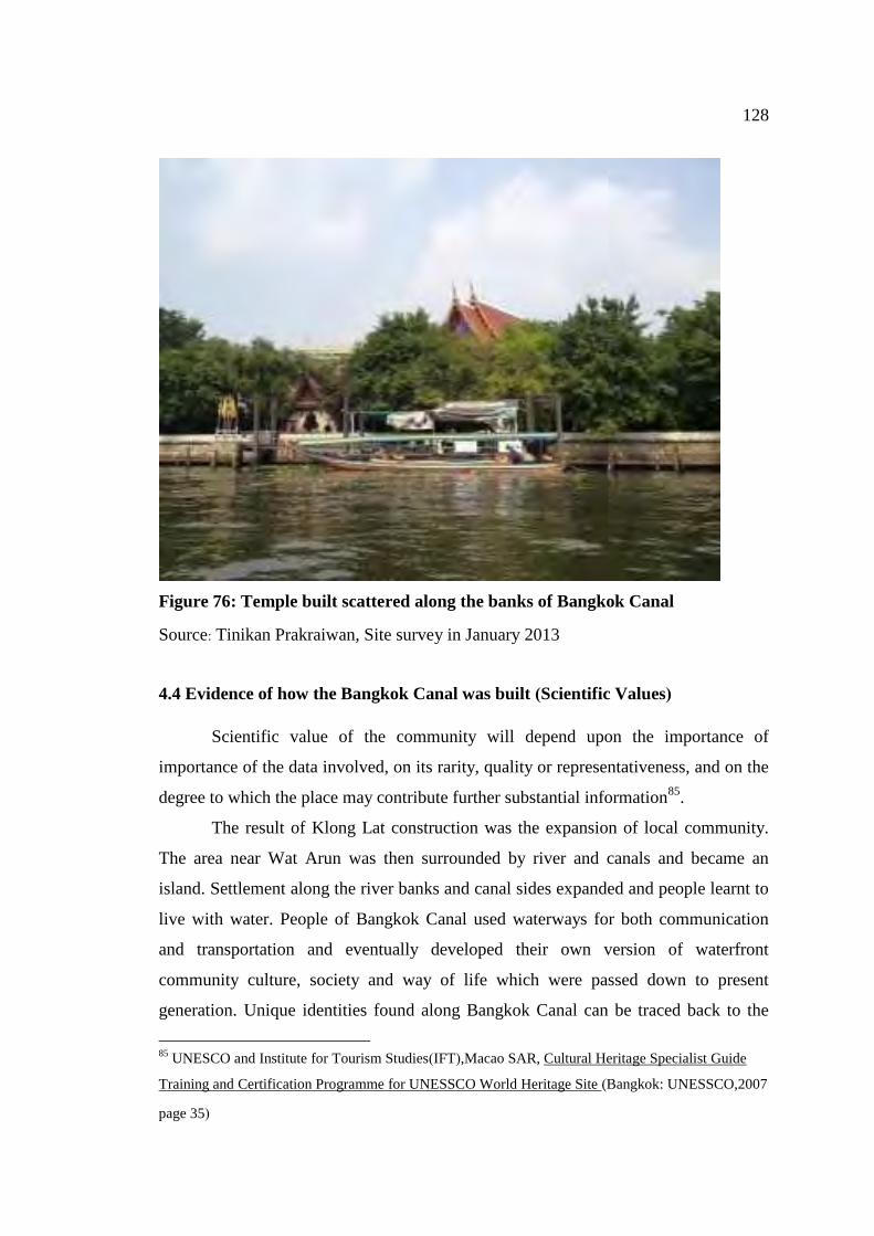
128
Figure 76: Temple built scattered along the banks of Bangkok Canal
Source: Tinikan Prakraiwan, Site survey in January 2013
4.4 Evidence of how the Bangkok Canal was built (Scientific Values)
Scientific value of the community will depend upon the importance of
importance of the data involved, on its rarity, quality or representativeness, and on the
degree to which the place may contribute further substantial information85.
The result of Klong Lat construction was the expansion of local community.
The area near Wat Arun was then surrounded by river and canals and became an
island. Settlement along the river banks and canal sides expanded and people learnt to
live with water. People of Bangkok Canal used waterways for both communication
and transportation and eventually developed their own version of waterfront
community culture, society and way of life which were passed down to present
generation. Unique identities found along Bangkok Canal can be traced back to the
85 UNESCO and Institute for Tourism Studies(IFT),Macao SAR, Cultural Heritage Specialist Guide
Training and Certification Programme for UNESSCO World Heritage Site ( �Bangkok: UNESSCO,2007
page 35)
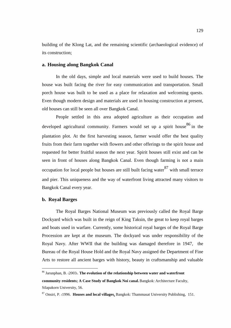
129
building of the Klong Lat, and the remaining scientific (archaeological evidence) of
its construction;
a. Housing along Bangkok Canal
In the old days, simple and local materials were used to build houses. The
house was built facing the river for easy communication and transportation. Small
porch house was built to be used as a place for relaxation and welcoming quests.
Even though modern design and materials are used in housing construction at present,
old houses can still be seen all over Bangkok Canal.
People settled in this area adopted agriculture as their occupation and
developed agricultural community. Farmers would set up a spirit house86 in the
plantation plot. At the first harvesting season, farmer would offer the best quality
fruits from their farm together with flowers and other offerings to the spirit house and
requested for better fruitful season the next year. Spirit houses still exist and can be
seen in front of houses along Bangkok Canal. Even though farming is not a main
occupation for local people but houses are still built facing water87 with small terrace
and pier. This uniqueness and the way of waterfront living attracted many visitors to
Bangkok Canal every year.
b. Royal Barges
The Royal Barges National Museum was previously called the Royal Barge
Dockyard which was built in the reign of King Taksin, the great to keep royal barges
and boats used in warfare. Currently, some historical royal barges of the Royal Barge
Procession are kept at the museum. The dockyard was under responsibility of the
Royal Navy. After WWII that the building was damaged therefore in 1947, the
Bureau of the Royal House Hold and the Royal Navy assigned the Department of Fine
Arts to restore all ancient barges with history, beauty in craftsmanship and valuable
86 Jarunphan, B. (2003). The evolution of the relationship between water and waterfront
community residents; A Case Study of Bangkok Noi canal. Bangkok: Architecture Faculty,
Silapakorn University, 56.
87 Onsiri, P. (1996. Houses and local villages. Bangkok: Thammasat University Publishing, 151.
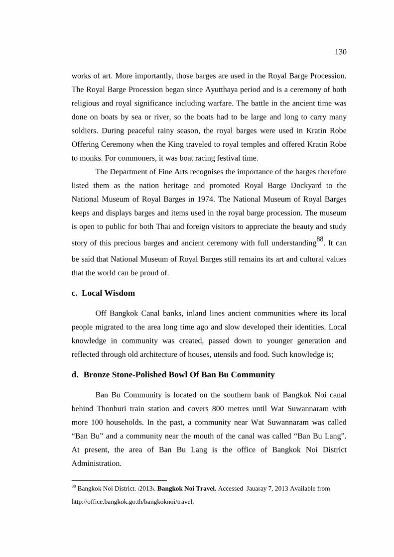
130
works of art. More importantly, those barges are used in the Royal Barge Procession.
The Royal Barge Procession began since Ayutthaya period and is a ceremony of both
religious and royal significance including warfare. The battle in the ancient time was
done on boats by sea or river, so the boats had to be large and long to carry many
soldiers. During peaceful rainy season, the royal barges were used in Kratin Robe
Offering Ceremony when the King traveled to royal temples and offered Kratin Robe
to monks. For commoners, it was boat racing festival time.
The Department of Fine Arts recognises the importance of the barges therefore
listed them as the nation heritage and promoted Royal Barge Dockyard to the
National Museum of Royal Barges in 1974. The National Museum of Royal Barges
keeps and displays barges and items used in the royal barge procession. The museum
is open to public for both Thai and foreign visitors to appreciate the beauty and study
story of this precious barges and ancient ceremony with full understanding88. It can
be said that National Museum of Royal Barges still remains its art and cultural values
that the world can be proud of.
c. Local Wisdom
Off Bangkok Canal banks, inland lines ancient communities where its local
people migrated to the area long time ago and slow developed their identities. Local
knowledge in community was created, passed down to younger generation and
reflected through old architecture of houses, utensils and food. Such knowledge is;
d. Bronze Stone-Polished Bowl Of Ban Bu Community
Ban Bu Community is located on the southern bank of Bangkok Noi canal
behind Thonburi train station and covers 800 metres until Wat Suwannaram with
more 100 households. In the past, a community near Wat Suwannaram was called
“Ban Bu” and a community near the mouth of the canal was called “Ban Bu Lang”.
At present, the area of Ban Bu Lang is the office of Bangkok Noi District
Administration.
88 Bangkok Noi District. (2013). Bangkok Noi Travel. Accessed Jauaray 7, 2013 Available from
http://office.bangkok.go.th/bangkoknoi/travel.
131
Ban Bu community is the only living makers of stone-polished bowls in
Thailand, a skill inherited from Ayutthaya. A stone-polished bowl was used widely in
the old days to contain drinking water because the stone increases the coolness of
water. It was also used to contain rice prepared to offer to monks because stone helps
keeping aroma of streamed rice.
Today, bowl is made from tin, copper and Ma Loh gold. At present, Ma Loh
gold is taken from scraped gold from old bowl. The mixture of 3 metals in a proper
ratio is melted in a melt cup made from earth and husk. Melted material is then
poured into a flat mold with water coolant to produce metal sheet. Metal sheet is
heated and hammered to shape a bowl. Patterns are craved on the bowl surface and
then a bowl is fitted to a lathe called “Pa-morn” to smoothen out the interior and
exterior surfaces. The bowl is then polished by using fine stones or burnt earth
wrapped in cloth to shine the surface. This process is called “Long Hin”. Today, shine
finish is done by using soaked pounded clay crucible wrapped in cloth. This technique
is called “Yiab Bao”.
For today's lifestyle, stone-polished bowls are for collection rather than day-
to-day use. They are also sought after as a favorite souvenir by the tourists and Ban
Bu is the only place to find this unique craftwork.89
89 Department of Resources and Technology,University of Ban Somdej Chao Phraya. (2013). Baan Bu
Community. Accesed January 6, 2013. Available from http://library.bsru.ac.th/rLocal.
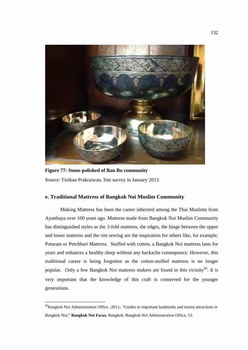
132
Figure 77: Stone-polished of Ban Bu community
Source: Tinikan Prakraiwan, Site survey in January 2013
e. Traditional Mattress of Bangkok Noi Muslim Community
Making Mattress has been the career inherited among the Thai Muslims from
Ayutthaya over 100 years ago. Mattress made from Bangkok Noi Muslim Community
has distinguished styles as the 3-fold mattress, the edges, the hinge between the upper
and lower mattress and the rim sewing are the inspiration for others like, for example,
Potaram or Petchburi Mattress. Stuffed with cotton, a Bangkok Noi mattress lasts for
years and enhances a healthy sleep without any backache consequence. However, this
traditional career is being forgotten as the cotton-stuffed mattress is no longer
popular. Only a few Bangkok Noi mattress makers are found in this vicinity90. It is
very important that the knowledge of this craft is conserved for the younger
generations.
90Bangkok Noi Administration Office. (2011). “Guides to important landmarks and tourist attractions in
Bangkok Noi,” Bangkok Noi Focus. Bangkok: Bangkok Noi Administration Office, 53.
133
f. Fine Craft of Ban Chang Lor Community
"Ban Chang Lor" or the village of fine craftsmen is renowned for its fine art
crafting skills especially casting of Buddha image. Ancestors of Ban Chang Lor
craftsmen moved to Bangkok from Ayutthaya after the city was invaded by the
Burmese. Villagers migrated and settled at Ban Chang Lor lane (Bangkok Noi
district) and the skills of crafting were passed down generation to generation91.
At present, Ban Chang Lor Community is crowded with houses and none of
foundry can be seen. A Buddha image casting foundry that can be traced is at
Jittipatima house, number 234, Ban Chang Lor lane which belongs to Khun Krasuay
Peungpreeda, the maker of the world biggest Buddhakodom at Wat Pai Rong Wua,
Supanburi province. The area of Ban Chang Lor Community is not very big with the north borders
Phran Nok road, the south borders Issaraparb soi 44, the east borders Ban Kamin
canal and the west borders Phran Nok market. Most of the area used to be fruit
orchards. People lived in traditional Thai houses with lot of spaces for casting Buddha
image and the rest of land was used for fruit plantation or vegetable farming. The
whole area of Ban Chang Lor was connected by canals and had access to the Chao
Phraya River at Wat Rakang. Boats were used for transportation. Ban Chang Lor Community is home to many sculpturing and casting artisan
families such as Pra Thep Rojana (Sin Patimakorn), head of the Ten Groups artisan
and famous artisan in the reign of King Rama III. Pra Thep Rojana was a
primogenitor of Patimakorn family and passed his casting skills to sons and daughters
and those skills were passed down to nephew, Mr. Piman Moonpramuk was listed as
Thailand National Artist in Sculpture (Visual Arts) in 1988. Other important artisans
are Master Suk Yoomun, Mr. Prom Buranathon, Mr. Pleung Jamsai, Mr. Pan and Mrs.
Moon Sappakorn and Mr. Fung Oncharoen.
91 Bangkok Noi District. (2013). Ban Chang Lor. Accessed Jauaray 7, 2013 Available from
http://office.bangkok.go.th/bangkoknoi/travel.
134
Casting Buddha image is a complicated process. There are two main steps in
the process of casting a Buddha statue; sculpturing and casting. Sculpturing and
casting will produce best result if done by one person because consistency is a secret
to the elegance of Buddha image. One artisan works from sculpturing, drawing of
image’s face and the remaining parts of the image, gold casting as well as finishing
work after the casting. Today, Buddha image casting techniques may change
according to the refinement needs, but skills and experience of artisan from Ban
Chang Lor Community are always crucial to the casting process.
g. Bael Fruit In Syrup Of Trok Matoom Community
Trok Matoom, Ban Cha Lor sub district, Bangkok Noi, Bangkok is the only
place in Thailand where local wisdom of how to make bael fruit in syrup can be
found. Trok Matoom is located opposite the Navy Dockyard department, Arunamarin
road, Thonburi district. Their bael fruit in syrup is renowned for good fresh taste,
good appearance, soft bael fruit flesh and importantly no preservatives. All bael fruit
in syrup sold around Thailand is produced from this area92.
h. Shredded rice grain of Trok Kao Mao Community
Trok Kao Mao (literally meaning "the lane of shredded rice grain") or
Issaraparb 49 is located on Issaraparb road next to railway of Phran Nok area, not far
from Trok Matoom. People of Trok Kao Mao migrated from Ayutthaya after
Thonburi was founded as a new capital. The area was once fruit orchard but later it
was named after the profession of community members, making and selling "Kao
Mao" (the shredded rice grain). Rice used for making Kao Mao was bought from
92 Bangkok Noi Administration Office. (2011). “Guides to important landmarks and tourist attractions
in Bangkok Noi,” Bangkok Noi Focus. Bangkok: Bangkok Noi Administration Office, 25.
135
Bangkhunsri and transferred by boat to Trok Kao Mao. The traditional process in
making Kao Mao requires much assistance93. Steps of making Kao Mao are as follow;
1. Firstly, paddy must be soaked until softened
2. Then, paddy is roasted in the pan
3. Next, roasted paddy must be pounded in a large mortar. Rain tree leaves are
mixed during the pounding process to add green colour (now food colour is used)
4. Next, the rice grains and husks are separated
Making of Kao Mao Rang
Bring Kao Mao from above and roasted in a pan using heat from hot fine sand
to increase crispiness. Good Kao Mao must be made from big full rice grain, flat and
not sticky together.
Today, only one family is making Kao Mao and only Kao Mao Rang is made
due to lack of labour. Apart from Kao Mao, “Kao Niew Daeng" (glutinous rice
cooked with sugar), "Kalamae" (Thai-styled caramel), stirred dried banana and stirred
dried pineapple were also made. However, as Kao Mao and stirred dried products
were not in demand, only Kao Niew Daeng and Kalamae are produced.
People of Bangkok Canal had created their own culture and identity which
were passed down to their younger generations and can be seen today. It is clear that
Bangkok Canal community has tremendous scientific value.
Data collected from secondary research and site survey shows that there are
important historic attractions and buildings with great architecture along both banks
of Bangkok Canal from the mouth of Bangkok Noi to Bangkok Yai canals (from
Chapter 3) which explicitly reflect cultural significance value of study site.
Researcher had conducted a thorough survey of study site to collect data essential for
assessment the possibility and potentiality of developing an attractive Cultural
93Bangkok Noi District. (2013).Trok Kao Mao. Accessed Jauaray 7, 2013. Available from
http://office.bangkok.go.th/bangkoknoi/travel.
136
Tourism Route which presents historic value of Thailand together with offering
enjoyment and knowledge to visitors. This Cultural Tourism Route will not only
benefit local communities of Bangkok Canal but also to Thailand as a whole. Analysis
of Cultural Significance Value of Attractions in Bangkok Canal is shown in a table
below.
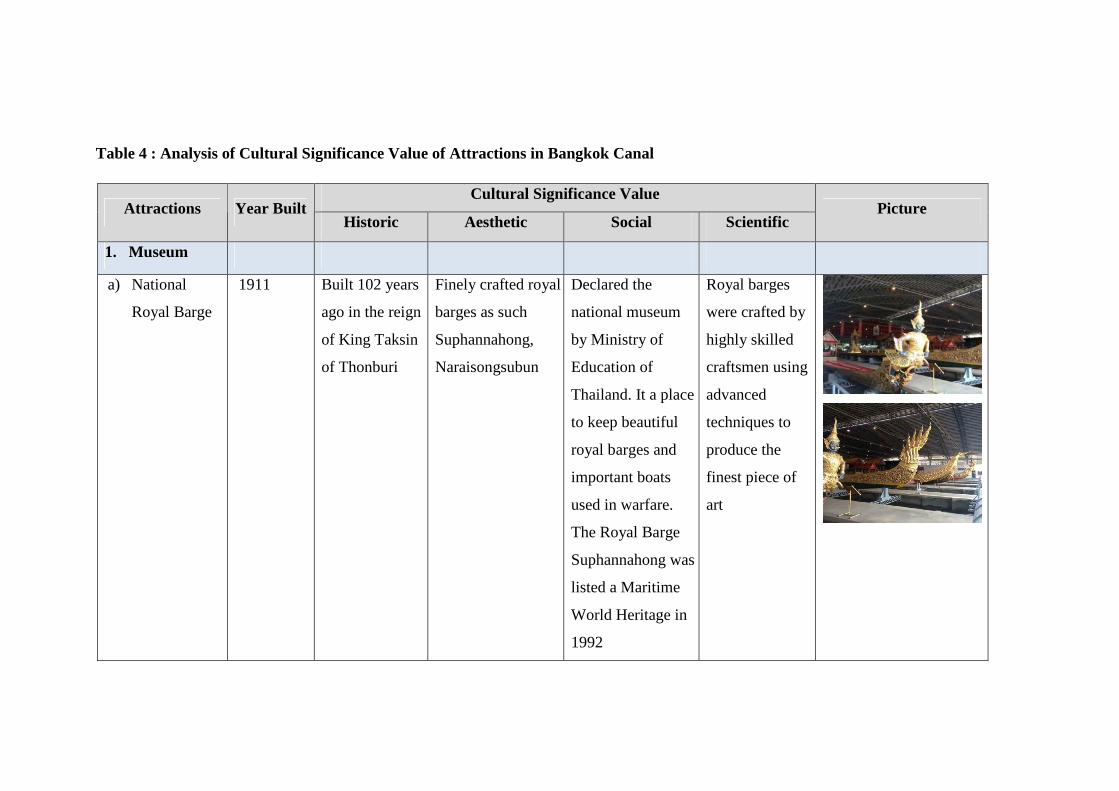
Table 4 : Analysis of Cultural Significance Value of Attractions in Bangkok Canal
Cultural Significance Value Attractions Year Built
Historic Aesthetic Social Scientific Picture
1. Museum
a) National
Royal Barge
1911 Built 102 years
ago in the reign
of King Taksin
of Thonburi
Finely crafted royal
barges as such
Suphannahong,
Naraisongsubun
Declared the
national museum
by Ministry of
Education of
Thailand. It a place
to keep beautiful
royal barges and
important boats
used in warfare.
The Royal Barge
Suphannahong was
listed a Maritime
World Heritage in
1992
Royal barges
were crafted by
highly skilled
craftsmen using
advanced
techniques to
produce the
finest piece of
art
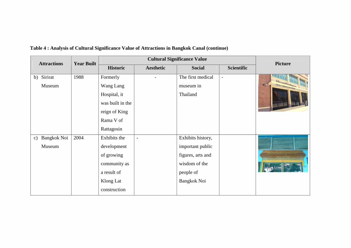
Table 4 : Analysis of Cultural Significance Value of Attractions in Bangkok Canal (continue)
Cultural Significance Value Attractions Year Built
Historic Aesthetic Social Scientific Picture
b) Sirirat
Museum
1988 Formerly
Wang Lang
Hospital, it
was built in the
reign of King
Rama V of
Rattagosin
- The first medical
museum in
Thailand
-
c) Bangkok Noi
Museum
2004 Exhibits the
development
of growing
community as
a result of
Klong Lat
construction
- Exhibits history,
important public
figures, arts and
wisdom of the
people of
Bangkok Noi
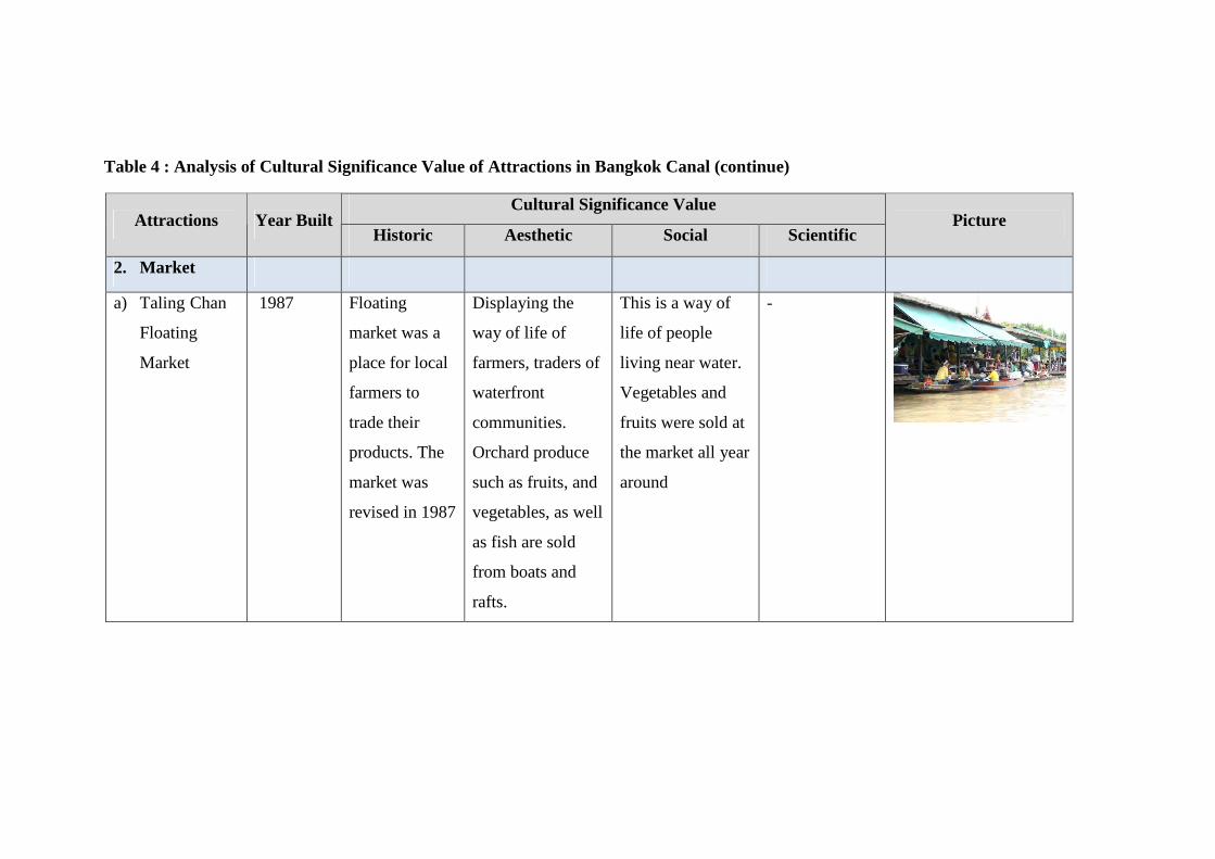
Table 4 : Analysis of Cultural Significance Value of Attractions in Bangkok Canal (continue)
Cultural Significance Value Attractions Year Built
Historic Aesthetic Social Scientific Picture
2. Market
a) Taling Chan
Floating
Market
1987 Floating
market was a
place for local
farmers to
trade their
products. The
market was
revised in 1987
Displaying the
way of life of
farmers, traders of
waterfront
communities.
Orchard produce
such as fruits, and
vegetables, as well
as fish are sold
from boats and
rafts.
This is a way of
life of people
living near water.
Vegetables and
fruits were sold at
the market all year
around
-
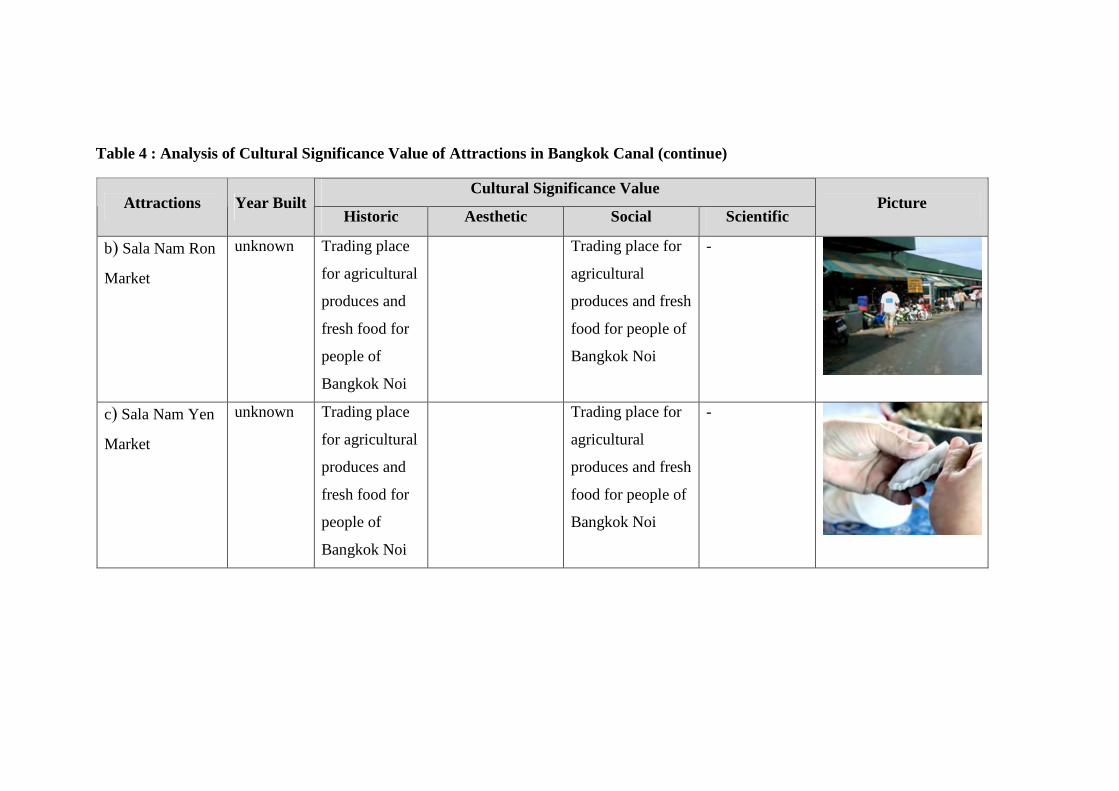
Table 4 : Analysis of Cultural Significance Value of Attractions in Bangkok Canal (continue)
Cultural Significance Value Attractions Year Built
Historic Aesthetic Social Scientific Picture
b) Sala Nam Ron
Market
unknown Trading place
for agricultural
produces and
fresh food for
people of
Bangkok Noi
Trading place for
agricultural
produces and fresh
food for people of
Bangkok Noi
-
c) Sala Nam Yen
Market
unknown Trading place
for agricultural
produces and
fresh food for
people of
Bangkok Noi
Trading place for
agricultural
produces and fresh
food for people of
Bangkok Noi
-
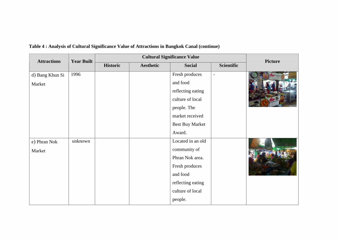
Table 4 : Analysis of Cultural Significance Value of Attractions in Bangkok Canal (continue)
Cultural Significance Value Attractions Year Built
Historic Aesthetic Social Scientific Picture
d) Bang Khun Si
Market
1996 Fresh produces
and food
reflecting eating
culture of local
people. The
market received
Best Buy Market
Award.
-
e) Phran Nok
Market
unknown Located in an old
community of
Phran Nok area.
Fresh produces
and food
reflecting eating
culture of local
people.
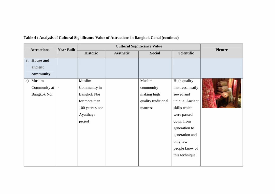
Table 4 : Analysis of Cultural Significance Value of Attractions in Bangkok Canal (continue)
Cultural Significance Value Attractions Year Built
Historic Aesthetic Social Scientific Picture
3. House and
ancient
community
a) Muslim
Community at
Bangkok Noi
-
Muslim
Community in
Bangkok Noi
for more than
100 years since
Ayutthaya
period
Muslim
community
making high
quality traditional
mattress
High quality
mattress, neatly
sewed and
unique. Ancient
skills which
were passed
down from
generation to
generation and
only few
people know of
this technique
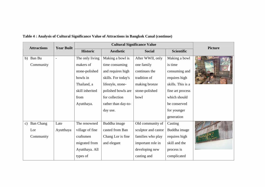
Table 4 : Analysis of Cultural Significance Value of Attractions in Bangkok Canal (continue)
Cultural Significance Value Attractions Year Built
Historic Aesthetic Social Scientific Picture
b) Ban Bu
Community
- The only living
makers of
stone-polished
bowls in
Thailand, a
skill inherited
from
Ayutthaya.
Making a bowl is
time consuming
and requires high
skills. For today's
lifestyle, stone-
polished bowls are
for collection
rather than day-to-
day use.
After WWII, only
one family
continues the
tradition of
making bronze
stone-polished
bowl
Making a bowl
is time
consuming and
requires high
skills. This is a
fine art process
which should
be conserved
for younger
generation
c) Ban Chang
Lor
Community
Late
Ayutthaya
The renowned
village of fine
craftsmen
migrated from
Ayutthaya. All
types of
Buddha image
casted from Ban
Chang Lor is fine
and elegant
Old community of
sculptor and castor
families who play
important role in
developing new
casting and
Casting
Buddha image
requires high
skill and the
process is
complicated
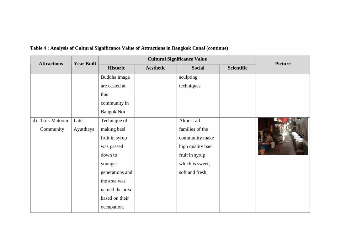
Table 4 : Analysis of Cultural Significance Value of Attractions in Bangkok Canal (continue)
Cultural Significance Value Attractions Year Built
Historic Aesthetic Social Scientific Picture
Buddha image
are casted at
this
community in
Bangok Noi
sculpting
techniques
d) Trok Matoom
Community
Late
Ayutthaya
Technique of
making bael
fruit in syrup
was passed
down to
younger
generations and
the area was
named the area
based on their
occupation.
Almost all
families of the
community make
high quality bael
fruit in syrup
which is sweet,
soft and fresh.
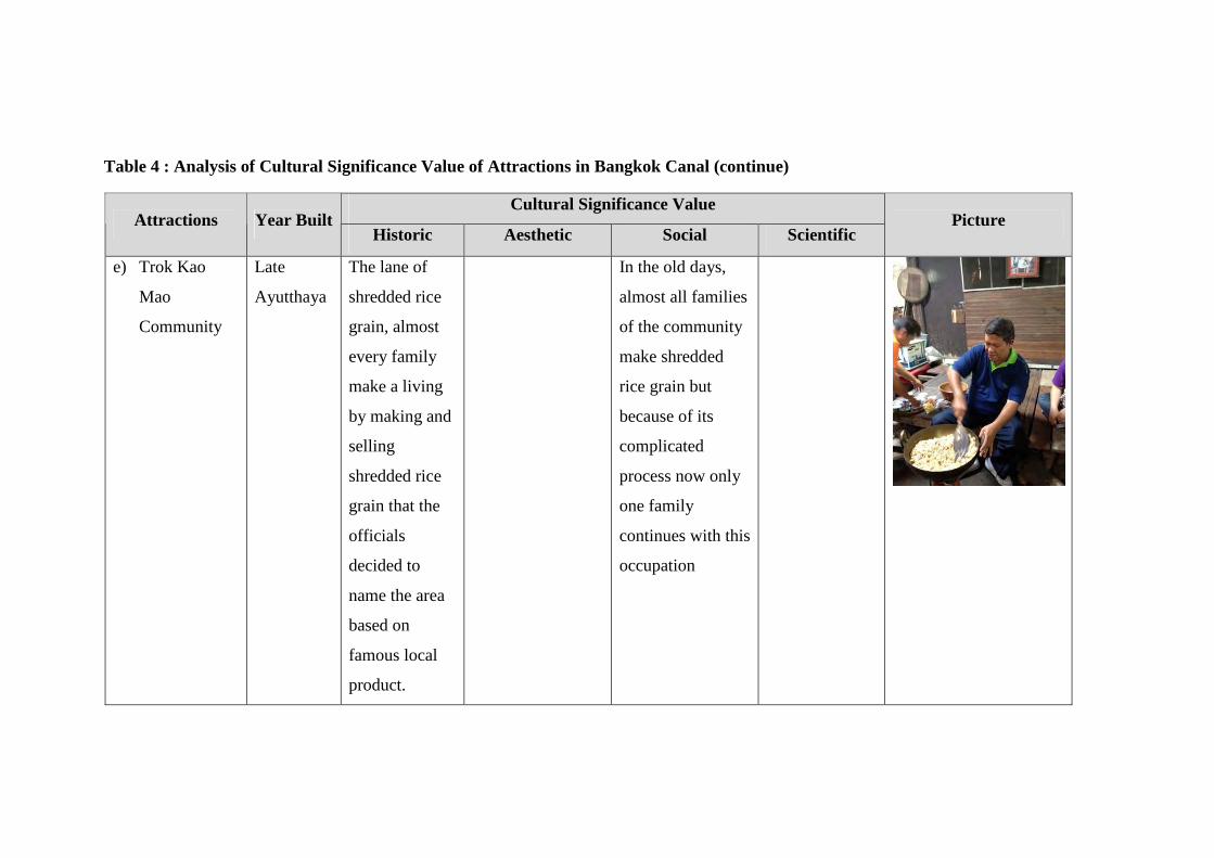
Table 4 : Analysis of Cultural Significance Value of Attractions in Bangkok Canal (continue)
Cultural Significance Value Attractions Year Built
Historic Aesthetic Social Scientific Picture
e) Trok Kao
Mao
Community
Late
Ayutthaya
The lane of
shredded rice
grain, almost
every family
make a living
by making and
selling
shredded rice
grain that the
officials
decided to
name the area
based on
famous local
product.
In the old days,
almost all families
of the community
make shredded
rice grain but
because of its
complicated
process now only
one family
continues with this
occupation
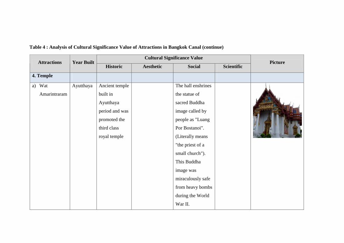
Table 4 : Analysis of Cultural Significance Value of Attractions in Bangkok Canal (continue)
Cultural Significance Value Attractions Year Built
Historic Aesthetic Social Scientific Picture
4. Temple
a) Wat
Amarintraram
Ayutthaya Ancient temple
built in
Ayutthaya
period and was
promoted the
third class
royal temple
The hall enshrines
the statue of
sacred Buddha
image called by
people as "Luang
Por Bostanoi".
(Literally means
"the priest of a
small church").
This Buddha
image was
miraculously safe
from heavy bombs
during the World
War II.
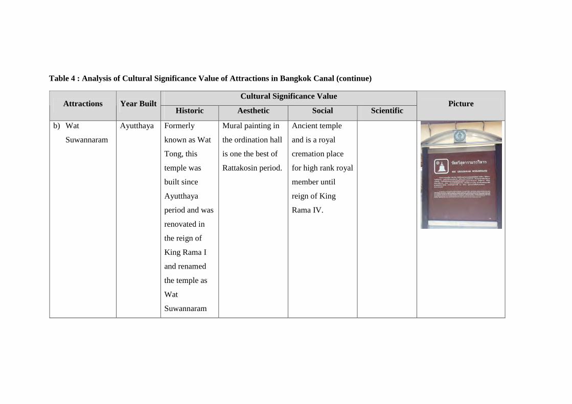
Table 4 : Analysis of Cultural Significance Value of Attractions in Bangkok Canal (continue)
Cultural Significance Value Attractions Year Built
Historic Aesthetic Social Scientific Picture
b) Wat
Suwannaram
Ayutthaya Formerly
known as Wat
Tong, this
temple was
built since
Ayutthaya
period and was
renovated in
the reign of
King Rama I
and renamed
the temple as
Wat
Suwannaram
Mural painting in
the ordination hall
is one the best of
Rattakosin period.
Ancient temple
and is a royal
cremation place
for high rank royal
member until
reign of King
Rama IV.
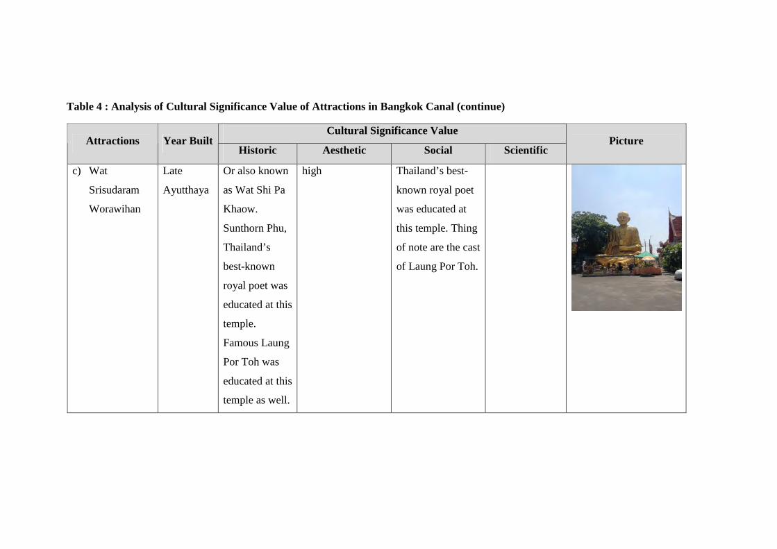
Table 4 : Analysis of Cultural Significance Value of Attractions in Bangkok Canal (continue)
Cultural Significance Value Attractions Year Built
Historic Aesthetic Social Scientific Picture
c) Wat
Srisudaram
Worawihan
Late
Ayutthaya
Or also known
as Wat Shi Pa
Khaow.
Sunthorn Phu,
Thailand’s
best-known
royal poet was
educated at this
temple.
Famous Laung
Por Toh was
educated at this
temple as well.
high Thailand’s best-
known royal poet
was educated at
this temple. Thing
of note are the cast
of Laung Por Toh.
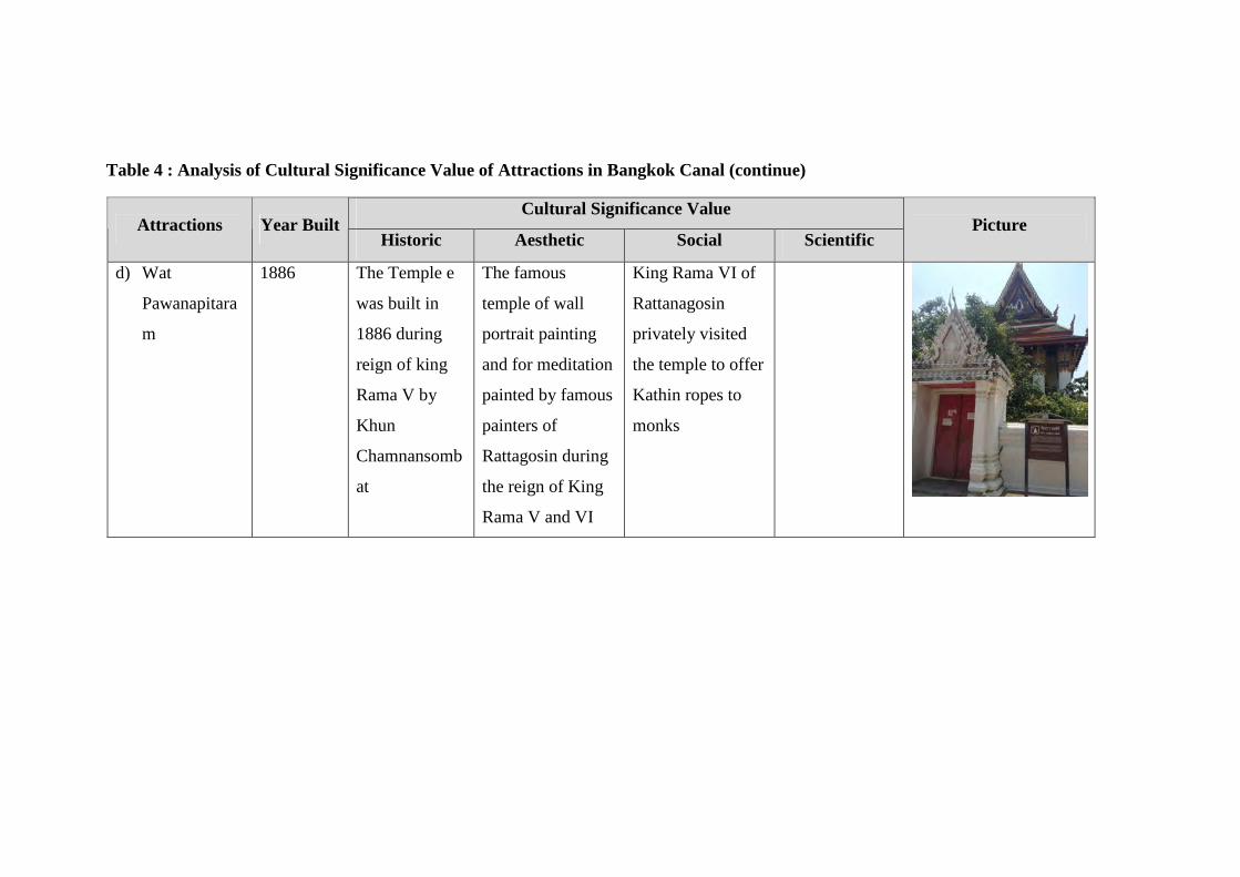
Table 4 : Analysis of Cultural Significance Value of Attractions in Bangkok Canal (continue)
Cultural Significance Value Attractions Year Built
Historic Aesthetic Social Scientific Picture
d) Wat
Pawanapitara
m
1886 The Temple e
was built in
1886 during
reign of king
Rama V by
Khun
Chamnansomb
at
The famous
temple of wall
portrait painting
and for meditation
painted by famous
painters of
Rattagosin during
the reign of King
Rama V and VI
King Rama VI of
Rattanagosin
privately visited
the temple to offer
Kathin ropes to
monks
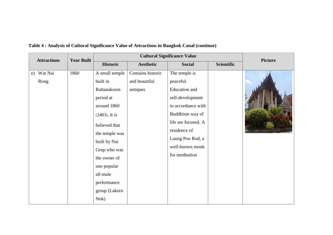
Table 4 : Analysis of Cultural Significance Value of Attractions in Bangkok Canal (continue)
Cultural Significance Value Attractions Year Built
Historic Aesthetic Social Scientific Picture
e) Wat Nai
Rong
1860 A small temple
built in
Rattanakosin
period at
around 1860
(2403). It is
believed that
the temple was
built by Nai
Grup who was
the owner of
one popular
all-male
performance
group (Lakorn
Nok)
Contains historic
and beautiful
antiques
The temple is
peaceful.
Education and
self-development
in accordance with
Buddhism way of
life are focused. A
residence of
Laung Poo Rod, a
well-known monk
for meditation
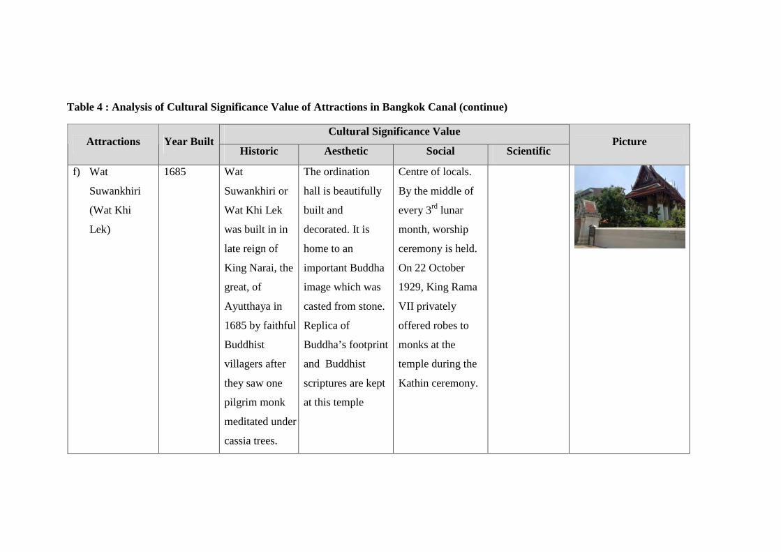
Table 4 : Analysis of Cultural Significance Value of Attractions in Bangkok Canal (continue)
Cultural Significance Value Attractions Year Built
Historic Aesthetic Social Scientific Picture
f) Wat
Suwankhiri
(Wat Khi
Lek)
1685 Wat
Suwankhiri or
Wat Khi Lek
was built in in
late reign of
King Narai, the
great, of
Ayutthaya in
1685 by faithful
Buddhist
villagers after
they saw one
pilgrim monk
meditated under
cassia trees.
The ordination
hall is beautifully
built and
decorated. It is
home to an
important Buddha
image which was
casted from stone.
Replica of
Buddha’s footprint
and Buddhist
scriptures are kept
at this temple
Centre of locals.
By the middle of
every 3rd lunar
month, worship
ceremony is held.
On 22 October
1929, King Rama
VII privately
offered robes to
monks at the
temple during the
Kathin ceremony.
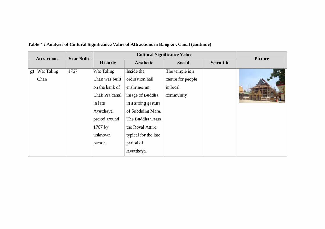
Table 4 : Analysis of Cultural Significance Value of Attractions in Bangkok Canal (continue)
Cultural Significance Value Attractions Year Built
Historic Aesthetic Social Scientific Picture
g) Wat Taling
Chan
1767 Wat Taling
Chan was built
on the bank of
Chak Pra canal
in late
Ayutthaya
period around
1767 by
unknown
person.
Inside the
ordination hall
enshrines an
image of Buddha
in a sitting gesture
of Subduing Mara.
The Buddha wears
the Royal Attire,
typical for the late
period of
Ayutthaya.
The temple is a
centre for people
in local
community
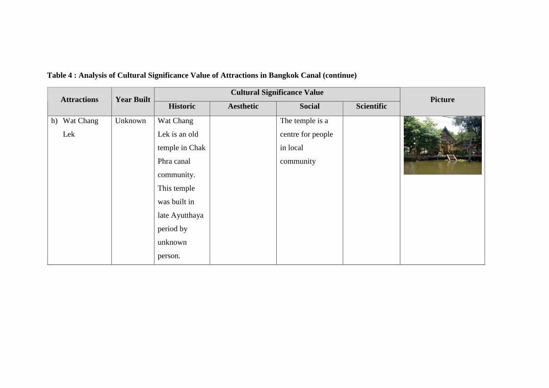
Table 4 : Analysis of Cultural Significance Value of Attractions in Bangkok Canal (continue)
Cultural Significance Value Attractions Year Built
Historic Aesthetic Social Scientific Picture
h) Wat Chang
Lek
Unknown Wat Chang
Lek is an old
temple in Chak
Phra canal
community.
This temple
was built in
late Ayutthaya
period by
unknown
person.
The temple is a
centre for people
in local
community
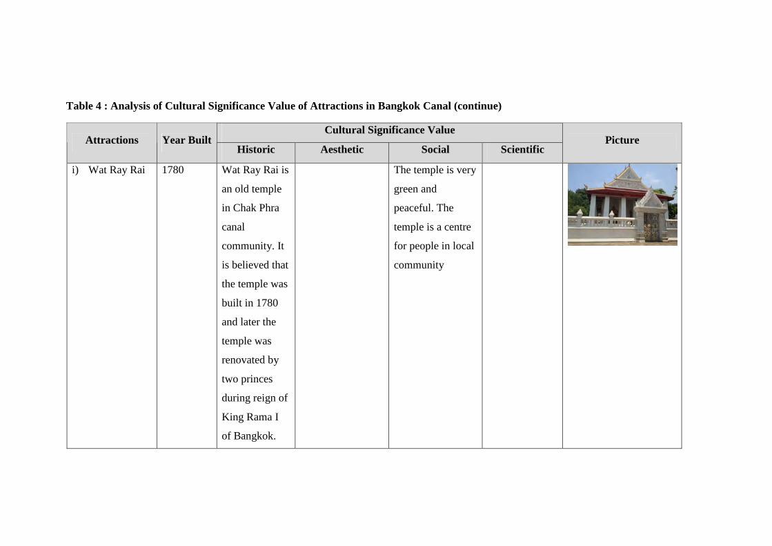
Table 4 : Analysis of Cultural Significance Value of Attractions in Bangkok Canal (continue)
Cultural Significance Value Attractions Year Built
Historic Aesthetic Social Scientific Picture
i) Wat Ray Rai 1780 Wat Ray Rai is
an old temple
in Chak Phra
canal
community. It
is believed that
the temple was
built in 1780
and later the
temple was
renovated by
two princes
during reign of
King Rama I
of Bangkok.
The temple is very
green and
peaceful. The
temple is a centre
for people in local
community
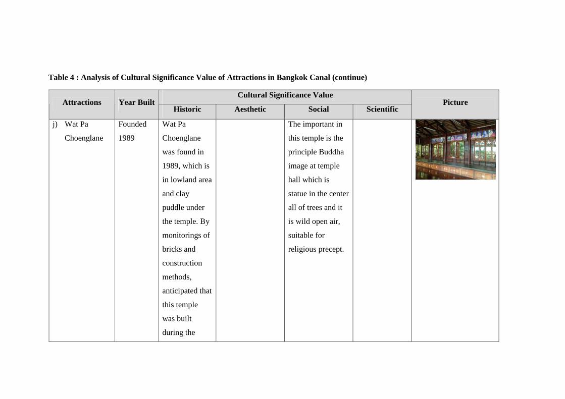
Table 4 : Analysis of Cultural Significance Value of Attractions in Bangkok Canal (continue)
Cultural Significance Value Attractions Year Built
Historic Aesthetic Social Scientific Picture
j) Wat Pa
Choenglane
Founded
1989
Wat Pa
Choenglane
was found in
1989, which is
in lowland area
and clay
puddle under
the temple. By
monitorings of
bricks and
construction
methods,
anticipated that
this temple
was built
during the
The important in
this temple is the
principle Buddha
image at temple
hall which is
statue in the center
all of trees and it
is wild open air,
suitable for
religious precept.
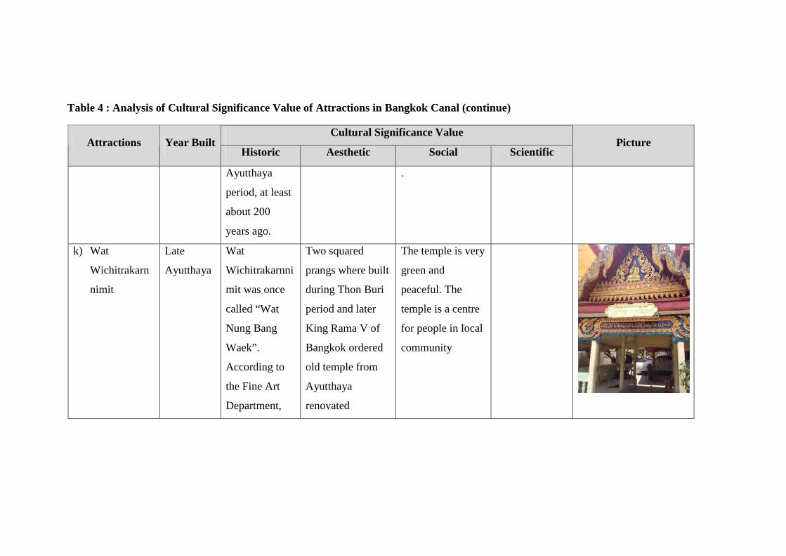
Table 4 : Analysis of Cultural Significance Value of Attractions in Bangkok Canal (continue)
Cultural Significance Value Attractions Year Built
Historic Aesthetic Social Scientific Picture
Ayutthaya
period, at least
about 200
years ago.
.
k) Wat
Wichitrakarn
nimit
Late
Ayutthaya
Wat
Wichitrakarnni
mit was once
called “Wat
Nung Bang
Waek”.
According to
the Fine Art
Department,
Two squared
prangs where built
during Thon Buri
period and later
King Rama V of
Bangkok ordered
old temple from
Ayutthaya
renovated
The temple is very
green and
peaceful. The
temple is a centre
for people in local
community
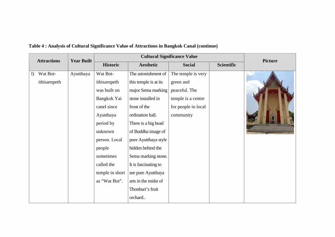
Table 4 : Analysis of Cultural Significance Value of Attractions in Bangkok Canal (continue)
Cultural Significance Value Attractions Year Built
Historic Aesthetic Social Scientific Picture
l) Wat Bot-
ithisarnpeth
Ayutthaya Wat Bot-
ithisarnpeth
was built on
Bangkok Yai
canel since
Ayutthaya
period by
unknown
person. Local
people
sometimes
called the
temple in short
as “Wat Bot”.
The astonishment of
this temple is at its
major Sema marking
stone installed in
front of the
ordination hall.
There is a big head
of Buddha image of
pure Ayutthaya style
hidden behind the
Sema marking stone.
It is fascinating to
see pure Ayutthaya
arts in the midst of
Thonburi’s fruit
orchard..
The temple is very
green and
peaceful. The
temple is a centre
for people in local
community
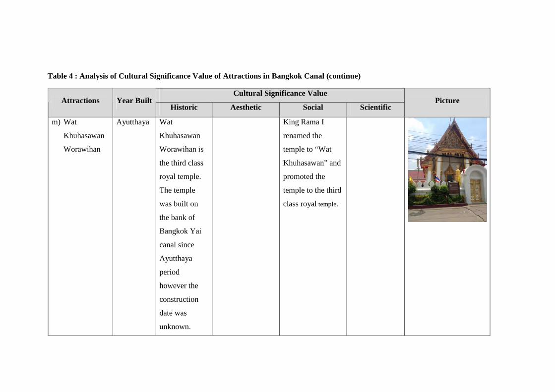
Table 4 : Analysis of Cultural Significance Value of Attractions in Bangkok Canal (continue)
Cultural Significance Value Attractions Year Built
Historic Aesthetic Social Scientific Picture
m) Wat
Khuhasawan
Worawihan
Ayutthaya Wat
Khuhasawan
Worawihan is
the third class
royal temple.
The temple
was built on
the bank of
Bangkok Yai
canal since
Ayutthaya
period
however the
construction
date was
unknown.
King Rama I
renamed the
temple to “Wat
Khuhasawan” and
promoted the
temple to the third
class royal temple.
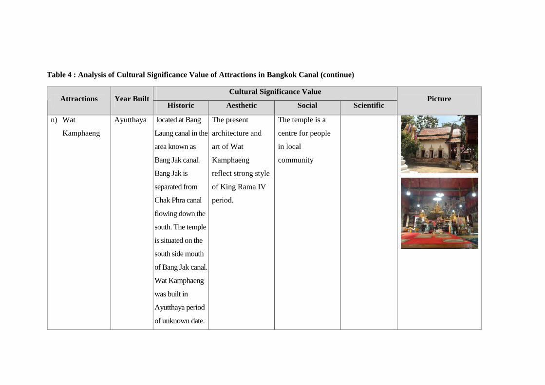
Table 4 : Analysis of Cultural Significance Value of Attractions in Bangkok Canal (continue)
Cultural Significance Value Attractions Year Built
Historic Aesthetic Social Scientific Picture
n) Wat
Kamphaeng
Ayutthaya located at Bang
Laung canal in the
area known as
Bang Jak canal.
Bang Jak is
separated from
Chak Phra canal
flowing down the
south. The temple
is situated on the
south side mouth
of Bang Jak canal.
Wat Kamphaeng
was built in
Ayutthaya period
of unknown date.
The present
architecture and
art of Wat
Kamphaeng
reflect strong style
of King Rama IV
period.
The temple is a
centre for people
in local
community
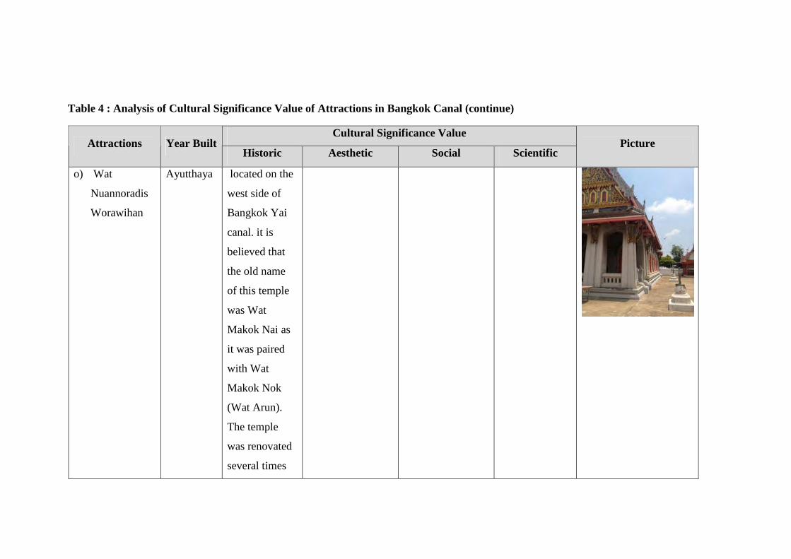
Table 4 : Analysis of Cultural Significance Value of Attractions in Bangkok Canal (continue)
Cultural Significance Value Attractions Year Built
Historic Aesthetic Social Scientific Picture
o) Wat
Nuannoradis
Worawihan
Ayutthaya located on the
west side of
Bangkok Yai
canal. it is
believed that
the old name
of this temple
was Wat
Makok Nai as
it was paired
with Wat
Makok Nok
(Wat Arun).
The temple
was renovated
several times
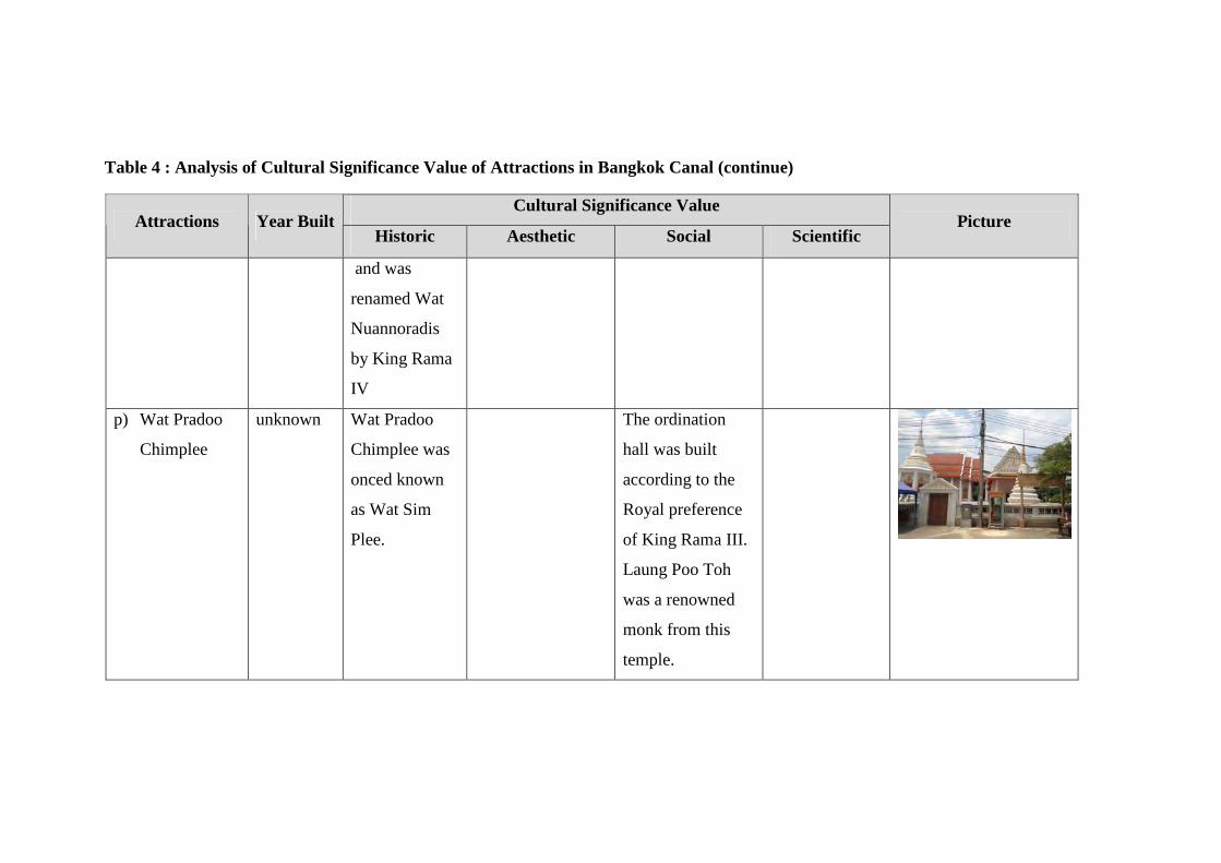
Table 4 : Analysis of Cultural Significance Value of Attractions in Bangkok Canal (continue)
Cultural Significance Value Attractions Year Built
Historic Aesthetic Social Scientific Picture
and was
renamed Wat
Nuannoradis
by King Rama
IV
p) Wat Pradoo
Chimplee
unknown Wat Pradoo
Chimplee was
onced known
as Wat Sim
Plee.
The ordination
hall was built
according to the
Royal preference
of King Rama III.
Laung Poo Toh
was a renowned
monk from this
temple.
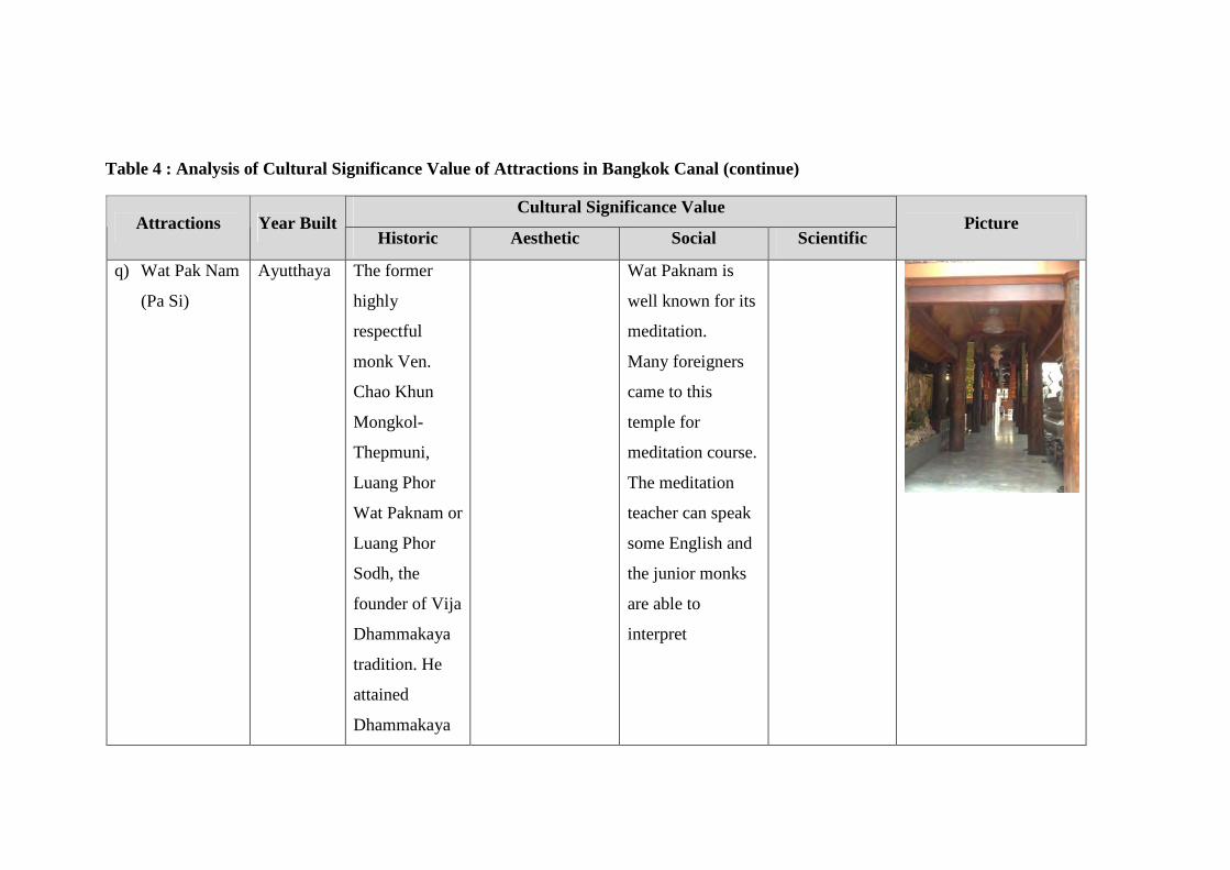
Table 4 : Analysis of Cultural Significance Value of Attractions in Bangkok Canal (continue)
Cultural Significance Value Attractions Year Built
Historic Aesthetic Social Scientific Picture
q) Wat Pak Nam
(Pa Si)
Ayutthaya The former
highly
respectful
monk Ven.
Chao Khun
Mongkol-
Thepmuni,
Luang Phor
Wat Paknam or
Luang Phor
Sodh, the
founder of Vija
Dhammakaya
tradition. He
attained
Dhammakaya
Wat Paknam is
well known for its
meditation.
Many foreigners
came to this
temple for
meditation course.
The meditation
teacher can speak
some English and
the junior monks
are able to
interpret
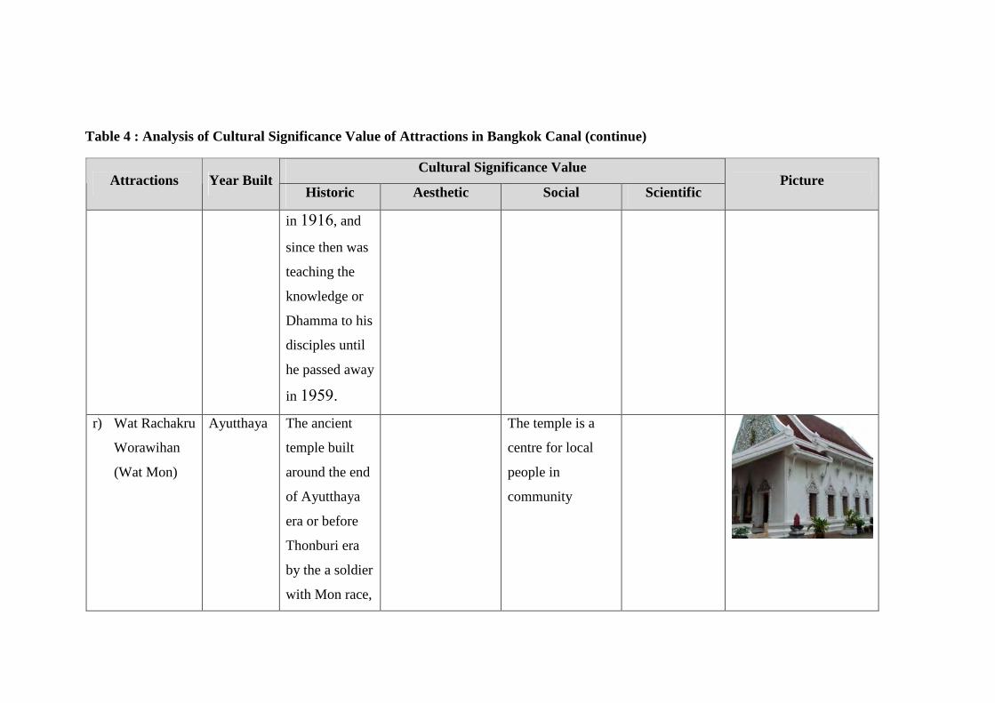
Table 4 : Analysis of Cultural Significance Value of Attractions in Bangkok Canal (continue)
Cultural Significance Value Attractions Year Built
Historic Aesthetic Social Scientific Picture
in 1916, and
since then was
teaching the
knowledge or
Dhamma to his
disciples until
he passed away
in 1959.
r) Wat Rachakru
Worawihan
(Wat Mon)
Ayutthaya The ancient
temple built
around the end
of Ayutthaya
era or before
Thonburi era
by the a soldier
with Mon race,
The temple is a
centre for local
people in
community

Table 4 : Analysis of Cultural Significance Value of Attractions in Bangkok Canal (continue)
Cultural Significance Value Attractions Year Built
Historic Aesthetic Social Scientific Picture
migrated to
Thailand and
settled
themselves
down around
the Bang Yee
Rua area, the
name of that
soldier could
not be traced,
after the
completion of
construction it
was called
“Wat Bang
Vee Pua”
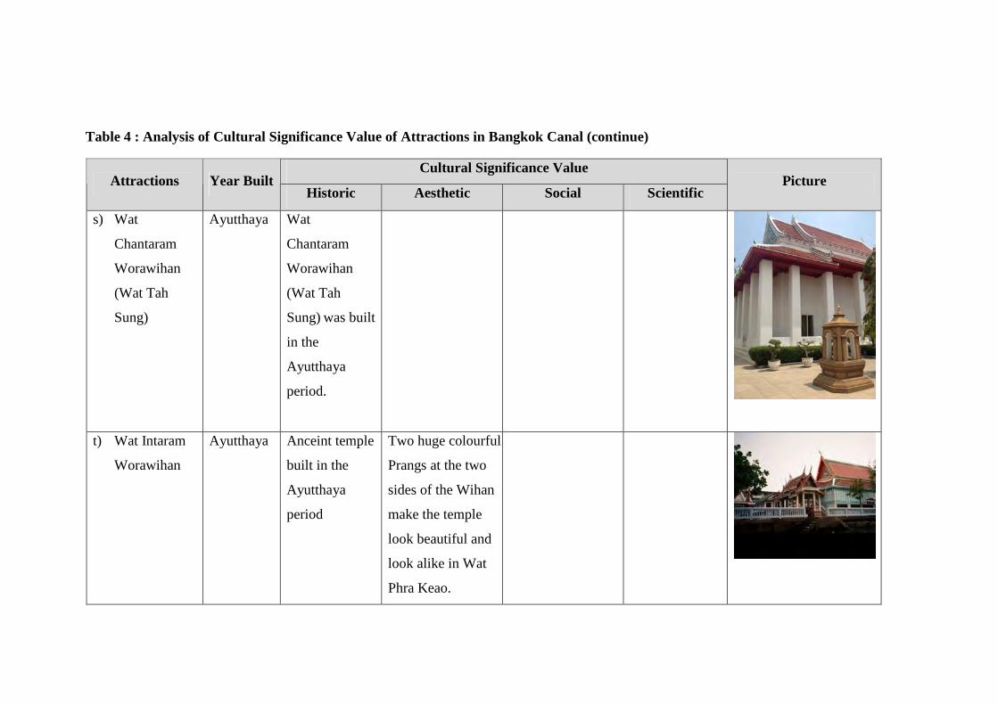
Table 4 : Analysis of Cultural Significance Value of Attractions in Bangkok Canal (continue)
Cultural Significance Value Attractions Year Built
Historic Aesthetic Social Scientific Picture
s) Wat
Chantaram
Worawihan
(Wat Tah
Sung)
Ayutthaya Wat
Chantaram
Worawihan
(Wat Tah
Sung) was built
in the
Ayutthaya
period.
t) Wat Intaram
Worawihan
Ayutthaya Anceint temple
built in the
Ayutthaya
period
Two huge colourful
Prangs at the two
sides of the Wihan
make the temple
look beautiful and
look alike in Wat
Phra Keao.
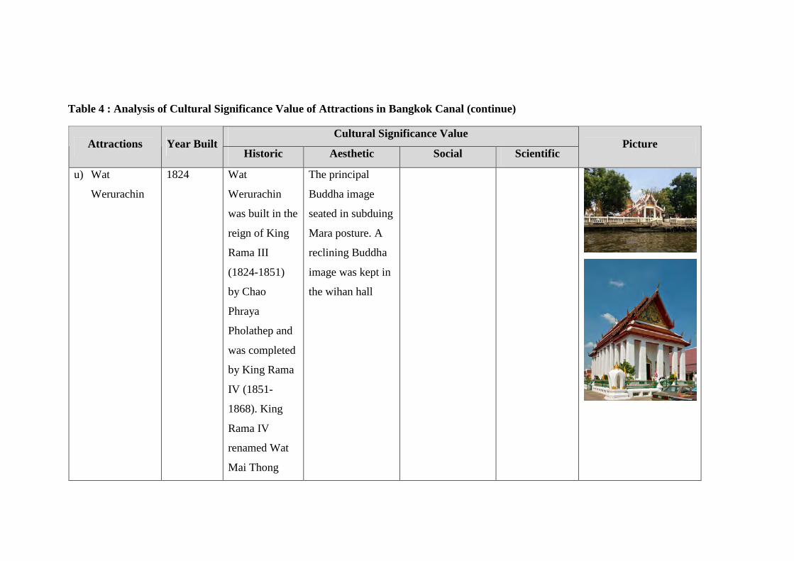
Table 4 : Analysis of Cultural Significance Value of Attractions in Bangkok Canal (continue)
Cultural Significance Value Attractions Year Built
Historic Aesthetic Social Scientific Picture
u) Wat
Werurachin
1824 Wat
Werurachin
was built in the
reign of King
Rama III
(1824-1851)
by Chao
Phraya
Pholathep and
was completed
by King Rama
IV (1851-
1868). King
Rama IV
renamed Wat
Mai Thong
The principal
Buddha image
seated in subduing
Mara posture. A
reclining Buddha
image was kept in
the wihan hall
Table 4 : Analysis of Cultural Significance Value of Attractions in Bangkok Canal (continue)
Cultural Significance Value Attractions Year Built
Historic Aesthetic Social Scientific Picture
Khung,
following the
physical
appearance of
a bend of a
water course.
Once granted
the royal
temple status,
it was named
Wat Mai
Werurachin.
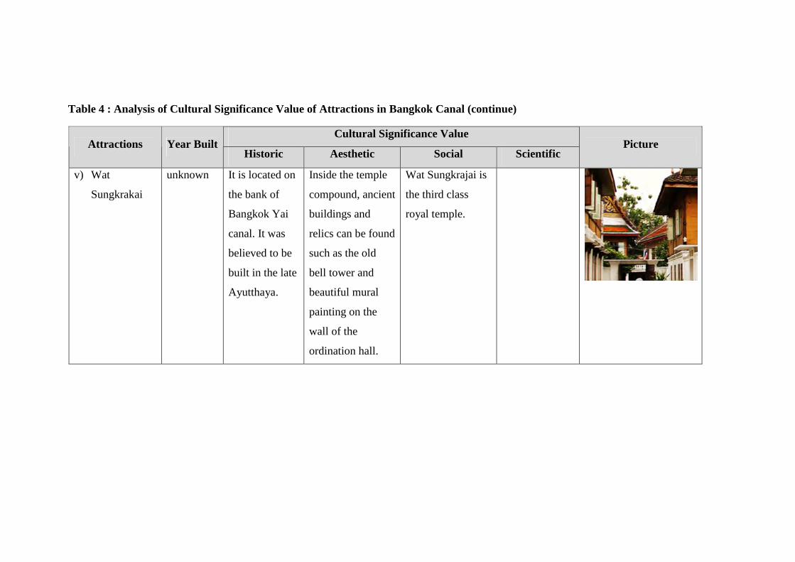
Table 4 : Analysis of Cultural Significance Value of Attractions in Bangkok Canal (continue)
Cultural Significance Value Attractions Year Built
Historic Aesthetic Social Scientific Picture
v) Wat
Sungkrakai
unknown It is located on
the bank of
Bangkok Yai
canal. It was
believed to be
built in the late
Ayutthaya.
Inside the temple
compound, ancient
buildings and
relics can be found
such as the old
bell tower and
beautiful mural
painting on the
wall of the
ordination hall.
Wat Sungkrajai is
the third class
royal temple.
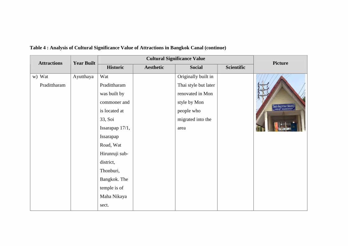
Table 4 : Analysis of Cultural Significance Value of Attractions in Bangkok Canal (continue)
Cultural Significance Value Attractions Year Built
Historic Aesthetic Social Scientific Picture
w) Wat
Pradittharam
Ayutthaya Wat
Pradittharam
was built by
commoner and
is located at
33, Soi
Issarapap 17/1,
Issarapap
Road, Wat
Hirunruji sub-
district,
Thonburi,
Bangkok. The
temple is of
Maha Nikaya
sect.
Originally built in
Thai style but later
renovated in Mon
style by Mon
people who
migrated into the
area
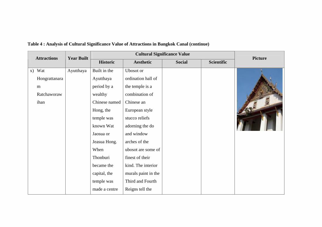
Table 4 : Analysis of Cultural Significance Value of Attractions in Bangkok Canal (continue)
Cultural Significance Value Attractions Year Built
Historic Aesthetic Social Scientific Picture
x) Wat
Hongrattanara
m
Ratchaworaw
ihan
Ayutthaya Built in the
Ayutthaya
period by a
wealthy
Chinese named
Hong, the
temple was
known Wat
Jaosua or
Jeasua Hong.
When
Thonburi
became the
capital, the
temple was
made a centre
Ubosot or
ordination hall of
the temple is a
combination of
Chinese an
European style
stucco reliefs
adorning the do
and window
arches of the
ubosot are some of
finest of their
kind. The interior
murals paint in the
Third and Fourth
Reigns tell the
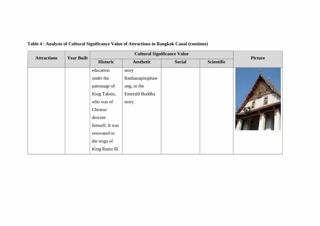
Table 4 : Analysis of Cultural Significance Value of Attractions in Bangkok Canal (continue)
Cultural Significance Value Attractions Year Built
Historic Aesthetic Social Scientific Picture
education
under the
patronage of
King Taksin,
who was of
Chinese
descent
himself. It was
renovated in
the reign of
King Rama Ill.
story
Ratthanapimphaw
ong, or the
Emerald Buddha
story.
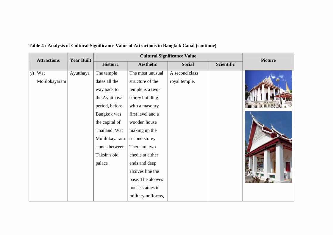
Table 4 : Analysis of Cultural Significance Value of Attractions in Bangkok Canal (continue)
Cultural Significance Value Attractions Year Built
Historic Aesthetic Social Scientific Picture
y) Wat
Molilokayaram
Ayutthaya The temple
dates all the
way back to
the Ayutthaya
period, before
Bangkok was
the capital of
Thailand. Wat
Molilokayaram
stands between
Taksin's old
palace
The most unusual
structure of the
temple is a two-
storey building
with a masonry
first level and a
wooden house
making up the
second storey.
There are two
chedis at either
ends and deep
alcoves line the
base. The alcoves
house statues in
military uniforms,
A second class
royal temple.
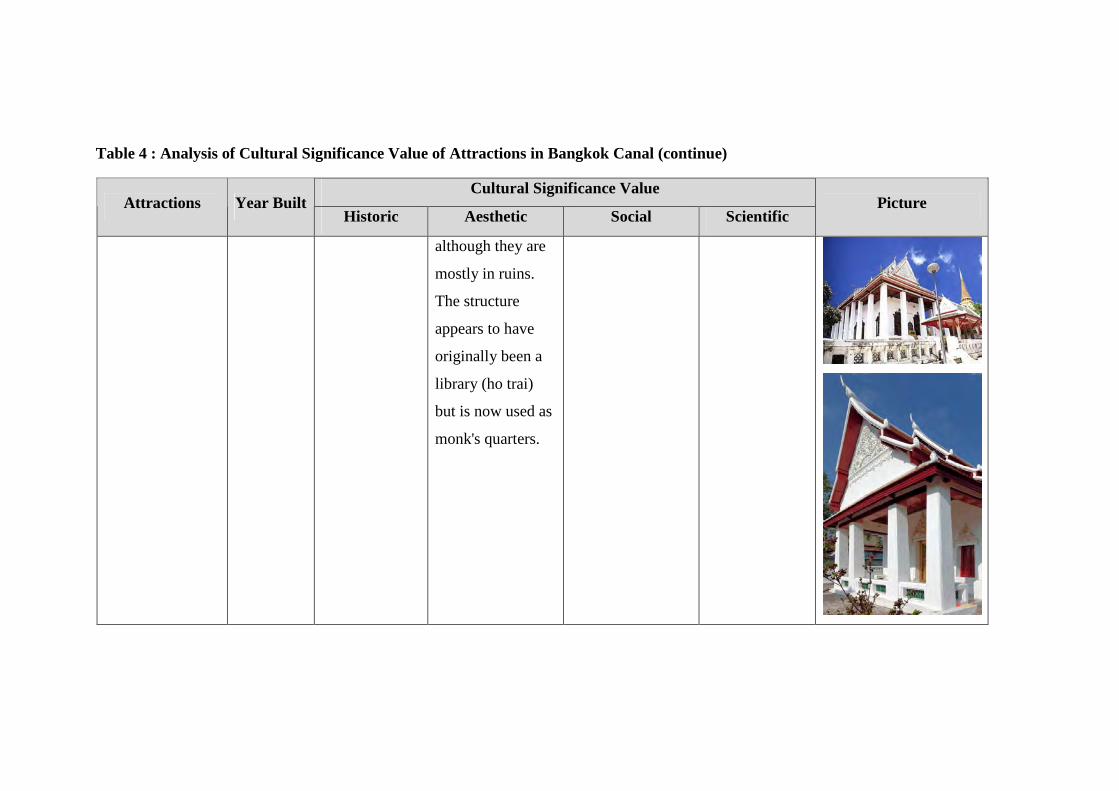
Table 4 : Analysis of Cultural Significance Value of Attractions in Bangkok Canal (continue)
Cultural Significance Value Attractions Year Built
Historic Aesthetic Social Scientific Picture
although they are
mostly in ruins.
The structure
appears to have
originally been a
library (ho trai)
but is now used as
monk's quarters.
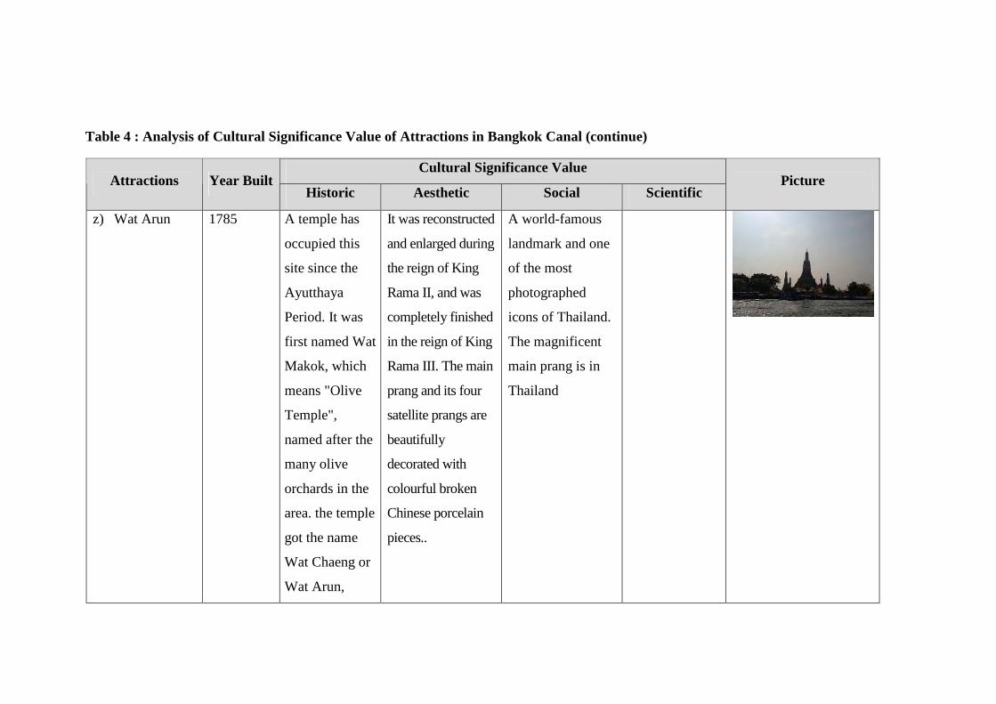
Table 4 : Analysis of Cultural Significance Value of Attractions in Bangkok Canal (continue)
Cultural Significance Value Attractions Year Built
Historic Aesthetic Social Scientific Picture
z) Wat Arun 1785 A temple has
occupied this
site since the
Ayutthaya
Period. It was
first named Wat
Makok, which
means "Olive
Temple",
named after the
many olive
orchards in the
area. the temple
got the name
Wat Chaeng or
Wat Arun,
It was reconstructed
and enlarged during
the reign of King
Rama II, and was
completely finished
in the reign of King
Rama III. The main
prang and its four
satellite prangs are
beautifully
decorated with
colourful broken
Chinese porcelain
pieces..
A world-famous
landmark and one
of the most
photographed
icons of Thailand.
The magnificent
main prang is in
Thailand
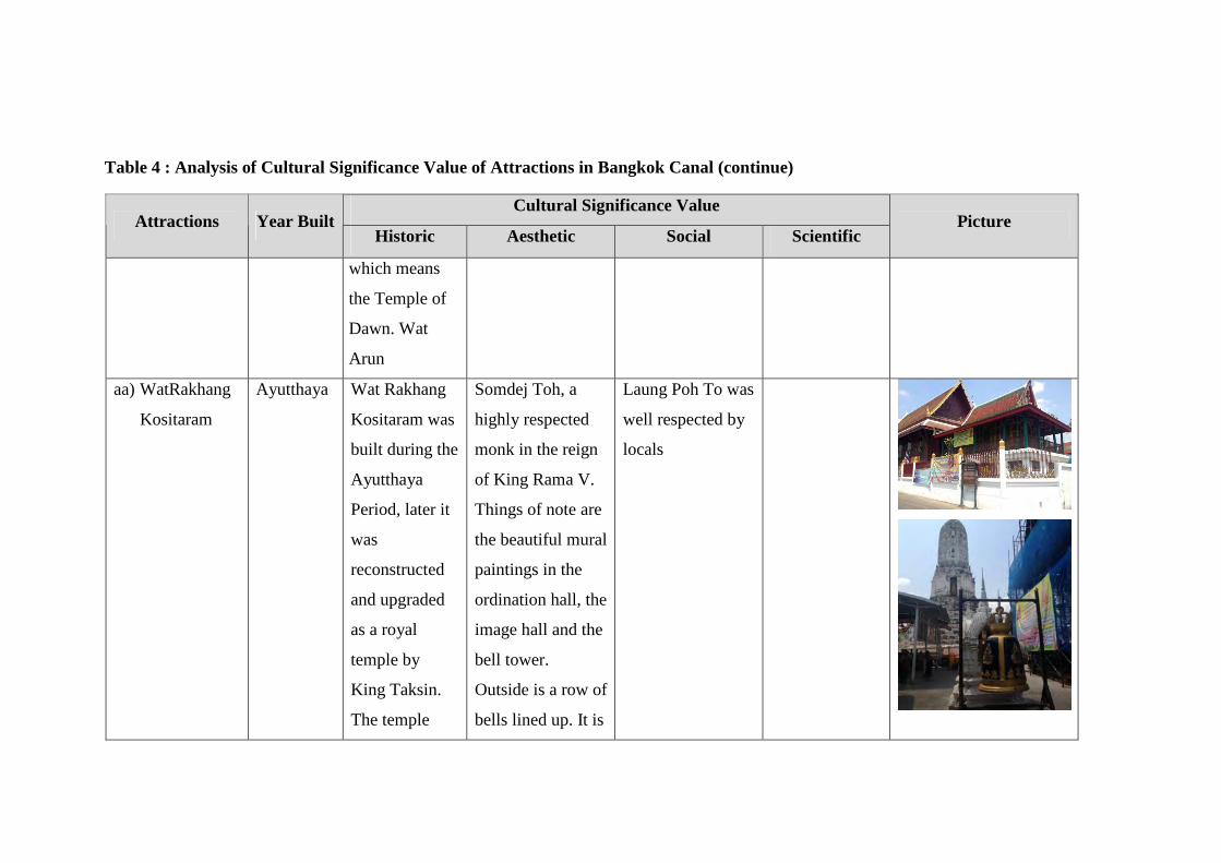
Table 4 : Analysis of Cultural Significance Value of Attractions in Bangkok Canal (continue)
Cultural Significance Value Attractions Year Built
Historic Aesthetic Social Scientific Picture
which means
the Temple of
Dawn. Wat
Arun
aa) WatRakhang
Kositaram
Ayutthaya Wat Rakhang
Kositaram was
built during the
Ayutthaya
Period, later it
was
reconstructed
and upgraded
as a royal
temple by
King Taksin.
The temple
Somdej Toh, a
highly respected
monk in the reign
of King Rama V.
Things of note are
the beautiful mural
paintings in the
ordination hall, the
image hall and the
bell tower.
Outside is a row of
bells lined up. It is
Laung Poh To was
well respected by
locals
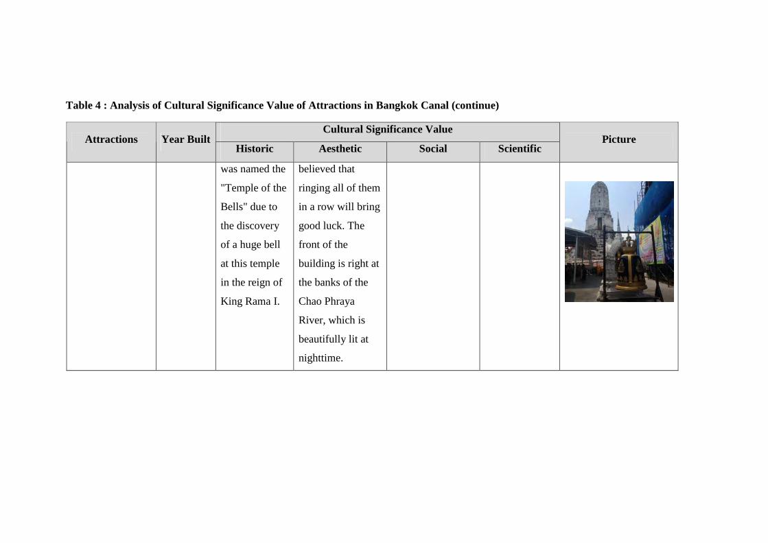
Table 4 : Analysis of Cultural Significance Value of Attractions in Bangkok Canal (continue)
Cultural Significance Value Attractions Year Built
Historic Aesthetic Social Scientific Picture
was named the
"Temple of the
Bells" due to
the discovery
of a huge bell
at this temple
in the reign of
King Rama I.
believed that
ringing all of them
in a row will bring
good luck. The
front of the
building is right at
the banks of the
Chao Phraya
River, which is
beautifully lit at
nighttime.
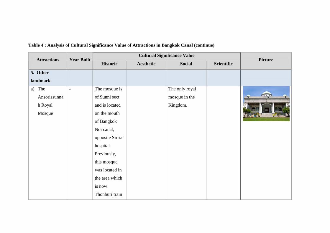
Table 4 : Analysis of Cultural Significance Value of Attractions in Bangkok Canal (continue)
Cultural Significance Value Attractions Year Built
Historic Aesthetic Social Scientific Picture
5. Other
landmark
a) The
Ansorissunna
h Royal
Mosque
-
The mosque is
of Sunni sect
and is located
on the mouth
of Bangkok
Noi canal,
opposite Sirirat
hospital.
Previously,
this mosque
was located in
the area which
is now
Thonburi train
The only royal
mosque in the
Kingdom.
Table 4 : Analysis of Cultural Significance Value of Attractions in Bangkok Canal (continue)
Cultural Significance Value Attractions Year Built
Historic Aesthetic Social Scientific Picture
station. When
King Rama V
initiated train
system in
Thailand and
Thonburi train
station must be
built, the King
granted
permission and
fund to move
the mosque to
the opposite of
the Royal
barge
dockyard.
Table 4 : Analysis of Cultural Significance Value of Attractions in Bangkok Canal (continue)
Cultural Significance Value Attractions Year Built
Historic Aesthetic Social Scientific Picture
b) H.R.H.
Admiral
KromLuang
Chumphon
Khet
Udomsak
Monument
unknown The monument
of H.R.H.
Admiral
KromLuang
Chumphon
Khet Udomsak
The person who
laid the
foundations for
the modern Royal
Thai Navy and
greatly
contributed to its
modernization,
serving as it's
Commander-in-
Chief.
c) Nandhauttaya
n Palace
2400 Nandhauttayan
Palace was
built in the
reign of King
Rama IV
To use this palace
as a school.
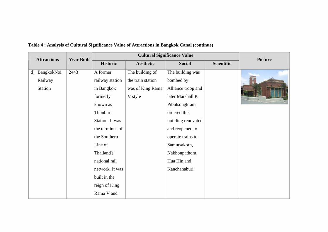
Table 4 : Analysis of Cultural Significance Value of Attractions in Bangkok Canal (continue)
Cultural Significance Value Attractions Year Built
Historic Aesthetic Social Scientific Picture
d) BangkokNoi
Railway
Station
2443 A former
railway station
in Bangkok
formerly
known as
Thonburi
Station. It was
the terminus of
the Southern
Line of
Thailand's
national rail
network. It was
built in the
reign of King
Rama V and
The building of
the train station
was of King Rama
V style
The building was
bombed by
Alliance troop and
later Marshall P.
Pibulsongkram
ordered the
building renovated
and reopened to
operate trains to
Samutsakorn,
Nakhonpathom,
Hua Hin and
Kanchanaburi
Table 4 : Analysis of Cultural Significance Value of Attractions in Bangkok Canal (continue)
Cultural Significance Value Attractions Year Built
Historic Aesthetic Social Scientific Picture
Japanese troop
used this train
station as main
base to
distribute
weapons to
Burma via
Kanchanaburi
Hua Hin and
Kanchanaburi
e) Patrawadi
Theater
2535 A hip riverside
complex,
where a
theater,
rehearsal
spaces, gift
shop and
restaurants sit
Patrawadi Theater
was founded by
one of Thailand's
most revered
actresses,
Patrawadi. The
Patravadi is a hip
riverside complex,
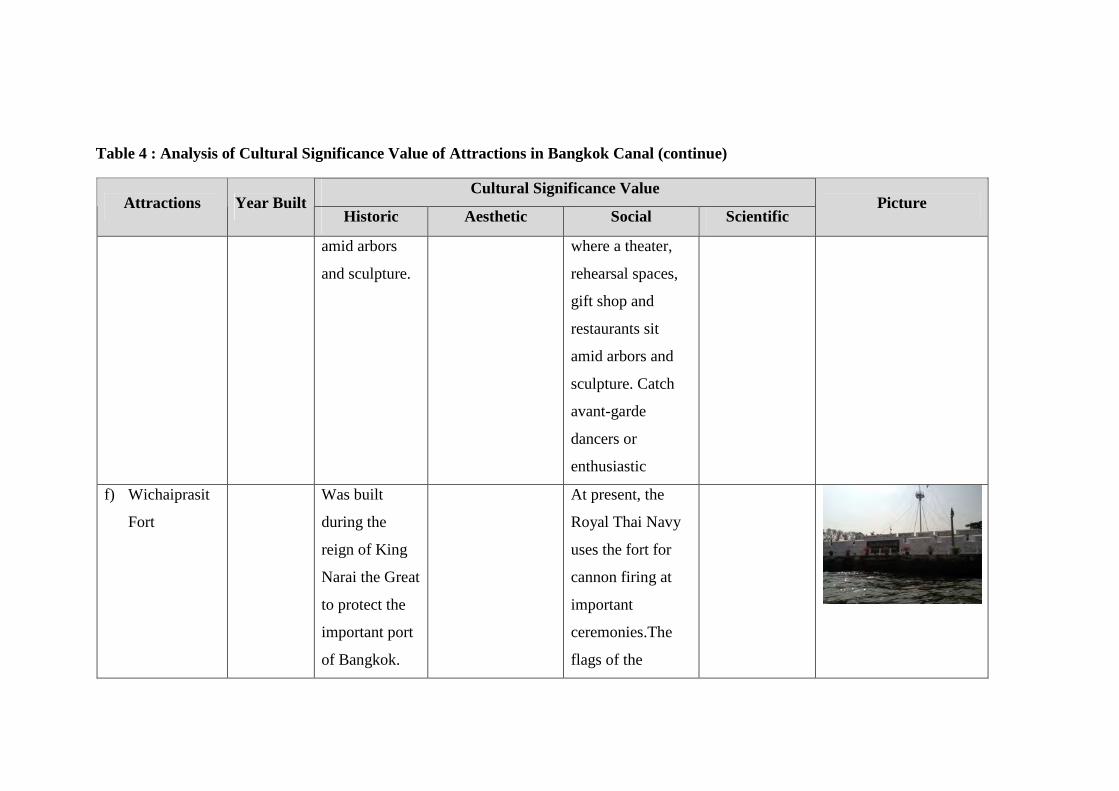
Table 4 : Analysis of Cultural Significance Value of Attractions in Bangkok Canal (continue)
Cultural Significance Value Attractions Year Built
Historic Aesthetic Social Scientific Picture
amid arbors
and sculpture.
where a theater,
rehearsal spaces,
gift shop and
restaurants sit
amid arbors and
sculpture. Catch
avant-garde
dancers or
enthusiastic
f) Wichaiprasit
Fort
Was built
during the
reign of King
Narai the Great
to protect the
important port
of Bangkok.
At present, the
Royal Thai Navy
uses the fort for
cannon firing at
important
ceremonies.The
flags of the
Table 4 : Analysis of Cultural Significance Value of Attractions in Bangkok Canal (continue)
Cultural Significance Value Attractions Year Built
Historic Aesthetic Social Scientific Picture
Commander-in-
Chief and the
Royal Thai Navy
fly from the flag
pole installed
there.
g) Phra Racha
Wang Derm
or Thon Buri
Palace
Phra Racha
Wang Derm or
Thon Buri
Palace is the
only palace
built by King
Taksin the
great in 1768.
which was
originally built in
western style, was
remodeled into a
Thai style
has housed the
Royal Thai Navy
Headquarters up
to the present.
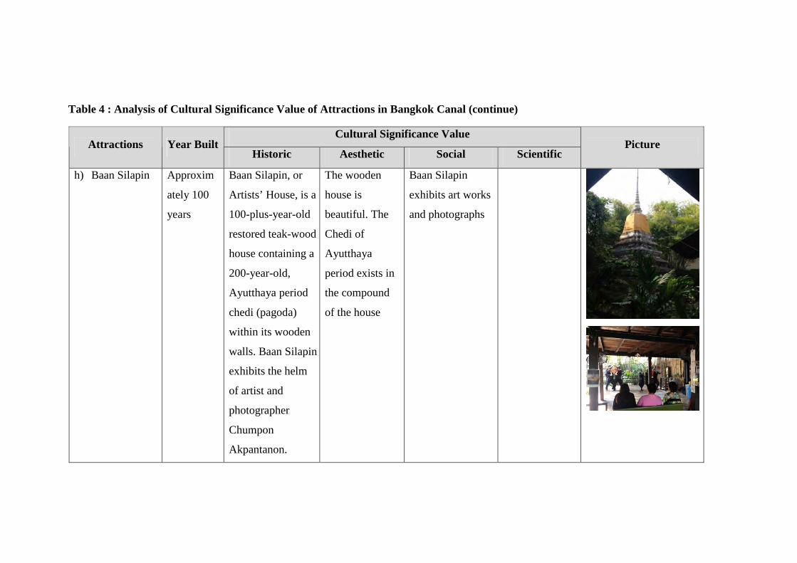
Table 4 : Analysis of Cultural Significance Value of Attractions in Bangkok Canal (continue)
Cultural Significance Value Attractions Year Built
Historic Aesthetic Social Scientific Picture
h) Baan Silapin Approxim
ately 100
years
Baan Silapin, or
Artists’ House, is a
100-plus-year-old
restored teak-wood
house containing a
200-year-old,
Ayutthaya period
chedi (pagoda)
within its wooden
walls. Baan Silapin
exhibits the helm
of artist and
photographer
Chumpon
Akpantanon.
The wooden
house is
beautiful. The
Chedi of
Ayutthaya
period exists in
the compound
of the house
Baan Silapin
exhibits art works
and photographs
185
CHAPTER 5
RESEARCH METHODOLOGY
This study of “Cultural tourism route Thai Lifestyle along Bangkok Canal” was
conducted using descriptive and analytical methods. The author divided the scope of
study as follows;
5.1 Scope of geographical study area
In the study of Cultural Tourism Route of The Thai way of life along Bangkok
Canal, certain area of Bangkok Canal is selected and studied insight. Bangkok Canal
in this study covers the area of Bangkok Noi, Chak Phra and Bangkok Yai canals. All
three canals are connected and flow to the same direction starting from Bangkok Noi
canal, Chak Phra canal and finally Bangkok Yai canal with total distance of 14.8
kilometres. Researcher conducted a study on the waterfront areas along both banks of
the canal including an inland area of 23.40 square kilometres surrounded by Bangkok
Canal.
5.2 Scope of Data Collection and Target Groups
a. Waterfront communities and related government agencies
Interviews were conducted with all stakeholders including community leaders,
local community members, government agencies responsible for tourism industry,
and business owners in Bangkok Noi and Bangkok Yai districts to find out their
opinions toward promoting Bangkok canal to a culture tourism route. The interviews
were conducted during May until December 2012.
b. Tourists
In order to find out opinions of both Thai and foreign tourists, a questionnaire
was used to collect data. Three hundred tourists who visited Bangkok Canal area both
by land and by boat during October until December 2012 were asked to fill in
สำนกัหอ
สมุดกลาง
186
questionnaires. The questionnaire explored expectations as well as types of activities
tourists expect to see from a culture tourism route.
5.3 Scope of study context
a. Waterfront area
The author studied history, physic, economy and socio-culture based on both
primary and secondary data analysis to demonstrate potentials to promote the area as
a sustainable culture tourism route. The study covers:
• Tourism and cultural contexts of living conditions and cultural origins and
traditions of Thai people living on the canal bank of Bangkok Noi , Chak
Phra and Bangkok Yai canals.
• The sustainable tourism development capacity of the canal bank of
Bangkok Noi, Chak Phra and Bangkok Yai canals. This aspect includes the
components of sustainable tourism development.
b. Waterfront communities and related government agencies
This section focused on opinions of all stakeholders regarding promotion of
Bangkok Canal as a cultural tourism route, types of activities should be offered and
expectations of community members. Stakeholders include household leaders,
community leaders, local community members, government agencies responsible for
tourism industry, and business owners.
c. Tourist
This section explored the reason that tourists decided to visit Bangkok Canal,
their expectation during a boat tour along Bangkok Canal, improvements they would
like to see to and the benefits they think will follow after promoting Bangkok Canal
as a cultural tourism route.
d. Tourism Route
This section covered the study of tourism context by applying theory and
interpretation model to analyse and process data in order to generate guidelines for
appropriate format of sustainable waterway culture tourism route program.
สำนกัหอ
สมุดกลาง
187
5.4 Research methodology and Data Analysis
Tools used for data collection are as follow;
a. Waterfront area
Data on history, physic, economy and socio-culture of waterfront area was
collected from both primary and secondary data sources as well as from direct
observations. The author then compare data collected with the principles of cultural
tourism route to demonstrate the potentials of promoting Bangkok Canal as a
sustainable cultural tourism route.
b. Waterfront communities and related government agencies
Data collected from members of waterfront communities and the government
officials was conducted using face-to-face interview. The interview questions were
divided into 4 sections as follow;
Section 1: general data about the interviewee
Section 2: Do you think that Bangkok Canal still reflects historic and cultural
value?
Section 3: What factors must Bangkok Canal possess before they can be used
to indicate the capacity of Bangkok Canal as cultural tourism route?
Section 4: What are benefits that the community’s members expect after
Bangkok Canal being promoted a of cultural tourism route?
After data collection was completed, the author analysed the data collected
from an interview qualitatively and identified the main findings which lead to a
conclusion.
c. Tourist
This questionnaire is used for getting information from visitors who visit in
Community along Bangkok Canal. The questionnaire can be divided into 4 sections as
follow;
Section 1: Demographic Data of visitors of Bangkok canal community
Section 2: Reason for visiting
Section 3: Important characteristics of Bangkok canal
สำนกัหอ
สมุดกลาง
188
Section 4: Promotion of Bangkok canal as Cultural Tourism Route
All data collected from questionnaire questions were then input into SPSS
software to analyse the data statistically. The author is interested in the following
statistics.
1. Statistics in percentage of demographic data of tourists who answered the
questionnaire
2. The frequency of data in section 2: reason for visiting
3. Statistics showing the percentage of important characteristics of Bangkok
canal, opinions toward promoting Bangkok canal as Cultural Tourism
Route and the top 10 indicators necessary for the developing for cultural
tourism route.
d. Tourism Route
This section discusses tourism theory and practices for designing a tourism
route. All data related to Bangkok Canal will be studied including the suitability of
the area, local communities, related government agencies and opinions from tourists
visiting the area will be carefully examined and analysed then sustainable tour route
with theme and essence of Bangkok Canal will be recommended. The recommended
tour route will demonstrate historic and cultural values of Bangkok Canal of the past
and those that is carried to the present. The route will also reflect the role of cultural
tourism route in promoting and maintaining the core values of local communities and
Bangkok Canal for the future.
The following table shows the relationship between scopes of study, tools and
analysis.
สำนกัหอ
สมุดกลาง

189
Table 5 : Relationship between scopes of study, tools and analysis
Scope of Study Tools Analysis
Waterfront area Primary and secondary
data analysis
Cultural tourism route
principles
Waterfront communities
and related government
agencies
In-depth interview Summary of core
findings
Tourist Questionnaire SPSS, Statistics,
Frequency
Tourism route Primary and secondary
data analysis, In-depth
interview and
questionnaire
Criteria for designing
sustainable tour route
The questionnaire designed for collecting opinions of tourists and in-depth
interview questions prepared for the interview with community representatives and
government officials were based on the research questions. The table below shows a
relationship between key research questions to questionnaire and in-depth interview
questions.
สำนกัหอ
สมุดกลาง
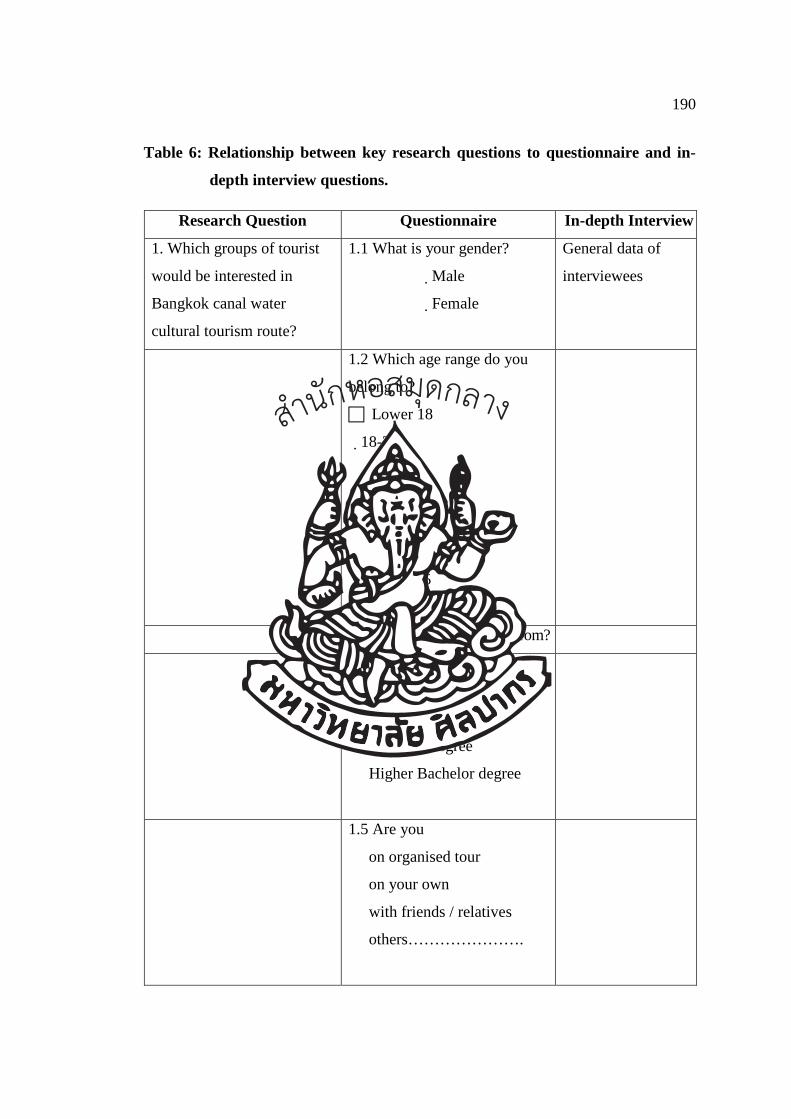
190
Table 6: Relationship between key research questions to questionnaire and in-
depth interview questions.
Research Question Questionnaire In-depth Interview
1. Which groups of tourist
would be interested in
Bangkok canal water
cultural tourism route?
1.1 What is your gender?
�Male
�Female
General data of
interviewees
1.2 Which age range do you
belong to?
� Lower 18
�18-25
� 26-35
� 36-45
� 46-55
� 56-65
� Above 65
1.3 Which country are you from?
1.4 Education
� Secondary school
� Diploma
� Bachelor degree
� Higher Bachelor degree
1.5 Are you
� on organised tour
� on your own
� with friends / relatives
� others………………….
สำนกัหอ
สมุดกลาง
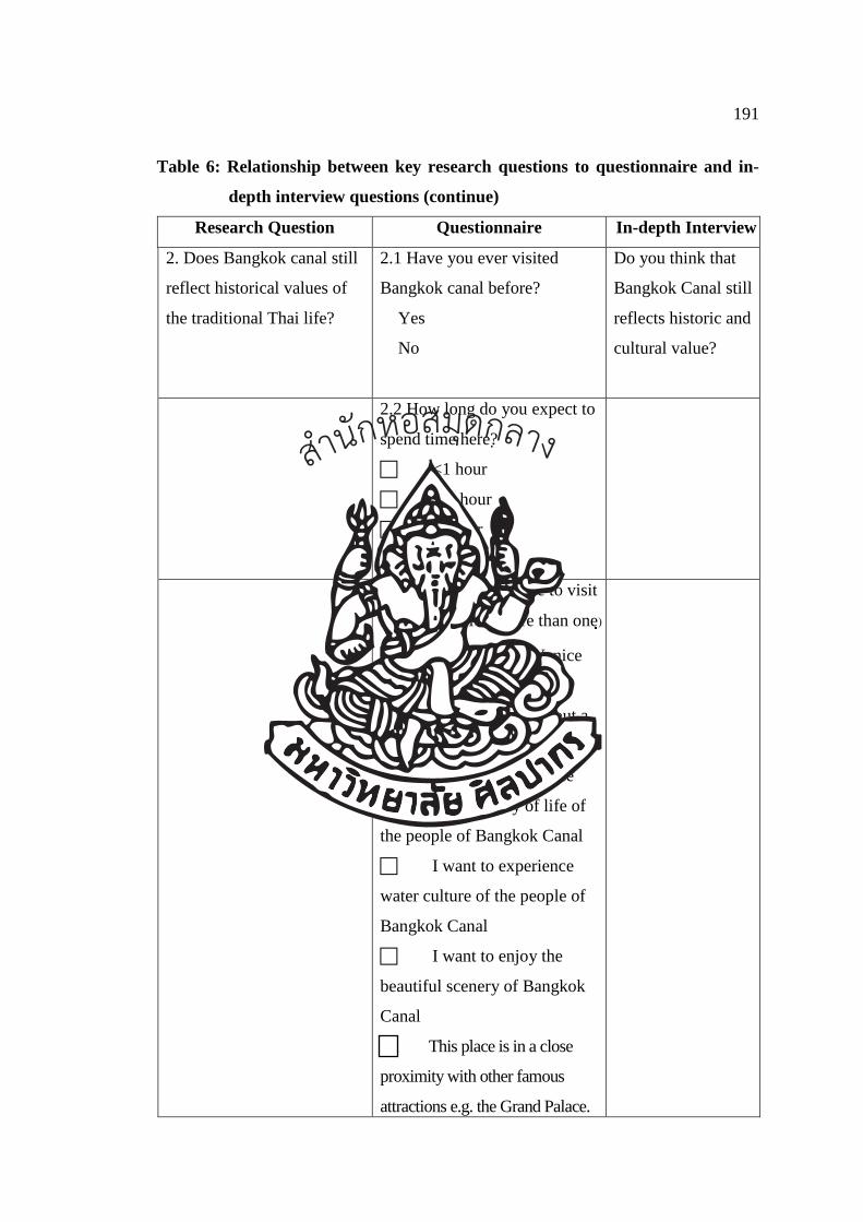
191
Table 6: Relationship between key research questions to questionnaire and in-
depth interview questions (continue)
Research Question Questionnaire In-depth Interview
2. Does Bangkok canal still
reflect historical values of
the traditional Thai life?
2.1 Have you ever visited
Bangkok canal before?
� Yes
� No
Do you think that
Bangkok Canal still
reflects historic and
cultural value?
2.2 How long do you expect to
spend time here?
� <1 hour
� 1-2 hour
� >3hour
2.3 Why do you choose to visit
here? (can select more than one)
� I want to see “Venice
of the East”
� I want to learn about a
long history of Bangkok Canal
� I want to experience
and learn about way of life of
the people of Bangkok Canal
� I want to experience
water culture of the people of
Bangkok Canal
� I want to enjoy the
beautiful scenery of Bangkok
Canal
Th This place is in a close
proximity with other famous
attractions e.g. the Grand Palace.
สำนกัหอ
สมุดกลาง

192
Table 6: Relationship between key research questions to questionnaire and in-
depth interview questions (continue)
Research Question Questionnaire In-depth Interview
2.4 What did you see during
your Bangkok Canal tour?
(You can select more than one
choice)
� I saw people still using
waterway for transportation
� I saw people selling
things on their boats
� I saw people using
water from canal for their
domestic activities e.g.
washing, bathing
� I saw water related
festivals such as traditional
boat racing or Chak Phra
ceremony
� I saw houses built
facing canal with terrace
� I saw temples playing
centre role for community
� I saw floating market
where people from nearby
communities traded their local
products
� Others………………
สำนกัหอ
สมุดกลาง
193
Table 6: Relationship between key research questions to questionnaire and in-
depth interview questions (continue)
Research Question Questionnaire In-depth Interview
2.5 Do you think that Bangkok
Canal still reflect historical
value?
� Yes
� No
� Others ……………
3. What key values, features
or characteristics of
Bangkok Canal are
important for the
development of cultural
tourism route?
3.1 Are these characteristics
of Bangkok Canal important
for the development of cultural
tourism route? (1 is the least
important and 5 is the most
important characteristics)
� way of life of people
living along canal side
� water transport as main
mode of transportation
� water transport by
mean of boat
� trading by boats
� water from canal for
domestic use
� water related festivals
such as boat racing, Chak Phra
ceremony
� waterfront houses
� old buildings with
cultural significance
unique/rare in Bangkok
What factors must
Bangkok Canal
possess before they
can be used to
indicate the
capacity of
Bangkok Canal as
cultural tourism
route?
สำนกัหอ
สมุดกลาง
194
Table 6: Relationship between key research questions to questionnaire and in-
depth interview questions (continue)
Research Question Questionnaire In-depth Interview
� diverse in architectural
style
� old temples with long
history
� architectural values and
beauty of temples
� temple as centre for
community
� long history of old
communities
� handcrafts reflects
local wisdom of old
communities
� local handcrafts require
high skills and it is close to
extinction
� floating markets are
main trading points of
communities
� floating markets
reflects way of life of people
of Bangkok Canal
� local museums exhibit
history of communities
� local museums are
pride of local people
สำนกัหอ
สมุดกลาง
195
Table 6: Relationship between key research questions to questionnaire and in-
depth interview questions (continue)
Research Question Questionnaire In-depth Interview
4. What elements must the
key values possess before
they can be used to indicate
the capacity of Bangkok
Canal as cultural tourism
route (for example
community, temple, local
culture
* Top 10 factors from question
3 will be used as indicators to
answer this question
5. How could Bangkok
canal be developed and
promoted as a Cultural
Tourism Route, reflecting
both historical and cultural
values of Thailand?
Are these activities of
Bangkok Canal important for
the development and
promotion of cultural tourism
route? (1 is the least important
and 5 is the most important
characteristics)
� boat and walking tour
by local guide
� Cultural shows
� special events
� Demonstration how to
make local product
� Exhibition inside
Bangkok noi’s museum
� Community’s floating
market on weekend
� Homestay
Water condition must
be improved
สำนกัหอ
สมุดกลาง

196
Table 6: Relationship between key research questions to questionnaire and in-
depth interview questions (continue)
Research Question Questionnaire In-depth Interview
� Appropriate Waste
management
� Involvement of local
community
� Other………………
What do you think are the
benefits to the Bangkok Noi
canal was developed for
cultural tourism route? (can
select more than one)
� increased family
income
� more infrastructure
development
� more government
support for local economy
� increased community
appreciation of cultural
heritage
� more job opportunities
� to conserve historical
and cultural heritage
� more job opportunities
� Others,
Specify………………………
� I don’t see any
benefits. Why?..................
สำนกัหอ
สมุดกลาง
197
5.5 Conclude Results
Conclusion of result is presented in Chapter 7 where the author eventually
came to a conclusion of the new findings for this dissertation. At the end of the
analysis, the author used the results and information collected from research to answer
all research questions and to finally test hypothesis. It is clearer to understand the
results of this research after conclusion is made. New findings will also be presented
together with recommendation of how they can be used for further study and works.
สำนกัหอ
สมุดกลาง
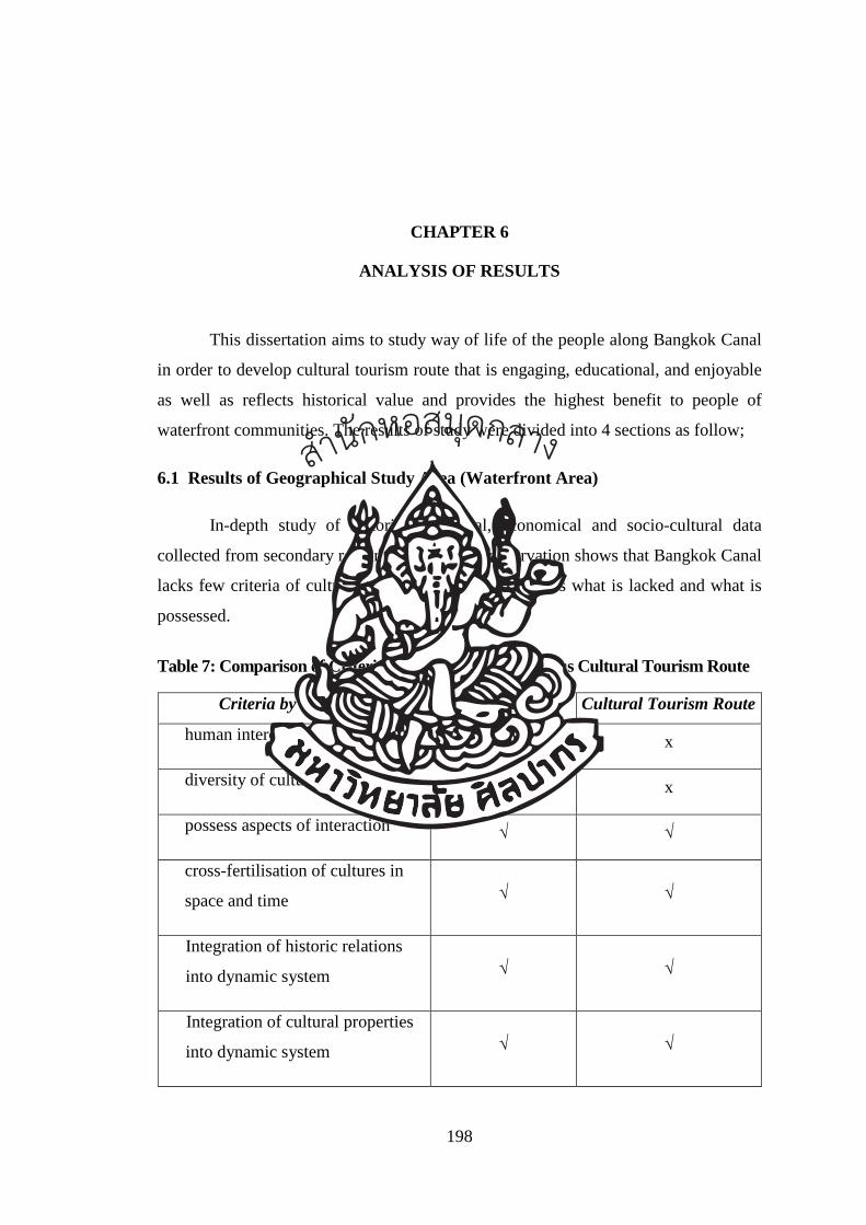
198
CHAPTER 6
ANALYSIS OF RESULTS
This dissertation aims to study way of life of the people along Bangkok Canal
in order to develop cultural tourism route that is engaging, educational, and enjoyable
as well as reflects historical value and provides the highest benefit to people of
waterfront communities. The results of study were divided into 4 sections as follow;
6.1 Results of Geographical Study Area (Waterfront Area)
In-depth study of historical, physical, economical and socio-cultural data
collected from secondary research and indirect observation shows that Bangkok Canal
lacks few criteria of cultural tourism. Table below shows what is lacked and what is
possessed.
Table 7: Comparison of Criteria for Cultural Route Versus Cultural Tourism Route
Criteria by ICOMOS Cultural Route Cultural Tourism Route
human intercultural links √ x
diversity of cultural heritage √ x
possess aspects of interaction √ √
cross-fertilisation of cultures in
space and time √ √
Integration of historic relations
into dynamic system √ √
Integration of cultural properties
into dynamic system √ √
สำนกัหอ
สมุดกลาง
199
Cultural tourism route is a term used in this study to mean a tour routing which
brings tourists to visit the area with historical and cultural values, still reflects local
way of life through everyday living activities and values and way of life are inherited
to younger generation. Cultural tourism route connects cultural attractions in the area
to allow visitors to experience true local tradition and exchange their knowledge with
local people and create understanding among locals and visitors. The cultural tourism
route will benefit both visitors, in terms of enjoyment, and at the same time enfit
locals with more income and pride of their culture which will eventually lead to
sustainable conservation.
After detailed consideration, Bangkok Canal may be not described as a
cultural route but the characteristics exist for it to be developed as a cultural tourism
route. The values are too crucial to just discard the area. The author therefore
proposes a new term ‘Cultural Tourism Route’ to describe Bangkok Canal. Section
6.2 describes elements and indicators of how and why the Cultural Tourism Route is
appropriate for this situation.
6.2 Results of Waterfront Communities and Related Government Agencies Study
The author interviewed leaders of Ban Bu and Trok Khao Mao communities in
Bangkok Noi district and leaders of Artist’s House, Ton Son Mosque communities in
Bangkok Yai district. The author also interviewed officials from related government
agencies responsible for Bangkok Canal area which are Bangkok Noi and Bangkok
Yai Administration office. Data was analysed and the essence of information is
divided into 3 parts based on interview questions. Following is the essence of
information found in response to the questions below.
Do you think that Bangkok Canal still reflects historic and cultural value?
If yes, why…………..?
Both groups of interviewee gave the answers to the same direction that
Bangkok Canal still reflects historical and cultural values.
สำนกัหอ
สมุดกลาง
200
What are the important key values characteristics of Bangkok Canal for
the development of cultural tourism route?
Both groups of interviewee gave their opinions and the summary of issues and
key points are as follow;
Community leaders shared that the historical value and significance of
Bangkok Canal are;
1. People still use waterway for transportation. Paddling boats are used for
short trips from house to house or to the temples to carry out religious
rights and prayers. Nowadays, even though the frequency of boat use
decreased but old people still prefer to travel by boats.
2. Boats are used for commerce. People still paddle boats carrying food
and products mostly noodles, fruits and Thai traditional sweet to sell to
people along the canals. Boats are the best choice because they can access
sub canals.
3. Water is used for daily domestic activities. People living along the banks
of Bangkok Canal still use water for their everyday consumption such as
watering their plants, laundry, dish washing and even fishing. Even though
the quality of water was not as clean as it used to be, people still use water
as they used to do in the past.
4. Temples are centre of communities. People living along Bangkok Canal
have long been tied to temples from birth till death. People will gather at
the temple to discuss community’s matter or when organising festival or
traditions such as Chak Phra Ceremony or Loy Kratong.
Officials from related government agencies saw factors that maintain
historical value of Bangkok Canal as follow; 1. Ancient canals Bangkok Canal is the main vein of Thailand for a long
time before the new Klong Lat was built and the course of the Chao
Phraya River was changed. It was the main waterway for transportation
both for goods and passengers since Ayutthaya period. It was the main
route for foreign trading and was a natural defense for the kingdom.
สำนกัหอ
สมุดกลาง
201
2. Water Bound Way of Life. Officials at Bangkok Noi and Bangkok Yai
Administration Offices agreed that people living in the districts still use
canal water for their everyday life such as watering plants, agriculture,
serving as public boat and food selling. Apart from those, Bangkok Canal
is a main route for public passenger boat running between Bangkok and
Nontaburi Province. The boat operates twice a day in the morning and
evening and it runs nonstop to Ta Chang pier in Bangkok (pier close to
Silapakorn University, Thaphra Palace campus).
In-depth interview shows that there are many old people who still live their
original lifestyles living in the area. These people still use boat for their daily activity
such visiting relatives or neighbours, travelling to shops and to the temples for making
merit. The officials revealed that this lifestyle is an identity of waterfront canal
communities. Old people still living their original way even though the world outside
is changing. This way of life must be passed on to the younger generation and
conserved.
1. Boats are used for commerce. Now, long-tail boat and small size public
boat can be chartered to tour Bangkok Canal. Visitors will see local sellers
paddle the boats carrying food and products for sell to both visitors and
locals. Fruits and Thai traditional sweet are commonly found on the boat.
This is the charm of Bangkok Canal that attracts many people to visit the
area 2. Agricultural area. The interview shows that apart from waterfront way of
life and ancient attractions, agriculture is still practiced in Bangkok Canal.
If travel further inside, off the Chao Phraya River, visitors will find many
orchid and fruit plantation along the canal side. Many families grow orchid
and fruits such as rose apple, banana and mango to earn additional
incomes.
3. Ancient temples. The answers from in-depth interview show that there are
45 temples in study area, 32 temples are located and under administration
of Bangkok Noi district whereas 13 temples are under Bangkok Yai
district. Almost all temples were built since Ayutthaya period. Evidence
สำนกัหอ
สมุดกลาง
202
from the number of temples found in the area suggests Bangkok Canal’s
long history and settlement. Mural paintings in many temples depict way
of life and community in the period of construction. Both Bangkok Noi
and Bangkok Yai Administration Offices have restored ancient temples
and promoted them as learning centre for history, architecture, art and
culture of Thailand.
4. Ancient community. There are a number of old settlements which exist
since Ayutthaya period. As time passes, members in these communities
accumulated their local knowledge in craft and transferred the knowledge
to the younger generation such as Ban Bu Community who possess the
complicated craft of Stone-Polished Bowl and they are the only
community in Thailand who inherited the knowledge from Ayutthaya. It
can be said that Bangkok Canal has ancient community with specific
craftsmanship. Members in the community should be aware of the value of
the craft and transfer the knowledge to younger generation.
5. Water Related Tradition and Custom. The interview shows that
government agencies have long been collaborating with people in the
community to organise annual events in each administrative districts. The
events are usually tradition that reflects the attitude and belief of locals
such as Chak Phra Ceremony. Chak Phra Ceremony is organised by the
collaboration of many districts including Bangkok Noi and Bangkok Yai
which is part of the study area. Chak Phra ceremony takes place on the 2nd
wane moon day in the 12th lunar month. During the ceremony, Buddha
images will be enshrined on boats and the boat will travel from Nang She
temple, along Pasi Charoen to Bangkok Canal and to the Chao Phraya
River and then turn to Bangkok Yai canal and finish at Nang She temple.
This ceremony can be found only in this area.
It is clear that both leaders of community and officials of government agencies
agreed that Bangkok Canal still reflects historical and cultural values through way of
life, bond with water, ancient temples, ancient communities and traditions related to
water.
สำนกัหอ
สมุดกลาง
203
What are the key values of Bangkok Canal relevant to the development of
cultural tourism route?
Opinions of community leaders and government agency officials on the key
values important for the development of Bangkok Canal as cultural tourism route are
as follow; Opinions from waterfront communities are; 1. Cleanliness of Canal. Local communities think that one key factor
important for the development of Bangkok Canal as tourism route is the
cleanliness of canal water. Waste water should be treated and households
must not litter garbage into canal. Polluted water and dirty smell really
affect the visit of Bangkok Canal.
2. Government should promote second job. Locals think that if the area
will be promoted as tourism attraction, the government should also educate
people how to create second job related to tourism for additional income.
Locals want to be trained on how to make souvenirs so that they produce
and sell to tourists.
Opinions from related government agencies are;
1. Budget. Budget is an important factor and much needed for the
development of the area as a tourist attraction. However, budget is very
limited for development projects or initiatives resulting in a halt and dis
continuity of work.
2. Cooperation from Communities. Second factor from the budget problem
is cooperation from communities. At present, communities are involved in
the development but it would be better if communities involve more.
Communities need to be aware that the development of the area to tourist
attraction will benefit them because;
a. They will be proud of their own communities
b. They can earn additional income
c. This will be a model for community service
d. This will be a platform for locals and tourists to exchange experiences
สำนกัหอ
สมุดกลาง
204
3. Tourism promotion activities in Bangkok Canal area. The government
should promote activities, occupation and knowledge to members of
communities. a. Learning centre has been set up for locals to learn and improve their
knowledge and local wisdom in order to bring what they learn to
improve activities for their communities.
b. Promotional activities were organised such as boat trip to visit 5
temple to promote both boat trip and religious attractions.
c. Conserve archaeological sites, antiquities, architecture and culture as
well as ensure that the distribution of income in the area and nearby
communities is fair.
4. Tourism activities and festivals are promoted. Bangkok Noi
Administrative District together with people of Ban Bu community
promote the weekend market at Ban Bu to attract tourists to their area,
ensure that the craft of Ban Bu be heritage and to distribute income to local
community. It can be noticed that opinions from local communities are not as many as
those from the government side. This is because local communities feel that
promoting and developing should be carried out by the government agency. All
stakeholders including local community must be involved in the development for
sustainability and continuity of tourism activities.
What do you think would the benefits to the Bangkok canal if it were
developed for cultural tourism route?
The benefits that people in waterfront communities think they would get if
the area could be promoted are;
1. Conservation of traditional way of life and heritage. They can live their
traditional way of life and archaeological heritages would be conserved.
Boats are not used as widely as it used to be, if the area is promoted, they
hope they will be able to bring more boats to the canal. Crafts will also be
conserved and transferred to the next generation since there will be a place
to sell and showcase their products.
สำนกัหอ
สมุดกลาง
205
2. Pride of own communities. If the area is promoted and locals understand
the purpose of its promotion, it can be ensure that important sites will be
well guarded. Today, young people move out of the area for jobs. If
promotion is successful, more jobs will be created and young locals will
not need to move out.
3. Increase of income. Tourism will sure bring more income for locals.
They can sell goods, food and souvenirs to tourists brining more income to
the family for better quality of life. The government agency sees the benefits of promoting the area as follow;
1. People of the community are aware of the value and importance of
their area. The purpose of having activities is to get involvement of local
people to raise their awareness of the value and importance of the area and
to motivate them to restore and conserve their traditions.
2. New jobs opportunity. Locals at all ages can participate in the activities
starting from young children can get training and become young guide.
Adults can be trained as local guides as well. Locals know their area and
culture the best and they live in it, therefore they are the best choice for
tour guide.
3. Improvement of infrastructure . After promotion of the area, next
standard infrastructure must be improved to support tourism. Waste water
treatment system in the canal must be installed. Dredging of shallow canal
to prevent flooding in the area and piers must be improved. 4. Wide promotion of Bangkok Canal. Bangkok Canal has long history
with many landmarks situated along both banks. People still live
traditional way of life and visitors can enjoy and experience their lifestyle.
If the right promotion is done, more tourists will want to visit the area. In conclusion, people of local communities and government agencies share the
same opinions regarding the benefits people will get if Bangkok Canal is promoted as
cultural tourism route. Traditions and traditional way of life will be able to survive in
the arrival of globalisation. Ancient landmarks will be conserved and local people will
be proud of their area resulting in the sense of ownership and in turn everybody will
สำนกัหอ
สมุดกลาง
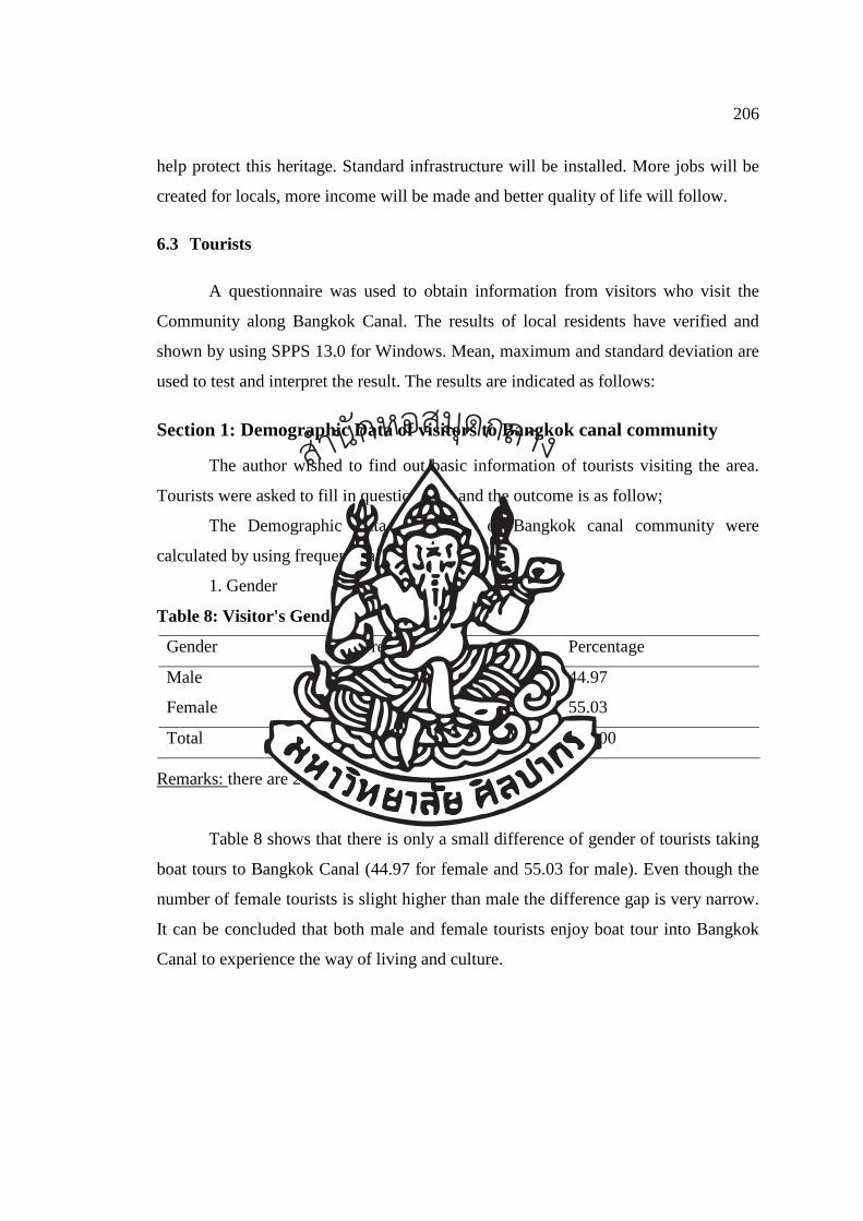
206
help protect this heritage. Standard infrastructure will be installed. More jobs will be
created for locals, more income will be made and better quality of life will follow.
6.3 Tourists
A questionnaire was used to obtain information from visitors who visit the
Community along Bangkok Canal. The results of local residents have verified and
shown by using SPPS 13.0 for Windows. Mean, maximum and standard deviation are
used to test and interpret the result. The results are indicated as follows:
Section 1: Demographic Data of visitors to Bangkok canal community
The author wished to find out basic information of tourists visiting the area.
Tourists were asked to fill in questionnaire and the outcome is as follow;
The Demographic Data of visitors of Bangkok canal community were
calculated by using frequency and percentage.
1. Gender Table 8: Visitor's Gender
Gender Frequency Percentage
Male 134 44.97
Female 164 55.03
Total 298 100.00
Remarks: there are 2 forms with blank answer.
Table 8 shows that there is only a small difference of gender of tourists taking
boat tours to Bangkok Canal (44.97 for female and 55.03 for male). Even though the
number of female tourists is slight higher than male the difference gap is very narrow.
It can be concluded that both male and female tourists enjoy boat tour into Bangkok
Canal to experience the way of living and culture.
สำนกัหอ
สมุดกลาง
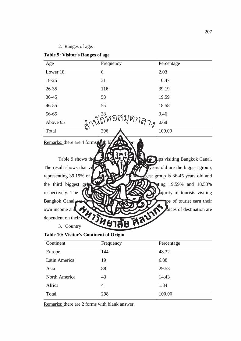
207
2. Ranges of age.
Table 9: Visitor's Ranges of age
Age Frequency Percentage
Lower 18 6 2.03
18-25 31 10.47
26-35 116 39.19
36-45 58 19.59
46-55 55 18.58
56-65 28 9.46
Above 65 2 0.68
Total 296 100.00
Remarks: there are 4 forms with blank answer.
Table 9 shows the percentage of different age groups visiting Bangkok Canal.
The result shows that visitors of age between 26-35 years old are the biggest group,
representing 39.19% of all answer. The second biggest group is 36-45 years old and
the third biggest group is 46-55 years old, representing 19.59% and 18.58%
respectively. The frequency and percentage show that majority of tourists visiting
Bangkok Canal are young adult and middle age. These groups of tourist earn their
own income and they can finance their own travel therefore choices of destination are
dependent on their own decision.
3. Country Table 10: Visitor's Continent of Origin
Continent Frequency Percentage
Europe 144 48.32
Latin America 19 6.38
Asia 88 29.53
North America 43 14.43
Africa 4 1.34
Total 298 100.00
Remarks: there are 2 forms with blank answer.
สำนกัหอ
สมุดกลาง
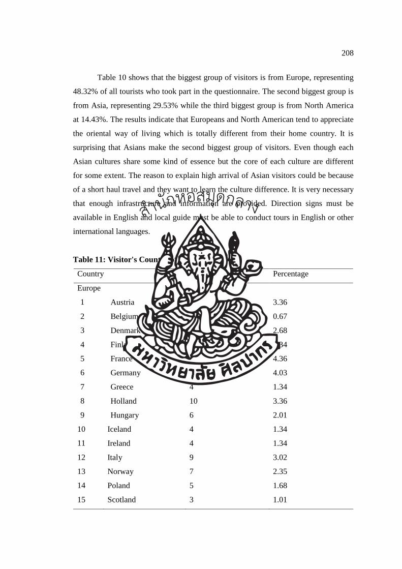
208
Table 10 shows that the biggest group of visitors is from Europe, representing
48.32% of all tourists who took part in the questionnaire. The second biggest group is
from Asia, representing 29.53% while the third biggest group is from North America
at 14.43%. The results indicate that Europeans and North American tend to appreciate
the oriental way of living which is totally different from their home country. It is
surprising that Asians make the second biggest group of visitors. Even though each
Asian cultures share some kind of essence but the core of each culture are different
for some extent. The reason to explain high arrival of Asian visitors could be because
of a short haul travel and they want to learn the culture difference. It is very necessary
that enough infrastructure and information are provided. Direction signs must be
available in English and local guide must be able to conduct tours in English or other
international languages.
Table 11: Visitor's Country of Origin
Country Frequency Percentage
Europe
1 Austria 10 3.36
2 Belgium 2 0.67
3 Denmark 8 2.68
4 Finland 4 1.34
5 France 13 4.36
6 Germany 12 4.03
7 Greece 4 1.34
8 Holland 10 3.36
9 Hungary 6 2.01
10 Iceland 4 1.34
11 Ireland 4 1.34
12 Italy 9 3.02
13 Norway 7 2.35
14 Poland 5 1.68
15 Scotland 3 1.01
สำนกัหอ
สมุดกลาง
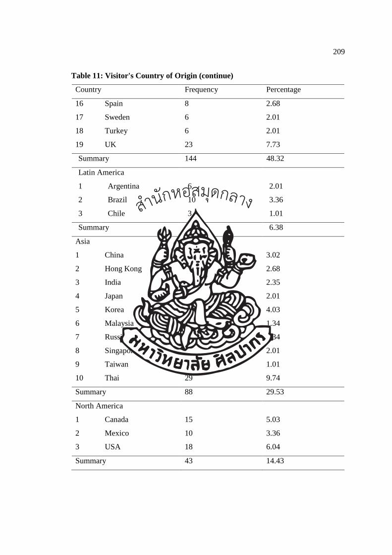
209
Table 11: Visitor's Country of Origin (continue)
Country Frequency Percentage
16 Spain 8 2.68
17 Sweden 6 2.01
18 Turkey 6 2.01
19 UK 23 7.73
Summary 144 48.32
Latin America
1 Argentina 6 2.01
2 Brazil 10 3.36
3 Chile 3 1.01
Summary 19 6.38
Asia
1 China 9 3.02
2 Hong Kong 8 2.68
3 India 7 2.35
4 Japan 6 2.01
5 Korea 12 4.03
6 Malaysia 4 1.34
7 Russia 4 1.34
8 Singapore 6 2.01
9 Taiwan 3 1.01
10 Thai 29 9.74
Summary 88 29.53
North America
1 Canada 15 5.03
2 Mexico 10 3.36
3 USA 18 6.04
Summary 43 14.43
สำนกัหอ
สมุดกลาง
210
Table 11: Visitor's Country of Origin (continue)
Country Frequency Percentage
Africa
1 Egypt 2 0.67
2 Morocco 2 0.67
Summary 4 1.34
Grand Total 298 100.00
Remarks: there are 2 forms with blank answer.
Table 11 shows details of country of origin of visitors. UK, USA and Thailand
are the top 3 country of origin. It is interesting to see such a high number of Thais
took part in the questionnaire. This could be because some foreign visitors are
accompanied by Thais.
4. Education
Table 12: Visitor's Education
Education Level Frequency Percentage
Secondary School 18 6.25
Diploma 133 46.18
Bachelor Degree 124 43.06
Higher Bachelor Degree 13 4.51
Total 288 100.00
Remarks: There are 12 forms with blank answer
As shown in Table 12 above, majority of tourists visiting Bangkok Canal have
high education.Tourist with diploma has the highest frequency and represents 46.18%
of all answer. Lower next is tourist with a bachelor degree, representing 43.06%. The
results indicate that most tourists interested in canal and cultural tour is well-educated
who appreciate historical and cultural value of their travel destination.
สำนกัหอ
สมุดกลาง
211
5. Traveling
Table 13 : Visitor's Traveling Style
Traveling Frequency Percentage
On organize tour 75 27.88
On your own 139 51.67
With friend/relative 55 20.45
Total 269 100.00
Remarks: there are 31 forms with blank answer.
There are 31 tourists who took part in the questionnaire and left this section
unanswered. The number is high enough to trigger the author of why they did not
answer the question. Were they travelling on some different fashions such as on
business trip or conference trip? Further study may be needed in the future to find out
the answer to this question.
The result of the survey shows that majority of tourists visiting Bangkok Canal
are travelling independently with 139 answers and represent 51.67% of all answer.
The second biggest group travel on organised tours with 75 answers and contribute to
27.88% of all answers. Travelling with friends and relatives has the lowest frequency
at 55 answers and represent 20.45% of all answer. The reason that majority of visitors
are independent travelers could be because Bangkok Canal can be easily accessed by
chartered boat or join-in boat tour. Tourists has alternative to visit the area on foot as
well, making it even easier to visit the area.
Section 2: Reason for visiting
2.1 Visit Bangkok canal before
Table 14: Visitor's Repeart Visit
Experience Frequency Percentage
Yes 119 39.67
No 181 60.33
Total 300 100.00
สำนกัหอ
สมุดกลาง
212
Table 14 shows that majority of visitors to Bangkok Canal are new comers
(181 first time visitors, representing 60.33 of all answer whereas 119 visitors are
return visitors and represent 39.67 of all answer..
2.2 Expect to spend time
Table 15: Visitor's Duration of Visit
Time Frequency Percentage
< 1 hour 7 2.38
1-2 hour 285 96.94
> 3 hour 2 0.68
Total 294 100.00
Remarks: There are 6 forms left blank of this section
Table 15 shows that almost all visitors spend 1-2 hours for their Bangkok
Canal tour. There are 285 visitors spend 1-2 hours per trip representing 96.94% of all
answers. This indicates that the comfort zone for tour duration is 1-2 hours therefore
tourism route or activities should respond to visitors’ preference and not be too long.
2.3 Why do you choose to visit here?
The author wished to find out the reasons for visiting Bangkok Canal therefore
the author provide 6 choices and visitors can select more than 1 choice. Frequency
and percentage rates are used to find ranking of the reasons of visit. The order is from
the least to the most as shown in table below.
สำนกัหอ
สมุดกลาง
213
Table 16: Why do you choose to visit here?
Reason Frequency Percentage Rank
I want to see “Venice of the East” 237 20.27 1
I want to learn about a long history of Bangkok
Canal
194 16.60 3
I want to experience and learn about way of life
of the people of Bangkok Canal
158 13.52 6
I want to experience water culture of the people
of Bangkok Canal
161 13.77 5
I want to enjoy the beautiful scenery of
Bangkok Canal
185 15.83 4
This place is in a close proximity with other
famous attractions e.g. the Grand Palace.
234 20.01 2
Total 100.00
The order of reasons for visiting Bangkok Canal is; Rank #1: I want to see “Venice of the East”. There are 237 answers to this
reason representing 20.27% of all answers. Most tourists visiting Thailand know
Bangkok as “Venice of the East” as it has many canals with exotic scenery and
friendly people who are bond with water and living the oriental way of life. Bangkok
was once called “Venice of the East”, as a result, thousands of tourists from different
countries flock to experience the beauty of this unique culture.
Rank #2: This place is in a close proximity with other famous attractions e.g.
the Grand Palace. There are 234 answers to this reason representing 20.01% of all
answers. Bangkok Canal can be combined with visit to the Grand Palace, Wat Po and
other attractions nearby. Visitors can easily take a long-tail boat at Ta Chang pier to
tour Bangkok Canal.
Rank #3: I want to learn about a long history of Bangkok Canal. There are
194 answers to this reason representing 16.60% of all answers.
Rank #4: I want to enjoy the beautiful scenery of Bangkok Canal. There are
185 answers to this reason representing 15.83% of all answers. Visitors can enjoy and
สำนกัหอ
สมุดกลาง
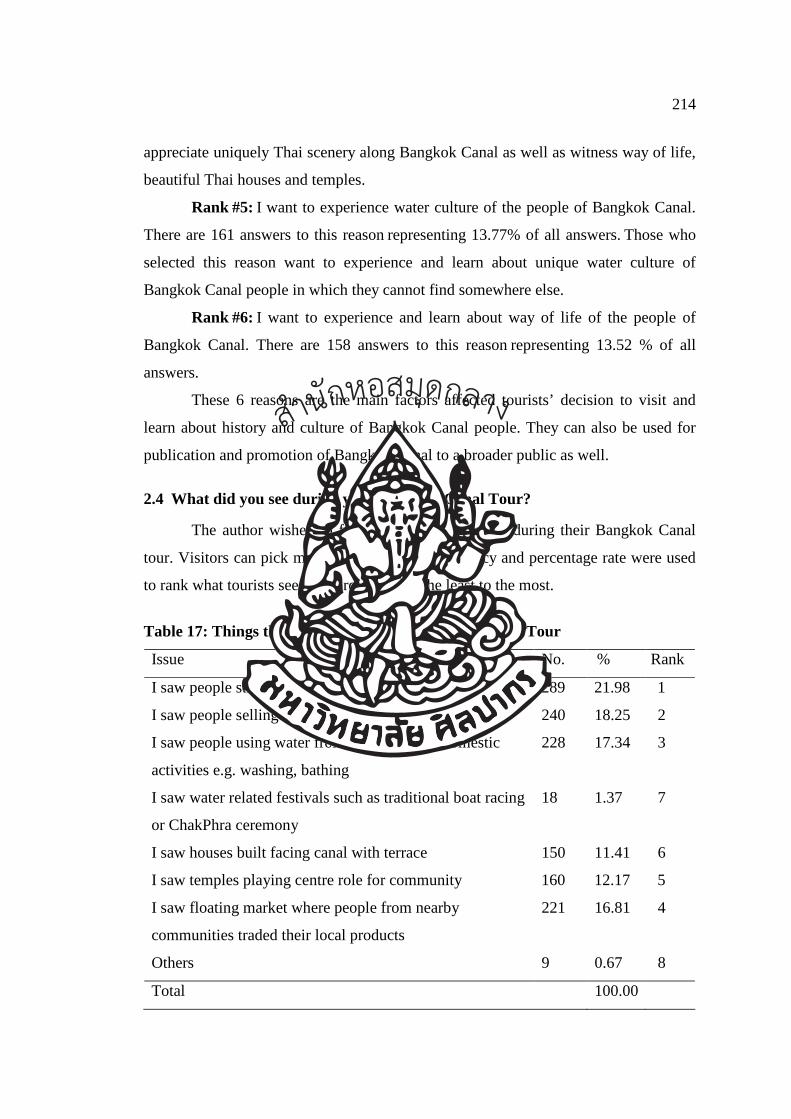
214
appreciate uniquely Thai scenery along Bangkok Canal as well as witness way of life,
beautiful Thai houses and temples.
Rank #5: I want to experience water culture of the people of Bangkok Canal.
There are 161 answers to this reason representing 13.77% of all answers. Those who
selected this reason want to experience and learn about unique water culture of
Bangkok Canal people in which they cannot find somewhere else.
Rank #6: I want to experience and learn about way of life of the people of
Bangkok Canal. There are 158 answers to this reason representing 13.52 % of all
answers.
These 6 reasons are the main factors affected tourists’ decision to visit and
learn about history and culture of Bangkok Canal people. They can also be used for
publication and promotion of Bangkok Canal to a broader public as well.
2.4 What did you see during your Bangkok Canal Tour?
The author wished to find out what tourists see during their Bangkok Canal
tour. Visitors can pick more than 1 answer. Frequency and percentage rate were used
to rank what tourists see. The order is from the least to the most.
Table 17: Things that visitor see during Bangkok Canal Tour
Issue No. % Rank
I saw people still using waterway for transportation 289 21.98 1
I saw people selling things on their boats 240 18.25 2
I saw people using water from canal for their domestic
activities e.g. washing, bathing
228 17.34 3
I saw water related festivals such as traditional boat racing
or ChakPhra ceremony
18 1.37 7
I saw houses built facing canal with terrace 150 11.41 6
I saw temples playing centre role for community 160 12.17 5
I saw floating market where people from nearby
communities traded their local products
221 16.81 4
Others 9 0.67 8
Total 100.00
สำนกัหอ
สมุดกลาง
215
Table 17 shows that things that visitor see during Bangkok Canal tour. The
order is from the least to the most.
Rank # 1: I saw people still using waterway for transportation. There are 289
answers to this choice representing 21.98% of all answers. This is clear that people of
Bangkok Canal still use waterway for their transportation such as for visiting friends
and neighbours even though modern transportation and roads are available.
Rank # 2: I saw people selling things on their boats. There are 240 answers to
this choice representing 18.25% of all answers. As mentioned above, people of
Bangkok Canal still use waterway for their transportation and boats are used for short
travel. Piers and dockyards are built adjacent to the house. Temples also build a pier
for people who visit the temples.
Rank # 3: I saw people using water from canal for their domestic activities
e.g. washing, bathing. There are 228 answers to this choice representing 17.34% of
all answers.
Rank # 4: I saw floating market where people from nearby communities
traded their local products. There are 221 answers to this choice representing 16.81%
of all answers. Taling Chan floating market is open on the weekend. Locals will bring
their food and products on the boat to sell to visitors and tourists.
Rank # 5: I saw temples playing centre role for community. There are 160
answers to this choice representing 12.17% of all answers. Along 14.8 kilometres of
study area, there are 23 temples lining on both banks of the canal. Some well-known
temples are such Sri Sudaram and Suwannaram temples.
Rank # 6: I saw houses built facing canal with terrace. There are 150 answers
to this choice representing 11.41% of all answers. Water transportation is a secondary
mode of transport for locals.
Rank # 7: I saw water related festivals such as traditional boat racing or
ChakPhra ceremony. There are 18 answers to this choice representing 1.37% of all
answers. Others were picked by 9 visitors representing 0.67%. Chak Pra Ceremony is
an annual event and it takes place specifically on the 12th month of lunar calendar or
around December of every year. It is very rare that tourists will see this tradition.
It can be concluded that people of Bangkok Canal still use water for
transportation and many households still own at least a boat for short trip. Water is
สำนกัหอ
สมุดกลาง
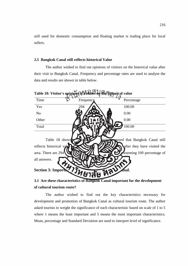
216
still used for domestic consumption and floating market is trading place for local
sellers.
2.5 Bangkok Canal still reflects historical Value
The author wished to find out opinions of visitors on the historical value after
their visit to Bangkok Canal. Frequency and percentage rates are used to analyse the
data and results are shown in table below.
Table 18: Visitor's opinions of visitors on the historical value
Time Frequency Percentage
Yes 294 100.00
No - 0.00
Other - 0.00
Total 294 100.00
Table 18 shows that majority of visitors agreed that Bangkok Canal still
reflects historical value and traditional Thai way of life after they have visited the
area. There are 294 visitors selected the “yes” choice, representing 100 percentage of
all answers.
Section 3: Important characteristics of Bangkok canal.
3.1 Are these characteristics of Bangkok Canal important for the development
of cultural tourism route?
The author wished to find out the key characteristics necessary for
development and promotion of Bangkok Canal as cultural tourism route. The author
asked tourists to weight the significance of each characteristic based on scale of 1 to 5
where 1 means the least important and 5 means the most important characteristics.
Mean, percentage and Standard Deviation are used to interpret level of significance.
สำนกัหอ
สมุดกลาง
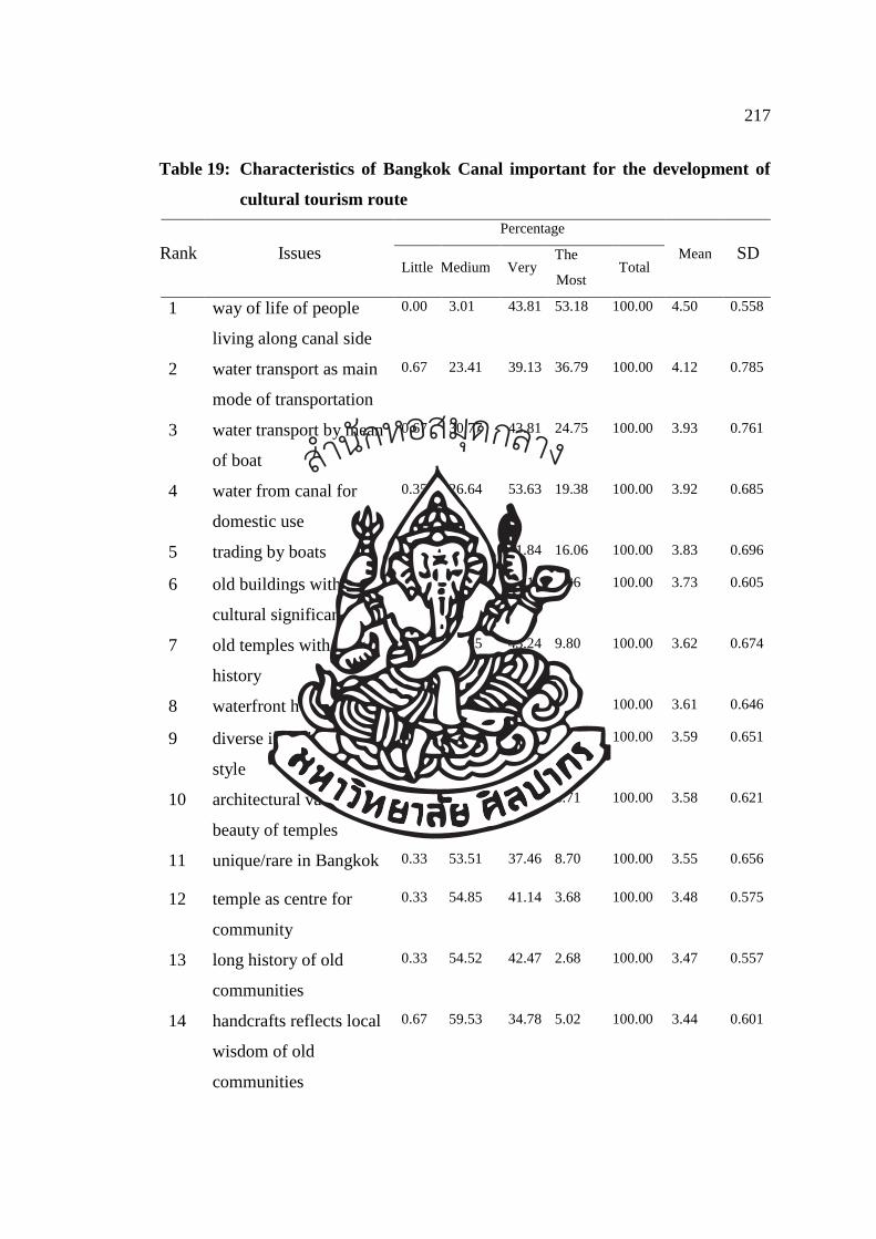
217
Table 19: Characteristics of Bangkok Canal important for the development of
cultural tourism route
Percentage
Rank Issues Little Medium Very
The
Most Total
Mean SD
1 way of life of people
living along canal side
0.00 3.01 43.81 53.18 100.00 4.50 0.558
2 water transport as main
mode of transportation
0.67 23.41 39.13 36.79 100.00 4.12 0.785
3 water transport by mean
of boat
0.67 30.77 43.81 24.75 100.00 3.93 0.761
4 water from canal for
domestic use
0.35 26.64 53.63 19.38 100.00 3.92 0.685
5 trading by boats 1.00 31.10 51.84 16.06 100.00 3.83 0.696
6 old buildings with
cultural significance
0.00 35.45 56.19 8.36 100.00 3.73 0.605
7 old temples with long
history
1.01 45.95 43.24 9.80 100.00 3.62 0.674
8 waterfront house 0.68 46.08 45.05 8.19 100.00 3.61 0.646
9 diverse in architectural
style
0.00 50.00 40.94 9.06 100.00 3.59 0.651
10 architectural values and
beauty of temples
0.34 47.99 44.96 6.71 100.00 3.58 0.621
11 unique/rare in Bangkok 0.33 53.51 37.46 8.70 100.00 3.55 0.656
12 temple as centre for
community
0.33 54.85 41.14 3.68 100.00 3.48 0.575
13 long history of old
communities
0.33 54.52 42.47 2.68 100.00 3.47 0.557
14 handcrafts reflects local
wisdom of old
communities
0.67 59.53 34.78 5.02 100.00 3.44 0.601
สำนกัหอ
สมุดกลาง
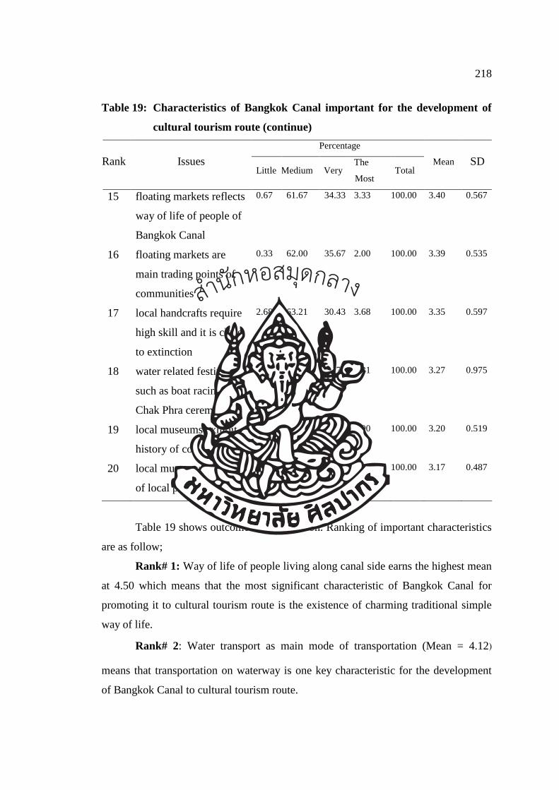
218
Table 19: Characteristics of Bangkok Canal important for the development of
cultural tourism route (continue)
Percentage
Rank Issues Little Medium Very
The
Most Total
Mean SD
15 floating markets reflects
way of life of people of
Bangkok Canal
0.67 61.67 34.33 3.33 100.00 3.40 0.567
16 floating markets are
main trading points of
communities
0.33 62.00 35.67 2.00 100.00 3.39 0.535
17 local handcrafts require
high skill and it is close
to extinction
2.68 63.21 30.43 3.68 100.00 3.35 0.597
18 water related festivals
such as boat racing,
Chak Phra ceremony
9.76 51.22 31.71 7.31 100.00 3.27 0.975
19 local museums exhibit
history of communities
3.33 75.00 19.67 2.00 100.00 3.20 0.519
20 local museums are pride
of local people
3.67 76.33 19.00 1.00 100.00 3.17 0.487
Table 19 shows outcome of the question. Ranking of important characteristics
are as follow;
Rank# 1: Way of life of people living along canal side earns the highest mean
at 4.50 which means that the most significant characteristic of Bangkok Canal for
promoting it to cultural tourism route is the existence of charming traditional simple
way of life.
Rank# 2: Water transport as main mode of transportation (Mean = 4.12)
means that transportation on waterway is one key characteristic for the development
of Bangkok Canal to cultural tourism route.
สำนกัหอ
สมุดกลาง
219
Rank# 3: Water transport by mean of boat (Mean = 3.93). The third ranked
characteristic important for the development of Bangkok Canal to cultural tourism
route is using boat for transport.
Rank# 4: Water from canal for domestic use (Mean = 3.92). The forth ranked
characteristic important for the development of Bangkok Canal to cultural tourism
route is regarding the use of water from canal for daily domestic consumption.
Rank#5: Trading by boats (Mean = 3.83). The fifth ranked characteristic
important for the development of Bangkok Canal to cultural tourism route is doing
commerce by boat such as selling food as it was practiced in the old times.
Rank#6: Old buildings with cultural significance (Mean = 3.73). The sixth
ranked characteristic important for the development of Bangkok Canal to cultural
tourism route is the existing of old buildings which reflect cultural values such as
houses, temples and museums.
Rank# 7: Old temples with long history (Mean = 3.62). The seventh ranked
characteristic important for the development of Bangkok Canal to cultural tourism
route is the existing of old temples built in Ayutthaya period along both banks of
canal.
Rank# 8: Waterfront house (Mean = 3.61). The eighth ranked characteristic
important for the development of Bangkok Canal to cultural tourism route is the
existing of houses with terrace or pier along the canal banks. These houses are the
evidence of the bonding local people has with water for their everyday living.
Rank# 9: Diverse in architectural style (Mean = 3.59). The ninth ranked
characteristic important for the development of Bangkok Canal to cultural tourism
route is the diversity of house architectural styles. Materials may be changed to
modern day materials but the designs remain the same.
Rank# 10: Architectural values and beauty of temples (Mean = 3.58). The
tenth ranked characteristic important for the development of Bangkok Canal to
cultural tourism route is the existing of architectural values and beauty of temples
worth conserving for the younger generation.
Results from questionnaire enable the author to identify the 5 key indicators
important for the development of cultural tourism route for Bangkok Canal area.
These indicators are the elements that key values must possess before they can be
สำนกัหอ
สมุดกลาง
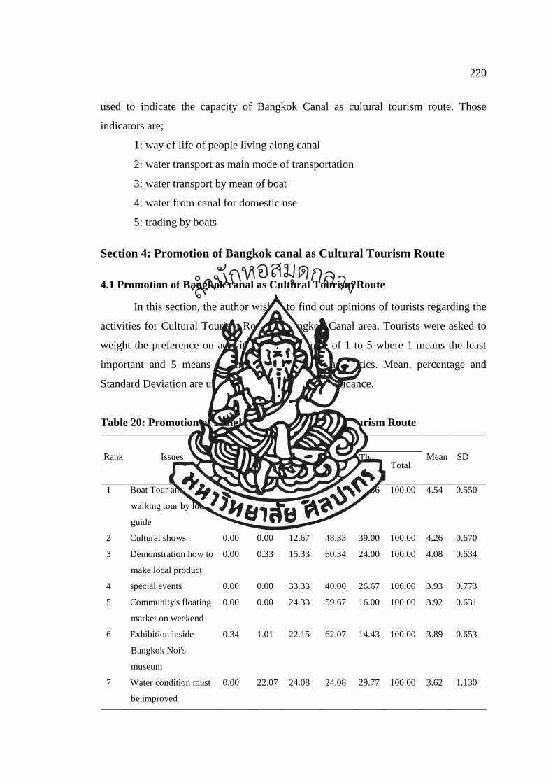
220
used to indicate the capacity of Bangkok Canal as cultural tourism route. Those
indicators are;
1: way of life of people living along canal
2: water transport as main mode of transportation
3: water transport by mean of boat
4: water from canal for domestic use
5: trading by boats
Section 4: Promotion of Bangkok canal as Cultural Tourism Route
4.1 Promotion of Bangkok canal as Cultural Tourism Route
In this section, the author wished to find out opinions of tourists regarding the
activities for Cultural Tourism Route at Bangkok Canal area. Tourists were asked to
weight the preference on activities based on scale of 1 to 5 where 1 means the least
important and 5 means the most important characteristics. Mean, percentage and
Standard Deviation are used to interpret level of significance.
Table 20: Promotion of Bangkok canal as Cultural Tourism Route
Percentage
Rank Issues The
Least Little Medium Very
The
Most Total
Mean SD
1 Boat Tour and
walking tour by local
guide
0.00 0.00 2.67 40.67 56.66 100.00 4.54 0.550
2 Cultural shows 0.00 0.00 12.67 48.33 39.00 100.00 4.26 0.670
3 Demonstration how to
make local product
0.00 0.33 15.33 60.34 24.00 100.00 4.08 0.634
4 special events 0.00 0.00 33.33 40.00 26.67 100.00 3.93 0.773
5 Community's floating
market on weekend
0.00 0.00 24.33 59.67 16.00 100.00 3.92 0.631
6 Exhibition inside
Bangkok Noi's
museum
0.34 1.01 22.15 62.07 14.43 100.00 3.89 0.653
7 Water condition must
be improved
0.00 22.07 24.08 24.08 29.77 100.00 3.62 1.130
สำนกัหอ
สมุดกลาง
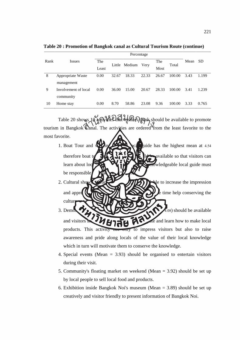
221
Table 20 : Promotion of Bangkok canal as Cultural Tourism Route (continue)
Percentage
Rank Issues The
Least Little Medium Very
The
Most Total
Mean SD
8 Appropriate Waste
management
0.00 32.67 18.33 22.33 26.67 100.00 3.43 1.199
9 Involvement of local
community
0.00 36.00 15.00 20.67 28.33 100.00 3.41 1.239
10 Home stay 0.00 8.70 58.86 23.08 9.36 100.00 3.33 0.765
Table 20 shows 10 activities that visitors think should be available to promote
tourism in Bangkok Canal. The activities are ordered from the least favorite to the
most favorite.
1. Boat Tour and walking tour by local guide has the highest mean at 4.54
therefore boat tour and walking tour should be available so that visitors can
learn about local way of life and tradition. Knowledgeable local guide must
be responsible for leading this tour.
2. Cultural shows (Mean = 4.26) should be available to increase the impression
and appreciation of Thai cultures and at the same time help conserving the
culture as well.
3. Demonstration how to make local product (Mean = 4.08) should be available
and visitors should have a chance to participate and learn how to make local
products. This activity not only to impress visitors but also to raise
awareness and pride along locals of the value of their local knowledge
which in turn will motivate them to conserve the knowledge.
4. Special events (Mean = 3.93) should be organised to entertain visitors
during their visit.
5. Community's floating market on weekend (Mean = 3.92) should be set up
by local people to sell local food and products.
6. Exhibition inside Bangkok Noi's museum (Mean = 3.89) should be set up
creatively and visitor friendly to present information of Bangkok Noi.
สำนกัหอ
สมุดกลาง
222
7. Water condition must be improved (Mean = 3.62). Water in canal should
be clean and non-polluted.
8. Appropriate Waste management (Mean = 3.43) is needed. Waste water
should be treated before releasing into canal. Garbage should be collected
systematically for the better quality and clean water for safety of the people
using water from canal.
9. Involvement of local community (Mean = 3.41). Community is an
important partner and they should be involved when designing activities to
prevent future conflict and to ensure that the benefits are shared to all
parties.
10. Home stay has the lowest mean of 3.33, however, home stay is one way
that tourists can really learn and experience the culture.
4.2 Benefit
In this section, the author wished to find out opinions regarding the benefits if
Bangkok Canal is promoted as Cultural Tourism Route. Frequency and percentage are
used to rank each benefit.
Table 21: Benefit
Benefits Frequency % Rank
Increased family income 206 14.49 5
More infrastructure development 236 16.60 4
More government support for local economy 205 14.42 6
Increased community appreciation of cultural heritage 260 18.28 1
More job opportunities 247 17.37 2
To conserve historical and cultural heritage 240 16.88 3
Reduce water pollution 28 1.96 7
Total 100.00
Table 21 shows the rank of each benefit that tourists feel important. Ranking is
shown below;
สำนกัหอ
สมุดกลาง
223
Rank # 1: Increased community appreciation of cultural heritage. There are
260 visitors selected this benefit representing 18.28 percentage of all answers.
Tourists feel that local community will appreciate their own cultural heritage more if
it is promoted as tourist attraction.
Rank # 2: More job opportunities. There are 247 visitors selected this benefit
representing 17.37 percentage of all answers. Tourists feel that if the area is
promoted, locals will gain benefit and have more job openings to them so that they
can improve the quality of life.
Rank # 3: To conserve historical and cultural heritage. There are 240 visitors
selected this benefit representing 16.88 percentage of all answers.
Rank # 4: More infrastructure development. There are 236 visitors selected
this benefit representing 16.60 percentage of all answers. Tourists think that the
benefits resulting from promotion of the area is the improvement of infrastructure
with high standard.
Rank # 5: Increased family income. There are 206 visitors selected this
benefit representing 14.49 percentage of all answers. With more tourists, locals will
earn more income which can be from selling souvenirs.
Table below explains the relationship between key research questions and the
questions prepared for an in-depth interview and questionnaire.
Table 22: relationship between key research questions and the questions prepared for
an in-depth interview and questionnaire
Research Question Answers
1. Which groups of tourist would
be interested in Bangkok canal
water cultural tourism route?
Tourists visiting Bangkok Canal area by boat
are foreigners with high education, at working
age and earn own incomes. They are healthy
and love to travel to other countries. Bangkok
Canal attracts these tourists by its reputation of
being “Venice of the East”. Therefore, Bangkok
Canal must be improved to respond to this
tourist group.
สำนกัหอ
สมุดกลาง
224
Table 22: relationship between key research questions and the questions prepared for
an in-depth interview and questionnaire (continue)
Research Question Answers
2. Does Bangkok canal still
reflect historical values of the
traditional Thai life?
Bangkok Canal still reflects historical values
and ways of live of the Thai people from past to
present. Water is still playing important part for
lives of local people. Floating market still serves
as trading place.
3. What key values, features or
characteristics of Bangkok Canal
are important for the
development of cultural tourism
route?
The people of Bangkok Canal still carry on their
simple and waterfront community ways of
living. Waterway is still an important mean of
transportation and trading. Boats are commonly
used. Ancient buildings in the area still reflect
cultural values. Temples still play an important
role in cultural and architectural dimensions.
Houses were built facing water both in
traditional and modern designs.
4. What elements must the key
values possess before they can
be used to indicate the capacity
of Bangkok Canal as cultural
tourism route (for example
community, temple, local culture
Important indicators for the development of
Bangkok Canal as Cultural tourism route:
1. way of life of people living along canal
2. water transport as main mode of
transportation
3. water transport by mean of boat
4. water from canal for domestic use
5. trading by boats
5. How could Bangkok canal be
developed and promoted as a
Cultural Tourism Route,
reflecting both historical and
cultural values of Thailand?
1. Guided boat and walking tours should be
organised to learn about way of life and
local cultures. Local guides should lead
these tours.
สำนกัหอ
สมุดกลาง
225
Table 22: relationship between key research questions and the questions prepared for
an in-depth interview and questionnaire (continue)
Research Question Answers
2. Cultural shows should be organised to
impress visitors and share local traditions
and culture.
3. Demonstration of local crafting skills
should be organised to conserve traditional
knowledge.
4. Special events should be created for the
enjoyment of the tours.
5. Floating market by local traders selling
local products should be set up
6. Information boards and direction signs
should be provided.
7. Quality of water should be improved.
8. Waste water should be treated before
released into canal.
9. Local communities should involve in
tourism activities to create collaboration and
local communities should benefit from such
activities.
10. Homestay should be offered to provide
opportunity for visitors to experience local
life.
6.4 Tourism Route
Analysis and synthesis of data collected on the suitability of Bangkok Canal
area against the criteria for cultural tourism show that Bangkok Canal possesses
characteristics and can be developed into cultural tourism route. The author processed
data collected from interview and questionnaire survey and found that Bangkok Canal
สำนกัหอ
สมุดกลาง
226
is feasible to promote as tourism route. The people of Bangkok Canal still carry on
their simple and waterfront community ways of living. Waterway is still an important
mean of transportation and trading. Boats are commonly used. Ancient buildings in
the area still reflect cultural values. Temples still play an important role in cultural
and architectural dimensions. Houses were built facing water both in traditional and
modern designs. The author finally designed cultural tourism routes that respond to
the needs of tourists, maintain local values and bring benefit to local communities.
Cultural tourism routes are described in Chapter 7.
สำนกัหอ
สมุดกลาง
227
CHAPTER 7
RECOMMENDATION OF CULTURAL TOURISM ROUTE FOR BANGKOK
CANAL AND CONCLUSION
7.1 Tourism Routes
After data collected from primary and secondary research, on site visit and
indirect observation has been analysed and studied, key characteristics or key values
of Bangkok Canal have been found. Those values are reflected through their simple
water way of life, the use of waterway for transportation, the use of boat for travelling
and commerce, the use of water for daily domestic consumption, attractive and
beautiful ancient houses and buildings and beautiful ancient temples.
Tops 5 reasons that attract tourists to visit Bangkok Canal are to see “Venice
of the East”, easy access from nearby attractions such as the Grand Palace, to learn
and study historical ancient canals, to enjoy the charms of water way of life along the
canal and to experience a unique water way of life that cannot be seen anywhere else.
All findings and characteristics are then used in the designing of cultural
tourism route of Bangkok Canal in order to respond to the needs of tourists and at the
same contribute back to local communities.
The results of these studies indicate the trend of tourist attractions that can be
linked to develop tourism routes with key characteristics of Bangkok Canal. The
author has designed different tour routes which offer different activities, different
attractions and by different means as follow;
a. Boat Tour
Boat tour connects major attractions in study area by water way on a boat. The
program is designed to stop at key locations to allow tourists to appreciate the beauty
and historical and cultural values of Bangkok Canal.
สำนกัหอ
สมุดกลาง
228
Route 1: Cruise Bangkok Canal - The way of life that never sleeps
Major attractions include Ta Chang pier – museum of Royal Barges –
waterfront Houses – Suwannaram temple – Taling Chan floating market – the
Artist’s house
The boat will travel one way but start and stop location is at Ta Chang pier. Ta
Chang is selected as a start/stop location because it is just next to the Grand Palace, a
main attraction that almost all tourists visit and it is easy for tourists to extend their
tour to Bangkok Canal. Boat is used for slow travel to allow tourists to absorb the
charm and beauty of Bangkok Canal.
Key characteristic or key value of Bangkok Canal which tourists can see along
this route are beautify scenery, the bond between locals and water that the area was
once called “Venice of the East” and the beauty of ancient temples with beautiful
mural paintings which reflects everyday life of the period temples were built. Tourists
will also visit popular museum and important markets. Different styles of house can
be viewed from the boat. This route combines many important landmarks and the
charming way of life of Bangkok Canal.
Tourists meet at Tachang pier then get on to a long-tail boat, a small boat
capable of accessing small canals. The first stop is museum of Royal Barges. Tourists
will appreciate the beauty of Supannahongse, the royal barge kept at this museum.
Tourists can also learn about the royal barge procession as well as the customs and
costumes of the rowers at the exhibition.
Next, the long-tail boat proceeds to Suwannaram temple. Tourists will enjoy
the scenery and way of life of Bangkok Canal during the ride. Tourist will have a
chance to see small boats carrying food for sell. Suwannaram temple is a house to the
sacred “Laung Po Sassada”. The mural paintings at this temple is said to be one of the
best. The mural was painted by 2 well-known artists, Laung Wijitjessada (Kru
Thongyu) and Laung Seniborirak (Kru Kongpah).
Then the boat continues to Taling Chan floating market where tourists will see
the real way of using boats for commerce. Farmers and locals will paddle their boats
full with products to the market. After the market, the boat will proceed to the Artist’s
house, an old goldsmith house made from wood. Here tourists will see an ancient
stupa built since Ayutthaya period situated in the precinct of the house. This stupa
สำนกัหอ
สมุดกลาง
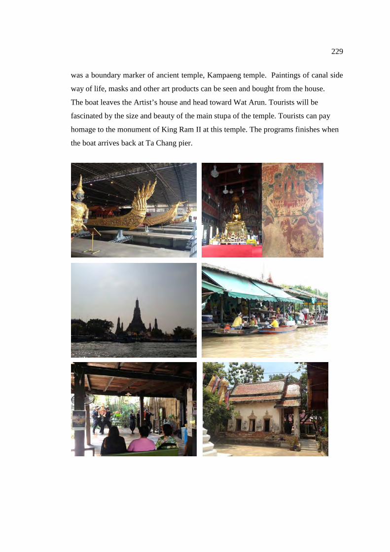
229
was a boundary marker of ancient temple, Kampaeng temple. Paintings of canal side
way of life, masks and other art products can be seen and bought from the house.
The boat leaves the Artist’s house and head toward Wat Arun. Tourists will be
fascinated by the size and beauty of the main stupa of the temple. Tourists can pay
homage to the monument of King Ram II at this temple. The programs finishes when
the boat arrives back at Ta Chang pier.
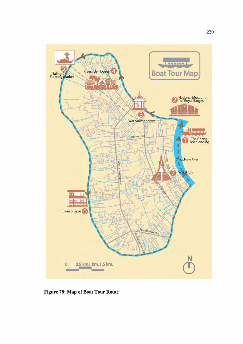
230
Figure 78: Map of Boat Tour Route
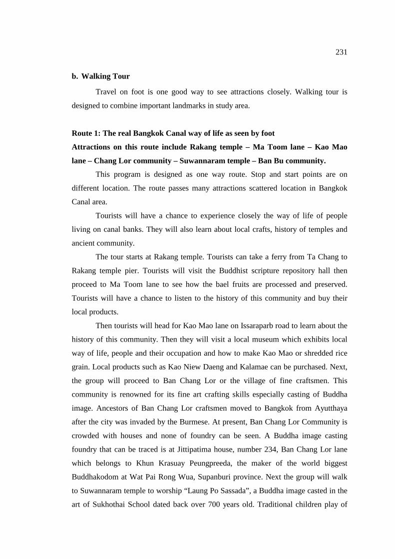
231
b. Walking Tour
Travel on foot is one good way to see attractions closely. Walking tour is
designed to combine important landmarks in study area.
Route 1: The real Bangkok Canal way of life as seen by foot
Attractions on this route include Rakang temple – Ma Toom lane – Kao Mao
lane – Chang Lor community – Suwannaram temple – Ban Bu community.
This program is designed as one way route. Stop and start points are on
different location. The route passes many attractions scattered location in Bangkok
Canal area.
Tourists will have a chance to experience closely the way of life of people
living on canal banks. They will also learn about local crafts, history of temples and
ancient community.
The tour starts at Rakang temple. Tourists can take a ferry from Ta Chang to
Rakang temple pier. Tourists will visit the Buddhist scripture repository hall then
proceed to Ma Toom lane to see how the bael fruits are processed and preserved.
Tourists will have a chance to listen to the history of this community and buy their
local products.
Then tourists will head for Kao Mao lane on Issaraparb road to learn about the
history of this community. Then they will visit a local museum which exhibits local
way of life, people and their occupation and how to make Kao Mao or shredded rice
grain. Local products such as Kao Niew Daeng and Kalamae can be purchased. Next,
the group will proceed to Ban Chang Lor or the village of fine craftsmen. This
community is renowned for its fine art crafting skills especially casting of Buddha
image. Ancestors of Ban Chang Lor craftsmen moved to Bangkok from Ayutthaya
after the city was invaded by the Burmese. At present, Ban Chang Lor Community is
crowded with houses and none of foundry can be seen. A Buddha image casting
foundry that can be traced is at Jittipatima house, number 234, Ban Chang Lor lane
which belongs to Khun Krasuay Peungpreeda, the maker of the world biggest
Buddhakodom at Wat Pai Rong Wua, Supanburi province. Next the group will walk
to Suwannaram temple to worship “Laung Po Sassada”, a Buddha image casted in the
art of Sukhothai School dated back over 700 years old. Traditional children play of
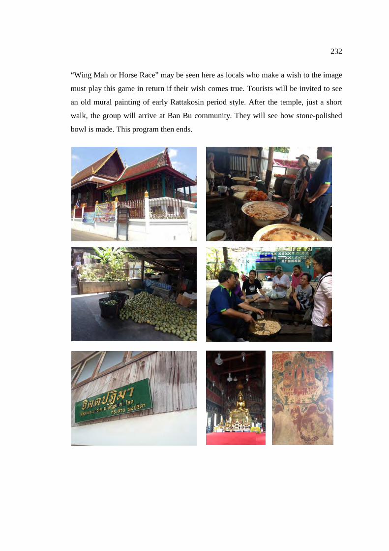
232
“Wing Mah or Horse Race” may be seen here as locals who make a wish to the image
must play this game in return if their wish comes true. Tourists will be invited to see
an old mural painting of early Rattakosin period style. After the temple, just a short
walk, the group will arrive at Ban Bu community. They will see how stone-polished
bowl is made. This program then ends.
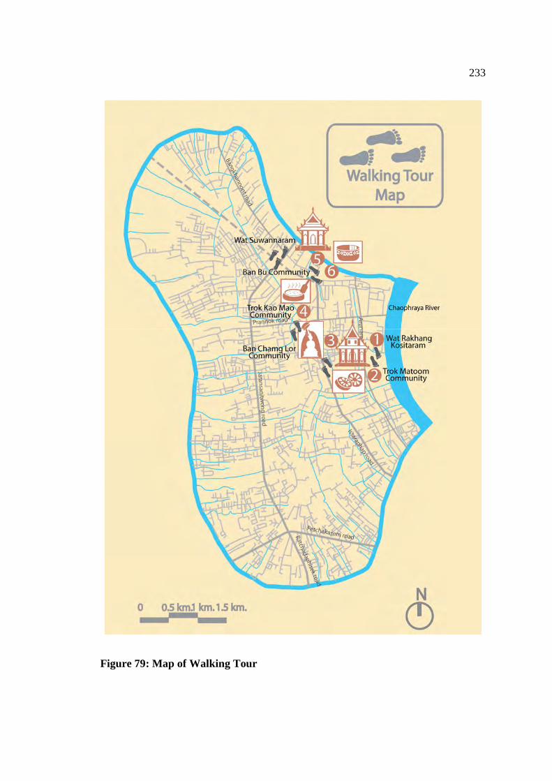
233
Figure 79: Map of Walking Tour
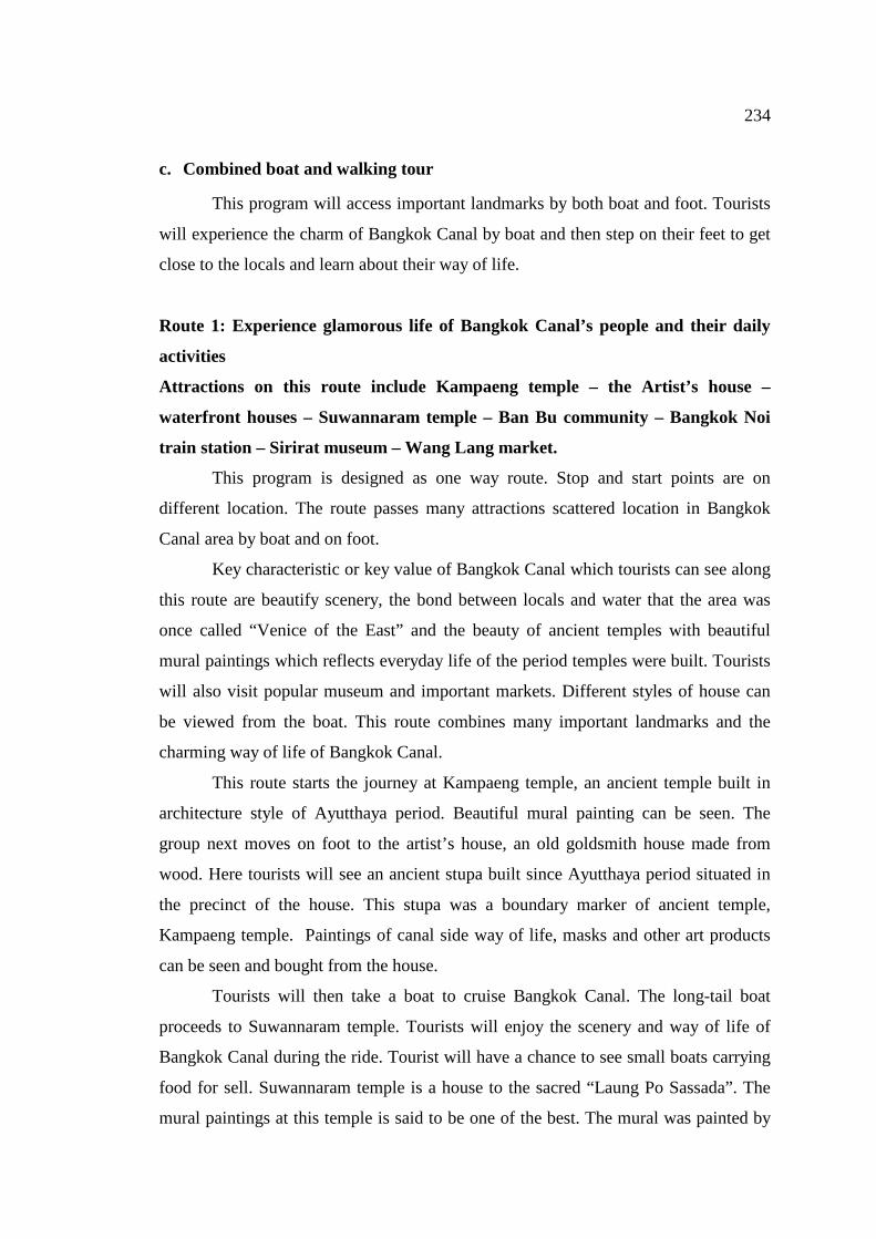
234
c. Combined boat and walking tour
This program will access important landmarks by both boat and foot. Tourists
will experience the charm of Bangkok Canal by boat and then step on their feet to get
close to the locals and learn about their way of life.
Route 1: Experience glamorous life of Bangkok Canal’s people and their daily
activities
Attractions on this route include Kampaeng temple – the Artist’s house –
waterfront houses – Suwannaram temple – Ban Bu community – Bangkok Noi
train station – Sirirat museum – Wang Lang market.
This program is designed as one way route. Stop and start points are on
different location. The route passes many attractions scattered location in Bangkok
Canal area by boat and on foot.
Key characteristic or key value of Bangkok Canal which tourists can see along
this route are beautify scenery, the bond between locals and water that the area was
once called “Venice of the East” and the beauty of ancient temples with beautiful
mural paintings which reflects everyday life of the period temples were built. Tourists
will also visit popular museum and important markets. Different styles of house can
be viewed from the boat. This route combines many important landmarks and the
charming way of life of Bangkok Canal.
This route starts the journey at Kampaeng temple, an ancient temple built in
architecture style of Ayutthaya period. Beautiful mural painting can be seen. The
group next moves on foot to the artist’s house, an old goldsmith house made from
wood. Here tourists will see an ancient stupa built since Ayutthaya period situated in
the precinct of the house. This stupa was a boundary marker of ancient temple,
Kampaeng temple. Paintings of canal side way of life, masks and other art products
can be seen and bought from the house.
Tourists will then take a boat to cruise Bangkok Canal. The long-tail boat
proceeds to Suwannaram temple. Tourists will enjoy the scenery and way of life of
Bangkok Canal during the ride. Tourist will have a chance to see small boats carrying
food for sell. Suwannaram temple is a house to the sacred “Laung Po Sassada”. The
mural paintings at this temple is said to be one of the best. The mural was painted by
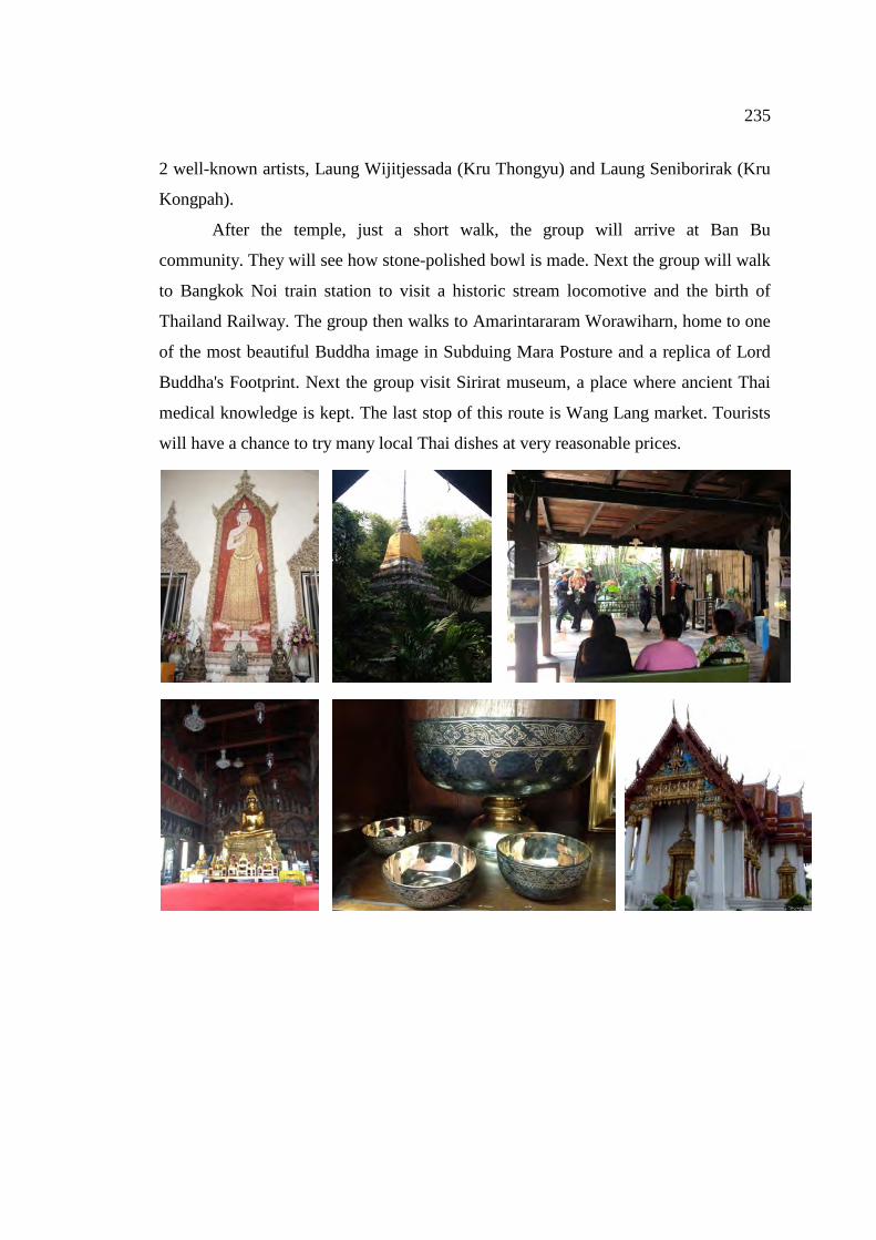
235
2 well-known artists, Laung Wijitjessada (Kru Thongyu) and Laung Seniborirak (Kru
Kongpah).
After the temple, just a short walk, the group will arrive at Ban Bu
community. They will see how stone-polished bowl is made. Next the group will walk
to Bangkok Noi train station to visit a historic stream locomotive and the birth of
Thailand Railway. The group then walks to Amarintararam Worawiharn, home to one
of the most beautiful Buddha image in Subduing Mara Posture and a replica of Lord
Buddha's Footprint. Next the group visit Sirirat museum, a place where ancient Thai
medical knowledge is kept. The last stop of this route is Wang Lang market. Tourists
will have a chance to try many local Thai dishes at very reasonable prices.
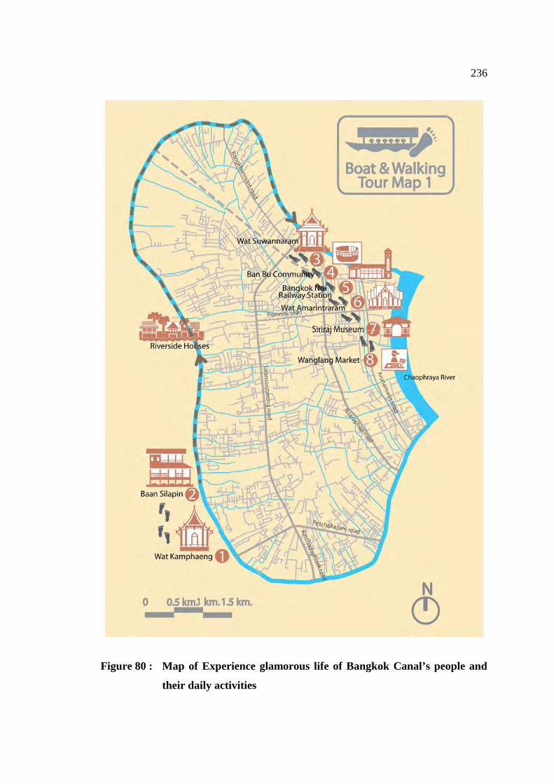
236
Figure 80 : Map of Experience glamorous life of Bangkok Canal’s people and
their daily activities
237
Route 2: Experience glamorous life of Bangkok Canal’s people and their daily
activities
Attractions on this route include Wat Arun – Wichaiprasit fort – Moli temple –
Hongse temple – the artist’s house – Kampaeng temple – Suwannaram temple –
Ban Bu community – Ta Chang pier.
This program is designed as one way route. Stop and start points are on
different location. The route passes many attractions scattered location in Bangkok
Canal area by boat and on foot.
Key characteristic or key value of Bangkok Canal which tourists can see along
this route are beautify scenery, the bond between locals and water that the area was
once called “Venice of the East” and the beauty of ancient temples with beautiful
mural paintings which reflects everyday life of the period temples were built. Tourists
will also visit popular museum and important markets. Different styles of house can
be viewed from the boat. This route combines many important landmarks and the
charming way of life of Bangkok Canal.
The first part of the journey is a conduct tour on foot distance about 2km and
approximately takes 2 hrs. The journey starts at Wat Arun. Tourists will be fascinated
by the size and beauty of the main stupa of the temple. Tourists can pay homage to the
monument of King Ram II at this temple.
Continue to Molilokayaram Rachaworaviharn, a place where King Rama II
studied during his early age. Pay respect to statue of His Holiness Somdej
Phuttakosajarn (Khun) and visit the Buddhist scripture repository hall. Next walk to
Hongse Rattanaram Rachaworaviharn, pay homage to the statue of King Taksin, the
Great and then visits beautiful buildings in the temple.
The group will now take a long-tail boat to the artist’s house, an old goldsmith
house made from wood. Here tourists will see an ancient stupa built since Ayutthaya
period situated in the precinct of the house. This stupa was a boundary marker of
ancient temple, Kampaeng temple. Paintings of canal side way of life, masks and
other art products can be seen and bought from the house. Just a short walk, tourist
will arrive at Kampaeng temple, an ancient temple built since Ayutthaya period.
The long-tail boat will then take tourists to Suwannaram temple. Tourists will
enjoy the scenery and way of life of Bangkok Canal during the ride. Tourist will have
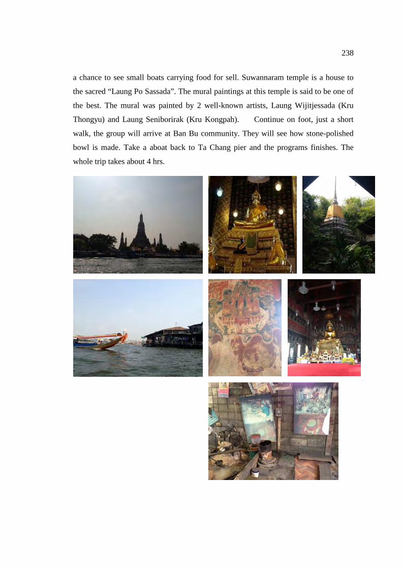
238
a chance to see small boats carrying food for sell. Suwannaram temple is a house to
the sacred “Laung Po Sassada”. The mural paintings at this temple is said to be one of
the best. The mural was painted by 2 well-known artists, Laung Wijitjessada (Kru
Thongyu) and Laung Seniborirak (Kru Kongpah). Continue on foot, just a short
walk, the group will arrive at Ban Bu community. They will see how stone-polished
bowl is made. Take a aboat back to Ta Chang pier and the programs finishes. The
whole trip takes about 4 hrs.
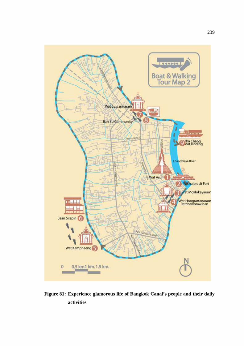
239
Figure 81: Experience glamorous life of Bangkok Canal’s people and their daily
activities
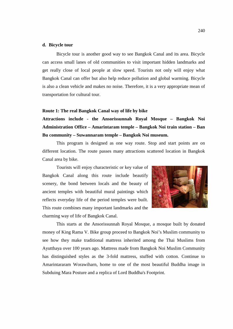
240
d. Bicycle tour
Bicycle tour is another good way to see Bangkok Canal and its area. Bicycle
can access small lanes of old communities to visit important hidden landmarks and
get really close of local people at slow speed. Tourists not only will enjoy what
Bangkok Canal can offer but also help reduce pollution and global warming. Bicycle
is also a clean vehicle and makes no noise. Therefore, it is a very appropriate mean of
transportation for cultural tour.
Route 1: The real Bangkok Canal way of life by bike
Attractions include - the Ansorissunnah Royal Mosque – Bangkok Noi
Administration Office – Amarintaram temple – Bangkok Noi train station – Ban
Bu community – Suwannaram temple – Bangkok Noi museum.
This program is designed as one way route. Stop and start points are on
different location. The route passes many attractions scattered location in Bangkok
Canal area by bike.
Tourists will enjoy characteristic or key value of
Bangkok Canal along this route include beautify
scenery, the bond between locals and the beauty of
ancient temples with beautiful mural paintings which
reflects everyday life of the period temples were built.
This route combines many important landmarks and the
charming way of life of Bangkok Canal.
This starts at the Ansorissunnah Royal Mosque, a mosque built by donated
money of King Rama V. Bike group proceed to Bangkok Noi’s Muslim community to
see how they make traditional mattress inherited among the Thai Muslims from
Ayutthaya over 100 years ago. Mattress made from Bangkok Noi Muslim Community
has distinguished styles as the 3-fold mattress, stuffed with cotton. Continue to
Amarintararam Worawiharn, home to one of the most beautiful Buddha image in
Subduing Mara Posture and a replica of Lord Buddha's Footprint.
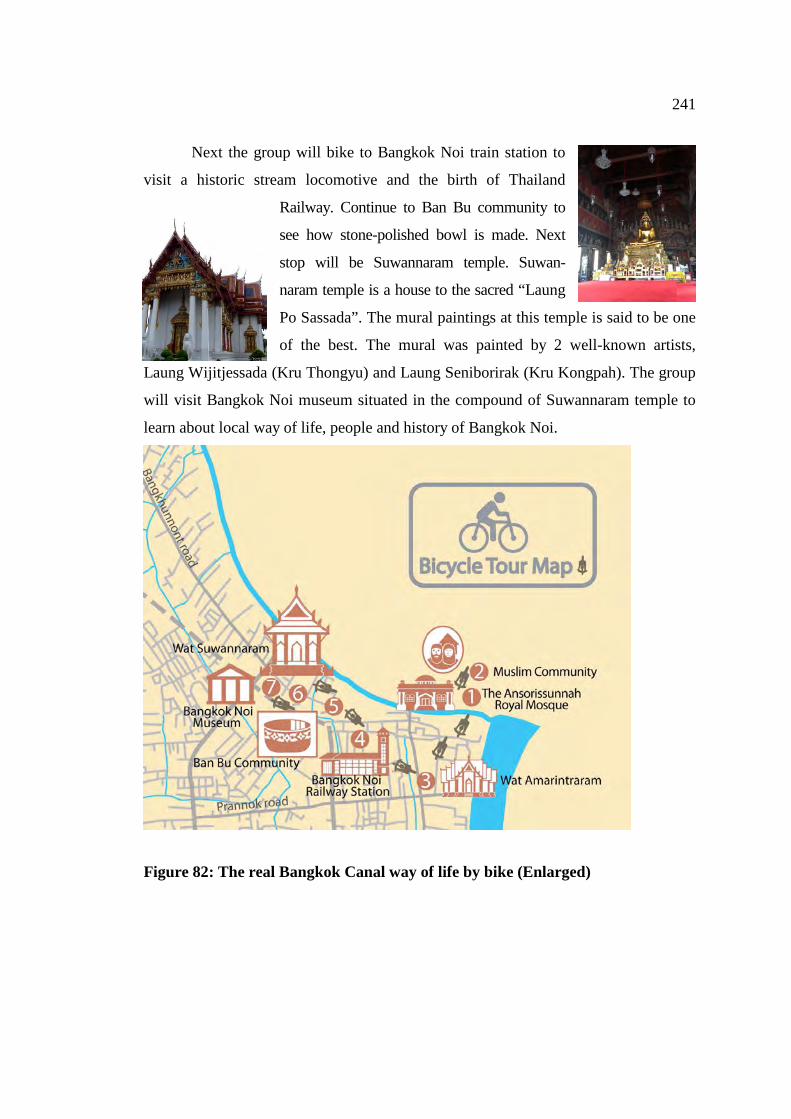
241
Next the group will bike to Bangkok Noi train station to
visit a historic stream locomotive and the birth of Thailand
Railway. Continue to Ban Bu community to
see how stone-polished bowl is made. Next
stop will be Suwannaram temple. Suwan-
naram temple is a house to the sacred “Laung
Po Sassada”. The mural paintings at this temple is said to be one
of the best. The mural was painted by 2 well-known artists,
Laung Wijitjessada (Kru Thongyu) and Laung Seniborirak (Kru Kongpah). The group
will visit Bangkok Noi museum situated in the compound of Suwannaram temple to
learn about local way of life, people and history of Bangkok Noi.
Figure 82: The real Bangkok Canal way of life by bike (Enlarged)
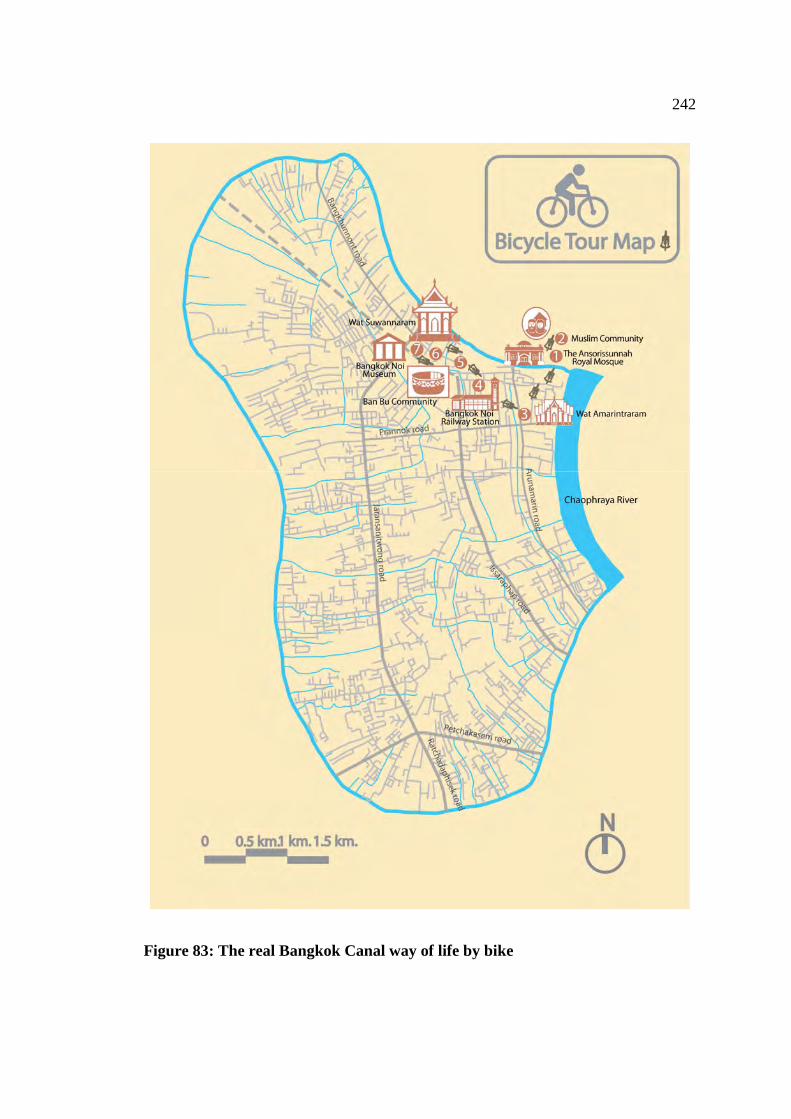
242
Figure 83: The real Bangkok Canal way of life by bike
243
7.2 Summary of expected benefits of promoting Bangkok Canal as cultural
tourism route
1. Increased community appreciation of culture. When locals especially the
young generation witness visitors appreciate their own culture, it can be a
motivation for them to start appreciating their own cultures and they will be
an important stakeholder to protect the cultural heritage of Bangkok Canal.
2. More job opportunities would come with tourism.
3. Historical and cultural heritage would be well conserved.
4. More standard infrastructure would be installed to support tourism.
5. Increased family income. Locals can earn additional income related to
tourism activity for better quality of life.
7.3 Proposal for the development of sustainable cultural tourism route in balance
with the community and their cultural values
After careful analysis of data collected from questionnaires, in-depth interviews and
site visits to define cultural significance of the Bangkok Canal area and develop
sustainable cultural tourism route in balance with the community and their cultural
values. The author proposes 4 development plans.
a. Area development to support tourism
Data collected shows that people of Bangkok Canal live simple lives. Water is
still heavily used for everyday consumption and water way is used for transportation.
Boats are still in used. Temples and ancient communities still maintain their values
and have potentials to be promoted as cultural tourism route. Appropriate
developments are indeed necessary to match up with the arrival of tourists.
Improvement should be done for the following issues.
1. Meaningful signs at attractions
Meaningful signs should be put up at major location, tourist attractions and
along walking path in Bangkok Canal area where tourists can see them clearly and
easily. The design of the sign should be unique but blend in with local environment.
The sign should provide accurate and clear information on the attractions both in Thai
244
and English. Font size should be appropriate, not too small or too large. This sign will
help independent tourists to learn about the attractions accurately.
2. Information centre for tourist
Information centre should be set up in a prime location with easy access. One
good choice could be at the pier where many tourists visit every day. This information
centre should be unique and catching design but does not too stand out of the overall
environment. The author finds out that currently there is no such information centre
specially set up for promoting cultural tourism route. Tourists arriving at the pier do
not have enough information to help them make decision to visit Bangkok Canal area.
Only a few private tour operators have brochures with information on the area.
The author therefore proposes that related government agencies to set up this
information centre to provide appropriate, accurate and reliable information on
cultural tourism route to tourists. English-speaking staff should be assigned to work
at this centre because survey result show s that majority of visitors to Bangkok Canal
are foreigners.
3. Guidebook for Tourist
After making many site visits to Bangkok Canal, the author notices that there
is no guidebook on Bangkok Canal available. Guidebook should be produced with
information on routes, major attractions, shops, how to get there and others. At
present, only a few district administration offices produce this guidebook and each
offices produce their own version with linkage to nearby area.
In addition, guidebook should also provide information on what tourist should
do and don’t, how to behave appropriately when visiting local communities or
temples and other social conduct such as women should be touch Buddhist monks or
shoes should be taken off before entering ordination or houses.
4. Piers / Landing point
Safety at the piers should be improved. Exact number of passengers allowed to
stand on the piers should be clearly stated and the pier must be strong enough to
support the weight. Life vest must be available and other life-saving equipment must
be installed to prevent loss of life if accident occurs. Entrance and Exit signs should
be put up clearly to prevent confusion. The pier area must be kept clean of all time. At
present, more and more tourists take public boat resulting in more garbage being
245
brought to the pier area. Cleaning must receive more attention; enough trash bins
should be available to prevent people from dropping garbage into the river or canal to
maintain the beauty of Bangkok Canal and the quality of water for the sake of visitors
and locals.
5. Tourist boat
Tourist boat should meet safety standard for the safety of tourists and better
service. Engine and boat conditions must be checked before every schedule. The boat
must be safe and life vest must be available for all passengers.
6. Public toilet
Public toilets are not enough compared to number of visitors. More public
toilets should be built at the pier area and tourist attractions. Public toilet should be
designed to blend with the surrounding sites and toilet must be kept clean. There
should not be unpleasant smell from toilet. Clean toilet can promote positive image of
Bangkok Canal.
7. Garbage collection
Each district administration office has a good garbage collection system.
Boats are used to collect garbage floating in the river and canals. What is lack is the
number of trash bins for households along canal banks. Enough bins should be
provided to prevent dropping of garbage into the water which will damage the nice
scenery of Bangkok Canal. Garbage management should be handled well and trash
bin can be designed with attractive shape. More bins should be placed at the pier,
temple and community.
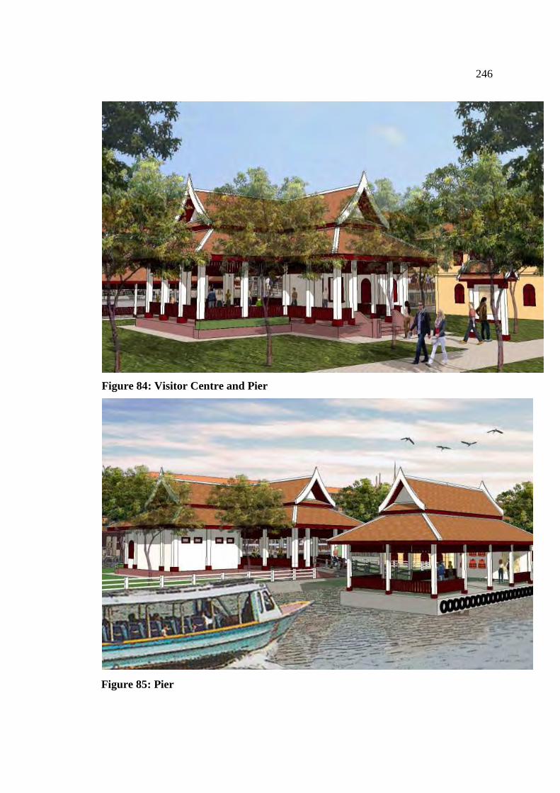
246
Figure 84: Visitor Centre and Pier
Figure 85: Pier
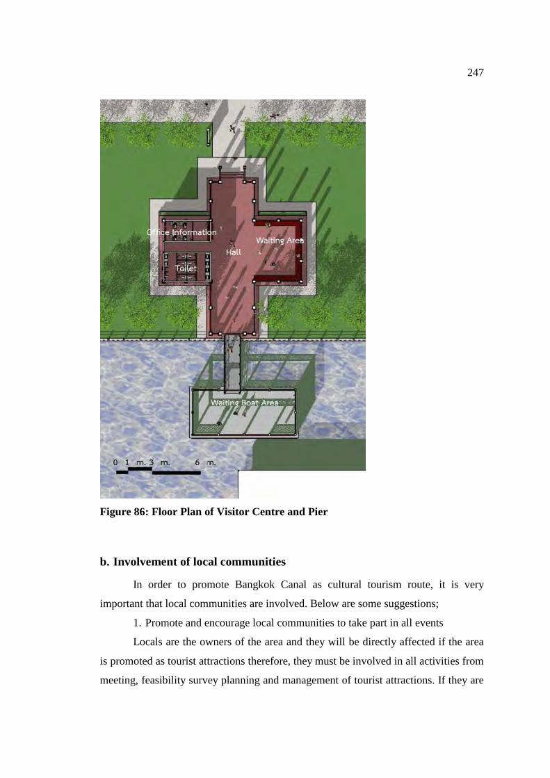
247
Figure 86: Floor Plan of Visitor Centre and Pier
b. Involvement of local communities
In order to promote Bangkok Canal as cultural tourism route, it is very
important that local communities are involved. Below are some suggestions;
1. Promote and encourage local communities to take part in all events
Locals are the owners of the area and they will be directly affected if the area
is promoted as tourist attractions therefore, they must be involved in all activities from
meeting, feasibility survey planning and management of tourist attractions. If they are
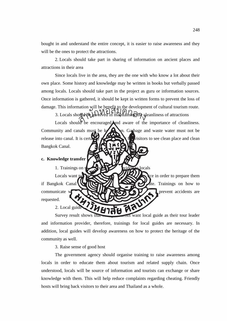
248
bought in and understand the entire concept, it is easier to raise awareness and they
will be the ones to protect the attractions.
2. Locals should take part in sharing of information on ancient places and
attractions in their area
Since locals live in the area, they are the one with who know a lot about their
own place. Some history and knowledge may be written in books but verbally passed
among locals. Locals should take part in the project as guru or information sources.
Once information is gathered, it should be kept in written forms to prevent the loss of
damage. This information will be benefit to the development of cultural tourism route.
3. Locals should be involved in maintaining the cleanliness of attractions
Locals should be encouraged and aware of the importance of cleanliness.
Community and canals must be kept clean. Garbage and waste water must not be
release into canal. It is certainly more pleasant for visitors to see clean place and clean
Bangkok Canal.
c. Knowledge transfer to locals
1. Trainings on service should be provided to locals
Locals want to get training on how to provide service in order to prepare them
if Bangkok Canal is promoted to cultural tourism route. Trainings on how to
communicate with tourists, how to greet them and how to prevent accidents are
requested.
2. Local guide trainings
Survey result shows that foreign tourists want local guide as their tour leader
and information provider, therefore, trainings for local guides are necessary. In
addition, local guides will develop awareness on how to protect the heritage of the
community as well.
3. Raise sense of good host
The government agency should organise training to raise awareness among
locals in order to educate them about tourism and related supply chain. Once
understood, locals will be source of information and tourists can exchange or share
knowledge with them. This will help reduce complaints regarding cheating. Friendly
hosts will bring back visitors to their area and Thailand as a whole.
สำนกัหอ
สมุดกลาง
249
4. Career trainings
Locals want the government agency to give them training on how to improve
or find new career. If Bangkok Canal is promoted, more tourists will arrive and if
locals are equipped with knowledge, they will find opportunity to create additional
job such making traditional Thai sweet or souvenirs to sell to tourists. Locals can have
additional income for a better life.
5. Learning centre for community
Each community should have a learning centre to serve as a learning place for
locals and archive of local knowledge. Local knowledge and wisdom can be shared
and exchanged. New knowledge can be brought back to apply in their community.
Government agency and local communities should work together to make this centre
happen.
7.4 Conclusion
The result of the study of cultural tourism route of Thai way of life along
Bangkok Canal confirms that Bangkok Canal has potential to be cultural tourism
route. The area possesses the important places, is valuable in terms of cultural values,
for example, temples, communities, houses, floating markets which lined along the
Bangkok canal and it presents way of life of people from the past to present. The
design of cultural tourism route for Bangkok Canal must be done to respond to the
needs of tourists. The area must be ready to take tourists with standard, local
communities must be involved with all tourism activities and all stakeholders
including the government agencies must have involvement. Furthermore, the cultural
tourism route must offer activities and include attractions that reflect way of life of the
waterfront community people. The route must help promoting local knowledge,
entertaining visitors and contributing the benefits back to the local communities in
order to boost the pride of locals, create sense of good host and eventually, the locals
will protect their heritage and conserve way of traditional living.
สำนกัหอ
สมุดกลาง
250
7.5 Suggestion for further study
1. The study of Cultural Tourism route of Thai’s life style along Bangkok
canal covers the area of Bangkok Noi, Chak Phra and Bangkok Yai canals.
The author defines this area as “Bangkok Canal”. Since Bangkok Canal
covers 3 districts, therefore, the result of this study may not be able to
interpret all canals in Bangkok. Other canals may possess different
characteristics. However, the result of this analysis may be used as a guide
for further study and development of cultural tourism route in other canals.
2. The author suggests that further study of other canals should be conducted
in order to evaluate the potentials of being developed into cultural tourism
route to promote tourism in Thailand.
3. Future study on the impact of tourism on attractions in Bangkok Canal area
should be conducted. Negative and positive impacts should be analysed in
order to find options for efficient conservation.
สำนกัหอ
สมุดกลาง
251
References
Department of Fine Art. (1991). Bangkok Flashback. Bangkok: Department of Fine
Art, 7.
The Thai Wisdom Treasury. (2012). Thai Wisdom. Accessed November 11, 2012.
Avaiable from http://www.panyathai.or.th/wiki/index.php.
Bangkok Noi District Information Office. (2012). Klong Bangkok noi and travel.
Accessed November 11, 2012. Avaiablefrom
http://203.155.220.217/bangkoknoi/travel/khalongbangkoknoi.htm
Sumet, C. (1995). Water: The Beginning of Thai Culture. Bangkok: NSP Printing
Group.
Frederic, N. (1982) “Narrative of a residence in Siam” Living in Siam by the eyes of
foreigner” a narrative of a residence in siam (1860-1841).
Bangkok:Department of Fine Art.
Termsak, P. (2000). Change Factor of Bangkok Waterfront Community. Bangkok:
Faculty of Architecture, Chulalongkorn University, 92.
Ekkawit, N. (1997). Folk Wisdom in 4 Regions: Life and Learning Villagers of
Thailand. Bangkok: Sukhothaithammathirat University, 49.
Onsiri, P. (1996). House and Local Villages. Bangkok: Thammasat Printing, 151.
Poem Association of Thailand. (2012). Meaning of Siam and Siamese. Accessed
November 12, 2012. Available from http://www.thaipoet.net/index.php.
Bangkok Information Centre. (2012). Meaning of Rattanakosin period. Accessed
November 12, 2012. Available from
http://203.155.220.230/info/passbkk/frame.asp
The Australian Heritage Commission and Tourism Council Australia. (2001).
Successful Tourism at heritage Place. Canberra: Department of Industry and
Resources, 58.
_______. (2001). Successful Tourism at heritage Place. Canberra: Department of
Industry and Resources, 59.
สำนกัหอ
สมุดกลาง
252
_______. (2001). “Successful Tourism at heritage Place”. Canberra:
Department of Industry and Resources, 60.
_______. (2001). Successful Tourism at heritage Place. Canberra: Department
of Industry and Resources, 62.
UNESCO. (2012). Towards a UNESCO culture and development indicators suite.
Accessed November 2, 2012. Available from
http://www.unesco.org/fileadmin/MULTIMEDIA/HQ/CLT/creativity/pdf.
NWHO Nordic World Heritage Foundation. (1999). Sustainable Tourism and
Cultural Heritage. Accessed November 2, 2012 Available from
http://www.nwhf.no/index.
Cros. (2007). Cultural heritage management in China: preserving the cities of the
Pearl River Delta. NY, USA: Routledge.
Rossler. (2010). World heritage and cultural heritage management: New
conservation challenges. Accesed April 10,2011. Available from
http://ises.hu/webimages/Mechtild_Rossler_World_Heritage_and_Cultural__
Heritage_Management.pdf.
United Nations Educational, Scientific and Cultural Organization (UNESCO). (1972).
Convention concerning the protection of the world cultural and natural
heritage, General conference. Accesed April 13,2011. Available from
http://whc.unesco.org/archive/convention-en.pdf.
Reich. (2007). Gathering new ideas for the practice of preservation through
international discussion. APT Bulletin, 37(4), 5-11.
Fletcher, R.Johnson, I., Bruce, E., and Khun-Neay, K. (2007).Living with heritage:
Site monitoring and heritage values in greater Angkor and the Angkor
World Heritage Site, Cambodia. The Archaeology of World Heritage ,
39(3), 85-405.
Campbell, H. (2005). The Socorro Mission: Culture, economic development, and
the politics of historic preservation along the Río Grande/Río Bravo. Latin
American Perspectives, 32(6), 8-27.
Greer, S., Harrison, R., and McIntyre-Tamwpy, S. (2002). Community-based
archaeology in Australia.Community Archaeology, 34(2), 265-287.
สำนกัหอ
สมุดกลาง
253
NWHO Nordic World Heritage Foundation. (1999). Sustainable Tourism and
Cultural Heritage. Accessed November 2, 2012 Available from
http://www.nwhf.no/index.
Council of Europe Counsel del’ Europe. (1996). Sustainable tourism development:
conciliation of economic, cultural of economic, cultural, social, scientific
and environmental interests.Environment encounters 34, Maribor; Slovenia,
12-14.
United Nations Educational, Scientific and Cultural Organization (UNESCO)..
(2012). Towards a UNESCO culture and development indicators suite.
Accessed November 2,2012. Availabla from
http://www.unesco.org/fileadmin/MULTIMEDIA/HQ/CLT/creativity/pdf.
Narasaiah, M.L. (2004). Globalization and sustainable tourism development, New
Delhi. India:Discovery Publishing House.
Yu, C.P.S., Chancellor, H.C., and Cole, S.T. (2011). “Measuring residents’ attitudes
toward sustainable tourism: A reexamination of the sustainable tourism
attitude scale.”Journal of Travel Research,2011. 50(1), 57–63.
Lu, J., and Nepal, S.K. (2009). Sustainable tourism research: An analysis of papers
published in the Journal of Sustainable Tourism. Journal of Sustainable
Tourism, 17(1), 5-16.
Butler, J. (1999). Gender Trouble: Feminism and the Subversion of Identity.
NewYork: Routledge, 9–11, 45–9.
Rokeach, M. (1973). The nature of human values. New York: Free Press.
Tse, D., R. W. Belk, et al. (1989). “Becoming a consumer society: A longitudinal and
cross-cultural content analysis of print ads from Hong Kong, the People’s
Republic of China, and Taiwan”. Journal of Consumer Research March 15,
1989, 457-472.
Mayer, E., Ashleigh, M., George, J.M. and Jones, G.R., (2007). The Communication
Process. In: Contemporary Management,ed. European. London. UK:
McGrraw-Hill.
Ajzen, I. and Fishbein, M. in Smith, M.K., & Robinson, M. (2006). Cultural tourism
in a changing world: politics, participation and (Re) presentation. NY,
USA; Channel View Publications.
สำนกัหอ
สมุดกลาง
254
McNamara, K.E., and Prideaux, J. (2010). Reading, learning and enacting:
interpretation at visitor sites in theWet Tropics rainforest of Australia.
Environmental Education Research, 16(2), 173-188.
Powell, R.B., & Ham, S.H. (2008). Can ecotourism interpretation really lead to pro-
conservation knowledge, attitudes and behaviour? Evidence from the
Galapagos Islands.Journal of Sustainable Tourism, 16(4), 467-489.
Council of Europe Cultural Route(COE). (2011). Cultural Route. Accesed April 11,
2011. Available from
http://www.coe.int/t/dg4/cultureheritage/culture/Routes/defualt_en.aps.
Council of Europe (COE). (2010). Committee of Ministers Resolution. Accessed
July 11,2012. Available from https://wcd.coe.int/ViewDoc.
Richards, G. (2007). Cultural tourism: global and local perspectives. NY,USA:
The Haworth Hospitality Press.
ICOMOS . (2004). Meeting of experts on cultural route in Madrid 30-31 May
2003. Accessed April 10,2011. Available from http://www.icomos-ciic.org.
Haines, C. (2004). Colonial routes: Reorienting the northern frontier of British
India. Ethnohistory, 51(3), 535-56
Frank, A.G.(1990). On the Silk Road: An 'academic' travelogue. Economic and
Political Weekly, 25(46), 2536-2539.
A Silk Road Project Discography. (2006). World Literature Today, 80(4), 9.
The Audience agency. (2012). Cultural Tourism . Accessed November 15,2012.
Available from http://www.audienceslondon.org.
Stebbins, R.A. (1996). Cultural Tourism as Serious Leisure, Annals of Tourism
Research v23 n4: 948
International Council on Monuments and Sites (ICOMOS). (2008). The Icomos
Charter on Cultural Route. Accesed October 15,2011. Available from
http://www.international.icomos.org/charters/culturalroutes_e.pdf.
Paninon, A., (1983). To study the characteristics and conditions of residence in
the area of Klong Bangkok Noi. Bangkok:Silpakorn University.
Taechakitkajorn, T. (1998). The study of living condition of locals who live in the
Southern area of Chao Phraya River. Independent study in Architecture.
Issue 2. Bangkok:Chulalongkorn University.
สำนกัหอ
สมุดกลาง
255
Tipawan, C. (2006). “Thonburi from past to present.” Brief History of Thonburi.
Bangkok: Art&Culture office Dhonburi Ratjabhat University, 5.
______. (2006). “Thonburi from past to present.” Brief History of Thonburi.
Bangkok: Art&Culture office Dhonburi Ratjabhat University, 25.
______. (2006). “Thonburi from past to present.” Brief History of Thonburi.
Bangkok: Art&Culture office Dhonburi Ratjabhat University, 7.
Bangkok Noi Administration Office. (2010). History of Bangkok. Accessed August
26,2010. Available from
http://203.155.220.217/bangkoknoi/travel/khalongbangkoknoi.htm.
______. (2010). History of Bangkok. Accessed August
26,2010. Available from
http://203.155.220.217/bangkoknoi/travel/khalongbangkoknoi.htm.
______. (2010). Bangkok Noi District. Accessed August
26,2010. Available from
http://203.155.220.217/bangkoknoi/travel/khalongbangkoknoi.htm.
________. (2012). Main Road in Bangkok Noi District. Accessed
December 16, 2011. Available from
http://203.155.220.217/bangkoknoi/aboutbangnoi/road.htm.
______. (2012). Secoundary Roads in Bangkok Noi District. Accessed
December 16, 2011. Available from
http://203.155.220.217/bangkoknoi/aboutbangnoi/road.htm.
_______. (2012). Bangkok Noi District. Accessed December 16, 2011.
Available from http://203.155.220.217/bangkoknoi/aboutbangnoi/htm.
_______. (2012). “Guides to important landmarks and tourist
attractions in Bangkok Noi”. Bangkok Noi Focus. Bangkok: Bangkok Noi
Administration Office, 45.
_______. (2555). “Guides to important landmarks and tourist attractions in Bangkok
Noi”. Bangkok Noi Focus. Bangkok: Bangkok Noi Administration
Office, 46.
Wikipidia. (2010). Short-Cut Canal Construction. Accessed August 26, 2010.
Available from http://th.wikipedia.org.
สำนกัหอ
สมุดกลาง
256
______. (2012). Bangkok District. Accessed December 11, 2012. Available from
http://th.wikipedia.org/wiki.
______. (2011). Bangkok District. Accessed August, 2011. Available from
http://th.wikipedia.org
______. (2011). Climate of Bankok Noi District. Accessed August, 2011.
Available from http://th.wikipedia.org.
Nattakorn, B. (2003). Study of Muslim Communities along Bangkok Yai canal.
Bangkok: Silpakorn University, 97.
Terdsak, T. (1999), “Study of waterfront communities along the middle section of
Chao Phraya River central area at Bang Ku Wiang floating market”. Journal
of Architectural Research and Studies 2541 Volume 2. Bangkok:
Chulalongkorn University, 248.
Peeraphan, H. (2005). The Design of Residential Buildings along Bangkok Noi
canal: A Case Study of Bang Krauy Community. Bangkok: Architecture
Faculty, Silapakorn University, 35
Jarunphan, B. (2003). The evolution of the relationship between water and
waterfront community residents; A Case Study of Bangkok Noi canal.
Bangkok: Architecture Faculty, Silapakorn University, 6.
______. (2003). The evolution of the relationship between water and
waterfront community residents; A Case Study of Bangkok Noi canal.
Bangkok: Architecture Faculty, Silapakorn University, 8
______. (2003). The evolution of the relationship between water and
waterfront community residents; A Case Study of Bangkok Noi canal.
Bangkok: Architecture Faculty, Silapakorn University, 39.
______. (2003). The evolution of the relationship between water and
waterfront community residents; A Case Study of Bangkok Noi canal.
Bangkok: Architecture Faculty, Silapakorn University, 56.
______. (2003). The evolution of the relationship between water and
waterfront community residents; A Case Study of Bangkok Noi canal.
Bangkok: Architecture Faculty, Silapakorn University, 84
Thai Post Newspaper. (2010). “End of Vassa Day Festival.” Thai Post. Accessed
April 10,2010. Available from http://www.ryt9.com/s/tpd/945712.
สำนกัหอ
สมุดกลาง
257
City municipal of Pak Kred. (2010). Pak kret District. Accessed April 10, 2010.
Available from
http://www.pakkretcity.go.th/OLD_File/OLD_Travel/OLD_TR2.htm.
Office of Nonthaburi Provincial Administration. (2010). Nonthaburi in
commemoration of Bangkok Bicentennial Cerebration, Nonthaburi: Office
of Nonthaburi Provincial Administration, 146.
World Ship Trust. (2011). Royal Barge of Thailand. Accessed June 4, 2010.
Available from http://www.worldshiptrust.org.
Wikipedia. (2010). Thailand History. Accesed August 26, 2010. Avialble
from"http://th.wikipedia.org.
Bangkok Noi Administration. (2011). “Guides to important landmarks and tourist
attractions in Bangkok Noi .” Bangkok Noi Focus. Bangkok:Bangkok Noi
Administration Office, 47.
______. (2011). “Guides to important landmarks and tourist attractions in Bangkok
Noi,” Bangkok Noi Focus. Bangkok: Bangkok Noi Administration Office,
52.
_______. (2011). “Guides to important landmarks and tourist attractions in Bangkok
Noi,” Bangkok Noi Focus. Bangkok: Bangkok Noi Administration Office,
53.
______. (2011). “Guides to important landmarks and tourist attractions in Bangkok
Noi,” Bangkok Noi Focus. Bangkok: Bangkok Noi Administration Office,
25.
Bangkok Noi District. (2013). Bangkok Noi Travel. Accessed Jauaray 7, 2013
Available from http://office.bangkok.go.th/bangkoknoi/travel.
______. (2013). Ban Chang Lor. Accessed Jauaray 7, 2013
Available from http://office.bangkok.go.th/bangkoknoi/travel.
______. (2013).Trok Kao Mao. Accessed Jauaray 7, 2013.
Available from http://office.bangkok.go.th/bangkoknoi/travel.
สำนกัหอ
สมุดกลาง
258
Terdsak, T. “Study of waterfront communities along the middle section of Chao
Phraya River central area at Bang Ku Wiang floating market”. Journal of
Architectural Research and Studies 2541 Volume 2 Bangkok:
Chulalongkorn University, 248.
Jeerapong, J.and group. (2009). “Rattakosin on the Chao Phraya bank”.
Waterfront Way of Life: Local Wisdom Passed Down from Ayutthaya.
Bangkok: Plus Place Co., Ltd, 6.
Jarunphan, B. (2003). The evolution of the relationship between water and
waterfront community residents; A Case Study of Bangkok Noi canal.
Bangkok: Architecture Faculty, Silapakorn University, 61.
UNESO, Institute for Tourism Studies (IFT), Macao SAR. (2007). Cultural
Heritage Specialist Guide Training and Certification Programme for
UNESSCO World Heritage Site. Bangkok: UNESCO, 34.
______. (2007). Cultural Heritage Specialist Guide Training and
Certification Programme for UNESSCO World Heritage Site. Bangkok:
UNESCO, 35.
Jarunphan, B. (2003). The evolution of the relationship between water and
waterfront community residents; A Case Study of Bangkok Noi canal.
Bangkok: Architecture Faculty, Silapakorn University, 56.
Onsiri, P. (1996. Houses and local villages. Bangkok: Thammasat University
Publishing, 151.
Department of Resources and Technology,University of Ban Somdej Chao
Phraya. (2013). Baan Bu Community. Accesed January 6, 2013. Available
from http://library.bsru.ac.th/rLocal.
สำนกัหอ
สมุดกลาง
Appendix
สำนกัหอ
สมุดกลาง
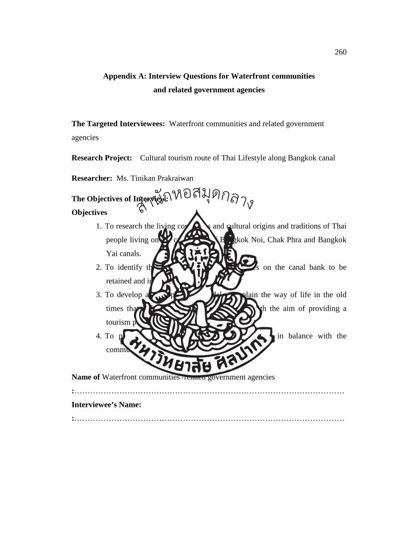
260
Appendix A: Interview Questions for Waterfront communities
and related government agencies
The Targeted Interviewees: Waterfront communities and related government
agencies
Research Project: Cultural tourism route of Thai Lifestyle along Bangkok canal
Researcher: Ms. Tinikan Prakraiwan
The Objectives of Interview:
Objectives
1. To research the living conditions and cultural origins and traditions of Thai
people living on the canal bank of Bangkok Noi, Chak Phra and Bangkok
Yai canals.
2. To identify the value of ancient architectures on the canal bank to be
retained and interpreted.
3. To develop an interpretation model to explain the way of life in the old
times that is bound with rivers and canals with the aim of providing a
tourism program on a cultural tourism route.
4. To propose a sustainable cultural tourism route in balance with the
community and their cultural values.
Name of Waterfront communities /related government agencies
:…………………………………………………………………………………………
Interviewee’s Name:
:…………………………………………………………………………………………
สำนกัหอ
สมุดกลาง
261
1. Do you think that Bangkok Canal still reflects historic and cultural value? If yes,
why?
…………………………………………………………………………………………
…………………………………………………………………………………………
…………………………………………………………………………………………
…………………………………………………………………………………………
2. What are the characteristics of Bangkok Canal important for the development of
cultural tourism route?
…………………………………………………………………………………………
…………………………………………………………………………………………
…………………………………………………………………………………………
…………………………………………………………………………………………
3. What are the key values of Bangkok Canal important for the development of
cultural tourism route?
…………………………………………………………………………………………
…………………………………………………………………………………………
…………………………………………………………………………………………
…………………………………………………………………………………………
4. What do you think are the benefits to the Bangkok canal was developed for cultural
tourism route?
…………………………………………………………………………………………
…………………………………………………………………………………………
…………………………………………………………………………………………
…………………………………………………………………………………………
สำนกัหอ
สมุดกลาง
262
Suggestion
………………………………………………………………………………….………
…………………………………………………………………………………………
…………………………………………………………………………………………
…………………………………………………………………………………………
Thank you for your cooperation
Tinikan Prakraiwan
Silpakorn University, Bangkok
สำนกัหอ
สมุดกลาง
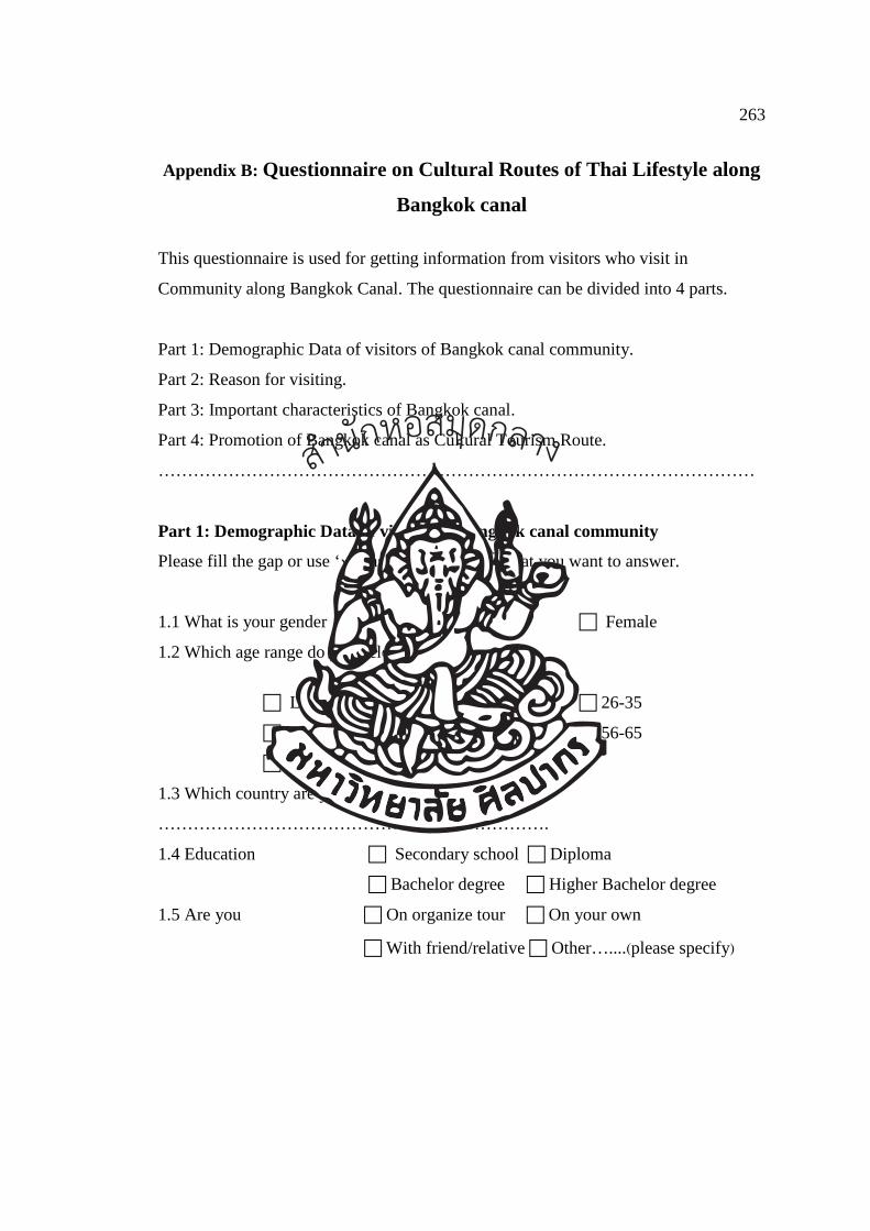
263
Appendix B: Questionnaire on Cultural Routes of Thai Lifestyle along
Bangkok canal
This questionnaire is used for getting information from visitors who visit in
Community along Bangkok Canal. The questionnaire can be divided into 4 parts.
Part 1: Demographic Data of visitors of Bangkok canal community.
Part 2: Reason for visiting.
Part 3: Important characteristics of Bangkok canal.
Part 4: Promotion of Bangkok canal as Cultural Tourism Route.
…………………………………………………………………………………………
Part 1: Demographic Data of visitors of Bangkok canal community
Please fill the gap or use ‘�’ inside the boxes � that you want to answer.
1.1 What is your gender � Male � Female
1.2 Which age range do you belong to?
� Lower 18 �18-25 � 26-35
� 36-45 � 46-55 � 56-65
� Above 65
1.3 Which country are you from?
………………………………………………………….
1.4 Education � Secondary school � Diploma
� Bachelor degree � Higher Bachelor degree
1.5 Are you � On organize tour � On your own
� With friend/relative � Other…....(please specify)
สำนกัหอ
สมุดกลาง
264
Part 2: Reason for visiting.
Please fill the gap or use ‘�’ inside the boxes � that you want to answer.
2.1 Have you ever visit Bangkok canal before?
� Yes � No
2.2 How long do you expect to spend time here?
� <1 hour � 1-2 hour � >3hour
2.3 Why do you choose to visit here?( You can select more than one choice)
� I want to see “Venice of the East”
� I want to learn about a long history of Bangkok Canal
� I want to experience and learn about way of life of the people of
Bangkok Canal
� I want to experience water culture of the people of Bangkok Canal
� I want to enjoy the beautiful scenery of Bangkok Canal
� This place is in a close proximity with other famous attractions e.g. the
Grand Palace.
2.4 What did you see during your Bangkok Canal tour? (You can select more than one
choice)
� I saw people still using waterway for transportation
� I saw people selling things on their boats
� I saw people using water from canal for their domestic activities e.g.
washing, bathing
� I saw water related festivals such as traditional boat racing or Chak
Phra ceremony
� I saw houses built facing canal with terrace
� I saw temples playing centre role for community
� I saw floating market where people from nearby communities traded
their local products
� Others…………………
สำนกัหอ
สมุดกลาง
265
2.5 Do you think that Bangkok Canal still reflect historical value?
� Yes � No � Other
Part 3: Important characteristics of Bangkok canal.
3.1 Are these characteristics of Bangkok Canal important for the development of
cultural tourism route? (1 is the least important and 5 is the most important
characteristics)
Level of Significance
Issues The
most
(5)
Very
(4)
Medium
(3)
Little
(2)
The
least
(1)
Remark
/
Suggestion
way of life of people
living along canal side
water transport as main
mode of transportation
water transport by mean
of boat
trading by boats
water from canal for
domestic use
water related festivals
such as boat racing,
Chak Phra ceremony
waterfront houses
old buildings with
cultural significance
unique/rare in Bangkok
diverse in architectural
style
สำนกัหอ
สมุดกลาง
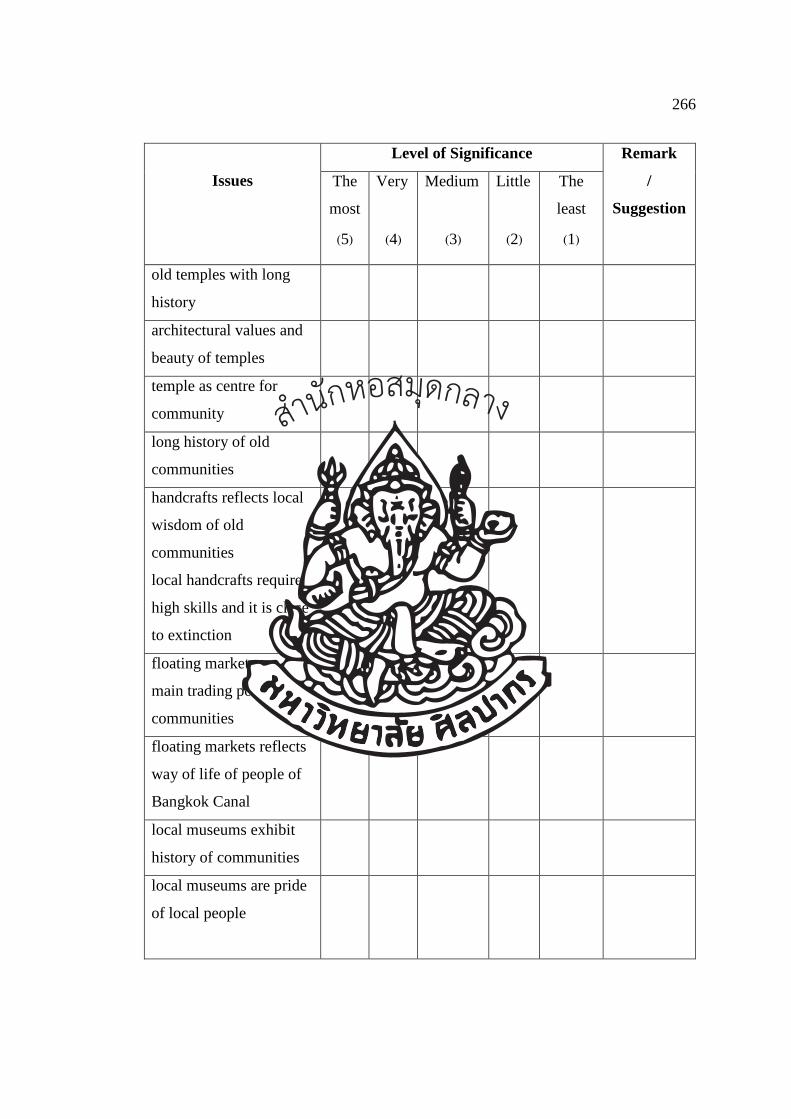
266
Level of Significance
Issues The
most
(5)
Very
(4)
Medium
(3)
Little
(2)
The
least
(1)
Remark
/
Suggestion
old temples with long
history
architectural values and
beauty of temples
temple as centre for
community
long history of old
communities
handcrafts reflects local
wisdom of old
communities
local handcrafts require
high skills and it is close
to extinction
floating markets are
main trading points of
communities
floating markets reflects
way of life of people of
Bangkok Canal
local museums exhibit
history of communities
local museums are pride
of local people
สำนกัหอ
สมุดกลาง
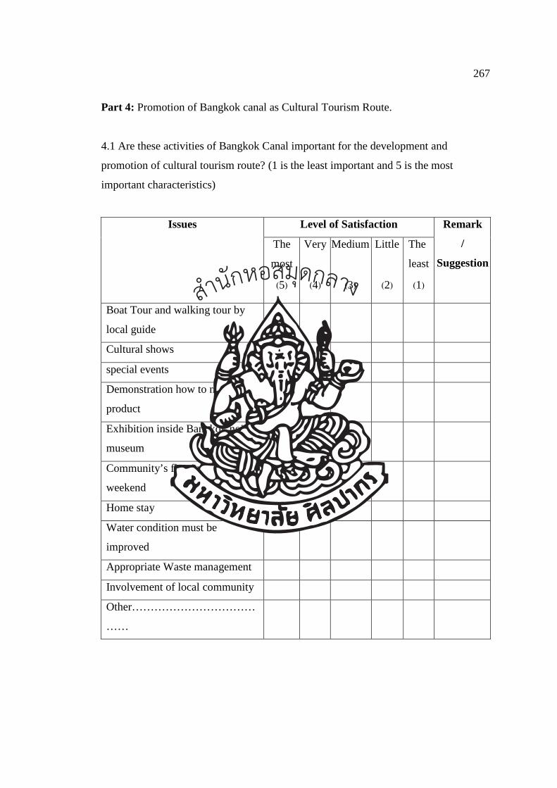
267
Part 4: Promotion of Bangkok canal as Cultural Tourism Route.
4.1 Are these activities of Bangkok Canal important for the development and
promotion of cultural tourism route? (1 is the least important and 5 is the most
important characteristics)
Level of Satisfaction Issues
The
most
(5)
Very
(4)
Medium
(3)
Little
(2)
The
least
(1)
Remark
/
Suggestion
Boat Tour and walking tour by
local guide
Cultural shows
special events
Demonstration how to make local
product
Exhibition inside Bangkok noi’s
museum
Community’s floating market on
weekend
Home stay
Water condition must be
improved
Appropriate Waste management
Involvement of local community
Other……………………………
……
สำนกัหอ
สมุดกลาง
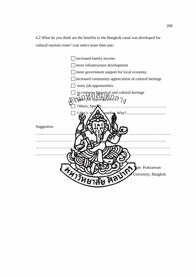
268
4.2 What do you think are the benefits to the Bangkok canal was developed for
cultural tourism route? (can select more than one)
� increased family income
� more infrastructure development
� more government support for local economy
� increased community appreciation of cultural heritage
� more job opportunities
� to conserve historical and cultural heritage
� more job opportunities
� Others, Specify………………………………………….
� I don’t see any benefits. Why?........................................
Suggestion
………………………………………………………………………………….………
………………………………………………………………………………………
…………………………………………………………………………………………
…………………………………………………………………………………………
Thank you for your cooperation
Tinikan Prakraiwan
Silpakorn University, Bangkok
สำนกัหอ
สมุดกลาง
269
Biography
Name-Surname Miss Tinikan Prakraiwan
Contact Address 1383/24 Areeya Casa Real Estate Project,
Soi On-Nut 25-27, Lad Krabang, Bangkok
Thailand 10250
e-mail : [email protected]
Educational Background Bachelor of Management Science, Major in Hotel and
Tourism (2003)
Master of Management Science, Major in Tourism
Management (2005)
Khonkaen University, Thailand
Professional Background Lecturer at Faculty of Management and Tourism
Burapa University (2005-Present)
Professional Tourist Guide (2009-Present)
สำนกัหอ
สมุดกลาง