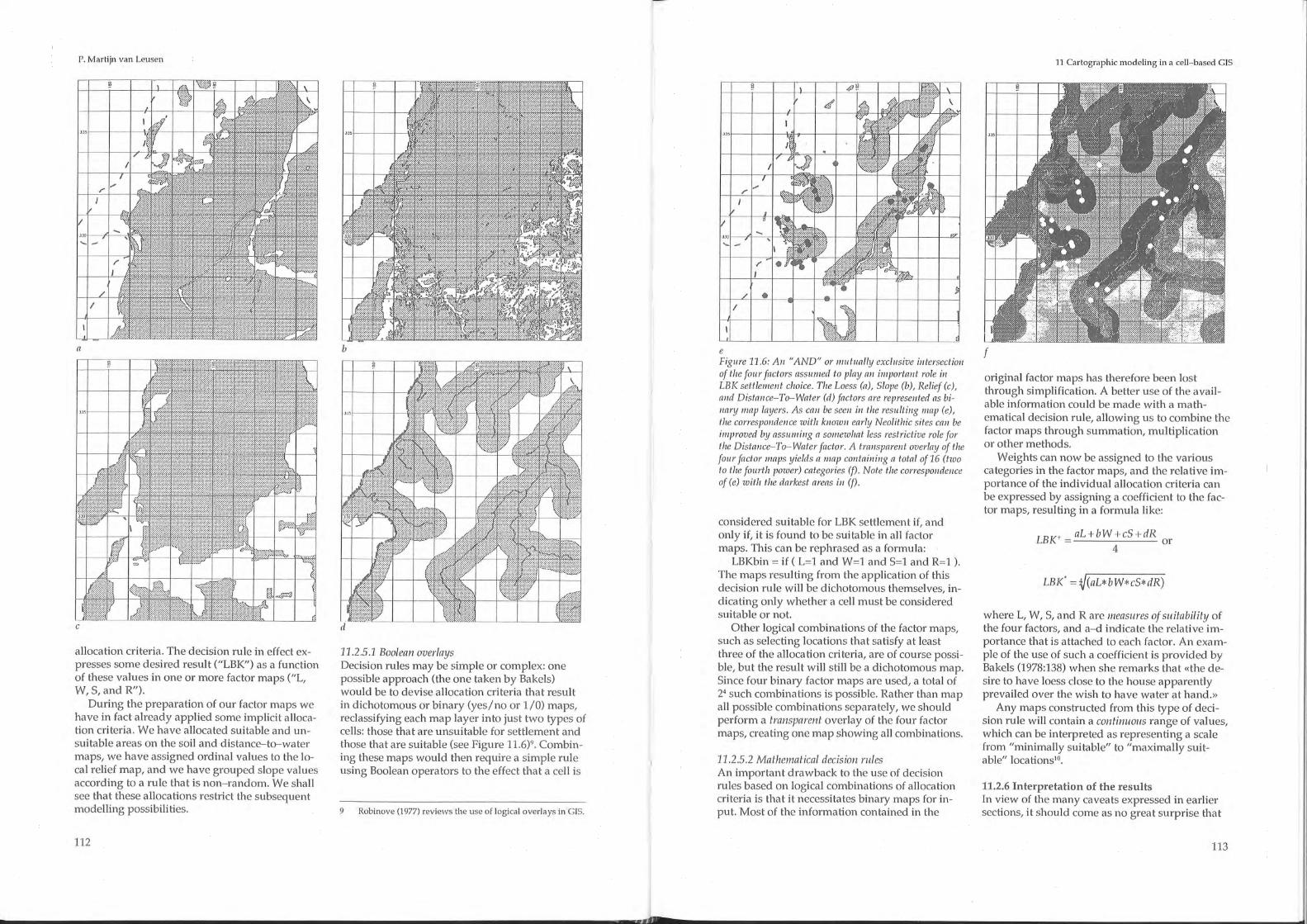
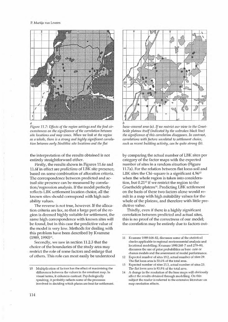
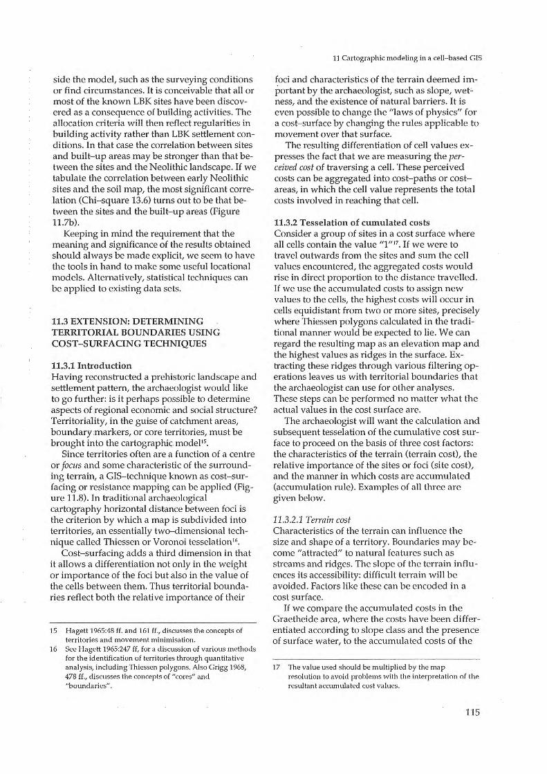
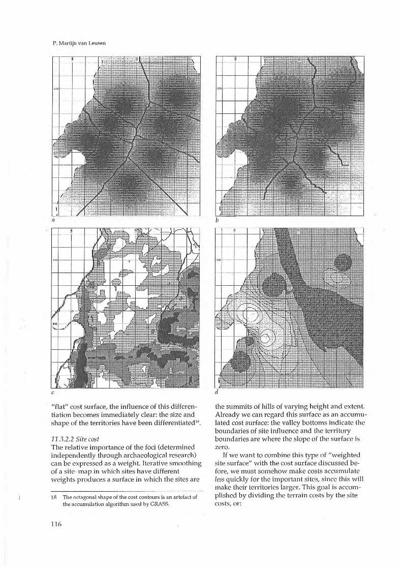
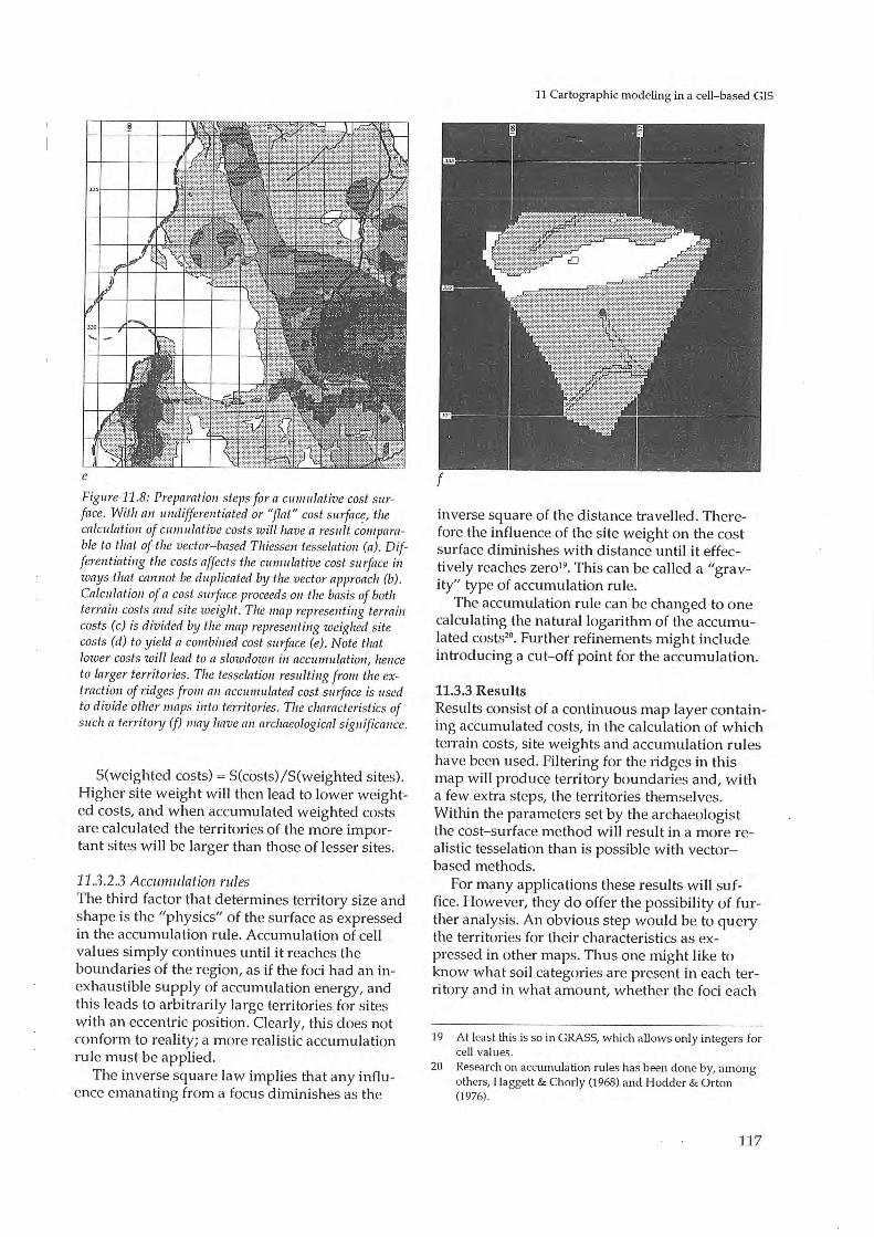
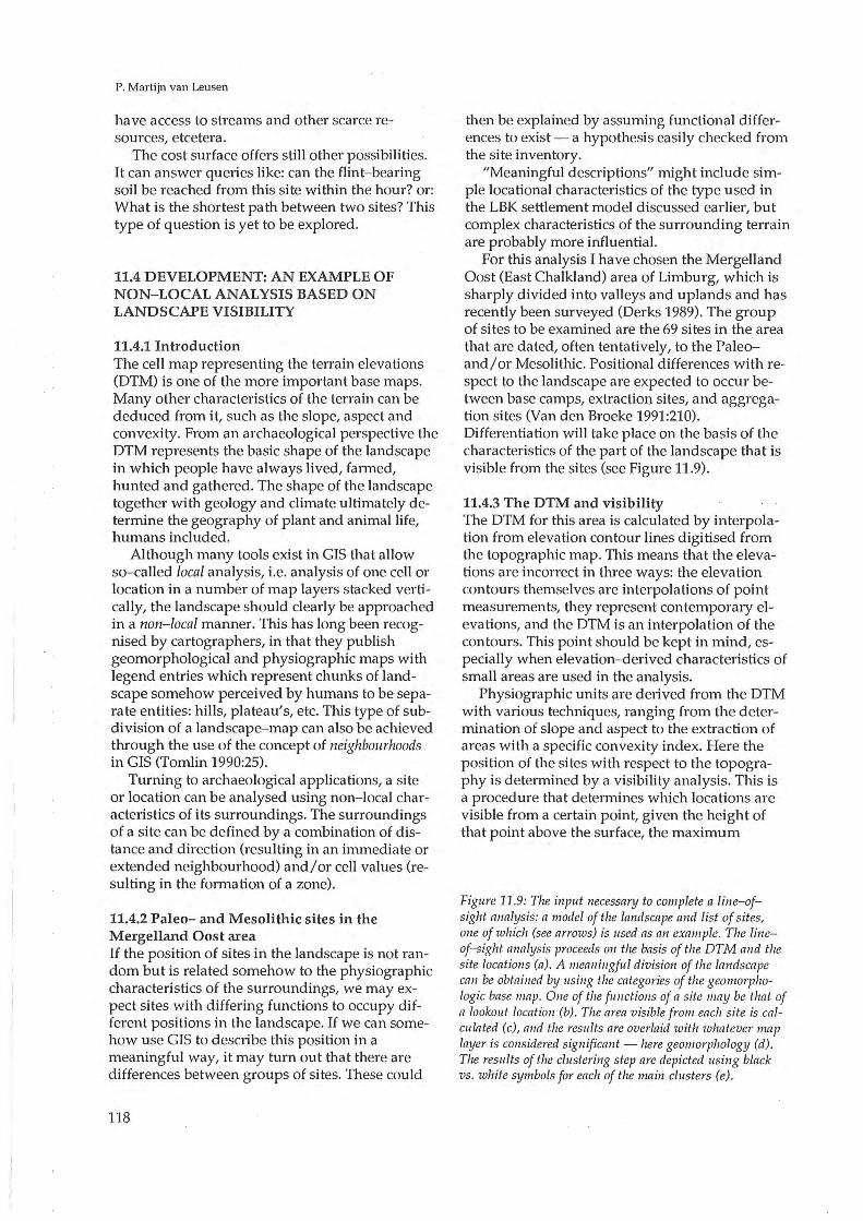
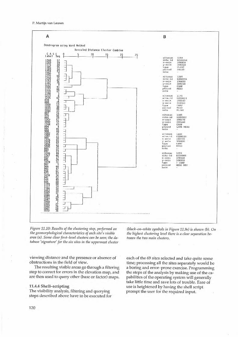
Top Related
The morpho-topographic and cartographic analysis of the archaeological site Cornesti "Iarcuri", Timis County, Romania, using computer sciences methods (GIS and Remote Sensing techniques
LEY 0100 DE 1993
34-1993 (1)
Βεργίνα 1993. Ανασκαφή στο ιερό της Εύκλειας, ΑΕΜΘ 7, 1993, 51-59.
Tale two towns 1993
GIS PROFESSIOvAL - URISA
26 INTERNATIONAL CARTOGRAPHIC CONFERENCE
Geographic Information System (GIS) What is GIS? - Connect ...