Working the Tides, The Maritime Cultural Landscape Linking the Woronora and Brisbane Water Mills,...
15
Working the Tides: The Maritime Cultural Landscape Linking the Woronora and Brisbane Water Mills Greg Jackson Pam Forbes Brad Duncan Historic Background Colonial miller John Lucas built two undershot watermills on the Georges River estuary south of Sydney. The Brisbane Mill built in 1822 and the Woronora Mill built in 1825. The mills operated at least until 1828 when Lucas was declared bankrupt, a victim of droughts, floods, loss of his family boat, Olivia and possibly mismanagement. The location and archaeology of these two mills was described by Jackson and Forbes (Jackson and Forbes 2011 and Forbes and Jackson 2012). The Brisbane Mill was just above the head of navigation of Williams Creek and the Woronora Mill just above the head of navigation of the Woronora River. Although it is only10 km in a straight line between Lucas’ two mills, approximately 13 km through the bush, the terrain is steep and rugged. The descent to the Woronora River of over 110m (NSW Department of Land and Property Information a), 2001) would make the cartage of large and/or heavy items very difficult. In 1843 Sir Thomas Mitchell struggled to build a road down and across the Woronora near the Woronora Mill and this road was soon abandoned because of the steepness of its assents. This article discusses the combined operation of the two mills to source wheat and deliver flour to markets in Sydney. This involves the maritime landscape of the Georges River and its tributaries that sustained transport of materials and people between the two mills, creating a single economic and social unit. Early in 2013 a voyage between the two mills was made in a 6 metre craft not unlike the crafts used in the 1820’s. This voyage was made by working the tides aided only by oar and sail power Building material, wheat, flour, food and manpower would have flowed along these waterways. Why were the mills in the Georges River basin? a) The Georges River as a highway The Georges River was an important focal point for Aboriginal life and culture in the southern Sydney region, offering both food, transport and dreamtime links. Several major language groups existed along the river: Eora to the east, Dharug to the west, north and north-east, Dharawal to the south and Gandangarra in the far south-west. The Georges River had been used as a highway from the early 1800’s with settlers on its fertile river flats.taking their goods to market and bringing in supplies via Botany Bay b) Economic advantages of the Georges River basin The flow of wheat and flour to and from market Until 1832 there was no customs presence in Botany Bay. By operating his mills in the Georges River Lucas avoided duty on all incoming wheat which was only collected at Port Jackson Day (Day D. 1992). To avoid duty on the flour he produced Lucas could ship his flour in small boats to Liverpool then use land transport to markets in Sydney. Wheat varied in price considerably. A survey published in the Colonial Times, p2 (Hobart) on Tuesday 5 April 1831 gives the average monthly price of wheat paid in Sydney in 1828. It varies between a minimum of 8 shilling 9 pence in January to 15 shillings in July per bushel. Although Lucas’ flour could have gone to the Sydney market by boat The Australian p3 the 30 May 1827 gives the duty on flour as 5 shillings per
Transcript of Working the Tides, The Maritime Cultural Landscape Linking the Woronora and Brisbane Water Mills,...

Working the Tides: The Maritime Cultural Landscape Linking the Woronora
and Brisbane Water Mills
Greg Jackson Pam Forbes Brad Duncan
Historic Background
Colonial miller John Lucas built two undershot watermills on the Georges River estuary south of Sydney. The Brisbane Mill built in 1822 and the Woronora Mill built in 1825. The mills operated at least until 1828 when Lucas was declared bankrupt, a victim of droughts, floods, loss of his family boat, Olivia and possibly mismanagement. The location and archaeology of these two mills was described by Jackson and Forbes (Jackson and Forbes 2011 and Forbes and Jackson 2012). The Brisbane Mill was just above the head of navigation of Williams Creek and the Woronora Mill just above the head of navigation of the Woronora River. Although it is only10 km in a straight line between Lucas’ two mills, approximately 13 km through the bush, the terrain is steep and rugged. The descent to the Woronora River of over 110m (NSW Department of Land and Property Information a), 2001) would make the cartage of large and/or heavy items very difficult. In 1843 Sir Thomas Mitchell struggled to build a road down and across the Woronora near the Woronora Mill and this road was soon abandoned because of the steepness of its assents. This article discusses the combined operation of the two mills to source wheat and deliver flour to markets in Sydney. This involves the maritime landscape of the Georges River and its tributaries that sustained transport of materials and people between the two mills, creating a single economic and social unit. Early in 2013 a voyage between the two mills was made in a 6 metre craft not unlike the crafts used in the 1820’s. This voyage was made by working the tides aided only by oar and sail power Building material, wheat, flour, food and manpower would have flowed along these waterways.
Why were the mills in the Georges River basin?
a) The Georges River as a highway The Georges River was an important focal point for Aboriginal life and culture in the southern Sydney region, offering both food, transport and dreamtime links. Several major language groups existed along the river: Eora to the east, Dharug to the west, north and north-east, Dharawal to the south and Gandangarra in the far south-west. The Georges River had been used as a highway from the early 1800’s with settlers on its fertile river flats.taking their goods to market and bringing in supplies via Botany Bay
b) Economic advantages of the Georges River basin The flow of wheat and flour to and from market Until 1832 there was no customs presence in Botany Bay. By operating his mills in the Georges River Lucas avoided duty on all incoming wheat which was only collected at Port Jackson Day (Day D. 1992). To avoid duty on the flour he produced Lucas could ship his flour in small boats to Liverpool then use land transport to markets in Sydney. Wheat varied in price considerably. A survey published in the Colonial Times, p2 (Hobart) on Tuesday 5 April 1831 gives the average monthly price of wheat paid in Sydney in 1828. It varies between a minimum of 8 shilling 9 pence in January to 15 shillings in July per bushel. Although Lucas’ flour could have gone to the Sydney market by boat The Australian p3 the 30 May 1827 gives the duty on flour as 5 shillings per

2
hundredweight (1 hundredweight = 50.8kg). With flour costing approx 20 shillings per hundredweight this duty is approximately 25% of the price. By delivering wheat to Sydney by road Lucas could avoid this duty. From 1813 a road connected Liverpool with Sydney (Liverpool City Council n.d.), a distance of 34km. By escaping duty Lucas’ had an economic advantage over millers operating in Sydney.
The drought of the 1820’s and Lucas’ Mills John Lucas owned two water mills during the succession of droughts that dominated the 1820’s. Rainfall records were poorly kept in the 1820’s but The Sydney Gazette and New South Wales Advertiser, p2, Thursday 26 February 1824, p2, The Sydney Gazette and New South Wales Advertiser p2, Thursday 14 October 1824 and The Australian, p3 Thursday 6 January 1825 all describe the drought conditions in the colony. R. M. Martin talks about “...the great drought of 1827…” (1839:129). Williams Creek, feeding the Brisbane Mill dam, has only a small catchment and its water supply is badly effected by drought. The Sydney Gazette and New South Wales Advertiser on Thursday 1 April 1824, p4 describing the Brisbane Mill states that “…the
uncommon drought has caused the Mill to stand still”. The Woronora River drains a large
catchment, including the wet and boggy Maddens Plains south of Sydney and would supply good water to a mill but access is limited to shallow draft vessels and there is no local supply of wheat.
Flow of wheat and flour
The Image 1; below shows the possible flow of wheat to Lucas’ Mills and the flow of flour to market in Sydney
3
Image 1:
The possible sources of wheat shown on the map above are:
1. Wheat from overseas: The newspapers shipping records detail the importation of wheat from overseas. For example an article in The Sydney Monitor, p4 on Saturday 26 September 1829 laments the importation of 20,000 bushels of wheat to the colony, mostly from India and the effect this will have on local grain prices. The Monitor, p4 on Monday 11 February 1828 describes the import of wheat from South America to the Sydney market. There is no evidence that any of this grain went directly to Lucas’ mills but it is certainly possible. 2. Wheat from Five Islands: (Five Islands is the name now given to the Lake Illawarra district near Wollongong). The Sydney Monitor, p2 Wednesday 6 January 1830 and The Sydney Monitor, p4 on Wednesday 29 September 1830 describe wheat production in the Five Islands

4
region. This wheat was certainly closer to Lucas’ Mills than the Sydney Market and small boats could have easily made the trip and possibly delivered the wheat to the Brisbane Mill's door. Curbie (2004:25) suggest that Lucas may have been engaged in the production of illicit alcohol for the thirsty settlers at Five Islands. The remote location on the Woronora Mill and regular boat transport to Five Islands would make this activity possible. The Sydney Gazette and New South Advertiser, p2 on Saturday 24 February 1821 lists John Lucas as the owner the ’Black Swan’ Inn in George Street Sydney. This would be another possible outlet for any illicit alcohol.
3. Wheat from Port Dalrymple: (Port Dalrymple is the port for Launceston, Tasmania). Much of NSW’s wheat was supplied by Van Diemans Land during the 1820’s. “A strong trade in grain from Van Diemans Land had developed by 1816 and by 1819 half the islands crop went regularly to Sydney” (Broadbent J, Hughes J, 1992). It is highly probable that much of Lucas’ wheat came from this source as the Lucas family was heavily involved in this grain trade. The shipping news detail the movement of the Lucas family schooner Olivia, including many trips from Tasmania to Sydney with a cargo of wheat (for example: The Australian, Wednesday 25th Oct 1826, p3). It is very likely that this schooner regularly took wheat to John Lucas’ Mills. The Olivia’s burden of 60 tons was close to the 140 ton displacement maximum that could navigate the Georges River (Office of Environment and Heritage, 2010:9). A ship of 60 ton burden would have a most probable length of 17m (Forbes 2012) and a boat of this size could have probably delivered to the door of the Brisbane Mill. The Monitor reported on 1 September 1826, p6, that the schooner Alligator of 198 tons burden and approximately 27m long (Forbes 2012) attempted to deliver a cargo of wheat from Port Dalrymple to John Lucas’ Mill. This schooner predictably grounded in the shallow entrance of the Georges River. A farcical story of the Alligator's arrest and seizure resulted (Jackson 2011).
4. Wheat from Bottle Forest: (This area is now called Heathcote). Kennedy (1999: 48) describes wheat being grown in the Bottle Forest area and transported to Lucas’ Woronora Mill for grinding. The distance in a straight line from the farms to the mill is approximately 3.8 km (NSW Department of Land and Property Information (SIX) 2001) but the climb down to the mill with wheat and the return trip carrying flour would be difficult. The area under cultivation at Bottle Forest was small so could not have supplied significant amounts of wheat.
5. Wheat from ‘Little Forest’: The Australian, p4, Friday 23 September 1831 reported a land grant of 700 acres for David Duncomb, although he may have occupied the land prior to this date. This land is approximately 3km (measured in a straight line) North West of the Woronora Mill (NSW Department of Land and Property Information (SIX) 2001). Some of the land is fertile shale soil and may have grown wheat but there is no evidence of him supplying Lucas’ Mill. Given the steep terrain it would have been a difficult journey and Parish Map 14065001 (NSW Department of Lands and Property Management Authority n.d.) significantly shows Duncomb’s private access road travelling along the ridge top past Lucas’ land and descending to the Woronora several kilometres down stream of the mill bypassing Lucas’ Mill.
6. Wheat from local farms around Liverpool: Liverpool was a major wheat growing area in the 1820’s. Thomas Rowley, Lucas' brother in law, is listed in The Sydney Gazette and New South Advertiser, p2 on Saturday 6 January 1821 as a supplier of wheat to the government stores in Liverpool, along with 12 other farmers of the Liverpool area. Lucas’ own land on Williams Creek may also have supplied wheat. Lucas’ name appeared on a list of suppliers of wheat to the Government Stores in The Sydney Gazette and New South Wales Advertiser, p1 on Thursday 29 May 1823. This makes it probable that local wheat was supplying the Brisbane Mill and may have been its main source.

5
The flow of flour to Sydney markets Although Lucas’ flour could have gone to the Sydney market by boat The Australian p3 the 30 May 1827 gives the duty on flour as 5 shillings per hundredweight (1 hundredweight = 50.8kg). With flour costing approx 20 shillings per hundredweight this duty is approximately 25% of the price. By delivering wheat to Sydney by road Lucas could avoid this duty. From 1813 a road connected Liverpool with Sydney a distance of 34km (Liverpool City Council n.d.),. The distance in a straight line from the Brisbane Mill to the centre of Liverpool is approximately 5.5 km over relatively flat country. However no bridge crossed the Georges River until the construction of the weir at Liverpool by Lennox in 1836 (Office of Environment and Heritage, 2010), so unless a boat ferried the flour across the river at Liverpool the transport of flour to Liverpool would have been by boat.
The mills and their markets
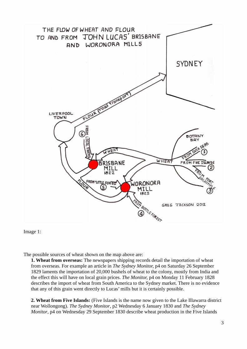
The symbolic map below shows the Georges River estuary connecting Lucas’ Mills and its markets.
Image 2:

6
Distances between mills, markets and sources
The table below gives the approximate distances by water between the transit points on the map above. They were measured by summing the lengths of many short straight line approximations of the routes along the rivers using NearMap, (2011).
Table 1 The movements between these nodes would have been by rowing and/or sailing in a boat, assisted by the tidal flows in the river. Sailing a shallow draft boat is feasible in much of the Georges River but very difficult in the Woronora River and Williams Creek because of the narrowing of the river and high river banks reducing the wind. The distance between the two mills and between Botany Bay and the Brisbane Mill is considerable and may be too long a journey for a single tide. No data is available on the currents generated by the tidal flow in the Georges River system. Only by completing this trips in a suitable sail and oar driven craft will the time taken and difficulty of these river voyages be understood. This experimental archaeology will answer several research questions concerning travel between the two mills.
The boat
The boat used in this voyage, Mystra was built from timber and epoxy by author, Greg Jackson and launched in 2005. Mystras’ statistics are as follows: Length: 6 metres LOA Beam: 2 metres Hull type: modified dory Rig: Gaff ketch Displacement: 500kg Burden: approximately 1 tonne Draft: 0.2 metre (centreboard up), 1 metre (centreboard down) Auxiliary engine: electric, 2HP (not used in this project) Designer: Mike Roberts, Headland Boats Brisbane
Mystra can be powered by: a) Sailing, using her efficient gaff ketch rig. b) Rowed using a single 3.3 metre sweep on the starboard side c) Skulled using the same large sweep in a rollick on the starboard transom. d) Polling
Distances by water Brisbane Mill Woronora Mill Botany Bay
Liverpool
14km 40km 40km
Brisbane Mill
- 28km 28km
Woronora Mill
- - 21km

7
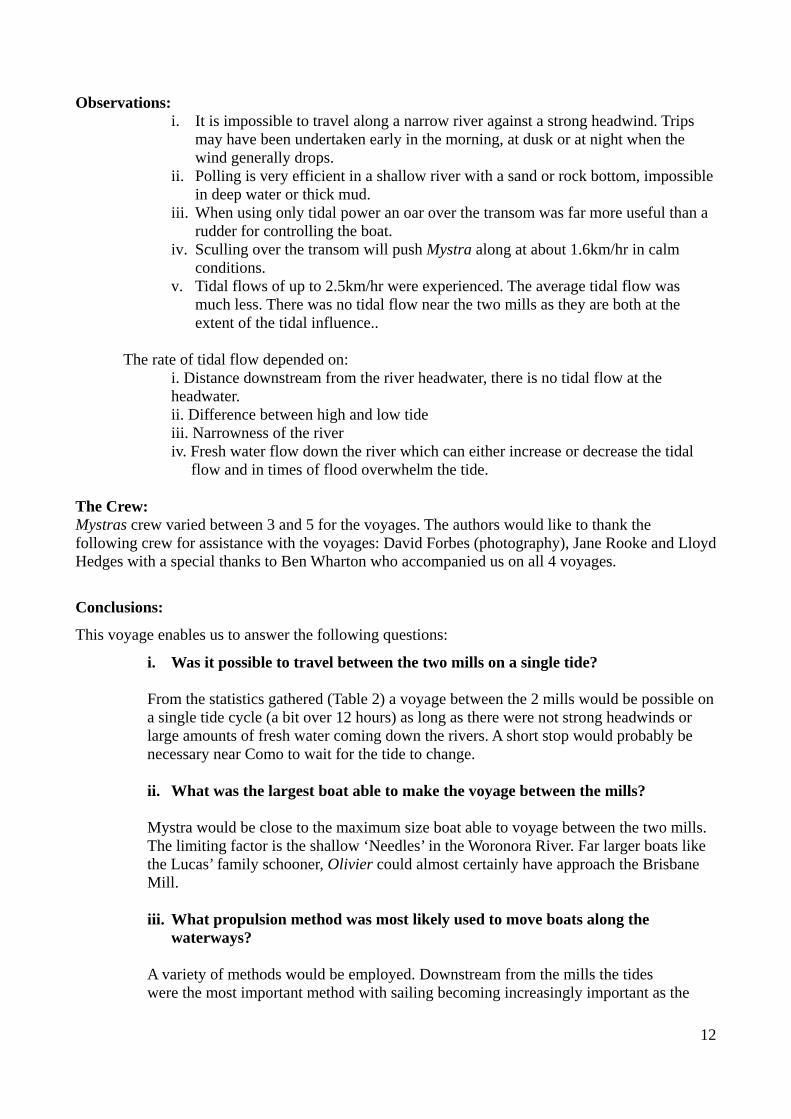
Image 3: Mystra being sculled in the Georges River Photo D. Forbes 2013
Boats used in the 19th century
Images from the early 1800’s suggest that boats using the Georges River system were of clinker construction with long fixed shallow keels, rowed with a pair(s) of oars and have a lugsail rig.

8
Image 4: A pencil sketch of Sydney Cove by Jacob William Jones in 1845 (NSW State Library) Image 4 shows several clinker boats with one large boat heavily laden. Note the rigging on the quayside presumably removed from the large boat to make room for cargo. Rowing this heavily laden boat in the conventional manner with two oars would not be possible. It could be poled or towed by another boat. The excessive height of the cargo would also make this vessel difficult to manage in any wind. The image below shows a clinker boat a little smaller than Mystra sailing in the lower reaches of the Georges River in the 1890’s. This boat has a simple lug sail; a pair of oars is visible on the thwarts.
Image 5: Sutherland Library, Captain William Rice, Georges River 1890’s

9
It is also possible that goods were moved to and from the mills on barges. The ability to row or sail a barge is limited but they have shallow draft and can carry a large load. They would rely on the tides, polling or being towed by another boat for their propulsion.
Comparison of c19 boats and Mystra Although Mystra is a modern boat there are similarities between Mystra and boats of the 1820’s. Mystra’s gaff rig is traditional although small colonial boats were more often lug sail rigged. Mystra’s size of 5.5 meters and burden of about a ton would have been at the upper end of boats able to approach the Woronora Mill. Some time in the 1930’s the army cleared shoals known as ‘The Needles’ from the Woronora River. There rocks would have limited the draught of the boats that could approach the Woronora Mill. The survey (part) below by Roderick Mitchell 1843 (NSW State Archives) shown Lucas’ Mill Dam (circled on left), the only part of the mill remaining in 1843 and The Needles (circled right), approximately 700 metres downstream. The Needles would also have limited the times at which boats could have approached the mill to near high tide.
Image 6: Survey by R. Mitchell, 1843, NSW State Archives
Moving Mystra along the waterways There are several methods of propulsion for small working craft:

10
a) Working the tides is a time honoured method of moving along a river estuary. The boat simply travels with the tides as it flows up and down the river and is anchored when the tide is contrary to the desired direction of travel. Where the tidal flow is swift this method is efficient but at the headwaters of the estuaries, where Lucas’ Mills are located the tidal flow is reduced to zero. The tidal flow also depends on the relative heights of high and low tide. This can vary between 80cm and 150 cm in the Georges River estuary. There are many historic examples of boats using the tides as their only means of propulsion. In 1836 bridge builder David Lennox built a stone bridge over Prospect Creek, not far from Lucas’ Brisbane Mill. The stone was transported by barges from a quarry on the Georges River a distance of 11km using the tide. The same quarry supplied stone for Lenox’s Weir at Liverpool, the head of navigation of the Georges River, also by barges (Antill J. M.).
b) Traditional rowing with 2 oars in rollicks is an efficient means of propulsion but takes up a lot of valuable cargo space in a small boat. The effective width of the boat is also very large and this can be a problem in close quarters. Boats can also be rowed with a single oar. The keel and rudder being used to keep the boat travelling in a straight line.
c) Sculling a small boat with a single oar over the transom is reasonably efficient but requires some skill. This method has the advantage that the rower is facing forward, the boat width is reduced and it also takes up less boat room.
d) Boats can be polled with long timbers. This is very efficient but does not work well with muddy river bottoms and is impossible in deep water.
e) Sailing is a most efficient means of propulsion and works well in wide estuaries and bays. Unfortunately the Georges River system, in the region of Lucas’ Mills has narrow high river sides, rising to over 100 meters in places. This has the effect of sheltering the river from wind and funnelling what wind there is down along the river valley. If the wind is contrary to the direction of intended travel this is undesirable. For much of this voyage the river is too narrow to tack back and forth across against the wind. Boats in the 1820’s, with their shallow fixed keels and inferior sails would not be as efficient to windward as Mystra.
Given the location of Lucas’ Mills and the waterways connecting them some combination of propulsion methods must have been employed. Note that at times of heavy rain neither of the mills could be approached by boat because of the volume of fresh water overpowering the tide. The 1820’s was a period dominated by drought.
Description of the voyage
The voyage between the 2 mills was divided into 4 sections and completed in early 2013 over a period of 2 months. Image2 shows the 4 sections, (labelled 1 to 4) and the tables below summarise the statistics for each section. Voyage 1: Woronora Mill to Forbes Creek, Prince Edward Park Date: 25 January 2013
Average speed km/h
Tidal range
m
Time taken hours
Distance travelled
along river km
Method of propulsion
Weather
1.9 1.25 2.6 5 Oar, polling, walking*, tide
Moderate head winds

11
* walking in sandy shallow water pulling the boat along Voyage 2: Woronora Road Bridge to Como Date: 4 February 2013 Average speed
km/h Tidal range
m Tine take
hours Distance
travelled along river km
Method of propulsion
Weather
5.2 0.7 0.85 4.4 Sail, tide Moderate tail winds
Note: A short stretch (<1km) of the Woronora River was not traversed as it was between two bridges too low for our mast.. Voyage 3: Picnic Point Boatshed to Brisbane Mill, Williams Creek Date: 28 February 2013 Average speed
km/h Tidal range
m Time taken
hours Distance
travelled along river km
Method of propulsion
Weather
3.9 1.4 1.8 7.0 Tide, sail, sculling, poling
Light variable winds
Voyage 4: Picnic Point Boatshed to Como Date: 22 March 2013 Average speed
km/h Tidal range
m Time taken
hours Distance
travelled along river km
Method of propulsion
Weather
4.34 0.9 2.5 10.8 Tide, sail, sculling
Variable winds, gusting to 50km/hr
The statistics for the whole voyage from Woronora Mill to Brisbane Mill are combined in the table below.
Average speed km/h
Average tidal range
m
Time taken hours
Distance travelled along river km
Method of propulsion
3.5 1.06 7.75 27.2 Tide, sail, sculling, oar,
walking Table 2
12
Observations:
i. It is impossible to travel along a narrow river against a strong headwind. Trips may have been undertaken early in the morning, at dusk or at night when the wind generally drops.
ii. Polling is very efficient in a shallow river with a sand or rock bottom, impossible in deep water or thick mud.
iii. When using only tidal power an oar over the transom was far more useful than a rudder for controlling the boat.
iv. Sculling over the transom will push Mystra along at about 1.6km/hr in calm conditions.
v. Tidal flows of up to 2.5km/hr were experienced. The average tidal flow was much less. There was no tidal flow near the two mills as they are both at the extent of the tidal influence..
The rate of tidal flow depended on:
i. Distance downstream from the river headwater, there is no tidal flow at the headwater. ii. Difference between high and low tide iii. Narrowness of the river iv. Fresh water flow down the river which can either increase or decrease the tidal flow and in times of flood overwhelm the tide.
The Crew: Mystras crew varied between 3 and 5 for the voyages. The authors would like to thank the following crew for assistance with the voyages: David Forbes (photography), Jane Rooke and Lloyd Hedges with a special thanks to Ben Wharton who accompanied us on all 4 voyages.
Conclusions:
This voyage enables us to answer the following questions:
i. Was it possible to travel between the two mills on a single tide? From the statistics gathered (Table 2) a voyage between the 2 mills would be possible on a single tide cycle (a bit over 12 hours) as long as there were not strong headwinds or large amounts of fresh water coming down the rivers. A short stop would probably be necessary near Como to wait for the tide to change. ii. What was the largest boat able to make the voyage between the mills? Mystra would be close to the maximum size boat able to voyage between the two mills. The limiting factor is the shallow ‘Needles’ in the Woronora River. Far larger boats like the Lucas’ family schooner, Olivier could almost certainly have approach the Brisbane Mill. iii. What propulsion method was most likely used to move boats along the
waterways? A variety of methods would be employed. Downstream from the mills the tides were the most important method with sailing becoming increasingly important as the

13
river widened. Poling is considered the most likely method used at the rivers headwaters near the mills. iv. Was a longer voyage eg. Brisbane Mill to Botany Bay possible on a single tide?
From the statistics gathered a trip from the Woronora Mill to Botany Bay (21km) would be feasible in a 6 hour tidal event, especially if the boat employed had reasonable sailing characteristics. The trip from the Brisbane Mill to Botany Bay (28km) would probably require two tidal falls. A large boat, such as the Lucas’ family boat, Olivia, would be more difficult to move down or upstream because of their deep draft.
v. What manpower was needed to complete a voyage?
For a heavily laden boat the size of Mystra a minimum crew of 2.would probably be required.
.
vi What obstacles were encountered in the river voyage? With the exception of the Needles, near the Woronora Mill (where Mystra touched bottom) the river has no hidden underwater obstacles. When short tacking against the wind Mystra ran aground several times and fouled her rigging on trees. Navigation is straightforward but landmarks would be necessary to find the entrance to Williams Creek, especially if travelling in the dark.
The complexities faced by John Lucas in building and running his two water mills, sourcing wheat and delivering flour to market should not be underestimated. The reasons for his failure and bankruptcy in 1828 were largely due to factors beyond his control. Archaeological research at the mill sites may shed more light on the mills operations and the lifeways of the people who worked there and experimental archaeology may better inform us how the mills functioned a s a single economic unit.

Bibliography
Antill, J. M.. 'Lennox, David (1788–1873)', Australian Dictionary of Biography, National Centre of Biography, Australian National University, http://adb.anu.edu.au/biography/lennox-david- 2350/text3071, accessed 27 January 2013.
Broadbent J, Hughes J,1992, The Age of Macquarie, Melbourne University Press Carlton Vic. Curbie, P 2004, 'Lucas' Mill', Sutherland Shire Historical Society Inc Bulletin, Vol 7, No 2, May 2004, pp 23 – 26. Day D 1992, Smugglers and Sailors, the Customs History of Australia 1788 – 1901, Canberra, AGPS Press. Forbes, P 2012, Unpublished research statistically relating the tonnage of wooden sailing ships to
their length.
Forbes, P. and Jackson, G 2013, 'The Watermills of John Lucas: Part 3’, Sutherland Shire Historical Society Inc Bulletin Vol 16 No. 1: February 2013, pp 23 – 29. Jackson, G and Forbes P. 2012, 'The Watermills of John Lucas: Part 2’, Sutherland Shire Historical
Society Inc Bulletin Vol 15 No. 4: November 2012, pp 20 – 25. Jackson, G 2010, 'The Strange Tale of the Alligator', Sutherland Shire Historical Society Inc Bulletin Vol 14 No. 1, February 2011, pp 7 – 11. Kennedy, P 1999, From Bottle Forest to Heathcote, Robert Burton Printers, Australia. Liverpool City Council n.d., Timeline, accessed 15 April 2012, <www.liverpool.nsw.gov.au/ourcity/historicaltimeline.htm#earlydays>. Liverpool City Council n.d., Timeline, accessed 15 April 2012, <www.liverpool.nsw.gov.au/ourcity/historicaltimeline.htm#earlydays>. Martin R.M. 1839, History of Austral-Asia: comprising New South Wales, Van Diemans Island.
Swan River, South Australia, &c, Whittaker and Co, London. Nearmap (ipernica ltd, West Perth, Western Australia), 2011, accessed 15 March 2012, <https://www.nearmap.com>. NSW Department of Land and Property Information a), 2001, Topographic and Orthophoto Map 9129 4N, Port Hacking NSW Department of Land and Property Information, 2001, Spatial Information Exchange, accessed on 27 March 2012, <http://lite.maps.nsw.gov.au/>. NSW Department of Lands and Property Management Authority, n.d., Parish Map Preservation Project, accessed 30 March 2012, <http://parishmaps.lands.nsw.gov.au/pmap.html>.

NSW State Library. View in Sydney Cove, N.S.W., 1845 by Jacob William Jones, Pencil, DGA 32 f.4
http://www.sl.nsw.gov.au/events/exhibitions/2008/dockside/images/4.html NSW State Records,1843, Survey of the Woronora Allotments Nos.1 and 2, showing connection of the road on R.1.1231 and R.1a.1231, Roderick Mitchell SR5278. accessed 4 June, 2012
http://srwww.records.nsw.gov.au/indexes/searchhits.aspx?table=List%20of%20Maps%20an d%20Plans%20%28and%20Supplement%29&id=33&frm=1&query=Area:Woronora;Date
:1843 Office of Environment and Heritage, 2010, Heritage listing for Liverpool Weir, accessed 15 March 2012, <http://www.heritage.nsw.gov.au/07_subnav_04_2.cfm?Itemid=5060394>. Sutherland Library, Historic Photo Collection, 2013 http://www.photosau.com.au/sutherlandhist/scripts/home.asp