WESTERN MEDITERRANEAN - High Sea
347
PUB. (ENROUTE) SAILING DIRECTIONS ★ ★ 2004 131 WESTERN MEDITERRANEAN Prepared and published by the NATIONAL GEOSPATIAL-INTELLIGENCE AGENCY Bethesda, Maryland © COPYRIGHT 2004 BY THE UNITED STATES GOVERNMENT NO COPYRIGHT CLAIMED UNDER TITLE 17 U.S.C. ELEVENTH EDITION For sale by the Superintendent of Documents, U.S. Government Printing Office Internet: http://bookstore.gpo.gov Phone: toll free (866) 512-1800; DC area (202) 512-1800 Fax: (202) 512-2250 Mail Stop: SSOP, Washington, DC 20402-0001
-
Upload
khangminh22 -
Category
Documents
-
view
0 -
download
0
Transcript of WESTERN MEDITERRANEAN - High Sea

PUB.
(ENROUTE)SAILING DIRECTIONS
★
131
★
WESTERNMEDITERRANEAN
Prepared and published by theL GEOSPATIAL-INTELLIGENCE A
NATIONA GENCYBethesda, Maryland
© COPYRIGHT 2004 BY THE UNITED STATES GOVERNMENTNO COPYRIGHT CLAIMED UNDER TITLE 17 U.S.C.
2004
ELEVENTH EDITION
For sale by the Superintendent of Documents, U.S. Government Printing Office
Internet: http://bookstore.gpo.gov Phone: toll free (866) 512-1800; DC area (202) 512-1800Fax: (202) 512-2250 Mail Stop: SSOP, Washington, DC 20402-0001

me” aofheowck,sly
d
utrt,arestal
1sed
yen-ay
oteds,d totheeiral
eters.s
xi-ers
d-y-.thewebis-
-ht
ehichalow-idesin
Preface
0.0 Pub. 131, Sailing Directions (Enroute) for WesternMediterranean, Eleventh Edition, 2004, is issued for use inconjunction with Pub. 140, Sailing Directions (PlanningGuide) North Atlantic Ocean, Baltic Sea, North Sea, and theMediterranean Sea. The companion volume is Pub. 132.
0.0 This publication as originally published has been correctedto 27 November 2004, including Notice to Mariners No. 48 of2004.
0.0 Subsequent Publication Digital Updates (PDUs) havecorrected this publication to 10 March 2007, including Noticeto Mariners No. 10 of 2007.
Explanatory Remarks
0.0 Sailing Directions are published by the National Geospatial-Intelligence Agency (NGA), under the authority of Departmentof Defense Directive 5105.40, dated 12 December 1988, andpursuant to the authority contained in U. S. Code Title 10,Sections 2791 and 2792 and Title 44, Section 1336. SailingDirections, covering the harbors, coasts, and waters of theworld, provide information that cannot be shown graphicallyon nautical charts and is not readily available elsewhere.0.0 Sailing Directions (Enroute) include detailed coastal andport approach information which supplements the largest scalechart produced by the National Geospatial-IntelligenceAgency. This publication is divided into geographic areascalled “Sectors.”0.0 Bearings.—Bearings are true, and are expressed in degreesfrom 000˚ (north) to 360˚, measured clockwise. Generalbearings are expressed by initial letters of points of the com-pass (e.g. N, NNE, NE, etc.). Adjective and adverb endingshave been discarded. Wherever precise bearings are intendeddegrees are used.0.0 Coastal Features.—It is assumed that the majority of shipshave radar. Available coastal descriptions and views, useful forradar and visual piloting are included in geographic sequencein each Sector.0.0 Corrective Information.— Users should refer corrections,additions, and comments to NGA’s Maritime Operations Desk,as follows:0.0 1. Toll free: 1-800-362-62890.0 2. Commercial: 301-227-31470.0 3. DSN: 287-31470.0 4. DNC web site: http://www.nga.mil/portal/site/dnc0.0 5. Maritime Divi-0.0 sion web site: http://www.nga.mil/portal/site/mari0.0 time0.0 6. E-mail: [email protected] 7. Mailing address: Maritime Division0.0 National Geospatial-Intelligence0.0 Agency
Mail Stop D-440.0 4600 Sangamore Road0.0 Bethesda MD 20816-50030.0 New editions of Sailing Directions are corrected through thedate of the publication shown above. Important information toamend material in the publication is available as a Publication
Digital Update (PDU) from the NGA Maritime Division web-site.
0.0NGA Maritime Division Websitehttp://www.nga.mil/portal/site/maritime
0.0
0.0 Courses.—Courses are true, and are expressed in the samanner as bearings. The directives “steer” and “make goodcourse mean, without exception, to proceed from a pointorigin along a track having the identical meridianal angle as tdesignated course. Vessels following the directives must allfor every influence tending to cause deviation from such traand navigate so that the designated course is continuoubeing made good.0.0 Currents.—Current directions are the true directions towarwhich currents set.0.0 Dangers.—As a rule outer dangers are fully described, binner dangers which are well-charted are, for the most paomitted. Numerous offshore dangers, grouped together,mentioned only in general terms. Dangers adjacent to a coapassage or fairway are described.0.0 Distances.—Distances are expressed in nautical miles ofminute of latitude. Distances of less than 1 mile are expresin meters, or tenths of miles.0.0 Geographic Names.—Geographic names are generallthose used by the nation having sovereignty. Names in partheses following another name are alternate names that mappear on some charts. In general, alternate names are quonly in the principal description of the place. Diacritical marksuch as accents, cedillas, and circumflexes, which are relatespecific letters in certain foreign languages, are not used ininterest of typographical simplicity. Geographic names or thspellings do not necessarily reflect recognition of the politicstatus of an area by the United States Government.0.0 Heights.—Heights are referred to the plane of referencused for that purpose on the charts and are expressed in me0.0 Index-Gazetteer.—Navigational features and place-nameare listed alphabetically in the back of the book. The appromate position, along with the Sector and paragraph numb(e.g.1.1), facilitate location in the text.0.0 Internet Links.— This publication provides internet links toweb sites concerned with maritime navigational safety, incluing but not limited to, Federal government sites, foreign Hdrographic Offices, and foreign public/private port facilitiesNGA makes no claims, promises, or guarantees concerningaccuracy, completeness, or adequacy of the contents of thesites and expressly disclaims any liability for errors and omsions of these web sites.0.0 Light and Fog Signals.—Lights and fog signals are not described, and light sectors are not usually defined. The LigLists should be consulted for complete information.0.0 Ports.—Directions for entering ports are depicted wherappropriate by means of chartlets, sketches, and photos, wfacilitate positive identification of landmarks and navigationaids. These chartlets and sketches are not always to scale, hever, and should be used only as a general informational guin conjunction with the best scale chart. Specific port facilitieare omitted from the standard format. They are tabulatedPub. 150, World Port Index.
Pub. 131 III
is
and
u-
u-
0.0 Radio Navigational Aids.—Radio navigational aids are notdescribed in detail. Publication No. 117 Radio NavigationalAids and NOAA Publication, Selected Worldwide MarineBroadcasts, should be consulted.0.0 Soundings.—Soundings are referred to the datum of thecharts and are expressed in meters.0.0 Special Warnings.—A Special Warning may be in force forthe geographic area covered by this publication. SpecialWarnings are printed in the weekly Notice to Mariners uponpromulgation and are reprinted annually in Notice to MarinersNo. 1. A listing of Special Warnings currently in force isprinted in each weekly Notice to Mariners, Section III, Broad-cast Warnings, along with the notice number of promulgation.Special Warnings are also available on the Maritime Divisionwebsite.0.0 Wind Directions.—Wind directions are the true directionsfrom which winds blow.
Reference List
0.0 The principal sources examined in the preparation of thpublication were:
0.0 British Hydrographic Department Sailing Directions.0.0 French Sailing Directions.0.0 Italian Sailing Directions.0.0 Spanish Sailing Directions.
0.0 Various port handbooks.0.0 Reports from United States naval and merchant vesselsvarious shipping companies.0.0 Other U.S. Government publications, reports, and docments.0.0 Charts, light lists, tide and current tables, and other docments in possession of the Agency.
IV Pub. 131

Contents
IIIIIIII
I
1
9
9
1
9
5
How to Keep this Book Corrected . . . . . . . . . . . . . . . . . . . . . . . . . . . . . . . . . . . . . . . . . . . . . . . . . . . . . . . . . . . . . . . . . . . . . . . . . . . IPreface. . . . . . . . . . . . . . . . . . . . . . . . . . . . . . . . . . . . . . . . . . . . . . . . . . . . . . . . . . . . . . . . . . . . . . . . . . . . . . . . . . . . . . . . . . . . . . . . Chartlet—Sector Limits . . . . . . . . . . . . . . . . . . . . . . . . . . . . . . . . . . . . . . . . . . . . . . . . . . . . . . . . . . . . . . . . . . . . . . . . . . . . . . . . . VConversion Tables. . . . . . . . . . . . . . . . . . . . . . . . . . . . . . . . . . . . . . . . . . . . . . . . . . . . . . . . . . . . . . . . . . . . . . . . . . . . . . . . . . . . . VISailing Directions Information and Suggestion Sheet . . . . . . . . . . . . . . . . . . . . . . . . . . . . . . . . . . . . . . . . . . . . . . . . . . . . . . . . . . . IXAbbreviations . . . . . . . . . . . . . . . . . . . . . . . . . . . . . . . . . . . . . . . . . . . . . . . . . . . . . . . . . . . . . . . . . . . . . . . . . . . . . . . . . . . . . . . . . . X
Sector 1
The Strait of Gibraltar . . . . . . . . . . . . . . . . . . . . . . . . . . . . . . . . . . . . . . . . . . . . . . . . . . . . . . . . . . . . . . . . . . . . . . . . . . . . . . . . . . . .
Sector 2
Spain—Great Europa Point to Cabo de Palos . . . . . . . . . . . . . . . . . . . . . . . . . . . . . . . . . . . . . . . . . . . . . . . . . . . . . . . . . . . . . . . . . 15
Sector 3
Spain—Cabo de Palos to Cabo Cerbere . . . . . . . . . . . . . . . . . . . . . . . . . . . . . . . . . . . . . . . . . . . . . . . . . . . . . . . . . . . . . . . . . . . . . 29
Sector 4
Spain—Islas Baleares . . . . . . . . . . . . . . . . . . . . . . . . . . . . . . . . . . . . . . . . . . . . . . . . . . . . . . . . . . . . . . . . . . . . . . . . . . . . . . . . . . . 4
Sector 5
Morocco—Punta Almina to Oued Kiss . . . . . . . . . . . . . . . . . . . . . . . . . . . . . . . . . . . . . . . . . . . . . . . . . . . . . . . . . . . . . . . . . . . . . . 61
Sector 6
Algeria—Oued Kiss to Cap Matifou . . . . . . . . . . . . . . . . . . . . . . . . . . . . . . . . . . . . . . . . . . . . . . . . . . . . . . . . . . . . . . . . . . . . . . . . 6
Sector 7
Algeria and Tunisia—Cap Matifou to Cap Serrat . . . . . . . . . . . . . . . . . . . . . . . . . . . . . . . . . . . . . . . . . . . . . . . . . . . . . . . . . . . . . . 81
Sector 8
Tunisia—Cap Serrat to Ras Ajdir . . . . . . . . . . . . . . . . . . . . . . . . . . . . . . . . . . . . . . . . . . . . . . . . . . . . . . . . . . . . . . . . . . . . . . . . . . 9
Sector 9
France—Cap Cerbere to Ruisseau Saint-Louis . . . . . . . . . . . . . . . . . . . . . . . . . . . . . . . . . . . . . . . . . . . . . . . . . . . . . . . . . . . . . . . 103
Sector 10
Italy—West Coast—Ruisseau Saint-Louis to Promontorio di Piombino (including off-lying islands) . . . . . . . . . . . . . . . . . . . . 133
Sector 11
France—Corse (Corsica) . . . . . . . . . . . . . . . . . . . . . . . . . . . . . . . . . . . . . . . . . . . . . . . . . . . . . . . . . . . . . . . . . . . . . . . . . . . . . . . . 15
Sector 12
Italy—Sardegna (Sardinia) . . . . . . . . . . . . . . . . . . . . . . . . . . . . . . . . . . . . . . . . . . . . . . . . . . . . . . . . . . . . . . . . . . . . . . . . . . . . . . 17
Sector 13
Italy—West Coast—Promontorio di Piombino to Capo Spartivento . . . . . . . . . . . . . . . . . . . . . . . . . . . . . . . . . . . . . . . . . . . . . . 199
Sector 14
Italy—The Strait of Sicilia and Malta Channel . . . . . . . . . . . . . . . . . . . . . . . . . . . . . . . . . . . . . . . . . . . . . . . . . . . . . . . . . . . . . . . 231
Pub. 131 V
Contents
5
21
1
Sector 15
Italy—Sicilia (Sicily) and Stretto di Messina . . . . . . . . . . . . . . . . . . . . . . . . . . . . . . . . . . . . . . . . . . . . . . . . . . . . . . . . . . . . . . . . 24
Sector 16
Italy—Southeast Coast—Capo Spartivento to Capo Santa Maria de Leuca . . . . . . . . . . . . . . . . . . . . . . . . . . . . . . . . . . . . . . . . . 271
Sector 17
Italy—East Coast—Capo Santa Maria di Leuca to Testa del Gargano . . . . . . . . . . . . . . . . . . . . . . . . . . . . . . . . . . . . . . . . . . . . . 281
Sector 18
Italy—East Coast—Testa del Gargano to Fiume Po Delta (including off-lying islands) . . . . . . . . . . . . . . . . . . . . . . . . . . . . . . . 291
Sector 19
Italy—The Gulf of Venice—Fiume Po Delta to Punta del Tagliamento . . . . . . . . . . . . . . . . . . . . . . . . . . . . . . . . . . . . . . . . . . . . 303
Sector 20
Italy and Slovenia—The Gulf of Trieste and the Istrian Peninsula . . . . . . . . . . . . . . . . . . . . . . . . . . . . . . . . . . . . . . . . . . . . . . . . 311
Glossaries . . . . . . . . . . . . . . . . . . . . . . . . . . . . . . . . . . . . . . . . . . . . . . . . . . . . . . . . . . . . . . . . . . . . . . . . . . . . . . . . . . . . . . . . . . . . 3
Index—Gazetteer . . . . . . . . . . . . . . . . . . . . . . . . . . . . . . . . . . . . . . . . . . . . . . . . . . . . . . . . . . . . . . . . . . . . . . . . . . . . . . . . . . . . . . 33
VI Pub. 131

Pub. 131
VII
0.0SECTOR LIMITS — PUB.131
Conversion Tables
Feet to MetersFeet 0 1 2 3 4 5 6 7 8 9
0 0.00 0.30 0.61 0.91 1.22 1.52 1.83 2.13 2.44 2.7410 3.05 3.35 3.66 3.96 4.27 4.57 4.88 5.18 5.49 5.7920 6.10 6.40 6.71 7.01 7.32 7.62 7.92 8.23 8.53 8.8430 9.14 9.45 9.75 10.06 10.36 10.67 10.97 11.28 11.58 11.8940 12.19 12.50 12.80 13.11 13.41 13.72 14.02 14.33 14.63 14.9350 15.24 15.54 15.85 16.15 16.46 16.76 17.07 17.37 17.68 17.9860 18.29 18.59 18.90 19.20 19.51 19.81 20.12 20.42 20.73 21.0370 21.34 21.64 21.95 22.25 22.55 22.86 23.16 23.47 23.77 24.0880 24.38 24.69 24.99 25.30 25.60 25.91 26.21 26.52 26.82 27.13 90 27.43 27.74 28.04 28.35 28.65 28.96 29.26 29.57 29.87 30.17
Fathoms to MetersFathoms 0 1 2 3 4 5 6 7 8 9
0 0.00 1.83 3.66 5.49 7.32 9.14 10.97 12.80 14.63 16.4610 18.29 20.12 21.95 23.77 25.60 27.43 29.26 31.09 32.92 34.7520 36.58 38.40 40.23 42.06 43.89 45.72 47.55 49.38 51.21 53.03
30 54.86 56.69 58.52 60.35 62.18 64.01 65.84 67.67 69.49 71.3240 73.15 74.98 76.81 78.64 80.47 82.30 84.12 85.95 87.78 89.61 50 91.44 93.27 95.10 96.93 98.75 100.58 102.41 104.24 106.07 107.90 60 109.73 111.56 113.39 115.21 117.04 118.87 120.70 122.53 124.36 126.1970 128.02 129.85 131.67 133.50 135.33 137.16 138.99 140.82 142.65 144.4780 146.30 148.13 149.96 151.79 153.62 155.45 157.28 159.11 160.93 162.7690 164.59 166.42 168.25 170.08 171.91 173.74 175.56 177.39 179.22 181.05
Meters to FeetMeters 0 1 2 3 4 5 6 7 8 9
0 0.00 3.28 6.56 9.84 13.12 16.40 19.68 22.97 26.25 29.5310 32.81 36.09 39.37 42.65 45.93 49.21 52.49 55.77 59.06 62.3420 65.62 68.90 72.18 75.46 78.74 82.02 85.30 88.58 91.86 95.1430 98.42 101.71 104.99 108.27 111.55 114.83 118.11 121.39 124.67 127.9540 131.23 134.51 137.80 141.08 144.36 147.64 150.92 154.20 157.48 160.7650 164.04 167.32 170.60 173.88 177.16 180.45 183.73 187.01 190.29 193.5760 196.85 200.13 203.41 206.69 209.97 213.25 216.54 219.82 223.10 226.38 70 229.66 232.94 236.22 239.50 242.78 246.06 249.34 252.62 255.90 259.19 80 262.47 265.75 269.03 272.31 275.59 278.87 282.15 285.43 288.71 291.9990 295.28 298.56 301.84 305.12 308.40 311.68 314.96 318.24 321.52 324.80
Meters to FathomsMeters 0 1 2 3 4 5 6 7 8 9
0 0.00 0.55 1.09 1.64 2.19 2.73 3.28 3.83 4.37 4.9210 5.47 6.01 6.56 7.11 7.66 8.20 8.75 9.30 9.84 10.3920 10.94 11.48 12.03 12.58 13.12 13.67 14.22 14.76 15.31 15.8630 16.40 16.95 17.50 18.04 18.59 19.14 19.68 20.23 20.78 21.3340 21.87 22.42 22.97 23.51 24.06 24.61 25.15 25.70 26.25 26.7950 27.34 27.89 28.43 28.98 29.53 30.07 30.62 31.17 31.71 32.2660 32.81 33.36 33.90 34.45 35.00 35.54 36.09 36.64 37.18 37.7370 38.28 38.82 39.37 39.92 40.46 41.01 41.56 42.10 42.65 43.2080 43.74 44.29 44.84 45.38 45.93 46.48 47.03 47.57 48.12 48.6790 49.21 49.76 50.31 50.85 51.40 51.95 52.49 53.04 53.59 54.13
VIII Pub. 131

Abbreviations
The following abbreviations may be used in the text:
Units˚C degree(s) Centigrade km kilometer(s)cm centimeter(s) m meter(s)cu.m. cubic meter(s) mb millibarsdwt deadweight tons MHz megahertzFEU forty-foot equivalent units mm millimeter(s)grt gross registered tons nrt net registered tonskHz kilohertz TEU twenty-foot equivalent units
DirectionsN north S southNNE northnortheast SSW southsouthwestNE northeast SW southwestENE eastnortheast WSW westsouthwestE east W westESE eastsoutheast WNW westnorthwestSE southeast NW northwestSSE southsoutheast NNW northnorthwest
Vessel typesLASH Lighter Aboard Ship ro-ro Roll-on Roll-offLNG Liquified Natural Gas ULCC Ultra Large Crude CarrierLPG Liquified Petroleum Gas VLCC Very Large Crude CarrierOBO Ore/Bulk/Oil
TimeETA estimated time of arrival GMT Greenwich Mean TimeETD estimated time of departure UTC Coordinated Universal Time
Water levelMSL mean sea level LWS low water springsHW high water MHWN mean high water neapsLW low water MHWS mean high water springsMHW mean high water MLWN mean low water neapsMLW mean low water MLWS mean low water springsHWN high water neaps HAT highest astronomical tideHWS high water springs LAT lowest astronomical tideLWN low water neaps
CommunicationsD/F direction finder HF high frequencyR/T radiotelephone VHF very high frequencyLF low frequency UHF ultra high frequencyMF medium frequency
NavigationLANBY Large Automatic Navigation Buoy SPM Single Point MooringNAVSAT Navigation Satellite TSS Traffic Separation SchemeODAS Ocean Data Acquisition System VTC Vessel Traffic CenterSBM Single Buoy Mooring VTS Vessel Traffic Service
MiscellaneousCOLREGS Collision RegulationsIALA International Association of Light-
house AuthoritiesNo./Nos.PA
Number/NumbersPosition approximate
IHO International Hydrographic Office PD Position doubtfulIMO International Maritime Organization Pub. Publicationloa length overall St./Ste. Saint/Sainte
Pub. 131 XI

1
1.The Strait of Gibraltar
istribution).
Pub. 131
1.0Additional chart coverage may be found in NGA/DLIS Catalog of Maps, Charts, and Related Products (Unlimited DSECTOR1 — CHART INFORMATION

3
ated
ecar-
nd/
seled
d in
ngto
des
he
ifaial
ndnd
SECTOR 1
THE STRAIT OF GIBRALTAR
1.0 Plan.—This sector first describes the N side of the Strait ofGibraltar from Cabo Trafalgar (36˚11'N., 6˚02'W.) to GreatEuropa Point (36˚06'N., 5˚21'W.). It then describes the S sideof the strait from Cap Spartel (35˚37'N., 5˚56'W.) to PuntaAlmina (35˚54'N., 5˚17'W.).
General Remarks
1.1 The Strait of Gibraltar is bounded on the N side by thecoast of Spain and Gibraltar, a dependent territory of theUnited Kingdom; it is bounded on the S side by the coast ofMorocco and the Spanish towns of Cueta and Melilla.1.1 Tides—Currents.—In the middle of the strait, the E currentcommences at about the time of HW at Gibraltar and the Wcurrent about 6 hours later. As the shores are approached oneither side, the times at which these currents commence be-comes progressively earlier as indicated by the series of dashedlines on the chart. In the central area of the W part of the strait,the current attains a rate of 1 knot S of Cabo Trafalgar and 1.7knots S of Punta Camarinal (36˚05'N., 5˚48'W.). In the centraland narrower area of the E part of the strait between Isla deTarifa (36˚00'N., 5˚37'W.) and Europa Point (36˚06'N.,5˚21'W.), the currents attain rates up to 2 knots in each direc-tion. Rates increase from the central areas towards the shoreson both sides of the strait and currents attain rates up to 3 knotsin each direction inshore. In the central area, the currents set inthe direction of the axis of the strait, but near the land theygenerally follow the direction of the coast.1.1 Tidal races or overfalls may occur in the deep water withinthe strait. Tidal races also occur off most of the salient pointsand eddies form in the bays between them. On the N side of thestrait, a tidal race, known as Riza del Cabo, extends SW fromCabo Trafalgar to Bajo Aceitera, 1.8 miles SW. This race isalways present, whatever the state of tide, and its strengthdepends on whether it is springs or neaps. It is reported to bethe most violent race within the strait. During heavy weatherand when the tidal current is running strongly, this race mayextend as far SW as Banco del Hoyo.1.1 During the strongest period of the tidal current, a race ofconsiderable violence forms over and in the vicinity of Bajo deLos Cabezos (36˚01'N., 5˚42'W.). In heavy weather, it mayextend entirely across the strait.1.1 Comparatively smaller races also occur off Isla de Tarifa,Punta de Cala Arenas (36˚03'N., 5˚27'W.), close E of La Perla,and Europa Point.1.1 On the S side of the strait, strong tidal races occur off CapSpartel and 4 miles E of Pointe Judios. Overfalls, resemblingbreakers, occur N of Tanger (35˚47'N., 5˚48'W.). Small racesoccur off Pointe Ciris (35˚55'N., 5˚29'W.) and all the othersalient points located E of Punta Almina (35˚54'N., 5˚17'W.).1.1 During the strongest period of the tidal current in eachdirection, the most violent races occur off the coast and overthe banks between Pointe Malabata (35˚49'N., 5˚45'W.) andHejar Lesfar (3.2 miles ENE).
1.1 Traffic Control.— An IMO-adopted Traffic SeparationScheme (TSS), which may best be seen on the chart, is situwithin the narrows of the strait and in the W approaches.1.1 A mandatory Vessel Traffic Service is in operation in thStrait of Gibraltar, including the TSS and Inshore TraffiZones. The following categories of vessels are required to pticipate in the reporting system:
1. All vessels 50m long and over.2. All vessels, regardless of length, carrying hazardous a
or potentially polluting cargo.3. Vessels engaged in towing or pushing another ves
when the combined length of the vessel and tow or pushvessel is over 50m.
4. Any category of vessel less than 50m long and engagefishing in the Traffic Lane or the Separation Zone.
5. Any category of vessel less than 50m long which is usithe appropriate Traffic Lane or Separation Zone in orderavoid immediate danger or engage in fishing.1.1 The reporting system covers the area between longitu5˚58'W and 5˚15'W.1.1 This area includes the Traffic Separation Scheme in tStrait of Gibraltar and the designated Inshore Traffic Zones.1.1 The report, called a GIBREP, from the vessel to the TarVTS Center should contain only information which is essentto achieve the objectives of the system.
1.1 Tarifa VTS broadcasts regular warnings to mariners atraffic, navigational, and weather conditions, in Spanish aEnglish.
GIBREP Information
Designator Information required
A Vessel’s name and call sign. IMOIdentification Number on request.
C Position (latitude and longitude), or
D Range and bearing from a landmark.
E Course.
F Speed.
G Last port of call.
I Next port of call.
P Hazardous cargo, IMO class, or UNnumber and quantity
Q or R
Breakdown; damage and/or deficien-cies affecting the structure, cargo, orequipment of the vessel; or any othercircumstances affecting normal navi-gation, in accordance with the pro-visions of the SOLAS and MARPOLConventions.
Pub. 131

4 Sector 1. The Strait of Gibraltar
Tarif
a Ve
ssel
Tra
ffic
Ser
vice
Pub. 131

Sector 1.The Strait of Gibraltar 5
gdethe
ilethin
thehe
le
delE.
ajoonast
ileede.inis
a
of
hisllsy,
ore
aran
fto
1.1 Tarifa Traffic can also provide a particular vessel withinformation regarding the vessel’s position, course and speed,or the identification of traffic in the vicinity. The vessel shouldrequest this information.1.1 Caution.—Local magnetic anomalies have been reported inthe approaches to the strait.1.1 Several submarine cables lie within the Strait of Gibraltarand may best be seen on the chart.1.1 Tunny nets may be found at certain seasons of the yearextending up to 7 miles seaward from the shores bounding theStrait of Gibraltar.1.1 Submerged tunny nets lying off the coasts of Spain andAfrica, under Spanish jurisdiction, are indicated by the follow-ing:
1. By day—A white flag, with a black letter A at thecenter, displayed from a boat or buoy moored at the centerand outer end of the net.
2. By night—A red light above a white light shown froma boat or buoy moored at the outer end of the net, and twovertical white lights shown from a boat or buoy moored atthe center of the net. These lights are visible from about 2miles.
The Strait of Gibraltar—North Side
1.2 Banco del Hoyo(36˚05'N., 6˚15'W.), a sandy bank,has depths of 16 to 22m and lies 14 miles WSW of CaboTrafalgar. This bank extends for about 5 miles in an E-Wdirection and the least depths lie near its W end. It should beavoided in heavy weather as the sea is apt to break over it.1.2 Banco de Trafalgar (36˚08'N., 6˚07'W.), a shoal composedof stones, has a least depth of 6.6m and lies 5 miles SW ofCabo Trafalgar. There are overfalls on this shoal and it isinadvisable to pass over it in heavy weather. At such times, thewater in the vicinity is of a yellowish color.
1.2 Placer de Meca(36˚11'N., 6˚06'W.), a rocky shoal, lies 3.2miles W of Cabo Trafalgar and has a least depth of 5m near itsSE end. This shoal is covered with a thin layer of sand and thesea breaks over it in heavy weather.1.2 Bajo Aceitera (36˚10'N., 6˚04'W.) has a depth of 1.2m andlies at the outer end of a dangerous rocky ridge which extendsup to 1.7 miles SW of Cabo Trafalgar. A passage leadsbetween the shoal and the cape, but it should not be attempted.Broken water extends across this shoal and a tidal race in itsvicinity is caused by the unevenness of the bottom.1.2 Bajeta de Fuera andLos Cabezos(36˚01'N., 5˚43'W.) lieclose together, 3.5 miles SSE of Punta Paloma. Several wrecks,some dangerous, lie in this vicinity and the sea breaks heavilyon these shoals during SW gales. A wide berth should be givento this area.1.2 La Perla (36˚04'N., 5˚25'W.), a dangerous group of pinnaclerocks, lies 1.2 miles S of Punta Carnero and has a least depth of4.7m. Las Bajas, a rocky shoal with a minimum depth of11.6m, lies close E.
1.3 Cabo Trafalgar (36˚11'N., 6˚02'W.), 20m high, isformed by a small, sandy, and uneven peninsula which isconnected to the mainland by a low and sandy isthmus. Whenseen from the NW or SE, it appears like an island.
1.3 A light is shown from a prominent tower, 51m high, standinon the cape. A radiobeacon is situated at the light. TorreMeca, a conspicuous round tower, stands 1.3 miles NE ofcape.1.3 Arrecife del Canaveral, a drying reef, extends up to 0.3 moffshore, 1.3 miles E of Cabo Trafalgar. Anchorage, wishelter from N winds, can be obtained by small vessels,depths of 14 to 16m, between Arrecife de Canaveral andcape. There is good holding ground, but the nature of tbottom should first be ascertained as it is rocky in places.1.3 Picacho de Barbate(36˚12'N., 5˚58'W.), a sharp peak, isvery conspicuous and has a high white spot which is visibfrom seaward.1.3 Ensenada de Barbate, a bay, is entered between PuntaTajo (36˚10'N., 5˚59'W.) and Punta de Zahara, 6.5 miles SThe Rio Barbate enters this bay 3.2 miles E of Punta del Tand is fronted by a shallow bar. The town of Barbate standsthe W bank of this river. Bajo de Zahara, a shoal, has a ledepth of 8.5m and lies 1 mile S of the mouth of the river.1.3 A small harbor, protected by breakwaters, is situated 1 mW of the river mouth. It has shallow depths and is mostly usby fishing vessels and recreational craft with local knowledgDuring offshore winds, vessels may obtain anchorage withthe bay in any convenient location; however, anchorageunsafe with winds from seaward. A light is shown fromtower, 22m high, standing close NE of the harbor.1.3 Between April and August, tunny nets are laid 1 mile Sthe harbor entrance.
1.4 Ensenada de Zahara(36˚07'N., 5˚51'W.), a bight,lies 6 miles SE of Barbate. Anchorage may be obtained in tbight, sheltered from Levanters (E winds), but heavy squacome off the land. The bottom of the bight is generally sandbut with some rocks. Several rocky patches lie close inshand front the sandy beach in the N part of the bight.1.4 Punta de Gracia is located 2 miles SE of Ensenada de Zahand is formed by the extremity of a high spur. A light is showfrom a conspicuous tower, 75m high, standing on this point.1.4 Punta Camarinal (36˚05'N., 5˚48'W.), located 1 mile SE oPunta de Gracia, is low, rounded, and prominent. It risesSierra de la Plata, a steep and prominent ridge.
Cabo Trafalgar
Pub. 131

6 Sector 1. The Strait of Gibraltar
esiitens,
-thWdsnta.ile
elas,stnt
as, inge.ileso-E
slet
. Ittheof
0.3
ar
,a
1.4 Ensenada de Bolonia, a small bay, is entered 1 mile E ofPunta Camarinal and affords good shelter from winds from theNW through N to E. Depths of 9 to 11m lie up to 0.4 mileoffshore in the bay, but the nature of the bottom should beascertained before anchoring, as it is rocky in some places.
1.5 Punta Paloma (36˚04'N., 5˚43'W.) is located 4.5miles ESE of Punta Camarinal. A light is shown from a build-ing, 45m high, standing on this point, but the light structure isreported to be difficult to identify as it is similar to otherbuildings in the vicinity.1.5 Sierra de San Bartolome(36˚05'N., 5˚43'W.), 450m high,stands 2 miles N of Punta Paloma and is conspicuous becauseof the numerous peaks at its summit. A long, bare patch ofyellow sand, which commences at the NW side of PuntaPaloma, rises to a position about halfway up this mountain andthen descends to terminate near the head of Ensenada deValdevaqueros, 1.5 miles E.
1.5 Ensenada de Valdevaqueros(36˚04'N., 5˚41'W.), a smallbay, affords good anchorage with shelter from NE winds. Agood berth lies, in depths of 8 to 10m, near the beach at thehead of the bay.1.5 Isla de Tarifa (36˚00'N., 5˚37'W.) is flat, of moderate eleva-tion, and is joined to the mainland by a causeway. A light isshown from a conspicuous tower, 33m high, standing on the Spart of the island. A racon is situated at the light.1.5 A conspicuous water tower stands on the mainland, 1.4 milesNNE of the light. A prominent signal station stands on Castillode Santa Catalina, at the head of the causeway.
1.6 Tarifa (36˚01'N., 5˚36'W.) (World Port Index No.38300), a small port, is situated on the mainland, close NNE ofIsla de Tarifa. The harbor, protected by two breakwaters, frontsan old walled city. It is used by small naval vessels, fishing ves-sels, and ferries. A hydrofoil craft service is reported to operatefrom here to Tangier. In addition, the roadstead anchorage canaccommodate large vessels.1.6 Tides—Currents.—Tides rise 1.4m at springs and 1m atneaps.1.6 The tidal currents set W on the flood and E on the ebb.1.6 Depths—Limitations.—The entrance to the harbor is 100mwide. The inner side of the E breakwater provides 460m oftotal berthing space with depths of 4 to 8m alongside. A ro-roberth is situated at the elbow. Muelle No. 1, at the inner side ofthe W breakwater, has 217m of space with depths of 3 to 4malongside. It is mostly used by ferry vessels. Muelle No. 2,135m long, has depths of 3 to 4m alongside and is used byfishing vessels. The small basins at the N side of the harbor areused by naval craft.1.6 Anchorage.—Large vessels can obtain temporary anchor-age, over a bottom of sand and gravel, E of the head of the Ebreakwater. Local knowledge is advised.
1.7 Punta Camorro (36˚01'N., 5˚35'W.), located 1 mileENE of Tarifa, is high, steep, and of a whitish color. It isreadily distinguished from the W.1.7 Punta Guadalmesi, located 3.2 miles ENE of Punta Camorro,is formed by a bold, grayish cliff. A prominent tower stands onits summit.
1.7 Ensenada del Tolmo is entered between Punta Guadalmand Punta del Acebuche, 3 miles E. It is bordered by a whsandy beach on which lie numerous rocks. A castle, in ruistands on a hillock, 1 mile W of Punta del Acebuche. Prominent Guardia Civil stations stand on the W side of the mouof a stream, which lies 0.7 mile W of the castle, and 0.3 mileof Punta del Acebuche. During offshore winds, this bay afforgood anchorage, in depths of 10 to 13m, to small vessels. Pudel Acebuche is low, but is easily identified from the E or WDos Hermanas, two black above-water rocks, lie about 0.3 mE of this point.1.7 Punta de Cala Arenas is located 1 mile ENE of Punta dAcebuche and surmounted by the ruins of a castle. Canill307m high, stands 1 mile WNW of the point and a radio mais reported to stand on its summit. Torre de Fraile, a prominetower, stands on the hillside, 0.2 mile W of the point.1.7 Cala Arenas, a cove, lies close E of Punta de Cala Arenand has a sandy beach at its head. It affords anchoragedepths of 3 to 5m, sand, to small vessels with local knowled1.7 The coast between Cala Arenas and Punta Carnero, 1.5 mNE, is fronted by rocks and is generally foul. Isla de las Palmas, a low and barren islet, lies 0.3 mile offshore, 0.7 mile Nof Punta de Cala Arenas. Numerous rocks lie between the iand the shore.
The Bay of Gibraltar
1.8 The Bay of Gibraltar (36˚08'N., 5˚24'W.) is enteredbetween Punta Carnero and Europa Point, 4.5 miles ENEextends N for 5.5 miles and is bordered on the E side byRock of Gibraltar. This bay is entirely open to the S; depthsover 200m extend up to 4 miles into it.1.8 Europa Point, the E entrance point, presents a cliffy face,mile wide.1.8 Great Europa Point (36˚07'N., 5˚21'W.) is the SE termina-tion of this cliffy face. A light is shown from a prominenttower, 19m high, standing on this point. A conspicuous raddome is situated 0.5 mile N of the light.1.8 Punta Carnero (36˚04'N., 5˚26'W.), the W entrance pointis formed by the E termination of a range of hills and has
Tarifa
Pub. 131

Sector 1.The Strait of Gibraltar 7
ly
ishasg-
ehasg-
alce,
ndce,
o-h
tab-n-f
fngreere.n
uphisor
or
and
.ide
ter-,
oftondE
ter.at72
otsthe
h
la
is
steep SE slope. It is fronted by dangers which extend up to 0.2mile offshore. A light is shown from a tower, 19m high, stand-ing on the point. A prominent tower stands 0.2 mile W of thelight.1.8 A dangerous wreck lies about 0.2 mile offshore, 0.3 mileNNE of this point.1.8 Caution.—Because of a strong NW to NE set caused bytidal currents along the coastline of Punta Carnero, sailingclose to shore is not recommended. Numerous accidents haveoccurred here due to the strong currents.1.8 Ensenada de Getares is entered between Punta Carnero andPunta de San Garcia, 1.8 miles N. Anchoring is prohibited inthe bay as best seen on the chart.1.8 A conspicuous coast guard station stands on Punta de SanGarcia.1.8 Punta del Rodeo is located 0.5 mile N of Punta de SanGarcia and is fronted by dangers which extend up to 0.2 mileoffshore.1.8 Mar de Isidro, with a least depth of 15.8m, lies about 1 mileESE of Punta del Rodeo and is marked by a lighted buoy.1.8 Numerous submarine cables, which may best be seen on thechart, lie in the entrance to the Bay of Gibraltar and in thevicinity of Ensenada de Getares.
Algeciras (36˚08'N., 5˚27'W.)
World Port Index No. 38310
1.9 Algeciras lies on the W side of the Bay of Gibraltar, 3miles N of Punta Carnero. The port is situated SW and NW ofIsla Verde, a former island, which has been connected to themainland by extensive reclamation. The port authority alsoadministers marine installations at the head of the Bay ofGibraltar.
1.9 Tides—Currents.—Tides rise 1.1m at springs and 0.9m atneaps.1.9 Depths—Limitations.—Dique Norte, the main outerbreakwater, extends about 1 mile N from the reclaimed landadjoining Isla Verde. Its inner side has 1,500m of total berthing
space, with depths of 12 to 16m alongside, which is mainused for bunkering.1.9 Other main facilities include the following:
1. Muelle de la Isla Verde, in the S part of the harbor,used by general cargo, container, and ro-ro vessels. It980m of total berthing spac,e with depths of 9 to 12m alonside.
2. Muelle de la Galera South, in the SW part of thharbor, is used by ro-ro, ferry, and passenger vessels. It640m of total berthing space, with depths of 6 to 10m alonside.
3. Muelle de la Galera North is mainly used by genercargo and reefer vessels. It has 280m of total berthing spawith a depth of 10.5m alongside.
4. Muelle del Navio (Muelle Juan Carlos I), in thecentral part of the harbor, is used by container, bulk, ageneral cargo vessels. It has1,900m of total berthing spawith depths of 10.5 to 14m alongside. Terminal 2000, lcated on the N part of Muelle del Navio, is 644m long, wita depth alongside of 16m.
1.9 A buoyed channel, dredged to a depth of 7m has been eslished N of Muelle del Navio. It leads from the causeway conecting Muelle deL Navio with the mainland into the bay W oAnchorage Area B.1.9 An lighted offshore SBM tanker berth lies in a depth o60m, 1 mile SSW of Punta del Gallo. Several hoses, 290m loand marked by orange lights, are attached to the buoy. Thsubmarine pipelines extend NNE from the berth to the shoAnchorage is prohibited within 550m of the SBM and withi150m of the pipelines as shown on the chart. Tanker vesselsto 500,000 dwt and 30m draft can be accommodated at toffshore terminal The buoy is equipped with a radar reflectand a racon.1.9 There is also an extensive basin in the W part of the harbfor the use of fishing vessels.1.9 Generally, vessels up to 14m draft can be accommodatedthere are no restrictions for length or beam.
1.9 Aspect.—A fort and a tank farm are situated on Isla VerdeIn addition, several slipways and workshops stand on the S sof this former island.1.9 Numerous conspicuous white houses stand along the wafront of the town. A church, with a prominent tall steeplestands in the town.1.9 Pilotage.—Pilotage is compulsory for merchant vesselsover 50 grt entering the Bay of Gibraltar and proceedingAlgeciras. Pilots can be contacted on VHF channel 13 aboard about 2.2 miles SE of the head of Dique Norte. Duringstorms, pilots generally wait inside the head of the breakwa1.9 Vessels proceeding to the refinery or CEPSA monobuoythe head of the bay should send an ETA and request for pilothours, 48 hours, and 24 hours in advance. If required, pilmay be conveyed by helicopter and vessels should contactHelicsa helicopter service.1.9 Caution.—A prohibited anchorage area, the limits of whicmay be seen on the chart, E and S of the former Isla Verde.1.9 A submarine pipeline extends 0.4 mile E of former IsVerde.1.9 A shoal area lies close NNW of the harbor entrance andmarked by a lighted buoy.
The Bay of Gibraltar—Entrance
Port of Algeciras Home Page
http://www.apba.es
Pub. 131

8 Sector 1. The Strait of Gibraltar
aof
d,
-mnd
dere.ss-y aened
otlethe
seen
y,heesbyf atin
ocknt
dyheS
ar, a
yont.Wx-s
The Bay of Gibralter—Head
1.10 Punta del Rinconcillo (36˚09'N., 5˚27'W.), sur-mounted by a prominent coast guard station, is located 1.6miles N of Isla Verde. Torre del Almirante stands on a cliff, 0.3mile S of the point. This conspicuous reddish tower is partiallyin ruins. Ermita del Baleares, a conspicuous building, issituated 0.3 mile W of Punta del Rinconcilla and is visiblefrom all parts of the bay.1.10 Depths of less than 5m lie up to 0.5 mile SE of Punta delRinconcillo.1.10 Torre de Entre Rios, a square and dark tower, stands on ahill, 1.5 miles NNE of Punta del Rinconcillo. The Rio Pala-mones flows into the bay close S of this prominent tower and aconspicuous hotel stands near its mouth.1.10 Puerto Acerinox (36˚10'N., 5˚25'W.) is situated 0.5 mile Eof Torre de Entre Rios. It consists of a small harbor basinwhich is protected by a large L-shaped breakwater. The Muellede Levante, used for handling scrap metals, is situated at the Eside of the basin. It is 250m long and has a depth of 9.5malongside.1.10 A bulk and coal berth, 360m long, extends along the outerside of the breakwater. It has depths of 23 to 30m alongsideand can accommodate vessels up to 270,000 dwt.1.10 Punta del Gallo (36˚11'N., 5˚24'W.), fronted by rocks, islocated 1 mile E of Puerto Acerinox. A round fort stands onthis point.1.10 San Roque is situated 2 miles NNE of the point. This city isvery prominent as it stands on high ground.1.10 A conspicuous oil refinery, with its associated tanks andprominent chimneys, stands close N of Punta del Gallo. Apower station, with several conspicuous chimneys, is situated0.7 mile E of the refinery.
1.11 CEPSA Oil Terminals (36˚11'N., 5˚24'W.) are situ-ated at the head of the bay.1.11 A T-head pier, which extends 400m from the shore, is situ-ated 0.3 mile E of Punta del Gallo. Its head is 700m long andhas five berths. Tanker vessels up to 315m in length and 20mdraft can be accommodated alongside.1.11 Pilotage for the above terminals is compulsory and is pro-vided at the port of Algeciras. A mooring master and crew willboard vessels in the vicinity of the SBM.
1.11 Puente Mayorga (36˚11'N., 5˚23'W.), a town, is situated 1mile E of Punta del Gallo. Its conspicuous white houses formgood landmark when approaching the terminals at the headthe bay. A prominent shipyard is situated on reclaimed lan0.5 mile SSE of the town.1.11 Puente Mayorga Water Terminal (36˚11'N., 5˚23'W.),consisting of six dolphins, lies 0.2 mile S of the town. A submarine pipeline, with a floating connection, extends NNE frothe offshore berth to the shore. Vessels up to 115,000 dwt a18m draft can be handled.
1.12 La Linea de la Conception (36˚10'N., 5˚21'W.),situated 2 miles SE of Puente Mayorga, is served by MuelleSan Felipe, a jetty, which extends 650m WSW from the shoThis jetty has depths of 3 to 5m alongside and is used by paenger and fishing vessels. It is protected on the S side bbreakwater which extends 1,150m W, 310m NW, and th170m N. A circular prohibited area of radius 450m is centerat the N extremity of Dique de Abrigo, as seen on the chart.1.12 Anchorage.—Vessels wishing to anchor within the baywithout the assistance of a pilot must first contact the pilstation by VHF. The station will indicate the most suitabanchorage berth, taking into consideration such factors asweather, size of vessel, draft, length of stay, class, etc.1.12 Three anchorage areas, designated A, B, and C and beston the chart, have been established in the Bay of Gibraltar.
Gibraltar (36˚08'N., 5˚21'W.)
World Port Index No. 38330
1.13 Gibraltar, a remarkable mountainous promontorknown generally as the Rock of Gibraltar, rises abruptly on tN side of the E end of the Strait of Gibraltar. The N and E sidof this promontory are precipitous and the S side is formedseveral successive short terraces which terminate in a clifEuropa Point. The W side, on which stands the town, fallsrugged slopes.1.13 The steep, inaccessible E, or Mediterranean, side of the Rof Gibraltar is marked by a conspicuous rainwater catchmedevice situated 1.5 miles N of Great Europa Point. A low sanisthmus connects the N side of the Rock to the mainland. Tairport, with its runway extending into the bay, occupies theside of this isthmus, close S of the boundary with Spain.1.13 The port is situated on the W side of the Rock of Gibraltand fronts the town. It is composed of a commercial harbornavy base, and a ship repair complex.
Winds—Weather
1.13 With W winds, cold front squalls may be severe. Heavthundershowers often develop after the passage of a cold frIntense down currents occur E of the Rock during a strongflow. During W gales, gusts of over 70 knots have been eperienced on Windmill Hill. During E gales, gusts of 60 knothave been reported.
Tides—Currents
1.13 Tides rise 1m at springs and 0.7m at neaps.CEPSA Oil Terminals
Pub. 131

Sector 1.The Strait of Gibraltar 9
heth,elsns
er-
areof
de
t,
f
,
e
ndnelpaesd-ls
ng
els
rtenotty
1.13 The N current sets into the principal harbor area by way ofSouth Entrance. It sets out by way of North Entrance and theviaduct at North Mole. The S current sets into the harbor byway of North Entrance and the viaduct. It sets out throughSouth Entrance.1.13 In the vicinity of South Entrance, the flow is more or less inthe direction of a line which joins the mole heads. As there isgenerally little or no flow inside the entrance, the sterns ofvessels entering, or the bows of vessels leaving, should beswung towards Detached Mole with a N current and towardsSouth Mole with a S current.
1.13 In North Entrance, the direction of flow is more or less in adirection at right angles to a line which joins the mole heads.Vessels entering or leaving will usually be slightly assisted orretarded by the flow. However, if vessels enter or leaveobliquely, a strong set towards Detached Mole may beexperienced with a S current or a weak set towards North Molemay be experienced with a N current. All these effects may bemodified by eddies which form off the mole heads.1.13 Within the principal harbor area, the flow is weak andirregular, but with a general tendency N or S according to thedirection of the current outside. At times, there may be a flowin a counterclockwise direction around either the N or S half ofthe harbor. The presence of large ships and their movements inthe harbor may cause considerable changes.1.13 Caution is required when passing through either North Entranceor South Entrance, due to the effect of the currents. Some idea ofthe direction of the current may be formed by observing howvessels at anchor outside the harbor area are aligned.
Depths—Limitations
1.13 The harbor is enclosed by three moles. North Mole extendsW and S from the N part of the port. The North Entrance is200m wide and lies between the S extremity of North Mole andthe N extremity of Detached Mole. South Mole extends 0.6mile NW from the S part of the port. The South Entrance is180m wide and lies between the S extremity of Detached Moleand the N extremity of South Mole.1.13 The commercial and bunkering facilities are situated in the Npart of the harbor. The extensive repair yards and drydocks,which can handle vessels up to 75,000 dwt, are situated in the Spart of the harbor. An area lying close N of North Mole hasfacilities for small craft and yachts.1.13 The main commercial facilities are described in the accom-panying table.
1.13 In addition, there is 790m of berthing space alongside tinner side of Detached Mole. Vessels up to 420m in lengwith a maximum draft of 9m, can be accommodated. Vesswith deeper drafts may be accommodated for short duratioon a half-tide basis. The harbor has facilities for cargo, bunking, passengers, petroleum, container, and ro-ro vessels.
Aspect
1.13 An aeronautical radiobeacon and an aeronautical lightsituated at an elevation of 405m, on the N part of the RockGibraltar, 2 miles N of Great Europa Point.1.13 Prominent landmarks when approaching the harbor incluthe following:
1. The Casino, a large white building floodlit at nighstanding 1.2 miles N of Europa Point.
2. The Rock Hotel, a white building, standing close N othe Casino.
3. The dockyard clock tower, illuminated at nightsituated 0.4 mile SSW of the Rock Hotel.
4. The dockyard tower standing at the NW end of thmain quay, 0.2 mile W of the Rock Hotel.
5. The Lloyd’s Signal Station standing on Windmill Hill,0.4 mile N of Europa Point.
Pilotage
1.13 Pilotage is compulsory for all vessels except those outboufrom the anchorage. Pilots may be contacted on VHF chan12, 14, or 16 and generally board about 0.7 mile W of EuroPoint. During bad weather, pilots may board about 1.2 milNW of the point. Vessels should send an ETA 24 hours in avance and a confirmation 2 hours before arrival. All vesseunderway or at anchor in the bay must maintain a listeniwatch on VHF channel 12.1.13 Pilots may be conveyed by helicopter and if required vessshould contact Helicsa helicopter service.1.13 The Lloyd’s Signal Station on Windmill Hill will accept re-ports from vessels transiting the Strait of Gibraltar.
Regulations
1.13 Regulations for the control of Admiralty Waters and PoWaters (Commercial Port) are in effect. According to thregulations, vessels other than British Naval Vessels mayenter the principal harbor area, known locally as AdmiralWaters, without the permission of the harbormaster.
Gibraltar—Main Commercial Facilities
Berth Length Depthalongside Remarks
Western Arm Quay West 490m 9.3m Maximum draft of 9.6m
Western Arm Quay East 450m 9.1m Maximum draft of 8.5m
Jetty No. 1 200m 8.7-8.9m
Jetty No. 2 100m 8.7m
Jetty No. 3 245m 11.1m
Pub. 131

10 Sector 1. The Strait of Gibraltar
p
ol.
Ith of
.e
pepedlet.bir.thee
gt.
ghebeoten at
byile
Signals
1.13 The signals described in the accompanying table are dis-played from the dockyard tower when vessels, other than navalvessels, are about to enter or leave the berths on the NorthMole, Detached Mole, or Western Arm.
Anchorage
1.13 Commercial vessels usually anchor W of North Mole, De-tached Mole, and South Mole, but clear of the prohibited an-chorage area.1.13 Smaller vessels can anchor inshore according to their draft.Caution is necessary when approaching this anchorage area asthe tidal currents may be strong.
Caution
1.13 Anchorage is prohibited within an area, the limits of whichare shown on the chart, extending up to 1.2 miles W of the Wend of the airport runway. A lighted float is moored within thisarea.1.13 A prohibited area, the limits of which are shown on the chart,extends up to 0.5 mile W of the W end of the airport runway.1.13 Winds from the SW blow directly into the bay and a heavysea may be experienced in the anchorage area.1.13 Several isolated patches of foul ground are known to existwithin an the area extending up to 1 mile seaward of the SouthMole.1.13 Several submarine cables lie in the vicinity of the harbor andmay best be seen on the chart.
1.13 Several mooring buoys are situated within the harbor.1.13 Several wrecks lie in the approaches to the harbor and maybest be seen on the chart.1.13 In bad weather, a swell sometimes enters South Entrance andis accompanied by violent squalls. At such times, additionalprecautions in securing alongside may be required.1.13 Caution is required when entering the harbor through SouthEntrance, due to the tidal currents which run across thefairway.1.13 Passing vessels should remain well clear of the entrances tothe harbor.
The Strait of Gibraltar—South Side
1.14 Off-lying dangers.—Banco Majuan (35˚55'N.,5˚59'W.), an extensive bank, lies 7.5 miles NNW of CaSpartel and has a least depth of 50m.1.14 Lajas de Spartel, which frequently breaks, consists of twrocks which lie 0.5 mile W and 0.7 mile WSW of Cap Sparte1.14 Banco de Fenix(35˚52'N., 5˚43'W.), the principal danger onthe S side of the strait, lies 3 miles NNE of Pointe Malabata.consists of a number of rocky heads and has a least dept15.3m.
Cap Spartel (Cap Espartel) (35˚47'N., 5˚56'W.) is the NWextremity of Africa and the SW limit of the Strait of GibraltarIt is dominated by Jebel Quebir, 326m high, which is thsummit of a range of hills extending from Tanger. The caterminates seaward in an enormous black hummock-sharock. When seen from the N or S, this rock appears as an isA conspicuous tower stands on the summit of Jebel QueThe high land above the cape is rendered prominent fromNW by two long vertical patches of grey rock which arlocated about a third of the way down from the summit.1.14 A light is shown from a prominent tower, 24m high, standinon the cape. A radiobeacon is situated close SW of the ligh1.14 A dangerous stranded wreck lies 0.5 mile S of the light.1.14 Caution.—It is reported that a depression in the land lyinto the S of the cape is liable to be mistaken at night for tentrance to the Strait of Gibraltar when the low land cannotseen. Caution is advised in this vicinity and vessels should nthe depths by sounding continuously. Vessels should remaileast 1 mile off the coast when rounding the cape.
1.15 Ras Bousaboun (Pointe des Juifs) (35˚48'N.,5˚51'W.), located 4 miles E of Cap Spartel, can be identifiedits conspicuous white cliffs. Anse Judios, a cove, lies 0.7 m
Jetty No. 4 200m 7.6-7.7m
Jetty No. 5 120m 7.8m
Gibraltar—Main Commercial Facilities
Berth Length Depthalongside Remarks
Gibraltar—Signals
Meaning Day signal Night signal
Vessel isentering
Red square flagover Flag I
Two red lights, hori-zontally disposed
Vessel isleaving
Red square flagover Flag O
Two green lights, hori-zontally disposed
Cap Spartel
Pub. 131

Sector 1.The Strait of Gibraltar 11
.5a
htof
off
dak-
e
of
ose
rt
nd aon-0.5
e.
ESE of the point. The Rio de Los Judios flows through a valleyinto this cove. The valley separates the high land on the E sideof Cap Spartel from Plateau du Marshan. This prominent breakin the land can be identified even at night in clear weather.1.15 Pointe Malabata (35˚49'N., 5˚45'W.) is a bold, prominentheadland which terminates in steep cliffs. A light is shownfrom a prominent tower with a dwelling, 18m high, standing onthe summit of the cliffs. A prominent disused battery is situ-ated close to the light. Vessels should not normally approachthis point closer than 1 mile.
1.15 Almirante Rock, which is generally indicated by a swell, liesabout 0.5 mile N of Pointe Malabata and is marked by a lightedbuoy. It has a least depth of 6.3m and breaks in heavy seas.1.15 Tangier Bay (Baie de Tanger) (35˚48'N., 5˚47'W.) is enteredbetween Pointe Amaier, located 1.2 miles E of Pointe des Juifs,and Pointe Malabata, 4 miles ENE. It is mostly bordered by asandy beach and backed by high land. The port of Tangeroccupies the W side of this bay.1.15 Sevil du Burj, a shoal with a least depth of 3.6m, lies in the Epart of the bay, about 1 mile SSW of Pointe Malabata. Gan-douri Shoal, with a least depth of 5.5m, lies about 0.7 mile SWof Sevil du Burj.
Tanger (Tangier) (35˚47'N., 5˚49'W.)
World Port Index No. 45755
1.16 The port of Tanger lies on the SW side of Tangier Bayand is protected by an outer breakwater which extends 0.6 mileNE and E from a point on the shore, 1 mile ESE of PointeAmmaier.1.16 Winds—Weather.—From October to May, the prevailingwinds are generally from the W to SW. From May to October,they are from the E to NE and are often very strong.1.16 Tides—Currents.—Tides rise 2.4m at springs and 1.9m atneaps.1.16 Depths—Limitations.—The port is entered between thebreakwater, on the N side, and a mole, which has been built ona large reclaimed area, on the S side. It is composed of an innerand an outer harbor. The inner harbor lies between the root ofthe breakwater and the root of the mole, and is used mainly byfishing boats and small craft.1.16 The main facilities in the outer harbor include a quay, situ-ated at the inner side of the breakwater, which has 600m oftotal berthing space and depths of 6.2 to 9.5m alongside; atanker berth, situated at the outer end of the breakwater, whichhas a face 72m long, with a depth of 12m alongside; a ferrypier, 135m long, with a depth of 6.5m alongside; Mole deCommerce, with Berths C1-2 and Berths P1-5 , with 700m ofberthing space and depths alongside from 2.5 to 12m; and QuaiNo. 2, situated at the N side of the mole, with 620m of totalberthing space and depths of 6 to 12m alongside.1.16 The port has facilities for tanker, container, ro-ro, ferry,passenger, and general cargo vessels with drafts up to 9m.1.16 Aspect.—The W side of the bay is dominated by the harborand the city.1.16 Conspicuous landmarks include the following:
1. A water tower standing 1 mile W of the root of thebreakwater.
2. Le Charf, an isolated and conical hill, standing 1miles S of the head of the breakwater. It is 109m high andwhite house, with a minaret, surmounts the summit. A ligis shown from a building, 7m high, standing on the slopethis hill, close below the summit.
3. A radio mast standing 1 mile SW of Le Chart.4. A tower standing on a hill, 1.6 miles SE of the head
the breakwater. It overlooks the ruins of the old village oTanger.
5. A walled enclosure, with two white towers, situateclose to the shore, 1.5 miles ESE of the head of the brewater.
6. A prison building standing 0.4 mile ENE of thewalled enclosure.
1.16 Prominent landmarks include the following:1. A mosque standing about 1.5 miles WSW of th
breakwater head.2. The light structure, 16m high, standing on the head
the breakwater.3. Maison Gautsch, a large isolated house, stands cl
to the shore, 0.9 mile S of the head of the breakwater.
1.16 Pilotage.—Pilotage is compulsory for all vessels over 50 gwhen entering or leaving the roadstead or the harbor.1.16 Vessels should send an ETA at least 6 hours in advance aconfirmation message 1 hour before arrival. Pilots can be ctacted on VHF channel 12 or 16 and generally board aboutmile N of the head of the breakwater.1.16 Signals.—Port signals are given in the accompanying tabl
Approach to Tanger
Pub. 131

12 Sector 1. The Strait of Gibraltar
d
bleg,
ep
ofm,
o-p-
hem
ofhed
rdsthe
al-
h
fky
hee
is
e
asaryw-
SEh a
ses, isly
ntaw-then-
enighge,een
1.16 Anchorage.—The bay is the only anchorage roadstead ofany importance on the S side of the Strait of Gibraltar whichcan be used by vessels of any size. Although exposed to N andNE winds, it affords security from winds from other directions.1.16 Deep-draft vessels can anchor, in depths of 10 to 12m, with-in a designated area, the limits of which are shown on the chart,lying 0.3 mile S of the breakwater head.1.16 During a severe E wind (Levanter), vessels can anchor, indepths of 11 to 15m, sand, close W of a small beach, about 0.5mile SSW of Pointe Malabata. The nature of the bottom shouldbe ascertained as it is reported to be rocky in places.1.16 Caution.—Buoree Rock, with a least depth of 0.9m, liesabout 1 mile E of the head of the breakwater and is marked bya lighted buoy.1.16 There is heavy fishing vessel and ferry traffic in the approachto Tanger.1.16 A dangerous wreck, marked by a lighted buoy, lies about 0.5mile ENE of the head of the breakwater.1.16 Tanger is the only place in Morocco, between Cap Sparteland Ceuta (35˚54'N., 5˚19'W.), where landing is permitted.1.16 The channel leading between Pointe Malabata and Almir-ante Rock should not be used by deep-draft vessels except incases of necessity.1.16 Several submarine cables, which may best be seen on the chart,lie within the bay and anchorage is prohibited in their vicinity.1.16 A prohibited anchorage area, the limits of which are shownon the chart, extends up to 0.4 mile E from the harbor entrance.
1.16 A hydrofoil ferry is reported to run between Tanger anTarifa.1.16 Navigational aids have been reported (1993) to be unreliain the approaches to and in the port. Aids may be missinunlit, out of position, or not as charted.
1.17 Punta Altares (35˚50'N., 5˚43'W.) is located 1.5miles NE of Pointe Malabata and is the termination of a stetriangular cliff.1.17 Punta Alboassa (Bou Maaza) is located 1.5 miles NEPunta Altares. It rises steeply to Monte Khandak Zrarah, 237high, which has a prominent conical summit. From the E or Wthis point appears as a bold, rounded, and rocky headland.1.17 Cala Grande, a bight, is entered 1.7 miles E of Pointe Albassa. Small vessels, with local knowledge, can obtain temorary anchorage, in depths of 16 to 18m, about 0.5 mile off tbeach at the head of this bight, but there is no shelter frooffshore winds and the tidal currents are strong.1.17 Monte San Simonito, 246m high, stands 2.5 miles SSECala Grande, and has two peaks. It can be easily distinguisfrom the surrounding mountains by its form.1.17 A number of prominent buildings stand on this point. Acove, with a sandy beach, lies close E of the point and affoexcellent shelter from W or SW winds for small vessels wilocal knowledge. Depths of 10m lie up to 0.2 mile off thbeach.
1.18 Punta de Alcazar (Ksar es Sghir) (35˚51'N.,5˚34'W.), located 4.5 miles E of Cala Grande, is a high and sient point fringed by rocks.1.18 A light is shown from the head of a pier, 75m long, whicextends E from Punta de Alcazar.1.18 Ras Ciress(35˚55'N., 5˚29'W.) is located 5.2 miles NE oPunta Alcazar. It rises steeply to a remarkable sharp rocridge, known as Monte Cires, which extends 0.6 mile S of tpoint. This ridge attains an elevation of 230m and from sompositions appears similar to the Rock of Gibraltar. A lightshown from a tower, 8m high, standing on the point.1.18 Islotes Cires, two above-water rocks, lie 0.2 mile N of thpoint and are fronted by foul ground.1.18 Ensenada de Cires, a small bight, is entered close E of RCiress. It is bordered by a sandy beach and affords temporanchorage, in a depth of 26m, to small vessels with local knoledge.1.18 Montana Haffa del Benatz, 476m high, stands 3.5 miles Sof Ras Ciress. It is a conspicuous and rugged mountain, witrounded summit, and is visible from all parts of the strait.1.18 Punta Cruces is located 1.6 miles E of Ras Ciress and risteeply to a peak, 0.9 mile SSW. Punta Almansa, 120m highlocated 0.7 mile ESE of Punta Cruces. It rises precipitousfrom the sea and has a flat top.1.18 Ensenada de Almansa, a bay, is entered between PuCruces and Punta Almansa. Small vessels, with local knoledge, can obtain anchorage, in depths of 5 to 8m, sand, inmiddle of this bay. It is reported to be one of the best achorages along this part of the coast.1.18 Isla Perejil, an island, lies close offshore, midway betwePunta Almansa and Ras Leona, 2 miles ESE. It is 73m hand covered in shrubs. Small vessels, with local knowledcan find sheltered anchorage, in depths of 11 to 14m, betw
Tanger Port Signals
Pub. 131

Sector 1.The Strait of Gibraltar 13
m.ter
f
e
e
t
-andomnce
thsincein
ithareth
alere
0m
siste.
eW
drdend
m
e,m,x-
Wels
hnte
the
this island and the mainland SE, but it should only be used incase of necessity.1.18 Two coves are located on the E side of the island and theyafford shelter to small craft with local knowledge. The channellying between the island and the mainland is obstructed byrocks.1.18 Ras Leona terminates in cliffs, 71m high, and is conspicu-ous. A ruined tower standing on the summit of this point is noteasy to distinguish.
1.19 Jebel Moussa(35˚54'N., 5˚25'W.), 850m high, stands1.5 miles S of Ras Leona. It has a remarkable peak and is thehighest mountain on the S side of the strait. Along with theRock of Gibraltar, it serves to mark the E entrance to the strait.1.19 Punta Benzu (35˚55'N., 5˚23'W.) is located 1 mile ESE ofPunta Leona. The Spain-Morocco border has its origin betweenRas Leona and Punta Benzu and is best seen on the chart. Acircular tower stands on the cliffs above the point.1.19 Bajo de Benzus, with a least depth of 4.3m, lies 0.5 mile NEof the point.1.19 Ensenada de Benzus, a small bay, is entered between PuntaBenzus and Ras Leona. Several quarries and a number of whitebuildings are situated on its E side and stand out clearly againstthe land. Small vessels, with local knowledge, can obtainanchorage sheltered from winds between the E and W, throughS, within this bay.1.19 Punta Blanca (35˚55'N., 5˚22'W.), located 0.8 mile E ofPunta Benzu, is high, steep, and a dark reddish color. The pointis surmounted by the ruins of a tower and fronted by above-water rocks.1.19 Laja de Lana, with a least depth of 5.8m, lies about 0.3 mileNNW of the point. Bajo Susan, with a least depth of 2.1m, liesabout 0.2 mile E of Laja de Lana. Laja de Maiz, with a leastdepth of 1.5m, lies about 0.3 mile E of the point.1.19 An isolated rock, with a depth of 9.7m, was reported (1986)to lie about 0.2 mile NNW of Bajo Susan.1.19 Punta Bermeja (35˚54'N., 5˚21'W.), a reddish-coloredpoint, is located 1 mile SE of Punta Blanca. The coast betweenis fronted by rocks and shoals, some above-water.
1.20 Bay de Ceuta(35˚55'N., 5˚19'W.) is entered betweenPunta Bermeja and Punta de Santa Catalina, 3 miles E, and isopen to the N.1.20 Montana del Renegado, 328m high, stands 0.8 mile SW ofPunta Bermeja. It is surmounted by a tower and slopesgradually E to the isthmus on which the modern town of Ceutais built. The ruins of the ancient town of Ceuta, surrounded byruined walls, are situated on the slope of the hill, 0.5 mile W ofthe W end of this isthmus.1.20 Peninsula de la Almina, located on the E side of the bay, iscomposed of seven small hills which ascend gradually toMonte Hacho, the largest and the highest. A conspicuous fort issituated on the summit of Monte Hacho.1.20 Punta de Santa Catalina (35˚54'N., 5˚17'W.), the N ex-tremity of the peninsula, is low and is fronted by numeroushigh rocks. Islote Ileo, the largest of these rocks, is surmountedby the ruins of a fort. The remains of a causeway lie betweenthe point and Islote Ileo. A depth of 9.6m lies about 0.5 mileWSW of Punta de Santa Catalina.
1.20 Bajo Isabel (35˚55'N., 5˚17'W.), which extends up to 0.3mile N of Punta de Santa Catalina, has a least depth of 3.6This rocky shoal is visible because of the clearness of the waand strong tide rips occur in its vicinity.1.20 Punta Almina (35˚54'N., 5˚17'W.), located 0.6 mile SE oPunta de Santa Catalina, is described in paragraph 5.3.
Ceuta (35˚54'N., 5˚19'W.)
World Port Index No. 45730
1.21 Ceuta is located within Spanish territory at the S sidof the E end of the Strait of Gibraltar.1.21 Winds—Weather.—The prevailing winds are NW, SW, andW in the spring; NE and E in the summer; N and NE in thautumn; and NW and W in the winter.1.21 Tides—Currents.—Tides rise 1m at springs and 0.8m aneaps.1.21 Depths—Limitations.—The harbor is enclosed by two breakwaters. Dique de Poniente extends E from the shore of the bayhas a total length of 1,500m. Dique de Levante extends W frthe shore of the bay and has a total length of 580m. The entrabetween the breakwater heads is 300m wide.1.21 The breakwaters have quays on their inner sides with depup to 10.7m alongside. Muelle del Canonero Dato, situatedthe W part of the harbor, has 1,119m of total berthing spawith depths of 4 to 7m alongside. Muelle de Espana, situatedthe S part of the harbor, has 810m of total berthing space wdepths of 2.9 to 10m alongside. Pantalans Este and Oestetwo piers situated in the SE part of the harbor. They are bo178m long and have depths of 5 to 9.5m alongside.1.21 The harbor has facilities for ro-ro, container, ferry, genercargo, passenger, LNG, and tanker vessels. In addition, thare extensive facilities for fishing vessels. Vessels up to 22in length and 10.2m draft can be accommodated.1.21 Aspect.—The modern and prominent city of Almina standon the N and W slopes of Peninsula de la Almina. A raconsituated at the light structure on the head of Dique de PonienA light is shown from Punta Almina, 0.5 mile SE of Punta dSanta Catalina. A prominent tank farm is situated on theside of the harbor.1.21 Pilotage.—Pilotage is compulsory. Pilots can be contacteon VHF channel 9, 12, 13, 14, 15, or 16 and generally boa0.5 mile seaward of the harbor entrance. Vessels should san ETA at least 24 hours in advance.1.21 It is reported that vessels over 180m in length and/or 9.1draft should send an ETA at least 48 hours in advance.1.21 Anchorage.—Vessels can anchor N of Dique de Ponientbut not E of the head. The best berth lies, in a depth of 26stone, about 0.5 mile NW of the head, but it is somewhat eposed.1.21 Fresh SE winds cause a heavy sea in the bay; duringwinds, heavy squalls can come down off the mountain. Vessshould be prepared to leave at the onset of such weather.1.21 Caution.—A prohibited anchorage area, the limits of whicare shown on the chart, lies on the N side of Dique de Levaand extends up to 1.3 miles N of the harbor entrance.1.21 Several submarine pipelines lie across the entrance toharbor and may be seen on the chart.
Pub. 131

14 Sector 1. The Strait of Gibraltar
h.re
1.21 Several submarine cables lie in the vicinity of the E side ofthe approach to the harbor entrance and may best be seen onthe chart.1.21 A wavemeter buoy is moored about 0.9 mile SE of PuntaBermeja.
1.21 Tunny nets may be found in the bay from October to MarcA good lookout should be kept for these nets, which agenerally marked.
Pub. 131

15
2.Spain—Great Europa Point to Cabo de Palos
istribution).
Pub. 131
2.0Additional chart coverage may be found in NGA/DLIS Catalog of Maps, Charts, and Related Products (Unlimited DSECTOR2 — CHART INFORMATION


17
he
rgepaat
t.aval
r-
n-m-
anof
r-N
SECTOR 2
SPAIN—GREAT EUROPA POINT TO CABO DE PALOS
2.0 Plan.—This sector first describes the E coast of Gibraltarfrom Great Europa Point to the Spanish border. It then de-scribes the Mediterranean coast of Spain as far as Cabo dePalos (37˚38'N., 0˚41'W.).
General Remarks
2.1 Numerous dangerous wrecks lie within 2 miles of thecoasts described in this sector and may best be seen on thecharts.2.1 Numerous outfall pipelines extend up to 0.8 mile seawardfrom the coasts described in this sector.2.1 Several submarine cables lie within the waters described inthis sector and may best be seen on the charts.2.1 Explosive Dumping Ground Areas, the limits of which areshown on the chart, lie 2.7 miles SE of Europa Point and 8miles S of Cartagena.2.1 Submarines frequently exercise in the area lying E of theStrait of Gibraltar.2.1 Caution is necessary when estimating the distance from theseaward edge of the plain of Llanos de Almeria (Campo deDalias) (36˚45'N., 2˚43'W.), as, due to its blending with thehorizon and being backed by high land, its apparent distance isoften misleading.
Off-lying Islands and Banks
2.2 Isla de Alboran (35˚56'N., 3˚02'W.), a Spanish pos-session, lies 50 miles SSE of Cabo Sacratif. This island is flat,reddish, and about 20m high. The cliffs on its S side are steep,but they are less so on its N side. Islote de la Nube lies closeNE of Punta del Islote, the NE extremity of the island. Both theisland and the islet are fringed with sunken rocks, and depthsof less than 11m lie within 0.2 mile of the island in severaldirections. A light is shown from a tower with a dwelling, 19mhigh, standing near the SW extremity of the island.2.2 Temporary anchorage, affording some shelter from W andNW winds, can be obtained by vessels, in depths of 16 to 20m,between 0.3 and 0.4 mile E of the light. However, it is reportedthat several unmarked submarine cables lie near this anchor-age. A circular fishing prohibited area, best seen on the chart,surrounds the island.2.2 Placer de Las Bovedas(36˚25'N., 4˚59'W.), an extensivebank, lies 8 miles SW of Marbella and has a least charted depthof 17m, sand and rock. It has been reported by local marinersand fishermen that a very steep-to patch, with a depth of only14.6m, exists on this bank.2.2 Vessels should avoid passing over the bank, especially inheavy seas, as rocky heads, with less depths than those charted,may exist.2.2 Chella Bank (36˚31'N., 2˚51'W.) lies 16 miles SE of Adraand has a least depth of 72m.2.2 An isolated patch, with a least depth of 40m, was reported(1981) to lie about 15 miles SW of Cabo de Gata.
Great Europa Point to Malaga
2.3 Great Europa Point (36˚07'N., 5˚21'W.) has beenpreviously described in paragraph 1.8 in connection with tentrance to the Bay of Gibraltar.2.3 The E side of Gibraltar is steep and inaccessible. The larain-water catchment, situated 1.5 miles N of Great EuroPoint, is very conspicuous. A conspicuous white hotel standsthe S end of Catalan Bay, close N of this catchment.2.3 A jetty, 87m long, is situated 1 mile N of Great Europa PoinIt has a depth of 5.5m alongside the head and is used by nvessels.2.3 A lighted float is moored 0.5 mile E of the E end of the aiport runway.2.3 Sierra Carbonera, 315m high, rises 3.5 miles N of the ruway at Gibraltar. This mountain and the Rock of Gibraltar fora valley, which from the E and in poor visibility, has been mistaken for the approach to the Strait of Gibraltar. Torreon,ancient and prominent watch tower, stands at an elevation285m, nearly 0.5 mile S of the highest point of Sierra Cabonera. A conspicuous radio tower, 70m high, stands closeof this watch tower.
Four views of Isla de Alboran
Pub. 131

18 Sector 2. Spain—Great Europa Point to Cabo de Palos
nt,
enE.0m5mm,
mlaeec-
isky
islies
esthe
isea
s Earde-
fe
io
nnd
ur-ill-
t.of
ntae Entaore,
o-areub-
us.s,
2.3 Punta Torre Nueva, a low and rocky point, is located 6 milesNNE of Great Europa Point. A coast guard station stands nearthis point and a small yacht harbor, protected by breakwaters,is situated 1.7 miles SSW of it. A more extensive breakwater isfound 0.2 mile S of the yacht basin. This structure extends Einto Blackstrap Bay for almost 0.9 mile.2.3 Punta Mala (Punta Carbonera), marked by a light, is located2.6 miles NNE of Punta Torre Nueva. This point consists ofreddish rock. An ODAS lighted buoy has been established 12miles E of Punta Mala in position 36˚14'N, 5˚01.5'W.2.3 The Rio Guadjaro flows into the sea, 2.5 miles NNE of PuntaMala. Its mouth is protected by two short breakwaters andfronted by a shallow bar. An extensive yacht harbor, protectedby breakwaters, is situated 0.6 mile N of the river mouth.
2.4 Punta de la Chullera (36˚19'N., 5˚15'W.), located2.3 miles NNE of the mouth of the Rio Guadjaro, is of mod-erate elevation and is fronted by a reef. Torre de la Chullerastands on a hill above the point.2.4 Piedra Alcorrin, a small islet, lies close offshore, 1.5 milesNNE of Punta de la Chullera. This islet is fringed with rocksand several rocky heads, some of which dry, lying N of it.2.4 An extensive yacht harbor, protected by breakwaters, issituated 1 mile N of Piedra Alcorrin.2.4 Between Piedra Alcorrin and Punta Torre de Salto de laMora, 2.7 miles NNE, there is the sandy shore of Fondeaderode la Sabanilla, through which five streams flow into the sea.2.4 Castillo de la Sabanilla, a ruined tower, stands close to theshore, 1 mile N of Piedra Alcorrin. A disused factory and achimney, 38m high, are situated 0.7 mile NNE of the ruinedtower. La Sabinilla, an important fishing village, is situated 1mile NNE of Castillo de la Sabanilla. Manilva, a town, stands1.5 miles NW of La Sabanilla on moderately high ground andis clearly visible from seaward. The Rio Manilva flows fromthe N part of the town and enters the sea 0.5 mile N of LaSabanilla.
2.5 Punta del Salto de la Mora(36˚23'N., 5˚13'W.) islocated 1 mile NE of La Sabanilla. This point is rocky and sur-mounted by a prominent tower.2.5 Laja de Salto de la Mora, a drying shoal, is the outermost ofa group of dangers which lie within 0.3 mile E of the point.This shoal is usually marked by breakers and should be given awide berth.2.5 Anchorage can be obtained, by vessels with local know-ledge, anywhere off this part of the coast, in suitable depths, asfar S as Mala Bahia.2.5 Torre de Arroyo Vaquero stands on a small hill dominating arocky point, 1.5 miles NE of Punta del Salto de la Mora. Thecoast in this vicinity is rocky and fronted by reefs. CostraNatura, with conspicuous pyramid-shaped buildings, is situ-ated close NNE of Torre de Arroyo Vaquero.2.5 Sierra Bermeja (36˚29'N., 5˚12'W.), one of the most prom-inent features along this coast, stands 6 miles N of Punta delSalto de la Mora. This mountain rises to a rocky, cone-shapedpeak, 1,452m high, and is visible from a great distance.2.5 Punta de la Sal Vieja (36˚25'N., 5˚10'W.) is located 3.2miles NE of Punta del Salto de la Mora, and several submergedrocks extend up to 0.2 mile S of it. Roquero de Alfero, adetached rocky patch, lies 0.4 mile S of the point and has
depths of 9 to 13m. A prominent tower stands near the poiand Las Mesas, 96m high, rises 0.6 mile NNW of the point.
2.6 Puerto de Estepona(36˚25'N., 5˚09'W.) (World PortIndex No. 38350), an extensive yacht harbor, lies betwePunta de la Sal Viejo and Punta de la Doncella, 0.4 mile ENIt is protected by two breakwaters and has an entrance 8wide. There are depths of 5m in the entrance and 3 to 4.within the basins. Anchorage can be taken, in a depth of 13about 0.7 mile E of Punta de la Doncella. A light is shown froa tower with a dwelling, 21m high, standing on Punta deDoncella. A lighted buoy is moored about 0.7 mile ENE of thlight and marks the seaward extremity of several coast prottion groins.2.6 Punta de los Marmoles, low and fringed with a beach,located 1.5 miles NE of Puerto de Estepona. Several rocheads, with depths of 5 to 8m, lie within 0.5 mile SE of thpoint. Roqueros de la Cipresses, with a least depth of 10m,0.5 mile S of the point.2.6 Torre del Padron stands on a moderately-high hill, 3 milENE of Puerto de Estepona. A prominent steel bridge spansmouth of the Rio del Padron, close E of this tower.2.6 Punta del Castor(36˚26'N., 5˚06'W.), located 1 mile NE ofTorre del Padron, is low and projects little from the coast. Thpoint is fronted by several rocks and a river flows into the sclose W of it.2.6 Punta de Guadalmaza, a sandy point, is located 1.7 mileof Punta del Castor. Torre de Guadalmaza and a coast gustation stand on the point. A conspicuous white tower is rported to stand about 0.3 mile E of the point.2.6 Caution.—An anchorage prohibited area, the limits owhich are shown on the chart, lies in the vicinity of Punta dGuadalmaza and extends up to 2 miles seaward.2.6 A 12.2m rock shoal lies 1.3 miles S of the mouth of the RGuadalmaza2.6 A trawling prohibited area, the limits of which are shown othe chart, lies in the vicinity of Punta de Guadalmaza aextends up to 10 miles seaward.
2.7 Punta de Banos(36˚28'N., 5˚00'W.), a low and rockypoint, is located 2.2 miles E of Punta de Guadalmaza and smounted by a tower. Torre de Saladillo stands on a sandy hock close to the coast, 1 mile W of this point.2.7 Monte Mayor, 570m high, stands 4 miles NNW of this poinIts summit is conical and is crowned by the prominent ruinsa castle.2.7 Torre de las Bovedas stands on the coast, 1 mile NE of Pude Banos. A prominent coast guard station is situated closof it. Torre de Duque stands on the coast, 3 miles NE of Pude Banos. Laja de Duque, an extensive reef, lies close insh0.4 mile SW of Torre de Duque.2.7 Puerto Deportivo Jose Banus(36˚29'N., 4˚57'W.), an ex-tensive yacht harbor, lies close E of Torre de Duque. It is prtected by breakwaters and has an entrance 80m wide. Theredepths of 3 to 7.5m inside the harbor basins; the basins are sject to silting.2.7 Punta de los Nabueles(36˚30'N., 4˚56'W.), a rocky head-land, is located 1.5 miles NE of Puerto Deportivo Jose BanTorre de Alarcon, a prominent tower surrounded by treestands 0.2 mile W this point.
Pub. 131

Sector 2. Spain—Great Europa Point to Cabo de Palos 19
o-by
noo-
hel.of
ge
thet-
his
ur-
edr, isk-
istion
th,-
degedm
ee
-ofoff-
a
t
2.7 Sierra de Marbella (36˚34'N., 4˚54'W.) is not as high asSierra Bermeja, but it slopes down to the coast and forms anexcellent landmark. The W peak rises to a height of 1,261mand stands 3 miles NNW of Marbella. The E peak rises to aheight of 1,184m and stands 1.5 miles NE of the W peak.
2.8 Marbella (36˚30'N., 04˚53'W.), a town, stands onboth banks of the Rio de la Teneria, 2.5 miles E of Punta de losNabueles. A light is shown from a tower standing at the W endof the town; a prominent hotel is situated 0.2 mile E of it.2.8 Puerto Deportivo, an extensive yacht harbor, is situated closeSE of the light. It is formed by two moles, with an entrance60m wide, and has depths of 0.9 to 3m. Numerous smallmoles, which form private small craft shelters, are situatedclose E and W of this yacht harbor.2.8 Puerto de Marbella, a fishing harbor, is situated 0.8 mile E ofthe yacht harbor and is protected by two breakwaters. Fivetowers, which form part of a disused ore handling structure,stand close E of the harbor.2.8 During offshore winds, anchorage may be taken, in a depthof 20m, sand, about 0.4 mile S of the fishing harbor. Numerousfish havens, best seen on the chart, are situated close to thecoast SE to SW from Marbela.2.8 Cabo Pino (36˚29'N., 4˚44'W.), a yacht harbor, is situated7.4 miles ESE of Marbella. It is protected by breakwaters andis shallow. It was reported (1984) that this harbor was closeddue to landslides.
2.8 Punta de Calaburras (36˚31'N., 4˚38'W.), located 5 milesENE of Cabo Pino, is an easily identifiable point. An aeronau-tical light is shown from a tower, 25m high, standing on thepoint. A disused light tower and a coast guard hut stand nearthe light.2.8 Sierra de Mijas (36˚37'N., 4˚40'W.), 1,150m high, stands6.5 miles N of Punta de Calaburras. From the E, this mountainrange can be identified by the town of Mijas, which appears asa white band and is situated about halfway up the S slope.
2.9 Fuengirola (36˚32'N., 4˚37'W.) (World Port IndexNo. 38365), a small harbor, is situated 2.2 miles NNE of Puntade Calaburras. It is protected by breakwaters and is used byyachts and fishing vessels. A fish haven is located in the formeranchorage area SE of the port.2.9 A conspicuous radio mast stands 4 miles NNE of the harbor.A marine farm, protected by artificial reefs, extends NE of theharbor and should be given a wide berth.2.9 Punta Negra, a rocky point, is located 5 miles NE of Fuen-girola. Torre Quebrada and a prominent hotel stand on thepoint. A small and shallow yacht harbor is situated near thispoint.2.9 Puerto de Benalmadena(36˚36'N., 4˚31'W.), an extensiveyacht harbor, is situated 1.2 miles NE of Punta Negra. It isprotected by breakwaters and has depths up to 4m; the harboris subject to silting.2.9 Laja de Bermeja, an area of rocky shoals with a least depthof 2.5m, lies about 0.3 mile S of the S breakwater and ismarked by a lighted buoy.2.9 A fish haven extends NE of the port and should be given awide berth.
Ensenada de Malaga
2.10 Ensenada de Malaga lies between Punta de Torremlinos and Punta de los Cantales, 11 miles NE, and is backedmountainous scenery.2.10 Punta de Torremolinos (36˚37'N., 4˚30'W.), the SW en-trance point of Ensenada de Malaga, is rocky and attainsgreat elevation. The ruins of a castle and the town of Torremlinos, which is conspicuous from the E, stand close N of tpoint. The town is a resort associated with the Costa Del So2.10 A dangerous wreck lies about 0.6 mile offshore, 1 mile Sthe point.2.10 Small vessels anchor, in depths of 14 to 18m, off the villaof Carihuela, about 0.7 mile SSE of Punta de Torremolinos.2.10 Between Punta de Torremolinos and Malaga, 7 miles NE,coast is low, flat, and rises inland to the foothills of the mounains. Numerous hotels and high-rise buildings stand in tvicinity.2.10 A conspicuous radio mast stands near the village of Chriana, 3.5 miles N of Punta de Torremolinos.2.10 Punta de los Cantales(36˚43'N., 4˚18'W.), the NE entrancepoint of the bay, is a moderately high, rocky point surmountby a prominent tower. Puerto de El Candado, a yacht harbosituated 2.5 miles W of the point and is protected by breawaters. A lighted buoy is moored about 1 mile WSW of thharbor and marks the seaward extremity of the coast protecgroins.
2.11 Cros S. A. Ammonia Terminal(36˚40'N., 4˚26'W.)is situated 3.7 miles NE of Punta de Torremolinos. The berwhich is formed by two dolphins, lies 0.7 mile offshore. A submarine pipeline extends NW from the berth to the shore.2.11 Espigon de la Central Termica(36˚41'N., 4˚26'W.), a jetty,extends 230m ESE from the shore, 4.6 miles NE of PuntaTorremolinos. A gas terminal, consisting of several moorinbuoys, lies 0.5 mile SSE of the head of the jetty and is markby a lighted buoy. A submarine gas pipeline extends NW frothe terminal, which lies in a depth of 8.5m, to the shore.2.11 Caution.—Anchoring and fishing prohibited areas, thlimits of which are shown on the chart, lie in the vicinity of thabove terminals and extend up to 3 miles from the shore.
Malaga (36˚43'N., 4˚25'W.)
World Port Index No. 38370
2.12 The port of Malaga lies 7 miles NE of Punta de Torremolinos and 58 miles NE of Great Europa Point. It consistsa medium-sized harbor, protected by breakwaters, and anshore terminal.
2.12 Winds—Weather.—Winds from the SE sometimes causeheavy swell in the outer harbor area.2.12 Tides—Currents.—Tides rise 0.7m at springs and 0.5m aneaps.
Port of Malaga Home Page
http://www.puertomalaga.com
Pub. 131

20 Sector 2. Spain—Great Europa Point to Cabo de Palos
ay.and
rea
theart.
intghtbebe
inits
ible
ana
2.12 Depths—Limitations.—The port is protected by twobreakwaters and is divided into outer and inner harbors. Theouter harbor entrance is 260m wide and has a depth of 14m.The inner harbor entrance is 112m wide and has a depth of11m.2.12 The main facilities include the following:
1. Quay 1, which has 472m of total berthing space, withdepths of 8 to 9.4m alongside.
2. Quay 2, which is 450m long and has a depth of 10.5malongside.
3. Quay 3, which has 569m of total berthing space, withdepths of 8.6 to 10.5m alongside.
4. Quay 4, which is 448m long and has a depth of 8malongside.
5. Quay 5, which is 110m long and has a depth of 8.5malongside.
6. Quay 6, which has 500m of total berthing space, witha depth of 10.5m alongside.
7. East Quay, which is 300m long and has a depth of11m alongside.
8. Quay 7, which is 340m long and has a depth of 13.5malongside. It can accommodate vessels up to 363m in lengthand 8.8m draft.
9. Quay 8, which is 240m long and has a depth of 13.5malongside. It can accommodate vessels up to 215m and13.4m draft.
2.12 There are facilities for fishing, passenger, general cargo,tanker, bulk, and ro-ro vessels. Generally, there are no restric-tions with regard to length or breadth. Large passenger vesselsup to 9.9m draft and tankers up to 13.4m draft can be handledwithin the harbor.2.12 An offshore tanker terminal, consisting of seven mooringbuoys, is situated 1 mile S of the outer breakwater head. Asubmarine oil pipeline, the seaward end of which is marked bya buoy, extends WNW from the terminal to the shore. A lightedbuoy is moored about 0.3 mile ESE of the terminal berth,which lies in a depth of 22m and can accommodate tankers upto 300,000 dwt.2.12 A navigation prohibited area is situated in the vicinity of theterminal berth and an anchoring and fishing prohibited area issituated in the vicinity of the submarine pipeline. The limits ofboth these areas may best be seen on the chart.2.12 Aspect.—A light is shown from a conspicuous tower, 33mhigh, standing near the root of the E breakwater2.12 Prominent landmarks include the cathedral, with a singlespire, standing 0.7 mile N of the harbor entrance; the bull ring,formed of dull yellow brick, standing close E of the cathedral;and Castillo de Gibralfaro, 141m high, standing above the bullring.2.12 Pilotage.—Pilotage is compulsory for vessels of 50 grt andover. Pilots can be contacted on VHF channel 12 and generallyboard 1to 3 miles from the port. During bad weather, pilots willboard near the harbor entrance. Vessels should send an ETA 72hours, 48 hours, and 24 hours in advance. Messages may besent through Aranjuez (EAD) (EDZ) or Gibraltar (ZDK).2.12 Pilots may be conveyed by helicopter if required; vesselsshould contact Helicsa helicopter service.2.12 Anchorage.—Designated anchorages to the E and SE of thebreakwater may best be seen on the chart.
2.12 Caution.—When entering the harbor, vessels should stwell clear of the breakwaters in order to avoid off-lying rubble2.12 Several submarine cables lie in the approaches to the baythe harbor and may best be seen on the chart.2.12 Care must be taken to pass well clear of the prohibited aand the terminals situated SE of the harbor entrance.2.12 Several wrecks, some dangerous, lie in the approaches toport and the offshore terminal and may best be seen on the ch
Malaga to Motril
2.13 Punta de Velez-Malaga(36˚43'N., 4˚07'W.), low andsandy, is located 9 miles E of Punta de los Cantales. This pois slowly extending seaward as a result of the deposits broudown by the freshets of the Rio de Velez and should notclosely approached. During offshore winds, anchorage canobtained off the coast between these points.2.13 The mountains, which back this stretch of the coast, attaconsiderable heights. Some of the loftier peaks and summare snow-covered for the greater part of the year and are visfrom the African coast.2.13 Pico de Zafarraya (37˚00'N., 4˚04'W.), 2,134m high, has aconspicuous summit which terminates in a sharp cone.2.13 Torre del Mar (36˚44'N., 4˚05'W.), a small town, is situated1.3 miles NNE of Punta de Velez-Malaga and is marked byisolated factory with a conspicuous chimney. It is fronted by
Malaga Light
Pub. 131

Sector 2. Spain—Great Europa Point to Cabo de Palos 21
fnt,ion.
drox
ndd-
l
teay,eth
deithSE
m-er,W
,re
dce.and
alof.2
small harbor, with a depth of 2m, used by yachts and fishingcraft.2.13 Torre del Mar Light is shown from a tower, 26m high,standing 1 mile NE of Punta de Velez-Malaga.2.13 A small craft harbor, protected by breakwaters, fronts thetown of La Caleta de Velez, 2 miles NE of Punta de Velez-Malaga. A submarine outfall pipeline extends about 1 mile sea-ward from a point close E of this town.2.13 Fondeadero de Torre del Mar (36˚43'N., 4˚07'W.), lyingoff the town, affords good anchorage, during offshore winds, ina depth of 10m, sand and mud. Large vessels, especially in thebad weather season, should anchor, in depths of 18 to 20m,taking care to avoid the numerous marine farms in the area.
2.14 Punta de Torrox (36˚44'N., 3˚57'W.) is low. Theland in the vicinity of this point is also low, but gradually risesinland to hills of moderate height. A light is shown from atower, with a dwelling 23m high, standing on the point.2.14 The Rio Rilamar flows into the sea close E of the point and acoast guard hut stands on its E bank.2.14 Fondeadero de Nerja(36˚45'N., 3˚52'W.) affords anchor-age, in depths of 15 to 20m, sand, with a rocky bottom nearby.This roadstead fronts the town of Nerja, which stands 4 milesENE of Punta de Torrox.2.14 Fondeadero de Herradura (36˚44'N., 3˚45'W.) lies in thebay entered between Punta de Cerro Gordo, located 9 miles Eof Punta de Torrox, and Punta de la Mona, 1.5 miles SE. Thisroadstead affords anchorage, in depths of 10 to 20m, muddysand, with some rocky bottom, but is reported to be dangerousin winter.2.14 A light is shown from Punta de la Mona and a yacht harbor,protected by breakwaters, is situated close NE of it.
2.14 Punta de San Cristobal(36˚44'N., 3˚42'W.), fronted by areef, is located 2 miles E of Punta de la Mona. The town ofAlmunecar stands on a hill above this point. A conspicuouschurch tower and a large hotel, above which are situated theruins of an ancient castle, stand in the town.2.14 The town of Salobrena (36˚45'N., 3˚35'W.) stands 5 miles Eof Almunecar. Two factories, each with a tall chimney, aresituated in the town.
2.14 Punta del Rio (36˚43'N., 3˚33'W.) is located 2.3 miles SE oSalobrena. This point, which is mostly formed by river sedimeis extending to the S and should be approached with cautSeveral prominent oil tanks stand 1 mile NE of the point.2.14 Caution.—Several outfall pipelines are reported to extenup to 0.8 mile seaward from the coast between Punta de Torand Punta del Rio.2.14 Several small bights lying between Punta de Torrox aPunta del Rio afford anchorage, but local knowledge is avised.
Motril (36˚45'N., 3˚31'W.)
World Port Index No. 38375
2.15 Motril, a small port, lies 1.5 miles NE of Punta deRio and is protected by two breakwaters.2.15 Depths—Limitations.—The harbor entrance is 130m wideand has a depth of 10m. The main facilities include LevanQuay, 285m long, with a depth of 9.0m alongside; Costa Qu298m long, with a depth of 9.0m alongside; and Muelle dPoniente, on the W side of the harbor, 107m long, with a depof 7.0m alongside. Muelle de Graneles, at the root of MuellePoniente and used for handling bulk cargo, is 260m long, wa depth alongside of 10.5m. A dangerous wreck lies close Sof the head of Muelle de Poniente.2.15 Vessels up to 190m in length and 9.1m draft can be accomodated. There are facilities for ro-ro, general cargo, tankand bulk vessels. In addition, a yacht basin is situated in Npart of the harbor.2.15 Aspect.—The prominent city stands in the middle of a plain1.5 miles N of the harbor. Several conspicuous oil tanks asituated close W of the harbor.2.15 Pilotage.—Pilotage is compulsory. Pilots can be contacteon VHF channel 12 and board about 1 mile from the entranVessels should send an ETA at least 24 hours in advancecontact the harbor when in VHF range.2.15 Anchorage.—The roadstead situated E of the harbor is shoand fringed with breakers. Vessels should anchor, in depths14 to 15m, mud, about 0.2 mile from the harbor entrance or 1miles S of the head of W breakwater.
Pico de Zfarraya from SW
Pub. 131

22 Sector 2. Spain—Great Europa Point to Cabo de Palos
nd
d.
f an
ds.
600an
osar-
en-sne-
noutan
fer.heis
ds.al
r,edrd
r-.w
toin.de
r,ted
loshisch
Motril to Adra
2.16 Cabo Sacratif (36˚42'N., 3˚28'E.), which is easilyidentified, is a rocky headland of moderate height. It is formedby the SW spur of Sierra de Jolucar, which rises to a height832m about 3.5 miles NE. Two conspicuous radar domes standon the summit.2.16 A light is shown from a prominent tower, with a dwell-ing17m high, standing on the summit of the rocky headland. Theruins of Torre del Chucho are situated close to the light. Aconspicuous lattice radio mast stands on the summit of a hill8.2 miles NNE of the light. A dangerous wreck lies 1 mile SWof the light.2.16 Due to a shoal, which extends SE, vessels should stay at least1 mile clear of the cape.
2.16 Ensenada de Calahonda is entered close W of Punta Zam-bullon, which is located 3.2 miles ENE of Cabo Sacratif. Smallvessels up to 100 grt can moor in this bay with their sternssecured to the shore, but local knowledge is essential. Largervessels can anchor, in depths of 25 to 30m, about 230m off-shore.2.16 The town of Gualchos stands at a height of 324m, 2.5 milesNNE of Punta Zambullon. It is situated in a steep-sided ravine,formed like an amphitheater, and is a very conspicuous land-mark.
2.17 Punta del Melonar (36˚43'N., 3˚21'W.), a high andsteep point, is located 2 miles NE of Punta Zambullon. A lightis shown from a tower, 12m high, standing on the point.2.17 The Sierra Nevada extends parallel with the coast and about20 miles inland as far E as Golfo de Almeria. These mountainsare the highest in Spain and are covered with perpetual snow.The most conspicuous summits are Pico Mulahacen (37˚05'N.,3˚15'W.), 3,482m high, and Pico Veleta, 3,392m high, standing3 miles W of the former. Both of these mountains are visible onclear days from seaward.2.17 The village of Castell de Ferro is situated 0.8 mile NE ofPunta del Melonar and is fronted by Fondeadero de Castell deFerro, which affords anchorage sheltered from NW winds, indepths of 14 to 20m, soft mud. Squalls sometimes blow heavily
down the ravines in this vicinity and, as the bottom is steep athe holding ground poor, vessels are liable to drag anchor.2.17 Punta Negra (36˚45'N., 3˚14'W.), surmounted by a ruinetower, is named from the dark color of the land in its vicinityThe village of La Rabita stands on a small plain at the foot ohill, 2 miles E of the point. A prominent castle is situated othe summit of the hill.
Adra (36˚44'N., 3˚02'W.)
World Port Index No. 38380
2.18 Adra, a small port, lies 9 miles E of Punta Nagra anis protected by two rubble breakwaters and two interior jettie2.18 Depths—Limitations.—Facilities include a main quay,140m long, which can handle general cargo vessels up to 2,grt and a 5.5m draft, and Levante Quay, 200m long, which chandle fishing vessels up to 4m draft.2.18 Aspect.—A light is shown from a prominent tower, 26mhigh, standing 1 mile W of the harbor entrance. Torre de lPerdigones stands on a small promontory, close N of the hbor. This tower is an excellent landmark and can be easily idtified from the other towers and chimneys in the vicinity. It ishaped like a truncated cone, 40m high, and the lower othird is white while the upper two-thirds are brick-colored.2.18 Pilotage.—Pilotage is compulsory for vessels of more tha50 grt. Pilots can be contacted by VHF and board vessels ab0.5 mile outside the harbor entrance. Vessels should sendETA 72 hours, 48 hours, and 24 hours prior to arrival.2.18 Anchorage.—Anchorage can be obtained, in a depth o14m, sand, about 0.3 mile W of the head of the W breakwatThis anchorage is sheltered from NE and NW winds and tholding ground is mostly good. However, this anchoragedangerous with onshore winds.2.18 Caution.—Vessels should stay clear of the breakwater heabecause of the slope of the rubble of which they are formed2.18 Depths in the port change frequently due to silting; locknowledge is necessary to enter the port.
Adra to Almeria
2.19 Punta de los Banos(36˚42'N., 2˚51'W.) is located 9miles SE of Adra. A light is shown from a prominent towe21m high, standing on the point. The town of Dalias is situat7.5 miles N of this point and shows up well from seawaagainst the dark mountainous background.2.19 Torre de Aljamilla stands 4 miles E of Adra. Torre de Balema stands in a large village, 2.5 miles SE of Torre de Aljamilla2.19 Llanos de Almeria, also known as Campo de Dalias, is a loplain which, beginning near Torre de Aljamilla, extends Ethe W shore of Golfo de Almeria. Caution is necessaryestimating the distance from the seaward edge of this plain2.19 Bajo Culo de Perros, a reef, lies about 0.7 mile S of Puntalos Banos and has a least depth of 3.9m.2.19 Almerimar (36˚42'N., 2˚48'W.), an extensive yacht harbois situated 2.5 miles E of Punta de los Banos and is protecby breakwaters.2.19 Punta de las Entinas is located 4 miles ESE of Punta deBanos, and a shoal extends up to 0.5 mile S and SE of it. Tpoint derives its name from several “entinas” or shoals whi
Cabo Sacratif
Pub. 131

Sector 2. Spain—Great Europa Point to Cabo de Palos 23
WW
hme;ithch
er,in
seisht.wer
ileshtAs-le-
n-ast
o
den-ad-
8ad
ed
theer,
ofandofder
ge,rthof
bois
hedff-
are formed by seaweed.A dangerous wreck lies 0.8 mile ESEof Punta de las Entinas, with a minimum depth of 2.5m. Theseshoals, marked by a lighted buoy, grow from the bottom to thesurface and are separated by narrow channels. A conspicuousgroup of buildings, which is reported to be lighted at night,stands 0.7 mile N of the point.2.19 Punta del Sabinal(36˚41'N., 2˚42'W.) is located 3.7 miles Eof Punta de las Entinas. A light is shown from a tower with adwelling, 30m high, standing 0.2 mile N of the actual point.Punta Elena, the W entrance point of Golfo de Almeria, islocated 2.5 miles ENE of the point.
2.20 Golfo de Almeria (36˚46'N., 2˚25'W.) lies betweenPunta Elena and Cabo de Gata, 22 miles E. Its shores are freefrom off-lying dangers and can be safely approached. The Wshore is backed by cliffs and the E shore is low and flat.2.20 Torre de los Cerrillos, which is in ruins, stands close W ofPunta Elena and a conspicuous hotel stands in Playa Serena, 2miles NE of it.2.20 Puerto de Roquetas, a small craft harbor, is situated 4.5 milesNE of Punta Elena. It is protected by breakwaters and hasdepths of 1 to 3.7m. Castillo de Roquetas, which is in ruins, issituated close S of the harbor and a disused light structurestands close SE of it. Torre de los Bajos, which is in ruins,stands 2.3 miles NNE of the castle.2.20 Anchorage, sheltered from W winds, can be obtained off thecoast between the ruins of Castillo de Roquetas and Torre delos Bajos. A good berth lies, in a depth of 30m, sand, 1 mileoffshore. Vessels of light draft can anchor, in a depth of 16m,close inshore, about 0.6 mile NE of the castle.2.20 Puerto Deportivo Aguadulce, a marina, is situated 2 milesNE of Torre de los Bajos and is protected by breakwaters.2.20 Sierra de Gador (36˚54'N., 2˚50'W.), a branch of the SierraNevada, stands 12 miles NW of the head of the gulf. This rangeattains heights of over 2,300m and is conspicuous fromseaward.2.20 Caution.—Several submarine cables extend seaward fromthe vicinity of the head of the gulf and may best be seen on thechart.2.20 Several marine farm areas have been established along theshores of the gulf. These extend up to 1.5 miles seaward andmay best be seen on the chart.
Almeria (36˚50'N., 2˚28'W.)
World Port Index No. 38390
2.21 The port of Almeria lies at the head of Golfo de Al-meria and is protected by a main breakwater which extends 1mile SE.
2.21 Tides—Currents.—Tides rise 0.5m at springs and 0.4m atneaps.2.21 Depths—Limitations.—The harbor entrance is dredged to adepth of 14.9m. A channel, with a dredged depth of 12m, leadsinto the harbor and another, with a dredged depth of 14.4m,
leads to the ore berth. A yacht marina is situated in the Npart of the harbor and a fishing vessel basin is situated closeof the root of the breakwater.2.21 The main facilities include Muelle Levante, 350m long, witdepths of 8 to 10m alongside; Muelle Ribera, which has 900of total berthing space with depths 6.5 to 9.5m alongsidMuelle Poniente, which has 855m of total berthing space wdepths of 10 to 11.7m alongside; and the CAM ore jetty, whihas a depth of 14.4m alongside.2.21 There are facilities for ro-ro, general cargo, passengtanker, and bulk vessels. Vessels up to 78,000 dwt, 259mlength, and 13.6m draft have been accommodated.2.21 Aspect.—Alcazaba, a conspicuous citadel, is situated cloNW of the city and a monument stands close SE of it. Thmonument is conspicuous by day and illuminated at nigSeveral conspicuous buildings and chimneys stand at a postation, 1 mile ESE of the harbor entrance.2.21 Punta del Rio, a level and sandy headland, is located 2 mSE of the power station. It is formed from the sediment brougdown by the Rio Andarax which enters the sea at this point.lighted buoy is moored about 0.3 mile S of the point and vesels should not attempt to pass to the N of it. A prominent tevision mast, 20m high, stands close NW of the point.2.21 Punta de Torrejon is located 1.5 miles W of the harbor etrance and is surmounted by Castillo de San Telmo, a coguard station.2.21 A light is shown from a tower, 7m high, standing on Castillde San Telmo.2.21 Pilotage.—Pilotage is compulsory. Pilots can be contacteon VHF channels 12 and 16 and board near the harbortrance. Vessels should send an ETA at least 48 hours invance.2.21 Anchorage.—Anchorage may be obtained, in depths of 1to 20m, in Rada de Almeria, about 0.2 mile WSW of the heof the breakwater.2.21 Caution.—A submarine pipeline extends 0.7 mile S fromthe root of the main breakwater and is marked by a lightbuoy.
Almeria to Cartagena
2.22 El Cabo de Gata(36˚43'N., 2˚12'W.), located 14miles SE of Almeria, is a rugged headland at the S end ofSierra de Gata range. A light is shown from a prominent tow19m high, standing on the cape.2.22 A rock, with a least depth of 3.3m, lies about 0.6 mile SSEthe light and vessels should not attempt to pass between itthe cape. Artificial reefs have been established 1 mile NWthe cape and should be given a wide berth. A wave recorbuoy is moored 0.7 mile SW of the light.2.22 Small vessels, with local knowledge, can obtain anchorasheltered from E winds, off Playa de Corralete. The best belies, in a depth of 10m, sand and weed, about 2.5 miles NWthe cape.2.22 Torre de Vela Blanca stands on a headland, 1 mile E of Cade Gata. A conspicuous white patch lies at the foot of thheadland and resembles a vessel under sail.2.22 Regulations.—A voluntary IMO-established Traffic Sepa-ration Scheme (TSS) with associated VTS has been establisoff Cabo de Gata. The VTS regulates traffic 5 to 12 miles o
Port of Almeria Home Page
http://www.portel.es/almeria
Pub. 131

24 Sector 2. Spain—Great Europa Point to Cabo de Palos
g
ngwith
dstos,
h,W
de
ing
3.5a
SW
Sich
7 toas
or.F
ardnd
isentin,of
000o-
derre
nd,fe
nlesn,
tedofted0m
shore, with an associated inshore traffic zone establishedbetween the traffic scheme and the coast. Vessels may establishcontact with the radio reporting system GATREP on VHFchannels 16, 10, and 74 when within 3 miles of entering theTSS. The report should be formatted to include the followinginformation:
2.22 The radio reporting system will furnish participating vesselswith information relative to conditions affecting navigation toinclude the presence of vessels restricted in their ability tomaneuver, concentrations of fishing vessels relative to the TSS,and meteorological conditions. A continuous listening watchon VHF must be maintained if using the TSS.
2.23 Morron de los Genoveses, a promontory, forms the Send of a cove which is entered 4 miles ENE of Cabo de Gata.This promontory is 69m high and conical, with a somewhatflattened summit. Sheltered anchorage can be obtained, indepths of 8 to 10m, off Puerto Genoves, within this cove; localknowledge is advised.2.23 Monte del Fortin, a promontory surmounted by the ruins of acastle, separates Puerto Genoves from Ensenada de San Jose, acove on its N side. Anchorage can also be obtained by smallvessels, in depths of 10 to 12m, within this cove. A yachtharbor, protected by breakwaters, is situated at the N end ofEnsenada de San Jose.2.23 Ensenada de los Escullos lies 3.5 miles NE of Ensenada deSan Jose. A prominent castle stands on the shore of this bay.Anchorage, sheltered from W and SW winds, can be obtainedanywhere in the bay according to draft. Large vessels cananchor, in a depth of 22m, coarse sand, about 0.5 mile E of thecastle.2.23 Los Frailes, two conspicuous peaks, stand at the W side ofEnsenada de los Escullos and are excellent landmarks forrounding Cabo de Gata.
2.24 Punta de la Polacra(36˚50'N., 2˚00'W.) is located 12miles NE of Cabo de Gata. An isolated rock lies close S of thepoint, and when seen from a distance, appears like a vessel
under sail. A light is shown from a tower, 14m high, standinon the point.2.24 Punta de Media Naranja (36˚56'N., 1˚54'W.) is located 7.5miles NE of Punta de la Polacra. Several small bays lyibetween these points offer sheltered anchorage to vesselslocal knowledge.2.24 La Mesa de Roldan is a high tableland which extenbetween Punta de Media Naranja and Punta de los Muer1.2 miles NE.2.24 Mesa de Roldan Light is shown from a tower, 18m higstanding on the summit of La Mesa de Roldan, 0.3 mile NNof Punta de la Media Naranja.2.24 Cala de Agua Amarga, entered 1 mile WSW of MesaRoldan Light, affords shelter to small craft from NE winds. Apier extends S from the shore of this bay and several moorbuoys are situated in its vicinity.2.24 Punta Carboneras, surmounted by a castle, is locatedmiles NNE of Mesa de Roldan Light. A small island lies onreef which extends up to about 0.5 mile SE of the point.2.24 Puerto Pesquero, a small fishing harbor, is situated closeof the point and is protected by a breakwater.
2.25 Puerto de Carboneras(36˚58'N., 1˚53'W.) (WorldPort Index No. 38395), a small harbor, is situated 1.2 milesof Punta Carboneras and is protected by a breakwater whextends 0.4 mile E and S. The harbor basin has depths of19m and is used by coal vessels. A quay, 241m long, hdepths of 15m alongside.2.25 A conspicuous chimney, 200m high, stands near the harb2.25 Pilotage is compulsory. Pilots can be contacted on VHchannel 12 or 16 and are available from Garrucha. Pilots bo1 mile off the jetty. Vessels should send their ETA 24 hours a12 hours in advance.2.25 Anchorage is available NE of the breakwater.2.25 Puerto de Hornos Ibericos (36˚59'N., 1˚53'W.), a smallharbor, is situated 0.5 mile S of Puerto de Carboneras. Itprotected by a high-angled breakwater and is used by cemand gypsum carriers. Muelle Norte, at the N side of the bashas a depth of 9m alongside, and Muelle Este, at the E sidethe basin, has a depth of 13m alongside. Vessels up to 77,dwt, 245m in length, and 14.0m draft have been accommdated.
2.26 Torre del Penon(37˚04'N., 1˚51'W.) stands on a lowpromontory, 4.5 miles N of Punta Carboneras. TorreMacenas, formed by a ruined castle, stands 0.6 mile N of Todel Penon. A coast guard hut is situated near it.2.26 Anchorage can be obtained, in depths of 10 to 25m, saabout 1 mile N of Torre de Macenas, but this berth is only sain settled weather.2.26 Sierra Cabrera (37˚05'N., 1˚56'W.) is the highest range othis part of the coast; the peaks are visible from 40 to 45 miseaward. Mojacar (37˚08'N., 1˚51'W.), a prominent towstands on the crest of a high hill at the E end of this range.2.26 Puerto de Garrucha (37˚10'N., 1˚50'W.), a small harbor, issituated 11.5 miles NNE of Punta Carboneras and is protecby two breakwaters. A fishing quay is situated on the N sidethe harbor and a yacht basin lies at the W side. A quay, situaat the inner side of the breakwater, has depths of 1 to 1alongside.
GATREP Information
Designator Information required
A Vessel’s name, call sign, and IMO number.
C Latitude and longitude
D Position giving distance and bearing from alandmark
E Vessel’s course.
F Vessel’s speed.
G Last port of call.
H Next port of call.
P Dangerous cargo, if applicable.
Q Defects, damages, cargo loss, or incidentsleading to pollution.
R Any other circumstances affecting SOLASand MARPOL conventions.
Pub. 131

Sector 2. Spain—Great Europa Point to Cabo de Palos 25
bo
e.of
hem,
eblethe
enhas
g
ed
ts
con-geo
ayls
a
of
elslayrter
2.26 The town backs the harbor; a light is shown from a structure,10m high, standing close S of it. A prominent castle is situatedclose S of the light structure. Several prominent chimneys alsostand in the vicinity of the town.2.26 Pilotage is compulsory. Pilots board 1 mile off the jetty.Vessels should send their ETA 24 hours and 12 hours in ad-vance. During offshore winds, anchorage can be obtained, indepths of 15 to 30m, off the middle of the town.2.26 Punta de Sarria (37˚19'N., 1˚42'W.) is located 9.5 miles NEof Garrucha and several dangerous reefs lie close SE of it. Aprominent ruined castle stands on a steep point, 4 miles NE ofPunta de Sarria. Isla de los Terreros, 34m high, lies 0.6 mile Sof the ruined castle. This island is steep-to and is separatedfrom the mainland by a narrow channel with a depth of 7.5m.Isla Negra, another small island, lies 0.2 mile NE of the ruinedcastle. It is 25m high and dark, but can be seen easily againstthe pale cliffs behind it.2.26 During NE winds, anchorage can be obtained by vesselswith local knowledge, W of Isla de los Terreros. The best berthlies, in depths of 13 to 14m, mud and weed, about 0.7 milefrom the island.
2.27 Aguilas (37˚24'N., 1˚34'W.) (World Port Index No.38410), a small port, is situated in a bay, 8.5 miles NE of Puntade Sarria. The harbor is protected by a breakwater which has amain quay on the inner side. It is 300m long with depths of 8.8to 9.8m alongside. Vessels up to 160m in length and 9.7m draftcan be accommodated. In addition, a jetty for fishing vessels issituated within the harbor and an extensive yacht marina lieson the N side of the bay. Pilotage is compulsory. Pilots can becontacted on VHF channel 16 and board about 1 mile from theentrance.2.27 Monte de las Aguilas, a rocky peninsula, forms the W side ofthe harbor. It is 70m high, conical in shape, reddish in color,and is easy to identify. The ruins of Castillo de San Juan aresituated on the summit of this peninsula. A light is shown froma tower, 23m high, standing close E of the ruins.2.27 Punta de la Aguilica, located 0.6 mile ENE of the light,forms the E side of the bay and is fronted by rocks. Isla de laAguilica lies close S of this point.
2.28 Hornillo (37˚24'N., 1˚33'W.) (World Port Index No.38420) is situated in a bay on the E side of Punta de laAguilica. It is an ore-handling installation and considered to bepart of the port of Aguilas. Isla del Fraile, 80m high, lies 0.6mile ENE of the E side of Punta de la Aguilica and forms the Eside of the bay. A main pier is situated at the W side of the bayand has depths of 6 to 10m alongside. Vessels up to 160m inlength and 8.8m draft can be accommodated alongside. Pilot-age is compulsory and available from Aguilas. Anchorage canbe obtained, in a depth of 20m, 0.2 mile E of the pier head.
Cala Bardina (37˚26'N., 1˚31'W.) lies 2 miles NE of Hornillo.This bay affords good shelter from E winds to vessels with localknowledge. Anchorage can be obtained, in a depth of 24m, sandand weed, about 200m off the E shore, or, in a depth of 14m, sandand gravel, about 0.2 mile off the beach at the head.
Cabo Cope(Mounte Cope) (37˚25'N., 1˚28'W.), a reddishpromontory, forms the E side of Cala Bardina. It is 248m high,rocky, and steep-to on the SE side. Vessels can anchor, in adepth of 20m, off the NE side of this promontory.
2.28 Golfo de Mazarron lies between Cabo Cope and CaTinoso, 18 miles E.2.28 Punta de Calnegre is located 6 miles NE of Cabo CopDuring offshore winds, anchorage can be obtained, in depths11 to 13m, mud, off Playa de Calnegre, on the S side of tpoint. Anchorage can also be obtained, in depths of 13 to 14weed, off Playa de Parazuelos, on the N side of the point.2.28 Sierra Morera (37˚35'N., 1˚20'W.) stands NE of Punta dCalnegre and consists of three main peaks which are visifrom a great distance. The two W peaks are the highest andE peak has a slightly whiter color than the others.
2.29 Rada de Mazarron(37˚33'N., 1˚13'W.) indents thecoast 15 miles NE of Cabo Cope. This bay lies betweCabezo del Puerto and Punta de la Azohia, 4 miles E, andmostly sandy shores.2.29 Mazarron Light is shown from a tower, 11m high, standinon the edge of Cabezo del Puerto.
2.29 A small yacht harbor, protected by a breakwater, is situaton the E side of a point, 1 mile WSW of the light.2.29 La Galerica located 0.3 mile N of Mazarron Light, consisof two above-water rocks which are by foul ground.2.29 Cabezo del Puerto has steep sides. It is surmounted by aspicuous monument, 13m high. A prominent tall buildinstands 0.8 mile W of this monument. Torre Vieja (Torre dSalinas), 11m high, surmounts a low hill, 0.6 mile N of Cabezdel Puerto.
2.29 The town of Mazarron stands along the W shore of the bNW of Mazarron Light. Numerous prominent villas and hoteare situated in this vicinity.2.29 A small harbor, with depths of 1 to 7m and protected bybreakwater, is located in the vicinity of Cabezo del Puerto2.29 Vessels may anchor, in a depth of 15m, about 0.2 mile NEMazarron Light.2.29 Cabezo del Mojon, located 1.5 miles NE of Cabezo dPuerto, is conspicuous because of its dark grey color. IPlana, a flat islet, lies 0.8 mile E of this point and is fronted brocks on the S side. The pylons of a disused mineral transpoare situated 0.8 mile E of this islet.
Approach to Golfo de Mazarron from S
Pub. 131

26 Sector 2. Spain—Great Europa Point to Cabo de Palos
esall
ica.la
of2m
ofe S
s .
deis
ted is
edhas
2.29 Punta de la Azohia (37˚33'N., 1˚10'W.) is surmounted byTorre de la Azohia, an octagonal building. Vessels may anchor,in depths of 13 to 14m, sand, about 0.2 mile NW of this point.
2.30 Cabo Tinoso(37˚32'N., 1˚06'W.) is high, precipitous,and reddish in color. A light is shown from a tower, 10m high,standing on the cape.2.30 Caution.—Strong currents, usually E, are reported to befrequently experienced off Cabo Tinoso.2.30 A local magnetic anomaly was reported (1977) to exist about3 miles S of Cabo Tinoso.2.30 Submarines exercise frequently in an extensive area centered25 miles S of Cabo Tinoso.2.30 An explosives dumping area, the limits of which are indi-cated on the chart, lies 7 miles SE of Cabo Tinoso. Depthcharge dropping exercises may be carried out within this area.2.30 An unexploded ordnance obstruction area, marked by abuoy, lies about 3.2 miles SE of Cabo Tinoso.
2.31 Cala Salitrona (37˚33'N., 1˚07'W.), a cove, lies 1.2miles NW of Cabo Tinoso and affords good shelter from windsbetween the NW and SW. Anchorage may be obtained bysmall vessels with local knowledge within this cove.
Punta del Moco, a steep headland, is located 3 miles NE ofCabo Tinoso. El Roldan, 495m high, has a conspicuous sum-mit. This mountain rises fairly steeply from the shore, 1.5miles ENE of the point, and is an excellent landmark.2.31 Isla de Las Palomas, a rocky islet, lies 0.5 mile offshore, 1mile S of El Roldan. A marine farm has been established 0.3mile N of Isla de Las Palomas. La Terrosa lies 1 mile ENE ofthis islet and consists of a rock connected to the shore by a spitof sand.2.31 Caution.—Shoaler depths than charted may exist in thevicinity of Isla de las Palomas and La Terrosa.
2.31 Algameca Grande, an indentation, is located 0.7 mile NE ofLa Terrosa. A small military harbor, protected by a breakwater,
lies within this indentation. Algameca Chica, a small cove, liclose E of Algameca Grande and affords anchorage to smcraft with local knowledge.
2.32 Punta de la Podadera(37˚35'N., 0˚59'W.), steep-to andsurmounted by a fort, is located on the E side of Algameca ChPunta de Trinca-Botijas is located 0.7 mile SE of Punta dePodadera. It is high, cliffy, and surmounted by two batteries.2.32 Bajo de Santa Ana lies about 100m offshore, 0.3 mile NWPunta de Trinca-Botijas. This shoal has a least depth of 3.and is marked by a lighted buoy.2.32 Bajo de las Losas, marked by a lighted buoy, consistsseveral flat-topped submerged rocks and lies about 0.3 milof Punta de Trinca-Botijas.2.32 Punta del Gate is located 0.3 mile SE of Bajo de las Losa
2.32 Punta de los Aguilones(37˚34'N., 0˚58'W.), comparativelysteep-to, is located 0.9 mile SSE of Punta del Gate. IsloteEscombreras lies 0.2 mile W of Punta de los Aguilones andsteep-to and hilly. A light is shown from a tower, with adwelling, 8m high, standing on the island.2.32 Bajo de Escombreras lies 0.2 mile W of the W end of Islode Escombreras. This shoal has a least depth of 8.9m anmarked by a lighted buoy.
Cartagena (37˚35'N., 0˚59'W.)
World Port Index No. 38430
2.33 The port of Cartagena, a natural harbor, is enterbetween Punta de la Podadera and Bajo de Santa Ana. Itfacilities for commercial shipping and is also a navy base.
Port of Cartagena Home Page
http://www.apc.es
Port of Cartagena
Pub. 131

Sector 2. Spain—Great Europa Point to Cabo de Palos 27
ef
de
o-nd
, aos
mm
of
1mgth
rsrashenwill
l.
le
in-
inoff
boomenW
Agdaks
y,his
gh,m
theW.
2.33 Tides—Currents.—Tides within the harbor are usuallynegligible. During winds from the S, the water level may riseup to 0.5m. During winds from the N, the level may decreaseby the same amount.2.33 Depths—Limitations.—The harbor is protected by twobreakwaters. Dique de Navidad extends 150m SE from a pointon the W shore of the harbor, 0.3 mile NE of Punta de Poda-dera. Dique de Curra extends 700m W from a point on the Eshore of the harbor, 0.5 mile NE of Bajo de Santa Ana. Theentrance to the harbor has a width of 250m and a depth of12.5m.2.33 Curra Wharf, 762m long, is situated on the N side of Diquede Curra. It has a depth of 11.8m alongside and is mostly usedby naval vessels. A small shipyard and a naval basin lie on theW side of the harbor.2.33 The main facilities include Muelle de Alfonso XII (MuelleComercial), 943m long, with depths of 7.6 to 12.5m alongside;Muelle de Santa Lucia, 375m long, with depths of 8.6 to 12.5malongside; and Muelle de San Pedro, 440 long, with a depth of12.1m alongside.2.33 There are facilities for general cargo, container, ro-ro, andfishing vessels.2.33 Aspect.—The harbor is easily recognized by the brokenedge of the mountain as it descends towards the port on oneside or the other. The city, surrounded by a wall, is situated Nof the head of the harbor and is conspicuous. A circular hill,surmounted by the ruins of Castillo de la Concepcion, rises inthe S part of the city.
2.33 Castillo de Galeras, Castillo de Atalaya, and Castillo de SanJulian stand 0.5 mile NW, 1.5 miles NW, and 1 mile E, respect-ively, of Punta de la Podadera. Other prominent landmarksinclude the light structure on the head of Dique de Navidad;two chimneys, each 100m high, standing 0.5 mile NE of Bajode Santa Ana; and the military hospital building situated closeE of Castillo de la Concepcion.2.33 Pilotage.—Pilotage is compulsory. Vessels should send an ETA24 hours and 12 hours in advance. Pilots may be contacted onVHF channel 11, 12, 14, or 16 and generally board vessels about1.2 miles WNW of Islote de Escombreras. Pilots may board largevessels bound for Ensenada de Escombreras about 1.5 milesWNW of Islote de Escombreras.2.33 Anchorage.—Designated anchorages are, as follows:
1. For small craft (length of up to 100m):Area A—37˚34.7'N, 0˚59.3'W.Area B—37˚34.6'N, 0˚59.7'W.Area C—37˚34.0'N, 0˚58.2'W.Area L—37˚34.3'N, 1˚07.0'W.Area M—37˚33.0'N, 1˚07.1'W.
2. For medium-sized vessels (length between 100 and200m):
Area D—37˚34.4'N, 1˚00.1'W.Area E—37˚34.0'N, 1˚00.6'W.
3. For VLCC’s and LPG vessels:Area F—37˚33.7'N, 1˚01.6'W.Area G—37˚33.3'N, 1˚02.5'W.Area H—37˚32.8'N, 1˚03.5'W.Area I—37˚33.7'N, 1˚04.3'W.Area J—37˚33.4'N, 1˚05.3'W.Area K—37˚33.2'N, 1˚06.4'W.
2.33 Caution.—An anchoring and fishing prohibited area, thlimits of which are shown on the chart, lies in the vicinity oPunta de Trinca-Botijas and extends up to 300m W.2.33 Shoaler depths than charted may exist in DarsenaCartagena.
Cartagena to Cabo de Palos
2.34 Escombreras(37˚34'N., 0˚58'W.) (World Port IndexNo. 38425) is situated 1.5 miles SE of Cartagena. It is prtected by a breakwater and is a terminal for oil tankers anatural gas vessels2.34 Depths—Limitations.—The harbor is entered betweenPunta del Gate and the N end of Dique Muelle Bastarrechebreakwater, which extends 0.4 mile NE from Punta de lAguilones.2.34 The main bulk facilities include Principe Felipe Quay, 350long, with a depth of 16m alongside, and Agribulk Quay, 480long, with a depth of 14.5m alongside.2.34 In addition, there are eight berths for tankers, with depths8 to 26m alongside, and three berths for LPG/LNG vessels.2.34 Tanker vessels up to 250,000 dwt, 360m in length, and 2draft can be accommodated. Gas vessels up to 240m in lenand 14m draft can be accommodated.2.34 Pilotage.—See Cartagena in paragraph 2.33.2.34 Anchorage.—It has been reported (1997) that large tankeawaiting entry to the oil terminal at Ensenada de Escombreanchor S of Punta de la Podadera. Caution is necessary wtransiting the approaches to Cartagena as these tankerscross the approach to Cartagena en route to the oil termina2.34 Caution.—A submarine pipeline extends 0.2 mile WNWfrom a point on the shore, close W of the root of Dique MuelBastarreche.2.34 Shoaler depths than charted may exist in Escombreras,cluding the charted dredged area, and in Boca Chica.
2.35 Cabo del Agua(37˚33'N., 0˚56'W.), located 2 milesE of Punta de los Aguilones, is high, rugged, and terminatesthree peaks. During strong E winds, heavy squalls occurthis cape and it should be approached with caution.2.35 Cala del Gorguel, a cove, is entered 2.5 miles NE of Cadel Agua. It affords anchorage to small vessels, sheltered frN winds, in a depth of 12m, sand and mud, midway betwethe entrance points. A rocky islet lies near the shore, close Sof this cove.2.35 Punta de la Chapa(37˚35'N., 0˚51'W.) is located 4 milesNE of Cabo del Agua and forms the E side of a small bay.light is shown from a tower, with a dwelling 8m high, standinon the point. La Bola, a rock, lies 0.2 mile NW of the light anhas a least depth of 2.7m. It is marked by a beacon and breduring onshore winds.2.35 The former small craft harbor of Portman lies in the baclose NW of the light. Repeated landslides have closed tharbor. A lighted buoy is moored off the former entrance.2.35 Cabo Negrete, located 1 mile E of Punta de la Chapa, is hirugged, and black in color. Cerre de Sancti Spiritus, 436high, stands 2.7 miles NW of this cape and is prominent.2.35 Los Juncos are two conspicuous hills which back this part ofcoast. Junco Grande (37˚36'N., 0˚46'W.) is 338m high and thehill, and El Junquet (37˚37'N., 0˚43'W.) is 288m high and the E
Pub. 131

28 Sector 2. Spain—Great Europa Point to Cabo de Palos
borsed
f
2.35 Punta de la Espada(37˚36'N., 0˚44'W.) is located 5.2 milesENE of Cabo Negrete. Bajo del Descargador, with a least depthof 2.9m, lies 0.2 mile offshore, 0.7 mile NE of this point.2.35 Cala Avellan, a small inlet, lies 2 miles NE of this point. LaBarra, a village, is situated at the head of the inlet. It stands onthe isthmus that joins the peninsula of Cabo de Palos and
contains numerous prominent resort chalets. A small harbasin, protected by a breakwater, fronts the village and is uby fishing craft and pleasure boats.
2.35 Cabo de Palos(37˚38'N., 0˚41'W.), located 0.5 mile ENE oCala Avellan, is described in paragraph 3.3.
Pub. 131

29
3.Spain—Cabo de Palos to Cabo Cerbere
3.0Additional chart coverage may be found in NGA/DLIS Catalog of Maps, Charts, and Related Products (Unlimited Distribution).SECTOR3 — CHART INFORMATION
Pub. 131


31
t 8ast
e,aail.
ts
is.a0.3
dand
ofx-
-y
isaat
os;
ins
o aedre
1ral
SECTOR 3
SPAIN—CABO DE PALOS TO CABO CERBERE
3.0 Plan.—This sector describes the E coast of Spain from Cabode Palos (37˚38'N., 0˚41'W.) to Cabo Cerbere (42˚26'N.,3˚11'E.), at the border of France; the descriptive sequence isfrom SW to NE.
General Remarks
3.1 Large stretches of the coast within this sector havebeen transformed into built-up areas. Many villages, which aresituated along the shore, are tourist resorts and are comprisedof large prominent buildings and chalets.3.1 Tides—Currents.—Off Cabo de Palos, the E current setsNE. Between this cape and Cabo de San Antonio, the currentdivides; one branch sets ESE and flows S of Islas Baleares andthe other continues NE into Golfo de Valencia.3.1 During E winds, vessels crossing Golfo de Valencia, espe-cially from the N to S, should exercise caution to avoid beingset inshore by the current which sometimes attains a rate of 3knots.3.1 Caution.—Numerous oil field installations, including un-charted drilling platforms, may be encountered along thiscoast.3.1 Several submarine well heads and obstructions lie off thisstretch of coast and may best be seen on the chart.3.1 Winds from the NE frequently raise a heavy sea in thevicinity of Islas Columbretes.3.1 Submarines frequently exercise off this stretch of coast.
Off-lying Islands and Dangers
3.2 Islas Baleares(38˚38'N., 0˚23'E.), consisting of fourprincipal islands and several small islets, lie off this section ofthe coast. Ibiza, the SW island of the group, lies 48 miles ENEof Cabo de San Antonio (38˚48'N., 0˚12'E.). They are fullydescribed in Sector 4.3.2 A bank, with a least depth of 46m, lies 31 miles E of Cabo dePalos.3.2 Islas Columbretes (39˚54'N., 0˚41'E.) consists of a smallarchipelago of volcanic islets and shoals. Columbrete Grande,the NE islet, lies 28 miles ESE of Cabo de Oropesa (40˚05'N.,0˚09'E.). The archipelago consists of four groups and one off-lying sunken rock, with deep channels between them. Theislets are, in most places, steep-to and generally inaccessible.3.2 Vessels are advised to give this archipelago a wide berth.3.2 Columbrete Grande, the largest islet of the archipelago, is inthe form of a crescent and attains heights of 65m and 45m,respectively, at its N and S ends. Its low central part is formedof lava and rock. Three smaller islets lie close E of this largeislet.3.2 Monte Colibri Light is shown from a tower with a dwelling,20m high, standing on the summit near the N end of the islet. Aracon is situated at the light.3.2 Lights are also shown from the N and SE extremities of theislet.
3.2 Placer de la Barra Alta, a small and rocky shoal, lies aboumiles SW of the light on Columbrete Grande and has a ledepth of 9.3m.3.2 Islote El Bergantin, lying 2.5 miles S of Columbrete Grandis formed by a conspicuous columnar rock, 32m high. Atdistance it appears like a square-rigged vessel under sSeveral dangers lie within 0.5 mile of this rock, except off iW side which is clear and steep-to.3.2 Islote La Horadada lies 1.5 miles N of El Bergantin. Thislet is 55m high and several dangers lie within 0.3 mile of it3.2 La Ferrera (Islote Malaspina), 44m high, lies 1 mile N of LHoradada and is saddle-shaped. Several dangers lie withinmile of this islet.3.2 Caution.—A marine reserve area, within which fishing ananchoring are prohibited, surrounds the Islas Columbretesmay best be seen on the chart.3.2 A rock, about 400m in length and 100m wide, lies 200m SLa Ferrera. It is covered by a minimum depth of 1.8m and etends in a N to S direction.3.2 Afortunada Oil Complex (40˚42'N., 1˚20'E.), located 22miles E of Cabo Tortosa, is described in paragraph 3.31.
Cabo de Palos to Alicante
3.3 Cabo de Palos(37˚38'N., 0˚41'W.) is the seaward extremity of a small peninsula which is joined to the mainland ba narrow isthmus. It is fringed with small rocky islets andindented. A light is shown from a prominent tower withdwelling, 51m high, standing on the cape. A racon is situatedthe light.
A marine reserve area lies 1.2 miles N of Cabo de Palanchoring and fishing are prohibited in this vicinity.
La Barra, a village, is situated on the isthmus and contanumerous prominent resort chalets and buildings.3.3 A submarine cable extends 0.6 mile ESE from the cape twave recorder which is marked by a buoy. It was report(1993) that this buoy was missing. Anchoring and fishing aprohibited in the vicinity of the cable.
3.3 El Vivero, a resort, extends along this stretch of coast up tomile NW of the cape and is fronted by a yacht harbor. Seve
Cabo de Palos Light from NE
Pub. 131
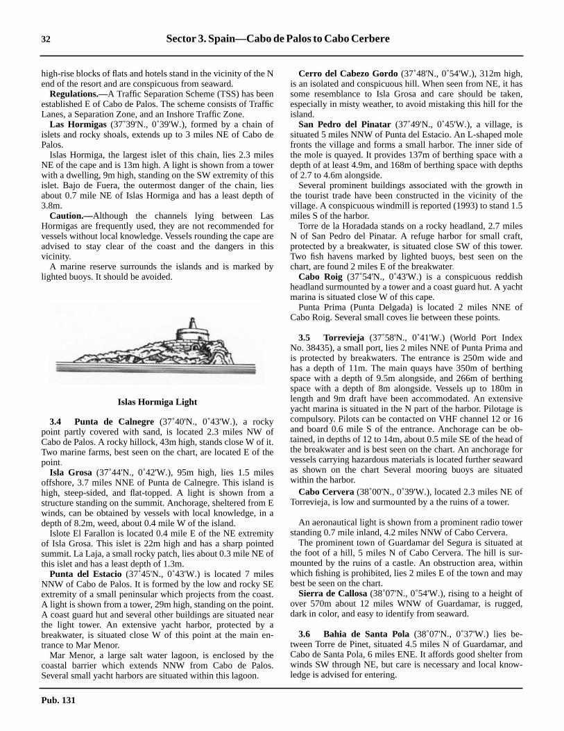
32 Sector 3. Spain—Cabo de Palos to Cabo Cerbere
asken,e
leofa
ths
inhe.5
ilesft,er.the
hcht
of
ndnd
inging
iniveis16ob-offorardted
f
r
at-iny
d,
ndmw-
high-rise blocks of flats and hotels stand in the vicinity of the Nend of the resort and are conspicuous from seaward.3.3 Regulations.—A Traffic Separation Scheme (TSS) has beenestablished E of Cabo de Palos. The scheme consists of TrafficLanes, a Separation Zone, and an Inshore Traffic Zone.3.3 Las Hormigas (37˚39'N., 0˚39'W.), formed by a chain ofislets and rocky shoals, extends up to 3 miles NE of Cabo dePalos.3.3 Islas Hormiga, the largest islet of this chain, lies 2.3 milesNE of the cape and is 13m high. A light is shown from a towerwith a dwelling, 9m high, standing on the SW extremity of thisislet. Bajo de Fuera, the outermost danger of the chain, liesabout 0.7 mile NE of Islas Hormiga and has a least depth of3.8m.3.3 Caution.—Although the channels lying between LasHormigas are frequently used, they are not recommended forvessels without local knowledge. Vessels rounding the cape areadvised to stay clear of the coast and the dangers in thisvicinity.3.3 A marine reserve surrounds the islands and is marked bylighted buoys. It should be avoided.
3.4 Punta de Calnegre (37˚40'N., 0˚43'W.), a rockypoint partly covered with sand, is located 2.3 miles NW ofCabo de Palos. A rocky hillock, 43m high, stands close W of it.Two marine farms, best seen on the chart, are located E of thepoint.3.4 Isla Grosa (37˚44'N., 0˚42'W.), 95m high, lies 1.5 milesoffshore, 3.7 miles NNE of Punta de Calnegre. This island ishigh, steep-sided, and flat-topped. A light is shown from astructure standing on the summit. Anchorage, sheltered from Ewinds, can be obtained by vessels with local knowledge, in adepth of 8.2m, weed, about 0.4 mile W of the island.3.4 Islote El Farallon is located 0.4 mile E of the NE extremityof Isla Grosa. This islet is 22m high and has a sharp pointedsummit. La Laja, a small rocky patch, lies about 0.3 mile NE ofthis islet and has a least depth of 1.3m.3.4 Punta del Estacio (37˚45'N., 0˚43'W.) is located 7 milesNNW of Cabo de Palos. It is formed by the low and rocky SEextremity of a small peninsular which projects from the coast.A light is shown from a tower, 29m high, standing on the point.A coast guard hut and several other buildings are situated nearthe light tower. An extensive yacht harbor, protected by abreakwater, is situated close W of this point at the main en-trance to Mar Menor.3.4 Mar Menor, a large salt water lagoon, is enclosed by thecoastal barrier which extends NNW from Cabo de Palos.Several small yacht harbors are situated within this lagoon.
3.4 Cerro del Cabezo Gordo(37˚48'N., 0˚54'W.), 312m high,is an isolated and conspicuous hill. When seen from NE, it hsome resemblance to Isla Grosa and care should be taespecially in misty weather, to avoid mistaking this hill for thisland.3.4 San Pedro del Pinatar (37˚49'N., 0˚45'W.), a village, issituated 5 miles NNW of Punta del Estacio. An L-shaped mofronts the village and forms a small harbor. The inner sidethe mole is quayed. It provides 137m of berthing space withdepth of at least 4.9m, and 168m of berthing space with depof 2.7 to 4.6m alongside.3.4 Several prominent buildings associated with the growththe tourist trade have been constructed in the vicinity of tvillage. A conspicuous windmill is reported (1993) to stand 1miles S of the harbor.3.4 Torre de la Horadada stands on a rocky headland, 2.7 mN of San Pedro del Pinatar. A refuge harbor for small craprotected by a breakwater, is situated close SW of this towTwo fish havens marked by lighted buoys, best seen onchart, are found 2 miles E of the breakwater.3.4 Cabo Roig (37˚54'N., 0˚43'W.) is a conspicuous reddisheadland surmounted by a tower and a coast guard hut. A yamarina is situated close W of this cape.3.4 Punta Prima (Punta Delgada) is located 2 miles NNECabo Roig. Several small coves lie between these points.
3.5 Torrevieja (37˚58'N., 0˚41'W.) (World Port IndexNo. 38435), a small port, lies 2 miles NNE of Punta Prima ais protected by breakwaters. The entrance is 250m wide ahas a depth of 11m. The main quays have 350m of berthspace with a depth of 9.5m alongside, and 266m of berthspace with a depth of 8m alongside. Vessels up to 180mlength and 9m draft have been accommodated. An extensyacht marina is situated in the N part of the harbor. Pilotagecompulsory. Pilots can be contacted on VHF channel 12 orand board 0.6 mile S of the entrance. Anchorage can betained, in depths of 12 to 14m, about 0.5 mile SE of the headthe breakwater and is best seen on the chart. An anchoragevessels carrying hazardous materials is located further seawas shown on the chart Several mooring buoys are situawithin the harbor.3.5 Cabo Cervera (38˚00'N., 0˚39'W.), located 2.3 miles NE oTorrevieja, is low and surmounted by a the ruins of a tower.
3.5 An aeronautical light is shown from a prominent radio towestanding 0.7 mile inland, 4.2 miles NNW of Cabo Cervera.3.5 The prominent town of Guardamar del Segura is situatedthe foot of a hill, 5 miles N of Cabo Cervera. The hill is surmounted by the ruins of a castle. An obstruction area, withwhich fishing is prohibited, lies 2 miles E of the town and mabest be seen on the chart.3.5 Sierra de Callosa(38˚07'N., 0˚54'W.), rising to a height ofover 570m about 12 miles WNW of Guardamar, is ruggedark in color, and easy to identify from seaward.
3.6 Bahia de Santa Pola(38˚07'N., 0˚37'W.) lies be-tween Torre de Pinet, situated 4.5 miles N of Guardamar, aCabo de Santa Pola, 6 miles ENE. It affords good shelter frowinds SW through NE, but care is necessary and local knoledge is advised for entering.
Islas Hormiga Light
Pub. 131
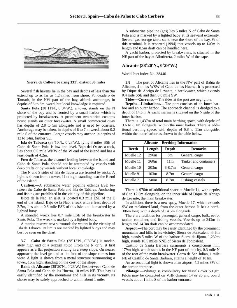
Sector 3. Spain—Cabo de Palos to Cabo Cerbere 33
taity.
ofin
he
dds
-to ahe
ofdi-e,
hso
dsth,
ro,in
tm0m
ill,Nile
of
t.rd
3.6 Several fish havens lie in the bay and depths of less than 9mextend up to as far as 1.2 miles from shore. Fondeadero deTamarit, in the NW part of the bay, affords anchorage, indepths of 5 to 6m, weed, but local knowledge is required.3.6 Santa Pola (38˚11'N., 0˚34'W.), a town, stands on the Nshore of the bay and is fronted by a small harbor which isprotected by breakwaters. A prominent two-storied customshouse stands on outer breakwater. A small commercial quayhas depths of 2.8 to 5m alongside and is used by coasters.Anchorage may be taken, in depths of 6 to 7m, weed, about 0.2mile S of the entrance. Larger vessels may anchor, in depths of12 to 14m, farther SE.3.6 Isla de Tabarca (38˚10'N., 0˚28'W.), lying 3 miles SSE ofCabo de Santa Pola, is low and level. Bajo del Oeste, a rock,lies about 0.5 mile WNW of the W end of the island and has aleast depth of 4.2m.3.6 Freu de Tabarca, the channel leading between the island andCabo de Santa Pola, should not be attempted by vessels withdeep drafts or by vessels without local knowledge.3.6 The N and S sides of Isla de Tabarca are fronted by rocks. Alight is shown from a tower, 11m high, standing near the E endof the island.3.6 Caution.—A submarine water pipeline extends ESE be-tween the Cabo de Santa Pola and Isla de Tabarca. Anchoringand fishing are prohibited in the vicinity of this pipeline.3.6 Islote de la Nao, an islet, is located 0.3 mile ESE of the Eend of the island. Bajo de la Nao, a rock with a least depth of3.7m, lies about 0.8 mile ESE of this islet and is marked by alighted buoy.3.6 A stranded wreck lies 0.7 mile ESE of the breakwater toSanto Pola. The wreck is marked by a lighted buoy.3.6 A marine reserve area surrounds the waters in the vicinity ofIsla de Tabarca. Its limits are marked by lighted buoys and maybest be seen on the chart.
3.7 Cabo de Santo Pola(38˚13'N., 0˚30'W.) is moder-ately high and of a reddish color. From the N or S, it firstappears as a flat projection ending in a steep slope. On nearerapproach, the level ground at the foot of the slope comes intoview. A light is shown from a metal structure surmounting atower, 15m high, standing on the crest of the slope.3.7 Bahia de Alicante(38˚20'N., 0˚28'W.) lies between Cabo deSanta Pola and Cabo de las Huerta, 10 miles NE. This bay iseasily identified by the mountains and hills in its vicinity. Itsshores may be safely approached to within about 1 mile.
3.7 A submarine pipeline (gas) lies 5 miles N of Cabo de SanPola and is marked by a lighted buoy at its seaward extremSeveral gas storage tanks stand near the shore of the bay, Wthis terminal. It is reported (1994) that vessels up to 140mlength and 8.5m draft can be handled here.3.7 A yacht harbor, protected by breakwaters, is situated in tNE part of the bay at Albufereta, 2 miles W of the cape.
Alicante (38˚20'N., 0˚29'W.)
World Port Index No. 38440
3.8 The port of Alicante lies in the NW part of Bahia deAlicante, 4 miles WSW of Cabo de las Huerta. It is protecteby Dique de Abrigo de Levante, a breakwater, which exten0.4 mile SSE and then 0.8 mile SW.3.8 Tides—Currents.—The tides at the port are negligible.3.8 Depths—Limitations.—The port consists of an inner harbor and an outer harbor. The approach channel is dredgeddepth of 14.5m. A yacht marina is situated on the N side of tinner harbor.3.8 There is 1,437m of total main berthing space, with depths3.6 to 8.1m alongside, within the inner harbor. There is adtional berthing space, with depths of 6.8 to 11m alongsidwithin the outer harbor as shown in the table below.
3.8 There is 970m of additional space at Muelle 14, with deptof 8 to 12.5m alongside, on the inner side of Dique de Abrigde Levante, the main breakwater.3.8 In addition, there is a new quay, Muelle 17, which extenSW on reclaimed land, from the outer harbor. It has a ber306m long, with a depth of 14.5m alongside.3.8 There are facilities for passenger, general cargo, bulk, ro-tanker, container, and fishing vessels. Vessels up to 243mlength and 14.3m draft can be accommodated.3.8 Aspect.—The port may be easily identified by the prominenmountains and hills in its vicinity. Sierra de Fontcalent, 446high, stands 5 miles W of the harbor. Sierra de Jijona, 1,23high, stands 10.5 miles NNE of Sierra de Fontcalent.3.8 Castillo de Santa Barbara surmounts a conspicuous h179m high, which stands in the NE part of the city, 0.3 mileof the root of the main breakwater. Cerro de San Julian, 1 mNE of Castillo de Santa Barbara, attains a height of 181m.3.8 An aeronautical light is shown at an airport, 4.5 miles SWthe harbor entrance.3.8 Pilotage.—Pilotage is compulsory for vessels over 50 grPilots may be contacted on VHF channel 14 or 20 and boavessels about 1 mile S of the harbor entrance.
Sierra de Callosa bearing 331˚, distant 30 miles
Alicante—Berthing Information
Berth Length Depth Remarks
Muelle 12 296m 8m General cargo
Muelle 11 360m 11m Tanker and containers
Muelle 10 203m 6-8.7m General cargo
Muelle 9 103m 8.7m General cargo
Muelle 7 240m 8.7m Fishing vessels
Pub. 131

34 Sector 3. Spain—Cabo de Palos to Cabo Cerbere
epm
shaisin
.or
e. A
1
d in
osees
se
atar.her
pth0.3
bela
e
, is
nd
abok-dsptha.
3.8 Anchorage.—Anchorage may be taken, in a depth of 16m,good holding ground, about 0.5 mile off the outer breakwater.3.8 In winter, with strong NW winds, vessels may drag if an-chored too far offshore.
Alicante to Gandia
3.9 Cabo de las Huerta(38˚21'N., 0˚24'W.), located 4miles ENE of Alicante, terminates in a low point. A hill risesclose NW of the cape and is a prominent whitish color. A reef,with a depth of less than 5m over its seaward end, extends up to0.3 mile E of the cape. A light is shown from a tower, 8m high,standing on the cape.3.9 During NW winds, anchorage can be obtained off Playa delas Huertas, which extends as far as 3.5 miles N of the cape.3.9 Villajoyosa (38˚30'N., 0˚14'W.), a small harbor, is situated13 miles NE of Cabo de las Huerta. It is protected by break-waters and is mostly used by fishing boats. A yacht marina issituated within this harbor.3.9 Cabezo del Tosal(38˚31'N., 0˚10'W.), a small promontory,is located 2.8 miles ENE of Villajoyosa. It is conspicuous,whitish in color, and surmounted by a coast guard station.3.9 Ensenada de Benidorm lies between Cabezo del Tosal andPunta de la Escaleta, 3 miles E. This bay affords shelter fromNW and NE winds.3.9 Islote de Benidorm (38˚30'N., 0˚48'W.) lies 2 miles SW ofPunta de la Escaleta. It is cliffy, barren, and reddish. A flat,whitish, and rocky shoal, with a least depth of 5.8m, extends200m in a NNE to SSW direction and should be given a wideberth by deep draft vessels. This shoal lies 0.2 mile S of thisisland. A light is shown from a tower, 4m high, standing on theisland.3.9 Benidorm (38˚32'N., 0˚08'W.) (World Port Index No.38437), a resort town, is situated at the head of Ensenada deBenidorm. It has numerous tall buildings and surrounds arocky point, which is surmounted by a conspicuous churchwith a blue dome. Anchorage, during offshore winds, can beobtained, in depths of 20 to 26m, muddy sand and weed, about0.4 mile SW of the church.3.9 Caution.—The head of a small mole, which fronts the town,should be given a wide berth due to submerged foundations.Considerable silting has also taken place in its vicinity.3.9 Tunny nets are laid out annually in the E part of Ensenada deBenidorm.3.9 A fishing prohibited area, the limits of which are shown onthe chart, lies centered 1 mile NNE of Islote de Benidorm.
3.10 Sierra Helada(38˚33'N., 0˚05'W.), a range of hills,extends 3 miles NE of Punta de la Escaleta. When seen fromthe SW or NE, it presents a steep slope on the seaward side anda gradual decline on the inland side.3.10 Islote Mediana (Isla Mitjana) lies close inshore, 1.5 milesNE of Punta de la Escaleta. It usually cannot be distinguishedagainst the cliffs, except from a short distance.3.10 Punta del Albir (38˚34'N., 0˚03'W.) is located 2 miles NEof Islote Mediana. A light is shown from a tower with adwelling, 8m high, standing on the point.3.10 Puig Campana, the most conspicuous mountain along thispart of the coast, rises to a height of 1,436m, 7 miles WNW ofPunta del Albir. When seen from the SSE, this mountain can
easily be identified by Cuchillada de Roldan, a large and deravine lying between its summit and another peak, 1,366high, standing 0.5 mile SW.
3.11 Altea(38˚36'N., 0˚03'W.), a town, is situated 2 mileN of Punta del Albir. It is marked by a prominent church withigh blue and white cupolas. A small harbor, which includesyacht marina, is situated 0.5 mile SSW of the town andprotected by breakwaters. Anchorage can be obtained,depths of 16 to 20m, mud, 0.5 mile E of the harbor entrance3.11 A dangerous wreck lies about 0.4 mile SSE of the harbentrance.3.11 Islote de Altea lies 0.2 mile offshore, 2.5 miles NE of thharbor. A reef extends between this islet and the mainlandsmall yacht harbor, protected by a breakwater, is situatedmile NE of the islet.3.11 A dangerous wreck lies about 0.7 mile S of the islet.3.11 Numerous fish havens, best seen on the chart, are locatethe Ensenada de Altea.3.11 Ensenada de Calpe is entered between Cabo Toix, whsummit is topped by a television relay tower, located 5 milNE of Punta del Albir, and Punta Ifach, 2.5 miles ENE. Asmall craft harbor, protected by breakwaters, is situated cloNW of Punta Ifach.3.11 Punta Ifach is formed by the E extremity of Monte Ifach,peninsula, which somewhat resembles the Rock of GibralIts seaward sides are formed by high, reddish cliffs and tland to the NW of it is very low. When seen from the SW oNE, it appears as an island.3.11 During good weather, anchorage can be obtained, in a deof 12m, sand and weed, within Ensenada de Calpe, aboutmile offshore. During W or SW winds, anchorage can alsoobtained, in a depth of 26m, sand and mud, off Playa deFosa, about 0.6 mile N of Punta Ifach.3.11 Caution.—A dangerous wreck lies 0.5 mile from land in thcenter of the bay in front of Ensenada de Calpe.3.11 Punta de Las Basetas, located 1.2 miles N of Punta Ifachsurmounted by a large tower.
3.12 Cabo Blanco(38˚40'N., 0˚07'E.), located 3 miles NEof Punta Ifach, slopes steeply down to the sea. The high lastanding above this cape is surmounted by a tower.3.12 Ensenada de Morayra lies between Cabo Blanco and CMorayra, 1.7 miles ENE. A yacht harbor, protected by breawaters, is situated close W of Cabo Morayra. This bay afforshelter from W, N, and E winds. Vessels may anchor, in a deof 16m, sand or mud, about 0.5 mile WNW of Cabo Morayr
Cuchillada de Roldan bearing 347˚, distant 12 miles
Pub. 131

Sector 3. Spain—Cabo de Palos to Cabo Cerbere 35
oofanaft,
dheSW,rem
t.si-t 6
-to
0.8
fcts
of
ndto
he,t to
va.as.
nd
tis
e
3.12 Monte Isabela, 442m high, stands 3 miles NNE of CaboMorayra. This hill is conical in shape and easy to identify.3.12 Several marine farms have been established within the bayslying NE and W of Punta Ifach. These farms are protected byartificial reefs and fishing is prohibited in their vicinity. Vesselsanchoring in the bays should have local knowledge.3.12 Cabo de la Nao(38˚44'N., 0˚14'E.), located 5 miles NE ofCabo Morayra, is fairly steep-to. A large rock lies at its foot,near a cave. A light is shown from a tower with a dwelling,20m high, standing on the cape. A radiobeacon is situated atthe light.3.12 Isla del Descubridor, 57m high, lies close offshore, 1 mileWSW of the cape. The narrow channel lying between thisisland and the mainland cannot be used.3.12 Cabo Negro, located 1 mile N of Cabo de la Nao, is sheer cutand fronted by rocks. Isla del Portichol, 68m high, lies closeoffshore, 0.7 mile N of this cape.3.12 Cabo de San Martin, located 1.2 miles N of Cabo Negro, hasa steep-sided hillock standing at its extremity.3.12 Javea(38˚48'N., 0˚11'E.), a small harbor, is situated within abay, 2.4 miles NNW of Cabo de San Martin. It is protected bytwo breakwaters and is used by small craft and yachts.Anchorage can be obtained, in depths of 14 to 20m, sand, E ofthe harbor.3.12 Caution.—Submarine cables extend E from a point on theshore lying close S of Javea.
3.13 Cabo de San Antonio(38˚40'N., 0˚12'E.), located 0.7mile ENE of Javea, is formed by a high and level promontorywhich falls steeply towards the sea. A light is shown from atower with a dwelling, 17m high, standing on the E extremityof the cape.3.13 A signal station is situated near the light and a hermitagestands close SSW of it. Several windmills stand on a ridge, 1.2miles W of the cape.3.13 Monte Mongo (38˚48'N., 0˚08'E.), 752m high, has a conicalpeak surmounted by a castle. This hill is conspicuous and froma distance appears as an island. During E or NE winds, itgenerally becomes obscured by clouds.3.13 Ibiza (38˚55'N., 1˚20'W.), the nearest island of the IslasBaleares, lies 48 miles ENE of Cabo de San Antonio and isdescribed in paragraph 4.6.
3.14 Denia (38˚50'N., 0˚07'E.) (World Port Index No.38450), a small port, lies 4.7 miles WNW of Cabo de SanAntonio and is protected by two breakwaters.
3.14 Depths—Limitations.—The entrance channel is dredged ta depth of 5m. The main quay is 208m long and has a depth5.5m alongside. Vessels up to 100m in length and 5m draft cbe accommodated. The port is mostly used by pleasure cryacht, and vehicular ferries.3.14 Aspect.—Castillo de Denia stands on a hill near the NW enof the harbor. The prominent spire of the church and tsquare-topped belfry of another church stand close SE andrespectively, of the castle. Several high-rise buildings asituated in the vicinity of the town and are conspicuous froseaward.3.14 A lighted range indicates the entrance channel.3.14 Pilotage.—Pilotage is compulsory for vessels over 50 grPilots can be contacted on VHF channel 16 and board in potion 38˚52'N, 8˚53'E. Vessels should send their ETA at leashours in advance and request a pilot from Gandia.3.14 Anchorage.—Vessels up to 91m in length may anchor within the harbor. Larger vessels may anchor, in depths of 1218m, in the roadstead, or in a depth of 26m, mud, aboutmile NE of the N breakwater.3.14 Caution.—Bajo La Androna, a shoal with a least depth o3.4m, lies close N of the head of the S breakwater and projeinto the entrance channel.3.14 An outfall pipeline extends from the shore on the NW sidethe harbor. Its seaward end is marked by a buoy.
3.15 Algar de la Almadraba (38˚55'N., 0˚02'E.), centeredabout 6 miles NW of Denia, is an extensive area of foul grouwhich lies off this stretch of coast. This area has depths of 2536m and heavy seas are raised over it by onshore winds.3.15 Oliva (38˚55'N., 0˚07'W.), a conspicuous town, stands at tfoot of a small hill, 12 miles NW of Denia. Two small pierswith depths of 3m alongside, extend from the coast adjacenthis town.3.15 Torre de Piles stands near the beach, 2 miles N of OliSeveral prominent buildings are situated near this tower. It wreported (1990) that the tower was not visible from seaward
Gandia (39˚00'N., 0˚09'W.)
World Port Index No. 38460
3.16 Gandia, a small port, lies at the mouth of the Rio SaNicolas, 20 miles NW of Cabo de San Antonio. It is protecteby two breakwaters.3.16 Depths—Limitations.—The entrance to the harbor is abou100m wide, with a depth of 9m. An extensive yacht marinasituated in the N part of the harbor.3.16 Information concerning the main commercial facilities argiven in the accompanying table.
Ensenada de Javea
Gandia—Berthing Information
Berth Length Depth Remarks
Muelle Sur 150m 6.0m General cargo
Muelle Norte 125m 5.5m General cargo
Muelle Frutero 300m 5.5m General cargo
Pub. 131

36 Sector 3. Spain—Cabo de Palos to Cabo Cerbere
iles
, iskyN
of
Elre
a
a
wAnosef
atE
dsorstena
of
ny
3.16 There are facilities for general cargo, bulk, and ro-ro vessels.Vessels up to 107m in length and 5.5m have been accommo-dated.3.16 Aspect.—El Mitjanet, a rocky patch, with a least depth of5.6m, lies about 0.5 mile N of the harbor entrance. It extendsparallel with the coast and about 0.4 mile offshore.3.16 The town of Gandia is situated on the N bank of the RioSerpis in the middle of a cultivated plain, 1.5 miles SW of theharbor.3.16 Pilotage.—Pilotage is compulsory as local knowledge isessential due to shifting shoals near the entrance. Pilots boardabout 0.5 mile off the harbor entrance and can be contacted onVHF channel 16.3.16 Anchorage.—Anchorage can be obtained, in a depth of20m, 1.2 miles ENE of the head of the N breakwater. Due to ElMitjanet, extreme care should be taken.3.16 Caution.—Fish havens front the port to the E and NE as bestseen on the chart..3.16 A dangerous wreck lies 4.5 miles NNE of the N breakwaterlight at Puerto de Gandia.
Gandia to Valencia
3.17 La Vinyeta (39˚04'N., 0˚11'W.), an area of rockypatches, extends between Gandia and the Rio Jucar, 10 milesNNW. It lies up to 1 mile offshore and has depths of 10 to 20m.3.17 From Gandia to Valencia, the coast is low and sandy, withthe exception of Cabo Cullera, and generally may be ap-proached to within 1 mile.3.17 Torre La Vall and Torre de Jucar stand 6.2 and 9.7 miles NW,respectively, of Gandia. Several buildings are situated in thevicinity of these towers. It is reported (1990) that these towersare not visible from seaward.3.17 El Moro, marked by a beacon, is a small above-water rockwhich lies about 0.6 mile NNE of the mouth of the Rio Jucar.During offshore winds, anchorage may be taken, in a depth of6m, about 0.3 mile N or S of El Moro.3.17 The Rio Jucar is shallow and its mouth encumbered by a bar.Two jetties extend 0.2 mile seaward from the mouth of theriver.
3.17 Monte de las Zorras (39˚10'N., 0˚15'W.), 222m high, isprominent and stands just S of Sierra de Cullora, a range,which rises steeply from the plains.3.17 Cabo Cullera (39˚11'N., 0˚13'W.) rises steeply from the seaand is the E extremity of Sierra de Cullera. A light is shownfrom a tower, 16m high, standing on the cape.3.17 A small yacht harbor, protected by breakwaters, is situated0.5 mile SW of the cape.
3.17 Santos de Sucia Hermitage stands 2.5 miles inland, 5.7 mNW of Cabo Cullera. It is situated on a prominent hill, 38mhigh, in the middle of the coastal plain and is conspicuous.3.17 Casa del Rey, where several prominent buildings standlocated 4 miles NW of Cabo Cullera. Penas del Moro, a rocand shallow reef, extends up to 0.3 mile offshore, about 0.5of Casa del Rey.3.17 El Perello, a small yacht harbor, is situated 6 miles NNWCabo Cullera and protected by breakwaters.3.17 La Albufera de Valencia (39˚20'N., 0˚21'W.), a shallowlake, lies just inland behind the coastal sand banks. CaserioSaler, a small village, is situated at its N end. A small, squatower stands in the village and is visible from seaward.3.17 Caution.—Dangerous wrecks lie 1 mile NE of Cabo Cullerand 2 miles E of Gola del Perello.
Valencia (39˚27'N., 0˚19'W.)
World Port Index No. 38480
3.18 The port of Valencia lies 17 miles NNW of CaboCullera and is protected by breakwaters. It is backed byprominent city which stands on a plain, 2 miles inland.
3.18 Depths—Limitations.—The Rio Turia, which formerlyflowed through the N part of the city, was diverted and noenters the sea 1.4 miles WSW of the harbor entrance.exten-sive marina, protected by rubble breakwaters, lies clN of this new river mouth. A small craft harbor, consisting otwo basins, is situated 0.4 mile N of the marina.3.18 Muelle de Levante extends 0.9 mile SSE from the shorethe N side of the port. Dique de Norte extends about 0.5 milefrom the SE end of Muelle de Levante. Dique del Este exten0.6 mile S from the E end of Dique de Norte. The harbentrance, 600m wide, lies between the S end of Dique de Eand a rubble breakwater, which is part of the Muelle DarseSur to the SW.3.18 The entrance fairway is 500m wide and dredged to a depth16m.3.18 The main berthing facilities are described in the accompatable.
Muelle Serpis 300m 9.0-10.0m
Generalcargo.Ro-ro vessels.
Muelle Sur extension 150m 6.5m General cargo
Moto-Veleros 174m 4.5m Fishing ves-sels
Gandia—Berthing Information
Berth Length Depth Remarks
Port of Valencia Home Page
http://www.valenciaport.com
Valencia—Berthing Information
Berth Length Depthalongside
Muelle Sur 600m 14m
Muelle de Levante 1,400m 9-14m
Espigon Norte 176m 9m
Poniente 436m 9-11m
Espigon Turia 811m 9-14m
Muelle de Turia 387m 9m
Pub. 131
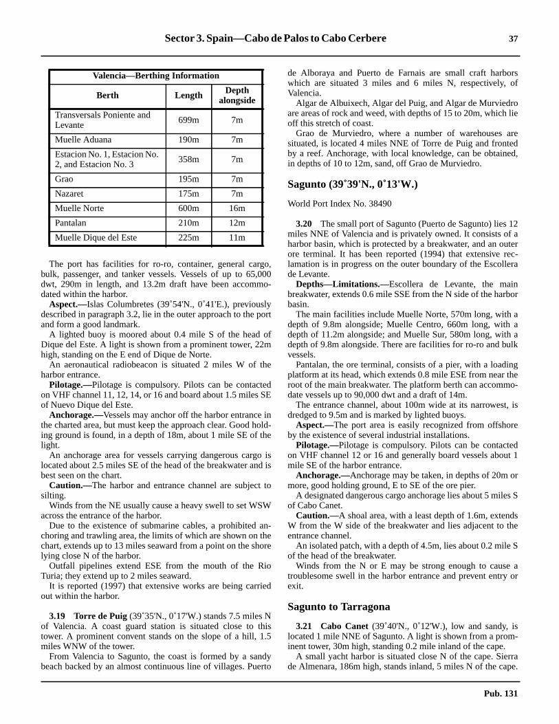
Sector 3. Spain—Cabo de Palos to Cabo Cerbere 37
orsof
olie
reedd,
12ater
ec-ra
bor
aaalk
ngheo-
, is
e
dt 1
r
s S
dshe
S
aor
-
rrape.
3.18 The port has facilities for ro-ro, container, general cargo,bulk, passenger, and tanker vessels. Vessels of up to 65,000dwt, 290m in length, and 13.2m draft have been accommo-dated within the harbor.3.18 Aspect.—Islas Columbretes (39˚54'N., 0˚41'E.), previouslydescribed in paragraph 3.2, lie in the outer approach to the portand form a good landmark.3.18 A lighted buoy is moored about 0.4 mile S of the head ofDique del Este. A light is shown from a prominent tower, 22mhigh, standing on the E end of Dique de Norte.3.18 An aeronautical radiobeacon is situated 2 miles W of theharbor entrance.3.18 Pilotage.—Pilotage is compulsory. Pilots can be contactedon VHF channel 11, 12, 14, or 16 and board about 1.5 miles SEof Nuevo Dique del Este.3.18 Anchorage.—Vessels may anchor off the harbor entrance inthe charted area, but must keep the approach clear. Good hold-ing ground is found, in a depth of 18m, about 1 mile SE of thelight.3.18 An anchorage area for vessels carrying dangerous cargo islocated about 2.5 miles SE of the head of the breakwater and isbest seen on the chart.3.18 Caution.—The harbor and entrance channel are subject tosilting.3.18 Winds from the NE usually cause a heavy swell to set WSWacross the entrance of the harbor.3.18 Due to the existence of submarine cables, a prohibited an-choring and trawling area, the limits of which are shown on thechart, extends up to 13 miles seaward from a point on the shorelying close N of the harbor.3.18 Outfall pipelines extend ESE from the mouth of the RioTuria; they extend up to 2 miles seaward.3.18 It is reported (1997) that extensive works are being carriedout within the harbor.
3.19 Torre de Puig(39˚35'N., 0˚17'W.) stands 7.5 miles Nof Valencia. A coast guard station is situated close to thistower. A prominent convent stands on the slope of a hill, 1.5miles WNW of the tower.3.19 From Valencia to Sagunto, the coast is formed by a sandybeach backed by an almost continuous line of villages. Puerto
de Alboraya and Puerto de Farnais are small craft harbwhich are situated 3 miles and 6 miles N, respectively,Valencia.3.19 Algar de Albuixech, Algar del Puig, and Algar de Murviedrare areas of rock and weed, with depths of 15 to 20m, whichoff this stretch of coast.3.19 Grao de Murviedro, where a number of warehouses asituated, is located 4 miles NNE of Torre de Puig and frontby a reef. Anchorage, with local knowledge, can be obtainein depths of 10 to 12m, sand, off Grao de Murviedro.
Sagunto (39˚39'N., 0˚13'W.)
World Port Index No. 38490
3.20 The small port of Sagunto (Puerto de Sagunto) liesmiles NNE of Valencia and is privately owned. It consists ofharbor basin, which is protected by a breakwater, and an ouore terminal. It has been reported (1994) that extensive rlamation is in progress on the outer boundary of the Escollede Levante.3.20 Depths—Limitations.—Escollera de Levante, the mainbreakwater, extends 0.6 mile SSE from the N side of the harbasin.3.20 The main facilities include Muelle Norte, 570m long, withdepth of 9.8m alongside; Muelle Centro, 660m long, withdepth of 11.2m alongside; and Muelle Sur, 580m long, withdepth of 9.8m alongside. There are facilities for ro-ro and buvessels.3.20 Pantalan, the ore terminal, consists of a pier, with a loadiplatform at its head, which extends 0.8 mile ESE from near troot of the main breakwater. The platform berth can accommdate vessels up to 90,000 dwt and a draft of 14m.3.20 The entrance channel, about 100m wide at its narrowestdredged to 9.5m and is marked by lighted buoys.3.20 Aspect.—The port area is easily recognized from offshorby the existence of several industrial installations.3.20 Pilotage.—Pilotage is compulsory. Pilots can be contacteon VHF channel 12 or 16 and generally board vessels aboumile SE of the harbor entrance.3.20 Anchorage.—Anchorage may be taken, in depths of 20m omore, good holding ground, E to SE of the ore pier.3.20 A designated dangerous cargo anchorage lies about 5 mileof Cabo Canet.3.20 Caution.—A shoal area, with a least depth of 1.6m, extenW from the W side of the breakwater and lies adjacent to tentrance channel.3.20 An isolated patch, with a depth of 4.5m, lies about 0.2 mileof the head of the breakwater.3.20 Winds from the N or E may be strong enough to causetroublesome swell in the harbor entrance and prevent entryexit.
Sagunto to Tarragona
3.21 Cabo Canet(39˚40'N., 0˚12'W.), low and sandy, islocated 1 mile NNE of Sagunto. A light is shown from a prominent tower, 30m high, standing 0.2 mile inland of the cape.3.21 A small yacht harbor is situated close N of the cape. Siede Almenara, 186m high, stands inland, 5 miles N of the ca
Transversals Poniente andLevante 699m 7m
Muelle Aduana 190m 7m
Estacion No. 1, Estacion No.2, and Estacion No. 3 358m 7m
Grao 195m 7m
Nazaret 175m 7m
Muelle Norte 600m 16m
Pantalan 210m 12m
Muelle Dique del Este 225m 11m
Valencia—Berthing Information
Berth Length Depthalongside
Pub. 131

38 Sector 3. Spain—Cabo de Palos to Cabo Cerbere
,e-
rforing
ci-
)E
. In
theaft
ar,
e
h,ld-nt,
nt
drs.toisput
i-
m.0.6
ft-a
ld
This hill is crowned by a castle and a tower which can be seenfrom seaward.3.21 A marine farm, marked by lighted buoys, lies close NE ofthe ore loading platform at Sagunto.3.21 An outfall, marked by a buoy, lies 1 mile N of Cabo Canet.Fish havens front the coast between Cabo Canet and BajoPunta La Llosa and are best seen on the chart.3.21 Bajo Punta La Llosa, with a least depth of 5.5m, lies 1.5miles offshore, about 4.5 miles NNE of Cabo Canet.3.21 Pico Espadan, 1,105m high, stands 13 miles inland, 16 milesNNW of Cabo Canet. This mountain is the most conspicuousdistant landmark along this stretch of coast.
3.22 Burriana (39˚53'N., 0˚03'W.) (World Port Index No.38495), a small port, lies 13 miles NE of Cabo Canet and isprotected by breakwaters.3.22 Depths—Limitations.—The harbor entrance has a depth of6m.3.22 The main facilities include Transversal Quay, 180m long,with a depth of 5.5m alongside, and Levante Quay, 400m long,with a depth of 5m alongside. Vessels up to 150m in length and5.2m draft can be accommodated.3.22 Aspect.—The prominent town of Burriana stands on the Sbank of the Rio Bechi, 1.5 miles N of the harbor.3.22 Pilotage.—Pilots are available and generally board vesselsabout 1 mile from the harbor entrance. The port can be con-tacted on VHF channel 16.3.22 Anchorage.—Vessels can anchor, in a depth of 10m, about0.2 mile S of the head of the E breakwater.3.22 Caution.—A sandy shoal, with a depth of 3.3m, lies about0.5 mile SW of the head of the E breakwater.3.22 Stony patches, with depths of 2.7m and 3m, lie about 0.6mile NE and 0.9 mile NNE, respectively, of the head of the Ebreakwater.3.22 Several wrecks and a triangular fish haven lie in the approachto the harbor and may best be seen on the chart.
3.23 Puerto de Castellon Oil Terminal (39˚56'N.,0˚03'E.) is situated offshore, 7 miles NE of Burriana. It consistsof an offshore sea berth, formed by mooring buoys, lying at theseaward end of a submarine pipeline, which extends 2.5 milesESE from the shore. In addition, a berthing platform is situatedalong this pipeline, 1.2 miles from the shore.3.23 Depths—Limitations.—Vessels of unlimited length, withdrafts up to about 12.5m, can be accommodated at the berthingplatform. Vessels of unlimited length, with drafts up to 19.8m,can be accommodated at the sea berth.3.23 Aspect.—The sea berth is marked by a lighted buoy mooredabout 0.5 mile E of it. In addition, two lighted buoys aremoored about 0.5 mile N of the seaward end of the pipeline.3.23 Pilotage.—Pilotage is compulsory. Vessels should send anETA 72 hours and 24 hours in advance.3.23 Pilots can be contacted on VHF channel 13 or 16 and board,as follows:
1. Sea berths—near Outer Lighted Buoy.2. Platform—about 0.5 mile NE of the platform.
3.23 If possible, vessels should maintain a continuous listeningwatch on VHF channel 13.
3.23 Anchorage.—Vessels may anchor, in a depth of about 30mseaward of Outer Lighted Buoy. The holding ground is rported to be good.3.23 Caution.—Navigation is prohibited between the outeapproach lighted buoy and the berthing platform, exceptvessels berthing. Small craft may pass between the berthplatform and the shore, but must not anchor or fish in the vinity of the pipeline.
3.24 El Grao (Puerto de Castellon) (39˚58'N., 0˚01'E.(World Port Index No. 38500), a small port, lies 8 miles NNof Burriana and is protected by breakwaters.3.24 Depths—Limitations.—A basin, with a depth of 4.1m, lieson the SW side of the harbor and is used by fishing vesselsaddition, a yacht marina is situated within the harbor.3.24 There are depths of 6.8 to 8m alongside the quays incommercial basin. Vessels up to 201m in length and 9.9m drhave been accommodated in the outer harbor.3.24 Aspect.—The prominent town of Castellon de la Planstands in the middle of a plain, 2.5 miles WNW of the harboand is visible from seaward.3.24 A light is shown from a structure, 27m high, standing on thhead of the E breakwater.3.24 A conspicuous flare is emitted from a chimney, 75m higwhich stands 1.7 miles SW of the harbor entrance. The buiings, tanks, and chimneys of an oil refinery and a heating plawhich are situated in the vicinity of the flare, are prominefrom seaward.3.24 Pilotage.—Pilotage is compulsory. Pilots may be contacteon VHF channel 12 or 16 and board close off the breakwate3.24 Anchorage.—Anchorage can be obtained, in depths of 1113m, fair holding ground, E of the head of E breakwater. Thanchorage is completely exposed and vessels are advised toto sea on the approach of bad weather.
3.25 Torre de Benicasim(40˚03'N., 0˚04'E.) stands on thecoast, 5 miles NNE of El Grao. The prominent town of Bencasim stands at the foot of a hill, 1 mile NW of this tower.3.25 Olla de Benicasim, a roadstead, lies off Torre de BenicasiAnchorage can be obtained, in depths of 7 to 11m, betweenmile and 1 mile offshore.3.25 Cabo de Oropesa(40˚05'N., 0˚09'E.), located 9 miles NE oEl Grao, is the low termination of Los Colls, a range of mounains with three conspicuous peaks. A light is shown fromtower with a dwelling, 13m high, standing on the cape. An owatch tower stands close to the light.
Los Colls from SE
Pub. 131
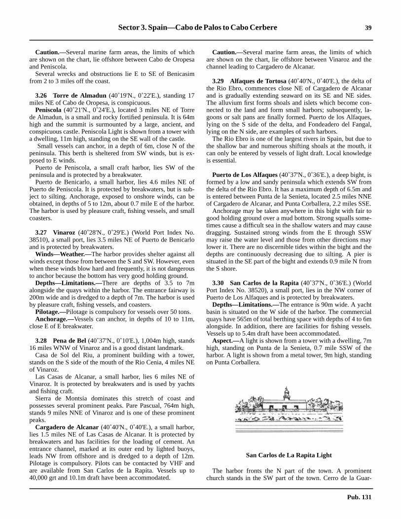
Sector 3. Spain—Cabo de Palos to Cabo Cerbere 39
hthe
nares.n-la-
es,al,
to, itge
mndNESE.toe-
useWay
heism
of
tial
6mls.
theg
tar-
3.25 Caution.—Several marine farm areas, the limits of whichare shown on the chart, lie offshore between Cabo de Oropesaand Peniscola.3.25 Several wrecks and obstructions lie E to SE of Benicasimfrom 2 to 3 miles off the coast.
3.26 Torre de Almadun (40˚19'N., 0˚22'E.), standing 17miles NE of Cabo de Oropesa, is conspicuous.3.26 Peniscola(40˚21'N., 0˚24'E.), located 3 miles NE of Torrede Almadun, is a small and rocky fortified peninsula. It is 64mhigh and the summit is surmounted by a large, ancient, andconspicuous castle. Peniscola Light is shown from a tower witha dwelling, 11m high, standing on the SE wall of the castle.3.26 Small vessels can anchor, in a depth of 6m, close N of thepeninsula. This berth is sheltered from SW winds, but is ex-posed to E winds.3.26 Puerto de Peniscola, a small craft harbor, lies SW of thepeninsula and is protected by a breakwater.3.26 Puerto de Benicarlo, a small harbor, lies 4.6 miles NE ofPuerto de Peniscola. It is protected by breakwaters, but is sub-ject to silting. Anchorage, exposed to onshore winds, can beobtained, in depths of 5 to 12m, about 0.7 mile E of the harbor.The harbor is used by pleasure craft, fishing vessels, and smallcoasters.
3.27 Vinaroz (40˚28'N., 0˚29'E.) (World Port Index No.38510), a small port, lies 3.5 miles NE of Puerto de Benicarloand is protected by breakwaters.3.27 Winds—Weather.—The harbor provides shelter against allwinds except those from between the S and SW. However, evenwhen these winds blow hard and frequently, it is not dangerousto anchor because the bottom has very good holding ground.3.27 Depths—Limitations.—There are depths of 3.5 to 7malongside the quays within the harbor. The entrance fairway is200m wide and is dredged to a depth of 7m. The harbor is usedby pleasure craft, fishing vessels, and coasters.3.27 Pilotage.—Pilotage is compulsory for vessels over 50 tons.3.27 Anchorage.—Vessels can anchor, in depths of 10 to 11m,close E of E breakwater.
3.28 Pena de Bel(40˚37'N., 0˚10'E.), 1,004m high, stands16 miles WNW of Vinaroz and is a good distant landmark.3.28 Casa de Sol del Riu, a prominent building with a tower,stands on the S side of the mouth of the Rio Cenia, 4 miles NEof Vinaroz.3.28 Las Casas de Alcanar, a small harbor, lies 6 miles NE ofVinaroz. It is protected by breakwaters and is used by yachtsand fishing craft.3.28 Sierra de Montsia dominates this stretch of coast andpossesses several prominent peaks. Pare Pascual, 764m high,stands 9 miles NNE of Vinaroz and is one of these prominentpeaks.3.28 Cargadero de Alcanar (40˚40'N., 0˚40'E.), a small harbor,lies 1.5 miles NE of Las Casas de Alcanar. It is protected bybreakwaters and has facilities for the loading of cement. Anentrance channel, marked at its outer end by lighted buoys,leads NW from offshore and is dredged to a depth of 12m.Pilotage is compulsory. Pilots can be contacted by VHF andare available from San Carlos de la Rapita. Vessels up to40,000 grt and 10.1m draft have been accommodated.
3.28 Caution.—Several marine farm areas, the limits of whicare shown on the chart, lie offshore between Vinaroz andchannel leading to Cargadero de Alcanar.
3.29 Alfaques de Tortosa(40˚40'N., 0˚40'E.), the delta ofthe Rio Ebro, commences close NE of Cargadero de Alcaand is gradually extending seaward on its SE and NE sidThe alluvium first forms shoals and islets which become conected to the land and form small harbors; subsequently,goons or salt pans are finally formed. Puerto de los Alfaqulying on the S side of the delta, and Fondeadero del Fanglying on the N side, are examples of such harbors.3.29 The Rio Ebro is one of the largest rivers in Spain, but duethe shallow bar and numerous shifting shoals at the mouthcan only be entered by vessels of light draft. Local knowledis essential.
Puerto de Los Alfaques(40˚37'N., 0˚36'E.), a deep bight, isformed by a low and sandy peninsula which extends SW frothe delta of the Rio Ebro. It has a maximum depth of 6.5m ais entered between Punta de la Senieta, located 2.5 miles Nof Cargadero de Alcanar, and Punta Corballera, 2.2 miles S3.29 Anchorage may be taken anywhere in this bight with fairgood holding ground over a mud bottom. Strong squalls somtimes cause a difficult sea in the shallow waters and may cadragging. Sustained strong winds from the E through SSmay raise the water level and those from other directions mlower it. There are no discernible tides within the bight and tdepths are continuously decreasing due to silting. A piersituated in the SE part of the bight and extends 0.9 mile N frothe S shore.
3.30 San Carlos de la Rapita(40˚37'N., 0˚36'E.) (WorldPort Index No. 38520), a small port, lies in the NW cornerPuerto de Los Alfaques and is protected by breakwaters.3.30 Depths—Limitations.—The entrance is 90m wide. A yachbasin is situated on the W side of the harbor. The commercquays have 565m of total berthing space with depths of 4 toalongside. In addition, there are facilities for fishing vesseVessels up to 5.4m draft have been accommodated.3.30 Aspect.—A light is shown from a tower with a dwelling, 7mhigh, standing on Punta de la Senieta, 0.7 mile SSW ofharbor. A light is shown from a metal tower, 9m high, standinon Punta Corballera.
3.30 The harbor fronts the N part of the town. A prominenchurch stands in the SW part of the town. Cerro de la Gu
San Carlos de La Rapita Light
Pub. 131

40 Sector 3. Spain—Cabo de Palos to Cabo Cerbere
y
e
s 3m.s.
nsSanre
an
of
ae Ne
o
rdsE.nd,canelsnd.m--
u.den-ths
rtoil
s.
ethethe
elle
e
diola, 116m high, stands at the NW end of the town and is sur-mounted by a tower.3.30 Pilotage.—Pilotage is compulsory. Pilots may be contactedon VHF channel 11, 12, 14, or 16 and board close outside thebreakwaters. Vessels should send an ETA at least 24 hours inadvance.3.30 Anchorage.—Sheltered anchorage may be found about 1.5miles SE of the harbor.
3.31 Punta de la Bana(40˚34'N., 0˚40'E.) is located onthe S side of the sandy peninsular, 2.9 miles E of Punta Cor-ballera. A light is shown from a tower, 26m high, standing onthe point. An old and disused light tower stands close NE ofthe light.3.31 Isla de Buda, located 12 miles NE of Punta de la Bana, isvery low and at times submerged in places. It was formerlyseparated from the rest of the delta by the S mouth of the RioEbro, which has since silted up.3.31 Cabo Tortosa (40˚43'N., 0˚54'E.), located 15 miles NE ofPunta de la Bana, is the S entrance point of the principal mouthof the Rio Ebro. It should not be approached within 2 miles andspecial caution should be taken at night and in thick weather.3.31 It is reported that winds from the NE give rise to a currentwhich sets into the bight lying N of the cape.3.31 A light is shown from a tower, 21m high, standing on the Nbank at the mouth of the river.3.31 A light with racon is shown from a framework tower situatedon a platform, 18m high, standing 2 miles E of the cape.3.31 Golfo de San Jorge lies between Cabo de Tortosa and Cabode Salou, 23 miles NE.3.31 Afortunada Oil Complex (40˚42'N., 1˚20'E.) lies 22 milesE of Cabo Tortosa and consists of a production platform withseveral lighted buoys and wells in its vicinity. Another plat-form stands 12 miles NNW of the main complex and a sub-marine pipeline extends about 25 miles in a N direction fromthe main complex to the shore.
3.32 Punta del Fango(40˚40'N., 0˚40'E.), located 6 milesNW of Cabo Tortosa, is formed by the W end of a lowpeninsula. A light is shown from a tower, 18m high, standing1.5 miles E of the point.3.32 Golfo de la Ampolla lies between Punta del Fango and CaboRoig, 2 miles NW. The latter cape is 6m high and may be iden-tified by a reddish scar on it. La Ampolla, a resort village, issituated 1 mile SW of Cabo Roig and is fronted by a smallharbor which is used by fishing craft and protected by a break-water.3.32 Anchorage can be obtained, in a depth of 6m, mud and sand,SW of Cabo Roig.3.32 Caution.—Punta de Fango is reported to be extendingseaward.3.32 Numerous fish farms and havens have been establishedwithin the 25m depth contour line along this stretch of coast.3.32 Modules for the construction of artificial reefs have been laidin the SW part of the gulf. The reefs lie within the areas cen-tered approximately 3 miles N, 4.7 miles NW, and 10.2 milesNW from Cabo de Tortosa Light. Mariners are advised to avoidthese areas.
3.33 Cabo de San Jorge(40˚55'N., 0˚50'E.) is located 8miles NE of La Ampolla. This cape may be easily identified bthe ruined fort which surmounts its summit.3.33 Cala de la Ametlla, a small cove, lies 2.5 miles SW of thcape and is used by fishing craft.3.33 Los Frailes, formed by three conspicuous peaks, standmiles NW of Cabo de San Jorge and attains a height of 470La Mamelleta, 713m high, stands 1.7 miles NE of Los Fraile3.33 The conspicuous buildings of two nuclear power statiostand on the coast between 1 and 1.5 miles NE of Cabo deJorge. Two lighted buoys are moored about 0.3 mile offshoand mark the water intake facilities.3.33 Punta de Riu Llastres is located 6.5 miles NE of Cabo de SJorge and a small yacht harbor is situated on its S side.3.33 Puerto de Cambrils, a small yacht harbor, lies 5 miles WCabo de Salou and is protected by breakwaters.3.33 Cabo de Salou(41˚03'N., 1˚10'E.), yellowish in places, isformed by the S extremity of a rocky promontory. Fromdistance it appears as an island because of the low land closof it. A light is shown from a tower, 11m high, standing on thcape. A radiobeacon is situated at the light.3.33 A tower, 120m high, stands close NE of the light and twprominent tall buildings are situated on the point.3.33 Rada de Salou, which extends 4 miles W of the cape, affoanchorage, sheltered from winds from the NW through N toThe roadstead has depths of 10 to 12m, good holding grousand and weed, about 0.3 mile offshore. Small vesselsanchor closer inshore. At all times, especially in winter, vessshould be prepared to put to sea on any indication of a S wiThe village of Salou is situated 3.2 miles E of Puerto de Cabrils and is fronted by a small craft harbor. A prominent highrise building stands in the vicinity of the village.3.33 Punta de Rincon is located 0.7 mile NE of Cabo de SaloThe coast between is high and rocky. Playa del RinconSalou, a sandy beach, extends 0.5 mile NE from this point. Achorage, sheltered from NW winds, can be obtained, in depof 7 to 10m, fine sand, about 0.3 mile this beach.
Tarragona (41˚06'N., 1˚14'E.)
World Port Index No. 38540
3.34 Tarragona lies 3 miles NE of Cabo de Salou. The pois protected by a breakwater and includes an offshoreterminal.3.34 Winds—Weather.—The port affords excellent protectionfrom E winds, but does not provide shelter from W windWinds from the W and particularly the NW blow strongly inwinter. Winds from the SW sometimes blow directly into thentrance of the port, raising a heavy sea. The water level inharbor may rise or fall as much as 0.9m, depending onprevailing wind.3.34 Depths—Limitations.—The breakwater, which extends 2miles SW from the shore fronting the city, is formed by thseaward sides of Muelle de Levante, Muelle de Aragon, MueNavarra, the Rompeolas breakwater, and Dique Levante.3.34 The entrance fairway, which leads adjacent to DiquLevante, has a dredged depth of 21m.
Pub. 131

Sector 3. Spain—Cabo de Palos to Cabo Cerbere 41
dsto
-g-
toe Schartand
1.5tedl in
ofbe
ro-lie
iedg
mx.ee
of
ur-
-a
a yeathisareby
is
ny.are
nters.f 7
e
es
7h
3.34 Muelle Cataluna was designed to handle vessels up to150,000 dwt and 300m in length.
3.34 There are facilities for general cargo, passenger, ro-ro,container, bulk, natural gas, and tanker vessels. A new fishingpier is under construction in the W part of the Darsena Interior.Vessels up to 280m in length and 18m draft have been accom-modated within the harbor.3.34 Asesa oil pier extends 0.5 mile SE from a point on the shore,1.1 mile NNW of the head of the breakwater. It has three berthsand can accommodate vessels up to 50,000 dwt.3.34 Repsol oil pier extends 0.7 mile SE from a point on the shore1.1 mile WNW of the head of the breakwater. It has five berthsand can accommodate vessels up to 100,000 dwt.3.34 An offshore oil terminal, consisting of an SBM, is situated 1mile S of the head of the breakwater. The buoy has a floatingoil containment boom that is affected by the currents when notin use by vessels moored to the SBM. A submarine pipelineextends NW from this terminal to the head of the Repsol oilpier. This terminal is capable of handling vessels up to 335,000dwt, unlimited length, and 40m draft. Tankers of 161,600 dwt,352m in length, and 22.4m draft have been accommodated.
3.34 Aspect.—The city of Tarragona stands at the foot of and onthe side of a hill, 110m high, that slopes steeply to the sea,close NE of the harbor. The prominent cathedral and severalother large buildings stand near the summit of the hill which issurmounted by the remains of old fortifications. Several con-spicuous silos stand at the N end of Muelle de Castilla and atthe W end of Muelle de Reus.3.34 An oil refinery, conspicuous at night, is situated near the rootof the oil pier. A prominent chimney, 65m high, stands 0.3 mileNE of the root of this pier.3.34 Pilotage.—Pilotage is compulsory. Pilots can be contactedon VHF channel 9, 12, 14, or 16 and generally board about 0.2mile SE of the head of the breakwater. Vessels intending toanchor should contact the pilot station in order to agree on aposition.3.34 Regulations.—A Vessel Traffic Service is in operation atTarragona. Vessels should make pre-entry reports 1 hour priorto arrival at the Tarragona port limits. At least 9 miles beforearrival at the breakwater ,vessels should report name, flag, callsign, port of registration, draft, gross tonnage, last port of call,
cargo, and identification. Vessels carrying dangerous gooshould make the pre-arrival report at least 2 hours priorarrival at the port limits.3.34 Anchorage.—Anchorage can be obtained, with offshorewinds, in depths of 16 to 26m, mud or sand, within a desinated area lying S of the breakwater. Care should be takenavoid three rocky patches, covered with sand, which lie closof the breakwater. These patches may best be seen on theand are named Banco del Sagrista, Los Carbunclos,Piedras del Pastor.3.34 Large vessels can anchor, in depths of 35 to 37m, aboutmiles ESE of the head of the breakwater. This berth is reporto have good holding ground, but has a heavy ground swelwinter.3.34 Caution.—Caution is necessary when entering becausestrong eddies existing off the mole heads. Entry should notattempted if a heavy sea is running.3.34 Due to the existence of submarine pipelines, anchorage phibited areas, the limits of which are shown on the chart,within the approaches to the port.3.34 It is reported that considerable development is being carrout within the port. A new passenger terminal is beindeveloped in the area of the Muelle de Lerida.3.34 A submarine pipeline extends 25 miles in a S direction frothe vicinity of the harbor to an extensive offshore oil comple3.34 For further information on off-lying islands and dangers, sparagraph 3.2.
Tarragona to Barcelona
3.35 Cabo Gros (41˚08'N., 1˚24'E.) is located 7 milesENE of Tarragona. The coast between is hilly with areassandy beach separated by rocky points.3.35 Punta de la Mora, located 2.3 miles W of Cabo Gros, is smounted by a prominent tower with a dwelling attached.3.35 Torredembarra Light is located S of the village of Torredembarra on Cabo Gros. It is a white octagonal tower withcopper colored dome.3.35 A sandy beach extends between Cabo Gros and VillanuevGeltru, 16 miles ENE. During strong onshore winds, the sbreaks some distance offshore over the rocky bottom alongstretch. Numerous small fishing villages and yacht harborssituated along this part of the coast, which is backed inlandseveral high mountains.3.35 A prominent power station, with a conspicuous chimney,situated 3.7 miles W of Villanueva y Geltru.3.35 Villanueva y Geltru (41˚13'N., 1˚44'E.), a small town,stands on the W bank near the mouth of Torrente de EstaSeveral conspicuous tall churches and factory chimneysvisible from seaward.3.35 A small harbor, protected by breakwaters, fronts the towand is used by pleasure craft, fishing boats, and small coasDuring offshore winds, anchorage may be taken, in depths oto 11m, sand, close off the harbor entrance.3.35 A light is shown from a structure, 21m high, standing closNE of the harbor.3.35 El Montanazo, an isolated shoal with a depth of 15m, liabout 3 miles SSE of the light.3.35 Sitges (41˚14'N., 1˚48'E.), a small village, is situated 3.miles ENE of Villanueva y Geltru A conspicuous churc
Tarragona—Berthing Information
Berth Length Depth
Muelle Cataluna 695m 20.0m
Muelle Aragon 1,267m 12.4m
Muelle Lerida 510m 8.0-10.0m
Muelle Levante 352m 9.0m
Muelle Costa 350m 6.6m
Muelle Reus 719m 10.0m
Muelle Rioja 218m 12.0m
Muelle Castilla 1,212m 14.4m
Muelle Inflammables 660m 12.4-14.4m
Pub. 131

42 Sector 3. Spain—Cabo de Palos to Cabo Cerbere
ould
ell
orts,ter
m;
SW
ng
m
o,sels.en
n-
tsrk.
oest.0-
s a
stands on a rocky point fronting this village; a yacht harborstands 0.7 mile E of it. Anchorage, sheltered from NW winds,can be obtained, in depths of 10 to 12m, sand, off the village.3.35 It is reported that several high-rise buildings and hotels standalong the coast in this vicinity.3.35 Vallcarca (41˚14'N., 1˚52'E.), a privately-maintained smallport, lies 2.5 miles E of Sitges and is protected by an L-shapedbreakwater. A main berth, 100m long, has a depth of 6malongside and is used by coasters.3.35 Cement factories, with smoke constantly rising from them,are situated close to the harbor and are conspicuous.3.35 Puerto de Garraf, a small craft harbor, is situated 2 milesENE of Vallcarca. It is protected by breakwaters, but is subjectto silting. Yacht marinas front the coast at Vallbona andGinesta, which lie 1 mile and 3 miles ENE, respectively, ofPuerto Garraf.3.35 Playa de Vallbona extends 9.5 miles ENE from a point on theshore, located 2.5 miles E of Garraf, to the mouth of the RioLlobregat. This beach is free from off-lying dangers, butshould be given a wide berth, as the sea breaks heavily on itand there is an appreciable set towards it.3.35 An outfall pipeline extends 1 mile SSE from a point on theshore, lying 0.9 mile SW of the river mouth.3.35 TheRio Llobregrat (41˚20'N., 2˚09'E.) enters the sea 1 mileSSW of the entrance to the port of Barcelona. A light is shownfrom a structure, 31m high, standing 0.4 mile NNE of themouth of the river. A radiobeacon is situated at the light.3.35 A lighted buoy is moored about 0.8 mile SSE of the light andmarks the coastal bank.3.35 Caution.—Vessels rounding the bend near the mouth of theRio Llobregat should give the coast a berth of at least 2 miles.The lighted buoy, which marks the coastal bank, is reported tobe often missing or out of position.
Barcelona (41˚21'N., 2˚10'E.)
World Port Index No. 38550
3.36 The port of Barcelona lies 45 miles ENE of Tarragonaand is protected by an extensive outer breakwater. It is reportedto be the largest and best equipped port on the Mediterraneancoast of Spain.
Winds—Weather
3.36 From January to May, the prevailing winds are between theW and N. Although strong at times, they generally blow fromthe land and do not raise a sea. Winds from the S and Wpredominate in summer, blowing during the day and ceasingafter sunset. From September to January, strong winds andgales from the N through E to S are prevalent, causing heavyseas at the harbor entrance and sending a swell into the outerbasin.3.36 In winter, winds from between the NE and SE are accom-panied by rain, and if strong, send in a heavy sea. Gales fromthe S, though not frequent, cause much damage in the
roadstead and harbor; but both are somewhat sheltered, shthe wind be WSW. During the winter, the wind is likely tochange its direction very suddenly. This causes a cross swand is very dangerous for small craft.
Tides—Currents
3.36 Strong SE winds cause variable currents in the harbentrance. During good summer weather, variable currenwhich affect maneuvering and cause variations of the walevel, may be experienced within the harbor.3.36 Onshore winds may increase the water level by 0.9offshore winds decrease it by 0.3m.
Depths—Limitations
3.36 Dique del Este, the outer breakwater, extends 2.5 miles Sfrom abreast the city.3.36 The main port facilities are described in the accompanyitable.
3.36 In addition, there are six oil berths, with depths of 8.4 to 12alongside, which can handle tankers up to 60,000 dwt.3.36 The port has facilities for general cargo, container, ro-rbulk, tanker, natural gas, cruise passenger, and fishing vesVessels of up to 293m in length and 13.7m draft have beaccommodated.3.36 There are also extensive repair facilities within the port, icluding a drydock which can handle vessels up to 50,000 dwt.
Aspect
3.36 Approaching from the SW, Montana de Monserrat, with ibare conical peaks, forms an unmistakable distant landmaThis range rises 24 miles NW of the mouth of the RiLlobregat. Pico de San Jeronimo, 1,235m high, is the highpeak and has a prominent monastery situated on its E slope3.36 Approaching from the E, Sierra del Montseny, standing 3miles NNE of the mouth of the Rio Llobregat, forms a conspicuous landmark. The E rocky summit of this range attain
Port of Barcelona Home Page
http://www.apb.es
Barcelona—Berthing Information
Berth Length Depth
Muelle Barcelona 984m 8.0-9.5m
Muelle Adosado 1,393m 11.8-12.0m
Muelle Levante 258m 11.2m
Muelle San Betran 529m 11.0m
Muelle Poniente 1,040m 7.8-11.0m
Muelle Costa 452m 11.2m
Muelle Contradique 1,079m 10.8-12.0m
Muelle Oeste 424m 12.0-14.0m
Muelle Sur 1,150m 12.0-14.0m
Muelle Alverez 998m 6.6-12.0m
Muelle Lepanto 468m 7.8-11.0m
Pub. 131

Sector 3. Spain—Cabo de Palos to Cabo Cerbere 43
israftter
onhe
ub-ea,y
elstal
utor
e
alrm
ry.in
iotall
tedde
tedre
ioA
ed
naispenoff
fna.
height of 1,707m and is covered with snow almost the wholeyear.3.36 Castillo de Montjuich, situated 2.7 miles NNE of the mouthof the Rio Llobregat, stands on the summit of a hill, 207mhigh. The seaward side of this hill is faced with reddish cliffs.A light is shown from a structure, 13m high, standing on theSE side of the hill, close S of the castle. It is obscured N of abearing of 240˚ .3.36 Tibidabo, 519m high, is the highest peak of a mountainrange which rises 3 miles NW of the city. A temple, with alarge statue, a tall tower, and a television antennae stand on thesummit of this peak. A hotel and the semi-spherical dome of anastronomical observatory are situated on its S slope.3.36 Two conspicuous framework masts, 115m and 80m high,stand, respectively on Muelle de Barcelona and Muelle deNuevo.3.36 The high ground behind Castillo de Montjuich gives a goodradar return, but the breakwater lights tend to get lost in thecity lights, and by day are difficult to discern between the portbuildings.
Pilotage
3.36 Pilotage is compulsory. Vessels should send a request forpilotage 24 hours prior to arrival. Vessels should contact Bar-celona Traffic Coordinator on VHF channel 10 and BarcelonaPilots on VHF channel 14 one hour prior to arrival at the N or Slighted buoy. Vessels should then monitor VHF channel 10until 2 miles from the appropriate buoy; VHF channel 14should then be monitored for instructions. Pilots board at the Nor S entrance fairway at positions as shown on the chart.
Regulations
3.36 A speed limit of 4 knots is in force within the port.
Anchorage
3.36 The roadstead is sheltered only from offshore winds anddangerous in winter. Anchorage can be obtained by deep-dvessels, in a depth of 40m, about 1 mile SE of the breakwahead. Small vessels may anchor closer inshore.3.36 The East Anchorage lies to the E of the harbor, as shownthe chart The smaller South Anchorage is to the S of tharbor, as shown on the chart.
Caution
3.36 Due to the existence of several submarine cables and a smarine gas pipeline, a prohibited anchoring and fishing arthe limits of which are shown on the chart, lies in the vicinitof the port.3.36 Caution is necessary when approaching from the S. Vessshould keep to the E of the lighted buoy marking the coasbank.
3.36 It is reported that extensive development is being carried owithin the port. Work is in progress (2004) to extend the harbSSW.3.36 A bridge, with vertical clearance of 20m, connects Muelle dLevante with Muelle de Poniente3.36 Work has commenced on two new sea walls. Additionwork on a new quay is due to start within a year. The long-teplan is to double port capacity by 2011.
Barcelona to Cap Cerbere
3.37 TheRio Besos(41˚25'N., 2˚14'E.), lying 3.2 miles NEof the root of the breakwater at Barcelona, is frequently dHowever, when flowing during freshets, it discolors the seathe vicinity of the mouth for a considerable distance.3.37 A large power station is situated at the mouth of the RBesos and is fronted by a pier, 95m long. Torre de Besos, aand reddish tower, stands 1.2 miles SW of the river mouth.3.37 It is reported (1994) that an extensive yacht harbor, protecby breakwaters, has been constructed 1.2 miles SW of TorreBesos.3.37 Several small jetties and a submarine pipeline, associawith a former offshore oil berth, extend seaward from the shoin the vicinity of the river mouth.
3.37 Badalona, a small town, is situated 1.5 miles NNE of the RBesos and is backed by hills. Vessels bound for the CAMPSTerminal have pilot services available. The pilot may be callon VHF channel 12, 14, or 20.3.37 Playa de Mongat extends between the NE end of Badaloand Masnou, 2.5 miles NE. A hill, 69m high, stands on thbeach and is surmounted by a prominent ancient castle. Oanchorage can be obtained, in a depth of 7m, about 0.3 milePlaya de Mongat.3.37 Caution.—An obstruction area and fish haven, the limits owhich are shown on the chart, lies 2.5 miles ENE of Badalo
Sierra de Montseny from SE
Approach to Barcelona from S
Pub. 131

44 Sector 3. Spain—Cabo de Palos to Cabo Cerbere
ill
ebehe
Spth
ast,t liesreuseof
eryer ited
ryghthe
ioro-ideial
hon
,loseher.
s.ile
fn-a
ayer
and
ighhede
3.38 El Masnou(41˚29'N., 2˚19'E.), a small town, is situ-ated 2.5 mile NE of Badalona and is fronted by a yacht harbor.Turo de Mona, 175m high, stands 0.7 mile inland of the townand is prominent.3.38 Los Colls, with depths of 6 to 9m, is a sandy bank which liesparallel to and between 0.3 mile and 0.6 mile off the coast onthe NE side of the town. With offshore winds, anchorage canbe obtained, in a depth of 18m, about 0.5 mile offshore in thevicinity of the town. Local knowledge is required.3.38 Premia de Mar (41˚29'N., 2˚21'E.), a small resort town, issituated 1.5 miles ENE of Masnou and is fronted by a smallharbor. During offshore winds, open anchorage can be ob-tained, in depths of 7 to 10m, about 0.3 mile off the town.3.38 San Juan de Vilasar, a village, stands 1.5 miles ENE of Premia.The coast between is fringed by a rocky bank. Anchorage, shel-tered from winds between the NW and NE, can be obtained, in adepth of 7m, about 200m off San Juan de Vilasar.3.38 Vessels should avoid anchoring off the coast between SanJuan de Vilasar and the mouth of the Riera de Argentona, 1.5miles NE.3.38 A conical hill, 308m high, stands 2 miles N of San Juan deVilasar and is surmounted by a prominent ruined castle. Aprominent cross stands on the summit of a smaller hill standingclose S of the castle. A conspicuous building, surmounted by aparabolic antenna, stands close NE of San Juan de Vilasar.3.38 Caution.—Due to the existence of several submarine cables,a prohibited anchoring and fishing area, the limits of which areshown on the chart, extends seaward in the vicinity of San Juande Vilasar.
3.39 Riera de Argentona(41˚31'N., 2˚25'E.) flows intothe sea 1.5 miles NE of San Juan de Vilasar. This river can beidentified from seaward by the width of its valley and the gapin the hills through which it flows.3.39 Mataro, an industrial town, is situated 1.5 miles NE of themouth of the river. Anchorage, sheltered from SW winds byseveral rocky shoals, can be taken, in depths of 9 to 10m, sand,about 0.4 mile off the town. However, this roadstead is com-pletely exposed to winds from the NE. A conspicuous buildingstands close SE of the town.3.39 El Balis, a small yacht harbor, lies 3.2 miles NE of Mataroand is protected by breakwaters. El Vell, a stony bank with adepth of 16m, lies about 1.7 miles SSE of the harbor.
Caldetas (41˚34'N., 2˚32'E.), a small town, is situated 4miles NE of the mouth of Riera de Argentona. With offshorewinds, anchorage can be obtained off this town according todraft.3.39 Arenys de Mar, another small town, is situated 1 mile NE ofCaldetas and fronted by a small craft harbor protected bybreakwaters. Small vessels can anchor, in a depth of 6m, offthis town. Caution should be exercised by large vessels whenanchoring in the roadstead because several rocky banks, with acovering of sand, lie within 1.5 miles of the coast in thisvicinity.3.39 The town of Caldetas is backed by mountains and dominatedby a hill, which is surmounted by the ruins of a tower.3.39 The town of Canet de Mar is situated 1 mile NE of Arenys deMar. A tall cross, visible from all directions, stands on a hill,1.2 miles inland of the town. The village of San Pol is situated
1.7 miles ENE of Canet de Mar. It stands at the bottom of a hwhich is surmounted by a prominent church.3.39 A foul area, within which fishing is prohibited, lies about 1mile offshore between Canet de Mar and San Pol.3.39 Calella Light is shown from a tower with a dwelling, 10mhigh, standing 1 mile ENE of San Pol.3.39 The town of Calella is situated 5.5 miles NE of Arenys dMar. With winds between the NW and NNE, anchorage canobtained, in depths of 6 to 8m, fine sand, about 0.5 mile off tbeach fronting the town.3.39 The town of Malgrat is situated 4 miles ENE of Calella. Aconcrete block, dangerous to navigation, lies about 0.2 mileof the town. Temporary anchorage can be obtained, in a deof 8m, muddy sand, about 0.4 mile off the town.3.39 Banco de Santa Susana, despite its proximity to the cohas been the scene of many disasters to coastal vessels. Iabout 0.5 mile offshore, 2 miles SW of Malgrat. There ageneral depths of 5 to 8m, sand, on this shoal bank, but becaof its shifting nature, lesser depths may be found; a depthless than 1.8m was reported at one time. The bank is vsteep-to on its seaward side and the sea breaks heavily ovwith fresh onshore winds. Great caution should be exerciswhen in this vicinity.3.39 The Rio Tordera (41˚39'N., 2˚47'E.) flows into the sea 1.5miles ENE of Malgrat. It never dries and discharges a velarge quantity of water after heavy rains. The sediment broudown by this river continues to extend the point located on tE side of its mouth, which should be given a wide berth.
3.40 Blanes (41˚40'N., 2˚48'E.) (World Port Index No.38560), a small port, lies 1.8 miles NE of the mouth of the RTordera and is backed by a prominent town. The harbor is ptected by a breakwater and has depths of 4.5 to 7m alongsthe quays. It is reported to be no longer used by commercshipping and accommodates only fishing craft and yachts.3.40 A conspicuous castle surmounts a hill, 168m high, whicstands close NNE of the town. A prominent convent standsa point lying close ENE of the town.3.40 During the summer, with winds between the W and NEanchorage can be obtained, in depths of 13 to 15m, sand, coff the harbor or off the coast between the harbor and tmouth of the Rio Tordera. This anchorage is not safe in winte3.40 The town of Lloret de Mar is situated 3 miles NE of BlaneAnchorage can be obtained, in a depth of 7m, about 0.2 moff the town.
Cabo de Tossa(41˚43'N., 2˚56'E.), located 3.5 miles ENE oLloret de Mar, is the extremity of a small and steep-to penisula which is surmounted by a castle. A light is shown fromtower on a building, 11m high, standing on the cape.3.40 The town of Tossa is situated on the W shore of a small blying close N of the cape. This bay affords excellent sheltfrom winds between the SW and N. Vessels may anchor, indepth of 15m, sand, close E of the SW corner of the bay aabout 250m offshore.3.40 Punta de Garbi (41˚46'N., 3˚02'E.) is located 5.5 mile NEof Cabo de Tossa. The coast between is backed by hmountains and several small islets lie close off the shore. Tpoint is formed by the SE extremity of a high and ruggepromontory, the summit of which is surmounted by Ermita dSan Telmo, a prominent chapel.
Pub. 131
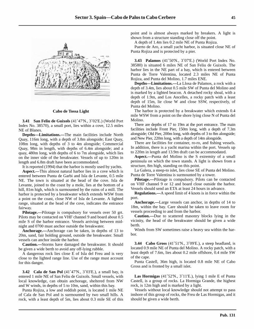
Sector 3. Spain—Cabo de Palos to Cabo Cerbere 45
is
of
eenta
da
stof
0.4el
ain
e;
ls.up
la
o.
dor.
tofor
ede
ar-
isaW
o
st
ssd it
3.41 San Feliu de Guixols(41˚47'N., 3˚02'E.) (World PortIndex No. 38570), a small port, lies within a cove, 12.5 milesNE of Blanes.3.41 Depths—Limitations.—The main facilities include NorthQuay, 116m long, with a depth of 3.8m alongside; East Quay,108m long, with depths of 3 to 4m alongside; CommercialQuay, 98m in length, with depths of 6.4m alongside; and aquay, 480m long, with depths of 6 to 7m alongside, which lieson the inner side of the breakwater. Vessels of up to 120m inlength and 6.8m draft have been accommodated.3.41 It is reported (1994) that the harbor is mostly used by yachts.3.41 Aspect.—This almost natural harbor lies in a cove which isentered between Punta de Garbi and Isla de Levante, 0.5 mileNE. The town is situated at the head of the cove. Isla deLevante, joined to the coast by a mole, lies at the bottom of ahill, 81m high, which is surmounted by the ruins of a mill. Theharbor is protected by a breakwater which extends WSW froma point on the coast, close NW of Isla de Levante. A lightedrange, situated at the head of the cove, indicates the entrancefairway.3.41 Pilotage.—Pilotage is compulsory for vessels over 50 grt.Pilots may be contacted on VHF channel 9 and board about 0.5mile S of the harbor entrance. Vessels arriving between mid-night and 0700 must anchor outside the breakwater.3.41 Anchorage.—Anchorage can be taken, in depths of 13 to20m, sand, fair holding ground, outside the breakwater. Smallvessels can anchor inside the harbor.3.41 Caution.—Storms have damaged the breakwater. It shouldbe given a wide berth to avoid any off-lying rubble.3.41 A dangerous rock lies close E of Isla del Freu and is veryclose to the lighted range line. Use of the range must accountfor this danger.
3.42 Cala de San Pol(41˚47'N., 3˚03'E.), a small bay, isentered 1 mile NE of San Feliu de Guixols. Small vessels, withlocal knowledge, can obtain anchorage, sheltered from NWand W winds, in depths of 5 to 10m, sand, within this bay.3.42 Punta Rojiza, a low and reddish point, is located 1 mile NEof Cala de San Pol and is surmounted by two small hills. Arock, with a least depth of 5m, lies about 0.3 mile SE of this
point and is almost always marked by breakers. A lightshown from a structure standing close off the point.3.42 A depth of 1.4m lies 0.2 mile NE of Punta Rojiza.3.42 Puerto de Aro, a small yacht harbor, is situated close NEPunta Rojiza and is protected by a pier.
3.43 Palamos(41˚50'N., 3˚07'E.) (World Port Index No.38580) is situated 6 miles NE of San Feliu de Guixols. Thharbor lies in the NE part of a bay, which is entered betwePunta de Torre Valentina, located 2.3 miles NE of PunRojiza, and Punta del Molino, 1.7 miles ENE.3.43 Depths—Limitations.—La Llosa de Palamos, a rock with adepth of 3.4m, lies about 0.5 mile SW of Punta del Molino anis marked by a lighted beacon. A detached rocky shoal, withdepth of 1.9m, and Los Ancelles, a rocky patch with a leadepth of 15m, lie close W and close SSW, respectively,Punta del Molino.3.43 The harbor is protected by a breakwater which extendsmile WSW from a point on the shore lying close N of Punta dMolino.3.43 There are depths of 17 to 19m at the port entrance. The mfacilities include Front Pier, 150m long, with a depth of 7.3malongside; Old Pier, 200m long, with depths of 3 to 8m alongsidand New Pier, 220m long, with a depth of 14m alongside.3.43 There are facilities for container, ro-ro, and fishing vesseIn addition, there is a yacht marina within the port. Vesselsto 220m in length and 13.9m draft can be accommodated.3.43 Aspect.—Punta del Molino is the S extremity of a smalpeninsula on which the town stands. A light is shown fromstructure, 8m high, standing on this point.3.43 La Galera, a steep-to islet, lies close SE of Punta del MolinPunta de Torre Valentina is surmounted by a tower.3.43 Pilotage.—Pilotage is compulsory. Pilots can be contacteon VHF channel 9 or 12 and board close outside the harbVessels should send an ETA at least 24 hours in advance.3.43 Regulations.—A speed limit of 4 knots is in force within theport.3.43 Anchorage.—Large vessels can anchor, in depths of 1418m, within the bay. Care should be taken to leave roomvessels proceeding to and from the harbor.3.43 Caution.—Due to scattered masonry blocks lying in thvicinity, the head of the breakwater should be given a wiberth.3.43 Winds from SW sometimes raise a heavy sea within the hbor.
3.44 Cabo Gross(41˚51'N., 3˚09'E.), a steep headland,located 0.9 mile NE of Punta del Molino. A rocky patch, withleast depth of 7.6m, lies about 0.2 mile offshore, 0.4 mile Sof the cape.3.44 Punta Castell, 36m high, is located 0.8 mile NE of CabGross and is fronted by a small islet.
3.44 Las Hormigas (41˚52'N., 3˚11'E.), lying 1 mile E of PuntaCastell, is a group of rocks. La Hormiga Grande, the higherock, is 12m high and is marked by a light.3.44 Vessels without local knowledge should not attempt to painshore of this group of rocks, the Freu de Las Hormigas, anshould be given a wide berth.
Cabo de Tossa Light
Pub. 131

46 Sector 3. Spain—Cabo de Palos to Cabo Cerbere
us
o
g-mblep to
e
end
,
or
sties
m,by
,let
o.eE
tansff
n
0mr-
n-oda
n-
ds
0 to, in
ea
w-
3.44 Cabo de San Sebastian(41˚54'N., 3˚12'E.) is located 7miles NNE of Las Hormigas. It is formed by a conspicuous andreddish headland which is faced with cliffs. A light is shownfrom a tower with a dwelling, 12m high, standing 0.3 mile N ofthe S extremity of the cape .3.44 Llanfranch, a small yacht harbor, lies at the head of a cove,close SW of the cape.3.44 Los Ullastres, consisting of three rocky shoals, lies about 0.5mile S of the cape and has a least depth of 7.1m.3.44 Punta del Banch is located 2 miles N of the Cabo de SanSebastian. A small yacht harbor and a prominent hotel aresituated 0.7 mile N of this point.
3.45 Cabo de Bagur(41˚57'N., 3˚14'E.) is located 4 milesNNE of Cabo de San Sebastian. It is surmounted by a one-storied prominent signal station.3.45 Cala de la Tuna, a small bay, lies 1 mile N of Cabo de Bagurand affords shelter to small vessels from winds between E andS. Vessels with local knowledge may anchor, in depths of 16 to18m, within the bay.3.45 The Rio Daro and the Rio Ter flow into the sea 3 miles and 4miles NNW, respectively, of Cala de la Tuna. A beach extendsalong the shore between the N entrance point of Cala de laTuna and the mouth of the Rio Ter. A shoal bank fronts thebeach and extends for some distance offshore. Due to theshifting nature of the bottom, and drying patches along theextent of Playa de Pals caused by the river flooding, along withnumerous fish havens, a minimum distance of 0.8 mile shouldbe given this stretch of coast.3.45 Punta Guixeras (42˚03'N., 3˚13'E.), the SE extremity of apromontory, is located 2 miles NNE of the mouth of the RioTer. A Loran tower, 297m high, stands 0.5 mile NW of thispoint and is conspicuous.3.45 Estartit, an extensive yacht harbor, lies close W of the pointand is protected by breakwaters.3.45 Islas Medas, formed by a group of rocky islets, lies 0.5 mileSE of Punta Guixeras. The channel leading between this groupand the coast is deep, but local knowledge is required by evensmall craft in order to use the passages lying between the isletsthemselves.3.45 Isla Meda Grande is the largest and NW islet of the group. Alight is shown from a structure, 11 high, standing on its sum-mit.3.45 Caution.—A marine reserve area surrounds Islas Medas andextends to Punta Guixeras. Fishing and anchoring within thisarea are prohibited.
3.46 Golfo de Rosas(42˚11'N., 3˚11'E.) lies betweenPunta Trenca Brasos, located 3.5 miles NNW of PuntaGuixeras, and Cabo Noffeo, 9 miles NE. Cala de Mongo andCala de la Clota, the principal coves along this stretch of coast,are entered close S and 1.5 miles WNW, respectively, of PuntaTrenca Brasos. They are both exposed to NE winds and areonly available to small vessels with local knowledge.3.46 A wharf, used by fishing vessels, is situated on the E side ofCala de la Clota, and an extensive yacht harbor lies in thevicinity of this cove.3.46 The Rio Muga flows into the NW part of Golfo de Rosas, 8miles NNW of Punta Trenca Brasos. The village of Castellonde Ampurias stands on the N bank of this river, 2.5 miles
inland. It is situated on a hill, 69m high, and is conspicuofrom seaward.
3.47 Rosas(42˚16'N., 3˚11'E.) (World Port Index No.38705), a small port, lies within a bay in the NE part of Golfde Rosas close to the French border.3.47 Depths—Limitations.—The main facilities include Com-mercial Quay, 304m long, with depths of 3.5 to 4.5m alonside; Extension Quay, 300m long, with depths of 4 to 4.5alongside; and Breakwater Quay which has 320m of usaberthing space with depths of 7 to 10m alongside. Vessels u40m in length and 4m draft can be accommodated.3.47 In addition, a yacht harbor is situated in the vicinity of thtown.3.47 Aspect.—The town is situated at the head of the bay. Thprominent ruins of a citadel stand close NW of the town, aseveral conspicuous large hotels stand in this vicinity.3.47 A light is shown from a tower on a dwelling, 11m highstanding on a point, 1.2 miles SSE of the citadel.3.47 Pilotage.—Pilotage is available from Palamos. The harbcan be contacted by VHF.3.47 Anchorage.—Large vessels can anchor in the bay. The moconvenient berth, in depths of 14 to 17m, mud and sand, l0.5 mile offshore, S of the citadel.3.47 Caution.—The anchorage is encumbered by a marine farmarked by lighted buoys and a submarine pipeline, markeda lighted buoy, to the W and NW of the area.
3.48 Cabo Norfeo(42˚14'N., 3˚16'E.) is high, steep-sidedand is surmounted by the ruins of a water tower. A high islies off the SE extremity of this cape.3.48 Punta de Cala Nans is located 2 miles NNE of Cabo NorfeA light is shown from a structure, 7m high, standing on thpoint. A patch, with a depth of 1.6m, lies about 0.6 mile NNof the light.
3.48 Cadaques(42˚17'N., 3˚17'E.), a resort town, is situated athe head of a bay which is entered between Punta de Cala Nand Isla Arenella, 0.6 mile NNE. The latter island lies close othe promontory which forms the E side of the bay.3.48 The town is fronted by a very small natural harbor with aanchorage area for large and small vessels.3.48 The bay can be identified by Montana de Cadaques, 61high, which stands 1.5 miles W of the town. Its summit is sumounted by the cupola of a radar installation.3.48 San Sebastian Hermitage is situated 0.7 mile ESE of Motana de Cadaques, and the old Convent of San Pedro de Rstands on the summit of a mountain, 4.2 miles WNW of Motana de Cadaques.3.48 Casa Colom, a prominent building with two towers, stanon a hill at the NE side of the bay, 0.3 mile SE of the town.3.48 Vessels of deep draft can obtain anchorage, in depths of 120m, SE of the center of the town. Small vessels can anchora depth of 7m, farther inshore off the NE end of the town.3.48 Caution.—A shoal bank extends 95m seaward from thbeach which fronts the town. Bajo de La Entina, a shoal withdepth of 2.7m, lies about 0.3 mile S of the town, off the SWside of the bay.3.48 Several dangers lie in the approach to the bay; local knoledge is required.
Pub. 131

Sector 3. Spain—Cabo de Palos to Cabo Cerbere 47
butend,
ofE
isndsw-
yr.ithndA
ead
isften
intto a
Nghndin
ity
f
3.49 Punta Oliguera(42˚17'N., 3˚18'E.), low and rocky, islocated 0.3 mile NE of Isla Arenella. Las Masinas, a group ofdangers, lie 0.7 mile NE of this point. The group consists ofone islet and several above-water rocks.3.49 Cala Guillola, entered 1.2 miles NNW of Punta Oliguera, isopen to the SE. This cove affords shelter from N winds, andvessels can anchor, in a depth of 14m, sand and weed.
Cabo Creus (42˚19'N., 3˚19'E.), located 2.3 miles NNE ofPunta Oliguera, is formed by the SE extremity of a small anddark peninsula. A light is shown from a tower surmounting adwelling, 11m high, standing on the summit of the cape.3.49 Dedos de Cadaques, two conical peaks, rise 2 miles W ofthis cape and are prominent.3.49 Islote La Encalladora, fringed by a reef on its SW side, liesclose off the NE side of Cabo Creus. Isleta Maza, anotherrugged islet, lies 0.5 mile E of Cabo Creus.3.49 Punta dels Farallons, fronted by several small islets, islocated 2.5 miles WNW of Cabo Creus and terminates in awhite cone. The coast between is indented with several covesand is fronted by numerous small islets, rocks, and shoals.3.49 El Golfet, a cove, lying close W of Punta dels Farallons,affords anchorage, sheltered from winds from the E through Sto W. However, it is exposed to N winds, which blow duringthe winter and becomes dangerous.3.49 Punta de la Creu is located 2.5 miles WNW of Punta delsFarallons and fronted by a small islet. A hill, 119m high, risesclose inland of the point.
3.50 Punta Sernella(42˚21'N., 3˚11'E.), a steep point, islocated 0.7 mile WNW of Punta de la Creu. A rock, with adepth of 2.7m, lies close off this point. A light is shown from asquare tower standing on the point.3.50 The town of Selva stands on the E side of the bay, which liesbetween Punta de la Creu and Punta Sernella. It is fronted by asmall harbor which is used by yachts and fishing craft.
3.50 There is good anchorage for large vessels in this bay,winter winds from the N and NW may make the anchoraguntenable. The best berth, in depths of 10 to 15m, muddy salies in front of the town.3.50 Ensenada de Llansa, a small bay, is entered 2 miles NWPunta Sernella. It is not sheltered against winds from the Nand is only frequented by small vessels.3.50 Cap Ras is located 2.5 miles NNW of Punta Sernella andfronted by two islets. Cala Garvet lies between Cap Ras aCap Lladro, 0.7 mile N. With offshore winds, this bay affordgood anchorage, in a depth of 11m, to vessels with local knoledge.
3.50 Cap Lladro is formed by a whitish headland and fronted ban islet and a conical rock, both of which are of a whitish coloCala Culera, entered close N of Cap Lladro, is a deep cove wgood holding ground, but it is exposed to onshore winds aviolent squalls that sweep down from the mountain slopes.small harbor, protected by breakwaters, is situated at the hof this cove.3.50 The whole coast between Cap Lladro and Cap Cerberehigh, rugged, and steep-to. The currents off the coast are oinfluenced by the prevailing wind.3.50 Punta Gatillepis is located 0.5 mile N of the N entrance poof Cala Culera. The coast between is very steep and risesheight of 198m.3.50 Port Bou lies at the head of a cove which is entered on theside of Punta Gatillepis. It is exposed to E winds, and althousheltered from N winds, is subject to heavy seas and grouswell. This cove is not considered a good shelter, exceptcases of necessity.3.50 The boundary between Spain and France lies in the vicinof Cabo Falco, which is located 1 mile NE of Port Bou.3.50 Cap Cerbere (42˚26'N., 3˚11'E.) is located 1.2 miles N oCabo Falco and is described in paragraph 9.2.
Pub. 131

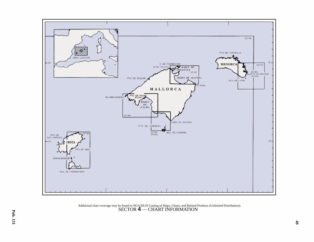
49
4.Spain—Islas Baleares
istribution).
Pub. 131
4.0Additional chart coverage may be found in NGA/DLIS Catalog of Maps, Charts, and Related Products (Unlimited DSECTOR4 — CHART INFORMATION


51
a
fdssod
5m,ro-ks,the
be-h,.onisoulnd,
anding, inge
ht,
, aaiteon
ism
ntaingt isNEead.2
ntas
the
SECTOR 4
SPAIN—ISLAS BALEARES
4.0 Plan.—This sector describes the Islas Baleares and includesIsla de Formentera, Ibiza, Mallorca, and Menorca. The descrip-tive sequence is from SW to NE.
General Remarks
4.1 Islas Baleares form a group which consists of fourmain islands and several off-lying islets. The islands of thegroup are generally steep-to and rocky on their N sides, where-as their S sides are mostly low and accessible. Prominent vaca-tion developments and resort high-rises are visible along thecoasts of Ibiza and Mallorca, which are the most mountainousof the group.4.1 Winds—Weather.—Good weather prevails along the coastsof Mallorca during the summer, with daily land and seabreezes. In winter, bad weather is experienced with N winds,and occasionally with winds from the S and SW. With strongonshore winds, the NW coast of this island should be given awide berth.4.1 Bahia de Alcudia and Bahia de Pollensa are exposed to NEand E gales, which cause heavy sea and swells in the road-steads.4.1 During N winds, a heavy sea is raised in Freu de Menorca.4.1 The prevailing winds differ between the W and E sides ofthis group of islands. At Cabo Dartuch, the wind frequentlyblows from a different direction on each side of the cape.4.1 Caution.—Numerous submarines cables lie in the vicinityof the islands and may best be seen on the chart.4.1 Submarines exercise frequently in the vicinity of these is-lands.
Isla de Formentera
4.2 Isla de Formentera(38˚42'N., 1˚26'E.) is the fourthlargest island of the group. When seen at a distance from the S,it appears as two islands.4.2 Punta Rasa(38˚41'N., 1˚23'E.), 18m high, is located at theW side of the island. The coast in this vicinity is faced withsteep-to cliffs, in places up to 80m high.4.2 Punta Gabina, 1.5 miles N of Punta Rasa, is 14m high andsurmounted by a tower, 9m high. Punta Pedreras lies 1.2 milesNE of Punta Gabina and the coast between is very cliffy.4.2 Ensenada del Cabrito lies between Punta Pedreras and PuntaSabina, 0.7 mile E. Vessels with local knowledge can anchor,in a depth of 7m, in the W part of this bay.4.2 Isla Sabina (38˚44'N., 1˚25'E.) lies close off Punta Sabinaand is low and flat. It is connected to Isla de Formentera by abreakwater which forms Cala Sabina. Vessels with localknowledge can anchor, in a depth of 11m, in Cala Sabina, shel-tered from offshore winds. The bottom is mostly sand, but inthe greater depths it is weed with patches of rock. A smallshelter mole extends E from the E side of Isla Sabina and amarina is situated in the W part of Cala Sabina.
4.2 A light is shown from a tower, 10m high, standing on IslSabina.4.2 Los Trocados (38˚46'N., 1˚26'E.) is a narrow tongue osand, with some rocky outcrops and dunes on it, which extenin a N direction. This tongue is so low and narrow in placethat the sea breaks right across it in bad weather. In goweather, anchorage can be obtained, in depths of 10 to 2anywhere between Punta Pedreras and the N end of Los Tcados. The bottom is mostly weed with patches of sand, rocor gravel. In depths of less than 10m, sand predominates inE part and rock in the S part.
4.3 Punta Prima (38˚44'N., 1˚28'E.), a low point, islocated 2.3 miles SSE of the N end of the island. The coasttween forms the E side of Los Trocados. A tower, 9m higstands on a prominent hill, 33m high, 0.3 mile S of the point4.3 Cala Pujols lies at the head of the bay, which is enteredthe W side of Punta Prima. This inlet is open to the N, butfrequented by fishing vessels. The shores of the bay are fand several rocky islets, joined to the shore by tongues of saand rocks, awash, lie within it.4.3 Ensenada de Tramontana lies between Punta PrimaPunta de la Creu, 5 miles ESE. This bay affords shelter duroffshore winds, but it is open to the NE. Vessels can anchordepths of 12 to 15m, close offshore. The charted anchoraprohibited area must be avoided.
4.3 Punta Single Mal (38˚40'N., 1˚35'E.), the E extremity of theisland, is located 1 mile NE of Punta Rotja. Formentera Ligis shown from a tower surmounting a building, 22m highstanding on this point.4.3 Punta Grava is located 2 miles W of Punta Rotja. La Molaflat-topped promontory, stands NE of this point. It rises toheight of 192m and the seaward sides are faced with whcliffs. Numerous palm trees and prominent buildings standthis promontory.
4.4 Cabo Berberia(38˚38'N., 1˚23'E.), located 6.5 milesW of Punta Grava, is the SW extremity of the island. Itformed by a steep-to and cliffy headland. A light is shown froa tower, 19m high, standing on the cape.4.4 Ensenada de Mitjorn lies between Cabo Berberia and PuGrava. Anchorage may be obtained within the bay, accordto draft, in depths of 5 to 40m, sand, weed, and stones. Ireported that an obstruction lies in the roadstead, 3.5 milesof Cabo Berberia. Torre de Catala, 9m high, stands at the hof the bay. It surmounts a small hill, 23m high, standing 0mile inland.4.4 Playa de Mitjorn extends between Torre Catala and PuGrava. It lies on the SW side of a low and narrow isthmuwhich joins La Mola to the main part of the island. A whitedune, which is conspicuous against the dark background ofpine groves, stands at its SE end.
Pub. 131
52 Sector4.Spain—IslasBaleares
,
aus
fs Na-
alllre
dily
la.all
-
a2)
ena
ithel
us
toofed
fm-ided-.f-churalst of
lsois-f a
ghmrca,iles
, is
s,
Isla de Formentera—Off-lying Banks and Is-lands
4.5 Banco del Emile Baudot(38˚43'N., 2˚30'E.), withdepths of 85 to 140m, lies about 43 miles E of Isla Formentera.4.5 A bank, with depths of 76 to 118m, lies about 11 miles ENEof the E extremity of Isla Formentera.4.5 Isla Espalmador (38˚47'N., 1˚26'E.) lies close N of the Nextremity of Los Trocados, from which it is separated by ashallow bank. A reef lies on this bank and the sea breaks rightacross it in bad weather. The N and E coasts of the island aresandy with patches of rock. The W coast, which is the highest,is faced in places with red cliffs. A conspicuous tower, 9mhigh, stands on the edge of the cliffs, 0.3 mile N of PuntaGastabi, the SW extremity of the island.4.5 Isla de los Puercos, a low islet, is connected by shoals to theN extremity of Isla Espalmador and is foul on its seawardsides. A light is shown from a tower, 25m high, standing on theNW extremity of this islet.
4.5 Isla Espardell (38˚48'N., 1˚29'E.), 29m high, lies 2.3 milesE of Isla Espalmador. This small island is uninhabited and its Nand E sides are cliffy, whereas, its W side is sloping andaccessible. A light is shown from a tower, 16m high, standingclose to the N extremity of the island.4.5 The channel between Isla Espardell and Isla Espalmador iscalled La Estancia.4.5 Caution.—An integral reserve area has been establishedalong the N, E, and S coasts of the island as shown on thechart. Underwater activities are not permitted without expresspermission within the reserve.
Ibiza
4.6 Ibiza (39˚00'N., 1˚25'E.) has a somewhat indentedcoast forming many coves. Monte Atalayasa, 475m high, is thehighest summit on Ibiza and stands in the SW part of theisland.4.6 Punta Portas (38˚50'N., 1˚24'E.), a low and salient point, isthe S extremity of the island. It is surmounted by a prominenttower.4.6 Punta Rama, located 1.5 miles W of Punta Portas, is frontedby foul ground and above-water rocks, which extend up toabout 0.2 mile seaward. It should not be approached closely.4.6 Cabo Falco, located close W of Punta Rama, is high, cliffy,and terminates in a somewhat salient point.4.6 Punta Yondal, located 2.5 miles NW of Cabo Falco, is low,rocky, faced with cliffs, and fronted by a reef. Ensenada deCodola, which lies between Cabo Falco and Punta Yondal, hasa stony beach and affords anchorage sheltered from NE and SEwinds. The bottom is formed of mostly sand, but is rocky nearthe entrance points.4.6 Punta de Port Roig, located 1 mile WNW of Punta Yondal, isflat and has a small reef on its S side. The E side of this pointconsists of white cliffs. A prominent building stands on thecliffs, which rise to a height of 111m, 1.7 miles WNW of thepoint.
4.7 Cabo Llentrisca (38˚51'N., 1˚15'E.), located 2.5miles WSW of Punta de Port Roig, is formed by a white salient
cliffy headland, 148m high. Monte Llentrisca, 414m highstands 1.2 miles N of the cape.4.7 Cabo Jueu, located 1.5 miles NW of Cabo Llentrisca, isspur of Monte Atalayasa. La Oliva, a large and conspicuorock, lies at its extremity.4.7 Cap Blanch, a whitish and cliffy headland, lies 0.5 mile N oCabo Jueu. Puig Pelat, a hill, rises near the coast, 1.5 mileof this cape. It is 185m high, rounded, and prominent from seward.4.7 Cala Badella is entered 0.7 mile N of Puig Pelat and a smshoal lies off its N entrance point. Small craft, with locaknowledge, can find suitable anchorage within this cove. Theare depths of 21m in the entrance which decrease steatowards the head.4.7 Punta Embarcado is located 2.5 miles N of Cala BadelThe shore of the bay between is indented by several smcoves.4.7 Punta Torre de Rovira, located 1.5 miles NNE of Punta Embarcado, is surmounted by an ancient tower, 10m high.
4.8 Punta Chincho (38˚58'N., 1˚17'E.) is located 2.5miles E of Punta Torre de Rovira. A light is shown fromtower, 8m high, standing on the point. It was reported (199that this light is not easy to identify at night.4.8 Puerto de San Antonio Abad (38˚58'N., 1˚18'E.) (WorldPort Index No. 38620), a small natural harbor, lies betwePunta Chincho and Cap Blanch, 1 mile N. It is protected bybreakwater and is mostly used by small craft and yachts wlocal knowledge. The port may be contacted on VHF chann9.4.8 Numerous prominent hotels front the town; a conspicuohigh-rise building stands near the root of the breakwater.4.8 In summer, vessels can anchor off the harbor accordingdraft. A good berth lies, in depths of 9 to 10m, weed, close Ethe breakwater. In depths of less than 5m, the bottom is formof mainly sand.
4.9 Cabo Nono(39˚02'N., 1˚18'E.), located 3 miles N oPuerto de San Antonio Abad, is prominent. Its rounded sumit, 258m high, is covered with pine trees and the seaward sis formed by cliffs. Punta Galera, 18m high, is a whitish healand which extends 200m seaward from the foot of the cliffs4.9 Islas Margarita, consisting of two islets, lies 0.3 mile ofshore, 2 miles NE of Cabo Nono. The E and larger islet, whiis formed in the shape of a horseshoe, is pierced by a nattunnel. The passage lying between these islets and the coathe main island is deep and clear of dangers.4.9 Punta Torretas, located 3.5 miles NE of Cabo Nono, is apierced by a natural tunnel. It is a salient point, which at a dtance and on certain bearings, appears as two towers ofortress.4.9 Cabo Eubarca, located 1 mile NE of Punta Torretas, is hiand cliffy. This cape is easy to identify as a regular cone, 262high, stands at its seaward extremity. Ensenada de Eubawhich lies between Cabo Eubarca and Cabo Rubio, 1.5 mENE, is quite exposed, but free of dangers.4.9 Punta de la Creu, located 3.2 miles ENE of Cabo Eubarcafaced with high cliffs. An islet lies close E of this point andanother islet, which is joined to the main island by an isthmulies 0.4 mile SE of it.
Pub. 131

Sector4.Spain—IslasBaleares 53
ndto
otle
rtTAHFa.,
ich0.3
h,ilen
ck.ss
ael
a iso-
ofich
fheof
ra-
nd
ingand
uer-an-
esa
os
rery
an-e
4.9 Punta Cova de Orenga, located 1.2 miles E of Punta de laCreu, is a high and cliffy point at the foot of which is a largecave. A steep and rocky islet, 20m high, lies 0.5 mile NE ofthis point and is joined to the coast by a narrow isthmus.4.9 Punta Moscarte(39˚07'N., 1˚32'E.), located 4 miles ENE ofPunta Cova de Orenga, is the N extremity of Ibiza. The coastbetween is fronted by several small islets and indented byseveral bays and coves. A light is shown from a tower, 52mhigh, standing on the point.
4.10 Punta del Escullet (39˚06'N., 1˚36'E.), located 3miles SE of Punta Moscarte, is fronted by Islas Hormigas, twoprominent islets, 30m high. Escull de Pas, an islet, lies closeoff a point located 1.2 mile W of Punta del Escullet. This isletis 159m high and has a conspicuous cliffy summit.4.10 From Punta del Escullet, the coast extends 0.5 mile SE toPunta Jonch, and then 0.7 mile SSE to Punta Grosa which ishigh and cliffy.4.10 Punta Valls, surmounted by a tower, is located 2.7 miles S ofPunta Grosa. The coast between is indented by several baysand fronted by numerous above-water rocks and islets.4.10 Cabo Roig, located 0.5 mile S of Punta Valls, is formed by agrey cliff, 138m high. It is the E extremity of Ibiza. A danger-ous wreck lies close E of this point.4.10 Punta Arabi, located 3 miles SW of Cabo Roig, is fronted byfour small islets. A rock, with a depth of 1.6m, lies about 1mile SE of the point and is marked by a lighted beacon.4.10 Ensendada de Santa Eulalia lies between Punta Arabi andthe mouth of the Rio de Santa Eulalia, 2.5 miles WSW. Thisbay affords sheltered anchorage, with offshore winds, to ves-sels with local knowledge. The best berth is close inshore offthe cove in its N part. An extensive yacht harbor is situatedclose NE of the town which stands close N of the river mouth.4.10 Cabo Escolo Llibrell, 209m high, is located 3.7 miles SW ofPunta Arabi and is faced with a whitish cliff.4.10 Cabo Martinet is located 3.2 miles SW of Cabo EscoloLlibrell and two steep-to islets lie about 0.5 mile offshore, 1mile ENE of it.4.10 An aeronautical radiobeacon is reported to be situated closeWNW of this cape.4.10 Isla Grossa, 42m high, lies 1 mile SW of Cabo Martinet andis joined by a causeway to Isla Plana.4.10 Isla Plana, 20m high, lies close NNW of Isla Grossa and isjoined to the mainland by a low isthmus.4.10 Islote Botafoch (38˚54'N., 1˚27'E.) is joined by a causewayto the SW side of Isla Grossa. A light is shown from a towerwith a dwelling, 21m high, standing on the summit of the is-land.4.10 Caution.—An outfall pipeline extends 1 mile SE from theNE side of Isla Plana and may best be seen on the chart.
4.11 Puerto de Ibiza (38˚54'N., 1˚27'E.) (World PortIndex No. 38610), a small port, lies within a bay which is en-tered between Islote Botafoch and Punta Marloca, 0.7 mileWSW.4.11 Depths—Limitations.—The harbor is protected by twomoles. A yacht marina is situated in the E part of the harborand extensive facilities for small craft lie in the NE part. Abasin for fishing vessels is situated in the NW part. There aredepths of 8m in the entrance and 7m alongside the commercial
quays which have six berths. Vessels up to 135m in length a6.4m draft can be accommodated. In addition, tankers up4,000 tons and 6.1m draft can be handled.4.11 Aspect.—The town of Ibiza rises SW of the inner harbor tthe crest of a hill, which is surmounted by a prominent casand a prominent cathedral.4.11 Pilotage.—Pilotage is compulsory for vessels over 500 ganchoring or entering the harbor. Vessels should send an Eat least 24 hours in advance. Pilots can be contacted on Vchannel 13 or 16, and generally board 1 mile SE of Isla Gross4.11 Anchorage.—Vessels can anchor, in depths of 14 to 26mSW of Islote Botafoch. Designated anchorage berths, whare indicated on the chart, have been established betweenand 1.2 miles SW of the island.
4.12 Punta Marloca (38˚54'N., 1˚26'E.) is the SE ex-tremity of a large promontory. Isla Negre del Este, 12m higand Isla Negre del Oeste, 3m high, lie close E and 0.2 mWSW, respectively, of this point. These two islands are knowcollectively as Islas Negres and are composed of blackish roOnly small craft, with local knowledge, should attempt to pabetween them and the mainland.4.12 Punta de la Mata is located 1 mile WSW of Punta Marlocand Islas Ratas, 11m high, lies 0.2 mile E of it. The channlying between this point and the island is foul.4.12 The coast between Punta Marloca and Punta de la Matbacked by hillocks, some of which are surmounted by prminent windmills.4.12 Punta de la Sal Rosa, 9m high, is located 1.7 miles SPunta de la Mata and is surmounted by a tower. An islet, whis joined to the shore by a reef, lies close S of the point.4.12 Punta Corpmari (38˚51'N., 1˚24'E.) is located 0.7 mile S oPunta de la Sal Rosa and two small islets lie close off it. Tland behind the point is prominent and rises to a height159m.4.12 Punta Portas, which has been previously described in pagraph 4.6, is located 1.5 miles S of Punta Corpmari.
Ibiza—Off-lying Islands and Dangers
4.13 Isla Ahorcados(38˚49'N., 1˚25'E.), 10m high, lies 1mile SSE of Punta Portas. This small island is rocky afringed with a shoal bank. A light is shown from a tower, 19mhigh, standing on the S end of the island.4.13 Los Freus is the collective name of three channels leadacross a ridge which extends between Isla de los Puercosthe S end of Ibiza. Several small islets lie along this ridge.4.13 Freu Grande, the S channel, leads between Isla de los Pcos and Isla Ahorcados. It is the deepest and the widest chnel.4.13 A detached rocky patch, with a least depth of 4.5m, liabout 0.2 mile SW of Isla Ahorcados and a shoal patch, withdepth of 6.1m, lies about 0.5 mile NNW of Isla de los Puercand is marked by a lighted beacon.4.13 Caution.—During gales, the currents in Freu Grande astrong and irregular. They frequently set in directions contrato the winds so that heavy seas are experienced.4.13 Due to the existence of submarine cables, a fishing andchoring prohibited area, the limits of which are shown on thchart, lies between Ibiza and Formentera.
Pub. 131

54 Sector4.Spain—IslasBaleares
re
is9mbe
lesbyout
d
eirthe
yht,
ofaftenon
ck.of.5
int
tone.n
7.5elyn-iles
ks,ousthe
n-n-
4.13 Marine reserves, best seen on the chart, lie between IslaFormentera and Ibiza. Fishing and extraction of any flora orfauna from these reserves is prohibited without prior approvalof the General Office of Fishing.
4.14 Islote Vedra (38˚52'N., 1˚11'E.), lying 1 mile W ofCabo Jueu, is reddish in color, steep-to in most places, andalmost inaccessible. A pronounced cone stands at the W end ofthis small island and two similar cones stand at its E end. Alight is shown from a structure, 3m high, standing at the Wextremity of the island.4.14 An islet and several above-water rocks lie close off the NEside of the island. An above-water rock, over which theslightest sea breaks heavily, lies about 1 mile NNW of the Wextremity of the island.
4.14 Isla del Esparto (38˚57'N., 1˚11'E.), 69m high, lies 0.7 mileW of Punta Embarcado and is fronted by several small islets onits E and W sides.4.14 Islas Bledas, consisting of a group of five islets, lies within 2miles NW of Isla del Esparto and is marked by a light.4.14 Islas Bosque, 67m high, lies about 0.2 mile offshore betweenPunta Embarcado and Punta Torre de Rovira. It is surroundedby cliffs and two high rocks stand at the N end. The passagelying between Ibiza and Islas Bosque is foul and unsuitable.4.14 Isla Conejera, 69m high, lies 0.3 mile N of Isla Bosque andits coasts are mostly cliffy. A light is shown from a tower witha dwelling, 17m high, standing on Cabo Blanco, its N ex-tremity. The passage lying between Isla Bosque and IslaConejera has a depths of 3 to 4m and is recommended only forvessels with local knowledge.
4.14 Isla de Tagomago(39˚02'N., 1˚39'E.), 114m high, lies 1mile E of Punta Valls. It is low and rocky on the N side, but
high and cliffy on the S side. A light is shown from a towewith a dwelling, 23m high, standing on the SE extremity of thisland.4.14 Islotes los Dados(38˚53'N., 1˚27'E.) are two islets which lie0.7 mile S of Islote Botafoch. Islote Dado Grande, 13m high,marked by a light and Islote Dado Pequeno, close SE, ishigh. The passage lying between these islets should notattempted.4.14 Islote Malvin del Norte, 12m high, and Islote Malvin deSud, 20m high, are two islets which lie 1.2 miles and 1.5 milSSW, respectively, of Islote Botafoch. They are both fringedseveral smaller islets and a rock, with a depth of 8m, lies ab0.3 mile W of Islote Malvin del Sud. Islote La Esponja, 10mhigh, lies 0.8 mile SSW of Islote Malvin del Sud and is fringeby foul ground and shoals.
Mallorca
4.15 Mallorca (39˚30'N., 3˚00'E.), the largest of IslasBaleares, lies 60 miles NE of Ibiza. The mountains rise to thhighest peaks on the NW coast of the island, but elsewherecoasts are lower and rocky.4.15 Cabo Salinas (39˚16'N., 3˚03'E.), the S extremity of theisland, is low and fringed by a shoal bank. It is backed bgently-sloping land on which stands a prominent tower. A ligis shown from a prominent tower with a dwelling, 10m highstanding close N of the cape.
4.15 Punta Sa, surmounted by a tower, is located 4 miles NWCabo Salinas and fronted by several small islets. A small crharbor is situated in the NW part of the bay, which lies betwethese two points. A light is shown from a structure standingan islet close off Punta Sa.4.15 Punta Plana (39˚21'N., 2˚55'E.), a low point, is located 4.5miles NW of Punta Sa and is fronted by an above-water roA light is shown from a structure, 6m high, standing close Nthe point. A yacht harbor, protected by moles, is situated 1miles E of the point.4.15 Puig de Randa, 549m high, stands 10 miles N of the poand is prominent.
4.16 Cabo Blanco(39˚22'N., 2˚47'E.) is located 5.8 milesWNW of Punta Plana. This cape is steep-to and easyidentify as it is faced with white precipices. A light is showfrom a tower with a dwelling, 11m high, standing on the cap4.16 Bahia de Palma (39˚30'N., 2˚38'E.) is entered betweeCabo Blanco and Cabo de Cala Figuera, 13.5 miles WNW.4.16 Cabo Enderrocat, surmounted by a tower, is locatedmiles NW of Cabo Blanco. The shore between is moderatsteep-to and consists of high, flat-topped, white cliffs. A cospicuous power station stands on the shore of a cove, 4.2 mNNW of Cabo Enderrocat.4.16 The shores of the bay are fronted by numerous islets, rocand small islands. Several small yacht harbors and numerprominent hotel buildings and high-rises are situated alongshores of the bay.
4.16 Caution.—Due to the existence of submarine cables, achoring and fishing prohibited areas, the limits of which are idicated on the chart, lie within the vicinity of the bay.
Islets off the SW extremity of Ibiza from S
Isla Conejera Light
Pub. 131

Sector4.Spain—IslasBaleares 55
tedmof,
r,the
is
gratsinr,
the
o
Itlld-
-the
totaart.
.2d
oway
x.
henlyu,la
,isarthe
ndregegthet of
ilesd
W
4.16 Numerous areas, within which obstructions are anchored toform artificial reefs, lie off the shores of the bay and may bestbe seen on the chart.
4.17 Puerto de Palma(39˚34'N., 2˚38'E.) (World PortIndex No. 38630) lies at the head of Bahia de Palma, 6.5 milesNW of Cabo Enderrocat.4.17 Winds—Weather.—The prevailing winds in the vicinity ofthe port are NE and SW during the summer and NE and NW inwinter. Very heavy NW squalls are sometimes experienced.Strong winds from the S and SW are liable to raise a con-siderable sea in winter, though the ones from S are of shorterduration and less frequency. The swell is often felt before thewind that causes it.4.17 Depths—Limitations.—The S side of the harbor is formedby Dique del Oeste, which extends E and NE from the SE endof Peninsula de San Carlos. The N side of the harbor is formedby Dique de Levante, which extends SW from the head of thebay.4.17 The main commercial facilities, which are situated in the SWpart of the harbor, include Muelle de Pelaires, which hasdepths of 9 to 13.5m alongside, and Muelle de Poniente, whichhas depths of 11.2 to 12.7m alongside.4.17 There are facilities for general cargo, ro-ro, container, andtanker vessels. Vessels up to 61,400 dwt, 250m in length, and12.2m draft have been accommodated alongside. In addition,there are extensive facilities and marinas for yachts and pleas-ure craft.4.17 Aspect.—A light is shown from a tower, 38m high, standingon Peninsula de San Carlos. A racon is situated at the light.4.17 A prominent fort is situated on Peninsula de San Carlos,close S of the light structure. A conspicuous castle stands on ahill, 0.8 mile N of the fort.4.17 A prominent cathedral stands in the S part of the city nearthe NE end of the harbor. It is built of reddish stone and hastwo short spires at the W end. It was reported (1990) that thecathedral is difficult to see at times and is not available as anaid to navigation until within 4 miles of the port.4.17 Pilotage.—Pilotage is compulsory for all vessels over 50 grt.Pilots, who can be contracted on VHF channel 6, 14, or 16,generally board W of the hazardous cargo anchorage about 1.5miles S of the harbor. Requests for pilots should be submittedat least 2 hours in advance. All such requests must be inwriting. Requests made by telex or telephone must be con-firmed in writing.4.17 Anchorage.—Anchorage berths are generally assigned bythe Port Captain. Vessels may obtain anchorage, in depths of14 to 15m, close S of Dique de Levante or, in a depth of 20m,about 1.5 miles S of the breakwater.4.17 Caution.—Submarine pipelines extend up to 1 mile S fromthe shore close E of the harbor entrance.4.17 Numerous pleasure craft and yachts may be encountered inthe approaches to the port.
4.18 Cap de Cala Figuera(39˚28'N., 2˚31'E.), 21m high,is steep-to and fringed by a small reef. A light is shown from astructure, 24m high, standing on the cape.4.18 The ruins of a yellow tower stand close WNW of the lightand are prominent.
4.18 Punta de Sas Barbinas, a very narrow projection, is loca2.3 miles WNW of Cap de Cala Figuera. Isla del Toro, 29high, is the outermost of four small islets which lie close SWthis projection. A light is shown from a structure, 14m highstanding on Isla del Toro.
4.19 Cabo Malgrats (39˚30'N., 2˚27'E.), 48m high, islocated 2.7 miles NNW of Isla del Toro. A yacht harboprotected by a mole, fronts the shore, about 1.5 miles SE ofcape. Isla Malgrats, 60m high, lies close SW of the cape andcliffy. A small islet lies between this island and the coast.4.19 Ensenada de Santa Ponsa is entered between Cabo Maland Cabo Andritxol, 2 miles NNW. Anchorage can be taken,a depth of 10m, on the NW side of the bay. A yacht harboprotected by a breakwater, lies in a cove at the SE side ofbay.4.19 Cabo Llamp, 221m high, is located 1.5 miles W of CabAndritxol and is covered in pine trees.4.19 Cabo de la Mola is located 1.3 miles NW of Cabo Llamp.is 118m high and is formed by the SW extremity of a smapeninsula. A light is shown from a structure, 10m high, staning on the cape.4.19 Caution.—An abandoned submarine cable lies in the vicinity of Ensenada de Santa Ponsa and may best be seen onchart.4.19 Several areas, within which obstructions are anchoredform artificial reefs, lie in the vicinity of Ensenada de SanPonsa and Cabo Malgrats and may best be seen on the ch
4.20 Puerto de Andraitx (39˚33'N., 2˚23'E.) (World PortIndex No. 38640), a small harbor, is situated in a cove, 1miles NE of Cabo de la Mola. It is protected by an outer antwo inner breakwaters and is mainly used by yachts. A narrchannel, marked by buoys, leads to the entrance. The port mbe contacted on VHF channel 9.4.20 Punta Galinda is located 2 miles NW of Puerto de AndraitThe coast between is rocky and indented.4.20 Punta Galera is located 1.7 miles N of Punta Galinda. Tcoast between is indented by several coves which are osuitable for small craft with local knowledge. Isla de Pantale29m high, lies close inshore, 0.7 mile N of Punta Galinda. IsMitjana, 8m high, lies 0.2 mile offshore, 0.6 mile NNW of Islade Pantaleu, and is marked by a lighted beacon.4.20 Isla Dragonera (39˚35'N., 2˚19'E.) lies 1.5 miles NW ofPunta Galinda. A light is shown from a tower, 15m highstanding on Cabo Llebeitx, its SW extremity. Another lightshown from a tower, with a dwelling, 13m high, standing nePunta Tramontana, its NE extremity. The island rises nearmiddle to a height of 357m.4.20 Freu de la Dragonera, 0.4 mile wide, separates the islafrom the W end of Mallorca. The currents in this channel areported to be irregular. Although there is a deep passabetween the rocks lying NW of Isla Mitjana and those fringinthe shore of Isla Dragonera, vessels are advised to usenarrow channel that leads between Isla Mitjana and the coasMallorca, because it is free from dangers.4.20 Peninsula de La Foradada, 83m high, is located 16.5 mNE of Punta Galinda. The coast between is high, cliffy, anfronted by several islets. This projection extends 0.3 mile N
Pub. 131
56 Sector4.Spain—IslasBaleares
s, inall
eps
nenallytx,m
e S
2hed-
de
mmof
e.lk,gth
in
2nt
er,heof
ya
dt 1,
,ofelse Sk-
ng,
its
W
from the coast and can be identified by a large hole whichpierces it from side to side.4.20 Cabo Gros, 126m high, is located 3.7 miles NE of Peninsulade La Foradada and is formed by a massive promontory. Alight is shown from a structure, 21m high, standing on thecape.4.20 Punta de Sa Creu is located 0.3 mile E of Cabo Gros and isthe W extremity of a small peninsula. A light is shown from astructure, 13m high, standing on this cape.
4.21 Puerto de Soller (39˚48'N., 2˚41'E.) (World PortIndex No. 38650), a small harbor, lies between Cabo Gros andPunta de Sa Creu, and is used principally as a naval station.The harbor is backed by mountainous country and an old castlestands near its E end.4.21 It was reported that vessels up to 80m in length and 8m draftcan be accommodated at the outer mole, and vessels up to 60min length and 4.5m draft can be accommodated at the innermole. Range lights, in line bearing 126.5˚, lead into the port.4.21 Heavy swell sometimes enters the harbor, which is reportedto be subject to silting.4.21 In summer, vessels can obtain temporary anchorage in goodweather, in depths of 11 to 13m, close S of the head of theouter mole.
4.22 Ensenada Sa Costera(39˚50'N., 2˚45'E.) lies close Eof Punta Cala Ratjada and 4 miles NE of Puerto de Soller. Aconspicuous power station, which is brilliantly illuminated atnight, stands on the shore of this bay.4.22 Cabo de Formentor (39˚58'N., 3˚12'E.), the N extremity ofMallorca, is located 26 miles ENE of Puerto de Soller. Thecoast between is high and cliffy. A light is shown from a towerwith a dwelling, 22m high, standing on the cape.4.22 The peninsula, which terminates at Cabo de Formentor, ismountainous and from a distance to the N, appears as a chainof islets. On nearer approach, it may be mistaken for an islandbecause of its low isthmus.
4.23 Bahia de Pollensa(39˚54'N., 3˚10'E.) is enteredbetween Cabo de Formentor and Cabo del Pinar, 4.5 miles S. Itis open to the E and completely exposed to the frequent galeswhich originate in the Golfe du Lion. Sudden squalls are alsoex-perienced within the bay, especially under the high land onthe N side.4.23 Punta de Manresa, located 3.5 miles SW of Cabo del Pinar,is dark, rocky, and surmounted by an old castle. A yachtharbor, protected by a breakwater, is situated close E of thispoint.4.23 Punta de la Avanzada, located SW of Cabo de Formentor,has a battery on its S extremity and a small castle standing onits summit. A light is shown from a structure, 17m high, stand-ing on the battery. A small harbor, protected by break-waters,is situated 0.7 mile NW of Punta de la Avanzada.4.23 An extensive yacht harbor, protected by moles, is situated1.2 miles WNW of Punta de la Avanzada.4.23 It has been reported that due to many new buildings alongthe shores of the bay, charted landmarks may be difficult toidentify.4.23 Anchorage may be obtained, in depths of 16 to 18m, about0.4 mile ENE and 0.3 mile NNW of Punta Manresa. Anchor-
age may also be obtained, in good weather, by large vesseldepths of 12 to 15m, S or SE of Punta de la Avanzada. Smvessels may obtain anchorage close W of this point.
4.24 Cabo Menorca(39˚52'N., 3˚12'E.), located 1.8 milesS of Cabo del Pinar, is dark, steep-to, and faced with stecliffs. A rocky shoal, with a depth of 13m, lies about 2 mileESE of this cape.4.24 Bahia de Alcudia (39˚49'N., 3˚08'E.) is entered betweeCabo Menorca and Cabo Farrutx, 8 miles SE. This bay whseen from seaward, appears to recede farther than it actudoes on account of the low land at its head. At Cabo Farruthe land rises steeply and forms a rocky promontory, 432high, which is surmounted by a tower.4.24 Several small yacht harbors and piers are situated along thshore of the bay.4.24 Isla de Aucanada lies close off the N shore of the bay,miles SW of Cabo Menorca. It is connected by a reef to tmainland. A light is shown from a structure, 15m high, staning on the summit of the island.
4.25 Puerto de Alcudia (39˚50'N., 3˚08'E.) (World PortIndex No. 38670), a small port, lies at the NW end of BahiaAlcudia, 1.2 miles W of Isla de Aucanada.4.25 Depths—Limitations.—The commercial facilities include aberth, 150m long, at New Pier, which has a depth of 7alongside; Ribera Quay, 226m long, with a depth of 6.5alongside; and 246m of berthing space along the inner sideMuelle Commercial, which has depths of 6 to 6.5m alongsid4.25 There are facilities for general cargo, ro-ro, container, butanker, and natural gas vessels. Vessels up to 120m in lenand 6.5m draft have been accommodated.4.25 An extensive yacht and pleasure craft harbor is situatedthe NW part of the port.4.25 Aspect.—Punta del Castillo, a rocky point, is located 1.miles W of Isla de Aucanada and an ancient and prominetower stands close NE of it. Dique de Abrigo, a breakwatextends 480m SW from this point and forms the S side of tharbor. Two prominent chimneys stand close NE of the rootthis breakwater.4.25 The city of Alcudia stands 1 mile NW of the harbor, but onlpart of its walls and a few high buildings, among which isconspicuous church, are visible from the bay.4.25 Pilotage.—Pilotage is compulsory. Pilots may be contacteon VHF channel 14 or 16 and should be requested at leashour in advance. The pilot boards in position 39˚49.6'N3˚08.5'E.4.25 Anchorage.—Anchorage is available, in a depth of 6mabout 0.3 mile SW of the breakwater head, and, in a depth12m, about 0.7 mile S of the breakwater head. Small vesscan anchor, in a depth of 4m, mud and sand, about 0.2 milof the head of the pier that is situated close NW of the breawater.4.25 Caution.—Though not expressly so reserved, the area lyiNW of a line drawn SW from Punta del Castillo is, at timesused as an anchorage for seaplanes.4.25 Submarines exercise frequently in Bahia de Alcudia andapproaches.4.25 A drainage canal enters the SW shore of the bay, 3 miles Sof Isla de Aucanada.
Pub. 131

Sector4.Spain—IslasBaleares 57
re
as ah-all
ad
usehem
nde,
ads
boph
thls
toatsur-ion,.ynt.a
a
Itith
.5est
a-ra,,end
aslapth
4.25 Two submarine intake pipelines lie close N of the canalentrance and are marked by lighted buoys.4.25 A prohibited area, within which lie foul ground and obstruc-tions, is situated adjacent to the shore close SSE of the canalentrance and may best be seen on the chart.
4.26 Cabo del Freu(39˚45'N., 3˚28'E.), located 5.5 milesSE of Cabo Farrutx, is a narrow projection which extends NEfrom the coast. It is formed by a spur of Atalaya de Son Jau-mell, 271m high, which stands 0.7 mile SW of the cape and issurmounted by a tower.4.26 Farrayo de Aubarca, 23m high, lies 0.3 mile offshore, 2.7miles NE of the cape. The passage leading between this isletand the coast has a depth of 20m and is free of dangers.4.26 Cabo Pera(39˚43'N., 3˚28'E.), the E extremity of Mallorca,is located 2 miles SSE of Cabo del Freu. It is 78m high, reddishin color, and rocky, A light is shown from a structure, 18mhigh, standing on the cape.4.26 The coast between Cabo Farrutx and Cabo Pera is high andindented by several coves.4.26 Capdepera, a small town, stands on a hill, 2 miles SW ofCabo Pera and is prominent from seaward.4.26 Cabo Vermey is located 3.8 miles SSW of Cabo Pera andsurmounted by two ruined towers. It is reddish, high, barren,and cliffy.4.26 Punta de Amer, located 5 miles SW of Cabo Vermey, is lowand surmounted by an old castle.4.26 Bahia de Arta lies between Punta de Amer and Cabo delPinar, 3.5 miles NNE. Vessels, with local knowledge, cananchor in this bay with winds from between the SW and NW.The best berth, in depths of 16 to 25m, sand and weed, lies inthe N part of the bay. Vessels can also anchor, in depths of 10to 15m, in the NW part of the bay.4.26 Cabo del Pinar, dark in color, is formed by a spur of Sierra deSon Jordi, which extends NW. Port Cristo, a small harbor, issituated within a cove, 3.7 miles SW of Punta de Amer. It ismostly used by small craft and yachts.4.26 Punta de la Bateria is located 8 miles SSW of Porto Cristo.Numerous houses and several prominent hotels stand on thispoint. A light is shown from a structure, 7m high, standing onthe point.4.26 Puerto Colom (39˚25'N., 3˚16'E.), a small craft harbor, liesbetween Punta de Bateria and Punta de la Farola, 0.2 mile W.No attempt should be made to enter this harbor without localknowledge. An extensive yacht marina is situated close N ofthis harbor.
4.27 Punta de la Farola(39˚25'N., 3˚16'E.), the W en-trance point of Puerto Colom, is surmounted by a prominenttower. A light is shown from a structure, 25m high, standingclose S of the tower.4.27 Puig de San Salvador, 510m high, stands 4.7 miles NW ofthe entrance to Puerto Colom. This prominent hill is conicaland considerably higher than those surrounding it. The summitis surmounted by a conspicuous hermitage and a chapel, with amonument and a cross, situated close by.4.27 Cala Llonga lies 3.2 miles SSW of Punta de la Farola. Lightsare shown from both the N and S entrance points of this cove,and an old fort is situated on the S entrance point. The coveaffords anchorage, in depths of 7 to 8m, to small vessels with
local knowledge. A pier and an extensive yacht marina asituated within this cove.
4.28 Puerto Petro(39˚21'N., 3˚13'E.) (World Port IndexNo. 38680) lies 1 mile SW of Cala Llonga. This inlet formsvery small natural harbor. Its entrance is 260m wide and hadepth of 18m in the middle. There are depths of 5 to 10m witin the harbor, which can accommodate only one or two smvessels at anchor at a time.4.28 This harbor is reported to be dangerous to enter during bweather because of the narrowness of the entrance.4.28 An old and prominent tower stands close within the SWentrance point of the harbor. It is high and square and, becaof its peculiar construction, cannot be mistaken for any of tothers along the coast. A light is shown from a structure, 9high, standing close E of the tower.4.28 Cala Figuera, a cove, lies 2.5 miles SW of Puerto Petro aforms a small fishing harbor. A light is shown from a structur6m high, standing on the E entrance point of the cove andtower is situated close SW of it. Santany, a small town, stan2.5 miles NW of the cove. A prominent church, visible fromseaward, is situated within this town.4.28 The coast extends 7 miles SW from Cala Figuera to CaSalinas, which has been previously described in paragra4.15, and is rocky and indented by several small coves.
Mallorca—Off-lying Islands
4.29 Isla de Cabrera (39˚09'N., 2˚56'E.), a rugged andhilly island, lies 9 miles SW of Cabo Salinas and, together withe neighboring islands, lies within a National Park. Vessecan only enter the park with permission from the InstituNacional para de la Conservacion de la Naturaleza (ICONA)Palma. A marine reserve has been established in an arearounding the islands, and is best seen on the chart; navigatfishing, diving, or gathering of flora and fauna are prohibited4.29 Punta Anciola, the SW extremity of the island, is formed bthe extremity of a small peninsula, 120m high. A light is showfrom a tower with a dwelling, 24m high, standing on this poin4.29 Cabo Llebeig, the NW extremity of the island, rises todetached hill, 60m high. A light is shown from structure, 7mhigh, standing on this cape.4.29 Cabo Ventoso, the NE extremity of the island, is formed bysteep-to cliffy headland, 106m high.4.29 Isla Imperial, 70m high, lies off the SE coast of the island.is separated from the coast by a channel, 95m wide, wdepths of 11m at the N end.4.29 Islotes Estels, consisting of five rocky islets, lies within 0mile of the middle of the S coast of Isla de Cabrera; the highand central islet is 44m high.4.29 Isla Redonda, 57m high, lies off the NE coast of Isla de Cbrera and is steep-to, except on its SW side. Isla Conejelying 0.5 mile NW of Isla Redonda, rises to a hill, 119m highon its E side. Isla Esponja, 23m high, lies 0.3 mile N of thmiddle of the N side of Isla Conejera and is a steep-to aalmost inaccessible islet.4.29 Isla Plana, 39m high, lies 0.3 mile ENE of Isla Esponja andshoal bank extends for a short distance from its S side. IPobre, 24m high, lies close N of Isla Plana and there is a deof 9m between them.
Pub. 131

58 Sector4.Spain—IslasBaleares
n
e,les
a
,the
he
Ntoithe
nds
isde,
slet
r,W
ge
aftandmfortocanor,
,es. Aileof
fis-er
ofn-
hisd isgeis-el-
laith
4.29 Isla Horadada, 27m high, lies 0.4 mile NNE of Isla Pobreand is almost inaccessible. A light is shown from a structure,15m high, standing on its NW side. An islet lies close S of IslaHoradada and an above-water rock lies on foul ground betweenthem. A stony bank, with a depth of 7.3m, extends up to about100m S from the islet.4.29 Puerto de Cabrera is entered between Cabo Llebeig andPunta Creueta, 0.6 mile SE. This inlet affords secure anchor-age. The best berth, sheltered from N winds, is in a depth of19m, sand and weed, in the E part.4.29 Punta del Castillo, located 0.2 mile SSE of Punta Creueta, issurmounted by a prominent ruined castle. Punta Creueta,marked by a light, is surmounted by several prominent build-ings.4.29 Freu de Cabrera (39˚15'N., 3˚00'E.) is the channel lyingbetween the S extremity of Mallorca and Isla Horadada. It isfree from dangers, but strong E or W currents are experiencedaccording to the direction of the wind.4.29 Caution.—Extensive fishing is reported to be carried out inthe waters between Mallorca and Isla de Cabrera. Unlightedfishing boats and buoys may be encountered.
Menorca
4.30 Menorca(40˚00'N., 4˚00'E.) is the NE island of IslasBaleares. It is mostly level and free from off-lying dangers,except for a few inshore islets. Monte Toro, 358m high, standsnear the center of the island and is the highest summit.4.30 Freu de Menorca, 20 miles wide, separates Menorca fromMallorca. Very heavy seas are raised in this channel by Nwinds.4.30 Cabo Dartuch (39˚55'N., 3˚49'E.), the SW extremity ofMenorca, is low, flat, and steep-to. In good weather, it fre-quently happens that the wind is blowing from differentdirections on either side of this cape. A light is shown from astructure, 35m high, standing almost on the shore at the cape.
4.31 Puerto de Ciudadela(40˚00'N., 3˚50'E.) (World PortIndex No. 38700)), lying 4.2 miles N of Cabo Dartuch, is asteep-sided creek, with three coves on its N side which forms anatural harbor. It provides very good shelter from E winds;however, SW gales cause the sea to break right across theentrance and send in a heavy swell.4.31 A narrow channel, with a least depth of 4m, leads into theharbor ; a light is shown from a structure, 10m high, standingon the W entrance point. The head has been banked and leveledto provide berths for small vessels in depths up to 4m. Vesselsup to 150 tons can be handled. The town of Ciudadela stands atthe head of the creek and is visible from seaward.4.31 With offshore winds, anchorage can be obtained by vesselswith local knowledge, in a depth of 16m, good holding ground,off the entrance of Puerto de Ciudadela.
4.32 Cabo Binicous(40˚00'N., 3˚48'E.), low and cliffy, islocated 1.3 miles W of Puerto de Ciudadela. A conspicuoushotel is reported to stand on this cape.4.32 Cabo Menorca, the W extremity of the island, is located 1mile NNW of Cabo Binicous.4.32 Punta Nati, the NW extremity of the island, is located 2.5miles NE of Cabo Menorca and fronted by a small islet, 7m
high. A light is shown from a structure, 13m high, standing othis cape.4.32 Cabo de Caballeria(40˚05'N., 4˚05'E.), the N extremity ofthe island, is located 12.5 miles E of Punta Nati. This cap80m high, is the N end of a peninsula which extends 1.7 miN from the general line of the coast. It is steep-to and fromdistance E or W, appears as an island.4.32 A light is shown from a tower with a dwelling, 14m highstanding on the summit of the cape. A racon is situated atlight.4.32 Islas Bledas, consisting of three islets, lies close N of tcoast, 3 miles WSW of Cabo Caballeria.4.32 Bahia de Tirant lies between Cabo de Caballeria and theextremity of the peninsula, which forms the W side of Puerde Fornells, 2 miles SE. This bay affords good anchorage, woffshore winds, to small vessels with local knowledge. Thbest berths are in depths of 5 to 6m close to the shore. Wibetween N and E send a very heavy sea into this bay.
4.33 Puerto de Fornells(40˚04'N., 4˚08'E.) is a narrowand nearly landlocked inlet which forms a natural harbor. Itentered between the N extremity of a peninsula, on the W siand the N extremity of a cliffy promontory, on the E side. Aprominent tower stands on the end of the peninsula and an ilies close N of it.4.33 A fishing village is situated on the NW side of the harboclose S of an old fort, and a small yacht marina lies on the Sside of the harbor.4.33 Islote Sargantana, 12m high, lies 0.5 mile SSE of the villaand is surmounted by a ruined castle.4.33 The harbor affords good shelter. Vessels of deep drusually anchor about midway between Islote Sargantanathe fishing village. The holding ground is good and the bottois mostly mud and weed. However, caution is necessarythere is not room for a vessel of more than 100m in lengthswing in depths greater than 8m. Vessels of moderate draftanchor, in a depth of 9m, farther in. Small vessels can anchin a depth of 5m, about 200m from the village.
4.34 Cala de Addaya(40˚01'N., 4˚12'E.), a narrow creeklies 4.5 miles SE of Puerto de Fornells. It extends for 1.5 miland several islets and above-water rocks lie off the entranceconspicuous tower stands on the W side of the creek, 0.7 mS of the entrance. A yacht harbor is situated on the W sidethe creek, 1 mile S of the entrance.4.34 Cabo Favaritx (40˚00'N., 4˚16'E.), located 3 miles ESE othe E entrance point of Cala de Addaya, is low and at a dtance appears as three islets. A light is shown from a towwith a dwelling, 28m high, standing on the cape.4.34 Isla Colom, 44m high, lies close to the coast, 3 miles SSECabo Favaritx. Vessels, with local knowledge, can obtain achorage, in depths of 10 to 12m, sand, on the NW side of tisland with their sterns secure to the shore. This roadsteasheltered from all winds except those from the NW. Anchorais also available, in a depth of 10m, on the SW side of theland with the stern similarly secured. This roadstead is shtered from all winds except those from the ENE and ESE.4.34 La Mola, a peninsula, is located 5.5 miles SSE of IsColom. It is 80m high and the N and S coasts are faced wcliffs.
Pub. 131

Sector4.Spain—IslasBaleares 59
ofn
dile
d,ef 10eay
lde Singowce
W
ty
ler
Aile
ut
ish,
ndup
-ntato
ra-
4.34 Punta del Espero (39˚52'N., 4˚20'E.), 55m high, is the Eextremity of La Mola. A light is shown from a tower, 11mhigh, standing on this point. A signal station and a lookouttower are situated 0.2 mile W of the light.4.34 Punta de Fuera, the S extremity of the peninsula, is located0.9 mile SW of Punta del Espero. A lighted buoy is mooredabout 200m S of this point and marks the edge of a rocky bank.4.34 Punta de San Carlos(39˚52'N., 4˚18'E.), located 0.3 mileSW of Punta de Fuera, lies on the N side of a small cove. Alight is shown from a structure, 12m high, standing on thepoint. A prominent ruined castle and a prominent monumentstand close W and close N, respectively, of the light.4.34 A lighted buoy is moored about 0.1 mile E of the point andmarks the edge of a rocky bank.
Puerto de Mahon (39˚53'N., 4˚16'E.)
World Port Index No. 38690
4.35 The port of Mahon, which is also a naval base, lieswithin an inlet which forms a natural and well-protected har-bor. This harbor extends 3 miles NW and is entered betweenPunta de San Carlos and Punta de Fuera.4.35 Winds—Weather.—Strong winds from the N, which prevailin winter and occur occasionally in summer, frequently cause aconsiderable swell off the entrance. During winds from the SEthrough S to SW, the visibility may decrease, sometimes com-pletely obscuring the land.4.35 Tides—Currents.—Winds from the N and NE give rise tostrong SW currents off the entrance to the harbor. Thesecurrents are almost constant and only with SW winds do theyset in the opposite direction.4.35 Tides in the harbor are insignificant, but the level of thewater is affected by the prevailing winds.4.35 Depths—Limitations.—There are depths of 16 to 27m inthe entrance channel. A naval base is situated on the N side ofthe harbor.4.35 Muelle de Cos Nou, 180m long, lies close W of the navalbase and has a depth of 6.5m alongside. Muelle Commercial,218m long, lies at the S side of the harbor and has a depth of8m alongside. There are facilities for general cargo, tanker, ro-ro, container, and passenger vessels. Vessels of unlimitedlength can be accommodated with drafts up to 7.6m.4.35 Aspect.—Isla Lazareto lies on the N side of the harbor closeinside the entrance. Several prominent buildings stand on this
island. The suburb of Villacarlos is situated on the S shorethe harbor, 1 mile NW of the entrance. A small island, owhich stands a military hospital, lies 0.5 mile NW of Villa-carlos.4.35 Pilotage.—Pilotage is compulsory. Pilots may be contacteon VHF channel 12, 14, 16, 20, or 27 and board about 1 mfrom the harbor entrance.4.35 Anchorage.—In good weather, anchorage can be obtainein depths of 24 to 37m, sand with good holding ground, off thentrance to the harbor. Vessels can also anchor, in depths oto 26m, NNE of Villacarlos, but should avoid anchoring on thslope of the N shore of the harbor because strong N winds mcause dragging.4.35 Caution.—Approaching from the S or SW, vessels shoutake care not to mistake the entrance to the cove lying closof Punta de San Carlos for the harbor entrance. Approachfrom the N, vessels should take care not to mistake the listhmus connecting La Mola to the mainland for the entranto the harbor.4.35 The bay lying between the E side of Isla Lazareto and theside of La Mola is for military use only. Entry is prohibitedunless in an emergency.4.35 A submarine pipeline extends 0.5 mile SE from the viciniof Punta de San Carlos.4.35 Depths in Puerto de Mahon are generally up to 2m shoathan charted.
4.36 Punta Mabres(39˚49'N., 4˚17'E.), located 3.5 milesSSE of Puerto de Mahon, is the SE extremity of Menorca.conspicuous radio mast and a conspicuous tower stand 1 mNNW and close W, respectively, of the point.4.36 A lighted wave recorder buoy is reported to be moored abo9 miles SE of Punta Mabres.4.36 Isla del Aire (39˚48'N., 4˚18'E.) lies 0.5 mile SE of PuntaMabres. The NW side of the island is flat, but the SE sidesteep-to and cliffy. A light is shown from a structure, 37m higstanding on the summit at the S side of the island.4.36 The channel leading between the island and the mainlacan be navigated by vessels with local knowledge and draftsto 6.5m.4.36 The S coast of Menorca is mostly free from off-lying dangers, but a few rocks and shoals lie close inshore. From PuMabres, the shore extends 15 miles NW and then 7 miles WCabo Dartuch, which has been previously described in pagraph 4.30.
Pub. 131


61
5.Morocco—Punta Almina to Oued Kiss
istribution).
Pub. 131
5.0Additional chart coverage may be found in NGA/DLIS Catalog of Maps, Charts, and Related Products (Unlimited DSECTOR5 — CHART INFORMATION


63
N
edre,
ister.offs-d,
hn-blethe
ofx-
msesh,
se
0 tore
t is
SECTOR 5
MOROCCO—PUNTA ALMINA TO OUED KISS
5.0 Plan.—This sector describes the coast of Morocco fromPunta Almina (35˚54'N., 5˚17'W.) to the frontier of Algeria atOued Kiss (35˚05'N., 2˚12'W.). The descriptive sequence ofthe coast is from W to E.
General Remarks
5.1 Winds—Weather.—The prevailing winds along thispart of the coast are from the NE quadrant from March toOctober, and from the SW and NW quadrants during the re-mainder of the year.5.1 During summer, there are often E winds on the Moroccancoast when there are W winds on the Spanish coast. Windsfrom the E are often preceded by increased humidity, haze, andmist.5.1 Calms are also frequent in summer along the E part of thiscoast.5.1 Gales from the NW and NE quadrants are often severe, butare less frequent on this coast than in the N part of the Medi-terranean Sea. Gales from the S are almost unknown.5.1 Tides—Currents.—The offshore current generally sets SEfrom the Strait of Gibraltar. Off Cap des Trois Fourches, thiscurrent divides and part of it continues E. The other part isdeflected by the cape and causes a counter current which setsW along the coast of Morocco at a rate of about 1 knot. Thesecurrents are also influenced by the prevailing winds.5.1 A current sets W off Cabo Baba and sometimes attains a rateof 2 knots.5.1 Caution.—With the exception of the stretches of coast lyingbetween Punta Almina and Cabo Mazari, 21 miles S, and thatbetween Cap des Trois Fourches (35˚26'N., 2˚58'W.) and themouth of Oued Moulouya (Rio Muluya), 43 miles SE, thecoast of Morocco is practically unsurveyed. Vessels arecautioned not to approach it without special precautions.5.1 Tunny nets may be found extending up to 7 miles offshorealong the coasts described in this sector.5.1 Submarines exercise frequently in the waters adjacent to thecoasts.
Off-lying Islands
5.2 Islas Chafarinas (35˚11'N., 2˚26'W.), consisting ofthree islands, lie 2 miles N of Cap de l’Eau (Ras el Ma). Theyare of volcanic origin and consist of white decomposed rock.When seen from the E or W, these islands show up well, butfrom the N, they are difficult to distinguish from the land be-hind them.
5.2 Isla del Congreso, the largest and W island, is steep andrugged on its W side, which is 137m high, but has more of agentle slope on its E side. A light is shown from a tower, 3mhigh, standing on Punta del Faro, the S extremity.5.2 Isla de Isabel II, the middle island, lies close E of IslaCongreso. It is 40m high and Torre de la Conquista, which is
fitted with a conspicuous clock, stands near the middle of theside.5.2 Numerous large buildings, including a hospital, are situaton the island. Islas Chafarinas Light is shown from a structu18m high, standing near the NW extremity of this island.5.2 Isla del Rey, the E island of the group, is 31m high. Itconnected to Isla de Isabel II by a partly-destroyed breakwa5.2 These islands afford the only natural anchorage roadsteadthe coast of Morocco which is suitable for all classes of vesels. There are depths of 10 to 17m; good holding grounmuddy sand.5.2 In winter, strong winds from the S sometimes blow. Witstrong E winds, a considerable swell often rolls into the achorage. Strong winds from the NE also send a considerasea into the anchorage through the channel lying betweentwo W islands, despite the shoal in its approach.5.2 The best berth, sheltered from NE winds, is in a depth14m, about 230m SE of the head of the small mole, which etends near the S end of Isla de Isabel II.
Punta Almina to Baie d’al Hoceima
5.3 Punta Almina (35˚54'N., 5˚17'W.) is the E extremityof the peninsula which divides Bahia de Ceuta, to the N, froEnsenada de Ceuta, to the S. The point is low but the land risteeply behind it. A light is shown from a structure, 16m higstanding on Cerro de Mosqueros, close SW of the point.5.3 A shoal, Laja de la Sirena, with a depth of 4.1m, lies cloNE of the point.5.3 Ensenada de Ceuta(35˚51'N., 5˚19'W.) lies between PuntaAlmina and Rasel el Aswad, 13 miles S. A light is shown fromthe point. Open anchorage can be obtained, in depths of 226m, anywhere off the coast within this extensive bay, but cashould be taken to ascertain the nature of the bottom as i
Islas Chafarinas from NW
Pub. 131

64 Sector 5. Morocco—Punta Almina to Oued Kiss
r,
nd
outels2.5fd
eenrdsbut
is
eldm14ise
ofgsal
of
iesSE.ith-
dteda-ll
ape.e
selseral
ndbel
rocky in places. Tunny nets may be encountered in the bayfrom June to October.5.3 Ensenada de la Almadraba, a small bay, lies 2 miles WSW ofPunta Almina. It affords anchorage, sheltered from N and Wwinds, in depths of 15m or more. An obstruction lies 0.5 mileoffshore in the E approach to this bay.5.3 Punta del Canto (Pointe es Sensela), located 4.5 miles SW ofPunta Almina, is a low, reddish, and rocky point. A factory,with several conspicuous chimneys, is situated on the S side ofthis point. With winds from the SW to NW, if not too strong,anchorage can be obtained, in depths of 16 to 20m, sand, about1 mile SE of Punta del Canto.5.3 La Condesa, 15m high, stands on the coast, 1 mile S of Puntadel Canto. This hillock is surmounted by the white buildings ofa military post. The conspicuous buildings of a large barracks,which are usually brilliantly illuminated at night, are situatedon a hill, 0.5 mile S of La Condesa.5.3 Piedra Blanca lies 0.3 mile offshore, about 2.3 miles S ofPunta del Canto. It has a least depth of 2.1m and is easilydistinguished in calm weather by the light green color of thewater over it.5.3 Punta Restinga, located 5.8 miles S of Punta del Canto, is asmall projection, 15m high. A tourist resort, which includesseveral hotels and numerous single-story buildings, extends upto 1 mile S from the point and is conspicuous from seaward.5.3 Jebel Zem-Zem (Monte Sem-Sem), 435m high, stands 2miles SW of Punta Restinga. Fortin Negron, a fort in ruins, issituated on its N foothills. Good anchorage can be obtained, ina depth of 31m, sand and gravel, about 2.3 miles NE of FortinNegron.
5.4 M’diq (Rincon El Medik) (35˚41'N., 5˚19'W.), avillage, is dominated by a high, reddish, and prominent church.An Arab cemetery is situated on the slope of the hill, close S ofthe village. A small harbor, protected by moles, lies 0.5 mile Eof the village and is used by small coastal vessels and yachts.There is a main quay, 240m long, with a depth of 5m along-side. Vessels up to 50m in length and 4.8m draft can be accom-modated.5.4 Anchorage, sheltered from S and SSE winds, but exposed tothose from the N, can be obtained, in depths of 10 to 22m,sand, about 0.5 mile off the coast near M’diq.
Rasel el Aswad(Cabo Negro) (35˚41'N., 5˚16'W.), located2.5 miles E of M’diq, is faced with cliffs. It is surmounted by ahill, 119m high, on which stands a conspicuous tower sur-rounded by shrubs. The cape is dominated by Monte Taifor, adark-colored and conical hill, which stands 1.3 miles WSW of
it and rises to a height of 331m. A light is shown from a towe13m high, standing on the cape.5.4 Off the cape, the tidal currents are sometimes strong aeddies are always formed within 1 mile of it.5.4 Vessels can anchor, in a depth of 35m, sand and gravel, ab2.8 miles NW of the tower standing on Rasel el Aswad. Vesscan also anchor, in a depth of 22m, sand and shells, aboutmiles E of a conspicuous hill which stands 4 miles WNW oRasel el Aswad. This hill is 130m high, reddish-colored, ansurmounted by a grove of trees.5.4 Ensenada de Tamerabel (Ensenada de Tetouan) lies betwRasel el Aswad and Cabo Timurusga, 9.5 miles SSE. It affoanchorage, sheltered from winds between the SE and NW,care should be taken to select a sandy spot, as the bottomrocky in places.5.4 The Oued Martin flows into the sea 4 miles S of RaselAswad, and the small town of Martil (Oued Martin) is situateclose N of the mouth. A light is shown from a structure, 16high, standing in the town. Vessels can anchor, in depths ofto 18m, sand, about 1 mile E the light. Vessels should exerccaution as submarine cables lie in this vicinity.5.4 The port of Al Martil (Oued Martin) no longer exists due tosilting.5.4 Tetouan, a town, is situated 6 miles WSW of the mouthOued Martin. It stands at an elevation of 61m and the buildinand tall minarets are visible from seaward. An aeronauticlight is reported to be occasionally shown from close ENEthe town.
5.5 Cap Mazari (35˚33'N., 5˚13'W.) is located 4.5 milesSSE of the mouth of Oued Martin. Ensenada de Mazari lbetween this cape and Punta de la Caverna, 1.3 miles EAnchorage can be obtained, in depths of 13 to 15m, sand, win this bay, but onshore winds raise a heavy sea.
Cap Menkal (Pointe Omara) (35˚29'N., 5˚06'W.), locate15 miles SE of Rasel el Aswad (Cabo Negro), is steep, fronby an islet, and surmounted by a circular tower. A white marbout and several other white buildings, which show up weagainst the green background, are situated close S of the c
Oued Laou Light is shown from a tower standing near thcape.5.5 In good weather, open anchorage can be obtained, by veswith local knowledge, off the beach which extends S of thcape. Caution should be exercised in order to avoid sevesubmarine cables which are landed in this vicinity.5.5 This part of the coast is backed by mountains which staSW of Cap Menkal and attain elevations of over 2,000m. Je
View of the coast S of Peninsula de Almina
Pub. 131

Sector 5. Morocco—Punta Almina to Oued Kiss 65
inspe.by
Go-tionare
pff
Er-
on
ntfs
as
esd
te.5
tu-
lIt
echthe
d
byt.the
Kelti, 1,926m high, stands 11 miles SW of the cape. Thismountain can easily be identified by its isolation and itsflattened, dark-grey, barren, and rocky summit. During Ewinds, it is frequently obscured by clouds.5.5 Punta Targa, located 6.2 miles SE of Cap Menkal, is sur-mounted by a prominent tower. Several rocks, one of which isconspicuous, lie close off this point.5.5 Banco Cotelle, is reported to lie about 1.5 miles E of PuntaTarga, and to have a depth of about 1.5m, with depths of from6.4 to 8.2m between it and the coast. The sea does not appearto break on it, but tide rips have been reported in the vicinity.This danger has not been examined, and this part of the coastshould be given a berth of at least 2 to 3 miles.5.5 Punta Jagershmidt, located 9.5 miles SE of Punta Targa, isdark, rounded, and is fronted by two conspicuous, rocky islets.5.5 Ensenada de Tiguizas, a slight indentation in the coast, liesclose NW of Punta Jagerschmidt. In good weather, openanchorage can be obtained by vessels with local knowledgewithin this indentation. The best berth is in a depth of 40m,sand, about 1 mile offshore.
Pointe de Pecheurs(Punta Pescadores) (35˚13'N., 4˚39'W.),located 11.5 miles SE of Punta Jagershmidt, is rocky and hasthe appearance of an island when seen from the E or W. Thispoint is one of the most conspicuous landmarks along thecoast. It is salient and is faced with dark cliffs which aremarked by reddish patches. A prominent rock, which resem-bles a tower, stands on its summit. A light is shown from astructure, 4m high, standing on this point.5.5 Ensenada des Pecheurs lies on the W side of the point and ingood weather, anchorage, sheltered from winds between theSE and WSW, can be obtained within this bay. Vessels withlocal knowledge can anchor, in a depth of 13m, mud, but freshbreezes send in a heavy swell.5.5 Monte Scovasso, 1,190m high, stands 6 miles SW of Pointede Pecheurs and has a prominent notch on its summit.
5.6 Isle Iris (35˚10'N., 4˚22'W.), located about 15 milesESE of Pointe de Pecheurs, is 38m high and barren. Whitevertical cliffs stand on its NW side, but the island is not easilydistinguished from the land behind it. The island is joined tothe mainland by a reef which has depths of less than 1.8m.5.6 Ensenada de Iris, a cove, lies close W of Isle Iris. In goodand settled weather, small vessels with local knowledge canobtain anchorage, in depths of 6 to 11m, fine sand, in this cove.Small vessels with local knowledge can also obtain anchoragesheltered from W winds, close E of Isle Iris.5.6 Penon de Velez de la Gomera(35˚10'N., 4˚18'W.), located18 miles ESE of Pointe de Pecheurs, is a conical and rocky is-land. Its N end is 86m high and is surmounted by a con-spicuous fortress. The island is connected by a rocky ridge toan islet, 21m high. It is easily identified from the W to N, butwhen approaching from the E, it is partially hidden by the land.A light is shown from a structure, 6m high, standing on theNW extremity of the island.5.6 Cap Baba (35˚12'N., 4˚17'W.), located 0.8 mile ENE ofPenon de Velez de la Gomera, is formed by a bold and darkheadland. It is steep and surmounted by the ruins of a marabouttower. The cape descends from a spur of the mountains, in thecrest of which is a break, which appears as a hole when seenfrom the E.
5.6 A current, which sets in a W direction and sometimes attaa rate of 2 knots, has been frequently experienced off this ca5.6 In good weather, temporary anchorage can be obtainedvessels of moderate size, between Penon de Velez de lamera and Cap Baba, but local knowledge is necessary. Caushould be exercised to avoid the submarine cables whichlanded in the vicinity of Penon de Velez de la Gomera.5.6 Pointe Khalou (Punta Jalu), located 5 miles ENE of CaBaba, is high, rocky, and almost vertical. An islet lies close othis point.5.6 Pointe Boussikour (Punta Busicur), located 8.5 miles ENof Pointe Khalou, rises to a conical mountain which is sumounted by a conspicuous building.
5.7 Punta de los Frailes(35˚16'N., 3˚56'W.), located 4.5miles ENE of Pointe Boussikour, is fringed by a reef. MorrNuevo Light is shown from a structure, 16m high, standing othis point.
Punta Morro Nuevo (Ras Tarf) (35˚15'N., 3˚55'W.), located1 mile SE of Punta de los Frailes, is a high and promineheadland. It is formed of inaccessible white and yellow clifon which there are patches of iron rock, rusty in color.
5.7 Baie d’al Hoceima (35˚14'N., 3˚52'W.) lies between PuntaMorro Nuevo and Ras Sidi Chaib, 8 miles ENE. This bay hmountainous land both E and W of it, but is low at its head.5.7 Penon de Alhucemas lies about 0.3 mile offshore, 3 milSSE of Punta Morro Nuevo. This islet is 27m high at its N enand is mostly covered with buildings and fortifications. Islode Mar and Islote de Tierra, two low and rugged islets, lie 0mile WNW of Penon de Alhucemas.5.7 An aeronautical radiobeacon is reported (1993) to be siated inland, 0.9 mile S of the head of the bay.
5.8 Al Hoceima (35˚15'N., 3˚55'W.) (World Port IndexNo. 45720), a small port, lies on the W side of Baie d’aHoceima, 0.5 mile SW of Cabo Morro Nuevo (Ras Tarf).was formerly known as Puerto de Villa Sanjurjo.5.8 Winds—Weather.—Offshore winds are infrequent. SeverNE gales may be expected during the winter. In the past, sustorms have caused much damage to the harbor andshipping in it.5.8 Tides—Currents.—Tides rise about 0.6m at springs an0.5m at neaps.5.8 The currents in the bay are irregular and are influencedthe prevailing wind. At times, they may attain a rate of 1 knoEddies and tide rips are reported to be experienced off bothentrance points of the bay.
Baie d’al Hoceima—Penon de Alhucemas bearing 228˚
Pub. 131

66 Sector 5. Morocco—Punta Almina to Oued Kiss
elsre.out
of
ina
untauttot is
ilyists
dege.his
e SEto
of
dn-re
of
ds
theaE
et.
ion
bohis
ntam
Eest
d-ly
5.8 Depths—Limitations.—The harbor is protected by twobreakwaters and is subject to silting. There are depths of 13 to20m in the entrance, but generally less than 6m within theharbor. The NW part of the harbor is mostly used by fishingvessels. A quay, situated at the root of the E breakwater, hasdepths of 5.8 to 8m alongside and is mostly used by navalvessels. Two wharves, each 75m long, are situated on the innerside of the E breakwater. Vessels up to 105m in length can beaccommodated within the harbor, but those with drafts of morethan 4.8m should exercise great care.5.8 Aspect.—Monte de Malmusi, 330m high, stands 2 miles SWof Cabo Morro Nuevo. At its summit there is a prominentnotch which is visible on most bearings, though to a lesserdegree on S ones, when a similar notch in a lower hill in frontof it may lead to error.5.8 Lighted ranges indicate the approach and entrance channelsand may best be seen on the chart. At times, they are reportedto be difficult to distinguish.5.8 Pilotage.—Pilotage is compulsory. Pilots can be contactedon VHF channel 16 and board about 0.3 mile SE of the en-trance at the junction of the approach and entrance leadinglines.5.8 Anchorage.—Baie d’al Hoceima, though open to the N,affords anchorage to vessels with local knowledge. In goodweather, vessels can anchor, in a depth of 11m, good holdingground, about 0.2 mile E of Penon de Alhucemas. During NEwinds, anchorage can be obtained, in a depth of 12m, in the SEcorner of Baie d’al Hoceima. During E winds, anchorage canbe obtained, in depths of 10 to 20m, on the E side of Baie d’alHoceima.5.8 Caution.—The bottom of Baie d’al Hoceima is mostly sand,with some gravel and mud, but as it is rocky in places, thenature of the ground should be determined before anchoring;generally, the greater the depths, the firmer the bottom.
Baie d’al Hoceima to Melilla
5.9 Cabo Quilates(Jebel Quilates) (35˚17'N., 3˚41'W.),located 3.5 miles ENE of Ras Sidi Chaib, is formed by the NWextremity of a low and rounded promontory. It descends ingentle slopes from a range, 443m high, which stands on the Eside of Baie d’al Hoceima.5.9 A light is shown from a three-storied tower, 32m high,standing on this cape.5.9 Ras Tasemsalt, located 3.5 miles SE of Cabo Quilates, canbe identified by its cliffs which rise steeply from the sea andare fronted by several black rocks. A yellow patch, which in-dicates the mouth of a deep cavern, is located at the foot ofthese cliffs.5.9 Sidi Dris, a conspicuous and isolated white shrine, stands onthe summit of a coastal hill, SE of Ras Tasemsalt.
Pointe Afraou (Punta Afrau) (35˚12'N., 3˚27'W.), located12.3 miles ESE of Cabo Quilates, is moderately high andfringed by a shoal bank. It is formed by the cliffy terminationof a spur of the mountains which extend to within a few milesof the coast.5.9 A loading berth for ore, with several mooring buoys, lies onthe W side of the point. A large house, the only one in thisvicinity, stands 2 miles W of the berth. When a vessel isexpected, a light is shown from this house until 2200. There is
reported to be a depth of 7m at the mooring berth; vessexceeding 107m in length and 6.4m draft should not load he5.9 Vessels can anchor, in a depth of 16m, sand and gravel, ab1.8 mile NE of the house.5.9 Monte Barcaiztegui (35˚09'N., 3˚26'W.), 924m high, stands3.7 miles SSE of Pointe Afraou. It is the most conspicuousall the mountains along this part of the coast.5.9 Punta Betoya, located 11.7 miles E of Pointe Afraou, endslow cliffs. A hill standing above the point is surmounted bywhite shrine surrounded by dark-colored buildings.5.9 Ensenada de Azanen lies between Punta Betoya and PGaret, 4.5 miles NE. This bay is open W through N to NE, bwith offshore winds, it affords anchorage, in depths of 1417m, mostly sand. Local knowledge is advised. Punta Garefronted by shoals which extend up to 2.5 miles NE.5.9 Punta Negri, located 1 mile NNE of Punta Garet, is easidentified because it is higher than the land in its vicinity. Thpoint is faced with black vertical cliffs, and because of istraight and uniform appearance, it seems artificial.
5.10 Cala Tramontana (35˚24'N., 3˚00'W.), a cove, lies9.2 miles NE of Punta Negri. It has an entrance 0.3 mile wiand can be only entered by small vessels with local knowledConspicuous conical hills stand on both entrance points of tcove and a conspicuous sandhill stands on its S side.5.10 Islote Charranes, a conspicuous rock, lies 0.2 mile S of thentrance point of Cala Tramontana. In good weather or withwinds, good anchorage can be obtained, in depths of 1820m, SW of this rock. Local knowledge is advised.5.10 Ras Baraket, marked by a light, is the N entrance pointCala Tramontana.
Cap des Trois Fourches (Ras Tleta Madari) (35˚26'N.,2˚58'W.) is located 3.2 miles NE of Ras Baraket. It is formeby the N extremity of a very conspicuous and salient promotory which terminates in several points, four of which are mopronounced than the others.5.10 All the points are dominated by high land and the N sidethe promontory presents a volcanic appearance.5.10 Off this promontory, a heavy sea is often raised by E winand it should be given a wide berth.5.10 Cabo Tacsafet is the westernmost and most salient ofprincipal points. It is fronted by a black conical rock andshoal, with depths of less than 1.8m, lies about 0.3 mile ENof it.5.10 Punta del Tio Pinar is located 1 mile ENE of Cabo TacsafA shoal, with a depth of 0.3m, lies about 0.3 mile NW of it.5.10 Punta de Cabo Nuevo is located 0.7 mile E of Punta del TPinar. A light is shown from a structure, 18m high, standing othis point.5.10 Punta Calaveo is located 0.3 mile ESE of Punta de CaNeuvo and separated from it by a deep gorge. From the N, tpoint, which is the fourth principal one, appears conical.5.10 Punta de los Farallones, located 0.8 mile SSE of PuCalaveo, is fronted by a small islet which shows up well frothe N or S.5.10 Los Farallones, consisting of three low islets, lies 0.5 mileof Punta de los Farallones. Farallon Grande is the N and largof the islets. A light is shown from a structure, 5m high, staning on this islet. Laja Lipiana, which is awash and usualmarked by breakers, lies close NNE of Farallon Grande.
Pub. 131
Sector 5. Morocco—Punta Almina to Oued Kiss 67
re
e
8
nrds
F
toread is
larr.-
ore
of
e
.his
h isto a
athmm
lk
c-
s.outir
ott 1
s
5.10 The channel lying between this group and the coast hasdepths of 10 to 14m and is used by local vessels. It should notbe attempted without local knowledge.
Melilla (35˚18'N., 2˚56'W.)
World Port Index No. 45710
5.11 The port of Melilla lies on the E side of the Cape desTrois Fourches promontory, 8 miles S of Los Farallones. Thecity is the largest in the E part of Morocco and is Spanishterritory. Its importance is largely due to the very large depositsof iron ore which are located about 15 miles inland.5.11 Winds—Weather.—The strongest winds experienced in theport of Melilla are from the NE and E. Gales from thesedirections occur most frequently in winter. Westerly winds areat times strong and of long duration, but they do not raise aheavy sea. When the W side of Monte Gurugu is covered withlight misty clouds, a Levanter, which will later reach theroadstead at Melilla, has already started to blow, if however,clouds hang over the E side of the mountain, W winds may beexpected.5.11 Tides—Currents.—Tides rise about 0.6m at springs and0.4m at neaps.5.11 The current off the harbor entrance is weak and usually setsto the S.5.11 Depths—Limitations.—The harbor is protected from the Nby Dique del Nordeste, a breakwater, which extends about600m E and then 350m SSE. Dique Sur, another breakwater,protects the harbor from the S. It extends about 0.4 mile NEfrom a point on the coast, 1 mile SSW of the head of Dique delNordeste.5.11 There are quays on the inner side of the N breakwater, withdepths of 7.1 to 11.5m alongside. Muelle de Ribera extends Wof the breakwater and has depths of 5.0 to 7.6m alongside.Muelle Espignon has three berths with alongside depths of 6.1to 10.2m. A basin, used by fishing boats, lies in the NW part ofthe harbor.5.11 Vessels up to 12,200 tons, 200m in length, and 8.0m draftcan be accommodated.5.11 Aspect.—Melilla, a fortified town, is easily identified by itsmany prominent buildings. It partly stands on a small, rockypeninsula which is connected to the mainland by a narrowisthmus, 29m high. The greater part of the town stands on themainland and extends S along the W side of the port.5.11 Monte Gurugu, 885m high, stands 6 miles SSW of the city. Ithas several peaks and slopes gently to the sea. When seen fromthe NNE, two of these peaks form a conspicuous saddle. A hillstands at the foot of this mountain and is surmounted by awhite marabout, with a small woodland lying on one side of it.5.11 A mining center, situated S of Monte Gurugu, is marked bysmoke during the day and by lights at night.5.11 Sebkha Bou Arg, an extensive lagoon, extends 13 miles SEfrom the S part of the town. It is separated from the sea by asandy beach which is backed by a narrow strip of land coveredwith low dunes.5.11 Monte Atalayon, a conical and prominent hill, stands on theW side of Sebkha Bou Arg, 5 miles SSE of the port. It is joinedto the W shore of the lagoon by a small sandy isthmus. An
aeronautical light is occasionally shown from a structustanding 3.7 miles S of this hill.5.11 A light is shown from a structure, 12m high, standing closN of the root of the N breakwater.5.11 Regulations.—Vessels should send their ETA 72 hours, 4hours, and 24 hours prior to arrival, stating:
1. Vessel name, call sign, and nationality.2. Vessel’s grt, nrt, and loa.3. Draft on arrival.4. Last cargo and if any dangerous cargo on board.
5.11 Pilotage.—Pilotage is compulsory for vessels of more tha50 tons. The pilot requires 1 hour advance notice and boanear the harbor entrance.5.11 Vessels should contact Port Control prior to arrival on VHchannel 11, 12, 14, or 16.5.11 Anchorage.—Large vessels can anchor, in depths of 2540m, mud and sand, good holding ground, in a rectangular acentered 0.8 mile E of the harbor entrance, but this roadsteaexposed to NE and E winds.5.11 Vessels carrying dangerous goods may anchor in a circuarea centered 1.2 miles NE of the head of the N breakwate5.11 Caution.—The harbor is subject to silting and requires continuous dredging.5.11 Several submarine cables extend from a point on the shclose N of the harbor and may best be seen on the chart.5.11 Vessels should not anchor within 0.5 mile of the headDique del Nordeste, due to debris from a cleared wreck.
Port Nador (Beni-Enzar) (35˚17'N., 2˚56'W.)
World Port Index No. 45762
5.12 Port Nador adjoins the port of Melilla and isMoroccan. The town of Nador is situated 13 miles SW of thport.5.12 Depths—Limitations.—The harbor is protected from the Nby Dique Sur, which forms the S part of the port of MelillaThe SE part of the harbor is formed by Dique Principale whicextends about 0.7 mile NE and then 0.5 mile NNW. The portapproached through the same entrance, 625m wide, whicused for Melilla. The entrance channel has been dredgeddepth of 13.5m.5.12 The main facilities include Quay No. 2, 303m long, withdepth of 6.3m alongside; Quay No. 3, 307m long, with a dep8.3m alongside; Quay No. 4, 600m long, with a depth of 8.3alongside; and Quay No. 5, 400m long, with a depth of 9.5alongside.5.12 There are facilities for fishing, tanker, ro-ro, reefer, and buvessels.5.12 Vessels up to 60,000 dwt and 10.7m draft can be acommodated.5.12 Pilotage.—Pilotage is compulsory for vessels over 50 tonPilots can be contacted on VHF channel 16 and board ab0.5 mile NE of Dique Principale. Vessels should send theETA 72 hours, 48 hours, and 24 hours prior to arrival. The pilshould be contacted when within VHF range and at leashour prior to arrival.5.12 Caution.—A lighted wave recorder buoy is moored 3 mileESE of the harbor entrance.
Pub. 131

68 Sector 5. Morocco—Punta Almina to Oued Kiss
ro-s.in
he
pe
srs,hed-
Melilla to Oued Kiss
5.13 Restinga de Tofino(35˚09'N., 2˚47'W.), a large andprominent black rock, is located 11 miles SE of Melilla. It lieson a beach and is surrounded by several smaller rocks.5.13 Azrou Ourhioul (Punta Quiviana), located 15 miles SE ofMelilla, is a rocky point and of no great elevation. It is frontedby several islets, one of which is high and conical.
Cap de l’Eau (Ras el Ma) (35˚09'N., 2˚25'W.), 40m high, islocated 26 miles ESE of Melilla. It is formed by a flat headlandand marked by several buildings and fortifications. A light isshown from a structure, 8m high, standing on the cape.
5.13 Ras Kebdana, a small harbor on the E side of the cape ptected by breakwaters, is used by fishing vessels and yacht5.13 Islas Chafarinas, which have been previously describedparagraph 5.2, lie 2 miles N of the cape.5.13 A prominent radar tower stands about 6.7 miles SE of tcape.5.13 Oued Moulouya flows into the sea 4.5 miles ESE of the caand is one of the largest rivers in Morocco.5.13 Saidia (35˚05'N., 2˚13'W.), a village, is situated 10.5 mileESE of Cap de l’Eau. It is marked by two conspicuous toweone of which stands at a bathing resort, nearly 1 mile W of tmouth of Oued Kiss (Oued Skiss). This river forms the bounary between Morocco and Algeria.
Pub. 131

69
6.Algeria—Oued Kiss to Cap Matifou
istribution).
Pub. 131
6.0Additional chart coverage may be found in NGA/DLIS Catalog of Maps, Charts, and Related Products (Unlimited DSECTOR6 — CHART INFORMATION


71
-toto
W
eloffs
aheof
,ide
rgs
ud
fingnd
mly
ofleallrtermin
ofnd
llly,
SECTOR 6
ALGERIA—OUED KISS TO CAP MATIFOU
6.0 Plan.—This sector describes the coast of Algeria, betweenthe outlet of the river Oued Kiss (35˚05'N., 2˚12'W.), which isthe seaward end of the boundary between Morocco and Al-geria, and Cap Matifou (Bourdj el Bairi) (36˚49'N., 3˚14'E.),which is the E entrance point of Baie d’Alger. The descriptivesequence is from W to E.
General Remarks
6.1 Tides—Currents.—A current usually sets along thestretch of coast between Ghazaouet and Beni Saf according tothe direction of the wind.6.1 A current usually sets in a NE direction along the coastbetween Cap Figalo and Cap Falcon.6.1 A general current, which rarely attains a rate of more than 1knot, sets NE and E along the coast between Cap Ivi (RasOuillis) and Cap Tenes.6.1 Winds from the NW sometimes give rise to strong currentsalong the coast between the outlet of the Oued Mazafran andCap Sidi Ferruch.6.1 Caution.—Tunny nets may be found extending up to 7 milesoffshore along this coast.6.1 It is reported (1999) that commercial shipping within Al-gerian waters should exercise extreme caution and maintainadequate security measures.
Off-lying Islandsn and Islets
6.2 Ile Leila (Ile Rachgoun) (35˚20'N., 1˚29'W.), 70mhigh, lies 1.2 miles NNW of Cap d’Acra. The island is barren,flat-topped, and fringed by rocks. A customhouse stands on itsS end. A light is shown from a tower, 15m high, standing nearthe N end of the island.6.2 The navigable channel, lying between the island and themainland, is over 0.5 mile wide and vessels using it shouldfavor the island side. A current usually sets through this chan-nel in an E direction.6.2 Anchorage, protected against N and NW winds, can beobtained in the channel S of the island. Small vessels anchor asclose under the lee of the island as possible. The bottom isformed of mud and sand, but there are numerous rocky patchesthat must be avoided.6.2 Iles Habibas (35˚43'N., 1˚08'W.), consisting of two islandsand numerous islets and rocks, lies 9.2 miles NNE of CapFigalo. The NE and smallest island is 55m high, rounded, andflat-topped. The passage between the two islands is foul.6.2 The larger and SW island is 105m high near its S extremity.A light is shown from a structure, 12m high, standing on thesummit of this island.6.2 Vessels proceeding through the channel between this groupand the mainland should not approach within 1 mile of theislands. The currents in the vicinity of the group are strong andirregular.
6.2 Les Moules(35˚42'N., 1˚01'W.), two rocks, lie 2.5 miles Nof Cap Sigale. They are 6m and 7m high and are steepexcept on their N sides. Shoals lies up to 0.2 mile NE and up0.5 mile E of these rocks. A stranded wreck lies 0.5 mile SSof the rocks.6.2 Ile Plane (35˚46'N., 0˚54'W.), a large rock, lies 3 miles NEof Cap Lindles. It has an irregular summit that appears levfrom a distance. This rock is 18m high and steep-to, exceptits W side, which is fronted by several small rocks. A light ishown from a structure, 6m high, standing on this rock.6.2 Vesta Rock lies about 0.6 mile NNW of Ile Plane. It hasdepth of 3.7m and does not break with a moderate sea. Tchannel lying between Ile Plane and Cap Lindles is cleardangers.6.2 Ilot Tokikt Indich (36˚36'N., 1˚51'E.), 3m high, lies 3 milesNE of the village of Villebourg. This islet is flat-topped, rockyand steep-to. It is marked by a light and should be given a wberth in bad weather.
Oued Kiss to Ghazaouet
6.3 Le Kiss(35˚05'N., 2˚11'W.), a village, is situated 0.5mile E of Oued Kiss (Oued Skiss). The mouth of this riveforms an opening which is clearly visible when approachinfrom the W. A bluff promontory, surmounted by a conspicuouwhite minaret, stands near the village and is prominent.6.3 Open anchorage can be obtained, in a depth of 12m, mand sand, NNW of the village.6.3 Cap Milonia (35˚06'N., 2˚09'W.), located 3 miles ENE oOued Kiss, appears from the N as a rocky mass standbetween two extensive beaches. It is fronted by foul grouand should not be closely approached.6.3 Daklah, a hill, stands 0.7 mile S of the cape and is 212high. It is surmounted by a signal station which operates onby day.6.3 Cap El Kel’a (Pointe Bou Madane) is located 2 miles ESECap Milonia. The E side of this point affords the only suitabanchorage during W winds on this coast. Kelah, a smloading port, lies at the E side of the point and has a transpofor loading ore. There is a quay, 111m long, with a depth of 7alongside and several mooring buoys. Vessels up to 100mlength and 6.5m draft have been accommodated.
Ghazaouet (35˚06'N., 1˚52'W.)
World Port Index No. 45670
6.4 The port of Ghazaouet (Nemours) lies 17 miles Ethe mouth of Oued Kiss close to the border with Morocco ais protected by a breakwater.6.4 Tides—Currents.—There is no tidal rise. The water leveincreases with W winds and decreases with E winds. Usuavariations in the level are less than 0.3m.
Pub. 131

72 Sector 6. Algeria—Oued Kiss to Cap Matifou
ofw-ing.se
h,ob-
eeech
5al
leh
-e
.8d
ff-
is
tm
hithnd
d.he
red,of
e
nd
s
s
6.4 Depths—Limitations.—The harbor is approached throughan outer channel, 225m wide, with depths of 12 to 20m, andthrough an inner channel, 166m wide, with a depth of 10m.6.4 The main facilities are situated within three basins. Bassin deSkikda (N part of East Basin) lies in the NE part of the harborand contains seven berths. It has 677m of total berthing space,with depths of 6.8 to 7.2m alongside.6.4 Bassin d’Oran lies in the SE part of the harbor (S part of EastBasin) and contains six berths. It has 631m of total berthingspace with depths of 7.0 to 7.3m alongside.6.4 Bassin de Macherek (West Basin) lies in the S part of theharbor and contains four berths. It has 409m of total berthingspace, with a depth of 8.5m alongside.6.4 There are facilities for tanker, bulk, and ro-ro vessels. Ves-sels up to 180m in length and 8.5m draft can be accommo-dated.6.4 Aspect.—Djebel Fillaoussene, 1,136m high, and Tadjera,861m high, stand 10 miles SE and 9.5 miles ENE, respectively,of the harbor and are the most prominent distant landmarks.6.4 Plateau de Touent, a tableland, stands at the E end of the portand dominates the town. It is surmounted by a watch towerwhich is a radar station.6.4 The harbor is protected on the N side by a breakwater whichextends 0.6 mile W from the W side of Plateau de Touent.6.4 A light is shown from a structure, 12m high, standing 0.5mile SSW of the breakwater head. When approaching from theE, this light is obscured by Plateau de Touent. A conspic-uouschimney is reported to stand 0.5 mile SSE of the break-waterhead.6.4 Les Deux Freres, two columnar rocks, lie on the S side of theharbor entrance. The W and taller of these rocks is 24m highand is marked by a light. Two above-water rocks lie betweenthese rocks and the coast.6.4 Pilotage.—Pilotage is compulsory for vessels of more than100 nrt. Pilots may be contacted on VHF channel 12 or 16 andgenerally board about 0.3 mile NW of the entrance. Vesselsmust receive permission by VHF from the port control officebefore entering the harbor. Vessels must remain W of the en-trance while awaiting the pilot and maintain a listening watchon VHF channel 14 or 16 during the wait.6.4 Anchorage.—Open anchorage can be obtained, in depths of18 to 22m, N of the breakwater. The roadstead has a fairlygood holding ground of fine sand, but it is not recommended inbad weather.6.4 Caution.—During W winds, entry requires care because ofthe swell in the entrance and in the W part of the harbor.6.4 The N breakwater should not be approached closer than20m, because of its underwater slope.6.4 A wreck, with a depth of 33m, lies about 1.2 miles NE of theharbor entrance.
Ghazaouet to Oran
6.5 Cap Tarsa (Tarca) (35˚08'N., 1˚48'W.), located 3.5miles NE of Ghazaouet, is formed by a whitish, rocky, doubleheadland. Baie Erkene, entered close E of the cape, affordstemporary shelter from W winds.6.5 Mers Arobat and Oued Kiouma are two conspicuous breaksin the line of rocky cliffs, 90m high, which extend from nearCap Tarsa to Cap Noe, 6.5 miles NE.
6.5 Mersa Honaine (Baie de Honain) is entered on the E sideCap Noe and affords shelter. Small vessels, with local knoledge, can anchor, in a depth of 6m, muddy sand, good holdground, close offshore; however, it is exposed to NW winds6.5 The ruins of a town, with a conspicuous tower standing cloNE, are situated behind the beach at the head of the bay.6.5 Ile de Mokrane (35˚13'N., 1˚38'W.), lying 3.5 miles NE ofCap Noe, is a conspicuous islet. Two pointed rocks, 40m higstand at its W end. The passage inshore of the islet isstructed by rocks.6.5 Loubar Damah (Khizrane), located 2.5 miles NE of Ile dMokrane, is a small peninsula which can be identified by thrrocks lying close off it. Coves, used by small craft, lie on easide of this peninsula.6.5 Ile Nigria (Ile Ronde) lies about 0.3 mile off the coast, 8.miles NE of Cap Noe. This islet is 28m high and has verticsides.6.5 Djebel Bou Keltoum, 364m high, stands 1.5 miles ESE of INigria and its summit is surmounted by a prominent watctower.6.5 Anse Sidi Medani, located 2.3 miles E of Ile Nigria, is bordered by conspicuous red and yellow cliffs. A white shrinstands on the summit of a hill, close S of this small bay.
Ile Leila (Ile Rachgoun) (35˚19'N., 1˚29'W.), lying 4.7miles NE of Ile Nigria, is described in paragraph 6.2.6.5 Dzira es Srhira (Ilot Siga) lies 0.2 mile N of the coast, 1miles NE of Anse Sidi Medani. This islet is 18m high anseveral rocks lie between it and the mainland.6.5 Cap d’Acra (35˚19'N., 1˚28'W.) is located 1 mile ENE ofDzira es Srhira. Le Pain de Sucre, a small islet, lies close oshore, 1 mile E of the cape.
6.6 Beni Saf(35˚18'N., 1˚23'W.) (World Port Index No.45660), a small port, lies 3.5 miles E of Cap d’Acra andmostly used for the export of iron mining products.6.6 Tides—Current.—There is no apparent tidal rise. An Ecurrent is reported to exist off the harbor entrance.6.6 Depths—Limitations.—An outer breakwater extends abou200m NNW and then 500m NE. The harbor entrance is 160wide. The main facilities include West Quay, 200m long, witdepths of 8.5 to 9m alongside, and East Quay, 70m long, wdepths of 6 to 8m alongside. Vessels up to 170m in length a8.5m draft can be accommodated.6.6 Pilotage.—Pilotage is not compulsory, but is recommendePilots are available from Ghazaouet with advance notice. Tport can be contacted on VHF channel 16.6.6 Anchorage.—Vessels may anchor in the harbor and secutheir sterns to one of the jetties. The holding ground is goobeing of fine sand. Anchorage can also be taken, in depths20 to 28m, about 0.5 mile N of the harbor.6.6 Caution.—A sand bank extends about 320m NE from thhead of the breakwater.6.6 The harbor is subject to silting.6.6 In heavy weather, seas may break up to 1 mile offshore aentry is dangerous.6.6 During fresh N or NW winds, local knowledge is required aentry is somewhat difficult.6.6
6.7 Hafa Ta’chlouh, located 4 miles NE of Beni Saf, riseto Aouaria, a rounded and conical summit, 273m high.
Pub. 131

Sector 6. Algeria—Oued Kiss to Cap Matifou 73
ted
Sterity
e
ird
utt aed
W
o
d
vi-iblen.ece,
instut
ar-wthe
,
oro
ce.
r, istedraft
utmfor
n-nd
6.7 Djebel Sidi Kassem, 353m high, and Dar Touila, 307m high,stand 7 miles and 11 miles, respectively, NE of Cap Oulassa.Both of these peaks are conspicuous from seaward.
6.8 Cap Figalo(Cap Fegalo) (35˚34'N., 1˚12'W.), located15 miles NNE of Cap Oulassa, is easily recognized from alldirections. It rises steeply to a rounded hill, 182m high, whichis surmounted by a prominent signal station. Several conicalrocks lie close off this cape and a small islet, with a pointedsummit, lies 0.3 mile W of it.6.8 Cap Sigale (Cap Blanc) is located 11 miles NE of CapFigalo. The coast between is backed by hills up to 400m high.The cape is formed by a long, rounded projection, 305m high,and is faced with a conspicuous white cliff.6.8 Les Moules (35˚42'N., 1˚01'W.) lie off Cap Sigale and aredescribed in paragraph 6.2.6.8 Cap Lindles, located 5 miles NE of Cap Signale, is facedwith steep cliffs.6.8 Baie des Andalouses is entered between Cap Lindles andPointe Corales, 6 miles NE. This bay affords shelter fromwinds from the ENE through S to WSW. Vessels may anchorin its W part over a bottom of sand.6.8 Pointe Corales is formed by the NW extremity of a prom-ontory, 67m high, and is fronted by several above-water rocks.An airport is situated 2 miles SSE of the point.6.8 Cap Falcon (35˚46'N., 0˚48'W.) is the rocky NE extremityof the promontory of which Pointe Corales is the NW ex-tremity. From a distance, this cape appears as an island. Twolarge above-water rocks lie close NE of the cape and an islet,fringed with rocks, lies 0.2 mile N of the N side of the cape. Alight is shown from a tower, 27m high, standing on the cape.
6.9 Golfe d’Oran (35˚46'N., 0˚43'W.) lies between CapFalcon and Cap de l’Aiguille, 17 miles ENE. The ports of Mersel Kebir and Oran are situated at the head of this bight.6.9 Cap Gros, located 4.7 miles ESE of Cap Falcon, is 70m high.Ain-el-Turk, a village, is situated 3.5 miles W of this cape. Aprominent belfry stands in the village, and a conspicuous groupof radio masts is situated 0.8 mile NW of it.6.9 Caution.—A submarine cable area, the limits of which areindicated on the chart, extends seaward between Cap Falconand Cap Gros.6.9 A bank, with a least depth of 15m, lies about 2.7 miles NWof Cap Gros.6.9 A submerged target lies 2.7 miles NNE of Cap Gros. Ananchoring and trawling prohibited area, the limits of which areshown on the chart, is situated in the vicinity of this target.
6.10 Mers el Kebir (35˚44'N., 0˚42'W.) (World Port IndexNo. 45650) lies on the SW side of Golfe d’Oran, close S ofCap Gros. It mostly consists of naval installations and amilitary harbor.6.10 Tides—Currents.—Due to W winds, the general current inGolfe d’Oran sets to the E and rebounds off Cap de l’Aiguille,creating a countercurrent. The latter passes along the coast andthe jetties of the port. With E winds, the general current sets Wwithout a countercurrent.6.10 Depths—Limitations.—The harbor can accommodate ves-sels of moderate size. The commercial facilities include three
moles, with depths of 8.5 to 9m alongside, and a quay, situain the S part of the harbor, with a depth of 12m along-side.6.10 Aspect.—A small peninsula projects 0.5 mile E from closeof Cap Gros and is surmounted by a fort. The N breakwaextends 0.5 mile SE and then 0.6 mile ESE from the extremof this peninsula.6.10 Djebel Santon, 306m high, stands 0.7 mile WSW of thpeninsula and a prominent fort is situated on its summit.
6.10 Djebel Murdjadjo, 509m high, stands between Mers el Kaband Oran. From the NW to NE, this hill appears flat-toppewith a vertical fall at the E end which joins an elevated blower plain. The conspicuous fort of Santa Cruz stands aheight of 352m at its E end. A prominent chapel is situatclose below and to the E of the fort.6.10 The S breakwater extends 300m N and then 0.8 mile Nfrom a point on the shore, 0.2 mile N of the chapel.6.10 A lighted range indicates the fairway between the twbreakwater heads and may best be seen on the chart.6.10 Pilotage.—Pilotage is compulsory. Pilots can be contacteby VHF and board close outside of the entrance.6.10 Regulations.—Mers el Kebir is a military port. All mer-chant, fishing, and pleasure vessels are prohibited from nagating in the entrance and approaches. Entry is only posswith authorization secured from the naval authorities at Ora6.10 Caution.—Winds from the N may render several alongsidberths untenable. Winds from the WSW sometimes produheavy swells within the harbor. Winds from the SW and NWwhich are more frequent, may cause waves to slam agasome of the quays. Winds from the NE and ENE are rare btroublesome, and produce swells from 3 to 4m high in the hbor entrance. With W winds, violent squalls sometimes blothrough a ravine in the high land and force vessels to leaveharbor.
Oran (35˚42'N., 0˚38'W.)
World Port Index No. 45640
6.11 The port of Oran lies at the head of Golfe d’Oranclose E of Mers el Kebir, and is protected by breakwaters.6.11 Tides—Currents.—The tidal rise varies little throughoutthe year. Winds from the W raise the water level in the harband winds from the E lower it. The level may vary by up t0.7m.6.11 During W gales, a current sets S across the harbor entran6.11 Depths—Limitations.—The harbor is divided into sevenbasins.6.11 Bassin Ghazaovet, situated at the inner end of the harbomostly used by small naval vessels. Vieux Port Basin, situaS of Bassin Ghazaovet, is mostly used by harbor service cand pleasure craft.6.11 The main facilities within the other five basins include abo4,000m of total berthing space, with depths of 6.1 to 12alongside. In addition, there is 448m of total berthing spacetankers with depths of 9.8 to 11.6m alongside.6.11 There are facilities for general cargo, tankers, ro-ro, cotainer, and bulk vessels. Vessels up to 244m in length a11.6m draft can be accommodated.
Pub. 131

74 Sector 6. Algeria—Oued Kiss to Cap Matifou
.,Wald at
2nle
t 1
up
ep
nds S
eis
rdills
ustd.
h,nt,heg
llytersW
sreem
he
wau-and
ay
nts
6.11 Aspect.—Pointe Mona is located 0.3 mile E of the root ofthe S breakwater at Mers el Kebir. This point is surmounted byFort Lamoune and has a conspicuous cave at its W side.6.11 Jetee Filaoussene, the N breakwater, extends 1.5 miles in anE direction from Pointe Mona.6.11 A prominent cathedral stands in the city, which has a tier-like appearance from seaward, 0.9 mile SE of the root of the Nbreakwater. A very conspicuous high-rise apartment buildingstands 0.7 mile SE of the head of the N breakwater. TheAloudja Farm, situated 0.5 mile E of the apartment building, issurrounded by trees and stands isolated at the top of a cliff.6.11 The harbor entrance lies between the extremity of a spur,which projects SSE from close inside the N breakwater, andTraverse du Large, a breakwater, which extends NNW from thecoast. A light is shown from a prominent structure, 15m high,standing on the head of the N breakwater.6.11 Pilotage.—Pilotage is compulsory. Pilots may be contactedon VHF channel 12, 14, or 16. Vessels should contact the pilotstation 3 hours prior to arrival. Pilots board 0.5 mile N of thebreakwater entrance.6.11 Anchorage.—Anchorage is available in the roadstead andwithin the harbor. The best anchorage, in depths of 26 to 40m,is off the entrance, but clear of the prohibited area.6.11 Caution.—An anchoring prohibited area lies adjacent to theharbor entrance and in the outer port and may best be seen onthe chart.6.11 Several wrecks lie in the vicinity of the harbor entrance andmay best be seen on the chart.6.11 A submarine cable lies within the harbor and may best beseen on the chart.
Oran to Golfe d’Arzew
6.12 Pointe Canastel (Kef el Menzah) (35˚47'N.,0˚33'W.), located 5 miles NE of the entrance to Oran, is fringedwith rocks and rises to a steep-sided hill, 123m high. Aconspicuous stranded wreck lies close to the shore, 0.5 mileSW of the point.6.12 Djebel Khar, 620m high, stands 2.7 miles E of the point. It isisolated and is visible up to 50 miles seaward in clear weather.6.12 Cap de l’Aiguille (35˚53'N., 0˚29'W.), located 5.7 milesNNE of Pointe Canastel, is formed by a rocky projection whichis dominated by a hill, 225m high. A light is shown from astructure, 11m high, standing on the cape.6.12 Djebel Kristel, 510m high, stands 2 miles SE of the cape. Adisused signal station tower stands on the summit. DjebelOrousse, 631m high, stands 1.5 miles ENE of Djebel Kristel.6.12 Rocher de l’Aiguille, 48m high, lies 1 mile NE of Cap del’Aiguille. This conical rock is joined to the coast by a reef.6.12 Cap Ferrat (35˚55'N., 0˚23'W.), located 5.2 miles ENE ofCap de l’Aiguille, is rocky and 215m high. A prominent hill,398m high, stands 1.3 miles S of the cape.6.12 Cape Carbon (35˚55'N., 0˚20'W.), 141m high, rises to arocky rounded hill, which from a distance NW, appearsdetached. This cape is the NW extremity of the promontory ofwhich Cap Ferrat is the W extremity. It is fronted by rocks andshoals which extend up to 0.6 mile seaward.
Golfe d’Arzew
6.13 Golfe d’Arzew (35˚52'N., 0˚08'W.) is enteredbetween Cap Carbon and Cap Ivi (Ras Ouilles) (36˚07'N0˚13'E.), 30 miles ENE. The port of Arzew is situated at theside of the gulf. Port de Bethioua (Arzew El-Djedid), a naturgas terminal, is situated at the head. Mostaganem is situatethe E side of the gulf.6.13 Ile d’Arzew is the SE of a group of islets which lie about 0.mile off the coast, 3 miles SE of Cap Carbon. A light is showfrom a structure, 19m high, standing on this islet. The whogroup is fringed with rocks and shoals.6.13 Banc de Madrague, with a least depth of 9.3m, lies aboumile SSE of Ile d’Arzew and is marked by a lighted buoy.6.13 Banc des Trois Doigts, with a least depth of 4.3m, extendsto about 0.2 mile offshore, 0.6 mile S of Ile d’Arzew.6.13 The town of Arzew is not visible from seaward until closoff it, but Arzew Hill, 216m high, stands 2.7 miles S of CaCarbon and is prominent.6.13 Numerous prominent structures, associated with the oil agas industry, stand along the coast of the gulf which extendand SE from the town of Arzew.6.13 A prominent power station stands 2.5 miles E of Port dBettioua (Arzew el Djedid) and a conspicuous white housesituated close E of it.6.13 The town of Mostaganem is conspicuous from seawabecause its white buildings show up well against the grey hof the background.
6.13 Oued Cheliff flows into the sea through a conspicuoravine, 6.5 miles SW of Cap Ivi. From the W, a prominendetached conical hill appears in the ravine about 1 mile inlanThe river is spanned by an iron bridge, 0.5 mile from its moutand a conspicuous building stands on its N bank. A low poiformed by the alluvium of the river, extends seaward from thigh land on either side of the ravine; this point is extendinseaward and should be given a wide berth.6.13 The red, muddy waters discharged by this river can generabe observed as far as 2 miles from the mouth. These wahave been carried as far as 15 miles to the N by strongwinds.
Winds—Weather.—It should be noted that at times the seaare high in the gulf. With strong NW or N winds, such seas adeflected SW by the E shore of the gulf between Mostaganand Cap Ivi and reach the roadstead off Arzew.6.13 Tides—Currents.—A W current, which is strong at times,usually sets along the shore of the gulf and flows E out of tgulf at Arzew.6.13 Caution.—The shores of the gulf are, in most places, loand the background hills stand at some distance inland. Ction is necessary at night or in bad weather, because the lappears to be much farther off than it is in reality.6.13 Several wrecks and obstructions lie within the gulf and mbest be seen on the chart.6.13 A submarine pipeline extends 2.5 miles SW from a point othe E shore of the gulf, 4.5 miles NNE of Mostaganem. Iseaward end is marked by a buoy.
Pub. 131

Sector 6. Algeria—Oued Kiss to Cap Matifou 75
ing
hof
re
nile
fe
hers
aters
aers
ng,00
w
ed
d1
b-
toter.
toak-
Ed
uN
Arzew (35˚51'N., 0˚18'W.)
World Port Index No. 45630
6.14 The port of Arzew lies on the W side of Golfed’Arzew, 1.3 mile SSW of Ile d’Arzew. It consists of a harbor,protected by a breakwater and a jetty, and an offshore seaterminal.6.14 Depths—Limitations.—The harbor is protected on its Eside by Jetee du Large, a breakwater, which extends 0.3 mileSSE and then 0.4 mile SE from the shore close S of Fort de laPointe. It is also protected on the S side by Jetee Secondaire,which extends 0.3 mile NE from the shore of the bay.6.14 General cargo and bulk quays, which are situated in the Npart of the harbor, have 900m of total berthing space withdepths of 5 of 8m alongside. They can accommodate vesselswith drafts up to 7.2m.6.14 Jetee Methanier, which extends from the W side of the har-bor, has two methane berths, each 400m long with a depth of9.8m alongside. Vessels up to 40,000 cubic meters capacityand 9.4m draft can be accommodated.6.14 Jetee Secondaire has two LPG and Ammonia berths withdepths of 10 to 11m alongside. Vessels up to 25,000 cubicmeters capacity and 9.8m draft can be accommodated.6.14 Three tanker berths are situated at the inner side of Jetee duLarge and have depths of 10 to 15.5m alongside. Vessels up to120,000 dwt and 14.9m draft can be accommodated.6.14 An offshore sea terminal lies 1.4 miles SE of the head ofJetee du Large, in a depth of 26m. A submarine pipeline ex-tends SW from the terminal berth to the shore of the bay. Thisterminal can accommodate vessels up to 250,000 dwt.6.14 A fishing jetty is situated in the NW section of the harbor.6.14 Aspect.—Fort de la Pointe stands 0.9 mile SSW of Iled’Arzew and Jetee Abri, a breakwater, extends 250m ESE fromthe shore adjacent to it.6.14 The town of Arzew is not visible from the offing, but anumber of prominent structures, associated with the oil and gasindustry, extend along the coast for 2.5 miles S and SE of thetown. One of these, a conspicuous flare, is situated at a naturalgas plant, 1 mile WSW of the head of Jetee du Large. In addi-tion, four other prominent flares are situated in the vicinity ofArzew El-Djedid.6.14 Lighted buoys are moored 1.5 miles E and 0.9 mile SE of theharbor entrance and indicate the approach. Another lightedbuoy is moored close ESE of the head of Jetee du Large.6.14 For additional information, see Golfe d’Arzew in paragraph6.13.6.14 Pilotage.—Pilotage is compulsory for vessels intending toenter the harbor or anchor. Pilots can be contacted on VHFchannel 13, 14, or 16 and generally board about 2.5 miles ESEof the entrance or at the anchorage. Vessels should send anETA message 72 hours and 48 hours in advance, with a con-firmation 12 hours before arrival, through Saint Lys (FFL). BANM 49/996.14 Anchorage.—The roadstead is sheltered from winds fromthe N to NNE, but heavy seas are sometimes experienced,especially with NW winds. The bottom consists of mostlyrocks, sand, and mud. Vessels waiting to berth should anchor,in a depth of 69m, in the vicinity of the pilot boarding place,
about 2.3 miles E of the head of Jetee du Large. The holdground is reported to be poor.6.14 Caution.—Draft limitations should be confirmed with theport authority prior to entering the harbor.6.14 Lighted buoys at the port are reported to be unreliable.6.14 An anchoring and fishing prohibited area, the limits of whicare shown on the chart, extends up to 0.8 mile E of the headJetee Abri.6.14 A tanker prohibited anchorage area, the limits of which ashown on the chart, extends up to 4 miles NE of the port.6.14 Tunny nets may be found, from July to December, within aarea, the limits of which are shown on the chart, lying 0.3 mSE of Ile d’Arzew.
Bettioua (35˚48'N., 0˚15'W.)
World Port Index No. 45635
6.15 Port de Bettioua (Arzew el Djedid) lies at the head oGolfe d’Arzew, 2 miles SE of Arzew. The harbor is used for thexport of natural gas and fronts the town of Bettioua.6.15 Depths—Limitations.—The harbor is protected by adetached breakwater, 1 mile long, which lies parallel to tshore and 0.7 mile from it. In addition, E and W breakwateextend seaward from the coast.6.15 There are six LNG berths, 430 to 480m long, each withdepth of 13.5m alongside. Vessels up to 200,000 cubic mecan be accommodated.6.15 There is one LPG and Ammonia Berth, 360m long, withdepth of 13m alongside. Vessels up to 120,000 cubic metcan be accommodated.6.15 There are three crude concentrate berths, 460 to 480m lowith depths of 23.5 to 26.5m alongside. Vessels up to 250,0dwt and 26.4m draft can be accommodated.6.15 Aspect.—See Arzew (paragraph 6.14) and Golfe d’Arze(paragraph 6.13).6.15 Lighted buoys are moored close off the ends of the detachbreakwater.6.15 Pilotage.—Pilotage is compulsory. Pilots can be contacteon VHF channel 12 and generally board (two pilots) aboutmile NE of the E entrance. Link calls by VHF can be estalished through Arzew (7TW) and Oran (7TO).6.15 Anchorage.—Vessels generally anchor, in depths of 6070m, between 1 and 1.5 miles N of the detached breakwaThe holding ground is reported to be poor.6.15 Caution.—A dangerous wreck lies in the E approachesthe harbor, 2 miles ENE of the E end of the detached brewater.
Mostaganem (35˚56'N., 0˚05'E.)
World Port Index No. 45620
6.16 The port of Mostaganem (Mestghanem) lies on theside of Golfe d’Arzew, 7 miles SSW of the mouth of OueChelif.6.16 Depths—Limitations.—The harbor is protected by Jetee dLarge, a breakwater, which extends 0.7 mile SW from thepart of the town.
Pub. 131
76 Sector 6. Algeria—Oued Kiss to Cap Matifou
d
i., a
fls,is
the
is
e isgin
ee
eated.
b-d,
ennce
yorth a, it
pe
he.to
, 3i-nt-
s,t,
6.16 The main facilities consist of eight berths, 115 to 217m long,with depths of 4 to 8.2m alongside. There are facilities forgeneral cargo, bulk, ro-ro, and fishing vessels. Vessels up to180m in length and 8.2m draft can be accommodated.6.16 Aspect.—The buildings of the town are prominent. A spire,situated at the E side of the town, is conspicuous.6.16 A light is shown from a structure, 10m high, standing at thehead of Jetee du Large.6.16 A lighted buoy is moored about 0.7 mile SW of the head ofJetee du Large and marks the coastal bank.6.16 For additional landmarks, see Golfe d’Arzew (paragraph6.13).6.16 Pilotage.—Pilotage is compulsory. Pilots can be contactedon VHF channel 16 and generally board about 0.5 mile fromthe entrance. Except in the case of an emergency, entry doesnot take place at night.6.16 Anchorage.—Anchorage can be obtained, in a depth of25m, about 0.7 mile W of the harbor entrance; the bottom isclay covered with sand, but there are some rocky patcheswhich should be avoided.6.16 Caution.—The roadstead is completely exposed and windsfrom between the W and N render it dangerous.6.16 During the strong N and W winds and high seas of winterand spring, the port is subject to frequent closings.
Golfe d’Arzew to Baie d’Alger
6.17 Cap Ivi (Ras Ouilles) (36˚07'N., 0˚14'E.) is not aconspicuous landmark, but is backed by mountains. From theSW and NE, this cape appears as a plateau, 20m high, fallingsteeply to the sea. A light is shown from a tower sur-mountinga building, 18m high, standing on the cape.6.17 A patch of dark vegetation, 31m high, stands on a largewhite sandhill, close W of the cape.6.17 Djebel Korima, 294m high, stands 1.5 miles SE of Cap Ivi.A prominent reddish watch tower is situated on its summit anda village stands on its NE slope.6.17 Kef el Asfer, located 7 miles NE of Cap Ivi, is a low anddangerous point. In bad weather, vessels may be deceived bythe loom of the hills behind it, which stand some distance in-land.6.17 Oued Kaddous, located 13.5 miles NE of Kef el Asfer, iseasily identified from the N. A conical hill, 119m high, standson its E side and is surmounted by a building.6.17 Oued Khamis, located 3 miles NE of Oued Kaddous, is opento the W and easily identified from the W and NW by severallarge yellow sand hills which stand near it.6.17 Cap Kramis (36˚20'N., 0˚40'E.), located 1 mile NE of OuedKhamis, is faced with steep cliffs which appear red when illu-minated by the setting sun.6.17 Djebel Srim, 778m high, Djebel Tachta, 787m high, andDjebel Hallouda, 821m high, stand between 6 and 9 miles SEof the cape and are conspicuous. When seen from between theWNW and NNW, these mountains appear as a saddle-shapedgroup.6.17 Pointe Colombi (36˚26'N., 0˚56'E.) is located 15 miles NEof Cap Kramis. A light is shown from a structure, 29m high,standing on the point.
6.17 Ile Colombi (Ilot Nadji) lies about 0.3 mile offshore, 1 mileWSW of the point. It is 29m high and marked by a lightebeacon.6.17 Pointe Rouge is located 8 miles ENE of Pointe ColombSmall vessels, with local knowledge, can anchor in El Mersabay, entered close E of the point.6.17 Cap Kalah (36˚20'N., 0˚40'E.), located 4 miles ENE oPointe Rouge, is fronted by a rock, 6m high. Small vessewith local knowledge, can anchor in Baie de Mainis, whichentered 2 miles E of the cape.6.17 Jebel Bou Mecaoud, 748m high, stands 3 miles SSW ofcape and is prominent.
6.18 Tenes (36˚32'N., 1˚19'E.) (World Port Index No.45610), a small port, lies 6 miles ENE of Cap Kalah andprotected by a detached breakwater.6.18 Depths—Limitations.—The harbor can be entered fromeither end. The W entrance is preferred, as the E entrancsuitable only for small craft. There is 420m of total berthinspace with depth of 6 to 7m alongside. Vessels up to 120mlength and 6.4m draft can be accommodated.6.18 The port is difficult for large vessels to maneuver in.6.18 Aspect.—A conspicuous grain silo, 47m high, stands on thSW jetty of the harbor. The town is situated 1 mile SW of thharbor and is prominent.6.18 Pilotage.—Pilotage is compulsory of more than 100 nrt. Thport may be contacted on VHF channel 14 or 16 and a privpilot is reported to be available. Local knowledge is adviseTugs are compulsory for vessels of more than 500 gt.6.18 Anchorage.—During the summer, anchorage can be otained, in depths of 14 to 16m, sand, good holding grounabout 0.6 mile N or NNW of the town. During the winter, it isadvisable to anchor farther NW because of the W winds.6.18 Caution.—The roadstead is exposed to winds from betwethe W and N, and the sea breaks at a considerable distaoffshore.
6.19 Cap Tenes(36˚33'N., 1˚22'E.), located 1.7 miles NEof Tenes, extends 2 miles E from its W extremity. It is rockand dominated by Sidi Merouane, 642m high. From the WE, the cape appears, at a distance, to be steep-sided wirounded top surmounted by a sharp peak. From the Nappears lower than in reality.6.19 A light is shown from a tower, 26m high, standing on the Wend of the cape. A radiobeacon is situated at the light.6.19 Djebel Taznount, 786m high, stands 4 miles SE of the caand is conspicuous.6.19 Baie de Terarenia is entered 0.8 mile SSE of Kef Arend, tE extremity of the cape. It affords shelter from W windsVessels, with local knowledge, can anchor, in depths of 812m, 0.3 mile from the head of the bay.6.19 Souhalia, a conical mountain, stands close to the shoremiles E of Baie de Terarenia. It is 307m high and fairly conspcuous. Baie des Soulhalias, entered 1.5 miles E of this mouain, affords anchorage in its E part in good weather.6.19 Pointe Abd el Kaderar, located 10.5 miles E of Cap Tenerises to a hill, 274m high; the W slope of this hill forms a pointhrough which, from the NE to SW, runs a tunnel.
Pub. 131

Sector 6. Algeria—Oued Kiss to Cap Matifou 77
S
.tobeich
r
e
inst
enhor-butany
f
apf a
2l
is
he
is
andw-beile
apll
, in
ed
.4a
aedor-
o-of
ds 5of
6.20 Baie des Beni Haoua (36˚32'N., 1˚35'E.) liesbetween Pointe Abd el Kader and Ilot Sidi Djilani, 1.2 miles E.It affords anchorage, sheltered from E winds, in the lee of IlotSidi Djilani to small vessels.6.20 Djebel Bou Touil, 624m high, stands 3 miles ESE of Baiedes Beni Haoua and is prominent.6.20 Rocher Djilari, 8m high, stands in the middle of a sandybeach, 6.5 miles E of Pointe Abd el Kader. A rock, awash, liesabout 0.2 mile N of Rocher Djilari.6.20 Oued Damous enters the sea 0.7 mile E of Rocher Djilari. Itflows through a conspicuous gap in the mountains which are488 to 610m high.6.20 Villebourg (36˚33'N., 1˚48'E.), a prominent village, is situ-ated 5.5 miles E of the mouth of Oued Damous. Small vessels,with local knowledge, can obtain anchorage off this village ingood weather.6.20 Ilot Tokikt Indich (36˚36'N., 1˚51'E.) lies 3 miles NE of thevillage and is described in paragraph 6.2.6.20 Gouraya, another village, is situated 5 miles E of Villebourg.It is easily identified by the white houses which show upagainst a green background.6.20 Pointe Teska (36˚35'N., 1˚55'E.), located 0.8 mile E ofGouraya, ends in low cliffs. This point is surmounted by someruins and fringed by a reef.6.20 Ilot Taourira, a small islet, lies close offshore, 7 miles E ofPointe Teska. It is round-backed and 10m high.6.20 Novi, a village, is situated 3.2 miles E of Ilot Taourira and isconspicuous from seaward.
6.21 Cherchel(36˚37'N., 2˚11'E.) (World Port Index No.45590), a small port, lies 13.5 miles E of Pointe Teska. The
harbor is situated between Ilot Joinville and the coast, closeof it.6.21 Depths—Limitations.—The entrance fairway is 24m wideThere is 520m of total berthing space with depths of 3.54.2m alongside. Small vessels up to 3.6m draft canaccommodated. An open roadstead for large vessels whshould only be used in fair weather.6.21 Aspect.—The town, situated immediately S of the harboarea, stands out against a background of green hills.6.21 A light is shown from a tower, 26m high, standing on thsummit of Ilot Joinville. This light tower is conspicuousagainst the sky when approaching from the E or W, and agaa background of vegetation when approaching from the N.6.21 Anchorage.—The roadstead is entirely exposed and evmoderate breezes raise a heavy sea. In good weather, ancage can be obtained, in a depth of 14m, sand, off the harbor,great care should be taken because the bottom is rocky in mplaces.
6.22 Cap Blanc(36˚37'N., 2˚14'E.), located 2.3 miles E oCherchel, is faced with yellow cliffs.6.22 Ecueil du Sphinx, a shoal, is located 2.5 miles ENE of CBlanc. It has a least depth of 1.8m and lies at the N end orocky spit.6.22 Ilot Berinshel, 20m high, lies about 0.3 mile offshore, 5.miles ENE of Cap Blanc. This islet is surrounded by fouground.
6.22 Ras el Amouch(36˚38'N., 2˚24'E.) is located 8 miles ENEof Cap Blanc. A prominent hill, 158m high, stands above thpoint and is surmounted by a disused signal station.6.22 Djebel Chenoua, 904m high, stands 2.2 miles SW of tpoint and is very conspicuous.6.22 Cap Chenoua, about 0.5 mile SSE of Ras el Amouch,marked by a factory.6.22 Anse des Carrieres is entered between Ras el AmouchCap Chenoua, 0.6 mile SSE. Small vessels, with local knoledge, can obtain shelter within this bay. Anchorage cantaken, in a depth of 9m, sand and rocky patches, about 0.2 moffshore. A prominent factory is situated on Cap Chenoua.6.22 Baie de Chenoua, a small and open bay, is entered S of CChenoua. It affords shelter from W and NW winds to smavessels with local knowledge. Anchorage can be obtaineddepths of 12 to 13m, sand, about 0.2 mile offshore.
6.23 Ras el Kalia(36˚36'N., 2˚27'E.) is located 3 miles SEof Ras el Amouch. A light is shown from a structure, 11mhigh, standing on the point. A prominent radio mast is situatabout 2 miles SE of the point.6.23 Banc des Romains, with depths of 8 to 18m, lies about 0mile NNE of the point. Ilots Sidi-Said, two small islets, lie onshoal bank, about 0.5 mile E of the point.6.23 Tipasa (36˚36'N., 2˚27'E.) (World Port Index No. 45580),small town, is situated close SSE of Ras el Kalia and is frontby a small craft harbor. Large vessels can obtain open anchage, in depths of 20 to 30m, off the town, N of Banc des Rmains. Small vessels can anchor, in depths of 12 to 14m, Sthis bank.6.23 Tombeau de la Chretienne, a conspicuous landmark, stanmiles ESE of Tipasa and surmounts the crest of a range
Cap Tenes from W
Cap Tenes from E
Pub. 131
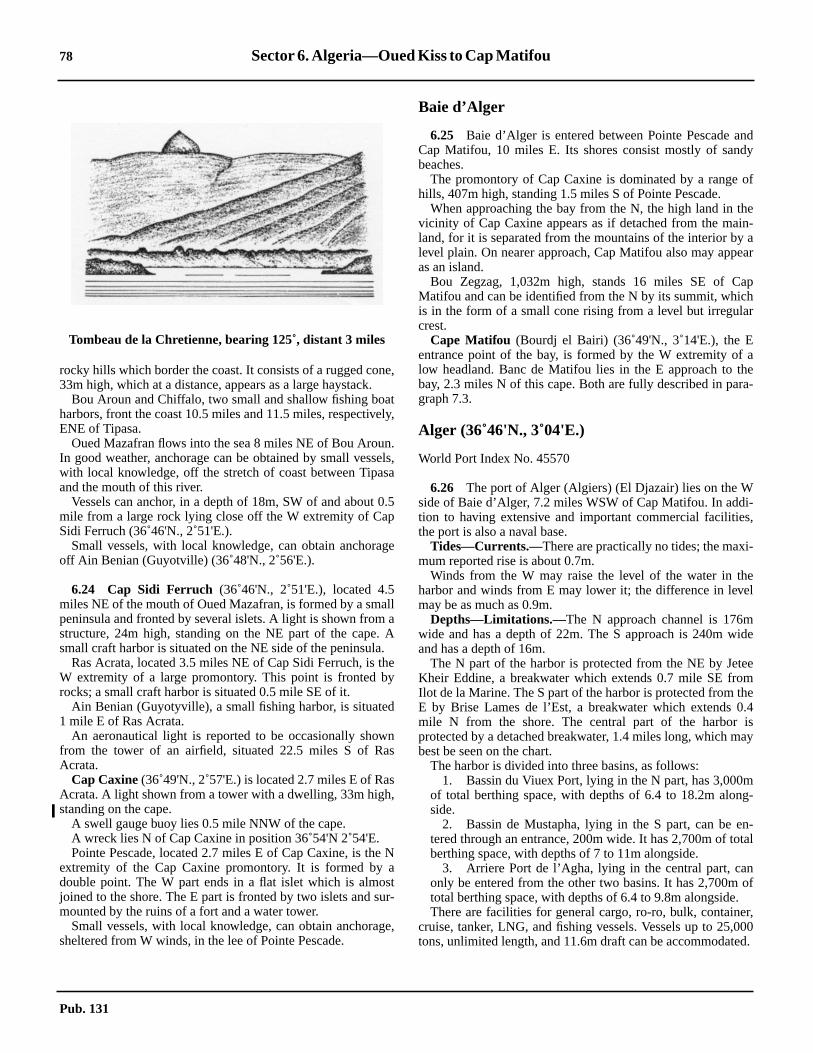
78 Sector 6. Algeria—Oued Kiss to Cap Matifou
nddy
of
hein-a
ear
aphr
ahea-
-s,
-
el
ide
eemhe.4isay
mg-
n-tal
nof
.r,00d.
rocky hills which border the coast. It consists of a rugged cone,33m high, which at a distance, appears as a large haystack.6.23 Bou Aroun and Chiffalo, two small and shallow fishing boatharbors, front the coast 10.5 miles and 11.5 miles, respectively,ENE of Tipasa.6.23 Oued Mazafran flows into the sea 8 miles NE of Bou Aroun.In good weather, anchorage can be obtained by small vessels,with local knowledge, off the stretch of coast between Tipasaand the mouth of this river.6.23 Vessels can anchor, in a depth of 18m, SW of and about 0.5mile from a large rock lying close off the W extremity of CapSidi Ferruch (36˚46'N., 2˚51'E.).6.23 Small vessels, with local knowledge, can obtain anchorageoff Ain Benian (Guyotville) (36˚48'N., 2˚56'E.).
6.24 Cap Sidi Ferruch (36˚46'N., 2˚51'E.), located 4.5miles NE of the mouth of Oued Mazafran, is formed by a smallpeninsula and fronted by several islets. A light is shown from astructure, 24m high, standing on the NE part of the cape. Asmall craft harbor is situated on the NE side of the peninsula.6.24 Ras Acrata, located 3.5 miles NE of Cap Sidi Ferruch, is theW extremity of a large promontory. This point is fronted byrocks; a small craft harbor is situated 0.5 mile SE of it.6.24 Ain Benian (Guyotyville), a small fishing harbor, is situated1 mile E of Ras Acrata.6.24 An aeronautical light is reported to be occasionally shownfrom the tower of an airfield, situated 22.5 miles S of RasAcrata.6.24 Cap Caxine(36˚49'N., 2˚57'E.) is located 2.7 miles E of RasAcrata. A light shown from a tower with a dwelling, 33m high,standing on the cape.6.24 A swell gauge buoy lies 0.5 mile NNW of the cape.6.24 A wreck lies N of Cap Caxine in position 36˚54'N 2˚54'E.6.24 Pointe Pescade, located 2.7 miles E of Cap Caxine, is the Nextremity of the Cap Caxine promontory. It is formed by adouble point. The W part ends in a flat islet which is almostjoined to the shore. The E part is fronted by two islets and sur-mounted by the ruins of a fort and a water tower.6.24 Small vessels, with local knowledge, can obtain anchorage,sheltered from W winds, in the lee of Pointe Pescade.
Baie d’Alger
6.25 Baie d’Alger is entered between Pointe Pescade aCap Matifou, 10 miles E. Its shores consist mostly of sanbeaches.6.25 The promontory of Cap Caxine is dominated by a rangehills, 407m high, standing 1.5 miles S of Pointe Pescade.6.25 When approaching the bay from the N, the high land in tvicinity of Cap Caxine appears as if detached from the maland, for it is separated from the mountains of the interior bylevel plain. On nearer approach, Cap Matifou also may appas an island.6.25 Bou Zegzag, 1,032m high, stands 16 miles SE of CMatifou and can be identified from the N by its summit, whicis in the form of a small cone rising from a level but irregulacrest.
Cape Matifou (Bourdj el Bairi) (36˚49'N., 3˚14'E.), the Eentrance point of the bay, is formed by the W extremity oflow headland. Banc de Matifou lies in the E approach to tbay, 2.3 miles N of this cape. Both are fully described in pargraph 7.3.
Alger (36˚46'N., 3˚04'E.)
World Port Index No. 45570
6.26 The port of Alger (Algiers) (El Djazair) lies on the Wside of Baie d’Alger, 7.2 miles WSW of Cap Matifou. In addition to having extensive and important commercial facilitiethe port is also a naval base.6.26 Tides—Currents.—There are practically no tides; the maximum reported rise is about 0.7m.6.26 Winds from the W may raise the level of the water in thharbor and winds from E may lower it; the difference in levemay be as much as 0.9m.6.26 Depths—Limitations.—The N approach channel is 176mwide and has a depth of 22m. The S approach is 240m wand has a depth of 16m.6.26 The N part of the harbor is protected from the NE by JetKheir Eddine, a breakwater which extends 0.7 mile SE froIlot de la Marine. The S part of the harbor is protected from tE by Brise Lames de l’Est, a breakwater which extends 0mile N from the shore. The central part of the harborprotected by a detached breakwater, 1.4 miles long, which mbest be seen on the chart.6.26 The harbor is divided into three basins, as follows:
1. Bassin du Viuex Port, lying in the N part, has 3,000of total berthing space, with depths of 6.4 to 18.2m alonside.
2. Bassin de Mustapha, lying in the S part, can be etered through an entrance, 200m wide. It has 2,700m of toberthing space, with depths of 7 to 11m alongside.
3. Arriere Port de l’Agha, lying in the central part, caonly be entered from the other two basins. It has 2,700mtotal berthing space, with depths of 6.4 to 9.8m alongside
6.26 There are facilities for general cargo, ro-ro, bulk, containecruise, tanker, LNG, and fishing vessels. Vessels up to 25,0tons, unlimited length, and 11.6m draft can be accommodate
Tombeau de la Chretienne, bearing 125˚, distant 3 miles
Pub. 131
Sector 6. Algeria—Oued Kiss to Cap Matifou 79
oned.stedioner
l is
reaie
y
eous
terofbe
y
ls
of
an-ex-
ch
as,chor
6.26 It has been reported (2001) that vessels will not be takenpierside if they have a draft greater than 10m.6.26 Aspect.—Several forts surmount the heights overlookingAlger and a conspicuous television mast stands 1.5 miles S ofPointe Pescade.6.26 Ilot de la Marine is located 3.3 miles SE of Pointe Pescadeand is joined to the shore by a mole. A prominent disused lighttower stands on this islet.6.26 Roche M’Tahen lies about 0.3 mile offshore, 0.5 mile N ofIlot de la Marine. It is the outermost rock fronting the coast tothe N of the port and is marked by a lighted beacon.6.26 The church of Notre Dame d’Afrique stands about 0.3 mileinland, 1.5 miles NW of Ilot de la Marine; its prominent domeis surmounted by a cross which is sometimes illuminated atnight.6.26 Fort l’Empereur, a conspicuous building, stands 1.3 milesSW of Ilot de la Marine and is 216m high.6.26 A conspicuous monument stands about 0.6 mile inland, 2.5miles S of Ilot de la Marine. A prominent tower is situated 0.3mile W of this monument.6.26 A conspicuous military hospital is situated near the coast,0.9 mile NW of Ilot de la Marine.6.26 A light is shown from a structure, 16m high, standing nearthe head of the N breakwater.6.26 It has been reported (2001) that aeronautical radiobeacontowers on both sides of the bay are visible well out to sea.6.26 Pilotage.—Pilotage is compulsory for vessels over 1,500tons and is usually only available during daylight hours. Pilotscan be contacted on VHF channel 12 or 16 and generally boardabout 0.5 mile E of the S head of the detached breakwater. Ves-sels should send an ETA at least 24 hours in advance.6.26 Merchant vessels can communicate through Bouzarea(Bouzareah) Naval Signal Station, which stands on the heights,2 miles NW of Ilot de la Marine. A signal station is also situ-
ated on the N breakwater and is available for communicatiwith vessels in the roadstead, when it is not otherwise engag6.26 Regulations.—Vessels approaching or leaving the port mufollow the channel, which is indicated on the chart. It is enter5 miles E of Pointe Pescade and leads in a SSW directtowards the harbor. Vessels leaving the port have priority ovthose entering the port. Anchoring in this approach channeprohibited.6.26 Anchorage.—Four anchorage areas, the limits of which ashown on the chart, have been established (1982) within Bd’Alger, as follows:
1. Area No. 1 lies N of the N breakwater and is used bvessels not carrying any dangerous substances.
2. Area No. 2 lies centered 2 miles E of the head of thN breakwater and is used by vessels carrying dangersubstances or gas.
3. Area No. 3 lies close E of the detached breakwaand is used by vessels of small tonnage with authorizationthe Port Captain. The bottom has been reported (2001) tohard clay vice mud.
4. Area No. 4 lies SSW of Cap Matifou and is used bvessels waiting, sheltering, or carrying out repairs.
6.26 Caution.—Due to construction being carried out, vesseshould stay well clear of the heads of the breakwaters.6.26 A dangerous wreck is reported to lie about 1.2 miles NEIlot de la Marine.6.26 Due to the existence of submarine cables, a prohibitedchorage area, the limits of which are shown on the chart,tends N from the vicinity of the of the head of Baie d’Alger.6.26 It is reported (1993) that all buoys marking the approachannel and anchorage areas have been removed.6.26 It is reported (1990) that the designated anchorage arewhich are described above, are not in use and vessels ananywhere in the roadstead, regardless of size.
Pub. 131


81
7.Algeria and Tunisia—Cap Matifou to Cap Serrat
istribution).
Pub. 131
7.0Additional chart coverage may be found in NGA/DLIS Catalog of Maps, Charts, and Related Products (Unlimited DSECTOR7 — CHART INFORMATION


83
el-S
el
ed
eaht of
t debyalthehee S.In
allnd
o.ts
i-
S,st.
SECTOR 7
ALGERIA AND TUNISIA—CAP MATIFOU TO CAP SERRAT
7.0 Plan.—This sector describes the Mediterranean coasts ofAlgeria and Tunisia, between Cap Matifou (Bourdj el Bairi)(36˚49'N., 3˚14'E.) and Cap Serrat (37˚14'N., 9˚13'E.). Thedescriptive sequence is from W to E.
General Remarks
7.1 Tides—Currents.—Strong currents are experiencedin the vicinity of Banc de Matifou.7.1 Currents in the N approach to Golfe de Bejaia are strong attimes and generally set towards the gulf.7.1 A strong current sets N along the coast to the W of CapBougaroun (Cap Bougaroni) (37˚05'N., 6˚28'E.), and gives riseto a confused sea when the wind is from the N. At the cape,winds from the W strongly predominate in winter (October toMay) throughout the day. From June to September, winds fromthe E predominate.
7.1 In winter, strong currents are experienced in the vicinity ofCap de Fer (37˚05'N., 7˚10'E.). With WNW winds, a heavyswell is in evidence.7.1 Along the N coast of Tunisia, the currents are very variableand are mainly due to the winds. Offshore, the prevailing Wand E winds give rise to fairly strong currents. A W current,with a rate of 2 to 3 knots, has been experienced in the vicinityof Ecueils des Sorelles and Jazirat Jalitah.7.1 Caution.—The People’s Democratic Republic of Algeriahas temporarily suspended permission to navigate within Al-gerian territorial waters up to 10 miles offshore, betweenmeridians 3˚15'E and 4˚10'E.
7.1 Vessels wishing to enter or depart the following ports shouldadhere to the designated channels, as follows:
1. Port de Zemmouri—Vessels should keep to the chan-nel oriented N-S between 3˚33.5'E and 3˚34.6'E.
2. Port de Dellys—Vessels should keep to the channcentered on the port’s green harbor light and oriented Nbetween 3˚54.8'E. and 3˚55.8'E.
3. Pointe Tigzirt—Vessels should keep to the channoriented N-S between 4˚07.8'E and 4˚08.6'E.
7.1 Tunny nets may be found offshore along the coast describin this sector.
Off-lying Islands and Dangers
7.2 Jazirat Jalitah (Ile de la Galite) (37˚32'N., 8˚56'E.)lies 21 miles NNW of Cap Serrat (37˚14'N., 9˚13'E.) and is thlargest island of a group which rises from Banc de Jalit(Banc de la Galite). The group is separated from the coasTunisia by Canal de la Galite (Canal Jalitah).7.2 Jazirat Jalitah has steep shores and its W part rises to BouSomme (Grand Sommet), 391m high, which is surmounteda yellow lookout tower. Piton de l’Est, a conspicuous conicpeak, is 360m high and stands near the SE extremity ofisland. Two radio masts stand close S of the middle of tisland and are very conspicuous when approaching from th7.2 A small fishing harbor lies on the S side of the island.good weather, temporary anchorage can be obtained by smvessels, with local knowledge, within small bays on the N aS sides of Jazirat Jalitah.7.2 Galitons de l’Ouest consists of two islets lying 1.5 miles SWof Jazirat Jalitah. Galiton, 158m high, is the larger of the twA light is shown from a structure, 14m high, standing on isummit.7.2 La Fauchelle, close SE of Galiton, is 137m high and domnated by L’Aiguille, a conspicuous cone at its SE end.7.2 Galitons de l’Est consists of three rocks named, from N toGallo, Pollastro, and Gallina. Gallo, 119m high, is the largeand lies 1 mile NNE of the N extremity of Jazirat JalitahShoals, with a least depth of 6m, lie within 1 mile of Gallo.
Jazirat Jalitah—Galiton de l’Ouest from N
Pub. 131

84 Sector 7. Algeria and Tunisia—Cap Matifou to Cap Serrat
ise
ndall
iles
fEer-mile,
isa
innd
n-
mtedm
5mto
rte
is-ng
g0,in
dio
mgeSE
m
is
.eshE
fm
7.2 Ecueil des Sorelles(37˚24'N., 8˚36'E.), consisting of twoshallow rocky patches, lies 14 miles WSW of Galitons del’Ouest. A lighted buoy, fitted with a racon, is moored close Wof the W patch and a buoy is moored close E of the E patch. Aconcrete block, 2m high, stands on the W patch. A depth of14.6m was reported (1970) to lie about 3 miles N of this block.7.2 Banc des Mazzarilles, which is rocky and has depths of 21 to49m, lies about 8 miles N of Jazirat Jalitah.7.2 A depth of 6.1m was reported (1994) to lie in the vicinity ofBanc des Spiss, 15 miles N of Jazirat Jalitah.7.2 Caution.—The buoys marking Ecueils des Sorelles shouldnot be relied upon because of their exposed positions.7.2 Vessels have experienced strong currents in the vicinity ofEcueils des Sorelles.
Cap Matifou to Golfe de Bejaia
7.3 Cap Matifou (Bourdj el Bairi) (36˚49'N., 3˚14'E.),the E entrance point of Baie d’Alger, is the W extremity of alow headland. The N side of the headland is cliffy and extendsE for 1.7 miles. The E part rises to a flat-topped hill, whichfrom a distance appears as an island.7.3 A light is shown from a structure, 11m high, standing 1 mileE of the cape. A signal station and two pylons stand closeNNW and 0.5 mile W, respectively, of the light.7.3 A spit extends about 0.5 mile W from the cape and is markedby a lighted buoy.7.3 Banc de Matifou (36˚51'N., 3˚14'E.), with a least depth of9m, lies about 2.2 miles N of the cape. Strong currents areexperienced in the vicinity of this shoal bank and vesselsshould avoid passing over it.7.3 Iles Sandja, a group of rocks, lies about 0.8 mile NE of CapMatifou Light, with the largest being 13m high. Vessels shouldnot attempt to pass between this group and the coast.Bordelaise, a shallow rock, lies about 1.5 miles offshore, 2.5miles E of Cap Matifou Light. Several rocks and shoals liebetween this rock and the coast.7.3 Ain Taya, a village, is situated 2.5 miles SE of Cap MatifouLight. Small vessels, with local knowledge, can obtainanchorage, sheltered from W winds, off this village.7.3 Ilots Agueli, a group of small islets, lies about 0.7 mileoffshore, 5 miles ESE of Cap Matifou Light. The largest islet is25m high and is marked by a beacon. Anchorage can beobtained, by small vessels with local knowledge, close E of themiddle of the largest islet. The berth is in depths of 12 to 14m,rocky bottom, off a conspicuous cave. A sandy bottom can befound farther offshore, but the position is less sheltered.7.3 Draa Ed Dar, a hill, stands 2 miles SE of Ilots Agueli. It is 71mhigh and prominent. A conspicuous group of buildings stands on awooded hillock near the coast, 2 miles E of this hill.
7.4 Cap el Achaichi (36˚47'N., 3˚31'E.), a headland, islocated 14.2 miles ESE of Cap Matifou, at the N extremity of achain of mountains. The most conspicuous summits of thechain are Djebel Bou Arous, 444m high, and Mont Sidi Feredj,452m high, which stand about 4 miles SE of the headland.From the NW, these summits appear like a saddle, while fromthe NE, they appear as two sharp peaks.7.4 A small craft harbor, protected by two moles, lies on the SWside of a point, 2.3 miles ENE of Cap el Achaichi.
7.4 Cap Djenet, located 11.5 miles NE of Cap el Achaichi,high. A prominent hill, 438m high, stands 1.5 miles SE of thcape.7.4 Baie Mersat Djenet is entered close SW of Cap Djenet aaffords temporary anchorage, sheltered from E winds, to smvessels with local knowledge.7.4 Djebel Bou Berak, a conspicuous mountain, stands 5.5 mE of Cap Djenet. It is conical in shape and 593m high.7.4 Cap Bengut (36˚55'N., 3˚54'E.), located 8.7 miles ENE oCap Djenet, is easy to identify from seaward. It lies at theextremity of the above-mentioned mountain chain and, on ctain bearings, appears saddle-shaped. A reef extends 0.1NNW from this cape. A light is shown from a tower, 29m highstanding on the cape.7.4 Pointe de Dellys, located 1.2 miles ENE of Cap Bengut,high, narrow, and fringed by a spit. A light is shown fromstructure, 8m high, standing on the point.7.4 Caution.—Vessels should not approach the coast withdepths of less than 37m between the small port of Dellys aCap Sigli (36˚54'N., 4˚46'E.).
7.5 Dellys (36˚55'N., 3˚55'E.) (World Port Index No.45560), a small port, lies in the W part of a bay which is etered close E of Pointe de Dellys.7.5 Depths—Limitations.—The main commercial facilitiesinclude Berth No. 1, situated on North Quay, which is 107long and has a depth of 6m alongside, and Berth No. 4, situaon South Quay, which is 129m long and has a depth of 5.5alongside. Generally, vessels up to 100m in length and 5.draft can be accommodated. In addition, ro-ro vessels up105m in length can be handled.7.5 Aspect.—The port is protected from the E by a breakwatewhich extends SSE from a point lying 0.5 mile SW of Poinde Dellys.7.5 A mosque, which stands close W of the harbor, is clearly vible when approaching from the E. The town is situated alothe S part of the bay.7.5 Pilotage.—Pilotage is compulsory and available durindaylight only. The port can be contacted on VHF channel 111, 12, 13, 14, or 16. Vessels should send an ETA 24 hoursadvance of arrival. Messages may be sent through Alger Ra(7TA). Pilots board within the anchorage area.7.5 Anchorage.—The roadstead off the harbor is sheltered froW and NW winds and the holding ground is good. Anchorashould be obtained, in depths of 13 to 24m, about 0.2 mile Sof Pointe de Dellys.
7.6 Arbane Millia (36˚54'N., 4˚03'E.), a rock, lies closeinshore, 6.7 miles E of Dellys. It is large, white, and over 30high.7.6 Tala Aicha, 890m high, stands 3.5 miles S of the rock. Thmountain is conspicuous and has a crater-like summit.7.6 Pointe Tigzirt, located 3.2 miles E of Arbane Millia, isfronted by an islet and a reef which lie within 0.5 mile of itThe point can easily be identified by the red roofs of the housin a village which is situated in the vicinity. Small vessels, witlocal knowledge, can obtain anchorage, sheltered fromwinds, under the lee of this point.7.6 Cap Tedles (36˚55'N., 4˚10'E.), located 1.7 miles ENE oPointe Tigzirt, is 250m high and rounded. A mountain, 843
Pub. 131

Sector 7. Algeria and Tunisia—Cap Matifou to Cap Serrat 85
nd
in.7
inE,y
ap
isly
iet
n,e
ileedled
pity.is
p
eseilWby
els
nil
lhe
Nrentatws
terdsir-m.
high, stands 3.7 miles S of the cape; its summit is surmountedby a remarkable clump of trees.7.6 Sidi Khaled, a point of land, is located 1 mile E of CapTedles and surmounted by a mosque. Roches Sidi Khaled,formed by several rocks and shoals, extends up to 0.7 mile NEfrom the point. Small vessels, with local knowledge, can obtainanchorage, sheltered from W winds, under the lee of theseshoals, but the holding ground is poor.7.6 Pointe de Timliline, located 5 miles E of Cap Tedles, isdominated by two prominent hills, 281m and 283m high.7.6 Pointe de Mers el Farm is located 8.5 miles E of Cap Tedles,and several rocks, awash, and shoals lie up to 1 mile offshore.7.6 Azeffoun, fronted by a small jetty, lies in the SE part of thebay, which is entered between Pointe de Mers el Farm and CapCorbelin, 4.5 miles ESE. Anchorage, sheltered from E winds,can be obtained by vessels, with local knowledge, in depths of7 to 10m, W of the jetty.7.6 Cap Corbelin (36˚55'N., 4˚26'E.), reddish-yellow in colorand prominent, is the NW extremity of a mountainous pro-jection. From seaward, there appears to be a deep bay lying tothe E of the cape because the land on that side is very low. Alight is shown from a tower, 13m high, standing on the cape.7.6 Tamgout, a mountain, stands 5.5 miles S of the cape. It is1,278m high and very conspicuous from seaward.
7.7 Cap Sigli(36˚54'N., 4˚46'E.) is located 16 miles E ofCap Corbelin and is fringed by rocks. This cape is only prom-inent from close inshore either to the E or W of it. A light isshown from a structure, 26m high, standing on the cape.7.7 Between Cap Sigli and Cap Carbon, 18 miles ESE, the coastis fronted by rocks. Temporary anchorage can be obtained, in adepth of 12m, by vessels, with local knowledge, within a baywhich is entered 3 miles ESE of the cape.7.7 Djebel Mindjou, 672m high, is located 1.8 miles S of CapSigli; some prominent rocky outcrops, which resemble ruins,stand on its summit.7.7 Djebel Arbalou, 1,317m high, stands 10 miles SSE of CapSigli and dominates this stretch of the coast. From the NW, itssummit appears conical, but from other directions it appearsrounded.7.7 El Euch, a rocky islet, lies close inshore, 1.5 miles ESE ofCap Sigli. It is reddish-yellow, 33m high, and has a small rockat its N end.7.7 Pointe Boulima (36˚49'N., 4˚59'E.), reddish in color, islocated 12 miles ESE of Cap Sigli. This point lies at the E endof a sandy beach and has a small, natural boat harbor on its Wside. Ile Pisan, 31m high, lies 0.6 mile NE of Pointe Boulimaand is fringed by rocks. Rochers des Moules, 1m high, lies 0.7mile offshore, 1.5 miles NW of Pointe Boulima.7.7 Pointe Mezaia, located 1.5 miles SE of Pointe Boulima, issurmounted by a conical hill and is joined to the mainland by aridge of sand. From certain directions, it appears as an islet.7.7 Cap Carbon (36˚47'N., 5˚07'E.), located 4.5 miles ESE ofPointe Mezaia, is dominated by a small conical hill, 220mhigh. A light is shown from a structure, 10m high, standing onthe summit of the conical hill. Another light is shown from astructure, 8m high, standing at the foot of the cliffs on the Nside of the cape.7.7 Djebel Gouraya, 660m high, stands 1 mile WSW of the capeand is surmounted by a prominent fort and a signal station.
Golfe de Bejaia (Golfe de Bougie)
7.8 Golfe de Bejaia is entered between Cap Carbon aRas Afia, 28 miles E.7.8 The S shore of the gulf is dominated by a mountain chaDejbel Ta Babor, 1,969m high, is the highest and standsmiles inland, 23 miles SE of Cap Carbon. This mountaappears flat-topped and isolated when seen from NW or Nbut from the N, it can only be distinguished from the others bits height and by a small spur on its W side.7.8 Dar Mohand stands close to the coast, 4.7 miles S of CCarbon. It is detached and 305m high.7.8 Pointe Aokas, located 8 miles ESE of Dar Mohand,dominated by a hill, 467m high, which has sides falling steepto the sea.7.8 Ile Mansouria is the outermost of a group of rocks which labout 0.5 mile offshore, 12 miles ENE of Pointe Aokas. A lighis shown from a structure, 6m high, standing on its N side.7.8 Cap Cavallo (Ras Talou), located 23 miles E of Cap Carbois the extremity of a chain of high conical hills which arseparated by deep valleys. Grand Cavallo, an islet, lies 0.5 moffshore, 0.7 mile NE of the cape. It is 52m high and is coverwith brushwood. Petit Cavallo, another islet, lies 0.2 mioffshore, 2.6 miles NE of Grand Cavallo. It is flat ansurrounded by reefs.7.8 Ilot Hadjret Tafalkout, 17m high, lies 1.1 miles WSW of CaCavallo and is the outermost of several dangers in this vicinA light is shown from a structure, 5m high, standing on thislet.7.8 Ras Afia (36˚49'N., 5˚42'E.) is located 5 miles NE of CaCavallo. A light is shown from a tower with a dwelling, 14mhigh, standing on this point.7.8 Banc des Kabyles, with a least depth of 7m, lies 3.2 milNW of Ras Afia and the sea breaks on it in bad weather. Ecude la Salamandre, with a least depth of 4m, lies 2 miles NNof Ras Afia. Both of these dangers are frequently markedtide-rips.7.8 Golfe de Bejaia contains no safe anchorage for large vessexcept at Bejaia.
Bejaia (36˚45'N., 5˚05'E.)
World Port Index No. 45550
7.9 The port of Bejaia, formerly known as Bougie, lies othe W side of Golfe de Bejaia and is principally a crude oloading terminal.7.9 Tides—Currents.—Tides are negligible. The water levemay rise with S winds and decrease with N and E winds; tdifference to the level does not exceed 0.5m.7.9 A rather strong countercurrent is usually found settingthrough the roadstead. However, after heavy gales the curflows along the shore of the gulf in a direction contrary to thof the gale, although at the onset of the gale the current flowith it.7.9 Depths—Limitations.—The harbor is protected by twobreakwaters and is divided into three basins. The E breakwaextends S and is 0.4 mile long. The W breakwater extenENE, NNE, and NE and is 1.3 miles long. The entrance faway is 320m wide and has been dredged to a depth of 13.5
Pub. 131

86 Sector 7. Algeria and Tunisia—Cap Matifou to Cap Serrat
gth
asa
r ofr-d-2
e
eTA
atHF.
o
s
rerth.r.n-
5y,ay,n,
0.5
and
nd3
ell
el.ut
flotb-
m,
,
isonhis
)d
7.9 The two inner basins are entered from the SW side of theouter basin through a passage, 80m wide. These basins have2,700m of total commercial quayage with depths of 5.5 to 13malongside. There are facilities for general cargo, ro-ro, and bulkvessels. Vessels up to 10,000 dwt and 9m draft can be accom-modated.7.9 The outer basin has three oil berths with depths of 11.5m,12.5m and 13.5m alongside. Tankers up to 260m in length and13m draft can be accommodated.7.9 Aspect.—The city appears as an amphitheater amid greenvegetation and contrasts with the high land mass close N.7.9 Marabout of Sidi Yahia, a conspicuous building with a chim-ney at its W end, stands near the shore, 0.3 mile W of the rootof the E breakwater.7.9 A conspicuous chimney stands 2 miles SW of Marabout ofSidi Yahia.7.9 A light is shown from a structure, 15m high, standing at thehead of the E breakwater.7.9 A lighted buoy is moored about 0.5 mile SSW of the head ofthe E breakwater and marks the SW end of the dredged en-trance channel.7.9 Pilotage.—Pilotage is compulsory. Tanker vessels shouldsend an ETA at least 48 hours and 24 hours in advance toSONATRA, Bejaia through Alger (7TA). A corrected ETAshould be sent if more than 1 hour different from previousestimates. Other vessels should send an ETA 6 hours inadvance, but 12 hours if arriving at night. Pilots can be con-tacted on VHF channel 10, 12, 14, or 16 and generally boardabout 1 mile NE of the E breakwater.7.9 Pilots for the small port of Jijel are also available.7.9 Anchorage.—Anchorage, sheltered from all winds exceptthose from between the NE and E, can be obtained asconvenient, in depths of 10 to 20m, off the breakwaters. Thebottom consists of mud and sand and the holding ground isgood where the mud is hard, but poor where it is soft.7.9 Caution.—A danger area, the limits of which are shown onthe chart, lies centered 0.5 mile ESE of the root of the Wbreakwater. The danger area is marked by a buoy.7.9 Several wrecks, some dangerous, lie in the approaches to theharbor and may best be seen on the chart.7.9 Between December and March, a heavy swell sometimesenters the harbor, usually during and after prolonged NWwinds. This causes violent surging and may require vessels toput to sea.7.9 Vessels should not pass close to the breakwater heads.7.9 A wave recorder buoy is moored about 0.8 mile E of thehead of the E breakwater.
Golfe de Bejaia to Skikda
7.10 Jijel (Djidjelli) (36˚50'N., 5˚47'E.) (World Port IndexNo. 45530), a small port, lies 4 miles E of Ras Afia and isprotected by breakwaters.7.10 Depths—Limitations.—The N breakwater extends E fromthe E extremity of a small peninsula, which is located close Nof the town, to an islet and then SSE. The S breakwater extendsNE from a mole. The approach channel has a width of 120mand depths of 10 to 11m.7.10 The harbor has 670m of total commercial quayage withdepths of 4.3 to 7.3m alongside. There are facilities for general
cargo, ro-ro, and fishing vessels. Vessels up to 153m in lenand 7m draft can be accommodated.7.10 Aspect.—Mezritane, 388m high, stands 1.2 miles SE of RAfia. This hill is prominent and its summit is surmounted bytower.7.10 The most conspicuous landmarks include the square towethe town hall; the large white hospital building which ovelooks the town; the belfry of a church and a water tower staning in the S part of the town; and a factory building situatedmiles WSW of the harbor.7.10 A light is shown from a structure, 12m high, standing on thislet at the E end of the N breakwater.7.10 Pilotage.—Pilotage is not compulsory and pilots aravailable as required from Bejaia. Vessels should send an Eand request for pilot directly to the pilot station at Bejaialeast 24 hours in advance. The port can be contacted by VPilots generally board in the vicinity of the harbor entrance.7.10 Anchorage.—Anchorage is available, in depths of 21 t36m, between 0.5 and 1 mile from the N breakwater.7.10 Caution.—The water level within the harbor sometimevaries up to 0.5m, especially during March and April.7.10 The N sides of the peninsula and the N breakwater afringed with rocks and shoals and should be given a wide be
Winds from the NW may raise surf within the harboBerthing becomes difficult and cargo handling is frequently iterrupted.
7.11 Jenndjene(Jen Jen) (36˚49'N., 5˚53'E.) lies aboutmiles E of Jijel. The facilities include a general cargo qua760m long; a mixed cargo quay, 250m long; and a ro-ro qu76m long. There are depths of 11m alongside. In additiothere is a steel product quay, 1,060m long, with depths of 1to 18m alongside.7.11 This port accommodates cargo vessels up to 30,000 dwtore vessels up to 120,000 dwt.
Ilot Tazerout (El Hadjra) (36˚52'N., 6˚04'E.), 13m high, liesclose off a point, 14.2 miles ENE of Jijel. Several reddish aprominent sandhills, 88m high, stand close inland withinmiles W of this islet.7.11 Conspicuous hills along this part of the coast include DjebBou Kertzoum, 148m high, standing 3 miles SE of Jijel; EKoudiat, 112m high, standing 6 miles ESE of Jijel; and DjebSeddets, 956m high, standing 5 miles SSW of Ilot Tazerout7.11 Haut-Fond de Jijelar, a bank with a depth of 25m, lies abo6.5 miles NE of Jijel.7.11 Ilot Lamein, 10m high, lies close off a point, 11 miles NE oIlot Tazerout. Casabianca is situated 1.5 miles SE of ILamein. Anchorage, sheltered from N and E winds, can be otained by vessels with local knowledge, in depths of 14 to 26about 0.3 mile off the beach at Casabianca.
7.12 Ras Atia(Moghreb) (37˚01'N., 6˚16'E.) is located 2.5miles NNE of Ilot Lamein. A light is shown from a structure15m high, standing on the point.7.12 Mersa Damous, a cove, lies 2.3 miles ENE of Ras Atia andmarked by some houses, with red roofs, standing on a cliffits W side. A conspicuous ravine is located at the head of tcove.
Cap Bougaroun (Cap Bougaroni) (Ras Seba Rous(37˚05'N., 6˚28'E.) is located 10.5 miles ENE of Ras Atia an
Pub. 131

Sector 7. Algeria and Tunisia—Cap Matifou to Cap Serrat 87
ndng
uf
ies
ra,isa
iled
hes
ra
n-
stds
e
es,rthss ofm
k-NE
ak-
toes-oilin
sa
, is
is the N extremity of a mountainous promontory which liesbetween Ilot Lamein and Collo. A light is shown from astructure, 10m high, standing on the cape. A signal station issituated close E of the light.7.12 Ras el Kbiba, a small peninsula, lies 4.5 miles SE of thecape. Baie de Tamanert and Baie des Beni Said, two smallbays, are entered NW and SE, respectively, of this peninsula.Bar en Nsa, a cove, is entered between the S entrance point ofBaie des Beni Said and Cap Collo, 1 mile SE.7.12 Good anchorage, with W winds, can be obtained by vessels,with local knowledge, in a depth of 14m within Baie de Tama-nert. Anchorage can also be obtained by vessels, with localknowledge, within Baie des Beni Said, but care should betaken to avoid a shallow reef which lies about 600m from thehead of the bay.7.12 Temporary anchorage can be obtained, in a depth of 20m, inthe central part of Bar en Nsa.
Pointe Djerda (Cap Collo) (37˚01'N., 6˚35'E.) is the NEextremity of Presqu’ile Djerda, a small peninsula. A light isshown from a structure, 11m high, standing on the cape. Ashoal, with a depth of 22m, lies about 0.5 mile NE of the cape.
7.13 Collo (37˚00'N., 6˚35'E.) (World Port Index No.45520), a small port, lies on the NW side of Baie de Collo,which is entered between Cap Collo and Ras Frao (Kharras),3.2 miles SE.7.13 Depths—Limitations.—The harbor is protected by a jetty,145m long, which extends S from a point close S of the town.There is 238m of total quayage, with depths of 4.2 to 5malong-side.7.13 Aspect.—The town is situated at the root of the peninsula.Koudiat Djezair, 99m high, stands close S of the town and issurmounted by a small but conspicuous fort.7.13 Sidi Achour, a prominent shrine, surmounts the summit of ahill, 536m high, standing 2 miles W of Cap Collo.7.13 Pilotage.—Pilotage is not compulsory, but is advised forvessels without local knowledge. Private pilots are available.7.13 Anchorage.—Baie de Collo is one of the best open road-steads on the coast of Algeria. It affords excellent shelter fromW and N winds. Large vessels should anchor, in a depth of27m, about 0.4 mile SE of the town. The holding ground ismostly excellent. Small vessels can obtain anchorage, in depthsof 6 to 10m, about 100m from the shore.
7.14 Kharras (Ras Frao) (36˚58'N., 6˚38'E.), the SEentrance point of Baie de Collo, is dominated by MorneTelezza, an isolated and conical hill, 125m high.7.14 Ras Rdeb (Ras Erded) is located 2.5 miles ESE of Ras Frao. IleMta, an islet, lies about 0.5 mile offshore, 1 mile E of the point. Itis 62m high, but is not easy to distinguish from the coast.7.14 Ras el Kal’a (Ras Bibi) is located 3 miles E of Ras Rdeb. IlotBibi (Kal’a Rdjel el Klou), an islet 46m high, lies 0.5 mileWNW of this point.7.14 Pointe des Sept Freres is located 1.7 miles ESE of Ras Bibi;a chain of small islets extends up to 0.3 mile NNW of it.7.14 Point Esrah (Pointe Asra), located 4.5 miles E of Ras Bibi, isfringed by islets. A spit, with a depth of 4.7m, extends up toabout 0.3 mile N of the point. Baie d’Esrah is entered betweenPoint Esrah and Cap Akmes, 2 miles SE. A prominent build-ing, with a red roof, stands at the head of this bay.
Ile Sridgina (Ile Srijina) (36˚53'N., 6˚53'E.), lying 0.3 mileNE of Cap d’Akmes, is 48m high and surrounded by rocks ashoals. A light is shown from a structure, 12m high, standinear the middle of this islet.7.14 Cap Est is located 0.9 mile SSE of Cap d’Akmes. Ile dLion, with a small islet lying close ENE of it, lies close NE othe cape. It is 31m high and is marked by a light.7.14 Rocher du Lazaret, a small island less than 1m high, labout 0.1 mile offshore, 0.5 mile S of Cap Est.7.14 Ilot des Singes is located on the NW side of Baie de Sto0.8 mile S of Cap Est. This islet lies close inshore andconnected to the mainland by a bridge. A light is shown fromstructure, 9m high, standing on the islet.7.14 Stora, a village, is situated at the head of the bay, 0.3 mSSW of Ilot des Singes. A small harbor lies E of the village anis protected by breakwaters.7.14 Caution.—A prohibited anchorage area, the limits of whicare shown on the chart, extends NE from the vicinity of Ilot dSinges.
Skikda (Philippeville) (36˚53'N., 6˚55'E.)
World Port Index No. 45510
7.15 The port of Skikda lies at the head of Golfe de Sto(Golfe de Philippeville), 3 miles SSE of Ile Sridgina (IleSrijina).7.15 Port Methanier, an oil and LNG terminal, has been costructed 1.7 miles E of Skikda.7.15 Winds—Weather.—During bad weather, heavy seafrequently roll into the gulf. With NW winds, heavy seas seonto the shore between Stora and Skikda. Strong NW winhave been reported to cause an undertow.7.15 Tides—Currents.—Winds from the W raise the level of thewater in the harbor and winds from E lower it. The differencmay be as much as 0.3m.7.15 Depths—Limitations.—The harbor at Skikda is protectedby a breakwater which extends 0.8 mile WNW from thvicinity of Cap Skikda. Two commercial basins have berthwith depths of 6 to 10m alongside and facilities for bulkgeneral cargo, ro-ro, and fishing vessels. Three tanker beare situated on the S side of the breakwater and have depth11 to 13m alongside. Tankers up to 230m in length and 13draft can be accommodated.7.15 At Port Methanier, the harbor is protected by two breawaters. The W and outer breakwater extends 1 mile N andfrom the shore. The E breakwater extends 0.3 mile NW frompoint on the shore lying 0.6 mile E of the root of the W breawater. The entrance fairway is dredged to a depth of 18m.
7.15 There are two LNG berths which can handle vessels up90,000 cu.m. and 11.5m draft. An LPG berth can handle vsels up to 40,000 cu.m. and 10.5m draft. There are threeberths with depths of 14 to 16m. Tank vessels up to 265mlength and 14.8m draft can be accommodated.7.15 Aspect.—Cap Skikda is located 2 miles SE of Ilot deSinges. It is surmounted by a white prominent villa withstaircase descending to the sea.7.15 The breakwater at Skikda, situated close W of Cap Skikda9m high and conspicuous.
Pub. 131

88 Sector 7. Algeria and Tunisia—Cap Matifou to Cap Serrat
nd
si-0mof
ilesile
af-caltsn-
aene,
st
s
7.15 A bridge, with several arches, crosses the mouth of OuedSafsaf, close E of Cap Skikda.7.15 Port Methanier, the new port, is situated close E of CapSkikda. A conspicuous flare is situated close S of the harborand several prominent tanks and chimneys stand along theshore in the vicinity of the port.7.15 Lights are shown from structures standing at the heads of thebreakwaters at Skikda and Port Methanier.7.15 The entrance fairway is indicated by a lighted range.7.15 Pilotage.—Pilotage is compulsory for vessels of 500 grt andover. Pilots can be contacted on VHF channel 12, 14, or 16 andboard vessels bound for Skikda at the anchorage or about 1mile N of the entrance. Vessels bound for Port Methanier aregenerally boarded about 1 mile N of the head of the W break-water.7.15 Regulations.—Vessels should send an ETA 72 hours and 48hours in advance, with a confirmation 24 hours prior to arrival.7.15 Anchorage.—The roadstead anchorage for the port ofSkikda affords good protection from W winds, but not fromNW winds. In good weather, large vessels can obtain anchor-age, in depths of 16 to 18m, sand, about 0.5 mile SE of Ilot desSinges. In winter, large vessels should anchor, in depths of 20to 25m, farther offshore.7.15 An anchorage designated for tankers lies, in depths of 30 to40m, about 1 mile NW of the W breakwater at Port Methanier.The holding ground is good.7.15 Vessels should not obstruct the approaches and entrances tothe harbors.7.15 Caution.—Large vessels should not pass close to the headsof the breakwaters at Skikda or Port Methanier, as they are notsteep-to.7.15 When the swell in the roads reaches a height of 2m, anundertow, which makes remaining alongside very difficult,develops at the berths within Port Methanier.7.15 A wave recorder buoy is moored about 0.6 mile WNW of thehead of the W breakwater at Port Methanier.
Skikda to Golfe d’Annaba
7.16 Ras Filfila (Felfelah) (36˚55'N., 7˚06'E.), located 8miles ENE of Port Methanier, is formed by rocky cliffs and hasa conical rock, 35m high, standing on its NE side. Smallvessels, with local knowledge, can obtain anchorage in a creekon the E side of this point.7.16 Oued el Kebir flows into the sea 9 miles NE of Ras Filfila,and its mouth is conspicuous when approaching from the W.7.16 Pointe de Sidi Bou Merouane, located 1.5 miles N of theOued el Kebir, is fringed with foul ground. El Mersa Light isshown from a structure, 5m high, standing close S of the point.Anchorage, somewhat sheltered by the point, can be obtainedby vessels with local knowledge in this roadstead, but the NWpart is encumbered with rocks.
7.17 Cap de Fer(37˚05'N., 7˚10'E.), located 17 miles NEof Skikda, is one of the most salient capes on the coast of Al-geria; the high land SE of it is very conspicuous. A light isshown from a tower, 17m high, standing on the cape. A signalstation is situated near the light.7.17 A rocky islet, with some rocks close W of it, lies about 0.2mile W of the cape.
7.17 In winter, strong currents are experienced off the cape awith WNW winds, there is frequently a heavy swell.7.17 Large vessels can obtain good shelter from E winds in potions S of the cape and about 0.7 mile offshore. Depths of 3are available for anchorage. The bottom is mostly formedmud, shells, and coral, with rocks and gravel in places.7.17 The coast between Cap de Fer and Cap Takouch, 10.5 mE, is fringed with rocks and shoals extending about 0.5 moffshore in places.7.17 Baie de Sidi Akkacha, entered 5 miles E of Cap de Fer,fords anchorage, sheltered from E winds, to vessels with loknowledge. Several above-water rocks lie within 0.5 mile of iE entrance point, which is surmounted by Sidi Akkacha, a cospicuous white shrine.
7.18 Cap Takouch(37˚05'N., 7˚24'E.) is the NE extremityof a small multi-headed peninsula. A light is shown fromtower, 10m high, standing on the summit of a hill, 0.4 milSSE of the cape. Sidi Merkeb, a conspicuous white shristands 0.2 mile SSW of the light.7.18 Ile Djezira, the outermost and largest of two islets almojoined to the coast, lies close NE of the light.7.18 Ile Takouch, 33m high, lies 1 mile offshore, about 2.7 mileW of the cape.
Cap de Fer Light bearing 120˚, distant 7 miles
Cap de Fer from ENE
Shrine of Sidi Akkacha
Pub. 131

Sector 7. Algeria and Tunisia—Cap Matifou to Cap Serrat 89
-ingf thed
8.5in,
t ofth
ny
elrs.
he
.5
n
15to
t.stee
ofndithndraft
lee,
nd
s-
es
nheilotba
tois.it is
7.18 Seiche du Cap Takouch, a rocky shoal plateau, lies about 2miles N of the cape. It has a least depth of 13m and is danger-ous for deep-draft vessels.7.18 A current, with a rate up to 2 knots, has been experienced onthe bank lying between Seiche du Cap Takouch and the coast.In bad weather, the sea over this bank is especially heavy andvessels should avoid passing over it.7.18 Sidi Yahia, 545m high, stands 2 miles SSW of Cap Takouch.This conical mountain is prominent and surmounted by a mar-about tower.7.18 Sidi Benout, 538m high, stands 0.7 mile inland, 4 miles SEof Cap Takouch. This conical mountain is flat-topped and sur-mounted by a white marabout tower.7.18 Baie de Takouch lies between Ile Djezira and La PointePercee, 2 miles SSE.Mersa Takouch (Chetaibi) (37˚04'N.,7˚23'E.) (World Port Indexc No. 45500), a village, stands at thehead of the bay and is fronted by a small harbor formed by twojetties extending S from the shore. A quay, 125m long, is situ-ated between these jetties and has depths of 5 to 6m alongside.Excellent shelter from W winds can be obtained in this bay, butNE and E winds send in a heavy sea and swell. Anchorage canbe obtained, in depths of 10 to 20m, W of the village church.7.18 Cap Matfouch (Cap Akeine), located 6 miles SE of CapTakouch, is reddish and dominated by a hill, 571m high. RocheAkeine, marked by a light, lies 0.5 mile N of the cape. It hasseveral rocky heads, one of which is awash.7.18 Sidi Bou Zeid, a shrine, surmounts a coastal hill, 4 milesSSE of Cap Matfouch. It is conspicuous when not hidden bythe trees. A prominent chimney stands in a village at thebottom of the hill.7.18 Cap du Pain de Sucre, located 4.5 miles E of Sidi Bou Zeid,is a conspicuous feature. It has a rocky crest, 521m high, andterminates in a pyramidal hill, 152m high.7.18 Voile Noire, a rock, lies close inshore, 1 mile SE of the cape.It is conical and 65m high.
Golfe d’Annaba
7.19 Ras el Hamra(36˚58'N., 7˚48'E.), located 6 miles Eof Cap du Pain de Sucre, is the W entrance point of Golfed’Annaba. When seen from a distance from E or W, this capeappears as an island. It is fringed with rocks and two hills standnear the seaward extremity.7.19 A light is shown from a structure, 14m high, standing 0.5mile W of the cape. A signal station stands on the summit of ahill, 0.2 mile SW of the light.7.19 Golfe d’Annaba lies between Ras el Hamra and Cap Rosa,22 miles E. It is easily identified from seaward and, at a dis-
tance, appears larger than it really is. The heights descendtowards each entrance point are separated, at the head ogulf, by a low plain, which at some distance inland is backeby detached mountains. A mountainous ridge ex-tendsmiles SW from Ras el Hamra and terminates in a mounta1,008m high.
7.19 Oued Seybouse flows into the sea on the S side of the porAnnaba, 6 miles S of Ras el Hamra. The depths off the mouof this river are shoal and liable to change with each raiseason.7.19 Oued Mafragh flows into the sea 10.2 miles SE of RasHamra. Its entrance is the combined mouths of several riveA signal station is situated close E of the river entrance.7.19 Djebel Bou Abed, 739m high, stands 10.5 miles SSE of triver entrance and is prominent.7.19 Rocks, with a least depth of 20m, lie 5.5 miles NE and 7miles ENE of the river entrance.7.19 An aeronautical light is reported to be occasionally showfrom a position 4.7 miles SSW of the river entrance.7.19 Between the entrance of Oued Mafragh and Cap Rosa,miles ENE, the coast consists of a succession of cliffs, 49101m high.
Annaba (Bone) (36˚55'N., 7˚46'E.)
World Port Index No. 45490
7.20 The port of Annaba lies on the W side of Golfed’Annaba, 4 miles S of Ras el Hamra.7.20 Tides—Currents.—There is a variation in the water level thasometimes amounts to 0.4m above and below mean sea level7.20 Depths—Limitations.—The harbor consists of three basinand is protected by two breakwaters, Jetee du Lion and JeSud (Quai Sud).7.20 There is 3,985m of total commercial quayage, with depths4 to 13m alongside, and facilities for general cargo, bulk, aro-ro vessels. In addition, there are three tanker berths, wdepths of 7 to 13m alongside. Vessels up to 250m in length a11.5m draft can be accommodated. Tankers up to 11.9m dcan be handled.7.20 Aspect.—Fort Genois stands on a rounded point, 1 miSSW of Ras el Hamra Light. A light is shown from a structur8m high, standing close WSW of the fort.7.20 Baie du Lazaret and Baie des Caroubiers lie close SSW a1.5 miles SSW, respectively, of the fort.7.20 A group of four conspicuous buildings stand 1.2 miles NWof the harbor entrance. The prominent Basilica of Saint Augutin stands 2 miles SW of the harbor entrance.7.20 A stranded wreck, conspicuous visually and on radar, liabout 0.4 mile offshore, 5 miles SE of the harbor entrance.7.20 Pilotage.—Pilotage is compulsory. Pilots may be contacted oVHF channel 14 and generally board about 0.5 mile E of tharbor entrance. During strong E winds, embarkation of the pmay be difficult. Vessels should send an ETA through Anna(7TB).7.20 Anchorage.—Anchorage can be obtained, in depths of 2022m, within Baie du Lazaret and S or SSW of Fort GenoAnchorage can also be taken in Baie des Caroubiers, butnot as safe.
Voile Noire from NW
Pub. 131
90 Sector 7. Algeria and Tunisia—Cap Matifou to Cap Serrat
l
les
6istal
.7ednd. Ans
a
ah,
tof
5 to
butd.
t isas
ay
reE,
o.
Itsh,nd
tomseomisd
leicalds
anAint.r-
p
7.20 Caution.—Rocks, with a depth of 13m, lie about 1.5 miles Eand 3.5 miles ESE of the harbor entrance.7.20 A rock, with a depth of 8m, lies about 2.7 miles SE of theharbor entrance.7.20 A dangerous wreck lies about 1.5 miles S of the harbor en-trance.7.20 With NW gales, heavy seas are experienced off the harborentrance.7.20 Sections of submarine cable may still exist within a formerprohibited anchorage area in the S part of Baie des Caroubiers.
Annaba to Cap Serrat
7.21 Cap Rosa(36˚57'N., 8˚14'E.) is rocky, covered withbrushwood, and dominated by Djebel Karoussa, 247m high. ItsW side is faced with reddish cliffs. A light is shown from atower with a dwelling, 13m high, standing on the cape.7.21 Rocher du Schiavone lies close off a point, 1.5 miles SE ofCap Rosa. It is conical in shape and 35m high.7.21 Baie du Grande Canier and Baie du Petit Canier lie NW andSE, respectively, of Rocher du Schiavone. These bays affordfairly good shelter to vessels with local knowledge from windsbetween the W and WNW, but both are open to the NE.7.21 Cap Gros is located 8 miles ESE of Cap Rosa. This cape iseasily identified as it rises to Kef el Alem, 235m high. KefTrebiche, 256m high, stands 0.9 mile SSW of the cape.
7.22 El Kala (La Calle) (36˚54'N., 8˚27'E.) (World PortIndex No. 45480), a small port, lies 1.8 miles SE of Cap Grosand is used by coasters.7.22 Depths—Limitations.—The harbor is divided into twobasins. The outer basin has a depth of 4.6m and the inner basinhas a depth of 3m. Vessels up to 61m in length and 4.5m draftcan enter in good weather.7.22 A small jetty is situated 0.6 mile E of the harbor.7.22 Aspect.—The harbor lies between Point Noire, located 1.7miles SE of Cap Gross, and Ilot de France, 0.3 mile E. Ilot deFrance has numerous buildings on it and is connected at its SEend to the mainland by the quays at the head of the harbor. Alight is shown from a structure, 8m high, standing on the Wend of Ilot de France. Point Noire is 13m high and fronted onits W side by a rock, 11m high. The town of La Calle stands onthe S side of the harbor.7.22 Pilotage.—Pilotage is not compulsory. Local knowledge isrecommended. The services of a local resident are reported tobe available.7.22 Anchorage.—Vessels with local knowledge can anchor withina bay entered NW of Pointe Noire. It affords good shelter from Wwinds, but with NW winds, a heavy swell rolls in.7.22 Open anchorage can be obtained, in depths of 20 to 26m,sand and gravel, about 0.4 mile N of Ilot de France Light, butthe holding ground is poor.7.22 Both of the above anchorages generally become untenableduring winds from the NW or NE.7.22 Caution.—The depths in the harbor cannot be relied upondue to silting.
7.23 Monte Rotondo (36˚54'N., 8˚32'E.), 178m high,stands 4 miles E of El Kala. The ruins of a factory with tallchimneys are situated at the foot of this hill.
7.23 Cap Roux (36˚57'N., 8˚37'E.), located 8.5 miles ENE of EKala, can be identified by the reddish cliffs on its W side.7.23 The border between Algeria and Tunisia lies about 1.5 miE of this cape.
Ras Tabarqah (Cap Tabarka) (36˚58'N., 8˚45'E.), locatedmiles ENE of Cap Roux, consists of rugged grey cliffs andfronted by rocks. A prominent white house stands on a coashill, close W of the cape.7.23 Jazirat Tabarqah (Ile de Tabarka) lies 0.2 mile offshore, 0mile ESE of Ras Tabarqah. This island is crowned by a ruincastle and is 95m high. Its N side is faced with steep cliffs ait slopes gently to the S end, where there are some ruinslight is shown from a structure, 8m high, standing on the ruiof the castle.7.23 The island is connected at its S end to the mainland byrubble causeway.7.23 A small harbor, situated on the SW side of Jazirat Tabarqhas silted up.
7.24 Tabarqah (Tabarka) (36˚58'N., 8˚46'E.) (World PorIndex No. 45460), a small harbor, is situated on the SE sidethe island and protected by breakwaters. It has depths of 2.4.2m and is mostly used by fishing vessels and yachts.7.24 Anchorage can be obtained E or W of Jazirat Tabarqah,neither affords good protection, and the holding ground is baThe W roadstead is somewhat sheltered by the island, budangerous in bad weather. In the E roadstead, also knownthe summer anchorage, vessels with local knowledge manchor as convenient.7.24 Djebel Adissa, 889m high, and Djebel Bir, 1,019m high, aboth prominent and stand 13 miles S and 11.5 miles SSrespectively, of Cap Roux.
7.24 Djebel Moruna, a rocky hill, stands 3 miles E of Tabarqah. Twconspicuous monuments, 0.2 mile apart, stand on its NE slope7.24 Djebel Zouara stands 11.7 miles NE of Tabarqah.prominent black peak is 218m high. Kef es Sid, 825m higstands 9 miles SE of Djebel Zouara. Its summit is rocky aresembles a group of ruins.7.24 Cap Negro, located 13.5 miles NE of Tabarqah, is not easyidentify; however, Kef Budmah (Jebel Sidi Mohammed), 474high, stands 1 mile SE of it and is a good landmark. AnBudmah lies on the S side of the cape and is sheltered frwinds from the NNW through E to S. However, the bottommostly rock, the holding ground is only moderately good, anthe N side of this bay is fringed with rocks.
7.25 Cap Kavansur(37˚08'N., 9˚02'E.) is located 3 milesNE of Cap Negro. Kef En Nsoor stands 0.5 mile inland, 1 miE of the cape. It is 330m high and has a conspicuous consummit. Djebel Zitana (Djebel ech Chitane), 464m high, stan2 miles E of Kef En Nsoor and is prominent.7.25 Anse de Sidi Mechrig lies 5 miles ENE of the cape and cbe identified by a small, rocky point surmounted by a ruin.conspicuous monument stands on a hill, close SSE of the poAnother hill stands 0.5 mile SE of the monument and is sumounted by a marabout tower.7.25 Cap Serrat (37˚14'N., 9˚13'E.), located 11 miles NE of CaKavansur, is fully described in paragraph 8.2.
Pub. 131

91
8.Tunisia—Cap Serrat to Ras Ajdir
8.0Additional chart coverage may be found in NGA/DLIS Catalog of Maps, Charts, and Related Products (Unlimited Distribution).SECTOR8 — CHART INFORMATION
Pub. 131

93
ndnof
apby
alofof
orillsith
, 11W
eay
eofidi
se
d
ach
theast.heanceheredto
se
SECTOR 8
TUNISIA—CAP SERRAT TO RAS AJDIR
8.0 Plan.—This sector describes the N and E coasts of Tunisia.The descriptive sequence is from W to E and then N to S.
General Remarks
8.1 Tides—Currents.—In the vicinity of Cap Serrat, thecurrents are irregular and generally set with the prevailingwind.8.1 In Baie de Banzart and at other places along the N coast ofTunisia, the tides are small and are often masked by the effectsof the wind and atmospheric pressure which may cause thewater level to vary by up to 1m.8.1 Caution.—The winds in the vicinity of Cap Serrat are oftenaccompanied by haze, which makes it difficult to distinguishthe land.
Cap Serrat to Banzart
8.2 Cap Serrat (37˚14'N., 9˚13'E.), high and steep, isformed by a ridge which projects NE. Three summits, eachabout 186m high, stand on the ridge. A light is shown from atower with a dwelling, 13m high, standing on the cape. Asignal station is situated close S of the light.8.2 Djebel el Hamar stands 4 miles S of the cape. This large andround mountain is 365m high.8.2 Djebel Zeizia stands 1 mile W of Djebel Hamar. It is 271mhigh and has a jagged summit.8.2 Djebel Blida stands 0.7 mile inland, 3.5 miles SE of thecape. It is 245m high and has three cone-shaped summits.8.2 Djebel Loko stands 0.6 mile inland, 5 miles ENE of DjebelBlida. It is 126m high and shaped like a sugar loaf.8.2 Ragoubet el Goulea (Ras el Golea), a rocky point, is located8.2 miles E of Cap Serrat. The coast between this point andRas el Dukara, 8.5 miles ENE, is formed by rocky cliffs brokenby dry ravines. Ras el Dukara may be identified by its ridge ofserrated cliffs which rise in steps from the sea.8.2 A depth of 20m was reported (1994) to lie about 4 milesNNW of Ras el Dukara.8.2 The coast between Ras al Dukara and Ras el Korane (Ras elKuran), 5.5 miles ENE, is formed by mostly small cliffs androcks. These cliffs are broken by sandy beaches through whichflow several small streams.8.2 Ras el Korane is formed by rocks and gray sandstone and israther flat. Between this point and Ras Ennghela, 4 miles E, thecoast first consists of cliffs and then by a low plateau borderedby sand hills.8.2 A conspicuous red tower stands close to the coast, 1 mileESE of Ras el Korane.
Rashadat al Akhawat (Rchadet el Krouat) (Les Fratelli)(37˚18'N., 9˚25'E.), a group of rocky islets and foul ground,lies about 2.5 miles NNE of Ragoubet al Goulea and is theoutermost coastal danger.8.2 Caution.—A danger area, the limits of which are shown onthe chart, lies in the vicinity of this group of rocks.
8.3 Ras Ennghela(37˚21'N., 9˚45'E.), the N point ofAfrica, consists of a low plateau and is fronted by rocks ashoals which extend up to 0.7 mile seaward. A light is showfrom a structure, 15m high, standing on the point. The ruinsa tower are situated close to the light.8.3 The coast between this point and Ar Ras al Abayd (CBlanc), 4.5 miles E, consists of a sandy beach followeddunes and then cliffs.
Ar Ras al Abayd (Cap Blanc) (37˚20'N., 9˚50'E.) is formedby a narrow projection. Its seaward sides consist of verticwhite cliffs. A conspicuous signal station stands 0.6 mile Sthe cape, and two prominent radio masts stand close WNWit. A radiobeacon is situated at this signal station.
8.4 Ras Banzart (Cap Bizerte) (37˚20'N., 9˚52'E.),located 1.2 miles E of Ar Ras al Abayd, is neither as high nas steep, but is more salient. Three small, but prominent hstand on this cape. A radar surveillance station, equipped wVHF, is situated on the cape.8.4 A stranded wreck lies about 0.5 mile E of the cape.
Baie de Banzart (Baie de Bizerte) (37˚18'N., 9˚56'E.) isentered between Ras Banzart and Ras al Zabib (Cap Zebib)miles ESE. The city and port of Banzart (Bizerte) lie at the Sside of this bay.8.4 Caution.—An IMO-adopted Traffic Separation Schem(TSS) lies 17 miles NE of Ras Banzart (Cap Bizerte) and mbest be seen on the chart.
Banzart (Bizerte) and Menzel Bourguiba (SidiAbdallah) (37˚17'N., 9˚53'E.)
World Port Index No. 45440
8.5 The port of Banzart lies at the SW side of Baie dBanzart, 3.5 miles S of Ras Banzart. It consists mainlyAvant Port, Le Canal, Goulet du Lac, Lac de Bizerte, and SAbdallah. The city of Banzart stands principally on the NWside of Le Canal. The town of Menzel Bourguiba stands cloW of Sidi Abdallah.8.5 Tides—Currents.—Tides rise about 0.4m at springs an0.3m at neaps.8.5 The current in the canal has been reported (1997) to rerates of 1 to 2 knots.8.5 Depths—Limitations.—Avant Port is protected by threebreakwaters. Jetee Nord, 1,025m long, extends E fromcoast and Jetee Est, 940m long, extends NNE from the coDique Exterior, a detached breakwater, 610m long, lies off tentrance and may best be seen on the chart. The main entrto the harbor lies between Jetee Est and Dique Exterior. Tentrance between Dique Exterior and Jetee Nord is consideto be dangerous for large and/or single-screw vessels duestrong tidal currents.8.5 A fishing harbor, protected by breakwaters, is situated cloSE of Jetee Est.
Pub. 131

94 Sector 8. Tunisia—Cap Serrat to Ras Ajdir
ard
edSW
ofande E
d 6
aed
,of
best
theue.s it
to
the
dar
os
la
Aed
8.5 The entrance to Avant Port is dredged to a depth of 12m. TheN part of this basin is used by barges and small craft. Two oilberths are situated on the inner side of Jetee Est and havedepths of 8.2 and 11m alongside. Tanker vessels up to 50,000grt, 225m in length, and 11m draft can be accommodated.8.5 Le Canal (Canal de Bizerte), quayed on both sides, is enteredin the SW part of Avant Port and leads to Baie de Sebra. Thefairway channel through Le Canal has been dredged to a depthof 11m. Quai de Commerce, on the N side, has 500m of totalberthing space with a depth of 9m alongside. Quai de Cere-alier, at the junction of Le Canal and Baie de Sebra, is used bybulk grain vessels. It is 220m long and has a depth of 9malongside.8.5 Quai de Tunisacier, 130m long, is situated on the N side ofBaie de Sebra and has a depth of 9m alongside. Quai deCimentier, 180m long, is situated on the SW side of the bayand has a depth of 9.8m alongside. A channel dredged to adepth of 10m and marked by lighted buoys leads to these facil-ities. Vessels up to 200m in length and 9.8m draft can be ac-commodated.8.5 A lift bridge spans Le Canal 0.5 mile SW of the entrance.The lift span is 74m long.8.5 Goulet du Lac extends SW for 3 miles from the SW end ofLe Canal and then turns S into Lac de Bizerte (BuhayratBanzart). A channel, marked by buoys, leads through Gouletdu Lac and is dredged to a depth of 12m in the N part and 10min the S part.8.5 Baie Ponty and Baie de Seti Meriem, on the N side of Gouletdu Lac, are the site of a naval station which has several fingerpiers with depths of 6m alongside.8.5 Lac de Bizerte (Buhayrat Banzart) has general depths of 5.5to 10m. A channel, marked by buoys, leads through the lakeand connects Goulet du Lac with Sidi Abdallah (MenzelBourquiba). It has a dredged depth of 10m.8.5 Sidi Abdallah (Menzel Bourquiba) is an artificial harborbasin which is formed by breakwaters on three sides. The mainentrance, 95m wide, is at the NE corner of the harbor and isapproached by the dredged channel which leads through thelake. The town of Menzel Bourguiba (Manzil Bu Ruqaybah)stands close W of the harbor.8.5 The N part of the harbor has a depth of 10m and the S parthas depths of 5 to 10m. There is 460m of total berthing spacewith depths of 6.3 to 8.5m alongside. In addition, there are fourdrydocks, the largest being 247m long and 40m wide.8.5 Aspect.—Djebel Kebir, 277m high, stands 2.7 miles SW ofRas Banzart and overlooks the city. It is the dominatinglandmark in the N approach.8.5 A conspicuous hotel stands 0.4 mile inland, 2 miles S of RasBanzart.8.5 Fort Sidi Salem stands 3 miles S of Ras Banzart. The belfryin the barracks, situated 1 mile SSW of the fort, is prominent.A conspicuous building stands on the W side of Avant Port, 0.6mile SSE of Fort Sidi Salem. Zarzuna Minaret stands on the Sside of the harbor and is conspicuous.8.5 A number of prominent flares are situated about 1.2 milesSSW of the harbor entrance.8.5 A light is shown from a prominent structure, 17m high,standing on the head of Jetee Est.8.5 Pilotage.—Pilotage is compulsory. Vessels should send anETA 72 hours, 48 hours, and 24 hours in advance. Pilots may
be contacted by VHF channel 10, 12, or 16 and generally boabout 1 mile ENE of the outer detached breakwater.8.5 Regulations.—Vessels must not exceed the minimum spefor safety and steerageway as far as Baie de Sebra, at theend of Le Canal.8.5 Large vessels must enter and depart by the S entrance.8.5 Submarines are prohibited from diving in an area lying Sthe parallel of the SE head of the detached breakwater,bound to the W by the meridian of the same head and to thby the meridian of 9˚58.5'E.8.5 The speed of vessels in Goulet du Lac must not exceeknots.8.5 Anchorage.—Large vessels can obtain anchorage, indepth of 30m, about 1 mile E of the SE end of the detachbreakwater.8.5 Caution.—Banc du Boberak, with depths of less than 1.6mextends up to about 0.5 mile from the coast, 2.3 miles SSERas Banzart.8.5 Submarine cables and pipelines cross Le Canal and maybe seen on the chart.8.5 Due to submarine cables, prohibited anchorage areas,limits of which are shown on the chart, lie within Goulet dLac and extend seaward from close N of the harbor entranc8.5 The detached breakwater should be given a wide berth aslopes underwater.8.5 The head of Jetee Est should be given a wide berth duemasonry debris lying off it.8.5 Several obstructions and wrecks lie in the approaches toport and may best be seen on the chart.8.5 It was reported (1989) that the breakwaters are not raprominent until vessels are close to the harbor.
Banzart to Golfe de Tunis
8.6 Ras al Zabib (Cab Zebib) (37˚16'N., 10˚04'E.),located 8.5 miles E of Banzart, can be easily identified by twconical hills, 90m high, standing on it. The extremity of thicape is low and fronted by foul ground.
8.6 Iles Cani (37˚21'N., 10˚07'E.) lies 6 miles NNE of Ras aZabib. It consists of two islets, 18 and 20m high, standing onrocky bank which extends 1.2 miles NE and SSW of them.light is shown from a structure, 21m high, standing on thsummit of the NE and higher of the two islets. A buoy, moore
Banzart (Bizerte)—Zarzuna Minaret
Pub. 131

Sector 8. Tunisia—Cap Serrat to Ras Ajdir 95
t toex-
x-si-
dforan-
nd
ofis a
. Iting
the5 toof
talheith
pthofof
th aro
m-be
ysiles
ethe
on.7
d 2N
of
s
he
about 1.3 miles SW of the light, marks the SSW extension ofthe bank.8.6 A depth of 9.5m was reported (1977) to lie about 5 milesNNE of Iles Cani. A wreck, with a depth of 18m, lies about 6miles NE of Iles Cani. An isolated bank, with a depth of 17m,lies about 3.5 miles W of Iles Cani.8.6 Caution.—An area dangerous for trawling, the limits ofwhich are shown on the chart, lies 4.5 miles ENE of Iles Cani.
8.7 Ras Sidi ali el Mekki (Cap Farina), located 11.5miles ESE of Ras al Zabib, is the E extremity of a narrowpromontory and easy to identify. Between Ras al Zabib andthis cape, the coast is rugged and backed by high mountains. Aconspicuous shrine stands on a large sand hill close to thecoast, 2.5 miles SE of Ras al Zabib.8.7 Ile Pilau lies 1 mile offshore, 2.3 miles NW of Ras Sidi ali elMekki. This islet is conical and 116m high.8.7 Ile Plane, 9m high, lies 2 miles E of Ras Sidi ali el Mekki. Alight is shown from a structure, 12m high, standing on the islet.A stranded wreck, which is radar conspicuous, lies on the NWside of the islet.8.7 A bank, with a least depth of 12m, extends 2.8 miles NEfrom the islet.8.7 Several rocky shoal patches lie within 1.5 miles of Ras Sidiali el Mekki. The shallowest of these patches has a depth of4.6m and lies about 1 mile NNE of the cape.8.7 An isolated bank, with a least depth of 15m, lies about 12miles NE of Ras Sidi ali el Mekki.
Golfe de Tunis
8.8 Golfe de Tunis is entered between Ras Sidi ali elMekki (Cap Farina) and Ras at Tib (Cap Bon), 36 miles ESE.8.8 Oued Medjerda flows into the gulf through a delta, 4.5 milesSSW of Ras Sidi ali el Mekki. Its mouth is fringed by a shoalbank which is constantly extending to the E.8.8 The entrance to Lac de Porto Farina, a shallow lagoon, lies ina bay close NW of the river delta. A yacht harbor is situatedclose NE of the entrance.8.8 Ras Quamart (Cap Gammarth), located 16 miles SSE of RasSidi ali el Mekki, is formed by a reddish cliff, 20m high. Arock, with a depth of 5.4m, lies about 0.4 mile NE of the point.A wreck, with a depth of 14m, lies about 4 miles ESE of thepoint.
8.9 Cap Carthage (Ras Qartajannah) (36˚52'N.,10˚22'E.) is located 3 miles SSE of Ras Quamart. Sidi BouSaid Light is shown from a structure, 12m high, standing onthe cape. It was reported (1994) that this light structure was noteasy to distinguish during the day from the other buildings inthe vicinity. A stranded wreck, marked by a buoy, lies 0.3 mileNE of the cape.8.9 A small harbor, protected by breakwaters, lies on the S sideof the cape and is used by fishing craft and yachts. A conspic-uous hotel stands on the beach close SW of this harbor.8.9 The ruins of the ancient city of Carthage stand on the coast,1.5 miles SW of the cape. A small white fort is situated closeNE of them.8.9 The presidential palace stands 1.1 miles SW of the cape andis conspicuous.
8.9 Caution.—A navigation prohibited area, the limits of whichare shown on the chart, is situated close offshore adjacenthe presidential palace. It is marked by orange floats andtends up to about 0.2 mile seaward.8.9 Anchoring and fishing are prohibited in an area approimately 0.3 mile in radius, centered about 320m S of the predential palace.
La Goulette (36˚48'N., 10˚18'E.)
World Port Index No. 45420
8.10 The harbor of La Goulette (Hala al Wadi) is situate4.5 miles SW of Cap Carthage and serves as an outportTunis. It forms the entrance to Canal de Tunis, a dredged chnel, which leads to the port of Tunis.8.10 Depths—Limitations.—An approach channel, about 3miles long, leads to the harbor entrance. It is 100m wide adredged to a depth of 12.8m (1998).8.10 The harbor is protected by two breakwaters and consistsan outer basin, a main basin, and Bassin de Rhades, whichnew inner basin situated on the S side of the canal.8.10 The outer basin lies on the inner side of the W breakwaterhas depths of 3m and is mostly used by yachts and fishcraft.8.10 The main basin, bordered on each side by quays, lies atentrance to Canal de Tunis and has general depths of 10.12m. A turning circle, 300m wide and dredged to a depth12m, is situated within this basin.8.10 North Quay, on the N side of the basin, has 1,097m of toberthing space, with a depth of 9m alongside. Facilities on tS side of the basin include a phosphate berth, 120m long, wa depth of 7.6m alongside; an ore berth, 80m long, with a deof 9.8m alongside; a grain berth, 80m long, with a depth9.6m alongside; and a tanker berth, 150m long, with a depth8.1m alongside.8.10 Bassin de Rhades has 1,200m of total berthing space, widepth of 7.2 to 8.8m alongside. There are facilities for ro-and container vessels.8.10 Vessels up to 185m in length and 8.8m draft can be accomodated. Tankers up to 180m in length and 8m draft canaccommodated.8.10 Aspect.—The approach channel is marked by lighted buoand an outer approach lighted buoy is moored about 3.5 mESE of the harbor entrance.8.10 A light is shown from a structure, 11m high, standing at thhead of the harbor, on the N bank. It is intensified betweenbearings which lead through the harbor entrance.8.10 The conspicuous cupola of St. Louis Chapel is situatedthe N side of the harbor. A prominent clock tower stands 0mile NW of the head of the N breakwater.8.10 A monument and a steeple, both conspicuous, are situatemiles SW and 4.7 miles SSE, respectively, of the head of thebreakwater.8.10 Fort de Sidi Ben Hassen stands in the S part of the cityTunis and is conspicuous.8.10 Prominent chimneys stand 1 mile WNW and 1.5 mileWSW, respectively, of the head of the N breakwater.8.10 A control tower and several silos stand on the S side of tharbor and are conspicuous from seaward.
Pub. 131

96 Sector 8. Tunisia—Cap Serrat to Ras Ajdir
s
to
at
dss
is.
, isby
,ill,in
Itaft
hNted
s
s,
ichto
is
fa-
alhe
.5he
.5r-
sm
8.10 Djebel Resass, 795m high, stands 13 miles S of the harborand is prominent.8.10 Pilotage.—Pilotage is compulsory for all vessels over 100grt. Pilots can be contacted on VHF channel 9, 10, or 16 andgenerally board within 0.3 mile of the outer approach lightedbuoy. Pilotage is available 24 hours, except for tankers and orecarriers, when it is available during daylight hours only. Ves-sels should forward an ETA at least 12 hours in advance. Ves-sels in the canal should keep a listening watch on VHF channel10.8.10 Regulations.—Submarines are prohibited from diving in thearea lying SW of the prolongation of a line joining Ras Qua-mart (Cap Gammarth) and Cap Carthage.8.10 Vessels proceeding from the roadstead to the harbor mustfollow the approach channel for its entire length.8.10 The maximum speed in the harbor is 5 knots.8.10 Tankers and ore carriers are not allowed to enter or leave theharbor during the hours of darkness.8.10 Anchorage.—Vessels can anchor in the roadstead shelteredonly from winds between S and W. The best berth, in depths of12 to 14m, lies between 0.5 and 1 mile N of the outer approachlighted buoy. Small vessels may anchor N or S of the approachchannel, in depths of 7 to 9m, provided that they do not ob-struct navigation. The bottom consists mostly of fine sand andaffords good holding ground under normal conditions of windand sea.8.10 Caution.—A ferry crosses the harbor at La Goulette.8.10 Several submarine cables cross the harbor, 1 mile WNW ofthe head of the N breakwater. Anchoring and fishing are pro-hibited in this area.8.10 An overhead power cable, with a vertical clearance of 42m,spans the harbor close E of Bassin de Rhades.
Tunis (36˚48'N., 10˚12'E.)
World Port Index No. 45430
8.11 The port of Tunis lies 5 miles W of La Goulette (Halaal Wadi) and is approached through Canal de Tunis, whichleads between masonry embankments across Lac de Tunis.8.11 Winds—Weather.—Formation of a low pressure area in themountains to the S of Tunis will usually result in roughweather in the roadstead with very little warning.8.11 Depths—Limitations.—Canal de Tunis is dredged (1997)to a depth of 7m over a width of 45m. It is marked by lightedbeacons and leads across Lac de Tunis to the port, which con-sists of three basins.8.11 The harbor has 1,135m of total berthing space, with depthsof 5 to 7.5m alongside, and facilities for ro-ro, container, andbulk vessels. Vessels up to 130m in length and 6.2m draft canbe accommodated.8.11 Aspect.—A conspicuous hotel stands 3 miles NW of theharbor.8.11 A light is shown from a structure, 11m high, standing on theW side of the harbor. The light is intensified over a narrow sec-tor covering the alignment of the canal.8.11 Pilotage.—Pilotage for Canal de Tunis and the harbor iscompulsory. Vessels should maintain a listening watch on VHFchannel 10 while in the canal. See Pilotage for La Goulette inparagraph 8.10.
8.11 Caution.—A mid-channel course should be maintained athe cross section of the canal is V-shaped.8.11 The speed of vessels in the canal is limited accordingtonnage.
Tunis to Sousse
8.12 Pointe Er Reis(36˚48'N., 10˚33'E.) is located on theE side of Golfe de Tunis, 12 miles E of the harbor entranceLa Goulette (Halq al Wadi).8.12 A bank, on which lies numerous rocks and wrecks, extenup to about 1.5 miles NW from a point on the coast, 2 mileSSW of Pointe Er Reis.8.12 Ras Dourdass is located 4.5 miles NNE of Pointe Er ReThe coast between is backed by a range of mountains.8.12 Rass el Fartass, located 1.7 miles NE of Ras Dourdasssteep and rocky. Its summit is 100m high and is surmountedsome ruins.8.12 Rass el Ahmar(37˚03'N., 10˚54'E.), a low and rocky pointis located 18 miles NE of Rass el Fartass. A prominent h97m high, stands 1.2 miles SSE of the point and from certadirections appears as an islet.8.12 Sidi Daoud, a small harbor, lies 3 miles SSW of the point.is protected by breakwaters and mostly used by fishing crand yachts.
8.13 Ile Zembra (Djamour el Kebir) (37˚08'N., 10˚48'E.)lies 7 miles NW of Rass el Ahmar. This island is 435m higand an above-water rock lies about 0.5 mile W of itsextremity. A yacht harbor, protected by breakwaters, is situaon the S side of the island. A light is shown from the SWextremity of the island.8.13 Ile Zembretta (Djamour es Srir), 49m high, lies 3.7 mileNNW of Ras el Ahmar. A light is shown from a structure, 8mhigh, standing on this islet.8.13 Caution.—A dangerous wreck, marked by several buoylies about 1 mile SSE of the harbor entrance at Ile Zembra.8.13 Vessels are advised to avoid navigating within an area whextends up to 1 mile from the S coast of Ile Zembra, dueyacht moorings.8.13 Fishing is prohibited within 1.5 miles of Ile Zembra.8.13 Ile Zembra has been declared a military island and landingprohibited.
8.14 Ras at Tib (Cap Bon) (37˚05'N., 11˚03'E.), located6.5 miles ENE of Rass el Ahmar, is the NE extremity oTunisia and also of the mountainous promontory which seprates Golfe de Tunis from the Gulf of Hammamet. A signstation surmounts the summit of the hill, which dominates tcape, and two prominent radio masts stand close W of it.8.14 A light is shown from a structure, 20m high, standing 0mile SE of the cape. A radiobeacon is situated 0.5 mile S of tlight.8.14 A shoal, with a least depth of 2m, lies close N of the cape8.14 Sidi Mohamed Ech Cherif, a marabout, stands on a hillmiles S of Ras at Tib (Cap Bon). It is large, prominent, and surounded by trees.8.14 Banc El Haouaria (37˚20'N., 11˚02'E.) lies about 14.5 mileN of Ras at Tib (Cap Bon). This bank has a least depth of 22and a dangerous wreck lies on it.
Pub. 131

Sector 8. Tunisia—Cap Serrat to Ras Ajdir 97
he
ede
ESbe
and
w,ase
leact-st,
es
b-ises
int
doreda
ent
sgain
lesies.
s
e
nN
ch
8.14 Caution.—An IMO-adopted Traffic Separation Scheme(TSS) lies 6 miles NNE of Ras at Tib (Cap Bon) and can bestbe seen on the chart.
8.15 Ras ed Drek(37˚03'N., 11˚04'E.) is the S of threepoints which lie close together, 3.5 miles SE of Ras at Tib (CapBon). These points are fronted by rocks and shoals. The ruinsof a fort surmount a ridge immediately above Ras ed Drek.8.15 Caution.—Several lights and lighted buoys, one of which isequipped with a racon, lie close S of Ras ed Drek. These aidsmark the landing area of two submarine gas pipelines whichextend NE to the coast of Sicily.8.15 Anchoring and fishing are prohibited in this vicinity. Vesselsdamaging these pipelines may incur serious risk of fire orexplosion and loss of buoyancy.
8.16 Ras el Melah(36˚52'N., 11˚08'E.), marked by a light,is located 11 miles SSE of Ras ed Drek. The point is low butrises to a large whitish sandhill. A shoal bank extends up to 0.5mile from the point and an obstruction, with a depth of 16m,lies about 1.5 miles NNE of it.
Ras Mostefa(Ras Mustafa) (36˚50'N., 11˚07'E.), located 2.5miles SSW of Ras el Melah, is dominated by a conspicuous hillon which stands a large fortress. The cape consists of two sharppoints, on the W of which stand the ruins of a battery and amarabout. A customhouse is situated close N of the marabout.Kelibia Light is shown from a structure, 18m high, standing onthe E end of the fortress.8.16 Caution.—Several submarine cables extend seaward from apoint on the shore, 1 mile N of the cape. Anchorage is pro-hibited in the vicinity of these cables.8.16 A dangerous wreck lies about 1.3 miles SSW of the cape.
8.17 Burj Qualaybiyah (Kelibia Bay) (36˚50'N.,11˚07'E.) (World Port Index No. 45415), a very small harbor,lies in a bay on the W side of Ras Mostefa. It is protected bybreakwaters and the entrance is 55m wide. There are depths of5 to 7m in the SW part of the harbor, but the NE part is shoal.The harbor is mostly used by small craft and yachts with localknowledge. Qualaybiyah, a small town, stands at the head ofthe bay. It was reported (1988) that this harbor is used as a basefor offshore oil and gas operations.8.17 Anchorage can be taken off the harbor, about 0.5 mile SW ofRas Mostefa. The roadstead has depths of 11 to 15m and issheltered from W and N winds. The bottom is mostly sand andthe holding ground is good.8.17 Tazerka Oil Terminal (36˚36'N., 11˚41'E.) (World PortIndex No. 45435), lies 31 miles SE of Ras el Melah. It consistsof a floating production storage unit (FPSU) and the storagetanker Tazerka.8.17 Pilotage.—Pilotage, docking, and getting underway areaccomplished by a Berthing Master who remains onboard forthe entire stay. Vessels should send an ETA upon departurefrom the previous port and update it 72 hours, 48 hours, and 24hours prior to arrival. Any change of ETA of 3 hours shouldalso be reported. The Berthing Master boards 2 miles off theFPSU.
8.18 Rass Maamoura (Ras al Mamurah) (36˚27'N.,10˚48'E.), located 27 miles SW of Ras Mostefa, is low and has
a village standing on it. A conspicuous tomb stands on tshoulder of the SE foothill, 1.5 miles N of the point. Adangerous wreck lies close S of Rass Maamoura.8.18 A small fishing harbor, protected by breakwaters, is situaton the S side of the point. A minaret stands 1 mile N of thharbor and is prominent from seaward.8.18 Isolated banks, with depths of 26 to 28m, lie 15 miles EN(Banc de Kourba), 5 miles S (Banc Nabeul), and 11 miles(Banc Maamoura) of Rass Maamoura. These banks shouldavoided in bad weather, especially during NE gales.
8.19 Golfe de Hammamet (Khalij al Hammamat)(36˚10'N., 10˚40'E.) is entered between Rass Maamourathe Presqu’ile de Monastir, a peninsula 41 miles S.8.19 Al Hammamet (36˚24'N., 10˚37'E.), a small fortified town,stands 10 miles WSW of Rass Maamoura. It is built on a losandy promontory, the S extremity of which is known as RHammamet. The coast in this vicinity is built up with larghotels.8.19 A tower, from which a light is shown, stands at the W angof the fortifications of the town. A conspicuous church andmarabout are situated 0.7 mile and 1.2 miles WNW, respeively, of the tower. A conspicuous house stands on the coa0.8 mile NW of Ras Hammamet.8.19 A dangerous wreck, marked on its W side by a buoy, liabout 0.3 mile WNW of Ras Hammamet.8.19 Anchorage, sheltered from N and NW winds, can be otained, in a depth of 14m, off the town. The holding groundfair and the bottom is mostly sand and grass; however, at timNW squalls blow down from the mountains.8.19 Caution.—A submarine cable extends seaward from a poon the shore, 5 miles SW of Ras Hammamet.
8.20 Hergla(36˚02'N., 10˚31'E.), a small town, is situate22 miles SSW of Al Hammamet. It is fronted by a small harbwhich is protected by breakwaters marked by lights and usby fishing craft and yachts. The town can be identified byprominent minaret, the dome of a mosque, and a prominwater tower.8.20 In the vicinity of this town, the shore is rocky and numerourocks, awash, lie close inshore. Farther to the S, the coast abecomes sandy.8.20 El Kantaoui, an extensive yacht harbor, is situated 9.2 miSE of Hergla near Rass Marsa and is protected by two jettA conspicuous hotel stands on the S side of the harbor.8.20 Caution.—A stranded wreck lies midway between RasMarsa and Sousse.
Sousse (Susah) (35˚50'N., 10˚39'E.)
World Port Index No. 45410
8.21 The port of Sousse lies in the SW part of Golfe dHammamet, 38 miles SSW of Rass Maamoura.8.21 Winds—Weather.—At times, heavy NW squalls descendfrom the mountains. The winds in winter are mainly betweethe NW and SW; in summer, they are mainly between theand NE.8.21 It is reported that strong N winds generate a current whimake entry to the harbor very difficult.
Pub. 131

98 Sector 8. Tunisia—Cap Serrat to Ras Ajdir
he
e
of
eson
Ile
pitf
Noreragee E
dd.2su-
w
Wityd-ednthe
o. Itall
ientds
ed
to
y
ex-
8.21 Depths—Limitations.—The harbor is protected by a break-water, 670m long, and is entered between two piers, 65m apart.The entrance channel is dredged (1986) to a depth of 8.5m.8.21 A small basin, with a depth of 4.8m, lies in the SW part ofthe harbor and is used by fishing vessels. Another small basin,with depths of 1.8 to 3.9m, lies in the NW part of the harborand is used by yachts.8.21 The main commercial basin has 1,200m of total berthingspace, with depths of 7.8 to 8.7m alongside. There are facilitiesfor ro-ro, container, bulk, and tanker vessels. Vessels up to165m in length and 8.7m draft have been accommodated.8.21 Aspect.—A light is shown from a structure, 22m high,standing 0.8 mile WSW of the head of the breakwater. Theapproach to the entrance channel is marked by lighted buoys.An outer approach lighted buoy is moored about 0.6 mile E ofthe breakwater head.8.21 Several prominent landmarks, including a church belfry inthe NW part and the tower of a cathedral in the SW part, aresituated in the town. However, it is reported that all landmarksare difficult to distinguish because of the multiplicity of themand because of haze.8.21 Pilotage.—Pilotage is compulsory for vessels over 100 grt.Pilots may be contacted on VHF channel 10, 12, 16, or 67 andgenerally board off the entrance channel.8.21 Anchorage.—Anchorage can be taken, in a depth of 11m,within the roadstead, but it is exposed to winds from the N toSE. The holding ground is poor, except during the summerwhen it may be considered good due to the deadening of thewaves by seaweed. Vessels should anchor about 0.7 mile ESEof the head of the breakwater and S of the outer approachlighted buoy.8.21 Caution.—It is reported (1991) that the lighted buoysmarking the approach should not be relied upon.8.21 A submarine pipeline, marked by a buoy, extends 0.5 mile Efrom a point on the shore, 0.8 mile NW of the head of thebreakwater. Anchoring and fishing are prohibited in thevicinity of this pipeline.
Sousse to Sfax
8.22 Monastir (35˚46'N., 10˚50'E.), a town, is situated 10miles ESE of Sousse. It is surrounded by battlement walls andstands at the NE end of Presqu’ile de Monastir, the peninsulawhich forms the S entrance point of Golfe de Hammamet. Thispeninsula is faced with rugged cliffs on its N side on whichstand, at the W end, a large hotel, a stadium, a palace, and alarge white house in ruins. A prominent marabout stands at theE end. The E side of the peninsula slopes gently to the sea.
8.22 Ile Egdemsi (Ile Sidi el Rhedamsi), 14m high, lies 0.2 mileoff the NE side of the peninsula and is joined to it by a spit. Achimney and the buildings of a tunny fishery are situated onthis islet.8.22 An extensive yacht harbor is situated between the mainlandand Ile Egdemsi, and an old fishing harbor lies close SE.8.22 A fort standing 1 mile SSE of Monastir is prominent fromseaward.8.22 A conspicuous thermal power station stands 7 miles WNWof Monastir and is fronted by a small harbor, protected bybreakwaters.
8.22 Caution.—A prohibited area, the limits of which are shownon the chart, extends up to 2 miles from the shore in tvicinity of the power station.8.22 A dangerous wreck lies approximately 4 miles ESE of thlight in the town of Monastir.
8.23 Ile Kuriate (35˚48'N., 11˚02'E.), a low island, lies 10miles ENE of Monastir. A light is shown from a structure, 26mhigh, standing on the summit of the island.8.23 Ile Conigliera, a small and low island, lies 1.5 miles SSWIle Kuriate.8.23 Tunny nets, up to 3.5 miles long, are laid out NW and NNWof these islands between the months of April and August.8.23 A bank, with depths of less than 11m, extends up to 3 milE of Ile Kuriate. In bad weather, heavy seas are encounteredthis bank.8.23 Several dangerous wrecks lie within 6 miles E and SE ofKuriate and may best be seen on the chart.
Baie de Monastir (Baie dal Munastir) (35˚43'N., 10˚54'E.)lies between Presqu’ile de Monastir and a shallow sextending NE, 8 miles SE. Several wrecks lie in the vicinity othis bay and the spit and may best be seen on the chart.8.23 This bay offers very good anchorage, but it is exposed toand NE winds. The masses of seaweed, which fringe the shand surround the islands, deaden the sea and render anchoin depths of less than 10m secure. Vessels can anchor at thside of the spit.
Rass Dimasse(Ras Daymas) (35˚38'N., 11˚03'E.), locate13 miles SE of Monastir, is low, fronted by a shoal bank, anhard to identify. A conspicuous mosque surmounts a hill, 1miles SSW of the point. A prominent windmill stands 3 mileSSW of the point and a pier, with a flagstaff at its head, is sitated 0.5 mile SE of it.
Cap Afrique (Ras Ifriqiya) (35˚31'N., 11˚05'E.), is located 7miles S of Rass Dimasse. It is also the extremity of a narropeninsula.
8.24 Al Mahdiyah (Mahdia) (35˚30'N., 11˚04'E.) (WorldPort Index No. 45400), a town, stands on the peninsula closeof the cape. A conspicuous tomb is situated near the extremof the cape. A light is shown from a structure, 15m high, staning near the tomb. A conspicuous school building is situat1.2 miles W of the light. A prominent castle and a promineminaret stand 0.2 mile and 0.5 mile WSW, respectively, of tlight.8.24 A small harbor, protected by an outer breakwater and twinner breakwaters, lies on the S side of the narrow peninsulahas depths of 2.3 to 4.5m and is reported to be used by smcoasters. Anchorage can be taken S of the town in convendepths. The bottom is rocky, but shelter is afforded from winfrom the N to NE.8.24 Rass Salakta, located 7 miles S of Cap Afrique, is fringwith rocks. In the vicinity of this point, the hills, which are100m high, approach the coast and the beach gives wayvertical cliffs. A town, situated 3 miles WNW of the point, isvisible from seaward. A small fishing harbor, protected bbreakwaters, lies on the S side of the point.
8.25 Rass Kaboudia (Ras Kabudiyah) (35˚14'N.,11˚09'E.), located 11 miles SSE of Rass Salakta, is the SE
Pub. 131

Sector 8. Tunisia—Cap Serrat to Ras Ajdir 99
chin
uthin
6
d
sets
is
ofd toess
ge,orandraft
ndnt
lled
tedngageteays.
en-n-de.edach
t.llynel.elst 1at
r-
s,andto
tremity of a rocky plateau which ends in a small peninsula.This peninsula is fringed with islets and a chimney, and thebuildings of a tunny fishery are situated on it. A light is shownfrom a tower, 18m high, on the NE extremity of the point.8.25 A small fishing harbor is situated close SSE of the point.8.25 A dangerous wreck, marked by a buoy, lies about 10 milesSSE of Rass Kaboudia.
Kerkennah Banks (Bancs Qarqannah) (35˚00'N., 11˚30'E.)extend up to about 45 miles seaward from the coast betweenRass Kaboudia and Ras Bou Rmada (Ras bu Ramadah), 52miles SW. They are mostly formed of sand, mud, and weeds.8.25 The seaward sides of the bank are fringed with shoals andare marked by lighted buoys. The outermost lighted buoy,which is moored about 40 miles SE of Rass Kaboudia isequipped with a racon.8.25 Numerous wrecks lie in the vicinity of this bank and maybest be seen on the chart.8.25 Canal des Kerkennah (Majaz Qarqannah), a buoyed channel,leads SW across the inner part of the bank and is available tovessels with drafts up to 3m.8.25 Iles Kerkennah (34˚40'N., 11˚10'E.), consisting of IleChergui and Ile Gharbi, lie on the S part of the banks. Theseislands are low and difficult to identify from seaward.8.25 Ile Chergui (Jazirat Ash Sharki) is the larger and NE island.A light is shown from a structure, 9m high, standing on theNW extremity of the island. A small fishing harbor is situatedclose SE of the light.8.25 Another small fishing harbor is situated at El Attaia, 6 milesSSE of the light. A radiobeacon is situated in the vicinity ofthis harbor. A channel, marked by buoys, leads to the harbor.Its seaward entrance lies 4 miles SSE of El Attaia, but localknowledge is required.8.25 Ile Gharbi (Jazirat al Gharbi) is the SW island. A smallharbor is situated at Rass Sidi Youssef, its W extremity. A ferryboat runs from here to Sfax several times a day.8.25 A lighted buoy, which marks the S edge of KerkennahBanks, is moored about 12 miles SSW of Ras Sidi Youssef andis equipped with a racon.8.25 Caution.—An anchoring and fishing prohibited area, thelimits of which are shown on the chart, extends NW acrossCanal des Kerkennah from the W end of Ile Gharbi to themainland.8.25 Several dangerous wrecks lie in the S approaches to Canaldes Kerkennah and may best be seen on the chart.
8.26 Ashtart Oil Terminal (34˚17'N., 11˚23'E.) (WorldPort Index No. 45377) lies S of the banks, 26 miles SE of the Sextremity of Ile Gharbi. It consists of a lighted offshore plat-form with flares; a large storage barge, moored 1 mile SSW ofthe platform; and an SBM situated 1.5 miles W of the plat-form. Submarine cables and pipelines connect these three facil-ities.8.26 A radiobeacon is situated at the platform and transmits inlow visibility when a tanker vessel is expected. The berths liein a depth of 66m. Vessels up to 150,000 dwt can be accommo-dated at the SBM; in good weather, vessels up to 100,000 dwtcan be accommodated alongside the storage barge.8.26 Pilotage.—Pilotage is compulsory. Pilots generally boardabout 3 miles S of the platform. Berthing is only permitted byday and one tug is available to assist. The terminal can be
contacted on VHF channel 6, 9, or 16. Unauthorized approais prohibited. Vessels should send an ETA at least 24 hoursadvance to SEREPT Sfax.8.26 Anchorage.—Vessels may anchor, in a depth of 66m, abo6 miles S of the storage barge. Unauthorized anchoring wit3 miles of the terminal is prohibited.
Sfax (34˚44'N., 10˚46'E.)
World Port Index No. 45390
8.27 The port of Sfax lies W of Iles Kerkennah and 3miles SW of Rass Kaboudia.8.27 Tides—Currents.—The tides rise about 1.7m at springs an1.1m at neaps.8.27 In the roadstead, the flood current sets NE and the ebbSW. They attain rates up to 1.7 knots at springs.8.27 Depths—Limitations.—An approach channel, 2.5 mileslong, leads NW to the harbor entrance. It is 40m wide anddredged to a depth of 11m.8.27 A fishing harbor, protected by breakwaters, lies close Sthe main harbor and is entered by a narrow channel dredgea depth of 5m; it has been reported (1996) that there is lwater in the dredged channel.8.27 The main commercial basins have 1,970m of total quayawith depths of 10.3 to 10.5m alongside. There are facilities fgeneral cargo, phosphate, salt, sulphur, container, ro-ro,tanker vessels. Vessels up to 185m in length and 10.5m dcan be accommodated.8.27 Aspect.—Towers, 18m and 207m high, stand close SW a1.7 miles NW, respectively, of Ras Sidi Mansour, a poilocated 7 miles NE of the port.8.27 The white buildings of the town are dominated by a taminaret, the green-roofed tower of the town hall, and a domtower standing near the waterfront.8.27 Prominent marks include the cement factory and associachimney situated 0.2 mile NW of the N basin; a tower standiat the SE entrance point of the outer basin; several stortanks situated in the vicinity of the N basin; and the phosphaloaders and overhead transporter cranes standing on the qu8.27 A conspicuous house stands 2.3 miles W of the harbortrance and three tall chimneys stand 0.5 mile E of it. A cospicuous building, with a water tower close NE of it, is situatenear a reservoir, 1.5 miles S of the above conspicuous hous8.27 A light is shown from a structure, 17m high, standing on thquay at the NW side of the harbor. The light is intensifiebetween the bearings which cover the entrance. The approchannel is marked by lighted buoys and beacons.8.27 Pilotage.—Pilotage is compulsory for vessels over 100 grPilots can be contacted on VHF channel 16 and generaboard about 1 mile SE of the entrance to the approach chanVessels should send an ETA 12 hours in advance. Vessintending to enter at night should send a confirmation at leashour before sunset. Pilots are available 24 hours, but entrynight is inadvisable. Entry and departure by night is not pemitted for tankers of any size.8.27 Anchorage.—Sheltered anchorage, in convenient depthcan be taken in the roadstead. The holding ground is goodthe bottom is mostly mud or sand and weeds. It is advisableanchor NE of the entrance of the approach channel.
Pub. 131

100 Sector 8. Tunisia—Cap Serrat to Ras Ajdir
e
d
sistnd
toh aat
eile
f
thes-al
nd
den48t to
s,
ututer-
d
hes
Sofh ad 2
d
ar-
o altaliesandted.
8.27 Caution.—A dangerous wreck lies adjacent to the N side ofthe approach channel, about 0.7 mile SE of the harbor en-trance.8.27 A wreck, with a depth of 3.9m, lies about 1.2 miles ESE ofthe harbor entrance.8.27 An isolated patch, with a depth of 3m, was reported (1962)to lie about 2.3 miles S of the harbor entrance.8.27 A submarine cable extends SE from a point close SW of theharbor entrance.
Sfax to Gabes
8.28 Ras Tina (34˚38'N., 10˚43'E.) is located 5.5 milesSW of Sfax. A small jetty is situated on the N side of this point.A light is shown from a prominent structure, 44m high, stand-ing 1.5 miles WNW of the point.8.28 The prominent village of Nakta, with a water tower, is situ-ated 7.5 miles SW of Ras Tina.8.28 Rass Bou Rmada(Ras Burmada) (34˚31'N., 10˚33'E.) islocated 11 miles SW of Ras Tina. A wreck, with a depth of10m, lies about 2.5 miles SSE of the point.8.28 The small town of Mahares is situated 2.5 miles W of RassBou Rmada and is dominated by a prominent minaret andseveral shrines. Vessels with local knowledge can anchor, indepths of 6 to 12m, good holding ground, S of the minaret.8.28 Rass Yonga(34˚25'N., 10˚22'E.), located 9 miles SW ofMahares, is low and hard to identify. A conspicuous mosquestands 1.5 miles WNW of the point.
Gulf de Gabes (Khalij Qabis) (33˚54'N., 10˚07'E.) liesbetween Rass Yonga and the NW extremity of Ile de Djerba,about 37 miles SE. The oil terminal of La Skhirra is situated inthe NW part of the gulf and the port of Rhennouch(Ghannouche), with the town of Gabes, is situated in the SWpart. The shores of the gulf are mostly fringed by sand banks.8.28 Caution.—Drilling operations are being carried out in thegulf. The sites are usually marked by black and yellow buoys.8.28 An anchorage prohibited area, with a radius of 1.5 miles, lies12 miles SSW of Rass Yonga.8.28 A gas pipeline runs N of the Ashtart Terminal to the Miskargas field. The pipeline originates at the coast SE of the town ofNakta and is best seen on the chart.
8.29 Skhira el Kedima (34˚20'N., 10˚10'E.), a smallprojection, is located 11.5 miles SW of Rass Yonga. A smallpier, with a depth of 1.2m at its head, extends 300m S from thisprojection.8.29 Between Rass Yonga and Skhira el Kedima, the marshycoast is fronted by a bank of mud and weed which dries andextends up to 8 miles offshore. Several small rocky islets lie onthis bank.8.29 Ilot Kneiss lies on the bank, 4.5 miles SW of Rass Yonga. Thisislet is 7m high and a prominent geodetic pillar stands on it.8.29 The seaward edge of the bank is marked by beacons. The Wedge of the bank forms the E side of Baie des Sur-Kenis, whichlies between the bank and the NW coast of the gulf. The Wside of this bay is marked by rugged, red cliffs.8.29 Oued ben Ghafef flows into the bay, 0.7 mile E of Skhira elKedima. It is fronted by a bar across which a narrow channel,with a depth of 3m, leads. Small craft with local knowledgecan enter the river.
8.30 La Skhira (As Sukhayrah) (34˚17'N., 10˚06'E.)(World Port Index No. 45380), an oil terminal, lies within thBaie des Sur Kenis, 1.2 miles SW of Skhira el Kedima.8.30 Tides—Currents.—The tide rises about 2.1m at springs an1.4m at neaps.8.30 Depths—Limitations.—The terminal consists of a jettywhich extends 1.2 miles SE from the shore. The berths conof a pier, which extends SSW from the head of the jetty, aseveral mooring dolphins. The berths have depths of 14.515.3m alongside and tanker vessels up to 164,500 dwt, witmaximum length of 300m and a maximum draft of 15.5mhigh water springs, can be accommodated.8.30 Aspect.—A radio mast, 80m high, stands near the root of thterminal jetty and a prominent water tower is situated 1 mENE of it.8.30 A light is shown from a structure standing 0.5 mile NW othe root of the jetty.
8.30 Several prominent storage tanks are situated close NW oflight. The village of Skhira, fronted by a breakwater and a diused light structure, is situated 3 miles SW of the terminjetty. A ruined tower stands 3.7 miles SSW of the village.8.30 Djebel Beida, 275m high, stands 16 miles SW of Skhira ais conspicuous.8.30 Pilotage.—Pilotage is compulsory. Pilots can be contacteon VHF channel 11, 12, 14, or 16 and generally board betwe1 and 2 miles S of the berths. Vessels should send an ETAhours and 24 hours in advance. Messages should be senRAPETROL, La Skhira through La Skhira (3VP).8.30 The approach to the terminal is marked by lighted buoywhich may best be seen on the chart.8.30 Anchorage.—Vessels may anchor, in a depth of 18m, abo1 mile SSE of the head of the jetty or, in a depth of 23m, abo2.5 miles SSE of the head of the jetty. The anchorage is dangous in W gales.8.30 Caution.—An anchorage prohibited area lies E of LighteBuoy No. 1 and may best be seen on the chart.8.30 Several wrecks and obstructions lie in the outer approacto the port and may best be seen on the chart.
Gabes (Ghannouche) (33˚54'N., 10˚07'E.)
World Port Index No. 45375
8.31 Gabes lies on the W side of Gulf de Gabes, 24 milesof La Skhira. The port includes the commercial harborGhannouche (Port de Rhennouch), which is entered througdredged channel, and the fishing harbor of Gabes, situatemiles S.8.31 Tides—Currents.—The tide rises about 2.1m at springs an1.3m at neaps.8.31 The tidal currents set across the entrance channel, pticularly near the breakwaters.8.31 Depths—Limitations.—The commercial port is protectedby two breakwaters. The approach channel is dredged tdepth of 12.5m. The main facilities include 975m of totaquayage, with a depth of 10.5m alongside, and 785m of toquayage, with a depth of 12.5m alongside. There are facilitfor general cargo, passenger, ro-ro, tanker, natural gas, ore,bulk vessels. Vessels up to 11.8m draft can be accommoda
Pub. 131

Sector 8. Tunisia—Cap Serrat to Ras Ajdir 101
dto 3dge
es
n
ja
tedhe
edalaryoy.
es Sex-h
,-ht.
ills
it iscksrt.Aa
nal
nddjnd
s
t isandisterhe
a-2
8.31 The fishing harbor is protected by a curved breakwater andhas depths of 3 to 4m within it.8.31 Aspect.—The coast in the area of the port is generally low-lying with sand dunes fronting the beach. A range of hills,paralleling the coast, stands 4 miles inland and rises to heightsof between 100m and 140m.8.31 A cluster of industrial installations, situated to the W of thecommercial harbor, can be seen from seaward. A prominentchimney, 44m high, stands at a power station, to the N of thecommercial harbor. The dredged approach channel leading tothe commercial harbor is marked by lighted buoys. An outerapproach lighted buoy is moored about 2.6 miles NE of theheads of the breakwaters.
8.31 A light is shown from a structure, 11m high, standing closeW of the fishing harbor. A conspicuous hotel is situated 0.5mile SW of the light and a prominent mast, 106m high, standsclose SW of the hotel.8.31 It was reported that an aeronautical radiobeacon is situatedin the vicinity of the airfield S of the town of Gabes.8.31 Pilotage.—Pilotage is compulsory. Pilots can be contactedon VHF channel 12, 15, 16, or 17 and generally board in thevicinity of the outer approach lighted buoy.8.31 It is reported that the VHF range is limited to under 12 miles.8.31 Anchorage.—Vessels can anchor, in depths of 12 to 24m,very poor holding ground, S of the dredged approach channel.
Gabes to Ras Ajdir
8.32 Rass el Djorf (33˚42'N., 10˚43'E.) is located 32 milesESE of Gabes and formed by red cliffs, 15 to 18m high. The coastbetween is fronted by shoals which extend up to 2.5 miles offshorein places, especially in the approaches to Canal d’Adjim.8.32 Guettaiet el Baharia, a low islet, lies in the W entrance toCanal d’Adjim, 1.5 miles N of Ras el Djorf.
Ile de Djerba (Jazirat Jerbah) (33˚50'N., 10˚50'E.), a largeisland, lies NE of Ras el Djorf and is flat and covered withpalm trees. Khalij bu Ghirarah (Bahiret el Bou Grara), alandlocked bay, is formed by the indented S coast of the islandand the indented coast of the mainland. Entry into this bay isfrom the W by Canal d’Adjim. Entry from the E is obstructed.The village of Adjim stands at the SW extremity of the island.8.32 The entrance to Canal d’Adjim, the W channel, is marked bya lighted beacon situated 5.5 miles W of Rass el Djorf. Severalnarrow channels, marked by beacons and buoys, lead E andthen SSE into Khalij bu Ghirarah from the vicinity of thelighted beacon.8.32 Caution.—Although the bay has depths of 11 to 14m in itscenter, vessels are limited to a draft of about 3m because ofshoaling at both ends of the channels. An overhead cable, witha vertical clearance of 30m, spans the channel, 1.2 miles SE ofRass el Djorf. A submarine cable crosses the channel close S ofthe overhead cable.
8.33 Bordj Djellidj (Burj Jillij) (33˚53'N., 10˚45'E.) is theS entrance point of the Golfe de Gabes and the NW extremityof Ile de Djerba. A small fort stands on the point. A light isshown from a structure, 12m high, standing on the NW cornerof the fort. A prominent control tower stands 1.7 miles ESE ofthe fort and an aeronautical light is shown close SE of it.
8.33 The N coast of Ile de Djerba is fronted by a bank of mud anweed, which has depths of less than 5.5m and extends upmiles offshore in places. Heavy seas are raised off the N eof this bank by the slightest winds.8.33 Dangerous wrecks lie about 8 miles NW and 13.5 milNNW of Bordj Djellidj.8.33 Caution.—A fish haven area, the limits of which are showon the chart, lies 3.7 miles SW of Bordj Djellidj.
8.34 Houmt Souk(33˚53'N., 10˚51'E.) (World Port IndexNo. 45370), a small harbor, lies 5.5 miles E of Bordj Djellidand is used by small coasters. A light is shown fromstructure, 8m high, standing close SW of the harbor.8.34 The harbor basin has depths of 1.5 to 4.5m and is protecby breakwaters which extend 0.2 mile N on each side of tentrance and cover at HW.8.34 A buoy, marking the edge of the coastal bank, is moorabout 4.2 miles NE of the light. Small vessels, with locknowledge, may enter the harbor by day through a secondchannel leading SSW across the flats from close S of the buThis channel, only 15m wide, is dredged to a depth of 4m.8.34 A lighted approach buoy is moored about 4 miles N of thlight and a main channel, marked by lighted beacons, leadfrom it to the harbor basin. Vessels may anchor, althoughposed to all but S winds, in the vicinity of this lighted approacbuoy where there is good holding ground.
8.35 Rass Taguermess(33˚49'N., 11˚04'E.) is located 10.5miles ESE of Houmt Souk. A light is shown from a structure49m high, standing on a hill, 0.5 mile W of the point. A conspicuous hotel stands near the coast, 3.5 miles NW of the ligA conspicuous mosque stands 2.5 miles S of the white hwhich back the point.8.35 Vessels should give Rass Taguermess a wide berth asfringed with shoals and foul ground. Several dangerous wrelie offshore in this vicinity and may best be seen on the cha8.35 Aghir is located 4.7 miles SSW of Rass Taguermess.prominent fort stands at this town and a light is shown fromstructure, 6m high, standing on it.8.35 Bordj Kastil (Bordj Castille), a prominent castle, stands othe extremity of a peninsula, 5 miles SSW of Aghir. Severmosques, situated inland, are also visible from seaward.8.35 A series of low islets extends S from the peninsula aenclose a shallow bay. A causeway, lying 3 miles SW of BorKastil, extends SSE from Ile de Djerba to the mainland ablocks the E entrance to Bahiret el Bou Grara.8.35 Rass Marmour (33˚37'N., 11˚03'E.), located 5.5 miles SEof Bordj Kastil, stands at the N extremity of a chain of hillfaced with cliffs, which back this part of the coast.
8.36 Zarzis (33˚30'N., 11˚07'E.) (World Port Index No.45365), a small harbor, lies 8 miles SSE of Rass Marmour. Iprotected by a breakwater which extends 1 mile seaward,is approached through a channel, 5 miles long, whichmarked by buoys and is dredged to a depth of 13m. An ouapproach lighted buoy is moored about 8.5 miles E of tharbor entrance.8.36 A small fort is situated at Zarzis and two prominent marbouts, which are visible from seaward, stand 0.8 mile N andmiles S of the town.
Pub. 131

102 Sector 8. Tunisia—Cap Serrat to Ras Ajdir
thecald,
rt.nk,
t
8.36 The harbor basin has been dredged to a depth of 12m. Petro-leum Quay, 640m long, has a depth of 12m alongside. Tankervessels up to 185m in length and 10.5m draft can be accom-modated. In addition, there are facilities for fishing vessels.
8.37 Ras Ajdir (33˚10'N., 11˚33'E.) is located 30 miles SEof Zarzis. The coast between is low and backed by lagoons.The shore is fronted by a bank of sand and weed, which hasdepths of less than 20m and extends up to 12 miles offshore.Numerous shoals lie on this bank. The border between Tunisiaand Libya lies in the vicinity of Ras Ajdir.
8.37 Burj al Biban, a conspicuous fort, stands on an islet nearentrance to a lagoon, 17 miles SE of Zarzis. Vessels, with loknowledge, can anchor, in a depth of 7m, good holding grounabout 8 miles NNE of the fort.
8.37 A tower beacon, 5.5m high, stands 10 miles NNE of the foA lighted buoy is moored near the edge of the coastal baabout 2.5 miles NE of the tower beacon.
8.37 Caution.—Oil drilling operations are frequently carried ouin the waters off the edge of the coastal bank.
Pub. 131

103
9.France—Cap Cerbere to Ruisseau Saint-Louis
istribution).
Pub. 131
9.0Additional chart coverage may be found in NGA/DLIS Catalog of Maps, Charts, and Related Products (Unlimited D9.0SECTOR9 — CHART INFORMATION


105
fge.mit
er
re,use
dis-
bodeus.
de
eregeeo
ss-ill-
apfor
.ourrs,of
l-
, aetot,Ek-
ofEizeout
fiteed
SECTOR 9
FRANCE—CAP CERBERE TO RUISSEAU SAINT-LOUIS
9.0 Plan.—This sector describes the S coast of France from CapCerbere (42˚26'N., 3˚11'E.), at the Spanish-French boundary,to Ruisseau Saint-Louis (Fiume San Luigi) (43˚47'N., 7˚32'E.),at the French-Italian boundary. The descriptive sequence isfrom W to E.
General Remarks
9.1 Winds—Weather.—The prevailing winds in this areaare from the N and NW, especially in winter during the stormyseason. Gales are rare in summer.9.1 Golfe de Lion is notorious for bad weather and suddenchanges. Strong NW winds, known as the Mistral, mayfrequently blow for a week and may even persist for a month inwinter.9.1 Fog is frequent, particularly during E winds, off the coastbetween Port-Vendres and Cap Leucate.
9.1 Tides—Currents.—The prevailing currents along this coastset W and SW, but they are generally weak and overridden bylocal surface currents caused by the winds.9.1 After strong SE winds, a current usually sets W betweenPointe du Sablon and the Golfe de Fos and may attain a rate of3 knots.
9.1 Regulations.—Special regulations apply to tankers ladenwith hydrocarbons and to vessels carrying dangerous cargoesnavigating in the approaches to French ports. For furtherdetails, see Pub. 140, Sailing Directions (Planning Guide)North Atlantic Ocean, Baltic Sea, North Sea, and the Mediter-ranean Sea.9.1 Mandatory Access Channels and Waiting Areas, which arenavigation controlled, lie in the approaches to several ports andare indicated on the charts. Tankers laden with hydrocarbonsand vessels carrying dangerous cargoes, over 1,600 grt, arerequired to use these approach access channels and associatedwaiting areas. Special regulations apply to these vesselsnavigating in the Mandatory Access Channels. For furtherdetails, see Pub. 140, Sailing Directions (Planning Guide)North Atlantic Ocean, Baltic Sea, North Sea, and the Mediter-ranean Sea.9.1 All vessels carrying hydrocarbons, including oil or otherdangerous cargo, navigating within French territorial watersshould maintain a continuous listening watch on VHF. A fre-quency or channel will be designated for this purpose by thelocal area traffic surveillance authority.
9.1 Caution.—Numerous fish havens and marine nature re-serves extend from the coast within this sector.9.1 French naval vessels are based at Toulon and are reported tocarry out exercises along the coasts described in this sector. Forfurther details, see Pub. 140, Sailing Directions (PlanningGuide) North Atlantic Ocean, Baltic Sea, North Sea, and theMediterranean Sea.
Cap Cerbere to Port-Vendres
9.2 Cap Cerbere(42˚26'N., 3˚11'E.) is formed by steepcliffs which rise abruptly to a plateau. It is the E termination oChaine des Alberes, a rugged and prominent mountain ranFrom seaward, the cape has a triangular shape and its sumis surmounted by a small white building. A light is shown froma structure standing on the extremity of the cape. A radio towis situated close W of the light.9.2 Approaching the coast from the S or E of Cap Cerbevessels can readily identify the dark mass of Cabo Cre(42˚19'N., 3˚18'E.). In addition, the two peaks of Dedos dCadaques, standing 1.7 miles W of Cabo Creus, may betinguished.9.2 San Pedro de Roda, 689m high, stands 7 miles W of CaCreus and its summit is surmounted by some ruins. MontCadaques, 610m high, stands 4 miles SW of Cabo de CreBoth of these peaks are very prominent.9.2 Le Canigou, 2,785m high, stands 30 miles NW of CaboCreus. It is snow-capped and prominent.9.2 Anse Cerbere, a small cove, is entered between Cap Cerband Cap Canadell, 0.5 mile NW. It offers sheltered anchorato small vessels from winds from the S through W to N. Thholding ground is good, but local knowledge is advised. Twrocks, 2m high, lies close off Cap Canadell with no safe paage in the narrow channel between them and the cape. A vage is situated at the head of the cove.9.2 Anse de Terrambou, an open bay, is entered between CCanadell and Cap Peyrefite, 0.5 mile N, but is unsuitableanchorage.9.2 Cap l’Abeille is located 1.2 miles NNW of Cap PeyrefiteThe coast between is high, rugged, and fronted by rocks. Tde la Massane and Tour Madeloc, two prominent old towestand on peaks 5.7 miles and 3.5 miles WNW, respectively,Cap l’Abeille.
9.3 Cap Dosne (42˚29'N., 3˚08'E.) is located 1 mileWNW of Cap l’Abeille and is surmounted by a prominent yelow building.9.3 Baie de Banyuls lies between Cap Dosne and Ile Grosserock, 0.2 mile ESE. Ile Grosse, 7m high, is joined to thmainland by moles and breakwaters. The bay is divided intwo parts by Ile Petite, 3m high. Anse de la Ville, the W parfronts the town of Banyuls-sur-Mer. Anse de Fontaule, thepart, contains a yacht marina which is protected by breawaters.9.3 During N or NW winds, anchorage is available, in depths5 to 6m, weed, in Anse de la Ville, E of the town. Strongwinds raise a heavy sea. During offshore winds, moderate-svessels can obtain good anchorage, in a depth of 12m, ab0.3 mile NE of Cap Dosne.9.3 Caution.—A marine nature reserve, marked by yellowbuoys, extends up to 0.8 mile seaward between Cap Peyreand Banyuls-sur-Mer. Fishing and dumping are prohibit
Pub. 131

106 Sector 9. France—Cap Cerbere to Ruisseau Saint-Louis
efinece.
dst,
nnd
nceur
-Na
ls
ide
itede
.7allEntous
e,it.
N,
ngate
aintaints,
of
ilyiles-
ingofandd-
.3ed
within this reserve. Vessels are limited to a speed of 5 knotswhen within 300m of the shore, and to a speed of 8 knotselsewhere within the reserve.
9.4 Cap Castell(42˚30'N., 3˚08'E.) is located 0.5 mile Nof Cap Dosne and fronted by a detached perpendicular rock.Cap Oullestreil, a rugged and prominent headland, is located0.5 mile N of Cap Castell. Anchoring is prohibited within500m of the NE extremity of this cape.9.4 Anse de Paulilles, a small bay, lies between Cap Oullestreiland Cap Bear, 1 mile NNE. A dynamite factory stands on asandy beach at the head of this bay. An iron pier, with a depthof 5.5m at the outer end, fronts the factory. The bay offersshelter from N winds, but is exposed to heavy swell. Theholding ground is mostly sand, except for Roche La Lioze, arock, with a depth of 4.7m, which lies in the middle of the bay.9.4 Cap Bear (42˚31'N., 3˚08'E.), located 5 miles NNW of CapCerbere, is the E extremity of a rocky promontory whichterminates in a vertical black cliff, 9m high. The rugged terrainrises from this cliff to a height of 56m, about 0.3 mile inland.Fort Bear, an old fortress, stands on the summit of the promon-tory.9.4 A light is shown from a tower, 23m high, standing 0.2 mileW of the extremity of the cape. A signal station, consisting of aprominent white building, is situated close W of the light. Aradiobeacon is located at the light.9.4 Caution.—Numerous wrecks lie within 6 miles of Cap Bear.9.4 Due to the existence of submarine cables, an anchoring andtrawling prohibited area, the limits of which are shown on thechart, lies in the vicinity of Cap Bear. The area is 1.5 mileswide and extends up to about 5.5 miles ESE of the cape,and upto 11 miles N of the cape.
Port-Vendres (42˚31'N., 3˚07'E.)
World Port Index No. 38720
9.5 Port-Vendres, a small port, lies 1.3 miles WNW ofCap Bear and provides good shelter from sea and swell.9.5 Winds—Weather.—The strongest winds in this vicinity arethose from the NW, E, and SE. Storms often accompany strongE and SE winds. The high hills, which rise abruptly near theharbor, generally shield the area, but strong NW windssometimes sweep through the gap in these hills and hindernavigation.9.5 Tides—Currents.—Tides are nearly negligible and riseabout 0.4m at springs and 0.3m at neaps. They may be affectedby the wind.9.5 Off the port, the general set of the current is SE and it mayattain a velocity of 5 knots after a long period of strong Nwinds. Even with strong winds against it, a velocity of 2 knotsmay still be maintained. However, the effect of the current isnot felt more than 1 or 2 miles seaward of the harbor.9.5 Depths—Limitations.—Mole Abri, a breakwater, extends250m NW from the shore. The harbor is entered between thehead of Mole Abri and Pointe du Fanal, 300m SW. A yachtbasin is situated in the S part of the harbor.9.5 There is 798m of total commercial quayage, with depths of 6to 8m alongside, and facilities for ro-ro vessels. Vessels up to155m in length and 8m draft can be accommodated.
9.5 Aspect.—The harbor lies at the foot of the E ranges of thPyrenees, and vessels approaching from seaward inweather can distinguish these mountains from a great distanThe coast to the N of the harbor is low and flat.9.5 Prominent landmarks include Fort Saint-Elme, which stanon a hill 0.5 mile W of the harbor, and Redoute du Fanal Lighwhich stands on the W side of the harbor entrance.9.5 A lighted range indicates the entrance channel.9.5 Pilotage.—Pilotage is compulsory for vessels over 45m ilength. Pilots can be contacted on VHF channel 12 or 16 agenerally board about 1 mile N of Mole Abri Light on thelighted range. Vessels should send an ETA 18 hours in advathrough Marseille (FFM), and then contact the pilot 1 hobefore arrival on VHF channel 12.9.5 Anchorage.—Anchorage may be obtained within a designated area, the limits of which are shown on the chart, lyingof the breakwater. The area has good holding ground, indepth of 40m.9.5 Caution.—During N winds, the current sets SE and vesseshould keep slightly W of the range line.9.5 The seaward end of the breakwater should be given a wberth.9.5 Foul anchorage areas and anchoring and dredging prohibareas, the limits of which are shown on the chart, lie in thapproaches to the harbor.
Port-Vendres to Port La-Nouvelle
9.6 Cap Gross (42˚32'N., 3˚06'E.), located 0.5 mileWNW of Port-Vendres harbor entrance, is high and rugged.9.6 Baie de Collioure lies between Pointe del Mich, located 0mile W of Cap Gross, and Presqu’ile Saint Vincent, a smislet lying 1.8 miles NW. A breakwater projects from the Sextremity of this islet and connects it to the shore. A prominechapel stands on the summit of the islet, and a conspicucitadel is situated at the head of the bay.9.6 During SW to N winds, the bay offers temporary anchoragin a depth of 6m, to small vessels with local knowledge, butis dangerously exposed to strong winds from the NE to ESE9.6 From Presqu’ile Saint-Vincent to Cap Leucate, 24 milesthe bottom is generally formed of sand, or sand and mud.9.6 Fog is frequent along this stretch of coast, particularly duriE winds. In bad weather it is advisable for vessels to navigin depths of more than 25m.9.6 Fishing and yacht harbors are situated at Massane, SCyprien, Canet-Plage, Barcares de Saint Laurent, Grau SAnge, and Port Leucate, which lie 1.8 miles, 6 miles, 11 mile16 miles, 16.5 miles, and 23 miles N, respectively,Presqu’ile Saint-Vincent.9.6 Landmarks along this stretch of coast, which can be easidentified, include a square steeple standing at Argeles, 3 mN of Presqu’ile Saint Vincent; a church, with two towers, situated 4 miles farther NW; a conspicuous watch tower standclose NW of Canet-Plage; a tower standing 1 mile SECanet-Plage; the resort buildings situated at Canet-PlageSaint Cyprien; and a high tower, surmounted by belfries, staning at Perpignam, 5 miles W of Canet-Plage.9.6 A light is shown from a structure, 24m high, standing 0mile N of Canet-Plage harbor. An aeronautical light is situat7 miles WNW of the light.
Pub. 131
Sector 9. France—Cap Cerbere to Ruisseau Saint-Louis 107
ofin-
E
ance
iderbor
2.7
ut
3.5yd.n
he
iswothe
ftherk
er
of. Also
verga
nt
ofse
on-
osbeS.
e.a
3teur-
9.6 Cap Leucate(42˚55'N., 3˚04'E.) is prominent, whitish, andflat-topped. It rises steeply from the sea to a height of 52m. Alight is shown from a structure, 17m high, standing 0.5 mile Sof the cape. Fort des Mattes, a small disused building, standsclose S of the light.9.6 Caution.—A rectangular area of underwater obstructionslies about 2 miles NE of Canet-Plage harbor entrance.9.6 A conspicuous stranded wreck, painted white and illum-inated at night, lies about 100m offshore, 2.5 miles N of Bar-cares de Saint Laurent. This wreck is situated on a S headingand should not be mistaken for a vessel at sea or at anchor.
Port-La-Nouvelle (43˚01'N., 3˚04'E.)
World Port Index No. 38730
9.7 Port-La-Nouvelle, a small port, lies 6 miles N of CapLeucate. It is formed by a canal, with several open basins,which connects Etang de Sigean to the sea. An offshore oilterminal is situated close ENE of the harbor entrance.9.7 Tides—Currents.—With NW winds, the water level candecrease by up to 0.4m. With winds from the SE, the waterlevel can increase by up to 0.5m. An increase of 1.5m wasrecorded with sustained strong SE winds.9.7 Depths—Limitations.—The entrance channel is dredged toa depth of 8.7m. The canal leading to Etang de Sigean is 1.2miles long. It has a surface width of 61m and a bottom width of30.5m. The dredged depth is generally maintained at 6.3mfrom June to September, but onshore winds cause silting andthe depth is variable. A fishing harbor and a yacht marina lie atthe W end of the canal.9.7 The open basins at the E end of the canal have 740m of totalberthing space, with a depth of 8.7m alongside. Vessels up to145m in length, 22m beam, and 8m draft can be accommo-dated.9.7 An oil berth, consisting of several mooring buoys, lies 1 mileseaward of the harbor. A submarine pipeline extends from theberth to a point on the shore, close N of the harbor entrance. Alighted buoy is moored close W of the berth. It is reported thatvessels up to 40,000 dwt, 200m in length, and 12m draft can behandled.9.7 Aspect.—The buildings of the town situated on the S side ofthe canal are conspicuous. The sanitarium standing close insidethe entrance on the N side is prominent. In addition, numerousoil tanks are situated on either side of the harbor entrance.9.7 A light is shown from a structure, 17m high, standing on theS jetty head of the harbor entrance.9.7 Pilotage.—Pilotage is compulsory for vessels over 45m inlength. Pilots can be contacted on VHF channel 12 or 16 andgenerally board about 0.5 mile off the harbor entrance. Vesselsshould send an ETA 18 hours in advance through Marseille(FFM) and contact the pilot 1 hour before arrival. Vessels over1,600 grt, carrying hydrocarbons or dangerous cargoes shouldnotify the Port Captain by telex, 24 hours in advance.9.7 Regulations.—A Mandatory Access Channel, the limits ofwhich are shown on the chart, lies in the approaches and isentered 6 miles ESE of the harbor entrance. All vessels over1,600 grt, carrying hydrocarbons or dangerous substances,must report their entry into this channel and maintain a listen-ing watch on VHF. For further information, see paragraph 9.1.
9.7 Anchorage.—There is temporary anchorage, in a depth8m, sand, about 0.5 mile ENE of the harbor entrance, remaing well clear of the submarine pipeline. If the wind shifts toor SE, vessels should leave this roadstead at once.9.7 Caution.—During strong SE winds from the NE throughSE, the sea sometimes breaks a short distance off the entrand makes entry difficult.9.7 A prohibited anchorage area is situated adjacent to the S sof the access channel and centered 1.5 miles SSE of the haentrance.
Port-La-Nouvelle to Sete
9.8 Grau de la Vieille Nouvelle (43˚04'N., 3˚05'E.),marked by an old tower and several houses, is situatedmiles NNE of Port La-Nouvelle.9.8 An area of obstructions, covered by a depth of 8m, lies abo0.6 mile SE of Grau de la Vieille Nouvelle.9.8 Gruissan-Plage, an extensive yacht harbor, is situatedmiles NNE of Grau de la Vieille Nouvelle and is protected btwo moles, A prohibited area, the limits of which are markeby buoys, lies centered 1.5 miles SE of the harbor entrance9.8 A submarine pipeline extends 2 miles ESE from a point othe shore, 1.2 miles NNE of Gruissan-Plage.9.8 Le Pech Rouge, a shoal patch, lies nearly 1 mile NE of troot of this pipeline and is marked by a lighted beacon.9.8 Port de Narbonne-Plage, an extensive yacht harbor,situated 4 miles NE of Gruissan-Plage and is protected by tbreakwaters. A rectangular prohibited area lies 3 miles E ofharbor entrance.9.8 Rocher St. Pierre (43˚11'N., 3˚11'E.), located close NE oPort de Narbonne-Plage, is 5m high and surmounted bysand-covered ruins of a battery. It is the most distinctive main this vicinity.9.8 A prohibited area, marked by lighted buoys, lies E of RochSt. Pierre.9.8 A conspicuous radar tower, 25m high, stands 3.2 miles WRocher St. Pierre and is surmounted by a dark green domewater tower stands 0.5 mile WSW of Rocher St. Pierre and ais conspicuous.9.8 Valras-Plage, a resort, is situated at the mouth of the RiOrb, 6.5 miles NE of Rocher St. Pierre. A yacht and fishincraft harbor is situated within the river mouth. A casino andlarge water tower stand in this vicinity and are excellelandmarks from seaward.9.8 Vias, a town, is situated 1.5 miles inland, 6.2 miles NEValras-Plage. A black pointed steeple, with a water tower cloN, and a large white mansion stand in the town and are cspicuous from seaward.
9.9 Cap d’Agde (43˚16'N., 3˚31'E.), low and rocky, islocated 9.5 miles ENE of Valras-Plage. Montagne du GrFrere, 848m high, stands 29 miles N of the cape and maysighted on a clear day from a considerable distance to theMont d’Agde, 115m high, stands 1.5 miles NNW of the capIt is isolated and conical and can easily be identified atdistance of 12 miles.9.9 Between the cape and the mouth of the River Herault,miles W, the coast is fronted by rocks and rocky points. Poinde Roche Longue, located midway along this stretch, is s
Pub. 131

108 Sector 9. France—Cap Cerbere to Ruisseau Saint-Louis
Eter5m.alpththed
ri-thofinge 2
er,ve-hin
anhe
nk-ac-th,
aleex-anfts
te
nd a
eat
e-a
heisgeont-le
a
he
W
nin
onng
f 6d
dof
mounted by an old battery. Two radio masts stand 1 mile N ofthe battery and are prominent.9.9 The town of Agde is situated 2 miles above the entrance tothe River Herault and is fronted by depths of 3 to 6m. Smallcraft with local knowledge use the river.9.9 An outfall pipeline extends 2 miles S from a point on theshore, 0.5 mile E of the river entrance.9.9 Port Cap d’Agde, a small harbor, is situated close W of Capd’Agde. It is protected by two breakwaters and used by yachtsand fishing craft.9.9 Ilot Brescou, formed by a flat rock, lies 1 mile SW of Capd’Agde and is surmounted by the grey structure of Fort Bres-cou. A light is shown from a structure, 11m high, standing atthe S corner of the fort. This islet is surrounded by dangers andfoul ground.9.9 Port Amboune, a small yacht harbor, is situated 1.2 milesNNE of Cap d’Agde and is protected by two breakwaters.9.9 Port Marseillan Plage, a small harbor, lies 2 miles NNE ofPort Amboune and is protected by two jetties. A canal, with adepth of 2m, connects the harbor with Etang de Thau, a lagoon.9.9 Quilles, a small yacht harbor, is situated 6.5 miles NE of PortMarseillan Plage. It lies on the SW side of Mont Saint Clairand is protected by breakwaters. The coast between consists ofa low and narrow beach which separates Etang de Thau fromthe sea. A range of hills stands on the N side of the lagoon.9.9 During W and NW winds, vessels can anchor, in 5 to 6m,sand and rock, poor holding ground, ENE of Cap d’Agde.9.9 Caution.—Several prohibited areas (fish havens), the limitsof which may be seen on the chart, lie NE of Cap d’Agde andare marked by lighted buoys.9.9 A prohibited anchorage area, marked by lighted buoys, liesabout 1.2 miles SE of the harbor entrance.
Sete (43˚24'N., 3˚42'E.)
World Port Index No. 38750
9.10 The port of Sete lies 11 miles NE of Cap d’Agde andconsists of three sections. An outer harbor and a series of con-necting basins and canals in the N part, an industrial zonewithin Etang de Thau, and an offshore terminal berth.9.10 Winds—Weather.—The prevailing winds are NW, but SEwinds, often accompanied by violent storms in the open sea,are frequent. Calms are rare in Golfe du Lion.9.10 Tides—Current.—The sea level in the harbor normallydoes not vary more than 0.2m, but variations of 1m have beenobserved.9.10 The current generally sets SW off the harbor entrance andcan attain rates of 1 to 3 knots.9.10 Within the harbor, currents attaining rates of 3 to 4 knotsmay occur due to the movement of the waters of Etang deThau. Fresh NW winds increase the flow of these currents outof the lagoon; winds from seaward usually act in the oppositedirection.9.10 Depths—Limitations.—The port is enclosed by break-waters, including a detached one which protects the harborfrom the S.9.10 Pass de l’Ouest, the W entrance channel, is shallow andpartly obstructed. It can only be used by small craft with localknowledge. Passe de l’Est, the E and main entrance channel,
lies between the detached breakwater and the newbreakwater which extends 1 mile S from the shore. The oupart of this entrance channel was dredged to a depth of 14.9.10 A channel leads N from the port of Sete to the industrizone on the E shore of Etang de Thau. It is dredged to a deof 7.5m and is marked by buoys and range beacons. Nearlywhole of this E shore of the lagoon is lined with quays, behinwhich are several factories.9.10 The main commercial basins in the port include Canal Matime, with 1,953m of total quayage; Nouveau Bassin, wi380m of total quayage; Avant-Orsetti Bassin, with 920mtotal quayage; Bassin aux Petroles, with 400m of total berthspace; Colbert Dock, with 777m of total quayage; and DarsDock, with 700m of total berthing space, including dolphins.9.10 There are facilities for ro-ro, bulk, general cargo, passengcruise, tanker, car ferries, ore carriers, chemical tankers, listock carriers, forest product carriers and fishing vessels witthe port.9.10 Vessels up to 145m in length, 20m beam, and 6.8m draft cbe accommodated alongside the berths in Canal Maritime. Tchannel is reduced to a width of 26m by a bridge.9.10 The outer basins have depths of 9 to 14.5m alongside. Taers up to 35,000 dwt, 225m in length, and 11m draft can becommodated. Other vessels up to 60,000 dwt, 260m in lengand 13.1m draft can be accommodated.9.10 The Northern Unloading Station, an offshore oil terminconsisting of a multiple buoy mooring, lies 0.6 mile NE of thE head of the detached breakwater. A submarine pipelinetends NNE from the berth to the shore. This terminal chandle tanker vessels up to 100,000 dwt, with lightened draup to 13.1m.9.10 Aspect.—The harbor lies at the foot of the E slope of Monde Sete (Mont Saint-Clair). This hill, 180m high, dominates tharea and is covered by houses. A television mast, a cross, astatue stand near its summit.9.10 A light is shown from a structure, 19m high, standing on thSE slope of the hill. Citadelle Richelieu, with a signal stationits S end, is situated close NE of the light.9.10 Montagne de la Gardiole, 180 to 240m high, extends btween 4 miles and 10 miles NE of the town and terminates indistinctive peak surmounted by a prominent chapel. Tchimneys of an industrial zone, standing at the foot of thrange, can be seen to the NNE of the port. A flare, a larsquare steeple, and numerous oil tanks are situated at Frignan, 3.5 miles NE of the port. A noticeable quarry lies 1 miN of Frontignan. A conspicuous steeple, surmounted bygolden figure of the Virgin, stands in Sete, near the harbor.9.10 A lighted approach buoy is moored about 12 miles SE of tharbor entrance.9.10 A sector light is shown from a structure standing in the Spart of the harbor and aids in the approach to the entrance.9.10 Pilotage.—Pilotage is compulsory for vessels over 50m ilength beyond the Victoire Bridge and for vessels over 55mlength up to the Victoire Bridge. Pilots can be contactedVHF channel 12 at least 1 hour before arrival at the boardistation.9.10 The pilotage area is bounded by a circle, with a radius omiles, centered on the light at the E end of Epi Dellon. In gooweather, pilots will board 2.7 miles SE of Epi Dellon. In baweather, pilots will give instructions to board in the shelter
Pub. 131

Sector 9. France—Cap Cerbere to Ruisseau Saint-Louis 109
aedts.gs
g
ofor
asenby
E
uen-.analenAe.W
Wond
ing,es
inhor-
mis
th.es
,ed
nk,
ensgesofg.5ore
ast
Epi Dellon. Entry may be suspended at night in bad weather.Pilots will also board tanker vessels within the compulsory ac-cess channel, about 4 miles SE of the old pipeline lighted buoy.9.10 Regulations.—Vessels should send ETA messages 24 hoursin advance. Any change in ETA of more than 1 hour should bereported.9.10 A Mandatory Access Channel, with compulsory approachand departure routes for all tanker vessels, extends between theport and the outer approach lighted buoy and may best be seenon the chart.9.10 Inbound vessels should keep NE of the centerline; outboundvessels should keep SW of it.9.10 Tankers navigating within this compulsory approach anddeparture access channel are considered to be restricted in theirability to maneuver and must show the prescribed lights andshapes accordingly. Vessels other than tankers are prohibitedfrom entering or anchoring within the area without permissionof the authorities.9.10 All vessels over 1,600 grt, carrying hydrocarbons or dan-gerous substances, must report their entry into the access chan-nel and maintain a listening watch on VHF channel 16. Forfurther information, see paragraph 9.1.9.10 Anchorage.—An anchorage area, the limits of which areshown on the chart, extends 3 miles S from the S side of thedetached breakwater.9.10 Caution.—A dangerous wreck was reported (1994) to lieabout 0.5 mile NE of the E head of the detached breakwater.9.10 Several restricted areas, the limits of which are shown on thechart, are situated in the approaches to the port.
Sete to Golfe de Fos
9.11 Port de Peche de Frontignan-Le Peyrade(43˚25'N.,3˚45'E.), a small harbor, lies 1.5 miles NE of the main entranceto Sete harbor. It is protected by breakwaters and forms theentrance to Canal du Rhone a Sete.9.11 Frontignan, an extensive yacht harbor, lies 3 miles NE of theharbor entrance at Sete and is protected by breakwaters. Aprohibited area (fish haven) is centered 4 miles ENE of theharbor and is marked by lighted buoys.9.11 The ruins of a church are situated at Maguelonne, 6.7 milesNE of Frontignan. They are surrounded by a pine forest and areconspicuous from seaward. Mont Bouzille, 197m high, stands3.5 miles WNW of the ruins and is surmounted by a conspic-uous ruined chapel.
9.11 Palavas Les Flots(Grau de Palavas) (43˚32'N., 3˚56'E.),small harbor, lies 2.3 miles NE of Maguelonne and is protectby a breakwater. It is mostly used by small craft and yachThe entrance is surrounded by a prominent group of buildinand a conspicuous water tower stands close NE of it.9.11 An aeronautical light is shown from a control tower standin3.5 miles NNE of the harbor.9.11 An area of floating and submerged objects, the limitswhich is shown on the chart, lies 2 miles SE of the harbentrance.9.11 Golfe d’Aigues-Mortes (43˚30'N., 4˚05'E.) lies betweenPalavas Les Flots and Pointe de L’Espiguette, 9 miles ESE.9.11 Grau de Perols, a small harbor, lies 2 miles ENE of PalavLes Flots and a continuous line of buildings is situated betwethem. This harbor is protected by breakwaters and borderedseveral high prominent buildings.9.11 A prominent church tower standing at Mauguio, 6 miles Nof the harbor, is visible from seaward.9.11 La Grande Motte, a yacht harbor, lies 5 miles ENE of Grade Perols. It is protected by two breakwaters and can be idtified by the pyramid-shaped buildings standing in its vicinity9.11 Le Grau du Roi, a small harbor, lies 2.5 miles SE of LGrande Motte and close within the seaward end of the cawhich leads to Aigues-Mortes. The harbor is entered betwetwo jetties and is mostly used by fishing craft and yachts.conspicuous water tower stands 1 mile NNW of the entranc9.11 A dangerous wreck has been reported to lie 1.5 miles WSof the harbor.9.11 Port Camargue, an extensive yacht harbor, lies 1 mile SSof Le Grau du Roi and is protected by two breakwaters. Twjetties, situated 0.7 mile S of the entrance to the harbor, exteseaward and form the entrance to a shallow canal.9.11 Rocky banks and ledges, which are dangerous for anchorlie parallel to the N shore of the gulf and extend up to 1.5 miloffshore into depths of 14 to 20m.9.11 During calms or NW winds, anchorage can be obtainedgreater depths outside of these rocky banks; however, ancage within this gulf is not considered safe.
9.12 Pointe de l’Espiguette(43˚29'N., 4˚08'E.) is reportedto be extending to the W by about 15m a year. Depths of 5have been reported to lie up to about 1 mile offshore in thvicinity, and this part of the coast should be given a wide ber9.12 Les Baronnets, 10m high, is a chain of prominent sand dunwhich extends along the coast near Pointe de l’Espiguette9.12 A light is shown from a prominent structure, 25m highstanding on the point. An old signal station tower is situatclose NW of the light.9.12 Lighted buoys, which mark the edge of the coastal shoal baare moored about 1.5 miles W and 1.5 miles S of the light.9.12 Caution.—Between Pointe de L’Espiguette and the Golfe dFos, 33 miles E, the shore is very low. It is bordered by lagooand has very few landmarks. It is reported that the radar imaof Cap Couronne (43˚20'N., 5˚03'E.) is the E entrance pointthe gulf. A light is shown from a structure, 29m high, standinon the cape. A prominent signal station stands on a hill, 0mile N of the cape. The breakwaters and many canals are mdistinct than the outline of the shore itself.9.12 Numerous dangerous wrecks lie off this stretch of the coand may best be seen on the chart.
Maguelonne Church and the summit of Mont Bauzille,bearing 294˚
Pub. 131

110 Sector 9. France—Cap Cerbere to Ruisseau Saint-Louis
toa
ofrs
. Aut
ted
r-de-20
fg.5
-ely
rahenalverheralk.ch-
le,ille,
lterfend
eerhisout
by2.5dE
-ofnd-
9.13 Saintes-Marie-de-la-Mer (43˚27'N., 4˚26'E.), asmall town, is situated 13.5 miles E of Pointe de l’Espiguette.The coast between is low, flat, and not easily distinguished. Invery clear weather, this town, which is dominated by itschurch, is visible from a distance of about 7 or 8 miles andappears as an isolated hillock.9.13 The mouth of the Petit Rhone forms a break in the coastline,12 miles E of Pointe de L’Espiguette. Depths of 1.6m lie in theriver mouth, but it is liable to silt.9.13 Port Gardian, a small yacht harbor, lies 1 mile E of the rivermouth and is protected by two breakwaters.
Golfe des Saintes-Maries(Golfe de Beauduc) (43˚24'N.,4˚34'E.) has low and sandy shores which are backed by sanddunes, 6 to 7m high. It is entered between Saintes-Maries-de-la-Mer and Pointe de Beauduc (Pointe du Sablon), 8 milesESE.9.13 A light is shown from a structure, 18m high, standing 6 milesE of Saintes-Maries-de-la-Mer.
Pointe de Beauduc(Pointe du Sablon) (43˚22'N., 4˚34'E.) isreported to be extending NW at about 15m a year and shouldbe given a wide berth. A light is shown from a structure, 25mhigh, standing 1.5 miles SE of the point. Lighted buoys,marking the coastal bank, are moored about 1.5 miles SW and4 miles SE of the light.9.13 Vessels can take anchorage in Golfe des Saintes-Maries tothe N of Pointe de Beauduc. The roadstead is sheltered from Ewinds and has depths of 10 to 12m, muddy sand, good holdingground. Local knowledge is advised.9.13 Caution.—An anchoring and dredging prohibited area, thelimits of which are shown on the chart, extends NW of Pointede Beauduc.9.13 Several wrecks, some dangerous to navigation, lie up to 2.5miles offshore between Pointe de Beauduc and the mouth ofthe River Rhone.
9.14 Faraman(43˚22'N., 4˚40'E.) is located 5.5 miles E ofPointe de Beauduc. The coast between is reported to bereceding slowly. A light is shown from a structure, 43m high,standing at Faraman. Piemanson Lighted Buoy, marking thecoastal bank, is moored about 3.7 miles SE of the light.
9.14 Along this coast the current generally sets W and parallelthe shore. After strong E or SE winds, it sometimes attainsrate of over 3 knots.9.14 Grau de Roustan (43˚20'N., 4˚50'E.), through which themain branch of the River Rhone discharges, lies 7 miles EFaraman. The river carries a whitish sediment which discolothe sea up to 6 miles off its mouth.9.14 A beacon stands on the E bank of the river near the mouthlighted buoy, with a spar buoy close W of it, is moored abo1.5 miles S of the beacon and indicates the river bar.9.14 The banks formed around the mouth of the river are reporto be advancing seaward at a rate of about 50m per year.
Golfe de Fos
9.15 Golfe de Fos(43˚23'N., 4˚57'E.) lies between themouth of the River Rhone and Cap Couronne, 9 miles E.9.15 The E shore of the gulf is dominated by Collines de Matigues. These hills, when viewed from seaward, appear toscend from Chain des Alpilles, a mountain range standingmiles inland.9.15 Cap Couronne(43˚20'N., 5˚03'E.) is the E entrance point othe gulf. A light is shown from a structure, 29m high, standinon the cape. A prominent signal station stands on a hill, 0mile N of the cape.9.15 The W and N shores of the gulf are low, difficult to distinguish, and liable to change; the coast then rises progressivtowards the E shore, where it becomes rocky and steep.9.15 Port-Saint-Louis-du-Rhone, Fos, Port-de-Bouc, and Laveare situated within the gulf. It also provides access to tRhone, via Canal Saint-Louis, and to Etang de Berre, via Cade Caronte. Because of the bar at the mouth of the RiRhone, vessels bound for Port-Saint-Louis-du-Rhone or fartup the river generally proceed from the gulf through CanSaint-Louis, which is connected to the River Rhone by a loc9.15 Marseille-Fos is the name given to the group of ports whiare controlled by the Marseille Port Authority. This port complex extends from the mouth of the River Rhone to Mar-seil23 miles E, and consists of the above-named ports, Marseand their associated industrial areas.9.15 Tides—Currents.—The gulf is open to the S and strong SWand SE winds usually result in a heavy sea. Moderate shefrom W and SW winds can be found in the W part of the Golde Fos. The current is generally weak and its velocity adirection is determined largely by the wind.9.15 Aspect.—They de la Gracieuse is the low bank on the E sidof the River Rhone, which extends 4.5 miles NE of the rivmouth. Several stranded wrecks lie close to the shore of tbank. The bar at the mouth of the River Rhone advances ab50m seaward each year.9.15 The coastal shoal off They de la Gracieuse is markedlighted buoys moored about 0.5 mile N, 1.2 miles SSE, andmiles S of the NE extremity of the bank. In addition, LighteBuoy GE, equipped with a racon, is moored about 0.5 mileof the NE extremity of the bank.9.15 Landmarks on the W side of the gulf include several prominent chimneys situated in an industrial area on the S sidethe Canal St. Louis, and several container gantry cranes, staing at the Fos basin terminal.
Pointe de l’Espiguette Light
Pub. 131

Sector 9. France—Cap Cerbere to Ruisseau Saint-Louis 111
n-ande
nis
ortllthe
r:eth,re,
mft,ngth
ustin140,,
ls.12u-ed,
ingot
his
elseto
erst
sarend
ted
r-er
ll
yay
reiledued
lfuc.
9.15 Landmarks on the N side of the gulf include the refinerysituated 1 mile NW of Fos-sur-Mer, and a cement factory, withtwo conspicuous chimneys, situated 1 mile E of Fos-sur-Mer.9.15 At the E side of the entrance to the gulf, the coastal shoal ismarked by lighted buoys moored about 1 mile W and 1.2 milesWNW of Cap Couronne.9.15 Landmarks on the E side of the gulf are numerous and thefollowing can be easily identified:
1. A conspicuous white viaduct, with six arches,standing W of the village of La Couronne.
2. Four conspicuous chimneys standing near the shore,2.5 miles NW of Cap Couronne.
3. A large tower standing on Fort de Bouc, at the Sentrance to Port de Bouc.
4. The prominent chapel at Misericorde, which standson the summit of a hill, 5.5 miles N of Cap Couronne.
5. A prominent chimney standing 1 mile WSW of thechapel.
6. Two pylons, 95m high, standing 0.7 mile S of thechapel.
7. Several flares situated in the vicinity of a refineryclose SE of Lavera.
8. The loom of Port de Bouc, which can be seen for upto 40 miles seaward.
9.15 Port de Carteau, a small harbor, lies on the SW side of thegulf, 0.5 mile S of the entrance to Canal de Saint Louis. It ismostly used by fishing craft and the entrance is indicated by alighted range.9.15 Anse de Lauron is entered 2.5 miles SSE of Port de Bouc.An angled jetty extends 0.2 mile SW and SE from the Nentrance point of this bay.9.15 Port de Carro, a small harbor, lies 2 miles SSE of Anse deLauron and 0.5 mile WNW of Cap Couronne. It is used bysmall craft with local knowledge.9.15 A light is shown from a tower standing at St. Gervais, at thehead of the gulf.9.15 Omega Outer Approach Lighted Buoy, equipped with aracon, is moored about 7.5 miles S of Cap Couronne.9.15 Pilotage.—The pilotage zone for the Golfe de Fos isbounded by latitude 43˚19'N and the meridians of Cap Cour-onne and Faraman Light. Pilotage is compulsory for vesselsover 50m in length within this zone. Vessels should send anETA through Marseille (FFM) 24 hours in advance. Pilots canbe contacted on VHF channel 14 or 16 and generally boarddeep-draft vessels W of Cap Couronne. Other vessels may beboarded closer in. Vessels bound for Port-de-Bouc-Lavera,L’Etang de Berre, and Port Saint-Louis-du-Rhone are boarded2.5 to 4 miles S of Lavera Lighted Buoy. Vessels, other thandeep draft, bound for Fos are boarded 2.5 miles S of LaveraLighted Buoy.9.15 Regulations.—An approach zone (regulated area), the limitsof which are shown on the chart, has been established off theGolfe de Fos. Within this zone, the movement of all vessels isregulated by the Port Authority at Port de Bouc.9.15 A Mandatory Access Channel, the limits of which are shownon the chart, lies in the approaches and is entered 7.5 miles S ofCap Couronne, in the vicinity of Omega Outer ApproachLighted Buoy.9.15 Inbound vessels should keep to the E of the centerline andoutbound vessels should keep W of it.
9.15 All vessels over 1,600 grt, carrying hydrocarbons or dagerous substances, must report their entry into this channelmaintain a listening watch on VHF. For further information, separagraph 9.1.9.15 A Vessel Traffic Management System (VTMS) has beeestablished in the approaches to the Golfe de Fos andcoordinated by the Centre de Regulation Integre (CRI) at Pde Bouc (call sign Fos Port Control). It is mandatory for acommercial vessels navigating within the approach zone,gulf, and the ports.9.15 Inbound vessels must send the following to the VTMS Cente
1. An ETA 48 hours in advance through the agent. Thmessage should also include the name, call sign, lengbeam, grt, draft, destination, type of vessel, cargo, natuand tonnage of any dangerous cargo.
2. An ETA 24 hours in advance or upon departure frotheir previous port of call. This message provides ETA, dranature and tonnage of any dangerous substances, and leoverall.
9.15 Vessels carrying hydrocarbons or dangerous cargo mreport their entry into French territorial waters 6 hoursadvance using the SURNAV message system. See Pub.Sailing Directions (Planning Guide), North Atlantic OceanBaltic Sea, North Sea, and the Mediterranean Sea for detai9.15 Vessels over 50m in length must report on VHF channelto the VTMS Center upon entering the approach zone (reglated zone). Vessels must state their position, course, spename, call sign, and ETA, to obtain permission before passN of the latitude of Cap Couronne. Vessels, which have nreceived appropriate instructions, may not proceed N of tposition.9.15 Prior to entering the Mandatory Access Channel, vessmust establish a VHF listening watch and confirm with thVTMS Center that deep-draft vessels are not intendingtransit the channel.9.15 Vessels must obtain permission from the VTMS Centbefore maneuvering or anchoring within the gulf and mumaintain a VHF listening watch.9.15 During reduced visibility, warnings of priority movementby deep-draft vessels using the Mandatory Access Channelbroadcast on VHF channel 16 on the hour, and at 15, 30, a45 minutes past the hour.9.15 Signals.—Vessels which, due to their draft, can navigaonly within the Mandatory Access Channel, have priority anshall indicate same by showing the following signals:
1. By day and at night—Three red lights displayed vetically and three white lights arranged in the same mannand at the same level.
2. By day, in addition to the above lights—A black badisplayed in a vertical line above a black cylinder.
9.15 Deep-draft vessels are accorded priority for right of way bthe VTMS Center. All other vessels must keep out of the wof vessels showing the above deep-draft laden signals.9.15 Anchorage.—Anchorage can be taken almost anywhewithin the Golfe de Fos at a distance of more than 0.5 moffshore, except in the prohibited areas or on PlateauGrande Forte. The latter is an area where the bottom is formof rock covered with mud lying nearly in the middle of the gubetween the entrances to Canal Saint-Louis and Port-de-Bo
Pub. 131

112 Sector 9. France—Cap Cerbere to Ruisseau Saint-Louis
7
r of
n-
e
andoftu--
ado ato
th,ft.eate
ofan
and
ino a
W0m
is, isroom-, isng-.1.inreate
e
ceithwt
isat
9.15 The holding ground in the gulf is generally good, but withfresh NW winds, vessels should be ready to get underway.With strong SE winds, the sea is very heavy at the entrance ofthe gulf, especially in the vicinity of Cap Couronne. At thehead of the gulf, the bottom is strewn with rocks and weedswhich extend up to 0.5 mile offshore.9.15 It is recommended that vessels follow the instructions of thepilot and VTMS Center before anchoring within the gulf.9.15 Designated anchorage areas, the limits of which are shownon the chart, are situated, as follows:
1. Golfe de Fos East lies E of the access channel and Nof the parallel of Cap Couronne.
2. Golfe de Fos West lies W of the access channel and Nof the parallel of Cap Couronne.
3. Golfe de Fos North lies N of the dredged entrancechannel and NW of the entrance to Port de Bouc.
9.15 Caution.—Lines of submerged stakes, used in establishingfish havens, lie up to about 2 miles offshore between Cap Cour-onne and Cap Mejean, 7.5 miles E.9.15 Less water than charted was reported (1987) to lie off the Nextremity of They de la Gracieuse.9.15 A prohibited anchorage area, the limits of which are shownon the chart, extends up to 26 miles seaward from Cap Cour-onne.
Port-Saint-Louis-du-Rhone (43˚23'N., 4˚49'E.)
World Port Index No. 38770
9.16 Port-Saint-Louis-du-Rhone is situated on the W sideof the Golfe de Fos.9.16 Tides—Currents.—There is no appreciable tidal rise in theharbor or canal. Winds from the N and NW sometimes lowerthe water level in the canal by up to 0.5m; winds from SE tendto raise the level.9.16 Depths—Limitations.—The port is approached via themain entrance channel, which is dredged to a depth of 24m andextends WNW across the gulf. A fairway, 180m wide, leads Wfrom the SW side of this entrance channel to the E entrance ofCanal de Saint Louis. A jetty extends 1 mile E from the S sideof the entrance to the canal. The canal is 90m wide at the sur-face, 32m wide at the bottom, and is dredged, along with theentrance fairway, to a depth of 8.5m. It leads 2 miles W toBassin des Tellines and Bassin de Saint Louis.9.16 The W end of the canal is connected to the Rhone by a lock.It is 135m long, 22m wide, and has a depth of 5.5m at the sidesand 7m in the center.9.16 The port includes 2,840m of total quayage, which is situatedin the basins and along the sides of the canal. The berths are 90to 180m long and have depths of 4.5 to 8m alongside. Thereare facilities for ro-ro, LNG, tanker, and bulk vessels. Vesselsup to 190m in length and 7.9m draft can be accommodated.9.16 Aspect.—The main dredged entrance channel is marked bylighted buoys and indicated by a lighted range. The entrancefairway leading to the canal is marked by lighted buoys andbeacons. A prominent light structure, 12m high, stands on theE extremity of the jetty which extends from the canal entrance.9.16 Pilotage.—Pilotage is compulsory. Pilots can be contactedby VHF and board near the N end of the access channel. SeePilotage for the Golfe de Fos in paragraph 9.15.
9.16 Anchorage.—Vessels may obtain anchorage, in depths ofto 10m, about 1 mile SE of the jetty head.9.16 Caution.—A depth of 23.7m was reported (1981) to lie inthe dredged entrance channel S of Saint Gervais Light.9.16 Vessels entering the canal should keep about 20m cleathe jetty.9.16 Several shellfish breeding areas lie in the vicinity of the etrance fairway and may best be seen on the chart.
Fos (43˚25'N., 4˚53'E.)
World Port Index No. 38775
9.17 Fos, a large port, is situated on the NW side of thGolfe de Fos and serves an extensive industrial area.9.17 Depths—Limitations.—The port is approached via themain entrance channel, which is dredged to a depth of 24mextends WNW across the gulf. The main facilities consistfive basins and two petroleum jetties, which can handle virally all types of cargo including ro-ro, bulk, petroleum products, LNG, LPG, and containers.9.17 Basin No. 1 extends 2.7 miles NNW and is connected bylock to the Arles Canal. The lock is 120m long, 12m wide, anhas a depth of 4m. The upper part of this basin is dredged tdepth of 10.5m and the lower part is dredged to depths of 1820m. An LNG terminal at the head of the basin has a ber180m long, which can accommodate vessels up to 9.7m dra9.17 An ore berth, 640m long, is situated on the E side of thbasin and has a depth of 20m alongside. It can accommodbulk vessels up to 18.6m draft.9.17 An ore berth, 850m long, is situated on the lower W sidethe basin and has depths of 16 to 17.5m alongside. It caccommodate vessels up to 140,000 dwt, 300m in length,16.8m draft.9.17 Basin No. 2 extends 2 miles NW. The lower part of the basis dredged to a depth of 14m; the upper part is dredged tdepth of 12m.9.17 Graveleau Quay, a container terminal, is situated on the Sside of the basin and has a depth of 14m alongside. It is 1,15long and can accommodate vessels up to 13m draft.9.17 Basin No. 3 (Bassin de Gloria) extends 0.7 mile W anddredged to a depth of 12m. Brule Tabac Quay, 665m longsituated on the N side of the basin and has facilities for ro-and containers. It has a depth of 12m alongside and can accmodate vessels up to 11.5m draft. Gloria Quay, 250m longsituated on the S side of the basin. It has a depth of 12m aloside and can accommodate ro-ro vessels up to 11.5m draft9.17 Basin South extends NNE from the NE side of Basin No.It is dredged to a depth of 13m in the upper part and 13.5mthe lower part. Two petroleum berths, each 250m long, asituated on the S side of the basin and can accommodtankers up to 12.8m draft.9.17 An iron berth, 360m long, is situated on the N side of thbasin and can accommodate vessels up to 11.9m draft.9.17 A petroleum jetty extends 0.5 mile SSE from the S entranpoint of Basin South. It has three berths, 350 to 414m long, wdepths of 21.5 to 23.5m alongside. Tankers up to 400,000 dand 22.2m draft can be accommodated alongside this jetty.9.17 Basin No. 4 lies close E of the above petroleum jetty anddredged to a depth of 15m. Another petroleum jetty, situated
Pub. 131

Sector 9. France—Cap Cerbere to Ruisseau Saint-Louis 113
the
mith
hegen ofh at.,
E
hisly a
e
-
e.d
the
ar
ndo
ir-elaywo
’s
ndofLa.,thin
vi-ir
1m.),
the E side of this basin, has a tankwashing berth, 420m long. Itcan accommodate tankers, in ballast, up to 550,000 dwt and14m draft.9.17 An extensive yacht harbor, protected by a breakwater, lies onthe E side of Pointe de Saint Gervais, 2 miles ENE of BasinNo. 4.9.17 Aspect.—The main entrance channel is marked by lightedbuoys and indicated by a lighted range.9.17 Pilotage.—See Pilotage for Golfe de Fos in paragraph 9.15.9.17 Caution.—An area in the W part of Basin No. 3 (Bassin deGloria) is under construction.
Port-de-Bouc (43˚24'N., 4˚59'E.)
World Port Index No. 38780
9.18 Port-de-Bouc is situated on the E side of the Golfe deFos, 5.5 miles NW of Cap Couronne. It is connected by Canalde Caronte to Etang de Berre.9.18 Tides—Currents.—Currents in the canal are mostly tidaland set E or W, in conjunction with the tide, at a rate of 2 to 3knots. However, after strong winds, these currents are veryvariable.9.18 With NE winds and after heavy rains, an outgoing current,fed by Etang de Berre, can reach a rate of 4 knots in the canaland the harbor entrance.9.18 Depths—Limitations.—The harbor is approached via anentrance channel dredged to a depth of 14.6m. A fishing basinand a yacht marina are situated on the N side of the harbor.9.18 A commercial quay, situated on the N side of the harbor, canaccommodate vessels up to 180m in length and 9.1m draft.9.18 A liquid gas and petroleum terminal is situated at Lavera, onthe S side of the harbor. It has 2,800m of total berthing spaceand can accommodate vessels up to 80,000 dwt, 275m inlength, and 12.8m draft.9.18 Pilotage.—Pilotage is compulsory. See Pilotage for Golfe deFos in paragraph 9.15.9.18 Regulations.—Passing or crossing in the entrance channel isprohibited. The outbound vessel has priority over the inboundone.9.18 Anchorage.—Anchorage may be obtained off the harborentrance. A good berth, in a depth of 14m, lies about 0.7 mileW of the N entrance point. See Anchorage for Golfe de Fos inparagraph 9.15.9.18 Caution.—A submarine pipeline, formerly an offshore oilterminal, extends 0.5 mile SW from a point on the shore, 0.6mile SE of the harbor entrance. An anchorage and fishing pro-hibited area, the limits of which are shown on the chart, lies inthe vicinity of this pipeline.9.18 Winds from the SW usually cause a heavy sea at the harborentrance and may make entry difficult.9.18 A prohibited anchorage area, the limits of which are shownon the chart, extends about 1.3 miles SW from the vicinity ofthe harbor entrance.
Canal de Caronte
9.19 Canal de Caronte is used by ocean-going vessels enroute from Golfe de Fos to Etang de Berre. A small harbor,
used by yachts and fishing craft, is situated at Martigues, onN side of the canal near the E entrance.9.19 Depths—Limitations.—The canal is 2.5 miles long. It has abottom width of 50m and a depth of 7.9m. Vessels up to 180in length, 24m beam, and 7.3m draft can transit the canal wa masthead height of 44.2m or less.9.19 Vessels of over 5,000 grt must transit by day only.9.19 A viaduct railway bridge crosses the canal, 1.2 miles E of tW entrance. The N section of the viaduct has a swing bridwhich may be opened upon request. The unopened sectiothe viaduct has a vertical clearance of 23m, but vessels witmasthead height of more than 21m should not pass under i9.19 A fixed road bridge, with a vertical clearance of 44.6mcrosses the canal, 0.7 mile W of the E entrance.9.19 An overhead power cable spans the canal 1 mile W of theentrance.9.19 A bascule bridge crosses the canal at the E entrance. Tbridge may be opened upon request. It has, when closed, onvertical clearance of 5.8m in the center.9.19 Pilotage.—Pilotage is compulsory. See Pilotage for Golfe dFos in paragraph 9.15.9.19 Signals.—The following signals are displayed on the viaduct and bascule bridges:
1. Green flashing light—Bridge open, passage clear.2. Fixed yellow light—Bridge in operation, passag
prohibited, including vessels which do not require opening3. Fixed or flashing red light—Passage prohibited. Fixe
red means vessels from the E must wait for vessels fromW to pass.
4. Flashing yellow and fixed red lights—Passage clefor vessels which do not require opening.
5. Flashing yellow light extinguished, fixed red or greelight remaining—Passage prohibited for vessels whichnot require opening.
9.19 Bridge authorities can be contacted by VHF. Vessels requing passage should sound one long and one short blast. Din passage must be signaled by sounding two long and tshort blasts.9.19 Anchorage.—Anchorage in the canal should be at the pilotdirection to avoid the numerous prohibited areas.9.19 Caution.—High winds may prevent the opening of thebridge spans.
Etang de Berre
9.20 Etang de Berre, which extends between Fos aMarseille, is an important center for refining and the storagepetroleum products. Oil refineries are situated at Berre andMede. The lagoon is entered from Martigues (43˚24'N5˚03'E.) via a channel, 2 miles long, which has a bottom widof 50m and is dredged to a depth of 9m. Vessels are limitedsize by the restrictions of the Canal de Caronte.9.20 Etang de Berre has depths of 5.5 to 9m, but vessels nagating in depths of less than 8m run the risk of fouling thepropellers with weed.
9.20 Port Petrolier de la Mede (43˚24'N., 5˚06'E.), a marineterminal, can handle vessels up to 70m in length and 5.draft. Port Petrolier de la Pointe de Berre (43˚28'N., 5˚09'E
Pub. 131

114 Sector 9. France—Cap Cerbere to Ruisseau Saint-Louis
iththe
ofA
ag,
ve.isfve
try
ofuctW
ith
fd-
.7h
.3tu-
of
rtly
odst
h,
ee
heS
,ma
he
snd
another marine terminal, can handle vessels up to 160m inlength and 7.3m draft.9.20 Winds—Weather.—The winds over the lagoon Berre arepeculiar to this locality. In summer, the prevailing winds are Sor SW, the latter being accompanied by rain. In winter, NWgales on the neighboring coasts turn to N or NE over thelagoon and raise a short, steep sea. In spring, W or NW winds,accompanied by squalls, prevail over the lagoon.9.20 Tides—Currents.—Winds from the S generally cause acurrent to set E along the coast and winds from the N cause acurrent that sets W. These currents are especially noticeable atthe entrance of Canal de Caronte.9.20 Tidal currents in the lagoon are apparent only in the vicinityof the canal and may be affected by discharges of water fromthe St. Chamas power plant. Generally, the flood current sets Sin the lagoon.9.20 The water level in the lagoon rises 0.2 to 0.4m above themean level during October, November, and December, andfalls by about the same amount in February.9.20 Pilotage.—Pilotage is compulsory. See Pilotage for Golfe deFos in paragraph 9.15.9.20 Anchorage.—Anchorage can be taken in the lagoon, withgood holding ground of mud and thick weed.9.20 Caution.—Several submarine oil and gas pipelines extendacross the lagoon and may best be seen on the chart. Theirlanding places are marked by beacons.9.20 Numerous prohibited areas, an anchoring prohibited area,and regulated areas lie within the lagoon and may best be seenon the chart.9.20 The Marseille-Marignane Airport is situated in the SE partof the lagoon and the runway projects 0.3 mile NW from theshore.
Golfe de Marseille
9.21 Golfe de Marseille (43˚16'N., 5˚20'E.) is enteredbetween Cap Couronne and Ile Tiboulen, 14 miles ESE. Theport of Marseille fronts the E shore of the gulf and lies between4.5 miles and 9 miles N of Ile Tiboulen.9.21 Approaching Golfe de Marseille from seaward, in clearweather, vessels can usually first distinguish Pilon du Roi(43˚24'N., 5˚28'E.), which stands 12 miles NE of Ile Tiboulen.This mountain is 710m high and resembles a truncated conewith a rounded top. Chaine de la Sainte-Baume, flat-topped,stands 15 miles E of Marseille and is conspicuous. This rangehas a vertical W side and dominates the whole stretch of coastbetween Marseille and Toulon. Mont Coudon (43˚10'N.,6˚01'E.) stands 5 miles NE of Toulon. It has a vertical E sideand is very prominent from seaward.9.21 In addition, the loom of the port and city of Marseille hasbeen reported visible for up to 40 miles.
9.21 Upon making a closer approach, the low and bare coast onthe N side of the gulf can be seen rising gradually in a series ofbold, irregular cliffs from Cap Couronne to Cap Mejean, 7.6miles E. The reddish-colored and rounded double summit ofCap Mejean is one of the best landmarks in this vicinity.9.21 On the SE side of the gulf, Montagne de Marseilleveyre(43˚13'N., 5˚22'E.) stands close E of Ile Tiboulen. It is 432mhigh, barren, and very conspicuous.
9.22 North side.—Ilot Aragnon (43˚19'N., 5˚05'E.), lowand dark, lies 1.2 miles E of Cap Couronne and is fringed wfoul ground. There is no safe passage between this islet andcoast.9.22 Port Sausset-les-Pins lies within in a cove, 2.3 miles ECap Couronne. This small harbor is used by fishing craft.castle, with a prominent tower, stands close W of it.9.22 Port Carry-le-Roulet, another small harbor, lies withincove, 2 miles E of Port Sausset-les-Pins. A prominent buildinwith a red roof, stands close inland at the head of the coSmall craft up to 30m in length and 3m draft may enter thharbor with local knowledge. A prohibited area, the limits owhich are shown on the chart, is situated close E of the coand extends up to 0.7 mile offshore.9.22 Cap Mejean (43˚20'N., 5˚14'E.) is located 3 miles E of PorCarry-le-Roulet. Its rounded, reddish-colored summit is veconspicuous.9.22 Port de Mejean lies within a bay which is entered close WCap Mejean. The bay has a large and prominent viadsituated at its head and a group of buildings stand on itsentrance point. This small harbor is used by fishing craft wlocal knowledge.9.22 Ile de l’Elevine, 23m high, lies close offshore, 0.7 mile E oPort Mejean. A light is shown from a structure, 4m high, staning on this small island.9.22 A prominent old battery stands on a high promontory, 0mile NE of the island. A conspicuous and large viaduct, whicspans a deep valley, is situated 1.2 miles NE of the island.9.22 Pointe Esquallidou (43˚21'N., 5˚17'E.) is located 2.3 milesNE of Ile de l’Elevine. A light is shown from a structure, 4mhigh standing on the point.9.22 An aeronautical light is shown from a structure standing 2miles N of the point and an aeronautical radiobeacon is siated 0.5 mile E of it.9.22 A conspicuous radio mast, 60m high, stands 3 miles NEPoint Esquilladou.9.22 Port de la Corbiere, Port de la Lave, Port Abri and PoSaumaty lie in the N part of the gulf. These harbors mainprovide facilities for barges and small craft.9.22 Anchorage may be obtained, in depths of 15 to 20m, goholding ground, within the N part of the gulf in the area as beseen on the chart.
9.23 East side.—Ile Tiboulen(43˚13'N., 5˚20'E.), 50mhigh, is steep-to. A light is shown from a structure, 7m higstanding on this island.9.23 Cap Croisette, located 0.5 mile E of Ile Tiboulen, is thextremity of a peninsula which extends W from Montagne dMarseilleveyre. Ile Maire, 133m high, lies close S between tcape and Ile Tiboulen. Two rocks, 4m high, lie close off theextremity of Ile Maire.9.23 Ile de Planier (43˚12'N., 5˚13'E.) lies 5.5 miles SSW of IleTiboulen and is fringed with rocks and foul ground. It is lowflat, and inconspicuous from a distance. A light is shown froa structure, 62m high, standing on the island. A rock, withleast depth of 1.3m, lies about 0.2 mile E of the E end of tisland.9.23 A bank, with a least depth of 13.2m, lies about 1.1 mileENE of the island. The sea breaks heavily over this bank avessels should give it a wide berth.
Pub. 131

Sector 9. France—Cap Cerbere to Ruisseau Saint-Louis 115
k-
ndre
and
edlies
orys-
ctsbeaber
in.m-the
the
rtar.adste
istsbe
th of
ivealle.
its
is
ns ofralry,and
9.23 Anse des Goudes, a sheltered cove, lies 0.5 mile E of CapCroisette. A small quay, situated within this cove, is used byyachts and small craft.9.23 Mont Rose, 83m high, is located 1.2 miles NNE of CapCroisette. This point is distinctive and is surmounted by a radiomast. Port de la Madrague, a small fishing and yacht harbor,lies on the N side of this point.9.23 Port de Pointe Rouge lies 2 miles NNE of Cap Croisette. Thisextensive yacht harbor is protected by a breakwater and a pier.9.23 Port du Prado (Port du Roucas-Blanc) lies 1.2 miles N ofPort de Pointe Rouge and is a private harbor. It is the head-quarters of several sailing clubs and consists of severalextensive yacht basins.9.23 Pointe d’Endoume (43˚17'N., 5˚21'E.) is located 4 miles Nof Cap Croisette. Iles d’Endoume, two small islets, lie on abank with depths of less than 10m, which extends up to 0.4mile SSW of the point. A fort stands on the S islet. Rockypatches, with a least depth of 8.5m, lie up to 0.5 mile WSW ofPointe d’Endoume.9.23 Banc du Sourdaras, a small rocky shoal, lies about 0.3 mileWNW of Pointe d’Endoume and has a least depth of 1.6m. ItsNE extremity is marked by a beacon and its SW extremity ismarked by a lighted beacon, 14m high.9.23 Several rocks lie on a bank which extends up to about 300mN of Pointe d’Endoume. The largest and N rock is marked by abeacon.9.23 A conspicuous monument stands near the shore, 0.3 mile NEof Pointe d’Endoume.9.23 The Church of Notre Dame de la Garde, with a gilded statueof the Virgin, stands on the summit of a hill, 143m high, 1 mileE of Pointe d’Endoume. This church is a good landmark and issometimes illuminated at night.9.23 Ile et Chateau d’If (43˚17'N., 5˚20'E.), a high and steeprock, lies 1 mile W of Pointe d’Endoume and is surmounted bythe walled fortifications of Chateau d’If. A light is shown froma structure, 15m high, standing on the NE end of this island.
9.24 Ile Pomegues(43˚16'N., 5˚18'E.) is centered 2.3miles WSW of Pointe d’Endoume. This island is high, barren,and steep-to. A causeway extends from the N part of the islandand connects it to Ile Ratonneau. A light is shown from astructure, 2m high, standing at Cap Caveaux, the S extremity ofthe island. A prominent television mast stands 0.2 mile SW ofthe NE extremity of the island.9.24 Port de Pomegues, a small bay, lies 0.8 mile NE of CapCaveaux, within a prohibited area. The limits of this area aremarked by a line of special buoys which stretch between thetwo sides of the bay.9.24 Ile Ratonneau (43˚17'N., 5˚19'E.) lies close N of Ile Pome-gues. The shores of this island are steep and indented with baysand coves. Several small islets lie close to the coast in placesand may best be seen on the chart.9.24 Ilot Tiboulen, 30m high, lies 0.2 mile W of the W extremityof Ile Ratonneau. A light is shown from a structure, 4m high,standing near the center of this bare and rocky islet.9.24 Port du Frioul is formed by the N side of Ile Pomegues, the Sside of Ile Ratonneau, and the E side of the causeway whichjoins the two islands. This harbor, which is protected by abreakwater, is used mainly by yachts. A shoal, with a least
depth of 2.5m, lies about 0.2 mile E of the root of the breawater and is marked by a lighted buoy.9.24 Caution.—Due to the existence of submarine cables apipelines, a prohibited anchorage area, the limits of which ashown on the chart, extends between the offshore islandsPointe d’Endoume.9.24 Due to the existence of submarine cables, a prohibitanchorage area, the limits of which are shown on the chart,between Ile de Planier and Ile Tiboulen.
Marseille (43˚19'N., 5˚22'E.)
World Port Index No. 38810
9.25 The port of Marseille consists of an extensive harbwhich is situated behind a long and detached breakwater stem.
9.25 Winds—Weather.—The Mistral, a violent NW wind, is themost prevalent wind in this area, and at times, adversely affeport operations. The cloudless skies of this area mustattributed to this wind which is usually accompanied bymarked drop in temperature. It is most severe between Octoand April.9.25 Visibility is very good with NW winds, but it is only medi-ocre with E winds, which are frequently accompanied by raMorning fog sometimes extends up to 2 miles seaward in sumer and in dead calm. It generally dissipates by the end ofmorning.
9.25 Tides—Currents.—Tides are almost negligible. Strongonshore winds with a high sea cause the greatest change inwater level, which may be as much as 0.2m.9.25 Depths—Limitations.—The seaward approaches to the pofrom the SW, passing N of Ile Ratonneau, are deep and cleVessels from the S may also use the passage which lebetween Ile de Chateau d’If and the dangers lying W of Poind’Endoume.9.25 The harbor extends for 3.7 miles along the shore and consof a series of basins connected to one another. It mayentered at either the N or S end. The S entrance has a dep11m and the N entrance has a depth of 20m.
9.25 The basins are sheltered by Digue du Large, an extensdetached breakwater, and by Digue des Catalans, a smdetached breakwater situated 0.5 mile N of Pointe d’EndoumDigue du Large is 3.5 miles long, 9m high, and is quayed oninner side.9.25 Vieux Port, an old basin, lies close E of the S entrance andmainly used by small craft and fishing vessels.9.25 The main commercial facilities are situated within sevebasins and have 14,199m of total berthing space with depth6 to 14.5m alongside. There are extensive facilities for genecargo, bulk, tanker, reefer, ro-ro, container, automobile fercruise, and passenger vessels. Vessels of unlimited lengthup to 14m draft can be accommodated.
Port of Marseille Home Page
http://www.marseille-port.fr
Pub. 131

116 Sector 9. France—Cap Cerbere to Ruisseau Saint-Louis
ustin
ge
el
ortthe
isin
wnS
ren-eascan, in
andlie
nglter.f
est
itedest
dselse
e
let,ahe
ilese
hof
-and
9.25 In addition, there are 4,383m of total repair berthing spaceand ten drydocks. The largest drydock can handle vessels up to800,000 dwt.9.25 A cleaning station, situated at the N end of the harbor, canaccommodate tanker and LNG vessels up to 550,000 dwt withlightened drafts up to 9.5m.9.25 Aspect.—The most conspicuous landmark in the city andport of Marseilles is Notre Dame de la Garde, the church situ-ated atop a 143m high summit.
9.25 Pilotage.—Pilotage is compulsory in the approaches to the portfor vessels over 50m in length carrying hydrocarbons or danger-ous substances, and for all other vessels over 70m in length.9.25 Pilots generally board, for the N entrance, about 2 miles SWof the N head of Digue du Large, and for the S entrance, about1 mile S of Ile de Chateau d’If.9.25 Vessels should send an ETA 48 hours and 24 hours in ad-vance or on leaving the previous port. (See Vessel Traffic Ser-vice System below.)9.25 Vessels should contact the pilot 1 hour before arrival on VHFchannel 129.25 Regulations.—A Mandatory Access Channel, the limits ofwhich are shown on the chart, lies in Golfe de Marseille. Thischannel, the limits of which are shown on the chart, is entered3 miles W of Ile de Planier and extends N and NE to the N endof the port.9.25 All vessels over 1,600 grt, carrying hydrocarbons or danger-ous substances, must report their entry into this channel andmaintain a listening watch on VHF. For further information,see paragraph 9.1.9.25 A Vessel Traffic Service System (VTS) has been establishedin the approaches to the port and is coordinated by The TrafficManagement Centre (Call: Marseille Port Control) situated 1.3miles NNE of the S entrance. It is mandatory for all comm-ercial vessels navigating within the approaches.9.25 Inbound vessels must send the following to the VTS Center:
1. An ETA 48 hours in advance. The message shouldalso include the name, call sign, length, beam, grt, draft, des-tination, last port of call, and type of vessel.
2. An ETA at least 24 hours in advance. The messageshould also include length, draft, cargo, and nature and ton-nage of any dangerous cargo.
9.25 Vessels carrying hydrocarbons or dangerous cargo mreport their entry into French territorial waters 6 hoursadvance using the SURNAV message system.9.25 All vessels must contact the VTS Center when in VHF ranin order to receive mooring and berthing instructions.9.25 All vessels must maintain listening watch on VHF chann12 when within the approaches of the port.9.25 Vessels within the area, which are not proceeding to the pand intending to cross the access channel, must contactVTS center.9.25 Anchorage.—Anchorage within Rade de Marseille, lying Wof the center of Digue du Large, is not recommended. Throadstead is open to W winds and is not safe with E windswinter, when gusts of wind are strong and frequent.9.25 A designated anchorage area, the limits of which are shoon the chart, lies W of Digue du Large and close N of theentrance.9.25 Rade d’Endoume anchorage area, the limits of which ashown on the chart, lies centered 0.5 mile S of Pointe d’Edoume. It is situated between two prohibited anchorage arand provides good anchorage in fair weather. Large vesselsanchor, in depths of 21 to 26m; small vessels can anchordepths of 11 to 13m.9.25 The above anchorage areas have bottoms of mostly sandweed, but several rocky patches have been reported towithin them.9.25 Baie du Grande-Soufre, lying W of the causeway connectiIle Ratonneau and Ile Pomegues, offers temporary sheduring N winds. Vessels can anchor here, in a depth of 20m9.25 Caution.—An obstruction lies close NW of the N end oDigue du Large and is marked by a lighted buoy.9.25 Several wrecks lie in the approaches to the port and may bbe seen on the chart.9.25 Due to the existence of submarine cables, several prohibanchoring areas lie in the approaches to the port and may bbe seen on the chart.9.25 Basins within Dique du Large may no longer be maintaineby dredging and may have lesser depths than charted. Vesintending to berth within Dique du Large should contact thport authorities for current information.9.25 Seaplane activity may occur in Rade de Marseille.9.25 A wreck is reported (2006) to lie in 16.2m, about, 0.3 milW of Dique Nord-Ouest West Light.
Golfe de Marseille to Toulon
9.26 Ile Jarros(Jaire) (43˚12'N., 5˚22'E.) lies 1.5 miles SEof Cap Croisette. This island is 58m high and bare, and an is33m high, lies close off its NW end. A rocky shoal, withdepth of 2.5m, lies about 0.2 mile SE of the SE end of tisland.9.26 Montagnes de la Saint Baume, 1,147m high, stands 16 mENE of Cap Croisette. It is flat-topped with a vertical W sidand dominates this stretch of the coast.9.26 Ile Caleseragne, lying 0.5 mile S of Ile Jarros, is 22m higand flat. A shoal, with a depth of 3.3m, lies about 0.3 mile Sthe S extremity of the island and is marked by a beacon.
9.26 Ile Riou (43˚10'N., 5˚23'E.), lying 3 miles SE of Cap Croisette, is bare and rises to a sharp peak, 190m high. This isl
Port of Marseille
Pub. 131

Sector 9. France—Cap Cerbere to Ruisseau Saint-Louis 117
m,
e
-th
isiers,te
s.
a
chto
h
r
ithth,
t.ile
eF
ingheandheror4m,nce.
nd
h-nkonn-
heaacon
is very prominent, especially when viewed from the E, and issurrounded by several islets and above-water rocks. A light isshown from a structure standing on an islet lying 0.3 mile SWof the E extremity of the island.9.26 Caution.—Anchoring, fishing, and dredging are prohibitedwithin an area, the limits of which are shown on the chart,lying close NE of Ile Riou and extending to Ile Caleseragne.Due to unlighted floating objects and a submerged wellhead,navigation within this area should be carried out with care.
9.27 Plateau des Chevres(43˚12'N., 5˚22'E.), a shallowarea of weed and rocks, fronts the coast 1.5 miles ESE of CapCroisette. It has a least depth of 6.7m and extends 0.5 mileoffshore towards Ile Jarros.9.27 Mouillage de Four-a-Chaux, entered close E of Plateau deChevres, provides anchorage, in depths of 10 to 13m, weed.This bight affords good shelter from N and NW winds, but isopen to the E.9.27 Bec Sormiou, located 4 miles E of Cap Croisette, is a low,bare, and light-colored point.9.27 Cap Morgiou, located 1 mile E of Bec Sormiou, is formed bya cliff and surmounted by two old batteries. La GrandeChandelle, a remarkable square mass of rock, stands 0.7 mileNE of the cape. It is 420m high and very prominent when seenfrom the E or W.9.27 Mont Puget stands 5 miles E of Cap Croisette. It is 556mhigh and has prominent vertical escarpments.9.27 Cassis(43˚13'N., 5˚32'E.) (World Port Index No. 38820), asmall harbor, lies at the head of Baie de Cassis, 7 miles ENE ofIle Riou. It is sheltered by a mole and has extensive facilitiesfor yachts and small craft. A prominent castle stands 0.3 mile Eof the harbor entrance and dominates the town. Anchorage canbe obtained, in depths of 10 to 12m, sand and weed, in the bay.The holding ground is good, but the roadstead is open to Swinds, which if strong, send in a heavy sea. Local knowledge isadvised.9.27 Port Miou, a narrow cove on the W side of the bay, offersshelter in depths 6 to 7m in all weather to vessels with localknowledge. A reef, awash at its N end and with a depth of 3.7mat its S end, lies about 4 miles SSE of Port Miou. It is markedby a lighted beacon, 23m high.9.27 Caution.—A submarine pipeline extends 4 miles SSW fromPort Miou and an anchorage prohibited area lies in its vicinity.
9.28 Bec de L’Aigle(43˚10'N., 5˚36'E.), located 4.5 milesSE of Cassis, is 155m high and is formed by bare yellowishcliffs which are perpendicular in their upper part. The stretchof coast, which extends up to 3 miles NW of this point, is highand composed of reddish cliffs. A signal station stands 1.8miles NW of Bec de L’Aigle and surmounts the summit ofthese cliffs.9.28 Ile Verte, 47m high, lies 0.5 mile E of Bec de L’Aigle. Arocky shoal, with a depth of 0.9m, lies close W of this islandand is marked by a beacon.9.28 Baie de la Ciotat is entered between Bec de L’Aigle andPointe du Deffend, 4 miles ESE. La Ciotat lies in the W part ofthis bay and Port des Lecques lies in the NE part.9.28 Port des Lecques, consisting of two basins, is protected by abreakwater. It has extensive facilities for small craft and yachts.
Vessels with local knowledge can anchor, in a depth of 9close SE of the harbor.9.28 Pointe du Deffend (43˚09'N., 5˚42'E.) can be identified byits white cliffs, 29m high, which appear to be cut off from thhigher land to the E.9.28 Caution.—A cable, 2,000m in length, with positive buoyancy, is situated about 60 miles S of Bec de L’Aigle at a depof 600m and is a danger to subsurface navigation.9.28 Baie de la Moutte, bordered by prominent reddish cliffs,entered between Pointe du Deffend and Pointe des Engrav1.2 miles SE. Ile Rousse, 18m high, lies 0.2 mile SE of Poindes Engraviers.9.28 A prohibited area, the limits of which are marked by bouyand shown on the chart, lies close SW of Port des Lecques9.28 A submarine pipeline extends about 0.8 mile seaward frompoint on the shore, 1 mile NNW of Pointe du Deffend.
9.29 La Ciotat (43˚10'N., 5˚37'E.) (World Port Index No.38830), a small port, mainly consists of a large shipyard whiis used for the construction of tankers. The port is closedcommercial operations.9.29 Winds—Weather.—The climate is comparatively mild, butthe area is subject to the cold NW winds of the Mistral whicblow down suddenly and violently from the mountains.9.29 Depths—Limitations.—In addition to the drydock andshipbuilding installation, the port has extensive facilities fofishing craft and yachts.9.29 The large harbor basin has 1,610m of total quayage wdepths of 1.3 to 7.6m alongside. Vessels up to 380m in leng60m beam, and 7.5m draft can be accommodated.9.29 The port no longer handles commercial cargo vessels.9.29 Aspect.—The harbor can be identified by the prominencranes and workshops of the shipyard situated on its S side9.29 The Chapelle de Notre Dame de la Garde stands 0.7 mNW of Bec de L’Aigle and is prominent from seaward.9.29 Pilotage.—Pilotage is compulsory. Private pilots arprovided by the shipyard. The port may be contacted on VHchannel 12 or 16.9.29 Anchorage.—The bay affords poor holding ground on abottom of mud and weed, and vessels are liable to drag durstrong winds. Anchorage should be taken within 0.3 mile of tshore in order to get as much shelter as possible from the land to avoid the steep slope of the bottom which occurs fartoffshore. A good berth lies about 0.3 mile NE of the harbentrance. Good anchorage is also available, in a depth of 1in Rade de Ceyreste, about 0.7 mile NE of the harbor entra
9.30 Baie de Bandol(43˚08'N., 5˚46'E.) lies 3 miles SE ofPointe du Deffend and is entered between Ile de Bandol aPointe de la Cride, 1 mile SSE.9.30 Ile de Bandol can be identified by its prominent reddiscolored rocks. It is connected to a peninsula close N by a bawhich has depths of 0.2 to 2m. Chateau de Bandol standsthe outer end of the peninsula, which is 25m high and is cospicuous.9.30 La Fourmigue, a rock, lies on a shoal about 0.2 mile E of tE extremity of Ile de Bandol. It is 1m high and marked bybeacon. Vessels should not attempt to pass between the beand the island.
Pub. 131

118 Sector 9. France—Cap Cerbere to Ruisseau Saint-Louis
ld
teies
sa
onnelfor
nkduomdisof
n.
anofdesa is
leonend
au
allanpel
on,
E0.5is
h
dswheck
thes
e,
9.30 A small yacht harbor, protected by two jetties, lies on the Nside of Ile de Bandol at its E end.9.30 Pointe de la Cride, the S entrance point of the bay, is low andpointed. An old battery stands on its extremity. A reef extendsSW from the point and is marked at its seaward end by abeacon.
9.31 Bandol (43˚08'N., 5˚45'E.) (World Port Index No.38840), a small harbor, lies on the W side of Baie de Bandoland is protected by a breakwater. It has extensive facilities forsmall craft and yachts. The harbor can accommodate smallvessels, with drafts up to 4m, but is liable to silt up.9.31 A nine-arch viaduct stands 0.7 mile ENE of the harbor and isvery prominent from seaward.9.31 Several outfall pipelines extend from the shore in theapproaches to the harbor and a patch of foul ground, consistingof sunken moorings, lies about 230m E of the entrance.9.31 Port Sanary Sur Mer, a small harbor, lies on the N side ofBaie de Sanary, 1.5 miles E of Pointe de la Cride. It isprotected by two moles and mainly used by small craft andyachts.9.31 Baie de Sanary affords good shelter against winds from theNW through NE to SE, but W or SW winds, if strong, send in aheavy sea. An outfall pipeline extends 0.7 mile SW from apoint close W of the harbor. Its seaward end is marked by abuoy. Vessels can anchor, in depths of 10 to 12m, sand andweed, good holding ground, SSW of the harbor entrance.9.31 Port de la Couduriere, a small harbor, lies 1.2 miles SSE ofPort Sanary Sur Mer and is protected by two moles. Anobstruction is reported to lie about 0.2 mile WNW of theentrance which is 64m wide. The harbor is used by small craftand yachts.9.31 Caution.—Due to the presence of mines, an anchoring, diving,and fishing prohibited area, the limits of which are shown on thechart, lies centered 1 mile SSW of Pointe de la Cride.
9.32 Port du Brusc (43˚05'N., 5˚48'E.), a small harbor,lies 1.3 miles SSW of Port de la Couduriere and is protected bya jetty and a small detached breakwater. It has an entrance 46mwide and is used by small craft and yachts.9.32 Ile du Grand Gaou and Ile du Petit Gaou, two small islands,lie close to the mainland, 0.7 mile SW of Port du Brusc.9.32 From the vicinity of these two islands, a bank, on which lieseveral islands and dangers, extends about 2 miles WNW.9.32 Ile du Grand Rouvean (43˚05'N., 5˚46'E.) lies 1.5 miles Wof Port du Brusc. It is surrounded by rocks and is the outermostisland on the bank. A light is shown from a structure, 14mhigh, standing on the summit of this island.9.32 Rochers des Magnons, a group of small islets and above-water rocks, lies 0.3 mile W of Ile du Grand Rouveau. Sechesdes Magnons, a chain of reefs, extends up to about 0.2 mileSW of Rocher des Magnons and is marked by a beacon.9.32 Vessels should give these dangers a wide berth.9.32 Ile des Embiez lies 1 mile W of Port le Brusc. The channelbetween this island and Ile du Grand Rouveau is obstructed bynumerous rocks. Pointe de Cougousset, the S extremity of theisland, is also the highest point of the island. It is 61m high andsurmounted by a prominent tower. An old castle, with aprominent tower, stands in the center of the island. Pointe Saint
Pierre, the N extremity of the island, is surmounted by an obattery.9.32 Ile du Petit Rouveau, 14m high, lies close NW of PoinSaint Pierre. A detached rocky patch, with a depth of 2.1m, labout 0.3 mile N of this island and is marked by a beacon.9.32 Ilot de la Tour Fondue, 40m high, lies close E of Ile deEmbiez to which it is connected. A light is shown fromstructure standing on the N point of this islet.9.32 Port Saint Pierre (Port des Embiez), a small harbor, liesthe N side of Ile des Embiez and is entered via a chanmarked by buoys and beacons. It has extensive facilitiesyachts and small craft.9.32 Rade de Brusc lies between Ile des Embiez and the bafronting the coast between Port de la Couduriere and PortBrusc. This roadstead offers anchorage which is sheltered frwinds from E through S to WSW. However, the holding grounis not good, especially in the N part where the bottomformed by fine sand. A good anchorage berth lies in depths11 to 13m, with the N extremity of Ile du Grand Rouveau iline with Pointe Sainte-Pierre, N extremity of Ile des Embiez9.32 Caution.—Due to the existence of submarine cables,anchoring, fishing, and diving prohibited area, the limitswhich are shown on the chart, lies between the S end of IleEmbiez and the mainland and extends 1.5 miles S. This areused frequently by warships proceeding at high speed.9.32 An islet, 9m high, lies close to the coast, 0.5 mile ESE of Idu Grand Gaou. A light is shown from a structure standingthis islet when vessels are exercising in the vicinity. It has bereported that when this light is shown, navigation is prohibiteN of 43˚00'N, between the meridians of Ile du Grand Rouveand Cap Sicie, due to naval gunnery practice.
9.33 Cap Sicie(43˚03'N., 5˚52'E.), located 3.5 miles ESEof Ile des Embiez, is a dark headland which rises to two smpeaks with a saddle between them. The prominent ruins ofold signal station stand on the E peak. The conspicuous chaof Notre-Dame-de-la-Garde, with a pylon close W, standsthe W peak. A light is shown from a structure, 3m highstanding at the foot of the cape.9.33 A rocky patch, with a depth of 4.5m, lies about 0.2 mile Sof the cape. Deux Freres, two dark and rugged rocks, liemile ENE of the cape. The N rock is 20m high and the S rock15m high; both are very conspicuous.9.33 Caution.—A submerged ordnance area, the limits of whicare shown on the chart, lies 8 miles S of Cape Sicie.
Approaches to Toulon
9.34 Presqu’ile de Saint Mandrier (43˚05'N., 5˚56'E.),located 3 miles NE of Cap Sicie, is a peninsula which exten2.5 miles E from the coast. It is joined to the mainland by a loneck of land on which stands a large and prominent hotel. Tbuildings of the city of Toulon can be seen across this low nefrom seaward.9.34 Port de Sainte Elme, a small and shallow harbor, lies onSE side of this low neck of land. It is protected by two moleand used by small craft.9.34 Cap Cepet (43˚04'N., 5˚57'E.) is the SE extremity of thePresqu’ile de Saint Mandrier. A light is shown from a structur
Pub. 131

Sector 9. France—Cap Cerbere to Ruisseau Saint-Louis 119
dsu’ile
st-nd.of
n-ree
g
rt,ier
rt,ys
Ehis
lina,lf.e
ea,hey.de
hisr-ad-siveheor.se-
een-lo-e-ou-
15m high, standing on the cape. A prominent pylon, 22m high,stands close W of the light.9.34 A signal station is situated at the fort, which stands 0.7 mileNNW of Cap Cepet.9.34 Two lighted buoys are moored 0.7 mile S and SSE, respect-ively, from the light structure.9.34 Pointe de Carqueirane(43˚05'N., 6˚01'E.) is located on theE side of the approach to the port, 3.5 miles ENE of Cap Cepet.This point lies on the N side of the outer roadstead and caneasily be recognized by its prominent red cliffs.9.34 Golfe de Giens (43˚04'N., 6˚06'E.) is entered betweenPointe de Carqueiranne and Pointe Escampobariou, 4.7 milesSE. Pointe Escampobariou is the SW extremity of Presqu’ilede Giens, a peninsula, the W side of which is 118m high andsur-mounted by a tower.9.34 The E side of this gulf is bordered by a low and flat isthmuswhich connects Presqu’ile de Giens to the mainland. The shoreof the isthmus is fronted by shoal water which extends up to0.5 mile seaward.9.34 The N side of this gulf is moderately high. La Colle Noire,294m high, Mont Paradis, 299m high, and Mont des Oiseaux,306m high, stand 1.5 miles ENE, 2.7 miles NE, and 3.7 milesENE, respectively, of Pointe de Carqueirane.9.34 Port les Salettes, a small harbor, lies on the N shore of thegulf, 2.7 miles E of Pointe de Carqueirane. It is formed by twojetties and is used by yachts and small craft. Hospital San Sal-vador, a large and prominent building, stands 1.5 miles E of theharbor.9.34 Les Fourmigues, consisting of two rocks, lies 1.5 miles NWof Pointe Escampobariou. The highest rock is 14m high andprominent.9.34 Several small islets lie on a rocky bank which extends 0.5mile W from the NW extremity of Presqu’ile de Giens andfronts the S shore of the gulf.
9.35 Grande Rade(43˚06'N., 5˚57'E.), the outer roadsteadof the port, is entered between Cap Cepet and Pointe deCarqueirane. The SW side of this roadstead is formed by theNE side of Presqu’ile de Saint Mandrier.9.35 The N shore of Presqu’ile de Saint Mandrier is fronted bynaval installations. These include several small craft basins andareas which have been dredged to depths of 4.5 to 7.5m.9.35 Pointe Sainte Marguerite, located 1.7 miles NW of Pointe deCarqueirane, is formed by a steep, grey cliff which rises to aheight of 65m.9.35 Cap Brun, located 1 mile W of Pointe Sainte Marguerite, issurmounted by a prominent fort.9.35 Port de Saint Louis du Mourillon, a small harbor, lies 1.5miles W of Cap Brun. It is protected by a breakwater and usedby yachts and fishing craft.9.35 Presqu’ile du Mourillon extends 0.5 mile W from Port deSaint Louis du Mourillon to its SW extremity, which issurmounted by Fort de la Grosse Tour. A prominent seven-storied tower building stands 0.6 mile NE of the fort.9.35 Grande Jetee, a main breakwater, extends 0.7 mile S fromthe SW extremity of Presqu’ile du Mourillon and forms the Wside of Grande Rade. There is a gap in this breakwater, 45mwide, situated 135m S of the root.
9.35 Grande Pass, the principal entrance to the port, leabetween the S end of Grande Jetee and the N side of Presqde Saint Mandrier.9.35 Anchorage.—Golfe de Giens offers shelter during windfrom the N through E to S. It is open to W winds, but the botom consists of mud and weed and is a good holding grouVessels may anchor in the NE part of this gulf, clear of mostthe obstructions and prohibited areas.9.35 Caution.—Due to the existence of submarine cables, an achoring and fishing prohibited area, the limits of which ashown on the chart, extends S from the vicinity of Port dSainte Elme.9.35 An outfall pipeline extends 0.5 mile SSE from a point lyinclose NE of the Cape Cepet.9.35 A prohibited area, the limits of which are shown on the chafronts the shore of the NE side of Presqu’ile de Saint Mandrand extends up to 250m seaward in places.9.35 A prohibited area, the limits of which are shown on the chalies centered 0.6 mile NE of Cap Cepet. Several mooring buoand obstructions lie within this area.9.35 An obstruction, with a depth of 6m, lies about 0.2 mile ENof Cap Cepet and several mooring buoys are situated in tvicinity.
9.35 Anchoring, fishing, and diving are prohibited within severaareas, the limits of which are shown on the chart, lying withGolfe de Giens. Navigation is prohibited within a circular are400m in diameter, lying 0.3 mile N of the S shore of the guAn outfall pipeline extends 0.7 mile WSW from the NE shorof the gulf.9.35 An outfall pipeline extends 1 mile SSW from a point on thshore, 0.2 mile E of Point Sainte Marguerite. A prohibited arethe limits of which are shown on the chart, is centered at tseaward end of this pipeline and is marked by a lighted buo9.35 Several sonar target obstructions lie close S of PointeCarqueirane and may best be seen on the chart.
Toulon (43˚06'N., 5˚55'E.)
World Port Index No. 38870
9.36 Toulon has the largest and best natural harbor on tcoast. It is the largest French military port on the Mediteranean coast of France. The port consists of a large outer rostead and a spacious inner harbor, protected by an exten-breakwater. The principal facilities of the naval base and tcommercial port occupy the entire N side of the inner harbMinor naval and commercial installations are scattered elwhere about the port area.9.36 Winds—Weather.—The prevailing winds are from the NW(Mistral) and W. These winds may reach a velocity of Forc11. Winds from the E and SE, which are less frequent, are gerally accompanied by rain squalls, but do not exceed a vecity of Force 9. Winds from other directions are even less frquent and less strong. The presence of clouds over Mont Cdon and Cap Sicie is a sign of rain.9.36 Tides—Currents.—The tides are almost negligible, havinga range of 0.2m at springs.
Pub. 131

120 Sector 9. France—Cap Cerbere to Ruisseau Saint-Louis
in-
esut
n
theoure,
lso30
nden-
reilot.fort.et,nlsandes
er-and,
er-Theity,
heity,
alad-
e
alyd to
on
yt,
mbeich
aand
rth
9.36 Strong winds blowing from one direction for a prolongedperiod may affect the depths in the harbor, but not to any sub-stantial degree.9.36 The currents are weak and irregular and generally follow thedirection of the wind.9.36 Depths—Limitations.—Grande Rade, the outer roadstead,is deep, clear, and imposes no limitation on the size of vesselwhich can enter.9.36 Petite Rade, the inner roadstead, is sheltered by GrandeJetee. Its N shore is occupied by the naval port which hasberths with depths up to 10m alongside and includes extensiverepair facilities and drydocks. It has been reported (2001) thatthe water depth in this basin is 2 to 3m deeper than charted.9.36 The main commercial facilities at the NE side of the harborinclude Fournel Quay, 345m long, with a depth of 9.5m along-side; Quay Est, 170m long, with a depth of 8.2m alongside;and Minerve Quay, 128m long, with a depth of 8.0m alongside.Minerve Quay can accommodate vessels up to 170m long,with a draft of 8m.9.36 Additional commercial facilities are situated at La Seyne-Bregaillon, at the NW side of the harbor. These include twocargo berths, each 215m long, with a depth of 9.5m alongside.9.36 There are facilities for general cargo, container, bulk, and ro-ro vessels. Generally, vessels up to 250m in length and 8.8mdraft can be accommodated. It was reported that vessels up to340m in length have entered the harbor.9.36 An oil terminal, consisting of a jetty extending for 520mparallel with the shore, is situated in the S part of the harbor.The berths can accommodate vessels up to 198m in length andhave dredged depths of 10m alongside. This jetty is mainlyused by naval vessels, but commercial tanker vessels can beaccommodated with permission.9.36 A yacht marina is situated on the W side of this inner harborand a fishing craft basin is situated in the NE part.9.36 Aspect.—Pointe de Balaguier, marked by an old fort with around tower and a flagstaff, lies in the roadstead to Toulon.
9.36 On approaching the coast, prominent landmarks include SixFours, 210m high and conical, standing 4 miles WSW ofToulon; Mont Faron, 585m high and almost entirely wooded,standing 2 miles NNE of Toulon; Mont Coudon, 700m highwith a vertical E side, standing 4 miles NE of Toulon; andMont Caume, 801m high with a rounded peak, standing 3.5miles N of Toulon.
9.36 For additional landmarks, see Approaches to Toulon begning in paragraph 9.34.9.36 Lighted buoys are moored about 1.5 miles NNE, 1.1 milNNE, and 0.8 mile NE of Cap Cepet. A buoy is moored abo0.8 mile ENE of the head of Grande Jetee.9.36 Pilotage.—Pilotage is compulsory for all vessels of 45m ilength and over.9.36 Inbound vessels should send a request for pilotage toharbormaster or to the Cap Cepet signal station at least 1 hbefore their ETA in the outer roadstead stating vessel namcall sign, vessel type, length, and draft. Vessels should asend an amendment if their ETA is changed by overminutes.9.36 Pilots may be contacted on VHF channel 10, 12, or 16 agenerally board about 1 mile E of Grand Pass, the maintrance to the inner roadstead.9.36 When vessels are proceeding to a military installation or ausing a French naval tug, it is reported that a French Navy pwill take the place of the civilian pilot at the harbor entrance9.36 Regulations.—A Mandatory Access Channel, the limits owhich are shown on the chart, lies in the approaches to the pThis channel, which is entered 13 miles SSE of Cap Cepleads NNW until E of Presqu’ile de Saint Mandrier, and theWNW to the vicinity of the harbor entrance. Inbound vesseshould keep to the starboard side of this access channelpass N of the lighted buoy, which is moored about 1.1 milNNE of Cap Cepet.9.36 All vessels over 1,600 grt, carrying hydrocarbons or dangous substances, must report their entry into this channelmaintain a listening watch on VHF. For further informationsee paragraph 9.1.9.36 All vessels over 1,600 grt, carrying hydrocarbons or dangous substances, must send an ETA 48 hours in advance.message should also include name, call sign, nationallength, beam, draft, and type and quantity of cargo.9.36 All other vessels must send an ETA 24 hours in advance. Tmessage should also include name, call sign, nationallength, beam, and draft.9.36 All vessels over 30m in length should contact the signstation by VHF before entering Grande Rade, the outer rostead, and should keep a continuous listening watch.9.36 A speed limit of 12 knots is in force within Petite Rade, thinner roadstead.9.36 A number of mooring buoys are situated within the severarms of the inner harbor, but they are primarily for use bFrench naval vessels, and merchant vessels are not permittesecure to any of them without first having obtained permissifrom the port authorities.9.36 Vessels are prohibited from anchoring within 250m of anmooring buoy and within 50m of any military establishmenpier, quay, or jetty.9.36 Anchorage.—Grande Rade offers good natural shelter froall winds except those from the S and SE. Anchorage mayobtained in Grande Rade, except in the prohibited areas whare indicated on the chart.9.36 Anchorage is prohibited in the inner harbor, except withintriangular-shaped anchorage area shown on the chartsituated in the N part.9.36 Caution.—The head of Grande Jetee should be given a beof at least 25m.
Pointe de Balaguier
Pub. 131

Sector 9. France—Cap Cerbere to Ruisseau Saint-Louis 121
or
heEe
h,
heg,le
e
degma
n.e
-h-o-m-
ore
rt,2nch31.e
htheN
the,,
hisede
ofby
s.ile
isk
9.36 Banc de l’Ane, with depths of less than 11m, fronts the Spart of the E side of Petite Rade and is marked by lightedbuoys.9.36 Several submarine cables and submarine pipelines cross theentrance to Petite Rade and may be best seen on the chart.9.36 Several prohibited anchoring and fishing areas, the limits ofwhich are shown on the chart, lie within the inner part of theharbor.
Toulon to Golfe de Saint-Tropez
9.37 Giens (43˚02'N., 6˚08'E.) stands at the center ofPresqu’ile de Giens, 1.5 miles ENE of Pointe Escampobariou.This village is very prominent from seaward.9.37 Port du Niel, a small harbor, lies on the NW side of a smallbay, close S of the village. It is protected by a jetty and used bysmall craft. Anchorage can be obtained by small vessels, indepths of 10 to 13m, within the bay.9.37 Ponte de l’Esterel, the E extremity of Presqu’ile de Giens, isformed by a low, rocky, and tree covered promontory. A rock,8m high, lies close off this cape.9.37 Pointe de la Tour Fondue, located 0.7 mile WSW of Cap del’Esterel, is a projecting point surmounted by an old fort. Portde la Tour Fondue, a small harbor, lies close NNE of the pointand is used mainly by ferry boats serving Iles d’Hyeres.9.37 Ile du Grand Ribaud (43˚01'N., 6˚09'E.), 51m high, lies 0.7mile SW of Pointe de la Tour Fondue. Its summit is surmountedby a prominent chateau. A light is shown from a structure, 14mhigh, standing on the S extremity of the island.9.37 An islet, 18m high, lies midway between the island and themainland coast. A rock, 6m high, lies close N of this islet.9.37 Caution.—Due to the existence of submarine cables, ananchoring and fishing prohibited area, the limits of which areshown on the chart, lies E of Ile du Grand Ribaud and extendsSE to Ile de Porquerolles.
9.38 Iles d’Hyeres (43˚00'N., 6˚23'E.), a chain of fourislands, extends up to 16 miles E of Ponte de l’Esterel. It con-sists of Ile de Porquerolles, Ile de Bagaud, Ile de Port Cros, andIle du Levant.9.38 Ile de Porquerolles(43˚00'N., 6˚12'E.) lies centered 3 milesSE of Ponte de l’Esterel. The summit of the island, located 1mile from its E end, is 142m high and surmounted by a signalstation.9.38 Cap d’Armes, the S extremity of the island, is located in themiddle of the cliffy S coast. A light is shown from a structure,16m high, standing on this cape. A radiobeacon is located atthe light. A prominent mast stands 1 mile NE of the light.9.38 An islet lies close N of the NW extremity of Ile dePorquerolles and a fort is situated on its N part. A shoalextends up to 0.3 mile N of this islet and is marked by a lightedbeacon. A dangerous wreck lies about 0.2 mile NE of the bea-con.9.38 Anchorage can be obtained by vessels, with local know-ledge, in a depth of 7m, weed, good holding ground, within abay bounded on its W side by the islet and by the shoal ex-tending to the N.9.38 Port de Porquerolles, a small harbor, lies centered on the Ncoast of the island. It is protected from the N by a jetty andused by small craft. Small vessels, with local knowledge, may
anchor, in a depth of 10m, about 0.3 mile NNE of the harbjetty.9.38 Several above-water rocks lie up to about 0.3 mile N of tNE extremity of the island, and two rocky islets lie close ESand 0.3 mile ESE, respectively, of the SE extremity of thisland.
9.39 Ile de Bagaud(43˚01'N., 6˚22'E.) lies 5 miles E ofthe E extremity of Ile de Porquerolles. This island is 59m higrocky, and is topped with thick trees.9.39 Ile de Port Cros (43˚00'N., 6˚24'E.), lies close E of Ile deBagaud, is mainly wooded and is the highest island of tchain. Its summit, 207m high, is surmounted by a buildinwith two white cupolas, which are visible from a considerabdistance.9.39 An islet, 63m high, lie 0.2 mile S of the S extremity of thisland.9.39 Ile du Levant (43˚02'N., 6˚28'E.), 130m high, lies centere2.5 miles NE of the E end of Ile de Port Cros and is trecovered. A light is shown from a structure, 7m high, standinon Pointe du Titan, the SE extremity of the island. A peak, 99high, stands 0.3 mile WNW of the light and is surmounted bydisused signal station.9.39 A small above-water rock lies close ENE of Pointe du TitaA rock, with a depth of 1.4m, lies about 1 mile ENE of thpoint and is marked by a beacon.9.39 Caution.—Ile de Bagaud and Ile de Port Cros form a national park. Navigation, anchoring, and fishing are prohibited witin 600m of the coastlines. Landing on Ile de Bagaud is prhibited. A prominent tower stands in the center and the proinent ruins of a fort are situated at the W end of the island.9.39 Several mooring buoys and targets are moored close offsharound Ile du Levant.9.39 Prohibited areas, the limits of which are shown on the chalie SW of Pointe du Titan (Ile du Levant) and extend up tomiles from the coast. These areas, which are used by Frenaval vessels, are not in force between July 1 and AugustVessels are prohibited from approaching within 200m of thcoast of the island, except at the W end.9.39 Anchoring and fishing prohibited areas, the limits of whicare shown on the chart, extend up to 11 miles seaward fromS side of Ile du Levant and up to 2 miles seaward from theside of the island.9.39 Several gunnery and bombing ranges are situated invicinity of Ile du Levant. For further information, see Pub. 140Sailing Directions (Planning Guide) North Atlantic OceanBaltic Sea, North Sea, and the Mediterranean Sea.
9.40 Rade d’Hyeres (43˚05'N., 6˚14'E.) is enteredbetween Cap de l’Esterel and Cap Benat, 9 miles ENE. Tbay is sheltered by Iles d’Hyeres. Its NW shore is dominatby a range of hills, the S of which is surmounted by thconspicuous chapel of Notre Dame d’Hyeres.9.40 Port d’Hyeres-Plage, a small harbor, lies 3 miles NNWPonte de l’Esterel. It is protected by breakwaters and is usedyachts, small naval craft, and ferries plying to Iles d’HyereAnchorage may be taken, in a depth of 15m, about 0.7 mfrom the harbor.9.40 The town of Hyeres stands 2.5 miles NW of the harbor andbuilt in the form of an amphitheater at the foot of a blac
Pub. 131

122 Sector 9. France—Cap Cerbere to Ruisseau Saint-Louis
my a
n-of
Cap
hede
arein,
nalm,he
ino
. Ace,ingge1
And
is,
the
apm
dE.d aile
. Itallforhe
n. Ae.
isendtheble.
mountain. Le Fenouillet, 291m high, stands 1.5 miles NW ofthe town and has a conspicuous rock on its summit.9.40 Port d’Ayguarde-Ceinturon, a small yacht harbor, lies 1.2miles NE of Port d’Hyeres-Plage and is subject to silting.9.40 Berrian-Plage, another small yacht harbor, lies 0.7 mile NEof Port d’Ayguarde-Ceinturon and a conspicuous buildingstands close E of it.9.40 Caution.—Anchorage is prohibited within an area, thelimits of which are shown on the chart, which extends 2 milesSE from a point on the shore, close N of Port d’Hyeres-Plage.
9.41 Port Pothuau(43˚07'N., 6˚12'E.) (World Port IndexNo. 38890) fronts the town of Les Salins d’Hyeres and isprotected by two jetties. This small harbor has an entrance,60m wide, and can accommodate small vessels with drafts upto 4m. A quay, situated along the E jetty, and a slip, in the NEangle of the harbor, are reserved for the use of the French navalcraft. The W side of the harbor is used by fishing and pleasurecraft.9.41 Port de Miramar, a small and shallow yacht harbor, lies 2miles E of Port Pothuau.9.41 Several mooring buoys are situated along the coast andwithin the roadsteads lying between Berrian-Plage and Port deMiramar.9.41 A factory stands at Bormettes on the N shore of the bay, 6.5miles NE of Ponte de l’Esterel. It is conspicuous and lighted atnight. During the day, it may be identified by two tanks whichare situated in the vicinity. A range of hills approaches thecoast just E of this factory.9.41 Pointe de Leoube, located 1 mile ESE of Bormettes, is facedwith a small but prominent white cliff and is fronted by an islet.9.41 Batterie des Maures, an artificial islet, lies 0.2 mile NW ofPointe de Leoube. It is prominent and surmounted by a dis-continued light structure.9.41 Cap de Bregancon(43˚06'N., 6˚19'E.), 52m high, is located1.7 miles ESE of Pointe de Leoube. This cape is the SWextremity of a rocky islet which is surmounted by a fort andconnected to the mainland by a bridge. Chateau de Bregancon,a conspicuous building with turrets, is situated 1.5 miles NNWof the cape.9.41 A small craft harbor, enclosed by two jetties, lies on the Wside of a point, 0.5 mile E of the cape.
9.42 Cap Benat(43˚05'N., 6˚22'E.), 185m high, is formedby the SE extremity of a large, rounded, and rugged hill. It issurmounted by an old signal station and a prominent televisiontower. A rock, 6m high, lies close E of the cape and is markedby a beacon. A small yacht basin is situated on the N side ofthe cape.9.42 Pointe de Gouron (Cap Blanc), so called from the color of itsrocks, which can be identified from some distance seaward, islocated 0.3 mile SW of Cap Benat.9.42 Cap Benat Light is shown from a structure, 16m high, stand-ing near the extremity of Pointe de Gouron.9.42 An obstruction, in the form of a submerged buoy with adepth of 20m, lies about 2.3 miles S of Cap Benat.9.42 Pointe de l’Esquillette, located 0.7 mile N of Cap Benat, isfronted by a rocky spit which extends up to 0.3 mile E.9.42 Bormes les Mimosas (La Faviere), a yacht harbor protectedby a breakwater, lies 1.2 miles N of Pointe de l’Esquillette.
9.42 La Fourmigue, a rock, lies 2 miles NE of Cap Benat. It is 6high, surrounded by submerged rocks, and is marked blighted beacon.9.42 Caution.—Due to the existence of submarine cables, an achorage prohibited area extends SE from the shore close NBormes les Mimosas harbor.9.42 A measured distance is situated between Cap Benat andNegre and is indicated by beacons.
9.43 Le Lavandou (43˚08'N., 6˚22'E.), a small harbor, isprotected by a jetty and a mole, and has depths of 1 to 4m. Toriginal basin is used by small craft. Anchoring is prohibitewithin this basin on account of mooring chains lying on thbottom.9.43 Quays at the W ends of the mole and the breakwaterreserved for the use of local ferries. An extensive yacht basprotected by a curved breakwater, lies close SE of the origibasin. Anchorage may be obtained, in depths of 15 to 20muddy sand, good holding ground, about 0.2 mile SE of tharbor.
9.43 Cap Negre (43˚09'N., 6˚27'E.), a dark promontory, islocated 4.2 miles NE of Cap Benat. This cape terminatessteep cliffs and is surmounted by a prominent house with twtowers, which when seen from E, resembles a signal stationbeacon, which is used in connection with a measured distanstands near the extremity of the cape. Another beacon, havthe same use, is situated 0.8 mile NNW of the cape. Anchoracan be obtained, in a depth of 11m, within a small bay lyingmile W of the cape.9.43 Pointe du Dattier is located 3 miles ENE of Cap Negre.prominent white house stands 0.2 mile NNW of the point, abeacons are situated close N and 1 mile NNW of the point.9.43 Cap de Cavalaire, located 4.2 miles ENE of Cap Negre,the S extremity of a promontory which rises to a height of 70mclose N of the cape. A prominent television mast stands oncape.9.43 Pointe de Cavalaire, 30m high, is located 0.5 mile NE of Cde Cavalaire and surmounted by a prominent white wall, 3high.
9.44 Baie de Cavalaire(43˚10'N., 6˚34'E.) is surroundedby hills which slope gradually to its shores. It is enterebetween Cap de Cavalaire and Cap Lardier, 3.7 milesNumerous villas are scattered along the head of the bay, anconspicuous hotel is reported to stand close to the shore, 1 mN of Pointe de Cavalaire.9.44 Port de Cavalaire lies on the N side of Pointe de Cavalaireis formed by two jetties and has depths of 4 to 8m. This smharbor is used by small craft and has extensive facilitiesyachts. The town, which is prominent, stands close NW of tharbor.9.44 Cap Lardier may be identified by the grey color of its barrerocks. A wall, 4m high, stands on the cape and is prominentrock, with a depth of 7.1m, lies about 0.5 mile ESE of the cap9.44 Baie de Cavalaire offers shelter from the Mistral, butuntenable during winds from the E through S to SW. Thbottom, consisting of mud and weed, is a good holding grouprovided vessels do not anchor in too great a depth wheresteep slope may cause dragging. Local knowledge is advisa
Pub. 131

Sector 9. France—Cap Cerbere to Ruisseau Saint-Louis 123
N,
-
-la
its
f
g
-ak
t-ds.N
a.2
bet.oft is
eEutd.s,.ulf
el
z,rytheAty.
Wn)ver
isto
9.44 Baie de Briande is entered between Cap Lardier and CapTaillat, 1.2 miles NE. It offers shelter from the Mistral, but isexposed to all winds from seaward.9.44 Cap Taillat, fronted by rocks, is the SE extremity of a penin-sula which is 65m high and joined to the mainland by a lowisthmus. A beacon stands on this cape.9.44 Caution.—An outfall and associated prohibited area extendSE 0.7 mile from the coast from a point 1.0 mile NE of thebreakwater at Port de Cavalaire.
9.45 Cap Camarat (43˚12'N., 6˚41'E.), located 2.5 milesNE of Cap Taillat, terminates in a red point from which rocks,above-water and submerged, extend up to 0.7 mile E. A light isshown from a structure, 25m high, standing 0.2 mile W of theextremity of the cape. A signal station is situated close SE ofthe light.9.45 Mont Paillas, 322m high, stands 3.5 miles WNW of the capeand is prominent. The village of Ramatuelle is situated 0.5mile ESE of the summit of this hill and is conspicuous fromseaward.9.45 Anse de Pampelonne is entered between Cap Camarat andCap du Pinet, 2.8 miles N. This bay is bordered by a low sandybeach on its W side. Several submerged rocks lie in placeswithin 0.2 mile of the beach. An outfall pipeline extends 0.8mile seaward in the S part of the bay.9.45 The bay offers shelter from NW winds, but can not be usedwith E winds. The bottom consists of fine sand with patches ofweed in places, which improves the holding ground. Anchor-age can be obtained, in a depth of 14m, fine sand and weed,about midway between the entrance points.9.45 La Nioulargo, a bank, lies 5 miles ENE of Cap Camarat andhas a least depth of 52m.9.45 Caution.—Diving is prohibited in an area, the limits ofwhich are shown on the chart, lying in the vicinity of a historicwreck, 0.7 mile S of Cap Camarat.
9.46 Cap de Saint-Tropez (43˚16'N., 6˚42'E.), the Eextremity of a peninsula, is bordered E and NE by foul ground.9.46 Basse du Verhuge lies about 2 miles ESE of the cape and hasa depth of 13.7m. This shoal is dangerous in bad weather whenthe sea breaks violently over it.9.46 Teste-de-Can, a group of three above-water rocks, lies 0.5mile SE of the cape and is prominent. A rocky ledge extendsup to about 1 mile NE of the cape and its seaward edge ismarked by a lighted beacon. Basse du Nord-Est, a detachedrocky patch, lies close ENE of the lighted beacon and has aleast depth of 4m.9.46 Le Saint Julien, a bank, lies 4 miles E of the cape and hasdepths of 53 to 70m.
9.46 Pointe de la Rabiou is located 1.2 miles NW of Cap de Saint-Tropez. The coast between is 30 to 60m high and prominent. Arocky ledge extends about 0.3 mile N from a point on the coast,0.5 mile SE of Pointe de la Rabiou. It has depths of less than5m, is awash at the seaward extremity, and is marked by abeacon.9.46 A rocky shoal, with a least depth of 6.2m, lies about 0.5 mileN of Point de Rabiou and is marked by a beacon.
Golfe de Saint-Tropez
9.47 Golfe de Saint-Tropez(43˚17'N., 6˚39'E.) is enteredbetween Pointe de la Rabiou and Cap Sardinaux, 2 milesand extends for about 4 miles WSW.9.47 Aspect.—On approaching the gulf, the following conspicuous landmarks can easily be identified:
1. Chateau Borelly, which consists of a group of buildings surrounding a tower, standing 0.5 mile S of Pointe deRabiou.
2. Saint-Tropez, standing on the S shore, which withcitadel and church tower, appears as a white mass.
3. A water tower, 46m high, standing 0.7 mile SW oSaint-Tropez.
4. Saint Maxime, standing on the N bank and containinseveral large hotels and a casino building.
5. A distinctive tabular mountain standing in the background at the head of the gulf with a higher and conical peclose N of it.
9.47 Anchorage.—Anchorage can be obtained within the gulf inthe following areas:
1. Anse des Canebiers, a bay, lying 1 mile E of SainTropez. It affords anchorage sheltered from S and SE winA good berth, in depths of 12 to 15m, lies about 0.3 mileof the head of the bay.
2. Off Sainte-Tropez, good anchorage can be found, indepth of 15m, soft mud and good holding ground, about 0mile WSW of harbor entrance.
3. Off Pointe de la Pinede, good anchorage canfound, in depths of 12 to 15m, about 0.2 mile W of the poin
4. Off Port Grimaud, anchorage may be taken close Nthe harbor entrance, where the bottom is hard mud, but iexposed to E winds.
5. Off Sainte Maxime, anchorage can be taken off thharbor and sheltered from the Mistral, but it is exposed toand SE winds. The bottom forms a good holding ground, brocky banks extending SE of the harbor should be avoide
9.47 Caution.—Several anchoring and fishing prohibited areathe limits of which are shown on the chart, lie within the gulf9.47 Several shellfish farm areas lie close to the shore of the gand may best be seen on the chart.
9.48 Pointe de la Pinede(43˚16'N., 6˚38'E.), located 0.5mile WSW of Saint-Tropez, is low; a conspicuous large hotstands 0.2 mile E of it.9.48 Pointe de Bertaud, located 1.5 miles WSW of Saint-Tropelies at the SW corner of the gulf and a naval torpedo factostands on it. Chateau Bertaud is situated close SW offactory and a jetty extends NW from the shore adjacent to it.light is shown from a structure standing at the head of this jet
9.48 The River La Giscle enters the gulf at the head, 0.5 mile Nof Pointe de Bertaud. Marines de Cogolin (Port de Cogoliand Port Grimaud are located S and N, respectively, of the rimouth.9.48 Marines de Cogolin is entered between two jetties. Thsmall harbor can accommodate small craft, with drafts up4m, and has extensive facilities for yachts.
Pub. 131

124 Sector 9. France—Cap Cerbere to Ruisseau Saint-Louis
ndu
W
ulf,byath0.5ut
srd
s
leslow
a
ieredhe.5ly.oreery
ofofinstcht
ndy ad.bymgm.
e
e
t to
pro-x-rt
esce,to
9.48 Port Grimaud is also entered between two jetties. This smallharbor consists of a complex of waterways which form an ex-tensive yacht basin. Small craft, with drafts up to 3.5m, can beaccommodated. An outfall pipeline extends 0.2 mile E from apoint, 0.2 mile N of the harbor entrance.9.48 Sainte Maxime lies on the N side of the gulf, 3 miles NE ofPort Grimaud. This small harbor lies on the E side of a bay andis protected by two breakwaters. Small craft up to 3.4m draftcan be accommodated alongside and there are extensivefacilities for yachts. Numerous prominent hotels stand close Nof the harbor.9.48 A rocky bank, with a least depth of 6m, extends about 0.2mile SSE from the root of the S breakwater and should beavoided. A wreck, with a depth of 13m, lies close E of thisrocky bank.9.48 A rock lies about 0.3 mile from the shore, 0.5 mile E of theharbor. It dries 0.6m and lies near the edge of the coastal bank.
Cap Sardinaux (43˚19'N., 6˚40'E.), the N entrance point ofthe gulf, is low but rises to a hill, 124m high, 1 mile W, whichis surmounted by a conspicuous disused signal station.9.48 An outfall pipeline extends 0.3 mile SSE from the S side ofthe point.9.48 A rocky bank extends up to 0.7 mile E from the point andseveral above-water and shallow rocks lie on it. Les Sardinaux,a group of rocks, lies at the NE extremity of this bank and ismarked by a beacon. Seche al’Huile, a shoal, lies at the SEextremity of this bank. It has a least depth of 3m and is markedby a prominent lighted beacon.
9.49 Saint-Tropez (43˚16'N., 6˚38'E.) (World Port IndexNo. 38920), a small harbor, lies on the S side of the gulf and isused by small craft and yachts. The entrance, which is formedbetween a breakwater and an L-shaped mole, is 55m wide. Alarge flat mole fronts the W part of the harbor and divides itinto two basins. The outer basin has extensive berths foryachts. The inner basin has depths of 6m in the center and 2.4to 4m alongside the quays. Generally, the harbor is accessibleto small vessels up to 70m in length and 4.9m draft.9.49 The port may be contacted by VHF. Official pilots are notavailable, but can be obtained from Toulon with 12 hours ad-vanced notice.9.49 A hovercraft terminal is situated close SW of the harbor.9.49 Caution.—Anchoring, dredging, and fishing prohibitedareas, the limits of which are shown on the chart, extend up to0.1 mile from the shore, close W of the harbor, and to thecenter of the gulf from close E of the harbo9.49 A wreck, with a least depth of 3m, lies 0.2 mile WSW of theharbor entrance.
Golfe de Saint-Tropez to Golfe de la Napoule
9.50 Baie de Bougnon(43˚20'N., 6˚41'E.) is enteredbetween Cap Sardinaux and Pointe des Issambres, 3 miles NE.This bay is bordered by numerous villas, and a large whitebuilding, which is very prominent from seaward, stands on itsN shore.9.50 A yacht marina, protected by two jetties, is situated at thehead of the bay. The bay offers shelter from NW winds, but theanchorage is untenable with winds from seaward.
9.50 Golfe de Frejus (43˚25'N., 6˚46'E.) is entered betweePointe des Issambres, which is low and wooded, and CapDramont, 7 miles NE. Baie de Saint Raphael forms the Ncorner of this gulf.9.50 Between Pointe des Issambres and Pointe de Saint Ayg2.7 miles NNE, the coast is slightly elevated and backedhills which gradually rise to the W. The shore is fronted byrocky bank which extends up to 0.1 mile seaward. A rock, wia least depth of 1.2m, lies near the edge of this bank, aboutmile S of Point de Saint Aygulf. A dangerous wreck lies abo0.2 mile NE of this rock.9.50 A small boat harbor is situated 0.7 mile N of Pointe deIssambres. An outfall pipeline extends up to 0.3 mile seawafrom a point, 0.5 mile N of this boat harbor.9.50 Bank du Mourrenegre, with depths of 68 to 84m, lies 2 mileENE of Pointe des Issambres.9.50 Between Pointe de Saint Aygulf and Saint Raphael, 2.5 miNNE, the coast consists of a sandy beach backed by aplain.9.50 An outfall pipeline extends up to 0.5 mile seaward frompoint, 0.5 mile N of Pointe de Saint Aygulf.9.50 The River l’Argens flows into the gulf, 1 mile N of Pointe deSaint Aygulf.9.50 A French naval air station is situated on the W side of Bade Saint Raphael. The officers mess, a cream-coloprominent building, stands on the N side of the mouth of tRiver l’Argens. Hangars and other buildings are situated 0mile NE of the mess. An aeronautical light is occasionalshown from a tower standing 0.5 mile NE of the river mouth9.50 A large hotel and a block of apartments stand along the shbetween the naval air station and Saint Raphael and are vconspicuous.9.50 The town of Frejus is situated 0.7 mile inland, 1.3 miles Nthe river mouth. It can be recognized by the pointed belfrythe cathedral, which from seaward, stands out clearly agathe background of mountains. Port Frejus, an extensive yamarina, lies close NE of the N end of the air station.9.50 Port de Santa Lucia lies 0.7 mile SE of Saint Raphael aconsists of two extensive yacht basins, each protected bbreakwater. Craft up to 23m in length can be accommodate9.50 Anchorage.—Baie de Saint-Raphael, open S, is shelteredthe islets and rocks lying off Pointe des Lions. The bottoconsists of thick, muddy clay and forms a good holdinground. Naval vessels generally anchor, in depths of 15 to 20Merchant vessels anchor, in depths of 12 to 16m, closer in.9.50 Caution.—Several dangerous wrecks lie within Baie dSaint Raphael and may be seen on the chart.9.50 An obstruction area, the limits of which are shown on thchart, lies off the mouth of the River l’Argens. A prohibitedarea, the limits of which are shown on the chart, lies adjacenthe shore, close N of the this obstruction area.9.50 Due to the existence of submarine cables, an anchoragehibited area, the limits of which are shown on the chart, etends up to 1.2 miles S from the vicinity of the S basin of Pode Santa Lucia.
9.51 Saint Raphael(43˚25'N., 6˚46'E.) (World Port IndexNo. 38940), a small harbor, is protected by two broad jettiand is mostly used by small craft and yachts. The entran60m wide, is subject to silting on its N side. Small vessels up
Pub. 131
Sector 9. France—Cap Cerbere to Ruisseau Saint-Louis 125
onar
heetss
allbay..
the
ngtel
rly
hur-of.5a-e
f
ithped
WentW
.7en-
n-t
is
of
er,h
kyhe
nd
91m in length and 4.5m draft can be accommodated. Theharbor may be contacted on VHF channel 12 and unofficialpilots, or persons with local knowledge, are available. Vesselsplanning a visit should contact the port authorities by letter ortelephone 8 days in advance, stating the vessel’s length, beam,draft, and ETA. The ETA should be confirmed 24 hours in ad-vance. The harbormaster should be contacted by VHF 2 hoursprior to arrival.9.51 A church, with a large prominent dome, stands in the town,close to the harbor. Another church, with a prominent squareclock tower, stands 0.2 mile NNE of the dome.9.51 Caution.—Outfall pipelines extend up to 0.2 mile S from apoint close E of the harbor, and up to 0.6 mile S from a pointclose W of the harbor.9.51 The harbor is sometimes inaccessible in bad weather. Windsfrom the NW cause a choppy sea in the harbor and winds fromthe S send in much surf.
9.52 Pointe des Lions(43˚25'N., 6˚48'E.) is located 0.3mile E of the S basin at Port de Santa Lucia. It is low, red,rocky, and is surmounted by a prominent palace.9.52 Le Lion de Mer lies 0.5 mile WSW of Pointe des Lions. Thisislet is 15m high, fringed with rocks, and is a reddish color. Alight is shown from a structure, 10m high, standing on the SWpart of the islet.9.52 Le Lion de Terre, a reddish-colored islet, lies close W ofPointe des Lions and is connected to the mainland by a chainof rocks. The S and E sides of this islet are fringed with rocks.9.52 Banc de Frejus and Banc Nouveau, with depths of 45 to81m, are extensions of the coastal shore bank and lie 2 milesSE of Point des Lions.9.52 Port de Boulouris, a small craft harbor, lies 1 mile ENE ofPointe des Lions. The prominent large buildings of a schoolstand on the coast, 0.7 mile ENE of this harbor.9.52 Cap du Dramont (43˚25'N., 6˚51'E.), the E entrance pointof Golfe de Frejus, is formed by a steep and reddish cliff, 128mhigh, which is surmounted by a disused signal station. A largegreyish quarry is situated 0.5 mile NW of the cape and isprominent.9.52 A group of islets and rocks front the SE side of the cape. Asmall islet lies close SW of the cape, and a rock, with a depthof 1.8m, lies close SSW of it.9.52 A small and shallow fishing boat harbor is situated 0.3 mileNW of the cape.9.52 Ile d’Or lies 0.3 mile W of Cap du Dramont and is sur-mounted by a distinctive square tower. A spit, on which lies arock awash, extends about 0.2 mile SW of this island.9.52 Rade d’Agay (43˚26'N., 6˚52'E.) is entered between Cap deDramont and Pointe de la Baumette, 1 mile NE, and has asandy beach at its head. Mornes Rouges d’Agay, 213 to 288mhigh, is a range of reddish hills which stand 0.5 mile inland atthe head of the bay.9.52 Caution.—An outfall pipeline extends 0.7 mile SE from apoint on the shore, 0.8 mile N of Cap du Dramont.
9.53 Pointe de la Baumette is low and fronted by a bankwith depths of less than 5m. A light is shown from a structure,15m high, standing on the point. A conspicuous hotel standsclose NE of the light and dominates the light structure. Chateau
d’Agay and a white hotel, with a square tower, are situatedthe E side of the bay. A large hotel, with a red roof, stands nethe head of the bay.9.53 Anchorage, sheltered from the Mistral, can be taken in tbay, but it is exposed to SE winds and a swell sometimes sin from seaward. A good berth, in depths of 15 to 16m, lieabout 0.2 mile W of the light on Pointe de la Baumette. Smvessels can anchor, in depths of 7 to 8m, at the head of theThe bottom consists of mud and weed, good holding ground9.53 Several buoys, used by pleasure craft, are moored ininner part of the bay.
Pointe des Vieilles(43˚26'N., 6˚53'E.) is located 1 mile ENEof Pointe de la Baumette. Numerous villas are scattered alothe coast between these two points and a prominent hostands on Pointe des Vieilles. A conspicuous viaduct, cleavisible from seaward, is situated 0.5 mile N of the point.9.53 A small and flat island, 8m high, lies on a rocky bank whicextends up to 0.3 mile SSE of Pointe des Vieilles, and is srounded by a group of rocks. A rock, 2m high, lies close Sthe island; another rock, with a depth of 1.6m, lies about 0mile S of Pointe des Vieilles and is marked by a lighted becon. A wreck, with a depth of 22m, lies about 0.3 mile E of thbeacon.9.53 Caution.—A submerged target obstruction, with a depth o100m, lies about 3 miles S of Pointe des Vieilles.
9.54 Cap Roux(43˚27'N., 6˚55'E.) is located 2 miles NEof Pointe des Vieilles. It has a red summit, saddle-shaped wa rocky peak standing in the center of the dip. The caterminates in a low point and the coast in the vicinity is fronteby rocks. Mont du Cap Roux, 457m high, stands 1 mile WNof the cape and has a prominent bare summit. A promintelevision mast, 58m high, stands on a summit, 1.8 miles NNof the cape.9.54 A conspicuous viaduct is situated at Trayas, a village, 0mile N of the cape. A remarkable square rock stands in the cter of another saddle, close above this village.9.54 Cap de l’Esquillon (43˚29'N., 6˚57'E.), 109m high, islocated 2.3 miles NNE of Cap Roux. This point can be idetified by its cliffs, its well-wooded slopes, and by a viaducwhich engirdles it about halfway up.9.54 A rock, 1m high, lies about 0.3 mile SE of the point andmarked by a lighted buoy.9.54 Port de la Figueirette, a small craft harbor, lies 0.7 mile WPointe de l’Esquillon and is protected by a breakwater.9.54 Pointe de la Galere is located 0.8 mile NNE of Pointe dl’Esquillon. A small craft harbor, protected by a breakwatelies close N of the point. A lighted buoy, marking the approacto this harbor, is moored about 0.2 mile NE of the entrance.9.54 Caution.—An outfall pipeline extends up to 0.5 mile SSEfrom a point on the shore, close W of Pointe de la Galere.
9.54 Pointe de l’Aiguille (43˚30'N., 6˚57'E.), located 0.5 mile Nof Pointe de la Galere, terminates in a pyramidal rock. A rocpatch, with a least depth of 1.8m, lies about 0.2 mile SE of tpoint.9.54 The stretch of coast between Pointe de l’Esquillon aPointe de l’Aiguille consists of cliffs which form the foot of arange of reddish hills.
Pub. 131

126 Sector 9. France—Cap Cerbere to Ruisseau Saint-Louis
g-
dNndonaof
amhata-
esnd
iswnN
ill,isds
usill,
a
ofofnd
of
ortheto
ort
ynes
3
rt,la10
oof
ee N
fd is
Golfe de la Napoule
9.55 Golfe de la Napoule is entered between Pointe del’Aiguille and Cap de la Croisette, 4 miles ENE, from which agroup of islands extends up to 2 miles S.9.55 The W side of the gulf is bordered by the foothills of a rangeof mountains which terminate in Piton San Peyre. This hill,131m high, stands 1.2 miles NW of Pointe de l’Aiguille and issurmounted by the ruins of a convent and a water tower.9.55 The E side of the gulf is occupied by the town and port ofCannes, where the houses form a semicircle along the shore.9.55 Theoule-Sur-Mer, lying 0.5 mile W of Pointe de l’Aiguille,is a small craft harbor which is protected by two jetties.9.55 Port de la Rague, lying 1 mile N of Theoule-Sur-Mer, is asmall craft harbor which is protected by a breakwater. It hasextensive facilities for yachts.9.55 Port de Mandelieu-La Napoule lies 0.5 mile N of Port de laRague and is protected by a breakwater. This small craftharbor, with extensive facilities for yachts, has depths of 2 to10m and can accommodate vessels up to 50m in length.9.55 Several prominent blocks of apartments stand between Portde Mandelieu-La Napoule and the mouth of the River Siagne,close N.9.55 An extensive yacht marina is situated 0.5 mile within theriver mouth. The river is spanned by several bridges withvertical clearances of 2.8m.9.55 An outfall pipeline extends up to 0.8 mile SE from a point onthe shore, 0.5 mile NE of the river mouth. A small boat harborlies close SW of this point.9.55 The conspicuous town of La Bocca fronts the coast, 1.7miles NE of the river mouth. An airport and a conspicuous gasworks are situated 1 mile W of the town. Several piers, one ofwhich has a depth of 6m at the head, extend from the shoreadjacent to the town.9.55 A large and conspicuous villa is situated on the top of LaCroix des Gardes, 160m high, which stands close N of LaBocca.9.55 The coast between La Bocca and Cannes, 1.5 miles E, iscovered with villas, gardens, and prominent hotels.9.55 A rock, with a depth of 6.7m, lies about 0.3 mile offshore,0.5 mile ESE of La Bocca.
Cannes (43˚33'N., 7˚01'E.)
World Port Index No. 38960
9.56 Rade de Cannes is entered between a rounded point,located 1.1 miles E of La Bocca, and Cap de la Croisette, 1.2miles SE.9.56 This bay is almost exclusively used by pleasure craft andconsists of the harbor of Cannes, locally called Cannes I, lyingat the W side and the harbor of Cannes II, locally called PortPierre Canto, lying at the E side.9.56 A shallow yacht basin and a shallow fishing craft harbor lieclose NNW of Cap de la Croisette.9.56 Winds—Weather.—The prevailing winds are generallyfrom between the W and N in winter. The NW Mistral is strongat times. In summer, winds from the E and W prevail, withoccasional strong S winds.
9.56 A vessel anchored about 1.1 miles WNW of Pointe Batainier reported (1998) a W current with a rate of 2 knots.9.56 Tides—Currents.—The tides are negligible, the springrange being less than 0.3m.9.56 Depths—Limitations.—The harbor of Cannes is protecteby a breakwater, which extends SE from the roundedentrance point of the bay, and by a jetty which extends S aSW from the shore. Rocks and shoals extend from the shorethe SE side of the jetty and are marked on their W side bylighted beacon. Vessels entering the harbor must pass SWthis lighted beacon.9.56 A berth alongside the W quay in the harbor is dredged todepth of 6.7m. Small vessels up to 70m in length and 6.1draft can be accommodated; however, it is reported (1989) tthe berthing space is utilized by numerous yachts with permnent Med-moorings.9.56 The harbor of Port Pierre Canto is protected by two jettihaving quays on their inner sides. It has depths of 3 to 8m aextensive facilities for yachts.9.56 Aspect.—The shore of the bay between the two harborsfronted by numerous prominent buildings and hotels. The toof Cannes stands at the foot of the hills, which rise from theshore of the Golfe de la Napoule.9.56 A prominent casino stands on Cap de la Croisette. A h245m high, stands 1.7 miles NNE of Cap de la Croisette andsurmounted by a prominent water tower; a large hotel stanhalfway up this hill and is conspicuous. The conspicuoObservatoire du Grand Pin surmounts the summit of a h270m high, standing 2 miles N of Cap de la Croisette andprominent sanatorium is situated 0.5 mile N of it.9.56 A prominent hotel stands on the rounded N entrance pointRade de Cannes. A tower stands, with the prominent belfrythe cathedral a short distance N of it, close N of the hotel aW of the harbor.9.56 A new light structure, 22m high, stands on the extremitythe breakwater at Cannes and is conspicuous.9.56 Pilotage.—The port can be contacted on VHF channel 1216 and persons with local knowledge are available. Due tolarge number of yachts entering the harbors, permissionmoor and enter should be obtained in advance from the pcaptain.9.56 Regulations.—Sailing vessels do not have the right of waover power-driven vessels within Rade de Cannes and Canharbor.9.56 The speed of vessels within the harbor is restricted toknots.9.56 A regulated area, the limits of which are shown on the chalies between Cannes and the island lying S of Cap deCroisette. The speed of vessels in this area is restricted toknots and 5 knots when within 300m of the shore.9.56 Anchorage.—Anchorage may be taken, in depths of 12 t35m, mud and weed, within a designated area, the limitswhich are shown on the chart, lying 0.5 mile S of Cannes.9.56 Caution.—A submarine pipeline and several submarincables extends SSE between Cap de la Croisette and thshore of an island lying 0.7 mile S.9.56 An outfall pipeline extends up to 0.5 mile S from the root othe outer breakwater at Cannes harbor; the seaward enmarked by a buoy.
Pub. 131

Sector 9. France—Cap Cerbere to Ruisseau Saint-Louis 127
latheen
ao
ay
h
aois
ofE
rtohem,all
rtnt.Eae
tIta
se
t-n
e
le
isck.heschth0.8
deaste,in-
Aouss ofls
9.56 Several rocky patches, with depths of 4 to 15m, lie in the Wapproach to Rade de Cannes and may best be seen on the chart.9.56 Rade de Cannes is generally very crowded with small craftand yachts.
9.57 Iles de Lerins(43˚31'N., 7˚03'E.) lie on a rocky bank,with depths of less than 5m, which extends up to 2.5 miles Sfrom Cap de la Croisette. They consist principally of IleSainte-Marguerite and Ile Saint-Honorat.9.57 Ile Saint-Marquerite lies centered 1 mile SSE of Cap de laCroisette and is very wooded. A conspicuous citadel, in whichthere is a disused signal station, stands near the middle of the Ncoast of the island. A small shipyard is situated close W of thiscitadel.9.57 The NW extremity of the island is surmounted by a ruinedtower. It is fronted by a shoal, with depths of less than 2m,which extends up to 0.3 mile N and is marked by a lightedbeacon. A shoal, with a depth of 8.6m, lies about 0.3 mile NWof the beacon and the sea breaks on it during S winds.9.57 The E extremity of the island has the ruins of a batterystanding close WSW of it. A low islet lies close E of this pointand is connected to it by a ridge of rocks.
9.57 Ile Saint-Honorat lies centered 1.8 miles SSE of Cap de laCroisette. A conspicuous chateau stands on a projection on theS coast of the island. The belfry of an abbey, which emergesfrom the surrounding trees close N of the chateau, is prom-inent.9.57 The E extremity of the island is surrounded by small isletsand rocks which extend up to 0.3 mile from it. This point issurmounted by a prominent ruined chapel.9.57 The rocky bank, on which these islands lie, extends 0.5 mileS of Ile Saint-Honorat and is marked at its S end by a lightedbeacon.9.57 Anchorage, sheltered from N and S winds, can be taken on abottom of muddy sand and weed, good holding ground, be-tween Ile Sainte-Marguerite and Ile Saint-Honorat. Vesselsshould anchor E or W of the rocky bank lying between theseislands. There is also good anchorage for small vessels to the Nof Ile Sainte-Marguerite and to the E of the citadel. WithMistral winds, a sheltered anchorage is available to the E ofCap de la Croisette, but care must be taken to avoid the dangersin this vicinity.9.57 Caution.—Several submarine cables lie on the rocky bankand extend between the islands.9.57 A speed limit of 5 knots is in force within the channel lyingbetween the islands.
Golfe Juan
9.58 Golfe Juan (43˚33'N., 7˚06'E.) is entered betweenCap de la Croisette and Point de l’Ilette, 3.8 miles ENE. Thisgulf is sheltered from the SW by Iles de Lerins and from the Sby shoals and is one of the best roadsteads along this part of thecoast. In the approaches to the gulf, the currents are weak andare usually influenced by the wind.9.58 From seaward, the gulf appears to be bounded to the N by arange of low hills. These hills form a buttress ending at Cap dela Croisette, on their W side, and separate Golfe Juan fromGolfe de la Napoule.
9.58 A hovercraft terminal is situated on the SE side of Cap deCroisette. The approach channel is marked by buoys andarrival and departure of the hovercraft are indicated by a sirwhich sounds one long blast every ten seconds.9.58 Port du Moure-Rouge, lying 0.5 mile NNE of Cap de lCroisette, is a small craft harbor which is protected by twjetties. A prominent seminary, formerly a hotel, stands halfwup a hill, 0.7 mile NE of the harbor.9.58 The N side of the gulf is formed by a beach behind whicstands numerous conspicuous houses, villas, and hotels.9.58 Port de Golfe Juan, lying 2.5 miles NE of Cap de lCroisette, is a small craft harbor which is protected by twbreakwaters and has extensive facilities for yachts. A lightshown from a structure, 16m high, standing 0.7 mile WNWthe harbor entrance. A high building situated close to thebreakwater is conspicuous.9.58 Port Gallice lies on the E side of the gulf, 1.7 miles E of Pode Golfe Juan. This small craft harbor is protected by twbreakwaters and has extensive facilities for yachts. Tapproach channel lies close SE of shoals, with a depth of 2and is marked by lighted buoys, buoys, and beacons. A smboat basin lies on the SE side of the harbor.9.58 The village of Juan-les-Pins is situated close NNE of PoGallice and has numerous high buildings lining the waterfroA large white building standing close to the church, at theside of the village, is very prominent. Also prominent ismoorish-type villa, with a white minaret, standing close to thbeach, at the W end of the village.9.58 La Garoupe (43˚34'N., 7˚08'E.), located 0.7 mile E of PorGallice, is the highest point of the Cap d’Antibes peninsula.dominates the E shore of the gulf. A light is shown fromstructure, 95m high, standing on this point.9.58 A signal station and a prominent chapel are situated cloNE and close SW, respectively, of the light.9.58 Pointe de l’Ilette (43˚33'N., 7˚07'E.) is the E entrance poinof the gulf and the SW extremity of the Cap d’Antibes peninsula. A light is shown from a structure, 11m high, standing othe point.9.58 Tour Graillon, a 20m high tower, stands 0.3 mile N of thlight, with a prominent hotel situated close SE of it.9.58 A rocky bank, with a least depth of 3.5m, lies about 0.3 miS of Pointe de l’Ilette.
9.59 La Fourmigue (43˚32'N., 7˚06'E.), a group of lowand dark rocks, lies 1.7 miles WSW of Pointe de l’Ilette andmarked by a lighted beacon which stands on the highest ro
Basses de la Fourmigue consists of several rocky patcwith depths of 5 to 9m. These patches lie on a bank whiextends up to 1 mile ENE of La Fourmigue. Le Secanion, wia least depth of 5m, is the farthest E of these patches. It liesmile E of La Fourmigue and is marked by a buoy.9.59 The main access to Golfe Juan is made through Passel’Ouest, which lies between Ile Sainte-Marguerite and LFourmigue. Access can be made through Passe de l’Ewhich lies between Le Secanion and the Cap d'Antibes pensula.9.59 The roadstead in the gulf is sheltered from NW winds.considerable sea is raised by SSE winds, but it is not dangerfor well-moored vessels. Large vessels can anchor, in depth13 to 15m, about 0.8 mile NE of La Fourmigue. Small vesse
Pub. 131

128 Sector 9. France—Cap Cerbere to Ruisseau Saint-Louis
ureererng
nd
the
e
9er
rndalso
dhets
kedd.the,
mle-
s
, 1
siver
can anchor farther N, in depths of 10 to 12m. Vessels can alsoobtain anchorage in Mouillage du Piton, sheltered from the E,but exposed to S winds. This roadstead, lying 0.5 mile NW ofthe Tour Graillon, has depths of 14 to 16m and a bottom ofmostly soft mud and weed.9.59 Caution.—Several submarine cables, which may best beseen on the chart, extend seaward from a point on the shore, 0.7mile NNE of Cap de la Croisette.9.59 Anchoring and fishing are prohibited in a nature reserve arealying 1.5 miles NE of Cap de la Croisette. This area is markedby buoys and may best be seen on the chart.9.59 An outfall pipeline extends 1 mile SSE from the harbor en-trance at Port de Golfe Juan and is marked by a buoy at its sea-ward end. Anchoring is prohibited in the vicinity of this pipe-line.
Golfe Juan to Nice
9.60 Cap Gros(43˚33'N., 7˚09'E.) is located on the E sideof the Cap d’Antibes peninsula, 1.2 miles NE of Pointe del’Ilette. A shoal, with a least depth of 4.6m, lies close E of thiscape.9.60 Anchorage can be taken, in depths of 18 to 20m, sand and weed,good holding ground, within Anse de La Garoupe, which isentered between Cap Gros and Pointe Bacon, 1 mile N.9.60 Between the peninsula of Cap d’Antibes and the peninsulaof Cap Ferrat, 11 miles NE, the Alpes Maritimes recede fromthe coast, which appears low from seaward.9.60 Pointe Bacon is fronted by a rocky bank, with depths of lessthan 5m, which extends up to 0.3 mile NNE of it. A reef, partlyabove-water, lies on this bank. Rocks, with depths of 12m and13m, lie about 0.2 mile ESE and 0.4 mile ENE, respectively, ofthe point.9.60 Port de la Salis lies in the S corner of a bay, 0.5 mile W ofPointe Bacon. This small craft harbor is protected by twobreakwaters. Numerous rocky patches and above-water rockslie in the approaches to the harbor and may best be seen on thechart.9.60 Caution.—An explosives dumping ground area, the limitsof which are shown on the chart, lies centered 0.6 mile NE ofPointe Bacon.9.60 An outfall pipeline extends up to 0.5 mile E from PointeBacon.9.60 Submarine cables extends seaward from a point on the shore,close NW of Port de la Salis and can best be seen on the chart.
Antibes (43˚35'N., 7˚08'E.)
World Port Index No. 38980
9.61 Antibes (Port Vauban) is an ancient town standing ona promontory which separates the harbor from the small bay tothe S. The harbor has extensive facilities for pleasure craft,yachts, and fishing boats.9.61 Tides—Currents.—Tides are negligible in the area, butwinds and other conditions may vary the level in the harborsomewhat.9.61 Depths—Limitations.—The harbor is protected by an outerbreakwater which extends NE and N from the NE corner of thetown. It consists of an inner yacht basin, in the W part, a
fishing boat basin, in the S part, and a small craft and pleascraft basin, in the center. In addition, a commercial tankberth, with a depth of 8m alongside, is situated on the innside of the breakwater at the outer end. This berth is 40m loand can accommodate small vessels up to 3,000 tons.9.61 Generally, yachts and pleasure craft up to 50m in length a3.5m draft can be accommodated within the basins.9.61 Aspect.—The town is surrounded by fortifications andflanked by two large square towers. Fort Carre surmountspoint on the N side of the harbor and is prominent.9.61 A light is shown from a structure, 10m high, standing on thhead of the outer breakwater.
9.61 Pilotage.—The harbor may be contacted on VHF channelor 16. Pilotage is not compulsory, but is available for the largvessels.9.61 Anchorage.—Vessels can anchor E or NE of the harboentrance, but the bottom of fine sand is a poor holding grouand they are advised to anchor in Golfe Juan. Vessels cananchor, in depths of 10 to 20m, E of the town.
9.62 Port Marina Baie des Anges(43˚38'N., 7˚08'E.), asmall craft harbor, lies 3 miles NNE of Antibes. It is protecteby two breakwaters and has extensive facilities for yachts. Tharbor is backed by large pyramidal blocks of apartmenwhich are very conspicuous from seaward.
9.62 The shore between the harbor and Antibes is low and bacby a range of low hills which stand a short distance inlanVilleneuve-Loubert and Cagnes are villages standing onslopes of these hills, 1.5 miles NNW and 2 miles NNErespectively, of the harbor. Both villages are prominent froseaward and a high conspicuous tower is situated at Vilneuve-Loubert.9.62 Caution.—An outfall pipeline extends 0.5 mile SE from apoint on the shore, 1.5 miles NE of Port Marina Baie deAnges.9.62 A submarine cable extends SE from a point on the shoremile NNE of Port Marina Baie des Anges.
9.63 Port de Saint Laurent du Var (43˚39'N., 7˚11'E.), asmall craft harbor, lies 2.3 miles NE of Port Marina Baie deAnges. It is protected by breakwaters and has extensfacilities for yachts. A boat basin lies 0.5 mile W of the harboand is reported to be subject to silting.
Antibes
Pub. 131

Sector 9. France—Cap Cerbere to Ruisseau Saint-Louis 129
s
he.5
SWa
.7hm
or
dtheof
n-
gh
he
e
nto 1selsteron,els
ishthed.
the
or-nter
ofer-
h,ryAat,-
ter
e
1
9.63 The River Var flows into the NE part of Baie des Anges, 0.7mile E of Port de Saint Laurent du Var. Its mouth may beidentified by a large bridge, which crosses the river 0.5 milewithin the entrance, and by three prominent chimneys whichstand at a factory farther inland.9.63 The coast projects on either side of the river mouth and theentrance is dangerous to approach at night.9.63 Nice-Cote d’Azur Airport is situated close E of the rivermouth and is conspicuous at night because of its numerouslights. The S part of the airport is built on reclaimed land. Thecontrol tower and some prominent suburban houses situatedbehind the runways may be seen from seaward.9.63 The coast to the NE of the airport consists of a beach, backedby houses. A prominent belfry stands near the shore, 2.3 milesNE of the mouth of the River Var.9.63 Caution.—A prohibited area, the limits of which are shownon the chart, surrounds the seaward sides of the airport. Areas,in which vessels with superstructure heights of 4m or moreabove sea level are prohibited, lie at the NE and SW sides ofthe airport and may best be seen on the chart.
Nice (43˚42'N., 7˚17'E.)
World Port Index No. 38990
9.64 The city of Nice, standing 4 miles NE of the mouth ofthe River Var, is a world famous tourist and health resort.9.64 Winds—Weather.—Winds from the S and SW are rare, butthey sometimes blow in gusts with rain squalls and create astrong swell in the entrance channel.9.64 Tides—Currents.—Tides are almost negligible, being with-in a range of about 0.3m.9.64 The water level may vary as much as 0.3 to 0.6m with thewind. Rises of up to 1m have been observed with strong gustsfrom the E.
9.64 Depths—Limitations.—The harbor is divided into fourbasins. Bassin de Tour Rouge, the outer NE basin, has berthsfor small craft and yachts.9.64 Bassin Lympia, the inner basin, has a depth of 6.5m andextensive facilities for small craft and yachts are situated at itsE side. Quai Papacino, 140m long, lies at the W side of thisbasin and has a depth of 5.5m alongside.9.64 Bassin Admirals, the central basin, has a depth of 7m. QuaiInfernet, 215m long, lies at the SW side of this basin and has adepth of 7m alongside. Quai Ribotti, 90m long; Quai d’Entre-casteaux, 95m long; and Quai des Caboteurs, 95m long, alsolie within this basin and have depths of 5.5m alongside.9.64 Bassin du Commerce, the main outer basin, has a depth of7m. Quai de Commerce, 245m long, with a depth of 7malongside, and Quai Traverse du Commerce, 125m long, with adepth of 6.5m alongside, lie within this basin.9.64 The harbor has facilities for automobile ferries and ro-ro ves-sels.9.64 Vessels up to 170m long, with a draft of 7m, can be accom-modated.9.64 Aspect.—The promontory of Mont Boron overlooks the cityfrom close E and rises to a summit, 220m high, 1 mile N of itsseaward end. Fort de Mont Alban stands on the summit and isvery prominent.
9.64 From the summit of Mont Boron, a range of high mountainbacks the coast to the E as far as the Italian border.9.64 An observatory, with a prominent cupola, stands on tsummit of Mont Gros, which is 375m high and stands 1miles N of Fort de Mont Alban.9.64 The entrance to the harbor lies between Cap de Nice, theextremity of the Mont Boron promontory, and Le Chateau,distinctive wooded hill, standing at the SE end of the city, 0mile NW. The harbor is protected by a breakwater whicextends SE from Le Chateau. A prominent light structure, 20high, stands on the head of the breakwater.9.64 Several high-rise buildings back the NE shore of the harband are very conspicuous from seaward.9.64 Pilotage.—The pilotage area includes the port of Nice anRade de Villefranche and extends up to 3 miles seaward ofharbor. Pilotage is compulsory within this area for vessels50m or more in length.9.64 Pilots can be contacted on VHF channel 8 or 16 and geerally board about 1 mile from the harbor entrance.9.64 Vessels should send an ETA 24 hours in advance throuGrasse (TKM) and confirm it when within VHF range.9.64 Pilots are also available here for other harbors along tcoast as far as the Italian border.9.64 Anchorage.—Vessels are advised to anchor in Rade dVillefranche.9.64 Caution.—A restricted area, the limits of which are showon the chart, lies S of the harbor entrance and extends upmile seaward. Within the zone, vessels under sail and vesunder power of less than 20m in length can only transit to enor depart the port or obtain or leave an anchorage. In additithey must avoid the route taken by warships and power vessof 50m or more in length.9.64 The harbor entrance is reported to be very hard to distingufrom seaward, and vessels are advised to steer forobservatory on Mont Gros until the entrance can be identifie
Rade de Villefranche
9.65 Rade de Villefranche(43˚42'N., 7˚19'E.) is enteredbetween Pointe des Sans Culottes, the SE extremity ofMont Boron promontory, and Pointe Malalongue, the SWextremity of Cap Ferrat, 1 mile SE.9.65 The bay extends N for 1.5 miles and offers sheltered anchage to vessels of any size. It is used by vessels that cannot eNice.9.65 The W coast of the bay is dominated by the promontoryMont Boron. The E coast is formed by the rugged and modately-elevated promontory of Cap Ferrat.9.65 Cap Ferrat Light is shown from a structure, 32m higstanding close N of Pointe Malalongue. A large hotel, veprominent from seaward, stands 0.2 mile E of the light.prominent signal station surmounts the summit of Cap Ferrwhich is 138m high and stands 0.5 mile N of Point Malalongue.9.65 Anse de l’Espalmador, at the E side of the bay, offers shelfrom E winds.9.65 Caution.—Within the bay, sailing vessels do not have thright of way over vessels under power.9.65 Speed is limited to 5 knots within an area which extendsmile S from the head of the bay.
Pub. 131

130 Sector 9. France—Cap Cerbere to Ruisseau Saint-Louis
ef
ea
es
isr-is
ekyS
eor.
g
Edioast
sa
, 1ssi-
es
y
ris
byp to
hechthend
too-
e is
sest,artfog.
9.65 Anchoring, fishing, and diving prohibited areas, the limits ofwhich are shown on the chart, lie in the vicinity of Pointe desSans Cullottes; in the vicinity of the shore, close NNW ofPointe Malalongue; and SW of Cap Ferrat. They extend up to1.5 miles seaward.9.65 This bay may sometimes be used by sea planes fightingforest fires.
9.66 Villefranche (43˚42'N., 7˚19'E.) (World Port IndexNo. 39000), consisting of two small harbors, lies at the NWside of the bay.9.66 Depths—Limitations.—The N harbor is protected by abreakwater and is used by yachts. It is small and has depths ofonly 1m.9.66 The S harbor is protected by a breakwater and has facilitiesfor small craft. Vessels up to 60m in length and 4m draft can beaccommodated.9.66 Aspect.—The prominent town is built in the form of anamphitheater. The Citadel, a large structure with four bastions,is very conspicuous. It stands close S of the town between thetwo harbors.9.66 Pilotage.—For further information, see Nice in paragraph9.64.9.66 Anchorage.—Vessels generally anchor on the W side of thebay from abreast the S harbor breakwater to abreast the N endof the town; the bottom is soft mud and weed.9.66 Caution.—Several mooring buoys are situated in the bayand may be used by vessels up to 35,000 tons.9.66 A prohibited anchorage area, the limits of which are shownon the chart, lies in the center of the bay, 0.3 mile E of the Sharbor.
Rade de Villefranche to Monaco
9.67 Presqu’ile de Saint Hospice(43˚41'N., 7˚21'E.), 40mhigh, is a peninsula which extends E from the center of the Eside of the Cap Ferrat promontory. It is surmounted by a chapeland a conspicuous tower9.67 Pointe Saint Hospice, located 1.2 miles NE of the Cap FerratLight, is the E extremity of the peninsula.9.67 Vessels, with local knowledge, can anchor off Anse deScaletta, a small bay, lying 0.2 mile WNW of Pointe SaintHospice. There are depths of 6 to 13m with a bottom of muddysand and weed, good holding ground.9.67 Port de Saint Jean Cap Ferrat, a small harbor, lies on the Nside of the root of Presqu’ile de Saint Hospice. It is protectedby a breakwater, which extends NNW, and can accommodatesmall craft and yachts with drafts up to 4m.9.67 Beaulieu-sur-Mer is situated on the coast, 1.2 miles NNW ofPointe Saint Hospice. This town may be identified by severalprominent buildings. Two harbors are situated in this vicinity.Port des Fourmis lies close S of the town and Port de Beaulieulies close N of it.9.67 Port des Fourmis is very small and shallow. It is formed bytwo breakwaters and is used by small fishing craft and yachts.A prominent white house stands on a point located close E ofthe harbor.9.67 Port de Beaulieu is enclosed by a breakwater and its entranceis protected by a detached breakwater. This harbor hasextensive facilities for small craft and yachts.
9.67 Caution.—An anchoring and fishing prohibited area, thlimits of which are shown on the chart, lies 0.6 mile SE oBeaulieu and is marked by buoys.9.67 The waters off Beaulieu may sometimes be used by splanes fighting forest fires.
9.68 Cap Roux(43˚43'N., 7˚21'E.) is located 0.7 mile NEof Beaulieu. Port de Silva Maris, a very small boat harbor, lion the NE side of this cape.9.68 Between Cap Roux and Cap d’Ail, 2.5 miles E, the coastvery high. Eze, a village with a prominent viaduct nearby, sumounts a hill which stands 0.8 mile NE of Cap Roux andvery conspicuous.
9.68 Cap d’Ail (43˚43'N., 7˚25'E.) is formed by a low and barplateau and is surmounted by the ruins of a battery. A rocbank, with depths of less than 9m, extends up to 0.2 milefrom the cape.9.68 Port de Cap d’Ail, a small harbor basin, lies on the SW sidof the area of reclaimed land, 0.7 mile SW of the main harbIt is protected by breakwaters and used by yachts.9.68 La Tete de Chien, 550m high, is a distinctive rock standin0.8 mile N of the cape.9.68 Mont Agel, a flat and level mountain, stands 3.2 miles NNof the cape. It is 1,148m high and surmounted by several ramasts and a prominent radar scanner. Another radio mstands 0.5 mile NE of its summit.
Monaco (43˚44'N., 7˚25'E.)
World Port Index No. 39025
9.69 The Principality of Monaco consists of three townand three harbor basins. Monaco, the capital, is built onpromontory which stands on the S side of the main harbormile NE of Cap d’Ail. La Condamine, the commercial town, isituated close W of the main harbor and Monte Carlo, the redential town, is situated close N of it.9.69 The International Hydrographic Organization has its officin Monte Carlo.9.69 Winds—Weather.—Strong E to SE winds cause a heavsea in the harbor.9.69 Depths—Limitations.—Port de Fontvielle, another harbobasin, lies on the N side of the area of reclaimed land andbordered on the N side by the town of Monaco. It is protectedtwo breakwaters and is used by small craft and yachts. Craft u35m in length can be handled.9.69 Port de la Condamine, the main harbor basin, lies N of ttown of Monaco. It is entered between two breakwaters whiform an entrance 100m wide at the surface and 80m wide atbottom. Depths up to 22m lie in the outer part of this basin athe quays have depths of 4 to 8.5m alongside. Vessels up135m in length, 20m beam, and 7m draft can be accommdated. The harbor is mainly used by pleasure craft and thervery little commercial activity.9.69 Aspect.—The Principality of Monaco can be easilyidentified from seaward by its numerous buildings. Thebuildings give it the appearance of a whitish patch on the coaand enable vessels, approaching from the S, to identify this pof the coast although the nearby peaks may be covered by
Pub. 131

Sector 9. France—Cap Cerbere to Ruisseau Saint-Louis 131
illenehehe
getedes
to
ofof
ishts.
aerf a
eof
thepths
ilend
oft-
ardon
hich
9.69 Conspicuous landmarks include the Sports Complex stand-ing on the reclaimed land, close NE of Port Cap d’Ail; theOceanographic Museum, a large white building, standing onthe SE side of Monaco; and the Casino of Monte Carlo, with itsgreen cupolas and two bell towers, standing close N of themain harbor.9.69 An aeronautical light is occasionally shown from the heli-port.9.69 Pilotage.—Pilotage is compulsory for commercial vesselsentering the port. Pilots should be requested 24 hours in ad-vance through Monaco CRS or Grasse CRS. The pilot can becontacted on VHF channel 12 and boards 0.3 mile E of the portentrance.9.69 Regulations.—Vessels should send their ETA to the harbor-master 48 hours in advance, stating the vessel’s name, dimen-sions, draft, flag, and duration of stay. The ETA should beconfirmed 24 hours before arrival.9.69 Anchorage.—Anchorage may be obtained E of the mainharbor entrance, in a depth of 70m, or NE of the entrance, in adepth of 50m, outside the anchorage prohibited areas.9.69 Caution.—Oceanographic data equipment lies moored 28miles SE of Monaco along the seaward alignment of theFrench-Italian border. A restricted area, marked by two ODASbuoys, one of which is lighted, marks the instrumentation.9.69 A prohibited zone, the limits of which are shown on thechart, lies adjacent to the shore between the outer breakwatersof Port Cap d’Ail and Port de Fontvielle. This zone is due tothe establishment of a heliport on the reclaimed land lyingbetween the two harbors.9.69 A prohibited anchorage area, the limits of which are shownon the chart, extends E and S of Port de Fontvielle.9.69 An outfall pipeline extends 0.4 mile SE from a point on theshore, 0.2 mile NE of Port Cap d’Ail.9.69 The navigation of power boats is prohibited within a marinereserve area, the limits of which are shown on the chart, lyingadjacent to the shore, 0.7 mile NE of the main harbor.Anchoring and fishing are also prohibited within this area.9.69 An outfall pipeline extends 0.2 mile from the shore near theS end of this marine reserve area and anchoring in its vicinity isprohibited.9.69 Entry prohibited areas, best seen on the chart, extendseaward from the breakwaters at Port de la Condamine. Theseareas mark works in progress (2002). The works are intendedto extend the harbor E with two new breakwaters. This willcreate a new basin E of the existing entrance.9.69 An anchorage prohibited area, shown on the chart, extends Efrom the entry prohibited areas. Two lighted mooring buoys arelocated at the SE limit of the area.
Monaco to Ruisseau Saint-Louis (French-ItalianBorder)
9.70 Pointe de la Vieille(43˚45'N., 7˚27'E.) is located 1.2miles NE of Monaco and is fronted by rocks.9.70 Baie de Roquebrune is entered between Pointe de la Vieand Cap Martin, 1.8 miles E, and the town of Roquebrustands close N of its head. An old prominent fort stands in ttown and a large rock, surmounted by a tower, overlooks ttown.
9.70 Cap Martin terminates in a low point on which stands a larhotel. A disused signal station and a water tower are situa0.2 mile NW of the hotel and rise above the olive and pine trewhich cover the cape.9.70 During good weather, vessels can anchor, in depths of 1020m, rock and weed, in the middle of the bay.9.70 Caution.—An outfall pipeline extends 0.5 mile S from CapMartin.
9.70 An anchoring and dredging prohibited area, the limitswhich are shown on the chart, lies centered 0.3 mile EPointe de la Vieille and is marked by a buoy.
9.71 Menton (43˚47'N., 7˚31'E.) (World Port Index No.39035), a small harbor, lies 2 miles NE of Cap Martin. Itprotected by two jetties and is used by fishing boats and yacThe town stands in an amphitheater which is situated onsmall promontory at the NE end of a beach. A square towstands on the extremity of the promontory, and the spire ochurch, which is situated in the town, is prominent fromseaward.
9.71 An outfall pipeline extends 0.5 mile SSE from the root of thS jetty. During good weather, vessels can anchor, in depths10 to 15m, fine sand and weed, about 0.2 mile E or SE ofharbor entrance. Large vessels can anchor farther out, in deof 20 to 25m, but must leave if the winds shift to the E or S.9.71 Port de Menton-Garavan, a small craft harbor, lies 0.5 mNE of Port Menton. It is protected by an outer breakwater ahas extensive facilities for yachts.
9.71 The border between France and Italy lies about 1 mile EPort de Menton-Garavan in the vicinity of Ruisseau SainLouis, described in paragraph 10.2. It is indicated to seawby the alignment of two beacons. The front beacon standsthe beach and the rear beacon stands close W of a bridge wspans the river.
Pub. 131


133
10.Italy—West Coast—Ruisseau Saint-Louis to Promontorio di Piombino
(including off-lying islands)
istribution).
Pub. 131
10.0Additional chart coverage may be found in NGA/DLIS Catalog of Maps, Charts, and Related Products (Unlimited DSECTOR10 — CHART INFORMATION


135
rein
pthheds.
anisrk
ofit
heofh tochpe.eort
intus
ait.
eg
he
int
a
o
y
An. Am
SECTOR 10
ITALY—WEST COAST—RUISSEAU SAINT-LOUIS TO PROMONTORIO DI PIOMBINO(INCLUDING OFF-LYING ISLANDS)
10.0 Plan.—The coast described in this sector comprises of the Nand E shores of the Ligurian Sea and Arcipelago Toscano,which lies mainly in the N part of the Tyrrhenian Sea. Thedescriptive sequence is NE from Ruisseau Saint-Louis (Italian-French border) to Genova, then SE and S to Promontorio diPiombino and Arcipelago Toscano.
General Remarks
10.1 Winds—Weather.—In the Ligurian Sea and Golfe diGenova, the prevailing wind is from the NW practically allyear. However, locally along the coast, there is some variationdue to the land configuration. In the N part of the TyrrhenianSea, the most prevalent winds are from the SE, W, and NW.10.1 Fog is not common and the little that does set in usuallyoccurs during the early morning and lifts shortly after sunrise.10.1 Tides—Currents.—Tides, tidal currents, and surface cur-rents within this area are generally negligible. The greatestfluctuation of water level is caused by wind action and atmo-spheric pressure gradients.10.1 Regulations.—Tanker vessels of 1,600 grt and over enteringor leaving Italian ports and carrying, or with uncleaned tankswhich last carried, petroleum, gas, or chemical products shouldreport to a shore station before entering Italian territorialwaters off Italian ports. For further details, see Pub. 140, Sail-ing Directions (Planning Guide) North Atlantic Ocean, BalticSea, North Sea, and the Mediterranean Sea.10.1 Caution.—Submarines are reported to exercise frequently inthe E part of the Golfe di Genova.
Ruisseau Saint-Louis (Italian-French Border) toSan Remo
10.2 Ruisseau Saint-Louis(Fiume San Luigi) (43˚47'N.,7˚32'E.) marks the border between France and Italy. PuntaGaravano, located 0.5 mile ESE of the mouth, is high, rocky,and pointed. The prominent village of Grimaldi is situatedclose N of the point and is surrounded by olive trees.10.2 Capo Mortola (43˚47'N., 7˚33'E.), located 1.2 miles ESE ofthe river mouth, can be recognized by Villa Hambury, a reddishbuilding surmounted by a prominent tower, standing 0.2 mileN of it.10.2 A fresh water spring lies in a depth of 14m, about 300mSSW of the cape. With a calm sea, the boiling action of thisspring can be seen on the surface. The spring is marked by alighted buoy.10.2 A rocky spit extends about 0.3 mile S from the cape and ismarked by a buoy.10.2 The cape offers moderate shelter from SW winds and vesselscan anchor, in depths of 7 to 10m, sand, good holding ground,E of Villa Hambury.10.2 Ventimiglia, a town, is situated at the mouth of the FiumeRoja, 2.7 miles E of Capo Mortola. In its W part, the belfry of
the cathedral and San Spirito Hospital, a long building, aprominent from seaward. Two prominent bridges stand with0.4 mile of the river mouth.10.2 During E and NE winds, good anchorage is available, in a deof 17m, good holding ground, about 0.5 mile S of the mouth of tFiume Roja. However, this roadstead is untenable during S win10.2 Along this stretch of coast between Capo Mortola and SRemo, 9 miles ENE, the onset of winds from seawardgenerally indicated by clouds along the mountains, a dahorizon, and a swell.10.2 Capo Saint Ampeglio, located 3 miles ESE of the mouthFiume Roja, appears low and rises gradually to a summwhich is covered with vegetation.10.2 Bordighera, a resort, is situated in the vicinity of the cape. Told part of the town, with a prominent belfry, stands close Nthe cape. The modern part of the town extends along the beacthe W of the cape. A conspicuous casino building, with a churclose W of it, stands on an embankment, close within the caA small craft harbor, formed by two moles, lies close NE of thcape. It has a depth of 3.5m, but is subject to silting. The pmonitors VHF channels 16 and 25.10.2 Ospedaletti, a small village, is situated 2.5 miles NE Capo SaAmpeglio. It can easily be identified by its casino, a conspicuoyellow building, which is surmounted by three cupolas.
10.3 Capo Nero(43˚48'N., 7˚44'E.), located 3 miles ENEof Capo Saint Ampeglio, is rounded and yellowish. VillAnfossi, a red two-story building, stands on its summNumerous buildings stand close to the shore in this vicinity.10.3 A hovercraft terminal is situated 1 mile NE of the cape. Tharrival or departure of a hovercraft is indicated by a red fladisplayed at the terminal and by the sounding of a siren.10.3 Caution.—Less water than charted has been reported off tsmall harbor at Bordighera.10.3 A submarine pipeline extends 0.6 mile seaward from a poon the shore, 1 mile W of Capo Saint Ampeglio.10.3 A submarine pipeline extends ENE along the coast fromposition lying 0.9 mile NE of Capo Saint Ampeglio to aposition lying 0.6 mile WNW of Capo Nero. Anchoring in thevicinity of this pipeline is prohibited.
San Remo (43˚49'N., 7˚47'E.)
World Port Index No. 39360
10.4 The port of San Remo lies 2.5 miles ENE of CapNero and is a winter tourist resort.10.4 Winds—Weather.—Winds from the E can cause a heavsurf in the harbor, making berthing difficult.10.4 Depths—Limitations.—The harbor is protected by twobreakwaters and has depths of 10 to 11m in the entrance.extensive yacht marina is situated in the E part of the harborcommercial quay, situated in the W part of the harbor, is 100
Pub. 131

136 Sector 10. Italy—West Coast—Ruisseau Saint-Louis to Promontorio di Piombino
enn
r--
y
k-hee.m-
heysg,t,
,taia)ro,
wnteta-is
ofynte
t.en-
is
m
,of
dle,'E.rdges
the
long and has a depth of 4.6m alongside. Vessels up to 100m inlength and 4.3m draft can be accommodated.10.4 Aspect.—The town is dominated by Monte Bignone,1,298m high, standing 3 miles N of it. This hill can be recog-nized by its dark color and by a prominent building which sur-mounts a ridge close E of the peak.10.4 The conspicuous cathedral of Madonna della Costra, sur-mounted by a white cupola and two low belfries, stands on thesummit of a hill on which the old part of the town is situated.This cathedral is generally floodlit at night.10.4 The new part of the town extends along the coast and in-cludes numerous large hotels and villas. A prominent radiomast, 76m high, stands near the shore at the E end of the town.10.4 Anchorage.—Vessels can anchor, in a depth of 12m, sand,close E of the harbor entrance. The holding ground is good, butanchorage is not advisable with strong S winds.10.4 Directions.—The approach channel leads NW from a point0.3 mile SE of the entrance. Vessel entering and leaving portshould keep to the starboard side of the channel.10.4 Caution.—A dangerous wreck lies about 0.4 mile E of theharbor entrance.10.4 An outfall pipeline extends 0.7 mile seaward from a point onthe shore, 0.5 mile W of the harbor entrance.10.4 An outfall pipeline extends 0.2 mile seaward from a point onthe shore, 0.5 mile E of the harbor entrance.10.4 An outfall pipeline extends 0.5 mile seaward from a point onthe shore, 0.8 mile E of the harbor entrance.10.4 It is reported (1996) that three new breakwaters were underconstruction outside the port.
San Remo to Imperia
10.5 Capo Verde(Cape dell’ Arma) (43˚49'N., 7˚50'E.), arounded cape, is located 2.3 miles E of San Remo. It rises to ahill, 114m high, which is marked by a prominent succession ofcultivated terraces. The small white sanctuary of NostraSignora della Guardia, surrounded by trees, stands on the sum-mit of this hill. A light is shown from a structure, 15m high,standing on the cape.10.5 Torre dell’ Arma, an ancient square tower, stands on thecoast, 1 mile NE of Capo Verde. A breakwater jetty, 68m long,extends E from a point on the shore, close to this tower.10.5 The village of Arma di Taggia extends along the coastbetween the tower and the mouth of the Fiumara di Taggia, 0.8mile ENE. Numerous prominent chimneys stand in the village,and a yacht marina lies within the entrance of the river. Apleasure craft marina is reported (1989) to be under constructionat a point along the shore, about 2 miles ENE of the river mouth.
10.6 Capo San Lorenzo(43˚51'N., 7˚58'E.), located 4.6miles ENE of the mouth of the Fiumara di Taggia, is low andsandy. A prominent church with a belfry, which is hidden fromthe W by modern buildings, stands near the coast in thevicinity of the cape. A prominent sanitarium, fronted by a longveranda, stands 0.7 mile W of the cape.10.6 The conspicuous village of Poggi, in which there are twoprominent belfries, is situated on a hill, 149m high, 1.5 milesNE of the cape.10.6 Caution.—An outfall pipeline extends 0.3 mile SE from apoint on the shore, close to Torre dell’ Arma.
10.6 A submarine pipeline lies about 0.5 mile offshore betweCapo Verde (Cape dell’ Arma) and Imperia. Anchoring withi1 mile of this pipeline is prohibited.10.6 A dangerous wreck lies 4 miles E of Capo Verde.
Imperia (43˚53'N., 8˚02'E.)
World Port Index No. 39370
10.7 The port of Imperia consists of Imperia Ponente (fomerly Porto Maurizio) and Imperia Levante (formerly Oneglia).10.7 Winds—Weather.—Strong SE and E winds cause a heavsurf in the harbor and affect the water level.10.7 Depths—Limitations.—The harbor basin at ImperiaPonente, on the W side of the port, is protected by two breawaters. An extensive marina is situated in the N part. Tcommercial quay is 280m long with a depth of 6.8m alongsidVessels up to 110m in length and 6m draft can be accomdated.10.7 The harbor basin at Imperia Levante, on the E side of tport, is protected by two breakwaters. The commercial quaare 200m long, with a depth of 8.5m alongside, and 350m lonwith a depth of 6.7m alongside. Vessels up to 10,000 dw160m in length, and 8m draft can be accommodated.10.7 Aspect.—Imperia Ponente (Porto Maurizio), a small townis situated on a rounded hill which rises close N of PunChiappe, at the W side of the port. Imperia Levante (Oneglstands on a plain close E of the mouth of the Torrente Impeat the E side of the port.10.7 The prominent monastery of Santa Chiarra, with a long roof arches, stands close N of Punta Chiappe. Imperia PoneCathedral stands on the summit of a hill, 0.2 mile N of PunChiappe. It is a prominent light-colored building with a conspicuous dome flanked by towers with cupolas. This domehidden from the SW by other buildings.10.7 A prominent group of chimneys is situated at the W endImperia Levante. A prominent town hall building, four-storwith a square tower, stands midway between Imperia Poneand Imperia Levante.10.7 Pilotage.—Pilotage is compulsory for vessels over 500 grPilots can be contacted on VHF channel 11, 12, or 16 and gerally board about 1 mile SE of the harbor entrance. Pilotageadvised for all vessels without local knowledge.10.7 Vessels entering have priority over vessels leaving.10.7 Regulations.—Vessels carrying or which have carriedpetroleum gas or chemical products are prohibited fronavigating within the immediate area of the combined port.10.7 Anchorage.—Vessels can anchor, in depths of 11 to 13msand, good holding ground, about 0.2 mile NE of the headthe S breakwater at Imperia di Ponente.10.7 Anchorage Zone A is a circle, with of radius 500m, centereon position 43˚52.7'N, 8˚03.0'E. Anchorage Zone B is a circwith of radius 500m, centered on position 43˚52.1'N, 8˚01.610.7 Caution.—A submarine pipeline extends 1.2 miles seawafrom the mouth of Torrente Impero. An anchoring and fishinprohibited area, the limits of which are shown on the chart, liin the vicinity of this pipeline.10.7 Several trawling prohibited areas lie in the approaches toharbor and may best be seen on the chart.
Pub. 131

Sector 10. Italy—West Coast—Ruisseau Saint-Louis to Promontorio di Piombino 137
ly
ofe Nctu-heers a
ysh-
Ein
isce,, isex-rs
o
fwitsss
apeinsthe
,ur-the
oed
aln.reday
ehein
ed
ainles
10.7 Between mid-April and the end of October, an area lying Nof a line joining the heads of the inner breakwaters at bothharbors is reserved for water-skiing in daylight hours. This areais generally marked by buoys and navigating, anchoring, andfishing are prohibited within it.
Imperia to Rada di Vado
10.8 Capo Berta(43˚54'N., 8˚05'E.), located 1.5 miles Eof the E basin at Imperia, is rounded and bare of vegetation onits lower part. When this cape is enveloped in cloud, SE windscan be expected.10.8 Torre Alpicella stands on the summit of a hill, 267m high,0.5 mile WSW of the cape.10.8 Diano Marina, a village, is situated close N of Capo Berta. Itcan be recognized by the tall belfry of the church which has asmall red dome. Diano Castello is situated 1.2 mile NW ofDiano Marina. This prominent village can be identified by awhite church with a large convent close S of it. Picco d’Evigno,989m high, stands NNW of Diano Castello and is conspicuous.10.8 Anchorage may be obtained off Diano Marina. A good berthlies, in a depth of 15m, sand, about 0.5 mile ESE of the village.Small vessels may anchor closer to the shore, in a depth of 6m.10.8 Capo Cervo, located 2.8 miles ENE of Capo Berta, is rockyand precipitous. A prominent yellow house, with a red roof,stands on the cape and is flanked by two gray buildings.10.8 The village of Cervo, situated close W of the cape, is easilyrecognized by the houses which are grouped around its churchon the slope of a coastal hill. The beach fronting the village iscrossed by a stone railway bridge with six arches.10.8 The village of Rollo, with a conspicuous belfry, is situatedon a hill 1 mile N of Capo Cervo and is prominent from sea-ward.10.8 Caution.—An anchoring, fishing, and diving prohibitedarea, the limits of which are shown on the chart, is situated inthe vicinity of an historic wreck lying 1.5 miles ESE of DianoMarina.10.8 An outfall extends 0.6 mile SE from Capo Berta.10.8 Work is in progress (2006) to repair the coastal road dam-aged by landslides in the vicinity of Capo Berta.
10.9 Capo Mele(43˚57'N., 8˚10'E.), located 2.7 miles NEof Capo Cervo, is high and rounded. A light is shown from aprominent tower with a dwelling, 25m high, standing on thecape. A signal station surmounts the summit of the cape.10.9 Currents off this cape are strong and usually set SW. It isreported locally that they attain their greatest velocity between1 mile and 2 miles offshore. However, at a distance of about350m from the coast, there may be SW or even a counter-current at times. The currents are generally not dangerous andtend to set away from the coast.10.9 Marina di Andora, a village, extends along the shore close Wthe cape and contains some prominent red buildings. Anchor-age is available, in a depth of 13m, sand, about 0.4 mile SE ofthis village.10.9 The coast between Capo Mele and Capo Santa Croce, 3.7miles NNE, forms a wide bay. The shore is high and rocky for1 mile and then it becomes low and sandy. The village ofLaigueglio, situated 1.5 miles NNW of Capo Mele, has a
prominent church with twin belfries and a white facade; onthe upper part of the facade is visible from seaward.10.9 Alassio, a resort town, extends along the beach, 1 mile SCapo Santa Croce. Three churches stand in this town and thand E ones have prominent belfries. The conspicuous sanary of Madonna Della Guardia, a large building, stands on tcrest of a ridge, 1.5 miles NW of the town. A T-headed piprojects 160m from the beach abreast the E church. It hadepth of 3m and is used by small craft in good weather.10.9 Capo Santa Croce(44˚01'N., 8˚12'E.) is a steep promontorwhich terminates in a yellowish-colored rocky point. It isurmounted by a small gray chapel near two prominent higrise buildings.
Caution.—A submarine pipeline extends up to 0.4 mile Sof Capo Santa Croce. Anchoring and fishing are prohibitedthe vicinity of this pipeline.
10.10 Porto di Alassio(Luca Ferrari) (44˚00'N., 8˚10'E.), asmall harbor, lies on the N side of Capo Santa Croce andprotected from the E by an outer breakwater. Its entranwhich lies between the head of the breakwater and a mole80m wide. There are depths up to 4m in the harbor andtensive facilities for small craft and yachts. The port monitoVHF channels 9 and 16.10.10 Monte Bignone, 520m high, stands 1 mile NW of CapSanta Croce and is prominent.10.10 Capo Lena (44˚03'N., 8˚14'E.), located 2.3 miles NE oCapo Santa Croce, is the SE extremity of a wide tract of loand flat land. It is rounded, sandy, and formed by deposwhich are brought down by the Fiume Centa. Depths of lethan 10m extend as far as 0.5 mile offshore to the S of the cand it should be given a wide berth, especially after heavy raand violent seas which produce changes in the depths nearmouth of the river.10.10 Isola Gallinara lies 1 mile S of the cape. It is 90m highrocky, and covered with vegetation. A prominent house, smounted by a tower and surrounded by a wall, stands onsummit of this island.10.10 Albenga, an old town, is situated 0.5 mile inland of CapLena. It can be recognized by several high reddish-colortowers, the cathedral, and a conspicuous high-rise building.10.10 Anchorage may be obtained by small vessels, with locknowledge, in a depth of 6m, off the beach abreast this tow10.10 It is reported that should the sky to the S become obscuby heavy cumulus clouds with gray strata, strong S winds msoon be expected.10.10 Caution.—A submarine cable and a submarine pipelin(water) extend between the NW side of Isola Gallinara and tmainland to the NW. Anchoring and fishing are prohibitedthe vicinity of this pipeline and cable.10.10 Due to residual ordnance, fishing and diving are prohibitwithin 500m of Isola Gallinara.10.10 Anchoring and fishing are prohibited in the vicinity of anhistoric wreck lying 1 mile ENE of Capo Lena.
10.11 Capo di Noli(44˚12'N., 8˚25'E.) is located 12.3 milesNE of Capo Lena. The coast between is dominated by a chof high mountains. Monte Carmo, 1,390m high, stands 4 miinland, nearly midway between the two capes.
Pub. 131

138 Sector 10. Italy—West Coast—Ruisseau Saint-Louis to Promontorio di Piombino
rtes
d.it
t
el
e
fideisn
he
d-
ngend
-nt-ngE
m,sofbe51m
hes
alare00
ofcial
a
asn-rth,dle
of
a
10.11 Ceriale is situated 3 miles N of Capo Lena. This village canbe recognized by its modern light-yellow buildings and a tallchimney. Castello Borelli is situated 0.5 mile NNE of Ceriale.This castle stands on the lower seaward slope of Monte Picar-ro, 281m high, and is surmounted by a conspicuous tall andslender tower. Borghetto Santo Spirito, situated 0.3 mile NNEof the castle, consists of modern buildings and hotels.10.11 Six jetties, each 60m long and 160m apart, extend from theshore at Ceriale and terminate in almost circular platforms. TheN platform is submerged and marked by a beacon.10.11 Loano, a town, is situated 5 miles NNE of Capo Lena. It canbe identified by the church which has a large and dark cupolasurmounted by a statue. Another cupola, lighter and smaller,surmounts the monastery of Monte Carmel which stands 0.3mile N of the town.10.11 A fishing craft harbor fronts the town and is protected by twobreakwaters.10.11 Vessels can anchor, in a depth of 18m, about 0.5 mile SE ofthe town.10.11 Pietra Ligure, another small town, is situated close N ofLoano. It can be recognized by the buildings and tall cranes ofa shipyard. A church standing in the NE part of the town is alsoprominent from seaward.10.11 Caution.—Anchoring and fishing are prohibited in a fishhaven area, the limits of which are shown on the chart, lyingoff Loano.
10.12 Capo di Caprazoppa(44˚10'N., 8˚20'E.), located 2.5miles ENE of Pietra Ligure, is a rocky point, 82m high, whichrises steeply from the sea. A prominent ruined tower, with awhite villa nearby, stands on its summit. Monte Caprazoppa,291m high, stands close W of the cape and is a good landmarkbecause of the numerous red patches on its S slopes. Inaddition, a large and light-colored patch lies on its SE side andis very prominent from seaward.10.12 The towns of Finalmarina, Finalpia, and Finalborgo form themunicipality of Finale Ligure and present an almost unbrokenline of buildings between Capo di Caprazoppa and Punta SanDonato, 1.5 miles ENE. Punta San Donato is a small rockyprojection which rises perpendicularly from the sea and issurmounted by an ancient tower.10.12 The small harbor of Finale Ligure is formed by a breakwater,which extends NE from Punta San Donato, and has extensivefacilities for yachts. The harbor monitors VHF channels 15 and16.10.12 Punta Crena, located close SSW of Capo di Noli, is steep,rocky, and surmounted by a prominent tower.10.12 Capo di Noli (44˚12'N., 8˚25'E.), high and rocky, risessteeply from the sea. It is a yellowish-gray color and is dottedwith vegetation. Monte Capo di Noli, 276m high, stands closeSW of the cape and is prominent. The town of Noli is situated0.5 mile N of the cape. La Rocca, an old castle with a hightower, stands on a steep and isolated hill, 121m high, close Nof the town.10.12 Vessels can obtain shelter from W winds in the bight lyingbetween the cape and the town of Noli.10.12 Spotorno, a town, is situated 2 miles N of Capo di Noli. Theyellow belfry of its church rises above the houses and isprominent. A large hotel, with a large veranda, is situated close
NE of the town and is prominent from seaward. An old fostands on a hill, close NW of the town. A dangerous wreck liclose off this town.10.12 Punta del Maiolo, located 1 mile NE of Spotorno, is woodeIt can be identified by Torre di Ere which stands on the summof a hill, 127m high, 1.7 miles NE of the point. This prominentower is square and has its upper part in ruins.10.12 Isola di Bergeggi, 64m high, lies 1.2 miles SE of Punta dMaiolo. A ruined fort stands on the summit of this islet. Fromthe S or SE, the islet is difficult to distinguish against thcoastal background.10.12 Capo di Vado (44˚15'N., 8˚27'E.), located 1.2 miles NNE oPunta del Maiolo, has several large stone quarries on its E swhich give it a whitish appearance. Its summit, 161m high,surmounted by the ruins of Forte di Stefano. A light is showfrom a tower attached to a dwelling, 34m high, standing on tcape.
Rada di Vado (Quiliano) (44˚16'N., 8˚26'E.)
World Port Index No. 39420
10.13 The port of Rada di Vado consists of an open roastead, a harbor, and an offshore pipeline terminal.10.13 Winds—Weather.—During the winter, winds from the NEquadrant blow frequently and violently, sometimes preventithe berthing of vessels. Strong SW winds can also suspberthing operations.10.13 Tides—Currents.—The current is generally weak and usually sets SW with an inshore countercurrent. When this couercurrent sets in the opposite direction, it is sometimes stroenough to make berthing difficult and it also indicates that Swinds can be expected.10.13 Depths—Limitations.—The Sarpom Offshore TerminalBerth, formed by seven mooring buoys, lies in a depth of 351.1 miles NNE of Capo di Vado. Two submarine pipelineextend WNW from the berth to the shore at the mouthTorrente Quiliano. Tankers of 50,000 to 250,000 dwt canhandled. The largest vessel that can be accommodated is 3in length and 316,000 dwt.10.13 Porto di Capo di Vado, a harbor basin, is protected from tE by Molo di Sopraflutto, a main breakwater, which extend0.4 mile NNW from the cape. This basin has 900m of totberthing space with depths of 10 to 15m alongside. Therefacilities for container, ro-ro, and reefer vessels up to 60,0dwt.10.13 Six piers extend from the shore at Rada di Vado. Fivethese piers, which are described from S to N, have commerberthing facilities and one pier (Pontile Enel) is used only asseawater intake.10.13 Pier San Raffaele, a bulk cargo pier, is 450m long and htwo berths. The N berth, 128m long, has a depth of 9.1m alogside and can handle vessels up to 30,000 dwt. The S be160m long, has a depth of 12.5m alongside and can hanvessels up to 50,000 dwt, 220m in length, and 12.3m draft.10.13 Pier Pontile Esso, an oil pier, is 350m long and has a depth9m alongside the berth at its head.10.13 Pier Agip Agrimont, an oil pier, is 700m long and hasdepth of 10m alongside the berth at its head.
Pub. 131
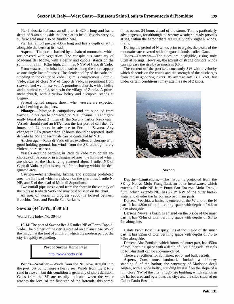
Sector 10. Italy—West Coast—Ruisseau Saint-Louis to Promontorio di Piombino 139
rlyailss,
e
ds
tygesut
hgi--
Nto
nerto
erto
mels
yglian
on
10.13 Pier Industria Italiana, an oil pier, is 420m long and has adepth of 9.4m alongside the berth at its head. Vessels carryingsulfuric acid may also be handled here.10.13 Pier Isa, an oil pier, is 435m long and has a depth of 9.4malongside the berth at its head.10.13 Aspect.—The port is backed by a chain of mountains whichare covered with vegetation. The conspicuous sanctuary ofMadonna del Monte, with a belfry and cupola, stands on thesummit of a hill, 162m high, 2.3 miles NNW of Capo di Vado.10.13 From seaward, the inhabited districts along the shore appearas one single line of houses. The slender belfry of the cathedralstanding in the center of Vado Ligure is conspicuous. Forte diVado, situated close NW of Capo di Vado, is prominent fromseaward and well preserved. A prominent church, with a belfryand a conical cupola, stands in the village of Zinola. A prom-inent church, with a yellow belfry and a cupola, stands atLegino.10.13 Several lighted ranges, shown when vessels are expected,assist berthing at the piers.10.13 Pilotage.—Pilotage is compulsory and are supplied fromSavona. Pilots can be contacted on VHF channel 13 and gen-erally board about 2 miles off the Savona harbor breakwater.Vessels should send an ETA from the last port of call then 72hours and 24 hours in advance to Porto di Savona. Anychanges in ETA greater than 12 hours should be reported. Radadi Vado harbor and terminals can be contacted by VHF.10.13 Anchorage.—Rada di Vado offers excellent anchorage withgood holding ground, but winds from the SE, although rarelyviolent, do raise a sea.10.13 Vessels awaiting berthing in Rada di Vado may obtain an-chorage off Savona or in a designated area, the limits of whichare shown on the chart, lying centered about 2 miles NE ofCapo di Vado. A pilot is required for anchoring within this des-ignated area.10.13 Caution.—An anchoring, fishing, and stopping prohibitedarea, the limits of which are shown on the chart, lies 1 mile N,NE, and E of the head of Molo di Sopraflutto.10.13 Two outfall pipelines extend from the shore in the vicinity ofthe piers at Rado di Vado and may best be seen on the chart.10.13 An area of works in progress (2000) is located betweenBanchina Nord and Pontile San Raffaele.
Savona (44˚19'N., 8˚30'E.)
World Port Index No. 39440
10.14 The port of Savona lies 3.5 miles NE of Porto Capo diVado. The old part of the city is situated on a plain close SW ofthe harbor, at the foot of a hill, on which the modern part of thecity is rapidly expanding.
10.14 Winds—Weather.—Winds from the NE blow straight intothe port, but do not raise a heavy sea. Winds from the E to Ssend in a swell, but this condition is generally of short duration.Gales from the SE are usually indicated when the waterreaches the level of the first step of the Rotonda; this some-
times occurs 24 hours ahead of the storm. This is particulaadvantageous, for although the stormy weather already prevat sea, within the harbor there are usually only slight N windif any.10.14 During the period of N winds prior to a gale, the peaks of thmountains are covered with elongated clouds, called Garo.10.14 Tides—Currents.—The tides are negligible, rising only0.3m at springs. However, the advent of strong onshore wincan increase the rise by as much as 0.6m.10.14 The current off the port sets constantly SW with a velociwhich depends on the winds and the strength of the discharfrom the neighboring rivers. Its average rate is 1 knot, bunder certain conditions it may attain a rate of 2 knots.
10.14 Depths—Limitations.—The harbor is protected from theSE by Nuovo Molo Frangiflutti, an outer breakwater, whicextends 0.7 mile NE from Punta San Erasmo. Molo Franflutti, which extends NE, lies 275m NW of the outer breakwater and divides the harbor into two main parts.10.14 Darsena Vecchia, a basin, is entered at the W end of thepart. It has 480m of total berthing space with depths of 4.68.5m alongside.10.14 Darsena Nuova, a basin, is entered on the S side of the inpart. It has 794m of total berthing space with depths of 6.39m alongside.
10.14 Calata Paola Boselli, a quay, lies at the S side of the innpart. It has 525m of total berthing space with depths of 7.58.5m alongside.10.14 Darsena Alto Fondale, which forms the outer part, has 450of total berthing space with a depth of 15m alongside. Vessup to 14m draft can be accommodated.10.14 There are facilities for container, ro-ro, and bulk vessels.10.14 Aspect.—Conspicuous landmarks include a chimnestanding S of the harbor; the sanctuary of Madonna deAngeli, with a wide belfry, standing by itself on the slope ofhill, close NW of the city; a high-rise building which stands ithe harbor area and overlooks the city; and the silos situatedCalata Paolo Boselli.
Port of Savona Home Page
http://www.porto.sv.it
Savona
Pub. 131

140 Sector 10. Italy—West Coast—Ruisseau Saint-Louis to Promontorio di Piombino
dias a
N
iti-
a
is
he
nth atht-h, 1
esusisof
of
isngh
oatliout
ofnd
r-ofntnteAill,
bleseavy
sne
10.14 The orange lighting of the harbor area can be seen from agreat distance and greatly facilitates night approaches.10.14 Pilotage.—Pilotage is compulsory for vessels over 500 grt.Pilots can be contacted on VHF channel 13 and usually boardbetween 0.5 and 1 mile from the harbor entrance.10.14 Vessels 500 grt and less should contact the pilot station forinstructions.10.14 There is a maximum speed limit of 6 knots within the harbor.10.14 This station also supplies pilots for Rada di Vado.10.14 Anchorage.—Anchorage, sheltered from the SW through Nto the NE, is available, in depths of 12 to 22m, sand, goodholding ground, in Rada di Albissola, an area lying 1.5 milesNE of the harbor entrance.10.14 A designated anchorage area, the limits of which are shownon the chart, lies centered 1 mile S of the harbor entrance. Ves-sels are advised not to anchor in this area without the aid of apilot.10.14 Anchorage can also be taken in the designated area at Radadi Vado.10.14 Caution.—An anchoring, stopping, and fishing prohibitedarea, the limits of which are shown on the chart, extends up to0.5 mile from the harbor entrance.10.14 An anchoring prohibited area, the limits of which are shownon the chart, extends up to 1 mile N, NE, E, and SE of theharbor entrance.10.14 Several outfall pipelines, which may best be seen on thechart, extend from the shore NW of the harbor entrance andfrom the vicinity of Punta San Erasmo.10.14 A area of reclamation works (2000) exists around the MoloFrangiflutti.
Savona to Genova
10.15 Albisola Marina (44˚20'N., 8˚30'E.) a small town,stands 1.5 miles NE of Savona. It is easily identified by arailroad station, a railroad bridge, and a church with a statuewhich are all prominent.10.15 Punta Celle, located 1.4 miles ENE of Albissola Marina,terminates in a very steep and rocky mass which is surmountedby a pine grove.10.15 Celle Ligure, a small town, is situated close NNE of thepoint. A beach at the center of the town is interrupted by arocky elevation, almost sheer to the sea, which has arches andcolumns on it. A prominent hotel stands close NE of the town.10.15 Punta dell’ Omo, located 1 mile ENE of Celle Ligure, can beidentified by the numerous light-colored and large buildings inits vicinity. La Crocetta, a small church with a pointed belfry,stands on the summit of a hill, 294m high, 1 mile NNW of thepoint and is easy to distinguish.
10.15 Varazze (44˚22'N., 8˚35'E.), a town, is situated 0.9 mile NEof Punta dell’ Omo. The conspicuous Collegio Don Bosco, ayellow four-story building, stands at the back and overlooks thetown. The white building of a shipyard is situated near the Wend of the town and is prominent. Monte Grosso, 402m high,stands 1 mile NE of the town and is covered by dark green
vegetation. It can be recognized by the small chapel of Guardi Varazze, which in clear weather appears from seaward awhite point on a dark peak.10.15 A small craft harbor, protected by a breakwater, lies closeof Punta dell’ Aspera and close W of the town.10.15 During periods of strong NE winds along the entire coast,is reported that very weak winds, or a calm, will be experenced in the immediate vicinity of Varazze.10.15 Vessels with local knowledge can anchor off the town, indepth of 11m, sand.10.15 The site of a historic wreck and its circular prohibited arealocated 0.7 mile SE of Punta dell’Aspera.
10.16 Punta d’Invrea (44˚20'N., 8˚37'E.), located 2.4 milesNE of Varazze, can be identified by a castle, visible among ttrees, standing at the top of a steep hill, close N of it.10.16 Cogoleto, a small town, is situated 1.5 miles NE of the poiand has a conspicuous white church standing on the beacits E end. The conspicuous buildings of a hospital, some ligcolored and others dark red, stand on a plateau, 193m higmile WNW of the town.10.16 Capo Arenzano, located 1.7 miles ENE of Cogoleto, rissteeply from the sea to a flat summit on which stand numerolarge buildings. A small craft harbor, the entrance of whichpartially obstructed by a sand and gravel bank, lies close Nthe cape.10.16 A wreck, with a depth of 30m, lies about 1.6 miles SSEthe harbor.10.16 The town of Arenzano, situated 0.5 mile N of the cape,dominated by a church, with a prominent bell tower, standion the slope of a hill behind it. Another prominent churcstands close W of the town and rises high among the trees.10.16 Punta della Chiappa is located 2 miles NE of CapArenzano. A pink three-story building, surmounted by a squtower, stands on the point and aids in its identification. ScogNave, a low and dark-colored rock, lies close off the point, bis difficult to distinguish against the coastal background.10.16 Vessels can anchor, in a depth of 13m, sand and weed, Ethe large church in Arenzano. The holding ground is good asmall vessels can obtain shelter from W and SW winds.
10.16 Voltri (44˚26'N., 8˚45'E.) is situated on the E side of Torente Cerusa, 3 miles NE of Arenzano. It forms the W endthe built up area which extends W from Genova. A prominebelfry, with a cupola, stands near the shore between TorreCerusa and Torrente Leiro, which divides the town in half.prominent church, with a white and red belfry, stands on a h159m high, behind the town.10.16 Torrente Cerusa and Torrente Leiro bring down consideradeposits which form temporary banks off their mouths. Thebanks are usually dispersed along the coast during heweather and cause the beaches to extend further seaward.10.16 Pra (44˚26'N., 8˚47'E.) is situated 1.5 miles E of Voltri. Thitown may be recognized by a distinctive building standing othe heights behind it. The building consists of two blocks, thhigher one being surmounted by a cylindrical tower.
Pub. 131

Sector 10. Italy—West Coast—Ruisseau Saint-Louis to Promontorio di Piombino 141
,eerto
ihes,
hethe
edin
diurs.an
ofthisteelceithst-the
Ei
theis
lyf
Genova (44˚24'N., 8˚56'E.)
World Port Index No. 39470
10.17 Genova, the principal commercial port of Italy, liescentered 19 miles NE of Savona and also has extensive ship-repair facilities.
10.17 Winds—Weather.—The prevailing winds in summer arefrom the SE (Scirocco) and the strongest winds are from theSW (Libeccio). The latter seldom reach the port with any greatforce. However, when they do, these winds are quite violentand cause a high swell in the harbor.
10.17 Winds from the N to NW, especially in winter, descend fromthe mountains in violent squalls and frequently bring rain,sleet, or snow. They usually reach their maximum force at adistance of 1 to 2 miles offshore where they raise heavy seas.Gales are most frequent in February and least frequent in July.10.17 Tides—Currents.—The tides are negligible with a rise ofonly about 0.3m at springs. However, changes in the waterlevel caused by winds and atmospheric pressure variations canexceed those of the tide. Winds from the S tend to raise thelevel and winds from the N tend to lower the level.10.17 Tidal currents within the harbor are negligible. Outside theharbor, the current generally sets W at an average rate of 0.7knot, increasing with SE winds to about 2 knots.10.17 Depths—Limitations.—The Multedo Offshore Oil Term-inal is situated off the W end of the port and consists of aplatform and a single buoy mooring.10.17 The single mooring platform lies in a depth of 50m, 1 mileSW of the W end of the airport at Genova. A submarinepipeline extends NE from the platform towards the shore. Theberth at this platform can handle tankers up to 500,000 dwt.
10.17 The single buoy mooring (SBM) lies in a depth of 65mabout 1 mile ESE of the platform. A submarine pipelinextends NW from this buoy towards the entrance to the innoil harbor. The berth at this buoy can handle tankers up270,000 dwt, 350m in length, 53m beam, and 20m draft.10.17 The W part of the main port consists of Porto Petroli dMultedo, an inner oil terminal, the Ansaldo Shipyards, and tCristoforo Colombo Airport. A steel works, with storage areais situated close E of the airport.10.17 The E part of the port consists of numerous basins with tcentral part of Genova arranged like an amphitheater onslopes of the mountains which encircle it.10.17 The main harbor is protected from the S by a detachbreakwater nearly 3 miles long. It is known as Diga Foranea,the W part, and Molo Duca di Galliera, in the E part.10.17 The entrance channel and turning basin at Port PetroliMultedo have depths of 15.5m. This inner oil terminal has fopiers projecting from the N side and a total of eleven berthTankers up to 130,000 dwt, 259m in length, and 14m draft cbe accommodated.10.17 The W harbor entrance, which leads S of the W extremityDiga Foranea, has a least charted depth of 13.5m. Use ofentrance is usually restricted to vessels berthing at the sworks basin. This basin, which has 500m of berthing spadepths of 12.1 to 13.4m alongside, is used only by vessels wcargoes of coal or iron for the steel works. Vessels with a mahead height exceeding 31m are not permitted to berth atsteel works.10.17 The E and main entrance to the harbor lies between theextremity of Mola Duca di Galliera and the head of Molo dSottoflutto, which extends SSW.10.17 Avamporto is entered from the E entrance and comprisesarea between Molo Duca di Galliera and Molo Giano. Thbasin is mostly used by vessels awaiting a berth.
10.17 Bacino delle Grazie lies N of Avamporto and is used mainfor repairs. Calata Olii Minerali, at the S part of the W side o
Port of Genova Home Page
http://www.porto.genova.it
Port of Genova
Genova—Bacino delle Grazie
Pub. 131

142 Sector 10. Italy—West Coast—Ruisseau Saint-Louis to Promontorio di Piombino
d-ishetedion
t.ndor
ster-
rt,Ees,selsthe
ed,n-the
for
oroan
eicalnd
vestde-s al-
this basin, has 474m of berthing space and can accommodatevessels up to 11m draft.10.17 Porto Vecchio is entered from Bacino delle Grazie andextends W and N to the head of the port. There are depths of 7to 11m alongside the numerous piers and quays which havefacilities for general cargo, ro-ro, automobile ferries, andpassenger vessels. A quay, 500m long, with a depth of 14.5malongside, is used by container vessels.10.17 Bacino della Lanterna lies W of Caleta Olii Minerali. Thisbasin has depths of 12 to 13m with facilities for mineral, oil,coal, and bulk cargo. There is 1,184m of total berthing spaceand vessels up to 10.5m draft can be accommodated.10.17 Bacino di Sampierdarena extends 1.2 miles WNW of Bacinodella Lanterna. There are depths of 8 to 14m alongside thepiers which project SSE into this basin and are used for generaland bulk cargoes. In addition, a container quay, 1,200m long,has five berths, with depths of 11 to 11.6m alongside.10.17 Aspect.—The municipality of Genova extends from Voltri toNervi, about 13 miles ESE. The villages and small towns forman unbroken line of buildings along the coast which extendfrom the shore to the slopes of the mountains in the back-ground. The center of Genova is easily recognized because itspopulated area extends chiefly inland. At night, the city lightsare visible from a great distance to seaward.10.17 The following landmarks are very conspicuous when ap-proaching the harbor:
1. The sanctuary of Madonna del Gazzo (44˚27'N.,8˚51'E.) standing on the summit of Bric del Gazzo, 421mhigh. It can be recognized, even at night, due to its votivelight shown on the crest of the mountain.
2. The sanctuary of Madonna della Guardia, with acupola and steeple, standing on the summit, 804m high, ofMonte Figogna, 3 miles N of Bric del Gazzo.
3. Forte Castellacio (44˚26'N., 8˚55'E.), with two radiotowers and a massive reddish tower.
4. Forte Quezzi (44˚26'N., 8˚58'E.), a large structure,standing on a hill, 231m high, NE of the city.
5. Torre Quezzi, standing isolated 0.3 mile ENE of ForteQuezzi.
6. Forte Ratti (44˚26'N., 9˚00'E.), a long and lowstructure, with a round tower at its NW end.
7. Forte Richelieu, surmounted by a cupola, standing 1mile SSW of Forte Ratti.
8. The buildings and lights of Cristoforo Columbo Air-port (Genova) situated at the W end of the harbor.
9. A huge shed and six chimneys situated at the steelworks to the E of the airport.
10.17 Approaching the harbor from the E, the following landmarkscan also be easily identified:
1. Monte Fascie (44˚25'N., 9˚02'E.), 834m high, with aconspicuous white cross standing on the W side of its sum-mit.
2. Monte Guigo, with a dense number of houses situatedon its slopes, standing 1.5 miles SE of Monte Fascie.
3. Monte di San Croce, surmounted by a chapel, stand-ing 1.5 miles ESE of Monte Guigo.
4. The steeple of Pieve Ligure standing on the SE slopeof Monte di San Croce.
10.17 The fairway channel leading to the inner oil harbor is markedby lighted buoys.
10.17 Lanterna Light is shown from a structure, 76m high, staning 2 miles WNW of the E harbor entrance. A radiobeaconsituated at the light. A signal station is situated close S of tbase of the light. Caution is necessary, as this light is reporto be not easily distinguished from the S and the signal statis not visible between the bearings of 010˚ and 024˚.10.17 Pilotage.—Pilotage is compulsory for vessels over 500 grPilots can be contacted on VHF channel 10, 12, 14, or 16 ausually board about 1 mile SE or SW of the harbor entrancesfrom the offshore terminals, as appropriate.
10.17 Regulations.—Vessels carrying polluting or dangeroucargo must report to the harbormaster 36 hours prior to ening Italian territorial waters.10.17 Approach Zones, the limits of which are shown on the chalie in the vicinity of the approach channels leading to theharbor entrance and to the inner oil harbor. Within these zonvessels must keep to the starboard side of the fairway. Vescrossing these zones must do so at right angles to the line ofchannel and in the least time practicable.10.17 A recognition and reporting zone has been establishbearing 215˚ and 5 miles from Lanterna Light, for vessels uable to find a berth in the harbor. Such vessels should enterzone and report to the signal station on VHF channel 16instructions in order to determine their ETA.10.17 In order to establish priorities between vessels leavingentering port and aircraft taking off or landing at ChristoforColumbo Airport a regulated zone has been established inarea connected by the following positions:
a. 44˚25.7'N, 8˚45.2'E.b. 44˚22.9'N, 8˚43.7'E.c. 44˚20.6'N, 8˚55.0'E.d. 44˚23.4'N, 8˚56.3'E.
10.17 Additionally, two way points have been established in thwaters leading to the approach channel to the petrochemharbor (Multedo Oil Port). These points are designated T1 aT2 and are located, as follows:
1. T1—44˚25.2'N, 8˚49.5'E.2. T2—44˚24.7'N, 8˚48.2'E.
10.17 Within the regulated area vessels entering the port hapriority over aircraft movements. Vessels leaving port mugive way to aircraft movements except in cases where theparting vessel has entered the approach channel and haready passed way point T1.
Genova Pilot Boat
Pub. 131

Sector 10. Italy—West Coast—Ruisseau Saint-Louis to Promontorio di Piombino 143
d-of
ky,co,hses
Iteseh
ous-
heilea-
ah.
eallara-yn.ahese
-the
e
then-heig--
m
r-ile
srkh,a
rto-ro1.3pa-ky
10.17 Vessels having an air draft of more than 48m must report tothe Harbor Pilots Control Tower and to the Operations Roomin the Harbormaster’s Office prior to entering the regulatedarea or before moving within the area.10.17 When transiting the approach channel to the oil harbor, alloil and gas tankers regardless of air draft and all other vesselswith an air draft of more than 14m must make the same reportsdescribed above.10.17 Vessels transiting the approach channel to the oil harbor areprohibited from stopping between the rubble breakwater andthe head of the airport. Vessels using the Pra-Voltri Canale diCalma must maintain a distance of 50m to 150m from theDigea Foranea of Porto di Voltri.10.17 Anchorage.—Anchorage may be obtained off Genova in thefollowing designated areas, the limits of which are shown onthe chart:
1. Zone Alpha (44˚23'N., 8˚45'E.)—For vessels pro-ceeding to or from Genova-Voltri.
2. Zone Bravo (44˚24'N., 8˚50'E.)—For small tankersproceeding to or from Genova-Multedo.
3. Zone Charlie (44˚22'N., 8˚54'E.) and Zone Delta(44˚21'N., 9˚02'E.)—For vessels proceeding to or from PortVecchio and Sampierdarena.
4. Zone Echo (44˚22.6'N., 8˚51.5'E.), Zone Foxtrot(44˚22.6'N., 8˚52.5'E.), and Zone Golf (44˚21.7'N., 8˚52.2'E.)—For tankers over 40,000 grt proceeding to or from Genova-Multedo .
5. Zone Hotel (44˚23.3'N., 8˚51.2'E.) and Zone Lima(44˚23.4'N., 5˚52.0'E.)—For tankers proceeding to or fromGenova-Multedo between 20,000 and 40,000 grt.
10.17 Caution.—Anchoring, stopping, and fishing prohibitedareas, the limits of which are indicated on the chart, lie in thevicinity of the harbor entrance channels.10.17 The main harbor has no free-swinging anchorage mooringberths. In addition to numerous alternative Mediterraneanmooring berths at quays and moleheads normally used foralongside berthing, there are a considerable number of fixedmoorings suitable for lighterage operations in connection withocean-going vessels.10.17 Numerous unlighted mooring and warping buoys are situ-ated throughout the harbor area.10.17 A prohibited area, the limits of which are shown on the chart,has been established in the vicinity of the offshore terminals.The passage of unauthorized vessels through this area is pro-hibited.10.17 The inshore area between Voltri and Pra is being reclaimedand developed as a large container and ro-ro terminal with aquay, 1,100m long, and depths up to 15m alongside.10.17 A mole, the head of which is marked by a light, extends 0.3mile SSE from an area of reclaimed land lying 0.9 mile E ofVoltri. A main detached breakwater, about 1.3 miles long, isunder construction in this vicinity. It extends SW and WNWfrom a position 0.7 mile WNW of the W extremity of theairport at Genova.10.17 Many high-speed ferries operate in the harbor area.
Genova to Golfo Marconi
10.18 Nervi (44˚23'N., 9˚02'E.), a tourist resort, is situated4.8 miles ESE of the E entrance to Genova and can be identi-
fied by its numerous large hotels and villas. A prominent builing, with a small belfry and a cupola, stands on the W sidethis town.10.18 The coast between Nervi and Camogli, 5 miles SE, is rocindented, and drops steeply to the sea. The town of Bogliassituated 1.5 miles E of Nervi, can be identified by a higmasonry viaduct. This viaduct has several arches and crosTorrente del Poggio, a stream in the middle of the town.10.18 Sori, a small town, is situated 1.5 miles ESE of Bogliasco.can be identified by a concrete railroad viaduct, which crossthe mouth of Torrente di Sori, and by a large highway bridgstanding close N of the viaduct. The belfry of a church, whicstands close W of the viaduct, is also prominent.10.18 Between Sori and Recco, 1.7 miles SE, there are numerlarge houses and villas. The light-colored belfry of Sant’ Appolinare stands at a height of 266m, 0.5 mile E of Sori. Tlarger belfry of Polanesi stands at a height of 257m, 0.5 mESE of the former belfry. Both are very prominent from seward.10.18 The small church of Sant’ Uberto, with no belfry, stands atheight of 480m, 0.5 mile N of the belfry of Polanesi. A higcolumn, surmounted by a statue of Christ, stands close to it
10.18 Camogli (44˚21'N., 9˚09'E.), an ancient town, is built on thslopes of Monte Esoli and can be easily recognized by its thouses, one above the other. The prominent sanctuary of Cvaggio, an isolated and low building with a small stumpbelfry, stands on a summit, 615m high, 2 miles NE of the towA small craft harbor fronts the town and is protected bybreakwater. Vessels, with local knowledge, can anchor off ttown, in depths of 16 to 17m, sand, good holding ground, cloSW of the head of the breakwater.10.18 Caution.—Several outfall pipelines extend up to 1 mile seaward between Nervi and Camogli and may best be seen onchart.10.18 An area of foul ground, the limits of which are shown on thchart, lies about 1 mile SW of Camogli.
10.19 Promontorio di Portofino (44˚19'N., 9˚11'E.) is themost prominent of the numerous coastal projections onNW coast of Italy. Its sides are high, rugged, rocky, and geerally steep-to. Monte di Portofino, 610m high, stands in tSW part of the promontory and is surmounted by a disused snal station. Two radio masts stand 0.3 mile NNE of the summit and are prominent from the E and W, but are obscured frothe S.10.19 The village of San Rocco, with a prominent belfry sumounted by a black cupola, stands on a hill, 240m high, 1 mS of Camogli and is visible from the W.10.19 Punta della Chiappa, located 1.7 miles S of Camogli, formthe SW extremity of the promontory. It is a low, bare, and dapoint which is marked by a beacon. Monte Tocco, 427m higstands 0.5 mile E of the point. Its summit is surmounted bydisused signal station and a signal mast.10.19 The coast between Punta della Chiappa and Punta di Pofino, 3.5 miles ESE, is high, rocky, and steep-to. Cala dell’ Oand Seno di San Fruttuoso, two small bays, lie 1 mile andmiles ESE, respectively, of Punta della Chiappa and are serated by a sharp ridge. This ridge terminates in a small rocpromontory, 103m high, on which stands an old tower.
Pub. 131

144 Sector 10. Italy—West Coast—Ruisseau Saint-Louis to Promontorio di Piombino
inhart.hedast-
-
ofyhe16
.6msea14le.ldNE
ama
Wg,y.e
d,Wnd.g,ae
ofleen
bepths
he
afs,
litothis
10.19 Punta Portofino (44˚18'N., 9˚13'E.), the SE extremity of thepromontory, is bare, rocky, and bold. It rises to a hill, 100mhigh, on which stand two old forts. A pillar stands at the ex-tremity of the point. A light is shown from a structure, 12mhigh, standing close within the extremity of the point. A prom-inent statue of the Madonna stands on the slope of the hill, nearthe light.
Golfo Marconi
10.20 Golfo Marconi(44˚18'N., 9˚15'E.) is entered betweenPunta di Portofino and Chiavari, a town, 4.5 miles ENE. Itextends 2.7 miles NNW to Rapello, at the head, and isconsidered to be the most picturesque in the Italian rivieras.The W side of the gulf, which has many small bays, offersgood shelter from winds from the S through N. However, theNE side of the gulf is exposed to S and SW winds.10.20 During the winter, winds from the NW prevail and oftenblow with great violence. An exceptionally clear atmospherewith serene skies and sparse high clouds above the mountainsaround Rapallo and Chiavari usually precedes strong NE orNNE winds. In summer, winds from the S prevail and rarelyattain great force. When NNW winds, locally called “Proven-za,” blow violently, a change of weather can be expected withprobable winds from the SE.10.20 The most conspicuous landmarks within the gulf includeConvento di Cervara, a long and isolated building, standing 1mile NNW of Punta di Portofino; Monte Rosa, 612m high,which stands 1.7 miles NE of the head of the gulf and is sur-mounted by the sanctuary of N. S. di Montallegro; the isolatedchurch of Sant’ Ambroglio, with a white belfry, standinghalfway up a hill, between Rapallo and Zoagli; and ColoniaMarina di Chivari, a red and white horizontally banded highbuilding, standing near the coast, 0.8 mile WNW of Chiavari.10.20 Caution.—Tankers that have carried or those carryingpetroleum or chemical and gas products in bulk are prohibitedfrom navigating within an area extending 6 miles offshorebetween Punta Carrega on Promontorio di Portofino (44˚18'N.,9˚11'E.) andPunta Baffe (44˚14'N., 9˚27'E.). From Octoberto April, tankers of 650 grt or less are permitted to close thecoast to 3 miles within this area.
10.21 Portofino(44˚18'N., 9˚13'E.), a small craft harbor, isentered between Punta del Coppo, located 0.3 mile NW ofPunta di Portofino, and the coast, 0.1 mile NW. It is protectedfrom all but NE winds, but even these cause little sea. The townis a tourist resort and contains several prominent hotels andvillas.10.21 Punta del Pedale is located 1.4 miles N of Punta di Portofina.Vessels can anchor, in depths off 20 to 30m, mud, off a bightlying S of this point.10.21 Caution.—An outfall pipeline extends 1.1 miles ESE from apoint on the shore, close N of Punta del Pedale. Anchoring andfishing with nets are prohibited within a zone of 200m to 400mcentered on the pipeline. The 200m zone extends from theshore to the first 500m of the pipeline. The 400m area encom-passes the remainder of the pipeline.10.21 Several dangerous wrecks lie between Punta di Portofino andPunta di Pedale and may best be seen on the chart.
10.21 An outfall pipeline extends 0.2 mile SE from the N shorethe approaches to Portofino and may best be seen on the c10.21 The Portofino Marine Nature Reserve has been establisas a restricted area. The area extends 7 miles along the coline from Punta Cannette (44˚20.8'N., 9˚09.3'E.), roundsPunta della Chiappa (44˚19.3'N., 9˚08.7'E.) andPunta diPortofino (44˚17.8'N., 9˚13.2'E.), and continues N toPuntadel Pedale(44˚19.2'N., 9˚13.0'E.). Anchoring, fishing, and unauthorized entry or mooring are prohibited within this area.
10.22 Santa Margherita Ligure (44˚20'N., 9˚13'E.) (WorldPort Index No. 39475), a small harbor, lies in the SW cornera small bay, 2 miles N of Punta di Portofino. It fronts the citand is protected by a mole which extends 0.2 mile NE from tcoast. The harbor can be contacted on VHF channel 11 orand is accessible to small vessels up to 50m in length and 4draft, but strong winds from SE to SW cause a considerablein the vicinity of the berths. Vessels can anchor, in depths ofto 15m, sand, fair holding ground, ESE of the head of the mo10.22 The city appears to be divided into two parts by an ofortress which stands 0.5 mile WSW of Punta Pagana, theentrance point of the bay. A church, with a white facade andtall belfry, stands in the S part of the city and is prominent froseaward. Another prominent church, with twin belfries andblack cupola, stands 0.2 mile N of it.10.22 Villa Spinola, surmounted by a square tower, stands closeof Punta Pagana and The Imperial Hotel, a large buildinstands on the wooded slopes, close E of the head of the ba10.22 The city, a resort, is brightly lighted at night and is visiblfrom a considerable distance to seaward.
10.22 Rapallo (44˚21'N., 9˚14'E.), a tourist resort, lies at the heaof a small bay in the N part of the gulf. A small harborprotected by moles, lies close N of Punta Langan, the Sentrance point of the bay. It can be contacted by VHF aconsists of a small craft basin and an extensive yacht basin10.22 The town can be recognized by the casino, a red buildinstanding close NE of Punta Langan; the Excelsior Hotel,large building, standing close NW of the casino; and thcathedral standing in the center of the town, 0.5 mile NPunta Pagana. In addition, the clock tower at St. Michechurch, situated 0.2 mile SW of Punta Langan, has bereported to be a good landmark and is illuminated at night.10.22 Anchorage off Rapallo is very exposed and should onlyused during good weather. Large vessels may anchor, in deof 18 to 30m, mud, good holding ground, S of the harbor.10.22 Caution.—An outfall pipeline extends 1.2 miles SSE fromthe head of the bay. Anchoring and fishing are prohibited in tvicinity of this pipeline.
10.23 San Pantaleo(44˚20'N., 9˚15'E.), a small town, islocated 1.2 miles SE of Rapallo and can be identified byprominent belfry. Zoagli, a village, is situated 0.5 mile SE othe town. A prominent railroad viaduct, with seven archecrosses a river, close W of this village.10.23 Monte Anchetta, 550m high, stands 1 mile ENE of Zoagand overlooks this part of the coast. The belfry of Roverechurch can be seen above a triangular patch on the slope ofmountain.
Pub. 131

Sector 10. Italy—West Coast—Ruisseau Saint-Louis to Promontorio di Piombino 145
inted
eds
ith
ff-in
fa-
dandinre,ch.ichnto,fs
is
isu-
t isann asinois
out
N
ed
nteforf
ndhe
isiles
teellch.he
10.23 Punta Chiappe is located 1.5 miles SE of Zoagli. The prom-inent chapel of Madonna della Grazie, a long and low buildingwith a small tower, stands 0.3 mile ENE of this point.
10.24 Chiavari (44˚19'N., 9˚19'E.), an industrial town aswell as a resort, is situated on the NW side of the mouth ofTorrente Entella. The town is fronted by a small craft harborwhich is enclosed by moles. An ancient fortress stands in thecenter of the town and a prominent convent, with a blackcupola sur-mounted by a small copper dome, is situated nearthe shore, close E of the harbor.10.24 Lavagna, a small town, stands on the SE side of the mouth ofTorrente Entella and appears to be part of Chiavari when seenfrom seaward. It is dominated by the church of San Stefano,which has a black cupola and a white facade, and is flanked bytwin belfries. The town is fronted by an extensive yacht harborwhich is protected by two moles. Torre de Controllo, a buildingwith a glass top, stands near the harbor. It is 19m high and veryconspicuous.10.24 Caution.—An area of sunken barges, the limits of which areshown on the chart, lies centered 0.5 mile SW of Zoagli.10.24 An outfall pipeline extends 0.9 mile SW from a point on theshore, 0.2 mile E of Punta Chiappe.10.24 A marine farm, marked by buoys, is located 0.5 mile SSE ofLavagna.
Golfo Marconi to Golfo della Spezia
10.25 Punta di Sestri(44˚16'N., 9˚23'E.), located 3.2 milesSE of Chiavari, is not easily discernible from the NW againstthe rocky background. This point is the NW extremity of ashort, rounded, and wooded peninsula which is joined to thecoast by a narrow isthmus. Torre Marconi, a massive andcylindrical tower, stands on the summit of the peninsula whichis 40m high. It is visible only from the S and W, being hiddenby trees from other directions.10.25 Sestri Levante (44˚16'N., 9˚23'E.) (World Port Index No.39480), a town, is situated partly on the peninsula and partly ona small plain at the mouth of Torrente Gromolo. The belfry ofSan Stefano church, a red building, which stands out againstthe wooded background, and the belfry of San Bernardo, whichis small and pointed, are situated 1 mile ENE and 1.5 milesNE, respectively, of Punta di Sestri.10.25 A harbor, used by small craft, is formed by a mole, quayedon its E side, which extends 265m NNW and N from Punta diSestri. Anchorage is available, in depths of 11 to 13m, mud,close NW of the head of the mole. Small vessels can anchorcloser inshore, in a depth of 9m, E of the mole. Local know-ledge is advised as the depths in this vicinity are constantlychanging because of deposits brought down by Torrente Gro-molo.10.25 Punta Manara, located 1.5 miles SE of Punta di Sestri, isbold and cliffy. It rises close inland to the summit of MonteCastello, which is 265m high and surmounted by a prominentbuilding.10.25 Vessels can anchor in the bay lying E of Punta Manara.There is good holding ground, in a depth of 9m, sand, about0.2 mile from the head of the bay clear of the charted outfall.10.25 Punta Baffe is located 1.8 miles ESE of Punta Manara. Aprominent tower stands on the slope of a hill, 0.3 mile N of this
point. Monte Pu, 1,001m high, stands 5 miles NE of the poand can be identified by its bare, rounded, and light-colorsummit which rises above the densely wooded slopes.
10.26 Moneglia(44˚14'N., 9˚29'E.), a village, is situated onthe NE shore of a small bay, 2 miles E of Punta Baffe. Thprominent church of Santa Croce, with a slender belfry, stanat its SE end. A railway crosses two prominent viaducts, wseveral arches, which stand in the vicinity of the village.10.26 Scoglio Pietra Stella, a rocky patch, lies about 200m oshore, S of Santa Croce church. It is reported to be awashplaces.10.26 The village of Lemeglio is situated on a hill, 0.5 mile SE oMoneglia; its church and steeple are very prominent from seward.10.26 Monte Pastorelli, 149m high, is the summit of a roundeheadland located 8 miles ESE of Punta Manara. This headlterminates in Punta di Monte Grosso, at the W side, andPunta della Madonna, at the S side. The latter point is barocky, and surmounted by a small chapel with an arched por10.26 Bonassola, a village, stands at the head of a small bay whis entered between Punta della Madonna and Punta Leva0.5 mile ESE. The latter point is formed by the W extremity oa hill, 196m high. The village is situated between two streamand is fronted by a tall railway embankment.10.26 Caution.—Several wrecks, some dangerous, lie off thstretch of coast and may best be seen on the chart.10.26 A wreck lies about 1 mile off the coast at Bonassola. Itsunk in depths of 40 to 44m and is reported to contain ammnition.
10.27 Levanto (44˚10'N., 9˚37'E.), an ancient town, issituated at the head of a bay, 1.5 miles SE of Bonassola. Ifronted by a sandy beach and backed by hills in the form ofamphitheater. La Torre, a battlement structure, stands osteep rocky eminence, near the SE end of the beach. CaMunicipale, a prominent building with porticos at its base,situated on the beach.10.27 Secca del Peria, a rocky and shallow shoal area, lies ab0.2 mile offshore, 0.5 mile W of Levanto. Depths of 10 to 14mlie in the passage between this shoal area and the shore.10.27 A small craft harbor, protected by two moles, lies at theside of the bay.
Punta del Mesco (44˚08'N., 9˚38'E.) is covered by thickvegetation and is faced with bare, rugged cliffs. A disussignal station stands 0.3 mile N of the point.10.27 The area between Punta del Mesco and Capo di MoNegro, 5 miles SE, is known as Le Cinq Terre and is notedits wine production. It includes, from N to S, the villages oMonterosso al Mare, Vernazza, Corniglia, Manarola, aRiomaggiore. Several small private boat harbors lie within tbays along this stretch of the coast.10.27 Monterosso al Mare is situated at the head of a bay whichentered between Punta del Mesco and Punta Corone, 1.2 mENE. This latter point is rocky and surmounted by a whipillar. The village stands on a rocky spur which divides a widbeach into two parts. A white villa, surmounted by a smatower, stands on a small rocky spur at the W end of the beaVessels can anchor, in a depth of 20m, off the W part of tbeach.
Pub. 131
146 Sector 10. Italy—West Coast—Ruisseau Saint-Louis to Promontorio di Piombino
ver
as
elhed is
ail
eds,
a
ayon
nded
snt12mesa
iles
x-i-e-
untaeadall
N
di-ef.2t-
b-edore
andas
-500.
10.27 The white church and belfry of San Bernardino, standing 3miles E of Punta del Mesco, are prominent. Vernazza is situ-ated along the shores of a cove, 1.5 miles SE of Monterosso alMare.10.27 The village of Corniglia is situated on the top of a promon-tory, 96m high, which has steep and rugged sides. It can berecognized by a prominent white and spired belfry. Manarola issituated on a rocky point, and Riomaggiore is situated at themouth of a narrow valley.10.27 Capo di Monte Negro can be easily recognized by the sanc-tuary of Madonna di Monte Negro, with its prominent belfryand cupola, standing 0.5 mile NE of its seaward extremity.
10.28 Scoglio Ferale(44˚04'N., 9˚47'E.), a conical rock,lies 230m offshore, 2.3 miles SE of Capo di Monte Negro. Awhite cross stands on its summit and a red pillar stands at itsfoot. This rock is connected to the coast by a rocky ridge. It isdarker than the coast behind it and is easily recognizable whenseen from the NW or SE.10.28 Punta del Persico, located 1 mile WSW of Scoglio Ferale, isreddish-colored. A prominent light-colored house, with atower, stands halfway up the hill behind this point.10.28 Between Punta del Persico and Punta San Pietro, 1.7 milesSE, the rocky coast rises nearly vertically to a considerableheight. Punta della Castellana, 510m high, stands 0.7 mile E ofPunta del Persico and is surmounted by a fort. MonteMuzzerone, 327m high, stands 0.6 mile NNW of Punta SanPietro and is surmounted by a fort. An old prominent church issituated on Punta San Pietro and the ruins of a large towerstand on higher ground behind it.
10.29 Isola Palmaria (44˚02'N., 9˚51'E.), 204m high, isformed by rock which appears to consist of wide parallel strata,alternately light and dark-colored. A prominent signal station,with a lattice mast close by, stands on the summit of the island.10.29 Vessels entering or leaving Golfo della Spezia are required toidentify themselves by VHF to this signal station.10.29 The narrow passage leading between Punta San Pietro andIsola Palmaria is navigable only by small craft.10.29 Isola del Tino (44˚01'N., 9˚51'E.) lies close S of IsolaPalmaria and is covered on its E side by a dark and thickly-wooded area. Its W side is composed of light-colored perpen-dicular cliffs. A light is shown from a structure, 24m high,standing on the summit of the island. A racon is situated at thelight.10.29 Il Tinetto, 18m high, lies close S of Isola del Tino and is con-nected to it by a ridge of rocks, some of which are above-water.Dangers extend up to 0.1 mile S of Il Tinetto.10.29 The narrow passage between Isola del Tino and IsolaPalmaria has a depth of 27m and can be easily navigated, butafter strong winds, the current in this passage is appreciable.Vessels using this passage must reduce speed to not more than6 knots.10.29 Caution.—Anchoring, fishing, and dumping prohibitedareas, the limits of which are shown on the chart, extend be-tween the N side of the Isola del Tino and the S side of IsolaPalmaria, and between the NW side of Isola Palmaria and themainland.10.29 Tanker lightening operations are sometimes carried outabout 1.5 miles S of Isola del Tino. Vessels engaged in these
operations may be at anchor or otherwise unable to maneuand should be given a wide berth.10.29 A circular prohibited area is located in the Seno di Fossolashown on the chart.
Golfo della Spezia
10.30 Golfo della Spezia, which opens between Isola dTino and Capo Corvo, 5 miles E, extends 5.5 miles NW to tport of La Spezia at its head. The gulf is safe, spacious, ansurrounded by mountains.10.30 Winds—Weather.—In the gulf, winds from the SE and SWquadrants prevail in summer. Winds from the NE and N previn winter. None of these winds are dangerous.10.30 The SE winds sometimes blow violently in winter and arusually accompanied by rain. They may be forecast by clouwhich cover the summit of Punta della Castellana, and byslight rise of water in the gulf.10.30 When there are fresh W winds out at sea, heavy squalls mcome down the gorges between the surrounding mountainsthe W side of the gulf.10.30 Tides—Currents.—Tidal rise at La Spezia is less than 0.5mat springs.10.30 The current in the gulf normally sets N along the E shore aS along the W shore, but at times it is considerably influencby the prevailing winds.10.30 Aspect.—Capo Corvo, the E entrance point of the gulf, iformed by the S extremity of a rocky spur. Several rocks frothe cape and are marked by a beacon. Monte Rocchetta, 4high, is prominent and rises on the E side of the gulf, 2.5 milNW of the cape. Tellaro, a prominent village, is situated onrocky point, 2 miles NW of the cape.10.30 Punta Santa Teresa, marked by a light, is located 2.5 mNW of Tellaro.10.30 Torre Scuola, marked by a light, lies close off the NE etremity of Isola Palmaria. It is square with a prominent trangulation column at the top and the S side is partly dmolished.
10.30 Baia di Portovenete is entered between Torre Scuola and Pdella Castagna, 0.6 mile NNW. Portovenere, situated near the hof the bay, has a prominent church. The town is fronted by a smcraft harbor which is protected by two moles.10.30 Punta Santa Maria, marked by a light, is located 0.3 mileof Punta della Castagna.10.30 When approaching the gulf, conspicuous landmarks, in adtion to those previously described, include the belfry of thvillage of Montemarcello which stands on a hill, 0.5 mile N oCapo Corvo; and Monte Murlo, 360m high, which stands 1miles NNW of Capo Corvo, and is surmounted by a lighcolored two-story building.10.30 Regulations.—Due to the presence of danger areas, sumarine exercise areas, exercise mine buoys, and torplaunching zones, three mandatory traffic routes, which aindicated on the chart, are to be used when proceeding tofrom Rada di La Spezia, the inner part of Golfo della Spezia,follows:
1. East Route.—About 275m wide. Reserved for vessels approaching from or headed S which are less thangrt and with a draft of less than 5m, and for small vessels
Pub. 131
Sector 10. Italy—West Coast—Ruisseau Saint-Louis to Promontorio di Piombino 147
hm
l,ely.
ofdg-
ea50
isp toi-thebe
go,only
gup
t.allyrre
d 24
to
eta
lsthe
t
andthe
.
oflfo
.s ofse
2. Middle Route.—About 500m wide. Used by vesselsentering the port. This route is compulsory for vessels whosegross tonnage exceeds 500 tons and draft is greater than 5m.
3. West Route.—About 500m wide. Used by vesselsleaving the port. The route is compulsory for all vessels re-gardless of tonnage.
10.30 Anchorage.—Baia di Portovenere offers anchorage, in 10 to12m, mud, good holding ground, sheltered from the W. Seasfrom the SW that enter the bay between Isola Palmaria and themainland are diminished by the shallow bar which lies acrossthe E end of this passage.10.30 Large vessels should anchor, in a depth of 12m, about 0.3mile NW of Torre Scuola.10.30 Caution.—Several shellfish havens lie close to the shores ofthe gulf and associated bays, and may best be seen on the chart.10.30 A prohibited area lies within the bay entered between Puntadella Castagna and Punta Santa Maria.
Rada di La Spezia (44˚06'N., 9˚50'E.)
World Port Index No. 39520
10.31 Rada di La Spezia, the inner part of Golfo dellaSpezia, is protected by Diga Foranea, a detached breakwater,and forms the extensive harbor of La Spezia. The port hascommercial facilities, but is also a main naval base with a largenaval shipyard situated in its NW part.
10.31 Depths—Limitations.—Diga Foranea, the detached break-water, is 1.2 miles long and lies between Punta Santa Teresaand Punta Santa Maria, with an entrance at either end. Thesurface of this breakwater along its central part is occasionallyawash.10.31 Passo di Levante, the NE entrance, is 228m wide and has adepth of 11m.10.31 Passo de Ponente, the SW and main entrance channel, is410m wide. A fairway channel, dredged to a depth of 13.9m,leads through this entrance and extends to the commercialfacilities in the N part of the harbor.10.31 Darsena Duca degli Abruzzi, which gives access to the navaldockyard, is enclosed by three moles. A channel, with a con-trolling depth of 11.2m, leads NW into this basin and is indi-cated by a lighted range.10.31 The main commercial facilities include the following:
1. Molo Garibaldi Pier, which has 508m of total berthingspace with depths of 7.5 to 8.5m alongside at its W side and350m of berthing space, with a depth of 11m alongside, at itsE side.
2. Malaspina Quay, 196m long, with a depth of 6.1malongside.
3. Arton Quay, 300m long, with depths of 9.5 to 11malongside.
4. Paita Quay, which has 535m of total berthing spacewith depths of 7.3 to 11m alongside.
5. Fornelli Pier (La Spezia Container Terminal), whichas 1,138m of total berthing space, with depths of 10 to 13alongside.
6. Messina Ro-Ro Terminal and Tarros Ro-Ro Terminawhich have depths of 8.5m and 6.7m alongside, respectiv
7. Molo Garibaldi Oil Jetty, which consists of a dolphinberth, 244m long, with a depth of 13.9m alongside.
8. Panigaglia (SNAM) Gas Jetty lies at the SW sidethe harbor within a restricted area. It is 520m long anprovides a berth, 241m long, with a depth of 10.4m alonside.
9. ENEL Oil and Coal Terminal Jetty is situated at thNE side of the harbor and has a berth, 260m long, withdepth of 13m alongside. It can handle vessels up to 84,1grt, 255m in length, and 12.8m draft.
10. Arcola Offshore Oil Terminal, consisting of fivemooring buoys, lies in the E part of the harbor andsurrounded by a restricted area. It can handle vessels u50,000 dwt, with a maximum length of 230m and a maxmum draft of 12.8m. Caution is necessary since some ofmooring buoys are not lighted and sometimes they maypartially submerged
10.31 There are facilities for tanker, bulk, passenger, general carro-ro, and gas vessels in the harbor. Generally, vessels arerestricted in size by their drafts.10.31 In addition, the port has extensive repair facilities includinsix drydocks and a floating dock which can handle vesselsto 110,000 dwt.10.31 Pilotage.—Pilotage is compulsory for vessels over 500 grPilots can be contacted on VHF channel 14 or 16 and generboard about 1 mile seaward of the main breakwater near ToScuola. Vessels should send an ETA 72 hours, 48 hours, anhours in advance.10.31 When approaching the gulf, vessels should report by VHFthe signal station situated on Isola Palmaria.10.31 Signals.—When torpedo firing practice is taking place, thfollowing signals are shown from a structure standing on Pundella Castagna:
1. By day—A red flag.2. By night—Three vertical fixed red lights.
10.31 When gunnery practice is in progress, the following signaare shown from the structure on Punta della Castagna andsignal station on Isola Palmaria:
1. By day—A cone, point up; a ball; and a cone, poindown, disposed vertically.
2. By night—Three vertical fixed red lights.10.31 Tanker vessels carrying products considered dangerousvessels carrying out bunkerage operations must displayfollowing signals:
1. By day—Flag B of the International Code of Signals2. By night—A red light visible all around.
10.31 Regulations.—Vessels must approach the port using onethe three mandatory traffic routes (see Regulations in Godella Spezia in paragraph 10.30).10.31 Vessels in the harbor must not exceed a speed of 6 knots10.31 Parts of the inner gulf may be used by seaplanes. Vesselany kind, which happen to be in the vicinity of seaplanetaking off or landing, must come to a stop and wait until th
Port of Rada de La Spezia Home Page
http://www.porto.la-spezia.it
Pub. 131

148 Sector 10. Italy—West Coast—Ruisseau Saint-Louis to Promontorio di Piombino
oe33anhete
eant
s
tara
le
-ed
are
nW
0alcalre-en-elsanugon24
eor.Y1,orial
esthe
h in
edart.
of
operation is completed; any interference with the planes mustbe avoided.10.31 Vessels entering Rada di La Spezia, Porto Mercantile, andDarsena Duca degli Abruzzi must give way to vessels leaving.10.31 Vessels with drafts of more than 9.4m have precedence in thedredged fairway channel which leads to the petroleum jetty atthe SE side of Molo Garibaldi, provided Flag D of the Inter-national Code is displayed by day or a red, white, and anotherred light are shown vertically at night.10.31 Commercial vessels must not secure to any of the mooringbuoys in the harbor without permission of the authorities.10.31 Ships may not be dismantled in the anchorage areas. Anappropriate berth and permission from local authorities isrequired for such activity.10.31 Anchorage.—Anchorage can be taken in the harbor underthe directions of the pilot. Vessels can anchor, in 6 to 12m,thick mud, good holding ground. The surrounding mountainsand the long detached breakwater give the roadstead excellentprotection from the sea and weather.10.31 Ten designated anchor berths have been established in theinner harbor. Berth I2 is reserved for use by methane tankersfor limited periods of time to a maximum of 6 hours. Berth I1and Berth I3 are reserved for use by naval vessels. AnchorageI8 is for use by tankers engaged in tank work or for safetyreasons.
10.31 There are a number of mooring buoys, which provide free-swinging berths, situated in the inner part of the gulf, but theyare reserved mainly for naval vessels.10.31 Vessels up to 10m draft are advised to anchor about 1 mileSE of the SW end of the detached breakwater. Deep-draftvessels should anchor about 1 mile E of Isola del Tino.10.31 Fourteen anchor berths have been established in the outerroadstead. Anchorage E9 is reserved for vessels carrying bulkliquid, gas or other dangerous cargo.
10.31 Anchorage E3 and Anchorage E4 are restricted to vesselswith a length not greater than 130m, with a maximum stay of48 hours.10.31 Anchorage is prohibited along the range line leading intoDarsena Duca degli Abruzzi.10.31 Caution.—A torpedo firing range, marked by buoys mooredalong the firing line, extends 8.5 miles in a 112˚ direction fromPunta della Castagna. A gunnery firing range extends 14 milesbetween the bearings of 133˚ and 150˚ from Punta della Cas-tagna.10.31 Submarine power cables lie in the vicinity of both harborentrances and may best be seen on the chart.10.31 The depths in the dredged fairway channels are constantlychanging and the authorities should be contacted for the latestinformation.10.31 Several shellfish haven areas lie along the shores of the innerpart of the gulf and may best be seen on the chart.
Golfo della Spezia to Livorno
10.32 Punta Bianca(44˚02'N., 9˚59'E.), located 0.5 mile Eof Capo Corvo, can be identified by a prominent whitish patchon its lower part. Castello Fabricotti, a prominent reddishbuilding, is situated on the E slope of Monte Marcello, whichstands 0.5 mile NNE of the point.
10.32 The mouth of the Fiume Magra, lying 1 mile NE of CapCorvo, can be easily identified by the tall trees which fringeach bank. The coast between this river mouth and Livorno,miles SSE, is low, sandy, and is backed by the high ApuAlps, which can be recognized from a great distance by tmarble quarries. The principal peaks of this chain are MonSagro, Monte Altissimo, and Monte Pania della Croce.10.32 From seaward of La Spezia, with very clear visibility, thhills of Livorno can be seen to the SSE and appear as distislands.10.32 The white building of Colonia Marina of Marinella stand1.7 miles ENE of Punta Bianca and is conspicuous.
10.33 Marina di Carrara (44˚02'N., 10˚02'E.) (World PortIndex No. 39550), a small harbor, lies 2.7 miles E of PunBianca and is used for the loading of the well-known Carramarble.
10.33 Winds—Weather.—Strong SE winds cause a considerabsea in the harbor.10.33 Depths—Limitations.—The harbor is protected by breakwaters. There is 1,139m of total berthing space with dredgdepths of up to 10m.10.33 Several mooring buoys are situated in the harbor andused by yachts.10.33 Aspect.—The yellow belfry of the church in the town is 45mhigh and is very prominent from seaward. A light is showfrom a structure, 22m high, standing near the root of thebreakwater.10.33 Pilotage.—Pilotage is compulsory for vessels of over 50grt. Warships, auxilliary vessels, Italian and foreign hospitships, fishing vessels not used in Atlantic trade, tugs, and loport services vessels are excluded from the piloting requiment. Pilots can be contacted on VHF channel 12 and gerally board about 1 mile from the entrance. Departing vesshave the right of way over other traffic. Vessels of less th2,000 grt employed in coastal trade and not requiring tassistance my obtain radio assitance from the pilot stationVHF channel 12. Vessels should provide ETA 48 hours andhours prior to arrival.10.33 Anchorage.—An anchorage area, the limits of which arshown on the chart, lies centered 1.5 miles SW of the harbThe anchorage contains seven designated berths; they areY2, and Z1 through Z5. Berths are assigned by harbauthorities. This area is reserved for the use of commercvessels awaiting alongside berths.10.33 Caution.—The depths in the harbor and in the approachare subject to change and the pilot should be contacted forlatest information.10.33 The heads of the breakwaters should be given a wide bertorder to avoid the underwater foundations.10.33 An area being reclaimed (2001), enclosed by a prohibitarea, is located outside the E breakwater, as seen on the ch
10.34 Marina di Massa (44˚00'N., 10˚06'E.) (World PortIndex No. 39560), a tourist resort, is situated 3 miles SE
Marina di Carrara Home Page
http://www.portauthoritymdc.ms.it
Pub. 131

Sector 10. Italy—West Coast—Ruisseau Saint-Louis to Promontorio di Piombino 149
7enerel-
toofin
day
en, it
ort
mterair-
g
ofasrs.
,
as a
f 6
of.
m
m
achtly
Marina di Carrara. Numerous prominent hotels and villas standalong the beach in this vicinity. The town of Massa is situated2.5 miles inland and is visible from seaward.10.34 Torre Balilla stands 1.5 miles SE of Marina di Carrara. Thistower is 100m high and very prominent from seaward.10.34 Forte dei Marmi, situated 7 miles SE of Marina di Carrara, isa bathing resort. It can be recognized by the many housesstanding along the shore and by the Grand Hotel, aconspicuous three-story building with two superstructures onits terraced roof.10.34 Between Forte dei Marmi and Viareggio, 6 miles SSE, thelow and sandy coast presents an almost continuous line ofbuildings and is backed by thick pine woods.10.34 Viareggio (43˚52'N., 10˚15'E.) (World Port Index No.39580), a tourist resort, is situated at the seaward end of Canaledella Burlamacca, 6 miles SSE of Forte di Marmi. A smallharbor and a marina, protected by breakwaters, lie in the vici-nity of the canal entrance. A light is shown from a structure,16m high, standing near the root of the breakwater on the Sside of the canal. The city can be recognized by a large four-story hotel in its N part, another hotel, with two towers,standing close SE of the former one. The port monitors VHFchannels 11 and 16.
10.35 Marina di Pisa (43˚40'N., 10˚16'E.), a tourist resort,is situated 11.5 miles SSE of Viareggio. This town can berecognized by a high belfry and an extensive yellow buildingwhich stand in its NW part. The town of Pisa stands 6 milesinland. A light is reported to be shown from a war memorialwhich stands on a hill 7 miles inland about 10 miles NE ofMarina di Pisa.10.35 Caution.—A dangerous wreck lies about 150m offshore, 0.4mile NW of the entrance to Viareggio. This vessel, loaded withcement, lies close below the surface.10.35 Vessels are prohibited from stopping within 1 mile of theentrance to Viareggio.10.35 Several dangerous wrecks lie off the coast between Via-reggio and Livorno and may best be seen on the chart.10.35 Submarine cables extend seaward from a point on the shore,2 miles S of Marina di Pisa.10.35 Due to the changing depths and banks off the mouths of therivers along this stretch of coast, vessels are advised to stay atleast 1 mile offshore.
10.36 Secche della Meloria(43˚34'N., 10˚13'E.), on whichthe sea breaks during strong SW winds, consists of a series ofshoals which are formed of sand and mud with occasionalpatches of rock and weed. These shoals lie almost parallel tothe coast, between 2.7 and 5 miles W of Livorno.10.36 Torre della Meloria stands on the S part of the shoals, 3.1miles W of the S end of the outer detached breakwater atLivorno. This tower consists of a square building, 20m high,with arched openings in its lower part. A light is shown from astructure, 17m high, standing close S of this tower. Anotherlight is shown from a structure, 20m high, standing on the Npart of the shoals, 2.4 miles N of the tower.10.36 Secca di Fuori, with a least depth of 8.9m, lies isolated about4 miles NW of Torre della Meloria.
Livorno (43˚33'N., 10˚19'E.)
World Port Index No. 39590
10.37 The large port of Livorno (Leghorn) lies centeredmiles S of Marina di Pisa. The city stands on a plain betwethe hills and the sea. Several military facilities are situated hincluding the Italian Naval Academy and the Italian War Colege.
10.37 Winds—Weather.—Winds from the W to NW prevailduring the summer. During the winter, winds from the SESW are prevalent with occasional SW gales. After periodsSW and W winds, considerable swell is usually experiencedthe entrance channel.10.37 Tides—Currents.—Tides rise about 0.5m at springs an0.3m at neaps. During SE and SW winds, the water level mbe increased by as much as 0.5m.
10.37 In summer, a current may set S at a rate of 0.3 knot, betweSecche della Meloria and the coast. With persistent W windsmay attain a rate of 1.5 knots.10.37 Depths—Limitations.—The N entrance is 330m wide andmay only be used by small vessels up to 5.5m draft. The pcan accommodate vessels up to 11.4m draft.10.37 The S and main entrance has a navigable width of 250between the S end of Diga Curvilinea and the shoal wawhich extends from the shore at the E side. The entrance fway is dredged to a depth of 12.5m.10.37 The main port facilities are situated within several basins:
1. Bacino Santo Stefano:• A gas and oil terminal has 410m of total berthin
space, with depths of 4.3 to 11.3m alongside.• Darsena Toscana, 1,200m long, has a depth
12.5m alongside and Calata Alto Fondale, 750m long, ha depth of 12m alongside; both are used for containeFacilities include post-Panamax shore cranes.2. Bacino di Evoluzione—Calata Tripoli, 250m long
has a depth of 7.9m alongside and is used for chemicals.3. Darsena Pisa—Calata Darsena Pisa, 250m long, h
depth of 12m alongside and is used for bulk cargo.4. Darsena Admiral Inghirami (Dock No. 1)—A cargo
terminal has 1,170m of total berthing space, with depths oto 8.8m alongside ,and is used by U.S. Navy vessels.
5. Canale Industriale—A cargo terminal has 2,000mtotal berthing space, with depths of 5.5 to 8.5m alongside
6. Bacino Cappellini:• Calata Orlando, 450m long, has a depth of 8.7
alongside and is used for containers.• Calata Franco, 320m long, has depths of 8.5 to 10
alongside and is used by ferries.7. Bacino Firenze—Calata Pisa and Calata Carrara, e
450m long, have depths of 7.6m alongside and are mosused by ferries, ro-ro, and passenger vessels.
Port of Livorno Home Page
http://www.portauthority.livorno.it
Pub. 131

150 Sector 10. Italy—West Coast—Ruisseau Saint-Louis to Promontorio di Piombino
ods
rtHFrd
n-he
ron
rbore-thisinged
ng
side3m
he
Cr
-r-
8. Porto Mediceo—A passenger and ferry terminal has1,300m of total berthing space, with depths of 4 to 8.7malongside.
10.37 In addition, there are extensive repair facilities with two dry-docks. The largest is 350m long and 56m wide and can handlevessels up to 300,000 dwt.10.37 Aspect.—Diga Marzocco, a low breakwater, extends SWfrom the coast and protects the port from the N. Diga Meloriaand Diga Curvilinea together form one long detached break-water which protects the port from the W. Diga della Vegliaia,a low and detached breakwater, protects the port from the S.The outer heads of these breakwaters are marked by lights.10.37 Livorno Light is shown from a tower, 52m high, standing 0.5mile NE of the outer head Diga della Vegliaia. A radiobeaconand a racon are situated at the light.
10.37 An articulated light is moored 1.2 miles NW of the N head ofDiga Meloria and marks the N approach channel.10.37 The coast to the N of the port consists of a low and evenbeach. Torre del Marzocco, a prominent tower with a tiled roof,stands at the S end of this beach near the root of Diga Mar-zocco. Numerous light-colored oil tanks are situated close N ofthis tower.10.37 A conspicuous thin tower, 56m high, stands 1.1 miles NE ofTorre del Marzocco in the vicinity of several tall chimneys andother industrial structures. Several grain silos, 45m high, standon the N side of Porto Mediceo, 0.9 mile S of Torre del Mar-zocco.
10.37 Landmarks in the city and harbor area include a convent,with a cupola, standing 0.7 mile S of Torre del Marzocco; thesquare belfry of the cathedral, standing 0.3 mile S of the con-vent; and a conspicuous high-rise building, 86m high, standing0.7 mile S of the cathedral. Another light-colored high-risebuilding stands in the center of the city and is prominent.10.37 The cranes of the Ansaldo Shipyards, standing S of the grainsilos, are prominent. The Italian Naval Academy, situated be-tween Livorno and the suburb of Ardenza, consists of a largegray building. Its square clock tower, which is surmounted by aflagstaff, contains a signal station. Several radio antennas, 67mhigh, stand close S of the academy building.10.37 The coast between Livorno and the suburb of Antignano, 3miles SSE, is broken, rocky, and fronted by a bank.
10.37 Monte Nero, 313m high, stands 4.5 miles SSE of Livornand is surmounted by a prominent tower. A white chapel stanhigh up on the slopes of this hill.10.37 Pilotage.—Pilotage is compulsory for vessels over 500 gand is available 24 hours. Pilots should be contacted on Vchannel 12 at least 1 hour prior to arrival. Pilots usually boaabout 1.1 miles SW of the S breakwater.10.37 Pilots must contact Port Approaches Control on VHF chanel 80 at the time of embarkation/disembarkation stating tfollowing information:
10.37 Regulations.—A traffic separation scheme (TSS) with inneand outer precautionary areas, the limits of which are shownthe chart, lies in the approaches to the S entrance of the haand extends SW. Stopping is prohibited in the outer prcautionary area. Inbound vessels must keep to the S ofzone and outbound vessels must keep to the N of it. Crossthe separation zone from N to S or vice-versa is prohibitexcept for small vessels and fishing boats.10.37 If the entrance is occupied by a vessel leaving, an arrivivessel must wait until the entrance is clear.10.37 Vessels using the N entrance must keep to the starboardof the entrance channel. Vessels with drafts of more thanmay not use the N entrance.10.37 The Livorno Harbor Office is equipped with aPort Ap-proaches Control (PAC) Systemwhich controls maritimetraffic in the area of Livorno harbor and its approaches. TPAC Area is bounded, as follows:
1. North limit—43˚45'N.2. West limit—10˚00'E.3. South limit—43˚20'N.
10.37 All merchant vessels over 30m long are subject to PAcontrol. Vessels arriving or departing the port of Livorno, otransiting the PAC Area, must report, as follows:
1. Initial Contact Message.—Vessels must contactPAC Livorno directly on VHF channel 80 (or through Maritime Warning on VHF channel 10) 30 minutes before enteing the PAC Area, stating the following information:
Livorno Light
Designator Information Required
A Vessel type, name, call sign, and flag
B Time finished with engines in local time
C Pilots name
D Vessel position
E
Possible messages, should the pilotlearn of the existence of serious faultswhich might put at risk the safety ofshipping in general or the vessel con-cerned.
Designator Information Required
A Vessel type, name, call sign, and flag
B Position (latitude and longitude), head-ing, and speed
Pub. 131

Sector 10. Italy—West Coast—Ruisseau Saint-Louis to Promontorio di Piombino 151
Ct
eheionm,
l ofes
of
.3
.6
8
s,
thsrt,
dup
zeia.tss,
reellae
ia
htto
t to
-nel
-
-ned
2. Arrival Message.—Vessels must contact PACLivorno directly on VHF channel 80 (upon completion ofmooring at quayside, by the pilot on board, or if lying at an-chor in the roadstead, upon completion of anchoring, by thevessel’s captain), stating the following information:
3. Departure Message.—Vessels must contact PACLivorno directly on VHF channel 80 (or through MaritimeWarning on VHF channel 10) 1 hour before departure, stat-ing the following information:
4. Crossing Entry and Exit Traffic Lanes Sector.—Vessels wishing to be authorized to cross the Port of Livorno
Entry and Exit Traffic Lanes Sector must contact PALivorno directly on VHF channel 80 (to be done by the piloor the vessel’s captain), stating the following information:
10.37 Anchorage.—Rada di Livorno, which lies between Secchdella Meloria and the section of the coast extending N from tport area, offers temporary anchorage with some protectfrom SW seas. Anchorage may be taken in a depth of 9about 1.2 miles NW, 1.2 miles W, or 2 miles NW of the Nharbor entrance.10.37 In addition, designated anchorage berths under the controthe port authority lie, in depths of 10 to 50m, in the approachto the port, as follows:
1. Berth A, the explosives anchorage, lies 4 miles NWthe N entrance.
2. Berth B, for vessels of 150m in length or less, lies 2miles WNW of the N entrance.
3. Berth C, for vessels of 150m in length or less, lies 1miles SSW of the S breakwater.
4. Berth D, for vessels over 150m in length, lies 2.miles SSW of the S breakwater.
5. Berth E, for gas carriers over 200m and oil tankerlies 3.6 miles S of the S breakwater.
10.37 An anchorage area, for cistern and gas carriers with lengof under 200m, the limits of which are best seen on the chalies S of the S breakwater.10.37 Caution.—An anchoring, fishing, and stopping prohibitearea, the limits of which are indicated on the chart, extendsto 4.5 miles SW from the S entrance of the harbor.10.37 Frequently, particularly in the early morning, the land breeblows the smoke from the city toward Secche della MelorThe resulting haze sometimes limits visibility and prevenidentification of landmarks from seaward. In such instancevessels coming from the N and W, even with light drafts, aadvised to proceed S and pass well to the W of Secche dMeloria. Monte Nero, which is not usually obscured, may bused as an aid.10.37 It is reported that the lights marking Secche della Melorare not powerful. At night, especially during low visibility,vessels approaching from the N, W, or SW may first sigseveral fixed lights, which are situated in the industrial areathe N of the port, before sighting any navigational lights.10.37 The entrance channels and harbor basins are subjecsilting.10.37 The PAC Center supplies the following information on request on VHF channel 80, or in emergencies on VHF chan16:
1. Weather conditions—Visibility, wind speed and direction, and sea conditions.
2. Situation information—Condition of navigation support systems, presence of other vessels in the area, assigberth, or the need to wait at anchor.
G Last port of call
L Destination (if in transit) and ETA (inlocal time)
O Length, beam, and draft
P
Cargo (in the case of dangerous cargoindicate name/class of danger andquantity, method of transport (pack-ages, containers, tanks, tank carriers, orin bulk), and whether they are unclean,not gas free, or not completely inert)
T Name of vessel’s owner and/or agent
W Passengers and crew
XVarious possible faults, maneuveringinformation, etc. (to be indicated evenif negative)
Designator Information Required
A Vessel type, name, call sign, and flag
B Time when finished with engines (inlocal time)
CPosition (pier or quayside, or if lying atanchor, the point of anchorage, withrange and bearing from Livorno Light)
Designator Information Required
A Vessel type, name, call sign, and flag
B ETD
L First port of call and ETA (if possible.Otherwise indicate “awaiting orders”)
P Cargo (details as in Initial ContactMessage.)
W Passengers and crew
XVarious possible faults, maneuveringinformation, etc. (to be indicated even ifnegative)
Designator Information Required
Designator Information Required
A Vessel type, name, call sign, and flag
B Request to cross the sector
H Reasons for crossing
Pub. 131

152 Sector 10. Italy—West Coast—Ruisseau Saint-Louis to Promontorio di Piombino
rysnd
nais-ndNhe-
g-tin-its
hisseswd
del.
ur-h.theitu-ge
x-lo,s 2eN
i
aon
tsla;d
oreaa)
nd
ndthee
Livorno to Promontorio di Piombino
10.38 Torre del Boccale(43˚29'N., 10˚20'E.), which stands4 miles SSE of the S breakwater at Livorno, is attached to avilla and the two together resemble a castle. Torre Calafuria,situated close N of a masonry viaduct, stands 0.2 mile SSE ofTorre del Boccale and is also prominent. Il Montaccio, 253mhigh, stands 1 mile E of Torre del Boccale and its summit issurmounted by the ruins of a signal station.10.38 Torre del Romito, a prominent light-colored structure, stands1.2 miles ESE of Torre Calafuria. It surmounts the summit ofPunta del Romito, a headland, which 91m high, steep, andwooded. Punta Fortulino, located 2.5 miles SE of Punta delRomito, can be identified by a reddish-colored building whichstands amid the trees.10.38 Punta Castiglioncello (43˚24'N., 10˚24'E.) is the extremityof a rocky promontory which rises to a summit, 50m high,close inland, and is covered with thick vegetation. A massivebattlement tower stands near the summit of the promontory andseveral villas and houses are situated on its slopes. VillaPatrone, a conspicuous battlement structure, stands 0.2 mile Eof the tower.10.38 Rosignano Marittimo stands 3 miles E of Punta Castig-lioncello. This small town can be easily recognized by thebelfry of a church and a castle which are situated at its S end.Rosignano Solvay, another small town, extends along the coastto the SE of Punta Castiglioncello. It can be recognized byseveral large industrial plants, with tall chimneys, standing atthe S end.10.38 Caution.—Several outfall pipelines extend up to 1.5 milesseaward from points along this stretch of the coast.
10.39 Vada (43˚21'N., 10˚27'E.) (World Port Index No.39610), small port, lies 13 miles SE of Livorno. The town isbuilt around a church, with a slender and prominent spire, andis clearly visible from seaward. A short pier fronts the townand is protected from the N by a breakwater which lies parallelto it. The pier is also protected from the S by a curved break-water. Another pier, 1 mile long, extends W and WNW fromthe root of the N breakwater. A berth at this pier can accom-modate LPG vessels up to 30,000 tons and 11m draft. Pilots areavailable from Livorno. The pilot boards vessels about 0.5 mileSW of the pier during daylight hours only. Anchorage isavailable ENE of Secche di Vada, in about 16m.10.39 Secche di Vada(43˚19'N., 10˚22'E.), a rocky shoal, liesabout 4.5 miles WSW of Vada. It has a least depth of 2m andlies in the vicinity of a bank which fronts the coast and hasdepths of less than 11m. Secche di Vada Light is shown from aprominent tower, 18m high, standing on the shoal.10.39 Vessels can obtain anchorage, in a depth of 16m, sand andweed, about 1 mile NE of the light or in a depth of 13m, mudand weed, about 1.7 miles ENE of the light.10.39 Fiume Cecina enters the sea 3 miles SE of Vada. Cecina, asmall town, is situated 1.5 miles upstream and is partly hiddenby trees. Its reddish-brown belfry, which has a clock, can bedistinguished from seaward. Marina di Cecina, a village,stands close S of the river mouth. Forte di Cecina, a prominentbuilding, stands in its NW part and resembles a row of houses,10.39 Forte di Bibbona, a low and reddish-colored building, standson the shore, 4 miles SSE of Marina di Cecina. It can be recog-
nized from as far as 5 miles offshore. A modern five-stobuilding stands 1 mile N of this fort. The village of Bibbona isituated 3.5 miles ENE of the fort and appears as a wide alight-colored patch on the slopes of the coastal hills.10.39 Forte di Castagneto is situated 4 miles S of Forte di Bibboand is similar in appearance. However, this fort may be dtinguished by the village of Marina di Castagneto Carducci athe white building of the marine colony which stands closeof it. Torre Donoratico, a tall and slender tower, stands on tflat summit of a hill, 179m high, 2.8 miles SE of Forte di Castagneto.10.39 San Vincenzo is situated within 4.5 miles of Forte di Castaneto and extends along a beach. This town can be disguished from a great distance by the conspicuous belfry ofchurch and is fronted by a small boat harbor.10.39 Punta del Molino (43˚01'N., 10˚31'E.) is located 5 miles Sof San Vincenzo. The coast between is low and sandy. Trocky point is distinctive and indicates where the coast ceabeing sandy and becomes rocky. Villa de Stefani, a yellobuilding with a red roof, stands on the summit of the point anforms an excellent landmark from seaward.
10.40 Porto Baratti (43˚00'N., 10˚30'E.) lies on the N sideof Promontorio di Piombino and is entered between PuntaMolino and Colle di Populonia, a headland, 1.5 miles SWTorre di Populonia, a conspicuous and battlement tower, smounts the summit of Colle di Populonia, which is 181m higTwo farmhouses and a chapel stand near the middle ofsandy beach at the head of the bay. Populonia, a village, is sated at the SW corner of the bay. Vessels with local knowledcan anchor within the bay.
10.40 Promontorio di Piombino, with a high and steep coast, etends 5 miles SSE from Porto Baratti. Monte Massoncel286m high, is the highest part of the promontory and standmiles S of the village of Populonia. The land to the E of thpromontory is low and when seen from a distance, from theor S, the promontory appears as an island.10.40 The description of the coast of Italy SE of Promontorio dPiombino continues in paragraph 13.2.10.40 Caution.—An anchoring, fishing, and diving prohibited arelies in the N approach to Porto Baratti and may best be seenthe chart.
Arcipelago Toscano
10.41 Arcipelago Toscano, a wide group of islands, consisof Isola di Gorgona (43˚26'N., 9˚54'E.); Isola Capraia; Isod’Elba; Isola Pianosa; Isola di Montecristo; Isola del GiglioIsola di Giannutri; the small islands of Isola Palmaiola anIsolotto Cerboli which lie NW of Isola d’Elba; Scoglio d’Affrica (42˚21'N., 10˚04'E.); and Formiche di Grossett(42˚35'N., 10˚52'E.). These islands are spread over an awhich lies between the N part of the E coast of Corse (Corsicand the W coast of Italy. They form excellent landmarks athe passages leading between them are wide and deep.10.41 Caution.—Due to the existence of submarine cables apipelines, several anchoring and fishing prohibited areas,limits of which are shown on the chart, lie in the vicinity of thgroup of islands.
Pub. 131

Sector 10. Italy—West Coast—Ruisseau Saint-Louis to Promontorio di Piombino 153
aretlyE
antged.he
-
chedof
ed
o0.2ous
iser,m
nd, aicalst
nyer
dor
ed, 1dart
s of
ing
ndill,sa
cky
ofal.eed.3
SW
10.42 Isola di Gorgona(43˚26'N., 9˚54'E.), the N island ofthe group, lies 22 miles W of Punta Castiglioncello and is usedas a penal colony. The island is hilly and much of it is coveredwith low scrub and a thin growth of trees. The coast on the Wside is rocky and rises steeply from the sea to Punta Gorgona,the summit of the island, which is 255m high and surmountedby a disused signal station. Torre Vecchia, an old fort, standson the crest of a hill, 208m high, close N of Punta Gorgona. Itis very prominent from the E and W. The N and S extremitiesof the island are marked by lights. Cala della Scalo, theprincipal landing place, lies near the middle of the E side of theisland and is also marked by a light. Due to the rocky bottomand the considerable depths close to the coast, in most places,there is no secure anchorage off the island.10.42 Caution.—Unauthorized vessels are prohibited from stop-ping, fishing, and approaching within 2,000m of the island ex-cept with permission of the authorities at Livorno.
10.43 Isola Capraia(43˚02'N., 9˚39'E.) lies 29 miles WNWof Promontorio di Piombino and is of volcanic origin. The Wslopes of the island are rocky and precipitous, but the E slopesare more gentle and partly cultivated. A mountainous ridgetraverses the island, from N to S, and stands within 0.5 mile ofthe W coast. Monte Castello is the summit of the island. It is447m high and stands 1.5 miles S of the N extremity of theisland. Monte Arpagna, 410m high, stands 1.7 miles S ofMonte Castello and is surmounted by a disused signal station.These peaks are conspicuous and may be recognized from agreat distance.10.43 Lo Stagnone, a lake, is located at a height of 321m, 0.5 mileS of Monte Castello. It is drained by a river which reaches theE coast of the island at Porto di Capraia.10.43 Le Formiche, a group of above-water rocks, extend up to 0.2mile NE of Punta della Teia, the N extremity of the island.10.43 Porto di Capraia, formed by an L-shaped mole, lies at theSW corner of a small bay on the NE side of the island. The Sentrance point of this bay is marked by a light and the smalltown of Capraia stands close S of it. Forte di Capraia is situatedat the E side of the town and accommodates a prison.10.43 Punta della Zenobito, the S extremity of the island, can beidentified by a tower which stands at a height of 83m above aridge of light-colored rock. The cliffs to the NE of the tower,when seen from the SE, have a pronounced reddish color.Punta del Trattoio, marked by a light, is located 1.5 milesNNW of Punta della Zenobito. Isolotto La Praiola, a high androunded islet, lies 0.5 mile NNE of this point and is connectedto the coast by a ridge of rocks.10.43 Caution.—Landing and navigating within 0.3 mile of thecoast in the N part of Isola Capraia is prohibited. However,landing is permitted at Porto di Capraia.
Arcipelago Toscano—Isola d’Elba
10.44 Isola d’Elba (42˚46'N., 10˚18'E.), the largest islandof the group, is located with its N extremity lying 5 miles SWof Promontorio di Piombino and is separated from themainland by Canale di Piombino.10.44 Three distinct mountain ranges stand on the island. The Wand highest range culminates in Monte Capanne, 1,019m high,which is the summit of the island. The W coast of the island is
steep, rocky, and offers no shelter, but the other coastsdeeply indented by numerous small bays and are frequenused by vessels encountering strong N winds. The N andcoasts of the island present a cultivated and pleasappearance, while the W and S coasts are steep and rugCima del Monte, 516m high, dominates the E coast of tisland.10.44 Caution.—Local magnetic anomalies are frequently encountered off the coasts of Isola d’Elbe.
10.45 Capo Vita (42˚52'N., 10˚25'E.), the N extremity ofthe island, is dominated by Monte Grosso, 347m high, whistands 1.2 miles SSW of it and is surmounted by a disussignal station. A detached rocky patch, with a least depth6m, lies about 0.8 mile N of the cape. A prominent and isolatobelisk stands 0.5 mile S of the cape.10.45 Isola dei Topi, 34m high, lies 0.5 mile SE of the cape. CapCastello, a prominent and rounded headland, is locatedmile S of the cape and surmounted by several conspicuvillas.10.45 Cavo, a village, stands at the head of a small bay whichentered 0.4 mile SE of Capo Castello. It is fronted by a piwith depths of 2 to 7m alongside, which is used by ferries frothe mainland and small craft.10.45 Capo Pero, located 1.2 miles SE of Cavo, is steep, rocky, asurmounted by a prominent yellow house. Torre del Giovemassive and rectangular-shaped tower, stands on a conpeak, 352m high, 1.5 miles SW of the cape. It is the belandmark on the E coast of the island and is visible from apart of Canale di Piombino. When seen from the E, this towappears to be pierced in the middle.10.45 La Mineria di Vigneria (Pontile Vigneria), a pier, is situate1.7 miles SSW of Capo Pero. It is 80m long and is used floading ore.
10.46 Rio Marina (42˚49'N., 10˚26'E.) (World Port IndexNo. 39660), a small harbor, lies at the foot of reddish-colormountains. Rio dell’ Elba is situated on the mountain slopesmile W of the harbor. This town can be easily distinguishefrom seaward as a large three-story building stands in its N pand is conspicuous.
The harbor is protected by a mole and has general depth6m, but is subject to silting.
Vessels can anchor, in a depth of 30m, mud, good holdground, in front of the town.10.46 Capo Ortano, located 1 mile S of Rio Marina, is steep arocky. A prominent radio mast stands on the summit of a h0.2 mile WSW of the cape. Isolotto d’Ortano, 24m high, lie1.5 mile S of Rio Marina and has bare, rocky sides androunded green summit. It is connected to the coast by a roridge.10.46 Punta delle Canelle (Capo d’Arco), located 2.5 miles SRio Marina, is steep, rocky, and fronted by a shallow shoCapo Bianco, located 1 mile WSW of the point, can brecognized by whitish patches on its lower parts. A pier, usfor the loading of mineral ore, extends from a small point, 0mile NNE of this cape.
10.47 Golfo di Porto Azzurro (42˚46'N., 10˚24'E.) isentered between Punta dello Stendardo, located 0.5 mile W
Pub. 131

154 Sector 10. Italy—West Coast—Ruisseau Saint-Louis to Promontorio di Piombino
ofthis
isdseis
,m
re
eto
nder,recan
1swla,sW
ise
of Capo Bianco, and Capo Forcado, 0.6 mile SSE. This gulf isdominated by a prominent and huge citadel, which stands onthe promontory close NW of Punta della Stendardo. A largeconspicuous cross stands on Monte Mar di Capanna, 290mhigh, 1 mile NW of the citadel. Monte Castello, 390m high, ishigher of two peaks, which stand 0.5 mile NW of Monte Mardi Capanna and is surmounted by a prominent pillar.10.47 A light is shown from a tower, 6m high, standing on the wallof a fort which is situated on Capo Forcado.
10.47 Isolotto dei Liscoli lies close inshore, 0.7 mile SE of CapoForcado. Its upper part is covered with brush while the lowerpart is bare and shows prominent white strata.10.47 Porto Azzurro, a small harbor, lies in a cove entered close Wof the promontory on which the citadel is situated. It isprotected by a mole and is accessible to small vessels, withlocal knowledge, up to 80m in length and 5m draft.10.47 Caution.—Anchorage within depths of less than 50m in thevicinity of Porto Azzurro is reported to be dangerous due tounexploded mines.
10.47 In 1982, a considerable landslide occurred in the vicinityPunta dello Stendardo and vessels should stay clear ofpoint.
10.48 Punta dei Ripalti (42˚42'N., 10˚26'E.), the SEextremity of Isola d’Elba, is steep and rocky. This pointdominated by Poggio del Turco, 187m high, which stanclose N of it. Capo della Calamita, located 1.2 miles W of thpoint, is the S extremity of a high, mountainous mass whichcomposed of reddish-colored rock, rich in iron ore.10.48 Isolotti Gemini, lying 1 mile NW of Capo della Calamitaconsists of an outer islet, 42m high, and an inner islet, 23high. Scoglio Corbella, lying 0.5 mile WSW of these islets, aa group of blackish above and below-water rocks.10.48 Caution.—Anchorage within depths of less than 40m in thvicinity of Isolotti Gemini is reported to be dangerous dueunexploded mines.
10.49 Cala dell Innamorata (42˚43'N., 10˚22'E.) (WorldPort Index No. 39700) is entered between Islotti Gemini aCapo Francese, 0.5 mile N. A large T-shaped iron ore piwhich extends 135m WNW, is situated within this cove. Theare depths of only 2m at the head of this pier, but vesselsobtain anchorage off it, in a depth of 26m, weed.
10.49 Golfo Stella is entered between Punta Morcone, locatedmile NNW of Islotti Gemini, and Capo della Stella, 2 mileWNW. It is bordered on the W side by a long and narropromontory which terminates to the S in Monte Capo Stel150m high. The twin peaks of Monte Volterraio stand 3 mileNW of the head of this gulf. An ancient castle stands on thepeak and can be distinguished from seaward. Anchorageavailable, in a depth of 11m, sand, in the NW corner of thgulf.
Rio Marina
Capo Focardo Light
Pub. 131

Sector 10. Italy—West Coast—Ruisseau Saint-Louis to Promontorio di Piombino 155
isdes.0.3
ntog
chr,al-se
,aia,ce,s of
ing.he
hor-
,ndaysralasg-
fisrteis-nds
yhisl 11enay.ot aetwo
sNisof
10.49 Golfo della Lacona is entered between Capo della Stella andCapo di Fonza, 1.5 miles W. It is surrounded by high land andsheltered from N winds. Vessels can obtain anchorage, in depthsof 5 to 16m, good holding ground, in the N part of this gulf.10.49 Golfo di Campo is entered between Punta di Mele, located0.7 mile W of Capo di Fonza, and Punta di Campo, 1.5 milesWSW. Monte Poro, 157m high, stands close W of Punta diCampo.10.49 Marina di Campo, a small harbor, lies on the N side of arocky promontory which projects from the W side of the gulf.It is protected by a breakwater and has a depth of 4m. The gulfoffers good shelter from all winds except those from the SE.There is good holding ground and anchorage can be taken, in adepth of 12m, about 0.2 mile NE of the harbor.
10.50 Punta di Fetovaia(42˚44'N., 10˚10'E.), 37m high, islocated at the SW end of the island and is the extremity of anarrow peninsula. This peninsula has rugged and steep sides,and consists of barren cliffs with a flattish top.10.50 The W and NW coasts of Isola d’Elba, beyond Punta diFetovaia, are high and rocky with no coastal indentations ofany importance and practically no noteworthy features. Thereis no safe shelter as the winds and seas are reported to followthe contour of the coast.10.50 Punta Nera, the W extremity of the island, can be identifiedby light-colored patches on the rocks. Campo alle Serra, 600mhigh, stands 1 mile ENE of the point and is very visible fromseaward. Its summit is surmounted by an old and disusedsignal station.
Punta Polveraia (Punta Forana) (42˚48'N., 10˚07'E.) isformed by a perpendicular headland. A light is shown from atower, 10m high, surmounting the point.
10.51 Marciana Marina (42˚48'N., 10˚12'E.) (World PortIndex No. 39715), a small harbor, lies 4 miles ENE of PuntaPolveraia and is protected by a breakwater. It has depths of 3 to6m and is used by fishing vessels and yachts.10.51 The village, which backs the harbor, can be identified byTorre Medicea, a prominent tower, standing at its W end andby a hill, 118m high, standing at its E end.10.51 Golfo di Procchio is entered 2 miles E of Marciana Marina.Its E side is bordered by a wide and sandy beach. Numeroushotels, high-rise buildings, villas, and beach huts stand alongthe shores of this gulf. Vessels can anchor off the beach, in adepth of 24m, sand.10.51 Golfo della Biodola lies close NE of the E entrance of Golfodi Procchio and is seldom visited by vessels.10.51 Golfo di Viticcio is entered between Punta Penisola andCapo d’Enfola, 0.7 mile N. A village stands at the SE corner ofthis small bay. Vessels can obtain temporary anchorage, in adepth of 10m, rock and weed, off a beach on the S side of thelow isthmus connecting Capo d’Enfola with the mainland.10.51 Capo d’Enfola (42˚50'N., 10˚16'E.) is formed by the outerend of a peninsula which rises to a conical hill, 135m high,near its extremity. Scoglio la Nave, a bare and conical rock, liesclose NW of the cape.10.51 Punta Acquaviva is located 1.2 miles ESE of Capo d’Enfola.Secca di Santa Lucia, a rock, lies 0.7 mile ENE of the point andhas a least depth of 8.5m.
10.51 Capo Bianco, located 1.2 miles ESE of Punta Acquaviva,steep, of moderate height, and has white patches on both siSecca di Capo Bianco, a rocky spit, extends up to aboutmile NNE of the cape and is marked by a lighted beacon.10.51 Scoglietto, lying 0.7 mile NE of Capo Bianco, is a barreand blackish rock on which landing is prohibited. ScoglietLight is shown from a prominent structure, 8m high, standinon its summit.10.51 Punta Falcone(42˚49'N., 10˚20'E.) is located 0.8 mile ESEof Capo Bianco and is fronted by a spit of sand and rock whiextends up to 150m NNE of it. A light is shown from a towe25m high, standing on Forte Stella, 0.1 mile SE of Punta Fcone. Forte Falcone, another prominent fort, is situated cloNW of Forte Stella.
10.52 Portoferraio (42˚49'N., 10˚20'E.) (World Port IndexNo. 39720), a small port, lies within Rada di Portoferraiowhich is entered between Punta Falcone and Punta Falcon1.1 miles E. The bay has depths of 25 to 40m at the entranwhich gradually decrease within, and is accessible to vesselany tonnage.10.52 Winds—Weather.—In winter, winds from the NE and SEquadrants prevail, those between the S and SE predominatIn the other seasons, winds from the SW quadrant prevail. TN winds sometimes blow violently in winter, particularly inFebruary and March, and raise heavy seas in the outer ancages.10.52 Depths—Limitations.—La Darsena, the harbor basinfronts the city and is protected by a mole. It is 245m long a200m wide and has depths of 6 to 14m in the center. The qulining its sides have depths of 3 to 4m alongside. Sevemooring buoys lie in this basin. In addition, a new harbor, h300m of total berthing space with depths of 4 to 10m alonside. It is used by ferries and vessels with drafts up to 9m.10.52 Aspect.—When approaching the bay, the city oPortoferraio, which is built on the S slopes of a peninsula,not visible from seaward. However, Forte Falcone and FoStella, which stand on the NE side of the city, can be dtinguished. Volterraio, an ancient and prominent castle, staon a peak, 394m high, at the E side of the bay.10.52 Pilotage.—Pilotage into the bay and harbor is compulsorfor vessels over 500 grt. All naval vessels are exempt from trequirement. The harbor can be contacted on VHF channeor 16. Vessels must keep to the port side of the harbor whentering or leaving and departing vessels have the right-of-w10.52 Anchorage.—Rada di Portoferraio affords anchorage tvessels of all sizes, but the bottom, being of soft mud, is nogood holding ground. With SE winds, which prevail in tharea, vessels are liable to drag anchor, even when riding toanchors.
Arcipelago Toscano—Isola Palmaiola
10.53 Isola Palmaiola(42˚52'N., 10˚28'E.), lying 2.8 milesE of the N extremity of Isola d’Elba, is conical and haprecipitous sides. It is 105m high and steep-to except on itsside where dangers extend up to 0.3 mile offshore. A lightshown from a structure, 14m high, standing on the summitthe island.
Pub. 131

156 Sector 10. Italy—West Coast—Ruisseau Saint-Louis to Promontorio di Piombino
and-.
sain
uld
diith
it.a,askyof aof
rsresen,W
ntted.tto
10.53 Isola Cerboli (42˚52'N., 10˚33'E.), lying 3.2 miles ESE ofIsola Palmaiola, is steep-to. When seen from the NW or SE, itpresents an irregular outline. The summit of this small island is74m high and surmounted by an old tower.
Arcipelago Toscano—Isola Pianosa
10.54 Isola Pianosa(42˚35'N., 10˚05'E.), lying 7 milesSSW of Isola d’Elba, is flat and generally less than 30m high.In contrast to the other islands of the group, except for severalbuildings and some slight undulations of the land, it presents alow and uniform appearance from seaward.10.54 Punta del Marchese, the N extremity of Isola Pianosa, isformed by the N end of a promontory which occupies the Npart of the island. Scoglio Scarpa, an above-water rock, liesclose N of the point and is dark and prominent. Foul groundextends up to 0.6 mile E of the point and it should be given awide berth.10.54 Podere del Marchese, a prominent and isolated building,stands on a hill, 21m high, which rises close SE of the point.10.54 Punta dei Bagni is located 1.7 miles SSE of Punta delMarchese. A masonry obelisk stands on the coast, close S ofthis point.10.54 Cala San Giovanni is entered between Punta dei Bagni and apoint, surmounted by a barracks, 0.4 mile SE. Secca SanGiovanni, partly awash in places and on which the sea breaks,extends about 0.2 mile ENE from this latter point. Pianosa, a
village, stands within a sandy beach at the head of Cala SGiovanni. A light is shown from a structure, 14m high, staning 0.5 mile S of Punta dei Bagni and close NE of the prison10.54 Isolotto La Scola lies 0.5 mile ESE of the light and iprominent. This islet has a flat top, which is surmounted bypillar, and is 34m high, being of a greater height than the maisland. It lies in a shallow area of rocks and shoals and shobe given a wide berth.
10.54 Punta Brigantina, 28m high, is the S extremity of IsolaPianosa. This point is surmounted by a house, and shoals wdepths of less than 3m, extend up to 0.1 mile S and SW of 10.54 Punta del Segnale, located 1 mile WNW of Punta Brigantinis the E entrance point of Cala Ruta. This small cove hdepths of 10 to 14m up to within a short distance of its rocshores. Torre San Marco, a prominent tower, stands on topcliff, close W of the cove. Anchorage is available, in a depth18m, sand, about 0.5 mile SSE of Punta del Segnale.10.54 Golfe della Botte, entered W of Punta del Marchese, offeshelter from winds from the SE and SW quadrants. Its shoare precipitous and of uniform height. Anchorage can be takin a depth of 10m, sand and weed, about 0.5 mile E of itsentrance point.10.54 Caution.—Due to the existence of the penal establishmeon the island, landing or stopping near the shores is prohibi10.54 It is reported that unexploded ordnance lies close to IsoloLa Scola and close to Punta del Marchese.
Portoferraio
Pub. 131

Sector 10. Italy—West Coast—Ruisseau Saint-Louis to Promontorio di Piombino 157
htile
n. Itntd.e.s as. It
isthe
9st.theng
ints.of
A
ndedgioandrt-
s-llentnt.arealaofall
s,of
Arcipelago Toscano—Islands Southeast of IsolaPianosa
10.55 Isola di Montecristo (42˚20'N., 10˚19'E.) lies 16miles SE of the S extremity of Isola Pianosa. The island isformed of granite and is bare and conical with precipitoussteep-to coasts. Picco del Segnale, the summit, stands in the Npart and is 645m high.10.55 The island does not offer anchorage for large vessels due toits sheer depths and abundance of rocks. However, the numer-ous bays provide shelter in all weather to small boats and fish-ing vessels.10.55 Caution.—Isola di Montecristo is a game reserve and is in-habited only by game wardens. Landing on the island or navi-gation within 500m of it without permission is prohibited.
10.56 Scoglio d’ Affrica (42˚21'N., 10˚04'E.), a small rock,lies 10.5 miles W of the NW extremity of Isola di Montecristo.It is 2m high and is surrounded by shoal spits. A light is shownfrom a tower, 16m high, standing on this rock. Scogliod’Affrica lies in the SW part of Formiche di Montecristo, abank, which has depths of less than 37m.10.56 Two rocky patches, with depths of 7.5m and 6m, lie about2.5 miles and 3 miles NNE, respectively, of Scoglio d’Affrica.Another shoal, with a depth of 15m, lies about 0.9 mile E of therock.10.56 Caution.—Scoglio d’Affrica should not be approachedcloser than 1 mile, particularly during bad weather, as it is of-ten difficult to distinguish.
10.57 Isola del Giglio (42˚21'N., 10˚54'E.) is separatedfrom Promontorio Argentario (see paragraph 13.8) by a pass-age, 8 miles wide. The island is formed of granite and little cul-tivated. Its coasts are high, mostly steep-to, and generally clearof dangers.10.57 Poggio della Pagana, 496m high, is the summit of the island.It rises near the center and is surmounted by a beacon. GiglioCastello, a village, stands at a height of 402m, 1 mile N ofPoggio della Pagana. A huge castle and a disused signal stationare situated in the vicinity of this village and are excellent land-marks. A prominent disused lighthouse stands at a height of288m, 0.5 mile N of the castle.10.57 Punta del Fenaio is the NW extremity of the island. A light isshown from a prominent structure, 10m high, standing on thispoint.
10.57 Punta di Capel Rosso is the S extremity of the island. A ligis shown from a prominent tower, 20m high, standing 0.2 mN of the seaward extremity of this point.
Giglio Marina (42˚22'N., 10˚55'E.), a village, is situated othe E side of the island, 2.6 miles N of Punta di Capel Rossocan be identified by a light-colored church, with a prominebelfry, and by an old circular tower which stands at the E en10.57 A small harbor, sheltered by two moles, fronts the villagThe entrance, open to the N, is 50m wide. The harbor hadepth of 4m and is used by small vessels, ferries, and yachtcan be contacted by VHF.10.57 Caution.—It is reported that unexploded ordnance, whichdangerous to navigation, lies in a depth of 42m, close S ofsmall harbor at Giglio Marina.
10.58 Isola di Giannutri (42˚15'N., 11˚06'E.) lies 6 milesSSW of Promontorio Argentario (see paragraph 13.8) andmiles SE of Isola del Giglio. It has a rocky and steep-to coaPunta Mezzogiorno, 93m high, rises near the S end ofisland. It is the highest peak and is surmounted a buildiwhich resembles a tower.10.58 There is no water on the island, except what is collectedreservoirs from the rain, and there are few inhabitanNumerous ruins and fragments of marble from the periodthe Roman Empire are found everywhere on this island.10.58 Punta del Capel Rosso is the S extremity of the island.light is shown from a tower, 9m high, standing on this point.10.58 Punta Secca, the N extremity of the island, is low, flat, aformed of black rock. Cala Maestra, a small cove, is enter0.8 mile SW of Punta Secca and used by small craft. PogCannone, 83m high, stands close E of the head of this coveis surmounted by a massive building which resembles a foress.10.58 Golfo degli Spalmatoi occupies most of the E side of the iland and has bare, rocky, and steep-to shores. It offers exceshelter from all winds except those from the SE quadraAnchorage can be taken anywhere in the gulf. The depthsconsiderable, being about 40m, and the bottom is rocky. CSpalmatoi, a deep and narrow cove, lies in the NW cornerthe gulf and offers good anchorage, in a depth of 13m, to smvessels with local knowledge.10.58 Caution.—Due to submarine archaeological operationvessels are prohibited from passing within 0.1 mile of mostthe shore of Isola di Giannutri.
Pub. 131


159
11.France—Corse (Corsica)
11.0Additional chart coverage may be found in NGA/DLIS Catalog of Maps, Charts, and Related Products (Unlimited Distribution).SECTOR11 — CHART INFORMATION
Pub. 131


161
ofds
llndae
fout
nd
WsesN
te,
ie,r.r. Aut
edood,er
byetof
nt
ne,0.7
Sisall
ofdsd5mver
SECTOR 11
FRANCE—CORSE (CORSICA)
11.0 Plan.—This sector describes the coasts of Corse (Corsica)and the Strait of Bonifacio which separates Corse from Sar-degna (Sardinia). The descriptive sequence is from the N to Salong the E coast of the island and from S to N along the Wcoast.
General Remarks
11.1 The island of Corse (Corsica) is French and, althoughseparated by a comparatively shallow channel from Sardegna(Sardinia), is distinctive on account of its rugged outline andmountainous ridges.11.1 Tides—Currents.—The range of the tide in this area isnegligible.11.1 There are no regular currents along the coasts of Corse, ex-cept in the Strait of Bonifacio where they are influenced by thewinds. After strong NW gales, the current, which usually setsE, may attain a rate of 3 knots.11.1 Regulations.—Tankers laden with hydrocarbons and vesselscarrying dangerous cargoes, over 1,600 grt, are required tokeep at least 7 miles off the Corsican coast, except in the Straitof Bonifacio.11.1 Special regulations apply to tankers laden with hydrocarbonsand to vessels carrying dangerous cargoes navigating in theapproaches to French ports. For further details, see Pub. 140,Sailing Directions (Planning Guide) North Atlantic Ocean,Baltic Sea, North Sea, and the Mediterranean Sea.
11.1 Mandatory Access Channels and Waiting Areas, which arenavigation controlled, lie in the approaches to several ports andare indicated on the charts. Tankers laden with hydrocarbonsand vessels carrying dangerous cargoes, over 1,600 grt, arerequired to use these approach access channels and associatedwaiting areas. Special regulations apply to these vessels navi-gating in the Mandatory Access Channels. For further details,see Pub. 140, Sailing Directions (Planning Guide) North Atlan-tic Ocean, Baltic Sea, North Sea, and the Mediterranean Sea.11.1 All vessels carrying hydrocarbons, including oil, or otherdangerous cargoes navigating within French territorial watersshould maintain a continuous listening watch on VHF. A fre-quency or channel will be designated for this purpose by thelocal area traffic surveillance authority.
Cap Corse to Bastia
11.2 Capo Bianco(43˚00'N., 9˚21'E.), the NW extremityof the peninsula of Cap Corse, has a whitish appearance, butthe coast to the N of it is rugged and black.11.2 Capo Grosso, 127m high, is located 1.2 miles NE of CapoBianco and surmounted by a signal station. The prominentvillages of Tollare and Barcaggio are situated 1.2 miles and 1.8miles E, respectively, of the cape. A prominent round towerstands near the village of Tollare.
11.2 Pointe d’Agnello is located at the NE end of the peninsulaCap Corse, 2.8 miles E of Capo Grosso. A round tower stanat the edge of a cliff on this point.11.2 Ile de la Giraglia (43˚02'N., 9˚24'E.) lies N of the peninsulaof Cap Corse, 1 mile NNW of Punta d’Angelo. This smaisland lies at the N end of the coastal bank and is steep asurmounted by an old square tower. A light is shown fromprominent tower, 26m high, standing on the N part of thisland.11.2 A rock, awash, lies about 0.2 mile W of the N extremity othe island and a shoal patch, with a depth of 5.3m, lies ab0.2 mile S of the S extremity of the island.
11.3 Mont Cinto (42˚22'N., 8˚54'E.), 2,710m high, is thesummit of a mountain range which ends abruptly at its N ein Mont Asto (42˚35'N., 9˚12'E.), 1,533m high.11.3 Vessels approaching the peninsula of Cap Corse from theor NW will first see this large mountain range which dominatethe NW coast of Corse. The outline of the island then becomlower and rises towards the mountain chain, which runs S toon the peninsula of Cap Corse.11.3 A tower stands on the coast, 1.5 miles SE of Poind’Agnello. Danger de Sainte-Marie, with a least depth of 5mlies about 0.5 mile N of this tower and Banc de Sainte-Marwith a least depth of 9.3m, lies about 1 mile ENE of this toweThe sea breaks heavily on these dangers during bad weathefringing reef, with a least depth of 2.6m, extends up to abo0.5 mile ENE from the tower.11.3 Rade de Sainte-Marie, formed between the aforementiondangers and the coast, offers anchorage with moderately gshelter from W winds. A good berth, in depths of 11 to 12mweed, lies about 0.3 mile NE of the tower and SSE of Dangde Sainte-Marie.
11.4 Iles Finocchiarola(42˚59'N., 9˚28'E.), marked by alighted buoy, consists of three islets which are surroundedrocks. A ruined tower stands on the E and largest islet. SommTamarone, 112m high, stands on the coast, 0.7 mile WSWthe ruined tower. Its summit is surmounted by a prominepyramid.11.4 Pointe de la Coscia, located 1 mile S of Sommet Tamarois the S entrance point of Baie de Tamarone. This bay ismile wide and affords shelter from W winds.11.4 Macinaggio, a village, is situated in a bay which is enteredof Pointe de la Coscia. It is fronted by a small harbor whichprotected by two jetties and has extensive facilities for smcraft and yachts.11.4 Marine de Meria, a small cove, is entered 1.5 miles SSEMacinaggio and can be recognized by an old mill which stanon a rocky promontory on the N side. A small town is situatenear the shore at the head of the cove. Sommet Castello, 47high, stands 1.5 miles WSW of the cove and can be seen othe intervening hills.
Pub. 131

162 Sector11.France—Corse(Corsica)
h-nd
ilessels. Iteen
eon2.5
heat
nnelar-r inose
nd
fort00ustg
ory
eht,
,-
2isred
is5
ofrinedE
ed
11.4 Capo Sagro (42˚48'N., 9˚30'E.), marked by a light, islocated 11 miles S of Iles Finocchiarola and a signal stationstands close N of it. Mont Merizatodio, 778m high, risingsteeply 1.5 miles W of the cape and dominates the immediatearea.
11.4 The village of Erbalunga, situated 1.5 miles SSW of CapoSagro, stands on the S side of a rocky point; an old tower inruins stands on the extremity of the point. A prominent conventis situated close N of the village and the isolated belfry of thechurch at Brando stands 0.8 mile WNW of it.11.4 Tour de Miomo is situated 2 miles S of Erbalunga and standsnear a group of houses on a rocky point which overlooks asmall beach. Close S of this beach, the coast rises fairly steeplyto the summit of Sommet Cornichiola which is 282m high.11.4 Pointe Toga(42˚42'N., 9˚28'E.) is located 2 miles S of Tourde Miomo and has a large steel works situated close SSW of it.
Bastia (42˚42'N., 9˚27'E.)
World Port Index No. 39060
11.5 Bastia, the principal commercial port of Corse, com-prises three separate harbor areas. Port Saint-Nicholas, in thecenter, is reserved for commercial operations; Vieux-Port, inthe S part, is used by fishing vessels and pleasure craft; andPort de Plaisance de Toga, in the N part, is used by yachts andsmall craft.11.5 Winds—Weather.—The Libeccio, a local W to SW wind, ispredominant throughout the year and reaches a maximum fre-quency in summer. It can be especially violent in this vicinity.11.5 Tides—Currents.—Tides and currents at Bastia are neg-ligible, the water level being affected mainly by periods ofstrong winds.11.5 Depths—Limitations.—Port Saint-Nicholas is the only har-bor accessible to commercial vessels. Pier limitations are, asfollows:
11.5 When ships simultaneously occupy North Quay and Norteast Quay, their lengths are limited to 72m at North Quay a120m at Northeast Quay.11.5 There are facilities for general cargo, ro-ro, bulk, automobferries, tankers, gas, and passenger vessels. Generally, veup to 160m in length and 7m draft can be accommodatedhas been reported that vessels up to 200m in length have bhandled.11.5 Aspect.—The mountains, which form the backbone of thpeninsula of Cap Corse, rise close behind the coastal stripwhich Bastia is situated. Le Pigno, the highest peak, standsmiles inland and is surmounted by a prominent pylon. Tspire of the church of Sainte-Marie, situated in the citadelthe S end of the town, is prominent from seaward.11.5 Pilotage.—Pilotage is compulsory for vessels over 45m ilength or over 150 grt. Pilots can be contacted on VHF chan9, 12, 15, or 16 and generally board about 1 mile E of the hbor entrance. Vessels should send an ETA at least 1 houadvance. Pilots are provided by Haute Corse Station whcenter is at Bastia.11.5 Pilots at this station also serve the oil berths at Lucciana aSolenzara.11.5 Regulations.—A Mandatory Access Channel, the limits owhich are shown on the chart, lies in the approaches to the pand is entered 7 miles E of the harbor. All vessels over 1,6grt and carrying hydrocarbons or dangerous substances mreport their entry into this channel and maintain a listeninwatch on VHF. For further information, see paragraph 11.1.11.5 The access route for other vessels lies S of the MandatAccess Channel and may best be seen on the chart.11.5 The speed limit within 1 mile of the port is 20 knots.11.5 Anchorage.—During W winds, vessels may anchor in Ansde Porto Vecchio. There are depths of 15 to 30m in this bigabout 0.4 mile S of Vieux-Port.11.5 Caution.—Anchoring, fishing, and diving prohibited areasthe limits of which are shown on the chart, lie in the approaches to the port.
Bastia to Golfe de Porto Vecchio
11.6 Etang de Biguglia(42˚38'N., 9˚27'E.) enters the seamiles S of Bastia. This river extends 7 miles SSE andseparated from the sea by a narrow sand dune which is covewith vegetation.11.6 Between Bastia and Alistro, 27 miles SSE, the coastmostly low and backed by mountains standing from 2 tomiles inland.11.6 South Bastia Gas Terminal(42˚40'N., 9˚28'E.) is situatedclose N of Etang de Biguglia. The berth, which consistsseveral mooring buoys, lies at the seaward end of a submapipeline which extends 0.4 mile ESE from the shore. A lightebuoy is moored about 0.3 mile E of the berth and marks theapproach. Pilotage, which is compulsory, must be obtainfrom Bastia.
Pier Length Max.draft Remarks
South Jetty Quay 157m 7.5m General cargo andtankers
North Jetty Quay 125m 6.5m General cargo andtankers
Aviation 45m 6.5m Vessels less than40m long
Fango 1 219m 6.5m General cargo andtankers
Rive 90m 6.7m General cargo andtankers
North Quay 118m 6.5m Cement
Northeast Quay 137m 6.5m General cargo andtankers
East Quay 245m 7.5m General cargo andtankers
No. 8 Quay 150m 9.0m General cargo andtankers
Pier Length Max.draft Remarks
Pub. 131

Sector11.France—Corse(Corsica) 163
ur
h,
isits
he
fside--
ma
0.5k
ao.he
.3gck
th
f
fthell
oustheon
fhe
ed.u-
ofheof
thee-
en-s.er-
11.6 Regulations.—An access channel, 0.5 mile wide, leads W tothe terminal berth and is entered about 7 miles E of it. The useof this channel is obligatory for vessels carrying methane.11.6 Vessels using the access channel should not enter it beforeobtaining permission from the Captain of the Port of Bastia byVHF.11.6 Caution.—A submarine pipeline extends 0.8 mile NE froma point on the shore, 3.2 miles SSE of the South Bastia GasTerminal. Anchoring is prohibited in the vicinity of this pipe-line.
11.7 Punta di Arcu (Pointe d’Arco) (42˚34'N., 9˚31'E.),located 8 miles SSE of Bastia, is surmounted by a ruined towerand a white building. Maison Casone, with a prominent ter-raced balcony, stands on a ridge, 3 miles NNW of the point.Maison Pinetta, consisting of two low buildings with red roofs,is situated 2 miles SE of Maison Casone.11.7 Furiani, a village, stands 2.5 miles SW of Bastia and isdominated by a white, square bell tower.11.7 Mouillage d’Arco, lying 2 miles N of Pointe d’Arco, affordsanchorage, in a depth of 20m, sand and weed, very good hold-ing ground.
11.7 Lucciana Oil Terminal (42˚33'N., 9˚33'E.), an offshorepipeline berth, is situated 2 miles S of Pointe d’Arco. It lies in adepth of 9.9m and consists of four mooring buoys. A lightedbuoy is moored about 0.3 mile E of the berth and marks theapproach. Pilotage is compulsory within a 1 mile radius circlecentered on the terminal. Pilots are provided from Bastia andboard about 1 mile from the terminal.11.7 Regulations.—A Mandatory Access Channel, the limits ofwhich are shown on the chart, lies in the approaches to theterminal and is entered 6 miles E of the berth. All vessels over1,600 grt, carrying hydrocarbons or dangerous substances,must report their entry into this channel to the Captain of thePort of Bastia and maintain a listening watch on VHF. Forfurther information, see paragraph 11.1.
11.8 Flueve Golo(42˚31'N., 9˚33'E.) enters the sea 2.5miles S of Pointe d’Arco. Several oil tanks stand 1.2 miles NWof the river mouth and are visible from seaward.11.8 Between this river and Fium’ Alto, 5 miles S, the low andflat coastal area extends as much as 4 miles inland in places.Two beacons, reported to be not very conspicuous fromseaward, stand within this stretch of the coast. To the S ofFium’ Alto, the mountains slope down to the beach.11.8 Marine de Padulella, situated 3.5 miles S of Fium’ Alto,comprises several prominent houses, one of which is verywhite. The belfry of San-Nicolao, standing 1.5 miles inland, isisolated and conspicuous from seaward.11.8 Port de Campoloro, a yacht marina, lies 2 miles S of Marinede Padulella and is protected by two breakwaters.11.8 Prominent mountains inland include Mont San Petrone,1,767m high, standing 9 miles W of Marine de Padulella; andPointe de Caldane, 1,724m high, standing 3.5 miles S of MontSan Petrone.11.8 Tour d’Alistro, a ruined tower, stands 11.5 miles S of Fium’Alto. Between this tower and Marine de Solenzara, 25 milesSSW, the coast is low, marshy, and provides no shelteredanchorage. A light is shown from a tower, 23m high, standing
0.8 mile NW of Tour d’Alistro. A disused signal sta-tion issituated near the light.11.8 The chapel of Sainte-Marie stands 6 miles S of Tod’Alistro and is prominent.11.8 Tour Bravone, in ruins, stands on a coastal hill, 48m hig3.5 miles S of Tour d’Alistro.11.8 Etang de Diane lies 3.5 miles S of Tour Bravone. Thlagoon is navigable by boats in winter and has a mouth nearN end. The ruins of Tour de Diane stand on the S side tmouth.11.8 The town of Padulone (Marine d’Aleria), consisting oseveral houses, is situated close S of the lagoon on the Nof the mouth of the Tavignano. Also in this vicinity, the conspicuous belfry of the village of Aleria and the old penitentiary of Casabianda are prominent from seaward.11.8 The village of Calsarello stands on the S side of the Fiud’Orbo, 5 miles SW of Padulone. It has a building, withcylindrical tower surrounded by pillars, which is visible fromseaward. A tower, which resembles a lighthouse, standsmile SSW of the village and is prominent. A stranded wreclies 1 mile S of the river mouth.11.8 The village of Prunelli-di-Fiumorbo, in which standsdomed belfry, is situated inland, 5.5 miles WNW of CalsarellThe conspicuous belfry at Isolaccio-di-Fiumorbo stands at thead of a valley, 2 miles W of Calsarello.
11.9 Solenzara Oil Terminal (41˚55'N., 9˚25'E.) lies 4.5miles S of Calsarello. A submarine pipeline extends about 0mile from the shore to a berth, which consists of four moorinbuoys, and its seaward end is marked by a yellow and blabuoy. A lighted buoy is moored about 0.2 mile E of the berand marks the approach.11.9 Pilotage is compulsory within a circle of radius 3 miles othe terminal. Pilots are provided from Bastia.11.9 Regulations.—A Mandatory Access Channel, the limits owhich are shown on the chart, lies in the approaches toterminal and is entered about 6.5 miles E of the berth. Avessels over 1,600 grt, carrying hydrocarbons or dangersubstances, must report their entry into this channel toCaptain of the Port of Bastia and maintain a listening watchVHF. For further information, see paragraph 11.1.11.9 Caution.—Solenzara Air Base is situated 1.5 miles NW othe oil terminal; a prohibited area extends up to 300m from tbase.
11.10 The Riviere de Travo (41˚54'N., 9˚24'E.) enters thesea 1 mile SW of the oil terminal. It can be identified by a largbridge, with a chapel situated N of it, standing 1 mile inlanThe heights of Ventiseri, on which stand a belfry and a trianglation marker, are located 4 miles WNW of the river mouth.11.10 The prominent village of Solenzara stands on the S sidethe mouth of the Solenzara River, 3 miles S of the mouth of tTravo. Sommet de Mozza, 1,124m high, stands 4 miles Wthis village and has the appearance of a gigantic column.11.10 Between Solenzara and Punta San Ciprianu, 15 miles S,coast is rocky and backed a short distance inland by pincovered mountains. Mont Santo stands 1.7 miles SW of Solzara. The conspicuous village of Sari is situated on its slope11.10 Anse de Cannella, lying 3.5 miles S of the mouth of thSolenzara River, can be identified by the red cliffs which ove
Pub. 131

164 Sector11.France—Corse(Corsica)
nueen
,an
m
isusof,es.er-
g
nande.E
ftheofy-ntryor
,la
h,le
a.cabyf 4
fcksit.5ed
ls,m a
isialis
look a beach at its head. Anse de Favone, another cove, lies 5miles S of the Solenzara River and can be identified by a prom-inent chapel which stands on its N entrance point.11.10 Punta de Fautea(41˚43'N., 9˚25'E.), the E extremity of arocky promontory, is dominated by Tour de Fautea, which canbe seen from some distance seaward. Ile de Fautea, 32m high,lies close off this promontory.11.10 Golfe de Pinarellu (Pinarello Bay) is entered between a pointlocated 1.2 miles S of Punta de Fautea and Ile de Pinarellu, 1.3miles S. The latter island is 58m high and is surmounted by aconspicuous tower. Ilot Roscana, a group of rocks, lie in theentrance to this gulf. They are red with whitish tops and thelargest is 9m high. The gulf affords anchorage to small vessels,in depths of 12 to 15m, in its central part. The holding groundis poor and there is no protection from E winds.11.10 Punta Capicciola, located 1.5 miles SSW of Ile de Pinarellu,is the extremity of a narrow peninsula which is 30m high andreddish in color. A rock lies close off the extremity of the point.Sommet della Vacca Morta, 1,315m high, stands 10 miles W ofthe point and is black and jagged.11.10 Baie de San Ciprianu (41˚38'N., 9˚21'E.) is enteredbetween Punta d’Arasu and Punta San Ciprianu, 1.2 milesSSW. Ile de Cornuta, reddish and pointed, and Ile SanCiprianu, 24m high with a rounded top, lie 0.2 mile S and 0.2mile SW, respectively, of Punta d’Arasu.11.10 A light is shown from a structure, 11m high, standing onPunta San Ciprianu.11.10 The bay affords anchorage to small craft, in a depth of 6m.This anchorage is sheltered from W through N to NE, but theholding ground is not good.
11.11 Golfe de Porto Vecchio(41˚37'N., 9˚20'E.) is enteredbetween Punta San Ciprianu and Punta de la Chiappa, 1.2miles SE. It offers the best anchorage on the E coast of Corse.11.11 Roches de Pecorella, a group of above-water and submergedrocks, lies 0.7 mile ESE of Punta San Ciprianu. This group ismarked by a lighted beacon and submerged rocks, shoals, anddangers lie within 0.2 mile of it.11.11 Punta di Benedettu is located on the N shore of the gulf, 1.3miles W of Punta San Ciprianu. It forms an isolated promon-tory, 45m high, in the middle of a plain. Anchorage can be ob-tained SW of Punta San Ciprianu and E of Punta di Benedettu,in depths of 10 to 20m, mud and weed. This roadstead hasgood holding ground, but is exposed to E winds.11.11 Punta de la Chiappa (41˚37'N., 9˚20'E.) is the S entrancepoint of the gulf. A light is shown from a prominent structure,21m high, standing on the point. Roches de Chiappino, a groupof above-water rocks and shoals, lies 0.2 mile NE of the point.11.11 Punta di l’Arena is located on the S shore of the gulf, 2.3miles W of Punta de la Chiappa. The coast between iscomposed of high cliffs which are interrupted by sandybeaches. Punta di l’Arena is fronted by a sandy spit, whichextends NNW, and should be given a wide berth.11.11 Ilot Ziglione, 13m high and wooded, lies about 200moffshore, 0.9 mile SW of Punta di l’Arena. Small vessels mayobtain anchorage SW of Punta di l’Arena or, in a depth of 6m,mud and weed, between N and NW of Ilot Ziglione.11.11 Marina d’Arge, located 1.1 miles W of Punta de la Chiappa,is the most prominent beach on the S shore of the gulf.
11.11 Paso Nord leads into the gulf between Punta San Cipriaand Roches de Pecorella, and Passe de l’Est leads betwRoches de Pecorella and Roches de Chiappino.
11.12 Porto Vecchio(41˚35'N., 9˚17'E.) (World Port IndexNo. 39070), a small port, lies at the SW end of the gulf.11.12 Depths—Limitations.—The port consists of a yacht harborwhich fronts the town, and Quai de Commerce, which frontsarea of salt pans, 0.3 mile SE of the town.11.12 There is 250m of total berthing space with a depth of 5.5alongside. Vessels up to 5.2m draft can be accommodated.11.12 Aspect.—The town, which contains a prominent steeple,built on a hill and is surrounded by walls. The conspicuoruins of Chateau de Georgesville, with a gray-green flat roare situated 0.5 mile N of the town and surrounded by treSeveral white warehouses stand in the vicinity of the commcial quay.11.12 A directional sector light is shown from a structure standinon the W shore of the gulf and indicates the fairway.11.12 Pilotage.—Pilotage is compulsory for vessels over 60m ilength. Vessels should send an ETA 24 hours in advancethen contact the pilot on VHF channel 16 when within rangPilots are provided from Ajaccio. The pilot boards 1 mile Nof Punta di a Chiappa.11.12 Regulations.—A Mandatory Access Channel, the limits owhich are shown on the chart, leads W and SW throughgulf to the harbor. Its seaward entrance lies 0.6 mile NNWPunta de la Chiappa. All vessels over 1,600 grt, carrying hdrocarbons or dangerous substances, must report their einto this channel and maintain a listening watch on VHF. Ffurther information, see paragraph 11.1.
Golfe de Porto Vecchio to the Strait of Bonifacio
11.13 Iles Cerbicale(41˚33'N., 9˚22'E.), a group of islandslies 0.8 mile offshore and is centered 2.6 miles S of Punta deChiappa.11.13 From the N to S, the group consists of Ile Forana, 34m higIle de Maestro Maria, 5m high, Ile Piana, 36m high, and IPietricaggiosa, 10m high.11.13 Rocher de la Vacca, an islet, lies 0.5 mile ESE of Ile ForanIt is 24m high, isolated, and rather pointed. Danger de la Vaclies about 0.7 mile SE of Rocher de la Vacca and is markeda lighted buoy. It consists of two shoal heads with depths oto 4.5m.
11.13 Iles du Toro (41˚30'N., 9˚23'E.) lies 2.3 miles SSW oDanger de la Vacca and comprises of a compact group of roup to 34m high. The W rock is prominent and has a summshaped like a finger. Hautfond du Toro, a rock, lies about 0mile E of the group. It has a least depth of 2.7m and is markby a lighted buoy.11.13 Caution.—The above dangers are surrounded by shoarocks, and foul ground, and vessels are advised to give thewide berth.11.13 Iles Cerbicale is a designated nature reserve. Landingprohibited between April 1 and August 31 unless specpermission has been given. The landing of motor vehiclesforbidden at all times.
Pub. 131

Sector11.France—Corse(Corsica) 165
oy
reae
esthe
ofay
sntndat
erW
eir
d
2at
set
-z-s
eelli-rs,en
r toafe
sW
er.ters).nnad ates-
inging
11.14 Punta di Rondinara (41˚28'N., 9˚17'E.), reddish incolor, is the extremity of a peninsula, 59m high, which isconnected to the mainland by a low isthmus. Tour de Spon-saglia, a ruined tower, stands 1.2 miles NNE of the point and isconspicuous.11.14 Golfe de Santa Manza (41˚26'N., 9˚16'E.) is enteredbetween Punta di Rondinara and Punta di u Capicciolu, 2.2miles SSW.11.14 Punta di u Capicciolu is the NE extremity of a peninsulawhich rises to a remarkable summit, 107m high, 0.2 mile SWof the point. The ruins of Tour Santa-Manza stand 1 mile SWof the point.11.14 Cap Blanc is located at the head of the gulf, 1.5 miles W ofPunta di u Capicciolu. It is composed of prominent white cliffs,46m high.11.14 Anchorage is available in the gulf, sheltered from all butwinds between the N and E. The bottom is sand and weed,good holding ground.11.14 Caution.—A dangerous wreck is located 0.7 mile NE ofPunta di Rondinara. It is surrounded by an anchoring, fishing,and diving prohibited area of 300m radius.
11.15 Punta de Sporono (Pointe Sperone) (41˚22'N.,9˚16'E.) is located 4.2 mile SW of Punta di u Capicciolu and isthe SE extremity of Corse. It is formed by a small tongue ofland with vertical sides and is surmounted by a beacon.11.15 Ile Porraggia (41˚23'N., 9˚16'E.), 19m high, lies 2 miles Sof Punta di u Capicciolu. This island is surmounted by apyramid of stones and an islet lies close NE of it.11.15 Iles Gavitti (41˚24'N., 9˚15'E.), lying 0.7 mile NW of IlePoraggia, consists of a group of rocks up to 4m high, which lieon the middle of a bank with depth of less than 5m.
Isles Lavezzi (Archipel Lavezzi) (41˚20'N., 9˚15'E.) liecentered 4 miles S of Punta di u Capicciolu. The group iscomposed of two principal islands and numerous small islets,reefs, and shoals. A channel, marked by buoys, leads betweenthe group and Corse. It is used only by small vessels, with localknowledge, during clear daylight hours.11.15 Ile Cavallo, the N principal island, lies 1.5 miles E of Puntade Sporono. It is 37m high and is surrounded by rocks andshoals.11.15 Ile Perduto, lying 1.5 miles E of the island, is low andsurmounted by a small block of stone. Above and below-waterdangers extend up to about 0.4 mile from the islet and aremarked by a lighted buoy.11.15 Ecueil de Perduto, a drying rock, lies about 0.5 mile SE ofthe islet. It is marked by a lighted beacon.11.15 Ile Lavezzi (41˚21'N., 9˚15'E.), the S principal island, consistsof a rugged mass of rock. It is surrounded by rocks and isconnected to Ile Cavallo by foul ground. Capu di u Beccu, the Sextremity of the island, is difficult to identify from the S as itblends with the higher elevations of the island. A light is shownfrom a structure, 10m high, standing on this cape.11.15 The prominent Pyramide de la Semillante, in commemora-tion of the wreck of the French frigate La Semillante in 1854,stands on an islet close W of the cape.11.15 Ile Piana lies 0.5 mile NE of Pointe de Sperono and ismarked by a prominent beacon.11.15 Ecuel de Lavezzi, with a least depth of 3.1m, lies about 1mile S of the S extremity of Ile Lavezzi. A light is shown from
a structure, 22m high, standing on this shoal and a lighted buis moored about 0.4 mile SSE of it.11.15 Caution.—Iles Lavezzi are a designated nature reserve aand diving and fishing are prohibited in the vicinity of thgroup.11.15 A submarine pipeline extends between the N end of IlLavezzi and the S coast of Corse and may best be seen onchart.
The Strait of Bonifacio
11.16 The Strait of Bonifacio is 6.5 miles wide, but off-lyingislands and dangers narrow the principal passage to a width3 miles. There are depths of not less than 53m in the fairwbetween Iles Lavezzi and Isola Razzoli.11.16 Winds—Weather.—In the summer, the predominant windin the strait are from the W. In the winter, the predominawinds are from the NE. The winds strengthen in the strait ashift from NW to SW, at the E entrance, and from NE to SE,the W entrance.11.16 Winds from the SW are very rare during the summer in thW part of the strait. They blow most often during the wintebefore strong gales and storms. However, winds from the Ncan quickly develop.11.16 Generally, winds ease up during the night and regain thmaximum intensity in the middle of the day.11.16 Tides—Currents.—In the strait, tidal currents are weak anvariable, but there are important wind induced currents.11.16 Winds from the NW produce currents which set E at up toknots; winds from the W may produce currents which set Eup to 4 knots; and winds from the E produce currents whichW at up to 3 knots.11.16 Regulations.—Transit is prohibited to ships carrying hazardous cargos flying Italian and French flags. Ships with haardous cargo flying other flags shall comply with regulationissued by their flag state.11.16 For the purpose of improving the safety of navigation in thStrait of Bonifacio and reducing the risks of pollution of thFrench and Italian coastlines as a result of groundings or cosions involving tankers, gas carriers, or bulk chemical carriea system of reporting, surveillance, and information has beestablished by the Governments of France and Italy in ordewarn vessels of any hazard that might threaten their spassage.11.16 A Ship Movement and Reporting System (MAREP) habeen established within the Strait of Bonifacio and its E andapproaches.11.16 The system is mandatory for all vessels of 300 grt and ovThe system is referred to as BONIFREP and covers the wawithin a 20-mile radius of Bonifacio (41˚23.4'N., 9˚09.8'E.The system’s call sign is “Bonifacio Traffic” and is used whereporting to either the Italian authority based at La MaddaleCoast Guard Station, Sardinia or the French authority basethe Pertusato Naval Signal Station, Corsica. Vessels shouldtablish contact on VHF channels 10 and 16.11.16 Vessels are required to transmit their reports upon enterthe precautionary areas situated at either end of the routscheme, or when passing the following demarcations:
1. Eastbound.—A line joining:a. Cabo de Feno Light (41˚23.6'N., 9˚05.9'E.).
Pub. 131

166 Sector11.France—Corse(Corsica)
nteredof
ed
dea
int-ardtA
to
ndvea-
eerW
al,
sNofiles
ilanenoliofWilt for
b. The W end of the N limit of the routing scheme(41˚19.2'N., 9˚06.5'E.).
c. The W end of the S limit of the routing scheme(41˚16.8'N., 9˚06.2'E.).
d. Capo Testa Light (41˚14.7'N., 9˚08.7'E.).2. Westbound.—A line joining:
a. Punta di Rodinara (41˚27.9'N., 9˚16.7'E.).b. The E end of the N limit of the routing scheme
(41˚22.6'N., 9˚22.4'E.).c. The E end of the S limit of the routing scheme
(41˚21.6'N., 9˚23.3'E.).d. Punta Galera (41˚14.6'N., 9˚27.6'E.).
11.16 The reported information should be formatted, as follows:
11.16 Vessels of over 5,000 grt transporting oil, dangerouschemicals, or substances likely to pollute the sea or coastlineare strongly urged not to pass through the Strait of Bonifacio.This recommendation does not apply to vessels sailing in eitherdirection between Porto Torres and any port on the Italianmainland from Civitavecchia to Napoli.11.16 Caution.—Several submarine cables, some power, lie in thestrait and may best be seen on the chart. Anchoring and fishingin their vicinity is prohibited.11.16 A magnetic anomaly maybe experienced in the vicinity ofthe power cables.
11.17 North side of the Strait of Bonifacio.—In clearweather, vessels approaching the Strait of Bonifacio from the Eor W can first identify the high mountains in the S part ofCorse which may best be seen on the chart.
11.17 The N side of the strait between Punta de Sperono (PoiSperone) and Capo Pertusato is composed of very rugged,granite cliffs. Then towards Cap de Feno, the coast consistsrelatively low, rocky cliffs. In the vicinity of Bonifacio, thecoast comprises of nearly horizontal plateaus which are formof whitish limestone and backed by angular ridges.11.17 Le Pretre, a shoal, lies about 0.4 mile WSW of PuntaSperono. It has a least depth of 4.6m and is marked bybeacon.
11.17 Capo Pertusato (41˚22'N., 9˚11'E.), the S extremity ofCorse, is located 1.7 miles W of Punta de Sperono. Ile SaAntoine, surmounted by a chapel, lies close S of the seawextremity of the cape. A light is shown from a prominenstructure, 17m high, standing 0.2 mile ENE of the cape.prominent signal station is situated 0.5 mile NW of the light.11.17 The port of Bonifacio lies 1.7 miles NW of Capo Pertusaand is fully described in paragraph 11.19.
11.18 South side of the Strait of Bonifacio.—The S side ofthe strait is formed in the W part by the N coast of Sardinia ain the E part by L’Archipelago della Maddalena, an extensigroup of islands, which are fully described beginning in pargraph 12.5.11.18 Isola Razzoli (41˚18'N., 9˚21'E.), the NW island of thegroup, is marked by a light with racon. It is bordered to thNW by Secca di Razzoli, a rock, which is the outermost dangon the S side of the passage. This rock lies about 0.5 mile Nof Isola Razzoli Light and has a least depth of 8m.11.18 Isola la Presa lies 1.5 miles E of Isola Razzoli and a showith a depth of 10m, lies about 0.4 mile N of it.
Directions.—The main passage through the strait liebetween Ecueil de Perduto and Ecueil de Lavezzi, on theside, and Isola Razzoli and Punta Falcone, the N extremitySardegna, on the S side. The passage is not less than 3 mwide and presents no difficulties during daylight.11.18 At night, vessels coming from the N or NE can avoid Ecuede Perduto by keeping Isola Razzoli Light bearing not less th180˚. When Ile Lavezzi Light bears 270˚, vessels should thsteer SW through the middle of the strait between Isola Razzand Ecueil de Lavezzi. After passing through the red sectorIsola Razzoli Light, vessels should alter course and steerwith the latter light kept bearing 080˚ astern until W of Ecuede Lavezzi. Vessels may then shape courses as convenienthe remainder of the passage.
Article Required Information
A Name, call sign, and IMO number.
C Latitude and longitude.
D Bearing and distance from a landmark.
E Course.
F Speed.
O Draft.
P Cargo category and quantity.
Q or R Vessel defects, damage, or limitations.
X Any additional information, includingpollution incidents or cargo loss.
The Strait of Bonifacio from NE
The Strait of Bonifacio
Pub. 131

Sector11.France—Corse(Corsica) 167
hhisdea
, 2r-
raof
ndateh
toheld-ndde
epseilr;estted
he
eilesg
ndout
etoto
rais
m,e-
of,
sea
11.18 At night, vessels from the W should steer for Isola RazzoliLight, with a bearing less than 093˚, and keep to the S of its redsector. Having passed through the red sector of Ile LavezziLight, vessels should then steer NE out of the E entrance of thestrait.11.18 Passage de la Piantarella, which leads between the SE coastof Corse and the islands of Ile Poraggia and Ile Ratino, has aleast depth of 9m in the fairway. It should be used only duringthe daytime when the wall beacons on Ile Piana and Punta deSperono are clearly visible.11.18 Caution.—Deep-draft vessels should take care to avoid theshoal bank which lies 2 miles E of Ile Lavezzi Light.11.18 Passage between Iles Lavezzi and Ecueil de Lavezzi does notshorten the route distance to any great extent and is notrecommended for large vessels.
11.19 Bonifacio(41˚23'N., 9˚09'E.) (World Port Index No.39080), a small port, lies on the N side of the strait. The harboris formed by a cove which affords excellent shelter.11.19 Depths—Limitations.—The harbor is mostly used by ro-roferries, fishing vessels, and pleasure craft. The main commer-cial quay is 60m long with a depth of 7m alongside. Vessels upto 100m in length and 4m draft can be accommodated.11.19 Aspect.—The town is built on the rocky peninsula, whichforms the S side of the cove, and is visible from some distanceseaward. The cliffs of the peninsula overhang the sea and havechasms which appear as prominent black patches on the whiterock. The town is bounded to the E by the white walls offortifications. The church of Sainte-Marie Majeure, with aprominent belfry surmounted by a small Byzantine dome,stands close W of the fortifications. The conspicuous octagonaltower of Saint-Dominique stands 0.2 mile W of the church.The low and conical belfry of Saint-Francois is situated closeto the SW extremity of the peninsula.11.19 Pilotage.—Pilotage is compulsory for vessels over 75m inlength. Vessels should send an ETA at least 24 hours in ad-vance. Pilots can be contacted on VHF channel 16 and are pro-vided from Ajaccio. The pilot boards 0.5 mile S of Pointe de laMadonetta.11.19 Caution.—Certain water areas and quays are reserved foruse of the French Navy and are not to be used by other vesselswithout authorization by the Naval Commandant.11.19 The harbor entrance is reported to be difficult to distinguishfrom a distance.
The Strait of Bonifacio to Golfe de Valinco
11.20 Cap de Feno(41˚23'N., 9˚06'E.), the NW entrancepoint of the Strait of Bonifacio, is dominated by a ridge whicextends 1.5 miles ENE. Three prominent peaks rise from tridge. The E peak is 219m high and is surmounted by Croixla Trinite. The W peak is 229m high. A light is shown fromstructure, 12m high, standing on the cape.11.20 Iles de la Tonnara, a group of islets, lies close offshoremiles N of the cape. The largest islet of the group is sumounted by a prominent stone pyramid.11.20 Golfo de Ventilegne is entered between Iles de la Tonnaand Punta de Ventilegne, 1.2 miles NW. The N and E shoresthis small bay are fronted by a rocky bank.11.20 Baie de Figari is entered between Punta de Ventilegne aPointe de Figari, 2 miles WNW. Tour de Figari stands onheap of rocks on the W shore of this bay, 1 mile NE of Poinde Figari. This tower is reported to be difficult to distinguisagainst the background. The bay affords good anchoragevessels with local knowledge, except during SW winds. Tbottom is formed of sand and mud with moderately-good hoing ground. The best berth is sheltered from NW winds alies, in a depth of 16m, weeds, about 0.1 mile ESE of TourFigari. A directional light leads into the bay.
11.20 Tour d’Olmeto (41˚29'N., 8˚59'E.), a conspicuous whittower, stands 2.8 miles NW of Pointe de Figari. Three grouof dangers extend up to 2 miles SW of this tower. Petit Ecud’Olmeto, with a depth of 3.9m, is the outermost dangeGrand Ecueil d’Olmeto, with a least depth of 0.2m, lies in thmiddle; and Ecueil du Pretre, with a depth of 0.8m, lies closeto the shore and is marked by a beacon which was repordestroyed in 1986.11.20 Sommet La Petrosa, 412m high, stands 2 miles N of ttower and overlooks this section of the coast.
11.21 Les Moines(41˚27'N., 8˚54'E.), consisting of threegroups of dangerous rocks, lies 1.8 miles W of Petit Ecud’Olmeto. The middle group of rocks is the highest and risup to 6m. A light is shown from a structure, 31m high, standinon the S group of rocks.11.21 Rocks and shoals extend up to 0.2 mile SW of the light aan isolated sandy patch, with a least depth of 17m, lies ab1.2 miles W of the light.11.21 The passage between Les Moines and Petit Ecueil d’Olmis 1.3 miles wide. The N extremity of Les Moines is steep-and the two N rocks are clearly visible.
Capu di Zivia (Pointe Latoniccia) (41˚31'N., 8˚50'E.) is theextremity of a promontory which rises to Sommet de PietNera. This peak, which stands 1.7 miles NE of the cape,197m high and rocky.11.21 Ilot Latonniccia lies 0.2 mile S of the cape. It is steep, 20high, and whitish in color. A rocky patch, with a depth of 4.7mlies about 0.2 mile S of this islet and foul ground extends btween them.11.21 Haut-Fond de Latoniccia, a rocky area with a least depth23m, lies about 2.5 miles S of Capu di Zivia. During W windsvessels should avoid this locality because of the heavycaused by eddies.
Passage de la Piantarella
Pub. 131

168 Sector11.France—Corse(Corsica)
ht
thate
sghg
nleheot
orth
or
hes
Wtnds
sld
art.is
llorekyof
f 12urse
h,d
ellais
E
m,kye.
11.21 Between Capu di Zivia and Capo Senetosa, 3.5 miles NW,the coast is rocky, indented by several coves, and backed bylow mountains which form prominent isolated blocks.
Capo Senetosa(Pointe Senetose) (41˚34'N., 8˚47'E.), aprominent headland, is the SW extremity of Corse. It rises to asummit, 129m high, 0.8 mile inland which is surmounted by agray tower. A light is shown from a prominent structure stand-ing 0.5 mile SE of the point. This light structure is 13m highand consists of two white towers joined by a white building.11.21 Pointe Aquila, a low and narrow tongue of land, projects250m SSW from the cape. The cape is fronted by above andbelow-water rocks and should be given a wide berth. ScoglioBlanco, the outermost visible rock, lies about 0.2 mile NW ofthe cape.11.21 The coast between Capo Senetosa and Punta di Camo Moro,5 miles N, is rocky, sheer, and jagged. Pointe d’Eccica, located2 miles NNW of Capo Senetosa, is bordered by a peak, 111mhigh, which rises close E of it. Ile d’Eccica, low and bare, lies0.5 mile W of the point. The channel between this islet and thepoint is encumbered with rocks.
Golfo de Valinco
11.22 Golfo de Valinco (41˚40'N., 8˚49'E.), entered be-tween Pointe di Camo Moro and Capo di Muro, 9 miles NW,offers good shelter during E and S winds, but is exposed towinds between the W and N. Pointe di Camo Moro is sur-mounted by a fort with a large prominent tower.11.22 The gulf extends 6 miles ENE and is enclosed by mountains.Pointe di Furchiccioli, 1,535m high, stands 5 miles NE of thehead of the gulf. This peak appears as a plateau with a bareridge and is very steep on its W side. Pointe di Buturetu, 870mhigh, is crowned by a rock which has the appearance of acitadel. This peak stands 2 miles N of the head of the gulf andoverlooks the village of Olmeto, which is situated on its Eslopes. Pointe Savaziglia, 669m high, stands 2 miles E of thehead of the gulf. This mountain has two peaks and overlooksthe village of Viggianello which is situated on its W side.11.22 The S coast of the gulf recedes to form a bight close E ofPointe di Camo Moro. The village of Campo Moro is situatedat the head of this bight. A large modern chateau, with threeprominent turrets, stands close SW of the village. Anchorage isavailable, in depths of 12 to 24m, weed, good holding ground,N of the chateau and about 0.2 mile from the beach at the headof the bight. Shelter is afforded from winds between the SWand W, but this roadstead is untenable with winds from theNW.11.22 Pointe di Falumbaja (Pointe Cardicciani) is located 2 miles Eof Pointe di Camo Moro. It is fronted by a group of detachedrocks, one of which is white and prominent.
11.23 Propriano(41˚41'N., 8˚54'E.) (World Port Index No.39090), a small port, lies at the inner end of the gulf.11.23 Depths—Limitations.—The main harbor, which is mostlyused by pleasure craft and ferries, is formed by a jetty whichextends 0.2 mile N from the shore. A basin for fishing vessels
lies in the inner part of the harbor and an extensive yacmarina lies close E of it.11.23 The commercial basin has a quay, 100m long, with a depof 5.5m alongside and a dolphin berth which can accommodro-ro vessels up to 135m in length and 7m draft.11.23 Aspect.—The town can be identified by a conspicuouchurch, with a square belfry, which stands isolated on higround. A light is shown from a structure, 17m high, standinon the seaward extremity of the harbor jetty.11.23 Pilotage.—Pilotage is compulsory for vessels over 60m ilength. Pilots are provided from Ajaccio. Pilotage is availaband advisable for all vessels without local knowledge. Tpilot may be contacted on VHF channel 9 or 16. The pilboards 2 miles W of the port entrance.11.23 Anchorage.—Anchorage is available, in depths of 10 t12m, sand and weed, close E of the N jetty head, but this beis exposed to winds between the W and N.11.23 Caution.—During NW winds, a swell enters the harbor.11.23 Obstructions and rocks lie on the N side of the main harbjetty and it should be given a wide berth.
11.24 Pointe d’Aglio (41˚41'N., 8˚53'E.), marked by atower, is located 0.8 mile NW of Propriano.11.24 The head of the gulf comprises a wide, sandy beach. TRiviere Barachi flows into the gulf near the N end of thibeach.11.24 Pointe di Bitussu (Pointe de Taravo) located 2.3 miles WNof Pointe d’Aglio, is low and fringed by rocks. A prominentower stands 0.5 mile N of the point and a sandy beach exte1.5 miles NW from it to Porto Pollo.11.24 Porto Pollo, a small bight, offers shelter during NW windalthough the holding ground is not good. Vessels shouanchor, in a depth of 20m, about 300m offshore in its SW p11.24 Pointe di Porto Pollo is located SW of Porto Pollo andfronted to the S and SE by foul ground.11.24 Baie de Cupabia is entered between Pointe di Porto Poand Cap Nero, 3.5 miles WNW. Both of its entrance points afringed with rocks and shoals. The E shore of the bay is rocand overlooked by Tour Capanelle, which stands 1.5 miles Nthe S entrance point. Anchorage can be taken, in depths oto 15m, sand and weed, about 0.2 mile offshore, WNW of ToCapanelle. This berth is sheltered from all winds except thofrom the SW.11.24 Cap Nero, the N entrance point of the bay, is formed of higblack cliffs. Tour Nero stands on the cape. It is light-coloreand shows up clearly amongst the vegetation. Sommet dMonteta, 349m high, stands 1.5 miles NE of the cape andprominent from seaward.11.24 A detached rock, with a depth of 2.4m, lies about 0.7 mileof Cap Nero.
11.25 Capo di Muro (41˚44'N., 8˚40'E.), the N entrancepoint of the gulf, is located 2.3 miles NNW of Cap Nero. Alight is shown from a tower, 7m high, standing on the cape.11.25 This cape is fronted by a bank, with depths of less than 18which extends up to 0.5 mile S and SW of it. A detached rocpatch, with a least depth of 11m, lies about 1 mile S of the cap
Pub. 131

Sector11.France—Corse(Corsica) 169
r,
.ll in
eynd
Ssels
r,.5
enda
deas aar-nd
an
ex-
e,G
de,s.2snd
eon
ps,stsn a
.en-n.nd a
,
fcio00ustglya-
nto
Golfe d’Ajaccio
11.26 Golfe d’Ajaccio (41˚50'N., 8˚43'E.) is entered be-tween Capo di Muro and Pointe de la Parata, 9.5 miles NNWand extends 10 miles NE.11.26 A prominent television tower surmounts a peak, 580m high,which stands 5 miles ENE of Capo di Muro.11.26 Pointe Guardiola, located 0.5 mile N of Capo di Muro, isfringed by rocks which extend up to 0.5 mile offshore. SommetGuardiola, 167m high, stands 0.5 mile E of the point and TourMuru stands on a cliff, close E of its summit.11.26 The gulf is overlooked on its E side by Cozzanaccio, 1,060mhigh, which rises 12.5 miles NE of Capo di Muro.11.26 The coast extending to the NE of Capo di Muro forms threeopen bays which are separated by protruding points.11.26 Pointe de la Castagna, which separates the first and secondbays, is located 3.7 miles NE of Pointe Guardiola. It is roundedand rises to a summit, 91m high, which is surmounted by atower.
11.26 Pointe de Sette Nave, which separates the second and thirdbays, is located 3.2 miles NE of Pointe de la Castagna andfronted by foul ground and rocks. It is the W extremity of apeninsula which is surmounted by Tour Isolella, a prominenttower. La Campanina, a shallow rock, lies about 0.5 mile SWof the point and is marked by a beacon, 7m high.11.26 Pointe de Porticcio, which borders the N side of the thirdbay, is located 2.6 miles NE of Pointe de Sette Nave and isfronted by rocks. A prominent hotel is situated 0.2 mile E ofthe point. Ecueil Dorbera, a group of rocks, lies about 0.3 mileSSW of the point.11.26 To the N of Pointe de Porticcio, the head of the gulf is bor-dered by a sandy beach. An airport is situated on a plain, whichadjoins the beach, 2.5 miles NNE of the point.
11.27 Pointe d’Aspretto (41˚55'N., 8˚46'E.), located 2.4miles NNW of Pointe de Porticcio, is the E entrance point ofBaie d’Ajaccio. Darse d’Ajaccio, a small enclosed harbor, lieson its E side. The hangars and buildings of a French naval airstation stand on the point and are conspicuous.11.27 Les Scoglietti, a group of above-water and submerged rocks,extends up to about 0.4 mile S of Pointe d’Aspretto. Anobstruction, with a depth of 11.4m, lies close S of this group.11.27 The W entrance point of Baie d’Ajaccio is located 1 mileWSW of Pointe d’Aspretto. A conspicuous citadel stands onthis point. A light is shown from a tower, 13m high, standing atthe E side of the citadel.11.27 La Citadelle, a shoal patch, lies about 0.2 mile S of thecitadel. It has a least depth of 3.3m and is marked by a lightedbeacon. A rocky shoal, with a depth of 3.5m, lies about 0.1mile W of the beacon.
Ajaccio (41˚55'N., 8˚45'E.)
World Port Index No. 39100
11.28 Ajaccio, the capital of Corse, is a commercial port andthe site of a naval base. The port occupies Baie d’Ajaccio andconsists of three basins, which lie on the W side of the bay, and anouter harbor which consists of the center and E side of the bay.
11.28 Winds—Weather.—The prevailing winds are from the NEand very mild weather exists all year round. During the wintestrong SW winds may be experienced.11.28 Tides—Currents.—Tides and currents are negligibleWinds from the SW may sometimes cause a sea and swethe harbor.11.28 Depths—Limitations.—The approaches to the bay imposno limitations on the size of vessels using it. The fairwaleading through the harbor to the various basins is deep aclear.11.28 Bassin de la Ville, the S harbor basin, is protected from theby the Jetee de la Citadelle. Its S part is used by fishing vesand pleasure craft.11.28 Quai de la Gare Maritime, 200m long, and Quai l’Herminie90m long, form the W side of this basin and have depths of 6to 7m alongside. Jetee des Capucins projects E from the Nof Quai l’Herminier. Its S side has a berth, 100m long, withdepth of 7m alongside.11.28 Bassin des Capucins lies N of Bassin de la Ville. The N siof Jetee des Capucins forms the S side of this basin and hberth, 135m long, with a depth of 7m alongside. Jetee du Mgonajo and Quai de la Chambre de Commerce form the N aW sides of the basin and have depths of 7.5m alongside.11.28 The above quays have extensive ro-ro facilities and caccommodate vessels up to 200m in length and 7m draft.11.28 Bassin de Cannes, the N harbor basin, is occupied by antensive yacht marina.11.28 Appontement Jeanne d’Arc, with a depth of 6m alongsidextends from the NW corner of the bay and is used by LNvessels.11.28 Appontement Saint Joseph, with a depth of 7.5m alongsiextends from NE corner of the bay and is used by oil tanker11.28 Tahiti LNG terminal, consisting of a mooring buoy, lies 0.mile NE of Pointe d’Aspretto. A submarine pipeline extendNNE from the berth to the shore. Vessels up to 1,500 tons a5m draft can be handled.11.28 Aspect.—The olive-covered slopes of Mont Salario risbehind the town and several prominent chapels are situatedthem.11.28 A French naval seaplane base, with hangars and workshois situated on the S side of Pointe d’Aspretto. Two radio mastand 0.5 mile N of this base and two radio masts stand ocliff on the E shore of the bay, 0.3 mile NW of the base.11.28 Pilotage.—Pilotage is compulsory for vessels over 45mPilots can be contacted on VHF channels 12 and 16 and gerally board about 0.4 mile ESE of La Citadelle BeacoVessels should send an ETA at least 24 hours in advance aconfirmation 1 hour before arrival.11.28 This station also provides pilots for Propriano, Bonifacioand Porto-Vecchio.11.28 Regulations.—A Mandatory Access Channel, the limits owhich are shown on the chart, lies in the approaches to Ajacand is entered 15 miles SW of the port. All vessels over 1,6grt, carrying hydrocarbons or dangerous substances, mreport their entry into this channel and maintain a listeninwatch on VHF. The use of this channel is reported to be onauthorized during daylight. For further information, see pargraph 11.1.11.28 Restricted military zone areas, the limits of which are showon the chart, lie in the vicinity of the base at Pointe d’Aspret
Pub. 131

170 Sector11.France—Corse(Corsica)
nd
ishe
ofuofted
t ofs ae,.toe S
igho, a
.2m,
nteiesd.2d
lf.out
andistebyof
2.8ifeto 1E
is
of.5mks
and.is
la.5
d
and in the vicinity of Appontement Saint Joseph, at the NEcorner of the bay. Vessels without prior permission from themilitary authorities are prohibited from entering these areas.11.28 A restricted area, the limits of which are shown on the chart,lies in the vicinity of Appontement Jeanne d’Arc, at the NWcorner of the bay. Vessels and small craft are prohibited fromentering or anchoring in this area when a methane tanker isberthed at the pier.11.28 A navigation restricted area, the limits of which are shownon the chart, lies N of a line between Les Scoglietti and thecitadel. Within this area, sailing vessels and small craft mustproceed only for the purpose of entering or leaving a harborbasin or an anchorage berth. Such craft must stay clear of anyvessels 50m in length and over. Bathing, diving, or using beachcraft or wind surfers is prohibited within this area.11.28 Anchorage.—There is good anchorage, but SW and ENEwinds, if strong, usually cause a moderately rough sea.11.28 Mouillage de la Ville, in Bassin de la Ville, offers anchorageto small vessels, in depths of 5 to 7m, with a swinging radius of115m.11.28 Large vessels, of unlimited size, anchor in Mouillage desCapucins, which lies E of Bassin des Capucins, in depths of 20to 25m, mud, excellent holding ground.11.28 Caution.—Submarine cables extend S from the vicinity ofthe W entrance point of the bay. They extend out of the gulfand along the SW coast of Corse and may best be seen on thechart.11.28 A prohibited anchorage area, the limits of which are shownon the chart, lies in the vicinity of the entrance to Bassin de laVille.11.28 Seaplanes from the naval air station frequently carry outpractice flights.11.28 Several unlighted mooring buoys are reported to be situatedwithin the bay.11.28 Anchoring and fishing are prohibited in the vicinity of theTahiti LNG Terminal.
11.29 Chapelle des Grecs(41˚54'N., 8˚43'E.) stands on thecoast, 1 mile WSW of Ajaccio. La Guardiola, a drying rocksurrounded by foul ground, lies about 0.4 mile S of the chapel.A light is shown from a prominent tower, 8m high, standing onthe rock.11.29 La Botte, a rock, lies about 0.6 mile WSW of La Guardiola.It is 4m high. An outfall pipeline extends 0.3 mile S from theshore, close W of this rock.11.29 Pointe Scudo, located 2 miles W of Chapelle des Grecs, isfronted by rocks and shoals. A prominent house, with a tower,stands 0.5 mile N of this point.11.29 Pointe de la Parata is located 3 miles WSW of Pointe Scudo.Its summit, 58m high, stands close N of the seaward extremityand is surmounted by Tour Parata. Sommet Scuda, 529m high,stands 3.5 miles ENE of the point and is surmounted by apyramid.11.29 The gulf is overlooked on its N side by Pointe di Lisa, 790mhigh, and Punta Pozzo di Borgo, 780m high, which stand 4.5and 5.5 miles NE, respectively, of Pointe de la Parata. Aprominent chateau is situated near the summit of Punta Pozzodi Borgo and a dome-shaped monument stands on its S slope.11.29 Iles Sanguinaires(41˚53'N., 8˚36'E.), a chain, extends up toabout 2 miles SW of Pointe de la Parata. It consists of several
shoals, three rocky islets, and the main island of GraSanguinaire.11.29 Grand Sanguinaire lies at the SW end of the chain. A lightshown from a prominent structure, 16m high, standing on tsummit of the island and a tower stands near the S end.11.29 Rocks and shoals extend up to 0.5 mile SW of the SW endthe island and up to 0.3 mile SE of its SE end. Ecueil dTabernacle, a rock with a least depth of 3m, lies 0.6 mile SEthe SE end of Grande Sanguinaire and is marked by a lighbuoy.11.29 Passe des Sanguinaires leads between Ile Porri, the N islethe chain, and Pointe de la Parata. It is 0.2 mile wide and hadepth of 7m. Vessels of moderate draft, with local knowledgcan use this channel during daylight and with good weather11.29 Caution.—Vessels entering Golfe de Ajaccio should steerpass clear of Iles Sanguinaires and at least 1 mile SW of thextremity of Grande Sanguinaire.
Golfe d’Ajaccio to Golfe de Calvi
11.30 Cap de Feno(41˚58'N., 8˚36'E.) is located 4.3 milesN of Pointe de la Parata. The coast between is moderately hand rocky. The cape consists of steep cliffs and Tour de Fenprominent tower, stands close E of its seaward extremity.11.30 La Botte, a rock 22m high, lies about 0.7 mile offshore, 1miles S of the cape. Ecueil de Fico, with a least depth of 2lies about 0.5 mile N of La Botte.11.30 Golfe de Lava is entered between Capo di Feno and PoiParragiola, 3.5 miles NE. Pietra de Piombata, 10m high, l1.2 miles ENE of Capo di Feno. This rocky islet is surroundeby dangerous rocks. La Figiera, another small islet, lies 0mile offshore, 1 mile ESE of Pietra de Piombata. During gooweather, anchorage can be obtained in the N part of this gu11.30 Bank de Provencale, with a least depth of 15.4m, lies ab1.7 miles NE of Pointe Parragiola.11.30 Golfe de Sagone is entered between Pointe ParragiolaPointe di u Puntiglione, 6 miles NNW. Pointe Palmentojulocated on the SE side of the gulf, 4.1 miles NE of PoinParragiola. It is surmounted by a ruined tower and frontedrocks. Recife de Paliage, a rocky shoal area, lies 1.4 miles Wthis point and has a least depth of 0.9m.11.30 Pointe Saint-Joseph is located on the NE side of the gulf,miles N of Pointe Palmentoju. Recife de San Giuseppe (Recde Saint-Joseph), a group of rocks and shoals, extends upmile SW of this point. A sandy beach extends 1.5 miles SSfrom Pointe Saint-Joseph to Pointe Capigliolu, whichfronted by rocks and surmounted by two ruined towers.11.30 Anse de Sagone, in the NE part of the gulf, is entered EPointe de la Batterie (Pointe Albellu), which is located 1miles NW of Pointe Saint-Joseph. Sommet Saltelle, 924high, stands 3 miles ENE of the head of this bay and overloothe area. Anchorage is available, in a depth of 12m, sandmud, in the NW part of the bay. Local knowledge is advised11.30 Pointe de Triu, located 1 mile W of Pointe de la Batterie,fronted by a rocky area with a least depth of 2.7m. Plateau deLicciola, with a least depth of 9.2m, extends up to about 0mile SSW of the point.
11.31 Punta di u Puntiglione (Pointe de Cargese)(42˚08'N., 8˚35'E.), the N entrance point of the gulf, is fronte
Pub. 131

Sector11.France—Corse(Corsica) 171
apur-me1nd-
isndsN
nta-
dulf,ce20
ta
heffs.
ofes
thend,
aosegs
ndedareter.the
.7
m
e,.7ofWreilenhtdsyndgen-theto
by rocks. A prominent tower surmounts the summit of a hill,162m high, which stands 0.5 mile NE of the point. The villageof Cargese, situated 0.7 mile ENE of the point, is laid out likean amphitheater and has two prominent belfries.11.31 Recif Marifaja, 1.5m high, lies about 0.6 mile offshore, 2miles ESE of the point. A shoal patch, with a depth of 7.1m,lies 0.6 mile WSW of the point.
Golfe de Peru (42˚08'N., 8˚35'E.) lies between Punta di uPuntiglione and Punta d’Omignia, 1.5 miles NW. The latterpoint is fronted by an above-water rock and is formed by a longand narrow peninsula which is surmounted by a tower.
11.31 Golfo de Chioni is entered between Punta d’Omignia andPointe d’Orchino, 1.7 miles N. The latter point is fronted byrocks and is marked by a tower which stands 0.7 mile ENE ofit.11.31 A shoal patch, with a depth of 9m, was reported (1986) to lieabout 1 mile NNE of Pointe d’Orchino.11.31 A bight is formed between Pointe d’Orchino and Punta alliTuselli (Pointe Tuselli), 1.8 miles N. Port d’Arone (Ansed’Arone) and Cala di Palu, two coves, lie in the inner N part ofthis bight. Except at the head of this bight, where there is asandy beach, the shores consist of blackish cliffs. Small vesselscan obtain shelter from NW winds within the two coves. Localknowledge is required.
11.32 Cap Rosso (Cap Rossu) (42˚14'N., 8˚32'E.) iscomposed of cliffs and is fronted by several rocks. Tour deTurghio stands on the summit of a gigantic red granite cliff,342m high, 0.5 mile E of the extremity of the cape.
11.32 Golfe de Porto is entered between Cap Rosso and CSenino, 5 miles NE. The coasts of this gulf are steep and smounted by high mountains. The S shore is bordered by sorocky islets which lie close inshore. Pointe Palani, locatedmile E of Cap Rosso, has a conspicuous granite pinnacle staing above it.11.32 The village of Porto is situated at the head of the gulf andseparated from the sea by a rocky promontory on which staa prominent tower. A quay, used by small craft, lies on theside of this promontory.11.32 Golfe de Girolata is entered between Cap Senino and PuRossa, 2 miles NW. Cap Senino is the W extremity of a promontory which is dominated by Mont Senino, 619m high anvery steep. Girolata is situated in a cove at the head of the gA fort, surmounted by a tower, stands on the NW entranpoint of the cove. Anchorage can be obtained, in depths ofto 29m, within this cove.11.32 Sommet Porcire, 540m high, stands 1.8 miles NE of PunRossa and overlooks this part of the coast.11.32 Pointe Palazzo is located 2.7 miles N of Punta Rossa. Tcoast between consists of high, rugged, and dark red cliPointe Palazzo is topped by a plateau, the striated rockswhich resemble a row of books. Ilot Palazzo, 58m high, liclose NW of the point.
11.33 Ile de Gargalo(Ile de Gargalu) (42˚22'N., 8˚33'E.)lies 0.5 mile SSW of Pointe Palazzo and is separated frommainland by a very narrow passage. The summit of the isla127m high, is surmounted by a tower and Le Casque,distinctive helmet-shaped rock, stands on a small plateau, clNW of it. A light is shown from a structure, 6m high, standinon the NW end of the island. Ilot Garganello, a small islet, lieclose off the S extremity of the island.11.33 Baie d’Elbo indents the coast between Pointe Palazzo aPointe Nera, 1 mile E. Marine d’Elbo, a sandy beach, is locatat the head of a small inlet, in the S shore of the bay. Thereseveral buildings here and it is an important center for lobsfishing. Ilot Pori, 31m high, lies 0.5 mile ENE of Pointe NeraThe shores of Baie de Focolara, which is entered close E ofislet, consist of high cliffs.11.33 Sommet Mufrareccia, 407m high, stands 0.8 mile inland, 3miles NE of Pointe Palazzo.11.33 Les Scoglietti, a group of above-water rocks up to 4.3high, lie off a point located 0.8 mile NW of this hill. The groupis surrounded by foul ground and rocks, awash.11.33 Golfe de Galeria, is entered between Pointe Ciuttonlocated 6 miles NE of Pointe Palazzo, and Pointe Stollo, 1miles SW. The village of Galeria is situated at the S cornerthe gulf and Tour Galeria stands on low ground, 0.5 mile Sof it. A rocky area, with a least depth of 1.8m, fronts the shoat the head of the gulf and extends up to about 0.3 moffshore, N of the village. Pointe Ciuttone is formed by aisolated out-crop of red granite. This outcrop rises to a heigof 200m about 0.5 mile inland and a stone pyramid stanabout halfway up its slope. The gulf is easily identified bCapu Tondu, 840m high, which stands 2 miles S of its head ahas an isolated peak. The gulf offers fairly good anchoraduring good weather, but with a W swell, it becomes unteable. Fog appearing SW of Capu Tondu usually precedesarrival of the swell. Anchorage can be taken, in depths of 13
Punta d’Omignia
Pub. 131

172 Sector11.France—Corse(Corsica)
derus
ldEgis
snd
asisby
hro-
hebout
ci-o-
byte),
Earecksheirse
tedrndy
sisbe
isa
uld
17m, sand, mud, and weed, about 0.3 mile WNW of TourGaleria.
11.34 Baie de Crovani(42˚28'N., 8˚29'E.) is entered be-tween Capo Morsetta, located 2 miles N of Pointe Ciuttone andCap Martino, 1.3 miles SSE. A low islet, which is fronted byrocks on its SW and S sides, lies close SW of Capo Morsetta.A sandy beach lies at the head of the bay and the prominentbuildings of the village of L’Argentelle are situated near its Send. The bay offers good anchorage, sheltered from all but Wwinds.11.34 Sommet Vigatoggio, 259m high, stands 0.7 mile NE of CapoMorsetta. This peak is surmounted by a pyramid; another oneis situated on its SW slope.11.34 Tour Turccia, in ruins, stands on a bare and pointed peak,294m high, 1.5 miles NNE of Capo Morsetta.11.34 Capo al Cavallo is located 2.6 miles NNE of Capo Morsetta.A prominent disused signal station is situated on a summit,322m high, standing 0.4 mile ESE of the cape.11.34 Banc de Cavallo, with a least depth of 31m, extends up to 1.8miles NW of Capo al Cavallo. During bad weather, the seabreaks heavily on this bank and vessels are advised to stay atleast 3 miles from it.11.34 Baie Nichiareto, entered 2 miles ENE of Capo al Cavallo, isreported to give good shelter from W to SW winds. A rock,17m high, lies 0.3 mile SE of Pointe Bianca, the S entrancepoint of the bay.
11.34 Pointe de Revellata(42˚35'N., 8˚43'E.), located 4.7 milesNE of Capo al Cavallo, is the N extremity of a peninsula whichrises on its E side to a ridge. Sommet Belloni, surmounted by aprominent black pyramid, is the highest peak of this ridge andstands 0.7 mile SW of the point. The W coast of the peninsulaconsists of nearly perpendicular cliffs. A pointed rock, 27mhigh, fronts the NE side of Pointe de Revellata. A light isshown from a tower with a dwelling, 16m high, standing on thepoint.11.34 Caution.—Fishing is prohibited in an area which extendsNW from Pointe de Revellata.
Golfe de Calvi
11.35 Golfe de Calvi(42˚34'N., 8˚47'E.) is entered betweenPointe Saint Francois (Punta San Francesco), located 0.7 mileE of Pointe de Revellata, and Pointe Caldano, 2 miles ENE,which is surmounted by a tower.11.35 Vessels approaching the gulf may identify it by MontGrosso, 1,941m high, standing 8.5 miles SE of Pointe SaintFrancois, and by the E termination of a chain of mountainswhich dominates this region.11.35 Other conspicuous landmarks include the chapel ofMadonna della Serra standing at a height of 216m, 1.5 milesSW of Pointe Saint Francois; Maison Renucoli, flanked by twoclusters of trees, situated 1.5 miles SSE of Pointe SaintFrancois; the red railroad station of Calenzana-Lumio standingat the head of the gulf, 1.5 miles S of Pointe Caldano; and theflat summit of Bestia, 803m high, standing 4 miles SE ofPointe Caldano. About halfway up the W slopes of Bestia, aroad can be seen leading to the prominent village of Monte-
maggiore, which stands 1.5 miles S of the summit. The slensteeple of a church is situated in the village and is conspicuofrom seaward.
11.36 Calvi (42˚34'N., 8˚46'E.) (World Port Index No.39110), a small port, lies close SE of Pointe Saint Francois.11.36 Depths—Limitations.—The harbor area lies S of the citadeand E of the lower town. It is protected from the NE by the lanformation. A small jetty projects SSE from the coast off the Sextremity of the citadel and provides partial protection durinN and NE winds. There is an extensive yacht basin whichprotected by a breakwater.11.36 Quai Nord, the principal quay, is 140m long and hafacilities for ro-ro vessels. Vessels up to 120m in length a5.5m draft can be accommodated.11.36 A mooring buoy is situated S of the quay.11.36 Aspect.—The town is divided into two parts. The N, or highpart, is surrounded by the walls of a prominent citadel and ha bell tower situated in its midst. The S, or lower part,situated immediately SW of the citadel and is overlookedtwo forts, one of which is surmounted by a white building. Atall and slender steeple stands in this part.11.36 Pilotage.—Pilotage is compulsory for vessels of 60m lengtor more and for vessels over 150 gross tons. The pilot is pvided by Bastia.11.36 Anchorage.—Anchorage in the gulf is excellent with W or SWwinds, but winds from the N and NE can cause rough seas. Trecommended berth, in a depth of 12m, sand and weed, lies a0.2 mile E of the head of the breakwater of the yacht basin.11.36 Caution.—Several submarine cables are landed in the vinity of Pointe Saint Francois. Anchoring and fishing are prhibited within 0.6 mile NNE of the point.
Golfe de Calvi to Cap Corse
11.37 Pointe d’Espano(42˚36'N., 8˚48'E.) is located 1 mileN of Pointe Caldano. The coast between is low and fringedrocks. The ruins of a tower stand on the N side of Poind’Espano, which is fronted by Ile de Spano (Ile d’Espano15m high and flat, on its W side.11.37 Pointe Saint-Ambrogio is located 1.2 miles E of Pointe d’spano. Rocher Elephant, two round and prominent rocks,situated close inland, between these two points. The rostand on the slope of a hill and are so named because of tshape. A small yacht harbor, protected by two moles, lies cloS of Pointe Saint-Ambrogio.11.37 Pointe Saint-Damiano is located 1.3 miles ENE of PoinSaint-Ambrogio. This point is low, but can be readily identifieby its white rocks. The village of Algajola, with its slendesteeple, stands 0.5 mile ESE of the point and a wide and sabeach extends 0.7 mile NE from it. Ecueil de l’Algajola(Danger de l’Algajola), a group of shallow rocks, lies 1.5 mileNW of Algajola. This group is marked by a beacon whichdifficult to distinguish. The beacon was reported (1992) todestroyed.11.37 Punta di Vallitone is located 1.5 miles NE of the village. Thpoint is low, rocky, and a tower stands near its extremity. LGalere, a rock awash, lies 0.3 mile NE of the tower and shobe given a berth of at least 0.5 mile.
Pub. 131

Sector11.France—Corse(Corsica) 173
ri.liffom8,
k,
.d-pW
a.ch.7
f,nal
ndulf
danh
nta
id.Ee
sh,isa
he
e
edpin
con
n-ree
esst
disa
11.38 Iles Rousses(42˚39'N., 8˚56'E.), a group of four yel-lowish islands, lies close off the coast, in the vicinity of thetown of L’Ile Rousse. Grande Ile Rousse (Isula la Pietra), thelargest island, is connected by a causeway to Ile Sicota, the Sisland of the group, which in turn is connected by anothercauseway to the mainland. The other two islands lie close N ofthe W end of Grande Ile Rousse.11.38 Vessels approaching this part of the coast can easily identifySommet d’Orcica, 409m high, which is conical and stands 1.2miles SSE of Ile-Rousse. The village of Monticello is situatedon its E slope and the domed chapel of Saint-Francois issituated 0.5 mile SE of the village.
11.39 L’Ile Rousse(42˚38'N., 8˚56'E.) (World Port IndexNo. 39120), a small and partially-protected harbor, is formedby a jetty extending SE from the causeway which links GrandeIle Rousse to Ile Sicota.11.39 Depths—Limitations.—A quay on the S side of the jetty is128m long and has a depth of 4.6m alongside. Another quay,125m long, has a depth of 7.2m alongside. The harbor hasfacilities for ro-ro vessels and is mostly used by ferries. Vesselsup to 160m in length and 7.1m draft can be accommodated.11.39 Aspect.—Prominent features in the town include the twinsteeples of the church of Sainte-Marie, which is situated 0.5mile SSE of the W extremity of Ile Sicota; the cathedralstanding close E of the church; and a large red hotel situatedclose SE of the cathedral.
11.39 A prominent disused signal station stands on the N slope of ahill, 0.7 mile W of the town.11.39 Pilotage.—Pilotage is compulsory for vessels 60m or morein length and vessels of more than 150 gross tons. The pilotsare available from Bastia.11.39 Anchorage.—Anchorage is available for vessels of any size,in depths of 14 to 27m, NE of the town, but the roadstead isexposed to winds from between the NW and NE. Small vesselscan anchor closer inshore, S of the jetty head.11.39 Caution.—Danger de L’Ile Rousse, a rocky area with a leastdepth of 6.5m, lies within 0.5 mile NNW of the extremity ofthe jetty.11.39 Haut-Ford de Naso, with a least depth of 13m, lies about 0.5mile NE of the jetty head. Heavy seas break over this shoalduring bad weather.
11.40 Pointe de Lozari(42˚39'N., 9˚00'E.), located 3 milesE of L’Ile Rousse, is bordered on its W side by a large houseand several hangars, with red roofs, and on its E side by a longsandy beach on which are situated several houses. The villageof Belgodere stands 3.2 miles S of the point and is conspicuousbecause of its elevated position on the slopes of a blackish andbare peak, 1,207m high.11.40 From seaward, the rocky coast between L’Ile-Rousse andGolfe de Saint Florent, 15 miles ENE, is dominated by amountain range which stands 2.5 miles inland and has peaks of396 to 488m high. The most conspicuous summits are MontIffana, 475m high and rounded, standing 8.5 miles ENE ofL’Ile-Rousse; Mont Robbia, 413m high with a very sharp peak,standing 2.5 miles ENE of Mont Iffana; and Mont Genova,418m high and cone-shaped, standing 1.8 miles SE of MontRobbia.
11.40 Anse de Peraiola is entered 2.7 miles NE of Point de LozaThe ruins of a tower stand on its N entrance point and a cnearby forms a prominent white patch which can be seen frseaward. Punta di l’Acciolu (Pointe de l’Alciolo) is located 1.miles N of this inlet. This point rises steeply to Mont Orlando170m high, which stands 0.5 mile SE of it. A prominent rocwhich is beak-shaped and pointing W, stands on the point.11.40 Punta di Mignola is located 11.7 miles NE of L’Ile RousseThis point can easily be recognized by a black pyramid staning at a height of 152m, 0.5 mile S of it. Irregular depths lie uto 2 miles N of the point and cause a very heavy sea duringwinds.11.40 Punta di Curza is located 2.5 miles E of Punta di MignolThis point is whitish, low, and salient and a long sandy beaextends to the W of it. Mont Porcini, 114m high, stands 0mile S of the point.11.40 Punta Mortella (42˚43'N., 9˚16'E.) is located 2 miles SE oPunta di Curza. A light is shown from a tower with a dwelling12m high, standing on the point. A conspicuous disused sigstation stands close SW of the light.
11.41 Golfe de Saint Florent(42˚42'N., 9˚18'E.) is enteredbetween Punta Mortella and Pointe Vecchiaia, 3 miles E, aprovides indifferent anchorage. Strong swells enter this gand the holding ground is poor.11.41 Landmarks in the vicinity include Punta del Cepo, locate1.2 miles SSE of Punta Mortella, which is surmounted byold battery, and the citadel and village of Saint-Florent, whicstand on the E side of the head of the gulf, 3 miles SE of PuMortella.11.41 Pointe Vecchiaia is marked near its extremity by a pyramA light is shown from a structure, 5m high, standing 0.5 mileof this pyramid. Tour de Farinole stands 1.3 miles NNE of thlight.11.41 Ecueil de Tegnosa, a rocky bank with parts nearly awalies about 0.3 mile W of the citadel at Saint-Florent andmarked by a lighted beacon, 8m high. A rocky patch, withleast depth of 1.7m, lies about 0.2 mile NE of the beacon.11.41 Cap Fornali, surmounted by an old tower, is located on tW side of the gulf, 1 mile from the head. A light is shown froma structure, 9m high, standing on the cape.11.41 An extensive yacht and small craft harbor fronts the villagof Saint-Florent and is protected by breakwaters.11.41 Anchorage is available, in depths of 11 to 12m, shelterfrom all but N winds, in a roadstead lying 0.3 mile SE of CaFornali. Smaller vessels, with local knowledge, can anchor,a depth of 6m, sand and weed, close S of the lighted beamarking Ecueil de Tegnosa.11.41 Caution.—Due to the existence of submarine cables, an achoring and fishing prohibited area, the limits of which ashown on the chart, extends NW from the vicinity of thentrance to Golfe de Saint Florent.11.41 A fishing and diving prohibited area extends up to 2.3 milfrom the coast in the vicinity of Tour de Farinol and may bebe seen on the chart.
11.42 Nonza(42˚47'N., 9˚21'E.), a small village, is situateon a steep rock, 4.2 miles NNE of Pointe Vecchiaia. Thvillage can be identified from a considerable distance bylarge and prominent tower which stands on its N side.
Pub. 131

174 Sector11.France—Corse(Corsica)
aterutlfomis
dsu.5
heis
in
h,ur-ofof
edisde
uri
11.42 Roches d’Albo, located 1.7 miles NNW of Nonza, areformed by a perpendicular white cliff which is surmounted bya disused asbestos factory.11.42 Pointe de Canelle (Punta di Canelle) is located 1.5 milesNNW of Roches d’Albo and a pyramid stands near its seawardextremity. Mont Cucaru (Mont Cuccaro), 932m high, stands 2miles E of Pointe de Canelle and overlooks this part of thecoast.11.42 The belfry tower at Canari, situated 1 mile NE of Pointe deCanelle, is the most prominent object in this vicinity. A largeconvent, with a pink belfry, and a chateau stand near the tower.
11.43 Punta di Stintinu (Pointe Minervio) (42˚54'N.,9˚19'E.) is located miles 3.8 miles N of Pointe de Canelle. Itrises to the summit of Mont Minervio, 418m high, whichstands 0.4 mile inland and is surmounted by a pyramid.11.43 Tour de Seneque is situated on a prominent and rockypinnacle, 2 miles ENE of Mont Minervio. The village of Pinostands 1 mile W of this tower and is very conspicuous. It con-tains a chateau and several tombs.11.43 Near the coast in this vicinity, an old tower stands on a lowhill and overlooks a convent. The village of Morsiglia is situ-ated 2 miles N of Pino. This village is dominated by the chapelof La Madone, which stands on the summit of a hill, 542mhigh, 0.8 mile E of it.11.43 Isola Centuri lies close to the coast, 3 miles N of Punta diStintinu. Baie de Centuri is entered between this island and a
point, 0.7 mile N. The island is connected to the coast byridge of rocks and is surrounded by above and below-warocks. A rocky patch, with a least depth of 0.3m, lies abo250m NNW of the island. The bay is fronted by a rock shewhich has depths of less than 5m and extends up to 250m frthe shore in places. The conspicuous village of Centurisituated in the SE corner of the bay. A prominent mill stan0.5 mile NE of the E extremity of Ile de Centuri and ChateaMarcantoni, a building surmounted by a flagpole, stands 0mile E of it.
11.43 A small harbor, used by yachts and fishing boats, fronts tvillage of Centuri and is protected by a mole. Anchorageavailable, except with W winds, in depths of 15 to 18m, withBaie de Centuri, but the holding ground is not very good.11.43 This area is dominated by Sommet Torricella, 544m higwhich stands 1.5 miles E of the head of the bay and is smounted by a white dome and a radio mast. The chapelSainte-Catherine stands at a height of 521m, 0.4 mile NNWmast.11.43 Hautfond de Centuri, with least depth of 13.8m, lies center3 miles NW of Ile de Centuri. The sea breaks heavily on throcky bank and during bad weather it should be given a wiberth.11.43 Capo Bianco (43˚00'N., 9˚21'E.), the NW extremity of thepeninsula of Cap Corse, is located 1.8 miles N of Ile de Centand has previously been described in paragraph 11.2.
Pub. 131

175
12.Italy—Sardegna (Sardinia)
12.0Additional chart coverage may be found in NGA/DLIS Catalog of Maps, Charts, and Related Products (Unlimited Distribution).SECTOR12 — CHART INFORMATION
Pub. 131


177
so,innd
ofhe,lli.dpth
ntWtotch,isliesle.la
am
llo,ile
to
vemile.3m,ed
isill,n
0.8Itto
ccafulfnt.ofnta.3
ndownts
SECTOR 12
ITALY—SARDEGNA (SARDINIA)
12.0 Plan.—This sector describes the coasts of the Italian islandof Sardegna (Sardinia), L’Archipelago della Maddalena, andother off-lying islands and islets. The descriptive sequence isfrom N to S along the E coast and S to N along the W coast.
General Remarks
12.1 Regulations.—Tanker vessels of 1,600 grt and over,entering or leaving Italian ports and carrying, or with un-cleaned tanks which last carried, petroleum, gas, or chemicalproducts should report to a shore station before entering Italianterritorial waters off Italian ports. For further details, see Pub.140, Sailing Directions (Planning Guide) North AtlanticOcean, Baltic Sea, North Sea, and the Mediterranean Sea.12.1 Vessels of over 5,000 grt transporting oil, dangerous chem-icals, or substances likely to pollute the sea or coastline, arestrongly urged not to pass through the Strait of Bonifacio. Thisrecommendation does not apply to vessels sailing in eitherdirection between Porto Torres and any port on the Italianmainland from Civitavecchia to Napoli.12.1 Caution.—Several submarine cables, some power, lie in theStrait of Bonifacio and may best be seen on the chart. Anchor-ing and fishing in their vicinity is prohibited.12.1 A large area of the Tyrrhenian Sea to the E of Sardegna isused for missile firing exercises. This area extends up toapproximately 12˚E. For further details, see Pub. 140, SailingDirections (Planning Guide) North Atlantic Ocean, Baltic Sea,North Sea, and the Mediterranean Sea.
Punta Falcone to Capo Ferro
12.2 Punta Falcone(41˚16'N., 9˚14'E.), the N extremity ofSardegna, can be identified by a hill, 57m high, which standsclose inland of the point and is surmounted by a small beacon.12.2 Punta Marmorata is located 0.5 mile E of Punta Falcone. Agranite pyramid, 13m high, stands on this point and a similarpyramid, 11m high, stands 0.4 mile SW of it.12.2 Isola Marmorata, consisting of two islets, lies close SE ofPunta Marmorata and is surrounded by rocks and foul ground.A dangerous wreck, with a mast showing, lies about 0.2 mileNNE of the N islet. The passage lying between Isola Mar-morata and the mainland is obstructed by rocks.12.2 Cala Marmorata, entered S of Isola Marmorata, offers goodshelter from SW, W, and NW winds, but those from the latterdirection sometimes send in a heavy swell. The head of thisbay is rocky and should not be approached.12.2 Scoglio Paganetto, marked by a beacon, lies about 1.5 milesE of Cala Marmorata and is the NE of the dangerous rockswhich extend from Punta Monterosso. Secca Colombo, a rockypatch, lies about 0.5 mile SE of Scoglio Paganetto and has aleast depth of 7m.12.2 Punta Monterosso, located 1.4 miles ESE of Cala Marmo-rata, is fringed by dangers and should not be approached withinat least 0.8 mile.
12.2 Porto Pozzo, entered 1.3 miles SSE of Punta Monterosoffers excellent protection for small vessels which anchorthe S end. However, the shores of this inlet are shallow afoul. A small craft harbor lies on the W shore.12.2 Porto Liscia offers the best anchorage along this sectionthe coast. This inlet is entered between Punta delle Vaccwhich forms the E side of Porto Pozzo, and Penisola CavaThe latter point is 16m high and is fronted by a small islet anseveral above-water rocks. Anchorage can be taken, in a deof 18m, mud, about midway within the entrance. Excelleanchorage is also available, sheltered from N winds, in thepart of this inlet. The berth lies in a depth of 18m, sand, butreach it vessels must take care to avoid a detached rocky pawith a depth of 9.5m, which lies near the center of throadstead. A shoal patch, with a least depth of 6.5m, alsoin the SW part of the roadstead. Local knowledge is advisab12.2 Porto Puddu (Porto Pollo) is entered close E of PenisoCavalli and offers anchorage, in a depth of 8m, weed.
12.3 Punta Sardegna(41˚12'N., 9˚22'E.), high and rocky,is located 7 miles SE of Punta Falcone. A light is shown fromstructure, 13m high, standing on the point. Mont Canu, 396high, stands 4 miles S of the point and is prominent.12.3 Rada di Mezzo Schifo is entered between Punta Stropelocated 0.5 mile S of Punta Sardegna, and Punta Palau, 1 mSE, which is marked by a light. Anchorage is prohibited dueunexploded ordnance on the bottom.12.3 The village of Palau is situated on the W side of a cowhich is entered between Punta Palau and Punta Nera, 0.6SE. A pier, with a depth of 7m alongside, fronts the village, 0mile SSE of Punta Palau. A shoal, with a least depth of 1.4extends WNW from Punta Nera and is marked by a lightbeacon.12.3 Capo d’Orso, located 1.5 miles ESE of Punta Nera,marked by a light. This steep and rugged cape rises to a h122m high, which is surmounted by a peculiar rock formatioresembling a bear.12.3 Golfo Saline is entered between Punta Capre, locatedmile S of Capo d’Orso, and Punta Saline, 0.7 mile SSE.offers anchorage, sheltered from NW winds, in depths of 1418m, weed, about 0.3 mile S of Punta Capre.
12.4 Golfo di Arzachena (41˚08'N., 9˚27'E.) is enteredbetween Punta Saline and Capo Tre Monti, 1.8 miles SE. Sedi Tre Monti, with a depth of 5m, lies about 0.7 mile NNW oCapo Tre Monte and is marked by a lighted beacon. The goffers good shelter from all directions except the NE quadra12.4 An obelisk stands on a hill, 15m high, standing close SWPunta Arzachena, which is located 1.5 miles SSE of PuSaline. Another similar obelisk stands on Monte Corro, 1miles SSW of Punta Arzachena.12.4 A rocky patch lies about 0.3 mile S of Punta Arzachena ais marked by a beacon. Isolotto Pa, low, rocky, and deep yellin color, lies 2 miles SSE of Punta Saline. A beacon surmou
Pub. 131

178 Sector12. Italy—Sardegna(Sardinia)
e
ies
eios
aryala
ortin
ef
een
ioard-
ofa
fofIted
the summit of Tre Monti, 64m high, which stands 0.3 mile S ofthe extremity of Capo Tre Monti.12.4 Anchorage can be taken, in a depth of 15m, sand and weed,about 0.5 mile E of Isolotto Pa. During winds from the NW orSW, small vessels can find good shelter and may anchor, in adepth of 5m, about 250m S of Isolotto Pa.12.4 Liscia di Vacca, a bay, lies 1.5 miles E of Capo Tre Montiand is entered S of Isolotto Cappuccini, an islet, 23m high.Anchorage can be taken, in a depth of 20m, weed, about 0.5mile SE of the summit of this islet, but it is exposed to NWwinds and to the swell from the NE.12.4 Capo Ferro (41˚09'N., 9˚32'E.), located 2.3 miles NE ofGolfo di Arzachena, is the NE extremity of Sardegna. The capeis formed by a steep, rugged, and dark-colored promontory. Alight is shown from a prominent structure, 18m high, standingon the cape.
L’Archipelago della Maddalena
12.5 L’Archipelago della Maddalena (41˚15'N., 9˚24'E.)lies off the E part of the N coast of Sardegna and consists ofseveral islands and numerous islets and rocks. Isole Razzoli,Budelli, Santa Maria, Spargi, Maddalena, Santo Stefano, andCaprera are the principal islands of the group and are allformed of red granite.12.5 Isola Razzoli(41˚18'N., 9˚21'E.), the NW island, lies on theSE side of the Strait of Bonifacio. This island is hilly and rockyand its shores are indented and fringed by rocks. MonteCapello, 65m high, is the summit of the island and stands in itsSE part. A light, with racon, is shown from a prominent tower,12m high, standing near the NW extremity of the island. Aconspicuous building, 20m high, is situated close SE of the
light. This building is reported to be the former light structurand is now a signal station.12.5 Scoglio Callot, an above-water rock, lies close off the NWextremity of the island and Secce Razzoli, a rocky patch, l0.3 mile NW of it and has a least depth of 8m.12.5 Isola Budelli (41˚17'N., 9˚21'E.), hilly and barren, lies closS of Isola Razzoli and is separated from it by Cala GiorgMarino. A prominent pyramidal beacon, plainly visible, standon Punta Bambaccia, the S extremity of the island. Temporanchorage can be taken, in depths of 22 to 33m, within CGiorgio Marino, but this roastead is exposed to W winds.12.5 Cala Lunga, on the W side of the island, contains a shbeach on which landing is possible. A small pier is situatedthe NE part of this bay and is used for servicing the light.12.5 Caution.—Navigation, anchoring, fishing, and hunting arprohibited within 300m of Isola Budelli without permission othe authorities.12.5 A prohibited area, best seen on the chart, is located betwIsola Razzoli and Isola Santa Maria.
12.6 Isola Santa Maria(41˚18'N., 9˚22'E.) lies close E ofIsola Razzoli and is flat and covered with vegetation. GuardTurco, the summit of the island, is 49m high and stands nethe center. A light is shown from a structure, 12m high, staning on Punta Filetto, the E extremity of the island.12.6 Isolotto La Presa, 50m high, lies close off the N extremityIsola Santa Maria and is almost connected to it. A shoal, withdepth of 10m, lies about 0.5 mile NW of the N extremity oIsola Santa Maria. Cala Muro lies between the SW sideIsolotto La Presa and the NW side of Isola Santa Maria.offers good anchorage, in depths of 14 to 33m, but is exposto NW winds and strong NE winds send in a heavy swell.
Capo Ferro Light
Pub. 131

Sector12. Italy—Sardegna(Sardinia) 179
enae tois
de,
lawn
t ofe
as
arees-ted
rtsof
ove-zo
adted
NEo
ma,
ce
ee-of
re-on-
s-edelianby
emay
ntand
12.6 Three groups of islets, with deep and narrow channelsbetween them, lie on the E and SE sides of Isola Santa Mariaand are surrounded by rocks.12.6 Isola Corcelli, the N group, is separated from Isola SantaMaria by Passo Santa Maria. A rocky patch, with a depth of6.6m, lies almost in the middle of this channel. The largestisland of this group is 31m high; a stone pyramid, 3m high,stands on the E islet; and a light is shown from a structure, 12mhigh, standing on the N islet.12.6 Isola Barettini lies close S of Isola Corcelli. The largest isletof this group is 40m high; this islet can be distinguished fromall directions by the conical profile of its S part.12.6 Isolotti Barrettinelli, the S group, lies close S of IsolaBarettini and is separated from the N extremity of Isola Mad-dalena by Passo di Barrettinelli, which is about 0.5 mile widebetween the shoal areas at its sides.12.6 Isola Spargi (41˚15'N., 9˚21'E.) is hilly, furrowed byravines, and fringed with rocks. A beacon stands near itssummit, Guardia Preposti, which is 153m high and stands inthe S part of the island. When viewed from the W, the profile ofthis island appears to slope from the S to the N. Punta Banditi,a conspicuous rocky elevation, terminates in three peaks nearthe N extremity of the island and can easily be distinguished.12.6 Secca Corsara, with a depth of 3m, lies about 0.3 mile off theSW extremity the island and is marked by a lighted beacon.12.6 Isolotto Spargiotto lies 0.7 mile WSW of the NW extremityof Isola Spargi and the channel between them should not beattempted. This small island is 47m high, bare, and fringed byislets and rocks.
12.7 Isola La Maddalena(41˚14'N., 9˚25'E.), the largestisland in the archipelago, is predominantly mountainous,barren, and rocky. It is the only one which is thickly populated.The coast is indented, fringed with numerous dangers, and in-accessible nearly everywhere.12.7 The principal peaks on the island are Puntiglione, 143mhigh, which stands in the SW part; Guardia Vecchia, 152mhigh, which stands in the SW part and is surmounted by a mastand a signal station on a fort; and Guardia del Turco, 84m high,which stands near the N end and is surmounted by a prominentbeacon.12.7 Punta Marginetto, the N extremity of Isola Maddalena, islow. Stagno Torto, a bay, is entered close SW of the point. It isexposed to N winds and should not be entered without localknowledge. Punta Tegge, the SW extremity of Isola Madda-lena, is formed by a rocky peninsula, 20m high. A detachedshoal patch, with a least depth of 2.5m, lies close W of thispoint and is marked by a beacon.12.7 Caution.—Submarine cables are landed in the vicinity ofthe W side of Stagno Torto and may best be seen on the chart.
12.8 Punta Lunga(41˚15'N., 9˚26'E.) is located 1 mile SEof Punta Marginetto, the N extremity of Isola Maddalena. Thispoint is fronted by rocks and can be recognized by its elong-ated shape and by a prominent column which stands on its ex-tremity. A yacht marina and a hotel complex are situated in asmall inlet which is entered close S of the point.12.8 Isola Giardinelli lies 1.5 miles S of Punta Lunga. It is 12mhigh and is connected to Isola Maddalena at the SW end.
12.8 Passo della Moneta, which leads between Isola Maddaland Isola Caprera, has a least depth of 1.5m and is availablsmall craft with local knowledge. The S part of this passageobstructed by a causeway which has an opening, 21m wiand an overhead clearance of 4.6m.
12.9 Rada di La Maddalena(41˚12'N., 9˚24'E.) (WorldPort Index No. 39140) lies between the S coast of IsoMaddalena and the NW coast of Isola Santo Stefano. The toof La Maddalena is situated on the N side of the roadstead.12.9 Winds—Weather.—Winds from the W are the prevailingones. When the sky is dark and clouds form over the coasCorse, it is a good indication that strong W winds can bexpected.12.9 Tides—Currents.—Currents in this area are mainlyinfluenced by the winds. During a strong W wind, a current hbeen reported to set E at a rate up to 4 knots.12.9 Depths—Limitations.—La Maddalena is mostly used bysmall craft, coasters, and ro-ro ferries. The two main quays280m and 154m long and have depths of 6.4m alongside. Vsels up to 150m in length and 6m draft can be accommodaalongside.12.9 Aspect.—Secca di Mezzo Passo, a rocky shoal with paawash, lies 0.4 mile SSW of Punta Tegge, the SW extremityIsola Maddalena.12.9 Secca del Palau, a dangerous shoal area with large abwater rocks, lies centered 0.5 mile SE of Secca di MezPasso. Its NE and S sides are marked by lighted beacons.12.9 The main entrance fairway leads ENE into the roadstebetween these two outer dangers and is indicated by a lighrange which may best be seen on the chart.12.9 Isola Chiesa lies at the head of the roadstead and itsextremity is connected to Isola Maddalena by a bridge. Twconspicuous radio masts stand on this small island.12.9 A passage leads between Secca del Palau and Isolotto Ro0.2 mile E, and is indicated by a lighted range.12.9 Several shoal rocky areas lie on either side of the entranchannel and are marked by buoys and beacons.12.9 Conspicuous landmarks at La Maddalena include a thrstory college building which stands on a hill, at the NW sidethe town and the belfry of the cathedral.12.9 Pilotage.—Pilots are not available at the port. It isrecommended that large vessels, without local knowledge,quest a local pilot from the naval base. The harbor can be ctacted on VHF channel 11 or 16.12.9 Anchorage.—The roadstead offers anchorage to large vesels and provides good holding ground. However, it is exposto W winds which are the most violent. Anchorage in throadstead is reserved for commercial vessels and small Itawarships. There are several mooring buoys which are usedItalian naval vessels.12.9 Caution.—Anchoring and fishing prohibited areas lie in thNE part of the roadstead and in the outer approaches, andbest be seen on the chart.
12.10 Isola Santo Stefano(41˚12'N., 9˚25'E.) is rather flaton its W side, while its E side rises steeply from the sea. Pudella Zucchero, 101m high, is the summit of the island astands in the central part.
Pub. 131

180 Sector12. Italy—Sardegna(Sardinia)
e.a
oft-
ra ism
fd
so-
,h-
let
elleE
r-
ccaofd
nl isthe
hede.
ve
r-enths
.5ised,is
toseea
12.10 Casa Napoleone, a two-story building, and Forte SanGiorgio, surmounted by a pillar, stand 0.3 mile E and 0.3 mileNE, respectively, of the SW extremity of the island. Both arevery prominent landmarks.12.10 Isolotto Roma lies close off the SW part of Isola Santo Ste-fano. This islet is arid, yellowish, and 13m high. A prominentmonument stands on its W extremity. A shoal area lies close Wof this islet and is marked by a beacon.12.10 Scoglio Nasse, marked by a beacon, is the N of a group ofrocks which extend up to 150m N from the NW extremity ofIsola Santo Stefano.12.10 Two piers are situated close S of Punta Sassu, the NEextremity of the island; the S pier can be used by vessels withdrafts up to 6.1m.12.10 Rada di Santo Stefano(41˚12'N., 9˚26'E.) lies between theE side of Isola Santo Stefano and the S part of the W side ofIsola di Caprera. A naval base is situated on Isola Maddalena atthe head of the roadstead. Rada di Santo Stefano is enteredfrom the S and is reserved for the use of the Italian Navy.12.10 Caution.—Anchoring and fishing prohibited areas lie in thevicinity of Rada di Santo Stefano and may best be seen on thechart.12.10 A prohibited area, best seen on the chart, lies along the Ecoast of Isola Santo Stefano. Transit of the outermost part ofthe prohibited area may be authorized for safety of navigationafter authorization is received via VHF channel 16.
12.11 Isola Caprera(41˚13'N., 9˚28'E.), the E island of thearchipelago, is higher and more rugged than the other islands.Punta Teialone, the summit of the island, stands close E of thecenter. It is 212m high and surmounted by a small tower.Messa del Cervo, 139m high, stands in the N part of the island.These two summits are the only unmistakable peaks of thewhole archipelago.12.11 Punta Coticcio is the seaward extremity of a salient projec-tion on the E coast of the island. It is 198m high and reddish incolor.12.11 Punta Rossa(41˚10'N., 9˚28'E.), the S extremity of IsolaCaprera, is formed by the seaward end of a long and narrowpeninsula. This peninsula is easy to identify by the long sheds,walls, and bastions of the works situated on it.12.11 Secca di Punta Rossa, a shoal bank, extends 0.2 mile SW ofthe point and is marked by a buoy. Isola Porco, 25m high, lies0.5 mile NW of the point and is fringed by rocks. A beaconstands at the NE side of this islet.12.11 The promontory of Punta Rossa is centered 0.8 mile NNE ofPunta Rossa. It is 40m high and is connected to the main islandby a narrow isthmus. Isola Pecora, 15m high, lies on the shorebank, close E of the E end of this promontory. It is fringed byrocks and is surmounted by a beacon.12.11 Punta Fico, the SW extremity of Isola Caprera, is located 1.7miles NW of Punta Rossa. It is the W extremity of a smallpeninsula which rises to Monte Fico, 71m high, 0.3 mile NE ofthe point. Isolotto Fico, marked by a beacon, lies close SW ofthe point. A shoal extends up to 0.1 mile W in the vicinity ofPunta Fico and is marked by a buoy.12.11 A causeway, previously described in paragraph 12.8, extendsW from the W side of Isola Caprera to the SE extremity ofIsola Maddalena.
12.11 Caution.—Anchoring and fishing prohibited areas lie in thvicinity of Isola Caprera and may best be seen on the chart12.11 Prohibited areas lie in the vicinity of the S part of IsolCaprera and may best be seen on the chart.
12.12 Off-lying dangers.—Isolotti Monaci (41˚13'N.,9˚31'E.), a group of rocky islets and shoals, lies 1.2 miles Ethe E side of Isola Caprera. The islets are low and lighcolored. The passage between this group and Isola Capredeep and free of dangers. A light is shown from a tower, 16high, standing on the SW islet.12.12 Secca dei Monaci(41˚13'N., 9˚33'E.), with a least depth o2.8m, lies about 1 mile E of Isolotti Monaci and is markeclose E by a buoy.12.12 Secca delle Bisce(41˚11'N., 9˚32'E.), a rocky shoal with aleast depth of 4.5m, rock, is centered about 2 miles SSE of Ilotti Monaci, and about 1.3 miles NNE of Isola delle Bisce.12.12 Isola delle Bisce(41˚10'N., 9˚31'E.), 21m high and barrenlies close N of Capo Ferro. This islet is not easily distinguisable from the land behind it. A light is shown from a tower, 9mhigh, standing on the S side of the islet. The N side of the isis foul and rocky shoals extend up to about 0.4 mile N of it.12.12 Passo delle Bisce leads between Capo Ferro and Isola dBisce. It is free of dangers and is used by vessels from thewhich are proceeding to Rada di Santa Stefano.12.12 Caution.—A prohibited area, best seen on the chart, surounds Isole delle Bisce.
Capo Ferro to Olbia
12.13 Punta Cervo(41˚08'N., 9˚32'E.), located 1.2 milesSSE of Capo Ferro, is low, bare, and fringed with shoals. Sedel Cervo, with a least depth of 2.3m, extends 0.6 mile NEthe point. The extremity of this shoal is marked by a lightebeacon.12.13 Porto Cervo (41˚08'N., 9˚32'E.), a harbor, formed by ainlet, is entered S of Punta Cervo. The entrance channeindicated by a lighted range which may best be seen onchart. A speed limit of 3 knots is in force within Porto Cervo. Aquay is situated on the E side of a cove in the SE part of tharbor. It is 228m long and has depths of 3 to 7.3m alongsiIn addition, there are several mooring buoys in the cove.12.13 An extensive harbor for yachts and small craft lies in a coat the head of the harbor.
12.13 Golfo Pevero (41˚07'N., 9˚33'E.), entered SE of Porto Cevo, offers good protection from SE and SW winds, but is opto the NE. Vessels, with local knowledge, can anchor, in depof 11 to 14m, weed, within the gulf.12.13 Monte Zoppo (Monte Zoppu), a good landmark, stands 0mile S of the SE entrance point of Golfo Pevero. This hillbarren, reddish, and 139m high. Punta Moru, bare and ruggis located 2.3 miles W of Monte Zoppo. It is 390m high andsurmounted by a pyramid.12.13 Isole di li Nibani, a group of rocks and shoals, extends up1 mile NNE from the SE entrance point of Golfo Pevero. Thedangers are dark, rocky, and difficult to distinguish from thland behind them. The N islet is 26m high and is marked bylighted beacon.
Pub. 131

Sector12. Italy—Sardegna(Sardinia) 181
t S
ismves.ulaen
Ein aWgnd
then-
fisofof
ith
tape
eorof
. Aialceedhe
h
sd
,ithes
tanot
eay,e
ndle
12.13 Passo delle Galere, which lies between Isole di li Nibani andthe mainland, is 0.1 mile wide and has a depth of 9m in thefairway. It can be used by vessels with local knowledge by day.12.13 Caution.—A prohibited area, best seen on the chart,surrounds Isole di li Nibani.
12.14 Punta Capaccia is located 1.7 miles S of Isole di liNibani. A prominent hotel stands on the side of a bay, close Wof the point.12.14 Golfo di Congianus (41˚04'N., 9˚34'E.) is entered betweenPunta Capaccia and Capo Figari, 7.5 miles SE. Several islandsand islets lie in its NW part and its shores are high, rocky, andindented. Several small yacht marinas are situated within thegulf.12.14 Isola dei Poveri, lying 0.5 mile SE of Punta Capaccia, isbarren, reddish, and surrounded by rocks which are marked bya buoy and a lighted beacon; a deep passage, 0.2 mile wide,leads between these dangers and the coast of Sardegna.
12.14 Isola Mortorio, lying 1.5 miles SE of Isola de Poveri, isreddish, rugged, and barren. It rises to a height of 77m near theNE end. The E side of this island is steep-to, but the NW and Ssides should not be approached closer within 0.2 mile becauseof foul ground. Isole Mortoriotto are formed by two detached,dark, and steep-to rocks. They lie close together, 0.5 mile NEof Isola Mortorio, and are marked by a lighted beacon.12.14 Isolotti Camize, bare and reddish, lie on a bank about 0.5mile W of Isola Mortorio; a deep passage, 0.2 mile wide, leadsbetween them.12.14 Isole Soffi, 32m high, lies 1 mile SW of Isola Mortorio. It isless rugged and more covered with vegetation than the rest ofthe islands. Isole Le Camere, formed by two small islands, liesclose NE of Isola Soffi. They are 22m and 30m high, rugged,and are sparsely covered with vegetation.12.14 Caution.—An anchoring and trawling prohibited area lies inthe vicinity of Golfo di Congianus and may best be seen on thechart.12.14 A prohibited area, best seen on the chart, surrounds IsolaMortorio and Isole Soffi.
12.15 Cala di Volpe(41˚05'N., 9˚32'E.) lies on the NW sideof the gulf and is entered N of Punta Ligata, which is markedby a light. It offers good shelter from NW winds. Punta Ligatacan be easily recognized by Monte dell’Isola, which standsclose SW and has a prominent conical profile. Vessels cananchor, in a depth of 20m, sand and weed, in the outer part ofthis cove. Small vessels, with local knowledge, can anchor, in adepth of 9m, in the N part of the cove, sheltered from E winds.12.15 Golfo di Cugnana is entered between Punta Ligata and PuntaVolpe, 1.7 miles SSE. Porto di Cugnana, the inner part of thisbay, is shallow. Monte Congianus, 649m high, stands 1.5 milesNW of the head of this bay and can be identified by a smallsaddle in its summit.12.15 Isola Portisco, a small islet, lies on a bank close to the Wside of Golfo di Cugnana. It is low, dark-colored, and notreadily identified from seaward. Anchorage can be taken, in adepth of 15m, about 0.5 mile SSE of this islet. Cala Razza diGiunco, a small cove, lies on the NW side of Golfo di Cug-nana. It affords anchorage, in a depth of 7m, about 0.2 milefrom the head.
12.15 Caution.—A submarine cable is located between the coasof Portisco harbor and the coast S of Nuraghe point.
12.16 Capo Figari(41˚00'N., 9˚40'E.), located 5.2 miles SEof Punta Volpe, is the E extremity of a rocky peninsula which340m high and steep-to. The precipitous cliffs, which rise frothe sea, have large fissures in places and are riddled with caThe N slopes of the peninsula are whitish and the peninsitself is covered with bushes and dwarf trees of a dark grecolor.12.16 With strong NW winds, violent gusts blow down from thiscape.
Golfo degli Aranci (40˚59'N., 9˚37'E.) is bounded on theNE side by the peninsula of which Capo Figari is theextremity. Anchorage by commercial vessels can be taken,designated area, within this gulf, sheltered from NE and Nwinds. The bottom is mostly mud and weed with good holdinground. However, strong SE winds send in a heavy sea astorms from the N and E cause a considerable swell inroadstead. During offshore winds, which are prevalent in witer, the water level in the gulf may be lowered.12.16 Isolotto di Figarolo, marked by a light, lies 1.2 miles SW oCapo Figari. This islet is 141m high, pyramidal in shape, andcovered with thick brush. A narrow passage, with a depth7.7m in the fairway, leads between this islet and the S sidethe peninsula. It should be used only by small vessels wlocal knowledge.12.16 Golfo di Olbia (40˚57'N., 9˚38'E.) is entered between Pundelle Casette, located 3.6 miles SW of Capo Figari, and CaCeraso, 3.8 miles SE. Porto di Olbia lies at its head.
12.17 Porto di Golfo Aranci (Aranci Gulf Harbor)(41˚00'N., 9˚37'E.) (World Port Index No. 39170) lies at thhead of the gulf and is mainly used by ferries. The harbconsists of two basins, divided by moles. There is a depth7.7m in the S basin and depths of 5.3 to 7.2m in the N basinsmall fishing and yacht harbor lie close N of the commercquay. The most prominent buildings include the post offistanding near the waterfront; the railroad station, with a rroof; and a modern three-story structure standing E of ttown. A local pilot is available upon request.12.17 Regulations.—See Regulations for Olbia in paragrap12.19.12.17 Caution.—An anchoring and fishing prohibited area extendabout 0.5 mile S and W from the head of Golfo Aranci anmay best be seen on the chart.
12.18 Isolotto Porri, 9m high and covered with vegetationlies 0.8 mile SSW of Punta delle Casette. Secca dei Porri, wa least depth of 3.5m, lies about 0.5 mile offshore, 1.2 milSSW of the point.12.18 Monte Sa Curi, 415m high, stands 2.5 miles W of Pundelle Casette. Another prominent peak, of lesser height andso sharp, stands close S of it.12.18 Capo Ceraso(40˚55'N., 9˚39'E.), the S entrance point of thgulf, is the NE extremity of a promontory. Monte Maladormid(Monte Maladrummi), 218m high, stands on this promontor1.2 miles SW of the cape. A tower is situated near thextremity of the cape. A shoal bank fronts this cape aextends up to 0.4 mile E of it. A large rock lies about 0.2 mi
Pub. 131

182 Sector12. Italy—Sardegna(Sardinia)
of
rlet.en on
fNEe
fg,igh,ntandthe
atn
ulam.
E of the cape and is marked by a pyramidal beacon. An isletlies 0.1 mile NW of the cape and is also marked by a pyramidalbeacon.12.18 Punta Ruia, 35m high, is located 1 mile W of Capo Ceraso. Itis prominent and is surmounted by a beacon in the form of adome. A rocky area extends up to 0.3 mile N from the coastbetween this point and the cape.
Olbia (40˚55'N., 9˚30'E.)
World Port Index No. 39180
12.19 The port of Olbia lies at the W end of a long andnarrow inlet at the head of Golfo di Olbia. It is therefore noteasily seen from seaward.12.19 Tides—Currents.—The tidal range is small, being only0.6m at springs. There is little or no current in the harbor. Out-side the harbor, the currents vary depending on the wind con-ditions. Tidal currents can sometimes reach rates of 3 to 4knots near the harbor entrance.12.19 Depths—Limitations.—A long mole, which terminates inStazione Marittima, extends 0.8 mile E from abreast the townof Olbia and is reserved for the use of ferries. A channel,dredged to a depth of 9.8m, was reported (1984) to lead to theberths at the E end of this mole.12.19 A secondary channel, 73m wide, leads to Molo Vecchio andPontile Benedetto Brin, and has been dredged to a depth of6.7m. A main berth, 320m long, is situated at S side of PontileBenedetto Brin and another, 130m long, is situated at the Eside of Molo Vecchio. Both have depths of 6.7m alongside.12.19 At Su Arrasolu, situated 0.5 mile NW of Stazione Marittima,a T-headed pier extends from the shore and has a depth of 6.8mat its head.12.19 Several mooring buoys are also situated within the harbor.12.19 Generally, vessels up to 10,400 dwt, 191m in length, and6.1m draft can be accommodated.12.19 Aspect.—The fairway leading through the entrance of theinlet is marked by lighted beacons.12.19 Islotta della Bocca lies close E of the S entrance point of theinlet. A light is shown from a structure, 22m high, standing onthis islet. A racon is situated at the light.12.19 The principal landmarks in the vicinity of the town includethe dome of the cathedral; a low and dark-colored bell tower;several tall cranes; and two radio masts.12.19 Pilotage.—Pilotage is compulsory for vessels over 500 grt,but is recommended for all vessels without local knowledge.Pilots can be contacted on VHF channel 6, 9, 12, 14, or 16 andgenerally board about 1 mile E of Isola della Bocca. Vesselsshould send an ETA at least 2 hours in advance. Pilots are re-ported to speak good English.12.19 Regulations.—A Traffic Separation Scheme (TSS) has beenestablished in the approaches to Olbia and may best be seen onthe chart. A separation zone lies about 2.3 miles N of CapoCeraso. Inward and outward routes for Porto di Golfo Aranciare situated to the N of this zone; inward and outward routesfor Olbia are situated to the S of the zone.12.19 The TSS is not IMO-adopted, but the Italian authorities haveadvised mariners that the principles of the routing systemdefined in Rule 10 of The International Regulations for Pre-venting Collisions at Sea (72 COLREGS) apply.
12.19 The berths at Stazione Maritima are reserved for the useferries.12.19 Anchorage.—Anchorage can be taken in Golfo degli Aranci oin a designated area lying 1.8 miles E of the entrance to the in12.19 Caution.—Anchoring and fishing prohibited areas lie in thapproaches and entrance to the harbor and may best be seethe chart.
Olbia to Arbatax
12.20 Golfo Spurlatta (40˚54'N., 9˚39'E.), entered SE oCapo Ceraso, offers anchorage, sheltered from all butwinds, in depths of 15 to 20m. However, cables lie in thgreater part of this gulf.12.20 Isola Tavolara, the N extremity of which lies 4.2 miles E oCapo Ceraso, forms the outer SE side of the gulf. It is lonnarrow, and almost inaccessible. Punta Cannone, 564m hstands in the SW part of the island and is the summit. PuCastellacio, 510m high, stands in the NE part of the island ais prominent. The SE coast, NW coast, and the SW end ofisland are steep-to.
12.20 Punta Timone, the NE extremity of the island, is locatedthe outer end of a small peninsula, 185m high. A light is showfrom a tower, 7m high, standing on this point.12.20 Cala del Faro, a cove, lies on the SE side of the peninsand offers anchorage to small vessels, in depths of 14 to 17
Islotta della Bocca Light bearing SW
Isola Tavolara
Pub. 131

Sector12. Italy—Sardegna(Sardinia) 183
4m,is
hex-endy,nnnd
dahehee
rpiles
byet.anasN,
ySEof
igh
miinsthe
challel-m
theels
beoftheion.erye
n ad-ile
hen-ed,ll
12.20 Punta del Papa is the E extremity of the island. A disusedlight structure stands 0.2 mile N of this point. Monte del Papa,305m high, stands 0.2 mile W of the point and is prominent.12.20 Spalmadore di Terra, a bight, lies at the SW end of IsolaTavolara and offers anchorage, in a depth of 20m, about mid-way between the entrance points. This berth is exposed to SEwinds which send in a heavy sea. Several houses stand at thehead of the bight and a conspicuous lime kiln is situated on itsE side. A low, narrow, and sandy peninsula extends 0.5 mileSW and forms the NW side of this bight. A shoal area extendsup to 0.5 mile NW of this sandy peninsula and Isolotto Verde,Isolotto Spalmatore, and numerous rocks lie on it.12.20 Isolotto Reulino (Isolotto Rosso), 11m high and reddish, lies0.3 mile S of the S extremity of this sandy peninsula. IsolottoCana, rocky and grayish, lies 0.7 mile SSE of Isolotto Reulino.12.20 Porto della Taverna indents the coast between IsolottoReulino and Isolotto Cana. Anchorage can be taken, in a depthof 18m, sand and weed, about 0.5 mile SSW of IsolottoReulino and in the middle of the entrance to Porto della Taver-na. Small vessels, with local knowledge, can anchor, in depthsof 9 to 11m, sand, about 0.5 mile farther SSW.12.20 Caution.—Due to the existence of cables, an anchoring andfishing prohibited area lies in Golfo Spurlatta and may best beseen on the chart.12.20 A prohibited area, marked by lighted beacons, surroundsIsola Molarotto and may best be seen on the chart.12.20 A nature reserve has been established in the vicinity of IsolaTavolara.
12.21 Isola Molara (40˚52'N., 9˚44'E.), 158m high, is un-dulating and partially cultivated. Isola Molarotto, lying 1.7miles E of the E extremity of Isola Molara, is 51m high,reddish, and conical.12.21 Scogli Cerri (Scogli Tre Fratell), consisting of several aboveand below-water rocks, lies between 0.5 mile and 1.2 miles SWof Isola Molarotto. The passage between these shoals and IsolaMolarotto should not be attempted, but the one between theshoals and Isola Molara can be used.
12.22 Capo Coda Cavallo(40˚50'N., 9˚44'E.) is reddishand the extremity of a small peninsula, 10m high. A hill of thesame name, 103m high, stands 0.7 mile WSW of the cape.Isolotta Proratora, lying close NW of the cape, is also reddish.Punta Sugaraccia, 62m high, is located 0.5 mile W of the capeand is a good landmark.12.22 Cala Coda Cavallo, entered between Punta Sugaraccia andIsolotta Proratora, affords anchorage, in depths of 10 to 14m,sheltered from all winds.12.22 Porto Brandinchi is entered between Isola Rossa (IsolaRuia), located 1.2 miles SW of Capo Coda Cavallo, andScoglio Testa di Moro, 0.3 mile S. Isola Rossa is a dull reddishcolor and can be easily identified. The coast between thisisland and Capo Coda Cavallo is fringed with rocks and shouldnot be approached closer than 0.2 mile. The passage leadingbetween the island and the coast to the N is foul.12.22 Scoglio Testa di Moro, which lies on the outer end of a bankwith depths of less than 11m, is triangular in shape and noteasily identifiable from a distance, particularly during roughweather. A small promontory, 29m high, stands at the head ofPorto Brandinchi and separates two coves which have white
sandy beaches. Anchorage is available, in depths of 12 to 1less than 0.5 mile W of Isola Rossa. Porto Brandinchiexposed to SE winds and NE winds cause a heavy surf.12.22 From Porto Brandinchi to Capo Comino, 19 miles SSE, tcoast differs greatly in aspect from that farther to the N. Etensive coastal plains, parts of which are marshy, lie betwethe mountains and the shore, but the coast itself is low, sanand noticeably white in places. The land is under cultivatioand the farm buildings and scattered villages give it aappearance which contrasts greatly with the destitute aforsaken aspect of most parts of Sardegna.12.22 San Teodoro d’Ovidde, situated 5 miles SSW of Capo CoCavallo, can be recognized by its white belfry. From the E, tvillage is partially hidden by a group of trees. The coast to tN and the point located E of this village should be given a widberth as they are fringed with dangers.12.22 Punta d’Ottiolo, located 2.5 miles SE of the village, is shaand rocky. Punta Maggiore, dark and conical, stands 6.5 mWSW of the point and is 971m high. Isolotto d’Ottiolo, lowand inconspicuous, lies 1 mile S of the point and is markeda light. A submerged reef extends about 0.5 mile E of this isl12.22 Punta Santa Ana, located 3.5 miles S of Punta d’Ottiolo, cbe recognized by a small hill which stands near it. This hill ha long white stripe on its slope, which when seen from thehas the appearance of a village.12.22 Isolotti dei Pedrami (Scoglio Pedrami), surrounded bseveral above-water rocks, lies 1.2 miles offshore, 1.7 milesof Punta Santa Ana. Punta Pedrami is located 2.4 miles SPunta Santa Ana and is backed by Monte Lungu, 232m hand cone shaped.12.22 Posada, a village, is situated 2.5 miles SW of Punta Pedraand stands at the foot of a conspicuous castle which is in ruat its W end; the houses of the village are gathered onsummit of a cone-shaped hill with steep sides.
12.23 La Caletta (40˚37'N., 9˚45'E.), the harbor forSiniscola, is easily recognized by Torre San Giovanni, whistands immediately N of it. The harbor, which is used by smcraft and coasters, is formed by two breakwaters and is shtered from all winds. The outer breakwater extends SE fronear Torre San Giovanni. There is a berth, 160m long, oninner side of the outer breakwater. It is used by small vessup to 4.5m draft.12.23 Punta Santa Lucia, located 2 miles SSE of La Caletta, canidentified by a partly demolished tower. From the N, a groupreddish houses and a long stretch of white sand behindtower stand out against the background of green vegetatHowever, the houses and the stretch of sand are not vconspicuous from the S. A small hill stands 0.3 mile S of thtower and is surmounted by a silo.
12.24 Capo Comino(40˚32'N., 9˚50'E.), the E extremity ofSardegna, is low, rocky, fringed by reefs, and should be givewide berth. A light is shown from structure, 20m high, staning on the cape. A disused signal station is situated 0.2 mWSW of the light.12.24 Isola Ruia (Isola Ruja) lies close inshore on the N side of tcape. It is low, rocky, reddish, and surrounded by rocks. Achorage, sheltered from SW and NW winds, can be obtainin a depth of 29m, sand, about 0.7 mile N of this islet. Sma
Pub. 131
184 Sector12. Italy—Sardegna(Sardinia)
ed,,SE
-a
d
pyds
theeas inare
ia.of
x-E
W
-ay,ndm
nalto
eofis
don
ile
e
fds
rk-
vessels, with local knowledge, can obtain shelter from SEwinds, closer inshore, in depths of 10m.12.24 Punta Catarina, 1,127m high, stands 14 miles WSW of CapoComino at the SW end of Monte Alvo de Siniscola, a mountainrange. This range shows up white above the dark-coloredmountains in front of it and is an excellent landmark. PuntaCupetti, 1,250m high, stands at the NE end of this range.12.24 From Capo Comino to Punta Nera, 8.5 miles SSW, the coastis backed by a series of rocky hills which are mostly coveredwith vegetation, but show large bare patches of reddish rock inplaces. Due to dangers fringing this stretch of the coast, vesselsshould not approach within less than 1 mile.12.24 Punta Ginepro, located 5.8 miles SSW of Capo Comino, islow and fringed with rocks.12.24 Punta Nera (40˚23'N., 9˚45'E.), located 8.5 miles SSW ofCapo Comino, is a low and rounded projection and is darkerthan the land behind it.
12.25 Golfo di Orosei(40˚14'N., 9˚43'E.), entered close Sof Punta Nera, is bordered by a shorebank which extends 4miles SW of the N entrance point. This stretch of the coastshould not be approached closer than 1 mile due to the alluvialdeposits brought down by Fiume Cedrino. The land behind theshorebank is low and marshy, but the rest of the coast of thegulf is mostly high, steep, and inaccessible. A wreck, with adepth of 8m, lies about 1.2 miles offshore, 1.7 miles SSW ofPunta Nera.12.25 Orosei, a town, stands 2.5 miles W of Punta Nera. It issituated on the S bank of the Cedrino and is partly visible fromseaward. A belfry, with a black cupola, and the facade anddome of a church are prominent. Monte Tuttavista, 805m high,stands 3 miles W of Orosei and is prominent. Anchorage canbe taken, in depths of 18 to 30m, fair holding ground, about 1mile offshore, 1 mile S of Punta Nera.12.25 Cala Gonone, located 7.5 miles SW of Punta Nera, can beeasily recognized by a group of houses which stand on theshore and interrupt the uninhabited appearance of this part ofthe coast. Villa Maria Luisa, light blue with yellow shutters, isthe most conspicuous building in this vicinity.
12.26 Capo di Monte Santu(40˚05'N., 9˚44'E.) is a steepand rugged promontory which rises perpendicularly from thesea. When seen from the N, it appears as a slope with a highterrace. From the E and SE, conspicuous reddish patches showup on its cliffs.12.26 The coast between Capo di Monte Santu and Capo Bellavistais high, rocky, and inaccessible for the first 6 miles, then itbecomes low and sandy.12.26 Punta Pedra Longa, located 4 miles SSW of Capo di MonteSantu, is fronted by a detached reddish column which is shapedlike a pointed tooth and very conspicuous. From the E, it canbe mistaken for the rocky part of Monte Ginnircu from which itprojects.
12.26 Isola dell’Ogliastra, 47m high, lies 3 miles S of Punta PedraLonga and is reddish, rocky, and covered with scanty vege-tation. Several rocks extend up to 0.2 mile seaward off its NEside. Torre Santa Maria Navarrese stands on a point, 1 mileNW of this islet. The passage leading between the islet and thecoast is 0.5 mile wide and has a depth of 8.5m in the fairway.
12.26 Anchorage can be taken, in a depth of 15m, sand and weabout 0.2 mile SSW of Isola dell’Ogliastra or in a depth of 8mabout 200m W of the islet, but these berths are dangerous inwinds.12.26 Lotzorai, a village, is situated 2 miles W of Isola dell’ Ogliastra and is visible from seaward. A light-colored belfry, withprominent spire, stands in it.12.26 Gulf di Tortoli is entered between Isola dell’Ogliastra anCapo Bellavista, marked by a light, 2.5 miles S.12.26 Caution.—Winds from the NW and NE quadrants come usuddenly and blow with extreme violence in this vicinity. Themay last for 4 or 5 days and are preceded by whitish clouwhich cover the peak of Monte Santo.12.26 Winds from the SW quadrant, which also blow with greaforce, may be forecast by low clouds on the slopes of tmountains around Ogliastro. With these wild winds, the srapidly becomes rough and constitutes a danger for vesselthe harbors. In summer, rather weak SE winds prevail andpreceded by a dense mist over all the SE quadrant.
Arbatax (39˚56'N., 9˚42'E.)
World Port Index No. 39190
12.27 The port of Arbatax lies in the S part of Golfo dTortoli and on the N side of the promontory of Capo BellavistIt is the only refuge on the E coast of Sardegna to the SOlbia.12.27 Depths—Limitations.—The harbor is formed by twobreakwaters. The E breakwater extends NW from the N etremity of Capo Bellavista and the W breakwater extends Nfrom the head of the gulf. The harbor is entered from the Nand has a depth of 12m in its outer part.12.27 The main facilities include West Quay, with 450m of berthing space and depths of 8 to 8.4m alongside; Central Quwith 100m of berthing and a depth of 5.6m alongside; aSouth Quay, with 80m of berthing space and a depth of 8.7alongside. There are facilities for ro-ro vessels and add-tioberths along the inner side of the E breakwater. Vessels up200m in length and 7.6m draft can be accommodated.12.27 Aspect.—The belfry of the cathedral at Tortoli, situatedclose W of the port, is prominent.12.27 Torre di Arbatax, gray with a red roof, stands at the W sidof Arbatax. A conspicuous chimney is situated 0.5 mile Wthe tower. Colonia Marina, white with red-roofed buildings,situated on the beach of the S shore of the harbor.12.27 Pilotage.—Pilotage and berthing services are optional anare available by local people. The port can be contactedVHF channel 16; the local pilot generally boards about 1 mNE of the harbor entrance.12.27 Regulations.—Bunkering must be authorized in advancand is carried out only during daylight hours.12.27 Anchorage.—Anchorage is available 0.5 to 0.7 mile N othe light at the head of the E breakwater. The pilot boat leavessels to anchorage.
Arbatax to Golfo di Cagliari
12.28 Capo Bellavista(39˚56'N., 9˚43'E.) is a rocky prom-ontory, which due to the low land behind it, appears as a da
Pub. 131

Sector12. Italy—Sardegna(Sardinia) 185
ndky
atoed
sre
hillentofandsm
es
S,inaks,to
fg-ut
reeisdi
0.7n a
a,dithout
tseryx-be-d is
nds,
ileof
w-
lesof
colored island when seen from the N or S. A light is shownfrom a prominent structure, 19m high, standing on the cape.An auxiliary light is shown from a concrete column.
12.28 Porto di Frailis, a cove, lies on the S side of the cape and hasa depth of 10m in the entrance. Torre San Gemiliano, 42mhigh, stands on its W entrance point. Anchorage can be taken,sheltered from NW winds, in a depth of 20m, sand, about 0.3mile SE of the tower.12.28 Between Capo Bellavista and Capo Sferracavallo, 13 milesS, the coast alternates in high rocky stretches and low, sandy,and marshy stretches.12.28 Capo Sferracavallo is overlooked by Punta Cartuceddu,598m high. Monte Ferru, 875m high, stands 2 miles NW of thecape and is also a good landmark.12.28 Torre San Giovanni di Saralla, 20m high, stands near thecoast, 3 miles S of Capo Sferracavallo. A wreck, with a depthof 14m, lies about 0.5 mile S of this tower.12.28 Torre di Murtas stands 7 miles S of Torre San Giovanni diSaralla and several prominent reddish above-water rocks lieclose E of it. Cala Murtas, a bight, extends between this towerand Capo San Lorenzo, 3.5 miles S. A white sandy beach linesthe shore of the bight. The conspicuous ruins of Castel diQuirra surmount the summit of a conical hill, 296m high,which stands 2.5 miles SW of Torre di Murtas.12.28 Isola di Quirra (Scoglio di Murtas), 12m high andsurrounded by smaller rocks, lies 1 mile offshore, 2 miles SSEof Torre di Murtas. From the NNE, this islet appears reddishwith a whitish top. A navigable passage leads between the isletand the coast, but it can only be used by vessels with localknowledge.
12.29 Capo San Lorenzo(39˚29'N., 9˚39'E.), 184m high, isdark and rocky. This cape can easily be identified by the dark-colored tower which stands on its summit. A tourist village,consisting of low houses, is situated W of the cape and isvisible from the N.12.29 From the cape, the coast, for a distance of 3 miles to the S, isbacked close inland by a chain of hills with flattened conicalsummits. This stretch of the coast is fringed with shoals andshould not be approached within 0.5 mile.
12.29 Torre Motta (Monte Rosse) stands 2 miles S of the cape aTorre di Porto Corallo, 15m high, stands on a low and rocpoint, 1.3 miles farther S.12.29 The coast between Torre di Porto Corallo and Capo Ferris low, sandy, and backed by salt water lagoons. It is fringwith shoals and should not be approached within 0.5 mile.12.29 Caution.—It is reported that unexploded ordnance liewithin 3 miles of the coast between Torre di Murtas and TorMonte Rosso.
12.30 Capo Ferrato(39˚18'N., 9˚38'E.), a steep and whitispromontory, rises to Monte Ferru, 299m high. This conical hstands 1.5 miles inland and is surmounted by a promintower. Monte Sette Fratelli, 1,023m high, stands 9 miles Wthe cape. Seven rather inconspicuous saw-toothed peaks ston its flattened summit. A light is shown from a structure, 10high, standing on the cape.12.30 A rocky shoal, with a least depth of 12.5m, lies about 5 milSSW of Capo Ferrato.12.30 Between Capo Ferrato and Punta dei Cappuccini, 7 milesthe coast is mostly low and sandy, but has rocky pointsplaces. Monte Nai and Monte Cannas, two cone-shaped pedominate this stretch of the coast. A prominent road leadingthe summit can be seen on the latter mountain.
12.30 Monte Turun (Monte Turnu), located 1.5 miles NNW oPunta dei Cappuccini, is a rocky promontory, 56m high. Scolio di Sant’ Elmo, barely above water and steep-to, lies abo0.2 mile offshore, 0.3 mile E of Monte Turun.12.30 Punta dei Cappuccini rises steeply from the sea and is ffrom off-lying dangers. Anchorage, during offshore winds,available, in a depth of 20m, sand, midway between ScoglioSant’ Elmo and this point.12.30 Torre di Cala Pira, light-colored and conspicuous, standsmile S of Punta dei Cappuccini. Anchorage can be taken, idepth of 30m, sand, about 0.7 mile SSE of this tower.12.30 Punta Molentis, located 2.5 miles SSW of Torre di Cala Piris a small promontory, 7m high. It is fringed with rocks anconnected to the mainland by a low sandspit. Anchorage, wlocal knowledge, can be taken, in a depth of 26m, sand, abmidway between Punta Molentis and Isola Serpentara.
12.31 Isola Serpentara(39˚08'N., 9˚36'E.) lies 2.3 milesENE of Punta Molentis, and Torre di San Luigi surmounts isummit which is 54m high and stands in the N part. This towis reported to be cylindrical, badly-ruined, and not verprominent. Three rocky islets lie on a shoal bank which etends up to 0.4 mile N of the island. The passage leadingtween the island and the mainland has a depth of 23m anfree of dangers.12.31 Porto Giunco, a bight, is entered between Punta Molenti aCapo Carbonara, 2.7 miles SSW. Torre Giunco, partly in ruinstands on the summit of a small promontory, 64m high, 1 mN of Capo Carbonara. Anchorage can be taken, in a depth17m, sand and weed, about 0.7 mile ENE of this tower. Hoever, this berth should not be used during NE or SE winds.12.31 Secca dei Berni, marked by a lighted beacon, lies 1.5 miSSW of Punta Molentis. This shoal patch has a least depth2.4m at its N end.
Capo Bellavista Light
Pub. 131
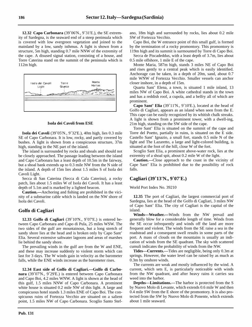
186 Sector12. Italy—Sardegna(Sardinia)
ile
disoi.out
oid.0.7or
3nre
fE.ks.,
nde.eis
he
fk
fWe
mrethethei-
ed
tas
Asea
no-ds
12.32 Capo Carbonara(39˚06'N., 9˚31'E.), the SE extrem-ity of Sardegna, is the seaward end of a steep peninsula whichis covered with low evergreen vegetation and joined to themainland by a low, sandy isthmus. A light is shown from astructure, 5m high, standing 0.7 mile NNW of the extremity ofthe cape. A disused signal station, consisting of a house, andTorre Caterina stand on the summit of the peninsula which is112m high.
Isola dei Cavoli (39˚05'N., 9˚32'E.), 40m high, lies 0.3 mileSE of Capo Carbonara. It is low, rocky, and partly covered bybushes. A light is shown from a conspicuous structure, 37mhigh, standing in the NE part of the island.12.32 The island is surrounded by rocks and shoals and should notbe closely approached. The passage leading between the islandand Capo Carbonara has a least depth of 10.5m in the fairway,but a shoal bank extends up to 0.3 mile NW from the N side ofthe island. A depth of 15m lies about 1.5 miles S of Isola deiCavoli Light.12.32 Secca di San Caterina (Secca di Cala Caterina), a rockypatch, lies about 1.5 miles W of Isola dei Cavoli. It has a leastdepth of 5.1m and is marked by a lighted beacon.12.32 Caution.—Anchoring and fishing are prohibited in the vici-nity of a submarine cable which is landed on the NW shore ofIsola dei Cavoli.
Golfo di Cagliari
12.33 Golfo di Cagliari (39˚10'N., 9˚07'E.) is entered be-tween Capo Carbonara and Capo di Pula, 25 miles WSW. Thetwo sides of the gulf are mountainous, but a long stretch ofsandy shore lies at the head and is broken only by Capo Sant’Elia. Several extensive saltwater lagoons and areas of marsheslie behind the sandy shore.12.33 The prevailing winds in the gulf are from the W and ENE,and these may increase suddenly to violent storm which canlast for 3 days. The W winds gain in velocity as the barometerfalls, while the ENE winds increase as the barometer rises.
12.34 East side of Golfo di Cagliari.—Golfo di Carbo-nara (39˚07'N., 9˚29'E.) is entered between Capo Carbonaraand Capo Boi, 4.2 miles WNW. A light is shown at the head ofthis gulf, 1.5 miles NNW of Capo Carbonara. A prominentwhite house is situated 0.2 mile NW of this light. A large andconspicuous hotel stands 1.3 miles ENE of Capo Boi. The con-spicuous ruins of Fortezza Vecchio are situated on a salientpoint, 1.5 miles NW of Capo Carbonara. Scoglio Santo Stef-
ano, 18m high and surrounded by rocks, lies about 0.2 mSW of Fortezza Vecchio.12.34 Capo Boi, the W entrance point of this small gulf, is formeby the termination of a rocky promontory. This promontory119m high and its summit is surmounted by Torre di Capo B12.34 Secca de Piscadeddus, with a least depth of 3.7m, lies ab0.5 mile offshore, 1 mile E of the cape.12.34 Monte Maria, 587m high, stands 3 miles NE of Capo Band rises gently to a central peak which is easily identifieAnchorage can be taken, in a depth of 20m, sand, aboutmile WNW of Fortezza Vecchio. Smaller vessels can anchcloser inshore, in a depth of 15m.12.34 Quartu Sant’ Elena, a town, is situated 1 mile inland, 1miles NW of Capo Boi. A white cathedral stands in the towand has a reddish roof, a cupola, and a belfry all of which aprominent.12.34 Capo Sant’ Elia (39˚11'N., 9˚10'E.), located at the head oGolfo di Cagliari, appears as an island when seen from theThis cape can be easily recognized by its whitish chalk streaA light is shown from a prominent tower, with a dwell-ing21m high, standing on the SW side of the cape.12.34 Torre Sant’ Elia is situated on the summit of the cape aTorre del Poetto, partially in ruins, is situated on the E sidCastello Sant’ Ignazio, a small fort, stands 0.5 mile N of thlight and The Lazaretto, a large and light-colored building,situated at the foot of the hill, close W of the fort.12.34 Scoglio Sant Elia, a prominent above-water rock, lies at textremity of a shoal spit, about 0.2 mile W of the light.12.34 Caution.—Close approach to the coast in the vicinity oCape Sant’ Elia is prohibited due to the possibility of rocfalls.
Cagliari (39˚13'N., 9˚07'E.)
World Port Index No. 39210
12.35 The port of Cagliari, the largest commercial port oSardegna, lies at the head of the Golfo di Cagliari, 3 miles Nof Capo Sant’ Elia. The city of Cagliari is the capital of thisland.12.35 Winds—Weather.—Winds from the NW prevail andgenerally blow for a considerable length of time. Winds frothe SE occur infrequently and winds off the land are mofrequent and violent. The winds from the SE raise a sea inroadstead and a consequent swell results in some parts ofport. A mass of clouds on the mountains is usually an indcation of winds from the SE quadrant. The sky with scattercumuli indicates the probability of winds from the NW.12.35 Tides—Currents.—Tides are negligible, being only 0.3m asprings. However, the water level can be raised by as much0.3m by onshore winds.12.35 The currents are weak and mostly influenced by the wind.current, which sets E, is particularly noticeable with windfrom the NW quadrant, and after heavy rains it carries sweed into the harbor.12.35 Depths—Limitations.—The harbor is protected from the Sby Nuovo Molo di Levante, which extends 0.6 mile W and the0.4 mile SW from the E shore of the promontory. It is also prtected from the SW by Nuovo Molo di Ponente, which extenabout 1 mile seaward.
Isola dei Cavoli from ESE
Pub. 131

Sector12. Italy—Sardegna(Sardinia) 187
t
il
ustor
te
eavonda-
ears
ofi-rs
y.ort
nulfint
ult
.7ndh,nteis2
p
dofne,
of
nto
is
o-ndiontile
12.35 The main quays include Calata Sant Agostino, with 278m oftotal berthing space and a depth of 7.6m alongside; Molo Sa-baudo,with 652m of total berthing space and depths of 8.1 to8.5m alongside; Molo Rinascita, with 910m of total berthingspace and a depth of 10.9m alongside; and Molo di Levante,with 350m of total berthing space and a depth of 11.1m along-side. There are facilities for container, ro-ro, and bulk vessels.12.35 The harbor also has 817m of total berthing space, withdepths of 2.1 to 8.8m alongside for small craft and passengerferry vessels.12.35 Vessels up to 7.9m draft can be accommodated alongside.12.35 Aspect.—The city is situated on the S slope of a small hilland has a picturesque and imposing appearance. Its buildings,which are arranged in the form of an amphitheater, are dom-inated by conspicuous towers and cupolas. When the city isapproached from the SE, it is hidden by the promontory ofCapo Sant’ Elia. The illumination of the city is very conspic-uous from seaward and may be visible from up to 20 miles dis-tant.
12.35 The following landmarks are conspicuous:1. Torre San Pancrazio, standing in the N and highest
part of the city2. Castello San Michele, with four towers and several
radio station antennas close above it, standing 1.5 milesNNW of Torre San Pancrazio
3. A yellow sanitorium situated at the foot of MonteUrpino, to the E of the city;
4. A cathedral, with the dome and steeple in the form ofa tower, standing in the city
5. Torre dell’ Elefante, reddish with a battlementstructure appearing to be composed of two towers, standingin the center of the city
6. A convent, which may be recognized by its numerouswindows and white cupola, situated in the SE part of the city
7. A high-rise building, brown with white horizontalbands, standing in the vicinity of the harbormaster’s office
12.35 Prominent landmarks in the vicinity of the harbor include asilo and several gantry cranes.12.35 A racon is situated at the light structure standing on the headof Nuovo Molo de Levante.12.35 Pilotage.—Pilotage is compulsory for vessels of over 500grt. Pilots can be contacted on VHF channel 9 or 16 and gen-erally board about 1 mile outside the harbor entrance near thelighted beacon.12.35 Regulations.—A Traffic Separation Scheme is establishedin the approaches to Cagliari. The scheme consists of two pairsof inbound and outbound lanes separated by a broad separationzone. Each pair of lanes has its own narrow separation zone.The separation zone between the pairs of lanes is marked at itsN end by a lighted buoy. The lanes E of the separation zone arefor use in approaching the old port. The lanes to the W of theseparation zone are designed for use in approaching the newharbor facilities of Nuovo Porto Industriale (Porto Canale). Acommon precautionary zone lies N of the pairs of lanesbetween the two harbor entrances.12.35 A Vessel Traffic Service has been established in CagliariRoads. Three convergence points have been established topermit local authorities to conduct radar tracking and authorizevessel movement in the area, as follows:
1. Point P—For vessels bound for the commercial por2. Point Y—For vessels bound for Porto Industriale3. Point Q—For vessels enroute to the Sarroch O
Terminal12.35 All points are charted. Vessels closing these points mreport to the Operations Center or pilots on VHF channel 1416.12.35 Anchorage.—Anchorage can be taken in three separadesignated areas, as follows:
1. Anchorage Area Bravo—A trapezoidal-shaped arcentered 1.7 miles SSW of the light at the head of the NuoMolo di Levante. Its NE and SE sides border the outboulane of the TSS for the new construction harbor. It is adjcent to Anchorage Area Delta.
2. Anchorage Area Delta—A quadrilateral-shaped arcentered 1.5 miles SW of the same light. Its NE side bordethe outbound lane of the TSS for the new industrial port.
3. Anchorage Area Foxtrot—Located on the E sidethe TSS for the old harbor of Cagliari. It is also a quadrlateral area centered 1.0 mile from the same light. It bordethe inbound lane of the TSS for the old port.
12.35 Caution.—The lighted aids are reported to be difficult todistinguish due to the numerous bright neon lights of the cit12.35 Several submarine cables lie in the approaches to the pand may best be seen on the chart.12.35 Ferry traffic in the harbor is heavy.12.35 A Marine Nature Reserve, the limits of which are shown othe chart, has been established on the W side of the gbetween Punta Zavorra (39˚03'N., 9˚03'E.) and Capo SaElia. Fishing is restricted within the area. For details, conslocal authorities.
12.36 West side of Golfo di Cagliari.—Villa Marongiu(39˚12'N., 9˚04'E.), a very conspicuous building, is situated 1miles WNW of the head of the outer breakwater at Cagliari acan be recognized by its red color. Torre Su Loi, 9m higstands 5 miles SSW of the villa and is also conspicuous. MoLuis, 177m high, stands 2 miles SSW of the tower andconical with a rounded summit. A prominent chimney standsmiles S of the tower.12.36 ENICHEM Pier (Pontile SIL) extends 1 mile SE from apoint on the shore, 2.7 miles SW of Villa Marongiu. Vessels uto 6m draft can be handled alongside.12.36 Regulations.—A Traffic Separation Scheme is establishein the approaches to the ENICHEM Pier facility. It consistsa NW inbound traffic lane, a southeastbound departure laand a narrow separation zone. The entrance is 2.4 miles SEthe head of Pontile ENICHEM Sud.12.36 Caution.—A new harbor, Nuovo Porto Industriale, lyingclose NE of Villa Marongiu, remains under constructio(2000) and is protected by two breakwaters which extend up1 mile seaward from the shore in this vicinity. A lighted buoymoored near the entrance to the new facility.
12.37 Sarroch Oil Terminal (Porto Foxi) (39˚05'N.,9˚02'E.) (World Port Index No. 39215), a refinery with assciated flares and tanks, is situated 9 miles SW of Cagliari astretches for about 1.5 miles along the coast. This installatis served from seaward by Pontile Saras No. 1 and PonSaras No. 2.
Pub. 131

188 Sector12. Italy—Sardegna(Sardinia)
.
t
easne
ed1.nisnd
ref a
yci-
fyn
s,to
snd
pe.his
stlyter
edow
pomky
.2anight-
se0.5is
itetion
e,,
12.37 Depths—Limitations.—Pontile Saras No. 1 extends ENEfrom the coast, 1.7 miles NNW of Punta Zavorra (39˚04'N.,9˚03'E.). It is illuminated by bright neon lights and is very visi-ble from seaward.12.37 The pierhead extends 0.2 mile SE from the E extremity ofthe main pier. A turning area, lying NE of this pierhead, and anapproach channel are dredged (1980) to a depth of 22.8m andare marked by lighted buoys. A turning area, lying close SW ofthis pierhead, is dredged (1980) to a depth of 18.8m and ismarked by a lighted buoy. An outer approach lighted buoy ismoored about 2.6 miles SE of the pierhead.12.37 Tankers up to 380,000 dwt and 20.7m draft can be accom-modated at the berth on the NE side of this pierhead.12.37 Two berthing arms extend NW from the N side of PontileSaras No. 1, and three berthing arms extend SE from the Sside. The outer berthing arms on each side of the pier canaccommodate tankers up to 270m in length with drafts of 11.6to 12.8m, but a shoal patch, with a depth of 9.7m, lies close offthe head of the NW arm. The inner arm on the NW side and thecenter arm on the SE side of the pier can accommodate tankersup to 200m in length with drafts of 7.9 to 11m, but a shoalpatch, with a depth of 10.2m, lies close W of the head of the SEarm. The inshore berthing arm on the SE side is designed tohandle coastal tankers up to 5,000 grt.12.37 Pontile Saras No. 2, also known as Pontile Saras Chimica,extends 0.6 mile E from the shore, 1 mile NNW of PontileSaras No. 1. An inner berth, suitable for small tankers, extends230m SE from its midpoint.12.37 A main outer berth, formed by dolphins, is situated at thehead. A lighted range, indicated on the chart, assists vesselsapproaching the pierhead. The outer berth can handle tankersup to 212m in length and 9.2m draft.
12.37 Pilotage.—Pilotage is compulsory for vessels over 500 tons.Pilots can be contacted on VHF channel 14 or 16 and board inthe vicinity of Anchor Berths G1, G2, G3, or G4, according tothe size of the vessel.12.37 Regulations.—A Traffic Separation Scheme is establishedin the approaches to the terminal. The scheme consists of aNW inbound lane, a SE outbound lane, and a narrow separa-tion zone. The inbound lane is marked on the N by a line oflighted buoys marking the entrance channel. The S limit of theinbound lane is the separation zone and is marked by a line oflighted buoys along the center of the separation zone. The Slimit of the outbound lane is the boundary of Anchorage AreaAlfa. A lighted safe-water buoy, designated Q, marks theentrance to the inbound lane.12.37 Anchorage.—The following designated anchorage berthsare situated in the vicinity of the terminal:
1. Anchor Berth G1 lies 2.3 miles NE of Punta Zavorraand should be used by vessels with drafts greater than12.8m.
2. Anchor Berth G2 lies 1 mile NNE of Punta Zavorraand should be used by vessels with drafts less than 12.8m.
3. Anchor Berth G3 lies 2.5 miles N of Punta Zavorraand should be used by vessels of less than 5,000 tons.
4. Anchor Berth G4 lies 2.5 miles E of Punta Zavorraand should be used by large vessels of 250,000 grt.
12.37 There are three designated anchorage areas in the vicinity ofthe terminal, as follows:
1. Anchorage Area Alfa—Located E of Punta ZavorraIt contains two anchor berths; Anchor Berth G2 is in the NWpart while Anchor Berth G4 is in the E part. Its NE limiborders the outbound TSS lane for the terminal.
2. Anchorage Area Charlie—A triangular-shaped arcentered 3.4 miles NNE of Punta Zavorra. It containAnchor Berth G3. Its NE side borders the outbound TSS lafor the ENICHEM Pier.
3. Anchorage Area Echo—A quadrilateral area center2.3 miles NE of Punta Zavorra. It contains Anchor Berth G
12.37 Caution.—A restricted area, the limits of which are showon the chart, lies in the vicinity of the terminal piers. Passageprohibited in this area except by vessels using the terminal aby craft in the harbor service.
12.38 Punta Zavorra(39˚04'N., 9˚03'E.), located 1.8 milesS of the oil terminal, is dominated by several hills which acovered with vegetation. Sarroch is situated near the top osmall hill, 1.5 miles WNW of the point. A large yellowbuilding stands in the NE part of this village and is verprominent. Torre dei Diavolo stands at the top of a rocky prepice, 1 mile SSW of the point.12.38 Capo di Pula (38˚59'N., 9˚01'E.), the W entrance point oGolfo de Cagliari, is the rocky extremity of a low and sandpeninsula. It is dark-colored and 35m high. A light is showfrom a structure, 16m high, standing on the cape.12.38 The peninsula is joined to the mainland by a low isthmuwhich is dominated by the church of Sant Efisio. IsolotColtellazzo lies close E of the cape and is dark in color.12.38 Isolotto San Macario lies about 0.4 mile offshore, 1.2 mileNNE of the cape. A conspicuous tower stands in its N part ait is steep-to on the E side.12.38 Punta Sa Cresia, 864m high, stands 6 miles NW of the caIts gentle sloping sides constitute an excellent landmark in tvicinity.
Golfo di Cagliari to Porto Ponte Romano
12.39 Capo Spartivento(38˚53'N., 8˚51'E.) is located 10miles SW of Capo di Pula. The coast between consists moof very light-colored sandy beaches. Because of underwarocks, the shore in this vicinity should not be approachcloser than 1 mile. Behind the beaches, the land is mostly lbut is backed by mountains.12.39 Torre di Cala d’Ostia, 7m high, stands 3.2 miles SW of Cadi Pula and is prominent from seaward. Torre de Chia, 44high, stands 5 miles farther SW and dominates a small, rocpromontory.12.39 Isolotto Su Giudeu, low and blackish, lies close inshore, 1miles SW of Torre de Chia. On the shore facing this islet cbe seen several conspicuous sand dunes. They are very lcolored and from the E, appear as a large white patch.12.39 Capo Spartivento is steep, rocky, and is bordered cloinshore by several islets and rocks. Rocky patches lie up tomile seaward of the cape and should be avoided. A lightshown from structure, 19m high, standing on the cape. A whhouse stands close to the light and a disused signal stastands 0.5 mile N of it.12.39 Porto di Malfatano is entered between Isolotti Ferraglionlying 1 mile WNW of Capo Spartivento, and Capo Malfatano
Pub. 131

Sector12. Italy—Sardegna(Sardinia) 189
reith
tte,edisaltItint
aeentisse.dyd.
tere
erco)
re
hedesndan-he7m
ceay,he
ise
0lly
eodse14
dim
1 mile W. The latter cape is the extremity of a steep-sidedpeninsula, 67m high, which is surmounted by Torre Malfatano.Isola Tuaredda, 31m high with an above-water rock close SW,lies near the head of this inlet. Anchorage can be taken, in adepth of 15m, weed and rock, about 0.2 mile from the shore, inthe outer part of the inlet.
12.40 Golfo di Teulada (38˚53'N., 8˚43'E.) is enteredbetween Capo Malfatano and Capo Teulada, 7.5 miles W.Porto di Teulada, a cove, lies at its head. The E shore of thegulf is hilly and barren and should not be closely approached.Torre di Piscinni, 12m high and truncated, dominates a smallrocky point, 1.5 miles NW of Capo Malfatano. Porto diTeulada offers shelter during NE and NW winds. Its E shore isfairly steep-to, but a rocky patch, with a depth of 7.5m, liesabout 0.3 mile ENE of Punta Niedda, its W entrance point.Torre Budello, 23m high, stands on a point on the W side ofPorto di Teulada, near its head. Punta Planedda, 350m high,stands 1.5 miles E of this tower and is surmounted by aconspicuous white building.12.40 Anchorage can be taken, in a depth of 16m, sand and weed,about 0.2 mile SE of Torre Budello. This berth is shelteredfrom NE and SW winds.12.40 Isolotta Rossa (Isola Rossa), lying 0.5 mile S of PuntaNiedda, is 54m high, reddish, and stands out against the coast.From the SE, this islet appears saddle-shaped, but from theSW, only one hillock is visible.12.40 Capo Teulada(38˚52'N., 8˚39'E.), 223m high, rises steeplyfrom the sea at the outer end of a hilly peninsula. Thispeninsula decreases in height towards the mainland to which itis joined by a low, sandy isthmus.12.40 Cala Brigantina, located 1.5 miles NE of the cape, is open tothe SE. It is separated from Porto Scudo, which is also openSE, by a steep promontory, 165m high. Torre di Porto Scudostands on the SE slope of this promontory.12.40 Caution.—An anchoring and fishing prohibited area lies inthe vicinity of Capo Teulada and may best be seen on the chart.12.40 An area of unexploded ordnance lies 1.5 miles WNW ofCapo Mulfatano.
12.41 Golfo di Palmas (39˚00'N., 8˚30'E.) is enteredbetween Capo Teulada and Capo Sperone, 11.5 miles NW. Itoffers good anchorage with the best holding ground being onits E side. Although the gulf is open to the S, the seas raised bywinds from that direction are considerably decreased by thetime they reach the inner roadstead anchorages. The only off-lying dangers are Secca di Cala Piombo and Secca della Vacca.On either side of the gulf, the coasts are hilly and extensive saltwater lagoons lie near the head.12.41 Cala Piombo, entered close NW of Capo Teulada, is freefrom dangers and its shores can be approached closely. Its headis bordered by a shorebank and numerous sand dunes. Torre diCala Piombo stands on the summit of a hill, 193m high, whichstands on the N side of this cove.12.41 Secca di Cala Piombo, with a least depth of 1.3m, lies about0.7 mile WNW of the N entrance point of Cala Piombo. Thepassage leading between this shoal and the mainland is deep inthe fairway.12.41 Punta Menga(38˚57'N., 8˚35'E.), 31m high, is covered withlow vegetation and shows up against the whitish dunes behind
it. A small house stands on the summit of this point. The shoof Porto Pino, entered SE of the point, is generally sandy wmany dunes surrounded by pine bushes.12.41 The coast between Punta Menga and Punta di Porto Bo3.5 miles NNW, is rocky and backed by low hills which arcovered with vegetation. Porto Botte, entered N of PuntaPorto Botte, has sandy shores backed by low marshes andponds. A pier is situated 0.7 mile E of the N entrance point.is connected with the railroad system and is a shipping pofor charcoal. A warehouse, with a red roof, stands close togroup of white houses in this vicinity. There are also largheaps of charcoal nearby, which are sometimes prominfrom seaward. Anchorage, with local knowledge, within thbay is available, in a depth of 10m, sand, SW of the warehou12.41 The head of Golfo di Palmas consists of a low and sanisthmus which connects Isola di Sant’ Antioco to the mainlan
Porto Ponte Romano (39˚03'N., 8˚28'E.)
World Port Index No. 39220
12.42 Porto Ponte Romano (Sant Antioco) is the deep-waharbor for the town of Sant’ Antioco, which is situated on thW side of the head of the gulf.12.42 Winds—Weather.—The prevailing wind in winter is fromthe NW (Maestrale) and is sometimes rather violent. In othseasons, the winds alternate. Winds from the SE (Sirocsometimes brings haze.12.42 Tides—Currents.—Tides are almost negligible, being only0.3m at springs.12.42 Winds from the NW may lower the water level in the harboand winds from the SE may raise it. The currents in thapproaches are negligible.12.42 Depths—Limitations.—The harbor is approached througa channel, 80m wide. This channel leads E of a detachbreakwater and has a depth of 7.5m. The coal pier provid365m of berthing space on its W side, 320m on its E side, a222m at its head.; there are depths of 7 to 8m alongside. Bchinna della Sanita extends 150m ENE from the root of tcoal pier and has depths up to 8m alongside. Vessels up todraft can be accommodated.12.42 Aspect.—At night, the port is lighted by powerful lights onhigh columns which are visible for a great distance.12.42 Conspicuous landmarks include the harbormaster’s offibuilding at the base of the pier, a high crane at the coal quand a reddish building standing 2 miles NNE of the base of tpier.12.42 The entrance fairway is marked by lighted buoys. A lightshown from a tower, with a dwelling, 22m high, standing at thE side of the harbor.12.42 Pilotage.—Pilotage is compulsory for all vessels of over 50grt. Pilots can be contacted on VHF channel 12 and generaboard about 0.5 mile SE of the outer fairway lighted buoys.12.42 Anchorage.—The entire area of water in the N part of thgulf offers anchorage with a bottom of sand and weed, goholding ground. Vessels should anchor, in a depth of 9m, cloSE of the outer end of the entrance channel or, in depths ofto 18m, about 3 miles S of the harbor.12.42 Six anchorage areas, S1 to S6, are located in GolfoPalmas. Coal lightering operations are carried out in S3 (fro
Pub. 131

190 Sector12. Italy—Sardegna(Sardinia)
ndca
he
idn-nt.he of
fonsath,is
llen-
ex-
ishe
8
esry.tof
ndedla
edis
y
ofoint
traots.
p tois
re6 .els
oysest
October 1 through May 31) and in S4 (from June 1 throughSeptember 30).
12.43 Punta Cannai(38˚58'N., 8˚27'E.), a low and rockypoint, is located 1.6 miles NE of Capo Sperone. It is sur-mounted by Torre Canai, 29m high, which is gray and veryconspicuous from seaward.12.43 The coast for the first 3 miles to the SW of Porto PonteRomano is low and is bordered by a sandy shore backed by amarshy strip. Along most of the remainder of the W side of thegulf, hills extend to the shore and end mostly in cliffs, 9 to 24mhigh. Three small coves lie along this stretch of shore and thereare short segments of sandy beach at their heads.12.43 Secca della Vacca, with a depth of 4.2m, lies about 1 mileSSW of Punta Cannai and is marked by a beacon.
12.43 Capo Sperone(38˚57'N., 8˚25'E.), the S extremity of Isoladi Sant’ Antioco, is low and rocky. This cape is dominated by agray building, with a turret, which stands 0.7 mile N of itsseaward extremity. Monte Arbus, 230m high, stands 1 mileENE of the cape and is the highest of three prominent hills inthis vicinity. A beacon is situated on its summit.12.43 Isolotta la Vacca, 95m high, lies 2 miles SE of Capo Speroneand is fringed with numerous above and below-water rocks. IlVitello, the highest of these above-water rocks, lies close offthe N end of the islet.12.43 Isolotta del Toro (38˚52'N., 8˚25'E.), 112m high, lies 5.5miles S of Capo Sperone. This islet is conical and steep-to. Alight is shown from a structure, 6m high, standing on thesummit of the islet. A detached shoal, with a least depth of11.6m, lies about 0.2 mile NW of the islet.12.43 Banco Pomata (Secca Pomata), a detached rocky patch, liesabout 2.7 miles WSW of Capo Sperone and has a least depth of13m. During W gales, the sea breaks heavily over this patchand it should be given a wide berth.
Isola di Sant’ Antioco
12.44 Monte Perdas de Fogu(39˚02'N., 8˚26'E.), 271mhigh, is the summit of Isola di Sant’ Antioco. Isolotto Mangia-barca, marked by a light, lies close offshore, 8 miles NNW ofCapo Sperone. The W coast of the island between the cape andthe islet is rocky, indented in places, and is fringed by a shorebank.12.44 The NW coast of the island between Isolotto Mangiabarcaand Punta di Manca, 2 miles NNE, is steep and rocky, but notgreatly elevated. The conspicuous buildings and chimneys ofthe tunny fisheries at Spiaggia Grande are situated in thevicinity of Punta Maggiore which is located close NE of theIsolotto Mangiabarca.12.44 Secca della Saline, a shoal area with several rocks awash,lies about 0.2 mile offshore, 1 mile SW of Punta di Manca.12.44 Calasetta(39˚06'N., 8˚22'E.) is situated on the N extremityof Isola di Sant’ Antioco. This town is dominated by aconspicuous tower, 29m high, which stands close W of it. Thewhite cupola of the church, visible only from the N, is alsoprominent. A pier and a mole front the NE side of the town.The pier has a depth of 4m alongside a spur on its S side. An-chorage can be taken, in depths of 11 to 13m, sand and weed,about 1.2 miles NW of the town.
12.44 The N coast of Isola di Sant’ Antioco between Calasetta aPunta Dritta, 2.5 miles E, is low and marshy. Scocca (ScrocManu), 148m high, stands midway along this section of tcoast and is surmounted by a beacon.12.44 Sant’ Antioco, situated on the NE side of the island, is laout in the form of an amphitheater on the slope of a hill. An acient fort dominates the town and the church in also promine12.44 Caution.—An anchoring and fishing prohibited area, whicmay best be seen on the chart, extends between the NW sidIsola di Sant’ Antioco and the SE side of Isola di San Piero.
Isola di San Pietro
12.45 Isola di San Pietro(39˚09'N., 8˚17'E.) is separatedfrom Isola di Sant’ Antioco and the mainland coast oSardegna by Canale di San Pietro. The N and central portiof the island are rugged and hilly, but the S part is rather fland more extensively cultivated. Guardia dei Mori, 215m higis the summit of the island. It stands in the N part andsurmounted by a prominent building.12.45 The S coast of the island is fringed with reefs. Punta deColonne, the SE extremity, takes its name from a group of cospicuous columnar rocks standing on a rocky area whichtends up to 0.2 mile S of the point.
12.46 Capo Sandalo(39˚09'N., 8˚13'E.), the W extremityof the island, is rugged and fronted by a small islet. A lightshown from a prominent structure, 30m high, standing on tcape. A radiobeacon is situated at the light.12.46 Isolotto del Corno (Isolotto del Gallo), 16m high, lies 0.mile W of the cape and is steep-to.12.46 La Punta, the NE extremity of Isola di San Pietro, is thextremity of a level promontory, 20m high. Several buildingand a tall chimney stand at a tunny fishery on this promonto12.46 Isola Piana, 19m high, lies 0.5 mile NE of La Punta. A lighis shown from a structure, 8m high, standing on the N sidethe island. This island is rocky, covered with vegetation, athe buildings and a tall chimney of a tunny fishery are situaton its E side. Isolotto dei Ratti, 6m high, lies close S of IsoPiana and is covered with vegetation.12.46 The E coast of Isola di San Pietro is low, sandy, and fringwith numerous shoals. An extensive flat extends E from thcoast and connects it with the coast of Sardegna.12.46 Caution.—Tunny nets, which are generally marked, maextend as much as 3 miles N of Isola di San Pietro.12.46 Punta Grossa is located 1.2 miles S of La Punta. A groupwarehouses, no longer in use, are situated close N of the pand are conspicuous from seaward.
12.47 Carloforte (39˚08'N., 8˚19'E.) (World Port Index No.39250), a small harbor, lies on the E side of Isola di San Pieand fronts the only town on the island. It is sheltered by twbreakwaters and mostly used by ferries and fishing boaThere is a depth of 5.4m alongside the main quay. Vessels u3,000 dwt and 4.6m draft can be accommodated. Pilotagenot compulsory, but persons with local knowledge aavailable. The port can be contacted on VHF channel 11 or 1Several shoals lie in the approach and two narrow channlead to the harbor entrance. Both are marked by lighted buand indicated by range beacons, some lighted, which may b
Pub. 131

Sector12. Italy—Sardegna(Sardinia) 191
Then-
remto
-g0mul-of
an
m
1.6
too, ahe
anic-ted
t.utndut,erdF
-n-bendto
theP5xi-of
toccass5m,
mes
gter.ds
be seen on the chart. Vessels with drafts up to 4m may obtainanchorage about 0.8 mile E of the cathedral belfry. This berthis on the S range line.12.47 All winds cause surf in the harbor, especially winds from theN and SE. Winds from the NE and SE quadrants also causeheavy seas in the harbor.
12.47 Prominent landmarks in this vicinity include Torre SanVittorio, standing close SE of the town; the steeple of thecathedral in the town; and a large reddish building standingclose NW of the town.12.47 Vessels must contact the port authorities on VHF channel 16prior to entering or leaving the port. Departing vessels have theright-of-way over vessels entering the port. There is a speedlimit of 3 knots in the harbor.12.47 Caution.—An outfall pipeline extends 1 mile E from a pointon the coast, close N of Carloforte.12.47 A submarine cable, which may best be seen on the chart,extends WNW from a point on the coast, close N of Carloforte.12.47 A least depth of 4.7m lies between the breakwater heads.12.47 A fishing prohibited area, best seen on the chart, is centeredon the anchorage in position 39˚10.6'N, 8˚20.0'E.
Canale di San Pietro
12.48 Numerous shoal areas obstruct Canale di San Pietroand restrict passage to vessels with drafts of less than 4.6m.The S part of the passage is deep and clear. The safest routethrough the center portion of the passage is in the vicinity ofseveral buoys which are moored about 1 mile off Carloforte.Passage just E of these buoys leads over a bank in a least depthof 5m. Caution and careful navigation are necessary in thisarea. The N part of the passage has several offshore banks withwide areas of open water between them and the shores.12.48 Anchorage in the S part of Canale di San Pietro is preferableto that in the N part, because of its less difficult approach. It isexposed to SW winds, but these are neither frequent norviolent. Anchorage, sheltered from NW winds, can be taken, indepths 11 to 13m, sand and weed, about 1.5 miles SE of TorreSan Vittorio.12.48 Anchorage can be taken, in a depth of 12m, sand and weed,in the N part of Canale di San Pietro, about 1 mile SE of IsolaPiana.12.48 Pilotage is compulsory for vessels transiting the Canale diSan Pietro and those heading to or coming from Porto Vesme.
Porto Vesme (39˚12'N., 8˚24'E.)
World Port Index No. 39260
12.49 The port of Porto Vesme lies 4.5 miles NE of Car-loforte and is mostly used for the shipping of bulk minerals andcoal.12.49 Winds—Weather.—The predominant winds are from theNW, SSE, and SSW. During the winter, NW winds may pro-duce a strong undertow in the port.12.49 Tides—Currents.—The tidal range is generally about 0.3m,although from December to April it may be as much as 0.6m.12.49 In general, the tidal currents are negligible, but may becomeappreciable during strong winds.
12.49 Depths—Limitations.—The harbor, which is protected bybreakwaters, is approached through a channel, 200m wide.fairway of this channel is dredged to a depth of 14m. The etrance between the breakwater heads is 134m wide.12.49 The main facilities include Banchina Commerciale, an oquay, which has 280m of berthing space, with a depth of 8.2alongside, and whose W side is reserved for vessels up32,500 dwt with a maximum length of 200m; Pontile Euroallumina, a bulk ore terminal, which has 400m of berthinspace with a depth of 13m alongside; and Pontile Samin, 4long, with a depth of 8.5m alongside. This berth is used for sfuric acid and can handle vessels with a maximum length100m and a maximum draft of 9m.12.49 It is reported that vessels up to 92,000 dwt and 12m draft cbe accommodated in the harbor.12.49 Aspect.—Scoglio La Ghingetta, lying 1 mile NW of theharbor entrance, is surrounded by rocks. A light is shown froa tower, 10m high, standing on this rocky shoal.12.49 Several shoal patches, with depths of 3 to 7m, lie aboutmiles WNW of the light and are marked by a lighted buoy.12.49 Portoscuso, a small craft harbor, lies close NW of PorVesme and is protected by breakwaters. Torre Portoscuslarge structure, stands close W of a village, 0.2 mile NW of tharbor.12.49 The coal conveyor loading system and two chimneys ofelectric plant, which are situated at Porto Vesme, are conspuous from seaward. The entrance channel is marked by lighbuoys.12.49 Pilotage.—Pilotage is compulsory for vessels over 500 grVessels approaching from the N usually embark the pilot abo2 miles N of Isola Piana. Vessels approaching from the S aall vessels with a draft of less than 5.2m embark the pilot abo1 mile N of Calasetta. In inclement weather from the NWvessels arriving from the N will be directed to head to thentrance of South Channel or to the Gulf of Palmas to boathe pilot. The pilots and harbor can be contacted on VHchannel 12. Pilots are provided from Porto di Sant’ Antioco.12.49 Anchorage.—Anchorage for vessels with drafts not exceeding 6m is available about 0.4 mile E of Scoglio La Ghighetta. Anchorage, sheltered from all but NW winds, canobtained in Anchorage Papa, in a depth of 13m, sand aweed, good holding ground, about 1.2 miles SW of PorVesme.12.49 Other anchorage berths have been established inapproaches to Porto Vesme. Zone P1, Zone P2, and Zoneeach have a radius of 0.3 mile and are for vessels with a mamum draft of 8m. Zone P3 and Zone P4 each have a radius0.2 mile and are for vessels with a maximum draft of 5.2m.12.49 Directions.—From the NW, large vessels are advisedapproach the port by passing between Isola dei Meli and SeMartin in depths of about 30m. Smaller vessels may pabetween Isola Piana and Secca Grande in depths of about 1but currents setting NNE towards Secca Grande are sometiexperienced.12.49 Caution.—Entry into port is not recommended with stronSE winds, which increase the current setting on the breakwaand make maneuvering difficult in the very restricted waters12.49 A prohibited entrance area, with a radius of 300m, surrounScoglio La Ghinghetta.12.49 The entrance fairway is subject to silting.
Pub. 131

192 Sector12. Italy—Sardegna(Sardinia)
ilesIns of
dengthanbyn
h
dies.
tss a
tsa
tses
deep
ys a
sin,
ofto-g-of
ceth
aft
sge
dreust
ae.asdi
Canale di San Pietro to Porto di Oristano
12.50 Capo Altano (39˚14'N., 8˚22'E.), located 2.5 milesNW of Porte Vesme, is high and rocky. Isola dei Meli, 11mhigh, lies 0.5 mile W of the cape and is surrounded by rocksand foul ground.12.50 Caution.—Tunny nets, which are generally marked, mayextend as much as 3 miles W of Capo Altano.
12.51 From Capo Altano to Porto Paglia, 3.5 miles NW, thecoast is high and rocky. At Porto Paglia, a small inlet, thebuildings of a tunny-processing plant are conspicuous. A lowreddish tower stands close W of the buildings and is prominentfrom seaward.12.51 Fontana a Mare, situated 1.5 miles NNE of Porto Paglia, canbe recognized by a conspicuous white chimney dominating agroup of ruined houses. A white pipeline descends down theside of a hill from the chimney. A stretch of sandy beachextends between Porto Paglia and Fontana a Mare. At PortoNebida, situated 1 mile N of Fontana a Mare, a four-storybuilding stands at the base of a small wharf and is prominentfrom seaward.12.51 Scoglio Pan di Zucchero(39˚20'N., 8˚24'E.), 132m high,lies close offshore. When seen from the SW, this rock blends inwith the coastal background and is not easy to identify.12.51 Porto Flavia, a small inlet with steep shores, lies close NE ofScoglio Pan di Zucchero. An ore-loading machine, situated inan opening in the cliff, loads ore directly into holds of vesselsvia a chute. Vessels usually anchor, in a depth of 9m, close tothe loading facility and moor to bollards on the shore. Inaddition, there are several mooring buoys in the vicinity. Theberth is sheltered from N winds, but loading operations may beeffected during the prevailing NW winds.12.51 Torre di Cala Domestica, 40m high, stands 2.5 miles NNWof Porto Flavia and is prominent.
12.52 Capo Pecora(39˚27'N., 8˚23'E.), 18m high, is asmall projection which is joined to the coast by a low stretch ofland. It is dominated by Punta del Guardianu, 478m high,which stands 1.2 miles inland. An above-water rock lies closeoff the W extremity of this cape. The conspicuous peak ofMonte Arcuentu, 785m high, stands 12 miles NE of the cape.12.52 The coast between Capo Pecora and Capo della Frasca(Capo Frasca), 19 miles NNE, is steep and rugged. At thecenter of this stretch, a large isolated building stands at PortoTremolia.12.52 Porto Palma, a small inlet, is entered 3 miles N of PortoTremolia and has a sandy beach at its head. Several buildingsand a tall chimney of a tunny-fisheries plant are situated alongthis beach.12.52 Torre di Flumentorgiu, 61m high, stands on a small point, 1mile NNW of Porto Palma. It is conspicuous and very visiblefrom seaward.12.52 Capo Frasca(39˚46'N., 8˚27'E.) is the N extremity of Pianadi Santadi, a plateau, which rises perpendicularly from the seaand is covered with vegetation. A light is shown from astructure, 8m high, standing on the cape.12.52 Caution.—An anchoring and fishing prohibited area, thelimits of which are shown on the chart, lies in the vicinity ofCapo Frasca.
12.53 Golfo di Oristano (39˚49'N., 8˚30'E.) is enteredbetween Capo della Frasca and Capo di San Marco, 5.5 mNNW. The gulf has low, sandy, and gently sloping shores.places, there are several whitish sand dunes, with patchevegetation, backed by extensive lagoons and marshes.12.53 Conspicuous landmarks in the approach to this gulf incluMonte Sa Trebinalada, 795m high, with two peaks, standi13.5 miles E of Capo Frasca; Monte Urtigu, 1,050m high, wigently sloping sides, standing 19 miles NNE of Capo SMarco; and Torre San Giovanni, 50m high and surmountedtwo small turrets standing on a hill, 1 mile N of Capo di SaMarco.12.53 A prominent bell tower stands in the town of Oristano, whicis situated 7.5 miles ENE of Capo di San Marco.
12.53 Torre Grande (Gran Torre), standing 4.7 miles NE of CapoSan Marco, is a large tower, 15m high, surrounded by housA light is shown from this tower.12.53 Pontile Merci, situated 0.9 mile SE of Torre Grande, projec180m SW from the shore. Its head is rectangular and hadepth of 6.9m alongside.12.53 Pontile Perlite, situated close SE of Pontile Merci, projec135m WSW from the shore. It has a T-head, 37m long, withdepth of 6.7m alongside.12.53 Pontile SIPSA, situated close SE of Pontile Perlite, projec180m WSW from the shore. The head is fitted with pipelinfor crude oil and has depths of 7 to 8m alongside.
Porto di Oristano (39˚52'N., 8˚33'E.)
World Port Index No. 39261
12.54 Porto di Oristano lies 3 miles SE of Torre Grande anis entered through a dredged channel leading SE from a darea which extends NE into Golfo di Oristano.12.54 Depths—Limitations.—The harbor entrance is protected ba mole and approached by a channel, 200m wide, which hadredged depth of 13m (1982).12.54 The harbor consists of an outerr basin and an inner baboth of which have a depth of 12m.12.54 The main quays include Banchina Sottoflutto, with 306mberthing space and a depth of 10.5m alongside; Molo Sotflutto, with 120m of berthing space and a depth of 9.5m alonside; Banchina Est, with 407m of berthing space and a depth10.5m alongside; Banchina Nord, with 500m of berthing spaand a depth of 11m alongside; and Banchina Martini, wi250m of berthing space and a depth of 11m alongside.12.54 Vessels up to 60,000 dwt, 300m in length, and 11.7m drcan be accommodated.12.54 Aspect.—An outer lighted buoy is moored about 1.2 mileSSW of Torre Grande and marks the approach. A lighted ranindicates the entrance channel.12.54 Pilotage.—Pilotage is compulsory. Pilots can be contacteon VHF channel 12 and board 2 miles NW of the port. Tugs aavailable from Porto Torres, but 48 hours advance notice mbe given.12.54 Anchorage.—Small vessels can obtain anchorage, indepth of 6m, about 0.6 mile offshore, SSW of Torre GrandTwo designated anchor berths are available, with limitsshown on the chart. Berth C is located 1 mile SE of Capo
Pub. 131

Sector12. Italy—Sardegna(Sardinia) 193
tor S,
nraly,
es-is
se
18u
h ofndnd
e
.2d 3its
e.the
ismofd.
ralAg-
his
isill,is
h,
ite
is
ed
ndgd
re-ht
San Marco. Berth D is NE of Berth C and centered 2.2 miles Eof Capo di San Marco.12.54 Caution.—Depths within Porto di Oristano are subject tochange. Mariners are advised to contact the port authority forthe latest information.
Porto di Oristano to Isola Asinara
12.55 Capo di San Marco(39˚52'N., 8˚26'E.), 56m high, isformed by a small and rocky promontory which is joined to themainland by a low and narrow strip of land. A light is shownfrom a prominent structure, 15m high, standing on the cape.
12.55 Torre Vecchia, a low tower, is situated 0.5 mile NE of thelight.12.55 Caution.—Unexploded ordnance is reported (1994) to lieclose SE of Capo di San Marco.12.55 A prohibited area, best seen on the chart, encircles Capo diSan Marco.12.55 Lighted superbuoys, best seen on the chart, lie up to 40 milesW and SW of Capo di San Marco. These buoys are anchored tothe bottom by nylon cables and are a hazard to navigation andto fishing.
12.56 Capo Mannu(40˚02'N., 8˚23'E.) is located 11 milesNNW of Capo di San Marco. The coast between is backed by arange of low hills covered with scrub in its S part and is lowand marshy in its N part. Torre Sevo, standing 2.8 miles NW ofCapo di San Marco, is very visible from seaward.12.56 Il Catalano, a dark-colored rock, lies on a shoal area, about7.5 miles W of Capo di San Marco. It is 11m high and issurmounted by a disused light structure. A detached rockypatch, with a depth of 12m, lies about 1.2 miles SSW of thisrock and a dangerous wreck lies in this vicinity.12.56 Rocky shoals, with depths 2.5m and 8m, lie about 0.7 mileNNE and 2.5 miles NNE, respectively, of Il Catalano.12.56 Isolotto Mal di Ventre (39˚59'N., 8˚18'E.), 18m high, is flat,rocky, and fringed by shoals. Rocky shoals extend up to 1 mileNE of the island and a detached rocky area, awash, lies about 1mile SW of the island. A light is shown from a structure, 4mhigh, standing on the summit of the island. Anchorage isavailable, in a depth of 16m, about 0.5 mile SE of the islandand sheltered from NW winds.12.56 Caution.—A prohibited area, best seen on the chart, extendsfrom the NE extremity to the SW extremity enclosing theentire W part of the island.
12.57 Capo Mannu, 48m high and precipitous, is joinedthe mainland by a marshy isthmus. When seen from the N othis cape appears to consist of two flat islets. A light is showfrom a structure, 11m high, standing on the cape. Torre Moand Torre Mannu stand close S and 0.7 mile NE, respectiveof the light.12.57 Cala Saline, entered S of Capo Mannu, offers shelter to vsels from winds from the NE and SE. Local knowledgeessential.12.57 Isola de sa Tounaria (Isolotto Peloso), 12m high, lies clooffshore, 1.7 miles NE of Capo Mannu.12.57 The coast between Capo Mannu and Capo Marargiu,miles N, is rugged and somewhat high. Monte Urtigdominates the first section of this stretch of the coast.12.57 Torre Foghe, a conspicuous tower, stands near the moutthe Fiume Mannu, 9.2 miles NE of Capo Mannu. The town acathedral of Cuglieri are situated 4.5 miles E of this tower aare plainly visible from seaward.12.57 Rocks extend up to 0.5 mile offshore, 2 miles N of TorrFoghe.12.57 Torre Columbargia, 33m high, stands on a reddish hill, 1miles N of Torre Foghe. The town of Tresnuraghes is situatemiles ENE of this tower and can easily be recognized bycathedral dome which is fronted by two spires.12.57 Isola Rossa(40˚17'N., 8˚28'E.), 15m high, lies close off theS entrance point of Fiume Temi to which it is joined by a dikA large and conspicuous tower stands on the summit ofisland.12.57 A small breakwater extends SSE from the S extremity of thisland and a pier, with a depth of 4m at its head, extends frothe E side of the island. Anchorage can be taken, in a depth16m, about 0.2 mile NW of the island, but the berth is expose
12.58 Bosa Marina(40˚16'N., 8˚32'E.) is situated close NEof Isola Rossa and on the S bank of Fiume Temo. Seveconspicuous resort buildings stand 1 mile S of the town.quay, 115m long, fronts the town and has a depth of 3m alonside. There is an extensive marina and small craft harbor in tvicinity.12.58 Torre Argentiera stands 2.5 miles N of Isola Rossa andvisible from seaward. However, a conspicuous steep-sided hscored with vertical furrows, stands close E of the tower anda better landmark.
12.58 Capo Marargiu (40˚20'N., 8˚23'E.) is high, bordered byrocks, and distinctive due to its greenish color. A shoal patcwith a depth of 5m, lies about 0.5 mile SW of the cape.12.58 Torre Badde Iana stands 6.5 miles N of the cape and is whand prominent.12.58 Punta Poglina, located 4 miles NNW of Torre Badde Iana,low and surmounted by Torre Poglina, partially in ruins.12.58 Rada d’Alghero (40˚34'N., 8˚15'E.) is entered between thtown of Alghero, situated 13 miles N of Capo Marargiu, anCapo Galera, 3 miles WNW. The E shore of this bay is low asandy, and the W shore is hilly and rocky. An undulatincoastal plain, partly under cultivation, lies immediately inlanof the head of this bay.12.58 Isolotto della Maddalena, marked by a light, lies on the shobank, 0.9 mile NW of Alghero. It is 4m high and rocky. Because of its reddish color, this islet shows up against the lig
Capo di San Marco Light bearing N
Pub. 131

194 Sector12. Italy—Sardegna(Sardinia)
rsna.
ised
tals-
ing
rym
.3
ilesndic-mf a
d,ofus,
on
sandy background of the shore. Depths of less than 5.5mextend SW from this islet.12.58 Conspicuous landmarks in this vicinity include MonteDoglia, 437m high and conical, standing 3.5 miles N of CapoGalera; a yellow villa standing on Capo Galera; Torre Lazza-retto, standing 0.5 mile N of Capo Galera; and a belfry stand-ing 1.2 miles N of Alghero.12.58 This bay is open to winds from the SW which may last aslong as 8 days. When the summit of Monte Doglia is envelopedin dense clouds, winds from the S or SW can be expected. Adense fog over the coast to the S of Alghero is a sign of windsfrom the W or NW.12.58 Anchorage is available, in a depth of 20m, sand and weed,good holding ground, about 0.7 mile W of Isolotto della Mad-dalena. Anchorage is also available, in a depth of 14m, sandand weed, about 0.2 mile E of Torre Lazzaretto.12.58 Alghero (40˚34'N., 8˚19'E.) (World Port Index No. 39280), asmall harbor, is sheltered by two breakwaters. The town standson a small rocky promontory and is surrounded by medievalwalls. The harbor is accessible to small vessels up to 70m inlength and 4m draft. Pilotage is not compulsory, but is avail-able. The pilot may be contacted on VHF channel 11 or 16.12.58 Fertilia, a small town, is situated 2.5 miles NE of CapoGalera. It has a prominent church spire and is fronted by asmall and shallow harbor.
12.59 Punta del Giglio (40˚34'N., 8˚12'E.) is located 2miles W of Capo Galera and the coast between is high androcky. Punta del Giglio rises to a height of 108m, 0.2 mileinland, and is surmounted by a tower. Punta del Rumani, 169mhigh, stands near the coast, about midway along this stretch.
12.59 Porto Conte, entered close W of Punta del Giglio, offeshelter from all winds. Monte Timidone, 361m high, stands othe W side of this inlet and dominates the whole of this areWith strong N winds, it is advisable to keep close to the NWshore of this inlet and in the lee of Monte Timidone. When thhill is obscured by clouds, strong NW winds can be expectand may last for up to 5 days.12.59 Torre Nuova stands on a point located 1.5 miles N of Pundel Giglio. This point is marked by a light and several hoteand other prominent buildings are situated in its vicinity. Anchorage can be taken, in depths of 6 to 20m, good holdground, within this inlet.
12.60 Capo Caccia(40˚34'N., 8˚10'E.), the W entrancepoint of Porto Conte, is an imposing dark-colored promontowith an almost perpendicular rock face. A light is shown froa structure, 24m high, standing on the cape.12.60 Caution.—A prohibited anchorage area extends up to 0mile seaward around Capo Caccia.
12.60 The coast from Capo Caccia to Punta delle Gessiere, 4 mN, is high and inaccessible. Isolotto Foradada, 182m high apierced by a hole, lies 0.7 mile NW of the cape and is conspuous. Isola Piana lies 2.7 miles NNW of the cape. It is 107high and conspicuous. Torre Pegna stands on the brink ocliff, 0.7 mile SSE of the islet.12.60 Torre di Bantine Sale, 20m high and partly demolishestands on the S entrance point of Porto Ferro, 4.2 miles NEPunta delle Gessiere. Torre Bianca, 64m high and conspicuodominates a small conical promontory covered with brushthe N entrance point of this bay.
Capo Caccia
Pub. 131

Sector12. Italy—Sardegna(Sardinia) 195
sbyhisthatthe
e
rt,,ties
ds
delell’rtoon-ion.ckydu-of
aled.la
Ws ininly
ewo
e Steds.ing
12.60 Capo dell’ Argentiera (40˚44'N., 8˚08'E.), 221m high, canbe easily recognized. Miniera dell’ Argentiera stands close Eof the cape. A prominent church and the conspicuous equip-ment of the continually active mines are situated in this village.
12.60 From Capo dell’ Argentiera to Capo del Falcone, 14 miles N,the coast is high, rocky, and inaccessible. It has a whitish colorfor about 3 miles to the SSW of Capo del Falcone.12.60 Capo Mannu, located 4 miles NNE of Capo dell’ Argentiera,is formed by a dark spur-shaped promontory. Isola dei Porti,lying 6 miles NNE of Capo Mannu, appears conical from theSW, but from the NW it is difficult to distinguish from thecoast.12.60 Punta Scoglietti, located 2.5 miles SSW of Capo delFalcone, is low and rocky. When seen from the S, this pointappears to be whitish. It should not be approached closer than0.5 mile because of the fringing rocks and shoals.
12.61 Capo del Falcone(40˚58'N., 8˚12'E.) is formed bythe N termination of a small peninsula. The summit of thispeninsula, 189m high, stands 1 mile S of its seaward extremityand is surmounted by Torre del Falcone, a conspicuous tower.12.61 Isola Piana, 23m high, lies close NE of the cape and dividesthe canal leading between Sardegna and Isola Asinara into twopassages. A conspicuous dark tower stands on the NE side ofthis islet. Passagio della Pelosa, the S passage, is available onlyto small craft with local knowledge. Passagio dei Fornelli, theN passage, has a depth of 3m in the fairway and is availableonly to small vessels with local knowledge during goodweather. An overhead cable, with a height of 25m, spans the Wentrance of Passagio dei Fornelli and is supported by threepylons.
Isola Asinara
12.62 Isola Asinara (41˚04'N., 8˚16'E.) consists of fourprincipal parts, all high, which are connected by low isth-muses. The principal elevations of the island, from S to N, areMonte Maestra Fornelli, 265m high; Monte Tumbarino, 241mhigh; Monte Ruda, 215m high; and Monte Scomunica, 408mhigh.
Punta della Scorno(Punta Caprara) (41˚07'N., 8˚19'E.), theN extremity of the island, is fringed with shoals which extendup to 0.2 mile N of it. A light is shown from a prominent struc-ture, 35m high, standing on the point.12.62 The W coast of the island is inaccessible and barren. The Ecoast is partly rocky, partly sandy, and fringed with rocks,except along the NE part which is generally steep-to. Thebuildings of a penal colony are situated on the N side of Calad’Oliva, which is entered 2.5 miles SSE of Punta Caprara.12.62 Punta Trabuccato is located 4.3 miles SSE of Punta dellaScorno. This point is the extremity of a small peninsula whichis connected to Isola Asinara by a low isthmus. TorreTrabuccato stands on the summit of this low peninsula.12.62 Rada della Reale, entered SW of Punta Trabuccato, has highand rugged shores. Three groups of buildings of a quarantinestation stand on the N shore of this inlet. Two masonry piersare situated near the W group of these buildings. The largerone, 75m long and T-shaped, has a depth of 5m close off itshead.
12.62 Scogli Neri, a group of drying rocks, extends up to 1.3 mileSE from the vicinity of the quarantine station and is markeda lighted beacon. Anchorage is available on either side of tgroup, in a depth of 10m, sand and weed. Regulations statethese anchorages be used only in emergencies. Winds fromE and NE cause a heavy swell in this bight.12.62 Caution.—The island and waters surrounding the coastlinare known as Asinara National Park.12.62 A restricted area, the limits of which are shown on the chalies in the vicinity of Isola Asinara. Landing is prohibitedexcept for persons engaged in rescue or surveillence activior those with specific permission from park authorities.
12.63 Golfo dell’ Asinara (41˚00'N., 8˚30'E.), entered E ofIsola Asinara, offers good anchorage, sheltered from winfrom the NW, SW, and SE quadrants.12.63 Between Punta Negra, located 1.8 miles SE of CapoFalcone, and Porto Torres, 9 miles SE, the shores of Golfo dAsinara are low, sandy, and backed by ponds. From PoTorres to Punta Tramontana, 11.3 miles ENE, the shore csists of a series of sand dunes with a scattering of vegetatThe remainder of the coast is composed of alternate high rotracts and low sandy sections. In the background, the unlating terrain rises gradually towards the higher elevationsthe interior of Sardegna.12.63 Winds from the NW, frequently very stormy, prevail in thisgulf. Winds from the NE, which are infrequent, usually raiserough sea in the gulf. If the coast of Sardegna is plainly visibfrom the offing, generally NE or SE winds are to be expecteWhen Monte Scomunica, standing near the N end of IsoAsinara, is covered with clouds, generally strong NW or Swinds are to be expected. There are no well-defined currentthe gulf and those which have been encountered are masurface currents influenced by the wind.12.63 Stintino (39˚56'N., 8˚14'E.), a small town, is situated 1 milS of Punta Negra and has several prominent white houses. Tconspicuous chimneys of a tunny fisheries plant stand 1 milof the town. Also prominent at this side of the gulf are MonElva, 112m high, and Monte Alvaro, 342m high, which stan4.5 miles W and 4.5 miles SW, respectively of Porto TorreAnchorage can be taken, in a depth of 29m, sand, good holdground, about 0.7 mile E of Stintino.
Punta della Scorno (Punta Caprara) Light
Pub. 131

196 Sector12. Italy—Sardegna(Sardinia)
to
e-e
thert.
byoint
a
y, 4l,n,h.er
rtly
h ofonith
eindS of
butin
y
h,erA
nd.oftlyth
i liichebe
lieaofthe
o-w,m-
ed
Porto Torres (40˚50'N., 8˚24'E.)
World Port Index No. 39310
12.64 Porto Torres lies at the head of Golfo dell’ Asinaraand consists of a new harbor and an old harbor.12.64 Winds—Weather.—A violent NW wind, which is commonthrough the winter season, may create a heavy sea andconsiderable surf in the approaches to the port.12.64 Tides—Currents.—The tide is negligible, rising only 0.3mat springs.12.64 Depths—Limitations.—The old harbor, lying at the E sideof the port, is protected by two breakwaters which form anentrance, 270m wide, facing NE. This harbor is divided intotwo basins. Avamporto is the outer basin and Porto Interno isthe inner basin.12.64 A part of the E side of the W breakwater is used for berthingtankers with drafts up to 8.2m.12.64 A quay, 450m long, is situated on the SW side of the Ebreakwater and has depths of 8.2 to 9.1m alongside its outerend, and depths of 6.1 to 8.5m alongside its inner end.12.64 The entrance to the inner basin leads between two moles andis 80m wide. This basin has 740m of quayage, with depths of5.5 to 6.5m alongside.12.64 Vessels up to 150m in length and 8m draft can be accom-modated in the old harbor.12.64 The new harbor, which includes an oil terminal, lies at the Wside of the port and is protected by a breakwater which extendsabout 0.6 mile NNE, 0.5 mile ENE, and then 1 mile E. It hasfacilities for container, ro-ro, bulk, and tanker vessels.12.64 Pontile di Levante, at the E side of the new harbor, extends0.5 mile N from the shore. It has two berths for tankers at theouter end, with depths of 12.7 to 14.5m alongside, and twoberths for dry cargo vessels at the inner end with depths of 12malongside.12.64 Pontile ANIC No. 1 extends 0.6 mile N from the shore, 0.3mile W of Pontile di Levante. It has three berths with depths of9 to 16m alongside. Berthing is done during daylight hoursonly; unberthing is allowed up to 2359 local time.12.64 Pontile ANIC No. 2 extends 0.5 mile N from the shore, 0.7mile W of Pontile ANIC No. 1. There are three berths, withdepths alongside of 4 to 9m.12.64 Aspect.—The town is situated on rather flat terrain and iswithout any conspicuous heights when seen from seaward. Themost conspicuous landmark is the chimney of the cementworks which stands 0.8 mile WSW of the root of the Wbreakwater. This chimney is reported to be clearly visible be-cause of its outline against the sky. Also prominent fromseaward are the Colonia Marina, a pink building, standing 0.5mile E of the town; several green tanks situated to the W of thetown; and the two loading gantries at the harbor.12.64 Vessels of unlimited size with drafts up to 14.5m can beaccommodated.12.64 A light is shown from a prominent structure, 20m high,standing 0.2 mile S of the old harbor. A light with racon is situ-ated at the head of the W breakwater at the old harbor.12.64 Pilotage.—Pilotage is compulsory for vessels over 500 tons.Pilots can be contacted on VHF channel 12 or 16 and generallyboard about 1 mile from the breakwater. Large tankers areboarded up to 3 miles from the breakwater.
12.64 Caution.—A submarine power cable lies in the entrancethe old harbor and may best be seen on the chart.12.64 The navigation lights at the harbor are reported to be somtimes difficult to distinguish against the bright lights of thindustrial area.12.64 Several submarine cables, which may best be seen onchart, extend N from the shore of the gulf, close E of the po
Porto Torres to Punta Falcone
12.65 Punta Tramontana (40˚53'N., 8˚38'E.), the E en-trance point of Golfo dell’ Asinara, can be easily recognizeda conspicuous tank standing on it. The coast between this pand Porto Torres is moderately high and steep, withsuccession of sand dunes in the E part.12.65 Castelsardo, a town, stands on a small conical promontormiles NE of Punta Tramontana. An ancient fortified citadesurmounted by the tall antenna of a television relay statiostands on the summit of the promontory which is 114m higFrom the W, the belfry of the cathedral can be seen at a lowlevel and appears similar to a lighthouse. Torre Fragiano, paruined, stands close W of the town.12.65 Secca di Castelsardo, a detached rocky patch with a dept11m, lies about 5.5 miles N of Castelsardo. The sea breaksthis patch during strong N winds. Secca di Punta Spinosa, wa depth of 9m, lies about 1 mile W of Castelsardo.12.65 San Pietro a Mare is situated SW of the mouth of FiumCoghinas, 4 miles E of Castelsardo. This village stands behsand dunes and a conspicuous chimney can be seen closeit.12.65 Fiume Coghinas is the second largest river in Sardegna,its mouth cannot be easily identified from seaward. The seathe vicinity of the mouth of this river becomes turbid onlwhen the river is swollen.12.65 Isola Rossa, lying 9 miles NE of Castelsardo, is 27m higbarren, reddish, and surrounded by rocks. A prominent towstands on a point, 23m high, located close E of this island.shoal, with a depth of 7.9m, lies about 0.5 mile S of the isla12.65 Punta di li Francesi (Punta Vignola), located 11 miles NEIsola Rossa, is 28m high and rocky. A prominent tower, parin ruins, stands 0.5 mile SE of this point. A shoal, with a depof 9.4m, lies about 1.5 miles ENE of the tower.12.65 Capo di Monte Russu, located 3.5 miles ENE of Punta dFrancesi, is a rugged and reddish promontory, 89m high, whis easily recognized. From the W, it stands out from thsurrounding land and large patches of light-colored sand canseen on its shores. An islet lies 0.2 mile N of this cape.12.65 Detached rocky patches, with depths of 6.5m and 7.5m,about 1 mile W and 1.5 miles SW of the light. A patch, withdepth of 7.5m, lies about 0.7 mile SSW of the SW extremitythe cape. The sea breaks heavily on the shoals lying W ofcape with rough NW seas.
12.66 Capo Testa(41˚14'N., 9˚08'E.), the SW entrancepoint of the Strait of Bonifacio, is a prominent and rugged prjection which is connected to the mainland by a low, narroand sandy isthmus. An inconspicuous pillar stands on its sumit which is 127m high. A light is shown from a structure, 33mhigh, standing near the NW end of the peninsula. A disussignal station is situated close W of the light.
Pub. 131

Sector12. Italy—Sardegna(Sardinia) 197
2.5misy,W
-
12.66 La Colba, a cove entered on the SE side of the cape, offersexcellent shelter from winds from the NE quadrant. Anchoragecan be taken in Baia Santa Reparata, which lies close E ofCapo Testa, by small vessels. The best berth, in a depth of 16m,sand, lies about 200m from the E shore and SE of the Wentrance point.12.66 Between Capo Testa and Punta Falcone, 3.5 miles E, the Sside of the Strait of Bonifacio is high, rocky, and fringed with
rocks and shoals. Porto Longonsardo, a narrow creek, liesmiles NE of Capo Testa. A light is shown from a structure, 7high, standing 0.5 mile SW of the E entrance point of thcreek. A village is situated on the W entrance point. A quawith a depth of 5m alongside its outer end, projects from theside of the creek and is used by fishing vessels and ferries.12.66 The Strait of Bonifacio is described fully beginning in paragraph 11.16.
Pub. 131


199
13.Italy—West Coast—Promontorio di Piombino to Capo
Spartivento
13.0Additional chart coverage may be found in NGA/DLIS Catalog of Maps, Charts, and Related Products (Unlimited Distribution).SECTOR13 — CHART INFORMATION
Pub. 131


201
SEhas
-
-
-
-
ndrea
h a
ins in
eed
Ethen
allo,f the
too.ted
t.llyld
steedels
a
-
1
eap-
SECTOR 13
ITALY—WEST COAST—PROMONTORIO DI PIOMBINO TO CAPO SPARTIVENTO
13.0 Plan.—This sector describes the NE and E shores of theTyrrhenian Sea, the E side of Stretto di Messina, and the toe ofthe boot of Italy. The general descriptive sequence is from N toS.
General Remarks
13.1 Regulations.—Tanker vessels of 1,600 grt and overentering or leaving Italian ports and carrying, or with un-cleaned tanks which last carried, petroleum, gas, or chemicalproducts should report to a shore station before entering Italianterritorial waters off Italian ports. For further details, see Pub.140, Sailing Directions (Planning Guide) North AtlanticOcean, Baltic Sea, North Sea, and the Mediterranean Sea.
Canale di Piombino
13.2 Canale di Piombino(42˚54'N., 10˚29'E.) is generallyabout 5 miles wide and leads between the SW side of Promon-torio di Piombino and the NE end of Isola d’Elba.13.2 Punta Falcone (42˚56'N., 10˚30'E.), the SW extremity ofPromontorio di Piombino, is a conspicuous headland which isfronted by a prominent rock. When seen from a distance, thepromontory appears to be an island.13.2 Isola Cerboli and Isola Palmaiola lie in the S approach to thechannel and are fully described in paragraph 10.53.13.2 At night, the red flashes of the blast furnaces situated in theindustrial area of Piombino on the S end of Promontorio diPiombino are visible for some distance offshore. The thicksmoke of the chimneys also helps to identify the area.13.2 During the winter, the currents in Canale di Piombino are notvery strong and are influenced by the prevailing winds. Insummer, a current sets E and sometimes attains a rate of 2.5knots, but it is weakened by SE winds. When winds areblowing from either of the two W quadrants, this current isstrong in the vicinity of Isola Palmaiola and weak along thecoast of Promontorio di Piombino.13.2 Caution.—Due to the existence of submarine cables andpipelines, an anchoring and fishing prohibited area, the limitsof which are shown on the chart, extends S and W from the SWside of Promontorio di Piombino.
Portovecchio di Piombino (42˚56'N., 10˚33'E.)
World Port Index No. 39740
13.3 The port of Piombino lies in the NW corner of Golfodi Follonica and is protected by breakwaters. The city ofPiombino, an industrial center, is situated SW of the port andstands on the S end of Promontorio di Piombino.
13.3 Depths—Limitations.—Mollo Batteria extends NE andprotects the harbor from the SE. Pontile Italsider extendsand protects the harbor from the N and E. The approachdepths of 13 to 18m.13.3 The main berths include the following:
1. Ilva Pier N—260m long, with a depth of 11.9m alongside.
2. Ilva Pier S—180m long, with a depth of 9.2m alongside.
3. Magona Pier N—50m long, with a depth of 6.7malongside.
4. Magona Pier S—100m long, with a depth of 6.1malongside.
5. Trieste Pier—130m long, with a depth of 5.8m alongside.
6. Outer Mole—140m long, with a depth of 7.9m alongside
13.3 There are facilities for general cargo, passenger, ro-ro, abulk vessels. Lightering operations are also possible in an adesignated by the port authorities.13.3 The port can accommodate vessels up to 80,000 dwt, witlength of up to 260m, and a maximum draft of 11.9m.13.3 Berthing of vessels greater than 50,000 dwt is inadvisabledarkness or bad weather. Severe S gales may force all shipthe harbor to leave berths on account of the swell and procto sea.13.3 Aspect.—La Rocchetta, a rocky spur, is located 1.3 miles Sof Punta Falcone and extends 250m S from the middle ofcity. A light is shown from a structure, 5m high, standing othis spur.13.3 A prominent red belfry stands at the W end of the city andhospital, with a slender tower, stands in the center. Il Castean old and massive fortress, stands on the coast, close E ocity.13.3 A prominent disused signal station, with a flagstaff closeit, stands on the SE extremity of Promontorio di PiombinSeveral blast furnaces and numerous chimneys are situafarther inland.13.3 Pilotage.—Pilotage is compulsory for vessels over 500 grPilots can be contacted on VHF channel 12 and generaboard about 1 mile ESE of the Molo Batteria. Vessels shousend an ETA and call on VHF 1 hour prior to arrival.13.3 Regulations.—Vessels entering or leaving the harbor mukeep to the starboard side of the approach channel and procat the slowest speed consistent with maneuverability. Vessentering the harbor must give way to vessels leaving.13.3 Vessels entering or leaving Piombino should maintainlistening watch on VHF channel 13, as follows:
1. On entering—From 1 mile off the entrance until completion of berthing.
2. On leaving—Immediately on leaving the berth untilmile off the entrance.
13.3 If requested, the Vessel Traffic Service (VTS) will providinformation, radar assistance, and radar pilotage in the
Port of Piombino Home Page
http://www.porto.piombino.li.it
Pub. 131

202 Sector 13. Italy—West Coast—Promontorio di Piombino to Capo Spartivento
f2gyx-i-
nda.ehet be
lesestheile
Tollrea.
ndt,fst
and
llagsthe
o
to,uldf,
ty
ofSE
E,flln-of
thsy.hise.r-
ofe
proaches to Piombino. This service is available 24 hours. TheVTS is located at the Semaphore Station and can be con-tactedon VHF channel 12.13.3 Anchorage.—Anchorage A is for vessels with a draft of 7mor less. Anchorage C is for vessels with a draft of greater than7m. Both anchorages are best seen on the chart.13.3 Anchorage may be taken, in a depth of 9m, good holdingground, NE of the harbor entrance. However, strong S or SEwinds frequently raise heavy seas in the roadstead, hamperingcargo handling operations.13.3 Caution.—Anchoring and fishing are prohibited within350m of a line joining the heads of Molo Batteria and the ap-proaches to Pontile Italsider.
Golfo di Follonica
13.4 Golfo di Follonica lies between Promontorio di Piom-bino and Punta Ala, 11 miles SE. Its N and NE shores are lowand marshy, but the SE shore consists of a sandy beach and isbacked by green hills. Torre del Sale, attached to a house,stands on the N shore of the gulf, 2.8 miles NE of Piombino.Torre Mozza, a dark tower, stands on the beach, 4.2 miles E ofTorre del Sale. Its upper part is broken away.13.4 Several large buildings, a chimney, and silos line the shorenear Torre del Sale, and are fronted by a small private oilharbor. The berth, which is protected by moles, has a depth of4.5m alongside and can handle vessels up to 2,000 dwt and4.3m draft. An outfall pipe lies off the harbor entrance.
13.4 Follonica (42˚55'N., 10˚46'E.), a small town, is situated onthe NE shore of the gulf, 2.5 miles ESE of Torre Mozza. Itstands on the coastal plain among numerous pine trees. Achurch, with a slender belfry, stands in the town; a prominenttall building stands 0.2 mile SSW of the church; and a largeyellow building, with a red roof, is situated 0.4 mile SE of thetown.13.4 A pier, used primarily for the extraction of sea water for usein refrigeration plants, extends up to 1.5 miles SE of Follonica.There are depths of 7 to 8m along the N side of the head of thispier, and depths of 5 to 6m along the S side of the head.13.4 Anchorage areas, best seen on the chart, have been estab-lished, as follows:
1. Area A—Vessels with a draft exceeding 7m.2. Area B—Vessels bound for the Torre del Sale power
station.3. Area C—Vessels with a maximum draft of 7m.
13.4 Caution.—A prohibited area, which may best be seen on thechart, lies 1.5 miles W of this sea water extraction pier.
13.5 Punta Portiglione (42˚53'N., 10˚47'E.), located onthe E side of the gulf, is relatively high and steep. A prominenttwo-story building stands on the flat top of the point. This pointmarks the end of a low beach and the beginning of a steep androcky stretch of coast.13.5 A concrete platform and pillar, standing close 90m SW ofPunta Portiglione, is the terminus of an overhead cable oretransporter. Vessels up to 134m in length and 5.5m draft can behandled at this facility. Pilotage is compulsory for vessels over500 tons. It has been reported (1987) that this terminus is nolonger in use.
13.5 Punta Ala (42˚48'N., 10˚44'E.), the SE entrance point oGolfo di Follonica, is easily identified by a fort standing 0.mile E of it. This fort is comprised of a pink, square buildinwith windows and it is surmounted by a tower. A two-storbuilding, with a curved facade facing W, stands on the etremity of the point. An extensive yacht marina lies in the vicnity of the point.13.5 A strong current, especially during the summer with NWwinds, sets towards Scogli Porchetti, a ridge of above abelow-water rocks, which extends 0.4 mile W of Punta AlScoglio dello Sparviero, an islet, lies 0.5 mile WSW of thouter rock of the ridge, and is surmounted by an old tower. Tpassage between this islet and the ridge of rocks should noattempted.
Golfo di Follonica to Baia di Talamone
13.6 Forte Rocchetta (42˚46'N., 10˚48'E.), a yellowbuilding with a square tower, stands on a rocky spur, 3.5 miSE of Punta Ala. Between this fort and Cala di Forno, 16 milSE, the coast consists of a sandy beach, broken only byentrance of Fiume Ombrone. Torre Galera, standing 0.5 mNNW of Forte Rochetta, is high and surrounded by ruins.the S of Cala di Forno, the coast is formed by cliffs. Two smatowns and numerous towers are situated along this coastal a13.6 Castiglione della Pescaia(42˚46'N., 10˚53'E.) stands on theN bank of a canal. This town is situated partly on a plain apartly on a hill which is surmounted by an old citadel. A poincovered with a thick pine grove, is located 0.7 mile WNW othe town. A prominent brick-red villa, fronted by a wall, standin the middle of the pine grove. Numerous villas, with brighred roofs, are situated along the coast between this pointthe town.13.6 Marina di Grosseto, situated 5 miles SE of Castiglione dePescaia, is a beach resort with numerous villas and buildinstanding close to the shore. Torre San Rocca stands onbeach at this resort. It is red with a white roof, but is difficult tdistinguish from the nearby structures.13.6 Fiume Ombrone, located 4 miles S of Marina di Grosseempties into the sea through a low beach and its mouth shobe given a wide berth at all times. A house, with a red roostands on the beach in front of thick pine woods in the viciniof the river mouth.13.6 Torre Castel Marina stands 2.5 miles E of the mouthFiume Ombrone. Torre Collelungo stands 0.5 mile farther Sand is an old and well preserved tower.13.6 Between Torre Collelungo and Cala Forno, 1.5 miles SSthe coast is rocky. Torri dell’Uccellina, standing 1.2 miles E oTorre Collelungo, consists of two towers. The NW tower is taand reddish and the other is shorter and dark in color. A cospicuous tower, with high windows, also stands on the S sideCala Forno. Cala Forno is a small and rocky cove, with depin the middle of 5m, lying on the N side of a high promontor13.6 Torre Cannelle stands 2.3 miles SSE of Cala Forno. Ttower is squat and square with an enclosing wall on its S sid13.6 Capo d’Uomo, located 4 miles SSE of Cala Formo, is sumounted by a tall and prominent tower.13.6 Formiche di Grosseto(42˚34'N., 10˚53'E.), consisting of agroup of three rocks, lies about 7 miles SW of the mouthFiume Ombrone. The N rock, 12m high and whitish, is th
Pub. 131

Sector 13. Italy—West Coast—Promontorio di Piombino to Capo Spartivento 203
all
e,
f57
ofndo
ant,ys.shinithanintothee..ishekehis-taa
s.the
th
h-rt,W
thech
s-mds
ia,a
sur-.3p--
largest and highest of the group. A light is shown from a struc-ture, 12m high, standing on this rock. The middle rock isblackish. The S rock is the smallest and lowest of the group.During gales, overfalls have been observed more than 0.5 mileS of it.13.6 Caution.—It is reported that unexploded ordnance exists tothe W of Castiglione della Pescaia. It lies in a depth of 6.4mwithin approximately 1.7 miles of the W harbor light. Vesselsare advised that it is dangerous to navigate or anchor in thisvicinity.13.6 A wreck lies about 1 mile W of the tower standing on the Sside of Cala Forno. It is reported to contain unexploded ord-nance which has been dispersed on the bottom. Therefore, it isprohibited to anchor or fish within 1.5 miles of the coast be-tween Cala Forno and the mouth of the Fiume Ombrone.
Baia di Talamone
13.7 Baia di Talamone(42˚33'N., 11˚09'E.) is 1.2 mileswide at its entrance and is fringed by a bank which is clearlymarked by discolored water. The village of Talamone,surrounded by a wall, is situated close N of the W entrancepoint. An old fortress, surmounted by a tower, stands withinthe village walls. A light is shown from a tower, 18m high,standing on the S side of the fortress.13.7 A prominent church belfry is situated close N of the village,but is visible only from between the S and E. A cemetery, witha conspicuous white monument, is situated about midway be-tween the village and this belfry. A small craft harbor, pro-tected by a mole and a breakwater, front the village.13.7 A square tower stands on the S entrance point of the bay.Torre Saline, a massive square tower with several houses closeto it, stands 3 miles farther SSE. A tall and conspicuous silo,with a flat roof and a yellow superstructure, is situated in avillage, NW of Torre Saline.13.7 During N winds, Baia di Talamone affords good anchorage,in a depth of 12m, mud, SE of the cemetery and ENE of the Wentrance point.13.7 Caution.—Anchorage is prohibited in a triangular areawhich extends 0.7 mile S of Talamone and may best be seen onthe chart.13.7 A dangerous wreck is reported to lie about 0.7 mile SE ofTalamone.
Promontorio Argentario
13.8 Promontorio Argentario (42˚24'N., 11˚08'E.), whichis higher and more prominent than Promontorio di Piombino,appears as an island when seen from a distance. Its coasts arerugged, rocky, broken, and steep-to.13.8 Monte Argentario, the summit of the promontory, andPoggio Canaloni, standing 0.3 mile S of it, appear as twinpeaks when seen from the W or SW, because of the similarityof their outlines. During the summer, the mountains aregenerally obscured by haze, but in winter, a mountain withtwin peaks, standing 35 miles NE of the promontory, is clearlyvisible in good weather. However, during strong SE winds, thismountain is covered with mist.13.8 Conspicuous landmarks in this vicinity include TorreArgentiera, a tall and dark tower, standing 2 miles SSE of
Punta Lividonia (42˚26'N., 11˚06'E.); the television antennsituated N of Monte Argentario; and Scoglio Argentarola, a taand light-colored building, standing on the N end of a ridg1.7 miles S of Punta Lividonia.13.8 Isola del Giglio and Isola di Giannutri, which lie E and S oPromontorio Argentario, are fully described in paragraph 10.and paragraph 10.58, respectively.
13.9 Porto Santo Stefano(42˚26'N., 11˚07'E.) (WorldPort Index No. 39790), a Naval harbor, lies on the NE sidePromontorio Argentario. It is entered between Punta Nera aPunta della Madonnetta, 1 mile WNW, and consists of twharbors, Porto del Valle and Porto Vecchio.13.9 Winds—Weather.—Winds from the NW are often strongand raise a sea in the roadstead. Winds from the NE quadrespecially NNE winds, are dangerous to vessels at the qua13.9 Depths—Limitations.—The entrance to Porto del Valle haa depth of 11m and there are general depths of 5 to 10m witthe harbor. Banchino Toscana has 120m of berthing space wdepths up to 7.6m alongside. Vessels up to 90m in length cbe handled with drafts up to 7m, and vessels up to 110mlength can be handled with drafts up to 6.5m. Tankers up20,000 tons can be accommodated by mooring stern-to atouter side of the E mole and discharging via a floating pipelinThere are also facilities for bulk, ro-ro, and hydrofoil vessels13.9 Aspect.—The town stands at the foot of steep hills anddominated by an old fort and a church with a square belfry. Ttown of Orbetello is situated near the middle of a large salt lawhich separates Promontorio Argentario from the coast. Ttown is plainly visible and prominent from seaward. A conspicuous tower, in ruins, stands on a point, 0.7 mile E of PunNera. A prominent column, surmounted by a statue, andsmall white pillar stand on Punta della Madonnetta.13.9 Pilotage.—Pilotage is compulsory for vessels over 500 tonThe pilots can be contacted on VHF channel 12. Vessels inroadstead must not exceed a speed of 6 knots.13.9 Anchorage.—Vessels can anchor off the harbor, in a depof 26m, mud, WNW of Punta Nera and NW of the church.13.9 Caution.—Due to submarine cables, an anchoring and fising prohibited area, the limits of which are shown on the chaextends N from the N side of Porto Santo Stefano and then Sto Isola del Giglio.13.9 In order to avoid obstructing vessels entering and leavingport, anchoring and fishing are prohibited in an area, whimay best be seen on the chart, lying in the roadstead.
13.10 Punta Lividonia (42˚26'N., 11˚06'E.), the NW ex-tremity of Promontorio Argentario, is surmounted by a diused light structure. A light is shown from a structure, 12high, standing close SW of the point. A prominent mast stanclose SE of the point.13.10 Punta Calagrande, located 1.5 miles SW of Punta Lividonis surmounted by a disused signal station consisting ofbuilding surrounded by a group of light-colored huts.
13.10 Punta Calamoresca, 0.7 mile S of Punta Calagrande, ismounted by an old ruined tower. Scoglio Argentarola, lying 0mile W of this point, is a dark above-water rock which is steeto except at its N end. A spit, with a depth of 8m at its extremity, extends about 100m N from its N end.
Pub. 131

204 Sector 13. Italy—West Coast—Promontorio di Piombino to Capo Spartivento
o,n-dser.aerspic-e,
less
.2,to
eir
nn-
beg
art,of
ofg,e
inort
heduee a
rteesws
ngroli,s ofalthe
13.10 Punta di Torre Ciana, steep and rocky, is the S extremity ofPromontorio Argentario. A tower, with a short wall behind it,stands close within this point.13.10 Punta Avoltore, located 1.5 miles E of Punta di Torre Ciana,consists of steep, rugged cliffs which rise sheer from the sea.These cliffs, 227m high, are surmounted by a massive and con-spicuous tower.13.10 Colle della Rocca, a hill, stands 1.5 miles N of Punta Avol-tore, on the S side of Porto Ercole.13.10 Porto Ercole (42˚23'N., 11˚13'E.) (World Port Index No.39800), a small craft harbor, lies on the SE side of PromontorioArgentario at the head of a small inlet. It is protected by abreakwater. From the E, the hills on both sides of the inletappear rounded and of about the same height. Both of thesehills project out conspicuously from the higher land of whichthey are spurs, and are surmounted by old forts. Another smallbut conspicuous light-colored fort stands 0.5 mile SW of the Sentrance point of the harbor. Anchorage can be taken off theentrance to the harbor, in a depth of 14m, sand, NNW of the Sentrance point of the inlet.
Promontorio Argentario to Civitavecchia
13.11 Punta Ansedonia(42˚24'N., 11˚17'E.), located 3.5miles E of Porto Ercole, is the S end of a moderately high,steep, and rocky promontory which separates two beaches.Torre Ansedonia, a ruined, barely visible tower standing on thesummit of the promontory is visible from seaward. A house,with a red roof, is situated near this tower and to the W andlower down stands a prominent white house. Another tower,partly in ruins, stands on the SE extremity of the point.13.11 Isola Formica di Burano, lying 1.7 miles SE of Punta Anse-donia, is low and black. It should not be closely ap-proached.13.11 Between Punta Ansedonia and Civitavecchia, 30 miles SE,the coast is low, sandy, and can be approached within 1 mile,except near Punta Morelle, about midway along this stretch.The village of Capalbio, standing 6.7 miles NE of PuntaAnsedonia, appears as a white patch from seaward and is con-spicuous. This village is dominated by a square tower.13.11 Montalto di Castro (42˚21'N., 11˚36'E.), a village, is situ-ated 2 miles inland. This village can be identified by its con-spicuous church belfry and small castle which has two redtowers. Torre di Montalto stands on the beach, SW of the vill-age. It is a brick structure situated at the SE end of a longbuilding.
13.11 Porto Clementino, situated 9 miles SE of Torre di Montaltconsists of a group of buildings standing on the beach. A cospicuous white building, painted red in its upper part, stanclose S of this town and is surmounted by a tower. Anothconspicuous white building is situated close NW of the town13.11 Tarquinia, situated 3.2 miles NE of Porto Clementino, islarge town which stands on a plateau. It has numerous towand a conspicuous church is situated at the E end. A consuous red building, without windows, stands on the hillsidabout midway between Tarquinia and Porto Clementino.
13.11 Torre Valdaliga, a short tower, stands on the coast, 1.8 miNW of Civitavecchia. A power station, with three conspicuouchimneys, is situated close E of this tower.13.11 Two structures, from which lights are shown, are situated 0mile WNW and 0.3 mile W of the power station. Two pierswhich carry pipes for the extraction of sea water, extend up0.2 mile S of the power plant and are marked by lights at thheads.13.11 Caution.—Coastal reclamation is being carried out betweea position lying 0.7 mile SE of the power station and the etrance to Civitavecchia.13.11 Anchoring and fishing prohibited areas, which may bestseen on the chart, extends SW from the vicinity of a point lyin4 miles SE of Porto Clementino and Torre Valdaliga.13.11 A submarine pipeline, which may best be seen on the chlies about 2 miles offshore along the S part of this stretchcoast.13.11 A prohibited area has been established in the vicinityposition 42˚20.0'N, 11˚27.4'E. No fishing, anchoring, divinor trawling is permitted within a 500m radius of this marinreserve.
Civitavecchia (42˚06'N., 11˚47'E.)
World Port Index No. 39810
13.12 Civitavecchia, the port for Roma, stands on a plaand is easily seen and identified from seaward. The pconsists of outer and inner harbors with several basins.13.12 Winds—Weather.—The prevailing winds are from the SEand bring rain, especially during the winter. In the summer, tland and sea breezes usually alternate, except for variationsto atmospheric disturbances. Strong SW breezes may raisslight sea in the outer harbor.13.12 Tides—Currents.—Currents in the vicinity of the port fol-low the direction of the wind. Generally, they set NW withlittle strength.13.12 Depths—Limitations.—The harbor is protected by an outebreakwater which extends 1 mile NW from the W side of Fordi Michelangelo. A shoal, marked by a lighted beacon, liabout 500m ESE of the head of this breakwater and narrothe entrance channel to a width of about 120m.13.12 The five main harbor basins have 1,851m of total berthispace, with depths of 5.5 to 11.9m alongside. Darsena Peta tanker basin, has 702m of total berthing space, with depth10.2 to 10.5m alongside. In addition, there is 868m of totberthing space, with depths of 7.3 to 8.7m alongside, oninner side of the breakwater.
Punta Lividonia from SW
Pub. 131

Sector 13. Italy—West Coast—Promontorio di Piombino to Capo Spartivento 205
e
t.lly
s-on-, anW
elsa
utge
y allage
eis-
hef
a,
he
.n-
ds, andal
re,
thendW
eheisw
tch.o 2
onthero.
eofn-
he
13.12 There are facilities for ferry, cruise, bulk, and tanker vessels.Vessels up to 49,500 dwt, 250m in length, 35m beam, and10.5m draft can be accommodated.
13.12 Aspect.—Good landmarks in the vicinity of the harbor in-clude a cemetery, enclosed by a stone wall, situated 0.2 mileNE of the harbor entrance; a number of silos standing in the SEpart of the harbor; and Forte di Michelangelo standing close SEof the harbor.
13.12 A chimney, 250m high and painted with red and whitestripes, and a group of three smaller chimneys, also paintedwith red and white stripes, stand in the NW part of the town.Civitavecchia Light is shown from a prominent structure, 33mhigh, standing 1.5 miles E of the harbor entrance. A radio-beacon is situated at the light. A racon is situated at the lightstructure standing on the head of the outer breakwater.
13.12 An oil platform, from which a light and a racon is shown, hasbeen established NW of Civitavecchia, 1.5 miles W of Torre
Valdaligia (42˚ 07.4'N., 11˚45.6'E.). A submarine oil pipelinis laid from the platform to the shore, 1 mile NE.13.12 Pilotage.—Pilotage is compulsory for vessels over 500 grPilots can be contacted on VHF channel 14 and generaboard about 1 mile from the harbor entrance.13.12 Regulations.— A Traffic Separation Scheme has been etablished in the approaches to Civitavecchia. The scheme csists of a precautionary area, a 200m wide separation zoneinbound lane SE of the separation zone, an outbound lane Nof the separation zone, and an Inshore Traffic Zone. All vesstransiting in the TSS near the port entrance must maintainlistening watch on VHF channels 14 and 16.13.12 Anchorage.—Vessels can anchor, in a depth of 16m, abo500m NW of the head of the outer breakwater. Two anchoraareas have been established. Anchorage Area A is for use bvessels except those carrying dangerous cargo. AnchorArea B is for use by vessels carrying dangerous cargo.13.12 Caution.—Care should be exercised when entering thharbor at night as the navigation lights are not easily dtinguished from the lights of the town.13.12 An anchoring, fishing, and stopping prohibited area, tlimits of which are shown on the chart, lies in the vicinity othe approaches to the port.13.12 The above oil platform is surrounded by a restricted arewith a radius of 0.2 mile, to which entry is prohibited.13.12 An extensive area of works in progress extends NW from thead of the outer breakwater and is best seen on the chart.
Civitavecchia to Fiumicino
13.13 Capo Linaro (42˚02'N., 11˚50'E.) is low and barrenIt is surmounted by two high antennas which are very cospicuous from seaward.13.13 Santa Marinella, a small town and summer resort, extenalong the coast to the E of the cape. Palazzo Rivieraconspicuous group of high buildings, is situated near the E eof this town. Anchorage may be obtained, by vessels with locknowledge, in a depth of 12m, weed, about 0.2 mile offsho0.5 mile ESE of Palazzo Riviera.13.13 Torre Marangone, a large square structure, stands onbeach, 2 miles NNW of the cape. An extensive yacht apleasure craft harbor, protected by two moles, lies close NNof this tower.13.13 The coast between Capo Linaro and the mouth of FiumTevere, 25 miles SSE, is low and slopes gently to the sea. TN part of this stretch of coast is barren, while the S partthickly covered with pine trees. Numerous small streams flothrough valleys and discharge into the sea along this streShoals and rocky patches front the shore and extend up tmiles seaward in places.13.13 Caution.—Three obstructions, which may best be seenthe chart, have been placed, with depths of 18 to 22m, onseabed between 2.5 miles NW and 1 mile W of Capo LinaThese obstructions are used as a deterrent to trawling.
13.14 Santa Severa(42˚01'N., 11˚58'E.) is situated on thecoast, 5.5 miles ESE of Capo Linaro. This village can bidentified by the houses which are enclosed within the wallsa large castle. At a short distance NNE of the castle, a cospicuous hill, with a bare and white peak, stands out from t
Fort di Michelangelo
Civitavecchia Light
Pub. 131

206 Sector 13. Italy—West Coast—Promontorio di Piombino to Capo Spartivento
ore
ine
ofm-m.ith
kre.seelWa
al
d,arak,
ndndat-
in
eare
in
surrounding hills and is visible at a great distance. Aconspicuous red villa is situated 1.3 miles SE of Santa Severa.It is surrounded by trees and stands close N of a section of lowtrees. A factory, with a tall chimney, is situated close E of thisvilla.13.14 Anchorage may be obtained, with local knowledge, in adepth of 11m, about 0.2 mile SW of the castle, having regard tothe coastal bank and detached shoal patches in this vicinity.Several rocks lie close offshore abreast the castle and give itprotection from the sea.13.14 Monte Santo, 430m high, stands 4.7 miles NE of SantaSevera. It has a conspicuous rocky projection on the NW sideand the ruins of a fort stand on the summit. A large, low, andlight-colored building, which is visible from seaward, standson the saddle between Monte Santo and Monte Sassone, 1.3miles W. Torre Flavia, split in two and dark, stands 5.5 milesSE of Santa Severna.13.14 Cerveteri, a village, is situated 3.2 miles NE of Torre Flaviaand is clearly visible from seaward. Two villages, separated bya wooded area, stand on the coast to the SSW of Cerveteri andare prominent. A conspicuous church, partly hidden by somehouses, stands at the NW end of Ladispoli, the NW village.Two conspicuous buildings, one being a well-preserved castleand the other a modern house, stand at the E end of Palo, theSE village.13.14 The coast between Palo and Fiumicino, 11 miles SSE, isbacked by low, undulating hills which gradually decrease inelevation to the S. Torre di Palidoro, a square and light-coloredstructure, stands 2 miles SE of Palo and can be easily identifiedby a low farmhouse which is situated close SE of it.13.14 Torre del Maccarese stands 3.5 miles SSE of Torre di Pali-doro and is square and shorter than the former tower. It is situ-ated at the N edge of a dense wood which backs the coast andextends 2 miles SSE. A dangerous wreck, marked by a buoy,lies offshore 3.7 miles WSW of the tower.13.14 When navigating at night along the coast between CapoLinaro and Capo d’Anzio, 50 miles SE, the glare of the lightsof Roma (Rome) can be seen.
Fiumicino (41˚46'N., 12˚14'E.)
World Port Index No. 39820
13.15 Fiumicino stands on the N bank of Canaledi Fiumi-cino, just within its shallow entrance. Fiumara Grande, the Sbranch of Fiume Tevere (Fiume Tiber), is located 2 miles S.Isola Sacra, which separates the two entrances, is low and flatwith no distinctive features. The offshore oil terminal lies SWof the town.13.15 Tides—Currents.—Great caution is necessary whenconducting a coastal transit at night in this vicinity, especiallyduring fresh NE winds, because of the nature of the coast, theoff-lying shoals, and the various and irregular currents. Ingeneral, the current from Fiumara Grande sets perceptiblyNNW because of the prevailing S winds. Its rate is variable andcan sometimes reach as much as 6 to 7 knots. This is also trueoff the mouth of Canale di Fiumicino. When S winds are blow-ing freshly, the dividing line between the yellowish current andthe blue sea water is distinctly visible. If a vessel is approach-ing from the SW, blue water will be reached after the vessel has
passed beyond the river mouth. The current close inshsometimes sets towards the land.13.15 Depths—Limitations.—The offshore oil terminal consistsof two mooring platforms connected to the shore by submarpipelines.13.15 These platforms, situated 0.5 mile apart, lie 2.7 miles SWthe entrance to Canale di Fiumicino. Platform R1 can accomodate vessels up to 200,000 dwt, with drafts up to 15.2Platform R2 can accommodate tankers up to 150,000 dwt, wdrafts up to 13.7m. Each terminal is marked by a light.13.15 Aspect.—The town of Fiumicino is situated on the N banof a canal which forms the seaward mouth of Fiume TeveThe large buildings and control tower of the airport stand cloN of the town and are very conspicuous. A large yellow hotand the pilot lookout station tower, 13m high, stand at theend of the town and are prominent. A light is shown fromstructure, 17m high, standing in the vicinity of the canentrance.13.15 Lido di Ostia, conspicuous and clearly visible from seawarextends SE along the coast from the S entrance of FiumGrande. Within this resort is a prominent church, water tanand the tower of a college.13.15 Pilotage.—Pilotage is compulsory for berthing at themooring platforms and for all vessels transiting the canal ariver. Pilots can be contacted on VHF channel 12 or 16 aboard in the pilotage zone, located about 1 mile N of the plforms. Vessels should send their ETA 72 hours and 24 hoursadvance through Roma Radio.13.15 Regulations.— Traffic zones have been established in thwaters between Fosso Cupino and Tor San Lorenzo. Therethree zones, as follows:
1. Local Traffic Zone.2. Inshore Traffic Zone (ITZ).3. Offshore Traffic Zone.
13.15 Vessels of 50 grt and over are prohibited from navigatingthe ITZ, with the following exceptions:
13.15 The Entry/Exit Points are located, as follows:
Vessel Exception Entry/Exit Point
Tankers carrying hydrocarbons,noxious substances, or dangerouschemical products in a liquid orgaseous state
Check Point Zone
Vessels bound for North Anchor-age Echo 1 Area
Vessels bound for South Anchor-age Echo 0 Area
Vessels leaving the ITZ Uniform 0 Area
Entry/Exit Points Description
Check Point Zone A point about 11 miles SW of thebreakwaters.
Echo 1 AreaArea with a radius of 0.3 milecentered on a point about 8 milesWSW of the breakwaters.
Pub. 131

Sector 13. Italy—West Coast—Promontorio di Piombino to Capo Spartivento 207
be
tels 5hes
e
k.is
,
eoast
ndrt.
theS-
terds.
mes-
gio;d a
mstleh
.set-
0ndnsed.g
.nellso
y,
13.15 Vessels bound to or from the canal must pass 3.5 miles N ofEcho 1 Area or 4.5 miles S of Echo 0 and head on a directcourse without passing through the anchorage areas.13.15 Anchorage.—The anchorages are designated for use, asfollows:
1. Anchorage Alpha—Vessels of 30,000 dwt and over.This anchorage contains anchor berths F1, F2, and F3.
2. Anchorage Beta—Vessels less than 30,000 dwt. Thisanchorage contains anchor berths F4, F5, and F6.
3. Anchorage Delta—Vessels with a maximum draft of3m. This anchorage contains anchor berths F7, F8, and F9.
13.15 Caution.—An anchoring prohibited area, which can best beseen on the chart, lies in the vicinity of the offshore terminal.13.15 A spoil ground, with a radius of 0.5 mile, lies centered 2.5miles WNW of the entrance to Canale di Fiumicino.13.15 Navigation is restricted for merchant vessels exceeding 50tons in the Fiumicino Coastal Traffic Zone, which lies closeseaward of the 100m depth curve and for those vesselsapproaching or departing the oil terminal or port facilities.Fishing vessels of less than 150 tons and pleasure craft areexempted from these restrictions, but must remain clear of theoil terminal restricted area and the anchorages.13.15 Tankers transporting liquid or gaseous hydrocarbons ordangerous chemical products must enter the inshore trafficzone through the Check Point Zone (41˚40.8'N., 11˚59.2'E.)where vessels must obtain permission to enter from the Oper-ations Center of the harbormaster.13.15 Vessels requesting an anchor berth in the North Anchoragemust enter the ITZ through Echo 1 Area, centered on position41˚46.2'N, 12˚02.5'E. Vessels requesting anchorage in theSouth Anchorage must report from Echo 0 Area, centered inposition 41˚41.8'N, 12˚07.9'E. All vessels leaving the ITZ mustdo so via Uniform 0 Area, centered on position 41˚43.5'N,12˚05.8'E. Each of the calling-in areas has a radius of 0.3 mile.13.15 Vessels arriving or departing the port area must transit 3.5miles N of Echo 1 Area, avoiding the anchorage zones.13.15 A dangerous wreck, the position of which is approximate,lies in 41˚48.3'N, 12˚10.0'E, 3 miles NW of the entrance toCanale di Fiumicino.
Fiumicino to Capo Circeo
13.16 Capo d’Anzio (41˚27'N., 12˚37'E.) is located 25miles SE of Fiumara Grande. The coast between consists of alight-colored sandy beach. Dense pine woods back the first 11miles of this stretch of shore. The next 8 miles is covered by acontinuous succession of buildings behind which is cultivatedland with scattered groups of trees. The remaining 7 miles isformed by an almost uninterrupted line of buildings backed bya dense pine forest.
13.16 Monte Cavo (41˚45'N., 12˚42'E.), the W peak of Monti Al-bani, stands 14 miles inland and is conspicuous. It canidentified by a large building on the summit.13.16 Other landmarks along this part of the coast include CasProziano, a white tower, which rises above a group of housemiles ENE of Lido di Ostia; and a large red square tower in tvillage of Pomezia, which is situated 3 miles inland, 14 mileNW of Capo d’Anzio.13.16 A large industrial complex, with a high tank, is situated closinland, 4.5 miles NNW of Capo d’Anzio.13.16 Capo d’Anzio is formed by a steep headland of porous rocIt has numerous grottoes and terminates in an arch whichclearly visible from the S. A light is shown from a structure21m high, standing 0.2 mile SE of the cape.13.16 Caution.—Anchoring prohibited areas, which may best bseen on the chart, extend up to 6 miles seaward along the cbetween Fiumara Grande and Capo d’Anzio.13.16 Numerous outfalls, most marked by lighted buoys, are foualong this section of the coast and are best seen on the cha
13.17 Anzio (41˚27'N., 12˚38'E.) (World Port Index No.39830), a resort, is fronted by a harbor which extends alongcoast E from Capo d’Anzio. The harbor is protected from theand SW by Molo Innocenziano and from the W by Molo Neroniano.13.17 Tides—Currents.—Along this part of the coast, the currenusually sets NW parallel to the shore. Although weak undnormal conditions, its strength may be increased by SE winDuring SE winds, water may be driven into the harbor.13.17 Depths—Limitations.—There are four berths situated onthe inner side of Molo Innocenziano with depths of 4.5alongside. The harbor is mostly used by coasters, fishing vsels, and pleasure craft.
13.17 Aspect.—Prominent landmarks include a cupola standinamong the trees of a cemetery, 0.5 mile NNE of Capo d’Anza large cathedral standing 0.2 mile S of the cemetery; andark red tower standing 0.5 mile E of the cape.13.17 Nettuno, situated 1 mile ENE of Anzio, is conspicuous froseaward because of its closely grouped buildings, large cawith rugged towers, and church with a gray belfry and higfacade. This village is fronted by an extensive yacht marina13.17 Villa Borghese, a gray building with a flat roof, standamong a group of trees about midway between Anzio and Ntuno and is also conspicuous.13.17 Pilotage.—Pilotage is compulsory for vessels of over 20tons. Pilots can be contacted on VHF channel 12, 13, or 14 aboard off the harbor entrance. Due to the continual variatioin depths at the harbor entrance, local knowledge is requirPilot service is restricted in bad weather. Entering or exitinport in adverse weather is prohibited.13.17 Regulations.—Entering the port at night is not advisableVessels must contact Coast Guard Operations on VHF chan12 or 16 prior to anchoring. Upon anchoring, vessels must asend the following information:
1. National and international call signs.2. Flag, number, and port of registration.3. Length and grt.4. Type and quantity of cargo. If the vessel is empt
state the nature of the last cargo carried.
Echo 0 AreaArea with a radius of 0.3 milecentered on a point about 6 milesSW of the breakwaters.
Uniform 0 AreaArea with a radius of 0.3 milecentered on a point about 6 milesWSW of the breakwaters
Entry/Exit Points Description
Pub. 131

208 Sector 13. Italy—West Coast—Promontorio di Piombino to Capo Spartivento
SE
areen
lya
itneofted
in.edis
ht-n--i
ndasin
borheon-
n-s a.
ichm-
,c-NEts
owan
di
the
nt is
5. Time of anchoring and estimated length of stay.6. Position of anchoring.7. Number of personnel on board.8. Purpose of anchoring.9. Any damage or deficiencies which could develop into
an emergency situation.13.17 Anchorage.—During good weather, temporary anchoragecan be taken, in a depth of 9m, sand, about 0.5 mile SE of thehead of Molo Innocenziano.13.17 Caution.—Approaching the harbor from the W or SW, careis necessary to avoid the dangers which extend SE of Capod’Anzio.13.17 It is reported that unexploded ordnance lies in a depth of6.4m approximately 1 mile E of the head of Molo Innocen-ziano.
13.18 Capo Circeo(41˚14'N., 13˚04'E.) is located 23 milesSE of Capo d’Anzio. The coast between is low, sandy, anduniform. A chain of several narrow lakes lies close inside theSE part of this stretch of coast.13.18 Torre Astura, standing 7 miles ESE of Capo d’Anzio, is aconspicuous dark-colored structure which is visible from agreat distance. It stands on a rock which is connected to theshore by a stone bridge with several arches.13.18 Torre di Foce Verde, a square structure, stands on the coast, 2miles E of Torre Astura. A small water intake pier is situated Sof the tower. An extensive industrial complex, with aconspicuous tall building, is situated 0.8 mile N of the tower.The town of Latina, situated 4 miles farther NE, can be iden-tified by a tall light-colored belfry with a tower standing nearit.
13.18 Sabaudia, situated 5 miles NNW of Capo Circeo, can beidentified by its slender church belfry with a tower standingnear it. Both of these structures rise from among several light-colored buildings and stand out against the dark forest behindthe town.13.18 Torre Paola, standing 3 miles S of Sabaudia and at the foot ofMonte Circeo, is a short and gray structure which does notshow up well against the rocky slopes behind it.13.18 Capo Circeo is the SW extremity of a promontory which isconnected to the mainland by a low and flat plain. Thispromontory, when seen from the NW, appears as a high,pointed island. From the SE, it appears as a long undulatingridge. A disused signal station stands near the middle of thepromontory. A light is shown from a structure, 18m high,standing 1 mile E of the cape.13.18 Torre del Fico stands on the E extremity of the promontory, 2miles E of the cape. It is round and conspicuous. Torre Vittoriaand Torre Olevola stand 1 mile NNE and 2 miles NNE,respectively, of the cape. They are both square with windowsand several buildings are situated in their vicinities.
Isole Pontine
13.19 Isole Pontine(Isole di Ponza) (40˚50'N., 12˚58'E.),consisting of a group of five islands, lies in the approach toGolfo di Gaeta. This group is divided into two distinct sections,22 miles apart. Palmarola, Ponza, and Zannone form the NWand more important section and lie 15 to 20 miles SSW of
Capo Circeo; Ventotene and Santo Stefano, forming thesection of the group, lie about 30 miles SE of the cape.13.19 The currents around Isole Pontine are usually weak andgreatly influenced by the winds. After heavy gales, they oftrun strongly in the passages which separate the islands.13.19 Isola di Palmarola (40˚56'N., 12˚51'E.), the W island of thegroup, has high, irregular coasts.13.19 Cala del Porto, on the W coast of the island, affords the onanchorage. La Forcina, dominating the head of this inlet, isdistinctive, light-colored, and rocky mass. From the W,shows three distinct peaks, but from the E, it shows only osharp summit. A promontory, 70m high, forms the S sidethis inlet. It is surmounted by a small chapel and is connecto the main island by a low isthmus. Anchorage can be takenthe inlet, during offshore winds, in depths of 8m to 9m, sand13.19 Isola di Ponza(40˚54'N., 12˚57'E.), the largest island of thgroup, is high with a rugged and irregular outline. IsolaGavi, lying close off the NE extremity of Isola di Ponza, ilight-colored except for the red rock at its N end.13.19 The E coast of Isola di Ponza is bare and rugged, with ligcolored limestone showing at various places. Scoglio Evagelista lies 1 mile SW of Isola di Gavi and is high and conspicuous. A light is shown from the S extremity of Isola dPonza at Punta della Guardia.
13.20 Ponza(40˚54'N., 12˚58'E.) (World Port Index No.39840) is situated on the S side of Cala di Ponza, an inlet, ais fronted by a small harbor protected by moles. The harbor hdepths of 2.6 to 6m and is accessible to vessels up to 60mlength and 5m draft. Larger vessels can anchor off the harentrance, in depths of 10 to 22m, mud. The cupola of tchurch and a castle, which are situated in the town, are cspicuous.13.20 Faraglioni, lying close off the W coast of the island, is a cospicuous group of rocks. The largest and highest of which hawhite patch and is especially noticeable from the S and SW13.20 Scoglio della Botte(40˚51'N., 13˚06'E.), lying 7 miles SE ofIsola di Ponza, is a bare rock with steep sides, 18m high.13.20 Isola Zannone (40˚58'N., 13˚03'E.) lies 3.2 miles NE ofIsola di Ponza and several shoals lie on the bank whseparates them. Lights are shown from the N and SW extreities of this island.13.20 Isola Ventotene (40˚48'N., 13˚26'E.) rises to a summit139m high, close within its S extremity. A large and conspiuous yellow castle stands at the S end of a village on thecoast of this island. A small harbor, marked by a light, fronthe village and is used by ferries.13.20 Isola Santo Stefano(40˚47'N., 13˚27'E.) lies close E ofIsola Ventotene and is surmounted by a conspicuous yellbuilding. Both of these islands are formed by the remains ofancient volcanic crater.13.20 Caution.—Landslides may occur along the coasts of IsolaPonza and Isola Ventotene.13.20 Prohibited areas marking nature reserves, best seen onchart, have been established surrounding these islands.
Golfo di Gaeta
13.21 Golfo di Gaeta, fronted by Isole Pontine, lies betweeCapo Circeo and Punta Torre Fumo, 53 miles SE. The coas
Pub. 131

Sector 13. Italy—West Coast—Promontorio di Piombino to Capo Spartivento 209
la,ne
ofrrer,
tad
aex-E
edtelf.neisusn-his
aldsdsft
rt,
s.allyuldce.
velloF2;
he, ind-re
of
es
SErt.ta.he
us
ente
generally low and flat, except near Terracina, Gaeta, andMondragone.13.21 Terracina (41˚17'N., 13˚15'E.), situated on the NE side of ashallow canal, is a resort and consists of an old city and a newcity. The old city stands on the slope of a rocky hill and isdominated by two conspicuous towers and a belfry which aresituated close NW of it. The new city stands on a plain at thefoot of the hill and has several prominent buildings. The ruinsof an ancient temple, with numerous arches, stands on the hillabove the city. It is conspicuous from the E and S. A small craftharbor lies in the vicinity of the canal entrance and is protectedby breakwaters. Entrance to the port is limited to vessels with adraft of 2.7m or less. The port monitors VHF channels 14 and16. Anchorage can be taken, in depths of 5 to 15m, sand, goodholding ground, E of the canal entrance clear of the prohibitedarea.
Gaeta (41˚13'N., 13˚35'E.)
World Port Index No. 39860
13.22 The port of Gaeta lies at the W side of Golfo di Gaeta.The city stands on the W side of the promontory which formsthe SW entrance point of Rada di Gaeta. It is divided into twoparts, Gaeta-Sant’ Erasmo and Gaeta-Porto Salvo. Formia,with its two small harbors, is situated on the NW side of theroadstead.13.22 Winds—Weather.—From September to April, winds fromthe E prevail; from May to August, winds from the W prevail.Generally, the velocity of these winds is minimal during themorning, increasing in the afternoon, and decreasing at sunset.Gusts from the N, which may blow suddenly in winter, are,although rare, violent and dangerous for vessels in the harbor.Strong winds from SE to SSW create a strong surf along thecoast, especially at Gaeta-Porto Salvo.13.22 Depths—Limitations.—The approach to the roadstead isdeep and clear of dangers.13.22 Porto San Antonio, in the S part of the harbor, has a depth of6m and is reserved for naval vessels. Vessels up to 180m inlength and 8m draft can be accommodated.13.22 Bancina Caboto, a dry cargo pier, is 106m long. Vessels upto 130m in length and 6.4m draft have been accommodatedalongside.13.22 Banchina Genepesca, a ro-ro pier, is 70m long and has berthson either side with depths of 4.2 to 5m alongside.13.22 Salvo d’Acquisto, a dry cargo pier, is 240m long. Vessels upto 7m draft can be accommodated alongside.13.22 AGIP Oil Jetty is 200m long and has a depth of 15m along-side. Tankers up to 90,000 dwt and 14.6m draft can be accom-modated.13.22 It is reported (2001) that the offshore oil terminal berth is notin use.13.22 Aspect.—Rada di Gaeta, a bay, lies between Promontorio diMonte Orlando and Promontorio di Scauri, 4.7 miles NE. Theport lies at the SW end of this bay. Between Gaeta andSperlonga, 8 miles NW, the coast is rugged and cliffy withseveral conspicuous features and objects. The promontory atSperlonga decreases in height towards its extremity, on whichstands Torre Truglia, a prominent structure. Torre Sant’Agostino, situated 3.7 miles SE of Torre Trugli, is a structure
partly in ruins which stands on a sandy beach. Torre Viostanding 2 miles farther SE, consists of two structures, ocylindrical and the other one square and lower.13.22 The promontory of Monte Orlando, at the SW entrancethe roadstead, is high, rocky, and surmounted by the ToOrlando, which is conspicuous. A light is shown from a towe14m high, standing close SSE of Torre Orlando.13.22 A conspicuous castle is situated 0.4 mile E of the light. Pundella Trinita, the SW extremity of the promontory, is formeby a high, brown, and rugged cliff with three vertical clefts. Achapel is situated in one of these clefts. A light is shown fromstructure, 6m high, standing on Punta Stendardo, the NEtremity of the promontory. A signal station is situated close Sof the light.
13.22 That part of the city called Gaeta-Sant’ Erasmo is situatpartly on a spur, which projects E from Promontorio di MonOrlando, and partly on the N side of the promontory itseWithin this part of the city, the red tower SW of Porto SaAntonio and the former convent SW of Punta Mulino can bidentified. That part of the city called Gaeta-Porto Salvoancient and extends 1 mile N from the N side of the isthmwhich connects Promontorio di Monte Orlando with the mailand. Monte Conca, 189m high, rises in slopes close N of tpart of the city.13.22 Formia, in the NW part of the roadstead, is an industritown and can be identified by Castello Baldoni, which stanisolated on a green hill behind the it. A high chimney stanclose NE of the town. The town is fronted by two small craharbors which are protected by breakwaters.13.22 A lighted range, which may best be seen on the chaindicates the approach to the oil jetty.13.22 Pilotage.—Pilotage is compulsory for vessels over 500 tonPilots can be contacted on VHF channel 12 or 16 and generboard within 2 miles ENE of Punta Stendardo. Vessels shosend an ETA 72 hours, 48 hours, and 24 hours in advanThey should then contact the pilot 1 hour before arrival.13.22 Anchorage.—Anchorage berths, best seen on the chart, habeen established from NNW through ESE of Punta deStendardo. The berths are designated A through E, F, F1,G1 through G4, and R.13.22 Anchorage can be taken NE of the harbor and clear of tprohibited areas. Anchorage can also be taken off Formiadepths of 12 to 14m, mud, good holding ground, but this roastead should only be used in good weather during offshowinds.13.22 Caution.—Shellfish bed areas lie along the shores in partsRada di Gaeta and may best be seen on the chart.13.22 Anchorage and fishing prohibited areas lie in the approachto the port and may best be seen on the chart.13.22 A submarine pipeline extends up to 1.6 miles ESE andfrom the N part of the port and may best be seen on the cha13.22 Landslides may occur along the coast of Golfo de GaeProhibited areas, which may extend from 50 to 250m from tcoast, may be established as necessary.13.22 A prohibited area, radius 0.5 mile, surrounds the dangerowreck SW of Terracina.13.22 A marine nature reserve, marked by lighted buoys, has beestablished along the S coast of the Promontorio MonOrlando.
Pub. 131

210 Sector 13. Italy—West Coast—Promontorio di Piombino to Capo Spartivento
e,
ise-
isisisbe
isisan
rch
gng
-on
rmison
oladi,
tsay
Wthe
akey
her
e.s aen-
aft
, isoninlieon
eeds
13.23 Mondragone(41˚07'N., 13˚53'E.), situated on the Eside of the gulf, stands among trees at the foot of MontePetrino, which is surmounted by a conspicuous castle. To theSE of this town, conspicuous objects include a square churchtower and a water tank, showing above the trees, in the villageof Castelvolturno on the SE bank of Fiume Volturno; TorrePatria, a square structure, close S of which the hills begin toapproach the coast; and a dark building, with a red roof andtower, situated close inland behind several low sand dunes, 2miles N of Torre Patria.
13.23 Anchorage is obtainable, with good holding ground, off thecoast to the W of Mondragone. This roadstead is shelteredfrom NE winds, but is dangerous during SW winds.13.23 To the NW of Mondragone, the village of Castelforte, whichis dominated by a white tower, is conspicuous from seaward.The village of Minturno, situated 4 miles SW of Castelforte,contains two large prominent factories and a belfry. A squaretower, standing close N of this village, appears to be part of thevillage when seen from the S.
Golfo di Gaeta to Golfo di Napoli
13.24 Isola Flegree(40˚43'N., 13˚55'E.), a group of threeislands, lies within 10 miles of Punta Torre Fumo, the Sentrance point of Golfo di Gaeta. It consists of Isola d’Ischia,Isola di Vivara, and Isola Procida.13.24 Isola di Vivara (40˚45'N., 14˚00'E.), 109m high, is coveredwith bushes and surmounted by a tower. This small island liesat the SW end of Isola Procida and is connected to it by abridge.13.24 Isola Procida (40˚45'N., 14˚01'E.) is the NE island of thegroup. This island is covered mostly with vineyards. Its sum-mit, 91m high, stands in the NE part. A prominent beaconstands on the S extremity of the island. A light is shown from astructure, 3m high, standing on Punta Pioppeto, the N ex-tremity of the island. Several small boat harbors are situatedaround the island.
13.25 Isola d’Ischia(40˚43'N., 13˚55'E.), the outermost andlargest island of the group, lies on the NW side of the entranceof Golfo di Napoli. It is separated from Isola di Procida and themainland to the NE by Canale d’Ischia and Canale di Procida.The island, which is nearly all covered with vegetation, rises inits W part to Monte Epomeo, its summit. From the NW andSE, the two sharp peaks of Monte Epomeo, which stand closetogether, appear as one.13.25 Punta Imperatore, the SW extremity of the island, is a rockypromontory which forms an imposing mass, 227m high. A dis-used signal station is situated on the summit of this promon-tory. A light is shown from a structure, 13m high, stand-ing onthe W slope of the point.13.25 The town of Forio stands about midway along the W coast ofthe island, close inland of Punta del Soccorso. A large andprominent tower rises from among the buildings in this town.The church situated on Punta del Soccorso is also conspicuous.A small harbor fronts the town and is subject to silting. It isonly used by small craft and yachts.13.25 On the N coast of the island, the village of Lacco Ameno canbe identified by a prominent tower and a white house at its W
end. A pier, with a depth of 6m at its head, fronts this villagbut dangers lie within its head.13.25 Casamicciola Terme, situated 0.7 mile E of Lacco Ameno,another prominent village fronted by a small harbor. It is rported that hydrofoil ferries berth here.13.25 Porto d’Ischia (40˚45'N., 13˚57'E.) (World Port Index No.39900), a small harbor, lies on the NE side of the island. Itlined with quays and sheltered from all winds, but entrylimited to vessels up to 70m in length and 4m draft. Itreported that hydrofoil ferries berth here. This harbor cancontacted on VHF channels 13, 15, and 16.13.25 Castello d’Ischia, situated 1.4 miles SE of Porto d’Ischia,prominent and stands on a round rock, 91m high. This rockconnected to the E coast of the island by a causeway witharched bridge under it which forms a boat passage. A chuand the ruins of a cathedral stand close to this castle.13.25 Landmarks include a prominent yellow building standinclose S of the harbor and a church and another buildisituated along the S shore of the harbor.13.25 Caution.—An anchoring prohibited area extends NE between Isola d’Ischia and the mainland and may best be seenthe chart.13.25 Vessels are warned not to anchor, fish, or engage in any foof seabed activity along the W side of Isola d’Ischia. Thisdue to the danger from obstructions and explosive ordnancethe bottom.
13.26 Canale d’Ischia(40˚44'N., 13˚59'E.), about 1.2 mileswide at its narrowest part, lies between Isola d’Ischia and Isdi Vivara. This passage is considered safer than CanaleProcida. Formiche di Vivara, a rocky shoal with a depth of 4mlies 1 mile NE of Castello d’Ischia. This shoal is marked on iW side by a lighted beacon. Vessels should pass about midwbetween Formiche di Vivara and Castello d’Ischia. On theside of the passage, the town of Ischia, which stands alongNE end of the island, is conspicuous.13.26 The currents off the coast of Isola d’Ischia are usually weand are influenced by the wind. However, in this passage thsometimes attain an appreciable velocity, and in good weatthey become tidal and change direction every 6 hours.
Canale di Procida(40˚46'N., 14˚03'E.), lying between Isoladi Procida and the mainland to the NNE, is 1.5 miles widHowever, because of several shoals, the fairway, which hadepth of 9m, is reduced to a width of only about 0.2 mile. Thtown of Procida, standing on the NE end of the island, is cospicuous from seaward. This town is fronted by a small crharbor which is protected by breakwaters.
Golfo di Napoli
13.27 Golfo di Napoli (40˚40'N., 14˚12'E.), which isapproached from the SW via the channel of Bocca Grandeflanked on its NW side by the islands of Isole Flegree andits SE side by Isola di Capri. The shores of this gulf contathree spacious bights; Golfo di Pozzuoli and Rada di Napolion the N side while Rada di Castellammare di Stabia liesthe E side.13.27 Vesuvio (40˚49'N., 14˚26'E.), which dominates the entirgulf, is easily identified from seaward because of its isolatposition in a region of low land. The N coast of the gulf is les
Pub. 131

Sector 13. Italy—West Coast—Promontorio di Piombino to Capo Spartivento 211
li.eck
he
isart.inf
of
lfolo
-vel
e;hs
ichs upties
Nn,nte
r-of
dsthehes
s.els
r,ern.aia-
athe
iis
mountainous than the S side and consists of green hills withextinct craters here and there.13.27 Monte Sant’Angelo a Tre Pizza(40˚39'N., 14˚30'E.) is thesummit and the most conspicuous peak of the ridge whichstands on the SE side of the gulf.
13.28 Golfo di Pozzuoli(40˚47'N., 14˚07'E.), lying on theNW side of Golfo di Napoli, is entered between Capo Misenoand Punta della Gaiola, 4.5 miles ENE.13.28 Capo Miseno (40˚47'N., 14˚05'E.) is the S extremity of apromontory which consists of a large yellow rocky mass con-nected to the mainland by a low sandy isthmus. The seawardface of this cape is bare, steep, and rugged. A light is shownfrom a structure, 12m high, standing on the cape.
13.28 Approaching Capo Miseno, the white belfry, with a prom-inent cupola, at Bacoli and a large castle, standing 1.2 miles Nand 2 miles N, respectively, of the cape, can easily be distin-guished. Also conspicuous and readily identifiable throughoutGolfo di Napoli is the convent of Camaldoli, which stands 4miles N of Punta della Gaiola. This convent must not be con-fused with the convent situated at the foot of Vesuvio.13.28 Secca della Gaiola, a shoal bank, extends up to 0.4 mile SSEof Punta della Gaiola. Several above-water rocks lie on thisshoal which is marked by an articulated lighted beacon.
13.29 Miseno(40˚47'N., 14˚05'E.) (World Port Index No.39920), a small harbor, lies on the N side of the Capo Misenopromontory. At the head of this harbor, a narrow canal leadsinto Lago Miseno. A conspicuous gray building stands on the Sside of the canal. Depths of 7 to 11m lie in the outer part of theharbor, but only small craft can use the inner part which hasdepths of 2.3 to 5m. A range consisting of unlighted beaconsleads into the port.13.29 Baia (40˚49'N., 14˚04'E.), the site of ancient Roman ruins,stands at the head of a bight in the NW part of the gulf. Thetemple of Venus, the most conspicuous of these ruins, isformed by an octagonal structure with windows. A large yel-low building stands close S of it. A small prominent churchstands in the middle of the town. The small harbor, which isused by small craft, fronts the town and has a depth of 3m.Access to the port is limited to vessels with a draft of 4m orless. Anchorage can be taken, in a depth of 29m, mud, goodholding ground, off this harbor.13.29 Caution.—Following the earthquake activity in 1986,charted depths in Golfo di Pozzuoli are unreliable and vesselsshould exercise great caution.
13.29 Shellfish beds may lie along the shores of Golfo di PozzuoA dangerous wreck with masts exposed and a stranded wrlie close SE of the Temple of Venus ruins.13.29 A prohibited area, best seen on the chart, lies NNE of truins in the Porto de Baia estuary.13.29 A marine farm, marked by lighted and unlighted buoys,centered 0.8 mile NE of the ruins and is best seen on the ch13.29 A marine farm, marked by a single lighted buoy, is locatedthe central part of the Golfo di Napoli NE of Miseno and S oPozzuoli; it is best seen on the chart.13.29 An underwater park has been established in the vicinityBaia.
Pozzuoli (40˚49'N., 14˚07'E.)
World Port Index No. 39940
13.30 Pozzuoli, a small port, lies on the NE shore of the guof the same name. The harbor is protected from the S by MCaligoliano, which extends 0.2 mile W from the city.13.30 Winds—Weather.—Winds from the S are generally preceded and accompanied by substantial rises in the water lewhich sometimes inundates the quays.13.30 Depths—Limitations.—The main facilities include MoloCaligoliano, 294m long, with depths of 4 to 5.5m alongsidEmporio Quay, with 282m of total berthing space and deptof 6.2 to 8.2m alongside; Molo Pirelli, with 445m of berthingspace and a depth at its head of 7m and Banchina Villa, whhas a depth of 4.5m alongside and is used by ferries. Vesselto 6.5m draft can be handled. There are also extensive facilifor fishing vessels at the port.13.30 Aspect.—The city stands on a small promontory. On theside of the harbor, Monte Nuovo, covered with vegetatiostands near the coast. Farther NE, the massive and rocky MoBarbaro is conspicuous. Within the vicinity of the city, numeous Roman ruins are prominent from seaward. On the N sidethe city, the Temple of Serapide, with three columns, stannear the shore and is conspicuous. A quarry situated E ofcity is also conspicuous. There are several prominent churcwithin the city.
13.30 Pilotage.—Pilotage is compulsory for vessels over 500 tonThe port can be contacted on VHF channel 9 or 16. Vessmust not exceed a speed of 4 knots inside the harbor.13.30 Anchorage.—Anchorage can be taken outside the harbowith good holding ground, mud bottom, but avoiding a sewoutfall which extends 0.7 mile SW from the S side of the towVessels are to anchor S of a line between the lights at BFortino Tenaglia and on Molo Caligoliano. In S winds, anchorage on or to the N of this line is dangerous.13.30 Caution.—Strong winds from the W or WSW can causestrong undertow that makes it unsafe to remain moored atpiers.
Bagnoli (40˚49'N., 14˚10'E.)
World Port Index No. 39950
13.31 Bagnoli, a small port, lies on the E side of Golfo dPozzuoli. The harbor area fronts an industrial center and
Capo Miseno Light bearing 290˚
Pub. 131

212 Sector 13. Italy—West Coast—Promontorio di Piombino to Capo Spartivento
Whasd of
ared
80er,ally,
nd7.6aft
n
one
a
2
reaya
hendof
redof.7n-
eolangh
,ted
0ts
s Sneladg
nto
zoneial7˚
pa-ea.
situated close SE of the city, which is noted for its hot mineralsprings.13.31 Depths—Limitations.—There are depths of over 18.5m inthe approach to the piers.13.31 Pontile Italsider Nord, used for unloading bulk cargo, is647m long with depths of 11 to 12.6m alongside. Vessels berthon both sides of the outer 200m of this pier.13.31 Pontile Italsider Sud, used for loading bulk cargo, is 384mlong. A berth, 160m long, with a depth of 10.5m alongside issituated at head of the pier.13.31 Pontile Montecantini, 245m long, has a depth of 5.4m along-side the berth at its head.13.31 There are extensive facilities for the handling of bulk oresand minerals. Vessels up to 80,000 dwt and 12.5m draft can beaccommodated.13.31 Aspect.—The harbor is protected from the S by Isola diNisida, an islet, which is conspicuous and is connected to theshore at the E end by Molo Cappellini. Two large cranes aresituated in the harbor and several prominent chimneys standclose E of it.13.31 Pilotage.—Pilotage is compulsory for vessels over 500 tons.Pilots can be contacted on VHF channel 9 or 12 and boardabout 1 mile W of Isola di Nisida.13.31 Anchorage.—Vessels can anchor off the harbor as con-venient good holding ground, sand. The depths decrease gradu-ally towards the shore with no dangers.13.31 Caution.—The shores of Isola di Nisida should be given awide berth due to landslides. Porto Paone on the SW side of theisland is for police and military craft only. Other vessels areprohibited from approaching, stopping, or landing in the port.Gaiola Underwater Park has been established in the vicinity ofSecca della Gaiola E of Isola di Nisida.
Napoli (40˚51'N., 14˚16'E.)
World Port Index No. 39960
13.32 Napoli, at the head of Rada di Napoli, stands at theedge of a plain that extends to the foot of Vesuvio. The largeport, which fronts the city, consists of an extensive harbor withseveral large basins which lie behind a system of breakwaters.Additional information may be found at the website below.
13.32 Tides—Currents.—The tidal rise is negligible, being only0.3m at springs. The water level in the harbor is mainly in-fluenced by the wind. With S winds, it increases by up to 0.3mand with strong N winds, it decreases by an equal amount.13.32 A constant SW set of 1 knot has been reported (1997) out-side the breakwater.
13.32 Depths—Limitations.—The port is protected on its W sideby a breakwater which extends about 1 mile ESE from theshore. The remainder of the port is protected from the S by adetached breakwater which extends about 0.3 mile NE andthen 1.1 miles SE. The main entrance to the port is via Bocca
di Ponente, which leads between the E end of thebreakwater and the W end of the detached breakwater. Itdepths of 29 to 34m. The secondary entrance, at the E enthe port, has a dredged depth of 14.8m.13.32 The harbor contains a naval dockyard and arsenal. Thereextensive facilities for repairs with several floating docks angraving yards, the largest being 349m long and 45m wide.13.32 There is about 7 miles of total quayage. This includesberths, with depths of 7.3 to 11m alongside for containpassenger, ro-ro, bulk, and general cargo vessels. Genervessels are only limited by their drafts.13.32 The oil terminal is situated at the E end of the harbor acomprises three piers. There are 11 berths, with depths ofto 14.3m alongside. Tankers up to 90,000 dwt and 14.1m drcan be accommodated.13.32 Aspect.—Approaching from the W, the following landmarkscan be identified:
1. The convent of Camaldoli, previously mentioned iparagraph 13.28
2. The dark and massive Castel Sant’ Elmo standingthe summit of Collinadi San Martino, 2.3 miles ESE of thconvent
3. Castel dell’ Ovo, which separates Rada di Mergellinand Rada di Santa Lucia
4. The white cupolas of the observatory which standsmiles N of Castel dell’ Ovo
13.32 Approaching from the SE, Vesuvio dominates the NE shoof the gulf; an observatory, situated three-quarters of the wup its slope, and the lower station of the funicular railway,little higher up and 1 mile ESE, can be easily identified. On tcoast 1 mile SE of Torre del Greco, Torre Bassano, dark asquare, can be identified and a convent, standing 1 mile ENEit, is conspicuous. Between Torre del Greco and Napoli, thebelfry of Santa Maria Pugliano and the prism-shaped belfrySan Giovanni a Teduccio, standing 1.7 miles NNW and 3miles NW, respectively, of Torre del Greco, can be easily idetified.13.32 Conspicuous landmarks within the city of Napoli include thlarge buildings of Palazzo Reale and the iron and glass cupsituated 0.5 mile N of Castel dell’ Ovo; the skyscraper standi0.2 mile NNE of Palazzo Reale; and the belfry of a churcsituated close N of Pontile del Silos.13.32 A light is shown from a prominent structure, 24m highstanding on the head of the W breakwater. A racon is situaat the light.13.32 Pilotage.—Pilotage is compulsory for vessels of over 50grt. Pilots can be contacted on VHF channel 12 or 16. Piloboard for the W channel (Canale di Ponente) about 1.5 mileof the main harbor entrance. Pilots board for the E chan(Canale di Levante) about 1 mile S of the red light at the heof the Diga Duca d’Aosta. All vessels arriving or departinmust proceed at a speed not exceeding 6 knots.13.32 Regulations.—A Traffic Separation Scheme (TSS) has beeestablished in Rada di Napoli for use in the approachesCanale di Ponente. The scheme has a 700m separationwith inbound and outbound lanes on either side. The initapproach is on course 350˚ for 1.5 miles. A turn to course 30is then made to enter port. The inbound lane is E of the seration zone and the outbound lane is W of the separation ar
Portnet Home Page
http://www.pilotina.portnet.it
Pub. 131

Sector 13. Italy—West Coast—Promontorio di Piombino to Capo Spartivento 213
hor
-the
he, inhis
d
eand
ft.on
ingort.
13.32 A recommended route has been established for the approachto Canale di Levante. It is a two-way route 1 mile in length.The route is oriented N-S with its origin at the entrance lightbeacons.13.32 All vessels entering or leaving the harbor must report to theOperations Center at the harbormaster’s office on VHF channel14 and provide the following information:
1. Vessel name and type.2. Destination or last port of call.3. Description of cargo.
13.32 Anchorage.—Anchorage is available in Rada di Napoli, asfollows:
1. Anchor Berth A1 through Anchor Berth A4 are cen-tered S of the Molo S Vicenzo in Rada di Santa Lucia. Theyare intended for use by vessels carrying non-dangerous car-go.
2. Anchor Berth B1 through Anchor Berth B4 are lo-cated immediately S of the Alpha berths mentioned aboveand are for the use of vessels, except tankers, carrying dan-gerous cargo. Anchor Berth B3 and Anchor Berth B4 are not
used when a nuclear-powered vessel is moored in AncBerth X4.
3. Anchor Berth C1 through Anchor Berth C4 are located SE of the entrance to Canale di Levante and are foruse of tankers.
13.32 Rada di Santa Lucia, lying S of the W breakwater, is also tusual anchorage for naval vessels which generally anchordepths of 18 to 20m, sand, good holding ground. However, troadstead is exposed to S winds.13.32 Anchor Berth X3 and Anchor Berth X4, for nuclear-powerevessels, are located S of the boundary for the Bravo berths.13.32 Anchor Berth D1 and Anchor Berth D2, located SW of thentrance to Canale di Levante, are for use when the AlphaBravo berths are not available.13.32 Anchorage E in Rada di Mergellina is for use by small cra13.32 While at anchor vessels must maintain a listening watchVHF channel 14 or 16.13.32 Caution.—Caution is necessary because numerous fishboats are likely to be encountered in the approaches to the p
Napoli
Castel dell’ Ovo
Pub. 131

214 Sector 13. Italy—West Coast—Promontorio di Piombino to Capo Spartivento
asre
es-reeted
,nd
hiniataro-
erdsk-
yllsgerak-
ence
nathofe.r iseenc-
nd
edof
s,m
ndare
13.32 Several unlighted and uncharted mooring buoys are situatedwithin the confines of the harbor.13.32 Harbor traffic is heavy, with many ferries crossing at rela-tively high speeds.
Torre Annunziata (40˚45'N., 14˚27'E.)
World Port Index No. 39990
13.33 Torre Annunziata, situated at the E end of Golfo diNapoli, stands on the NE corner of Rada di Castellammare diStabia. The small port, which fronts the town, is protected bytwo moles.13.33 Winds—Weather.—Winds from the SE are reported tocause the most swell in the harbor. During heavy SE gales, thesea often washes over the outer mole. A remarkable agitationof the water in the harbor is reported to occur an hour or twobefore SE winds set in. During fresh NW winds, berthingalongside is reported to be dangerous.13.33 Tides—Currents.—The currents at night, mainly caused bythe discharge of Fiume Sarno, set generally NW along thecoast. Between this river and Torre Annunziata, the currentnormally does not exceed a velocity of 1 to 1.5 knots, but withfresh E winds, it is increased considerably and felt fartheroffshore.
13.33 During the day, the current, because of winds from seaward,sets E, overcoming the current from Fiume Sarno and deflect-ing it towards Castellammare di Stabia. The velocity of thiscurrent usually does not exceed 1 knot, but with fresh W orWSW winds, it may be considerably increased.13.33 Depths—Limitations.—There are depths up to 10.8m in theharbor. The main commercial facilities include Molo di Le-vante, 247m long, with depths of 8.3 to 9m alongside; andCaleta Crocelle, 300m long, with depths of 6 to 7m alongside ausable length of 198m. The harbor is mostly used by bulk ves-sels and fishing boats. Vessels up to 143m in length and 8.9mdraft have been handled.13.33 Aspect.—The ruins of Pompeii, destroyed by the eruption ofVesuvio in 79 A.D., are situated 1.5 miles E of the harbor.Torre Scassata, partly in ruins, is situated 1.4 miles W of theharbor and is conspicuous from seaward. Also conspicuousfrom the approaches is the church, with a belfry and surmount-ed by a cross, standing 1 mile NNW of Torre Scassata.13.33 The town of Torre Annunziata is dominated by the tallcupola of the church of the Carmine, which stands near thehead of the harbor. A prominent tower, used for bulk cargo,stands on the SE side of the harbor.13.33 Pilotage.—Pilotage is compulsory for vessels over 500 tons.The port can be contacted on VHF channel 15 or 16. Vesselsover 80m in length may only enter during daylight hours. Thepilot boards 0.5 mile S of the breakwater.13.33 Anchorage.—Three anchorage areas, which are designatedA, B, and C, are located SW and W of the port.
1. Anchorage Area A, the S of the anchorages, has twodesignated berths, FA1 and FA2. They are located usingMolo di Ponente Light, as follows:
• FA1—bearing 196˚ at 0.9 mile.• FA2—bearing 218˚ at 1.1 miles.
2. Anchorage Area B, the NW of the anchorages, hthree designated berths, FB1, FB2, and FB3. They alocated using Molo di Ponente Light, as follows:
• FB1—bearing 245˚ at 1 mile.• FB2—earing 264˚ at 1.1 miles.• FB3—bearing 269˚ at 0.8 mile.
3. Anchorage Area C, the NE anchorage, is used for vsels carrying dangerous cargo. This anchorage has thdesignated berths, FC1, FC2, and FC3. They are locausing Molo di Ponente Light, as follows:
• FC1—bearing 201˚ at 0.4 mile.• FC2—bearing 229˚ at 0.7 mile.• FC3—bearing 256˚ at 0.5 mile.
13.33 Caution.—A restricted area, marked by a lighted buoyconsisting of a shellfish haven, lies close W of the W mole amay best be seen on the chart.13.33 Vessels should give the head of the W mole a wide berth.13.33 A restricted area containing a seaplane operating area witits boundaries has been established between Torre Annunzand Castellammare di Stabia. Anchoring and fishing are phibited within the area.
Castellammare di Stabia (40˚42'N., 14˚29'E.)
World Port Index No. 40000
13.34 Castellammare di Stabia is situated in the SE cornof Rada di Castellammare di Stabia. The small port extenalong the shore W of the town and is protected by a breawater.13.34 Winds—Weather.—Strong W and SW winds cause a heavsea and swell in the harbor. With SE winds, strong squasweep down from the mountains and sometimes endanvessels which are berthed alongside the inner side of the brewater.13.34 Tides—Currents.—Winds between the NE and ESE arreported to cause a weak current which sets W off the entrato the harbor.13.34 Depths—Limitations.—There are depths of 7 to 16m in theentrance of the harbor. The main facilities include BanchiFontana, with 320m of berthing space; Molo Sottoflutto, wi150m of berthing space; Banchina Marinella, with 220mberthing space; and Molo Silosi with 165m of berthing spacThese quays have depths of 4 to 8.5m alongside. The harbomostly used by bulk vessels and fishing boats. Vessels betw130m and 150m in length, with drafts up to 8.2m, can be acommodated.13.34 Aspect.—Several mountains stand to the S of the harbor aare conspicuous from seaward.13.34 Scoglio di Revigliano, surmounted by a conspicuous ruincastle with a large tower, lies close offshore, 2 miles NNWthe harbor.13.34 An industrial center, with several factories and chimneyextends N along the coast from the town. A light is shown froa structure, 16m high, standing close S of the harbor.13.34 A church, with a prominent bell tower, is situated 0.5 mile Wof the light. Several silos stand at the head of the harbor acan be seen from seaward. Two prominent radio mastsreported to stand 2.3 miles SE of the light.
Pub. 131

Sector 13. Italy—West Coast—Promontorio di Piombino to Capo Spartivento 215
er,ingto.-
ens,
dr-
nichiswpe.isarke
ofisW
en
sas
y-a-w.
y,. Aaner.
, isr-A
anby
13.34 Pilotage.—Pilotage is compulsory for vessels over 500 tons.The port can be contacted on VHF channel 9 or 16. Vesselsarriving must obtain an anchor berth from the Harbormaster onVHF channel 16. Vessels arriving or departing must proceed ata speed not exceeding 6 knots. The pilot boards 1 mile NW ofthe breakwater.13.34 Anchorage.—Two anchorage areas designated A and Bhave been established to the W and NW of the harbor.13.34 Anchorage Area A lies W of Molo Foraneo Light and con-tains three designated berths, FA1, FA2, and FA3. They arelocated using Molo Foraneo Light, as follows:
1. FA1, bearing 280˚ at 1 mile, is for vessels of 150-180m overall length.
2. FA2, bearing 268˚ at 0.5 mile, is for vessels of 100-150m overall length.
3. FA3, bearing 261˚ at 0.9 mile, is for vessels of 150-180m overall length.
13.34 Anchorage Area B lies NW of Molo Foraneo. It contains onedesignated berth, FB1. This berth is located bearing 335˚ at 0.6mile from Molo Foraneo Light and is for vessels of 180-220moverall length.13.34 Vessels arriving with dangerous cargo are prohibited fromusing these anchorages. Such vessels are required to wait atleast 2.5 miles from the head of Molo Foraneo to receiveinstructions from the Port Authorities.
Castellammare di Stabia to Bocca Piccola
13.35 Punta Campanella(40˚34'N., 14˚20'E.) is located 10miles SW of Castellammare di Stabia. The coast betweenforms the SE side of Golfo di Napoli and is dominated by amountain range. The shore is indented by several small baysand fringed by beaches here and there.13.35 Good landmarks includeMonte Vico Alvano (40˚37'N.,14˚26'E.), with a sharp peak surmounted by a cross; MonteSant’ Angelo, surmounted by a building conspicuous from theW, standing 1.5 miles NNW of Monte Vico Alvano; and theconvent of Santo Francesco, which is situated near the coast,1.5 miles NE of Monte Sant’ Angelo. This convent is toppedby a lighted cross and has a black dome and a red belfry.13.35 Vico Equense(40˚40'N., 14˚26'E.) stands on the edge of atableland. Several conspicuous belfries are situated in thistown, behind which stands a castle with a wall supported byarches. A prominent red church, with a tall square belfry,stands at the E end of the town. Scoglio Santa Margherita, agroup of rocks, fronts the town. Large vessels can anchor, indepths of 11 to 14m, sand, moderate holding ground, about 0.2mile NNE of Scoglio Santa Margherita.13.35 Sorrento (40˚38'N., 14˚23'E.), a tourist resort, stands in theS part of a bight which lies between Punta Gradelle and Capodi Sorrento, 2.7 miles SW. The town, with numerous hotels, issituated on a high terrace in the midst of luxurious vegetationand is fronted by a small craft harbor which is protected by amole. It can easily be identified by the bright metal dome andbelfry of the church which stands close WSW of the harbor. Aconspicuous light-colored hotel also stands close W of theharbor. A prominent red church, with a cupola and a belfry,stands on Punta Gradelle.13.35 With strong SW winds and onshore winds, a current sets NEand follows the line of the coast in this vicinity. Off Sorrento,
the currents are mostly weak and set W. During the wintlarge vessels can anchor, in a depth of 40m, good holdground, about 0.2 mile N of the head of the mole at SorrenAt this time of year, winds from the SE and SW are accompanied by intermittent rain and generally back to the NE. Whthis occurs and because of the violence of the NE windvessels should leave this anchorage.13.35 Caution.—Anchoring and fishing prohibited areas extenup to 0.5 mile seaward from the shore in the vicinity of Sorento and may best be seen on the chart.
13.36 Capo di Sorrento(40˚38'N., 14˚21'E.) is located 1.2miles WNW of the town of Sorrento. The coast betweedescends gradually in regular slopes, near the bottom of whare several coves. The cape is rocky and its extremitysurmounted by the ruins of a temple which consists of a fewalls and arches. A ruined tower stands close SW of the ca13.36 Capo di Massa, located 0.8 mile SW of Capo di Sorrento,steep and rocky. This cape is surmounted by a large and dtower, with a prominent white building situated half way up thslope behind it.13.36 Scoglio Vervece lies 0.8 mile offshore, about 0.9 mile SWCapo di Massa. It is a moderately high, prominent rock andmarked by a lighted beacon. A submarine pipeline extends Nfrom the coast in the vicinity of this rock and may best be seon the chart.13.36 Caution.—An anchoring and fishing prohibited area extendalong the coast from N of Capo di Sorrento to the SW and Sbest seen on the chart.
13.37 Capo Corbo(40˚36'N., 14˚20'E.), located 1.2 milesSSW of Capo di Massa, can be identified by the fairlprominent square tower standing on it. The town of Masslubrense is situated 0.5 mile ENE of the cape. A large yellobuilding, with a red roof and a yellow belfry, stand in this townA prominent church, with a white facade and yellow belfrstands at the head of the cove on the NE side of Capo Corboprominent village stands 0.4 mile SE of Capo Corbo and cbe identified by a tower surmounted by a smaller square tow13.37 Punta San Lorenzo, located 0.8 mile SSW of Capo Corboformed by a high, rocky, and narrow ridge which is sumounted by a partly demolished and dark-colored tower.prominent white pillar stands close N of the tower.13.37 Punta di Calla Baccoli, located 0.5 mile SSW of Punta SLorenzo, can be identified by a vertical white wall caused
Scoglio Vervece Light
Pub. 131

216 Sector 13. Italy—West Coast—Promontorio di Piombino to Capo Spartivento
of
fuff.ere N
ntact.is
he.ea
eghntr,t
eepby
esulf
f
,ndnt,ndf
isto,
excavation work. Torre Fossa, standing 0.7 mile SSE of thepoint, is square with heavy cornices.13.37 Bocca Piccola (40˚34'N., 14˚18'E.), deep and clear ofdangers, lies between Punta Campanella, the S entrance pointof Golfe di Napoli and Isola di Capri.
Isola di Capri
13.38 Isola di Capri (40˚33'N., 14˚14'E.), separated fromthe mainland by Bocca Piccola, lies at the S end of Golfo diNapoli and the N end of Golfo di Salerno.13.38 Monte Solaro, the summit of the island, stands in the SWpart. It is 589m high and surmounted by the ruins of a fort.Monte Cappelletto, standing NE of it, is surmounted by a largecross.13.38 Punta del Monaco(40˚33'N., 14˚16'E.) is the E extremity ofthe island. Capo Tiberio is located 0.3 mile NNW of Punta delMonaco and is fronted by a small rock. A light is shown from astructure, 5m high, standing on this rock.13.38 Marina Grande (40˚33'N., 14˚14'E.) (World Port Index No.40020) is situated on the N side of the island. It is the port forCapri and is fronted by a small harbor which is protected bybreakwaters. The town of Capri stands 0.3 mile SE of theharbor. Anchorage can be taken in the roadstead off this harbor,keeping in mind that there are depths of over 29m at a distanceof only 320m offshore. The harbor is mostly used by smallcraft and yachts. There are no authorized pilots, but men withlocal knowledge are available by request. The harbor can becontacted by VHF. It is reported that vessels should not enter orleave at a speed greater than 5 knots. Vessels leaving the harborusually take precedence over other vessels.13.38 The harbor is exposed to NE winds. During NE and SWwinds, it is subject to a choppy sea.13.38 When approaching the harbor, Marina Grande appears sepa-rated from Capri by a green valley of woods and vineyardswhich is crossed by a prominent funicular railway. Forte SanMichele stands on the summit of a hill, 0.3 mile SE of theharbor. However, this fort does not show up well as its low anddark walls are the same color as the hill. Villa Torricelli isprominent and stands 0.1 mile W of the root of the NW break-water. It consists of a white building with a turret, whichresembles a belfry, and can be identified by a hotel, with con-spicuous white columns and a large terrace, which stands onthe slope just below it.
13.39 Punta Carena(40˚32'N., 14˚12'E.), the SW extrem-ity of the island, is low and salient. It is dominated by TorreGuardia, a conspicuous tower, which stands 0.4 mile NE of thepoint. A light is shown from a conspicuous structure, 28mhigh, standing close E of the seaward extremity of the point. Aradiobeacon is situated at the light.13.39 Punta dell’ Arcera (Punta di Vetereto), located 1.5 miles N ofPunta Carena, is the NW extremity of Isola di Capri. The Wcoast of the island is rugged, bare, precipitous, and dotted withfarms.13.39 Marina Picolla is situated on the S side of the island, 1.7miles ENE of Punta Carena. It is a beach resort and is backedby numerous white villas standing on the green slopes. To theE, the coast rises steeply to the ruins of a castle. La Certosa,situated 0.3 mile farther to the E, is a large and conspicuous
building. Vessels with local knowledge can anchor, in depths7 to 10m, weed, off Marina Piccola.13.39 Punta di Tragara (40˚33'N., 14˚15'E.), the SE extremity othe island, is steep and terminates in a high and conical blIsola Faraglioni, two high and conical islets, lie close togethS of the point. The S islet resembles Punta di Tragara and thislet, when seen from the E, shows a large natural arch.13.39 The E coast of Capri, between Punta di Tragara and Pudel Monaco, is high, irregular, bare, and of a wild aspeMonte Tiberio, which stands close SW of Punta del Monaco,340m high and is surmounted by a conspicuous church.13.39 Caution.—A submarine cable area extends NE between tisland and the mainland and may best be seen on the chart13.39 An entry prohibited area lies within the submarine cable ar1.7 miles NE of the light at Capo Tiberio.
Golfo di Salerno
13.40 Punta Campanella(40˚34'N., 14˚20'E.) is the SWextremity of a promontory which descends gradually from thsummit of Monte Santo Costanzo. This mountain is 498m hiand is surmounted by a white chapel which is an excellelandmark from seaward. A high brown rock, small in diametelies close off the point. A light is shown from a prominenstructure, 18m high, standing on the point.13.40 Golfo di Salerno, entered S of Punta Campanella, has stand rocky shores on its N and E shores, which are backedmountains more than 1,000m high. The head of the gulf libetween Salerno and Agropoli and is low and sandy. The gis generally clear of off-lying dangers, except along its NWshore where Scoglio Vivaro and Li Galli lie within 2 miles othe coast.13.40 Li Galli (40˚38'N., 14˚26'E.), a group of three rocky isletslies 5 miles E of Punta Campanella. Gallo Lungo, the E alargest of the group, is surmounted by a tower with a prominevilla standing close SE of it. A light is shown from a structure12m high, standing on the N end of this islet. Casteluccia aLa Rotonda lie 0.1 mile W and 0.2 mile SW, respectively, oGallo Lungo.13.40 Scoglio Vivaro lies 1.5 miles W of Li Galli. This rock is highand rounded.13.40 Punta di Montalto, located 1 mile E of Punta Campanella,steep, rocky, and terminates in twin peaks. Torre di Montal
Punta Carena Light
Pub. 131

Sector 13. Italy—West Coast—Promontorio di Piombino to Capo Spartivento 217
ntarlyy
ngd
-fi;tont
tedof
di-inayofis
f-
s-
he-ng
n a
,een
gof
rets-d
An-inged.
Eted
lehe
hor-
lessin
oity
situated close N of this point, is square and partly in ruins.Scoglio Penna, lying close SW of the point, is a small, high,and dark rock.13.40 Scoglio Isca(40˚35'N., 14˚23'E.) is rounded at the top and iscovered with sparse vegetation. Although high and massive,this rock is difficult to distinguish, even at a short distance fromthe coast.13.40 The village of Santa Agata, situated 1.2 miles N of ScoglioIsca, stands in the middle of dense vegetation, on the crest ofthe coastal range, and is visible from seaward.13.40 Punta Santa Elia, located 1.5 miles ENE of Scoglio Isca, issurmounted by a conspicuous white two-story house. The coastextending to the E of the point is rocky, steep, and eroded bythe sea into the form of numerous caves.13.40 Lo Scaricatore, the coastal area lying in the vicinity of CapoScannato, 1.5 miles ENE of Punta Santa Elia, is less steep. Theroad to Solento, which is cut into the rocky slopes of MonteVico Alvano, passes 0.2 mile N of Capo Scannato and is veryprominent from seaward.13.40 Caution.—Passage within 0.3 mile of the coast betweenPunta Campanella and Positano, 8 miles ENE, is reported to beprohibited between June and September.13.40 Nature reserves have been established along the coast be-tween Punta Campanella and Positano, as well as surroundingLi Galli. Anchoring and fishing are prohibited in the reserveareas which are best seen on the chart.
13.41 Positano(40˚38'N., 14˚29'E.) stands at the mouth of awide valley which opens out like an amphitheater between theslopes of Monte Commune and Monte San Angelo a Tre Pizzi.This town can easily be readily recognized, since it is the onlyone between Punta Campanella and Capo Sottile, where thebuildings extend all the way down to the sea. Anchorage can betaken by small vessels about 0.2 mile seaward of the town, overa sandy bottom and sheltered from N winds. However, vesselsshould leave this anchorage at the first sign of S winds, es-pecially in winter.
13.41 Capo Sottile (40˚36'N., 14˚32'E.), located 2.5 miles ESE ofPositano, is high, steep, and overlooked by a slender tower,partially in ruins, which has a small ruined fort at its foot.13.41 Capo di Conca, located 2 miles farther E, is rocky and sur-mounted by a prominent yellow quadrangular tower. A largeyellow building, with a central tower, surmounts a mountain,which stands NW of the cape, and is an excellent landmarkfrom seaward. When seen from the E or W, it appears detachedfrom the slope of the mountain behind it. The village of Concadei Marini stands 0.3 mile N of the cape. It can be easilyrecognized by the conspicuous church, with its tall yellowbelfry surmounted by a small cupola.
13.42 Amalfi (40˚38'N., 14˚36'E.) (World Port Index No.40030), a small harbor, is protected from the SW by a break-water and from the E by a jetty. Both the breakwater and jettyare quayed on their inner sides. Small vessels up to 150m inlength and 4m draft can be accommodated. The harbor can becontacted on VHF channel 14 or 16.13.42 Winds in the vicinity of the harbor, during autumn andwinter, are mostly from the S and SE. They are generally vio-lent and blow for a few days, sometimes veering to the SW. In
summer, gentle land and sea breezes prevail. When PuLicosa, located at the SE end of Golfo di Salerno, is cleavisible, N winds are likely. When Capo d’Orso is hidden bclouds or mist, E winds may be expected.13.42 It is reported to be dangerous to enter Amalfi during strowinds from the NE to SE, or to remain there with a SE winbecause of the strong backwash it causes.13.42 Landmarks in this vicinity include Torre dello Ziro, an isolated tower, standing on a mountain ridge to the E of AmalTorre di Pogerola, a tower partly in ruins, standing on a hillthe W of the town; the emerald green cupola of the prominecathedral situated in the town; and Hotel Cappuccini, situain a cleft of an overhanging cliff on the coastal road to the Wthe town.
13.43 Atrani (40˚38'N., 14˚36'E.), a village, is separatefrom Amalfi by a steep, high, and rocky ridge which is domnated by Torre dello Ziro. This ridge terminates at the coastCapo di Atrani, a high plateau, which is surmounted bytower. A prominent church, with a maroon and white belfrand three small cupolas of green glazed tile, stands to the Ethe town; this church faces away from the sea. Anchorageobtainable off this village, in a depth of 15m, about 350m ofshore.13.43 The town of Minori, situated 1.5 miles NE of Atrani, standat the mouth of a valley which is dominated by Monte Mandrino, 484m high. A dark church, with a red roof, stands on tsummit of this mountain and is clearly visible from all directions. It is situated in an isolated and dominant position amogreen forests.13.43 Torre Mezzacapo, a massive square building, stands orocky point, 0.3 mile ESE of Minori. Hotel Miramare, a yellowbuilding with a red roof and three cylindrical spiral turretsstands close N of this tower. A sandy beach extends betwthe tower and Punta Salicerchio, 0.8 mile ESE.13.43 The town of Maiori is situated close behind the foregoinbeach. It stands in the form of an amphitheater at the moutha valley and is overlooked by Monte dell’ Avvocata, 1,002mhigh. A dark-colored convent, with a red roof and a squabelfry, stands on the W side of this mountain, a little below isummit. It is visible from any direction and is especially prominent from the S. A prominent church, with a dome, belfry, anclock stands in the town and can be seen from seaward.chorage can be taken, in depths of 14 to 20m, good holdground, not less than 0.2 mile offshore. However, it is reportto be dangerous to remain at this anchorage during S winds13.43 Torre Badia, light in color, stands on a high cliff, 1 mile ESof Punta Salicerchio. Two conspicuous buildings are situaon the slopes of a hill above this tower.13.43 Caution.—Several submarine pipelines extend up to 1 mifrom the coast between Positano and Porto di Salerno. Touter ends of these pipelines are marked by buoys and ancing is prohibited in their vicinities.13.43 Due to alluvial deposits in the vicinity of Minori and Maiori,the beaches extend notably seaward and there may bewater than charted. Care must be taken when anchoringthese roadsteads.13.43 Currents in the bight between Capo di Atrani and Capd’Orso generally set W and are reported to increase in velocwhen strong S winds are forecast.
Pub. 131

218 Sector 13. Italy—West Coast—Promontorio di Piombino to Capo Spartivento
cha
nt,hish,00er.a-
semctshe
e
,
t;pt.
HFbor
d
eenusedau-
ing
tedce
13.44 Capo d’Orso(40˚38'N., 14˚41'E.), a short and squatpromontory, is the seaward termination of the S slopes ofMonte Piano, 390m high, which stands 0.5 mile N of it. A lightis shown from a structure, 5m high, standing 0.4 mile W of thecape.13.44 Torre d’Erchie stands close NE of the E extremity of thecape. It is prominent and is situated on a small rocky projec-tion.13.44 Cetara, a town, stands at the entrance of a deep ravine, 0.7mile NNE of Torre d’Erchie. It can easily be identified by asquare tower, surmounted by a two-story building, standing atthe E end.
13.44 Punta Fuente, located 2 miles NNE of Capo d’Orso, isbarren and rocky. Punta d’Albori, located 0.5 mile fartherNNE, can easily be identified by a tower, with a square base,standing on a high rocky slope close WNW of it. This tower issurmounted by a one-story battlemented house with three largearches and a sloping roof.13.44 Scogli due Fratelli, a group of above-water rocks, lie closeoff the coast, about 0.5 mile ENE of Punta d’Albori. Thehouses of the village of Marina di Vietri are situated along thebeach between the latter point and the group of rocks.13.44 Torre Crestarella stands on a short and rocky promontory,0.2 mile NE of Scogli due Fratelli. It is surmounted by astructure having three arches and a red roof.13.44 Anchorage can be taken, in a depth of 11m, sand, ESE of thetower standing on Punta d’Albori. Small vessels can take temp-orary anchorage, in depths of 5 to 6m, off Marina di Vietri,sheltered from NW and NE winds.
Porto di Salerno (40˚40'N., 14˚45'E.)
World Port Index No. 40040
13.45 Salerno stands in the extreme N part of Golfo diSalerno and is built partly near the sea and partly on the slopesof the heights behind it. The port fronts the city and is pro-tected by breakwaters.13.45 Winds—Weather.—Winds from the N, which blow downfrom the mountains in violent squalls, can put a strain on themoorings of vessels. Winds from the S and SW cause a surf,impose a heavy strain on moorings, and can make entry diffi-cult.13.45 Tides—Currents.—Tides are almost negligible. With theapproach of strong S or SW winds, the water level in the harboris usually raised and the quays may become inundated. Asweather conditions change, the water level drops rapidly andcauses strong currents which make entry difficult.13.45 Depths—Limitations.—The entrance is 260m wide and hasa depth of 12m. The harbor consists of three main basins whichhave 1,460m of total quayage. There are twenty four berths, upto 380m in length, with depths of 6.5 to 11m alongside. Thereare facilities for general cargo, ro-ro, and container vessels. Inaddition, fishing vessels and pleasure craft use this harbor.Generally, vessels up to 220m in length and 10.8m draft can beaccommodated.13.45 Aspect.—The ruins of a prominent castle stand on the crestof a hill overlooking the town, 1.5 miles NE of Torre Cresta-rella. Monte San Liberatore, 462m high, stands NW of the
harbor. When viewed from the SE, its peak has a profile whiresembles the beak of a bird and can be recognized fromconsiderable distance. The white building of a disused convewith a small belfry and cupola, can be seen on the E side of tmountain, near its summit. A conspicuous cross, 18m higstands near the summit and is illuminated from 1900 to 23during the summer and from 1700 to 2100 during the wintThe cupola of St. Giovanni Battista is conspicuous from seward.
13.45 The tall chimney of a cement works, which is situated cloE of Fiume Irno, stands E of the city and is prominent. Froseaward, and especially from the S, the conspicuous viaduand the supporting walls of the panoramic road leading into tcity can be seen at a great distance.13.45 A light is shown from a structure, 5m high, standing on thelbow of the E breakwater.13.45 A light, with a racon, is shown from a structure, 13 m highstanding at the end of the E breakwater.13.45 Pilotage.—Pilotage is compulsory for vessels over 500 grnational and foreign naval vessels are reported to be exemLocal knowledge is advisable. Pilots can be contacted on Vchannel 14 or 16 and generally board close outside the harentrance.13.45 Anchorage.—Vessels waiting to enter the harbor should financhorage as convenient off Punta di Fuente.13.45 Four anchorage areas, designated A, B, C, and D, have bestablished S of the outer breakwater. These areas must beunless other arrangements have been made with the portthorities.13.45 Caution.—The entrance requires a sharp turn after passthe head of Molo di Ponente, the W breakwater.
13.46 Torre Angellara (40˚39'N., 14˚49'E.), situated 4miles SE of Salerno, is a massive square building surmounby a small house. It is easily recognized by a large red palawhich stands immediately to the N of it. Monte Giovi, 299m
St. Giovanni Battista
Pub. 131

Sector 13. Italy—West Coast—Promontorio di Piombino to Capo Spartivento 219
-
riansmit
1.5e
eh ofs-ithbem
a-f
l,arsed
mana.t
ndof
E,ve-
fsreard
-bleofis
llae.aa-lla
,gehiseor
high, stands 1 mile ENE of the tower and is characterized by ahuge cliff at its summit.13.46 The coast between this tower and Agropoli, 18 miles SSE, ismostly backed by a wide coastal plain.13.46 An unmarked semi-submerged rubble breakwater, 100mlong, has been established 0.2 mile SE of Torre Angellara.13.46 Torre Tusciano, standing 6 miles SE of Torre Angellara, iswhite and surmounted by a small house. It is sometimes notvisible from seaward due to the presence of tall eucalyptustrees. A group of modern buildings are situated close N of thistower and a white factory building, with two silos shaped liketowers, stands close S of it. This latter building is low and longand stands out against the green background of the trees whichcover the flat area behind it.13.46 Fiume Sele is located 6 miles SSE of Torre Tusciano. Theriver mouth is not easily distinguished, but it has tall treeslining the banks for some distance inland and can be identifiedfrom seaward by this characteristic.
13.46 Paestum(40˚25'N., 15˚00'E.), an ancient Greek city in ruins,is situated 5 miles SE of the mouth of Fiume Sele and nearly 1mile inland from the coast. It has several temples still standingwhich are visible from 6 to 7 miles offshore.13.46 A cylindrical tower is situated near the coast, SW of theseruins. This tower can be identified by the small houses whichsurround it, and by the vegetation which covers a large part ofit and the houses.13.46 Monte Sporano, 1,082m high, stands 4.5 miles E of Paes-tum. This mountain along with Monte Sottano, standing 1.5miles SW, dominate this section of the coast.13.46 Torre San Marco, prominent and slender, stands at the footof a hill near the coast, 2.7 miles S of Paestum.13.46 Caution.—It is reported that the depths off this part of thecoast are irregular and are decreasing.13.46 A wreck, with a depth of 15m, lies about 2.7 miles NW ofthe cylindrical tower.
13.47 Agropoli (40˚21'N., 14˚59'E.), a prominent town, issituated on the SW side of a short, steep, and rocky promontoryof which Punta del Fortino is the W extremity. The NW side ofthis promontory has numerous prominent grottoes. A light isshown from a structure, 10m high, standing on Punta del For-tino.13.47 Anchorage can be taken NNW of the town, in a depth of13m, sand, good holding ground, about 0.7 mile NNW of thelight. However, this anchorage is exposed to winds from theSW through W to NW. In winter, strong NW winds, whichsometimes last for three days, raise a heavy sea in this road-stead.13.47 A dangerous wreck lies offshore, about 0.5 mile W of thetown.13.47 Between Punta del Fortino and Punta Paglian, 3 miles SW,the coast is high, steep, and fringed with rocks. Then to thetown of Santa Maria di Castellabate, located 2 miles farther S,the coast is low, sandy, and uniform. The coast extending to theS of this town comprises a sandy beach and rises graduallyinland to cultivated hills, the slopes of which are dotted withhouses.13.47 Santa Maria di Castellabate consists of a long row of houseswhich stand along the rocky shore. From seaward, a large
white building is very visible. It seems to stand above a prominent viaduct with eight large arches on each of two levels.13.47 The town of Castellabate stands 0.5 mile SSE of Santa Madi Castellabate and can be recognized from various directioby a castle and other houses which are situated on the sumof a hill.13.47 The coast between Castellabate and Punta Torricella,miles SW, is hilly and scattered with houses which form thvillage of San Marco di Castellabate.13.47 A small harbor, protected by a mole, lies 1 mile SW of thcastle at Castellabate. Anchorage can be taken, in a dept20m, sand, about 0.5 mile offshore from Santa Maria di Catellabate. However, this anchorage becomes untenable wwinds from the SW and NW quadrants. Anchorage can alsotaken, in a depth of 10m, good holding ground, about 250offshore from San Marco di Castellabate.
Golfo di Salerno to Golfo di Policastro
13.48 Punta Licosa (40˚15'N., 14˚54'E.), a low salientpoint, is the S entrance point of Golfo di Salerno. From seward, the best landmark in this vicinity is the village church oSant’ Antonio, which stands on the summit of a hill, 176mhigh, 0.5 mile E of the point. Torricella, a conspicuous hil326m high, stands 1.5 miles ESE of Punta Licosa and appeas two peaks, except from the S. It is surmounted by a ruintower.13.48 Isolotto di Licosa, lying 0.3 mile W of the point, is low andyellowish like the mainland and not easily distinguished frothe NW. This islet lies on a rocky area, with depths of less th5m, which extends up to about 0.5 mile W of Punta LicosDepths of less than 10m lie up to 1 mile W of the point. A lighis shown from a structure, 9m high, standing on this islet.13.48 Secche di Licosa, which consists of patches of rock and sawith a least depth of 6m, lies centered about 1.2 miles WIsolotto di Licosa.13.48 Between Punta Licosa and Punta dell’ Ogliastro, 2 miles Sthe coast is rugged and fringed by rocks both awash and abowater. Punta dell’ Ogliastro, low and flat, is fringed by reeand shoals which extend up to about 0.1 mile from it. Tordell’ Ogliastro, square and in ruins, stands near the seawextremity of the point.
13.49 Agnone(40˚13'N., 15˚00'E.), a village, is conspicuous from seaward. Anchorage can be taken in a suitadepth, with a good holding ground of mud and sand, in frontthis village. Shelter is afforded from N and NE winds, but throadstead becomes untenable with onshore winds.13.49 This part of the coast is dominated by Monte Madonna deStella, 1,130m high, which stands 3.5 miles ENE of AgnonThe light-colored summit of this mountain is surmounted bydark-colored church. Numerous villages, all visible from seward, are situated on the lower slopes of Monte Madonna deStella.13.49 The village of Acciaroli, situated 3 miles SSE of Agnoneconsists of old houses which line the rocky coast. A lartower, on a square base, stands on a rocky ridge in front of tvillage. In addition, the white belfry and pyramidal spire of thchurch show up well from seaward. A small fishing harbfronts this village.
Pub. 131

220 Sector 13. Italy—West Coast—Promontorio di Piombino to Capo Spartivento
onrodsthe
is
m,er
rethe
par-
al-the
fy
f
drschof
Eiteit.of
the., 1Athe
Eisel
13.49 Torre di Caleo, standing 1 mile SE of the village, is partly inruins, but is visible in clear weather.13.49 La Punta, a promontory, is located 1.2 miles ESE of Torre diCaleo and is fringed by rocks, awash. It is surmounted by atower which has been almost completely demolished.13.49 The coast in the vicinity of Acciaroli and La Punta should begiven a berth of at least 1 mile. Seas break on the numerousdangers in this area.
13.50 Marina di Casal Velino (40˚11'N., 15˚07'E.), aprominent village, can be identified by a square tower, in ruins,which stands on a steep ridge, near the beach. The village ofCastelnuovo Cilento, situated 3.5 miles NE, can be easilydistinguished from seaward as it stands on a hill which hasgentle slopes and is covered with olive trees; a tower dominatesthe village.13.50 The coast extending to the SE of Marina di Casal Velino islow and sandy. It is dominated by high hills that rise on eitherside of the wide and rich valley of the Fiume Alento. Thevillage of Castellamare di Bruca, standing 0.5 mile E of themouth of Fiume Alento, is situated on a rocky shrub-coveredhill and is separated from the sea by a wide beach. A tower ona round base stands in the village and is conspicuous fromseaward.13.50 The village of Ascea, situated 2 miles SE of the mouth of theFiume Alento, stands on the slopes of the hills behind thebeach. It is prominent and is situated in the midst of olivegroves. A church, with a red roof and cupola, stands close NWof the village and is conspicuous.13.50 Torre del Telegrafo, square and in ruins, stands 1 mile S ofAscea on a coastal spur which descends steeply to a low androcky point. An isolated and above-water rock lies close W ofthe extremity of this spur.
13.51 Marina di Pisciotta (40˚06'N., 15˚14'E.), situated 2.5miles SE of Torre del Telegrafo, stands on a gravel beach. Thisvillage can be easily recognized by a square tower, withbattlements, standing on a plateau at its SE end. The village ofPisciotta, situated 0.5 mile inland of the tower, stands on aconical hill covered with olive groves. The railway station atPisciotta, a three-story red building, is situated above thevillage and is conspicuous. A prominent railroad bridge, withseveral arches, stands in this vicinity.13.51 Anchorage is obtainable, with local knowledge, off Marinadi Pisciotta. The best berth, in depths of 15 to 20m, weed androck, lies about 700m offshore, but the use of an anchor buoy isadvised. Landing from boats is possible under the lee of a ridgeof rocks, awash, which extend from abreast Marina di Pis-ciotta.13.51 Torre Ficaiola, square and reddish, stands 0.8 mile SE ofMarina di Pisciotta. This tower is reported to be hard to dis-tinguish from the land behind it.13.51 Capo Palinuro (40˚02'N., 15˚16'E.), a flat-topped promon-tory, is 203m high and projects W from the lower wooded hillsof the adjoining coast. It sides are steep and rocky. A light isshown from a structure, 24m high, standing close to a low andmassive tower on top of the cape near Punta del Telegrafo, itsSW extremity. A disused signal station is situated on a hill, 0.3mile E of the light.
13.51 Porto Palinuro, a small bight with sandy shores, is formedthe N side of the cape. It lies between the village of Palinuand Punta del Fortino, 0.5 mile WSW. An ancient fort stanon the latter point, and several houses are situated alongbeach at the head of the bight.13.51 Punta della Quaglia, the NW extremity of Capo Palinuro,surmounted by Torre Formicola, an ancient tower.13.51 Anchorage can be taken in Porto Palinuro, in a depth of 18good holding ground, ENE of Torre Formicola. Good sheltfrom SE winds is afforded in Porto Palinuro. During SWwinds, although sheltered from the wind itself, vessels asometimes affected by the heavy seas that sweep back fromcoast to the anchorage. The last phase of bad weather isticularly dangerous, when the wind veers violently W and NWbefore becoming calm.13.51 The S side of Capo Palinuro is reddish and rocky. Torre Cafetente stands near the edge of the coast, 0.7 mile E oflight.13.51 Scoglio della Marina, lying 320m E of the SE extremity othe cape, is a tall rock. It is grayish in color with steep cliffsides.13.51 Caution.—Several dangerous wrecks lie in the vicinity oCapo Palinuro and may best be seen on the chart.
13.52 Ancoraggio della Molpa(40˚01'N., 15˚19'E.), a widebight, is entered E of Scoglio della Marina. A rounded anyellowish cliff, 138m high, separates the mouths of two riveat the head of the bight. This cliff appears to overhang a beaat its foot and is surmounted by the inconspicuous ruinsCastello di Molpa.13.52 Monte Sant’Antonio, 510m high, stands 2.7 miles E of theentrance point of the bight and dominates the area. A whchapel stands on the S slope of this hill, near the summAnchorage can be taken, in depths of 9 to 10m, in the W partthe bight.13.52 Torre Finosa, whitish and square, stands near the edge ofcliffs, 0.9 mile SSW of the summit of Monte Sant’AntonioIsolotto di Camerota, a large rock, lies about 150m offshoremile SE of the tower. It is low and covered with vegetation.tower, with a square base and a large cornice, stands oncoast, close N of this islet.
13.53 Marina di Camerota (40˚00'N., 15˚5'E.) is situated0.5 mile E of Isolotto di Camerota. This village stands on theside of a rocky promontory which separates two bights. Itdominated by a prominent belfry with a terraced roof. Torre d
Capo Polinuro Light
Pub. 131

Sector 13. Italy—West Coast—Promontorio di Piombino to Capo Spartivento 221
f a
tedessre
ntd
age
eof
e,E. Anthe
of, in
nded
enthe
ndishis-ly.iser-therd.ut
eslleheted
leis-nteise,
hethe
r-itraylar
Poggio, 10m high and light-colored, stands close inland at theE end of the village.13.53 The village of Camerota is situated on a hill, 2 miles N ofMarina di Camerota. Torre di Punta Zincalo stands on the Eentrance point of the bight in which Marina di Camerota issituated. This tower is square, squat, and dark. Anchorage isobtainable off Marina di Camerota. A good berth, in a depth of13m, sand, is W of Torre di Punta Zincalo.13.53 The wreckage of an aircraft is reported to lie in a depth of10m, about 200m off Marina di Camerota.
Golfo di Policastro
13.54 Golfo di Policastro (40˚03'N., 15˚35'E.) is enteredbetween Punta Iscoletti, located 7 miles ESE of Capo Palinuro,and Isola Sant’Ianni, 14 miles E. This gulf is high and rocky onits W and E sides, while its head is low and sandy. The watersof the gulf are deep and the shores are generally free ofdangers.13.54 The gulf is surrounded by mountains which rise at arelatively short distance from the coast. Monte Bulgheria,1,225m high, stands 5 miles N of Punta Iscoletti; MonteCoccovello, 1,511m high, stands 5 miles N of Isola Sant’Ianni;and Monte San Biagio, 623m high, stands 1.3 miles NNE ofIsola Sant’Ianni. This latter mountain is conspicuous and iseasily recognized by the belfry of Maratea standing on its Nslope and by a statue of Christ surmounting its summit. Thisstatue is reported to be illuminated at night between June 1 andSeptember 30.13.54 During S winds, vessels in the gulf are sometimes exposed toheavy seas which get more violent closer to the coast. How-ever, these S winds generally do not last long. Winds from theW and NW are generally stronger and last much longer. If theslopes of Monte Bulgheria are covered with cloud, usually Swinds are indicated. When Monte Coccovello can be seen amidstreaks of cloud, locally known as Secce, it is very prob-ablethat strong S winds can be expected.13.54 Punta Iscoletti, arid and light-colored, is high with steeprocky sides and is surmounted by a tower. Torre Mozza,standing 1.3 miles NE of the point, is light-colored, square, andpartly demolished. Torre Spinosa, square with a large cornice,stands on the lower slope of a coastal hill, 2.5 miles NE ofTorre Mozza. This tower is prominent from seaward and a highradio antenna rises from its base.
13.55 Scario(40˚03'N., 15˚29'E.), a small town, is situatedon the NE shore of the gulf. This town has a prominent church,with a cylindrical belfry and a square tower, which stands nearthe beach at its NE end. A light is shown from a structure, 12mhigh, standing near the S end of the town. A small craft harborfronts the town.13.55 Anchorage off Scario is the best in the gulf for large vesselsand is sheltered from winds from the WSW through N to NE.The best berth, in a depth of 13m, good holding ground, liesabout 500 to 600m offshore, ENE of the light.13.55 Torre dell’Oliva, standing 0.7 mile NNE of the light atScario, is a large square structure situated low down and closeto the sea. A masonry bridge, which is prominent from theSSE, stands 1 mile NE of the tower. It spans the Fiume Bus-sento, 0.2 mile upstream from the river mouth.
13.55 The town of Policastro del Golfo stands on the slopes oconical hill, 87m high, 0.8 mile NE of the mouth of FiumeBussento. An ancient square tower, with a large ruin situaclose E of it, stands on the summit of this hill. The land slopdown from this hill to the valley of Fiume Bussento and icovered with olive trees. A small craft harbor fronts the shoat Policastro del Golfo.13.55 Villamare (Marina di Vibonati), a village situated 3 miles Eof Policastro del Golfo, can be identified by a prominechurch with a dark and square belfry. A small hill, surmounteby a tower on a square base, stands at the E end of this villand is surrounded by a group of houses.
13.56 Sapri(40˚04'N., 15˚38'E.), a small town, stands at thback of a shingle beach at the head of a cove, 1.5 miles EVillamare. Punta del Fortino, the W entrance point of the covis low, rocky, and marked by a light. Capo Bianco, theentrance point of the cove, is surmounted by a tower in ruinsprominent church belfry is situated in the E part of the towand a conspicuous hospital building stands in the center oftown and resembles a Swiss chalet.13.56 Anchorage can be taken, with local knowledge, in a depth11m, in the outer part of the cove. Small vessels can anchora depth of 5m, about 0.5 mile off the head of the cove.13.56 A breakwater extends from the E side of the cove aprotects a pier which is situated at the head. This pier is usby fishing boats and small craft. The cove is completely opto the SW and sometimes winds from that quadrant renderanchorage untenable.13.56 The coast extending SE of Capo Bianco is high, rocky, airregular. Scoglio Scialandro, an above-water and blackrock, lies 0.2 mile S of the cape. This rock can be easily dtinguished from the SE, but from other directions, it is hardvisible because it has the same color as the coast behind it13.56 Torre delle Grive, standing 1.5 miles SE of Capo Bianco,situated on Punta delle Grive, a rocky spur, which rises ppendicularly from the sea. This tower is the same color assurrounding rock and is not easily distinguished from seawaA dangerous wreck, with a depth of 8m, is reported to lie abo300m S of the tower.13.56 The village of Acquafredda, consisting of a group of housset among olive groves, is situated 1 mile ESE of Punta deGrive. A viaduct, with high arches, can be seen to the N of tvillage and several other prominent arches stand in an elevaposition, 1 mile SSE of the village.
13.57 Torre Santa Venere(40˚00'N., 15˚42'E.) stands on asmall promontory fronted by rocks which extend up to 0.2 mioffshore. This tower can only be distinguished from a short dtance to seaward. Maratea, standing on the N slopes of MoSan Biagio, is situated 1 mile E of Torre Santa Venere. Thtown is very visible from the W, and even at a great distanccan be identified by a belfry and a spire which dominate thouses. Maratea is not visible to vessels approaching fromSW quadrant.13.57 The summit of Monte San Biagio is very sharp and is sumounted by a large statue of Christ, which differentiatesfrom the surrounding peaks. The statue is erected on a gcolumn which stands on the W slope in the center of a circuterrace with a balcony.
Pub. 131

222 Sector 13. Italy—West Coast—Promontorio di Piombino to Capo Spartivento
reared
ilekyhe
eIt isbyis-hege
eyx-
ndsak
y a
ousnds
omhe-e-
dindnd-he.5es.5.8
dhisoututge
.7mpe
the2.5m-
13.57 Porto di Maratea, a small cove, is entered 0.5 mile SE ofTorre Santa Venere. Torre del Porto stands on its SE entrancepoint. This cove is protected by a mole and a short breakwaterand has a small harbor which is used by small craft and fishingboats.13.57 Isola Sant’Ianni (Isola Sant’Janni) lies about 0.2 mileoffshore, 1 mile S of Porto di Maratea. This islet is 8m highand is surmounted by a black cross. Its lower part is jagged andcovered with vegetation. A depth of 12m lies in the narrowfairway between the islet and the mainland, but this passageshould not be attempted without local knowledge. Secca dellaGiumenta, with a least depth of 1.3m, lies about 0.2 mileoffshore, 0.4 mile SE of Isola Sant’Ianni.
Golfo di Policastro to Capo Bonifati
13.58 Torre di Caino (39˚57'N., 15˚44'E.), square and inruins, stands on the summit of a rocky promontory, 1.7 milesSE of Isola Sant’Ianni. It appears conical from the NW and SE.13.58 Fiumara di Castrocucco flows into the sea, 1.5 miles SE ofTorre di Caino. This river is spanned by a bridge, with fivearches, which stands 0.5 mile above its mouth. The banks ofthe river are bordered by tall trees and many greenhouses canbe seen situated in their vicinity. The village of Praia a Mare,situated 2 miles farther SE, extends along a wide beach at thebase of Serra Vingiolo. The summit of this hill is 524m highand stands 0.5 mile E of the village. A long building, with aprominent chimney, stands out along the beach due to its lightcolor. The chimney of a woolen mill nearby is also con-spicuous.13.58 Isola di Dino (39˚52'N., 15˚46'E.), 65m high, has bare andprecipitous sides. This islet lies 1.5 miles SE of Praia a Mareand its top is flat and cultivated. The islet is joined to themainland by a ridge of above-water rocks. A partly destroyedtower stands on the W extremity of the islet. Torre di Fiuzzostands abreast Isola di Dino. It is squat, battlemented, and issituated close inland, on the mainland. Anchorage can be takeneither N or S of Isola di Dino, but both berths are exposed to Wwinds. The best berth, with a bottom of sand and weed, goodholding ground, is about 250m N of the E extremity of the islet.This anchorage is frequently used in winter during strong Swinds.13.58 Porto San Nicola, entered 1.5 miles SSE of Isola di Dino, is asmall and sandy bight which is overlooked by a hill, 110mhigh, on which is situated the prominent village of San NicolaArcella.13.58 Caution.—Strong winds from between the ENE and Nsometimes cause whirlpools off Isola di Dino, rendering theanchorage untenable.13.58 A submarine cable extends between Isola di Dino and themainland; the landing places of this cable are marked bylighted beacons.
13.59 Capo Scalea(39˚50'N., 15˚46'E.) is the W extremityof a promontory, 81m high. This promontory has steep androcky sides and a level and cultivated top. Torre Dino stands onthe summit of this promontory, near its W end.13.59 Scalea is situated on the slopes of a small hill standing 1.5miles SE of the cape. This hill is surmounted by medieval ruins
and by a church with a red belfry. The houses of the town aarranged in terraces, rising one above the other. Several bmountains overlook the town and it is fronted by a low anwide beach.13.59 Secca della Giumenta, awash at LW, lies about 0.2 moffshore, W of Scalea. This shoal reef consists of two rocridges which lie parallel to each other and perpendicular to tcoast.13.59 Scoglio la Torre is a prominent rock, lying at the S end of thbeach, which is connected to the shore by a sandy tongue.surmounted by a tower and several houses. Anchoragesmall vessels, with local knowledge, can be taken a short dtance off the tower. In December and January, winds from tENE are sometimes so violent as to make this anchorauntenable.13.59 Caution.—Two wrecks, partially covered with sand, lieapproximately 50m from the coast, adjacent to Scalea. Thare reported to lie in a depth of 5m and both contain uneploded ordnance.
13.60 Monte Montea(39˚40'N., 15˚57'E.), 1,783m high, isan excellent landmark. Cozzo Sangineto, 1,092m high, sta2.5 miles S of Monte Montea. This mountain has a sharp peand is also conspicuous.13.60 The coast extending to the S of Scalea is characterized bwide valley which is rich in trees. The village of CirellaVecchia, situated 6 miles S of Scalea, consists of a conspicugroup of houses, in ruins. It stands on the crest of a small abare hill, close inland. The village of Cipolina stands 2 mileNNE of Cirella Vecchia and is conspicuous.13.60 Isola di Cirella (39˚42'N., 15˚48'E.) lies 1 mile SSW ofCirella Vecchia and presents a rounded outline when seen frthe N or S. A tower, with a square foundation, stands on tsummit of this islet. A depth of 11m lies in the fairway between the islet and the mainland, but the depths rapidly dcrease towards the shores.13.60 The village of Diamante, situated 1.5 miles SSE of IsolaCirella, consists of several houses which are mostly white astand on a small plateau, 25m high. Torre di Diamante, staing on a square foundation, is situated in the W part of tvillage and very prominent. The village of Marina, situated 3miles SSE of Diamante, consists of a few prominent housCastello del Principe, in ruins, stands close to the coast,miles SSE of Diamante.
13.60 Capo Tirone (39˚38'N., 15˚51'E.), a rocky mass, is locate3.7 miles SE of Diamante and is surmounted by a tower. Tcape is fringed by rocks and shoals which extend up to ab0.2 mile offshore. An underwater ridge of rocks lies abo100m offshore and parallels the beach which fronts the villaof Marina.13.60 Belvedere Marittimo, a conspicuous little town, stands 0mile ESE of Capo Tirone. It is situated on a rounded hill, 150high, which rises from a plateau with rocky sides that slosteeply to the sea.13.60 Numerous rivers enter the sea along this stretch of coast,most important being Torrente Sangineto, which dischargesmiles SSE of Capo Tirone. This river is spanned by a proinent bridge, 0.5 mile above its mouth.
Pub. 131

Sector 13. Italy—West Coast—Promontorio di Piombino to Capo Spartivento 223
woAS
dsilydsof
It.5s.
llent
of
ftalnof
heed
all.
e,
ia.es
ia.orore
heindur,
ea
nisof
E,the
out
ileshis
Capo Bonifati to Golfo di Sant’Eufemia
13.61 Capo Bonifati (39˚33'N., 15˚52'E.), a short coastalprojection, can be identified by a prominent green hill, 254mhigh, which rises close within the cape and is surmounted byTorre del Capo. A light is shown from a structure, 7m high,standing close to the cape. However, this light structure is noteasily seen from seaward except when within about 2 miles.13.61 A large and square tower, situated in a walled enclosure,stands on a rocky spur which extends from the cape. Anotherbuilding, situated in the enclosure, obscures this tower fromview when approaching from the SE.13.61 From Capo Bonifati to Golfo di Sant’Eufemia, 39 milesSSE, the coast is quite regular, generally steep-to, and clear ofdangers.13.61 Capo Testa, located 2 miles SE of Capo Bonifati, is a dark-colored rocky spur which interrupts a long stretch of light-colored beach. Cresta la Serra, 620m high, stands 1.7 miles Eof the cape and is surmounted by the Sanctuary of Santa Maria.This mountain is barren and reddish, and the Sanctuary isprominent from seaward because of its light color.13.61 The town of Cetraro, standing 1.2 miles SW of Capo Testa,is situated on a hill, 76m high, and is bordered to the N byTorrente San Giacomo. The mouth of this latter river isspanned by a prominent bridge.13.61 Aquapessa, situated 1.5 miles SE of Cetraro, stands on a hill,80m high. Intavolata, another small village, is situated 1.2miles farther SSE. This latter village consists of a group ofprominent houses which is situated on a coastal hill. A con-spicuous white patch, on which can be seen a stone bluffsupporting a winding road, is situated about midway betweenthese two villages.13.61 Guardia Piemontese(39˚28'N., 16˚00'E.), a town, is builton the crest of a hill, 514m high, which is fairly prominentfrom seaward. A dark tower and a large tank stand in the N partof town. A belfry stands in the S part and dominates the wholetown. Torre di Fuscaldo, standing 3 miles farther S, is whitewith a large cornice. The small town of Fuscaldo, situated on ahill covered with olive trees, stands 0.7 mile E of this tower. Itcan be identified by the compact appearance of the houses andtheir dark and red roofs.
13.62 Paola(39˚22'N., 16˚02'E.), a town, stands 3.5 milesSSE of Torre di Fuscaldo and 0.5 mile inland. It stands in theform of an amphitheater on a spur, 94m high, of the coastalrange. A conspicuous arched viaduct is situated close S of thetown. Another viaduct connects the town with Marina di Paola,situated close W. Torre di Paola, a large building, stands on asmall hill, close N of Marina di Paola.13.62 From Paola to Amantea, 13.5 miles S, the coast consists of anarrow beach closely backed by hills on which are situatednumerous small towns and villages.13.62 San Lucido, situated 3.2 miles S of Paola, is a picturesquevillage which is built on a plateau. This plateau is 60m highand drops steeply to the sea. A prominent high wall and aruined castle surmount a rocky mass which is located in frontof the village. A viaduct, with many arches, stands at the S endof the high wall and is very prominent from seaward.13.62 Fiumefreddo Bruzio, situated 4.3 miles S of San Lucido, isbuilt about halfway up a slope on a spur of the coastal range.
The remains of a castle are situated close S of this town. Tbridges stand close N of the spur on which the town is built.prominent group of white buildings stand on the beach at theof the town.13.62 The distinctive peak of Monte Cocuzzo, 1,541m high, stan3.2 miles ESE of Fiumefreddo Bruzio and can be easidentified from seaward. Longobardi, a prominent town, stanhalfway up the slopes of a mountain which stands close WMonte Cocuzzo.13.62 Belmonte, a village, is situated 2.8 miles S of Longobardi.can be identified by a white tower, 30m high, which stands 0mile WSW of the village and is surmounted by a large crosThis tower stands on a battlemented terrace and is an excelandmark.
13.63 Scoglio Isca(39˚09'N., 16˚04'E.), consisting of twoabove-water rocks, lies 0.2 mile offshore, 3.7 miles SSWLongobardi. The larger rock is 12m high.13.63 Amantea (39˚08'N., 16˚05'E.) is situated 1 mile SE oScogli Isca. This prominent town stands partly on the coasplain and partly on the slope of a hill that is dominated by aold tower. The remains of a conspicuous castle and the ruinsan old church are situated close S of the hill. The tower, truins of the castle, and the church can not be distinguisheasily as they blend in with the background.13.63 Torre di Guardia, standing 2.5 miles SSE of Amantea, iswhite building which is situated on a steep hill. This hiterminates in a blackish cliff which is fringed with rocksSeveral small houses stand near the base of this tower.13.63 Scoglio Formicola, 0.6m high, lies about 0.2 mile offshorclose SW of the tower.13.63 Fiume Oliva enters the sea, 1.2 miles S of Torre di GuardThis river has a whitish gravel bed and two prominent bridgclose above the mouth.13.63 Fiume Savuto is located 4 miles SSE of Torre di GuardThe mouth of this river can be recognized by its whitish coland by a bridge, with three spans, which crosses it. The S shof the river mouth is covered with a dense clump of trees.13.63 Torre del Casale stands 1.5 miles SE of the mouth of tFiume Savuto. This tower is dark, cylindrical, and its top isruins. Torre Lupo (Torre dei Lupi), a dark and truncatebuilding with a window facing the sea, stands on a rocky sp2 miles SSE of Torre del Casale.13.63 Capo Suvero (38˚57'N., 16˚10'E.) rises steeply from thbeach and can be easily recognized. A light is shown fromprominent structure, 25m high, standing on the cape.13.63 Torre Spineto, standing 0.5 mile E of the light, is partly iruins. Monte Mancuso, standing 4.5 miles NE of the cape,surmounted by a conspicuous radar antenna. The townsGizzeria and Falerna are situated 3 miles NE and 3 miles NNrespectively, of the cape. They are situated on the slopes ofmountains and dominate the cape.13.63 A detached rocky area, with a least depth of 4.5m, lies ab0.5 mile S of the cape.
Golfo di Sant’Eufemia
13.64 Golfo di Sant’Eufemia (38˚50'N., 16˚00'E.) indentsthe coast between Capo Suvero and Capo Vaticano, 25 mSW. The shores of the gulf are formed by a sandy beach. T
Pub. 131

224 Sector 13. Italy—West Coast—Promontorio di Piombino to Capo Spartivento
utst
fa
dteread
rtd arr.sels.
rgo
,cks.the
re,s
ma.nt
lu-
ill-
ofge
ndhedsioast
s a, aa.
ndea.,
esbyof
nc-its
s
beach is wide on the E side and is backed by a coastal plain,but it gradually narrows as the hills approach the coast close Nof Pizzo. The beach then becomes a narrow strip and extends toBriatco. From Briatco to Capo Vaticano, the shore of the gulf ishigh, rocky, and interspersed with several narrow beaches.Numerous villas stand both close to the water and on the hillsinland along this stretch. During favorable weather, vessels cananchor off the shores of the gulf, but are exposed to all Wwinds.13.64 Sant’Eufemia Marina, situated 3 miles ESE of Capo Suvero,consists of a few houses among which the railroad station isconspicuous. Bastione di Malta is a large, square, andbattlemented tower. It stands close E of the above railroadstation and is partly hidden by tall trees. Torre di Mezzapraia, adark structure, stands 6.5 miles S of Bastione di Malta. It issituated near a low fort, in ruins, and a red two-story buildingwith a terrace above it. Anchorage can be taken off Sant’Eufemia Marina, over a bottom of sand, good holding ground.13.64 Caution.—The section of beach between Capo Suvero andSant’Eufemia Marina is subject to shoaling due to progressivesilting.
13.65 Pizzo(38˚44'N., 16˚10'E.), a beautiful town, is builton a large rock mass, 106m high, which has perpendicular NEand W sides. It interrupts a long stretch of sandy beach. Thecathedral of San Francesca, with a conspicuous dome sur-mounted by a structure on a square base, stands close N of thetown. A large tower, the remains of a castle, is situated in thisvicinity and is also very prominent. Anchorage, during goodweather or with moderate winds from NNE to SSE, can betaken, in depths of 10 to 20m, hard sand, poor holding ground,W of this town. However, it is dangerous to remain at thisanchorage with W winds.
Vibo Valentia Marina (38˚43'N., 16˚08'E.)
World Port Index No. 40060
13.66 Vibo Valentia Marina, a small port, lies in the S partof Golfo di Sant’Eufemia, near the town of Bivona, and isenclosed by two breakwaters.13.66 Winds—Weather.—Winds from the E prevail in winter andspring. In the autumn and also in winter, winds from the SSWand WNW are usually experienced. Winds from the W raise asea in the harbor, and winds from the E, although violent, donot. Winds from the E usually cause a haze and those from theSSW and WNW are generally accompanied by fog.13.66 Tides—Currents.—The currents follow the coast and areinfluenced by those in Stretto di Messina. Off the entrance ofthe harbor, they occasionally attain rates of 1 knot. Vesselsapproaching the harbor entrance will sometimes experience aW set, even with the wind and sea from between the W andWSW.13.66 Depths—Limitations.—Vibo Valentia Marina is accessibleto vessels up to 200m in length and 8.5m in draft. The harbor issubject to silting which makes dredging periodically necessary.13.66 Aspect.—The town of Vibo Valentia, situated 3 miles S ofthe harbor, stands on the slope of a hill. This town is easilyrecognized by its massive, dark castle. The buildings of acement factory are situated 0.5 mile SW of the harbor. These
buildings, which are dominated by a high chimney, stand oagainst the background of green hills and form the belandmark in approach.
13.66 Villa Gagliardi is situated on the beach in front of a group otrees, 0.5 mile W of the above-mentioned tall chimney. It istwo-story yellow building, with a red roof, which is sur-0mounted by a prominent yellow turret.13.66 A conspicuous group of large cylindrical tanks is situatenear the root of the outer breakwater and extend along its ouside. Numerous silver-colored tanks are situated near the hof this breakwater.13.66 Pilotage.—Pilotage is compulsory for all vessels of 500 gor more. The port can be contacted on VHF channel 14 anlocal pilot will generally board close outside the harboentrance. A speed limit of 5 knots is in force within the harboVessels entering the harbor have precedence over other ves13.66 Anchorage.—Vessels waiting for a berth may anchor inlocations designated by the harbor master. Tankers and cavessels have separate designated anchor berths.
13.67 Torre di Rocchetta(38˚44'N., 16˚00'E.), standing 4miles W of Vibo Valentia Marina, is a large structure, in ruinssituated on a square base and fronted by above-water roSeveral old houses and two conspicuous buildings stand invicinity of this tower.13.67 Scoglio Safo, an above-water rock, lies about 250m offsho0.8 mile E of Torre di Rocchetta. A spit, with depths of lesthan 2m, extends offshore up to 0.3 mile NE of this rock.13.67 Briatco (38˚43'N., 16˚01'E.) stands on a small plateau, 30high with vertical sides, on the W bank of the Fiumara MurriThe houses of this village are overlooked by a prominechurch with two belfries surmounted by small domes. The bish two-story building of the railroad station stands 0.5 mile Wof the village and is conspicuous. The ruins of an ancient vage are situated close W of Briatco.13.67 In good weather, anchorage can be obtained, in a depth8m, about 0.2 mile offshore, abreast Briatco. Local knowledis required.13.67 Torre Galera, a ruined tower, stands 1 mile W of Briatco ais situated on a flat and rocky spur which drops steeply to tsea. A conspicuous convent, visible only from the NE, stanon the beach next to the vertical wall of this spur. ScoglArena, an above-water rock, lies 0.4 mile offshore, abreTorre Galera.13.67 Capo Cozzo, located 1.5 miles WSW of Torre Galera, harounded top and precipitous rocky sides. From this capewide and sandy beach trends WSW for 4 miles to TropeParghelia, a village, is situated 1.2 miles E of Tropea astands along a ridge, 87m high, which slopes steeply to the sThis village is dominated by a church, with a gray belfrywhich stands at the E end.13.67 Tropea stands on a rocky plateau, 60m high, which rissteeply from a wide beach. This town is partly surroundedancient walls. Two rocky masses rise from the beach in frontthe town. Isola, the W rocky mass, is surmounted by a satuary and San Leonardo, the E rocky mass, is cultivated attop and appears isolated.13.67 A shoal bank, 1 mile long, lies close off Tropea. It extendroughly parallel to the coast and has depths of 2 to 3m.
Pub. 131

Sector 13. Italy—West Coast—Promontorio di Piombino to Capo Spartivento 225
nelm
0thesterore
hthe
theered
onmwnble
of
e,e S
a.
beh-a
toasteck,S
ive
byhedi
dainleenti
nded
13.67 From Tropea to Capo Vaticano, 5 miles SW, the coast isrocky and fringed with a narrow beach of very white sand.Several old towers stand along this beach and cultivated hills,dotted with small villages, rise behind them.13.67 Scoglio Vadera is a small, low, and blackish rock. It liesabout 0.3 mile offshore, 1.2 miles N of Capo Vaticano.
13.68 Capo Vaticano(38˚37'N., 15˚50'E.), one of the mostdistinctive promontories along this coast, is rocky, steep, andrugged. Its slopes are furrowed by water courses which arespanned by bridges. A light is shown from a prominent struc-ture, 8m high, standing on the cape.13.68 A disused signal station stands close NE of the light on theflattish top of the promontory. Scoglio Mantineo lies about320m W of Capo Vaticano.
Golfo di Gioia
13.69 Golfo di Gioia (38˚30'N., 15˚50'E.) indents the coastbetween Capo Vaticano and Capo Paci, 22 miles SSW. Thedepths within this gulf are considerable up to within a shortdistance of its shores. This gulf lacks shelter and is fullyexposed to winds from the W. Its N and S shores aremountainous while its head is formed by a low and sandybeach that is crossed by numerous rivers. Several towns andvillages stand along the shores of the gulf and on the neigh-boring heights.13.69 Monte Petto di Torre, 467m high, stands 3 miles SE of CapoVaticano. It slopes gradually seaward and can be recognized bya conspicuous white building which stands on one of theterraces in the vicinity of a road. This building has wide bal-conies facing the sea and two prominent turrets.13.69 Nicotera (38˚33'N., 15˚56'E.), a town, is prominent fromseaward. It can be recognized by a massive palace building,with arches, and a church with a prominent spire.13.69 San Ferdinando, standing 4 miles S of Nicotera, can be iden-tified by the square belfry of its principal church; the latterfaces seaward and overlooks the low houses of the town.Another church, standing on the beach at the S end of the town,is very prominent from seaward.13.69 Rosarno stands at the W end of an isolated hill, 2.7 miles Eof San Ferdinando. This town is also visible from a greatdistance offshore. A slender belfry and a reddish school build-ing, surmounted by a tower, rise among the other buildings.13.69 A wreck lies sunk in two sections, about 1.1 miles SSW ofSan Ferdinando. One section lies, with a depth of 4m, about20m offshore and the other section lies, with a depth of 16m,about 200m offshore.
13.70 Gioia Tauro(38˚26'N., 15˚54'E.) extends to the coastand is visible from a considerable distance to seaward. How-ever, to vessels within 2 miles of the coast, it is mostly hiddenby trees. A church, with a yellow belfry and a red roof, standsout among the buildings of this large town and is conspicuous.The chimneys of several factories, which serve to identify thislocality, stand along the beach abreast of the town.13.70 Gioia Tauro Industrial Port (38˚27'N., 15˚54'E.) (WorldPort Index No. 40115), is protected by two breakwaters whichform an entrance, 250m wide. Within the breakwaters, a chan-nel, about 1.2 miles long, leads to a quayed basin with a ro-ro
terminal. Vessels may not overtake or meet in the chanwithin 0.5 mile of the light on Molo Sud. Depths decrease fro20m at the entrance to 12.5m in the harbor basin.13.70 Depths—Limitations.—The quay is 350m long and 43mwide. A maximum draft of 13.4m can be accommodated.13.70 Pilotage.—Pilotage is compulsory for all vessels over 50grt. Vessels intending to enter the harbor should contactharbormastat least 24 hours in advance. The harbormashould be contacted on VHF channel 16 at least 1 hour befarrival. Pilot boards 1 mile from the breakwater.13.70 Anchorage.—Vessels waiting to enter port must anchor Nof a line between position 38˚35.1'N, 15˚42.9'E and the ligon Molo Nord, at least 1.5 miles from the coast and clear of trestricted area.13.70 Caution.—A restricted area has been established alongcoast N of Porto Gioia Tauro. Anchoring, fishing or any othseabed activity is prohibited due to the presence of unexplodordnance and obstructions.
13.71 Fiume Petrace(38˚25'N., 15˚53'E.) is located 1 mileSW of Gioia Tauro. This river mouth can be identified by twthickly wooded strips which line its banks, and by an irobridge, with masonry arches at each end, which is visible froseaward. Discolored water, caused by deposits brought doby the river, can be seen off the mouth and at a consideradistance from the shore.13.71 Monte Tezzo, 189m high, stands 1.5 miles S of the mouththe river and can be recognized by its prominent summit.13.71 Caution.—A submarine methane gas double pipelinwhich may best be seen on the chart, extends SW from closof the Fiume Petrace river mouth to the Sicilian coast.
13.71 Torre di Pietri Nere (38˚23'N., 15˚52'E.), tall and light-colored, stands 1 mile WSW of Monte Tezzo. It is situated onrocky spur and is prominent when seen from the NW or SWFrom the W, it blends with the background and cannotrecognized from more than 2 or 3 miles offshore. A small fising harbor lies close SW of this tower and is protected bymole which extends WSW and then S.
13.72 Capo Triari (38˚22'N., 15˚51'E.) is a steep cliff thamarks the shore where the beach ends and the rocky cbegins. A rocky reef extends up to 0.2 mile offshore from thcape and terminates in Scoglio Agliastro, an above-water rowhich is only visible from a short distance. The coast to theof the cape is steep and covered with vineyards and olgroves.13.72 Capo Barbi, located 1.2 miles S of Capo Triari, is backedcliffs that become more precipitous and rocky to the S of tcape, until they overhang the N end of the village of MarinaPalmi, 0.2 mile S of the cape.13.72 Palmi, a town, stands 0.5 mile E of Capo Barbi. The reroofs of the buildings in the higher part of the town formpatch of bright color against the dark green of the vegetationthe background. A slender white steeple, which is very visibfrom a great distance, stands in the center of the town, adjacto a large rose-colored church. The village of Marina di Palmstands at the head of a small cove, close WSW of the town.13.72 Monte Sant’Elia, 579m high, stands S of Palmi and wheseen from the NNW, appears as a squat mass with a roun
Pub. 131

226 Sector 13. Italy—West Coast—Promontorio di Piombino to Capo Spartivento
and
llyofina
reeyineble
ts.tion
e-HF
dts.
edns
a
he
haof
s,
Eint,
ridge covered by sparse vegetation. A tank, surmounted by aradio antenna, stands on the summit of this hill.13.72 Temporary anchorage can be obtained, in a depth of 20m, ona sandy patch in the N part of the cove fronting Marina diPalmi. The bottom around this sandy patch is rocky and unfitfor anchoring. Local knowledge is required.13.72 Torre Rosci (38˚18'N., 15˚49'E.), tall and dark with a ruinedtop, is prominent when seen from the SW, but it cannot beeasily distinguished from the NW as it blends with thebackground.13.72 Bagnara Calabra, situated 0.7 mile farther SW, is built partlyon the slopes of the foothills which descend moderately to thebeach and partly on the beach. A high and conspicuous viaductstands S of this town. The port monitors VHF channels 11 and16.13.72 Caution.—Submarine cables, which extend across the Stret-to di Messina, are landed on the coast, 0.5 mile SW of BagnaraCalabra. They may best be seen on the chart and anchoring andfishing are prohibited in their vicinity.
13.73 Scilla(38˚15'N., 15˚43'E.) is built on the sides and theslopes of a rocky spur, 72m high, which has vertical slopes andis surmounted by a prominent castle. A small mole extends NEfrom the E side of the rocky spur and affords shelter to fishingboats and small craft. Marina della Chianalea, with aprominent group of houses, is situated on the E side of therocky spur and is fronted with rocks.13.73 Between the rocky spur and Capo Paci, 0.5 mile WSW, abight opens and Marina Grande di Scilla is situated at its head.Anchorage can be taken off this small town, in a depth of 9m,sand, good holding ground, about 300m from the shore. Thislocality is exposed to the strong currents of Stretto di Messinaand is dangerous during strong onshore winds. Anchorage canalso be taken, in depths of 27 to 29m, about 0.2 mile from theshore and E of the castle at Scilla.13.73 The bottom off Marina della Chianalea is scattered withlarge boulders and covered with a heavy growth of weed. An-chorage is not recommended here.13.73 Capo Paci (38˚15'N., 15˚42'E.), located 0.7 mile WSW ofScilla, is the E entrance point of the N end of Stretto di Mes-sina.
Stretto di Messina—East Side
13.74 Pilotage.—Pilotage is compulsory for vessels of15,000 dwt and over, and for vessels of 6,000 dwt and overwhich are carrying pollutants.
13.74 Vessels in these categories should communicate at least 12hours in advance, via Messina Radio and Reggio CalabriaRadio, giving the following information:
1. Name.2. Flag.3. Call sign.4. GRT.5. Type and quantity of pollutant carried.6. The ETA at Capo Peloro for vessels proceeding S and
the ETA at Punta San Raineri for vessels proceeding N. Suchvessels must confirm their ETA by VHF at least 1 hour inadvance.
13.74 Other vessels must report at least 2 hours in advancegive the same information on VHF channel 16.13.74 Pilots for vessels on passage through the strait usuaembark about 3 miles N of Capo Peloro or 2.5 miles SEPunta San Raineri. Pilots for vessels entering Porto di Messembark 1.5 miles N of Punta San Raineri.13.74 The Messina pilots will, if required, take vessels which aproceeding N as far as the vicinity of Bagnara Calabra. Thwill also take vessels which are proceeding S as far as a ljoining Punta di Pellaro and Capo Scaletta. Pilots are availaday or night and generally in any weather.13.74 Regulations.—Navigation of the strait is prohibited formerchant ships of 50,000 dwt and above carrying pollutanTransiting vessels must keep to starboard of a TSS separaline which joins the following points:
a. 38˚16.5'N, 15˚43.5'E.b. 38˚14.0'N, 15˚36.6'E.c. 38˚10.8'N, 15˚36.0'E.
13.74 Transiting vessels shall have their engines ready for immdiate maneuver and must keep a continuous watch on Vchannel 16.13.74 Caution.—Strong currents, eddies, and whirlpools are founthroughout Stretto di Messina and off the neighboring coasViolent squalls also occur in and near this strait.13.74 Numerous submarine cables lie in the strait and are markat their landing positions by the alignment of two beacowhich are surmounted by yellow and black spheres withwhite letter T.13.74 Several anchoring and fishing prohibited areas lie in tstrait and may best be seen on the chart.
13.75 Punta Pezzo(38˚14'N., 15˚38'E.) is wide, level, low,and sandy. It projects W from the foot of an elevation on whicstand the villages of Pezzo and Piale. A light is shown fromprominent tower, 23m high, standing amongst trees close Ethe point.13.75 A church, with a belfry and a spire surmounted by a crosstands near the shore, close NE of the light.
13.75 Punta Pezzo is located 3.5 miles WSW of Capo Paci. Theshore of Stretto di Messina, between the cape and the po
Punta Pezzo Light
Pub. 131

Sector 13. Italy—West Coast—Promontorio di Piombino to Capo Spartivento 227
ofold
nd
o-l-n-s,
n-ind-
g
tis
iside,
er,nt.nd
ont
ise
ers ad tosu-ro-
upses
-e;ma
. 2,
-hy-d
consists of a steep narrow beach which is intersected by themouths of various rivers and backed by hills and cultivatedplateaus.13.75 Torre Cavallo stands about halfway up a rocky ridge thatrises 1 mile WSW of Capo Paci. This tower is circular andpartly in ruins, but is clearly visible.
13.75 A conspicuous framework tower, 200m high, stands 300mSE of Torre Cavallo. This tower, along with a similar one onSicilia, formerly supported the overhead cable which spannedthe strait and has now been removed. The small town ofMarina di Porticello is located near a river mouth, 0.5 mileWSW of the tower.13.75 Anchorage, sheltered from winds between the ENE throughS to WSW, can be taken, in a depth of 30m, about 300m off theriver mouth at Porticello. This anchorage is excellent for largevessels. Smaller vessels can anchor, in a depth of 20m, sandand weed, closer inshore over good holding ground, but thisanchorage is untenable with N winds.13.75 Caution.—The currents are of considerable intensity nearPunta Pezzo and whirlpools are frequently formed. Thephenomenon known as Taglio exists in this vicinity and con-sists of a strong surface agitation of the water accompanied bya characteristic rustling noise that is caused by the meeting ofopposing currents.
13.76 Villa San Giovanni(38˚13'N., 15˚38'E.) (World PortIndex No. 40070), a small town, stands 0.7 mile S of PuntaPezzo. The harbor, which fronts the town, is formed by aquayed outer mole. This mole extends NNW and has ferryslips situated at its base. The E side of the harbor is quayed.Due to the constricted area and the necessity of keeping theouter mole and the approaches to the ferry slips clear, theharbor is restricted to vessels of limited size and draft. Theharbor is generally accessible to vessels up to 100m in lengthand 4.6m draft. A depth of 6.7m is maintained in the ferrybasin, lying E of the mole, by dredging. The ferry berths on themole have an average depth of 5.2m alongside. The harbor canbe contacted on VHF channel 15 or 16.13.76 Winds from the WNW prevail at Villa San Giovanni. Thosebetween the W and NW are stormy and troublesome, especial-ly between February and March, and frequently create a heavysea that sweeps into the harbor. During NW winds, entering orremaining in this harbor is reported to be danger-ous. Windsfrom the SE usually bring a haze. Winds from the NE are fre-quent in autumn.13.76 Winds from the SE are forecast by the clouding over of theheights in the vicinity of Scilla. Winds from the SW or NW arepreceded, respectively, by the clouding over of the mountainsof Messina and Etna.13.76 Prominent features in the vicinity of the harbor include afactory, with a tall chimney, standing close N of the town and acathedral, with three large arches flanked by two towers,standing in the center of the town.13.76 Caution.—The depths in the harbor are subject to shoaling.13.76 The current, which sets S in the strait, sometimes sets againstthe mole and into the harbor, making vessel movementsdifficult. This occurs particularly during the spring when thecurrent is strongest.
13.76 It is advisable not to anchor outside the harbor, becausethe strong currents and the rocky bottom that does not hwell.
13.77 Acciarello (38˚13'N., 15˚39'E.), a small village situ-ated close S of Villa San Giovanni, stands along the coast aappears as a continuation of the town.13.77 Catona, a small town, is situated 2 miles S of Villa San Givanni and dominated by a prominent church with a yellow befry and pyramidal spire. The conspicuous church of San Fracesco, with a red roof and a belfry surmounted by five spirestands close S of the town.13.77 Gallico, a small town, is situated 1 mile S of Catona and cosists of a long line of houses extending along the beach. Behthe town, a church, with a red roof and a low belfry, is prominent. Anchorage in front of this town is tenable only durinmoderate winds and is not recommended.
Reggio di Calabria (38˚07'N., 15˚39'E.)
World Port Index No. 40080
13.78 Reggio di Calabria is a large city and an importancommercial and fishing port. The harbor fronts the city andenclosed on its W side by Molodi Ponente, whichcompletely quayed and has a high sea wall along the outer sand a breakwater which extends NNE from its N end.13.78 Winds—Weather.—In autumn and winter, winds from theSE and SW quadrants are prevalent. In spring and summwinds from the NE and NW quadrants are the most frequeThe strongest winds are usually those from the NW, W, aSW. During March and April, very violent gusty winds frombetween the WSW and WNW sometimes make navigatidifficult along the coast in this vicinity, but they do not laslong.13.78 Tides—Currents.—Tides are almost negligible, being 0.3mat springs. When augmented by onshore winds, the tidal rdoes not exceed 0.6m.13.78 The Carrobio, a sudden periodic rise and fall in the watlevel occurs occasionally along this part of the coast. It harange of about 1m. These changes in the level are ascribefluctuations in atmospheric pressure. This phenomenon is ually preceded by a calm, a black and blue sky, and a low bametric pressure.13.78 The currents in the strait off the port sometimes have ratesto 5 knots, particularly during the equinoctial periods. Thecurrents, in combination with SW winds, can cause difficultiefor vessels attempting to enter the harbor.13.78 Depths—Limitations.—The main quays include BanchinaMargottini, 120m long, with a depth of 10m alongside; Banchina Levante, 280m long, with a depth of 11.5m alongsidBanchina Levante Nuova, 410m long, with a depth of 12alongside; Banchina Ponente Tratto No. 1, 30m long, withdepth of 7.5m alongside; and Banchina Ponente Tratto No400m long, with a depth of 12m alongside.13.78 There are facilities for fishing, ro-ro, bulk, ferry, and container vessels. In addition, there is a basin for yachts and adrofoil terminal. Vessels up to 50,000 dwt, 180m in length, an10m draft have been accommodated.
Pub. 131

228 Sector 13. Italy—West Coast—Promontorio di Piombino to Capo Spartivento
onin
sin
msst
ey
ofusis
r
re,ky,
di-usy.
k-, a
his
f
4dNe
ot-
ofe
13.78 Aspect.—Monte Pentimele, a precipitous hill, stands N ofthe port and is surmounted by an old fort. Casa Cantoniera, ared two-story customhouse with a turret, is situated at the footof this hill and is conspicuous. The prominent church of SantaCaterina, with a belfry and a spire, stands in the N part of thecity. A conspicuous monument, consisting of two tall columnssurmounted by connecting architecture, is situated on thebeach, 1 mile SSW of the harbor entrance.13.78 Pilotage.—Pilotage is compulsory for vessels over 500 grt.Pilots can be contacted on VHF channel 12 or 16 and generallyboard about 0.5 mile NW of the harbor entrance. Vesselsshould send advance notice of their arrival 48 hours, 24 hours,and 12 hours prior to entry.13.78 Regulations.—The following are extracts from the harborregulations:
1. Vessels must proceed with care and are forbidden toexceed a speed of 5 knots or to pass through the harborentrance at the same time as another vessel.
2. Small craft, within 1 mile of the harbor entrance, mustgive way to vessels entering or leaving. Vessels impeded bysmall craft should sound at least 4 blasts.
3. Vessels are forbidden to stop or anchor within 0.5mile of the harbor entrance.
4. Vessels leaving have precedence over vessels arriving,but vessels should not begin to leave if another vessel isalready entering.
5. Naval vessels have precedence over merchant vessels.6. Ferries have precedence over naval and merchant
vessels, but ferries which reverse direction must do sooutside the harbor.
7. Fishing, including fishing for sport, is prohibitedwithin 1 mile of the harbor entrance.
13.78 Anchorage.—Rada di Pentimele, lying 0.5 mile N of theharbor, is one of the safest anchorage roadsteads in Stretto diMessina. The bottom forms a good holding ground, the currentis less violent here, and the SW winds are moderate within thisbight. Anchorage can be taken, in depths of 46 to 49m, about400m offshore.13.78 Caution.—Vessels should use caution when entering orleaving as the currents close outside the entrance may affectthe maneuvering of vessels. In general, the current setting S inthe strait forms a current which sets W off the entrance.
13.79 Punta Calamizzi(38˚06'N., 15˚38'E.) is located 1.5miles S of Reggio di Calabria and a prominent radio maststands 1.2 miles ENE of it.13.79 The coast from Punta Calamizzi to Capo dell’Armi is com-posed of short terraces of varying elevations which rise ingentle slopes to a range of coastal hills. These hills recedegradually from the coast, then approach it again at Capo dell’Armi.13.79 Fiumara di Sant’Agata, lying 1.6 miles S of Punta Cala-mizzi, has a broad whitish bed and can be recognized by a longbridge which spans the river mouth.13.79 Punta di Pellaro (38˚01'N., 15˚38'E.), located 4.8 miles S ofPunta Calamizzi, is wide, sandy, and forms the S entrancepoint of the Stretto di Messino on the E side. A radio maststands on the point. A sandy shoal, with a depth of 3m, frontsthe seaward extremity of the point. A bright-red church, with aprominent belfry, stands close S of the point. The large and
conspicuous building of a beverage plant, with a low tankcement columns situated close NW of it, is reported to standthe vicinity of the point.13.79 Between Punta di Pellaro and Capo dell’Armi, 4.5 mileSSE, the vegetation gradually diminishes until it disappearsthe immediate vicinity of the cape. Short and steep streawind down from the mountains along this stretch of the coaand are clearly visible due to the alluvial deposits which thbring down.13.79 The village of Motta San Giovanni, situated 3 miles ESEPunta di Pellaro, overlooks this stretch of coast. A conspicuochurch, with a belfry and a spire, stands in the lower part of thvillage and is visible from the NW and SW; from othedirections, the church is hidden by the surrounding hills.
Punta di Pellaro to Capo Spartivento
13.80 Capo dell’Armi (37˚57'N., 15˚41'E.) is located 4.5miles SSE of Punta di Pellaro. This cape is high, rounded, baand rises perpendicularly from the sea in whitish and roccliffs. A light is shown from a prominent tower, 12m highstanding on the cape.
13.80 The village of Saline, situated at the mouth of FiumaraMolara, stands 1.5 miles ESE of Capo dell’Armi and is dominated by a conspicuous reddish church. A conspicuochimney, 176m high, stands in the vicinity of an oil refinerwhich is situated close to the coast, 1 mile SE of the village13.80 Porto Saline di Montebello Joniche(37˚56'N., 15˚43'E.), asmall harbor, lies 1 mile S of Saline and is protected by breawaters. There is a turning basin, dredged to a depth of 12mdock basin, dredged to a depth of 8m, and a marina within tharbor.13.80 A water intake terminal, marked by a light, lies close E othis harbor.13.80 Pentedattilo, a prominent rocky cliff, stands 2 miles inland,miles E of Capo dell’Armi. It is shaped like a monstrous hanand lies between two rivers, the Fiumara di Sant’Elia to theand the Fiumara Anna to the S. This cliff rises 150m from thslope of a hill. The village of Pentedattilo is situated at the foof this strange formation, but is not visible from most directions. A prominent peak stands close E of the cliff.13.80 Melito di Porto Salvo, a small town, stands 5.5 miles ESECapo dell’Armi. It is situated among citrus groves on th
Capo dell’armi Light bearing 104˚
Pub. 131
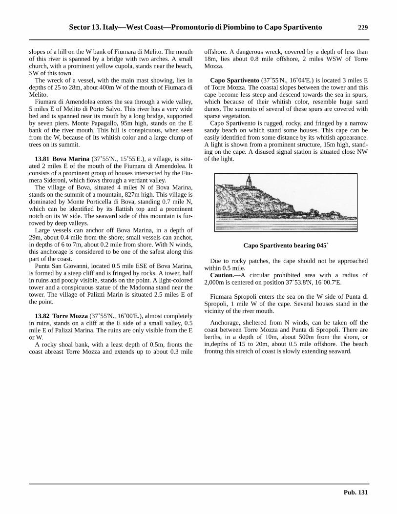
Sector 13. Italy—West Coast—Promontorio di Piombino to Capo Spartivento 229
ane
thispurs,ndwith
wn bece.d-W
hed
dithe
heareorch
slopes of a hill on the W bank of Fiumara di Melito. The mouthof this river is spanned by a bridge with two arches. A smallchurch, with a prominent yellow cupola, stands near the beach,SW of this town.13.80 The wreck of a vessel, with the main mast showing, lies indepths of 25 to 28m, about 400m W of the mouth of Fiumara diMelito.13.80 Fiumara di Amendolea enters the sea through a wide valley,5 miles E of Melito di Porto Salvo. This river has a very widebed and is spanned near its mouth by a long bridge, supportedby seven piers. Monte Papagallo, 95m high, stands on the Ebank of the river mouth. This hill is conspicuous, when seenfrom the W, because of its whitish color and a large clump oftrees on its summit.
13.81 Bova Marina (37˚55'N., 15˚55'E.), a village, is situ-ated 2 miles E of the mouth of the Fiumara di Amendolea. Itconsists of a prominent group of houses intersected by the Fiu-mera Sideroni, which flows through a verdant valley.13.81 The village of Bova, situated 4 miles N of Bova Marina,stands on the summit of a mountain, 827m high. This village isdominated by Monte Porticella di Bova, standing 0.7 mile N,which can be identified by its flattish top and a prominentnotch on its W side. The seaward side of this mountain is fur-rowed by deep valleys.13.81 Large vessels can anchor off Bova Marina, in a depth of29m, about 0.4 mile from the shore; small vessels can anchor,in depths of 6 to 7m, about 0.2 mile from shore. With N winds,this anchorage is considered to be one of the safest along thispart of the coast.13.81 Punta San Giovanni, located 0.5 mile ESE of Bova Marina,is formed by a steep cliff and is fringed by rocks. A tower, halfin ruins and poorly visible, stands on the point. A light-coloredtower and a conspicuous statue of the Madonna stand near thetower. The village of Palizzi Marin is situated 2.5 miles E ofthe point.
13.82 Torre Mozza(37˚55'N., 16˚00'E.), almost completelyin ruins, stands on a cliff at the E side of a small valley, 0.5mile E of Palizzi Marina. The ruins are only visible from the Eor W.13.82 A rocky shoal bank, with a least depth of 0.5m, fronts thecoast abreast Torre Mozza and extends up to about 0.3 mile
offshore. A dangerous wreck, covered by a depth of less th18m, lies about 0.8 mile offshore, 2 miles WSW of TorrMozza.
13.82 Capo Spartivento (37˚55'N., 16˚04'E.) is located 3 miles Eof Torre Mozza. The coastal slopes between the tower andcape become less steep and descend towards the sea in swhich because of their whitish color, resemble huge sadunes. The summits of several of these spurs are coveredsparse vegetation.13.82 Capo Spartivento is rugged, rocky, and fringed by a narrosandy beach on which stand some houses. This cape caeasily identified from some distance by its whitish appearanA light is shown from a prominent structure, 15m high, staning on the cape. A disused signal station is situated close Nof the light.
13.82 Due to rocky patches, the cape should not be approacwithin 0.5 mile.13.82 Caution.—A circular prohibited area with a radius of2,000m is centered on position 37˚53.8'N, 16˚00.7'E.
13.82 Fiumara Spropoli enters the sea on the W side of PuntaSpropoli, 1 mile W of the cape. Several houses stand invicinity of the river mouth.
13.82 Anchorage, sheltered from N winds, can be taken off tcoast between Torre Mozza and Punta di Spropoli. Thereberths, in a depth of 10m, about 500m from the shore,in,depths of 15 to 20m, about 0.5 mile offshore. The beafrontng this stretch of coast is slowly extending seaward.
Capo Spartivento bearing 045˚
Pub. 131


231
14.Italy—The Strait of Sicilia and Malta Channel
istribution).
Pub. 131
14.0Additional chart coverage may be found in NGA/DLIS Catalog of Maps, Charts, and Related Products (Unlimited DSECTOR14 — CHART INFORMATION


233
hel-be-d.
an
ofsr-inS
ish,allofseut
he
, iseceerse
so
off
SECTOR 14
ITALY—THE STRAIT OF SICILIA AND MALTA CHANNEL
14.0 Plan.—This sector describes the W and S coasts of Sicilia(Sicily), the Strait of Sicilia, and Malta Channel including theislands and banks S of Sicilia. The descriptive sequence is SEfrom Skerki Bank to the Maltese Islands, S from Capo SanVito to Capo Granitola, and then SE to Capo Passero. Theother islands and banks are described with their adjacentcoasts.
Off-lying Banks
14.1 Skerki Bank (37˚50'N., 10˚55'E.) is centered about35 miles NNW of Ras at Tib (Cap Bon), which is described inparagraph 8.14, and extends for about 35 miles in a generalNE-SW direction. The bottom of this extensive bank consistsof coral, rock, sand, and shells.14.1 Sylvia Knoll, lying at the NE end of Skerki Bank, has a leastdepth of 12m. Biddlecombe Reef, with a depth of 6.7m, liesabout 7 miles SW of Sylvia Bank.14.1 Locust Patch, with a depth of 12m, lies 5 miles W of KeithReef. Hecate Patch, with a depth of 7m, lies about 2 miles S ofLocust Patch.14.1 Keith Reef is the shallowest patch on the bank. It lies nearly2 miles SSE of Biddlecombe Reef and is composed of compactlimestone. A small rock, covered with weed, lies at the centerof this reef and has a depth of 0.3m. It is usually marked bybreakers. It is reported that the remains of a stranded wreck liein the vicinity of this rock. In addition, two dangerous wreckslie at the NE end of the rock.14.1 Caution.—The currents in the vicinity of Skerki Bank areirregular in both rate and direction. The shoal patches are notalways marked by breakers. Vessels should exercise cautionand give the dangers on this bank a wide berth.
Isola di Pantellaria
14.2 Isola di Pantellaria(36˚48'N., 12˚00'E.), a mountain-ous and volcanic island, lies 46 miles ESE of Ras at Tib (CapBon). Montagna Grande, 834m high, dominates this island.The coastal currents in the vicinity of the island vary in direc-tion and velocity with the wind force and direction.14.2 Pantellaria (36˚50'N., 11˚56'E.) (World Port Index No.40360), a small craft harbor, lies at the NW end of Isola di Pan-tellaria and is protected by breakwaters. Vessels may onlyanchor in one of the six designated anchorage areas after obt-aining permission from the harbormaster on VHF channel 16.The harbor is used mainly by yachts and fishing boats.14.2 Punta San Leonardo(36˚50'N., 11˚55'E.), a low point, islocated at the NW end of the island, close E of Pantellaria. Alight is shown from a structure, 3m high, standing on this point.A cemetery, situated 0.5 mile SE of this point, is conspicuous.14.2 Punta Bue Marino, low and dark, is located 0.5 mile ENE ofPunta San Leonardo. Two coves lie close E of this point.14.2 Punta Caruscia is located 1 mile ESE of Punta Bue Marino.Ancoraggio di Campobello lies between Punta Caruscia and
Punta Pozzolana, 0.8 mile ESE, and affords anchorage, stered from W winds. Small vessels can obtain anchoragetween these two points, in a depth of 29m, rock and weeLocal knowledge is required.
14.3 Punta Spadillo (36˚48'N., 12˚00'E.), located 1.2miles E of Punta Pozzolana, is the rocky NE extremity ofpromontory on the W side of which is a cove. A light is showfrom a structure, 21m high, standing on this point.
14.3 Punta Tracino, marked by a light, is located 2.5 miles SEPunta Spadillo. It is high and rocky. A small islet, almost ahigh as the point itself, lies close off the point and is sumounted by a small pillar. Anchorage can be obtained,depths of 20 to 22m, sand with patches of rock, about 300mof this small islet, but local knowledge is required.14.3 Punta Limarsi, located 4 miles SSW of Punta Tracino,rugged and rocky. A light is shown from a structure, 6m higstanding on this point. Anchorage can be obtained by smvessels in Porto Dietro Isola, a slight indentation, close NEPunta Limarsi. A good berth, in depths of 22 to 27m, coarsand with some rock, lies about 320m NE of Punta Limarsi, blocal knowledge is required.14.3 Punta Polacca is located 2.3 miles W of Punta Limarsi. Tcoast between is high and rocky.14.3 Punta Tre Pietre, located 2.5 miles NW of Punta Polaccathe SW extremity of a promontory which is fronted by thresmall above-water rocks. A light is shown from the W entranpoint of Porto di Scauri, which lies 0.3 mile E of Punta TrPietre. Anchorage can be obtained, in a depth of 16m, coasand and rock, about 200m S of the light.14.3 Caution.—A fishing and anchoring prohibited area extendup to 6 miles seaward from the vicinity of Punta Bue MariPoint and may best be seen on the chart.14.3 A prohibited area, best seen on the chart, is located closePunta del Gadir about 1 mile SE of Punta Spadillo.
Punta Spadillo Light
Pub. 131

234 Sector 14. Italy—The Strait of Sicilia and Malta Channel
e.e
tgiantsisd0mtaor
, off
ofo),
E
esn,
o
asm
8N
iln.
theino
, offil
14.3 A storage tanker (Tazerka) is moored in the vicinity of(36˚36'N., 11˚41'E.), which is situated about 17 miles SW ofPunta Tre Pietre.
Isole Pelagie
14.4 Isole Pelagie(35˚52'N., 12˚52'E.), a group of threevolcanic islands, consists of Isola di Linosa, Isola diLampedusa, and Isola Lampione. The group is Italian and lieson the African continental shelf, SSE of Isola di Pantellaria.14.4 Isola di Linosa (35˚52'N., 12˚52'E.), the NE island of thegroup, lies 66 miles SE of Isola di Pantellaria. Monte Vulcano,195m high, stands on the S side of the island; Monte Rosso,186m high, stands 0.5 mile N of Monte Vulcano; and Monte diPonente, 107m high, stands on the W side of the island.14.4 A rocky patch, with a least depth of 3.9m, lies about 0.2 mileE of Punta Calcarella, the SE extremity of the island, and is theonly off-lying danger. A depth of 14m lies about 0.2 mile off-shore, on the N side of the island.14.4 A light is shown from a prominent structure, 17m high,standing on Punta Beppe Tuccio, the NE extremity of the is-land. Another light is shown from a structure, 6m high, stand-ing close NE of Punta Arena Bianca, the SW extremity of theisland.
14.5 Isolotto Lampione (Scoglio Lampione) (35˚33'N.,12˚19'E.), a small island, lies 32 miles SW of Isola di Linosa. Itis uninhabited, 40m high, and has a flat top with cliffy sides.When seen from the NW, this island appears like a wall risingfrom the sea. A light is shown from a structure, 6m high, stand-ing on the W side of the island.14.5 Isola Lampedusa (35˚30'N., 12˚36'E.), the largest and Sisland of the group, lies 10 miles ESE of Isola di Lampione.This island is flat-topped and barren. Monte Albero Sole, 133mhigh, stands on its NW side and is prominent. There are noclose off-lying dangers.14.5 A light is shown from a structure, 19m high, standing onCapo Grecale, the NE extremity of the island. Two large mastsare situated close W of the light. A marine farm, marked by alighted buoy, has been established off the entrance to CalaCreta about 1 mile S of Capo Grecale.14.5 A light is also shown from a structure, 6m high, standing onCapo Ponente, the SW extremity of the island. A prominentradio mast stands on a hill, 0.4 mile E of the light.
14.6 Lampedusa(35˚30'N., 12˚36'E.) (World Port IndexNo. 40380), the capital of the island, is situated on its SE sidThis small town is fronted by a harbor which consists of threcoves. It is open to the S and is entered between Punta Guiand Punta Maccaferri, 0.2 mile E. Both of these entrance poiare marked by lights. A mole protects the inner harbor whichonly suitable for small craft with lengths less than 30m andrafts up to 3m. Small coasters and fishing vessels, up to 8in length, can anchor and moor, stern-to-shore, off PunMaccaferri. The harbor can be contacted on VHF channel 1416. Vessels can anchor, in a depth of 14m, sand and weedthe harbor entrance.
The Maltese Islands
14.7 The Maltese Islands, an extensive group, consistthree main islands, Ghawdex (Gozo), Kemmuna (Cominand Malta, and several islets which lie centered 90 miles ENof Lampedusa.14.7 Caution.—Oil drilling rigs may frequently be encounteredbetween this group of islands and the S coast of Sicilia.
14.8 Ghawdex(Gozo) (36˚03'N., 14˚15'E.), the NW islandin the group, rises in high cliffs to a plateau. Several villagstand around the island and Victoria (Rabat), the largest towis situated near its center.14.8 Ras San Dimitri (36˚04'N., 14˚11'E.), a high and steep-tpromontory, forms the NW extremity of the island. A light isshown from a structure, 21m high, standing 1.7 miles E of RSan Dimitri. This light structure surmounts Gordan, 161high, a prominent hill.14.8 From Ras San Dimitri, the coast trends generally SE formiles to Ras il Qala, the SE extremity of the island. Thecoast is generally free of off-lying dangers.14.8 From Ras il Qala, the coast trends SW for 4 miles to RasNewhela, the S extremity of the island. Gebel tal Halfa, aislet, lies 0.3 mile WSW of Ras il Qala and is 22m highNumerous above-water rocks encumber this stretch ofcoast and depths of 18m or less extend S across North ComChannel to Comino (Kemmuna).14.8 Temporary anchorage can be taken, in a depth of 18m, sandthe small harbor of Mgarr, which lies 1.5 miles WSW of Ras
Punta Beppe Tuccio Light
Capo Grecale Light
Pub. 131

Sector 14. Italy—The Strait of Sicilia and Malta Channel 235
fftue
il-ls into
seiswthe
del-eer,g,of
St.anden
edisw-lect
ileee
s-ilhes-il
isallw
intr.ofmth
’s
end
eenifleone.
Qala. This anchorage is exposed to E winds which blow throughNorth Comino Channel and is also open to the S and SW.14.8 From Ras il Newhela, the coast trends NW for 4 miles to Rasil Wardija, and then 2 miles N to Ras San Dimitri. This part ofthe coast rises in high cliffs from the sea, is steep-to, and ismostly free of dangers.14.8 Caution.—A former explosive dumping area, 2 miles indiameter, lies about 3 miles N of Gozo.14.8 A submarine cable area extends S from Gozo to Comino.
14.9 Comino(Kemmuna) (36˚01'N., 14˚20'E.) a small is-land, lies nearly midway between Gozo and Malta and dividesthe channel into the North Comino Channel (Il Fliegu taGhawdex) and the South Comino Channel (Il Fliegu ta Malta).Passage through these two channels is restricted to non-commercial vessels and other vessels of 50m or less in length.14.9 Kemmunett, a small rocky islet, is located close W of Com-ino (Kemmuna), and several above-water rocks lie betweenthem. The NW extension of shoal water surrounding the islet ismarked by a lighted beacon.14.9 The currents in the passages on both sides of Comino areirregular in direction, sometimes setting against a strong wind,but their rates are usually less than 1 knot.14.9 Sultan Rock, with a depth of 6m, is the E rock of Skoll tal-Abjad tal-Prosha, a group of dangers with a least depth of5.5m, which lie about 0.2 mile E of the SE end of Comino.14.9 Anchorage, with local knowledge, can be taken, in depths of16 to 21m, in Il Mats, a small bay, lying on the W side of theisland.14.9 Caution.—A submarine cable area extends S from Cominoto Malta.
14.10 Malta(35˚55'N., 14˚25'E.), the S and largest island ofthe group, lies close S of Comino and 2.5 miles SE of Gozo.Valletta, the largest port and capital, is situated on the E side ofthe island and is also a tourist resort.
Ponta tal Cirkewwa (Ponta tal Marfa) (35˚59'N., 14˚20'E.),the NW extremity of Malta, is a low point backed by high andsloping land. Shoals and above-water rocks extend up to about0.2 mile N of this point.14.10 A breakwater extends about 300m from Ponta tal Marfa. Aro-ro ferry terminal berth, with a depth of 5m alongside, issituated at the head of this breakwater. A conspicuous hotel,visible from all sides of the promontory, stands 0.2 mile E ofPonta tal Marfa.14.10 The coast from Ponta tal Marfa slopes NE for 2 miles toPonta ta l’Ahrax, the N extremity of the island, and is indentedby several small bays.14.10 From Ponta ta l’Ahrax, the coast then trends SE for 13 milesto Ponta taz Zonqor, the NE extremity of island. From N to S,this stretch of coast is broken by Mellieha Bay, St. Pauls Bay,Salina Bay, St. Georges Bay, St. Julians Bay, and Valletta Har-bor.
14.11 Sikka il-Bajda (Balls Bank) (36˚00'N., 14˚24'E.),with depths of 10.4 to 20m, lies 2 miles E of Ponta ta l’Ahrax.This shoal should be avoided.14.11 From Ponta ta l’Ahrax to Dahlet ix-Xilep, 0.7 mile SE, thecoast consists of high broken cliffs with rocks below them,
especially near the latter point. Dahlet ix-Xilep is a high blusurmounted by a conspicuous church. A prominent stastands close to the edge of the cliff.14.11 Mellieha Bay is entered between Dahlet ix-Xilep and RasGriebeg, 1 mile SSE. There are submerged rocks and shoathe bay, but it affords good anchorage during offshore windsvessels with local knowledge.14.11 Gzejjer Selmunet (St. Pauls island), an islet, lies cloinshore, about 0.9 mile ESE of Ras il-Griebeg. This isletdivided into two parts which are joined by a low and narroisthmus. A remarkable statue of Saint Paul stands onsummit, 40m high, of the higher and W part.
14.11 Saint Pauls Bay (Il Bajja ta’ San-Pawl il-Bahar) is enterebetween Gzejjer Selmunet and Ras il-Qawra, 1 mile SE. Smun Palace, 23m high, stands on a hill, 1 mile WSW of thstatue of Saint Paul. Several prominent oil tanks, painted silvstand 0.4 mile SE of the palace. A concrete quay, 53m lonwith depths of 2.1 to 3.4m alongside, is situated 0.6 mile SEthe palace.14.11 A designated approach channel has been established inPaul’s Bay and may best be seen on the chart. Anchoringfishing are prohibited in this channel. Marine farms, best seon the chart, lie on the N side of the channel.14.11 Anchorage, sheltered from offshore winds, can be obtainwithin the bay, in depths of over 18m. The holding groundgood, except on a rocky patch lying near the entrance. Hoever, in depths of less than 20m, care should be taken to sea sandy spot.
14.11 A spit, with a least depth of 9.4m, extends about 0.5 mENE from Ras il-Qawra. A lighted buoy lies 0.2 mile NE of thextremity of the spit. Diving takes place in the vicinity of thbuoy and it should be given a wide berth.14.11 Salina Bay is entered between Ras il-Qawra and RaGhallis, 0.4 mile SSE. A salt works and a hotel stand at thead of this bay. A prominent tower stands close SE of RaGhallis.14.11 The coast from Ras il-Qawra to Valletta, 5 miles SE,indented by numerous bays which are suitable only for smcraft with local knowledge. Above-water rocks and shalloshoal patches extend up to 0.3 mile seaward of the coast.
14.12 Saint George’s Point (36˚56'N., 14˚29'E.), sur-mounted by a prominent tower, is the N entrance point of SaGeorge’s Bay. A radio mast stands 0.4 mile SW of the towe14.12 Outer St. George Rock, with a depth of 9.1m, is the Nseveral rocks lying on a spit which extends 0.7 mile NNE frothe vicinity of St. George’s Point. Spinola Rock, with a depof less than 1.8m, lies near the extremity of the spit.14.12 St. Julian’s Point, located 0.7 mile SSE of Saint GeorgePoint, is the SE entrance point of St. Julians Bay.14.12 Caution.—Anchoring and fishing prohibited areas lie in thapproaches to Saint George’s Bay and Saint Julian’s Bay amay best be seen on the chart.14.12 Vessels should exercise caution when off the coast betwSt. Paul’s Bay and Valletta Harbors due to the Pembroke RRange areas. A red flag will be displayed from the towerSaint George’s Point when firing is taking place on the rang
Pub. 131

236 Sector 14. Italy—The Strait of Sicilia and Malta Channel
nce
,
aym
cur-
f
c-ad-
to
g-
g-
mnd
is
Valleta Harbors (35˚54'N., 14˚31'E.)
World Port Index No. 40330
14.13 Valletta Harbors consists of two natural bays, each ofwhich is comprised of several smaller bays or creeks.14.13 Marsamxett, the N harbor, is entered between Tigne Pointand St. Elmo Point (Il-Ponta Sant’ Jiermu) and consists ofSliema Creek (Id-Dahla Ta’ Tas-Sliema), Lazaretto Creek,Msida Creek, and Pieta Creek. It serves as a quarantineanchorage and a mooring area for naval vessels. The naval in-stallations consist mainly of small craft repair facilities. Along-side berthing space is limited and there is little or no commer-cial activity in Marsamxett, except for an extensive yachtharbor and an oil service base.
14.13 Grand Harbor, the S bay and main harbor, is entered betweenbreakwaters which extend from St. Elmo Point and RicasoliPoint. It consists of Bighi Bay, Kalkara Creek, Dockyard Creek(Id-Dahla Tad Dockyard), French Creek, and Newport. Thisharbor contains the major naval facilities and the commercialport. Most of the commercial facilities are concentrated inNewport. Within this harbor, vessels work cargo into lightersfrom Mediterranean moorings. Dockyard Creek and FrenchCreek are mostly reserved for naval vessels. The approaches toGrand Harbor present no navigational difficulties.
14.13 Winds—Weather.—The Grecale, a strong NE wind,frequently sets up a rough sea and swell in the harbor entraand approaches, and may make entry hazardous.14.13 Tides—Currents.—The tidal range is almost negligiblebeing only 0.3m at springs.14.13 Marrobbio surges or waves occur along this coast and mcause the water level in Valletta to fall rapidly as much as 0.3with no warning. These surges may also cause destructiverents in the harbor.14.13 Depths—Limitations.—The outer entrance has depths o21 to 23m. The harbor fairway has depths of 9 to 23m.14.13 Grand Harbor is the principal port of entry and handles pratically all traffic, except tankers carrying petroleum withflashpoint below 22.5˚C. All other petroleum products, incluing LPG and explosives, are handled at Marsaxlokk Bay.14.13 Parlatorio Wharf (Navy) can accommodate tankers up198m in length and 10.7m draft.14.13 Deep Water Wharf is 490m long, with a depth of 10m alonside.14.13 Flagstone Wharf is 217m long, with a depth of 12m alonside.14.13 Crucifix Wharf, an extension of Deep Water Wharf, is 240long with a depth of 10m alongside. It is used by passenger acruise vessels.14.13 Gun Wharf is 92m long with a depth of 7.4m alongside. Itused by ferries.
Valleta from ESE
Pub. 131

Sector 14. Italy—The Strait of Sicilia and Malta Channel 237
art5tta
andin-
alin
in
thel-nd.ay
eneralof
m,r.to
ileoff-
la
ofof
alis
nta
,35
the
nd
icht, 2les
of, it
14.13 Laboratory Wharf and Magazine Wharf have a combinedlength of 440m with depths of 12.2 to 15m alongside. Bulkvessels up to 80,000 dwt and 13m draft can be accommodated.14.13 There are also facilities for container and ro-ro vessels. Aquay, with 240m of berthing space, is situated in Marsaxlokkand is used by oil exploration service vessels.14.13 In addition, there are extensive repair facilities and drydockswhich can accommodate vessels up to 300,000 dwt.14.13 Aspect.—A light is shown from a structure standing on St.Elmo Point (Il-Ponta Sant’ Jiermu). An outer approach lightedbuoy is moored about 1.2 miles NE of the light.14.13 Lights mark the seaward ends of the breakwaters whichprotect the entrance to Grand Harbor.14.13 Pilotage.—Pilotage is compulsory for vessels over 500 grt.Pilots can be contacted on VHF channel 12, 14, or 16 and gen-erally board in the vicinity of the outer approach lighted buoyin good weather and near the harbor entrance in bad weather.14.13 Vessels should send an ETA at least 2 hours in advance andwhen 5 miles from the outer approach lighted buoy. Vesselsshould also send their ETA to the Port Operations Manager 48hours in advance through Malta (9HD).14.13 Signals.—The following traffic signals, shown from thePalace Tower and Fort Saint Angelo, do not apply to smallcraft or to vessels of less than 500 grt plying exclusively in thewaters of Malta, providing such vessels or craft do not obstructother vessels maneuvering in accordance with these signals:
1. A red square flag by day or four red lights, shownvertically, at night indicate that no vessels can enter, leave, orobstruct the entrance channel to Grand Harbor.
2. A red diamond shape by day or a red light over awhite light at night indicate that vessels may enter but notleave Grand Harbor.
3. Two red diamond shapes, shown vertically, by day ortwo red lights, shown vertically, at night indicate that vesselsmay leave but not enter Grand Harbor.
4. A blue triangular flag indicates that it is unsafe forboats and low powered craft to leave Grand Harbor orMarsamxett Harbor.
14.13 Vessels underway, with a pilot aboard, shall display Interna-tional Code Flag H, by day, or a white light above a red light atnight.14.13 Vessels maneuvering, with a pilot aboard, will also displaythe following additional signals:
1. International Code numeral pennant 2 by day, or twowhite lights, shown vertically, at night indicate that thevessel is maneuvering to anchor or berth and must not beobstructed or passed closely.
2. International Code Flag G at the dip by day or threelights (red, white, red), shown vertically, at night indicatethat the vessel is getting underway to proceed to sea andmust not be overtaken or passed closely.
3. International Code numeral pennant 2 over the an-swering pennant by day or three lights (white, red, white),shown vertically, at night indicate that the vessel has stoppedmaneuvering and may be passed or overtaken.
14.13 Vessels carrying explosives and awaiting berthing instruc-tions in or near the approaches to a harbor shall display a blackball above International Code Flag B by day, or three lights(white, red, red), shown vertically, at night.
14.13 A storm signal, consisting of a single black ball by day orred light by night, may be shown from the palace and FoSaint Angelo. This storm warning indicates a wind of forceor greater is expected between 010˚ and 120˚ in ValleHarbor.14.13 A scend warning is issued subsequent to a gale warningis promulgated until the sea has fallen to a less than 1.5mcrease.14.13 Anchorage.—There are numerous mooring berths for navvessels in both harbors. Merchant vessels usually moorMarsa Creek, Grand Harbor.14.13 Caution.—Several anchorage prohibited areas lie withValletta Harbors and may best be seen on the chart.14.13 Several submarine cables, which may best be seen onchart, extend seaward from the vicinity of St. Elmo Point (IPonta Sant’ Jiermu) and extend N along the coast of the isla14.13 Several submarine pipelines lie within the harbors and mbest be seen on the chart.
14.14 Ponta taz Zonqor(35˚52'N., 14˚35'E.), the low-lyingNE point of Malta, is located 3 miles SE of Ricasoli Point, thSE entrance point of Valletta Harbors. It is marked by a stobeacon that has been reported to be difficult to identify. Seveprominent radio masts are reported to stand close SERicasoli Point.14.14 Della Larga Forca, a detached bank with a depth of 9.1lies about 0.4 mile offshore, 1 mile NNW of Ponta taz Zonqo14.14 The coast extends S for 3 miles from Ponta taz ZonqorPonta ta Delimara and is indented by several shallow bays.14.14 Sikka Zonqor, a detached 8.5m patch, lies about 0.4 mESE of Ponta taz Zonqor. Outer Munxar Rock, with a depth9.7m, is the E danger in this vicinity and lies about 1 mile ofshore, 1.5 miles ESE of Ponta taz Zonqor.
14.14 Ponta ta Delimara (35˚49'N., 14˚34'E.), the NE entrancepoint of Marsaxlokk, is located at the S end of a peninsuwhich terminates in a yellow cliff, 15m high. A light is shownfrom a tower, 24m high, standing close N of the S extremitythe peninsula. Two prominent radio masts stand close SSEthe light. An islet, 4m high, lies close S of the point. Severrocks lie on the shore bank which extends S of this islet andmarked by a lighted buoy moored about 0.2 mile SSE of Pota Delimara.14.14 Hurd Bank (35˚53'N., 14˚45'E.), formed of coral and sandlies 10 miles ENE of Ponta taz Zonqor and has depths ofand 44m.14.14 Caution.—A dumping ground, 0.4 mile in diameter, liesclose N of Della Larga Forca and may best be seen onchart.14.14 A submarine pipeline extends 0.5 mile NE from a point othe shore, 1 mile SE of Ricasoli Point. Anchoring is prohibitein the vicinity of this pipeline.14.14 Commercial vessels may not enter the restricted area, whmay best be seen on the chart, lying adjacent to the coasmiles N of Ponta ta Delimara. This area extends up to 1.5 mifrom the shore.14.14 A current setting S has often been observed off the E endMalta. During N winds, its rate increases and on occasionhas been experienced as far off as Hurd Bank.
Pub. 131

238 Sector 14. Italy—The Strait of Sicilia and Malta Channel
elng
5
,ndith
ods.ort
urd35act
tain
ll
ay.
a.aserofep
endntriast,
.5
-sisralon
Sm
ir-S
ay,
Marsaxlokk (Marsa Scirocco)(35˚49'N., 14˚33'E.)
World Port Index No. 40340
14.15 Marsaxlokk is formed by an extensive bay which isentered between Ponta ta Delimara and Ponta ta Benghajsa, 1mile WSW. The small towns of Marsaxlokk and Birzebbugaare situated, respectively, on the N and W sides of the bay.14.15 Tides—Currents.—The tidal rise is negligible, being only0.3m at springs.14.15 A very strong current sometimes sets NE about 1 mile off theentrance to the bay. It is caused apparently when the SE windslast several days, but usually ceases after two days of W winds.14.15 Depths—Limitations.—Saint Lucien Oil Terminal, lyingclose SE of Fort Saint Lucien, consists of a fueling dolphin andseveral mooring buoys. Tankers are generally limited to 177min length and 9.6m draft.14.15 A new container facility includes Terminal 1 South Quay,200m long, with a depth of 8m alongside; Terminal 1 WestQuay, 168m long, with a depth of 9.8m alongside; Terminal 1North Quay, 640m long, with a depth of 13.8m alongside;Terminal 2 West Quay, 460m long, with a depth of 16.5malongside; Terminal 2 North Quay, 500m long, with a depth of17m alongside; and Terminal 2 East Quay, 435m long, with adepth of 12.8m alongside.14.15 The inner side of the breakwater, with depths of 14 to 18malongside, can accommodate bulk vessels and tankers up to80,000 dwt.14.15 A bulk terminal is being constructed (1994) within the portwhich will accommodate vessels up to 200,000 dwt.
14.15 Aspect.—A breakwater extends 0.4 mile NE from Ponta taBenghajsa and is marked by a light at its head. A lighted buoyis moored about 0.3 mile NE of the head of this breakwater.14.15 Benghjsa Reef, with a least depth of 5.5m, lies near the SEend of a spit which extends 1 mile SE from Ponta ta Benghajsa.The extremity of this spit is marked by a lighted buoy mooredabout 1.2 miles S of Ponta ta Delimara. Benghisa Patch, with aleast depth of 5.2m, lies on the spit, about 0.3 mile offshore.14.15 Fort St. Lucien, a prominent building, stands 1.2 miles NWof Ponta ta Delimara. A conspicuous church is situated 0.9mile NNE of this fort. Hajaro Rock lies close SE of the fort andis marked by a beacon.14.15 A conspicuous water tower stands close to Fort Benghajsa,which stands on the S side of Ponta ta Benghajsa, the W en-trance point. Another conspicuous water tower stands 0.5 mileN of Fort Benghajsa and a prominent church is situated 0.7mile NNW of it. Several radio masts stand NNW of FortBenghajsa.14.15 A signal station is situated at Fort Tas-Silg, which stands 1.3miles N of Ponta ta Delimara.14.15 Capuchin Convent, a large building with a conspicuouswhite house standing 0.2 mile WSW of it, is situated on aridge, 0.8 mile NNW of Fort Saint Lucien. However, thisconvent cannot be seen from the approaches to the bay.14.15 Zetjun Church, with a conspicuous red dome, stands 0.7 mileN of the convent.14.15 Pilotage.—Pilotage is compulsory for vessels over 500 grtThe pilot boards 0.7 mile S of Ponta ta Delimara Light.
14.15 Vessels should contact Valletta Port Control on VHF chann12 or 16 at least 2 hours before arrival at the pilot boardiposition, stating:
1. ETA at pilot boarding position.2. Last port of call3. LOA.4. Breadth.5. Gross tonnage.6. Net tonnage.7. Draft.8. Freeboard.9. Agent.10. Cargo.11. Vessel flag.
14.15 Vessels should call Valletta Port Control again when withinmiles of the pilot boarding position.14.15 Anchorage.—The bay, protected from all but S windsaffords good holding ground. The bottom consists of fine saand mud lying between hard patches which are covered wweeds. Vessels unable to enter Valletta Harbors during periof strong NE winds, shelter here to await favorable weather14.15 Small vessels usually anchor off the E shore, ESE of FSaint Lucien.14.15 Large vessels sometimes anchor outside the port at HBank, about 11 miles E of Marsaxlokk. There are depths ofto 40m, but this anchorage is not sheltered, although contwith the harbor may be maintained.14.15 Caution.—A wave recorder buoy is moored close S of Ponta Delimara. Vessels should move with great caution whenthe vicinity of this buoy and should avoid contact with it at atimes.14.15 Several unlighted mooring buoys are situated within the b
14.16 Ponta ta Benghajsa(35˚49'N., 14˚33'E.), the SWentrance point of Marsaxlokk bay, is the SE point of MaltFrom here, the coast curves generally NW for 12 miles to Rir Raheb, then N for 5 miles to Ponta tal Marfa. Deep watextends close inshore along most of this rugged sectioncoast, which is mostly formed of abrupt rock and sheer, stecliffs.14.16 Il-Minkba is located 3.2 miles W of Ponta ta Benghajsa. Thcoast between is cliffy, but these cliffs are more precipitous alighter in color than those farther to the W. Several promineradio masts stand 0.5 mile N and 0.7 mile E of Il-Minkba. Tortal Wied Zurrieg, a square tower 12m high, stands on the co1 mile W of Il-Minkba.14.16 Hamrija Bank, with depths of 5.5 to 18.6m, extends up to 0mile from the shore, 2 miles W of Il-Minkba.14.16 Ix-Xaqqa, a small cove, is entered 3 miles WNW of IlMinkba. A continuous wall of steep cliffs, above which standthe highest part of the island, extends 6 miles NW from thcove to Ras ir-Raheb. A disused signal station, with seveconspicuous radio masts standing 0.5 mile SE, is situatedthe coast, 2.3 miles NW of Ix-Xaqqa.14.16 Fomm-ir-Rih, a bay, is entered close N of Ras ir-Raheb. Itsside is faced with a prominent perpendicular cliff, 37 to 52high.14.16 Ghajn Tuffieha, a bay, is entered 1.5 miles N of RasRaheb. Il Qarraba, a prominent rocky promontory, forms theentrance point. A watch tower stands at the head of this b
Pub. 131

Sector 14. Italy—The Strait of Sicilia and Malta Channel 239
denre
,Aisntithelsraft
Sisnt
all
llt beed
t.ally
r
ce.in
.s
as.ega
er-
16rth.F
r,
les
ed
isande,
ithd a
ith
a
and several conspicuous hotel buildings stand close E and 0.2mile N of it.
14.17 Filfla(35˚47'N., 14˚25'E.), a rocky islet, lies 2.5 milesoffshore, 7 miles WSW of Ponta ta Benghajsa. This islet issurrounded by above and below-water rocks and its sides areformed by cliffs up to 59m high.14.17 Stork Rock, with a least depth of 6.7m, lies about 0.5 mile Sof Filfla.14.17 Small craft, seeking shelter from E winds, can find indiffer-ent anchorage within the bays along the W coast of the island,but these bays are too small to afford any protection for ocean-going vessels.14.17 Caution.—A prohibited area, with a radius of 1 mile, iscentered on Filfla.14.17 A countercurrent, which sets W at 0.5 to 1 knot, exists up toabout 0.5 mile offshore along the S coast of Malta with freshW or NW winds.
West Coast of Sicilia and Isole Egadi
14.18 Capo San Vito(38˚11'N., 12˚44'E.), low and flat, isthe NW extremity of Sicilia and is frequently used as a landfallby vessels approaching from the W. The cape is the E ex-tremity of a flat projection, of which the W side is almost ver-tical and the N side is formed by a steep slope. A light is shownfrom a structure, 40m high, standing on the cape. Torre Roc-cazzo, a prominent single story building, is situated 0.5 mileSSW of the light. During bad weather, heavy breakers are ex-perienced to the N of the cape and large vessels should notapproach within 1.5 miles.14.18 Anchorage can be obtained, in a depth of 12m, sand, SE ofthe light and NE of Torre Roccazzo. The holding ground isgood and the anchorage is safe, except during NE winds.14.18 The W part of Sicilia is generally mountainous with shortstretches of flat land and coastal plains. Extensive dunes fre-quently flank the coastal plains and rise gradually to regions ofwide plateaus.14.18 From Capo San Vito, the coast trends SW for 15 miles toTrapani, then 14 miles S to Marsala, and then 17 miles SE toCapo Granitola.14.18 Between Sicilia and Isole Egadi, the currents are strong attimes and set NE or SW with the NE current predominatingduring the summer.14.18 Punta del Saraceno, the NW extremity of a rounded prom-ontory, is located 6 miles SW of Capo San Vito.14.18 Punta Pizzolungo is located 5.5 miles SW of Punta del Sara-ceno. Secca Bonangia, a shoal with a depth of 1.8m, extends upto about 1.3 miles NE from a point, 0.4 mile N of PuntaPizzolungo.14.18 Isolotto Asinelli (38˚04'N., 12˚32'E.), a low and black rock,lies 1.5 miles W of Punta Pizzolungo. A light is shown from astructure, 6m high, standing on this rock.
14.19 Trapani (38˚01'N., 12˚30'E.) (World Port Index No.40150), a harbor protected by breakwaters, is the principal porton the W coast of Sicilia.14.19 Winds—Weather.—The harbor is exposed to all winds andis open to the W. In the spring, strong seasonal SE winds canmake entry hazardous.
14.19 Tides—Currents.—The tidal rise is very slight. Currentsare very weak, but the Marrobbio surges can cause sudfluctuations up to 0.6 to 0.9m in the water level, but they anot considered dangerous.14.19 Depths—Limitations.—The approach to Trapani is deepwith depths gradually shoaling to 14m off the W breakwater.fairway, 90m wide, leads into the inner harbor. The harborsubject to silting and a depth of 8.8m is maintained by frequedredging. The main quay has 800m of total berthing space wa depth of 7.9m alongside. There are facilities for bulk vessand pleasure craft. Vessels up to 202m in length and 7.8m dcan be accommodated.14.19 Aspect.—The harbor is protected by a breakwater on itsside. A monument, illuminated at night, stands close E of thbreakwater. A hospital is situated 0.5 mile S of the monumeand consists of several low buildings, with red roofs and a tchimney.14.19 Scolio Palumbo, marked by a light, is the E of two smaislets which lie in the approaches to the harbor and may besseen on the chart. The N side of the fairway channel is markby buoys.14.19 Isola Egadi is described below in paragraph 14.24.14.19 Pilotage.—Pilotage is compulsory for vessels over 500 grPilots can be contacted on VHF channel 12 or 16 and generboard about 1 mile W of the W breakwater.14.19 Regulations.—Departing vessels have the right of way ovevessels entering the port.14.19 Vessels must not stop within 0.3 mile of the harbor entran14.19 A Traffic Separation Scheme (TSS) has been establishedthe approaches to the port. The scheme is not IMO adopted14.19 Anchorage.—The roadstead is only free of strong windduring the summer.14.19 Vessels may anchor only in the charted anchorage areCircular Anchorage Areas A1 through A4 are located in tharea between Torre Nubla and Tramontana Point on LunIsland. Anchorage Area A3 is for use by ships carrying dangous cargo.
14.19 Vessels must contact the pilot station on VHF channelprior to anchoring to request assignment of an anchorage beVessels at anchor must maintain a listening watch on VHchannels 12 and 16.14.19 Caution.—It is dangerous to attempt to enter the harboduring S and W winds, without local knowledge.14.19 Vessels not bound for Trapani must remain at least 6 mioff the coast.14.19 An area on the sea floor NE of Trapani should be avoiddue to the presence of unexploded ordnance.
14.20 Punta Tramontana (37˚54'N., 12˚27'E.), located 7miles SW of Trapani, is the N extremity of Isola Grande. Thisland has many salt pans on it and a marsh lies between itthe mainland. Punta Scario, the NW extremity of Isola Grandis located 1.2 miles WSW of Punta Tramontana. A bank, wdepths of less than 9m, extends from Punta Scario, anlighted buoy marks its NW extremity.14.20 Between Trapani and Marsala, the coast is low and level wnumerous and extensive salt pans.14.20 Windmills, used for grinding salt and pumping water, arecommon characteristic of this area.
Pub. 131

240 Sector 14. Italy—The Strait of Sicilia and Malta Channel
n6.d,e.n-W
,pdi
ndn
en
edhethe
fognd
toce,out
aredrvere-
ofWeby
ahe
,
S
of
into
to
. A
Capo Boeo(Capo Lilibeo) (37˚48'N., 12˚25'E.), located 5.5miles S of Punta Scario, is low and surmounted by severalprominent buildings.
14.21 Marsala(37˚47'N., 12˚26'E.) (World Port Index No.40170), a small harbor, is located on the SW coast of Sicily. Itis protected by three breakwaters.14.21 Depths—Limitations.—The entrance is 200m wide. Thereis 490m of total commercial berthing space with depths of 4.5to 6.5m alongside. Vessels up to 140m in length and 5.6m draftcan be accommodated. There are facilities for small craft andyachts.14.21 Aspect.—Prominent landmarks in the town include the graydome of the cathedral and a 14-story building standing closeNW of it. Lights are shown from the heads of the breakwaters.14.21 Pilotage.—Pilotage is compulsory for vessels over 500 grt.Pilots can be contacted on VHF channel 12, 14, or 16 andboard about 1 mile from the harbor entrance.14.21 Anchorage.—Anchorage can be obtained, in a depth of11m, clay and weed, close outside the harbor, but local know-ledge is required.14.21 Caution.—The Marrobbio surges sometimes cause suddenand violent currents in this harbor.14.21 It is dangerous to enter the harbor during a SE gale.14.21 Vessels carrying noxious substances or dangerous or pol-luting cargo must maintain a minimum distance of 3 miles offthe coast between Marsala and Capo Granitola
14.22 Capo Feto(37˚40'N., 12˚31'E.), located 9 miles SE ofMarsala, is very low. The intervening coast and the cape arefringed with shoals, but they are mostly free of off-lying dan-gers. A light is shown from a prominent structure, 10m high,standing on the cape.14.22 Caution.—Submarine gas pipelines, which extend SW tothe coast of Tunisia, are landed at a point on the coast, 1 mileSE of Capo Feto. These pipelines may best be seen on thechart, and anchoring and fishing are prohibited in their vicinity.A historic wreck lies E of the cape within the charted pro-hibited area.
14.23 Mazara del Vallo (37˚39'N., 12˚35'E.) (World PortIndex No. 40180) lies 3 miles E of Capo Feto and is the onlyriver port in Sicilia. Two moles and a detached breakwaterprotect the entrance of this small harbor.14.23 Tides—Currents.—The tidal range is 0.3 to 0.5m.14.23 Depths—Limitations.—The harbor is mainly used by fish-ing vessels. There is 580m of total commercial quayage withdepths up to 5.6m. Vessels up to 90m in length and 5.5m draftcan be accommodated. A yacht marina lies 0.7 mile E of theharbor and is protected by breakwaters.14.23 Aspect.—The town is easily identified by the numerous andprominent cupolas and belfries of its churches. The most no-ticeable are the cupola of the cathedral which is 46m high andhas a grayish-red belfry, 48m high, standing close to it; achurch, with twin belfries, standing in the NW part of the town;and the belfry of a second church standing in the NW part oftown which is isolated and surmounted by a pyramid.14.23 A prominent white statue stands on the W side of the mouthof the river which flows through the town.
14.23 Pilotage.—Pilotage is compulsory for vessels of more tha500 grt. The port can be contacted on VHF channel 11 or 114.23 Anchorage.—Anchorage, in a depth of 10m, rock and weeis available, with local knowledge, SW of the harbor entranc14.23 Caution.—Due to the existence of submarine cables, an achoring and fishing prohibited area extends up to 6 miles Sfrom a point on the shore, 1 mile SE of the harbor.
Isole Egadi and Off-lying Banks and Shoals
14.24 Isole Egadi(37˚58'N., 12˚10'E.) is a group of islandsislets, and rocks which lie off the W coast of Sicilia. This grouconsists of three principal islands, Isola Favignana, IsolaLevanzo, and Isola Marettimo; the islets of Maraone aFormica; and the rocks Porcelli and Asinelli. The islands lie othe insular shelf which extends W from the coast betweTrapani and Marsala.14.24 The currents in the vicinity of the islands are mostly causby the wind. In the channel lying between the islands and tcoast of Sicilia, the currents are strong and set NE and SW;NE current predominates in the summer.
14.24 Strong W winds are sometimes preceded by a densearound Monte Falcone, which stands on Isola Marettimo, asometimes raise a rough sea even close to the islet.14.24 Caution.—A restricted area surrounds Isole Egadi. Duethe residual danger from obstructions and explosive ordnanvessels are warned not to anchor, dredge, trawl, or carryany bottom operations within this area.14.24 The sea area surrounding the archipelago has been decla marine nature reserve. Within the perimeter of the reseseveral zones have been established each with varyingstrictions. Contact local authorities for details.
14.25 Isola Marettimo (37˚58'N., 12˚03'E.), the W andmost mountainous island of the group, lies 18 miles WSicilia. Monte Falcone, 686m, stands 1.2 miles SE of its Nextremity. Marettimo, the only village, is situated on the E sidof the island and is fronted by a small boat harbor protectedtwo moles.14.25 The waters around Isola Marettimo have been declaredmarine nature reserve and numerous restrictions apply. Tlocal authorities should be contacted for more information.14.25 A light is shown from a prominent structure, 24m highstanding near the SW extremity of the island.14.25 Secca Cretazzo, with a depth of 5.7m, lies about 0.3 mileof the light and is usually marked by breakers.14.25 Caution.—A prohibited area, with a radius of 1 mile, liescentered 5 miles SSW of Punta Bassano, the SE extremityIsola Marettimo.14.25 Another prohibited area is reported (1998) to lie centeredposition 37˚46.5'N, 11˚58.5'E, with a radius of 1 mile, duethe presence of unexploded ordnance.14.25 A submarine cable extends 2 miles seaward from a poin0.5 mile S of the Arena River.
14.26 Isola di Levanzo (38˚01'N., 12˚20'E.), steep andrugged, lies 12 miles E of Isola Marettimo. Except at its NWand SE ends, the coasts of this island consist of steep cliffs
Pub. 131

Sector 14. Italy—The Strait of Sicilia and Malta Channel 241
t 1
r,
anpopondt-
sandthis
t of
ofes
o
light is shown from a prominent structure, 12m high, standingon Capo Grosso, the N extremity of the island.14.26 Banco del Pesci, with a depth of 23m, lies about 5 miles NWof Capo Grosso. An isolated shoal, with a depth of 19.1m, liesabout 1.5 miles E of Capo Grosso.14.26 Caution.—It is reported that unexploded ordnance lies inthe waters close to Isola di Levanzo.
14.27 Isola Favignana (37˚57'N., 12˚19'E.), the largestisland of the group, is located with Punta Faraglione, its Nextremity, lying 2 miles SSW of Isola di Levanzo. A chain ofhills extends S across the island from this point. The summit ofthis chain, 302m high, is surmounted by a fort with a signalstation.14.27 Favignana (37˚56'N., 12˚20'E.) (World Port Index No.40160), a small harbor, lies on the N side of the island at thehead of a bay. This harbor is mostly used by fishing vessels.However, it was reported (1994) that hydrofoils and smallautomobile ferries use a quay which is situated on the innerside of the breakwater.14.27 A light is shown from a prominent structure, 14m high,standing on Punta di Marsala, the SE extremity of the island.Another light is shown from a prominent tower, 38m high,standing on Punta Sottile, the W extremity of the island.
14.28 Secca del Toro(37˚53'N., 12˚19'E.), an isolated rockyshoal, lies 2 miles S of Isola Favignana and has a least depth of6.2m.14.28 Isolotto Maraone, a low and barren islet, lies midwaybetween Isola di Levanzo and the coast of Sicilia. A rockybank, with depths of less than 5.5m, extends about 0.1 mileNW from the NW end of this islet and a dangerous wreck liesclose SE of its SE end.14.28 Isolotto Formica lies close E of Isolotto Maraone. A light isshown from a prominent tower, 20m high, standing on thisislet. A large tower and a tunny factory are also situated on theislet. A small boat harbor lies at its S end.14.28 A detached shoal, with a depth of 4.8m, lies about 0.3 mile Eof the islet and several shoal patches, with depths of 16m and17m, lie about 1 mile S and SE of the islet.14.28 Scogli Porcelli is a group of rocks, awash, which lies about 3miles N of Isolotto Formica. A light is shown from a tower,25m high, standing on the rocks.
14.28 Banco San Giovanni, a detached shoal patch, lies aboumile SE of Scogli Porcelli and has a depth of 11m.
South Coast of Sicilia and Off-lying Banks
14.29 Capo Granitola (37˚34'N., 12˚40'E.) is wide, low,and fronted by rocks. A light is shown from a prominent towe35m high, standing on the cape.
14.29 From here, the coast trends ESE for 18 miles to Capo SMarco and then 24 miles SE to Capo Rossello. From CaGranitola, the S coast of Sicilia extends 167 miles SE to CaPassero, the SE extremity of the island. Generally, the low lafronting the sea is backed by low cliffs, hills, and low mounains. The coast is relatively free of off-lying dangers.14.29 Caution.—Oil exploration is being carried out in the waterbetween the S coast of Sicilia and Malta; associated marksstructures may be encountered by vessels navigating inarea.14.29 Unexploded ordnance is reported lie close to the S coasSicilia in many places.
14.30 Capo San Marco(37˚30'N., 13˚01'E.) is an irregular,red-dish projection on the summit of which, at an elevation95m, stands a prominent round white tower with some cottagnear it. A depth of 9m lies within 1 mile of the tower on CapSan Marco.
Punta Sottile Light
Scoglio Porcelli Light
Capo Granitola Light
Pub. 131

242 Sector 14. Italy—The Strait of Sicilia and Malta Channel
aof
orile
dthe.eenpe-
to
2.2n-
th a
les
hust.ly
n
ar-ofasth
ion,
ysa
ndart
d-E
t.ot
dak-W
,en.
d SE
14.30 The town of Marinella stands 10 miles WNW of Capo SanMarco and is fronted by a small craft harbor.14.30 Sciacca(37˚30'N., 13˚05'E.) (World Port Index No. 40190),a small harbor, lies 2.7 miles E of Capo San Marco and isprotected by breakwaters. There are depths of 4.5 to 10m in theharbor basins, and they are mostly used by yachts and fishingvessels. The harbor can be contacted on VHF channel 16 andlocal pilots are available for vessels without local knowledge.14.30 Caution.—A prohibited anchorage area, best seen on thechart, lies off Sciacca.
14.30 Capo Rossello(37˚18'N., 13˚27'E.) is a cliffy and dark-red-dish colored promontory. A light is shown from a structure, 7mhigh, standing on the cape.14.30 Torre di Monte Rosso stands on a hill, 1 mile NW of thelight. This tower is dark-colored with a rectangular super-structure.
14.31 Porto Empedocle(37˚17'N., 13˚32'E.) (World PortIndex No. 40200), a small port, lies 4 miles E of Capo Rosselloand is protected by breakwaters. It is the only harbor on the Scoast of Sicilia which is sheltered from S winds.14.31 Winds—Weather.—Strong SW and SE winds make entryinto this harbor hazardous at times. Strong winds from the S toW sometimes cause a heavy scend to set into the harbor.14.31 Depths—Limitations.—La Secca, a rocky shoal with adepth of 5.5m, lies 3 miles offshore, 5 miles SE of the harborentrance.14.31 The entrance channel has been dredged to a depth of 10.3m.14.31 The N part of the outer harbor is shallow, but the S and SEpart are dredged to a depth of 9.8m. The main commercialfacilities include a quay, 500m long, with a depth of 7m along-side; and a quay, 600m long, with depths of 8.5 to 11.5malongside. The harbor is mostly used by bulk vessels, ferries,and fishing boats. Vessels up to 132,285 dwt, 276m in length,and 8.5m draft can be accommodated.14.31 Aspect.—Two conspicuous chimneys, 80m high, stand closeW of the root of W breakwater.14.31 Pilotage.—Pilotage is compulsory for vessels over 500 grt.The port can be contacted on VHF channel 12 or 16. The pilotboards close outside the entrance.
14.31 Anchorage.—Exposed anchorage can be obtained, indepth of 12m, mud, good holding ground, about 0.4 mile SEthe harbor entrance.14.31 Anchor Berth B1 (dangerous cargo and tankers) and AnchBerth B2 (non-dangerous mixed cargo) lie, respectively, 1 mWSW and 1 mile SE of the head of Molo di Ponente.14.31 Caution.—Due to the existence of cables, anchoring anfishing are prohibited in an area, which may best be seen onchart, extending 6 miles seaward in the vicinity of La Secca14.31 Numerous fish havens, best seen on the chart, have bestablished along the coast between Sciacca and Porto Emdocle.14.31 An outfall extends S from the shore 1.1 miles W of PorEmpedocle.14.31 An anchoring and fishing prohibited area is established 1miles WSW of Porto Empedocle due to the presence of uexploded ordnance on the sea floor. The area is a circle, wiradius 1 mile, centered on position 37˚12.4'N, 13˚17.1'E.
14.32 Licata (37˚06'N., 13˚56'E.) (World Port Index No.40210), a small port, lies close W of the Fiume Salso, 23 miSE of Porto Empedocle.14.32 Winds—Weather.—In this vicinity, the most dangerouswinds are from the SE. During spring, fall, and winter, sucwinds are often accompanied by mist and rain or sand and dDuring winter, the strongest prevailing W winds frequentbring snowstorms.14.32 Tides—Currents.—The currents vary with wind force anddirection. In the outer harbor, the prevailing NW wind cacause a current which may set E at a rate of up to 3 knots.14.32 Depths—Limitations.—The harbor is protected by twomoles and a breakwater. A training wall extends E of the hbor and prevents silting in the berthing area. There is a depth6.4m across the bar. A main commercial quay, 190m long, ha depth of 6.1m alongside. Bulk vessels up to 110m in lengand 6m draft have been accommodated alongside. In additthere is 230m of berthing space for fishing vessels.14.32 Aspect.—Conspicuous landmarks include several chimnestanding close N of the W mole; Castel Sant Angelo anddisused signal station, standing at the W end of the town; athe cupola of the Church of Sant Angelo, standing in the E pof the town.14.32 San Giacomo Light is shown from a tower, 37m high, staning 0.5 mile SE of Castel Sant Angelo, near the root of themole.14.32 Pilotage.—Pilotage is compulsory for vessels over 500 grThe pilot can be contacted on VHF channel 12. The pilboards 0.7 mile S of the outer breakwater.14.32 Anchorage.—Vessels can anchor, in a depth of 13m, muand sand, good holding ground, SE of the E end of the brewater. This anchorage is not recommended with SE and Swinds, due to the heavy seas raised.14.32 Caution.—At night and during periods of strong W windsthe E entrance should be used. With SE winds and whleaving the harbor, the narrower W entrance should be used14.32 Silting is a problem in the vicinity of the harbor.14.32 Fish havens, best seen on the chart, have been establisheand SW of the port.Porto Empedocle
Pub. 131
Sector 14. Italy—The Strait of Sicilia and Malta Channel 243
smisby
erm
gtof
-ar-nt
7,nglose
is
.ia.
er.edwo
tands
nd
ere
ums-F
n-on
5t-rine
ofofE
ies
s
14.33 Torre de Manfria (37˚06'N., 14˚08'E.), standing 9miles ESE of Licata, is gray, quadrangular, prominent, and haswindows on its SE side. A plateau, 67m high, is locatedbetween this tower and Gela, 5 miles ESE, and its seaward sidefalls steeply to a beach. The plateau is backed by hills, up to300m high, which stand 1 mile inland.
14.33 Capo Soprano, located 1 mile W of Gela, lies at the NW endof a plateau, 47m high. Monte Formaggio, 640m high, stands12 miles N of the cape and is conspicuous. A prominent watertank stands 1.2 mile NW of the cape.
Gela (Porto Isola) (37˚04'N., 14˚15'E.)
World Port Index No. 40220
14.34 Gela consists of a small craft harbor which is pro-tected by breakwaters.14.34 Porto Isola, an oil terminal, lies 1 mile SE of this small har-bor and consists of a jetty, with two dry cargo berths; a de-tached breakwater, with six tanker berths; a pier, with twochemical berths; and an offshore buoy berth for tankers.14.34 Depth—Limitations.—A jetty, 2,800m long, extends SWfrom the shore and has two dry cargo berths at its head. Theberths are 180m long and have depths of 8.5m and 9.6m along-side. Vessels up to 41,000 dwt, 180m in length, and 9.4m draftcan be accommodated.14.34 The jetty is protected by a detached breakwater, 1,200mlong, with six tanker and LPG berths. These berths are 70 to250m long and vessels up to 88,000 dwt and 9.6m draft can beaccommodated alongside.
14.34 A pier, 350m long, has two berths at its head and can accom-modate chemical vessels up to 100m in length and 6.1m draft.14.34 The offshore buoy berth lies about 1 mile S of the detachedbreakwater, and a submarine pipeline extends NE from it to theshore. Tankers up to 70,000 dwt and 12.8m draft can be accom-modated.14.34 Aspect.—A conspicuous oil refinery, with several flares, issituated close E of Gela. A church, with a prominent dome,stands in the W part of the town.14.34 Pilotage.—Pilotage is compulsory for tankers and all vesselsof more than 500 grt. Pilots can be contacted on VHF channel6, 12, or 16. Vessels must send a request for pilotage at least 24hours and again 2 hours prior to arrival. Vessels generally berthduring daylight hours only, but can unberth by day and at night.The pilot boards 1 mile WSW of the W end of the breakwateror 1 mile SSE of its E end.14.34 Anchorage.—Designated anchorages are, as follows:
1. Area A—Vessels less than 2,000 gross tons.2. Area B—Vessels less than 2,000 gross tons3. Area C—Vessels over 5,000 gross tons.4. Area D—Vessels over 5,000 gross tons.5. Area E—Vessels over 30,000 gross tons and bound
for the ANIC Sea Berth.6. Area F—Vessels less than 5,000 gross tons.
14.34 Caution.—Two lighted oil production platforms, connectedby a walkway, are situated 0.6 mile ENE of the detached break-water.
14.34 The lighted oil production platform Perla is situated 7 mileS of Gela. A submarine pipeline extends NE from this platforto the shore. The lighted oil production platform Preziososituated 9 miles NW of platform Perla and is connected to ita submarine pipeline.14.34 Dangerous wrecks lie about 0.5 mile N of the W end of thdetached breakwater and about 2.5 miles NE of platfoPrezioso.14.34 Anchoring and fishing are prohibited within areas extendinup to 1.5 miles SW of the detached breakwater, extending up2 miles seaward of the oil refinery, and in the vicinity of any othe pipelines.
14.35 Scoglitti (36˚53'N., 14˚26'E.), a small town, is situated 14 miles SSE of Gela and is fronted by a small craft hbor, protected by two moles. A light is shown from a prominestructure, 13m high, standing in the town.
Capo Scaramia(Scalambri) (36˚47'N., 14˚30'E.), locatedmiles SSE of Scoglitti, is low, rocky, and fringed with rockssome awash. A light is shown from a tower, 34m high, standion the cape. A group of houses and a tower are situated cW of the light.14.35 This cape should be given a wide berth. A stranded wreckreported (1990) to lie about 1.5 miles W of the cape.14.35 Punta Secca, a small craft harbor, lies close E of the cape14.35 Marina di Ragusa is situated 3 miles E of Capo ScaramThis village is marked by a light and is fronted by a small pi14.35 Punta Religione, a rocky point with sandy shores, is locat5 miles ESE of Capo Scaramia and is surmounted by tprominent white buildings.
14.36 Pozzallo(36˚43'N., 14˚51'E.) (World Port Index No.40230), a small town, is situated 3.2 miles ENE of PunReligione and can be identified by a large tower, 30m high, aa tall chimney which stands close NE of it. A small harbor lieclose SW of the town. It is protected by breakwaters amostly used by fishing vessels.14.36 A new harbor, consisting of an outer breakwater and an innjetty, with 600m of berthing space, is situated close W of thtown. The quay can accommodate vessels with a maximdraft of 9.3m. Pilotage is available and is compulsory for vesels of more than 500 grt. The pilot may be contacted on VHchannel 10.14.36 Caution.—Due to the existence of submarine cables, an achoring and fishing prohibited area, which may best be seenthe chart, extends up to 6 miles seaward of Pozzallo.
14.37 Vega Oil Field(36˚33'N., 14˚38'E.) lies centered 14.miles SW of Pozzallo. It consists of a lighted production plaform, an SPM, a storage tanker, and interconnecting submapipelines. A racon is situated at the platform.14.37 Isolotto Porri (36˚41'N., 14˚56'E.), marked by a light, lies1.2 miles offshore, 4.8 miles SE of Pozzallo. It is the largesta group of above and below-water rocks. Reefs, with depths7 to 11m, lie up to 0.8 mile SW, 0.7 mile S, and 1.3 miles SSof the rock. A detached shoal patch, with a depth of 13.7m, labout 1.7 miles S of the rock.14.37 Caution.—A lighted target buoy, moored about 3.5 mileSSE of Isolotto Porri, marks a firing exercise area.
Pub. 131

244 Sector 14. Italy—The Strait of Sicilia and Malta Channel
m
t in
fofdis
ofur-nf 3
fof
tieAE
14.38 Isola delle Correnti (36˚39'N., 15˚05'E.) lies closeoffshore, 7.5 miles ESE of Isolotto Porri. A light is shown froma structure, 11m high, standing on this islet. It is connected tothe mainland coast by a low and narrow isthmus which coversin bad weather. This islet shows up well from the E or W.Several detached shoal areas, with depths of less than 18m, lie4.5 miles W and 3.5 miles S.14.38 A dangerous wreck, in 12m of water, lies 0.6 mile SSW ofthe light; a rock, awash, lies 1.6 miles WNW of the light.14.38 Capo Passero(36˚41'N., 15˚10'E.), located 4 miles NE ofIsola delle Correnti, is the SE extremity of Sicilia. It is markedby a light and is fully described in paragraph 15.62.14.38 Caution.—Drill rigs are frequently encountered in MaltaChannel between Capo Passaro and the Maltese Islands and aregenerally established over the width of its expanse.
Off-lying Banks
14.39 Adventure Bank(37˚30'N., 12˚00'E.) extends from aposition lying 9 miles SW of Marsala, on the W coast ofSicilia, to a position lying 14 miles N of Isola di Pantelleria. Ithas general depths of less than 90m.14.39 Talbot Shoal (37˚30'N., 11˚41'E.), a small shoal area, lies 48miles W of Capo Granitola and has a least depth of 8.8m. Apatch, with a depth of 44m, lies 5 miles S of Talbot Shoal. A
small bank, with numerous pinnacles rising to depths of fro17.5 to 22m, lies about 4 miles E of Talbot Shoal.14.39 Uncharted shoals have been reported (1986) and may existhe vicinity of Talbot Shoal.14.39 Pantelleria Shoal(37˚10'N., 12˚07'E.), with a least depth o12m, lies on the S part of Adventure Bank, 25 miles SWCapo Granitola. It consists of rock and gravel. An isolatepatch, with a least depth of 13m, lies about 9 miles NE of thshoal.
14.40 Graham Shoal (37˚10'N., 12˚43'E.), with a leastdepth of 6.9m, lies 24 miles S of Capo Granitola. It consistscoral and cinder and is the remains of a volcanic islet. The crents in the vicinity of this shoal are irregular both in directioand rate. They usually set SE, but a NE current, with a rate oknots, has sometimes been experienced.
14.40 Terrible Bank (37˚09'N., 12˚53'E.), with a least depth o20m, lies 8 miles E of Graham Shoal and 27 miles SSECapo Granitola.14.40 Depths of 29 to 33m lie within 2 miles S of the shallowespart of this bank. A depth of 28m was reported (1980) to labout 14 miles N of the shallowest part of Terrible Bank.depth of 16.5m was reported (1977) to lie about 7 miles NNof Terrible Bank, but its existence is doubtful.
Pub. 131

245
15.Italy—Sicilia (Sicily) and Stretto di Messina
istribution).
Pub. 131
15.0Additional chart coverage may be found in NGA/DLIS Catalog of Maps, Charts, and Related Products (Unlimited DSECTOR15 — CHART INFORMATION


247
theN
stton atarakdira-
gksuldalil-
c
hof
ishe
-
hedi
edbya
eedhee
iste
.to
geall
SECTOR 15
ITALY—SICILIA (SICILY) AND STRETTO DI MESSINA
15.0 Plan.—This sector describes the N coast of Sicilia (Sicily)and its off-lying islands, from W to E; the NE coast of Siciliaand Stretto di Messina; and then the SE coast of Sicilia, from Nto S.
General Remarks
15.1 Winds—Weather.—The Marrobbio, a phenomenonexperienced most frequently along the SW coast of Sicilia, iscommon throughout this whole area. It usually occurs duringundisturbed weather and produces waves or surges, sometimesisolated or sometimes in a series. These waves or surges causesudden fluctuations of the water level, up to 1m, and set updangerous currents in confined bays or harbors.15.1 During the winter, between October and March, SW windspredominate off the N coast of Sicilia. These winds often blowwith moderate gale force or they may be of a squally nature.During September and April, the winds usually blow from theNE or SE with approximately the same frequency. Winds fromthe NE prevail more frequently during the summer months.These winds are less constant than the S winter winds.15.1 Land and sea breezes are well developed in summer. The seabreeze, known as Imbattu, springs up in the morning after1000. It freshens during the day, reaches a maximum at 1400,and calms at sunset. The sea breeze freshens somewhat when itswings to the NW. If the sea breeze continues until about 2200,calms or light winds will generally prevail on the followingday.15.1 Squalls can be expected off the mouth of Fiumara d’Agro,on the E coast of Sicilia, during W or SW winds. Violent N orNW winds sometimes blow down from the valley located offthe N side of Monte Etna. Storms from the NE, of a longduration, occur in the vicinity of Capo Schiso, especiallyduring spring. Winds from the E and SE, often violent,predominate in the vicinity of Capo Molini. Winds from SE orNW, lasting for 2 or 3 days, usually occur in the vicinity ofGolfo di Catania during winter. Winds from the NE and NWare more frequent during spring and summer. In September,violent SW winds, of a short duration, occur quite frequently.Strong SE winds, accom-panied by heavy swells, frequentlyoccur in October and No-vember. Winds from the ENE andESE prevail in winter in the vicinity of Siracusa and W or SWwinds sometimes blow with violence.
Tides—Currents.—The currents in the vicinity of Siciliaare irregular and are generally influenced by the prevailingwind. Along the N coast, the current almost always sets W at arate of 0.5 knot. Further offshore, the current flows E and thenNW along the W coast of Italy. The inshore current appears tobe stronger than the offshore one.15.1 Strong currents are sometimes found among the islands ofIsole Eolie. These currents are greatly influenced by the winds.During summer, with variable breezes, a general S set has beenobserved. This set is particularly noticeable in the vicinity ofthe W islands of the group. Currents of variable rates, up to a
maximum of 3 knots, have been observed setting E or W inchannel lying between the S island of the group and thecoast of Sicilia.15.1 The currents off the E side of Sicilia usually follow the coaand set SW in the vicinity of Capo Schiso. Along the coastthe S of Monte Etna, a current sets S in summer and autuma rate of about 0.3 knot. This current is quite noticeable nethe coast and extends from 1 to 1.8 miles offshore. Wecurrents, mostly influenced by the winds, are found in GolfoCatania and similar currents are found off Augusta and Sicusa.15.1 Regulations.—Tanker vessels of 1,600 grt and over enterinor leaving Italian ports and carrying, or with uncleaned tanwhich last carried, petroleum, gas, or chemical products shoreport to a shore station before entering Italian territoriwaters off Italian ports. For further details, see Pub. 140, Saing Directions (Planning Guide) North Atlantic Ocean, BaltiSea, North Sea, and the Mediterranean Sea.15.1 Caution.—Tunny nets are laid out annually between Marcand November close off many places along the N coastSicilia.
Sicilia—North Coast
15.2 Sicilia (Sicily) (37˚50'N., 13˚30'E.) is the largest andone of the most important islands in the Mediterranean. Itseparated from the W side of the toe of the boot of Italy by tdeep Stretto di Messina.15.2 Capo San Vito (38˚11'N., 12˚44'E.), marked by a light, isthe NW extremity of the island. It is fully described in paragraph 14.18.15.2 A small bay, with a sandy beach, indents the N side of tpeninsula which stands between Capo San Vito and PuntaSolanto, 1.7 miles ESE. San Vito Lo Capo, a village, is situatat the head of this bay and is a fishing boat harbor, protectedbreakwaters, lies close NW of it. The square structure offortress-like shrine, with a bell tower, is situated in front of thvillage and is prominent. An ancient and massive red-colortower, partly in ruins, stands on the beach, close N of tvillage. However, it can only be seen from the W side of thpeninsula.
15.2 Monte Monaco (38˚10'N., 12˚35'E.), 532m high with steepand rocky sides, stands 1.7 miles SE of Capo San Vito. Itlocated at the N end of a ridge that descends from MonSparagio, 1,110m high, which stands 7 miles further S.
15.3 Isola d’Ustica(38˚42'N., 13˚10'E.), lying 30 miles Nof Punta Raisi, is of volcanic formation, fertile, and cultivatedA hilly ridge crosses the N central part of the island and risesMonte Guardia dei Turchi, summit, which is 248m high. Aradar station, consisting of a brown building topped by a larwhite sphere, stands on the summit and is visible fromdirections.
Pub. 131

248 Sector 15. Italy—Sicilia (Sicily) and Stretto di Messina
is
ndryalla
thele,
thesbeed,elsthe
fofW,
nply.a-
the
n
E.insdA
f.
Eef
islly
ndupn-ee
,isaeyute
ofAme
15.3 The N slope of Monte Guardia dei Turchi descends steeplytowards a wide level plain, 20m high, which trends towards theN coast. The S slope is less steep and several hills standbetween the mountain and the S coast of the island. From adistance E or W, Isola d’Ustica appears as two islets lying closetogether.15.3 Punta Cavazzi (38˚41'N., 13˚10'E.), a rocky point, is theSW extremity of Isola d’Ustica. A light is shown from a tower,28m high, standing on the point.
15.3 The W coast of the island between Punta Cavazzi and PuntaGorgo Salato, 2 miles NE, is fringed by shoals. Punta delloSpalmatore, a long and sharp rocky tongue, extends about 0.3mile N of Punta Cavazzi and its outer part is bordered byabove-water rocks. A large and prominent tower stands at theinner end of this rocky tongue. During E or NE winds, smallvessels, with local knowledge, can anchor, in a depth of 38m,rocky bottom, between Punta dello Spalmatore and PuntaCavazzi, and about 300m offshore.
15.3 Punta di Megna, a rounded projection, is located 0.7 mileNNE of Punta dello Spalmatore and is fringed by above-waterrocks. A rocky patch, with a depth of 4.6m, lies about 0.2 mileW of this point. Scoglio del Medico, a large above-water rock,lies about 0.3 mile NNW of the Punta di Megna. The channelleading between this rock and the rocks fringing the point isdeep and about 250m wide. During SE winds, small vessels,with local knowledge, can anchor, in a depth of 20m, off theNW side of the island in 20m, E of Scoglio del Medico, but thebottom is rocky.
15.4 Punta Gorgo Salato(38˚43'N., 13˚11'E.) is the Nextremity of the island. Secca Colombara, a rock, lies about 0.4mile N of this point and has a depth of 1.5m. Scoglio Colom-bara, a high rock resembling a tower, lies close inshore, 1 mileSE of Punta Gorgo Salato.15.4 The NE coast of the island between Punta Gorgo Salato andCapo Falconara, 1.2 miles SE, is rugged and steep-to.15.4 Punta Omo Morto is located 1 mile SE of Punta Gorgo Salato.A light and an auxiliary light are shown from a structure, 10mhigh, standing on this point. The coast in the vicinity of this pointrises in a vertical, rocky wall to a height of 101m.
15.4 Capo Falconara(38˚43'N., 13˚12'E.), the E extremity of theisland, is located 0.2 mile SE of Punta Omo Morto. Above thcape, at an elevation of 156m, stand the ruins of an old fort.15.4 The SE coast of the island between Capo Falconara aPunta Licciardolo, 1.7 miles SW, is indented by several vesmall coves and is rather steep-to. Cala Santa Maria, a smcove, lies close SW of Capo Falconara. Ustica, a village withnumber of prominent white houses, stands on a slope, athead of this cove. A harbor for small craft, protected by a mofronts the village. A prominent tower is situated on a hill, 81mhigh, which stands close above the S entrance point ofcove. The tall and circular tower of a disused windmill isituated on a hill, 0.2 mile SSW of the tower. Anchorage canobtained by small vessels, in a depth of 7m, sand and wewithin Cala Santa Maria, about 90m offshore. Larger vesscan obtain anchorage, in a depth of 37m, at the entrance tocove. Local knowledge is required.15.4 Punta Licciardolo (38˚41'N., 13˚10'E.), the S extremity othe island, is formed by a gently sloping point. The S coastthe island between this point and Punta Gavazzi, 1 mile WNis steep and clear of known off-lying dangers.15.4 Caution.—The waters around Isola d’Ustica have beedeclared a marine nature reserve and special regulations apThe local authorities should be contacted for further informtion.15.4 An anchoring and fishing prohibited area, best seen onchart, is located in the Cala Santa Maria.15.4 A historic wreck lies close SE of the breakwater light iUstica.
15.5 Golfo di Castellammare (35˚05'N., 12˚55'E.) liesbetween Punta di Solanto and Punta di Raisi, 16 milesSeveral villages are situated on the slopes of the mountaoverlooking this gulf. In summer, the gulf is usually crowdewith fishing boats and there are no offshore dangers.prominent railroad runs along the S and E shores of the gul15.5 Punta di Solanto (38˚11'N., 12˚46'E.) is low and flat. Alight is shown from a structure, 5m high, standing 0.2 mile SSof the point. A prominent tower, partly in ruins, stands closSE of the point. A tunny factory, consisting of a group oprominent white buildings dominated by a tall chimney,situated 0.5 mile S of the tower. Tunny nets are laid annuafrom March to November in the vicinity of this factory.15.5 The coast to the S of these buildings is very rocky, steep, ahigh. A square tower, partly in ruins, stands about halfwaythe slope of a small promontory, 2.5 miles SSE of Punta Solato. A tourist resort village is situated close N of the tower. Thcraggy coastline is interrupted, 1 mile S of the tower, by thshort tip of a rocky spur which forms a sandy beach.15.5 Torre Scopello (38˚04'N., 12˚49'E.), a white structurestands on top of a rocky knoll. Two high rocks lie close off thknoll. A white tower is situated 0.5 mile inland and stands onhill which shows prominently against the mountains in thbackground. A group of white buildings at a tunny factorstand close S of Torre Scopello. Tunny nets are laid oannually in the vicinity of Torre Scopello and off a small covlying 3 miles N.15.5 Puntazzo, a yellow and salient point, is located 1 mile SETorre Scopello. It is covered with olive trees and vineyards.gray square tower, with a small gallery, stands among so
Punta Cavazzi Light
Pub. 131

Sector 15. Italy—Sicilia (Sicily) and Stretto di Messina 249
is
fast issareastarh,s E
ill,
hegh,
his
E.art.ral
eis, aelile
hei
es.
erisndsnly
houses on the shores of an inlet, close SE of Puntazzo. Aprominent white bridge stands at the head of this inlet.15.5 Punta La Porta, a rocky point with a hole in it, is located 1.5miles ESE of Puntazzo. An above-water rock lies close off thispoint. Tunney nets are laid out annually close SE of Punta LaPorta.15.5 Castellammare del Golfo(38˚02'N., 12˚52'E.) stands at thefoot of Monte Inice. An ancient castle, shaped like a massivetower, stands on a rocky point in front of the town. A largecathedral is situated close inland and close S of the castle.Farther inland and at a higher elevation, a prominent church,which is flanked by two bell towers, faces the sea. A small craftharbor, protected by a breakwater, fronts the town.15.5 Secca Cernia, with a depth of 6.9m, lies about 0.3 mile N ofthe head of the breakwater. Anchorage can be taken, in a depthof 11m, good holding ground, W of Secca Cernia or, in a depthof 16m, E of Secca Cernia. Local knowledge is required.15.5 Caution.—A marine farm, marked by a lighted buoy, islocated 2 miles NE of the town.
15.6 Between Castellammare del Golfo and Balestrate, atown 6 miles E, the coast is low, sandy, and backed by lowhills. Alcamo Marina, a prominent beach resort, is situated 3miles E of Castellammare del Golfo. Tunny nets are laid outannually between March and November off Alcamo Marina.
Balestrate (38˚03'N., 13˚00'E.) stands on a short rockyprojection of the coast. A prominent bell tower, with a pyra-mid-shaped roof, is situated in the center of the town.15.6 A chain of above and below-water rocks fronts the town.However, anchorage can be taken, in a depth of 11m, sand,about 1 mile seaward of these rocks.15.6 Trappeto, a village, stands 2 miles ENE of Balestrate. Thecoast between is steep, rugged, and fringed by rocks, awash. Arocky area, with a least depth of 5.5m, lies about 0.3 mile off-shore, abreast Trappeto.
15.7 Capo di Rama(38˚08'N., 13˚03'E.), 30m high andlevel, is surmounted by a tower, partly in ruins. A small covelies between this cape and a small point, 2.3 miles NE, and isused by fishing boats.15.7 Terrasini is situated 1.5 miles NE of Capo di Rama. It standson a rocky shore which is broken in several places by short,steep beaches. A tall tower stands on a small promontory, closeW of this town. A prominent and large church, facing seawardand flanked by two bell towers, stands in the center of the town.The town is fronted by a small craft harbor which is protectedby a mole. Anchorage can be obtained outside the harborwhere the depths are deep and regular, sand and weed, goodholding ground. Small vessels can remain at anchor shelteredfrom all but NW winds.15.7 Cinisi, a village, is situated close E of Terrasini. It stands ona lower slope of Monte Pizzo di Mezzo, which is 850m high. Alarge yellow church stands near the center of the village and isconspicuous from seaward.15.7 Punta Molinazzo (38˚10'N., 13˚05'E.), located 1 mile N ofTerrasini, is low, rocky, and fringed by rocks. A large, isolated,and rectangular tower stands on the SW end of this point.15.7 Between Punta Molinazzo and Punta di Raisi, 1.7 miles NE,the coast is low and rocky. Several rocky shoal areas, with
depths of 3 to 5.5m, lie up to 0.5 mile offshore along thstretch of shore.15.7 Punta di Raisi (38˚11'N., 13˚07'E.), the E entrance point oGolfo di Castellammare, is low and rocky. An airport, withcontrol tower, is situated in the vicinity of the point and iconspicuous. It is reported (1994) that an aeronautical lighshown from the control tower. A tall tower, in ruins, standclose E of the point. Several ancient walls and a few housessituated near this tower, and a shallow inlet indents the coclose E of it. A tower, similar to the above tower, stands nethe head of this inlet. Torre Muzza, partly in ruins and reddisstands on the end of a small and rocky promontory, 2.5 mileof Punta di Raisi.
15.7 Punta del Passagio(38˚12'N., 13˚14'E.) is located 6.4 milesENE of Punta Raisi. A tower, dark reddish, stands on a h191m high, near the point.15.7 Between Punta di Raisi and Capo Gallo, 10 miles ENE, tcoast is mostly steep-to, slightly indented, and backed by hirugged mountains.15.7 Isola delle Femmine, 35m high, lies on a shoal spit whicextends about 1 mile NNW from Punta del Passagio. Thsmall island is surmounted by a prominent square tower.
15.8 Baia di Carini (38˚11'N., 13˚11'E.) is enteredbetween Torre Muzza and Isola delle Femmine, 4 miles ENThis bay is clear of dangers and is quite deep in its outer pThe shores are level and covered with citrus groves. Sevetall and brick-colored chimneys stand among the groves.15.8 Carini is situated 2 miles inland, 3 miles SSE of TorrMuzza. The town stands at the back of a small hill whichjoined to the mountains of the interior by a saddle. Capacismall town, is situated 0.7 mile inland, 2 miles S of Punta dPassagio. A tower, surrounded by a high wall, stands 0.2 minland, 3 miles E of Torre Muzza.15.8 Anchorage can be taken, according to the direction of twind, either SE of Torre Muzza or in the E part of Baia dCarini. The holding ground of sand is good in both anchoragThe bottom in the middle of the bay is rocky.15.8 A light-colored smokestack, topped by a pole with a weathvane, identifies the village of Isola delle Femmine, whichsituated close S of Punta del Passagio. A small shipyard staon the W side of Punta del Passagio. A small harbor, used o
Punta Molinazzo
Pub. 131

250 Sector 15. Italy—Sicilia (Sicily) and Stretto di Messina
he
aneenunta
resd
hey ahe
Aa
it-tsane
ilea
cht
otu-les
iialithto
esehees
asnd
tly
4y,y,
thde;e;e;
by fishing boats, lies on the E side of the point and is protectedby a jetty which is partly in ruins.15.8 Sferracavallo (38˚12'N., 13˚16'E.), a resort town, is situated2 miles SE of the village of Isola delle Femmine. It is builtalong the rocky shores of a small cove and is conspicuous. Asandy beach lies at the head of the cove.
15.9 Capo Gallo(38˚13'N., 13˚19'E.) is the N extremityof a mountainous promontory. From a distance it appears as anisland. A light is shown from a tower, 7m high, standing infront of a low building on the cape. A disused signal stationstands 0.5 mile SW of the light.15.9 A dangerous wreck lies about 1.8 miles E of Capo Gallo.
15.9 Between Capo Gallo and Punta di Mondello, 1 mile SSE, thecoast is formed by the steep side of a mountain. A small break-water, partly in ruins, extends 100m ESE from a point locatedabout midway between the cape and Punta di Mondello. Anold and cylindrical tower stands on Punta di Mondello.
La Barra (38˚17'N., 13˚23'E.), a sand and coral bank, lies4.5 miles NNE of Capo Gallo and has a least depth of 65m.15.9 Baia di Mondello is entered between Punta di Mondello andPunta Celesi, 1 mile SSE. A wide beach, backed by a plain,forms the shores of this bay. A tower, partly in ruins, stands inthe village of Mondello, which is situated on the NW shore ofthe bay. A small pier fronts the village. A prominent building,with a roof of many gables, stands at the head of the bay. Thereis a mole, 100m long, extending N from Punta Celesi and aprominent crane stands on it.15.9 Punta Priola is located 1 mile ESE of Punta Celesi. An oldand disused shipyard, with several large symmetrical buildingsand four slipways, lies 0.3 mile W of Punta Priola and is now
used as a marina. A long jetty, partly in ruins, projects from tcoast in the vicinity of this marina.15.9 Caution.—Due to the existence of submarine cables,anchoring and fishing prohibited area, which may best be son the chart, extends seaward from the shore between PPriola and Capo Gallo.
15.10 Golfo di Palermo(38˚08'N., 13˚25'E.) lies betweenPunta Priola and Capo Mongerbino, 8.3 miles SE. The shoof the gulf are backed by rugged mountains with fertile ancultivated valleys.15.10 Monte Pellegrino (38˚10'N., 13˚21'E.), 600m high, rises Sof Punta Priola and dominates the coast in this vicinity. Tmountain is steep, barren, dark reddish, and surmounted bdisused signal station. A small tower, in ruins, stands on tshore, 1 mile SSE of Punta Priola.15.10 Punta Arenella (38˚09'N., 13˚23'E.) is a rocky point sur-mounted by a round and orange-colored tower, 18m high.prominent group of buildings stands behind the tower andprominent establishment, with a black-colored chimney, is suated close N of it. A pier, with a depth of 5m alongside ihead, extends from this establishment and a prominent crstands on it.15.10 Castello Utveggio, a conspicuous red building, stands 1 mW of Punta Aranella. A pleasure craft basin, protected bymole, lies close SSW of Punta Aranella and an extensive yaharbor lies 0.6 mile S of the point.15.10 Monte Cuccio, 1,050m high, stands 4 miles W of Palermand is surmounted by a small church. A large fortress is siated, at an elevation of 762m, on a flat mountain ridge, 2 miS of Monte Cuccio.
Porto di Palermo (38˚08'N., 13˚22'E.)
World Port Index No. 40130
15.11 Porto di Palermo lies in the SW corner of Golfo dPalermo, 1 mile S of Punta Aranella. The main commercharbor is protected by breakwaters and Porto Industriale, wrepair facilities, a shipyard, and drydocks, lies immediatelythe N.15.11 Winds—Weather.—During the winter between Octoberand March, winds from the SW and NW are dominant in thgulf. However, storms from the NE sometimes occur in themonths. Squalls from the SE occur occasionally during tspring months. Fog is not prevalent but does occur sometimduring the spring.15.11 Tides—Currents.—The tides are negligible, being only0.3m at springs. The mean sea level in this gulf may fallmuch as 0.5m below normal during February, March, aApril.15.11 The currents in the gulf are weak and are influenced mosby the winds. There is very little current within the harbor.15.11 Depths—Limitations.—The outer harbor has depths of 1to 30m. The main commercial facilities include Puntone Qua400m long, with a depth of 14m alongside; Quattroventi Qua235m long, with a depth of 8m alongside; St. Lucia Pier, wi230m of total berthing space and depths of 8 to 10m alongsiMarinai Quay 1, 115m long, with a depth of 11m alongsidMarinai Quay 2, 110m long, with a depth of 12m alongsid
Capo Gallo bearing SE
Capo Gallo Light
Pub. 131

Sector 15. Italy—Sicilia (Sicily) and Stretto di Messina 251
dstheedm,atof
.2
.
alomis
nof
of
SE,
pois
pock
sof
ds, ared
ndgend
5A
t-
the
a
Piave Pier, with 737m of total berthing space with a depth of12m alongside; Veneto Pier, with 717m of total berthing spacewith depths of 8 to 12m alongside; and Sammuzzo Quay, 350mlong, with a depth of 8m alongside.15.11 There are facilities for ro-ro, bulk, and container vessels.Generally, vessels up to 250m in length and 13.4m draft can beaccommodated.15.11 In addition, there are extensive repair facilities and severaldrydocks which can handle vessels up to 400,000 dwt.15.11 The port is being developed (1994) in order to be able tohandle vessels up to 16.4m draft. There are reports (2002) ofcontainer terminal expansion plans.15.11 Aspect.—Palermo can be identified by the prominentmountains surrounding it. Prominent landmarks include thedark dome of the theater standing in the center of the city; thecathedral, with a black dome, situated close S of the theater;the astronomical observatory, standing near the cathedralwhich consists of a massive, light-colored building topped by asmall white dome; and a red tower which stands close W of thetheater and rises above the firehouse.15.11 A long, vertical row of conspicuous lights mark an aqueductwhich is situated in the hills, in the SE part of the city. It isreported that the loom of the city lights can be seen from adistance of about 8 miles, but at midnight many of these lightsare turned off.15.11 It is reported (1990) that the cranes at the shipyard in the Npart of the port are conspicuous from seaward.15.11 A light is shown from a structure standing on the elbow ofthe outer breakwater. A racon is situated at the light.15.11 Pilotage.—Pilotage is compulsory for vessels of 500 grt orover. Pilots can be contacted on VHF channel 11, 12, or 16 andgenerally board about 1 mile from the harbor entrance. In badweather the pilot boat leads vessels into the harbor.15.11 Regulations.—No vessel is permitted to enter, leave, ormove within the port during the 30 minutes preceding the arri-val or departure of the mail steamers. The normal times of thisprohibition are 0645, 0830, and 2030 daily, but these times areapproximate and others may occur.15.11 Anchorage.—Vessels can anchor, in depths of 46 to 64m,between 0.5 and 1 mile off the harbor entrance. The holdingground is good, but this roadstead is open to N and E winds.15.11 Caution.—.Two prohibited areas, best seen on the chart, arelocated along the S side of the Golfo di Palermo. Both encloseoutfalls marked by lighted buoys.
15.12 Punta del Corsaro(38˚06'N., 13˚26'E.), a rocky pro-jection, is located 3.2 miles SE of Palermo and is surmountedby a prominent tower with a white vertical stripe on its N side.15.12 AGIP-Esso Oil Terminal (38˚06'N., 13˚25'E.) lies in thevicinity of Punta del Corsaro and is formed by two offshoreberths. These berths consist of several mooring buoys, aremarked by lighted buoys, and are connected to the shore bysubmarine pipelines. Vessels moor with their sterns to thebuoys. The AGIP Berth, situated 1 mile W of the point, canaccommodate vessels up to 25,000 dwt, 185m in length, and9.7m draft. The Esso Berth, situated close E of the point, canaccommodated vessels up to 15m draft with no limitation oflength.15.12 Bagheria (38˚05'N., 13˚30'E.) is situated 4 miles ESE ofPunta del Corsaro. This town can be easily identified by several
conspicuous buildings and tall chimneys. A short tower stanclose SE of Bagheria. Aspra, a small village, is situated oncoast close N of Bagheria. It is dominated by a tall and pointbell tower. Anchorage can be obtained, in depths of 16 to 18good holding ground, anywhere between the oil terminalPunta del Corsaro and the village of Aspra remaining clearthe charted sewer.
15.12 Capo Mongerbino (38˚07'N., 13˚31'E.), the E entrancepoint of the gulf, is the NW extremity of the promontoryformed by Monte Montalfano, 376m high, which stands 1miles SE of the cape. It is fronted by two above-water rocks
15.13 Capo Zafferano (38˚07'N., 13˚32'E.), located 1.5miles ESE of Capo Mongerbino, rises to a rocky and conichill, 223m high. This cape appears as an island when seen frthe NW or SE, as the land between it and Monte Catalfanolow. A light is shown from a structure, 11m high, standing othe cape. A small tower, in ruins, is situated near the summitthe cape. An islet, 6m high, lies close N of the N extremitythe cape.15.13 Between Capo Zafferano and Capo Grosso, 5.8 miles Sthe coast is rocky and indented by two small coves.15.13 Porticello, a prominent village, stands 1.5 miles S of CaZafferano and is fronted by a small craft harbor whichprotected by two moles.15.13 Secca di Chianca, a rocky area, lies about 1 mile SE of CaZafferano and has a depth of 11m. Scoglio Formica, a roawash, lies on a small shoal about 1 mile E of Porticello.15.13 Caution.—.An area prohibited to anchoring and fishing liecentered in position 38˚05.3'N, 13˚33.6'E and has a radius150m.
15.14 Torre Solanto, formed by a prominent castle, stanon an unnamed cape, 1 mile S of Porticello. Porto di Spagnasmall bay, is entered close S of this cape. Anchorage, sheltefrom W winds, can be taken, in depths of 12 to 14m, mud asand, in the middle of the entrance of this bay. Anchoraberths, designated A1, A2, A3, B1, and B2, are located E aSE of the tower and are positioned,as follows:
15.14 Casteldaccia(38˚03'N., 13˚32'E.), a small town, stands 1.miles SSW of Torre Solanto and is prominent from seaward.large, gray church is situated in this town. Altavilla Milicia, avillage with a prominent church, stands on the brow of a flatopped hill, 1 mile SE of the town. The hill is covered witholive trees. Torre Colonna, low and square, stands nearcoast, 2 miles ESE of Altavilla Milicia.15.14 Capo Grosso is surmounted by a square tower andprominent tourist resort is situated in this vicinity.
Berth Position
A1 38˚04'20"N, 13˚33'21"E.
A2 38˚03'56"N, 13˚33'39"E.
A3 38˚03'38"N, 13˚34'03"E.
B1 38˚02'56"N, 13˚34'33"E.
B2 38˚02'38"N, 13˚34'51"E.
Pub. 131

252 Sector 15. Italy—Sicilia (Sicily) and Stretto di Messina
rborand
onge of
astloA
15.14 San Nicolo l’Arena (38˚01'N., 13˚37'E.), a small village, issituated 1 mile SE of Capo Grosso. A prominent castle, with atower, stands in front of this village, and a conspicuous ceme-tery is situated 0.6 mile ESE of the tower. The village is frontedby a small craft harbor which is protected by moles.
15.15 Termini Imerese (37˚59'N., 13˚42'E.) (World PortIndex No. 40120), a small harbor, is protected by a breakwaterand a rubble jetty.15.15 Winds—Weather.—The harbor is sheltered from N and Wwinds. At times, strong SW squalls descend from the mount-
ains, but these do not raise heavy seas in the harbor. The hais open to the E and is sometimes unsafe during strong SEE winds.15.15 Tides—Currents.—Currents in this vicinity usually set Wat varying rates. Strong W winds may cause an E set and strcurrents have been reported to set SE along the outer sidthe breakwater and then enter the harbor.15.15 Depths—Limitations.—The harbor is protected on its Nside by a breakwater which extends 0.7 mile E from the coat the N end of the town. It is protected on the S side by MoSottoflutto, which extends 0.3 mile ENE from the shore.
Capo Zefferano Light
Pub. 131

Sector 15. Italy—Sicilia (Sicily) and Stretto di Messina 253
es-histheHF
to
lly
m
east
depths of 7m lies in the entrance channel, but the harbor isliable to silt up. There is over 800m of total quayage within theharbor and small vessels up to 80m in length and 6m draft canenter.
15.15 Aspect.—Termini Imerese is prominent and is built onterraces on the side of a rather steep slope. Monte SantoCalogero stands 3 miles SSE of the town and its slopes arecovered with olive groves. Its summit, 1,325m high, appears astwo peaks when seen from some directions. A cathedral, with aconspicuous bell tower, is situated near the N end of the town.Another bell tower stands in the NW part of the town nearsome steep cliffs.15.15 Other prominent landmarks include the large building of thehot baths standing below and E of the cathedral; the red-roofedyellow buildings of the prison standing in the mountains to theS of the town; a low hospital building, with a small bell tower,situated in front of the prison; the two tall chimneys of a sulfurrefinery situated at the root of the breakwater; and the lowrailroad station, with a big shed in front of it, standing on thebeach near the SE end of the town.15.15 A circular-shaped conspicuous church, with a red dome-likeroof, stands SE of the town. Another conspicuous church, hex-agonal-shaped with a pointed roof, stands farther to the E at apoint where the coastal road leads to the mountains. The whitesupporting wall of this road is also conspicuous from seaward.
15.15 Pilotage.—Pilotage is compulsory for vessels berthing at thENEL pier. There is a local pilot at Termini Imerese and vesels without local knowledge are advised to make use ofservices. Vessels of more than 500 get must employberthing assistance offered. The port can be contacted on Vchannel 14 or 16.15.15 Vessels must contact the port on VHF channel 16 prioranchoring.15.15 The bottom is formed of soft mud, but the roadstead is fuexposed to E winds.15.15 Anchorage.—Anchorage berths have been designated froNE to NNW of the port, as follows:
15.15 Caution.—Anchoring prohibited areas, which may best bseen on the chart, extend up to about 2 miles N from the coin the vicinity of Termini Imerese.
Capo Zefferano Harbor
Berth Position
A1 38˚01'06"N, 13˚46'12"E.
A2 38˚00'00"N, 13˚44'49"E.
A3 38˚01'24"N, 13˚44'06"E.
A4 38˚00'54"N, 13˚41'24"E.
B1 38˚01'48"N, 13˚40'00"E.
Pub. 131

254 Sector 15. Italy—Sicilia (Sicily) and Stretto di Messina
thewnnalls
theckys,e,in-d
dhtaof
ofthele
y-. Aof
d
bytedisry,
iteia.of
no,mer,of
teedmstaloft ofis,
her,re
15.16 Fiume Torto (37˚58'N., 13˚46'E.) enters the sea 3.1miles E of Termini Imerese. The shore between is fronted by asandy beach. The mouth of the river can be easily recognizedby a bridge and two large buildings.15.16 Pontile ENEL oil pier extends 1 mile N from a point on theshore, 0.8 mile W of the river mouth. Three conspicuous chim-neys, 70m high, stand near the root of this pier. Three highbuildings and two large tanks are situated in this vicinity andare also conspicuous.15.16 Between Torre Battilamano and Capo Plaia, 7.5 miles ENE,the coast is low and sandy. Torre Roccella, a high structurewith ruins in front of it, is situated 3.5 miles SW of Capo Plaia.The village of Campofelice stands on a flat and green spur ofthe mountains, close S of the tower.
15.16 Torre Battilamano (37˚59'N., 13˚49'E.), a low tower whichis attached to the W side of a building, stands on the beach, 2miles E of Fiume Torto. The mouth of Fiume Grande, which isspanned by a prominent masonry bridge, lies close E of thistower.15.16 Capo Plaia is low, flat, and covered with olive trees. A smallvillage, standing in a valley just SW of the cape, is veryprominent. A prominent hotel and another white building aresituated near the village.15.16 A tower, in ruins, stands on a rocky knoll that juts out fromthe coast, 2.5 miles E of Capo Plaia. A small church, with a redroof, stands isolated on the shore, close E of the cape.
15.17 Capo Cefalu (38˚02'N., 14˚02'E.) is the low androcky extremity of a slight projection which rises to a prom-inent hill, 269m high. This hill is conical in shape and is sur-mounted by the ruins of a castle. A wide and low saddle sepa-rates this hill from the mountains close inland. A light is shownfrom a structure, 26m high, standing on the cape.
15.17 Cefalu, a small town, stands on the W side of the prominentand conical hill. A cathedral, flanked by two bell towers endingin pyramidal tops, dominates the town. A small craft harborlies on the E side of the cape and has a pier which is used as ahydrofoil terminal.15.17 A submarine pipeline, 0.8 mile in length, extends NE fromthe end of Capo Cefalu. It is marked at its extremity by alighted buoy.
15.17 Between Capo Cefalu and Punta Finale, 5.5 miles E,coast is indented by an exposed bay. Heavy squalls blow dofrom the mountains which back this bay. A tower, partly iruins, stands on a rocky point, 0.5 mile SE of the cape. A sminlet, which affords shelter to small craft during SW winds, liebetween the cape and the tower.15.17 Between Punta Finale and Punta Caronia, 13 miles E,coast is rocky and steep-to. Punta Finale is a small and ropromontory with reddish sides. Three towers, partly in ruinstand on this point. Pollina, a prominent mountain villagstands 2.5 miles S of the point. A prominent tower is situatedthe W part of this village. The village of Finale, with a partlyruined tower in front of it, is situated close SE of the point anis conspicuous from seaward.15.17 The opening of a wide valley, in which Fiume di Pollinaflows, lies close E of Finale. The mouth of this river is crosseby a bridge with five arches. Three rocks, one of which is higand prominent, lie close to the coast, 3 miles ESE of PunFinale. A conspicuous tower stands on the shore, close Wthese rocks.15.17 Castel di Tusa(38˚00'N., 14˚15'E.), a village fronted by theruins of a castle, stands on a rocky projection, 5 miles EPunta Finale. Tusa, a small town, is situated 1.8 miles S ofvillage. A bell tower, with a pointed top, stands in the middof the town.15.17 Fiume di Tusa, the mouth of which is spanned by a manarched bridge, flows into the sea, 1 mile E of Castel di Tusatower, with a group of houses close to it, stands 2.5 miles Ethe river mouth. A factory, with a very tall chimney, is situateclose E of the tower and a tract of sandy beach lies near it.15.17 Fiume di Santo Stefano(38˚01'N., 14˚19'E.) flows into thesea, 4.5 miles WSW of Punta Caronia. Its mouth is spannedtwo prominent bridges. Santo Stefano di Camastra is situaclose E of the river mouth and stands on a small hill whichcovered with olive trees and vineyards. A conspicuous refinewith a square chimney, is situated 1 mile E of the town.
15.18 Punta Caronia(38˚02'N., 14˚25'E.) is low, rounded,and backed by a deep valley. The point is covered with whgravel and is intersected by the mouth of Torrente di CaronCaronia stands on the slopes of a hill, 302m high, 1 mile SEthe point. A prominent castle stands in this town.15.18 Between Punta Caronia and the mouth of Torrente Furia6.5 miles E, the coast is formed by a stony beach. Rocks, soof which are large, front this stretch of shore. A small toweattached to the N side of a building, is situated 1.8 miles SWthe river mouth.15.18 A stony beach extends between the mouth of TorrenFuriano and the town of Torrenova, 6 miles ENE, and is backby a series of narrow valleys through which mountain streaflow. Monte San Fratello, 718m high, rises behind the coashills. It appears as a large and cylindrical tower. The townSan Fratello stands at a height of 675m behind the summithis mountain. A cathedral, with a prominent bell tower,situated in the middle of the town which is visible from the Wbut from some directions is hidden by the mountains.15.18 Aquedolci, a village, stands on the coast, 1.5 miles E of tmouth of Torrente Furiano. A large church, with a bell towedominates this village. A conspicuous tower, with a squatower at its E side, stands at the E end of the village.
Capo Cefalu from N
Pub. 131

Sector 15. Italy—Sicilia (Sicily) and Stretto di Messina 255
byit,
mockg,
isul-indscha
es ofmeinthe
eis
ouprs.the
e
aksthethers ine
ofblesoffde
eph,
dahisdhis
e N
-hetingallse-nd
m
15.19 Santa Agata di Militella (38˚04'N., 14˚39'E.) isdominated by a conspicuous church with a pointed and reddishbell tower. A long building, with a slender chimney, standsclose W of this town and is conspicuous. A cone-shaped rockypeak rises close ESE of Santa Agata di Militella. San Marcod’Alunzio, a village with several bell towers, surmounts around-topped mountain, 548m high, 3 miles E of the town.15.19 A dangerous wreck lies about 1 mile offshore in the vicinityof Santa Agata di Militella.15.19 Torrenova, a small village, stands at the foot of the mountainon which the village of San Marco d’Alunzio is situated. Therailroad station and the bell tower of this village are prominent.Between Torrenova and Capo d’Orlando, 5.5 miles NE, thecoast is formed by a sandy beach which is backed by highmountains.15.19 Caution.—Submarine cables extend seaward from thevicinity of Santa Agata di Militella and may best be seen on thechart.
Isole Eolie (Isole Lipari)
15.20 Isole Eolie(Isole Lipari) (38˚30'N., 14˚55'E.) is agroup of seven main islands and a number of smaller islets androcks which lie within 35 miles of the E part of the N coast ofSicilia. All of these islands are of volcanic origin, with IsolaVulcano and Isola Stromboli still active. The islands are high,steep-sided, and rocky. They are also fertile, but a large part ofthe soil is too rocky to be cultivated.15.20 The islands are steep-to and the dangers in the vicinity aredescribed with each particular island.15.20 Caution.—Extensive fishing operations are carried out inthe vicinity of Isole Eolie. Each boat carries a light at night, butoften these lights are not shown until the near approach of avessel. During April, May, and June long-net fishing takesplace E of Isola Lipari, Isola Salina, and Isola Vulcano,between 38˚22'N and 38˚32'N, and within 5 miles of the coastsof these islands. Vessels should avoid this area during thefishing season. From the middle of April to the middle of July,fishing takes place on a large scale in the area to the NE ofIsola Stromboli. During this period, vessels should pass notless than 5 miles to the E of the island.
15.21 Isola Alicudi (38˚33'N., 14˚21'E.), the W island ofthe group, is a rounded cone, and at the summit of Montagnola,attains a height of 625m. The volcano is no longer active andits crater is almost inaccessible. The W side of the island issteep, rugged, and uninhabited. The E side slopes and consistsof cultivated plateaus and rounded hills on which stand somehouses and a church. A light marks the SE side of the island.
15.22 Isola Filicudi (38˚35'N., 14˚33'E.) has a summit thatappears conical in shape from offshore. The W and N sides ofthe island are steep, rocky, and barren. The S and E sides areless steep and have cultivated areas with scattered farm houses.Monte Fossa Felci, the summit of the island, is 774m high.15.22 The depths around this island are deep, except off the NEside and off a point located on the W coast where rocks andshoals lie very close inshore. Scoglio Galera, a low and blackrock, lies close off the middle of the W side of the island. Thereare no suitable anchorages for large vessels off the island.
15.22 Capo Graziano, the SE extremity of the island, is formeda small peninsula. Its outer end consists of a rounded summ174m high, and its inner part is low and cultivated. Froseaward, the extremity of this cape appears as a large rwhich is separated from the island. A concrete pier, 50m lonis situated near the cape and has a depth of 5m at its head.15.22 Punta Stimpagnato, the SW extremity of the island,located 2 miles W of Capo Graziano. The coast between is ctivated. This point is formed of steep rocks which are cutvertical prisms and topped by sharp pinnacles. A village stanclose E of the point, on the sides of a deep-walled valley whidescends from the summit of the island. A church, withpointed bell tower, stands in the village and is prominent.15.22 Punta di Perciato, located 0.7 mile W of the summit of thisland, has several natural arches on it. The NW and N sidethe island are high and are fronted by above-water rocks, soof which are prominent. Punta del Zucco Grande, the NE poof the island, is high and rocky. Vineyards are situated on tslope above this point.15.22 A group of rocks lies about 0.7 mile off the NW coast of thisland. La Canna, the most prominent rock, is 70m high andshaped like an obelisk. The channel leading between this grof rocks and the island is 0.5 mile wide and clear of dangeThere are no suitable anchorages for large vessels invicinity of the island. A light is shown from a 20m tower on thNW coast of the island.
15.23 Isola Santo(Salina) (38˚34'N., 14˚51'E.) is formed bytwo extinct volcanoes. There is a flat saddle between the peof these volcanoes from which two valleys descend towardscoasts. One valley descends towards the N coast and the odescends towards the S coast. The village of Pollara standan amphitheater-like crater, NW of the W volcano. A largchurch dominates this village.15.23 The volcanic activity has ceased, but on the N coast, EMalfa, the land is heated and emits vapors. Gaseous bubrise from the sea close off the S side of the island and 200mthe village of Rinella. These bubbles emit hydrogen sulfigas, which can be smelled from quite a distance.15.23 Punta Valle la Spina, the W extremity of the island, is steand rocky. The coast to the N of this point consists of higvertical, and rocky cliffs.15.23 Punta del Perciato, the NW extremity of the island, is formeby a promontory which has vertical sides. It is pierced bylarge arch under which the seas break amidst the rocks. Topening is prominent from the NE or SW. A building, toppeby a turret and a signal mast, stands high up on the point. Tstructure is reported to be painted an orange yellow color.15.23 Between Punta del Perciato and Capo Faro, 3 miles E, thcoast of the island is cultivated.15.23 Malfa (38˚35'N., 14˚50'E.), a village, is situated about midway between the point and the cape. In front of this village, tland descends to the sea in the form of terraces with supporwalls which are prominent. A conspicuous church, with a smbell tower, is situated in this village. A jetty, 80m long, frontthe village and projects seaward from the front of a fivstepped retaining wall. This jetty has a depth 5m at its head agives shelter to small craft and fishing boats.15.23 Capo Faro (38˚35'N., 14˚52'E.), the NE extremity of theisland, is rocky and steep. A light is shown from a tower, 12
Pub. 131

256 Sector 15. Italy—Sicilia (Sicily) and Stretto di Messina
anof
is, isin,
side
tais
iatohe
arec-s,to.nd
ndde
fep-of
.2d-
e
a, 2geT-ed
h,, aed
is aishtheds
Sthereeier,ede.m-
high, standing on the cape. A low building, painted yellow, issituated behind the light.15.23 Between Malfa and Capo Faro, the coast is steep, rocky, andfronted by above-water rocks. A large church, with a bell towerand a two-story building attached to its E side, dominates thispart of the coast. A smaller church, with a pointed bell tower, issituated nearer to the cape.15.23 Secca del Capo, an isolated shoal, lies about 3.2 miles NE ofCapo Faro. This shoal has a depth of 8m and fishing boats areoften found in its vicinity.
15.24 Santa Mariana Salina (38˚33'N., 14˚22'E.), theprincipal village, is situated 1.2 miles S of Capo Faro. Thisvillage stands on gently sloping ground along the seashore. Alarge church, with a huge dome, stands in the village. Asmaller church, with two spired bell towers, stands near theshore, close S of the larger church. A small mole, with a depthof 4m alongside, fronts the village and is protected by abreakwater.15.24 Punta Lingua (38˚32'N., 14˚52'E.), the SE extremity of theisland, is formed by the end of a low promontory and has agravel beach. The village of Lingua, with a prominent church,is situated near the point. A light is shown from a structure,11m high, standing on the point.
15.24 Punta Grottazzo, the S extremity of the island, ends in avertical wall of rock. Between Punta Grottazzo and Punta ValleLa Spina, 3.5 miles NW, there is a wide, cultivated valleywhich lies between the steep slopes of the two main summits.Rinella, a village, stands near the middle of this stretch of coastand is situated at the seaward end of the valley. This village isfronted by a main quay which is backed by high walls. A mole,quayed on its E side, projects 120m SSE from the W end of themain quay and has depths of 13m at its head and 4.5m at itsroot.15.24 The village of Leni lies close inland of Rinella. A prominentchurch, with a bell tower, is situated in this village. A largechurch, with a bell tower topped by a small dome, is locatedclose W of Rinella.15.24 Isola Santo offers no safe anchorage to large vessels, nor anyshelter that can be recommended in bad weather. Vessels, withlocal knowledge, can anchor, in a depth of 29m, sand and rock,abreast the S church in Santa Mariana Salina and about 180mfrom the shore.
15.24 Caution.—Due to the existence of submarine cables,anchoring and fishing prohibited area lies off the W sideIsola Santo and may best be seen on the chart.
15.25 Isola Lipari (38˚29'N., 14˚56'E.) is the largest islandof the Isole Eolie. Its W side is cliffy, broken by ravines, andbarren. Punta della Crapazza, the S extremity of the islandformed by a prominent and rocky cliff that is joined to the mapart of the island by a low, rocky isthmus. From the E or Wthis point appears as a detached rock. The coast on eitherof this point is high, cliffy, and steep.15.25 Punta del Perciato, located 0.7 mile WNW of PunCrapazza, consists of a rocky mass with a hole in it whichconspicuous from the NE and SW. Between Punta del Percand Punta di Iacopo (Punta di Jacopo), 0.7 mile NNW, tcoast is steep and rugged. Pietra Lunga and Pietra Menaldatwo high rocks which lie 0.2 SSE and 0.1 mile WSW, respetively, of Punta del Perciato. Le Formiche, a group of rocklies on a detached shoal, close NW of Punta del PerciaThese rocks are mostly low or awash, but one is high aprominent.
15.25 Punta delle Grotticelle (38˚28'N., 14˚55'E.) can be identi-fied by several small caves at sea level and by the pink ayellow color of the rocks in its vicinity. Between this point anPunta del Legno Nero, the NW extremity of Isola Lipari, thcoast is high, rugged, and steep.15.25 All dangers, except Banco del Bagno, lie within 0.5 mile othe coast. Banco del Bagno, which is small in extent and steto, has a least depth of 12.5m and lies about 1.7 miles WPunta delle Grotticelle.15.25 Pietra del Bagno, which is high on its E and low on its Wside, is a prominent rock lying about 0.2 mile offshore, 1miles NW of Punta delle Grotticelle. The narrow channel leaing between this rock and the shore is foul.15.25 Scoglio Imerata, a prominent tall rock, lies close to thshore, 0.8 mile SW of Punta del Legno Nero.15.25 Between Punta del Legno Nero and Punta della Castagnmiles E, the coast is slightly indented and steep-to. The villaof Acquacalda stands close E of Punta del Legno Nero. Ahead pier, with a conveyor belt and loading chute, is situatclose E of this village and local pilots are available.
15.26 Punta della Castagna(38˚31'N., 14˚58'E.) is a rockyprojection of a brownish-red color. A reef, with rocks awasextends up to about 100m from the point. Campo Biancoprominent hill, stands close SW of the point and is coverwith white pumice stone.15.26 Capo Rosso, located 1 mile S of Punta della Castagna,short, steep, and rocky prominence. Because of its reddcolor, this cape stands out against the white background ofslopes of Campo Bianco. A building, with a chimney, stanclose S of the cape.15.26 Porticello (38˚31'N., 14˚58'E.), a village, is situated closeof Punta della Castagna. It can be easily be identified bywooden chutes used in the excavation of pumice stone. Thsmall piers, used by coasters and lighters, and one large pwith a conveyor belt for loading pumice, front the village. Thlarge pier is 265m long and has a depth of 11m alongsiVessels up to 20,000 dwt can be handled. Pilotage is co
Punta Lingua Light
Pub. 131

Sector 15. Italy—Sicilia (Sicily) and Stretto di Messina 257
nnt.
bech
alisst
Nstaryn
ckkya
ahehisseSreal
ederalredthe
useofis
ve,
cia,kydien,ntandSE
-e of
nathe
n-on
.
isn
pulsory for vessels over 500 tons and local pilots can be em-barked at Rada di Lipari.15.26 Monte Rosa (38˚29'N., 14˚59'E.) is surmounted by aprominent iron cross, 15m high. It is the summit of Sciarra diMonte Rosa, a promontory, which extends 1 mile E from thecoast. Canneto di Lipari, a small village, stands near a beach,close N of Monte Rosa. A red chimney stands near the villagewhich is fronted by a small pier, in ruins. Anchorage can beobtained by small vessels with local knowledge off Canneto diLipari. A good berth, in depths of 20 to 29m, sand and weed,lies about 180m offshore. This roadstead, known as Rada diLipari, is partially protected and is bounded on the N side bythe S side of Sciarra di Monte Rosa, and on the S side by PuntaSan Giuseppe, 2 miles SSE.15.26 Caution.—Due to the existence of submarine cables, ananchorage and fishing prohibited area, which may best be seenon the chart, lies off the E coast of Isola Lipari, N of Sciarra diMonte Rosa.
15.27 Lipari (38˚29'N., 14˚58'E.) (World Port Index No.40300), a village, stands along the W shore of the roadstead.The walls of an ancient castle stand in the middle of the frontpart of the village on a high and steep volcanic projection.These walls, which are partly in ruins, encompass the cathe-dral, several churches, and a number of houses. City Hall, alarge, rectangular building is situated close N of the castle. Thecoast to the S of the castle consists of a beach and then risessteeply to form the promontory which terminates in Punta SanGiuseppe.15.27 A prominent church, flanked on its S side by a bell towerwith a flat roof, is situated in the N part of the village. A smallislet is connected to the shore by a short and quayed break-water. A church, with a pointed bell tower, stands on this islet.A prominent building stands on Punta Scaliddi, at the N end ofthe village.15.27 A quay, 46m long, is situated close W of Punta Scaliddi andis used by ferries. It has depths of 0.6 to 7m alongside. A shortmole, with a depth of 5m at its head, is situated close N of thequay.15.27 A disused light structure, consisting of a turret surmountinga red house, stands about 300m WNW of the head of a moleextending from the N side of the roadstead. It is reported that ayacht harbor is under construction in this vicinity. Pilotage iscompulsory for vessels of more than 500 grt. The pilots moni-tor VHF channels 11 and 16. Anchorage can be taken, indepths of 29 to 40m, sand, about 200m off the middle of the Sslope of Sciarra di Monte Rosa. Vessels can also anchor, indepths of 20 to 26m, sand, off the prominent church standing0.3 mile NNE of Punta Scaliddi and about 200m offshore.
15.28 Isola Vulcano (38˚23'N., 14˚58'E.) is barren andrugged, especially on its W side. The slopes of the S part of theisland are partly cultivated. Gran Cratere (Fossa di Vulcano)dominates the N part of the island and is still active. It is ofcharacteristic volcanic shape, but is of unusual color, especiallynear its summit, which is 382m high. Monte Vulcanello,inactive, forms the N end of the island. A low, sandy isthmusseparates this crater from the N slopes of Gran Cratere. Thecrater is cone-shaped and appears as an island when seen fromthe W or E. Isola Vulcano is mostly steep-to.
15.28 Punta dei Porci (38˚22'N., 15˚00'E.), the S extremity of theisland, is high, steep, and fringed by rocks. A light is showfrom a prominent structure, 31m high, standing on the poiThis light is obscured from some directions.15.28 Capo Secco is located 2 miles NW of the light and canidentified by a large, reddish, and perpendicular rock whifronts it.15.28 Testa Grossa is a long and rocky promontory, with verticreddish sides, which forms the W extremity of the island. Itlocated 1 mile NW of Capo Secco. This entire part of the coais steep, rugged, barren, and fringed with rocks.15.28 Punta del Monaco and Capo Grosso are located 0.5 mileand 1 mile N, respectively, of Testa Grossa. To the N of TeGrossa, the coast is high, rocky, perpendicular, and vejagged. Cala di Mastro Minico, a small cove, lies betweePunta del Monaco and Capo Grosso. A low light-colored rolies in the middle of this cove. Capo Grosso is a slender, rocpromontory with a jagged profile. Punta Cala Formaggio,similar promontory, is located close NE of the cape.15.28 Porto di Levante (38˚25'N., 14˚58'E.), a small cove, hasmole, quayed on its S side, which extends 85m E from tshore. It has depths of 13m at the head and 4m at the root. Tmole is suitable for small craft, but the head is reserved for uby the local ferry service. A short pier extends NE from closeof the root of the ferry mole and a quay fronts the foreshobetween them. This short pier is used as a hydrofoil terminand vessels with drafts up to 3.5m can berth alongside.15.28 Faraglione della Fabrica, two prominent and various colorrocks, stand on the shore at the head of this cove. Sevhouses, one of which is battlemented and has a prominentroof, stand near the head of the cove. The sea water close toshore in the S part of the cove is warm and sulfurous becaof volcanic action. This cove affords anchorage, in a depth29m, sand, about 100m from the shore. Local knowledgerequired. Vessels should not anchor off the S shore of the coas the bottom is rocky.
15.29 Cala Rossa(38˚25'N., 14˚59'E.), a small cove withrocky shores, is entered between Punta Nere and Punta Luc0.5 mile ESE. Punta Nere is a small, black, and rocprominence which forms the S entrance point of PortoLevante. The coast to the S of Punta Luccia is steep, barrand reddish. A short beach of dark sand lies between PuMolo di Femmina, located 1.8 miles SSE of Punta Luccia, aPunta Bandiera, 0.5 mile SSE. Punta Bandiera, theextremity of the island, is formed by a spur projecting fromMonte Aria. A small shrine stands on the point and a prominent white house is situated on a slope above it. The S slopMonte Aria is verdant and partly cultivated.15.29 Insenatura di Cannitello, a very small inlet, lies betweePunta Bandiera and Punta Cannitello, 0.2 mile SW. It hasshort beach of dark sand at the head and the hillsides abovebeach are cultivated.15.29 Caution.—Due to the existence of submarine cables, an achoring and fishing prohibited area, which may best be seenthe chart, extends seaward from the N end of Isola Vulcano
15.30 Isola Panaria(38˚38'N., 15˚04'E.) is divided alongits main axis by a high ridge. Picco del Corvo, 465m high,the summit of this ridge and is surmounted by a small iro
Pub. 131

258 Sector 15. Italy—Sicilia (Sicily) and Stretto di Messina
ey toenarerk
fed 2ycks.ndA
e
ndeltoall.ve
AA
nt.W
allofhehe
ntae
tam-
llarbyr-
m-
n-on
past in
of
enll,
cross. The W slope of this ridge is rocky, barren, steep, andcliffy. The E slope is less steep, verdant, and partly cultivated.On the spur that descends S from the summit, Picco Tribunalestands halfway down and consists of a spire-shaped mass ofrock. A smaller rocky spire rises a little farther down the spur.15.30 Capo Milazzese(38˚37'N., 15˚04'E.) is a low and narrowprojection. Cala di Iunco, a small inlet, is entered close E ofthis cape and is encumbered with rocks. The cape terminates ina steep projection which is fringed by several small rocks.15.30 The W and N sides of the island are rocky, barren, steep, andfronted by rocks. Scoglio la Nave, a high and prominent rock,lies close W of the N extremity of the island.15.30 Punta Briglia, the NE extremity of the island, has a rockyoverhanging cliff of reddish color and is fringed by rocks.
15.31 Punta Peppemaria (38˚38'N., 15˚05'E.), the Eextremity of the island, is located 0.5 mile SSE of Punta Brigiaand is topped by a small tabernacle. A light is shown from astructure surrounded by a wall, 9m high, standing on the point.15.31 A pebble beach lies on the N side of the point and a shortmole, with a depth of 5m at the head, extends E from it and isused by fishing vessels and ferries. A mooring buoy situatedclose off this mole is used by hydrofoils. A local pilot isavailable to aid with berthing.15.31 Santo Pietro, a small village, is situated close W of the pointand has two prominent churches with bell towers.15.31 Large vessels can anchor, in depths of 22 to 24m, sand, about500m NE of Punta Peppemaria. Small vessels can anchor, indepths of 8 to 9m to the N of the point and about 150m off-shore. Anchorage can also be taken, in depths of 15 to 26m,good holding ground, sand and weed, about 500m SE of thepoint.15.31 Between Punta Peppemaria and Punta di Drauto, 0.5 mileSSW, the coast is steep and rocky. Le Formiche, a steep-togroup of rocks almost awash, lies 0.5 mile SSE of PuntaPeppemaria. An isolated shoal depth of 5.9m lies about 180mW of Le Formiche.15.31 Caution.—Due to the existence of submarine cables, ananchoring and fishing prohibited area, which may best be seenon the chart, extends from the S and SE sides of Isola Panaria.15.31 An obstruction, with a least depth of 17.9m, lies 1 mile NEof Punta Briglia.
15.32 Dattilo (38˚38'N., 15˚06'E.), a small islet, is 103mhigh, reddish, and pyramidal. Panarelli, a group of low rocks,lies within 0.3 mile N of this islet. These rocks are formed ofvery hard, pungent, and vitreous lava.15.32 Isola Lisca Nera, low and black; Bottaro; and Isola LiscaBianca are three small volcanic islets which lie close E ofPanarelli. The latter two are white in color with incrustations ofaluminum sulfate. Occasionally, emissions of hydrogen sulfidegas occur and large bubbles rise to the surface of the sea in thisvicinity.15.32 Isola Basiluzzo(38˚40'N., 15˚07'E.) has coasts that are high,cliffy, and jagged. The summit of this islet is 165m high, flat,and has a gentle slope to the S. Scoglio Spinazzola, a high andsteep-sided rock, lies close off the W extremity of this islet.
15.33 Isola Stromboli (38˚47'N., 15˚13'E.) consists of asingle volcanic cone. The volcano is still active, the red reflec-
tion of the crater being almost always visible at night. Thstream of lava, stones, and cinders, which descend steeplthe sea on its NW side, is in marked contrast to the greslopes on the NE side of the island. The coasts of the islandmostly rocky, rugged, and cliffy. There are short tracts of dabeach on the NE side of the island.15.33 Punta del Monaco(38˚46'N., 15˚13'E.), the S extremity othe island, is rounded and steep. Punta delle Chiappe, locatmiles NW of Punta del Monaco, is a round point. Its rocksides descend steeply to the sea and are fringed with roGinostra, a small village, is situated between these points acan be easily identified by its white houses and church.prominent, winding stairway leads from the village to throcky coast.15.33 The NW side of the island between Punta delle Chiappe aPunta Labronzo, 1.5 miles NW, is occupied by Sciara dFuoco, a blackish wall, which descends from the new craterthe sea. Dense white vapors are often seen along this wPunta Labronzo is fringed by rocks, some of which are abowater. A solitary white cottage stands on this point.
15.33 Punta della Lena (38˚48'N., 15˚15'E.), the NE extremity ofthe island, is located 1.5 miles ESE of Punta Labronzo.building, with a tall and red chimney, stands near the point.sandy beach, fronted by a small jetty, lies close W of the poiInsenatura di Ficogrande, a small and sandy bight, lies closeof the beach.15.33 Scari, San Vincenzo, Piscita, and San Bartolomeo are smvillages which extend, almost without a break, from close SPunta della Lena to close W of Insenatura di Ficogrande. Tchurch at San Vicenzo is white and has a large dome. Tchurch at San Bartolomeo has a prominent bell tower.15.33 The E side of the island between Punta della Lena and Pudel Monaco, 2.3 miles SW, is steep and barren with somreddish crags. Punta dell’Olmo, located 0.8 mile NE of Pundel Monaco, is formed by a spur that descends from the sumit of the old crater. A large, truncated, and cone-shaped pistands on this spur. A low rock, which is joined to the shorea short isthmus, lies close off Punta dell’Olmo and is surounded by other rocks.15.33 There are no safe anchorages in the vicinity of Isola Stroboli due to the great depths surrounding it.15.33 Caution.—Due to the existence of submarine cables, an achoring and fishing prohibited area, which may best be seenthe chart, extends NE and SE of Punta della Lena.
15.34 Strombolicchio(38˚49'N., 15˚15'E.), 50m high, lies 1mile NNE of Punta della Lena and is a large rock with steesides and irregular spires. Its E side is light-colored and hsome reddish crags. A prominent flight of steps has been cuthe rock on its NW side. A light is shown from a tower, 8mhigh, standing on the summit of the rock.15.34 Extensive fishing operations are carried out in the vicinityIsola Stromboli.
Sicilia—North Coast (Continued)
15.35 Capo d’Orlando (38˚10'N., 14˚45'E.) is a rockypromontory, 100m high. It appears conical in shape whviewed from the NW. A church, surrounded by an old wa
Pub. 131

Sector 15. Italy—Sicilia (Sicily) and Stretto di Messina 259
nt
p
nt
trae
of
reof
otsby
shnt
ofsily
d aoff
aneen
is. Itnteer,ity.. Ag
re
iles
h-
andart,
ond
-hes in
stands on the summit of the cape. A light is shown from astructure, 10m high, standing on the cape.15.35 A signal station, consisting of a low building surrounded bya wall, stands on a hill almost the same height as the cape,which rises close S of the cape. This hill is separated from thecape by a saddle.15.35 Reefs extend up to about 0.5 mile seaward of the cape andsudden squalls and heavy seas are encountered off it. Explosivedevices are also present on the sea floor in the vicinity of thereefs.15.35 Between Capo d’Orlando and Capo Calava, 8 miles ENE,the coast is steep, rugged, and slightly indented. Scoglio diBrolo, 14m high, is a prominent rock which lies 0.3 mile off-shore, 3.7 miles E of Capo d’Orlando.
15.35 Brolo (38˚09'N., 14˚50'E.), a village, stands on a rocky hill,45m high. A tall, square, and battlemented tower, partly inruins, stands in this village. Heavy squalls from the mountainsare sometimes experienced off this village.15.35 Capo Piraino, located 1.5 miles E of Scoglio di Brolo, is high,steep, and surrounded by a narrow beach. Several rocks, awash, lieclose offshore in this vicinity. A large tower, partly covered by ared roof, stands on a rocky projection at the foot of this cape. Theprominent village of Piraino stands on the steep side of a mount-ain, 0.5 mile S of Capo Piraino. A prominent tower is situatedclose W of the village and a prominent church, with a low belltower, stands 0.2 mile SW of it.15.35 Gioiosa Marea stands on a slight slope, 2 miles E of CapoPiraino. This prominent town is situated at the end of a narrowvalley and has three conspicuous steeples.
15.36 Golfo di Patti(38˚10'N., 15˚05'E.) is a large and openbay which is entered between Capo Calava and Capo diMilazzo, 15.5 miles ENE. Its shores are mostly steep-to.15.36 Capo Calava(38˚11'N., 14˚55'E.), high and rugged, is steepon its N and E sides. Several rocks lie close off the E side of thecape and a sandy beach fronts the W side.15.36 San Giorgio, a village, is situated 1.7 miles SE of the capeand stands near the mouth of a small stream. A large redbuilding and a church are situated in this village and are prom-inent.15.36 The town of Patti stands in a green valley at the head of thegulf. A large church, with a prominent bell tower, stands in thetown. The village of Marina di Patti stands on the shore of thegulf, close N of Patti. A red building, with a tall chimney,
stands near the W end of this village. A large battlemebuilding is situated close E of the red building.15.36 Capo Tindari (38˚09'N., 15˚03'E.) is 279m high and steewith vertical cliffs on its E side. A red church, with two pointedbell towers, stands on the summit of this cape. It is prominefrom the E, but cannot be seen from W.15.36 Secca di Tindari, a shifting sandbank, fringes the cape. Piedi Patti, a brown rock, is 14m high and lies 2.7 miles W of thcape. A low rock lies close E of this brown rock.15.36 Falcone, a village, stands near the beach, 1 mile ESEOliveri. A factory, with a tall chimney, and a red-roofedchurch, with a pointed bell tower, stand in the village and aprominent. Porto Rosa, a small harbor, lies 1.7 miles EFalcone and is protected by inner and outer breakwaters.15.36 Oliveri, a small village, is situated 2 miles SSE of CapTindari and is partially hidden by a railroad embankment. Ired-roofed houses are prominent and a castle, partly hiddentrees, stands on a mound at the SW end of the village. A fifactory, with two tall chimneys, is situated on the beach in froof the village.15.36 Barcellona, a village, is situated 1 mile inland, 7 miles EFalcone. It stands among some citrus groves and can be eaidentified by the large church with has a prominent dome anpeaked bell tower. Small vessels can anchor about 0.2 milethe coast near this village.15.36 Caution.—Due to the existence of submarine cables,anchoring and fishing prohibited area, which may best be son the chart, extends up to 3 miles ESE of Capo Calava.
15.37 Capo Milazzo (38˚16'N., 15˚14'E.) is the rocky Nextremity of a low and narrow peninsula. This peninsulafronted by rocks and shoals and is covered with olive treesappears as an island when seen from the W or E. MoTrinita, 135m high and surmounted by a church and a towstands on the W side of the peninsula, 1 mile S of its extremThe N part of the E side of the peninsula is high and steeplight is shown from a prominent structure, 10m high, standinon the cape.15.37 A red building, surmounted by a turret, and a flagstaff asituated close E of the light.15.37 The coast between Capo Milazzo and Capo Peloro, 20 mE, is low, sandy, and cultivated.15.37 Caution.—Winds and stormy weather from the SE, whiclast from 3 to 6 days, often prevail in the vicinity of Capo Milazzo.15.37 Due to the existence of submarine cables, an anchoringfishing prohibited area, which may best be seen on the chextends seaward from E of the Capo Milazzo peninsula.
Milazzo (38˚13'N., 15˚15'E.)
World Port Index No. 40110
15.38 The port of Milazzo lies at the base of the CapMilazzo peninsula. It has a basin, protected by two moles, afacilities for tankers and LPG vessels.15.38 Winds—Weather.—In summer, strong SE winds sometimes interfere with vessels moored at the port. Winds from tNE, usually of a short duration, sometimes endanger vesselthe anchorage.
Strombolicchio from NNE
Pub. 131

260 Sector 15. Italy—Sicilia (Sicily) and Stretto di Messina
a
raishofe
rt
. Ase
.5e
the
fcky. Ae
.SE,
aorre
beAs
d at
be-lessenbe
e,est
upss
ndtheay
hes
idension
15.38 Depths—Limitations.—The main cargo facilities includeMolo Ludovico, 340m long, with a depth of 6.7m alongside,and Pontile Eolie, 65m long, with a depth of 7m alongside.Both of these quays handle general cargo.15.38 There are three offshore tanker and LPG jetties situated closeESE of the harbor basin. These have a total of ten berths, withalongside depths of 6.1 to 25.3m, and can accommodate tank-ers up to 350,000 dwt.15.38 Aspect.—Milazzo is divided into an old and a new city. Theold city stands on the slope which descends from a prominentcitadel. A disused church, with a conspicuous dome, standswithin the walls of the citadel. A large two-story building, witha wide terrace, stands near the citadel and is prominent.15.38 The new city is built on flat ground on the low isthmus thatjoins the peninsula of Capo Milazzo to the main part of Sicilia.A church, with a prominent silver dome, stands in the center ofthe new city. A bell tower, with a red pointed roof, standsalongside this church. A red chimney, 50m high and enclosedin an iron framework, stands 0.5 mile S of the head of the Nmole. A large brick building stands near the root of the N mole.15.38 Croce di Mare, a group of rocks up to 1.3m high, lie close tothe coast, 1 mile N of the N mole. A small chapel stands on oneof these rocks.15.38 Pilotage.—Pilotage is compulsory for vessels over 500 grt.Pilots can be contacted on VHF channel 12 and generallyboard about 1.5 miles off the harbor. Vessels should send anETA at least 24 hours in advance of arrival.15.38 Regulations.—All vessels entering or leaving the port mustproceed with caution and are prohibited from exceeding 5knots, crossing the harbor entrance in any direction simul-taneously with other vessels, or from using ships whistle orsiren except in cases to prevent collisions.15.38 Vessels must have visibility of the port basin or outer harborso as not to impede vessels entering or departing the harbor.Departing ships have precedence over arriving vessels but areprohibited from getting underway when other vessels areinbound.15.38 Within a 0.5 mile radius of the harbor entrance, rowboats,sailboats, mechanically-powered fishing boats or pleasure craftmust keep clear of other vessels entering or departing theharbor.15.38 Fishing of any kind, including recreational fishing, is pro-hibited within a 0.5 mile radius of the harbor entrance.15.38 Anchorage.—Anchorage can be taken, in a depth of 29m,mud, about 300m E of the head of the N mole. However, thisanchorage is exposed to NE and E winds. Small vessels cananchor within the harbor.15.38 Vessels over1000 grt are required to contact the pilot stationand anchor in one of the designated offshore berths.15.38 Caution.—A submarine cable, not charted, lies between thehead of the N mole and Croce di Mare, described above.15.38 The quayed sections of the moles and the berths on the Wside of the harbor have underwater projections that extend upto 18m from them in places.15.38 A navigation, stopping and fishing prohibited area lies in thevicinity of the offshore oil jetties and may best be seen on thechart.
15.39 Spadafora(38˚13'N., 15˚23'E.), a town, is situated 6miles E of Milazzo and can easily be identified by two tall
chimneys. A high building, with a red roof and surrounded bywall, stands on the beach, close W of the town.15.39 Rometta, a village, is situated 1.8 miles ENE of Spadafoand can easily be identified by its factories and by the reddcrags of the hills in the background. A church, with a red roand a small pointed bell tower, stands in the village. A largbuilding, with two tall chimneys, also stands in this vicinity. Along and low reddish-colored building is situated in the W paof the village.15.39 Fiumara Saponara flows into the sea, close E of Romettaprominent bridge, with many arches, spans this river, clowithin its mouth.15.39 Gesso, a town, stands on a hill, 265m high. It is situated 1miles inland, 2 miles E of the mouth of the river. A largchurch, with a bell tower, dominates this town.15.39 Between Gesso and Capo Rasocolmo, 4.2 miles NE,coast is steep and precipitous.15.39 Capo Rasocolmo(38˚18'N., 15˚32'E.) is the termination oa cultivated tableland which descends in a steep and roslope. A sandy beach stretches along the foot of the capelight is shown from a dwelling, 13m high, standing on thcape.15.39 A church, with a spired belfry, stands close SE of the light15.39 Between Capo Rasocolmo and Capo Peloro, 6.5 miles Ethe coast is fronted by a sandy beach and backed by hills.
15.40 Capo Peloro(38˚16'N., 15˚39'E.), the NE extremityof Sicilia, is low and sandy. A prominent fortress, topped byturret and a signal mast, stands on the E side of the cape. TFaro, a village, stands on the S side of the cape and canidentified by its prominent church with a pointed bell tower.light and an auxiliary light are shown from a conspicuoustructure, 37m high, standing on the cape. A racon is situatethe light.15.40 Secca Rasocolmo, an extensive shoal, fronts the shoretween Capo Rasocolmo and Capo Peloro. It has depths ofthan 11m and extends up to 1.3 miles offshore in places. Whthe sea is calm, numerous fishing boats, with drift nets, mayseen near this shoal.15.40 A disused light tower, 39m high, stands on Punta Mazzonwhich is located 0.5 mile WNW of the E end of the cape. ThE end of Capo Peloro is low, but the hills that back the N coaof the island commence 1 mile W of it.15.40 The cape is subject to erosion and shoal ground extendsto about 0.2 mile NE and 0.3 mile E of it. Vessels should paat least 0.5 mile off when entering the Stretto di Messina.15.40 Caution.—Several submarine gas pipelines, which exteacross the N end of the Stretto di Messina, are landed oncoast, about 2 miles W of Capo Peloro. These pipelines mbest be seen on the chart.15.40 An anchoring and fishing prohibited area, the limits of whicare shown on the chart, lies in the vicinity of these pipelinand extends across the strait.
Stretto di Messina—Sicilia—East Coast
15.41 Stretto di Messina(38˚12'N., 15˚36'E.) connects theTyrrhenian Sea to the N with the Ionian Sea to the S. Its W sis formed by the N part of the E coast of Sicilia. The Italiagovernment has announced plans to construct a suspen
Pub. 131

Sector 15. Italy—Sicilia (Sicily) and Stretto di Messina 261
-mi-en-nt
thend
alsothtwoinnnot
nceto
thsntedingrthothis
iaIt
bridge across the straits. This project could take three to fiveyears to complete.15.41 Caution.—In winter, N and NE winds prevail in the straitand are especially violent when the mountains in S part of Italyare snow-covered. Gales from the S and SE often occur andclash with the above winds, producing heavy and confusedseas. In March, strong W or WSW winds prevail and theseusually begin in the form of very violent squalls. During June,E and SW winds sometimes clash in the strait and violentsqualls occur when either predominate.15.41 Violent squalls, which come down from the valleys of themountains on either side of the strait, occur frequently.15.41 Strong currents, eddies, and whirlpools are found throughoutthe Stretto di Messena.15.41 Fishing by nets is carried out to a considerable extent alongthe shores on either side of the strait.15.41 Numerous ferries cross the strait and it is not unusual to seefive such vessels crossing simultaneously at speeds up to 22knots.15.41 For information concerning pilotage and regulations inStretto di Messina, see paragraph 13.74.
15.42 Capo Peloro(38˚16'N., 15˚39'E.), the NW entrancepoint of Stretto di Messina, has been previously described inparagraph 15.40.15.42 Torre Faro, a village, stands on the S side of the cape, closeW of Punta Sottile. This village can easily be identified by itsprominent church with a pointed bell tower. Between thisvillage and Messina, the coast is formed by a steep-to sandybeach. Ganzirri is situated 1.5 miles WSW of Torre Faro. Achurch, with a red roof and a bell tower, stands on the W sideof this prominent village.
15.42 Pace(38˚14'N., 15˚35'E.), a village, is situated 4 miles SWof Capo Peloro. It is marked by a prominent cylindrical building which has a colonnade at the base and a green hespherical dome. Fiumara dell Annunziata, a small stream,ters the sea 1.5 miles SSW of this village. A prominent convestands on the S side of the mouth of the stream.15.42 Small vessels can anchor, in a depth of 11m, sand, offvillage of Ganzirri. This anchorage is exposed to strong SE aSSE winds which raise a heavy sea. Small vessels cananchor, in depths of 20 to 29m, sand, NE of the building withe green dome in Pace. Care must be taken to avoidgroups of rocks, with depths of 4m, which lie close offshorethis vicinity. These anchorages are open roadsteads and cabe considered as safe during periods of inclement weather.
15.43 Ancoraggio di Paradiso (38˚13'N., 15˚34'E.), aroadstead, lies 1 mile S of Pace and 1.6 miles N of the entraof the port of Messina. Vessels can anchor, in depths of 5070m, good holding ground, as charted offshore. Anchor berare designated in this area. The charted berth SW is desigaBravo. The two berths to the NE of the anchorage and fishprohibited area offshore are designated Berth Delta and BeEcho, from closest to the area to the NE. Berth Charlie is navailable due to the presence of a wreck. The outer part of tanchorage is exposed to the full force of the tidal currents.
Messina (38˚12'N., 15˚34'E.)
World Port Index No. 40100
15.44 The port of Messina lies between the E coast of Siciland an encircling peninsula which curves NE, N, and W.
Capo Peloro Light
Pub. 131

262 Sector 15. Italy—Sicilia (Sicily) and Stretto di Messina
o diurs
ans
s-
ofor-
ed
ntad-
sels
verhant
f-he
d
ne
ly
d
sart.
f an-an
in
d,ch,
connects Sicilia to the Italian mainland and is used by severalferries.15.44 Winds—Weather.—The harbor is open to the N, and strongN and NE winds cause a swell to occur within it. The harbor isprotected from winds from other directions.15.44 Tides—Currents.—The tidal current setting N at springsraises a heavy sea off the E side of the encircling peninsula. Atsuch times, vessels approaching the harbor from the S shouldgive the E side of the peninsula a wide berth.15.44 Depth—Limitations.—There is deep water in the harborand 550m of total berthing space, with depths of 7.6 to 9.2malongside. Large passenger vessels up to 300m in length and10m draft can enter the harbor. Tankers up to 100m in lengthand 8.2m draft can be accommodated alongside. There are ex-tensive repair facilities, with a drydock, 263m long and 38mwide.15.44 A berth, consisting of eight dolphins and joined to the shore,is situated 0.2 mile SW of Punta San Raineri.15.44 Aspect.—An octagonal column, topped by a large statue andilluminated at night by green floodlights, stands on Forte SanSalvatore at the W end of the encircling peninsula. The Mete-orological Observatory, consisting of a building with a turretand a high reddish iron trellis, is situated 0.5 mile WNW of theabove column. The Mausoleum of the War Dead, which has avery prominent dome, stands 0.5 mile W of the same column; aconspicuous cross, 122m high, surmounts the dome.
15.44 Other prominent objects in the town include the tower andspire of the cathedral standing 0.5 mile SSW of the column anda chimney standing 0.5 mile S of the column.15.44 Forte Castellaccio, situated 1 mile W of Forte San Salvatore,is prominent from seaward.15.44 A light is shown from a prominent tower, 42m high, standingon Punta San Raineri, the E extremity of the encircling penin-sula. Several oil tanks are situated near the light.15.44 Pilotage.—Pilotage is compulsory for all vessels of morethan 15,000 gt and for vessels of more than 6,000 gt carryingpollutants. Pilots generally board about 1.5miles N of PuntaSan Raineri and are available 24 hours.15.44 Technical difficulties require vessels to contact the pilots atthe following e-mail address until further notice:
15.44 Pilots are also available for the passage through the StrettMessina. Vessels must request pilot services at least 24 hoprior to arrival.15.44 Vessels exempt from compulsory pilotage: vessels less th500 gross tons, naval or military craft, and ferry boat lineoperating at usual terminals.15.44 During special traffic situations or marine weather, if necesary, the marine authority can demand a pilot be on board.15.44 Regulations.—The simultaneous passage or the crossingtwo or more vessels across the entrance of the port is fbidden.15.44 All vessels entering or leaving port must not exceed a speof 7 knots.15.44 Priority for entry is established by vessel arrival at a poi0.5 mile from the entrance. Vessels must keep one anothervised of intentions on VHF channel 16.15.44 Naval vessels have precedence over all merchant vesboth in entering and leaving the port.15.44 Merchant vessels leaving the port have precedence othose entering. Ferries have precedence over all other mercvessels.15.44 National Railway ships transporting trains have the right-oway over other ships should they arrive at the harbor at tsame time.15.44 A continuous listening watch on VHF channel 16 is requirefor all ships in harbor.15.44 Caution.—An area within the harbor is used as a seaplalanding area.15.44 An area in the NE part of the harbor is restricted to onnaval vessels.15.44 Anchoring, fishing, and underwater activities are prohibitein the approaches to and within the port.15.44 An area N of the port near the village of Porticatello containan anchoring and fishing prohibited area best seen on the ch
15.45 Capo Scaletta(38˚03'N., 15˚29'E.) is located 9 milesSSW of Punta San Raineri. The coast between consists onarrow sandy beach backed by a mountain range. Monte Atennamare, 1,124m high, stands 5.5 miles WSW of Punta SRaineri and is prominent. It has a flat summit, but from certadirections it appears conical.15.45 Fuimara di San Filippo, a stream with a wide white beenters the sea, 3 miles SW of Punta San Raineri. A chur
Messina
Pub. 131

Sector 15. Italy—Sicilia (Sicily) and Stretto di Messina 263
shestalomof
his
,an
anrlyted
ced
e.e
toa
.8la
with a bell tower, stands on the SW side of the mouth of thisstream.15.45 Galati Marina, a village, is situated 2.9 miles SSW of themouth of Fuimara di San Filippo. It can be easily identified bya church with a red roof and a low bell tower. Fiumara di SanStefano flows in to the sea, 0.5 mile S of this village. Its mouthis crossed by a prominent bridge with three spans.
15.45 A large and conspicuous two-story building stands on a hill,1.5 miles S of the mouth of the river.15.45 San Paolo, a village, is situated 0.5 mile S of the largebuilding and stands on the S side of the mouth of Fiumara diPezzolo. A prominent building, with two turrets, stands on ahill in the back of this village. A small church, with a belltower, is situated in the village.
15.45 Capo Scaletta can be identified by the village of ScalettaSuperiore, which stands at a rather high elevation on its SWside. A large tower is situated in this village. Monte Scuderi,1,253m high, stands 3.5 miles WNW of the cape and isprominent. The summit appears rounded from the N or S, butfrom the E it appears to have a trapezoidal shape.15.45 Between Capo Scaletta, the SW entrance point of Stretto diMessina, and Capo di Ali, 3 miles SW, the coast is rocky,steep-to, and clear of dangers.
Sicilia—East Coast
15.46 Capo di Ali (38˚01'N., 15˚26'E.) is a conspicuouheadland of light color and its sides are cut by crevices. Tcape is fronted by rocks and backed by mountains. The coahighway passes near the cape and is conspicuous frseaward. Monte Belvedere, 743m high, stands 3 miles WSWthe cape. The dark ruins of a castle surmount the summit of tmountain.15.46 Between Capo d’Ali and Capo Santo Alessio, 8 miles SWthe coast is fronted by a sandy beach along which is situatedalmost continuous line of villages.15.46 Capo Santo Alessio is rugged, steep, and surmounted byold fort. From the N, the cape appears to slope regulatowards the sea, and some light-colored streaks are locanear its extremity. From the E, the cape appears to be fawith rock cliffs on its S side.15.46 Fiumara d’ Agro enters the sea, 1 mile NW of the capSqualls from the W and SW frequently blow down from thvalley of this river.15.46 Capo San Andre is located 4.5 miles SW of Capo SanAlessio. This cape is the E extremity of a promontory andlong and low building stands on it.15.46 Between Capo di San Andrea and Capo di Taormina, 0mile SW, is a small bay which is divided into two parts by Iso
Capo Santo Alessio bearing NW
Capo di Taormina bearing NW
Pub. 131

264 Sector 15. Italy—Sicilia (Sicily) and Stretto di Messina
68;oning
in
terinorseasivee is
Nd
int to
a-us.hee-
ofor.
eLa
ichnde
fsr,
-f aasta
Bella, an islet. This islet is prominent and is connected to theshore by a shoal flat.15.46 Rada di Taormina is entered between Capo di Taormina andCapo Schiso, 1.7 miles SW. This bay is fully exposed to SEwinds. Capo di Taormina is surmounted by a five-storybuilding and Scoglio Agonia, a rocky islet, lies close SE of it.This islet is 18m high and a white cross stands on its highestpoint. The cape is fronted by cliffs and fringed with rocks.15.46 The shores of the bay consist of a steep beach of coarsegravel. Castello Schiso, a conspicuous castle surmounted by atower, stands on the N part of a promontory of which CapoSchiso is the E extremity. A conspicuous two-story hotel issituated near the castle. A mole extends about 300m from thecape and is used by yachts. Naxos, a small craft harbor, lies atthe SE corner of the bay near the castle and is formed bymoles. Vessels can anchor, in depths of 15 to 20m, sand, goodholding ground, about 0.5 mile WSW of Scoglio Agonia.Another anchorage, with similar depths, lies in the S part of thebay and about 0.4 mile N of Capo Schiso. These anchoragesare fully exposed to E and SE winds. Local knowledge is re-quired.
15.47 Giardini (37˚50'N., 15˚16'E.) is situated on the Wshore of the bay, 1 mile WSW of the Capo di Taormina. Thistown can be identified by a prominent church, with a greenroof and a green spire, which stands near the shore, 0.8 mileNNW of Capo Schiso.15.47 Capo Schiso(37˚49'N., 15˚17'E.), the S entrance point ofthe bay, is low, black, and is the extremity of one of the oldestand longest streams of lava erupted by Monte Etna. A light isshown from the end of rocks on the N side of the cape.15.47 Between Capo Schiso and Riposto, 6 miles SW, the coast isformed by a shingle beach, backed by woods.15.47 Caution.—In the summer, nocturnal fishing is carried outwith nets in the sea area between Capo Schiso and Capo Murrodi Porco, 50 miles S. These nets may be placed up to 30 milesfrom the coast, with a length of white lights marking the sur-face. Particular attention should be paid to the presence ofsmall vessels, which are difficult to see against the illuminatedbackground of the net markings.15.47 An outfall is located 1.2 miles SW of Capo Schiso.
15.48 Monte Etna (37˚45'N., 15˚00'E.) is a conspicuousand truncated, volcanic mountain, 3,274m high. Like all vol-canoes, its elevation varies from time to time. The volcanorises directly from the sea on its E side, down which flowseveral streams of lava. The regular slope of the volcano isbroken by many secondary cones which are formed along thefissures of the lateral eruptions. The hot vapors discharged andthe heat of the rocks prevent the summit from being perpetu-ally covered with snow.15.48 Monte Etna dominates the coast and is visible from a greatdistance. An observatory, with a dome, stands at a height of2,932m on a level plain, 0.5 mile from the S rim of the crater.15.48 Riposto (37˚44'N., 15˚13'E.) (World Port Index No. 40280),a small harbor, is formed by two breakwaters. The town can beidentified by its cathedral with a prominent dome, and by itscustoms house which is surmounted by a tower on the SEcorner. A light is shown from a structure, 10m high, standingon Punta del Chiancore, at the S end of the town.
15.48 The harbor can be contacted on VHF channel 14, 16, orthe services of a local pilot are available. A quay situatedthe inner face of the outer breakwater has 280m of berthspace with depths of 3.8 to 8m alongside. Vessels up to 75mlength and 7m draft can be handled.15.48 Small vessels can anchor, in depths of 3 to 10m, in the cenof the harbor. Larger vessels can anchor off the harborconvenient depths. Local knowledge is required. The harband the outer anchorage are exposed to E winds and heavyroll in at such times. It has been reported (2001) that extensconstruction is in progress in the harbor and that the entrancclosed.
15.49 Pozzillo(37˚39'N., 15˚12'E.), a town, stands on theside of a low, dark, and prominent projection which is fronteby rocks. A church, with a prominent bell tower, is situatedthe center of this town. Several villages stand along the coasthe N and S of the town.15.49 Santa Tecla (38˚38'N., 15˚11'E.), a village, stands onrather high projection, 1.5 miles SSW of Pozzillo. A darkcolored tower stands close N of the village and is conspicuoA small boat harbor, protected by a breakwater, fronts tshore near the village. To the S of the village, the coast bcomes high and consists of mainly cliffs of black lava.15.49 Santa Marie La Scala, a small fishing harbor, lies 1 mile SSanta Tecla. A prominent bell tower is situated near the harb
15.49 Two small shoals, with depths of 2.7m and 5m, lie clostogether about 0.2 mile offshore, 0.7 mile S of Santa MarieScala.15.49 Capo Molini (37˚35'N., 15˚11'E.) is formed of lava. Fromseaward, it appears as a black wall dominated by hills whare covered with fruit groves and orchards. A light is showfrom a prominent structure, 20m high, standing on the NE siof the cape.15.49 Aci Trezza, a small fishing village, is situated 1 mile SSW oCapo Molini. This village can be identified by its red houseand by a prominent small church. A small fishing harboprotected by breakwaters, fronts the village.
15.50 Iso Ciclopi(37˚34'N., 15˚10'E.), a group of four basaltic rocks, lies close SE of Aci Trezza. These rocks are oprismatic columnar formation and are very prominent, beingdarker color than the land behind them. Isola di Aci, the largeand N rock, lies 0.2 mile offshore and is surmounted by
Riposto Light
Pub. 131

Sector 15. Italy—Sicilia (Sicily) and Stretto di Messina 265
th
kac-
gth
eity,o-a,e
dia
ussthe
.7
0nduld
of
,bor
e S
be
t
eofN
t.n
tch
ofisses
heisallnd
iles
ex--
building with a tower. Isola Faraglione, 43m high, lies close Sof the above rock.15.50 Aci Castello, a village, stands close to the beach, 1 mile SWof Aci Trezza. A prominent cliff, surmounted by some ruins,juts out in front of this village. During offshore winds, tempor-ary anchorage can be obtained, in depths of 20 to 29m, off AciCastello, but local knowledge is required.15.50 Between Aci Castello and Catania, 4 miles SW, the coastconsists of lava cliffs fringed with rocks. Porto Ulisse (Og-nina), a small fishing harbor protected by moles, lies on the Sshore of a small creek, 2 miles SW of Aci Castello. A village issituated near the harbor and a prominent chimney stands 0.3mile S of it.15.50 Caution.—The waters in the vicinity of Iso Ciclopi havebeen declared a marine nature reserve; special regulationsapply.
Catania (37˚30'N., 15˚06'E.)
World Port Index No. 40270
15.51 The port of Catania lies in the NW corner of Golfo diCatania. The harbor is protected by breakwaters and dividedinto two basins. The city stands on the edge of a plain and hasoften been partially destroyed by the eruptions of Mount Etna,the last being in 1969 when lava reached the sea.15.51 Winds—Weather.—Winds from the SE cause a considera-ble swell in the harbor. Violent storms from seaward some-times cause a considerable disturbance of the waters in theharbor.15.51 Tides—Currents.—The currents are weak and usually fol-low the direction of the wind. However, strong currents havebeen reported in the harbor entrance.15.51 Depths—Limitations.—Molo di Levante, the outer break-water, extends 1 mile S and forms an entrance about 200mwide. There are depths of 10.3 to 12.1m in the entrance, butthis depth can vary due to the effect of the swells.15.51 Molo Mezzogiorno, the oil berth, has 361m of total berthingspace, with depths of 7.9 to 9.3m alongside.15.51 Porto Peschereccio has 861m of total berthing space, withdepths of 5.5 to 9m alongside.15.51 Molo Centrale has 1,325m of total berthing space, withdepths of 5.5 to 9.1m alongside.
15.51 Molo di Levante has 290m of total berthing space, widepths of 4.9 to 6.3m alongside.15.51 There are facilities for bulk, ro-ro, container, and tanvessels, as well as ferries. Vessels up to 9.1m draft can beommodated and there are no restrictions with regard to lenor breadth.15.51 Aspect.—Monte Etna is the dominating feature in thapproach to the port. Several domes are visible above the cthe most conspicuous of which include the dome of the Astrnomical Observatory cupola; the dome of Piazza del Duomin the center of the E part of the city; and the dome of thcathedral in the middle of the city.15.51 Casa del Sole is situated 1 mile SW of the head of MoloLevante. This prominent building is a gray-green color withturret and two pavilions standing N and S of it. A conspicuofactory, with a high chimney, stands in this vicinity and ienclosed by a red fence. Several prominent silos stand invicinity of the harbor.15.51 A light is shown from a structure, 28m high, standing 0mile W of the head of Molo di Levante.15.51 Pilotage.—Pilotage is compulsory for all vessels over 50grt. Pilots can be contacted on VHF channel 12, 14, or 16 aboard about 1 mile from the harbor entrance. Vessels shosend their ETA 72 hours in advance.15.51 Anchorage.—Small vessels can anchor close S, but clearthe harbor entrance.15.51 Caution.—An anchoring and trawling prohibited areawhich may best be seen on the chart, lies close S of the harentrance and extends up to 12 miles seaward.15.51 Less depths than charted are reported to lie close off thside of Molo Mezzogiorno.15.51 It is reported that entering the harbor during SE gales candangerous.15.51 A wreck, with least depth 9m, lies close SW of the light athe head of the E breakwater.
15.52 Bruccoli(37˚17'N., 15˚11'E.), a village, stands on thSW side of a small and steep-sided cove, 13 miles SSECatania. An ancient castle, with four towers, is situated closeof the village and a prominent lime kiln stands 0.2 mile W of iFishing boats and small craft use the cove. A light is showfrom a structure, 12m high, standing close N of the castle.15.52 Between Catania and Bruccoli, the coast consists of a streof sandy beach.15.52 Capo Campolato, low and flat, is located 0.9 mile NEBruccoli and is the S entrance point of Golfo di Catania. Thcape has projections of whitish rock and uneven sides. It rivertically above the sea and is fringed with rocks.
15.52 Vessels can anchor, in depths of 11m to 14m, close off tSW corner of Golfo di Catania. However, this roadsteadfully exposed to N and E winds. Anchorage, sheltered frombut N winds, can also be taken, in a depth of 18m, rock aweed, about 500m NE of the castle at Bruccoli.15.52 Between Capo Campolato and Capo Santa Croce, 4.5 mSE, the coast is rocky and jagged.15.52 Capo Santa Croce(37˚15'N., 15˚15'E.) is low, rocky, andsurmounted by several buildings. Rocks front this cape andtend up to about 300m offshore. A light is shown from a prominent structure, 27m high, standing on the cape.
Capo Molini Light bearing NW
Pub. 131

266 Sector 15. Italy—Sicilia (Sicily) and Stretto di Messina
in
1,ths7m
ore
dsa
Eup
0.6asnk-
leide
th,000
ide
ut-hassels
or
-reusy.n-rk.-
S,
fse
ich-rt.beile
ofis
l,. Itther
he
15.52 Between Capo Santa Croce and Capo Santa Panagia, 8.5miles SSE, there is a large bight which is divided into two partsby Penisola Magnisi. The N part of the bight is known as Baiadi Augusta and the S part as Baia di Santa Panagia. Severallarge and conspicuous oil refineries stand on the W side of Baiadi Augusta.
Augusta (37˚13'N., 15˚14'E.)
World Port Index No. 40250
15.53 The extensive port of Augusta lies in the NW part ofBaia di Augusta and is divided into three parts, namely PortoXifonio, Porto Megarese, and Seno del Priolo.15.53 Winds—Weather.—Winds from the NE and SE, of lastingduration, prevail. These winds are weak in summer and strongin winter. Winds from the W also prevail during the wintermonths. Fresh WSW winds produce a heavy sea and may bedangerous to vessels in the roadstead.15.53 Depths—Limitations.—The N breakwater extends 1.1miles SSE from the S end of Isolotto di Augusta. The Sbreakwater extends 0.6 mile ENE from the SW side of the bay.A detached breakwater, 1.4 miles long, extends between theheads of the N and S breakwaters and forms two entrances.Passo di Levante, the main entrance, leads N of the N end ofthe detached breakwater into Porto Megarese and has a depthof 37m.15.53 Porto Megarese is the central part of the port and lies W ofthe breakwaters and Isolotto di Augusta. An extensive area,close inside the main entrance, is dredged to a depth of of21.8m, although caution is necessary as depths of from 11.5 to20.7m, which are best seen on the chart, are located within thelimits of the dredged area.15.53 Porto Xifonio, an inlet, lies outside the main harbor and NEof Isolotto di Augusta.15.53 Seno del Priolo, a bight, lies in the S part of the bay and isfringed by a shoal bank with depths of less than 10m extendingup to 0.6 mile offshore.15.53 A new ro-ro terminal is situated in the NW part of the mainharbor, 1 mile W of the N end of Isolotto di Augusta. It has761m of total berthing space, with a depth of 12m alongside,and a jetty, 738m long, with depths up to 12.2m alongside theouter end. Vessels up to 10.8m draft can be accommodated.15.53 Macet Jetty is situated in the NE part of the main harbor,NNW of the N end of Isolotto di Augusta. It has depths up to8.5m alongside and can accommodate vessels up to 25,000dwt, stern-to.15.53 Enichem Augusta, situated S of the ro-ro terminal, is usedfor loading and discharging chemical products. The N jetty hasa depth of 5.4m alongside and can accommodate vessels up to3,000 dwt. The S jetty has a depth of 9.1m alongside and canaccommodate vessels up to 30,000 dwt. A platform, situatedclose SE of the S jetty, has a depth of 6.4m alongside and canhandle vessels up to 5,000 dwt, moored stern-to.15.53 Pontile Consortile extends 0.4 mile SE from the reclaimedland, 0.4 mile S of Enichem Augusta. It has dredged depths of5.8m alongside the inner half and 13.3m alongside the outerhalf.15.53 Pontile Esso No. 1 extends 1,050m from the shore, 0.5 mileSSW of Pontile Consortile. The berths at the head have depths
of 11.3m alongside, and vessels up to 38,000 dwt and 250mlength can be accommodated.15.53 Pontile Esso No. 2, situated close S of Pontile Esso No.extends 1,150m from the shore and has four berths with depof 7.9 to 16.4m alongside. Vessels up to 140,000 dwt and 29in length can be accommodated.15.53 A pier, supporting a sea-water intake, extends from the shclose S of Pontile Esso No. 2.15.53 Unicem Pier, which is used to handle bulk cement, exten640m from shore, 0.9 mile S of Pontile Esso No. 2. It hasdepth of 7m alongside the berth.15.53 Pontile Marina Militare, a naval pier, extends 0.2 mile Nfrom the shore, 0.4 mile SE of the cement pier. It has depthsto 11m alongside.15.53 Pontile Superpetroliere, for deep-draft tankers, extendsmile ENE from the shore, close SSE of the naval pier. It hdepths of 12.2 to 20.4m alongside and can accommodate taers up to 450,000 dwt and 20.1m draft.15.53 Liquids Pier is situated close SE of the root of PontiSuperpetroliere and has depths of 12.9m alongside the N sand 11.4m alongside the S side.15.53 The oil platform, situated close S of Liquids Pier, has a depof 10.1m alongside and can accommodate vessels up to 20dwt, stern-to.15.53 Other piers in this area have depths of 4 to 9.5m alongsand can accommodate vessels up to 20,000 dwt.15.53 Montecatini Pier, used for chemical products, is situated oside the main harbor and close S of the S breakwater. Itdepths of 5.5 to 8.2m alongside and can accommodate vesup to 20,000 dwt.15.53 VLCC tankers with drafts up to 21m have entered the harband anchored within Porto Megarese.15.53 Aspect.—The prominent city of Augusta is situated on Isolotto di Augusta, which extends 1.2 miles S from the N shoof the bay to which it is connected by bridges. A conspicuocathedral, with a bell tower, stands in the N part of the citHowever, due to the high buildings which have been costructed around it, this cathedral is no longer a good landma15.53 Torre Avolos, a tower, is 18m high and stands on a prominent ancient fort situated on a small islet, 0.2 mile S of theextremity of Isolotto di Augusta. An iron framework mast37m high, stands close S of the tower.15.53 A prominent chimney, 70m high, stands 2.5 miles W oTorre Avolos and another chimney, with a flare, stands cloENE of it.15.53 Forte Garzia and Forte Vittoria are situated on a shoal whlies 0.7 mile W of the N end of Isolotto di Augusta. A prominent framework mast, 27m high, stands on the latter foPunta Pila is located 0.3 mile NNW of these forts and canidentified by a prominent hangar, 74m high, standing 0.3 mNW of it.15.53 Priolo, a prominent village, is situated 3.7 miles SSWTorre Avolos. The refinery standing close N of this villagemarked by numerous chimneys and flares.15.53 A signal station is situated on the summit of a rocky hil187m high, standing 4.5 miles W of Capo Santa Panagiaserves as a prominent landmark for vessels approaching eiAugusta or Siracusa.15.53 A racon is situated at the beacon which lies close W of thead of the N breakwater.
Pub. 131

Sector 15. Italy—Sicilia (Sicily) and Stretto di Messina 267
fer,ted
e
din
hag-
andpartS of, ining
inier
elsm-an
nd
he
reloffded
e toimeall
,t 1
y,hisntao.
k
rtor.isterof
15.53 A lighted range, which may best be seen on the chart, indi-cates the entrance fairway through Passo di Levante. Disusedlight structures stand close N of the existing entrance range andshould not be mistaken for it.15.53 Pilotage.—Pilotage is compulsory for all vessels over 500grt. Pilots can be contacted on VHF channel 11 or 16 and gen-erally board between 1 and 2 miles E of the harbor entrance.Large vessels may be boarded about 3 miles E of the entrance.15.53 Vessels should send an ETA 24 hours in advance to the har-bormaster at Augusta via telex. The message should includethe following information:
1. Request for a pilot.2. Name of agent.3. Reason for call.4. Last port of call and sailing date.5. Cargo details.
15.53 Vessels must also send the following information 12 hoursbefore entering Italian territorial waters:
1. Name and nationality.2. Call sign.3. GRT and dwt.4. Length and draft.5. ETA at pilot station.6. Information relating to certificates (IMO, etc.).7. Any mechanical defects, if applicable.
15.53 Vessels should then confirm their ETA 1 hour in advance ofarrival.15.53 Regulations.—All vessels and boats, except naval craft, areprohibited from approaching the military piers, military install-ations, or any wrecks in the harbor.15.53 Vessels are prohibited from stopping within a radius of 1mile seaward of the entrance to Porto Megarese, or within 0.5mile of the entrances when inside the harbor.15.53 A vessel leaving the harbor has precedence over a vessel en-tering the harbor. Vessels are prohibited from entering orleaving the harbor at the same time.15.53 Anchorage.—Vessels can anchor, in depths of 16 to 27m,mud, sand, and weed, anywhere in the middle part of PortoMegarese. Porto Xifonio and Seno del Priolo offer protectedanchorage to small vessels. Vessels intending to remain at an-chor in Porto Megarese should moor clear of the entrancerange.15.53 Caution.—Several red aircraft buoys are moored in the NWpart of Porto Megarese.15.53 Vessels entering and leaving the harbor should stay close tothe entrance range.15.53 Caution is necessary when entering the harbor in badweather, as seas sometimes break heavily over the breakwater.15.53 Several anchoring and fishing prohibited areas lie within theharbor and may best be seen on the chart.15.53 Several prohibited areas lie in the NE part of the harbor andmay best be seen on the chart.15.53 It is reported (1990) that the lights of the city and refineriesmake identification of the navigational entry lights difficult.
15.54 Penisola Magnisi(37˚09'N., 15˚14'E.), less than 30mhigh, is joined to the mainland by a narrow, sandy isthmus. Alarge tower stands on the W side of this peninsula above theisthmus. A light is shown from a tower, 6m high, standing onthe NE extremity of the peninsula.
15.54 Punta Magnisi (37˚09'N., 15˚15'E.), the SE extremity oPenisola Magnisi, is steep-to on its S side. A T-head oil piwhich can accommodate tankers up to 22,000 dwt, is situa0.3 mile W of the point and has a depth of 11m alongside.15.54 Caution.—A seawater intake is situated 0.7 mile SW of thT-head pier and is marked by a light.15.54 A submarine pipeline extends 0.9 mile ENE from the N enof Penisola Magnisi. Anchoring and fishing are prohibitedits vicinity.15.54 An anchoring and fishing prohibited area, the limits of whicare shown on the chart, lies centered 2 miles E of Punta Mnisi.
15.55 Baia di Santa Panagia(37˚08'N., 15˚16'E.), open tothe E and NE, indents the coast between Punta MagnisiCapo Santa Panagia, 3.2 miles SE. Cala Canaletto, the NWof this bay, has sandy shores. The shores of the bay to theCala Canaletto are fringed by rocks. Vessels can anchordepths of 10 to 11m, sand and rock, moderately good holdground, in the middle of the outer part of Cala Canaletto.
15.56 Melilli Oil Terminal (37˚07'N., 15˚16'E.) (WorldPort Index No. 40245) lies 2.3 miles SSE of Punta Magnisithe S part of Baia di Santa Panagia. It consists of a main pwhich extends 0.7 mile NE from shore and has five berths.15.56 Depths—Limitations.—The five berths have depths of 18to 74m alongside. One berth can accommodate LNG vessup to 3,000 dwt and 100m in length; three berths can accomodate tankers of 30,000 to 250,000 dwt; and one berth caccommodate VLCCs up to 400,000 dwt, 366m in length, a23.7m draft.15.56 Aspect.—Lighted ranges indicate the approaches to tberths and may best be seen on the chart.15.56 Pilotage.—Pilotage is compulsory for all vessels bound fothe oil terminal pier. Pilots can be contacted on VHF chann14 and generally board vessels approaching from the SPorto di Siracusa. Vessels approaching from the N are boarabout 1 mile E of Punta Magnisi.15.56 Vessels should send an ETA at least 72 hours in advancthe harbormaster in Siracusa. Vessels berth during daytonly and must arrange for a floating boom to be riggedaround in order to prevent oil pollution.15.56 Anchorage.—VLCCs can anchor, in depths of 54 to 56msand, good holding ground, within an area centered aboumile NNE of the head of the pier.
15.57 Capo Santa Panagia(37˚06'N., 15˚18'E.), termina-ting in steep sides, is the NE extremity of a hilly promontorthe sides of which slope gently to the sea. The coast of tpromontory is rocky. Between Capo Santa Panagia and PuSpuntone, 1.5 miles S, the coast is rocky and rather steep-t15.57 Punta Spuntone(37˚05'N., 15˚18'E.) can be identified by itsyellowish cliffs and by its numerous grottoes. Two latticewormasts, 59m high, stand on the cape.
15.57 Between Punta Spuntone and Porto Marmorea (PoPiccolo), 0.7 mile SSW, the coast is rocky and very irregulaPorto Marmorea is a small harbor, with a depth of 3m, whichenclosed by two breakwaters and protected by two oubreakwaters. A prominent war memorial stands 0.4 mile W
Pub. 131

268 Sector 15. Italy—Sicilia (Sicily) and Stretto di Messina
t.t 1
sart.are
erm,a-N
ldel
ichedes,
ity
lo
kyto
npoc-,
e ins,bend
anart,
ndd alie
w,h and
2rta
of, isd is-
the harbor entrance. Two prominent towers stand on the S sideof the harbor, close SW of the root of the S breakwater.
Siracusa (37˚03'N., 15˚17'E.)
World Port Index No. 40240
15.58 The port of Siracusa, also known as Porto Grande,consists of a large bay which is entered between the S end ofIsola Ortigia and Punta Castelluccio, 0.6 mile S. The commer-cial facilities are situated in the NE part of the bay which formsa natural harbor.15.58 Winds—Weather.—Winds from the ENE and ESE prevailduring the winter. Winds from the SW and WSW sometimesblow with violence and may endanger vessels alongside thequays. Winds from the NE and E sometimes produce a swellwithin the harbor.15.58 Tides—Currents.—The tidal rise is negligible. Outside theharbor, the currents along the coast are mostly weak and areinfluenced by the winds.15.58 The joining of the current from Fiume Anapo, which flowsout of the W shore of the harbor, with the current flowing outfrom La Darsena, in the NE part, sometimes causes a con-siderable current. This current follows the W side of IsolaOrtigia and discharges through the entrance. Its rate variesbetween 1 and 3 knots, depending upon whether the wind isfavorable or contrary.15.58 Depths—Limitations.—The main commercial facilities in-clude Molo San Antonio, which extends from the N side of theharbor and is used by general cargo, passenger, and ferry ves-sels. It has 555m of total berthing space with depths of 6.1 to8m alongside. The harbor also has 900m of berthing space,with depths of 3.6 to 4.6m alongside, which is used by fishingvessels, yachts, and small craft. Vessels up to 30,000 dwt and8.3m have been handled.15.58 Aspect.—The city of Siracusa is built on Isola Ortigia,which extends 0.8 mile from the S part of Port Marmorea. LaDarsena is a narrow channel, spanned by bridges, which sepa-rates Isola Ortigia from the mainland.15.58 The E side of Isola Ortigia is fronted by rocks and Secca deiCani, awash, lies about 0.2 mile E of the middle of this side.15.58 A light is shown from a prominent structure, 8m high, stand-ing on Punta Castelluccio which is fronted by rocks. A spit,with a depth of 7m near its outer end, extends up to about 0.3mile NW of the light. Secca Galera, with a least depth of 6m,lies close W of the N end of this spit.15.58 Castello Maniace, marked by a light, stands on a high ram-part at the S end of Isola Ortigia. This castle consists of asquare-based structure with a circular tower at each corner. Amonastery, topped by a dome, and a cathedral, decorated bynumerous statues, stand out prominently above the other build-ings of the city. Palazzo del Poste, a high structure with twotowers, stands near the N end of the city, and a high brick-colored tower stands close N of it.15.58 A prominent war memorial, consisting of a tall structurewith columns, stands 0.2 mile N of the root of Molo SanAntonio. The airport, with several hangars, is situated close Wof Molo San Antonio and is also prominent.15.58 A lighted range, situated on the W shore of the harbor, indicatesthe entrance fairway and may best be seen on the chart.
15.58 Pilotage.—Pilotage is compulsory for vessels over 500 grPilots can be contacted on VHF channel 14 and board aboumile NNE or 1 mile ESE of Castello Maniace Light.15.58 Regulations.—A prohibited area, reserved for aircraft, liein the NW part of the harbor and may best be seen on the chA red flag is hoisted at the seaplane base when aircraftabout to maneuver.15.58 Anchorage.—The harbor can accommodate a large numbof vessels. Anchorage can be taken, in depths of 7 to 14mud, but the holding ground is not good. The S part of the hrbor is deeper and the holding ground is better than in thepart.15.58 Caution.—Vessels approaching Siracusa from the N shougive Isola Ortigia a wide berth in order to clear Scoglio dCani.15.58 It has been reported that the lights on motor vehicles, whare proceeding along the main road to the W of the lightrange, are intermittently obscured by foliage and can, at timbe mistaken for the navigation lights.15.58 Obstructions have been reported (1987) to lie in the vicinof Secca Galera.15.58 An area of foul ground lies about 0.9 mile SSW of CastelManiace.
15.59 Capo Murro di Porco (37˚00'N., 15˚20'E.) is located3 miles SE of Punta Castelluccio. The coast between is rocand steep. The cape consists of rocky and vertical cliffs, up15m high. A light is shown from a prominent structure, 20mhigh, standing on the cape.15.59 Baia di Ognina (37˚00'N., 15˚18'E.) is entered betweeCapo Murro di Porco and Capo Ognina, 4 miles WSW. CaOgnina is faced with cliffs and surmounted by the inconspiuous ruins of a tower. A tower, which is visible from the Sstands 1 mile WNW of these ruins.15.59 The shores of the bay are rocky and there is a sandy covits innermost part. The bay offers shelter from N and W windbut tunny nets are laid out annually within it. Anchorage canobtained, in a depth of 24m, good holding ground, mud asand, in the N part of the bay.15.59 Caution.—Due to the existence of submarine cables,anchoring prohibited area, which can best be seen on the chextends seaward from the S part of Baia di Ognina.
15.60 Punta del Cane(36˚57'N., 15˚13'E.) is located 2.7miles WSW of Capo Ognina. The coast between is rocky asomewhat irregular. A sandy beach lies near the point ansmall cove is entered close N of it. Several rocks, awash,close inshore within 1 mile SW of the point.15.60 Capo Negro, located 2.5 miles SW of Punta del Cane, is lonarrow, and surmounted by a small house. A shoal bank, witleast depth of 49m, extends up to 0.5 mile SE of the cape athe seas break over it in bad weather.15.60 Avola, a town, is situated on a wooded hill, 40m high,miles WSW of Capo Negro. A tall chimney stands in the S paof the town. A prominent dark-colored cathedral, which hassquare bell tower, stands in the center of the town.15.60 Marina di Avola, a small harbor, fronts the coast, close SEAvola. A fish processing plant, topped by a square chimneysituated near the harbor. The harbor is formed by a mole anonly used by fishing boats and small craft with local know
Pub. 131

Sector 15. Italy—Sicilia (Sicily) and Stretto di Messina 269
la
aellay
aridiles
sesthepe.h,redut
c-othe
t.
ledge. Anchorage can be taken, in depths of 8 to 10m, about0.4 mile off Marina di Avola. This is an open roadstead and canonly be used during offshore winds.
15.61 Punta Calabernado(36˚52'N., 15˚08'E.), a smallprojection, is located 1.8 miles S of Marina di Avola. A smallinlet lies near the point and serves as a harbor for the town ofNoto, which is situated 3 miles W. A jetty extends 30m NEfrom the shore and affords shelter to small craft. A towerstands near the E end of the inlet and is prominent from the N.15.61 Between Punta Calabernado and Capo Passero, 10.8 miles S,numerous dangers lie close off the coast.15.61 Torre Vendicari, a large roofless tower, stands on the coast,4.5 miles SSW of Punta Calabernado. This tower is prominentand salt pans lie on either side of it. A fish factory, with a tallchimney, is also situated near the tower.15.61 Isola Vendicari, small and low, lies 0.6 mile SSE of thetower. This islet is surmounted by two wooden buildings and anarrow tongue of sand connects it to the mainland. Anchoragecan be obtained by small vessels between Torre Vendicari andIsolotto Vendicari, but local knowledge is required.15.61 Marzamemi, a town, is situated on a small rocky point, 3miles S of Isola Vendicari. The coast between is fronted byshoals which extend up to 1 mile offshore. Several detached
shoals, with depths of 11m, lie about 1 mile ESE of IsoVendicari and about 1 mile NE of the town.15.61 Isola Piccola and Isola Grande, two small islets, lie inshallow bay which is entered close S of Marzamemi. Fossa dIsola Grande, a small craft harbor, lies in the S part of this band is protected by a mole.15.61 The coast between Isola Grande and Capo Passero isand barren. Pachino, a prominent town, stands on a hill, 2 mSW of Marzamemi.
15.62 Capo Passero(36˚41'N., 15˚10'E.) is the E extremityof Isola di Capo Passero, a small island, which lies clooffshore. This island forms the SE extremity of Sicilia. It isteep-sided, except on its W side, where it is connected tomainland by shoal ground. A castle is situated on the caCapo Passero Light is shown from a structure, 19m higstanding on the NE corner of the castle. Anchorage, sheltefrom W winds, can be obtained, in depths of 16 to 18m, abo1.5 miles NNW of Isola di Capo Passero.15.62 Cozzo Spandaro Light is shown from a conspicuous struture, 36m high, standing on a hill, close W of Isola di CapPassero. A signal station is situated close S of the light andprominent village of Porto Palo stands 0.2 mile SSE of it.15.62 A stranded wreck lies 0.4 mile SSE of Capo Passero Ligh15.62
Pub. 131


271
16.Italy—Southeast Coast—Capo Spartivento to Capo Santa
Maria de Leuca
16.0Additional chart coverage may be found in NGA/DLIS Catalog of Maps, Charts, and Related Products (Unlimited Distribution).SECTOR16 — CHART INFORMATION
Pub. 131


273
d-ofin
ail-oWSE.e.rs.le
ael.otheex-ter,bad
-
isace.
ilothee
t..7
ows of
SECTOR 16
ITALY—SOUTHEAST COAST—CAPO SPARTIVENTO TO CAPO SANTA MARIA DE LEUCA
16.0 Plan.—This sector describes the SE coast of Italy from CapoSpartivento NE to Porto di Taranto, and then SE to Capo SantaMaria di Leuca (39˚48'N., 18˚22'E.).
General Remarks
16.1 Regulations.—Tanker vessels of 1,600 grt and overentering or leaving Italian ports and carrying, or with un-cleaned tanks which last carried, petroleum, gas, or chemicalproducts should report to a shore station before entering Italianterritorial waters off Italian ports. For further details, see Pub.140, Sailing Directions (Planning Guide) North AtlanticOcean, Baltic Sea, North Sea, and the Mediterranean Sea.16.1 Caution.—Tunny nets are laid out annually between Marchand November close off many places along the shores of Italy.16.1 Submarines frequently exercise within the waters describedin this sector and a good lookout should be kept for them.
Capo Spartivento to Porto di Crotone
16.2 Capo Spartivento(37˚55'N., 16˚04'E.), marked by alight, is fully described in paragraph 13.82.16.2 Capo Bruzzano (38˚02'N., 16˚09'E.), a whitish and steeprocky point, is located 8 miles NNE of Capo Spartivento.Monte Scapparone, 1,056m high, stands 6 miles W of the capeand has a conspicuous, sparsely wooded, and rounded summit.16.2 Scoglio Monistili, an inconspicuous above-water rock, liesclose inshore, 3 miles SSW of Capo Bruzzano.16.2 Brancaleone Marina is situated midway between CapoSpartivento and Capo Bruzzano and consists of a severalhouses and a prominent church with a bell tower. A three-archbridge crosses a stream close NE of this village and is prom-inent. A dangerous wreck lies close NE of the village.16.2 The village of Brancaleone, dominated by a large church,stands on a hill, 1.2 miles NW of Brancaleone Marina.16.2 The large village of Bianco, standing 3 miles N of CapoBruzzano, is surrounded to the N and S by light-colored hillsand is conspicuous.
16.2 A sand bank lies close off the coast, 1.5 miles NE of Bianco.This bank is probably caused by silt from nearby streams andpresents a danger to navigation. A bridge crosses the mouth ofeach of two rivers which lie 2.3 and 2.8 miles N of Bianco. TheN bridge is the larger and more conspicuous of the two.16.2 Anchorage may be taken, in a depth of 20m, sand, about 0.7mile offshore, in front of the village of Bianco. However, thisanchorage is dangerous in SE winds, which if strong, causeheavy seas and are often accompanied by mist.16.2 Bovalino Marina, a town, is situated 3.5 miles NNE ofBianco. A conspicuous railroad station and a steeple, toppedby four small spires, stand in the center of the town. A largecastle stands 1.5 miles NW of the town and is conspicuousfrom the NE. Ardore Marina, a town, stands 2 miles NE ofBovalino Marina and has a conspicuous church, with a whitesteeple, in its center.
16.3 Siderno Marina (38˚16'N., 16˚18'E.) (World PortIndex No. 40400), a small town, is dominated by the quarangular steeple of the church. A pier situated 0.7 mile NEthe town is used to handle cement. Vessels up to 110mlength and 7m draft can be accommodated. Anchorage is avable, in depths of 20m to 26m, about 0.3 mile off SidernMarina. This anchorage is sheltered from winds betweenand NW, but is completely exposed to those between E and16.3 Marina di Gioiosa Ionica, a small town, stands near thmouth of Fiumara Turbido, 2.5 miles NE of Siderno MarinaThe river mouth is spanned by a bridge supported on five pieThe waters in front of this town are very deep and not suitabfor anchorage.16.3 Roccella Ionica (38˚19'N., 16˚24'E.), a small town, is builtpartly on a plain and partly on a hill which is surmounted bylarge citadel. A prominent tower stands close N of the citadFrom the NE or SW, this citadel and tower appear like twgreat castles. A dangerous wreck lies close offshore, SW oftown. Anchorage is available with good holding ground off thtown. The bottom is mud, but the beach is continuously etending seaward and local knowledge is necessary. In winany anchorage in this area may be dangerous because ofweather.
16.4 Punta Stilo (38˚27'N., 16˚35'E.), low and sandy, isoverlooked by a hill. A light is shown from a prominent structure, 15m high, standing on the hill.16.4 Monasterace is situated 1.5 miles W of Punta Stilo. Thvillage is built on a semiconical hill which is surrounded bywall and gives the appearance of a large castle from a distanMonte Stella, 1,046m high, stands 7.5 miles W of Punta Stand has a sharp peak which may be readily identified fromNE. A conspicuous water tank stands 1.5 miles WNW of thlight on Punta Stilo.16.4 A dangerous wreck lies about 0.5 mile SSW of the lighAnother dangerous wreck lies about 0.7 mile offshore, 4miles N of the light.
16.4 Golfo di Squillace lies between Punta Stilo and CapRizzuto (38˚53'N., 17˚06'E.), 36 miles NE. This gulf has loand sandy shores which are backed by the high green slope
Punta Stilo bearing 284˚
Pub. 131

274 Sector 16. Italy—Southeast Coast—Capo Spartivento to Capo Santa Maria de Leuca
,dsareyic-of
ed.
da
ies
ur-wed
la,m
p-n
e,ide
nd
ndpo
he
theois
astE,
Appennino Calabrese. Numerous streams, most of which areshort and torrential, flow into the gulf. Winds are almostalways present in the gulf even when it is calm outside.16.4 Marina di Badolato (Badolato Stazione), situated 7.5 milesN of Punta Stilo, is not easily seen from seaward. Two darkisolated houses surmount two hills which stand S of this villageand are the best landmarks in this vicinity. Badolato, situated 2miles W of Marina di Badolato, can be seen only in the earlymorning hours. The most conspicuous object in this villagebeing the church on top of a hill.16.4 Marina di Badolato offers the best anchorage off this part ofthe coast. Small vessels can anchor, in a depth of 9m, about 0.4mile off the beach which fronts the village. This anchorage isdangerous in W winds as it has a whirling characteristic. Largevessels can anchor, in a depth of 80m, about 2.5 miles offshore.
16.5 Soverato Marina (38˚42'N., 16˚33'E.) (World PortIndex No. 40420), a small town, is situated 7 miles N ofMarina di Badolato and is conspicuous from seaward. Achurch, with a red roof, stands on a hill which dominates thetown. A large brick-colored building stands next to the church.16.5 A wreck lies about 1.5 miles offshore, 3.2 miles SE of thetown. The depths in this area are reported to be shallowerbecause of silt from the nearby river.16.5 Soverato Marina provides one of the safest anchorages alongthis coast. Vessels can anchor, in a depth of 29m, sand, about0.1 mile offshore and ENE of the church. Local knowledge isadvisable. This roadstead is partially protected by a sandspitwhich extends about 300m from the coast. It is dangerous withwinds from between the N and SE. Large vessels can anchor, indepth of 160m, about 1.5 miles N of Soverato Marina.16.5 Punta di Staletti (38˚45'N., 16˚34'E.) is the extremity of arocky and steep-sided promontory which is partially coveredwith vegetation. A red-roofed castle, with a crenellated turret,stands on the summit of the promontory. A conspicuous via-duct, with twelve arches, is situated near this point.16.5 The village of Squillace, situated 3 miles NW of Punta diStaletti, stands on a conspicuous isolated hill, 345m high,which is covered with dark vegetation. A prominent castleoverlooks this village.16.5 Caution.—A submarine cable, which may best be seen onthe chart, extends SE from the shore, 1 mile NE of Punta diStaletti.
16.6 Marina di Catanzaro (38˚49'N., 16˚37'E.) (WorldPort Index No. 40430), a sprawling town, is situated 4.5 milesNE of Punta di Staletti. Numerous conspicuous chimneys andvarious tall factories stand in the town. A long steel railwaybridge, standing close S of the town, and a ruined tower,surmounting a hill close NW of the town, are prominent. Asmall craft harbor, protected by moles, lies close E of the townand vessels work their cargo in the roadstead. In winter, withfresh offshore winds, vessels usually anchor close inshorewhere the depths are great and the holding ground is good.Local pilots are available.16.6 Catanzaro, a large town, is situated 5 miles N of Marina diCatanzaro. This town is easily identified, as it appears as alarge white patch against the mountains. At night, the lights ofthe town are very conspicuous.
16.6 Torre del Crocchio (38˚55'N., 16˚50'E.) is conspicuousalthough it is in ruins and of a dark aspect. This tower stanon the W bank of a river and several conspicuous buildingssituated 0.7 mile NW of it; the most conspicuous is the railwastation of Cropani. The houses of Botricello are also conspuous and are situated on a slight rise of ground 2 miles NNEthe tower. Marina di Botricello, a village, stands on the woodshore and consists of low dwellings and a prominent church
16.7 Barco Vercillo(38˚55'N., 16˚59'E.), a cove, is entere7 miles E of Torre del Crocchio and provides anchorage, indepth of 12m, sand, about 0.3 mile offshore. A sandy shoal lin the E part of this cove.16.7 Le Castella, a conspicuous group of ruined bastions, is smounted by a prominent tower. This group stands on a lopeninsula 3 miles W of Capo Rizzuto and is almost surroundby the sea.16.7 Secca Le Castella, lying about 0.5 mile SSW of Le Castelconsists of a reef with two rocky heads. A least depth of 6.1lies in the channel leading between this reef and the shore.
16.8 Capo Rizzuto(38˚53'N., 17˚06'E.), located 3.5 milesESE of Le Castella, is the extremity of a low, rocky, and steesided promontory. A light and an auxiliary light are showfrom a structure, 17m high, standing on the cape.16.8 Two conspicuous towers, in addition to the light structurstand on the cape. One, a cylindrical tower, stands on the E sand the other, a square one, stands on the W side.16.8 From off this cape, the large town of Catanzaro is visible aappears as a large white patch against the mountains.16.8 Vessels can anchor, in depths of 14 to 20m, over a rocky airregular bottom in the bay lying between Le Castella and CaRizzuto. Local knowledge is advisable.16.8 Caution.—A nature reserve has been established in tvicinity of Capo Rizzuto.
16.8 Between Capo Rizzuto and Capo Colonne, 10 miles NE,coast is generally flat and rocky with many cliffy points up t20m high. Le Arene Rosse, formed by two reddish bluffs,located 3.2 miles NE of Capo Rizzuto.16.8 Two shoals, known as Secche di Capo Rizzuto, have ledepths of 4m and 8m and lie 1.5 miles and 2.3 miles ENrespectively, of Capo Rizzuto.
Capo Rizzuto Light
Pub. 131

Sector 16. Italy—Southeast Coast—Capo Spartivento to Capo Santa Maria de Leuca 275
dthem,
a
ofu-he
b-and
e.5
72ofblee ofdhy
at
a.
.d-
f alo-
ely-ast.5mr-
16.8 Capo Cimiti, located 5.4 miles NE of Capo Rizzuto, is theextremity of a low and rocky promontory. Several prominentwhite silos stand close SW of this cape.
16.9 Capo Colonne(39˚02'N., 17˚12'E.), 20m high, is theN extremity of a flat promontory. A light is shown from aprominent structure, 22m high, standing 0.2 mile S of the ex-tremity of the cape.16.9 Several houses, a large quadrangular tower, and a chapel, allprominent, are situated on the cape. The ruins of an ancienttemple and a large column stand close seaward of the light. Aprominent viaduct, with numerous arches, is situated 1.5 milesWSW of the light and is conspicuous. A disused signal station,consisting of a building surmounted by a tower, stands at aheight of 144m, 2 miles W of the light.16.9 A shoal, with a depth of less than 1.8m, extends up to 0.2mile E from the cape.16.9 Vessels can anchor, in a depth of 20m, about 1 mile SW ofthe light, but local knowledge is required.16.9 Numerous shoals and submerged reefs, dangerous to navi-gation, lie up to about 0.4 mile offshore between Capo Colonneand Porto di Crotone, 4.5 miles NW.
Porto di Crotone (39˚05'N., 17˚08'E.)
World Port Index No. 40440
16.10 Porto di Crotone, a small port, consists of two harborswhich are protected by breakwaters. Porto Vecchio, the smallerharbor, is entered from the S and Porto Nuovo, the larger har-bor, is entered from the NW.16.10 Winds—Weather.—Winds from the NE through SE prevailduring the winter. In spring, mostly NE winds prevail.16.10 Depths—Limitations.—Porto Vecchio, in the S part of theport, affords good shelter and can accommodate vessels up to61m in length and 4.2m draft. It is used mostly by fishingboats.16.10 Porto Nuovo, in the N part of the port, contains the maincommercial facilities. Molo Guinti, 299m long, has a depth of8.5m alongside and can accommodate a vessel with a maxi-mum draft of 7m. Molo Foraneo, 427m long, has depths of 5.5to 7.2m alongside. Banchina di Riva, 428m long, has depths upto 8.6m alongside and can accommodate a vessel with a maxi-mum draft of 8m. There are facilities for chemical, ro-ro, bulk,and tanker vessels. Vessels up to 35,000 dwt, 198m in length,and 8.7m draft can be accommodated.16.10 Aspect.—A conspicuous fort, with high bastions, stands ona point, 43m high, between the two harbors. The town extendsW and S from this fort. Two large factories and a cemetery,surrounded by a low wall, are situated in an isolated position, 1mile S of the town. A chimney, 90m high, stands 1 mile W ofthe entrance to Porto Nuovo.16.10 Pilotage.—Pilotage is compulsory for vessels over 500 grtand for tankers of any size. Pilots may be contacted on VHFchannel 14 or 16 and board 1 mile from Molo Foraneo Light.16.10 Regulations.—Power-driven vessels entering and leavingthe port have the right-of-way over sailing vessels and smallcraft within 1 mile of the entrances.16.10 Vessels departing either harbor have the right-of-way overvessels entering.
16.10 Anchorage.—Vessels can anchor, in a depth of 14m, gooholding ground, about midway between Capo Colonne andport. Vessels can also anchor SE of Crotone, in a depth of 13ENE of the cemetery.16.10 Caution.—The heads of the breakwaters should be givenwide berth.16.10 Recognition of the navigation lights shown from the headsthe breakwaters is, at times, very difficult because of the illmination of the port and several bluish lights situated to tNW of the port.
16.10 Several oil production platforms, wells, and associated sumarine pipelines, are situated in the approaches to Crotonemay best be seen on the chart16.10 A stranded wreck, marked by a buoy, lies 0.5 mile N of thhead of Molo Foraneo. A second wreck lies approximately 0mile NW of the mole head.
Porto di Crotone to Porto di Taranto
16.11 Golfo di Taranto (40˚00'N., 17˚00'E.) is enteredbetween Capo Colonne and Capo Santa Maria di Leuca,miles NE. The W side of the gulf is backed by the mountainsthe Appennino Calabrese, which have some remarkasummits and can be seen from a great distance. The NE sidthe gulf is low and flat. All the shores of the gulf are bordereby sandy beaches, which in general, are fringed by marsground.16.11 Caution.—Italian submarines frequently exercise in an areindicated on the chart within Golfo di Taranto. A good lookoushould be kept for them by vessels passing through the are
16.12 Punta Alice(39˚24'N., 17˚09'E.) is low and steep-toA light is shown from a prominent structure, 27m high, staning 0.3 mile SW of the extremity of the point.
16.12 The coast between Crotone and Punta Alice consists obeach alternating between sand and gravel. Fiume Neto,cated 7 miles N of Crotone, enters the sea through a denswooded mouth that extends several miles E of the general coline. A steel railway bridge and two red silos are situated 1miles W of the mouth of this river and are conspicuous frothe SE. The conspicuous railway station of Strongoli, su
Punta Alice Light
Pub. 131

276 Sector 16. Italy—Southeast Coast—Capo Spartivento to Capo Santa Maria de Leuca
orthege
sisto
tedill-ustn-
ot 1
sthtd
endheandof
thpes
h,hhisced.ff-
of
ghilemelsot-
ntetas,hs,-
u-is
rounded by lower buildings, stands 0.5 mile N of the woodedarea.16.12 The most prominent landmark to be seen from any directionis the church of San Nicola dell Alto, which stands on a saddlein the mountains between a pointed and a rounded summit, 10miles NW of the mouth of Fiume Neto.16.12 The town of Ciro is situated on a green hill, 4 miles WSW ofPunta Alice. It is distinctly visible at a great distance from alldirections. A white signal station stands on the summit of SerraSanguigna, a bare cupola-shaped hill, standing 0.5 mile WNWof Ciro. Madonna di Mare, a small and conspicuous church, issituated 1.5 miles WNW of Punta Alice.16.12 A prominent building, with an industrial plant nearby, stands0.5 mile W of Punta Alice. A T-head pier, with off-lyingdolphins, lies on the N side of Punta Alice and is connectedwith the industrial plant. The head, 140m long, has a depth of10m alongside and is used for loading mineral salt. Local pilotsare available and may be ordered in advance through Porto diCrotone.
16.13 Torre Policaretto (39˚29'N., 17˚01'E.), standing onPunta Fiumenica, is conspicuous from a great distance andconsists of two entirely separated and ruined fragments. In fairweather or with offshore winds, anchorage is available about 1mile SE of this tower.
16.13 Capo Trionto (39˚37'N., 16˚46'E.) is low, steep-to, andcovered with vegetation. A light is shown from a prominentstructure, 18m high, standing close W of the mouth of FiumeTrionto, which enters the sea through the cape. A marine farm,marked by lighted buoys, is located 1.7 miles W of the cape.
16.14 San Angelo di Rossano(39˚37'N., 16˚38'E.) (WorldPort Index No. 40450) is situated 5.5 miles W of Capo Trionto.The houses of this town are obscured by trees, but severalfactory chimneys are prominent from a short distance offshore.Sometimes the smoke from these factory chimneys may beused as a guide when approaching. Anchorage can be taken, ingood weather, in front of the town. A good berth, in a depth of37m, lies about 140m offshore, with the stern secured tomooring posts on the beach. Local knowledge is advisable andvessels should leave on the first indication of onshore winds.
16.15 Shiavonia(39˚39'N., 16˚32'E.), a village, stands 5miles WNW of San Angelo di Rossano and serves as the pfor Corigliano Calabro. A large tower is situated amongst thouses of this village and is prominent. In summer, this villais a popular resort.16.15 Corigliano Calabro, a town, is situated on a hill, 3.5 mileSSW of the village. It is dominated by a castle. Pilotagecompulsory for vessels of more than 500 gt. Vessels waitingcarry out operations must anchor in one of the designaberths. Vessels can anchor, in depths of 15 to 20m ,off the vage, in a good holding ground of mud and sand. Vessels mcontact the harbormaster on VHF channel 14 or 16 prior to achoring.16.15 Punta Coscio(39˚43'N., 16˚31'E.) is a flat, heavily-woodedpoint through which Fiume Crati discharges into the sea by twmouths. After heavy rain, the sea is discolored for up to aboumile offshore in this vicinity.16.15 Porto di Sibari Marina (39˚44'N., 16˚31'E.), an extensiveyacht harbor, lies close N of the mouth of Fiume Crati, 5 mileNNW of Shiavonia. It is entered through a canal, with a depof 4m, which is protected by two moles. A light is shown aSibari, situated in the vicinity of the harbor entrance; a lighterange indicates the approach channel.16.15 The beach between Capo Trionto and the mouth of FiumSaraceno, lying 7.5 miles N of Punta Coscio, is undulating acomposed of alluvial deposit from the numerous torrents. Tcharacter of the shore alters to the NE of Fiume Saracenohills stand closer to the beach. When dry, the river bedFiume Saraceno is visible from a great distance offshore.16.15 The village of Trebisacce, situated 1 mile NE of the mouof Fiume Saraceno, stands on a spur, 73m high, that slosteeply towards the sea.
16.16 Trebisacce Marina(39˚52'N., 16˚32'E.) (World PortIndex No. 40460), fronted by a short pier, is built on the beacclose SE of Trebisacce. A high chimney, a long wall witarches, and a steel bridge, are situated in the vicinity of tprominent village. Anchorage can be obtained off TrebisacMarina. The bottom is sandy and the holding ground is gooLarge vessels can anchor, in a depth of 20m, about 1 mile oshore. The depths decrease rapidly towards the beach.16.16 Secca Amendolara, an off-lying bank, lies 7 miles SECapo Spulico and has a least depth of 26m.
16.16 Capo Spulico(39˚58'N., 16˚38'E.) is very low and partiallycovered with bushes. Fiume Ferro flows out to the sea throuthis cape. A steel railway bridge crosses the river, 0.2 mfrom its mouth, and is prominent. Anchorage, sheltered frowinds between W and NNE, can be obtained by small vessclose S of this cape, but local knowledge is required. The btom is sand.16.16 The coast between Capo Spulico and the mouth of TorreCanna, 8.5 miles N, is high, but from the latter river to PunRondinella, 34 miles NE, it is low, marshy, wooded in placeand intersected by many torrents and rivers. The river moutwhich are hidden by low scrub, are mostly difficult to distinguish.16.16 Montegiordana Marina, a village, is situated 4.7 miles NNWof Capo Spulico. Two pairs of low chimneys and a shed, sitated near a factory cableway, stand in the vicinity of thvillage and are prominent.
Capo Trionto bearing 156˚
Pub. 131

Sector 16. Italy—Southeast Coast—Capo Spartivento to Capo Santa Maria de Leuca 277
ted
ys
o.eAds
n-ex-inNW
ers;s;ofrtoe.
wolo.in
rein
in,of
iefd S
Ale.,
ndwo
a5me,
dem-
2m
ayhedle
16.17 Scoglio Cervaro(40˚04'N., 16˚36'E.) is a low, blackrock which lies close to the coast. It is visible against the light-colored beach for a distance of up to 6 miles offshore.16.17 Marina di Rocca Imperiale, a village, stands near the Smouth of Torrente Canna and consists of several red and whitebuildings. A tank, the railway station, and Torre Lizzana,surmounted by two sentry boxes and a tall column, are situatedin the village and are prominent from seaward. Anchorage isavailable off this village, in a depth of 14m, sand and mud,good holding ground, near Torre Lizzana.16.17 Fiume Sinni (40˚09'N., 16˚41'E.) enters the sea through asandy point and prominent muddy river water sometimesextends as far as 2 miles offshore in this area. Between thisriver and Fiume Agri, lying 4 miles NNE, there are severallagoons and marshes which are backed by extensive woods.
16.18 Torre Scanzano(40˚15'N., 16˚45'E.) stands in anisolated position near the beach. It is a dark-colored pyramid-shaped structure surmounted by a small building. Anchoragecan be obtained, in a depth of 13m, about 1.5 miles offshore Eof this tower. Local knowledge is required and in winter it isadvisable to anchor farther offshore. It is dangerous to remainat this anchorage with ESE or S winds.16.18 Torre Mattoni, half in ruins, stands near the edge of thebeach, 10.5 miles NNE of Torre Scanzano. A conspicuous two-story building stands 0.7 mile WSW of the tower. The con-spicuous railway station of Metaponto, with a large water tankin its vicinity, stands 3 miles SW of Torre Mattoni.16.18 The railway station of Ginosa, surrounded by red and yellowhouses, is situated 2 miles NE of Torre Mattoni and is prom-inent. A conspicuous disused light structure, consisting of asquare tower standing on a two-story building, is situated closeSE of this railway station. Anchorage can be obtained off thecoast and ESE of the disused light structure, but local know-ledge is required.16.18 Three prominent cylindrical pillars stand along the coastbetween the railway station of Ginosa and Taranto.
16.19 Torre Lato (40˚30'N., 16˚59'E.) is situated on thebeach, on the SW side of the mouth of Fiume Lato. It is low,preserved, and stands out prominently against the trees. Abridge spans the river close inside its mouth.16.19 Secca Armeleia, with a least depth of 8m, lies between 2 and4 miles E of Torre Lato. This reef consists of rock and weed,
and seas break over it during strong S winds. Several isolashoal depths lie close E and SE of this reef.16.19 Caution.—A torpedo range lies along a line joining TorreLato and Torre Montello, 9.5 miles E, and is marked by buomoored either singly or in pairs.
16.20 Punta Rondinella (40˚29'N., 17˚11'E.) is low,narrow, and forms the NW point of Mar Grande at TarantTorre Montello, thin with three rows of windows, stands 1 milNE of the point and is conspicuous from seaward.conspicuous chimney, with a continuously burning flare, stan320m NE of Torre Montello.16.20 Porto Industriale Esterno lies 1.5 miles NNW of Punta Rodinella. The port consists of a basin, dredged to 12.5m,tending 0.5 mile SW from the coast, with a turning bassituated at the seaward end. Four berths are located on theand SE sides of the basin.
Porto di Taranto (40˚27'N., 17˚12'E.)
World Port Index No. 40470
16.21 The extensive port of Taranto consists of MarGrande, an outer harbor, which is protected by breakwateMare Piccolo, an inner harbor, which consists of two bayPorto Mercantile, a quayed basin, which lies in the NE partMare Grande and is protected by two moles; and PoIndustriale, which extends along the N shore of Mare GrandThe port is primarily a naval base.16.21 Winds—Weather.—From September to March, windsalternate usually between the NW and NE. The NE winds blosometimes with such force as to cause a sea in Mare PiccWinds from the SW raise a lively sea and cause high waterMare Grande. Winds from the SE, especially in winter, astrong and may disturb cargo handling by vessels berthedPorto Mercantile. These winds usually also bring mist and raespecially during May and June. In spring, strong W gustswind blow over the roadstead. They are generally of a brduration and slacken towards sunset. Winds from the E anusually bring fog.16.21 Tides—Currents.—The current off the port sets W, but isusually weak and is felt only during strong E winds.16.21 Depths—Limitations.—Porto Mercantile has 1,180m oftotal berthing space with depths of 7.7 to 12m alongside.channel dredged to a depth of 25m leads to Porto Industria16.21 The main facilities include a petroleum pier, 900m longwhich has four berths, with depths of 6 to 9.6m alongside, acan handle vessels up to 34,000 dwt and 9.5m draft; tcement piers, which have 340m of total berthing space, withdepth of 12m alongside; and a bulk-steel pier, which has 92of total berthing space, with depths of 15.6 to 24m alongsidand can handle vessels up to 300,000 dwt and 23m draft.16.21 An offshore sea terminal lies in the center of Mare Granand consists of several mooring buoys. The berth can accomodate tankers up to 230,000 dwt, 350m in length, and 2draft.16.21 In Mare Piccolo, the shipyard pier at the head of the W bhas a berth with a dredged depth of 10.4m alongside. Taviation gas jetty has a depth of 7.5m alongside and can hanvessels up to 160m in length and 6.5m draft.
Ginosa Disused Light
Pub. 131

278 Sector 16. Italy—Southeast Coast—Capo Spartivento to Capo Santa Maria de Leuca
of. AWis
hisadtheght,of
ast..6ndoseofstto
fortheen
theofheing
erlselsan1
ins in-
a
es-ng
16.21 Passagio Piccolo, providing navigable passage betweenMare Piccolo and Mare Grande, is 375m long and 73m wide,with a depth of 12m. It is 57m wide between the abutments of atwo-leaf swing bridge which has a clearance of 12m abovemean sea level.16.21 This canal is regulated exclusively by the Italian navalauthorities and traffic is limited to merchant vessels carryinggovernment cargo and naval vessels. The speed of transit formoderate-sized vessels is limited to 6 knots, which is con-sidered also to be the most desirable maneuvering speed. Largevessels exceeding 150m in length are permitted to pass throughat a speed of 10 knots provided their propeller revolutions arereduced when actually in the canal. Vessels up to 235m length,32.6m beam, and 8.8m draft can pass through the canal, butpassage of such large vessels is difficult. The maximumrecommended beam is 38m, but vessels with a beam exceeding32m must:
1. Transit the canal during daylight hours.2. Give precedence to other vessels and take two pilots
and two tugs having at least 2,000 hp.16.21 Detailed regulations of the canal should be obtained from theport authorities.
16.21 Aspect.—The city is built on a rocky tongue of land whichseparates Mare Piccolo, on its NE side, from Mar Grande, onits SW side. Mare Grande and Mare Piccolo are connected by anarrow canal known as Passagio Piccolo. A bridge connectsthe E part of Taranto with the peninsula which extends S andseparates the W and E bays of Mare Piccolo.16.21 The heights containing several prominent villages extendNW from the city and are conspicuous from a considerable dis-tance offshore.16.21 Isola San Pietro, the larger of the two islets fronting MareGrande, lies 2 miles SW of Punta Rondinella. It is low, rocky,and irregular in shape. Numerous structures and buildingsstand on this islet. Torre Vedetta, the most conspicuous, issituated 0.8 mile E of Punta La Forca, the W extremity of theislet. A framework television mast stands near the W extremityand several red sheds are situated near the E extremity.Breakwaters, which protect Mare Grande from the W, extendbetween Punta Rondinella and Isola San Piero and ESE fromthe SE side of the islet.16.21 Lighted buoys are moored about 1 mile SSW and 1.5 miles Eof Punta La Forca and mark the coastal shoal bank.
16.21 Capo San Vito, marked by a light, is located 2 miles SEIsola San Pietro and is the S entrance point of Mare Granderadiobeacon is located at the light. A breakwater extends Nfrom a point on the shore, 0.7 mile NNE of the cape. A raconsituated at the light structure standing on the head of tbreakwater. A lighted beacon is situated 1 mile SW of the heof this breakwater and marks the shoals on the E side ofentrance channel. Casa Gigante Beacon, marked by a listands 0.4 mile E of the root of this breakwater and consistsa conspicuous square tower, 20m high, surmounted by a m16.21 Secca della Sirena lies in the N part of Mare Grande, 1miles SE of Punta Rondinella. It has a least depth of 7.2m ais marked by lighted beacons. A detached breakwater lies clNNW of this shoal. Secca della Tarantola lies in the SE partMar Grande, 2.5 miles NE of Capo San Vito. It has a leadepth of 2.9m and a breakwater extends SE from its N partthe shore.
16.21 A lighted range and a reverse lighted range are necessarythe transit of Passagio Piccolo and may best be seen onchart. Lights at the rear range structures are shown only whvessels are passing through the canal at night.16.21 The most conspicuous objects visible in Mare Grande arecampanile of San Cataldo, rising above all the buildingsTaranto; Castel San Angelo, standing on the W point of tentrance to Mare Piccolo; and Palazzo del Governo, standto the E of the entrance.16.21 Pilotage.—Pilotage is compulsory for merchant vessels ov500 grt entering or leaving Mare Grande and for all vesseauthorized to enter or leave Mare Piccolo. Pilots board vesswith drafts greater than 16m about 4 miles WSW of Cabo SVito Light. Vessels with drafts of 16m or less are boardedmile from the beginning of the channel.
16.21 Cargo vessels should send an ETA at least 6 hoursadvance and tankers should send an ETA at least 36 houradvance giving their SOLAS and CLC (Civil Liability Convention) requirements. All vessels at anchor must maintainlistening watch on VHF channel 12 from H+15 until H+20every hour so instructions and information can be relayed. Vsels entering and departing port must maintain a listeni
Port of Taranto
Passagio Piccolo Front Range Light Structure
Pub. 131

Sector 16. Italy—Southeast Coast—Capo Spartivento to Capo Santa Maria de Leuca 279
e-ty
alersc-
hea-eson.
ichli-hetch
by
d aywerr-
re
reon
watch on VHF channel 67 in order to maintain contact with theCastello Signal Station.16.21 Regulations.—.A Traffic Separation Scheme, best seen onthe chart, is located in the approaches to Taranto.16.21 Outbound vessels with drafts greater than 16m have pre-cedence over inbound vessels.16.21 Vessels anchoring should follow the directions of the pilot.16.21 Anchorage is prohibited in the entrances to Porto Mercantileand Porto Industriale, and on or near the range lines of Passa-gio Piccolo. Anchorage is prohibited in the E part of the Wbasin of Mare Piccolo.16.21 Anchoring and stopping are prohibited within 0.1 mile ofIsola San Paolo, Isolotto San Pietro and any military install-ation, and within 90m of any of the breakwaters surroundingMare Grande.16.21 Vessels must not stop in the entrance fairway or obstructother vessels entering or leaving.16.21 Vessels which are carrying, or which have carried, dangerousor polluting cargo in a liquid or gaseous state, are prohibitedfrom navigating within the coastal zone extending 6 miles fromthe coast between the mouth of Fiume Sunni and PuntaProsciutto (40˚17'N., 17˚46'E.), unless entering or leaving theport of Taranto.16.21 Anchorage.—Mare Grande provides a spacious roadsteadanchorage. The anchorage for merchant vessels lies in the areato the NE of Isola San Paolo. There are also numerous mooringbuoys within Mare Grande, some of which have telephoneconnections.16.21 Anchorage can also be taken in the W part of the W basin ofMare Piccolo.16.21 Caution.—A prohibited area lies in the SE part of MareGrande and may best be seen on the chart.16.21 A dangerous for navigation and fishing area, the limits ofwhich are shown on the chart, lies centered 2.3 miles WNW ofPunta La Forca and is marked by a lighted buoy. Underwaterobstructions are placed within this area from time to time. Suchobstructions are usually marked by buoys of different shapesand constitute navigational hazards.16.21 Several torpedo rafts and a searchlight float are moored inthe E part of Mare Piccolo.
Porto di Taranto to Porto di Gallipoli
16.22 Capo San Vito(40˚24'N., 17˚12'E.), the S entrancpoint of Mare Grande, is low. A light is shown from a prominent tower, 43m high, standing 0.2 mile N of the SW extremiof the cape.
16.22 Torre San Vito, large and light-colored, and a disused signstation are situated near the light. Several airplane hangstand 0.6 mile ENE of the light and are particularly conspiuous.16.22 Between the cape and Torre dell Ovo, 15 miles ESE, tcoast is mostly low, rocky, and irregular. The village of Roccforzata, situated 8.7 miles ENE of Capo San Vito and 5 milinland, appears prominent from seaward. This village standsa hill, 144m high, and is dominated by a conspicuous castle16.22 Torre dell Ovo (40˚18'N., 17˚30'E.), 17m high, is sur-mounted by a hut and stands on a small and rocky point whis flanked closely on either side by similar points. Torre Comena stands on a point, 11 miles E of Torre dell Ovo. It is ttallest of several conspicuous towers situated along this streof coast.
16.23 Porto Cesario (40˚15'N., 17˚54'E.), a small craftharbor, lies on the SE side of a point which is surmountedTorre Cesareo, a large quadrangular building.16.23 Torre Squillace stands 1.5 miles SE of Torre Cesareo annarrow tongue of land extends 1.2 miles NW from its vicinitand protects the above harbor. The coast between this toand Gallipoli is wooded in places, sandy, and rocky at intevals. Torre dell Inserraglio, situated 3.2 miles S of TorSquillace, is white and appears to rise from the sea.16.23 Caution.—Numerous wrecks, some dangerous, lie offshobetween Porto Cesario and Gallipoli and may best be seenthe chart.
Passagio Piccolo Rear Range Light Structure
Capo San Vito Light
Pub. 131

280 Sector 16. Italy—Southeast Coast—Capo Spartivento to Capo Santa Maria de Leuca
yn
W
fbyE
aris
E,d-ed.
rt,ni.e
n
s,.1venlio
, 5ofin
ofng
ta,ta
It isbe
adS
-
d to
anriskd innni
Porto di Gallipoli (40˚03'N., 17˚59'E.)
World Port Index No. 40480
16.24 The port of Gallipoli consists of a harbor which lieson the N side of a low promontory and is protected by moles.16.24 Depths—Limitations.—The main facilities of the harborinclude Molo Foraneo, 356m long, with a depth of 7 to 11malongside; Tramontana Quay, 169m long, with a depth of 12malongside; Sottoflutto Quay, 110m long, with a depth of 6.5malongside; Banchina Quay, 145m long, with a depth of 4.5m;Ferrovia Quay, 175m long, with 7.5m alongside; and LidoQuay, 200m long, with a depth of 6.5m alongside. Vessels upto 26,000 dwt, 150m in length, 18.2m beam, and 10.5m draftcan be accommodated.16.24 Sena del Canneto, a small craft harbor, lies S of the bridgewhich connects the island to the promontory and is protectedby breakwaters.16.24 Aspect.—The town of Gallipoli stands partly on the prom-ontory and partly on a rocky island which lies close W of it. Amasonry bridge, 137m long, connects the island to the Eextremity of the promontory.16.24 The town has an oriental aspect and is surmounted by severalancient bastions. The village of Grosso di Racale stands 3miles inland, 8 miles SE of the town. It is situated on an olivetree-covered ridge and is conspicuous from seaward.16.24 The main outer mole extends 0.4 mile ENE from the N sideof the rocky island. Secca del Rafo, a detached shoal, lies about0.3 mile WNW of the head of the mole. It has a least depth of2.6m and is marked by a lighted buoy.16.24 Pilotage.—Pilotage is compulsory for vessels over 500 grt.Local pilots can be contacted on VHF channel 16 and boardnear the entrance to the harbor.16.24 Regulations.—The harbormaster has established anchorageberths for the use of vessels waiting to carry out commercialoperations in the port. Vessels must contact the harbormasteron VHF channel 16 for authorization to use these anchorageberths.16.24 Anchorage.—Anchorage can be obtained, in a depth of15m, about 300m NW of the head of the mole or on the S sideof the promontory in a depth of 16m, about 0.3 mile SSE of therocky island.16.24 Caution.—Tunny nets are laid out in the vicinity of Galli-poli. These nets are set in February and are removed in Novem-ber. Fish traps may be set throughout the whole year along thecoast to the NE of the harbor.16.24 Vessels approaching from the S and W may pass between themole and Secca del Rafo, but it is not recommended. Passageto the N of Secca del Rafo is preferred.16.24 Strong NW and NE winds may make entering the harbordifficult.16.24 Less depths than charted (1995) may be found in the harbor.
Porto di Gallipoli to Capo Santa Maria di Leuca
16.25 Isola Sant Andrea(40˚03'N., 17˚57'E.) lies 0.8 mileWSW of the W end of the rocky island on which part of the
town of Gallipoli stands. It is low and is almost completelinundated by the sea during strong SE winds. A light is showfrom a conspicuous tower, 43m high, standing on the Sextremity of the island.
16.25 Punta del Pizzo(40˚00'N., 18˚00'E.), located 3 miles S oGallipoli, lies at the S end of a sandy bay and is surmounteda small turret with windows. Torre Suda, standing 3.5 miles Sof Punta del Pizzo, is a cylindrical tower with a rectangulsuperstructure. A basin for small boats lies close S of thtower.16.25 From Punta del Pizzo to Torre San Giovanni, 9.5 miles Sthe coast is low and rocky. The hillsides are dotted with builings which become more numerous as the tower is approach16.25 Caution.—A circular prohibited area, best seen on the chalies midway between Punta del Pizzo and Torre San GiovanA dangerous wreck with a depth of 8m lies 1.5 miles N of thN extremity of the prohibited area.
16.26 Torre San Giovanni(39˚53'N., 18˚07'E.), surroundedby fishermen’s huts, stands on a rocky point. A light is showfrom this tower which is 24m high.16.26 About 250m SE of Torre San Giovanni, a ridge of rockabout 0.7 mile long, lies parallel with the coast and about 0mile offshore. From seaward, this ridge appears to have sedistinct rocks. The largest of these rocks, known as ScogTondo, has a rounded top.
16.26 The coast between Torre San Giovanni and Torre I Palimiles SE, is fronted by Secche d’Ugenta, a reef with depthsless than 5.5m. This reef extends up to 2 miles offshoreplaces and is marked by a lighted buoy.16.26 Torre I Pali stands on the SE extremity of a low tongueland and is almost completely in ruins. Torre Vado, standi3.2 miles E of Torre I Pali, is cylindrical and well preserved.
16.27 Punta Ristola(39˚47'N., 18˚21'E.) is the W entrancepoint of a small bay which lies between this point and PunMeliso, 1 mile ENE. Banco la Scala, with depths of 11 to 18mfronts this bay and extends up to 1.7 miles SSE of PunRistola. Leuca, a town, stands at the head of the small bay.a resort and has numerous prominent villas. Anchorage canobtained, in a depth of 12m, off the town. This roadsteaffords shelter from NE winds, but it is dangerous withwinds.
16.27 Punta Meliso, the SW extremity ofCapo Santa Maria diLeuca (39˚48'N., 18˚22'E.), is marked by a light and is described in paragraph 17.2.16.27 Caution.—During reduced visibility in the vicinity ofSecche d’Ugenta and Banco la Scala, vessels are advisekeep offshore and in depths of over 30m.16.27 Tunny nets are set within a radius of 3.2 miles of Torre SGiovanni. The area is not restricted as the nets are set at theof the owner. These nets are set in February and are removeNovember. Nets are also set 10 miles SE of Torre San Giovaand extend up to about 1 mile SW from the shore.
Pub. 131
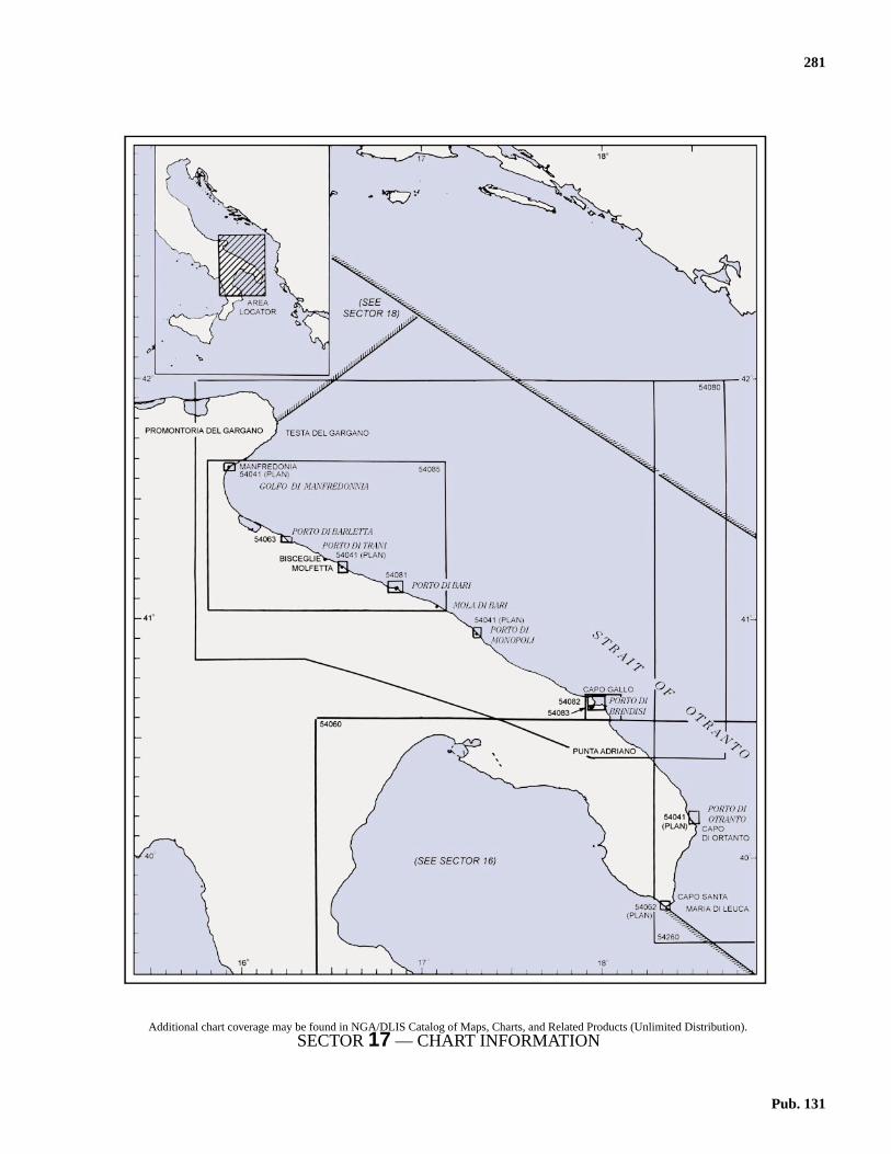
281
17.Italy—East Coast—Capo Santa Maria di Leuca to Testa del
Gargano
17.0Additional chart coverage may be found in NGA/DLIS Catalog of Maps, Charts, and Related Products (Unlimited Distribution).SECTOR17 — CHART INFORMATION
Pub. 131


283
ly.m
eig-
spa,n ao.ne
ayare
mht
gnal
d’ta-es.isf
edd’
AsesW
Nlly
te-
m3m
SEn-he
bestWw
SECTOR 17
ITALY—EAST COAST—CAPO SANTA MARIA DI LEUCA TO TESTA DEL GARGANO
17.0 Plan.—This sector describes the S part of the ItalianAdriatic coast from Capo Santa Maria di Leuca (39˚48'N.,18˚22'E.) N to Testa del Gargano (41˚50'N., 16˚12'E.) on the Eside of Promontorio del Gargano.
General Remarks
17.1 Regulations.—Tanker vessels of 1,600 grt and overentering or leaving Italian ports and carrying, or withuncleaned tanks which last carried, petroleum, gas, or chemicalproducts should report to a shore station before entering Italianterritorial waters off Italian ports. For further details, see Pub.140, Sailing Directions (Planning Guide) North AtlanticOcean, Baltic Sea, North Sea, and the Mediterranean Sea.17.1 Caution.—Tunny nets are laid out annually between Marchand November close off many places along the E coast of Italy.17.1 Landslides may occur along the section of coast described inthis sector.17.1 Numerous offshore oil and gas installations and associatedpipelines and service craft may be encountered off the coastdescribed in this sector.
Capo Santa Maria di Leuca to Porto di Brindisi
17.2 Capo Santa Maria di Leuca (39˚48'N., 18˚22'E.)forms the heel of the Italian boot. This cape is 140m high andappears rocky and precipitous from the S, but from other direc-tions, it presents a more gradually sloping appearance. A light,with an auxiliary light, are shown from a prominent structure,48m high, standing 0.2 mile NNE of Punta Meliso, the SWextremity of the cape.17.2 A conspicuous signal station, consisting of a tower witharched windows, stands 1.5 miles NW of the light. The old sig-nal station, which stands 1.5 miles NE of the light, is visibleonly from a short distance. A high-rise building and the belltower of the cathedral at the town of Leuca, standing W of thecape, are very conspicuous.17.2 Between Capo Santa Maria di Leuca and Capo d’ Otranto,the coast consists of a cultivated and rocky plateau. From Capod’ Otranto to Capo Gallo, the coast is low and is indented bynumerous coves.17.2 Porto di Tricase (39˚56'N., 18˚24'E.) is a small inletprotected by a breakwater which forms a small craft harbor.Several buildings and villas and an arched stone viaduct standin the vicinity of the harbor. The port monitors VHF channels14 and 16. Gagliano del Capo, a village, is 3 miles N of CapoSanta Maria di Leuca and can be seen conspicuously above theheadland of the cape from a few miles offshore. The campanilein this village is prominent.
17.3 Porto di Castro(40˚00'N., 18˚26'E.), a small bay, lies4 miles NNE of Porto di Tricase and is dominated by thevillage of Castro which stands on a hill, 99m high. A con-spicuous castle is situated in this village. A small harbor lies at
the NE head of the bay and is suitable for small boats onAnchorage is available, in a depth of 13m, mud, about 700SW of Punta Mocarone, the NE entrance point of the bay.17.3 From Porto di Castro to Porto Miggiano, 2 miles NNE, thcoast is high and indented by fissures and coves. Porto Mgiano is a small boat harbor. Terme di Santa Cesarea, acontains several prominent ornamental buildings. It stands ohigh and rocky part of the coast, 1 mile NE of Porto MiggianThe coast to the S of this spa is marked by several stoquarries.17.3 Porto Badisco, located 3 miles N of Porto Miggiano, isnarrow and deep inlet with high and rocky sides. A grabuilding and a red house stand close W of the entrance andprominent. This inlet is only frequented by local small craft.17.3 Capo d’ Otranto (40˚06'N., 18˚31'E.) is the E extremity of ahigh, precipitous, and steep-to tableland. A light is shown froa structure, 8m high, standing on the cape. A disused ligtower stands near the base of the cape and a disused sistation surmounts the cape.17.3 Punta Posta delle Fasci is located 1.7 miles N of CapoOtranto. It is low, rocky, and flat but is easily recognized. Pundell’Orto is located 0.3 mile NNW of the point and is overlooked by a conspicuous tower which is surrounded by housTorre del Serpe, standing 0.3 mile NW of Punta dell’Orto,situated on a hill, 34m high. It is formed by a slender pile omasonry ruins, but is still prominent from seaward.
17.4 Porto di Otranto (40˚09'N., 18˚30'E.) (World PortIndex No. 40490), a small port, lies in a bay which is enterbetween Punta San Nicola, located 2.5 miles NW of CapoOtranto, and Punta Craul (La Punta), 0.5 mile NW.breakwater extends NW from Punta San Nicola and enclothe SE part of the bay. The town of Otranto stands on the Sside of the bay.17.4 Winds—Weather.—The harbor is protected from all windsexcept those from the N. The bora, a strong and dry NE towind, can be violent here, especially in winter, and usualasts for a few days.17.4 Tides—Currents.—The current generally follows the coasand sets S, even with SE winds. In summer, this current somtimes attains a rate of 1.5 knots.17.4 Depths—Limitations.—The main commercial facility isMolo San Nicola, which is 260 long and has depths of 6 to 7alongside. Vessels up to 5,300 dwt, 102m in length, and 5.draft have been accommodated alongside.17.4 Aspect.—The town of Otranto is built on relatively high andyellowish rock stratum. A conspicuous castle stands in itspart and the bell tower of the cathedral is prominent. A cospicuous war memorial, 24m high, stands 0.3 mile W of ttown.17.4 Range beacons indicate the entrance channel and maybe seen on the chart. A lighted buoy, moored about 140m Sof the breakwater head, marks the N extremity of the shallowater in the SE part of the harbor.
Pub. 131

284 Sector 17. Italy—East Coast—Capo Santa Maria di Leuca to Testa del Gargano
lau-
,is
ace
lesity.is
ths
ileithis
oyd as
,lesed
,.5
erishas
ex-
edhNE
fthease.
thero-ry
e-
ity
17.4 Secca delle Casse fronts the breakwater and extends ESE toPunta San Nicola. A lighted buoy is moored at the SW edge ofthis shoal.17.4 Secca La Scala, with a least depth of 9.4m, lies about 0.5mile NE of Punta Craul; the sea breaks on this shoal duringstrong winds.17.4 Pilotage.—Local pilots are available. The port can be con-tacted on VHF channel 11 or 16.17.4 Caution.—Due to the existence of submarine cables, ananchoring and fishing prohibited area, which may best be seenon the chart, extends NE from Punta Craul.17.4 Vessels intending to enter the inner harbor should close theNW shore as closely as possible to allow sufficient room to lineup on the range.
17.5 Baia di Alimini (40˚12'N., 18˚28'E.) lies 3 miles N ofOtranto and has an inlet at its head which leads to a largelagoon. A conspicuous masonry bridge, with seven arches,crosses this inlet and is prominent from seaward. Small vesselscan anchor, in depths of 14 to 18m within the bay.17.5 The coast to the N of this inlet consists of a sandy beachbacked by groups of irregular sand dunes which are sparselycovered with bushes.17.5 Secca Missipezza, a rocky and steep-to reef, extends about0.5 mile offshore, close N of Baia di Alimini. It is advisable toalways pass to the E of this reef.17.5 Torre San Andrea (40˚15'N., 18˚27'E.) stands on a coastalelevation and is surmounted by a disused signal station. A lightis shown from this checkered tower. A large white building anda prominent farm house are situated near the tower.17.5 Punta San Cataldo(40˚23'N., 18˚18'E.) is low and sandy; aconspicuous white bathing pavilion stands on the beach, closeW of it. A light is shown from a structure, 23m high, standingon the point.17.5 A pumping station, with a tall chimney, stands on the coast,3.2 miles NW of the light.17.5 A rocky ledge, with depths of 0.9 to 4m, extends up to 0.3mile E of the point. Anchorage may be taken, in a depth of10m, sand, about 1 mile ESE of the point.17.5 Caution.—A prohibited area, which can best be seen on thechart, extends up to 5 miles offshore from a section of the coastlying close N of Punta San Cataldo. This area is a firing area.
17.6 Torre Specchiolla (40˚30'N., 18˚07'E.) stands 11.5mile NW of Punta San Cataldo and a prominent coast guardstation is reported to be situated near it.17.6 The coast to the N of this tower is low and generally rocky. Itcontains few dwellings, but there are numerous towers.17.6 Caution.—All vessels not entering or leaving Brindisi areprohibited from navigating within the coastal zone extending 6miles from the coast between Torre San Gennaro (40˚32.4'N.,18˚04.0'E.) and Torre Guaceto, standing 6.5 miles WNW ofPunta Penne.
17.7 Squinzano, a town, is situated 5 miles inland, 5.5miles SW of Torre Specchiolla. The houses are situated on thesummit of a flat-topped hill and are mostly inconspicuous. Thepointed bell tower of the town rises above these houses and isvery conspicuous from seaward.
17.7 Torre Mattarella stands 5.5 miles NW of Torre Specchioland is red and rectangular. A white masonry building is sitated close E of this tower.
Capo Cavallo (Capo di Torre Cavallo) (40˚38'N., 18˚01'E.)a low promontory, is located in the E approach to Brindisi. Thcape can easily be identified by a conspicuous tower withburn-off flare, which can be seen from a considerable distanon a clear night.17.7 It is reported (1990) that a power station is situated 4.5 miS of the cape and a chimney, 200m high, stands in its vicinAn industrial complex of tanks, towers, and chimneyssituated W of the cape.17.7 Anchorage can be obtained 4.5 miles E of the cape, in depof 30 to 60m17.7 Secche di Capo Cavallo, a rocky foul area, extends 0.8 mE and about 1 mile N of the cape. It has numerous rocks wdepths of 1.8 to 9.8m and is marked by a lighted buoy whichmoored about 1.5 miles NE of the cape. This lighted bumarks the edge of the deep water NE of the cape and is usean approach buoy by vessels inbound from the E or S.17.7 Caution.—A danger area, the limits of which are shownlies within 3 miles of the coast and extends up to about 2 miE and 4.5 miles SE of Capo Cavallo. Vessels are prohibitfrom entering this area.
Porto di Brindisi (40˚39'N., 17˚59'E.)
World Port Index No. 40500
17.8 The large port of Brindisi lies between Capo Biancolocated 1.2 miles WNW of Capo Cavallo, and Punta Riso, 1miles NW.17.8 It is divided into three parts. Porto Esterno is the outharbor; Porto Medio is the middle harbor; and Porto Internothe inner harbor, which is entered from Porto Medio througCanale Pigonati and consists of two basins. The port hcommercial facilities, serves as a ferry terminal, and hastensive naval installations.17.8 Winds—Weather.—Winds from the SE and NE predom-inate, but NW winds are not infrequent. The harbor is shelterfrom all winds except those from the NE and E, whicsometimes cause disturbances. The bora, a strong and dryto N wind, can also be violent here, especially in winter.17.8 Depths—Limitations.—Canale Pigonati has a depth o10.9m and vessels up to 9.4m draft can enter Porto Interno,inner harbor. Costa Morena, at the S side of Porto Medio, h500m of berthing space with depths up to 13.7m alongsidVessels with a draft of up to 12.5m can be accommodated.17.8 Tankers with a draft of 11.5m can be accommodated atsea berth. For the discharging or loading of other refined pducts of Montedison Installations, the depth of the berths vafrom 4 to 9m.17.8 Vessels berthing at the N section of Porto Medio are rstricted to maximum allowable heights, as follows:
1. Costa Morena Wharf—53m.2. Riva Wharf—40m.3. New Spur Wharves—36m.
17.8 These restrictions have been established due to the proximof the port area to Brindisi Airport.
Pub. 131

Sector 17. Italy—East Coast—Capo Santa Maria di Leuca to Testa del Gargano 285
soatedl or
ut
din
of
eart.
res-
ay
rt.
nt.fulSd
si
E
arels.o-
etyithd ad
e S
15rip.thesits
ast,heh-ll
va,
17.8 An offshore oil terminal is situated 500m SW of IsolottoTraversa and the berth consists of several mooring buoys. Asubmarine pipeline extends SE from the berth to the SE shoreof Porto Esterno. Tankers up to 11.5m draft can be handled.17.8 Aspect.—Isole Pedagne Grandi (Le Pedagne), a chain oflow islets, lies on a shoal bank at the E side of the port, N ofCapo Bianco. Isola Pedagne Grande, the largest and E islet,lies 0.3 mile NNE of the cape and is connected to it by abreakwater. Isolotto Traversa, the W islet, lies 0.6 mile NW ofCapo Bianco and forms the S entrance point of the outerharbor. Le Pedagne Light is shown from a structure, 18m high,standing on this islet.17.8 Isola Sant Andrea, an island, lies on a shoal bank at the NWside of the port. It is located 1 mile W of Isolotto Traversa and0.3 mile E of the mainland coast. A breakwater extends be-tween the NW end of the island and the mainland. A radiotower stands on the SE part of this island.17.8 Forte a Mare, an island dominated by a massive stonebuilding with a signal station, lies close S of the S end of IsolaSant Andrea and is connected to it by a bridge.17.8 Diga di Punta Riso, a breakwater, extends 1.3 mile E fromPunta Riso, the NE extremity of Isola Sant Andrea. It forms theN side of the outer harbor and a light is shown from the head.17.8 Torre Penna, a large and prominent tower, stands on theextremity of Capo Gallo, a low tongue of land, which is located2 miles NW of Punta Riso. The coast to the N of this cape islow, flat, and contains several towers and villages. The mostconspicuous of these villages are Carovigno and Ostuni, whichare situated 4 miles inland, 13 and 16 miles WNW, respec-tively, of Capo Gallo.17.8 A conspicuous monument to sailors, which represents arudder, stands close W of Canale Pigonati. Brindisi Light isshown from the top of the this monument.17.8 An aeronautical light is shown from a structure situated 0.5mile WNW of the monument.17.8 Other prominent landmarks include the cathedral, standingSW of Canale Pigonati; and an ancient castle, flanked bytowers, standing WSW of Canale Pigonati.17.8 Pilotage.—Pilotage is compulsory for vessels over 500 grtand all tankers. Pilots may be contacted on VHF channel 12and board 1 mile outside the entrance.17.8 Regulations.—The port is a naval base and special regula-tions are in effect relating to the movement of vessels, berthing,and anchoring.17.8 A speed limit of 6 knots is in force within the port.17.8 Vessels must send a request for berthing to the harbormasterat least 24 hours prior to ETA. Prior to anchoring, vessels mustcontact the harbormaster, as follows:
17.8 Vessels carrying polluting or dangerous cargo must report tothe harbormaster 36 hours in advance; if the vessel intends toload or unload, the notice must be given 48 hours in advance.17.8 Vessels entering Porto Medio, contrary to normal custom,have priority over vessels leaving, except that Italian navalvessels have priority over all other vessels.
17.8 Vessels transiting Canale Pigonati must, if possible, dowith engines stopped. Movements in the passage are regulby the harbormaster. Vessels leaving, whether commerciamilitary, have priority.17.8 Vessels must not approach military installations withopermission.17.8 A traffic separation scheme (TSS) is located off the port.17.8 Anchorage.—.The recommended anchorage for small anmedium-sized vessels is 2.5 miles WNW of Punta Penne,depths of 20 to 50m.17.8 Vessels approaching from the E or S should pass E and Nthe lighted buoy moored NE of Capo Cavallo.17.8 Caution.—Numerous anchoring prohibited areas lie in thentrance and within the port and may best be seen on the ch17.8 Moorings for the use of aircraft are situated along the shoof Porto Medio, which is occasionally used for flying operations.17.8 Silting has always occurred within this port and depths mbe less than shown on the chart.17.8 Several unlighted mooring buoys are situated within the po17.8 The land in the vicinity of the port is low and difficult toidentify, especially during S winds, when a haze is prevaleOn nearing the port, the character of the bottom can be helpin determining position. It has weeds off Capo Cavallo to theof the port; hard mud off Capo Gallo to the N of the port; anrock, sand, or gravel between the two.
Porto di Brindisi to Porto di Bari
17.9 Porto di Monopoli (40˚57'N., 17˚18'E.) (World PortIndex No. 40510), a small harbor, lies 35 miles NW of Brindiand is protected by two moles.17.9 Tides—Currents.—Generally, the current in this vicinityfollows the direction of the coast and sets SE. With N and Nwinds, it may attain a rate up to 2 or 3 knots.17.9 Depths—Limitations.—The harbor has 275m of totalberthing space with depths of 4.5 to 8.5m alongside. Therefacilities for general cargo, tanker, bulk, and fishing vesseVessels up to 110m in length and 6.7m draft can be accommdated.17.9 Aspect.—The town of Monopoli is situated on the SW sidof the harbor. The most prominent landmarks in its viciniinclude a pointed bell tower; the church of San Francesco wa clock; three chimneys standing at the cement works; ansingle chimney standing at the oil refinery which is situateclose E of the cement works. A castle stands at the root of thmole.
17.9 When seen from the SE, in clear weather, at a distance ofto 20 miles, the town appears as a narrow, low, and white stNumerous resort camps are situated along the coast invicinity of the town. The town of Conversano, situated 8 mileW of the port, is conspicuous from seaward because ofheight.17.9 Torre Canne, 32m high and conspicuous, stands on the co10 miles SE of the harbor. A light, which can be seen from tapproaches, is shown from this structure. A prominent higrise building is reported to stand 0.5 mile S of the light. A smaboat harbor, dominated by a prominent castle, lies at Villano5.5 mile SE of the light.
Local time VHF channel
0800-2000 12
All other times 16
Pub. 131

286 Sector 17. Italy—East Coast—Capo Santa Maria di Leuca to Testa del Gargano
SEnteur-
dinatoss-ndalog,of
ss-
ngs of
p to
-ishen
t ofa
tedlos
g
he
rtstedile
r-the48
een
ted
utislo
r-
fedrs
to
17.9 Pilotage.—Pilotage is compulsory for merchant vessels over400 grt. Pilots can be contacted on VHF channel 12 and board1 mile from the entrance to the port.17.9 Anchorage.—Anchorage depends on the prevailing winds.If the wind is the normal prevailing wind from the N, vesselsusually anchor about 2 to 3 miles SE of the harbor entrance. Ifthe wind is from the S, vessels anchor to the N of the entrance.17.9 Vessels must contact the harbormaster on VHF channel 16prior to anchoring.17.9 Caution.—Vessels should give the mole heads a wide berth.A submarine cable extends across the entry between the break-waters, as best seen on the chart.
17.10 Polignano a Mare(41˚00'N., 17˚13'E.), a town, issituated 4.5 miles NW of Monopoli and is conspicuous. Itstands on a craggy coastal bluff and has numerous chimneysand sprawling whitish-colored houses. Isolotto San Paolo, arocky islet, lies close offshore near the town and is surmountedby a ruined monastery.17.10 Between Monopoli and Mola di Bari, 11 miles NW, the coastis low, rocky, and indented. A number of towers, coves, andscattered buildings exist along this stretch of coast. From Moladi Bari to Porto di Bari, 11 miles WNW, numerous towers andhouses stand along the coast. Motel dell Agip, a seven-storybuilding, stands isolated 3 miles WNW of Mola di Bari and isvery conspicuous.
17.11 Mola di Bari (41˚03'N., 17˚06'E.) (World Port IndexNo. 40520), a small harbor, lies 11 miles ESE of Porto di Bariand is protected by moles. Prominent landmarks in the town,from E to W, include a factory chimney, standing near thebeach; three bell towers; and the dome of the cathedral. Theharbor is accessible to small vessels up to 50m in length and3.5m draft. Anchorage, in good weather, can be obtained, in adepth of 10m, hard mud, about 1 mile off the harbor.17.11 Caution.—A fish farming plant is located 1.3 miles E ofMola di Bari. It is marked by lighted and unlighted buoys. An-choring, fishing, and stopping are prohibited within 0.3 mile ofthe plant.
Porto di Bari (41˚08'N., 16˚52'E.)
World Port Index No. 40530
17.12 The port of Bari lies 11 mile WNW of Molo di Bariand is protected by breakwaters. It is divided into two harbors.Bacino Grande, the large commercial harbor, lies on the NWside of the old city and Porto Vecchio, a small craft and fishingharbor, lies on the SE side. The city of Bari is disposed in awide arc to the S of the port.
17.12 Winds—Weather.—The prevailing winds are from the NEthrough N to SE and are often harbingers of storms. The sir-occo carries mist and humidity. The mistral creates strong cur-rents. East winds commomly bring clouds and storms.
17.12 Tides—Currents.—The current in the vicinity of the harborfollows the coast and sets SE, changing direction with freshwinds. Winds from the N may increase the rate of this currefrom 1 to 3 knots. A counterclockwise current, which is quitstrong, may sometimes be experienced within the harbor ding strong N winds.17.12 Depths—Limitations.—The main commercial facilities in-clude Molo St. Vito, with 550m of total berthing space andepths of 3 to 6m alongside, which is used by ferries; BanchCapitan, with 370m of total berthing space and depths of 55.5m alongside, which is used for general cargo and paengers; Molo Ridosso, with 560m of total berthing space adepths of 7.6 to 10.3m alongside, which is used by navvessels and ferries; and Banchina Deposito Franco, Mezzand Levante, with 945m of total berthing space and depths8.5 to 9.8m alongside, which is used by bulk and large paenger vessels.17.12 In addition, there is 2,300m of total quayage situated alothe inner sides of the breakwaters. These berths have depth7.3 to 14m alongside and are used by tankers. Vessels u300m in length and 12.2m draft can be accommodated.17.12 Aspect.—At night, the illumination of the city has been reported to be visible from as far as 30 miles. Three greenlights, arranged horizontally and shown at a factory, have bereported to be the first harbor lights sighted.17.12 The old city stands between the two harbors near the roothe main outer breakwater. A castle, with a signal tower;cathedral, with a steepled bell tower; and a basilica are situain the old city and are prominent. Several conspicuous sistand N of the old city and near the root of the breakwater.17.12 A light is shown from a prominent tower, 62m high, standinon Punta San Cataldo at the W side of the main harbor.17.12 A racon is situated at the light structure on the head of tmain outer breakwater.17.12 Pilotage.—Pilotage is compulsory for vessels over 500 gincluding those anchoring off the port. Requests for pilots mube submitted 24 hours prior to arrival. Pilots may be contacton VHF channel 12 or 16 and generally board about 1 moutside the main harbor entrance.17.12 Regulations.—Vessels carrying polluting or dangerous cago must report to the harbormaster 36 hours in advance; ifvessel intends to load or unload, the notice must be givenhours in advance.17.12 A traffic separation scheme, best seen on the chart, has bestablished in the approaches to the port.17.12 Anchorage.—Three designated anchorage areas are locaoutside the harbor, as follows:
1. Anchorage Area A lies, in depths of 22 to 26m, abo0.6 mile NE of the main harbor entrance. The areabounded by the outbound lane of the TSS and Nuovo MoForaneo.
2. Anchorage Area B is adjacent to and ESE of Anchoage Area A and is best seen on the chart.
3. Anchorage Area C is located about 0.5 mile NW othe entrance. Generally, the bottom is rocky and coverwith a thin layer of mud and sand. Consequently, anchooften become fouled on the bottom.
17.12 Caution.—Prohibited anchorage area lie in the entrancesboth harbors and may best be seen on the chart.
Porto di Bari Home Page
http://www.porto.bari.it
Pub. 131

Sector 17. Italy—East Coast—Capo Santa Maria di Leuca to Testa del Gargano 287
a
alledallbyushe
sta
ousnt
isint
SW
allr isls upect6.
ingith
ndhe-nd
y.se
fiscure
fareto
m
-a,e
17.12 A rocky and shallow shoal patch, Secca del Monte, overwhich the sea breaks, lies close N of Porto Vecchio.17.12 A sewage outfall extends about 750m NE from the shoreabout 1.6 miles W of Nuovo Molo Foraneo head, terminatingabout 0.5 mile SW of Anchorage Area C.
Porto di Bari to Porto di Barletta
17.13 Santo Spirito(41˚10'N., 16˚45'E.) (World Port IndexNo. 40540), a small town, is situated 4.8 miles WNW of Bariand stands on the shores of a cove which is open to the N. Thetown is fronted by a small harbor which is used by fishingvessels and small craft, and is protected by two breakwaters.17.13 The town of Giovinazzo, partially surrounded by a wall onthe seaward side, stands prominently on the coast, 4 milesWNW of Santo Spirito. It is fronted by a small craft harbor. Acreek, used by small coastal vessels, lies close NW of the town.A shallow shoal lies close off the E entrance point of this creek.It is reported that the bell tower of the cathedral in the town isconspicuous from seaward.
17.14 Molfetta (41˚12'N., 16˚36'E.) (World Port Index No.40550), a small port, lies 4 miles WNW of Giovinazzo. Theharbor is formed by two moles and a detached breakwater,which lies NW of the entrance, shelters it from winds from theN and NW.17.14 Depths—Limitations.—The main commercial facilities in-clude 475m of total berthing space, with depths of 3.4 to 7malongside. The harbor is used mainly by bulkers and canaccommodate vessels up to 10,500 dwt, 160m in length, and7m draft.17.14 Aspect.—From a distance, the town presents an imposingappearance. A conspicuous church, with a bell tower, standsisolated on the shore, 0.6 mile W of the town. The prominenttwin towers of the seminary are situated near the root of the Emole.17.14 A light is shown from a prominent structure, 18m high,standing near the root of the E mole.17.14 Pilotage.—Pilotage is compulsory for vessels over 500 grt.Pilots are provided through the station at Bari and board about1 mile ENE of the head of Molo Foraneo. The harbor can becontacted on VHF channel 14 or 16..17.14 Regulations.—All vessels are prohibited to move within,enter, or depart through the harbor entrance at a speed greaterthan 3 knots.17.14 Vessels are required to contact the port office on VHF chan-nel 16 to obtain permission to anchor.17.14 Caution.—Vessels should remain clear of the heads of themoles and the breakwater.17.14 A fishing prohibited area lies centered 3.5 miles NE of theharbor entrance and may best be seen on the chart.17.14 Unexploded ordnance lies on the sea bottom 7.1 miles NE ofMolfetta.17.14 A marine farm, marked by buoys, lies centered 1.8 milesNNE of Giovinazzo.17.14 A historic wreck, with its circular restricted area, lies 4.3miles N of Molfetta.
17.15 Torre Calderino (41˚14'N., 16˚33'E.) stands 2 milesWNW of Molfetta and is conspicuous. A prominent silo andfactory are situated 1 mile SW of this tower.17.15 Bisceglie(41˚15'N., 16˚31'E.), a town, stands around a sminlet. The large whitish-colored dome of the cathedral, situatin the town center, is conspicuous. The inlet forms a smharbor which is protected by breakwaters and is mostly usedfishing vessels. In summer, this inlet is used by numeroyachts. Small vessels with local knowledge can anchor off tinlet.17.15 Between Bisceglie and Trani, 4.5 miles WNW, the coaconsists of rocky and broken terrain which slopes abruptly tonarrow and sandy beach. Two masonry bridges, with numerarches, cross a stream, 2 miles NW of Bisceglie. A prominetower stands close N of them.17.15 Capo Punta Colonna is located 1 mile ESE of Trani andsurmounted by a large and whitish-colored convent. The pois rocky and relatively high. The village of Andria, with threelarge and conspicuous campaniles, is situated 6.5 miles Wof Trani.
17.16 Porto di Trani (41˚17'N., 16˚25'E.) consists of anatural bay, about 300m in diameter, which forms a smharbor and is protected by three breakwaters. The harbomostly used by coasters, yachts, and fishing vessels. Vesseto 60m in length and 4.3m draft can enter. The harbor is subjto silting and can be contacted on VHF channel 14 or 1Anchorage may be taken outside the harbor with good holdground. However, this roadstead is not recommended wwinds and seas from the NE quadrant.17.16 The town surrounds the harbor and is composed of low abright-colored houses crowded together. A conspicuous catdral, with a spired campanile, and a castle, with towers aarches, stand in the town.17.16 From Trani to Porto di Barletta, the coast is low and sand17.16 Castel del Monte (41˚05'N., 16˚16'E.), 540m high, stand13.5 miles SSW of Trani. This peak is the highest in thvicinity and is very conspicuous from seaward.
Porto di Barletta (41˚19'N., 16˚17'E.)
World Port Index No. 40580
17.17 Porto di Barletta, a small port, lies 6.5 miles WNW oTrani and is formed by two breakwaters. The harborsheltered against heavy seas and is considered more sethan any other port along this stretch of coast.17.17 Depths—Limitations.—There are quays on the inside othe breakwaters, with depths of 8 to 8.5m alongside. Therefacilities for general cargo and bulk vessels. Vessels up23,000 grt, with a maximum length of 100m and a maximudraft of 6.8m, can be accommodated.17.17 Aspect.—During reduced visibility, the first landmark to besighted in the vicinity of the port is the straight and whitecolored road which leads S from the port to the town of Andri5.5 miles inland. A prominent cemetery is situated on thcoast, 1 mile W of Barletta.
Pub. 131
288 Sector 17. Italy—East Coast—Capo Santa Maria di Leuca to Testa del Gargano
e
-ndSW
taear
ic-ita
-rs.ter
ideor
er-ir-owthewslls
lbysels,
orngate
fthehic-
d-rch
athe
sd
.ar
t.uld
17.17 Conspicuous landmarks in the city include the whitish-colored campanile of a church standing in the E part; a largebastioned castle situated E of the campanile; the large cupolaof a church standing 0.5 mile WSW of the campanile; andseveral chimneys standing E of the castle. Several prominentsilos, 44m high, stand in the vicinity of the harbor.17.17 The city of Barletta differs from other cities and towns in thevicinity because its houses are not whitewashed. A light isshown from a tower, 29m high, standing on an inner spur of theW breakwater.17.17 Pilotage.—Pilotage is compulsory for vessels over 500 grt.Pilots may be contacted on VHF channel 14 and board 1 mileN of the entrance.17.17 Vessels with a draft greater than 7m must use a pilot toproceed to the anchorage. Vessels should send an ETA 72hours, 48 hours, and 24 hours in advance of arrival.17.17 Anchorage.—Anchorage may be taken offshore, either tothe W or E of the harbor. To the E of the harbor, the bottomcontains patches of rock; to the W, mud and sand, with goodholding properties, can be found. A good berth is found in adepth of 8m, about 1 mile NW of the W breakwater.17.17 Two designated anchorage areas, best seen on the chart, lieNE of Barletta; each is 1 mile in radius. Anchorage Area A isfor all cargo vessels, except for tankers carrying dangerous car-go. Anchorage Area B is for tankers carrying dangerous cargo.17.17 Caution.—An anchoring, stopping, and fishing prohibitedarea, which may best be seen on the chart, extends up to 1.5miles N of the entrance.17.17 An outfall pipeline extends up to 1.5 miles NNE from a pointon the shore, 1.5 miles W of the harbor.17.17 A dangerous wreck lies about 2.2 miles N of the harborentrance.17.17 A submarine power cable, best seen on the chart, extendsacross the entrance between breakwaters.
Golfo di Manfredonia
17.18 Golfo di Manfredonia(41˚30'N., 16˚10'E.) is enteredbetween Barletta and Testa del Gargano, a headland, 30 milesN. The SW coast of the gulf, to within 3 miles of Manfredonia,is low and marshy. Several lakes and salt marshes lie inlandand are backed by an undulating and cultivated plain. FromManfredonia, the NE coast becomes high, steep, and is backedby the mountainous terrain of Promontorio del Gargano. Thisgulf is frequently used by numerous fishing vessels.17.18 Fiume Ofanto discharges through a mouth located 4.3 milesWNW of Barletta. Sediment from this river is carried SE andcontributes to the silting of many harbors in that direction.Torre d’Ofanto, prominent and white, rises above the trees, 0.7mile S of the river mouth.
17.19 Margherita di Savoia (41˚23'N., 16˚08'E.), a smalltown, appears as a line of light-colored buildings rising fromthe sea. Two short moles extend N from the shore fronting thetown and protect the entrance to a canal which is used by smallcraft. Three steel bridges span the canal and are prominent.The harbor authority monitors VHF channel 16. Anchoragecan be obtained, in good weather, in depths of 11 to 13m, mud,about 1 mile off the canal entrance.
17.19 Caution.—A fish farm, marked by lighted and unlightedbuoys, is located 2.5 miles NE of the town.17.19 A dangerous wreck is reported to lie about 3 miles NE of thcanal entrance.
17.20 The conspicuous village of Trinitapoli, with a prominent cupola, is situated 3 miles W of Margherita di Savoia athe more elevated village of San Ferdinando stands 6 milesof the town.17.20 The village of Zapponeta stands 9 miles NW of Margheridi Savoia; its houses, with some red-roofed sheds, appprominently near the beach.17.20 This entire stretch of coast is recognizable by the conspuous aerial cableway pylons which carry salt from Margherdi Savoia to Barletta.
Manfredonia (41˚37'N., 15˚55'E.)
World Port Index No. 40590
17.21 Manfredonia, a small port, is divided into two harbors. The old harbor is formed by two converging breakwateThe industrial harbor is situated at the head of a breakwajetty which extends 1.2 miles SE from the shore at the NE sof the old harbor; piers at the head form a sheltered harbbasin.17.21 Winds—Weather.—Winds from the SW sometimes blowbriefly in heavy squalls and make entering and leaving dangous. Although the roadstead offers little protection from socco winds, which blow from the SE and S, these seldom blhard near the land and the sea is never very heavy inroadstead. The bora, locally called monterese, which blofrom the NE and N, sometimes arrives in violent squaflowing down the gorges of Promontorio del Gargano.17.21 Depths—Limitations.—The old harbor has 700m of totaberthing space with depths of 2 to 7.5m alongside. It is usedsmall general cargo vessels, passenger ferries, fishing vesand naval craft with drafts up to 6.6m.17.21 The industrial harbor, which has 5 berths, is mainly used fchemicals and bulk cargoes. It has 1,765m of total berthispace, with a depth of 10m alongside, and can accommodvessels up to 9.9m draft with no restriction in length.17.21 Aspect.—Monte Calvo, 1,055m high, stands 9 miles NW oManfredonia and is the highest and most prominent peak inarea. Also prominent is Monte degli Angeli, 886m high, whicstands 5 miles N of the town and has a village, with conspuous tower, situated near its summit.17.21 Prominent landmarks in the town include a castle, floolighted at night, standing at the E side; the cupola of the chustanding close SW of the castle; and a keep, formed bytruncated cone, situated near the root of the S breakwater ofold harbor.17.21 An industrial complex extends NE of the town and ibrightly lighted at night. It includes large buildings, tanks, anchimneys. A tourist resort complex extends SW of the town17.21 A light is shown from a structure, 18m high, standing nethe root of the E breakwater of the old harbor.17.21 Pilotage.—Pilotage is compulsory for vessels over 500 grPilots can be contacted on VHF channel 12. Vessels sho
Pub. 131

Sector 17. Italy—East Coast—Capo Santa Maria di Leuca to Testa del Gargano 289
nd
eepis
wns
theter
ralnd.ted
send a request for a pilot at least 1 hour before arrival. The pilotboards 1 mile outside the breakwater.17.21 Anchorage.—Designated anchorage areas, which may bestbe seen on the chart, lie in the approaches to the port. Anchor-age Area A1, Anchorage Area A2, Anchorage Area A3,Anchorage Area A4, and Anchorage Area A5 are for vesselscarrying general cargo. Anchorage Area A6 and AnchorageArea A7 are for vessels carrying dangerous cargo.17.21 Vessels must contact the maritime authority on VHF channel16 for permission to anchor.
Manfredonia to Testa del Gargano
17.22 Punta Grugno (41˚42'N., 16˚04'E.) is located 7.5miles NE of Manfredonia and slopes steeply to the sea. A smallfishing and pleasure boat harbor fronts the coast 1 mile NNE of
the point. A unused light tower and an isolated building staon Punta Agnuli, close NE of the harbor.17.22 Torre Proposti (41˚47'N., 16˚12'E.), consisting of a whitestructure with a squat tower at one corner, stands on a stheadland, 7.8 miles NE of Punta Grugno. It is 22m high andsituated on a massive reddish-colored base. A light is shofrom the top of this tower. A prominent hotel complex ireported to be situated 3 miles SW of this tower.17.22 Between this tower and Testa del Gargano, 2.5 miles N,coast is indented by numerous coves which contain underwarocks and close off-lying islets.17.22 Testa del Gargano(41˚50'N., 16˚12'E.), the NE extremityof Golfo di Manfredonia, is steep, rocky, and fronted by severocks. The remains of an old tower stand on this headlaSeveral prominent towers stand on the coast, which is fronby rocks, N of this headland.
Pub. 131


291
18.Italy—East Coast—Testa del Gargano to Fiume Po Delta
(including off-lying islands)
18.0Additional chart coverage may be found in NGA/DLIS Catalog of Maps, Charts, and Related Products (Unlimited Distribution).SECTOR18 — CHART INFORMATION
Pub. 131


293
hor,la.
er. AN
,ra,ith
osttsis-, is
mae
anofais
c-
esd
efisandft.om
are
own
sra,m,oflso
sd.to
a
SECTOR 18
ITALY—EAST COAST—TESTA DEL GARGANO TO FIUME PO DELTA (INCLUDING OFF-LYING ISLANDS)
18.0 Plan.—This sector describes the coast NE part of the ItalianAdriatic coast from Testa del Gargano, at the E side of Prom-ontorio del Gargano, N to Porto Garibaldi in the S approachesof the Fiume Po delta. The off-lying islands of Isola Pianosa,Isole di Tremiti, and Otok Palagruza are also included.
General Remarks
18.1 Regulations.—Tanker vessels of 1,600 grt and overentering or leaving Italian ports and carrying, or with un-cleaned tanks which last carried, petroleum, gas, or chemicalproducts should report to a shore station before entering Italianterritorial waters off Italian ports. For further details, see Pub.140, Sailing Directions (Planning Guide) North AtlanticOcean, Baltic Sea, North Sea, and the Mediterranean Sea.18.1 Caution.—Numerous offshore oil and gas installations andassociated pipelines and service craft may be encountered offthe coast described in this sector.18.1 The coastlines of Promontorio del Gargano and Isole Tremiticonsist of high and rocky sections which stand sheer above thesea with natural caves and grottoes surrounded in places byrocks. Regulations are in force prohibiting the passage andstopping of vessels through areas in these vicinities which areconsidered dangerous due to rock falls and landslips.18.1 Promontorio del Gargano should be rounded at a distance ofat least 1 mile.
Changes to the North Adriatic Traffic Separation Scheme(TSS) are set to be implemented in July 2007.
Testa del Gargano to Vieste
18.2 Testa del Gargano(41˚50'N., 16˚12'E.), the NE ex-tremity of Golfe di Manfredonia, is fully described in para-graph 17.22.
Scogliodi Porto Nuovo, a small islet, lies 0.3 mile offshore, 1mile NNW of Tests del Gargano. It is surrounded by reefs andthis area should be given a wide berth.18.2 Isola Santa Eufemia (41˚53'N., 16˚11'E.), an island, liesclose ENE of Punta Santa Croce in the approaches to Vieste.An overhead cable, with a vertical clearance of about 20m,spans the channel lying between this island and the point.Vessels with a masthead or rigging height of more than 18mare prohibited from using this passage. A light is shown from aprominent structure, 27m high, standing on the island.18.2 Vieste (41˚53'N., 16˚11'E.), a small town, stands on theslopes around a small bay which is entered between Punta SanFrancesco and Punta Santa Croce, 0.3 mile NW. A prominentfort, on which is situated a checkered signal station, stands atthe SW end of the town. A cathedral, with a high bell tower,stands close E of the fort.18.2 The town is fronted on the N side by a small harbor which isprotected by moles. It is mostly used by fishing vessels and isaccessible to vessels up to 30m in length and 2.5m draft.The
harbor monitors VHF channels 14 and 16. Vessels can ancin a depth of 11m, about 0.3 mile E of the S extremity of IsoSant Eufemia. Large vessels should anchor farther offshore
Off-lying Islands and Dangers
18.3 Isola Pianosa(42˚13'N., 15˚45'E.) is 3m high androcky. The N shore of this islet is rather steep-to, but its othshores are fringed by reefs with depths of less than 10mlight is shown from a structure, 17m high, standing on theside of the islet.18.3 Isole Tremiti (42˚07'N., 15˚30'E.), a group of four islandsconsists of Isola San Domino, Isola San Nicola, Isola Capraand Il Cretaccio. These islands are all low by comparison wthe mainland.18.3 Isola San Domino, the largest and S of the group, is the mfertile and cultivated island. It has rocky and broken coaswhich contain a number of grottoes. The E end of the islandformed by a short yellowish-colored peninsula which terminates in a beach. Punta Secca, the W extremity of the islandformed by a low, blackish, and narrow peninsula. A hill, 116high, stands at the S end of the island. A light is shown fromstructure, 16m high, standing on the SW extremity of thisland.18.3 Isola San Nicola is connected to the E end of Isola SDomino by a reef with a depth of less than 5m. The villageTremiti contains several buildings including a church andsignal station, and stands at the SW end of the island. Itfronted by a small boat harbor. A light is shown from a struture, 15m high, standing near the N end of the island.18.3 A submerged obstruction, dangerous to navigation, liabout 250m N of the SW extremity of this island and is markeby a buoy.18.3 Il Cretaccio, yellowish and extremely irregular, lies on a re0.7 mile NE of the E end of Isola San Domino. This islandthe smallest of the group and the passages lying between itthe two larger islands can be used only by shallow-draft cra18.3 Isola Caprara, the NE island of the group, is separated frthe NW side of Isola San Nicola by a narrow passage withleast depth of 8.2m in the fairway. The coasts of this island arather steep-to and all dangers lie close inshore. A narrpeninsula forms the NE side of the island. A light is showfrom a structure standing on this peninsula.18.3 This group of islands affords good shelter from windbetween the W and ENE and adequate shelter from bostrong NE gales. Vessels can anchor, in depths of 31 to 35good holding ground, mud, about 0.3 mile off the SE shoreIsola San Domino. Anchorage, in convenient depths, can abe taken SE of the SW part of Isola Caprara.18.3 Otok Palagruza (42˚24'N., 16˚16'E.), a Croatian island, ihigh, rocky, and rises to a height of 103m near its W enAbove-water rocks, some of which are sharp peaked, lie up0.2 mile W of the W end of the island. A light is shown from
Pub. 131

294 Sector 18. Italy—East Coast—Testa del Gargano to Fiume Po Delta
r,r of
of
,artisdsathe
toof
ti.ndee;he
ted
43mursmHF
r
,his
s
ofld-
ndastoar-r-
ao.hem-
,a
ded
structure, 22m high, standing on the SW coast of the island.Another light is shown a tower standing close E of the light.18.3 Otocic Palagruza Mali, 51m high, is connected to the SE endof the above island by shoal ground and is surrounded by rocksand shoals.18.3 Otocic Galijula, 8m high, lies 3 miles ESE of Otok Pala-gruza and is surrounded by reefs extending up to about 0.5 off-shore.18.3 Caution.—Navigation is prohibited within 300m of OtokPalagruza.18.3 Overhead power cables, which may obstruct the passage ofvessels with masts, span the channels leading between IsolaSan Domino and Il Cretaccio, and between Il Cretaccio andIsola San Nicola.18.3 A marine nature reserve area has been reported (1991) tohave been established around Isole Tremiti and specialregulations apply. The Italian authorities should be contactedfor further details.18.3 A Traffic Separation Scheme (TSS) (42˚18'N., 16˚06'E.) liesabout midway between Isola Pianosa and Otok Palagruza. ThisTSS is not IMO-adopted but the national authorities advise thatuse of this scheme is compulsory for all foreign naval vessels,tankers, nuclear powered vessels, and vessels carrying nuclearor dangerous substances.
Vieste to Termoli
18.4 Peschici(41˚56'N., 15˚53'E.), a village, stands 8.5miles WSW of Vieste. The coast between is indented by sandybeaches and small coves, and surmounted by a number oftowers. This village is situated on the top of a barrenpromontory that appears as a rocky wall descending verticallyinto the sea. Monte Pucci, standing 1 mile W of the village, istree-covered and prominent. A small boat harbor fronts thevillage at the foot of the promontory.18.4 A long wall, with arched openings for the protection of thecitrus groves, extends almost from Peschici to Rodi Garganico,6 miles W, and appears as an arched viaduct.18.4 Rodi Garganico (41˚56'N., 15˚53'E.), a small town, standson a sloping hill which is surrounded by citrus and olivegroves. A conspicuous yellow-colored church cupola issituated in the extreme W part of the town. A mole, 230m long,extends NE from the E part of the town and is for shelter bysmall craft. Anchorage can be taken, in a depth of 6m, about0.5 mile N of the head of the mole. Local knowledge is re-quired.18.4 Promontorio di Monte d’Elio (41˚55'N., 14˚38'E.) isformed by a spur from the mountains of the headland of Gar-gano. Torre Mileto, a prominent structure, and a few whitebuildings stand on the N point of this promontory. A conspic-uous radio mast stands in the middle of the E slope. Lago diVarano and Lago di Lesina lie E and W, respectively, of thepromontory. These lakes are separated from the sea by a sandystrip of land which consists of dunes covered by sparse growth.18.4 Between the mouth of Fiume Fortore, located 15 miles W ofTorre Mileto, and Termoli, the shore consists of a low, sandybeach, backed by wooded groves. Torre Fantina, a pyramidstructure, stands 5.8 miles W of the river mouth and is prom-inent. A red railway station, with a larger yellow buildingstanding close by, is situated near this tower.
18.4 San Martinoin Pensilis, situated 7.5 miles SW of the toweis recognizable by a prominent steeple standing in the centethe town and by a white reservoir situated nearby.18.4 Anchorage can be taken, in depths of 16 to 18m, sand, Nthe mouth of Fiume Fortore and about 1.5 miles offshore.
18.5 Termoli (42˚00'N., 15˚00'E.), a moderate-sized townis situated on a flat and rocky peninsula, 21m high. The old pof the town stands on the extremity of the peninsula andenclosed by a prominent wall. The new part of the town stanto the S on a small and flat-topped hill. A light is shown fromstructure, 19m high, standing on the fortress at the N end oftown.18.5 Depths—Limitations.—A small harbor lies to the E of thepeninsula and is formed by two moles. There are depths of 44.3m in the entrance and depths of 3 to 3.3m in the centerthe harbor. A ferry service operates from here to Isole Tremi18.5 Aspect.—Conspicuous landmarks in the vicinity of the towinclude a low and brown-colored tower standing at the W siof the root of the peninsula; a church with a low campaniland a cemetery, with several white buildings, standing W of ttown and enclosed by a wall.18.5 Numerous modern buildings, some quite large, are situain the S part of the town.18.5 Pilotage.—The harbor can be contacted on VHF channel 1or 16 and is accessible to vessels up to 80m in length anddraft. Vessels may enter or leave the port during daylight hoonly. Before entering the port, and when at least 1 mile frothe entrance, vessels should contact the harbormaster on Vchannel 16 for authorization.18.5 Anchorage.—Anchorage for vessels bound for Tremoli ofor Rospo Mare Oil Field, 12 miles NNW of Tremoli, is situ-ated within a radius of 0.6 mile of position 42˚02.7'N15˚01.9'E. The bottom is sand, good holding ground, but tanchorage is not recommended in N, E, or SE winds.18.5 Caution—A submerged rock, with a depth of 3.4m, lie270m E of the head of Molo Sud.
Termoli to Ortona
18.6 Torre Petacciato (42˚01'N., 14˚53'E.), a squaretower, stands on a slope above the beach, 5 miles WNWTermoli. Anchorage can be taken, in a depth 13m, good hoing ground, sand, about 1.5 miles N of this tower.18.6 Between Termoli and Vasto, the coast consists of a low asandy beach backed by mountains. The coast between Vand Punta della Penna, consists of a rocky bluff which is ptially covered with olive groves and vineyards and closely bodered by rocks.18.6 Vasto (42˚07'N., 14˚43'E.) (World Port Index No. 40615),town, stands on a hill and was formerly known as IstoniVasto Marina and the surrounding village is situated on tcoast and adjacent to the town. Two high and prominent chineys stand in the S part of the village.
Punta della Penna(42˚10'N., 14˚43'E.) is 23m high, darkflat-topped, and rocky. A tower and a small building, withflagstaff close S of it, stand on the point. A light is shown froma prominent structure, 70m high, standing on the point.18.6 Caution.—Several oil production platforms and associatepipelines and mooring buoys are situated within a prohibit
Pub. 131

Sector 18. Italy—East Coast—Testa del Gargano to Fiume Po Delta 295
s,r.rd-HF
fld-W
a
ling
E
0.5o
eree.to
rtos,di
ndtialo
ofht,neN
flat
sis
onyfor
s.rndhor,e.
.
sar
area, which may best be seen on the chart, lying 11 miles ENEof Punta della Penna.
18.7 Porto di Vasto (Porto di Punta Penna) (42˚10'N.,14˚43'E.), a small harbor, lies close W of the point and isenclosed by two moles. There is 720m of total berthing space,with depths up to 7m alongside.18.7 Vessels up to 165m long, with a draft of 6m, can be accom-modated during favorable weather conditions.18.7 Pilotage.—Pilotage is compulsory for vessels of more than500 gt or more than 60m in length. Vessels must contact theharbor master on VHF channel 16 before entering port. Thepilot boards 1 mile NE of Punta della Penna Light.18.7 Anchorage.—Vessels must anchor within a radius of 0.5mile of position 42˚10.5'N, 14˚45.5'E and keeping clear of thewreck lying 2.3 miles ESE of Punta Penne; this anchorage isnot recommended during E winds. The anchorage area hasbeen divided into two zones. Zone A is for cargo vessels notcarrying dangerous materials and is described above. Zone B isfor tankers or cargo vessels carrying dangerous cargo; thesevessels must anchor within a radius of 0.5 mile of position42˚12.0'N, 14˚42.5'E.18.7 Caution.—Several production platforms lie in a restrictedarea, which extends up to 1.5 miles offshore, between Puntadella Penna and Punta di Cavalluccio. This area, which maybest be seen on the chart, also contains the associated wells andsubmarine pipelines, and anchoring and fishing are prohibitedwithin it.
18.8 Punta Lotta, located close W of Porto di Vasto, is sur-mounted by a small and conspicuous pillar. Between this pointand Punta di Cavalluccio, 10 miles NW, the sandy coast isintersected by several rivers, the mouths of which are spannedby prominent bridges and viaducts.
Punta di Acquabella (Punta del Moro) (42˚20'N., 14˚26'E.),a rocky point, is located 1.5 miles ESE of Ortona and is piercedby a railway tunnel. San Vito Chietino stands on the top of ahill which slopes steeply to the beach near this point. Aconspicuous church, with a surrounding balustraded balcony,stands at the edge of this town and overlooks the sea.
18.9 Ortona (42˚21'N., 14˚25'E.) (World Port Index No.40620), a small port, lies 1 mile NW of Punta di Acquabellaand is formed by two moles. The town, a resort, stands on asmall peninsula at the W side of the harbor.18.9 Depths—Limitations.—The NW part of the harbor can beentered through a buoyed channel which has a depth of 5.5m.There is 680m of total berthing space for general cargo with adepth of 7.6m. There is 1,530m of total berthing space for gen-eral cargo with alongside depths of 5.8 to 7.5m. There is atanker berth, 160m long, with a depth of 6.1m alongside. Thereare extensive facilities for yachts and fishing vessels. Vesselsup to 200m in length can be accommodated. The maximumdraft allowed is 6.5m in daylight and 6.3m at night.18.9 Aspect.—The S part of the town stands behind an archedretaining wall. The cathedral, with a prominent cupola, standsin the N part of the town. A church, with a prominent belfry,stands 0.5 mile S of the cathedral. A prominent chimney standsin a small valley close SE of the town. A light is shown from atower, 24m high, standing near the root of the N mole.
18.9 A conspicuous reddish-colored bridge, with five archecrosses the mouth of Fiume Arielli, 3 miles NW of the harbo18.9 Pilotage.—Pilotage is not compulsory except during poovisibility and sea conditions but is available and is recommened for large vessels. The harbor may be contacted on Vchannel 15 or 16.18.9 Anchorage.—Vessels anchor within a radius of 0.7 mile oposition 42˚22.5'N, 14˚26.5'E as shown on the chart. The hoing ground is good, but the anchorage is dangerous duringwinds.18.9 Caution.—Vessels are cautioned to give the mole headswide berth as depths are noticeably reduced near them.18.9 The entrance and approach channels are subject to shoadue to the presence of a sandy bar.18.9 A marine farm, marked by lighted buoys, is located 4.5 Nof Ortona and is best seen on the chart.
Ortona to San Benedetto del Tronto
18.10 Pescara(42˚28'N., 14˚13'W.) (World Port Index No.40630), a small port, lies at the mouth of Fiume Pescara, 1miles NW of Ortona. The small harbor is entered between twmoles which project from each side of the river mouth.18.10 Depths—Limitations.—The banks of the river, close insidethe moles, are quayed and used by shallow-draft vessels. This 300m of total berthing space with a depth of 5.2m alongsidVessels up to 100m in length and 5m draft have allowedenter the harbor.18.10 Aspect.—Pescara consists of two parts. Pescara-PoNuova, consisting of numerous factories and white buildingis situated on the SE bank of the river. Pescara-RivieraCastellamare is situated on the NW bank of the river aextends along the shore. It consists of numerous residenbuildings and two prominent government buildings. The twparts of the town are connected by bridges.
18.10 A prominent radio mast, 130m high, stands 2 miles SSEthe harbor. A conspicuous steel monument, floodlit at nigstands 0.5 mile SSE of the harbor. The light is shown from oof several silos, 30m high, which stand near the root of themole.18.10 The conspicuous town of San Silvestro stands on thesummit of a hill, 1.9 miles SSE of the harbor.18.10 Pilotage.—Pilotage is compulsory for tankers with cargoeof benzene, gasoline, or petrol. For other vessels, pilotagenot compulsory, but is advisable. Pilots may be contactedVHF channel 12. Berthing within the river is carried out bharbor berthing officers whose services are compulsoryvessels of over 500 grt.18.10 Regulations.—Vessels carrying polluting or dangeroucargo must report to the harbormaster 24 hours in advance18.10 Anchorage.—Vessels with drafts of 4m or over can anchobetween 0.3 and 0.8 mile NNE of the heads of the moles adischarge their cargoes into barges. Larger vessels can ancin depths of 11 to 15m, mud, about 2 miles E of the entranc18.10 Caution.—The harbor is difficult to enter with NE winds.The entrance is liable to silt and requires constant dredging
18.11 Silvi (42˚34'N., 14˚06'E.), a prominent town, standon the crest of a hill, 240m high. Torre di Cerrano stands ne
Pub. 131

296 Sector 18. Italy—East Coast—Testa del Gargano to Fiume Po Delta
,of
m
ngeal
erear
k ofrht.7
ofrednd-d af
mus
lllie
desednd,ith
edthernd-
dsrks
,And are
lly
a
n-on
the coast, 1.2 miles N of the town. It consists of a embattledbuilding with a set-back addition on the top.18.11 Fiume Vomano flows into the sea through a broad fertilevalley, 14 miles NNW of Pescara. This river is spanned near itsmouth by a long bridge with 19 arches, and several submarinepipelines are landed in this vicinity.18.11 Caution.—Oil and gas production platforms and associatedpipelines lie up to 20 miles seaward of the coast betweenPescara and Giulianova and may best be seen on the chart;navigation, anchoring, and fishing are prohibited in their vici-nity.
18.12 Giulianova (42˚45'N., 13˚58'E.) (World Port IndexNo. 40640), a small harbor, lies 6.7 miles NNW of FiumeVomano and is enclosed by two moles. The town stands partlyon the side of a hill, 61m high, and partly extends along theshore. A prominent viaduct, with thirty arches, is situated 1mile N of the town.18.12 The harbor is subject to silting. It has a depth of 4m and ismostly used by small craft, fishing boats, and yachts. The portmonitors VHF channel 16.18.12 An anchorage area lies 4 miles E of the port.18.12 Caution.—A marine farm, marked by a lighted buoy, islocated about 3 miles NE of the town.18.12 A mussel farm, marked by unlighted and lighted buoys, islocated close N of the beacon marking the outfall about 2.5miles NE of Gulianova harbor.
18.13 Fiume Tronto (42˚54'N., 13˚55'E.) enters the seaclose N of a village, 8.7 miles NNW of Giulianova. An outfallpipeline extends 2 miles ENE from the vicinity of the rivermouth. A wreck, with a depth of 3m, lies about 0.5 mile ENEof the river mouth. A prominent church, 41m high, stands inthe village.18.13 Colonnella, a prominent town, stands on the top of a hill,303m high, 2.6 miles SW of the river mouth. It is situated onthe S side of the broad valley through which Fiume Trontoflows.18.13 Caution.—A fish haven, marked by a lighted buoy, is locat-ed about 3.7 miles SSE of the mouth of the river.
18.14 San Benedetto del Tronto(42˚57'N., 13˚53'E.)(World Port Index No. 40650), a small port, lies 3.7 milesNNW of Fiume Tronto and is formed by two moles. The townis a fishing center and tourist resort.18.14 Depths—Limitations.—There are depths of 4.6m in theentrance and 3m to 5.5m in the N part of the harbor. The S partof the harbor is shoal. The port may be contacted on VHFchannel 11 or 16 and is mostly used by fishing vessels andyachts. Vessels up to 80m in length and 4.5m draft can behandled.18.14 Aspect.—Numerous villas and resort camps line the coastnear the town. The belfry of the cathedral situated in the townand a water tank standing near the root of the N mole areprominent. A large black cross stands on a small hill, 1 mileSW of the town. A light is shown from a structure, 31m high,standing near the root of the S mole.18.14 Pilotage.—Pilotage is compulsory. Vessels should send re-quests on VHF channel 16 to the harbor master.
18.14 Anchorage.—Vessels can anchor, in depths of 10 to 12mgood holding ground, sand, between 0.8 and 1 mile seawardthe harbor, but this anchorage is dangerous with winds frothe NE quadrant.
San Benedetto del Tronto to Porto di Ancona
18.15 Torrente Tesino (42˚59'N., 13˚52'E.) flows outthrough a broad fertile valley, 1.5 miles NNW of SaBenedetto del Tronto. The river mouth is spanned by a larand prominent bridge with five arches. Two tall and cylindricwater filters stand near this bridge.18.15 Ripatransone, 508m high, stands 5 miles WNW of the rivmouth and is prominent. This hill is surmounted by thretowers which from the SE appear level, but from the NE appeuneven.18.15 Pedaso, a village, stands amongst trees on the S banFiume Aso, 7.2 miles NNW of Torrente Testino. The rivemouth is crossed by a masonry bridge with six arches. A ligis shown from a structure, 22m high, standing on a hillside, 0mile S of the village.18.15 Porto San Giorgio, a small town, stands 6 miles NNWPedaso and is a popular resort. Numerous various-colovillas stand along the beach near the town. Prominent lamarks include a fort, a square tower, several chimneys, anlarge blue-colored building. A small harbor lies 0.5 mile S othe town and is used by yachts and fishing boats.18.15 The town of Fermo stands on a partially wooded hill, 319high, 3.5 miles inland of Porto San Giorgio and is conspicuoabove the surrounding hills.18.15 Caution.—Numerous oil and gas production platforms, weheads, submarine pipelines, and associated structuresoffshore between San Benedetto del Tronto and Ancona.
18.16 Porto Civitanova (43˚19'N., 13˚44'E.), a smallharbor, lies 8.3 miles NNW of Porto San Giorgio and is formeby two moles. It has depths of 3 to 5m and extensive facilitifor fishing vessels and yachts. The maximum recommendentry draft is 3m. Vessels can anchor, in a depth of 10m, saabout 1 mile offshore, but it is dangerous to anchor here wwinds from the NE or SE.18.16 The town stands on a hill, 155m high, and can be identifiby three conspicuous campaniles and a square tower. Oprominent landmarks include a large palace, a water tank, aa tall chimney. A light is shown from a tower, 46m high, standing in the town.18.16 Monte San Vicino, with a trapezoidal-shaped peak, stanabout 30 miles W of the town and is one of the best landmaalong this stretch of coast.18.16 Porto Recanati (43˚26'N., 13˚40'E.), a prominent townstands at the foot of a hill between the railway and the sea.ancient tower, a tall chimney, a cement works, a palace, anhigh-rise building are situated in the S part of the town and aprominent. A pier, 50m long, fronts the town. Vessels usuaanchor about 0.4 mile off this pier in convenient depths.18.16 The town of Loreto, with a prominent campanile, stands onhill, 127m, high, close W of Recanati.18.16 Caution.—Due to the existence of submarine cables, an achoring and fishing prohibited area, which may best be seen
Pub. 131

Sector 18. Italy—East Coast—Testa del Gargano to Fiume Po Delta 297
ew
ait;
d adsit.
itys.pic-
ead
t.rd
to
,Nout
fol-
ng
nd
ng
le
il
th
ee ise
ea
the chart, extends up to 6 miles NE from a point on the coast 2miles N of Porto Recanti.18.16 Several wrecks, some dangerous, lie off this stretch of coastand may best be seen on the chart.
18.17 Punta Mezaluna (43˚33'N., 13˚38'E.) is the Eextremity of a prominent headland which rises steeply toMonte Conero, 572m high. It has bare and whitish-coloredsides, particularly the E side. The headland is surmounted by aconspicuous disused signal station and an abandoned conventis situated at a lower height, 0.5 mile SE. Two conical rocks lieclose E of the point and are prominent from the SE and NW.18.17 A range of prominent hills extends NW from Monte Conero.The village of Numana stands 2.1 miles S of Punta Mezalunaand is fronted by a small yacht harbor. Between Porto Recanatiand Numana, the large valley of Fiume Musone slopes into thesea. The latter village is divided into two parts by a small pointof land on which stands a tower resembling an isolated arch.18.17 Porto Nuovo is a slightly indented and sandy bay which liesbetween the headland of Monte Conero and Promontorio diAncona. A square tower stands on the SE entrance point of thisbay which is closely fronted by two detached groups of rocks.Several lighted buoys are moored up to 0.5 mile NE of thetower and mark a fish breeding and obstruction area. ScoglieraI Trave, a rocky ledge, forms the NW entrance point of the bay.It extends about 0.6 mile ESE from the coast and forms anatural breakwater. Vessels can find good anchorage, shelteredfrom S winds, in the SE part of the bay; local knowledge isadvised.
18.17 Promontorio di Ancona (43˚38'N., 13˚31'E.), located 4miles NW of the N entrance point of Porto Nuovo, is a head-land which extends N from the general trend of the coast18.17 Caution.—Landslides may occur along the coast betweenNumana and Ancona. Prohibited areas, which may extend100m from the coast, may be established as necessary.
Porto di Ancona (43˚37'N., 13˚30'E.)
World Port Index No. 40660
18.18 The port of Ancona is formed by a dredged harborwhich is protected by breakwaters. It is extensively quayed anda small shipyard occupies an area in the N part.
18.18 Tides—Currents.—The tidal rise is slight, being only 0.5mat springs. The bora, a strong NE to N wind, has been reportedto increase the height of the water level by as much as 0.9m attimes.18.18 Depths—Limitations.—The approach channel is dredgedto a depth of 13.7m, although the port and its approaches aresubject to continuous shoaling. The port has 3,204m of totalquayage with berths of 80 to 295m in length and depths of 7.6to 12.2m alongside. There are facilities for general cargo, ro-ro, passenger, bulk, and container vessels. Vessels up to 250min length and 12.2m draft can be accommodated.
18.18 Aspect.—The city, particularly from the NW, appears to bbuilt on sloping land in the form of an amphitheater belothree hills. Monte Guasco stands to the N of the city anddomed cathedral, with a detached campanile, is situated onColle dei Cappuccini stands close SE of Monte Guasco andisused signal station is situated on it; Monte Astagno stan0.7 mile S of Monte Guasco and a large citadel is situated on18.18 The lights along the coastal road, which connects the cwith Falconara Marittima, 5.5 miles W, are very conspicuouSeveral prominent silos stand on the S breakwater; a consuous crane is situated at the shipyard.18.18 A light is shown from a structure, 15m high, standing on thsummit of Colle dei Cappuccini. A racon is situated at the heof the N breakwater.
18.18 Pilotage.—Pilotage is compulsory for vessels over 500 grPilots may be contacted on VHF channel 12 or 16 and boaabout 1.0 mile NNE of the harbor. Pilots are also providedthe oil terminals off Falconara Marittima.18.18 Anchorage.—Vessels can anchor, in depths of 13 to 15mhard sand, fair holding ground, about 1.3 miles NNE of thebreakwater. Vessels can also anchor, in a depth of 8m, ab0.5 mile SW of the head of the central breakwater.18.18 Designated anchorage areas are obligatory and are, aslows:
1. Zone 1SC—Small cargo vessels less than 100m loand with a maximum draft of 6.1m.
2. Zone 2SC—Cargo vessels less than 190m long awith a maximum draft of 9.1m.
3. Zone 3BC—Cargo vessels greater than 190m loand with a maximum draft of 9.1m.
4. Zone 4ST—Small tankers waiting to berth at PontiA.P.I. at Falconara Marittima.
5. Zone 5T—Tankers bound for Isola Vecchia A.P.I. oberth at off Falconara Marittima.
6. Zone 6T—Tankers bound for the A.P.I. Sea BerSPM off Falconara Marittima.
18.18 Caution.—A Traffic Separation Scheme is established in thapproaches to Ancona and Falconara Marittima. The schemnot IMO adopted, however it is compulsory and Rule 10 of ThInternational Regulations for Preventing Collisions at S
Porto di Ancona Home Page
http://www.autoritaportuale.ancona.it
Porto di Ancona
Pub. 131

298 Sector 18. Italy—East Coast—Testa del Gargano to Fiume Po Delta
hnye
red
Ahereda
esws,n
usto
s ands-ds,
i-ry
heof
s ofr-
iles4is18ite
ndshe
ish
n.grt
ghy.sng. Aot
ishe, in
d ish.
(1972) applies. Mariners navigating in the traffic lanes betweenMay 1 and September 30 must not exceed a speed of 12 knots.18.18 Extreme caution should be exercised in the area at which theinshore traffic zone, which is 1.5 miles wide and runs parallelto the coast, crosses the traffic separation scheme.18.18 Due to the danger from obstructions and explosive ordnanceon the sea bed, anchoring and fishing prohibited areas, thelimits of which are shown on the chart, lie centered 9 miles NEand 10 miles NW of Ancona.18.18 A detached breakwater is reported (2003) under constructionW of the harbor entrance.
Porto di Ancona to Pesaro
18.19 Falconara Marittima (43˚38'N., 13˚24'E.) extendsfrom the sea to the top of a hill facing the beach. A conspic-uous long building, surrounded by small houses, surmounts thehill. A prominent white railway station, a red church, and a tallcampanile stand in this town near the foot of the hill. Twoconspicuous white roads descend from the hill and straddle thetown, one leading to the E and the other leading to the W. Aconspicuous oil refinery stands close NW of the town.18.19 API Oil Terminal (43˚38'N., 13˚23'E.) lies close NW ofFalconara Marittima and consists of a pier, an island berth, andan outer sea berth. It is a sub-port of Ancona.18.19 The pier extends 0.6 mile NE from the shore in the vicinityof the refinery. It has three berths and can accommodate tank-ers up to 11,000 dwt and 8.2m draft.
18.19 The island berth lies 1.4 miles NNE of the head of therefinery pier and is connected to the refinery by a submarinepipeline. It consists of a lighted platform, 11.5m high and 19min diameter, with several mooring dolphins. Tankers up to90,000 dwt and 12.1m draft can be accommodated.18.19 The sea berth lies 8 miles NE of the head of the refinery pierand is connected to the refinery by a submarine pipeline. Itconsists of a lighted steel platform which stands in a depth of33m and can accommodate tankers up to 300,000 dwt and30.5m draft.18.19 Pilotage.—Pilotage is compulsory for vessels over 500 grt.Pilots may be contacted on VHF channel 10, 12, or 16 and areprovided from Ancona. Vessels should send ETA messages 72hours, 48 hours, and 24 hours prior to arrival. Vessels shouldcontact the pilot for an anchor berth.18.19 Anchorage.—Designated anchorage areas are, as follows:
1. Zone 4ST—Small tankers berthing at the API OilTerminal.
2. Zone 5T—Tankers bound for the Isola Vecchia oilberth at the API Oil Terminal.
3. Zone 6T—Tankers bound for the outer sea berth ofthe API Oil Terminal.
18.19 Caution.—At times, strong currents in the vicinity of therefinery pier have made it impossible for vessels to berth orleave.18.19 Dangerous wrecks lies about 1 mile ENE and 2.2 miles N ofthe head of the refinery pier.18.19 The submarine pipelines in the vicinity of the terminal berthsare marked by buoys.18.19 Anchoring and fishing prohibited areas lie in the vicinity ofthe terminal berths and may best be seen on the chart.
18.20 Fiume Esino(43˚39'N., 13˚22'E.) discharges througa valley and its mouth is spanned by a large bridge with maarches. Montignano, a town, is situated 4 miles WNW of thriver mouth and stands prominently on a hill, 99m high. TorAlbani stands on a hill, 112m high, close NW of the town anis prominent.18.20 Senigallia (43˚43'N., 13˚13'E.) (World Port Index No.40670), a tourist resort, lies at the mouth of Fiume Misa.large bright-colored bathing pavilion stands close SE of ttown and serves as a good landmark. The conspicuousbelfry of the municipal building in the town also serves asgood landmark. It is clearly distinct from the other campaniland towers by its quadrangular shape, cupola, large windoand balusters of white marble. A small harbor fronts the towand is protected by two moles. Two high and conspicuochimneys stand close NW of the harbor which is subjectviolent rises of the river. A light is shown from a structure, 17mhigh, standing near the root of the E mole. The harbor hadepth of 3m and is mostly used by fishing vessels, yachts, asmall craft. The port monitors VHF channels 11 and 16. Vesels can anchor, in a depth of 9m, sand, NE of the mole heabut it is dangerous to remain here with winds from the NE.18.20 Monti di Catria, 1,702m high, stands 27 miles SW of Sengallia. This mountain has a sinuous dorsal ridge and is veprominent in clear weather from seaward.18.20 Caution.—A prohibited area, which may best be seen on tchart, lies about 1 mile offshore, centered 1.4 miles NNWSenigallia.
18.20 Between Senigallia and Fano, the coast consists of a seriehills which are densely covered with vegetation and intespersed with small villages. Fiume Cesano, located 2.7 mNW of Senigallia, is spanned at its mouth by a bridge with 1arches. Fiume Metauro, located 9.8 miles NW of Senigallia,spanned by two prominent bridges. The seaward bridge hasarches; the inner bridge has large and conspic-uous whpilings.
18.21 Fano (43˚51'N., 13˚01'E.) (World Port Index No.40680), having the aspect of a large city from seaward, staat the mouth of Canale Albani, a canal, which is formed by tN branch of Fiume Metauro.18.21 Monte Giove, 223m high, stands SW of the town anddominated by a convent with a prominent campanile. A higreservoir, with a trellis, is situated in the SE part of the towOther prominent landmarks include a white pavilion standinnear the beach at the NW side of the town; a brown fosituated near the center of the town; a church, with a hibelfry, situated in the town; and the silos of the sugar refiner18.21 The town is fronted by a small harbor formed by molewhich extend from the sides of the canal entrance. A swibridge crosses the canal about 0.2 mile S of the entrancelight is shown from a structure, 20m high, stands near the roof the inner mole.18.21 The harbor is subject to silting. It has a depth of 3m andmostly used by fishing vessels, yachts, and small craft. Tport monitors VHF channels 14 and 16. Vessels can anchora depth of 11m, mud, about 1.5 miles offshore.18.21 Between Fano and Pesaro, the coast is relatively high andominated by Monte Giove and Monte Novilara, 236m hig
Pub. 131

Sector 18. Italy—East Coast—Testa del Gargano to Fiume Po Delta 299
f-by
,-
e-rgeon-bor
meNE
ng.edts.ed.hed intern-
smbylledss-
efi-
ood
is ofe
sby
b-ilest be
-hels,r-wo
eer,is
h,
The latter, standing WNW of Fano, is surmounted by a dark-colored village with a prominent tower.18.21 Monte Ardizio, 149m high, rises close to the coast, SE ofPesaro. This mountain is dark, steep-sided, and slopes steeplyto the sea.18.21 Caution.—Numerous oil and gas production platforms, wellheads, submarine pipelines, and associated structures lie up to35 miles offshore between Ancona and Pesaro and may best beseen on the chart.
18.22 Pesaro(43˚55'N., 12˚54'E.) (World Port Index No.40690), a small port, lies at the mouth of Fiume Foglia and isformed by two moles.18.22 Depths—Limitations.—The harbor has 580m of totalberthing space with depths of 2 to 4m alongside. Several rocks,with depths of less than 1.8m, lie on shoals which extend up toabout 400m off the harbor entrance. Vessels, with local know-ledge, up to 4,000 dwt, 90m in length, and 3.4m draft can enterthe harbor.18.22 Aspect.—A church cupola, in the center of the town, and apavilion, on the beach in the SE part of the town, are prom-inent. A light is shown from a structure, 25m high, standing onMonte San Bartolo, which rises 1 mile NW of the town.18.22 Pilotage.—The port can be contacted on VHF channel 15 or16. Local pilots are available. Pilotage is temporarily com-pulsory for vessels exceeding 400 grt.18.22 Anchorage.—Five anchorage berths have been established,as follows:
1. Anchorage A—Lightering operations.2. Anchorage B—Vessels carrying dangerous cargo.3. Anchorage C—Vessels carrying general cargo.4. Anchorage D—Vessels carrying general cargo.5. Anchorage E—Vessels carrying general cargo.
18.22 Caution.—Vessels entering or leaving the harbor should notproceed at a speed greater than 5 knots, except under specialcircumstances.18.22 Vessels mooring alongside the quays are cautioned that partsof the old quay wall still lie submerged adjacent to the newwalls.18.22 The harbor is subject to silting.18.22 An anchoring and fishing prohibited area, which may best beseen on the chart, lies up to 2 miles offshore between Fano andPesaro. A prohibited area, marked by a lighted buoy, is locatedwithin the anchorage and fishing prohibited area.
Pesaro to Porto Corsini
18.23 Cattolica (43˚58'N., 12˚45'E.), a small town, isfronted by a small and shallow harbor which is protected bytwo moles. Several rocks, with depths of less than 1.8m, lieabout 0.2 mile E of the channel leading to the entrance. Theharbor is used by fishing boats, yachts, and pleasure craft. Alight is shown from a structure, 17m high, standing near theroot of the E mole.18.23 A church, with a prominent pointed belfry, stands in the cen-ter of the town and two chimneys are situated near the harbor.Numerous conspicuous hotels stand along the beach to the Wof the harbor. Gabicce, a village, is situated on a hill, 144mhigh, standing 1 mile E of the town.
18.23 Caution.—Several prohibited areas lie up to 1.5 miles ofshore between Pesaro and Cattolica. They are markedlighted buoys and may best be seen on the chart.
18.24 Riccione(44˚00'N., 12˚40'E.), a sprawling villagelies 5 miles NW of Cattolica and is fronted by a small craft harbor which is formed by two moles. The village has a trehidden part and another part comprised of beach villas. A lahotel stands 0.5 mile SE of the harbor entrance and is cspicuous. A tall and isolated chimney stands near the harentrance.18.24 Porto di Rimini (44˚04'N., 12˚35'E.) (World Port Index No.40700), small harbor, consists of the quayed banks of FiuMarecchia and is entered between two moles which extendfrom the shore. The city of Rimini, a resort, stands on the Sbank of the river at the foot of some wooded hills.18.24 The harbor has depths of 2.9 to 3.7m and is subject to siltiIt may be contacted on VHF channel 11 or 16 and is usmostly by small craft, pleasure craft, small ferries, and yachVessels with a maximum draft of 3.2m can be accommodatVessels can anchor, in a depth of 8m, about 1 mile NNE of thead of the E mole, but this anchorage is not recommendestrong winds which cause a heavy swell. The harbormasmust be contacted on VHF channel 16 for permission to achor.18.24 Monti di Carpegna, 1,415m high with a flat summit, stand20 miles SW of the harbor entrance. Monte San Marino, 741high, stands 9 miles SW of the city and can be distinguishedthe three towers which are situated on its summit. Rocca deCaminate, 330m high and marked by an aviation light, stan25 miles W of the city and serves as a good landmark for vesels approaching from the N.18.24 A light is shown from a structure, 25m high, standing on thE side of the harbor. This light structure is reported to be difcult to identify during the day. A prominent high-rise buildingstands 0.5 mile S of the light structure and serves as a glandmark.18.24 Viserba, a sprawling village, is situated close NW of Riminand extends along a beach protected by moles. It consistmany small villas. A water tank, standing 1 mile NW of thvillage, serves as a prominent landmark.18.24 Caution.—Several prohibited areas lie up to 4 mileoffshore between Cattolica and Rimini. They are markedlighted buoys and may best be seen on the chart.18.24 Numerous oil and gas production platforms, well heads, sumarine pipelines, and associated structures lie up to 15 moffshore between Pesaro and Porto Corsini and may besseen on the chart.
18.25 Bellaria (44˚09'N., 12˚28'E.), a large village and resort, is situated at the mouth and close N of Fiume Uso, tRubicon of Roman history. Numerous conspicuous hotevillas, and bell towers serve to identify the village. A small habor, with shallow depths, lies in the river entrance between tshort moles and is used by small craft and yachts.18.25 A large cylindrical tank, 47m high, stands in the center of thtown and serves as a prominent landmark. A white skyscrap124m high, is situated 0.5 mile S of the harbor entrance andconspicuous. A light is shown from a structure, 17m hig
Pub. 131

300 Sector 18. Italy—East Coast—Testa del Gargano to Fiume Po Delta
ionoutes.dito
and
ofh oftoens a
om,
ofro-elsm-
hseanm-
000
eese,. A
hetu-
p-
ftfol-
ndrs.
ng
ndd 1ld
,b-
iles
liet.
to
standing 0.2 mile SW of the head of the E mole. This lightstructure is reported to be obscured by several other buildings.18.25 Port di Cesenatico(44˚12'N., 12˚24'E.) (World Port IndexNo. 40710) a small harbor, lies 4 miles NW of Bellaria and isprotected by two moles. It has depths of 3 to 4.5m and ismostly used by fishing vessels with local knowledge; a max-imum draft of 3.4m can be accommodated. Small vessels cananchor, in convenient depths, mud and sand, good holdingground, off the harbor.18.25 Caution.—Numerous oil and gas production platforms, wellheads, submarine pipelines, and associated structures lie off-shore between Cesenatico and Corsini and may best be seen onthe chart.
18.26 Cervia(44˚16'N., 12˚21'E.), a noted resort, stands atthe S end of an extensive pine forest. The main industry here isthe extraction of salt from the neighboring marshes. A smallharbor, with shallow depths, lies close NE of the town and isentered between two moles. The port monitors VHF channels14 and 16. Anchorage can be taken in convenient depths, mud,good holding ground, NE of the harbor.18.26 The bell tower of the cathedral and a large four-story hotel,with a prominent terrace, are situated in the town and serve asgood landmarks. A conspicuous skyscraper building stands onthe N side of the town. A light is shown from a structure, 16mhigh, standing on the S side of the harbor.18.26 Between Cervia and Porto Corsini, 14 miles NNW, the coastis low, sandy, interspersed with marshes, and backed by thepine forests. Several rivers flow out into the sea along thisstretch of coast and two of these form projections of land attheir mouths. Deposits from these rivers form a borderingshoal, with depths of less than 5.5m, which extends up to about1 mile offshore.18.26 Caution.—Numerous oil and gas production platforms, wellheads, submarine pipelines, and associated structures lieoffshore between Cervia and Corsini and may best be seen onthe chart.
Porto Corsini (44˚30'N., 12˚17'E.)
World Port Index No. 40720
18.27 The port of Corsini (Ravenna) is linked to Ravenna byCanale di Ravenna. The outer entrance of the port lies betweentwo breakwaters which extend up to 1.5 miles in a general Edirection from the shore.
18.27 Winds—Weather.—The prevailing winds are from NE toSE and may be very strong at times. Dense fog may occurmainly from September to March.18.27 Tides—Currents.—The tidal rise is small, normally only0.6m at springs and 0.5m at neaps.18.27 Depths—Limitations.—A dredged channel, about 100mwide, leads WSW into the port and between two inner moles.Canale Baiona, the shores of which are quayed and which is
navigable for only a short distance, leads W as a continuatof the entrance channel. Canale di Ravenna leads SW for ab3 miles to Largo San Vitale and its banks are quayed in placLargo San Vitale forms the new commercial harbor. CanaleRavenna narrows and trends 2 miles SW from this harborDarsena di Ravenna, a quayed basin, which is 550m long200m wide.18.27 The outer harbor channel has been dredged to a depth10m. The inner harbor channel has been dredged to a dept9m over a width of 60m from the head of the inner moleLargo San Vitale. The remaining part of the channel betweLargo San Vitale and Darsena di Ravenna narrows and haleast depth of 5.3m.18.27 The maximum draft allowed from the port entrance to LargSan Vitale is 8.5m and then to Darsena di Ravenna is 5.3depending on the beam of the vessel.
18.27 The port has 8,000m of total berthing space with depths5.5 to 9.4m alongside. There are facilities for general cargo,ro, container, bulk, chemical, LPG, and tanker vessels. Vessup to 245m in length, 33m beam, and 8.5m draft can be accomodated in the port.18.27 In addition, there are four offshore oil terminal berths whicextend up to 9 miles ESE of the port entrance. Three of theterminals consist of platform and mooring buoy berths and chandle tankers up to 100,000 dwt and 13.4m draft. One terinal consists of an SPM and can handle tankers up to 400,dwt and 21.3m draft.18.27 Aspect.—The domes and towers of the churches in thvicinity of the city can be seen amidst the surrounding trefrom a distance of 8 miles. A light is shown from a structur33m high, standing near the root of the S inner breakwatersignal station is situated close to light.18.27 A conspicuous skyscraper building stands 0.3 mile S of tlight; several prominent cooling towers and chimneys are siated at a power station, 0.8 mile WSW of the light.18.27 Racons are situated at the offshore terminals in the aproaches to the port and may best be seen on the chart.18.27 Pilotage.—Pilotage is compulsory for vessels with a dragreater than 4.2m and for vessels of 500 grt and over, aslows:
1. When entering and leaving the port, commencing aconcluding at 1 mile from the head of the outer breakwate
2. During movements carried out within the port.3. During the mooring stage at working positions withi
the roads, commencing at least 0.5 mile from the workinposition to which the vessel is bound
18.27 Pilots can be contacted on VHF channel 6, 9, 12, or 16 aboard about 2 miles off the port entrance or between 0.5 anmile off the offshore petroleum terminal berths. Tankers shousend an ETA at least 36 hours in advance.18.27 Caution.—In addition to the offshore oil terminal berthsnumerous oil and gas production platforms, well heads, sumarine pipelines, and associated structures lie up to 15 moffshore in the approaches to the port.18.27 Several anchoring, stopping, and fishing prohibited areasin the approaches to the port may best be seen on the char18.27 Several navigation restricted areas lie in the approachesthe port and may best be seen on the chart.
Porto Corsini Home Page
http://www.port.ravenna.it
Pub. 131

Sector 18. Italy—East Coast—Testa del Gargano to Fiume Po Delta 301
an
stl-
o-s 5isthe
Porto Garibaldi to Fiume Po Delta
18.28 Porto Garibaldi (44˚41'N., 12˚15'E.) (World PortIndex No. 40730), a small harbor, lies 11.4 miles N of PortoCorsini and 8 miles SW of the Fiume Po delta. This harbor isentered at the mouth of Canale Pallotta and is protected bymoles. It has depths of 3.6 to 3.9m and is mostly used by fish-ing vessels, yachts, and small craft. The entrance channel,about 40m wide, is subject to silting and leads between sandbanks which reduce the navigable fairway to a width of about
25m. The port monitors VHF channels 11 and 16. Vessels canchor, in a depth of 9m, about 2.5 miles off the harbor.
18.28 The village of Comacchio is situated on the canal, amidsalt marshes, 3 miles WNW of the harbor. Two prominent befries and two prominent towers stand in the village. The islated campanile of Pomposa, on Fiume Po di Volano, standmiles NW of the harbor and is a good landmark. A lightshown from a structure, 12m high, standing near the root ofN mole.
Pub. 131


303
19.Italy—The Gulf of Venice—Fiume Po Delta to Punta del
Tagliamento
19.0Additional chart coverage may be found in NGA/DLIS Catalog of Maps, Charts, and Related Products (Unlimited Distribution).SECTOR19 — CHART INFORMATION
Pub. 131


305
NE
erhis, liesd
ntintE
heite
,lla
lla
n-we, an-rece.,
rs,themdsm.It.
SECTOR 19
ITALY—THE GULF OF VENICE—FIUME PO DELTA TO PUNTA DEL TAGLIAMENTO
19.0 Plan.—This sector describes the Italian shore of the Gulf ofVenice from Port di Volano in the S part of Fiume Po delta toPunta del Tagliamento. The descriptive sequence is N then NE.
General Remarks
19.1 Regulations.—Tanker vessels of 1,600 grt and overentering or leaving Italian ports and carrying, or with un-cleaned tanks which last carried, petroleum, gas, or chemicalproducts should report to a shore station before entering Italianterritorial waters off Italian ports. For further details, see Pub.140, Sailing Directions (Planning Guide) North AtlanticOcean, Baltic Sea, North Sea, and the Mediterranean Sea.19.1 Caution.—Numerous offshore oil and gas installations andassociated pipelines and service craft may be encountered offthe coast described in this sector.
Porto di Volano to Laguna Veneta
19.2 Porto di Volano (44˚49'N., 12˚16'E.) lies at themouth of Fiume Po di Volano. Its mouth, which is enteredbetween two low and sandy spits, is hard to identify, but ismarked by a few houses and a tower. A large forest extends tothe N of the tower. This area is a tourist resort and several holi-day complexes stand along the shore to the S.19.2 Fiume Po (44˚55'N., 12˚25'E.) discharges into the NWAdriatic through a vast delta with eight major branches, eachhaving numerous mouths. Identification of any part of the deltais usually difficult since all the intervening land is low, flat, andmarshy.19.2 Caution.—Vessels should not approach the delta closer than5 miles, nor within a depth of less than 29m because of un-certain changes in depths. The soil brought down by the riverand deposited into the sea has extended the delta 15 miles E ofthe natural coastline and it is continually extending farther E.19.2 The yellow color of the river water discolors the sea for aconsiderable distance and indicates, in clear weather, prox-imity to the delta. However, large areas of mist spread over thedelta area during a great part of the year and contribute an addi-tional hazard to close approach.
19.3 Sacca di Goro(44˚50'N., 12˚18'E.), obstructed byshoals, is suitable only for small craft. Anchorage can be taken,in a depth of 8m in the entrance of the bay, about 4 miles SE ofPorto di Volano.19.3 The village of Goro stands 1 mile inland from the head of thebay and the village of Gorino stands 1 mile inland from its NEside. The campanile situated in the middle of the latter villageis prominent from seaward. A channel leads N to the village ofGoro and is marked by two lighted beacons. Local knowledgeis advised. The port of Goro monitors VHF channel 16.19.3 Fiume Po di Goro empties into the sea close E of the E partof Sacca di Goro. A light is shown from a structure, 24m high,standing on the SW side of the mouth. Fiume Po della Gnocca
(Donzella) empties into the sea through two mouths, closeof the mouth of the Fiume Po di Goro.19.3 Rada di Goro, lying S of Sacco di Goro, affords good sheltfrom all winds except those between S and E which make troadstead dangerous. The best anchorage, in a depth of 8mabout 3.5 miles SW of Po di Goro Light. The bottom is muand clay and affords good holding ground everywhere.
19.4 Punta della Maestra(44˚58'N., 12˚32'E.), the E partof the delta of Fiume Po, is an ill defined low and marshy poiwhich consists of many islets. Trees standing near this poare visible from about 5 miles seaward. Po della Pila, thebranch of Fiume Po Grande, flows out on the N side of tpoint. A conspicuous chimney, 250m high, stands near a whstructure, 2 miles WSW of the point.
19.4 A light is shown from a prominent structure, 45m highstanding on the N bank of the middle river mouth at Punta deMaestra. A racon is situated at the light.19.4 A lighted beacon is moored about 2.5 miles E of Punta deMaestra and marks the coastal bank.
19.5 Fiume Po di Levante(45˚03'N., 12˚22'E.), navigableonly by small craft, discharges through a narrow and costricted mouth, 9 miles NW of Punta della Maestra. The loand weathered houses and the campanile of Porto Levantsmall town, are visible near a marsh, 1 mile S of the river etrance. The port monitors VHF channel 14. Buoys, which amoved to conform to the channel changes, mark the entranA light is shown from a prominent water tower, 52m highstanding 0.7 mile W of the river mouth.19.5 A roadstead anchorage, for unloading vessels into lightelies, in a depth of 11m, about 2.3 miles E of the entrance toriver. Vessels up to 24,000 grt, with a maximum draft of 7.8when fully loaded, can be accommodated, provided that windo not exceed 25 knots and wave heights do not exceed 1.2is under the control of the harbormaster at Porto di Chioggia
Punta della Maestra Light
Pub. 131

306 Sector 19. Italy—The Gulf of Venice—Fiume Po Delta to Punta del Tagliamento
are
e
ing
anandhk-
mn.
mincur
ff,nt
-nonae;of
ro,nd
ed
dateddia.wotheeby
t.outat
indity
, intheer.t been-
19.5 Caution.—A submarine pipeline extends 1 mile NE from apoint on the shore, 0.5 mile SE of the entrance to Fiume Po diLevante. Its seaward end is marked by a lighted beacon.19.5 A prohibited area, which may best be seen on the chart, lies5 miles NE of the entrance to Fiume Po di Levante and ismarked by a lighted buoy.
19.6 Porto Caleri (45˚12'N., 12˚20'E.), situated 1.5 milesNW of Porto Levante and reached through a small lagoonopening, can be identified by a conspicuous grove of treessituated close NW of it. A prominent tank stands 2.5 miles Nof Porto Caleri.19.6 The coast between Punta della Maestra and Porto Caleri hasfew landmarks.19.6 Porto Fossone, at the mouth of Fiume Adige, lies 4.2 miles Nof Porto Caleri and Porto di Brondolo, at the mouth of FiumeBrenta, lies 1.3 miles farther N. These rivers are suitable onlyfor small craft as the mouths are obstructed by shallow shoals.The coast between the mouth of Fiume Brenta and Porto diChioggia, is composed of dunes of fine sand.19.6 Between Punta della Maestra and Punta del Tagliamento, thecoast forms a large bight and consists of a low and sandy shoreintersected by marshes.
Laguna Veneta
19.7 Laguna Veneta(45˚20'N., 12˚20'E.), the largest ofthe lagoon basins along this coast, is bordered on the S side byFiume Brenta, lying 5.5 miles N of Porto Caleri. The Nboundary of this lagoon is formed by Fiume Sile (45˚29'N.,12˚35'E.). The lagoon forms a basin which is separated fromthe sea by a long and narrow strip of land. This strip, whichforms a natural sea wall, is reinforced by artificial walls calledMurazzi. In the vicinity of Venezia, this strip of land is namedLitorale di Lido. The city of Venezia is built upon a smallarchipelago of 122 islets and occupies the NW part of thelagoon.19.7 There are three main channels leading to the facilities withinLaguna Veneta. The S channel leads to Porto di Chioggia; themiddle channel leads to Porto di Malamocco and is connectedby canal to Porto Marghera; and the N channel leads to Porto diLido and is connected by canal to Porto di Venezia.19.7 Caution.—A Traffic Separation Scheme (TSS), which maybest be seen on the chart, lies in the approaches to LagunaVeneta and is centered about 9 miles NE of the mouth of FiumeBrenta. This TSS consists of inbound and outbound trafficlanes leading to Porto di Chioggia, Porto di Malamocco, andPorto di Lido and a traffic roundabout. Changes to the TSS areset to be implemented in July 2007.19.7 An anchoring and fishing prohibited area, which may best beseen on the chart, lies in the outer approaches to LagunaVeneta. It is centered on a wreck, with a least depth of 14.5m,which has explosive material scattered in the vicinity.19.7 A lighted oceanographic platform is situated in the outerapproaches to Laguna Veneta. It stands 10 miles NE of theentrance to Porto di Chioggia and anchoring and fishing areprohibited in its vicinity.19.7 Several prohibited areas, which may best be seen on thechart, lie in the inner part of the approaches to Laguna Veneta.They are situated about 2.5 miles offshore, between the en-
trances to Porto di Chioggia and Porto di Malamocco, andmarked by lighted buoys.19.7 Depths in the vicinity of Laguna Veneta are liable to changand the authorities should be consulted as necessary.
Porto di Chioggia
19.8 Porto di Chioggia (45˚14'N., 12˚18'E.), which con-sists of the Avamporto and Porto Interno, lies W of Lido dSottomarina, on which is constructed the murazzi protectithe town of Chioggia and the inland lagoon.19.8 The Avamporto lies at the intersection of Canale di Caromand Canale Perognola, and leads N to Porto di MalamoccoPorto di Lido. Porto Interno consists of Bacino di Vigo, whiclies N of the town of Chioggia and is protected by a breawater.19.8 Winds—Weather.—Winds from the NE are frequent inwinter and sometimes last for more than one week. Winds frothe SE usually bring rain and are most frequent in the autum19.8 Tides—Currents.—The normal rise of tide is small, being0.3 to 0.7m. However, the water level may rise by up to 1.2during strong SE winds. The highest high tides occurOctober, November, and December; the lowest low tides ocin January and February.19.8 Currents are strong and are mostly influenced by rain, runoand winds. With strong winds from the NE and SE, the currebetween the breakwaters can attain a rate up to 4 knots.19.8 Depths—Limitations.—There is a depth of 8.4m in the entrance. The main facilities include Canal Lombardo EsterQuay, 650m long, with a depth of 6.3m alongside; BanchiMarittima Quay, 460m long, with a depth of 4.8m alongsidand Canal Lombardo Interno Quay, 120m long, with a depth4.7m alongside. There are facilities for general cargo, ro-and bulk vessels. Vessels up 10,000 dwt, 150m in length, a6.1m draft can be accommodated.19.8 Mooring buoys are situated in Avamporto and may be usby vessels up to 220m in length and 8.3m draft.19.8 Aspect.—The two objects usually sighted first from seawarare the conspicuous campanile standing at Pellestrina, situ2 miles N of the entrance, and the tall reddish-colorecampanile of the cathedral standing at the S end of ChioggOn nearer approach, vessels will be able to see the tprominent forts which are situated near the inner ends ofbreakwater. A light is shown from the fort which stands on thS side of the entrance. The entrance channel is markedlighted beacons and lighted buoys.19.8 Pilotage.—Pilotage is compulsory for vessels over 500 grPilots can be contacted on VHF channel 16 and board ab1.5 miles E of the entrance. Vessels should send an ETAleast 24 hours in advance.19.8 Anchorage.—.Small cargo vessels can obtain anchoragethe vicinity of position 45˚14'N, 12˚23'E, clear of the buoyeshellfish beds. Larger vessels can find anchorage in the vicinof position 45˚21'N, 12˚25'E and position 45˚22'N, 12˚27'E.19.8 There is an anchorage for vessels, unloading into lightersdepths of 12m to 15m, about 1 mile SE of the entrance toport. This anchorage is under the control of the harbormast19.8 An offshore designated anchorage area, which may besseen on the chart, lies centered 6.5 miles SE of the porttrance.
Pub. 131
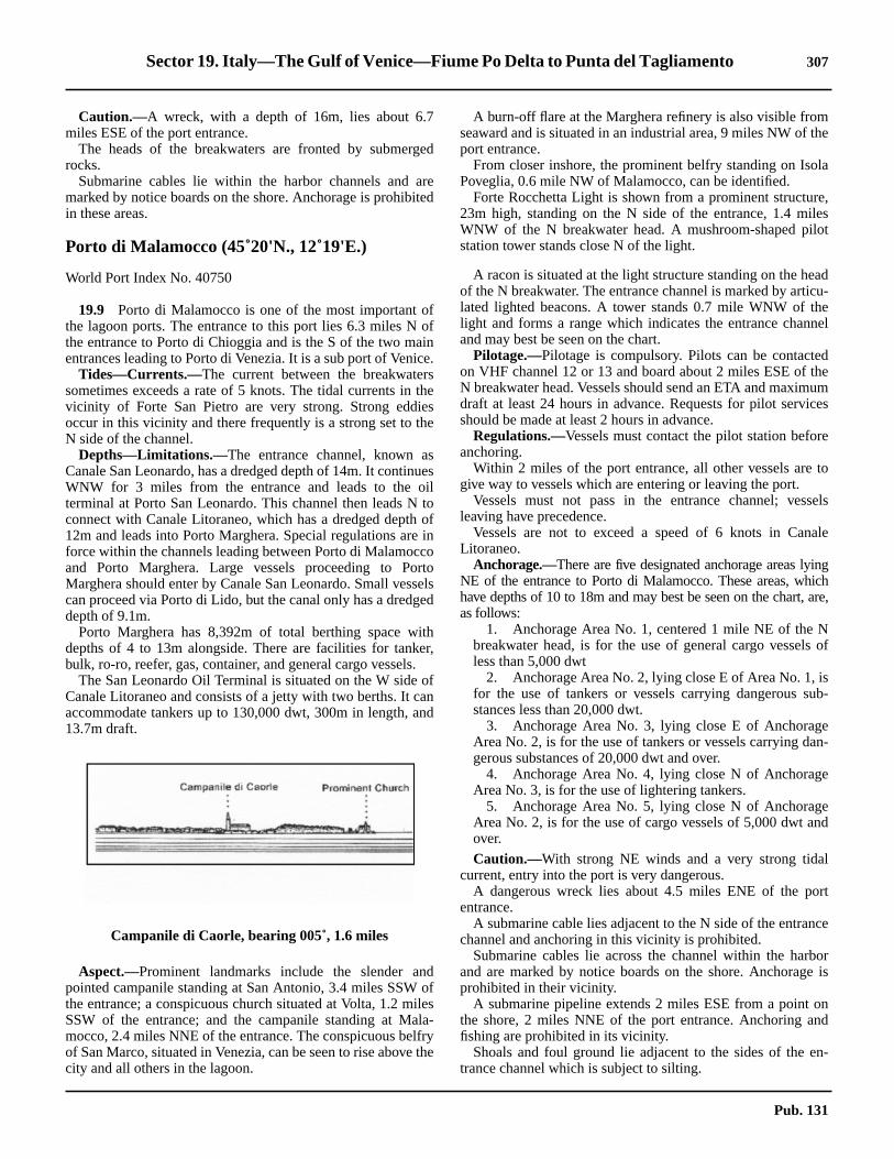
Sector 19. Italy—The Gulf of Venice—Fiume Po Delta to Punta del Tagliamento 307
the
la
e,leslot
adcu-enel
dheum
ces
e
to
sels
ale
ingichare,
Nof
isub-
en-
e
end
l
rt
ce
bore is
nnd
n-
19.8 Caution.—A wreck, with a depth of 16m, lies about 6.7miles ESE of the port entrance.19.8 The heads of the breakwaters are fronted by submergedrocks.19.8 Submarine cables lie within the harbor channels and aremarked by notice boards on the shore. Anchorage is prohibitedin these areas.
Porto di Malamocco (45˚20'N., 12˚19'E.)
World Port Index No. 40750
19.9 Porto di Malamocco is one of the most important ofthe lagoon ports. The entrance to this port lies 6.3 miles N ofthe entrance to Porto di Chioggia and is the S of the two mainentrances leading to Porto di Venezia. It is a sub port of Venice.19.9 Tides—Currents.—The current between the breakwaterssometimes exceeds a rate of 5 knots. The tidal currents in thevicinity of Forte San Pietro are very strong. Strong eddiesoccur in this vicinity and there frequently is a strong set to theN side of the channel.19.9 Depths—Limitations.—The entrance channel, known asCanale San Leonardo, has a dredged depth of 14m. It continuesWNW for 3 miles from the entrance and leads to the oilterminal at Porto San Leonardo. This channel then leads N toconnect with Canale Litoraneo, which has a dredged depth of12m and leads into Porto Marghera. Special regulations are inforce within the channels leading between Porto di Malamoccoand Porto Marghera. Large vessels proceeding to PortoMarghera should enter by Canale San Leonardo. Small vesselscan proceed via Porto di Lido, but the canal only has a dredgeddepth of 9.1m.19.9 Porto Marghera has 8,392m of total berthing space withdepths of 4 to 13m alongside. There are facilities for tanker,bulk, ro-ro, reefer, gas, container, and general cargo vessels.19.9 The San Leonardo Oil Terminal is situated on the W side ofCanale Litoraneo and consists of a jetty with two berths. It canaccommodate tankers up to 130,000 dwt, 300m in length, and13.7m draft.
19.9 Aspect.—Prominent landmarks include the slender andpointed campanile standing at San Antonio, 3.4 miles SSW ofthe entrance; a conspicuous church situated at Volta, 1.2 milesSSW of the entrance; and the campanile standing at Mala-mocco, 2.4 miles NNE of the entrance. The conspicuous belfryof San Marco, situated in Venezia, can be seen to rise above thecity and all others in the lagoon.
19.9 A burn-off flare at the Marghera refinery is also visible fromseaward and is situated in an industrial area, 9 miles NW ofport entrance.19.9 From closer inshore, the prominent belfry standing on IsoPoveglia, 0.6 mile NW of Malamocco, can be identified.19.9 Forte Rocchetta Light is shown from a prominent structur23m high, standing on the N side of the entrance, 1.4 miWNW of the N breakwater head. A mushroom-shaped pistation tower stands close N of the light.
19.9 A racon is situated at the light structure standing on the heof the N breakwater. The entrance channel is marked by artilated lighted beacons. A tower stands 0.7 mile WNW of thlight and forms a range which indicates the entrance chanand may best be seen on the chart.19.9 Pilotage.—Pilotage is compulsory. Pilots can be contacteon VHF channel 12 or 13 and board about 2 miles ESE of tN breakwater head. Vessels should send an ETA and maximdraft at least 24 hours in advance. Requests for pilot servishould be made at least 2 hours in advance.19.9 Regulations.—Vessels must contact the pilot station beforanchoring.19.9 Within 2 miles of the port entrance, all other vessels aregive way to vessels which are entering or leaving the port.19.9 Vessels must not pass in the entrance channel; vesleaving have precedence.19.9 Vessels are not to exceed a speed of 6 knots in CanLitoraneo.19.9 Anchorage.—There are five designated anchorage areas lyNE of the entrance to Porto di Malamocco. These areas, whhave depths of 10 to 18m and may best be seen on the chart,as follows:
1. Anchorage Area No. 1, centered 1 mile NE of thebreakwater head, is for the use of general cargo vesselsless than 5,000 dwt
2. Anchorage Area No. 2, lying close E of Area No. 1,for the use of tankers or vessels carrying dangerous sstances less than 20,000 dwt.
3. Anchorage Area No. 3, lying close E of AnchoragArea No. 2, is for the use of tankers or vessels carrying dagerous substances of 20,000 dwt and over.
4. Anchorage Area No. 4, lying close N of AnchoragArea No. 3, is for the use of lightering tankers.
5. Anchorage Area No. 5, lying close N of AnchoragArea No. 2, is for the use of cargo vessels of 5,000 dwt aover.
19.9 Caution.—With strong NE winds and a very strong tidacurrent, entry into the port is very dangerous.19.9 A dangerous wreck lies about 4.5 miles ENE of the poentrance.19.9 A submarine cable lies adjacent to the N side of the entranchannel and anchoring in this vicinity is prohibited.19.9 Submarine cables lie across the channel within the harand are marked by notice boards on the shore. Anchoragprohibited in their vicinity.19.9 A submarine pipeline extends 2 miles ESE from a point othe shore, 2 miles NNE of the port entrance. Anchoring afishing are prohibited in its vicinity.19.9 Shoals and foul ground lie adjacent to the sides of the etrance channel which is subject to silting.
Campanile di Caorle, bearing 005˚, 1.6 miles
Pub. 131

308 Sector 19. Italy—The Gulf of Venice—Fiume Po Delta to Punta del Tagliamento
ds
sdt be
ity
h,d at
terhe
de.3an
her
forla-
ayagek-wt.e
n-
-
heof
b-
19.9 A prohibited area marking an area of works in progress(2006) lies in the entrance channel to Porti di Malamocco andto the S and E of the S entrance breakwater. Mariners must re-main at least 50m clear of the area.
Porto di Lido (45˚25'N., 12˚26'E.)
World Port Index No. 40760
19.10 Porto di Lido (Porto di Venezia), the N of the twoentrances leading to Porto di Venezia, lies 7 miles NNE of theentrance to Porto di Malamocco and is protected by two break-waters.19.10 Tides—Currents.—The rates of the tidal currents are vari-able and may sometimes reach 3 knots. Strong SE winds, atsprings, sometimes cause an extraordinary rise of the tidewhich may flood the quays.19.10 A 36-hour tidal height forecast can be accessed from theComume di Venezia web page, as follows:
19.10 Depths—Limitations.—The access channel to Porto diLido is dredged to a depth of 11m. Canale di San Nicolo leadsSW from the entrance to Santa Elena, the E suburb of the cityof Venezia. Its SE side is formed by San Nicolo di Lido and itsNW side by Le Vignole, a group of three islands. Forte SanAndrea, situated on the SE end of this group, is very conspic-uous.19.10 Arsenale, a naval installation, is situated at the head ofCanale delle Navi, which leads 1.8 miles NW from the W sideof Canale di San Nicolo.19.10 Canale di San Marco is entered from the W end of Canale diSan Nicolo, S of Santa Elena. It leads NW and W along the Sside of the city and connects with Canale della Giudecca in thevicinity of Punta della Salute. Canale di San Marco is quayedas far W as the famed Piazza San Marco, at the N entrancepoint of Canale Grande. Mooring buoy berths are also situatedin this canal and used by large naval, passenger, and cruisevessels.19.10 Canale Orfano, entered from Canale di San Marco SW ofSanta Elena, leads to Porto di Malamocco through a network ofcanals.19.10 Canale della Giudecca, a continuation of Canale di SanMarco, leads W to Porto Marittima (Porto Commerciale), thecommercial cargo facility at the W side of the city. A turningbasin lying SW of Porto Marittima has a depth of 10.4m.19.10 Port Marittima, the commercial harbor for Porto di Venezia,has 3,597m of total berthing space with depths of 8 to 10malongside. There are facilities for general cargo, passenger,bulk, ro-ro, and container vessels. There are also numeroussmall craft harbors and marinas within the canal complex.19.10 Aspect.—The buildings of the city of Venezia, situated 3.5miles W of the port entrance, are mostly obscured, but thebelfry of San Marco rises above the city and serves as a goodlandmark from seaward. The belfry is large and is surmountedby a greenish-colored spire. Also conspicuous is the large
Hotel Excelsior, surmounted by two cupolas, which stannear the beach, 2 miles SSW of the port entrance.19.10 A light is shown from a tower, 35m high, standing 3.8 mileNW of the port entrance. This light forms part of a lighterange which indicates the entrance channel and may besseen on the chart.
19.10 A prominent disused signal station stands on the N extremof San Nicolo di Lido, 2.1 miles WNW of the head of the Nbreakwater.19.10 A light is shown from a conspicuous structure, 25m higstanding on the head of the N breakwater. A racon is situatethis light.
19.10 The entrance channel is marked by lighted buoys; an ouapproach lighted buoy is moored about 2.3 miles SE of thead of the N breakwater.19.10 Pilotage.—Pilotage is compulsory. Pilots can be contacteon VHF channel 13. Venice Harbor Control, call sign VenicPilot Station, monitors VHF channel 12. The pilot boards 2miles SE of the N breakwater head. Vessels should sendETA at least 2 hours in advance.19.10 Regulations.—Entry regulations for Porto di Lido and Ven-ezia are the same as those for Porto di Malamocco. For furtinformation, see paragraph 19.9.19.10 Vessels carrying inflammable or dangerous cargos boundPorto Marghera are required to enter through Porto di Mamocco not Porto di Lido.19.10 Anchorage.—Two designated anchorage areas, which mbest be seen on the chart, lie E of the port entrance. AnchorArea No. 1 lies centered 2 miles E of the head of the N breawater and is for the use of cargo vessels of less than 5,000 dAnchorage Area No. 2, lying close E of Area No. 1, is for thuse of cargo vessels of 5,000 dwt and over.19.10 There is insufficient swinging room for large vessels to achor within the port.19.10 Caution.—The entrance to Porto di Lido is subject to silting.19.10 A submarine pipeline extends 2.2 miles S from a point on tshore, 3 miles ENE of the port entrance. The seaward endthis pipeline is marked by a lighted buoy; anchoring is prohiited in its vicinity.
Comune di Venezia—Tidal Height Forecast
http://www.comune.venezia.it/maree/en_previsione.asp
Piave Vecchia Light
Pub. 131

Sector 19. Italy—The Gulf of Venice—Fiume Po Delta to Punta del Tagliamento 309
ichh.hea
outve
reis
daleis
aft.vi,lyalorend
lly
hdel
g,d,
19.10 Numerous ferries ply within the port and the canals.
Porto di Lido to Punta del Tagliamento
19.11 Porto di Piave Vecchia(45˚29'N., 12˚35'E.) lies atthe mouth of Fiume Sile, 7.3 miles ENE of the entrance toPorto di Lido. This small boat harbor is entered between rubblebreakwaters and is blocked by shoals. A light is shown from aprominent structure, 48m high, standing near the river mouth.A prominent water tower stands 2.5 miles W of the light.19.11 Caution.—A marine farm, best seen on the chart, is located1.7 miles S of Porto di Piave Vecchia. It is marked by a lightedbuoy.
19.12 The coast between this river mouth and Punta del Tag-liamento is backed by two lagoons, Laguna Veneta and Lagunadi Caorle. Inland waterways connect these lagoons withVenezia and other ports.19.12 Porto di Cortellazzo lies at the mouth of Fiume Piave, 7miles ENE of Porto di Piave Vecchia. This river is only naviga-ble by small and light-draft craft with drafts of less than 2.5m.The houses of the village stand near the river mouth and arevisible between the tall trees. Three submerged concretecolumns, about 50m apart, lie 600m S of the river mouth. Thisriver sometimes deposits a very white-colored and milky sub-stance into the sea which, when seen from a distance, appearsas a white and sandy stretch of beach.
19.13 Porto Santa Margherita di Caorle (45˚35'N.,12˚52'E.) lies at the mouth of Fiume Livenza and can only beentered by small boats with drafts of less than 2m. Two jettiesform the entrance to the river mouth. Caorle, a conspicuoussmall town, is situated 1 mile NE of the mouth and is protectedby a stone seawall. A prominent campanile stands in this town
and another campanile surmounts a prominent church whstands on a point, close NE. A light is shown from the churcA submerged mole extends 0.3 mile SE from a point on tshore, 0.2 mile N of Caorle Light. Its outer end is marked byred barrel-shaped marker.19.13 Vessels can anchor, in a depth of 12m, mud and sand, ab2 miles offshore, anywhere between the mouth of Fiume Piaand Caorle.19.13 Caution.—A circular area, with a radius of 0.2 mile, whereanchoring, stopping, fishing, and all underwater activities aprohibited, lies centered on position 45˚3.6'N, 12˚52.9'E. This the site of an historic wreck.19.13 Several stranded wrecks lie along this stretch of coast.
19.14 Porto di Falconera lies 1.3 miles ENE of Caorle anconsists of the lower reach of Fiume Lemene and CanNicessolo. It provides access to Laguna di Caorle, butobstructed by sand banks and is frequented only by small cr19.14 Porto di Baseleghe, an inlet at the mouth of Canale dei Lolies 3 miles E of Porto di Falconera and is almost completeobstructed by shoals. It is used only by small craft with locknowledge. A prominent red frame house stands on the shat the W side of the inlet. The coast between this inlet aPunta del Tagliamento is low and wooded.
19.14 Punta del Tagliamento (45˚38'N., 13˚06'E.), located 5miles E of Porto di Baseleghe, is marked by a light and is fudescribed in paragraph 20.2.19.14 Caution.—An anchoring and fishing prohibited area, whicmay best be seen on the chart, lies 11.5 miles S of PuntaTagliamento.19.14 A circular area, with a radius of 0.2 mile, where anchorinstopping, fishing, and all underwater activities are prohibitelies centered on position 45˚33.2'N, 13˚11.1'E.
Pub. 131


311
20.Italy and Slovenia—The Gulf of Trieste and the Istrian
Peninsula
20.0Additional chart coverage may be found in NGA/DLIS Catalog of Maps, Charts, and Related Products (Unlimited Distribution).SECTOR20 — CHART INFORMATION
Pub. 131


313
tsditlyuc-5m,
ng
rea
i-
ee
an-geose
borebend
ija,ns.ns.tely
aesonof
ctsillas
rdsthean
heisseare
ll
SECTOR 20
ITALY AND SLOVENIA—THE GULF OF TRIESTE AND THE ISTRIAN PENINSULA
20.0 Plan.—This sector describes the N coast of Italy on theAdriatic Sea, including that bordering the N side of the Gulf ofTrieste. It also describes the coast of Slovenia (formerlyYugoslavia), which forms the E side of the Gulf of Trieste. Thedescriptive sequence is E and SE from Punta del Tagliamentoto the NW approaches of Porto di Trieste, and then N and NEfrom Rt Marlera to and including Porto di Trieste.
General Remarks
20.1 Regulations.—Tanker vessels of 1,600 grt and overentering or leaving Italian ports and carrying, or withuncleaned tanks which last carried, petroleum, gas, or chemicalproducts should report to a shore station before entering Italianterritorial waters off Italian ports. For further details, see Pub.140, Sailing Directions (Planning Guide) North AtlanticOcean, Baltic Sea, North Sea, and the Mediterranean Sea.20.1 Caution.—Vessels have been advised to avoid some of theports and territorial waters of the former Yugoslavia. Therehave been reports of port blockades, vessels being fired upon,and indiscriminate minelaying.
Changes to the North Adriatic Traffic Separation Scheme(TSS), including the approaches to Venice and Trieste, are setto be implemented in July 2007.
Punta del Tagliamento to Porto di Monfalcone
20.2 Punta del Tagliamento(45˚38'N., 13˚06'E.) is a lowpoint of land forming the S side of the mouth of FiumeTagliamento which is obstructed by shoals. A light is shownfrom a prominent structure, 21m high, standing on the point.20.2 A large tank and several buildings are situated 2 miles N ofthe light and are conspicuous from seaward. A small pier, witha depth of 2.5m at its head, is situated 2 miles NNE of the lightand fronts a resort area.
20.2 Porto Lignano (45˚42'N., 13˚09'E.), a small harbor, consisof a channel, 1 mile long, which extends N into LagunaMarano. This harbor is fronted by a sand bar and is mosused by light-draft vessels, small craft, and yachts. An obstrtion light marks a tall building, 60m high, which stands 1.miles SW of the harbor. Vessels can anchor, in a depth of 10mud, about 2 miles SE of the entrance.20.2 Caution.—An outfall pipeline extends 4 miles SE from apoint on the shore, 1.8 miles SW of the entrance. Anchoriand fishing are prohibited in its vicinity.20.2 An outfall extends 3.6 miles SSE from a point on the S shoof Isola di Sant’Andrea. The seaward end is marked bylighted buoy. Anchoring and fishing are prohibited in the vicnity of the piping.
20.3 Porto Buso(45˚43'N., 13˚15'E.) lies at the confluencof two rivers, which form two inland waterways. The entrancis marked by lighted and unlighted beacons; the narrow chnel leads between shallow shoals. The buildings of the villastand on both sides of the mouth which is protected by twsmall breakwaters. Small coasters, with local knowledge, uthis entrance and proceed to Porto Nogaro, a small harbasin, lying 4 miles inland. A local pilot is available; pilotagis required for vessels over 500 gross tons. The pilot maycontacted on VHF channel 12. Vessels up to 80m in length awith a maximum draft of 5m can be handled.
20.4 The Gulf of Trieste (Trscanski Zaliv) (45˚40'N.,13˚35'E.) is entered between Grado and Rt Gornja Savudr11.5 miles SSE. The N side is low and is backed by lagooThe NE side is high, precipitous, and is backed by mountaiThe SE side is deeply indented and is backed by moderahigh hills.
20.4 Grado (45˚40'N., 13˚23'E.) (World Port Index No. 40780),small town and resort, stands on a low and flat islet which facthe sea. The town is connected to the mainland N of the lagoby a causeway which carries a roadway and forms the E sideCanale di Belvedere. A bridge, with a moveable span, connethe town and the causeway. There are numerous beach vand hotels situated in the vicinity of the town.20.4 A dredged entrance channel leads W of the town and affoaccess to a small harbor at Grado and to the channels oflagoon. This channel is marked by dolphins and masts andouter approach lighted buoy is moored about 2 miles SW of ttown. It is reported (1988) to have a least depth of 3m, but itsubject to silting. It has been reported (1994) that thedolphins no longer mark the channel, and those that remainpoorly maintained.20.4 Winds from the S quadrant, which are predominant in faand spring, cause a very rough sea in the entrance.Punta del Tagliamento bearing N
Pub. 131

314 Sector 20. Italy and Slovenia—The Gulf of Trieste and The Istrian Peninsula
ay,m
de;ofls.en
-ns.orted a
ea-1.5
rtn-n-
s.ce
to
tion,estits
its
no
isisthehingtly
edstleithe,isse
erndse
ner
20.4 Vessels are advised to use the channel only in calm weatherand to proceed with caution at a speed not exceeding 7 knots,because when exceeding this speed they may have difficultymaneuvering in the shallow and confined waters. The banks areaffected by freshets from the lagoons and by strong winds fromseaward and the depths are liable to change. Local pilots areavailable. The port monitors VHF channel 16. The channel isused by small craft, pleasure craft, and small coasters. Largevessels can anchor offshore to the SSE of Grado. The holdingground of sand and mud is good.20.4 The campaniles standing at Grado and at Aquileia, 5.5 milesN of Grado, are prominent from seaward.20.4 Between Grado and Punta Sdobba, 7 miles ENE, the coast isfronted by shoals, with depths of less than 5m, which extend upto 1.8 miles offshore. Banco Mula di Muggia, most of whichdries, forms the W part of these shoals and is marked by alighted beacon situated about 2.3 miles SE of Grado. Thisdrying shoal is reported to be extending to the E.20.4 Caution.—An outfall extends 3 miles SE from a point onthe coast about 3 miles NE of Grado. Anchoring and fishingare prohibited in the vicinity of the outfall.20.4 A circular prohibited area is located adjacent to and SW ofthe outfall. This area is dangerous due to the probable presenceof bottom mines.20.4 An outfall pipeline extends 2.5 miles SE from a point on theshore at the E end of Banco Mula di Muggia.
20.5 Punta Sdobba(45˚43'N., 13˚33'E.), a low and sandypoint, is formed at the confluence of several rivers. Dryingsandbanks extend up to about 0.7 mile E from this point. Acoastal bank, with depths of less than 5m, extends up to about0.9 mile from the point and is marked by a lighted beacon situ-ated on its SE side. It is reported that less water than chartedmay exist in this vicinity and vessels should give this area awide berth. A small craft channel, marked by piles, leadsthrough the shoals and drying flats to the river entrance.20.5 Golfo di Panzano, the shores of which are low, lies betweenPunta Sdobba and Duino, 3.4 miles NE. Duino consists of aclose group of yellowish-colored houses and a veryconspicuous castle. This small town is fronted by a smallharbor which is protected by two moles and is used by fishingboats and pleasure craft.
Porto di Monfalcone (45˚47'N., 13˚33'E.)
World Port Index No. 40790
20.6 The port of Monfalcone lies in the NW corner ofGolfo di Panzano and is approached through a dredgedchannel. The harbor has commercial facilities for mostly bulkcargo and a shipyard.
20.6 Tides—Currents.—Tides rise about 0.9m at springs and0.6m at neaps.20.6 Depths—Limitations.—The entrance channel, which is4,500m long and 170m wide, was dredged to a depth of 10.5m
(1993). The main commercial quays include Portorosega Quwith 1,000m of total berthing space and depths of 7.5 to 9.5alongside; Cereal Quay, 120m long, a depth of 10m alongsiand an ENEL power station quay, 330m long, with a depth9.5m alongside. There are facilities for tanker and bulk vesseVessels up to 180m in length and 10.2m draft have behandled at HW.20.6 Aspect.—The town of Monfalcone, situated 1.5 miles inland, is mostly obscured by the shipyard and port installatioProminent landmarks include the castle at Duino; several resbuildings standing on the shore of the bay to the NW of thharbor; a group of silos situated at the head of the harbor; antall chimney standing at the power station in Monfalcone.
20.6 The entrance channel is marked by lighted buoys and bcons. An outer approach lighted beacon is situated aboutmiles SSW of the castle at Duino.20.6 Pilotage.—Pilotage is compulsory for vessels over 500 gand is available during daylight hours only. Pilots can be cotacted on VHF channel 14 and board 1 mile off the port etrance.20.6 Regulations.—Vessels carrying polluting or dangeroucargo must report to the harbormaster 24 hours in advance20.6 A speed of 5 knots is not to be exceeded in the entranchannel or harbor.20.6 Anchorage.—Large vessels may anchor, in depths of 1012m, about 1.6 miles SSE of the castle at Duino.20.6 Caution.—A submarine water pipeline, which stands 2mabove the sea bottom and constitutes a permanent obstrucextends SE between Duino and Porto di Trieste and may bbe seen on the chart. Anchoring and fishing are prohibited invicinity.20.6 A fishing prohibited area extends W from the pipeline andassociated restrictions and may best be seen on the chart.20.6 A submarine pipeline extends SSE from Golfo di Panzaand is best seen on the chart.
Porti di Monfalcone to the Northwest Approach-es of the Gulf of Trieste
20.7 Sistiana(45˚46'N., 13˚38'E.) (World Port Index No.40800), a small town, is situated at the head of an inlet whichsurrounded by a chain of hills with luxurious vegetation. Iteasily identified by the open limestone quarries situated onsurrounding hills. The town is fronted by a small harbor whicis protected by two breakwaters. There are 200m of berthspace with depths of 4 to 4.9m alongside. The harbor is mosused by small craft, pleasure craft, and local ferries.20.7 Between Sistiana and Miramare, a rocky projection locat5.5 miles SE, the coast is high and steep. A conspicuous castands on Miramare and a conspicuous water tank, wbricked up window-like openings, is situated on the cliff edg1 mile SE of Sistiana. The prominent aqueduct of Aurisinasituated 1 mile SE of the water tank and a tower stands cloinland of it. A small boat harbor, formed by a short breakwatand a mole, lies close SE of the aqueduct. The small aprominent town of Santa Croce di Trieste stands on a hill, cloinland of this boat harbor.20.7 Valle Grignano, a small craft harbor, lies in a small bay othe NW side of Miramare. It is formed by a short breakwat
Poro di Monfalcone Home Page
http://www.porto.monfalcone.gorizia.it
Pub. 131

Sector 20. Italy and Slovenia—The Gulf of Trieste and The Istrian Peninsula 315
ne-
rti
r-tond
togeoverm
1mroot
m
toand
o-
parouse
ved
t.es-ETAre-
-gearers.val
ynd
e
liesreof
and a mole. There are depths of 2 to 6m in the harbor which ismostly used by pleasure craft.20.7 Barcola, a small harbor, lies in the NW approaches to Tri-este, 2.2 miles SE of Miramare. It is protected by an angledbreakwater and a mole. There are depths of 2.5 to 3.5m in thetwo basins of the harbor and they are mostly used by pleasurecraft.
Rt Marlera to the Southeast Approaches of theGulf of Trieste
20.8 Rt Marlera (44˚48'N., 14˚00'E.) is the E point of theS extremity of Istria, a mountainous peninsula, which separatesthe Gulf of Venice from the Gulf of Kvarner. This cape is 21mhigh, bare, steep-to, and projects 1.7 miles SE from the penin-sula. A light is shown from a structure, 9m high, standing onthis cape.20.8 The W side of Istria, extending N and NE to Trieste, has anirregular shoreline which is mostly bare except for a sprinklingof low, green bushes. The land rises gradually from the shore inundulating hills on which there are situated numerous scatteredvillages, vineyards, and olive and cedar groves. These hillsterminate in a dominating mountainous ridge.20.8 The W side of Istria is fronted by numerous islands, androcks and shoals extend up to 2 miles offshore in places.
20.9 Rt Kamenjak (44˚46'N., 13˚55'E.), the S extremity ofIstria, is a narrow and hilly point of land, 46m high. This pointis not defined, except in very clear weather, and vesselsapproaching from the E will first sight the bell towers ofseveral hill-top villages and the light structure at Hrid Porer.The prominent village of Premantura is situated 2.5 miles N ofthe extremity of the point. A signal station and a radiobeaconare situated on the point.20.9 Hrid Porer, a rock 7m high, lies near the outer end of a reefwhich extends up to 1.3 miles SW from the W face of RtKamenjak. A light is shown from a structure, 31 high, standingon this rock. A racon is situated at the light structure.20.9 Plicina Albanez, a rock, lies 1.5 miles SSE of Hrid Porer. Ithas a depth of 2.7m and is surrounded by dangers. A light isshown from a structure, 15m high, standing on this rock. Whenthis light is extinguished, a light is shown from a structure, 2mhigh, standing on the S end of the dangers around Hrid Porer.20.9 Medulinski Zaljev, entered between Rt Marlera and RtKamenjak, is divided into inner and outer bays by Rt Kasteja,the extremity of a low peninsula which projects S from the NEside. The outer bay contains several islets and rocks. OtocicFinera, the outermost islet, is marked by a beacon. Smallvessels, with local knowledge, can anchor, in a depth of 16m,mud, about 0.2 mile NNW of this islet.20.9 The coast between Rt Kamenjak and Rt Kumpar, 8 milesNW, consists of an irregular and hilly shoreline which is in-dented by many small coves. Rt Verudica, located 5.5 milesNW of Rt Kamenjak, is surmounted by a hotel and a ruinedconvent. A light is shown from the point.20.9 A conspicuous signal station is situated at a fort surmountinga hill, 0.7 mile SSE of Rt Kumpar.
Luka Pula (44˚53'N., 13˚48'E.)
World Port Index No. 40960
20.10 Luka Pula, which is essentially a naval base, is aalmost landlocked basin surrounded by hills. It is entered btween Rt Kumpar and Rt Kristo, 0.9 mile N.20.10 Depths—Limitations.—The entrance is narrowed to awidth of about 450m by a breakwater which extends NNWfrom Rt Kumpar. The harbor is divided into outer and innepart by two islets, Otocic Sveta Katarina and Otocic SveAndrija, and by Poluoticic Sveti Petar, a low projection sumounted by a cement factory. The inner harbor is divided intwo parts by Otocic Uljanic and has a marina, a naval base, aseveral commercial facilities.20.10 Depths in the outer harbor vary from 37m at the entrance22m close S of Otocic Sveti Andrija. The passage for larvessels leads S and E of the above island and has depths of18m. Depths in the middle of the inner harbor decrease fro27 to 9m.20.10 An oil pier is situated on the E side of the outer harbor,mile SE of Rt Kristo. It is 100m long and has a depth of 8.5at the head. Several oil storage tanks are situated near theof the pier.20.10 Poluoticic Sveti Petar, Rijeka, and Ugljan Quays have 900of total berthing space, with depths of 4 to 9m alongside.20.10 The quayed berths fronting the town have depths of 36.1m alongside and are used by ferries, fishing vessels,coasters.20.10 Vessels up to 18,000 dwt and 7m draft have been accommdated.20.10 Aspect.—The land in the vicinity of Luka Pula is not highand the only prominent points near the entrance are Rt Kumand a steep point, 81m high, located 1 mile SSE. Conspicuforts stand on the summits of the hills which surround thharbor. The Roman amphitheater, having high and preserwalls, is conspicuous on the close approach to the harbor.20.10 Pilotage.—Pilotage is compulsory for vessels over 500 grPilots can be contacted on VHF channel 9 or 12 and board vsels near the breakwater entrance. Vessels should send an48 hours and 24 hours in advance. Pilot services should bequested 24 hours in advance.20.10 Anchorage.—The harbor is of sufficient size to afford several anchorage berths, in depths of 11 to 35m, mud. A larnumber of small ships can also be accommodated. Thereseveral mooring buoys situated in the outer and inner harboPermission for anchorage should be obtained from the naauthorities.20.10 Caution.—Anchorage is prohibited in an area, which mabest be seen on the chart, lying between Otok Veli Brijun athe mainland and in the outer part of Luka Pula.20.10 Several submarine cables are laid in the vicinity of thharbor and may best be seen on the chart.20.10 A restricted area, which may best be seen on the chart,centered 3 miles SW of Rt Kumpar. Anchoring and fishing aprohibited within the restricted area due to the presenceexplosives scattered on the bottom.
Pub. 131

316 Sector 20. Italy and Slovenia—The Gulf of Trieste and The Istrian Peninsula
gef
orthe
isut
.to
he
cen-
ts,lies
Rt,a
of
tishthe
20.11 Brionski Otoci(44˚55'N., 13˚45'E.) is separated fromthe coast by Fazanski Kanal and consists of a group of islandswhich are composed of marble and covered with thick bushand low trees. Numerous islets, rocks, and reefs extend up to1.5 miles W and NW of the two principal islands, Otok VelikiBrijun and Otok Mali Brioni.20.11 Otok Veliki Brjun, the S island, is 58m high and has a con-spicuous fort situated on its summit. A light is shown from astructure, 15m high, standing on Rt Peneda, the S extremity ofthe island.
20.11 Otok Mali Brioi, the N island, has a prominent stone quarrysituated on it. Reefs extend up to 1.3 miles NW of the NWextremity of this island and are marked by a lighted beacon.20.11 Caution.—A prohibited area, which may best be seen on thechart, extends up to 1.6 miles seaward of the W side of Brion-ski Otoci.
20.12 Fazanski Kanal(44˚53'N., 13˚48'E.), a channel, liesbetween the mainland and Brionski Otoci and extends betweenRt Kristo and Rt Barbariga, 6.4 miles NE. Otok Sveti Jerolim,Otocic Kozada, and Plicina Kozada lie in mid-channel at the Spart of the passage. The best route leads to the W of these threeislands.20.12 A least depth of 10.4m exists in the fairway of the narrowestpart of the channel, which is about 300m wide, but with ex-treme care a least depth of 11.9m can be maintained.
20.12 The E side of the channel is bordered by a narrow, shallowreef and indented by a number of small and shallow coves.Otok Sveti Jerolim consists mainly of two hills, the higher andNW one being 17m high. A conspicuous quarry, with steepsides, is situated on the island. A short pier, with a depth of40m at its head, projects from the NW side of the island.20.12 Otocic Kozada, 9m high, is surrounded by a narrow reef. Ashort pier, with a depth of 3m, projects from the NE side of thisislet.
20.12 Luka Fazana, a small and shallow harbor, fronts the villaof Fazana, 2.3 miles N of Rt Kristo. The prominent town oVodnjan stands on a hill, 135m high, 3 miles NE of the harband serves as a good landmark. A reef borders the shore toS of the harbor entrance and is marked by a buoy.20.12 Rt Mrtulin is located 1.7 miles NNW of Fazana. A reef, witha depth of 3.2m, extends 0.5 mile W from this point andmarked by a buoy. Two conspicuous lime kilns stand abomidway between Rt Mrtulin and Rt Barbariga, 3 miles NNW20.12 Caution.—Passage through Fazanski Kanal is prohibitedall vessels without prior permission.20.12 Submarines exercise frequently in the N entrance to tchannel.20.12 Several submarine cables and pipelines cross the S andtral parts of the channel.
20.13 Rt Korente (45˚04'N., 13˚38'E.) is located 6.5 milesNW of Rt Barbariga. The coast between is bordered by islerocks, and sunken dangers. The outer danger, Plicina Porer,about 2 miles offshore and has a least depth of 8.1m.20.13 A chain of islets and rocks extends 1.5 miles SSW fromKorente. Hrid Sv Ivan na Pucini is a rocky islet, 9m highwhich lies at the SW end of the chain. A light is shown fromstructure, 15m high, standing on this rock.20.13 A dangerous wreck is reported to lie about 2 miles NWthe light.20.13 Rt Montauro, located 0.4 mile NNE of Rt Korente, is 34mhigh and the N extremity of a rounded promontory.
Luka Rovinj (45˚05'N., 13˚38'E.)
World Port Index No. 40940
20.14 Luka Rovinj, an industrial town, stands in a bighentered between Rt Montauro and Rt Mucja, 0.8 mile N. Thbight is divided into two bays by a small peninsula whicprojects W and terminates in Rt Sveta Eufemija. The bay to
View, in two parts, of the coast in the vicinity of Luka Rovinj
Pub. 131

Sector 20. Italy and Slovenia—The Gulf of Trieste and The Istrian Peninsula 317
of
sis
es
Rtx-i-ntofesish-
omtd is
sthe
e in0rs.ies
Nls.aileter,up
rs.all
S of the peninsula contains two coves. The town stands partlyon this peninsula and partly on the slopes of the surroundinghills.20.14 Otocic Sveta Katarina, an island, lies 0.4 mile S of Rt SvetaEufemija and has a conspicuous red-colored building standingnear its center. Two small islets lie 0.5 mile W of Rt Mucja.Otocic Banjole, the outer island in the entrance, lies 1 mile SWof Rt Sveta Eufemija and is 15m high and steep-to.20.14 Depths—Limitations.—Depths of 11 to 26m lie in the outerpart of the bay, S of Otocic Sveta Katarina. A harbor, protectedby breakwaters, provides quays with depths of 2 to 7m along-side. Vessels with drafts up to 6m can be accommodated. Thereare facilities for general cargo and passenger ferry vessels.20.14 Aspect.—Turnina Vrh, 107m high and surmounted by ruins,stands 2 miles ENE of the town. Sveti Martin Vrh, 230m high,stands 5 miles NE of the town and is also prominent. Otherprominent landmarks include a pointed campanile standingnear Rt Sveta Eufemija; the ancient quarries on Rt Montauro;and a tower standing 0.7 mile N of Rt Mucja.20.14 Pilotage.—Pilotage is compulsory. Pilots can be contactedby VHF and board close W of Otocic Sveta Katarina. Pilots areprovided from Pula and must be requested 24 hours in advance.20.14 Anchorage.—Vessels can anchor, in depths of 20 to 24m,about 300m NNW of the pointed campanile near Rt SvetaEufemija. Anchorage can also be taken, in a depth of 31m,about 600m SW of Otocic Banjole.
20.15 Limski Kanal (45˚07'N., 13˚36'E.) is enteredbetween Rt Kriz, located 2.4 miles NW of Rovinj, and RtSjole, 1 mile NNW. The canal is 5 miles long and has steepsides which vary from 61 to 152m in height. Trees and thickbush cover the banks and the canal is exposed to W winds andseas. The depths decrease gradually towards the head of thecanal from 33m at the mouth. It has been declared a naturereserve and is only used by pleasure craft and yachts.
20.15 Rocky shoals extend up to 1.3 miles SW, W, and NW of RtSjole and are marked by buoys and beacons. Plicina Mramori,the outermost rocky shoal, lies about 1.8 miles NW of Rt Sjoleand is marked by a lighted beacon.20.15 Luka Porec lies 6 miles N of the entrance to Limski Kanal.The coast between is lower than that to the S and is fronted byislets, rocks, and shoals which extend up to 1.5 miles offshore.20.15 Vessels, except those with local knowledge bound for thesmall harbors along this stretch of coast, should give this partof the coast a wide berth.
20.16 Luka Porec(45˚14'N., 13˚35'E.) (World Port IndexNo. 40920) lies between a small peninsula, on which stands thetown of Porec, and a reef, on which lies the island Otocic SvetiNikola. Hrid Barbaran, a low lying flat rock, lies on a reefdirectly N of the entrance. A conspicuous castle is situated onOtocic Sveti Nikola and the church tower and the cathedral,standing in the town, are conspicuous.20.16 Depths of 5 to 8m lie in the middle of the harbor and a wharfand a pier, which front the town, have depths of 2 to 5.2malongside. Pilots are provided from Pula and must be re-quested 24 hours in advance. Large vessels can anchor, as con-venient, in a depth of 22m, good holding ground, WNW ofHrid Barbaran.
20.16 A dangerous wreck is reported to lie about 4 miles WSWLuka Porec.
Rt Zub (Dente) (45˚18'N., 13˚34'E.), marked by a light, ilocated 4.3 miles NNE of Luka Porec. The coast betweenirregular and is fronted by reefs which extend up to 1.7 miloffshore in places.
20.17 Luka Mirna (Porto Quieto) (45˚18'N., 13˚34'E.)(World Port Index No. 40900), a bay, is entered betweenZub and Rt Lameja, 1.2 miles NNW. Rt Lameja is the etremity of a short peninsula on which stands the town of Novgrad (Cittanova). Fiume Mirna discharges through a prominevalley into the NE part of the head of this bay. The S shorethe bay consists of hills and cliffs, whereas the N shore slopgently, except at its E end where there are steep and reddcolored cliffs.20.17 Depths decrease gradually towards the head of the bay fr20m at the entrance. Plicina Val, lying 0.5 mile WSW of RLameja, is the outer danger on the N side of the entrance anmarked by buoy.20.17 The town of Novigrad, with the dark valley of the FiumeMirna in the background, is very prominent. A conspicuouchimney stands at the brickworks situated on the N shore ofbay.20.17 Good anchorage can be obtained by vessels of any sizLuka Mirna, sheltered from all but W winds. Vessels of 7,00dwt and 7.9m draft anchor here and load bauxite from lighteThe best berth for large vessels, in depths of 16 to 18m, labout 0.5 mile offshore; local knowledge is required.
20.18 Novigrad (Cittanova) (45˚19'N., 13˚34'E.) (WorldPort Index No. 40890), a small bay, lies close N of theentrance point of Luka Mirna and is encumbered by shoaThe partially-walled town of Novigrad is built on the peninsulwhich forms the S side of this bay. A conspicuous campanstands in the town. A small harbor, protected by a breakwafronts the town and is accessible to small vessels with draftsto 3m.20.18 Caution.—Several wrecks lie up to 8 miles W of Novigradand may best be seen on the chart.
20.19 Rt Dajla(45˚21'N., 13˚32'E.) is located 2 miles NNWof Novigrad. The coast between is low and clear of dangeLuka Dajla, entered between Rt Dajla and Rt Komun, is sm
Rt Zub Light
Pub. 131

318 Sector 20. Italy and Slovenia—The Gulf of Trieste and The Istrian Peninsula
y.ndis
alyby
dry-ursianer
E
byngds
lareupd.
ic-
ssil-m-i-nn-d
of
ndldare
ap-
ofvendofheof
in extent and suitable for small vessels. A conspicuous conventstands close E of the S entrance point. A reef extends about 0.3mile NW from Rt Dajla and its outer extremity is marked by abuoy. A small pier, with a depth of 3.9m at its head, is situatedon the NE shore of the bay. Small vessels, with local know-ledge, can anchor, in depths of 6 to 8m, close N of the convent.20.19 Luka Umag (45˚26'N., 13˚31'E.) (World Port Index No.40880), a small bay, lies 5 miles NNW of Luka Dajla. Thetown of Umag, which is a resort, stands on the S entrance pointof the bay, which is suitable for small light-draft vessels. Acurved breakwater extends NW from the town and forms asmall harbor with a depth of 4m. Pilots are available from Pulawith 24 hours notice. The pilot boards about 1 mile SW of thebreakwater. Anchorage can be taken, in a depth of 18m, mud,W of the campanile in the town.
Rt Gornja Savudrija (Capo Salvore) (45˚30'N., 13˚30'E.),low and dark, is located 3.8 miles N of Luka Umag. The coastbetween is low and fronted by dangers which extend up to 1.3miles offshore. This cape is the NW extremity of the Istrianpeninsula and has a face, 1.5 miles long. Rt Savudrija Light isshown from a prominent structure, 29m high, standing on RtFar, which is the SW headland of the face.20.19 A dangerous wreck is reported to lie about 5 miles NW ofthe light. A wreck, with a depth of 5.5m, lies about 5.2 milesNNW of the light.20.19 Caution.—Large vessels, with drafts greater than 15m andspeeds greater than 12 knots, should remain at least 2 milesfrom the coast between Rt Savudrija and Luka Koper.
20.20 Piranski Zaliv (Baia di Pirano) (45˚30'N., 13˚34'E.)is entered between Rt Savudrija and Rt Madona, 3 miles NE.Rt Madona is marked by a light and a tower. The NE shore ofthis inlet is backed by hills, which are cultivated with olive andcypress trees, whereas the SW shore is low and has sparsegrowth.
Piran (Pirano) (45˚32'N., 13˚34'E.) (World Port Index No.40870), a small town, is situated on Rt Madona and is frontedby a small craft harbor which is protected by two moles andhas depths of 1.5 to 5.5m. Conspicuous from seaward are theruins of an old castle, situated on the heights to the E of thetown, and the high steeple of a church which stands near theedge of a high wall. Portoroz, a village, is situated on the NEside of the inlet and is fronted by a quay and a pier with a depthof 4.9m alongside.20.20 Large vessels can anchor, in a depth of 14m, mud and clay,in the outer part of the inlet about 1.3 miles SW of Rt Madona.20.20 Caution.—A prohibited anchorage area lies in the inner partof Piranski Zaliv and may best be seen on the chart.20.20 An outfall pipeline extends 2 miles NW from Piran and itsseaward end is marked by a lighted buoy. Anchoring andfishing are prohibited in the vicinity of this pipeline.20.20 A wreck, with a depth of 11m, lies about 5 miles NNW of RtMadona.
20.21 Koperski Zaliv (Baia di Capodistria) (45˚33'N.,13˚40'E.) is entered between Rt Ronco and Rt Debeli, 5 miles NE.The NE and SW shores of the bay are hilly, but the shore at thehead of the bay, through which the Fiume Risano flows, is low.Monte Sermino, surrounded by salt beds, rises isolated in the rivervalley.
20.21 A prominent convent stands on the NE shore of the baAntignano, a town, is situated 5.7 miles ESE of Rt Debeli ais also prominent. Rt Debeli is fronted by a shoal whichmarked by a lighted beacon.
20.21 Izola (45˚32'N., 13˚39'E.) (World Port Index No. 40865),small town, stands in the SW part of the bay and completeoccupies a small peninsula. A small craft harbor, protectedtwo moles, lies on the W side of the town.20.21 Note.—All vessels calling at harbors in Slovenia shoulsend their ETA and draft 24 hours before arrival. Vessels caring dangerous goods should send their ETA and draft 48 hobefore arrival through any coast radio station to the SlovenMaritime Directorate. Pilotage is compulsory for vessels ov500 gross tons entering or leaving Slovenian ports.
Koper (45˚33'N., 13˚44'E.)
World Port Index No. 40860
20.22 Koper (Capodistria), a small town, stands in the Npart of Koperski Zaliv. It is built on gently sloping rocky terrainwhich appears as an island. A small craft harbor, formedtwo moles, lies on the W side of the town and is used by fishivessels and small craft. A new commercial harbor extenalong the E shore of the bay to the N of the town.20.22 Depths—Limitations.—The new harbor has 1,900m of totaberthing space with depths of 6 to 13.5m alongside. Therefacilities for bulk, container, ro-ro, and tank vessels. Vesselsto 317,800 dwt and 303m in length have been handleGenerally, vessels are limited to a draft of 13m, with no restrtions on length.20.22 Pilotage.—Pilotage is compulsory for vessels over 500 grotons. Pilotage is normally available 24 hours, but is only avaable during daylight hours for vessels entering the coal terinal in Basin III and for oil and chemical tankers when visbility is less than 400m or the wind is greater than force 4 othe Beaufort scale. The pilot may be contacted on VHF chanel 8 or 16. The pilot boards 0.4 mile W of the Fairway LighteBuoy.20.22 Anchorage.—The recommended anchorage, in a depth18m, mud, lies about 1.2 miles SSE of Rt Debeli.20.22 Caution.—Vessels may encounter fishing nets which exteup to 3 miles from the shore of the Gulf of Trieste. Care shoube taken to avoid the pilings supporting these nets as theynot always visible above the sea surface.20.22 Numerous fishing vessels may be encountered in theproaches to the port.
Baia di Muggia (45˚36'N., 13˚46'E.)
World Port Index No. 40830
20.23 Baia di Muggia, entered on the S side of the portTrieste, is backed by hills which are mostly cultivated and hanumerous villages, farms, and villas situated on them. The lais low and level at the head of the bay. The small townMuggia, with a castle, stands on the S side of the bay. Tfacilities on the N shore of the bay are included with the portTrieste.
Pub. 131
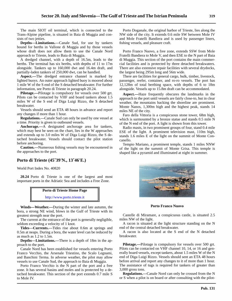
Sector 20. Italy and Slovenia—The Gulf of Trieste and The Istrian Peninsula 319
he
rs,
leiar-rs.
ks,
k,hasm.
earnt.14
h,e N
ile,
n-
Ws
2.5
N
ed
t.en-e Nrsur.an
Nt-
20.23 The main SIOT oil terminal, which is connected to theTrans-Alpine pipeline, is situated in Baia di Muggia and con-sists of two jetties.20.23 Depths—Limitations.—Canale Sud, for use by tankersbound for berths in Vallone di Muggia and by those vesselswhose draft does not allow them to use the Canale Nordapproach to Trieste, leads to Baia di Muggia.20.23 A dredged channel, with a depth of 16.5m, leads to theberths. The terminal has six berths, with depths of 11 to 17malongside. Tankers up to 160,000 dwt and 16.4m draft, andpartially-laden tankers of 250,000 dwt, can be handled.20.23 Aspect.—The dredged entrance channel is marked bylighted buoys. An outer approach lighted buoy is moored about1 mile W of the S end of the S detached breakwater. For furtherinformation, see Porto di Trieste in paragraph 20.24.20.23 Pilotage.—Pilotage is compulsory for vessels over 500 grt.Pilots can be contacted by VHF and board tankers about 1.5miles W of the S end of Diga Luigi Rizzo, the S detachedbreakwater.20.23 Vessels should send an ETA 48 hours in advance and reportany changes if more than 1 hour.20.23 Regulations.—Canale Sud can only be used by one vessel ata time. Priority is given to outbound vessels.20.23 Anchorage.—A designated anchorage area for tankers,which may best be seen on the chart, lies in the W approachesand extends up to 3.0 miles W of Diga Luigi Rizzo, the S de-tached breakwater. Vessels should contact the pilot stationbefore anchoring.20.23 Caution.—Numerous fishing vessels may be encountered inthe approaches to the port.
Porto di Trieste (45˚39'N., 13˚46'E.)
World Port Index No. 40820
20.24 Porto di Trieste is one of the largest and mostimportant ports in the Adriatic Sea and includes a Free Zone.
20.24 Winds—Weather.—During the winter and late autumn, thebora, a strong NE wind, blows in the Gulf of Trieste with itsgreatest strength near the port.20.24 The current at the entrance of the port is generally negligible,seldom exceeding a velocity of 1 knot.20.24 Tides—Currents.—Tides rise about 0.6m at springs and0.5m at neaps. During a bora, the water level can be reduced byas much as 1.2 to 1.5m.20.24 Depths—Limitations.—There is a depth of 18m in the ap-proach to the port.20.24 Canale Nord has been established for vessels entering PortoFranco Vecchio, the Arsenale Triestino, the Scalo Legnami,and Banchini Terma. In adverse weather, the pilot may allowvessels to use Canale Sud, the approach to Baia di Muggia.20.24 Porto Franco Vecchio is the N part of the port and a freezone. It has several basins and moles and is protected by a de-tached breakwater. This section of the port extends 0.7 mile Sto Mole IV.
20.24 Porto Doganale, the original harbor of Trieste, lies along tNW side of the city. It extends 0.6 mile SW between Mole IVand Mole Fratelli Bandiera and is used by passenger linefishing vessels, and pleasure craft.
20.24 Porto Franco Nuovo, a free zone, extends SSW from MoFratelli Bandiera to Mole V, and then ESE to the N part of Badi Muggia. This section of the port contains the main commecial facilities and is protected by three detached breakwateThere are also extensive repair facilities with several drydocthe largest being 295m long and 56m wide.20.24 There are facilities for general cargo, bulk, timber, livestocpassenger, reefer, container, and ro-ro vessels. The port12,128m of total berthing space, with depths of 6 to 18alongside. Vessels up to 15.8m draft can be accommodated
20.24 Aspect.—Haze frequently obscures the landmarks in thapproach to the port until vessels are fairly close-to, but in cleweather, the mountains backing the shoreline are promineMonte Nanos, 1,300m high and the highest peak, standsmiles NE of the city.20.24 Faro della Vittoria is a conspicuous stone tower, 68m higwhich is surmounted by a bronze statue and stands 0.5 milof the N end of the port. A light is shown from this tower.20.24 Radio masts, in two prominent groups of four, stand 0.4 mESE of the light. A prominent television mast, 110m highstands 1.6 miles E of the light on the summit of Monte Cocanello.20.24 Tempio Mariano, a prominent temple, stands 1 miles NNof the light on the summit of Monte Grisa. This temple ishaped like a pyramid and illuminated at night in summer.
20.24 Castelle di Miramare, a conspicuous castle, is situatedmiles NW of the light.20.24 A racon is situated at the light structure standing on theend of the central detached breakwater.20.24 A racon is also located at the S end of the N detachbreakwater.
20.24 Pilotage.—Pilotage is compulsory for vessels over 500 grPilots can be contacted on VHF channel 10, 14, or 16 and gerally board vessels, except tankers, about 1.5 miles W of thend of Diga Luigi Rizzo. Vessels should sent an ETA 48 houbefore arrival and report any changes to it of more than 1 hoThe assistance of tugs is required for tankers of greater th3,000 gross tons.20.24 Regulations.—Canale Nord can only be crossed from theor S when a pilot is on board or after consulting with the pilo
Porto di Trieste Home Page
http://www.porto.trieste.it
Porto Franco Nuovo
Pub. 131
320 Sector 20. Italy and Slovenia—The Gulf of Trieste and The Istrian Peninsula
ar-the
of
n-
g.or
tion,estits
esfing
the
estella
e
age authority. Vessels with a draft greater than 14m must notcross the channel.20.24 Regulations for inbound vessels are, as follows:
1. Vessels directed to an anchorage must contact thepilot on VHF channel 14 to report their ETA in the roads andrequest a berth.
2. When settled at a berth vessels must contact theOperations Center on VHF channel 16 and report their berthnumber.
3. Vessels at anchor must maintain a continuous listen-ing watch on VHF channel 16.
20.24 Regulations for outbound vessels are, as follows:1. Vessels not subject to compulsory pilotage must agree
with the pilot station as to procedures and times of move-ment within the harbor and in both N and S canals.
2. Vessels subject to compulsory pilotage must embarkthe pilot in the N or S canal.
3. Vessels must contact the Operations Center on VHFchannel 16 once the departure maneuvers are complete andthe pilot disembarked and report the following information:
a. Type of vessel.b. Route.c. Speed.d. Destination.e. Date and time of arrival at destination.f. Number of passengers.g. Quantity of cargo.h. Quality of cargo.
20.24 Anchorage.—Designated anchorage areas, for vessels crying dangerous or non-dangerous cargo, are best seen onchart, and are reserved, as follows:
1. Anchor Berths A1-A4—tankers.2. Anchor Berth S1—for unloading residuals.3. Anchor Berths B1-B4—tankers when the A series
berths are full and for vessels carrying dangerous cargo.4. Anchor Berths C1-C4—tankers carrying non-da
gerous cargo.20.24 All vessels should contact the pilot station before anchorin20.24 There is also sufficient room for large vessels to anchwithin the harbor and there are several mooring buoys.20.24 Caution.—A submarine water pipeline, which stands 2mabove the sea bottom and constitutes a permanent obstrucextends NW between Porto di Trieste and Duino and may bbe seen on the chart. Anchoring and fishing are prohibited invicinity.20.24 An outfall pipeline, which may best be seen on the chart, liin the harbor and extends 2.5 miles WNW from the vicinity othe N end of the S detached breakwater. Anchoring and fishare prohibited in its vicinity.20.24 Numerous fishing vessels are often encountered inapproaches to the port.20.24 A disused explosives dumping ground area, which may bbe seen on the chart, lies centered 1.2 miles SW of Faro dVittoria.20.24 A wreck, with a depth of 16m, lies about 0.5 mile NW of thN end of the N detached breakwater.
Pub. 131

Glossaries 321
GlossariesSpanish
ll
ke
inek
ekekrkitd
ede
eritrrt
efatyre
hdt
enkd
t
eeee
SPANISH English
A
abrigo .........................................................................shelteraduana ..............................................................customhouseaguas muertas....................................................... neap tidesaguas vivas ......................................................... spring tidesaguja........................................................................... needlealbufera ..................................................................tidal lakealdea................................................. small village, a hamletalfaque............................................................ sandbank, baralmadraba.........................................................tunny fisheryalto ..............................................................................heightamarillo ......................................................................yellowarena.............................................................................. sandarrabal ........................................................................suburbarrecife ........................................................................... reefarroyo ......................................................................... rivuletastillero...................................................................dockyardatalaya ...an elevated place from which a considerable view may be obtained
B
babor .............................................................................. portbahia................................................................................baybajamar.................................................................. low waterbajo............................................................................... shoalbanco.............................................................................bankbarra ............................ bar at the mouth of a river or harborbarrio.............................................suburb, district of a townblanco...........................................................................whitebote salvavidas ......................................................... lifeboatboya...............................................................................buoybrujula .....................................................................compassbruma ..................................................................... fog, haze
C
cabezo ......................................................... summit of a hillcabo........................................................... cape or headlandcala .......................................................... creek or small baycaleta ............................................................................. covecamino de hierro .......................................................railwaycampanario.....................................................steeple, belfrycanal ............................................................channel or straitcapilla......................................................................... chapelcarabineros ........................... a post of military coast guardscarbon de piedra.............................................................coalcarta de sanidad................................................ bill of healthcasa.............................................................................. housecascajo.........................................................................gravelcaserio ......................................................... series of housescaseta..................................................................small housecastillo......................................................................... castlecarrazon...............................................dark, cloudy weathercerro ................................................................................ hillchica.............................................................................small
concha........................................................................ a shecontrastes .............. winds blowing from opposite directionscubierta ......................................................................... deccueva ..............................................................................cav
D
darsena............................................................ dock or basdique .................................................................... dock, dikdique seco ................................................................drydoc
E
ensenada............................................................bay or creermita ....................................................................hermitagescollo............................................................................rocespigon..............................................a kind of wharf or pieestero.................................................................. small creeestrecho.........................................................................straestribor ...................................................................starboar
F
fanal ..................................................................... lighthousfango ..............................................................................mufaro....................................................................... lighthousferrocarril ..................................................................railwayfondeadero ........................................................... anchoragfraile............................................................................... friafreo................................................................................strafuente ............................................ fountain; spring of watefuerte............................................................................... fo
G
garita .............................................................. lookout housgolfo............................................................................... gulgrande ...........................................................................gregris .................................................................................gragrao .................................................................. strand, sho
I
iglesia.........................................................................churcisla............................................................................... islanisleta............................................................................... isle
L
lago ................................................................................ laklaguna......................................................................... lagoolaja ...........................................................................flat roclimo................................................................................mulugar .............................................par village or small townluz ................................................................................. ligh
M
malecon..........................................................................dikmarea ..............................................................................tidmarea menguante.....................................................ebb tidmarea menguante.....................................................ebb tid
SPANISH English
Pub. 131

322 Glossaries
defrrrkd
ynthyneth
drr
ildn
d
ze
meridional ...............................................................southernmesa ....................................................................... tablelandmolino ............................................................................ millmontana................................................................. mountainmonte ......................................................................... mountmuelle............................................................... mole or jetty
N
negro ............................................................................blackniebla............................................................................... fognorte ............................................................................. north
O
ola................................................................................. waveoriente ............................................................................ east
P
pardo ............................................................................. graypena.........................................................rock or large stonepenon............................................... rock or rocky mountainpequena ........................................................................smallpicacho......................................................................summitpico................................................................................peakpiedra ............................................................................ rockpiloto ............................................................................. pilotpiloto practico ..a harbor pilot (practico is often used alone)placer..............................................................sandbank, cayplaya............................................................................ beachpleamar.................................................................high waterponiente......................................................................... westpromontorio ...................................... headland, promontorypueblo............................................................ town; a villagepuente......................................................................... bridgepuerto ............................................................................. portpunta............................................................................. point
Q
quinta ............................................................. country house
SPANISH English
R
reclada.........................................................making the lanrestinga............................................................................reria .......................................................... the mouth of a riveribera....................................... the shore; the bank of a riverio.................................................................................. riveroca ................................................................................rocrojo...................................................................................re
S
saco .................................................................................basalina......................................................................... saltpasanidad........................................................................healseno..................................................................... gulf or baseptentrional............................................................ northersierra ............................................................ mountain ridgsud, sur......................................................................... sou
T
temporal .......................................................................stormterral...................................................................... land wintiempo ...................................................................... weathetorre..............................................................................towe
V
variacion .................................................................variationvela.................................................................................. savendaval .......................................................strong sea winverde ............................................................................greeviejo .................................................................................olviento ............................................................................windvigia ............................................ a lookout; doubtful shoalsvilla ............................................................................... townvirazon ................................................................. sea bree
SPANISH English
Pub. 131

Glossaries 323
French
mkd
inese
lee
inrhsr
ff
ers;
fetdee
d)
kp
nlfel
ne
alrll
et
FRENCH English
A
aiguille ....................................................................... needleaimante...................................................................magneticanse ...................................................................... bay, creekappontement.............................................. wharf, pier, quayatterrissage ..................................................making the landavant port ..............................................................outer portazur.................................................................................blue
B
babord ............................................................................ portbaie..........................................................................bay, gulfbalisage ................................................................beaconagebalise ......................................................................... beaconbanc..............................................................bank, sandbankbarre ................................................................................ barbasse............................................................................. shoalbase mer ................................................................ low waterbassin ................................................................. basin, dockbassin a flot .............................................. wet basin or dockbassin d'echouage..............tidal basin where vessels groundbateau de sauvetage ................................................. lifeboatblanc, he.......................................................................whiteblue.................................................................................bluebouche.........................................................mouth of a riverbouee.............................................................................buoybouee a cloche........................................................bell buoybouee a sifflet ................................................... whistle buoybouee lumineuse .................................................. light buoyboussole ..................................................................compassbrouillard................................................................ fog, mistbrume .............................................................................. fog
C
caboteur..................................................................... coastercale de radoub ...............................................marine railwaycap.................................................................cape, headlandchapelle ...................................................................... chapelcharbon...........................................................................coalchasse............... a rapid discharge of water from a reservoir in order to clear out a channelchateau ........................................................................ castlechaussee ...................................................... bank, causewaychemin de fer ........................................................... railroadcheminee .................................................................chimneychenal ....................................................................... channelclocher....................................................................... steeplecoffre .............................................................. mooring buoycolline.............................................................................. hillcompas ....................................................................compasscoquilles ...................................................................... shellscote............................................................................... coastcourant ..........................................................current, streamcourant de flot ...........................................flood tidal stream
courant de jusant......................................... ebb tidal streacrique ........................................................................... creecrue .............................................................. freshet or floo
D
darse............................................................................. basdigue ......................................................... breakwater, moldouane..............................................................customhou
E
echelle...........................................................................scaechelle de maree .................................................. tide gaugecluse ...............................................lock of a canal or basecueil................................................................rock, breakeeglise..........................................................................churcencablure............................. cable's length, about 200 yardentree .......................................... entrance, mouth of a riveepi ..............................................................small jetty, groinescarpe .......................................................................... bluetale................................... (Of tide) slack; (of wind) settledetang............................................................................... laketiage............................................ low-water mark of a riveetier ...................... a creek which can receive small vessel
a conduit by which salt water enters a saline
F
falaise............................................................................. cliffanal ..........................................................harbor lighthousfeu ................................................................................. lighfeu permanent .....a light constantly burning and unwatchefin....................................................................................finfleche............................................................................. spirfleuve ................................................................river, streamflot.................................................................................floofoc ........................................................................... jib (sailfond........................................................................... bottomforme de radoub.......................................................drydocfosse................................................................. ditch, a dee
G
gare ............................................................................ statiogolfe ............................................................................... gugoulet ..........................................................narrow entrancgravier .........................................................................gravegril de carenage........................................................gridirogros .............................................................................coars
H
haut-fond....................................................................a shohaute mer .............................................................high watehoule ............................................................................ swe
I
ile .........................................................................island, islilot.................................................................................. isle
FRENCH English
Pub. 131
324 Glossaries
rtkla
rf
adllt
fkkd
dst
)th
rrtd
y
dddn
s
J
jaune...........................................................................yellowjusant...............................................................................ebb
L
lac................................................................................... lake
M
madrague................................................................tunny netmarais............................................................ swamp, marshmaree...............................................................................tidemaree descendante .............................................. falling tidemaree montante.................................................... rising tidemassif ........................................... main group of mountainsmat ................................................................................mastmolle ...............................................................................softmortes eaux.......................................................... neap tidesmouillage ............................................................. anchorageniveau............................................................................ levelnoeud............................................................................. knotnoir ...............................................................................black
O
occidental ................................................................. westernonde.............................................................................. waveoriental ...................................................................... easternouest .............................................................................. west
P
passe......................................................................... channelpatente de sante................................................ bill of healthpertuis......................................................... opening or straitpetit ..............................................................................smallphare..................................................................... lighthousepic..................................................................................peakpierre ............................................................................ stonepignon ..........................................................................gablepin ..................................................................pine or fir treeplage..................................................................shore, beachplateau.................................... tableland, or flat below water
FRENCH English
pleine mer ............................................................high watepointe ............................................................................poinpont ...................................................................bridge, decpresqu'ile............................................................... peninsu
Q
quai ....................................................................quay, wha
R
rade .............................................................. road, roadsterafale ........................................................................... squaraz (bas breton) .............................a name given to a violen tidal stream in a narrow passagerecif .................................................................................reeroche ..............................................................................rocrocher .............................................................................rocrouge ................................................................................re
S
sable .............................................................................. sansalines ................................... salt-water lagoons, salt workseche ................................................................dry shelf, flaseuil........................................................... sill (as of a docksud................................................................................ sou
T
temps............................................................... time, weathetour...............................................................................towetourelle .....................................................small tower, turretribord ....................................................................starboar
U
usine.......................................................................... factor
V
vase ................................................................................muvent ...............................................................................winvergue ............................................................................yarvert ........................................................................par greevieux, vieil, vieille ............................................. old, ancientville ............................................................................... townvives eaux .......................................................... spring tide
FRENCH English
Pub. 131

Glossaries 325
Arabic
it
fesse
ywsor
krtnt
illee
ee)f
t
efwpstlft
lle
itleellyetddckseeel
ARABIC English
A
ab, abu............................................................... father, chiefabar, abyar.................................................................... wellsabyadh, abyad ..............................................................whiteadel, aleb ............................................................ sloping hillaghbar............................................................................ grayaghbas ................................................................dark (color)ahmar .............................................................................. redaich, aik.................................................................hard bankain, oyun ............................................ spring, well, fountainakaba, acol .......................................................... wildernessakbar......................................bigger, biggest, older (of two)akhal.............................................................................blackakhdhar, akhdar............................................................greenal.......................................................................................theanak................................................................................ cliffaqabar.................................................................. wildernessaraja, arish............................................................ sand duneard .......................................................... land, earth, groundard malaq...............................................................open landasfal, asafil ...................................................................lowerasfar............................................................................yellowasifah..............................................................................galeasmar.......................................................................... brownaswad ...........................................................................blackatiq .................................................................................. oldauwil............................................................. first, beginningazim...............................................................................greatazraq...............................................................................blue
B
bab...............................................................strait, gate, doorbahr ..................................................... canal, sea, river, lakebahr shaban ......................................................... deep waterbahraya........................................................pool, pond, lakebaida............................................................................desertbalad.......................................country, region, village, townbalam..............................................................................boatbandar..........chief town of a province, coastal town with an anchorage off it, bight, openbandera............................................................................flagbasta .............................................................................towerbatbit, batbyt .........................................................whirlpoolbaybarr ...................................headland, land, earth; groundbeida.............................................................................whitebeit .............................................................................. housebeiyat............................................................ shoal that driesbeni................. sons of; prefix to tribal names; it sometimes is used in connection with local names such as those of hills, promontoriesberriyah .......................................................................desertbiar, bir ...............................................................well (noun)bilad ......................................................................... countrybirba, baraby ................................................. ancient temple
birka, birkah...................................... pool, pond, small lakeboghaz..............................................entrance channel, straborg, bordj, burj ........................................ fort, tower, castlebu ..................................................................................chiebuhaira, buheira ............................................................. lakbussla ...................................................................... compabuz................................................................................. cap
D
dahr ....................................................................promontordaiyaq.........................................................................narrodar .....................house, mansion, settlement. Note: "Dar" i sometimesused to designate a promontory hill where there is a settlement nearbydarb, derb ...............................................desert road or tracdohat, duhat .................................................. bay, cove, poduar ..............................................................an encampme
E
egeidet..................................................................... sand hel ...................................................................................... thezba............................................................................villag
F
fanar ........................................................beacon, lighthousfaregh ....................................................... broad, level, widfarsh .................................................................. plain (nounfasht ..................................................................... rocky reefiluka, fulk............................................................ small boa
G
gara, garrat ..................................................................... lakgarf................................................................................. clifgedid .............................................................................. neghamiq .......................................................................... deegharb, gharba, gharbi .................................................... weghubbat, ghubbet ........................................................... gugisr, gusur ............................................. bank, embankmengoz, gowaz .....................................................high sand higumruk.............................................................customhous
H
hadd ..................................boundary, border, limit, sandsphagar, hajar....................................................... stone, rubbhaggag................................................. long projecting ridghait, hitan ......................................................................wahajari ............................................................................ stonhalat .............................................................. sandbank, islhamra ...............................................................................reharam, ahram ......................................................... pyramihassar, hissar ..................................................................rohaswa .................................................. gravel, small pebblehisar ..................................................................... fort, castlhod .................................................... pool, pond, small lakhor.......................................................... bay, creek, chann
ARABIC English
Pub. 131

326 Glossaries
elh)
ntbtl
ulfgeeeust
wrt
ntl
rtrpdt
alh
trit
rt
bdrttellte
elrts)ddntytter
I
ilwat, ilwet.................................................................. regioniswid.............................................................................blackizbit, izbet...................................................................village
J
jam, jamia................................................................. mosquejanub.............................................................................southjebel, jabal, gebel, jibal .................................. mountain, hilljezirat, jezira, jazirat...................................island, peninsulajisr, jusur ................................................................... bridgejorf.................................................................................. cliffjunub ............................................................................south
K
kabat..........................................rocky shoal, group of rockskabir, kebir ....................................................................largekad........................................................................ shoal, spitkafr, kufur , kefr .........................................................villagekarm ............................................................ artificial moundkasba .................................................. citadel, fortified townkasim.......................political division, department, territorykassar ............................................................................ rockkatah, katat ................................rocky shoal, group of rockskatib ..............................................................................paintkef, kaf .................................................................. mountainkeruky ............................................................... sketch, plankeshem ............................................................. water coursekhadra...........................................................................greenkhala......................................................................... countrykhalig, khalij ................................ gulf, valley, water coursekhan........................................................... inn, hotel, bazaarkhashm........................................................mouth, entrancekhijem ...................................................encampment (tents)khirs ............................................................ par barren landkhod .................................................................shallow, fordkhor creek, ravine, valley (usually dry), cove, bay, channel, river, river channelkibli ..............................................................................southkidwa................................................................small moundkinar .................................................boundary, border, limitkinisa, kinis ................................................................churchkinisat, kinizat....................................................... sandbankkita ............................................rocky shoal, group of rockskom ........................................................................... moundkothon, liman ...............................................port, anchoragekubry, kabary ............................................................ bridgekusbat ................................................. citadel, fortified town
L
liman .............................................................. port or harbor
M
ma.................................................................................watermaghreb ........................................................................ westmahatta.......................................................................stationmahgar ..............................................................stone quarry
ARABIC English
majaz................................................... pass, marine channmal, malih ........................................................salt, brackismanfad, manafid ............................................... pass (defilemanzal.................................................................. settlememaqam ..........................................................................tommarabut .................monument or tomb of a saint or prophemarakat ..................................................... soft bottom shoamarsa, marza, mers, mersa................ bay, cove, harbor, gmasafa, masafah........................................................... ranmasgid, masjid, masjed............................................ mosqumasura......................................................... water pipe, pipmaten ........................................................................ plateamatla ...............................................................................eamedina .................................................................. city, townmerj......................................................................... meadomina ...................................................................port, harbominar, manar .............................................................minareminqar, mengar ..........................................nose, head, poimirjan............................................................................coramirsa .............................................................................. pomiyah ...........................................................................watemuaskar............................ camp, especially a military cammuhassan ................................................................. fortifiemukhaijan ........................................................ encampmenmurgan ..........................................................................cormustanqa.....................................................................mars
N
nahiyah, nanahi .........................................................districnahr, anhar ................................................................... rivenajwa.....................................................................shoal, spnakhl, nakhil, nikhl ............................. palm tree, date grovenatur .............................................................................towenebi ............................................. tomb of a saint or prophe
Q
qabr ...............................................................................tomqadim, qadima .................................................................olqala.......................................................prominent peak, foqanaya........................................................................ rivuleqantara, qanatir ..........................................................bridgqara ................................................................small dark hiqarn ...............................................................................poinqasr, qusur ................................................. port, large hous
R
rais, reis................................................... captain of a vessrais el marsa .............................................captain of the porakat ................................. shoal, hard bank (not dangerouraml............................................................................... sanramla ............................................................... sandy grounras, rus................................................................. cape, poirasif .......................................................................pier, quarif ..................................................................................coasrig..............................................................shallow bank, flarod...........................................................small water coursrud................................................................................. rive
ARABIC English
Pub. 131

Glossaries 327
d
th
eal
l
elely
rr
lrs
ees
S
sabakha......................................................... salt marsh, bogsafra............................................................................yellowsaghir, seghir ................................................................smallsahil........................................................ coast, shore, beachsahra, sahary......................................................desert, plainsakh, sakhr .................................................................... rocksanjaq ..............................................................................flagsaqya, saqiye, saqyat.................................................... canalsaraya ......................................................................... palacesarwe .........................................................................cypresssath ............................................................................plateausauwana...........................................................gravel moundsawahil ............................................................... coast guardsebkhat, sebkha, sabkhet......................................... salt lakeseil.................................................................... water courseshab, shib ...................................................rocky shoal, reefshakhis ......................................................... par stake, poleshamal .......................................................................... northshard............................................ sirocco, simoon, hot windshari.......................................... street, boulevard, main roadsharq............................................................................... eastsharqi, sharqiya .....................................................east (adj.)shatt........................................ coast, shore, river, river bankshatt ramli ............................................................. sandbanksheikh..................................................chief, chieftain, eldersherm.................................................................. cove, creekshur....................................................................low clay hillsidi................................................................................ tomb
ARABIC English
sifi ................................................................................... lowsikha...............................................................................roasirih .........................................................................tall, slim
T
taht .....................................................under, below, beneatall, tell, tulu ................................................................... hilltarf................................................................................. captarsana....................................................................... arsentawil ...............................................................................longtell ................................................................................... hiltiligraf .................................................................... telegraphtira............................................................................ channturah ...............................................................canal, channturiq................................................................ road, highwa
U
umm.......................................................................... motheust...................................................................middle, cente
W
wad, wadi, uad ........................valley, water course, channewast................................................................middle, centewelled............................................................a tribe of arab
Z
zarqa...............................................................................bluzawia, zawiya............................................monastery, houszeitun .......................................................................... olive
ARABIC English
Pub. 131
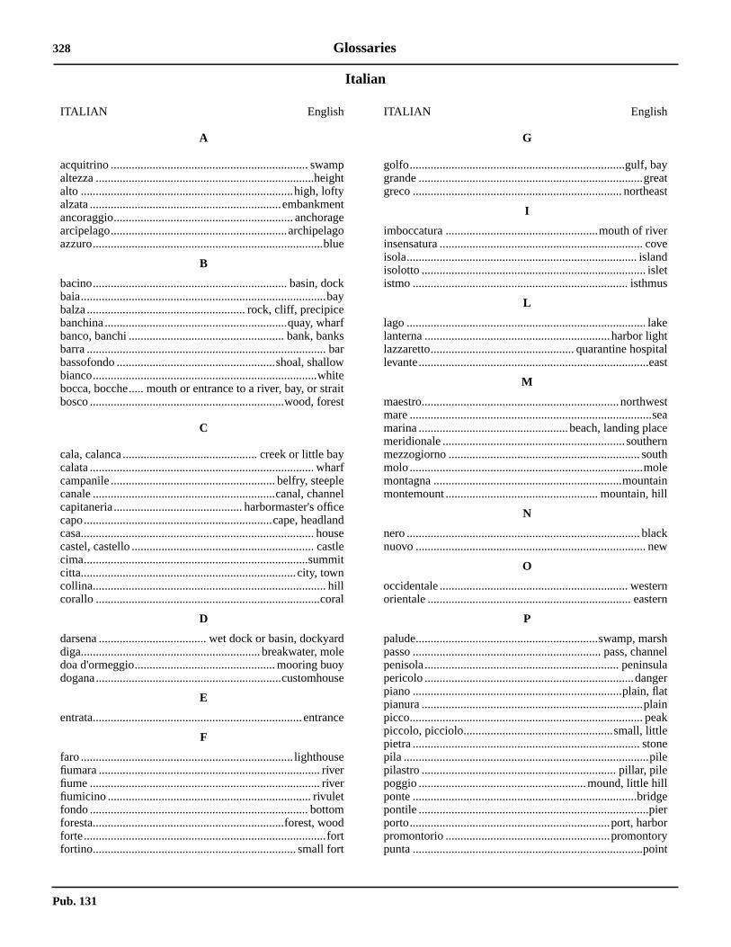
328 Glossaries
Italian
yatst
redts
et
alst
staenheinl
kw
nrn
hel
lartnk
ee
err
t
ITALIAN English
A
acquitrino .................................................................. swampaltezza .........................................................................heightalto .......................................................................high, loftyalzata ................................................................embankmentancoraggio............................................................ anchoragearcipelago...........................................................archipelagoazzuro.............................................................................blue
B
bacino................................................................. basin, dockbaia..................................................................................baybalza..................................................... rock, cliff, precipicebanchina.............................................................quay, wharfbanco, banchi .................................................... bank, banksbarra ................................................................................ barbassofondo .....................................................shoal, shallowbianco...........................................................................whitebocca, bocche..... mouth or entrance to a river, bay, or straitbosco .................................................................wood, forest
C
cala, calanca............................................. creek or little baycalata ........................................................................... wharfcampanile ....................................................... belfry, steeplecanale .............................................................canal, channelcapitaneria........................................... harbormaster's officecapo...............................................................cape, headlandcasa.............................................................................. housecastel, castello ............................................................. castlecima...........................................................................summitcitta........................................................................city, towncollina.............................................................................. hillcorallo ...........................................................................coral
D
darsena .................................... wet dock or basin, dockyarddiga............................................................breakwater, moledoa d'ormeggio............................................... mooring buoydogana..............................................................customhouse
E
entrata...................................................................... entrance
F
faro ....................................................................... lighthousefiumara .......................................................................... riverfiume ............................................................................. riverfiumicino .................................................................... rivuletfondo ......................................................................... bottomforesta................................................................forest, woodforte.................................................................................fortfortino.................................................................... small fort
G
golfo........................................................................gulf, bagrande ...........................................................................gregreco ...................................................................... northea
I
imboccatura ...................................................mouth of riveinsensatura .................................................................... covisola............................................................................. islanisolotto ........................................................................... isleistmo ........................................................................ isthmu
L
lago ................................................................................ laklanterna ..............................................................harbor lighlazzaretto................................................ quarantine hospitlevante.............................................................................ea
M
maestro..................................................................northwemare .................................................................................semarina ..................................................beach, landing placmeridionale ............................................................. southermezzogiorno ................................................................ soutmolo ..............................................................................molmontagna ...............................................................mountamontemount ................................................... mountain, hil
N
nero .............................................................................. blacnuovo ............................................................................. ne
O
occidentale ............................................................... westerorientale .................................................................... easte
P
palude.............................................................swamp, marspasso ............................................................... pass, channpenisola................................................................. peninsupericolo ......................................................................dangepiano ......................................................................plain, flapianura ..........................................................................plaipicco.............................................................................. peapiccolo, picciolo..................................................small, littlepietra ............................................................................ stonpila ..................................................................................pilpilastro ................................................................. pillar, pilepoggio ........................................................mound, little hillponte ...........................................................................bridgpontile .............................................................................pieporto...................................................................port, harbopromontorio .......................................................promontorypunta .............................................................................poin
ITALIAN English
Pub. 131

Glossaries 329
nhiteddit
taddrt
h
ydnitet
o
a
R
rada................................................................................ roadrafo (local dialect)....................................... shoal, sandbankriva ......................................................................coast, bankrocca.............................................................................. rockroccia.............................................................rock, precipiceroccioso........................................................................rockyrondo ........................................................................... roundrosa................................................................................ pinkrosso........................................................................ par >redrotondo........................................................................ roundrovina ............................................................................. ruinrupe .............................................................. rock, crag, cliff
S
sabbia ............................................................................ sandsalina ......................................................... salt water lagoonsanita .................................................................health officesanto.................................................................. holy, sacredsasso....................................................... stone, pebble, rocksbarcatoio .............................................. landing place, quayscirocco, sirocco.....................................................southeastscoglio................................................................... rock, reefscogliera ......................................................... ridge of rockssecca............................................................ shoal, sandbanksegnale ..............................................................signal, marksemafori .......................................................... signal stationseno .............................................................small bay, creek
ITALIAN English
settentrionale........................................................... northersettentrione................................................................... nortspalla................................................shoulder, back, summsponda..................................................... bank, border, edgstagno................................................................... lake, ponstrada..............................................................................roastretto ............................................................................stra
T
tavola...................................................................... table, listesta, testata................................................................... hetondo ........................................................................... rountorre..............................................................................towetorrente.......................................................... stream, torrentramontana ................................................................... nort
V
valle............................................................................. vallevecchio.............................................................................olverde ............................................................................greevetta ..........................................................................summvia ....................................................................... road, strevilla ................................................................................villavillaggio .....................................................................villagevulcano..................................................................... volcan
Z
zona vietata ...................................................prohibited are
ITALIAN English
Pub. 131

330 Glossaries
Yugoslavian
s
dllyaahe
erre
adldntntet
rs
y
e
geit
o
lflfn
YUGOSLAVIAN English
B
beli, bela, belo..............................................................whitebijeli, bijela, bijelo .......................................................whitebrdo ....................................................................... mountain
C
crni, crna, crno .............................................................blackcrveni, crvena, crveno ..................................................... red
D
desno ............................................................................. rightdonji, donja, donjo .......................................................lowerdraga.............................................................................. cove
G
gat, gata................................................................ mole, piergospa ....................................................................... our ladygreben; grebeni .................................rock, reef; rocks, reefs
H
hrid; hridi, hridine..... above-water rock; above-water rocks
J
jezero.............................................................................. lakejug ................................................................................south
K
kamen.................................................................. stone, rockkanal......................................................................... channelkriz; kriza .................................................cross; of the cross
L
lijevo ............................................................................... leftluka............................................................. port, harbor, bay
M
mali, mala, malo...........................................................smallmlin ................................................................................ millmore ................................................................................ seamotka ........................................................................ beaconmulj ............................................................................... mud
N
novi, nova, novo.............................................................new
O
obala................................................................... quay, shoreostrvo; ostrvi ..................................................island; islands
otocic; otocici ......................................................islet; isletsotok; otoci ...................................................... island; island
P
pesak ............................................................................. sanplicak ........................................................................... shoaplicina .......................................................................... shoaplutaca...........................................................................buopoluotok ................................................................ peninsulpolutocic ......................................................small peninsulpristaniste.............................................. landing place, bertprolaz ....................................................................... passag
R
rat ........................................................................ point, capreka ............................................................................... riverijeka ............................................................................. rivert.......................................................................... point, cap
S
sidriste.................................................anchorage, roadstestari, stara, staro ...............................................................osv................................................................................... saisveti, sveta, sveto .......................................................... saisvetionik............................................................... lighthoussvjetlo............................................................................ ligh
T
tanki, tanka, tanko..................................................... slendetesnac ............................................................. strait, narrow
U
uvala................................................................................ba
V
veli, vela, velo............................................................... largveliki, velika, veliko...................................................... largevrata ......................................................................... passavrh.............................................................................summ
Y
yugo ........................................................................ scirocc
Z
zaliv.........................................................................bay, guzaton........................................................................bay, guzeleni, zelena, zeleno ...................................................gree
YUGOSLAVIAN English
Pub. 131
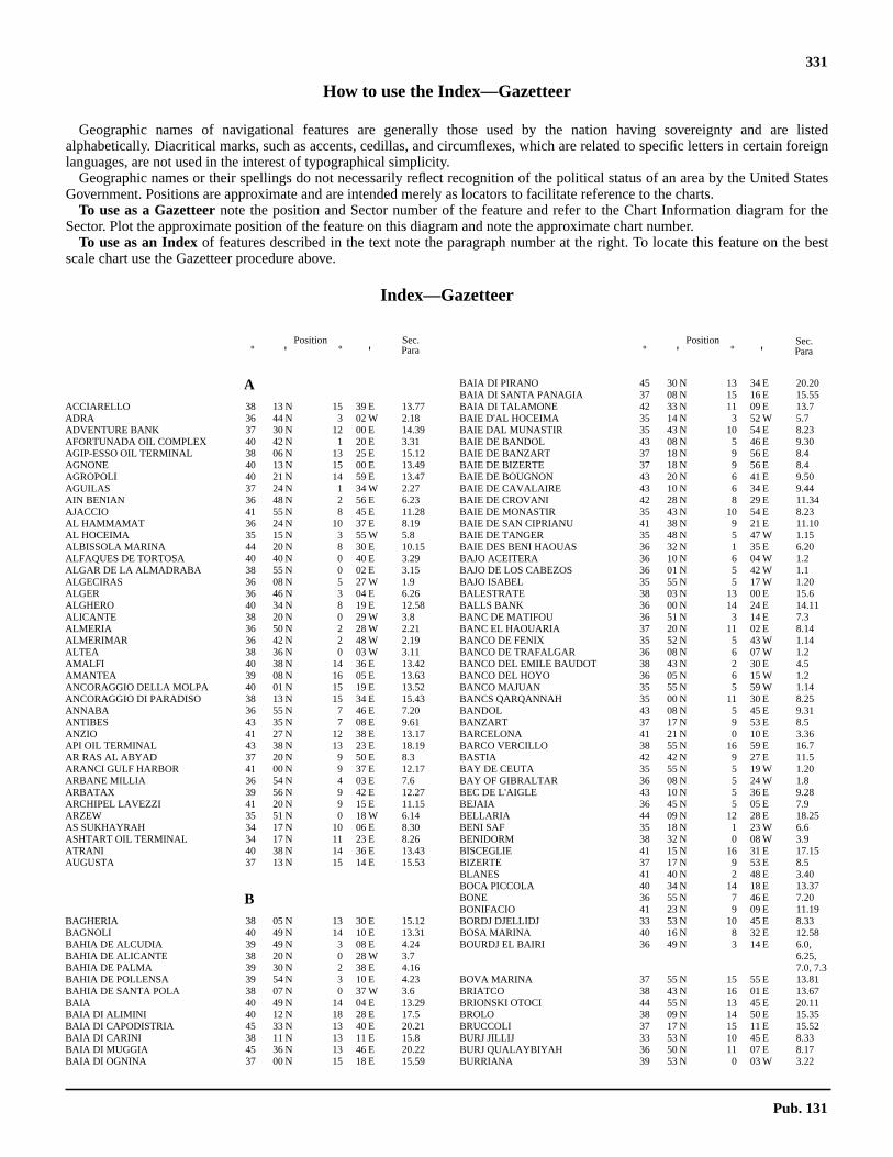
331
How to use the Index—Gazetteer
Geographic names of navigational features are generally those used by the nation having sovereignty and are listedalphabetically. Diacritical marks, such as accents, cedillas, and circumflexes, which are related to specific letters in certain foreignlanguages, are not used in the interest of typographical simplicity.
Geographic names or their spellings do not necessarily reflect recognition of the political status of an area by the United StatesGovernment. Positions are approximate and are intended merely as locators to facilitate reference to the charts.
To use as a Gazetteernote the position and Sector number of the feature and refer to the Chart Information diagram for theSector. Plot the approximate position of the feature on this diagram and note the approximate chart number.
To use as an Indexof features described in the text note the paragraph number at the right. To locate this feature on the bestscale chart use the Gazetteer procedure above.
Index—Gazetteer
Position˚ ' ˚ '
Position˚ ' ˚ '
Sec.Para
Sec.Para
AACCIARELLO 38 13 N 15 39 E 13.77ADRA 36 44 N 3 02 W 2.18ADVENTURE BANK 37 30 N 12 00 E 14.39AFORTUNADA OIL COMPLEX 40 42 N 1 20 E 3.31AGIP-ESSO OIL TERMINAL 38 06 N 13 25 E 15.12AGNONE 40 13 N 15 00 E 13.49AGROPOLI 40 21 N 14 59 E 13.47AGUILAS 37 24 N 1 34 W 2.27AIN BENIAN 36 48 N 2 56 E 6.23AJACCIO 41 55 N 8 45 E 11.28AL HAMMAMAT 36 24 N 10 37 E 8.19AL HOCEIMA 35 15 N 3 55 W 5.8ALBISSOLA MARINA 44 20 N 8 30 E 10.15ALFAQUES DE TORTOSA 40 40 N 0 40 E 3.29ALGAR DE LA ALMADRABA 38 55 N 0 02 E 3.15ALGECIRAS 36 08 N 5 27 W 1.9ALGER 36 46 N 3 04 E 6.26ALGHERO 40 34 N 8 19 E 12.58ALICANTE 38 20 N 0 29 W 3.8ALMERIA 36 50 N 2 28 W 2.21ALMERIMAR 36 42 N 2 48 W 2.19ALTEA 38 36 N 0 03 W 3.11AMALFI 40 38 N 14 36 E 13.42AMANTEA 39 08 N 16 05 E 13.63ANCORAGGIO DELLA MOLPA 40 01 N 15 19 E 13.52ANCORAGGIO DI PARADISO 38 13 N 15 34 E 15.43ANNABA 36 55 N 7 46 E 7.20ANTIBES 43 35 N 7 08 E 9.61ANZIO 41 27 N 12 38 E 13.17API OIL TERMINAL 43 38 N 13 23 E 18.19AR RAS AL ABYAD 37 20 N 9 50 E 8.3ARANCI GULF HARBOR 41 00 N 9 37 E 12.17ARBANE MILLIA 36 54 N 4 03 E 7.6ARBATAX 39 56 N 9 42 E 12.27ARCHIPEL LAVEZZI 41 20 N 9 15 E 11.15ARZEW 35 51 N 0 18 W 6.14AS SUKHAYRAH 34 17 N 10 06 E 8.30ASHTART OIL TERMINAL 34 17 N 11 23 E 8.26ATRANI 40 38 N 14 36 E 13.43AUGUSTA 37 13 N 15 14 E 15.53
BBAGHERIA 38 05 N 13 30 E 15.12BAGNOLI 40 49 N 14 10 E 13.31BAHIA DE ALCUDIA 39 49 N 3 08 E 4.24BAHIA DE ALICANTE 38 20 N 0 28 W 3.7BAHIA DE PALMA 39 30 N 2 38 E 4.16BAHIA DE POLLENSA 39 54 N 3 10 E 4.23BAHIA DE SANTA POLA 38 07 N 0 37 W 3.6BAIA 40 49 N 14 04 E 13.29BAIA DI ALIMINI 40 12 N 18 28 E 17.5BAIA DI CAPODISTRIA 45 33 N 13 40 E 20.21BAIA DI CARINI 38 11 N 13 11 E 15.8BAIA DI MUGGIA 45 36 N 13 46 E 20.22BAIA DI OGNINA 37 00 N 15 18 E 15.59
BAIA DI PIRANO 45 30 N 13 34 E 20.20BAIA DI SANTA PANAGIA 37 08 N 15 16 E 15.55BAIA DI TALAMONE 42 33 N 11 09 E 13.7BAIE D'AL HOCEIMA 35 14 N 3 52 W 5.7BAIE DAL MUNASTIR 35 43 N 10 54 E 8.23BAIE DE BANDOL 43 08 N 5 46 E 9.30BAIE DE BANZART 37 18 N 9 56 E 8.4BAIE DE BIZERTE 37 18 N 9 56 E 8.4BAIE DE BOUGNON 43 20 N 6 41 E 9.50BAIE DE CAVALAIRE 43 10 N 6 34 E 9.44BAIE DE CROVANI 42 28 N 8 29 E 11.34BAIE DE MONASTIR 35 43 N 10 54 E 8.23BAIE DE SAN CIPRIANU 41 38 N 9 21 E 11.10BAIE DE TANGER 35 48 N 5 47 W 1.15BAIE DES BENI HAOUAS 36 32 N 1 35 E 6.20BAJO ACEITERA 36 10 N 6 04 W 1.2BAJO DE LOS CABEZOS 36 01 N 5 42 W 1.1BAJO ISABEL 35 55 N 5 17 W 1.20BALESTRATE 38 03 N 13 00 E 15.6BALLS BANK 36 00 N 14 24 E 14.11BANC DE MATIFOU 36 51 N 3 14 E 7.3BANC EL HAOUARIA 37 20 N 11 02 E 8.14BANCO DE FENIX 35 52 N 5 43 W 1.14BANCO DE TRAFALGAR 36 08 N 6 07 W 1.2BANCO DEL EMILE BAUDOT 38 43 N 2 30 E 4.5BANCO DEL HOYO 36 05 N 6 15 W 1.2BANCO MAJUAN 35 55 N 5 59 W 1.14BANCS QARQANNAH 35 00 N 11 30 E 8.25BANDOL 43 08 N 5 45 E 9.31BANZART 37 17 N 9 53 E 8.5BARCELONA 41 21 N 0 10 E 3.36BARCO VERCILLO 38 55 N 16 59 E 16.7BASTIA 42 42 N 9 27 E 11.5BAY DE CEUTA 35 55 N 5 19 W 1.20BAY OF GIBRALTAR 36 08 N 5 24 W 1.8BEC DE L'AIGLE 43 10 N 5 36 E 9.28BEJAIA 36 45 N 5 05 E 7.9BELLARIA 44 09 N 12 28 E 18.25BENI SAF 35 18 N 1 23 W 6.6BENIDORM 38 32 N 0 08 W 3.9BISCEGLIE 41 15 N 16 31 E 17.15BIZERTE 37 17 N 9 53 E 8.5BLANES 41 40 N 2 48 E 3.40BOCA PICCOLA 40 34 N 14 18 E 13.37BONE 36 55 N 7 46 E 7.20BONIFACIO 41 23 N 9 09 E 11.19BORDJ DJELLIDJ 33 53 N 10 45 E 8.33BOSA MARINA 40 16 N 8 32 E 12.58BOURDJ EL BAIRI 36 49 N 3 14 E 6.0,
6.25,7.0, 7.3
BOVA MARINA 37 55 N 15 55 E 13.81BRIATCO 38 43 N 16 01 E 13.67BRIONSKI OTOCI 44 55 N 13 45 E 20.11BROLO 38 09 N 14 50 E 15.35BRUCCOLI 37 17 N 15 11 E 15.52BURJ JILLIJ 33 53 N 10 45 E 8.33BURJ QUALAYBIYAH 36 50 N 11 07 E 8.17BURRIANA 39 53 N 0 03 W 3.22
Pub. 131

332 Index—Gazetteer
Position PositionSec. Sec.
˚ ' ˚ ' ˚ ' ˚ 'Para ParaCCAB ZEBIB 37 16 N 10 04 E 8.6CABEZO DEL TOSAL 38 31 N 0 10 W 3.9CABO BABA 35 12 N 4 17 W 5.6CABO BERBERIA 38 38 N 1 23 E 4.4CABO BINICOUS 40 00 N 3 48 E 4.32CABO BLANCO 38 40 N 0 07 E 3.12CABO BLANCO 39 22 N 2 47 E 4.16CABO CABALLERIA 40 05 N 4 05 E 4.32CABO CANET 39 40 N 0 12 W 3.21CABO CERVERA 38 00 N 0 39 W 3.5CABO COPE 37 25 N 1 28 W 2.28CABO CREUS 42 19 N 3 18 E 9.2CABO CREUS 42 19 N 3 19 E 3.49CABO CULLERA 39 11 N 0 13 W 3.17CABO DARTUCH 39 55 N 3 49 E 4.30CABO DE BAGUR 41 57 N 3 14 E 3.45CABO DE FORMENTOR 39 58 N 3 12 E 4.22CABO DE GATA 36 43 N 2 12 W 2.22CABO DE LA NAO 38 44 N 0 14 E 3.12CABO DE LAS HUERTAS 38 21 N 0 24 W 3.9CABO DE OROPESA 40 05 N 0 09 E 3.2,
3.25CABO DE PALOS 37 38 N 0 41 W 2.0,
2.35,3.0, 3.3
CABO DE SALOU 41 03 N 1 10 E 3.33CABO DE SAN ANTONIO 38 40 N 0 12 E 3.13CABO DE SAN ANTONIO 38 48 N 0 12 E 3.2CABO DE SAN JORGE 40 55 N 0 50 E 3.33CABO DE SAN SEBASTIAN 41 54 N 3 12 E 3.44CABO DE SANTO POLA 38 13 N 0 30 W 3.7CABO DE TOSSA 41 43 N 2 56 E 3.40CABO DEL AGUA 37 33 N 0 56 W 2.35CABO DEL FREU 39 45 N 3 28 E 4.26CABO FALCO 42 26 N 3 11 E 3.0CABO FAVARITX 40 00 N 4 16 E 4.34CABO GROS 41 08 N 1 24 E 3.35CABO GROSS 41 51 N 3 09 E 3.44CABO LLENTRISCA 38 51 N 1 15 E 4.7CABO MALGRATS 39 30 N 2 27 E 4.19CABO MAZARI 35 33 N 5 13 W 5.5CABO MENKAL 35 29 N 5 06 W 5.5CABO MENORCA 39 52 N 3 12 E 4.24CABO MORRO NUEVO 35 15 N 3 55 W 5.7CABO NEGRO 35 41 N 5 16 W 5.4CABO NONO 39 02 N 1 18 E 4.9CABO NORFEO 42 14 N 3 16 E 3.48CABO PERA 39 43 N 3 28 E 4.26CABO PINO 36 29 N 4 44 W 2.8CABO QUILATES 35 17 N 3 41 W 5.9CABO ROIG 37 54 N 0 43 W 3.4CABO SACRATIF 36 42 N 3 28 E 2.16CABO SALINAS 39 16 N 3 03 E 4.15CABO TINOSO 37 32 N 1 06 W 2.30CABO TORTOSA 40 43 N 0 54 E 3.31CABO TRAFALGAR 36 11 N 6 02 W 1.0, 1.3CADAQUES 42 17 N 3 17 E 3.48CAGLIARI 39 13 N 9 07 E 12.35CALA BARDINA 37 26 N 1 31 W 2.28CALA DE ADDAYA 40 41 N 4 12 E 4.34CALA DE SAN POL 41 47 N 3 03 E 3.42CALA DELL INNAMORATA 42 43 N 10 22 E 10.49CALA DI VOLPE 41 05 N 9 32 E 12.15CALA ROSSA 38 25 N 14 59 E 15.29CALA SALITRONA 37 33 N 1 07 W 2.31CALA TRAMONTANA 35 24 N 3 00 W 5.10CALASETTA 39 06 N 8 22 E 12.44CALDETAS 41 34 N 2 32 E 3.39CALVI 42 34 N 8 46 E 11.36CAMOGLI 44 21 N 9 09 E 10.18CAMPO DE DALIAS 36 45 N 2 43 W 2.1CANALE D'ISCHIA 40 44 N 13 59 E 13.26CANALE DI PIOMBINO 42 54 N 10 29 E 13.2CANALE DI PROCIDA 40 46 N 14 03 E 13.26CANNES 43 33 N 7 01 E 9.56CAP AFRIQUE 35 31 N 11 05 E 8.23CAP BEAR 42 31 N 3 08 E 9.4CAP BENAT 43 05 N 6 22 E 9.42CAP BENGUT 36 55 N 3 54 E 7.4CAP BIZERTE 37 20 N 9 52 E 8.4
CAP BLANC 36 37 N 2 14 E 6.22CAP BLANC 37 20 N 9 50 E 8.3CAP BON 37 05 N 11 03 E 8.14CAP BOUGARONI 37 05 N 6 28 E 7.1,
7.12CAP BOUGAROUN 37 05 N 6 28 E 7.1,
7.12CAP CAMARAT 43 12 N 6 41 E 9.45CAP CARBON 36 47 N 5 07 E 7.7CAP CARTHAGE 36 52 N 10 22 E 8.9CAP CASTELL 42 30 N 3 08 E 9.4CAP CAXINE 36 49 N 2 57 E 6.24CAP CEPET 43 04 N 5 57 E 9.34CAP CERBERE 42 26 N 3 11 E 3.50,
9.0, 9.2CAP COLLO 37 01 N 6 35 E 7.12CAP CORBELIN 36 55 N 4 26 E 7.6CAP COURONNE 43 20 N 5 03 E 9.15CAP D'ACRA 35 19 N 1 28 W 6.5CAP D'AGDE 43 16 N 3 31 E 9.9CAP D'AIL 43 43 N 7 25 E 9.68CAP DE BREGANCON 43 06 N 6 19 E 9.41CAP DE CALA FIGUERA 39 28 N 2 31 E 4.18CAP DE DRAMMONT 43 25 N 6 51 E 9.52CAP DE FENO 41 23 N 9 06 E 11.20CAP DE FER 37 05 N 7 10 E 7.1,
7.17CAP DE GARDE 36 58 N 7 48 E 7.19CAP DE L'AIGUILLE 35 53 N 0 29 W 6.12CAP DE L'EAU 35 09 N 2 25 W 5.13CAP DE SAINT-TROPEZ 43 16 N 6 42 E 9.46CAP DES TROIS FOURCHES 35 26 N 2 58 W 5.1,
5.10CAP DOSNE 42 29 N 3 08 E 9.3CAP ESPARTEL 35 47 N 5 56 W 1.14CAP FALCON 35 46 N 0 48 W 6.8CAP FEGALO 35 34 N 1 12 W 6.8CAP FERRAT 35 55 N 0 23 W 6.12CAP FIGALO 35 34 N 1 12 W 6.8CAP GROS 43 33 N 7 09 E 9.60CAP GROSS 42 32 N 3 06 E 9.6CAP IVI 36 07 N 0 13 E 6.13CAP IVI 36 07 N 0 14 E 6.17CAP KALAH 36 20 N 0 40 E 6.17CAP KAVANSUR 37 08 N 9 02 E 7.25CAP KRAMIS 36 20 N 0 40 E 6.17CAP LEUCATE 42 55 N 3 04 E 9.6CAP MATIFOU 36 49 N 3 14 E 6.0, 7.0CAP MEJEAN 43 20 N 5 14 E 9.22CAP MILONIA 35 06 N 2 09 W 6.3CAP NEGRE 43 09 N 6 27 E 9.43CAP PERTUSATO 41 22 N 9 11 E 11.17CAP ROSA 36 57 N 8 14 E 7.21CAP ROSSU 42 14 N 8 32 E 11.32CAP ROUX 36 57 N 8 37 E 7.23CAP ROUX 43 27 N 6 55 E 9.54CAP ROUX 43 43 N 7 21 E 9.68CAP SAGRO 42 48 N 9 30 E 11.4CAP SARDINAUX 43 19 N 6 40 E 9.48CAP SERRAT 37 14 N 9 13 E 7.0,
7.2,7.25,8.2
CAP SICIE 43 03 N 5 52 E 9.33CAP SIDI FERRUCH 36 46 N 2 51 E 6.23,
6.24CAP SIGLI 36 54 N 4 46 E 7.4, 7.7CAP SPARTEL 35 37 N 5 56 W 1.0CAP SPARTEL 35 47 N 5 56 W 1.14CAP SPARTEL AND CEUTA 35 54 N 5 19 W 1.16CAP TABARKA 36 58 N 8 45 E 7.23CAP TAKOUCH 37 05 N 7 24 E 7.18CAP TARCA 35 08 N 1 48 W 6.5CAP TEDLES 36 55 N 4 10 E 7.6CAP TENES 36 33 N 1 22 E 6.19CAPE CARBON 35 55 N 0 20 W 6.12CAPE DELL' ARMA 43 49 N 7 50 E 10.5CAPE MATIFOU 36 49 N 3 14 E 6.25,
7.3CAPO ALTANO 39 14 N 8 22 E 12.50CAPO BELLAVISTA 39 56 N 9 43 E 12.28CAPO BERTA 43 54 N 8 05 E 10.8
Pub. 131

Index—Gazetteer 333
Position PositionSec. Sec.
˚ ' ˚ ' ˚ ' ˚ 'Para ParaCAPO BIANCO 43 00 N 9 21 E 11.2,11.43
CAPO BOEO 37 48 N 12 25 E 14.20CAPO BONIFATI 39 33 N 15 52 E 13.61CAPO BRUZZANO 38 02 N 16 09 E 16.2CAPO CACCIA 40 34 N 8 10 E 12.60CAPO CALAVA 38 11 N 14 55 E 15.36CAPO CARBONARA 39 06 N 9 31 E 12.32CAPO CAVALLO 40 38 N 18 01 E 17.7CAPO CEFALU 38 02 N 14 02 E 15.17CAPO CERASO 40 55 N 9 39 E 12.18CAPO CIRCEO 41 14 N 13 04 E 13.18CAPO CODA CAVALLO 40 50 N 9 44 E 12.22CAPO COLONNE 39 02 N 17 12 E 16.9CAPO COMINO 40 32 N 9 50 E 12.24CAPO CORBO 40 36 N 14 20 E 13.37CAPO D' OTRANTO 40 06 N 18 31 E 17.3CAPO D'ALI 38 01 N 15 26 E 15.46CAPO D'ANZIO 41 27 N 12 37 E 13.16CAPO D'ENFOLA 42 50 N 10 16 E 10.51CAPO D'ORLANDO 38 10 N 14 45 E 15.35CAPO D'ORSO 40 38 N 14 41 E 13.44CAPO DEL FALCONE 40 58 N 8 12 E 12.61CAPO DELL' ARGENTIERA 40 44 N 8 08 E 12.60CAPO DELL'ARMI 37 57 N 15 41 E 13.80CAPO DELLA FRASCA 39 46 N 8 27 E 12.52CAPO DELLA VITA 42 52 N 10 25 E 10.45CAPO DI CAPRAZOPPA 44 10 N 8 20 E 10.12CAPO DI FENO 41 58 N 8 36 E 11.30CAPO DI MONTE SANTU 40 05 N 9 44 E 12.26CAPO DI NOLI 44 12 N 8 25 E 10.11,
10.12CAPO DI PULA 38 59 N 9 01 E 12.38CAPO DI RAMA 38 08 N 13 03 E 15.7CAPO DI SORRENTO 40 38 N 14 21 E 13.36CAPO DI TORRE CAVALLO 40 38 N 18 01 E 17.7CAPO DI VADO 44 15 N 8 27 E 10.12CAPO FALCONARA 38 43 N 13 12 E 15.4CAPO FARO 38 35 N 14 52 E 15.23CAPO FERRATO 39 18 N 9 38 E 12.30CAPO FERRO 41 09 N 9 32 E 12.4CAPO FETO 37 40 N 12 31 E 14.22CAPO FIGARI 41 00 N 9 40 E 12.16CAPO GALLO 38 13 N 13 19 E 15.9CAPO GRANITOLA 37 34 N 12 40 E 14.29CAPO LENA 44 03 N 8 14 E 10.10CAPO LILIBEO 37 48 N 12 25 E 14.20CAPO LINARO 42 02 N 11 50 E 13.13CAPO MANNU 40 02 N 8 23 E 12.56CAPO MARARGIU 40 20 N 8 23 E 12.58CAPO MELE 43 57 N 8 10 E 10.9CAPO MILAZZESE 38 37 N 15 04 E 15.30CAPO MILAZZO 38 16 N 15 14 E 15.37CAPO MISENO 40 47 N 14 05 E 13.28CAPO MOLINI 37 35 N 15 11 E 15.49CAPO MONGERBINO 38 07 N 13 31 E 15.12CAPO MORTOLA 43 47 N 7 33 E 10.2CAPO MURRO DI PORCO 37 00 N 15 20 E 15.59CAPO NERO 43 48 N 7 44 E 10.3CAPO PACI 38 15 N 15 42 E 13.73CAPO PALINURO 40 02 N 15 16 E 13.51CAPO PASSERO 36 41 N 15 10 E 14.38,
15.62CAPO PECORA 39 27 N 8 23 E 12.52CAPO PELORO 38 16 N 15 39 E 15.40,
15.42CAPO RASOCOLMO 38 18 N 15 32 E 15.39CAPO RIZZUTO 38 53 N 17 06 E 16.4,
16.8CAPO ROSSELLO 37 18 N 13 27 E 14.30CAPO ROSSU 42 14 N 8 32 E 11.32CAPO SALVORE 45 30 N 13 30 E 20.19CAPO SAN LORENZO 39 29 N 9 39 E 12.29CAPO SAN LORENZO 43 51 N 7 58 E 10.6CAPO SAN MARCO 37 30 N 13 01 E 14.30CAPO SAN MARCO 39 52 N 8 26 E 12.55CAPO SAN VITO 38 11 N 12 44 E 14.18,
15.2CAPO SAN VITO 40 24 N 17 12 E 16.22CAPO SANDALO 39 09 N 8 13 E 12.46CAPO SANT' ELIA 39 11 N 9 10 E 12.34
CAPO SANTA CROCE 37 15 N 15 15 E 15.52CAPO SANTA CROCE 44 01 N 8 12 E 10.9CAPO SANTA MARIA DI LEUCA 39 48 N 18 22 E 16.0,
17.0,17.2
CAPO SANTA PANAGIA 37 06 N 15 18 E 15.57CAPO SCALEA 39 50 N 15 46 E 13.59CAPO SCALETTA 38 03 N 15 29 E 15.45CAPO SCARAMIA 36 47 N 14 30 E 14.35CAPO SCHISO 37 49 N 15 17 E 15.47CAPO SENETOSA 41 34 N 8 47 E 11.21CAPO SOTTILE 40 36 N 14 32 E 13.41CAPO SPARTIVENTO 37 55 N 16 04 E 13.82,
16.2CAPO SPARTIVENTO 38 53 N 8 51 E 12.39CAPO SPERONE 38 57 N 8 25 E 12.43CAPO SPULICO 39 58 N 16 38 E 16.16CAPO SUVERO 38 57 N 16 10 E 13.63CAPO TESTA 41 14 N 9 08 E 12.66CAPO TEULADA 38 52 N 8 39 E 12.40CAPO TINDARO 38 09 N 15 03 E 15.36CAPO TIRONE 39 38 N 15 51 E 13.60CAPO TRIARI 38 22 N 15 51 E 13.72CAPO TRIONTO 39 37 N 16 46 E 16.13CAPO VATICANO 38 37 N 15 50 E 13.68CAPO VERDE 43 49 N 7 50 E 10.5CAPO ZAFFERANO 38 07 N 13 32 E 15.13CAPU DI MURU 41 44 N 8 40 E 11.25CAPU DI ZIVIA 41 31 N 8 50 E 11.21CARGADERO DE ALCANAR 40 40 N 0 40 E 3.28CARLOFORTE 39 08 N 8 19 E 12.47CARTAGENA 37 35 N 0 59 W 2.33CASSIS 43 13 N 5 32 E 9.27CASTEL DEL MONTE 41 05 N 16 16 E 17.16CASTEL DI TUSA 38 00 N 14 15 E 15.17CASTELDACCIA 38 03 N 13 32 E 15.14CASTELLAMMARE DEL GOLFO 38 02 N 12 52 E 15.5CASTELLAMMARE DI STABIA 40 42 N 14 29 E 13.34CASTIGLIONE DELLA PESCAIA 42 46 N 10 53 E 13.6CATANIA 37 30 N 15 06 E 15.51CATTOLICA 43 58 N 12 45 E 18.23CEPSA OIL TERMINALS 36 11 N 5 24 W 1.11CERRO DEL CABEZO GORDO 37 48 N 0 54 W 3.4CERVIA 44 16 N 12 21 E 18.26CEUTA 35 54 N 5 19 W 1.21CHAPELLE DES GRECS 41 54 N 8 43 E 11.29CHELLA BANK 36 31 N 2 51 W 2.2CHERCHEL 36 37 N 2 11 E 6.21CHIAVARI 44 19 N 9 19 E 10.24CITTANOVA 45 19 N 13 34 E 20.18CIVITAVECCHIA 42 06 N 11 47 E 13.12COLLO 37 00 N 6 35 E 7.13COMINO 36 01 N 14 20 E 14.9CROS S. A. AMMONIA TERMINAL 36 40 N 4 26 W 2.11
DDATTILO 38 38 N 15 06 E 15.32DELLYS 36 55 N 3 55 E 7.5DENIA 38 50 N 0 07 E 3.14DENTE 45 18 N 13 34 E 20.16DJAMOUR EL KEBIR 37 08 N 10 48 E 8.13DJIDJELLI 36 50 N 5 47 E 7.10
EECUEILS DES SORELLES 37 24 N 8 36 E 7.2EL ACHAICHI 36 47 N 3 31 E 7.4EL GRAO 39 58 N 0 01 E 3.24EL HADJRA 36 52 N 6 04 E 7.11EL JUNQUET 37 37 N 0 43 W 2.35ENSENADA DE CEUTA 35 51 N 5 19 W 5.3ENSENADA DE VALDEVAQUEROS 36 04 N 5 41 W 1.5ENSENADA DE ZAHARA 36 07 N 5 51 W 1.4ENSENADA SA COSTERA 39 50 N 2 45 E 4.22ESPIGON DE LA CENTRAL TERMICA 36 41 N 4 26 W 2.11ETANG DE BIGUGLIA 42 40 N 9 27 E 11.6EUROPA POINT 36 06 N 5 21 W 1.1
Pub. 131

334 Index—Gazetteer
Position PositionSec. Sec.
˚ ' ˚ ' ˚ ' ˚ 'Para ParaFFALCONARA MARITTIMA 43 38 N 13 24 E 18.19FANO 43 51 N 13 01 E 18.21FARAMAN 43 22 N 4 40 E 9.14FAVIGNANA 37 56 N 12 20 E 14.27FAZANSKI KANAL 44 53 N 13 48 E 20.12FELFELAH 36 55 N 7 06 E 7.16FILFLA 35 47 N 14 25 E 14.17FIUME DI SANTO STEFANO 38 01 N 14 19 E 15.17FIUME ESINO 43 39 N 13 22 E 18.20FIUME PETRACE 38 25 N 15 53 E 13.71FIUME PO 44 55 N 12 25 E 19.2FIUME PO DI LEVANTE 45 03 N 12 22 E 19.5FIUME SAN LUIGI 43 47 N 7 32 E 9.0,
10.2FIUME SILE 45 29 N 12 35 E 19.7FIUME SINNI 40 09 N 16 41 E 16.17FIUME TORTO 37 58 N 13 46 E 15.16FIUME TRONTO 42 54 N 13 55 E 18.13FIUMICINO 41 46 N 12 14 E 13.15FLUEVE GOLO 42 31 N 9 33 E 11.8FOLLONICA 42 55 N 10 46 E 13.4FONDEADERO DE HERRADURA 36 44 N 3 45 W 2.14FONDEADERO DE NERJA 36 45 N 3 52 W 2.14FONDEADERO DE TORRE DEL MAR 36 43 N 4 07 W 2.13FORMICHE DI GROSSETO 42 34 N 10 53 E 13.6FORMICHE DI GROSSETTO 42 35 N 10 52 E 10.41FORTE CASTELLACIO 44 26 N 8 55 E 3.FORTE QUEZZI 44 26 N 8 58 E 4.FORTE RATTI 44 26 N 9 00 E 6.FORTE ROCCHETTA 42 46 N 10 48 E 13.6FOS 43 25 N 4 53 E 9.17FREU DE CABRERA 39 15 N 3 00 E 4.29FUENGIROLA 36 32 N 4 37 W 2.9
GGABES 33 54 N 10 07 E 8.31GAETA 41 13 N 13 35 E 13.22GANDIA 39 00 N 0 09 W 3.16GELA 37 04 N 14 15 E 14.34GENOVA 44 24 N 8 56 E 10.17GHANNOUCHE 33 54 N 0 07 E 8.31GHAWDEX 36 03 N 14 15 E 14.8GHAZAOUET 35 06 N 1 51 W 6.4GIARDINI 37 50 N 15 16 E 15.47GIBRALTAR 36 08 N 5 21 W 1.13GIENS 43 02 N 6 08 E 9.37GIGLIO MARINA 42 22 N 10 55 E 10.57GIOIA TAURO 38 26 N 15 54 E 13.70GIOIA TAURO INDUSTRIAL PORT 38 27 N 15 54 E 13.70GIULIANOVA 42 45 N 13 58 E 18.12GOLFE D'AIGUES-MORTES 43 30 N 4 05 E 9.11GOLFE D'ORAN 35 46 N 0 43 W 6.9GOLFE D’ARZEW 35 52 N 0 08 W 6.13GOLFE DE BEAUDUC 43 24 N 4 34 E 9.13GOLFE DE CALVI 42 34 N 8 47 E 11.35GOLFE DE FOS 43 23 N 4 57 E 9.15GOLFE DE FREJUS 43 25 N 6 46 E 9.50GOLFE DE GIENS 43 04 N 6 06 E 9.34GOLFE DE HAMMAMET 36 10 N 10 40 E 8.19GOLFE DE MARSEILLE 43 16 N 5 20 E 9.21GOLFE DE PERU 41 08 N 8 35 E 11.31GOLFE DE PORTO VECCHIO 41 37 N 9 20 E 11.11GOLFE DE SAINT FLORENT 42 42 N 9 18 E 11.41GOLFE DE SAINT-TROPEZ 43 17 N 6 39 E 9.47GOLFE DE SANTA MANZA 41 26 N 9 16 E 11.14GOLFE DE VALINCO 41 40 N 8 49 E 11.22GOLFE DES SAINTES-MARIES 43 24 N 4 34 E 9.13GOLFE JUAN 43 33 N 7 06 E 9.58GOLFO D'AJACCIO 41 50 N 8 43 E 11.26GOLFO DE ALMERIA 36 46 N 2 25 W 2.20GOLFO DE ROSAS 42 11 N 3 11 E 3.46GOLFO DEGLI ARANCI 40 59 N 9 37 E 12.16GOLFO DELL' ASINARA 41 00 N 8 30 E 12.63GOLFO DI ARZACHENA 41 08 N 9 27 E 12.4GOLFO DI CAGLIARI 39 10 N 9 07 E 12.33GOLFO DI CARBONARA 39 07 N 9 29 E 12.34GOLFO DI CASTELLAMMARE 35 05 N 12 55 E 15.5GOLFO DI CONGIANUS 41 04 N 9 34 E 12.14
GOLFO DI GIOIA 38 30 N 15 50 E 13.69GOLFO DI MANFREDONIA 41 30 N 16 10 E 17.18GOLFO DI NAPOLI 40 40 N 14 12 E 13.27GOLFO DI OLBIA 40 57 N 9 38 E 12.16GOLFO DI ORISTANO 39 49 N 8 30 E 12.53GOLFO DI OROSEI 40 14 N 9 43 E 12.25GOLFO DI PALERMO 38 08 N 13 25 E 15.10GOLFO DI PALMAS 39 00 N 8 30 E 12.41GOLFO DI PATTI 38 10 N 15 05 E 15.36GOLFO DI POLICASTRO 40 03 N 15 35 E 13.54GOLFO DI PORTO AZZURRO 42 46 N 10 24 E 10.47GOLFO DI POZZUOLI 40 47 N 14 07 E 13.28GOLFO DI SANT’EUFEMIA 38 50 N 16 00 E 13.64GOLFO DI TARANTO 40 00 N 17 00 E 16.11GOLFO DI TEULADA 38 53 N 8 43 E 12.40GOLFO MARCONI 44 18 N 9 15 E 10.20GOLFO PEVERO 41 07 N 9 33 E 12.13GOLFO SPURLATTA 40 54 N 9 39 E 12.20GOLFO TIGULLIO 44 18 N 9 15 E 10.20GOZO 36 03 N 14 15 E 14.8GRADO 45 40 N 13 23 E 20.4GRAHAM SHOAL 37 10 N 12 43 E 14.40GRANDE RADE 43 06 N 5 57 E 9.35GRAU DE LA VIEILLE NOUVELLE 43 04 N 3 05 E 9.8GRAU DE PALAVAS 43 32 N 3 56 E 9.11GRAU DE ROUSTAN 43 20 N 4 50 E 9.14GREAT EUROPA POINT 36 06 N 5 21 W 1.0GREAT EUROPA POINT 36 07 N 5 21 W 1.8, 2.3GUARDIA PIEMONTESE 39 28 N 16 00 E 13.61GULF DE GABES 33 54 N 10 07 E 8.28GULF OF TRIESTE 45 40 N 13 35 E 20.4GUYOTVILLE 36 48 N 2 56 E 6.23
HHERGLA 36 02 N 10 31 E 8.20HORNILLO 37 24 N 1 33 W 2.28HOUMT SOUK 33 53 N 10 51 E 8.34HURD BANK 35 53 N 14 45 E 14.14
IIBIZA 38 55 N 1 20 W 3.13ILE D'IF 43 17 N 5 20 E 9.23ILE DE BAGAUD 43 01 N 6 22 E 9.39ILE DE CARGULU 42 22 N 8 33 E 11.33ILE DE DJERBA 33 50 N 10 50 E 8.32ILE DE GARGALU 42 22 N 8 33 E 11.33ILE DE LA GALITE 37 32 N 8 56 E 7.2ILE DE LA GIRAGLIA 43 02 N 9 24 E 11.2ILE DE MOKREUN 35 13 N 1 38 W 6.5ILE DE PLANIER 43 20 N 5 13 E 9.23ILE DE PORQUEROLLES 43 00 N 6 12 E 9.38ILE DE PORT CROS 43 00 N 6 24 E 9.39ILE DU GRAND RIBAUD 43 01 N 6 09 E 9.37ILE DU GRAND ROUVEAN 43 05 N 5 46 E 9.32ILE DU LEVANT 43 02 N 6 28 E 9.39ILE JAIRE 43 12 N 5 22 E 9.26ILE KURIATE 35 48 N 11 02 E 8.23ILE LAVEZZI 41 21 N 9 15 E 11.15ILE LEILA 35 19 N 1 29 W 6.5ILE LEILA 35 20 N 1 29 W 6.2ILE PLANE 35 46 N 0 54 W 6.2ILE POMEGUES 43 16 N 5 18 E 9.24ILE PORRAGGIA 41 23 N 9 16 E 11.15ILE RACHGOUN 35 20 N 1 29 W 6.2ILE RACHGOUN, 35 19 N 1 29 W 6.5ILE RATONNEAU 43 17 N 5 19 E 9.24ILE RIOU 43 10 N 5 23 E 9.26ILE SRIDJINA 36 53 N 6 53 E 7.14ILE SRIGINA 36 53 N 6 53 E 7.14ILE TIBOULEN 43 13 N 5 20 E 9.23ILE ZEMBRA 37 08 N 10 48 E 8.13ILES CANI 37 21 N 10 07 E 8.6ILES CERBICALE 41 33 N 9 22 E 11.13ILES D'HYERES 43 00 N 6 23 E 9.38ILES DE LERINS 43 31 N 7 03 E 9.57ILES DU TORO 41 30 N 9 23 E 11.13ILES FINOCCHIAROLA 42 59 N 9 28 E 11.4ILES GAVITTI 41 24 N 9 15 E 11.15
Pub. 131

Index—Gazetteer 335
Position PositionSec. Sec.
˚ ' ˚ ' ˚ ' ˚ 'Para ParaILES HABIBAS 35 43 N 1 08 W 6.2ILES KERKENNAH 34 40 N 11 10 E 8.25ILES ROUSSES 42 39 N 8 56 E 11.38ILES SANGUINAIRES 41 53 N 8 36 E 11.29ILOT ARAGNON 43 19 N 5 05 E 9.22ILOT TAZEROUT 36 52 N 6 04 E 7.11ILOT TOKIKT INDICH 36 36 N 1 51 E 6.2,
6.20IMPERIA 43 53 N 8 02 E 10.7ISLA AHORCADOS 38 49 N 1 25 E 4.13ISLA DE AIRE 39 48 N 4 18 E 4.36ISLA DE ALBORAN 35 56 N 3 02 W 2.2ISLA DE CABRERA 39 09 N 2 56 E 4.29ISLA DE FORMENTERA 38 42 N 1 26 E 4.2ISLA DE TABARCA 38 10 N 0 28 W 3.6ISLA DE TAGOMAGO 39 02 N 1 39 E 4.14ISLA DE TARIFA 36 00 N 5 37 W 1.1, 1.5ISLA DEL ESPARTO 38 57 N 1 11 E 4.14ISLA DRAGONERA 39 35 N 2 19 E 4.20ISLA ESPALMADOR 38 47 N 1 26 E 4.5ISLA ESPARDELL 38 48 N 1 29 E 4.5ISLA GROSA 37 44 N 0 42 W 3.4ISLA IRIS 35 10 N 4 22 W 5.6ISLA SABINA 38 44 N 1 25 E 4.2ISLAS BALEARES 38 38 N 0 23 E 3.2ISLAS CHAFARINAS 35 11 N 2 26 W 5.2ISLAS COLUMBRETES 39 54 N 0 41 E 3.2,
3.18ISLES LAVEZZI 41 20 N 9 15 E 11.15ISLOTE BOTAFOCH 38 54 N 1 27 E 4.10ISLOTE VEDRA 38 52 N 1 11 E 4.14ISLOTES LOS DADOS 38 53 N 1 27 E 4.14ISO CICLOPI 37 34 N 15 10 E 15.50ISOLA ALICUDI 38 33 N 14 21 E 15.21ISOLA ASINARA 41 04 N 8 16 E 12.62ISOLA ASINELLI 38 04 N 12 32 E 14.18ISOLA BASILUZZO 38 40 N 15 07 E 15.32ISOLA BUDELLI 41 17 N 9 21 E 12.5ISOLA CAPRAIA 43 02 N 9 39 E 10.43ISOLA CAPRERA 41 13 N 9 28 E 12.11ISOLA D'ELBA 42 46 N 10 18 E 10.44ISOLA D'ISCHIA 40 43 N 13 55 E 13.25ISOLA D'USTICA 38 42 N 13 10 E 15.3ISOLA DEI CAVOLI 39 05 N 9 32 E 12.32ISOLA DEL GIGLIO 42 21 N 10 54 E 10.57ISOLA DEL TINO 44 01 N 9 51 E 10.29ISOLA DELLE BISCE 41 10 N 9 31 E 12.12ISOLA DELLE CORRENTI 36 39 N 15 05 E 14.38ISOLA DI CAPRI 40 33 N 14 14 E 13.38ISOLA DI DINO 39 52 N 15 46 E 13.58ISOLA DI GIANNUTRI 42 15 N 11 06 E 10.58ISOLA DI GORGONA 43 26 N 9 54 E 10.41,
10.42ISOLA DI LAMPEDUSA 35 30 N 12 36 E 14.5ISOLA DI LAMPIONE 35 33 N 12 19 E 14.5ISOLA DI LEVANZO 38 01 N 12 20 E 14.26ISOLA DI MAL DI VENTRE 39 59 N 8 18 E 12.56ISOLA DI MONTECRISTO 42 20 N 10 19 E 10.55ISOLA DI PANTELLARIA 36 48 N 12 00 E 14.2ISOLA DI PONZA 40 54 N 12 57 E 13.19ISOLA DI SAN PIETRO 39 09 N 8 17 E 12.45ISOLA DI SANT’ ANTIOCO 39 04 N 8 24 E 12.44ISOLA DI VIVARA 40 45 N 14 00 E 13.24ISOLA FAVIGNANA 37 57 N 12 19 E 14.27ISOLA FILICUDI 38 35 N 14 33 E 15.22ISOLA FLEGREE 40 43 N 13 55 E 13.24ISOLA LINOSA 35 52 N 12 52 E 14.4ISOLA LIPARI 38 29 N 14 56 E 15.25ISOLA MADDALENA 41 14 N 9 25 E 12.7ISOLA MARETTIMO 37 58 N 12 03 E 14.25ISOLA MOLARA 40 52 N 9 44 E 12.21ISOLA PALMAIOLA 42 52 N 10 28 E 10.53ISOLA PALMARIA 44 02 N 9 51 E 10.29ISOLA PALMAROLA 40 56 N 12 51 E 13.19ISOLA PANAREA 38 38 N 15 04 E 15.30ISOLA PIANOSA 42 13 N 15 45 E 18.3ISOLA PIANOSA 42 35 N 10 05 E 10.54ISOLA PROCIDA 40 45 N 14 01 E 13.24ISOLA RAZZOLI 41 18 N 9 21 E 11.18,
12.5ISOLA ROSSA 40 17 N 8 28 E 12.57ISOLA SALINA 38 34 N 14 51 E 15.23
ISOLA SANT ANDREA 40 03 N 17 57 E 16.25ISOLA SANTA EUFEMIA 41 53 N 16 11 E 18.2ISOLA SANTA MARIA 41 18 N 9 22 E 12.6ISOLA SANTO STEFANO 40 47 N 13 27 E 13.20ISOLA SANTO STEFANO 41 12 N 9 25 E 12.10ISOLA SERPENTARA 39 08 N 9 36 E 12.31ISOLA SPARGI 41 15 N 9 21 E 12.6ISOLA STROMBOLI 38 47 N 15 13 E 15.33ISOLA VENTOTENE 40 48 N 13 26 E 13.20ISOLA VULCANO 38 23 N 14 58 E 15.28ISOLA ZANNONE 40 58 N 13 03 E 13.20ISOLE DI PONZA 40 50 N 12 58 E 13.19ISOLE DI TREMITI 42 07 N 15 30 E 18.3ISOLE EGADI 37 58 N 12 10 E 14.24ISOLE EOLIE 38 30 N 14 55 E 15.20ISOLE LIPARI 38 30 N 4 55 E 15.20ISOLE PELAGIE 35 52 N 12 52 E 14.4ISOLE PONTINE 40 50 N 12 58 E 13.19ISOLOTTI MONACI 41 13 N 9 31 E 12.12ISOLOTTO CERBOLI 42 52 N 10 33 E 10.53ISOLOTTO DI CIRELLA 39 42 N 15 48 E 13.60ISOLOTTO IL TORO 38 52 N 8 25 E 12.43ISOLOTTO PORRI 36 41 N 14 56 E 14.37ISOLTE DE BENIDORM 38 30 N 0 48 W 3.9IZOLA 45 32 N 13 39 E 20.21
JJARROS 43 12 N 5 22 E 9.26JAVEA 38 48 N 0 11 E 3.12JAZIRAT JALITAH 37 32 N 8 56 E 7.2JAZIRAT JERBAH 33 50 N 10 50 E 8.32JEBEL QUILATES 35 17 N 3 41 W 5.9JEN JEN 36 49 N 5 53 E 7.11JENNDJENE 36 49 N 5 53 E 7.11JIJEL 36 50 N 5 47 E 7.10JUNCO GRANDE 37 36 N 0 46 W 2.35
KKALA 36 54 N 8 27 E 7.22KEF EL MENZAH 35 47 N 0 33 W 6.12KELIBIA BAY 36 50 N 11 07 E 8.17KEMMUNA 36 01 N 14 20 E 14.9KERKENNAH BANKS 35 00 N 11 30 E 8.25KHALIJ AL HAMMAMAT 36 10 N 10 40 E 8.19KHALIJ QABIS 33 54 N 10 07 E 8.28KHARRAS 36 58 N 6 38 E 7.14KOPER 45 33 N 13 44 E 20.22KOPERSKI ZALIV 45 33 N 13 40 E 20.21KSAR ES SRHIR 35 51 N 5 34 W 1.18
LL'ARCHIPELAGO DELLA MADDAL. 41 15 N 9 24 E 12.5L'ILE ROUSSE 42 38 N 8 56 E 11.39LA ALBUFERA DE VALENCIA 39 20 N 0 21 W 3.17LA BARRA 38 17 N 13 23 E 15.9LA CALETTA 40 37 N 9 45 E 12.23LA CALLE 36 54 N 8 27 E 7.22LA CIOTAT 43 10 N 5 37 E 9.29LA FOURMIGUE 43 32 N 7 06 E 9.59LA GAROUPE 43 34 N 7 08 E 9.58LA GOULETTE 36 48 N 10 18 E 8.10LA LINEA DE LA CONCEPTION 36 10 N 5 21 W 1.12LA PERLA 36 03 N 5 26 W 1.2LA SKHIRRA 34 17 N 10 06 E 8.30LA VINYETA 39 04 N 0 11 W 3.17LAGUNA VENETA 45 20 N 12 20 E 19.7LAMPEDUSA 35 30 N 12 36 E 14.6LAS HORMIGAS 37 39 N 0 39 W 3.3LAS HORMIGAS 41 52 N 3 11 E 3.44LE KISS 35 05 N 2 11 W 6.3LE LAVANDOU 43 08 N 6 22 E 9.43LES FRATELLI 37 18 N 9 25 E 8.2LES MOINES 41 27 N 8 54 E 11.21LES MOULES 35 42 N 1 01 W 6.2, 6.8LEVANTO 44 10 N 9 37 E 10.27LI GALLI 40 38 N 14 26 E 13.40
Pub. 131

336 Index—Gazetteer
Position PositionSec. Sec.
˚ ' ˚ ' ˚ ' ˚ 'Para ParaLICATA 37 06 N 13 56 E 14.32LIMSKI KANAL 45 07 N 13 36 E 20.15LIPARI 38 29 N 14 58 E 15.27LIVORNO 43 33 N 10 19 E 10.37LLANOS DE ALMERIA 36 45 N 2 43 W 2.1LOS CABEZOS 36 01 N 5 43 W 1.2LOS TROCADOS 38 46 N 1 26 E 4.2LUCA FERRARI 44 00 N 8 10 E 10.10LUCCIANA OIL TERMINAL 42 33 N 9 33 E 11.7LUKA MIRNA, 45 18 N 13 34 E 20.17LUKA POREC 45 14 N 13 35 E 20.16LUKA PULA 44 53 N 13 48 E 20.10LUKA ROVINJ 45 05 N 13 38 E 20.14LUKA UMAG 45 26 N 13 31 E 20.19
MM'DIQ 35 41 N 5 19 W 5.4MADONNA DEL GAZZO 44 27 N 8 51 E 1.MALAGA 36 43 N 4 25 W 2.12MALFA 38 35 N 14 50 E 15.23MALLORCA 39 30 N 3 00 E 4.15MALTA 35 55 N 14 25 E 14.10MANFREDONIA 41 37 N 15 55 E 17.21MARBELLA 36 30 N 04 53 W 2.8MARCIANA MARINA 42 48 N 10 12 E 10.51MARGHERITA DI SAVOIA 41 23 N 16 08 E 17.19MARIA DI CAMEROTA 40 00 N 15 5 E 13.53MARINA DI CARRARA 44 02 N 10 02 E 10.33MARINA DI CASAL VELINO 40 11 N 15 07 E 13.50MARINA DI CATANZARO 38 49 N 16 37 E 16.6MARINA DI MASSA 44 00 N 10 06 E 10.34MARINA DI PISA 43 40 N 10 16 E 10.35MARINA DI PISCIOTTA 40 06 N 15 14 E 13.51MARINA GRANDE 40 33 N 14 14 E 13.38MARSA SCIROCCO 35 49 N 4 33 E 14.15MARSALA 37 47 N 12 26 E 14.21MARSAXLOKK 35 49 N 14 33 E 14.15MARSEILLE 43 19 N 5 22 E 9.25MARTIGUES 43 24 N 5 03 E 9.20MASNOU 41 29 N 2 19 E 3.38MAZARA DEL VALLO 37 39 N 12 35 E 14.23MELILLA 35 18 N 2 56 W 5.11MELILLI OIL TERMINAL 37 07 N 15 16 E 15.56MENORCA 40 00 N 4 00 E 4.30MENTON 43 47 N 7 31 E 9.71MERS EL KEBIR 35 44 N 0 42 W 6.10MESSINA 38 12 N 15 34 E 15.44MILAZZO 38 13 N 15 15 E 15.38MISENO 40 47 N 14 05 E 13.29MOGHREB 37 01 N 6 16 E 7.12MOJACAR 37 08 N 1 51 W 2.26MOLA DI BARI 41 03 N 17 06 E 17.11MOLFETTA 41 12 N 16 36 E 17.14MONACO 43 44 N 7 25 E 9.69MONASTIR 35 46 N 10 50 E 8.22MONDRAGONE 41 07 N 13 53 E 13.23MONEGLIA 44 14 N 9 29 E 10.26MONGO 38 48 N 0 08 E 3.13MONT ASTO 42 35 N 9 12 E 11.3MONT CINTO 42 22 N 8 54 E 11.3MONT COUDON 43 10 N 6 01 E 9.21MONTAGNE DE MARSEILLEVEYRE 43 13 N 5 22 E 9.21MONTALTO DI CASTRO 42 21 N 11 36 E 13.11MONTE BARCAIZTEGUI 35 09 N 3 26 W 5.9MONTE CAVO 41 45 N 12 42 E 13.16MONTE DE LAS ZORRAS 39 10 N 0 15 W 3.17MONTE ETNA 37 45 N 15 00 E 15.48MONTE FASCIE 44 25 N 9 02 E 1.MONTE MONACO 38 10 N 12 35 E 15.2MONTE MONTEA 39 40 N 15 57 E 13.60MONTE PELLEGRINO 38 10 N 13 21 E 15.10MONTE PERDAS DE FOGU 39 02 N 8 26 E 12.44MONTE ROSA 38 29 N 14 59 E 15.26MONTE ROTONDO 36 54 N 8 32 E 7.23MONTE SANT'ANGELO A TRE PIZZA 40 39 N 14 30 E 13.27MONTE VICO ALVANO 40 37 N 14 26 E 13.35MOSTAGANEM 35 56 N 0 05 E 6.16MOTRIL 36 45 N 4 31 W 2.15MOUNTE COPE 37 25 N 1 28 W 2.28
NNAPOLI 40 51 N 14 16 E 13.32NERVI 44 23 N 9 02 E 10.18NICE 43 42 N 7 17 E 9.64NICOTERA 38 33 N 15 56 E 13.69NONZA 42 47 N 9 21 E 11.42NOVIGRAD 45 19 N 13 34 E 20.18
OOLBIA 40 55 N 9 30 E 12.19OLIVA 38 55 N 0 07 W 3.15ORAN 35 42 N 0 38 W 6.11ORTONA 42 21 N 14 25 E 18.9OTOK PALAGRUZA 42 24 N 16 16 E 18.3OUED KISS 35 05 N 2 12 W 5.0, 6.0
PPACE 38 14 N 15 35 E 15.42PAESTUM 40 25 N 15 00 E 13.46PALAMOS 41 50 N 3 07 E 3.43PALAVAS LES FLOTS 43 32 N 3 56 E 9.11PANTELLARIA 36 50 N 11 56 E 14.2PANTELLERIA SHOAL 37 10 N 12 07 E 14.39PAOLA 39 22 N 16 02 E 13.62PENA DE BEL 40 37 N 0 10 E 3.28PENISCOLA 40 21 N 0 24 E 3.26PENISOLA MAGNISI 37 09 N 15 14 E 15.54PENON DE VELEZ DE LA GOMERA 35 10 N 4 18 W 5.6PESARO 43 55 N 12 54 E 18.22PESCARA 42 28 N 14 13 W 18.10PESCHICI 41 56 N 15 53 E 18.4PHILIPPEVILLE 36 53 N 6 55 E 7.15PICACHO DE BARBATE 36 12 N 5 58 W 1.3PICO DE ZAFARRAYA 37 00 N 4 04 W 2.13PICO MULAHACEN 37 05 N 3 15 W 2.17PILON DU ROI 43 24 N 5 28 E 9.21PIRAN 45 32 N 13 34 E 20.20PIRANO 45 32 N 13 34 E 20.20PIRANSKI ZALIV 45 30 N 13 34 E 20.20PIZZO 38 44 N 16 10 E 13.65PLACER DE LAS BOVEDAS 36 25 N 4 59 W 2.2PLACER DE MECA 36 11 N 6 06 W 1.2PLATEAU DES CHEVRES 43 12 N 5 22 E 9.27POINTE AFRAOU 35 12 N 3 27 W 5.9POINTE BOULIMA 36 49 N 4 59 E 7.7POINTE CIRIS 35 55 N 5 29 W 1.1POINTE COLOMBI 36 26 N 0 56 E 6.17POINTE D'AGLIO 41 41 N 8 53 E 11.24POINTE D'ARCO 42 34 N 9 31 E 11.7POINTE D'ASPRETTO 41 55 N 8 46 E 11.27POINTE D'ENDOUME 43 17 N 5 21 E 9.23POINTE D'ESPANO 42 36 N 8 48 E 11.37POINTE DE BEAUDUC 43 22 N 4 34 E 9.13POINTE DE CARGESE 42 08 N 8 35 E 11.31POINTE DE CARQUEIRANNE 43 05 N 6 01 E 9.34POINTE DE L'AIGUILLE 43 30 N 6 57 E 9.54POINTE DE L'ESPIGUETTE 43 29 N 4 08 E 9.12POINTE DE L'ESQUILLON 43 29 N 6 57 E 9.54POINTE DE L'ILETTE 43 33 N 7 07 E 9.58POINTE DE LA PINEDE 43 16 N 6 38 E 9.48POINTE DE LA VIEILLE 43 45 N 7 27 E 9.70POINTE DE LOZARI 42 39 N 9 00 E 11.40POINTE DE PECHEURS 35 13 N 4 39 W 5.5POINTE DE REVELLATA 42 35 N 8 43 E 11.34POINTE DES LIONS 43 25 N 6 48 E 9.52POINTE DES SARDINAUX 43 19 N 6 40 E 9.48POINTE DES VIEILLES 43 26 N 6 53 E 9.53POINTE DJERDA 37 01 N 6 35 E 7.12POINTE DU CANASTEL 35 47 N 0 33 W 6.12POINTE DU DEFENS 43 09 N 5 42 E 9.28POINTE DU SABLON 43 22 N 4 34 E 9.13POINTE ER REIS 36 48 N 10 33 E 8.12POINTE ESQUILLADOU 43 21 N 5 17 E 9.22POINTE JUDIOS 35 48 N 5 51 W 1.15POINTE LATONICCIA 41 31 N 8 50 E 11.21POINTE MALABATA 35 49 N 5 45 W 1.1,
1.15
Pub. 131

Index—Gazetteer 337
Position PositionSec. Sec.
˚ ' ˚ ' ˚ ' ˚ 'Para ParaPOINTE MINERVIO 42 54 N 9 19 E 11.43POINTE MORTELLA 42 43 N 9 16 E 11.40POINTE OMARA 35 29 N 5 06 W 5.5POINTE SENETOSE 41 34 N 8 47 E 11.21POINTE SPERONE 41 22 N 9 16 E 11.15POINTE TOGA 42 42 N 9 28 E 11.4POLIGNANO A MARE 41 00 N 17 13 E 17.10PONTA TA BENGHISA 35 49 N 14 33 E 14.16PONTA TA DELIMARA 35 49 N 14 34 E 14.14PONTA TAC CIRKEWWA 35 59 N 14 20 E 14.10PONTA TAL MARFA 35 59 N 14 20 E 14.10PONTA TAL ZONKOR 35 52 N 14 35 E 14.14PONZA 40 54 N 12 58 E 13.20PORT DE BETHIOUA 35 48 N 0 15 W 6.15PORT DE PECHE DE FRONTIGNAN 43 25 N 3 45 E 9.11PORT DE SAINT LAURENT DU VAR 43 39 N 7 11 E 9.63PORT DI CESENATICO 44 12 N 12 24 E 18.25PORT DU BRUSC 43 05 N 5 48 E 9.32PORT MARINA BAIE DES ANGES 43 38 N 7 08 E 9.62PORT NADOR 35 17 N 2 56 W 5.12PORT PETROLIER DE LA MEDE 43 24 N 5 06 E 9.20PORT PETROLIER DE LA POINTE 43 28 N 5 09 E 9.20PORT POTHUAU 43 07 N 6 12 E 9.41PORT-DE-BOUC 43 24 N 4 59 E 9.18PORTICELLO 38 31 N 14 58 E 15.26PORT-LA-NOUVELLE 43 01 N 3 04 E 9.7PORTO BARATTI 43 00 N 10 30 E 10.40PORTO BUSO 45 43 N 13 15 E 20.3PORTO CALERI 45 12 N 12 20 E 19.6PORTO CERVO 41 08 N 9 32 E 12.13PORTO CESARIO 40 15 N 17 54 E 16.23PORTO CIVITANOVA 43 19 N 13 44 E 18.16PORTO CORSINI 44 30 N 12 17 E 18.27PORTO D'ISCHIA 40 45 N 13 57 E 13.25PORTO DI ALASSIO 44 00 N 8 10 E 10.10PORTO DI ANCONA 43 37 N 13 30 E 18.18PORTO DI BARI 41 08 N 16 52 E 17.12PORTO DI BARLETTA 41 19 N 16 17 E 17.17PORTO DI BRINDISI 40 39 N 17 59 E 17.8PORTO DI CASTRO 40 00 N 18 26 E 17.3PORTO DI CHIOGGIA 45 14 N 12 18 E 19.8PORTO DI CROTONE 39 05 N 17 08 E 16.10PORTO DI GALLIPOLI 40 03 N 17 59 E 16.24PORTO DI GOLFO ARANCI 41 00 N 9 37 E 12.17PORTO DI LEVANTE 38 25 N 14 58 E 15.28PORTO DI LIDOPORTO DI VENEZIA 45 25 N 12 26 E 19.10PORTO DI MALAMOCCO 45 20 N 12 19 E 19.9PORTO DI MONFALCONE 45 47 N 13 33 E 20.6PORTO DI MONOPOLI 40 57 N 17 18 E 17.9PORTO DI ORISTANO 39 52 N 8 33 E 12.54PORTO DI OTRANTO 40 09 N 18 30 E 17.4PORTO DI PALERMO 38 08 N 13 22 E 15.11PORTO DI PIAVE VECCHIA 45 29 N 12 35 E 19.11PORTO DI PUNTA PENNA 42 10 N 14 43 E 18.7PORTO DI RIMINI 44 04 N 12 35 E 18.24PORTO DI SIBARI MARINA 39 44 N 16 31 E 16.15PORTO DI TARANTO 40 27 N 17 12 E 16.21PORTO DI TRANI 41 17 N 16 25 E 17.16PORTO DI TRICASE 39 56 N 18 24 E 17.2PORTO DI TRIESTE 45 39 N 13 46 E 20.24PORTO DI VASTO 42 10 N 14 43 E 18.7PORTO DI VOLANO 44 49 N 12 16 E 19.2PORTO EMPEDOCLE 37 17 N 13 32 E 14.31PORTO ERCOLE 42 23 N 11 13 E 13.10PORTO FOXI 39 05 N 9 02 E 12.37PORTO GARIBALDI 44 41 N 12 15 E 18.28PORTO ISOLA 37 04 N 4 15 E 14.34PORTO LIGNANO 45 42 N 13 09 E 20.2PORTO PONTE ROMANO 39 03 N 8 28 E 12.42PORTO QUIETO, 45 18 N 13 34 E 20.17PORTO SAN STEFANO 42 26 N 11 07 E 13.9PORTO SANTA MARGHERITA 45 35 N 12 52 E 19.13PORTO TORRES 40 50 N 8 24 E 12.64PORTO VECCHIO 41 35 N 9 17 E 11.12PORTO VESME 39 12 N 8 24 E 12.49PORTOFERRAIO 42 49 N 10 20 E 10.52PORTOFINO 44 18 N 9 13 E 10.21PORTOVECCHIO DI PIOMBINO 42 56 N 10 33 E 13.3PORT-SAINT-LOUIS-DU-RHONE 43 23 N 4 49 E 9.16PORT-VENDRES 42 31 N 3 07 E 9.5POSITANO 40 38 N 14 29 E 13.41POZZALLO 36 43 N 14 51 E 14.36
POZZILLO 37 39 N 15 12 E 15.49POZZUOLI 40 49 N 14 07 E 13.30PRA 44 26 N 8 47 E 10.16PREMIA 41 29 N 2 21 E 3.38PRESQU'ILE DE SAINT HOSPICE 43 41 N 7 21 E 9.67PRESQU'ILE DE SAINT MANDRIER 43 05 N 5 56 E 9.34PROMONTORIO ARGENTARIO 42 24 N 11 08 E 13.8PROMONTORIO DI ANCONA 43 38 N 13 31 E 18.17PROMONTORIO DI MONTE D'ELIO 41 55 N 14 38 E 18.4PROMONTORIO DI PORTOFINO 44 19 N 9 11 E 10.19PROPRIANO 41 41 N 8 54 E 11.23PUENTE MAYORAGA TERMINAL 36 11 N 5 23 W 1.11PUENTE MAYORGA 36 11 N 5 23 W 1.11PUERTO ACERINOX 36 10 N 5 25 W 1.10PUERTO COLOM 39 25 N 3 16 E 4.26PUERTO DE ALCUDIA 39 50 N 3 08 E 4.25PUERTO DE ANDRAITX 39 33 N 2 23 E 4.20PUERTO DE BENALMADENA 36 36 N 4 31 W 2.9PUERTO DE CARBONERAS 36 58 N 1 53 W 2.25PUERTO DE CIUDADELA 40 00 N 3 50 E 4.31PUERTO DE ESTEPONA 36 25 N 5 09 W 2.6PUERTO DE FORNELLS 40 04 N 4 08 E 4.33PUERTO DE GARRUCHA 37 10 N 1 50 W 2.26PUERTO DE HORNOS IBERICOS 36 59 N 1 53 W 2.25PUERTO DE IBIZA 38 54 N 1 27 E 4.11PUERTO DE LOS ALFAQUES 40 37 N 0 36 E 3.29PUERTO DE MAHON 39 53 N 4 16 E 4.35PUERTO DE SAN ANTONIO 38 58 N 1 18 E 4.8PUERTO DE SOLLER 39 48 N 2 41 E 4.21PUERTO DEL GRAO 39 58 N 0 01 E 3.24PUERTO DEL GRAO DE CASTELLON 39 56 N 0 03 E 3.23PUERTO DEPORTIVO JOSE BANUS 36 29 N 4 57 W 2.7PUNTA AFRAU 35 12 N 3 27 W 5.9PUNTA ALA 42 48 N 10 44 E 13.5PUNTA ALICE 39 24 N 17 09 E 16.12PUNTA ALMINA 35 54 N 5 17 W 1.0,
1.1,1.20,5.0, 5.3
PUNTA ALTARES 35 50 N 5 43 W 1.17PUNTA ANSEDONIA 42 24 N 11 17 E 13.11PUNTA ARENELLA 38 09 N 13 23 E 15.10PUNTA BENZUS 35 55 N 5 23 W 1.19PUNTA BERMEJA 35 54 N 5 21 W 1.19PUNTA BIANCA 44 02 N 9 59 E 10.32PUNTA BLANCA 35 55 N 5 22 W 1.19PUNTA CALABERNADO 36 52 N 15 08 E 15.61PUNTA CALAMIZZI 38 06 N 15 38 E 13.79PUNTA CAMARINAL 36 05 N 5 48 W 1.1, 1.4PUNTA CAMORRO 36 01 N 5 35 W 1.7PUNTA CAMPANELLA 40 34 N 14 20 E 13.35,
13.40PUNTA CANAI 38 58 N 8 27 E 12.43PUNTA CAPRARA 41 07 N 8 19 E 12.62PUNTA CARENA 40 32 N 14 12 E 13.39PUNTA CARNERO 36 04 N 5 26 W 1.8PUNTA CARONIA 38 02 N 14 25 E 15.18PUNTA CASTIGLIONCELLO 43 24 N 10 24 E 10.38PUNTA CERVO 41 08 N 9 32 E 12.13PUNTA CHINCHO 38 58 N 1 17 E 4.8PUNTA CIRES 35 55 N 5 29 W 1.18PUNTA CORPMARI 38 51 N 1 24 E 4.12PUNTA COSCIO 39 43 N 16 31 E 16.15PUNTA DE ALCAZAR 35 51 N 5 34 W 1.18PUNTA DE BANOS 36 28 N 5 00 W 2.7PUNTA DE CALA ARENAS 36 03 N 5 27 W 1.1PUNTA DE CALABURRAS 36 31 N 4 38 W 2.8PUNTA DE CALNEGRE 37 40 N 0 43 W 3.4PUNTA DE FAUTEA 41 43 N 9 25 E 11.10PUNTA DE GARBI 41 46 N 3 02 E 3.40PUNTA DE LA AZOHIA 37 33 N 1 10 W 2.29PUNTA DE LA BANA 40 34 N 0 40 E 3.31PUNTA DE LA CHAPA 37 35 N 0 51 W 2.35PUNTA DE LA CHIAPPA 41 37 N 9 20 E 11.11PUNTA DE LA CHULLERA 36 19 N 5 15 W 2.4PUNTA DE LA ESPADA 37 36 N 0 44 W 2.35PUNTA DE LA FAROLA 39 25 N 3 16 E 4.27PUNTA DE LA PODADERA 37 35 N 0 59 W 2.32PUNTA DE LA POLACRA 36 50 N 2 00 W 2.24PUNTA DE LA SAL VIEJA 36 25 N 5 10 W 2.5PUNTA DE LOS AGUILONES 37 34 N 0 58 W 2.32PUNTA DE LOS BANOS 36 42 N 2 51 W 2.19
Pub. 131

338 Index—Gazetteer
Position PositionSec. Sec.
˚ ' ˚ ' ˚ ' ˚ 'Para ParaPUNTA DE LOS CANTALES 36 43 N 4 18 W 2.10PUNTA DE LOS FRAILES 35 16 N 3 56 W 5.7PUNTA DE LOS NABUELES 36 30 N 4 56 W 2.7PUNTA DE MEDIA NARANJA 36 56 N 1 54 W 2.24PUNTA DE SAN CARLOS 39 52 N 4 18 E 4.34PUNTA DE SAN CRISTOBAL 36 44 N 3 42 W 2.14PUNTA DE SANTA CATALINA 35 54 N 5 17 W 1.20PUNTA DE SARRIA 37 19 N 1 42 W 2.26PUNTA DE SPORONO 41 22 N 9 16 E 11.15PUNTA DE TORREMOLINOS 36 37 N 4 30 W 2.10PUNTA DE TORROX 36 44 N 3 57 W 2.14PUNTA DE VELEZ-MALAGA 36 43 N 4 07 W 2.13PUNTA DEI RIPALTI 42 42 N 10 26 E 10.48PUNTA DEL ALBIR 38 34 N 0 03 W 3.10PUNTA DEL CANE 36 57 N 15 13 E 15.60PUNTA DEL CASTOR 36 26 N 5 06 W 2.6PUNTA DEL CORSARO 38 06 N 13 26 E 15.12PUNTA DEL ESCULLET 39 06 N 1 36 E 4.10PUNTA DEL ESPERO 39 52 N 4 20 E 4.34PUNTA DEL ESTACIO 37 45 N 0 43 W 3.4PUNTA DEL FANGO 40 40 N 0 40 E 3.32PUNTA DEL GALLO 36 11 N 5 24 W 1.10PUNTA DEL GIGLIO 40 34 N 8 12 E 12.59PUNTA DEL MELONAR 36 43 N 3 21 W 2.17PUNTA DEL MESCO 44 08 N 9 38 E 10.27PUNTA DEL MOLINO 43 01 N 10 31 E 10.39PUNTA DEL MONACO 38 46 N 15 13 E 15.33PUNTA DEL MONACO 40 33 N 14 16 E 13.38PUNTA DEL MORO 42 20 N 14 26 E 18.8PUNTA DEL PASSAGIO 38 12 N 13 14 E 15.7PUNTA DEL PIZZO 40 00 N 18 00 E 16.25PUNTA DEL RINCONCILLO 36 09 N 5 27 W 1.10PUNTA DEL RIO 36 43 N 3 33 W 2.14PUNTA DEL SABINAL 36 41 N 2 42 W 2.19PUNTA DEL SALTO DE LA MORA 36 23 N 5 13 W 2.5PUNTA DEL TAGLIAMENTO 45 38 N 13 06 E 19.14,
20.2PUNTA DEL TAJO 36 10 N 5 59 W 1.3PUNTA DELLA CASTAGNA 38 31 N 14 58 E 15.26PUNTA DELLA LENA 38 48 N 15 15 E 15.33PUNTA DELLA MAESTRA 44 58 N 12 32 E 19.4PUNTA DELLA PENNA 42 10 N 14 43 E 18.6PUNTA DELLE GROTTICELLE 38 28 N 14 55 E 15.25PUNTA DELLO SCORNO 41 07 N 8 19 E 12.62PUNTA DI ACQUABELLA 42 20 N 14 26 E 18.8PUNTA DI FETOVAIA 42 44 N 10 10 E 10.50PUNTA DI PELLARO 38 01 N 15 38 E 13.79PUNTA DI PORTOFINO 44 18 N 9 13 E 10.19PUNTA DI RAISI 38 11 N 13 07 E 15.7PUNTA DI RONDINARA 41 28 N 9 17 E 11.14PUNTA DI SESTRI 44 16 N 9 23 E 10.25PUNTA DI SOLANTO 38 11 N 12 46 E 15.5PUNTA DI STALETTI 38 45 N 16 34 E 16.5PUNTA DI STINTINU 42 54 N 9 19 E 11.43PUNTA DI U PUNTIGLIONE 42 08 N 8 35 E 11.31PUNTA FALCONE 41 16 N 9 14 E 12.2PUNTA FALCONE 42 49 N 10 20 E 10.51PUNTA FALCONE 42 56 N 10 30 E 13.2PUNTA FORANA 42 48 N 10 07 E 10.50PUNTA GAVAZZI 38 41 N 13 10 E 15.3PUNTA GORGO SALATO 38 43 N 13 11 E 15.4PUNTA GRUGNO 41 42 N 16 04 E 17.22PUNTA GUIXERAS 42 03 N 3 13 E 3.45PUNTA INVREA 44 20 N 8 37 E 10.16PUNTA LICCIARDOLO 38 41 N 13 10 E 15.4PUNTA LICOSA 40 15 N 14 54 E 13.48PUNTA LINGUA 38 32 N 14 52 E 15.24PUNTA LIVIDONIA 42 26 N 11 06 E 13.8,
13.10PUNTA LUNGA 41 15 N 9 26 E 12.8PUNTA MABRES 39 49 N 4 17 E 4.36PUNTA MAGNISI 37 09 N 15 15 E 15.54PUNTA MARLOCA 38 54 N 1 26 E 4.12PUNTA MENGA 38 57 N 8 35 E 12.41PUNTA MEZALUNA 43 33 N 13 38 E 18.17PUNTA MOLINAZZO 38 10 N 13 05 E 15.7PUNTA MOSCARTE 39 07 N 1 32 E 4.9PUNTA NEGRA 36 45 N 3 14 W 2.17PUNTA NERA 40 23 N 9 45 E 12.24PUNTA OLIGUERA 42 17 N 3 18 E 3.49PUNTA PALOMA 36 04 N 5 43 W 1.5PUNTA PEPPEMARIA 38 38 N 15 05 E 15.31
PUNTA PESCADORES 35 13 N 4 39 W 5.5PUNTA PEZZO 38 14 N 15 38 E 13.75PUNTA PLANA 39 21 N 2 55 E 4.15PUNTA POLVERAIA 42 48 N 10 07 E 10.50PUNTA PORTAS 38 50 N 1 24 E 4.6PUNTA PORTIGLIONE 42 53 N 10 47 E 13.5PUNTA PRAIA DEI PROCI 38 22 N 15 00 E 15.28PUNTA PRIMA 38 44 N 1 28 E 4.3PUNTA RASA 38 41 N 1 23 E 4.2PUNTA RISTOLA 39 47 N 18 21 E 16.27PUNTA RONDINELLA 40 29 N 17 11 E 16.20PUNTA ROSSA 41 10 N 9 28 E 12.11PUNTA SAN CATALDO 40 23 N 18 18 E 17.5PUNTA SAN LEONARDO 36 50 N 11 55 E 14.2PUNTA SARDEGNA 41 12 N 9 22 E 12.3PUNTA SDOBBA 45 43 N 13 33 E 20.5PUNTA SERNELLA 42 21 N 3 11 E 3.50PUNTA SINGLE MAL 38 40 N 1 35 E 4.3PUNTA SPADILLO 36 48 N 12 00 E 14.3PUNTA SPANO 42 36 N 8 48 E 11.37PUNTA SPUNTONE 37 05 N 15 18 E 15.57PUNTA STILO 38 27 N 16 35 E 16.4PUNTA TRAGARA 40 33 N 14 15 E 13.39PUNTA TRAMONTANA 37 54 N 12 27 E 14.20PUNTA TRAMONTANA 40 53 N 8 38 E 12.65PUNTA ZAVORRA 39 04 N 9 03 E 12.37,
12.38PUNTI DI ARCU 42 34 N 9 31 E 11.7
RRADA D'ALGHERO 40 34 N 8 15 E 12.58RADA DE MAZARRON 37 33 N 1 13 W 2.29RADA DI LA MADDALENA 41 12 N 9 24 E 12.9RADA DI LA SPEZIA 44 06 N 9 50 E 10.31RADA DI SANTO STEFANO 41 12 N 9 26 E 12.10RADA DI VADO 44 16 N 8 26 E 10.13RADE D'AGAY 43 26 N 6 52 E 9.52RADE D'HYERES 43 05 N 6 14 E 9.40RADE DE VILLEFRANCHE 43 42 N 7 19 E 9.65RAPALLO 44 21 N 9 14 E 10.22RAS AFIA 36 49 N 5 42 E 7.8RAS AJDIR 33 10 N 11 33 E 8.37RAS AL MAMURAH 36 27 N 10 48 E 8.18RAS AL ZABIB 37 16 N 10 04 E 8.6RAS AT TIB 37 05 N 11 03 E 8.14RAS ATIA 37 01 N 6 16 E 7.12RAS BANZART 37 20 N 9 52 E 8.4RAS BOU RMADA 34 31 N 10 33 E 8.28RAS BURMADA 34 31 N 10 33 E 8.28RAS DAYMAS 35 38 N 11 03 E 8.23RAS DIMASSE 35 38 N 11 03 E 8.23RAS ED DREK 37 03 N 11 04 E 8.15RAS EL AMOUCH 36 38 N 2 24 E 6.22RAS EL DJORF 33 42 N 10 43 E 8.32RAS EL KALIA 36 36 N 2 27 E 6.23RAS EL MA 35 09 N 2 25 W 5.13RAS EL MELAH 36 52 N 11 08 E 8.16RAS ENGELA 37 21 N 9 45 E 8.3RAS FILFILA 36 55 N 7 06 E 7.16RAS FRAO 36 58 N 6 38 E 7.14RAS IFRIQIYA 35 31 N 11 05 E 8.23RAS KABOUDIA 35 14 N 11 09 E 8.25RAS KABUDIYAH 35 14 N 11 09 E 8.25RAS MAAMOURA 36 27 N 10 48 E 8.18RAS MARMOUR 33 37 N 11 03 E 8.35RAS MOSTEFA 36 50 N 11 07 E 8.16RAS MUSTAFA , 36 50 N 11 07 E 8.16RAS OUILLES 36 07 N 0 13 E 6.13RAS OUILLIS 36 07 N 0 14 E 6.17RAS QARTAJANNAH 36 52 N 10 22 E 8.9RAS SAN DIMITRI 36 04 N 14 11 E 14.8RAS SEBA ROUS 37 05 N 6 28 E 7.12RAS TABARQAH 36 58 N 8 45 E 7.23RAS TAGUERMESS 33 49 N 11 04 E 8.35RAS TARF 35 15 N 3 55 W 5.7RAS TINA 34 38 N 10 43 E 8.28RAS TLETA MADARI 35 26 N 2 58 W 5.10RAS YONGA 34 25 N 10 22 E 8.28RASEL EL ASWAD 35 41 N 5 16 W 5.4RASHADAT AL AKHAWAT 37 18 N 9 25 E 8.2
Pub. 131

Index—Gazetteer 339
Position PositionSec. Sec.
˚ ' ˚ ' ˚ ' ˚ 'Para ParaRASS EL AHMAR 37 03 N 10 54 E 8.12RASS TESKA 36 35 N 1 55 E 6.20RCHADET EL KROUAT 37 18 N 9 25 E 8.2RECANATI 43 26 N 13 40 E 18.16REGGIO DI CALABRIA 38 07 N 15 39 E 13.78RESTINGA DE TOFINO 35 09 N 2 47 W 5.13RICCIONE 44 00 N 12 40 E 18.24RIERA DE ARGENTONA 41 31 N 2 25 E 3.39RINCON EL MEDIK 35 41 N 5 19 W 5.4RIO BESOS 41 25 N 2 14 E 3.37RIO LLOBREGAT 41 20 N 2 09 E 3.35RIO MARINA 42 49 N 10 26 E 10.46RIO TORDERA 41 39 N 2 47 E 3.39RIPOSTO 37 44 N 15 13 E 15.48RIVIERE DE TRAVO 41 54 N 9 24 E 11.10ROCCELLA IONICA 38 19 N 16 24 E 16.3ROCHER ST. PIERRE 43 11 N 3 11 E 9.8RODI GARGANICO 41 56 N 15 53 E 18.4ROSAS 42 16 N 3 11 E 3.47RT DAJLA 45 21 N 13 32 E 20.19RT KAMENJAK 44 46 N 13 55 E 20.9RT KORENTE 45 04 N 13 38 E 20.13RT MARLERA 44 48 N 14 00 E 20.8RT SAVUDRIJA 45 30 N 13 30 E 20.19RT ZUB 45 18 N 13 34 E 20.16RUISSEAU SAINT-LOUIS 43 47 N 7 32 E 9.0,
10.2
SSACCA DI GORO 44 50 N 12 18 E 19.3SAGUNTO 39 39 N 0 13 W 3.20SAIDA 35 05 N 2 13 W 5.13SAINT GEORGE'S POINT 36 56 N 14 29 E 14.12SAINT RAPHAEL 43 25 N 6 46 E 9.51SAINTES-MARIE-DE-LA-MER 43 27 N 4 26 E 9.13SAINT-TROPEZ 43 16 N 6 38 E 9.49SALERNO 40 41 N 14 45 E 13.45SALINE DI MONTEBELLO JONICHE 37 56 N 15 43 E 13.80SAN ANGELO DI ROSSANO 39 37 N 16 38 E 16.14SAN BENEDETTO DEL TRONTO 42 57 N 13 53 E 18.14SAN CARLOS DE LA RAPITA 40 37 N 0 36 E 3.30SAN FELIU DE GUIXOLS 41 47 N 3 02 E 3.41SAN NICOLO L'ARENA 38 01 N 13 37 E 15.14SAN PANTALEO 44 20 N 9 15 E 10.23SAN PEDRO DEL PINATAR 37 49 N 0 45 W 3.4SAN REMO 43 49 N 7 47 E 10.4SANTA AGATA DI MILITELLO 38 04 N 14 39 E 15.19SANTA MARGHERITA LIGURE 44 20 N 9 13 E 10.22SANTA MARINA SALINA 38 33 N 14 22 E 15.24SANTA POLA 38 11 N 0 34 W 3.6SANTA SEVERA 42 01 N 11 58 E 13.14SANTA TECLA 38 38 N 15 11 E 15.49SANTO SPIRITO 41 10 N 16 45 E 17.13SAPRI 40 04 N 15 38 E 13.56SARROCH OIL TERMINAL 39 05 N 9 02 E 12.37SAVONA 44 19 N 8 30 E 10.14SCALAMBRI 36 47 N 14 30 E 14.35SCARIO 40 03 N 15 29 E 13.55SCHIAVONEA 39 39 N 16 32 E 16.15SCIACCA 37 30 N 13 05 E 14.30SCILLA 38 15 N 15 43 E 13.73SCOCLIO AFRICA 42 21 N 10 04 E 10.41SCOGLIO AFRICA 42 21 N 10 04 E 10.56SCOGLIO CERVARO 40 04 N 16 36 E 16.17SCOGLIO DELLA BOTTE 40 51 N 13 06 E 13.20SCOGLIO FERALE 44 04 N 9 47 E 10.28SCOGLIO ISCA 39 09 N 16 04 E 13.63SCOGLIO ISCA 40 35 N 14 23 E 13.40SCOGLIO LAMPIONE 35 33 N 12 19 E 14.5SCOGLIO PAN DI ZUCCHERO 39 20 N 8 24 E 12.51SCOGLITTI 36 53 N 14 26 E 14.35SECCA DEI MONACI 41 13 N 9 33 E 12.12SECCA DEL TORO 37 53 N 12 19 E 14.28SECCA DELLE BISCE 41 11 N 9 32 E 12.12SECCHE DELLA MELORIA 43 34 N 10 13 E 10.36SECCHE DI VADA 43 19 N 10 22 E 10.39SENIGALLIA 43 43 N 13 13 E 18.20SESTRI LEVANTE 44 16 N 9 23 E 10.25SETE 43 24 N 3 42 E 9.10SFAX 34 44 N 10 46 E 8.27
SFERRACAVALLO 38 12 N 13 16 E 15.8SICILIA 37 50 N 13 30 E 15.2SICILY 37 50 N 13 30 E 15.2SIDERNO MARINA 38 16 N 16 18 E 16.3SIDI ABDALLAH 37 17 N 9 53 E 8.5SIERRA BERMEJA 36 29 N 5 12 W 2.5SIERRA CABRERA 37 05 N 1 56 W 2.26SIERRA DE CALLOSA 38 07 N 0 54 W 3.5SIERRA DE GADOR 36 54 N 2 50 W 2.20SIERRA DE MARBELLA 36 34 N 4 54 W 2.7SIERRA DE MIJAS 36 37 N 4 40 W 2.8SIERRA DE SAN BARTOLOME 36 05 N 5 43 W 1.5SIERRA HELADA 38 33 N 0 05 W 3.10SIERRA MORERA 37 35 N 1 20 W 2.28SIKKA IL-BAJDA 36 00 N 14 24 E 14.11SILVI 42 34 N 14 06 E 18.11SIRACUSA 37 03 N 15 17 E 15.58SISTIANA 45 46 N 13 38 E 20.7SITGES 41 14 N 1 48 E 3.35SKERKI BANK 37 50 N 10 55 E 14.1SKHIRRA KHEDIMA 34 20 N 10 10 E 8.29SKIKDA 36 53 N 6 55 E 7.15SOLENZARA OIL TERMINAL 41 55 N 9 25 E 11.9SORRENTO 40 38 N 14 23 E 13.35SOUSSE 35 50 N 10 39 E 8.21SOUTH BASTIA GAS TERMINAL 42 40 N 9 28 E 11.6SOVERATO MARINA 38 42 N 16 33 E 16.5SPADAFORA 38 13 N 15 23 E 15.39STINTINO 39 56 N 8 14 E 12.63STRETTO DI MESSINA 38 12 N 15 36 E 15.41STROMBOLICCHIO 38 49 N 15 15 E 15.34SUSAH 35 50 N 0 39 E 8.21
TTABARKA 36 58 N 8 46 E 7.24TABARQAH 36 58 N 8 46 E 7.24TALBOT SHOAL 37 30 N 11 41 E 14.39TANGER 35 47 N 5 48 W 1.1TANGER 35 47 N 5 49 W 1.16TANGIER 35 47 N 5 49 W 1.16TANGIER BAY 35 48 N 5 47 W 1.15TARIFA 36 01 N 5 36 W 1.6TARRAGONA 41 06 N 0 15 E 3.34TARSA 35 08 N 1 48 W 6.5TENES 36 32 N 1 19 E 6.18TERMINI IMERESE 37 59 N 13 42 E 15.15TERMOLI 42 00 N 15 00 E 18.5TERRACINA 41 17 N 13 15 E 13.21TERRIBLE BANK 37 09 N 12 53 E 14.40TESTA DEL GARGANO 41 50 N 16 12 E 17.0,
17.22,18.2
THE TOWN OF SALOBRENA 36 45 N 3 35 W 2.14TIPASA 36 36 N 2 27 E 6.23TORRE ANGELLARA 40 39 N 14 49 E 13.46TORRE ANNUNZIATA 40 45 N 14 27 E 13.33TORRE BATTILAMANO 37 59 N 13 49 E 15.16TORRE CALDERINO 41 14 N 16 33 E 17.15TORRE DE ALMADUN 40 19 N 0 22 E 3.26TORRE DE BENICASIM 40 03 N 0 04 E 3.25TORRE DE MANFRIA 37 06 N 14 08 E 14.33TORRE DE PUIG 39 35 N 0 17 W 3.19TORRE DEL BOCCALE 43 29 N 10 20 E 10.38TORRE DEL CROCCHIO 38 55 N 16 50 E 16.6TORRE DEL MAR 36 44 N 4 05 W 2.13TORRE DEL PENON 37 04 N 1 51 W 2.26TORRE DELL OVO 40 18 N 17 30 E 16.22TORRE DI CAINO 39 57 N 15 44 E 13.58TORRE DI PIETRI NERE 38 23 N 15 52 E 13.71TORRE DI ROCCHETTA 38 44 N 16 00 E 13.67TORRE LATO 40 30 N 16 59 E 16.19TORRE MOZZA 37 55 N 16 00 E 13.82TORRE PETACCIATO 42 01 N 14 53 E 18.6TORRE POLICARETTO 39 29 N 17 01 E 16.13TORRE PROPOSTI 41 47 N 16 12 E 17.22TORRE ROSCI 38 18 N 15 49 E 13.72TORRE SAN ANDREA 40 15 N 18 27 E 17.5TORRE SAN GIOVANNI 39 53 N 18 07 E 16.26TORRE SANTA VENERE 40 00 N 15 42 E 13.57TORRE SCANZANO 40 15 N 16 45 E 16.18
Pub. 131

340 Index—Gazetteer
Position PositionSec. Sec.
˚ ' ˚ ' ˚ ' ˚ 'Para ParaTORRE SCOPELLO 38 04 N 12 49 E 15.5TORRE SPECCHIOLLA 40 30 N 18 07 E 17.6TORRENTE TESINO 42 59 N 13 52 E 18.15TORREVIEJA 37 58 N 0 41 W 3.5TOULON 43 06 N 5 55 E 9.36TOUR D'OLMETO 41 29 N 8 59 E 11.20TRAPINI 38 01 N 12 30 E 14.19TREBISACCE MARINA 39 52 N 16 32 E 16.16TRSCANSKI ZALIV 45 40 N 13 35 E 20.4TUNIS 36 48 N 10 12 E 8.11
VVADA 43 21 N 10 27 E 10.39VALENCIA 39 27 N 0 19 W 3.18VALLCARCA 41 14 N 1 52 E 3.35VALLETA HARBORS 35 54 N 14 31 E 14.13VARAZZE 44 22 N 8 35 E 10.15VASTO 42 07 N 14 43 E 18.6VEGA OIL FIELD 36 33 N 14 38 E 14.37VESUVIO 40 49 N 14 26 E 13.27
VIAREGGIO 43 52 N 10 15 E 10.34VIBO VALENTIA MARINA 38 43 N 16 08 E 13.66VICO EQUENSE 40 40 N 14 26 E 13.35VIESTE 41 53 N 16 11 E 18.2VILLA MARONGIU 39 12 N 9 04 E 12.36VILLA SAN GIOVANNI 38 13 N 15 38 E 13.76VILLAJOYOSA 38 30 N 0 14 W 3.9VILLANUEVA Y GELTRU 41 13 N 1 44 E 3.35VILLEBOURG 36 33 N 1 48 E 6.20VILLEFRANCHE 43 42 N 7 19 E 9.66VINAROZ 40 28 N 0 29 E 3.27VOLTRI 44 26 N 8 45 E 10.16
YYEBEL MUSA 35 54 N 5 25 W 1.19
ZZARZIS 33 30 N 11 07 E 8.36
Pub. 131