TRIBAL WATER STORIES
102
TRIBAL WATER STORIES California Tribal Stories, Position Papers & Briefing Papers Tribal Water Summit
-
Upload
khangminh22 -
Category
Documents
-
view
1 -
download
0
Transcript of TRIBAL WATER STORIES

TRIBAL WATER STORIES
California Tribal Stories, Position Papers & Briefing Papers Tribal Water Summit

iii
TRIBAL WATER STORIES
A Compilation of California Tribal Stories, Position Papers & Briefing Papers
in Conjunction with the 2009 Tribal Water Summit

iv
DWR Manager of Statewide Integrated Water Management: Kamyar Guivetchi
CA Dept. of Water Resources (DWR) Liaison: Barbara Cross
Facilitators: Dorian Fougeres & Nicole Ugarte, Center for Collaborative Policy, California
State University, Sacramento
Tribal Water Summit Chair: Ron W. Goode
Tribal Water Stories Sub-Group: Ron Goode, Bruce Gwynne, Ruthie Maloney,
Beth Rose Middleton and David Ortiz.
Editor, Layout & Design: Kym Trippsmith, Amazon Productions
Contributors Include: Curtis Berkey, Lalo Franco, Ron W. Goode, Don L. Hankins,
Benjamin R Henthorne III, Hopland Band of Pomo Indians, Wendy Ireland, Ella E. Lark,
Michael Connolly Miskwish, Ella Norris, David Rain Ortiz, Delia & Jedd Parr, Francis
Philips, Ed “Goble” Richards, Mike “Miguel” Rodriguez, Michael Salsedo, Thomas P.
Schlosser, William Speer, Sr., Atta Stevenson, the Wukchumni Tribe and many others.
Cover Photo: Photo of Mono Hot Spring, Vermillion Valley in Northeastern Fresno
County by Lorran and Charlotte Meares.
Back Cover Art: Mike “Miguel” Rodriguez, Artist
© June 2010, California Tribal Water Summit Planning Team Printed in the U.S.A. on recycled paper.
Acknowledgements

v
This book is dedicated to
the ancestors
and the future generations to come.
Dedication

vi
TABLE OF CONTENTS
SECTION I ~ Tribal Water Stories
TOLOWA CREATION STORY 2 Tolowa Language Book in cooperation with Humboldt State University and Sam Lopez, Ella Norris, Ed “Goble” Richards, and many others.
WHEN THE EARTH QUAKED: A TUBATULABAL WATER STORY 4 By Francis Philips (1933) – Kern Valley, California, Tubatulabal and Koso
THE ORIGIN OF PEOPLE 6 By Wendy Ireland, Shoshone, Panamint Valley, California
SOLSTICE SEAWEED PROTEST 7 By Atta Stevenson
WATER STORY FROM THE HOPLAND BAND OF POMO INDIANS 8 By Benjamin R Henthorne III, Hopland Pomo Tribe
WHITE EAGLE & THE MONO HOT SPRINGS 10 By Ron W. Goode, North Fork Mono Tribe
THE MAKING OF THE WORLD 13 From the North Fork Mono Tribe, stories recorded in 1918 by Edward Winslow Gifford, researcher from Berkeley. Storytellers include: Molly Kinsman Pimona, Mrs. George Teaford, Singing Jack, an old shaman and Chipo, an old man. Dan Harris, a young man, was the interpreter.
WHERE ARE THEY NOW? 14 By Rosalie Bethel, North Fork Mono Elder & Spiritual Leader
TRIP TO TULARE LAKE 16 By Jeff Mayfield, Choinumni Tribe, published by Malcolm Margolin and Heyday Books
NORTH FORK MONO TRIBE LETTER TO FERC SECRETARY SALAS 22 By Ron W Goode, North Fork Mono Tribe
MANY CHANGES OF THE SEASON 26 Tale by David Rain Ortiz & Interpreted by Kym Trippsmith
MOUNT SHASTA AND THE GREAT FLOOD 28 As told by William Speer, Sr. , Shasta Indian Nation and written by Ella E. Lark,
...................................................................................................................
................................................
..........................................................................................................................
.............................................................................................................
............................................
...................................................................................
.............................................................................................................
.......................................................................................................................
............................................................................................................................
..........................................
....................................................................................................
.......................................................................................
Table of Contents

vii
SECTION II ~ Tribal Water Position Papers
ETHNOGRAPHIC HISTORY & HISTORICAL OVERVIEW OF SMALLEY COVE (TSOBATEBAU) AT KECKHOFF LAKE ON THE SAN JOAQUIN RIVER 30 By Ron W. Goode, North Fork Mono Tribe
TRIBAL WATER RIGHTS 39 By Ron W Goode, North Fork Mono Tribe
HOPLAND TRIBE DENIED ACCESS TO WATER PIPELINE 44 By the Hopland Band of Pomo Indians
ADVERSE EFFECTS OF THE KLAMATH BASIN WATER & HYDROELECTRIC AGREEMENTS ON TRINITY RIVER RESTORATION 45 By the Hoopa Valley Tribe
FOR THE LOVE OF WATER 48 By Kym Trippsmith, Editor
RECOMMENDATIONS TO THE CALIFORNIA DEPT. OF WATER RESOURCES’ FIVE-YEAR STRATEGIC PLAN 53 By David Rain Ortiz & Kym Trippsmith
SECTION III ~ Tribal Water Briefing Papers
TRIBAL PARTICIPATION IN CALIFORNIA WATER PLANNING 58 By Curtis Berkey, Alexander, Berkey, Williams & Weathers LLP, Berkeley, CA
WATER AS SACRED 66 By Don L. Hankins
WATERSHEDS OF THE SOUTHERN COAST 70 By Michael Connolly Miskwish, Campo Band of Kumeyaay
TRIBAL WATER AUTHORITIES ~ RIVERS, DAMS & FISH 80 By Thomas P. Schlosser, Hoopa Valley Tribe
CALIFORNIA TRIBAL WATER RIGHTS 90 Delia Parr & Jedd Parr, California Indian Legal Services
.....................................................................
.........................................................................................................................
..............................................................
.....................................................................................................
.....................................................................................................................
....................................................................................................................................
....................................................
..................................................................................................................................
....................................................................................
............................................................
..................................................................................................
Table of Contents

viii
TriBAL WATEr STOriES PrOjECT OvErviEWAs part of the California Water Plan Update 2009 process, the California Department of
Water Resources convened a voluntary Tribal Communication Committee in December 2007 to seek advice on how to communicate appropriately and effectively with California Native American Tribes. The Committee released a working draft Tribal Communication Plan in July, 2008 (see ). The Plan’s eighth objective aimed to “educate State, local, and federal government, and water purveyor executives and planners about the historical and ongoing relationships between California Native American Tribes and water, especially cultural and religious practices.”
http://www.waterplan.water.ca.gov/tribal2
The Committee identified stories as a powerful and effective educational tool because they involve real people and places and histories. Accordingly, the Committee—in collaboration with the Department—initiated a Tribal Water Stories project, and in October, 2008, invited all California Native American Tribes to submit stories. The Committee placed no limitations on the stories; they could be short or long, in a native language or in English, include maps and photos, involve single or multiple authors, or include video or audio recording. The Committee did require, however, that all stories explain something about a Tribe’s historical connections with water and also its current connections with water, to convey that Tribes continue to be a part of California’s diverse landscapes.
Several months later, the Committee transitioned into a Tribal Water Summit Planning Team, and continued the project. They devoted part of the statewide 2009 Tribal Water Summit to the Tribal Water Stories project, and recorded several video and audio stories for a short film. They again invited Tribes to submit written stories for a booklet. The video and written stories from the Summit became part of the California Water Plan Update 2009, and will help to educate thousands of State agency officials, water district managers, non-profit organizers, and members of the public throughout California. This booklet includes more stories than those available at the Summit, and also the Briefing Papers and Position Papers produced for the Summit. Similar to the Water Plan Update, this booklet will help to educate people throughout California about the essential connections between California Native American Tribes and water.
Tribal Water Stories TeamJared Aldern, Prescott CollegeSteve Archer, Big Valley RancheriaBarbara Cross, California Department of Water ResourcesRon Goode, Chairman, North Fork Mono TribeKamyar Guivetchi, California Department of Water ResourcesWendy Ireland, Panamint Shoshone Tribal MemberRuthie Maloney, Yurok Tribal Member, Humboldt State UniversityBradley Marshall, Hoopa Valley Tribal MemberBeth Rose Middleton, University of California at DavisDonna Miranda-Begay, Chairwoman, Tubatulabals of Kern ValleyDavid Rain Ortiz, Sustainability AdvocateIrenia QuitiquitWilliam Speer, Sr., Shasta Indian Nation Council MemberAtta P. Stevenson Randy Yonemura
TWS Project Overview

1
SECTION I TRIBAL WATER
STORIES

Section I ~ Tribal Water Stories22
Tolowa CreaTion SToryTolowa Language Book in Cooperation with Humboldt State University,
Sam Lopez, Ella Norris, Ed “Goble” Richards, and many others from the long arduous journey of the Tolowa language.
In the beginning, there was nothing. Three grew: Baby Sender, Daylight, and Thunder. Daylight opened the Sweat House door and daylight became. Baby sender said, “Let’s make the ocean first,” then he spat down. Then he asked Daylight, “Isn’t there a world to come?” Daylight answered, “Yes.”
The Earth came sliding from the South upon the watery deep. Baby Sender saw footprints in the new Earth. This would be the cause of trouble in the world. The Earth was going to be piled up in one place; everything coming will grow there. A White Redwood tree stood there as the Earth slid forth. The first Wave came and crashed upon the shore. The Fish swarmed to the surface of the water and departed into all forks of every river. The Birds came up together and the sound of the Geese echoed through the sky. Everything ran forth upon the Earth, Bobcat turned over first.

3Finally, they succeeded in making a
person. She was a beautiful Woman who became the Wife of Daylight. They and their sixteen children would become our ancestors and would come to speak many different languages.
With the Waters and Earth placed, all things created, and his law set down, Baby Sender said, “fare well,” and descended unto the Heavens.
There was a time when the people did not obey the laws of God. The world was flooded with a great tidal wave, then torrential rains. Only a young man and a woman made it by orders of their adopted grandmother, to the top of EN-MI. The mountain top floated upon the waters. It came to rest in Elk Valley. The animals ran away and the couple returned to C-IT. There they found nothing of their prior life. Many lay dead upon the earth.
They built a simple hut to live in. One day while fishing, a woman came paddling from the South. With these three people the new generations began.
One time people came down from the North in great canoes. They subdued the warriors and made slaves of the people. The invaders became fat and lazy because they did not work. The conquered people became weary of their treatment. One evening during a large celebration, many packed and moved into the eastward mountains to learn a new life.
Tolowa Creation Story
http://schools.tdsb.on.ca/cliffwood/grade5e_weather.htmhttp://www.pbase.com/eastcult/image/72549937http://www.lindavallejo.com/worksofart/cat4/cat4_art3.htm

Section I ~ Tribal Water Stories4
when The earTh Quaked A TubATulAbAl WATer STory
By Francis Philips (1933) – Kern Valley, California Tubatulabal and Koso
“There was one time when we were living over at cuhka-yl in a mud and brush house. That’s the way the Indians used to do, they just moved all around; they’d camp under some willows, anywhere; they’d keep moving around all the time. A big earthquake came and frightened everybody. I was a little girl then, about 7-years old (1872); afterward my father used to tell me about that earthquake. I remember only a little bit; the springs got white, like milk, when that earthquake came. Everybody cried and went around shouting; there were lots of people living at cuhka-yl. Pedra Netto was living there then. We had to get water to drink from the river at Kernville; the water in the springs was hot and white, just like milk, for about 3 days. Nobody would drink it. I just remember a little bit about it; I know all the children were frightened and cried when the earth quaked”. Story from Francis Philips Autobiography. Recorded by anthropologist Erminie Voeglin in 1933, Tubatulabal Ethnography (published in 1938, UC Berkeley Press).
Current Tribal Perspective of our Tubatulabal Water Story
Today, there is a dam that has created Lake Isabella. This dam was built on a fault line. If the engineers of the 1940s had read our Tribal story about Kernville and earthquakes, they may have picked a different location.
Due to the Lake Isabella dam location, there has been on-going seepage and big concerns for the structure of this dam. This had caused the release of a lot of water from the Lake Isabella. Several of our old Tribal village sites and burial sites are located under Lake Isabella. However, as the water level drops, there is greater risk that our old village sites may surface and require immediate protection.
Today, quality drinking water is a major concern for our Tribal people. Just as we know not to drink the water when it is “milky” or “muddy,” we have also learn from the recent water project by U.S. Indian Health Services to not drink water with arsenic or bad bacteria. We are working on getting improved access to quality drinking water from natural springs and underground water wells.

5Our head waters are Mt. Whitney and through Yosemite and the Sequoia National Parks.
Forest lands and meadows wetlands need to be properly managed to help protect the water, water flows, and water cycle. We believe that if there are five good snows, we will have a good pinon (pine nut) harvest and lots of acorns. We watch from Kern Valley for the storms and the clouds that can come after a fire. Flash flooding can be very dangerous in the mountains and dessert areas — we make sure to watch for these signs “sounds of thunder, grey clouds, and smell of rain with winds”.
Sustainable water systems include the ability to plan, develop, and manage the usage of this valuable cultural resource: Water is “paal” – sacred and important to all. In the past, we had spiritual rain-makers; today, we continue to whistle for wind that may bring our rains.
When the Earth Quaked

Section I ~ Tribal Water Stories6
The origin of PeoPleBy Wendy Ireland
Panamint Valley, California. Shoshone
The earth was covered with water. The water dried up quickly. At this time the birds and animals were men. Coyote was walking along the Panamint Mountains, when he saw a very beautiful woman who had very white skin. Her name was pabon’ posiats, “tan louse.” She was carrying a jug of water. Coyote followed her, and when he came up to her, he said, “I am very thirsty. Give me a drink of water.” She pointed to a place (about one-half a mile away) and told him to go over there, and she would give him a drink. Coyote did so. When she came up to him, she again pointed to a distant place and told him to go there. In this way she continued to put him off until they reached her home.
The girl lived with her mother. The mother said to her, “Where did you get him?” Coyote went to get some water and started to drink. While he was drinking the girl
tried to strike him several times, but Coyote dodged each time. Then she said to him, “You go into the house,” pointing to a big hole in the house. Coyote went in, and saw many bows and arrows around the walls of the house.
During the night Coyote’s advances toward the women were frustrated. In the morning Coyote asked the woman who owned the bows and arrows. She told him to take them and to hunt some ducks. That day Coyote killed ducks and caught fish, which he brought back to the house.
In the evening the women cooked the ducks. They ate some and disposed of some. That night Coyote made advances to both the girl and her mother. By morning, the girl’s belly was large. She began to bear children, putting them into a large basketry water jug. She told Coyote that they were his babies.
When Coyote was ready to leave, the girl said to him, “Carry the babies in the jug. These babies will cry for water, but you must be careful. If you give them water, open the stopper only a little or they will get out.” She showed him how to give them water.
Coyote started out carrying the jug, which was very heavy. As he went along, the babies cried, “I want water. I am dry!” Coyote said, “They are thirsty; maybe they will die.” Coyote opened the jug, and the babies all ran out. They went in all directions. The boys fought among themselves with bows and arrows. These people became the different Indian tribes.

7
SolSTiCe Seaweed ProTeSTby Atta Stevenson
Saturday, June 21, 2003 At the place now known as Howard beach, 4 miles north of Westport
“To gather our seaweed, pick abalone from the rocks, dig for mussels, to surf fish, take the sea palm: that is why we meet at the ocean, together, as large tribal families. If Fish & Game or State Parks is successful in taking that away from us – limiting what we can gather as tribal people, imposing zero takes on what you call ‘nori’, or the abalone – like they did with sea palm – and begin to vigorously enforce harsher and harsher limits against tribal people, using as the excuse the protection of ‘endangered resources’; in the process, we will disappear as tribal families in any meaningful way. We, what we have remaining of our indigenous culture, will become extinct because we will have no reason to congregate as families.”
Solstice Seaweed Protest

Section I ~ Tribal Water Stories8
waTer STory froM The hoPland Band of PoMo indianS
By Benjamin R. Henthorne III Hopland Pomo Tribe
The Hopland Tribes shortage of safe drinking water is the greatest issue my Tribe has to face. Finding a sustainable source of potable drinking water should be high on the Tribe’s priority list, but over the years there has been little done to deal with this problem. We own and operate a drinking water well which produce’s drinking water, but its yield is not enough to keep our water storage tanks full. We are a tribe that depends on water trucked in from the town of Hopland which gets its potable water from a well along the Russian River. The truck loads of water average 5 times per-day, 5 days of the week. The cost of these water trucks is quite expensive, but our small casino we operate pays 70% of the tab and the customers hooked to the water distribution system pay the other 30% of the trucking bill. If the Casino was not in operation, the Hopland Reservation would be a very different place. I am a tribal member, resident, and employee of the Hopland Tribe and this is our water story.
The state of our water resources has been an on going issue for the residents of the Hopland Tribe for as long as I can remember. Surface water and limited ground water sources historically were used to sustain the Hopland Tribe. The two sources of surface water were always safe and healthy for Tribal members to drink, but regulatory agencies deemed them unsafe to drink so the Hopland Tribe abandoned them both as drinking water sources. I believe that more should have been done by the Hopland Tribe to protect these sources of drinking water for future use.
The passage of the 1989 Surface Water Treatment Rule was created to protect us from containments in our drinking water but it certainly hurt the Hopland Tribe. The price tag to treat surface drinking water was a cost that the Tribal residents could not afford. So we abandoned our natural spring and infiltration gallery and relied on the Indian Health Service to find our Tribe a reliable drinking water source. There have been at least 12 wells drilled on the Hopland Reservation. Only 1 well drilled in 1997 is still is use today. We did drill a well in 2001 which produced a sustainable yield of potable water which could support the entire Hopland Reservation, but the presence of high levels of arsenic, iron and manganese were detected in this well. The Tribe could not afford to treat this source of drinking water so this well was abandoned.

9Pipe-line Project.
In 2003 the Hopland Tribe was given granted money to conduct a feasibility study for construction of a pipeline from the town of Hopland to the Hopland Reservation. Now, 7 years later, the pipeline project is 98% complete. The issues of water rights, out of county water users, and agriculture use has presented far reaching legal issues that seem to have no end. Currently the Hopland Tribe depends 100% on water purchased from the town of Hopland. Our treatment facility and equipment to operate our well has become outdated and is no longer in use. Locating replacement parts for out drinking water system has become quite difficult for the operators and administration staff which brings our treatment facility to non-operational status.
Recently we submitted a Sanitary Deficiency Systems letter to the Indian Health Service for the consideration of assistance for our drinking water well and equipment. A site visit was conducted by IHS staff and it was agreed that the Hopland Tribe was in an emergency status.
It seem as though we might be eligible for assistance from the Indian Health Service. This would greatly improve our drinking water resources and improve the capacity to produce safe drinking water for the Hopland Tribe.
Water Story from the Hopland Band of Pomo Indians

Section I ~ Tribal Water Stories10
whiTe eagle & The Mono hoT SPringSBy Ron W. Goode
North Fork Mono Tribe
Early 1987
In 1987, a dream came to me about the White Eagle, the purest and greatest of spiritual form. Only a few people have ever had the privilege of having the White Eagle appear to them. That year was a great turning period of my life. I had just started a new job with a position as an Outreach Consultant, working with the drop-out prevention program with at-risk students in Fresno Unified. In October, our daughter was born (another story).
After the dream, I told many people of the dream. I told three people about the dream who later had a big impact on me as a result of the dream. They were: Sylvena Mayer, my aunt and teacher; Naoshoua Vang, my Hmong co-worker and friend; and Nellie Lavell, one of my teaching elders.
Six months later, Sylvena organized a trip to Mono Hot Springs through the traditional Elders Committee at the Central Valley Indian Health Clinic. Fifty-five elders made the trip. I was honored to be asked to be the spiritual leader of the group. It was a fantastic experience. Some elders had to be helped to the hot springs but later made their way back with minimal help. A traditional dinner followed at the campground. We used the hot springs nearest to the bridge because it was the most accessible.
Later on, some folks tried to say these were Sylvenas’ springs, but they were not. I recommended them to her. I had been protecting the springs from the United States Forest Service since 1984 when they wanted to cover them up with rock, all to support the paid vendor across the creek.
Since that time, local Native Americans have been returning in large numbers. Some families continue to use the springs and area separately while one group has coordinated hiking trips into the Sierras. My family continues to visit the springs annually for purposes of cleansing, healing and ceremony. Our daughter went through her Rite of Passage there. The ceremony included a three-day fast, daily use of the springs, a traditional dinner with invited guests and her first eagle feather.
The following year Naoshoua invited me to meet with twenty to thirty Hmong leaders. A gentleman author from Wisconsin was invited as well. He had previously written a book on the Navaho people. Within the book was a poem by a highly regarded spiritual leader about “White Eagle” where he claimed that he was the only one who had contact with the White Eagle in his tribe.
In 1987, a momentous event took place in North Fork. I was heading up to the Indian Fair Days when my elders and Board of Directors decided that there would no longer be

11alcohol sold at our event. This was in support of my efforts as I had already eliminated alcohol from all of our smaller events since 1984.
It wasn’t easy as alcohol profits were more than fifty percent of the “take-in.” There were many bad incidents that year (a story in itself ) but some very powerful and positive ones as well.
We have been alcohol free at our events ever since. People I never knew called me from all over the Western States telling me what a wonderful thing it was that we did. It took until 1994 to recover from the loss of the alcohol profits and the effects of how alcohol affected our people.
Many pow wow events after that began to be alcohol-free. (Note: We were not the first, but were one of those that served alcohol the longest, which is why it had such a big impact.) Later on, I became one of the charter members supporting an alcohol-free New Year’s Eve Pow Wow. We started small, but now the pow wow has grown very large. Its venue and committee members change every few years but its purpose stays the same.
In 1991, while riding along with an archaeologist friend of mine while on a Forest Service project, we spotted a very large all-white bird gliding down the San Joaquin River and over Redinger Lake eventually flying off toward Whiskey Creek. Its wings were spread like an eagle and it was larger than an egret. We stopped at Aunt Nellie’s house to tell her about it and she said she already knew about it. She said it had been coming there for more than two weeks, and that it definitely was a White Eagle.
All three aforementioned were and are very spiritual people. Nellie was a bear woman and in the late 1980s supported Sylvena and her son Stan in their efforts to bring back the Bear Dance to North Fork. I cleared the way for them by getting 17 elders approval and was honored as being asked to clear the ground for the bear to dance with my eagle feathers. Sylvena, Stan and Nellie have since passed on.
The Dream
One winter night in early 1987, a wonderful dream appeared to me. I was climbing over a rocky mountain and a White Eagle was hovering out in front of me. I immediately recognized the Mono Hot Springs setting, with cold steel-blue rocks and the Mono Hot Springs road to the right and below the Eagle. Devil’s Table Top and Vermilion Mountain Peaks glistened in the background.
The White Eagle was all white with a distinct brownish tone outlining its wings. Its head, body and tail feathers were all white. As its wings quivered, three white tail feathers dropped out, one at a time, and descended down toward the deep canyon of the San Joaquin River. As the feathers disappeared, I said to myself, in my dream, that I was being challenged to see how committed I was to having these feathers.
White Eagle & the Mono Hot Springs

Section I ~ Tribal Water Stories12So I immediately started out over the road and rocky cliffs which would lead me on a path to the bottom of the canyon.
As I arrived at the end of the rocky point, the feathers reappeared and landed one-by-one on a green knoll with a small reddish brown pine tree. When the feathers landed, I said to myself that my commitment to going after the feathers was proof enough that I wanted them, so they were returned to me.
Then as I went forth to pick up the feathers, they changed into white human bones. I stopped! I thought, “What does this mean?” But since I had been taking care of our native human remains since 1978 and since my elders and tribal leaders had authorized me to deal with the human remains, I hesitated only briefly before continuing on my way to picking up the bones.
As I neared the white bones, the bones turned to steam—a warm mist. (Yes, I sensed the warmness of the mist.) I woke up feeling very good, very refreshed, just as I would have after having been in the hot springs.

13
The Making of The worldFrom the North Fork Mono Tribe
Stories Recorded in 1918 Edward Winslow Gifford, Researcher from Berkeley
Storytellers include: Molly Kinsman Pimona, Mrs. George Teaford, Singing Jack, an old shaman and Chipo, an old man. Dan Harris, a young man, was the interpreter.
The world was made by Prairie Falcon (yayu), Crow (sebitim) and Coyote (esha) damming the waters in the east and allowing this world to appear. The valleys were washed out by the water before it was held back. Prairie Falcon, Crow and Coyote made the creeks. These three are in the east now, watching the dam that they made, to see that it does not break and release the waters that would once again destroy the world.
Commentary
This is a creation story. Gifford used the word impounding and impounded for damming and holding back. It changed the context but not the intent of the story. The early storytellers were telling of the great flood. Prairie Falcon, Crow and Coyote are all connected to Creator spiritually: Prairie Falcon with his healing powers; Crow with his power to cross over, and Coyote, Creator’s mischievous pet.
The story not only tells of the power of water, the power of Creator, and the power of these three, but the respect one must give to all. Disrespect to water, to Creator, to the animals, birds and reptiles will change the habitat, and the environment, maybe one day releasing the dams and the water back to the land.
Michael Salsedo, Artist
The Making of the World

Section I ~ Tribal Water Stories14
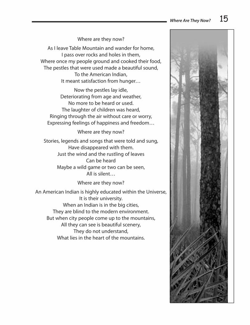
where are They now?By Rosalie Bethel
North Fork Mono Elder & Spiritual Leader
On Table Mountain I sit and gaze down into the valley below, Rivers and streams flow down the mountainside,
Flowers of never-ending kinds, Rocks of different colors and shapes,
Used in cooking and grinding our food, Wild game feeding on clover and grass…
We traveled through trails and pathways that animals have made, On to the coast where the ocean lies, When tired, we rested by a waterfall, Waters, covered with moss and fern,
We drank and bathed in.
We rested early and were up at daybreak, For a lighting system, we had sunlight
Where are they now?
The land was open far and wide for the human race, And for our furred and feathered friends,
We lived in peace and happiness, with freedom, We shared with all living things,
The Creator has given us life and existence, He has provided us with…
Acorns of different varieties and nuts, Greens of all kinds,
Berries, both sweet and sour, Wild tea of different kinds,
Roots and plants to be used for medication, For the sick and ill ones…
Hot mud springs were given to us, Provided by Creator through Mother Earth,
All the elements that were needed for the body were provided, The American Indians were not destructive or wasteful,
They took what they could use, And the rest was shared with other living things.
15
Where are they now?
As I leave Table Mountain and wander for home, I pass over rocks and holes in them,
Where once my people ground and cooked their food, The pestles that were used made a beautiful sound,
To the American Indian, It meant satisfaction from hunger…
Now the pestles lay idle, Deteriorating from age and weather,
No more to be heard or used. The laughter of children was heard,
Ringing through the air without care or worry, Expressing feelings of happiness and freedom…
Where are they now?
Stories, legends and songs that were told and sung, Have disappeared with them.
Just the wind and the rustling of leaves Can be heard
Maybe a wild game or two can be seen, All is silent…
Where are they now?
An American Indian is highly educated within the Universe, It is their university.
When an Indian is in the big cities, They are blind to the modern environment.
But when city people come up to the mountains, All they can see is beautiful scenery,
They do not understand, What lies in the heart of the mountains.
Where Are They Now?
Section I ~ Tribal Water Stories16
TriP To Tulare lakeBy Jeff Mayfield, Choinumni Tribe
Published by Malcolm Margolin and Heyday Books
After I’d been with the Indians periodically for several months, it was the time for them to make one of their annual pilgrimages to Tulare Lake, which they call Pah- áh-su. I am sure that it was their habit to go there yearly. The lake shore was held by the Tache tribe, but the tribe I was with was quite friendly with the Taches, and they made no objection to our using the lake shore.
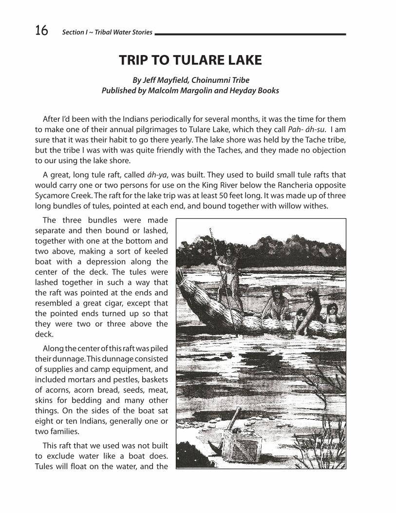
A great, long tule raft, called áh-ya, was built. They used to build small tule rafts that would carry one or two persons for use on the King River below the Rancheria opposite Sycamore Creek. The raft for the lake trip was at least 50 feet long. It was made up of three long bundles of tules, pointed at each end, and bound together with willow withes.
The three bundles were made separate and then bound or lashed, together with one at the bottom and two above, making a sort of keeled boat with a depression along the center of the deck. The tules were lashed together in such a way that the raft was pointed at the ends and resembled a great cigar, except that the pointed ends turned up so that they were two or three above the deck.
Along the center of this raft was piled their dunnage. This dunnage consisted of supplies and camp equipment, and included mortars and pestles, baskets of acorns, acorn bread, seeds, meat, skins for bedding and many other things. On the sides of the boat sat eight or ten Indians, generally one or two families.
This raft that we used was not built to exclude water like a boat does. Tules will float on the water, and the

17Indians made use of their buoyancy. On the lake, and sometimes in sloughs along the river, the tules used to float about loose. The wind would drift them into great mats near the shore. The fish used to collect under these mats and we used to walk over them and spear fish from them. I believe the Indians got their idea for the rafts from these great mats of floating tules. I remember that once we bundled some of these floating tules together and used them as a boat.
For us children, the trip to Tulare Lake was an occasion of great excitement. We were all eyes and ears and could scarcely contain ourselves.
The trip was made in the late spring when the flood from the melting snows in the mountains provided enough water in the river to float the raft over the sandbars.
The whole Rancheria did not make the trip. As I recollect, three rafts were built the first year. They were built several miles below the Sycamore Creek , just how far I cannot say. We were almost a day carrying dunnage from Sycamore down to the place where the rafts were built. It could have been ten miles below the Rancheria. I do remember that the river was wide there, and that great quantities of tules grew in a slough leading out from the river. It was in this slough that the raft had been built.
When we were all aboard, the boats were poled out into the stream and allowed to drift with the current. Three or four of the men stood at the sides of the raft and kept it away from snags and in the main current. In this way, we floated along at about two or three miles an hour.
At night, the raft was moored to the bank in a quiet place and we camped on the shore. It was really one of the greatest experiences I have ever had, and certainly the greatest I had while living with the Indians. I believe they too enjoyed these trips more than any of their other experiences. We traveled in style and comfort. The river was lined with trees and wild blackberry and grape vines, and the whole trip was one beautiful scene after another. Years after, I used to cross the King River many times on the bridge south of Kingsburg, and the scene there always reminded me of our trips.
Of the amount of time used in making the trip to the lake shore, I have no accurate recollection. We traveled very slowly and hunted a great deal along the way. Sometimes the hunters did not board the boat at all during the day, but met us with game when we had made camp in the evening. I suppose that it must have taken us at least ten days to go from Sycamore Creek to Tulare Lake.
Occasionally we met or saw Indians from other tribes along the river. They were all friendly and seemed to take our trip as a matter of course. I remember that once a party of three of these Indians rods with us all day.
At the lake, we made a permanent camp on some high ground along a slough. I believe that they had used this place before, as one of the women dug up a mortar and pestle that had been buried there previously.
Trip to Tulare Lake

Section I ~ Tribal Water Stories18We found the lake Indians near us living in some ways quite differently from the Indians
at Sycamore Creek. They talked enough of the our language that we could understand them readily, but the rest of their life differed more than the language.
The houses at the lake were the thing I noticed most. I do not remember having seen a house there like those upstream Generally they were built of thin tule mats and were quite long—some of them were at least one hundred feet long. A sort of wooden ridge was erected on crotched poles set in the ground, and the tule mats were leaned up against it. Everything else was of a more temporary nature than I was used to at Sycamore Creek.
The shorelines of Tulare Lake changed and shifted a great deal. If a strong wind came from the north, as it often did, the water would move several miles south, and would move again when the wind changed. Then, when the water level in the lake changed, both the lea and the windward shorelines shifted long distances. At some point it was possible to wade out into the lake as far as a mile and find the water below our knees. This made it impossible for the Indians to stay in one place permanently and they could roll up their light houses and load them on tule rafts and move in a few hours.
While we were at the lake I noticed one or two houses that have always been more or less of a puzzle to me. They were built in the standing tules and seemed to be woven from the living tules as they stood in place. They were dome-shaped and about ten feet in diameter. I never saw any more of them and I have never since met anyone who had seen one of them. As I remember them, the tules speared to have been cut away inside the house, but no excavation had been made as was made for the willow houses upstream.
The tule mats that I have mentioned were called páh-tuk tríhnee. They were made in two ways. Some were tied together with tule by a series of half hitches. The tules were laid out on the ground parallel to each other and close together; then about every foot or so they were tied together by cross tules and the half hitches.
Other mates were laid out in the same way, and a milkweed string was passed through them. Holes were punched in the tules by means of a bone awl, and the string was run through the holes. These mats were used for floor coverings and mattresses, as I have mentioned, and for many other purposes. At the lake a light framework of driftwood was set up and the tule and the tule mats laid over it to provide a shade. This shade was used in other places, but was generally covered with brush instead of tule mates. It was called chíh-mil.

19The milkweed string, called
chíh-tik, was made of a tall milkweed that grew on the plains and foothills. It was a velvety, bluish-green weed, consisting principally of a straight stalk from three to four feet in height. Along the stalk were leaves, and at the top of was a blossom which later developed into seed pods.
On the outside of the woody center was a covering of fiber considerably like flax. During the winter, this loose fiber was gathered after it had fallen from the dead stalks to the ground and was used in making string. The string was twisted by means of a small stick rolled on the thigh.
When twisted, the string had much the appearance of the common stack twine used for sewing grain bags. The milkweed string was used for an almost unlimited number of purposes.
The Indians who lived on the river below Centerville also made string from the fiber of a kind of wild hemp, a tall, straight-stalked plant with red bark. They pounded the stalks between two rocks and removed the fiber with their fingers. It made a red string and was as strong as that made from milkweed.
From the sap of the same milkweed used for making the string a sort of chewing gum was made. This was obtained in a rather peculiar way. The green milkweed stalk was cut. The milk immediately began to form in a large drop on the cut end. Then another cut was made, and the process was repeated. The milk dried on the clay ball in a sort of gummy coating. This coating was peeled off and chewed. It was about the same as ordinary chewing gum after the sugar has been dissolved from it in chewing.
For fishing and hunting on the lake, a tule raft was used. The raft was constructed in a different way from the one I have already described. It was wide and flat and would pass over very shallow water. It was pointed at the ends, but the points were not raised as high as they were on the raft used on the river.
In the center of the fishing raft was a large hole. Through this hole, fish were gigged much as they were from the platform on the river. The fisherman lay on his stomach with his head and shoulders over this hole, which was covered with a tule mat so he could see into the water without being seen by the fish.
A few feet ahead of the hole was an earthen, or mud, hearth. On this hearth, a fire was kindled, and cooking was done.
Trip to Tulare Lake

Section I ~ Tribal Water Stories20Sometimes three or four Indians would go out on the lake on one of the fishing rafts
and hunt ducks and geese and stay out there as a long as a week. During this time, they poled the raft around through the tules and ate and slept on it.
They would throw loose tules over the raft and themselves, forming a blind. Then through the hole in the center they would slowly pole the raft whenever they wanted to go. In this way, they would approach within a few feet of ducks and geese and shoot them from the blind with bows and arrows.
Sometimes they would catch the ducks that flew overhead in a net. This net was a lot like the net fisherman use to take trout out of the water after they have hooked them. It was about two feet across at the mouth. They also snared ducks and geese among the tules.
The Indians could imitate the call of almost any animal or bird, and they used to make use of this in hunting. They commonly called ducks, geese, rabbits and deer.
The tribe I was with had an interesting way of catching fish on the lake shore. A weir of willow wickerwork was built out at an angle from the shore for a distance of fifty or sixty yards. Then a large group of Indians would wade out beyond the weir. This group would form a semicircle sometimes a mile long.
After the circle was completed, they would close in, all splashing and yelling and driving the fish into the shallow water behind the weir. In this shallow water were two or three Indians wading about, each with one of the bottomless wicker baskets that they used up the river for catching fish in pools. When they felt a fish with their feet or saw a ripple made by a fish, they would clap the basket down and catch it. It was not possible to see the fish as the shallow water soon became very muddy.
One of the great sports at the lake was the jackrabbit drive. The flat sagebrush plains around the lake were fairly alive with jackrabbits; the Indians used to plan a drive much like the drives later made by the white people, except that they used no pen or corral.
A milkweed string net was made. This was about thirty feet long and four feet high. It was tied just like an ordinary fish seine, but I never saw the Indians seine fish. This net was used only for catching rabbits erected between two large sage brushes. Then a long line of Indians marched out at an angle from each end of it. When the tow lines of Indians had formed wings several hundred yards long the outer ends closed in and then they drove the enclosed rabbits toward the net.
When an Indian came close enough to a rabbit, he would throw his stick spinning at it and would generally break its legs. But most of the rabbits were killed at the net.
As the rabbits ran along between the two lines of Indians, they saw what they thought was an opening in the line at the net. They attempted to run through this opening, but hit the net and bounced back. Then they were promptly clubbed by one or two or three Indians who were hiding there for that purpose.

21It sure was exciting when the drivers had closed in. There would be hundreds of rabbits
and almost as many sticks flying in the air. Many of the rabbits would break through the line of Indians and escape, but a great many, probably two hundred would be killed in a forenoon drive.
The rabbit skins were made into fine blankets, which the Choinnumnes called chih-cú-nah. These were used as a covering for sleeping much as an ordinary blanket. They were the warmest and most comfortable bed covering I have ever used.
The skins were taken from the rabbits without being split, and while green, they were cut into long strips about three-quarters of an inch wide. As the strips dried, they naturally curled up with the flesh inside and the fur on the outside. This made a sort of fur boa about an inch and a half in diameter.
In making a blanket, two of the strings were twisted together for a distance of about six feet. Then the ends were doubled back and looped through the twists of the first portion. Working back and forth across the blanket in this way it was woven into a square about six feet on each side.
Smaller blankets were used as a sort of cape, or shawl, in extremely cold weather, or to wrap the babies in before they were strapped to the cradle board. The women also made skirts in this way.
We used to see elk and antelope around the lake. I heard about the Indians surrounding antelope, but I never saw it done. They used to shoot both elk and antelope from blinds when they came to the lake to water.
Antelopes were easily killed with arrows, but elk were almost too much for them. It was almost impossible for them to kill an elk outright with their weapons. They would shoot arrows into an elk and then follow it for several days until it was weak enough to be overpowered.
My brother, Ben, once killed an elk on Tulare Lake. When he was dressing it, he noticed an unnatural growth inside the body. Upon investigating, he found it to be the foreshaft of an arrow which had lodged there and had entirely healed over, both inside and outside.
Trip to Tulare Lake

Section I ~ Tribal Water Stories22
norTh fork Mono TriBe leTTer To ferC SeCreTary SalaS
April 22, 2008
Ms. Magnolia R. Salas, Secretary Federal Energy Regulatory Commission 888 First Street, N.E. Washington DC, 20426
re: Southern edison Alternative licensing
Dear Secretary Salas:
On January 20, 2006, the North Fork Mono Tribe put in a Motion to Intervene regarding the relicensing of the six hydroelectric facilities including Mammoth pool. That Motion to Intervene was on the relicensing for six hydro facilities on the Big Creek Drainage of the San Joaquin River in the territory of the North Fork Mono Tribe. These ALP Projects include: Big Creek 1 & 2 - FERC project No. 2175; Big Creek 2A, 8 & Eastwood - FERC Project No. 067; Big Creek 3 - FERC Project No. 120; and Mammoth Pool Powerhouse - FERC Project No. 2085.
Once again, the Tribe is submitting a memorandum to the “Motion to Intervene” on this relicensing of the above mentioned hydro projects. The Tribe as to this time is reiterating their stance on the licensing of these said facilities. Several stakeholders did not sign the Settlement Agreement including the North Fork Mono Tribe. Now that the EIS has been implemented and a draft is due out by September of 2008, it is imperative FERC staff and draft coordinators to review our “Motion to Intervene.” There are some very serious issues that need to be addressed in the upcoming EIS Draft.
It was earlier stated that the SCE had until February of 2008 to garner signatures from the remaining non-signatory stakeholders. SCE has made no attempt to discuss settlement issues with non-signatory stakeholders. As a matter of fact, FERC staff visited the SCE in July of 2007. A meeting was held and only signatory stakeholders were invited. However, two non-signatory stakeholders showed up anyway.
FERC staff seemed to be a little surprised as SCE was only announcing the signatures of the Settlement Agreements they did get. At no time did they mention how many stakeholders did not sign the Settlement.

23We realize that the Historic Properties Management Plan (HPMP) for Southern California
Edison Company’s (SCE) Alternative Licensing Process (ALP) should have been dealt with by the Federal Energy Regulatory Commission (FERC), State Historic Preservation Office (SHPO) and the National Advisory Council. The Alternative License Process was an experimental process and we see it as an experiment gone awry.
At the beginning of the five-year process, SCE viewed the whole process as “status quo.” Meaning as long as SCE went through this alternative licensing process and they didn’t have to relicense each facility separately, licensing would be a lot simpler especially if they held their position of `minimum effort minimum loss.’
The North Fork Mono Tribe was one of several organizations at the Table from the beginning to the end. A five-year process was set with issues and goals, a plenary committee and subcommittee. The subcommittees encountered a few pitfalls along the way but more over good documented evidence was brought back to the table from the field, archives and human resources.
As negotiations opened up a year and a half ago and settlements began to roll in by March/April, in June, important evidence became major discussion items. One thing became quite clear to all participants, stakeholders, and negotiators: their respective settlements were 180 degrees opposite of SCE’s settlement position. SCE set timelines and goals for when all settlements should have been settled; however, SCE didn’t negotiate, they just kept submitting their stance and held their position of “minimum” output.
SCE was in such a hurry to get these documents done and into FERC but now it has jeopardized the positions of those whom they failed to negotiate and settle with. SCE said they want to negotiate, only `after the fact.’ This attitude prevails because they were allowed to pull their settlement out of Powerhouse #4 Relicense on the San Joaquin River. It worked once—maybe it will work again. Only this time, they’re laying the responsibility onto the federal and state agencies.
What you’re going to find buried in the HPMP is how more than 100 archaeological sites are going to continue to erode and dissolve until they disappear over the next 40 years. Already after the last 55 years, the integrity of the sites has been extremely compromised. (Included documentation evidences more than 50-90% erosion from the reservoir impacts).
The regulations optimize the protections of these sites with data recovery. However, weak to poor recordation of the sites prior to licensing of these hydro reservoirs coupled with a minimum effort of shovel probes and an archeological genocide via paper work to categorize sites important and insignificant, thereby downplaying the importance of these ancestral and ethnographic sites as a whole cultural area.
North Fork Mono Tribe Letter to FERC

Section I ~ Tribal Water Stories24No serious testing was done to any important sites, thereby nullifying `data recovery’ as
an option of protection. The HPMP will display years and months of discussion regarding many other protection mitigation measures; however, none of them will be effective enough to stop the eventual eradication of these sites.
The interesting thing about all this is that the United States Forest Service, Sierra National Forests, FERC, NAC, and SHPO have all been aware that this damage has been going on over the past 55 years, and did nothing about it. Now the Forest Service had the opportunity to make sure things were righted. Instead, they not only failed in their responsibility, they ducked, shucked and hid sites from being evaluated, and wouldn’t `step up’ to sites that needed actual Phase I testing. They tried to put shovel probes and augering off as Phase I testing. The Sierra National Forest has been conducting shovel probes and augering as a form of reconnaissance for the past three decades. By making shovel probes and augering as Phase I archaeology, `real’ data recovery was deemed Phase II and therefore never entered into.
During negotiations with the SCE on Powerhouse #4, FERC put the kibosh on settlements and negotiations by stating, “that FERC would not go back to any damages caused by the initial licensing period including damages to cultural resources from impacts when the hydro facilities and system was being built.“
Now the tables are turned! Now each of your agencies know about the previous damage and the `continued’ damage that the relicensing is going to cause.
So now it is the responsibility of each reviewing agency to `step up’ to their own mandated guidelines and not let this multi-billion dollar corporation get away with cultural genocide. While compensation is not going to protect the sites from further erosion, `just compensation’ is what is called for according to the Fifth Amendment of the United States Constitution when Eminent Domain is in effect.
SCE has stated, “They are not changing their water management practices.” So if mitigation measures, negotiations, and your respective offices cannot create satisfactory settlements then the next step will be litigation.
The mussels are gone, or like the arch sites, are barely hanging on; the fish population is nonexistent therefore the eagles no longer return or stay; water flows are too low; only a handful of Native American cultural resources are prevalent and or accessible; and all the US Fish and Wildlife (USFW) is concerned about is the Valley Elderberry Beetle. The North Fork Mono Tribe made sure the HPMP did not conflict with the Native American Religious Rights Act of 1978. The local American Indian population has been taking care of the elderberry for centuries—pruning, trimming, gathering and harvesting—and today the elderberry flourishes because of it.
The US Fish & Wildlife does not have comparison data—only research of the Valley Elderberry beetle’s existence at 500’ to 3000’ elevation. Yet the North Fork Mono Tribe has three separate names for each elderberry: mountain, foothill and valley. Did the USFW

25ever consult with Native Americans? No, because that would be too scientific. When a bush is trimmed, USFW want seven new trees planted. I have transplanted elderberry three times in my life, in all cases one bush creates three to five more bushes in a two- to five-year period on its own. When the elderberry is not pruned or trimmed or gathered, it becomes a fire hazard. Its stalks become large, no succulent shoots come up, the berries are smaller but bunchier, and it provides no stalks for hand clappers nor does it provide a home for the beetle. In North Fork, the County and the local Forest Service have been trimming and burning elderberry along road 274 from North Fork to Bass Lake for years, approximately every five years; and the bushes are healthy, pretty, and conducive to healthy harvesting by all species, human, animal and insects.
While we all like the convenience of electricity, many mountain Mono have grown up without electricity and some still don’t have it. Some of our elders were born on ancestral sites and in ethnographic cultural areas that are now inundated by reservoirs providing today’s conveniences.
So we’re not going to do without convenience, Edison is not going to change their water management, the federal and state agencies are not going to protect our cultural sites… Not many options left for the North Fork Mono Tribe whose territorial boundary SCE’s Big Creek Drainage, nine hydro projects and $23 billion comes from.
Respectfully,
Ron W. Goode
cc: CA State Office of Historic Preservation Native American Heritage Commission National Advisory Council Southern California Edison ALP Stakeholders
North Fork Mono Tribe Letter to FERC
Section I ~ Tribal Water Stories26
Many ChangeS of The SeaSonTold by David rain ortiz & Interpreted by Kym Trippsmith
In the days of those who came before us, a time came when all the water was bled dry from our fertile lands and trapped deep in the mountains. A bitter, dry cold descended like a tightly woven blanket of fear over the land and lasted for many changes of the season. The flyers and the swimmers, the four-leggeds and the two-leggeds, and the creepy crawlies called a Great Council Meeting where they cried out to Creator to teach them how to bring the water back to heal the land. None of them asked for themselves alone; they all asked for each other. The man wanted water for the fish; the fish wanted water for the plants; the plants wanted water for the sun and the sun needed water to send the rains to quench the Mother’s thirst. Silence descended on the Circle; they waited patiently for many changes of the season to pass before the answers finally came.
One day, Rabbit was digging a tunnel, as rabbits are want to do, and she came across Mole, deep inside the cool earth. Rabbit’s nose began to twitch. There was an odd smell in the air, something Rabbit had not smelled in many changes of the season. It was water. Mole smelled of water. “Where have you been brother” the Rabbit asked inquisitively.
“I was down deep looking for grubs and worms when it became hard to breath, so I came back up,” said Mole. Rabbit’s nose twitched again instinctively. Maybe this was a clue, a clue to an answer that Rabbit had wondered about for many changes of the season. There was water hidden deep underground and Rabbit knew it.
Rabbit dug her way back to the surface and called a meeting of the Council. As they all sat in prayer and pondered what Rabbit had said, the two-legged started to speak in a strange voice. “All must listen as great changes are before us. Bear, wolf, coyote, rabbit, mole, wolverine, badger, rat, mouse, earthworm, creepy crawlies and all other diggers... You must dig deep dens in your mother’s belly each season, but never dig in the same place twice to bear your young. Beaver, your special skills are needed to fell trees in the valley. All of you must work together to help the Mother relax. And you must dance in the sun and sing songs to invite the warm blessings of Spring to return unto the land.” And so they followed the two-legged’s words of guidance for many changes of the season.
One day, while Mother Bear was deep in a cave digging a new den, water suddenly came gushing out. Caught by surprise, Mother Bear was tossed out of the cave and found herself flowing down the mountainside, caught inside a swirling waterfall. As water flowed around her, she heard the deep, rich, warm voice of Father Sun telling her to fill her belly and mouth with water and go to the Big Saltwater where the fish would be waiting for her. She must carefully fill her mouth with the fish and carry them back to set them free in the spring inside the cave. Mother Bear understood. She looked about to see how she could get out of the water when she caught a glimpse of Mountain Lion chasing Rabbit.
“HELP ME!” she roared just as the flowing stream of water came into both Mountain

27
Lion’s and Rabbit’s sights. Completely unaware of the barreling bear rushing towards them, they ran to the edge of the waterfall to drink deeply of the Earth’s clear blood. In a flurry of fur, Mother Bear crashed into Mountain Lion and Rabbit; all three tumbled head over tails in the sparkling cool water finally lodging uncomfortably in the roots of a tree.
Coyote watched, smiling from a safe distance and breaking into a full laugh at the trio’s calamitous crash. In that breath, a small, round woman walked over the hill to scold Coyote for his insensitivity.
“Coyote,” she said startling him. “Why is it that you laugh at the misfortune of others?”
Coyote was caught by surprise, by a two-legged no less. On instinct, he jumped so high that he lost his footing and fell into the water below. An uncomfortable silence followed. Finally, the gorgeous woman smiled and said, “Let me start a fire for all of you to dry off by and then you can fluff your fur in the last of the sun’s rays.” The creatures gratefully agreed.
That night, they all listened to Mother Bear tell her tale of Father Sun’s strange requests. Then they prayed to Grandmother Moon for guidance and, one by one, drifted off to sleep under a blanket of stars. A few hours later, Grandmother Moon rode her feathers down to the firepit to awaken the small, round Woman.
“Grandmother Moon, why must we bring the fish to the cave pool?” the Woman asked.
“The fish are waiting for you,” she replied. “But you must not take them to the cave pool. They wait for you to bring them upstream to where one river becomes two. There you must release them. Remember child, all those of the female nation carry the eggs of their children inside them and they must be freed into the waters to quicken into life. So go and get the fish and when you release them, I, Grandmother Moon, will pull inside you and you will all flow as one.” With that, the feathers of the moon scooped Grandmother to take her back home to the starry sky leaving the Woman smiling deeply.
In the morning, Mother Bear, Mountain Lion, Rabbit, Coyote and the small, round Woman headed off to the Big Saltwater to catch as many fish as they could carry. As they traveled, they overheard the flyers excitedly sharing stories of how water was flowing where water had been trapped for many changes of the seasons. Water was springing up in all the old dens the animals had made. In the forests, water pooled where the earthworms were rich. In the valleys, water collected where the beavers had fallen trees. Mother Bear told the flyers about Father Sun’s requests and the Woman spoke of her visit with Grandmother Moon. They asked the flyers to spread their tales to all they encountered as fast as they could spread their wings so that the female nation would feel the pull of Grandmother Moon and all could flow together in the fertile waters of the Mother.
The sun burned warmer that day than it had in many changes of the seasons. The time of the great thaw had finally come. All creatures great and small promised to honor and respect the sacred gift of water and to strive to live in balance.
Many changes of the seasons later, water is again dis-eased and the oceans cannot breathe. The rivers go dry and fish and bears cannot dance. Once again, water is bled dry from our fertile lands; Coyote isn’t laughing any more.
Many Changes of the Season

Section I ~ Tribal Water Stories28
MounT ShaSTa and The greaT floodAs told by William Speer, Sr. , Shasta Indian Nation
and written by Ella E. Lark, “Indian Legends of The Pacific Norhwest”
The Indians of the Pacific Northwest and those of some other areas also, believed that before the first Indians were created, the world was inhabited by a race of animal people. In some tribes, chiefly those between the Rocky Mountains and the Cascade Range, the shrewdest and most powerful of these people was Coyote. For further explanation of this belief, see “The Animal People of Long Ago.”
Once Coyote was traveling around, carrying his bow and arrows with him, when he came to a body of water where an evil spirit lived. Seeing Coyote, the evil spirit rose out of the water and said, “There is no wood.” Then the evil being caused the water to rise and overflow the land until Coyote was covered.
After a time, the water went down and the land dried off. Coyote sprang up, took his bow and an arrow, and shot the evil spirit. Then Coyote ran away.
But the water followed him. Coyote ran to higher ground. The water followed him to higher ground. He started up Mount Shasta. The water followed him up Mount Shasta. He ran to the top of the mountain. The water followed him and became very deep, but it did not quite reach the top.
On the top of Mount Shasta, Coyote made a fire, on the only ground left above the water. Grizzly Bear saw the fire and swam to the top of Fire Mountain. Deer saw the fire and swam to it. So did Elk, Black Bear, Gray Squirrel, Jack Rabbit, and Ground Squirrel.
Badger, Porcupine, and Raccoon saw the fire and swam to it. Fish, Wolf and Cougar swam there. All the animal people stayed on top of Mount Shasta until the great flood was over. At last the water went down, leaving dry land in the midst of lakes and marshes.
Then the animal people came down from the top of Mount Shasta and made new homes for themselves. They scattered everywhere and became the ancestors of all the animal people on the earth.

29
SECTION IITRIBAL WATER
POSITION PAPERS

Section II ~ Tribal Water Position Papers30
ETHNOGRAPHIC HISTORY & HISTORICAL OVERVIEW OF SMALLEY COVE (TSOBATEBAU)
AT KECKHOFF LAKE ON THE SAN JOAQUIN RIVERBy Ron W. Goode
North Fork Mono Tribe
Anthropology
The Indians recorded on the 1851-52 Unratified Treaties of California for this area were identified as Toltichi or Tallinchee. In the Nium (Mono) language, the suffix chi or chee means small, spring or special. Chi is Crane Valley and chee is San Joaquin River. Crane Valley and the San Joaquin River are references to the directional movement of the Nium into the North Fork are (Goode, 1998; Lee, 1999).
The native name for the Smalley Cove area is Tsobatebau (Goode, 1998), which means river crossing. Tso is a prefix given to the language by the Crane Valley Nium. The San Joaquin River Nium use a prefix of cho. The River Nium would say “chobatebau” (Lee, 2006). Early researchers identified the spelling as “tsopatebau” (Gifford, 1932; Kroeber, 1974). This text all depended on who the consultant was and how well they spoke the language. However, the definition as “river crossing” remains the same for all three pronunciations.
The North Fork Mono language has had about five movement integrations over the past 300 years. The Nium language is a living language and is subject to a continuum of change (Goods, 1998).
Tsobatebau/Chopatebau is of the Nium language. Kroeber made references that the Toltichi/Tallinchee was a group of a Northern Yokotch group either related to the Chukchansi from over the Fish Creek Mountain or the Dumna downstream from what is Friant and Millerton Lake today (Kroeber, 1974).
Ethnography
Putting anthropology aside and looking at ethnography and oral histories, has the North Fork Mono in the Smalley Cove-Kerckhoff-Tsobatebau area dating back to the early 1700s and 1800s. A cemetery exists a half mile north of Smalley Cove Recreational site located on the west side of Road 222. The Tulley’s and Sherman’s are the prominent family members interred there. This noted information dates the cemetery back to the early 1800s. However, other native ancestral burials existed there prior to the ethnographic burials.
Some of the families who bordered the Smalley Cove area include the Sherman family who lived on both sides of the drainage emptying out at the small bridge. Dan Harris ran

31cattle and lived above the current Smalley Cove PG&E campground. Bob Kitchell, nephew to Dan Harris, also lived there. Elmer Sherman lived across from Dan Harris on an Indian allotment. Johnny Sherman lived a half mile upstream, east of the drainage at the base of the western slope of what is Corinne Lake today. Across the drainage on the west ridge and up north of Dan Harris was Gene Tulley and Ciatana Creek and Fish Creek Mountain were to the west of him. Mike Water lived on the back side of Fish Creek Mountain. North of Gene Tulley was Mike Reilly and east of him was Ed Polkenhorn. Ed’s property included the south slope of Hi-a-me Mountain. On the west slope of Hi-a-me facing Fish Creek Mountain was Harrison Jackson.
Southeast of Smalley Cove and Kerckhoff Lake lies the historic Horseshoe Bend Trail circling what is known as Long Ridge. On the west side of Long Ridge where Horseshoe Bend Trail begins is Southern California Edison’s (SCE) Big Creek Powerhouse #4 hydroelectric facility. South, but located on the south side of the River was the Isabel Mine. Southeast of SCE’s Powerhouse #4, west of Redinger Dam on the north side of the River and along the Horseshoe Bend Trail was John Hensley’s place and mine. Still on the east side of the Long Ridge along the trail and north of Hensley’s place, south of Sam Daniel’s place (aka, Tasineu) was another’s miner’s cabin.
Mono Trail Network
The Horseshoe Bend Trail follows along the old Mono Trail and was used and maintained by North Fork Mono cowboys. There are still some eight to twelve Mono ancestral sites along the trail. The east side of the trail head starts at a major North Fork Mono ethnographic/historic site, known historically as the Sam Daniel’s site and ethnographically as Tasineu, or place of the stars.
There exists another part of the trail from the Powerhouse that comes out at the Thompson Flat and continues by the Dandy Allotment Ranch on over to the confluence at Whiskey Creek and Willow Creek. The Nium Network Trail continues on up Willow Creek towards North Fork. There are many ancestral, prehistoric, archeological sites and ethnographic homesteads along the Creek and trail. The trail system ties into other trails along the way and continues on through North Fork to Bass Lake (Crane Valley). From Brown’s Ditch, it heads northeast over Shuteye Peak toward Globe Rock and then heads back toward Granite Creek and on to Reds Meadow. The San Joaquin River aspect of the Mono Trail intersects at Granite Creek and proceeds downstream through Rock Creek, Kinsman Flat, along Sagineu Creek toward Redinger Lake, on over to Willow Creek and back up to Tasineu. There are many old villages, ethnographic sites, creation sites, and gathering areas along the way.
There are other trails that break off and eventually return back or cross the River Trail, such as the one from Logan Meadow, down to Mammoth Lake, over to Chawanakee Flats, on toward Jose Basic and down to Redinger Lake.
Ethnographic History & Historical Overview of Smalley Cove

Section II ~ Tribal Water Position Papers32
HISTORICAL MAP ~ YOK MOUNTAINS AND WESTERN MONO TRIBE ~ AFTER KROEHER (courtesy of LATTA)

33The Mono Trail connects to the Horseshoe Bend Trail and proceeds around Kerckhoff
Lake on the north side through Tsobatebau and Smalley Cove on down along the San Joaquin River and table tops to the San Joaquin Valley. The Mono Trail interconnected the Nium with the Dumna, Kechaye, Pitcachee, and Hoyima, and proceeded on toward the Coast Range. The Mono Trail is a vast network of trails north and south interconnecting to the main stem which follows the north side of the San Joaquin from its inception at Mammoth Mountain to the Coast (Goode 2007).
Interview of Ulysses Goode, May 29 2006
Ulysses Goode grew up in North Fork. He was born on May 29, 1927 to Andrew Goode and Daisy Tex. Uly met Lena Kinsman-Walker in 1949, who lived on the Harrison Jackson property off of Road 222 and they became Ron Goode’s parents.
Uly speared suckers in the Smalley Cove San Joaquin River tributaries before he moved to live on the North Fork-Auberry Road, also known as Road 222. He speared suckers in this area for ten years between 1949 and 1959.
Uly made his own spears out of pitch fork prongs and wired them on with hay bale wire. The spears were approximately the length of a car, 15 to 16 feet long. He not only speared in the Smalley Cove creek feeders such as Fish Creek, Ciatana Creek and “little bridge creek,” but also on Cottonwood Creek, which fed into the San Joaquin River above the Millerton Dam. Cottonwood Creek is west of Fish Creek Mountain at the bottom of the table top and west of Fine Gold Creek.
The Smalley Cove creeks only went down about a half mile before the suckers had to stop; there they spawned. The Cottonwood Creek went several miles past the four corners of Roads 210 and 211, past the hot spring, up the west fork to the McDougald Ranch.
Uly remembered when he would go to the unemployment office in Madera before the logging season would start. He would hide his spears under the car. He would tie them up so they couldn’t be seen and on his way back from Madera, he would stop to spear suckers.
Uly pointed out that during the 1950s, there were 20 to 30 suckers in the spawning pools of Cottonwood. While in comparison there was only 7 to 10 suckers on the Smalley Cove tributaries. Uly commented that the spearing of suckers began to fade out in the 1960s due to the diminishing number of fish and the continuation of the tradition by the next generation.
Uly spoke about the different families who speared suckers during this time and made some interesting comments about them. He also talked about the Hoo’ya (caterpillar), the mussels and clams, and the gold searching by the Chinese. He attributed the loss of fish, clams, mussels, hoo’ya, and deer to the time when the Mammoth Dam was erected.
Uly stated, “When the dam went in, that put in a change and a chain of effects that were never rectified nor did the white man ever admit to it. This change affected the Indian’s way of life and their culture to this day.”
Ethnographic History & Historical Overview of Smalley Cove

Section II ~ Tribal Water Position Papers34Uly spoke of the Sherman family who speared suckers. He spoke of ol’ man Johnny
Sherman and Leo “the Lion” Sherman saying, “The Shermans would have suckers for breakfast. The suckers had so many bones, but the Sherman boys cleaned the meat off the bones from the head to the tail when eating the fish and never choked on a bone, unlike the rest of us.”
Uly Goode also spoke about the Hoo’ya. He said the Hoo’ya once traveled through the river drainage on both sides of the San Joaquin River. This was back in the 1950s.
When asked about gold panning and/or dredging, Uly spoke about the evidence the Chinese left behind ad they went through each of “our” creek drainages, such as the “small bridge” creek, Fish Creek, Ciatana Creek, the old Burns Hole Creek, and Willow Creek. All of these drainages were searched for gold by the Chinese. Small piles of river/creek rock can still be found along the creek drainages.
North Fork Mono Tribal Council Meeting - July 15, 2006
Discussion on who lived on the Indian Allotment Road off Road 222 across from the PG&E Smalley Cove Campground. An archaeological site exists that was used by the ethnographic residences. It was said that Elmer Sherman lived at the residence. Others included Mary and Wally Lewis and their children, Hiram Chenot, Dennis Lewis, and Wally, “Lo Ball” Lewis. The Allotment was under Elmer Sherman.
The Sherman family was pretty prominent in the Kerckhoff Lake-Smalley Cove area. Living at the PG&E housing was the William Sherman family. William’s family included his wife Leona, and their three sons, Bill Doug and Steve. William Sherman worked some 30 years for PG&E. While living at the Wishon Powerhouse housing, William started and coached the Little League team, known as the Wishon Tigers. In 1957, William graded the ball field that still exists today at the Smalley Cove Campground.
I played in the first year in 1957 when I was six years old. The starting age was seven, and I turned seven at the end of the summer session. I played Little League for six years and in the last year we won the league championship against Friant. Our practice field was the makeshift baseball diamond at Smalley Cove. Our players mostly came from the Wishon Powerhouse housing, SCE housing, North Fork’s Road 222, Auberry’s Powerhouse Road, New Auberry, Auberry and Tale Mountain Rancheria.
Interview with Melvin Carmen, August 2006
Melvin Carmen’s family did some gold panning and clamming off the Gegundy property on the south side of the San Joaquin River, south of the SCE Powerhouse #4 hydroelectric plant. Melvin still does a little dredging on Willow Creek and on Finegold Creek.
Melvin knows where the Chinese once gold mined on the south side of the San Joaquin River. His reference is to the pile of rocks left where the Chinese mined or panned for gold.

35Melvin also relates during the building of Redinger Dam as well as the construction of
Mammoth Pool Dam that hundreds of deer died because they became confused with the loss of their trails and crossings. The dams on the river totally changed the way of life for the animals, their habitat, and the environment, thereby changing the Mono way of life as well.
Interview with Naomi Carmen
Naomi was raised by her mother in the early 1920s/1930s. Prior to the building of the Millerton Dam and Kerckhoff Reservoir, Naomi remembers going down to the San Joaquin River, above (south) of Tsobatebau, to gather and spear salmon. The North Fork Mono would get the salmon in the sand bar just south of the old bridge crossing the San Joaquin River from Auberry to North Fork. The sand bar is north of the current SCE Big Creek Powerhouse #4.
Naomi and Melvin’s mother, Mrs. Ida Carmen, was born the day they celebrated the opening of the Wishon Power House. Mrs. Carmen’s mother was Susie Walker.
Interview with Doug Sherman, August 2006
Doug and his family grew up living in the PG&E Wishon Powerhouse housing. His father, William Sherman, was an employee of PG&E. They lived in the house next to the garage on the knoll across and east of the Powerhouse.
Doug remembers the road being upgraded from the big bridge to the little bridge. During this time numerous artifacts were uncovered, exposed, and found in the dirt under the pavement. There are still numerous sites all along the river’s edge both under the water and at the edge, from the Powerhouse well passed the little bridge.
Doug spoke of the trail from his place to the old SCE housing for Powerhouse #4. He and his brothers went all over the surrounding hillside. Several rock caves exist all the way up top Corrine Lake (a hydro holding pond for the Wishon Powerhouse generation). One shelter, between their place and north toward Frank Sherman’s place, has ancient drawings and artifacts (off of old historic road west and running north along little bridge creek drainage).
Doug had an extensive recall of the Smalley Cove baseball field and the Little League team known as the Wishon Tigers. Doug’s father, William Sherman, cleared the field with PG&E equipment. The Wishon Tigers practiced there for one full summer, and off and on for the next few years. Around 1960, the North Fork Boosters (or someone other than the Sherman family) built a wood back stop which remained up for the nest 40 years. The road with “sites” is west of the seasonal stream. Historical evidence is still there.
Ethnographic History & Historical Overview of Smalley Cove

Section II ~ Tribal Water Position Papers36Goode’s Personal Account
Born 1950 and Raised Traditional
From a very young age, I remember my dad and brothers coming home with game and fish. I remember my dad making spears and the big fish (called kaboage) that they always instructed me on how to eat because it has so many bones. My mom would always put the heads in a pot and boil them. She would throw in the tails as well and the eye balls would pop out and float on the surface when the pit boiled. My brothers and sisters would tease me saying it was a witch’s stew.
I remember driving around to the various creeks along the river and my dad getting out to go “check a creek.” It wasn’t until my high school days when my brother Tom `Cat’ Kinsman would go down to the river at Smalley Cove and “check the creeks” at Ciatana and the little bridge creek for suckers. We wouldn’t take spears, as he would reach his arm underwater along the banks especially where roots grew for suckers hiding. He would count the ones in each of the pools and creeks. A day or two later, we would go with 100lb gunny sacks and string to tie each sack with. Sometimes he would allow me to take a spear, but always complained that it got in the way.
Spearing wasn’t easy; it took a lot of practice. The fish move when the spear enters the water, and the water deflects the spear. The deeper the water, the more difficult it was to spear, so it was best to spear fish in shallow water. That was a problem because the suckers did not go as often to the shallow waters; plus, the water was cold. My brother Tom showed me techniques to spear and once or twice I would actually spear two or three fish. Meanwhile, he would be over on the shoreline pulling out suckers enough to fill two sacks.
After a while I stopped spearing and bringing my spear. Even though I was very strong, trying to carry 100 pounds of wiggly, wet, slimy, big fish in a sack up over steep terrain for a half mile was not easy. So I would bring extra sacks and split my load, then I could carry them like buckets at my side.
I even did my share of searching under the roots for the suckers as well, at least for about as long as long as I did spearing. In order to pull the sucker out of the hole, you must feel the fish and grab it by the gulls with your fingers and drag it out. This was not an easy task as the suckers had teeth and their fins were sharp and both would cut your fingers. On top of that there were always other fishes in the holes that moved very fast. Then, of course, there were the long skinny water snakes that also lived in these holes. In order to get to the end of these holes, you had to get to the edge of the bank and reach as far as you could with your arm into the hole, which left you feeling pretty vulnerable. But it was exciting and I couldn’t wait for the next spring and the first warm rains.
I remember going to gather mussels and clams with my mother along the River, in particular on the south side of the River near Gegundy’s across from Hensley Mine. She always panned for gold at the same time because she said the gold and clams all gather

37on the south side where the River turns and there are more pot holes, protruding rock bands, and sand areas. Like the suckers, mussels and acorns, gunny sacks were the choice of gathering and hauling of the resource.
Back in the 1960s, the mussels were still plentiful but not like the decades before my mom would say; before we would find them on the sand banks and on the edges of rocks. By the 1960s, we would have to dive under the big rocks and bring them back by two’s and three’s. My mother was always concerned about the swift water and holes under the big rocks that might suck us under. The current was swift and it took strong swimmers to get under the big rocks and back again. My mother usually boiled the mussels maybe because that’s how she normally prepared things.
My mother loved to pan gold and checked each creek around Smalley Cove and Kerckhoff. The River on the south side was the best. Willow Creek supplied good flake and color; Ciatana, Fish Creek and little bridge creek were light. Burns Hole Creek, however, had its pockets we spent many a summer there with her friends panning, telling stories and having lunch.
The River was our backyard where we played, hunted, fished, speared swam, panned, gathered, socialized and held ceremonies and events. My people and family have been coming to Smalley Cove for hundreds of years. Here the resources—grapes and grapevines, blackberries, sourberries, onions, watercress, milkweed, acorn, wormwood, salt clover, brodeia, oak shoots, chaparral, redbud, sedge root, deer, rabbits, quail, doves, pigeons, gray squirrels, trout, steelhead, suckers, salmon, mussels, calms and hoo’ya—are rich and abundant.
I remember swimming with my friends, brothers and sisters. My brother Tom Cat used to tell me stories about how he would swim in the coldest waters all over the mountains on a cold day in the winter—sort of a rite-of-passage showing your manliness. He said swimming in the San Joaquin River with the snow run-off and the Wishon generation plant going was the coldest he found. So on his birthday, March 1st, he took his older Uncle Ned Tulley down to the river and stripped off and dove in `Indian’ style. He had to have a witness. Later on March 1st, my girlfriend’s birthday, I attempted to top that by swimming in Hume Lake with ice on the lake, `Indian’ style with my soon-to-be wife as my witness. He thought that was pretty good. Hume Lake was cold, but swimming in a lake is not like swimming in a reservoir with swift under current. I’ve swam in Kerckhoff in early May, and when you get out in the middle of the river, your heart almost slows to a stop. My sister Robena said she used to swim across the river to the other side where the river crossing was and back again.
Leona Chepo recently told us of a rattlesnake story that occurred when she and her family and friends would swim in the river. She said they were all swimming when a rattle was crossing the river with its head and tail up out of the water coming right at them. They waited for it and killed it. I too have a rattlesnake story about when we were doing the archaeological dig at Smalley Cove Campground…
Ethnographic History & Historical Overview of Smalley Cove
Section II ~ Tribal Water Position Papers38When I was training for a martial arts competition, I would run down from my house 3½
miles barefoot on the pavement and dive in the water, cool down, east some blackberries or sourberries and run back home. In the summertime, I would run in the afternoon or late evening. On the way back up the hill, I would always see small rattlesnakes curled up in the pot holes in the road.
I consider Smalley Cove / Kerckhoff Lake—Tsobatebau—my home, my homeland. It’s where I grew up and still return today to play, socialize, and hold events so I can visit with my elders, relatives, friends, and pass on the history traditions of Chopatebau.

39
TRIBAL WATER RIGHTS A Position Paper
By Ron W Goode North Fork Mono Tribe
What are tribal water rights? What are water rights? Who has water rights? Who thinks they have water rights? What water comes under authority for distribution to users? Why is our water sacred?
Tribal water rights start with our creation stories, water stories, animal stories and old tales. Recorded by early researchers, our storytellers tell of our existence at the water heads to the creeks and rivers. Then tell how our land was formed with water by Creator with coyote, falcon and crow in charge.
These are not the mythological stories as the white researchers professed they were. These stories are and were passed down for thousands of years before being recorded in the late 1800s and early 1900s. Yet they coincided with the Bible, written thousands of years before the white man arrived in our lands.
Water is an element running all through our stories. Place names included water; village names included water and we have water songs. Puzaotes is a village named after the year-round spring that ran out of the ground near Lion’s Point. Puzoates is the name of the Spring Eagle, a.k.a. Bald Eagle. The Bald Eagle lived at this spring. He could see the San Joaquin River from there, which is where he fishes, made his living and raised his family.
The Mono has two sides to their political system: the wet and the dry; the water and the land sides. In charge of the dry/land side is Esha, the coyote (Creator’s pup/pet). In charge of the wet/water side is Puzaotes, the Bald Eagle (Creator’s Messenger). Under Esha is quint-na the Golden Eagle; pu’na, Redtail Hawk and others. Under Puzaotes is Pahubich, the Black Bear, as well as Kingfisher and others. The Mono is patrilineal, meaning they come into the tribe through their father’s side.
In the 1920s, Winslow Gifford, a researcher from Berkeley, was shown a boulder by a Mono elder from which Pakwe the Trout emerged at the head waters of the San Joaquin River. He immediately sent letters off to biologists asking if Rainbow Trout were native to the Western Sierra’s. He wanted to prove or show evidence the Mono was so new to the western Sierra Nevada Mountains that their stories were concocted after the white man came to the San Joaquin Valley. He was told in letter response by the biologist that the rainbow and the golden trout were in fact native. Yet, he never included their response in any of his reports.
Why are stories like this one important? Since historian after historian, anthropologist after anthropologist, government official after government official continuously try to
Tribal Water Rights

Section II ~ Tribal Water Position Papers40downplay or mythologize our stories into fairy tales creating illusions of grandeur toward our connection to the elements, minerals, resources, the land and water.
Rights to water? What rights? Surface water is what is fought over. More users and abusers need more water than that what is available. Utilities and their hydro irrigation districts, municipalities, and farmers all vying for water and anything left over goes to the fish. Surface water comes from precipitation and from ground water. Ground water and precipitation are not regulated. No one has water rights over either of these two. Creator provides the precipitation and Mother Earth provides the ground water.
Citizens own the water from their private wells and even they are not regulated. In other words, anyone can take your well water by tapping into it at a higher level. So then begins the fight for tribal water rights. All waterways have springs attached to them; even if it’s just runoff drainage, one usually finds springs along the drainage. The rancher looked for these springs when laying claim to our land. Today, there are huge corporations wanting to lay claim to unattached ground water as well as precipitation.
How is it the State claims water rights on all water in the State whether on private, county, state federal or tribal lands?
Back in 1832, when Colonel J.J. Warner visited the valley with the Ewing Young expedition, he observed more Indians “subsisting on natural products from the soils and waters” than anywhere else in the country. The Indians, he reported, had plentiful wild game, fish, nuts, and seeds and were experts in catching fish and snaring game. A couple of years later, Joseph Walker came in through Yosemite down into the valley to buy horses for his expedition.
In the mid-1800s, a company known as Miller-Lux ran cattle from the Los Angeles/San Diego area north through the San Joachin Valley and coastal areas, servicing the townships/cities of Monterey, San Jose, San Francisco and Sacramento. In order to get his cattle through the Valley, he had to give up some of the beef to all the Yokotch tribal villages along the way. It is documented that Miller-Lux struggled to get enough beef to market at the larger townships because of all the beef given away to Indians. It is also stated that they were afforded the right to water. It wasn’t free.
There were many skirmishes and physical confrontations with the Indians of the San Joachin Valley and the Sierra Mountains during the period of 1769 to 1864. Most of these battles, while lasting no more than one to four days, were considered a draw or the Indians claimed victory as the various intruders retreated. In 1851-52, treaties were negotiated with tribal groups from all over the State. These treaties were lobbied against by California because the lands given to the tribes were prime foothill lands. Plus the tribes retained cultural resource rights, fishing and hunting rights, and water and mineral rights.
The treaties went unratified and were secretly tabled for 53 years and then vetoed by the United States Senate in 1905. Skirmishes and conflicts continued in 1856 in Tulare and

41in 1864 in Owens Valley. In 1868, sixteen years after the treaties were secretly tabled with no intention of follow-thru by the United States government, San Joachin Valley tribes were contacted by government officials telling the Chiefs that they gave their word and signed treaty documents that there would be peace and freedom. The Chiefs were told to “get their renegades under control.”
In 1864, with the Indians in tow and many living on reservations, Miller-Lux applied to the State laying claim to all water ways in California. Then in the early 1930s, Miller-Lux sold their water rights to the State of California.
The Treaty of Guadalupe Hidalgo which ceded California to the United States, guaranteed Mexican land titles in the ceded territory as they stood at the time of transfer. Under Spanish and Mexican law, Indians had certain rights to the lands they occupied and could not legally be evicted from them. It would seem that this right was an interest in land and one entitled to protection under the provisions of the Treaty of Guadalupe Hidalgo.
The Mexican land grants were ceded, but the Indian rights were not. Today, California’s Governor doesn’t even want to recognize the Treaty of Guadalupe Hidalgo.
Post unratified treaty discussion in Washington DC went like this, “Moreover, the laws of Spain as to Indian land rights in the territory acquired via Mexico were precisely the same as in the territory of Louisiana in the lands in America acquired from Spain via France. The laws of France as to Indian lands in America did not differ essentially from those of Spain, or for that matter of England, though the English Colonists early discovered the practical advantages of buying the Indian Rights.
During our regional tribal water meetings we constantly heard terms such as aboriginal water rights, adjudication, federal reserved water rights, the Winters Doctrine and quantified reserved water rights. The Winters Doctrine established the reserved rights doctrine, setting the priority date of water rights for reservations at the date the reservation was established. Even though most tribal groups were from the land for which they were given a land base, so did the Doctrine negate their aboriginal water rights or did it promulgate?
The Winters Doctrine established “practicably irrigable acreage” as the standard for quantifying reserved water rights. Discussion of aboriginal water rights prior to the Doctrine is still being hotly debated.
Despite the seniority of tribal reserved rights, Indian tribes encounter difficulties in using their water supplies due to the Endangered Species Act and other applicable federal environmental laws. Indian tribes that seek to use their reserved water supplies find themselves at odds over the developmental usage of their water. Existing water supplies commonly are committed to current non-Indian users that are impractical to dislodge in a negotiating setting.
Tribal Water Rights

Section II ~ Tribal Water Position Papers42While the use of the Winters Doctrine, rights on the reservation generally has been free
of controversy, transferring water use off the reserve has proven contentious. Tribes have not authorized to sell their reserved water. With Congressional approval, they can lease water for use off their reservation land. Why they need Congressional approval is still being debated by Indian litigators. Yet, non-Indian water users downstream do not seem to have a problem selling their excess water.
Adjudications are court determinations of water rights, volumes and priorities. This then brings into light the quantifying of tribal water rights. Quantifying the volume of the right is based on the purpose of the reservation.
So, when everything is said and done, if you have tribal water rights, do you actually have equal say and determination of your water as the Federal Bureau of Reclamation and the State Board of Water Resources? That would be true water rights. The big question is why do so many have their hands in your bucket of water?
Traveling around the State, I hear how many tribes and reservations have taken their water rights back and they’re now in control of their water as it pertains to the reservation. Yet, in their backyard is their sacred mountain from which some water bottling company is extracting water from their sacred springs and making millions off of it, with no residual to the people of that mountain or spring.
Coming full circle in this position paper, we raise the question, why is our water sacred? My Uncle John and Aunt Daisy used to tell a story about fishing down in the hole (canyon) of the San Joaquin River where the confluence of the stream’s forks come to a head on the river. To get there, was steep and treacherous. The bear-man had his cave shelter along the canyon wall. Eight and ten foot rattlers were commonly seen and encountered. Fishing down in the hole meant lots and lots of large tasty native trout.
My uncle was told by his elders that when you go there, you have to give fish to the black snakes. They come up out of the water and if you don’t make an offering, they will eat you; there is no escape. If you want a successful fishing trip and to get out safely, you better make your offering. So Uncle John and Aunt Daisy made their offering. Out came the black snakes for the offering. Uncle John said it was the best fishing he ever did. He always told the story and lived to be almost 90 years old.
Today, our water and water ways are in trouble. What offerings are our non-Indian water users making back to the river? They cry about their lack of water, but what are they doing about the mismanagement of our collective watersheds?
Eight years my tribe spent on the hydro relicensing for Southern California Edison on the San Joaquin River. We met monthly, never saw any farmers there talking about the improvement of our watershed. Fifteen to twenty percent of the precipitation is lost because of the brush canopy. Another five to ten percent is lost down the canyons on evaporation due to the brush. In a drought year, that twenty-five percent would sustain their operation.

43You as the descendants of this land and water, don’t forget your stories. Don’t forget
to make your offerings because those black snakes are real, not mythological; only their appearance may very well be in another form. By our example, our brothers in the Agencies may come to have a better understanding of the land and water.
To put a stamp on this position paper, the North Fork Mono has never relinquished their water rights! The Tribe made this statement in the Sierra Nevada Environmental Plan, in our federal acknowledgement petition, in our negotiations with SCE and PG&E on hydro relicensing to FERC and here in the 2009 California Water Plan Update Proceedings.
Respectfully,
Hon. Ron W. Goode North Fork Tribal Chairman
Tribal Water Rights

Section II ~ Tribal Water Position Papers44
HOPLAND TRIBE DENIED ACCESS TO WATER PIPELINE2009 California Tribal Water Summit Position Paper
Hopland Band of Pomo Indians Position Paper
The Hopland Band Of Pomo Indians reservation is located on the headwaters of two small watersheds that are tributary to the Russian River. The Tribe is fortunate in that a small amount of steelhead make it back from the ocean to spawn in the reservation streams. Thus the tribe contributes to the health of the larger Russian River watershed and its fishery. Ironically, the reservation has not enough potable drinking water for its residents and must truck water in from the town of Hopland. The tribe has worked hard and spent a lot of money to build a pipeline to Hopland, five miles away. Yet the Hopland Public Utility District, which is drawing water from the Russian River, is refusing to hook up the pipeline. This needs to be remediated.
The Hopland Rancheria was established in 1907 in Southern Mendocino County. The Hopland Band of Pomo Indian Tribe is located in Southern Mendocino County 3 miles east of the town of Hopland. Our land base is roughly 2,000 acres and we currently have 750 tribal members. It is estimated that 300 residents currently reside on the Hopland Reservation. Our Tribe gained federal trust status in early 1900s only to be have that status terminated by a law passed in the 1950s. We regained federal trust statues in 1979 and still enjoy trust status. The water resources on the Hopland Rancheria have always been limited. Shallow wells, water infiltration gallery and one natural spring historically were the sources of water on the Hopland Rancheria.
Today, only a single well exists on the Hopland Rancheria. The water infiltration gallery was assisted by Indian Health Service (IHS), US EPA and determined to be a surface water resource. The natural spring was also assist by IHS, US EPA and determined to a surface water resource. Surface water used for the purpose of drinking water must be disinfected by a certain process. This process has 4 methods. At the time of these assessments to our infiltration gallery and natural spring the Hopland Tribe was in no shape to meet the cost for these 4 treatment methods so the tribe deemed these sources non-feasible and both sources were abandoned.
Currently we rely on water from the city of Hopland. This water is hauled by a trucking company which is at an extreme cost to the Hopland Tribe. The drinking water well we operate is non-operational and has been so since late summer 2009. The Hopland Tribe survives solely on the water purchased from the city of Hopland. A pipeline was constructed in 2008 and 2009 from the city of Hopland to supply the Tribe. Legal troubles have arisen between the Hopland Public Utilities Department and the Hopland Tribe so the pipeline project had been halted and there seems to be no resolving this matter in the near future. This is the position of the Hopland Tribe in January 2010.

45
ADVERSE EFFECTS OF THE KLAMATH BASIN WATER & HYDROELECTRIC AGREEMENTS ON
TRINITY RIVER RESTORATION2009 California Tribal Water Summit Position Paper
Hoopa Valley Tribe
The Klamath River flows through California’s Hoopa Valley Indian Reservation. The Klamath’s largest tributary, the Trinity River, bisects the Hoopa Valley Reservation en route to its confluence with the Klamath River approximately 45 miles upstream of the Pacific Ocean. The Trinity River produces most of the anadromous fish in the Klamath River basin. The Klamath River provides essential water and habitat for fish migrating between the ocean and the Trinity River. The Hoopa Valley Tribe has vested fishing rights in the Klamath/Trinity fishery that the United States holds in trust pursuant to congressional, judicial, and administrative authority.
In 1984 Congress found that the Central Valley Project’s Trinity River Division caused a “drastic reduction in anadromous fish populations.” In the quarter century since then, bipartisan congressional and administration actions in conjunction with the Hoopa Valley Tribe produced the Trinity River Restoration Program.
In the past decade, conflicts over water rights and hydroelectric licensing proceedings in the upper basin of the Klamath River have presented a new threat to the Trinity River fishery and the restoration program. The principal source of the conflict lies with the Bureau of Reclamation’s Klamath Project and the proposed allocation of water for irrigation. The new proposed Klamath River Agreements present three challenges to the Hoopa Valley Tribe’s vested rights: (1) failure to fund and implement restoration as prescribed by the December 19, 2000 Trinity River Mainstem Fishery Restoration Record of Decision (ROD); (2) infection of salmon smolts by parasites in the main stem Klamath River causing death or debilitation of smolts; and (3) disease epidemics near the mouth of the Klamath River occurring from insufficient water flows in the main stem Klamath as a result of federal irrigation diversions in the Upper Klamath Basin, near Klamath Falls, Oregon.
The proposed Klamath River Restoration Agreement (KBRA) and the Klamath Hydroelectric Settlement Agreement (KHSA) threaten success of the Trinity River Restoration Program in several ways.
First, parties to the Klamath River water rights adjudication pending in Oregon state court advocate that the proposed Klamath River Basin Restoration Agreement (KBRA) include limits on the federal government’s authority and responsibility to administer and
Adverse Effects of Agreements on Trinity River Restoration

Section II ~ Tribal Water Position Papers46divert water to the Bureau of Reclamation’s Klamath Project. However, if adopted, those limits would come at the expense of water and fishing property rights and interests in California for which the Federal government is also responsible. The nature, extent and priority of the federal responsibilities for tribal rights in California and Klamath Project administration are set forth in, among other documents, two Pacific Southwest Regional Solicitor’s opinions dated July 25, 1995 and January 9, 1997. Among other things the opinions concluded that “Reclamation must, pursuant to its trust responsibility and consistent with its other legal obligations, prevent activities under its control that would adversely affect those rights . . .” (1995 Opinion at 8), and that tribes’ rights are “superseding obligations” (1997 Opinion at 8) that are “senior and enforceable against junior uses, and adjustments may be required in how the Klamath Project is operated to be consistent with the tribes’ rights.” (Id. at 5, n.6.) Resolution 09-63 of the Affiliated Tribes of Northwest Indians supports the sovereign authority of tribes to enter into water agreements and “opposes any policy of the United States to terminate the rights of, or impose adverse consequences upon, a tribe that chooses to retain its water rights instead of settling on terms desired by the federal government.” Proposed section 15.3.7 of the KBRA is the provision objected to by the Tribe that would have that effect.
Second, the KBRA guarantees irrigation diversions of water for the Klamath Irrigation District Project in Oregon. Those diversions—330,000 to 385,000 acre-feet per year—would trump the in-stream flow needs of fish and other aquatic organisms. Fish would get whatever water flow remains after those diversions. This imbalance in the allocation of risk in the KBRA stands the reserved rights doctrine on its head with real adverse consequences for the fishery. Analysis of the guaranteed diversions makes clear that the water flows in the vicinity of Iron Gate Dam (near Interstate 5, in California) would frequently fail the requirements of the National Marine Fisheries Services’ Biological Opinion for protection of salmon in the mainstem Klamath River. Such low flows caused the fish die-off in 2002, adversely affecting Trinity River spring and fall Chinook populations. The 2002 event was the largest adult salmon die-off in recorded history—in September 2002 up to 70,000 adult salmon, principally of Trinity River origin, died in the lower Klamath River.
Third, the 1955 act authorizing the Trinity Division of the Central Valley Project includes a provision that “not less than 50,000 acre-feet shall be released annually from the Trinity Reservoir and made available to Humboldt County and downstream water users.” That water supply could be critical to fish survival and restoration in the Klamath basin.
Fourth, the estimated $1 billion price tag for the KBRA likely will divert funds from the already under funded Trinity restoration program. (For example, the FY 2010 budget is $11.02 million, that’s $6.4 million below the Program requirements.)
Fifth, a lengthy dam removal planning process is authorized by the KHSA and minimal operational changes will be made by PacifiCorp to its fish-blocking dams during the next 11 to 25 years. None of the measures prescribed by the federal and tribal fisheries agencies pursuant to the Federal Power Act will be implemented except a few items listed

47in Appendices C and D of the KHSA, called the “interim measures.” Thus, nearly all of the river’s flow (and fish) will pass through PacifiCorp’s turbines during that time. A minimal addition of gravel to the Klamath River below Iron Gate Dam will not aid fish survival. This is important because that area is a major disease breeding ground for the parasites that infect both juvenile and adult Trinity River salmonids when they enter the Klamath. Despite the concerns expressed by fisheries biologists, the PacifiCorp interim measures will not be re-examined for a number of years, far longer would be the case if the PacifiCorp Project proceeded through the normal Federal Energy Regulatory Commission relicensing/decommissioning process.
Fulfillment of the government’s trust obligations and statutory duties to restore, replace and enhance the Trinity River fishery will require revision of the KBRA and KHSA.
Adverse Effects of Agreements on Trinity River Restoration

Section II ~ Tribal Water Position Papers48
FOR THE LOVE OF WATERBy Kym Trippsmith
Editor’s Note
“Water will be more important than oil this century. A real leader must pay attention to the problems of tomorrow and the problems of tomorrow are problems of water.” ~ Boutros Ghali, UN Secretary General
Water is the life blood of our planet. We may be obsessed with oil, but we are not an oil-based culture; we are a water-based one. Humans are, in fact, made up of 70 percent water as is the Earth. Yet 97 percent of the earth’s water is salt or stagnant and, of the 3 percent left, 2 percent is locked up in glaciers and the polar ice caps. This leaves 1 percent available to handle the whole world’s daily needs, and that 1 percent is shrinking fast. In fact, the NASA/German Aerospace Center Gravity Recovery and Climate Experiment (GRACE) has been tracking the world’s groundwater since October, 2003 and has determined that the aquifers for California’s Central Valley and the Sierra Nevada have lost enough water to fill the Colorado River’s Lake Mead, America’s largest reservoir. Where did all the water go?
According to NASA’s Jet Propulsion Laboratory in Pasadena, 75 percent of the loss results from extensive groundwater pumping to irrigate crops in the Southern Central Valley, especially drainage-impaired farmlands on the west side of the San Joaquin Valley. So far, federal and state plans to address these across-the-board shortages have been limited to the same old tired solutions: channelize, dam and privatize California’s water. Take Dianne Feinstein’s Water Transfer Facilitation Act of 2009, SB 1759; it legalizes the re-sale of subsidized water by Central Valley Project contractors for huge profits. Meanwhile, the CA Water Bond passed by the state legislature and placed on the November 2010 ballot includes a little-publicized provision that enables private companies to make robust profits on water-storage projects built with taxpayer dollars. In fact, the Sonoma County Board of Supervisors just met in mid-March to decide whether or not to endorse the State Water bill; their final decision has yet to be released. Together, these two pieces of Orwellian legislation pretend to guarantee water to the farmers of the Central Valley while actually endorsing the privatization of the last of California’s water resources.
And why is water privatization such a bad idea? Just take a look at the mistakes made in Santa Cruz County by Monterey California American Water, a private water company that preferred to focus on making high profits rather than providing adequate maintenance and repair to water infrastructure. Millions of gallons of water were lost to leaks and breaks, water contamination increased exponentially, shoddy and delayed customer service was the norm, and water bills increased by up to 1300 percent. Residents had little room to challenge their private water company as it was not directly subject to public pressure and responded more to the profit motive.

49
Water shortages, extended drought conditions, rampant contamination issues, ocean acidification, privatization, sky-rocketing water bills… It’s overwhelming. But don’t give up! A multitude of green technologies and sustainable solutions are available to empower individuals and communities to use the water we have efficiently, to cleanse and bio-remediate various contaminants, and to procure additional sources of drinking water.
The Art of Graywater Reuse
The efficient use of water starts with graywater reuse. In California, graywater is legally defined as water from showers, baths, and laundry—approximately 60 percent of home water use. As of 2009, Californians are allowed unpermitted laundry-to-landscape graywater use and single-fixture-to-landscape graywater reuse in homes using less than 250 gallons per day. If treated appropriately, graywater can be dual-plumbed back into the house to flush toilets or simply connected to sub-surface (3 to 5 inches down) irrigation systems for trees, flowers, shrubs and lawns replacing the use of precious potable water. Graywater reuse can also alleviate overtaxed septic systems by diverting it to bio-remediate the land.
Graywater reuse does require the conscious use of “green” shampoos and detergents as all soaps contain fats, organics, greases and salts which can be detrimental to soils and plants. That’s why it’s important to use a graywater filtration device to improve the water’s bio-compatibility with the soil and vegetation. Some of the best graywater filtration systems come from Australia, where they are skilled in the art of graywater reuse, thanks to intensive droughts over the past two decades. But you don’t have to be Australian to know that reusing graywater can significantly lower water bills and help sustain flowers, trees, and lawns while bioremediating the land.
Rainwater Harvesting Basics
Since reducing human consumption of groundwater is the key to shifting toward a more sustainable approach, the strategic use of rainwater is a vital resource that each of us needs to take a look at. Rain is a natural fertilizer with the lowest salt content of any fresh water source, and does not contain calcium carbonate or magnesium. This makes rain “soft” water which is extremely vegetable-garden friendly and helps save money on energy and maintenance costs.
One of the reasons we are in this mess is due to our addiction to impervious surfaces like concrete and asphalt that inhibit rain’s ability to penetrate the earth and infiltrate back into our landscapes, waterways and aquifers. Instead, rainwater is re-directed to streets and storm drains triggering downstream flooding and non-point source water pollution. A more sustainable method is to slow, spread and encourage rainwater to infiltrate the ground by digging concave rain gardens, swales and ponds that passively harvest the rain, increase the accumulation of topsoil and mulch, and promote the growth of trees
For the Love of Water

Section II ~ Tribal Water Position Papers50and vegetation. Perhaps you’ve spent the last few years installing raised garden beds. Well, guess what? It’s time to re-think this approach; valleys are simply much more fertile than mountain tops. (Keep in mind that raingardens should be at least 10 feet from any buildings to avoid water seeping into the foundation and should not be placed directly over a septic system.)
Installing a rainwater catchment system is an exciting option for homeowners and businesses that need to augment their primary water supply or try to live off the grid. Rainwater can be legally used to irrigate vegetable gardens, flowers, trees, lawns, or be dual plumbed back into the house to flush toilets or wash clothes. One inch of rain on a 1000 square foot roof generates approximately 620 gallons of water; that’s around 40,000 gallons a year for a 2000 square foot roof surface at 30”/year. That’s an enormous amount of water which is why rain catchment in California comes down to storage capacity—the highest cost item on the rain harvesting materials list. Since it only rains for a few months every year in California, the amount of water stored comes down to materials preference, the size of the storage tank, cistern or pond, price range, space availability, landscape topography, end-use needs, and aesthetics.
The kind of rooftop surface is a major factor in determining end use. Many people have composite roofs that leach asphalt into rainwater runoff which needs to be filtered out before being used to water a vegetable garden. Metal and tile roofs are preferable. There is a wide variety of filters and diverters available from around the world geared for specific end uses and filtration specs.
So how much does a rainwater system cost? The answer to this question is subjective at best. Everything depends on the short- and long-term vision of the installation, the complexity or simplicity of the property, as well as aesthetics. A rainwater harvesting system can be as small as a few rain barrels connected to homeowners’ downspouts for landscape irrigation, to huge 30,000 gallon tanks for laundry washing, flushing toilets, maintaining swimming pool levels, and fire abatement. That said, a rainwater harvesting system can range from a couple thousand dollars to double digits and beyond, but the rewards are many, especially for the planet.
Atmospheric Water Generation
Finally, true health consciousness starts with clean water. By now, most of us know that plastic water bottles are a bad idea. Water is often bottled and sold in No. 7 plastic

51(including 5 gallon jugs) which is made using Bisphenol A (BPA), a synthetic estrogen that has been linked to a wide variety of problems including heart disease, prostrate and breast cancer, diabetes, obesity and childhood development problems. The FDA is responsible for monitoring bottled water while tap water is monitored by the EPA which has slightly stricter standards than the FDA, but not by much. The EPA enforces the Safe Drinking Water Act, but this aging legislation regulates only 91 contaminants out of the more than 60,000 chemicals used in the United States. (To find out what kind of contaminants your tap water might contain, go to http://projects.nytimes.com/toxic-waters/contaminants/ca).
But once again, technology comes to the rescue. “Atmospheric water generation” is an innovative new technology that makes water out of thin air. That’s right folks, a water machine that supplies a sustainable way to acquire clean drinking water. Atmospheric water generators (AWGs) reproduce the earth’s natural condensation process by “harvesting” the humidity (water vapor) from the air we breathe. The air is passed through an anti-bacterial air filter, condensed to liquid form and then goes through a 4-stage filtration process that re-mineralizes the water to 7.1 pH neutral. Finally, the water (stored in a stainless steel storage container) is periodically run through a UV sterilizer to ensure elimination of all bacteria and viruses. The amount of water generated daily depends on the local climate conditions (i.e., temperature and humidity); the one in my kitchen makes around three gallons a day. Home and office machines have a minimal carbon footprint and can cost-effectively replace delivered bottled water, which arrives by truck in BPA-laden, plastic containers. Commercial AWGs make uncanny sense in disaster situations and can be applied to a variety of industrial uses as well. AWG technology is going to be huge in the coming years as global water shortages spiral out of control.
Conclusion
People from all tribes are being forced to wake up to the challenges posed by water scarcity. According to the 2030 Water Resources Group, the world’s water needs will increase by more than 50 percent over the next 20 years—that’s 40 percent more water than what can be sustainably supplied. Hence, local issues such as water privatization, shrinking groundwater levels, tribal water rights,
For the Love of Water
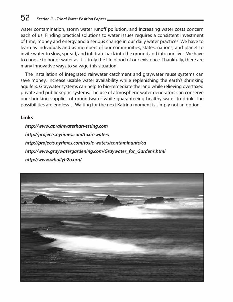
Section II ~ Tribal Water Position Papers52water contamination, storm water runoff pollution, and increasing water costs concern each of us. Finding practical solutions to water issues requires a consistent investment of time, money and energy and a serious change in our daily water practices. We have to learn as individuals and as members of our communities, states, nations, and planet to invite water to slow, spread, and infiltrate back into the ground and into our lives. We have to choose to honor water as it is truly the life blood of our existence. Thankfully, there are many innovative ways to salvage this situation.
The installation of integrated rainwater catchment and graywater reuse systems can save money, increase usable water availability while replenishing the earth’s shrinking aquifers. Graywater systems can help to bio-remediate the land while relieving overtaxed private and public septic systems. The use of atmospheric water generators can conserve our shrinking supplies of groundwater while guaranteeing healthy water to drink. The possibilities are endless… Waiting for the next Katrina moment is simply not an option.
Links
http://www.aprainwaterharvesting.com
http://projects.nytimes.com/toxic-waters
http://projects.nytimes.com/toxic-waters/contaminants/ca
http://www.graywatergardening.com/Graywater_for_Gardens.html
http://www.whollyh2o.org/

53
RECOMMENDATIONS TO THE CALIFORNIA DEPARTMENT OF WATER RESOURCES’
FIVE-YEAR STRATEGIC PLAN By David Ortiz & Kym Trippsmith
AP Rainwater Harvesting & Graywater Gardens
Per the California Department of Water Resources 2010 Five-year Strategic Plan, we recommend the following considerations:
1. That all laws and resolutions foster the communitization of water rather than commoditization by working to promote local solutions to water scarcity issues and opposing water privatization in all its various forms
2. Access to clean drinking water is a human right and should not be reliant or beholden to the profit interests of a handful of private contractors, corporate agribusiness, and multi-national corporations.
3. Recognize that water is a public natural resource; private contractors should not be able to receive subsidized water and be empowered to resell it at all-time-high profit levels, thereby making money off of taxpayer money on a public resource.
4. Learn from mistakes made in the past (in Stockton and Santa Cruz County, for example) where private water companies, such as Monterey California American Water, preferred to make high profits rather than provide maintenance and repair to water infrastructure (which allows millions of gallons of water to be lost to leaks and breaks), fostered increases in water contamination, provided shoddy and delayed customer service, and increased water bills by up to $1300%. Public utilities are subject to public pressure; private companies only respond to the profit motive. Bottom line, public services should not be privatized.
5. A tax should be levied on all private contractors that exploit public natural resources for personal and corporate profit to help provide financial assistance for environmental remediation and groundwater recharge.
6. Oppose SB1759 on the grounds that it creates a free pass for the Bureau of Reclamation and CVP contractors to resell taxpayer funded water and by-pass present laws designed to protect the environment and repair some of the environmental damage caused by the project. This bill is a give away to water privateers.
7. Remand SB1759 back to the Water and Power Subcommittee and ask that they analyze the impacts of the bill on the environment, groundwater aquifers, refuges,
Recommendations to California’s Dept. of Water Resources 5-Year Strategic Plan
Section II ~ Tribal Water Position Papers54fisheries and water quality and to consider amendments to safeguard taxpayer funds that have provided this water to private CVP contractors who profit from it.
8. Revoke the contracts that were renewed in 2005 by the U.S. Bureau of Reclamation under the Bush administration that promised an additional 1.5 million acre feet of water a year to the major Central Valley Water Project (CVP) contractors. According to NASA’s data from the NASA/German Aerospace Center Gravity Recovery and Climate Experiment (Grace), current levels of groundwater pumping are not sustainable so how can the state of California promise even more water when it is not available?
9. Retire drainage impaired, selenium-filled farmland on the west side of the San Joaquin Valley to stop the massive loss of water from California’s aquifers and preserve California fisheries and our precious, limited water supply. According to NASA, since October 2003, California’s groundwater has been depleted to by enough water to fill the Colorado River’s Lake Mead, America’s largest reservoir.
10. Oppose the CA Water Bond as it is designed to promote the privatization of California’s water. A little-discussed provision in the bond empowers private companies to own, operate and profit from reservoirs and other water storage projects built by taxpayer money. While backers of the proposal assert that the provision provides the state with financing flexibility, the provision enables companies to make a profit by selling back to the public a finite natural resource or simply using it for their own profit-making interests like agriculture. In essence, general taxpayers will be forced to subsidize the profits of private corporations.
11. Oppose the channelization of Northern California’s water resources at it promotes the commandeering of water on behalf of Southern California. Water needs to flood and to breath to be healthy.
12. Set up a monitoring agency that includes a racial/gender balanced panel to scrutinize the CA Dept. of Water Resources’ Licensing Committee and hold them accountable to corporate interests and mitigate corruption.
13. Reduce groundwater consumption by advocating the legal use and expansion of new graywater recycling technologies, creative rain harvesting techniques and atmospheric water generation as cost-effective, sustainable approaches to increasing local water availability and decreasing dependence on shrinking water aquifers, expensive water treatment plants, and the devastating drain of our communal aquifers.
14. Provide funding for public education, rebates and other financial incentives/grants/low-cost loans for residential and commercial rainwater harvesting and graywater reuse installations to empower water self-sufficiency and sustainability on the local and tribal level.
15. Provide financial assistance to public schools and tribal charter schools to install rainwater harvesting systems to flush toilets and provide water for irrigation purposes, and actively educate school kids on water conservation.

5516. Provide financial assistance to public schools and tribal charter schools to install
commercial atmospheric water generators (AWG), to provide safe, clean drinking water for our state’s children who are most vulnerable to contaminants. Atmospheric water generation is a proven, cutting-edge technology that harvests drinking water from the humidity in the air while eliminating energy waste and pollution from producing and delivering bottled water,
17. Recommend that all state and county buildings no longer allow the use of bottled water or delivered water and recommend the use of atmospheric water generators to decrease the carbon-footprint while ensuring safe, clean drinking water for government employees.
18. Mandate the installation of integrated rainwater harvesting, graywater recycling, and atmospheric water generation technologies in all new government buildings to effectively lead the way in designing stacked solutions to alleviate shrinking water resources.
19. Advocate a new approach to “storm water” runoff that promotes the passive harvesting of rainwater by slowing and spreading it into concave rain gardens, rain parks and bioswales to encourage rainwater infiltration back to the aquifers. Currently we drain our communities by diverting rainwater to streets and storm drains contributing to downstream flooding, contamination and non-point source pollution rather than encouraging infiltration into our landscapes, waterways and aquifers.
20. Install flow meters on all agricultural and industrial water usage (as recommended by Director Snow at the 2009 Tribal Water Summit) to determine real-time water consumption and determine appropriate action when limits are not adhered to. Allocate money for enforcement of these limits.
21. Publicize tap-water contamination levels as determined by an analysis by the New York Times of more than 19 million drinking-water test results from the District of Columbia and the 45 states that made data available (http://projects.nytimes.com/toxic-waters/contaminants/ca) and provide a vehicle for public commentary to be part of local government addressing these contaminant issues.
22. Provide a low-cost legal avenue for communities that are currently receiving highly contaminated water in their homes from private and public water companies that forces these companies to independently test and purify the water they sell to meet federal clean water guidelines.
23. Tighten drinking water standards for chemicals like industrial solvents (as well as a rocket fuel additive that has polluted drinking water sources in Southern California and elsewhere) and officially oppose industry lobbyists that block efforts to tighten these standards on behalf of their industrial clients.
Recommendations to California’s Dept. of Water Resources 5-Year Strategic Plan

Section II ~ Tribal Water Position Papers5624. Replace parking lots and other impervious surfaces that rely on asphalt and concrete
with porous green technologies—including Permeable Pavers, Grass2Pave systems, Kudo blocks—in order to direct rainwater to maximize groundwater recharge and/or retention for storage of rainwater for possible re-use for irrigation or other non-potable uses.
25. Allocate funding to build flood control parks in urban areas and tribal lands that work as skateboard parks and play areas in the dry months and ponds that sustain wildlife and water recreation in the wet months and slow, spread and infiltrate rainwater to recharge aquifers.
26. Mandate the use of biodynamic separators or hydrosterns (specialized storm water filters) to clean polluted storm water before it enters creeks, rivers, streams, lakes and the ocean. Once filtered, the cleaned water can be discharged directly into soakaways, surface waters and the wider environment. This technology is commonly used in Europe and has an outstanding track record of mitigating non-source source pollution from entering natural waterways.
27. Advocate the use of sustainable, recyclable erosion-control waddles to replace plastic-based hay waddles and silt fences that are ineffective, kill wildlife, and litter our hillsides rather than act as an effective sustainable erosion deterrent that protects our topsoil and water supply.
28. Collaborate more openly with the Tribal Water Planning Committee so that local and regional and state issues can be more effectively addressed by tribal people prior to governmental decision-making. Increase funding so that tribal participation is no longer completely dependent on the personal funds of the tribal participants.
29. Empower local water coalitions, environmental groups and tribes to monitor, manage and protect local watersheds. Hire representatives from these coalitions/groups as part of the 25 new water officers that Director Snow stated at the 2009 Tribal Water Summit he planned to hire.
30. Stand up for water justice on all fronts regardless of the political liability that can occur when priority is given to the public interest over corporate agribusiness, industrial responsibility for water pollution, and private water contractor profiteering.

57
SECTION IIITRIBAL WATER
BRIEFING PAPERS

Section III ~ Briefing Papers58
TRIBAL PARTICIPATION IN CALIFORNIA WATER PLANNING A Briefing Paper for the 2009 Tribal Water Summit
By Curtis Berkey, Alexander, Berkey, Williams & Weathers LLP Berkeley, California
Tribal participation in statewide water planning is a key topic for a Tribal-State water summit because from the Tribe’s perspective, water resources are essential to their legal, economic and cultural survival. Indian Tribes in California have legally-protected water rights and they have interests in ensuring that their water and the resources dependent upon water are safeguarded against interference. The State has an interest in devising a water policy that respects tribal water rights in order to reduce or eliminate natural resource conflicts with Tribes. Although tribal water rights are uniquely creatures of federal law, Indian Tribes acknowledge that California’s water planning process may present an opportunity for collaboration in devising water management plans that protect tribal resources and foster cooperation between Tribes and their neighbors. This paper provides the legal and historical background on several water planning issues that will frame the discussion. Those issues include:
1) The lack of tribal involvement in state and regional water planning;
2) The need for a statewide consultation policy that recognizes the unique legal status of Indian Tribes;
3) The lack of a state office of Indian affairs; and
4) The need for improved tribal access to water bond funding.
I. Tribal involvement in state and regional water planning
Prior to Update 2009, California’s state wide water planning process did not provide a formal consultative role for Indian Tribes, despite their senior water rights and compelling interest in helping to shape State policy with regard to water resources. The absence of a meaningful role for sovereign Indian Tribes cannot be justified. The poor record of the State in this regard is likely due less to any intentional policy to exclude Indian Tribes from the process as to circumstantial factors. Although there has been no formal study of this aspect of State-Tribal relations, a number of factors could have contributed to the exclusion of Tribes from statewide water planning.
Historically, Indian Tribes have kept the State at a distance with regard to legal and political matters, no doubt due to the hostile relationship between the State and the Tribes in the years following statehood and the numerous court battles to protect tribal water
59and fishing rights. Indian water rights are uniquely federal in nature and the State lacks jurisdiction over such rights. Indian Tribes have been reluctant to share water resource data with state agencies for fear that confidential and proprietary information may be disclosed. Throughout the State nearly all of tribal water rights are unquantified, which may have led to uncertainty about their legal status and place in water rights planning. Moreover, a significant portion of tribal water resources are found underground, and groundwater historically has not been regulated by the State. Finally, it may be that State agencies are not equipped to deal with the political and legal complexities of more than 100 federally-recognized Indian Tribes and countless other non-recognized Tribes with nonetheless credible claims to rights based on a distinct legal existence.
The record of tribal participation in regional water planning is not much better, despite the undeniable fact that tribal water rights are usually entitled to senior priority in water rights allocation schemes. Indian Tribes are far from equal partners with regional bodies in the water management and planning process. To take but one example, the Coachella Valley Water District Final Water Management Plan (2002) contains no evidence that Indian Tribes were consulted in its formulation, even though there are four Indian reservations comprising nearly 50,000 acres within the District’s boundaries with senior water rights. The Plan concedes that it makes no distinctions among Indian trust assets and other lands within District boundaries. Nowhere in the Plan is there any mention of the Tribes federal reserved water rights, nor the implications of such rights for the successful implementation of the Plan.
The focus on the Coachella Valley Water District is not meant to single out a particular water agency for criticism, but rather to illustrate the challenges Indian Tribes must overcome in order to participate meaningfully in regional agency planning that affects their interests. Indian Tribes are too often seen as merely part of the general public, rather than sovereign entities with enforceable water rights under federal law. It should be noted, however, that the North Coast Regional Water Quality Control Board is making efforts to include Indian Tribes within that region in development of a water quality restoration plan for the Klamath River Basin, and has held at least one hearing on an Indian reservation affected by the plan.
The near invisibility of Indian Tribes in state and regional water planning may be attributed to a more fundamental dynamic. No statute obligates state agencies to give special consideration to the interests of Indian Tribes in the water planning process. The statutory directive encouraging state agencies to cooperate with Indian Tribes in economic development does not expressly apply to water planning, and few state agencies would view their responsibilities under that statute as encompassing water matters (CA Gov. Code 11019.9).
Perhaps more important, neither the California legislature nor the state courts appears to have imposed a legally-enforceable duty on the part of State agencies to act in the best interests of Indian Tribes. By contrast, federal law requires federal agencies to carry
Tribal Participation in California Water Planning

Section III ~ Briefing Papers60out special fiduciary duties in dealing with Tribes. (See, e.g. Northwest Sea Farms, Inc. v. U.S. Army Corps of Engineers, 931 F. Supp. 1515, W.D. Wash. 1996, where federal trust responsibility required agency to take appropriate action to ensure Indian treaty rights are given full effect in agency decision-making.) The case of Northern Cheyenne Tribe v. Hodel illustrates why this difference is important. In that case, the federal court ruled that the Department of the Interior had a trust duty to mitigate the adverse effects of a coal lease on the Tribe’s social, economic and cultural resources, and that treating the Tribe as merely citizens of the affected area and reservation land like any other real estate in the decisional process leading to the [coal lease] sale@ violated that duty. (12 Indian Law Reporter 3065, D. Montana, 1985).
The absence of a corresponding legal duty on the part of the State of California in practice means that State agencies may be able to formulate water policy without taking into account the interests of Indian Tribes in water planning. The unique status of Indian Tribes as separate sovereigns under federal law entitles them to special consideration in the State’s water planning process. Yet, State planners and decision-makers have been largely free to devise water policy without regard for tribal interests. Tribal participation has depended on the whims of policy, rather than law.
In 2005, the California Department of Water Resources (DWR) began to change the way Indian Tribes have been treated in the water planning process. Recommendation 13 of the California Water Plan Update 2005 (2005 Update) aimed to increase tribal participation in water planning and access to funding for that and related purposes. The 2005 Update recommended that DWR and other State agencies must invite, encourage, and assist tribal government representatives to participate in statewide, regional, and local water planning processes and to access State funding for water projects. This represented a significant shift in the State’s approach to tribal participation in water planning, particularly in light of the facts that the time horizon for the 2005 Update encompasses 25 years and that the recommendation applies to agencies outside the DWR. A Tribal Communication Committee was convened to develop a communications plan designed to encourage tribal participation in the 2009 Update of the State’s Water Plan. A series of regional meetings with tribal leaders have been held to gather information and ideas from Tribes with regard to the planning process. A representative of the Native American Heritage Commission sits on the Water Plan Steering Committee, which should raise the profile of tribal concerns in the water management and planning area. The new policy for the 2009 Update for perhaps the first time provides a meaningful opportunity for Indian Tribes to participate in water planning state-wide.
II. Statewide Consultation Policy
California does not have a comprehensive statewide consultation policy aimed specifically at Indian Tribes or the special circumstances of water planning and management. The need for such a policy is apparent from the fact that there is no established mechanism at the statewide level by which Indian Tribes can make their voices heard during policy

61formulation. To be sure, Indian people may participate as members of the public during environmental reviews, drafting of regulations and enactment of legislation. However, the unique legal status of Indian Tribes as sovereigns should entitle them to a special consultative role.
Consultation in this context means a great deal more than eliciting the views of Indian Tribes when particular matters of concern come before the state’s water agencies. Rather, it must proceed from the legal premise that Indian Tribes are sovereign governments. Because State agencies have a sovereign character as well, consultation with Indian Tribes must be conducted on a government-to-government basis. This approach is familiar to Indian Tribes, as the federal government has had a well-established government-to-government relationship with them since the founding of the United States. The federal consultation policy also has historic roots, and was codified in the Indian Self-Determination and Education Assistance Act of 1974, and reaffirmed by a presidential executive order in 1994. The order directed each federal agency to consult with tribal governments prior to taking actions that affect them. Government-to-Government Relations with Native American Tribal Governments: Memorandum for the Heads of Executive Departments and Agencies, April 29, 1994. More than 150 federal statutes and agency regulations impose a duty on federal agencies to consult with Indian Tribes in carrying out their missions. (See, e.g. 43 C.F.R. ‘ 7.7 - The Federal land manager should also seek to determine, in consultation with official representatives of Indian Tribes . . . What circumstances should be the subject of special notification to the tribe?)
By contrast, California has a single statute obligating local (city and county) governments to consult with Indian Tribes before adopting or amending a general or specific land use plan. That law, Senate Bill 18 (SB 18), took effect in 2005. Although the scope of the law may be sufficiently broad to include tribal concerns about water as a cultural resource, the principal goal of SB 18 is to preserve and protect cultural places of California Native Americans. Tribal Consultation Guidelines: Supplement to General Plan Guidelines, November 14, 2005, Governor’s Office of Planning and Research. In keeping with the laws purpose, the consultation guidelines issued by the Governor’s Office focus on consultation with Indian Tribes to identify, protect and mitigate impacts to cultural resources located within the boundaries of the city or county. The guidelines contain useful information about Indian Tribes, their legal status and cultural resources, and specific responsibilities of local governments with regard to the policy.
The contents of a State consultation policy should be devised by Indian Tribes in collaboration with State agencies and officials. SB 18 may be a useful starting point for the development of a consultation policy. The policy should apply to both federally recognized and non-federally recognized Tribes, particularly in light of the fact that such classifications historically were often drawn arbitrarily. The fraudulent refusal of the United States Senate in 1852 to ratify 18 treaties with California Tribes virtually assured that many such Tribes would be unfairly deprived of a federal relationship, and, therefore, federal recognition.
Tribal Participation in California Water Planning

Section III ~ Briefing Papers62SB 18 defines consultation as the meaningful and timely process of seeking, discussing
and considering carefully the views of others in a manner that is cognizant of all parties cultural values, and where feasible seeking agreement. (CA Gov. Code 65352.4). It goes on to emphasize that consultation must proceed on the basis of mutual respect. Consultation between government agencies and Native American Tribes shall be conducted in a way that is mutually respectful of each party’s sovereignty.
The formulation of a consultation policy should also take into account developments at the federal level. Federal Indian Law has imbued consultation with special meanings and understandings. It is premised on the idea that early consultation with Indian Tribes is good public policy because it acknowledges their sovereign legal status and creates administrative efficiencies by avoiding unnecessary and costly analysis of issues of lesser concern to Tribes. A sound consultation policy should recognize that it is a process, not a single event. It is not an end in itself, but rather a means to the end of a mutually satisfactory resolution of a matters of concern to the State and the Tribes.
Under either state or federal law, consultation should be more than a synonym for meetings and discussion with Indian Tribes. It should incorporate many of the same protections inherent in fundamental due process, such as early notice of intended governmental action, ample opportunity to be heard on matters of importance to the Tribes, decisions by a neutral governmental official and a statement of reasons for the decision where appropriate. Genuine consultation is a two-way process, with state agencies taking the trouble to inform themselves about tribal concerns and the Tribes likewise becoming educated about state agency concerns before discussions begin. A critical component of every consultation is that it begins before a decision is reached; tribal ratification of decisions already made is not consultation under any definition of the term.
Consultation must be more than state agencies gathering information about and from Indian Tribes. The federal courts have condemned such perfunctory efforts at consultation. (See, e.g., Pueblo of Sandia v. United States, 50 F.3d 856, 10th Cir. 1995). The U.S. Forest Service sending letters to tribe requesting information is not adequate consultation under the National Historic Preservation Act. From the Tribes’ perspective, consultation includes a good faith commitment on the part of the agency to seek tribal views and to consider them before decisions are made. In this way, consultation may help build better relationships between the State and Indian Tribes.
III. State Office of Indian Affairs
The experiences of Indian Tribes have shown that consultation works best when the state has committed to a formal and structured process. Twenty nine states have dedicated offices of Indian affairs, either as part of the Governors office or as an independent state agency. The first such office was set up in Minnesota in 1963. Surprisingly, California, with the largest census-recorded Native American population, has no such office.

63 The responsibilities of state Indian affairs offices range from information dissemination
and reference assistance to active liaison between Tribes and state agencies on the most important issues in their relationship. In addition to the laudable function of improving communication, three rationales are often cited for such offices. First, a dedicated state office can provide a forum for longer term planning and policy development on the most significant Tribal-State issues. Since the mission and work of state agencies are often focused on specific problems of a short term nature, having a structure in place for long-term planning may improve State policy and strengthen relationships between the Tribes and the State. Second, many issues of serious concern to Indian Tribes may not precisely fall within the scope of an agency’s responsibility, and an Indian affairs office may ensure that these issues are not ignored. Third, a state office is likely to raise the profile of Indian issues generally throughout state government. Overall, a state office may help avoid conflicts between Tribes and the state, and thereby minimize the risk of costly litigation.
The principal disadvantage of a state office of Indian affairs is that other state agencies may neglect concerns of Indian Tribes on the ground that the state office is exclusively responsible for such matters. The net effect could be a segregation of Indian policy and its implementation in a single office, to the detriment of Indian affairs generally. Especially if the state office is not adequately funded and staffed, a separate office could isolate Indian policy from state policy generally. Within the federal government, it is commonly understood that many agencies do not believe they have any special responsibility for carrying out the federal government’s trust duty because the Bureau of Indian Affairs presumably was created specifically for that purpose.
If an office dedicated to Indian affairs is to be created, a number of organizational questions must be addressed. First, should the office be created by executive action of the Governor, or should it be the creation of the legislature? The answer may depend on budgeting and funding issues that are beyond the scope of this paper. Second, should the office be housed within the Governor’s office or set up as a separate and independent state agency? The office may have a higher profile as part of the Governor’s office, but what is gained in visibility may be lost in terms of compromised independence. Third, who should have the authority and responsibility to appoint the staff for the office, and how should the budget be prepared. The answer to this question may depend on the purpose, mission and goals for the office.
IV. Tribal Access to Bond Funding
With rare exception, the story of Indian Tribes and water bond funding mirrors their experience in water planning generally; they have been largely left out. The reason for this may be related to a simple but disabling problem of definition. A review of the eligibility requirements for access to water bond funding shows that virtually none of them expressly includes Indian Tribes among the eligible entities. For example, Proposition 50, the Water Security, Clean Drinking Water, Coastal and Beach Protection Act of 2002, provides grant
Tribal Participation in California Water Planning

Section III ~ Briefing Papers64funds to nonprofit organizations, but defines such organizations restrictively to include only those organized pursuant to state law and qualified as a charitable organization under the federal Internal Revenue Code (CA Water Code ‘ 79505(g)). Tribal organizations created pursuant to tribal law for similar charitable purposes are not included in the definition of entities eligible for funding.
Another example concerns the definition of disadvantaged communities, which the legislature has determined should be entitled to preference for Prop 50 funding for safe drinking water and water quality projects. The definition includes communities with median household income less than 80 percent of the statewide annual median, which is no doubt sufficiently broad to include many tribal communities. However, the failure to specifically designate Indian tribal communities may create confusion and uncertainty about their eligibility, especially because the statutory definition does not reference communities with governmental status as being eligible.
Similar definitional problems may have hampered the ability of Indian Tribes to access funding under Proposition 84, the Safe Drinking Water, Water Quality and Supply, Flood Control, River and Coastal Protection Act of 2006. The statute provides that funds for projects aimed at the delivery of safe drinking water and the protection of water quality and the environment shall be available to local public agencies (CA Pub. Res. Code 75026(a)). The term is not defined in the statute, but it is commonly understood to include governmental agencies created by state law only, thereby excluding Indian Tribes from the coverage of the Act. Although courts have found Indian Tribes to be public entities within the meaning of the California Evidence Code, apparently Tribes have not been treated as public agencies for purposes of Prop 84 funding. Big Valley Band of Pomo Indians v. Superior Court, 133 CA App. 4th 1185, 35 CA Rptr. 3d 357 (First District Court of Appeal 2005) an Indian tribes constitution and enactments of its tribal council may be judicially noticed as the legislative enactments of a public entity and the official act of a state within the meaning of the California Evidence Code. From the perspective of Indian Tribes, the issue presents a difficult conundrum, as the legal status of Indian Tribes under federal law is higher than local public agencies, yet they might be forced to seek that status in order to gain access to badly-needed funding for water projects.
Although it may be theoretically possible for Indian Tribes to access water project bond funding by collaborating with public agencies and others on joint projects, there may be an additional legal impediment for this alternative approach. If the project involves the exercise of governmental power, any agreement would require the execution of a Joint Powers Agreement in order to be successfully and lawfully implemented (CA Gov. Code 6502). California law, however, does not specifically authorize joint powers agreements between Indian Tribes and public agencies. As a result, Indian Tribes have been required to obtain special authorization for such arrangements from the state legislature. (See, e.g., CA Gov. Code 6529 authorizing Elk Valley Rancheria Tribal Council to enter into a joint powers agreement with the County of Del Norte and the City of Crescent City and

65providing that the Tribe shall be deemed to be a public agency for this purpose). This cumbersome and expensive process may deter Indian Tribes from seeking collaborative projects with entities that are eligible for water project bond funding.
V. Conclusion
The common thread running through these issues is the importance of treating Indian Tribes as equal sovereigns with senior and enforceable rights to water that must be taken into account in any statewide or regional water planning process. Only on that basis can state water planning involve Indian Tribes as collaborative partners. The benefits of meaningful consultation for both the Tribes and the State should be self-evident. A genuine effort to engage the Tribes in the planning process is likely to prevent costly conflicts and provide a sound legal and factual basis for the development of water policy in the future. The State ignores tribal water rights at its peril.
Tribal Participation in California Water Planning

Section III ~ Briefing Papers66
WATER As sACREdDon L. Hankins
Introduction
Water is a resource frequently taken for granted. However, without it we would be unable to survive. California Indians have developed a cultural appreciation for water that is reflected in the diverse cultures, languages, stories and songs of the region. From time immemorial there has existed an obligation to care for the gifts of the landscape. The gifts of plentiful natural resources are not only vital to our human well being but also of other organisms. Presumably, this relationship with water has existed for millennia with little change. However, the events following the arrival of Spanish, Mexican and American cultures have disrupted the roles and relationships between California Indians and water, and frequently the reciprocal respect for water has been lacking. At present, society as a whole grapples with the issues of developing a sustainable future for our water. Now is the time for California Indians to reassert themselves as caretakers of our vital resources. While ideal models of successful partnerships with indigenous communities regarding water may not exist in California, the successful development of an equitable and sustainable water future necessitates the inclusion of California Indians as a critical piece.
Traditional Relationships to Water
Traditional laws recognized by Native California are based upon the natural order. First and foremost, the recognition that the law of the land dictates the relationship to the use and management of natural resources including water. A primary tenet of this recognition is that ownership of water or land by an individual or tribe is non-existent; rather, the individual or tribe belongs to the resource. With this said, the individual or tribe has a specific obligation to ensure the water and lands are cared for and respected, and the responsibilities for these areas are passed down from generation to generation. Rules broadly recognized throughout the land guided where people could and could not reside, swim, fish, or otherwise interact with water. Failure to abide by these laws could result in dire outcomes for those who disregarded them. In a landscape where seasonal and prolonged droughts have always been an issue, the development of cultural practices to ensure a sustainable use of water had to have been in place.
The cultural relationship to water is evident throughout California’s diverse tribal communities. Water may be considered the backbone of tribal societies. Ancient tribal societies were organized into moieties or clans, which frequently had some reverence to water, and reference back to traditional law, whereby the members of that moiety or clan had responsibilities to look after matter pertaining to water. Nearly every tribe has traditional stories about water, which address issues from the origins of human beings to explaining the place one’s ancestors depart to when deceased. Tribes have also recognized sacred water such as springs, wetlands, lakes, which serve as places for story,

67ceremony, healing, and other purposes. Under traditional law, these places are frequently those protected or not accessible by the general population of the tribe. Protection of these places ensured the long-term viability of the source, and ensured the quality of the water would be highest.
Academics have developed the terms environmental determinism and possibilism to describe human-environmental interactions. The former describes most tribal environmental relationships, whereby the development of the culture is reflected in the celebration of resources from the local environment. Conversely the later describes how a tribe has enhanced its environment to support its cultural needs.
Ancestral California Indians recognized the influences of their actions upon the environment. For example, the routine and patterned burning of the landscape was recognized to maintain flows in many streams, which today are seasonal. It was known that the burning of certain vegetation communities at the appropriate time would reduce evapotranspiration, thus enabling soil moisture to percolate deeper into the aquifer and enhance stream flows. This traditional knowledge application facilitated overall resource management further to ensure optimal conditions to support plants and animals, particularly fisheries.
A variety of associated culturally significant plants and animals exist, which historically were abundant but are now in decline (see table). While global declines in biodiversity are frequently linked to habitat loss, fragmentation, conversion, and exploitation; in the case of many of our aquatic species factors of decline are frequently linked to habitat conversion, altered hydrology, altered water chemistry, and barriers to passage. The historic and contemporary declines of some species are more directly linked to environmental change. For instance salmonid fisheries existed along the west coast south to Baja California approximately 15,000 years ago. However, with warming following glaciation, the conditions suitable for salmonids to persist in many southern streams have disappeared. The cumulative impacts of continuing climate change, in-stream flows, barriers, and loss of estuarine rearing habitat all pose a threat to the persistent survival of these fish.
SPECIES STATUS SIGNIFICANCESacramento Splittail De-listed - Rare Food
Chinook Salmon & Others T / E Food, Spiritual, Component, Important to the Ecosystem
Green Sturgeon T Food
Bald Eagle De-listed - Rare Spiritual
California Red-legged Frog T Spiritual
California Tiger Salamander T Food
Water As Sacred
Contemporary Relationships and Impacts
Due to the settlement history of California, California Indians have been displaced from traditional lands, and have generally become disconnected from opportunities to fulfill

Section III ~ Briefing Papers68obligations to land and water. For many Tribal people, the fight to preserve cultural sites and culturally significant natural resources is a challenging and continual process. While the state constitution suggests water is a public resource not to be owned or sold, there are numerous actions carried out by federal, state, local, and private entities, which seem to operate counter to that notion. Where traditional societies protected and respected water resources, contemporary water managers appear to not value the holistic appreciation for water resources and associated features. To begin with, the reclamation of floodplains beginning in the mid-1800s destroyed ecosystems services such as water filtration and habitat for fish and wildlife. The advent of the various water projects throughout the state has led to conflict between indigenous peoples and the larger society over impacts to cultural sites, the use and abuse of water and associated biotic resources. The construction and management of dams has frequently created barriers to dispersal and destruction/alteration of habitat for culturally important fisheries and wildlife species. The prized fisheries of California streams have all been affected by the direct and indirect impacts of dam and water project operations. Where riparian and riverine habitats have remained, the fluvial processes, which sustained dynamic riparian and riverine ecosystems, have also been affected. Shaded riverine habitat, spawning gravel, and juvenile rearing grounds for fish have all been impacted by water management. A case in point is the Delta, where our endemic fishes (some of which are culturally significant) live a tenuous existence due to a lack of habitat, poor water quality, impingement in export facilities, and predation and competition by non-native species. Few of the aquatic systems across this state are in the pristine condition, which existed in pre-contact time. Where in pre-contact times one could reasonably expect clean drinking water from virtually any stream, we now must question the potability of water even in high mountain streams due to impacts from livestock, mining, and pesticide drift.
Much of contemporary water management issues tend to focus on the Delta. As a proposed means of improving water quality in the Delta and conserving fisheries and wildlife habitat new infrastructure improvements have been proposed (i.e., the Peripheral Canal). While there are valid reasons for and against such a system, it does not address the larger issues which continue to contribute to degraded water quality and habitat loss from source to sink. The choices our society makes for land use, waste disposal, etc. within the entire catchment all represent feedbacks to our water.
The lack of reciprocal respect for cultural sites and associated resources has put Tribal groups at odds with the self-proclaimed water resource managers. For instance, many reservoirs have been built (e.g., Shasta and Los Vaqueros), which have flooded cultural sites and impacted the storyscape. Respectful and reciprocal relationships for water management are generally lacking. While some tribal groups have developed working relationships with water and natural resource management entities primarily for access to sites for cultural purposes, the recognition of tribal people as partners in water and resource management is lacking. Similarly, respect for traditional ownership rights to land and water are broadly ignored, the rights of private individuals and corporations is furthering the abuse of water use privileges. Specifically, we see emerging markets where individuals and corporations seek profit from water transfers and water banking schemes, which provide little regard to impacts to the source or the long-term sustainability of the resource.

69The problems associated with water infrastructure and management is further
confounded by the fact that water is in fact a finite resource; our climate delivers a limited supply of snow, precipitation, and other forms of water to our landscape. Regardless of how many reservoirs, diversions, etc. that are built or manipulated, we cannot create more water. Despite this fact it is alarming that the population of California continues to grow at an alarming rate. During the drought crisis of the 1980s (when the voters of California first encountered the Peripheral Canal concept) the state population was about 20 million. Some sources suggest we barely had enough water to meet the demands of our population at that time. Some 20+ years later, the issue of water scarcity has not gone away, our supplies have not doubled, whereas our population is quickly approaching 40 million. As a society we have become better at water conservation, although there is certainly room for improvement.
Beyond these issues of water and resource management our aquatic systems are inundated with a diversity of non-native species and pathogens, which further degrade habitats and threaten the persistence of native species. The paths by which such invasive species and pathogens have arrived in our waters have been both intentional and inadvertent. Bullfrogs were introduced to our region as a commercial food resource. Sport fisheries have encouraged the management of some non-native species including striped bass, whereas other introduced fish including the northern pike draw continuous attention as a management concern. Inadvertent introductions of species such as New Zealand mudsnails (Potamopyrgus antipodarum) and Quagga mussels (Dreissena rostriformis) have been transported on the boats and equipment of anglers and other recreational users. Similarly, the dissemination of Chytrid fungus (Batrachochytrium dendrobatidis) has likely spread from waterbody to waterbody on contaminated equipment, and now threatens populations of amphibians.
Future Directions
In consideration of the contemporary status of water and associated resources, it is foreseeable that Samuel Clemens’ (Mark Twain) famous saying “Whiskey is for drinking, and water is for fighting over” may be taken to a new level. Specifically, if our fisheries vanish, the rivers and lakes are more degraded, and our water is owned and controlled by individuals or corporations, there will be just cause for uncivil acts; certainly this is not a phenomenon isolated to California. As a society, Californians need to assess and prioritize the past, present, and future of water. For Native Californians, this means asserting ancestral law, which is an obligation to care for the earth’s resources. The fulfillment of this may take many steps including being active in land acquisition, conservation and stewardship; re-establishing water rights; and restoring impaired systems from the source to sink. It will also require forming partnerships with other tribes and public and private entities. Education is critical to ensure that 1) Tribal youth understand both traditional and academic aspects of natural resource management; and 2) the broader society becomes familiar with the values Tribal societies place on natural resources. In the end, successful partnerships in collaboration or co-management should serve as a model.
Water As Sacred

Section III ~ Briefing Papers70
WATERshEds OF ThE sOuThERN COAsT California Tribal Water Summit Briefing Paper
By Michael Connolly Miskwish Campo Band of Kumeyaay
Introduction
This paper summarizes important elements of historical and contemporary water management and the need for indigenous people to secure their place in the water dialogue to ensure their long-term viability as communities. This paper focuses on the San Diego County area, but most of the discussion is relevant to other regions of southern California and to the State as a whole.
Historical Context
Two hundred and forty years ago, a small group of Spaniards established a colony in the Kumeyaay lands near the village of Cosoy which they named San Diego. Without recognition of the extensive environmental management occurring all round them, and with the arrogance of their perceived superiority, the Spanish undermined the very ecosystem that had long nourished the native peoples. Instead of building their settlement in a way that utilized the seasonal water flow and the vast resources of the riparian areas, they immediately took the productive lands of the Kumeyaay and put them under the plow while releasing herds of nonnative animals. This led to erosion and flooding which destroyed crops and pushed the settlement to the edge of survival. The Spanish Priests had to rely on Kumeyaay harvesting of traditional food sources to fulfill their need. This also hindered the Spanish from expanding beyond a narrow strip along the coast. Despite the obvious negative impacts of transplanting European livestock and feed into the ecosystem, the Spanish, Mexican and early American societies continued and expanded the practice.
The hydrological system and indigenous adaptation Natural stream flow is controlled by three basic mechanisms, rainfall run-off, snow storage/melt, aquifer storage/release. Over the last 10,000 years a gradual warming trend has featured short-term wet-drought cycles. Each of these mechanisms has been affected by changes over time. Precipitation has gradually declined over the last 10,000 years, as the climate has warmed. The short-term wet-drought cycles that are inherent in the system make it difficult to quantify the amount of drought directly attributable to human activity. However, the growing evidence seems to indicate that most of present day warming is man-made.
Accompanying the reduction in rainfall is the diminishment of the seasonal storage in snow pack. While southern California snow pack is not as substantial as it is in more

71northerly areas of California, it still is a significant moderator of the annual rainfall pattern which drops almost all rainfall in the November through April time frame.
Finally, groundwater storage in the aquifer basins is generally the greatest local controller of water supplies. Rainfall and snow melt provide recharge into the aquifer basins that are followed by the gradual release of stored water over the dryer months of the year. In some areas, the storage in the unconsolidated granites characteristic of the coast ranges can release water at the slow rate of less than one foot per day. Absent a significant snow pack, groundwater recharge is heavily dependent on the existence of vegetation. In particular, riparian vegetation is especially important to providing the residence time needed to allow the matrix of granitic soils an opportunity to absorb the greatest amount of rainfall.
100-year rainfall trend in Campo region
Prior to Spanish contact, indigenous cultures thrived through a combination of adaptation and interaction. In the coastal chaparral habitat, groundwater storage and wetland habitats were created or enhanced through the use of sediment retention structures. Habitat was opened up and biodiversity increased through the regular application of fire. In desert areas, irrigation systems were an added feature of water management. The result was a sustainable system of synergy between human activity in the environment that helped to maximize the water storage capacity of the aquifer systems. The introduction of European cattle and feed plants destroyed many of the indigenous practices. Cattle moved into the lush riparian zones, clearing the protective cover over the streams. As water run-off speeds increased, groundwater recharge diminished. Temperatures rose from increased exposure of stream channels to sunlight, which further increased the water loss due to evaporation. Eventually, many areas became subject to erosion as gullies formed in the fragile sandy soils of the valley floors. With the growth of arroyos, the ultimate water storage capacity of the valley aquifers began to drop. Most valleys now hold a fraction of their past capacity.
Watersheds of the Southern Coast
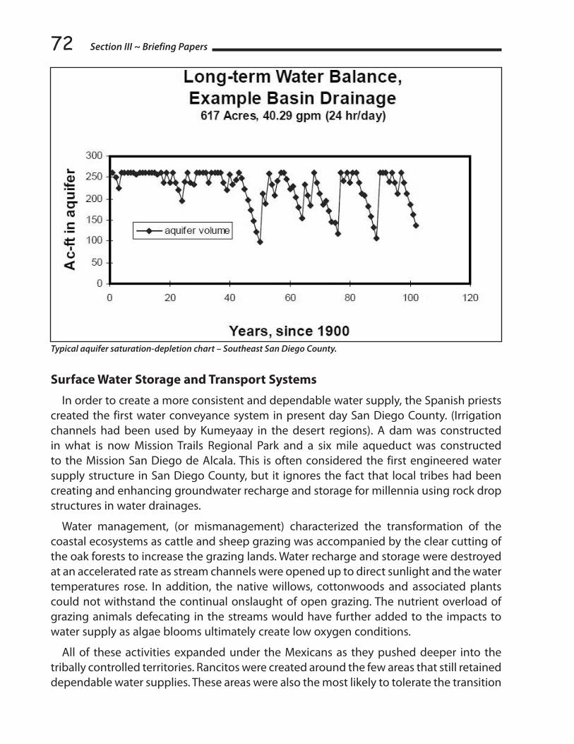
Section III ~ Briefing Papers72
Typical aquifer saturation-depletion chart – Southeast San Diego County.
Surface Water Storage and Transport Systems
In order to create a more consistent and dependable water supply, the Spanish priests created the first water conveyance system in present day San Diego County. (Irrigation channels had been used by Kumeyaay in the desert regions). A dam was constructed in what is now Mission Trails Regional Park and a six mile aqueduct was constructed to the Mission San Diego de Alcala. This is often considered the first engineered water supply structure in San Diego County, but it ignores the fact that local tribes had been creating and enhancing groundwater recharge and storage for millennia using rock drop structures in water drainages.
Water management, (or mismanagement) characterized the transformation of the coastal ecosystems as cattle and sheep grazing was accompanied by the clear cutting of the oak forests to increase the grazing lands. Water recharge and storage were destroyed at an accelerated rate as stream channels were opened up to direct sunlight and the water temperatures rose. In addition, the native willows, cottonwoods and associated plants could not withstand the continual onslaught of open grazing. The nutrient overload of grazing animals defecating in the streams would have further added to the impacts to water supply as algae blooms ultimately create low oxygen conditions.
All of these activities expanded under the Mexicans as they pushed deeper into the tribally controlled territories. Rancitos were created around the few areas that still retained dependable water supplies. These areas were also the most likely to tolerate the transition

73to European grazing animals and their introduced grasses. The arrival of the Americans after 1848 further exacerbated the diminishment of the water storage capacity and loss of wetland habitat. The 19th century also saw the introduction of mechanical well pumping systems. Primarily wind driven, this new technology opened up lands that were depleted of surface water to continual grazing and prevented wetlands restoration by lowering of water tables. The result was desertification in many areas of southern California. Native oak forests and healthy wetland willow and cottonwood habitats were replaced by non-native grazing animals and introduced grasses to feed them. Subsequently, the disturbed area plants like buckwheat and sage began to dominate in many areas.
To further exacerbate the conditions in the interior valleys, the Bureau of Indian Affairs’ policies were directly responsible for the engineered drainage of wetlands and the drop in the water table as lands were targeted for agriculture and grazing practices supported by government policy. Farming consultants were brought in to teach farming techniques that were incompatible with the fragile soils of the interior.
After a few decades of struggles in agricultural endeavor’s most of the tribal production dropped off. Most reservations were subsequently able to continue cattle grazing at various levels of success. In many cases, competition from off-reservation users destroyed tribal agriculture as streams were diverted or dammed. Water management was supplemented with the creation of water storage reservoirs over the last 125 years. By the early 20th century, it was becoming clear that the local hydrological system was insufficient to supply the rapidly growing population of the coastal areas. In San Diego County alone, between 1887 and 1897 six major dams were built on local rivers. All six stand today. By 1923 every major drainage system in San Diego County had at least one reservoir. These reservoirs, and the addition of El Capitan at the expense of the Capitan Grande Band of Kumeyaay, provided sufficient water to supply the coastal communities until World War II. The rapid expansion of the population in the 1940s more than doubled the area’s population, outstripping the available water supply.
In 1937 the Bureau of Reclamation’s Central Valley Project was authorized by Congress, (August 26, 1937, ch. 832, 50 Stat.844), with Congress expressly stating that one of the purposes for the project was “reclamation of lands of Indian reservations.” Yet in the 72 years since the Act, not a single Central Valley Project contract has been issued to any Indian tribes in the State. In 1947, San Diego County began receiving the first of the imported water from the Colorado River. The San Diego Water Authority worked with the U.S. Navy and the federal Bureau of Reclamation to construct the first two pipelines for conveyance of Colorado River Water. An additional source of water was brought in the later with a pipeline via the State Water Project from Northern California. San Diego County also has eleven groundwater extraction projects that pump over 26,200 acre-feet of water per year. One of these, the massive Vista Irrigation District pumps water from the basin shared with Santa Ysabel and Los Coyotes Reservations in the range of 4,000 to 14,000 acre-feet year. [The average rural home uses about ½ an acre-foot of water/year.]
Watersheds of the Southern Coast

Section III ~ Briefing Papers74The State Water Project brings water over 600 miles from Lake Oroville in the north to
Lake Perris in the south. At Lake Perris it joins the Municipal Water District system which is the wholesaler for the Colorado River Water and the State Water Project. The State Water Project was coordinated with the federal Central Valley Project in 1936 and funding was re-authorized for the combined program in the Rivers and Harbors Act of 1937. Despite the continuing involvement of the federal government through funding and assistance from the Bureau of Reclamation, issues of tribal access to the conveyance systems has been notably absent.
San Diego County Water Authority Members
In the late 1940s, a plan was put forward to terminate the existence of tribes in the United States. This abrogation of more than 150 years of policy and legal precedence was to start in California and eventually engulf all tribes in the U.S. One of the key elements of the termination policy was to resolve water rights issues to facilitate the process. Unfortunately, the fear of being targeted for termination caused many tribes to withdraw from the water rights litigation at that time. State policy continued to assess and incorporate the needs of the off-reservation communities, while ignoring the rights and needs of the reservations/rancherias.
As the coastal communities expanded further into the tribal regions of the County, quantification and conveyance were done without the direct involvement or consultation

75with the tribal communities. Most of the Kumeyaay communities of San Diego County continued to rely on groundwater basins shared with the off-reservation residents.
The result of these issues over the years has resulted in most of the tribal communities being overlooked, disregarded or directly blamed when water issues come to the fore.
Specific Water Related Topics
Flood management
County planning for flooding is based on calculations of storm water run-off from the varying surfaces in the drainage basins. Changes to topography such as housing and commercial development can significantly alter the volume of water in a storm event. To anticipate the future needs in flood management containment and mitigation, it is essential that flood control engineers have data on future topographic changes. Under the present system in San Diego County only existing tribal uses are used in calculating future needs. This sets up the tribes to be blamed in the future when flood management infrastructures are determined to be inadequate due to the lack of tribal build-out data.
Watersheds of the Southern Coast
Section III ~ Briefing Papers76Endangered Species
San Diego County Reservations were created for the “sole use and benefit” of the Indian people. Also, San Diego County has the highest number of endangered species of any county in the United States. Many of the issues with species endangerment are directly related to the loss of habitat through sprawl, diversion of water sources, lowering of the water tables and introduction of non-native species. Of the 1.6 million acres in east San Diego County, only 27% (418,930 acres) are privately held and about 8% (124,000) acres) are tribal lands. The balance are held in various federal and state parks, forest and defense. Since most of the federal (non-tribal) and state park lands are already obligated, there is increasing pressure to take private and tribal lands into the habitat offset programs. Tribal lands, in some places, have been placed under the critical habitat designation with little or no regard for the disproportionate impact to the tribe for economic development and housing. Even the designation of critical habitat next to the tribal lands can have a detrimental effect on the tribe’s water usage. If a link can be established between a wetland species habitat preservation and basin water drawdowns, a tribe could be forced to restrict groundwater use to enhance the habitat.
One of the current ways of dealing with endangered species over a wide area is through the Multiple Species Conservation Plan which sets up multi-species habitat preservation zones in return for allowing increased development in other areas. The current plan in San Diego County is to promote a MSCP for the east county that would put wide areas next to Reservations under the dedicated purpose of habitat preservation. This could not only create restrictions on water usage because of potential impacts to off-reservation habitat zones, it could also facilitate the migration of some endangered species into undeveloped areas of the Reservation causing the loss of the land for future generations’ usage. The fact that these proposed plans are targeting Indian lands is shown in the map (on page 77) which clearly shows tribal lands as targets of the off-reservation planners.
Water Quantification and Tribal Lands
When lands are being developed in the groundwater dependent areas under current county policy, water quantification is a key component of determining the suitability of the land to ensure the long-term sustainability of the water resources. This determination is done using a methodology that quantifies the existing uses of water, balancing the water recharge. Irregular brown shades show areas proposed as wildlife set-asides, including tribal lands against the long-term sustainable yield. This methodology does not take into account the long-term needs of Indian Reservations in shared basins. In fact, off-reservation users have used undeveloped tribal lands as a part of the calculation for available water supply. In addition, when the County negotiates MOUs under the gaming compacts, there is no restriction on off-reservation usage that may exceed sustained yield calculations based on land base. In some cases, water companies are extracting and marketing waters whose primary recharge zones are occurring directly on tribal lands.

77
Water Rights
Since 1908, tribal water rights have been guided by the U.S. Supreme Court decision in Winters v. United States along with subsequent laws and rulings. Water rights quantification has been based on practical irrigable acreage dating from the creation of the Reservations. Another approach (untested) is that the water is an element of the trust land and, as the land itself, is held in trust for the tribes.
Watersheds of the Southern Coast

Section III ~ Briefing Papers78State Rights
Finally, Indian Reservations are subject to taxation of non-Indians and their property on the Reservation regardless of the percentage of governmental services provided to these visitors and residents. Indian people are also residents of the State of California, and are subject to many of the laws that apply to all residents and visitors. As such, there should also be state rights and protections regarding groundwater and access to surface water conveyance systems that should be available for tribes to assert.
Many tribes have still not adjudicated their federal water rights in San Diego County. Also, the rules governing the rights to groundwater are not clear, making the approach very difficult. Using the definition of groundwater as a component of the trust lands raises an interesting point. Can a natural resource trust asset be negotiated without the concurrence of the trustee? If not, then the enforceability of the County MOUs under the State Gaming Compacts is called into question. The lack of quantified rights for tribes puts them in the position that if, or when, they do adjudicate, they may find themselves gaining a right with no resource available to claim.
Climate Change and Water Quality
Climate change has had a continual affect on the ability of local tribes to adapt and survive. Over the last 10,000 years the climate in southern California lands has become hotter and drier, leading to changes in the lifestyle and diet. The last 50 years has seen an acceleration in this climate change. The long-term loss of water quantity is compounded by the lack of dilution of naturally occurring constituents in the groundwater. In many areas of San Diego County there is already a marked increase in metals such as iron, manganese and uranium. A recent U.S.G.S. random survey of domestic wells showed excedance of the primary and secondary Safe Drinking Water Standards for Coliform, Nitrate, Sulfate, Chloride, (9) inorganics/metals, and radionucleides. It should be anticipated that long- term access to surface water conveyance systems will be essential to maximize the use of existing groundwater through blending processes or as an alternate supply.
California Water Plan Update – Opportunities for Tribal Positions
The State of California is updating its water plan, and for the first time, has made a significant effort to include tribal input in the process. Even though the comment period has ended for the plan, most of the issues in this paper have been submitted as comments from various San Diego County tribes. Follow up support from the tribal summit will help to develop some inertia behind some of these proposals. Input into the State plan does not translate as actual power to change the direction of policy toward California tribes. It does, however, provide a forum to lay out some basic considerations toward tribes including the following:
1. Acknowledgement of the need to reserve a portion of the water in unallocated form for future quantification claims by tribal communities.

792. Provision of access to conveyance systems for tribes within a reasonable framework
of compensation and management.
3. Inclusion of tribal communities in the long-term planning process for regional water management.
4. Requirement that local jurisdictions incorporate tribal needs in their plans and updates.
A detailed description of each point should be developed along with direct examples of how California tribes have been, and will continue to be, impacted under present policy. Constructive policy change will undoubtedly require legislative coverage to address some of the antiquated, inequitable standards in use today in California water policy. The legal separation of surface water from groundwater and the lack of substantive legal correlation between water quality and quantity have left the State in a quagmire of conflicting and counterproductive policy. Add to this the long-term neglect of the Reservation needs and we face a significant challenge in the State-Reservation resource relationship.
Conclusion
Tribal input and consideration must occur within the structure of the State policy development. It is in the best interest of the State to provide support for an office to work proactively to ensure that tribal issues are addressed in a true government-to-government manner. It is doubtful that the State will move quickly to incorporate tribal needs (based on previous performance), therefore, tribes must work to create local, regional and statewide expertise and begin applying it at the level of County planning, regional water management, regional water quality regulation, endangered species conservation planning and flood management. The identification of resources to assist tribes in this need is especially urgent. The participation and cooperation of the Bureau of Indian Affairs and the Bureau of Reclamation is an essential part of a comprehensive tribal strategy.
Watersheds of the Southern Coast

Section III ~ Briefing Papers80
TRIBAL WATER AuThORITIEs ~ RIvERs, dAms & FIsh2009 California Tribal Water Summit Briefing Paper
By Thomas P. Schlosser Hoopa Valley Tribe
American Indian tribes have a key role in sustainable use of water and water quality in California and, indeed, in many parts of the United States. This paper will discuss water allocation, water quality management authority, and a connection between water rights and federally-reserved rights to take fish.
1. Beyond the Hundredth Meridian
Water rights in the eastern United States are generally based on a riparian owner’s right to make reasonable use of waters flowing past his property. The West, however, is different in many respects. The 100th Meridian, which matches the Western boundary of Oklahoma (excluding the panhandle), and splits the Dakotas, Nebraska, Kansas and Texas, marks the approximate beginning of the arid West. In this area, water rights generally follow the first-in-time-is-first in-right principle. It is of the West that Mark Twain is claimed to have said that “whiskey is for drinking and water is for fighting.”
The prior appropriation doctrine, applicable at least in part to most of the West, holds that water volumes diverted and put to beneficial use first are entitled to protection against diminution caused by later-in-time diversions of water. California’s system of water rights is referred to as a “duel system” in which both the riparian doctrine and the prior appropriation doctrine apply to water rights. Water rights in California are use rights. While these principles have long been familiar in areas relying upon irrigated agriculture and Bureau of Reclamation projects, in the second half of the 20th Century it became clear that the first-in-time-is-first-in-right principle also will be invoked to protect beneficial instream water uses such as maintenance of habitat for anadromous fish and other aquatic organisms.
2. United States v. Winans, 198 U.S. 371 (1905).
Winans operated a fish wheel, a mechanism to scoop migrating adult salmon out of the Columbia River, on private property. Winans’ operation excluded Indian people from taking fish by traditional methods in the same place, despite express treaty language preserving their right to do so. When the case reached the United States Supreme Court, the Court rejected the argument that treaty provisions preserving the right to take fish “in common with citizens of the territory” merely operated as a prototype of the Equal Protection Clause (which was adopted 10 years after the Yakima Treaty) and reserved to the Indians

81the same rights that United States citizens would have. The Court instead emphasized that the treaty was a servitude running with the land which continued to burden the real estate relinquished by the signatory tribes to the United States. (Please see the wonderful book by Wallace Stegner with this title, “Beyond the Hundredth Meridian: John Wesley Powell and the Second Opening of the West.”) The treaty reserved all rights not granted. One right reserved was “the right of taking fish at all usual and accustomed places,” a preexisting right on which, the Court said, there was “not the shadow of impediment.” Winans’ fish wheel operation was enjoined from interfering with the use rights reserved by the tribes.
3. Winters v. United States, 207 U.S. 564 (1908).
Winters involved the Fort Belknap Indian Reservation, reserved by executive order along the Milk River in Montana. The 1874 Reservation was partly ceded back to the United States by an agreement in 1888. The Indians and federal Indian agency operations needed all or much of the Milk River’s flow for agricultural purposes on Reservation land. However, post-1888 diversions from the Milk River upstream of the Reservation dewatered the river to the point that the water needed by the Indians was unavailable.
Winters acquired water rights under state law, but the United States and the Indians did not. Nevertheless, the Supreme Court ruled that water sufficient to satisfy the purposes of the Reservation was impliedly reserved by operation of law when the United States set aside those lands for federal purposes, including in this case, for Indian purposes. The Court noted that the land would be “practically valueless” without irrigation water.
In Winters, the Reservation was established prior to the admission of Montana to the Union. Thus, no issue was presented concerning whether the entry of new states on an equal footing with earlier states, affected the United States’ power to reserve water after statehood. The Court ruled that United States had the power to reserve sufficient water to fulfill the purposes of the Reservation. The Court asked rhetorically whether the Indians intended to give up that which made the Reservation valuable and adequate for them. The Court noted that ambiguities in agreements negotiated with Indians should be resolved in their favor. It also noted that the reserved water aided assimilation of the Indians into the larger society and economy. Winters thus represented an application of the principles of Winans (e.g., a reservation of rights not granted) to water quantity appropriation. The Winters Doctrine is now a prominent feature of Western water law and contemporary sustainability issues.
4. Arizona v. California I, 373 U.S. 546 (1963).
This interstate water dispute came within the original jurisdiction of the United States Supreme Court. Arizona v. California I arose from the effects of the Boulder Canyon Act of 1929, an Act that authorized construction of the Hoover Dam. The United States asserted federally reserved water rights on its own behalf and behalf of five Indian tribes. The tribes’
Tribal Water Authorities ~ Rivers, Dams & Fish

Section III ~ Briefing Papers82reservations were created at various times up to and including 1907. Some were created by executive order. Arizona denied the United States’ power impliedly to reserve water post-statehood. It further argued that any water reserved should be limited to quantities measured by foreseeable needs. (See Rodgers, et al., “The Si’lailo Way: Indians, Salmon and Law on the Columbia River” U. Wash. Press 2007).
The Court ruled that United States’ action to reserve water was authorized by the Commerce Clause and the Property Clause and overrides any state assertion of authority under the Equal Footing Doctrine. Shivley v. Bowlby, 152 U.S. 1 (1894), is not to the contrary as it involved ownership of submerged land, not the authority to set aside water essential to use of federal lands. The number of Indians and their needs in the future can only be guessed, the Court said, so the quantity of water reserved for their use should be measured by an objective standard; that standard is the PIA Standard, the volume needed for the practicably irrigable acreage of the Reservation. The Court also made clear that the Winters Doctrine applies to, and the United States impliedly reserves, sufficient water to achieve the intended purposes of recreation areas, national forests and other federal uses.
The Arizona v. California litigation lasted more than 40 years beyond Arizona v. California I. In 2000, the Court ruled that water rights of the Quechan Indian Tribe were not included in the settlement of land claims concerning part of the Fort Yuma Reservation. The Court remanded that case to further quantify the Tribe’s water rights. In 2006, the Supreme Court approved a comprehensive settlement and entered a Final Decree. Among matters resolved was the Quechan Tribe’s right to forebear from using some 26,000 sq ft of water per year, which also permitted that water to be purchased by the Metropolitan Water District of Southern California.
5. United States v. Adair, 723 F.2d 1394 (9th Cir. 1983).
In 1975, the United States sought a declaration of water rights within an area whose boundaries roughly coincide with the former Klamath Indian Reservation in south central Oregon. In an 1864 Treaty with the Klamath Tribes, the United States set aside approximately 800,000 acres in the Williamson River watershed, which flows into Upper Klamath Lake and the Klamath River. The Reservation was largely repurchased by the United States pursuant to the Klamath Termination Act in 1954, but a portion of the Reservation was subsequently reestablished. The Klamath Treaty gave to the Tribes the exclusive right to hunt, fish and gather on their Reservation; those Treaty rights survived the Termination Act
In Adair, the Court concluded without difficulty that water rights for the Reservation could be implied because water is necessary to fulfill the very purpose for which the Reservation was created. Those purposes included developing an agricultural way of life as well as guaranteeing continuity of the Indians’ hunting and gathering lifestyle. The district court held that the Indians are “still entitled to as much water on the Reservation

83lands as they need to protect their hunting and fishing rights.” Relying on Washington v. Fishing Vessel Ass’n, 443 U.S. 658 (1979) and Arizona v. California I, the Ninth Circuit confirmed to the Tribe the amount of water necessary to support its hunting and fishing rights, as currently exercised, to maintain the livelihood of tribal members. As thus limited by the “moderate living” standard enunciated in Fishing Vessel, the Court affirmed the decision that the Klamath Tribe is entitled to a Reservation of water with a priority date of immemorial use, sufficient to support exercise of treaty hunting and fishing rights.
At an early stage in Adair, the State of Oregon moved to dismiss the federal proceeding in favor of a state water adjudication. Oregon relied upon the so-called McCarran Amendment, 43 U.S.C. § 666, which permits suit against the United States as a defendant in state court for adjudication of rights to the use of water of a river system. Initially, the federal courts in Adair retained the water litigation within their jurisdiction but ultimately Oregon established the primacy of its water adjudication mechanism and the Oregon proceeding is still pending.
6. The Water Quality Act of 1987.
The Federal Water Pollution Control Act, 33 U.S.C. § 1251, et seq., commonly known as the Clean Water Act, was substantially amended in 1987. Among other things, Congress added § 518, 33 U.S.C. § 1377, which authorizes the Environmental Protection Agency Administrator to treat an Indian tribe as a State for the purposes of enumerated sections of the Clean Water Act if (1) the tribe has a governing body carrying out substantial governmental duties; (2) the functions to be exercised by the tribe pertain to management and protection of water resources within the borders of an Indian reservation; and (3) the tribe is capable, in the Administrator’s judgment of carrying out the functions to be exercised in a manner consistent with the Clean Water Act.
Section 401 of the Clean Water Act, 33 U.S.C. § 1341, provides that no federal license or permit for an activity that discharges into navigable waters shall be granted without a certification from the State in which the discharge originates that such discharge will comply with applicable provisions of the Clean Water Act. S.D. Warren Co. v. Maine Bd. of Envtl. Protection, 546 U.S. 370 (2006); PUD No. 1 of Jefferson County v. Washington Dept. of Ecology, 511 U.S. 700 (1994). For Indian tribes within whose reservations a federally-licensed discharge occurs, this section requires that the discharge be certified by the Tribe to comply with any tribal water quality standards that the tribe has adopted pursuant to the Clean Water Act. Of even greater importance, this section protects downstream tribes with federally approved water quality standards by assuring that discharge certifications issued by upstream States will not adversely affect the quality of the downstream State’s waters. See generally, Wisconsin v. U.S. EPA, 266 F.3d 741 (7th Cir. 2001); City of Albuquerque v. Browner, 97 F.3d 415 (10th Cir. 1996).
In 1989, the Hoopa Valley Tribe applied to the U.S. Environmental Protection Agency (“EPA”) for treatment as a State with respect to water pollution control programs. That
Tribal Water Authorities ~ Rivers, Dams & Fish
Section III ~ Briefing Papers84application was approved, and in due course, the Hoopa Valley Tribe adopted a Pollution Discharge Prohibition Ordinance, a Water Quality Control Plan and water protection provisions in its Forest Management Plan and Riparian Protection and Surface Mining Ordinance. In 2002, EPA approved the Tribe’s Water Quality Control Plan which set forth water quality standards, including beneficial uses, water quality criteria, and an anti-degradation policy. In 2008, EPA approved amendments to the Water Quality Control Plan which established numeric criteria for water quality standards in the mainstem Klamath River and other reservation waters. With these standards and laws in place, the Hoopa Valley Tribe is at the forefront of water quality regulation in Northern California. Indeed, in many respects the Tribe’s Water Quality Standards are more advanced and up-to-date than are the comparable standards under California law.
7. City of Tacoma v. Federal Energy Regulatory Committee, 460 F.3d 53 (D.C. Cir. 2006).
Section 4(e) of the Federal Power Act authorizes federal agencies to impose conditions on FERC licenses to the extent necessary to protect tribal and federal lands that are within a licensee’s project area. In Escondido Mutual Water Co. v. La Jolla Band of Mission Indians, 466 U.S. 765 (1984), the Court held that § 4(e) provides the Secretary authority to impose conditions that are reasonably related to protection of a reservation and its people. Under Escondido, Indian reservations that are located entirely outside of hydroelectric projects receive no protection from § 4(e) even though those reservations may be adversely affected by project operations.
The Cushman Project, owned by the City of Tacoma, consists of two dams on the north fork of the Skokomish River on the Olympic Peninsula. When Tacoma’s license expired, it applied for a new license and the Secretary of the Interior imposed conditions to protect the Skokomish Indian Reservation. The § 4(e) conditions included minimum instream flows in the north fork and larger flushing flows to restore the capacity of the mainstem Skokomish River. The City of Tacoma argued that the Secretary’s authority was limited to mitigating impacts caused by the facilities currently located on reservation trust lands -- a transmission line and access road. The D.C. Circuit Court of Appeals disagreed, broadly affirming the Secretary’s authority to impose conditions on projects affecting an Indian reservation so long as some part of the project is located on reservation lands. The Court also ruled that stringent conditions imposed under § 4(e) do not amount to de facto decommissioning of a project, but instead are part of the process envisioned by Congress under the Federal Power Act.
8. Stevens Treaty Tribes Culvert Case.
In United States v. Washington, No. CV-70-9213, 2007 WL 2437166 (W.D. Wash. Aug. 22, 2007), the United States and Treaty Tribes prevailed in a suit to compel the State of Washington to repair or replace culverts that impede salmon migration. Plaintiffs

85maintained that the State has a treaty-based duty to preserve fish runs so that the Tribes may maintain a moderate living. The district court granted the Tribes’ motion for partial summary judgment, declaring that the right of taking fish secured to the Tribes in the Stevens Treaties imposes a duty upon the State to refrain from building or operating culverts under State-maintained roads that hinder fish passage and thus diminish the number of fish that would otherwise be available for tribal harvest.
Subproceeding 01-1, or the “Culverts Case” is part of the continued litigation captioned United States v. Washington, filed in 1970, that produced the famous salmon allocation decision in 1974 known as the “Boldt Decision,” a decision substantially affirmed in Washington v. Fishing Vessel Ass’n, 443 U.S. 658 (1979). The Boldt decision determined that treaties reserved to the Tribes the right to take up to one-half of the salmon that would pass through the Tribes’ traditional fishing places. This ruling was applied to the Klamath River system in Parravano v. Babbitt, 50 F.3d 539 (9th Cir. 1995), a case which upheld the obligation of the United States to restrict offshore and other non-Indian fishing in order to permit the Hoopa Valley and Yurok Tribes to take one-half of the salmon that would pass through their reservations.
Phase II of United States v. Washington sought to determine the plaintiffs’ right under the treaties to have fish protected from environmental degradation. The district court ruled in favor of the tribes in 1980, but the Ninth Circuit eventually concluded that declaratory judgment was inappropriate because the proceeding was not based on a particular dispute for which a remedy could be fashioned. Subproceeding 01-1 is such a “particular dispute.”
Since the August 22, 2007 ruling that the Treaties impose a duty upon the State to refrain from building or operating culverts that diminish the number of fish that would otherwise be available for tribal harvest, the parties have earnestly negotiated. The objective is an effective remedy and schedule for repairing more than 1,000 State-owned culverts under highways that block more than 2,000 miles of good in-stream salmon habitat, according to the State’s own estimates. Discovery has been conducted and the trial began October 13, 2009 before Judge Ricardo Martinez.
9. Interconnection of the Trinity and Sacramento Rivers Adds Federally Reserved Indian Water and Fishing Rights to California’s Central Valley Water Issues.
Since time immemorial, the fishery resources of the Klamath and Trinity rivers have been the mainstay of the life and culture of the Hoopa Valley Tribe. The fishery was “not much less necessary to the existence of the Indians than the atmosphere they breathed.” Blake v. Arnett, 663 F.2d 906, 909 (9th Cir. 1981). The salmon fishery is central to Hoopa culture and its economy. The lower twelve miles of the Trinity River and a stretch of the Klamath River flow through the Hoopa Valley Reservation, established in 1864.
Tribal Water Authorities ~ Rivers, Dams & Fish

Section III ~ Briefing Papers86The Trinity River Division of the Central Valley Project (“CVP”) was authorized in 1955 and
completed in 1963. The Division is the only source of water imported by the CVP. Congress included area-of-origin protections for the Trinity River, including one establishing flow release procedures for Trinity River fish and wildlife preservation and propagation. The Bureau of Reclamation informed Congress that it would divert approximately 50% of Trinity River water into the Sacramento River. However, until the 1992 enactment of the Central Valley Project Improvement Act, Pub. L. 102-575 (“CVPIA”), the Bureau consistently diverted 90%. That procedure not only created undue reliance on water resources in the Central Valley, but it also devastated the Trinity River fishery.
Several legislative, judicial and administrative initiatives culminated with the enactment of a Trinity River restoration provision in the CVPIA. Public Law 102-575 § 3406(b)(23) required the Secretary of the Interior and the Hoopa Valley Tribe to develop a Restoration Plan. If the Secretary and the Tribe concurred in the plan, the Secretary was required to implement it according to its terms.
In 2000, the Secretary of the Interior and the Hoopa Valley Tribe concurred in a plan that retained approximately 47% of the Trinity River Division’s water in storage for scheduled releases to the Trinity River for fisheries restoration. To enable that amount of water to be effective for restoration, the plan identified funding requirements to carry out habitat restoration and construction, gravel replenishment, and various monitoring programs that would have to remain in place so long as CVP diversions continued. Restoration got underway in 2003 when the Federal Court of Appeals rejected challenges by irrigation and utility interests and declared the restoration to be “unlawfully long overdue.” Westlands Water Dist. v. Hoopa Valley Tribe, 376 F.3d 853 (9th Cir. 2004). However, the restoration program has been persistently under funded and consequently delayed.
The 1955 Trinity River Division Act also included a provision requiring that “not less than 50,000 acre-feet shall be released annually from the Trinity Reservoir and made available to Humboldt County and downstream water users.” That water supply could be critical to instream as well as out-of-stream uses in the Klamath Basin but it has been the practice of the Bureau of Reclamation to disregard the provision. Instead, Reclamation has treated that water as available for export to the Central Valley thus increasing the Central Valley’s dependence upon water dedicated to Klamath River Basin purposes.
Since most of California’s water is used for irrigation purposes, water service contracts with the Bureau of Reclamation have become a critically important part of allocating California water. The Hoopa Valley Tribe has consistently urged the Bureau of Reclamation to include in its water service contracts language that recognizes the priority held under federal law for water needed for fisheries restoration purposes. Thus, the Hoopa Valley Tribe has requested that CVP contracts declare that all water deliveries pursuant to the contract are subordinate to the Secretary of the Interior’s fiduciary duty, referred to in § 3406(b)(23) of the CVPIA, to meet the instream fishery flow requirements of the Trinity River. The Bureau of Reclamation has been reluctant to state things so clearly.

87However, in its responses to comments on environmental impact statements, the Bureau of Reclamation has conceded that the Trinity restoration decision flow mandates have the force of law and that, even in dry years, reclamation may not take additional water from the Trinity River in order to meet contract delivery objectives in the Central Valley. 10. Sustainable Water Quantity and Quality Issues Meet in the Klamath River.
Three Indian reservations were established by the United States within the Klamath River Basin in 1855-1864; one in south central Oregon and two downstream in California. About 50 years later, the Federal Klamath Irrigation Project was established in Oregon, between the Klamath Indian Reservation and the Hoopa Valley Reservation.
Between 1912 and 1961, five dams were built in the mainstem of the Klamath River including three in California with no upstream or downstream fish passage facilities whatsoever. These projects came to be licensed by the Federal Power Commission in 1956 and the license expired in 2006.
A utility seeking a new license under the Federal Power Act must comply with law as it exists at the time the utility applies for a license. Thus, the application for a new license for the Klamath Hydroelectric Project now must take into account the National Environmental Policy Act, the Clean Water Act, the Endangered Species Act, the Electric Consumer Protection Act and certain state laws and standards which did not exist in 1956. In part for this reason, the relicensing process can last for many years. Under the Federal Power Act, annual licenses extending the terms and conditions of the old license, are automatically issued.
The Energy Policy Act, Pub. L. 109-58 (2005), entitles FERC license applicants to a trial-type hearing before an administrative law judge regarding conditions and prescriptions that may be imposed by federal agencies under § 4(e) (land use and instream flow conditions) and § 18 (fish passage prescriptions). In the case of Klamath, PacifiCorp requested such a hearing and put forth alternative conditions and prescriptions. In 2006, the federal Administrative Law Judge substantially upheld the conditions and prescriptions imposed by the Bureau of Land Management and the U.S. Fish and Wildlife Service which, among other things, require full volitional upstream and downstream fish passage through all project facilities and reaches.
The subsequent Final Environmental Impact Statement prepared by FERC calculated that relicensing all of the dams in compliance with applicable law would cause the utility to lose approximately $20 million per year whereas removal of two of the dams, would reduce the negative net benefits to $7 million per year. The deeply negative economic effects of relicensing all of the hydroelectric project facilities while complying with environmental laws and tribal water quantity and quality requirements, created an opportunity for the parties to negotiate concerning removal of some or all of the dams. Unfortunately, under the pro-agribusiness Bush Administration, this fit nicely into the Bureau of Reclamation project farmers’ objective to establish priority water rights for
Tribal Water Authorities ~ Rivers, Dams & Fish

Section III ~ Briefing Papers88irrigation purposes. A long series of negotiations sessions have followed, resulting in draft agreements which might partially reconcile the conflicting interests, if sufficient funding and political will exists to enact legislation in Oregon, California, and Congress. (See generally, http://www.schlosserlawfiles.com/TrinityRiver/CVInterests071204.htm.)
The Klamath River flows through California’s Hoopa Valley Indian Reservation at approximately river mile 45, so its conditions directly affect the Hoopa Tribe. Some people, however, do not understand the adverse effects that the proposed Klamath River agreements have on the Trinity River. The Trinity River is the largest tributary and fish-producer of the Klamath River. It flows through the heart of the Hoopa Valley Reservation and enters the Klamath approximately 42 miles above the river’s mouth. Its successful restoration, pursuant to the CVPIA, is key to fish restoration success in the Klamath River Basin as a whole.
The proposed Klamath River Restoration Agreement (KBRA) and the Klamath Hydroelectric Settlement Agreement (KHSA) threaten success of the Trinity River Restoration Program in several ways. The most important adverse effect arises from the $1 billion price tag for the KBRA, a cost that will divert funds from the already under funded Trinity restoration program, (for example, the FY 2010 budget is $11.02 million, $6.4 million below the Program requirements.)
A second threat arises from the KBRA’s guaranteed irrigation diversions of water for the Klamath Irrigation District Project in Oregon. Those diversions—330,000 to 385,000 acre-feet per year—would trump the in-stream flow needs of fish and other aquatic organisms. Fish would get whatever water flow remains after those diversions. Analysis of those diversions makes clear that the water flows in the vicinity of Iron Gate Dam (near Interstate 5, in California) would frequently fail the requirements of the National Marine Fisheries Services’ Biological Opinion for protection of salmon in the mainstem Klamath River. Such low flows caused the fish die-off in 2002, adversely affecting Trinity River spring and fall Chinook populations. The 2002 event was the largest adult salmon die-off in recorded history—in September 2002 up to 70,000 adult salmon, principally of Trinity River origin, died in the lower Klamath River.
A third adverse effect of the Klamath agreements on Trinity restoration arises from the lengthy dam removal planning process authorized by the KHSA and the minimal operational changes which will be made by PacifiCorp to its fish blocking dams during the next 11 to 25 years. None of the measures prescribed by the federal and tribal fisheries agencies pursuant to the Federal Power Act will be implemented except a few items listed in Appendices C and D of the KHSA called the “interim measures.” Thus, nearly all of the river’s flow (and fish) will pass through PacifiCorp’s turbines. A minimal additional of gravel to the Klamath River below Iron Gate Dam will not aid fish survival. This is important because that area is a major disease breeding ground for the parasites that infect both juvenile and adult Trinity River salmonids when they enter the Klamath. Despite the concerns expressed by fisheries biologists, the PacifiCorp interim measures will not be

89re-examined for a number of years, far longer would be the case if the PacifiCorp Project proceeded through the normal Federal Energy Regulatory Commission relicensing/decommissioning process.
11. Conclusion.
The West is dotted with federal lands. The United States set aside scores of Indian reservations for the purpose of establishing Indian homelands and protecting Indian cultures from eradication. Very often, these reservations were established astride significant rivers in order to facilitate continued tribal reliance on fishing, hunting and gathering, albeit within a restricted area.
Treaties and statutes of the United States sometimes expressly reserved to the Indians such rights but even where they do not, the treaties reserve all rights not granted and the federal set-aside of land for Indian purposes impliedly reserves water to fulfill those purposes. Thus, Indian tribes, with governmental structures predating the European conquest, persist within reservations and other “Indian Country.”
In the 1980s and 1990s, Congress responded to the revitalization of Indian tribal government, particularly in the area of federal environmental regulatory laws, by establishing mechanisms by which tribal governments could be treated as States for the purposes of key statutes such as the Clean Water Act. The consequence of these factors is that Indian tribes have a key role in the sustainable use of water both in terms of quantity and quality. Tribes must be accorded the respect due to a government and dealt with on a government-to-government basis if successful accommodation of the competing interests is to be achieved.
Thomas P. Schlosser October 21, 2009 T:\WPDOCS\020\05543\CalTrblWaterSummi2009_M102109.doc 0nmc:10/21/09 Rivers, Dams, & Fish ~ Hoopa Valley Tribe 9
Tribal Water Authorities ~ Rivers, Dams & Fish

Section III ~ Briefing Papers90
CALIFORNIA TRIBAL WATER RIGhTsBy Delia Parr & Jedd Parr
California Indian Legal Services
Water rights in California have a long and complicated history. The interplay between state water law and tribal water rights is especially complex in California for several reasons. First, while other western states operate under a prior appropriation system, California maintains a system of both property-based rights and prior appropriation rights. Second, over 100 federally-recognized Indian tribes are located in California — by far, more tribes than in any other state. As discussed herein, a tribe’s individual history plays an important role in defining their water rights, thus requiring a review of each tribe’s history in order to accurately quantify each tribe’s rights. No historical reviews have been completed for the majority of California Indian tribes.1
Third, California contains over 300 individual Indian allotments, located both on reservations and in the public domain. Each of these requires its own historical review, but to date there have been nearly zero reviews of individual allotments.
California Water Rights System: A Brief Overview
California water law is unique from most other states in that California maintains a “hybrid” water rights system, recognizing both property-based water rights and water rights not tied to land ownership.2 Property-based rights (“riparian rights”) are the rights of a landowner whose land either touches a waterway or overlies the water. The California Constitution requires that all water use in the state be “reasonable,” including use of riparian rights. Thus, riparian rights are shared (“correlative”) among upstream and downstream landowners with no consideration given for prior use.
In addition to the riparian rights doctrine, California also utilizes a doctrine of prior appropriation which provides for water rights not tied to land ownership. Appropriative rights are quantified and operate under a priority system —“first in time, first in right” over other appropriative users (not, as discussed below, over riparian users). In essence, they belong to anyone who first puts water to a specific “beneficial use,” a term which has been very broadly defined in the California Code of Regulations and has also been left open to further interpretation by the State Water Resources Control Board.3 Appropriative water rights remain valid so long as the water continues to be “beneficially” used.
1 California Water Code § 1200 et seq. 2 People v. Shirokow, 26 Cal.3d 301, 307 (1980). 3 23 CCR § 659 et seq.

91 Riparian rights are typically superior to prior appropriative rights. In dry times, a
riparian landowner may take all of the water to which he or she is reasonably entitled before an appropriative user may take their share.4 In other words, riparian users in dry times must share their losses in equal proportion with other riparian users, but take precedence over appropriative users. However, this superiority is subject to the California Constitution’s requirement of reasonable use.
Tribal Water Rights
Federally reserved waters on Indian reservations are governed by the Winters doctrine, which has evolved over more than a century in federal courts, and since 1955 in state courts as well. Two landmark U.S. Supreme Court cases, Winters v. U.S.5 and U.S. v. Rio Grande Dam & Irrigation Co.,6 established several key principles: 1) federally reserved lands have a right to use sufficient water to fulfill the “primary purpose” of the reservation, and 2) these water rights cannot be destroyed by state water law or by water users acting in accordance with state law.
Evaluation of a tribe’s water rights requires a determination of two factors: the date on which the land became federally reserved (the “priority date”), and the amount of water needed to fulfill the “primary purpose” for which the land was federally reserved.
Priority Date of Reserved Rights
Federally reserved water rights have priority over all other water rights dating from the time when the reservation was first created.7 In California, where there are no treaty tribes,8 the “priority date” is usually the date of the executive order or statute which created the Indian tribe’s reservation. However, it is important to understand that the priority date in some cases is actually earlier than the creation of the reservation. For instance, the priority date of tribes whose reservation occupies land which was originally
4 United States v. State Water Resources Control Board, 182 Cal.App.3d 82, 101-102 (1986).
5 Winters v. United States, 207 U.S. 564 (1908).
6 United States v. Rio Grande Dam & Irrigation Co., 174 U.S. 690 (1899).
7 Winters v. United States, 207 U.S. 577 (1908).
8 In 1851-1852, federal agents negotiated treaties with one-third to one-half of all California tribes. These treaties would have set aside approximately 8% of the state’s acreage for California tribes, provided federal recognition of those tribes, and provided assistance with transition to an agrarian lifestyle. At the same time, Congress passed the Land Claims Act of 1851, providing that all lands in California would pass into the public domain unless claimed within two (2) years. Under pressure from California statesmen, Congress failed to ratify the negotiated treaties and secretly sealed them away without informing the tribes that they had not been ratified. Congress also failed to inform the tribes that they would lose unclaimed lands within two years under the Land Claims Act. As a result of these highly questionable actions, most California tribes lost their land, and as a result also lost their tribal cohesiveness and ability to govern. Many of the tribes who agreed to these unratified treaties have still not been acknowledged by the federal government. Source: The Advisory Council on California Indian Policy (ACCIP). Recognition Report – Equal Justice for California. Washington, D.C.: The Council, submitted to Congress September 1997, pg. 10-11.
California Tribal Water Rights

Section III ~ Briefing Papers92a military base, Indian boarding school, or other type of federal land is actually the date of creation of the military base, Indian boarding school, or other type of federal land. This is but one example of a situation where a careful examination of a tribe’s individual history is essential.
It is also important to understand that there is no requirement that the Indian people of a reservation actually used the water from the priority date. Unlike water rights under state law, federally reserved rights do not expire if the water is not used.9 As a result, Indian tribes may decide to use their water rights later than other users and still have a senior right to sufficient water for the purposes of their reservation. Only landowners who have made continuous beneficial use of water since before the priority date will have a right senior to that of the tribe. In practical terms this means that, once asserted, tribal water rights can have a significant impact on the quantity of water available to non-Indians both in the present and in the future.
Primary Purpose and Quantification
The U.S. Supreme Court has limited the federal government’s ability to reserve tribal water rights to no more than the quantity of water necessary to fulfill the “primary purpose” of the reservation.10 /11 Thus, an examination of the purpose for which the land was federally reserved is crucial. With over 100 federally recognized Indian tribes in California, making a determination as to the primary purpose for each reservation is a daunting but necessary task in order to quantify the associated reserved water rights.
In recognition of the importance of finality in water adjudications, the U.S. Supreme Court has found that tribal water rights must be quantified for both present and future uses. The method most commonly used is the “practicably irrigable acreage” (PIA) method. The PIA method quantifies the amount of water needed to irrigate arable lands on the reservation.12 The weight of authority holds that federally reserved rights include both groundwater and surface water.13/14 The federal McCarran Amendment15 provides for a limited waiver of sovereign immunity so that the United States, as trustee of tribal resources, can be joined in state general stream adjudications to determine tribal water rights.16
9 Felix Cohen, Cohen’s Handbook of Federal Indian Law, 1169 (Nell Jessup Newton 5th ed., LexisNexis Mathew Bender 2005) (1941).
10 Cappaert v. United States, 426 U.S. 128, 141 (1976).
11 United States v. New Mexico, 438 U.S. 696, 702 (1978).
12 Arizona v. California, 373 U.S. 546 (1963).
13 Cappaert, 426 U.S. at 143.
14 In re General Adjudication of All Rights to Use Water in Gila River System and Source, 195 Ariz. 411 (1999).
15 43 U.S.C. § 666.
16 Colorado River Water Conservation District v. United States, 424 U.S. 800, 819 (1976).

93Together, a tribe’s priority date and primary purpose quantity must be used to determine
the tribe’s water rights. This mechanism allows states to permanently quantify tribal water rights, and to allow for informed planning by providing certainty in the allocation of limited water resources.
Individual Indian Allotments
Allotments made to individual Indian persons can be divided into two categories: first, lands on Indian reservations which were allotted to individual members of federally-recognized tribes under the General Allotment Act of 1887 (“Dawes Act”); second, lands on the public domain which were allotted to individual members of both federally-recognized and non-federally-recognized tribes.
One of Congress’ intentions in passing the Dawes Act was to encourage Indian persons to adopt an agricultural lifestyle. Both the Dawes Act and the U.S. Supreme Court have recognized that on-reservation allotments are entitled to a proportional share of a tribe’s federally reserved water rights.17/18 Thus, individual allotments located on a reservation must be included in the total acreage used when calculating a tribe’s PIA.
Public domain allotments located off of Indian reservations are subject to the same principles as Dawes Act allotments and other federally reserved lands with respect to water rights.19/20 That is, the water rights attached to a public domain allotment are determined by application of the priority date and the primary purpose as discussed above.
Conclusion
In general, California’s water allocation plan does not account for tribal water rights which have not yet been quantified. The exact count of tribes whose water rights have been accurately quantified is unclear, but what is clear is that the tally is far below the total number of federally-recognized tribes in the state. Furthermore, there is no evidence to suggest that the water rights of any public domain allotment have been accurately quantified and incorporated into water allocations. Not properly accounting for reserved tribal water rights will inevitably limit the ability of public entities, businesses, tribal governments, and individual landowners to formulate reliable, long-term water usage plans.
17 25 U.S.C. § 381.
18 United States v. Powers, 305 U.S. 527, 532 (1939); see also Colville Confederated Tribes v. Walton, 647 F.2d 42, 50 (9th Cir.), cert denied, 454 U.S. 1092 (1981); United States v. Ahtanum Irrigation District, 236 F.2d 321, 342 (9th Cir. 1956), cert. denied, 352 U.S. 988; United States v. Adair, 478 F. Supp. 336, 346 (D. Or. 1979) (These cases so holding rely primarily on Section 7 of the General Allotment Act, 25 U.S.C. § 381).
19 25 U.S.C. § 334.
20 United States v. Jackson, 280 U.S. 183, 196 (1930).
California Tribal Water Rights

Section III ~ Briefing Papers94
“Only when the last tree has withered, the last fish has been caught, and the last river has been poisoned, will you realize you cannot eat money.”
~ A Cree Proverb

For More Information: http://www.waterplan.water.ca.gov/tribal2/
http://www.waterplan.water.ca.gov/tribal2/tws/


![Blindspots| [Short stories]](https://static.fdokumen.com/doc/165x107/63266b6f5c2c3bbfa803ad6f/blindspots-short-stories.jpg)