The Struggle Towards Unity: state building and settlement processes in the rise of Urartu-Bianili
20
1 Such studies, initially used as a way to provide a general picture of Urartu, have definitely affirmed their significance in the last two decades when a long series of aimed research projects, workshops, conferences and monographs have been published by scholars of the caliber of Smith, Sagona, Belli, Sevin, Biscione, Bernbeck, not to mention Zimansky and Stone’s continuous production. THE STRUGGLE TOWARDS UNITY: STATE BUILDING AND SETTLEMENT PROCESSES IN THE RISE OF URARTU-BIANILI SIMONE BONZANO ABSTRACT In recent years, Urartu has been defined as a ‘segmented state’: the result of a politi- cal network strongly molded by the difficult natural environment. Even if we have an operative definition of Urartu as a ‘state’, we are still missing some links between the historical reconstructed situation (where the theory of the ‘segmented state’ comes from) and the archaeological evidence in the landscape. It is a link among the royal agency, the resulting socio-political structure and the ‘social objects’ (i.e. the fortresses, settlement and infrastructure of Urartu) on the field. The main question I have tried to answer during my research is how the segmented state is truly reflected in the struc- ture of the historical landscape and how the aforementioned social objects have been used to ‘mold’ it. 1.1 URARTU-BIANILI: CASE STUDY OF THE STATE BUILDING PROCESS IN ANTIQUITY The study of the social and political landscape assets of Urartu is a relatively young branch of Iron Age Eastern Anatolian archaeology and it began with Zimansky’s Ecol- ogy and Empire (1985). 1 Urartu shows some peculiarities as compared to the rest of the Near East, resulting from its specific history as a highland kingdom. This first Eastern Anatolian ‘state’ with its links with Transcaucasian, Anatolian and Mesopotamian cul- tures had traditional semi-nomadic roots, deeply strengthened by the natural setting that was, at the same time, the main obstacle toward the creation of a regular ‘central state’, such as Assyria or Hatti. The main purpose of the researchers has been to reconstruct – or at least to make such an attempt – possible Urartu-Bianili state formation processes. Among the important questions have been the following: how and why the Urartu-Bianili
Transcript of The Struggle Towards Unity: state building and settlement processes in the rise of Urartu-Bianili

1 Such studies, initially used as a way to provide a general picture of Urartu, have definitely affirmed theirsignificance in the last two decades when a long series of aimed research projects, workshops, conferencesand monographs have been published by scholars of the caliber of Smith, Sagona, Belli, Sevin, Biscione,Bernbeck, not to mention Zimansky and Stone’s continuous production.
THE STRUGGLE TOWARDS UNITY:STATE BUILDING
AND SETTLEMENT PROCESSES IN THE RISE
OF URARTU-BIANILI
SIMONE BONZANO
ABSTRACT
In recent years, Urartu has been defined as a ‘segmented state’: the result of a politi-cal network strongly molded by the difficult natural environment. Even if we have anoperative definition of Urartu as a ‘state’, we are still missing some links between thehistorical reconstructed situation (where the theory of the ‘segmented state’ comesfrom) and the archaeological evidence in the landscape. It is a link among the royalagency, the resulting socio-political structure and the ‘social objects’ (i.e. the fortresses,settlement and infrastructure of Urartu) on the field. The main question I have tried toanswer during my research is how the segmented state is truly reflected in the struc-ture of the historical landscape and how the aforementioned social objects have beenused to ‘mold’ it.
1.1 URARTU-BIANILI: CASE STUDY
OF THE STATE BUILDING PROCESS IN ANTIQUITY
The study of the social and political landscape assets of Urartu is a relatively youngbranch of Iron Age Eastern Anatolian archaeology and it began with Zimansky’s Ecol-ogy and Empire (1985).1 Urartu shows some peculiarities as compared to the rest of theNear East, resulting from its specific history as a highland kingdom. This first EasternAnatolian ‘state’ with its links with Transcaucasian, Anatolian and Mesopotamian cul-tures had traditional semi-nomadic roots, deeply strengthened by the natural settingthat was, at the same time, the main obstacle toward the creation of a regular ‘centralstate’, such as Assyria or Hatti.
The main purpose of the researchers has been to reconstruct – or at least tomake such an attempt – possible Urartu-Bianili state formation processes. Amongthe important questions have been the following: how and why the Urartu-Bianili

state arose, how it was organized from the practical perspective, what its socio-cul-tural roots were and what kind of relationships occurred between the rising re-gional power and the administration of an environmentally-fragmented highlandterritory, always showing a strong resilience resulting in local autonomy, as statedby Adontz (1970).
Zimansky stressed the impact of the low density and scarce population in the high-land kingdom, suggesting a ‘military’ and strategic approach to fortress patterns re-lated with the ‘menace’ of the much more consistent Assyrian army. The actual pictureof the Bianili Kingdom has been changed since that time, and now scholars convergetowards a ‘segmented’ or ‘fragmented’ state or a complex patchwork of royal andprovincial ‘highland islands’ linked by a fortress-based network for economic and mil-itary control (Bernbeck 2010). This new definition reflects specific ‘methods’ of ap-proaching Bianili’s landscape study and constitutes the initial frame for the new waysof landscape enquiry
Such a specific view of the development of the kingdom inside its cradle has re-sulted from my PhD thesis concerning research into the early stage of the Bianili King-dom as exemplified by Lake Van Basin.
1.2 RESEARCH FRAMEWORK
The main influence for my research was the analysis conducted by Biscione of pre-Urartian and Urartian settlement patterns on the Urmiyeh and Sevan Lake basins (Bis-cione 2003). In his work from the 1980s, Zimansky introduced the first analysis whichindicated how strongly the environment of the Urartian territory, the Tauros, Zagros andCaucasus mountain ranges, was intertwined with the structure of the Bianili Kingdomitself. Starting from this point, Biscione has analyzed the settlement patterns of Urartu-Bianili in Iran and in Armenia – two different habitats providing various initial condi-tions – in the end achieving very similar results. Neither of the regions had a propermilitary-aimed network, outside the need of maintaining control over the route net-work as well as over the farming plain or mineral resources, and only an economicstrategy involving the placement of a new fortress in the conquered land. Consequently,in the provinces, Urartu-Bianili deployed itself as a non-indigenous element even if ithad ancestral roots in both regions. These new research results can be considered amilestone in terms of clarifying the major purpose behind the settlement agency ofUrartian kings.
This analysis conducted by Biscione, now 10 years old, still has no equals for theLake Van region, the heartland of Urartu-Bianili. The main obstacle around Lake Vanwas the consistent lack of information and archeological evidence related to the EarlyIron Age, the so-called Urartu-Nairi period, propaedeutic to the rise of the highlandkingdom. In recent years, this lack has been overcome by the survey conducted byMarro and Ozfirat (2004) and by the work of Belli (2003) that focused on the north and
104 Simone Bonzano

east shore of the lake, aiming to describe the social life and local landscape of Nairi.The results show a subtle network of local and micro-regional organization in the shapeof large chiefdoms settled close to the natural resources or trading routes, not so dif-ferent from the Iranian and Armenian pre-Urartian landscapes. The absence of exca-vations, and consequently the lack of an inner chronology, did not allow these authorsto consider the results as descriptive of the whole Urartu-Nairi period. We must sim-ply assume the survey results provide a general description of the pre-Urartian situa-tion but with no confirmation of how far they consolidate Middle Iron Age (henceforthMIA) settlement. However, this provides us with the opportunity to research the evo-lution of Urartu inside the Lake Van region (Fig. 1).
In my doctoral research, following these newly acquired results that enrich ourknowledge of Bianili, I have developed a GIS-led analysis of all the known arche-ological and historical data concerning the Urartian landscape in the Van Lake re-gion at the transition between the late 9th and early 8th centuries in the Early Iron Age(henceforth EIA) and MIA. The aim was to answer a few main questions: withwhich agencies and for what purposes were the kings of Bianili able to create apowerful regional dynastic state and how did they cope with the traditional re-silience of the land.
This article aims to participate in the debate, presenting a new hypotheses on Urart-ian socio-political assets. This will be done by focusing on two main aspects. First ofall, the paper aims to describe the current state of research in the field, so as to definethe object of the research and the historical flow of the process, i.e. the products of theinteraction between royal agency and the local response to it. Secondly, it will use aspecific modeled GIS perspective to achieve an understanding of the ‘landscape ofpower’ of Bianili and to present a new hypothesis on interactions between the kingand the local lords influencing an emerging social structure.
2.1 THE EARLY STAGE
OF SOCIAL COMPLEXITY
The Urartian cradle lies in the vast region between Lake Van and Lake Urmiyeh acrossthe Taurus and the Zagros, with the northern regions reaching Armenia and Lake Sevanand the western covering the whole Upper Euphrates Valley from its sources to theTurkish-Syrian border. It roughly covers the core of Early Transcaucasian Culture(Kura-Araxes III) of the 3rd millennium (Smith 2003). The area is a huge highland sit-uated on a volcanic fracture, the Eastern Anatolian Accretionary Complex (Keshin2003), with maximum heights of about 4000 m and the lower levels reaching 1000 m.In its very core, the Lake Van area has scarce plains and the main farming areas are lo-cated in narrow valleys that run along the intricate stream web. The land is character-ized by very high precipitation in winter and short but dry summers. Traditionally,semi-nomadic pastoralism integrated by modest local farming is the main economic
The Struggle towards Unity: State Building and Settlement Processes in the rise of Urartu-Bianili 105

asset of this land helped in the past by ore extraction and highly developed iron andbronze manufacture (Fig. 2).2
During the Bronze Age, until the rise of Urartu-Bianili, the landscape was stronglyfragmented into several sub-regional areas, probably representing chiefdoms, eachruled by a strong man, a ‘king’, reflecting Kurgan-culture communities.3 The actual sig-nificance of the ‘rulers of such chiefdoms was so irrelevant in the eyes of the Assyri-ans that they did not mention the rulers’ names in the written sources but only thegeographic names of the particular areas in order to describe the Assyrian contacts orconflicts in the region. The process of territorial and political aggregation of these landscould be observed in two phases: one from the early 13th to the 11th centuries and thesecond from the 10th to 9th centuries.
In the first period (13th to 11th century), two entities were formed: Uruatri-Urartu– an agglomeration of at least 8 states of a local range on the Taurus Range and thelarger Nairi comprising 30 to 60 lands spread across the whole Lake Van Region. Thesetwo political entities were similar to the Neo-Hittites city-states or the neighboringLBA-EIA city-states from Iran and Armenia: small and autonomous with a tendencytowards military alliances. At the final stage of this first phase, mention of ‘Urartu’and ‘Nairi’ began to overlap in Assyrian cuneiform sources and even if we cannot yettalk about a real kingdom with a central government, the sources began to refer to threeroyal names instead of land names: Arame of Urartu, Kakia of Nairi, and Sarduri (Ser-duri in Assyrian) of Urartu. All of them were certainly regional kings of kings, or evengenerals who led the resistance against the Assyrian invasion of their lands, yet onlythe last, Sarduri, had been able to create a dynastic power and left, in the form of hisbuildings, a concrete mark on the landscape.
The centralized government was a completely new political situation, the result ofan aggregative process, quite certainly autonomous even if probably quickened by As-syrian military activity.4 It was during the reign of Sarduri, around 830 BCE, that theUrartu-Bianili Kingdom developed around the Lake Van Basin, a process then ex-
106 Simone Bonzano
2 The development of obsidian and then tin, arsenic and copper trade between Transcaucasia andMesopotamia toward the end of the 4th millennium was the first movement towards the social structura-tion of early human settlements, giving the region a more transregional ‘breadth’. Culture, such as thatof the Late Uruk, the Early Transcaucasian and the Kurgans, marked the steps from mainly farming to trad-ing societies, and they introduced the first examples of social classes and pyramidal rule: as Smith pointedout looking at the pre-Urartian social landscape of the Tsakovit plain Armenia, the origin of the Urartiantypical social form of intra-regional semi-nomadism and related networks of villages organized into in-tertwined local polities was similar to that of pre-Urartian Armenia. On the southern side of the region,the royalty and government structures of Anatolia and Mesopotamia, the main trading partners of the peo-ple of the hills, in the Bronze Age and Early Iron Age were deeply influenced by the development of thesame structures in Urartu-Bianili.
3 Kurgan are attested in the whole districts of Erçis, Van, Erçek and Muradiye.4 Assyrian pressure has been so scattered across the century that the aggregation of the empire cannot be
attributed to them alone, moreover they never reached the Van Lake but seemed to have fought in the vicin-ity of Tauros and Zagros between Hakkari and Urumiyeh. The Assyrians, and particularly ShalmanezerIII, is to be attributed with the role of destabilizing the southern mountain kingdoms, leaving space forthe establishment of the Sarduri and the Van dynasties.

panded by his direct followers, Ispuini and Minua (Sarduri’s son and nephew, respec-tively), who actually molded the shape of the ‘segmented state’. This kingdom cameto an end and became a regional entity in the 7th or beginning of the 6th centuries afterthe fall of Sarduri, son of Rusa, recently recognized as Sarduri IV by Fuchs (2012)and Kroll et al. (2012).
The above chronological considerations, Urartu emerges as the first Eastern Ana-tolian regional polity, a single political unity able to expand beyond its natural borders(the geographic basin of Lake Van) and become a regional power, evolving from theprogressive increase of social complexity and organization of the Transcaucasian andEastern Anatolian people.
3.1 REMARKS ON GIS RESEARCH
The GIS work5 has been divided into three different phases: the composition of an up-to-date Archaeological Database with a distinction of ‘topographic’ feature classes, theanalysis of the Early and Middle Iron Age archaeological palimpsest, the constructionof a diachronic socio-political landscape with particular attention paid to the spatial re-lationship among the different features of land assets. In addition, I have conducted aspecific analysis of the archaeologically reconstructed Urartian watering system basedon the works of Belli (1997). A separate set of studies has also been conducted on thesocial relevance of rock inscriptions and steles on the landscape as part of the visual-ization of power in Urartu-Bianili.
The database has been organized around archeological features that reflect the spe-cific functions of the landscape, i.e. fortifications, settlements, necropoles, wateringstructures or sites (canal, dam, artificial basin, qanats). Additionally, a specific sec-ondary database has been prepared for the inscriptions and steles.
The database (Fig. 3) contains:• 220 Total Sites:6
– 88 Fortification Sites;– 67 Settlement Sites;– 32 Funerary Sites;– 33 Water Structures;
•78 Inscriptions.
The Struggle towards Unity: State Building and Settlement Processes in the rise of Urartu-Bianili 107
5 GIS and GPS have not been used much by archaeologists in this area, which has meant long hours of workon satellite images so as to reconstruct the precise positions of all the sites. The remote sensing and spa-tial analysis have been conducted using multispectral Landsat 7, published in 2007, and black and whiteCorona Images, from 1969, inside a GRASS GIS workstation, the publication and display as well as thepictures for this article, have been taken with an ArcGIS 10.
6 Almost 52% of the MIA listed sites cannot be dated to a particular sub-period and they were cataloguedas simply Urartian sites. Most of them are settlements but also small provincial fortresses are present; how-ever, most of them show a similarity to Ispuini or Minua foundations that are, probably later.

3.2 EARLY IRON AGE PATTERNS
Among the 57 archaeological sites (Fig. 3) imported to the GIS, 17 are dated to theEarly Iron Age and they represent mostly funerary sites, and the remaining 40 also arealso associated with the Urartu-Bianili phase. Features within the catalogue have beenorganized according to their functions and they can be found in the landscape as ag-glomerate units built around particular tepes, with the usual form of a palace in cy-clopean masonry surrounded by a wall on the weaker sides. Settled terraces surroundedthe fortresses and the necropolises were often also situated close to the main settle-ment. Most of the EIA sites (39) were placed on inland mounds located along the mainriverine valleys constituting the main trade routes, as well as the routes of the tran-shumant pastoralists. They include the sites near the main plains and the lake shore-lines, such as Dilkaya and Yoncatepe near Van, Varsak Tepe and Panz near Muradiye,Norgiuh near Gurpinar.
In the highlands, settled units were built on hills or mountain slopes overlookingvalleys and inner plains; their structure truly similar to the plain settlements. Such sitescould perhaps consist of two parts of a fortified keep, as in the case of Kaletepe andBohanis-Cobanik (Fig. 4): one part is a settlement, and the second – an ‘eagle’s nest’that lies on top of the mountain. The prevalence of the EIA funerary sites not associ-ated with any settlement suggests probably semi-nomadic people (Marro 2008).7
The settlement patterns from the Early Iron Age support the idea of the existenceof small local chiefdoms that were able to subsist independently by exploiting the nat-ural resources they had nearby and that adapted to a semi-nomadic transhumant lifemode (Fig. 5). For example, Meydam is a well-known site that lay in a snow-meltingwater basin on the hills north of Erçis, inhabited from the Neolithic to the Late IronAge. The EIA layers show the existence of ‘Settled Units’ linked with farming andstock-breeding activities around the water basin. Another example that involved stock-breeding on a larger scale, is the Ernis/Panz cluster. This cluster consists of two dif-ferent sites: Ernis/Varsak Tepe together with Ulucahan necropolis ‘Settled Unit’ on thenorthern shores of the Muradiye Gulf and Panz ‘Settled Unit’ directly on the oppositeshore of the Gulf. They are situated within small plains on the main traditional routethat circle the lake from Muradiye, and have a strong defensive position, guarding oneof the main access routes to Lake Van from the north but also controlling much of theregional trade.
Generally speaking, EIA settlement patterns are adapted to the main characteristicsof the regional economy, trade and stock-breeding, with sites that are strategicallyplaced to control their local resources and to defend themselves and their territory. No
108 Simone Bonzano
7 It is believed that a high proportion of the population in this region was represented by pastoralists. Theywere either not settled or they lived temporarily in small seasonal villages with structures built of wood(Yakar 2000), Such a population probably resembled the traditional semi-nomadic shepherd with char-acteristic households that can still be found all across Eastern Anatolia.

hints of larger polities can be found, even if there is no reason to completely reject thepossibility of random confederations among the chiefdoms.
3.3 MIDDLE IRON AGE PATTERNS
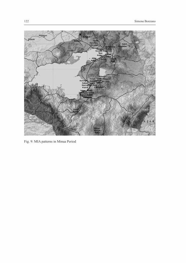
Three sites from the Database are dated to Sarduri I, eight to Ispuini, six to the co-re-gency of Ispuini and Minua, and sixteen to Minua alone. Most of these sites arefortresses, sites with inscriptions and water-related constructions (Fig. 6). The mainfeatures of MIA patterns are definitely the fortresses. Sarduri built the first nucleus ofVan Kalesi and Ispuini, alone or with Minua, introducing extensive building worksacross the kingdom that were later continued and developed by his son. They both for-tified and strengthened the Van Plain fortresses on every main access routes, as wellas on secondary routes leading inland, and introduced this scheme later all across theirkingdom (Fig. 7). As noted by Biscione (2003) for Iran, the building activity was con-centrated within plains and valleys, which is indicted by an increase in the density ofthe net of fortresses, settlements and necropolises, while no attention was paid to thehighlands where several EIA sites, such as Kaletepe and the Bohanis-Cobanik cluster,were abandoned. Such centrally-planned activity seem to have been focused on in-creasing the protection of ‘agricultural loci’, pushing the population towards a seden-tary lifestyle and farming, what was assisted by the construction of the great wateringstructures, such as the Minua Canal, the Suphan Dam, and several other minor struc-tures.
The broader use of the land with the help of newly constructed water systems wasintentionally planned by the Urartian kings as an indirect means to push people intoa sedentary lifestyle, but there were also other kinds of social agencies undertaken thatwere aimed directly at the population: the visualization of power. Rock reliefs and rockinscriptions as well as the stele of the abovementioned kings (56 monuments, with 40only from Minua) became widespread across the plains and the main roads, impress-ing the people with the idea of the constant presence of the king in these territories. Itmay be stated that the building of the mighty fortresses and the impressive water struc-tures was intended to have the same visual effect.8
The MIA patterns, in contrast to the previous observations concerning the EIA, in-dicate a tendency toward creating a much more interconnected state, with a more eas-ily controllable territory, even in such difficult environmental conditions. The maps
The Struggle towards Unity: State Building and Settlement Processes in the rise of Urartu-Bianili 109
8 Most of the inscriptions present in this region derive from the reigns of the first three kings and most ofthem from Minua himself. These inscriptions testify to the large building projects of these three kings, andof Minua in particular. Actually, Minua marked most of the territory with his name, in this way legit-imizing his power and his right to rule the region. In fact, he created a master plan to be used by his fol-lowers concerning how the kingdom should be molded (see Sagona and Zimansky 2009). The inscriptionswere not only placed on structures or on rocks but also on stele located on the main routes and within theplains. Even if they were not comprehended by most of his subjects they were clear signs of royal authorityover the land.

(Fig. 8; Fig. 9) illustrate the impact of the described agencies – the 2.5D enhanced costmap presents the effects of the early MIA activity in comparison with the same maptype for the EIA.9
3.4 THE PURPOSES BEHIND THE AGENCIES: PROPOSED INTERPRETATION
As the presented study shows, the Urartian kings were well aware of the potential flawsof the unfavorable location of their state, which introduced difficulties in communi-cation and in maintaining control over the highlands that flanked Lake Van. They wereprobably conscious of the fact that it was not possible to exercise direct rule over theirextensive kingdom with numerous sub-regions becoming unavailable during winterand many others located in the remote highland regions. Moreover, they had at theirdisposals only relatively small forces due the low population numbers, thus sending thearmy to the four corners of the kingdom would have left too many ‘weak’ points.
Certainly some of these flaws, namely the low population density and lack of suf-ficient military forces, could also have been an incentive for potential inner enemiesinterested in gaining independence or claiming rights to the throne. The Urartianarchives report on local uprisings and the revolts of provincial usurpers, as well asproblems with protecting the people and the material resources of the kingdom, nec-essary for assuring wealth and subsistence for the king, his court and his army andneeded to protect the kingdom from external and internal intruders. In fact – thus con-straining the path towards a centralized government – the kings of Bianili actually en-trusted the prerogatives to exercise authority to regional governors (in the same wayas the turtanus used by the Assyrians),10 who probably had, at least according to theBastam’s archive, their own courts, bureaucracy and armies (Zimansky 1985; Sagonaand Zimansky 2009). An intriguing question, however, involves the issue of how theUrartian kings managed to avoid gaining too much power through the use of such ‘tur-tanus’, contrary to what had in fact occurred in Assyria. It is still an open question untilan important archive in one of the Urartian palaces is discovered, but considering theherein presented results, it is possible to propose a hypothesis.
In the newly acquired provinces of Iran and Armenia, the appointed Urartian gov-ernors focused on controlling the main farming areas and the trade routes (Biscione2003). For this reason, they improved the defenses of the land buildings, constructing
110 Simone Bonzano
9 The two maps illustrate the influence basins for each site of the period; high influences are marked witha lighter color, low influences – with a darker one. The model was prepared with the use of specific‘COST’ algorithms and several layers of spatial analysis to render a human social landscape as a forgednatural environment. It is interesting to observe the clear enhancement between EIA and MIA due to thenew building processes and the rationalization of the network.
10 The Assyrian called them ‘Turtanus’ as the contemporary military governors of the north Mesopotamianempire, but Urartian kings, even if they still suffer provincial uprising, seem to have avoid situation ofparallel power like Samsi-Ilu create in Assyria. The Urartian Turtanus seem much more similar to theEarly Iron Age local kings that are now part of a regional empire, the Bianili Kingdom.
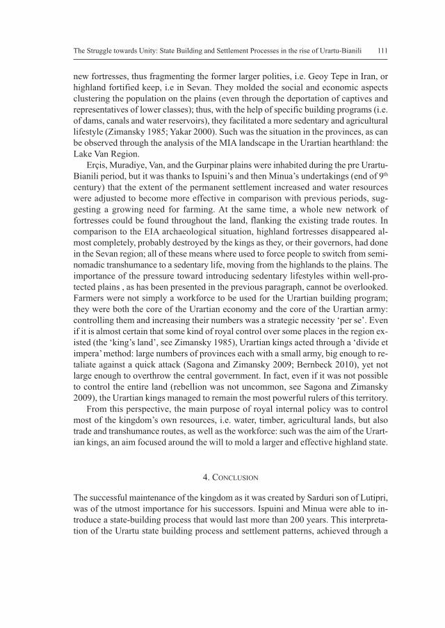
new fortresses, thus fragmenting the former larger polities, i.e. Geoy Tepe in Iran, orhighland fortified keep, i.e in Sevan. They molded the social and economic aspectsclustering the population on the plains (even through the deportation of captives andrepresentatives of lower classes); thus, with the help of specific building programs (i.e.of dams, canals and water reservoirs), they facilitated a more sedentary and agriculturallifestyle (Zimansky 1985; Yakar 2000). Such was the situation in the provinces, as canbe observed through the analysis of the MIA landscape in the Urartian hearthland: theLake Van Region.
Erçis, Muradiye, Van, and the Gurpinar plains were inhabited during the pre Urartu-Bianili period, but it was thanks to Ispuini’s and then Minua’s undertakings (end of 9th
century) that the extent of the permanent settlement increased and water resourceswere adjusted to become more effective in comparison with previous periods, sug-gesting a growing need for farming. At the same time, a whole new network offortresses could be found throughout the land, flanking the existing trade routes. Incomparison to the EIA archaeological situation, highland fortresses disappeared al-most completely, probably destroyed by the kings as they, or their governors, had donein the Sevan region; all of these means where used to force people to switch from semi-nomadic transhumance to a sedentary life, moving from the highlands to the plains. Theimportance of the pressure toward introducing sedentary lifestyles within well-pro-tected plains , as has been presented in the previous paragraph, cannot be overlooked.Farmers were not simply a workforce to be used for the Urartian building program;they were both the core of the Urartian economy and the core of the Urartian army:controlling them and increasing their numbers was a strategic necessity ‘per se’. Evenif it is almost certain that some kind of royal control over some places in the region ex-isted (the ‘king’s land’, see Zimansky 1985), Urartian kings acted through a ‘divide etimpera’ method: large numbers of provinces each with a small army, big enough to re-taliate against a quick attack (Sagona and Zimansky 2009; Bernbeck 2010), yet notlarge enough to overthrow the central government. In fact, even if it was not possibleto control the entire land (rebellion was not uncommon, see Sagona and Zimansky2009), the Urartian kings managed to remain the most powerful rulers of this territory.
From this perspective, the main purpose of royal internal policy was to controlmost of the kingdom’s own resources, i.e. water, timber, agricultural lands, but alsotrade and transhumance routes, as well as the workforce: such was the aim of the Urart-ian kings, an aim focused around the will to mold a larger and effective highland state.
4. CONCLUSION
The successful maintenance of the kingdom as it was created by Sarduri son of Lutipri,was of the utmost importance for his successors. Ispuini and Minua were able to in-troduce a state-building process that would last more than 200 years. This interpreta-tion of the Urartu state building process and settlement patterns, achieved through a
The Struggle towards Unity: State Building and Settlement Processes in the rise of Urartu-Bianili 111

112 Simone Bonzano
landscape drive analysis, gives a specific view of the entire process and stresses theability of the Urartian rulers to recognize the needs of their own land and to organizeit, if not around a central core, then around a well-developed network of control basedon their people.
Bibliography
Adontz, N.1970 Armenia in the Period of Justinian: the political conditions based on the
Naxarar system, Lisbon.Belli, O.1997 Doğu Anadolu’da Urartu Sulama Kanalları – Urartian Irrigation Canals in
Eastern Anatolia, İstanbul.2003 Doğu Anadolu Bölgesi’nde Erken Demir Çağı Kale ve Nekropolleri- Early
Iron Age Fortresses and Necropolises in East Anatolia, İstanbul.Biscione, R.2002 The Iron Age settlement pattern: Pre-Urartian and Urartian period: in R. Bis-
cione, S. Hmayakyan and N. Parmegiani (eds), The North-Eastern Frontier.Urartians and non-Urartians in the Sevan Lake Basin. I, The Southern Shores,Rome, pp. 351-370.
2003 Iron Age settlement patterns in the Armenian Plateau, two case studies: UrmiaPlain, Iran and southern Sevan basin, Armenia: in A. Smith and K Rubinson(eds), Archaeology in the Borderlands: Investigations in Caucasia and Be-yond, Los Angeles, pp. 167-184
Dan, R.2010 Ricerche sui siti urartei della provincia di Van e dintorni: in Studi Micenei ed
Egeo-Anatolici 52, pp. 49-97.Fuchs, A.2011 Urartu in der Zeit: in S.Kroll et al.(eds), Biainili-Urartu. The Procee-
dings of the Symposium held in Munich 12-14 October 2007 / Tagungsbe-richt des Münchner Symposiums 12.-14. Oktober 2007 (Acta Iranica 51), pp.153-185
Keshin, M.2003 Domal Uplift and Volcanism in a Collision Zone without a Mantle Plume:
Evidence from Eastern Anatolia, İstanbulKroll, S. et al. (eds)2012 Biainili-Urartu. The Proceedings of the Symposium held in Munich 12-14
October 2007 / Tagungsbericht des Münchner Symposiums 12.-14. Oktober2007 (Acta Iranica 51), Leuven.
Marro, C. and Özfirat A.

The Struggle towards Unity: State Building and Settlement Processes in the rise of Urartu-Bianili 113
2004 Pre-classical survey in Eastern Turkey. Second preliminary report: the Ercisregion: in Anatolia Antiqua XII, pp. 227-265.
Radner, K.2012 Between a Rock and a Hard Place: Musasir, Kumme, Ukku and Šubria – the
Buffer States between Assyria and Urartu: in S.Kroll et al.(ed.) Biainili-Urartu. The Proceedings of the Symposium held inMunich 12-14 October2007 / Tagungsbericht des Münchner Symposiums 12.-14. Oktober 2007(Acta Iranica 51), pp. 243-264.
Sagona, A. 2006 The Heritage of Eastern Turkey: From the Earliest Settlements to Islam, New
York & Melbourne.Sagona, A. and Zimansky, P.E.2009 Ancient Turkey, LondonSevin, V.2003 The early Iron Age in the Van region: in A.T. Smith and K. Rubinson (eds),
Archaeology in the Borderlands: Investigations in Caucasia and Beyond, LosAngeles, pp. 180-191.
Smith, A.T. and Rubinson, K.1999 The making of an Urartian landscape in the Ararat Plain: A study of state ar-
chitectonics: in American Journal of Archaeology 103(1), pp. 43-69.2003 Archaeology in the Borderlands: Investigations in Caucasia and Beyond, Los
Angeles.Stone, E. and Zimansky, P.E.2003 The Urartian transformation in the outer town of Ayanis: in N.S., Duck, A.T.
Smith and K. Rubinson (eds), Archaeology in the Borderlands: Investigationsin Caucasia and Beyond, Los Angeles, pp. 213-228.
Yakar2000 Ethnooarchaeology of Anatolia. Rural socio-economy in the Bronze and Iron
ages, Tel Aviv.Zimansky, P.E.1985 Ecology and Empire – the Structure of the Urartian State, Chicago.
F

Fig. 1: Research Area
114 Simone Bonzano

Fig. 2: Regional Natural Environment
The Struggle towards Unity: State Building and Settlement Processes in the rise of Urartu-Bianili 115

116 Simone Bonzano
Fig. 3: Early Iron Age

The Struggle towards Unity: State Building and Settlement Processes in the rise of Urartu-Bianili 117
Fig. 4: EIA Kaletepe and Cobanik/Bohanis

118 Simone Bonzano
Fig. 5: EIA Meydam and Ernis/Panz

The Struggle towards Unity: State Building and Settlement Processes in the rise of Urartu-Bianili 119
Fig. 6: Middle Iron Age

120 Simone Bonzano
Fig. 7: Lake Van Masterplan

The Struggle towards Unity: State Building and Settlement Processes in the rise of Urartu-Bianili 121
Fig. 8: EIA Social Landscape
122 Simone Bonzano
Fig. 9: MIA patterns in Minua Period