Tennessee Geodetic Reference Network - TN.gov
230
TENNESSEE DEPARTMENT OF TRANSPORTATION TENNESSEE GEODETIC REFERENCE NETWORK * * * TGRN * * * REFERENCE MANUAL Second Edition Issued by the Design Division
-
Upload
khangminh22 -
Category
Documents
-
view
1 -
download
0
Transcript of Tennessee Geodetic Reference Network - TN.gov
TENNESSEE DEPARTMENT
OF
TRANSPORTATION
TENNESSEE GEODETIC REFERENCE NETWORK
* * * TGRN * * *
REFERENCE MANUAL
Second Edition
Issued by the Design Division
TENNESSEE GEODETIC REFERENCE NETWORK
DISCLAIMER
This information is provided as a service to the public. The agency providing it has no dutyto do so.
While efforts have been made to assure accuracy, the user understands that the State ofTennessee assumes no liability for correctness of this information, and the user assumesany risk associated with its use.
REVISION DATE: --/--/-- ii
JJ01307
Text Box
TENNESSEE GEODETIC REFERENCE NETWORK
CONTENTS
Page
Network Description ............................................................................................................. iv
Use Of This Manual...............................................................................................................v
Explanation Of Data .............................................................................................................vi
Use Of The Network............................................................................................................ vii
Summary Table .................................................................................................................... ix
State Map............................................................................................................................ xii
Station Description and Location Information ....................................................................... 1
REVISION DATE: --/--/-- iii
TENNESSEE GEODETIC REFERENCE NETWORK
NETWORK DESCRIPTION
The Tennessee Geodetic Reference Network (TGRN) consists of sixty (60) highly accurate,three-dimensional marks spaced evenly across the state. Most locations in the state fallwithin 25 kilometers (15 miles) from a network station, a suitable reference distance forsurveys performed by single or dual frequency Global Positioning System (GPS) receivers.
The network has been surveyed to Order B geodetic accuracy standards as specified in the"Proposed Geometric Geodetic Survey Standards and Specifications for Geodetic SurveysUsing GPS Relative Positioning Techniques," (Hothem 1986). It is tied to the NorthAmerican Datum of 1983 (NAD/83) by connections to three (3) stations of the NationalGeodetic Survey (NGS) Eastern United States Strain Network. Internal accuracies of thenetwork stations exceed 1:1,000,000. Coordinates are described as NAD 83 (1995).
Azimuth points are located at twelve (12) of the TGRN stations and others may be added inthe future. However, the TRGN is intended as a reference for GPS surveys, which requireno azimuth marks, and their installation is of low priority. Existing azimuth marks and anyfuture points will be fully described in this document.
Monuments at TGRN stations are brass caps in exposed bedrock outcroppings or drivensteel rods encased in PVC pipe with access covers. Most stations have a fiberglass orconventional metal witness post nearby.
The T.D.O.T. is responsible for maintenance of the TRGN and any pertinent informationconcerning potential or existing problems at monument sites will be appreciated. Anydestruction of the monument or witness post, new or proposed development in theimmediate area, changes in visibility around the mark, etc., should be reported to theT.D.O.T. Survey Coordinator, Design Division, 1300 James K. Polk Bldg., Nashville,Tennessee 37243-0348, 615-741-5969. Users should also be careful to insure that accesscovers are tightly closed upon completion of a survey.
REVISION DATE: --/--/-- iv
TENNESSEE GEODETIC REFERENCE NETWORK
USE OF THIS MANUAL
This document is designed to provide the user with information necessary for locating andusing the stations of the Tennessee Geodetic Reference Network (TGRN) as referencepoints for GPS surveys.
In addition to summary sheets listing station coordinates, etc., each of the sixty (60) networkstations are described by three sheets as follows:
Description: Contains all pertinent written information relative to the mark, includingcoordinates, elevation, location, to reach, etc.
Visibility Diagram: A standard visibility diagram illustrating, in most cases, anyobstructions extending above 100. Obstructions below 100 may not beshown, however if clear visibility extends below 100, it will be so noted.
Quad Sheet: The station is indicated on a portion of a USGS quadrangle map, scale1:24,000.
The map is placed such that north is toward the top of the page. Stations with azimuthmarks have an additional description sheet and visibility diagram for the azimuth marks.
Any error or inaccuracies in the descriptions, visibility diagrams or quad sheets should bereported to the T.D.O.T. Survey Coordinator as shown on the previous page.
REVISION DATE: --/--/-- v
TENNESSEE GEODETIC REFERENCE NETWORK
EXPLANATION OF DATA
It should be noted that state plane coordinates and ellipsoid values are given in meters. TheT.D.O.T. converts meters to U.S. Survey Feet for design computations. The conversion isaccomplished by multiplying meters by 39.37/12, which is 3.28083333333 to 12 significantfigures.
Elevations are given in feet and meters, referenced to the NAVD 1988 and are consideredaccurate to the nearest listed decimal. Elevations of the network stations were determinedusing conventional spirit leveling, performed to second order closure standards. Elevationsfor the replacement stations were computed using the WGS 84 Reference Ellipsoid and theGeoid 96 model, as noted throughout this document. Elevations for azimuth marks weredetermined from computations using the WGS 84 Reference Ellipsoid and the Geoid 96Model.
Azimuth marks were surveyed as part of a GPS project separate from the TGRN surveypreviously described. The requirement for azimuth mark accuracy was First Order(1:100,000).
REVISION DATE: --/--/-- vi

TENNESSEE GEODETIC REFERENCE NETWORK
USE OF THE NETWORK
As previously stated, the TGRN is designed primarily as a reference system for GPSsurveys. It was developed and is owned by T.D.O.T. However, it is also part of the NGRSand available for public use.
The T.D.O.T. reserves the right of access to TGRN stations at any time required to meetwork schedules. To avoid potential conflicts, other users should contact T.D.O.T. offices,as noted below, before stations are occupied. Station occupation by other than T.D.O.T.crews will generally be on a first come first served basis. However, special consideration willbe given to certain uses, e.g., crustal motion surveys, research projects, etc.
T.D.O.T. Contacts – Special Projects
All Regions: Survey Coordinator Phone - (615) 741-5969 Design Division Fax - (615) 532-2799
1300 James K. Polk Bldg.Nashville, TN 37234-0348
T.D.O.T. Contacts – Usual Survey Projects
Region 1: GPS Crew Supervisor Phone - (865) 594-2357Regional Survey Office Supervisor Phone - (865) 594-2356Survey Office7345 Region LaneKnoxville, TN 37914
REVISION DATE: --/--/-- vii
Region 2: GPS Crew Supervisor Phone - (423) 510-1146Regional Survey Office Supervisor Phone - (423) 510-1144Survey OfficeP.O. Box 22368Chattanooga, TN 37422
Region 3: GPS Crew Supervisor Phone - (615) 350-4487Regional Survey Office Supervisor Phone - (615) 350-4252Survey Office6601 Centennial BoulevardNashville, TN 37243-0360
Region 4: GPS Crew Supervisor Phone - (731) 935-0239Regional Survey Office Supervisor Phone - (731) 935-0137Survey Office300 Benchmark PlaceJackson, TN 38302
TENNESSEE GEODETIC REFERENCE NETWORK
It is recommended that GPS survey projects utilizing the TGRN as a reference begin at astation of the TGRN and end at another station of the TGRN. Network points are relativelyclosely spaced across the state making this procedure easily possible. Projects should notbe tied to conventional stations of the NGRS. Such factors as local distortion, extremedifferences in accuracy etc. may result in closures worse that the published accuracy of theNGRS stations. The NGRS will, at some point, publish a re-adjustment of the NGRS inTennessee relative to the TGRN. This adjustment should significantly improve the quality ofties between TGRN and NGRS points. However, for best results, GPS surveys should beadjusted to TGRN stations exclusively.
Some network stations are located at city/county airports and require permission for entry tothe property. The station description includes directions for obtaining entry. If, however,those procedures fail, contact should be made with the local police or county sheriff’s office.Contact with the airport office during working hours when nighttime observations arerequired is also strongly recommended. The fields are often locked and local police usuallydo not have keys.
There are a number of factors which influence the relationship between geoid height,ellipsoid height and orthometric elevation. Consequently, a precise geoid elevation is notalways derived from differencing the elevation and ellipsoid height listed in this document.However, T.D.O.T. has in most cases found this procedure to be satisfactory forengineering work.
REVISION DATE: --/--/-- viii

TENNESSEE GEODETIC REFERENCE NETWORK
REVISION DATE: --/--/-- ix
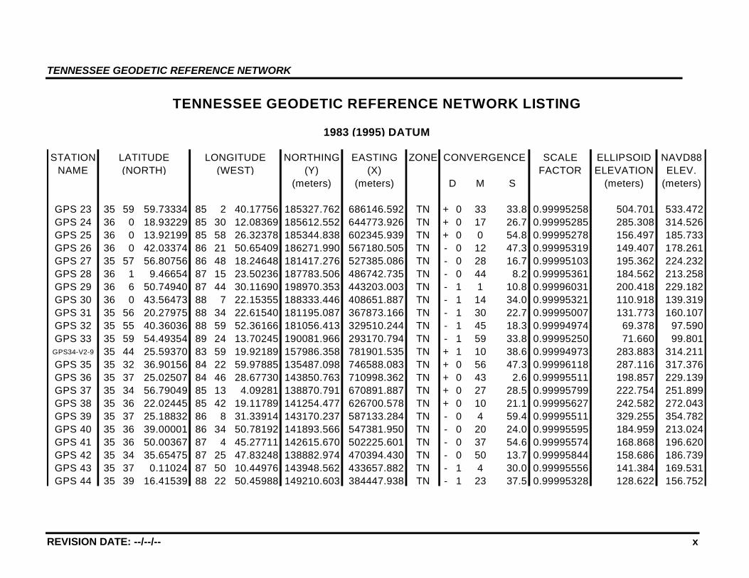
1983 (1995) DATUM
STATION LATITUDE LONGITUDE NORTHING EASTING ZONE CONVERGENCE SCALE ELLIPSOID NAVD88NAME (NORTH) (WEST) (Y) (X) FACTOR ELEVATION ELEV.
(meters) (meters) D M S (meters) (meters)
GPS 1 36 22 6.43923 82 10 46.87679 232489.480 942754.124 TN + 2 14 11.6 0.99999180 442.787 475.044GPS 2 36 24 5.68835 82 36 45.67357 234732.431 903795.239 TN + 1 58 59.0 0.99999736 501.520 532.898GPS 3 36 27 23.98466 82 53 12.35190 240025.304 879028.538 TN + 1 49 21.4 1.00000734 349.671 381.081GPS 4 36 21 0.80437 83 23 36.35206 226891.329 833944.070 TN + 1 31 33.6 0.99998889 560.426 591.542GPS 5 36 21 19.01611 83 50 37.77662 226468.911 793515.132 TN + 1 15 44.3 0.99998969 347.467 378.005GPS 6 36 24 50.17099 84 16 51.61977 232199.681 754168.868 TN + 1 0 22.9 0.99999952 532.285 561.711GPS 7 36 21 32.15041 84 49 55.88927 225367.296 704811.214 TN + 0 41 1.3 0.99999027 456.818 485.650GPS 8 36 26 26.05199 85 14 39.27422 234062.789 667760.442 TN + 0 26 32.8 1.00000433 283.553 314.137GPS 9 36 23 12.08772 85 38 11.58508 227882.940 632608.894 TN + 0 12 46.0 0.99999482 134.525 164.757
GPS 10 36 25 20.90063 86 10 56.62007 231808.158 583642.796 TN - 0 6 24.4 1.00000103 124.633 154.109GPS 11 36 25 3.03384 86 43 2.18380 231477.921 535671.167 TN - 0 25 11.7 1.00000015 220.749 250.351GPS 12 36 26 56.15662 87 5 55.14863 235281.953 501507.416 TN - 0 38 35.5 1.00000588 182.866 212.305GPS 13 36 26 12.08662 87 28 39.59121 234370.897 467511.300 TN - 0 51 54.3 1.00000361 104.652 134.104GPS 14 36 27 55.87137 87 59 17.61954 238379.917 421804.201 TN - 1 9 50.4 1.00000903 115.117 144.058GPS 15 36 20 29.80229 88 22 43.77071 225415.400 386468.876 TN - 1 23 33.6 0.99998755 144.686 173.017GPS 16 36 18 40.14105 88 46 14.11174 222961.771 351216.147 TN - 1 37 19.2 0.99998299 95.615 123.814GPS 17 36 17 0.92962 89 12 15.25245 221094.024 312189.551 TN - 1 52 33.2 0.99997910 66.419 94.670GPS 18 36 11 36.69841 82 48 47.61259 211054.539 886567.843 TN + 1 51 56.4 0.99996802 457.171 488.499GPS 19 35 58 12.57726 83 15 33.63286 185065.499 847156.481 TN + 1 36 16.2 0.99995121 368.487 399.303GPS 20 35 59 46.63703 83 42 37.72458 186918.108 806412.669 TN + 1 20 25.4 0.99995239 277.894 308.663GPS 21 35 58 32.57520 84 10 42.59261 183749.668 764266.219 TN + 1 3 59.0 0.99995145 272.178 302.843GPS 22 35 58 13.97076 84 29 53.89903 182686.679 735436.740 TN + 0 52 44.9 0.99995123 218.050 248.072
TENNESSEE GEODETIC REFERENCE NETWORK LISTING
TENNESSEE GEODETIC REFERENCE NETWORK
REVISION DATE: --/--/-- x
STATION NORTHING EASTING ZONE SCALE ELLIPSOID NAVD88NAME (Y) (X) FACTOR ELEVATION ELEV.
(meters) (meters) M S (meters) (meters)
GPS 23 35 59 59.73334 85 2 40.17756 185327.762 686146.592 TN + 0 33 33.8 0.99995258 504.701 533.472GPS 24 36 0 18.93229 85 30 12.08369 185612.552 644773.926 TN + 0 17 26.7 0.99995285 285.308 314.526GPS 25 36 0 13.92199 85 58 26.32378 185344.838 602345.939 TN + 0 0 54.8 0.99995278 156.497 185.733GPS 26 36 0 42.03374 86 21 50.65409 186271.990 567180.505 TN - 0 12 47.3 0.99995319 149.407 178.261GPS 27 35 57 56.80756 86 48 18.24648 181417.276 527385.086 TN - 0 28 16.7 0.99995103 195.362 224.232GPS 28 36 1 9.46654 87 15 23.50236 187783.506 486742.735 TN - 0 44 8.2 0.99995361 184.562 213.258GPS 29 36 6 50.74940 87 44 30.11690 198970.353 443203.003 TN - 1 1 10.8 0.99996031 200.418 229.182GPS 30 36 0 43.56473 88 7 22.15355 188333.446 408651.887 TN - 1 14 34.0 0.99995321 110.918 139.319GPS 31 35 56 20.27975 88 34 22.61540 181195.087 367873.166 TN - 1 30 22.7 0.99995007 131.773 160.107GPS 32 35 55 40.36036 88 59 52.36166 181056.413 329510.244 TN - 1 45 18.3 0.99994974 69.378 97.590GPS 33 35 59 54.49354 89 24 13.70245 190081.966 293170.794 TN - 1 59 33.8 0.99995250 71.660 99.801
GPS34-V2-9 35 44 25.59370 83 59 19.92189 157986.358 781901.535 TN + 1 10 38.6 0.99994973 283.883 314.211GPS 35 35 32 36.90156 84 22 59.97885 135487.098 746588.083 TN + 0 56 47.3 0.99996118 287.116 317.376GPS 36 35 37 25.02507 84 46 28.67730 143850.763 710998.362 TN + 0 43 2.6 0.99995511 198.857 229.139GPS 37 35 34 56.79049 85 13 4.09281 138870.791 670891.887 TN + 0 27 28.5 0.99995799 222.754 251.899GPS 38 35 36 22.02445 85 42 19.11789 141254.477 626700.578 TN + 0 10 21.1 0.99995627 242.582 272.043GPS 39 35 37 25.18832 86 8 31.33914 143170.237 587133.284 TN - 0 4 59.4 0.99995511 329.255 354.782GPS 40 35 36 39.00001 86 34 50.78192 141893.566 547381.950 TN - 0 20 24.0 0.99995595 184.959 213.024GPS 41 35 36 50.00367 87 4 45.27711 142615.670 502225.601 TN - 0 37 54.6 0.99995574 168.868 196.620GPS 42 35 34 35.65475 87 25 47.83248 138882.974 470394.430 TN - 0 50 13.7 0.99995844 158.686 186.739GPS 43 35 37 0.11024 87 50 10.44976 143948.562 433657.882 TN - 1 4 30.0 0.99995556 141.384 169.531GPS 44 35 39 16.41539 88 22 50.45988 149210.603 384447.938 TN - 1 23 37.5 0.99995328 128.622 156.752
D
LONGITUDE
TENNESSEE GEODETIC REFERENCE NETWORK LISTING
1983 (1995) DATUM
CONVERGENCE(WEST)
LATITUDE(NORTH)
TENNESSEE GEODETIC REFERENCE NETWORK
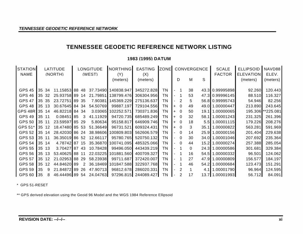
REVISION DATE: --/--/-- xi
STATION NORTHING EASTING ZONE SCALE ELLIPSOID NAVD88NAME (Y) (X) FACTOR ELEVATION ELEV.
(meters) (meters) M S (meters) (meters)
GPS 45 35 34 11.15853 88 48 37.73490 140838.947 345272.828 TN - 1 38 43.3 0.99995898 92.260 120.443GPS 46 35 32 25.93758 89 14 21.79851 138799.476 306304.956 TN - 1 53 47.3 0.99996145 88.510 116.327GPS 47 35 35 23.72751 89 35 7.90381 145369.229 275136.637 TN - 2 5 56.8 0.99995743 54.946 82.256GPS 48 35 13 30.67645 84 34 54.50769 99887.197 729104.556 TN + 0 49 49.0 1.00000447 213.890 243.645
GPS 48R 35 14 46.82218 84 34 3.03065 102252.571 730371.836 TN + 0 50 19.1 1.00000065 195.306 **225.081GPS 49 35 11 0.08451 85 3 41.11929 94720.735 685489.249 TN + 0 32 58.1 1.00001243 231.325 261.396GPS 50 35 11 23.59597 85 29 5.80634 95158.817 646909.746 TN + 0 18 5.5 1.00001115 179.226 208.276GPS 51* 35 12 18.47480 85 53 51.36649 96731.521 609324.431 TN + 0 3 35.1 1.00000822 563.281 591.969GPS 52 35 14 28.42030 86 24 38.98606 100809.803 562606.579 TN - 0 14 25.9 1.00000156 201.404 229.638GPS 53 35 11 36.35019 86 52 12.66117 95780.765 520750.132 TN - 0 30 34.0 1.00001046 207.692 235.364GPS 54 35 14 4.78742 87 15 35.36870 100741.095 485325.066 TN - 0 44 15.2 1.00000274 257.388 285.054GPS 55 35 13 3.70427 87 43 10.78428 99496.050 443439.219 TN - 1 0 24.3 1.00000586 301.681 329.384GPS 56 35 13 53.40625 88 11 22.03225 101881.560 400709.327 TN - 1 16 54.5 1.00000332 96.501 124.062GPS 57 35 12 21.02953 88 29 58.23938 99711.687 372420.007 TN - 1 27 47.9 1.00000809 156.577 184.197GPS 58 35 12 44.84620 89 2 36.18469 101847.588 322937.768 TN - 1 46 54.2 1.00000684 123.473 151.291GPS 59 35 9 21.84872 89 26 47.90713 96812.678 286020.331 TN - 2 1 4.1 1.00001790 96.964 124.595GPS 60 35 8 46.44496 89 54 24.04763 97296.815 244089.427 TN - 2 17 13.7 1.00001993 56.712 84.091
* GPS 51-RESET
** GPS derived elevation using the Geoid 96 Model and the WGS 1984 Reference Ellipsoid
D
LONGITUDE
TENNESSEE GEODETIC REFERENCE NETWORK LISTING
1983 (1995) DATUM
CONVERGENCE(WEST)
LATITUDE(NORTH)
TENNESSEE GEODETIC REFERENCE NETWORK
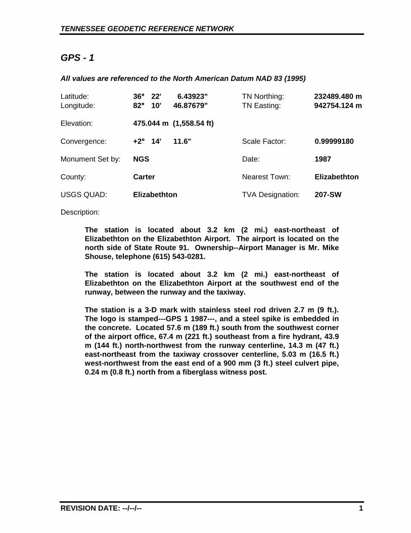
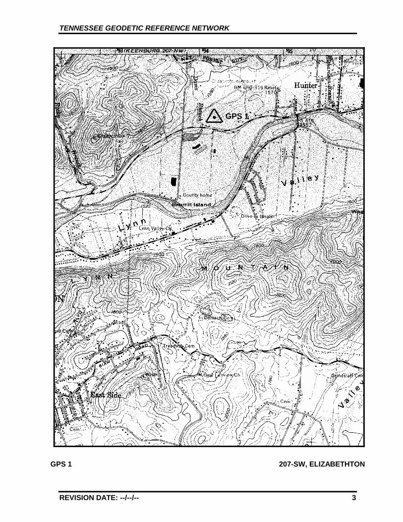
GPS - 1
All values are referenced to the North American Datum NAD 83 (1995)
Latitude: 36°°°° 22' 6.43923" TN Northing: 232489.480 mLongitude: 82°°°° 10' 46.87679" TN Easting: 942754.124 m
Elevation: 475.044 m (1,558.54 ft)
Convergence: +2°°°° 14' 11.6" Scale Factor: 0.99999180
Monument Set by: NGS Date: 1987
County: Carter Nearest Town: Elizabethton
USGS QUAD: Elizabethton TVA Designation: 207-SW
Description:
The station is located about 3.2 km (2 mi.) east-northeast ofElizabethton on the Elizabethton Airport. The airport is located on thenorth side of State Route 91. Ownership--Airport Manager is Mr. MikeShouse, telephone (615) 543-0281.
The station is located about 3.2 km (2 mi.) east-northeast ofElizabethton on the Elizabethton Airport at the southwest end of therunway, between the runway and the taxiway.
The station is a 3-D mark with stainless steel rod driven 2.7 m (9 ft.).The logo is stamped---GPS 1 1987---, and a steel spike is embedded inthe concrete. Located 57.6 m (189 ft.) south from the southwest cornerof the airport office, 67.4 m (221 ft.) southeast from a fire hydrant, 43.9m (144 ft.) north-northwest from the runway centerline, 14.3 m (47 ft.)east-northeast from the taxiway crossover centerline, 5.03 m (16.5 ft.)west-northwest from the east end of a 900 mm (3 ft.) steel culvert pipe,0.24 m (0.8 ft.) north from a fiberglass witness post.
REVISION DATE: --/--/-- 1
TENNESSEE GEODETIC REFERENCE NETWORK
REVISION DATE: --/--/-- 2
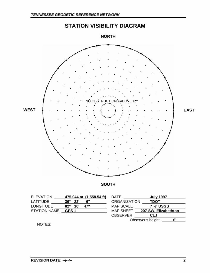
STATION VISIBILITY DIAGRAM
NORTH
SOUTH
ELEVATION 475.044 m (1,558.54 ft) DATE July 1997 LATITUDE 36°°°° 22' 6" ORGANIZATION TDOT LONGITUDE 82°°°° 10' 47" MAP SCALE 7 ½' USGS STATION NAME GPS 1 MAP SHEET 207-SW, Elizabethton
OBSERVER CLJ Observer’s height 6’
NOTES:
WEST EAST
NO OBSTRUCTIONS ABOVE 10º
TENNESSEE GEODETIC REFERENCE NETWORK
REVISION DATE: --/--/-- 3
GPS 1 207-SW, ELIZABETHTON
GPS 1
TENNESSEE GEODETIC REFERENCE NETWORK
REVISION DATE: --/--/-- 4
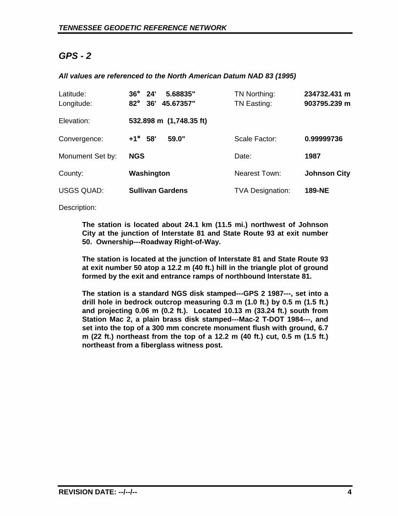
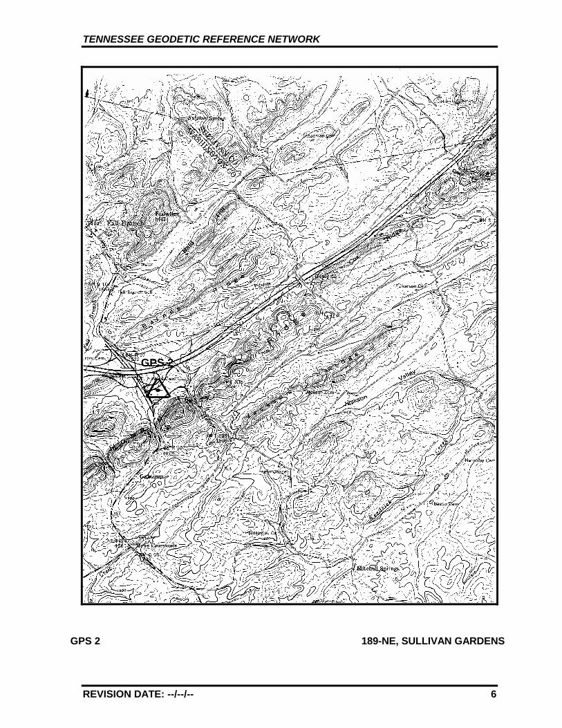
GPS - 2
All values are referenced to the North American Datum NAD 83 (1995)
Latitude: 36°°°° 24' 5.68835" TN Northing: 234732.431 mLongitude: 82°°°° 36' 45.67357" TN Easting: 903795.239 m
Elevation: 532.898 m (1,748.35 ft)
Convergence: +1°°°° 58' 59.0" Scale Factor: 0.99999736
Monument Set by: NGS Date: 1987
County: Washington Nearest Town: Johnson City
USGS QUAD: Sullivan Gardens TVA Designation: 189-NE
Description:
The station is located about 24.1 km (11.5 mi.) northwest of JohnsonCity at the junction of Interstate 81 and State Route 93 at exit number50. Ownership---Roadway Right-of-Way.
The station is located at the junction of Interstate 81 and State Route 93at exit number 50 atop a 12.2 m (40 ft.) hill in the triangle plot of groundformed by the exit and entrance ramps of northbound Interstate 81.
The station is a standard NGS disk stamped---GPS 2 1987---, set into adrill hole in bedrock outcrop measuring 0.3 m (1.0 ft.) by 0.5 m (1.5 ft.)and projecting 0.06 m (0.2 ft.). Located 10.13 m (33.24 ft.) south fromStation Mac 2, a plain brass disk stamped---Mac-2 T-DOT 1984---, andset into the top of a 300 mm concrete monument flush with ground, 6.7m (22 ft.) northeast from the top of a 12.2 m (40 ft.) cut, 0.5 m (1.5 ft.)northeast from a fiberglass witness post.
TENNESSEE GEODETIC REFERENCE NETWORK
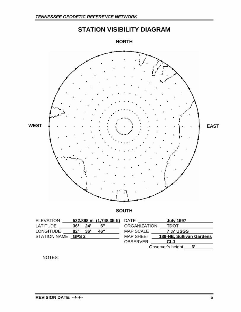
REVISION DATE: --/--/-- 5
STATION VISIBILITY DIAGRAM
NORTH
SOUTH
ELEVATION 532.898 m (1,748.35 ft) DATE July 1997 LATITUDE 36°°°° 24' 6" ORGANIZATION TDOT LONGITUDE 82°°°° 36' 46" MAP SCALE 7 ½' USGS STATION NAME GPS 2 MAP SHEET 189-NE, Sullivan Gardens
OBSERVER CLJ Observer’s height 6’
NOTES:
WEST EAST
TENNESSEE GEODETIC REFERENCE NETWORK
REVISION DATE: --/--/-- 6
GPS 2 189-NE, SULLIVAN GARDENS
GPS 2
TENNESSEE GEODETIC REFERENCE NETWORK
REVISION DATE: --/--/-- 7
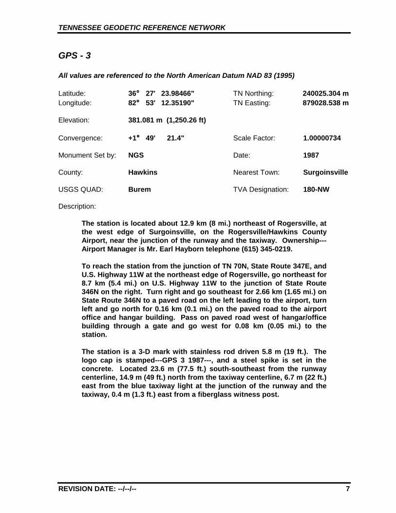
GPS - 3
All values are referenced to the North American Datum NAD 83 (1995)
Latitude: 36°°°° 27' 23.98466" TN Northing: 240025.304 mLongitude: 82°°°° 53' 12.35190" TN Easting: 879028.538 m
Elevation: 381.081 m (1,250.26 ft)
Convergence: +1°°°° 49' 21.4" Scale Factor: 1.00000734
Monument Set by: NGS Date: 1987
County: Hawkins Nearest Town: Surgoinsville
USGS QUAD: Burem TVA Designation: 180-NW
Description:
The station is located about 12.9 km (8 mi.) northeast of Rogersville, atthe west edge of Surgoinsville, on the Rogersville/Hawkins CountyAirport, near the junction of the runway and the taxiway. Ownership---Airport Manager is Mr. Earl Hayborn telephone (615) 345-0219.
To reach the station from the junction of TN 70N, State Route 347E, andU.S. Highway 11W at the northeast edge of Rogersville, go northeast for8.7 km (5.4 mi.) on U.S. Highway 11W to the junction of State Route346N on the right. Turn right and go southeast for 2.66 km (1.65 mi.) onState Route 346N to a paved road on the left leading to the airport, turnleft and go north for 0.16 km (0.1 mi.) on the paved road to the airportoffice and hangar building. Pass on paved road west of hangar/officebuilding through a gate and go west for 0.08 km (0.05 mi.) to thestation.
The station is a 3-D mark with stainless rod driven 5.8 m (19 ft.). Thelogo cap is stamped---GPS 3 1987---, and a steel spike is set in theconcrete. Located 23.6 m (77.5 ft.) south-southeast from the runwaycenterline, 14.9 m (49 ft.) north from the taxiway centerline, 6.7 m (22 ft.)east from the blue taxiway light at the junction of the runway and thetaxiway, 0.4 m (1.3 ft.) east from a fiberglass witness post.
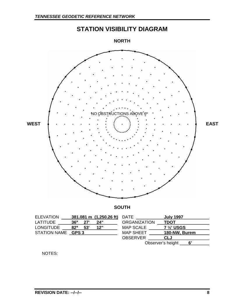
TENNESSEE GEODETIC REFERENCE NETWORK
REVISION DATE: --/--/-- 8
STATION VISIBILITY DIAGRAM
NORTH
SOUTH
ELEVATION 381.081 m (1,250.26 ft) DATE July 1997 LATITUDE 36°°°° 27' 24" ORGANIZATION TDOT LONGITUDE 82°°°° 53' 12" MAP SCALE 7 ½' USGS STATION NAME GPS 3 MAP SHEET 180-NW, Burem
OBSERVER CLJ Observer’s height 6’
NOTES:
WEST EAST
NO OBSTRUCTIONS ABOVE 6º
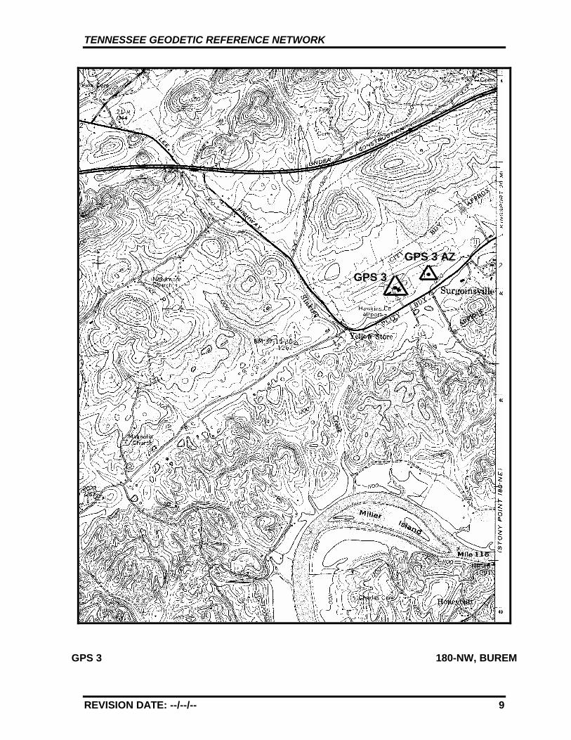
TENNESSEE GEODETIC REFERENCE NETWORK
REVISION DATE: --/--/-- 9
GPS 3 180-NW, BUREM
GPS 3
GPS 3 AZ
TENNESSEE GEODETIC REFERENCE NETWORK
REVISION DATE: --/--/-- 10
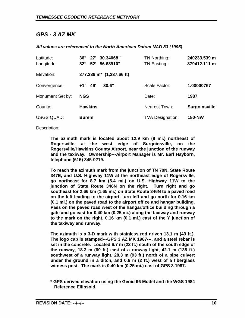
GPS - 3 AZ MK
All values are referenced to the North American Datum NAD 83 (1995)
Latitude: 36°°°° 27' 30.34068 " TN Northing: 240233.539 mLongitude: 82°°°° 52’ 56.68910" TN Easting: 879412.111 m
Elevation: 377.239 m* (1,237.66 ft)
Convergence: +1°°°° 49' 30.6" Scale Factor: 1.00000767
Monument Set by: NGS Date: 1987
County: Hawkins Nearest Town: Surgoinsville
USGS QUAD: Burem TVA Designation: 180-NW
Description:
The azimuth mark is located about 12.9 km (8 mi.) northeast ofRogersville, at the west edge of Surgoinsville, on theRogersville/Hawkins County Airport, near the junction of the runwayand the taxiway. Ownership---Airport Manager is Mr. Earl Hayborn,telephone (615) 345-0219.
To reach the azimuth mark from the junction of TN 70N, State Route347E, and U.S. Highway 11W at the northeast edge of Rogersville,go northeast for 8.7 km (5.4 mi.) on U.S. Highway 11W to thejunction of State Route 346N on the right. Turn right and gosoutheast for 2.66 km (1.65 mi.) on State Route 346N to a paved roadon the left leading to the airport, turn left and go north for 0.16 km(0.1 mi.) on the paved road to the airport office and hangar building.Pass on the paved road west of the hangar/office building through agate and go east for 0.40 km (0.25 mi.) along the taxiway and runwayto the mark on the right, 0.16 km (0.1 mi.) east of the Y junction ofthe taxiway and runway.
The azimuth is a 3-D mark with stainless rod driven 13.1 m (43 ft.).The logo cap is stamped---GPS 3 AZ MK 1987---, and a steel rebar isset in the concrete. Located 6.7 m (22 ft.) south of the south edge ofthe runway, 18.3 m (60 ft.) east of a runway light, 42.1 m (138 ft.)southwest of a runway light, 28.3 m (93 ft.) north of a pipe culvertunder the ground in a ditch, and 0.6 m (2 ft.) west of a fiberglasswitness post. The mark is 0.40 km (0.25 mi.) east of GPS 3 1987.
* GPS derived elevation using the Geoid 96 Model and the WGS 1984Reference Ellipsoid.
TENNESSEE GEODETIC REFERENCE NETWORK
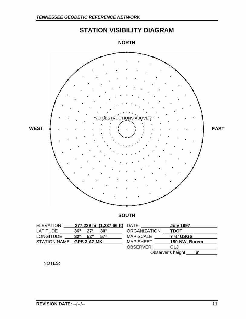
REVISION DATE: --/--/-- 11
STATION VISIBILITY DIAGRAM
NORTH
SOUTH
ELEVATION 377.239 m (1,237.66 ft) DATE July 1997 LATITUDE 36°°°° 27' 30" ORGANIZATION TDOT LONGITUDE 82°°°° 52" 57” MAP SCALE 7 ½' USGS STATION NAME GPS 3 AZ MK MAP SHEET 180-NW, Burem
OBSERVER CLJ Observer’s height 6'
NOTES:
WEST EAST
NO OBSTRUCTIONS ABOVE 7º

TENNESSEE GEODETIC REFERENCE NETWORK
REVISION DATE: --/--/-- 12
GPS 3 AZ 180-NW, BUREM
GPS 3 AZ
GPS 3
TENNESSEE GEODETIC REFERENCE NETWORK
REVISION DATE: --/--/-- 13
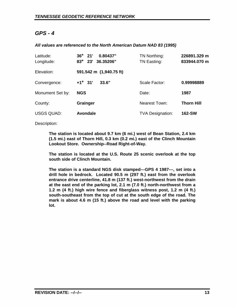
GPS - 4
All values are referenced to the North American Datum NAD 83 (1995)
Latitude: 36°°°° 21' 0.80437" TN Northing: 226891.329 mLongitude: 83°°°° 23' 36.35206" TN Easting: 833944.070 m
Elevation: 591.542 m (1,940.75 ft)
Convergence: +1°°°° 31' 33.6" Scale Factor: 0.99998889
Monument Set by: NGS Date: 1987
County: Grainger Nearest Town: Thorn Hill
USGS QUAD: Avondale TVA Designation: 162-SW
Description:
The station is located about 9.7 km (6 mi.) west of Bean Station, 2.4 km(1.5 mi.) east of Thorn Hill, 0.3 km (0.2 mi.) east of the Clinch MountainLookout Store. Ownership--Road Right-of-Way.
The station is located at the U.S. Route 25 scenic overlook at the topsouth side of Clinch Mountain.
The station is a standard NGS disk stamped---GPS 4 1987---, set into adrill hole in bedrock. Located 90.5 m (297 ft.) east from the overlookentrance drive centerline, 41.8 m (137 ft.) west-northwest from the drainat the east end of the parking lot, 2.1 m (7.0 ft.) north-northwest from a1.2 m (4 ft.) high wire fence and fiberglass witness post, 1.2 m (4 ft.)south-southeast from the top of cut at the south edge of the road. Themark is about 4.6 m (15 ft.) above the road and level with the parkinglot.
TENNESSEE GEODETIC REFERENCE NETWORK
REVISION DATE: --/--/-- 14
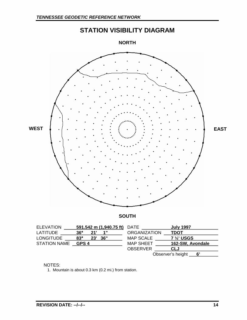
STATION VISIBILITY DIAGRAM
NORTH
SOUTH
ELEVATION 591.542 m (1,940.75 ft) DATE July 1997 LATITUDE 36°°°° 21' 1" ORGANIZATION TDOT LONGITUDE 83°°°° 23' 36" MAP SCALE 7 ½' USGS STATION NAME GPS 4 MAP SHEET 162-SW, Avondale
OBSERVER CLJ Observer’s height 6’
NOTES:1. Mountain is about 0.3 km (0.2 mi.) from station.
WEST EAST
TENNESSEE GEODETIC REFERENCE NETWORK
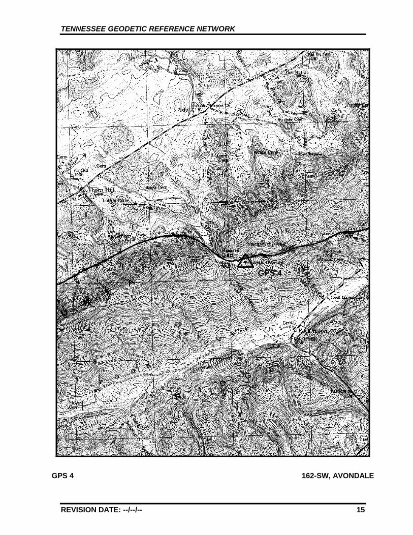
REVISION DATE: --/--/-- 15
GPS 4 162-SW, AVONDALE
GPS 4
TENNESSEE GEODETIC REFERENCE NETWORK
REVISION DATE: --/--/-- 16
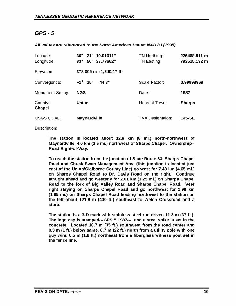
GPS - 5
All values are referenced to the North American Datum NAD 83 (1995)
Latitude: 36°°°° 21' 19.01611" TN Northing: 226468.911 mLongitude: 83°°°° 50' 37.77662" TN Easting: 793515.132 m
Elevation: 378.005 m (1,240.17 ft)
Convergence: +1°°°° 15' 44.3" Scale Factor: 0.99998969
Monument Set by: NGS Date: 1987
County: Union Nearest Town: SharpsChapel
USGS QUAD: Maynardville TVA Designation: 145-SE
Description:
The station is located about 12.8 km (8 mi.) north-northwest ofMaynardville, 4.0 km (2.5 mi.) northwest of Sharps Chapel. Ownership--Road Right-of-Way.
To reach the station from the junction of State Route 33, Sharps ChapelRoad and Chuck Swan Management Area (this junction is located justeast of the Union/Claiborne County Line) go west for 7.48 km (4.65 mi.)on Sharps Chapel Road to Dr. Davis Road on the right. Continuestraight ahead and go westerly for 2.01 km (1.25 mi.) on Sharps ChapelRoad to the fork of Big Valley Road and Sharps Chapel Road. Veerright staying on Sharps Chapel Road and go northwest for 2.98 km(1.85 mi.) on Sharps Chapel Road leading northwest to the station onthe left about 121.9 m (400 ft.) southeast to Welch Crossroad and astore.
The station is a 3-D mark with stainless steel rod driven 11.3 m (37 ft.).The logo cap is stamped---GPS 5 1987---, and a steel spike is set in theconcrete. Located 10.7 m (35 ft.) southwest from the road center and0.3 m (1 ft.) below same, 6.7 m (22 ft.) north from a utility pole with oneguy wire, 0.5 m (1.8 ft.) northeast from a fiberglass witness post set inthe fence line.
TENNESSEE GEODETIC REFERENCE NETWORK
REVISION DATE: --/--/-- 17
STATION VISIBILITY DIAGRAM
NORTH
SOUTH
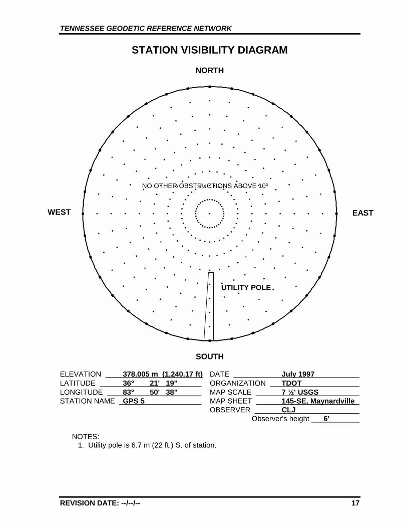
ELEVATION 378.005 m (1,240.17 ft) DATE July 1997 LATITUDE 36°°°° 21' 19" ORGANIZATION TDOT LONGITUDE 83°°°° 50' 38" MAP SCALE 7 ½' USGS STATION NAME GPS 5 MAP SHEET 145-SE, Maynardville
OBSERVER CLJ Observer’s height 6'
NOTES:1. Utility pole is 6.7 m (22 ft.) S. of station.
WEST EAST
UTILITY POLE
NO OTHER OBSTRUCTIONS ABOVE 10º

TENNESSEE GEODETIC REFERENCE NETWORK
REVISION DATE: --/--/-- 18
GPS 5 145-SE, MAYNARDVILLE
GPS 5
TENNESSEE GEODETIC REFERENCE NETWORK
REVISION DATE: --/--/-- 19
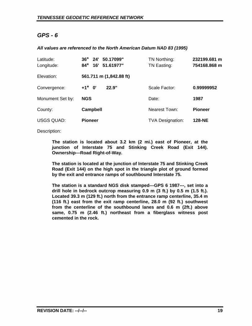
GPS - 6
All values are referenced to the North American Datum NAD 83 (1995)
Latitude: 36°°°° 24' 50.17099" TN Northing: 232199.681 Longitude: 84°°°° 16' 51.61977" TN Easting: 754168.868
Elevation: 561.711 m (1,842.88 ft)
Convergence: +1°°°° 0' 22.9" Scale Factor: 0.99999952
Monument Set by: NGS Date: 1987
County: Campbell Nearest Town: Pioneer
USGS QUAD: Pioneer TVA Designation: 128-NE
Description:
The station is located about 3.2 km (2 mi.) east of Pioneer, at thejunction of Interstate 75 and Stinking Creek Road (Exit 144).Ownership—Road Right-of-Way.
The station is located at the junction of Interstate 75 and Stinking CreekRoad (Exit 144) on the high spot in the triangle plot of ground formedby the exit and entrance ramps of southbound Interstate 75.
The station is a standard NGS disk stamped---GPS 6 1987---, set into adrill hole in bedrock outcrop measuring 0.9 m (3 ft.) by 0.5 m (1.5 ft.).Located 39.3 m (129 ft.) north from the entrance ramp centerline, 35.4 m(116 ft.) east from the exit ramp centerline, 28.0 m (92 ft.) southwestfrom the centerline of the southbound lanes and 0.6 m (2ft.) abovesame, 0.75 m (2.46 ft.) northeast from a fiberglass witness postcemented in the rock.
mm
TENNESSEE GEODETIC REFERENCE NETWORK
REVISION DATE: --/--/-- 20
STATION VISIBILITY DIAGRAM
NORTH
SOUTH
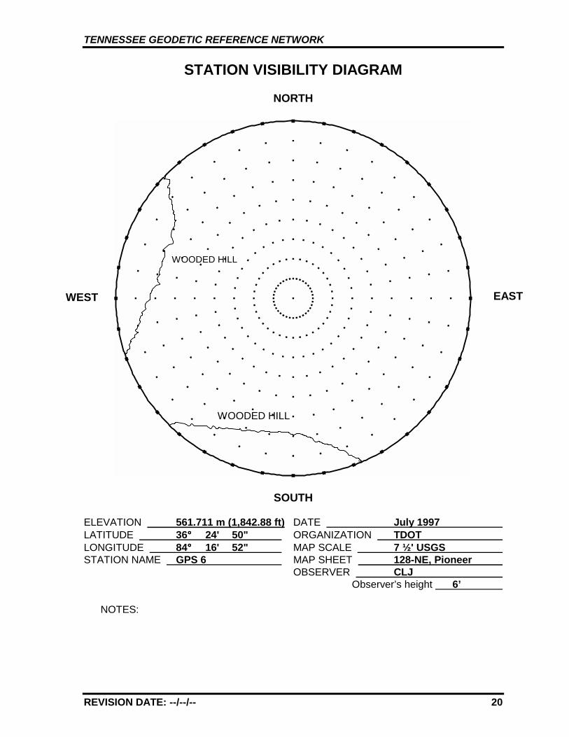
ELEVATION 561.711 m (1,842.88 ft) DATE July 1997 LATITUDE 36°°°° 24' 50" ORGANIZATION TDOT LONGITUDE 84°°°° 16' 52" MAP SCALE 7 ½' USGS STATION NAME GPS 6 MAP SHEET 128-NE, Pioneer
OBSERVER CLJ Observer’s height 6’
NOTES:
WEST EAST
WOODED HILL
WOODED HILL
TENNESSEE GEODETIC REFERENCE NETWORK
REVISION DATE: --/--/-- 21
GPS 6 128-NE, PIONEER
GPS 6
TENNESSEE GEODETIC REFERENCE NETWORK
REVISION DATE: --/--/-- 22
GPS - 7
All values are referenced to the North American Datum NAD 83 (1995)
Latitude: 36°°°° 21' 32.15041" TN Northing: 225367.296 mLongitude: 84°°°° 49' 55.88927" TN Easting: 704811.214 m
Elevation: 485.650 m (1,593.34 ft)
Convergence: +0°°°° 41' 1.3" Scale Factor: 0.99999027
Monument Set by: NGS Date: 1987
County: Fentress Nearest Town: Allardt
USGS QUAD: Burrville TVA Designation: 115-SE
Description:
The station is located about 25.7 km (16 mi.) west of Elgin, 5.6 km (3.5mi.) east of Allardt, on the north side of State Route 52. Ownership—Road Right-of-Way.
To reach the station from the junction of State Routes 52 and 296 inAllardt go east for 5.3 km (3.3 mi.) on State Route 52 to the PleasantView Church on the right near a road fork. Continue straight ahead andgo east for 0.3 km (0.2 mi.) on State rout 52 to the station on the left.The station can also be reached from the junction of State Route 52 andU.S. Highway 27 in Elgin by going west 25.9 km (16.1 mi.) on StateRoute 52 to the station on the right.
The station is a 3-D mark with stainless steel rod driven 1.8 m (6 ft.).The logo cap is stamped---GPS 7 1987---, and a steel spike is set in theconcrete. Located 91.1 m (299 ft.) west from the center of a paved driveleading north, 7.0 m (23 ft.) north from the centerline of State Route 52,2.3 m (7.4 ft.) south from a property corner marked by an iron pin and asteel fence post, 4.3 m (14.1 ft.) south from utility pole marked 31H-1,13.8 m (45.3 ft.) east from center of paved drive leading north, 0.4 m (1.2ft.) south from a fiberglass witness post.
TENNESSEE GEODETIC REFERENCE NETWORK
REVISION DATE: --/--/-- 23
STATION VISIBILITY DIAGRAM
NORTH
SOUTH
ELEVATION 485.650 m (1,593.34 ft) DATE July 1997 LATITUDE 36°°°° 21' 32" ORGANIZATION TDOT LONGITUDE 84°°°° 49' 56" MAP SCALE 7 ½' USGS STATION NAME GPS 7 MAP SHEET 115-SE, Burrville
OBSERVER CLJ Observer’s height 6'
NOTES:
WEST EAST
UTILITY POLE31H-1
UTILITYPOLE
TENNESSEE GEODETIC REFERENCE NETWORK
REVISION DATE: --/--/-- 24
GPS 7 115-SE, BURRVILLE
GPS 7
TENNESSEE GEODETIC REFERENCE NETWORK
REVISION DATE: 12/03/10 25
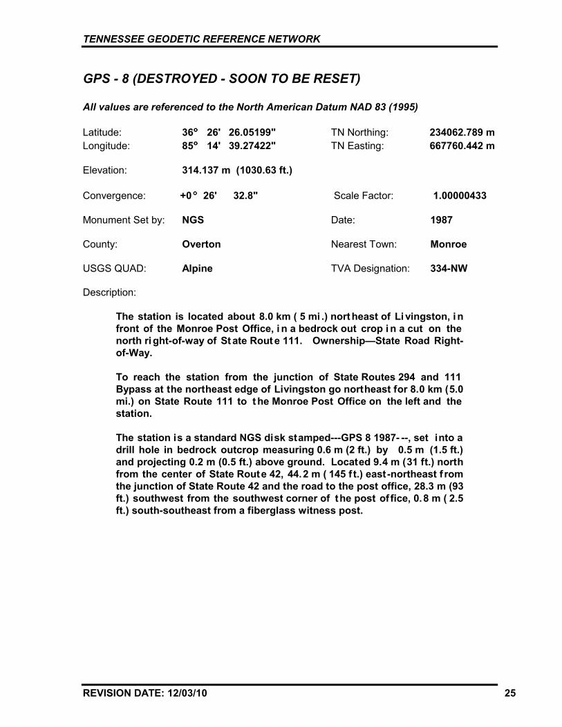
GPS - 8 (DESTROYED - SOON TO BE RESET)
All values are referenced to the North American Datum NAD 83 (1995)
Latitude: 36°°°° 26' 26.05199" TN Northing: 234062.789 mLongitude: 85°°°° 14' 39.27422" TN Easting: 667760.442 m
Elevation: 314.137 m (1030.63 ft.)
Convergence: +0 °°° 26' 32.8" Scale Factor: 1.00000433
Monument Set by: NGS Date: 1987
County: Overton Nearest Town: Monroe
USGS QUAD: Alpine TVA Designation: 334-NW
Description:
The station is located about 8.0 km ( 5 mi .) nort heast of Li vingston, i nfront of the Monroe Post Office, i n a bedrock out crop i n a cut on thenorth ri ght-of-way of St ate Rout e 111. Ownership—State Road Right-of-Way.
To reach the station from the junction of State Routes 294 and 111Bypass at the northeast edge of Livingston go northeast for 8.0 km (5.0mi.) on State Route 111 to t he Monroe Post Office on the left and thestation.
The station is a standard NGS disk stamped---GPS 8 1987- --, set into adrill hole in bedrock outcrop measuring 0.6 m (2 ft.) by 0.5 m (1.5 ft.)and projecting 0.2 m (0.5 ft.) above ground. Located 9.4 m (31 ft.) northfrom the center of State Route 42, 44.2 m ( 145 f t.) east -northeast f romthe junction of State Route 42 and the road to the post office, 28.3 m (93ft.) southwest from the southwest corner of the post of fice, 0.8 m ( 2.5ft.) south-southeast from a fiberglass witness post.
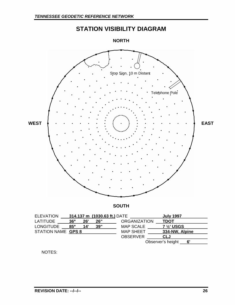
TENNESSEE GEODETIC REFERENCE NETWORK
REVISION DATE: --/--/-- 26
STATION VISIBILITY DIAGRAM
NORTH
SOUTH
ELEVATION 314.137 m (1030.63 ft.) DATE July 1997 LATITUDE 36°°°° 26' 26" ORGANIZATION TDOT LONGITUDE 85°°°° 14' 39" MAP SCALE 7 ½' USGS STATION NAME GPS 8 MAP SHEET 334-NW, Alpine
OBSERVER CLJ Observer’s height 6'
NOTES:
WEST EAST
Stop Sign, 10 m Distant
Telephone Pole
TENNESSEE GEODETIC REFERENCE NETWORK
REVISION DATE: --/--/-- 27
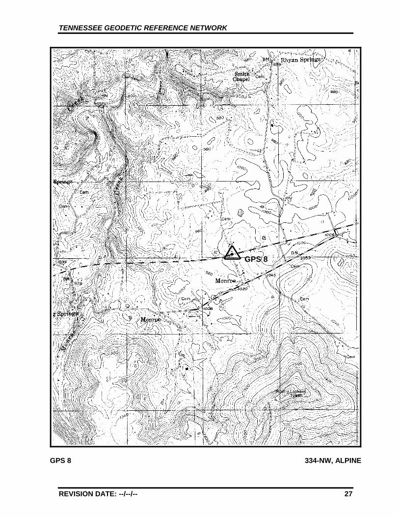
GPS 8 334-NW, ALPINE
GPS 8
TENNESSEE GEODETIC REFERENCE NETWORK
REVISION DATE: --/--/-- 28
GPS - 9
All values are referenced to the North American Datum NAD 83 (1995)
Latitude: 36°°°° 23' 12.08772" TN Northing: 227882.940 mLongitude: 85°°°° 38' 11.58508" TN Easting: 632608.894 m
Elevation: 164.757 m (540.54 ft)
Convergence: +0°°°° 12' 46.0" Scale Factor: 0.99999482
Monument Set by: NGS Date: 1987
County: Jackson Nearest Town: Gainesboro
USGS QUAD: Whitleyville TVA Designation: 325-NW
Description:
The station is located about 4.8 km (3 mi.) north of Gainesboro, on theeast right-of-way of State Route 53, 0.2 km (0.1 mi.) north of the TheoSpivey Rest Home, at a 3.0 m (10 ft.) cut and set in bedrock.Ownership—State Right-of-Way.
To reach the station from the Courthouse in Gainesboro go east for 0.3km (0.2 mi.) on State Route 53 to the junction of State Route 56. Turnleft and go north for 1.9 km (1.2 mi.) on State Routes 53 and 56 to aroad on the left (State Route 56 turns left). Continue straight ahead andgo north for 1.4 km (0.9 mi.) on State Route 53 to State Route 85 on theright, then continue on State Route 53 1.0 km (0.6 mi.) to the station onthe right, across from a white brick house.
The station is a standard NGS disk stamped---GPS 9 1987---, set into adrill hole in bedrock outcrop measuring 0.3 m (1 ft.) by 0.9 m (3 ft.)projecting 0.1 m (3 ft.). Located 64.9 m (213 ft.) east-southeast from thesoutheast corner of the white brick house, 15.5 m (51 ft.) east from theroad centerline, 59.3 m (194.5 ft.) west-northwest of entrance door onwest wall of commercial building, 0.7 m (2.3 ft.) northeast from afiberglass witness post.
TENNESSEE GEODETIC REFERENCE NETWORK
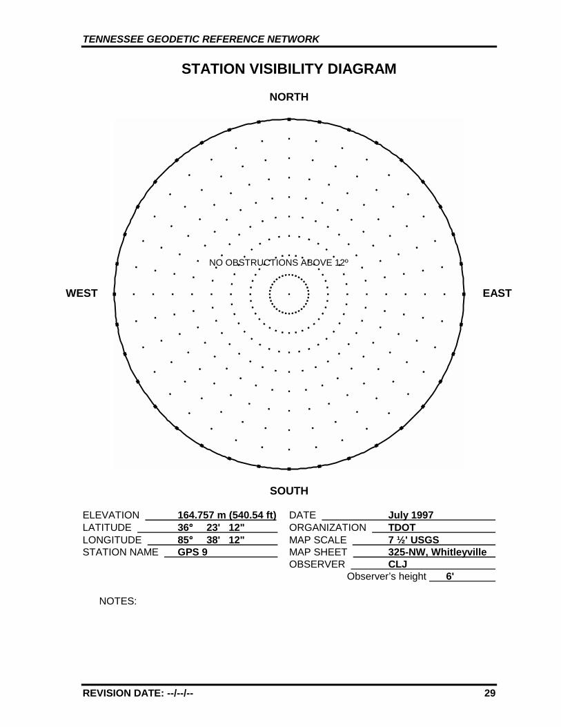
REVISION DATE: --/--/-- 29
STATION VISIBILITY DIAGRAM
NORTH
SOUTH
ELEVATION 164.757 m (540.54 ft) DATE July 1997 LATITUDE 36°°°° 23' 12" ORGANIZATION TDOT LONGITUDE 85°°°° 38' 12" MAP SCALE 7 ½' USGS STATION NAME GPS 9 MAP SHEET 325-NW, Whitleyville
OBSERVER CLJ Observer’s height 6'
NOTES:
WEST EAST
NO OBSTRUCTIONS ABOVE 12º
TENNESSEE GEODETIC REFERENCE NETWORK
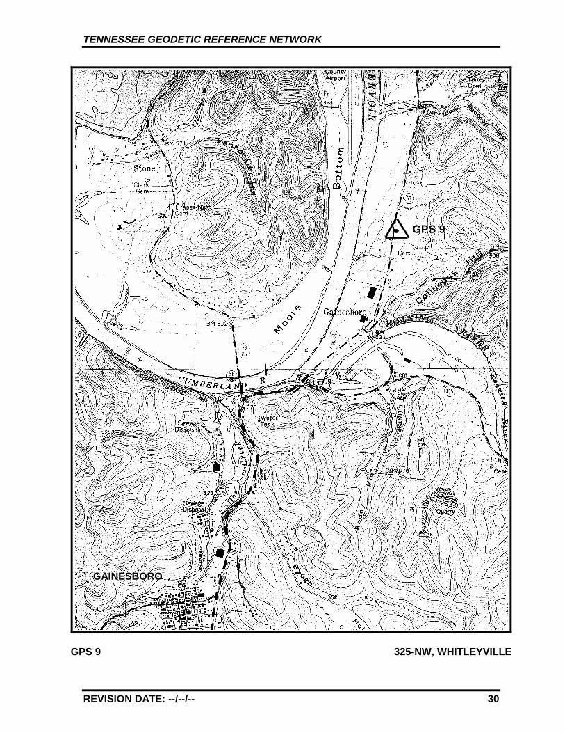
REVISION DATE: --/--/-- 30
GPS 9 325-NW, WHITLEYVILLE
GPS 9
GAINESBORO
TENNESSEE GEODETIC REFERENCE NETWORK
REVISION DATE: --/--/-- 31
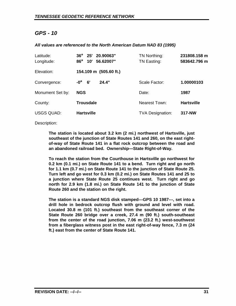
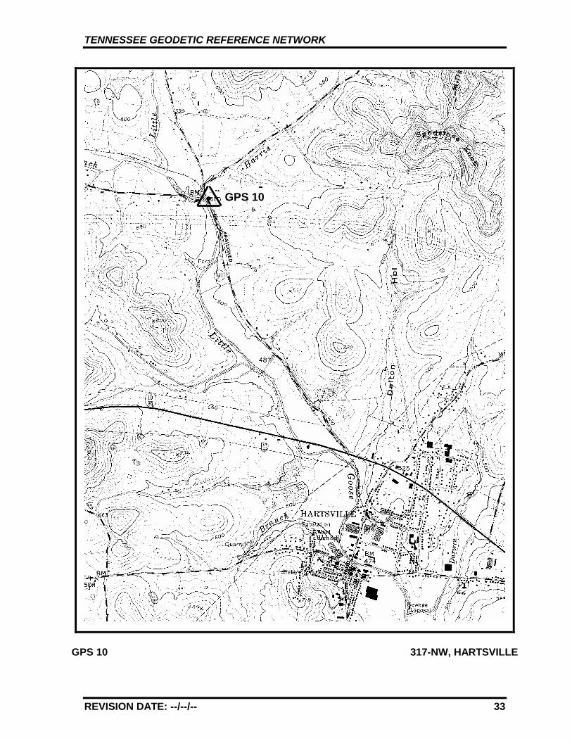
GPS - 10
All values are referenced to the North American Datum NAD 83 (1995)
Latitude: 36°°°° 25' 20.90063" TN Northing: 231808.158 mLongitude: 86°°°° 10' 56.62007" TN Easting: 583642.796 m
Elevation: 154.109 m (505.60 ft.)
Convergence: -0°°°° 6' 24.4" Scale Factor: 1.00000103
Monument Set by: NGS Date: 1987
County: Trousdale Nearest Town: Hartsville
USGS QUAD: Hartsville TVA Designation: 317-NW
Description:
The station is located about 3.2 km (2 mi.) northwest of Hartsville, justsoutheast of the junction of State Routes 141 and 260, on the east right-of-way of State Route 141 in a flat rock outcrop between the road andan abandoned railroad bed. Ownership—State Right-of-Way.
To reach the station from the Courthouse in Hartsville go northwest for0.2 km (0.1 mi.) on State Route 141 to a bend. Turn right and go northfor 1.1 km (0.7 mi.) on State Route 141 to the junction of State Route 25.Turn left and go west for 0.3 km (0.2 mi.) on State Routes 141 and 25 toa junction where State Route 25 continues west. Turn right and gonorth for 2.9 km (1.8 mi.) on State Route 141 to the junction of StateRoute 260 and the station on the right.
The station is a standard NGS disk stamped---GPS 10 1987---, set into adrill hole in bedrock outcrop flush with ground and level with road.Located 30.8 m (101 ft.) southeast from the southeast corner of theState Route 260 bridge over a creek, 27.4 m (90 ft.) south-southeastfrom the center of the road junction, 7.06 m (23.2 ft.) west-southwestfrom a fiberglass witness post in the east right-of-way fence, 7.3 m (24ft.) east from the center of State Route 141.
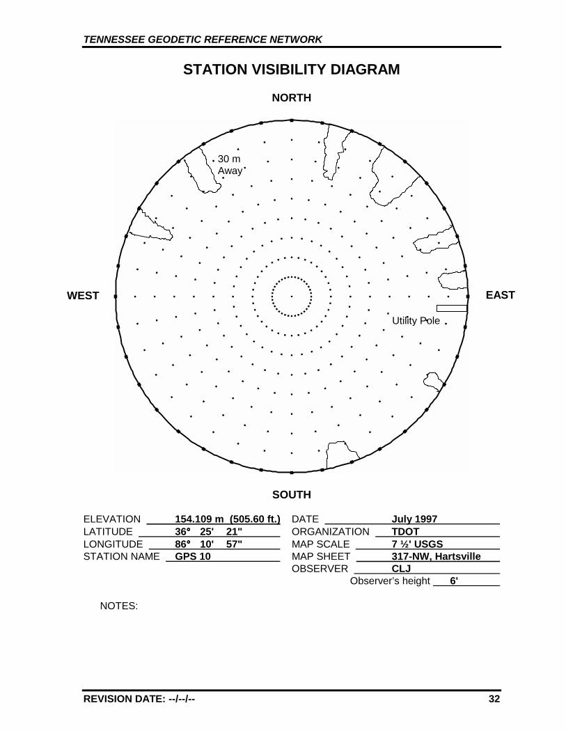
TENNESSEE GEODETIC REFERENCE NETWORK
REVISION DATE: --/--/-- 32
STATION VISIBILITY DIAGRAM
NORTH
SOUTH
ELEVATION 154.109 m (505.60 ft.) DATE July 1997 LATITUDE 36°°°° 25' 21" ORGANIZATION TDOT LONGITUDE 86°°°° 10' 57" MAP SCALE 7 ½' USGS STATION NAME GPS 10 MAP SHEET 317-NW, Hartsville
OBSERVER CLJ Observer’s height 6'
NOTES:
WEST EAST
Utility Pole
30 mAway
TENNESSEE GEODETIC REFERENCE NETWORK
REVISION DATE: --/--/-- 33
GPS 10 317-NW, HARTSVILLE
GPS 10
TENNESSEE GEODETIC REFERENCE NETWORK
REVISION DATE: --/--/-- 34
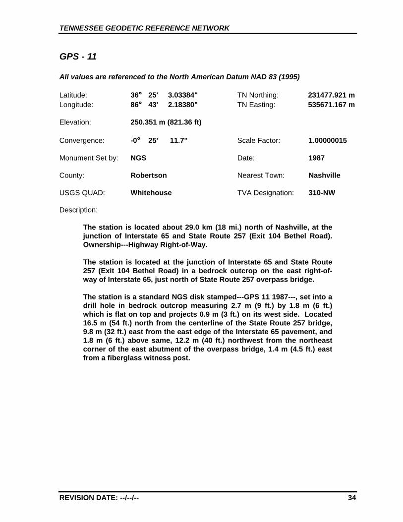
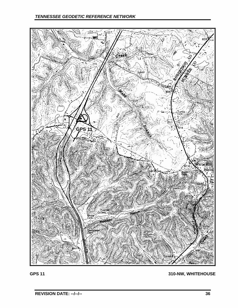
GPS - 11
All values are referenced to the North American Datum NAD 83 (1995)
Latitude: 36°°°° 25' 3.03384" TN Northing: 231477.921 mLongitude: 86°°°° 43' 2.18380" TN Easting: 535671.167 m
Elevation: 250.351 m (821.36 ft)
Convergence: -0°°°° 25' 11.7" Scale Factor: 1.00000015
Monument Set by: NGS Date: 1987
County: Robertson Nearest Town: Nashville
USGS QUAD: Whitehouse TVA Designation: 310-NW
Description:
The station is located about 29.0 km (18 mi.) north of Nashville, at thejunction of Interstate 65 and State Route 257 (Exit 104 Bethel Road).Ownership---Highway Right-of-Way.
The station is located at the junction of Interstate 65 and State Route257 (Exit 104 Bethel Road) in a bedrock outcrop on the east right-of-way of Interstate 65, just north of State Route 257 overpass bridge.
The station is a standard NGS disk stamped---GPS 11 1987---, set into adrill hole in bedrock outcrop measuring 2.7 m (9 ft.) by 1.8 m (6 ft.)which is flat on top and projects 0.9 m (3 ft.) on its west side. Located16.5 m (54 ft.) north from the centerline of the State Route 257 bridge,9.8 m (32 ft.) east from the east edge of the Interstate 65 pavement, and1.8 m (6 ft.) above same, 12.2 m (40 ft.) northwest from the northeastcorner of the east abutment of the overpass bridge, 1.4 m (4.5 ft.) eastfrom a fiberglass witness post.
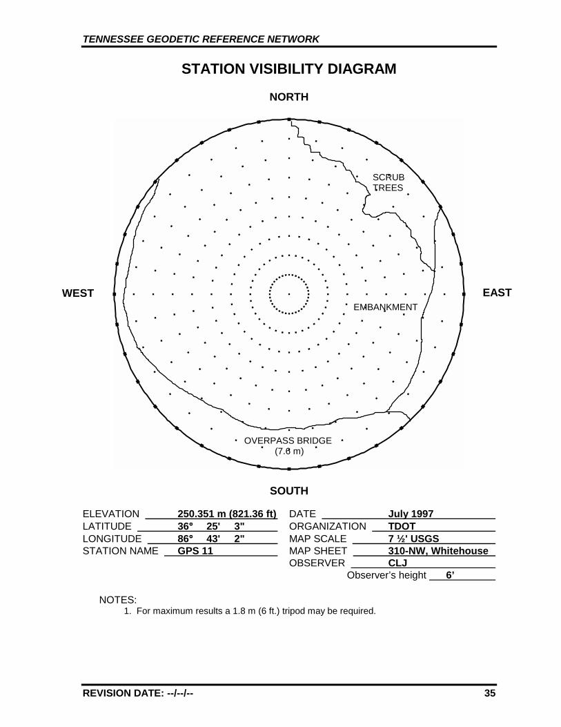
TENNESSEE GEODETIC REFERENCE NETWORK
REVISION DATE: --/--/-- 35
STATION VISIBILITY DIAGRAM
NORTH
SOUTH
ELEVATION 250.351 m (821.36 ft) DATE July 1997 LATITUDE 36°°°° 25' 3" ORGANIZATION TDOT LONGITUDE 86°°°° 43' 2" MAP SCALE 7 ½' USGS STATION NAME GPS 11 MAP SHEET 310-NW, Whitehouse
OBSERVER CLJ Observer’s height 6’
NOTES:1. For maximum results a 1.8 m (6 ft.) tripod may be required.
WEST EAST
SCRUBTREES
OVERPASS BRIDGE(7.6 m)
EMBANKMENT
TENNESSEE GEODETIC REFERENCE NETWORK
REVISION DATE: --/--/-- 36
GPS 11 310-NW, WHITEHOUSE
GPS 11
TENNESSEE GEODETIC REFERENCE NETWORK
REVISION DATE: --/--/-- 37
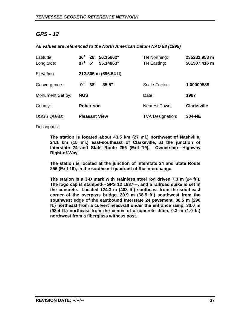
GPS - 12
All values are referenced to the North American Datum NAD 83 (1995)
Latitude: 36°°°° 26' 56.15662" TN Northing: 235281.953 mLongitude: 87°°°° 5' 55.14863" TN Easting: 501507.416 m
Elevation: 212.305 m (696.54 ft)
Convergence: -0°°°° 38' 35.5" Scale Factor: 1.00000588
Monument Set by: NGS Date: 1987
County: Robertson Nearest Town: Clarksville
USGS QUAD: Pleasant View TVA Designation: 304-NE
Description:
The station is located about 43.5 km (27 mi.) northwest of Nashville,24.1 km (15 mi.) east-southeast of Clarksville, at the junction ofInterstate 24 and State Route 256 (Exit 19). Ownership—HighwayRight-of-Way.
The station is located at the junction of Interstate 24 and State Route256 (Exit 19), in the southeast quadrant of the interchange.
The station is a 3-D mark with stainless steel rod driven 7.3 m (24 ft.).The logo cap is stamped---GPS 12 1987---, and a railroad spike is set inthe concrete. Located 124.3 m (408 ft.) southeast from the southeastcorner of the overpass bridge, 20.9 m (68.5 ft.) southwest from thesouthwest edge of the eastbound Interstate 24 pavement, 88.5 m (290ft.) northeast from a culvert headwall under the entrance ramp, 30.0 m(98.4 ft.) northeast from the center of a concrete ditch, 0.3 m (1.0 ft.)northwest from a fiberglass witness post.
TENNESSEE GEODETIC REFERENCE NETWORK
REVISION DATE: --/--/-- 38
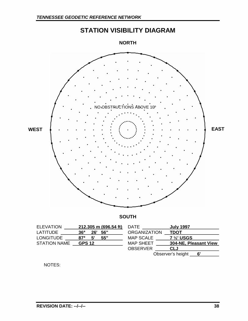
STATION VISIBILITY DIAGRAM
NORTH
SOUTH
ELEVATION 212.305 m (696.54 ft) DATE July 1997 LATITUDE 36°°°° 26' 56" ORGANIZATION TDOT LONGITUDE 87°°°° 5' 55" MAP SCALE 7 ½' USGS STATION NAME GPS 12 MAP SHEET 304-NE, Pleasant View
OBSERVER CLJ Observer’s height 6'
NOTES:
WEST EAST
NO OBSTRUCTIONS ABOVE 10º
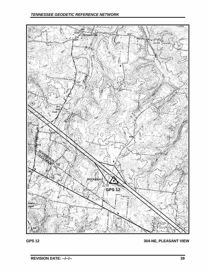
TENNESSEE GEODETIC REFERENCE NETWORK
REVISION DATE: --/--/-- 39
GPS 12 304-NE, PLEASANT VIEW
GPS 12
TENNESSEE GEODETIC REFERENCE NETWORK
REVISION DATE: --/--/-- 40
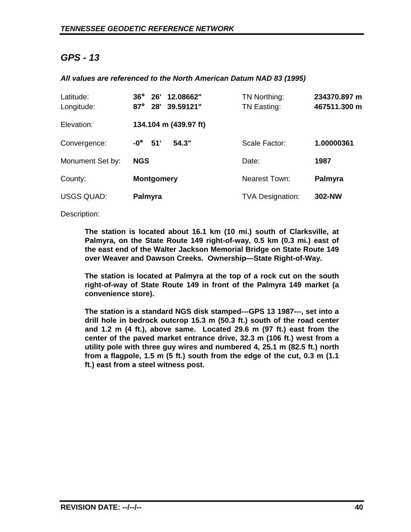
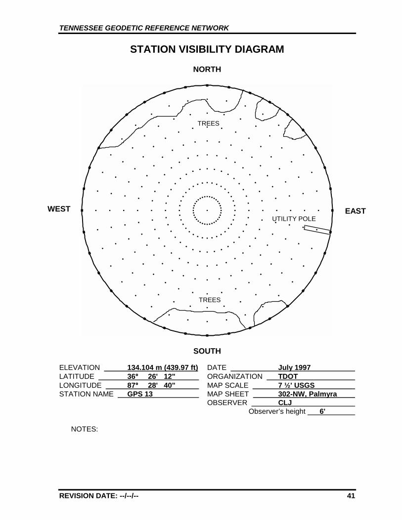
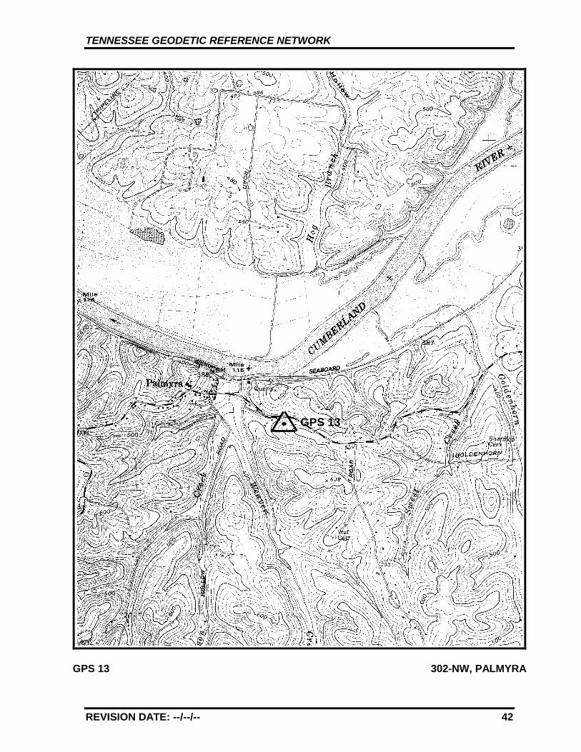
GPS - 13
All values are referenced to the North American Datum NAD 83 (1995)
Latitude: 36°°°° 26' 12.08662" TN Northing: 234370.897 mLongitude: 87°°°° 28' 39.59121" TN Easting: 467511.300 m
Elevation: 134.104 m (439.97 ft)
Convergence: -0°°°° 51' 54.3" Scale Factor: 1.00000361
Monument Set by: NGS Date: 1987
County: Montgomery Nearest Town: Palmyra
USGS QUAD: Palmyra TVA Designation: 302-NW
Description:
The station is located about 16.1 km (10 mi.) south of Clarksville, atPalmyra, on the State Route 149 right-of-way, 0.5 km (0.3 mi.) east ofthe east end of the Walter Jackson Memorial Bridge on State Route 149over Weaver and Dawson Creeks. Ownership—State Right-of-Way.
The station is located at Palmyra at the top of a rock cut on the southright-of-way of State Route 149 in front of the Palmyra 149 market (aconvenience store).
The station is a standard NGS disk stamped---GPS 13 1987---, set into adrill hole in bedrock outcrop 15.3 m (50.3 ft.) south of the road centerand 1.2 m (4 ft.), above same. Located 29.6 m (97 ft.) east from thecenter of the paved market entrance drive, 32.3 m (106 ft.) west from autility pole with three guy wires and numbered 4, 25.1 m (82.5 ft.) northfrom a flagpole, 1.5 m (5 ft.) south from the edge of the cut, 0.3 m (1.1ft.) east from a steel witness post.
TENNESSEE GEODETIC REFERENCE NETWORK
REVISION DATE: --/--/-- 41
STATION VISIBILITY DIAGRAM
NORTH
SOUTH
ELEVATION 134.104 m (439.97 ft) DATE July 1997 LATITUDE 36°°°° 26' 12" ORGANIZATION TDOT LONGITUDE 87°°°° 28' 40" MAP SCALE 7 ½' USGS STATION NAME GPS 13 MAP SHEET 302-NW, Palmyra
OBSERVER CLJ Observer’s height 6'
NOTES:
WEST EAST
TREES
UTILITY POLE
TREES
TENNESSEE GEODETIC REFERENCE NETWORK
REVISION DATE: --/--/-- 42
GPS 13 302-NW, PALMYRA
GPS 13

TENNESSEE GEODETIC REFERENCE NETWORK
REVISION DATE: --/--/-- 43
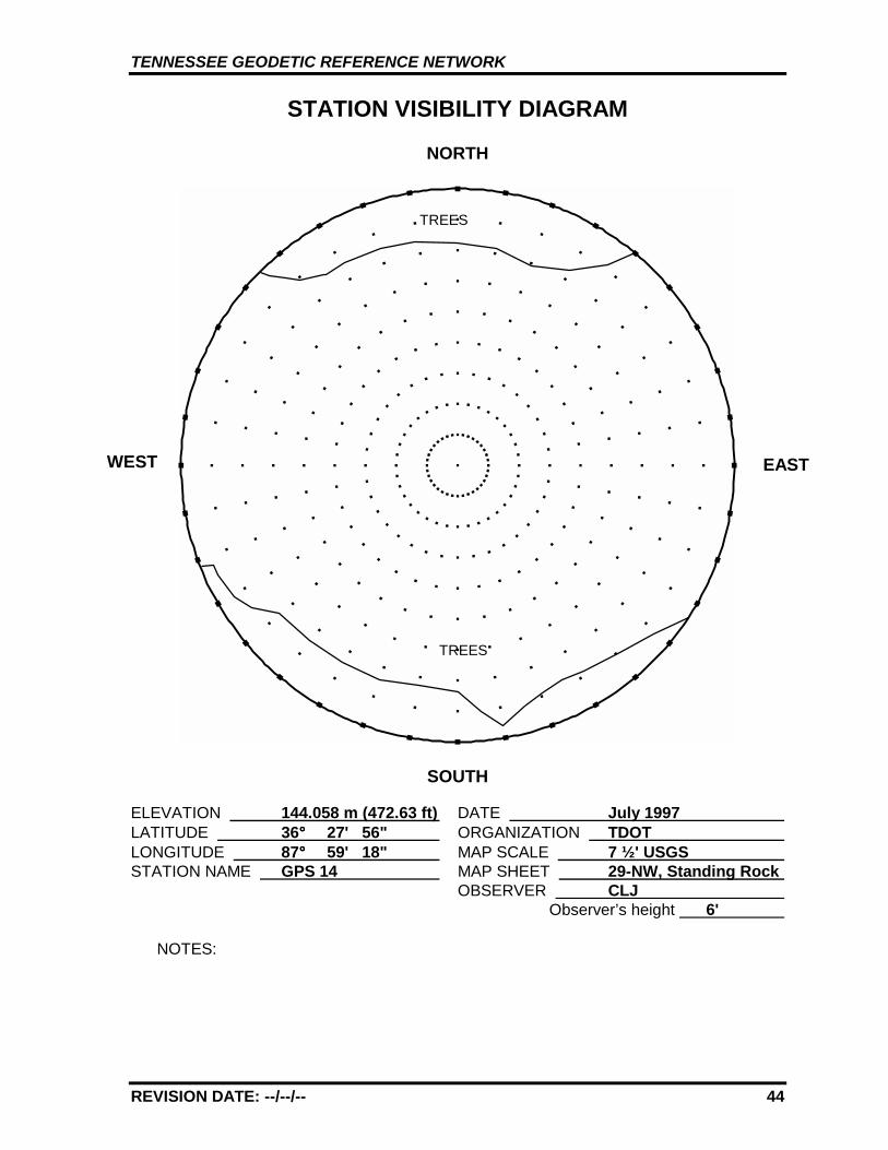
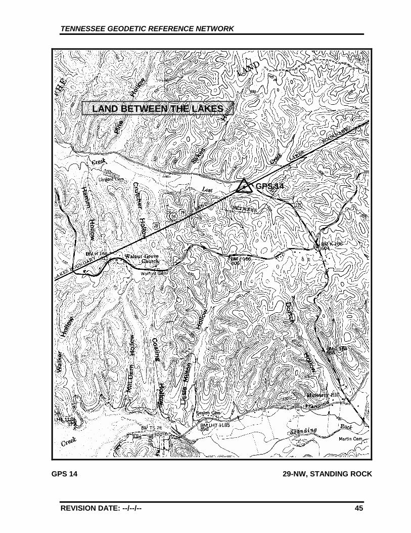
GPS - 14
All values are referenced to the North American Datum NAD 83 (1995)
Latitude: 36°°°° 27' 55.87137" TN Northing: 238379.917 mLongitude: 87°°°° 59' 17.61954" TN Easting: 421804.201 m
Elevation: 144.058 m (472.63 ft)
Convergence: -1°°°° 9' 50.4" Scale Factor: 1.00000903
Monument Set by: NGS Date: 1987
County: Stewart Nearest Town: Dover
USGS QUAD: Standing Rock TVA Designation: 29-NW
Description:
The station is located about 35.4 km (22 mi.) northeast of Paris, 12.9 km(8 mi.) west of Dover, at the junction of State Route 232 and U.S.Highway 79. Ownership—Highway Right-of-Way.
The station is located at the junction of State Route 232 and U.S.Highway 79, in the grass median of U.S. Highway 79 just west of thejunction.
The station is a 3-D mark with stainless steel rod driven 5.8 m (19 ft.).The logo cap is stamped---GPS 14 1987---, and a steel spike isembedded in the concrete. Located 25.0 m (82 ft.) west from the centerof the road junction, 16.0 m (52.5 ft.) west from the east end of thegrass median, 2.4 m (7.8 ft.) south from the north edge of the median,0.3 m (1.0 ft.) south from a fiberglass witness post, 0.5 m (1.5 ft.) abovethe road surface.
TENNESSEE GEODETIC REFERENCE NETWORK
REVISION DATE: --/--/-- 44
STATION VISIBILITY DIAGRAM
NORTH
SOUTH
ELEVATION 144.058 m (472.63 ft) DATE July 1997 LATITUDE 36°°°° 27' 56" ORGANIZATION TDOT LONGITUDE 87°°°° 59' 18" MAP SCALE 7 ½' USGS STATION NAME GPS 14 MAP SHEET 29-NW, Standing Rock
OBSERVER CLJ Observer’s height 6'
NOTES:
WEST EAST
TREES
TREES
TENNESSEE GEODETIC REFERENCE NETWORK
REVISION DATE: --/--/-- 45
GPS 14 29-NW, STANDING ROCK
GPS 14
LAND BETWEEN THE LAKES
TENNESSEE GEODETIC REFERENCE NETWORK
REVISION DATE: --/--/-- 46
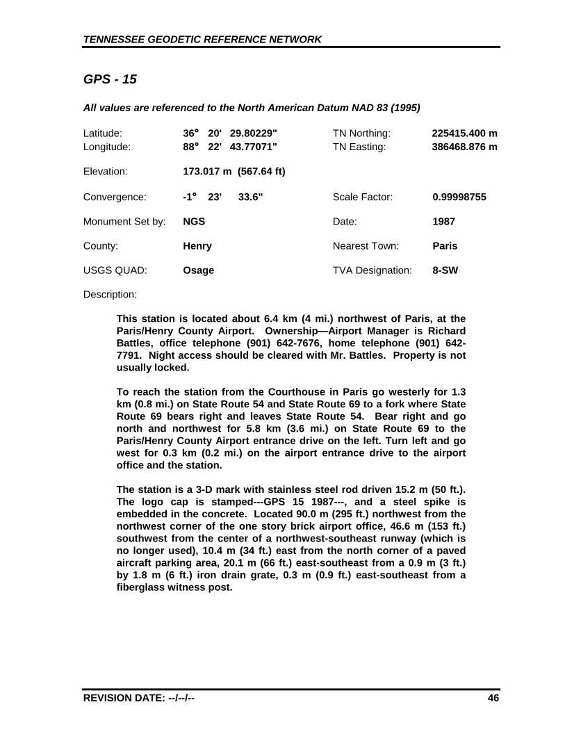
GPS - 15
All values are referenced to the North American Datum NAD 83 (1995)
Latitude: 36°°°° 20' 29.80229" TN Northing: 225415.400 mLongitude: 88°°°° 22' 43.77071" TN Easting: 386468.876 m
Elevation: 173.017 m (567.64 ft)
Convergence: -1°°°° 23' 33.6" Scale Factor: 0.99998755
Monument Set by: NGS Date: 1987
County: Henry Nearest Town: Paris
USGS QUAD: Osage TVA Designation: 8-SW
Description:
This station is located about 6.4 km (4 mi.) northwest of Paris, at theParis/Henry County Airport. Ownership—Airport Manager is RichardBattles, office telephone (901) 642-7676, home telephone (901) 642-7791. Night access should be cleared with Mr. Battles. Property is notusually locked.
To reach the station from the Courthouse in Paris go westerly for 1.3km (0.8 mi.) on State Route 54 and State Route 69 to a fork where StateRoute 69 bears right and leaves State Route 54. Bear right and gonorth and northwest for 5.8 km (3.6 mi.) on State Route 69 to theParis/Henry County Airport entrance drive on the left. Turn left and gowest for 0.3 km (0.2 mi.) on the airport entrance drive to the airportoffice and the station.
The station is a 3-D mark with stainless steel rod driven 15.2 m (50 ft.).The logo cap is stamped---GPS 15 1987---, and a steel spike isembedded in the concrete. Located 90.0 m (295 ft.) northwest from thenorthwest corner of the one story brick airport office, 46.6 m (153 ft.)southwest from the center of a northwest-southeast runway (which isno longer used), 10.4 m (34 ft.) east from the north corner of a pavedaircraft parking area, 20.1 m (66 ft.) east-southeast from a 0.9 m (3 ft.)by 1.8 m (6 ft.) iron drain grate, 0.3 m (0.9 ft.) east-southeast from afiberglass witness post.
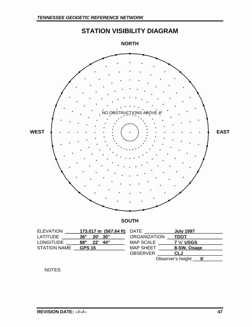
TENNESSEE GEODETIC REFERENCE NETWORK
REVISION DATE: --/--/-- 47
STATION VISIBILITY DIAGRAM
NORTH
SOUTH
ELEVATION 173.017 m (567.64 ft) DATE July 1997 LATITUDE 36°°°° 20' 30" ORGANIZATION TDOT LONGITUDE 88°°°° 22' 44" MAP SCALE 7 ½' USGS STATION NAME GPS 15 MAP SHEET 8-SW, Osage
OBSERVER CLJ Observer’s height 6'
NOTES:
WEST EAST
NO OBSTRUCTIONS ABOVE 4º
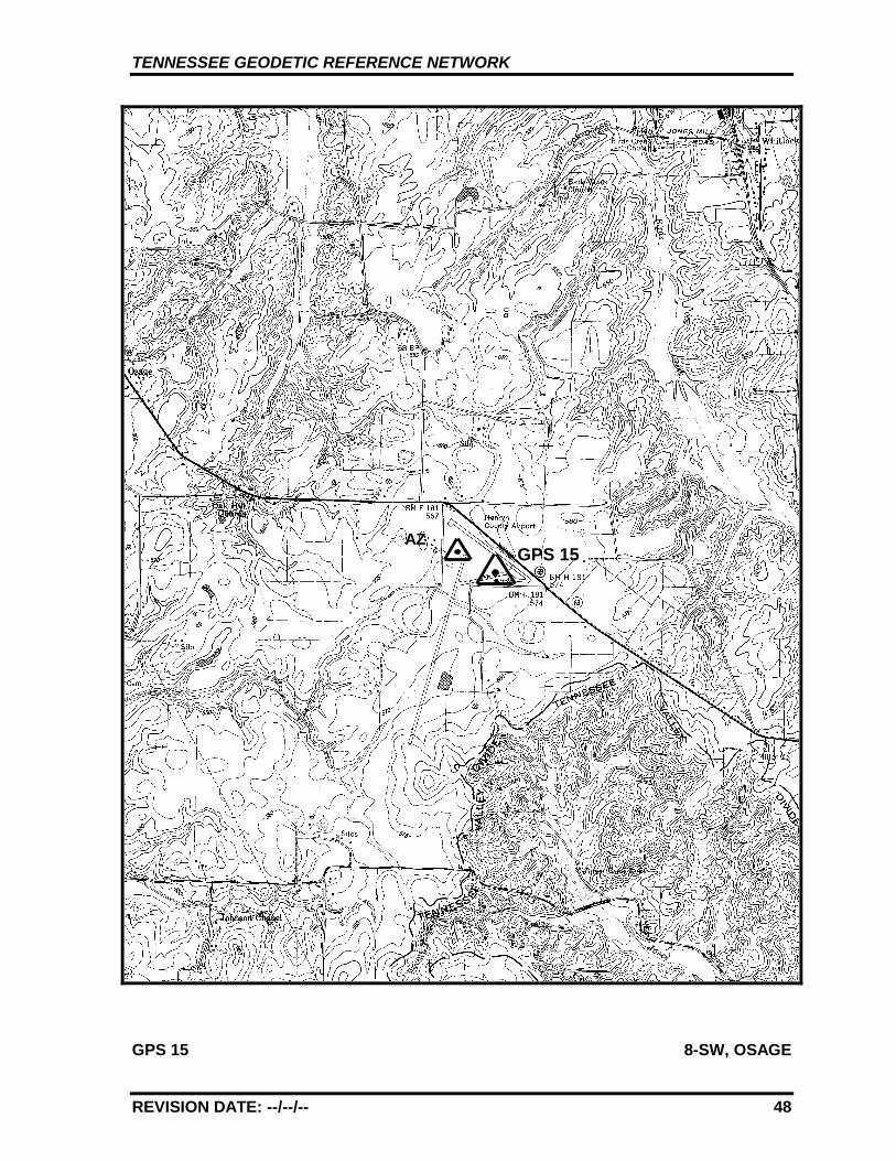
TENNESSEE GEODETIC REFERENCE NETWORK
REVISION DATE: --/--/-- 48
GPS 15 8-SW, OSAGE
GPS 15AZ
TENNESSEE GEODETIC REFERENCE NETWORK
REVISION DATE: --/--/-- 49
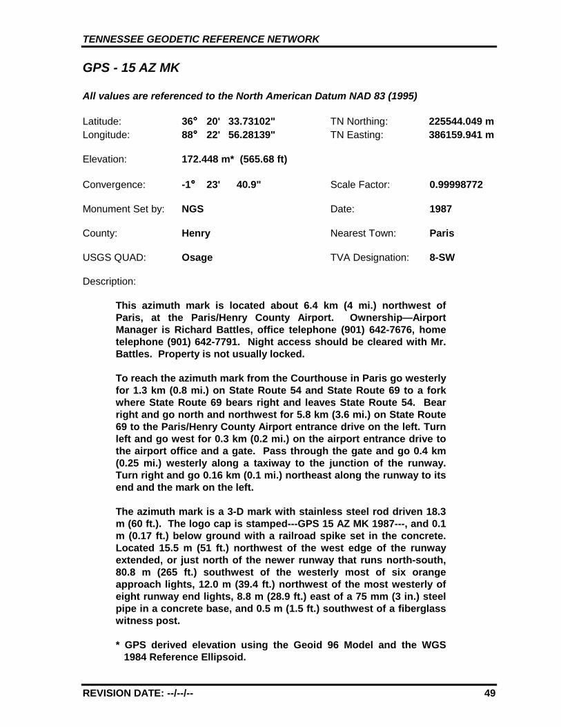
GPS - 15 AZ MK
All values are referenced to the North American Datum NAD 83 (1995)
Latitude: 36°°°° 20' 33.73102" TN Northing: 225544.049 mLongitude: 88°°°° 22' 56.28139" TN Easting: 386159.941 m
Elevation: 172.448 m* (565.68 ft)
Convergence: -1°°°° 23' 40.9" Scale Factor: 0.99998772
Monument Set by: NGS Date: 1987
County: Henry Nearest Town: Paris
USGS QUAD: Osage TVA Designation: 8-SW
Description:
This azimuth mark is located about 6.4 km (4 mi.) northwest ofParis, at the Paris/Henry County Airport. Ownership—AirportManager is Richard Battles, office telephone (901) 642-7676, hometelephone (901) 642-7791. Night access should be cleared with Mr.Battles. Property is not usually locked.
To reach the azimuth mark from the Courthouse in Paris go westerlyfor 1.3 km (0.8 mi.) on State Route 54 and State Route 69 to a forkwhere State Route 69 bears right and leaves State Route 54. Bearright and go north and northwest for 5.8 km (3.6 mi.) on State Route69 to the Paris/Henry County Airport entrance drive on the left. Turnleft and go west for 0.3 km (0.2 mi.) on the airport entrance drive tothe airport office and a gate. Pass through the gate and go 0.4 km(0.25 mi.) westerly along a taxiway to the junction of the runway.Turn right and go 0.16 km (0.1 mi.) northeast along the runway to itsend and the mark on the left.
The azimuth mark is a 3-D mark with stainless steel rod driven 18.3m (60 ft.). The logo cap is stamped---GPS 15 AZ MK 1987---, and 0.1m (0.17 ft.) below ground with a railroad spike set in the concrete.Located 15.5 m (51 ft.) northwest of the west edge of the runwayextended, or just north of the newer runway that runs north-south,80.8 m (265 ft.) southwest of the westerly most of six orangeapproach lights, 12.0 m (39.4 ft.) northwest of the most westerly ofeight runway end lights, 8.8 m (28.9 ft.) east of a 75 mm (3 in.) steelpipe in a concrete base, and 0.5 m (1.5 ft.) southwest of a fiberglasswitness post.
* GPS derived elevation using the Geoid 96 Model and the WGS1984 Reference Ellipsoid.
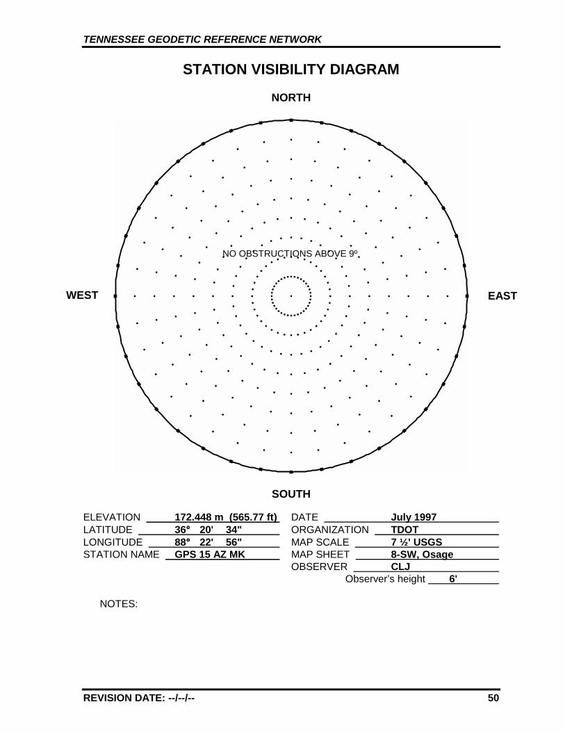
TENNESSEE GEODETIC REFERENCE NETWORK
REVISION DATE: --/--/-- 50
STATION VISIBILITY DIAGRAM
NORTH
SOUTH
ELEVATION 172.448 m (565.77 ft) DATE July 1997 LATITUDE 36°°°° 20' 34" ORGANIZATION TDOT LONGITUDE 88°°°° 22' 56" MAP SCALE 7 ½' USGS STATION NAME GPS 15 AZ MK MAP SHEET 8-SW, Osage
OBSERVER CLJ Observer’s height 6'
NOTES:
WEST EAST
NO OBSTRUCTIONS ABOVE 9º

TENNESSEE GEODETIC REFERENCE NETWORK
REVISION DATE: --/--/-- 51
GPS 15 8-SW, OSAGE
GPS 15AZ
TENNESSEE GEODETIC REFERENCE NETWORK
REVISION DATE: --/--/-- 52
GPS - 16
All values are referenced to the North American Datum NAD 83 (1995)
Latitude: 36°°°° 18' 40.14105" TN Northing: 222961.771 mLongitude: 88°°°° 46' 14.11174" TN Easting: 351216.147 m
Elevation: 123.814 m (406.21 ft)
Convergence: -1°°°° 37' 19.2" Scale Factor: 0.99998299
Monument Set by: NGS Date: 1987
County: Weakley Nearest Town: Dresden
USGS QUAD: Martin TVA Designation: 435-SE
Description:
The station is located about 6.4 km (4 mi.) northwest of Dresden, 8.0 km(5 mi.) southeast of Martin, on the southwest right-of-way of StateRoute 22. Ownership—State Right-of-Way.
To reach the station from the U.S. Post Office in Martin go northerly for0.08 km (0.05 mi.) on State Route 431 (Central St.) to the junction ofMain St. Turn right across railroad tracks and go easterly 4.6 km (2.85mi.) still on State Route 431 (Main St.) to an overpass bridge and thejunction of State Route 22. Continue straight ahead and go southeastfor 3.2 km (2.0 mi.) now on State Route 22 to a crossroad near AdamsChapel and the station 0.2 km (0.1 mi.) southeast of the junction on theright.
The station is a 3-D mark with stainless steel rod driven 5.5 m (18 ft.).The logo cap is stamped---GPS 16 1987---, and a steel spike isembedded in the concrete. Located 12.0 m (39.5 ft.) southwest from thesouthwest edge of the pavement, 63.9 m (210 ft.) northwest from a milemarker numbered 17, 9.8 m (32 ft.) northwest from the southwestcorner of a paved field entrance road, 4.9 m (16 ft.) west from thenorthwest end of a concrete drain inlet, 8.8 m ( 29 ft.) north-northwestfrom a underground optical cable warning post, 0.4 m (1.2 ft.) northeastfrom a fiberglass witness post.
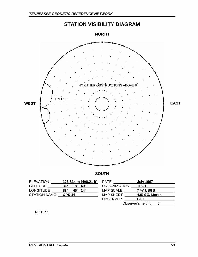
TENNESSEE GEODETIC REFERENCE NETWORK
REVISION DATE: --/--/-- 53
STATION VISIBILITY DIAGRAM
NORTH
SOUTH
ELEVATION 123.814 m (406.21 ft) DATE July 1997 LATITUDE 36°°°° 18' 40" ORGANIZATION TDOT LONGITUDE 88°°°° 46' 14" MAP SCALE 7 ½' USGS STATION NAME GPS 16 MAP SHEET 435-SE, Martin
OBSERVER CLJ Observer’s height 6'
NOTES:
WEST
NO OTHER OBSTRUCTIONS ABOVE 8º
TREESEAST
TENNESSEE GEODETIC REFERENCE NETWORK
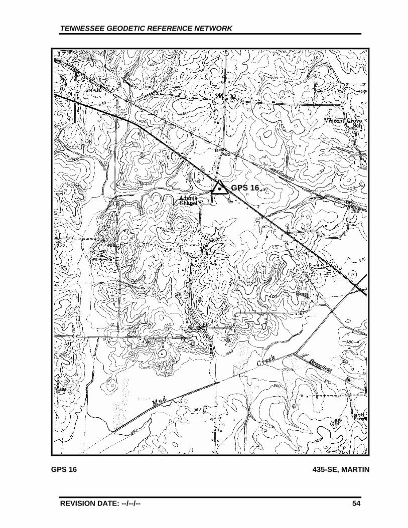
REVISION DATE: --/--/-- 54
GPS 16 435-SE, MARTIN
GPS 16
TENNESSEE GEODETIC REFERENCE NETWORK
REVISION DATE: --/--/-- 55
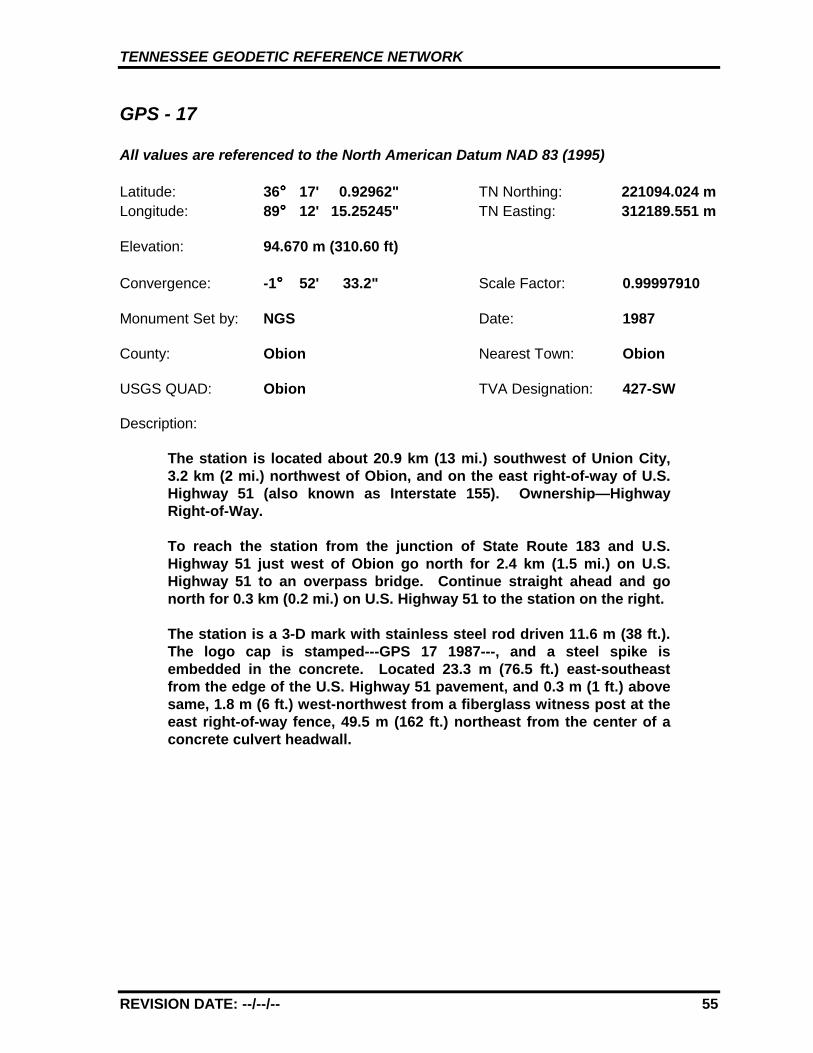
GPS - 17
All values are referenced to the North American Datum NAD 83 (1995)
Latitude: 36°°°° 17' 0.92962" TN Northing: 221094.024 mLongitude: 89°°°° 12' 15.25245" TN Easting: 312189.551 m
Elevation: 94.670 m (310.60 ft)
Convergence: -1°°°° 52' 33.2" Scale Factor: 0.99997910
Monument Set by: NGS Date: 1987
County: Obion Nearest Town: Obion
USGS QUAD: Obion TVA Designation: 427-SW
Description:
The station is located about 20.9 km (13 mi.) southwest of Union City,3.2 km (2 mi.) northwest of Obion, and on the east right-of-way of U.S.Highway 51 (also known as Interstate 155). Ownership—HighwayRight-of-Way.
To reach the station from the junction of State Route 183 and U.S.Highway 51 just west of Obion go north for 2.4 km (1.5 mi.) on U.S.Highway 51 to an overpass bridge. Continue straight ahead and gonorth for 0.3 km (0.2 mi.) on U.S. Highway 51 to the station on the right.
The station is a 3-D mark with stainless steel rod driven 11.6 m (38 ft.).The logo cap is stamped---GPS 17 1987---, and a steel spike isembedded in the concrete. Located 23.3 m (76.5 ft.) east-southeastfrom the edge of the U.S. Highway 51 pavement, and 0.3 m (1 ft.) abovesame, 1.8 m (6 ft.) west-northwest from a fiberglass witness post at theeast right-of-way fence, 49.5 m (162 ft.) northeast from the center of aconcrete culvert headwall.
TENNESSEE GEODETIC REFERENCE NETWORK
REVISION DATE: --/--/-- 56
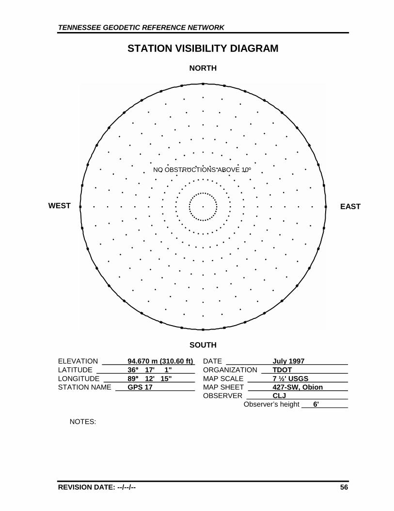
STATION VISIBILITY DIAGRAM
NORTH
SOUTH
ELEVATION 94.670 m (310.60 ft) DATE July 1997 LATITUDE 36°°°° 17' 1" ORGANIZATION TDOT LONGITUDE 89°°°° 12' 15" MAP SCALE 7 ½' USGS STATION NAME GPS 17 MAP SHEET 427-SW, Obion
OBSERVER CLJ Observer’s height 6'
NOTES:
WEST EAST
NO OBSTRUCTIONS ABOVE 10º
TENNESSEE GEODETIC REFERENCE NETWORK
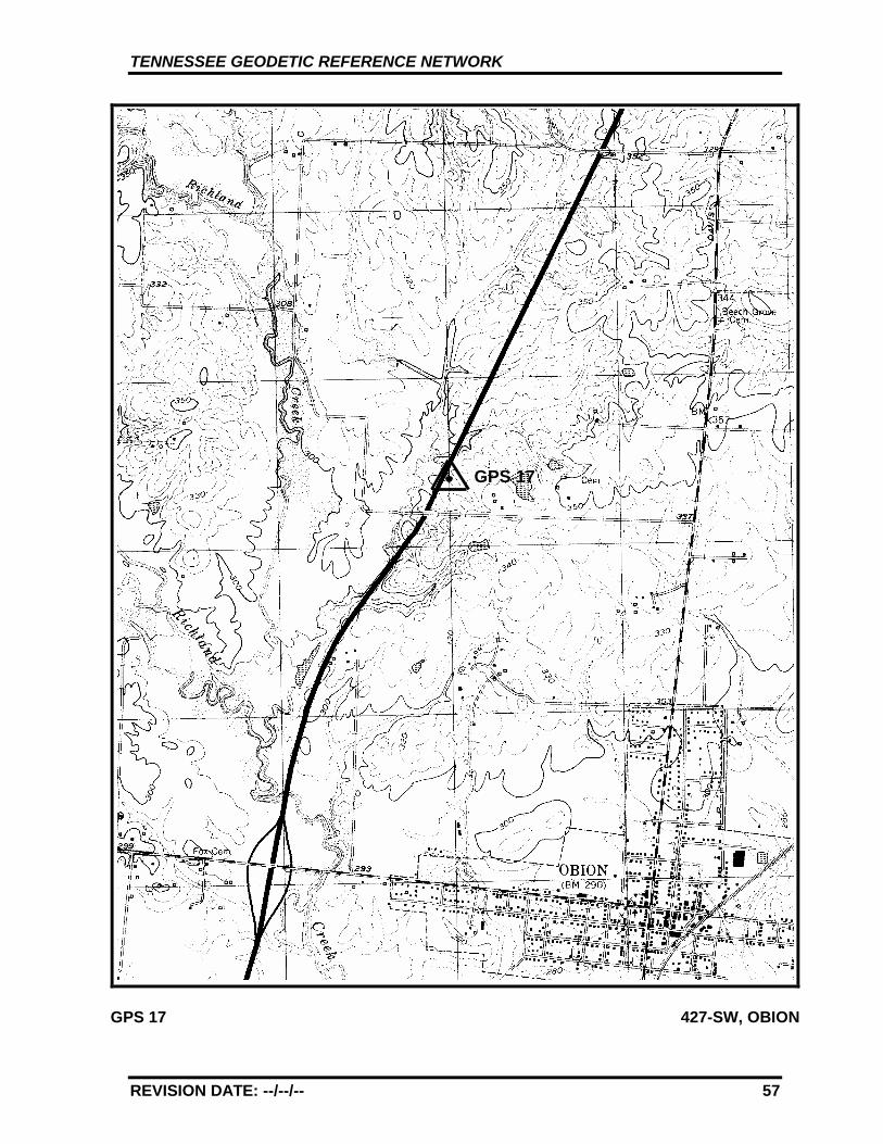
REVISION DATE: --/--/-- 57
GPS 17 427-SW, OBION
GPS 17
TENNESSEE GEODETIC REFERENCE NETWORK
REVISION DATE: --/--/-- 58
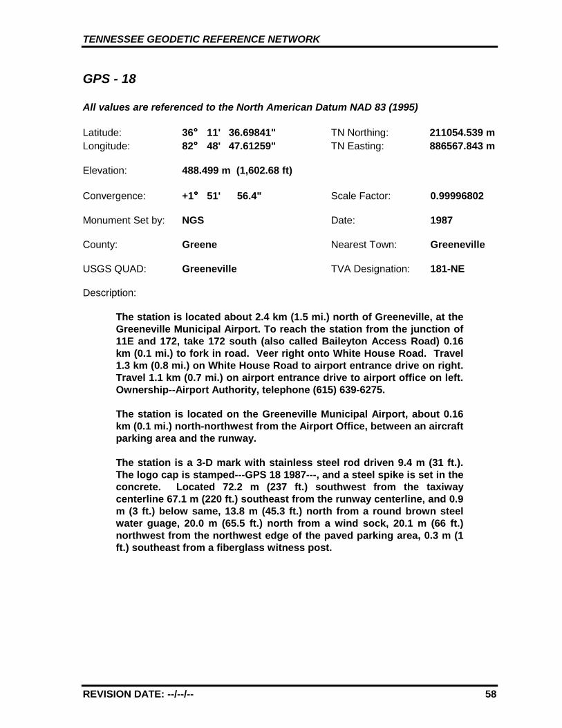
GPS - 18
All values are referenced to the North American Datum NAD 83 (1995)
Latitude: 36°°°° 11' 36.69841" TN Northing: 211054.539 mLongitude: 82°°°° 48' 47.61259" TN Easting: 886567.843 m
Elevation: 488.499 m (1,602.68 ft)
Convergence: +1°°°° 51' 56.4" Scale Factor: 0.99996802
Monument Set by: NGS Date: 1987
County: Greene Nearest Town: Greeneville
USGS QUAD: Greeneville TVA Designation: 181-NE
Description:
The station is located about 2.4 km (1.5 mi.) north of Greeneville, at theGreeneville Municipal Airport. To reach the station from the junction of11E and 172, take 172 south (also called Baileyton Access Road) 0.16km (0.1 mi.) to fork in road. Veer right onto White House Road. Travel1.3 km (0.8 mi.) on White House Road to airport entrance drive on right.Travel 1.1 km (0.7 mi.) on airport entrance drive to airport office on left.Ownership--Airport Authority, telephone (615) 639-6275.
The station is located on the Greeneville Municipal Airport, about 0.16km (0.1 mi.) north-northwest from the Airport Office, between an aircraftparking area and the runway.
The station is a 3-D mark with stainless steel rod driven 9.4 m (31 ft.).The logo cap is stamped---GPS 18 1987---, and a steel spike is set in theconcrete. Located 72.2 m (237 ft.) southwest from the taxiwaycenterline 67.1 m (220 ft.) southeast from the runway centerline, and 0.9m (3 ft.) below same, 13.8 m (45.3 ft.) north from a round brown steelwater guage, 20.0 m (65.5 ft.) north from a wind sock, 20.1 m (66 ft.)northwest from the northwest edge of the paved parking area, 0.3 m (1ft.) southeast from a fiberglass witness post.
TENNESSEE GEODETIC REFERENCE NETWORK
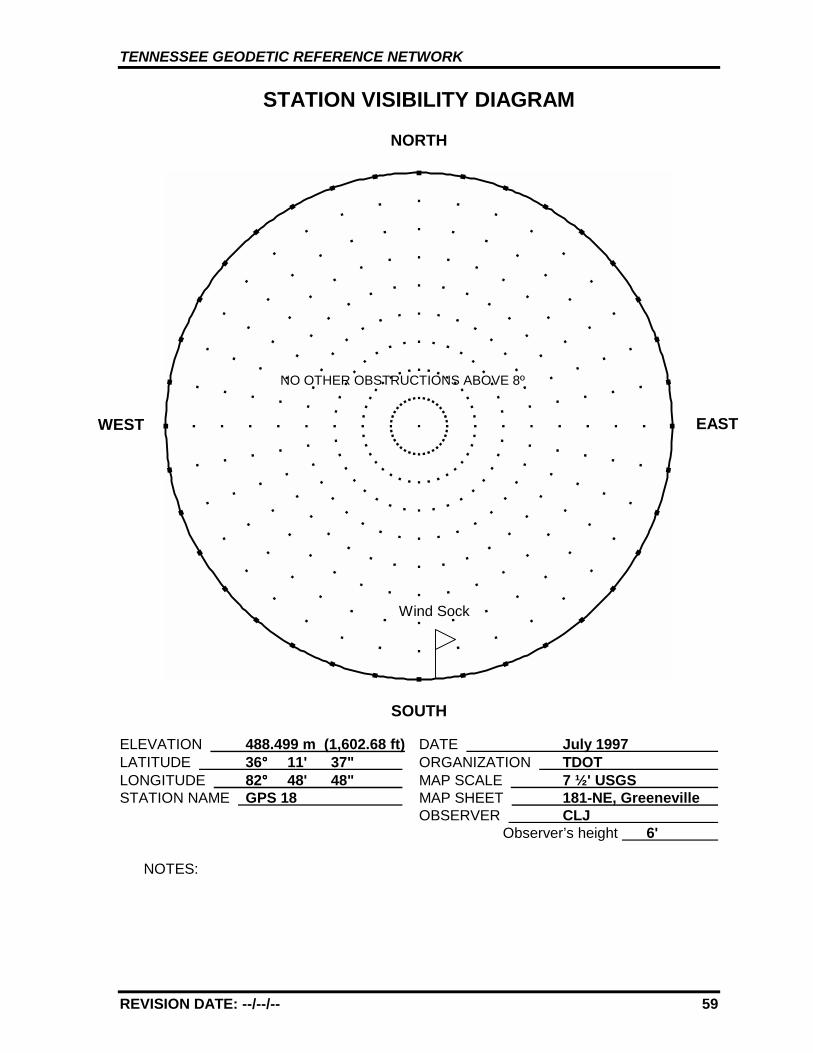
REVISION DATE: --/--/-- 59
STATION VISIBILITY DIAGRAM
NORTH
SOUTH
ELEVATION 488.499 m (1,602.68 ft) DATE July 1997 LATITUDE 36°°°° 11' 37" ORGANIZATION TDOT LONGITUDE 82°°°° 48' 48" MAP SCALE 7 ½' USGS STATION NAME GPS 18 MAP SHEET 181-NE, Greeneville
OBSERVER CLJ Observer’s height 6'
NOTES:
WEST EAST
Wind Sock
NO OTHER OBSTRUCTIONS ABOVE 8º

TENNESSEE GEODETIC REFERENCE NETWORK
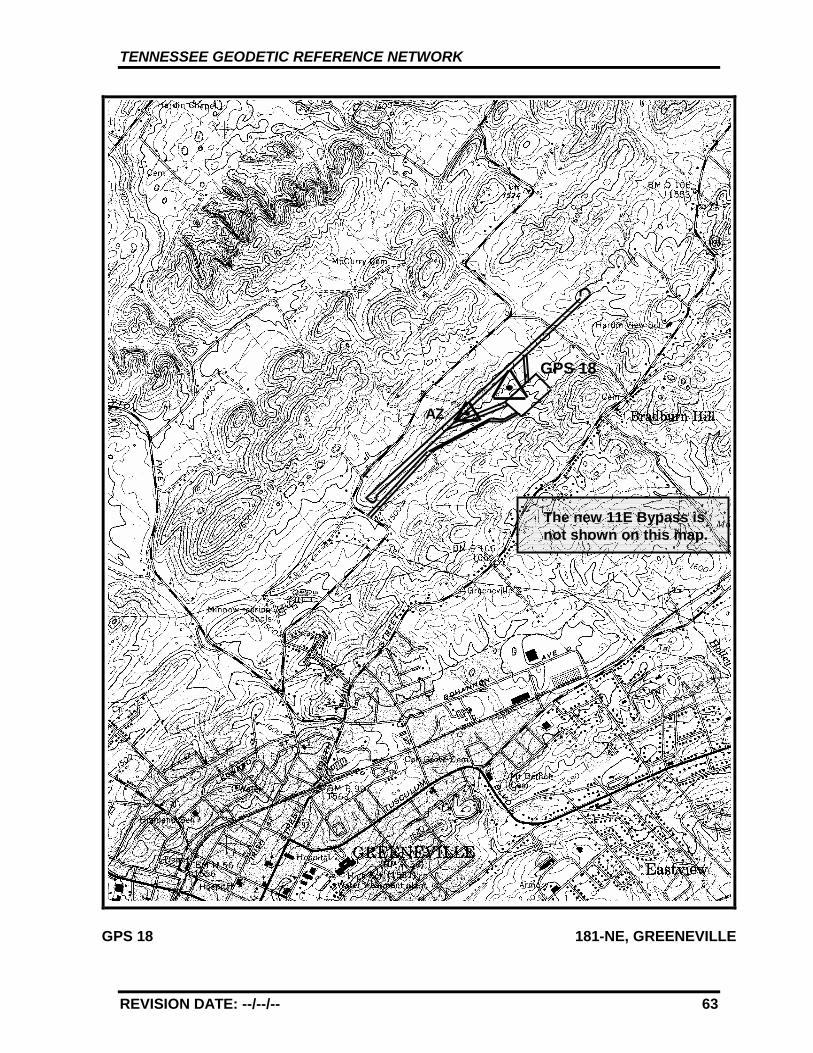
REVISION DATE: --/--/-- 60
GPS 18 181-NE, GREENEVILLE
GPS 18
AZ
The new 11E Bypass isnot shown on this map.
TENNESSEE GEODETIC REFERENCE NETWORK
REVISION DATE: --/--/-- 61
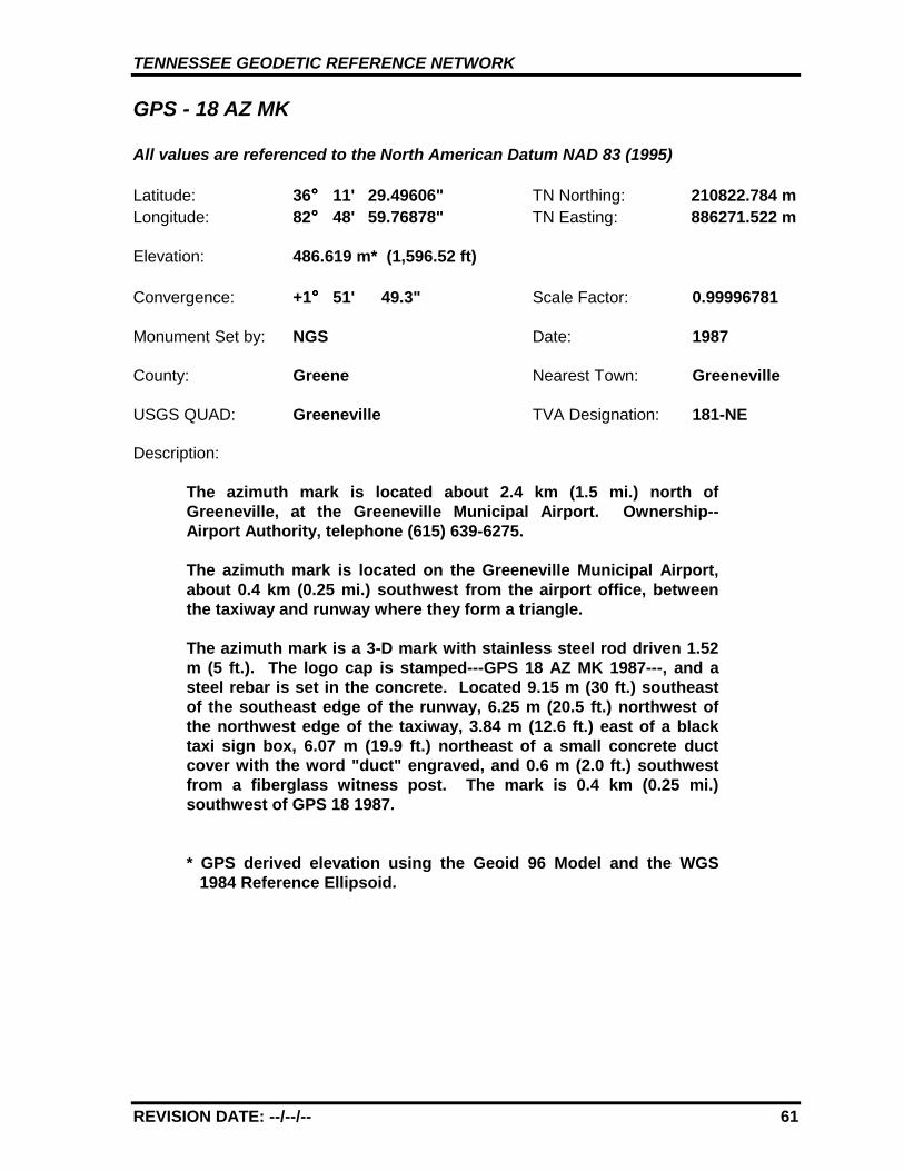
GPS - 18 AZ MK
All values are referenced to the North American Datum NAD 83 (1995)
Latitude: 36°°°° 11' 29.49606" TN Northing: 210822.784 mLongitude: 82°°°° 48' 59.76878" TN Easting: 886271.522 m
Elevation: 486.619 m* (1,596.52 ft)
Convergence: +1°°°° 51' 49.3" Scale Factor: 0.99996781
Monument Set by: NGS Date: 1987
County: Greene Nearest Town: Greeneville
USGS QUAD: Greeneville TVA Designation: 181-NE
Description:
The azimuth mark is located about 2.4 km (1.5 mi.) north ofGreeneville, at the Greeneville Municipal Airport. Ownership--Airport Authority, telephone (615) 639-6275.
The azimuth mark is located on the Greeneville Municipal Airport,about 0.4 km (0.25 mi.) southwest from the airport office, betweenthe taxiway and runway where they form a triangle.
The azimuth mark is a 3-D mark with stainless steel rod driven 1.52m (5 ft.). The logo cap is stamped---GPS 18 AZ MK 1987---, and asteel rebar is set in the concrete. Located 9.15 m (30 ft.) southeastof the southeast edge of the runway, 6.25 m (20.5 ft.) northwest ofthe northwest edge of the taxiway, 3.84 m (12.6 ft.) east of a blacktaxi sign box, 6.07 m (19.9 ft.) northeast of a small concrete ductcover with the word "duct" engraved, and 0.6 m (2.0 ft.) southwestfrom a fiberglass witness post. The mark is 0.4 km (0.25 mi.)southwest of GPS 18 1987.
* GPS derived elevation using the Geoid 96 Model and the WGS1984 Reference Ellipsoid.
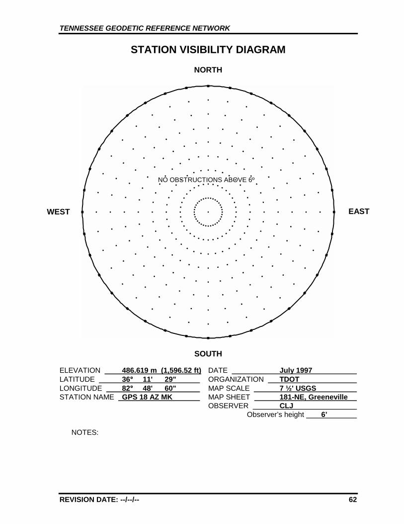
TENNESSEE GEODETIC REFERENCE NETWORK
REVISION DATE: --/--/-- 62
STATION VISIBILITY DIAGRAM
NORTH
SOUTH
ELEVATION 486.619 m (1,596.52 ft) DATE July 1997 LATITUDE 36°°°° 11' 29" ORGANIZATION TDOT LONGITUDE 82°°°° 48' 60" MAP SCALE 7 ½' USGS STATION NAME GPS 18 AZ MK MAP SHEET 181-NE, Greeneville
OBSERVER CLJ Observer’s height 6’
NOTES:
WEST EAST
NO OBSTRUCTIONS ABOVE 6º
TENNESSEE GEODETIC REFERENCE NETWORK
REVISION DATE: --/--/-- 63
GPS 18 181-NE, GREENEVILLE
GPS 18
AZ
The new 11E Bypass isnot shown on this map.
TENNESSEE GEODETIC REFERENCE NETWORK
REVISION DATE: --/--/-- 64
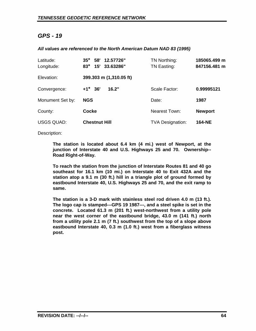
GPS - 19
All values are referenced to the North American Datum NAD 83 (1995)
Latitude: 35°°°° 58' 12.57726" TN Northing: 185065.499 mLongitude: 83°°°° 15' 33.63286" TN Easting: 847156.481 m
Elevation: 399.303 m (1,310.05 ft)
Convergence: +1°°°° 36' 16.2" Scale Factor: 0.99995121
Monument Set by: NGS Date: 1987
County: Cocke Nearest Town: Newport
USGS QUAD: Chestnut Hill TVA Designation: 164-NE
Description:
The station is located about 6.4 km (4 mi.) west of Newport, at thejunction of Interstate 40 and U.S. Highways 25 and 70. Ownership--Road Right-of-Way.
To reach the station from the junction of Interstate Routes 81 and 40 gosoutheast for 16.1 km (10 mi.) on Interstate 40 to Exit 432A and thestation atop a 9.1 m (30 ft.) hill in a triangle plot of ground formed byeastbound Interstate 40, U.S. Highways 25 and 70, and the exit ramp tosame.
The station is a 3-D mark with stainless steel rod driven 4.0 m (13 ft.).The logo cap is stamped---GPS 19 1987---, and a steel spike is set in theconcrete. Located 61.3 m (201 ft.) west-northwest from a utility polenear the west corner of the eastbound bridge, 43.0 m (141 ft.) northfrom a utility pole 2.1 m (7 ft.) southwest from the top of a slope aboveeastbound Interstate 40, 0.3 m (1.0 ft.) west from a fiberglass witnesspost.
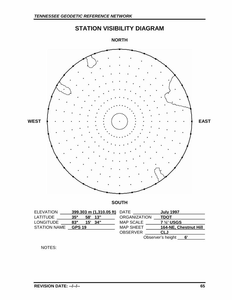
TENNESSEE GEODETIC REFERENCE NETWORK
REVISION DATE: --/--/-- 65
STATION VISIBILITY DIAGRAM
NORTH
SOUTH
ELEVATION 399.303 m (1,310.05 ft) DATE July 1997 LATITUDE 35°°°° 58' 13" ORGANIZATION TDOT LONGITUDE 83°°°° 15' 34" MAP SCALE 7 ½' USGS STATION NAME GPS 19 MAP SHEET 164-NE, Chestnut Hill
OBSERVER CLJ Observer’s height 6'
NOTES:
WEST EAST
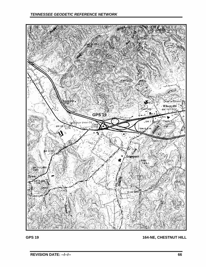
TENNESSEE GEODETIC REFERENCE NETWORK
REVISION DATE: --/--/-- 66
GPS 19 164-NE, CHESTNUT HILL
GPS 19
TENNESSEE GEODETIC REFERENCE NETWORK
REVISION DATE: --/--/-- 67
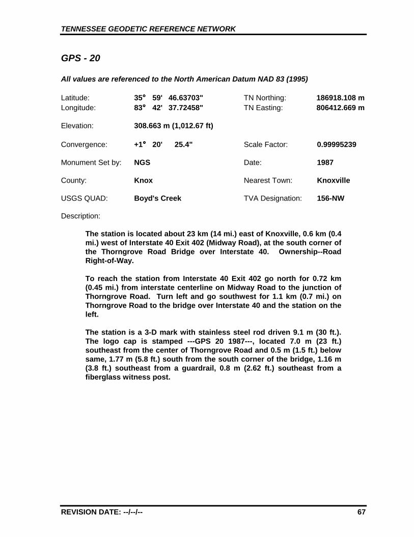
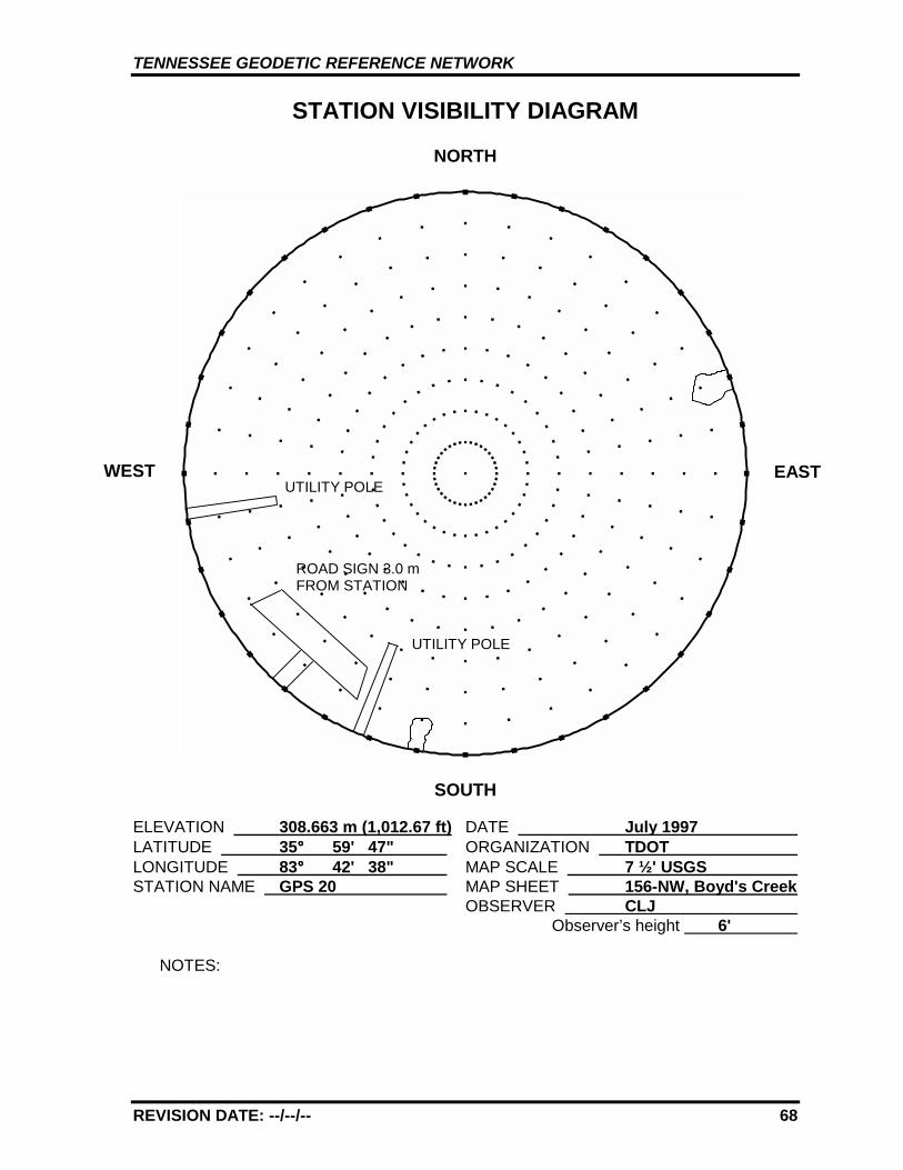
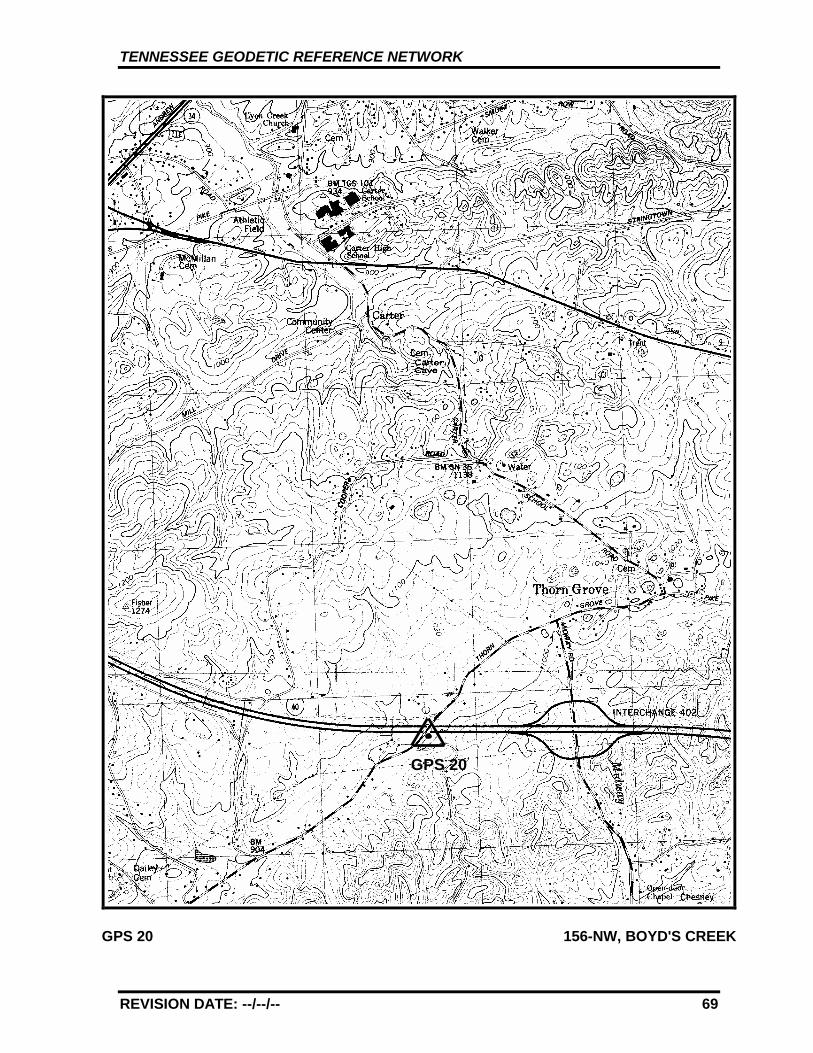
GPS - 20
All values are referenced to the North American Datum NAD 83 (1995)
Latitude: 35°°°° 59' 46.63703" TN Northing: 186918.108 mLongitude: 83°°°° 42' 37.72458" TN Easting: 806412.669 m
Elevation: 308.663 m (1,012.67 ft)
Convergence: +1°°°° 20' 25.4" Scale Factor: 0.99995239
Monument Set by: NGS Date: 1987
County: Knox Nearest Town: Knoxville
USGS QUAD: Boyd's Creek TVA Designation: 156-NW
Description:
The station is located about 23 km (14 mi.) east of Knoxville, 0.6 km (0.4mi.) west of Interstate 40 Exit 402 (Midway Road), at the south corner ofthe Thorngrove Road Bridge over Interstate 40. Ownership--RoadRight-of-Way.
To reach the station from Interstate 40 Exit 402 go north for 0.72 km(0.45 mi.) from interstate centerline on Midway Road to the junction ofThorngrove Road. Turn left and go southwest for 1.1 km (0.7 mi.) onThorngrove Road to the bridge over Interstate 40 and the station on theleft.
The station is a 3-D mark with stainless steel rod driven 9.1 m (30 ft.).The logo cap is stamped ---GPS 20 1987---, located 7.0 m (23 ft.)southeast from the center of Thorngrove Road and 0.5 m (1.5 ft.) belowsame, 1.77 m (5.8 ft.) south from the south corner of the bridge, 1.16 m(3.8 ft.) southeast from a guardrail, 0.8 m (2.62 ft.) southeast from afiberglass witness post.
TENNESSEE GEODETIC REFERENCE NETWORK
REVISION DATE: --/--/-- 68
STATION VISIBILITY DIAGRAM
NORTH
SOUTH
ELEVATION 308.663 m (1,012.67 ft) DATE July 1997 LATITUDE 35°°°° 59' 47" ORGANIZATION TDOT LONGITUDE 83°°°° 42' 38" MAP SCALE 7 ½' USGS STATION NAME GPS 20 MAP SHEET 156-NW, Boyd's Creek
OBSERVER CLJ Observer’s height 6'
NOTES:
WEST EAST
ROAD SIGN 3.0 mFROM STATION
UTILITY POLE
UTILITY POLE
TENNESSEE GEODETIC REFERENCE NETWORK
REVISION DATE: --/--/-- 69
GPS 20 156-NW, BOYD'S CREEK
GPS 20
TENNESSEE GEODETIC REFERENCE NETWORK
REVISION DATE: --/--/-- 70
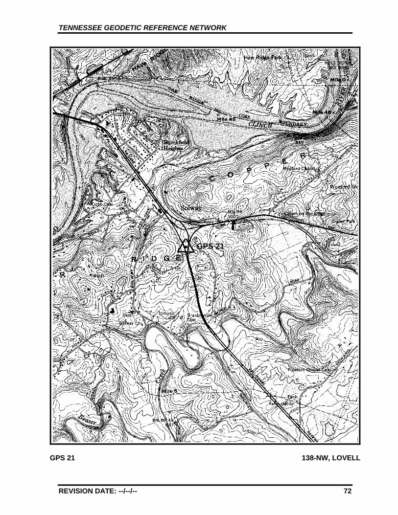
GPS - 21
All values are referenced to the North American Datum NAD 83 (1995)
Latitude: 35°°°° 58' 32.57520" TN Northing: 183749.668 mLongitude: 84°°°° 10' 42.59261" TN Easting: 764266.219 m
Elevation: 302.843 m (993.58 ft)
Convergence: +1°°°° 3' 59.0" Scale Factor: 0.99995145
Monument Set by: NGS Date: 1987
County: Knox Nearest Town: Oak Ridge
USGS QUAD: Lovell TVA Designation: 138-NW
Description:
The station is located about 22.5 km (14 mi.) west of Knoxville, 10.4 km(6.5 mi.) southeast of Oak Ridge, 9.2 km (5.7 mi.) northwest of thejunction of Interstates 40, 75 and State Route 162 (The PellissippiParkway) along State Route 162, and just south of the junction of StateRoutes 162 and 62. Ownership--Road Right-of-Way.
The station is located just south of the junction of State Routes 162 and62 in the grass median strip of State Route 162 about 0.40 km (0.25 mi.)north of a summit.
The station is a 3-D mark with stainless steel rod driven 8.8 m (29 ft.).The logo cap is stamped---GPS 21 1987---, and an iron rod is set in theconcrete. Located 72.76 m (238.7 ft.) north from the centerline of apaved crossover, 25.60 m (84.0 ft.) east from the centerline of thesouthbound lanes, 13.4 m (44.0 ft.) west from the centerline of thenorthbound lanes and 1.2 m (4 ft.) below same, 4.57 m (15.0 ft.) eastfrom the center of a concrete ditch, 0.3 m (1.0 ft.) southwest from afiberglass witness post.
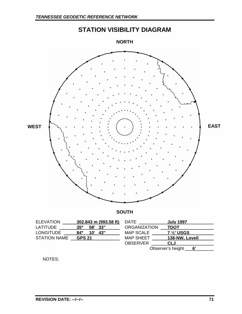
TENNESSEE GEODETIC REFERENCE NETWORK
REVISION DATE: --/--/-- 71
STATION VISIBILITY DIAGRAM
NORTH
SOUTH
ELEVATION 302.843 m (993.58 ft) DATE July 1997 LATITUDE 35°°°° 58' 33" ORGANIZATION TDOT LONGITUDE 84°°°° 10' 43" MAP SCALE 7 ½' USGS STATION NAME GPS 21 MAP SHEET 138-NW, Lovell
OBSERVER CLJ Observer’s height 6'
NOTES:
WEST EAST
TENNESSEE GEODETIC REFERENCE NETWORK
REVISION DATE: --/--/-- 72
GPS 21 138-NW, LOVELL
GPS 21
TENNESSEE GEODETIC REFERENCE NETWORK
REVISION DATE: --/--/-- 73
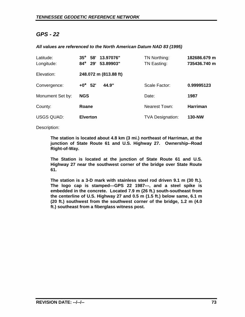
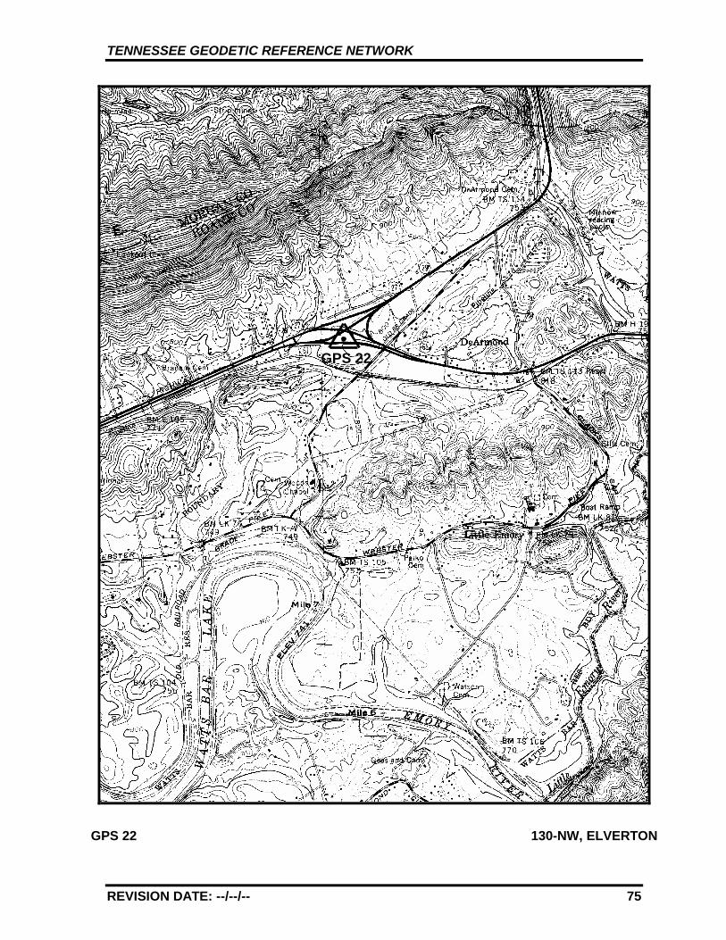
GPS - 22
All values are referenced to the North American Datum NAD 83 (1995)
Latitude: 35°°°° 58' 13.97076" TN Northing: 182686.679 mLongitude: 84°°°° 29' 53.89903" TN Easting: 735436.740 m
Elevation: 248.072 m (813.88 ft)
Convergence: +0°°°° 52' 44.9" Scale Factor: 0.99995123
Monument Set by: NGS Date: 1987
County: Roane Nearest Town: Harriman
USGS QUAD: Elverton TVA Designation: 130-NW
Description:
The station is located about 4.8 km (3 mi.) northeast of Harriman, at thejunction of State Route 61 and U.S. Highway 27. Ownership--RoadRight-of-Way.
The Station is located at the junction of State Route 61 and U.S.Highway 27 near the southwest corner of the bridge over State Route61.
The station is a 3-D mark with stainless steel rod driven 9.1 m (30 ft.).The logo cap is stamped---GPS 22 1987---, and a steel spike isembedded in the concrete. Located 7.9 m (26 ft.) south-southeast fromthe centerline of U.S. Highway 27 and 0.5 m (1.5 ft.) below same, 6.1 m(20 ft.) southwest from the southwest corner of the bridge, 1.2 m (4.0ft.) southeast from a fiberglass witness post.
TENNESSEE GEODETIC REFERENCE NETWORK
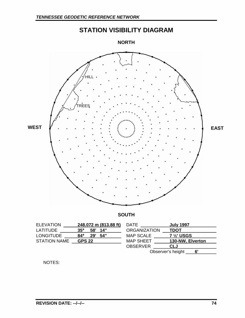
REVISION DATE: --/--/-- 74
STATION VISIBILITY DIAGRAM
NORTH
SOUTH
ELEVATION 248.072 m (813.88 ft) DATE July 1997 LATITUDE 35°°°° 58' 14" ORGANIZATION TDOT LONGITUDE 84°°°° 29' 54" MAP SCALE 7 ½' USGS STATION NAME GPS 22 MAP SHEET 130-NW, Elverton
OBSERVER CLJ Observer’s height 6'
NOTES:
WEST EAST
TREES
HILL
TENNESSEE GEODETIC REFERENCE NETWORK
REVISION DATE: --/--/-- 75
GPS 22 130-NW, ELVERTON
GPS 22
TENNESSEE GEODETIC REFERENCE NETWORK
REVISION DATE: 12/03/10 76
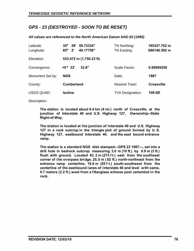
GPS - 23 (DESTROYED - SOON TO BE RESET)
All values are referenced to the North American Datum NAD 83 (1995)
Latitude: 35°°°° 59' 59.73334" TN Northing: 185327.762 mLongitude: 85°°°° 2' 40.17756" TN Easting: 686146.592 m
Elevation: 533.472 m (1,750.23 ft)
Convergence: +0 °°° 33' 33.8" Scale Factor: 0.99995258
Monument Set by: NGS Date: 1987
County: Cumberland Nearest Town: Crossville
USGS QUAD: Isoline TVA Designation: 108-SE
Description:
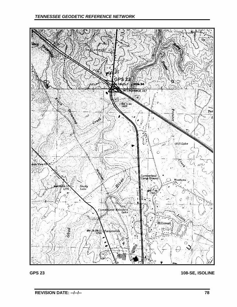
The station is located about 6.4 km (4 mi.) north of Crossville, at thejunction of Interstate 40 and U.S. Highway 127. Ownership--StateRight-of-Way.
The station is located at the junction of Interstate 40 and U.S. Highway127 in a rock outcrop in the triangle plot of ground formed by U. S.Highway 127, eastbound Interstate 40, and the east bound entranceramp.
The station is a standard NGS disk stamped---GPS 23 1987---, set into adrill hole in bedrock outcrop measuring 3.0 m (10 ft.) by 0.9 m (3 ft.)flush with ground. Located 83. 2 m (273 f t.) east from the southeastcorner of the overpass bridge, 25.0 m ( 82 ft.) north-northeast from theentrance ramp centerline, 16.8 m (55 f t.) south-southwest from thecenterline of the eastbound lanes of Interstate 40 and level with same,0.7 meters (2.2 ft.) west from a f iberglass witness post cemented in therock.
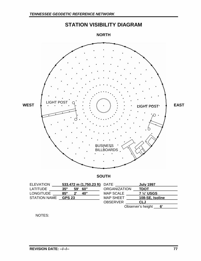
TENNESSEE GEODETIC REFERENCE NETWORK
REVISION DATE: --/--/-- 77
STATION VISIBILITY DIAGRAM
NORTH
SOUTH
ELEVATION 533.472 m (1,750.23 ft) DATE July 1997 LATITUDE 35°°°° 59' 60" ORGANIZATION TDOT LONGITUDE 85°°°° 2' 40" MAP SCALE 7 ½' USGS STATION NAME GPS 23 MAP SHEET 108-SE, Isoline
OBSERVER CLJ Observer’s height 6'
NOTES:
WEST EASTLIGHT POST
BUSINESSBILLBOARDS
LIGHT POSTLIGHT POST
TENNESSEE GEODETIC REFERENCE NETWORK
REVISION DATE: --/--/-- 78
GPS 23 108-SE, ISOLINE
GPS 23
TENNESSEE GEODETIC REFERENCE NETWORK
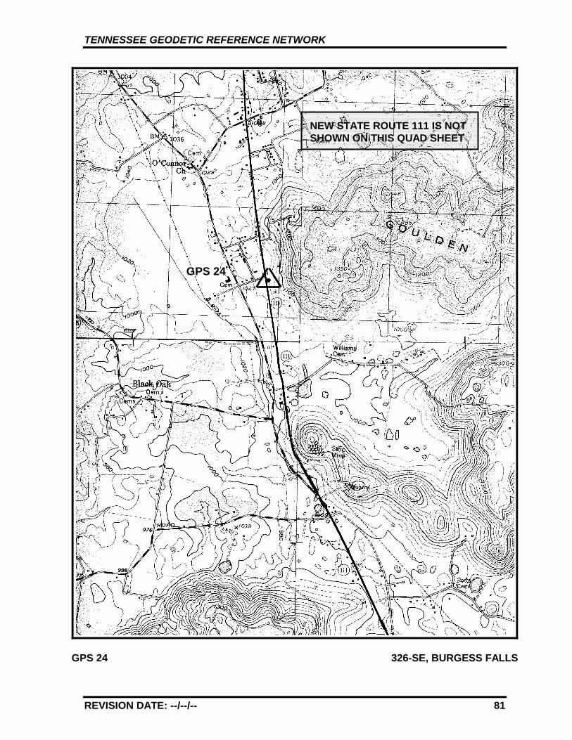
REVISION DATE: 12/03/10 79
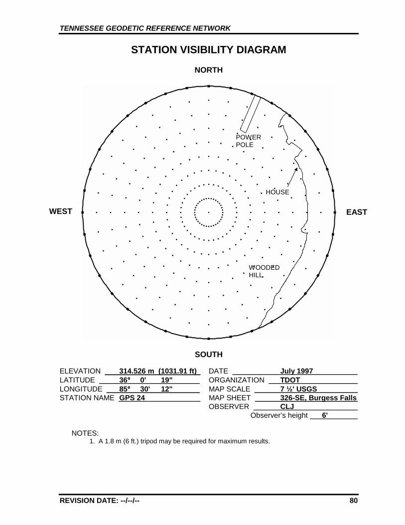
GPS - 24 (BLOCKAGE - SOON TO BE RESET)
All values are referenced to the North American Datum NAD 83 (1995)
Latitude: 36°°°° 0' 18.93229" TN Northing: 185612.552 mLongitude: 85°°°° 30' 12.08369" TN Easting: 644773.926 m
Elevation: 314.526 m (1031.91 ft)
Convergence: +0 °°° 17' 26.7" Scale Factor: 0.99995285
Monument Set by: NGS Date: 1987
County: White Nearest Town: Cookeville
USGS QUAD: Burgess Falls TVA Designation: 326-SE
Description:
The station is located about 16.1 km (10 mi.) south of Cookeville, in abedrock outcrop on the east right-of-way of Old State Route 111 justwest-southwest of an elaborate house partly built of stone. Ownership--State Right-of Way.
To reach the station from the junction of Interstate 40 and State Route111 southeast of Cookeville go south for 6.6 km (4.1 mi.) on S tate Route111 to the Putnam/White County Line. Continue straight ahead and gosouth for 6.8 km ( 4.2 mi.) on St ate Route 111 t o the O’Connor Rd. Exit.At the intersection of O’Connor Rd. and the State Route 111 exit rampturn left and go east for 0. 4 km ( 0.25 mi .) t o t he junct ion of Old St ateRoute 111 ( Roberts-Matthews Hi ghway). Turn right and go south 1. 5km (0.9 mi.) to the station on the left.
The station is a standard NGS disk stamped---GPS 24 1987---, set into adrill hole in bedrock outcrop measuring 0.5 m (1.5 ft.) by 0.9 m (3 ft.)projecting 0.15 m (0.5 ft.). Located 53. 6 m (176 f t.) south from thecenter of the driveway leading to the stone house, 8. 5 m (28 ft.) eastfrom t he cent er of Old State Rout e 111 and 0.3 m (1 ft.) above same,22.5 m (7 3.8 ft) south from the center of the driveway leading to theTenn. Homes model home (3220 Roberts-Matthews Hw y), 22.2 m (72.8ft.) south-southwest from utility pole with one guy wire, 0.6 meters (1.9ft.) east from a fiberglass witness post.
TENNESSEE GEODETIC REFERENCE NETWORK
REVISION DATE: --/--/-- 80
STATION VISIBILITY DIAGRAM
NORTH
SOUTH
ELEVATION 314.526 m (1031.91 ft) DATE July 1997 LATITUDE 36°°°° 0' 19" ORGANIZATION TDOT LONGITUDE 85°°°° 30' 12" MAP SCALE 7 ½' USGS STATION NAME GPS 24 MAP SHEET 326-SE, Burgess Falls
OBSERVER CLJ Observer’s height 6'
NOTES:1. A 1.8 m (6 ft.) tripod may be required for maximum results.
WEST EAST
HOUSE
WOODEDHILL
POWERPOLE
TENNESSEE GEODETIC REFERENCE NETWORK
REVISION DATE: --/--/-- 81
GPS 24 326-SE, BURGESS FALLS
GPS 24
NEW STATE ROUTE 111 IS NOTSHOWN ON THIS QUAD SHEET
TENNESSEE GEODETIC REFERENCE NETWORK
REVISION DATE: --/--/-- 82
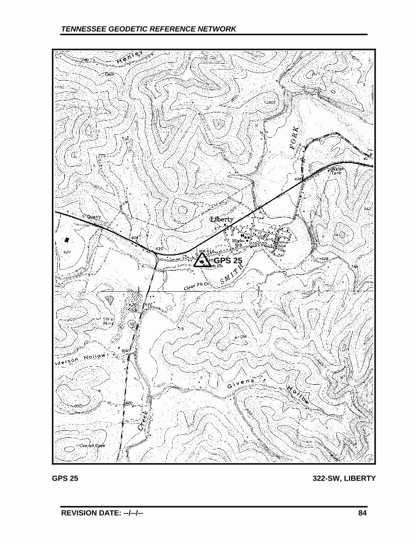
GPS - 25
All values are referenced to the North American Datum NAD 83 (1995)
Latitude: 36°°°° 0' 13.92199" TN Northing: 185344.838 mLongitude: 85°°°° 58' 26.32378" TN Easting: 602345.939 m
Elevation: 185.733 m (609.36 ft)
Convergence: +0°°°° 0' 54.8" Scale Factor: 0.99995278
Monument Set by: NGS Date: 1987
County: Dekalb Nearest Town: Liberty
USGS QUAD: Liberty TVA Designation: 322-SW
Description:
The station is located about 45 km (28 mi.) west-southwest ofCookeville, 35 km (22 mi.) southeast of Lebanon, in Liberty at the SalemBaptist Church in a bedrock outcrop. Ownership--Salem BaptistChurch.
To reach the station from the junction of State Route 53 and U.S.Highway 70 at the west edge of Liberty go south for 0.08 km (0.05 mi.)on State Route 53 to the intersection of Main Street. Turn left and goeast for 0.56 km (0.35 mi.) on Main Street to the church on the right andthe station.
The station is a standard NGS disk stamped---GPS 25 1987---, set into adrill hole in bedrock outcrop measuring 1.2 m (4 ft.) by 0.3 m (1 ft.) flushwith ground. Located 46.48 m (152.5 ft.) northeast from the east cornerof the church, 30.8 m (101 ft.) south from a fire hydrant, 25.6 m (84 ft.)south from the center of Main Street, 25.0 m (82 ft.) southwest from thenorthwest corner of the cemetery wall, 5.2 m (17 ft.) northwest from theMcKnight tombstone, 3.50 m (11.5 ft.) northwest from the stone wall atthe west edge of the cemetery, 1.68 m (5.5 ft.) northwest from thenorthwest edge of a sidewalk, 3.4 m (11 ft.) northwest from a fiberglasswitness post at the cemetery wall.
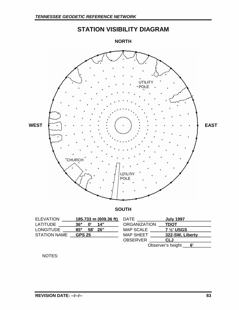
TENNESSEE GEODETIC REFERENCE NETWORK
REVISION DATE: --/--/-- 83
STATION VISIBILITY DIAGRAM
NORTH
SOUTH
ELEVATION 185.733 m (609.36 ft) DATE July 1997 LATITUDE 36°°°° 0' 14" ORGANIZATION TDOT LONGITUDE 85°°°° 58' 26" MAP SCALE 7 ½' USGS STATION NAME GPS 25 MAP SHEET 322-SW, Liberty
OBSERVER CLJ Observer’s height 6'
NOTES:
WEST EAST
UTILITYPOLE
CHURCH
UTILITYPOLE
TENNESSEE GEODETIC REFERENCE NETWORK
REVISION DATE: --/--/-- 84
GPS 25 322-SW, LIBERTY
GPS 25
TENNESSEE GEODETIC REFERENCE NETWORK
REVISION DATE: --/--/-- 85
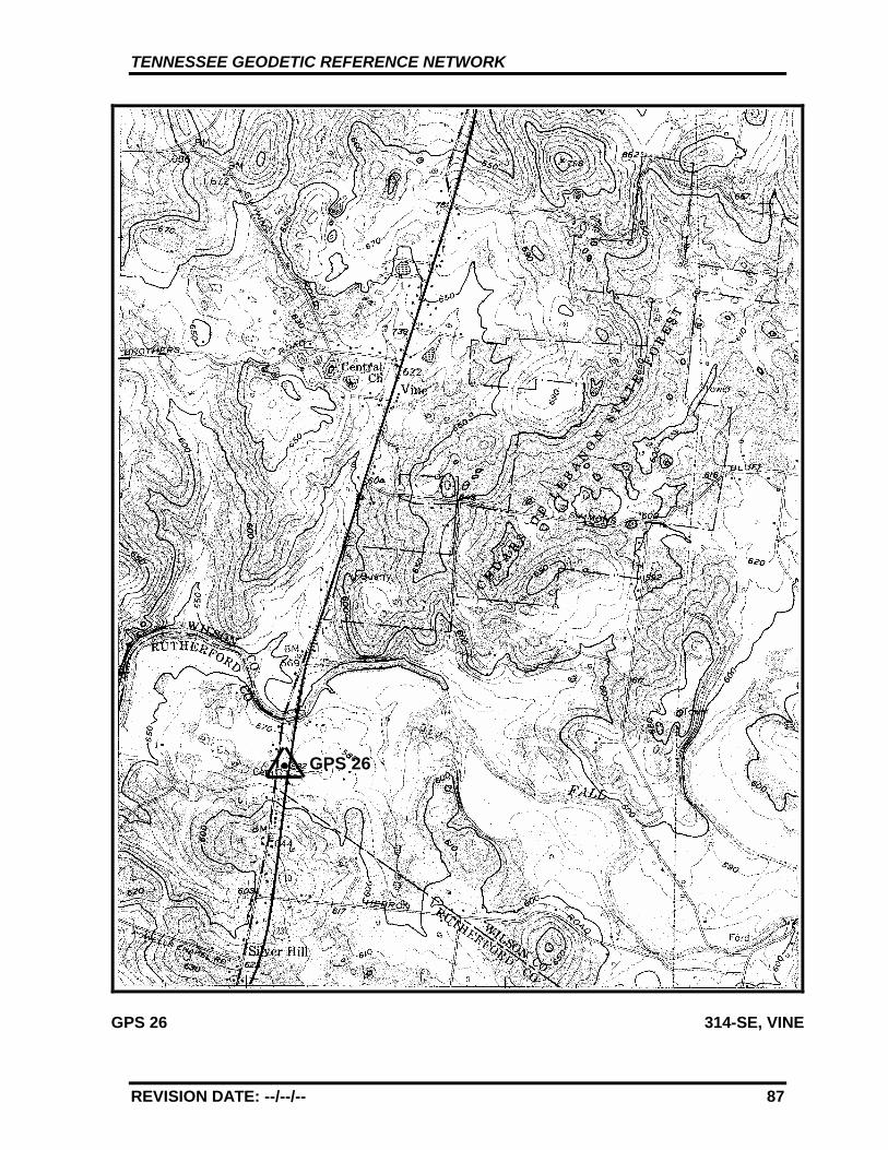
GPS - 26
All values are referenced to the North American Datum NAD 83 (1995)
Latitude: 36°°°° 0' 42.03374" TN Northing: 186271.990 mLongitude: 86°°°° 21' 50.65409" TN Easting: 567180.505 m
Elevation: 178.261 m (584.84 ft)
Convergence: -0°°°° 12' 47.3" Scale Factor: 0.99995319
Monument Set by: NGS Date: 1987
County: Wilson Nearest Town: Murfreesboro
USGS QUAD: Vine TVA Designation: 314-SE
Description:
The station is located about 40 km (25 mi.) east-southeast of Nashville,18 km (11 mi.) north of Murfreesboro, on the west edge of U.S. Highway231, near the Wilson/Rutherford County Line. Ownership--HighwayRight-of-Way.
To reach the station from the junction of State Route 265 and U.S.Highway 231 in Bairds Mill go south for 10.6 km (6.6 mi.) on U.S.Highway 231 to the station on the right 0.16 km (0.10 mi.) north of theWilson/Rutherford County Line, just north of Drennan Lane on the right.
The station is a standard NGS disk stamped---GPS 26 1987---, set into adrill hole in bedrock outcrop measuring 1.2 m (4 ft.) by 0.6 m (2 ft.) levelwith ground. Located 12.2 m (40 ft.) west from the center of U.S.Highway 231 and 0.9 m (3 ft.) above same, 12.2 m (40 ft.) north from thecenter of Drennan Lane, 25.3 m (83 ft.) south from a utility pole, 3.7 m(12 ft.) west from a fiberglass witness post.
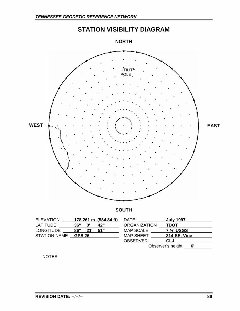
TENNESSEE GEODETIC REFERENCE NETWORK
REVISION DATE: --/--/-- 86
STATION VISIBILITY DIAGRAM
NORTH
SOUTH
ELEVATION 178.261 m (584.84 ft) DATE July 1997 LATITUDE 36°°°° 0' 42" ORGANIZATION TDOT LONGITUDE 86°°°° 21' 51" MAP SCALE 7 ½' USGS STATION NAME GPS 26 MAP SHEET 314-SE, Vine
OBSERVER CLJ Observer’s height 6'
NOTES:
WEST EAST
UTILITYPOLE
TENNESSEE GEODETIC REFERENCE NETWORK
REVISION DATE: --/--/-- 87
GPS 26 314-SE, VINE
GPS 26
TENNESSEE GEODETIC REFERENCE NETWORK
REVISION DATE: --/--/-- 88
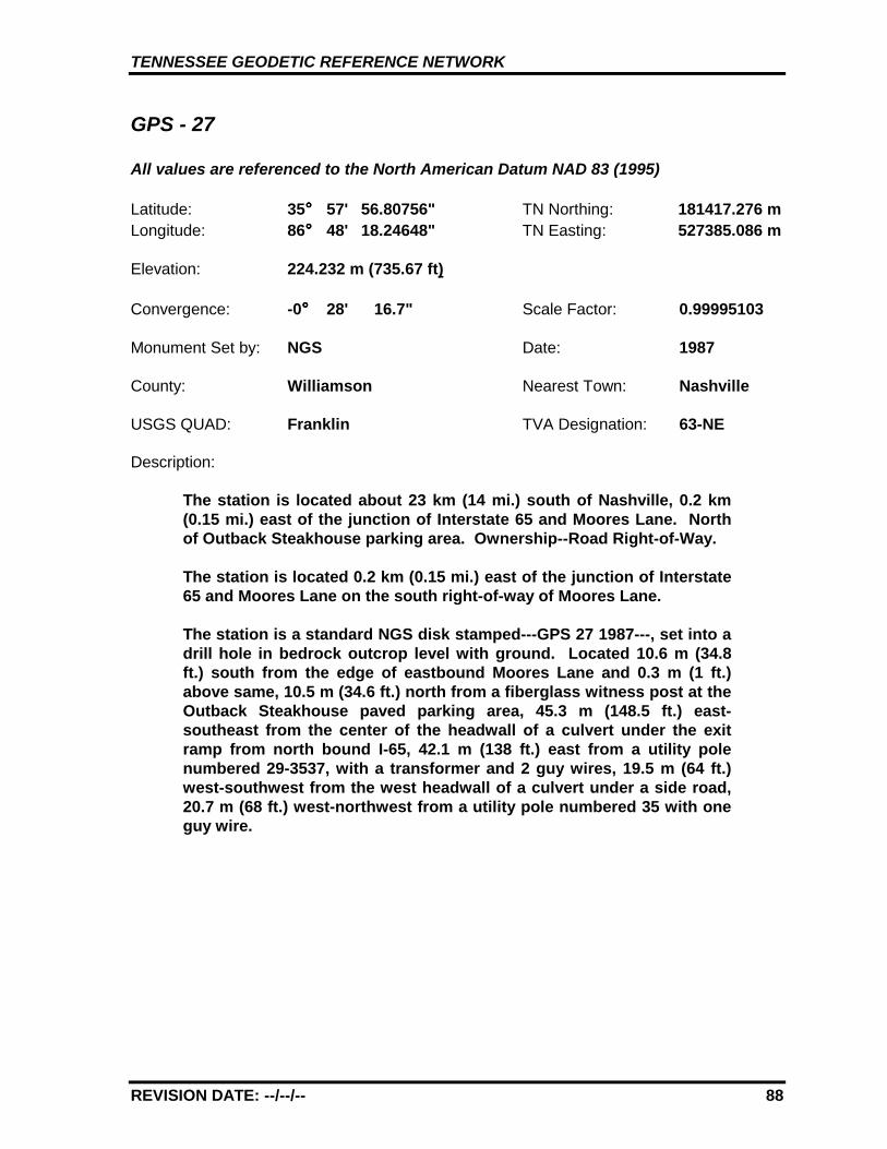
GPS - 27
All values are referenced to the North American Datum NAD 83 (1995)
Latitude: 35°°°° 57' 56.80756" TN Northing: 181417.276 mLongitude: 86°°°° 48' 18.24648" TN Easting: 527385.086 m
Elevation: 224.232 m (735.67 ft)
Convergence: -0°°°° 28' 16.7" Scale Factor: 0.99995103
Monument Set by: NGS Date: 1987
County: Williamson Nearest Town: Nashville
USGS QUAD: Franklin TVA Designation: 63-NE
Description:
The station is located about 23 km (14 mi.) south of Nashville, 0.2 km(0.15 mi.) east of the junction of Interstate 65 and Moores Lane. Northof Outback Steakhouse parking area. Ownership--Road Right-of-Way.
The station is located 0.2 km (0.15 mi.) east of the junction of Interstate65 and Moores Lane on the south right-of-way of Moores Lane.
The station is a standard NGS disk stamped---GPS 27 1987---, set into adrill hole in bedrock outcrop level with ground. Located 10.6 m (34.8ft.) south from the edge of eastbound Moores Lane and 0.3 m (1 ft.)above same, 10.5 m (34.6 ft.) north from a fiberglass witness post at theOutback Steakhouse paved parking area, 45.3 m (148.5 ft.) east-southeast from the center of the headwall of a culvert under the exitramp from north bound I-65, 42.1 m (138 ft.) east from a utility polenumbered 29-3537, with a transformer and 2 guy wires, 19.5 m (64 ft.)west-southwest from the west headwall of a culvert under a side road,20.7 m (68 ft.) west-northwest from a utility pole numbered 35 with oneguy wire.
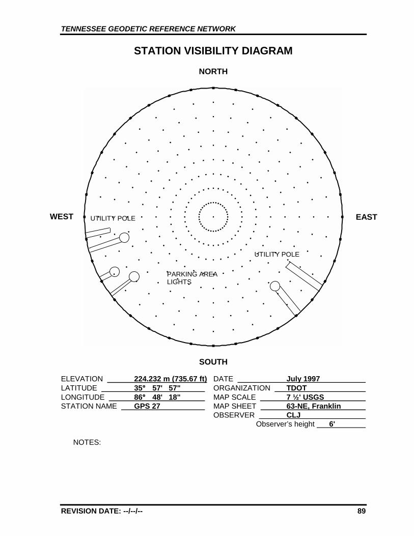
TENNESSEE GEODETIC REFERENCE NETWORK
REVISION DATE: --/--/-- 89
STATION VISIBILITY DIAGRAM
NORTH
SOUTH
ELEVATION 224.232 m (735.67 ft) DATE July 1997 LATITUDE 35°°°° 57' 57" ORGANIZATION TDOT LONGITUDE 86°°°° 48' 18" MAP SCALE 7 ½' USGS STATION NAME GPS 27 MAP SHEET 63-NE, Franklin
OBSERVER CLJ Observer’s height 6'
NOTES:
WEST EASTUTILITY POLE
PARKING AREALIGHTS
UTILITY POLE
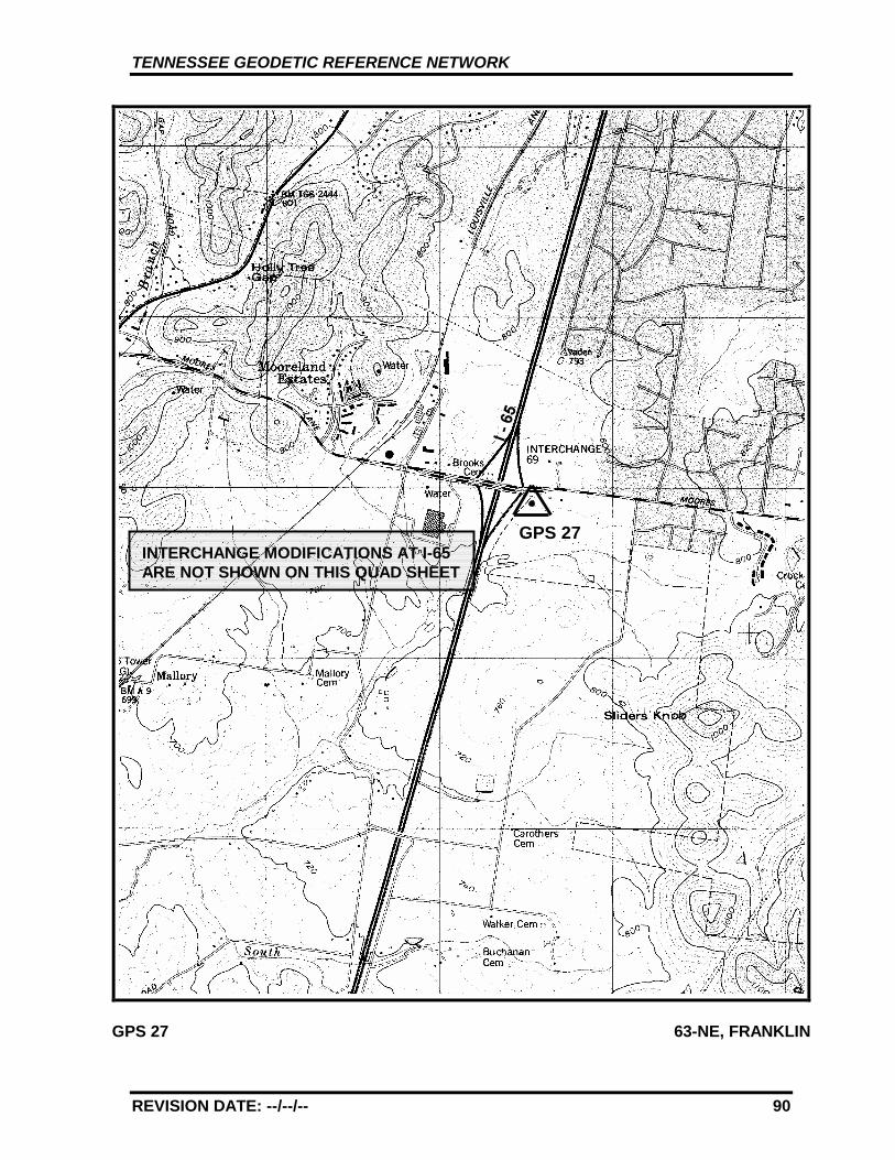
TENNESSEE GEODETIC REFERENCE NETWORK
REVISION DATE: --/--/-- 90
GPS 27 63-NE, FRANKLIN
GPS 27INTERCHANGE MODIFICATIONS AT I-65ARE NOT SHOWN ON THIS QUAD SHEET
TENNESSEE GEODETIC REFERENCE NETWORK
REVISION DATE: --/--/-- 91
GPS - 28
All values are referenced to the North American Datum NAD 83 (1995)
Latitude: 36°°°° 1' 9.46654" TN Northing: 187783.506 mLongitude: 87°°°° 15' 23.50236" TN Easting: 486742.735 m
Elevation: 213.258 m (699.66 ft)
Convergence: -0°°°° 44' 8.2" Scale Factor: 0.99995361
Monument Set by: NGS Date: 1987
County: Dickson Nearest Town: Dickson
USGS QUAD: Burns TVA Designation: 48-SE
Description:
The station is located about 12.9 km (8 mi.) east-southeast of Dickson,in the median of Interstate 40, 7.4 km (4.6 mi.) west of State Route 96(Exit 182), 7.4 km (4.6 mi.) east of State Route 46 (Exit 172). Ownership--Federal Right-of-Way.
To reach the station from the junction of State Route 96 and Interstate40 go west for 6.5 km (4.0 mi.) on Interstate 40 to a bridge over a creek.Continue straight ahead and go west and uphill for 1.0 km (0.6 mi.) onInterstate 40 to a low cut and a 0.16 km (0.1 mi.) gap in the guardrail onthe left and the station on the left, just short of the 177 mile marker.
To reach the station from the junction of State Route 46 and Interstate40 go east 3.9 km (2.4 mi.) to a bridge over Interstate 40. Continuestraight ahead and go east 3.5 km (2.2 mi.) on Interstate 40 to thestation on the left, just past the 177 mile marker.
The station is a 3-D mark with stainless steel rod driven 5.5 m (18 ft.).The logo cap is stamped---GPS 28 1987---, and a steel spike isembedded in the concrete. Located 18.5 m (60.7 ft.) south from theedge of the pavement of the westbound lanes, 48.2 m (158 ft.) northfrom the edge of the pavement of the eastbound lanes, 75.1 m (246 ft.)west-southwest from the west end of a guardrail, 54.7 m (179 ft.) east-southeast from the east end of a guardrail, 0.34 m (1.1 ft.) northeastfrom a fiberglass witness post.
TENNESSEE GEODETIC REFERENCE NETWORK
REVISION DATE: --/--/-- 92
STATION VISIBILITY DIAGRAM
NORTH
SOUTH
ELEVATION 213.258 m (699.66 ft) DATE July 1997 LATITUDE 36°°°° 1' 9" ORGANIZATION TDOT LONGITUDE 87°°°° 15' 24" MAP SCALE 7 ½' USGS STATION NAME GPS 28 MAP SHEET 48-SE, Burns
OBSERVER CLJ Observer’s height 6'
NOTES:
WEST EASTTREES10.7 m
TREES9.1 m
TREES13.7
TENNESSEE GEODETIC REFERENCE NETWORK
REVISION DATE: --/--/-- 93
GPS 28 48-SE, BURNS
GPS 28
I - 40
TENNESSEE GEODETIC REFERENCE NETWORK
REVISION DATE: --/--/-- 94
GPS - 29
All values are referenced to the North American Datum NAD 83 (1995)
Latitude: 36°°°° 6' 50.74940" TN Northing: 198970.353 mLongitude: 87°°°° 44' 30.11690" TN Easting: 443203.003 m
Elevation: 229.182 m (751.91 ft)
Convergence: -1°°°° 1' 10.8" Scale Factor: 0.99996031
Monument Set by: NGS Date: 1987
County: Humphreys Nearest Town: Waverly
USGS QUAD: McEwen TVA Designation: 39-SW
Description:
The station is located about 6.4 km (4 mi.) northeast of Waverly, at theWaverly/Humphreys County Airport. Ownership--Airport Manager isTravis Jenkins, Humphreys Co. Airport, 1005 Airport Rd., Waverly, TN37185, Telephone (615) 296-2719. The airport manager may require useof the azimuth point 29 instead of the main point.
To reach the station from the junction of E. Main St. and State Route 13at the city square in Waverly go east for 1.8 km (1.1 mi.) on E. Main St.to the intersection of Powers Boulevard. Turn left and go north for 2.6km (1.6 mi.) on Powers Boulevard to the intersection of Airport Road.Turn right and go east for 2.9 km (1.8 mi.) on Airport Road to a graveldrive on the right and the airport office.
The station is a 3-D mark with stainless steel rod driven 3.1 m (10 ft.).The logo cap is stamped---GPS 29 1987---, and a steel spike isembedded in the concrete. Located 3.4 m (11 ft.) west of fuel tanks,83.8 m (275 ft.) south-southwest from the southeast corner of thehangar, underneath the concrete taxiway covered by a 0.7 m2 (2.3 ft2)steel plate, 3.0 m (10 ft.) west from a fiberglass witness post.
TENNESSEE GEODETIC REFERENCE NETWORK
REVISION DATE: --/--/-- 95
STATION VISIBILITY DIAGRAM
NORTH
SOUTH
ELEVATION 229.182 m (751.91 ft) DATE July 1997 LATITUDE 36°°°° 6' 51" ORGANIZATION TDOT LONGITUDE 87°°°° 44' 30" MAP SCALE 7 ½' USGS STATION NAME GPS 29 MAP SHEET 39-SW, McEwen
OBSERVER CLJ Observer’s height 6'
NOTES:
WEST
NO OTHER OBSTRUCTIONS ABOVE 10º
LIGHT POLE
EAST
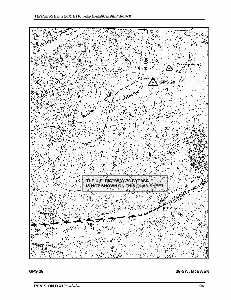
TENNESSEE GEODETIC REFERENCE NETWORK
REVISION DATE: --/--/-- 96
GPS 29 39-SW, McEWEN
GPS 29
AZ
THE U.S. HIGHWAY 70 BYPASSIS NOT SHOWN ON THIS QUAD SHEET
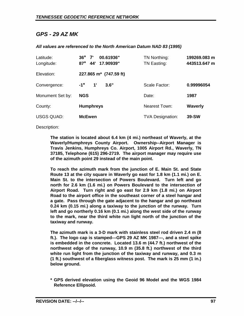
TENNESSEE GEODETIC REFERENCE NETWORK
REVISION DATE: --/--/-- 97
GPS - 29 AZ MK
All values are referenced to the North American Datum NAD 83 (1995)
Latitude: 36°°°° 7' 00.61936" TN Northing: 199269.083 mLongitude: 87°°°° 44' 17.90939" TN Easting: 443513.647 m
Elevation: 227.865 m* (747.59 ft)
Convergence: -1°°°° 1' 3.6" Scale Factor: 0.99996054
Monument Set by: NGS Date: 1987
County: Humphreys Nearest Town: Waverly
USGS QUAD: McEwen TVA Designation: 39-SW
Description:
The station is located about 6.4 km (4 mi.) northeast of Waverly, at theWaverly/Humphreys County Airport. Ownership--Airport Manager isTravis Jenkins, Humphreys Co. Airport, 1005 Airport Rd., Waverly, TN37185, Telephone (615) 296-2719. The airport manager may require useof the azimuth point 29 instead of the main point.
To reach the azimuth mark from the junction of E. Main St. and StateRoute 13 at the city square in Waverly go east for 1.8 km (1.1 mi.) on E.Main St. to the intersection of Powers Boulevard. Turn left and gonorth for 2.6 km (1.6 mi.) on Powers Boulevard to the intersection ofAirport Road. Turn right and go east for 2.9 km (1.8 mi.) on AirportRoad to the airport office in the southeast corner of a steel hangar anda gate. Pass through the gate adjacent to the hangar and go northeast0.24 km (0.15 mi.) along a taxiway to the junction of the runway. Turnleft and go northerly 0.16 km (0.1 mi.) along the west side of the runwayto the mark, near the third white run light north of the junction of thetaxiway and runway.
The azimuth mark is a 3-D mark with stainless steel rod driven 2.4 m (8ft.). The logo cap is stamped---GPS 29 AZ MK 1987---, and a steel spikeis embedded in the concrete. Located 13.6 m (44.7 ft.) northwest of thenorthwest edge of the runway, 10.9 m (35.8 ft.) northwest of the thirdwhite run light from the junction of the taxiway and runway, and 0.3 m(1 ft.) southwest of a fiberglass witness post. The mark is 25 mm (1 in.)below ground.
* GPS derived elevation using the Geoid 96 Model and the WGS 1984Reference Ellipsoid.
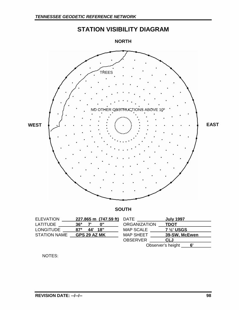
TENNESSEE GEODETIC REFERENCE NETWORK
REVISION DATE: --/--/-- 98
STATION VISIBILITY DIAGRAM
NORTH
SOUTH
ELEVATION 227.865 m (747.59 ft) DATE July 1997 LATITUDE 36°°°° 7' 0" ORGANIZATION TDOT LONGITUDE 87°°°° 44' 18" MAP SCALE 7 ½' USGS STATION NAME GPS 29 AZ MK MAP SHEET 39-SW, McEwen
OBSERVER CLJ Observer’s height 6'
NOTES:
WEST
TREES
EAST
NO OTHER OBSTRUCTIONS ABOVE 10º
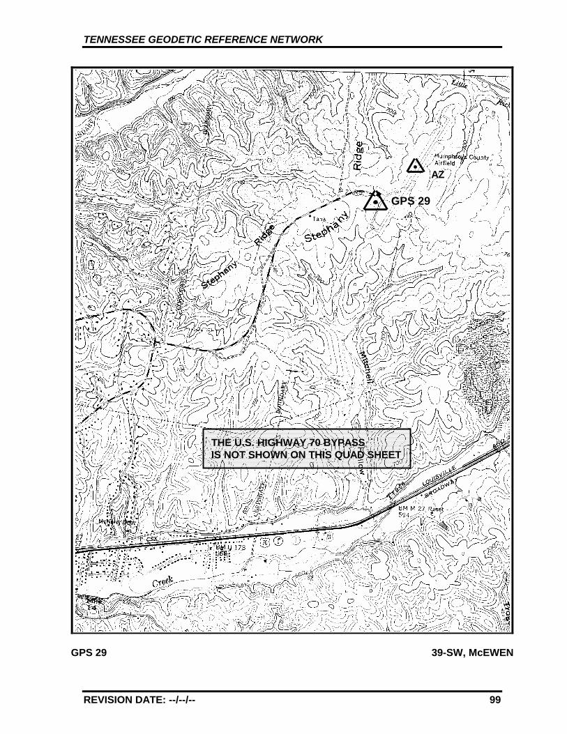
TENNESSEE GEODETIC REFERENCE NETWORK
REVISION DATE: --/--/-- 99
GPS 29 39-SW, McEWEN
GPS 29
AZ
THE U.S. HIGHWAY 70 BYPASSIS NOT SHOWN ON THIS QUAD SHEET
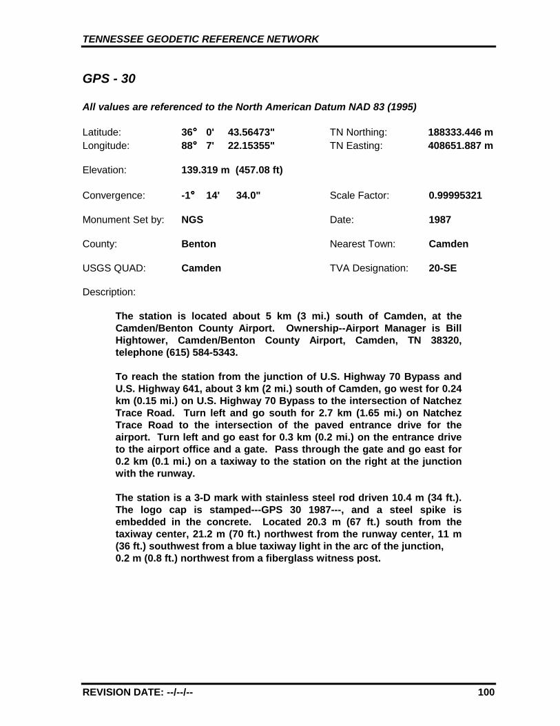
TENNESSEE GEODETIC REFERENCE NETWORK
REVISION DATE: --/--/-- 100
GPS - 30
All values are referenced to the North American Datum NAD 83 (1995)
Latitude: 36°°°° 0' 43.56473" TN Northing: 188333.446 mLongitude: 88°°°° 7' 22.15355" TN Easting: 408651.887 m
Elevation: 139.319 m (457.08 ft)
Convergence: -1°°°° 14' 34.0" Scale Factor: 0.99995321
Monument Set by: NGS Date: 1987
County: Benton Nearest Town: Camden
USGS QUAD: Camden TVA Designation: 20-SE
Description:
The station is located about 5 km (3 mi.) south of Camden, at theCamden/Benton County Airport. Ownership--Airport Manager is BillHightower, Camden/Benton County Airport, Camden, TN 38320,telephone (615) 584-5343.
To reach the station from the junction of U.S. Highway 70 Bypass andU.S. Highway 641, about 3 km (2 mi.) south of Camden, go west for 0.24km (0.15 mi.) on U.S. Highway 70 Bypass to the intersection of NatchezTrace Road. Turn left and go south for 2.7 km (1.65 mi.) on NatchezTrace Road to the intersection of the paved entrance drive for theairport. Turn left and go east for 0.3 km (0.2 mi.) on the entrance driveto the airport office and a gate. Pass through the gate and go east for0.2 km (0.1 mi.) on a taxiway to the station on the right at the junctionwith the runway.
The station is a 3-D mark with stainless steel rod driven 10.4 m (34 ft.).The logo cap is stamped---GPS 30 1987---, and a steel spike isembedded in the concrete. Located 20.3 m (67 ft.) south from thetaxiway center, 21.2 m (70 ft.) northwest from the runway center, 11 m(36 ft.) southwest from a blue taxiway light in the arc of the junction,0.2 m (0.8 ft.) northwest from a fiberglass witness post.
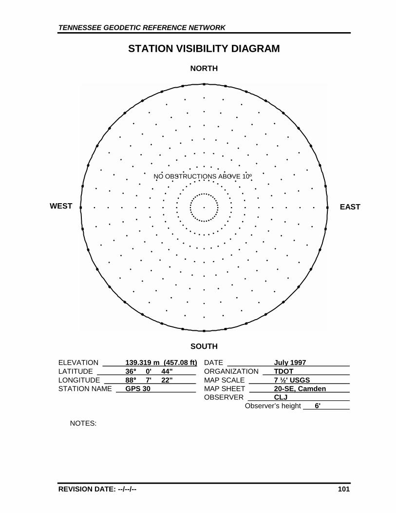
TENNESSEE GEODETIC REFERENCE NETWORK
REVISION DATE: --/--/-- 101
STATION VISIBILITY DIAGRAM
NORTH
SOUTH
ELEVATION 139.319 m (457.08 ft) DATE July 1997 LATITUDE 36°°°° 0' 44" ORGANIZATION TDOT LONGITUDE 88°°°° 7' 22" MAP SCALE 7 ½' USGS STATION NAME GPS 30 MAP SHEET 20-SE, Camden
OBSERVER CLJ Observer’s height 6'
NOTES:
WEST EAST
NO OBSTRUCTIONS ABOVE 10º
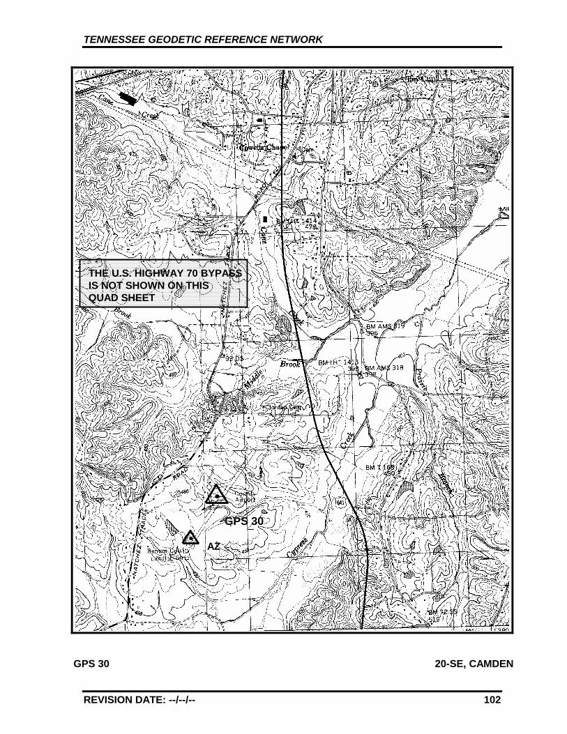
TENNESSEE GEODETIC REFERENCE NETWORK
REVISION DATE: --/--/-- 102
GPS 30 20-SE, CAMDEN
GPS 30
AZ
THE U.S. HIGHWAY 70 BYPASSIS NOT SHOWN ON THISQUAD SHEET
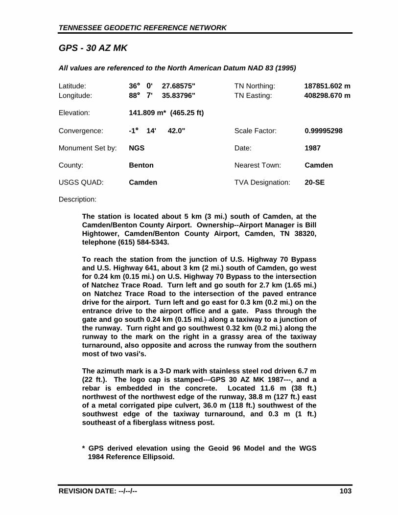
TENNESSEE GEODETIC REFERENCE NETWORK
REVISION DATE: --/--/-- 103
GPS - 30 AZ MK
All values are referenced to the North American Datum NAD 83 (1995)
Latitude: 36°°°° 0' 27.68575" TN Northing: 187851.602 mLongitude: 88°°°° 7' 35.83796" TN Easting: 408298.670 m
Elevation: 141.809 m* (465.25 ft)
Convergence: -1°°°° 14' 42.0" Scale Factor: 0.99995298
Monument Set by: NGS Date: 1987
County: Benton Nearest Town: Camden
USGS QUAD: Camden TVA Designation: 20-SE
Description:
The station is located about 5 km (3 mi.) south of Camden, at theCamden/Benton County Airport. Ownership--Airport Manager is BillHightower, Camden/Benton County Airport, Camden, TN 38320,telephone (615) 584-5343.
To reach the station from the junction of U.S. Highway 70 Bypassand U.S. Highway 641, about 3 km (2 mi.) south of Camden, go westfor 0.24 km (0.15 mi.) on U.S. Highway 70 Bypass to the intersectionof Natchez Trace Road. Turn left and go south for 2.7 km (1.65 mi.)on Natchez Trace Road to the intersection of the paved entrancedrive for the airport. Turn left and go east for 0.3 km (0.2 mi.) on theentrance drive to the airport office and a gate. Pass through thegate and go south 0.24 km (0.15 mi.) along a taxiway to a junction ofthe runway. Turn right and go southwest 0.32 km (0.2 mi.) along therunway to the mark on the right in a grassy area of the taxiwayturnaround, also opposite and across the runway from the southernmost of two vasi's.
The azimuth mark is a 3-D mark with stainless steel rod driven 6.7 m(22 ft.). The logo cap is stamped---GPS 30 AZ MK 1987---, and arebar is embedded in the concrete. Located 11.6 m (38 ft.)northwest of the northwest edge of the runway, 38.8 m (127 ft.) eastof a metal corrigated pipe culvert, 36.0 m (118 ft.) southwest of thesouthwest edge of the taxiway turnaround, and 0.3 m (1 ft.)southeast of a fiberglass witness post.
* GPS derived elevation using the Geoid 96 Model and the WGS1984 Reference Ellipsoid.
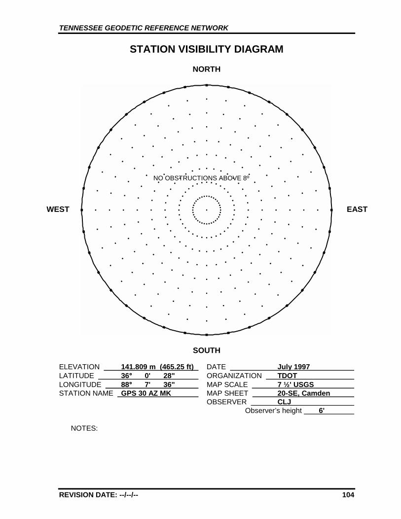
TENNESSEE GEODETIC REFERENCE NETWORK
REVISION DATE: --/--/-- 104
STATION VISIBILITY DIAGRAM
NORTH
SOUTH
ELEVATION 141.809 m (465.25 ft) DATE July 1997 LATITUDE 36°°°° 0' 28" ORGANIZATION TDOT LONGITUDE 88°°°° 7' 36" MAP SCALE 7 ½' USGS STATION NAME GPS 30 AZ MK MAP SHEET 20-SE, Camden
OBSERVER CLJ Observer’s height 6'
NOTES:
WEST EAST
NO OBSTRUCTIONS ABOVE 8º

TENNESSEE GEODETIC REFERENCE NETWORK
REVISION DATE: --/--/-- 105
GPS 30 20-SE, CAMDEN
GPS 30
AZ
THE U.S. HIGHWAY 70 BYPASSIS NOT SHOWN ON THISQUAD SHEET
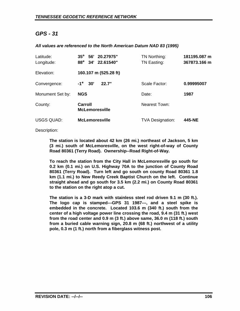
TENNESSEE GEODETIC REFERENCE NETWORK
REVISION DATE: --/--/-- 106
GPS - 31
All values are referenced to the North American Datum NAD 83 (1995)
Latitude: 35°°°° 56' 20.27975" TN Northing: 181195.087 mLongitude: 88°°°° 34' 22.61540" TN Easting: 367873.166 m
Elevation: 160.107 m (525.28 ft)
Convergence: -1°°°° 30' 22.7" Scale Factor: 0.99995007
Monument Set by: NGS Date: 1987
County: Carroll Nearest Town:McLemoresville
USGS QUAD: McLemoresville TVA Designation: 445-NE
Description:
The station is located about 42 km (26 mi.) northeast of Jackson, 5 km(3 mi.) south of McLemoresville, on the west right-of-way of CountyRoad 80361 (Terry Road). Ownership--Road Right-of-Way.
To reach the station from the City Hall in McLemoresville go south for0.2 km (0.1 mi.) on U.S. Highway 70A to the junction of County Road80361 (Terry Road). Turn left and go south on county Road 80361 1.8km (1.1 mi.) to New Reedy Creek Baptist Church on the left. Continuestraight ahead and go south for 3.5 km (2.2 mi.) on County Road 80361to the station on the right atop a cut.
The station is a 3-D mark with stainless steel rod driven 9.1 m (30 ft.).The logo cap is stamped---GPS 31 1987---, and a steel spike isembedded in the concrete. Located 103.6 m (340 ft.) south from thecenter of a high voltage power line crossing the road, 9.4 m (31 ft.) westfrom the road center and 0.9 m (3 ft.) above same, 36.0 m (118 ft.) southfrom a buried cable warning sign, 20.8 m (68 ft.) northwest of a utilitypole, 0.3 m (1 ft.) north from a fiberglass witness post.
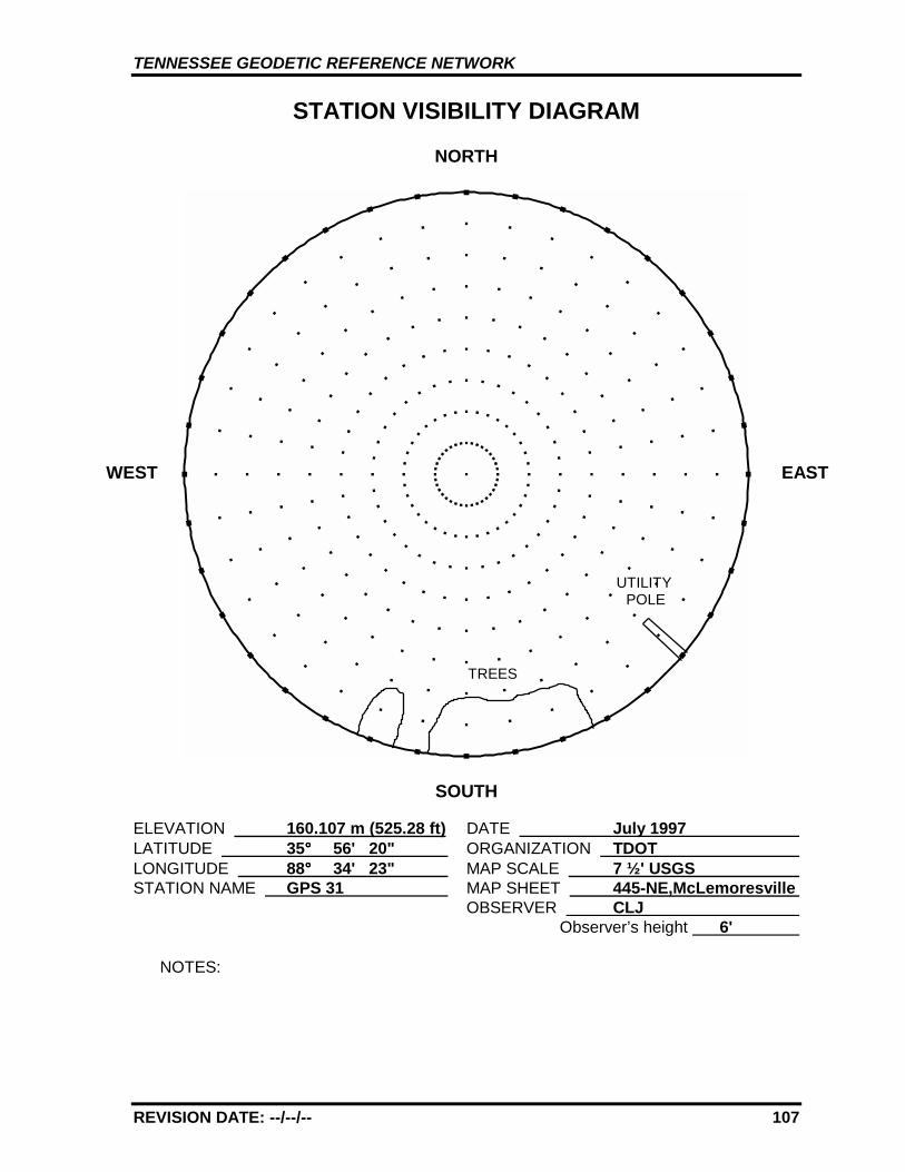
TENNESSEE GEODETIC REFERENCE NETWORK
REVISION DATE: --/--/-- 107
STATION VISIBILITY DIAGRAM
NORTH
SOUTH
ELEVATION 160.107 m (525.28 ft) DATE July 1997 LATITUDE 35°°°° 56' 20" ORGANIZATION TDOT LONGITUDE 88°°°° 34' 23" MAP SCALE 7 ½' USGS STATION NAME GPS 31 MAP SHEET 445-NE,McLemoresville
OBSERVER CLJ Observer’s height 6'
NOTES:
WEST EAST
TREES
UTILITYPOLE

TENNESSEE GEODETIC REFERENCE NETWORK
REVISION DATE: --/--/-- 108
GPS 31 445-NE, McLEMORESVILLE
GPS 31
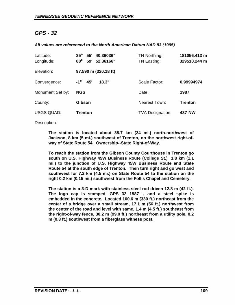
TENNESSEE GEODETIC REFERENCE NETWORK
REVISION DATE: --/--/-- 109
GPS - 32
All values are referenced to the North American Datum NAD 83 (1995)
Latitude: 35°°°° 55' 40.36036" TN Northing: 181056.413 mLongitude: 88°°°° 59' 52.36166" TN Easting: 329510.244 m
Elevation: 97.590 m (320.18 ft)
Convergence: -1°°°° 45' 18.3" Scale Factor: 0.99994974
Monument Set by: NGS Date: 1987
County: Gibson Nearest Town: Trenton
USGS QUAD: Trenton TVA Designation: 437-NW
Description:
The station is located about 38.7 km (24 mi.) north-northwest ofJackson, 8 km (5 mi.) southwest of Trenton, on the northwest right-of-way of State Route 54. Ownership--State Right-of-Way.
To reach the station from the Gibson County Courthouse in Trenton gosouth on U.S. Highway 45W Business Route (College St.) 1.8 km (1.1mi.) to the junction of U.S. Highway 45W Business Route and StateRoute 54 at the south edge of Trenton. Then turn right and go west andsouthwest for 7.2 km (4.5 mi.) on State Route 54 to the station on theright 0.2 km (0.15 mi.) southwest from the Follis Chapel and Cemetery.
The station is a 3-D mark with stainless steel rod driven 12.8 m (42 ft.).The logo cap is stamped---GPS 32 1987---, and a steel spike isembedded in the concrete. Located 100.6 m (330 ft.) northeast from thecenter of a bridge over a small stream, 17.1 m (56 ft.) northwest fromthe center of the road and level with same, 1.4 m (4.5 ft.) southeast fromthe right-of-way fence, 30.2 m (99.0 ft.) northeast from a utility pole, 0.2m (0.8 ft.) southwest from a fiberglass witness post.
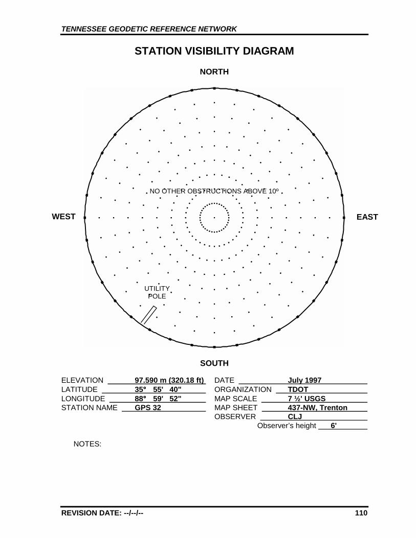
TENNESSEE GEODETIC REFERENCE NETWORK
REVISION DATE: --/--/-- 110
STATION VISIBILITY DIAGRAM
NORTH
SOUTH
ELEVATION 97.590 m (320.18 ft) DATE July 1997 LATITUDE 35°°°° 55' 40" ORGANIZATION TDOT LONGITUDE 88°°°° 59' 52" MAP SCALE 7 ½' USGS STATION NAME GPS 32 MAP SHEET 437-NW, Trenton
OBSERVER CLJ Observer’s height 6'
NOTES:
WEST
NO OTHER OBSTRUCTIONS ABOVE 10º
UTILITYPOLE
EAST
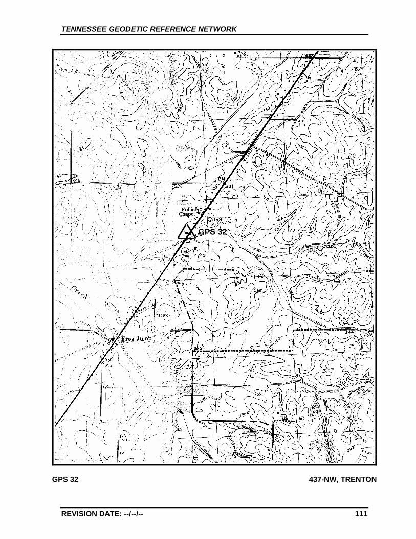
TENNESSEE GEODETIC REFERENCE NETWORK
REVISION DATE: --/--/-- 111
GPS 32 437-NW, TRENTON
GPS 32
TENNESSEE GEODETIC REFERENCE NETWORK
REVISION DATE: --/--/-- 112
GPS - 33
All values are referenced to the North American Datum NAD 83 (1995)
Latitude: 35°°°° 59' 54.49354" TN Northing: 190081.966 mLongitude: 89°°°° 24' 13.70245" TN Easting: 293170.794 m
Elevation: 99.801 m (327.43 ft)
Convergence: -1°°°° 59' 33.8" Scale Factor: 0.99995250
Monument Set by: NGS Date: 1987
County: Dyer Nearest Town: Dyersburg
USGS QUAD: Fowlkes TVA Designation: 421-NW
Description:
The station is located about 3.2 km (2 mi.) south of Dyersburg, at theDyersburg Municipal Airport. Ownership--Airport Manager is JerrieDavis, telephone (901) 286-2233.
To reach the station from the Courthouse in Dyersburg go south onU.S. Highway 51 Business Route (N. Main Ave.) 3.2 km (2.0 mi.) to thejunction of U.S. Highway 51 Bypass and U.S. Highway 51 BusinessRoute just south of Dyersburg. Then bear left and go south for 0.5 km(0.3 mi.) on U.S. Highway 51 to the airport entrance drive on the right.Turn right and go west for 0.56 km (0.35 mi.) on the airport entrancedrive to the airport office. Enter the apron area from the drive betweenthe old airport office building and a metal hangar approximately 90 m(300 ft.) north of the new airport office building. Go west-southwestacross the apron to a taxiway, bear right and go west on the taxiway 61m (200 ft.) to the junction of a southwest taxiway. Turn left and gosouthwest 0.16 km (0.1 mi.) on the taxiway to the station on the left.
The station is a 3-D mark with stainless steel rod driven 11.3 m (37 ft.).The logo cap is stamped---GPS 33 1987---, and a steel spike isembedded in the concrete. Located 63.7 m (209 ft.) west-southwestfrom a wind vane, 62.6 m (205 ft.) west-northwest from a wind sock,48.2 m (158 ft.) east-northeast from the center of a runway, 21.0 m (69ft.) southeast from the center of a taxiway 29.0 m (95 ft.) west from a 0.9m (3 ft.) square iron drain grate, 0.15 m (0.5 ft.) east from a fiberglasswitness post.
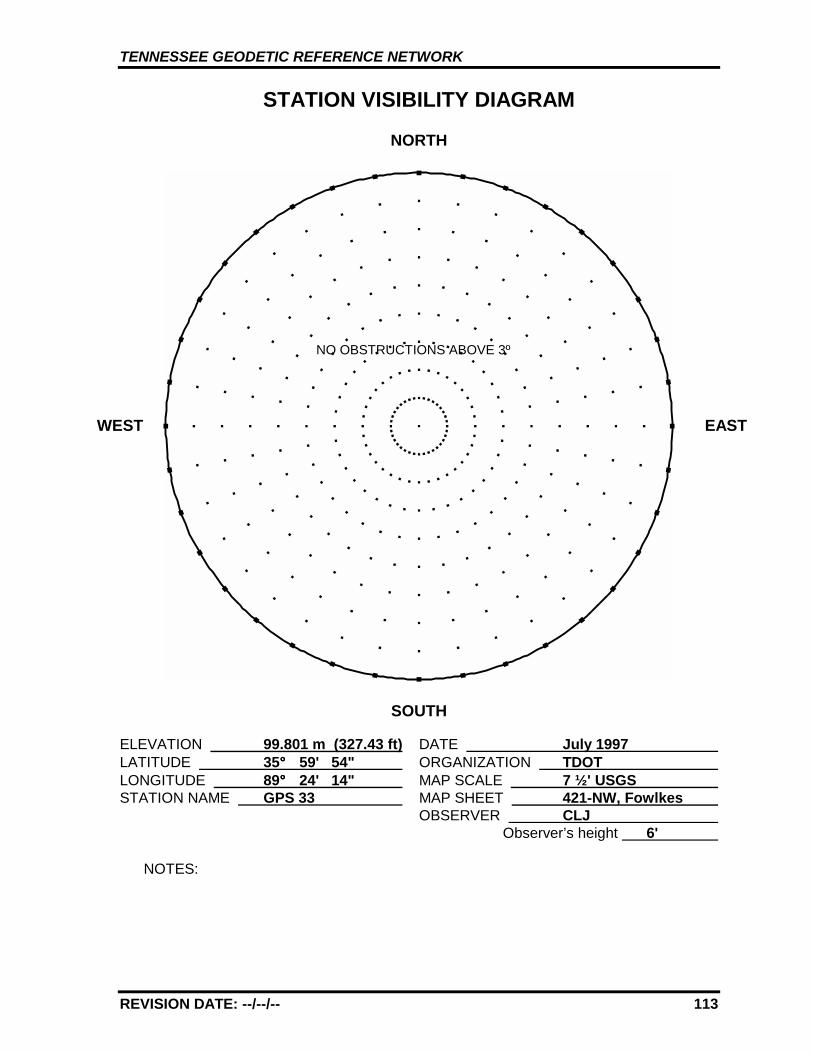
TENNESSEE GEODETIC REFERENCE NETWORK
REVISION DATE: --/--/-- 113
STATION VISIBILITY DIAGRAM
NORTH
SOUTH
ELEVATION 99.801 m (327.43 ft) DATE July 1997 LATITUDE 35°°°° 59' 54" ORGANIZATION TDOT LONGITUDE 89°°°° 24' 14" MAP SCALE 7 ½' USGS STATION NAME GPS 33 MAP SHEET 421-NW, Fowlkes
OBSERVER CLJ Observer’s height 6'
NOTES:
WEST EAST
NO OBSTRUCTIONS ABOVE 3º
TENNESSEE GEODETIC REFERENCE NETWORK
REVISION DATE: --/--/-- 114
GPS 33 421-NW, FOWLKES
GPS 33AZ
TENNESSEE GEODETIC REFERENCE NETWORK
REVISION DATE: --/--/-- 115
GPS - 33 AZ MK
All values are referenced to the North American Datum NAD 83 (1995)
Latitude: 35°°°° 59' 43.16648" TN Northing: 189747.048 mLongitude: 89°°°° 24' 29.74022" TN Easting: 292757.220 m
Elevation: 94.197 m* (309.04 ft)
Convergence: -1°°°° 59' 43.2" Scale Factor: 0.99995235
Monument Set by: NGS Date: 1987
County: Dyer Nearest Town: Dyersburg
USGS QUAD: Fowlkes TVA Designation: 421-NW
Description:
The station is located about 3.2 km (2 mi.) south of Dyersburg, at theDyersburg Municipal Airport. Ownership--Airport Manager is JerrieDavis, telephone (901) 286-2233.
To reach the azimuth mark from the Courthouse in Dyersburg gosouth on U.S. Highway 51 Business Route (N. Main Ave.) 3.2 km (2.0mi.) to the junction of U.S. Highway 51 Bypass and U.S. Highway 51Business Route just south of Dyersburg. Then bear left and gosouth for 0.5 km (0.3 mi.) on U.S. Highway 51 to the airport entrancedrive on the right. Turn right and go west for 0.56 km (0.35 mi.) onthe airport entrance drive to the airport office. Enter the apron areafrom the drive between the old airport office building and a metalhangar approximately 90 m (300 ft.) north of the new airport officebuilding. Go west-southwest across the apron to a taxiway, bearright and go west on the taxiway 61 m (200 ft.) to the junction of asouthwest taxiway. Turn left and go southwest 0.16 km (0.1 mi.) onthe taxiway to station GPS 33 AZ MK on the left. Continue straightahead and go 0.6 km (0.35 mi.) to the mark on the right.
The azimuth mark is a 3-D mark with stainless steel rod driven 18.9m (62 ft.). The logo cap is stamped---GPS 33 AZ MK 1987---, with asteel spike embedded in the concrete and 0.05 m (0.17 ft.) below theground. Located 18.3 m (60.2 ft.) southeast of the southeast edge ofthe runway, 12.6 m (41.5 ft.) southeast of the center of a taxiwayguidance sign, 14.3 m (47.0 ft.) northeast of the northeast edge ofthe taxiway crossover, 14.7 m (48.0 ft.) northwest of the center of aconcrete culvert with a headwall, and 0.3 m (1.0 ft.) south of afiberglass witness post.
* GPS derived elevation using the Geoid 96 Model and the WGS 1984Reference Ellipsoid.
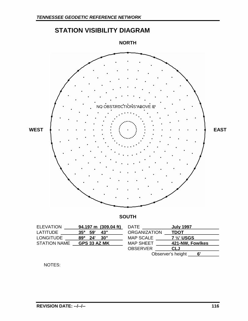
TENNESSEE GEODETIC REFERENCE NETWORK
REVISION DATE: --/--/-- 116
STATION VISIBILITY DIAGRAM
NORTH
SOUTH
ELEVATION 94.197 m (309.04 ft) DATE July 1997 LATITUDE 35°°°° 59' 43" ORGANIZATION TDOT LONGITUDE 89°°°° 24' 30" MAP SCALE 7 ½' USGS STATION NAME GPS 33 AZ MK MAP SHEET 421-NW, Fowlkes
OBSERVER CLJ Observer’s height 6'
NOTES:
WEST EAST
NO OBSTRUCTIONS ABOVE 8º
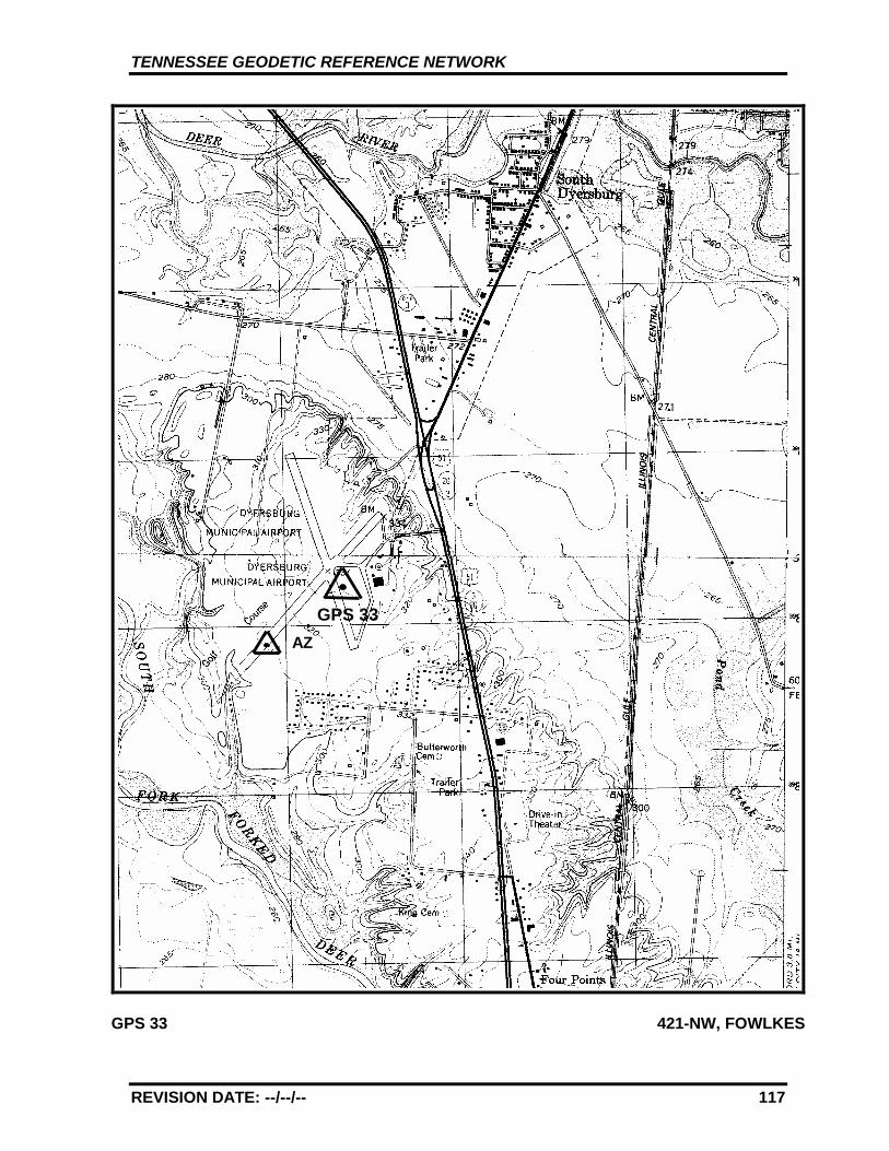
TENNESSEE GEODETIC REFERENCE NETWORK
REVISION DATE: --/--/-- 117
GPS 33 421-NW, FOWLKES
GPS 33AZ
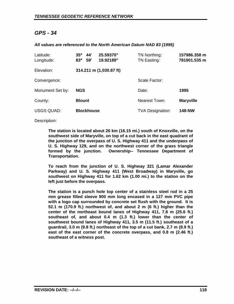
TENNESSEE GEODETIC REFERENCE NETWORK
REVISION DATE: --/--/-- 118
GPS - 34
All values are referenced to the North American Datum NAD 83 (1995)
Latitude: 35°°°° 44' 25.59370" TN Northing: 157986.358 mLongitude: 83°°°° 59' 19.92189" TN Easting: 781901.535 m
Elevation: 314.211 m (1,030.87 ft)
Convergence: Scale Factor:
Monument Set by: NGS Date: 1995
County: Blount Nearest Town: Maryville
USGS QUAD: Blockhouse TVA Designation: 148-NW
Description:
The station is located about 26 km (16.15 mi.) south of Knoxville, on thesouthwest side of Maryville, on top of a cut back in the east quadrant ofthe junction of the overpass of U. S. Highway 411 and the underpass ofU. S. Highway 129, and on the northwest corner of the grass triangleformed by the junction. Ownership-- Tennessee Department ofTransportation.
To reach from the junction of U. S. Highway 321 (Lamar AlexanderParkway) and U. S. Highway 411 (West Broadway) in Maryville, gosouthwest on Highway 411 for 1.62 km (1.00 mi.) to the station on theleft just before the overpass.
The station is a punch hole top center of a stainless steel rod in a 25mm grease filled sleeve 900 mm long encased in a 127 mm PVC pipewith a logo cap surrounded by concrete set flush with the ground. It is52.1 m (170.9 ft.) northwest of, and about 2 m (6 ft.) higher than thecenter of the northeast bound lanes of Highway 411, 7.8 m (25.6 ft.)southeast of, and about 0.4 m (1.3 ft.) lower than the center ofsouthwest bound lanes of Highway 411, 3.5 m (11.5 ft.) southeast of aguardrail, 3.0 m (9.8 ft.) northeast of the top of a cut bank, 2.7 m (8.9 ft.)east of the east corner of the concrete overpass, and 0.8 m (2.46 ft.)southeast of a witness post.
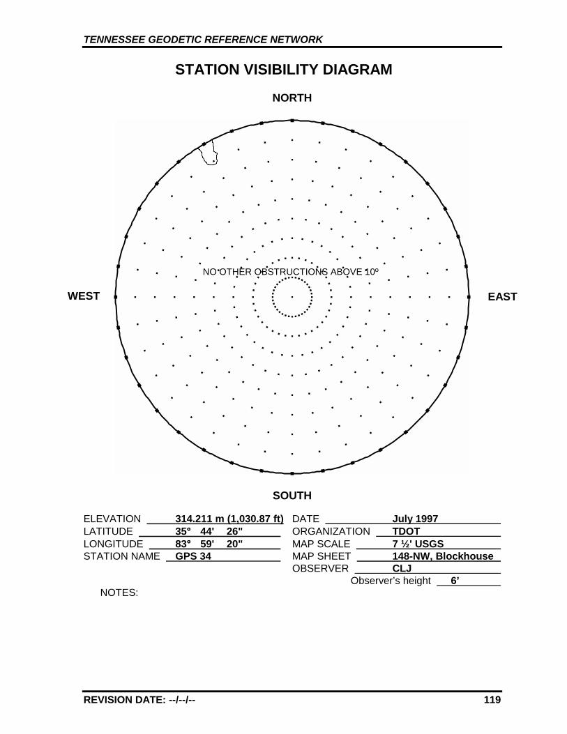
TENNESSEE GEODETIC REFERENCE NETWORK
REVISION DATE: --/--/-- 119
STATION VISIBILITY DIAGRAM
NORTH
SOUTH
ELEVATION 314.211 m (1,030.87 ft) DATE July 1997 LATITUDE 35°°°° 44' 26" ORGANIZATION TDOT LONGITUDE 83°°°° 59' 20" MAP SCALE 7 ½' USGS STATION NAME GPS 34 MAP SHEET 148-NW, Blockhouse
OBSERVER CLJ Observer’s height 6’
NOTES:
WEST EAST
NO OTHER OBSTRUCTIONS ABOVE 10º
TENNESSEE GEODETIC REFERENCE NETWORK
REVISION DATE: --/--/-- 120
GPS 34 148-NW, BLOCKHOUSE
GPS 34
TENNESSEE GEODETIC REFERENCE NETWORK
REVISION DATE: --/--/-- 121
GPS - 35
All values are referenced to the North American Datum NAD 83 (1995)
Latitude: 35°°°° 32' 36.90156" TN Northing: 135487.098 mLongitude: 84°°°° 22' 59.97885" TN Easting: 746588.083 m
Elevation: 317.376 m (1,041.26 ft)
Convergence: +0°°°° 56' 47.3" Scale Factor: 0.99996118
Monument Set by: NGS Date: 1987
County: Monroe Nearest Town: Madisonville
USGS QUAD: Sweetwater TVA Designation: 131-SW
Description:
The station is located about 9.7 km (6 mi.) southwest of Sweetwater, 3.2km (2 mi.) northwest of Madisonville, at the Madisonville/MonroeCounty Airport, 0.21 km (0.13 mi.) southwest of the airport office and onthe highest part of a low ridge between the runway and access road.Ownership--Airport Manager is Larry Hamilton, telephone (615) 442-4506.
To reach the station from the Courthouse in Madisonville go north for0.8 km (0.5 mi.) on College Street to a fork at Sweetwater Road. Followthe left fork and go north for 3.94 km (2.45 mi.) on Sweetwater Road tothe airport entrance drive on the right. Turn right and go northeast for1.6 km (1.0 mi.) on the airport entrance drive to the airport office andthe station about equidistant between the office and the southwest endof the runway.
The station is a 3-D mark with stainless steel rod driven 14.3 m (47 ft.).The logo cap is stamped---GPS 35 1987---, and a steel spike isembedded in the concrete. Located 65.2 m (214 ft.) northwest from therunway center and 2.4 m (8 ft.) above same, 18.0 m (59 ft.) southeastfrom the road center, 38.7 m (127 ft.) northwest from a vasi navigationlight, 33.2 m (109 ft.) southeast from a utility pole, 2.1 m (6.9 ft.)southeast from airport chain link boundary fence. Fence is 1.8 m (6 ft.)tall, 0.4 m (1.2 ft.) southwest from a fiberglass witness post.

TENNESSEE GEODETIC REFERENCE NETWORK
REVISION DATE: --/--/-- 122
STATION VISIBILITY DIAGRAM
NORTH
SOUTH
ELEVATION 317.376 m (1,041.26 ft) DATE July 1997 LATITUDE 35°°°° 32' 37" ORGANIZATION TDOT LONGITUDE 84°°°° 23' 00" MAP SCALE 7 ½' USGS STATION NAME GPS 35 MAP SHEET 131-SW, Sweetwater
OBSERVER CLJ Observer’s height 6'
NOTES:
WEST EAST
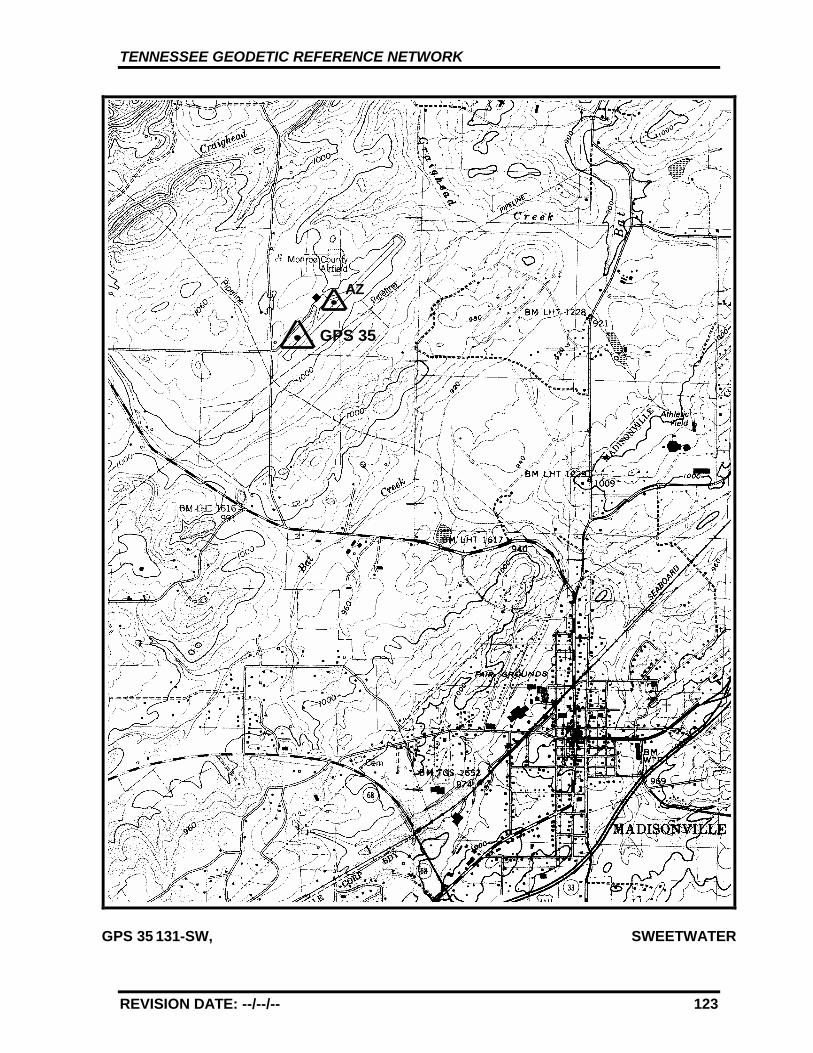
TENNESSEE GEODETIC REFERENCE NETWORK
REVISION DATE: --/--/-- 123
GPS 35 131-SW, SWEETWATER
GPS 35
AZ
TENNESSEE GEODETIC REFERENCE NETWORK
REVISION DATE: --/--/-- 124
GPS - 35 AZ MK
All values are referenced to the North American Datum NAD 83 (1995)
Latitude: 35°°°° 32' 42.93636" TN Northing: 135676.981 mLongitude: 84°°°° 22' 50.55166" TN Easting: 746822.425 m
Elevation: 309.966 m* (1,016.95 ft.)
Convergence: +0°°°° 56' 52.8" Scale Factor: 0.99996103
Monument Set by: NGS Date: 1987
County: Monroe Nearest Town: Madisonville
USGS QUAD: Sweetwater TVA Designation: 131-SW
Description:
The azimuth mark is located about 9.7 km (6 mi.) southwest ofSweetwater, 3.2 km (2 mi.) northwest of Madisonville, at theMadisonville/Monroe County Airport in a triangular plot of groundformed by the taxiway and runway. Ownership--Airport Manager isLarry Hamilton, telephone (615) 442-4506.
To reach the azimuth mark from the Courthouse in Madisonville gonorth for 0.8 km (0.5 mi.) on College Street to a fork at SweetwaterRoad. Follow the left fork and go north for 3.94 km (2.45 mi.) onSweetwater Road to the airport entrance drive on the right. Turnright and go northeast for 1.6 km (1.0 mi.) on the airport entrancedrive to the airport office, thence easterly 0.16 km (0.1 mi.) to themark near the center of a grassy triangle formed by the runway andtaxiway.
The azimuth is a 3-D mark with stainless steel rod driven 5.8 m (19ft.) to refusal, 0.08 m (0.25 ft.) below ground, with a logo capstamped---GPS 35 AZ MK 1987---, and a rebar set in the concrete.Located 20.2 m (66.3 ft.) southeast of the southeast edge of theeast-west taxiway, 11.0 m (36 ft.) northwest of the northwest edge ofthe runway, 12.5 m (41.0 ft.) east of a pipe culvert under the groundand 0.5 m (1.7 ft.) southwest of a fiberglass witness post, also 0.32km (0.2 mi.) northeast of station GPS 35.
* GPS derived elevation using the Geoid 96 Model and the WGS1984 Reference Ellipsoid.
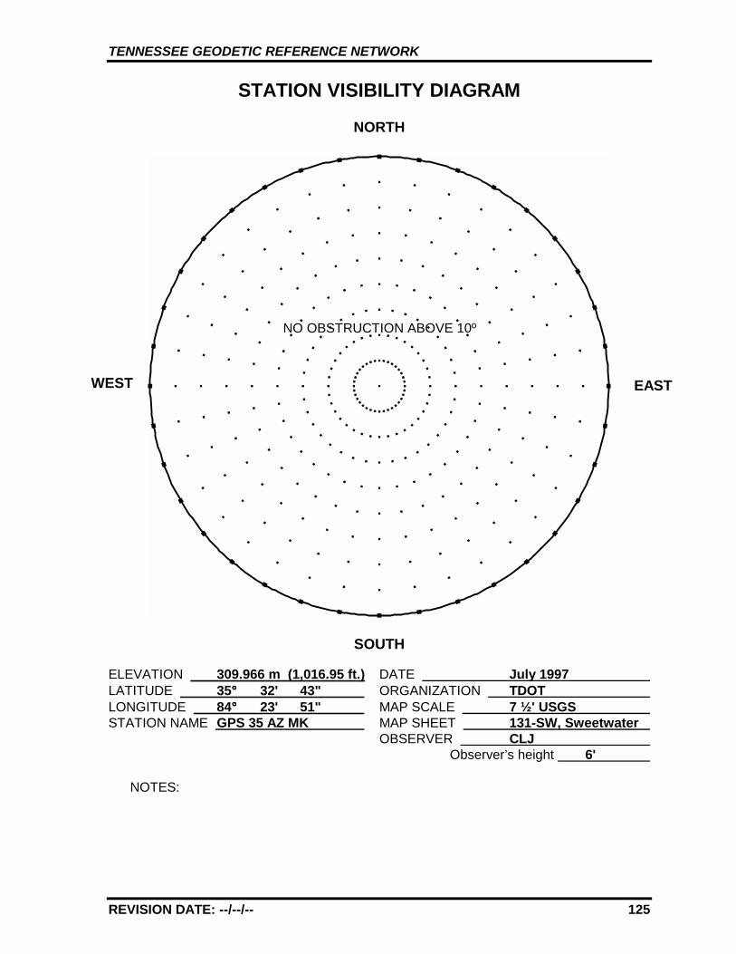
TENNESSEE GEODETIC REFERENCE NETWORK
REVISION DATE: --/--/-- 125
STATION VISIBILITY DIAGRAM
NORTH
SOUTH
ELEVATION 309.966 m (1,016.95 ft.) DATE July 1997 LATITUDE 35°°°° 32' 43" ORGANIZATION TDOT LONGITUDE 84°°°° 23' 51" MAP SCALE 7 ½' USGS STATION NAME GPS 35 AZ MK MAP SHEET 131-SW, Sweetwater
OBSERVER CLJ Observer’s height 6'
NOTES:
WEST EAST
NO OBSTRUCTION ABOVE 10º
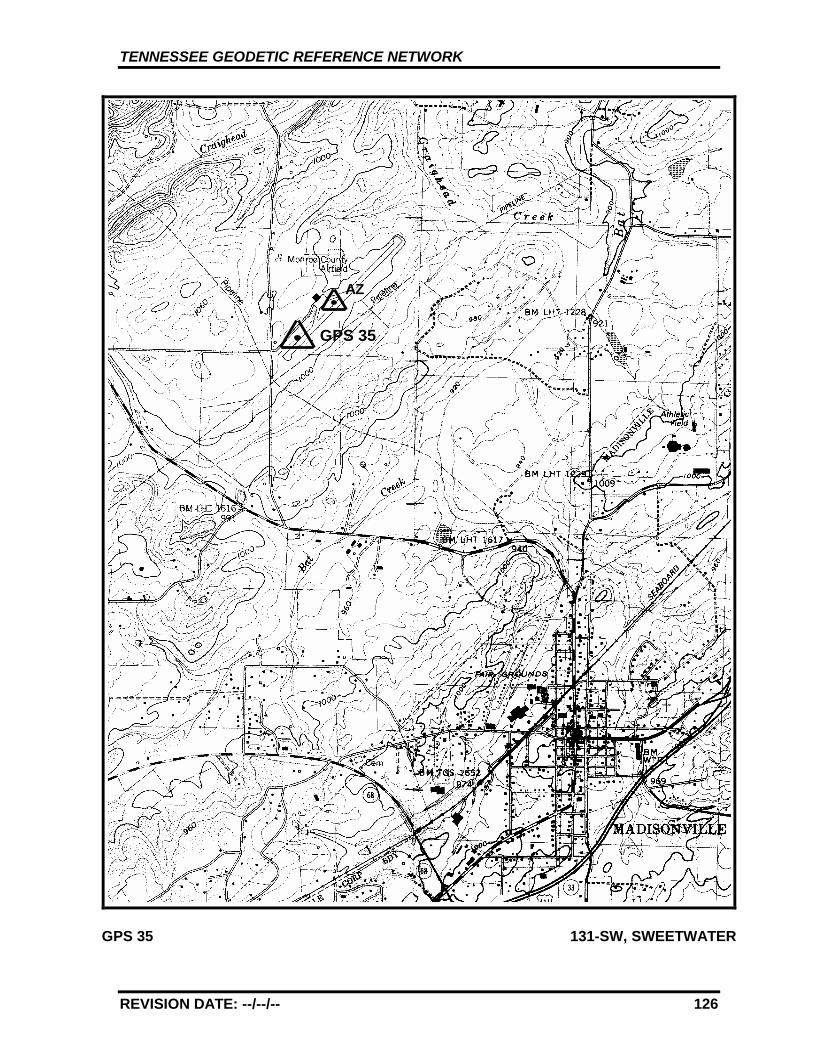
TENNESSEE GEODETIC REFERENCE NETWORK
REVISION DATE: --/--/-- 126
GPS 35 131-SW, SWEETWATER
GPS 35
AZ
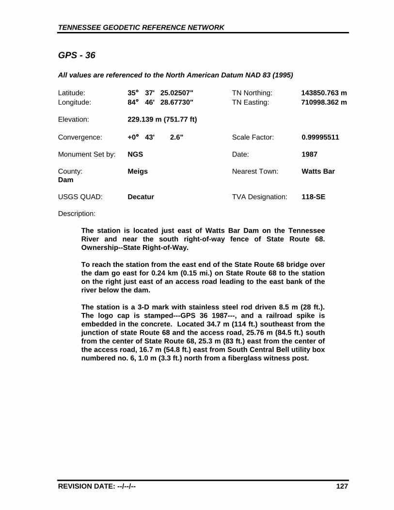
TENNESSEE GEODETIC REFERENCE NETWORK
REVISION DATE: --/--/-- 127
GPS - 36
All values are referenced to the North American Datum NAD 83 (1995)
Latitude: 35°°°° 37' 25.02507" TN Northing: 143850.763 mLongitude: 84°°°° 46' 28.67730" TN Easting: 710998.362 m
Elevation: 229.139 m (751.77 ft)
Convergence: +0°°°° 43' 2.6" Scale Factor: 0.99995511
Monument Set by: NGS Date: 1987
County: Meigs Nearest Town: Watts BarDam
USGS QUAD: Decatur TVA Designation: 118-SE
Description:
The station is located just east of Watts Bar Dam on the TennesseeRiver and near the south right-of-way fence of State Route 68.Ownership--State Right-of-Way.
To reach the station from the east end of the State Route 68 bridge overthe dam go east for 0.24 km (0.15 mi.) on State Route 68 to the stationon the right just east of an access road leading to the east bank of theriver below the dam.
The station is a 3-D mark with stainless steel rod driven 8.5 m (28 ft.).The logo cap is stamped---GPS 36 1987---, and a railroad spike isembedded in the concrete. Located 34.7 m (114 ft.) southeast from thejunction of state Route 68 and the access road, 25.76 m (84.5 ft.) southfrom the center of State Route 68, 25.3 m (83 ft.) east from the center ofthe access road, 16.7 m (54.8 ft.) east from South Central Bell utility boxnumbered no. 6, 1.0 m (3.3 ft.) north from a fiberglass witness post.
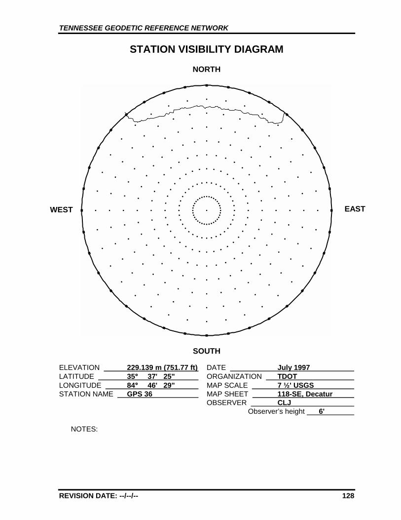
TENNESSEE GEODETIC REFERENCE NETWORK
REVISION DATE: --/--/-- 128
STATION VISIBILITY DIAGRAM
NORTH
SOUTH
ELEVATION 229.139 m (751.77 ft) DATE July 1997 LATITUDE 35°°°° 37' 25" ORGANIZATION TDOT LONGITUDE 84°°°° 46' 29" MAP SCALE 7 ½' USGS STATION NAME GPS 36 MAP SHEET 118-SE, Decatur
OBSERVER CLJ Observer’s height 6'
NOTES:
WEST EAST
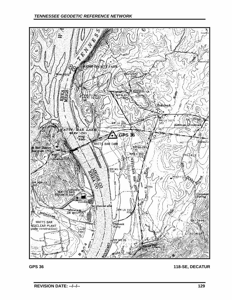
TENNESSEE GEODETIC REFERENCE NETWORK
REVISION DATE: --/--/-- 129
GPS 36 118-SE, DECATUR
GPS 36
TENNESSEE GEODETIC REFERENCE NETWORK
REVISION DATE: --/--/-- 130
GPS - 37
All values are referenced to the North American Datum NAD 83 (1995)
Latitude: 35°°°° 34' 56.79049" TN Northing: 138870.791 mLongitude: 85°°°° 13' 4.09281" TN Easting: 670891.887 m
Elevation: 251.899 m (826.44 ft)
Convergence: +0°°°° 27' 28.5" Scale Factor: 0.99995799
Monument Set by: NGS Date: 1987
County: Bledsoe Nearest Town: Pikeville
USGS QUAD: Pikeville TVA Designation: 110-SW
Description:
The station is located about 3.2 km (2 mi.) southwest of Pikeville, in abedrock outcrop at the east edge of U.S. Highway 127. Ownership--State Right-of-Way.
To reach the station from the junction of State Route 30 and U.S.Highway 127 at the south edge of Pikeville go south for 2.7 km (1.7 mi.)on U.S. Highway 127 to the Bledsoe County High School entrance driveon the right. Continue straight ahead and go south for 0.24 km (0.15mi.) on U.S. Highway 127 to the station on the left.
The station is a standard NGS disk stamped---GPS 37 1987---, set into adrillhole in bedrock outcrop measuring 1.2 m (4 ft.) by 0.4 m (1.3 ft.)projecting 0.09 m (0.3 ft.) above ground. Located 36.6 m (120 ft.) west-southwest from a utility pole numbered 23 30 with one transformer,15.09 m (49.5 ft.) southeast from the center of U.S. Highway 127 and 0.3m (1 ft.) above same, 6.7 m (22 ft.) northeast from the center of a graveldrive leading to a house, 0.6 m (2.1 ft.) northwest from a fiberglasswitness post set at a white board right-of-way fence.
TENNESSEE GEODETIC REFERENCE NETWORK
REVISION DATE: --/--/-- 131
STATION VISIBILITY DIAGRAM
NORTH
SOUTH
ELEVATION 251.899 m (826.44 ft) DATE July 1997 LATITUDE 35°°°° 34' 57" ORGANIZATION TDOT LONGITUDE 85°°°° 13' 4" MAP SCALE 7 ½' USGS STATION NAME GPS 37 MAP SHEET 110-SW, Pikeville
OBSERVER CLJ Observer’s height 6 '
NOTES:
WEST EAST
UTILITY POLE# 23 30
GATE POSTS9 m
6 m
TENNESSEE GEODETIC REFERENCE NETWORK
REVISION DATE: --/--/-- 132
GPS 37 110-SW, PIKEVILLE
GPS 37
TENNESSEE GEODETIC REFERENCE NETWORK
REVISION DATE: --/--/-- 133
GPS - 38
All values are referenced to the North American Datum NAD 83 (1995)
Latitude: 35°°°° 36' 22.02445" TN Northing: 141254.477 mLongitude: 85°°°° 42' 19.11789" TN Easting: 626700.578 m
Elevation: 272.043 m (892.53 ft)
Convergence: +0°°°° 10' 21.1" Scale Factor: 0.99995627
Monument Set by: NGS Date: 1987
County: Warren Nearest Town: McMinnville
USGS QUAD: Irving College TVA Designation: 328-SW
Description:
The station is located about 11.3 km (7 mi.) south of McMinnville, in afill area on the west side of State Route 56. Ownership--State Right-of-Way.
To reach the station from the front (south side) of the Courthouse inMcMinnville go east on E. Main St. 1 block, 0.16 km (0.1 mi.) to anintersection. Turn right and go south 1 block, 0.16 km (0.1 mi.) on E.Spring St. to an intersection. Turn left and go south for 3.5 km (2.2 mi.)on State Route 56 to the junction of State Route 127. Continue straightahead and go south for 3.4 km (2.1 mi.) on State Route 56 to theFairview Community Center on the right. Continue straight ahead andgo south for 4.0 km (2.5 mi.) on State Route 56 to the station on theright.
The station is a 3-D mark with stainless steel rod driven 12.2 m (40 ft.).The logo cap is stamped---GPS 38 1987---, and a steel spike isembedded in the concrete. Located 81.1 m (266 ft.) south from thenorth end of a guardrail, 31.8 m (104.3 ft.) north-northwest and acrossthe road from mile marker number 6, 35.1 m (115 ft.) north-northeastfrom a power pole with one guy wire, 9.30 m (30.5 ft.) west from theroad center and 0.6 m (2 ft.) below same, 2.6 m (8.5 ft.) west from afiberglass witness post set at the guardrail.
TENNESSEE GEODETIC REFERENCE NETWORK
REVISION DATE: --/--/-- 134
STATION VISIBILITY DIAGRAM
NORTH
SOUTH
ELEVATION 272.043 m (892.53 ft) DATE July 1997 LATITUDE 35°°°° 36' 22" ORGANIZATION TDOT LONGITUDE 85°°°° 42' 19" MAP SCALE 7 ½' USGS STATION NAME GPS 38 MAP SHEET 328-SW, Irving College
OBSERVER CLJ Observer’s height 6'
NOTES:
WEST EAST
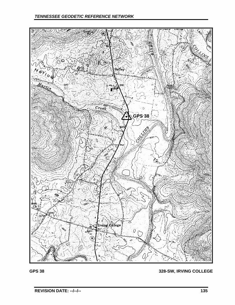
TENNESSEE GEODETIC REFERENCE NETWORK
REVISION DATE: --/--/-- 135
GPS 38 328-SW, IRVING COLLEGE
GPS 38
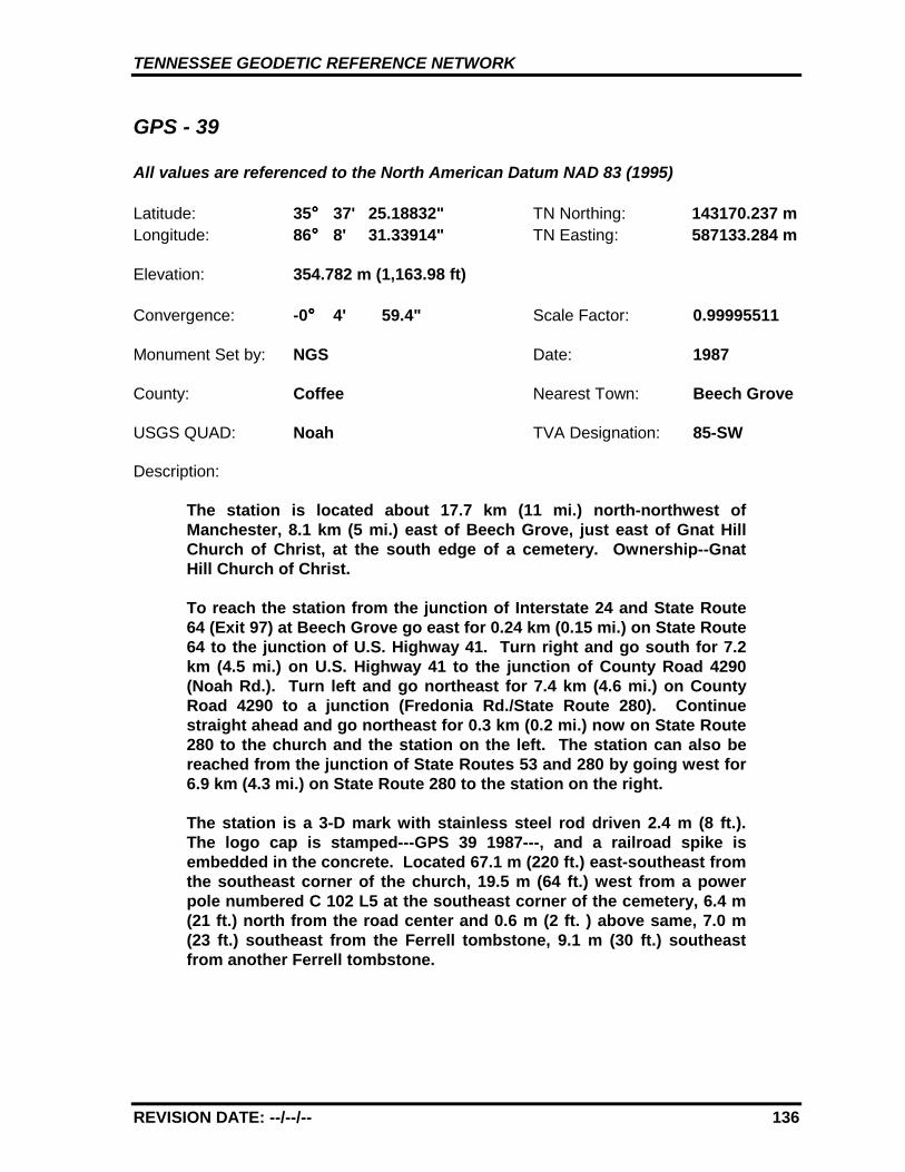
TENNESSEE GEODETIC REFERENCE NETWORK
REVISION DATE: --/--/-- 136
GPS - 39
All values are referenced to the North American Datum NAD 83 (1995)
Latitude: 35°°°° 37' 25.18832" TN Northing: 143170.237 mLongitude: 86°°°° 8' 31.33914" TN Easting: 587133.284 m
Elevation: 354.782 m (1,163.98 ft)
Convergence: -0°°°° 4' 59.4" Scale Factor: 0.99995511
Monument Set by: NGS Date: 1987
County: Coffee Nearest Town: Beech Grove
USGS QUAD: Noah TVA Designation: 85-SW
Description:
The station is located about 17.7 km (11 mi.) north-northwest ofManchester, 8.1 km (5 mi.) east of Beech Grove, just east of Gnat HillChurch of Christ, at the south edge of a cemetery. Ownership--GnatHill Church of Christ.
To reach the station from the junction of Interstate 24 and State Route64 (Exit 97) at Beech Grove go east for 0.24 km (0.15 mi.) on State Route64 to the junction of U.S. Highway 41. Turn right and go south for 7.2km (4.5 mi.) on U.S. Highway 41 to the junction of County Road 4290(Noah Rd.). Turn left and go northeast for 7.4 km (4.6 mi.) on CountyRoad 4290 to a junction (Fredonia Rd./State Route 280). Continuestraight ahead and go northeast for 0.3 km (0.2 mi.) now on State Route280 to the church and the station on the left. The station can also bereached from the junction of State Routes 53 and 280 by going west for6.9 km (4.3 mi.) on State Route 280 to the station on the right.
The station is a 3-D mark with stainless steel rod driven 2.4 m (8 ft.).The logo cap is stamped---GPS 39 1987---, and a railroad spike isembedded in the concrete. Located 67.1 m (220 ft.) east-southeast fromthe southeast corner of the church, 19.5 m (64 ft.) west from a powerpole numbered C 102 L5 at the southeast corner of the cemetery, 6.4 m(21 ft.) north from the road center and 0.6 m (2 ft. ) above same, 7.0 m(23 ft.) southeast from the Ferrell tombstone, 9.1 m (30 ft.) southeastfrom another Ferrell tombstone.
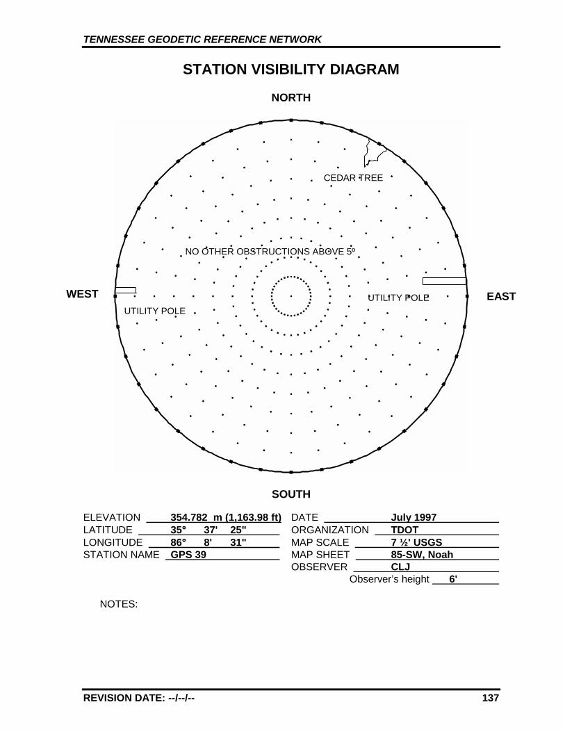
TENNESSEE GEODETIC REFERENCE NETWORK
REVISION DATE: --/--/-- 137
STATION VISIBILITY DIAGRAM
NORTH
SOUTH
ELEVATION 354.782 m (1,163.98 ft) DATE July 1997 LATITUDE 35°°°° 37' 25" ORGANIZATION TDOT LONGITUDE 86°°°° 8' 31" MAP SCALE 7 ½' USGS STATION NAME GPS 39 MAP SHEET 85-SW, Noah
OBSERVER CLJ Observer’s height 6'
NOTES:
WEST EASTUTILITY POLE
CEDAR TREE
NO OTHER OBSTRUCTIONS ABOVE 5º
UTILITY POLE
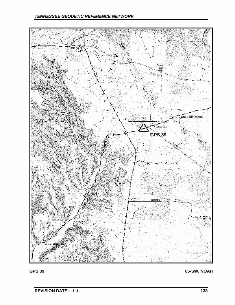
TENNESSEE GEODETIC REFERENCE NETWORK
REVISION DATE: --/--/-- 138
GPS 39 85-SW, NOAH
GPS 39
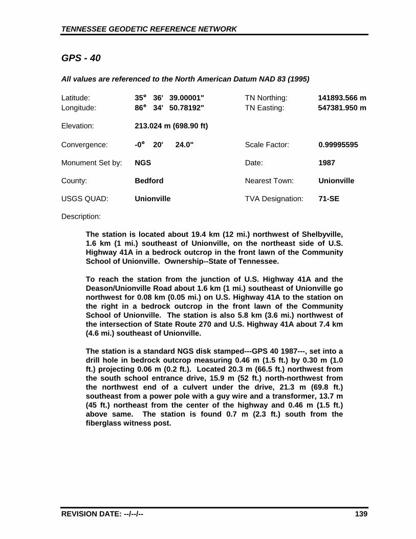
TENNESSEE GEODETIC REFERENCE NETWORK
REVISION DATE: --/--/-- 139
GPS - 40
All values are referenced to the North American Datum NAD 83 (1995)
Latitude: 35°°°° 36' 39.00001" TN Northing: 141893.566 mLongitude: 86°°°° 34' 50.78192" TN Easting: 547381.950 m
Elevation: 213.024 m (698.90 ft)
Convergence: -0°°°° 20' 24.0" Scale Factor: 0.99995595
Monument Set by: NGS Date: 1987
County: Bedford Nearest Town: Unionville
USGS QUAD: Unionville TVA Designation: 71-SE
Description:
The station is located about 19.4 km (12 mi.) northwest of Shelbyville,1.6 km (1 mi.) southeast of Unionville, on the northeast side of U.S.Highway 41A in a bedrock outcrop in the front lawn of the CommunitySchool of Unionville. Ownership--State of Tennessee.
To reach the station from the junction of U.S. Highway 41A and theDeason/Unionville Road about 1.6 km (1 mi.) southeast of Unionville gonorthwest for 0.08 km (0.05 mi.) on U.S. Highway 41A to the station onthe right in a bedrock outcrop in the front lawn of the CommunitySchool of Unionville. The station is also 5.8 km (3.6 mi.) northwest ofthe intersection of State Route 270 and U.S. Highway 41A about 7.4 km(4.6 mi.) southeast of Unionville.
The station is a standard NGS disk stamped---GPS 40 1987---, set into adrill hole in bedrock outcrop measuring 0.46 m (1.5 ft.) by 0.30 m (1.0ft.) projecting 0.06 m (0.2 ft.). Located 20.3 m (66.5 ft.) northwest fromthe south school entrance drive, 15.9 m (52 ft.) north-northwest fromthe northwest end of a culvert under the drive, 21.3 m (69.8 ft.)southeast from a power pole with a guy wire and a transformer, 13.7 m(45 ft.) northeast from the center of the highway and 0.46 m (1.5 ft.)above same. The station is found 0.7 m (2.3 ft.) south from thefiberglass witness post.
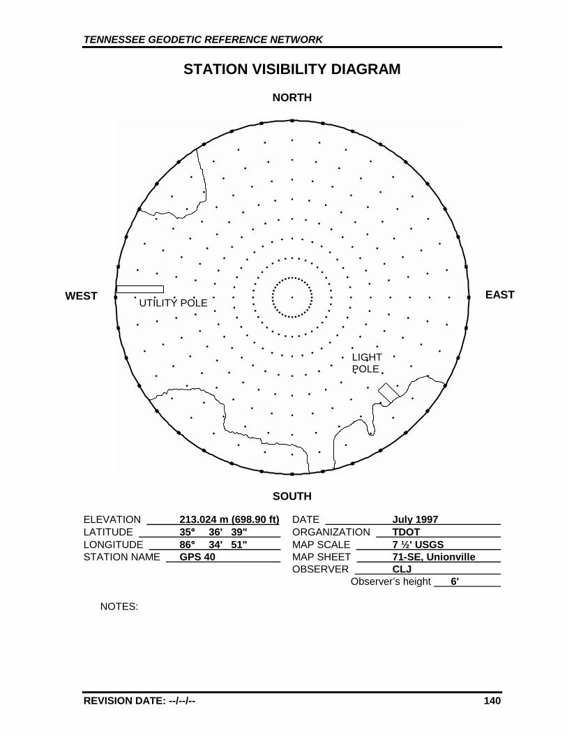
TENNESSEE GEODETIC REFERENCE NETWORK
REVISION DATE: --/--/-- 140
STATION VISIBILITY DIAGRAM
NORTH
SOUTH
ELEVATION 213.024 m (698.90 ft) DATE July 1997 LATITUDE 35°°°° 36' 39" ORGANIZATION TDOT LONGITUDE 86°°°° 34' 51" MAP SCALE 7 ½' USGS STATION NAME GPS 40 MAP SHEET 71-SE, Unionville
OBSERVER CLJ Observer’s height 6'
NOTES:
WEST EASTUTILITY POLE
LIGHTPOLE
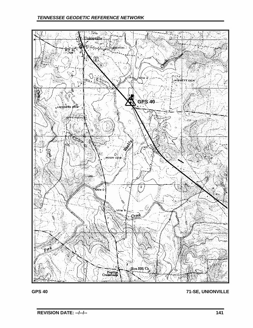
TENNESSEE GEODETIC REFERENCE NETWORK
REVISION DATE: --/--/-- 141
GPS 40 71-SE, UNIONVILLE
GPS 40
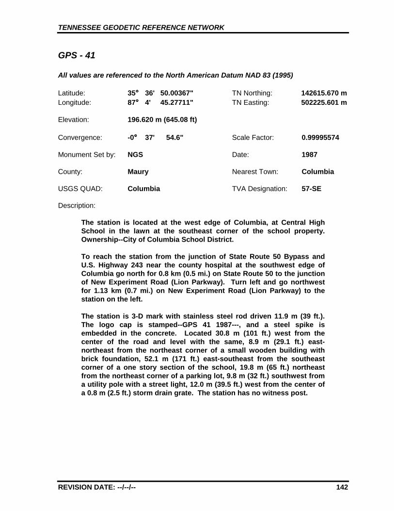
TENNESSEE GEODETIC REFERENCE NETWORK
REVISION DATE: --/--/-- 142
GPS - 41
All values are referenced to the North American Datum NAD 83 (1995)
Latitude: 35°°°° 36' 50.00367" TN Northing: 142615.670 mLongitude: 87°°°° 4' 45.27711" TN Easting: 502225.601 m
Elevation: 196.620 m (645.08 ft)
Convergence: -0°°°° 37' 54.6" Scale Factor: 0.99995574
Monument Set by: NGS Date: 1987
County: Maury Nearest Town: Columbia
USGS QUAD: Columbia TVA Designation: 57-SE
Description:
The station is located at the west edge of Columbia, at Central HighSchool in the lawn at the southeast corner of the school property.Ownership--City of Columbia School District.
To reach the station from the junction of State Route 50 Bypass andU.S. Highway 243 near the county hospital at the southwest edge ofColumbia go north for 0.8 km (0.5 mi.) on State Route 50 to the junctionof New Experiment Road (Lion Parkway). Turn left and go northwestfor 1.13 km (0.7 mi.) on New Experiment Road (Lion Parkway) to thestation on the left.
The station is 3-D mark with stainless steel rod driven 11.9 m (39 ft.).The logo cap is stamped--GPS 41 1987---, and a steel spike isembedded in the concrete. Located 30.8 m (101 ft.) west from thecenter of the road and level with the same, 8.9 m (29.1 ft.) east-northeast from the northeast corner of a small wooden building withbrick foundation, 52.1 m (171 ft.) east-southeast from the southeastcorner of a one story section of the school, 19.8 m (65 ft.) northeastfrom the northeast corner of a parking lot, 9.8 m (32 ft.) southwest froma utility pole with a street light, 12.0 m (39.5 ft.) west from the center ofa 0.8 m (2.5 ft.) storm drain grate. The station has no witness post.
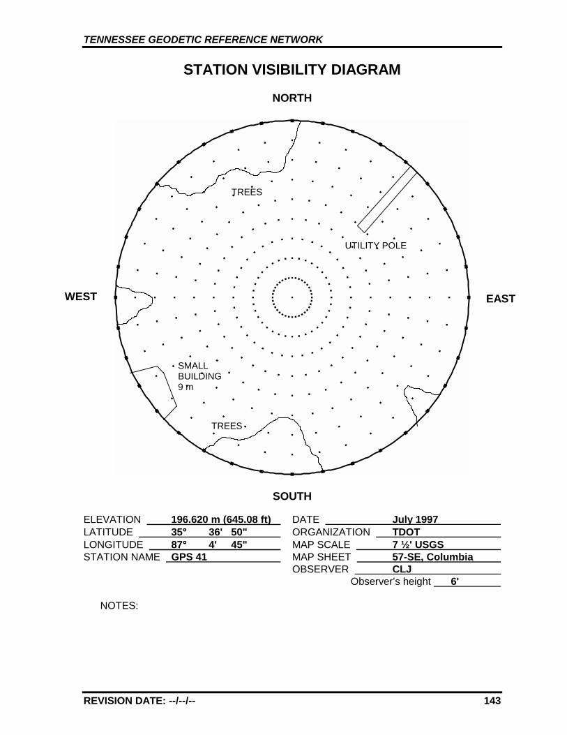
TENNESSEE GEODETIC REFERENCE NETWORK
REVISION DATE: --/--/-- 143
STATION VISIBILITY DIAGRAM
NORTH
SOUTH
ELEVATION 196.620 m (645.08 ft) DATE July 1997 LATITUDE 35°°°° 36' 50" ORGANIZATION TDOT LONGITUDE 87°°°° 4' 45" MAP SCALE 7 ½' USGS STATION NAME GPS 41 MAP SHEET 57-SE, Columbia
OBSERVER CLJ Observer’s height 6'
NOTES:
WEST EAST
UTILITY POLE
TREES
SMALLBUILDING9 m
TREES
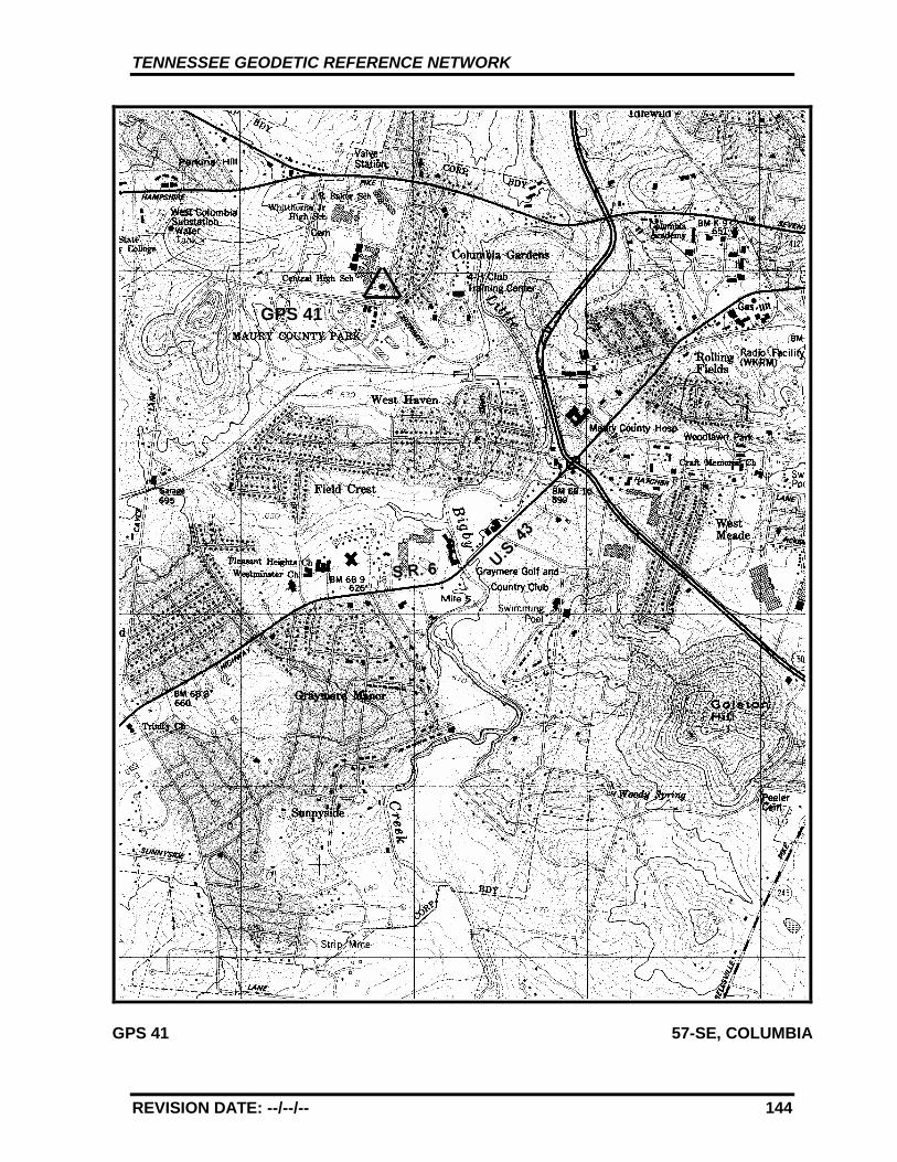
TENNESSEE GEODETIC REFERENCE NETWORK
REVISION DATE: --/--/-- 144
GPS 41 57-SE, COLUMBIA
GPS 41
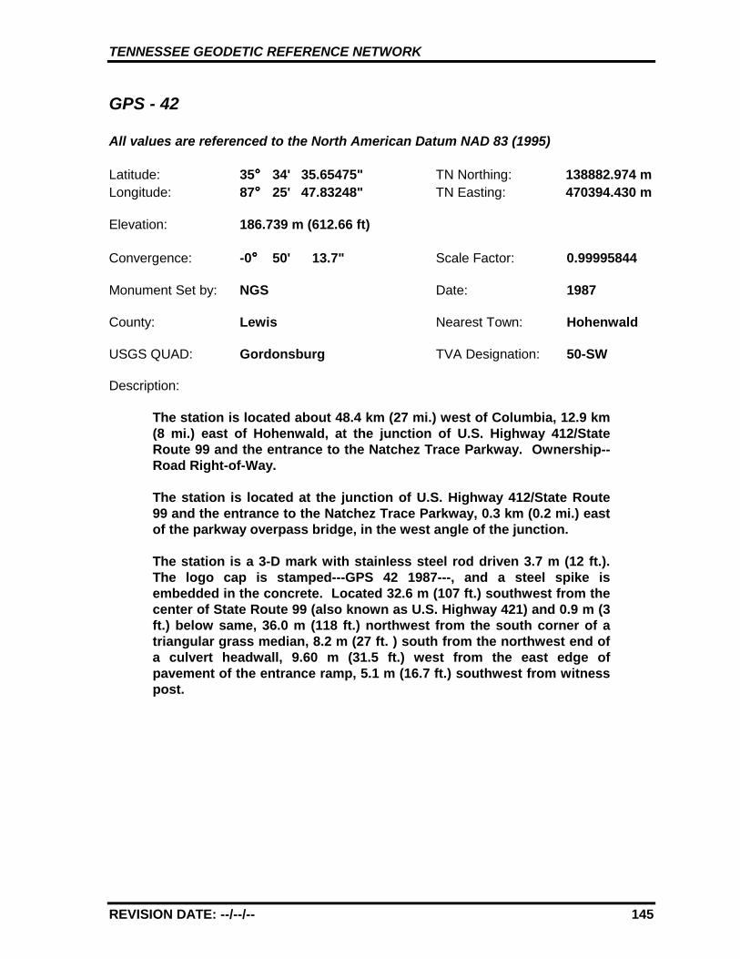
TENNESSEE GEODETIC REFERENCE NETWORK
REVISION DATE: --/--/-- 145
GPS - 42
All values are referenced to the North American Datum NAD 83 (1995)
Latitude: 35°°°° 34' 35.65475" TN Northing: 138882.974 mLongitude: 87°°°° 25' 47.83248" TN Easting: 470394.430 m
Elevation: 186.739 m (612.66 ft)
Convergence: -0°°°° 50' 13.7" Scale Factor: 0.99995844
Monument Set by: NGS Date: 1987
County: Lewis Nearest Town: Hohenwald
USGS QUAD: Gordonsburg TVA Designation: 50-SW
Description:
The station is located about 48.4 km (27 mi.) west of Columbia, 12.9 km(8 mi.) east of Hohenwald, at the junction of U.S. Highway 412/StateRoute 99 and the entrance to the Natchez Trace Parkway. Ownership--Road Right-of-Way.
The station is located at the junction of U.S. Highway 412/State Route99 and the entrance to the Natchez Trace Parkway, 0.3 km (0.2 mi.) eastof the parkway overpass bridge, in the west angle of the junction.
The station is a 3-D mark with stainless steel rod driven 3.7 m (12 ft.).The logo cap is stamped---GPS 42 1987---, and a steel spike isembedded in the concrete. Located 32.6 m (107 ft.) southwest from thecenter of State Route 99 (also known as U.S. Highway 421) and 0.9 m (3ft.) below same, 36.0 m (118 ft.) northwest from the south corner of atriangular grass median, 8.2 m (27 ft. ) south from the northwest end ofa culvert headwall, 9.60 m (31.5 ft.) west from the east edge ofpavement of the entrance ramp, 5.1 m (16.7 ft.) southwest from witnesspost.
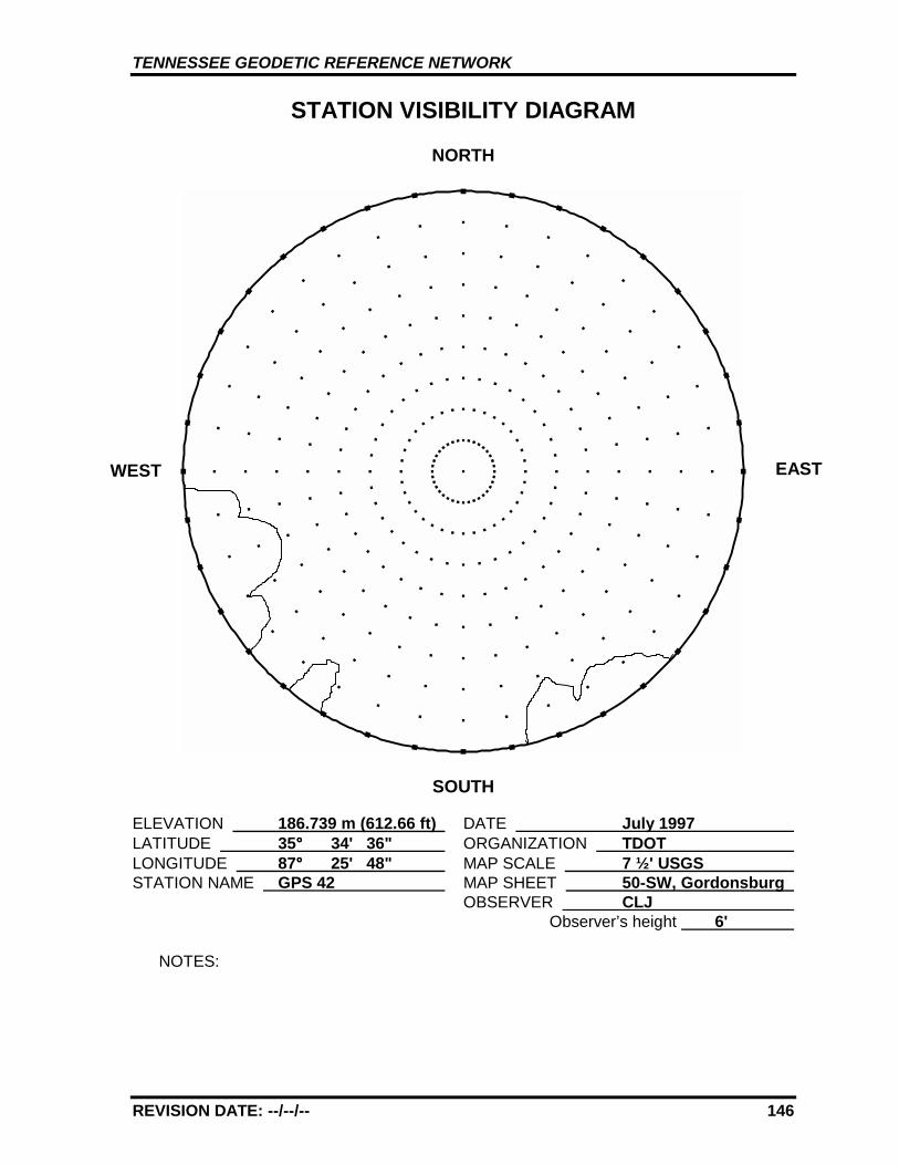
TENNESSEE GEODETIC REFERENCE NETWORK
REVISION DATE: --/--/-- 146
STATION VISIBILITY DIAGRAM
NORTH
SOUTH
ELEVATION 186.739 m (612.66 ft) DATE July 1997 LATITUDE 35°°°° 34' 36" ORGANIZATION TDOT LONGITUDE 87°°°° 25' 48" MAP SCALE 7 ½' USGS STATION NAME GPS 42 MAP SHEET 50-SW, Gordonsburg
OBSERVER CLJ Observer’s height 6'
NOTES:
WEST EAST
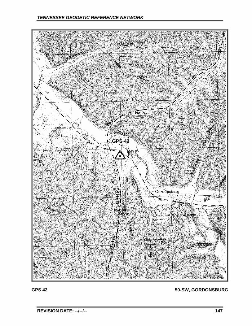
TENNESSEE GEODETIC REFERENCE NETWORK
REVISION DATE: --/--/-- 147
GPS 42 50-SW, GORDONSBURG
GPS 42
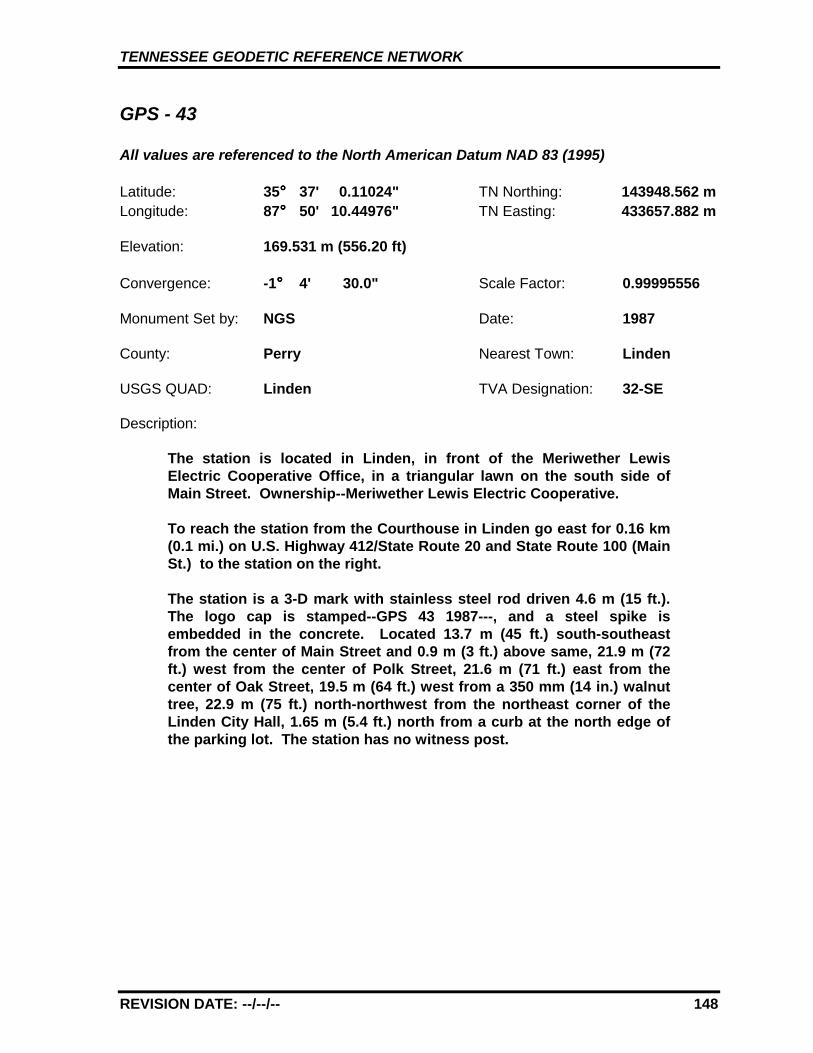
TENNESSEE GEODETIC REFERENCE NETWORK
REVISION DATE: --/--/-- 148
GPS - 43
All values are referenced to the North American Datum NAD 83 (1995)
Latitude: 35°°°° 37' 0.11024" TN Northing: 143948.562 mLongitude: 87°°°° 50' 10.44976" TN Easting: 433657.882 m
Elevation: 169.531 m (556.20 ft)
Convergence: -1°°°° 4' 30.0" Scale Factor: 0.99995556
Monument Set by: NGS Date: 1987
County: Perry Nearest Town: Linden
USGS QUAD: Linden TVA Designation: 32-SE
Description:
The station is located in Linden, in front of the Meriwether LewisElectric Cooperative Office, in a triangular lawn on the south side ofMain Street. Ownership--Meriwether Lewis Electric Cooperative.
To reach the station from the Courthouse in Linden go east for 0.16 km(0.1 mi.) on U.S. Highway 412/State Route 20 and State Route 100 (MainSt.) to the station on the right.
The station is a 3-D mark with stainless steel rod driven 4.6 m (15 ft.).The logo cap is stamped--GPS 43 1987---, and a steel spike isembedded in the concrete. Located 13.7 m (45 ft.) south-southeastfrom the center of Main Street and 0.9 m (3 ft.) above same, 21.9 m (72ft.) west from the center of Polk Street, 21.6 m (71 ft.) east from thecenter of Oak Street, 19.5 m (64 ft.) west from a 350 mm (14 in.) walnuttree, 22.9 m (75 ft.) north-northwest from the northeast corner of theLinden City Hall, 1.65 m (5.4 ft.) north from a curb at the north edge ofthe parking lot. The station has no witness post.
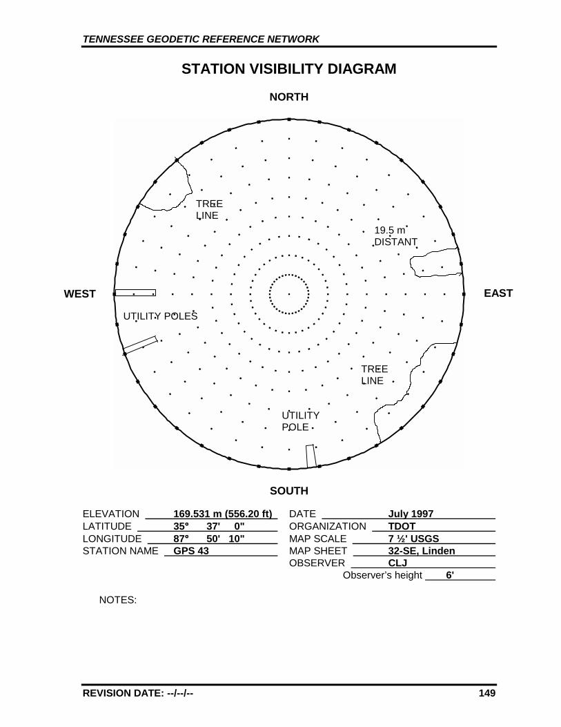
TENNESSEE GEODETIC REFERENCE NETWORK
REVISION DATE: --/--/-- 149
STATION VISIBILITY DIAGRAM
NORTH
SOUTH
ELEVATION 169.531 m (556.20 ft) DATE July 1997 LATITUDE 35°°°° 37' 0" ORGANIZATION TDOT LONGITUDE 87°°°° 50' 10" MAP SCALE 7 ½' USGS STATION NAME GPS 43 MAP SHEET 32-SE, Linden
OBSERVER CLJ Observer’s height 6'
NOTES:
WEST EAST
19.5 mDISTANT
TREELINE
UTILITYPOLE
UTILITY POLES
TREELINE
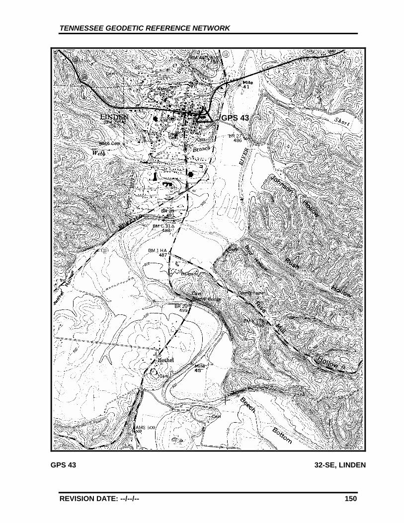
TENNESSEE GEODETIC REFERENCE NETWORK
REVISION DATE: --/--/-- 150
GPS 43 32-SE, LINDEN
GPS 43
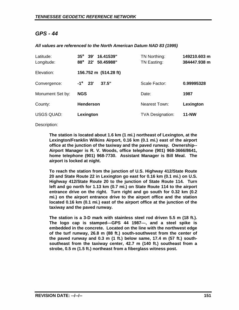
TENNESSEE GEODETIC REFERENCE NETWORK
REVISION DATE: --/--/-- 151
GPS - 44
All values are referenced to the North American Datum NAD 83 (1995)
Latitude: 35°°°° 39' 16.41539" TN Northing: 149210.603 mLongitude: 88°°°° 22' 50.45988" TN Easting: 384447.938 m
Elevation: 156.752 m (514.28 ft)
Convergence: -1°°°° 23' 37.5" Scale Factor: 0.99995328
Monument Set by: NGS Date: 1987
County: Henderson Nearest Town: Lexington
USGS QUAD: Lexington TVA Designation: 11-NW
Description:
The station is located about 1.6 km (1 mi.) northeast of Lexington, at theLexington/Franklin Wilkins Airport, 0.16 km (0.1 mi.) east of the airportoffice at the junction of the taxiway and the paved runway. Ownership--Airport Manager is R. V. Woods, office telephone (901) 968-3666/8641,home telephone (901) 968-7730. Assistant Manager is Bill Meal. Theairport is locked at night.
To reach the station from the junction of U.S. Highway 412/State Route20 and State Route 22 in Lexington go east for 0.16 km (0.1 mi.) on U.S.Highway 412/State Route 20 to the junction of State Route 114. Turnleft and go north for 1.13 km (0.7 mi.) on State Route 114 to the airportentrance drive on the right. Turn right and go south for 0.32 km (0.2mi.) on the airport entrance drive to the airport office and the stationlocated 0.16 km (0.1 mi.) east of the airport office at the junction of thetaxiway and the paved runway.
The station is a 3-D mark with stainless steel rod driven 5.5 m (18 ft.).The logo cap is stamped---GPS 44 1987---, and a steel spike isembedded in the concrete. Located on the line with the northwest edgeof the turf runway, 26.8 m (88 ft.) south-southwest from the center ofthe paved runway and 0.3 m (1 ft.) below same, 17.4 m (57 ft.) south-southeast from the taxiway center, 42.7 m (140 ft.) southeast from astrobe, 0.5 m (1.5 ft.) northeast from a fiberglass witness post.
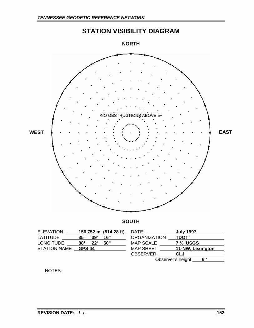
TENNESSEE GEODETIC REFERENCE NETWORK
REVISION DATE: --/--/-- 152
STATION VISIBILITY DIAGRAM
NORTH
SOUTH
ELEVATION 156.752 m (514.28 ft) DATE July 1997 LATITUDE 35°°°° 39' 16" ORGANIZATION TDOT LONGITUDE 88°°°° 22' 50" MAP SCALE 7 ½' USGS STATION NAME GPS 44 MAP SHEET 11-NW, Lexington
OBSERVER CLJ Observer’s height 6 '
NOTES:
WEST EAST
NO OBSTRUCTIONS ABOVE 5º
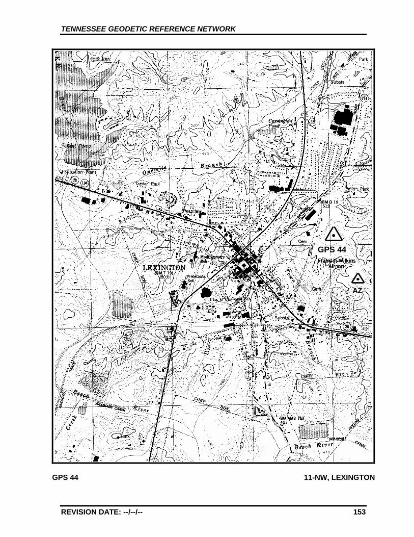
TENNESSEE GEODETIC REFERENCE NETWORK
REVISION DATE: --/--/-- 153
GPS 44 11-NW, LEXINGTON
GPS 44
AZ
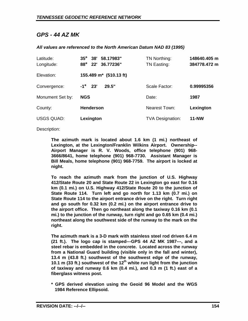
TENNESSEE GEODETIC REFERENCE NETWORK
REVISION DATE: --/--/-- 154
GPS - 44 AZ MK
All values are referenced to the North American Datum NAD 83 (1995)
Latitude: 35°°°° 38' 58.17983" TN Northing: 148640.405 mLongitude: 88°°°° 22' 36.77236" TN Easting: 384778.472 m
Elevation: 155.489 m* (510.13 ft)
Convergence: -1°°°° 23' 29.5" Scale Factor: 0.99995356
Monument Set by: NGS Date: 1987
County: Henderson Nearest Town: Lexington
USGS QUAD: Lexington TVA Designation: 11-NW
Description:
The azimuth mark is located about 1.6 km (1 mi.) northeast ofLexington, at the Lexington/Franklin Wilkins Airport. Ownership--Airport Manager is R. V. Woods, office telephone (901) 968-3666/8641, home telephone (901) 968-7730. Assistant Manager isBill Meals, home telephone (901) 968-7759. The airport is locked atnight.
To reach the azimuth mark from the junction of U.S. Highway412/State Route 20 and State Route 22 in Lexington go east for 0.16km (0.1 mi.) on U.S. Highway 412/State Route 20 to the junction ofState Route 114. Turn left and go north for 1.13 km (0.7 mi.) onState Route 114 to the airport entrance drive on the right. Turn rightand go south for 0.32 km (0.2 mi.) on the airport entrance drive tothe airport office. Then go northeast along the taxiway 0.16 km (0.1mi.) to the junction of the runway, turn right and go 0.65 km (0.4 mi.)northeast along the southwest side of the runway to the mark on theright.
The azimuth mark is a 3-D mark with stainless steel rod driven 6.4 m(21 ft.). The logo cap is stamped---GPS 44 AZ MK 1987---, and asteel rebar is embedded in the concrete. Located across the runwayfrom a National Guard building (visible only in the fall and winter),13.4 m (43.8 ft.) southwest of the southwest edge of the runway,10.1 m (33 ft.) southwest of the 12th white run light from the junctionof taxiway and runway 0.6 km (0.4 mi.), and 0.3 m (1 ft.) east of afiberglass witness post.
* GPS derived elevation using the Geoid 96 Model and the WGS1984 Reference Ellipsoid.
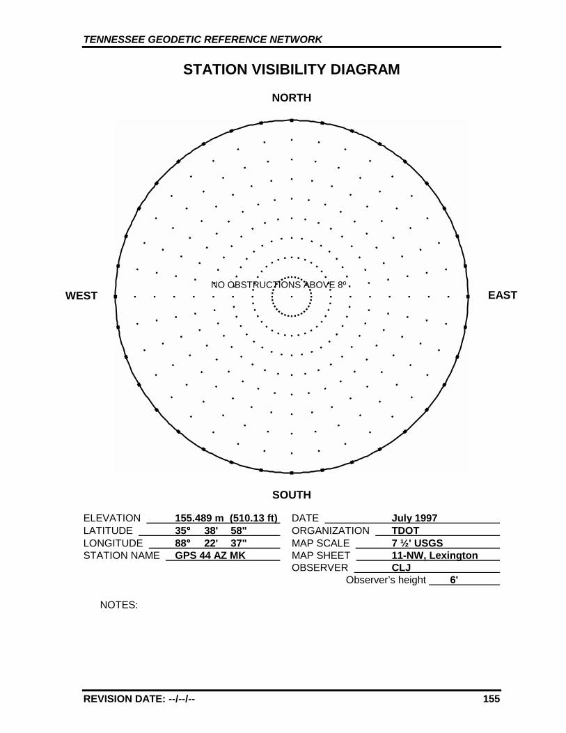
TENNESSEE GEODETIC REFERENCE NETWORK
REVISION DATE: --/--/-- 155
STATION VISIBILITY DIAGRAM
NORTH
SOUTH
ELEVATION 155.489 m (510.13 ft) DATE July 1997 LATITUDE 35°°°° 38' 58" ORGANIZATION TDOT LONGITUDE 88°°°° 22' 37" MAP SCALE 7 ½' USGS STATION NAME GPS 44 AZ MK MAP SHEET 11-NW, Lexington
OBSERVER CLJ Observer’s height 6'
NOTES:
WEST EASTNO OBSTRUCTIONS ABOVE 8º

TENNESSEE GEODETIC REFERENCE NETWORK
REVISION DATE: --/--/-- 156
GPS 44 11-NW, LEXINGTON
GPS 44
AZ
TENNESSEE GEODETIC REFERENCE NETWORK
REVISION DATE: --/--/-- 157
GPS - 45
All values are referenced to the North American Datum NAD 83 (1995)
Latitude: 35°°°° 34' 11.15853" TN Northing: 140838.947 mLongitude: 88°°°° 48' 37.73490" TN Easting: 345272.828 m
Elevation: 120.443 m (395.15 ft)
Convergence: -1°°°° 38' 43.3" Scale Factor: 0.99995898
Monument Set by: NGS Date: 1987
County: Madison Nearest Town: Jackson
USGS QUAD: Jackson South TVA Designation: 438-SE
Description:
The station is located about 4.8 km (3 mi.) south of Jackson, on theproperty of the South Side High School just south of the stadium.Ownership--station is on school property and is accessible at all timeswith no prior arrangements needed.
To reach the station from the Courthouse in Jackson go south for 5.2km (3.2 mi.) on U.S. Highway 45/State Route 5 to the junction of HartsBridge Road. Turn left and go east for 0.48 km (0.3 mi.) on Harts BridgeRoad to the station on the left.
The station is a 3-D mark with stainless steel rod driven 25.9 m (85 ft.).The logo cap is stamped---GPS 45 1987---, and a steel spike isembedded in the concrete. Located 67.21 m (220.5 ft.) southeast fromthe southeast corner of the grandstand, 73.2 m (240 ft.) east from thejunction of a high voltage power line and the road, 9.8 m (32 ft.) northfrom the road center and 0.6 m (2 ft.) below same, 1.65 m (5.4 ft.)northwest of the southwest corner of a 1.8 m (6 ft.) fence, 20.6 m (68 ft.)south of a utility pole across the street, 19.66 m (64.5 ft.) east from autility pole numbered 88, 1.1 m (3.5 ft.) west from a fiberglass witnesspost at a 1.8 m (6 ft.) wire mesh fence.
TENNESSEE GEODETIC REFERENCE NETWORK
REVISION DATE: --/--/-- 158
STATION VISIBILITY DIAGRAM
NORTH
SOUTH
ELEVATION 120.443 m (395.15 ft) DATE July 1997 LATITUDE 35°°°° 34' 11" ORGANIZATION TDOT LONGITUDE 88°°°° 48' 38" MAP SCALE 7 ½' USGS STATION NAME GPS 45 MAP SHEET 438-SE, Jackson South
OBSERVER CLJ Observer’s height 6'
NOTES:
WEST EAST
Stadium light poles
Telephone pole
High voltagepower pole
Telephone pole
Telephone pole
High voltagepower pole
TENNESSEE GEODETIC REFERENCE NETWORK
REVISION DATE: --/--/-- 159
GPS 45 438-SE, JACKSON SOUTH
GPS 45
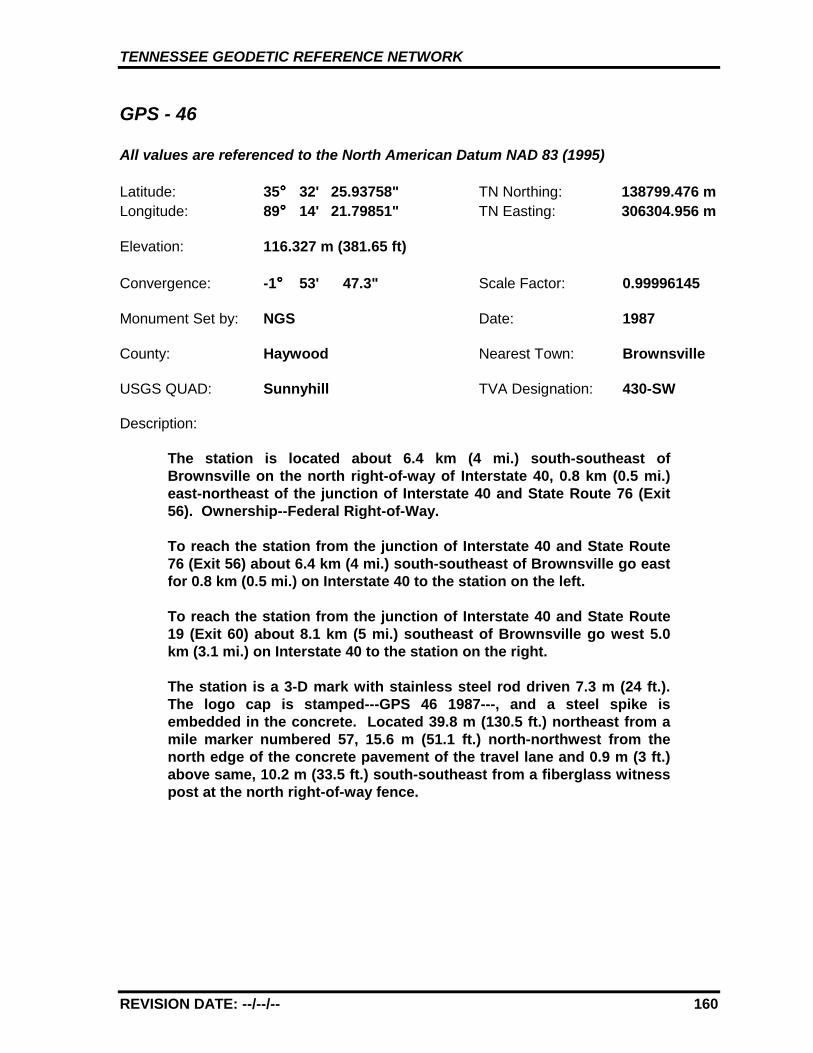
TENNESSEE GEODETIC REFERENCE NETWORK
REVISION DATE: --/--/-- 160
GPS - 46
All values are referenced to the North American Datum NAD 83 (1995)
Latitude: 35°°°° 32' 25.93758" TN Northing: 138799.476 mLongitude: 89°°°° 14' 21.79851" TN Easting: 306304.956 m
Elevation: 116.327 m (381.65 ft)
Convergence: -1°°°° 53' 47.3" Scale Factor: 0.99996145
Monument Set by: NGS Date: 1987
County: Haywood Nearest Town: Brownsville
USGS QUAD: Sunnyhill TVA Designation: 430-SW
Description:
The station is located about 6.4 km (4 mi.) south-southeast ofBrownsville on the north right-of-way of Interstate 40, 0.8 km (0.5 mi.)east-northeast of the junction of Interstate 40 and State Route 76 (Exit56). Ownership--Federal Right-of-Way.
To reach the station from the junction of Interstate 40 and State Route76 (Exit 56) about 6.4 km (4 mi.) south-southeast of Brownsville go eastfor 0.8 km (0.5 mi.) on Interstate 40 to the station on the left.
To reach the station from the junction of Interstate 40 and State Route19 (Exit 60) about 8.1 km (5 mi.) southeast of Brownsville go west 5.0km (3.1 mi.) on Interstate 40 to the station on the right.
The station is a 3-D mark with stainless steel rod driven 7.3 m (24 ft.).The logo cap is stamped---GPS 46 1987---, and a steel spike isembedded in the concrete. Located 39.8 m (130.5 ft.) northeast from amile marker numbered 57, 15.6 m (51.1 ft.) north-northwest from thenorth edge of the concrete pavement of the travel lane and 0.9 m (3 ft.)above same, 10.2 m (33.5 ft.) south-southeast from a fiberglass witnesspost at the north right-of-way fence.
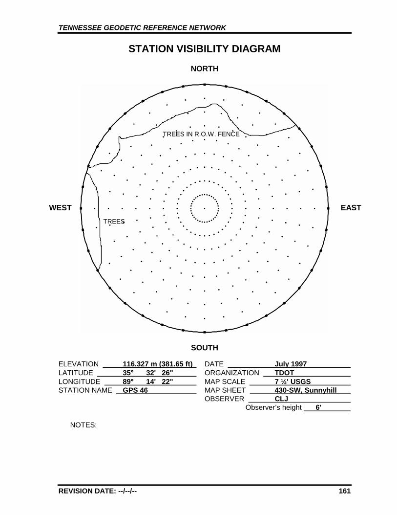
TENNESSEE GEODETIC REFERENCE NETWORK
REVISION DATE: --/--/-- 161
STATION VISIBILITY DIAGRAM
NORTH
SOUTH
ELEVATION 116.327 m (381.65 ft) DATE July 1997 LATITUDE 35°°°° 32' 26" ORGANIZATION TDOT LONGITUDE 89°°°° 14' 22" MAP SCALE 7 ½' USGS STATION NAME GPS 46 MAP SHEET 430-SW, Sunnyhill
OBSERVER CLJ Observer’s height 6'
NOTES:
WEST EASTTREES
TREES IN R.O.W. FENCE
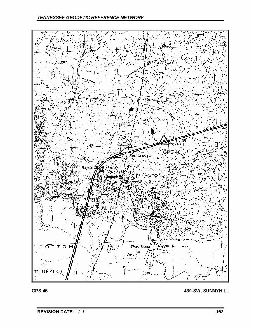
TENNESSEE GEODETIC REFERENCE NETWORK
REVISION DATE: --/--/-- 162
GPS 46 430-SW, SUNNYHILL
GPS 46
TENNESSEE GEODETIC REFERENCE NETWORK
REVISION DATE: --/--/-- 163
GPS - 47
All values are referenced to the North American Datum NAD 83 (1995)
Latitude: 35°°°° 35' 23.72751" TN Northing: 145369.229 mLongitude: 89°°°° 35' 7.90381" TN Easting: 275136.637 m
Elevation: 82.256 m (269.87 ft)
Convergence: -2°°°° 5' 56.8" Scale Factor: 0.99995743
Monument Set by: NGS Date: 1987
County: Tipton Nearest Town: Covington
USGS QUAD: Gift TVA Designation: 414-SE
Description:
The station is located about 4.8 km (3 mi.) northeast of Covington, onthe Covington Municipal Airport 106.7 m (350 ft.) west of the airportoffice and at the north end of the runway. Ownership--Airport Manageris Dave Peeler or Wilson Faught, telephone (901) 476-1392. The airportis not locked after dark, however use after working hours should becleared with the Airport Manager. Access to the field is north of thebrick office building between the office and a metal hangar.
To reach the station from the courthouse in Covington go east on StateRoute 59 (Liberty St.) 0.24 km (0.15 mi.) to the junction of U.S. Highway51 and State Route 59. Turn right and go north for 1.78 km (1.1 mi.) onU.S. Highway 51 to the junction of State Route 384. Continue straightahead and go north for 2.25 km (1.4 mi.) on U.S. Highway 51 to thejunction of County Road 8391 (Antioch Road). Turn right and go eastfor 4.51 km (2.8 mi.) on County Road 8391 to the airport. Turn right andgo south for 0.16 km (0.1 mi.) on the airport property to the airportoffice, a one story brick building and the station.
The station is a 3-D mark with stainless steel rod driven 18.0 m (59 ft.).The logo cap is stamped---GPS 47 1987---, and a steel spike isembedded in the concrete. Located 37.2 m (122 ft.) east from therunway center and 0.6 m (2 ft.) below same, 23.5 m (77 ft.) west from thetaxiway center, 13.7 m (45 ft.) south from the center of the taxiwaycrossover, 29.3 m (96 ft.) south from a strobe, 2.2 m (7 ft.) northwest ofthe center of a culvert headwall, 1.6 m (5.2 ft.) northwest from afiberglass witness post set at the west end of a culvert headwall.
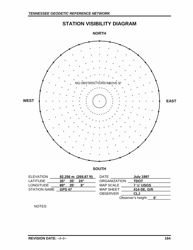
TENNESSEE GEODETIC REFERENCE NETWORK
REVISION DATE: --/--/-- 164
STATION VISIBILITY DIAGRAM
NORTH
SOUTH
ELEVATION 82.256 m (269.87 ft) DATE July 1997 LATITUDE 35°°°° 35' 24" ORGANIZATION TDOT LONGITUDE 89°°°° 35' 8" MAP SCALE 7 ½' USGS STATION NAME GPS 47 MAP SHEET 414-SE, Gift
OBSERVER CLJ Observer’s height 6'
NOTES:
WEST EAST
NO OBSTRUCTIONS ABOVE 5º
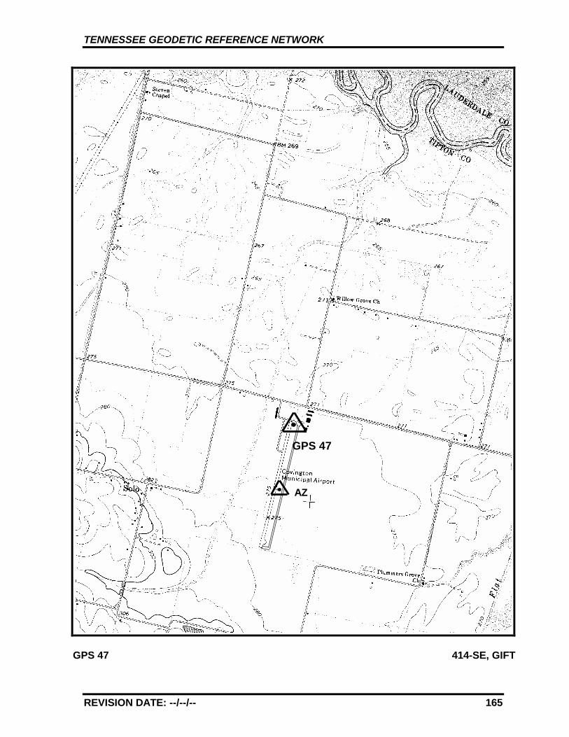
TENNESSEE GEODETIC REFERENCE NETWORK
REVISION DATE: --/--/-- 165
GPS 47 414-SE, GIFT
GPS 47
AZ
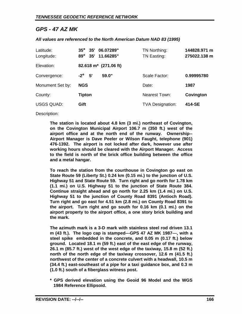
TENNESSEE GEODETIC REFERENCE NETWORK
REVISION DATE: --/--/-- 166
GPS - 47 AZ MKAll values are referenced to the North American Datum NAD 83 (1995)
Latitude: 35°°°° 35' 06.07289" TN Northing: 144828.971 mLongitude: 89°°°° 35' 11.66285" TN Easting: 275022.138 m
Elevation: 82.618 m* (271.06 ft)
Convergence: -2°°°° 5' 59.0" Scale Factor: 0.99995780
Monument Set by: NGS Date: 1987
County: Tipton Nearest Town: Covington
USGS QUAD: Gift TVA Designation: 414-SE
Description:
The station is located about 4.8 km (3 mi.) northeast of Covington,on the Covington Municipal Airport 106.7 m (350 ft.) west of theairport office and at the north end of the runway. Ownership--Airport Manager is Dave Peeler or Wilson Faught, telephone (901)476-1392. The airport is not locked after dark, however use afterworking hours should be cleared with the Airport Manager. Accessto the field is north of the brick office building between the officeand a metal hangar.
To reach the station from the courthouse in Covington go east onState Route 59 (Liberty St.) 0.24 km (0.15 mi.) to the junction of U.S.Highway 51 and State Route 59. Turn right and go north for 1.78 km(1.1 mi.) on U.S. Highway 51 to the junction of State Route 384.Continue straight ahead and go north for 2.25 km (1.4 mi.) on U.S.Highway 51 to the junction of County Road 8391 (Antioch Road).Turn right and go east for 4.51 km (2.8 mi.) on County Road 8391 tothe airport. Turn right and go south for 0.16 km (0.1 mi.) on theairport property to the airport office, a one story brick building andthe mark.
The azimuth mark is a 3-D mark with stainless steel rod driven 13.1m (43 ft.). The logo cap is stamped---GPS 47 AZ MK 1987---, with asteel spike embedded in the concrete, and 0.05 m (0.17 ft.) belowground. Located 18.1 m (59 ft.) east of the east edge of the runway,26.1 m (85.7 ft.) west of the west edge of the taxiway, 15.8 m (52 ft.)north of the north edge of the taxiway crossover, 12.6 m (41.5 ft.)northwest of the center of a concrete culvert with a headwall, 10.5 m(34.4 ft.) east-southeast of a pipe for a taxi guidance box, and 0.3 m(1.0 ft.) south of a fiberglass witness post.
* GPS derived elevation using the Geoid 96 Model and the WGS1984 Reference Ellipsoid.
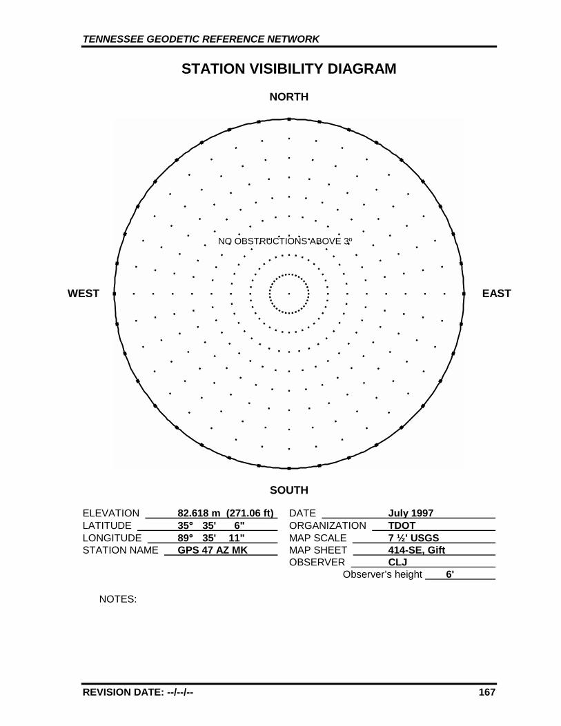
TENNESSEE GEODETIC REFERENCE NETWORK
REVISION DATE: --/--/-- 167
STATION VISIBILITY DIAGRAM
NORTH
SOUTH
ELEVATION 82.618 m (271.06 ft) DATE July 1997 LATITUDE 35°°°° 35' 6" ORGANIZATION TDOT LONGITUDE 89°°°° 35' 11" MAP SCALE 7 ½' USGS STATION NAME GPS 47 AZ MK MAP SHEET 414-SE, Gift
OBSERVER CLJ Observer’s height 6'
NOTES:
WEST EAST
NO OBSTRUCTIONS ABOVE 3º

TENNESSEE GEODETIC REFERENCE NETWORK
REVISION DATE: --/--/-- 168
GPS 47 414-SE, GIFT
GPS 47
AZ
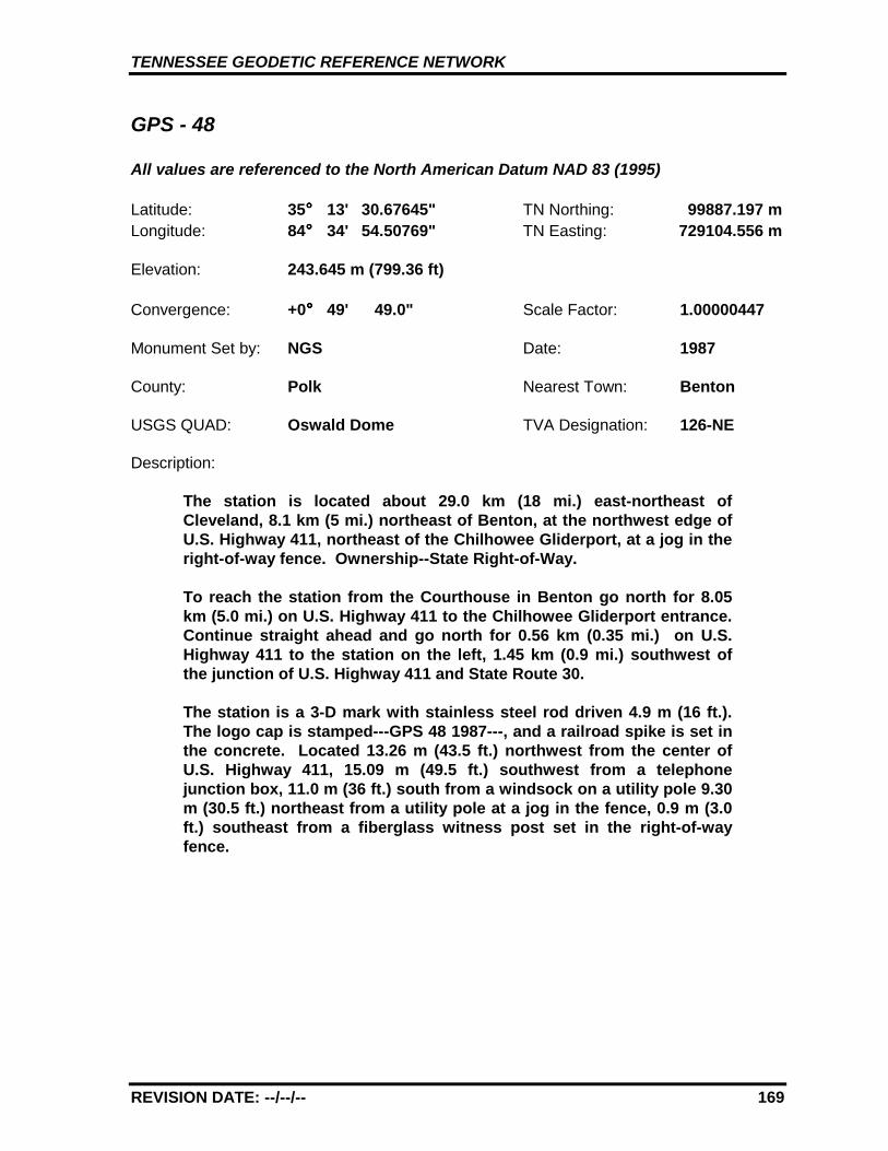
TENNESSEE GEODETIC REFERENCE NETWORK
REVISION DATE: --/--/-- 169
GPS - 48
All values are referenced to the North American Datum NAD 83 (1995)
Latitude: 35°°°° 13' 30.67645" TN Northing: 99887.197 mLongitude: 84°°°° 34' 54.50769" TN Easting: 729104.556 m
Elevation: 243.645 m (799.36 ft)
Convergence: +0°°°° 49' 49.0" Scale Factor: 1.00000447
Monument Set by: NGS Date: 1987
County: Polk Nearest Town: Benton
USGS QUAD: Oswald Dome TVA Designation: 126-NE
Description:
The station is located about 29.0 km (18 mi.) east-northeast ofCleveland, 8.1 km (5 mi.) northeast of Benton, at the northwest edge ofU.S. Highway 411, northeast of the Chilhowee Gliderport, at a jog in theright-of-way fence. Ownership--State Right-of-Way.
To reach the station from the Courthouse in Benton go north for 8.05km (5.0 mi.) on U.S. Highway 411 to the Chilhowee Gliderport entrance.Continue straight ahead and go north for 0.56 km (0.35 mi.) on U.S.Highway 411 to the station on the left, 1.45 km (0.9 mi.) southwest ofthe junction of U.S. Highway 411 and State Route 30.
The station is a 3-D mark with stainless steel rod driven 4.9 m (16 ft.).The logo cap is stamped---GPS 48 1987---, and a railroad spike is set inthe concrete. Located 13.26 m (43.5 ft.) northwest from the center ofU.S. Highway 411, 15.09 m (49.5 ft.) southwest from a telephonejunction box, 11.0 m (36 ft.) south from a windsock on a utility pole 9.30m (30.5 ft.) northeast from a utility pole at a jog in the fence, 0.9 m (3.0ft.) southeast from a fiberglass witness post set in the right-of-wayfence.
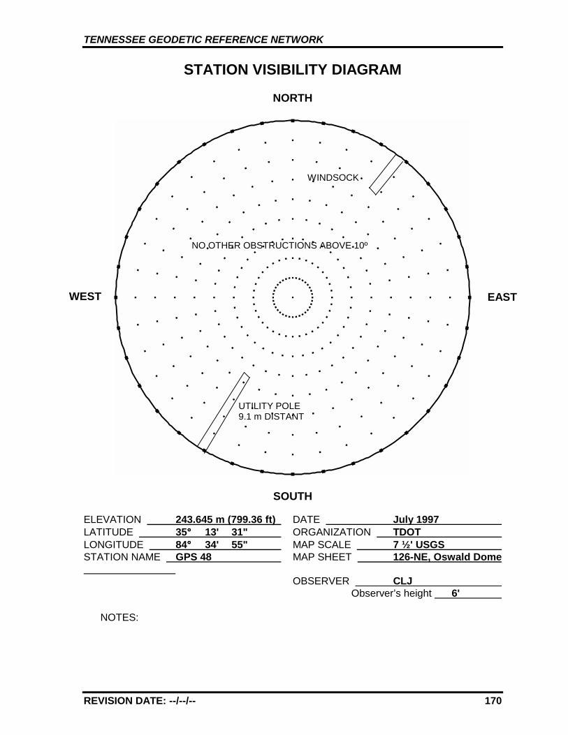
TENNESSEE GEODETIC REFERENCE NETWORK
REVISION DATE: --/--/-- 170
STATION VISIBILITY DIAGRAM
NORTH
SOUTH
ELEVATION 243.645 m (799.36 ft) DATE July 1997 LATITUDE 35°°°° 13' 31" ORGANIZATION TDOT LONGITUDE 84°°°° 34' 55" MAP SCALE 7 ½' USGS STATION NAME GPS 48 MAP SHEET 126-NE, Oswald Dome
OBSERVER CLJ Observer’s height 6'
NOTES:
WEST EAST
UTILITY POLE9.1 m DISTANT
NO OTHER OBSTRUCTIONS ABOVE 10º
WINDSOCK
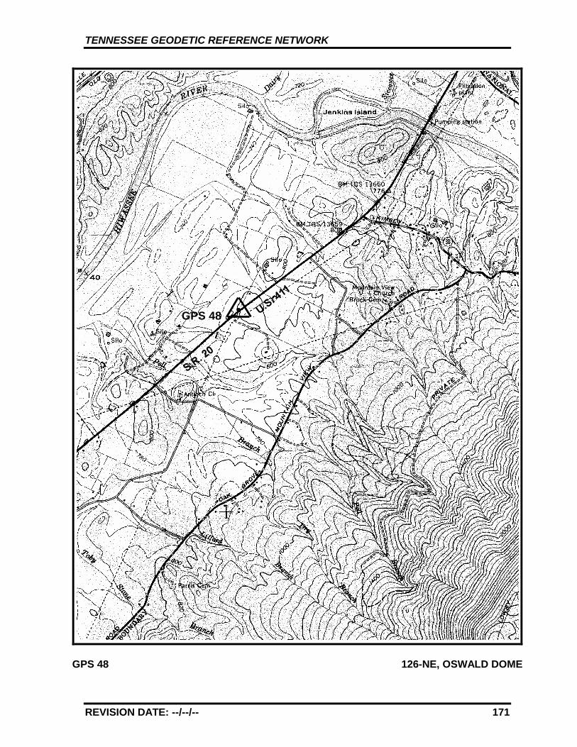
TENNESSEE GEODETIC REFERENCE NETWORK
REVISION DATE: --/--/-- 171
GPS 48 126-NE, OSWALD DOME
GPS 48
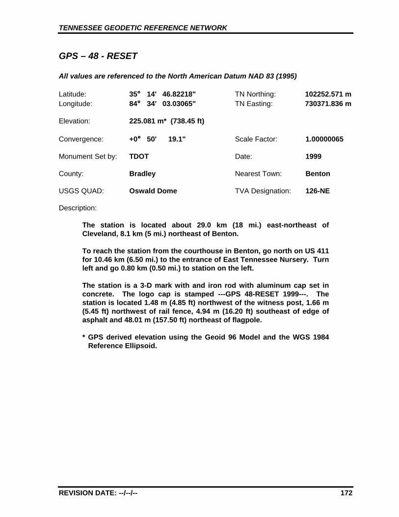
TENNESSEE GEODETIC REFERENCE NETWORK
REVISION DATE: --/--/-- 172
GPS – 48 - RESET
All values are referenced to the North American Datum NAD 83 (1995)
Latitude: 35°°°° 14' 46.82218" TN Northing: 102252.571 mLongitude: 84°°°° 34' 03.03065" TN Easting: 730371.836 m
Elevation: 225.081 m* (738.45 ft)
Convergence: +0°°°° 50' 19.1" Scale Factor: 1.00000065
Monument Set by: TDOT Date: 1999
County: Bradley Nearest Town: Benton
USGS QUAD: Oswald Dome TVA Designation: 126-NE
Description:
The station is located about 29.0 km (18 mi.) east-northeast ofCleveland, 8.1 km (5 mi.) northeast of Benton.
To reach the station from the courthouse in Benton, go north on US 411for 10.46 km (6.50 mi.) to the entrance of East Tennessee Nursery. Turnleft and go 0.80 km (0.50 mi.) to station on the left.
The station is a 3-D mark with and iron rod with aluminum cap set inconcrete. The logo cap is stamped ---GPS 48-RESET 1999---. Thestation is located 1.48 m (4.85 ft) northwest of the witness post, 1.66 m(5.45 ft) northwest of rail fence, 4.94 m (16.20 ft) southeast of edge ofasphalt and 48.01 m (157.50 ft) northeast of flagpole.
* GPS derived elevation using the Geoid 96 Model and the WGS 1984Reference Ellipsoid.
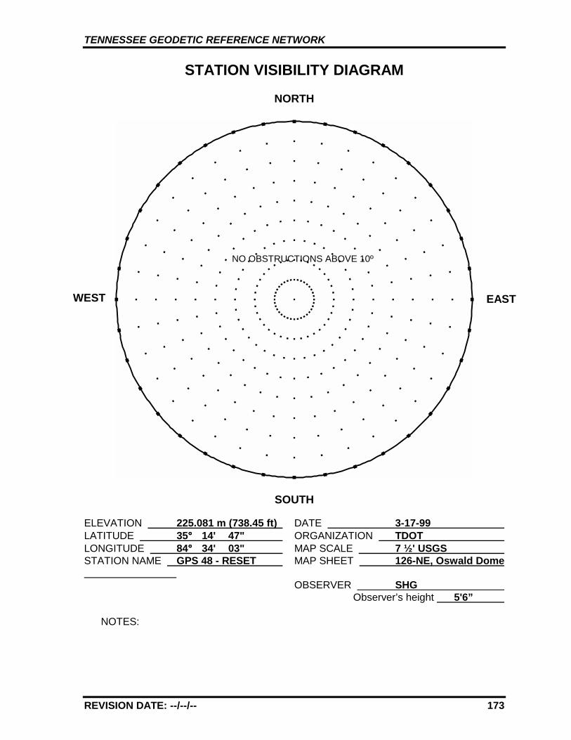
TENNESSEE GEODETIC REFERENCE NETWORK
REVISION DATE: --/--/-- 173
STATION VISIBILITY DIAGRAM
NORTH
SOUTH
ELEVATION 225.081 m (738.45 ft) DATE 3-17-99 LATITUDE 35°°°° 14' 47" ORGANIZATION TDOT LONGITUDE 84°°°° 34' 03" MAP SCALE 7 ½' USGS STATION NAME GPS 48 - RESET MAP SHEET 126-NE, Oswald Dome
OBSERVER SHG Observer’s height 5'6”
NOTES:
WEST EAST
NO OBSTRUCTIONS ABOVE 10º
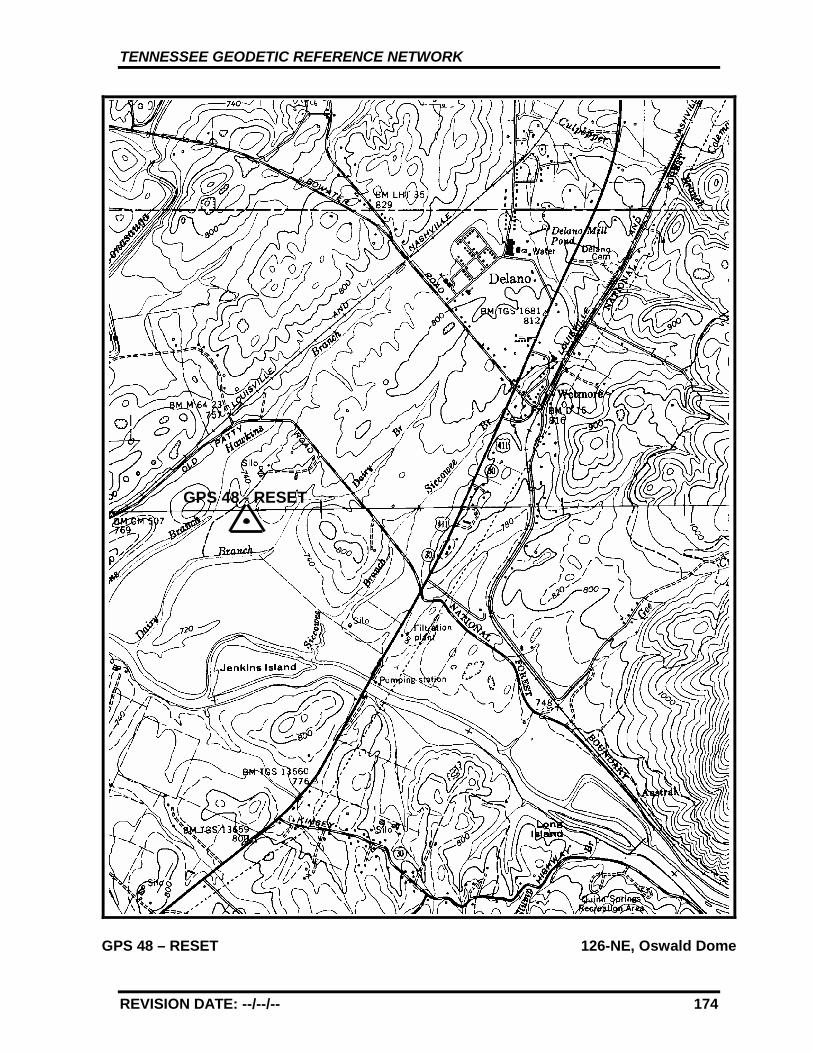
TENNESSEE GEODETIC REFERENCE NETWORK
REVISION DATE: --/--/-- 174
GPS 48 – RESET 126-NE, Oswald Dome
GPS 48 - RESET
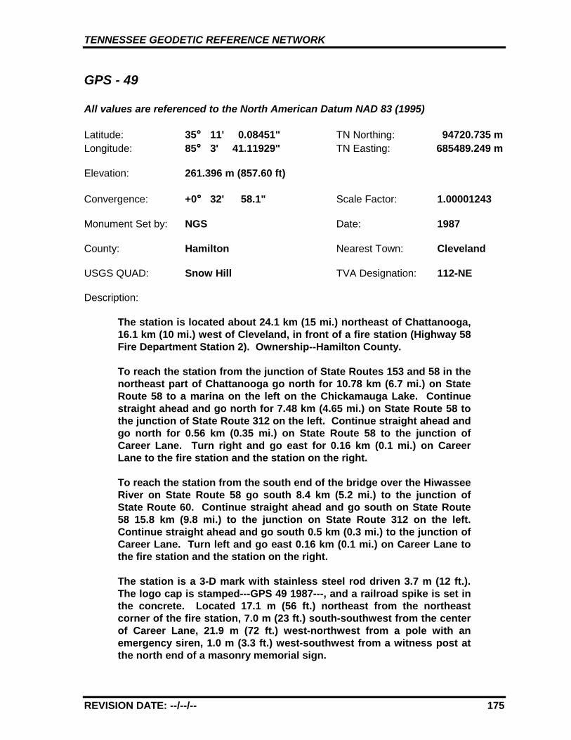
TENNESSEE GEODETIC REFERENCE NETWORK
REVISION DATE: --/--/-- 175
GPS - 49
All values are referenced to the North American Datum NAD 83 (1995)
Latitude: 35°°°° 11' 0.08451" TN Northing: 94720.735 mLongitude: 85°°°° 3' 41.11929" TN Easting: 685489.249 m
Elevation: 261.396 m (857.60 ft)
Convergence: +0°°°° 32' 58.1" Scale Factor: 1.00001243
Monument Set by: NGS Date: 1987
County: Hamilton Nearest Town: Cleveland
USGS QUAD: Snow Hill TVA Designation: 112-NE
Description:
The station is located about 24.1 km (15 mi.) northeast of Chattanooga,16.1 km (10 mi.) west of Cleveland, in front of a fire station (Highway 58Fire Department Station 2). Ownership--Hamilton County.
To reach the station from the junction of State Routes 153 and 58 in thenortheast part of Chattanooga go north for 10.78 km (6.7 mi.) on StateRoute 58 to a marina on the left on the Chickamauga Lake. Continuestraight ahead and go north for 7.48 km (4.65 mi.) on State Route 58 tothe junction of State Route 312 on the left. Continue straight ahead andgo north for 0.56 km (0.35 mi.) on State Route 58 to the junction ofCareer Lane. Turn right and go east for 0.16 km (0.1 mi.) on CareerLane to the fire station and the station on the right.
To reach the station from the south end of the bridge over the HiwasseeRiver on State Route 58 go south 8.4 km (5.2 mi.) to the junction ofState Route 60. Continue straight ahead and go south on State Route58 15.8 km (9.8 mi.) to the junction on State Route 312 on the left.Continue straight ahead and go south 0.5 km (0.3 mi.) to the junction ofCareer Lane. Turn left and go east 0.16 km (0.1 mi.) on Career Lane tothe fire station and the station on the right.
The station is a 3-D mark with stainless steel rod driven 3.7 m (12 ft.).The logo cap is stamped---GPS 49 1987---, and a railroad spike is set inthe concrete. Located 17.1 m (56 ft.) northeast from the northeastcorner of the fire station, 7.0 m (23 ft.) south-southwest from the centerof Career Lane, 21.9 m (72 ft.) west-northwest from a pole with anemergency siren, 1.0 m (3.3 ft.) west-southwest from a witness post atthe north end of a masonry memorial sign.
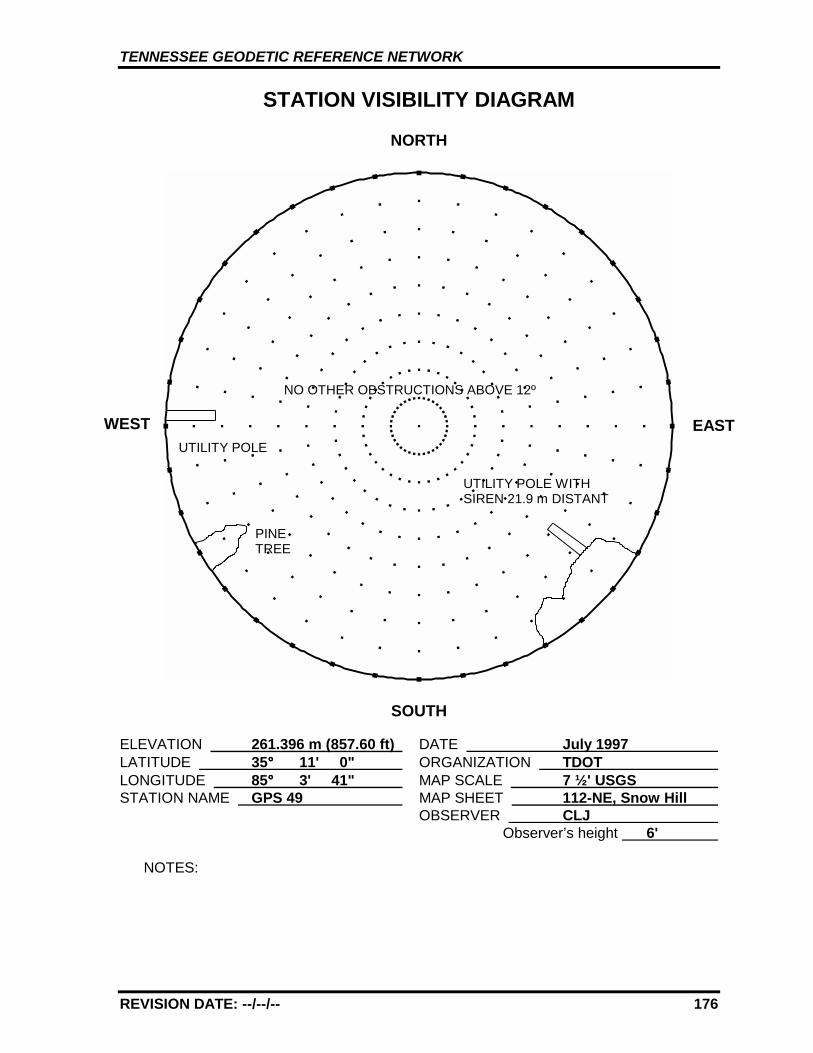
TENNESSEE GEODETIC REFERENCE NETWORK
REVISION DATE: --/--/-- 176
STATION VISIBILITY DIAGRAM
NORTH
SOUTH
ELEVATION 261.396 m (857.60 ft) DATE July 1997 LATITUDE 35°°°° 11' 0" ORGANIZATION TDOT LONGITUDE 85°°°° 3' 41" MAP SCALE 7 ½' USGS STATION NAME GPS 49 MAP SHEET 112-NE, Snow Hill
OBSERVER CLJ Observer’s height 6'
NOTES:
WEST EAST
NO OTHER OBSTRUCTIONS ABOVE 12º
PINETREE
UTILITY POLE WITHSIREN 21.9 m DISTANT
UTILITY POLE
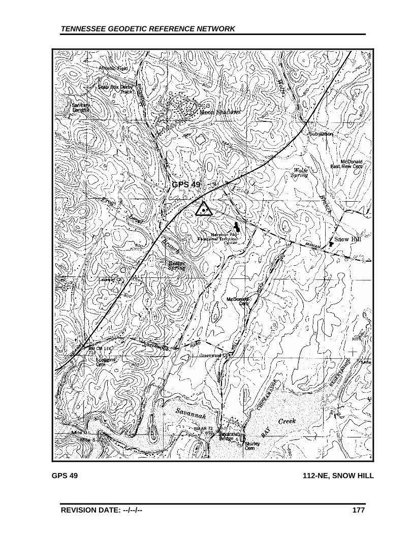
TENNESSEE GEODETIC REFERENCE NETWORK
REVISION DATE: --/--/-- 177
GPS 49 112-NE, SNOW HILL
GPS 49
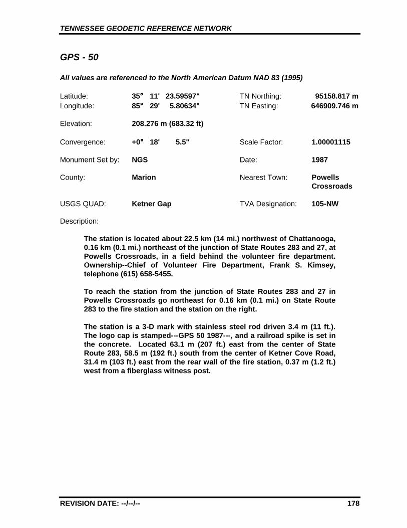
TENNESSEE GEODETIC REFERENCE NETWORK
REVISION DATE: --/--/-- 178
GPS - 50
All values are referenced to the North American Datum NAD 83 (1995)
Latitude: 35°°°° 11' 23.59597" TN Northing: 95158.817 mLongitude: 85°°°° 29' 5.80634" TN Easting: 646909.746 m
Elevation: 208.276 m (683.32 ft)
Convergence: +0°°°° 18' 5.5" Scale Factor: 1.00001115
Monument Set by: NGS Date: 1987
County: Marion Nearest Town: Powells Crossroads
USGS QUAD: Ketner Gap TVA Designation: 105-NW
Description:
The station is located about 22.5 km (14 mi.) northwest of Chattanooga,0.16 km (0.1 mi.) northeast of the junction of State Routes 283 and 27, atPowells Crossroads, in a field behind the volunteer fire department.Ownership--Chief of Volunteer Fire Department, Frank S. Kimsey,telephone (615) 658-5455.
To reach the station from the junction of State Routes 283 and 27 inPowells Crossroads go northeast for 0.16 km (0.1 mi.) on State Route283 to the fire station and the station on the right.
The station is a 3-D mark with stainless steel rod driven 3.4 m (11 ft.).The logo cap is stamped---GPS 50 1987---, and a railroad spike is set inthe concrete. Located 63.1 m (207 ft.) east from the center of StateRoute 283, 58.5 m (192 ft.) south from the center of Ketner Cove Road,31.4 m (103 ft.) east from the rear wall of the fire station, 0.37 m (1.2 ft.)west from a fiberglass witness post.

TENNESSEE GEODETIC REFERENCE NETWORK
REVISION DATE: --/--/-- 179
STATION VISIBILITY DIAGRAM
NORTH
SOUTH
ELEVATION 208.276 m (683.32 ft) DATE July 1997 LATITUDE 35°°°° 11' 24" ORGANIZATION TDOT LONGITUDE 85°°°° 29' 6" MAP SCALE 7 ½' USGS STATION NAME GPS 50 MAP SHEET 105-NW, Ketner Gap
OBSERVER CLJ Observer’s height 6'
NOTES:
WEST EASTNO OTHER OBSTRUCTIONS ABOVE 15º
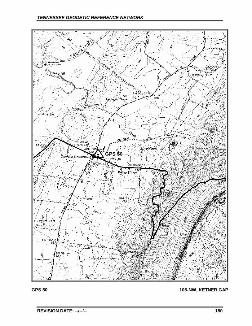
TENNESSEE GEODETIC REFERENCE NETWORK
REVISION DATE: --/--/-- 180
GPS 50 105-NW, KETNER GAP
GPS 50
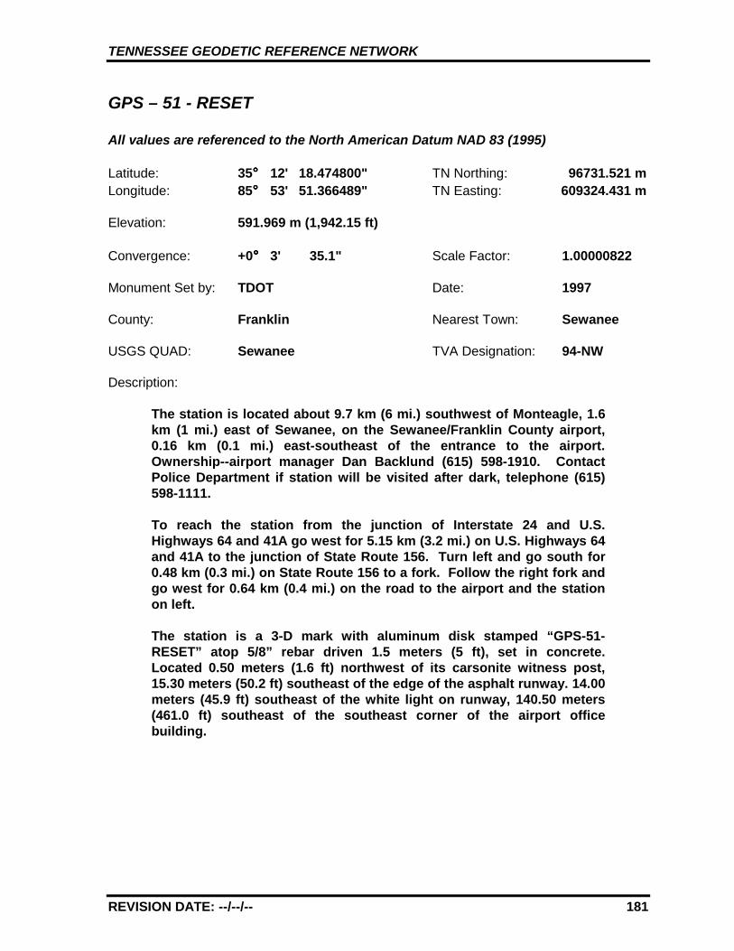
TENNESSEE GEODETIC REFERENCE NETWORK
REVISION DATE: --/--/-- 181
GPS – 51 - RESET
All values are referenced to the North American Datum NAD 83 (1995)
Latitude: 35°°°° 12' 18.474800" TN Northing: 96731.521 mLongitude: 85°°°° 53' 51.366489" TN Easting: 609324.431 m
Elevation: 591.969 m (1,942.15 ft)
Convergence: +0°°°° 3' 35.1" Scale Factor: 1.00000822
Monument Set by: TDOT Date: 1997
County: Franklin Nearest Town: Sewanee
USGS QUAD: Sewanee TVA Designation: 94-NW
Description:
The station is located about 9.7 km (6 mi.) southwest of Monteagle, 1.6km (1 mi.) east of Sewanee, on the Sewanee/Franklin County airport,0.16 km (0.1 mi.) east-southeast of the entrance to the airport.Ownership--airport manager Dan Backlund (615) 598-1910. ContactPolice Department if station will be visited after dark, telephone (615)598-1111.
To reach the station from the junction of Interstate 24 and U.S.Highways 64 and 41A go west for 5.15 km (3.2 mi.) on U.S. Highways 64and 41A to the junction of State Route 156. Turn left and go south for0.48 km (0.3 mi.) on State Route 156 to a fork. Follow the right fork andgo west for 0.64 km (0.4 mi.) on the road to the airport and the stationon left.
The station is a 3-D mark with aluminum disk stamped “GPS-51-RESET” atop 5/8” rebar driven 1.5 meters (5 ft), set in concrete.Located 0.50 meters (1.6 ft) northwest of its carsonite witness post,15.30 meters (50.2 ft) southeast of the edge of the asphalt runway. 14.00meters (45.9 ft) southeast of the white light on runway, 140.50 meters(461.0 ft) southeast of the southeast corner of the airport officebuilding.
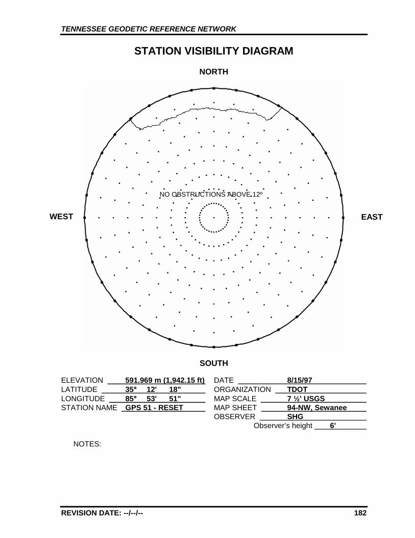
TENNESSEE GEODETIC REFERENCE NETWORK
REVISION DATE: --/--/-- 182
STATION VISIBILITY DIAGRAM
NORTH
SOUTH
ELEVATION 591.969 m (1,942.15 ft) DATE 8/15/97 LATITUDE 35°°°° 12' 18" ORGANIZATION TDOT LONGITUDE 85°°°° 53' 51" MAP SCALE 7 ½' USGS STATION NAME GPS 51 - RESET MAP SHEET 94-NW, Sewanee
OBSERVER SHG Observer’s height 6'
NOTES:
WEST EAST
NO OBSTRUCTIONS ABOVE 12º
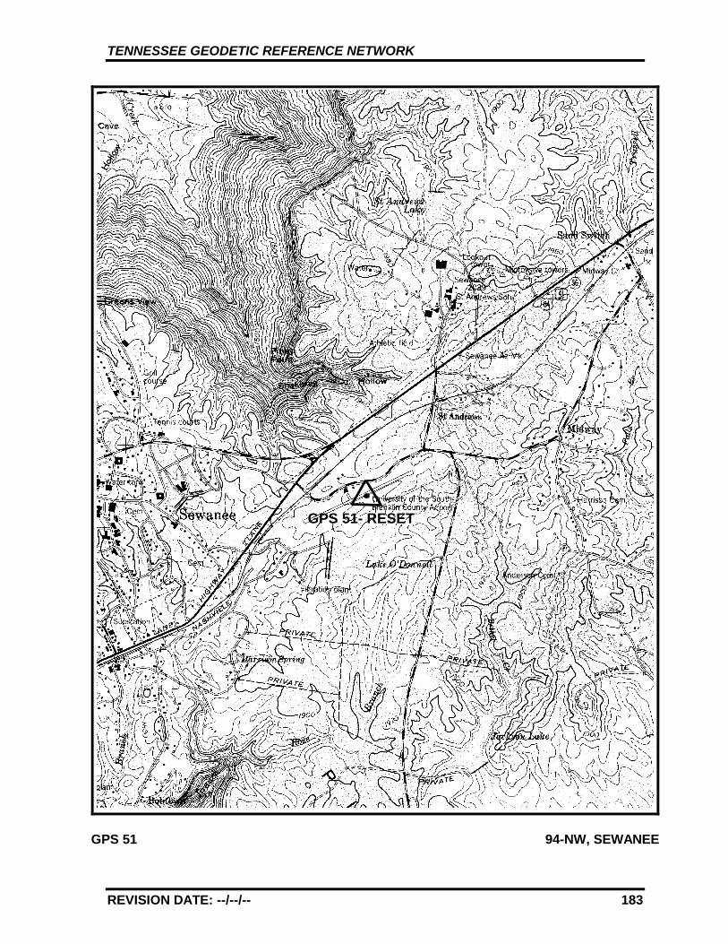
TENNESSEE GEODETIC REFERENCE NETWORK
REVISION DATE: --/--/-- 183
GPS 51 94-NW, SEWANEE
GPS 51- RESET
TENNESSEE GEODETIC REFERENCE NETWORK
REVISION DATE: --/--/-- 184
GPS - 52
All values are referenced to the North American Datum NAD 83 (1995)
Latitude: 35°°°° 14' 28.42030" TN Northing: 100809.803 mLongitude: 86°°°° 24' 38.98606" TN Easting: 562606.579 m
Elevation: 229.638 m (753.40 ft)
Convergence: -0°°°° 14' 25.9" Scale Factor: 1.00000156
Monument Set by: NGS Date: 1987
County: Moore Nearest Town: Lynchburg
USGS QUAD: Mulberry TVA Designation: 80-NW
Description:
The station is located about 17.7 km (11 mi.) northeast of Fayetteville,6.4 km (4 mi.) southwest of Lynchburg, on the southeast side of StateRoute 50 in a large flat bedrock outcrop on the road right-of-way,Ownership--State Right-of-Way.
To reach the station from the Jack Daniels Distillery (visitors entrance)on State Route 55 in Lynchburg go southwest for 2.7 km (1.7 mi.) onState Route 55 to the junction of State Route 50. Continue straightahead, now on State Route 50, and go southwest for 2.25 km (1.4 mi.) toa Tennessee Department of Transportation Garage. Continue straightahead and go southwest for 1.21 km (0.75 mi.) on State Route 50 to thestation on the left, 1.1 km (0.7 mi.) northeast of the Moore/LincolnCounty Line.
The station is a standard NGS disk stamped---GPS 52 1987---, set into adrill hole in bedrock outcrop measuring 4.6 m (15 ft.) by 2.4 m (8 ft.)flush with ground. Located 46.3 m (152 ft.) south and across the roadfrom a power pole with one guy wire, 7.9 m (26 ft.) west-northwest fromthe southeast right-of-way fence, 7.53 m (24.7 ft.) east-southeast fromthe center of State Route 50 and 0.3 m (1 ft.) above the same, 1.2 m (3.9ft.) east-southeast from a witness post.
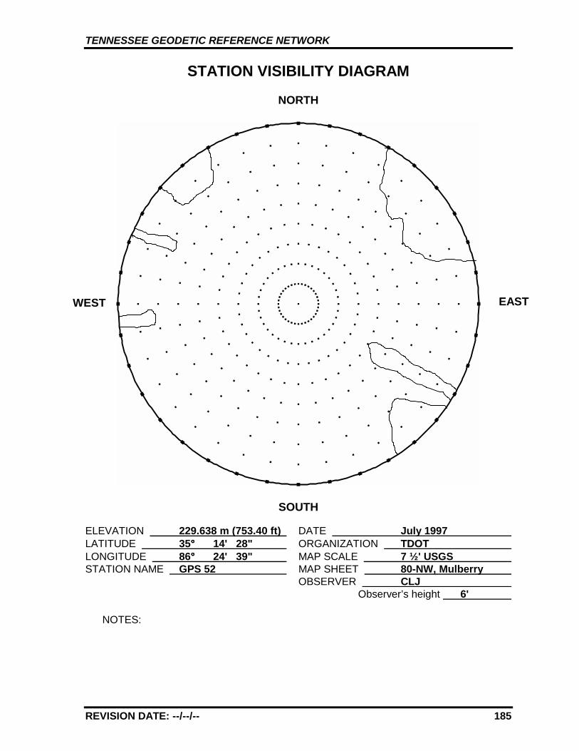
TENNESSEE GEODETIC REFERENCE NETWORK
REVISION DATE: --/--/-- 185
STATION VISIBILITY DIAGRAM
NORTH
SOUTH
ELEVATION 229.638 m (753.40 ft) DATE July 1997 LATITUDE 35°°°° 14' 28" ORGANIZATION TDOT LONGITUDE 86°°°° 24' 39" MAP SCALE 7 ½' USGS STATION NAME GPS 52 MAP SHEET 80-NW, Mulberry
OBSERVER CLJ Observer’s height 6'
NOTES:
WEST EAST

TENNESSEE GEODETIC REFERENCE NETWORK
REVISION DATE: --/--/-- 186
GPS 52 80-NW, MULBERRY
GPS 52

TENNESSEE GEODETIC REFERENCE NETWORK
REVISION DATE: --/--/-- 187
GPS - 53
All values are referenced to the North American Datum NAD 83 (1995)
Latitude: 35°°°° 11' 36.35019" TN Northing: 95780.765 mLongitude: 86°°°° 52' 12.66117" TN Easting: 520750.132 m
Elevation: 235.364 m (772.19 ft)
Convergence: -0°°°° 30' 34.0" Scale Factor: 1.00001046
Monument Set by: NGS Date: 1987
County: Giles Nearest Town: Pulaski
USGS QUAD: Frankewing TVA Designation: 66-NE
Description:
The station is located about 16.1 km (10 mi.) east of Pulaski, at thejunction of Interstate 65 and U.S. Highway 64/State Route 15.Ownership--Highway Right-of-Way.
The station is located at the intersection of Interstate 65 and U.S.Highway 64/State Route 15 about 16.1 km (10 mi.) east of Pulaski.
The station is a standard NGS disk stamped---GPS 53 1987---, set into adrill hole in bedrock outcrop level with ground. Located 46.6 m (153 ft.)east from the center of northbound Interstate 65, 35.6 m (117 ft.) westfrom the center of the junction of the northbound entrance ramp andU.S. Highway 64, 12.04 m (39.5 ft.) north from the center of U.S.Highway 64 and 0.3 m (1 ft.) above same, 17.0 m (55.8 ft.) northwest of I-65 entrance ramp sign at northbound entrance ramp, 0.5 m (1.6 ft.)northwest from a steel witness post.
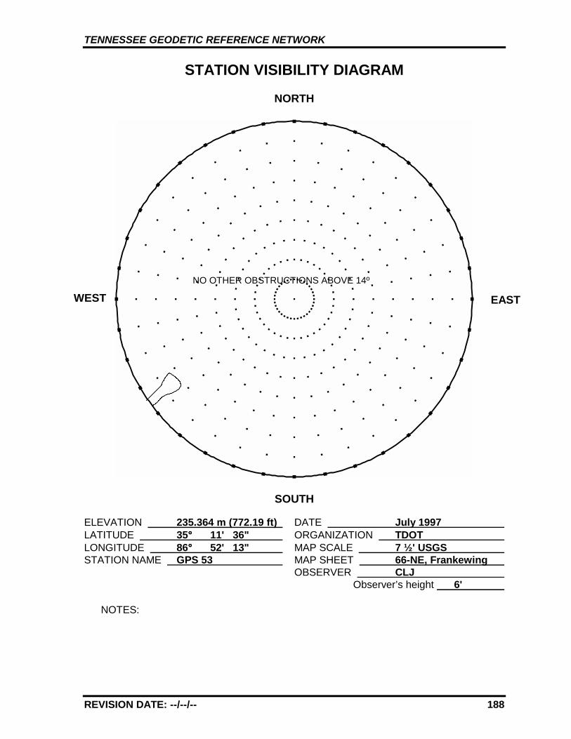
TENNESSEE GEODETIC REFERENCE NETWORK
REVISION DATE: --/--/-- 188
STATION VISIBILITY DIAGRAM
NORTH
SOUTH
ELEVATION 235.364 m (772.19 ft) DATE July 1997 LATITUDE 35°°°° 11' 36" ORGANIZATION TDOT LONGITUDE 86°°°° 52' 13" MAP SCALE 7 ½' USGS STATION NAME GPS 53 MAP SHEET 66-NE, Frankewing
OBSERVER CLJ Observer’s height 6'
NOTES:
WEST EAST
NO OTHER OBSTRUCTIONS ABOVE 14º
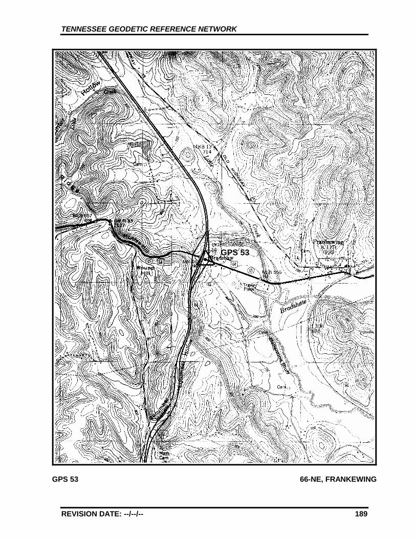
TENNESSEE GEODETIC REFERENCE NETWORK
REVISION DATE: --/--/-- 189
GPS 53 66-NE, FRANKEWING
GPS 53
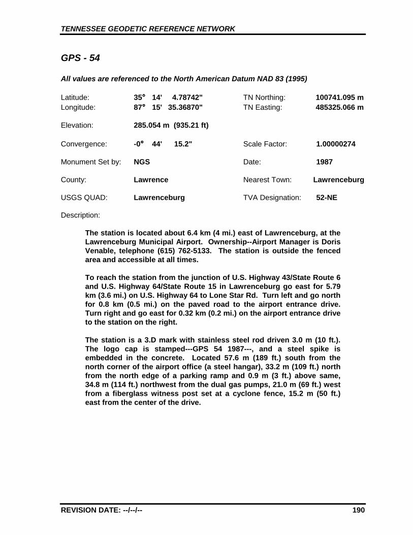
TENNESSEE GEODETIC REFERENCE NETWORK
REVISION DATE: --/--/-- 190
GPS - 54
All values are referenced to the North American Datum NAD 83 (1995)
Latitude: 35°°°° 14' 4.78742" TN Northing: 100741.095 mLongitude: 87°°°° 15' 35.36870" TN Easting: 485325.066 m
Elevation: 285.054 m (935.21 ft)
Convergence: -0°°°° 44' 15.2" Scale Factor: 1.00000274
Monument Set by: NGS Date: 1987
County: Lawrence Nearest Town: Lawrenceburg
USGS QUAD: Lawrenceburg TVA Designation: 52-NE
Description:
The station is located about 6.4 km (4 mi.) east of Lawrenceburg, at theLawrenceburg Municipal Airport. Ownership--Airport Manager is DorisVenable, telephone (615) 762-5133. The station is outside the fencedarea and accessible at all times.
To reach the station from the junction of U.S. Highway 43/State Route 6and U.S. Highway 64/State Route 15 in Lawrenceburg go east for 5.79km (3.6 mi.) on U.S. Highway 64 to Lone Star Rd. Turn left and go northfor 0.8 km (0.5 mi.) on the paved road to the airport entrance drive.Turn right and go east for 0.32 km (0.2 mi.) on the airport entrance driveto the station on the right.
The station is a 3.D mark with stainless steel rod driven 3.0 m (10 ft.).The logo cap is stamped---GPS 54 1987---, and a steel spike isembedded in the concrete. Located 57.6 m (189 ft.) south from thenorth corner of the airport office (a steel hangar), 33.2 m (109 ft.) northfrom the north edge of a parking ramp and 0.9 m (3 ft.) above same,34.8 m (114 ft.) northwest from the dual gas pumps, 21.0 m (69 ft.) westfrom a fiberglass witness post set at a cyclone fence, 15.2 m (50 ft.)east from the center of the drive.
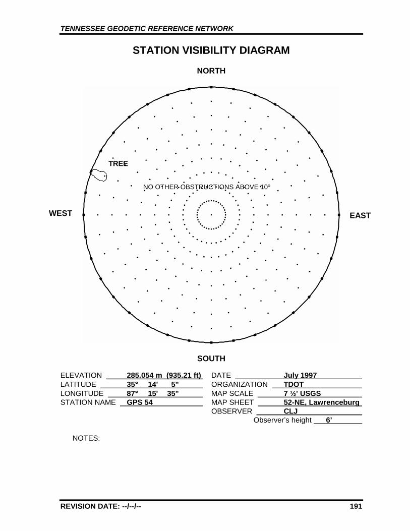
TENNESSEE GEODETIC REFERENCE NETWORK
REVISION DATE: --/--/-- 191
STATION VISIBILITY DIAGRAM
NORTH
SOUTH
ELEVATION 285.054 m (935.21 ft) DATE July 1997 LATITUDE 35°°°° 14' 5" ORGANIZATION TDOT LONGITUDE 87°°°° 15' 35" MAP SCALE 7 ½' USGS STATION NAME GPS 54 MAP SHEET 52-NE, Lawrenceburg
OBSERVER CLJ Observer’s height 6’
NOTES:
WEST EAST
TREE
NO OTHER OBSTRUCTIONS ABOVE 10º
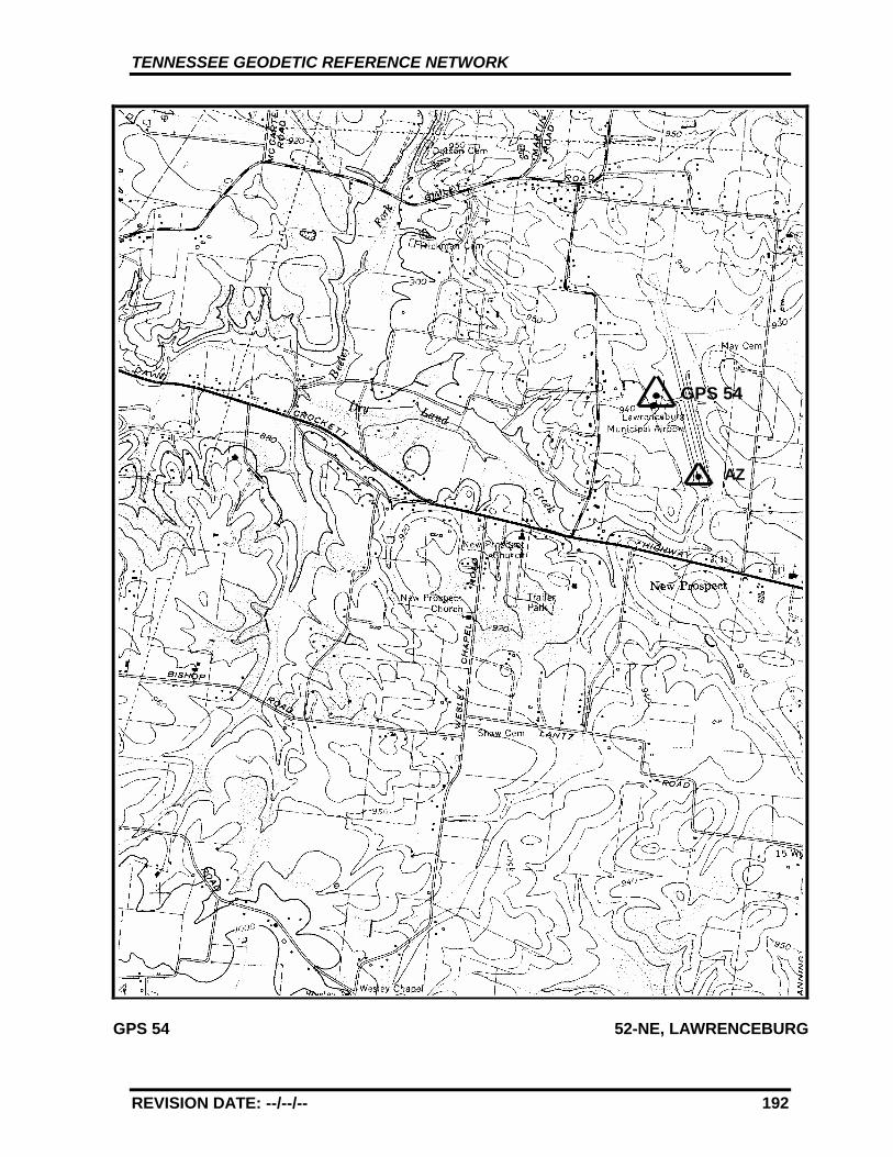
TENNESSEE GEODETIC REFERENCE NETWORK
REVISION DATE: --/--/-- 192
GPS 54 52-NE, LAWRENCEBURG
GPS 54
AZ
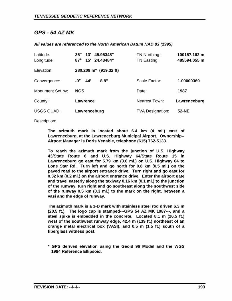
TENNESSEE GEODETIC REFERENCE NETWORK
REVISION DATE: --/--/-- 193
GPS - 54 AZ MK
All values are referenced to the North American Datum NAD 83 (1995)
Latitude: 35°°°° 13' 45.95348" TN Northing: 100157.162 mLongitude: 87°°°° 15' 24.43484" TN Easting: 485594.055 m
Elevation: 280.209 m* (919.32 ft)
Convergence: -0°°°° 44' 8.8" Scale Factor: 1.00000369
Monument Set by: NGS Date: 1987
County: Lawrence Nearest Town: Lawrenceburg
USGS QUAD: Lawrenceburg TVA Designation: 52-NE
Description:
The azimuth mark is located about 6.4 km (4 mi.) east ofLawrenceburg, at the Lawrenceburg Municipal Airport. Ownership--Airport Manager is Doris Venable, telephone (615) 762-5133.
To reach the azimuth mark from the junction of U.S. Highway43/State Route 6 and U.S. Highway 64/State Route 15 inLawrenceburg go east for 5.79 km (3.6 mi.) on U.S. Highway 64 toLone Star Rd. Turn left and go north for 0.8 km (0.5 mi.) on thepaved road to the airport entrance drive. Turn right and go east for0.32 km (0.2 mi.) on the airport entrance drive. Enter the airport gateand travel easterly along the taxiway 0.16 km (0.1 mi.) to the junctionof the runway, turn right and go southeast along the southwest sideof the runway 0.5 km (0.3 mi.) to the mark on the right, between avasi and the edge of runway.
The azimuth mark is a 3-D mark with stainless steel rod driven 6.3 m(20.5 ft.). The logo cap is stamped---GPS 54 AZ MK 1987---, and asteel spike is embedded in the concrete. Located 8.1 m (26.5 ft.)west of the southwest runway edge, 42.4 m (139 ft.) northeast of anorange metal electrical box (VASI), and 0.5 m (1.5 ft.) south of afiberglass witness post.
* GPS derived elevation using the Geoid 96 Model and the WGS1984 Reference Ellipsoid.
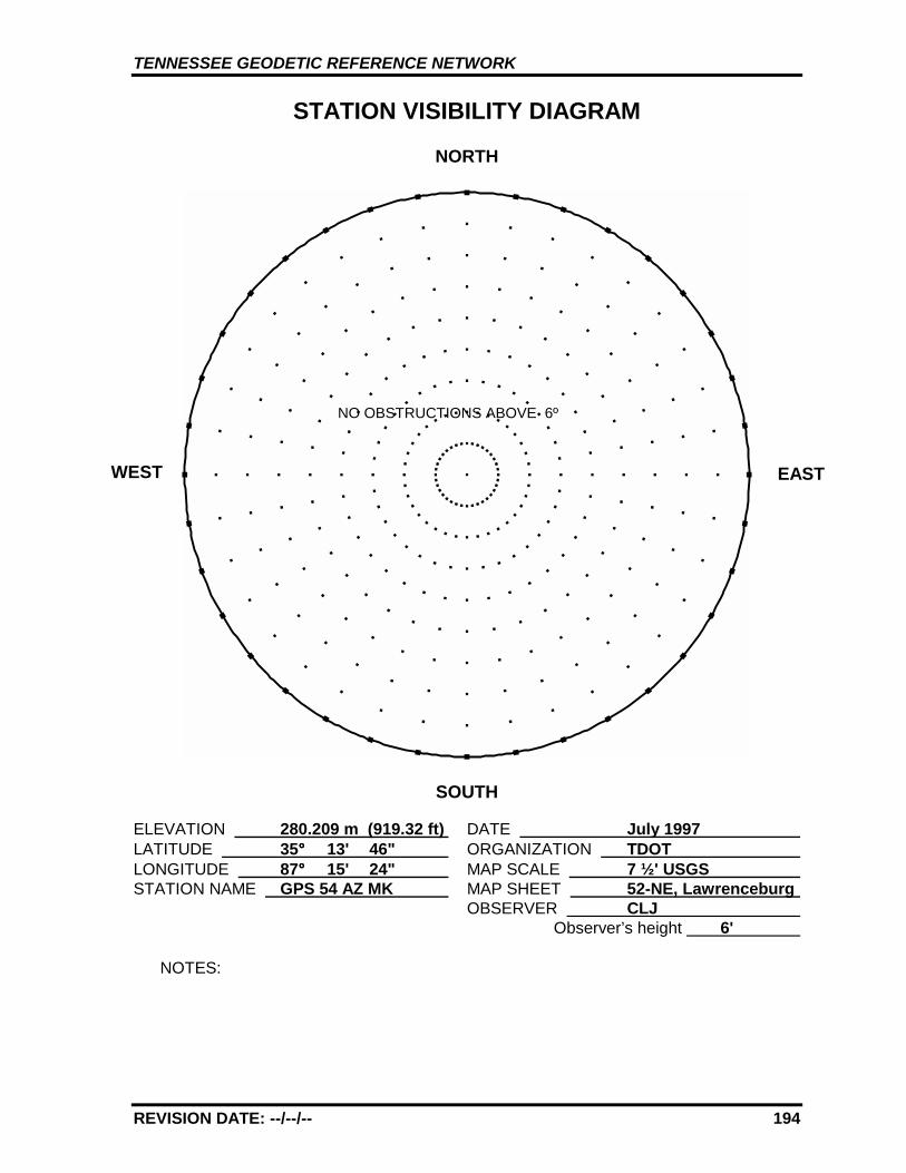
TENNESSEE GEODETIC REFERENCE NETWORK
REVISION DATE: --/--/-- 194
STATION VISIBILITY DIAGRAM
NORTH
SOUTH
ELEVATION 280.209 m (919.32 ft) DATE July 1997 LATITUDE 35°°°° 13' 46" ORGANIZATION TDOT LONGITUDE 87°°°° 15' 24" MAP SCALE 7 ½' USGS STATION NAME GPS 54 AZ MK MAP SHEET 52-NE, Lawrenceburg
OBSERVER CLJ Observer’s height 6'
NOTES:
WEST EAST
NO OBSTRUCTIONS ABOVE 6º
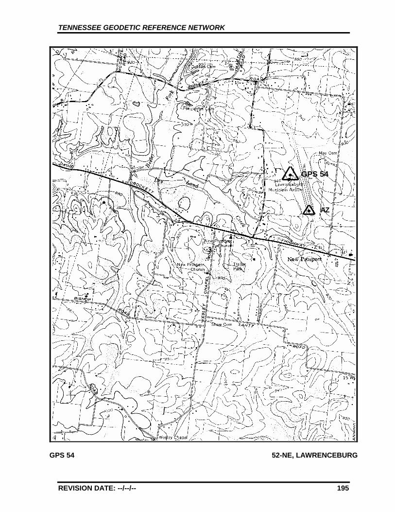
TENNESSEE GEODETIC REFERENCE NETWORK
REVISION DATE: --/--/-- 195
GPS 54 52-NE, LAWRENCEBURG
GPS 54
AZ
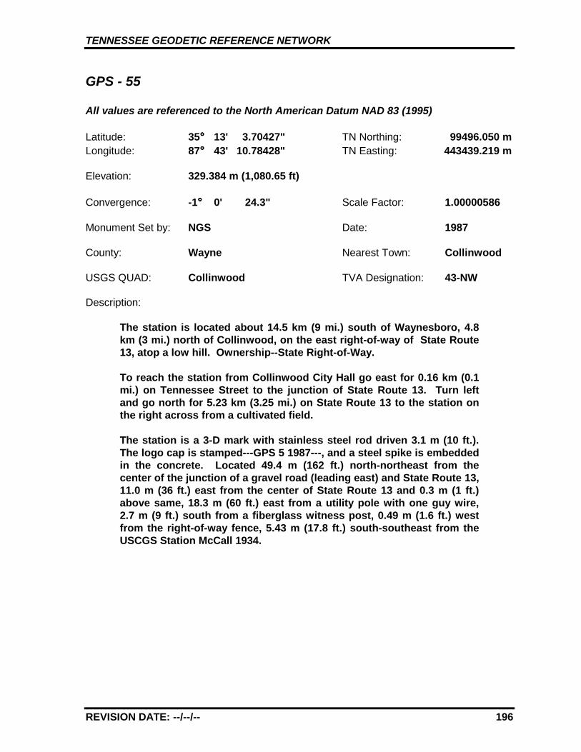
TENNESSEE GEODETIC REFERENCE NETWORK
REVISION DATE: --/--/-- 196
GPS - 55
All values are referenced to the North American Datum NAD 83 (1995)
Latitude: 35°°°° 13' 3.70427" TN Northing: 99496.050 mLongitude: 87°°°° 43' 10.78428" TN Easting: 443439.219 m
Elevation: 329.384 m (1,080.65 ft)
Convergence: -1°°°° 0' 24.3" Scale Factor: 1.00000586
Monument Set by: NGS Date: 1987
County: Wayne Nearest Town: Collinwood
USGS QUAD: Collinwood TVA Designation: 43-NW
Description:
The station is located about 14.5 km (9 mi.) south of Waynesboro, 4.8km (3 mi.) north of Collinwood, on the east right-of-way of State Route13, atop a low hill. Ownership--State Right-of-Way.
To reach the station from Collinwood City Hall go east for 0.16 km (0.1mi.) on Tennessee Street to the junction of State Route 13. Turn leftand go north for 5.23 km (3.25 mi.) on State Route 13 to the station onthe right across from a cultivated field.
The station is a 3-D mark with stainless steel rod driven 3.1 m (10 ft.).The logo cap is stamped---GPS 5 1987---, and a steel spike is embeddedin the concrete. Located 49.4 m (162 ft.) north-northeast from thecenter of the junction of a gravel road (leading east) and State Route 13,11.0 m (36 ft.) east from the center of State Route 13 and 0.3 m (1 ft.)above same, 18.3 m (60 ft.) east from a utility pole with one guy wire,2.7 m (9 ft.) south from a fiberglass witness post, 0.49 m (1.6 ft.) westfrom the right-of-way fence, 5.43 m (17.8 ft.) south-southeast from theUSCGS Station McCall 1934.
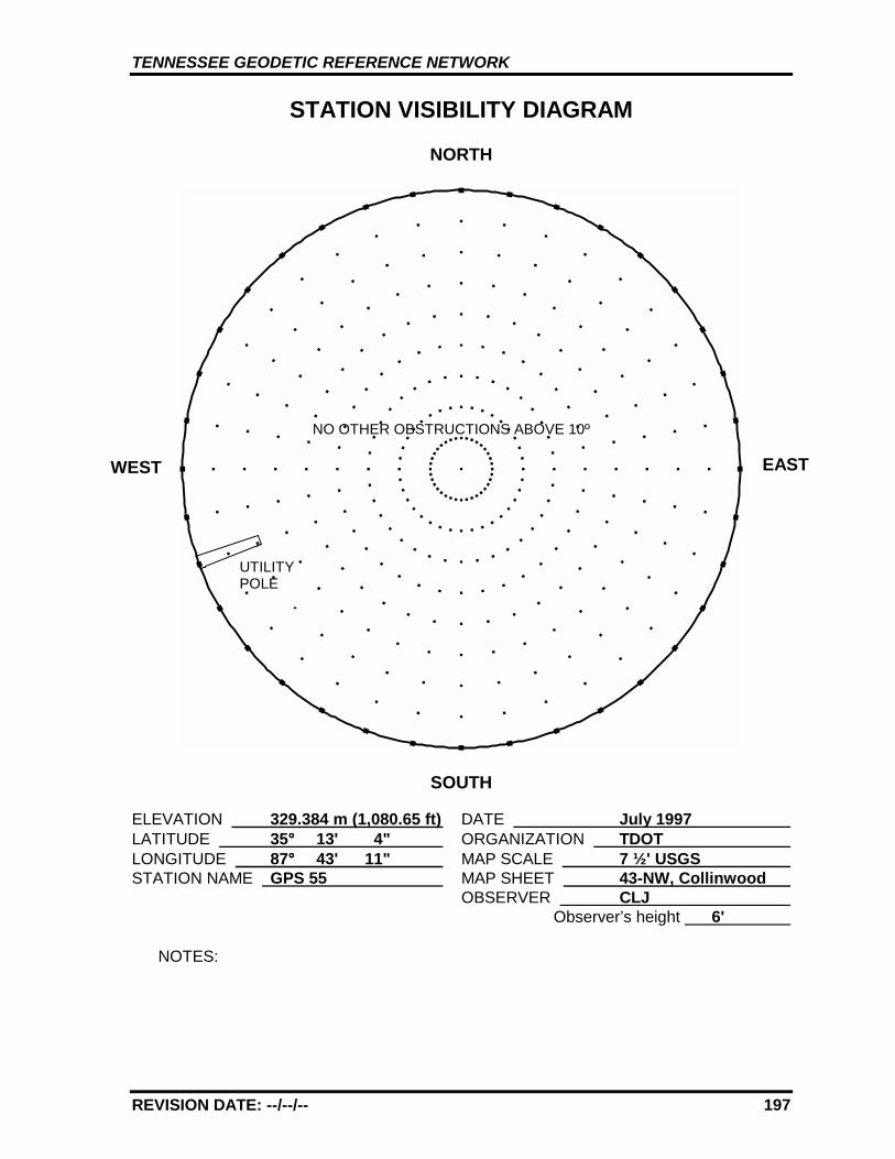
TENNESSEE GEODETIC REFERENCE NETWORK
REVISION DATE: --/--/-- 197
STATION VISIBILITY DIAGRAM
NORTH
SOUTH
ELEVATION 329.384 m (1,080.65 ft) DATE July 1997 LATITUDE 35°°°° 13' 4" ORGANIZATION TDOT LONGITUDE 87°°°° 43' 11" MAP SCALE 7 ½' USGS STATION NAME GPS 55 MAP SHEET 43-NW, Collinwood
OBSERVER CLJ Observer’s height 6'
NOTES:
WEST EAST
UTILITYPOLE
NO OTHER OBSTRUCTIONS ABOVE 10º
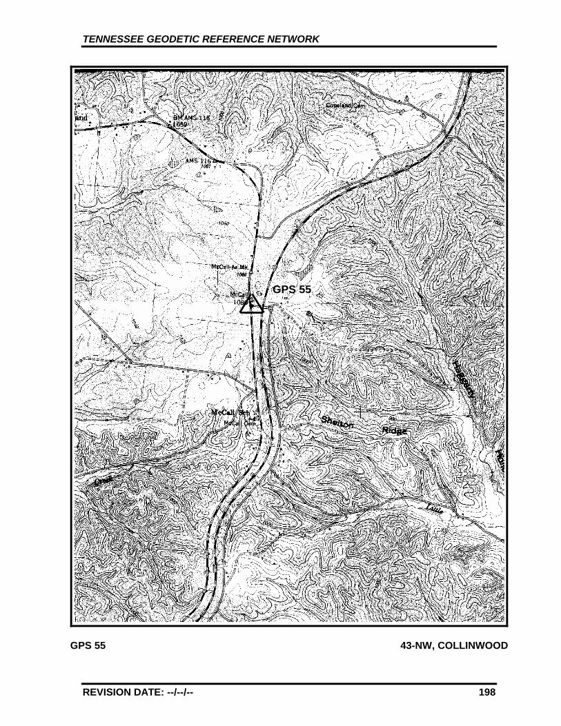
TENNESSEE GEODETIC REFERENCE NETWORK
REVISION DATE: --/--/-- 198
GPS 55 43-NW, COLLINWOOD
GPS 55
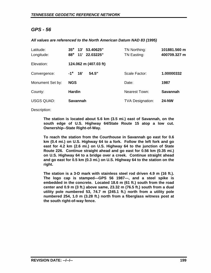
TENNESSEE GEODETIC REFERENCE NETWORK
REVISION DATE: --/--/-- 199
GPS - 56
All values are referenced to the North American Datum NAD 83 (1995)
Latitude: 35°°°° 13' 53.40625" TN Northing: 101881.560 mLongitude: 88°°°° 11' 22.03225" TN Easting: 400709.327 m
Elevation: 124.062 m (407.03 ft)
Convergence: -1°°°° 16' 54.5" Scale Factor: 1.00000332
Monument Set by: NGS Date: 1987
County: Hardin Nearest Town: Savannah
USGS QUAD: Savannah TVA Designation: 24-NW
Description:
The station is located about 5.6 km (3.5 mi.) east of Savannah, on thesouth edge of U.S. Highway 64/State Route 15 atop a low cut.Ownership--State Right-of-Way.
To reach the station from the Courthouse in Savannah go east for 0.6km (0.4 mi.) on U.S. Highway 64 to a fork. Follow the left fork and goeast for 4.2 km (2.6 mi.) on U.S. Highway 64 to the junction of StateRoute 226. Continue straight ahead and go east for 0.56 km (0.35 mi.)on U.S. Highway 64 to a bridge over a creek. Continue straight aheadand go east for 0.5 km (0.3 mi.) on U.S. Highway 64 to the station on theright.
The station is a 3-D mark with stainless steel rod driven 4.9 m (16 ft.).The logo cap is stamped---GPS 56 1987---, and a steel spike isembedded in the concrete. Located 18.6 m (61 ft.) south from the roadcenter and 0.9 m (3 ft.) above same, 23.32 m (76.5 ft.) south from a dualutility pole numbered 53, 74.7 m (245.1 ft.) north from a utility polenumbered 254, 1.0 m (3.28 ft.) north from a fiberglass witness post atthe south right-of-way fence.
TENNESSEE GEODETIC REFERENCE NETWORK
REVISION DATE: --/--/-- 200
STATION VISIBILITY DIAGRAM
NORTH
SOUTH
ELEVATION 124.062 m (407.03 ft) DATE July 1997 LATITUDE 35°°°° 13' 53" ORGANIZATION TDOT LONGITUDE 88°°°° 11' 22" MAP SCALE 7 ½' USGS STATION NAME GPS 56 MAP SHEET 24-NW, Savannah
OBSERVER CLJ Observer’s height 6'
NOTES:
WEST EASTUTILITYPOLE
TENNESSEE GEODETIC REFERENCE NETWORK
REVISION DATE: --/--/-- 201
GPS 56 24-NW, SAVANNAH
GPS 56SAVANNAH
TENNESSEE GEODETIC REFERENCE NETWORK
REVISION DATE: --/--/-- 202
GPS - 57
All values are referenced to the North American Datum NAD 83 (1995)
Latitude: 35°°°° 12' 21.02953" TN Northing: 99711.687 mLongitude: 88°°°° 29' 58.23938" TN Easting: 372420.007 m
Elevation: 184.197 m (604.32 ft)
Convergence: -1°°°° 27' 47.9" Scale Factor: 1.00000809
Monument Set by: NGS Date: 1987
County: McNairy Nearest Town: Selmer
USGS QUAD: Stantonville TVA Designation: 13-NW
Description:
The station is located about 10.5 km (6.5 mi.) east northeast of Selmerin McNairy County, at the Selmer/Sibley Airport, at the junction of ataxiway and the runway, 0.24 km (0.15 mi.) north-northeast of theairport office (a two story brick building). Ownership--Airport Manageris Joseph Tucker or Hollis Reeves, telephone (901) 645-3014. Call fornight access.
To reach the station from the junction of U.S. Highway 64/State Route15 and U.S. Highway 45/State Route 5 about 1.6 km (1 mi.) southeast ofSelmer go east-northeast for 8.4 km (5.2 mi.) on U.S. Highway 64 to thejunction of a paved road. Turn left and go north for 1.3 km (0.8 mi.) onthe paved road to the airport office and the station located 0.24 km (0.15mi.) north-northeast from the office.
The station is a 3-D mark with stainless steel rod driven 2.4 m (8 ft.).The logo cap is stamped---GPS 57 1987---, and a steel spike isembedded in the concrete. Located 21.6 m (71 ft.) west from therunway center and 0.3 m (1 ft.) below same, 17.4 m (57 ft.) east from thetaxiway center, 0.3 m (1.0 ft.) south from a fiberglass witness post.
TENNESSEE GEODETIC REFERENCE NETWORK
REVISION DATE: --/--/-- 203
STATION VISIBILITY DIAGRAM
NORTH
SOUTH
ELEVATION 184.197 m (604.32 ft) DATE July 1997 LATITUDE 35°°°° 12' 21" ORGANIZATION TDOT LONGITUDE 88°°°° 29' 58" MAP SCALE 7 ½' USGS STATION NAME GPS 57 MAP SHEET 13-NW, Stantonville
4-NE, Purdy OBSERVER CLJ
Observer’s height 6'
NOTES:
WEST EAST
NO OBSTRUCTIONS ABOVE 5º
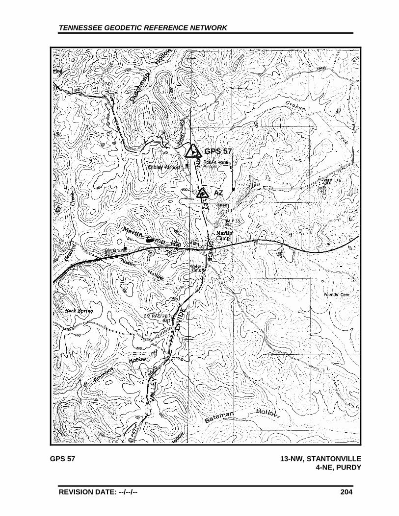
TENNESSEE GEODETIC REFERENCE NETWORK
REVISION DATE: --/--/-- 204
GPS 57 13-NW, STANTONVILLE4-NE, PURDY
GPS 57
AZ
TENNESSEE GEODETIC REFERENCE NETWORK
REVISION DATE: --/--/-- 205
GPS - 57 AZ MK
All values are referenced to the North American Datum NAD 83 (1995)
Latitude: 35°°°° 12' 03.63487" TN Northing: 99172.328 Longitude: 88°°°° 29' 52.87718" TN Easting: 372541.915
Elevation: 184.400 m* (604.99 ft)
Convergence: -1°°°° 27' 44.8" Scale Factor: 1.00000901
Monument Set by: NGS Date: 1987
County: McNairy Nearest Town: Selmer
USGS QUAD: Stantonville TVA Designation: 13-NW
Description:
The azimuth mark is located about 10.5 km (6.5 mi.) east northeastof Selmer in McNairy County, at the Selmer/Sibley Airport, at thejunction of a taxiway and the runway, 0.24 km (0.15 mi.) north-northeast of the airport office (a two story brick building).Ownership--Airport Manager is Joseph Tucker or Hollis Reeves,telephone (901) 645-3014. Call for night access.
To reach the azimuth mark from the junction of U.S. Highway64/State Route 15 and U.S. Highway 45/State Route 5 about 1.6 km(1 mi.) southeast of Selmer go east-northeast for 8.4 km (5.2 mi.) onU.S. Highway 64 to the junction of a paved road. Turn left and gonorth for 1.3 km (0.8 mi.) on the paved road to the airport office.Then go 0.16 km (0.1 mi) southeast along the taxiway to the junctionof the runway. Turn right and go 0.24 km (0.15 mi.) south along thewest side of the runway to the mark on the right, between a vasi andthe runway edge.
The azimuth mark is a 3-D mark with stainless steel rod driven 3.05m (10 ft.). The logo cap is stamped---GPS 57 AZ MK 1987---, and asteel rebar is embedded in the concrete. Located 3.7 m (12.2 ft.)east of the center of the concrete base for the southern most of theprevious location of two vasi's (this previous location isapproximately 114.3 m (375 ft.) south of the southern most taxiwaylight), 11.9 m (39 ft.) west of the west edge of the runway, and 0.3meters (1.0 ft.) south of a fiberglass witness post.
* GPS derived elevation using the Geoid 96 Model and the WGS1984 Reference Ellipsoid.
mm
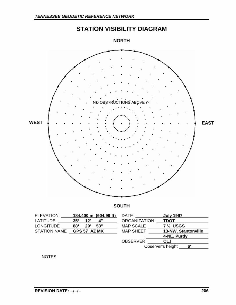
TENNESSEE GEODETIC REFERENCE NETWORK
REVISION DATE: --/--/-- 206
STATION VISIBILITY DIAGRAM
NORTH
SOUTH
ELEVATION 184.400 m (604.99 ft) DATE July 1997 LATITUDE 35°°°° 12' 4" ORGANIZATION TDOT LONGITUDE 88°°°° 29' 53" MAP SCALE 7 ½' USGS STATION NAME GPS 57 AZ MK MAP SHEET 13-NW, Stantonville
4-NE, Purdy OBSERVER CLJ
Observer’s height 6'
NOTES:
WEST EAST
NO OBSTRUCTIONS ABOVE 7º

TENNESSEE GEODETIC REFERENCE NETWORK
REVISION DATE: --/--/-- 207
GPS 57 13-NW, STANTONVILLE4-NE, PURDY
GPS 57
AZ
TENNESSEE GEODETIC REFERENCE NETWORK
REVISION DATE: --/--/-- 208
GPS - 58
All values are referenced to the North American Datum NAD 83 (1995)
Latitude: 35°°°° 12' 44.84620" TN Northing: 101847.588 mLongitude: 89°°°° 2' 36.18469" TN Easting: 322937.768 m
Elevation: 151.291 m (496.36 ft)
Convergence: -1°°°° 46' 54.2" Scale Factor: 1.00000684
Monument Set by: NGS Date: 1987
County: Hardeman Nearest Town: Bolivar
USGS QUAD: Middleburg TVA Designation: 432-NE
Description:
The station is located about 8.1 km (5 mi.) southwest of Bolivar, at theBolivar/Hardeman County Airport, 0.16 km (0.1 mi.) south-southwest ofthe airport office, between the runway and a parking ramp. Ownership--Airport Manager is Dave Perrin (partner is Steve Aldred), telephone(901) 658-7556. Call for night access.
To reach the station from the junction of U.S. Highway 64 and StateRoute 18 just west of Bolivar go southwest for 5.3 km (3.3 mi.) on StateRoute 18 to the airport entrance drive. Turn left and go south for 1.3 km(0.8 mi.) on the airport entrance drive to the airport office and thestation located 0.16 km (0.1 mi.) south-southwest of the office.
The station is a 3-D mark with stainless steel rod driven to refusal. Thelogo cap is stamped---GPS 58 1987---, and a steel spike is embedded inthe concrete. Located 13.2 m (43 ft.) east from the runway edge and 0.9m (3 ft.) below same, 30.5 m (100 ft.) west from the west edge of theparking ramp, 22.9 m (75 ft.) north from the center of a taxiwaycrossover, 10.7 m (35 ft.) northwest from the center of a culvertheadwall, 0.3 m (1 ft.) north from a fiberglass witness post.
TENNESSEE GEODETIC REFERENCE NETWORK
REVISION DATE: --/--/-- 209
STATION VISIBILITY DIAGRAM
NORTH
SOUTH
ELEVATION 151.291 m (496.36 ft) DATE July 1997 LATITUDE 35°°°° 12' 45" ORGANIZATION TDOT LONGITUDE 89°°°° 2' 36" MAP SCALE 7 ½' USGS STATION NAME GPS 58 MAP SHEET 432-NE, Middleburg
OBSERVER CLJ Observer’s height 6'
NOTES:
WEST EAST
NO OBSTRUCTIONS ABOVE 8º
TENNESSEE GEODETIC REFERENCE NETWORK
REVISION DATE: --/--/-- 210
GPS 58 432-NE, MIDDLEBURG
GPS 58
AZ

TENNESSEE GEODETIC REFERENCE NETWORK
REVISION DATE: --/--/-- 211
GPS - 58 AZ MK
All values are referenced to the North American Datum NAD 83 (1995)
Latitude: 35°°°° 13' 04.77794" TN Northing: 102459.289 mLongitude: 89°°°° 2' 33.30885" TN Easting: 323029.563 m
Elevation: 147.881 m* (485.17 ft)
Convergence: -1°°°° 46' 52.5" Scale Factor: 1.00000580
Monument Set by: NGS Date: 1987
County: Hardeman Nearest Town: Bolivar
USGS QUAD: Middleburg TVA Designation: 432-NE
Description:
The azimuth mark is located about 8.1 km (5 mi.) southwest ofBolivar, at the Bolivar/Hardeman County Airport, 0.16 km (0.1 mi.)south-southwest of the airport office, between the runway and aparking ramp. Ownership--Airport Manager is Dave Perrin (partneris Steve Aldred), telephone (901) 658-7556. Call for night access.
To reach the mark from the junction of U.S. Highway 64 and StateRoute 18 just west of Bolivar go southwest for 5.3 km (3.3 mi.) onState Route 18 to the airport entrance drive. Turn left and go southfor 1.3 km (0.8 mi.) on the airport entrance drive to the airport office.Then turn right and go north 0.5 km (0.3 mi.) along the taxiway tothe mark. The distance is measured from the gate at the northwestcorner of the airport office building, however, the gate is oftenlocked and access provided around the back of the office buildingand hangar.
The azimuth mark is a 3-D mark with stainless steel rod driven 29.3m (96 ft.) to refusal. The logo cap is stamped---GPS 58 AZ MK 1987---, and is 0.08 m (0.25 ft.) below the surface of the ground, with arebar in the concrete. Located 3.5 m (11.5 ft.) west of the center ofthe concrete base for a vasi, 11.7 m (38.4 ft.) east of the east edge ofthe runway, 31.9 m (104.5 ft.) west of the west edge of the taxiway,30.0 m (98.5 ft.) north of a vasi, and 0.3 m (1.0 ft.) north of afiberglass witness post. Also 0.16 km (0.1 mi.) south of the northend of the runway.
* GPS derived elevation using the Geoid 96 Model and the WGS1984 Reference Ellipsoid.
TENNESSEE GEODETIC REFERENCE NETWORK
REVISION DATE: --/--/-- 212
STATION VISIBILITY DIAGRAM
NORTH
SOUTH
ELEVATION 147.881 m (485.17 ft) DATE July 1997 LATITUDE 35°°°° 13' 05" ORGANIZATION TDOT LONGITUDE 89°°°° 2' 33" MAP SCALE 7 ½' USGS STATION NAME GPS 58 AZ MK MAP SHEET 432-NE, Middleburg
OBSERVER CLJ Observer’s height 6'
NOTES:
WEST EAST
NO OBSTRUCTIONS ABOVE 4º

TENNESSEE GEODETIC REFERENCE NETWORK
REVISION DATE: --/--/-- 213
GPS 58 432-NE, MIDDLEBURG
GPS 58
AZ
TENNESSEE GEODETIC REFERENCE NETWORK
REVISION DATE: --/--/-- 214
GPS - 59
All values are referenced to the North American Datum NAD 83 (1995)
Latitude: 35°°°° 9' 21.84872" TN Northing: 96812.678 mLongitude: 89°°°° 26' 47.90713" TN Easting: 286020.331 m
Elevation: 124.595 m (408.78 ft)
Convergence: -2°°°° 1' 4.1" Scale Factor: 1.00001790
Monument Set by: NGS Date: 1987
County: Fayette Nearest Town: Somerville
USGS QUAD: Macon TVA Designation: 424-NW
Description:
The station is located about 14.5 km (9 mi.) southwest of Somerville, ina grass island at the junction of State Routes 195 and 193. Ownership--State Right-of-Way.
To reach the station from the Courthouse in Somerville go south for 2.6km (1.6 mi.) on State Route 76 to the junction of State Route 195. Turnright and go southwest for 12.1 km (7.5 mi.) on State Route 195 to thejunction of State Route 193 and the station.
The station is a 3-D mark with stainless steel rod driven 7.9 m (26 ft.).The logo cap is stamped---GPS 59 1987---, and a steel spike isembedded in the concrete. Located 8.2 m (27 ft.) south from the centerof State Route 195, 7.5 m (25 ft.) north from the center of State Route193 and level with same, 6.2 m (20.5 ft.) east from a stop sign, 39.6 m(130 ft.) east from a power pole with four guy wires, 25.0 m (82 ft.)northeast from a concrete R.O.W. marker south of State Route 193, 18.7m (61 ft.) west of the most easterly of the two stop signs and 0.3 m (1ft.) north of a fiberglass witness post.
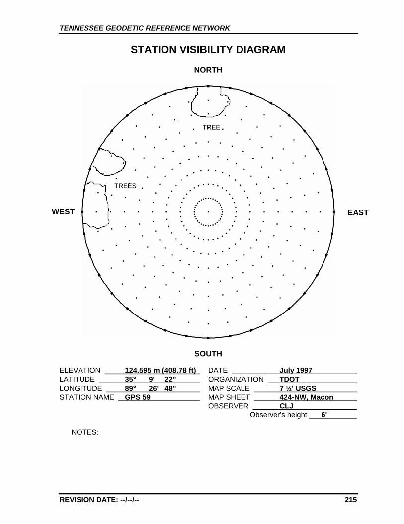
TENNESSEE GEODETIC REFERENCE NETWORK
REVISION DATE: --/--/-- 215
STATION VISIBILITY DIAGRAM
NORTH
SOUTH
ELEVATION 124.595 m (408.78 ft) DATE July 1997 LATITUDE 35°°°° 9' 22" ORGANIZATION TDOT LONGITUDE 89°°°° 26' 48" MAP SCALE 7 ½' USGS STATION NAME GPS 59 MAP SHEET 424-NW, Macon
OBSERVER CLJ Observer’s height 6'
NOTES:
WEST
TREES
TREE
EAST
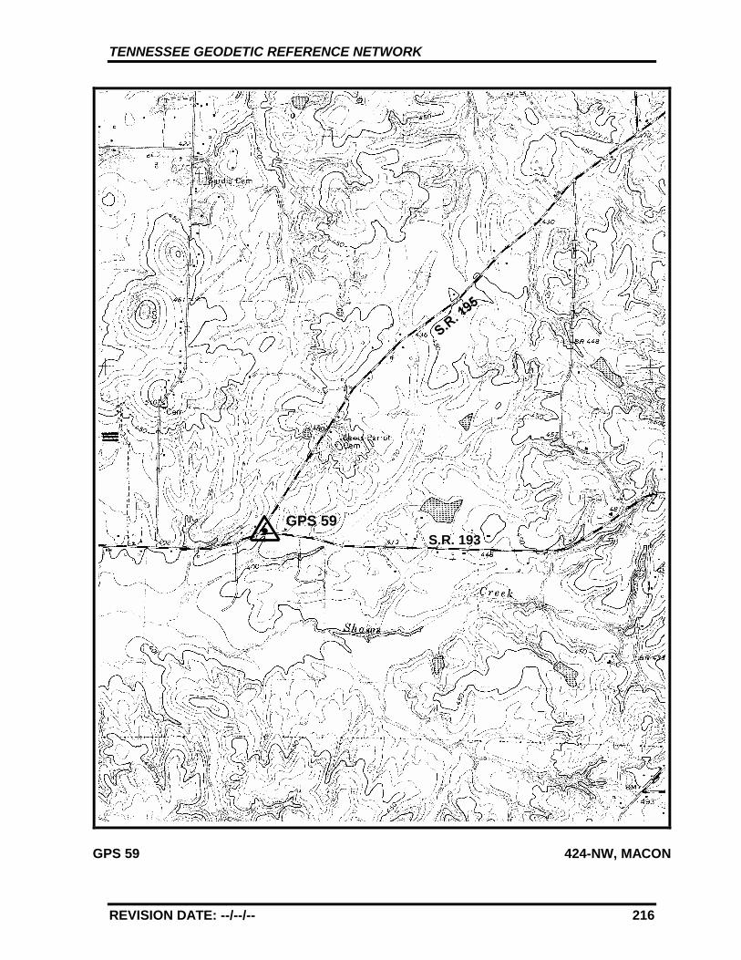
TENNESSEE GEODETIC REFERENCE NETWORK
REVISION DATE: --/--/-- 216
GPS 59 424-NW, MACON
GPS 59S.R. 193
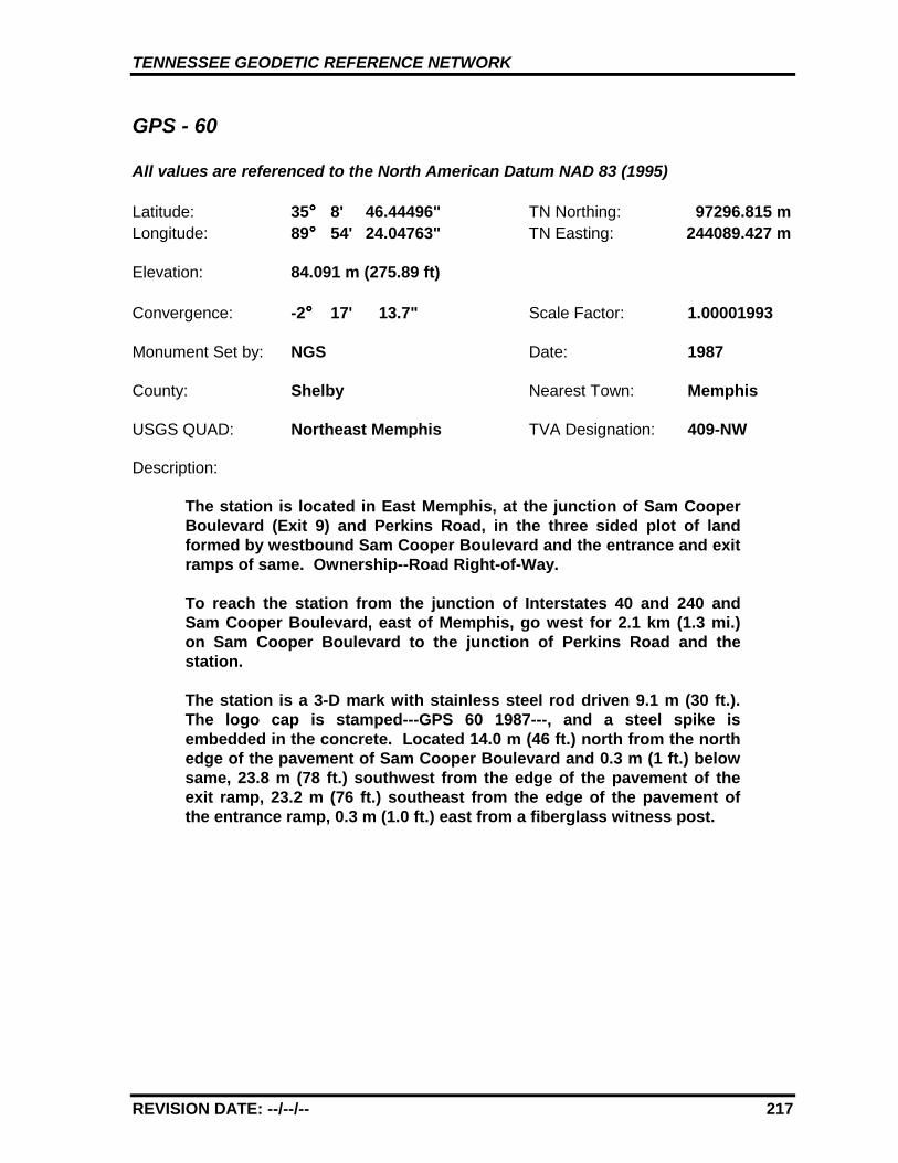
TENNESSEE GEODETIC REFERENCE NETWORK
REVISION DATE: --/--/-- 217
GPS - 60
All values are referenced to the North American Datum NAD 83 (1995)
Latitude: 35°°°° 8' 46.44496" TN Northing: 97296.815 mLongitude: 89°°°° 54' 24.04763" TN Easting: 244089.427 m
Elevation: 84.091 m (275.89 ft)
Convergence: -2°°°° 17' 13.7" Scale Factor: 1.00001993
Monument Set by: NGS Date: 1987
County: Shelby Nearest Town: Memphis
USGS QUAD: Northeast Memphis TVA Designation: 409-NW
Description:
The station is located in East Memphis, at the junction of Sam CooperBoulevard (Exit 9) and Perkins Road, in the three sided plot of landformed by westbound Sam Cooper Boulevard and the entrance and exitramps of same. Ownership--Road Right-of-Way.
To reach the station from the junction of Interstates 40 and 240 andSam Cooper Boulevard, east of Memphis, go west for 2.1 km (1.3 mi.)on Sam Cooper Boulevard to the junction of Perkins Road and thestation.
The station is a 3-D mark with stainless steel rod driven 9.1 m (30 ft.).The logo cap is stamped---GPS 60 1987---, and a steel spike isembedded in the concrete. Located 14.0 m (46 ft.) north from the northedge of the pavement of Sam Cooper Boulevard and 0.3 m (1 ft.) belowsame, 23.8 m (78 ft.) southwest from the edge of the pavement of theexit ramp, 23.2 m (76 ft.) southeast from the edge of the pavement ofthe entrance ramp, 0.3 m (1.0 ft.) east from a fiberglass witness post.
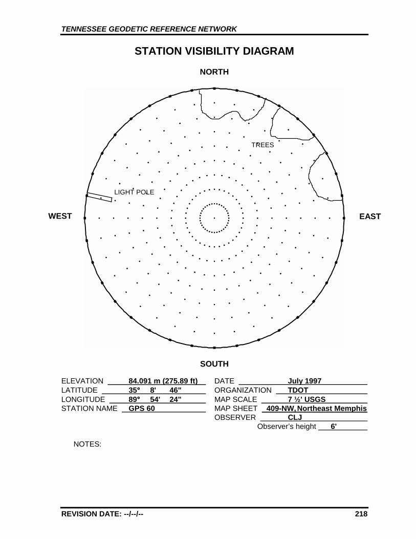
TENNESSEE GEODETIC REFERENCE NETWORK
REVISION DATE: --/--/-- 218
STATION VISIBILITY DIAGRAM
NORTH
SOUTH
ELEVATION 84.091 m (275.89 ft) DATE July 1997 LATITUDE 35°°°° 8' 46" ORGANIZATION TDOT LONGITUDE 89°°°° 54' 24" MAP SCALE 7 ½' USGS STATION NAME GPS 60 MAP SHEET 409-NW, Northeast Memphis
OBSERVER CLJ Observer’s height 6'
NOTES:
WEST
TREES
LIGHT POLE
EAST
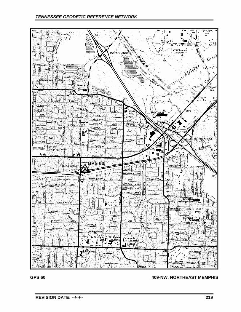
TENNESSEE GEODETIC REFERENCE NETWORK
REVISION DATE: --/--/-- 219
GPS 60 409-NW, NORTHEAST MEMPHIS
GPS 60