Tectonics and Geological Factors Controlling Cleat ... - Neliti
18
322 J. Eng. Technol. Sci., Vol. 49, No. 3, 2017, 322-339 Received December 9 th , 2016, Revised May 23 rd , 2017, Accepted for publication July 4 th , 2017. Copyright ©2017 Published by ITB Journal Publisher, ISSN: 2337-5779, DOI: 10.5614/j.eng.technol.sci.2017.49.3.3 Tectonics and Geological Factors Controlling Cleat Development in the Barito Basin, Indonesia Benyamin Sapiie* & Arif Rifiyanto Geology Study Program, Faculty of Earth Sciences and Technology, Institut Teknologi Bandung, Jalan Ganesha No. 10, Bandung, 40132, Indonesia *E-mail: [email protected] Abstract. Cleats are natural fractures within coal seams. This paper presents the results of regional cleat mapping and characterization in relation to coalbed methane (CBM) exploration and development in the Barito Basin, South Kalimantan, Indonesia involving two major coal layers, namely the Late Eocene Tanjung Formation and Early to Middle Miocene Warukin Formation with thicknesses ranging from 2 to 50 m. The coal is classified as lignite to subbituminous with calorific values ranging from 6000-8000 Cal/gr with ash content 0.68-17.42%. We applied two methods of cleat measurement, i.e. scanline and window sampling using a 100 x 100 cm grid. More than 20,000 cleats were measured from 65 scanline and 37 window sampling locations. The results revealed that face and butt cleats are predominantly oriented in the WNW-ESE and NNE-SSW directions, respectively. The results showed that cleat density increases related to structural position such as fold hinge and fault zone. The formation of the cleats may be influenced by several geological processes, where the cleats, which form during coalification, are superimposed by later processes such as fluid pressure and tectonic stresses and are seemingly also affected by the composition of the coal. Keywords: Barito Basin; coalbed methane; cleats; geology; tectonics. 1 Introduction Cleats, in general, are natural fractures that develop within coal seams during their formation (coalification process). There are two types of cleats that are often found in coal seams, generally termed ‘face cleats’ and ‘butt cleats’ [1], and are generally oriented almost perpendicular to each other and also nearly perpendicular to the bedding. Face cleats are planar, longer in length, more continuous and more predominant, which indicates that face cleats are formed first. Meanwhile, butt cleats are shorter in length, less continuous and often terminate at intersections with face cleats, which indicates that the butt cleats are formed later [2,3]. However, the mechanism of their formation and controlling factors are uncertain. Some authors have concluded that their formation is highly influenced by tectonic stress, for example due to higher density near fault zones [i.e. 2].
-
Upload
khangminh22 -
Category
Documents
-
view
2 -
download
0
Transcript of Tectonics and Geological Factors Controlling Cleat ... - Neliti

322 J. Eng. Technol. Sci., Vol. 49, No. 3, 2017, 322-339
Received December 9th, 2016, Revised May 23
rd, 2017, Accepted for publication July 4
th, 2017.
Copyright ©2017 Published by ITB Journal Publisher, ISSN: 2337-5779, DOI: 10.5614/j.eng.technol.sci.2017.49.3.3
Tectonics and Geological Factors Controlling Cleat
Development in the Barito Basin, Indonesia
Benyamin Sapiie* & Arif Rifiyanto
Geology Study Program, Faculty of Earth Sciences and Technology, Institut Teknologi Bandung, Jalan Ganesha No. 10, Bandung, 40132, Indonesia
*E-mail: [email protected]
Abstract. Cleats are natural fractures within coal seams. This paper presents the
results of regional cleat mapping and characterization in relation to coalbed
methane (CBM) exploration and development in the Barito Basin, South
Kalimantan, Indonesia involving two major coal layers, namely the Late Eocene
Tanjung Formation and Early to Middle Miocene Warukin Formation with
thicknesses ranging from 2 to 50 m. The coal is classified as lignite to
subbituminous with calorific values ranging from 6000-8000 Cal/gr with ash
content 0.68-17.42%. We applied two methods of cleat measurement, i.e. scanline and window sampling using a 100 x 100 cm grid. More than 20,000
cleats were measured from 65 scanline and 37 window sampling locations. The
results revealed that face and butt cleats are predominantly oriented in the
WNW-ESE and NNE-SSW directions, respectively. The results showed that
cleat density increases related to structural position such as fold hinge and fault
zone. The formation of the cleats may be influenced by several geological
processes, where the cleats, which form during coalification, are superimposed
by later processes such as fluid pressure and tectonic stresses and are seemingly
also affected by the composition of the coal.
Keywords: Barito Basin; coalbed methane; cleats; geology; tectonics.
1 Introduction
Cleats, in general, are natural fractures that develop within coal seams during
their formation (coalification process). There are two types of cleats that are often found in coal seams, generally termed ‘face cleats’ and ‘butt cleats’ [1],
and are generally oriented almost perpendicular to each other and also nearly
perpendicular to the bedding. Face cleats are planar, longer in length, more
continuous and more predominant, which indicates that face cleats are formed first. Meanwhile, butt cleats are shorter in length, less continuous and often
terminate at intersections with face cleats, which indicates that the butt cleats
are formed later [2,3]. However, the mechanism of their formation and controlling factors are uncertain. Some authors have concluded that their
formation is highly influenced by tectonic stress, for example due to higher
density near fault zones [i.e. 2].

Tectonics and Geological Factors Controlling Cleats 323
Of special interest is the capability of cleats to act as permeable channels that
allow the migration of coalbed methane (CBM) gas to production wells. Cleats
contribute to permeability by providing migration pathways for gas and water
flow to the well. The CBM gas is produced by diffusion from the coal matrix and Darcy flow through the cleat system [4], until it reaches the production
well. Since cleats are responsible for the majority of fluid flow to the producing
gas, they are considered to be one of the most important parameters that determine the permeability of CBM reservoirs. Therefore, the characterization
of cleats is of considerable importance in view of CBM exploration and
production, in particular in terms of implications for coal permeability and
hence the deliverability of CBM gas reservoirs.
Figure 1 Simplified geological map of Borneo (compiled and modified from
Moss and Wilson [5], Hall and Nichols[6]) showing the location of the study
area within the Barito Basin.
The study area is located in the Barito Basin, South Kalimantan, Indonesia.
Geographically, it lies between 114° 59' 50.000" - 115° 29' 50.000" E and 2° 33'
25.000" - 3° 17' 55.000" S. The Barito Basin, situated at the south-eastern

324 Benyamin Sapiie & Arif Rifiyanto
margin of the Sundaland continent, is an asymmetric foreland basin lying on the
western side of the Meratus Range, and thickens to the east towards the
mountain front, with a platform area to the west and a foredeep to the east [7].
The basin is bounded to the west by the Schwaner Mountains, which represent a continental basement of Sundaland and to the east by the Meratus Mountains,
which separate the Barito Basin from the Asem-Asem Basin (see Figure 1). To
the north, the Adang Flexure separates the Barito Basin from the Kutai Basin. To the south, the border is less distinct, and seems to be extended and narrowed
to the south into the Java Sea [7-11] because no structural features or lithofacies
changes can be observed.
This paper presents the results of regional cleat mapping and characterization from a field-based study in the Barito Basin area supported by laboratory
analysis. This study intends to provide a better understanding of the vertical and
lateral distribution, and characteristics of the cleats as well as the mechanism of their formation. To accomplish these objectives, special attention was paid to
evaluation of the role of tectonics in controlling cleat development. The
outcome of this study will be used for conducting permeability modeling of CBM potential in the study area. Figure 2 shows the detailed observation points,
seismic lines, well locations, and main geological units in the study area. Data
were mainly collected in the Rantau, Binuang, and Tanjung Areas.
Figure 2 Location of the study area, including 2D seismic and well logs,
geological map at scale 1:250,000 [12-15]. The yellow circles indicate
measurement locations.

Tectonics and Geological Factors Controlling Cleats 325
2 Regional Geology and Tectonic Setting
The structural framework and tectonic evolution of the Barito Basin are
constrained by several regional tectonic events (Figure 3). The complex tectonic evolution of the Barito Basin in the framework of the evolution of
Gondwanaland began in the Late Jurassic-Early Cretaceous era. By Eocene
times, India began to collide with the southern Eurasian margin [16]. The
Eocene India-Eurasia collision was likely responsible for the Cenozoic tectonic events in most of Southeast Asia [17,18]. However, the tectonic evolution in
Borneo is less likely to be related directly to the collision of India with Eurasia
[19,20].
Figure 3 Regional tectonic framework of Western Indonesia showing tectonic boundary forces including the present-day maximum horizontal stress direction
(SHmax). Stress data are from Heidbach, et al. [21]. A cross-section of yellow line
A-A’ is given in Figure 4(a). The study area is located in the Barito Basin.

326 Benyamin Sapiie & Arif Rifiyanto
During the Middle and Late Eocene, rifting appears to have been predominant
in many areas of Sundaland [18]. The development of the Barito Basin was
initiated by the opening and extension of the Makassar Straits in the Middle
Eocene [e.g. 19, 22], which separate eastern Borneo from western Sulawesi to the east [20]. This extension in the Strait of Makassar resulted in the NW-SE
aligned horst and graben structures developed along a series of NW-SE trending
strike-slip faults related to the opening of the Makassar Strait [7]. At the end of the Lower Oligocene rifting ceased in the Barito Basin [18].
The Early Miocene is inferred to mark the time of significant tectonic changes
in the basin development within Sundaland. A regional uplift and contractional
regime took place around Middle Miocene times, which led to the uplift and emergence of the Meratus Range and generated the inversion of pre-existing
extensional faults in the Barito Basin [7-9]. This contractional regime still
persists to the present day with the convergence and collision between the Australian and the SE Sunda Plate [18,22]. The present-day maximum
Figure 4 (a) Schematic regional cross-section extending from West Kalimantan
(Schwaner Complex), Barito Basin (study area) into Southeastern Sulawesi
(Buton-Tukang Besi microcontinent). The location of cross-section A-A’ is
shown in Figure 3. (b) NW-SE cross-sections (B-B’, C-C’, and D-D’) to
illustrate structural style variations around Barito Basin, SE Kalimantan. The
cross-sections are based on geological maps, seismic data, and well data.

Tectonics and Geological Factors Controlling Cleats 327
horizontal stress (SHmax) in Borneo is primarily oriented NW-SE [17] (see
Figure 3 for details). This NW-SE maximum horizontal stress orientation in
Borneo has long been postulated to have been caused by the orientation of
geologically recent lineaments and the NW-SE oriented inversion of many major structures [23]. The NW-SE present-day stress direction is similar to the
ESE absolute plate motion and thus the stress orientation may result from a
combination of multiple plate boundary forces. Figure 4 shows regional cross-sections to illustrate the regional structural (deformation) and stratigraphic
configurations of the Barito Basin and adjacent areas that may provide a better
understanding of the characteristics of the basin, with a specific emphasis on
their relationship to the Meratus Mountains.
3 Method of Study and Analysis
A method integrating all cleat data collected directly from the field (coal mines, road cuts, and rivers) and laboratory study was used in this study to investigate
and evaluate the characteristics of cleats that are assumed to control the
permeability of the coal and hence the deliverability of CBM gas reservoirs.
Field description and field data acquisition were conducted by employing two sampling methods of measurement, i.e. scanline sampling and window
sampling. The cleat attributes (such as cleat apertures, height/length, spacing,
distribution, and orientation) were measured in the Tanjung and Warukin Formations. The scanline sampling method is applicable to collect cleat
attribute data of each cleat that intersects the sampling line (Figure 5(a)). The
length of the sampling line was set parallel to the individual coal bed, oriented perpendicular to the face cleats and butt cleats. The scanline sampling method
can be used to calculate the linear cleat intensity (number of cleats per unit
length of scanline). The windows sampling method is able to collect cleat
attribute data of all cleats that are present within a specified sampling area (Figure 5(b)). The geometry of the sampling areas was designed to be
rectangular, where the area of each as was usually 1 square meter. The window
sampling method can be used to calculate the cleat density (summed traces of all cleats in the area).
For this study, more than 24,000 cleat orientation data from 66 locations and a
total of 16,106 cleat attribute data from 65 scanline and 37 window sampling
measurement stations were collected for several coal seams of the Tanjung and Warukin Formations throughout the study area. Statistical analysis was applied
to all cleat orientations from each location. They were plotted in stereograms
and Rose diagrams for each formation.
328 Benyamin Sapiie & Arif Rifiyanto
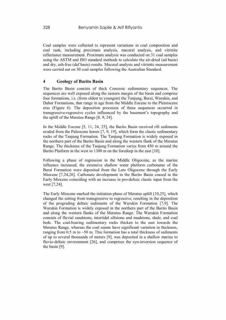
Coal samples were collected to represent variations in coal composition and
coal rank, including proximate analysis, maceral analysis, and vitrinite
reflectance measurement. Proximate analysis was conducted on 31 coal samples
using the ASTM and ISO standard methods to calculate the air-dried (ad basis) and dry, ash-free (daf basis) results. Maceral analysis and vitrinite measurement
were carried out on 30 coal samples following the Australian Standard.
4 Geology of Barito Basin
The Barito Basin consists of thick Cenozoic sedimentary sequences. The
sequences are well exposed along the eastern margin of the basin and comprise
four formations, i.e. (from oldest to youngest) the Tanjung, Berai, Warukin, and Dahor Formations, that range in age from the Middle Eocene to the Pleistocene
eras (Figure 6). The deposition processes of these sequences occurred in
transgressive-regressive cycles influenced by the basement’s topography and the uplift of the Meratus Range [8, 9, 24].
In the Middle Eocene [5, 11, 24, 25], the Barito Basin received rift sediments
eroded from the Paleocene horsts [7, 9, 19], which form the clastic sedimentary
rocks of the Tanjung Formation. The Tanjung Formation is widely exposed in the northern part of the Barito Basin and along the western flank of the Meratus
Range. The thickness of the Tanjung Formation varies from 450 m around the
Barito Platform in the west to 1300 m on the foredeep in the east [10].
Following a phase of regression in the Middle Oligocene, as the marine
influence increased, the extensive shallow water platform carbonates of the
Berai Formation were deposited from the Late Oligocene through the Early Miocene [7,24,26]. Carbonate development in the Barito Basin ceased in the
Early Miocene coinciding with an increase in pro-deltaic clastic input from the
west [7,24].
The Early Miocene marked the initiation phase of Meratus uplift [10,25], which changed the setting from transgressive to regressive, resulting in the deposition
of the prograding deltaic sediments of the Warukin Formation [7,9]. The
Warukin Formation is widely exposed in the northern part of the Barito Basin and along the western flanks of the Meratus Range. The Warukin Formation
consists of fluvial sandstone, intertidal siltstone and mudstone, shale, and coal
beds. The coal-bearing sedimentary rocks thicken to the east towards the
Meratus Range, whereas the coal seams have significant variation in thickness, ranging from 0.5 m to ~50 m. This formation has a total thickness of sediments
of up to several thousands of meters [9], was deposited in a shallow marine to
fluvio-deltaic environment [26], and comprises the syn-inversion sequence of the basin [9].

Tectonics and Geological Factors Controlling Cleats 329
Figure 5 (a) Schematic illustration of scanline sampling carried out on the
outcrop. Cleat attribute data were collected only from cleats intersecting the
sampling line. A-A’ is the length of scanline measurement; b is the aperture size of the cleat; s is the spacing between adjacent cleats; h is the trace height/length
of the cleat. (b) Schematic illustration of the window sampling carried out on the
outcrop. Cleat attributes data were collected only from cleats present within the
specified sampling area.
The Meratus uplift continued from the Pliocene through the Plio-Pleistocene
[7,10] and resulted in the deposition of polymict alluvial, shallow marine
sediment and tectonic molasse of the Dahor Formation, which comprise the syn-inversion sequence of the basin [25,26]. The Dahor Formation consists
mostly of reddish sandstone, polymict conglomerate and siltstone with an
indication of kaolinitic features. This formation has a thickness that reaches up to 3000 m near the Meratus front [24]. Structurally the basin inversion during
the Neogene contractional deformation period created the predominantly NE-
SW trending thrust blocks, folds and inverted structures, which are commonly observed within the Tanjung Formation. This structural trend tends to be nearly

330 Benyamin Sapiie & Arif Rifiyanto
parallel to the Meratus trends. The thrust faults observed in the Barito Basin
indicate an apparent vergence to the northwest.
Figure 6 Comparison of stratigraphic columns and nomenclature for the Barito
Basin showing the thick coal-bearing Lower Tanjung and Warukin Formations.
5 Coal Characterization
The Tertiary sediments in the Barito Basin contain the thick coal-bearing
Tanjung (Eocene/Oligocene age) and Warukin (Miocene age) Formations. The Tanjung Formation is represented by pervasive thin coal seams (typically less
than 3 m thick) that are fairly constant in thickness (Figure 7(a)). The Warukin
Formation, based on variation in coal thickness and the presence or absence of marine and tidal facies, can be informally divided into three parts: the lower,
middle, and upper Warukin Formations.
The lower Warukin Formation is characterized by relatively thin coal seams
(commonly less than 2 m thick) with much more tidal and marginal marine influence (Figure 7(b)). The middle Warukin Formation is characterized by
varying coal seam thicknesses (~10 m on average), interbedded with fluvial
facies, where the channel geometries can be observed from the main coal-bearing strata (Figures 7(c)-7(e)). In some areas, the coal layer in this formation
reaches a maximum thickness of 50 m (Figure 7(c)). The upper Warukin
Formation is represented by a general reduction in abundance and thickness of

Tectonics and Geological Factors Controlling Cleats 331
the coal seams and an increase in fluvial facies such as channel sandstone
(Figure 7(f)). The coal seams are commonly less than 12 m thick.
Figure 7 Representative photographs of coal outcrops in the Barito Basin.
Photographs are from: (a) Tanjung Formation, located at BMT-3 station; (b)
lower Warukin Formation, located at ATG-1 station; (c, d, and e) steeply dipping
middle Warukin Formation, located at IKLAS-1 (c), RNG-2 (d), and NRG-1 (e)
stations; and (f) steeply dipping upper Warukin Formation, located at Adaro coal
mine (ADARO station). Trucks, security post, and people for scale.
Coal beds within the Tanjung and Warukin Formations have a wide range of dip
angles varying from 10° to 90° to the northwest and southeast, striking NE-SW. Steeply dipping to vertical coal beds represent moderately strong thrust and
folded strata, which appear to be related to the uplift of the Meratus Range.
Proximate analysis indicates that the coals in the Tanjung and Warukin Formations contain 2.19-9.83% moisture, 0.68-17.42% ash content, 0.11-2.55%
332 Benyamin Sapiie & Arif Rifiyanto
total sulphur, 46.92-59.92 volatile matter and 40.08-53.08% fixed carbon (daf
basis).
Coal from the Tanjung Formation generally has higher quality with high
calorific value on a dry, ash-free (daf) basis, varying in a narrow range, from 8065 to 8549 Cal/gr. The lower Warukin coal has a calorific value ranging from
7136 to 7224 Cal/gr. The middle Warukin coal has a varied calorific value
ranging from 6364 to 7434 Cal/gr, while the upper Warukin coal has a calorific value ranging from 6215 to 7055 Cal/gr. Maceral analysis showed that the coals
from the Tanjung and Warukin Formations are dominated by vitrinite macerals
with much smaller amounts of liptinite and inertinite. The coals are classified
into the category of lignite to subbituminous according to the ISO 11760:2005 coal classification standard.
6 Cleat Characterization
A comprehensive characterization of cleats should be conducted first in order to
better understand cleat occurrence, distribution, and orientation patterns, and to
assess its contribution to the cleat density and hence the permeability of the
coal. A method integrating cleat data collected directly from the field and laboratory study was used in this study to describe and characterize the cleats.
Identification and measurement of cleat orientation were conducted for several
coal seams in the Tanjung and Warukin Formations. The face cleats are perpendicular to the strike of bedding, whereas the butt cleats tend to be parallel
to the strike of bedding. Since several authors have noted that cleats typically
have a uniform orientation over wide areas [e.g. 2,3,27], many measurements of cleat orientation within coal seams in the Barito Basin tended to provide valid
information needed to determine the regional cleat trends. Cleat distribution and
orientation indicated three major orientations [27], i.e. WNW-ESE, NNW-SSE,
and NE-SW directions for the face cleats, and NNE-SSW, ENE-WSW, and NW-SE directions for the butt cleats (Figure 8).
Measurements within the same coal bed indicated that cleat density can differ
vertically and laterally within the same coal bed. This variation in cleat density can be expected due to the influence of mechanical layering within the same
coal bed. The density distribution of cleat heights/lengths in the study area,
notably in the area with numerous observation locations, indicated an increase
in cleat density related to the regional structural position, where they increase to the north and east towards the main deformation zone (Figure 9). The increased
cleat density towards the north is most likely subjected to the diachronous uplift
of the Meratus Range, where the northern part of the Meratus Range is more

Tectonics and Geological Factors Controlling Cleats 333
uplifted than the southern part. This evidence implies that the cleat density is
attributable to the structural position.
Figure 8 Map of the study area showing the cleat distribution and orientation of
face (blue) and butt (red) cleats in the study area from all formations.
The regional map of cleat orientations measured in the study area clearly shows
gradual to abrupt strike variations in cleat trends over short distances. This indicates that cleat formation was influenced by multiple episodes of cleat
development. The potentiality exists that cleats, once formed during
coalification, may have beeen superimposed by later processes, such as
overpressure and changing of tectonic stress regimes, and may also have been affected by the variability of coal composition. Given that different processes
may have occurred since the initial cleat development until now, statistical
treatment of the face cleat strike variability was further taken into account for the distinction between the differing generations of cleats. Admittedly, all face
cleat orientation data in each formation represented stereographically were
selectively resolved into several domains of uniform face cleats trends. This examination clearly identified and distinguished different domains of face cleat
trends. These results indicate the complexity of the face cleat data sets and
describe a progressive history of cleat development.

334 Benyamin Sapiie & Arif Rifiyanto
Figure 9 Density comparison from scanline stations on several NW-SE cross
sections towards the Meratus Complex, showing an increase in cleat density
related to the regional structural position, where they increase towards the main deformation zone (fold hinge and fault zone).
Furthermore, by applying the observation that the cleats occur vertically to
subvertically within the coal seam in a flat-lying bed during burial, an attempt
was made here to distinguish the origins and formation of the cleats from the
early formed cleat set to the latest cleat set (second or superimposed cleat set) in the Tanjung and Warukin coals (Figure 10).
All cleats for individual coal seams were rotated back to their initial positions.
This approach was done by rotating the bedding of individual coal seams back to their original positions (horizontal plane) prior to uplift and compressional
deformation of the Barito Basin, including all cleats within a given coal bed.
According to the distribution of all data before and after being rotated to their original positions, we postulated that the early formed cleat sets should have
occurred vertically to subvertically within the flat-lying coal seam, while the
second or superimposed cleat sets will have a gentler dip (Figure 11).
Although not entirely conclusive, at least it can be suggested that when the coal beds are horizontal, the cleat sets dipping at high angles (in this case dip more
than 75°) to the bedding are interpreted to be formed early on during

Tectonics and Geological Factors Controlling Cleats 335
coalification, whereas the cleat sets with low to moderate dip angles (less than
75°) were formed after coalification due to tectonic stress.
Figure 10 (a) Idealized block diagrams showing 3D geometry of the coal seam
in the Barito Basin before (left) and after thrusting. (b) Model of block diagram
illustrating the cleat sets formed vertically to subvertically within the coal seam
in flat-lying bed during burial. (c) Block diagram illustrating the fracture sets
formed during uplift and compressional deformation of the Barito Basin. (d) Photograph of Warukin coal outcrop, depicting cleats oriented at right angles to
the bedding of the seams when the strata are folded. (e) Faults recognized in the
Warukin coal outcrop located at GP-1 station. (f and g) Magnification of the area
within the white frame represented in (e), showing the changes in cleat
orientation near the fault planes. The cleats are locally superimposed on the
regional cleat sets.

336 Benyamin Sapiie & Arif Rifiyanto
The results suggest that most cleats (≈70%) in coal outcrops of the Tanjung and
Warukin Formations were formed during burial and before folding and
thrusting (see Figure 11). These numbers are very important for controlling
parameters used in 3D CBM reservoir modeling, particularly permeability within the Barito Basin area. In addition, comparison between regional cleat
distributions of the Barito, Asem-Asem, and Kutai Basins shows that face cleat
patterns and orientations suggest them to be strongly controlled by tectonics and local structures. All this evidence suggests that cleat development within the
basin is controlled by various geological parameters, particularly tectonic
parameters, which need to be considered in estimating true permeability values
of the CBM system.
Figure 11 Diagram of strike vs. dip showing distributions of all cleat data sets
before and after being rotated to their original positions.

Tectonics and Geological Factors Controlling Cleats 337
7 Conclusions
All cleat orientation data of Tanjung and Warukin Formations from this study
plotted on stereograms and Rose diagrams revealed that the dominant face and butt cleat orientations are in the WNW-ESE and NNE-SSW directions,
respectively.
Field analyis indicated that the cleat density distribution in the study area shows
a prominent increasing trend to the north and east towards the main deformation zone (tectonic influence). In additon, the knowledge of the distribution of cleat
density can be used to predict the most permeable areas in the study area. Based
on structural restoration, more than 70% cleats can be considered as originally formed during coalification and before folding and thrusting. This number will
contribute to the overall permeability of the CBM prospect in the Barito Basin.
Acknowledgements
This study would not have been possible without the generous research grant
from ExxonMobil Indonesia. Special thanks to Steven Buck, Ivan Yulianto and
Anton Kristanto for their constant support in establishing the collaboration study. Special thanks to all members of the Geodynamic Research Group ITB
and the geologists of ExxonMobil Indonesia. We would like to thank the staff
and students at the Geological Engineering Study Program ITB for their contributions and support to this study. Special thanks to the reviewers in
refining the manuscript.
References
[1] Laubach, S.E., Marrett, R.A., Olson, J.E. & Scott, A.R., Characteristics
and Origins of Coal Cleat: A Review, International Journal of Coal
Geology, 35(1), pp. 175-207, 1998. [2] Laubach, S.E. & Tremain, C.M., Regional Coal Fracture Patterns and
Coalbed Methane Development, Proceedings of the 32nd
U.S. Symposium
on Rock Mechanics, Balkema, Rotterdam, Roegiers, J-C. (ed(s).), pp.
851-859, 1991. [3] Kulander, B.R. & Dean, S.L., Coal-Cleat Domains and Domain
Boundaries in The Allegheny Plateau of West Virginia, American
Association of Petroleum Geologists Bulletin, 77(8), pp. 1374-1388, 1993.
[4] Harpalani, S. & Schraufnagel, R.A., Shrinkage of Coal Matrix with
Release of Gas and Its Impacts on Permeability of Coal, Fuel, 69(5), pp.
551-556, 1990. [5] Moss, S.J. & Wilson, M.E.J., Biogeographic Implications of The Tertiary
Palaeogeographic Evolution of Sulawesi and Borneo, Biogeography and

338 Benyamin Sapiie & Arif Rifiyanto
Geological Evolution of SE Asia, Hall, R. & Holloway, J.D. (ed(s).),
Leiden: Backhuys Publishers, pp. 133-163, 1998.
[6] Hall, R. & Nichols, G, Cenozoic Sedimentation and Tectonics in Borneo
Climatic Influences on Orogenesis, Sediment Flux to Basins: Causes, Controls and Consequences, Jones, S.J. & Frostick, L. (ed(s).),
Geological Society, London, Special Publication, 191, pp. 5-22, 2002.
[7] Satyana, A.H., Nugroho, D. & Surantoko, I., Tectonic Controls on The Hydrocarbon Habitats of The Barito, Kutei, and Tarakan Basins, Eastern
Kalimantan, Indonesia: major dissimilarities in adjoining basins, Journal
of Asian Earth Sciences, 17(1), pp. 99-122, 1999.
[8] Siregar, M.S. & Sunaryo, R., Depositional Environment and Hydrocarbon Prospects, Tanjung Formation, Barito Basin, Kalimantan,
Proceedings Indonesian Petroleum Association, 9th Annual Convention,
pp. 379-400, 1980. [9] Satyana, A.H. & Silitonga, P.D., Tectonic Reversal in East Barito Basin,
South Kalimantan: Consideration of The Types of Inversion Structures
and Petroleum System Significance, Proceedings Indonesian Petroleum Association, 23rd Annual Convention, pp. 57-74, 1994.
[10] Satyana, A.H., Paleogene Unconformities in The Barito Basin, Southeast
Kalimantan: A Concept for The Solution of The “Barito Dilemma” and A
Key to The Search for Paleogene Structures, Proceedings Indonesian Petroleum Association, 24
th Annual Convention, pp. 263-275, 1995.
[11] Witts, D., Hall, R., Nichols, G. & Morley, R.J., A New Depositional and
Provenance Model for The Tanjung Formation, Barito Basin, SE Kalimantan, Indonesia, Journal of Asian Earth Sciences, 56, pp. 77-104,
2012.
[12] Heryanto, R. & Sanyoto, P., Geological Map of the Amuntai Quadrangle,
Kalimantan, Scale 1:250,000, Geological Research and Development Centre, Bandung, 1994.
[13] Heryanto, R., Supriatna, S., Rustandi, E. & Baharuddin, Geological Map
of The Sampanahan Quadrangle, Kalimantan, Scale 1:250,000, Geological Research and Development Centre, Bandung, 1994.
[14] Sikumbang, N. & Heryanto, R., Geological Map of The Banjarmasin
Sheet, Kalimantan, Scale 1:250,000, Geological Research and Development Centre, Bandung, 1994.
[15] Rustandi, E., Nila, E.S., Sanyoto, P. & Margono, U., Geological Map of
The Kotabaru Sheet, Kalimantan, Scale 1:250,000, Geological Research
and Development Centre, Bandung, 1995. [16] Seton, M., Müller, R.D., Zahirovic, S., Gaina, C., Torsvik, T., Shephard,
G., Talsma, A., Gurnis, M., Turner, M., Maus, S. & Chandler, M., Global
Continental and Ocean Basin Reconstructions Since 200 Ma, Earth-Science Reviews, 113(3-4), pp. 212-270, 2012.

Tectonics and Geological Factors Controlling Cleats 339
[17] Tingay, M., Morley, C., King, R., Hillis, R., Coblentz, D. & Hall, R.,
Present-Day Stress Field of Southeast Asia, Frontiers of Stress Research,
Heidbach, O., Tingay, M. & Wenzel, F. (ed(s).), Tectonophysics, 482, pp.
92-104, 2010. [18] Pubellier, M. & Morley, C.K., The Basins of Sundaland (SE Asia):
Evolution and Boundary Conditions, Marine and Petroleum Geology, 58,
pp. 555-578, 2014. [19] Daly, M.C., Cooper, M.A., Wilson, I., Smith, D.G. & Hooper, B.G.D.,
Cenozoic Plate Tectonics and Basin Evolution in Indonesia, Marine and
Petroleum Geology 8, 1991.
[20] Hall, R., van Hattum, M.W.A. & Spakman, W., Impact of India-Asia Collision on SE Asia: The record in Borneo, Tectonophysics, 451, pp.
366-389, 2008.
[21] Heidbach, O., Tingay, M., Barth, A., Reinecker, J., Kurfeß, D. & Müller, B., The World Stress Map Database Release 2008, 2008.
doi:10.1594/GFZ.WSM.Rel2008.
[22] Zahirovic, S., Seton, M. & Müller, R.D., The Cretaceous and Cenozoic Tectonic Evolution of Southeast Asia, Solid Earth, 5(1), pp. 227-273,
2014.
[23] Morley, C.K., Back, S., van Rensbergen, P., Crevello, P. & Lambiase,
J.J., Characteristics of Repeated, Detached, Miocene-Pliocene Tectonic Inversion Events, in A Large Delta Province on An Active Margin, Brunei
Darussalam, Borneo, Journal of Structural Geology, 25(7), pp. 1147-
1169, 2003. [24] Kusuma, I. & Darin, T., The Hydrocarbon Potential of The Lower
Tanjung Formation, Barito Basin, S.E. Kalimantan, Proceedings
Indonesian Petroleum Association, 18th Annual Convention, pp. 107-
138, 1989. [25] Witts, D., Davies, L. & Morley, R., Uplift of The Meratus Complex:
Sedimentology, Biostratigraphy, Provenance and Structure, Proceedings
Indonesian Petroleum Association, 38th Annual Convention, IPA14-G-082, 2014.
[26] Witts, D., Hall, R., Morley, R.J. & BouDagher-Fadel, M.K., Stratigraphy
and Sediment Provenance, Barito Basin, Southeast Kalimantan, Proceedings Indonesian Petroleum Association, 35th Annual Convention,
IPA11-G-054, 2011.
[27] Sapiie, B., Riyanto, A. & Suryanugraha, A. M., Tectonic controlled of
cleats development as implication of coal bed methane (CBM) Prospect in the Barito Basin, South Borneo, Indonesia, 76th EAGE Conference
and Exhibition 2014, Workshops.