Spatial Context and Temporal Aspects of the Sensitive Area ...
196
Wilfrid Laurier University Wilfrid Laurier University Scholars Commons @ Laurier Scholars Commons @ Laurier Theses and Dissertations (Comprehensive) 1979 Spatial Context and Temporal Aspects of the Sensitive Area Spatial Context and Temporal Aspects of the Sensitive Area Concept in Ontario Concept in Ontario Barbara Elizabeth Anderson Wilfrid Laurier University Follow this and additional works at: https://scholars.wlu.ca/etd Part of the Environmental Health and Protection Commons, Natural Resources and Conservation Commons, and the Natural Resources Management and Policy Commons Recommended Citation Recommended Citation Anderson, Barbara Elizabeth, "Spatial Context and Temporal Aspects of the Sensitive Area Concept in Ontario" (1979). Theses and Dissertations (Comprehensive). 1496. https://scholars.wlu.ca/etd/1496 This Thesis is brought to you for free and open access by Scholars Commons @ Laurier. It has been accepted for inclusion in Theses and Dissertations (Comprehensive) by an authorized administrator of Scholars Commons @ Laurier. For more information, please contact [email protected].
-
Upload
khangminh22 -
Category
Documents
-
view
4 -
download
0
Transcript of Spatial Context and Temporal Aspects of the Sensitive Area ...

Wilfrid Laurier University Wilfrid Laurier University
Scholars Commons @ Laurier Scholars Commons @ Laurier
Theses and Dissertations (Comprehensive)
1979
Spatial Context and Temporal Aspects of the Sensitive Area Spatial Context and Temporal Aspects of the Sensitive Area
Concept in Ontario Concept in Ontario
Barbara Elizabeth Anderson Wilfrid Laurier University
Follow this and additional works at: https://scholars.wlu.ca/etd
Part of the Environmental Health and Protection Commons, Natural Resources and Conservation
Commons, and the Natural Resources Management and Policy Commons
Recommended Citation Recommended Citation Anderson, Barbara Elizabeth, "Spatial Context and Temporal Aspects of the Sensitive Area Concept in Ontario" (1979). Theses and Dissertations (Comprehensive). 1496. https://scholars.wlu.ca/etd/1496
This Thesis is brought to you for free and open access by Scholars Commons @ Laurier. It has been accepted for inclusion in Theses and Dissertations (Comprehensive) by an authorized administrator of Scholars Commons @ Laurier. For more information, please contact [email protected].

SPATIAL CONTEXT AND TEMPORAL ASPECTS OF THE
SENSITIVE AREA CONCEPT IN ONTARIO.
By
BARBARA ELIZABETH ANDERSON
B.E.S. University of Waterloo, 1975
THESIS
.Submitted in partial fulfilment of the requirements for the Master of Arts degree Wilfrid Laurier University
1979
2SS919

UMI Number: EC56283
All rights reserved
INFORMATION TO ALL USERS The quality of this reproduction is dependent on the quality of the copy submitted.
In the unlikely event that the author did not send a complete manuscript and there are missing pages, these will be noted. Also, if material had to be removed,
a note will indicate the deletion.
UMT Dissertation Publishing
UMI EC56283
Copyright 2012 by ProQuest LLC.
All rights reserved. This edition of the work is protected against unauthorized copying under Title 17, United States Code.
uest
ProQuest LLC. 789 East Eisenhower Parkway
P.O. Box 1346 Ann Arbor, Ml 48106-1346
ABSTRACT
The term "sensitive area".is a product of planning
initiatives, which have developed within the province
of Ontario since the early nineteen seventies. As there
are a number of closely related terms utilized the
sensitive areas concept generally is defined as the
creation of a reserve or the removal of land from
unfettered commercial development or intense human use.
The concept has been associated with a broad range of
environmental concerns such as, the protection of wild
life habitat, maintenance of ecologic function, retention
of scenic areas and preservation of historic sites.
Similar initiatives access North America are surveyed
and the historic precedence for land reservation in
Ontario is examined. The author concludes that there
is widespread concern for this concept and that it is
pockets of vested interest in traditional conservation
modes which prevents a unified co-ordinated approach
to sensitive areas planning in Ontario.
(i)

ACKNOWLEDGEMENTS
To a large degree the research and thought processes
involved in this thesis have been a result of my work in
the field of sensitive areas planning within the Ontario
Ministry of Natural Resources. In this regard I am indebted
to members of the Land Use Co-ordination Branch- Mr. Marc
Cressman, Mr. Norm Gordon and especially Mr. Pete Anderson,
and to members of the Special Areas Planning Committee in
the Northwest Region of the Ministry of Natural Resources.
I must also express my appreciation of my thesis advisor
Dr.Grant Head for the time he spent both in discussion and
editorial criticism. Thanks also to Dr. Helen Parsons for
her encouragement doiring the production process.
A very special thanks must be given to my parents for
their constant encouragement and support in this endeavour.
Thanks also to my typist Miss Christine Gurski for her many
hours of labour , and a special thanks to Mr. Michael Gurski
for his unfailing wit, good humour and support throughout the
production of this thesis?-
(ii)

TABLE OF CONTENTS
Abstract i
Acknowledgements ii
Table of Contents iii List of Figures vi
Introduction 1
Chapter One
Sensitive Areas Concept - One Concept with Many Names 3
Nature Reserves 4 Sensitive Areas 7 Environmental Protection Areas 10 Special Areas 12 Discussion - Ministry of Natural Resources 15 Environmentally Sensitive Areas 17 Sensitive Areas 21 Natural Areas 24 Discussion - What is Natural? 25
Chapter Two
Similar Concepts Outside of Ontario
Other Canadian Initiatives Ecological Reservces - British Columbia 30 Natural Areas - Prince Edward Island 32 Natural Areas - Alberta 33 National Landmarks - Parks Canada 35
The United States Scientific Areas - Wisconsin 36 Nature Preserves - Illinois 38 Natural Areas - New England 41 Critical Environmental Areas - Virginia 42 Critical Areas - Wyoming 45 Critical Resources - Wisconsin 46 Environmentally Sensitive Areas - American 47 Society of Planning Officals
Discussion 50
(iii)

Chapter Three
The Components of the Sensitive Area Concept One Concept with Three Strands
The Utilitarian Rationale The Aesthetic Rationale The Ecologic Rationale The Gospel of Ecology Discussion
53
56 58 59 59 61
Chapter Four
The Sensitive Area Tradition in Ontario
The Nineteenth Century Early Conservation Economic Difficulties Grass Roots of Conservation Beginning of Planning Discussion
65
67 73 76 80 85 90
Chapter Five
Summary and Conclusions
Sensitive Area Planning Conclusions
Footnotes
Bibliography
Appendix I
Appendix II
Appendix III
Appendix IV
Appendix V
Sensitive Areas and Features Report Form
93
93 93 98 102
118
125
Criteria For Selection of Environmentally Sensitive Areas - Regional Municipality of Waterloo 126
Environmental Checklist
Wisconsin Critical Resource Inventory Assessment Matrix
Conservation in Ontario - The Nineteenth Century
127
128
129
Civl
Appendix VI Conservation in Ontario - Early 142 Conservation: 1900- 1920
Appendix VII Conservation in Ontario - Economic 156 Difficulties: 1920- 1940
Appendix VIII Conservation in Ontario - Grass 163 Roots Conservation: 1941 - 1961
Appendix IX Conservation in Ontario - Beginnings of Land Use Planning: 1961 - 1971 178
(v)

LIST OF FIGURES
Nature Reserves 5
Objiway Prairie 6
Pelican Nesting Area 9
MacKenzie Island 11
Lake Minnitaki 13
Ontario Ministry of Natural Resources 16
Regional Municipality of Waterloo - 17 Environmentally Sensitive Areas
Elk Range 22
Anthraxolite Site 23
Matrix of 'Sensitive Area Concept' and 28 Various Rational Utilized
Illinois 40
New England 43
Matrix of North American Terms 49
The Gospel of Ecology 55
Application of Nash's Framework to Various 62 Rationale
(vi)

INTRODUCTION
This investigation of the sensitive area concept
was prompted by the fact that sensitive areas have been an
active issue in planning circles for the past seven
years. During this time,planning for sensitive area
designation has been fraught with confusion. This con
fusion which has been created by the utilization of both
a variety of closely related terms and similar rationale
seems to have hampered not only comprehensive policy
formulation but also a co-ordinated approach to planning
in this field.
In the Provincial Ministry of Natural Resources, the
Division of Parks has spent eleven years on a Parks Policy
which partially articulates the sensitive area concept.
The Land Use Co-ordination Branch in both its Plan Review
and Strategic Land Use Planning processes has advocated
the identification of sensitive areas. The Regional
Municipality of Waterloo has designated environmentally
sensitive areas into their Official Plan. The Regional
Municipality of Hamilton Wentworth and various counties
has initiated similar environmentally sensitive areas
concept into their official plans in conservation, environ
mental protection and hazard land designations.
As various levels of government try to handle the con
cept in a number of ways, none of which have gained complete
ascendancy, agencies such as Ontario Hydro, the Ministry of

Transportation and Communications, developers and con
sultants require co-ordinated government policy direction
if protection and planning is to be efficiently executed.
The purpose of this thesis is, through an examination of
the sensitive area concept spatially, that is within the
North American context, and temporally, that is, within
the historic development of conservation in Ontario.to
provide a clearer understanding of the current diversity
within the sensitive areas concept. It is the belief of
this author that such an understanding will facilitate
sound policy planning initiatives in this field.
-2-

CHAPTER ONE SENSITIVE AREA CONCEPT - ONE CONCEPT WITH MANY NAMES
The late sixties and early seventies saw a dramatic
surge of public interest in the wilderness, in ecology
and in the environment. Growing awareness of disturbing
environmental changes and seemingly unchecked economic
development at the expense of natural values prompted the
formation across the country^of public interest groups
such as the Algonquin Wildlands League (1965) , National
and Provincial Parks Association (1967) , The Canadian
Arctic Resources Commission (1971), and the Society for
Pollution and Environmental Control (1969). Much concern
was expressed for the protection of endangered species,
for the maintenance of environmental quality and for the
need of a land ethic.
The "sensitive area concept" or, in broad terms, the
creation of reserves of land isolated from the pressures
of commercial exploitation, is associated with this
period. The term "sensitive area" first appeared in
the early 1970's. As it is essentially a planning term
used to identify areas of land about which there might be
one or a combination of a variety of environmental concerns,
and as the concept does not appear to have been introduced
to Ontario and its local governmental agencies through
any one specific channel, a diversity of environmental
ideas have appeared under the same term and, in addition,
-3-
under the guise of a number of related terms. To attempt
to reduce confusion, we will use the term "sensitive
area concept" as an over-riding term, embracing the
broad range of concepts and terms under which Ontario
lands are being recommended for removal from unfettered
commercial exploitation and intense human use for a
variety of environmental reasons.
We will first illustrate the diversity of initiatives
in this field by examining briefly seven aspects of the
sensitive area concept presently used in Ontario. We
maintain that despite the variety of terms, the basic
concepts are essentially similar, though differing in
details and emphasis. The purpose of this section is
not only to illustrate the confusion surrounding
sensitive area planning, but also to cut through the
semantics to illustrate the essence of the concepts.
"Nature Reserve": Parks Division, Ontario Department of Lands and Forests
The concept of nature reserves was developed by the
Parks Division of the Ontario Department of Lands and
Forests as part of their Park Systems Planning initiative
in early 1967. Presently within the Ontario Ministry of
Natural Resources, where the Parks Division now rests,
nature reserves are defined as:
"... areas selected to represent the distinctive natural habitats and landforms of the Province, and are protected for education purposes and as gene pools for reasearch to benefit present and future generations". 1
-4-
Figure 1 -Nature Reserve
t
150 Theoretical Vegetative Site Typea within each Sit* Seflon
N » U M I
&
I
•* I 3
leek
Uat
l a ta
cuy
Organic
toek
t u l
l e w
OM,
Orgastic
leek
*ao4
teas*
a*x
Ortaale
a r t i »ary
«*7 Dry
Maaic Maeic Vit
Mael* *«
!p il§ pi
»«t7 Wat
ff
H§1
a n tea
•
>>i¥r*«w!
^Hl H
Oeea Vatar
-
'
Source: Ontario P rov inc ia l Parks planning and Management Manual, Nature Reserves- I I -7
-5-

Figure 2 - Ojibway Prairie
SCALE 29 ,000
SOURCE • O j ibway Pra i r ie , D iv is ion of Parks Onta r io , M i n i s t r y of N a t u r a l Resources , 1976.
-6-

The intent of a nature reserve is also to protect
faunal species of the province through preservation
of representative natural habitats. Theoretical
vegetative site types have been developed and are out
lined in Figure 1. Evaluation is done by such specialists
as biologists, geologists and geomorphologists. Presently
there are twelve of these nature reserves designated
and protected under the Parks Act. These designations 2
range from heron rookeries (East Sister Island ) to 3
geological features (Quimette Canyon ) to fossil sites
4 (Schri-bber Channel ) .
An example of a nature reserve under The Parks
Act is the Ojibway Prairie, located in Essex County
on the outskirts of the City of Windsor. (Figure 2)
The area contains vegetational species of the tall grass
prairie of Saskatchewan and Alberta.it is a remnant
of the original midwest prairie which extended east
into Wisconsin, Illinois and Michigan. Fire is an
essential element in the ecological cycle which maintains
this ecosystem. In a management program that attempts
to duplicate natural conditions periodic burning is
necessary and one is planned for the summer of 1979.
"Sensitive Areas": Land Use Planning Section, Land Use Co-ordination Branch, Lands Division, Ontario Ministry Of Natural Resources
This agency was the first in Ontario to use the term
"sensitive area". In 1972, as part of the Strategic
-7-
Land Use Planning (S.L.U.P.) exercise,an initiative to
meet Ministry objectives on the land through an integrated
and co-ordinated planning process, general guidelines
were sent to each of the Ministry's five regions, and
subsequently to its forty-eight districts, to initiate
sensitive area data collection. Sensitive areas and
features were defined in 1974 in this agency's Guidelines
for Land Use Planning as "places that include some
conspicuous value for one or more of the objectives of
the Ministry that would readily be damaged by certain
developments or uses." The broad objectives of the /
Ministry are outdoor recreation, land management and
resource production. Types of sensitive areas recognized
are: vegetation, fish and wildlife habitat, geology
and landforms, historic and cultural, and complexes.
The last term is taken to mean a number of the preceeding
types.
This inventory solicited a broad range of responses
across the province. As the inventory was not directed
to a particular division, individual reports were often
swayed by the professional background of the person who
collected the information locally. The result was a
wide variance in the type and in the reliability of data
collected. The validity of such a designation is
questionable due to these problems in data collection
and in evaluation methods. In a personal review by
-8-

Figure 3 - Pelican Nesting Area
v-^ < > V* i
(Nesting Arta 1
SCALE' l< 230,000 L A K E
AP// w rV OF THE WOODS
Description:
A white pelican nesting area is located on a series of small islands on Lake of the Woods. It is the only known white pelican breeding and nesting grounds in the province of Ontario.
Potential for Damage:
Pelicans are sensitive to any type of human activity or development. Any disturbance would probably cause the pelicans to nest in other suitable areas and possibily to move out of the province.
Recoimendations for Protection and Use:
Human activity and developnent should be discouraged in the aitinediate area. The location of the site ought not be publicized or viewing by the public encouraged.
Source: Kenora District Sensitive Areas Report, Ontario Ministry of Natural Resources.

this writer, the sensitive area reports from across the
province appear to interpret the term sensitive area
in two ways: firstly, as an area the individual himself
considers special i.e. an area to which he is sensitive;
and secondly, as an area which itself is perceived as
being vulnerable, fragile or "sensitive" to any change.
Thus these reports inventoried areas as diverse as deer
yards, Indian graveyards, large trees, fossil sites,
waterfalls, nice beaches and"Mrs. MacGillicuty's rose
garden.'"
A site currently designated as a sensitive area
by the Ministry of Natural Resources is Pelican Island
on Lake of the Woods (Figure 3). This site contains
a nesting habitat for the white pelican which is normally
found considerably further south.
"Environmental Protection Areas!*: Plan Review Section, Land Use Co-ordination Branch, Lands Division, Ontario Min jstry of Natural Resources
Also in 1974 the Plan Review Section of the Land
Use Co-ordination Branch established "Environmental
Protection Areas" for Plan Review purposes. This
designation was aimed at "all lands having inherent 7
physical/environmental hazards ..." and included both
hazard lands and sensitive areas. "Hazard Lands" ,of
course, are lands which are considered to endanger man
or his property and include such areas as flood plains,
steep slopes, or areas of soil instability such as
-10-

Figure 4 - MacKenzie Island
J MHOS
SCALE > I ' 5 0 , 0 0 0
SOURCE : West Patricia Land Use Plan , Sensitive Areas Inventory, Sensitive Areas Report 1978, Red Uoke District, Ministry of Natural Resoures.
-11-

leda clays or organic soils. Sensitve areas on the other
hand are defined as "... serving one or several of
these functions:
1) scientific research 2) educational and interpretation 3) species maintenance 4) preservation and/or conservation of unique
species and fauna 8
As in the case of the Guidelines for Land Use Planning,
developed in the Land Use Planning Section, neither
criteria nor an evaluatory process are outlined. An
example of such a designation would be an eagles's nest
which is identified in the Red Lake Sensitive Areas Report.
(Figure 4) Should a development proposal o r this site
be reviewed by the Ministry, development guidelines
would be recommended. These guidelines would ensure a
specific buffer zone around this nest.
Special Areas ; Lake Planning Section, Land Use Co-ordination Branch, Lands Division, Ontario Ministry of Natural Resources
The Lake Planning Section of the Land Use Co-ordination
Branch coined the term "special areas" in the Lake Planning
Manual of 1976. These were defined as "areas (which)
have natural features that because of their ecological
sensitivity are easily damaged by certain developments
or uses. Special areas may be vegetative, geologic, H
historic/archaeologic or a unique habitat. Neither
criteria nor evaluation methods are outlined. The
Lake Plan for Minitaki Lake, located just west of
-12-

Figure 5 - Minnitaki Lake
M N I
»*
*K i •» 1 O 1 ~4
5 } 3 f 5 I to $7*
i?u/lS7
ir I"*1
J«4 *
,
•0-
W^V e * t - "jL* ":<#L^ t i M fc**n\ Jm»
.V ^ ^ ^ ^ U * a . aJ|-'r • - -. » « ^ ^ ^ ^ \
fiaJRitHEE<t ":"&•-- P^TiK JpaSJfe aMESi^S^Maaa^3^£l^8^»Ja*»aatJ V l
dl l
o V 7 •> w V • o i l
•\iw w v ~ y»-=5 ^ o> V \ ?*4a <kv "J " \ — c
. t J W f i r » , \ id
A. v3^3^ Mil W9
^VTML \*K i* \^*^ft vfk r o J N sr
r • 1 I •> l
« z • o» o u
«
i •ia P^a»^
IbS,
f « i \ V^-J
o s
y is
land
n B
ay
n's
S
and
JO — O
= * >. tr £ _i i«4 <* o
iJV
/ ' " >
T^Jwv ^v ><iv \ \ *a \ "*»—-?
a>
O
O
•
J "
c a 5
T°
w
^
P L o 9 O
pin
e B
ay
<er
el A
r
utf
ish B
^ o o • — w
e a. H IO N a
\ 1 /
W ^ f * _
SOURCE^ Minnitaki Lake Plan , ( Draft) , Ministry of Natural Resources 1979
-13-

Sioux Lookout, designated a number of these special areas.
The Red Pine stands on Ruby island for example»were so
listed due to their unusual occurrence at this northern
latitude. Pickerel spawning grounds, a bay with
particularly good production of wild rice, and an
historic log chute are other examples of special areas
designated in this plan. (Figure 5)
"Special Influence Areas": Forestry Branch, Ontario Ministry of Natural Resources"
Another aspect of the sensitive area concept was
developed in 1976 in the Forestry Branch of the Ministry
of Natural Resources. The consulting firm of Hough,
Stansbury & Associates, a large environmental planning
agency hich has done much work for the government, was
hired to produce a manual of Forest Management Guidelines.
These introduced a new designation similar to previous
definitions of sensitive areas. These "special influence
areas" were defined as "containing some outstanding or
significant natural or cultural attribute, requiring
particular management techniques". The purpose of
establishing a special influence area is "to protect,
perpetuate, enhance or otherwise maintain some element of
the environment deemed to have high, natural, social,
recreational, educational, scientific or aesthetic values
which supersede the other values of that unit of land".
Four types of special influence areas are recognized. They
-14-

are natural, scenic, recreation and historic/archaeo
logical. The guidelines suggest evaluation criteria
such as uniqueness, rareness, representativeness,
capacity to sustain use, attractiveness, sensitivity
to levels and diversities of use and, finally access.
An example of a special influence area would be
an eagle's nest which has specific development guide
lines. These include size of buffer zones, timing and
extent of allowable development.
Discussion: Ontario Ministry of Natural Resources
Sensitive area definitions, terms, inventory and
evaluations thus display a broad range of concerns
within the Ministry of Natural Resources. The relation
ship of the various departments can be seen in Figure
6. The terms overlap in concept and often in juris
diction. As a result, the planning process appears to
lack a clear goal or objective.
For example, the definition of "nature reserves"
indicates concern for representative samples whereas,
in this context "sensitive areas" seem concerned with
the unique, rare or unusual. A site, however, could
possibly fall into both categories. For example the
©jibway Prairie is representative of a former commu
nity in Ontario. At the same time it is a unique
ecosystem and could be protected for its rarity.
Presumably, all representative sites will become
-15-

Figure 6 - Ontario
Ministry of Natural Resources
LAND USE PLANNING
SECTION
LAKE PLANNING UNIT
FORESTRY
1
MINISTRY
PARKS
PARKS PLANNING
BRANCH
DIVISIONS
MINES
1 1 l l
1 FISH AND
WILDLIFE
|
1 i t
LANDS
LAND USE CO-ORDINATION BRANCH
PLAN REVIEW
SECTION
LANDS ADMINISTRATION
BRANCH
Source: A_Guide_to the Oraanization and Management System, Ontario Mir.istrv of Natural Resources,1974.
-16-

rare because surrounding landscapes will not be
protected from change. Another example is that of
the eagle's nest - in one instance it is a sensitive
area due to its location in a proposed development
area due to its occurrence in a forest management
unit. Whereas in many instances development is
moderated considerably due to the sensitivity of the
species, an example from southwestern Ontario presents
another facet. Part of a trailer park development
proceeded under an eagle's nest only to have the pair
return to the nest the following season! Thus
operational inconsistencies, as well as discrepancies
in terms, types, evaluation methods and jurisdictions
present a confusing picture which in turn prevents
effective policy and planning initiatives.
"Environmentally Sensitive Areas": Official Plan, Regional Municipality of Waterloo
While the province was wrestling with the idea of
sensitive areas in a variety of aspects of its planning
functions, newly formed Regional governments were
attempting to incorporate similar ideas into their
Official Plans. Selection criteria for environmentally
sensitive areas were initially outlined by a small
group of ecology professors and interested local field
naturalists working on a Ministry of the Environment
-17-

Summer Experience '75 grant with the University of
Waterloo. These criteria include:
1. occurrence of rare indigenous species 2. unusual or high quality plant and/or animal
associations and/or landforms 3. large undisturbed area with potential habitat
for species intolerant of human disturbance 4. unique or remnant habitat 5. area of unusual diversity of plant and animal
communities 6. area with linking system for wildlife movement 7. area performs vital ecological function such
as water storage or recharge 8. area with one of above qualities and is threa
tened by human activities 12
An area fulfilling any one of these criteria is
considered a sensitive area. Each of the sixty-nine
"sensitive areas" designated was endorsed by a
Regional Environmental Advisory Committee composed
of developers, university professors, planning staff
and interested members of the public oppointed by
the Regional Council. The Ontario Ministry of Housing
gives final approval to these areas in the Official
Plan document. The broad range of areas designated can
be seen in Figure 7.
An example of an environmentally sensitive area
designated in the Regional Municipality of Waterloo
Official Plan is Schafer's Woods. (Number 17 in
Figure 7) These woods contain remnant hemlock asso
ciations as well as the largest known growth of rock
fern, (Polypodium virginianum) a rare fern within the
Region.
-18-

Figure
^
fAl REGIONAL MUNICIPALITY of WATERLOO r j OFFICIAL POLICIES PLAN
FLOOD PLAIN AND
ENVIRONMENTALLY
SENSITIVE POLICY
AREAS
0
rrn
48
17
Flood Plain
Environmentally Sensitive Policy Area
Area Reference Number
S c h a e f e r ' s Woods
-19-

"Environmentally Sensitive Areas": Official Plan, Regional Municipality of Hamilton-Wentworth
The Regional Municipality of Hamilton-Wentworth
completed a similar study of environmentally sensi
tive areas for inclusion in its Official Plan. Both
the selection criteria and definitions were similar
to those developed and, indeed, developed form the
same roots as those of the Region of Waterloo. The
definition follows:
"Sensitive areas are those natural landscapes including those lands and/or waters of inherent biological sensitivity such as those areas containing aquifer recharges, headwaters, unusual plants, wildlife or landforms, breeding or overwintering habitats vital ecological functions, rare or endangered species, or other combinations of habitat and landform which could be valuable for scientific research or conservation education. These sensitive areas may or may not have been significantly affected by management or past human activity and they may or may not require intensive management in order to restore, maintain, or improve certain of their natural values and they are essentially remnant areas which have not been converted to intensive urban or agricultural uses." 13
The selection criteria developed are essentially
the same as those for Waterloo Region. A criterion
to consider amenity values was added and the
criterion of human's threat was deleted.
The concept of 'Environmentally Sensitive
Areas' as outlined by the Waterloo Region has
subsequently spread across Ontario. By the fall
of 1978, seven studies utilizing similar criteria
-20-
and definitions had been undertaken by various
14 counties and regions. All of these were funded
by the Ministry of the Environment under its
Experience Program.
"Sensitive Area": Official Plan, Regional Municipality of Sudbury
Further north, the Regional Municipality of
Sudbury has also incorporated a similar concept
utilizing the term sensitive areas. These are
defined as areas of,
"... land and/or water locations of ecologic, geologic, archaeological or historic importance which are significant because of their uniqueness and/or their importance in meeting regional resource production objectives. This significance is often related to one or more functions, such as: scientific research; education and interpretation; species maintenance; conservation or unique or representative occurrences of flora, fauna, landforms, geology, historical and cultural features". 15
Further illucidation of the concept states
that "sensitive areas can be easily damaged by
development because many of the features are
fragile or dependant on ecosystems that are deli
cately balanced." Examples from the Official
Plan include trout lakes under 500 acres, an elk
range of provincial status (Figure 8), and geo
logical features (Anthraxolite Deposit - Figure 9).
Neither criteria nor an evaluation mechanism are
further defined by the Regional Municipality of
-21-

Figure 8 • Elk Range
Description:
At one tine the Sudbury District had its own native elk, but these disappeared. During the 1930's the elk was re-introduced to the district when a number were imported for the Burwash Game Farm. At one time the Ministry tried to eliminate the elk because they were in competition with the domestic cattle of the area. Several animals escaped and established a small herd. Presently the size of the herd is described as fair, and some animals are permitted to be taken annually by hunters. A proposed management plan for this elk herd was submitted by Sudbury District in March, 1975.
Potential for Damage:
1. Poaching in the area continues to be a problem.
2. Logging roads dissecting more southerly late sunroar and fall range are increasing access while reducing range.
3. Changes in land use i.e. cultivation of crops on open fields, reduction of cedar, would render the range unsuitable. Major changes of this sort are not proposed.
4. Disease and fire continue to be natural hazards.
5. Any development such as increasing access and people wtilizing this area is detrimental to the elk population and range.
Recommendations for Protection and Use: Apply and enforce restrictions' to logging, hunting and all land dispostion.
Source: Sudbury District Sensitive Area Report, Ontario Ministry of Natural Resources, 1976
-22-

Figure 9 - Anthraxolite Site
CREIGHTON TWR
Anthraxolita Sit*
Description:
A small vein, soma 50 feet long by 3 feet wide, of anthraxolite, quartz, and pyrite, occurs in slates of the Onwatin Formation. Anthraxolite is a rare form of anthracitic carbon. This occurrence is the only one known in Ontario, and may by the only one in Canada.About 1896 a great "coal" boom was started in the Sudbury basin as the result of the discovery of this coal-like material, and subsequently an attempt was made to mine the deposit. Two adits and a small shaft mark the site of this early mining venture.
Potential for Damage:
1. Removal of the vein through mining by professional mineral collector, erosion through sample-collectiong by amateur mineral collectors.
2. Possible use of the area as a disposal site or for urban development might result in burial of or damage to the occurrence.
Recommendations for Protection and Use:
The site should be zoned so as to discourage or prohibit the removal of material from the site, to prohibit use of the site for disposal of material, and to prohibit development of the site.For the near future the site should remain in its present state. If the future development of roads in the area makes the site more accessible, and if demand warrents, the site could be develooed as a small park possessing features of both historic and geological interests.
Source: Sudbury District Sensitive Area Report, nntaHo Ministry of Natural Resources, 1972.
-23-
Sudbury.
Natural Areas
To further complicate the sensitive areas
concept, another term emerged during this period.
In the summer of 1977, the Conservation Council
of Ontario sponsored a research project on the
scope and definition of "natural areas" in Ont
ario. The Council is a non-profit, non-political,
public service body which includes in its members
thirty-eight provincial associations that have
an active concern for the quality of the environ
ment. A major part of the project was a survey
of three hundred professional foresters, planners
and biologists currently involved with some
aspects of natural area protection. The survey
concluded that the broad range of definitions
for the term "natural area" in fact resulted in
it being indefinable! The seven general categor
ies, indicating why one would advocate protection
of a natural area, were as follows: preservation
for diversity, scientific benchmark, heritage
education, recreation benefits, socio-economic
for future use, land health (ecoplanning) and
hazard lands. Here 'diversity' is considered
a value in 'its own right'. To preserve diver
sity is seen as having positive value. A
-24-

scientific benchmark is a baseline or natural
standard against which man-induced landscape
change can be measured.
The interpretation of the word "natural"
was seemingly dependent upon the individual
interviewed and a variety of perspectives were
revealed. The state-of-the-art in natural area
planning is such that there is a broad range of
ideas on what should be considered a natural area.
For example, a student working on the survey
indicated to me that there was a difference of
opinion as to whether Queen's Park should be
considered a natural area or not!
Discussion: What is Natural?
As with the word "sensitive", the problem of
terminology or jargon is a major cause of confusion.
The term "natural area", as illustrated above can
be interpreted in a variety of ways. The Regional
Municipality of Hamilton-Wentworth refers to
"natural" landscapes as including land and/or
waters of inherent biological sensitivity.
The list of rationale for retention of
natural areas leads to a number of planning
considerations. An area can be perceived as
'natural* many years after it has undergone
-25-

intensive man-made changes. On the other hand
the term may include only 'pristine' or 'unaltered'
natural ecosystems. However, one cannot help but
wonder if the recreational or heritage dduc^tion
values of a natural area are entirely dependent
upon the pristine quality of the ecosystem.
Would these benefits decrease if the site was some
what altered from its 'natural' state? Queen's
Park although a radically altered natural area
provides a viable therapeutic recreational function.
Similarly, the ecologic function aspects of a
site may not be dependent upon the retention of
its pristine character. An area which provides
for water recharge or water storage may in fact
better serve this function if altered in certain
ways. An ecosystem which fulfills air filter
or noise filter functions need not be the remnant
of a pristine natural area. Hardier exotic
species may adequately perform these functions.
Clearly, natural areas are closely related to
the sensitive areas concept, i.e. the removal of
land from unfettered commercial exploitation and
intense human use. However, the precise relation
ship between this term and the term "sensitive
area" is unclear.
As illustrated in this section, the sensitive
-26-

area concept has emerged from initiatives at
various levels of government. A matrix of types
and rationales appears in Figure 10. The legal
basis for sensitive area planning is endangered
by the utilization of a vast array of rationale
for area designation and the proliferation of
closely related terms. The same site could be
designated a sensitive area for its rarity and
a nature reserve for its representation. One
could present a case for the 'natural work value'
of a site, when perhaps this natural function
could be better performed by an unnatural or
altered system. Defense of potential sites in
such a confusion of terms and concepts would
present a problem at any semi-judicial planning
hearing.
It is the intent of this paper to examine
the roots of the sensitive area concept within
both spatial and temporal contexts. The former
will be done through an examination of a number
of similar initiatives•across North America,,
and the latter through an examination of the
history of conservation in Ontario. A clearer
understanding of the component parts of the
sensitive area concept under a variety of nom
inal guises will, it is argued, provide a firmer
basis for effective planning mechanisms at all
-27-

-82-
o 3 en c a cr c n
<<
(b (o Sua n- H-* o o 3 f t CC 3" B>
3 H-
W M co n-> 0
3
S SJ cn ID ><a
o 3
s 0> rt (D H O o
fli (D
x o fl> H-
BI •0 M W (U > 3 H 3 (ft p-n> 3
"8 <D H - 3 01 0) 3 H-
f t 50 H-» < H-It >
— fl> Bi
CO <D
F 3 w ft
< (0
> K (D Bi
Bi
> (D Bi
K 13
n n B> O
Bi
3 Hi
c fl> 3 O m
H BI f t H-O 3 B l
C CO
a
9.
10 .
1 1 .
12 .
1 3 .
14 .
15 .
16.
17.
18.
19.
20 .
representative habitats
representative landforms
scientific benchmark
educational purpose
gene pool for research to benefit present and future generations
conspicuous value for Ministry objectives
regional resource production objectives
historic/cultural significance
recreational value
aesthetic value
ecologic sensitivity
unique f l o r a and fauna
habitat diversity
threatened
ecologic function
remnant areas
linking systems for wildlife movement
large and undisturbed habitat
species maintenance
hazard lands
•3 58
O
CO M 2 W
<
3 n o ss o a *o •3
> z o
$ w w o a CO
o
IS F td a •3
a
XU^BIAI -oi-QJnbjd

levels of government.
-29-

CHAPTER TWO
SIMILAR CONCERNS OUTSIDE OF ONTARIO
The "sensitive area concept" has not developed
in Ontario in isolation from similar general
concerns throughout North America. Although we
cannot identify with any surety the actual func
tioning links through which the ideas and concepts
may have been interdeveloped we must at least
recognize the spatial context in which the concept
has developed, or at least describe the components
of the sensitive area concept as it emerged under
a broad range of guises on this continent. The
programs selected here are samples of various
types of approaches.
Other Canadian Initiatives
"Ecological Reserves": Land Division Committee, Government of British Columbia
At the provincial level the government of
British Columbia was the first to establish
legislation in this field. In 1968, as part of
the International Biological Programme, the
government established a B.C. Ecological Reserves
Committee to advise on the selection of potential
reserve sites. The Ecological Reserves Act was
passed in 1971.
The purpose of the Act is to reserve Crown
-30-

Land for ecological purposes, including:
a) areas suitable for scientific research and educational purposes associated with studies in productivity and other aspects of the natural environment
b) areas which are representative of natural ecosystems
c) areas that serve as examples of ecosystems that have been modified by man and that offer an opportunity to study the recovery of the natural ecosystem for such modification
d) areas in which rare or endangered native plants or animals may be preserved in their natural habitat
e) areas that contain unique or rare examples of botanical, zoological or geological phenomena. 1
Proposals are screened through the ecological
reserves committee and relevant government Depart
ments to resolve any resource conflicts. Areas
proposed for recreational or scenic value are
referred to the Parks Branch.
The distinction between parks and ecological
reserves is clearly stated - whereas the former
is established so people can enjoy recreation
in a natural setting; the latter are established
for scientific and outdoor classroom purposes.
To date over 100 reserves varying from 15 to
82,000 acres have been established in British
Columbia. Similar legislation has been estab
lished in Quebec (1974), New Brunswick (1975)
and Newfoundland (1977) .
-31-
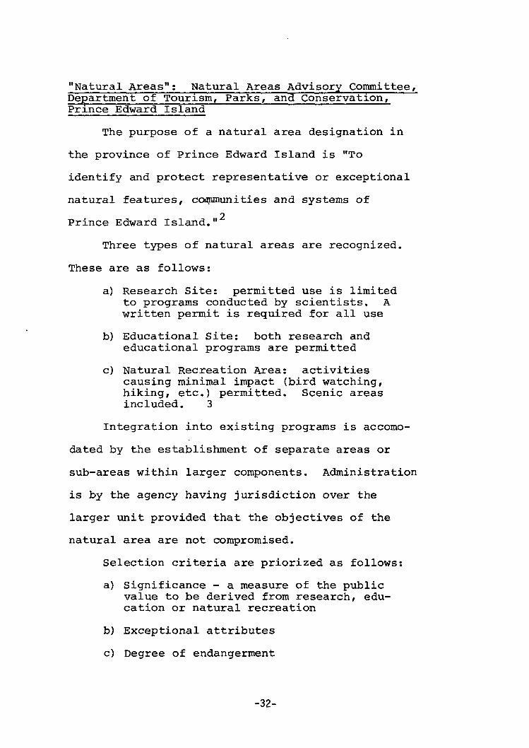
"Natural Areas": Natural Areas Advisory Committee, Department of Tourism, Parks, and Conservation, Prince Edward Island
The purpose of a natural area designation in
the province of Prince Edward Island is "To
identify and protect representative or exceptional
natural features, ccwpmunities and systems of
2 Prince Edward Island."
Three types of natural areas are recognized.
These are as follows:
a) Research Site: permitted use is limited to programs conducted by scientists. A written permit is required for all use
b) Educational Site: both research and educational programs are permitted
c) Natural Recreation Area: activities causing minimal impact (bird watching, hiking, etc.) permitted. Scenic areas included. 3
Integration into existing programs is accomo
dated by the establishment of separate areas or
sub-areas within larger components. Administration
is by the agency having jurisdiction over the
larger unit provided that the objectives of the
natural area are not compromised.
Selection criteria are priorized as follows:
a) Significance - a measure of the public value to be derived from research, education or natural recreation
b) Exceptional attributes
c) Degree of endangerment
-32-
d) Accessibility to permitted users 4
Evaluation is done by a provincial Advisory
Committee which includes a balanced represen
tation of scientists and concerned citizens.
"Natural Areas": Interdepartmental Natural Areas Committee, Government of Alberta
Natural Areas is also the term utilized
by the province of Alberta. Natural Areas are
defined as parcels of land designated to conserve
environmental diversity in the provinces's natural
zone. The three types of reserves include:
1) Ecological Reserves - primarily for conservation of genetic resources and for scientific research that will assist in natural resources management and utilization. There can be limited educational and recreational use of such areas in association with a systems plan to ensure representation of all natural zones.
2) Education Natural Areas - primarily for the use of educators and students in the field of natural history. These outdoor classrooms and laboratories will be close to major population centres so that students have access to them.
3) Recreational Reserves - for outdoor recreational purposes, especially non-mechanized forms such as canoeing, snow shoeing, hiking and nature photography. 5
An Interdepartmental Natural Areas Committee
makes recommendation relating to policy develop
ment and program management. Both evaluation
mechanism and selection criteria are forthcoming.
-33-
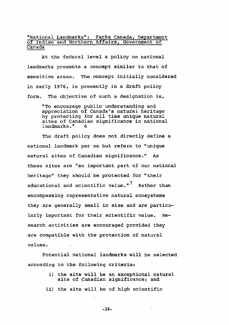
"National Landmarks": Parks Canada, Department of Indian and Northern Affairs, Government of Canada
At the federal level a policy on national
landmarks presents a concept similar to that of
sensitive areas. The concept initially considered
in early 1976, is presently in a draft policy
form. The objective of such a designation is,
"To encourage public understanding and appreciation of Canada's natural heritage by protecting for all time unique natural sites of Canadian significance in national landmarks." 6
The draft policy does not directly define a
national landmark per se but refers to "unique
natural sites of Canadian significance." As
these sites are "an important part of our national
heritage" they should be protected for "their 7
educational and scientific value." Rather than
encompassing representative natural ecosystems
they are generally small in size and are particu
larly important for their scientific value. Re
search activities are encouraged provided they
are compatible with the protection of natural
values.
Potential national landmarks will be selected
according to the following criteria:
i) the site will be an exceptional natural site of Canadian significance; and
ii) the site will be of high scientific
-34-

value and public interest; and
iii) the site will be of a size and configuration so as to:
a) encompass a natual feature or phenomenon whose long-term protection is feasible; and
b) offer opportunities for research, public understanding and appreciation.8
In selecting potential national landmarks
consideration will be given to:
i) the degree of protection or threat to the natural environment of the site; and
ii) competing land uses; and
iii) geographic balance of national landmarks throughout Canada; and
iv) the location and objectives of other protected natural areas; and
v) appropriate international criteria. 9
Potential national landmarks will be selected
in consultation with provincial (territorial)
governments and with the interested public.
Management of national landmarks will be
primarily directed at the protection and pre
servation of a single feature or phenomenon.
"Management may therefore be required when
natural conditions threaten to alter or eradi
cate the protected feature or phenomenon."
-35-

THE UNITED STATES
"Scientific Areas": Scientific Areas Preservation Council Wisconsin Department of Natural Resources, State of Wisconsin
The origins of natural or sensitive areas
in the United States date back to 194 5 when Aldo
Leopold, as the Conservation Commissioner for the
State of Wisconsin, created the Natural Areas
Committee. The duties of this Committee were to
"lay out a plan to acquire ... a system of small
areas representing the native vegetation of
Wisconsin." These areas were, "... to be held
and used soley for educational and scientific
12 purposes ..." This committee was replaced in
1951 by the State Board for the Preservation of
Scientific Areas. The goals of this committee
were established as:
"the preservation of sufficient scientific areas and other natural areas in each region of the state to provide examples of all types of biotic communities and unique natural features native to the region." 13
The historical mapping of the State of
Wisconsin as it appeared in the middle of the
last century is complete. The Scientific Areas
Preservation Council, formerly the State Board
for %the Preservation of the Scientific Areas,
feels that representatives of all the thrity-
two terrestrial communities and twenty-nine
-36-

aquatic communities should be preserved in at least
one location in each educational use region
where they occur naturally.
The council, composed of six members from
universities, museums, and government agencies,
is in an advisory position to the Wisconsin
Department of Natural Resources. Potential
areas are evaluated on vegetational characteristics
which form a basis of comparing areas and establishing
priorities for acquisition. The criteria used by
the council are:
(1) Quality: i) species diversity ii) community integrity
iii) lack of disturbance (human)
(2) Degree of Commonness: i)feature relative to its original extent in pre-settlement vegetation,
ii)amount of community remaining
iii)ease of destruction
(3) Threat
(4) Diversity - number of community types or other natural features.
(5) Use Value - amount of formal educational use, research use, etc. that the area affords.
(6) Site and Buffers - minimum size necessary to maintain original quality. 14
The method of preservation used by the Council
is acquisition. At present they own 104 scientific
-37-

areas encompassing 0.04% of the state's land
area and these areas are specially managed so as
to meet the goals of preserving in them, examples
of the pre-settlement vegetation of the state.
Through prescribed burns to maintain prairie and
savanna communities, and control of deer populations
whose natural predators are long gone, the Scien
tific Areas Preservation Council through management
maintains communities and prevents successional
patterns. Timber harvest, water level management
and the use of herbicides and pesticides, however
are not considered compatible with the goals of
15 the Council.
"Nature Preserves": Nature Preserves Commission, Department of Conservation, State of Illinois
Illinois was the next state to realize the
need for natural area preservation with the
creation of the Illinois nature preserves system
in 1963. The Illinois Department of Conservation
and the Nature Preserves Commission share the
responsibility for establishing, maintaining and
protecting nature preserves "truly representative
16 of the natural landscape of Illinois." The
objectives of the Commission, composed of nine
members from universities, science academies and
naturalist clubs, are as follows:
-38-

"To preserve adequate examples of all significant types of natural features occurring in the state. To preserve habitats of rare or endangered species of plants or animals. To preserve unique and unusual natural features. To preserve wilderness remnants. To preserve natural areas in all portions of the state." 17
A natural geographic division system was
devised for Illinois to provide a framework for
the nature preserves system. The state was divided
into fourteen regions (called "natural division")
and thirty-three subregions (called "sections").
These natural divisions and sections are distin
guished according to differences in topography,
glacial history, bedrock, soils, and distribution
of flora and fauna. The nature preserves system's
goal is to represent each of the distinctive
natural features within each division and section.
The evaluation of a potentially sensitive
areas is done in the following manner. Each area
is rated between +3 and -2, according to thirty
factors. (See Figure 11). The numbers correspond
to ratings from excellent to very poor, with the
total providing a basis for comparing the values
of a proposed project with others. The critical
problem is of course that each factor should not,
perhaps have equal weighting. The Commission
realizes this fact and uses the evaluation form
more for a checklist of relevant facts providing
-39-

Figure II — Illinois Nature Preserve NATURAL, AREA ACQUISITION PROJECT EVALUATION
County Area
Section Township
Date
Range P.M.
Vols* and t i t of are* aa a public holding (high—>low) Nature preserve value
Natural character 1 Uniqueness or rarity of natural types present
• 2 Diversity of natural type* present 3 Rare species present 4 Naturalness and lack of past disturbance 5 Wilderness character 6 Replication of existing preserves (no. -yes) 7 Scientific value and use • Educational value and use
Public enjoyment 9 Nature observation
10 Scenic and esthetic attraction 11 Expected visitation and tourism
Recreational and other values 12 Amount 13 Diversity 14 Accessibility and nearness to large population 15. Expansion-and diversification potential 16 Adjacent to existing public balding
Management and protection Vulnerability (tov—Ugh)
To surrounding influences 17 Topographic and hydrelogic IS Population pressure and urbanisation 19 Attractive nuisances 20 Potential haaarda and nuisances to people 21 To public works projects
.Management problems fan res) ZZ JLand 23 Visitor* 24 Possible custodial arrangements (good—poor)
Acquisition factors 25 Threat of destruction 2» Availability 27 Alternate beneficial use
Cost
high- low) high-low) . low—high) le<w.>-hi*a)
28 Per acre 29 Total 30 Relative to accessibility, population, and use
Total checks Percentage profile (total checks s 3.3) Score (total checks x ratine}
T< rial • *
rating (max. +90, rain. -60 > 1 !
Ratln* f *
1 43
'
1 42
•a
2 +1
Ii 2 o
0
*•
i . 1
-
1
. 2
i
1 t
! 1
t I
:
1 i j
1 1 ""
Source: Illinois Nature Preserve Commission. Comprehensive
Plan for the Illinois Nature Preserves System* Parti;
Guidelines, 1972, p. 4
-40-

a subjective opinion. Three individual evaluations
are made by the Commission.
The method of protection employed in the
system is acquisition through either purchase or
donation. A crucial factor to acquisition may be
the absence (or conversely, the presence) of land
conditions which will require substantial or
continuing management attention. The self-
sufficiency of the natural ecosystem is also con
sidered. It should be "a unit of sufficient size
and buffer to prevent damage by pollution, sedi
mentation, alteration in drainage or groundwater,
18 or by development of use of adjacent lands."
"Natural Areas"; New England Natural Resources Center, Connecticut, Maine, Massachusetts, New~ Hampshire, Rhode Island, Vermont
In 1970 the first regional approach at natural
area preservation was initiated in New England.
This initiative involved a number of states and
was the first and only instance of private con-
servatipn groups taking the initiative in such a
venture. Conservation organizations in each of
the New England states under the New England
Natural Resources Center established the New
England Natural Areas Project. The goal of this
undertaking was to establish a permanent safeguard
-41-

of significant natural areas in New England. A
Natural Area was defined as,
"areas of land or water not significantly altered by man that harbour plant or animal communities or exhibit natural features of significant educational and scientific value."19
The New England method does not use point
ratings but relies upon the assessments of experts.
General guidelines were set out by the Center,
which established nine significant categories.
These can be seen in Figure 12. An area considered
by state naturalists or government agencies to be
significant in any one of these categories is
classified as a natural area. The New England
Natural Heritage System is a resulting regional
agency which, when fully operational, will encompass
a network of protected and managed natural areas
in both public and private ownership throughout
New England. Protection is to be assured through
outright ownership by a public or private agency
through easement, or other enforceable regulation.
Management is left to the discretion of the state
concerned.
"Critical Environmental Areas"; Division of State Planning and Community Affairs, State of Virginia
An approach similar to those cited above is
that of "critical areas". Generally a critical
-42-

Figure 1 2 - New England
Natural Area Categories
Geologic
So i l s
Hydrologic
Flora
Fauna: T e r r e s t r i a l Animals
Fauna: Birds
Fauna: Aquatic Life
Archaeologic
Cul tu ra l /Aes the t ic /Visua l
Education
Number of Areas
1409
18
1513
500
257
244 i
101
399
317
5
Source: New England Natural Resources Center, Protecting New Englands Natural Heritage, November, 1973, p. 30.
-43-
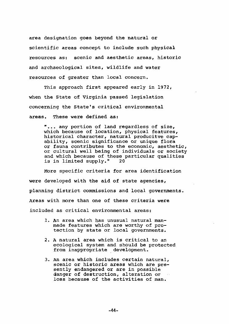
area designation goes beyond the natural or
scientific areas concept to include such physical
resources as: scenic and aesthetic areas, historic
and archaeological sites, wildlife and water
resources of greater than local concern.
This approach first appeared early in 1972,
when the State of Virginia passed legislation
concerning the State's critical environmental
areas. These were defined as:
"... any portion of land regardless of size, which because of location, physical features, historical character, natural producitve capability, scenic significance or unique flora or fauna contributes to the economic, aesthetic, or cultural well being of individuals or society and which because of these particular qualities is in limited supply." 20
More specific criteria for area identification
were developed with the aid of state agencies,
planning district commissions and local governments.
Areas with more than one of these criteria were
included as critical environmental areas:
1. An area which has unusual natural man-made features which are worthy of protection by state or local governments.
2. A natural area which is critical to an ecological system and should be protected from inappropriate development.
3. An area which includes certain natural, scenic or historic areas which are presently endangered or are in possible danger of destruction, alteration or loss because of the activities of man.
-44-

4. An area appropriate for future public use through acquisition by state or local acquisition.
5. An area which can be considered to contain a primary state resource, such as wildlife, mineral or agricultural production. 21
The Virginia method utilizes a point evaluation
system. An environmental check list was designed
to allow many individual field evaluations, objective
quantitative measurements as well as subjective
judgements. A sample evaluation sheet is included
in Appendix III. It is intended that many people,
agencies and groups evaluate each area to minimize
bias.
"Critical Areas": Land Use Advisory Committee, Land Use Commission, State of Wyoming
A similar critical areas program was initiated
by the State of Wyoming in 1975. The Wyoming
legislature listed four examples of areas which
might be designated as critical or of more than
local concern. These are as follows:
(1) fragile or historical lands Fragile lands are areas where the land its elf or a natural part of the land could be easily destroyed. Historic lands contain sites, structures or objects which have significance relating to our heritage.
(2) natural hazard lands
(3) renewable resource lands Renewable resource lands provide a natural source of wealth or revenue
-45-

which can be replaced by natural ecological cycles or by sound management practices.
(4) new town lands 22
The critical areas program was initiated to
encourage responsible land use decisions. "Local
governments may find that they need support to
control development threatening to the quality of
life not only of their local citizens but of
23 other citizens." The concern is for uncontrolled
development which could damage the environment,
peoples' lives or property or public interest in
the area which is of more than local significance.
The state Land Use Commission with the
recommendations of the Land Use Advisory Committee
determine the significance of candidate areas.
Development guidelines are then drawn up for the
validated critical areas.
"Critical Resources": Department of Administration, State of Wisconsin
Wisconsin has initiated a critical resource
inventory study with the objective of geograph
ically delineating areas with resource capabilities
which are critical or of 'high priority* to the
24 inhabitants of the state. In determining the
criticality of a significant resource it is
evaluated as to its existing use and its potential
-46-

uses. Emphasis is on the utility and importance
to man. Resource uses are categorized as follows:
1. Preservation/Conservation a) Natural state function - the resource
provides benefits to man directly.
b) Research and education.
2. Recreation a) Water-oriented b) Land-oriented
c) Scenic
3. Agriculture - crop production
4. Forestry - commercial forestry
5. Mineral Extraction 25
Relative criticality of a resource area is
based upon resource quality and size, location,
cost of maintenance, degree of present and furture
scarcity. Evaluation and analysis is done based
on information collected from an extensive random
sample of 305 plots throughout the state. A sample
of various matrices can be found in Appendix IV by
way of criticality matrices based on the information.
"Environmentally Sensitive Areas": American Society of Planning Officials
The American Society of Planning Officials,
an influential national planning organization,
cites a similar idea in describing environmentally
sensitive areas. These are defined as,
-47-
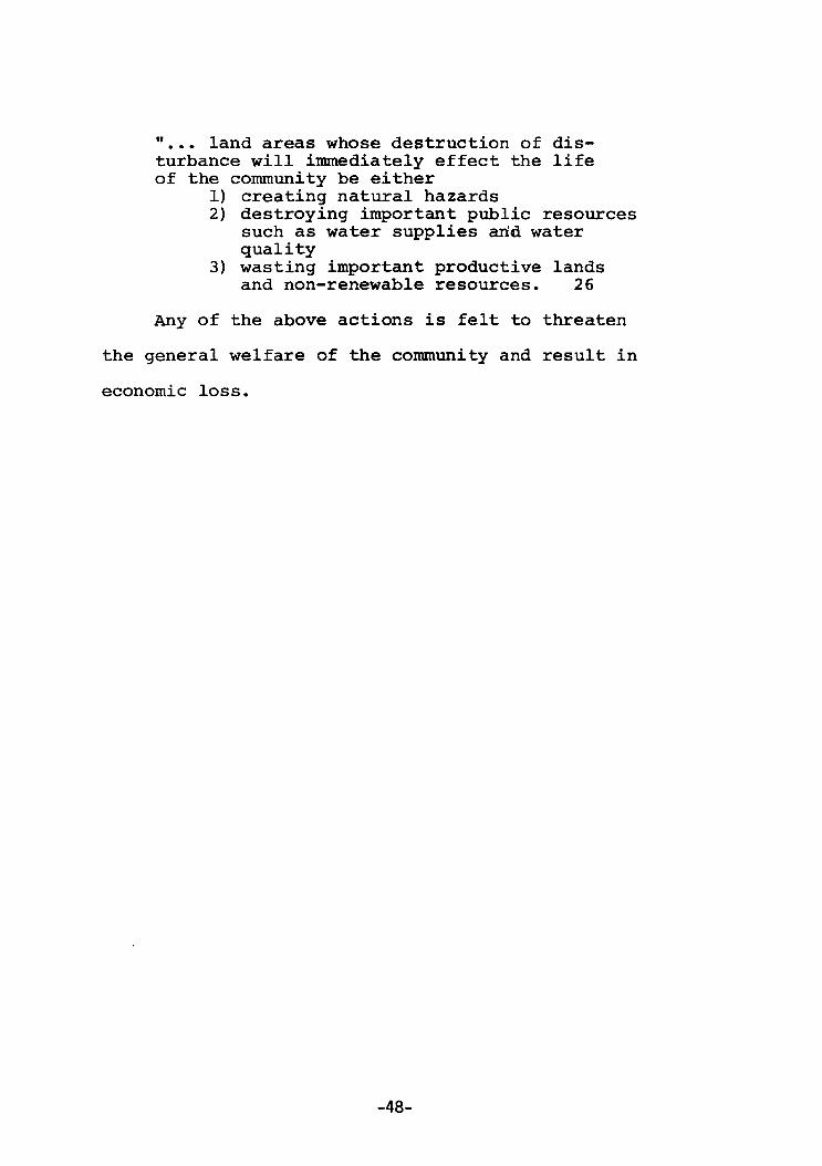
"... land areas whose destruction of disturbance will immediately effect the life of the community be either
1) creating natural hazards 2) destroying important public resources
such as water supplies arid water quality
3) wasting important productive lands and non-renewable resources. 26
Any of the above actions is felt to threaten
the general welfare of the community and result in
economic loss.
-48-

Figure 13 - Matrix
«J 4 i • H A
0
> • r t
•P «t •P G 0 n 0 M
a 0
u
n
e 0 <H 7 1
c
0
> • H •P a) 4J C 0 to 0 M 0 . 0 U
01 X M «f
I o c 0
A
o • H <M - H • P C <1)
• H U
a
8, 3
3
•
p
* 5 I I
a> c -P
8*.0" 0 . - H V
c c *> t n . Q U - 1
>M »
a o > 0
c c o's
• o > • r l
0 v
u u u 0 3 T - i O J3
u a 0
r H - H
B O 0 3
O i O
H 0 .
. H
a M 3
* > • - t e 3 0
o e - « . I B O 0
•WJ-H
n n O - H *> e
J ! »
« 3 i H <0
> r-l
a c 0
• H •U
a 0 vt 0
o n
4) 3
r-l
a > o • H •P V
A •U
n •a
> t * l • H
> • H
•P n c 41
a o • H D> 0
r H
o o 0)
a B 3
•a <M
• 0
c a M M
o i H •M
0 3
n> • H
e 3
> i
+> - H n M 0
> • 0
•P
* •p
•rt 10
xs
•8 e V •P
a 0
2 •P
e 0
• H
* > o c 3
<M
u •rt 0> 0
r H 0 0 0
a 0
« u a •P B •0 B
s VI
M 0
<U -P C
n o £>« • p >
n o > i B
n at O H M 6 - H
• H H X - 0
• H - H
rt »
"S $ A VI 3 • p
n • 0 B 3
• 0 C . « -P
a 9) P 0 > - H Vi A
a a H i
0 0 S «J
0
a a s
0
o 0 a.
• o B
a r-i
•o VI
« N 13
A
> l
0
o 0
t • H
15 b 1 B IS E
3
•O
m o
A ! 0
0
o> 0
0 0
« JS
o M a
• a
3 0 •P
» B
•O
0 U VI
0 to 0 H
• u ID
* a c 0 VI
Nature Reserve
Special Influence Area
Natural Area
Sensitive Area (SLUP)
Sensitive Area (Plan Review)
Special Area (Lake Planning)
Region Waterloo ESA
Region Hamilton-Wentworth ESA
Region Sudbury
Ecological Reserves British Columbia
Natural Areas P.E.I.
Natural Areas Alberta
National Landmark Canada
Scientific Areas Wisconsin
Nature Preserves Illinois
Natural Areas New England
Critical Environmental Areas -Virginia
Critical Areas Wyoming
Critical Resources Wisconsin
Environmentally Sensitive Areas American Society of Planning Officials
• • • •
• •
• •
• •
t •
• • •
• • • •
• • •
• • •
• • S-
o 3
4->
• • >> (0 c <
CD O S-3 O to
-49-

Discussion
The many aspects of the sensitive area concept;
are displayed in the matrix in Figure 13. These
exemplify the variety of rationale which have been
utilized for these designations across the continent.
The influence of the International Biological
27 Programme (IBP) is clearly evident in the provincial
examples cited. The concern for scientific research
and public education associated with the IBP are
also evident in the Canadian impetus for national
landmarks.
The British Columbian initiative specifically
includes man-modified ecosystems in order that
research and monitoring of these sites can offer
an opportunity to study their recovery. This idea
presents an entirely new perspective on the
sensitive area concept which had largely dealt
with 'natural*, 'pristine' or remnant areas.
The American concept of critical areas also
increases the breadth of the concept. Here, lands
are reserved which are critical to resource
production objectives. High quality mineral areas,
agricultural land and forested areas are included.
The Sudbury initiative is similar but does not
include such intensive forms of production as
-50-

agriculture and mining. Rather natural productive
activities such as deer yards, trout lakes and
spawning areas are considered in both the Sudbury
case and the Strategic Land Use Plan initiative.
Both Wyoming and the American Society of
Planning Officials' documents refer to lands
which provide benefits through natural ecological
cycles, a concept similar to the vital ecological
function or, let us say, 'work value' of natural
systems noted by both the Regional Municipality
of Waterloo and the Regional Municipality of
Hamilton-Wentworth.
Historic and archaeologic sites add further
breadth to the concept by consideration of
cultural as well as natural aspects under this
term. Similarly, the Wyoming reference to new
towns causes one to wonder what other zoning
designations are being utilized in. land use
planning.
The inclusion of natural hazard areas in
the sensitive area concept is most unusual as there
seems to be a fundamental difference between
these two ideas. Whereas in the instance of hazard
lands, man or his property is protected from
nature, the sensitive area concept generally
indicates concern for protection of certain
-Rl-
aspects of nature from man.
The critical areas approach presents a response
to development pressure. However, the response
was not just for the remnant natural areas which
were to be protected for a variety of reasons.
Presumably productive resource areas in the United
States were perceived as being threatened and thus
the institution of a critical areas designation
which would include valuable natural areas as well
as productive resource areas.
-R9_

CHAPTER THREE THE COMPONENTS OF THE SENSITIVE AREA CONCEPT:
ONE CONCEPT WITH THREE STRANDS
The problem of sensitive area planning
obviously revolves around both a vast array
of rationale for area designation and the
utilization of a number of closely related terms.
The purpose of this thesis is to examine the roots
of the sensitive area concept within both spatial
and temporal contexts.
The framework for the spatial analysis which
will be utilized is a model of conservation rationale
developed by Professor Roderick Nash, currently
a member of the Department of History and Environ
mental Studies at the University of California in
Santa Barbara. He has written a number of books
and articles on wilderness and conservation in
America. Nash's model of the development of
conservation is presented in "The Gospel of
Ecology", The American Environment-Readings in
the History of Conservation and in "The Rights of
Rocks: An Analysis and Implications of Aldo
Leopold's Land Ethic", an unpublished paper from
the University of California, 19 75.
An assumption made in this thesis is that
the sensitive areas concept is part of the conser
vation movement. Nash's model is utilized as it
-53-

provides a relatively clear and convenient frame
work for examination of the underlying rationale,
or basis for, conservation designations. Thus,
the utilization of Nash's framework will enable
an examination of the motivation behind the
creation of a reserve areas, regardless of the
"label" which is attached to such a unit. That
is to say, the rationale itself rather than the
term, such as 'preserve', or 'sensitive area',
"natural area', 'reserve', or whatever will be
examined.
This analytical framework was chosen as it
was felt that it could effectively shed further
light upon the present sensitive areas concept
in the following way:
1) allow for comparison0of historical forms of land removal acceding to the three trends of conservation outlined. This enables one to determine the basis of the present range of terms utilized within the sensitive areas concept
2) allow for the evolution of a new type of conservation by the fusion of the three trends into what Nash has dubbed the Gospel of Ecology. 2 This development allows for an examination of sensitive areas as part of this new conservation
Nash's model of the development of conservation
in the United States is graphically illustrated
in Figure 14. The Conservation Movement in North
America is divided into three main trends:
-54-

Figure 14 -The Gospel of Ecology
— 1970
Earth Day — (April 22, 1970)
Santa Barbara Oil Spill
(Jan. 28, 1969)
Clean Air Acts
Water Quality Acts -
Barry . Commoner
Spaceship — Earth
FEAR
— limits to Growth Debate
• National Environmental Policy Act (Jan. 1, 1970)
life-style Revolution
Grand Canyon Dam Protest
— PaulEhrlich — Ralph Nader
— 1960 — Soil Conservation
TVA — (1933)
Rachael Carson V
*
Bureau of — Reclamation
Gospel of Efficiency (1907-1909)
London "Killer Smog".
•Gifford Pinchot
• Beginnings of Forestry
(1902) ~ George Perkins Marsh
UTILITARIAN
• Nuclear Fallout Scare
.Aldo Leopold
American Indians
Quality of Environment/Life
Wilderness Act (1964)
"Beautification" Movement
-David Brower
- Echo Park Dam Protest
Wilderness Society • (1935)
ECOLOGICAL
John Muir
AESTHETIC
_ National Park Service Act (1916)
Hetch Hetchy Protest - Henry David Thoreau
Source : Nash, Roder ick , The American Environment, Reading, M a s s a c h u s e t t s , Second E d i t i o n , 1976, p . 2 2 6 .
- 5 5 -

utilitarian, aesthetic, ecologic. He maintains
that these culminated in the late sixties in what
is considered by some a fourth rationale for
conservation, "The Gospel of Ecology".
The Utilitarian Rationale
The utilitarian rationale for conservation 3
involves viewing nature "as a servant to man".
Nash cites George Perkins Marsh who wrote Man and
Nature or Physical Geography as Modified by Human
Action in 1864 as the initiator of the utilitarian
approach in the United States. The purpose of
Marsh's book was to point out the extent of the
changes produced from human action and to "suggest
the poss ibility and- importance of the restoration 4
of disturbed harmonies" in the natural landscape.
He maintains that man's power to transform the
natural world should entail a commensurate sense
of responsibility.
In 1898 Gifford Pinchot, who was the first
American to chose forestry as a career, became the
chief of the Federal Forest Division. Pinchot is
often considered the driving force behind the
Progressive conservation movement. With such
strong advocates as President Theodore Roosevelt
and Gifford Pinchot, the "gospel of efficiency"
-56-

or wise use gained momentum. Pinchot defined
conservation as "first of all the recognition
of the right of the present generation to the fullest
necessary use of all the resources with which this 7
country is so abundantly blessed." Conservation,
however, demands the application of common sense
to the common problems for the common good. Con
servation also stood for the prevention of waste
and the development of natural resources must be
for the benefit of the many and not merely for the
profit of the few. The concepts of sustained
yield or wise use, were associated with this era
of conservation.
Nash cities the early engineering controls of
the Tennessee Valley Authority, a regional planning
structure on a watershed basis, and the passage of
Water Quality and Clean Air Acts in the sixties as
further examples of the utilitarian approach to o
conservation. The motivating factor of this type
of conservation, Nash defines as "enlightened self-9
mterst" .
For the purpose of analysis, Nash's utilitarian
rationale for conservation will be defined as "enlightened
self-interest adjusted to take long term needs into account.
Man's material needs are paramount and the environment is
seen primarily as a servant of man. Nash maintains that
-57-

the progressive conservationists with ideas of sus
tained yield were simply "more enlightened slave
drivers than the pioneers". The utilitarian is
motivated by a fear of running out of resources.
The Aesthetic Rationale
A strikingly different way of viewing man and
nature was proposed by such men as Henry David
Thoreau, Ralph Waldo Emerson and John Muir. The
writings of both Thoreau and Emerson on the
inspirational value of nature created the basis
of a philosophical movement called transcendentalism.
John Muir was a strong wilderness advocate in this
own right. These rationale for conservation, Nash
calls the aesthetic tradition. The spiritual or
inspirational values of nature are paramount. He
cites The Wilderness Act of 1964 and concern for
the quality of the environment as further indications
of this view.
The main motivation of aesthetic conservation is
13 the fear of making the world ugly and uninspiring.
This rationale for conservation, Nash contends, is
just as concerned with man's interests as the utilitarian
motivation. The only difference is that now it's man's
spirit rather than his stomach that dominates decision-
14 making. For analytical purposes this rational will be
-58-

defined as concerned with the inspirational benefits
to man.
The Ecologic Rationale
The ecologic rationale proposed by Nash on the
other hand, centers around a concept of conservation
15 which defines "state of harmony between man and land."
The ecologic viewpoint involves a non-anthropocentric
motivation. Neither man's material nor his aesthetic
interest are paramount. Man rather assumes a position
of membership in the biotic community. It is then
the welfare of this community and not man's welfare
which becomes the criterion for judging environmental
policy. Although the expression of anthropocentism
is still evident this new self-interest, Nash maintains,
is "qualitatively different since it demands the
16 subordination of old self to ecological imperative."
That is to say that man would accept a humbler position
and recognize and respect natural functions. For the
purposes of this thesis the ecologic component will be
defined as a belief in "a state of harmony between man
and land".17
The Gospel of Ecology
Nash contends that these three perceptions
fused into a "gospel of ecology" in the late sixties.
Fear, the catalytic agent, did not center on piecemeal
I -59-

issues such as the loss of non-renewable resources
or a particular wilderness area but the "health of
the entire ecosystem, the life community and its 18 non-living setting."
The gospel of ecology is "a convergence
around ecological concepts of the major rationales
19 already existing for conservation". The fusion
which involved the "logic of science" plus the
20 "intuition of the poet and mystic" , can be seen
as "an intellectual collision between scientific
21 and what might be called theological ecology".
This resulted in "a holistic sense of oneness, of
community that could stand the test of both fact
22
and feeling". The term 'gospel' is utilized
due to the intensity and evangelical character of
this sudden surge of concern for conservation. The
powerful combination of these three previously
parallel concepts of conservation can be compared
to a religion due to unshakeable belief in ecological
integrity. This can be called a faith, what Professor
Robert Dorney refers to as the triad of land, life 23
and diversity or Albert Schweitzer called the 24 •reverence If life'. For analytical purposes in
this thesis the gospel of ecology' will be defined as
a mode of conservation which includes both scientific
and ethical components.
-60-

Discussion
The multitude of terms that we have presented
under the auspicies of the "sensitive area concept"
are clarified when categorized in the light of
Nash's rationale. (Figure 15) The rationale of
course, in a number o f instances overlap into
other categories.
Conceptual overlap occurs with the rationale
of species maintenance. Species protection can
be considered utilitarian if animals are maintained
for hunting or food gathering activities. Hunting
however, has therapeutic recreational benefits
associated with the aesthetic motivation. Concern
of gene pool preservation in the 'scientific
benchmark sense' is an ecologic motivation, whereas,
a belief or faith in 'species diversity' has the
ethical tenor of the gospel of ecology.
Similarly, although the rationale of 'meeting
Ministry objectives' is classified as utilitarian,
the Ministry has objectives in its Parks Division
which are oriented to both the aesthetic and ecologic
motivations. The reason for the utilitarian clas
sification is that the objectives of the Ministry of
Natural Resources are primarily production or use
oriented. Both utiliarian and aesthetic motivations
are often involved in protection of historic/cultural
-61-

Figure 15 APPLICATION OF NASH'S FRAMEWORK TO THE RANGE OF RATIONALE PRESENTED IN FIGURE 10
UTILITARIAN
AESTHETIC —
ADDITIONAL RAT THE THREE TREN I.E. THE GOSP
GOSPEL OF ECOLOGY
new towns
hazard lands
gene pool research to benefit present and future generations
conspicuous value for Ministry objectives
regional resource production objectives
renewable resource lands
educational purposes
archaeologic sites
historic/cultural significance
recreational value
scenic value
unique flora and fauna
representative habitats
representative landforms
scientific benchmarks
IONALE WHICH CAN NOT BE CATEGORIZED IN DS ABOVE AND ARE INDICATIVE OF A CHANGE -EL OF ECOLOGY
ecologic sensitivity
habitat diversity
ecologic function
linking systems for wildlife movement
large and undisturbed habitat
species maintenance
man-modified ecosystems |
Source: Analysis by the author.
-62-

and archaeologic sites. There are intellectual as
well as spiritual benefits to cultural heritage
appreciation.
The broad categories outlined by Nash provided an
excellent framework for analysis of the various aspects
on conservation history within Ontario. However a
number of conservation rationale such as recreation,
education and unique flora and fauna span more than one
of these components. The simple definitions and broad
categories which Nash presented could not be applied
exclusively. The diagram in Figure 15 illustrates the
inevitable overlap which occurs with the use of such
broad categories.
There is also a lack of clarity concerning the
actual gospel of ecology component of Nash's model.
It is hard to decifer the temporal limits of this
factor from either Nash's text or corresponding dia
gram. Whether this event extends over a one or five
year period is certainly key to use of this model for
analysis. The recession (after the gospel of ecology)
component of the model could also be further explained.
This again would aid in determining the events which do
or do not fall into the 'gospel' section. *
To determine if there were any critiques of Nash's
framework in the literature a search was undertaken. It
included the social science sitation index, the social
science subject index and various book review sources.
-63-

According to this information no critiques have been
published.
Aside from the points noted, the model provided a
viable framework for analysis of conservation and the
sensitive area concept in Ontario.
-64-

CHAPTER FOUR THE SENSITIVE AREAS TRADITION IN ONTARIO
Arguments are frequently presented in planning
hearings that certain infringements or restrict
ions upon property rights have no precedence in
Canadian or Ontario law. Indeed, with the intro
duction of an increasing variety of terminology
and with apparently conflicting specific ration
ale for sensitive area designations, the argument
of lack of precedents hardly seems necessary
to justify dismissing such designations. However,
it will be the argument of this thesis that there
is considerable historical precendence for the
broad concept of the creation of reserves of land
free from the pressures of unfettered commercial
exploitation or intense human use. Indeed, it
will be argued that it is this tradition of
creation of reserves that has created pockets of
vested interests in the "sensitive area concept".
The combination of new conservation ideas com
bined with these vested interests has prevented
the co-ordinated use of the concept within one term.
This chapter will present a history of conser
vation in Ontario from the early nineteenth cen
tury until 1972, the year when the term "sensitive
area" was first utilized in Ontario. The history
-65-

has been divided into five parts due to signifi
cant events in conservation which happened during
these periods. Detailed aspects of the provincial
conservation milieu can be found in Appendicies V
through IX. Major events associated with conser
vation, and provincial initiatives in land reser
vation are analyzed in terms of Nash's framework.
In this way, the development of the various
components of the present sensitive area concept
can be examined in a temporal context.
-66-

The Nineteenth Century
The fundamental principles of land and
resource use in Ontario are based on the British
system of Crown sovereignty. Whereas a settler
in the United States owned all of the land re
sources when he bought a piece of land, in
Canada he bought simply a place to settle. Both
the timber and mineral resources on his land
were owned and could be sold by the Crown.
With what seemed to be an inexhaustible
supply of land and forest resources, the govern
ment's major concern in this period was to maximize
its revenues. Money could be generated by selling
both land and timber licences.
In theory, following the sale of timber
licences the land would be cleared and could be
sold again for settlement. By abolishing free
land grants and requiring a minimum timber cut
on leased land, the government sought to control
land speculators and increase timber revenues.
Certainly, if a "minimum cut" concept is insti
tuted there can be no fear of a lumber shortage.
Nelles maintains that, "the nineteenth century
image of the forest was ... not unlike a giant
mineral deposit which was permanent simply by
virtues of its size and could be exploited only
-67-
once and then passed on to the farmers."
The required cut regulation caused over
production and a subsequent depression in the
lumber trade. To prevent such a reoccurrence
government and industry, both dependent upon
the revenue generated by the forest resource
became closely associated. The annual report
of 1856 states a three fold timber policy with
no mention of the timber resource itself. A
specific policy was that government revenue will
be maximized. Although large areas of land were
heavily burned from both settlers clearing land
and lumbermen leaving slash, the lack of a fire
policy indicated the government's perception
of supply.
The first conservation Acts in the province
dealt with fish and game, and were the result of
declining supplies from overhunting or such
harmful and destructive fishing habits as spear
hunting during spawning season. However, The
Fisheries Act of 1857 was the first legislation
to be enforced by staff and funds. The Act's
provision for fish hatcheries was the first
positive step towards replenishing the declining
fisheries. The chief mechanisms for fish and
wildlife protection were management techniques
-68-
such as closed seasons and enforcement, rather
than the creation of reserves or sancturaries.
Although there was mention of "the protection
of the forest from unnecessary destruction" as
early as the Select Committee on the Lumber Trade
in 1849 and again concern over "wanton or special
wastes" in 1867 by Crown Commissioner Campbell,
selling timber licences and opening new settlement 2
areas were the major concerns of the government.
As early as 1872 the utilitarian aspect of conservation
was raised. Following the auction of 5,013
square miles of timber rights in Parry Sound and
the Muskoka area, the Crown Lands Commission was
accused of sacrificing the long term interests of
the people of Ontario. Again in 1880, the United
Fruit Growers Association in their monthly maga
zine expressed concern for forest preservation
and propagation. Suggestions for reforestation
also came from members of the lumbering industry
such as James and William Little in The Lumber
Trade of the Ottawa Valley published in that
same year.
The aesthetic rationale for conservation in
the form of rehabilitation is evident in both the
1871 Act to Encourage the Planting of Trees Along
Highways and the 1883 Tree Act. However, the
-69-

philosophical aspects of the notion and the
proposal for a reservation are not clearly articu
lated until 1885 when Alexander Kirkwood present*
his Algonquin Park Proposal. He refers to the
"quiet draughts of inspiration" and "the beauty
and majesty of nature" in Algonquin which provide
"for the benefit, advantage and enjoyment of the 3
people of Ontario." The first land reservation
created in Ontario was a park at Niagara Falls
whose purpose was to "assure the right of the 4
public at all times to view this work of nature."
Th« aesthetic trend is the motivating force in this
initial designation.
However, the Royal Commission on Game and Fish pro
moted both an aesthetic and a utilitarian approach.
This Commission was established in 1890 due to lob
bying from Dr. G. A. MacCallum and other sportsmen of
the Hamilton area. The commission endorsed the Al
gonquin Park Proposal in support of fish and game
protection to ensure a continuance of sporting activities.
These are assumed to include both material and spiritual
needs.
The idea of segregated land uses had been a bone of
contention with lumbermen since 1849 when the Act for the
Sale and Better Management of Timber Upon Public Lands
of that year established three operating policies for the
-70-

Crown Lands Department. One of these was that boundary
disputes be settled with the "least poisible delay" and
settlers were penalized for infringing upon timber cut
ting areas. The Free Grant and Homestead Act passed in
1868 was an attempt of the government to promote sett
lement but the timber companies opposed the Act until
all pine timber areas had been reserved for lumbering
purposes.
Some years later when the Ontario delegation
returned from the American Forestry Congress in 1882
their first recommendation was that all non-agricul
tural land should be reserved as forest land. It is
not surprising then that lumbering interests supported
the Algonquin Park Proposal as timber cutting was
not excluded. In fact, the establishment of Algonquin
Park reserved the pine in that area for lumbering pur
poses. A principle benefit of the reservation was that
the lumbermen could proceed without the interference of
their traditional opponent - the settler. Private cut
ting was strictly forbidden. The Algonquin Park Act
of 1893 incorporated the utilitarian, in terms of lumber and
game protection, and the aesthetic in terms of scenic
and inspirational concerns. Both are conservation
components.
The impetus behind the creation of Rondeau Pro
vincial Park the following year was essentially rec-
-71-

reational. Hunting was not allowed in the park. This
designation incorporated the aesthetic considerations of
supplying man's spiritual needs. However, the close of
this era saw further land reservation for utilitarian
purposes. The Forest Reserve Act of 1898 set aside lands
as "deemed feasible for future timber supplies".
The trend in rationale for the creation of reserves
is of note. The first formal instance of land reser
vation in Ontario was at Niagara Falls. This desig
nation promoted the aesthetic component of conservation.
However, previous to this the government had established
pine reservations in new settlement areas. This was to
pacify the lumbermen's lobby which had a strong effect
on the economy of the province. The establishment
of Algonquin Park in 1893 however was the first
formal designation of a similar forest reservation
and settlers were forbidden. The entire park was
essentially a pine reserve for lumbermen. Fish
and wildlife concerns as well as recreation benefits,
both aspects of the aesthetic component of conservation
were also key in the designation of Algonquin Park.
-72-

Early Conservation: 1900 - 1920
The utilitarian and aesthetic components of
conservation had received their initial thrust in
the creation of Algonquin Park in 1893. This reser
vation did not cause conflict because the various
land users were accommodated. Wildlife were protected,
the lumbering of pine was allowed, and as the area
was determined to be poor for settlers in any case,
the government did not mind their exclusion.
The Forest Reserves Act of 1898, however, did
not prove as palatable to the government when land
management decisions had to be made in 1903. Established
to protect reserves set apart as a "permanent
perennial source of revenue" , the initial designations
were cutovers which were regenerating. When rich
timber areas were reserved the government refused to
attach management guidelines to timber operations in
the reserves. Such guidelines would have ensured the
areas as perennial sources of lumber and therefore
revenue. The Forest Reserves Act proved to be a
hollow piece of legislation in terms of conservation.
The establishment of the utilitarian concept of
wise use in the long term, as promoted by Dr. Fernow,
a leading American forester, and his students at the
University of Toronto, was not easily accepted by
government or industry. The .traditional patterns
-73-

of interdependence established in the early 1850's
were not easily removed. The establishment of the
Canadian Forestry Convention in 1906 seemed to make
little difference in government policy.
The Canadian Forestry Convention called by Sir
Wilfrid Laurier in 1906, however, provided for an
exchange of broad ideas. The ecologic component of
conservation was expressed by B. E. Walker, a banker.
He speaks of 'that balance which nature has given us1
and expresses fear of man disturbing this equilibrium.
Such a disturbance Walker considers the highest crime
as it is against our descendants. Such an holistic
view is highly enlightened in a period where such men
as Dr. Fernow warn against the sentimentalists' view
of the forest. The various splits in conservation
ideas were evolving even at this early stage.
However, the diversity of the term conservation
can be seen even within the utilitarian component, for
the lumbermen's interpretation of land use segregation
was a far cry from Fernow*s sound forestry practices.
Such a divergence within the Canadian Forestry
Association caused the professional foresters to form
their own Association of Forest Engineers.
The Commission of Conservation allowed for the
free exchange of ideas between the industry, governments
and acadelmics. Senator Edwards, a Liberal lumberman
-74-

from the Ottawa Valley and unofficial spokesman for
the Ontario timber companies, was the Chairman of the
Forestry Committee of the Commission of Conservation.
E. F. Booth, another influential Ontario lumberman,
was also on this committee, as was Dr. Fernow. Although
aspects of scientific forest management were common
ideas, little direct influence of the Commission can
be seen in Ontario. Pross, in his history of the
Department of Lands and Forests does not mention
the Commission and only passing reference is made to
the Commission in the Annual Reports of that period.
The intent of the designation of Quetico Park as
a wilderness area in 1909 was to protect moose. This
is considered a utilitarian motive as Quetico was
protected because it was considered to be the last great
reservoir for moose left in North America. The intent
of such a designation was that the moose reservoir
would provide future hunting opportunities.
On the other hand, later in 1919, the National
Conference on Wildlife advocated the creation of wild
life sanctuaries to protect "characteristic wildlife".
The therapeutic and inspirational value of wildlife and
their sensitivity to human interference is recognized.
In this period, although aesthetic and ecologic ideas
are evident, conservation, in terms of land reservation,
was for the most part, utilitarian.
-75-

Economic Difficulties: 1921 - 1941
The short term motives of both the political
bodies and timber industries* "quick profit" incentives
had been the drawback in the establishment of conservation
concepts. It did not seem to make any difference which
party was in power; timber concessions were paramount.
The Drury administration of 1919 refused to change the
Doyle Rule to enable accurate timber measurements and
therefore accurate government revenues due to timber
lobbies. The Ferguson government, which followed,
allowed the northern forest resources to be divided among
five pulp operations which later folded. The management
of the forest was a political football and opposition
accusations of mismanagement and concessions to timber
companies often resulted in the defeat of the Government
of the day. M. F. Hepburn came to power in 1934 on
just such a platform and was defeated two years later by
the same issues.
The close association of the government and lumber
industries are illustrated throughout this thesis to
emphasize the effect of this relationship in producing
the present landscape in Ontario. Although the concept
of land segregation appeared in the Forest Act of 1927
and the Provincial Forest Act of 1929 these Acts were
considered as political window dressing for forestry
concerns and the depression turned government concerns
-76-
elsewhere. E. J. Zavitz, the first provincial forester
who was certainly concerned with such conservation
measures as reforestation as early as 1912, found little
support for his projects. The political nature of the
government is illustrated in the replacement of Zavitz by
a journalist as Provincial Forester in 1934. It was
activities such as these which prompted the Royal
Commission of 1940 to recommend that an independent
commission control forest resources.
While the northern forest resources of the province
were used to wield political power, concern for conser
vation was being raised on another level in the deforested
areas of Southern Ontario. Here, where the vast majority
of the people were located, the first glimmerings of
ecologic conservation were beginning to gain support.
While the general public could afford to discuss the
broad implications of northern timber concessions,
land monopolies and mismanagement, the long term
effects of a lack of forests and their associated
benefits were being felt by the farmers of the south.
W. H. Porter, editor of the Farmer's Advocate, realizing
the interdependent connections of the denuded country
side with soil loss, the floods and dried up wells 7
and springs felt "something had to be done". Municipal
representatives across Southern Ontario established
the Ontario Conservation and Reforestation Association
-77-

(OCRA). Although this organization had no constitution,
membership list, fees, salaries or expenses paid to
officials, conservation was promoted by well planned
field days and conservation tours. These were financed
by annual grants from the counties of Ontario. Although
land reservation was not a concern of this body or
the (O.C.R.A.) the concern for forest reforestation
is indicative of a recognition of land degradation.
Rehabilitation measures were initiated due to the
realization of a less than harmonious relationship
between man and nature. A rehabilitated landscape was
recognized as necessary to prevent the problems of
drought. Nature must be aided and a position of balance
promoted. The establishment of the Grand Valley
Conservation Authority in 1938 provided an institutional
structure such that ecologic functions and interrelation
ships are recognized. The ecologic tradition formally
had begun to take root.
This period saw little developement•in the
establishment of parkland. The government seemed
hesitant to take initiatives on this aspect of land
reservation. The local residents had to petition for
six years in order that Ipperwash be established as a
park. The other two parks established during this
period were Long Point (1921) and Presqu'ile (1922).
All of these sites were existing recreational areas
-78-

and their reservation is indicative of the spiritual
or aesthetic aspect of conservation. The Park Act
of 192 7 allowed for a withdrawal of some lands from
cutting within parks. It was not the intent of the
government to prevent cutting in parks but merely to
control it with such legislation. However, the Act
was not utilized until 1941 and only then as a result
of public pressure from residents of Quetico Park.
-79-

Grassroots Conservation: 1941 - 1960
Ecologic conservation ideas continued to gain
strength with the Guelph Conference of 1941. Federal
and provincial government representatives, academics
and private citizens were forced to recognized that
the balance of nature was 'out of wack' in Southern
Ontario. Rehabilitation was towards balanced redevelop
ment on a watershed basis. The need for integration and
co-ordination between men was recognized as necessary
when dealing with an integrated and co-ordinated
natural system. The economic incentive however cannot
be neglected as it was recognized that these resources g
could not be 'profitably' managed piecemeal.
Conservation and restoration projects were also con
sidered important contributions to the national problem 9
of re-establishing men in civilian life after the war.
Reforestation, erosion control and rehabilitation
were the major focus of conservation at this time. With
Hurricane Hazel there was demand for immediate control
of flood prone areas. Although the Federal Commission
of Hurricanes "... agreed to desirability of using the flood plains lands for recreation ... they gave no encouragement for the building of dams or hydraulic structures of any kind. On the contrary they stated that in their opinion the whole valley should be cleared of as many structures as possible. It was realized (by the Ontario Government) that these two amiable gentlemen were living in the past and were unfamiliar with the new philosophy
-80-

of conservation." 10
Thus the Conservation Authorities in the water
control aspect of their mandate opted for what is
often referred to as the "technological fix'. The
motive is long term self-interest. We can see today
that this option is still not satisfactory - hazard
land policies generally do not condone further growth
on the flood plain but maintain a long term objective
of removal of these non-conforming uses.
The ecologic basis of conservation however was
evident in the philosophy of the Select Committee on
Conservation in 1950. Conservation was promoted as:
'it is only wise for us to live in balance with Nature',
we must allow Nature the fullest opportunity to
replenish our renewable resources. Co-operation with
Nature will yield far greater rewards than ruthless
exploitation.
The Committee outlined areas for regeneration
across the province. The mechanisms recommended to
accomplish this included federal/provincial programmes,
and agreements with townships, and counties and
municipalities. Pollution was discussed with regards
to municipal and industrial sewage but no recommenda
tions made. However incorporation of these ideals into
the government beauracracy was no small task. The
Kennedy Commission of 1946 had advocated, among other
-81-

things, watershed units for timber harvests. This
had not been implemented. However, with the introduction
of multi-land use planning in 1959 the government began
reorganizing the capability of certain lands for certain
uses. Angus Hills, a government forester, defined the
land use plan as striving to co-ordinate the bio
physical aspects of the land with socio-economic human
12 considerations. This idea is certainly steeped in
the ecologic tradition. However, Hill's method proved
to be too cumbersome, costly and academic for incorpor-
13 ation into the government.
The utilitarian aspects of conservation were
further promoted with the creation of the Ontario Water
Resources Commission in 1957. Fish and Wildlife research
can be considered as utilitarian. Research on the
management of these resources was to maintain species
for recreational use. This recreational motivation is
primarily utilitarian, secondarily aesthetic. The
latter however is not considered essential to the sport
fishing or hunting experience. Whereas, the recreational
aspects of parks are associated with scenic places with
hunting and fishing, the sport rather than the landscape
is paramount. During this period the concept of game
preserves, which had been initiated to provide a
reservoir for game in order that hunting be maintained,
was replaced by wildlife management in 1948. A quota
-82-

system on registered traplines was set up in that year.
Other government activities which are related to
land reservation in this period are parklands. As in
the thirties, park designation was the result of
repeated public pressure. However after the need for
public recreation areas was recognized by the Select
Committee on Conservation in 1950, a government program
was initiated. The criteria for establishment of park
land included suitable beach area and public accessibility
15 rather than ecological parameters. Classification is
within aesthetic conservation due to the spiritual and
inspirational associations of parkland recreational
experiences.
However, the Wilderness Area Act of 1959 allowed
the "setting aside of public lands for preservation
as early as might be, in their natural state and for
research and educational purposes, the protection
of flora and fauna and the development of historic,
aesthetic, scientific and recreational value."
Although designations varied in type and size the
Act specified that wilderness areas over six hundred
and forty acres, one square mile, might be utilized
for lumbering and mining purposes. The passage of
this Act is indicative of an early concern for many
of the current aspects of the 'sensitive areas concept'.
-83-

Although aspects of all the ratinale are clearly
evident here, the holistic fusion, or the gospel of
ecology, has not yet developed. The Act is presently
being recinded and the designated sites examined by
the Parks Branch for inclusion in their nature
reserve system.
-84-

Beginnings of Land Use Planning: 1961 - 1971
The Resources for Tomorrow Conference is often
considered to be a hallmark event in Canadian conser
vation - the necessity of utilitarian conservation
17 was recognized as a national reality.
This period saw the beginnings of integrated
resource planning thought. Of note is the early
definition of the multi-use concept within the
Department of Lands and Forests. Integration is
to be planned so as 'to interfere with each other
as little as possible'. Today perhaps we would use
terms such as 'complimentary', co-ordinating, and
synergistic. Certainly Professor Pearson, working
on the government pilot study for the multi-use concept,
can appreciate the developing landscape which he refers
to as a 'living musuem'.
However the government did take major initiatives
in terms of reforestation and rehabilitation, both
utilitarian and conservation measures.
The government accepted responsibility for
regeneration of forest inventory of all timber
operations and in conjunction with the federal govern
ment became involved in the Agricultural Rehabilitation
and Development Scheme.
The fisheries management principles outlined at
this time clearly illustrated a utilitarian approach
-85-

toward this resource. Harvest was for recreation
which had both economic and moral benefits.
Programmes were to be directed towards promoting
rather than restricting use. Such a policy
necessitate intensive nursery and stocking programmes
of the government. Management was often on a put-
and-take basis rather than rehabilitation of a resource
to enable self-regulation.
Strong evidence of ecologic concerns was the
18 International Biological Programme. Ontario tried
to incorporate this concept into its parks policy.
Parks objectives include protection (in terms of
representation) tourism, recreation and heritage
appreciation. The parks policy however does not
fall into the gospel of ecology category but rather
ecologic, utilitarian and aesthetic conservation modes.
Whereas the gospel of ecology promotes man/land
integration parks provide aesthetic recreational
opportunities and preserves representative biologic
and geologic areas for scientific and educational
uses. Whereas the gospel of ecology promotes
membership in the biotic community, parks support
separateness. Gene pool preservation was to ensure
future utilitarian flexibility in science and
technology. Recreational concerns were to satisfy
man's aesthetic conservation needs.
-86-

However, the International Biological Programme
recognized the value of man-modified sites as well as
pristine representative areas and thus is considered
a precursor of the gospel of ecology. Although the
element of fear is not evident in this programme at
the provincial level, it was presumably responsible
for the international initiative.
Although basically utilitarian in its concerns,
the 1966 Pollution and the Environment Conference
revealed signs of ecologic conservation. Technical
and institutional mechanisms for pollution identification
and abatement were the key issues. However pollution
was defined as 'wastes beyond the limits of man's
tolerance" and 'nature's self-cleaning capacity'
indicative of nature's limits and the need to redefine
man's role in them. The initial bud of a theme which
was to become increasingly popular was seen. That was
'quality of life' - certainly an obvious consideration
when discussing pollution standards.
In the late sixties and early seventies the public
concern was raised over DDT, pits and quarries,
endangered species, industrial and domestic wastes.
A major issue was a perceived decreasing 'quality
of life' and the need to recognize ecology in natural
resource planning. Organizations like Pollution Probe
19 maintained that our very survival hinged upon this
-87-

for only in this way "can we hope to cultivate a
reverence for nature that will convince us that
something is right when it tends to preserve the
integrity and beauty of our biotic community and
20 wrong when it tends to do otherwise."
Evidence of a changed perspective on conservation
was seen in a trend in our Universities. In several
instances a Department of Environmental Studies or
Planning had been established and courses on resource
management and ecology flourished.
Magazines and books, television and radio
proclaimed environmental crises - fear, the catalytic
agent was widely evident. The gospel of ecology had
arrived. The government responded to these concerns
through legislation. The Endangered Species and
Environmental Protection Act, Pits and Quarries Act,
and the creation of a new Ministry. To provide a
co-ordinated effort for environmental concerns the
government created a Ministry of the Environment.
Aspects of all three conservation rationale can
be found in defined goals of the Ministry of the
Environment. The goal of 'Restoration and enhancement,,
or environmental quality' incorporates the aesthetic
motivation. The goal to foster the improved management
of waste and water to achieve a more efficient use
of natural and material resources is in the interest
-88-

of long term wise use. Predetermined standards of
environmental quality.were to be established. The
goals of this Ministry indicate recognition of the
fact that a reassessment of the man/land relationship
had occurred and that man's actions must be regulated
both to avoid complete environmental degradation
and retain a desireable quality environment.
-89-

Discussion
The concept of land reservation in Ontario was
initially the result of conflicts between timber and
settlement interests. The Free Grant and Homestead
Act of 1868 was not passed by the legislature until
pine reserves had been established ensuring timber
rights. The utilitarian motives of protection of
fish and game for hunting purposes and reservation
of pine for timbering were key reasons for the creation
of Algonquin Park in 1893. However both the reservation
of Niagara Falls (1887) and Rondeau Park (1894) were
to provide the inspirational and spiritual considerations
of aesthetic conservation. It was only in response
to repeated local pressure that these and subsequent
recreation parks were established.
The impetus behind the Forest Reserves Act of
1898 was to provide areas for regeneration and
"continuous supplies of timber." Mining and timber
ing were initially prohibited. However due to the
traditionally strong alliance between government and
industry, when it was suggested that cutting be
controlled in these areas, the legislation was not
upheld.
The roots of the ecologic aspects of the sensitive
areas concept can be seen as early as the late thirties
when the denuded countryside resulted in extensive soil
-90-

loss, spring floods and drought ridden wells. Pro
tection as well as rehabilitation, were considered
essential aspects of planning within the newly
institutionalized watershed unit. A perspective of
land and water management and reservation which
recognizes the natural function of the landscape is
indicative of an ecologic approach. However, follow
ing Hurricane Hazel for the most part, a technological
approach to flood control was favored by the Conser
vation Authorities. The extent of land reservation
for purposes of flood control, wildlife and recreation
is dependent upon the particular Authority Board
which is composed of local residents.
The Wilderness Areas Act of 1959 presented
a broad range of land reservation rationale similar
to the sensitive areas concept of the seventies. The
fact that the Act does not protect areas, greater than
one square mile from lumbering or mining and protection
was cumbersome as each site required individual
21 regulation, led to its present removal.
The concept of land segregation or zoning
was bolstered with the land use planning initiatives
which began developing in the early sixties. The
International Biological Programme initiated by the
International Union for the Conservation of Nature
supported such key aspects of the sensitive area
concept as scientific study and educational benefits
-91-

As noted in Chapter Two, many other provinces sub
sequently drew up legislation to incorporate these
ideas. Ontario, however, worked within its existing
government structure.
Major aspects of the Parks Policy provide
public recreational opportunities which is characteristic
of the aesthetic trend in conservation. The Ontario
Parks Branch in its "nature reserve" designation
incorporated the idea of retaining representative
landscapes for scientific study and gene pool preser
vation. These are utilitarian (man's material needs)
and ecologic (for species maintenance) considerations.
The gospel of ecology is not evident here for two
reasons - firstly, a separateness between man and
nature is promoted and secondly management is to retain
a specific phenomena in a 'museum like' state. The
major change which the gospel of ecology promoted
was this recognition of one community of which both
man and nature were a part. This included the intellec
tual and scientific knowledge of landscape interactions
plus a belief in and respect for the diversity and
function of the holistic community of which man was a
part. In a nature reserve designation the holistic
integrated community of man and nature is not recognized.
-92-i

CHAPTER FIVE
SUMMARY AND CONCLUSIONS
Sensitive Areas Planning
The gospel of ecology brought fear of threats to
the entire ecosystem. Public outcry resulted in a
government response of legislation and the creation
of a new Ministry. Was the sensitive areas movement
also a response to this gospel of ecology? Yes, indeed,
sensitive areas concept appears to be part of this new
conservation.
In Ontario, the term 'sensitive area1 is itself
indicative of a changed perception of the landscape.
The inclusion of areas considered 'vulnerable or
potentially vulnerable' in the provincial Strategic
Land Use Planning exercise signifies a realization
that there were parts of our natural and biophysical
world which are vulnerable to certain types of develop
ment. However it was not really clear how, what or why,
these areas were fragile. Hence the inventory was left
open ended. The fact was that each individual in the
field offices around the province was affected differently
by the gospel of ecology and therefore had different
perceptions and attitudes about what, if anything was
sensitive. The result of this initiative was to ferret
out what the 'people' were sensitive to, and how they
had personally been affected by the gospel of ecology.
-93-

However, in the Plan Review Guidelines, further
definition occurs -'species maintenance' and 'unique
flora and fauna' are considered sensitive to change
by development. Although the holistic community
approach is not evident here, the rights of other
members of the biotic community^ are recognized.
When "sensitive area" is presented in the Guide
lines for Land Use Planning it no longer recognizes
the vulnerable or sensitive aspects of the landscape
unless it has "conspicuous value for one or more of the
Ministry objectives". An objective is defined as a
quantifiable end. For example, a sport fishing objective
is defined in terms of providing certain number of angler
opportunities, a recreation objective in a certain
number of user/days of recreation and a timber objective
in a certain number of units of wood production. Land
scape components are hence evaluated in terms of meeting
Ministry objectives rather than as natural functioning
systems in their own right.
Another government initiative was the Special
Influence Area, designed for the Forestry Branch by
a private .consulting agency. A broad approach is
jrestnted and certainly all aspects of the sensitive
areas concept are noted. The flexibility of these
guidelines allow the incorporation of gospel of ecology
concepts but this trend is not specifically promoted.
-94-

The Lake Planning Manual produced in 1976 was
another aspect of government planning which attempted
to incorporate ecological principles. The concept of
'ecological sensitivity' was recognized and noted but
not defined. The rationale of "species maintenance'
and scientific study,also ecologic concerns,were also
promoted.
Although the roots of these initiatives can be
seen in the array of traditional rationale for land
reservation certain aspects of the sensitive areas
concept such as ecologic sensitivity or vulnerability
indicate broader conservation concerns. The way in
which concepts are incorporated varys within each
institutional framework. The government initiatives
cited above cannot be considered as characteristic
of the gospel of ecology. Although, as noted, some
initiatives indicate a perception of vulnerability or
ecological sensitivity of natural phenomena, the vital
concepts of ecological integrity, of a holistic commun
ity in which man and nature are integrated are not,
present. The Regional Municipality of Sudbury presents
a concept very similar to the government but regional
resource production objectives are considered.
The environmentally sensitive area approach of
the Regional Municipality of Waterloo is a clear pro-
tegy of the gospel of ecology. Land with 'inherent
-95-

biological sensitivity' which could be valuable for
science or conservation education are included. Not
only the natural vulnerability of the land but the
positive values of wildlife habitat linkages, ecologic
functions and habitat diversity are reocgnized.
Important to note is that remnant natural areas which
may or may not have been man-modified are considered.
The community need not be pristine to be included.
Nature is recognized as an important and integral
part of our commumtty, as we are part of it.
The Waterloo initiative however goes beyond the
scientific to the moral belief in land reservation in
terms of preservation of diversity. When elucidating
upon the rationale for environmentally sensitive area
designation Professor George Francis, who was involved
in the Waterloo process, stated 'preservation of
22 natural diversity' as a prime objective. This he related to a moral or ethical belief in natural diversity
23 akin to Dorney's belief of reverence to land, life
and diversity. The sense of community the scientific
and theological components of the gospel of ecology
are evident in both the Waterloo and Hamilton-Wentworth
environmentally sensitive area studies and in the
various county and township studies across the province
which have followed these initiatives.
-96-

The samples of the sensitive areas concept from
across North America fall into the broad range of
sensitive area concept rationale. The concepts of
natural areas (Illinois), areas of scientific study
(Wisconsin) and heritage areas (New England) are
similar to the Ontario 'nature reserve' initiative
of the Provincial Parks Branch and therefore indicative
of utilitarian and ecologic concerns. Representative
samples of the natural landscape are protected. These
are 3jnanaged to maintain the natural features for
which they are preserved. This same concept can be
seen in the National Landmarks Programme of Parks
Canada and in the British Columbia, Alberta and Prince
Edward Island programmes. However both Alberta and
Prince Edward Island have included the recreational
rationale which is associated with the aesthetic conser
vation motivation.
The critical areas programme which has developed
in a number of states includes not only man's activities
on the landscape but also how the land functions. These
initiatives are in this respect similar to the environ
mentally sensitive areas concept developed by the
Regional Municipality of Waterloo and later Hamilton-
Wentworth. The American concepts, however, extended
the utilitarian component with the inclusion of key
production areas such as agriculture, forest and minerals
-97-

The breadth of the Ontario approach however does not
extend itself to recognize this idea of productive
use.
The concern for protection of representative
components of the natural landscape appeared in North
America before the gospel of ecology. However, this
event (i.e. the gospel of ecology) added another
dimension to the original concern for land reservation
for scientific and educational purposes. The new
initiatives considered not only what was on the land
but how the land functioned - specifically the integrated
man/land community. That these approaches are broad and
many varied in indicative of both the difficulty of
incorporating these various concerns into existing
instituations.
Conclusions
Examination of the spatial context of the sensitive
areas concept within North America has revealed a vast
number of terms and rationale associated with the
sensitive concept. These encompass a variety of environ
mental concerns. Indeed the very presence of such
initiatives not only in Ontario, but across both Canada
and the United States is indicative of wide-spread
concern for reservation of land from unfettered
commerical exploitation or intense human use. That
-98-

these concepts have emerged since the fear and
resultant public outcry associated with the gospel
of ecology is an indication of the recognized need
for a broader and deeper conservation movement.
The historical examination of conservation and
land reservation indicates that similar concerns have
lad long standing roots in Ontario. The motivating
rationale behind the reservation of lumbering areas,
parklands, wildlife habitats, and wilderness areas
have included aspects of the present sensitive areas
concept.
The variety of terms associated with the sensitive
areas concept are essentially all associated with the
new gospel of ecology. However, the various agencies
utilizing these terms have traditions in the utilitarian,
ecologic, or aesthetic concervation trends. It is these
diverse roots which interfere with the presentation of
a unified basis for a comprehensive provincial sensitive
areas policy.
The Waterloo Region was able to incorporate this
gospel of ecology into a newly formed planning institution
- The Regional Municipality. The pressure from seemingly
uncontrolled development of what remained of the regional
natural landscape was clearly visible. The incorporate
of environmental concerns was facilitated by the fact
that the regional institutional framework had no previous
-99-

history. The time was right for the incorporation
of new ideas.
However, the traditional beauracratic structure
of the Ministry of Natural Resources seems to have been
a major drawback in the integration of the ideas
associated with the gospel of ecology. This Ministry
had controlled resource production for one hunder and
fifty years. To accede to the gospel of ecology, which
promoted a oneness of man and nature, would dislodge
long rooted traditions.
It is the belief of this author that although the
gospel of ecology did happen in Ontario it did not
completely unify the previous conservation modes.
Each component of conservation was affected differently.
The sensitive areas concept, essentially a planning
designation utilized to display environmental concerns,
contains both the vestiges of old conservation ideas
which were previously neglected or given low priority,
for example, scenic areas or wildlife habitats, and
relatively new conservation ideas such as the preservation
of biologic diversity. Vestigal components of traditional
conservation modes keep the concept divided rather than
united.
The sensitive area concept, as a product of the
gospel of ecology with deep roots in three previous modes
of conservation, is potentially a very powerful planning
-100-

tool. However, until the factions within this diverse
concept respect the variety of rationale utilized in
sensitive area designation, in fact, accept the inte
grated approach propounded by the gospel of ecology,
co-ordinated policy planning cannot proceed in this
field.
-101-

FOOTNOTES
Chaptet One - One Concept with Many Names
1. Ontario Ministry of Natural Resources, (MNR) Provincial Parks Policy (pamphlet), 1978; p.3.
2. Currant nature reserve designation under the Parks Act. Personal communication. R. Beatty, (Parks Planner, Ontario Ministry of Natural Resources) , Parks Planning, Outdoor Recreation Section.
3. Ibid.
4. Ibid.
5. MNR, Land Use Co-ordination Branch (LUCB) Guidelines for Land Use Planning, March 1974; p.32.
6. An example, apparently from Lindsay District Sensitive A^ea Report,which shows the extreme range of data collected.
7. MNR, LUCB, "Environmental Protection Areas", 1974; p.l.
8. Ibid., p.3.
9. MNR, LUCB, Lake Planning Manual, 1976; p.vi.
10. Hough, Stansbury & Associates, Forest Management Guidelines, MNR, 1975; p. 247.
11. Ibid.
12. Regional Municipality of Waterloo, Official Plan, 1976; p.11.
13. Ecologistics Ltd., Hamilton-Wentworth Region, Environmentally Sensitive Areas Study, July 1976; p.34.
14. These include; Halton Region, Hamilton-Wentworth Region, Northumberland County, Middlesex County, Grey County South.
15. Regional Muncipality of Sudbury, Official Plan, August 1979; p.168.
16. Ibid.
-102-

Chapter Two - Similar Concerns Outside of Ontario
1. Province of British Columbia, Ecological Reserves in British Columbia, 5th Edition, July 1976; p.l.
2. Prince Edward Island, Department of Tourism, Parks and Conservation Branch, Provincial Natural Areas Policy, 1975; p.l.
3. Ibid., p.2.
4. Ibid., p.3.
5. Alberta Department of Energy and Natural Resources, Alberta Natural Areas, (pamphlet), 1978; p.l.
6. National Landmarks Policy (Draft Copy), Federal Department of Indian and Northern Affairs, Parks Canada, 1978; p.l.
7. Ibid., p.2.
8. Ibid., p.3.
9. Ibid.
10. Ibid., p.4.
11. Scientific Areas Preservation Council, Wisconsin Scientific Areas, Department of Natural Resources, Madison, Wisconsin, 1973; p.3.
12. Ibid., p.4.
13. Ibid., p.2.
14. Tans, W. "Priority Ranking of Biotic Natural Areas", The Michigan Botanist, vol. 13, 1974; p.l.
15. Scientific Areas Preservation Council, op.cit., p. 7.
16. IllinoisLNature Preserves Commission. Comprehensive Plan for the Illinois Nature Preserves System, Part I: Guidelines, 1972; p.l.
17. Illinois Nature Preserves Commission, p.4.
18. Ibid., p.9.
19. New England Natural Resources Center, Protecting New England's Natural Heritage. November 1973; p.4.
-103-

20. An Update, State of Virginia Critical Areas Program, Division of State Planning and Community Affairs, 1971; p.4.
21. The Investigation of a Critical Resource Information Program (CRIP) for Wisconsin; Phase III Report, Recommendations for the Assessment, Inventory and Implementation of a Critical Resource Inventory Program (CRIP) for Wisconsin, Institute for Environmental Studies, University of Wisconsin - Madison, February 1974; p.16.
22. Wyoming State Land Use Commission, Areas of Critical or More than Local Concern, 1976; p.2.
23. Ibid., p.l.
24. The Investigation of a Critical Resource Information System (CRIP) for Wisconsin op.cit., p.24.
25. Ibid., p.29.
26. Thurow, C , W. Toner, & D. Erley. Performance Controls for Sensitive Lands. Report November 307, 308. American Society of Planning Officials, 1975; p.10.
27. The International Biological Programme is outlined in Appendix VIII - Conservation in Ontario Beginnings of Land Use Planning.
Chapter Three - The Components of the Sensitive Area Concept: One Concept with Many Strands
1. Nash, Roderick ed; The American Environment -Readings in the History of Conservation, Addison-Wesley Publishing Company, Inc., Reading Massachusetts; 1976. and "The Rights of Rocks: An Analysis and Implications of Aldo Leopold's Land Ethic", unpublished paper, Department of History and Environmental Studies, University of California, Santa Barbara.
2. Nash, The American Environment *, op.cit., p.226.
3. Nash, 'The Rights of Rocks', p.24.
4. Nash, The American Environment, p.
5. Ibid., p.39.
6. Ibid., p.40.
-104-

7. Ibid., p.58.
8. Ibid., p.226.
9. Nash, *The Rights of Rocks', p.24.
10. Ibid.
11. Ibid.
12. Nash, The American Environment, p.226.
13. Ibid., p.227.
14. Nash,'The Rights of Rocks',p.24.
15. Ibid.
16. Nash, The American Environment, p.227.
17. Nash, "The Rights of Rocks', p.23.
18. Ibid.
19. Nash, The American Environment, p.227.
20. Ibid.
21. Ibid.
22. Ibid.
23. Dorney, R.S., "Planning for Environmental Quality in Canada: Perspectives For The Future" major theme paper presented to the Canadian Institute of Planners, Annual Meeting, June 27, 1977, Toronto; p.3.
24. Schweitzer, Albert, The Teaching of Reverence for Life, Holt,Rinehart & Winston, New York, New York, 1965; p.54.
Chapter Four - The Sensitive Area Tradition in Ontario
1. Nelles, H.V., The Politics of Development MacMillan Company of Canada Ltd., Toronto; 1974; p.182.
2. Ibid.
3. Lambert, R.S., Pross P.,k Renewing Natures Wealth, Ontario Department of Lands and Forests, 1967; p.170.
-105-

4. Ibid., p.170.
5. Forest Reserves Act, 61 Vict, c.10 (1898)
6. Ibid.
7. Richardson, A.H., Conservation by the People, University of Toronto Press, Toronto, 1974; p.3.
8. Richardson, p.13.
9. Ibid., p.10.
10. Ibid., p.l3v
11. Report of the Select Committee on Conservation, Bapist Johnston, Kings Printer, Toronto, 1950; p.181.
12. Lambert, op.cit., p.433.
13. Ibid., p.433.
14. Lambert, p.473.
15. Ibid., p. 484.
16. Ibid.., p.468.
.17. Burton, T.L., Natural Resource Policy in Canada, Issues and Perspectives. McClelland and Stewart, Toronto, 1972; p.139.
18. The International Biological Programme is outlined in depth in Appendix VIII.
19. Burton, p.146.
20. Ibid.
21. Personal communication, Bob Beatty, Parks Planner, Ministry of Natural Resources, September 1977.
22. Francis, G.R., "Some Perspectives on Conserving a System of. Remnant Natural Areas in Southern Ontario", Geography Inter-University Resource Management Seminar, Waterloo, March 1978; p.63.
23. Schweitzer, A., The Teaching of Reverence for Life, Holt, Rinehart & Winston, New York, New York 1965; p.54.
-106-

FOOTNOTES FOR CONSERVATION IN ONTARIO - APPENDIX V
1. Lambert, R.S., Pross P., Renewing Nature's Wealth, 254 Ontario Department of Lands and Forests, 1967; 'Golden Age of Timber Exploitation' Chapter 8.
2. Lambert, p. 102.
3. Lambert, p. 83.
4. Smithies, W.R., The Protection and Use of Natural Resources in Ontario. Ontario Economic Council. January 1974; p. 6.
5. Ibid., p. 125.
6. Ibid.
7. Ibid., p. 156.
8. Smithies, p. 8, Lambert, p. 125.
9. Lambert, p. 132.
1.0. Head, C.G., 'An. Introduction to Forest Exploitation in Nineteenth Centurv Ontario', Perspectives on Landscape and Settlement in Nineteenth' Century Ontario, ed. Wood J.D., McClelland & Stewart Limited. Toronto: 1975; p. 94.
11. Lambert, p. 132.
12. Ibid., p. 89.
13. Annual Report, 1856, pp. 65-77.
14. Ibid., p. 83.
15. Lambert, p. 151.
16. Ibid.
17. Lambert, Ibid.
18. Nettle,R. Salmon Fisheries of the St. Lawrence.
19. Lambert, p. 154.
20. Nelles, p. 195; Lambert p. 156.
21. Southworth,T. White,A., A History of the Crown Timber Regulations From the Date of the French Occupation to the Year 1899. reprinted by Department of Lands and Forests, 1957; p. 231.
22. Lambert, p. 157.
-107-

23. Insectivorous Birds Act, 41 Vict., c.
24. Lambert, p. 158.
25. Ibid., p. 95.
26. Ibid., p. 119
27. Ibid., p. 146.
28. Ibid., p. 148.
29. An Act to Encourage the Planting of Trees Along Highway, 41 Vict., c.
30. Annual Report, 1879, p. xi.
31. Little,J. W.Little, The Lumber Trade in the Ottawa Valley, 1872; p. 47.
32. Ontario Fruit Growers* Association, Report 1880, in the Commissioner of Agriculture and Arts, Report 1880; p. 146.
33. Lambert, p. 158.
34. Ibid., p. 179.
35. Ibid., p. 179.
36. Ibid., p. 180.
37. Ibid., p. 167.
38. Ibid., p. 168.
39. Ibid.
40. Ibid., p. 169.
41. Royal Commission on Forest Reservations and National Parks Report, 1893, (Toronto: Reprinted Department of Lands and Forests 1950 and 1956); p. 9.
42. Ibid., p. 10.
43. Saunders,A., Algonquin Story, Department of Lands and Forests, 1963; p. 84.
44. Saunders, p. 84.
45. Lambert, p. 170.
46. Saunders, p. 85. 47. Lambert, p. 2 83.
-108-

48. Lambert, p. 449.
49. Ontario Game and Fish Commission Report 1892 (Department of Lands and Forests, Toronto: 1892); p. 189.
50. Ibid., p. 189.
51. Ibid., p. 451.
52. Lambert, p. 456.
53. Ibid., p. 184.
54. Ibid.
APPENDIX VI
1. Nelles,H.V., The Politics of Development, MacMillan Company of Canada Ltd., Toronto; 1974, Chapter 2 'The Manufacturing Condition'.
2. Nelles, p. 83.
3. Nelles, p. 51.
4. Lambert,R.S., Pross P., Renewing Nature's Wealth, 254 Ontario Department of Lands and Forests, 1967; p. 254.
5. Forest Reserve Act, 61 Vict. c. 10 (1898).
6. Ibid.
7. Lambert, p. 255.
8. Forest Reserves Act, op.cit.
9. "Regulations Respecting Forest Reserves 1902", Woods and Forests Report III; p. 22.
10. Fernow,B.E., Lectures on Forestry (Kingston 1903. Reprinted, Toronto: Department of Lands and Forests, 1957) p. 52.
11. Nelles, p. 142.
12. Lambert, p. 258.
13. Ibid., p. 188.
14. Ibid., p. 187.
-109-

15. Nelles, p. 210.
16. Lambert, p. 189.
17. Ibid., p. 182.
18. Report of Canadian Forestry Convention, Ottawa January 10-12, 1906 (Ottawa 1906); p. 25. This report will be referred to as RCFC.
19. RCFC, pp. 171-5.
20. RCFC, p. 173.
21. Lambert, p. 189.
22. Ibid.
23. Nelles, p. 186.
24. .Ibid.
25..Ibid., p. 182.
26. Ibid., p. 188.
27. Ibid., p. 190.
28. Ibid., p. 193.
29. Ibid.
30. Ibid.
31. Ibid., p. 195.
32. Ibid.
33. O'Riordan, Perspectives on Resource Management, Pion Limited, 1971; p. 9.
34. Nelles, p. 201.
35. Thorpe,F.J., "Historical Perspective on 'Resources for Tomorrow' Conference', Proceedings; p. 5.
36. Commission of Conservation, Annual Report 1909, Introductory Remarks; p. 4.
-110-

37. Thorpe, p. 4.
38. Foster,J., Working for Wildlife, University of Toronto Press, Toronto; 1978; p. 85.
39. Commission of Conservation, Annual Report, 1909
40. Ibid.
41. Ibid.
42. Nelles, p. 195.
43. Commission of Conservation, Annual Report, Kings Printer, 1910; p. 105.
44. Commission of Conservation, Annual Report, Kings Printer, 1914; p. 205.
45. Commission of Conservation, Annual Report, Kings Printer, 1919, Conference on Wildlife.
46. Ibid.
47. Ibid.
48. Thorpe, p. 2.
49. Foster, p. 212.
50. Thorpe, pp. 1-6.
51. Bosworth,F., "The Fight to Keep the Wilderness", MacLean's Magazine, May 15, 1951; p. 13.
52.
53.
54.
55.
56.
57.
58.
59.
60.
Lambert,
Annual
p. 285.
Report, 1913; p. xiii.
Lambert,
Ibid.,
Ibid.,
Ibid.,
Ibid.,
Ibid.,
Ibid.,
P-
P-
P-
P-
P.
P-
p. 450.
452.
193.
193, p. 315.
193.
193.
264.
-Ill-

APPENDIX VII
1. Thorpe, op.cit.; p. 6.
2. Pross, op.cit.; p. 317.
3. Annual Report, 1922, App. No.52; pp. 274-82.
4. Ibid., p. 274.
5. Lambert, p. 231.
6. Thorpe, p. 7.
7. Lambert, p. 283.
8. Fergusion,H. to Johnston, April 21, 1926, The Hon. Howard Ferguson Papers.
9. Bertrant,J.P., Timber Commission Hearing (typescript); p. 1500 ff. Pross; p. 276.
10. Lambert, p. 199.
11. Ibid., p. 201.
12. Th-id., p. 287. 12a. Ibid., p. 284
13. Ibid., p. 338.
14. Ibid., p. 325.
15. Smithies, p. 12.
16. Richardson, p. 1.
17. Lambert, p. 452.
18. Smithies, p. 12.
19. McKenty, "Mitchell Hepburn and the Ontario Election of 1934", Canadian Historical Review, Vol. XLV (1964); p. 293.
20. Lambert, p. 336.
21. Richardson, p. 3.
2 2. Richardson,
23. Lambert, p. 341.
24. Ibid., p. 343.
-112-

25. Smithies, p. 12.
26. Irving, p. 13.
27. Lambert, p. 345.
28. Ibid., p. 345.
29. Ibid., p. 348.
30. Ibid., p. 350.
31. Ibid., p. 352.
APPENDIX VIII
1. Lambert, op. cit., p. 354.
2. Ibid., p. 357.
3. Ibid., p. 365
4. Ibid.
5. Ibid., p. 393.
6. Ibid., p. 396
7. Ibid., p. 397
8. Ibid.
9. Kennedy Report, Department of Lands and Forests, Toronto: 1946; p. 179.
10. Lambert, p. 400
11. Kennedy Report, p. 178.
12. Kennedy Report.
13. Lambert, p. 402
14. Lambert, Chapter 18, The Reorganized Department
15. Lambert, p. 403
16. Ibid, p. 410
17. Richardson, op. cit., p. 9
-113-
Ibid., p. 10.
Ibid., p. 11.
Ibid., p. 13.
Ibid., p. 10
Ibid., p. 17
Select Committee on Conservation Authorities, Queens Printer 1967, p. 5.
Ibid., p.x.
Richardson, Appendix A.
Smithies, op. cit., p. 15
Ibid., p. 27
Annual Report, 1946, p. 57
Ontario Royal Commission on Forestry, Kings Printer, Toronto 1947, p. 171.
Lambert, p. 433
Select Committee on Conservation, Kings Printer, Toronto, p. 1.
Ibid., p. 184.
Irving, op. cit., p. 14
Irving, p. 30.
Lambert, p. 477.
Vrancart,
Annual Report, 1965, p. 72.
Irving, p. 17.
Lambert, p. 486.
Outline of a Basis for a Parks Policy for Ontario: Federation of Ontario Nat'l., Dec. 1958, p. 4-5.
Wilderness Areas Act, R.S.O., 1959.
-114-

42. Irving, p. 17.
43. White Paper, Suggestions for a Programme of Renewable Resources Development, 1954, p. 20.
44. White Paper, p. 5-11.
45. Lambert, p. 415
46. Ibid., p. 379.
47. Ibid., p. 434.
48. Ibid., p. 433.
49. Lambert, p. 454
50. Ibid.
51. Ibid., p. 460.
52. Personal Communication, Enforcement Officer Red Lake District Office.
53. Lambert, p. 530.
54. Ibid.
55. Richardson, p. 35.
56. Select Committee on Conservation, Kings Printer, 1950; p.
57. Personal Communication, Supervisor Land Use Planning Co-ordinator, Lands Division, Queen's Park.
APPENDIX IX
1. Opening Address, Proceedings of the Resources for Tomorrow Conference Vol. I, Queens Printer, 1961.
2. Ibid., p. 6.
3. Forest Study Unit Multiple Use of Forest and Related Lands, Toronto Department of Lands and Forests, 1966; p. 1.
4. Ibid., p. 10.
5. Lambert, p. 498.
6. Smithies, p. 39, Lambert, p. 429.
-115-
7. Lambert, p. 456.
8. Ibid.
9. Smithies, p. 45.
10. Annual Report 1962; p. 41.
11. Smithies, p. 35.
12. Ibid., p. 37.
13. Ibid., p. 38.
14. Irving, p. 37.
15. Classification of Provincial Parks in Ontario, Department of Lands and Forests, 1967; p. 1.
16. Provincial Parks Policy pamphlet, Ontario Ministry of Natural Resources - 1978.
17. McLaren, Ian A., E.B. Peterson, 'Ecological Reserves in Canada*: The Work of IBP-CT, Nature Canada, Vol. 4, No. 2 19 75; p. 22.
18. Ibid., p. 23.
19. Ibid., p. 23.
20. Ibid., p. 25.
21. Ibid.
22. Introductory Remarks, Proceedings of Pollution and our Environment, Queens Printer, 1966; p. xx.
23. Ibid., p. xx.
24. Ibid., p. xxi.
25. Berry, A.E., Environmental Pollution and its Control in Canada. Proceedings of Pollution and our Environment — Background Paper A 1, Historical Perspective.
26. Proceedings — Transitional Planary Sessession, Hon. R.G. Williston, past President of the Canadian Council of Resource Ministers.
27. Nelson, J.G., Canadian National Parks: Today and Tomorrow, Proceedings of a Conference held in Banff 1968.
-116-

28. Smithies, p. 44.
29. Ibid.
30. Ibid., p. 46.
31. Ibid., p. 45.
32. Ibid., p. 71.
33. Ibid., p. 83.
-117-
BIBLIOGRAPHY
Adams, Frank D. The National Domain in Canada and its Proper Conservation. Ottawa: Lowe-Martin Co., 1915«
Allen, P.F.L. C.Gates J.P.Thompson. An Assessment of the Natural Area Programmes: Implications for Ontario. Toronto: York University, 1976.
Allsopp, B. Ecological Morality. London: Frederich Miller, 1972.
Armstrong, A.H. "Thomas Adams and the Commission of Conservation," in L.O.Gertler (ed.), Planning the Canadian Environment. New York: Harvest House, 1968.
Barbour, Ian G. (ed.) Earth Might Be Fair Reflections on Ethics. Religion and Ecology. x Englewood Cliffs, N.J.: Prentice-Hall, 1972.
. Western Man and Environmental Ethics. Reading,Mass.: Addison-Wesley, 1973.
Bryan, R. Much is TakenT Much Remains. North Scituate, Mass.: Duxbury Press, 1973*
Burton, T.L. Natural Resource Policy in Canada: Issues and Perspectives. Toronto: McClelland and Stewart, 1972.
Canada, Deptartment of Northern Affairs and Natural Resouces. Resources for Tomorrow Conference: Background Papers and Proceedings. 3 volumes, Ottawa:Queens Printer, 1961.
Ciuman-Eger, M.F.V. Nature Reserves: Philosophy, Selection and Management. Ottawa: The Nature Consrvancy of Canada, 197*+.
Chant, D.A. (ed.) Pollution Probe. New York: New Press, 1970.
Coomber, N.H. and A.K.Biswas, Evaluation of Environmental Intangibles. New York: Genera Press, 1972.
Dagg, A.I. Canadian Wildlife and Man. Toronto: McClelland and Stewart, 197*+.
Darling, F.F. and J.P.Milton (eds.) Future SnYlrQPJientS.Qf SoStA America. Garden City, N.Y.: The Natural History Press, 1965-
-118-

Dorney, R.S. Planning for Envrionmental Quality in Canada: Perspectives for the Future,=-Major Theme Paper, Presented to the Canadian Institute of Planners, Annual Meeting, June 27, 1977, Toronto.
Ekirch, A.A. Jr. Man and Nature in America. New York: Columbia University Press, I963. . _ — —
Elton, C.S. The Ecology of Invasions by Animals and Plants. London: Methuan and Co., 1958.
English, P.W. and R.C.Mayfleld (eds.) Man. Space, and Environment. Concepts in Contemporary Human Geography. New York: Oxford University Press, 1972.
Estrin, D. and J.Swaigen (eds.) Environment on Trial. Toronto: Canadian Environmental Law Association and the Canadian Environmental Law Research Foundation, 19Jh.
Foster, B. "Ecological Reserves; What are they?"; Wildlife Review. Summer 1975.
Foster, J. Working for Wildlife: The Beginning of Preservation in Canada. Toronto: University of Toronto Press, 1978.
Francis, G.R. "Some Perspectives on Conserving a System of Remnant Natural Areas in Southern Ontario"; Geography Inter-Unlverslty Resource Management Seminar. Waterloo: University of Waterloo, 1978:
Graber, L.H. Wilderness as Sacred Space. Washington D.C.: The Association of American Geographers, 1976.
Gunn, C.A. "Tourism-Recreation-Conservation-Syhergism"; Contact. Vol. 8, No. *f, Nov. 1976.
Head, C.G. "An Introduction to Forest Exploitation in Nineteenth Century Ontario"; Perspectives on Landscaped and Settlement in Nineteenth Century Ontario!J.D.Wood (ed.) Toronto: McClelland and Stewart, 1975*
Heinselman, M.L. "The Natural Role of Fire in Northern Conifer Forests'"; Slaughter, Barney Hanson (eds.), Fire in the Northern Environment. A Symposium. Portland, Oregon: Pacific NW Forest and Range Experiment Station, U.S.D.A., 1971.
Hewitt, C.G. The Conservation of the Wild Life of Canada. New York: Charles Scribner's Sons, 1921.
-119-

Hughson, J.W. and C.C.J.Bond. Hurling Down the Pine. Old Chelsea, Quebec: The Historical Society of the Gatineau, 1965.
litis, H.H. "The Meaning of Evolution to Conservation" Wlsconson Academy Review, Spring Issue, 1966, pp. 18-23.
Irvine, R.D. "Planning Provincial Park Systems in Ontario: An Overview". M.Sc. thesis, Cornell University, 1975'
Krueger, R.R. (ed.). Regional and Resource Planning in Canada. Toronto: Holt, Rinehart and Winston of Canada Ltd., 1970.
Lambert, R.S. and P.Pross. Renewing Nature's Wealth: A Centennial History of the Public Management of Lands, Forests and Wildlife on Ontario, 176V1967. Toronto: Department of Lands and Forests, 1967.
Leiss, W. The Domination of Nature. Boston: Beacon Press, 1972.
Leopold, A. A Sand County Almanac with Essays on Conservation from Round River. New York:Ballantine Books, Inc., 1966.
Llttlejohn, B.M. and D.H.Pimlott (eds.). Why Wilderness? - A Report on Mismanagement in Lake Superior Provincial Park. Toronto: New Press, 1971•
Lower, A.R.M. The North American Assault on the Canadian Forest. Toronto: Ryerson Press, 1938.
Lundqvist, L.J. Environmental Policies in Canada, Sweden, and the United States: A Comparitive Overview. Beverly Hills: Sage Publications, 197'+.
MacNeill, J.W. Envirpnmental Management. Ottawa: Information Canada, 1971.
Marsh, G.P. (D.Lowenthal ed.). Man and Nature. Cambridge, Mass.: The Bellknap Press of Harvard University Press, 1965.
McHarg, I.L. Design with Nature. Garden City, New York: Doubleday and Company, Inc., 1971.
Meadows, D.H., D.L.Meadows, J.Randers, and W.W.Behrens III. The Limits of Growth. New York: Universe Books, 1972.
Mumford, L. "The Rpnewal of the Landscape." The Brown Decades: A Study of the Arts in America. 1865-1895. New York: Harcourt, Brace, 1931.
Nash, R. Wilderness and the American Mjpad. New Haven Connecticut: Yale University Press,1973.
-120-

7i"J"T* "??? R;?-ghJs°f Rocks: Analysis and Implications of Aldo Leopold's Land Ethic." Santa Barbara: University of California, .97^.
-----_. (ed.). The American Environment: Readings in th» History of Conservation.Reading, Mass.:Addison-Wesley, 197b. '
Nelles, H.V. The Politics of Development.Unrests. Mings ,nH Hydro-Electric Power 1n Ontario iH^O-ioin \. „^. MacMillan of Canada Ltd., 197J+.
Nelson, J.G. (ed.). Canadian Parks in Perspective. Montreal: Harvest House, 1970.
Nelson, J.G. and R.C.Scace (ed.). The Canadian National Parks: Today and Tomorrow. 2 volumes, Calgary: University of Calgary Press, 1969-
Nelson, J.G., R.C.Scace, and R.Kouri (eds,). Canadian Public Land Use in Perspective. Ottawa: Social Research Council of Canada, 1973-
0'Riordan,T. Perspectives on Resource Management. London: Pion, 1971-
O'Riordan, T. "Public Opinion on Environmental Quality: A Reappraisal"; Environment and Behaviour. 3 (2), 1971, 191-21^.
Passmore,J. Man's Responsibility for Nature: Ecological Problems and Western Traditions. Surrey, England: Unwin Brothers, Ltd. 197^
"Planning Considerations for Statewide Inventories of Critical Environmental Areas." Washington: Center for Natural Areas Office of International and Environmental Programs: Smithsonian Institution, 1971*.
Priddle,G.B. "The Revised Ontario Provincial Park Classification System"; Geographical Inter-University Resource Management Seminars, proceedings. Vol. 6.1975-76. *+8-7 5.
Richardson, A.H. Conservation by the People: The History of the Conservation Movement in Ontario to 1970. Toronto: University of Toronto Press, 197^.
Rodman, J. "Four Forms of Ecological Consciousness." Annual Meeting of the American Political Science Association. proceedings. Chicago: The Palmer House, 1976.
-121-
Saunders, A. Algonguin Story. Toronto: Department of Lands and Forests, 1963.
Schumacher, E.F. Small is Beatiful: A Study of Economics «« if People Mattered. London: Sphere Books, Inc., 1973.
Schweitzer, Albert, The Teaching of the Reverence for Life, Holt, Rinehard & Winston, New York, New York; 1965.
Scott, A. Natural Resources: The Economics nf Conservation. Toronto: University of Toronto Press, 1955.
Sewell, W.R.D. and I.Burtpn (eds.). Perception and Attitnripg in Resources Management,. Ottawa! Information Canada, 1971
Smithie, W.R. The Protection and Use of Natural Resources in Ontario. Toronto: Ontario Economic Council, 197*+.
Stone, C D . Should Trees Have Standing? Toward Legal Rights for Natural Ob.lects. New York: Avon Books, 1975*
Thomas, W.L. Jr. (ed.). Man's Role in Changing the Face of the Earth. 2 Volumes, Chicago: The University of Chicago Press, 19567
Tivy, L. Your Lovfog Anna: Letters from the Ontario Frontier. Toronto: University of Toronto Press, 1972.
Traill, C.P. The Backwoods of Canada. Toronto: McMlelland and Stewart, 1966.
Tuan, Yi-Fu. "Attitudes Towards Environment: Themes and Approaches"; D Lowenthal (ed.), Environmental Perception and Behaviour. Chicago: University of Chicago, 1967, 4-17 •
Tuan, Yi-Fu. Man and Nature. Washington, D.C.: A.A.G. Resource Paper No. 10, 1971.
Tuan, Yi-Fu. Topophilia: A Study of Environmental Perception. Attitudes and Values. Englewood Cliffs, N.J.: Prentice-Hall, 197h.
White, L. "The Historical Roots of Our Ecological Crisis." Science 155. no. 3767 (March 10, 1967): 1203-7.
Whyte, W.H. The Last Landscape. Garden City, N.J.: Doubleday and Co., 1968.
-122-

GOVERNMENT DOCUMENTS AND PUBLICATIONS
"The Algonquin National Park Act", 56 V i c t . , c . 8 (1893).
C las s i f i ca t ion of Provinc ia l Parks in Ontario 1967, Parks Branch, Ontario Department of Lands and F o r e s t s , 1967.
"The Conservation of the Natural Resources of Ontario", >lst Annual Meeting of the Commission of Conservation. 1910. Toronto: Department of Lands and F o r e s t s , 1957*
Guidelines for Land Use Planning. Land Use Co-ordination Branch, Department of Lands and F o r e s t s , January 1, 1974-.
"Guide to Conservation Areas", Conservation Author i t i es Branch, pamphlet, n .d .
H i l l , G. A. The Ecological Basis for Land-Use Planning. Research Report No. M-6, Department of Lands and Fores t s , December 1961.
Kirkwood, A. "Algonquin Fores t and Park, Ontario: A Let te r to the Honourable T.B. Pardee, M.P.P., Commissioner of Crown Lands for Ontar io" , Warwick and Sons, Toronto, Ontario, 1886.
Ontario Ministry of Natural Resources: A Guide to the Orginization and Management System, n . d .
The Preservat ion of Natural Divers i ty : A Survey and Recommendations, The Nature Conservancy, 1975.
"Report of the Conservation Author i t i e s Task Force", Conservation Author i t i e s Branch, 1972.
"Report to the Ontario Legis la ture from the Select Committee on Conservation", Toronto: Bap t i s t Johnston, P r in t e r to the King's Most Excel lent Majesty, 1950.
Report of the Resources for Tomorrow Conference, 3 Volumes, Queens P r i n t e r , 1961.
"Report of the Select Committee on Conservation Author i t i e s" , Conservation Author i t i es Branch, 1967.
Seeing the Fores t and the Trees, Report No. 8, Science Council of Canada, Ottawa: Queen's P r i n t e r for Canada, 1970.
This Land i s t h e i r Land...A Report on the F i she r i e s and Wildlife Research in Canada, Report No. 9. Science Council of Canada, Ottawa, Queen's P r i n t e r for Canada, 1970.
- 1 2 3 -

APPENDICIES
-124 -

Sensitive Areas and Features Report Form
Location Map Scale 1:50,000 or 1:250,000
Encircle and/or place arrow to indicate exact site
Category Code V -Vegetation W - Fish and Wildlife G - Geology and Land forms H - Historic and Cultural C - Complexes
District
Category and Number
Local Name
Signtficance
Source
Township or Basemap
Lot Concession
Ownership
Date
Description —
Potential for Damage —
Recommendations for Use and Protection
Note: Printed form will include a second page for additional information, photographs and maps.
-125-
Sources ,. Guidelines for Land "Use Planning. Ministry of Natural Itesburces.'
lsq*. P.. :ru

APPENDIX II CRITERIA FOR SELECTION OF ENVIRONMENTALLY SENSITIVE AREAS
REGIONAL MUNICIPALITY OF WATERLOO
(a) The occurrence of signifleant, rare or unusual indigenous species within the designated area;
(b) The identification of plant and/or animal associations and/or landforms which are unusual or of high quality regionally, provincially or nationally;
(c) The classification of the area as one which is large and undisturbed, thereby potentially affording a sheltered habitat for species which are intolerant of human disturbance;
(d) The classification of the area as one which&is unique with limited representation in the Region of a small remnant of once larger habitats which have virtually disappeared;
(e) The classification of the area as one containing an unusual diversity of plant and animal communities due to a variety of geomorphological feature soils, water and micro-climatic effects;
(f) The identification of the area as one which provides a linking system of undisturbed forest for the movement of wildlife over a considerable distance;
(g) The performance of the area in serving a vital ecological function, such as maintaining the hydrological balance over a widespread area acting as a natural water storage or recharge areas; or
(h) The recognition of the area as one demonstrating any of the above qualities but suffering a reduction of its uniqueness or rareness by the intrusion of human activities.
Source: Larry Lamb, Kitchener-Waterloo Field Naturalists, Natural Areas Seminar, Metropolitian Toronto Library, October 21, 1977
-126-

APPENDIX III
nvironmera v. NATURAL, SCENIC, AND HISTORIC VALUE
CRITERIA FOR EVALUATING A CRITICAL ENVIRONMENTAL AREA
Instructions Fill in "scores" for the area being considered for evaluation as a critical environmental area based on the series of questions that follow. Answer those sections that are appropriate to the area, but carefully consider all sections before leaving them blank. Use margins and explain if extra space is needed Scoring information is found in the parentheses after each question. A score may be a simple positive response (e g yes=10, no=0) or a range of percentage (e.g. - 100%=10, 90%=9, 80%=8, etc.). Enter all scores in boxes in the left hand columns When completed, enter scores in the "summary" below.
SUMMARY
I. (Name of area)
]
[ ] I I . Analysis (A+B+C)
[ ] A. Natural =(1x2+3+4+5)
1. General uniqueness 2. Land forms 3. Water 4. Wildlife 5 Vegetation
[ ] B Scenic
[ ] C. Historic
[ ] I I I . Urban Proximity Factor
[ ] IV. Threat Factor
mm
1 2 7 -

Appendix .IV
Wisconsin Critical Resource Inventory Assessment Matrix
u C R S T I C A U T Y man
A S S E S S M E N T D k H M I
M A T R I X
t\
CULTURAL FEATURES : ARCHEOLOGICAL SITES
VARIABLES JVARIABLES WEIGHTS VARIABLE VALUES
VARIABLE RANKS
ARCHEOLOGICAL IMPORTANCE (25)
Level of connection of site to a particular culture, time period, type of site, cultural event or process 10.00
peripherally related
significantly related
Importance of site in the histor of archeological investigation 8.75 no distinguishing
significance some distinguishing significance
original find or significant ver-ifying finds
1
3
'warning
-128-

«
APPENDIX V CONSERVATION IN ONTARIO "NINETEENTH'CEH7URY
The nineteenth century is cited as "The Age of Waste"
and "The Golden Age of Timber Exploitation" in a centennial
history of the public lands, forests and wildlife in
Ontario 1763 - 1967.1
In the early eighteen hundreds the Crown Lands
Department was the government agency directly responsible
for -settlement and agriculture. Throughout the century
the duties of this department expanded to include land
surveys (1845), mining claims (1846), timber license (1852),
fisheries (1856), indian affairs (1860), and parkland (1887).
Although indian affairs and aspects of fisheries were taken
over by the federal government at the time of Confederation,
the Crown Lands Department remained the body responsible
for the management of Ontario's natural resources.
The three major land users of the nineteenth century
were the lumbermen, the settlers, and the land speculators,
with the latter's opportunistic dealings creating major
problems. In an effort to corral these speculative
activities, the Land Act of 1837 abolished free land grants
3 and instituted land auctions. Both this Act and the 1842
timber regulation requiring an annual minimum cut were
initiated to obtain revenue from two areas of government
control — land sales and timber licenses.
-129-

The 1840's were poor in terms of timber sales for
three reasons. Firstly, the British preferential duty
had been removed; secondly all readily accessible forest
areas had been destroyed and operations were now at a
more costly distance and thirdly, the minimum cut 5
regulation of 1842 had caused over-production. In 1849,
a Select Committee on Lumber Trade was appointed to
examine the problem. Both the industry and the government
realized that, although their individual aims were
different, neither would be profitable with the industry
experiencing the depression of the 1840's. In effect, the
government grew more attentive to lumbermen. The greater
threat of economic uncertainty had brought these two
interests together. The Select Committee inquired into
the causes of the depression including "... the protection 7
of the forest from unnecessary destruction."
An Act for the Sale and Better Management of Timber
Upon Public Lands received passage in 1849. This Act,
which left much leeway to the administrators, lasted until
the end of the century as it met both industrial needs and g
government revenues. The Act provided for the sale of
Crown timber and established licencing arrangements to meet
three areas of timber policy — regulation, revenue, and
arbitration of boundary disputes. The latter was to be done 9
with the "least possible delay". Frequent boundary disputes arose between two conflicting land users - the settler and
-130-

the lumbermen. The settler had always been a burden to
the lumbermen, both in terms of cutting and selling timber
on licenced lots and in allowing fires used to clear land
to spread uncontrolled. On the other hand the settlers
maintained that the "large amounts of slash left (by the
lumbermen) added to the fire hazard," and threatened
their homesteads. In response to lumbering interests,
the government fixed the settler's cutting limits and
imposed penalties to offenders."
As a chief source of its revenue was land sales, the
government was always eager to encourage settlers.
The public Lands Act of 1853 established a Colonization
Fund for road building to populate Ontario. Although
these roads helped lumbermen get their products to market,
the resulting increased settlement was viewed in terms of
12 a loss in lumbering opportunities.
In 1856, the Crown Lands Department produced its first
Annual Report, a voluminous 200 page document which
examined in detail the scope and problems of the Department.
The report stated a threefold timber administration policy as
follows:
(1) Government regulation was to be applied consistently
(2) Government revenue from dues and rents was to be kept at the highest possible level
(3) Arbitration of rival trade interests was to ensure reasonable prosperity of all parties. 13
-131-

In the same report. Commissioner Cauchon, with regard
to declining slamon fisheries warned that "if measures
were not taken ... for its protection, this branch of
14 fisheries would come to an end." Mere mention was as
far as the report went. Suggestions of revenue for the
protection of these resources were not stated.
Both fish and wildlife resources had been the first
to obtain legislative protection in the province. Between
1807 and 1856 there were six protective Acts passed. These
were as follows:
(1) prohibition of torchlight fishing, spearing and netting of salmon (1807), (1821)
(2) a closed season for deer was established (1821)
(3) Sunday shooting was prohibited (1839)
(4) protection of waterfowl (1856) 15
However, it wasn't until the Fisheries Act of 1857
that the first attempts were made to provide enforcement
by prohibiting the use of certain types of nets and salmon
spearing by torchlight, as well as giving provisions to
create fish hatcheries. It also empowered the Crown Lands
Department to appoint one fishing superintendent and
fifteen overseers in certain sections of the province.
As a result two superintendents were appointed to partrol
the Great Lakes and St. Lawrence Seaway.
Whitcher, one of the superintendents, returned an
angry report in 1859. Referring to torch fishing of
-132-r

spawning salmon, he spoke of the "luckless fish killed at
a stage which make bare features of destroyal in the highest
degree deplorable" and "the wrong to the public of
17 suffering the richest and finest fish in Canadian Waters."
The other appointed superintendent, Richard Nettle, published
a book Salmon Fisheries of the St. Lawrence which dealt with
18 the decline of this resource.
Another noteworthy figure in the fish conservation
movement was William Gibbard, a land surveyor in Simcoe
County. In 1863, while investigating torch fishing on
Manitoulin Island, Gibbard ran into problems with the
Indians and was mysteriously killed. With the death of
Gibbard, fish conservation activities dissipated. Five
years later, in 1868, wildlife conservation concerns
received belated recognition. The Act for the Better
Protection of Game in Ontario was instituted to replenish
the overhunted wild turkey. An Upland game bird season was
established and the taking or destruction of game bird eggs
19 prohibited. Unfortunately the population did not recover.
In 1858, the Crown Lands Commissioner has issued a
questionnaire to lumbermen calling attention to the great
annual destruction of forests by fire. Previously, in 1855,
the issue . had been discussed with lumbermen who felt that
20 partial responsibility fell to both settlers and squatters.
Although as early as 1854 Ottawa lumbermen had proclaimed the
need to segregate forest and settlement uses. The tension
-133-

between these two major land users had not yet been resolved.
In 1863, another Select Committee was appointed to
examine the State of the Lumber Trade. Again the problems
of the land base being shared by lumbermen and settlers was
an issue. Repeatedly, the government had tried to open up
areas for settlement which subsequently proved unsuitable for
agriculture. The Colonization Roads scheme was recognized
as a failure. The settlers had left the land and the roads
fell into disrepair. As a result, the Select Committee
recommended that the Crown Lands Department "ascertain
postively the character of the country before throwing
22
open land for settlement.
In the Annual Report of 1865, Alex Campbell, a senior
clerk and later Commissioner recommended segregated land
use and Scandinavian practices in resource management such
as land classification and rotation harvest. Confederation
saw the removal of Fisheries and Indian Affairs to the
Federal Government. After Confederation, Campbell, the
new Crown Lands Commissioner, attempted to tighten up
timber regulation. Twenty to thiry woods rangers were hired
to tour lumber camps checking cutting measurements and "to 23 report generally on any wanton or special waste ...".
The Free Grant and Homestead Act of 1868 was another
attempt to promote settlement, this time incorporating the
notion of land suitability. The purpose of the Act was to
speed up settlement between the Upper Ottawa River and
-134-

Georgian Bay. All pine timber areas were reserved with
the intent to use timber revenue to build the necessary
roads and public buildings. Surveying the land as to its
agricultural suitability was now a necessity before any
free grant decisions could be made. The timber companies
had opposed the Act being passed until they "had been
assured of a compromise that would protect their future
24 timber rights." The free grant system proved less than
a success due to the distance from markets and U.S.
competition for settlers.
In 1872, Scott, the new Crown Lands Commissioner,
vigorously promoted lumber sales in Parry Sound and the
Muskoka area in order to open up further areas of the
province. He initiated the largest timber action that
had ever taken place, selling 5,031 square miles of land
on the North Shore of Lake Huron and bringing 500,000
dollars to the provincial coffers. This produced an outcry
from the opposition party that Scott (previously a legal
representative of timber companies) was a "paid agent of
25 the timber interests." The Commissioner was accused of
sacrificing the long term interests of the people of
Ontario for the short term commercial advantages of wealthy
merchants.
This shift in timber areas, from the Ottawa area to the
Lake Huron district, was directly related to the construction
of railways and a result of exhausted timber stands in the
-135-

east. Lumbering in the Ottawa Region was followed by
Parry Sound, Muskoka, the north shore of Lake Huron and
finally the Thunder Bay - Rainy River Region.
Although the rudiments of a regulation system in 1872
included regulation, revenue and arbitration,
"... powerful lumbermen never found it difficult to influence or bribe officials whenever loopholes in the regulation were not broad enough to allow them their own way." 27
In effect, the huge investments of the timber
company made its relationship with the provincial
economy an intimate one.
In 1871, the legislature?has passed "an Act to
28 encourage the planting of trees along highways." During
the 1870's the lumber industry did not fare well. Raging
fires threatened the industry in 1870, 1871, and 1877, while
a trade depression, beginning in 1872 and lasting till 1877,
crippled lumbering concerns. In 1878 a Bill to Preserve
Forests from Destruction by Fire was passed. In his annual
report of 1879, Commissioner Pardee noted the alarming
waste of wood resources associated with the square timber
29 business. The following year two lumbermen from
Montreal, James and William Little, published a small
pamphlet on The Lumber Trade in the Ottawa Valley in which
they urged the government to,
"... establish large nurseries of young pine on the banks of some of the tributaries of the Ottawa, where seed could be sown and the young plants protected and cared for." 30
-136-

Again in 1880 conservation concerns were expressed by
a member of the United Fruit Growers Association of Ontario:
"How far from our serious thoughts of the future are the considerations of preservation, economical use, culture and propagation applied to our forests! ... If something is not speedily and effectually done ... we shall, before many years have swept their onward course, find ourselves compelled to forever inhabit a dismal treeless waste and an unfruitful region ..." 31
Conservation thoughts had been evident in North America
since the 1860's when George Perkins Marsh had published
32 his book on Man and Nature. When an Ontario delegation
attended the first American Forestry Congress held in
Cincinnati in 1882, a number of concerns came to light.
Man's destruction of nature's beauty, harmony and balance;
the forest exploitation which altered climate, increased
soil loss by erosion, resulting in flooding and loss of
wildlife; and the decreasing supplies of merchantible
timber were all discussed. The latter issue was associated
with fire, poor wood utilization and wasteful cutting
practices. Some speakers distinguished between this idea
of "wise use" versus the other issues which were associated
33 with emotional and religious concerns.
At the Congress, land classification was accepted as a
fundamental principal and the first recommendation of the
Ontario delegation on its return was that all nonagricultural
lands should be reserved as permanent forests, and the
wasteful practices in both the square timber and hemlock
-137-
bark trade should be abated.
From 1882 onwards, the concept of forest management
in Ontario expanded. In 1883, the first clerk and forester
was appointed to the Department of Agriculture. Also in
this year a Trees Act was passed which provided a bonus
to municipalities that agreed to plant trees. Following
in the footsteps of the American forestry movement, in
1885, the province instituted an Arbor Day. Trees were
planted by school children across the province. Also in
this year effective implementation methods were attached
35 to the seven year old fire protection legislation.
The major responsiblity of R. W. Phipps, the first
forestry clerk, was to increase public awareness of
forestry through newsletters, annual reports, travelling
talks and news articles. He promoted many of the ideas
discussed at the 1882 Congress, such as farm forestry,
and the idea of forest reservation.
At the same time, the conservation movement in
America influenced other members of the Ontario Government.
In 1885, Alexander Kirkwood, a clerk in the Crown Lands
Office, wrote to Commissioner Pardee with an idea to,
"... set aside a forest reserve principally for the preservation and maintenance of the national forests, protecting the headwaters and tributaries of the Muskoka, Petawawa, Bonechere and Madawaska River, wherein it shall be unlawful for any person to enter and cut timber for any private use or destroy the fur-bearing animals. 36
He continued that the wildlife, forests, and waterways of
-138-

the area should be saved from destruction and made 37 available for the public enjoyment in perpetuity.
Kirkwood's reasoning was that,
"... It is wandering through such scenes that the mind drinks deep but quiet draughts of inspiration and becomes intensely sensitive to the beauty and majesty of nature. It is here that the imagination of the poet kindles into reverie and rapture; and reveals an almost incommunicable luxury of thought." 38
Commissioner Pardee took no immediate action.
However, in 1887, the government created a small park at
Niagara Falls to "assure the right of the public at all
39 times to view this work of nature."
In 1892, the government created a Royal Commission
on Forest Reservation and National Parks. Alexander
Kirkwood was appointed chairman. The Commission Report
warned that "the wholesale and indiscriminate slaughter
40 of forests brings a host of evils in its tram." It
claimed "the waste of one generation must be atoned for
41 by the enforced economy of the next."
The commissioners felt that the land, if left to
settlers, "would soon be converted into a dreary and
42 abandoned waste." "Forest preservation," the report
stated, "is iiwalmost every civilized country, one o.f the
43 most pressing and vital of economic questions." Such
discussions resulted in the establishment of Algonquin
Park in 1893. The reasons cited for its creation were:
"(1) to maintain water supply
(2) to preserve primeaval forest
-139-

(3) to protect wildlife
(4) to undertake experiments in foresty
(5) to make provisions for health in forestry
(6) to secure for the surrounding regions the advantages of climate and water supply that retension of a large block of forest could give." 44
The final summary statement affirmed that the
proposed Act was intended to provide,
"... a public park and forest reservation, fish and game preserve, health resort and pleasure ground for the benefit, advantage and enjoyment of the people of the province." 45
Lumbering rights were still respected but restricted to
pine trees. These it was felt were so numberous that,
"... even were the pine trees wholly removed the utility of the forests in their climatic, water maintaining and other aspects would probably not be impaired." 46
At the same time in the southern part of the
province the town of Chatham was petitioning the
Legislature for protection of Rondeau Harbour, a
popular recreation area. Here in 1893, twenty acres
of land had been leised to build a hotel for the
accomodation of visitors at this oft frequented
picnicing and duck hunting area. The park was created
in 1894 with provisions for timber cutting similar to
Algonquin.
Also of note in the last decade of this century
was the question of fisheries which had been transferred
to Federal jurisdiction at Confederation. However in
-140-

1885, Ontario had passed a Fisheries Act placing the
control and management of fisheries of inland waters in
48 the Department of Lands and Forests.
Then in 1890, Dr. G. A. MacCallum of Dunnville and
other sportsmen persuaded the government to establish
the Royal Commission on Game and Fish. MacCallum as
chairman produced a report two years later, in which he
noted that,
"On all sides, from every quarter, has been heard the same sickening tale of merciless, ruthless and remorseless slaughter. Where but a few years ago game was plentiful, it is hardly now to be found ... the clearing of the land, the cutting down of forest ... indiscriminate hunting ... this is indeed a ... deplorable state of affairs." 49
MacCallum's report recommended increased enforcement
and was supportive of the Algonquin Park proposal. What
was needed, the report stated, was "a Provincial Game
Park in which protection could be afforded to the game
50 and fur-bearing animals of Ontario." This report was
responsible for establishing a Game Board and the hiring
51 of full time game wardens.
In 18 98, the year the Fisheries Branch was established,
the Provincial/Federal jurisdiction dispute was finally
settled by the Privy Council with the Fisheries Act of
1885 being upheld. However, the Dominion Fish Commissioner
and Deputy Commissioner of Ontario had contradictory
reports with respect to pollution effects on fisheries in
1899. Whereas the former made vague and non-conclusive
statements, the latter said directly that "there can be
-141-

nothing more destructive of fish life than the depositing 52 of sawdust in the rivers and lakes.
Forestry management also gained much ground before
the turn of the century. In 1895 the Clerk of Forestry
position was transferred to the Crown Department. Thomas
Southworth, the Clerk at this time, stressed the need for
forest reserves, the observance of the twelve inch
diameter cutting limit and the improvement of forest
53 protection. As the pulp and paper industry grew near
the end of the century Southworth carried on studies on
such topics as white pine regeneration to aid in forest
reserves policy. He claimed that such studies led to
the government establishment of the Royal Commission of
54 Forest Protection in Ontario in 1897.
Both Southworth and Alexander Kirkwoood were among
its members. The commission recommended the creation
of further forest reserves, the extension of fire ranging
and the control of the latter function to be placed
55 under the Crown Lands Department.
The Forest Reserve Act was passed in 1898 and lands
were set aside "as deemed feasible for future timber
supplies." Southworth became directly involved in
establishing the Eastern, Sibley, Temagami and Mississauga
Forest Reserves. By the turn of the century, Southworth1s
office clerk of forestry was enlarged to a Bureau
and he was appointed director.
-142-

APPENDIX VI C0NSERVATIDJ4 IN ONTARIO EARLY CONSERVATION:
19D0 - 1920
At the turn of the century the industrial revolution
promoted technology and science as the means tu development
and prosperity. The pulp and paper industry had begun to 2
boom. The discovery of the Clay Belt of Northern Ontario
in the land survey of 1900 prompted visions of "New Ontario" 3
and "Empire Ontario." Forestry was associated with the
ideal of most efficient development. In the Crown Lands
Department, land reservation had already begun for forest
and park purposes.
In 1903 the government disposed of 826 square miles of
timber in the western part of Ontario. The timber interests
had put heavy pressure on the government to dispose of more
timber land and the Crown, always eager for revenue, in-4 variably agreed. There had been no large scale timber
sales since 1871-72. Besides, the best lumber had been
removed from the Ottawa area and lumbermen sought greener
fields. However, the government had set up conflicting
policies.
The Forest Reserves Act of 1898 had set aside "such
portions of the public domain as may be deemed adviseable
for the purpose of future timber supplies."5 S e t t l e m e n t w a s
not allowed as the areas were "to be kept in a state of
nature as nearly as possible." They were to be centres
for recreation, and initially mining and lumbering were to be
-143-

excluded. Lumbermen could hardly object to this on cutover
areas. However, the rich forest of the Temagami Reserve
raised questions as to the extent of lumbering which would 7
be allowed.
The Timber Act of 1849 had established the government
as a revenue collector and an arbitrator in cases of conflict.
The forest reserves, however, had been set apart as "a o
permanent, perennial source of revenue" and would therefore
require that lumber operations be carefully supervised. To
solve this dilemna, Southworth, the Director of the Forestry
Bureau, had urged the establishment of certain restrictive
regulations for forest industries when cutting in these
reserves, these suggestions, however were not incorporated 9
in the 1902 regulations. This precedent setting action
allowed lumbering in forest reserves with no restrictions.
Forestry ideas, at the same time, gained increasing
momentum as reflected in the 1900 establishment of the
Canadian Forestry Association. In 1903, Dr. Bernard Fernow,
the leading American forester from Cornell University, began
a series of forestry lectures at Queens University, Kingston.
He best summarized the change in this field with the state
ment that, "... the main difference between them, between the forester and the lumbermen, is their attitude toward the future." ^
-144-

The recognition of forestry at this time was partly due to
concern about the vast forests which had been destroyed by
fire and logging, and partly the recognition of the more
scientific idea of forestry as a renewable resource.
Initially, the lumbermen considered the foresters as allies
with respect to forest protection and land classification.
In 1904, the government hired J.F.Clark as the first
professional forester. The Liberals lost the election of
1905, after 33 years of power, on the issue of poor management
of forest resources. They were charged with neglect of the
north which had been exploited by timber barons and a
revenue hungry government, and with behind-the-door
12 concessions to pulp companies. Although the government
countered with data on reforestation and forest reservation,
this was not enough for the voters.
Even with the new government, Clark found he could make
no progress with forest management principles due to the
13 strong industrial lobby. He expoused his radical views at
the Canadian Forestry Convention called by Sir Wilfred Laurier
in 1906. Timber companies, he felt, should be required to
dispose of forest slash as a measure of fire prevention and
reforestation. He also advocated the use of cubic square
feet in timber measurement rather than the Doyle Scale which
14 used board feet. The latter method frequently favored the
-145-
lumbermen at the expense of the government. Clark found
that it was impossible to introduce forestry measures with
out "conflicting with privileges which have long been
regarded as rights" and a "there was nothing expected of
him except to talk: in 1906 he resigned, only two years
after appointment. Another forester was not hired for six
years.
Apart from the conservation movement, government policy, 17
which was influenced by the Canadian Forestry Association,
was in turn strongly influenced by the American concept of
wise use and efficiency. Gifford Pinchot spoke at the
Canadian Forestry Convention in 1906:
"We base our whole policy on the principle stated by the President, that we must put every bit of land to its best use no matter what that may b e — put it to the use that will make it contribute most to the general welfare."18
Also at the convention, B.E. Walker, a banker, gave
a particularly futuristic plea:
"...there is no doubt that if we disturb the beautiful balance that nature has given us in our natural resources, the entire order of things in Canada may fall to pieces. It is not simply that our water powers will decline in value, but our coal areas will not be so valuable, nothing will be valuable. Nature has given us a curious opportunity for the strong northern man to exercise his brains upon and if we disturb the equilibrium we are criminals in the greatest sense that men can be criminals for we are criminals towards our descendents and to the future generations." 19
Walker presented both the practical benefits of con
servation and its inspirational values. After Pinchot's
utilitarian speech, Walker replied :...the man who thinks that
-146-

the aesthetic side of forestry has nothing to do with the
20 practical building of a nation is simply a species of a fool".
At the same time, a School of Forestry was developing
at the University of Toronto. Dr. Bernard Fernow became
the first Dean in 1907. The philosophy of the school was
tailored to the government needs, and forestry was emphasized
21
as a sound business practice. However, Fernow was also
concerned with public service and felt that the forester
should consider the long range perspective which industry 22
was incapable of taking.
Bernard Fernow's philosophy stemmed from the idea that
forests grow to be used, and urged the Canadian Forestry
Association to "beware of the sentimentalists who would try 23
to make you believe differently." Whereas preservationists were interested in trees for their own sake; conservationists
24 advocated for the permanent use of forests. " The lumbering
industry, influenced by changing social and scientific
values, was undergoing pressure for forestry reform in
terms of conservation. This emanated from a genuine
movement of progressive businessmen, professionals and 25 intellectuals.
Conservation gained general popularity not just among
professional foresters and civil servants, but also with
urban businessmen, intellectuals and some lumbermen as well.
A large percentage of the people who joined the Canadian
Forestry Convention were urbanites or lived in lumbering
-147-
^»«k

26
towns. It has been suggested that businessmen understood
the pleas for efficiency or wise-use as,"...the word
conservation itself carried that special, reverent con-27 notation, saving."
On the other hand, conservation, as advocated by the
28 foresters, meant the permanent use of the forest. A. La W U O
not, therefore, surprising that lumbermen were at the head
of the movement. Between 1907 and 1914, lumbermen served
as presidents of the Canadian Forestry Assocaiation for six
of the eight terms. Lumbermen, as members of the conserva
tion movement, frequently used it to meet their own needs.
For example, forestry was often interpreted as fire pre
vention which was translated into removal of settlers
29 from forest lands.
30 The "amiable and indomitable" Senator W.C.Edwards,
a Liberal lumberman from the Ottawa Valley, was their 30 unofficial leader. At the Canadian Forestry Convention,
the lumbermen, with Edwards as their spokesman, denied
responsibility for the condition of the forest and accused
settlers and government regulations as the cause of timber
destruction. Booth, another influential lumberman, claimed
that "if fires were kept out of the forest there will be
more pine in this county one hundred years from now, than
31 there was fifty years ago."
The Annual Report of the Canadian Forestry Association
in 1909 reveals antagonism between the Ontario Lumberman and
-148-

the professional foresters through their spokesmen, Senator
Edwards and Dr. Fernow respectively. The latter's suggestion
of "sound forestry principles" brought cynicism and laughter
32
from Edwards and his followers. The foresters had
established their own Canadian Society of Forest Engineers
in 1908 but remained members of the Canadian Forestry
Association.
Both Edwards and Fernow were Ontario representatives on
the Commission of Conservation. This commission was instituted
by Prime Minister Wilfred Laurier in 1906 on the recommendation
of an Ontario delegation which had attended the United States
National Conservation Congress earlier that year. Under
President Theodore Roosevelt, the idea of conservation had 33 gained momentum in the United States. Two further congresses
were held in 1910 and 1911. Canada sent a representative
only to the first as by 1911 the Commission of Conservation
11 A 3 4
was well under way.
The commission provided for an integration of both levels
of government and the universities. The membership included
key people in the various fields of interest to the commission
and one representative from a university in each province.
The provincial, civil servant who was responsible for the
natural resources of his province was an ex-officio member.
The role of the commission was to "act as a co-ordinating
agency and clearing house for studies being undertaken and

work being done across Canada to further the case of
conservation."
In the opening address, the chairman, Clifford Sifton,
made it clear that conservation and development were not
mutually exclusive:
"I have heard the view expressed that what Canada wants is development and exploitation, not conservation. It will not,however, be hard to show that the best and most hi^uly economic development and exploitation in the interest of the people can only take place by having regard to the principles of conservation." 36
In the twelve years of its operation, the commission
examined a broad range of topics which included forestry
reserves and reforestation, fish and wildlife protection,
water storage, waste of fuels, town planning and public
37 health.
Both American and British conservation ideas were
evident in the work of the commission. In 1909, the Canadian
government hired Dr. Gordon Hewitt, an English biologist,
Manchester educated, as the first Dominion entomologist. Dr.
Hewitt and James Harkin, the Dominion Parks Commissioner
were instrumental in the passage of the Migratory Birds
Convention Act in 1917. Both these men were in touch with
the conservation movement in the United States. Harking
frequently quoted John Muir, a leading American preserva
tionist, in his departmental reports, W.F. Hornaday,
Director of the New York Zoological Society,sent his book
38 Our Vanishing Wilderness to both Harking and Hewitt.
-150-

Provincial involvement in the activities of the
Commission of Conservation centred on various papers which
were presented both by public citizens and members of the
commission. In 1910, Dr. Fernow presented a paper on
"Scientific Forestry in Europe: Its Values and Applicability
39 in Canada." He urged that timber be conserved "as a crop
capable of reproduction" rather than looking at the forest
40 "as a mine which is bound to be exhausted."" He elucidated
that three reasons for forest perpetuation as:
(1) continuous wood supply
(2) the influence of forest cover on soil and water conditions
(3) sound political economy (ie. best use of marginal agricultural lands).41
What was required, he felt, was "a radical change in the
attitude of our people and government from that of exploiters
to that of managers."
That same year, Mr Kelly Evans' paper on "Fish and
Game in Ontario", stressed the economic advantages of fish
and game protection and warned that "we are face to face
43 with the approaching absolute depletion of our supply".
In 1910, Dr. Fernow was involved in a project for the
Commission of Conservation —this time it was as Director of
the Trent Watershed Survey. Other input from Ontario included
a paper by J.B. Challies, presented in 1914, advocating the
creation of a Forest Reserve in the Lake of the Woods district.
-151-

Challies promoted the creation of a reserve for reforestation
44 and protection of water power interests.
Many other conservation ideas emerged throughout the
reign of the commission. Wildlife was the focus of a
conference sponsored by the commission and held in 1919. A
major concern at this time was for wildlife sanctuaries which
Harkin stated could "provide assurance for all time that there
45 was no danger of disappearance of characteristic wildlife".
Gordon Hewitt, consulting zoologist, spoke on the "Need
for Nationwide Effort in Wildlife Conservation". He stated
that in the last decade in Canada, there has been an
awakening that, "...of all our natural resources, wildlife
46 is the most sensitive to human interference". Hewitt
recognized both the therapeutic and inspirational value of
wildlife. With reference to Banff National Park, he stated
that:
"It is the presence of mountain sheep that gives an added charm to the landscape, and the decorative value of our wildlife makes a special appeal to tired dwellers of our cities seeking refreshment in the wild solitides ...: 47
In 1920, the federal government decided to disband the
48 commission due to its apparent duplication of government work.
Some cite jealousy and rivalry which had existed between the
government and this semi-autonomous body as the reason for
49 its closure. The facts concerning the issue are not
historically clear. In the same year, Hewitt died of pneumonia.
In many ways both these events signalled an end to the con-
-152-

servation cause. Hewitt was in the process of writing a book
entitled Conservation of Wildlife in Canada, which was
subsequently published in 1921.
Certain conservation ideas were born or endorsed by
this commission such as tree planting of headwaters, wildlife
sanctuaries, the adoption of professionally acceptable
forestry practices by lumbermen, the benefit of forests
to stream regulation, health planning and town planning.
All of these can be seen surfacing later in the conservation
movement.
Conservation advances were being made along these same
lines on a provincial level. Burlington Beach, a local
recreational spot, was established as a park in 1907. In
1913, Quetico was proclaimed a park. It was the increasing
concern for wildlife protection, especially moose, which
led to the initial reservation of Quetico as a "wilderness
area" in 1909. Both W. A. Preston, MPP Rainy-River,
and General C. C. Andrews, the Minnesota State Forestry
Commissioner, claimed that Quetico was the last great
reservoir for moose left on the North American Continent.
The Deputy Minister, Aubrey White, expressed concern 52
for the large stands of pine still remaining in the area.
Although initially only protected as a forest reserve
in 1909, when the provincial park was created in
1913, protection of game was stated in the Annual Report
53 to be the chief objective of the park.
-153-

Meanwhile, the Fisheries Branch, which was established
in 1898, was incorporated into the Game and Fisheries Branch
in 1907. Later, in 1914 it acquired a Deputy Minister,
effectively establishing the Department of Game and Fisheries.
As early as 1903, the sale of game fish was prohibited by
54 an order in council to abate depletion. In 1909, Kelly
Evans conducted a Royal Commission into the state of Ontario's
game and fisheries which stated that althouah the laws were
55 adequate, the department needed enforcement.
Also during this period, much research on reforestation
was being done by E. J. Zavitz, a forester at the Ontario
Agricultural College at the University of Guelph. In 1908
Zavitz published a report on the "Reforestation of Wastelands
in Southern Ontario" through the Ministry of Agriculture.
Also, in that year he started a continuing reclamation project
in Norfolk County where he grew and distributed trees for
regeneration pruposes. The County Reforestation Act of
1911 allowed the county to enter into agreement with the
province in the establishment of forests of ten thousand
acres or more. Later in 1912, Zavitz was hired as the first
Provincial Forester in the new Forestry Branch.
Although he brought his reforestation section with him,
Zavitz found the chief concern in this new department was
not regeneration but fire protection. The administrative
head, Aubrey White, died in 1915 and with him ended a whole era
57 of history. With White gone and World War 1 in progress,
-154-

the Department floundered. Zavitz and his assistant,
Dr. J. H. White, collaborated to define the programmes and
priorities of the newly established Forestry Branch for the
post-war years. Three lines of policy were established:
(1) regeneration work in Southern Ontario
(2) Forest Fire Protection Act of 1917 as a basis for sound forestry work in the North
59
(3) forest inventory throughout the province
Following World War 1, economic expansion was favourable
to the development of new forestry programmes. Zavitz had
hired twelve professional foresters in his department by
1922. Both regulation and management, however, were needed
since the Timber Enquiry of 1920 had already revealed a four
man empire that controlled extensive forest and mine lands.
These were staked for mining and subsequently stripped of
timber. Zavitz now had a policy and staff prepared for this
next decade.
-155-

APPENDIX VII CONSERVATION IN.ONTARIO
ECONOMIC DIFFICULTIES: 1920 - 1940
The 1920's were a decade of growth for Canada in general.
The pulp and paper industry was booming to feed a voracious
American market and professional foresters were filling the
ranks of the government's Bureau of Forestry.
Premier Drury, while the Timber Commission of 1920 was
still sitting, took steps to reorganize the Department of
Lands and Forests. His ideas, somewhat influenced by the
Canadian Forestry Association, included elimination of
patronage, establishment of a Forest Advisory Board and the
transfer of responsibility of forest resources to competent, 2
technically trained personnel. To complete this task,
Drury hired Dr. J. H. Clark, the former first provincial
forester, in 1904.
Clark's report was considered radical as it dealt di
rectly with the political associations of the government and 3
lumber industries. He stated that, "...hard luck stories of sick wives and children, personal losses and interesting angles of local political situations and such, have absolutely no place as a part of a business transaction, having to do with the care of the public forest . laws or the sale of the public forest products".
He recommended, as he had sixteen years earlier, that the
Doyle Rule for measuring timber was inaccurate as it tended
to underestimate the sums which the lumbermen should be
paying to the province. The lumbermen's wrath was again
raised and the government decided that a change was not worth
-156-

the political trouble it would cause. Other suggestions
in Clark's report were not implemented for in 1923 Drury's
government was replaced by the Conservative administration
of G. H. Ferguson.
That same year the Second British Empire Forestry Conference
was held in Montreal. Both European and Indian influences
were strong, and the experts, by implication, criticized
Canada for the inadequacy of her conservation activities.
However, the early twenties did see the establishment
of two provincial parks—Long Point in 1921 and Presqu'ile
in 1922. Both of these parks had long been recreational 7
areas where much land was either sold or leased to cottagers.
When the government changed hands again-, the Honorable
Gv H. " Ferguson based his resource policy on the encouragement
of development and industrial expansion. The quote below
best exemplifies his view of government and industrial
relations:
"What the Crown expects is a reasonable compliance with the covenants and obligations and it is always ready and willing to give consideration to difficulties that may arise to prevent the strict observance of the letter of the contract...we are in a way the latest shareholders (in your company), because we contributed the power and timber at a very reasonable price that will undoubtedly enable your organization to flourish". 8
It was this attitude which enabled the Thunder Bay
Company., Nipigon Corporation, Provincial Paper, Fort William
Paper and Great Lakes Paper to divide among themselves
"practically the entire forest resources of the Lake Superior 9
Region". The pulp and paper industry expanded and flourished.
-157-

Within the Department of Lands and Forests, Forestry
was given an elevated status v/ith the appointment of Zavitz
as Deputy Minister of Forestry in 1926. The following year
the Forestry Act cf 1927 gave the Minister the power to
expropriate land for forestry purposes. Both this act
and the Provincial Forests Act of 1929 reinforced the
idea of land segregation. The Pulpwood Conservation Act of
1929 required all ?ulp companies to supply an inventory of
their holdings and to plan on a sustained yield basis.
Although the Forestry Act of 1927 did set up a board of
foresters to advise the government on research needs, the
legislative measures cited above amounted to little in practice.
¥ith the Trade Depression, the forestry branch became one
sf the victims of economic cutbacks and by 1929 the advisory
loard was defunct.
Of note is this period is the Parks Act of 1927. This
3ct gave the Minister the right to withdraw timber from
cutting within parks for "watershed protection, game preserves
12 2nd shelters, or any other purpose." The Act however required
a barage of public pressure to initiate its enactment in
0941.12a
The expansion of the pulp and paper industry in the earlier
jears, resulted in large surpluses when the Depression hit
in 1929-30. Ontario lumberyards were full of unsold timber
aid newsprint was shocked in the warehouses. Many huge pulp
13 companies had fallcr. into receivership with no markets.
-158-

To compensate for the economic hardship, the government
made a series of concessions to lumber companies. Firstly,
in 1930 they were allowed spread payments of Crown dues
over a longer period without interest. In 1933 payment was
reduced outright to sixty percent. In 1934 reductions of
fifty and eighty percent were offered. These were considered
14 small favours by the industry.
The early thirties also saw the result of years of
deforestation in Southern Ontario — damaging floods. In
1931, the Boards of Trade representing municipalities along
the Grand River petitioned the government to help find a
solution. No action was taken. Also in that year, the
Federation on Ontario Naturalists resulted from a meeting
of seven local naturalist clubs in Toronto. The impetus
behind this union was that "concerted action could be taken
on matters such as governmental legislation affecting
wildlife".16
Although the Department of Game and Fisheries had
established a biological section in 1952, and an Experimental
Fur Farm the following year, it was a small department and
17 inadequate enforcement was still a problem. Though Lakes
and Rivers Improvement Act of 1927 contained a section pro
hibiting water pollution, little use was made of it by the
Department.
In 1934, the Conservative government which had been in
power fQr ten years was called on the carpet for gross mis
management of the forest resources. Mitchell Hepburn, the
-159-

young Liberal leader, maintained that the revenue from
the forest resources was not being used for the people of
Ontario but to support the Department of Lands and Forests.
He also accused the government of allowing monopolies to
control large areas of land while the forest industry
19 stagnated. The Conservative government, given the industrial concessions of the 1920's had no defence and fell.
In 1934 Hepburn, the new Liberal Premier, announced that
his government would "make our natural resources available
to enterprise...we will revive our forest industries and
20 restore the Provincial revenues".
The new government brought an overzealous shake-up to
the Department of Lands and Forests. The reign of Frederick
Noad, formerly a journalist, who replaced Zavitz as Deputy
Minister of Forests, is remembered as a traumatic experience.
Only eight officers retained their positions after a purge
which involved many firings and demotions.
Outside the government, local municipalities were becoming
concerned about conservation and reforestation. A very dry
season in 1936 intensified their concerns. Watson H. Porter,
managing editor of the Farmers Advocate Magazine, London,
stated:
"Wells that never failed before went dry, springs dried up. The situation indeed was serious and one could see that the ill effects of drought had been intensified by the needless slaughter of trees and the denudation of the countyside. It was obvious that something had to be done". 21
This problem prompted, in 1936, an initial meeting of
nine county representatives of southwestern Ontario in London.
-160-

Staff of both the Forestry Branch and Department of
Agriculture were present. The following year, a meeting
of thirteen counties west of Toronto took place at the
Ontario Agricultural College in Guelph. The province was
divided into five zones with a provincial committee of
fifteen representatives known as the Ontario Conservation 22
and Reforestation Association.
In the same year the Hepburn government passed the Forest
Resources Regulation Act designed to get the pulp industry
on its feet. This act allowed the re-allocation of un
developed forest lands to encourage more operators. The
Department of Lands and Forests in its attempts to stabilize
the economy, had informally been policing the.forest industry
both by the reallocation regulation cited above and in 23
some cases, financial backing.
The northwestern section of the Canadian Society of
Forest Engineers strongly voiced dissent over the lack of
policy in the Lands and Forests Department. When in 1938,
a government backed company folded it was suggested that, "...competent foresters and economists (establish.a) Qualified, non-political, non-partisan forest service vested with full authority to administer all publicly owned forest lands in the best interest of the people of Canada". 24
On the other hand in the late thirties, the Liberal
government became involved in the grassroots conservation
movement, associated with Southern Ontario Municipalities.
-161-

A survey undertaken by the Ontario Hydro and the Lands and
Forests Department led to the formation of the Grand River
25
Valley Conservation Act in 1938. This Act authorized dam
construction at Fergus with federal, provincial and local
cost sharing. Also in 1938, Ipperwash park was created by
Order in Council. A popular swimming and picnicking area
on Lake Huron, it had been the object of repeated public
representations for six years.
In 1939 Premier Drew, having ousted the Liberals on a
platform of forest reforms, initiated an inquiry into the
causes of stagnation of the forest products industry and "...all matters pertaining to the administration, licensing, sale and supervision and conservation of natural resources by the Department o.f Lands and Forests". 27
When the committee met in 1940, Drew pointed out "the very
clear necessity for some defined policy on the part of the
Department" and expressed hope that a long range programme
for protecting the resources managed by the Department could 28
be devised.
With World War IJf timber resources were increasingly
necessary both for present industry needs and future reconstruction
activities. The committee's major task was the establishment
of a permanent timber policy.
The Report of the Select Commission, despite its initial
objective, did not examine the cumbersome administration of
the Department, but rather timber policies. The result was
-162-

broad recommendations which generally stated that the
sustained yield approach to forest exploitation was a good
29 thing. The opposition's minority report was somewhat
more radical in its recommendations. The major reform
suggested was the establishment of a commission which would
completely divorce forestry from politics and operate under
the direction of men having the highest type of business
30 ability. Such an administration could protect the resources
for the future and plan for post was employment in the
forest industry. Although it was obvious from the Enquiry
that the Department's goals were vague and ill-defined and
procedures too informal and haphazard, no major changes were
instituted. However when F. A. MacDougall was appointed
deputy minister in 1941, he had one major objective in mind—
3l reorganization.
-163-
*

APPENDIX VXl!.^* CONSERVATION IN ONTARIO a&s'g J OOTS CONSERVATION: 1941 - 1961
In terms of conservation, the forties were a time of
change and initiative both inside and outside the government.
Within the Department of Lands and Forests a new era in
Ontario land policy was beginning. Following the Select
Committee investigation of 1939-40, F. A. MacDougall was
appointed Deputy Minister to the Department of Lands and
Forests. Reorganization was his chief concern, but since
the country was in the throes of the war the process was
to be a gradual one. MacDougall was influenced by an
American book Governmental Problems in Wildlife written 2
by R. H. Connery in 1935.
With the 1941 reorganization, sustained yield forest
resources became increasingly important. In reorganizing
the structure of the Department, MacDougall created the new
branch called Reforestation and Conservation. Under this
Branch, which promoted both forest management and reforest
ation, six reforestation zones were created in the province 3
to serve local residents.
Reorganization also involved the establishment of
District foresters in the north. To protect him from the
political influences which had plagued the past, five
regions were created, each headed by a Regional Forester.
However, in the southern part of the province, which was
still permeated by political intrigue, district foresters 4
were not employed.
During the war, to control management of woods operation,

the government instituted agreements which were renewable
contracts between operators and the Crown. These were
valid for 21 years. The Department's role, after these
contracts were negotiated and endorsed by the Minister,
was to see that they were enforced. Harmful management
practices such as highgrading in accessible areas had to 5
be tolerated due to the war.
The idea of a Forest Resources Commission which would
ensure freedom from political influence had- not died..
Legislation was approved authorizing the commission but no
action was taken. Although this proved embarrassing in
the election of 1945, the conservatives remained in power.
Also at this time, quarrels were arising between the pulp
and sawlog operators of the north. Sound management
advocated both operators on the same tract of land but
they were unwilling to share timber limits.
To investigate this problem and that of the Commission,
the government called a Royal Commission of Enquiry in 1946.
As terms of reference for the Commission included a de
dication to implementing sound forestry principles. The 7
professional foresters' hopes were raised.
The Kennedy Report opposed the establishment of a
Forestry Commission with the notion that the administration
should be responsible to the people through the legis-p
lature. Kennedy however recommended a Ministers'
Advisory Board composed of representatives from labour,
education and industry to create a check on arbitrary
ministerial power. This was not implemented.
-165-

However, serious consideration had been given to timber
administration. Kennedy criticized the "tremendous almost
incredible waste" and concluded that:
"...unless the public is willing to spend large sums of money on forestry in the next quarter-century, efforts towards improvement or even maintainance of the present forest conditions will be little more than a gesture".9
Not only were industrial operations inefficient but
government management and controls were "many varied,
diffused and so often in conflict with one another that
ignorance of the law threatened to become unavoidable".
The worst feature of the government agreements, next to
inconsistency, was "their assumption that Ontario had large
tracts of virgin timber still to be exploited". Kennedy
clearly stated that this assumption was false—only the
Patricia area far to the north and with difficult access
remained uncut. Both government and industry, he felt,
must work within these limits when establishing forest
reforms.
What Kennedy proposed was a suspension of all timber
licences for at least ten years and the pooling of all
Crown Lands to assure the industry adequate supplies. All
timber areas would be redistributed by watershed and
company need. Such measures were "necessary to protect a
probable majority of operators against their own folly in
13
wasting wood resources...". Also included in his re
commendations was that the Doyle Scale be* replaced and
field staff be increased to ensure enforcement. Although
Kennedy's recommendations were not followed immediately,
-166-
various changes were already underway within the Department.
In 1946, with the aid of Professor D. M. Mathews of the
University of Michigan, an inverrtory of the forest resources
of the province was launched by the Department of Lands and
Forests. In that same year, a Timber Management Division
circular stated that the basic aims of a forest management
policy was to keep industry in business, and to support its
15
dependent communities.
With passage of the Ontario Forest Management Act in
1947, the government attained increased control over forest
resources by requiring all companies to submit management
plans for government approval. In 1951 the Petawawa
Management Unit was approved by the Minister--it provided
an excellent example of co-ordinated commercial utilization
on a sustained yield basis.
At the same time, on another level, concern for con
servation was gaining strength, as evidenced in meetings
in the thirties and in the subsequent formation of the
Ontario Conservation and Reforestation Association (O.C.R.A.)
At the Annual meeting in 1941, O.C.R.A., "realizing the
vital necessity of conserving our natural resources and
appreciating the fact that Canada will be confronted with
a vital problem of rehabilitation following the present war",
appointed a committee to examine this issue. Later that
same year, O.C.R.A. in conjunction with the Federation of
Ontario Naturalists sponsored the Guelph Conference; a
gathering of all the concerned agencies and interest groups
of the day.18
-167-
The Guelph Conference published a brochure which stated
that all the renewable natural resources of the province
were in an unhealthy state due to unplanned individualistic
19 exploitation. It was recognized that "natural resources
form a delicate balance system in which all parts are
20 independent" and that this necessitated an integrated
and co-ordinated approach. Four major objectives agreed
upon were:
1. To give coherence and co-ordination to a programme of conservation.
2. To make available to government or municipal bodies the advice and guidance of its members who are recognized as specialists in their respective fields.
3. To give impetus in every possible way to implementing recommendations regarding conservation measures.
4. To disseminate information relating to the present status of our renewable resources and the need for -undertaking adequate measures for their restoration.
The Guelph Conference was attended by Federal and Prov
incial government representatives in Agriculture and Lands
and Forests as well as University professors and concerned
citizens.
Later that year Premier Hepburn was approached by the
O.C.R.A. and an Interdepartmental Committee on Conservation
and Rehabilitation was instituted. A. H. Richardson, a
Forester with the Department of Lands and Forests was
appointed chairman. This body co-ordinated the production
of the Ganaraska Report: a pilot watershed study funded
by both the Federal and Provincial governments.
-168-

The study was to determine "how balanced redevelopment
"22
of the watershed could be carried through... and outlined
a rehabilitation programme which would employ 600 men for
two years. The provincial government was enthusiastic
about the results and in 1944 established a Conservation
Branch in the Ministry of Planning and Development. That
same year, Professor A. F. Coventry in his remarks at
the Conference on River Valley Development in London, 1944
stated, "What river valley development means is the res
toration and preservation of all the natural resources of
the river valley for they are inseparably parts of a total 23
balance and cannot profitably be managed piecemeal".
In 1946, the Conservation Authorities Act was passed
which outlined the three basic principles of the concept as: 1. local initiative necessary to establish an
authority 2. cost sharing with the province and federal
governments 24
3. jurisdiction in the watershed
The Conservation Branch in Toronto would provide
technical expertise to the autonomous Conservation Auth
orities. The municipal response was good. In 1946 three
authorities were established, and by 1953 there were 25 fifteen. Also in that year the Conservation Authorities
Act was amended to encourage recreational use of lands.
This was also the year that Hurricane Hazel hit and
the government of Canada appointed a Commission on Hurricane
Damage in Ontario. The resulting report laid out the con
servation programme which each conservation authority should
-169-

carry out. These included; water land use, forestry,
wildlife and recreation. However, most of the early
authorities saw flood prevention as their principle
goal and grants were available for this purpose as well 26
as reforestation. The scope of the authority's
activities depended, as it does today, to a large degree
on the particular authority.
To return to the Department of Lands and Forests,
although enforcement regulations were initiated in the
forties, in practice co-operation with industry was the
reality. The Kalamazoo Vegetable Parchment Company
situation is a case in point.
Commercial fisherman and tourist operators down
stream from the KVP Kraft Mill on the Espanola River
succeeded in sueing for damages and gaining an injunction
for the mill's closure due to the gross pollution it was
causing. The provincial government proceeded to amend the
Lakes and Rivers Improvement Act to allow the economic
advantages of the mill to be considered but the previous
verdict was upheld by the Supreme Court of Canada and the
Privy Council in London. Finally, to save the mill from
closing, the government in 1950 put though a special KVP
Act whereby the injunction was dissolved. The government's
position on conservation with respect to industry is quite , 27 clear.
However, in the late forties, there was evidence that
the Department of Lands and Forests was concerned v/ith
planning. The Annual Report of 1946 noted that "some study
has been given to the best method of development of lands
-170-
for recreational, agricultural and other purposes".
Again in 1947, the Royal Commission on Forestry advocated
the concept of land use in conjunction with planning natural
resources. In recommending province-wide land classification,
it stressed that is ' "...only by properly weighing all
these (ie. multi-use possibilities) factors that sensible
29
land use may be decided upon". By 1950, an agricultural
policy allowed for land disposition for pasturage of fuel
supply as well as agricultural use.
Also in 1950 a Select Committee on Conservation was
established. The Committee generally dealt with the
promotion of good agricultural practice related to soil,
drainage, reforestation and demonstration farms rather
than urban or industrial conservation related issues.
Conservation was defined as (1) soil depletion
(2) drainage (3) flood control (4) reforestation (5) 31 local demonstration farms (6) soil analysis." The
recommendations of the report included:
(1) no new townships in Northern Ontario until a basic land use survey recommends it
(2) Provincial Inter-Departmental Committee and Regional advisory Board from the region to make such a study
(3) Government should "formulate a policy with respect to acquiring land for public recreational purposes in Southern Ontario". 32
With respect to the final recommendation on
recreational lands, the process of park establishment up
to this time had been haphazard and unstructured. By
the beginning of the 1950's the people of Ontario had
-171-

become, to an unprecedented degree, an urban, industrialized 33
and affluent society. Sibley and Lake Superior Provincial
Parks had been established in 1944 due to vocal public pre-
ssure. In the case of the former, this involved one decade
of campaign by the Fort William and Port Authur Chamber of Commerce, who believed such action would reduce unemployment.
In 1953 the government decided to take the task to
had and sent seven regional foresters from the Department
of Lands and Forests to the United States.* The purpose
of their visit was to gather information on various
national, state and provincial parks with the intent of
drawing up a provincial parks policy for Ontario. There
was general agreement about the urgency of the need and 35
the provision of more public recreation areas.
In 1954 a new Provincial Parks Act was passed and
later revised in 1958. All parks were placed in the
Department of Lands and Forests and a Parks Integration
Board, which had been establisehd in 1956, was endorsed
in its role of developing consistent parks policy. The
board consisted of the chairman of the Niagara Parks
Commission, the chairman of the St. Lawrence Parks
Commission, the Provincial Treasurer, the Minister of
Planning and Development and the Minister of Lands and
Forests. Later in 1964 the Ministers of Agriculture,
Tourism and Information, Energy and Resource Management
and Public Works were added to the board's membership.
Until its disbandment in 1972, the Board played a key 36 role in the fields of policy and acquisition.
-172-

The newly created Parks Division within the Department
of Lands and Forests was responsible for park establishment
and the number of parks grew quickly. Whereas in 1954
there were only eight parks, by 1965 there were ninety. In
37 park designation beaches were popular sights. In
northern Ontario the major consideration for parks was the
access from major highways for tourist use, whereas in
southern Ontario the critieria was the geographical dis-
38 tribution of the population. Provincial parks were in
principle one or two hours drive from main urban centres
with the emphasis on "recreational activities which cannot
39
be indulged in at home".
While parks were pursuing a recreational bent, some
naturalist groups felt that parks were not fulfilling
their role of preservation. "Recreation which interferes
with the preservation of natural conditions, such as 40 organized games should be restricted to definite areas..."
It was this view which led to the creation of the Wilderness
Areas Act in 1959. Areas of public land as near as they
might be in their natural state were to be preserved for
research, educational purposes, the protection of flora
and fauna and the development of historic, aesthetic,
scientific and recreational values. The Act specified
that resource utilization would be allowed beyond; a
one <squareatnile - site designation.
-173-

On the other hand, in the larger wilderness type
parks—Algonquin and Quetico—fishing was allowed by
licence but hunting was generally forbidden. Hunting
however, was permitted in certain cases. Waterfowl
hunting was allowed at Rondeau, Presqu'ile, Holiday Beach,
Darlington and Long Point. Moose and deer hunting was 42
allowed in two townships in Algonquin.
In the meantime the Department of Lands and Forests
as a whole was making some headway in the field of multi-
resource use. In 1954 a "White Paper" entitled "Suggestions
for a Programme of Renewable Resources Development" was
introduced into the legislature by the Minister of Lands
and Forests. The concept of multi-use was clear. The
paper stated that the Forest Resource Inventory could
provide a basis for the, "...many and varying uses of land for forests and recreation with their uses for wildlife, the use of streams and lakes for hydro development with . their use for log driving and fishery management".
Analysis of the timber resources suggested that the
government "could only provide for present requirements and
normal expansion for twenty years after which immature stands 44
would have to be utilized". To maintain the sawlog
industry, the white paper recognized that a shift would
have to come as red and white pine stands were no longer
available. Reforestation on both public and private lands
45 was seen as a critical key in the remedial programme.
-174-
In 1956 the first district forester was assigned to
southern Ontario and found that he could handle the poli-
46 tical aspects of the job. The concept of multi-use and
land use planning was moving into the southern district.
In the same year, recreational zoning committees were
being established in the districts of the Department of
Lands and Forests. This concept of a recreational planning
committee was extended to Southern Ontario the following
year. A recreational zoning plan, thus established, was
to fit into an overall land use plan and the Glackmeyer
Report of 1960 was the first attempt at multi-use planning.
The intent was to produce a practical solution to land use
47 within a scientific framework. Angus Hills in his
Ecological Basis to Land Use Planning defined the plan as
the bio-physical capability of the land consistent with
48
the social and economic welfare of the people.
An age-old problem within the Department was that of
agricultural settlement. Finally in 1960, a Public
Agricultural Lands Committee was established. The committee
included the district forester, a local agricultural
representative, and the district lands supervisor.
Following an examination of resource data and a series
of interviews with the applicant, a report was drawn up
and taken to Toronto where head office representatives
of the Department of Lands and Forests and the Department
of Agriculture reviewed it. Finally recommendations were
made to the Minister of Lands and Forests. Inappropriate *
land uses with respect to agriculture were thus minimized.
-17 5-

With respect to fish and wildlife resources in this
period, .; •• -•" in 1946 '." '• the Department of Game and
Fisheries merged with Lands and Forests. Under the
direction of Dr. W. J. K. Harkness, whose field labora
tory had been Algonquin Park since 1937, the emphasis of
the new administration shifted from protection and con-
49
servation to management. A major problem recognized
by this group was the water pollution of the Great Lakes
which had already caused the loss of the salmon fisheries.
Later, in 1946-47, and again in 1949, the Department hired
a chemical engineer to investigate cases of pollution in
Southern Ontario. Finally, in 1951, a Pollution Control
Board was set up to handle the increasingly large number
of water pollution prosecutions, and in 1957 the Ontario
Water Resources Commission took over this responsibility.
Wildlife management began in this period with the
institution of highway check stations for deer information
in the late forties. As early as 1945, the government
had establisehd a wildlife research station in Algonquin
Park. In 1949 and 1950 the moose season was closed to
enable evaluation of the state of the moose. The census
taken revealed an abundance not initially expected. Ex
termination of other wildlife was encouraged by the bounty
system. Both bear and wolves had bounties from 1942 and
1830 respectively. The bear bounty v/as lifted in 1961 52
and the wolf bounty in 1969.
-176-

/ .
The concept of game preserves which started with Jack
Miner in 1917 was replaced by the idea of management in
53 1948. A programme of trapline management involving the
quota system was initiated in that year. By 1950 all the
Crownland in the province was under this system which aimed
54 to adjust the harvest to the supply.
This era saw the formation of the Conservation Council
of Ontario in 1952. The seventeen member organization
included representatives from field naturalists, agriculture,
and anglers and hunters' groups. These public groups
both individually and as a unit became increasingly
vocal in the later years.
-177-I

-APPENDIX IX CONSERVATION IN ONTARIO
BE T-NNIWS OF LAND USE PLANNING: 1961 - 1971
In the opening address of the National Resources for the
Tomorrow Conference in 1961, Hon. Walter Dinsdale, Federal
Minister of Northern Affairs and National Resources stated
the purpose as:
"...to discuss the wise management of renewable resources...in the interest of generations yet unborn". 1
He stated that man, essentially egocentric, is inclined
to be short-sighted and suggested that "the Conference was
on a high moral plane; indeed (he felt) it expressed the
essence of our Christian ethics". Through conservation
"we must be able to turn resources into income and employment
opportunities". The conference put an end to the idea of
resource inexhaustibility in Canada and advocated the idea
of regional planning to optimize resource use. The Canadian
Council of Resource Ministers was established as a result
of the conference.
Recognizing the broad aspects of multi-land use, the
Department of Lands and Forests established a Land Use Planning
Section in 1962. The multi-use concept was described as:
"...the deliberate and carefully planned integration of various uses of land so as to interfere with each other as little as possible with due regard for their importance in the public interest". 3
-178-

This included the production of timber; provision of
nature reserves; fish and wildlife habitat protection;
provision of outdoor recreation; protection of watershed
land for, the growing of trees and maintenance of water
supplies; and the development of other resources such
as agriculture and mining.
In 1962 the Government created the Killarney Re
creation Reserve designed to initiate the multi-use
concept into the recreation field. Professor Norm
Pearson, a town planner with the University of Waterloo,
was hired and the project was enlarged to the North
Georgian Recreation Reserve. Pearson's approach to
the project was that,
"...we have a duty to treat the whole region as a living museum, a way of explaining some of the mysteries of geological evolution—some of the fascination the ecologist feels in describing the way landscapes develop..." 5
Related to this thrust for land use planning was a
federal-provincial co-operative agreement in the Agricul-
tual Rehabilitation and Development scheme. Both levels
of government recognized that agricultural land was'
being lost due to increased costs and financially
encouraged three types of projects: (1) projects for
alternate land use (2) rural development project (3)
soil conservation.
At the same time management policy was developing
in other parts of the department. Dr. C.H.D. Clark,
-179-

who took over the Division of Fish and Wildlife in 1960,
stated the following management principles in a 1961
circular:
(1) sustained yield maintained by an annual harvest
(2) harvest of game and fish if at all possible should include the entire annual increment
(3) fish and wildlife concerns should be inter-grated with other land use planning concerns
(4) as recreation was important, both for our economy and the morale of the population; any plans, programmes or legislation must be directed towards promoting rather than restricting use. 7
Logging was recognized as an important tool which
managers must learn to use.
In 1962 Rachael Carson's popular book, Silent Spring
was published. This book is considered to be the spark
which aroused public concern for the environment in 9
North America. Also in this year the Conservation
Authorities joined the Department of Lands and Forests.
Originally concerned with flood control; the scope of
their activities had widened to include soil conservation,
land use, forest conservation, wildlife preservation
and recreation. The union, however, was an unhappy one:
and in 1964 the Branch moved to the new Department of
Energy and Natural Resources.
The management of forest lands on a sustained yield
basis had been the responsibility of the timber industry
since the 1950's. In 1963, with an increasing backlog
-180-

of cutover areas unattended, the government took control
and accepted the finanacial responsibility for regene-
12 ration. By the end of the sixties the government also
had assumed responsibility for the forest inventory which
was required within each timber limit area.
In 1966 with increasingly low supplies of hardwoods
in Southern Ontario, the government passed the Woodlands
13 Improvement Act. The Act enabled the proponent to
write off taxes on land managed by the Department*
Most of the expense and management would be carried by
the Department at the owner's discretion.
The sixties revealed increasing concern for re
creational pursuits both within and outside of parks.
In 1963 the Land Acquisition Section was created to
provide public access to Crown and public lands for
hunting, fishing, forestry and recreation. In 1966
this branch was united with the Land Use Planning Section.
Of great significance in the evolution of the parks
system was the 1967 policy paper on park classification
and land zoning. Its purpose was to "provide a mean-
inful framework for the administration of the provincial
parks system". A specific objective was:
"to protect by explicit policy declaration outstanding areas of natural, cultural, historic and scientific significance for the recreational and educational use and enjoyment of present and future generations". 15
Five classes of parks were established in 1967:
primitive, wildriver, natural environment, recreation
and nature reserve. Each class of park was planned for
-181-

varying amounts of use. Each class was subsequently
defined as follows:
Wilderness Parks - are substantial areas where the forces of nature are permitted to function freely and where visitors travel by non-mechanized means and experience expansive solitude, challenge, and personal integration with nature.
Nature Reserves - are areas selected to represent the distinctive natural habitats and landforms of the Province, and are protected for educational purposes and as gene pools for research to benefit present and future generations.
Historical Parks - are areas selected to represent the distinctive historical resources of the Province in open space settings, and are protected for interpretive, educational and research purposes.
Natural Environment Parks - incorporate outstanding recreational landscapes with representative natural features and historical resources to provide high quality recreational and educational experiences.
Waterway Parks - incorporate outstanding recreational water routes with representative natural features and historical resources to provide high quality recreational and educational experiences.
Recreational Parks - are areas which support a wide variety of outdoor recreation opportunities for large numbers of people in attractive surroundings. 16
During this period, on the international level,
Canada became involved in a programme sponsored by the
International Union for Conservation of Nature and
Natural Resources.
The International Biological Programme involving
fifty-eight participating nations, was started in 1964
to "study the biological productivity of the earthland
and the biological —basis of human adaptability and
17 welfare". A specific mandate of the programme was
-182-

"to identify and preserve samples of the world's bio
logical communities for research, demonstration and edu
cation and as baselines for assessing human impact on
18 the world". As the programme guidelines were broad
there were variances in the methods and definitions
proposed. However, the Canadian subcommittee composed
of University and Government scientists from across the
country adopted the following mandate: (1) protection
and maintenance of ecological and genetic diversity
(2) outdoor laboratories for basic and applied research
on natural ecosystems (3) environmental 'benchmarks'
19 with which to compare landscape'changes- A definition
of these areas, called ecological reserves, was
presented by the Maritime Panel of the Canadian subcommittee:
"An Ecological Reserve is a legally protected natural area where human influence is kept to a minimum. Change itself a natural phenomenon, is not interfered with, but is allowed as far as possible to proceed uninterrupted by man. Natural areas are segments of a regional landscape—samples of environmental systems or ecosystems. They contain examples of characteristic of rare plant and animal communities or are areas of biological of physiological importance. Though mast natural areas comprise areas with a history of relatively little human disturbance, ecosystems that have been modified by man have value for scientific research. Such areas offer an opportunity to observe developmental processes in the modified ecosystem and to study distinctive habitats, soil conditions and plant associations that result from man's influence". 20
-183-

The thrust of this programme versus other types of
recreational areas is also clearly outlined by the Panel.
"Ecological Reserves are established for scientific research and educational use. They are NOT another type of recreational area. The term "reserve" is used rather than "preserve" to emphasize the productive use of these areas for scientific and educational purposes and to indicate the function these perform as natural reservoirs of living materials". 21
International Biological sites (IBP-sites) were identi
fied across the province of Ontario. Field crews oper
ated out of the University of Toronto during the ten
year programme.
On the national level the Canadian Council of
Resource Ministers sponsored a conference on Pollution
and our Environment in 1966. Pollution was recognized
as a reality and defined as "wastes beyond the limits 2
of mans' tolerance and nature's self-cleaning capacity".
The objectives of the conference were, to discuss the
nature, extent and effects of pollution and assist in 23
the establishment of control measures. The problems of pollution v/ere recognised as "the product of a high
24 degree Specialization occurring in our society".
At the conference Ontario's establishment of the
Ontario Water Resources Commission in 1958 v/as recog
nized as a leader in the transition from the public
health phase of water pollution control to the broader
multi-use aspect. Ontario's legislation on Air Pollution
25 was also the first in the country. A concern of the
-184-\

conference was dealing with, planning for, and safe
guarding the "quality of life which our children and 26
our childrens* children have a right to expect".
Another national conference of note was held in 1968.
Canadian National Parks Today and Tomorrow was sponsored
by the University of Calgary and the National and Pro
vincial Parks Association. The broadening aspects of
park use were expressed in such papers as "The Role of
Ecology in National Parks" by Ian MacTaggart Cowan,
"Research Needs in National Parks" by Robert Lucas and 27 "Education and National Parks" by Doug Pimlott.
In 1970 President Nixon, in a report to the United
States Congress called the environmental concern the first
attempt at a conscious and systematic appraisal of the 28
quality of the national environment.
The increase in environmental concern in Ontario
cannot be pinned to an exact date—suffice to say the
mid - sixties to early seventies. At the 1967 Ontario
Conference of Pollution Control the main theme was dis-29
semination of information to the public. In 1969
there was a public outcry against the use of DDT until
finally, in 1972, it was banned except for bat control.
Pollution Probe,-an environmental activist organization,
was formed in 1969. The Niagara Escarpment Protection
Act was passed in 1970 to prevent destruction of the . . 30
escarpment landscape and its amenities. In that same
-1 oc_

year, with the growing problem of soil pollution and
industrial and domestic wastes, the Waste Management Act
was passed. Control of Pits and Quarries were introduced
by the province in 1972 as public tolerance to the noise
31 and resultant lanscape destruction increased.
In 1971 the Ministry of the Environment was established
and the Environmental Protection Act incorporating the
provisions of both the Air Pollution Control Act and
the Waste Management Act was passed. This new Ministry
provided a centralized agency concerned with pollution
control and environmental management of air, water and
32
waste disposal. The broader concept of natural resource
management was presented in the goals of the newly
created Ministry of the Environment. These are: "To ensure proper control over the emission of contaminants into the natural environment for the purpose of achieving and/or maintaining predetermined standards of environmental quality.
"To ensure that proposed programs, projects, policies and legislation in Ontario or affecting this province incorporate the necessary environmental safeguards through involvement of this Ministry in all aspects of provincial land use planning.
"To foster the improved management of waste and water to achieve a more efficient use of natural and material resources.
"Where the above measures are not sufficient, to develop specialized techniques for the restoration and enhancement of environmental quality".33
-186-

With this'government reorganizationr the Department of
Lands and Forests with the addition of the Conservation
Authorities became the new Ministry of Natural Resources.
In 1971, the Endangered Species Act was passed and in
1972, the Land Use Co-ordination Branch of the new
Ministry initiated a strategic land use planning process.
-187-