Spate Irrigation in Nai Gaj, Pakistan Status and Potential
18
Spate Irrigation in Nai Gaj, Pakistan Status and Potential Overview paper 18
-
Upload
khangminh22 -
Category
Documents
-
view
2 -
download
0
Transcript of Spate Irrigation in Nai Gaj, Pakistan Status and Potential
Spate Irrigation in Nai Gaj, Pakistan Status and Potential
Ov
erv
iew p
ap
er
18
Ove
rvie
w p
ap
er
#1
8
2
Table of Content:
1. Introduction ...................................................................................................... 1Geography 1Methodology 1Nai Gaj River 1Main diversion points 2Nai Gaj Command Area 3Water availability 4Water resources and rainfall 4Climate 4Socio-economic profile 4Infrastructure development and constraints 6
2. Spate Irrigation in the Area ............................................................................. 6Water Rights and Management 6Nai Gaj Dam 7Drainage 8Land holdings and ownership patterns 8Local methods of water management and distribution 9Distribution of responsibilities 10Water Tax System, Operation & Maintenance 10Drinking water 10
3. Agricultural practices ....................................................................................... 10Crops 10Crop production, income and loss 10Agroforestry and agricultural by-products 11Livestock management 11Moisture conservation 13Land preparation 13
4. Conclusion status of spate irrigation ............................................................... 135. Opportunities to improve resilience ................................................................. 14
Colophon ......................................................................................................... 16
Spate Irrigation in Nai G
aj, Pakistan: Status and Potential
1
1. Introduction
This overview paper is focusing on the command area of the Nai Gaj located in Sindh province, Pakistan. This area is widely known for its spate irrigation systems. This paper describes the status and potential of spate irrigation in this area.
Geography
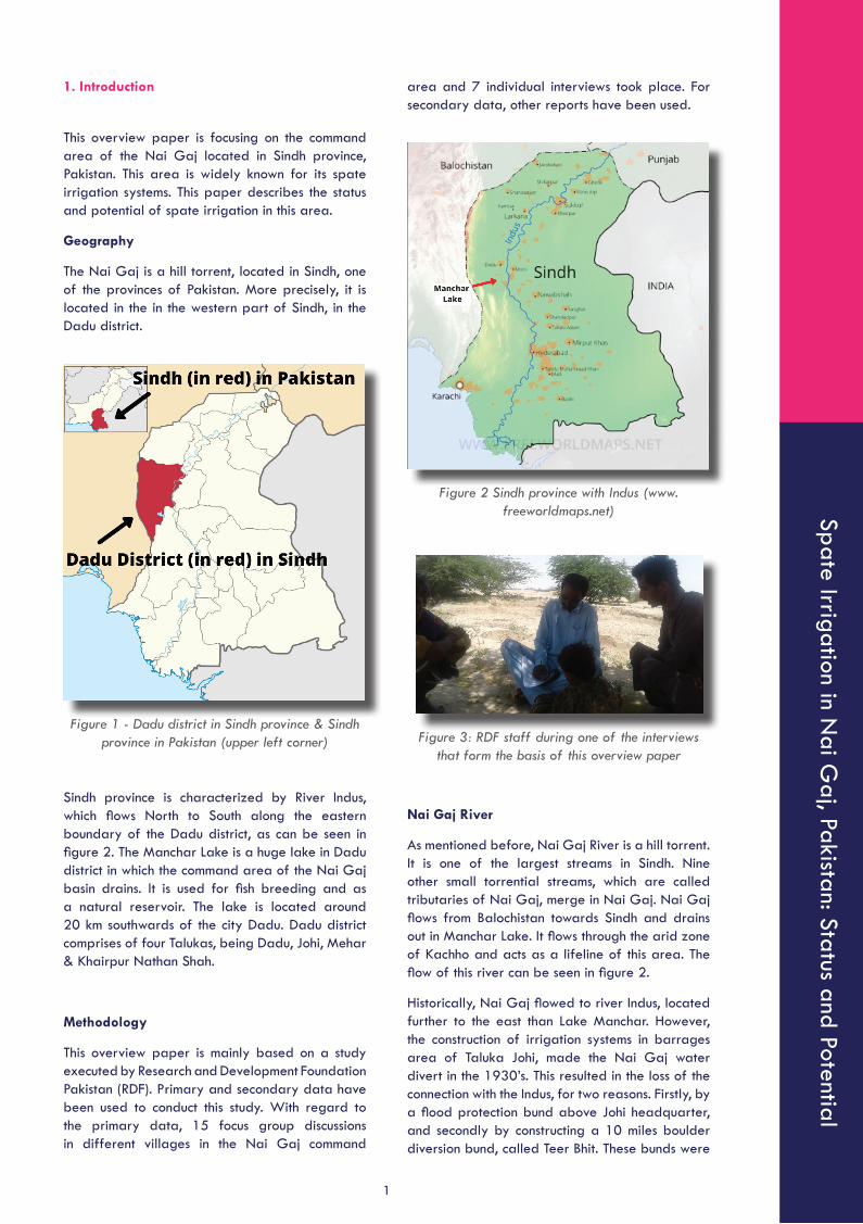
The Nai Gaj is a hill torrent, located in Sindh, one of the provinces of Pakistan. More precisely, it is located in the in the western part of Sindh, in the Dadu district.
Figure 1 - Dadu district in Sindh province & Sindh province in Pakistan (upper left corner)
Sindh province is characterized by River Indus, which flows North to South along the eastern boundary of the Dadu district, as can be seen in figure 2. The Manchar Lake is a huge lake in Dadu district in which the command area of the Nai Gaj basin drains. It is used for fish breeding and as a natural reservoir. The lake is located around 20 km southwards of the city Dadu. Dadu district comprises of four Talukas, being Dadu, Johi, Mehar & Khairpur Nathan Shah.
Methodology
This overview paper is mainly based on a study executed by Research and Development Foundation Pakistan (RDF). Primary and secondary data have been used to conduct this study. With regard to the primary data, 15 focus group discussions in different villages in the Nai Gaj command
area and 7 individual interviews took place. For secondary data, other reports have been used.
Figure 2 Sindh province with Indus (www.freeworldmaps.net)
Figure 3: RDF staff during one of the interviews that form the basis of this overview paper
Nai Gaj River
As mentioned before, Nai Gaj River is a hill torrent. It is one of the largest streams in Sindh. Nine other small torrential streams, which are called tributaries of Nai Gaj, merge in Nai Gaj. Nai Gaj flows from Balochistan towards Sindh and drains out in Manchar Lake. It flows through the arid zone of Kachho and acts as a lifeline of this area. The flow of this river can be seen in figure 2.
Historically, Nai Gaj flowed to river Indus, located further to the east than Lake Manchar. However, the construction of irrigation systems in barrages area of Taluka Johi, made the Nai Gaj water divert in the 1930’s. This resulted in the loss of the connection with the Indus, for two reasons. Firstly, by a flood protection bund above Johi headquarter, and secondly by constructing a 10 miles boulder diversion bund, called Teer Bhit. These bunds were
Ove
rvie
w p
ap
er
#1
8
2
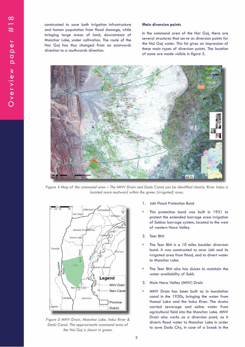
Main diversion points
In the command area of the Nai Gaj, there are several structures that serve as diversion points for the Nai Gaj water. This list gives an impression of these main types of diversion points. The location of some are made visible in figure 5.
constructed to save both irrigation infrastructure and human population from flood damage, while bringing large areas of land, downstream of Manchar Lake, under cultivation. The route of the Nai Gaj has thus changed from an eastwards direction to a southwards direction.
Figure 4 Map of the command area – The MNV Drain and Dadu Canal can be identified clearly. River Indus is located more eastward within the green (irrigated) area.
Figure 5 MNV Drain, Manchar Lake, Indus River & Dadu Canal. The approximate command area of
the Nai Gaj is shown in green.
1. Johi Flood Protection Bund
• This protection bund was built in 1931 to protect the extended barrage area irrigation of Sukkar barrage system, located to the west of western Nara Valley.
2. Teer Bhit
• The Teer Bhit is a 10 miles boulder diversion bund. It was constructed to save Johi and its irrigated area from flood, and to divert water to Manchar Lake.
• The Teer Bhit also has sluices to maintain the water availability of Sukh.
3. Main Nara Valley (MNV) Drain
• MNV Drain has been built as in inundation canal in the 1930s, bringing the water from Hamal Laka and the Indus River. The drains carried sewerage and saline water from agricultural field into the Manchar Lake. MNV Drain also works as a diversion point, as it diverts flood water to Manchar Lake in order to save Dadu City, in case of a break in the
Spate Irrigation in Nai G
aj, Pakistan: Status and Potential
3
Teer Bith and/or the flood protection bund. During the very heavy floods in 1995, the MNV Drain ultimately could not withstand the high volume and force of the floodwater.
4. Spurs at Drigh Balla Village point
• There are small stone pitched spurs to divert the water and guide it to the Wahs.
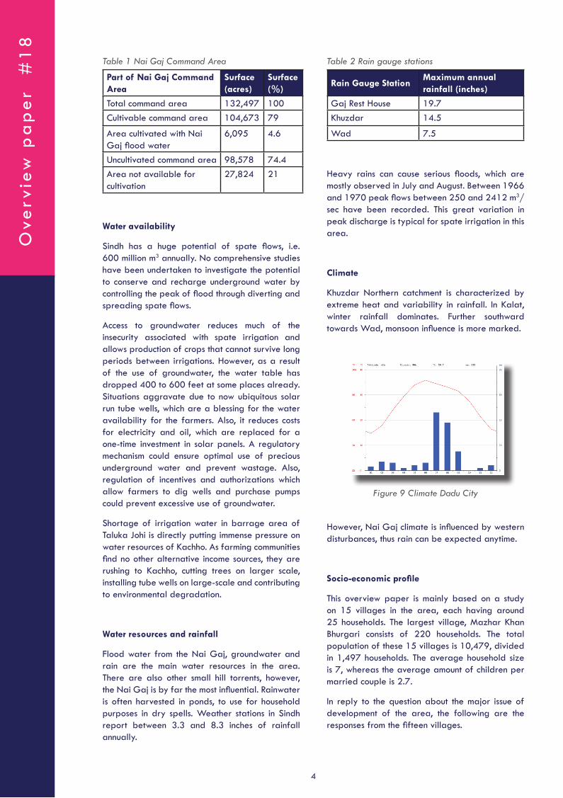
5. Diversion spurs
• Stone pitched spurs to divert water and guide it to Wahs.
Figure 6 Diversion spur
6. Temporary diversion points or Chhab
• These partial diversion bunds are made to divert enough water to the Wahs.
7. Wakra
• Wakra are earthen bunds diverting spate flow from a secondary canal to a field.
• Water from Gandhas is diverted to the fields via Wakra.
8. Wahs
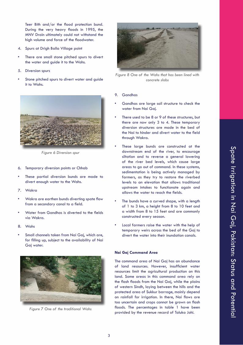
• Small channels taken from Nai Gaj, which are, for filling up, subject to the availability of Nai Gaj water.
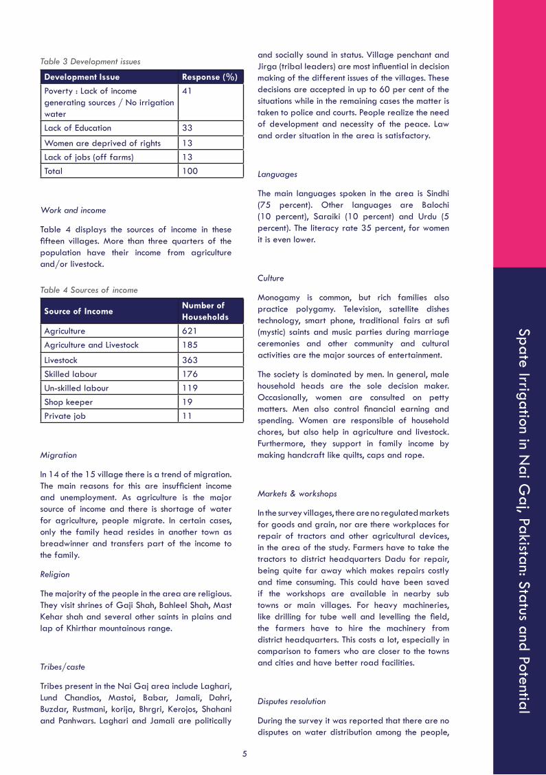
Figure 7 One of the traditional Wahs
Figure 8 One of the Wahs that has been lined with concrete slabs
9. Gandhas
• Gandhas are large soil structure to check the water from Nai Gaj.
• There used to be 8 or 9 of these structures, but there are now only 3 to 4. These temporary diversion structures are made in the bed of the Nai to hinder and divert water to the field through Wakra.
• These large bunds are constructed at the downstream end of the river, to encourage siltation and to reverse a general lowering of the river bed levels, which cause large areas to go out of command. In these systems, sedimentation is being actively managed by farmers, as they try to restore the riverbed levels to an elevation that allows traditional upstream intakes to functionate again and allows the water to reach the fields.
• The bunds have a curved shape, with a length of 1 to 3 km, a height from 8 to 10 feet and a width from 8 to 15 feet and are commonly constructed every season.
• Local farmers raise the water with the help of temporary weirs across the bed of the Gaj to divert the water into their inundation canals.
Nai Gaj Command Area
The command area of Nai Gaj has an abundance of land resources. However, insufficient water resources limit the agricultural production on this land. Some areas in this command area rely on the flash floods from the Nai Gaj, while the plains of western Sindh, laying between the hills and the protected area of Sukkur barrage, mainly depend on rainfall for irrigation. In there, Nai flows are too uncertain and crops cannot be grown on flash floods. The percentages in table 1 have been provided by the revenue record of Taluka Johi.
Ove
rvie
w p
ap
er
#1
8
4
Table 1 Nai Gaj Command Area
Part of Nai Gaj Command Area
Surface (acres)
Surface (%)
Total command area 132,497 100Cultivable command area 104,673 79
Area cultivated with Nai Gaj flood water
6,095 4.6
Uncultivated command area 98,578 74.4Area not available for cultivation
27,824 21
Water availability
Sindh has a huge potential of spate flows, i.e. 600 million m3 annually. No comprehensive studies have been undertaken to investigate the potential to conserve and recharge underground water by controlling the peak of flood through diverting and spreading spate flows.
Access to groundwater reduces much of the insecurity associated with spate irrigation and allows production of crops that cannot survive long periods between irrigations. However, as a result of the use of groundwater, the water table has dropped 400 to 600 feet at some places already. Situations aggravate due to now ubiquitous solar run tube wells, which are a blessing for the water availability for the farmers. Also, it reduces costs for electricity and oil, which are replaced for a one-time investment in solar panels. A regulatory mechanism could ensure optimal use of precious underground water and prevent wastage. Also, regulation of incentives and authorizations which allow farmers to dig wells and purchase pumps could prevent excessive use of groundwater.
Shortage of irrigation water in barrage area of Taluka Johi is directly putting immense pressure on water resources of Kachho. As farming communities find no other alternative income sources, they are rushing to Kachho, cutting trees on larger scale, installing tube wells on large-scale and contributing to environmental degradation.
Water resources and rainfall
Flood water from the Nai Gaj, groundwater and rain are the main water resources in the area. There are also other small hill torrents, however, the Nai Gaj is by far the most influential. Rainwater is often harvested in ponds, to use for household purposes in dry spells. Weather stations in Sindh report between 3.3 and 8.3 inches of rainfall annually.
Table 2 Rain gauge stations
Rain Gauge StationMaximum annual rainfall (inches)
Gaj Rest House 19.7 Khuzdar 14.5
Wad 7.5
Heavy rains can cause serious floods, which are mostly observed in July and August. Between 1966 and 1970 peak flows between 250 and 2412 m3/sec have been recorded. This great variation in peak discharge is typical for spate irrigation in this area.
Climate
Khuzdar Northern catchment is characterized by extreme heat and variability in rainfall. In Kalat, winter rainfall dominates. Further southward towards Wad, monsoon influence is more marked.
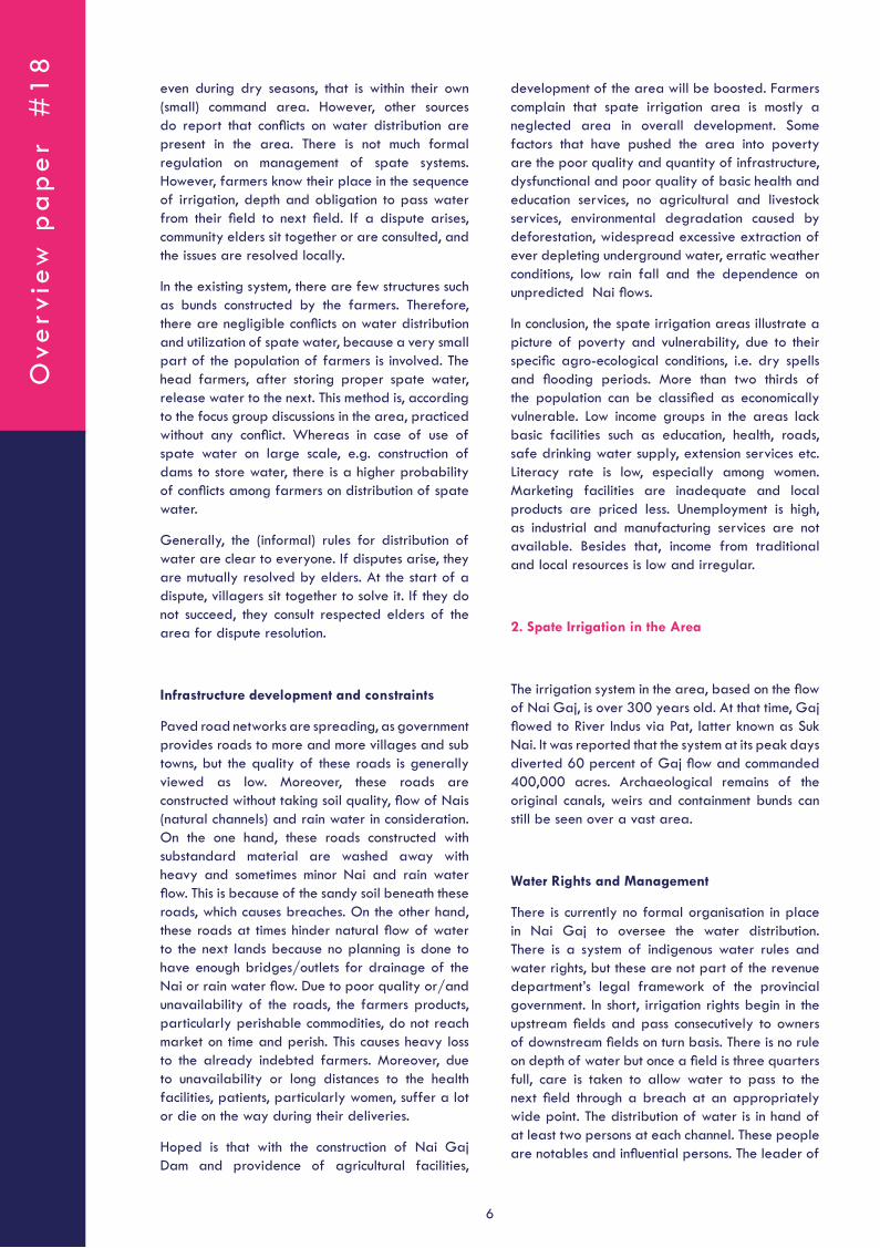
Figure 9 Climate Dadu City
However, Nai Gaj climate is influenced by western disturbances, thus rain can be expected anytime.
Socio-economic profile
This overview paper is mainly based on a study on 15 villages in the area, each having around 25 households. The largest village, Mazhar Khan Bhurgari consists of 220 households. The total population of these 15 villages is 10,479, divided in 1,497 households. The average household size is 7, whereas the average amount of children per married couple is 2.7.
In reply to the question about the major issue of development of the area, the following are the responses from the fifteen villages.
Spate Irrigation in Nai G
aj, Pakistan: Status and Potential
5
Table 3 Development issues
Development Issue Response (%)
Poverty : Lack of income generating sources / No irrigation water
41
Lack of Education 33
Women are deprived of rights 13Lack of jobs (off farms) 13Total 100
Work and income
Table 4 displays the sources of income in these fifteen villages. More than three quarters of the population have their income from agriculture and/or livestock.
Table 4 Sources of income
Source of IncomeNumber of Households
Agriculture 621Agriculture and Livestock 185
Livestock 363Skilled labour 176Un-skilled labour 119Shop keeper 19Private job 11
Migration
In 14 of the 15 village there is a trend of migration. The main reasons for this are insufficient income and unemployment. As agriculture is the major source of income and there is shortage of water for agriculture, people migrate. In certain cases, only the family head resides in another town as breadwinner and transfers part of the income to the family.
Religion
The majority of the people in the area are religious. They visit shrines of Gaji Shah, Bahleel Shah, Mast Kehar shah and several other saints in plains and lap of Khirthar mountainous range.
Tribes/caste
Tribes present in the Nai Gaj area include Laghari, Lund Chandios, Mastoi, Babar, Jamali, Dahri, Buzdar, Rustmani, korija, Bhrgri, Kerojos, Shahani and Panhwars. Laghari and Jamali are politically
and socially sound in status. Village penchant and Jirga (tribal leaders) are most influential in decision making of the different issues of the villages. These decisions are accepted in up to 60 per cent of the situations while in the remaining cases the matter is taken to police and courts. People realize the need of development and necessity of the peace. Law and order situation in the area is satisfactory.
Languages
The main languages spoken in the area is Sindhi (75 percent). Other languages are Balochi (10 percent), Saraiki (10 percent) and Urdu (5 percent). The literacy rate 35 percent, for women it is even lower.
Culture
Monogamy is common, but rich families also practice polygamy. Television, satellite dishes technology, smart phone, traditional fairs at sufi (mystic) saints and music parties during marriage ceremonies and other community and cultural activities are the major sources of entertainment.
The society is dominated by men. In general, male household heads are the sole decision maker. Occasionally, women are consulted on petty matters. Men also control financial earning and spending. Women are responsible of household chores, but also help in agriculture and livestock. Furthermore, they support in family income by making handcraft like quilts, caps and rope.
Markets & workshops
In the survey villages, there are no regulated markets for goods and grain, nor are there workplaces for repair of tractors and other agricultural devices, in the area of the study. Farmers have to take the tractors to district headquarters Dadu for repair, being quite far away which makes repairs costly and time consuming. This could have been saved if the workshops are available in nearby sub towns or main villages. For heavy machineries, like drilling for tube well and levelling the field, the farmers have to hire the machinery from district headquarters. This costs a lot, especially in comparison to famers who are closer to the towns and cities and have better road facilities.
Disputes resolution
During the survey it was reported that there are no disputes on water distribution among the people,
Ove
rvie
w p
ap
er
#1
8
6
even during dry seasons, that is within their own (small) command area. However, other sources do report that conflicts on water distribution are present in the area. There is not much formal regulation on management of spate systems. However, farmers know their place in the sequence of irrigation, depth and obligation to pass water from their field to next field. If a dispute arises, community elders sit together or are consulted, and the issues are resolved locally.
In the existing system, there are few structures such as bunds constructed by the farmers. Therefore, there are negligible conflicts on water distribution and utilization of spate water, because a very small part of the population of farmers is involved. The head farmers, after storing proper spate water, release water to the next. This method is, according to the focus group discussions in the area, practiced without any conflict. Whereas in case of use of spate water on large scale, e.g. construction of dams to store water, there is a higher probability of conflicts among farmers on distribution of spate water.
Generally, the (informal) rules for distribution of water are clear to everyone. If disputes arise, they are mutually resolved by elders. At the start of a dispute, villagers sit together to solve it. If they do not succeed, they consult respected elders of the area for dispute resolution.
Infrastructure development and constraints
Paved road networks are spreading, as government provides roads to more and more villages and sub towns, but the quality of these roads is generally viewed as low. Moreover, these roads are constructed without taking soil quality, flow of Nais (natural channels) and rain water in consideration. On the one hand, these roads constructed with substandard material are washed away with heavy and sometimes minor Nai and rain water flow. This is because of the sandy soil beneath these roads, which causes breaches. On the other hand, these roads at times hinder natural flow of water to the next lands because no planning is done to have enough bridges/outlets for drainage of the Nai or rain water flow. Due to poor quality or/and unavailability of the roads, the farmers products, particularly perishable commodities, do not reach market on time and perish. This causes heavy loss to the already indebted farmers. Moreover, due to unavailability or long distances to the health facilities, patients, particularly women, suffer a lot or die on the way during their deliveries.
Hoped is that with the construction of Nai Gaj Dam and providence of agricultural facilities,
development of the area will be boosted. Farmers complain that spate irrigation area is mostly a neglected area in overall development. Some factors that have pushed the area into poverty are the poor quality and quantity of infrastructure, dysfunctional and poor quality of basic health and education services, no agricultural and livestock services, environmental degradation caused by deforestation, widespread excessive extraction of ever depleting underground water, erratic weather conditions, low rain fall and the dependence on unpredicted Nai flows.
In conclusion, the spate irrigation areas illustrate a picture of poverty and vulnerability, due to their specific agro-ecological conditions, i.e. dry spells and flooding periods. More than two thirds of the population can be classified as economically vulnerable. Low income groups in the areas lack basic facilities such as education, health, roads, safe drinking water supply, extension services etc. Literacy rate is low, especially among women. Marketing facilities are inadequate and local products are priced less. Unemployment is high, as industrial and manufacturing services are not available. Besides that, income from traditional and local resources is low and irregular.
2. Spate Irrigation in the Area
The irrigation system in the area, based on the flow of Nai Gaj, is over 300 years old. At that time, Gaj flowed to River Indus via Pat, latter known as Suk Nai. It was reported that the system at its peak days diverted 60 percent of Gaj flow and commanded 400,000 acres. Archaeological remains of the original canals, weirs and containment bunds can still be seen over a vast area.
Water Rights and Management
There is currently no formal organisation in place in Nai Gaj to oversee the water distribution. There is a system of indigenous water rules and water rights, but these are not part of the revenue department’s legal framework of the provincial government. In short, irrigation rights begin in the upstream fields and pass consecutively to owners of downstream fields on turn basis. There is no rule on depth of water but once a field is three quarters full, care is taken to allow water to pass to the next field through a breach at an appropriately wide point. The distribution of water is in hand of at least two persons at each channel. These people are notables and influential persons. The leader of
Spate Irrigation in Nai G
aj, Pakistan: Status and Potential
7
the embankment develops together with Kamdaar (his assistant) the water distribution schedule. The Kamdaar controls the distribution of water by making embarkments in the channel which divert the water.
In water distribution and water management priority is thus given to those people whose lands are at the head of the channels. Much of the distribution of water is characterized by power play with those situated upstream and those with more clout and access to earth moving equipment utilizing these assets to have a larger control over the spate flows.
Sometimes farmers at the next field or tail end farmers request the caretaker to release water earlier. The caretaker then decides if water is released through breach of Gandha even if upper lands water needs or not fully met.
Besides that, there are farmers with and without water rights. Landowners without water rights purchased the land without these rights or sold their share of water but kept their land. These farmers rely on water from rains or heavy floods, when there is also enough water to irrigate their lands.
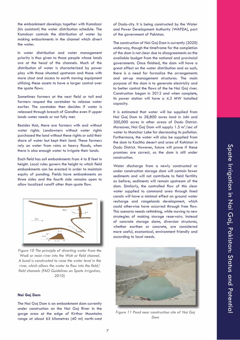
Each field has soil embankments from 4 to 8 feet in height. Local rules govern the height to which field embankments can be erected in order to maintain equity of ponding. Fields have embankments on three sides and the fourth side remains open to allow localized runoff other than spate flow.
Figure 10 The principle of diverting water from the Wadi or main river into the Wah or field channel. A bund is constructed to raise the water level in the river, which allows the water to flow into the field/field channels (FAO Guidelines on Spate Irrigation,
2010)
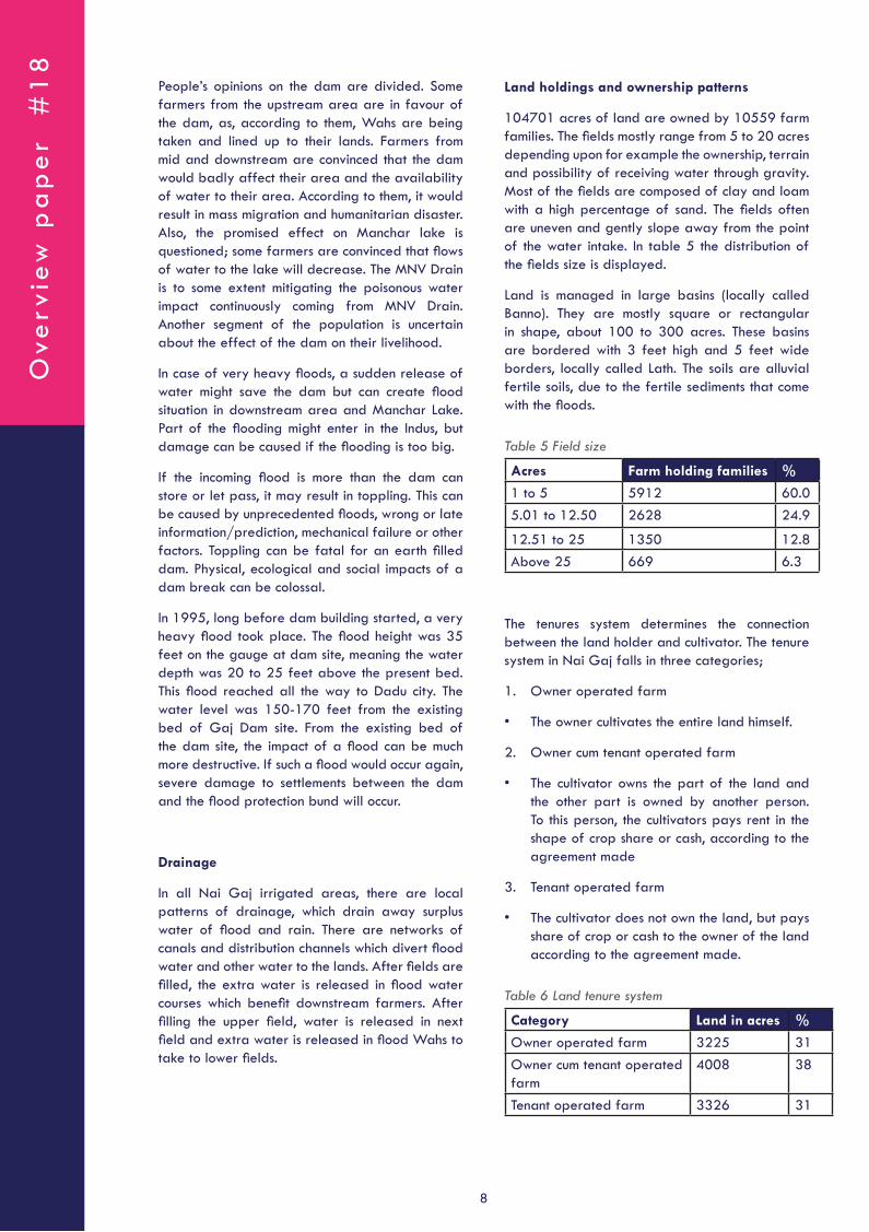
Nai Gaj Dam
The Nai Gaj Dam is an embankment dam currently under construction on the Nai Gaj River in the gorge area at the edge of Kirthar Mountains range at about 65 kilometres (40 mi) north-west
of Dadu-city. It is being constructed by the Water and Power Development Authority (WAPDA), part of the government of Pakistan.
The construction of Nai Gaj Dam is currently (2020) underway, though the timeframe for the completion of the dam is not clear due to disagreements on the available budget from the national and provincial governments. Once finished, the dam will have a great effect on the water distribution and as such, there is a need for formalize the arrangements and set-up management structures. The main purpose of the dam is to generate electricity and to better control the flows of the he Nai Gaj river. Construction began in 2012 and when complete, its power station will have a 4.2 MW installed capacity.
It is estimated that water will be supplied from Nai Gaj Dam to 28,800 acres land in Johi and 300,000 acres in other areas of Dadu District. Moreover, Nai Gaj Dam will supply 1.5 m3/sec of water to Manchar Lake for decreasing its pollution. Furthermore, the water will also be supplied from the dam to Kachho desert and area of Kohistan in Dadu District. However, future will prove if these promises are correct, as the dam is still under construction.
Water discharge from a newly constructed or under construction storage dam will contain fewer sediments and will not contribute to field fertility as before; sediments will remain upstream of the dam. Similarly, the controlled flow of this clear water supplied to command area through lined canals will have a minimal effect on ground water recharge and rangelands development, which could otherwise have occurred through free flow. This scenario needs rethinking, while moving to new strategies of making storage reservoirs. Instead of concrete storage dams, diversion structures, whether earthen or concrete, are considered more useful, economical, environment friendly and according to local needs.
Figure 11 Pond near construction site of Nai Gaj Dam
Ove
rvie
w p
ap
er
#1
8
8
People’s opinions on the dam are divided. Some farmers from the upstream area are in favour of the dam, as, according to them, Wahs are being taken and lined up to their lands. Farmers from mid and downstream are convinced that the dam would badly affect their area and the availability of water to their area. According to them, it would result in mass migration and humanitarian disaster. Also, the promised effect on Manchar lake is questioned; some farmers are convinced that flows of water to the lake will decrease. The MNV Drain is to some extent mitigating the poisonous water impact continuously coming from MNV Drain. Another segment of the population is uncertain about the effect of the dam on their livelihood.
In case of very heavy floods, a sudden release of water might save the dam but can create flood situation in downstream area and Manchar Lake. Part of the flooding might enter in the Indus, but damage can be caused if the flooding is too big.
If the incoming flood is more than the dam can store or let pass, it may result in toppling. This can be caused by unprecedented floods, wrong or late information/prediction, mechanical failure or other factors. Toppling can be fatal for an earth filled dam. Physical, ecological and social impacts of a dam break can be colossal.
In 1995, long before dam building started, a very heavy flood took place. The flood height was 35 feet on the gauge at dam site, meaning the water depth was 20 to 25 feet above the present bed. This flood reached all the way to Dadu city. The water level was 150-170 feet from the existing bed of Gaj Dam site. From the existing bed of the dam site, the impact of a flood can be much more destructive. If such a flood would occur again, severe damage to settlements between the dam and the flood protection bund will occur.
Drainage
In all Nai Gaj irrigated areas, there are local patterns of drainage, which drain away surplus water of flood and rain. There are networks of canals and distribution channels which divert flood water and other water to the lands. After fields are filled, the extra water is released in flood water courses which benefit downstream farmers. After filling the upper field, water is released in next field and extra water is released in flood Wahs to take to lower fields.
Land holdings and ownership patterns
104701 acres of land are owned by 10559 farm families. The fields mostly range from 5 to 20 acres depending upon for example the ownership, terrain and possibility of receiving water through gravity. Most of the fields are composed of clay and loam with a high percentage of sand. The fields often are uneven and gently slope away from the point of the water intake. In table 5 the distribution of the fields size is displayed.
Land is managed in large basins (locally called Banno). They are mostly square or rectangular in shape, about 100 to 300 acres. These basins are bordered with 3 feet high and 5 feet wide borders, locally called Lath. The soils are alluvial fertile soils, due to the fertile sediments that come with the floods.
Table 5 Field size
Acres Farm holding families %
1 to 5 5912 60.05.01 to 12.50 2628 24.9
12.51 to 25 1350 12.8Above 25 669 6.3
The tenures system determines the connection between the land holder and cultivator. The tenure system in Nai Gaj falls in three categories;
1. Owner operated farm
• The owner cultivates the entire land himself.
2. Owner cum tenant operated farm
• The cultivator owns the part of the land and the other part is owned by another person. To this person, the cultivators pays rent in the shape of crop share or cash, according to the agreement made
3. Tenant operated farm
• The cultivator does not own the land, but pays share of crop or cash to the owner of the land according to the agreement made.
Table 6 Land tenure system
Category Land in acres %
Owner operated farm 3225 31 Owner cum tenant operated farm
4008 38
Tenant operated farm 3326 31
Spate Irrigation in Nai G
aj, Pakistan: Status and Potential
9
Local methods of water management and distribution
Locally irrigation regulation is based on bulk distribution (Warabandi) system. This is followed by the construction of comparatively small check structures (Wakra) at the downstream of branch channel to divert the flow of the main channel. After irrigating the command area of the first channel, the Wakra is artificially breached by landowners having land along the second channel. In this way, all the secondary channels get water one by one. When water level is not enough to irrigate gravitationally, the water is lifted through lift pumps. About 35- 40 lift pumps are continuously lifting water for irrigating adjacent lands at the upstream of earthen check structure at Sole Nai. These pumps are used by people who can afford them and who had contributed in the construction of earthen check structure.
A caretaker calls upon the representatives from different villages and representatives of the village collect donation from the landowners. Small landowners donate small amount and big landowner donates according to the size of his landholdings. On average, PKR 25000 to 50000 (USD 161 – 322) are collected by representative of the village from the landowner and deposited to the caretakers and on average PKR 200000 to 500000 (USD 1290 to 3225) are donated by the whole village for constructing Gandhas. The Wakra are also constructed and/or repaired in the same pattern. As mentioned before, the purpose of the Gandhas is to check water and the purpose of the Wakra is the distribution of water among the landowners/farmers.
In this area, farmers oversee the diversion of water and hill torrents flash flows on their own. Whereas in other provinces, (government) officials are appointed to look after the hill torrents.
The common practice is that breaches in the first field remain open, allowing water to continuously flow to all fields downstream until water reaches the last field or the flow ceases. Supervision is required to manage these flows, until the water recedes, in order to prevent an unintentional breach by a rival or by natural hazards.
If one single canal cannot handle water appropriately, then two branches can be built by mutual understanding with agreed criteria.
In the past, Persian wheels were used to lift water when water from Nai Gaj. Nowadays, tube wells and lift machines are used to take water, mainly from Suk Nai, an outlet of Nai Gaj and particularly on upper and right bank of Nai Gaj fields or from groundwater sources.
In some villages, tube wells and dug wells are established. After irrigation, the crops are sown.
Water management is different for different crops. This is the case for fodder, vegetables and orchards. In general, flood method is used but for vegetables and orchards, furrow irrigation is recommended for judicial or efficient use of the water. To make optimal use of irrigation water, the field should be precisely levelled in case of flood irrigation and furrow should be kept clean in case of furrow irrigation. Excessive or too little irrigation reduces yield; therefore, water should be utilized in optimal quantity.
There are four methods which are commonly known for distributing water at field level in spate irrigation. These methods are grouped into two practices:
• Practices in command area water distribution: field-to-field distribution or individual field distribution;
• Sizing of command area: extensive distribution or intensive distribution.
Field-to-field distribution
With this method, water is diverted to a group of bunded fields. As soon as enough water is applied to the first field, the operator cuts the downstream field bund. This is repeated until all fields are irrigated. This method of distribution is common in the Nai Gaj command area.
Individual inlets
With individual inlets from secondary or tertiary canals, farmer have more control on irrigation. Single fields can be watered as desired, but more construction and land use for canal is necessary. In practice, each farmer/land owner takes its responsibility to help the other farmers to construct a pond type storage structure or earthen bunds, in case if the whole water stored in the structure which is subjected to be utilized by more than two farmers. This help could be in the shape of sharing the construction costs or by providing labour force or machinery.
Extensive distribution & Intensive distribution
Whereas in extensive systems a single irrigation is common, fields may be irrigated twice or three times before cultivation when floods are concentrated on a small area. Local crop varieties
Ove
rvie
w p
ap
er
#1
8
10
are well adjusted to soil moisture stress, but even so, there is evidence that for the sorghum crop in Yemen sorghum and maize crops in Eritrea, the yield produced from two or three irrigations would be more than two or three times the yield from a larger area irrigated once.
Distribution of responsibilities
The caretaker distributes the responsibilities, like arranging tractors, supplying food and drinks, to drivers and other workers. Others are given responsibility of patrolling the bunds and patrolling or vigilant persons take turns to report any leakage in the bund which can immediately be plugged by standby machinery. Furthermore, responsibilities for collecting donations and arranging repair.
Water Tax System, Operation & Maintenance
There is no formal water tax system, as it is waived by authorities since 1970. At present, notable landlord of the area and his assistant (kamdar) collect the charge of water use as per ownership of land, from each farmer who receives water. That landlords and their Kamdars carry out repairs of critical points of embankments by hiring labours and tractors.
Drinking water
For drinking water, Johi town is getting water supply from village Bazmal Khoso point from Kachho. In other parts of the area people depend on hand pumps etc. for drinking water. In Kachho, particularly women and children walk 5 to 6 KM to fetch water.
Also, water in ponds is used by both livestock and households, also as a source of drinking water. These ponds are filled by the floods. In dry periods, the water level drops due to usage and evaporation.
3. Agricultural practices
As the economy of Pakistan is growing, there is a large demand for a range of crops that are uniquely produced in the spate irrigated areas. Whereas the Indus based perennial irrigation system produces massive quantities of rice, wheat and cotton, besides fruits and vegetables as niche crops, the spate irrigated areas have a unique position in growing oil seeds (sunflower, castor,
mustard, rapeseed), sorghum (for poultry feeding) and leguminous crops (chickpeas, lentils but also guar).
Crops
The main agricultural crops in the spate irrigated areas in Nai Gaj are wheat, sorghum, barley, oil seed crops, sorghum, and vegetables. There is considerable variety of minor crops of different types such as sesame, coriander, guar bean, mung beans and other legumes besides some vegetables too. Local farmers also sow organic vegetables – both for self-consumption and market. There are also wild and semi-wild varieties of vegetables grown in spate areas. Mung, moth, sesame and coriander are minor crops.
In general, crops grown in spate systems can handle a single pre-planting irrigation while becoming mature on limited soil moisture. Any rainfall during cropping season is a bonus.
Only those crops which are moisture stress resistant like sorghum, millets etc. are grown during kharif (winter season), while wheat is grown during rabi (summer season), depending on quantity and frequency of the rainfall in Nai Gaj catchment area. The majority of the farmers places emphasis on sorghum as it provides food for humans and fodder for animals. The crop pattern indicates that, although area under crop is meagre, farmers are eager to respond to the agriculture development and are cultivating all sorts of rainfed crops. Annual cropping intensity is only 58 percent with Kharif/Rabi ratio of 1:1.62. Cropping intensity is higher in Rabi than Kharif as more rain falls in winter. However, due to introduction and installation of wide spread tube wells on electricity, oil and solar, all kinds of crops, including onion, chilies, wheat, and sometimes even rice are now grown.
The majority of the farmers use a sickle for harvesting, while in some cases a tractor is used.
All adult household members are engaged in harvesting job, including women, who additionally cook and provide food at field, during harvesting.
Crop production, income and loss
Yield of almost all crops is below the potential due to water scarcity. Besides the water scarcity the use of conventional methods of farming and use of unimproved and low-quality seed are other main causes of low yield. Use of fertilizer is considered risky, due to the cost and because of unreliability of sustainable irrigation water and uncertainty of rain water. Statistics on land use show that there
Spate Irrigation in Nai G
aj, Pakistan: Status and Potential
11
is acute shortage of irrigation water due to which large fallows and waste are common.
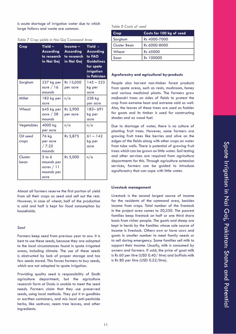
Table 7 Crop yields in Nai Gaj Command Area
Crop Yield – According to research in Nai Gaj
Income – According to research in Nai Gaj
Yield - According to FAO Guidelines for spate irrigation in Pakistan
Sorghum 227 kg per acre / 16 mounds
Rs 13,050 per acre
145 – 223 kg per acre
Millet 182 kg per acre
n/a 228 kg per acre
Wheat 645 kg per acre / 28 mounds
Rs 2,900 per acre
182– 691 kg per acre
Vegetables 4000 kg per acre
n/a n/a
Oil seed crops
76 kg per acre / 7.25 mounds
Rs 5,875 61 – 142 kg per acre
Cluster bean
5 to 6 mounds per acres / 11 mounds per acre
Rs 5,000 n/a
Almost all farmers reserve the first portion of yield from all their crops as seed and sell out the rest. However, in case of wheat, half of the production is sold and half is kept for food consumption by households.
Seed
Farmers keep seed from previous year to sow. It is best to use these seeds, because they are adapted to the local circumstances found in spate irrigated areas, including climate. The use of these seeds is obstructed by lack of proper storage and too few seeds stored. This forces farmers to buy seeds, which are not adapted to spate irrigation.
Providing quality seed is responsibility of Sindh agriculture department, but the agriculture research farm at Dadu is unable to meet the seed needs. Farmers claim that they use preserved seeds, using local methods. They put it in gundhies or earthen containers, and mix local anti-pesticide herbs, like sanhwar, neem tree leaves, and other ingredients.
Table 8 Costs of seed
Crop Costs for 100 kg of seed
Sorghum Rs 4000-7000Cluster Bean Rs 6000-8000
Wheat Rs 45000Saon Rs 100000
Agroforestry and agricultural by-products
People also harvest non-timber forest products from spate areas, such as resin, mushroom, honey and various medicinal plants. The farmers grow majhandri trees on sides of fields to protect the crop from extreme heat and extreme cold as well. Also, the leaves of these trees are used as fodder for goats and its timber is used for constructing shades and as wood fuel.
Due to shortage of water, there is no culture of planting fruit trees. However, some farmers are growing fruit trees like berries and olive on the edges of the fields along with other crops on water from tube wells. There is potential of growing fruit trees which can be grown on little water. Soil testing and other services are required from agriculture departments for this. Through agriculture extension services, farmers can be guided to introduce agroforestry that can cope with little water.
Livestock management
Livestock is the second largest source of income for the residents of the command area, besides income from crops. Total number of the livestock in the project area comes to 50,550. The poorest families keep livestock on half or one third share basis from richer people. The goats and sheep are kept in herds by the families whose sole source of income is livestock. Others own or have cows and goats in smaller number to meet family needs or to sell during emergency. Some families sell milk to support their income. Usually, milk is consumed by owners and farmers. If sold, the price of goat milk is Rs 60 per litre (USD 0.40/ litre) and buffalo milk is Rs 80 per litre (USD 0.52/litre).
Ove
rvie
w p
ap
er
#1
8
12
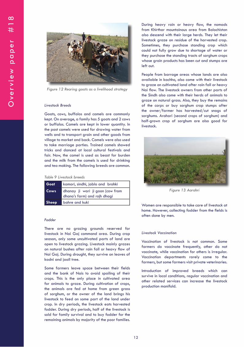
Figure 12 Rearing goats as a livelihood strategy
Livestock Breeds
Goats, cows, buffalos and camels are commonly kept. On average, a family has 5 goats and 2 cows or buffalos. Camels are kept in lower quantity. In the past camels were used for drawing water from wells and to transport grain and other goods from village to market and back. Camels were also used to take marriage parties. Trained camels showed tricks and danced at local cultural festivals and fair. Now, the camel is used as beast for burden and the milk from the camels is used for drinking and tea making. The following breeds are common.
Table 9 Livestock breeds
Goat kamori, sindhi, jablo and brohki
Cows dhanay ji wari ji goon (cow from dhano’s farm) and rojh dhagi
Sheep bahre and kuki
Fodder
There are no grazing grounds reserved for livestock in Nai Gaj command area. During crop season, only some uncultivated parts of land are open to livestock grazing. Livestock mainly grazes on natural bushes after rain fall or heavy flow of Nai Gaj. During drought, they survive on leaves of kadni and jaall tree.
Some farmers leave space between their fields and the bank of Nais to avoid spoiling of their crops. This is the only place in cultivated area for animals to graze. During cultivation of crops, the animals are fed at home from green grass of sorghum, or the owner of the land brings his livestock to feed on some part of the land under crop. In dry periods, the livestock eats harvested fodder. During dry periods, half of the livestock is sold for family survival and to buy fodder for the remaining animals by majority of the poor families.
During heavy rain or heavy flow, the nomads from Khirthar mountainous area from Balochistan also descend with their large herds. They let their livestock graze on residue of the harvested crop. Sometimes, they purchase standing crop which could not fully grow due to shortage of water or they purchase the standing tracts of sorghum crops whose grain products has been cut and stumps are left out.
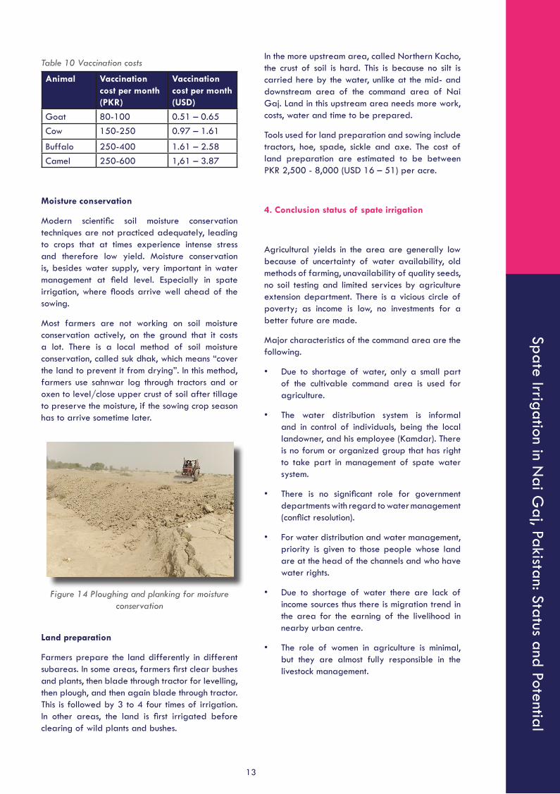
People from barrage areas whose lands are also available in kachho, also come with their livestock to graze on cultivated land after rain fall or heavy Nai flow. The livestock owners from other parts of the Sindh also come with their herds of animals to graze on natural grass. Also, they buy the remains of the corps or buy sorghum crop stumps after the owner/farmer has harvested/cut snags of sorghums. Arahari (second crops of sorghum) and half-grown crop of sorghum are also good for livestock.
Figure 13 Aarahri
Women are responsible to take care of livestock at home. However, collecting fodder from the fields is often done by men.
Livestock Vaccination
Vaccination of livestock is not common. Some farmers do vaccinate frequently, other do not vaccinate, while vaccination for others is irregular. Vaccination departments rarely come to the farmers, but some farmers visit private veterinaries.
Introduction of improved breeds which can survive in local conditions, regular vaccination and other related services can increase the livestock production manifold.
Spate Irrigation in Nai G
aj, Pakistan: Status and Potential
13
In the more upstream area, called Northern Kacho, the crust of soil is hard. This is because no silt is carried here by the water, unlike at the mid- and downstream area of the command area of Nai Gaj. Land in this upstream area needs more work, costs, water and time to be prepared.
Tools used for land preparation and sowing include tractors, hoe, spade, sickle and axe. The cost of land preparation are estimated to be between PKR 2,500 - 8,000 (USD 16 – 51) per acre.
4. Conclusion status of spate irrigation
Agricultural yields in the area are generally low because of uncertainty of water availability, old methods of farming, unavailability of quality seeds, no soil testing and limited services by agriculture extension department. There is a vicious circle of poverty; as income is low, no investments for a better future are made.
Major characteristics of the command area are the following.
• Due to shortage of water, only a small part of the cultivable command area is used for agriculture.
• The water distribution system is informal and in control of individuals, being the local landowner, and his employee (Kamdar). There is no forum or organized group that has right to take part in management of spate water system.
• There is no significant role for government departments with regard to water management (conflict resolution).
• For water distribution and water management, priority is given to those people whose land are at the head of the channels and who have water rights.
• Due to shortage of water there are lack of income sources thus there is migration trend in the area for the earning of the livelihood in nearby urban centre.
• The role of women in agriculture is minimal, but they are almost fully responsible in the livestock management.
Table 10 Vaccination costs
Animal Vaccination cost per month (PKR)
Vaccination cost per month (USD)
Goat 80-100 0.51 – 0.65Cow 150-250 0.97 – 1.61
Buffalo 250-400 1.61 – 2.58Camel 250-600 1,61 – 3.87
Moisture conservation
Modern scientific soil moisture conservation techniques are not practiced adequately, leading to crops that at times experience intense stress and therefore low yield. Moisture conservation is, besides water supply, very important in water management at field level. Especially in spate irrigation, where floods arrive well ahead of the sowing.
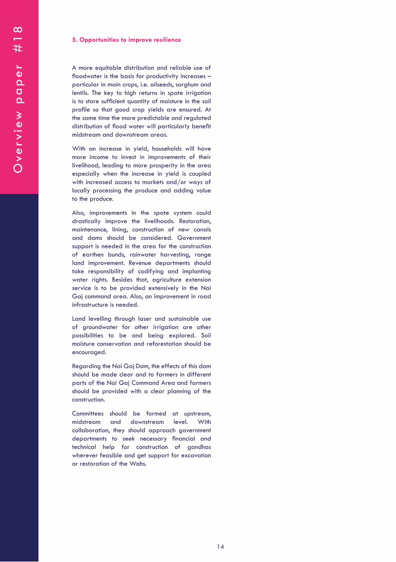
Most farmers are not working on soil moisture conservation actively, on the ground that it costs a lot. There is a local method of soil moisture conservation, called suk dhak, which means “cover the land to prevent it from drying”. In this method, farmers use sahnwar log through tractors and or oxen to level/close upper crust of soil after tillage to preserve the moisture, if the sowing crop season has to arrive sometime later.
Figure 14 Ploughing and planking for moisture conservation
Land preparation
Farmers prepare the land differently in different subareas. In some areas, farmers first clear bushes and plants, then blade through tractor for levelling, then plough, and then again blade through tractor. This is followed by 3 to 4 four times of irrigation. In other areas, the land is first irrigated before clearing of wild plants and bushes.
Ove
rvie
w p
ap
er
#1
8
14
5. Opportunities to improve resilience
A more equitable distribution and reliable use of floodwater is the basis for productivity increases – particular in main crops, i.e. oilseeds, sorghum and lentils. The key to high returns in spate irrigation is to store sufficient quantity of moisture in the soil profile so that good crop yields are ensured. At the same time the more predictable and regulated distribution of flood water will particularly benefit midstream and downstream areas.
With an increase in yield, households will have more income to invest in improvements of their livelihood, leading to more prosperity in the area especially when the increase in yield is coupled with increased access to markets and/or ways of locally processing the produce and adding value to the produce.
Also, improvements in the spate system could drastically improve the livelihoods. Restoration, maintenance, lining, construction of new canals and dams should be considered. Government support is needed in the area for the construction of earthen bunds, rainwater harvesting, range land improvement. Revenue departments should take responsibility of codifying and implanting water rights. Besides that, agriculture extension service is to be provided extensively in the Nai Gaj command area. Also, an improvement in road infrastructure is needed.
Land levelling through laser and sustainable use of groundwater for other irrigation are other possibilities to be and being explored. Soil moisture conservation and reforestation should be encouraged.
Regarding the Nai Gaj Dam, the effects of this dam should be made clear and to farmers in different parts of the Nai Gaj Command Area and farmers should be provided with a clear planning of the construction.
Committees should be formed at upstream, midstream and downstream level. With collaboration, they should approach government departments to seek necessary financial and technical help for construction of gandhas wherever feasible and get support for excavation or restoration of the Wahs.

Spate Irrigation in Nai G
aj, Pakistan: Status and Potential
15
Colophon
This Overview Paper is prepared by Gulsher Panhwer (RDF) and Aftab Ahmed Akhund (RDF). This Overview Paper is reviewed and edited by David Mornout (MetaMeta), Reinier Veldman (MetaMeta) and Madiha al Junaid (MetaMeta).
This overview paper is developed as part of an ongoing RVO project in Pakistan: New water rights for basin management and inclusivity in spate irrigated areas of Pakistan.
The Flood-Based Livelihoods Network supports and promotes appropriate programmes and policies in spate irrigation, exchanges information on the improvement of livelihoods through a range of interventions, assists in educational development and supports in the implementation and start-up of projects in spate irrigation.
For more information and resources on Spate Irrigation and other Flood-Based Farming Systems visit www.spate-irrigation.org or contact us through [email protected].
July 2020
Ove
rvie
w p
ap
er
#1
8
16