SAMOA TECHNICAL REPORT-VOLCANIC EVOLUTION, ORAL TRADITIONS OF VOLCANISM OF WESTERN SAMOA (SW...
33
Final Report UNESCO Office for the Pacific States 12 December 2007 Contract 07/048 SAMOA TECHNICAL REPORT – VOLCANIC EVOLUTION, ORAL TRADITIONS OF VOLCANISM OF WESTERN SAMOA (SW PACIFIC) AND THEIR VOLCANIC HAZARD IMPLICATIONS K. Németh 1 , S. J. Cronin 1 , F. Lolo 2 , M. Leavasa 2 , D. Solomona 3 , F. Nelson 2 1 Volcanic Risk Solutions, Massey University, P.B. 11222, Palmerston North, NZ 2 Ministry of Natural Resources, and Environment, Apia, Upolu, Western Samoa 3 Tufulele Village, Apia, Upolu, Western Samoa [email protected] Apolima Island a morphologically young tuff cone located between Upolu and Savai’i
Transcript of SAMOA TECHNICAL REPORT-VOLCANIC EVOLUTION, ORAL TRADITIONS OF VOLCANISM OF WESTERN SAMOA (SW...

Final Report UNESCO Office for the Pacific States 12 December 2007 Contract 07/048
SAMOA TECHNICAL REPORT – VOLCANIC EVOLUTION, ORAL TRADITIONS OF VOLCANISM OF WESTERN SAMOA (SW PACIFIC) AND THEIR VOLCANIC HAZARD IMPLICATIONS K. Németh1, S. J. Cronin1, F. Lolo2, M. Leavasa2, D. Solomona3, F. Nelson2
1 Volcanic Risk Solutions, Massey University, P.B. 11222, Palmerston North, NZ 2 Ministry of Natural Resources, and Environment, Apia, Upolu, Western Samoa 3 Tufulele Village, Apia, Upolu, Western Samoa [email protected]
Apolima Island a morphologically young tuff cone located between Upolu and Savai’i

CONTENTS EXECUTIVE SUMMARY ............................................................................................................... 3 ACKNOWLEDGEMENTS ...……………………………………………………………………… 4 1 INTRODUCTION ...…………………………………………………………………………… 5 2 PROJECT OBJECTIVES ……………………………………………………………………….. 6 3 METHODS ..………………………………………………………………………………….. 6 4 TASKS COMPLETED …………………………………………………………………………. 8 5 VOLCANIC HAZARD …………………………………………………………………………. 9 6 POTENTIAL YOUNG VOLCANISM IN UPOLU ………………………………………………… 10 6.1 MANONO ………………………………………………………………………… 10 6.2 APOLIMA ………………………………………………………………………… 10 6.3 WESTERN UPOLU ………………………………………………………………… 12 6.4 CENTRAL UPOLU ………………………………………………………………… 13 6.5 EASTERN UPOLU AND OFFSHORE ISLANDS ……………………………………….. 13 7 COLLECTION OF ORAL TRADITION DATA ………………………………………………….. 15 7.1 TARGETED AREAS ……………………………………………………………….. 15 7.2 PERSONAL INTERVIEWS ………………………………………………………….. 16 7.3 COMMUNITY DISCUSSION ………………………………………………………. . 17 8 RESULTS …………………………………………………………………………………… 17 8.1 MANONO ISLAND ………………………………………………………………... 17 8.2 WEST UPOLU …………………………………………………………………….. 20 8.3 EAST UPOLU ……………………………………………………………………... 22 8.4 SAVAI’I …………………………………………………………………………... 22 8.5 LEGEND OF MANONO AND APOLIMA …………………………………………...... 23 8.6 LEGEND ON THE ORIGIN OF THE NAME OF MANONO AND APOLIMA ……………... 24 9 MAPPING EXERCISE ………………………………………………………………………... 25 9.1 RESULTS …………………………………………………………………………. 27 10 INFORMAL DATA COLLECTION …………………………………………………………… 28 10.1 RESULTS ………………………………………………………………………... 29 11 RECOMMENDATIONS FOR FUTURE WORKS ……………………………………………….. 29 12 CONCLUSION ……………………………………………………………………………... 31 13 REFERENCES ……………………………………………………………………………… 32
2

EXECUTIVE SUMMARY Savai’i and Upolu are the western-most and largest islands of the Samoan group and have experienced a long period of volcanism (>2 My). Although Upolu, which was the main target area of this research project, does not have the youngest of the mapped Holocene volcanic rocks, it has several areas mapped as early Holocene in age (> 5 ky) and fresh volcanic landforms/deposits. Direct evidence includes a radiocarbon date of 1915 ± 65 yrs B.P., giving the maximum age of a phreatomagmatic tuff cone offshore of Cape Tapaga, east Upolu. In addition to geological studies, this program working with local communities was started to explore the local Samoan understanding of their natural surroundings and awareness of potential volcanic hazard. This program was jointly financially supported by the UNESCO SW Pacific Office, Apia and the Volcanic Risk Solutions Research Centre of the Instutute of Natural Resources, Massey University, NZ. This summarises the first attempt to collect oral tradition data from Upolu communities concerning distant “volcanic memories”, as well as targeted field work to catergorise young volcanic landforms near to the test communities. This work was intended to expand upon previous volcanic hazard studies on Western Samoa and contribute toward volcanic hazard awareness programs for the Samoan populace. At the same time the program was developed to record and preserve any traditional information held by Samoan communities and promote the conservation and use of this through local hazard education initiatives. An initial attempt to carry out community based workshops to gather information about volcanic knowledge from the local communities was modified on site to accommodate Samoan cultural structures. The adapted research programme focused instead on targeted individuals with a semi-structured interview approach. Village visits of Samoan facilitators targeted high-ranking (titled, elderly) individuals for explanations of local features, including their genesis, use and associated geo-hazards. Areas where young eruptions (<3500 yr BP) were suspected from associated geological observations were targeted for these visits and interviews. In stark contrast to experience with communities worked with in Fiji, Vanuatu or the Solomon Islands, the village communities appear to have very limited knowledge of their volcanic heritage. Youthful volcanic landforms no longer play an important role in modern everyday life and few if any legends are attached to them. Almost all legends related from these areas deal with the origins of Samoans on their islands (overlain by strong Christian teachings), and past disputes/battles and wrongdoings between tribes/neighbours. The only exceptions to this were distal volcanic memories identified in legends from East Upolu, where offshore islands (tuff cones) are associated with violent explosions. During village visits, maps were drawn by individuals and groups highlighting the resources and landscapes important in their life. Without prompting, the majority of the maps were prepared as 3D-oblique view sketches, rather than plan-views, showing little in common to the plan-view hazard maps currently used for the area. In addition, maps were commonly restricted to the strict boundaries of local communities, ignoring major features (such as fresh volcanic cones) that were in the territory of “next door” villages. These perspectives need to be seriously considered in future iterations of hazard maps and hazard education programmes.
3

ACKNOWLEDGEMENTS We wish to thank the many people in the named communities that participated in the discussions and interviews that this report is based on. We also wish to thank Dr Gert Lube of the Institute of Natural Resources, Massey University for reviewing the report. We thank UNESCO Office for the Pacific States (Apia) for funding part of this study (Contract 07/048) and the NZ Foundation for Research Science and Technology for professional time and co funding for SJC and KN through contracts MAUX0401 and MAUX0405).
4

INTRODUCTION
Savai’i and Upolu (Figure 1) are the western-most and largest islands of the Samoan group and have experienced a long period of volcanism (>2 million years) (Kear and Wood, 1959). The volcanism in the Samoan volcanic lineament is inferred to be magmatic plume-driven hotspot related volcanism influenced by the relative plate motion, the position of the Samoan hot spot, and the relative migration of the edge of the Tonga trench (Hart et al., 2000; Hart et al., 2004; Sims and Hart, 2006; Staudigel et al., 2006). Reliable estimation of recurrence intervals between eruptions and hence an accurate assessment of volcanic hazard is hindered by a lack of age data on past events. Recent eruptions occurred on Savai’i in 1905-1911 (Matavanu) (Anderson, 1910), 1902 (Mauga Mu and Mata o le Afi [fire peak]) and 1760 (Maunga Afi [fire mountain]) (Kear and Wood, 1959). Other evidence for repeated volcanic activity on both islands during human occupation includes: fresh tuff/scoria cones such as Tafua Savai’i; possibly as young as 610 ± 60 yrs B.P), as well as another 5 radiocarbon dates of between 700 and 2500 yrs B.P. for individual lava flows and tephra falls in various locations around Savai’i (Cronin et al., 2000). Although Upolu does not have the youngest of the mapped Holocene volcanic rocks, it has several areas mapped as early Holocene in age (> 5 ky) and fresh volcanic landforms/deposits (Kear and Wood, 1959). Direct evidence includes a radiocarbon date of 1915 ± 65 yrs B.P., giving the maximum age of a phreatomagmatic tuff cone offshore of Cape Tapaga, east Upolu (Grant-Taylor and Rafter, 1962).
Figure 1: Western Samoa satellite image showing main areas of known young volcanism. On the basis of the past few years research on volcanism in Samoa and its potential volcanic hazard aspects, (Cronin et al., 2000; Cronin et al., 2006a) in this project further investigation was initiated to identify young volcanic landforms in Western Samoa. Previous works in Western Samoa generally focused on volcanic studies in Savai’i (Morrison, 1991; Hauri and Hart, 1994; Cronin et al., 2000; Keating et al., 2000; Cronin et al., 2006a) simply because of its 2 major historic eruptions. What is commonly overlooked, however, is that volcanic landforms in the main populated Upolu Island also show very young morphological features and in the overall geology of the Samoa chain, there is not natural progression of volcanic ages, young volcanism occurs at both ends of the system (Keating et al., 2000). The only detailed geological map of Western Samoa also marks young volcanic units on Upolu, indicated as being possibly <5000 years old (Kear and Wood, 1959). Recently obtained
5

radiocarbon ages from Savai’i have already suggested a continuum in volcanic activity that island in the past few thousand years, with many signs of a moderately high frequency of eruptions (Cronin et al., 2000). In Upolu, unfortunately only a single radiocarbon date is known, which clearly suggests volcanic eruptions in off shore islands in East Upolu, in Nu’utele in late Holocene time (Grant-Taylor and Rafter, 1962). This age of 1915+/- 65 yrs B.P., is well within the known human occupation of Upolu (3500 yrs BP) (Martinsson-Wallin, 2007).
In this project the main focus was on finding evidence of human knowledge or perception of young volcanism in Upolu. The project used conventional mapping to identify promising sites of young volcanism in Upolu and then attempted to collect evidence of oral traditions the local communities may hold in relation with either distant “volcanic memories” or of other major events that occurred in the village history. A two-week field visit utilized the results of the previous reviews of volcanic hazards information from Western Samoa (Cronin et al., 2006a).
The working hypothesis was that if volcanic eruptions are young enough in Upolu, there must be some traces of oral traditions, artistic views, motives, patterns of dance, or legends known by nearby and local communities. The project did not intend to collect common Polynesian genesis stories and associated legends, but a concentration was made on those relating to past natural occurrences faced by local communities. In general, Polynesian culture is characterised by the use of oral traditions, to maintain origin stories, and cultural histories, which transform over time and through generations into myths or legends (Nunn, 2001; Mageo, 2002a; Mageo, 2002b; Nunn, 2003). This process leads to abstraction and dilution of original details or meanings, particularly when translated through generations that have never experienced the types of processes or events described originally (c.f. Cronin and Cashman, 2007). In this way, it was an initial expectation that if volcanism was active during the period of human occupation, there may be traces of this recorded in cultural history or artistic expression. PROJECT OBJECTIVES
The project had two major objectives, 1) to identify regions, predominantly on Upolu, where geological evidence indicates the occurrence of young volcanic activity, and 2) to record traditional stories of village communities in these areas that may hold information about past volcanic events, and/or identify parts of other social stories maybe relevant to distant volcanic eruptions. Due to the large uncertainty of both the geological knowledge of the volcanic evolution of Upolu as well as the potential existence of any trace of distant “volcanic memories” of the local communities, this project was a simple exploratory investigation. The intention was to investigate the potential for developing a more comprehensive study, involving a stronger anthropology component. Hence, this was very much a pilot project, and this is how its results should be treated. METHOD
Field mapping was carried out to select sites, preferably old, well-established, villages located nearby young volcanic landforms. The Kear and Wood (1959) geological map of Western Samoa was used to pre-select sites. However, due to the general nature of the map, a
6

few days were spent to visit possible key volcanic sites, and to investigate the willingness of nearby village communities to participate in the investigation.
For discussions with local communities, a participatory approach (Chambers, 1994) was originally favoured, using community workshops such as applied during previous Melanesian community investigations in Fiji, Vanuatu (Cronin et al., 2004) and the Solomon Islands. However, during preparations for these, it rapidly became apparent that the social structure of the Samoan society (c.f., Olson, 2002) was quite different to the Melanesian communities previously focussed upon. In addition, methods applied to Vanuatu and the Solomon Islands clearly targeted communities that lived near frequently active or continuously active volcanoes. Hence, in these earlier cases, the urgency of the issues of hazards and expectations of the communities were attuned to the issue of natural hazard related inquiry (especially volcanism). This context was clearly lacking in Samoa, setting up hurdles to progress right from the beginning. Based on a reassessment of the situation with the help of members of the Ministry of Natural Resources and Environment (NDMO) and local community members, the inclusive community-based approach was switched to a semi-structured interview approach with a program of individual interviews. A significant feature of Samoan society and natural context is noted here, in that it impacts on the results of the study. Samoan villages are structured around extended families, where the internal family issues are the strongest daily concerns and the outside world (both social and natural) are largely excluded (Mead, 1961; Lockwood, 1971; Milner, 1972; Shankman, 1972; Fairbair.Ij, 1974; Maring, 1979; Schoeffel, 2007). Typically also, with a greater degree of natural hazard challenge to daily life faced by inhabitants in volcanic areas of Vanuatu or Solomon Islands, the affected villages are more typically attuned to their natural habitat. The revised approach involved personal interviews with high raking chiefs (matais), conducted in village community houses, or matai houses. Elderly matais were targeted as being most likely to hold the greatest breadth of traditional knowledge, and they also typically had the greatest willingness (and available time) to participate in such interviews. Ten simple questions were the basis of the interviews. These started with the gathering of basic information about the village history and where relevant, moved toward a line of inquiry of more direct questions about volcanism and volcanic landforms. Before visiting villages, the questions were well-discussed with the Samoan team members and interpreters to make sure the questions could be accurately translated in Samoan language. It was very important that questions were not leading, nor contained suggestions of expected answers. In cases when the interview subject gave signs that he or she may have been expected to give certain answers, the Samoan interpreters changed the conversation to other non-relevant directions and alternative approaches were tried. Because these interviews were organised in community and chief houses, they were usually accompanied with a traditional welcome ceremony. Unfortunately, in all of these instances, the visits were seen as an opportunity for financial rewards for the hosting community, and demands for funds to cover hosting and ceremonial costs were at times very high. Since this would have rapidly exceeded our budget (within the first day), the number of “official” visits had to be reduced dramatically. In this way, less formal situations for interviews were also sought during field visits to volcanic areas.
During the Upolu field campaign it also became obvious that for a comparison, a side trip to Savai’i was necessary to examine the extent of community memories from the most recent of volcanic events in Samoa (finishing in 1912).
7

TASKS COMPLETED
In the two-week field campaign visits were made to the sites suspected to hold the youngest volcanic histories, including Tafua Upolu, Manono Island, Apolima Island (although high seas hampered landing); Namua and Fanuatapu Islands as well as several locations along the central highlands of Upoulu, including Lake Lanuto’o. In addition a 2 day visit to Savai’i Island allowed time to be spent on Tafua Savai’i as well as on the Matavanu craters and lava fields.
The village visits and oral tradition collections were concentrated in East and West Upolu as well as on Manono Island. Despite local community willingness to cooperate and host the research party on Apolima Island the landing conditions prohibited our visit. For comparison, in Savai’i, the village of Tafua (next to Tafua Savai’i) was visited. The original planed program was the following below. The changes and the realisation of the program are marked in italics: Monday Field survey on west Upolu - completed Tuesday Field survey on west Upolu, Tafua Upolu - completed Wednesday 9.30 – Landing, meeting in Manono - completed 12.30 - Trip to Apolima - completed 13.30 – Landing, meeting in Apolima – failed due to bad wheater 15.00 – Geological survey on Apolima – failed due to bad wheater 17.00 – Trip back to Upolu 18.00 – Trip to Solosolo/overnight in Solosolo - cancelled Thursday 8.00 – Trip to Saleopaga (E Upolu) - completed 9.30 – Meeting in Ulutogia (E Upolu) - completed All day meeting in Ulutogia and potentially in the next villages. Arrangement for boat trip to off shore island(s) – formal meetings were cancelled due to community programs, informal meetings and a field survey was arranged Friday 9.00 – boat trip to Nu’utele, Nu’ulua, Namua - All day geology survey on off shore islands – cancelled due to lack of boats, and therefore postponed to the next week – return to Apia, office work, arrangements for the next week program, and afternoon leaving for Savai’i. 16.00 – return to Solosolo/Apia/Tufulele Saturday Field visit to Savaii – Matavanu - completed Sunday Field visit to Savaii – Tafua Savaii - completed Monday 9.30 - meeting in Fasito’otai (NW Upolu) – personal reports, village visit - completed 13.00 - meeting in Tanumalala (central West Upolu) – personal reports, village visit - completed 17.00 - leaving for Tufulele/Apia
8
From this point the original planed program which is showed below changed completely due to other pre-planned community programs. Tuesday 9.30 – meeting in Satuimalufilufi (West Upolu) – personal reposts, village visit 13.00 – meeting in Samatau (West Upolu) – personal reports, village visit Original program cancelled – informal visits and individual reports in West Upolu Wednesday 9.30 – meeting in Safa’atoa (SW Upolu) – personal reposts, village visit 13.00 – meeting in Matautu (SW Upolu) – personal reposts, village visit Original program cancelled – and visit to East Upolu was arranged, personal reports and village visits were arranged in Ulutogia and surrounding villages Thursday 9.30 – meeting in Fusi Safata (West of “O le Pupu”) – personal reposts, village visit 13.00 – meeting in Saleilua Falealili (East of “O le Pupu”) – personal reposts, village visit Original program cancelled – geology survey and boat trip was arranged to Namua and Faunatapu, in addition personal reports were taken with fishermen. Friday 6.00AM departure from Samoa VOLCANIC HAZARD Volcanic hazard studies on Western Samoa were carried out recently, but with the general lack of reliable age data, modern probabilistic volcanic hazard assessments cannot be completed (Cronin et al., 2006a; Cronin et al., 2006b). Volcanic hazard studies have so far concentrated on categorising the type of volcanic hazards expected in future on the basis of the volcanic geology of the Samoan Islands. In addition the general distribution pattern of the volcanic vents was utilized to highlight zones of likely possibility of further eruptions. The “potential eruption scenarios” method explained that five major potential hazard types (Cronin et al., 2006a) need to be considered in future eruptions; 1) Long-term lava field eruptions, based on historic lava field formations in Savai’i, 2) Short-term spatter cone eruptions, based on the identification of large number of lava spatter cones on both main islands, 3) Explosive phreatomagmatic eruptions, based on the presence of Surtseyan-style tuff cones in the East and West Upolu offshore islands, as well as on the low-lying Tafua Savai’i tuff cone in the southern edge of Savai’i, 4) explosive scoria cone eruptions based on historic accounts of the 1902 Savai’i eruption and the large number of fresh cones along the rift axis in both main islands, and 5) submarine flank collapses, based on morphological features mostly on Savai’i and some older volcaniclastic successions in Upolu that may be related to volcanic debris avalanche deposits. A simplified 3 colour volcanic hazard map was recently created, marking; 1) red zones of high probability for opening of new vents (majority of the northern rift axis of Savai’i); 2) orange zones, where medium probability of new vent opening is expected (majority of the NW-SE trending rift axis in both islands) and 3) yellow zones, where a low probability of new vent opening is expected (the southern rift axis of Savai’i and eastern edge of the NW-SE rift on Savai’i). This hazard zonation scheme is very preliminary approach for a volcanic hazard map, and it was partially the reason to concentrate on understanding volcanism especially in Upolu.
9
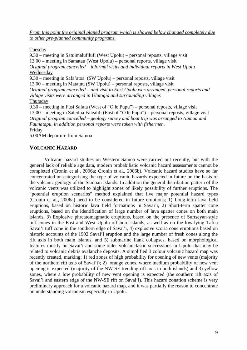
POTENTIAL YOUNG VOLCANISM IN UPOLU During the present study, a few key locations were visited with an aim to confirm the apparent youth of Upolu and related volcanic features. Manono Manono is located in the straight between Upolu and Savai’i (Figure 2). It is a shield-like broad volcanic island. The island was selected for collecting oral traditions on the basis of its lying on a general trend of morphologically young volcanic landforms that runs between Savai’i and Upolu.
Figure 2: Overview of Manono with a lava spatter rampart forming the central part of the island Apolima Apolima is a well developed, large tuff cone complex in the straight between Upolu and Savai’i (Figure 3). The tuff cone preservation stage is similar to those described from late Holocene examples from Jeju Island, South Korea (Sohn and Chough, 1993; Sohn, 1996; Sohn and Park, 2005). The tuff cone outer slope follows the original bedding angle, suggesting its young age (Figure 4). This observation contradicts previous interpretations that suggested Apolima as an old, strongly eroded tuff cone, which was once significantly larger than it is today. Observations from a boat indicate that its present diameter is probably close to the original size. Due to bad weather conditions it was not possible to land on the island.
10

Figure 3: Oblique satellite image (GoogleEarth) of Apolima exhibiting double crater structure.
Figure 4: Outer flank of Apolima composed of phreatomagmatic tuff and lapilli tuff succession with similar bedding angle than the outer slope angle of the tuff cone
11
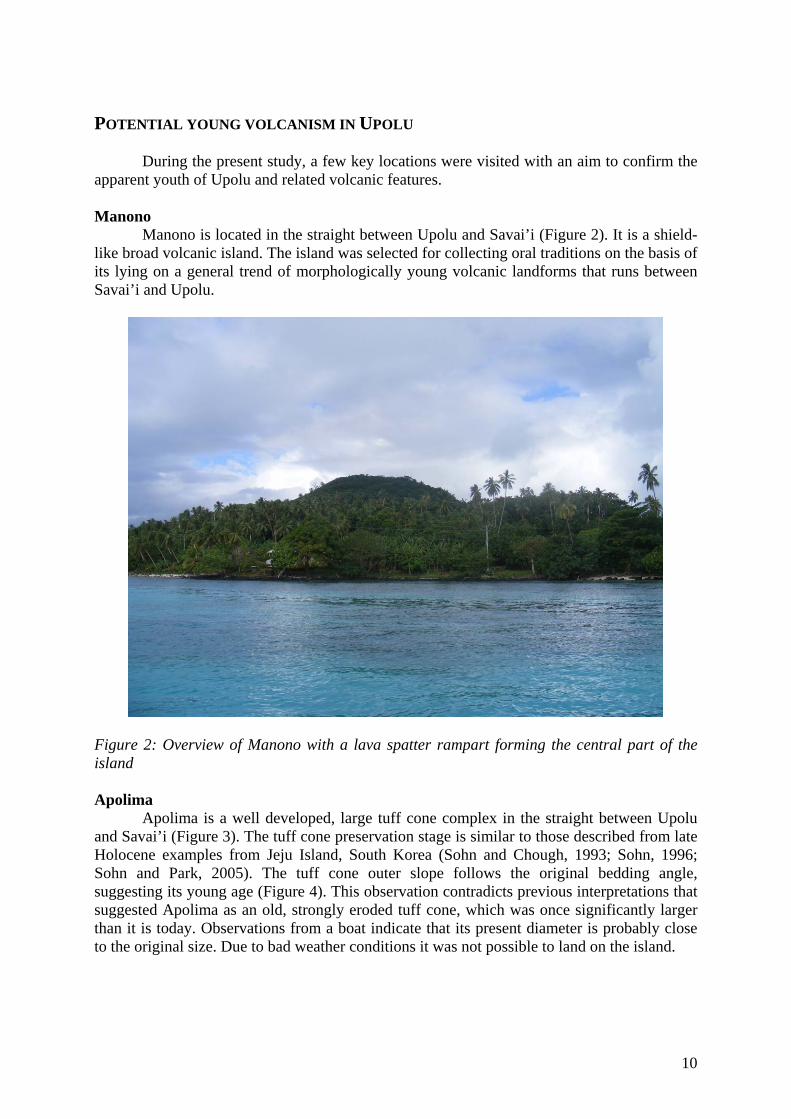
Western Upolu Western Upolu’s most prominent landform is Tafua Upolu (Figure 5), located near the international airport of Western Samoa. The name is significant (e.g. Tafua Upolu or Tafua Savai’i; Tafua = fire mountain/volcano, a cognate of “Tofua” – the large Tongan volcano and “Tavuyaga” in Fiji; Cronin and Neall, 2000). This linguistic hint and the extremely fresh morphology (Figure 6) focussed attention on communities in the vicinity of Tafua Upolu.
Figure 5: Tafua Upolu youthful cone looking from the west.
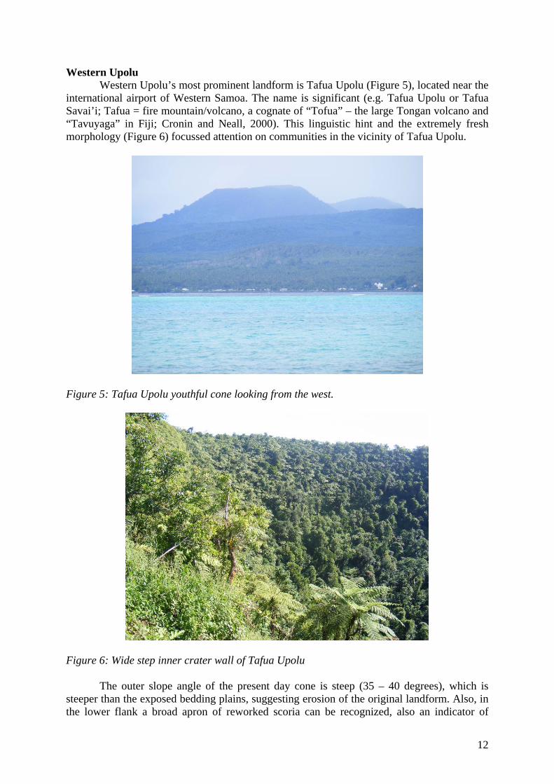
Figure 6: Wide step inner crater wall of Tafua Upolu The outer slope angle of the present day cone is steep (35 – 40 degrees), which is
steeper than the exposed bedding plains, suggesting erosion of the original landform. Also, in the lower flank a broad apron of reworked scoria can be recognized, also an indicator of
12

significant erosion of the original landform (c.f., Németh, 2004; Martin and Németh, 2006). The size of the volcano is comparable to larger scoria cones worldwide, and its eruption would have been spectacular, along with producing significant downwind ash fall. Central Upolu In central Upolu preserved and eroded scoria cones form a line along the NW-SE-trending rift axis. The youngest of these scoria cones are grouped into the Mulifanua Volcanics (Kear and Wood, 1959), although many of them have a morphologically younger appearance including having steep outer slopes, deep craters, and characteristic cone forms. Lake Lanuto’o (Figure 7) is accumulated in an old volcanic cone (Kear and Wood, 1959) in the highlands of Upolu. This basin is a prime target for scientific drilling to recover sediment and perhaps tephra beds from the eruptions of nearby volcanoes trapped in the lacustrine record.
Figure 7: Lake Lanuto’o Since there are no major villages near the rift axis, and community studies were not made in this region. East Upolu and offshore islands East Upolu was a focal point for this study on Upolu due in part to the great number of scoria cones assigned to the Mulifauna Volcanics (Kear and Wood, 1959). Field visits in these parts of Upolu confirmed that many volcanic cones had very youthful morphology, judged by the slope angle and geometrical ratios. The cones in East Upolu commonly hold crater lakes due being in a higher rain fall zone. The main point of interest in respect to oral traditions was the area along the shoreline of Upolu facing toward a number of small offshore islands.
13
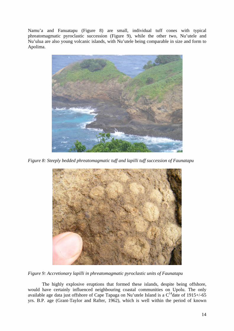
Namu’a and Fanuatapu (Figure 8) are small, individual tuff cones with typical phreatomagmatic pyroclastic succession (Figure 9), while the other two, Nu’utele and Nu’ulua are also young volcanic islands, with Nu’utele being comparable in size and form to Apolima.
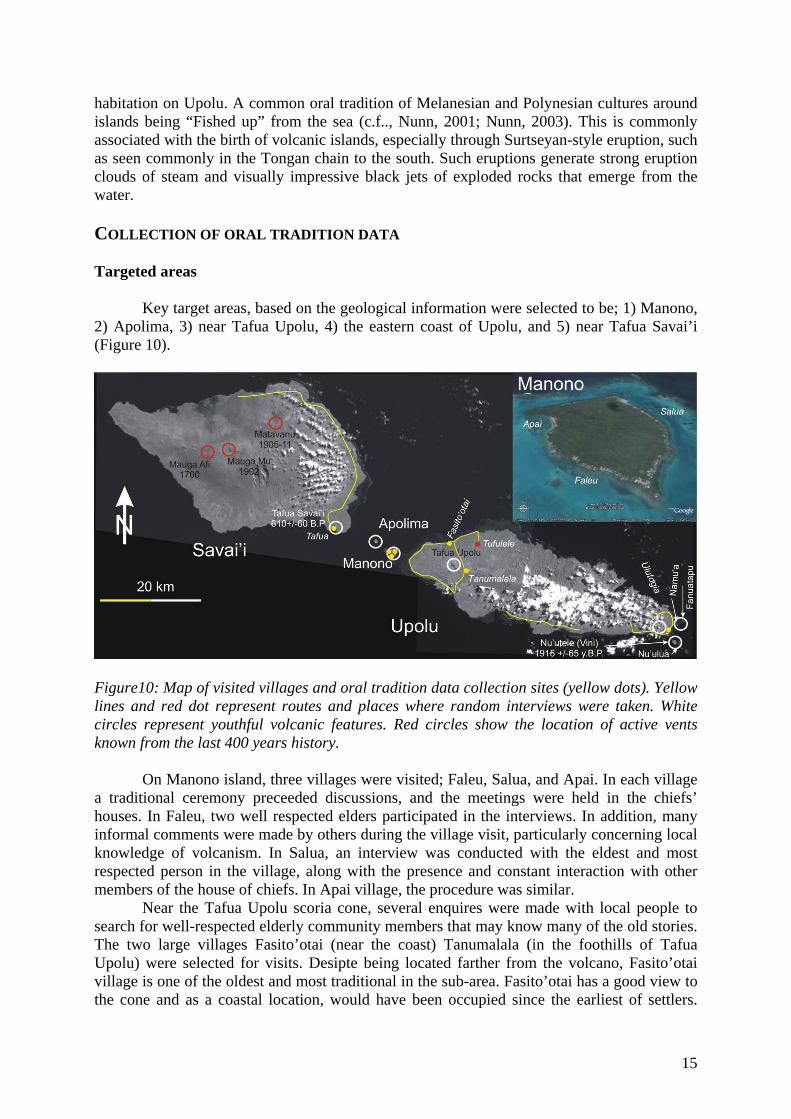
Figure 8: Steeply bedded phreatomagmatic tuff and lapilli tuff succession of Faunatapu
Figure 9: Accretionary lapilli in phreatomagmatic pyroclastic units of Faunatapu
The highly explosive eruptions that formed these islands, despite being offshore, would have certainly influenced neighbouring coastal communities on Upolu. The only available age data just offshore of Cape Tapaga on Nu’utele Island is a C14date of 1915+/-65 yrs. B.P. age (Grant-Taylor and Rafter, 1962), which is well within the period of known
14
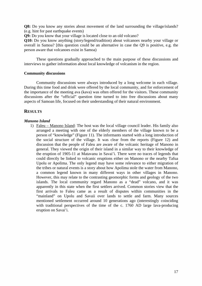
habitation on Upolu. A common oral tradition of Melanesian and Polynesian cultures around islands being “Fished up” from the sea (c.f.., Nunn, 2001; Nunn, 2003). This is commonly associated with the birth of volcanic islands, especially through Surtseyan-style eruption, such as seen commonly in the Tongan chain to the south. Such eruptions generate strong eruption clouds of steam and visually impressive black jets of exploded rocks that emerge from the water. COLLECTION OF ORAL TRADITION DATA Targeted areas Key target areas, based on the geological information were selected to be; 1) Manono, 2) Apolima, 3) near Tafua Upolu, 4) the eastern coast of Upolu, and 5) near Tafua Savai’i (Figure 10).
Figure10: Map of visited villages and oral tradition data collection sites (yellow dots). Yellow lines and red dot represent routes and places where random interviews were taken. White circles represent youthful volcanic features. Red circles show the location of active vents known from the last 400 years history.
On Manono island, three villages were visited; Faleu, Salua, and Apai. In each village a traditional ceremony preceeded discussions, and the meetings were held in the chiefs’ houses. In Faleu, two well respected elders participated in the interviews. In addition, many informal comments were made by others during the village visit, particularly concerning local knowledge of volcanism. In Salua, an interview was conducted with the eldest and most respected person in the village, along with the presence and constant interaction with other members of the house of chiefs. In Apai village, the procedure was similar.
Near the Tafua Upolu scoria cone, several enquires were made with local people to search for well-respected elderly community members that may know many of the old stories. The two large villages Fasito’otai (near the coast) Tanumalala (in the foothills of Tafua Upolu) were selected for visits. Desipte being located farther from the volcano, Fasito’otai village is one of the oldest and most traditional in the sub-area. Fasito’otai has a good view to the cone and as a coastal location, would have been occupied since the earliest of settlers.
15

Also the proximity of this village to the sea was expected to result in a good general understanding of natural hazards (e.g. from the sea) amongst the villagers. Unfortunately Tanumalala is a new settlement with about 100 years of history, being a result of plantation works during the German colonial times. People live here from all parts of Samoa, including one of the chiefly families that originally came from Apolima. In this case the interview with those villagers was able to gather some information about the structure of Apolima village and their general belief of volcanism.
In Eastern Upolu interviews were concentrated in the village of Ulutogia, the traditional owners of the offshore islands. This village is also an old settlement with traditional structure. Other informal discussions were initiated with other inhabitants of the southern shoreline during geological surveying.
For a comparison, a village meeting was arranged in Tafua near the Tafua Savai’i tuff ring/scoria cone complex, and other less formal interviews were carried out with inhabitants near Matavanu. Personal Interviews: The personal interviews were lead by Samoan interpreters with whom the purpose and the way how they should formulate their questions were discussed before any meeting took place. For informal data collection, discussions were had with people interested in our activities during geological surveying or had heard of the project aims during village inquires. These were carried out with a Samoan interpreter, recorded and transcribed later in English. The following basic questions were followed through each official semi-structured interview, village meeting or informal discussion: Date: Location: Name of Person: Gender: Age: Role in Community (e.g. matai, women committee member): Introduction: who we are, why we doing this survey. Introduce ourselves shortly to the person we will do the report. We are trying to collect information about the people understanding the origin of their land, people, and potentially any signs that could be related with past volcanic eruptions. Q1: What is the origin of the name of your village/island? Q2: What do you think or know about the origin of your village/land? Q3: Is there any story, legend, children story about the genesis of your village/land/island? Q4: What do you know about the origin of your people? Where did they come from and why? Q5: How did your people reached their village? Is there any legend about the travelling of your ancestors? Q6: Do you know any history/tales/traditions about the formation and changes of your village/island (e.g. are there any legends telling story about sudden changes of the landscape of the surroundings of the village/island? Q7: Do you know any stories about changes of the population of the village/islands? (e.g. is there any legends/story about sudden changes of number of people in the villages – e.g. drop or increase, reasons for this?)
16
Q8: Do you know any stories about movement of the land surrounding the village/islands? (e.g. hint for past earthquake events) Q9: Do you know that your village is located close to an old volcano? Q10: Do you know anything (story/legend/tradition) about volcanoes nearby your village or overall in Samoa? [this question could be an alternative in case the Q9 is positive, e.g. the person aware that volcanoes exist in Samoa) These questions gradually approached to the main purpose of these discussions and interviews to gather information about local knowledge of volcanism in the region. Community discussions Community discussions were always introduced by a long welcome in each village. During this time food and drink were offered by the local community, and for enforcement of the importance of the meeting ava (kava) was often offered for the visitors. These community discussions after the “official” question time turned to into free discussions about many aspects of Samoan life, focused on their understanding of their natural environment. RESULTS Manono Island
1) Faleu – Manono Island: The host was the local village council leader. His family also arranged a meeting with one of the elderly members of the village known to be a person of “knowledge” (Figure 11). The informants started with a long introduction of the social structure of the village. It was clear from the reports (Figure 12) and discussion that the people of Faleu are aware of the volcanic heritage of Manono in general. They viewed the origin of their island in a similar way to their knowledge of the eruption of 1905-11 at Matavanu in Savai’i. There were no traces of legends that could directly be linked to volcanic eruptions either on Manono or the nearby Tafua Upolu or Apolima. The only legend may have some relevance to either migration of the tribes or natural events is a story about how Apolima stole the water from Manono, a common legend known in many different ways in other villages in Manono. However, this may relate to the contrasting geomorphic forms and geology of the two islands. The local community regard Manono as a “dead” volcano, and it was apparently in this state when the first settlers arrived. Common stories view that the first arrivals to Faleu came as a result of disputes within communities in the “mainland” on Upolu and Savaii over lands to settle and farm. Many sources mentioned settlement occurred around 10 generations ago (interestingly coinciding with traditional perspectives of the time of the c. 1760 AD large lava-producing eruption on Savai’i.
17

Figure 11: Reporting setting in Faleu in a village major’s family meeting house.
Figure 12: Personal interview in Faleu
18

2) Salua – Manono Island: This village is large (about 2000 people). The house of chiefs organized a personal, one-to-one interview in front of the hosts and other guests with the oldest and most respected man in the village (Figure 13). He was previously prepared for this meeting, and he had time to prepare his views, in conjunction with discussions with other community members. This report was similar in many aspects to that from Faleu. The “water” legend between Apolima and Manono was also raised. Volcanism knowledge was solely based around the 1905-11 eruption in Savai’i. Many of these stories described the displacement of people from Northern Savai’i to many parts of Upolu. The people from the village had heard, Apolima is an old volcano, but interestingly, they regarded that their island was not. In later discussions time this view was slightly changed to demonstrate that their island might have been a volcano, but very, very long time ago. The overall impression of this meeting was that the 1905-11 eruption in Savai’i had overshadowed any knowledge of local volcanic heritage.
Figure 13: Interview setting in Salua
3) Apai – Manono Island: In this village a ceremonial meeting (with food and ava) was held in the house of chiefs, where the leading chiefs and an elderly women participated, giving individual reports (Figure 14). The informants demonstrated a high level of knowledge about their island’s volcanic heritage, but they all mentioned, that the island was already vegetated and therefore not active when their ancestors arrived. Settlement was estimated to be a few tens of generations ago. In the reports the people pointed out the volcanic origin of neighbouring Apolima Island and the hard life its inhabitants. Comments included that the hard life (e.g. limited access to drinking water in Apolima) may have generated the “water stealing” legend. There was no knowledge of legends related to their natural surroundings, even for such distinctive landforms as the star-shaped mound on the top of the island over the source vent of the ancient lava flows of Manono. These landforms appear to play a minor role in the village awareness.
19

Figure 14: Interview setting in Apai West Upolu
4) Fasito-otai – West Upolu: This village is located near Tafua Upolu with a good view of the scoria cone. The meeting was held in the village council house where the village mayor answered questions then directed discussions to additional people (Figure 15). This community demonstrated an excellent understanding of natural hazards, such as tsunami or cyclone, but little knowledge about volcanism. Very little was also known about the 1905-11 Savai’i eruption. The scoria cone Tafua Upolu has no apparent significance in the village culture. This was surprising, because such a characteristic landformswas expected to be a defining reference point for the village. In fact most informants appeared to ignore the existence of Tafua Upolu and universally did not conceive of a volcanic origin for the landform. The cone plays no special role in traditional or ancestor or religious stories. Also, interestingly not a single person had seen the top of the cone nor the distinctive deep crater containing a colony of thousands of flying-foxes. Similarly in nearby Tufulele village, only two people were known to have been to the top of the cone. These discussions also resulted an another important observation. The community has very little knowledge of the geography of the other villages, gardens and especially the landforms that surround them. It suggests that the long-established village limits in these heavily populated coastal areas form a natural barrier, over which very little curiosity is raised, especially in relation to natural habitats (e.g. hills, cones) in neighbouring village lands.
20
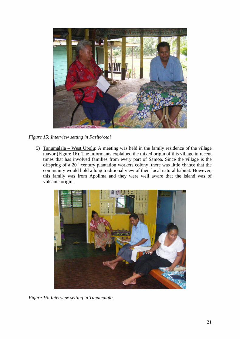
Figure 15: Interview setting in Fasito’otai
5) Tanumalala – West Upolu: A meeting was held in the family residence of the village mayor (Figure 16). The informants explained the mixed origin of this village in recent times that has involved families from every part of Samoa. Since the village is the offspring of a 20th century plantation workers colony, there was little chance that the community would hold a long traditional view of their local natural habitat. However, this family was from Apolima and they were well aware that the island was of volcanic origin.
Figure 16: Interview setting in Tanumalala
21

East Upolu
6) Ulutogia – East Upolu: This village meeting involved interviews with the mayor and other local chiefs (Figure 17). The informants were aware of existence of volcanoes in the highlands behind the plantations of Ulutogia (along the rift axis), as well as the volcanic origin of their off shore islands. However, there were no associated stories or traditions concerning these features they were aware of. Other informants during informal interviews, including a fisherman, knew of stories surrounding a giant explosion in the sea, which changed the landscape of East Upolu. This story closely resembles the earlier mentioned “fish up” stories from other parts of the Pacific. The location of the story coincides with the geological evidence for highly explosive Surtseyan-style eruptions in near-shore islands off the eastern coastline of Upolu.
Figure 17: Interview setting in Ulutogia Savai’i
7) Tafua – near Tafua Savai’i, Savai’i Island: An meeting was held at the family home of a man, considered to hold the greatest traditional knowledge in the community (Figure 18). The old man explained that they know that they live near to a volcano, which once was very “angry”. However, the volcanic cone itself does not play a key role in local legends and stories. It was not a major part of the community conscience or culture. A family that operate a new small tourist business for visiting the crater of Tafua Savai’i explained the origin of the volcano well, although they believed that Tafua Savai’i was the place where the 1905-11 eruption occured. This belief my result from the Matavanu eruption having been now 2-3 generations ago, within a context of many informants being unsure of details of history beyond 3 generations ago.
22

Figure 18: Interview setting in Tafua (Savai’i) The Legend of Manono and Apolima The following is based on the amalgamation of stories described from each village in Manono: A long time ago Manono had plenty of water for drinking, washing, or bathing for everyone on the island. At that time, Manono was a rich place with flowering gardens and happy people. The nearby Apolima was, by contrast a hostile island with no people and only a monster living on the island. Because Apolima had no water, the monster got really thirsty one hot day. It decided to look for water on the neighbouring Manono. When he arrived he saw a beautiful lady washing her clothes in a running stream. The monster asked her for some water. The lady replied, “well, if you can finish all the water from this river, you can have it always”. The monster bent down and in one deep breath started to drink. The lady looked on in astonishment as the water gradually diminished, until the last of it was gone. The monster then shook his head, and smiled. As he shook his head, water dropped down from his mouth and face to form small pools on the ground. The monster returned to Apolima, and since then, people on Manono have only been able to source water from these pools (Figure 19).
23

Figure 19: Water wells that form part of the legend of Manono near Faleu village Legend on the origin of the name of Manono and Apolima This story is also an amalgamation of versions from each visited village in Manono. Long, long time ago a lady left Savai’i with her son and daughter. Her son’s name was Nono. On the way from Savai’i, she decided to settle on the nearby Apolima Island. They started their new life there, but the children were not happy, because life was not easy on the island. So they moved forward to the lush-looking neighbouring island of Manono, leaving their mother behind. When they arrived to their new home and started their life, they fell in love with one another, and soon a baby was born. The other people on Manono were surprised about their relationship and the boy, Nono, became very shy (which means “Ma” in Samoan). The story spread quickly among the people of the island, and soon after the island became known as Manono. Because of shame the people regarded this couple with, the girl decided to return to her mother on Apolima. She started to swim back and when her mother saw her in the rough seas, she became very happy, opened her arms wide and seized her from the water. Apo – Lima means, in Samoan, to grab or retrieve by hand (from water e.g.). Later on when the people arrived on Apolima, the named the island after this story, Apolima, the place of the grabbing hand.
24

MAPPING EXERCISE Mapping exercises were vital parts of the community based workshops on natural hazards in Vanuatu, Solomon Islands and Fiji (see earlier references). These mapping exercises helped to understand the way how the local people viewed their natural and social resources, and how they would envision the abstract representation of natural hazards in the form of drawings or maps.
Mapping exercises were performed during many of the individual semi-structured reviews, accompanied with brief questions (Figures 20 and 21). Here we used the same approaches described by Cronin et al. (2004).
Figure 20: Mapping exercise in Faleu (Manono)
25

Figure 21: Mapping exercise in Salani (Manono) An example: Prepare a simple map of the village area, reaching from the closest hills to the village to the coast and the boundaries (such as: lakes, landmarks, family land boundaries) of the area known around the village. A. Draw on the map (with symbols and lines) natural features of the landscape including:
- hills/mountains - streams/rivers - coast - swamps - volcano - crater - hot springs or hot gas areas
B. Draw on the map (with symbols) all the village resources, eg:
- crops of different types - house locations - water supplies - roads and tracks - community buildings and resources
26

- forests - building materials - animal houses (type of animals)
C. Draw on the areas affected by different geo-hazards:
- cyclones – when - tsunamis/storm surge – when - earthquakes – when - volcanism (lava, mudflows, ash and volcanic gas) – when - floods - when
D. Draw on an interpretation of safe areas and dangerous areas in the person opinion E. Choose the safest area you have identified on the main map (a check-point) and show its
nearest food, water and shelter supplies F. Draw on the safest pathways to your safest check-point. Results Understanding of tasks in parts A. and B. were relatively easy for the participants, however, C. gave great difficulty in most instances. The local understanding of geo-hazard, especially volcanic hazard was very limited. Even after explanation, other than cyclone experiences, other hazards were never identified. Consequently, also tasks D., E. and F. were difficult, in that cylclone protection is indoors in the strongest house available, preferably with the entire family nearby. This highlights the need to develop programs covering information for other hazard types. In Tufulele village, for example, the demand for this type of information was very high, with a such short audio-visual presentation on volcanism being of a high degree of interst. The mapping exercise is also rendered important information on the visualisations most intuitive to the Samoan communities visited. The majority of the maps were prepared as 3D oblique landscape sketches with an enlarged (disproportional) representation of the local community located at the centre of drawings (Figures 22 and 23). The drawings contained detailed information about highly localised natural and social resources, with almost no cognisance given to that of neighbouring communities, even if the neighbouring village “owned” the region’smost significant landform, e.g. a large scoria cone. This result is consistent with the cultural habitat of Samoan people in general, as has been stated in relation to the economic development of a village: “Samoans are generally content with the life they lead. They have little interest in the outside world which intrudes on them in the form of the market sector. They likewise have little evident concern for the future, little interest in productive investment ,little willingness to ‘develop’” (Lockwood, 1971). Such statements might be controversial today, but such anthropological background must be incorporated in any future attempts to engage Samoan communities with infrequent hazards such as volcansim.
27

Figure 22: Simplified map of Salua (Manono) provides a 3D view of Manono, centred in Salua
Figure 23: Simplified map of Ulutogia (East Upolu) with only the church and the boundaries of the village with no landmarks mentioned. INFORMAL DATA COLLECTION In the course of the program, it became evident that data collection was arguably more-efficient outside of “official” interviewees and high-ranking members of the society. This observation was the same as noted in past work in Fiji, Vanuatu and the Solomon Islands, and dealt with by separating the “power figures” in the community from other sectors
28
during group participatory activities (Cronin et al., 2004a and b). During associated geological field work and investigation of target areas, informal interviews were commonly carried out following a shortened form of the formal semi-structured interviews. These discussions were free of traditional and public requirements, and provided very useful candid information. They also did not incur significant “fees” as the official visits entailed. Results In summary, the people on Upolu have very limited knowledge of their natural habitat, especially about the volcanic origin of their landscape. Often black basaltic rocks were identified as coral fragments from reef rocks baked by the sun for a long time. On the other hand, they were very interested about the origin of their landscape and hills. On the western coastline of Upolu, people normally ignored the existence of Tafua Upolu, had no inkling it was volcano and did not regard it as a special landmark. However, Manono, and Apolima were typically seen (especially by fisherman) as being of volcanic origin. On the SW edge of Upolu, the inhabitants had no knowledge that Tafua Upolu existed just about 7 km from their land. However, the landscape in that part of Upolu is rugged, and the hills show similar morphologies, so, Tafua Upolu was just one of those hills in their view. Along the southern coast of Upolu, similar experiences were given in the interviews. Even local communities on both sides of the apparently young lava fields of O le Pupu were not aware that these rocks were of volcanic origin. Along the east Upolu shoreline near the young volcanic offshore islands, people generally knew of their volcanic origin, and many people also pointed to large craters in the mainland in the highlands. However, the source of this knowledge is unclear. A few comments regarding a once connected landmass of Upolu and the off shore islands (e.g. Nu’utele), point toward some sort of distant memory of rapid landscape change. One family recalled a vivid story, apparently transferred over many generations, that one of their ancestors saw a fire, heard huge explosions from the sea, and then saw new islands growing in the glowing sky. This sounds rather detailed, and the origins and further evidence for the story should be sought before it is considered in detail. Informal communications with people in Savai’i in the eastern coast between the region of Tafua Savai’i and the Matavanu eruption site give a very mixed impression about their knowledge of volcanism. In spite of the eruption in 1905-11 in Matavanu, many people (about half of those questioned) did not know about the eruption, and/or if they knew, they had no idea where it took place. Many people were confused about the location of the 1905-11 eruption and placed it at Tafua Savai’i. None of those interviewed knew that eruptions occurred in 1902 AD or in 1760 AD on Savai’i. RECOMMENDATIONS FOR FUTURE WORK This pilot project has demonstrated a very limited potential for discovering “volcanic memories” within Western Samoa through oral traditions. Despite this, however the work has given a valuable snapshot of geological hazards knowledge in the communities visited and also given a series of insights into aspects and methods of hazard education programs that may be considered by government led natural hazard management and mitigation initiatives. The short-duration program and community response required many rapid changes to the program and methodology to obtain a successful result. It is interesting to note the general lack of importance and preservation of oral traditions of volcanism in contrast to other South Pacific locations where the activity and hazard are more apparent. This may also be due to the
29

nature of the Samoan society which carries many rules that are strongly influenced by Christian beliefs.
Official meetings with ceremony and traditional information exchanges were often insisted upon by focus communities, but these tended to be expensive, time consuming, and refocused attention on the “power-figures” in the community, rather than allowing a broader view of the information held by the group. Such meetings were needed, however, to spur-on later informal meetings and interviews. A potentially effective way to proceed on this theme in future would be to organise a formal island-wide meeting (or two) with the village mayors – such as when they have their usual monthly meeting in Apia in the house of chiefs. During this meeting all the necessary information could be distributed to the village mayors using the experiences from this project. A follow-up meeting could identify villages where there is interest to proceed with futher investigative or hazard education work. Once in areas of interest, however, methods will need to be adopted to allow a broader audience to have a say, if necessary, in private to a facilitation team. The mapping exercise highlighted the need for rethinking the standard preparation method for geo-hazard maps used for volcanic hazards to date in Samoa. The 3D representation of the landscape can now be achieved with modern GIS and remote-sensing tools. Since traditional village limits are very strict, this may also need to be considered in hazard mitigation plans and hazard maps – with perhaps individualised maps being most efficient. For hazard and emergency planning, it might be possible that an Apia official would have better knowledge of the landscape in a village, than any near neighbour of the village. This fact could seriously affect relief efforts based on local resources in case of emergency.
30

CONCLUSION
The volcanic geology of Western Samoa is a complex phenomena that is largely not currently understood due to the lack of geologic study including age data. Previous field campaigns and this work demonstrated that the amount of young activity (and hence future hazard) could be higher than previously expected, and that a revision of the volcanic stratigraphy is needed. Results from this study suggest that the focal points for collection of new geological data should be: the offshore islands east and west of Upolu, Tafua Upolu, and Lake Lanoto’o.
Based on this pilot study, we conclude that the base level of local/traditional information on volcanism is extremely low, compared to other areas of the SW Pacific. While this may represent the low incidence of this threat compared to others faced by Upolu communities (e.g. cyclones), it is a surprise considering that three historic eruptions have significantly affected communities on Savai’i. This lack of knowledge we attribute to the highly localised perspective that the targeted Samoan communities appeared to display.
Semi-structured interviews with high-ranking (titled, elderly) showed also that most communities appear to have very limited knowledge of their volcanic heritage and origins of their surrounding landscape. Major youthful volcanic landforms show from their names that they were once significant (e.g. Tafua Upolu or Tafua Savai’i; Tafua = fire mountain/volcano). However, these no longer appear to be recognised in modern culture. The only possible distal volcanic memories were identified tales from East Upolu (yet to be confirmed and studied in detail), where offshore islands (tuff cones) are associated with giant explosions.
Mapping exercises carried out during village visits highlighted a 3D-oblique view of the landscape and hazards, rather than the plan-views used in current volcanic hazard maps. In addition, maps were commonly restricted to the strict boundaries of local communities, ignoring major features (such as fresh volcanic cones) that were in the territory of “next-door” villages. These perspectives need to be focused upon in ensuring future iterations of hazard maps and hazard education programmes are meeting their targets.
31
REFERENCES Anderson, T., 1910. The Volcano of Matavanu in Savaii. Quarterly Journal of the Geological Society 66(1-4):
621-639. Belousov, A. and Belousova, M., 2001. Eruptive process, effects and deposits of the 1996 and the ancient
basaltic phreatomagmatic eruptions in Karymskoye lake, Kamchatka, Russia. In: J.D.L. White and N.R. Riggs (Editors), Volcaniclastic sedimentation in lacustrine settings. Balckwell Sciences, Oxford, UK, pp. 35-60.
Chambers, R., 1994. The origins and practice of participatory rural appraisal (PRA). World Development, 22: 953-969.
Cole, P.D., Guest, J.E., Duncan, A.M. and Pacheco, J.M., 2001. Capelinhos 1957-1958, Faial, Azores: deposits formed by an emergent surtseyan eruption. Bulletin of Volcanology, 63(2-3): 204-220.
Cronin, S.J., Bonte-Grapentin, M. and Németh, K., 2006a. Samoa technical report - Review of volcanic hazard maps for Savai'i and Upolu. EU-SOPAC Project Report, 59: 1-27.
Cronin, S.J., Cashman, K., 2007: Volcanic oral traditions in hazard assessment and mitigation. Chapter 9 in Grattan, J., Torrence, R. (eds) Living under the shadow: The archaeological, cultural and environmental impact of volcanic eruptions. UCL Press, London. ISBN 1844720942 and ISBN 1844720934. 272 pp.
Cronin, S.J., Neall, V.E. 2000. Impacts of volcanism on pre-European inhabitants of Taveuni, Fiji. Bulletin of Volcanology 62: 199-213.
Cronin, S.J. et al., 2004a. Participatory methods of incorporating scientific with traditional knowledge for volcanic hazard management on Ambae Island, Vanuatu. Bulletin of Volcanology, 66(7): 652-668.
Cronin, S.J., Petterson, M.G., Taylor, P.W., Biliki, R. 2004b: Maximising multi-stakeholder participation in government and community volcanic hazard management programs, a case study from Savo, Solomon Islands. Natural Hazards 33: 105-136.
Cronin, S.J., Nemeth, K. and Stewart, B.R., 2006b. Volcanic hazards planning on rifting island and fissure volcanoes. Geological Society of New Zealand Miscellaneous Publication, 122-A: 13.
Cronin, S.J., Taylor, P.W. and Malele, F., 2000. Final report - Savai'i,volcanic hazards project Samoa,October 2000. SOPAC Technical Report (Suva, FIji), 343: 1-34.
Fairbair.Ij, 1974. Samoan village economy - Lockwood, B. Oceania, 44(3): 241-243. Grant-Taylor, T.L. and Rafter, T.A., 1962. New Zealand radiocarbon age measurements - 5. New Zealand
Journal of Geology and Geophysics, 5: 331-359. Hart, S.R. et al., 2004. Genesis of the Western Samoa seamount province: age, geochemical fingerprint and
tectonics. Earth And Planetary Science Letters, 227(1-2): 37-56. Hart, S.R. et al., 2000. Vailulu'u undersea volcano; the New Samoa. Geochemistry, Geophysics, Geosystems - G
3. 1; 2000. American Geophysical Union and The Geochemical Society, United States. ges: 5202 words (paper number 2000GC0000108). 2000.
Hauri, E.H. and Hart, S.R., 1994. Constraints on melt migration from mantle plumes - a trace-element study of peridotite xenoliths from Savaii, Western-Samoa. Journal of Geophysical Research-Solid Earth, 99(B12): 24301-24321.
Jackson, M.G. et al., 2007. The return of subducted continental crust in Samoan lavas. Nature, 448(7154): 684-687.
Kear, D., 1967. Geological notes on western Samoa. New Zealand Journal of Geology and Geophysics, 10(6): 1446-1451.
Kear, D. and Wood, B.L., 1959. The geology and hydrology of Western Samoa. New Zealand Geological Survey Bulletin, 63: 1-90.
Keating, B.H., Helsley, C.E. and Karogodina, I., 2000. Sonar studies of submarine mass wasting and volcanic structures off Savaii Island, Samoa. Pure and Applied Geophysics, 157(6-8): 1285-1313.
Kokelaar, B.P., 1983. The mechanism of Surtseyan volcanism. Journal of the geological Society of London, 140: 939-944.
Lockwood, B., 1971. Samoan Village Economy. Oxford University Press, New York and London, 232 pp. Mageo, J., 2002a. Myth, cultural identity, and ethnopolitics: Samoa and the Tongan "empire"'. Journal of
Anthropological Research, 58(4): 493-520. Mageo, J.M., 2002b. Intertextual interpretation, fantasy and Samoan dreams. Culture & Psychology, 8(4): 417-
448. Maring, J.M., 1979. Samoan village - Holmes, L. American Anthropologist, 81(3): 616-631. Martin, U. and Németh, K., 2006. How Strombolian is a "Strombolian" scoria cone? Some irregularities in scoria
cone architecture from the Transmexican Volcanic Belt, near Volcan Ceboruco, (Mexico) and Al Haruj (Libya). Journal of Volcanology and Geothermal Research, 155(1-2): 104-118.
Martinsson-Wallin, H., 2007. Samoan archaeology: A review of research history. Archaeology in Oceania, 42: 11-27.
32

Mead, M., 1961. Tau - stability and change in a Samoan village - Holmes, LD. American Anthropologist, 63(2): 428-430.
Milner, G.B., 1972. Samoan village economy - Lockwood, B. Man, 7(4): 680-681. Morrison, R.J., 1991. Some andisols from Savaii, Western-Samoa. Soil Science Society Of America Journal,
55(1): 159-164. Németh, K., 2004. The morphology and origin of wide craters at Al Haruj al Abyad, Libya: maars and
phreatomagmatism in a large intracontinental flood lava field? Zeitschrift für Geomorphologie, 48(4): 417-439.
Németh, K., Cronin, S.J., Charley, D., Harrison, M. and Garae, E., 2006. Exploding lakes in Vanuatu - "Surtseyan-style" eruptions witnessed on Ambae Island. Episodes, 29(2): 87-92.
Nunn, P.D., 2001. On the converngence of myth and reality: examples from the Pacific Islands. Geographical Journal, 167(2): 125-138.
Nunn, P.D., 2003. Fished up or thrown down: The geography of Pacific Island origin myths. Annals Of The Association Of American Geographers, 93(2): 350-364.
O'Leary, J.A., Hauri, E.H., Hart, S.R. and Staudigel, H., 2007. Hydrogen isotope geochemistry of basalts from Samoa. Geochimica Et Cosmochimica Acta, 71(15): A737-A737.
Olson, M.D., 2002. 'Indirect rule' and the rule of law in Samoa. Journal of Historical Geography, 28(3): 380-396. Schoeffel, P., 2007. The social structure of a Samoan village. Journal of Pacific History, 42(2): 280-281. Shankman, P., 1972. Samoan village economy - Lockwood, B., American Anthropologist, 74(6): 1443-1444. Sims, K.W.W. and Hart, S.R., 2006. Comparison of Th, Sr, Nd and Pb isotopes in oceanic basalts: Implications
for mantle heterogeneity and magma genesis. Earth And Planetary Science Letters, 245(3-4): 743-761. Sohn, Y.K., 1996. Hydrovolcanic processes forming basaltic tuff rings and cones on Cheju Island, Korea.
Geological Society of America Bulletin, 108(10): 1199-1211. Sohn, Y.K. and Chough, S.K., 1992. The Ilchulbong tuff cone, Cheju Island, South-Korea - Depositional
processes and evolution of an emergent, surtseyan- type tuff cone. Sedimentology, 39(4): 523-544. Sohn, Y.K. and Chough, S.K., 1993. The Udo Tuff Cone, Cheju Island, South-Korea - Transformation of
pyroclastic fall into debris fall and grain flow on a steep volcanic cone slope. Sedimentology, 40(4): 769-786.
Sohn, Y.K. and Park, K.H., 2005. Composite tuff ring/cone complexes in Jeju Island, Korea: possible consequences of substrate collapse and vent migration. Journal of Volcanology and Geothermal Research, 141(1-2): 157-175.
Staudigel, H. et al., 2006. Vailulu'u seamount, Samoa: Life and death on an active submarine volcano. Proceedings Of The National Academy Of Sciences Of The United States Of America, 103(17): 6448-6453.
Verwoerd, W.J. and Chevallier, L., 1987. Contrasting types of surtseyan tuff cones on Marion and Prince Edward islands, southwest Indian Ocean. Bulletin of Volcanology, 49: 399-417.
White, J.D.L. and Houghton, B.F., 2000. Surtseyan and related eruptions. In: H. Sigurdsson, B. Houghton, S. McNutt, H. Rymer and J. Stix (Editors), Encyclopedia of Volcanoes. Academic Press, New York, pp. 495-512.
Workman, R.K., Hauri, E., Hart, S.R., Wang, J. and Blusztajn, J., 2006. Volatile and trace elements in basaltic glasses from Samoa: Implications for water distribution in the mantle. Earth And Planetary Science Letters, 241(3-4): 932-951.
Workman, R.K., Hauri, E., Hart, S.R., Wang, J. and Blusztajn, J., 2007. Volatile and trace elements in basaltic glasses from Samoa: Implications for water distribution in the mantle (241, pg 940, 2006). Earth And Planetary Science Letters, 253(1-2): 304-304.
33