SAM/IG/25-WP/2.1 South American Regional Office 27 ... - ICAO
40
International Civil Aviation Organization SAM/IG/25-WP/2.1 South American Regional Office 27/10/2020 Twenty Fifth Workshop/Meeting of the SAM Implementation Group SAM (SAM/IG/25) – Regional Project RLA/06/901 (Lima, Perú, 2 to 4 November 2020) Agenda Item 2: Report of activities of the GESEA and Subgroups a) Review of air navigation priorities in the ATM field b) Deliverables and progress of SG1/SG2 working groups HARMONIZED IMPLEMENTATION OF STRATEGIC DIRECT ROUTING (EDE) (Presented by the GESEA) SUMMARY The purpose of this working papers is that the Meeting defines the harmonized implementation of Strategic Direct Routing (EDE) in South America. The technical study carried out by the TF of the SAM/IG GESEA SG1 is analyzed. Reference Reports of the workshops/meetings of the SAM Implementation Group (SAM/IG). Summary of SG1 GESEA meetings. GANP Sixth Edition 2019. ICAO strategic objectives: A - Safety B – Air navigation capacity and efficiency E – Environmental protection 1. Background 1.1 The meeting of Subgroup 1 /GESEA 'AirSpace Planning' was agreed by SAM/IG/24 (November 2019) to be held in Bogota – Colombia in April 2020. However, the COVID 19 health emergency required that it be rescheduled in virtual mode. 1.2 SG1 /GESEA held its virtual sessions between 26 May and 3 June 2020. The material, list of participants, and recordings of the deliberations are available in the GESEA cloud available at the following link; https://onedrive.live.com/?authkey=%21AvxOvPHYpEPdtzU&id=4B2F65A2BBF9F10F%21114693&ci d=4B2F65A2BBF9F10F 1.3 SG1 also held follow-up meetings in August and September 2020 on the progress of task groups (TF or GADHOC).
-
Upload
khangminh22 -
Category
Documents
-
view
0 -
download
0
Transcript of SAM/IG/25-WP/2.1 South American Regional Office 27 ... - ICAO

International Civil Aviation Organization SAM/IG/25-WP/2.1 South American Regional Office 27/10/2020 Twenty Fifth Workshop/Meeting of the SAM Implementation Group SAM (SAM/IG/25) – Regional Project RLA/06/901 (Lima, Perú, 2 to 4 November 2020)
Agenda Item 2: Report of activities of the GESEA and Subgroups
a) Review of air navigation priorities in the ATM field b) Deliverables and progress of SG1/SG2 working groups
HARMONIZED IMPLEMENTATION OF STRATEGIC DIRECT ROUTING (EDE)
(Presented by the GESEA)
SUMMARY
The purpose of this working papers is that the Meeting defines the harmonized implementation of Strategic Direct Routing (EDE) in South America. The technical study carried out by the TF of the SAM/IG GESEA SG1 is analyzed.
Reference
Reports of the workshops/meetings of the SAM Implementation Group (SAM/IG). Summary of SG1 GESEA meetings. GANP Sixth Edition 2019.
ICAO strategic objectives: A - Safety B – Air navigation capacity and efficiency E – Environmental protection
1. Background
1.1 The meeting of Subgroup 1 /GESEA 'AirSpace Planning' was agreed by SAM/IG/24 (November 2019) to be held in Bogota – Colombia in April 2020. However, the COVID 19 health emergency required that it be rescheduled in virtual mode. 1.2 SG1 /GESEA held its virtual sessions between 26 May and 3 June 2020. The material, list of participants, and recordings of the deliberations are available in the GESEA cloud available at the following link; https://onedrive.live.com/?authkey=%21AvxOvPHYpEPdtzU&id=4B2F65A2BBF9F10F%21114693&cid=4B2F65A2BBF9F10F 1.3 SG1 also held follow-up meetings in August and September 2020 on the progress of task groups (TF or GADHOC).

SAM/IG/25-WP/2.1 - 2 -
2. Discussion
2.1 During the SG1 meeting, IATA's high-level coordination to agree on the implementation of direct flight (DCT) affecting efficient flight and shorter distances was highlighted, resulting in reduced fuel and fume use. This application is feasible in a low traffic scenario and contributes to faster aviation recovery. 2.2 It was agreed that other efficiency contributions could be added with the implementation of more PBN-based STAR/SID procedures and routes. The GESEA is the technical group that should establish operational guidelines for direct flight, based on ASBU FRTO B0/1, taking into consideration the necessary regional harmonization. The Subgroup agreed to work through a TF task group (GADHOC) to implement fast impact elements for efficiency based on DCT, FRTO, etc. 2.3 The DCT-EDE held five virtual meetings, between 17 June and 12 August 2020 accomplishing approximately 24 hours of session, plus the analysis and inputs made via email. 2.4 It has been identified that the implementation of the concept of Strategic Direct Routing (EDE), aligned to the FRTO B0/1- Direct Routing module/element of the Sixth Edition of the GANP, can increase the efficiency of air operations in this scenario of reduced aircraft flows in the Region, without requiring additional expenses in equipment or training processes
2.5 This implementation is based on the presentation at the airport of origin of international flight plans which consider, predictably, direct trajectories between entry/exit points in the flight information regions (FIRs), leading to the reduction of the flown distance. Therefore, when planning the flight with shorter segments, the airline can define a lower fuel endowment in the aircraft aiming to optimize the payload and consumption parameter, as well as reduce CO2 in the atmosphere. 2.6 The deliverable is named "Studies for Implementing Strategic Direct Routing (EDE)" which is shown in the Appendix to this working paper. This study has already been circulated to the States/Territory in both languages. 2.7 The implementation of the EDE concept is proposed by 5 November 2020, if feasible and operational conditions exist for States.
3. Suggested action 3.1 The Meeting is invited to:
a) Analyse and express opinion on the material and studies carried out by TF DCT EDE, as shown in the Appendix to this working paper;
b) express the situation of each State with respect to the issuance of SUP/AIP, on the implementation of the EDE and on the results observed to date; and
c) discuss other considerations that the Meeting deems relevant.

SAM/IG/25 – WP/2.1
APPENDIX
VIRTUAL MEETING OF THE GESEA SUBGROUP 1 DCT-FRA AD HOC GROUP
SUMMARY OF STUDIES
Sessions: 1. Wednesday, 17 June 2020 2. Thursday, 2 July 2020 3. Wednesday, 15 July 2020 4. Wednesday, 29 July 2020 5. Wednesday, 12 August 2020 Participants: Delegates of RLA/06/901States
Material, presentations and session recordings: available at the following GESEA cloud link (OneDrive):
https://onedrive.live.com/?authkey=%21AvxOvPHYpEPdtzU&id=4B2F65A2BBF9F10F%21182601&cid=4B2F65A2BBF9F10F
The meeting of the Ad hoc Group on strategic direct routing – EDE (in Spanish: Enrutamiento Directo Estratégico) and free route airspace (FRA) was held through 5 virtual meetings, as shown in the box above. 1. JOB CARD On this matter, the rapporteur presented the proposed JOB CARD, which shall be used to guide the work of the group. The meeting approved the final version of the JOB CARD, shown in Appendix A, which will be submitted to the approval of GESEA. The meeting underlined that the JOB CARD was a living document that could be modified, subject to the approval of GESEA. 2. Status of implementation of strategic direct routing (EDE) in the South American Region In this regard, the States that had already implemented EDE informed about the strategy adopted for such implementation. IATA showed a map summarising the status of implementation in the SAM Region, which is shown in Appendix B. References to aeronautical publications associated to EDE implementation in each State are available in the table shown in Appendix B. 3. Review of FRTO – B0/1 – (Global Air Navigation Plan - Version 6)

SAM/IG/25 – WP/2.1 - 2 -
In this regard, the Meeting reviewed the content of the Global Air Navigation Plan in relation to FRTO B0/1. In general terms, the following aspects were highlighted:
1) Objectives
a. Provide airspace users with additional flight planning, with route options on a larger scale across FIRs, so that planned distances can be generally reduced compared to the fixed route network.
b. Strategic direct routing (EDE) will be established at national and regional level, and is made available for flight planning (with published terms of use). The EDE shall be considered as a transition to the implementation of the free route airspace (FRA) concept. EDE operations enable airspace users to optimise flight and fuel planning.
2) The EDE could be implemented in a limited manner, for example: a. Time restriction (fixed or subject to traffic/availability); b. Traffic restriction (based on traffic flow and/or level); c. Flight level; d. Lateral restrictions; e. Entry/exit points.
3) The following procedures and processes may need to be considered:
a. Identify EDE airspace volume (lateral y vertical) and applicable time; b. Direct routes may coexist with the ATS route structure; c. Adapt airspace design to ensure horizontal and vertical connectivity with EDE. d. ATFM procedures for EDE; e. Review the LoAs with adjacent ATS units; f. Publish data relevant to EDE in the AIP; g. Airspace management procedure for the implementation of direct routes; h. ATC procedures for EDE coordination, including handover, path changes in direct routing,
conflict detection.
4) Operational and dependent relationship with other ASBU elements
a. NOPS-B0/1 Initial integration of collaborative airspace management with air traffic flow management The integration of airspace management and air traffic flow management is a desirable requirement, with a view to optimising EDE implementation in the SAM Region.
b. FRTO-B0/2 - Airspace planning and Flexible Use of Airspace (FUA) The application of FUA could optimise EDE implementation, taking into account that DCT routes could enter special use airspace, in accordance with pre-established procedures.
c. FRTO-B0/4 - Basic conflict detection and conformance monitoring Medium-Term Conflict Detection (MTCD) and Conformance Monitoring tools are considered as requirements to reduce the workload of air traffic controllers in high air traffic volume settings. Accordingly, they can be considered as desirable requirements and should be taken into account when upgrading ATM systems.

- 3 - SAM/IG/25-WP/2.1
d. FICE-B0/1 - Automated basic interfacility data exchange (AIDC) Similarly, AIDC is considered a desirable tool for EDE implementation, with a view to reducing ATCO workload, especially in high air traffic volume operational environments, particularly when there is handover of EDE flights in both FIRs.
5) Enablers Regarding enablers, the Global Air Navigation Plan, in FRTO BO/1, lists a series of EUROCONTROL documents that could be used as guidance material. However, EDE implementation in the SAM Region must take into account airspace characteristics and air traffic demand, which is significantly less than in Europe.
6) KPI – Key performance indicators
4. Products and activities by the Group The Meeting defined the products to be developed by the DCT-FRA and by SAM States, with the corresponding dates and responsible parties. The aim is that the products to be developed by the group itself be delivered to GESEA's SG 1 at the next plenary meeting, to be held on 27 and 28 August, via videoconference.
1) Recovery phase
a) Review the status of implementation of strategic direct routing in the CAR/SAM Regions
i) Responsible: Julio Pereira ii) Target date: 17 June 2020
b) Review the content of FRTO B0/1 of the Global Air Navigation Plan
i) Responsible: Julio Pereira ii) Target date: 17 June 2020
c) Implement strategic direct routing in low air traffic volume airspaces, as a function of COVID-19,
based on the experience gained in its implementation in some South American States. The EDE has already been implemented in Brazil, Colombia, Ecuador, Guyana, Panama, and Venezuela. This initiative could be applied in the remaining States, in accordance with their operational characteristics, provided there is adequate VHF coverage and ATS surveillance.
SAM/IG/25 – WP/2.1 - 4 -
i) Responsible: States. ii) Target date: 5 November 2020
d) Develop an aeronautical publication model for the implementation of FRTO B0/1. AIP supplements with a NOTAM trigger should be used for provisional implementation during COVID-19. The definitive implementation should be incorporated into AIP ENR 1.10. Develop an AIP Supplement model.
i) Responsible: Julio Pereira/Fernando Hermoza. ii) Target date: 29 July 2020
e) Develop a model/guide for safety assessment related to the implementation of FRTO B0/1. Simple
assessment based on the model developed by the SRVSOP. i) Responsible for the model: Fernando Hermoza. ii) Target date: 12 August 2020
f) Develop an educational brochure to disseminate the EDE concept among ATCOs and pilots, ARO
officers. i) Responsible: Rosanna Baru ii) Target date: 12 August 2020 (DCT-FRA 5)
2) Normal phase
a) Update the letters of operational agreement for the implementation of EDE
Example: Assess the need to publish waypoints in FIR boundaries to promote direct routes that involve more than one FIR.
i) Responsible: States ii) Target date: TBD
b) Develop a training guide for ATCOs involved in the implementation of FRTO B0/1. Specific
meetings will be held to develop the guide, as needed. i) Responsible: Rosanna Baru ii) Target date: 12 August 2020
c) Establish FRTO B0/1 implementation requirements (ATS surveillance coverage, VHF coverage,
MTCD, path monitoring) Radar coverage and VHF coverage are essential requirements for EDE implementation. MTCD and path monitoring are desirable requirements for reducing ATCO workload. Verify ATC surveillance coverage, VHF coverage, MTCD availability, and path monitoring i) Responsible: States ii) Target date: 12 August 2020 (DCT-FRA 5)
d) Verify the impact on AIDC implementation

- 5 - SAM/IG/25-WP/2.1
AIDC is not a requirement for the application of EDE. In certain cases, when applying EDE, the FPL must provide a LAT/LONG waypoint prior to the transfer point between ATC units, in order for the AIDC to function properly. Verify ATECH, INDRA, and THALES systems.
i) Responsible: Fernando Hermoza/Luis Perales, with the support of State focal points. ii) Target date: 12 August 2020 (DCT-FRA 5)
e) Establish the key performance indicators
Develop KPI 4 of the Global Air Navigation Plan. Efficiency is already being measured by ADS-B, with the application of the SIMS system. Seek airline support for KPI sampling. i) Responsible: Julio Pereira ii) Target date: 12 August 2020 (DCT-FRA 5)
f) Definitively implement strategic direct routing
i) Responsible: States. ii) Target date: 5 November 2020 (States that have already implemented it on a provisional basis)
TBD (States that implement it on a provisional basis on 5 November 2020)
5. Completion of activities for EDE implementation at the end of the 5 virtual sessions of the DCT-FRA/1 meeting
Recovery phase
a) Review the status of implementation of strategic direct routing in the CAR/SAM Regions
Status: Completed
b) Review the content of FRTO B0/1 of the Global Air Navigation Plan
Status: Completed
c) Implement strategic direct routing in low air traffic volume airspaces, as a function of COVID-19,
based on the experience gained in its implementation in some South American States. The EDE has already been implemented in Brazil, Colombia, Ecuador, Guyana, Panama, and Venezuela. This initiative could be applied in the remaining States, in accordance with their operational characteristics, provided there is adequate VHF coverage and ATS surveillance.
Comments by the DCT-FRA/1 meeting: The meeting noted that EDE implementation in the recovery phase should be simple, based on the published reporting points/waypoints/radio aids. States may use, according to the characteristics of each airspace, the AIP supplement models developed by the DCT-FRA group, which are shown in Appendix C and D. In addition to providing fuel savings to users, the implementation of EDE in this phase will be used as a way to gain experience in the application of the concept, at a time of low air traffic demand resulting from COVID-19.
Status: In progress
d) Develop an aeronautical publication model for the implementation of FRTO B0/1

SAM/IG/25 – WP/2.1 - 6 -
AIP supplements with a NOTAM trigger should be used for the provisional implementation during COVID-19. Final implementation should be incorporated into AIP ENR 1.10.
Comments by the DCT-FRA-1 meeting: The two AIP Supplement models approved by the DCT-FRA/1 meeting are attached as Appendix C and D. These AIP Supplement models include some options that could be considered by States for the implementation of EDE according to their operational characteristics. One model should be used by States intending to make a full implementation, including departures and take-offs from the FIR concerned, while the other model should be applied by States seeking initial implementation only for overflights.
Status: Completed
e) Develop a safety assessment model/guide for FRTO B0/1 implementation. Simple assessment
based on the model developed by the SRVSOP. Comments by the DCT-FRA-1 meeting: The meeting reviewed and approved the safety assessment template submitted by the ICAO Secretariat, which is attached as Appendix E. This template should be used by States to conduct their own safety assessments. Status: Completed
f) Develop an educational brochure to disseminate the EDE concept among ATCOs and pilots, ARO
officers.
Comments by the DCT-FRA-1 meeting: The meeting reviewed the video provided by the delegation of Uruguay, which should be used by SAM States to raise awareness among professionals involved in the implementation and operation of EDE, mainly air traffic controllers and pilots, about the importance of this concept for the recovery of the aviation industry post-COVID. The video (EDE SAM SG1) is available in the GESEA cloud, at: https://onedrive.live.com/?authkey=%21AvxOvPHYpEPdtzU&id=4B2F65A2BBF9F10F%21182601&cid=4B2F65A2BBF9F10F Status: Completed
2) Normal phase
a) Update the letters of operational agreement for the implementation of EDE
Example: Assess the need for publishing waypoints at FIR boundaries to encourage direct routes involving more than one FIR.
Status: In progress b) Develop a guide for training ATCOs involved in the implementation of FRTO B0/1. Specific
meetings will be held to develop the guide, as needed.

- 7 - SAM/IG/25-WP/2.1
Comments by the DCT-FRA-1 meeting: The draft training guide was assessed by the meeting, including the requirements for the implementation of ATC simulators for air traffic controller training in the definitive EDE implementation phase. These drafts are attached as Appendix F. Status: In progress
c) Establish the requirements for implementation of FRTO B0/1 (ATS surveillance coverage, VHF
coverage, MTCD, path monitoring) Radar coverage and VHF coverage are essential requirements for DCT implementation. MTCD and path monitoring are desirable requirements for reducing ATCO workload. Verify ATC surveillance coverage, VHF coverage, MTCD availability and path monitoring. Comments by the DCT-FRA-1 meeting: The meeting felt that a basic requirement for EDE implementation in the recovery phase would be the existence of VHF coverage and ATS surveillance. During this phase, MTCD and path compliance requirements should be considered only if they were required as part of a mitigation measure established in a safety assessment process. In this sense, the meeting requested that the members of the working group coordinate with CNS experts the analysis of VHF coverage/ATS surveillance, as well as the characteristics of the MTCD and path compliance tools existing in ATC systems; for example, if the available MTCD tool is capable of issuing alarms for flights conducted under EDE. The delegation of Ecuador provided a video on path formation, based on their experience with the INDRA tool. This video is available in the GESEA cloud (GESEA\4 SUBGRUPO 1 - PLAN E_A\GRUPOS DE TRABAJO x TF\DCT-FRA\DCT-FRA-1-5). Status: In progress
d) Verify the impact on AIDC implementation AIDC is not a requirement for EDE implementation. In some cases, when applying EDE, the FPL must provide a LAT/LONG waypoint prior to the transfer point between ATC units, in order for the AIDC to function properly. Check the ATECH, INDRA, and THALES systems.
Comments by the DCT-FRA-1 meeting: Although AIDC is not a requirement for EDE, the meeting considered that an assessment was needed so as not to affect the implementation of AIDC in the SAM Region, taking into account that this is a safety-related initiative aimed at reducing LHDs. Thus, the meeting requested that members coordinate with appropriate experts the assessment of the impact of EDE implementation on AIDC, as well as, if necessary, appropriate mitigation measures. The meeting also concluded that the AIP Supplement should not make reference to the AIDC, but that each State should consider specific FPL requirements to avoid a negative impact on the proper functioning of AIDC. Status: In progress
e) Establish key performance indicators Develop KPI 4 of the Global Air Navigation Plan. Efficiency is already being measured by ADS-B, with the application of the SIMS system. Seek airline support for KPI sampling. Comments by the DCT-FRA-1 meeting: The secretary made a presentation about the ICAO SIMS system, where information about GANP KPI 4 could be obtained. However, information

SAM/IG/25 – WP/2.1 - 8 -
from all FIRs is not yet available. IATA presented a template to be completed with fuel, flight time and flight distance data by the Brazilian airlines to support the implementation of DCT routes in Brazil. This template may be used as a basis for collecting data from other airlines to support implementation in other States. This Excel spreadsheet is attached as Appendix G. The sample template is available in the GESEA cloud (GESEA\4 SUBGRUPO 1 - PLAN E_A\GRUPOS DE TRABAJO x TF\DCT-FRA\Informe). Status: In progress
f) Definitively implement strategic direct routing
States that have already implemented EDE on a provisional basis could implement it definitively on 5 November 2020. States that have not yet done so could gain experience initially by implementing it provisionally on 5 November 2020. Status: In progress
6. Other matters
Under this agenda item, IATA made a presentation on Brazil's fuel savings as a result of the implementation of direct routes at a tactical and strategic level, as shown in Appendix H. A summary of the results can be seen in the table below, showing the importance of EDE implementation as part of the industry's recovery process.
FUEL SAVINGS (KG)
Optimised preferred routes
EDE Tactical routes (ATCO)
TOTAL
APRIL 127485 4005 301560 433050
MAY 150994 3878 261901 416772
JUNE 209813 5359 325248 540419
JULY 329156 11610 504997 845763

- 9 - SAM/IG/25-WP/2.1
Appendix A
FINAL VERSION
DCT-FRA JOB CARD
JOB CARD STRATEGIC DIRECT ROUTING (FRTO-B0/1)
PART I
Strategic Objective(s) Phase 1 – Strategic direct routing (EDE - FRTO-B0/1)
Recovery scenario
Continue implementing strategic direct routing, based on the reduction of air traffic demand, with a view to providing early gains for airspace users and gaining experience in air traffic management with strategic direct routing.
Normal scenario
Maintain the strategic direct routing already implemented in the recovery scenario, in order to provide airspace users with additional flight planning, with route options on a larger scale across FIRs, so that planned distances can be reduced overall, compared to the fixed route network.
Strategic direct routing (EDE) will be established at national and regional level and made available for flight planning (with published conditions of use). EDE is to be considered as a transition to the implementation of the free route airspace (FRA) concept. EDE operations allow airspace users to optimise flight and fuel planning.
Reference:
Global Air Navigation Plan – FRTO – B0/1
Macro-activity Regulation - Implementation
Activity Implementation of strategic direct routing in the South American Region
Proposed by GESEA – SG1
Definition of the problem The implementation of the SAM ATS route network version concept was approved at the SAM/IG/3 meeting (Lima, Peru, 20-24 April 2009) through Conclusion SAM/IG/3-1. The objective was to implement an integrated development concept, including a more comprehensive analysis of the route network, based on air traffic flow statistical data and the navigation capacity of the fleet, aiming at the elimination of unused routes and the exclusion or reduction of "conventional" routes.

SAM/IG/25 – WP/2.1 - 10 -
Building on the concept of route network versions over the past 10 years, the SAM/IG and ATSRO meetings were responsible for the complete restructuring of the SAM ATS route network, which involved the implementation, realignment and elimination of hundreds of ATS routes. The next step in the natural evolution of airspace optimisation is the use of free route airspace (FRA), as set out in the Global Air Navigation Plan, considering strategic direct routing as a transition for the implementation of FRA. The use of fixed ATS routes can no longer provide the efficiency required for airspace users to obtain fuel savings and the reduction of greenhouse gas emissions. In this sense, a change was made in the airspace optimisation strategy in South America through the implementation of ASBU FRTO B0/B1. It is important to note that, according to the GANP, the necessary documents and the guidance material for the implementation of ASBU B0 are already available, and those corresponding to ASBU B1 will be published by 2020.
<<<<<<<Detail Recovery phase a) Review the status of implementation of strategic direct routing in the CAR/SAM Regions b) Review the content of FRTO B0/1 of the Global Air Navigation Plan c) Implement strategic direct routing in airspaces with low air traffic volume, as a function of COVID-19, based
on the experience gained in its implementation in some South American States. d) Develop an aeronautical publication model for FRTO B0/1 implementation e) Develop a safety assessment model/guide for FRTO B0/1 implementation f) Develop an educational brochure to disseminate the EDE concept among ATCOs and pilots, ARO officers.
Normal phase
a) Develop model letters of operational agreement for the implementation of FRTO B0/1 b) Establish the requirements for the implementation of FRTO B0/1 (radar surveillance coverage, VHF coverage,
MTCD, path monitoring) c) Develop a training guide for ATCOs involved in FRTO B0/1 implementation d) Establish key performance indicators e) Definitively implement strategic direct routing.
PART II
Priority High X Medium Low
Justification for acceptance/rejection
N A
Routing of the issue SG1 Creation of the GADHOC: Yes No
Ongoing actions NIL

- 11 - SAM/IG/25-WP/2.1
References Global Air Navigation Plan – FRTO B0/1
Interactions with GANP elements
NOPS-B0/1 - Initial integration of collaborative airspace management with air traffic flow management
FRTO-B0/2 - Airspace planning and Flexible Use of Airspace (FUA)
FRTO-B0/4 - Basic conflict detection and conformance monitoring
FICE-B0/1 - Automated basic inter facility data exchange (AIDC)
FRTO-B1/1 - FRA Other interactions South American airspace CONOPS
e-ANP Volume III

SAM/IG/25 – WP/2.1 - 12 -
Appendix B
- 13 - SAM/IG/25-WP/2.1
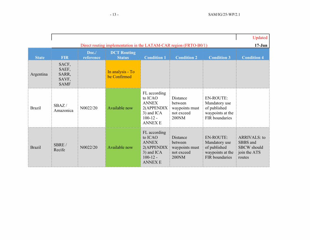
Direct routing implementation in the LATAM-CAR region (FRTO-B0/1)
Updated
17-Jun
State FIR Doc./
reference DCT Routing
Status Condition 1 Condition 2 Condition 3 Condition 4
Argentina
SACF, SAEF, SARR, SAVF, SAMF
In analysis - To be Confirmed
Brazil SBAZ / Amazonica
N0022/20 Available now
FL according to ICAO ANNEX 2(APPENDIX 3) and ICA 100-12 - ANNEX E
Distance between waypoints must not exceed 200NM
EN-ROUTE: Mandatory use of published waypoints at the FIR boundaries
Brazil SBRE / Recife
N0022/20 Available now
FL according to ICAO ANNEX 2(APPENDIX 3) and ICA 100-12 - ANNEX E
Distance between waypoints must not exceed 200NM
EN-ROUTE: Mandatory use of published waypoints at the FIR boundaries
ARRIVALS: to SBBS and SBCW should join the ATS routes

SAM/IG/25 – WP/2.1 - 14 -
Direct routing implementation in the LATAM-CAR region (FRTO-B0/1)
Updated
17-Jun
State FIR Doc./
reference DCT Routing
Status Condition 1 Condition 2 Condition 3 Condition 4
Central America
MHTG / CENAMER
AIC A 4/20 Available now At or above FL200
EN-ROUTE: Mandatory use of published waypoints at the FIR boundaries
DEPARTURES: the DCT must start at the last waypoint on the SID
ARRIVALS: DCT route must end at the STAR initial waypoint of WPY before leaving the CENAMER FIR
Colombia SKEC / Barranquilla
AIP ENR 1.3-1
Availability now From FL210 and Above
Avoid Restricted, Dangerous and Prohibited areas
EN-ROUTE: Mandatory use of published waypoints at the FIR boundaries
Colombia SKED / Bogota
AIP ENR 1.3-1
Available now From FL210 and Above
Avoid Restricted, Dangerous and Prohibited areas
EN-ROUTE: Mandatory use of published waypoints at the FIR boundaries

- 15 - SAM/IG/25-WP/2.1
Direct routing implementation in the LATAM-CAR region (FRTO-B0/1)
Updated
17-Jun
State FIR Doc./
reference DCT Routing
Status Condition 1 Condition 2 Condition 3 Condition 4
Curacao TNCF / Curacao
AIC05/20 A0217/20
Available from May 20th
EN-ROUTE: Use published waypoints for entry, inside and exit of FIR and aobove FL280
DEPARTURES: Follow SID to waypoint of your SID name and free route to exit waypoint of FIR
ARRIVALS: From entry waypoint of FIR, use free route to ingress point for STAR.
Dominican Republic
MDCS / Santo Domingo
A0151/20 Available now
EN-ROUTE: Mandatory use of published waypoints at the FIR boundaries
Avoid Restricted, Dangerous and Prohibited areas
DEPARTURES: the DCT could start from the last waypoint on the SID
ARRIVALS: the DCT could end at the waypoint where the STAR begins
Ecuador SEFG / Guayaquil
ENR 1.10 Available now
EN-ROUTE: Mandatory use of published waypoints at the FIR boundaries
Avoid Restricted, Dangerous and Prohibited areas

SAM/IG/25 – WP/2.1 - 16 -
Direct routing implementation in the LATAM-CAR region (FRTO-B0/1)
Updated
17-Jun
State FIR Doc./
reference DCT Routing
Status Condition 1 Condition 2 Condition 3 Condition 4
Guyana SYGC / Georgetown
AIP ENR 1.10-1
Available now
EN-ROUTE: Mandatory use of published waypoints at the FIR boundaries
Jamaica MKJK / Kingston
AIC A27/20 A0252/20
Available now
EN-ROUTE: Mandatory use of published waypoints at the FIR boundaries
ARRIVALS: the DCTs could end at the STAR initial WPT or The WPT previous the descend below the minimum safe altitude
DEPARTURES: at The end of the SID (last waypoint in the SID), or The waypoint after crossing the minimum safe altitude

- 17 - SAM/IG/25-WP/2.1
Direct routing implementation in the LATAM-CAR region (FRTO-B0/1)
Updated
17-Jun
State FIR Doc./
reference DCT Routing
Status Condition 1 Condition 2 Condition 3 Condition 4
Mexico MMFR / Mexico
A2617/20 Available from May 16th
ALL: -At and Above FL200 -distances between lat/long and/or waypoints in FPL item 15 not exceeding 200NM as per ICAO doc4444 appendix 2 -Avoid dangerous, prohibited and restricted areas
EN-ROUTE: Mandatory use of published waypoints at the MMFR FIR boundaries and when crossing the CTAs: MMID, MMZT, MMEX AND/OR MMTY
ARRIVALS: the DCT must end at the STAR initial WPT or within the STAR before leaving the ATS surveillance service
DEPARTURES: at the last SID WPT or as instructed by ATC
Panama MPZL / Panama
ENR 1.10 Availability now
EN-ROUTE: Mandatory use of published waypoints at the FIR boundaries
ARRIVALS and DEPARTURES: the end/start of the DCT routing should be at the TMA boundary waypoint

SAM/IG/25 – WP/2.1 - 18 -
Direct routing implementation in the LATAM-CAR region (FRTO-B0/1)
Updated
17-Jun
State FIR Doc./
reference DCT Routing
Status Condition 1 Condition 2 Condition 3 Condition 4
Peru SPIM / Lima
In analysis - To be Confirmed
Trinidad & Tobago
TTZP / Piarco
Confirmed - Publication expected
Venezuela SVZM / Maiquetia
Availability now

- 19 - SAM/IG/25-WP/2.1
Preferred routes (DCT) implementation in the LATAM-CAR region
Updated
15-May
State FIR Doc./
reference DCT Routing
Status Route description / Comments
Cuba MUFH / Habana
approval letter 15/May/2020
Available now
CANOA DCT ULARI – ULARI DCT CANOA CANOA DCT LENUK – LENUK DCT CANOA CANOA DCT NOSAT CANOA DCT EMOSA – EMOSA DCT CANOA MAXIM DCT NUKAN – NUKAN DCT MAXIM ALURU DCT ATUVI – ATUVI DCT ALURU PABEL DCT IKBIX SELEK DCT IKBIX FUNDI DCT LEPON URSUS DCT GAXER GAXER DCT ZEUSS URSUS DCT NIBEO EPSIM DCT ZEUSS BORDO DCT GELOG – GELOG DCT BORDO EMABU DCT ENAMO – ENAMO DCT EMABU VIKRO DCT ENAMO – ENAMO DCT VIKRO GHANN DCT ULDAR – ULDAR DCT GHANN GHANN DCT VIKRO – VIKRO DCT GHANN
Brazil SBBS / Brasilia
NOTAM J0282/20
Available now Use of Opticional Routes listed in https://www.aisweb.aer.mil.br/?i=espaco-aereo&p=playbook
Brazil SBCW / Curitiba
NOTAM K0516/20
Available now Use of Opticional Routes listed in https://www.aisweb.aer.mil.br/?i=espaco-aereo&p=playbook
USA Continental NAS
NAS AC90-91K
Available now
7210.3BB Available now
HAR Available now

SAM/IG/25 – WP/2.1 - 20 -
Appendix C
SAMPLE AIP SUPPLEMENT
ONLY OVERFLIGHTS
S T A T E
AERONAUTICAL INFORMATION
SERVICE
IMPLEMENTATION OF STRATEGIC DIRECT ROUTING IN THE UPPER AIRSPACE OF THE XXX FIR
1. PURPOSE
1.1 The purpose of this AIP Supplement is to report on [or establish processes for] the implementation of strategic direct routing in the upper airspace of the XXXX FIR, following the procedures described below.
2. INTRODUCTION
2.1. In South America, the SAM ATS route network was completely restructured over the past 10 years, involving the implementation, realignment and elimination of hundreds of ATS routes, leading to a more direct and efficient fixed route structure. 2.2. The use of fixed ATS routes no longer provides the efficiency required for airspace users to achieve fuel savings and the reduction of greenhouse gas emissions. The next step in the natural evolution of airspace optimisation is the use of free route airspace (FRA), as set out in the Global Air Navigation Plan, considering strategic direct routing (EDE) as a transition to the implementation of FRA. 3. DEFINITIONS AND ABBREVIATIONS
3.1. For the purposes of this AIP Supplement, the following definition applies: 3.1.1. Strategic direct routing (EDE) – Direct route inserted in the flight plans, using the published
significant points (waypoints) and radio aids, with the purpose of planning more efficient routes, based on the procedures established below. Note: Significant points (waypoints) based on LAT/LONG could be applied, depending on available ATC systems and airspace characteristics. A LAT/LONG waypoint may be required to meet specific requirements of the automated ATC system.
4. OPERATIONAL PROCEDURES FOR EDE IMPLEMENTATION
Phone: Fax: E-mail: Sitatex: Telex:
AMDT AIP/Supplement N°
XX / XX
XX XX , 2020

- 21 - SAM/IG/25-WP/2.1
4.1. Adequate ATS surveillance and VHF communication coverage is an essential requirement for the use of EDE in continental airspace.
4.2. The implementation of ADS-C/CPDLC is an essential requirement for EDE operations in oceanic airspaces.
4.3. EDE will not be applied in partial or total ATS contingency situations.
4.4. Flight plans
4.4.1. The cruise level table of Appendix 3 to (ICAO) Annex 2 shall be applied.
4.4.2. The flight plan shall be based on the published significant points (waypoints) or radio
navigation aids.
4.4.3. The flight plan shall contain a significant point (waypoint) at FIR boundaries.
4.4.4. The distance between published significant points (waypoints) inserted in the flight plan shall not be greater than xxx NM (or xxx minutes of flight).
Note: Doc. 4444: The track of flights operating predominantly in an east-west direction between 70N and 70S, by reference to significant points formed by the intersections of half or whole degrees of latitude with meridians spaced at intervals of 10 degrees of longitude. For flights operating in areas outside those latitudes the tracks shall be defined by significant points formed by the intersection of parallels of latitude with meridians normally spaced at 20 degrees of longitude. The distance between significant points shall, as far as possible, not exceed one hour’s flight time. Additional significant points shall be established as deemed necessary.
4.4.5. FPLs should contain a reporting point (LAT/LONG) at a maximum distance of XX NM or
equivalent to XX minutes before the FIR boundary.
Note: Each State shall establish specific FPL filling requirements to meet ATS system specifications, with a view to avoiding rejection or delay in FPL processing. The attachment to this AIC presents models for filling the FPL form applying the EDE concept, and addresses several cases applicable within the FIR and for international departures/arrivals.
5 ADDITIONAL INFORMATION
Additional information can be obtained through the following contacts: Dirección General de Aeronáutica Civil/Directorate General of Civil Aeronautics
- Nnnnnnn email ICAO Lima
Mr. xxx xxxxx (email: [email protected])

SAM/IG/25 – WP/2.1 - 22 -
ATTACHMENT
[The State includes in this attachment, in accordance with the specific requirements of its automated systems, messaging and/or ATS procedures, models for filling in box 12 of the flight plan, as guidance for the staff of ARO AIS services, AFS communications, ATC and air operators.]
- 23 - SAM/IG/25-WP/2.1
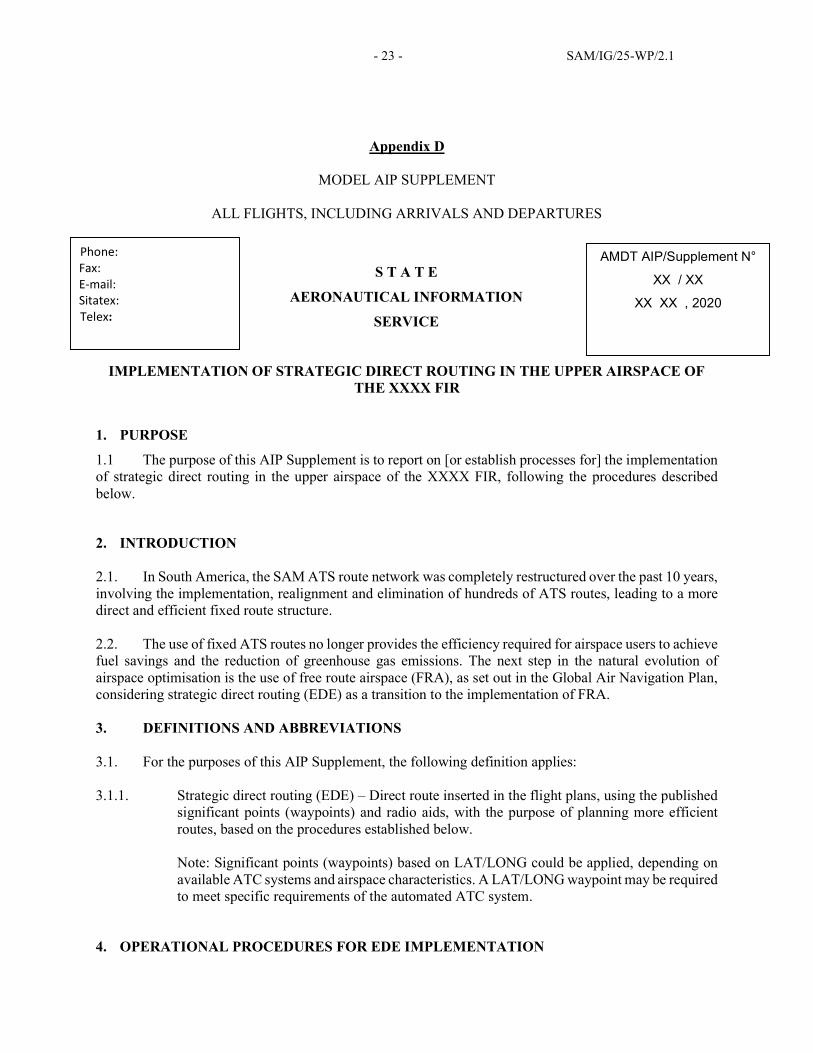
Appendix D
MODEL AIP SUPPLEMENT
ALL FLIGHTS, INCLUDING ARRIVALS AND DEPARTURES
S T A T E
AERONAUTICAL INFORMATION
SERVICE
IMPLEMENTATION OF STRATEGIC DIRECT ROUTING IN THE UPPER AIRSPACE OF THE XXXX FIR
1. PURPOSE
1.1 The purpose of this AIP Supplement is to report on [or establish processes for] the implementation of strategic direct routing in the upper airspace of the XXXX FIR, following the procedures described below.
2. INTRODUCTION
2.1. In South America, the SAM ATS route network was completely restructured over the past 10 years, involving the implementation, realignment and elimination of hundreds of ATS routes, leading to a more direct and efficient fixed route structure. 2.2. The use of fixed ATS routes no longer provides the efficiency required for airspace users to achieve fuel savings and the reduction of greenhouse gas emissions. The next step in the natural evolution of airspace optimisation is the use of free route airspace (FRA), as set out in the Global Air Navigation Plan, considering strategic direct routing (EDE) as a transition to the implementation of FRA. 3. DEFINITIONS AND ABBREVIATIONS
3.1. For the purposes of this AIP Supplement, the following definition applies: 3.1.1. Strategic direct routing (EDE) – Direct route inserted in the flight plans, using the published
significant points (waypoints) and radio aids, with the purpose of planning more efficient routes, based on the procedures established below. Note: Significant points (waypoints) based on LAT/LONG could be applied, depending on available ATC systems and airspace characteristics. A LAT/LONG waypoint may be required to meet specific requirements of the automated ATC system.
4. OPERATIONAL PROCEDURES FOR EDE IMPLEMENTATION
Phone: Fax: E-mail: Sitatex: Telex:
AMDT AIP/Supplement N°
XX / XX
XX XX , 2020
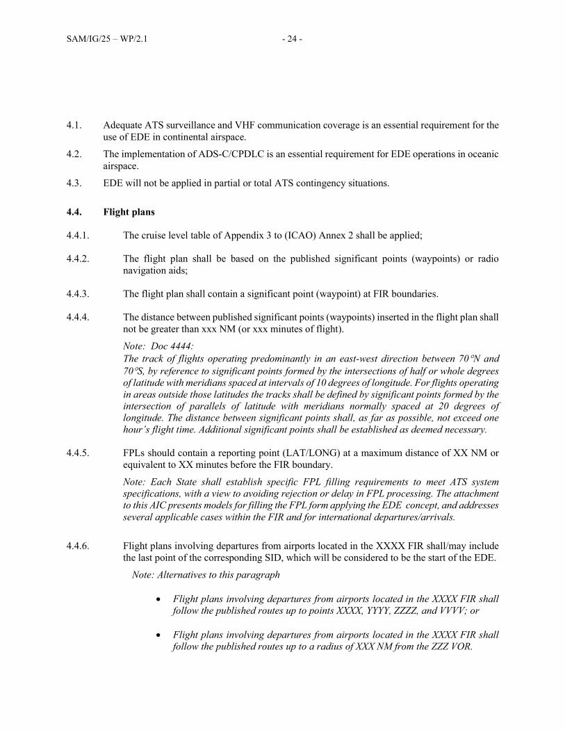
SAM/IG/25 – WP/2.1 - 24 -
4.1. Adequate ATS surveillance and VHF communication coverage is an essential requirement for the use of EDE in continental airspace.
4.2. The implementation of ADS-C/CPDLC is an essential requirement for EDE operations in oceanic airspace.
4.3. EDE will not be applied in partial or total ATS contingency situations.
4.4. Flight plans
4.4.1. The cruise level table of Appendix 3 to (ICAO) Annex 2 shall be applied;
4.4.2. The flight plan shall be based on the published significant points (waypoints) or radio
navigation aids;
4.4.3. The flight plan shall contain a significant point (waypoint) at FIR boundaries.
4.4.4. The distance between published significant points (waypoints) inserted in the flight plan shall not be greater than xxx NM (or xxx minutes of flight).
Note: Doc 4444: The track of flights operating predominantly in an east-west direction between 70N and 70S, by reference to significant points formed by the intersections of half or whole degrees of latitude with meridians spaced at intervals of 10 degrees of longitude. For flights operating in areas outside those latitudes the tracks shall be defined by significant points formed by the intersection of parallels of latitude with meridians normally spaced at 20 degrees of longitude. The distance between significant points shall, as far as possible, not exceed one hour’s flight time. Additional significant points shall be established as deemed necessary.
4.4.5. FPLs should contain a reporting point (LAT/LONG) at a maximum distance of XX NM or
equivalent to XX minutes before the FIR boundary.
Note: Each State shall establish specific FPL filling requirements to meet ATS system specifications, with a view to avoiding rejection or delay in FPL processing. The attachment to this AIC presents models for filling the FPL form applying the EDE concept, and addresses several applicable cases within the FIR and for international departures/arrivals.
4.4.6. Flight plans involving departures from airports located in the XXXX FIR shall/may include
the last point of the corresponding SID, which will be considered to be the start of the EDE.
Note: Alternatives to this paragraph
Flight plans involving departures from airports located in the XXXX FIR shall follow the published routes up to points XXXX, YYYY, ZZZZ, and VVVV; or
Flight plans involving departures from airports located in the XXXX FIR shall follow the published routes up to a radius of XXX NM from the ZZZ VOR.

- 25 - SAM/IG/25-WP/2.1
4.4.7. Flight plans involving arrivals at airports located in the XXXX FIR shall/may include the first point of the corresponding STAR, which will be considered to be the end of the DTS.
Note: Alternatives to this paragraph. Flight plans involving arrivals at airports located in the XXXX FIR shall follow the
published routes from points XXXX, YYYY, ZZZZ and VVVV; or
Flight plans involving arrivals at airports located in the XXXX FIR must follow the published route from a radius of XXX NM of the ZZZ VOR; or
For non-STAR airports, it should be indicated that FPLs could be planned as direct flights
to the IAF or include significant points (waypoints) of the route that should be inserted in the FPL.
5 ADDITIONAL INFORMATION
Additional information can be obtained through the following contacts: Dirección General de Aeronáutica Civil/Directorate General of Civil Aeronautics
- Nnnnnnnn email
ICAO Lima Mr. xxx xxxxx (email: [email protected])
ATTACHMENT
[The State includes in this attachment, in accordance with the specific requirements of its automated systems, messaging and/or ATS procedures, models for filling in box 12 of the flight plan, as guidance for the staff of ARO AIS services, AFS communications, ATC and air operators.]

- 26 - SAM/IG/25-WP/2.1
Appendix E
SAFETY ASSESSMENT MODEL
EXAMPLE OF RISK ANALYSIS AND MANAGEMENT MATRIX APPLICABLE TO STRATEGIC DIRECT ROUTING (EDE)
Note: The following example of a matrix is considered valid for the period July - December 2020, with flight/overflight flow reduced to 10% - 40% of the operations recorded in December 2019, for the respective ACC.
(1) Flight phase or
segment
(2) Hazard
identification
(3) Possible
consequences
(4) Risk index
(5) Mitigations
(6) Risk index after
mitigation
(7)
Notes
Oceanic upper airspace
Aircraft transferred and under control and responsibility of the (sector) ACC
Data link failure affects CPDLC and simultaneous HF failure (or HF not available) of the aircraft prevents position reporting to ATC. Absence of aircraft position reports impairs ATCO situational awareness.
This results in a loss of separation between aircraft.
3C Tolerable
Remote: 3
Major: C
1. Flight plan management. Updated flight plan. ATS message. Doc 4444 Appendix 2.
2. ATS surveillance (ADS-C) available.
3. Procedures and methods on aircraft radio transmitter failure. Doc 4444, Ch 8 and Ch 15.
4. Procedures (and/or SUPPS) applicable to oceanic airspace, in case of communications failure.
5. Table of levels, Annex 2, Appendix 3.
6. ACAS/TCAS on board
7. Automated ATC systems with MTCD (medium-term conflict detection) and/or STCA (short-term conflict alert)
8. Communication via satellite phone.
2D Aceptable
Improbable: 2
Minor: D
The operational requirements for the application of EDE are shown in the AIP SUP xx/20 of [State]
Continental upper airspace
Aircraft transferred and under control and responsibility of the (sector) ACC
Aircraft radio transmitter failure prevents position reporting to ATC. Absence of aircraft position reports impairs ATCO situational awareness.
This results in a loss of separation between aircraft.
3C Tolerable
Remote: 3
Major: C
1. Flight plan management. Updated flight plan. ATS message. Doc 4444 Appendix 2.
2. ATS surveillance (radar or ADS-B) available.
3. Procedures and methods on aircraft radio transmitter failure. Doc 4444, Ch 8 and Ch 15.
4. Transponder code 7600
5. Table of levels, Annex 2, Appendix 3.
6. ACAS/TCAS on board
2D Acceptable
Improbable: 2
Minor: D
The operational requirements for the application of EDE are shown in the AIP SUP xx/20 of [State].

- 27 - SAM/IG/25-WP/2.1
(1) Flight phase or
segment
(2) Hazard
identification
(3) Possible
consequences
(4) Risk index
(5) Mitigations
(6) Risk index after
mitigation
(7)
Notes
7. Automated ATC systems with MTCD (medium-term conflict detection) and/or STCA (short-term conflict alert)
8. The ACARS (aircraft communications addressing and reporting system) would allow the position to be received through the aircraft operator.
Oceanic or continental upper airspace.
Aircraft transferred and under control and responsibility of the (sector) ACC
Severe communication failure in the responsible ACC prevents ATCO from receiving aircraft position reports. The absence of reports impairs ATCO situational awareness.
This results in a loss of separation between aircraft.
3C Tolerable
Remote: 3
Major: C
1. The State ATS Contingency Plan provides for the temporary suspension of EDE during a contingency.
1E Acceptable
Extremely Improbable: 1
Negligible: E
The operational requirements for the application of EDE are shown in the AIP SUP xx/20 of [State].
Oceanic or continental upper airspace.
Aircraft transferred and under control and responsibility of the (sector) ACC
Presence of bad weather conditions that require the pilot to ask to deviate from the planned route (path).
The deviation authorised by ATC causes a path overlap with another aircraft.
This results in a loss of separation between aircraft.
1C Acceptable
Extremely Improbable: 1
Major: C
N/A
N/A
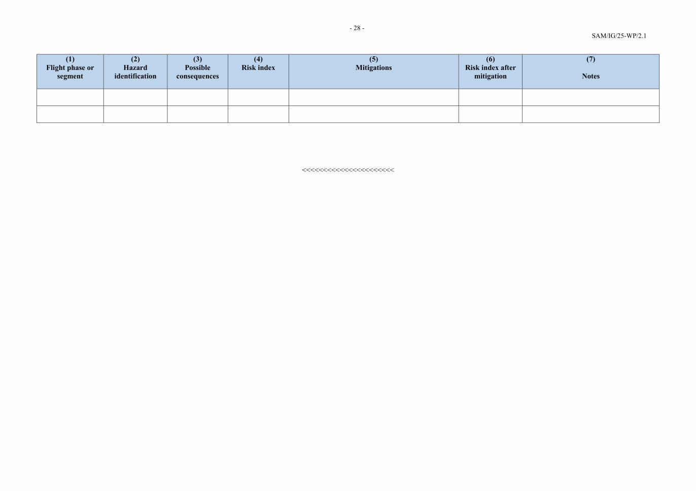
- 28 - SAM/IG/25-WP/2.1
(1) Flight phase or
segment
(2) Hazard
identification
(3) Possible
consequences
(4) Risk index
(5) Mitigations
(6) Risk index after
mitigation
(7)
Notes
<<<<<<<<<<<<<<<<<<<<<<

- 29 - SAM/IG/25-WP/2.1
Appendix
Examples of tables and matrices for the analysis of risks and mitigations
Figure 1: Example of risk likelihood table
Likelihood Meaning Value
Frequent Likely to occur many times (has occurred frequently) 5
Occasional Likely to occur sometimes (has occurred infrequently) 4
Remote Unlikely to occur, but possible (has occurred rarely) 3
Improbable Very unlikely to occur (not known to have occurred) 2
Extremely improbable
Almost inconceivable that the event will occur 1
Figure 2: Example of severity table
Severity Meaning Value Catastrophic Aircraft or equipment destroyed
Several fatalities
A
Hazardous Greatly reduced safety margins, physical stress or a workload such that operations personnel can no longer be relied upon to perform their tasks accurately or completely
Severe injuries Significant damage to equipment
B
Major Significant reduction in safety margins, reduced ability of operations personnel to tolerate adverse operating conditions, as a result of increased workload or as a result of conditions affecting their efficiency
Serious incident Injuries to people
C
Minor Operational limitations Use of emergency procedures Minor incident
D
Negligible Few consequences
E

SAM/IG/25-WP/2.1 - 30 -
Figure 3: Examples of risk assessment matrices
Probability of risk
Severity of risk
Catastrophic
A
Hazardous
B
Major
C
Minor
D
Negligible
E
Frequent 5 5A 5B 5C 5D 5E
Occasional 4 4A 4B 4C 4D 4E
Remote 3 3A 3B 3C 3D 3E
Improbable 2 2A 2B 2C 2D 2E
Extremely improbable 1
1A 1B 1C 1D 1E
Risk index range Description of risk Recommended action
5A, 5B, 5C,
4A, 4B, 3A Intolerable
Take immediate action to mitigate risk or suspend the activity. Perform priority safety risk mitigation to ensure that preventive or additional or enhanced controls are in place to reduce the risk index to the tolerable range.
5D, 5E, 4C, 4D
4E, 3B, 3C, 3D,
2A, 2B, 2C, 1A
Tolerable
May be tolerated based on safety risk mitigation. May require a management decision to accept the risk.
3E, 2D, 2E, 1B,
1C, 1D, 1E Acceptable
Acceptable as is. No further risk mitigation required.

- 31 - SAM/IG/25-WP/2.1
Appendix F
ATC TRAINING GUIDE
GUIDANCE FOR STRATEGIC DIRECT ROUTING TRAINING
SUBJECT: QUALIFICATION AND TRAINING OF PILOTS, ATCOs AND ARO STAFF WITH RESPECT TO THE IMPLEMENTATION OF STRATEGIC DIRECT ROUTING IN THE SOUTH AMERICAN REGION
SECTION A - PURPOSE
This Training Guide seeks to standardise training to facilitate early implementation of STRATEGIC DIRECT ROUTING (EDE) in the South American Region during the pandemic. Likewise, it provides information for the correct interpretation of the standard practices and procedures of the Global Air Navigation Plan, 6th edition, and the SAM CONOPS.
Recovery phase
a) Implement strategic direct routing in low air traffic volume airspaces, as a function of COVID-19, based on the experience gained in its implementations in some South American States.
SECTION B – SCOPE
The scope is aimed at providing:
a) Airspace users with additional flight planning route options on a larger scale in FIRs, so that planned leg distances can be reduced overall, compared to the fixed route network.
b) Assistance to organisations for the implementation of the STRATEGIC DIRECT ROUTING Basic Training Package in the South American Region.
This training guide provides acceptable, but not the only, alternatives for States to manage EDE training of aviation personnel.
SECTION C – INFORMATION
a) DEFINITIONS
Qualification: Minimum basic knowledge, usually acquired through education programmes, required to practise a profession.
Qualify: To give someone specialised training to perform a professional activity or a specific job.
Competency. Knowledge, skills and attitudes required to perform the specific tasks that a work activity demands.

SAM/IG/25-WP/2.1 - 32 -
NOTE: Competencies are generally acquired and assessed through the performance of the work activity or through various training opportunities.
b) ACRONYMS
ASBU AVIATION SYSTEM BLOCK UPGRADE METHODOLOGY
ATCO AIR TRAFFIC CONTROLLER
EDE STRATEGIC DIRECT ROUTING (SPANISH; ENRUTAMIENTO DIRECTO
ESTRATÉGICO)
FRA FREE ROUTE AIRSPACE CONCEPT
GANP GLOBAL AIR NAVIGATION PLAN
GESEA SAM AIRSPACE STUDY AND IMPLEMENTATION GROUP
KPI KEY PERFORMANCE INDICATOR
SECTION D – TEACHING AND TRAINING
1) 2020 OPERATIONAL CONCEPT
A. AIRSPACE CONCEPT
B. THEORETICAL ASSUMPTIONS OF THE OPERATIONAL CONCEPT
2) GANP GLOBAL AIR NAVIGATION PLAN
A. INTRODUCTION AND ICAO STRATEGIC OBJECTIVES
B. ASBU
C. FRTO B0/1, HIGHLIGHTING THE FOLLOWING ASPECTS:
EDE, IMPLEMENTATION AND LIMITATIONS:
A. TIME RESTRICTION (FIXED OR DEPENDING ON TRAFFIC/AVAILABILITY);
B. TRAFFIC RESTRICTION (BASED ON TRAFFIC FLOW AND/OR LEVEL);
C. FLIGHT LEVEL;
D. LATERAL RESTRICTIONS;
E. ENTRY/EXIT POINTS.
PROCEDURES AND PROCESSES TO CONSIDER:
A. IDENTIFY THE EDE (LATERAL AND VERTICAL) AIRSPACE VOLUME AND APPLICABLE TIME;
B. COEXISTENCE OF DIRECT ROUTES WITH THE ATS ROUTE STRUCTURE;

- 33 - SAM/IG/25-WP/2.1
C. ADAPT AIRSPACE DESIGN TO ENSURE HORIZONTAL AND VERTICAL CONNECTIVITY WITH
EDE.
D. ATFM PROCEDURES FOR EDE;
E. REVISION OF LOAS WITH ADJACENT ATS UNITS;
F. PUBLICATION OF DATA RELEVANT TO EDE (IN THE AIP SEE APP.1 MODEL AMDT AIP
SUP EDE);
G. AIRSPACE MANAGEMENT PROCEDURES FOR THE IMPLEMENTATION OF DIRECT ROUTES;
H. ATC PROCEDURES FOR EDE COORDINATION, INCLUDING HANDOVER, PATH CHANGES IN
DIRECT ROUTING; CONFLICT DETECTION.
4) OPERATIONAL AND DEPENDENT RELATIONSHIP WITH OTHER ASBU ELEMENTS
5) GANP (6TH EDITION) MODULES/ELEMENTS
A. NOPS-B0/1 INITIAL INTEGRATION OF COLLABORATIVE AIRSPACE MANAGEMENT WITH AIR
TRAFFIC FLOW MANAGEMENT
THE INTEGRATION OF AIRSPACE MANAGEMENT AND AIR TRAFFIC FLOW MANAGEMENT IS A
DESIRABLE REQUIREMENT, WITH A VIEW TO OPTIMISING EDE IMPLEMENTATION IN THE SAM
REGION.
B. FRTO-B0/2 - AIRSPACE PLANNING AND FLEXIBLE USE OF AIRSPACE (FUA)
THE APPLICATION OF FUA COULD OPTIMISE EDE IMPLEMENTATION, TAKING INTO ACCOUNT
THAT EDE ROUTES COULD ENTER SPECIAL USE AIRSPACE, IN ACCORDANCE WITH PRE-ESTABLISHED PROCEDURES.
C. FRTO-B0/4 - BASIC CONFLICT DETECTION AND CONFORMANCE MONITORING
MEDIUM-TERM CONFLICT DETECTION (MTCD) AND CONFORMANCE MONITORING TOOLS ARE
CONSIDERED AS REQUIREMENTS TO REDUCE THE WORKLOAD OF AIR TRAFFIC CONTROLLERS IN
HIGH AIR TRAFFIC VOLUME ENVIRONMENTS. ACCORDINGLY, THEY CAN BE CONSIDERED AS
DESIRABLE REQUIREMENTS AND SHOULD BE TAKEN INTO ACCOUNT WHEN UPGRADING ATM
SYSTEMS.
D. FICE-B0/1 - AUTOMATED BASIC INTER FACILITY DATA EXCHANGE (AIDC)
SIMILARLY, AIDC IS CONSIDERED A DESIRABLE TOOL FOR EDE IMPLEMENTATION, WITH A
VIEW TO REDUCING ATCO WORKLOAD, ESPECIALLY IN HIGH AIR TRAFFIC VOLUME
OPERATIONAL ENVIRONMENTS, PARTICULARLY WHEN THERE IS HANDOVER OF EDE FLIGHTS IN
BOTH FIRS.
6) ENABLERS
REGARDING ENABLERS, THE GLOBAL AIR NAVIGATION PLAN, IN FRTO BO/1, LISTS A SERIES OF
EUROCONTROL DOCUMENTS THAT COULD BE USED AS GUIDANCE MATERIAL. HOWEVER, EDE
IMPLEMENTATION IN THE SAM REGION MUST TAKE INTO ACCOUNT AIRSPACE CHARACTERISTICS AND
AIR TRAFFIC DEMAND, WHICH IS SIGNIFICANTLY LESS THAN IN EUROPE.
7) KEY PERFORMANCE INDICATORS (KPIS)

SAM/IG/25-WP/2.1 - 34 -
STRATEGIC DIRECT ROUTING (EDE) WILL BE ESTABLISHED AT NATIONAL AND REGIONAL LEVEL AND
MADE AVAILABLE FOR FLIGHT PLANNING (WITH PUBLISHED CONDITIONS OF USE).
EDE SHALL BE CONSIDERED AS A TRANSITION TO THE IMPLEMENTATION OF THE FREE ROUTE AIRSPACE
(FRA) CONCEPT. EDE OPERATIONS ALLOW AIRSPACE USERS TO OPTIMISE FLIGHT AND FUEL
PLANNING.
THE NEXT STEP IN THE NATURAL EVOLUTION OF AIRSPACE OPTIMISATION IS THE USE OF FREE ROUTE
AIRSPACE (FRA), AS SET OUT IN THE GLOBAL AIR NAVIGATION PLAN, CONSIDERING STRATEGIC
DIRECT ROUTING AS A TRANSITION FOR THE IMPLEMENTATION OF FRA. THE USE OF FIXED ATS
ROUTES CAN NO LONGER PROVIDE THE EFFICIENCY REQUIRED FOR AIRSPACE USERS TO OBTAIN FUEL
SAVINGS AND THE REDUCTION OF GREENHOUSE GAS EMISSIONS.
IN THIS SENSE, A CHANGE WAS MADE IN THE AIRSPACE OPTIMISATION STRATEGY IN SOUTH AMERICA, THROUGH THE IMPLEMENTATION OF ASBU FRTO B0/B1. IT IS IMPORTANT TO NOTE THAT, ACCORDING TO THE GANP, THE NECESSARY DOCUMENTS AND THE GUIDANCE MATERIAL FOR THE
IMPLEMENTATION OF ASBU B0 ARE ALREADY AVAILABLE, AND THOSE CORRESPONDING TO ASBU B1
WILL BE PUBLISHED BY 2020.
3) ASSESSMENT OF IMPACT ON PERFORMANCE
[SEE APPENDIX 2, EXAMPLE OF MATRIX FOR ANALYSING AND MANAGING RISKS APPLICABLE TO STRATEGIC DIRECT ROUTING (EDE)]
4) PRACTICE ON A SIMULATOR
A. IMPLEMENTATION CHECKLIST
Appendix 1 – PUBLICATION OF DATA RELEVANT TO EDE IN THE AIP
Appendix 2 – EXAMPLE OF MATRIX FOR ANALYSING AND MANAGING RISKS APPLICABLE TO STRATEGIC DIRECT ROUTING (EDE)

- 35 - SAM/IG/25-WP/2.1
Appendix G
FUEL SAVINGS template

SAM/IG/25-WP/2.1 - 36 -
Appendix H
FUEL SAVINGS - BRAZIL

- 37 - SAM/IG/25-WP/2.1

SAM/IG/25-WP/2.1 - 38 -