Sacred Landscapes and the Cult of Saints in the Anglo ...
300
In the Footsteps of the Holy: Sacred Landscapes and the Cult of Saints in the Anglo-Norman World, 1066-1220 Volume 1 of 2: The Text Ross T. McIntire PhD University of York Centre for Medieval Studies September 2019
-
Upload
khangminh22 -
Category
Documents
-
view
1 -
download
0
Transcript of Sacred Landscapes and the Cult of Saints in the Anglo ...
In the Footsteps of the Holy: Sacred
Landscapes and the Cult of Saints in the
Anglo-Norman World, 1066-1220
Volume 1 of 2: The Text
Ross T. McIntire
PhD
University of York
Centre for Medieval Studies
September 2019

2
Abstract:
The study of sacred space and the cult of saints in the Anglo-Norman world has been primarily
focused around the shrines and the great cathedrals and abbey churches that were built to
contain them. Considerably less attention has been paid to the phenomenon of sacred places in
the broader landscape as they relate to the promotion and veneration of a saint and his or her
cult. This thesis argues that secondary cult sites and sacred landscapes were a crucial component
of the cults of several major institutions, and that they can be identified and understood using a
comprehensive interdisciplinary approach (including archaeology) that captures the full extent
of the experience of the medieval pilgrim and the institutional agendas that shaped the sites he
or she would visit.
This project employs a specialized methodology and draws a set of conceptual models from the
better-surviving and studied examples of sacred landscapes in Ireland. Three case studies (St
Davids, the cult of St Cuthbert, and Glastonbury) have been selected for Anglo-Norman England
and Wales, primarily centered around the efforts of the host foundations to establish institutional
and historical continuity between their present communities and the distant past of their patrons
in a time of fundamental transition from pre-Conquest ‘native’ ecclesiastical communities to those
governed by reformed orders originating from the continent. This period of institutional
transition can be broadly located between the year of the Conquest in 1066 to the rise of the cult
of Thomas Becket in the early thirteenth century. The goal of the project is to contribute to a richer
understanding of how the cult of saints was experienced and promoted, primarily through the
lens of the saints’ institutional guardians and their agendas, and to deepen our appreciation of
how medieval people interacted with the divine in the mundane world.
3
VOLUME 1: TABLE OF CONTENTS
Abstract: ................................................................................................................................................................................. 2
VOLUME 1: TABLE OF CONTENTS ................................................................................................................... 3
VOLUME 2: TABLE OF FIGURES ........................................................................................................................ 6
Author’s Declaration: .................................................................................................................................................... 10
ABBREVIATIONS................................................................................................................................................... 11
I: INTRODUCTION ................................................................................................................................................ 13
Key Terms ........................................................................................................................................................................... 15
Structure of the Project ................................................................................................................................................ 16
II: INTELLECTUAL CONTEXT AND LITERATURE REVIEW: LOCATING OLD SAINTS IN ANGLO-NORMAN ENGLAND
The Cult of Saints ............................................................................................................................................................. 19
Anglo-Norman Hagiography: Changing Attitudes........................................................................................... 21
Decoding the Hagiographical ‘Genre’: Fictionality, Inventiones, and Miracula ................................. 24
The State of the Field: The Shrine and the Cult ................................................................................................ 31
“The Spatial Turn”: ‘Place’ and ‘Space’ in the Study of Sacred Landscapes......................................... 33
Pilgrimage ........................................................................................................................................................................... 40
Beyond the Medieval: The Role of Prehistory and Non-Western Ideas of Sacred Space ............. 43
The State of Scholarship: Sacred Spaces and the Cult of Saints ................................................................ 50
III: METHODOLOGY AND THEORETICAL APPROACHES
The Oratory of St Æbbe, Coldingham ............................................................................................................... 59
Defining a ‘Sacred Landscape’ ................................................................................................................................... 62
Case Studies: Criteria for Inclusion ........................................................................................................................ 65
Advantages and Challenges to an Interdisciplinary Study of Sacred Landscapes ........................... 66
History and Hagiography ....................................................................................................................................... 68
The Contribution of Archaeology ....................................................................................................................... 69
Antiquarian Records and Maps ........................................................................................................................... 71
Personal Observation ............................................................................................................................................... 73
Analysis of Digital Data............................................................................................................................................ 74
IV: THE SACRED LANDSCAPES OF IRELAND
Introduction and Methodology: Using the Irish Case Studies ................................................................... 76
‘The Irish Model’: Dindshenchas, Praesentia, and the Organization of Sacred Space ..................... 81
Modelling Ireland’s Sacred Landscapes ............................................................................................................... 85
Glendalough: St Kevin in the Valley .................................................................................................................. 86
St Patrick’s Purgatory, Lough Derg: A Twelfth-Century Legend ......................................................... 94
Inishmurray: Pilgrimage and the Western Isles ......................................................................................... 97
Monaincha, Co. Tipperary ................................................................................................................................... 100
Dingle Peninsula, Co. Kerry ................................................................................................................................ 103
4
Derry and Betha Colum Cille – A Landscape of Columban Foundation ......................................... 110
Glencolumbkille: Reuse of a Prehistoric and Early Christian Landscape .................................... 113
Conclusions: Irish sacred landscapes and their broader significance ................................................ 116
V: ‘DEWISLAND’: DIFFUSED SANCTITY AROUND ST DAVIDS CATHEDRAL
Introduction .................................................................................................................................................................... 118
Saints in Their Landscapes: The Welsh Pilgrimage Tradition................................................................ 119
Where is Dewisland? Geographic Uncertainties and the History of the Cult of St David ........... 126
The Agenda of Giraldus Cambrensis ................................................................................................................... 131
Dewisland: Archaeological Evidence and Dating .......................................................................................... 134
St Patrick’s Chapel, Porth Mawr ....................................................................................................................... 135
St Justinian’s Chapel, Porth Stinian ................................................................................................................ 139
St Non’s Chapel and Well ..................................................................................................................................... 141
Capel y Pistyll, Porth Clais................................................................................................................................... 144
Ynys Dewi (Ramsey Island) ................................................................................................................................. 146
Other Sites of Interest on the Peninsula ...................................................................................................... 147
St Davids Cathedral Close.................................................................................................................................... 147
Conclusion: Dewisland, in Review ........................................................................................................................ 150
VI: REMEMBERING CUTHBERT IN LIFE AND DEATH: THE SACRED LANDSCAPES OF DURHAM AND LINDISFARNE
Introduction: Durham Cathedral and the Cult of St Cuthbert................................................................. 153
The Anglo-Saxon Predecessors of Durham Cathedral .......................................................................... 155
The Cloister Shrine ................................................................................................................................................. 156
The Anglo-Saxon Shrine and the South Transept .................................................................................... 157
Lindisfarne and the Cult of St Cuthbert ............................................................................................................. 159
The Priory Church of Lindisfarne .................................................................................................................... 165
The Cenotaph ............................................................................................................................................................ 168
St Mary’s Church ...................................................................................................................................................... 170
The Heugh: Watchtower and Chapel ............................................................................................................. 171
St Cuthbert’s Island ................................................................................................................................................ 176
Inner Farne................................................................................................................................................................. 178
St Cuthbert’s Way: Memorializing the Flight from Lindisfarne in 875 .............................................. 184
Norham ........................................................................................................................................................................ 186
Crayke ........................................................................................................................................................................... 187
Chester-le-Street...................................................................................................................................................... 189
Cuthbert after the Conquest .............................................................................................................................. 191
A (Re)foundation Legend: 1083 and the Renewal of Northern Monasticism ................................ 192
A Landscape of (Re)foundation ........................................................................................................................ 196
Wearmouth and Jarrow ....................................................................................................................................... 197
Cuthbert and Durham Beyond Northumbria.................................................................................................. 201
5
Conclusion: The Importance of Place in the Cult of St Cuthbert............................................................ 202
VII: SAINTS IN THE MARSH: THE SACRED LANDSCAPE OF POST-CONQUEST GLASTONBURY
Introduction .................................................................................................................................................................... 204
Glastonbury and the Levels ................................................................................................................................ 205
The Twelve Hides of Glastonbury ................................................................................................................... 208
Making the Case for a Sacred Landscape at Glastonbury ......................................................................... 211
Glastonbury Abbey and its Antiquarian Interests ...................................................................................... 212
St Benedict’s Church, Glastonbury .................................................................................................................. 227
Other Sites of Interest in Glastonbury Town ............................................................................................. 228
Holy Islands and Island Chapels ........................................................................................................................... 228
Meare ............................................................................................................................................................................ 233
Godney.......................................................................................................................................................................... 236
Panborough ................................................................................................................................................................ 237
Martinsey .................................................................................................................................................................... 238
Andresey (Nyland) ................................................................................................................................................. 238
Other Sites of Interest: Glastonbury Environs .......................................................................................... 239
Clewer ........................................................................................................................................................................... 240
Conclusion: The Holy Islands of Glastonbury: Fact or Fiction? ............................................................. 241
VIII: DISCUSSION: MODELLING SACRED LANDSCAPES AND THEIR CULTS IN ANGLO-NORMAN ENGLAND AND WALES
The Biographical Landscape: In the Footsteps of the Saints................................................................... 244
Landscapes of Institutional Myth: Crisis and Continuity .......................................................................... 249
Reinvented Landscapes: Inventiones and Superseded Saints ................................................................. 256
The Pilgrimage Landscape: The Saints in their Multitude ....................................................................... 260
IX: CONCLUSION: REVIEW OF FINDINGS AND NEXT STEPS ............................................................ 266
REFERENCES AND SOURCES ......................................................................................................................... 271
Manuscripts Cited ........................................................................................................................................................ 271
Maps ................................................................................................................................................................................... 271
Published Primary Sources ..................................................................................................................................... 271
Secondary Sources ....................................................................................................................................................... 275
6
VOLUME 2: TABLE OF FIGURES
7

8

9
ACKNOWLEDGEMENTS This thesis has been the culmination of a long academic and personal journey that began
at a small liberal arts college in Minnesota, through two Masters’ degrees at different UK institutions, all leading to my doctorate here in York. At every step of the way I have been blessed by the love and support of friends and family, who have been patient, understanding, and enthusiastic even when I was at my lowest. My most sincere and deepest thanks go to my parents, Mary and John, the former of whom has proofread and helped me revise my academic work for over a decade, using her considerable analytical skills and attention to detail to smooth out writing on subjects that have at times confused even me. I want to thank my brother Colin, who has never been anything but encouraging and enthusiastic. Aleksandra McClain of the University of York helped guide me through two separate degrees, offering direction and encouragement as I began to explore the entirely new discipline of archaeology. Thanks go also to George Younge for stepping in during my second year and offering valuable insight from a literary and historical perspective, as well as Kate Giles for serving as my TAP chair, Jane Hawkes for pointing me in the fruitful direction of Ireland in the first place (and serving as my internal examiner), and Helen Goodchild for helping me start to understand GIS software. My thesis first began to take shape at the University of Reading, and I extend my thanks to Grenville Astill and Roberta Gilchrist for helping to guide my research in preparation for my PhD. Finally, I would not have entered the field of Medieval Studies at all without the unparalleled enthusiasm, inspiration, and encouragement of my professors at Carleton College, most of all Bill North. Thanks also to Tom Pickles for serving as my external examiner.
The number of friends that have helped me through this journey might exceed the space on this page, but I want to give particular thanks to Heather Estelme, Marjorie Harrington, Kate Madison, Emmamarie Haasl, and Nat Bauer for getting me through an at-times tumultuous undergraduate degree and Tessa Gray and Sylvie Lassiaille for being with me through my time in Reading and beyond. Of those friends I was fortunate enough to make at York, I’d like to particularly single out Alice Yevko, Alana Bennett, Tim Wingard, Liz Potter, Grace Cohen, Stephanie Hall, Alyssa Thorne, and of course Jess Glantz, the best ‘best man’ a guy could ask for. And finally, cheers to all the members of the Lords of Misrule and the denizens of the CMS workroom during my time here for keeping my social life alive even with deadlines and depression bearing down.
Last but certainly not least, I want to extend my deepest gratitude and affection to my solace, my inspiration, and my unshakeable companion of the last three years, my wife Madeline. It’s hard to believe I started this whole thing without you, and it is impossible to envision how I would have gotten through the rest of it without you at my side. You also brought your wonderful family into my life, who have been a joy and oddly calming presence given what pop culture has taught me about in-laws. Oh, and our feline companions, Oswald and Tali, probably expect an acknowledgement here (along with their dinner).
My research would not have been possible without the help of the staff of the University of York, particularly CMS’s indefatigable administrator Gillian Galloway, as well as everyone who fielded my countless ILL requests. My thanks also to the countless people who have helped me with my site visits, including Kathleen Reen, who volunteered to drive us around the Dingle peninsula when the weather got a bit too bad to walk it, as well as Richard Carlton, Ryan Lash, Tadgh O’Keefe, Tim Tatton-Brown, Roger Stalley, and Peter Harbison for their expertise and experience. I’m also indebted to those who operate and maintain databases including English Heritage’s Pastscape, the Archaeology Data Service, EDINA’s Digimap service, and Brepols’ BBIH and IMB. Finally, as I complete my corrections in the time of COVID-19, I would like to extend my sincerest thanks to Kirsty Whitehead and the rest of the University’s Academic Liaison Team for getting me access to desperately needed resources with the clock winding down.

10
Author’s Declaration:
I declare that this thesis is a presentation of original work and I am the sole author.
This work has not previously been presented for an award at this, or any other,
University. All sources are acknowledged as References.
11
ABBREVIATIONS
AD Adam of Damerham, Libellus de rebus Glastoniensibus, ed. Davic C. Standen (London, University of London: 2000)
BVSC Bede the Venerable, Vita sancti Cuthberti prosaica, ed Bertram Colgrave, Two Lives of Saint Cuthbert, (Cambridge: Cambridge University Press, 2007), 141-308
CASSS Corpus of Anglo-Saxon Stone Sculpture
DA William of Malmesbury, De Antiquitate Glastonie Ecclesie, ed. John Scott, The Early History of Glastonbury. An Edition, Translation and Study of William of Malmesbury’s ‘De Antiquitate Glastonie Ecclesie (Woodbridge: Boydell, 1981)
DB Domesday Book
DISM Giraldus Cambrensis, De Iure et Statu Menevensis Ecclesiae, II, ed. J.S. Brewer, Giraldi Cambrensis Opera, RS 21, vol. 3, 8 vols (London: Longman & Co., 1861), 101-373
HE Bede the Venerable, Historia Ecclesiastica Gentis Anglorum, ed. Judith McClure and Roger Collins, The Ecclesiastical History of the English People. Oxford World Classics. (Oxford: Oxford University Press, 1999); ed. Bertram Colgrave and R.A.B. Mynors, Bede’s Ecclesiastical History of the English People (Oxford: Oxford University Press, 1992)
IC Giraldus Cambrensis, Itinerarium Kambriae, ed. J.S. Brewer and J.F. Dimock,
Giraldi Cambrensis Opera, Rolls Series 21, vol. 6, 8 vols (London: Longman & Co., 1861); trans Betty Radice, The journey through Wales and the description of Wales (Harmondsworth: Penguin, 2004)
JG Cronica sive Antiquitates Glastoniensis Ecclesie, ed. James P. Carley; trans. David Townsend, The Chronicle of Glastonbury Abbey: An Edition, Translation, and Study of John of Glastonbury’s Cronica sive Antiquitates Glastoniensis Ecclesie (Woodbridge: Boydell, 1985)
LBC Reginald of Durham, Libellus de admirandis Beati Cuthberti virtutibus quae novellis patratae sunt temporibus, ed. James Raine (London: Nichols, 1835)
LDE Symeon of Durham, Libellus de exordio atque procurso istius, hoc est Dunhelmensis ecclesie, ed. David W. Rollason, Tract of the Origins and Progress of this the Church of Durham (Oxford: Oxford University Press, 2000)
MSB William of Malmsbury, Miracula S. Benigni, ed. Michael Winterbottom and Rodney Thompson, William of Malmesbury: Saints' lives: Lives of SS. Wulfstan, Dunstan, Patrick, Benignus and Indract (Oxford: Oxford University Press, 2002), 344-67
NLA Nova Legenda Anglie, ed. C. Horstman, 2 vols (Oxford: Clarendon Press, 1901)
PSI William of Malmsbury, Passio S. Indracti in ed. Michael Winterbottom and Rodney Thompson, William of Malmesbury: Saints' lives: Lives of SS. Wulfstan, Dunstan, Patrick, Benignus and Indract (Oxford: Oxford University Press, 2002), 368-81
RCAHMW Royal Commission on Ancient and Historical Monuments in Wales. An Inventory of the Ancient Monuments in Wales and Monmouthshire VII: County of Pembroke. Vol. 7. 7 vols. (Richmond: HMSO, 1925).

12
TH Giraldus Cambrensis, Topographia Hibernica, ed. and trans. John O’Meara, The History and Topography of Ireland (London: Penguin, 1982), 23-91; ed. James F. Dimock, Giraldi Cambrensis Opera, Rolls Series 21, vol. 5, 8 vols (London: Longman & Co., 1861), 3-204
VD Rhygyfarch ap Sulien, Vita S. Davidi, ed. Richard Sharpe and John R. Davies,
‘Rhygyfarch’s Life of St David’ St David of Wales: cult, church, and nation (Woodbridge: Boydell & Brewer, 2007), 107-155
VCH Victoria County History VME Reginald of Durham?, Vita et Miracula Sancte Ebbe Virginis, ed. Robert Bartlett,
The miracles of Saint Æbbe of Coldingham and Saint Margaret of Scotland (Oxford, 2003), 2-67
VSD Giraldus Cambrensis, De Vita S. Davidis Archiepiscopi Menevensis, ed. J.S. Brewer,
Giraldi Cambrensis Opera, Rolls Series 21, vol. 3, 8 vols (London: Longman & Co., 1861), 377-404
VSH Vitae Sanctorum Hiberniae: partim hactenus ineditae, ed. Charles Plummer, 2 vols
(Oxford: Clarendon Press, 1910)
13
I: INTRODUCTION
The study of medieval Christian belief is a complex field with a long history of debates
about the nature of contemporary worship, the origin of the major influences and drivers of
change, and the importance of the underlying theology to the lived experience of the monastic,
the cleric, and the layman or woman. One of the most defining features of this worldview was the
belief in the immediacy of the divine; that the power of the Three Persons was present in all
aspects of life, both seen and unseen. The holy could be accessed by the faithful in a range of ways,
including the liturgy of the church and the miracle of the transubstantiation of the body and blood.
But it could also be accessed by coming into contact with men and women touched by God’s divine
power, both during and after their mortal lives, as will be discussed at length in Chapter II. Holy
men and women could work miracles through the power of God, rewarding the faithful and
penitent and punishing the wicked and the proud. There are many records of miracles worked
far from the major ecclesiastical centres and cult sites, attributed to certain saints in later telling.
But the institution of pilgrimage – of travelling, sometimes great distances, to come into contact
with holy men and women or the traces of sanctity they left behind, be they corporeal relics or
objects touched by a saint during their lives – was a fundamental component of active piety
throughout the entirety of medieval Christendom. To understand how the medieval believer
experienced and passed through his or her world, we must understand the experience and ideals
of pilgrimage, be it to Rome or the Holy Land or a shrine of mostly local significance.
One of Matthew Johnson’s less well-received assertions in his important book on
historical landscapes was the claim that that a personal commitment to Christian belief in the
present was a significant advantage to anyone studying Christian belief in the past, as the rituals
and practices of the contemporary churchgoer were more easily ‘translated’ due to familiarity
with them.1 While the author of this thesis was raised Catholic, Johnson’s argument nonetheless
seems a remarkably narrow-minded and ahistorical approach to the study of Christian belief and
1 Matthew Johnson, Ideas of Landscape (Oxford: Blackwell Pub, 2006), 131-32.

14
the rituals, practices, assumptions, ideas, and hopes and fears that went along with it. One of the
suggestions that will be made in Chapter II, the literature review and intellectual context
discussion, is that scholars of medieval religion, and landscape specifically, might do well to
extend our theatre of inquiry beyond not just the West, but Christendom itself.
This thesis will unpack one aspect of the cult of saints and medieval observance and
veneration that has been hitherto underemphasized: the landscape setting of the cults, both
physical surroundings and in some cases a more intellectual ‘landscape’ that is inspired by or
mimics real-world topography, but is not necessarily bound by it. The specific aim of this project
was to investigate the phenomenon of sacred landscapes and their interaction with and influence
on saints’ cults ranging from c.1050 to 1220 in England and Wales, although Chapter IV
establishes a set of possible models that can be applied to the chosen landscapes in England and
Wales drawn from the better-preserved and better studied Ireland. The goal is to identify
examples of sacred landscapes in the context of medieval saints’ cults, and to understand their
history, form, development and evolution over the course of the medieval period, with particular
emphasis on the dates given above. While there will necessarily be some speculation about how
pilgrims might have interacted with these landscapes, the focus will be on those who created or
promoted them, typically the guardians of cults or members of religious institutions, especially
monasteries and cathedrals. In a society where literacy was limited, a top-down approach offers
the best chance to understand the landscapes as they functioned with the broader frame of
promotion and propaganda surrounding specific saints’ cults in a period of major transition and
institutional change.
This is an interdisciplinary study, and this thesis aims to demonstrate that such a varied
approach, which necessitates gathering, contextualising, analysing, and employing evidence from
historical, archaeological, literary, folkloric, cartographical, and anthropological sources is the
only option when examining sacred landscapes. At the most fundamental level, a ‘sacred
landscape’ is neither entirely physical nor intellectual. Aspects of geography, topography,
15
architecture, memory, and theology all play a role in shaping it. Following several earlier thinkers
including Maitland and Crawford, historical geographer W.G. Hoskins, one of the fathers of
landscape studies, used the analogy of a palimpsest, a term from manuscript studies where older
texts that have been written over, usually imperfectly erased from parchment and then replaced
by new text, and the older texts can thus be recovered using special techniques.2 While to some
extent a useful metaphor, in many ways the landscape as ‘palimpsest’ is a problematic framing,
as the sheer complexity of changing landscapes over centuries cannot be easily compared to one
or two examples of re-use of parchment, but nonetheless it is one frame of reference with which
to begin.
Key Terms
Though the makeup of any ‘sacred landscape’ might vary, the most important and
ubiquitous feature is the ‘secondary cult site.’ Secondary cult sites are in part defined by their
opposition to ‘primary’ cult sites. In the case of Anglo-Norman England and Wales (and to a lesser
extent Ireland, as will be discussed), ‘primary site’ is essentially synonymous with a shrine,
corporeal relic, and the building that contains it. Not all shrines and cults were made alike; even
long after the Anglo-Norman transition and gradual movement of relics and cults to larger
institutions, some minor sites (e.g. St Bertram at Ilam, Staffs.) retained relics of relatively obscure
saints. In some cases, the cult of a single saint extended to a broader spiritual familia of blood
relatives, teachers and confessors, and students or apostles. It is not impossible for a site of
‘primary’ importance to one cult to be a place of ‘secondary’ significance for a larger, more
prosperous cult. For the purposes of this thesis, ‘primary’ cult sites will comprise those major cult
centres cared for and promoted by Anglo-Norman ecclesiastical institutions, often in the form of
monastic communities or houses of secular canons.
2 Johnson, 57-58. Trachtenberg offers a similar concept for architectural spaces: “continuous redesign,” which also assumes that no building is ever ‘complete’ or finished changing. Marvin Trachtenberg, Building-in-Time: From Giotto to Alberti and Modern Oblivion (New Haven, Conn.; London: Yale University Press, 2010).

16
A secondary cult site can take a number of different forms, but the most common are
specific locations in the geographical vicinity of a primary site or shrine, known by the presence
of a church, chapel, monument, or natural feature (including springs, wells, or caves) which draw
their association (and corresponding sanctity) from contact with the life and death of a saint or
their ‘sacred family,’ as recorded in hagiography, surviving oral tradition, or ancient dedications.
Brian Finucane’s concept of “holy radioactivity,” discussed in Chapter II is particularly helpful in
these cases. In some cases, particularly in Ireland, the praesentia of the saint might be left behind
even if the body itself had moved elsewhere (Chapter IV). For the purposes of this study, a ‘sacred
landscape’ will be identified where there are at least two secondary sites in addition to (and at
times independent of) a primary site, primarily the saint’s shrine.
Structure of the Project
As an attempt to synthesize more than a century of scholarship and evidence from
numerous fields, this thesis obviously owes an enormous debt to all the work that has gone
before. Previous scholarship engaging with two major themes of this project, the nature and
practice of Christian belief, specifically pilgrimage, and the theoretical underpinnings of space,
place, and landscape, form the bulk of the review of the literature and intellectual context
(Chapter II). From there, Chapter III will detail the methodological approach of this study,
including further developing the ideas of ‘secondary cult site’ and ‘sacred landscape’ while also
providing illustrative examples and reviewing the advantages and complications of utilizing such
a wide range of evidence. Before moving onto the primary case studies, a number of theoretical
models will be demonstrated through an examination of a range of sacred landscapes in Ireland,
where the phenomenon has attracted previous specific scholarship, rather than individual case
studies as has been the case in England and Wales, and where rates of survival of relatively minor
features, such as earthwork enclosures and standing stones are much higher.
The primary case studies focus on the landscape of chapels around St Davids in Wales (Ch.
V), the activities of the post-1083 Benedictine community of Durham Cathedral Priory at Durham,
17
Lindisfarne, and Northumbria more broadly and the cult of St Cuthbert (Ch. VI), and the use of
the topography of Somerset Levels in the mythmaking and historical revisionism of the monks of
Glastonbury (Ch. VII). The case studies will be followed by a discussion section (Ch. VIII) which
will re-examine these and other examples of sacred landscapes thematically. By the end of this
thesis, it should be fully evident how the study of saints’ cults in the post-Conquest period must
extend beyond the narrow situation of the shrine and the holy relics within, or even the
architectural settings of such shrines, from the shrine chapels to the great cathedrals to the
ecclesiastical precincts, but out into the surrounding areas, sometimes across entire regions. The
study of pilgrimage, one of the most universal phenomena in medieval Christendom across the
whole of Europe, Asia Minor and the Middle East, has been traditionally based upon the
experience at the end of the journey, rather than what may have been experienced before or after.
Christianity was not simply a system of belief, a set of theological or doctrinal practices, rituals,
and convictions that bound a religious subgroup together. Every person and thing were part of
an inextricably Christian World, and the landscape was no exception. To walk in the footsteps of
the saints went hand in hand with coming into contact with their mortal remains.
18
II: INTELLECTUAL CONTEXT AND LITERATURE REVIEW: LOCATING OLD
SAINTS IN ANGLO-NORMAN ENGLAND
It is broadly accepted that the eleventh and twelfth centuries in England and Wales
witnessed a flowering of hagiography, as the legends and miracles of pre-Conquest saints were
recalled, revised, and re-contextualized by ecclesiastical institutions across the region. These
communities were eager to exploit the prestige and history of native saints and assert
institutional and spiritual continuity with the foundations they established. To accomplish this,
they produced many new vitae and miracula even as they embellished and enhanced existing
shrines and re-housed the bodies of saints in monumental Romanesque cathedrals and abbey
churches. Some of the caretakers of individual cults went further, going so far as to stake claim to
the landscape of their saints: the very places where they and their spiritual and blood familia lived
and died. These landscapes comprised the kind of ‘secondary cult site’ which will be further
explored in Chapter III. While the bulk of research has been directed towards the great Anglo-
Norman churches and their lavishly decorated architectural settings, relatively little has been
written on the phenomenon of claiming and promoting sacred landscapes. Such efforts, I will
argue, were carried out in concert with hagiography and legend-building, and this kind of cult
promotion was more common than frequently assumed. It is the goal of my thesis to fill this gap
in the scholarship, using a fully interdisciplinary and theoretically informed framework to
identify and examine a select few case studies of ‘secondary cult sites’ and ‘sacred landscapes,’
progressing from more explicit examples in Ireland (Ch. IV) to cases where more inference is
required.
The following chapter will review the current state of research and the theoretical
framework of several key thematic fields and how they relate to this thesis, including the cult of
saints, Anglo-Norman hagiography, medieval conceptions of space and sacred places, the
phenomenon of pilgrimage, the shrines and their architectural settings, the study of historical
landscapes, and the most relevant site or cult-specific case studies that have been published to

19
date, as well a handful of more specialized interdisciplinary projects which can supply useful
models to interpret the landscapes of sanctity in Anglo-Norman England and Wales.
The Cult of Saints
At the heart of almost any debate about medieval pilgrimage or sacred space are the
institutional and ideological underpinnings of the cult of saints. The most fundamental theoretical
work in this field was done by Peter Brown, beginning with his essay ‘The Rise and Function of
the Holy Man in Late Antiquity,’ followed by The Cult of the Saints: Its Rise and Function in Latin
Christianity.3 While certainly not the first to submit the subject of miracles and holy men to the
sort of nuanced contextual study it needed, Brown heavily contributed to overcoming the post-
Enlightenment bias of superstition that had suffused much of the early scholarship of saints’ cults.
While Brown worked primarily in the context of Late Antiquity and Roman social and political
order as it interacted and evolved with early Christianity, his general model of the saint and his
or her cult as a religious successor to the civic patron-client relationship remains highly
influential in medieval studies.4 Scholarship on saints and their cults has evolved,5 but while some
of the contentions of Brown’s work have since been challenged, particularly with regard to the
‘top-down’ model of cult creation and promotion,6 “there has been no demurring from Brown’s
basic contention that the holy man, alive and dead, was a key point of intersection between
spiritual, wider cultural, social, and political forces.”7
3 P.L. Brown, “The Rise and Function of the Holy Man in Late Antiquity,” JRS 6 (1971): 80–101; Peter Robert Lamont Brown, The Cult of the Saints: Its Rise and Function in Latin Christianity, Haskell Lectures on History of Religions; New Ser., No. 2 (Chicago: University of Chicago Press, 1981). 4 Robert Bartlett, Why Can the Dead Do Such Great Things? Saints and Worshippers from the Martyrs to the Reformation (Princeton, New Jersey ; Oxford: Princeton University Press, 2013). 5 Stephen Wilson, ed., Saints and Their Cults: Studies in Religious Sociology, Folklore and History (Cambridge: Cambridge University Press, 1985). 6 Paul Antony Hayward, “Demystifying the Role of Sanctity in Western Christendom,” in The Cult of Saints in Late Antiquity and the Middle Ages: Essays on the Contribution of Peter Brown, ed. James Howard-Johnston and Paul Anthony Hayward (Oxford: Oxford University Press, 1999), 115–42. 7 James Howard-Johnson, “Introduction,” in The Cult of Saints in Late Antiquity and the Middle Ages: Essays on the Contribution of Peter Brown, ed. James Howard-Johnson and Paul Anthony Hayward (Oxford: Oxford University Press, 1999), 4.

20
Benedicta Ward’s Miracles and the Medieval Mind was one of the first English-language
studies, along with Ronald Finucane’s Miracles and Pilgrims: Popular Belief in Medieval England,
to further develop a theoretical framework for reading and understanding the significance of
medieval miracle collections and their associated shrines, drawing examples from a range of
English and French hagiography.8 The localization of the cult of saints was particularly
emphasized in Ward’s study: “the miracle working shrines belonged in a specific sense to the
people who lived near them as well as the pilgrims who were drawn by the fame of a shrine and
its inhabitant and the tales of the wonders performed there.”9 Such wonders were themselves
part and parcel of a specific attitude towards the potential and present manifestation of the sacred
in the world of man: the world was “an antechamber of heaven” where Christians had “friends at
court who would intercede with them in their needs and difficulties.” Miracles and wonders were
“the ordinary life of heaven made manifest,” and the desire to experience closeness with the saints
through their relics and sacred sites drove the institutions of medieval pilgrimage.10 Finucane
supplied a useful term for the phenomenon of objects and individuals acquiring sanctity, even
miracle-working properties, through contact with the bodies of holy men and women: “holy
radioactivity.”11 Along with Pierre-André Sigal and André Vauchez, Finucane was one first
scholars to examine medieval miracles in large numbers.12
The development of the cult of saints began with a change in attitudes towards the bodies
of the dead as compared to the pre-Christian Roman world. But what separated Christian practice
from what had come before was an interest in not just the tombs of the revered dead, but their
actual bodies, both entire bodies and separated body parts, and at least some theologians believed
8 Benedicta Ward, Miracles and the Medieval Mind: Theory, Record and Event, 1000-1215, 2nd ed. (Aldershot: Wildwood House, 1987). R. Finucane, Miracles and Pilgrims: Popular Belief in Medieval England (London: Dent, 1977). 9 Ibid, 35. 10 Ibid, 216. 11 Finucane, Miracles and Pilgrims: Popular Belief in Medieval England, 26. 12 Pierre-André Sigal, L’homme et le miracle dans la France médiévale (XIe-XIIe siecle) (Paris: Cerf, 1985); André Vauchez, Sainthood in the Later Middle Ages (Cambridge: Cambridge University Press, 2005).
21
the part was every bit as potent as the whole.13 The actual process of development from the late
antique period onwards was neither linear nor without controversy. The explosion of unverified
and at times dubious relics of obscure martyrs was of great concern to the early medieval papacy,
including Gregory the Great, such that the Council of Carthage in 401 issued legislation
necessitating trustworthy traditions or records for a relic to be verified.14 At the same time, more
‘official’ cults were tremendously successful, particularly those of the cities and towns of late
antique and Merovingian Gaul.15 Similar cults emerged and prospered in Italy, Visigoth Spain, and
Anglo-Saxon England.16 The tension between the power of the saint and ecclesiastical regulation
of the cult continued into the Carolingian period.17 This tension was ever-present beneath the
surface of the Anglo-Norman efforts to appropriate, exploit, and promote ‘native’ cults in Anglo-
Saxon England and Wales that created and sustained secondary cult sites and sacred landscapes.
Anglo-Norman Hagiography: Changing Attitudes
The historiography of the political, social, economic, and ecclesiastical consequences of
the Norman Conquest of 1066 is far too extensive to be reviewed here. But just as the study of the
medieval cult of the saints had to be detached from the stigma of superstition and post-
Enlightenment myth and misunderstanding by writers like Peter Brown, scholars of the Anglo-
13 Bartlett, Why Can the Dead Do Such Great Things?, 85-86. A saint’s body being incorrupt and miraculously preserved was seen as a sign of utmost saintly virtue, but a finger bone from a famous martyr was not necessarily less effective. 14 Bartlett, 32-33; 551. On Gregory, William D McCready, Signs of Sanctity: Miracles in the Thought of Gregory the Great. (Toronto: Pontifical Institute for Medieval Studies, 2000). 15 Ian N. Wood, “Early Merovingian Devotion in Town and Country,” Studies in Church History 16 (1979): 62–76; Raymond Van Dam, Saints and Their Miracles in Late Antique Gaul (Princeton, NJ: Princeton University Press, 1993). 16 Wood, “Early Merovingian Devotion in Town and Country”; Van Dam, Saints and Their Miracles in Late Antique Gaul; N. Everett, “The Hagiography of Lombardic Italy,” Hagiographica 7 (2000): 49–126; Kenneth Baxter Wolf, Christian Martyrs in Muslim Spain (Cambridge: Cambridge University Press, 2014); D. W. Rollason, “The Cult of Murdered Royal Saints in Anglo-Saxon England,” Anglo-Saxon England 11 (1982): 1–22; John Blair, “A Saint for Every Minster? Local Cults in Anglo-Saxon England,” in Local Saints and Local Churches in the Early Medieval West, ed. A. Thacker and Richard Sharpe (Oxford: Oxford University Press, 2002), 455–94; Susan J. Ridyard, The Royal Saints of Anglo-Saxon England: A Study of West Saxon and East Anglian Cults (Cambridge: Cambridge University Press, 2008).; Blair, “A Saint for Every Minster? Local Cults in Anglo-Saxon England.”; Susan J. Ridyard, The Royal Saints of Anglo-Saxon England: A Study of West Saxon and East Anglian Cults (Cambridge: Cambridge University Press, 2008). 17 Paul Fouracre, “The Origins of the Carolingian Attempt to Regulate the Cult of Saints,” in The Cult of Saints in Late Antiquity and the Middle Ages: Essays on the Contribution of Peter Brown, ed. James Howard-Johnson and Paul Anthony Hayward (Oxford: Oxford University Press, 1999), 115–42.
22
Norman church had to break from another problematic tradition. Many of the foundational works
of the events of the Conquest and its impact on the conquered cast the event and its aftermath in
starkly nationalist terms – as a wholesale rejection and replacement of the cultural and social
institutions of Anglo-Saxon England as a direct consequence of the fall of the Cerdicing dynasty.18
Nationalist historical frameworks are now recognized to be deeply problematic in their
compression of past and present worldviews,19 and the desire to sharply and unambiguously
distinguish ‘Norman’ from ‘Saxon,’ particularly by English medievalist scholars has crossed
disciplinary lines to include aspects of pre- and post-Conquest material culture.20 The label of
‘Saxo-Norman’ is now frequently employed in an architectural context to describe buildings
whose characteristics can be dated within the decades on either side of the Conquest, an
acknowledgement of the possibility of architectural continuity, but it can also be used in
discussions of pottery and more broadly to characterize the social and cultural setting that
bridged either side of the Conquest in England.21
David Knowles was among the most influential of those voices in the study of the
ecclesiastical developments following 1066 in several keystone studies of the church and
monastic institutions of post-Conquest England: The Monastic Order in England and The Religious
Orders in England, followed by his collaborations with R. Neville Hadcock and Christopher Brooke
and Vera London.22 Knowles presented a consistent narrative of hostile attitudes and suspicion
towards the Anglo-Saxon saints and their cults by the newly arrived continental clergy: “the
18 Frank Barlow, The English Church, 1066-1154: A History of the Anglo-Norman Church (London; New York: Longman, 1979). 19 Joseph Theodoor Leerssen, National Thought in Europe: A Cultural History (Amsterdam: Amsterdam University Press, 2006). 20 A clear distinction between ‘late-Saxon’ and ‘Norman’ is made in the architectural studies of the Taylors, for instance. Harold McCarter Taylor and Joan Sills Taylor, Anglo-Saxon Architecture (Cambridge: Cambridge University Press, 1965). 21 E. C. Fernie, The Architecture of Norman England (Oxford: Oxford University Press, 2000) 19, 208. 22 David Knowles, The Monastic Order in England: A History of Its Development from the Times of St. Dunstan to the Fourth Lateran Council, 943-1216, 2nd Ed (Cambridge: The University press, 1963); David Knowles, The Religious Orders in England, 3 vols. (Cambridge: Cambridge University Press, 1948); David Knowles and R.N. Hadcock, Medieval Religious Houses (Cambridge: Cambridge University Press, 1953); David Knowles, R.N. Hadcock, and V. London, The Heads of Religious Houses, 940-1216 (Cambridge: Cambridge University Press, 1972).
23
Norman abbots, it seems, frequently outraged the feelings of their monks by their disrespectful
attitude toward the old English saints ... Even the great name of St Cuthbert was not proof against
Norman scepticism.”23 Lanfranc, Archbishop of Canterbury, and those in his circle came under
particular scrutiny; Lanfranc was himself guilty of doubting the sanctity of a host of Anglo-Saxon
saints, including the martyred Ælfeah (d.1012), according to the biography of Saint Anselm by the
Anglo-Saxon hagiographer Eadmer.24 R.W. Southern wrote of “the contempt in which these saints
were held by the Norman conquerors.”25
Subsequent scholarship has challenged this narrative of profound and destructive
changes wrought in the aftermath of the Norman Conquest, as well as the supposed (and
somewhat anachronistic) racial or nationalist animus between the victorious Normans and the
vanquished Saxons, addressed directly by Marjorie Chibnall.26 The importance of recognizing
continuity and shared developments on both sides of the 1066 watershed was emphasized by a
range of subsequent scholarship. In the specific instance of the cult of saints, Susan Ridyard
pushed back against the consensus narrative of Norman scepticism towards the saints of the
Anglo-Saxons, highlighting the abundant evidence for Norman acceptance and exploitation of the
saints of Ely, particularly Ætheldreda. The story was the same at Bury St Edmunds: at both cults
there was no alignment of Norman monk and Norman layman against Anglo-Saxon saint. At Bury,
as at Ely, a foreign abbot clearly regarded the cult of the local patron saint as one of several tools
which might be utilized to defend the rights and to further the interests of the church he ruled.27
The scandalous accounts cited by Knowles and others to demonstrate the hostility of Anglo-
Norman churchmen were, when put in context of personal rivalries and a wealth of opposing
evidence, dramatic outliers. Even Lanfranc was mostly exonerated of bias by Ridyard’s study: the
23 Knowles, The Monastic Order in England. 24 R.W. Southern, ed., The Life of St Anselm, Archbishop of Canterbury, by Eadmer (Oxford: Nelson, 1972); Knowles, The Monastic Order in England, 118-119. 25 Ibid., 249. 26 Marjorie Chibnall, Anglo-Norman England 1066-1166, 2nd ed. (Oxford: Wiley-Blackwell, 1996); Marjorie Chibnall, The Debate on the Norman Conquest (Manchester: Manchester University Press, 1999). 27 Susan Ridyard, “‘Condigna Veneratio’: Post-Conquest Attitudes to the Saints of the Anglo-Saxons,” Anglo-Norman Studies 9 (1987): 188.
24
same works of Eadmer that had portrayed him as doubting also made it clear that he had
undergone a change of heart by the end of his life, invoking the support of his Anglo-Saxon
predecessor Dunstan (who appeared to Lanfranc in a dream) in a key land dispute at Penenden
Heath.28 “In terms both of publicity and veneration,” Ridyard concluded, “the Norman Conquest
was perhaps one of the better things ever to happen to the Anglo-Saxon saints.”29 Her argument
has subsequently become the new consensus position, although in the case of Lanfranc, Jay
Rubenstein convincingly argued that his actions of scepticism spoke louder than his words of
acceptance, as presented by the Anglo-Saxon monk Eadmer.30 Lanfranc’s case is nonetheless
unusual. The conscious and deliberate efforts of Anglo-Norman churchmen to adapt, assimilate
and exploit the power of the cults they had taken under their care is central to my argument about
the creation and promotion of sacred landscapes by Anglo-Norman institutions in England and
Wales.
Decoding the Hagiographical ‘Genre’: Fictionality, Inventiones, and Miracula
The renewal of existing pre-Conquest saints’ cults, and even resurrection of the defunct
cults, spawned an enormous volume of new hagiographical literature written by both Anglo-
Saxon holdovers seeking to preserve the history and dignity of their saints (Eadmer and Osbern
of Canterbury being among the best known), as well as newly-arrived continental churchmen
either bolstering their own communities or, as in the case of Goscelin of St Bertin or William of
Malmesbury, serving as a travelling hagiographer-for-hire. The process of (re)discovery and
reinvention was reflected in the extensive use of the literary topos known as inventio. The
discovery of relics or other physical ties to a hitherto lost holy figure was by no means a new
development in hagiographical narrative, but the inventiones’ time of greatest prominence was
28 Ibid., 202-3. 29 Ibid., 206. 30 J. Rubenstein, “Liturgy against History: The Competing Visions of Lanfranc and Eadmer of Canterbury,” Speculum 74 (1999): 279–309.

25
arguably during the prolific outpouring of hagiographical material from Anglo-Norman
churchmen in the late eleventh and twelfth centuries. 31 These materials took the form of not only
revised, translated, or newly composed saints’ Lives, but also written miracula: collections of
miracles attributed to a particular saint as evidence of his or her continued powerful presence
even after the upheaval of the Conquest.
Inventiones were called upon to fill the gaps in historical and legendary traditions and
reinforce a sense of continuity between the founding saint and the new Anglo-Norman
institutions. Their presence in both contemporary texts and modern scholarship reflect long-
running debates about the nature of truth and ‘fact’ in medieval sources32 as well as the thorny
issue of medieval forgery.33 Furthermore, the idea of hagiography as a ‘genre’ is one that has been
convincingly problematized, particularly by Felice Lifshitz, who argued that “the concept of the
genre of ‘hagiography’ is a historiographical construction, and, ipso facto, an ideological tool” that
did not exist as categorically separate from ‘history’ during the medieval period.34 But while the
trope of inventio and more broadly speaking, miraculous events past and present which had
political or ecclesiastical significance might be an important part of twelfth-century hagiography,
their use is hardly exclusive to such texts. Monika Otter wrote about the twelfth-century use of
inventiones to settle disputes over land, privileges, and even contested ownership of relics and
relic theft, all of which were employed to rewrite institutional histories to accord with present
circumstances.35 Such ‘rewriting’ has been particularly closely studied in an Anglo-Norman
31 Monika Otter, Inventiones: Fiction and Referentiality in Twelfth-Century English Historical Writing (Chapel Hill, NC: University of North Carolina Press, 1996). See also Richard Gameson, The Manuscripts of Early Norman England (c. 1066-1130), British Academy Postdoctoral Fellowship Monograph (Oxford: University Press, 1999). Gameson discussed the evidence that the size of monastic libraries was increasing dramatically from the turn of the twelfth century, and while many of these were copies of existing texts, others were new works or revisions of older ones. (5) 32 Robert M. Stein, Reality Fictions: Romance, History, and Governmental Authority, 1025-1180 (Notre Dame: University of Notre Dame Press, 2006). 33 Giles Constable, “Forgery and Plagiarism in the Middle Ages,” Archiv Fur Diplomatik 29 (1983): 1–41. 34 Felice Lifshitz, “Beyond Posivitism and Genre: ‘Hagiographical’ Texts as Historical Narratives,” Viator 25 (1994): 95–114. 35 Otter, Inventiones; for the foundational study on the subject of relic theft, c.f. Patrick J. Geary, Furta Sacra: Thefts of Relics in the Central Middle Ages (Princeton, NJ: Princeton University Press, 1990).

26
context as well as that of the continent.36 The collected work of Antonia Gransden on Glastonbury
and Bury St Edmunds is particularly useful for unpacking medieval English history written in
monastic contexts.37 Another important consideration is the apparently imitative nature of many
of the accounts of miracles and saints written in the medieval period, although Rachel Koopmans
wisely cautioned against an overly cynical approach to judging the historicity of such stories.38
Koopmans also argued that the stated purpose of the majority of the surviving miracle collections
was not as a defensive measure against historical or current scepticism, but rather addressed the
anxiety that contemporary miracles of a given saint would ultimately be forgotten.39
Like any revisionist history, inventiones present a range of difficulties to modern
historians, as their customary detail and accordance with historical ‘facts’ can give them the
appearance of being more reliable and ‘accurate’ than most (frequently formulaic) hagiographical
accounts. Otter argued that this is precisely the problem: “like all etiological legends – stories that
explain causes, that explain how the current state of affairs came about – they are necessarily
retroactive … inventio stories make specific, empirically verifiable claims about historical dates,
places, people, and events.”40 The actions described in inventiones of this sort could even be
considered examples of contemporary archaeology. While the alleged discovery of the bones of
Arthur and Guinevere at Glastonbury in 1191 is perhaps best known,41 Simon Yarrow wrote
about the ‘chance’ inventio of the bones of St Milburgh at Much Wenlock, buried in an abandoned
church,42 and Otter discussed the ‘double inventio’ of St Amphibalus, a hitherto unknown saint
36 James Campbell, “Some Twelfth-Century Views of the Anglo-Saxon Past,” Peritia 3 (1984): 131–50; Monique Goullet, Écriture et réécriture hagiographiques: essai sur les réécritures de Vies de saints dans l’Occident latin médiéval (VIIIe-XIIIe siècle) (Turnhout: Brepols, 2005). 37 Antonia Gransden, Legends, Tradition and History in Medieval England (London: Bloomsbury Publishing, 1992). 38 Rachel Koopmans, Wonderful to Relate: Miracle Stories and Miracle Collecting in High Medieval England , The Middle Ages Series (Philadelphia: University of Pennsylvania Press, 2010), 29-30. Koopmans noted the effect of the standard miracle story framework – problem, miracle, solution – on creating the impression that few of the stories were original. Michael Goodich, Miracles and Wonders: The Development of the Concept of Miracle, 1150-1350 (Aldershot: Ashgate, 2007), is particularly representative of the traditional scepticism held by medieval scholars towards the originality or veracity of any individual miracle. 39 Koopmans, Wonderful to Relate, 97. 40 Otter, Inventiones, 36. 41 Antonia Gransden, “The Growth of the Glastonbury Traditions and Legends in the Twelfth Century,” Journal of Ecclesiastical History 27, no. 4 (1976): 337–58. 42 Simon Yarrow, “The Invention of St Mildburg of Wenlock,” Midland History 38, no. 1 (2013): 1–15.
27
associated with St Alban whose bones were found in what was probably a prehistoric burial
mound.43 These were by no means isolated incidents; fortunate discoveries (and the hagiography
composed to legitimize them) were a frequent device used in the promotion of saints’ cults in
Britain, Ireland, and the continent, in particular at Glastonbury Abbey.44
Some inventiones use the detailed description of space to add credibility to their
somewhat incredible tales of miraculous (re)discovery. The modern historian must thus
approach them with caution, although to some extent the new accounts might have been seen as
‘true’ in their day, at least by the communities that created them. Helen Gittos joined Otter and
many other scholars in highlighting the extent to which these types of detailed incidents in
hagiographical texts can be read as metaphor or allusion, not recalling actual events in a locatable
space.45 In the case of inventiones, the physical (re)discovery of ‘hidden’ or ‘lost’ physical evidence
of a saint’s life or ancient religious foundation can be plausibly interpreted as a metaphor for the
recovery of lost knowledge formerly ‘buried’ in the distant past, and is not necessarily evidence
of medieval-era ‘archaeology.’46 To some extent, genre could dictate the extent to which space
related directly to the real-life map rather than being subordinated to narrative – in romances,
there was no expectation that place names or geography would accurately reproduce the real
world. ‘History’ itself was still seen as a form of rhetoric – it was not “reality, a sequence of events,
but a means of ‘recognizing’ past facts.”47 Hagiography could be seen to lie somewhere in between
romance and history. Otter also opened a discussion of fictionality in specifically twelfth-century
English contexts, working particularly from perspectives on the nature of fiction put forth by Paul
Ricoeur.48 Anthony Kemp specifically criticized Otter’s lack of consistent theoretical vigour, and
43 Otter, Inventiones, 45-50. 44 Lesley Abrams, “St Patrick and Glastonbury Abbey: ‘Nihil Ex Nihilo Fit?,’” in Saint Patrick, AD 493-1993, ed. Lesley Abrams and D.N. Dumville, Studies in Celtic History 13 (Woodbridge: Boydell, 1993), 233–42. 45 Helen Gittos, Liturgy, Architecture, and Sacred Places in Anglo-Saxon England, Medieval History and Archaeology (Oxford: Oxford University Press, 2013), 22-23. 46 Otter, Inventiones, 55-56. 47 Ibid., 9. 48 Paul Ricoeur, History and Truth (Evanston: Northwestern University Press, 1965).

28
her failure to adequately address and follow through on the broader consequences a ‘flexible’
view of truth might have in our reading of these types of sources.49
Following the historiographical trend of moving “away from bobbing for data to
reconstructing mentalities,”50 Simon Yarrow’s Saints and their Communities: Miracle Stories in
Twelfth Century England also contributed to discussions of author and audience in the
hagiography of this period, and importantly, the implications this has for modern historians.51 As
others had drawn particular attention to the extent to which ‘fictionality’ in medieval texts can
frustrate any attempt to separate historical and fictional narratives, Yarrow argued that
historians cannot allow their suspicions of authorial intent to lead them to dismiss the historical
value of problematic sources. Rather than treating an account of this type as worth less as an
‘historical’ source, it should be understood as just one perspective on past events and societies,
from an author with a set of ideological and practical objectives; hagiography of this sort was not
inherently more biased and limited than any other textual source. Yarrow describes this
particular perspective as the “relic’s-eye view of society.”52 Ecclesiastical authors were privileged
by means of their access to writing, and the importance of textuality – of things written down –
meant that they could lay claim to a unique relationship with their patron saint, as the interested
informants of his or her life and miracles. Powell argues that “even if we were to strip hagiography
of its seemingly fictitious elements and retain just the bare “historical facts” the genre does not
lend itself to an uncritical reading,” and that rather than trying to draw historical context from
these narrative, the better approach is to “reconstruct its historical context: not what the texts
say about the past, but what they disclose about the [historical] present.”53 Along the same lines,
Gittos writes that the presence of a theological argument or use of common topoi does not require
49 Anthony Kemp, “Review: Inventiones: Fiction and Referentiality in Twelfth-Century English Historical Writing by Monika Otter,” Speculum 74, no. 1 (1999): 235–37. 50 Lifshitz, “Beyond Posivitism and Genre: ‘Hagiographical’ Texts as Historical Narratives.” 51 Simon Yarrow, Saints and Their Communities: Miracle Stories in Twelfth Century England (Oxford: Clarendon Press, 2006). 52 Ibid., 15. 53 Hilary Powell, “‘Once Upon a Time There Was a Saint’: Re-Evaluating Folklore in Anglo-Latin Hagiography,” Folk-Lore 121, no. 2 (2010): 171.

29
that an incident be dismissed as a literary fabrication – it is primarily a reminder to scholars to
be mindful that medieval authors and audiences would understand multiple meanings in the
description of a single event, past or present.54 Further, according to Powell, “a single saint’s vita
… may have been made to serve many uses,” ranging from it being read aloud in a monastic
context or being employed as part of a liturgical office for a saint’s feast day (as was clearly the
case with a number of metrical vitae.”55 “Hagiographic texts had to operate on several levels: their
liturgical development called for clear passages of biblical and exegetical commentary to expound
spiritual truths, their auditory performance necessitated a certain literary quality; and their
sermonic application demanded features guaranteed to appeal to a vernacular audience.”56
Goodich importantly drew attention to the layers of interpretation, recollection, and revision
inherent in this process. The sequence of communication for any individual miracle started with
the participants, then up to the recorders of the event, then to the officials who verified it, then to
those who communicated the miracle and finally to the audience they were communicating
with.57 Finucane supplied a vivid picture of an illiterate pilgrim struggling to communicate a
healing miracle to a Latin-or-French-speaking monk at Thomas Becket’s shrine at Christ Church,
surrounded by the moans and groans and exhortation of other miracle seekers.58 It is thus
entirely possible, indeed likely, that multiple versions of the same miracle story could have been
circulated by different groups of people in different mediums.59 It is precisely because of this level
of unrecorded diffusion that my focus in this thesis will be on the stories and miracles promoted
by the communities and cult keepers themselves. Koopmans also pushed back against a reading
54 Gittos, Liturgy, Architecture, and Sacred Places in Anglo-Saxon England, 23. Gittos elaborates on the recorded miracle that accompanied the return of St Mildrith to England, when the saint left behind her footprints in marble. In addition to perhaps referencing the footprints left behind by Christ at his ascension from the Mount of Olives (by then a popular pilgrimage destination), the miracle might also have served to placate the people of Sheppey after their saint was taken away to St Augustine’s Abbey in Canterbury in 1030. But while “Goscelin’s story is so tantalizing that it is tempting to go in search” of the chapel built at the site where her footprints were preserved, there is no evidence that it ever existed, and the story might entirely be a biblical allusion (22). 55 Powell, “Once Upon a Time There Was a Saint,” 172. 56 Ibid. 57 Goodich, Miracles and Wonders, 4. 58 Finucane, Miracles and Pilgrims: Popular Belief in Medieval England, 9-10. 59 Koopmans, Wonderful to Relate, 26-7.
30
of miracle collections, Yarrow’s “relic’s-eye view,” that privileges accounts written down by
literate churchmen by treating them as the definitive proof of a cult’s spread and success.60
It is evident that medieval hagiographers drew heavily upon both biblical examples
(particularly in borrowed language) and authoritative histories with a wide circulation such as
Bede. But while such displays of learning leant authority to new writings in the highly educated
circles of ecclesiastical institutions, Yarrow argued that they would have required “the authentic
raw material of human experience” to achieve “social purchase” with a credulous but by no means
unquestioning lay audience. This seems particularly relevant in the context of this study and
programs of cult expansion and diffusion that would have to some extent engaged with the laity.61
My argument for the existence of eleventh- to early thirteenth-century ecclesiastical programs
which created, renewed, and promoted saints and their cults at multiple sacred sites within
physical or intellectual landscapes relies heavily on a critical and nuanced reading of
contemporary hagiography. In the course and aftermath of the Anglo-Norman transition,
institutional ‘history’ itself was frequently in a similar state of flux to the society itself, and
deliberate choices could be made to emphasize, downplay, or altogether transform events in the
institutional past or present, including saints’ cults.
It would be a mistake, however, to assume that miracula or other written accounts of
miracles and cults are the only, or even the primary, evidential basis for a cult, either in the
medieval period or surviving to the present day. Following Julia Smith, Koopmans argued that
“written accounts were in fact not needed at all” to promote or sustain a saint’s cult, and that
“cults did not need texts or their writers to form, to function, or to be terrifyingly strong.”62 This
was certainly true, and it has interesting implications for the study of the promotion of sacred
landscapes. While references to specific miracles at a range of ‘secondary’ cult sites are rare
outside of a handful of cases discussed in the next chapter, this does not mean miracles were not
60 Ibid., 25. 61 Yarrow, Saints and Their Communities, 16-17. 62 Koopmans, Wonderful to Relate, 26.
31
occurring at these sites, or that pilgrims did not go there in hopes of receiving one, either there
or perhaps on their return to a shrine. When authors chose to specify places in the landscape in
the context of hagiography or historiography, it is almost certainly not by chance. When combined
with an assessment of the evidence of material investment that might be associated with site
promotion, the odds that each reference was without specific meaning, either in terms of a saint’s
biography or the institutional history of a monastery, decrease even further.
The State of the Field: The Shrine and the Cult
Anglo-Norman scholars have long grappled with the influence of the cult of the saints in
post-Conquest England. The architectural impact of post-Conquest transformation and
assimilation is obvious: archaeological excavations of major cathedrals and abbeys have shown
that, in nearly every case, the irregular multi-phase Anglo-Saxon churches and church groups
were replaced within a century by regularized monumental Romanesque structures, and many
of these projects began before the year 1100. Much has been written on familial architectural
links (often reaching across the Channel) between the plan of various churches; points of interest
include the number of bays in the nave, transepts, or presbytery, the arrangement of transept
galleries, or the layout of subterranean crypts.63 It can be argued that the many studies focusing
on comparatively minor points of difference serve only to highlight the relative homogeneity of
Anglo-Norman monumental churches. John Crook argued:
It is therefore not really possible to use the architectural design and development of early Anglo-
Norman churches to support or challenge the traditional view that local saints’ cults declined in
prestige after the conquest, for one cannot be sure whether the absence in a church of an obvious
architectural response to a cult reflects the attitude of the patron towards the saint, or whether it
results merely from the copying of recent continental prototypes on which the cult of saints had
no influence.64
In addition to the surviving fragments of medieval shrines, contemporary architectural
descriptions, the excavated evidence of steps or altars and the rare churches which retain their
63 Fernie, The Architecture of Norman England. 64 J. Crook, The Architectural Setting of the Cult of the Saints (Oxford: Oxford University Press, 2000), 181.
32
Romanesque presbyteries or shrine chapels have been used as evidence for reconstructing shrine
spaces. For the vast majority of Anglo-Norman ecclesiastical institutions, the architectural
backdrop, spatial arrangement, and form of the shrines has been assessed or speculated on by
modern scholars. Winchester, Worcester, Bury St Edmunds, Christ Church Canterbury, and
Durham are only a few of the major cult centres studied intensively in the last three decades of
scholarship.65 Ben Nilson has also written on the importance of the translatio in the
(re)establishment of saints’ cults after the Conquest, particularly evident in the elaborate multi-
day ‘festival’ of translations at St Augustine’s Abbey, Canterbury, in 1091.66 In the conclusion to
his book, Nilson laid out the common narrative of a devolutionary progression from the heyday
of the great shrines to a growing interest in alternative and sometimes more local sources of
sanctity (particularly in Marian veneration) later in the Middle Ages. “Much of the devotion
formerly directed towards saints’ shrines in cathedrals was now given to those in smaller
churches and to Marian shrines. Without new construction and new saints in the greater churches
it is not surprising that the older sites yielded to the newer.”67 It is certainly true that shrines were
at the height of their popularity in the high Middle Ages, but this assessment omits the fact that
shrines of local or secondary rank may have already held an important place in Anglo-Norman
cult activity. At the 2016 British Archaeological Association conference on ‘Romanesque Saints,
Shrines and Pilgrimage,’ only a handful of the papers presented focused on sacred space outside
of the shrines of monumental churches, and even fewer on the landscape as the subject of
65 J. Crook, “The Romanesque East Arm and Crypt of Winchester Cathedral,” Journal of the British Archaeological Association 62 (1989): 1–36; Phillip Barker, “Reconstructing Wulfstan’s Cathedral,” in St Wulfstan and His World (Aldershot: Ashgate, 2005), 167–88; Antonia Gransden, ed., Bury St Edmonds: Medieval Art, Architecture and Economy (Leeds: The British Archaeological Association, 1998); R.D. Gem, “The Significance of the 11th Century Rebuilding of Christ Church and St Augustine’s Canterbury in the Development of Romanesque Architecture,” in Medieval Art and Architecture at Canterbury before 1220, ed. Nicola Coldstream and Peter Draper (London: British Archaeological Association, 1982); David Brown, ed., Durham Cathedral: History, Fabric and Culture (New Haven, CT: Yale University Press, 2015). 66 B. Nilson, Cathedral Shrines of Medieval England (Woodbridge: Boydell Press, 2003); Richard Sharpe, “The Setting of St Augustine’s Translation, 1091,” in Canterbury and the Norman Conquest: Churches, Saints and Scholars, 1066-1109, ed. R. Eales and R. Sharpe (London: The Hambledon Press, 1995), 1–14. 67 Nilson, Cathedral Shrines, 193.

33
pilgrimage. A handful of recent studies68 have begun to tackle phenomena of the ‘landscapes’ of
cults and the sites that make up these, the primary foci of my thesis.
“The Spatial Turn”: ‘Place’ and ‘Space’ in the Study of Sacred Landscapes
To understand how space was understood and used in the medieval period, or any pre-
modern context, it is helpful to take a broader, more theoretical perspective. Henri Lefebvre’s
influential work The Production of Space is primarily a Marxist interpretation of the transition
from pre-to post-Industrial modes and understandings of space, with space occupying the
unusual role of being all at once a product to be used, a product to be consumed, and a means of
production.69 While much of the work lies outside the parameters of this study, certain
theoretical models posited by Lefebvre are useful in this discussion. Most of the sites that will be
discussed are made up of what Lefebvre calls “absolute space,” that is, “fragments of nature
located at sites which were chosen for their intrinsic qualities … but whose very consecration
ended up stripping them of their natural characteristics and uniqueness.”70 To create absolute
space, natural space was “made complete by being filled to the saturation point with beings and
symbols, while other spaces were withdrawn from nature only to be kept empty as a way of
symbolizing a transcendent reality.”71 This description aptly fits a number of the secondary cult
sites in this study, which are overwhelmingly rural and were indeed part of “natural” landscapes
before they were given new importance by the installation of permanent monuments or buildings
that made them both part of this world (nature) and part of the next (heaven). Lefebvre also
described space as occupying the dual role of being a “field of access” as well as a “basis of
68 Martin Locker, Landscapes of Pilgrimage in Medieval Britain (Oxford: Archaeopress Archaeology, 2015); Julia M. Candy, The Archaeology of Pilgrimage on the Camino de Santiago (Oxford: Archaeopress, 2009); Emma J. Wells, “‘And He Went Round the Holy Places Praying and Offering’’: Evidence for Cuthbertine Pilgrimage to Lindisfarne and Farne in the Late Medieval Period’” in Newcastle and Northumberland: Roman and Medieval Architecture and Art, ed. Jeremy Ashbee & Julian M. Luxford, British Archaeological Association Conference Transactions ; 36 (Leeds: Maney, 2013), 214-31; P. S. Barnwell, ed., Places of Worship in Britain and Ireland, 300-950 (Donington: Shaun Tyas, 2015). 69 Henri Lefebvre, The Production of Space (Oxford: Blackwell, 1991), 85. 70 Ibid., 48. 71 Ibid., 163.
34
action.”72 Secondary cult sites were created and drew power from the action or presence of
departed holy figures, but were themselves the settings for contemporary miracles and the
performance of the liturgy.
Lefebvre’s explanation of the permanence of social space is also relevant. While space is
acknowledged by most to be ever changing, at the same time, it never entirely vanishes. There is
an “interpenetration” of multiple spaces, the newer ones inheriting and reorganizing those that
came before. Tying into the discussion of absolute space, Lefebvre argued that this is the reason
that natural objects retain at least some of their natural context even as the intervening space is
filled with symbols which change the way the space is perceived and understood.73 A holy well
remains a well, a natural source of water, but its origins and properties are divine, and thus it has
powers that exceed any of a ‘mundane’ well. The miraculous is made manifest through a
manipulation of the natural – that is, the created world – by supernatural forces. The idea of space
as changeable and dynamic was discussed at length by Julie Smith,74 drawing from Michel de
Certeau’s work, The Practice of Everyday Life.75 But Smith defined ‘place’ differently: rather than
being a stable location transformed into ‘space’ by the actions and behaviours of the people who
inhabit it, which then guides their actions (a phenomenon known as habitus), place “is defined
and constituted of its spaces and of the inter-relationships of the people who inhabit them.”76
Because spaces and the relationships which define them can change over time, and different
physical locations can be assigned to different purposes, place is, by its very nature, not stable.
What stability does exist is created and held by spatial relationships, the inhabitants, and just as
importantly, the institutions which bind them all together and create certain patterns of
behaviour. Megan Cassidy-Welch credited Lefebvre with being a pioneering force behind “the
spatial turn” by his argument that “historical change can be tracked through spatial
72 Ibid, 191. 73 Ibid., 164. 74 Julie Ann Smith, “Clausura Districta: Conceiving Space and Community for Dominican Nuns in the Thirteenth Century,” Parergon 27, no. 2 (2010): 13–36. 75 Michel de Certeau, The Practice of Everyday Life (Berkeley, CA: University of California Press, 1984). 76 Smith, “Clausura Districta,” 16.
35
understanding and forms.”77 Geographer Doreen Massey explained that space is “constituted
through interactions, from the immensity of the global to the intimately tiny.”78 Rather than
enclosing a ‘place’ within arbitrary boundaries, it is important to look at the networks of
relationships between the ‘place’ and the people who have experienced it over the centuries.
Space is a “simultaneity of stories-so-far” while places are “collections of those stories” in a given
geographical context.79 This approach is not without criticism: returning to Marxist
interpretations, Leif Jerram argues that understanding space offers a perhaps unique opportunity
to examine not only particular human relationships but also broader taxonomic categories, in
part because space not so much “incidental to the production and maintenance of a grotesquely
unequal system,” but “precisely the mechanism that generated and sustained that system.”80
Space and place are thus often approached from a perspective that privileges the powerful, an
idea that partly dictates the decision in writing this thesis to look at sacred space and place
primarily from the perspective and intentions of the ecclesiastical elite: their commissioned texts,
expensive buildings, and use of the landscape for their own ends, with only minimal speculation
as to how the medieval pilgrim would have engaged with these spaces beyond surviving accounts
or traditions.81 Appreciating this complex (and fundamentally unequal) process of the
construction of space is essential when considering the sacred programs that I believe were
created through concerted efforts to bolster the prestige and power of a variety of cults in a
variety of circumstances. Through production of hagiography and historiography, certain
77 Megan Cassidy-Welch, “Space and Place in Medieval Contexts,” Parergon 27, no. 2 (2010): 1. 78 Doreen B. Massey, For Space (London: SAGE Publications, 2005), 9. 79 Ibid., 130. 80 Leif Jerram, “Space: A Useless Category for Historical Analysis?,” History and Theory 52, no. 3 (2013): 402. Jerram is particularly concerned with how ‘space’ and ‘place’ can be treated as interchangeable, as in his view, “places, crucially, need not have a geographical location at all,” in part because scholars tend to include within the term ‘place’ the “values, performances, habits, and meanings associated with that location too” (407). 81 Erecting buildings and altering landscapes (whether for ideological or economic reasons) are for the most part activities that can only be carried out by the elite of a society (with a few exceptions, such as the first oratory at Coldingham discussed in the next chapter), and this makes them unusually capable of overcoming the usual ‘obduracy’ of space. “Changing space usually (though not invariably) requires a level of money, power, skill, relationships, debate, consensus-forming (or violence), and sheer physical brutality that does not characterize changes to the usual objects discussed in the literature on material culture” (Ibid., 415).

36
locations could be highlighted, their sacred significance granted or reinforced by their
relationship to a saint during his or her life and death. Such sites were often simultaneously the
beneficiaries of substantial material investment, with visually distinctive stone-built Norman
churches either replacing older structures or being installed as fixtures in the landscape (a
process of creation similar to that which created Lefebvre’s “absolute” spaces). Other churches or
chapels were augmented by the addition or insertion of Romanesque architecture. Some of these
secondary sites were set along pilgrim routes, and the visitation of pilgrims further reinforced the
sacred nature of these ‘side-attractions’ to the major cult. This summary is necessarily a
generalization, but aspects of it can be found in a wide range of Anglo-Norman sites in England as
well as Wales and Ireland during the eleventh and twelfth centuries.
The concept of ‘sacred space’ has itself been the subject of a lively debate. Among the most
influential works were those of Mircea Eliade.82 Eliade sought to some extent to universalize the
experience of the sacred, particularly in the case of medieval Europe, by studying shared
phenomena such as pilgrimage and sacred sites across a range of cultural and geographical
contexts. A number of key observations informed his work: regardless of creed, any site of
pilgrimage or venerated shrine was to some extent an archetype, sharing common features. It
was a place where the heavens and the earth converged, and it was possible to make contact with
the divine. Such places were seldom, if ever, “chosen” by man, but rather discovered by him.83
Eliade also questioned the dichotomy between ‘sacred’ and ‘profane’ (from the Latin sacer and
profanes, both of which “originally had a primarily spatial meaning.”) The divine could be found
in mundane objects and routine places depending on the circumstances84 and, following
Finucane, each place or object infused with sanctity had the ability to “bombard” its surroundings
with holy radioactivity.85 Eliade was not without his critics; his characterization of sacred places
82 Mircea Eliade, Patterns in Comparative Religion, trans. R. Sheed (London: Sheed and Ward, 1958). 83 Ibid., 368-9. 84 Sarah Hamilton and Andrew Spicer, Defining the Holy: Sacred Space in Medieval and Early Modern Europe (Farnham: Ashgate Publishing, Ltd., 2005). 85 Finucane, Miracles and Pilgrims, 26.

37
as “timeless and ahistorical,” is particularly problematic, but his influence on Turner and others
is undeniable.86
A debate about the role of sacred places in Christianity, from its inception to the medieval
period, was opened up by Robert Markus and John Howe. Markus sought in part to build on Peter
Brown’s work by emphasizing the role of martyrs in the gradual creation of a ‘Christian
topography,’ a phenomenon that was not present in the earliest days of the Christian faith.87 John
Howe, on the other hand, advocated a narrative of continuity and appropriation, where many
‘Christian’ sites had pagan or otherwise pre-Christian roots.88 Howe has since revised his
argument, recognizing that assuming most ‘Christian’ sites had pagan origins (and continuity with
their possibly pagan predecessors) made it difficult, if not impossible, to recognize “any
distinctively Christian landscape.” As such, he proposed “putting aside temporarily all notions of
‘pagan survivals’” and looking instead at elements of Christian originality.89 Howe’s more recent
work broke down Christian holy sites into three non-exclusive categories: locus amoenus (“the
pleasant, lovely place”), locus horribilis (a blighted landscape; untamed wilderness) and the
“archetypical sacred centre” as described by Eliade, among others.90 There are a number of
important factors to consider: first, as mentioned above, these categories were not mutually
exclusive – indeed, one commonly observed practice was the transformation of locus horribilis to
locus amoenus, as the foundation stories of numerous Cistercian monasteries aptly demonstrate,
a phenomenon also observed by Catherine Clarke to be at work in the institutional mythology of
Glastonbury, Ely and Ramsey.91 Interlinked with Clarke’s examples is the special role of water in
86 John Eade and Michael Sallnow, “Introduction,” in Contesting the Sacred: The Anthropology of Christian Pilgrimage, ed. John Eade and Michael Sallnow (London: Routledge, 1991), 14. 87 R. Markus, The End of Ancient Christianity (Cambridge: Cambridge University Press, 1990); R. Markus, “Holy on Earth Could Places Become Holy? Origins of the Christian Idea of Holy Places .” Journal of Early Christian Studies 2:3 (1994): 139-55. 88 J. Howe, “Creating Symbolic Landscapes: Medieval Development of Sacred Space,” in Varieties of Religious Conversion in the Middle Ages, ed. James K. Muldoon (Gainsville: University Press of Florida, 1997), 63–78. 89 J. Howe, “Creating Symbolic Landscapes: Medieval Development of Sacred Space,” in Inventing Medieval Landscapes: Senses of Place in Western Europe, ed. John Howe and Michael Wolfe (Gainsville, FL: University of Florida Press, 2002), 208–209. 90 Ibid., 210-215. 91 Catherine A.M. Clarke, Literary Landscapes and the Idea of England, 700-1400 (Cambridge: D.S. Brewer, 2006).
38
Anglo-Saxon England, discussed best by Della Hooke.92 Mary Lee Nolan noted in her
comprehensive study of Western pilgrimage that “winding roads and short trails” to shrine sites
belie the fact that the vast majority are within an accessible distance of population centres.93
Finally, Howe argued that buildings could be sacred centres, especially when one considered how
much the erection of great stone churches changed the topography of any given site, at times
dominating and commanding the landscape.94 This concept will be particularly important to my
own study, as one of the most ubiquitous features of Anglo-Norman occupation of sacred sites
was the erection of stone churches, often with the intention of providing more fitting
surroundings for shrines. More recently, Austin Mason and Tom Williamson examined the
transition between ‘pagan’ and Christian in the context of ritual sites in conversion-period
England, extensively using GIS technologies.95
It would be a difficult task to address every study of sacred space even in a medieval
context, so I will instead draw attention to specific points in a number of more recent projects
with particular relevance to my thesis. Clare Lees and Gillian Overing observed that while “the
notion of ‘landscape’ is post-medieval … that of locus or place is thoroughly medieval – a familiar
element of monastic habits of thought and knowledge.”96 During their study of Anglo-Saxon
landscapes of power in Northumbria, they realized that the orientation of the traveller was to
some extent based upon the location of certain sites (particularly Bamburgh Castle, Yeavering,
and Lindisfarne), a number of which were visible from others.97 Discussing Goscelin of St Bertin’s
close personal ties to Wilton Abbey, Stephanie Hollis wrote that “a specific location, particularly
92 Della Hooke, “Rivers, Wells and Springs in Anglo-Saxon England: Water in Sacred and Mystical Contexts,” in Water and the Environment in the Anglo-Saxon World. ed. Maren Clegg Hyer & Della Hooke (Exeter Studies in Medieval Europe: History, Society and the Arts), (Liverpool: Liverpool University Press, 2017), 107–35. 93 M.L. Nolan & Nolan, S., Christian Pilgrimage in Modern Western Europe (Philadelphia: Haworth, 1992), 38. 94 Howe, “Creating Symbolic Landscapes: Medieval Development of Sacred Space,” 2002: 215. 95 Austin Mason & Tom Williamson, “Ritual Landscapes in Pagan and Early Christian England,” Fragments: Interdisciplinary Approaches to the Study of Ancient and Medieval Pasts 6 (2017). 96 Clare Lees and Gillian Overing, “Anglo-Saxon Horizons: Places of the Mind in the Northumbrian Landscape,” in A Place to Believe In: Locating Medieval Landscapes, ed. Clare Lees and Gillian Overing (University Park: University of Pennsylvania Press, 2006), 2. 97 Ibid., 12.

39
the built environment, gains significance and meaning from the lives lived within it,” a point of
particular relevance to sites that were organized around the life of a particular holy individual.98
Roberta Gilchrist drew overdue attention to the works of thirteenth-century linguist Guilielmus
Durandus (whose work was heavily derived from Honorius Augustus, d.1140) in her study of
Norwich Cathedral, specifically his division of ecclesiastical space into three categories: sacred
(churches and consecrated ground), holy (monastic accommodations, churchyards) and religious
(the site of Christian burials).99 The goal of the project was to “redress [the] imbalance [between
the study of cathedrals and the study of their landscapes] by interpreting the development of
Norwich cathedral close” and study it “in terms of the creation of the landscape of the close and
transformations in its use and meaning over time.”100 A similar study was done by Peter
Fergusson on the development of the cathedral priory of Christ Church Canterbury in the late
twelfth and thirteenth centuries.101 Hamilton and Spicer drew attention to the role of the senses
in delineating sacred space, from the use of incense to the intrusive presence of church bells,
which could sonically dominate the landscape as well as marking out the passing of the day.102
Through the bells, as well as other timekeeping instruments such as sundials and, later, early
mechanical clocks, “church buildings thus encapsulated sacred time.”103 Laura Howes argued that
in writing, as in the design of everything from gardens to palaces to churches, time in the medieval
period proceeded “processionally, sequentially, rather than all at once and from a particular
vantage point.”104 The scholarship on medieval time is too extensive to be recounted here, though
the work of Donald Wilcox and a collection of essays on Medieval Concepts of the Past were
98 Stephanie Hollis, “Strategies of Emplacement and Displacement: St Edith and the Wilton Community in Goscelin’s Legend of Edith and the Liber Confortatius,” in A Place to Believe In: Locating Medieval Landscapes, ed. Clare Lees and Gillian Overing (University Park: University of Pennsylvania Press, 2006), 152. 99 Roberta Gilchrist, Norwich Cathedral Close: The Evolution of the English Cathedral Landscape, Studies in the History of Medieval Religion (Woodbridge: Boydell, 2005), 237-238; 243. 100 Gilchrist, Norwich Cathedral Close, 1. 101 Peter Fergusson, Canterbury Cathedral Priory in the Age of Becket (London: Paul Mellon Centre for Studies in British Art, 2011). 102 Hamilton and Spicer, Defining the Holy, 6-8. 103 Ibid., 10. 104 Laura L. Howes, “Narrative Time and Literary Landscapes in Middle English Poetry,” in Inventing Medieval Landscapes: Senses of Place in Medieval Europe, ed. Michael Wolfe and John Howe, (Gainsville, FL: University of Florida Press, 2002), 193-4.

40
important contributors to the debate.105 The more specific examples cited above address key
aspects of medieval conceptions of time and place, which are of vital importance in considering
cult sites within the medieval imagination in a period of transition from Anglo-Saxon or Welsh to
Anglo-Norman, and importance of a saint’s life and legacy in the operation and promotion of the
contemporary cult and shrine and the surrounding landscape.
Pilgrimage
Any discussion of saints and cults must engage with the vibrant discussion surrounding
pilgrimage, both in Medieval European and non-Western contexts. This study is no different;
indeed, the focus on ‘secondary’ sites removed from the main foci of cults, but possessing their
own sacred significance, depends on the existence and activities of pilgrims. The social meaning
of pilgrimage, in terms of both structure and the individual, has been hotly debated. Emerging
from the work of the sociologist Emile Durkheim, a number of Marxist interpretations explaining
pilgrimages and shrines as normalizing and reinforcing obedience to and the authority of the
dominant cultural and social paradigm (in this case, Christianity) have been put forward.106
Opposing this train of thought is the influential work of Victor Turner, who strongly argued that
pilgrimages and pilgrimage behaviour had the opposite effect: through the shared experience of
pilgrimage, no matter what one’s social rank, pilgrimages and cults created communitas, and thus
the pilgrimage experience was inherently, even uniquely, egalitarian and inclusive.107 Critics have
contested Turner’s claim by examining non-Western pilgrimage contexts, including Eickelman’s
study of Moroccan pilgrimage.108 Eade and Sallnow offered a further deconstruction, suggesting
105 Donald J. Wilcox, The Measure of Times Past: Pre-Newtonian Chronologies and the Rhetoric of Relative Time (Chicago: University of Chicago Press, 1987); Gerd Althoff, Johannes Fried, and Patrick J. Geary, eds., Medieval Concepts of the Past: Ritual, Memory, Historiography, Publications of the German Historical Institute (Washington, D.C.: German Historical Institute, 2002). 106 D. Eickelman, Morrocan Islam: Tradition and Change in a Pilgrimage Center (Austin: University of Texas Press, 1976). 107 Victor Turner, Image and Pilgrimage in Christian Culture: Anthropological Perspectives, Lectures on the History of Religions; 11 (Oxford: Blackwell, 1978). 108 Eickelman, Morrocan Islam.
41
that “much of what Turner has to say could be seen as representative of a particular discourse
about pilgrimage rather than as an empirical description of it, one which might well co-exist or
compete with alternative discourses.”109
This thesis does not aim to settle this ongoing debate (which extends into broader
discussion of medieval community and identity), but rather focuses on the organization and
ideology around specific saints’ cults in a period where most of the agency belonged to the
ecclesiastical institutions trying to blend local and new traditions and structures. For the most
part, this meant the governing institutions and keepers of inherited cults renewing and restoring
them without sacrificing their continuity with the pre-Conquest world. Turner’s model (which
finds support in the more ‘populist’ readings of cults like that advanced by Koopmans), being
based upon the experience of the pilgrim rather the cult organizers, is therefore less applicable.
The model of pilgrimage to and the veneration of saints as promoted in hagiographical literature
and miracle collections is the one of the strongest manifestations of Peter Brown’s ‘patron-client’
relationship model: the worthy were granted miracles, the defiant were punished, and the
unsuccessful were largely forgotten.110 To an extent, the top-down model of pilgrimage and the
creation of sacred space validates the Marxist interpretation. Some caution is warranted,
however, as some Marxist theoretical approaches risk obscuring the true nature of a thought-
world where belief in the supernatural as omnipresent was the norm even among the most
learned intellectuals,111 although the intellectual developments of the twelfth century, as well as
the creation of the formalized canonization process, added new levels of scrutiny and elite control
of sanctity.112
109 Eade and Sallnow, 'Introduction,' 5. 110 Brown, The Cult of the Saints; though see Hayward, “Demystifying the Role of Sanctity in Western Christendom,” for criticism of this model, as well as Brown himself; in more recent work he has recognized a missing component in the metaphor of the patron-client and saint-supplicant relationship: the tension between the celebration of the saints’ ultimate virtues being spiritual and otherworldly, while the requests made were intensely grounded in the needs and desires of this world. (P.L. Brown, “Enjoying the Saints in Late Antiquity,” Early Medieval Europe 9, no. 1 (2000): 10-11). 111 Robert Bartlett, The Natural and the Supernatural in the Middle Ages (Cambridge: Cambridge University Press, 2008). 112 Vauchez, Sainthood in the Later Middle Ages.
42
To return to Turner, it cannot be doubted that any single site was experienced at least
slightly differently by each pilgrim. While there has been a degree of speculation based on indirect
references and archaeological finds,113 we have no explicit suggestions in an Anglo-Norman
context in England or Wales that there was a prescribed practice of procession or any one order
to progress from one site to the next, although examples do exist elsewhere; specifically in Rome,
the Holy Land itself, and, mostly intriguingly, pilgrimage practices at Irish sacred sites (the turas,
or pilgrimage round) that in some cases continue to this day, discussed at greater length in
Chapter IV. 114 Furthermore, pilgrims undoubtedly came from every direction and every walk of
life. The speed at which they travelled, and the degree of access they would have to more remote
sites, would be determined by their social status (and access to horses or other transportation)
as well as their physical health. A certain degree of wealth and power might entitle some
individuals to special access to the relics themselves, as seems to have been the case with the
Hand of St James at Reading Abbey.115 One possible model of interaction is that the smaller and
more local sites may have been visited first, as they often lay along popular pilgrimage routes
leading to major shrines (the Saint’s Road to Mount Brandon in Dingle would be an example of
this). Each successive experience of the sacred would build the anticipation of arriving at their
ultimate destination. By visiting sites associated with a saint or housing relics of people associated
with them in life, the experience of being in the presence of the shrine would be all the more
powerful. But it is just as likely that pilgrims experienced this in reverse, visiting the shrine before
exploring local sites, having learned of them by hearing parts of the saints’ vitae or miracula read
aloud on their feast days, or advice from the clerical guardians of the cult. Instances of both occur
113 Wells, “‘And He Went Round the Holy Places.’” 114 Debra J. Birch, Pilgrimage to Rome in the Middle Ages: Continuity and Change (Woodbridge: Boydell & Brewer Ltd, 2000); Josephie Brefeld, A Guidebook for the Jerusalem Pilgrimage in the Late Middle Ages: A Case for Computer-Aided Textual Criticism (Uitgeverij Verloren, 1994); Peter Harbison, Pilgrimage in Ireland: The Monuments and the People (Syracuse, NY: Syracuse University Press, 1995); Michael Herity, “The Antiquity of an Turas (the Pilgrimage Round) in Ireland.,” in Lateinische Kultur Im VIII. Jahrhundert: Traube-Gedenkschrift ed. Traube et al (St. Ottilien: EOS Verlag Erzabtei St. Ottilien, 1989), 95–143. 115 Brian Kemp, “The Miracles of the Hand of St James,” The Berkshire Archaeological Journal 65 (1970): 1–19.
43
in the handful of accounts we have that explicitly mention secondary cult sites.116 Furthermore,
except for those already familiar and with access to hagiographical literature, the importance of
these secondary sites (especially those not located along thoroughfares) might not be apparent.
The likely audience for hagiography and the literature of saint’s cults is a thorny issue,117 but
Yarrow has argued that trying to disentangle the ‘elite’ reception from the ‘popular’ risks
overlooking their intended purpose and how they would be understood by any medieval
audience.118
To summarize, Turner’s model of social equality and the breaking down of social barriers
through a universal experience seems inadequate to explain non-Western pilgrimage traditions,
or these distinctively medieval post-Conquest developments. A transfer of power would almost
certainly lead to the establishment of new ways of doing things. Particularly in the case of minor
cult sites, it is hard to imagine that this did not include how pilgrims engaged with the sacred,
which would have been in large part shaped and propagated by the keepers of the cult
themselves, acting in the interest of their saint, but of also in the interests of their institutions as
well.
Beyond the Medieval: The Role of Prehistory and Non-Western Ideas of Sacred Space
While both the fields of medieval landscape archaeology and pilgrimage have grown and
developed significantly, particularly in terms of theoretical approaches, the number of studies
that use both historical and archaeological data on medieval sacred spaces, and more importantly,
critically examine both types of evidence, is still quite small.119 Studies of pilgrimage from Eliade
116 Robert Bartlett, The Miracles of Saint Æbbe of Coldingham and Saint Margaret of Scotland , Oxford Medieval Texts (Oxford: Clarendon Press, 2003); Victoria Tudor, “The Cult of St Cuthbert in the Twelfth Century: The Evidence of Reginald of Durham,” in St. Cuthbert, His Cult and His Community to AD 1200, ed. Gerald Bonner, D. W. Rollason, and Clare Stancliffe (Woodbridge: Boydell Press, 1989), 437–46. 117 Barbara Abou-El-Hai, “The Audiences for the Medieval Cult of Saints,” Gesta 30, no. 1 (1991): 3–15. 118 Yarrow, Saints and Their Communities, 16-17. 119 Johnson, Ideas of Landscape; Aleksandra McClain, “Theory, Disciplinary Perspectives and the Archaeology of Later Medieval England,” Medieval Archaeology 56 (2012): 131–70; Roberta Gilchrist, “Medieval Archaeology and Theory: A Disciplinary Leap of Faith,” in Reflections: 50 Years of Medieval Archaeology, ed. Roberta Gilchrist and Andrew J. Reynolds, Society for Medieval Archaeology Monographs 30 (Leeds: Maney, 2009), 385–408.
44
onward have exploded out from a Western European perspective, recognizing the phenomenon
across the world, including many areas where Christianity never reached. Perhaps
unsurprisingly, prehistorians were largely responsible for the development of rigorous landscape
archaeology and its theoretical framework, as the absence of textual evidence to give insight into
the prehistoric worldview necessitated greater creativity in the quest to understand how pre-
literate societies understood and used space, particularly sacred space.
The field of prehistoric landscape archaeology is expansive, encompassing generations of
debate between New Archaeology processualists (arguing for a rigorously ‘scientific’
methodology) and post-processualists (emphasizing that humans and human perception could
affect their environment and behaviour as much if not more than vice versa). One of the most
enduring and spirited debates has been over phenomenology, a theory of landscape
interpretation that grew out of the ‘landscape as palimpsest’ approach of geographer W.G.
Hoskins and was embraced by prehistorian Chris Tilley,120 who was himself drawing from the
concept of ‘lifeworlds’ and the sensory experience of landscape, both individual and collective,
developed by Edmund Husserl.121 Phenomenology is centred around ‘embodiment’ – the
experience of landscape that occurs through the full utilization of the bodily senses. Tilley divided
the human understanding of landscapes into an ‘inner’ and ‘outer’ sense; the former can only be
accessed by personal experience and full immersion in the landscape. Only then is the active
agency of a landscape, natural or man-made, truly revealed. The ‘outer’ sense pertains to various
kinds of representations of landscape, from text to maps to computer imagery. From the
phenomenological perspective, the knowledge these provide is “relatively superficial and
abstracted.”122 Tilley argued that there cannot be “non-contextual definition of either landscape
120 W. G. Hoskins, The Making of the British Landscape (London: Hodder & Stoughton, 1955). 121 Edmund Husserl, The Crisis of European Sciences and Transcendental Phenomenology: An Introduction to Phenomenological Philosophy, Northwestern University Studies in Phenomenology & Existential Philosophy (Evanston, IL: Northwestern University Press, 1970). Beatrice Widell, “The Monastic Lifeworld: Memories and Narratives of Landscapes of Early Medieval Monasticism in Argyll, Scotland,” Landscapes 18, no. 1 (January 2, 2017): 4–18, applied Husserl's 'lifeworlds' phenomenon to the collective transmitted memory of the landscape of Iona by early monastic institutions. 122 Christopher Y. Tilley, Interpreting Landscapes: Geologies, Topographies, Identities, Explorations in Landscape Phenomenology; 3 (Walnut Creek, CA: Left Coast Press, 2009), 25-26.

45
or place” and that the primary concern of the phenomenologist is finding the routes and paths
between various aspects of the landscape to understand how they might have been experienced
in the past. The concern is with “stasis and movement … places alter with regard to how they are
experienced, as do the paths or routes of movement within or between them.”123 Tilley’s approach
has been criticized, primarily due to the tendency to universalize the experience of prehistoric
individuals by reflecting on a twentieth-twenty-first century examination of landscapes that have
undergone many profound changes,124 leading to the rejection of data that does not fit a pre-
determined hypothesis based on present-day observation. Tim Ingold objected to the division
between ‘inner’ and ‘outer’ senses, instead arguing that “the human experience of landscape is
inductive – meaning is gathered from the world around us” in contrast to ‘space’ “which has
meaning attached by us.”125 According to Ingold, the landscape is defined by its form, not its
function, and because it is constantly being rebuilt and redefined by the people occupying it, it is
“never complete: neither ‘built’ nor ‘unbuilt’; it is perpetually under construction.”126
Despite these limitations, phenomenology can, in some instances, be a useful tool for
understanding medieval sites and spaces. Though they did not state it explicitly, Lees and Overing
employed a phenomenological approach in their study of landscapes of power in Anglo-Saxon
Northumbria, particularly with the observation that important sites such as Bamburgh Castle,
Lindisfarne, and Yeavering could on some days be seen on the horizon from one site to another.127
Lees and Overing described the onset of “a process of orientation” as they moved through the
landscape (by car and foot) “whereby our sense of where we were was often found or defined in
relation to these sites – whether or not they were visible.”128 Importantly, they also
acknowledged the challenges of such an approach on a dynamic landscape with a long history:
“What we actually saw, in fact, was decidedly un-Anglo-Saxon, in that the original structures on
123 Ibid., 27. 124 J. Brück, “In the Footsteps of the Ancestors: A Review of Christopher Tilley’s A Phenomenology of Landscape: Places, Paths, and Monuments,” Archaeological Review from Cambridge 15, no. 1 (1998): 23–36. 125 Tim Ingold, “The Temporality of the Landscape,” World Archaeology 25, no. 2 (1993): 154-5. 126 Ibid. 127 Lees and Overing, “Anglo-Saxon Horizons: Places of the Mind in the Northumbrian Landscape,” 12-13. 128 Ibid., 12.
46
the sites of Lindisfarne and Bamburgh are long gone and replaced or built over by later ones,”
while the palace site at Yeavering looks today like just another “hilly pasture just below Yeavering
Bell.”129 Nonetheless, between their scholarly knowledge of the sites and “an awareness
conditioned by proximity and ordained by contour and mass,” they were aware of the
relationship, just as visitors or residents of Anglo-Saxon Northumbria surely were. This type of
‘historically informed’ phenomenology can be very revealing and will be used as a tool to
understand the spatial significance of sacred sites within designed or inherited holy landscapes,
particularly those in rural settings such as Glastonbury and St Davids. As long as scholars are
broadly aware of the changes that have occurred that might make the landscape they see
fundamentally different (the draining of the Somerset Levels, for example), personal observation
is still a valid methodological approach that can yield unique insights into how spaces might have
been experienced in the medieval period.
Phenomenology is of course not the only theoretical approach that medieval landscape
studies can borrow from scholars outside the medieval field. Mike Pearson has argued for
consideration of the “spirit of place” in the minds of those who pass through a landscape,
particularly those aware of or participating in folk tales and traditions; in many cases “the land is
a repository of memory.”130 The concept of “performative memory,” where the physical act of
travelling through a landscape recalls and accesses memories linked to certain monuments or
features in the mind of a pilgrim, overlaps with phenomenology, but requires the input of aspects
of the contemporary thought world. Irish history and the landscape have frequently been
understood through the phenomenon of dindshenchas, or ‘the lore of places.’131 Simon Schama,
another important voice in the discussion of landscape and memory, characterises landscape as
“the work of the mind. Its scenery is built up as much as from the strata of memory as from layers
129 Ibid., 13. 130 Mike Pearson, “In Comes I”: Performance, Memory and Landscape, Exeter Performance Studies (Exeter: University of Exeter Press, 2006), 6. 131 Petra Helmuth, “The Dindshenchas and Irish Literary Tradition,” in Cin Chille Cúile, ed. John Carey, Máire Herbert, and Kevin Murray (Aberystwyth: Celtic Studies Publication, 2004), 116–26.

47
of rock.”132 The addition of buildings to a landscape has its own important effects; in his study of
sacred sites in Neolithic Ireland, Gabriel Cooney observed that “places recognized as sacred can
be made permanent by monument building. The introduction of a monument into the ‘natural’
environment can signify that the human institutions that created the monument are taking on the
permanence of nature.133
This may have been particularly true for medieval Christianity, which Ellen F. Arnold in
her study of the use of the landscape by the monks of Stavelot-Malmedy argued “was in many
ways a tangible religion,” reflecting on the substantial investment in the materiality of churches
and the performance of the liturgy itself. “To further cement the ties between wealth and
spirituality and to draw people to the monasteries, the monks built and continuously renovated
an impressive religious infrastructure of monasteries and churches, and packed them with
shrines, altars, candles, and artworks.”134 Churches and other public material expressions of
Christian belief, such as high crosses, and chapels at holy wells were the medieval version of
Cooney’s prehistoric monuments, and could be installed across a wider landscape to ‘make’ it
Christian during the conversion period, or later on to stake an institutional claim on certain sites.
For the most part, these monuments only grew more ‘monumental’ as years went on, and this is
certainly true in the context of the post-Conquest transition period in England and Wales. The
replacement of smaller churches (some, though not all, made of timber) with distinctively Anglo-
Norman Romanesque structures dramatically altered the landscape, creating new focal points of
sanctity and to some extent, even a distinctive Anglo-Norman presence as a result of the short
time-frame in which the conversion of wood to stone or rebuilding of pre-existing stone churches
was undertaken.135 While Gem’s notion of a universalized ‘Great Rebuilding’ must be at least made
132 Simon Schama, Landscape and Memory (London: Harper Collins, 1995), 7. 133 Gabriel Cooney, “Sacred and Secular Neolithic Landscapes in Ireland,” in Sacred Sites, Sacred Places, ed. David L Carmichael et al., 2nd ed. (New York: Routledge, 1997), 35. 134 Ellen F. Arnold, Negotiating the Landscape: Environment and Monastic Identity in the Medieval Ardennes (Philadelphia: University of Pennsylvania Press, 2013), 175. 135 R. Gem, “The English Parish Church in the 11th and Early 12th Centuries: A Great Rebuilding,” in Minsters and Parish Churches: The Local Church in Transition, 950-1200, ed. John Blair (Oxford: Oxford University Committee for Archaeology, 1988), 21–30.

48
to account for regional differences,136 I would argue that one of the clearest signs of Anglo-
Norman sacred landscape construction is the erection or rebuilding of substantial stone churches
at the same time that certain sites are being promoted through hagiographical and
historiographical literature. Stone buildings were expensive, requiring specialized labour to build
and decorate, and raw materials that were not always close at hand. It seems reasonable to
assume that the sites they occupied must have been of some importance to contemporary
patrons, be they individuals or institutions.
From Eliade to the anthropological studies of pilgrimage promoted by Eade and Sallnow,
the history of scholarship on pilgrimage behaviour at sacred places has been one that frequently
expanded its lens beyond any single geographical region or historical era. Despite significant
differences in theology, social or political circumstances, or historical context, comparative study
of religious practice across the world can be useful for formulating theoretical models to
categorize and identify specific types of behaviour and practice, and their role in the formation
and reinforcement of cults. There has been no small amount of attention drawn to the
fundamental differences between Western and non-Western attitudes towards space,
particularly natural space, in the context of religion: Yi-Fu Tuan argued that while Chinese
tradition saw man as part of nature, Europeans approached nature as a subordinate entity.137 In
a specifically western Christian context, the landscape was not imbued with holy significance in
its own right; rather, a combination of human and divine alterations and additions (altars, shrines,
buildings) granted to it additional sacred significance. Natural features with sacred significance
(wells, springs, caves) were frequently enhanced with the construction of churches or other
permanent buildings (Chapter V discusses the Welsh examples of Holywell and Penrhys). More
important than nature was the ritual or ceremony that marked it as separate from the profane.
136 Aleksandra McClain, “The Archaeology of Transition: Rethinking Medieval Material Culture and Social Change,” in The Art, Literature and Material Culture of the Medieval World, ed. Meg Boulton, Jane Hawkes & Melissa Herman (Dublin: Four Courts Press, 2015), 33-4. 137 Yi-Fu Tuan, Space and Place: The Perspective of Experience (Minneapolis, MN: University of Minnesota Press, 2014).
49
Tuan’s assessment (which draws contrast between Ancient Greek as well as non-Western
thought and Western Christian practices) would on the whole seem quite accurate (though
following Eliade, one might suggest that certain locations and natural features could be made holy
merely by the perception of divine presence, without churches or other buildings being a
necessary component), but this does not mean that non-Western models are completely
incompatible with their Western Christian counterparts. Anne Feldhaus’s study of pilgrimage and
sacred geography in the Maharashtra region of India detailed a number of practices that would
not seem inappropriate within the observance and structure of a medieval saint’s cult, as well as
observing the influence that such sites and the traditions around them can have in the formation
of a “regional consciousness.”138 During the course of a pilgrimage to Signapur, a group of
pilgrims broke off from the main route, following local guides, and came to a place called Rankhila,
the site of several monuments including a circular mound of rocks (a khila) with a kar tree
growing from the centre and another tree (a nepati) projecting from the side of the mound, a small
shrine, and a wall of rocks “arranged to form a kind of bunker.” The pilgrims performed a series
of rituals, including circumambulating the khila five times in a clockwise direction. The entire
event directly preceded the ‘climax’ of the pilgrimage, as the pilgrims and the kavads they bore
arrived at the temple of Signapur.139 Circumambulation around sacred sites is a familiar aspect of
Christian pilgrimage and sacred ritual as well as that of South Asian traditions, but what is more
significant for the current thesis is the timing of this detour – a last minute diversion to a site of
lesser significance preceding the arrival at the main shrine and object of the pilgrimage.140 While
specific descriptions of medieval pilgrimage activity are somewhat limited outside of the Holy
Land and Rome (contemporary Irish practices probably resemble medieval rituals, although
there is limited evidence to prove the similarity), such a model of ritual practice is one possible
explanation for the use of secondary cult sites in an Anglo-Norman Christian context. A number
138 A. Feldhaus, Connected Places: Region, Pilgrimage, and Geographical Imagination in India (New York: Palgrave MacMillan, 2003), 7. 139 Ibid., 51-52. 140 Harbison, Pilgrimage in Ireland; Wells, “‘And He Went Round the Holy Places’”; Agehananda Bharati, “Pilgrimage in the Indian Tradition,” History of Religions 3, no. 1 (1963): 135–67.
50
of other sacred traditions in the Maharashta region are centred around the legendary travels of
individual goddesses, sometimes as part of their own lives on earth, other times as part of
accounts of contact between man and the divine. There is an intriguing distinction drawn
between sakti (roughly, ‘holiness’) left by the divine incidentally versus intentionally, which
might have resonance with Western Christian models. While Sutra X.171 of the Sthanpothi states
that all “sakti is deposited through contact with the Absolute”:
It is sakti of both these kinds in the Mahanubbav holy sites that make pilgrimage to them effective:
they help one solve practical, worldly problems, and they increase one’s inner worthiness, thus
helping one to transcend this world and its suffering and to attain the permanent presence of
God.141
Similar ideas are frequently expressed in medieval Christian sources. Studies such as Feldhaus’s
offer this current project, as well as medievalists in general, a working model of pilgrimage and
its relationship to sacred sites based on present-day observation of a living and vibrant religious
tradition with significant structural similarities to those of our period, even considering the
substantial cultural differences. A great deal of the difficulty in understanding how medieval
societies understood and approached sacred space and pilgrimage activity necessarily comes
from the vagueness of the sources of the time – personalized accounts of pilgrimage are mostly
later medieval in date, and those texts that address popular devotion around cult sites in the
eleventh and twelfth centuries in England are written from the limited perspective of
ecclesiastical elites. Feldhaus’s is just one study, but it offers an example of how scholarship on
contemporary non-Western religious phenomena can shed some light on that of the medieval
period.
The State of Scholarship: Sacred Spaces and the Cult of Saints
The greatest shortcoming of existing research on sacred space in high medieval contexts
is that it has almost entirely been conducted on a site-by-site basis. To a large extent, studies of
medieval perception of sacred space have centred around the experience in the proximity of or
141 Feldhaus, Connected Places, 202.

51
within medieval buildings.142 Despite the recognition of the vital importance of landscape context
in understanding churches, following Richard Morris, most comparative or regional studies of
church landscapes have focused upon parish churches and not the broader surroundings of larger
ecclesiastical sites like abbeys or cathedrals.143 Even with these limitations, such studies provide
helpful models for approaching a variety of sites that can be readily adapted for different sources
and contexts. One of the most comprehensive is Roberta Gilchrist’s study of Norwich Cathedral
and its environs, discussed previously, as well as Peter Fergusson’s study of Christ Church ,
Canterbury.144 Gilchrist also made a major contribution to the study of sacred space within
ecclesiastical precincts with her more recent publication on Glastonbury Abbey.145 Along with
Cheryl Green, Gilchrist has drawn together and critically analysed the often problematic
archaeological scholarship on the abbey, reinterpreting the finds of Blythe-Bond, Radford and
others, and correcting a number of assumptions that were based more on flights of fancy than
concrete evidence. As the project was limited to previous excavations within the precinct,
Gilchrist and Green offered few observations about the broader context of a sacred landscape and
the presence of certain sites in contemporary sources, though this had been previously addressed
by Phillip Rahtz and Lorna Watts, the former of whom led excavations of the chapel at Beckery
and the summit of Glastonbury Tor.146 A more ambitious and sweeping study was undertaken by
Everson and Stocker on the landscape of Barlings Abbey, covering the prehistoric period through
to the establishment, destruction, and post-Dissolution history of the
142 C. Pamela Graves, The Form and Fabric of Belief: An Archaeology of the Lay Experience of Religion in Medieval Norfolk and Devon, BAR British Series; 311 (Oxford: Archaeopress, 2000). 143 Richard Morris, Churches in the Landscape (London: Dent, 1989); John Blair and Carol Pyrah, Church Archaeology: Research Directions for the Future, Research Report (Council for British Archaeology); No. 104 (York: Council for British Archaeology, 1996). 144 Fergusson, Canterbury Cathedral Priory in the Age of Becket. 145 Roberta Gilchrist and Cheryl Green, Glastonbury Abbey: Archaeological Investigations 1904-79 (London: The Society of Antiquaries of London, 2015). 146 Philip Rahtz and Lorna Watts, Glastonbury: Myth & Archaeology (Stroud: The History Press, 2009); Philip Rahtz, “Excavations on Glastonbury Tor, Somerset, 1964-6,” Archaeological Journal 127 (1971): 1–81; Philip Rahtz and S.M. Hirst, Beckery Chapel, Glastonbury (Glastonbury: Glastonbury Antiquarian Society, 1974).

52
Premonstratensian abbey.147 Everson engaged closely with the theoretical landscape approaches
of Matthew Johnson in his Ideas of Landscape and made an important distinction between ‘true’
continuity of the use and understanding of historic landscapes (the basis of a frequent criticism
of Johnson’s approach) and the ‘perception’ of continuity.148 This was a landscape “continuously
occupied … where memory and custom, i.e. people’s perceptions, inform the power of place.” The
difference is key to my identification of sacred landscapes and the secondary cult sites that anchor
them: whether there truly was historical continuity is considerably less important than how
ecclesiastical communities constructed narratives of continuity. This phenomenon fits into a
broader discussion of memory in the Middle Ages, addressed most comprehensively in textual
sources by Mary Carruthers.149 Tim Pestell’s 2004 study of monastic landscapes of East Anglia
also addressed this phenomenon in the physical world: “landscapes are constructed not just
physically, but mentally … the church was fundamentally important, not only having landholdings
and wealth to manipulate the environment physically, but, through its access to literacy, the
power to shape written sources influencing such perceptions.”150 The context-driven, post-
processual approach of both studies contrasts with earlier surveys of monastic landscapes, such
as the Bordesley Abbey project,151 as well as a series of essays on the archaeology of rural
monasteries,152 and more recently the work of James Bond,153 which focused on the economic role
of outbuildings and monastic granges in the development and expansion of monasteries, though
he has also drawn attention to points of sanctity in monastic landscapes, including the collection
of chapels around St Davids, the subject of Chapter V.154 There have been attempts to marry the
147 Paul Everson and David Stocker, Custodians of Continuity? The Premonstratensian Abbey at Barlings and the Landscape of Ritual, Lincolnshire Archaeology and Heritage Report Series; No. 11 (Sleaford: Heritage Trust of Lincolnshire, 2011). 148 Everson and Stocker, Custodians of Continuity, 7. 149 Mary J. Carruthers, The Book of Memory: A Study of Memory in Medieval Culture, 2nd ed., Cambridge Studies in Medieval Literature (Cambridge: Cambridge University Press, 2008). 150 Tim Pestell, Landscapes of Monastic Foundation: The Establishment of Religious Houses in East Anglia C. 650-1200 (Woodbridge: Boydell Press, 2004), 9. 151 Philip A. Rahtz and S.M. Hirst, Bordesley Abbey, Redditch, Hereford-Worcestershire: First Report on Excavations 1969-1973 (Oxford: British Archaeological Reports, 1976). 152 Roberta Gilchrist and H. C. Mytum, The Archaeology of Rural Monasteries (Oxford: B.A.R., 1989). 153 James Bond, Monastic Landscapes (Cheltenham: Tempus, 2003). 154 James Bond, “Landscapes of Monasticism,” in Landscape: The Richest Historical Record, ed. Della Hooke, SLS Supplementary Series 1 (Amesbury: Society for Landscape Studies, 2000), 68.
53
two approaches, notably by Pestell, in both his work on monastic landscapes (above) and the
Bromholm Project, which sought to use scatters of material culture to understand landscape use
and change in East Anglia.155 Arnold investigated the links between hagiography and legends
originating from the monks of Stavelot-Malmedy and the natural world of the Ardennes that
surrounded the two sites.156 A selection of other scholarship for individual sites will be reviewed
as part of the methodology chapter and case studies chapters to follow.
Several projects have analysed much larger landscapes. There have been a number of key
studies of ritual landscapes in pre-historic and pre-Christian contexts.157 Karen Altenberg
examined three rural landscapes in Britain and Scandinavia, using a combination of
archaeological, historical and even folkloric evidence to assess the history and popular
understanding of these ‘liminal’ landscapes.158 Like Pollard and Reynolds’ study of Avebury,
Altenberg employed a ‘biographical’ longue durée approach to landscape history, also used by
Nico Roymans to study the Netherlands.159 Sam Turner focused on the rich and multi-layered
ecclesiastical landscapes of Devon and Cornwall, and on how their development can be traced
through the use of monuments (particularly stone crosses), place-names, and land-ownership
patterns, employing innovative mapping techniques to unpack the religious and political history
of these landscapes, though he did not specifically address West Country saints’ cults.160 John
Baker and Stuart Brookes utilized an integrated interdisciplinary approach to re-examine
155 Tim Pestell, “Using Material Culture to Define Holy Space: The Bromholm Project,” in Defining the Holy: Sacred Space in Medieval and Early Modern Europe, ed. Sarah Hamilton and Andrew Spicer (Aldershot: Ashgate, 2005), 161–86. 156 Arnold, Negotiating the Landscape: Environment and Monastic Identity in the Medieval Ardennes. 157 Joshua Pollard and Andrew J. Reynolds, Avebury: The Biography of a Landscape (Cheltenham: Tempus, 2002); Stefan Brink, “Myth and Ritual in Pre-Christian Scandinavian Landscape,” in Sacred Sites and Holy Places: Exploring the Sacralization of Landscape Through Time and Space, ed. Saebjorg Walaker Nordeide and Stefan Brink, vol. 11, Studies in the Early Middle Ages (Turnhout: Brepols, 2013), 33–52. 158 Karen Altenberg, Experiencing Landscapes: A Study of Space and Identity in Three Marginal Areas of Britain and Sweden (Uppsala: Almquist and Wiksell, 2003). 159 Nico Roymans et al., “Landscape Biography as Research Strategy: The Case of the South Netherlands Project,” Landscape Research 34, no. 3 (2009): 337–59. 160 Sam Turner, Making a Christian Landscape: How Christianity Shaped the Countryside in Early-Medieval Cornwall, Devon and Wessex (Exeter: University of Exeter Press, 2015), 22-9. Turner extensively utilized Historic Landscape Characterisation, an English Heritage-created methodology further developed by Stephen Rippon).
54
defensive landscapes in Anglo-Scandinavian England.161 Hillary Powell has recently examined the
use of place names within Anglo-Latin saints’ lives from the late Anglo-Saxon period to the
thirteenth century,162 while Eleanor Barraclough has done similar work on landscapes as they
exist within medieval sagas.163 Among the case studies of Karen Overbey’s study of ‘sacral
geographies,’ one examined the ‘mental’ geography of the sacred laid out by the mid-twelfth-
century Irish Life of Colum Cille (Columba), discussed at more length in Chapter IV. 164 While many
of these projects had different aims and methods, all were to one extent or another
multidisciplinary overviews of a wide range of evidence in order to understand specific areas and
the relationship between points within them, and thus provide possible models for my study of
secondary cult sites and ecclesiastically-generated sacred landscapes.
Two recent published doctoral theses explicitly attempted to build flexible, fully
interdisciplinary, and comprehensive models for the archaeology of pilgrimage in several
medieval European contexts. The subject was first directly addressed by Stopford, but while his
article proposed a number of possible sources of archaeological evidence for pilgrimage, it did
not propose a methodology.165 Julia Candy’s study of the Camino, the traditional medieval
pilgrimage route to Santiago de Compostela, provides a useful definition of ‘landscape’: “every
material component that was encountered during the pilgrimage journey or associated with the
process of travel,” which included natural and man-made features, as well as the road itself.166
Her approach focused on the ‘in-between’ aspects of pilgrimage, de-emphasizing ‘sites’ and
‘artefactual collections’ as they “can only consider a mere fraction of the experience of pilgrimage
161 John Baker and Stuart Brookes, Beyond the Burghal Hidage: Anglo-Saxon Civil Defence in the Viking Age (Leiden: Brill, 2013). 162 Hilary Powell, “Saints, Pilgrimage and Landscape in Early Medieval Kent c.800-1220,” in Early Medieval Kent, 800-1220, ed. Sheila Sweetinburgh, Kent History Project 10 (Woodbridge: The Boydell Press, 2016), 133–53. 163 Eleanor Rosamund Barraclough, “Inside Outlawry in ‘Grettis Saga Ásmundarsonar’ and ‘Gísla Saga Súrssonar’: Landscape in the Outlaw Sagas,” Scandinavian Studies 82, no. 4 (2010): 365–88. 164 Karen Overbey, Sacral Geographies: Saints, Shrines, and Territory in Medieval Ireland (Turnhout: Brepols, 2012). 165 J. Stopford, “Some Approaches to the Archaeology of Christian Pilgrimage,” World Archaeology 26, no. 1 (1994): 57–72. 166 Ibid.
55
movement,” which does not include “the complex sequences of bodily movement in reaching
them.”167 Candy eschewed the ‘bird’s eye view’ of modern cartography, employing a
phenomenological approach to ‘experience’ the pilgrimage route by walking it; the process “was
accompanied by the unfolding of memories, perceptions and socially conditioned responses or
interpretations.”168 According to Candy, “the journey of a pilgrim becomes an infinitely more
complex and more interesting subject when no longer regarded as a mere line on a map and
reconceptualised from a landscape perspective.”169 Candy’s study is extremely important, but to
an extent limited in its specific application to the Camino, which perhaps uniquely retains its
almost exclusive use as a pilgrimage route from the medieval period to the present. By contrast,
Martin Locker examined four former pilgrimage routes in Medieval England (Salisbury to
Winchester, Ely to Walsingham, St Asaph to Holywell, and Camelford to Bodmin).170 These are
significantly harder to access from a phenomenological perspective, as already multi-purpose
roads have been substantially modified by developments such as motorways and canals in the
intervening centuries. Locker’s own approach “aim[ed] to be applicable primarily to localized
environments (i.e. cross-country), yet flexible enough in approach and comprehensive enough in
terms of varied data sources to be expanded to larger trans-frontier routes” and to explore “the
pilgrimage phenomenon in Britain, its subtlety in the archaeological and topographical record, its
potential cultural distinctiveness (in comparison to other countries in Medieval Christendom),
and the comparison of ‘local’ and ‘universal’ pilgrimage.”171 Both studies provide valuable tools
for examining the experience of pilgrims in the landscape, and how it can be detected through
archaeological and historical evidence. While my study will be focused more closely on individual
secondary sites and the sacred programs of their ecclesiastical patrons, Candy and Locker’s
167 Candy, The Archaeology of Pilgrimage, 2. 168 Ibid., 23. 169 Ibid., 24. 170 Ibid.. 171 Ibid., 21.

56
studies represent two examples of effectively applying landscape theory to distinctively medieval
phenomena.
Despite the range of previous scholarship - on conventions and uses of Anglo-Norman
hagiography, post-Conquest shrines and saints’ cults, medieval understandings of time and space,
archaeological theory of landscapes, a range of site-specific studies, broader landscape analysis,
and the archaeology of pilgrimage - a great amount of work remains to be done. While each of the
sites I will focus on has been the subject of (at times) extensive study, comparative analysis and
discussion of sacred landscapes as an ideological phenomenon in the post-Conquest British Isles
has been severely limited. This thesis will evaluate not just specific sites and related
hagiographical or historical works but cult programmes that were initiated and utilized by
monastic communities, frequently in the service of promoting or reviving dormant cults and
rewriting historical narratives to create continuity between new or revived institutions and the
ancient past. Models and theoretical approaches will be drawn from a number of the studies
discussed above as well as from the more developed body of scholarship on Irish pilgrimage sites,
a select few of which can provide theoretical models that can be used to identity, categorize, and
inform speculation about the use and promotion of the three primary case studies: St Davids,
Durham Cathedral, Lindisfarne, and the Cult of St Cuthbert, and Glastonbury Abbey, but the
methodology will be my own, and the different context of the selected sites will be properly
considered. Before moving onto the case studies, I will draw out a number of possible models for
Anglo-Norman sites and landscapes in England and Wales from the much-better preserved and
researched pilgrimage sites and routes of Ireland. Overall, this thesis will aim to bring together a
wide range of individual studies from different disciplines and regions to propose the existence
of a broader phenomenon of constructing and revitalizing sacred landscapes in Anglo-Norman
England. There are certainly other examples of secondary cult sites preserved either in the
contemporary landscape or featured within hagiography of the period besides those examined in
chapters IV through VII. Recently, Richard Morris speculated about the potential significance of
both natural and prehistoric features in the hills around St Cedd’s monastery at Lastingham, a
57
relationship that might have been reflected in the architecture of the church built by the short-
lived Benedictine priory.172 Glastonbury’s use of multiple sacred sites in a connected landscape
(discussed in Chapter VII) may also be observed in their ownership of the twinned chapels of St
Michael at Looe in Cornwall.173 The minor cult of St Kenelm, based in Winchcombe, possessed
links to the site of the royal saint’s martyrdom at Clent, which was the location of a holy well
marked by a Romanesque church.174 Gittos discusses the somewhat ambiguous case of the
footprints of Mildreth of Sheppey, possibly a legend created by the monks of St Augustine’s
Canterbury when they acquired her relics in the eleventh-century.175 At Burton Abbey, a chapel
dedicated to a well of St Modwenna was located in the River Trent.176 In a case of competition
between two powerful foundations in East Anglia, Norwich Cathedral may have claimed
ownership of the hamlet of Hoxne while promoting it as the site where the patron saint of their
rival Bury St Edmunds had been martyred.177 St Albans Abbey set up a nunnery near the site of
the barrow from which a skeleton was pulled during the inventio of St Amphibalus in the
thirteenth century, a legend the Abbey used both to promote a new cult and later drew upon in
legal disputes over the land on which the barrow was located.178 The appropriation and
importance of the village of Binsey to the Augustinian-restored foundation of St Frideswide in
Oxford has been the subject of several publications.179 The ‘Holy Mile’ of Walsingham might be
172 Richard Morris, “Landscapes of Conversion among the Deirans : Lastingham and Its Neighbours in the Seventh and Eighth Centuries,” in Places of Worship in Britain and Ireland, 300-950. Ed. Barnwell, P. S., Rewley House Studies in the Historic Environment, 4 (Donington: Shaun Tyas, 2015), 119–52. 173 Wessex Archaeology, Looe, Cornwall. 174 Catherine Cubitt, “Sites and Sanctity: Revisiting the Cult of Murdered and Martyred Anglo-Saxon Royal Saints,” Early Medieval Europe 9, no. 1 (March 1, 2000): 69-71. His Vita was published in Rosalind C. Love, Three Eleventh-Century Anglo-Latin Saints’ Lives: Vita S. Birini, Vita et Miracula S. Kenelmi, and Vita S. Rumwoldi, Oxford Medieval Texts (Oxford :Clarendon Press, 1996), see Notes 2 and 3. 175 Helen Gittos, Liturgy, Architecture, and Sacred Places in Anglo-Saxon England, 19-31. c.f. Hilary Powell, “Following in the Footsteps of Christ: Text and Context in the Vita Mildrethae,” Medium Aevum 82, no. 1 (2013): 23–43. 176 Geoffrey of Burton, Life and Miracles of St Modwenna, ed. Robert Bartlett, Oxford Medieval Texts (Oxford: Clarendon Press, 2002). 177 Margaret Carey Evans, “The Contribution of Hoxne to the Cult of St. Edmund King and Martyr in the Middle Ages and Later.,” Proceedings of the Suffolk Institute of Archaeology and History 36, no. 3 (1987): 182–95. 178 Lily Hawker-Yates, “In the Very Place Where the Saint Had Lain: Healing and Cursing at the Barrow of St Amphibalus” (International Medieval Conference, Leeds, UK, 2019). 179 John Blair, “St Frideswides’s Monastery: Problems and Possibilities,” in St Fridewide’s Monastery at Oxford: Archaeological and Architectural Studies, ed. John Blair (Gloucester: Alan Sutton, 1990), 3–20;
58
another example of an artificial sacred topography associated with a major cult site in the later
Middle Ages. It is likely that further networks of sites featured within hagiography remain to be
identified; the ultimate goal of this research, therefore, is to enable the study of sacred landscapes
from the Anglo-Norman period beyond the case studies considered here
Lydia Carr, Russell Dewhurst, and Martin Henig, eds., Binsey: Oxford’s Holy Place: Its Saint, Village, and People (Oxford: Archaeopress, 2014).

59
III: METHODOLOGY AND THEORETICAL APPROACHES
In Chapter I, the concept of ‘secondary cult sites,’ the building blocks of ‘sacred
landscapes’ in this study, were introduced. To review, secondary cult sites are areas of sacred
significance to a saint’s life or afterlife apart from the shrine and the corporeal remains, usually
contained within a larger church. Secondary cult sites are often in ‘natural’ settings, either
comprised of or spatially defined by features in the landscape, often identified by their role in the
biography of a saint before or after his or her death, as promoted through hagiographical
literature. These sites are frequently marked by forms of material investment, ranging from
churches and chapels to standing crosses or other ecclesiastical monuments. The oratory
associated with St Æbbe near Coldingham in the Scottish borders represents the best example of
such a site in Anglo-Norman England, with contemporary hagiography that records both the
construction of a church on the site and the miracles that were performed there. The remains of
the church itself are just visible within a hilltop enclosure. Unlike the remainder of the case
studies discussed in Chapters IV through VII, however, it is an isolated site linked only to
Coldingham Priory, where the body of Æbbe rested in her shrine. Given its self-contained nature,
it is a useful diagnostic illustration of a secondary cult site, a concept which will be crucial to the
identification and analysis of the sites discussed in the case studies of the following chapters.
The Oratory of St Æbbe, Coldingham
Prior to the Norman Conquest and the adoption of Benedictine monasticism at Durham
Cathedral in 1083, the Anglo-Saxon monastery of Coldingham and its most famed head were best
known for their utter destruction on account of their sinful behaviour, as told by the Venerable
Bede in his Ecclesiastical History.180 But in the later twelfth century, after monastic life was re-
established at Coldingham by monks of Durham, the unlikely saint and her monastery were
reinvented to be the centre of a cult based both at the priory in Coldingham itself and at an
180 HE (iv.25).
60
isolated chapel several kilometres distant, high above the churning waters of the North Sea. What
is less unusual than the invention of this cult is the way in which it was spatially oriented.
The Vita et miracula S. Ebbe was composed sometime after 1188, perhaps in the early
1190s, by an individual who might be identified as the Durham-based hagiographer Geoffrey of
Coldingham. It is a collection of 43 miracles which the author claims were drawn from an earlier
account of the saint’s life and works, a claim taken in the past by many to be a rhetorical trope.181
However, Lauren Whitnah argues that vita itself was predated by a divine office written for Æbbe,
which suggests interest in reviving the cult earlier in the twelfth century.182 The key event of the
late-twelfth-century advent of the cult, at least according to the author of the vita, was the
construction of an oratory of “humble materials, but as the frequency of miracles afterwards
made clear, endowed with heavenly power” in 1188 by a local layman named Henry, called “the
man of St Æbbe,” who had received a vision instructing him to do so.183 “The unskilled craftsman
had mud for mortar and, instead of shaped stones, hard, rough rocks that antiquity had covered
with soil and the hand of destroyers had left behind long ago.”184 The crude building that he raised
drew scorn from the monastic community at Coldingham Priory who were the keepers of Æbbe’s
mortal remains, at least until reports of miracles validated Henry’s efforts.185 Eager to capitalize
181 Robert Bartlett, The Miracles of Saint Æbbe of Coldingham and Saint Margaret of Scotland , Oxford Medieval Texts (Oxford: Clarendon Press, 2003), xix-xx. 182 Lauren L. Whitnah, “Reshaping History in the Cult of Æbbe of Coldingham,” in Medieval Cantors and Their Craft: Music, Liturgy and the Shaping of History, 800-1500 (Woodbridge: Boydell and Brewer, 2017), 212-214. The author of the vita was clearly familiar with the office, at times quoting directly from it. 183 VME, 30-31: oratorium construxit uili quidem materia conditum sed celesti uirtute, sicut postea signorum frequencia claruit preditum. 184 Ibid.: Rudis enim artifex pro scemento lutum habebat et pro lapidibus sectis saxa dura et aspera,que solo uetustas obruerat et destruentium olim manus relinquerat. Notably in this passage, the author claims that some of the building material for Henry’s oratory was spolia from whatever remained of the destroyed monastery on the Coldingham headland. 185 VME, 29-31. There appear to have been two post-Conquest translations: first, her relics were found on the headland (presumably at the site of the chapel) by a group of shepherds and brought to the new priory in Coldingham around 1139. A second translation occurred sometime before 1160, and this one is described in detail in the vita et miracula (Whitnah, " Reshaping History in the Cult of Æbbe of Coldingham," 215).
61
on this new source of divine power and sanctity, the monks shortly demolished Henry’s building
and replaced it with one that was larger and “more suitable for the divine service.”186
The miracles did not cease: 34 out of 43 (79%) curative miracles were recorded as taking
place near or at the site of the oratory, while only six (14%) are recorded as happening at the
shrine in Coldingham Priory during the same period.187 The oratory, which was presumed to be
on the site of Æbbe’s burial (and thus possibly her original monastery) became a place of equal
importance to the shrine in Coldingham Priory church, and the miracles worked there provided
vital evidence of Æbbe’s sanctity and the cult’s power.188 The record of miracles explicitly taking
place at a site far from the saint’s shrine is unusual enough for this period, although a significant
number are known from other twelfth-century miracula in the North, particularly the Libellus of
Reginald of Durham (Chapter V). The percentage of miracles taking place at a site other than the
primary shrine, however, is fairly unique, and is suggestive of an alternative spatial model for an
Anglo-Norman saints’ cult – one focused elsewhere than the shrine and the church that holds it.
The oratory has been traditionally identified with the building known from later records
as St Æbbe’s Chapel on Kirk Hill, a high massif towering above the surrounding hills on the edge
of the shoreline. [Figures 3.1 and 3.2] A description of the site given in the Vita et Miracula is of
an elevated place “hard to climb and to reach, for to the north and south it is approached by
narrow paths, not without fear of the precipice which plunges downwards, while to the west it
rises to a peak in a little hill and thence slopes eastwards to an uneven flat surface, where the
oratory of the blessed virgin can be seen.”189 This description from the twelfth century perfectly
fits the present-day situation, though the site is now crossed by a walking path across and below
Kirk Hill, and the site of Æbbe’s oratory is marked only by a rectangular set of earthworks, at the
186 VME, 31. As Whitnah notes, the story of the revival of Æbbe’s cult is misleadingly presented; the liturgical office does not mention the story of Henry, and thus is suggestive of renewed interest in the cult even before this incident. (Whitnah, “Reshaping History in the Cult of Æbbe of Coldingham,” 212-215). 187 Bartlett, The Miracles of Saint Æbbe, xix-xx. 188 Whitnah, “Reshaping History in the Cult of Æbbe of Coldingham,” 220-221. 189 VME, 8-9: difficilis illo ascensus et accessus. Ab aquilone enim et meridie per angustas semitas uenientibus patet nec sine metu precipitii quod deorsum imminet. Ad occidentem in exigue collis | tumulum altius exurgit et inde ad orientem in gibbosam descendit planiciem, in qua beate uirginis oratorium conspicitur.
62
east end of which some fragments of the walls may be visible.190 [Figure 3.3] According to the
vita and later records, on the lower and higher elevations of Kirk Hill there were also a pair of
miracle-working holy wells. One of these, known as the Spring of St Æbbe, was at the base of Kirk
Hill on the southern side; a stone basin was removed from Kirk Hill to Coldingham during the
nineteenth century.191 The approach to the oratory site from the northern or southern slopes
entirely obscures the destination; despite the elevated ground, the oratory is not visible from
anywhere to the west, and has no line of sight with Coldingham. Later records indicate that the
oratory continued in use through the time of the Reformation, though no more sets of miracles
are recorded after the twelfth-century compilation.192 A ‘semi-circular arch’ was pulled down in
about 1800, but nothing but the crumbling wall footings of the chapel remains above ground.193
Defining a ‘Sacred Landscape’
The example of Coldingham demonstrates not only the criteria I will be using for a
secondary cult site – a location, frequently marked by a church, chapel, or other ecclesiastical
monument, of significance to a saint’s cult – but also the range of sources that I will be using to
examine my larger case studies. While the degree of survival and the availability of sources varies,
190 Whether the site of the oratory is also, as implied by the vita et miracula, the site of urbs Coludi or Coludesbyrig, Æbbe’s monastery, is a matter of some debate. Alcock (Leslie Alcock, Elizabeth A. Alcock, and Sally M. Foster, “Reconnaissance Excavations on Early Historic Fortifications and Other Royal Sites in Scotland, 1974-84: 1, Excavations near St Abb’s Head, Berwickshire, 1980,” Journal of the Society of the Antiquaries of Scotland 116 (1986): 255–79). believed the presence of an early medieval palisade bank uncovered in excavations suggested the monastery was at Kirk Hill (while dismissing the traditional site of St Abb's Head) while Stronach (Simon Stronach, “The Anglian Monastery and Medieval Priory of Coldingham: Urbs Coludi Revisited,” Proceedings of the Society of the Antiquaries of Scotland 135 (2005): 395–422). argued for the present site of the priory, with Kirk Hill serving as an additional site in an arrangement of "obscure religious site twinned with coastal landing place" known from places such as Whithorn (416-17). But the true location of the Anglo-Saxon monastery is of little consequence for the twelfth-century cult; the cult was where the miracles were. 191 Rennie Weatherhead, “Æbbe - Her Life and Cult,” History of the Berwickshire Naturalists’ Club 47, no. 3 (1998), 284. One of the wells originated from an incident where Æbbe and her nuns were trapped on a hilltop while pursued by an ardent suitor. Interestingly, a nearly identical incident is recorded in the Liber Eliensis, only in this case, Ely’s patron Ætheldreda both the pursued party (by her husband) and the miracle worker, and Æbbe is merely the head of the monastic house in which Ætheldreda takes refuge. (Janet Fairweather, Liber Eliensis: A History of the Isle of Ely from the Seventh Century to the Twelfth (Woodbridge: Boydell, 2005), 33-35 (i.11) . 192 Weatherhead, “Æbbe - Her Life and Cult,” 284-5. 193 “St Abb’s Head, Kirk Hill | Canmore,” accessed August 27, 2016, https://canmore.org.uk/site/60173/st-abbs-head-kirk-hill.

63
the sites chosen for this study are ones with the best available range of hagiographical,
archaeological, and architectural evidence. When close dating is possible, I have argued for a link
between the commissioning of new texts or the revision of older ones and the construction or
renovation of ecclesiastical buildings, mostly made of stone. Rather than studying these sites in
isolation, I have identified them as components of a series of sacred landscapes.
Sacred landscape, as used in this thesis, is a similarly versatile category. Strictly speaking,
any two points of sacred significance can comprise a ‘landscape,’ and these can exist across
distances that can be walked in minutes or hours (i.e. the coastal chapels of St David) to those that
might be many days’ journey apart (the cult centres of Cuthbert at Durham and Lindisfarne). Julia
Candy’s definition of what constitutes a sacred landscape is useful here: “every material
component that was encountered during the pilgrimage journey or associated with the process
of travel.”194 These are Lefebvre’s “absolute spaces,” ‘natural’ locations whose ‘natural’ character
is redefined by contact with the holy (following Eliade)195 and the imposition of symbols which
change the way a space is perceived and understood (Lefebvre)196 along with the “holy
radioactivity” of Finucane197 and the ‘sahkti’ left by the Hindi goddesses in Maharashta,198 or the
praesentia of Colum Cille left behind at his ‘bed’ on Iona (the last discussed in the following
chapter).199 They take many forms, both sites with “natural” origins (wells, springs, caves) and
the human and divine alterations which consecrate them (altars, shrines, buildings). Therefore,
multiple secondary cult sites, combined with the main site (frequently that of the shrine), make
up a sacred landscape in the sense that it has been used here.
Of course, sacred landscapes have much earlier origins than the medieval period;
therefore it will be necessary to distinguish between ‘natural’ landscapes imbued with a sense of
sanctity from an early, even prehistoric, date, and those sacred landscapes with specifically
194 Candy, The Archaeology of Pilgrimage, 2. 195 Eliade, Patterns in Comparative Religion, 368-69. 196 Lefebvre, The Production of Space, 164. 197 Finucane, Miracles and Pilgrims: Popular Belief in Medieval England, 26. 198 Feldhaus, Connected Places, 202. 199 Overbey, Sacral Geographies, 73.
64
identified networks of sites that were the product of or were promoted by ideological
programmes in the Anglo-Norman period, and which were frequently the recipient of significant
material investment in the form of a church or chapel to ‘mark’ the site in the landscape. The
distinction is essentially one of agency; in the latter case it lies not with the laity, the saint’s
contemporaries, or his or her distant predecessors, but with the caretakers of the saint in the
eleventh to thirteenth centuries, who might revise and even rewrite historical narratives, extant
hagiography, or the landscape itself, in pursuit of glorifying their saint and the landscape they
were said to have once walked. In some instances, the evidence exists to demonstrate a concerted
effort by the ecclesiastical institutions associated with cult sites to promote these secondary sites
or sacred landscapes, when specific references within twelfth and thirteenth-century
hagiography can be chronologically linked to material investment or ownership by the very same
caretakers. Three sacred landscapes comprise the primary case studies of this project: Durham
and Lindisfarne (St Cuthbert), St Davids in Wales, and Glastonbury Abbey. With the example of
Coldingham, there is a clear contemporary link made between the secondary cult site of the
chapel of St Æbbe of at Kirk Hill and the post-Conquest Coldingham Priory in the surviving Lives
and miracle collections. It is explicit that the chapel was visited by pilgrims due to its historic
association with the patron of the recently re-founded institution and that it was a place of
recorded miracles. Extremely specific (and broadly reliable) dates can be assigned on the basis of
contemporary hagiography, and the location of the medieval building described is precisely
known from surviving remains and earthwork survey. The three major case studies (Ch. IV-VII)
require more detailed interrogation. While a scattering of many different types of evidence can
provide context and aid in reconstructing the development and promotion of a saint’s cult, for the
most part the individual sites and their role in a comprehensive landscape traversed by pilgrims
is more speculative.
The central component of my methodology has been reconstructing the form and function
of the sacred landscapes at St Davids, Lindisfarne and Durham, and Glastonbury. To aid in this
process, the following chapter will focus on examples of widely-recognized and previously
65
studied sacred landscapes in Ireland, with a specific emphasis on the models that these sites
exemplify, rather than the specific circumstances of their growth and development, as many of
them date from outside the time frame of this study. There are a range of advantages to the Irish
material, foremost among them being the degree of existing scholarship and the much higher
rates of survival of the physical artefacts of medieval sacred sites. The importance of secondary
sites in a broader landscape context has been previously recognized in Ireland, and thus more
sites have been studied as landscapes than is the case in England and Wales. A number of
examples have been chosen that best exemplify certain ‘types’ of sacred landscape, both physical
and ideological, that can be used to reconstruct landscapes in England and Wales, where fewer
such features have been preserved, and the significance of those that has not been studied in
depth or in a comparative context. The theoretical models demonstrated in the chapter on Ireland
can then be applied to the three case studies as an interpretative framework for the available
evidence.
Case Studies: Criteria for Inclusion
I have chosen to select my case studies from the period between c.1050 and the early
thirteenth century, from sites located in medieval England and Wales (though they will also be
compared to other regional examples). Far from being a period of suppression or scepticism for
Anglo-Saxon and Welsh cults, as was once conventional wisdom, it is now evident that the late
eleventh through early thirteenth centuries were a time of renewal, expansion, and investment,
signalled by a flowering of Latin hagiography and the dramatic rebuilding of dozens of Anglo-
Saxon ecclesiastical centres. What that means for this project is that this period presents the best
confluence of intense interest in appropriating the Anglo-Saxon and Welsh cults through written
sources and using them to revise and rewrite institutional histories to suit present needs. By this
period also, most buildings being added to the sites were made of stone, which has led to better
rates of survival or archaeological understanding. Between the number of potential sources and
66
the evidence of major ideological programmes, this period is the most fertile ground to study the
use of sacred landscapes in the promotion of saints’ cults in the Britain and Ireland.
Three case studies have been selected, primarily on the basis of the strength of available
evidence, in particular the presence of either standing remains, credible accounts of vanished
buildings, or archaeological findings of churches and chapels, along with a set of contemporary
hagiography which uses specific place-names and can thus be linked to these points in the
landscape. Each of these case studies, drawn from Anglo-Norman England and Wales, represents
a post-Conquest institution’s attempts at appropriating, reshaping, and promoting the landscapes
associated with their saints in life and death, though the areas concerned can vary significantly in
scale, from a series of satellite chapels around St Davids Cathedral to a landscape that spans the
whole of the kingdom of Northumbria. While Irish, Scottish, and continental models can provide
useful comparisons and possible models, their ecclesiastical politics had substantial differences
from those of Anglo-Norman England and Wales, and these other examples must be considered
in a depth that is in some cases beyond the scope of this project. While certainly tempting, making
direct comparisons across these contexts or attempting to track the diffusion of ideas from region
to region is thus quite risky. With the theoretical models of sacred landscapes from Ireland
explained and illustrated with specific examples in the next chapter, the chapters following will
look at the possible sacred landscapes at St Davids, Durham and Lindisfarne, and Glastonbury.
Advantages and Challenges to an Interdisciplinary Study of Sacred Landscapes
A wide range of different kinds of sources and types of evidence can be utilized to create
a more comprehensive and contextualized understanding of the sacred landscapes associated
with a select number of saints’ cults, with more potentially waiting to be identified. The goal of
this project is not just to critically compare a range of sites that have not previously been placed
in a broader intellectual context, but to evaluate a number of theoretical models which might be

67
used to identity other examples of the same phenomenon which were not addressed in this study.
I intend to demonstrate that these this phenomenon is not specific to any one region or
ecclesiastical culture, and that the narrative of cult centralization and the primacy of the shrine
and its setting in the post-Conquest period is not as universally applicable as some scholars have
assumed. While it is important to consider every piece of evidence, it is even more important to
understand the context of both the evidence itself and the scholarship that already exists.
Needless to say, there are a range of potential pitfalls and problems. Different sources of
evidence, analysed through different theoretical frameworks, are best used to answer different
questions. To take one example: to avoid archaeology serving as “the handmaiden of history,” a
point of contention which in part led to the New Archaeology movement, material and textual
evidence cannot be used interchangeably or used to ‘confirm’ or ‘verify’ the other.200 Hagiography
and medieval histories in particular must be read with their literary features in mind, from
metaphor (including allegory), to style, and historical bias (primarily revisionist history). What
matters more than anything else is the intent and agenda of the author and the significance of the
texts to the eventual audience, though the same literary features and expectations often
influenced the writing of the texts themselves, which can result in a misleading sense of specificity
to the modern reader. Archaeological evidence, specifically that relating to buildings and
landscapes, necessarily relies on what has survived from the time that earthworks, buildings, or
art objects were first created or installed in situ. Theoretical models and informed inferences are
needed to fill in the gaps, and the post-processual approach is best suited to unpack and
contextualize the sacred. However, when dealing with antiquarian or early archaeology the
possibility that certain questions cannot be conclusively answered must be acknowledged. The
200 There is not enough space here to unpack nearly a half-century of debate in archaeological theory. The evolution from the processual approach of prehistorians such as Binford and Clarke to post-processualism of Hodder and his successors has been neither linear nor universal. Given the nature of the evidence and the extensive use of surviving historical documents and textual evidence, the post-processual approach will be most favoured here. The author’s understanding of archaeological theory owes a significant debt to the work of Matthew Johnson, particularly his Archaeological Theory: An Introduction (2nd Ed (Oxford: Blackwell, 2010)). For a recent assessment in the specific application of archaeological theory to the study of the medieval period, c.f. McClain, “Theory, Disciplinary Perspectives and the Archaeology of Later Medieval England.”

68
same difficulties exist when employing other problematic forms of evidence, including place-
name studies, antiquarian accounts and maps, and most of all personal observation of landscapes
that have greatly changed since the medieval period.201 Despite these challenges, the only way to
understand the phenomena of sacred landscapes in the context of post-Conquest saints’ cults is a
fully interdisciplinary approach. Anything less inclusive risks missing key contextual data.
History and Hagiography
While the genre is in many ways encoded by tropes and conventions, such as inventiones,
contemporary hagiography does offer the best lens through which to view the operation and
promotion of saints’ cults in medieval England and Wales. While some questions remain about
the intended audience of hagiography (as discussed at length in Chapter II), it would seem
reasonable to assume that the attitudes of hagiographers towards saints, their treatment of
historical narratives, and their portrayal of a cult in action through miracula can be seen as the
ideal history and present that these institutions were striving towards. In this particular instance,
following Otter and others, the historical ‘reality’ is not particularly important – what happened
in the true seventh-century lifetime of St David is not as important as what the canons of St
David’s Cathedral at Menevia either believed or wished others to believe at the end of the twelfth
century. Everson and Stocker’s distinction between actual continuity and perceived continuity is
useful here.202 In many ways, it is deviations from conventional hagiographical writing, or small
changes to previous versions of the same Lives that are most revealing of changing circumstances
and new ideas within the institutions acting as caretaker to the cults and their saints. Other
documentary sources are available for some of these sites, though these serve more to
corroborate individual details of land and building ownership and the financial links between cult
201 The evidential divide goes beyond material and immaterial; as discussed by Matthew Johnson, disciplines such as architectural history and archaeology can, despite looking at the exact same evidence, approach them from very different and at times incompatible angles. Matthew Johnson, “What Do Medieval Buildings Mean?” History and Theory 52, no. 3 (2013): 384. For place-name studies: Margaret Gelling, Place-Names in the Landscape (Phoenix, 2000); Jayne Carroll and David N. Parsons, eds., Perceptions of Place: Twenty-First Century Interpretations of English Place-Name Studies, English Place-Name Society (Series) Supernumerary v. for 2012 (Nottingham: English Place-Name Society, 2013). 202 Everson and Stocker, Custodians of Continuity?, 4-7.

69
centres and their satellite sites in the later medieval period than to provide evidence of
institutional ideology during the target time frame. The studies of Yarrow, Gittos, Gransden, and
Otter provide useful guides for critically reading twelfth-century hagiography in the context of
cult promotion, restoration, and historical revisionism.203 Furthermore, the complex medieval
worldview must be taken into account – events had multiple layers of meaning, literal as well as
allegorical.204 The deliberate use, re-use, or modification of hagiographical tropes within
eleventh- to thirteenth-century Anglo-Norman vitae and miracula have their own significance,
and scholars must look past a ‘true or false’ framework for historical events as they are related in
medieval sources, particularly hagiography.205 Ellen Arnold’s study of the use of hagiography by
the monks of Stavelot-Malmedy to build connections between those foundations and the natural
environment of the Ardennes is perhaps the most direct parallel to this project, but focuses
primary on the literary and historical aspects of the programme rather than any archaeological
traces or other physical evidence of contemporary activity.206
The Contribution of Archaeology
As demonstrated by a number of recent studies,207 a better understanding of medieval
sacred landscapes requires a comprehensive interdisciplinary approach that fully utilizes
material and textual evidence while not overlooking the theoretical or practical complications in
different fields of study. An archaeological approach to sacred spaces and landscapes in many
ways gets to the heart of the long-running debate within the field between the processual ‘New
Archaeology’ movement and the more human-agency driven model of post-processualists. In
203 Yarrow, Saints and Their Communities; Gittos, Liturgy, Architecture, and Sacred Places in Anglo-Saxon England; Gransden, “The Growth of the Glastonbury Traditions and Legends in the Twelfth Century”; Otter, Inventiones. 204 Gittos, Liturgy, Architecture, and Sacred Places in Anglo-Saxon England, 22-23. 205 Lifshitz, “Beyond Posivitism and Genre: ‘Hagiographical’ Texts as Historical Narratives.” 206 Arnold, Negotiating the Landscape: Environment and Monastic Identity in the Medieval Ardennes. 207 Candy, The Archaeology of Pilgrimage on the Camino de Santiago; Pestell, Landscapes of Monastic Foundation; Harbison, Pilgrimage in Ireland; Everson and Stocker, Custodians of Continuity?; Locker, Landscapes of Pilgrimage in Medieval Britain; Turner, Making a Christian Landscape: How Christianity Shaped the Countryside in Early-Medieval Cornwall, Devon and Wessex; Wells, “‘And He Went Round the Holy Places Praying and Offering’’: Evidence for Cuthbertine Pilgrimage to Lindisfarne and Farne in the Late Medieval Period’’”; Ryan Lash, “Pebbles and Peregrinatio : The Taskscape of Medieval Devotion on Inishark Island, Ireland,” Medieval Archaeology 62, no. 1 (2018): 83–104.
70
their study of the “Landscape of Ritual” surrounding Barlings Abbey in Lincolnshire, Everson and
Stocker draw from Matthew Johnson, among others. According to the former, “[scholars] should
be interested in perceptions and processes in the landscape.”208 Johnson emphasised how
studying landscape through the perception of religious belief, far from privileging the perceptions
of the elite, was one of the best ways to access the lives of ordinary men and women living in that
landscape.209 With the exception of the Candy, Harbison, Lash, Wells, and Locker studies of
pilgrimage, the vast majority of archaeological or architectural approaches to saint’s cults and
specific ecclesiastical institutions, particularly outside the conversion process, have focused
around the site of their shrines. Roberta Gilchrist and Cheryl Green’s study on Glastonbury Abbey
offers a model for re-interpreting and re-evaluating problematic and piecemeal antiquarian and
early twentieth-century archaeology, but the book’s scope is limited to the abbey precinct.210
Crucially, there is no discussion of the possible significance of the sites on Glastonbury Tor and
Beckery excavated by Philip Rahtz to the development of the Abbey and its possible landscape of
pilgrimage.211 Outside of Glastonbury, many of the secondary sites in question, particularly the
buildings themselves, have only received cursory archaeological attention with subpar recording
or the ‘wall-chasing’ techniques of antiquarian excavators leading to the loss of valuable
stratigraphic data. Some have not been excavated at all, and contemporary Anglo-Norman
buildings have been replaced by late medieval constructions with few traces of the earlier
edifices. But while the evidence is fragmentary, it is not non-existent. The problem primarily lies
in interpreting its broader significance. The best solution is an interdisciplinary approach to
construct both an historical and a ‘material’ context. Demonstrating a relationship between them
will be crucial to proving the existence of deliberate ‘programmes’ of cult promotion
incorporating the landscapes around larger institutions. Such ‘programmes’ as I have defined
208 Everson and Stocker, Custodians of Continuity?, 7. Perhaps the thorniest issue of them all is the concept of ‘ritual’ – how it is manifested, what its relationship to everyday life is, how exclusive/inclusive is it, and how does it fit between the supernatural and the mundane, if at all (7-9). 209 Johnson, Ideas of Landscape, 133. 210 Gilchrist and Green, Glastonbury Abbey. 211 Rahtz and Watts, Glastonbury.
71
them necessarily comprised both a textual and material component and are characterized by
investment in both mediums in the same time frame, often in response to the same events.
Antiquarian Records and Maps
Particularly in the wake of the widespread destruction following the Dissolution of the
Monasteries in the 1530s, antiquarians, historians, and other learned men took an interest in
many of the now ruined buildings dotting the landscape around major ecclesiastical centres, the
most prolific being John Leland (d.1552), who undertook a survey of monastic libraries and later
travelled through England and Wales, producing his famous Itinerary.212 Leland and the others
recorded buildings, monuments, and sites no longer above ground or since lost, both in written
descriptions and in the case of cartographers like John Speed, illustrated maps. In cases where
archaeology has not been carried out but the buildings or features in question are no longer
visible, antiquarian documentation may be the only written evidence for these smaller sites. The
bulk of these sources dated from the sixteenth through nineteenth centuries, for an example the
accounts by Browne Willis213 and George Owen214 of the sites of historical interest in
Monmouthshire, including St Davids and its environs. Similar records exist for Glastonbury in
Somerset215 along with Raine’s antiquarian records for Northumberland,216 and other surveys
survive from Ireland. In some instances, these accounts are our best or even only evidence of
buildings and sites that have since disappeared. Used judiciously (with a critical eye for the
possibility of erroneous historical details and problematic assumptions), antiquarian accounts
can help to fill in significant gaps in the early post-medieval period, or even make up for a lack of
212 John Leland, The Itinerary of John Leland the Antiquary, ed. Thomas Hearne, 9 vols. (Oxford: Sheldonian Theatre, 1770). 213 Browne Willis, A Survey of the Cathedral Church of St David’s and the Edifices Belonging to It, as They Stood in the Year 1715 (London: R Gosling, 1717). 214 Royal Commission on Ancient and Historical Monuments in Wales, An Inventory of the Ancient Monuments in Wales and Monmouthshire VII: County of Pembroke, vol. 7, 7 vols. (Richmond: HMSO, 1925). 215 John Collinson and Edmund Rack, The History and Antiquities of the County of Somerset: Collected from Authentick Records, and an Actual Survey Made by the Late Mr. Edmund Rack. Adorned with a Map of the County, and Engravings of Roman and Other Reliques, Town-Seals, Baths, Churches, and Gentlemen’s Seats (Bath: R. Cruttwell, 1791). 216 James Raine, The History and Antiquities of North Durham, as Subdivided into the Shires of Norham, Island, and Bedlington Which, from the Saxon Period until the Year 1844, Constituted Parcels of the County Palatine of Durham, but Are Now United to the County of Northumberland. (Durham, George Andrews; 1830).
72
earlier documentation by identifying material investment that has otherwise gone unrecorded in
extant sources. The traditions recorded by these sources (at times dismissed as “folklore”) should
of course be viewed in their context of a post-Reformation Britain, with many only being recorded
in the eighteenth or nineteenth centuries as Protestant fervour against idolatry and superstitious
beliefs had begun to wane in favour of curiosity about ‘primitive’ belief systems and oral culture
(as well as an awareness that these were being lost in an industrialising world).217
Ordinance Survey maps of the nineteenth and twentieth centuries also recorded now
vanished features in the whole of the British Isles, and whenever possible will be used to fill out
the ‘gaps’ in the surviving medieval landscape. Ordinance survey maps, however, while
particularly beloved of Hoskins, are problematic sources, particularly the earliest editions –
cartographic iconography can vary across them, and many mistakes have subsequently been
detected. In Ireland the process of producing these maps “led to the attempted erasure of much
of the native Irish understanding of the landscape” and were inextricably linked to the process of
plantation.218 In his studies of medieval settlements, B.K. Roberts has addressed some of these
methodological concerns. Older OS maps should be consulted with other sources to make a
comparison, such as relief maps, and a larger range of them is preferable to even out any
inconsistencies.219 As the use of OS maps is limited to specific sites, generally on a smaller scale,
this is not necessarily possible for the present work; the best option is to treat these maps no
differently than any written sources from the same period – suggestive but not necessarily
definitive.
217 Alexandra Walsham, “Footprints and Faith: Religion and the Landscape in Early Modern Britain and Ireland,” Studies in Church History 46 (2010): 169–83. It is also important not to see these as necessarily ‘survivals’ from pagan or pre-Reformation traditions and legends – Protestantism created its own sacred topographies (182-3). Walsham further discusses the motivations and practices of these collectors of oral legend in “Recording Superstition in Early Modern Britain: The Origins of Folklore,” in The Religion of Fools? : Superstition Past and Present, ed. S.A. Smith and Alan Knight, Past & Present, Supplement [Ns], 3 (Oxford: Oxford Journals, 2008), 178–206. On oral culture in the post-Medieval period more broadly, c.f. Adam Fox, Oral and Literate Culture in England, 1500-1700 (Oxford: Clarendon Press, 2001). 218 Johnson, Ideas of Landscape, 85-87. 219 Brian Roberts, Landscapes of Settlement: Prehistory to the Present (London: Routledge, 1996), 40.
73
Finally, there are antiquarian drawings. Among scholars it is common knowledge that
while antiquarian artwork depicting sites or landsca ````````````````````pes might
appear accurate, features are frequently moved around for aesthetic and framing reasons and
features can be invented to fill in gaps. As such, these will be at best considered as a possible
reconstruction, and by no means a reliable portrayal of monuments at the time. The works of S.H.
Grimm, held by the British Library will be used briefly to examine the previous state of ruins and
buildings on Lindisfarne and Farne Island (Chapter VI), at least to the extent of what can be
corroborated from other sources, including modern archaeology.
Personal Observation
Even in remote and rural areas, the landscape has changed significantly since the end of
the medieval period. These changes have resulted from both artificial and natural processes, and
the landscape that one walks in the twenty-first century can only be compared to that of the
medieval traveller with careful consideration of what these changes might be. Earthworks have
been lost under the plough, wetlands drained, and modern construction projects may have
disrupted or damaged medieval landscapes as they once appeared. In most cases, retracing
medieval pilgrim routes in England and Wales is not entirely possible, as they have mostly
disappeared under modern roads.220 My focus is on the sites a pilgrim may have encountered
before or after visiting a shrine, as they would have appeared and been promoted during the
eleventh to early thirteenth centuries rather than the routes that would have been travelled to
get there. As long as one is cognizant of the changes (which can be deduced from cartographic,
photographic, and documentary evidence of the post-medieval landscape), there is still value in
first-hand observation. The physical relationship between sites as defined by the medieval
landscape was an important part of their character. In certain cases, it may have been possible,
perhaps even intended for an observant pilgrim to see one or multiple sites from any one other
220 Locker (Landscapes of Pilgrimage in Medieval Britain) and Emma J. Wells (Pilgrim Routes of the British Isles (London: Robert Hale, 2016)) have attempted to retrace and 'experience' pilgrimage routes in spite of this.
74
point. On the other hand, it may have been advantageous for medieval caretakers to conceal some
sites from others, building the drama during the pilgrim’s approach (as may have been the case
at Coldingham, discussed above). In either case, caution is necessary for the modern observer; to
suggest that a “muddy boots” approach can provide a more “genuine” appreciation of a historical
or pre-historical landscape is dancing perilously close to an uncritical phenomenological
approach of the sort critiqued by Brück221 and Ingold.222 Nonetheless, as Lees and Overing
demonstrated, personal observations and experience of twenty first-century individuals can at
least contribute possibilities to the study of medieval attitudes to landscapes.223 My own
experience is that being present in a landscape is the best solution to the ‘flattening’ of two-
dimensional mediums like maps or satellite photography, and the abstraction of space that can
come with the use of 3D elevation maps or GIS (Geographic Information Systems) graphics.
Weather conditions can significantly impact the pilgrimage experience, concealing or revealing
the landscape or making the going more or less treacherous, which in some cases might represent
the more ‘authentic’ pilgrimage experience, rather than one experienced on a sunny, dry day.
Even the strain and effort required by the modern pilgrim to reach some of these locations can be
considered a glimpse into the experience of the medieval pilgrim.
Analysis of Digital Data
The study of historical landscapes and the points within them has begun in recent years
to take advantage of technological advances in mapping and objectively analysing spaces and
landscapes. GIS has been increasingly employed by archaeologists to more precisely locate
important features or sites within their topographic context. Archaeologists and landscape
historians have also begun to use the data made available by GIS data collection to employ
221 Brück, “In the Footsteps of the Ancestors: A Review of Christopher Tilley’s A Phenomenology of Landscape: Places, Paths, and Monuments.” 222 Ingold, “The Temporality of the Landscape.” 223 Lees and Overing, “Anglo-Saxon Horizons.”

75
‘viewshed’ analysis,224 for example to study military fortifications in late medieval Iberia 225 and
outdoor assembly sites in Anglo-Saxon England.226 In certain areas where the landscape has
changed or historical sightlines have been obscured by modern buildings, this data can be
extremely helpful in recreating the medieval visual experience.
In this study, I have extensively used Digital Terrain Modelling (DTM), wherever it is
available, to provide a three-dimensional component to maps showing the location of different
sacred sites. In the case of Glastonbury (Ch. VII), where the landscape has been fundamentally
altered by the draining of the Somerset levels, turning what were once seasonal islands into low
hills and mounds, being able to see these changes in elevation has been extremely useful. Others
have chosen not to use this set of tools, notably the study of pilgrimage routes by Martin Locker.
I believe that while Locker’s objections (that GIS analysis creates “an overly scientific gloss to a
description of potential interaction points”) are valid in some situations, it would be a mistake not
to explore the possibilities of modern technology in the study of sacred landscapes, provided that
sufficient attention is paid to the context in which they would have been experienced.227 Outside
of major landscaping projects, elevation and sightlines do not change that drastically, and tools
such as Hillshade and Viewshed can enable a more objectively textured view of terrain. On the
ground, just about everything in sight might be less than two hundred years old, even if it is not
immediately obvious. Where sufficiently detailed DTM data has not been available, I have used
Google Earth-created maps to provide a sense of spatial distance and distribution, even in the
absence of elevation data. The range of digital data available is only likely to grow in the near
future, allowing even more detailed and nuanced analysis and interpretation of these landscapes.
224 M. Llobera et al., “Calculating the Inherent Visual Structure of a Landscape (Inherent Viewshed) Using High-Throughput Computing,” Proceedings paper, Beyond the artefact: Digital Interpretation of the Past: Proceedings of CAA2004, Prato, 13-17 April 2004, 2010. 225 Edward Triplett, “Visualizing Medieval Iberia’s Contested Space Through Multiple Scales of Visibility Analysis,” in Digital Methods and Remote Sensing in Archaeology, ed. Maurizio Forte and Stefano Campana, Quantitative Methods in the Humanities and Social Sciences (Basel: Springer International Publishing, 2016), 199–227. 226 John Baker and Stuart Brookes, “Identifying Outdoor Assembly Sites in Early Medieval England,” Journal of Field Archaeology 40, no. 1 (2015): 3–21. 227 Locker, Landscapes of Pilgrimage, 25.

76
IV: THE SACRED LANDSCAPES OF IRELAND
Introduction and Methodology: Using the Irish Case Studies
While the phenomena of sacred landscapes and secondary cult sites has been significantly
understudied in the context of medieval England and Wales, they have long been a source of
scholarly as well as national interest in Ireland. A higher rate of survival and preservation of Irish
sacred sites in their original landscapes offers a unique opportunity to envision how the English
and Welsh sacred landscapes in my primary case studies may have appeared and functioned
during my study period of the eleventh to thirteenth centuries. Due to the remote nature of the
sites as well as the continuous use and revival of the sites as places of pilgrimage activity (which
in some cases persists to the present day), the rate of survival of relatively simple structures,
along with features such as cross-slabs and cross-inscribed stones, and frequently the diagnostic
circular enclosures that surrounded so many of these sites, is far higher than anywhere else in
western Europe or Britain. Their survival is due to a number of different factors, among them a
continuity of use by Irish Catholics in the post-Reformation period, for purposes including but not
limited to acts of resistance against the occupying Protestant English.228 But a number of these
sites also enjoyed a revival in the nineteenth and twentieth centuries, promoted in part by Irish
nationalists who claimed the ‘Golden Age’ of Irish monasticism as a distinctively Irish ethnic and
national achievement.
It is precisely these historical circumstances which make caution necessary; it is highly
unlikely that the sites are today as they were in the medieval period, even if some of the changes
are more subtle than others. In some cases, archaeological excavation has revealed that part of
the nineteenth- and twentieth-century ‘restoration’ actually altered the sites in significant (and
228 Mary Lee Nolan, “Irish Pilgrimage: The Different Tradition,” Annals of the Association of American Geographers 73, no. 3 (1983) and John Shovlin, “Pilgrimage and the Construction of Irish National Identity,” Proceedings of the Harvard Celtic Colloquium 11 (1991): 59–76. On early modern Irish religious beliefs and medieval traditions, c.f. Raymond Gillespie, “Devotional Landscapes: God, Saints and the Natural World in Early Modern Ireland,” in God’s Bounty?: The Churches and the Natural World, ed. Peter D. Clarke and Tony Claydon, Studies in Church History 46 (Saffron Walden: Ecclesiastical History Society, 2010), 217–36.
77
misleading) ways. Today, at the western end of the Lower Lake complex at Glendalough, three
roughly carved stone crosses are embedded in mounds, forming a rough line that was thought to
be a medieval ritual boundary marker. [Figure 4.1] But excavations in 2012 that investigated the
‘cross bases’ or possible leachta (outdoor altars common in early medieval Irish and Ionan
contexts, sometimes containing a relic) did not uncover evidence for an early medieval date, but
rather two cigarette filters and a piece of a modern pint glass underneath the early medieval
cross, suggesting that the ritual landscape was being creatively ‘restored’ into the twentieth
century.229 The resumption of pilgrimage at the summit of Mount Brandon in 1868, at which time
new altars were constructed, means that the ruins there, which are probably at least partially
medieval in date, have at best been raided for stone, if not thoroughly altered.230 Overall, few of
these sites have been the subject of archaeological investigation.
This chapter draws extensively on the first fully comprehensive study of Irish pilgrimage
landscapes and monuments, Pilgrimage in Ireland: The Monuments and the People by Peter
Harbison, which brought together the bulk of historical, archaeological, architectural, art-
historical, and folkloric evidence at all of the most significant medieval pilgrimage sites in Ireland,
but it is also supplemented by a range of other sources, including the more recent scholarship of
Tomás Ó Carragáin.231 The objective of this analysis is not to prove a causal relationship or
diffusion model between the Irish case studies and those in post-Conquest England and Wales,
but rather to illustrate and identify specific models of interaction between saints’ cults and sacred
landscapes that can be recognized in the evidence presented in Chapters V through VII. Beyond
the inconsistent and often ambiguous dating of the Irish materials, there is a prohibitive lack of
contemporary documentation to provide even circumstantial evidence of ties between specific
229 Graeme Warren et al., “Archaeological Excavations at Lugduff Townland, Upper Lake, Glendalough, Co. Wicklow 2012: Stratigraphical Report,” Technical Report (University College Dublin, School of Archaeology, May 2013), 12. 230 Steve MacDonogh, The Dingle Peninsula (Dingle: Mount Eagle Publications Ltd, 2013), 184-5. 231 Harbison, Pilgrimage in Ireland; Tomás Ó Carragáin, Churches in Early Medieval Ireland: Architecture, Ritual and Memory (New Haven, CT: Yale University Press, 2010); Tomás Ó Carragáin and Jerry O’Sullivan, Inishmurray: Monks and Pilgrims in an Atlantic Landscape. Vol. 1: Survey and Excavations 1997-2000, vol. 1, 2 vols. (Cork: Collins, 2008).
78
Irish and Anglo-Norman institutions and their traditions and practices, though this thesis argues
that a degree of speculation is warranted based on the connections between Irish pilgrims and
the foundations at St Davids and Glastonbury. Furthermore, even when relatively precise dating
is known for the Irish sites, the primary phase of development tends to pre-date the Norman
invasion of Ireland, and in many cases even the twelfth-century reform movement that began
decades earlier.
Thus, while similarities and parallels to both the process and form of these sacred
landscapes and their development will be discussed, the purpose of this chapter is to draw out a
set of defining characteristics of these select Irish sites and use them as theoretical models when
examining the evidence from St Davids, Glastonbury, and the cult of St Cuthbert at Durham and
Lindisfarne in the following chapters. The Irish examples that will be considered are the
landscape of hagiography and biography of St Kevin at Glendalough; the development of the
legend of St Patrick’s Purgatory at Lough Derg; the ‘western isles’ model of early foundations,
dispersed sanctity, and later renewal at Inishmurray; the ‘island chapel’ model of Monaincha; the
expansive landscape of pilgrimage of Mount Brandon and the Dingle Peninsula; the manipulation
of the monastic legacy of Colum Cille by the Abbey of Derry; and the medieval re-use of a
prehistoric and early Christian landscape at Glencolumbkille. The primary advantage of studying
Irish sites is existing tradition of scholarship, particularly that of Harbison, that has long
recognized the significance of secondary cult sites in Ireland and the landscapes they create. Many
more medieval ecclesiastical Irish sites have been studied as part of sacred landscapes than is the
case in England and Wales, and the significance of these outlying sites to religious practice and
the cult of saints is widely acknowledged, by contrast to sites in England and Wales which have
until very recently only been written about on a site-by-site basis with a strong emphasis on the
primary shrine.232 The examples discussed here have been selected both on the basis of the
232 Peter Harbison, “Early Irish Pilgrim Archaeology in the Dingle Peninsula,” World Archaeology 26, no. 1 (1994): 90–103; Liam Price, “Glendalough: St Kevin’s Road,” in Feil-Sgribhinn Eoin Mhic Neill (Dublin: Four Courts Press, 1940), 244–71; K.E. Overbey, Sacral Geographies.

79
strength of the existing scholarship as well as certain themes of the use of space and memory in
the landscape that I will argue can be observed at work in my primary case studies.
It is necessary to be aware of the significant institutional and cultural differences between
Anglo-Norman England and Wales in the eleventh and twelfth centuries and the contemporary
situation in Ireland. Ireland was not invaded by Norman forces until 1169, more than a century
after the Norman Conquest of England and half a century after the Anglo-Norman and Plantagenet
kings had conquered much of Wales. However, the continental reform movement (which in
England had seen every Anglo-Saxon ecclesiastical leader replaced by a continental cleric by the
end of the eleventh century) had already begun to have an impact on the Irish church even before
Henry II’s invasion. The supposed exceptional nature of the Irish Church (and the broader ‘Celtic’
religious tradition) has long been a source of both national pride and intense scholarly debate,
particularly around the role of and relationship between abbots and bishops.233 The process of
reform also began years before the Norman invasion of the late twelfth century. The Synods of
Ráth Brassail (1111) and Kells (1152) established a new diocesan system throughout Ireland,
with metropolitan churches established at Armagh, Cashel, Dublin, and Tuam.
At the same time, while continental pilgrimage practices and patterns of veneration were
solidifying around the corporeal relics of saints, housed in great cathedrals following the model
of Rome, many of the most important Irish sites were remote and rural, and only in some cases
did they serve as the core of ‘monastic towns.’234 These arrangements reflected an unusually
strong link between pre-Christian traditions of sacred landscapes and landmarks and their
Christian successors, one that was threatened by — but in the end survived — the imposition of
233 Wendy Davies, “The Myth of the Celtic Church,” in Welsh History in the Early Middle Ages: Text and Societies, Variorum Collected Studies Series (Farnham: Ashgate, 2009), 1–21. Following Sharpe (Richard Sharpe, “Some Problems Concerning the Organization of the Church in Early Medieval Ireland,” Peritia 3 (1984): 230–70.), Flanagan pushed back against the traditional understanding of the Irish church as dominated by large monastic houses, at the expense of its bishops, arguing for a model of cooperative institutional co-existence. (Marie Therese Flanagan, The Transformation of the Irish Church in the Twelfth Century, Studies in Celtic History; 29 (Woodbridge: Boydell, 2010), 35-38). 234 Colman Etchingham, “The Organization and Function of an Early Irish Church Settlement: What Was Glendalough?” in Glendalough: City of God, ed. Charles Doherty, Linda Doran, and Mary Kelly (Dublin: Four Courts Press, 2011), 22–53.

80
continental reforms.235 The practice of building churches out of timber also lasted far longer in
Ireland than in England or on the continent, with examples known as late as the twelfth century,
and even when stone began to be used on a wider scale, Irish architectural sculpture was
characterized by a shallowness that suggested the craftsmen responsible were more accustomed
to working with painted wood than with stone. 236 Irish shrine churches and cathedrals were far
simpler and smaller than their continental or English counterparts even through the twelfth
century, when small though increasingly ornate stone churches were built at sites like
Clonmacnoise, Monaincha, Clonfert, and Kilmalkedar. The presence of stone churches at any Irish
site is thus indicative of substantial material investment, even as late as the eleventh and twelfth
centuries.
The second major development in the twelfth century Irish church was the introduction
of reformed monastic orders, specifically the Augustinians and the Cistercians, significantly on
the initiative of St Malachy (d.1148).237 Malachy first re-founded Bangor in 1124 and restored the
Abbey of SS Peter and Paul in Armagh under the Augustinian Rule in 1132, and in 1142 oversaw
the foundation of the first Cistercian abbey in Ireland at Mellifont, not far from the important early
monastic centre of Monasterboice.238 In addition to founding or re-founding numerous monastic
communities, Malachy, his fellow reformers, and their patrons introduced the Augustinian Rule
to numerous existing monasteries and cathedrals; by 1148 there were at least twenty-five and
possibly as many as forty-one Augustinian communities in Ireland.239 As was the case in England,
Augustinians frequently took over ancient religious foundations and exploited their history and
traditions to bolster their houses’ own present prestige, while Cistercian monasteries were
generally founded on ‘green field’ sites and their monks showed little interest in the cultural
235 Nolan, “Irish Pilgrimage: The Different Tradition,” 424-5; 430-1. 236 R. A. Stalley, Architecture and Sculpture in Ireland, 1150-1350 (Dublin: Macmillan, 1971), 2-3; Ó Carragáin, Churches in Early Medieval Ireland, 15-47. 237 Flanagan, 120. 238 Tadhg O’Keeffe, “Augustinian Regular Canons in Twelfth- and Thirteenth-Century Ireland: History, Architecture, and Identity,” in The Regular Canons in the Medieval British Isles (Turnhout: Brepols Publishers, 2011), 473-74. 239 Ibid., 474.

81
legacy of Irish monasticism. Harbison suggests that the arrival of the reform communities, and in
particular the “philistine” attitudes of the Cistercians towards Ireland’s sacred inheritance, led to
a resurgence in native pilgrimage activity and textual production as ancient institutions sought
to combat the threat posed by the new ecclesiastical order.240 The introduction of the Augustinian
Rule to existing communities also meant that the growth of the regular canons in Ireland was “an
indigenously supported monastic phenomenon, unlike Cistercianism, which was brought in by
overseas ecclesiastics.”241 A range of dynamics and movements were thus at play in the Irish
church of the eleventh and twelfth centuries, and the sites cannot be considered in isolation from
them, nor should direct comparisons be made to developments in England and on the Continent
without consideration of differing contexts.
‘The Irish Model’: Dindshenchas, Praesentia, and the Organization of Sacred Space
The tradition of sacred landscapes has a long history in Ireland. In Karen Overbey’s Sacral
Geographies: Saints, Shrines and Territories in Medieval Ireland, she links the close interest in
place-names and landmarks associated with the lives of saints with the early (and pre-Christian)
Irish tradition of dindshenchas (‘the lore of places’). Dindshenchas has long been recognized as
part of the mythology of pre-Christian Ireland, as it features prominently in the Táin and other
collections of early Irish legend. A fundamental component of this mythology was the banishment
of the supernatural race of the Tuatha Dé Dannan from the surface of the earth. There, it was said,
they created their own world, a mirror of the one above, and each of these beings dwelt in a síd,
which appeared as a mound or hill in the earthly realm. In this way, individual topographical
features were linked with certain gods and supernatural entities. Likewise, where legendary
heroes of the ancient Irish fought and died, their actions gave names to places which were
240 Peter Harbison, “Church Reform and ‘Irish Monastic’ Culture in the Twelfth Century,” Journal of the Galway Archaeological and Historical Society 52 (2000): 10. 241 O’Keeffe, “Augustinian Regular Canons in Twelfth- and Thirteenth-Century Ireland,” 246.
82
remembered through the centuries.242 Unsurprisingly, this close link between the supernatural
and individual topographical features, man-made or not, persisted into the literary traditions of
Irish hagiography. Gods and heroes became saints, but the significance of dindshenchas to the
mental and mythological landscape of Ireland remained the same; this phenomenon can clearly
be seen at work in several of the following case studies, particularly at Glendalough and
Glencolumbkille. Many of these place-names and their mythological associations were recorded
as late as the eleventh or twelfth centuries in the Dindshenchas Érenn; Harbison has argued that
this and other compilations of Irish mythology and history were compiled by Irish monks who
feared losing their traditional monastic and national heritage with the coming of the reformers,
particularly the Cistercians.243 It might even be suggested that the prevalence of such ‘pre-
Christian’ beliefs partially explains the mostly unspoiled state of many long-abandoned Irish
sacred sites. Based on local legends and folk traditions collected through the nineteenth into the
early twentieth century, there is some evidence of popular belief and traditions of mischief or
even harm being worked by fairies when the ringforts or enclosures they were associated with
were disturbed.244
Simply put, dindshenchas changes ‘space’ into ‘place.’245 Overbey argues that “place-names
function in part to record ownership, and to identify legacies through the incorporation of family
or personal names.”246 In the context of Irish hagiography, particularly the Irish Life of Colum Cille,
“these names record a kind of claim staked on the land,” which both grants them a certain sacred
power through their association with a saint or his deeds, as well as serving to legitimate later
242 Overbey, Sacral Geographies, 77-79. 243 Harbison, “Church Reform and ‘Irish Monastic’ Culture in the Twelfth Century,” 3-4. 244 Máirín Ní Cheallaigh, “Ringforts or Fairy Homes: Oral Understandings and the Practice of Archaeology in Nineteenth- and Early Twentieth-Century Ireland,” International Journal of Historical Archaeology 16, no. 2 (June 2012): 367–84. During a research trip to Dingle, my host and guide, Kathleen Reen, put forward this theory to explain the remarkably undisturbed condition of the many circular enclosures, including the ruins of collapsed buildings (and there is some corroboration of this in nineteenth and twentieth century collections of oral lore in Co. Kerry). A less supernatural possibility is the use of these lands for pasture, rather than agriculture, which seems to date into the post-medieval period, but the absence of stone robbing is still surprising based on what is seen elsewhere. 245 Refer to Chapter II for discussion of this distinction, including Leif Jerral’s critique. 246 Overbey, Sacral Geographies, 80.

83
claims made by institutions on specific territories and places.247 An important dimension of
dindshenchas is that the places and features imbued with this ‘lore’ can be either natural or man-
made; in the context of hagiography, these can thus include monastic foundations as well as rivers
and hills. As will be discussed in a following section, utilizing (or manufacturing) the institutional
genealogy of ancient sites to lay claim to them in the present was one major component of the
deployment of dindshenchas during the eleventh and twelfth centuries. In his discussion of
phenomenology, Christopher Tilley argued that place-names were intricately linked to historical
and social memory; they “transform the sheerly physical and geographical into something that is
historically and socially experienced.”248 The phenomenon at work can also be related to Henri
Lefebvre’s discussion of “natural space” vs “absolute space” (see Ch. II). Tilley’s approach is not
without its problems. Focused on locating what they assume is an “authentic, native landscape,”
some scholars have overlooked the known phenomenon of medieval authors assigning extant
place-names to entirely fictional locations.249 This added complexity highlights the need for an
interdisciplinary approach to the study of medieval landscapes.250
Closely related to the Irish tradition of dindshenchas is the idea of praesentia. Praesentia
is the product of what Eade and Sallnow called “the spatialization of charisma”; the idea that
powerful or charismatic individuals, particularly those with supernatural qualities, could imbue
places with the power merely by coming into contact with them, both during life and after
death.251 Praesentia is by no means an exclusively Irish phenomenon; the previously-discussed
principle of “holy radioactivity” as proposed by Brian Finucane and the concept of primary,
247 Ibid., 78-79. 248 Christopher Y. Tilley, A Phenomenology of Landscape: Places, Paths, and Monuments, Explorations in Anthropology (Oxford: Berg, 1994), 18. 249 Overbey, Sacral Geographies, Note 44. See also Helmuth, “The Dindshenchas and Irish Literary Tradition.” 250 It should of course be noted that the significance of place to religious or spiritual traditions is a widespread, almost universal phenomenon. In addition to non-Western traditions such as those described by Feldhaus, Walsham has written extensively on the importance of place and religious association in post-Reformation England, as some authorities sought to suppress these practices as a superstitious remnant of the past, “stumbling blocks that stood in the path of the weak and ignorant.” (Walsham, “Footprints and Faith," 174-5). 251 John Eade and Michael Sallnow, “Introduction,” in Contesting the Sacred: The Anthropology of Christian Pilgrimage, ed. John Eade and Michael Sallnow (London: Routledge, 1991), 8.
84
secondary, and tertiary relics works along the same lines.252 But it is particularly important in
Irish tradition due in part to the lesser degree of interest in (or absence of) corporeal relics at a
significant number of major Irish foundations. Overbey noted that many of the most popular
pilgrimage destinations in medieval Ireland, including Lough Derg and Mount Brandon, discussed
below, “are not associated with shrines or reliquaries, either by extant objects or in textual
traditions; in these places it was the perilous journey, and the re-creation of the saints’ experience
of hardship in the landscape, that were the chief goals of … pilgrimage.”253 In the place of
corporeal relics, features and places called the ‘beds,’ ‘chairs’ and ‘pillows’ of saints testify to not
only their previous presence but to their continued occupation of these spaces, even though the
saints have ultimately departed the mortal realm for the eternal. Many of these features are
naturally-formed stones or artificially-created arrangements of stones (sometimes prehistoric),
but “the saint has permanently marked the stone, transforming the solid surface with a body at
once in the world and transcendent. The trace is thus not a sign of absence; but an index of
presence.”254 At Teampull Chiaráin, the shrine church of Ciarán, the founder of the monastery at
Clonmacnoise, the earth around the building was said to have curative powers.255 and the inward
lean of the building today was traditionally attributed to the removal of the soil by pilgrims. It
may of course be a matter of subsidence, although a nineteenth century account describes a hole
akin adjacent to the building as evidence of the continued practice.256
The praesentia of a saint could also have a didactic function; as recorded either in text or
by oral tradition, a pilgrim could learn about a saint’s life and example by visiting the places in
which they dwelt, where they left behind a trace of their presence. To an extent this can be
observed outside Ireland: Patrick Geary, in his study of the medieval relationship between the
252 Finucane, Miracles and Pilgrims, 26. 253 Overbey, Sacral Geographies, 186. This is not to say that corporeal relics were unimportant – the efforts of Armagh and Downpatrick to claim the relics of ‘national’ saints like Patrick, Brigid, and Colum Cille in the later medieval period testify to that. 254 Ibid., 73. 255 Rachel Moss, “Architectural Sculpture at Glendalough,” in Glendalough: City of God, ed. Charles Doherty, Linda Doran, and Mary Kelly (Dublin: Four Courts Press, 2011), 294. 256 Caimin O’Brien, Stories from a Sacred Landscape: Croghan Hill to Clonmacnoise (Tullamore: Offaly County Council, 2006), 76-77.

85
living and the dead, suggested that “memories and legends tend to lend themselves to the physical
contours of the landscapes, to become incarnate in places.”257 The pre-Christian concept of
dindshenchas can therefore be seen to have remained consistently important to the
understanding of significant landscapes and features in Medieval Ireland, entirely compatible
with Christian belief, even if the agents of change and the memorialized shifted from underground
fairies to holy men and women.
Modelling Ireland’s Sacred Landscapes
Six examples out of the many sacred landscapes that survive in Ireland in various forms
have been selected. The objective is to illustrate certain models which can then be more closely
linked into the three Anglo-Norman case studies. The monastic landscape of St Kevin and
Glendalough represents the clearest case of a biographical or hagiographical landscape. St
Patrick’s Purgatory at Lough Derg provides an example of a pre-existing site that was
appropriated and redefined according to later developing legend, and then exploited as a
pilgrimage location by an ecclesiastical institution. Inishmurray is representative of one of the
most common types of sacred landscape in Ireland, found on at least a dozen islands off the
western coast, and one that may have been imitated outside that region. Monaincha is a
remarkably well-preserved inland island monastic complex and pilgrimage site. The Saint’s Road
of the Dingle Peninsula is useful both as an example of another re-used landscape and a clearly
surviving pilgrimage trail across multiple different ecclesiastical sites, leading to the final
destination of Mount Brandon. The Irish Life of Colum Cille and its links to the twelfth-century
ambitions of the Abbey of Derry show how sacred landscapes on a macro scale can be used to
promote claims and assert control over other foundations by drawing on a reimagined past.
Glencolumbkille, in addition to showing how prehistoric and early-medieval landscapes can be
re-used centuries later, is also arguably an example of Derry’s ambitions playing on the micro
257 Geary, Living with the Dead in the Middle Ages, 18.

86
level. For the most part, these case studies will not seek to challenge existing scholarship; the
purpose is to provide models that can be used for the primary case studies to follow.
Glendalough: St Kevin in the Valley
The monastery of St Kevin at Glendalough is one of the only Irish examples where the
development of a sacred landscape, in this case a biographical one, can be demonstrated in both
the material record of architecture and archaeology and the textual evidence of extant
hagiographic material. It thus is a useful example when considering similar situations at places
like St Davids or Lindisfarne, where various events in the life of a saint seem to have been
memorialized, with their significance recorded by material investment in both physical
structures and textual testament in contemporary vitae or miracula. Glendalough is located
within a deep river valley cut into the Wicklow Mountains southwest of Dublin. [Figure 4.2] The
river itself runs mostly underground but within the valley are two great lakes, the Lower (closer
to the mouth of the valley) and the Upper. In addition to being striking features in the landscape,
they have influenced, even defined, the spatial development of the monastery from its earliest
days. Glendalough and its monastic sanctuary would have been approached via St Kevin’s Road,
an ancient trackway restored during the medieval period, passing through the Wicklow Gap,
running south-east through relatively desolate and windswept heights before turning west into
the Glendalough Valley.258 Excavations near the Wicklow Gap revealed a path of roughly
rectangular granite slabs, at points with a low bank on one or both sides, laid within boggy
ground.259 In addition, a pilgrim travelling from Hollywood, the traditional gathering point of
pilgrims coming from the west, would have encountered a range of sacred sites and stones during
their journey to the valley. These include an arrangement of stones near Hollywood called ‘St
258 Harbison, Pilgrimage in Ireland, 122-124; Price, “Glendalough: St Kevin’s Road”; Peter Harbison and Josh Lynam, St. Kevin’s Way, Hollywood to Glendalough, Co. Wicklow, Heritage Council of Ireland Series: Medieval Irish Pilgrim Paths 2 (Kilkenny: Heritage Council, 2002). 259 Harbison and Lynam, St. Kevin’s Way, Hollywood to Glendalough, Co. Wicklow, 36-7.

87
Kevin’s Chair,’ said to cure backache, and the stone found in Lockstown Upper that intriguingly
featured the carving of a labyrinth, perhaps a metaphor for the pilgrim’s journey.260
St Caoimhin (also Cóemgen or Kevin, d. 618) is said to have founded first a hermitage and
then a monastery around the Upper Lake in the late sixth century, making it among the oldest
monastic foundations in Ireland.261 His family was tied to another group of early monasteries,
those on Inisheer and the other Aran Islands (Co. Galway) on the west coast of Ireland.262 His
biography, the Vita S. Cóemgeni, was first composed in Latin around 800, with a number of
subsequent Old Irish versions known as Betha Caoimhghin I-III.263 Throughout all of these Lives,
there is a major preoccupation with sacred topography. One of the most striking differences
between the earliest vitae and their later versions has been noted by Brian Lacey, who examined
the story of a beast that was driven away from the monastery by Kevin. Notably, in Betha
Caoimhghin II, the monster is driven from the Upper Lake, which becomes a source of cures.
Whereas in Betha Caoimhghin I, taken by Lacey to be the more recent version, the monster is
driven out of the Lower Lake. Lacey argues that this change in location reflects the evolution of
the monastery; the original site was in the hills above the Upper Lake, where Kevin first built his
cell, but after seven years, it grew eastwards beyond the Lower Lake into the mouth of the valley
(where the main monastic complex was located), so the setting of the story was moved in
subsequent retellings.264 A new Latin Vita was commissioned in the twelfth century, following the
arrival of the Augustinian canons at St Saviour’s Priory just outside the monastic boundary of
260 Ibid., 20-37. The labyrinth carving has been dated to the early medieval period, but surviving examples (such as one at Rathmore) are twelfth or thirteenth century in date, potentially making it part of the high medieval pilgrimage landscape. (Louise Nugent, “‘A Short Note on the Co Wicklow Labyrinth Stone,’” Kildare Archaeological Journal, 2013 2012, 330–34). 261 Aubrey Gwynn and R. Neville Hadcock, Medieval Religious Houses: Ireland, with an Appendix to Early Sites. (Blackrock: Irish Academic Press, 1988), 80-81. 262 Harbison, Pilgrimage in Ireland, 91. 263 Ailbhe Séamus MacShamhráin, Church and Polity in Pre-Norman Ireland: The Case of Glendalough (Maynooth: An Sagart, 1996), 9-10. Brian Lacey, “Monster and Monastery: St Kevin’s Lives and the Expansion of Glendalough,” in ed. Doherty et al, Glendalough: City of God, 165–66. 264 Lacey, “Monster and Monastery: St Kevin’s Lives and the Expansion of Glendalough,” 171-2. The surviving copies of Irish Lives are likely to be twelfth- or thirteenth-century in date, but the differences Lacey noted would seem to indicate there were several different versions in circulation, some of which might have been much older.
88
Glendalough.265 It is this text that best reflects the current condition of the monastic landscape,
and suggests that the sacred topography of the Glendalough Valley, as conveyed through the
hagiography (which at many cult sites would be read aloud on feast days) served as one attraction
to pilgrims, its promotion perhaps a response to the encroaching threat of the archdiocese of
Dublin.266 It also revises the chronology of Glendalough’s founding, having Kevin first establish
the monastery at the Lower Lake, then spend seven years as an ascetic in the upper part of the
valley before returning to the Lower Lake complex and founding it anew.267
In addition to the eleventh-century round tower and eleventh- and twelfth-century
cathedral, the landscape around Glendalough is dotted with chapels and churches, almost all of
which were rebuilt in a Romanesque style in the late eleventh and early twelfth centuries.268
Moving west, the first is the aforementioned Priory of St Saviour’s, a two-celled church with an
elaborately decorated chancel arch and an adjoining residential building on the north wall.269
[Figure 4.3] It was founded sometime after 1162 by the cosmopolitan Bishop of Glendalough,
Lawrence O’Toole, and the king of Leinster, Diarmat Mac Murchada (d.1171), and its location
beyond the precinct of the cathedral and monastery suggests that the Augustinians may not have
been initially welcomed by the cathedral and monastic community.270 Within the bounds and
closer to the old monastic core is Trinity Church, one of the oldest surviving buildings at
Glendalough. The nave and eastern cell were built between the tenth and eleventh century before
a chancel was added in the eleventh or twelfth centuries, as well as a western cell supporting a
since-collapsed bell tower; unlike St Saviour’s, it is sparsely architecturally decorated. [Figure
4.4 and 4.5] The Trinitarian dedication was first recorded in the Down Survey of 1655-6, and
265 Pádraig Ó Riain, “The Lives of Kevin (Caoimhghin) of Glendalough,” in ed. Doherty et al, Glendalough: City of God, 143. 266 Tomás Ó Carragáin, “‘Rebuilding the “City of Angels”: Muirchertach Ua Briain and Glendalough, c.1096-1111,’” in The Viking Age: Ireland and the West. Papers from the Proceedings of the XV Viking Congress, Cork, August 2005. (Dublin: Four Courts Press, 2010), 263-4. Moss, “Architectural Sculpture at Glendalough," 278–301. 267 VSH, I, 241-248. 268 Ó Carragáin, “‘Rebuilding the “City of Angels”: Muirchertach Ua Briain and Glendalough, c.1096-1111.”, 258-59. 269 Tadhg O’Keeffe, “Diarmait Mac Murchada and Romanesque Leinster: Four Twelfth-Century Churches in Context,” The Journal of the Royal Society of Antiquaries of Ireland 127 (1997): 52–79. 270 Ibid., 53-54.
89
thus may be a later development; tradition has it that it was first dedicated to a St Mochuarog, a
hermit and disciple of Kevin whose cell might have occupied the spot, which would have been just
outside the original monastic precinct on a small rise.271 Ó Carragáin suggests that the church as
built in the eleventh century may have been the main baptistery of the monastery – the addition
of a western cell and tower is unusual enough in an Irish context to suggest a building of some
importance.272
The monastic ‘core’ of Glendalough consists of the Cathedral, the round tower, the so-
called Priest’s House, the ruined chapel of St Ciaran, and the enigmatic building known as St
Kevin’s House or St Kevin’s Kitchen. [Figure 4.7] Two other churches are identified on
eighteenth-century maps in the vicinity of St Kevin’s House, but their dedications are not
known.273 The Cathedral was significantly rebuilt in the twelfth century, possibly re-using the
fabric of an earlier stone church, but despite its similar date it is lacking in architectural
ornamentation as compared to St Saviour’s Priory; O’Keeffe argues that this discrepancy may very
well be intentional, to differentiate the style of the newcomers from the existing community.274
The inner monastic zone was entered through a gate to the north, and a visitor would have passed
the round tower on the right and approached the cathedral to the south.
To the southwest of the cathedral is what is now called the Priest’s House, after its post-
medieval use. It features a significant degree of architectural embellishment, but analysis by
Rachel Moss suggests that the Romanesque arch on the eastern end of the building, with its
associated window, is probably taken entirely from another building, and Ó Carragáin argues that
there is no reason to believe the building pre-dates c.1200, or held any particular importance to
the cult of St Kevin.275 The building appears to have been reconstructed almost from the ground
up by the Office of Public Works during restoration and clearance operations in the 1870s.276 The
271 P.O. Nuanain, Glendalough and the Seven Churches of St. Kevin. (Wicklow: P.J. Noonan, 1964). 272 Ó Carragáin, Churches in Early Medieval Ireland, 278-280; Note 140. 273 Ibid., Fig. 237. 274 O’Keeffe, “Diarmait Mac Murchada and Romanesque Leinster,” 63. 275 Ó Carragáin, Churches in Early Medieval Ireland, 274. 276 Harbison, Pilgrimage in Ireland, 119; Ó Carragáin, Churches in Early Medieval Ireland, 274.
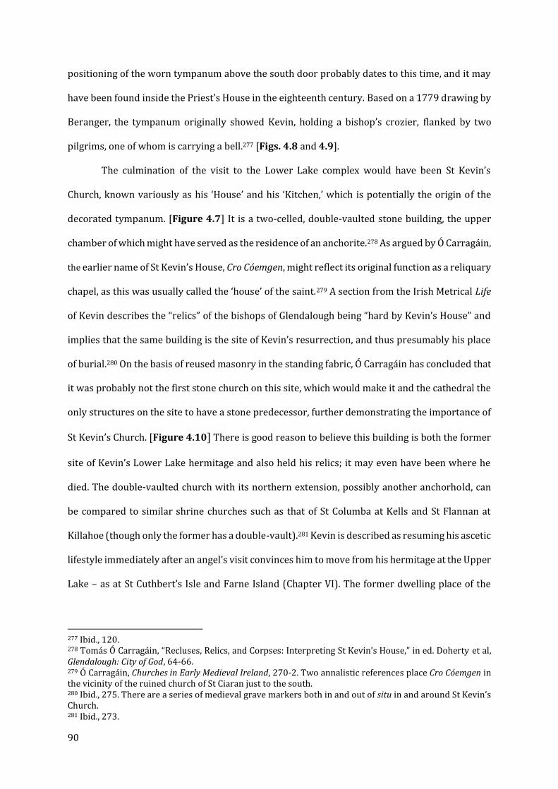
90
positioning of the worn tympanum above the south door probably dates to this time, and it may
have been found inside the Priest’s House in the eighteenth century. Based on a 1779 drawing by
Beranger, the tympanum originally showed Kevin, holding a bishop’s crozier, flanked by two
pilgrims, one of whom is carrying a bell.277 [Figs. 4.8 and 4.9].
The culmination of the visit to the Lower Lake complex would have been St Kevin’s
Church, known variously as his ‘House’ and his ‘Kitchen,’ which is potentially the origin of the
decorated tympanum. [Figure 4.7] It is a two-celled, double-vaulted stone building, the upper
chamber of which might have served as the residence of an anchorite.278 As argued by Ó Carragáin,
the earlier name of St Kevin’s House, Cro Cóemgen, might reflect its original function as a reliquary
chapel, as this was usually called the ‘house’ of the saint.279 A section from the Irish Metrical Life
of Kevin describes the “relics” of the bishops of Glendalough being “hard by Kevin’s House” and
implies that the same building is the site of Kevin’s resurrection, and thus presumably his place
of burial.280 On the basis of reused masonry in the standing fabric, Ó Carragáin has concluded that
it was probably not the first stone church on this site, which would make it and the cathedral the
only structures on the site to have a stone predecessor, further demonstrating the importance of
St Kevin’s Church. [Figure 4.10] There is good reason to believe this building is both the former
site of Kevin’s Lower Lake hermitage and also held his relics; it may even have been where he
died. The double-vaulted church with its northern extension, possibly another anchorhold, can
be compared to similar shrine churches such as that of St Columba at Kells and St Flannan at
Killahoe (though only the former has a double-vault).281 Kevin is described as resuming his ascetic
lifestyle immediately after an angel’s visit convinces him to move from his hermitage at the Upper
Lake – as at St Cuthbert’s Isle and Farne Island (Chapter VI). The former dwelling place of the
277 Ibid., 120. 278 Tomás Ó Carragáin, “Recluses, Relics, and Corpses: Interpreting St Kevin’s House,” in ed. Doherty et al, Glendalough: City of God, 64-66. 279 Ó Carragáin, Churches in Early Medieval Ireland, 270-2. Two annalistic references place Cro Cóemgen in the vicinity of the ruined church of St Ciaran just to the south. 280 Ibid., 275. There are a series of medieval grave markers both in and out of situ in and around St Kevin’s Church. 281 Ibid., 273.
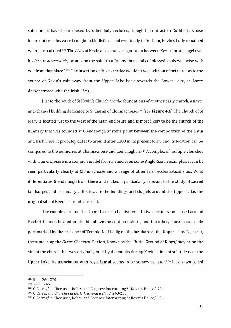
91
saint might have been reused by other holy recluses, though in contrast to Cuthbert, whose
incorrupt remains were brought to Lindisfarne and eventually to Durham, Kevin’s body remained
where he had died.282 The Lives of Kevin also detail a negotiation between Kevin and an angel over
his loco resurrectionis, promising the saint that “many thousands of blessed souls will arise with
you from that place.”283 The insertion of this narrative would fit well with an effort to relocate the
source of Kevin’s cult away from the Upper Lake back towards the Lower Lake, as Lacey
demonstrated with the Irish Lives.
Just to the south of St Kevin’s Church are the foundations of another early church, a nave-
and-chancel building dedicated to St Ciaran of Clonmacnoise.284 [see Figure 4.6] The Church of St
Mary is located just to the west of the main enclosure and is most likely to be the church of the
nunnery that was founded at Glendalough at some point between the composition of the Latin
and Irish Lives; it probably dates to around after 1100 in its present form, and its location can be
compared to the nunneries at Clonmacnoise and Lemanaghan.285 A complex of multiple churches
within an enclosure is a common model for Irish and even some Anglo-Saxon examples; it can be
seen particularly clearly at Clonmacnoise and a range of other Irish ecclesiastical sites. What
differentiates Glendalough from these and makes it particularly relevant to the study of sacred
landscapes and secondary cult sites, are the buildings and chapels around the Upper Lake, the
original site of Kevin’s eremitic retreat.
The complex around the Upper Lake can be divided into two sections, one based around
Reefert Church, located on the hill above the southern shore, and the other, more inaccessible
part marked by the presence of Temple-Na-Skellig on the far shore of the Upper Lake. Together,
these make up the Disert Cóemgen. Reefert, known as the ‘Burial Ground of Kings,’ may be on the
site of the church that was originally built by the monks during Kevin’s time of solitude near the
Upper Lake; its association with royal burial seems to be somewhat later.286 It is a two-celled
282 Ibid., 269-270. 283 VSH I, 246. 284 Ó Carragáin, “Recluses, Relics, and Corpses: Interpreting St Kevin’s House,” 70. 285 Ó Carragáin, Churches in Early Medieval Ireland, 248-250. 286 Ó Carragáin, “Recluses, Relics, and Corpses: Interpreting St Kevin’s House,” 68.
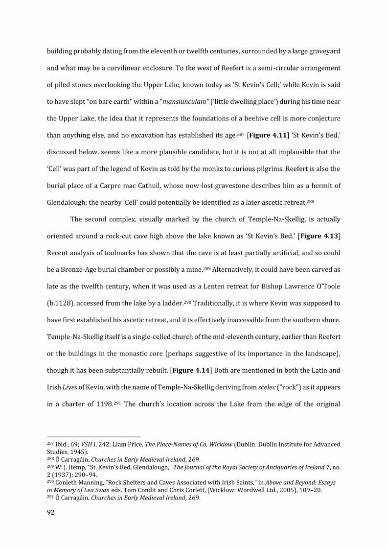
92
building probably dating from the eleventh or twelfth centuries, surrounded by a large graveyard
and what may be a curvilinear enclosure. To the west of Reefert is a semi-circular arrangement
of piled stones overlooking the Upper Lake, known today as ‘St Kevin’s Cell;’ while Kevin is said
to have slept “on bare earth” within a “mansiunculam” (‘little dwelling place’) during his time near
the Upper Lake, the idea that it represents the foundations of a beehive cell is more conjecture
than anything else, and no excavation has established its age.287 [Figure 4.11] ‘St Kevin’s Bed,’
discussed below, seems like a more plausible candidate, but it is not at all implausible that the
‘Cell’ was part of the legend of Kevin as told by the monks to curious pilgrims. Reefert is also the
burial place of a Carpre mac Cathuil, whose now-lost gravestone describes him as a hermit of
Glendalough; the nearby ‘Cell’ could potentially be identified as a later ascetic retreat.288
The second complex, visually marked by the church of Temple-Na-Skellig, is actually
oriented around a rock-cut cave high above the lake known as ‘St Kevin’s Bed.’ [Figure 4.13]
Recent analysis of toolmarks has shown that the cave is at least partially artificial, and so could
be a Bronze-Age burial chamber or possibly a mine.289 Alternatively, it could have been carved as
late as the twelfth century, when it was used as a Lenten retreat for Bishop Lawrence O’Toole
(b.1128), accessed from the lake by a ladder.290 Traditionally, it is where Kevin was supposed to
have first established his ascetic retreat, and it is effectively inaccessible from the southern shore.
Temple-Na-Skellig itself is a single-celled church of the mid-eleventh century, earlier than Reefert
or the buildings in the monastic core (perhaps suggestive of its importance in the landscape),
though it has been substantially rebuilt. [Figure 4.14] Both are mentioned in both the Latin and
Irish Lives of Kevin, with the name of Temple-Na-Skellig deriving from scelec (“rock”) as it appears
in a charter of 1198.291 The church’s location across the Lake from the edge of the original
287 Ibid., 69; VSH I, 242; Liam Price, The Place-Names of Co. Wicklow (Dublin: Dublin Institute for Advanced Studies, 1945). 288 Ó Carragáin, Churches in Early Medieval Ireland, 269. 289 W. J. Hemp, “St. Kevin’s Bed, Glendalough,” The Journal of the Royal Society of Antiquaries of Ireland 7, no. 2 (1937): 290–94. 290 Conleth Manning, “Rock Shelters and Caves Associated with Irish Saints,” in Above and Beyond: Essays in Memory of Leo Swan eds. Tom Condit and Chris Corlett, (Wicklow: Wordwell Ltd., 2005), 109–20. 291 Ó Carragáin, Churches in Early Medieval Ireland, 269.
93
monastic precinct and accessible only by boat is very unusual. It could not have been used for
regular services, and thus its purpose must have been related to the cave in the cliffs above it. Its
liturgical use might have been similar to the use of St Cuthbert’s Isle just off Holy Island,
Lindisfarne, a former hermitage site with a post-Conquest chapel and guesthouse, discussed in
Chapter VI. Finally, Glendalough has one of the largest collections of bullaun (bowl-cut) stones in
Ireland, with a total of 44 – most of them concentrated around the monastic complex.292
If the reconstruction offered above is accurate, the physical space of Glendalough is
essentially narratively structured by the written Lives, dividing the valley up into Kevin’s original
sanctuary and the celestial civitas he founded later (and where he was subsequently buried). The
inaccessibility of Temple-na-Skellig and St Kevin’s Bed raises interesting questions about the role
of the institutions themselves in guiding pilgrims around these landscapes, particularly those
close to the pilgrimage site itself. It is of course tempting to imagine curious pilgrims being taken
from the site of the relics and shown the places where the saint had lived and worshipped. These
sites probably also played a role in liturgical processions, though, unlike with St Patrick’s
Purgatory and Glencolumbkille, records of the later medieval to early modern turas (pilgrimage
round) of Glendalough (which was suppressed in 1862) have not survived.293 If the theory about
the original dedication of Trinity Church is correct, a site dedicated to one of Kevin’s disciples
might have also been part of this landscape. Regardless, the sacred topography of Glendalough
Valley offers the most convincing example of a landscape organized around the biography of a
saint and his foundation, with abundant evidence of material investment and corresponding
references in the hagiographical material.
292 David McGuinness, “Bullaun Stones and Early Medieval Pilgrimage at Glendalough,” in Ordinance Survey Letters: Wicklow and Carlow, ed. Michael Herity and David McGuinness (Dublin: Fourmasters Press, 2013), 14–24. 293 David McGuinness, “Bullaun Stones and Early Medieval Pilgrimage at Glendalough,” 17.

94
St Patrick’s Purgatory, Lough Derg: A Twelfth-Century Legend
St Patrick’s Purgatory, located in the middle of Lough Derg (Co. Donegal) is a site of
uncertain antiquity. In the present day it is one of the most popular pilgrimage locations for Irish
Catholics, known as the place where St Patrick was led down into a cave that afforded him a
glimpse of the eternal torments waiting in hell, which the apostle of the Irish then employed to
persuade a number of pagan chieftains to embrace the Christian faith. But this legend may be a
more recent development than is often assumed. The ‘Purgatory’ cave itself was demolished by
papal decree in 1497, but the site continued in use until roughly 1632, when the remaining
community at Lough Derg was dispersed by the English and the pilgrimage stations were
demolished. 294 At present, the site consists of a large basilica of 1931 on Station Island, as well as
a series of semicircular stone ‘beds’ of various saints (which are probably post-1632
replacements). 295 [Figure 4.15] As a religious center, Lough Derg may date back as early as the
sixth century. It does not appear in the earliest annals, though a site in the region described as the
‘Termon of Daveoc’ is listed as being plundered in 1070 and 1111 in the Annals of the Four
Masters.296 A cross shaft, recovered from the Lough in modern times and now installed near the
‘beds’, has been dated to around the ninth century on the basis of its spiral and band decoration.
[Figure 4.16]. The role of the ‘beds,’ five of which survive (albeit heavily reconstructed) out of a
total of seven, and are dedicated to Irish saints with the exception of St Catherine of Alexandria,
may have been as shelters for individual prayer and reflection in preparation for the encounter
with the Purgatory, as implied by a record of the pilgrimage from c.1600.297
Peter Harbison and others have persuasively argued that the association of the site with
Patrick significantly post-dates any pre-1100 activity at the site, and that it might originally have
been the monastic foundation of Dabhoec, a saint of relatively local significance who was later
294 Gwynn and Hadcock, Medieval Religious Houses, 193. 295 Harbison, Pilgrimage in Ireland, 60. 296 Michael Haren and Yolande de Pontfarcy, The Medieval Pilgrimage to St Patrick’s Purgatory, Lough Derg and the European Tradition (Enniskillen: Clogher Historical Society, 1988), 7-17; Harbison, Pilgrimage in Ireland, 66-67. 297 Overbey, Sacral Geographies, 184-186.

95
displaced by the better-known Patrick.298 This phenomenon is also observed on the Dingle
Peninsula (the obscure St Malkedar giving way to St Brendan the Navigator) and possibly also in
evidence at St Davids (see Chapter V).299 Sometime after 1132, a house of Augustinian canons
dependent on the abbey of SS Peter and Paul, Armagh took over the site.300 It is after this time
that the first legends of the Purgatory are recorded, beginning with the harrowing account of the
knight Owein as told by Henry of Saltrey in the Tractatus de Purgatorio Sancti Patricii, c.1184.301
Giraldus Cambrensis, writing around 1186, identified the Purgatory, which he described in detail,
also suggesting that the legend was beginning to come together by the end of the twelfth
century.302 In addition to Giraldus’s description of two islands divided between good and evil
spirits, with the latter having nine pits, there are other, later accounts of its form. Antonio Mannini
(c.1411) describes what might be a souterrain, a man-made subterranean passage frequently
associated with Iron Age Irish ring-forts.303 The Purgatory is elsewhere characterized as being a
deep pit surrounded by a wall (Caesarius of Heisterbach, early thirteenth century) or a cave
anywhere from two miles (George Crissaphan in 1353) to fifteen feet (Guillebert de Lannoy in
1430) in length.304 The inconsistencies between these stories are reason enough to suspect that
the physical layout and environment of the site was still evolving through the medieval period,
and the number of non-Irish accounts demonstrate that it was internationally renowned.305
Michael Haren and Yolande de Pontfarcy speculate that the Purgatory may have been a
souterrain-like structure with at least one vertical opening cut through it, which could actually
298 Dabhoec’s presence may have survived in a dedication of one of the ‘beds,’ though it has been subsequently lost. (Harbison, Pilgrimage in Ireland, 62). 299 Haren and de Pontfarcy, The Medieval Pilgrimage to St Patrick’s Purgatory, 23. Other features in the surrounding landscape preserve place-names related to Dabheoc, including the townland of Suidhe Dhabheóg, within which is a large stone in the shape of a reclining seat known previously as ‘St Dabhoec’s Seat’. 300 Gwynn and Hadcock, Medieval Religious Houses, 193; Haren and de Pontfarcy, The Medieval Pilgrimage to St Patrick’s Purgatory, 31. 301 Haren and de Pontfarcy, The Medieval Pilgrimage to St Patrick’s Purgatory, 7-17. 302 TH, 61. Giraldus places the Purgatory in Ulster, but his Irish geography is frequently inaccurate, as will be seen with Mount Brandon below. 303 Harbison, Pilgrimage in Ireland, 59. 304 Harbison, 59-60. 305 Carol G. Zaleski, “St. Patrick’s Purgatory: Pilgrimage Motifs in a Medieval Otherworld Vision,” Journal of the History of Ideas 46, no. 4 (1985): 471-473.
96
account for the contradictory descriptions of vertical and horizontal spaces in some of the first-
hand accounts as depending on which the pilgrim experienced (allowing for some dramatic
license).306
The development and promotion of a legend like that of the Purgatory is fully consistent
with the efforts of the Augustinians through the rest of Ireland and beyond. Unlike the Cistercians,
the Augustinians who established themselves in Ireland showed a major interest in connecting
their new or reformed foundations with their institutional predecessors. 307 Henry of Saltrey even
engaged in blatant anachronism by describing contacts between the Augustinians and Patrick
himself. 308 The origins of the Purgatory legend might also be seen in the context of the revival of
Patrick’s cult and the translation of his relics to Downpatrick in 1186, as the Augustinian
community at Lough Derg may have sought to increase the appeal of the site and the new legend
of the Purgatory by linking it directly with Ireland’s national saint at the height of his
popularity.309 The association of the Augustinian priory at Lough Derg with SS Peter and Paul,
Armagh is particularly interesting in light of that diocese losing control of another major Patrician
pilgrimage site, the mountain of Croagh Patrick in County Mayo, after the creation of the diocese
of Tuam at the Synod of Ráth Bresaill in 1111. It is possible that the legend was created or
promoted in order to establish a rival pilgrimage site to Downpatrick within their control, though
precisely which diocese Lough Derg belonged to at this time is unclear. The Purgatory, along with
the possible displacement of St Malkedar or St Colman by St Brendan on the Dingle Peninsula,
offers a plausible example of the replacement of local saints by better-known figures from the
tenth to the thirteenth centuries, a phenomenon which might also be observed in the St Davids
peninsula, as laid out in the next chapter.
At present, the site is only accessible by boat directly from the shore of the Lough, but it
continues to operate as a place of worship and pilgrimage. While there is some degree of
306 Haren and de Pontfarcy, 21. 307 Ibid., 31. 308 Ibid., 32. 309 Zaleski, “St. Patrick’s Purgatory,” 471.
97
confusion as to whether the Purgatory was located on the now-occupied Station Island or the
larger Saints Island [see Figure 4.17], a plausible arrangement is that the Augustinian Priory
occupied Saints Island, and it may have been a place for pilgrims to mentally and spiritually
prepare themselves to be taken across to the smaller island and its otherworldly experience.310 A
putative pilgrim road presently follows a boggy logging track over a hill onto the shore opposite
Saints Island, though the antiquity of this route is in some doubt. Lough Derg was and remains to
this day among the most important pilgrimage destinations in Ireland, but the story of the
Purgatory represents a much later tradition that appropriated a pre-existing landscape, perhaps
one belonging to the little-regarded St. Dabheoc.
Inishmurray: Pilgrimage and the Western Isles
By contrast to Lough Derg, the antiquity of the well-preserved sacred topography at
Inishmurray is well-attested. Innishmurray is located off the west coast of Ireland and preserves
one of the most complete sets of pilgrimage rounds in the country. The bulk of the surviving
ecclesiastical buildings are enclosed within a large cashel [Figure 4.18], which includes several
associated with or dedicated to the island monastery’s legendary founder, St Molaise (d.571).311
Among the surviving structures within the cashel are his shrine chapel, Teach Molaise, which
housed his bell and crozier and marks the site of his supposed grave.312 [Figure 4.19]
Radiocarbon dating from the mortar of the original fabric suggests an initial construction date
between the eighth and tenth centuries, though all the buildings were heavily rebuilt in the later
medieval period.313 The main congregational church, known as Templemolaise, shows signs of
having been extended or rebuilt sometime after the eleventh century, with some masonry being
310 Marion Dowd, “Saintly Associations with Caves in Ireland from the Early Medieval Period (AD 400- 1169) through to Recent Times.,” in Caves and Ritual in Medieval Europe, ed. K.A. Bergsvik and Marion Dowd (Oxford: Oxbow Books, 2018), 116–32. 311 Tomás Ó Carragáin, “The Saint and the Sacred Centre: The Early Medieval Pilgrimage Landscape of Inishmurray,” in The Archaeology of the Early Medieval Celtic Churches. Ed. Nancy Edwards, The Society for Medieval Archaeology Monograph, 29 (Leeds: Maney, 2009), 207–8. 312 Ó Carragáin, "The Saint and the Sacred Centre," 209. 313 Ó Carragáin and O’Sullivan, Inishmurray, 210; 341.
98
reused from an earlier building. [Figure 4.20] Teac na Teine (Templenatinny) probably served
as a residence for clerics or possibly a pilgrim hostel.314 Clocha Breaca is a mostly-intact leacht,
on top of which rests the so-called ‘cursing stone,’ a cross-inscribed boulder dated to the ninth or
tenth century on stylistic grounds. Finally, there is what can be best described as a souterrain-
like low passage or chamber which extends from the south side of Templenatinny towards the
doorway of Teach Molaise. [Figure 4.21] What makes this structure particularly unusual is that
it was built entirely above ground level. It is tempting, as Ó Carragáin and O’Sullivan do, to
compare this feature to one of the descriptions of St Patrick’s Purgatory at Lough Derg.315 Their
similarity might not be a coincidence - it seems entirely plausible that following the establishment
of the Augustinian Aughris Priory on the headland and the assumption of management of the
island of Inishmurray by the canons, some sort of Purgatory-in-miniature was created as an
additional draw for pilgrims to the island.
Like a number of the case studies here, the sacred sites of Inishmurray extend well beyond
the central ecclesiastical complex. On the ancient route from the island’s main harbor to the cashel
are a number of buildings and sites of historic and hagiographic significance. [Figure 4.22] Two
cemeteries - Relickoran, associated with St Odran of Iona, [Figures. 4.23 and 4.24] and one
adjacent to Templenaman - were marked by standing stones (including a cross-inscribed stone
now standing as part of the Crossatemple leacht) and possibly wooden buildings (the ruins of
later- and post-medieval stone structures survive today).316 These are, however, only a few of the
sites that make up a pilgrimage circuit, or turas; others include the hermitage of Trahanareear
and the cemetery of Ollamurray. Other leachta, in various states of disrepair and of uncertain
antiquity, are found at Tobernacoragh, Treenodemore, and Laughta Patrick.317 [Figure 4.22] It is
314 Ibid., 341. 315 Ibid., 342-346. 316 Ó Carragáin, “The Saint and the Sacred Centre,” 207-8. 317 Ó Carragáin and O’Sullivan, Inishmurray, 316-317; 319-320. The leachta have clearly been rebuilt on multiple occasions since the medieval period, and there is some debate as to how close the modern rituals of circumambulating the leachta are to those that might have been performed by contemporary monks or pilgrims, or if the entire phenomenon is an invention of the Irish Counter Reformation, but the continued presence of a religious community up into the seventeenth century on Inishmurray makes a degree of continuity more likely. See Herity, “The Antiquity of an Turas (the Pilgrimage Round) in Ireland.”
99
the view of Ó Carragáin, on the basis of dating evidence produced by the excavation, that these
sites developed over different periods, with the cemetery at Relickoran lacking an enclosure or
leachta in its first phase, and the cemetery at Ollamurray and most of the other satellite sites only
being established sometime around the tenth century.318 What dating evidence has been found
(mostly the cross-inscribed stones) indicates an earlier date, but the fact that the buildings of the
cashel were substantially rebuilt in the high- to late-medieval period suggests that this process of
development and expansion continued well past the twelfth century.319 A wooden statue of
Molaise originally installed in Teach Molaise (now in the National Museum) dates to the
fourteenth century, indicating substantial investment in the site around this time. Analysis of the
main congregational church of Templemolaise shows that it was lengthened at an unknown but
possibly later-medieval date by a western extension, potentially to accommodate larger numbers
of pilgrims. The retention of older fabric in this phase might suggest the monks were eager to
advertise the site’s antiquity.320
The responsible party for the later developments was the aforementioned house of
Augustinian canons on the Aughris peninsula to the south, probably founded in the twelfth
century, but the association between the sites was more significant than mere proximity.321
Throughout the medieval period, the priory at Aughris was more often referred to as ‘St
Lasirianus of Insula Murgeardy’ (St Mary of the Island of Inishmurray) than it was ‘Achras’.322 This
process of acquisition, renewal, and possible expansion of an ancient secondary cult site by a
reformed monastic community is well attested to in England and Wales, though fewer clear-cut
examples where direct monastic patronage can be established are found in Ireland. An additional
site of importance to the cult of Molaise could be what is now called “Staad Abbey” on the
headland directly opposite the island, but rather than another monastic house it seems more
318 Ó Carragáin and O’Sullivan, Inishmurray, 320. 319 Ibid., 320-1; 341. 320 Ibid., 341. 321 Gwynn and Hadcock, Medieval Religious Houses, 158. 322 Ó Carragáin and O’Sullivan, Inishmurray, 35-36.

100
likely to have been a chapel or lodge for pilgrims travelling to Inishmurray.323 The survival of the
pilgrimage round tradition into the present day affords a rare glimpse into a nearly complete
western isles pilgrimage circuit, and some comparisons have been drawn to the French example
of St Lerins on the Isle-St-Honarat near Cannes, as well as closer-by Inishark, the Aran Islands,
and a handful of other sites.324
Monaincha, Co. Tipperary
The site of the Romanesque church at Monaincha, three miles from the monastic centre
of Roscrea, is best known from an intriguing (and otherwise unsubstantiated) passage in the
Topographia Hibernica et Expugnatio Hibernica of Giraldus Cambrensis, written between 1187
and 1189. In the north of Munster, he explained, there was a lake with two islands. The larger of
the two had a church of ancient date, and it was said that no woman or female animal could step
foot upon it without dying instantly. The smaller of the two had a chapel “cared for most
devoutedly by a few celibates who called themselves ‘heaven-worshippers’ or ‘god-
worshippers,’” which is probably a reference to the ascetic movement of the tenth century called
the Culdees (Céli Dei, or ‘servants of God’).325 On the smaller island, he continued, “no one ever
died or could die a natural death,” to the extent that when they tired of life, the elderly would be
taken to the larger island so they could peacefully expire.326 Elsewhere in the annals, it is known
as ‘Inis-Locha-Cré,’ and later the more evocative Insula Viventium (‘isle of the living’).327 Its
antiquity, at least as the site of a hermitage if not a full monastic community, is evidenced by the
entries of 807 and 923 in the Annals of Ulster, as well as a series of entries in the twelfth century
323 Ibid., 41. 324 For the Aran Islands, see: John Feehan, The Book of Aran the Aran Islands, Co. Galway (Newtonlynch: Tír Eolas, 1999).; Conleth Manning, “Archaeological Excavations at Two Church Sites on Inishmore, Aran Islands,” The Journal of the Royal Society of Antiquaries of Ireland 115 (1985): 96–120.; John Waddell, “An Archæological Survey of Temple Brecan, Aran,” Journal of the Galway Archaeological and Historical Society 33 (1972): 5–27. For St Lerins see Yann Codou and Michel Lauwers, Lérins, Une Île Sainte de l’Antiquité Au Moyen Age, Collection d’études Médiévales de Nice, 9 (Turnhout: Brepols, 2009); Eric G. M. Fletcher, “The Monastery at Lérins.,” Journal of the British Archaeological Association 133 (1980): 17–29. For Inishark: Lash, “Pebbles and Peregrinatio”; Ryan Lash et al., “‘Differing in Status, but One in Spirit’: Sacred Space and Social Diversity at Island Monasteries in Connemara, Ireland,” Antiquity 92, no. 362 (2018): 437–55.” 325 TH, 60.; Harbison, Pilgrimage in Ireland, 133. 326 TH, 60. 327 C. McNeill and Harold G. Leask, “Monaincha, Co. Tipperary. Historical Notes,” The Journal of the Royal Society of Antiquaries of Ireland 10, no. 1 (1920): 19.

101
in both the Annals of Ulster and the Annals of the Four Masters.328 Monaincha or Lough Cré also
appears in a number of major hagiographical works, including the Lives of Cronan (d.665) and
Cainnech (d. 600), both of whom used it as a religious retreat from their primary foundations at
Roscrea and Aghaboe respectively; it was also the place of retirement and possibly burial of St Mo
Lua Mac Carthach.329
While there is no other record of the island site having the particular properties claimed
by Giraldus Cambrensis, and his apparent skepticism of many local Irish religious traditions
should probably be borne in mind, it is relatively certain that Monaincha was an early Christian
hermitage, even if a monastic community was not established there until several centuries later.
The location of the larger island to which Giraldus refers is not known, and even in the eighteenth
century there is no indication of its existence in the cartographical or textual record. It is possible
that Giraldus conflated two sites into one; the map of Monaincha from 1799 by Edward Ledwich
depicts a smaller island linked to the larger by a narrow causeway, along with an east-west
oriented building he was unable to identify.330 [Figure 4.25] Lough Cré was drained at some point
in the nineteenth century, leaving the landscape visible today. On the southern shore of the main
island, south of the monastic church and its northern extension, the map shows a north-south
single-cell rectangular building, puzzlingly identified by Ledwich as “a church.” The area where
Ledwich’s second island would be found is now heavily wooded, but aerial photography of 1966
as well as modern satellite photography shows no trace of it. [Figure 4.26] An account of 1806
describes two chapels in addition to the church and its northern extension, but similarly makes
no mention of a second island or any building on it.331
328 Ibid., 22. 329 Ibid., 20-23. 330 Harbison (Pilgrimage in Ireland, 131) states that Ledwich identified the building on the smaller island as ‘the abbot’s apartments,’ but that appears to be a misreading of the map, which uses that identification for the northern extension of the abbey church. Ledwich provides only a question mark. 331 Sir John Carr, A Tour Through Holland, Along the Right and Left Banks of the Rhine, to the South of Germany, in the Summer and Autumn of 1806 ... (Hartford: Lincoln and Gleason, 1807), 189.
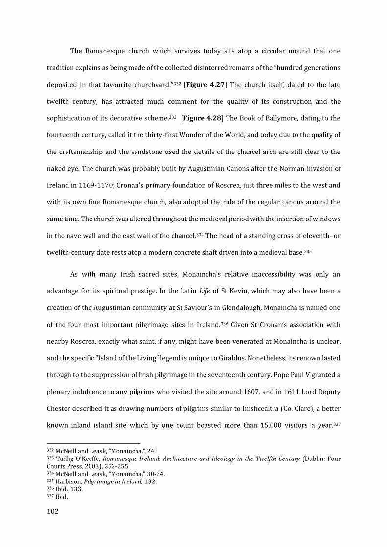
102
The Romanesque church which survives today sits atop a circular mound that one
tradition explains as being made of the collected disinterred remains of the “hundred generations
deposited in that favourite churchyard.”332 [Figure 4.27] The church itself, dated to the late
twelfth century, has attracted much comment for the quality of its construction and the
sophistication of its decorative scheme.333 [Figure 4.28] The Book of Ballymore, dating to the
fourteenth century, called it the thirty-first Wonder of the World, and today due to the quality of
the craftsmanship and the sandstone used the details of the chancel arch are still clear to the
naked eye. The church was probably built by Augustinian Canons after the Norman invasion of
Ireland in 1169-1170; Cronan’s primary foundation of Roscrea, just three miles to the west and
with its own fine Romanesque church, also adopted the rule of the regular canons around the
same time. The church was altered throughout the medieval period with the insertion of windows
in the nave wall and the east wall of the chancel.334 The head of a standing cross of eleventh- or
twelfth-century date rests atop a modern concrete shaft driven into a medieval base.335
As with many Irish sacred sites, Monaincha’s relative inaccessibility was only an
advantage for its spiritual prestige. In the Latin Life of St Kevin, which may also have been a
creation of the Augustinian community at St Saviour’s in Glendalough, Monaincha is named one
of the four most important pilgrimage sites in Ireland.336 Given St Cronan’s association with
nearby Roscrea, exactly what saint, if any, might have been venerated at Monaincha is unclear,
and the specific “Island of the Living” legend is unique to Giraldus. Nonetheless, its renown lasted
through to the suppression of Irish pilgrimage in the seventeenth century. Pope Paul V granted a
plenary indulgence to any pilgrims who visited the site around 1607, and in 1611 Lord Deputy
Chester described it as drawing numbers of pilgrims similar to Inishcealtra (Co. Clare), a better
known inland island site which by one count boasted more than 15,000 visitors a year.337
332 McNeill and Leask, “Monaincha,” 24. 333 Tadhg O’Keeffe, Romanesque Ireland: Architecture and Ideology in the Twelfth Century (Dublin: Four Courts Press, 2003), 252-255. 334 McNeill and Leask, “Monaincha,” 30-34. 335 Harbison, Pilgrimage in Ireland, 132. 336 Ibid., 133. 337 Ibid.

103
Monaincha was seized by the Crown in 1568, and subsequently leased to Sir William Carrow,
though as late as 1799 Lough Cré had not yet been drained and converted to agricultural land;
only in the mid-nineteenth century was pilgrimage completely abolished.338
Monaincha is particularly significant in the context of this thesis because it represents a
remarkably well-preserved example of an ecclesiastical ‘island’ in a wetland setting. The church
is one of the finest examples of Romanesque architecture in medieval Ireland, and the longevity
of the pilgrimage to Monaincha is a testament to its importance during this period. Chapter VII
will examine the landscape around Glastonbury Abbey, which like Monaincha is predominantly
drained wetland with small rises that formerly constituted ‘islands.’ While only one later church
survives there (another is known from archaeological investigation), I will propose that a series
of chapels existed on a number of these islands, and like Monaincha, they were an attraction for
pilgrims. Given Glastonbury’s interest in Irish saints’ cults, and potentially attracting Irish
pilgrims, the comparison between these islands and Monaincha is all the more intriguing.
Dingle Peninsula, Co. Kerry
The Dingle Peninsula is dominated by the bulk of its mountains, in particular that known
as Mount Brandon, associated from medieval times with the famous St Brendan the Navigator,
and supposedly near where he set off on his famous journey. Archaeological and architectural
evidence suggests a far more complicated landscape, oriented along a putative Saint’s Road (first
known as such from an 1840 map) from the southern shore of the peninsula to the summit of the
mountain itself, though there are a number of other sites worthy of attention.339 The mountain’s
dedication to Brendan is unsupported by any direct textual evidence, as the Dingle Peninsula is
not mentioned in any surviving version of the Navigatio; a popular legend suggests that Brendan
ascended the mountain to pray for a safe voyage.340 As was the case at St Patrick’s Purgatory, it
338 McNeill and Leask, “Monaincha,” 23-4. 339 Peter Harbison, “Early Irish Pilgrim Archaeology in the Dingle Peninsula,” World Archaeology 26, no. 1 (1994): 91-92. 340 There is a possible reference in c.4 of the Navigatio, when Brendan ‘pitched his tent at the edge of a mountain stretching out into the ocean’ somewhere in ‘a distant part of his native’ region. However, this description is vague at best, and there is reasonable evidence that the area around Mount Brandon was

104
seems far more likely that the Dingle Peninsula was once the province of more obscure or local
saints. Based on the dedication of the grand Romanesque church at Kilmalkedar, St Maolcethair
or Malkedar (d.636) is one likely candidate, but there are others.
Besides Mount Brandon, the Dingle Peninsula is perhaps best known for the beautifully
preserved early medieval chapel known as Gallarus Oratory. While the standing building may not
be as early in date as previously thought, it was clearly a key point in the landscape from the
earliest days of Christianity in Ireland, and very plausibly even earlier.341 It is, however, only one
of the identifiable way stations starting from the harbor at Ventry, on the southern shore of the
Dingle Peninsula. [Figure 4.29] The survival of multiple early medieval buildings, some of which
have been augmented or rebuilt at a later date, makes the Dingle Peninsula extraordinary, and it
is tempting to transpose what we know of the Dingle Peninsula and the Saint’s Road onto other
sites which do not survive as well. From Ventry, a pilgrim would have passed Kilcolman at
Maumanorig, now represented by a roughly circular enclosure which contains the ruins and
foundations of huts, several cross-inscribed gravestones and other evidence of early Christian
activity. Nearby is a well, now dedicated to St Brendan. One of the stones is particularly
remarkable, as in Ogham script it may read Amm Colman Ailithir or ‘Colman the Pilgrim,’ who
gives the site its name (though this could also refer to St Colmán Oilither, also known as Colman
the Pilgrim of Ross).342 [Figure 4.30] Nearby there is also a holy well dedicated to St Brendan,
one of several along the pilgrimage route.343 The Saint’s Road turns to the west as it rounds the
hill of Lateevemore, continuing towards Kilmalkedar, past another early Christian site at
once the domain of another saint entirely (J. Wooding, “The Medieval and Early Modern Cult of St Brendan,” in Saints’ Cults in the Celtic World, ed. Stephen I. Boardman, John Reuben Davies, and Eila Williamson, Studies in Celtic History ; 25 (Woodbridge: Boydell Press, 2009), 188-189). Giraldus Cambrensis (TH) is the first to mention a Montes Bredanici, but he places it too far to the south, in the mountains of south-west Munster (33). 341 Harbison, Pilgrimage in Ireland, 80-82. Gallarus Oratory is traditionally dated to as early as the sixth or seventh century, but Harbison prefers a date as late as the tenth century. 342 Harbison, “Early Irish Pilgrim Archaeology in the Dingle Peninsula,” 92-3. A church also appears in the OS Map of 1841. 343 Louise Nugent, “Exploring the Evidence for Early Medieval Pilgrimage at Kilcolman,” Journal of the Kerry Archaeological and Historical Society 13 (2013): 28.
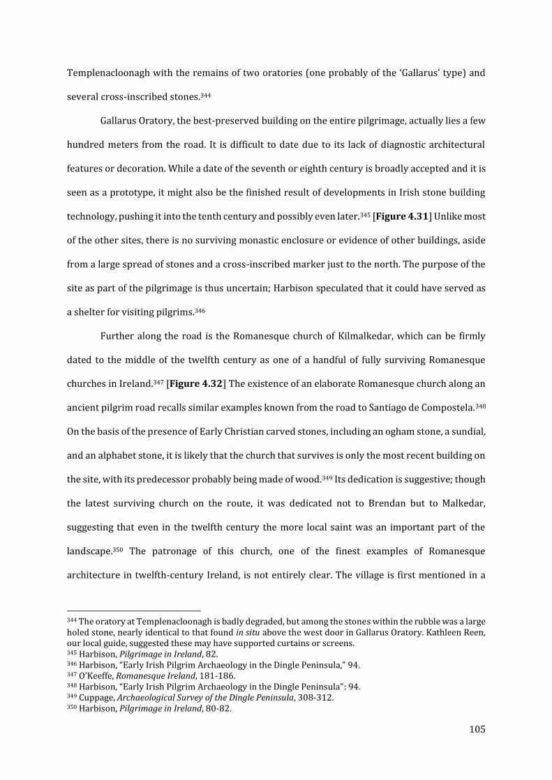
105
Templenacloonagh with the remains of two oratories (one probably of the ‘Gallarus’ type) and
several cross-inscribed stones.344
Gallarus Oratory, the best-preserved building on the entire pilgrimage, actually lies a few
hundred meters from the road. It is difficult to date due to its lack of diagnostic architectural
features or decoration. While a date of the seventh or eighth century is broadly accepted and it is
seen as a prototype, it might also be the finished result of developments in Irish stone building
technology, pushing it into the tenth century and possibly even later.345 [Figure 4.31] Unlike most
of the other sites, there is no surviving monastic enclosure or evidence of other buildings, aside
from a large spread of stones and a cross-inscribed marker just to the north. The purpose of the
site as part of the pilgrimage is thus uncertain; Harbison speculated that it could have served as
a shelter for visiting pilgrims.346
Further along the road is the Romanesque church of Kilmalkedar, which can be firmly
dated to the middle of the twelfth century as one of a handful of fully surviving Romanesque
churches in Ireland.347 [Figure 4.32] The existence of an elaborate Romanesque church along an
ancient pilgrim road recalls similar examples known from the road to Santiago de Compostela.348
On the basis of the presence of Early Christian carved stones, including an ogham stone, a sundial,
and an alphabet stone, it is likely that the church that survives is only the most recent building on
the site, with its predecessor probably being made of wood.349 Its dedication is suggestive; though
the latest surviving church on the route, it was dedicated not to Brendan but to Malkedar,
suggesting that even in the twelfth century the more local saint was an important part of the
landscape.350 The patronage of this church, one of the finest examples of Romanesque
architecture in twelfth-century Ireland, is not entirely clear. The village is first mentioned in a
344 The oratory at Templenacloonagh is badly degraded, but among the stones within the rubble was a large holed stone, nearly identical to that found in situ above the west door in Gallarus Oratory. Kathleen Reen, our local guide, suggested these may have supported curtains or screens. 345 Harbison, Pilgrimage in Ireland, 82. 346 Harbison, “Early Irish Pilgrim Archaeology in the Dingle Peninsula,” 94. 347 O’Keeffe, Romanesque Ireland, 181-186. 348 Harbison, “Early Irish Pilgrim Archaeology in the Dingle Peninsula”: 94. 349 Cuppage, Archaeological Survey of the Dingle Peninsula, 308-312. 350 Harbison, Pilgrimage in Ireland, 80-82.
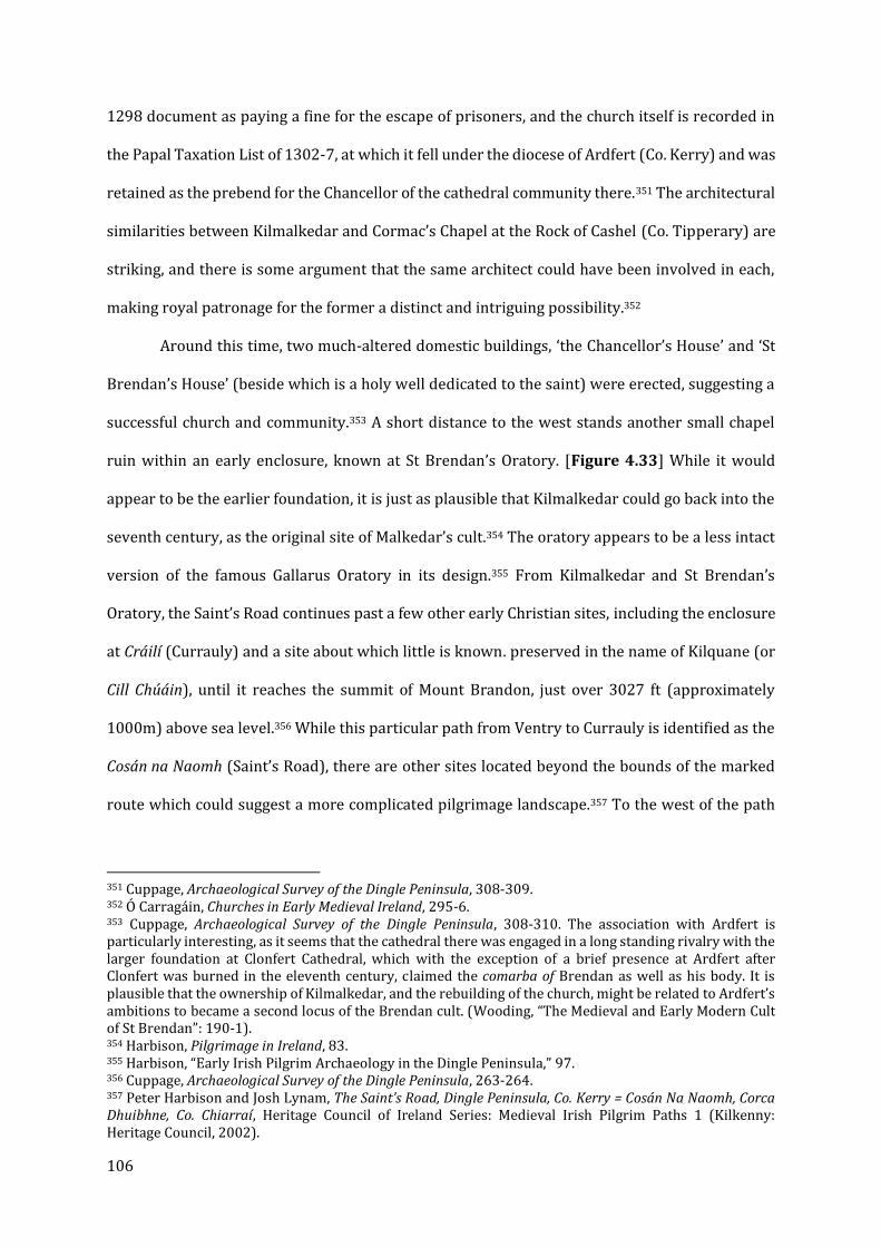
106
1298 document as paying a fine for the escape of prisoners, and the church itself is recorded in
the Papal Taxation List of 1302-7, at which it fell under the diocese of Ardfert (Co. Kerry) and was
retained as the prebend for the Chancellor of the cathedral community there.351 The architectural
similarities between Kilmalkedar and Cormac’s Chapel at the Rock of Cashel (Co. Tipperary) are
striking, and there is some argument that the same architect could have been involved in each,
making royal patronage for the former a distinct and intriguing possibility.352
Around this time, two much-altered domestic buildings, ‘the Chancellor’s House’ and ‘St
Brendan’s House’ (beside which is a holy well dedicated to the saint) were erected, suggesting a
successful church and community.353 A short distance to the west stands another small chapel
ruin within an early enclosure, known at St Brendan’s Oratory. [Figure 4.33] While it would
appear to be the earlier foundation, it is just as plausible that Kilmalkedar could go back into the
seventh century, as the original site of Malkedar’s cult.354 The oratory appears to be a less intact
version of the famous Gallarus Oratory in its design.355 From Kilmalkedar and St Brendan’s
Oratory, the Saint’s Road continues past a few other early Christian sites, including the enclosure
at Cráilí (Currauly) and a site about which little is known. preserved in the name of Kilquane (or
Cill Chúáin), until it reaches the summit of Mount Brandon, just over 3027 ft (approximately
1000m) above sea level.356 While this particular path from Ventry to Currauly is identified as the
Cosán na Naomh (Saint’s Road), there are other sites located beyond the bounds of the marked
route which could suggest a more complicated pilgrimage landscape.357 To the west of the path
351 Cuppage, Archaeological Survey of the Dingle Peninsula, 308-309. 352 Ó Carragáin, Churches in Early Medieval Ireland, 295-6. 353 Cuppage, Archaeological Survey of the Dingle Peninsula, 308-310. The association with Ardfert is particularly interesting, as it seems that the cathedral there was engaged in a long standing rivalry with the larger foundation at Clonfert Cathedral, which with the exception of a brief presence at Ardfert after Clonfert was burned in the eleventh century, claimed the comarba of Brendan as well as his body. It is plausible that the ownership of Kilmalkedar, and the rebuilding of the church, might be related to Ardfert’s ambitions to became a second locus of the Brendan cult. (Wooding, “The Medieval and Early Modern Cult of St Brendan”: 190-1). 354 Harbison, Pilgrimage in Ireland, 83. 355 Harbison, “Early Irish Pilgrim Archaeology in the Dingle Peninsula,” 97. 356 Cuppage, Archaeological Survey of the Dingle Peninsula, 263-264. 357 Peter Harbison and Josh Lynam, The Saint’s Road, Dingle Peninsula, Co. Kerry = Cosán Na Naomh, Corca Dhuibhne, Co. Chiarraí, Heritage Council of Ireland Series: Medieval Irish Pilgrim Paths 1 (Kilkenny: Heritage Council, 2002).
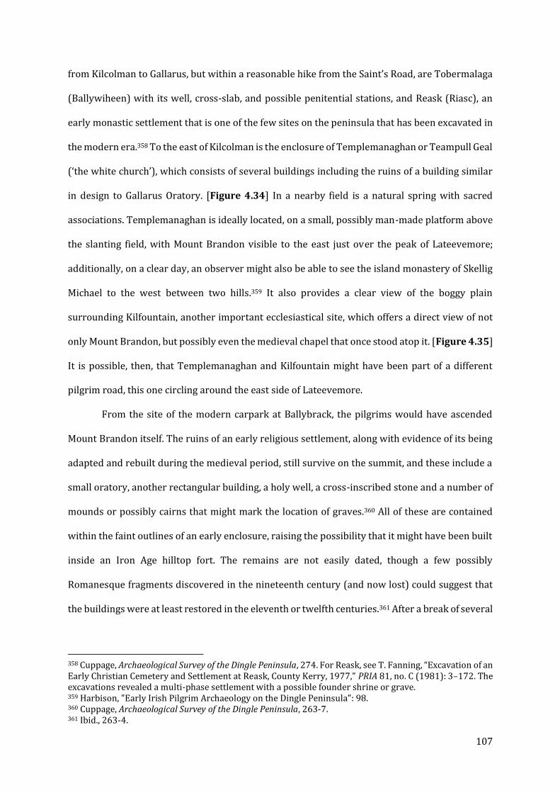
107
from Kilcolman to Gallarus, but within a reasonable hike from the Saint’s Road, are Tobermalaga
(Ballywiheen) with its well, cross-slab, and possible penitential stations, and Reask (Riasc), an
early monastic settlement that is one of the few sites on the peninsula that has been excavated in
the modern era.358 To the east of Kilcolman is the enclosure of Templemanaghan or Teampull Geal
(‘the white church’), which consists of several buildings including the ruins of a building similar
in design to Gallarus Oratory. [Figure 4.34] In a nearby field is a natural spring with sacred
associations. Templemanaghan is ideally located, on a small, possibly man-made platform above
the slanting field, with Mount Brandon visible to the east just over the peak of Lateevemore;
additionally, on a clear day, an observer might also be able to see the island monastery of Skellig
Michael to the west between two hills.359 It also provides a clear view of the boggy plain
surrounding Kilfountain, another important ecclesiastical site, which offers a direct view of not
only Mount Brandon, but possibly even the medieval chapel that once stood atop it. [Figure 4.35]
It is possible, then, that Templemanaghan and Kilfountain might have been part of a different
pilgrim road, this one circling around the east side of Lateevemore.
From the site of the modern carpark at Ballybrack, the pilgrims would have ascended
Mount Brandon itself. The ruins of an early religious settlement, along with evidence of its being
adapted and rebuilt during the medieval period, still survive on the summit, and these include a
small oratory, another rectangular building, a holy well, a cross-inscribed stone and a number of
mounds or possibly cairns that might mark the location of graves.360 All of these are contained
within the faint outlines of an early enclosure, raising the possibility that it might have been built
inside an Iron Age hilltop fort. The remains are not easily dated, though a few possibly
Romanesque fragments discovered in the nineteenth century (and now lost) could suggest that
the buildings were at least restored in the eleventh or twelfth centuries.361 After a break of several
358 Cuppage, Archaeological Survey of the Dingle Peninsula, 274. For Reask, see T. Fanning, “Excavation of an Early Christian Cemetery and Settlement at Reask, County Kerry, 1977,” PRIA 81, no. C (1981): 3–172. The excavations revealed a multi-phase settlement with a possible founder shrine or grave. 359 Harbison, "Early Irish Pilgrim Archaeology on the Dingle Peninsula": 98. 360 Cuppage, Archaeological Survey of the Dingle Peninsula, 263-7. 361 Ibid., 263-4.
108
centuries, during which time the oratory was recorded as in ruins, the pilgrimage was resumed
in 1868, leading to further disturbance to the site, including the construction of several altars that
might have been built using robbed stones. The chapel on Mount Brandon was recorded as
plundered in 1177, suggesting some degree of wealth, and in the Papal Taxation List of 1302-7,
the church on the summit (called Collis Sancti Brendani) paid the highest tax on the peninsula,
due to its substantial revenue from pilgrims. These references provide evidence that although the
origins and perhaps the heyday of the Saint’s Road and the Mount Brandon pilgrimage might have
been earlier, even as late as the beginning of the fourteenth century the site was lucrative.362 The
first surviving record of pilgrimage to Mount Brandon specifically is from 1542, when a murderer
was assigned to visit both Mount Brandon and Skellig Michael in penance, but the archaeological
and architectural evidence proves that the Saint’s Road and the pilgrimage site of Mount Brandon
specifically has significantly earlier origins.363 Down the northern slope is a re-erected Maltese
cross-inscribed slab at what is known as Arraglen.364 A fragment of ogham script etched along the
side spells out the name of “Ronán, priest son of Comgán.” The stone at Arraglen probably marked
a waypoint for climbers taking another route to the summit, this one from Cloghane and its early
churches and cemetery.
As discussed above, the significance to this thesis of the Mount Brandon pilgrimage road
through the Dingle Peninsula is two-fold. First, it provides another example of the phenomenon
of a more famous saint taking over a site or landscape previously dedicated to a more local or
obscure figure, which I will argue may have occurred at St Davids (Ch. V), and is further
demonstrated in the examples of St Patrick’s Purgatory (above) and Glencolumbkille (discussed
below). Second, as the most extensive surviving pilgrimage landscape in Ireland, it may provide
a model with which to interpret other possible ‘Saint’s Roads’ which have now vanished, including
the landscape posited at Glastonbury (Ch. VII) and perhaps some of the landscapes of monastic
362 Wooding, “The Medieval and Early Modern Cult of St Brendan.” 188-9; Nugent, “Exploring the Evidence for Early Medieval Pilgrimage at Kilcolman.” 40. 363 MacDonogh, The Dingle Peninsula, 185-6. 364 Cuppage, Archaeological Survey of the Dingle Peninsula, 83.

109
foundation and hagiographical commemoration in Northumbria (Ch. VI) and at St Davids (V).
Unlike most of the other sites in this study, there is no obvious patron for the eleventh- and
twelfth-century building projects along the Saint’s Road of Dingle, including the grand church at
Kilmalkedar. While it had been assumed for some time that all of the minor sites were monastic
in origin, other scholars, including Charles Thomas, have argued that the Dingle sites originated
as early lay cemeteries, only later gaining a church.365 But limited excavations in the area,
particularly at Reask, suggest that most of the sites visible today originated as settlements with
only small burial plots.366 Sharpe’s suggestion that they represent the remains of a proto-
parochial system is belied by the sheer density of these sites; Ó Carragáin instead argues that they
were proprietary churches “transmitted from one generation of non-celibate clergy to the next”,
and only a handful would have been involved in pastoral care. If this interpretation is correct, the
idea of many local donors contributing to the buildings along the Saint’s Road becomes all the
more plausible, though the possibility of royal patronage in the building of Kilmalkedar is worth
considering. As independent religious institutions, these sites would have the responsibility to
feed and shelter pilgrims along the way, which could explain why they survived through the
medieval period.367 But aside from Reask, none of these sites has been archaeologically
investigated, and thus we have little in the way of dating evidence to determine how long they
were occupied, or what structures might have stood in the enclosures besides those surviving as
stone rubble. The Saint’s Road of the Dingle Peninsula represents a remarkably intact pilgrimage
landscape with an unusual degree of continuity from the early medieval period through the high
Middle Ages, possibly only breaking down after the acquisition of Kilmalkedar by the cathedral
of Ardfert during the thirteenth century.
365 Charles Thomas, The Early Christian Archaeology of North Britain (Oxford: Oxford University Press, 1971), 69; 82. 366 M. O. H. Carver and Tomás Ó Carragáin, “A Landscape Converted: Archaeology and Early Church Organisation on Iveragh and Dingle, Ireland,” in ed. M. O. H. Carver, The Cross Goes North: Processes of Conversion in Northern Europe, AD 300-1300 (Woodbridge: York Medieval Press, 2003), 129-30. 367 Nugent, “Exploring the Evidence for Early Medieval Pilgrimage at Kilcolman.” 42.
110
Derry and Betha Colum Cille – A Landscape of Columban Foundation
The most famous biography of St Colum Cille, or Columba (d. 597) is that written by
Adomnán of Iona in the seventh century. In the twelfth century, probably between 1150 and 1169,
the Abbey of Derry commissioned what is known as Betha Colum Cille, or “The [Irish] Life of Colum
Cille.“ It was a Middle Irish homily, written to be read aloud on the saint’s feast day, which
recorded his genealogy, his monastic accomplishments, and his sacred works in life and death.368
Overbey makes a convincing case that it is not a typical hagiography or revision of an existing
saint’s life. Rather, it was specially produced as part of the effort by the community at Derry to
not only appropriate the legacy of Columba, but to assert spiritual ties to and a degree of dominion
over nearly all of Ireland’s most significant early ecclesiastical foundations.369 The early chapters
of the Irish Life follow Adomnán’s Vita Columbae in describing his birth and his earliest miracles,
but with one key difference: Adomnán had arranged his material thematically, whereas the
author of the Irish Life wrote the stories out chronologically.370 The effect of this change is to
establish an itinerary of monastic foundation across Ireland.371 [Figure 4.36]
According the revised narrative, Colum Cille began his career in Moville, moving to
Clonard and Glasnevin, where he trained alongside several other prominent Irish saints. His first
foundation after this was at Derry, where the Irish Life would later be compiled. After this, he
continued his travels, founding Raphoe, Durrow, Kells and Clonmore, and also visiting the existing
monasteries at Clonmacnoise and Monasterboice, where he left gifts of his own, and founding a
number of other monasteries before finally arriving at Iona. However, Durrow is the only one of
these monasteries in Ireland said to be founded by Columba in Adomnán’s Life, and there is no
368 Overbey, Sacral Geographies, 74-5. Herbert gives a date of between 1150-69, as the territory of Colum Cille (and several of the foundations named) appear to have fragmented shortly after the Norman invasion. Máire Herbert, Iona, Kells, and Derry: The History and Hagiography of the Monastic Familia of Columba (Oxford: Clarendon Press, 1988), 181-84. 369 Overbey, Sacral Geographies, 75-77. 370 Herbert, Iona, Kells, and Derry, 181-2. 371 Overbey, Sacral Geographies, 74-76.
111
evidence of Columban foundations at Swords, Moone, and Drumcliffe, which the Irish Life states
he established at the end of his monastic career.372
Overbey notes that, at each of the sites that Colum Cille visits in the Irish Life, he either
founded a monastery or left some token of his presence, including part of his garments at Ciarán’s
foundation of Clonmacnoise. In her assessment, Colum Cille is ‘seeding’ the landscape of Ireland
with pieces of the Columban monastic legacy (an activity that recalls Finucane’s concept of “holy
radioactivity” or the sahkti left by Hindu goddesses as discussed by Feldhaus). The foundations
he founded were governed by clerics who were part of his spiritual familia, and thus their
successors belong to his spiritual and institutional ‘genealogy’.373 Overbey also argues that land
itself assents to Columba’s presence: at Raphoe, the soil was made fertile, and at Durrow, he
blessed sour apples and made them sweet, in both cases helping sustain the new communities.
The account utilizes the Irish tradition of dindshenchas (the lore of places) in order to allow
Columba to inhabit this landscape long after his death.374 The motivation for such a dramatic
revision of Columba’s Vita can be found in the political and economic situation of Derry in the
twelfth century. Kells, the post-Ionan seat of Columba’s spiritual heir or comarba, was burned
three times in the twelfth century, and Derry began to lay claim to the Columban legacy as Kells
declined.
In 1150, Abbot Flaithbertach Ua Brolcháin of Derry claimed the distinction of comarba of
Colum Cille, and from 1151 to 1153 he carried out a series of circuits through the northern
Columban territories.375 These circuits, not coincidentally, incorporated parts of the Columban
itinerary laid out in the Irish Life. The advantage of asserting this revised version of Columban
history, one that makes Derry his first foundation and then continues to cover most of the major
ecclesiastical sites of Ireland, is obvious; it lent legitimacy to Derry’s claim to Colum Cille’s legacy
and established a hierarchy that made the assumption of the office of comarba by the Abbot of
372 Ibid., 76. 373 Ibid., 76-77. 374 Ibid., 79-80. 375 Ibid., 84.
112
Derry not a usurpation of his authority, but rather a return to first principles. This state of affairs
was realized when in 1161 the churches of Colum Cille in Meath and Leinster were excluded from
secular imposition, and the tribute they had paid to the lay lords was instead directed to their
new monastic overlord.376
The most complete point of comparison for the Columban itinerary of the Irish Life is the
narrative of the restoration of Northern monasticism by the community of Cuthbert present in
Symeon of Durham’s Libellus de Exordio atque Procursu istius hoc est Dunhelmensis Ecclesiae
(which itself builds off the earlier Historia de Sancto Cuthberto), discussed in the second of the
Anglo-Norman case studies (Ch. VI). To summarize, in his account of the history of Durham
Cathedral and its monks, Symeon rewrites history to link Cuthbert’s Lindisfarne with a
historically distinct tradition, the Benedictine heritage of the Venerable Bede at Wearmouth and
Jarrow, where abandoned monasteries were re-founded and eventually provided recruits for the
new Benedictine priory at Durham cathedral in 1083. As was the case with Flaithbertach Ua
Brolcháin, who laid claim to Derry’s supposed ancient possessions by establishing and
recognizing a sacred itinerary, the Durham community traced the journey of Cuthbert’s holy
remains across a number of sites in Northumbria, where they maintained some sort of presence,
even in Crayke, which was actually within the diocese of York. As shown in the next section, it is
possible that this process of myth-building and revision was played out in local landscapes as well
as that laid out by the Irish Life, and Derry may also have been involved. However, the literary
travels of Colum Cille and the deposition of secondary relics can be viewed in the light of another,
more distinctively Irish tradition – the movement of portable shrines. Records from the eighth to
eleventh centuries record instances of shrines accompanying the abbots of Iona on their visits to
Ireland, and while promulgating the ‘law’ of St Patrick in 811 in Connacht, the abbot of Armagh
was accompanied by the shrine of Patrick.377 These portable shrines seem to have been partly
376 Herbert, Iona, Kells, and Derry, 118. 377 A. T. Lucas, “The Social Role of Relics and Reliquaries in Ancient Ireland,” The Journal of the Royal Society of Antiquaries of Ireland 116 (1986): 13-14. Portable relics and reliquaries also frequently found themselves carried into battle as talismans (17-20).

113
used as an insignia of office, with the presence of the relics lending legitimacy and authority to
travelling ecclesiastics as they went about their business. This business could included collecting
ecclesiastical dues on rent-seeking visitations, where the relics could sometimes extract a several
price for failure to pay what was owed.378 The problem for Derry, of course, was that they did not
possess the relics of Colum Cille, which had been scattered far and wide (later tradition held that
they had eventually been enshrined at ancient foundation of Downpatrick (Co. Antrim).379
The grand ambitions of Flaithbertach Ua Brolcháin and Derry as expressed through the
Irish Life of Colum Cille were cut short within a few years of the Irish Life’s completion. In 1164,
the grand new abbey church at Derry reached a height of ninety feet, a towering symbol of Derry’s
fortune and prestige. But in 1166, Derry’s most significant secular patron, Domnall Mac
Lochlainn, was killed during a successful revolt, and his body was interred not at Derry, but
Armagh. In the same year, the monastery at Derry was burned nearly to the ground. The Norman
invasion soon afterwards fractured the existing power structures of ecclesiastical and lay
lordship, and without the power of Derry to hold it together, the institutional familia of Colum
Cille fell apart.380 However, documentary evidence suggests that one possible product of the
short-lived dominion of Derry might have outlasted the fortunes of its architect.
Glencolumbkille: Reuse of a Prehistoric and Early Christian Landscape
While the early medieval significance of the sites previously discussed in this chapter is
well established, even if the focus of veneration has changed, as at Lough Derg and Dingle, the
antiquity of the pilgrimage landscape which now exists around Glencolumbkille (Co. Donegal) is
in serious doubt. The place name suggests a relationship to Colum Cille, but there is no evidence
that there was ever a Columban monastery at the site until a Life of Colum Cille compiled by
378 Ibid., 14-15. 379 Manus O’Donnell, The Life of Colum Cille, trans. Brian Lacey (Dublin: Four Courts Press, 1998). For further discussion of Colum Cille’s relics c.f. Raghnall Ó Floinn, “Insignia Columbae I,” in Studies in the Cult of Saint Columba, ed. Cormac Bourke (Dublin: Four Courts, 1997), 136–61. 380 Herbert, Iona, Kells, and Derry, 122.
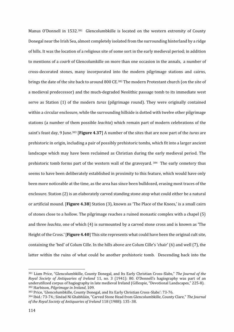
114
Manus O’Donnell in 1532.381 Glencolumbkille is located on the western extremity of County
Donegal near the Irish Sea, almost completely isolated from the surrounding hinterland by a ridge
of hills. It was the location of a religious site of some sort in the early medieval period; in addition
to mentions of a coarb of Glencolumkille on more than one occasion in the annals, a number of
cross-decorated stones, many incorporated into the modern pilgrimage stations and cairns,
brings the date of the site back to around 800 CE.382 The modern Protestant church (on the site of
a medieval predecessor) and the much-degraded Neolithic passage tomb to its immediate west
serve as Station (1) of the modern turas (pilgrimage round). They were originally contained
within a circular enclosure, while the surrounding hillside is dotted with twelve other pilgrimage
stations (a number of them possible leachta) which remain part of modern celebrations of the
saint’s feast day, 9 June.383 [Figure 4.37] A number of the sites that are now part of the turas are
prehistoric in origin, including a pair of possibly prehistoric tombs, which fit into a larger ancient
landscape which may have been reclaimed as Christian during the early medieval period. The
prehistoric tomb forms part of the western wall of the graveyard. 384 The early cemetery thus
seems to have been deliberately established in proximity to this feature, which would have only
been more noticeable at the time, as the area has since been bulldozed, erasing most traces of the
enclosure. Station (2) is an elaborately carved standing stone atop what could either be a natural
or artificial mound. [Figure 4.38] Station (3), known as ‘The Place of the Knees,’ is a small cairn
of stones close to a hollow. The pilgrimage reaches a ruined monastic complex with a chapel (5)
and three leachta, one of which (4) is surmounted by a carved stone cross and is known as ‘The
Height of the Cross.’ [Figure 4.40] This site represents what could have been the original cult site,
containing the ‘bed’ of Colum Cille. In the hills above are Colum Cille’s ‘chair’ (6) and well (7), the
latter within the ruins of what could be another prehistoric tomb. Descending back into the
381 Liam Price, “Glencolumbkille, County Donegal, and Its Early Christian Cross-Slabs,” The Journal of the Royal Society of Antiquaries of Ireland 11, no. 3 (1941): 80. O’Donnell’s hagiography was part of an underutilized corpus of hagiography in late medieval Ireland (Gillespie, “Devotional Landscapes,” 225-8). 382 Harbison, Pilgrimage in Ireland, 109. 383 Price, 'Glencolumbkille, County Donegal, and Its Early Christian Cross-Slabs': 73-76. 384 Ibid.: 73-74.; Sinéad Ní Ghabhláin, “Carved Stone Head from Glencolumbkille, County Clare,” The Journal of the Royal Society of Antiquaries of Ireland 118 (1988): 135–38.

115
valley, the pilgrim reaches a collection of three cairns (8) known as ‘The Garden of Colum Cille,’
and a holed stone (9) called ‘the stone of the gathering.’ Along the way is a court tomb,
Farranmacbride (a).
There is no mention of Glencolumbkille (or Senglenn) in Adomnán’s Vita Columbae or the
version of the Life in the Book of Lismore.385 The Irish Life of Colum Cille discussed in the previous
section mentions monasteries founded in Connacht, but specifies only Assylin and Drumcliffe.386
Furthermore, the oldest site in the glen (b) is dedicated not to Colum Cille but to a local recluse
named St Fanad, which might hint at the earlier dedication of the landscape.387 But according to
Manus O’Donnell’s 1532 vernacular Life, likely based on earlier sources, Columba once battled
devils in the glen, casting his bell into their midst where it fell and was embedded in the ground.
The supposed site of this impact (according to local tradition) is today the collapsed entrance to
a souterrain (12), possibly used as a place to protect valuables in times of strife, further protected
by a curse laid by Colum Cille in the aftermath of his triumph.388 [Figure 4.39]
The antiquity of the pilgrimage stations and the turas has been a matter of debate, and it
is possible that the form the site took during the medieval period is not that which survives to the
present day. But the presence of early Christian activity and the development of legends late in
the period suggest that it probably derived from a medieval practice.389 Certain components of
the ritual, including the following of deiseal (right-handwise movement following the direction of
the sun) “are fundamental in Irish and Scottish tradition.”390 As for why Glencolumbkille might
have evolved from a local site dedicated to St Fanad to one associated with a miracle of Colum
Cille, the answer may be found in the ownership of the site as recorded in the Patent Rolls of James
I for the year 1603.391 The record states that the land and fishing rights once belonged to the
monastery of Augustinian canons at Derry. As was discussed previously, the twelfth and
385 Price, “Glencolumbkille, County Donegal,” 80. 386 Overbey, Sacral Geographies, 75-76. 387 Harbison, Pilgrimage in Ireland, 109-110. Price, “Glencolumbkille,” 78. 388 Price, ‘Glencolumbkille’: 82-83; 86-87; The best edition is O’Donnell, The Life of Colum Cille. 389 Herity, “The Antiquity of an Turas (the Pilgrimage Round) in Ireland.” 390 McGuinness, “Bullaun Stones and Early Medieval Pilgrimage at Glendalough,” 17. 391 Price, “Glencolumbkille,” 81.
116
thirteenth centuries saw a protracted effort by the community at Derry to lay claim to the
authority and sacred presence of Colum Cille, to legitimize and portray as pre-ordained the
relocation of the comarba from Iona to Kells and ultimately to Derry. While Glencolumbkille is
not among the monastic foundations assigned Columban origins in the ‘Irish Life of Colum Cille,’
depending on when the site came into Derry’s possession, it is plausible that the isolated location
with its landscape of prehistoric tombs and other reminders of antiquity might have been
repurposed as a site of significance to the revived cult of Colum Cille (particularly in view of the
Patrician revival at Downpatrick in 1186). In any case, Glencolumbkille has one of the most
complete pilgrimage circuits in Ireland, and while caution is warranted in viewing it as a direct
continuation of medieval practices, evidence at other sites, such as Inishmurray, clearly
demonstrate that such survivals do exist. The cult of Colum Cille thus overlays two separate pre-
existing landscapes, one pre-historic and one potentially linked to St Fanad.
Conclusions: Irish sacred landscapes and their broader significance
The case studies presented here were selected on the basis that they represent a range of
different models of Irish sacred landscapes, and just as importantly, are recognized by Irish
scholars as such. This chapter lays out a set of theoretical models that might be applied to the
proposed landscapes in the case studies at St Davids, Durham and Lindisfarne, and Glastonbury
to follow in Chapters V through VII, Further discussion of these thematic models and comparison
of their execution will follow in Chapter VIII, with the goal of studying sacred landscapes as a
phenomenon across different sites in the Anglo-Norman period. In this chapter the following
models are established: a biographical landscape with a range of satellite chapels (Glendalough
and St Kevin); an earlier religious site apparently repurposed and reinvented by an Augustinian
community in the twelfth century, possibly as part of the attempt by a larger foundation to secure
part of a famous saint’s legacy (St Patrick’s Purgatory, Lough Derg and SS Peter and Paul,
Armagh); and a ‘western isles’ model whose form remained mostly unchanged through the
eleventh and twelfth centuries despite changing political and ecclesiastical circumstances
117
(Inishmurray). Monaincha represents another common site type – the ‘island chapel’ in a wetland
environment which will be further discussed in Chapter VII. Following these are examples of: a
large pilgrimage landscape comprising a number of earlier sites, some of which were
subsequently rebuilt (The Saint’s Road, Dingle); a hagiographical landscape created centuries
after the fact to legitimize the claim of an ecclesiastical foundation to a legendary saint (Derry and
the Irish Life of Colum Cille); and a possibly related site that re-used a landscape composed of
both pre-historic and early Christian features to integrate the story of that saint into an ancient
landscape (Glencolumbkille). These are only a few of the models that can be found throughout
Ireland, but they are the ones which are most applicable to comparison with the forthcoming case
studies. The historical and cultural differences between Ireland and Anglo-Norman England must
be taken into consideration, and the insecure dating of many of these sites makes any proposal of
direct influence highly speculative at best. Nonetheless, it is clear that the sacred landscapes and
secondary cult sites of Ireland are a valuable tool for understanding similar examples in England
and Wales, and that there is evidence for the creation and promotion of these landscapes (with
significant benefits to institutions and patrons) across medieval Britain. Institutional and cultural
differences cannot be allowed to overshadow the fact the England and Ireland were only
separated by a narrow body of water, with a range of contacts and cultural exchange between
them very much a matter of record throughout the medieval period. The role of specific texts and
social networks within the England and Irish churches in the Anglo-Norman period is an area that
merits further exploration, but this thesis focuses upon what evidence is available at this time.
118
V: ‘Dewisland’: Diffused Sanctity around St Davids Cathedral
Introduction
The environs of St Davids Cathedral in Pembrokeshire offer perhaps the most conclusive
example, outside of Ireland, of a sacred landscape that can be constructed from both
hagiographical and archaeological sources. Drawing upon archaeological and antiquarian
evidence, it is evident that from at least the twelfth to the sixteenth centuries, four coastal chapels
operated by the cathedral radiated out from the cathedral close, with the possibility of an
additional two located on nearby Ramsey Island. While the archaeological evidence is limited by
the scale and proficiency of past excavation, the locations of these chapels are known, and their
immediate contexts can be surmised. The chapels are dedicated to or associated with figures and
events from St David’s life, as told by his eleventh- and twelfth-century Vitae, as well as some later
traditions. Moreover, there is reason to believe that this landscape can be placed in a broader
context of ‘Celtic’ traditions of ‘diffused’ sanctity and sacred landscapes such as that present at
sites like Glendalough in Ireland, and historically linked with the ultimately unsuccessful struggle
to gain metropolitan status and recognition of Menevia as Wales’ Canterbury. Ultimately, I will
argue that the canons of St Davids Cathedral were responsible for an ideological campaign to
reassert their foundation’s antiquity and turn the landscape around the cathedral into
‘Dewisland’: the site of St David’s upbringing, early monastic career, and ultimately his death. The
revision of Rhygyfarch’s Vita of St David by Giraldus Cambrensis in the late twelfth century was a
key part of this ideological programme, along with investment and rebuilding of the coastal
chapels, together acting to firmly situate David’s life in the area around medieval Menevia.
Between them, there was no room for doubt as to where David had been born, raised, and first
entered the monastic life. To date, the landscape around St Davids has been most fully explored
by Heather James, who noted the coastal chapels and pulled together what limited archaeological
119
material existed for them, relating them to the broader landscape around medieval Menevia.392
The major goal of this section is to further bolster James’ case while also proposing a more specific
ideological programme executed by the canons of the cathedral, best represented through the
hagiographical and historical works of Giraldus Cambrensis (better known as Gerald of Wales).
While James favoured an earlier date for the creation of this network of sites based upon the
substantial evidence of early medieval activity from both antiquarian and recent archaeology, I
would propose a later date for the integration of these early medieval sites into the cult of St David
at medieval Menevia, one that coincides with the revision of Rhygyfarch’s Vita by Giraldus in the
last decade of the twelfth century.
Saints in Their Landscapes: The Welsh Pilgrimage Tradition
While the idea of saints existing within a physical landscape is by no means unique to
Wales or even the British Isles, as discussed in the preceding chapter, Wales and Brittany are two
areas where the landscape was particularly integral to the medieval cult of saints. In view of this,
Julia Smith’s article on the pilgrimage tradition in Brittany is useful to formulating a ‘Welsh’ model
of pilgrimage and landscape.393 Smith argues that religious landscapes played a much larger role
in the creation and promotion of Welsh and Breton cults, particularly as opposed to the enshrined
corporeal remains of saints. These landscapes were on the whole composed of a network of
smaller shrines, holy wells, or chapels which drew their significance from events in the life of a
saint or their associates, sometimes (though not always) in close proximity to a larger cult site.
References to these secondary cult sites might be sprinkled throughout the newly-revised or
composed vitae of those saints, which would be read aloud on a saint’s feast day. These sacred
foci could take a variety of forms: the Breton legend of Saint Pol de Leon mentions healing springs,
and his ninth-century hagiographer wrote of Pol’s sacred bell Hirglas. Both of these examples
392 Heather James, “The Cult of St David in the Middle Ages,” Journal of the Pembrokeshire Historical Society 7 (1996): 5–25. 393 Julia M.H. Smith, “Oral and Written: Saints, Miracles, and Relics in Brittany, c.850-1250,” Speculum 65, no. 2 (1990): 309–43.
120
resonate in broader ‘Celtic’ contexts, particularly in Wales and Ireland. While no tombs or relics
are mentioned, “the springs and the bell were the tangible links between the saint’s earthly career
and his continuing miracle-working power.”394 While the hagiographical legends offer an
explanation for the power of these sites and holy objects, Smith argued that it would be a mistake
to see this as the end point – what is written down in hagiography or historical sources is likely
to have formed only part of the broader framework of stories and traditions surrounding the cult
of a saint. Breton cults were not meant to “channel veneration” towards larger cult sites or
cathedrals – rather, their sanctity is “diffused” through the local landscape.395 Smith suggested
that the impetus for the flourishing of these Breton cults was the laity, rather than the clergy:
“whereas elsewhere vitae and accounts of post-mortem miracles frequently acted as
advertisements for particular churches … [Breton Lives] give frank recognition to the existence of
loci of contact between saint and society other than ecclesiastical shrines.”396 Unlike the case in
most of the West, saints’ cults were not centralized around specific institutions which cultivated
and promoted their own saints and their cults, but in a Breton context these relatively well-known
saints were viewed as primarily local, based around small churches, secondary relics, and natural
features, with very little emphasis placed upon their corporeal remains under the control of
traditional ecclesiastical authorities. Of course, such cults existed only with the tolerance of
ecclesiastical authorities; there are examples of cults that were rejected by the church and
supressed, perhaps most notably that of the canine ‘St. Guinefort,’ a greyhound whose wrongful
death saving the child of his master was celebrated in thirteenth-century Lyon.397 However, in
Smith’s view, it is important to avoid characterizing the dynamics of lay versus clergy and oral
versus written as antagonistic; they instead reflect the wide range of practices of cult veneration
and promotion.398 Breton churches were also unusually unconcerned with the acquisition and
394 Ibid, 324. 395 Ibid, 326. 396 Ibid, 335. 397 Rebecca Rist, “The Papacy, Inquisition and Saint Guinefort the Holy Greyhound,” Reinardus 30, no. 1 (2018): 190–211. 398 Smith is particularly pushing back against the idea that clerical culture “covered over, hid, and blotted out folkloric culture” and that “clerical culture opposed folklore not only out of conscious and deliberate

121
promotion of relics, whether those of local saints or foreign imports, in a time when this was
accepted and common practice on the continent.399 Smith observed that Breton cults were
“intensely local” and foreign saints were rarely allowed to intrude upon more intimate sacred
communities. A prominent example of this in a Welsh context is the cult site of St David at
Llandewibrefi. The church is located on a high hill, which according to two of David’s
hagiographers was miraculously raised from the ground at the climax of a synod presided over
by David, so that his words might reach all who were present.400 The existence of the hill was itself
part of the cult and David’s story: “the raised land … was evidence of the sanctity of the site.”401
The phenomenon of the deeds of saints being recorded in the landscape is also known at several
of the Irish sites discussed previously, most prominently St Patrick’s Purgatory at Lough Derg, the
sites associated with St Kevin in the Glendalough Valley, and the Columban landscape of
Glencolumbkille (Chapter IV).
Recently, Kathryn Hurlock challenged this understanding of Welsh saints’ cults as less
focused on corporeal remains than their English or continental counterparts. The lack of
conventional shrines at Welsh sites outside of major ecclesiastical centres like St Davids (David,
Justinian, Caradog) and Llandaff (Teilo, Dyfrig, Euddogwy and Samson) does not necessarily
correlate with a perceived lack of importance of the sacred remains of saints.402 Rather, the
differences were in presentation; outside of certain Anglo-Norman-influenced contexts, major
translations into new shrines were infrequent, but this was because most of the bodies of the
saints were often left in their original graves, often marked by special shrine chapels (known as
hostility but equally out of incomprehension.” This attitude is particularly evidenced in Jacques Le Goff, “Clerical Culture and Folkloric Traditions in Merovingian Civilization,” in Time, Work and Culture in the Middle Ages, trans. Arthur Goldhammer (Chicago: University of Chicago Press, 1980), 153–58. Elsewhere, Rachel Koopmans argues that oral stories, rather than being seen as inferior to written miracula, might have had a broader appeal because of the personal relationship between teller and audience. (Koopmans, 23-5). Powell (“Once upon a time there was a saint”) attempted to create a methodology for identifying, though not separating, folkloric elements of hagiographic texts, though it can be argued that she neglects to consider how the alteration of stories might be a result of deliberate decision making by hagiographers rather than the uncertainty surrounding old traditions. 399 Smith, “Oral and Written,” 336. 400 TH, 179; VD, 145-147. 401 Kathryn Hurlock, Medieval Welsh Pilgrimage, c.1100-1500 (New York: Palgrave MacMillan, 2018), 96. 402 Ibid., 20-22.

122
Capel y Bedd or Cell y Bedd), as in the case of St Issau’s in Patrishow and St Mellangel at Pennant
Mellangel.403 In other cases, they were reburied within a church, as in the example of St Padarn in
Llanbardan Fawr and St Brynach of Nevern.404 One of the other most important pilgrimage sites
in medieval Wales was Bardsey Island, the reputed ‘resting place of 20,000 saints.’ In its heyday,
three trips to St Mary’s Abbey on the island (cared for by ‘native’ Welsh canons, followed by
Augustinians in 1212) were said to be equal to a single pilgrimage to Rome, though it should be
noted the first sources for the moniker are no earlier than the twelfth century.405 It is also notable
in that there was no specific figure’s grave or shrine that was the focus of veneration. The lack of
traditional shrines is potentially related to another characteristic of Welsh saints’ cults as
compared to the English counterparts: very few ‘shrine miracles’ are recorded, with more of an
emphasis placed on the miraculous deeds performed during the saint’s lifetime.406 But while
Hurlock argues that this precludes Welsh Vitae being used to promote pilgrimage sites, I would
disagree; the prominence of places associated with saints and their deeds within these Welsh
sources, particularly Giraldus Cambrensis’ twelfth-century vita of St David, may in fact be
indicative of different settings for veneration.407
Nonetheless, Smith’s attention to the links between Wales and Brittany is warranted.
Brittany played a key role in the narrative of the lost pallium of Menevia. In book ii of De Jure et
403 David Longley, “Early Medieval Burial in Wales,” in The Archaeology of the Early Medieval Celtic Churches, ed. Nancy Edwards (Leeds: Maney, 2009), 115-16. 404 Hurlock, Medieval Welsh Pilgrimage, 22-23. 405 Ibid., 22; 28. Edel Bhreathnach, “Ynys Enlli: The Representation of Medieval Pilgrim Destination,” in Solitaries, Pastors and 20,000 Saints: Studies in the Religious History of Bardsey Island (Ynys Enlli) , ed. Jonathan M Wooding (Lampeter: Trivium Publications, 2010), 1–14. 406 Hurlock, Medieval Welsh Pilgrimage, 32. A unique miracula attached to a fifteenth-century manuscript containing Giraldus’s Vita of St David (BS MS Royal 13C1) is a notable exception (D. Simon Evans, The Welsh Life of St. David (Cardiff: University of Wales Press, 1988), xl). 407 The Liber Llandavensis, a twelfth-century text from St Davids’ rival Llandaff Cathedral near Cardiff, collects a number of vitae where the links between the lives of the holy and specific locations are particularly emphasized. Bardsey Island is not merely the ‘Land of 20,000 Saints,’ but is also the monastic retreat of the hermit Elgar (William J. Rees, The Liber Landavensis, Llyfr Teilo: Or the Ancient Register of the Cathedral Church of Llandaff (London: Longman and Co., 1840), 282-87). The Vita of Dubricius, another Bardsey saint whose relics were obtained by Llandaff in the twelfth century, also provides place-names and etymologies for the events of the saint’s childhood (Liber Llandavensis, 323-31) and the Vita of the subject of the cathedral’s most important cult, St Teilo, explains how he and St Samson, “planted a great grove of fruit-bearing trees, to the extent of three miles, from Dol [in Brittany] as far as Cai, and those woods are honored with their names until the present day, for they are called the groves of Teilo and Samson” (346).
123
Statu Menevensis Ecclesiae, Giraldus explained that Archbishop Samson, the last of David’s
archiepiscopal successors, fled to Brittany after a series of raids.408 From a broader perspective,
a number of Welsh (and Cornish) saints, including David’s mother, Nonnita, were venerated in
Brittany during the Middle Ages.409 Furthermore, there is a clear parallel between the religious
practices and traditions of the Welsh in Giraldus’s earlier work and those of medieval Brittany.
Giraldus drew particular attention to the Welsh preoccupation with holy objects such as “bishops’
crooks, bells, holy books and the Cross itself.”410 This remark can be compared to his observation
that the people of Ireland “have such a reverence for portable bells, staffs crooked at the top and
encased in gold, silver or bronze, and other similar relics of the saints, that they are more afraid
of swearing oaths upon them than they are upon the Gospels.”411 The early medieval links
between Brittany and Wales, in particular Menevia, are significant enough to see the two later
traditions of sacred landscapes and secondary cult sites as potentially related. This is also true of
Ireland, where both sacred landscapes serving as the centre of veneration of a saint and the
importance of secondary relics, particularly bells, is also a prominent feature of the Irish cult of
saints, one that broadly speaking did not manifest in Anglo-Norman cults in England.412 At St
Davids in particular, Irish pilgrims are recorded in a number of early sources, and the dedication
of one of the coastal chapels to St Patrick can hardly be coincidence.413
408DISM, 229. As noted above, Samson and Teilo left their own mark on the landscape of their new home.
Giraldus gives a list of twenty-five archbishops between David and Samson that is clearly erroneous, given that a number of the archbishops he names are known from the annals to have served after the death of Samson of Dol in 585 (and David himself died in 601). It is, however, hard to believe that Giraldus was ignorant of that fact, given his relationship to the canons of St Davids. 409 Jane Cartwright, “The Cult of St Non: Rape, Sanctity and Motherhood in Welsh and Breton Hagiography,”
in St David of Wales: Cult, Church and Nation, ed. J Wyn Evans and J Wooding (Woodbridge: Boydell and Brewer, 2007), 182–206. 410 IC, 203. 411 TH, 116. Hoc etiam praetereundum puto, quod campanas bajulas, baculoque sanctorum in superiore parte recurvos, auro et argento vel aere contextos, in magna reverentia … ita ut sacramenta super haec, longe magis quam super evangelia, et praestare vereantur et perjure. Giraldus is generally quite dismissive of a range of Welsh and Irish traditions, though it seems entirely plausible his stance on secondary relics of the type he describes could have changed during his association with St Davids Cathedral. Regardless, surviving bell reliquaries and crooks in Ireland testify to the accuracy of at least some of Giraldus’s account. 412 Ó Carragáin and O’Sullivan, Inishmurray, 318. For further discussion, c.f. Lucas, “The Social Role of Relics and Reliquaries in Ancient Ireland.” 413 James, “The Cult of St David in the Middle Ages,” 7; A.B. Badger and F. Green, “The Chapel Traditionally Attributed to St Patrick, Whitesand Bay, Pembrokeshire,” Archaeologia Cambrensis 80 (1925): 115-17.
124
Wendy Davies has nonetheless cautioned against extrapolating such cultural parallels
between ‘Celtic’ regions into a universalized ‘Celtic’ Christianity. Her work has challenged this
“myth” and criticized the static model of ‘Celtic’ religious traditions, where earlier sources can be
uncritically applied to other regions and eras, using them to “typify all Celts in all centuries.”414
Nonetheless, the patterns are present; there are enough links in the traditions and practices of
the Breton, Irish, and Welsh churches to raise the question of whether the Breton model of
diffused sanctity within localized landscapes proposed by Smith can be found elsewhere, even if
there is no single ‘Celtic’ origin. In addition to the Breton traditions discussed by Smith, the model
of Glendalough in the previous chapter, where sites described in the vitae of Kevin were also
marked by later chapels or other features, can be used to understand the medieval landscape
around the cathedral and cult of St David, though I will argue that contrary to Smith’s examples,
the impetus for the revival of the cult in the twelfth and thirteenth centuries came from the
cathedral canons, not the local lay community.
St Davids is not the only Welsh site where aspects of the ‘Breton model’ of the cult of saints
can be observed. The Welsh affinity for holy wells as primary focal points of devotion should be
noted; two of the most popular pilgrimage sites in Wales were the holy wells at Penrhys and
Holywell. Holywell is a particularly interesting case, as the cult not only survived, but flourished
even after the body of St Winefride, a seventh-century Welsh virgin originally (and thanks to the
efforts of her saintly uncle, temporarily) martyred at Holywell, was taken across the border to
Shrewsbury Abbey, where her shrine became the centre of a new cult. Around 1200, control of
Holywell passed from St Werburga’s Abbey in Chester to the newly-established Cistercian
monastery of Basingwerk, a mile to the north of Holywell, and it became not just a popular
pilgrimage destination, but a lucrative asset.415 The sacred topography of Holywell consisted of a
small complex of buildings, including the well itself (today framed by an ornate fifteenth-century
414 Davies, “The Myth of the Celtic Church.” 415 Katherine Hurlock, “Pilgrimage,” in Monastic Wales: New Approaches, ed. Janet Burton and Karen Stöber (Cardiff: University of Wales Press, 2013), 273.
125
canopy), a chapel of Winefride, and a church of St James (formerly dedicated to St Beuno,
Winefride’s uncle and miraculous healer) on top of the hill. However, the domain of Winefride
and Beuno extended beyond this complex – a carved stone cross of tenth-century date stands
near Whitford village four miles to the west, later accompanied by a grange and twelfth-century
chapel built by Basingwerk Abbey.416 The place name, Maen Achwyfan, refers to Cwywan, a
disciple of St Beuno.417 The cross was sited along a known pilgrimage route from St Asaph to
Holywell, a key part of what Locker calls “an increasing sacralisation of the landscape” during the
pilgrims’ approach.418 In relation to the proposed sacred landscape around St Davids, the
presence of the Maen Achwyfan cross is particularly interesting, as it demonstrates the existence
of sites associated with Winefride and her family well beyond the limits of the primary pilgrimage
destination itself. The arrangement is reminiscent of the ‘Saint’s Road’ on the Dingle Peninsula
(Chapter IV). The existence of the twelfth-century chapel such a short distance away hints that
even before the monks of Basingwerk had acquired the well from St Werburga’s, they were
already laying claim to the legacy and sacred power of the famous saint within the landscape she
had once walked.
The pairing of a secondary site with a larger ecclesiastical institution seems to have been
a relatively common practice for Welsh monasteries from a number of different orders during the
twelfth to sixteenth centuries – the well and statue of the Virgin Mary at Penrhys was a possession
of Llantarnam Abbey (Cistercian) from the middle of the twelfth century,419 while Margam Abbey
(Cistercian) attracted pilgrims to a hermitage within the abbey bounds, and Llanthony Priory
(Augustinian) exploited its links to Cwmiou Church with its miraculous portrait of St Leonard. I
will argue that the same phenomenon of ‘diffused’ sanctity and sacred landscapes identified in
416 Nancy Edwards and Jana Horák, A Corpus of Early Medieval Inscribed Stones and Stone Sculptures in Wales, vol. 3, 3 vols. (Cardiff: University of Wales Press, 2013). 366-371. 417 Locker, Landscapes of Pilgrimage, 105-120. 418 Ibid, 120. 419 Madeline Gray, “Sacred Space and the Natural World: The Holy Well and Shrine of the Virgin Mary at Penrhys,” European Review of History 18, no. 2 (2011): 243–60.

126
Brittany and other Welsh sites can be found in a complex network of sites around the cathedral
of Wales’ patron saint.
Where is Dewisland? Geographic Uncertainties and the History of the Cult of St David
Like most early medieval saints’ cults, the historical details of the lives of David of Wales
and his immediate successors are largely a matter of conjecture. The bulk of information comes
from much later sources, and the narratives of Irish saints (primarily Patrick) are interwoven
with Welsh foundation legends in ways that frequently contradict ‘native’ Irish hagiography and
tradition.420 There are certain consistencies across all the accounts. David was born in Wales to a
woman named Nonnita after she was raped by a local Welsh king named Sanctus.421 The Irish
apostle Patrick was present in Wales as an evangelist before departing for Ireland, leaving Wales
as ‘Dewisland’, to be looked after and spiritually directed by David.422 Following his education at
Vetus Rubus, David established monastic communities across the south of England before
returning to Wales to found his own house in the Vallis Rosina, of which he won control from a
local tyrant.423 He was also elevated as archbishop at the anti-Pelagian Synod of Llandewibrefi
and travelled to Jerusalem where he received the pallium and a number of sacred objects
(including altars) from the Patriarch himself.424 He died in his monastery, and was buried there.425
Some of these details cannot be historically verified and seem more likely to be the
product of hagiographical tropes – that his father would be named Sanctus (‘saint’) and mother
Nonnita (‘nun’) is clearly one of them.426 But while historians have traditionally accepted that the
420 VD, Note 15. 421 Ibid., 113. 422 Ibid., 111. 423 Ibid., 119-125. 424 Ibid., 141-147. 425 Ibid., 151. 426 Heather James, “The Geography of the Cult of St David: A Study of Dedication Patterns in the Medieval
Diocese,” in Evans and Wooding (eds.), St David of Wales, 41–83, 76-7.

127
site known as Menevia in Latin, Hen-mynyw in Welsh, and the monasterium et paruchia Sancti
Degui by Asser in his Vita Alfridi, is the site of the present day cathedral city of St David’s (Ty Dewi
in modern Welsh), it is likely that the early medieval history of the site and its cult is more
complicated.427 [Figure 5.1] The most obvious cause of confusion in the earlier Vita (c.1091-1093
by Rhygyfarch), other than the general lack of geographical detail for the early part of David’s life,
is its reference to Gruffydd ap Cynan (king of Gwynedd, c.1055–1137) in a description of the
entourage of Bishop Sulien. This work appears to draw a distinction between those individuals
belonging to the episcopate of Menevia and a “chorus universus” associated with St David.428
Previously, J. Wyn Evans suggested the possibility of a dispersed or relocated cult that was not, at
this time, exclusively based in present-day St David’s, but rather divided between Mynyw
(Menevia) and Hen Fynyw (Old Menevia, in Ceredigion, now Cardiganshire). However, he assessed
this as “unlikely,” suggesting instead two communities existing on the site of the present
cathedral.429 But Evans’ hypothetical scenario of multiple cult centres as late as the eleventh
century should not be so easily discarded. Generally, the centre of a cult would be the site of the
saint’s relics, but none of David’s corporeal relics were recovered until the thirteenth century,
despite diligent work by the Norman bishops.430
Further evidence for a second major cult centre is that more churches are dedicated to
David and his associates in the Aeron and Teifi valleys of the Ceredigion region nearer to Hen
Fynyw and Llanddewi Brefi, respectively, than anywhere in Pembrokeshire or the ancient
kingdom of Dyfed, included the site of modern St David’s.431 As noted, within Rhygyfarch’s Vita,
little geographic detail is given for the Vetus Rubus or Vallis Rosina, though Rhygyfarch adds that
the Welsh refer to the latter as Hoddnant.432 The Welsh rendering is conspicuously absent from
427 James, “The Cult of St David,” 5-6. 428 J. Wyn Evans, “St David and St Davids and the Coming of the Normans,” Transactions of the Honourable
Society of Cymmrodorion 11 (2005), 15. 429 J. Wyn Evans, “Transition and Survival: St David and St Davids Cathedral,” in Evans and Wooding
(eds.), St David of Wales, pp. 38-39. 430 Fred Cowley, “The Relics of St David: The Historical Evidence,” in Evans and Wooding (eds.), St David of
Wales, 274–81. 431 James, “The Geography of the Cult of St David,” 76‒77. 432 VD, 121.

128
the later Vita of Giraldus. Further complicating the picture, David’s pastoral staff resided at the
church of Llandewi Brefi in Ceredigion, where it drew praise from Gwynfarrd Brycheiniog as late
as the 1170s.433 Llandewi Brefi also provides the earliest reference to David in the archaeological
record, from a now-lost inscription dated to the seventh century.434 Between the ambiguous date
of the archaeological evidence in St David’s peninsula, the inscription referring to Dewi at
Llandewi Brefi (where David was elevated to archbishop), and the frequent violent disruption of
the cult by outside forces, it seems reasonable to suggest that the cult might have been dispersed
between the seventh and eleventh centuries. A dispersed or multi-focal cult would have
important implications for later hagiography. In addition, it was not until the later twelfth-
century works of Giraldus (specifically the Itinerarium that the link between David’s monastery
at Vallis Rosina and the present site of the cathedral (“ecclesia Menevensis sita est … Vallis Rosina”)
was made in any way explicit.435
Nonetheless, it cannot be doubted that the St Davids peninsula was the site of early
medieval Christian activity, and potentially a saint’s cult, once one considers the archaeological
evidence of several early Christian inhumation cemeteries and early Christian monuments.436
These are distributed across the peninsula, including nearby to the present cathedral close and
several of the late medieval chapel sites (including St Patrick’s and St Justinian’s).437 But the
presence of a cult centre of St David is by no means the only explanation for early Christian
activity on the peninsula. The similarity of the above-mentioned sites to early medieval Irish kin
group cemeteries combined with the known presence of Irish settlement has been noted by
Heather James.438 It is also possible that David was not the first saint of Dewisland (Irish saints
like Patrick and some version of Stinian are possible candidates) and that it was only by the tenth
433 James, “The Cult of St David,” 11. 434 Ibid., 5. 435 IC, 107. Another account is given in VSD, 386–7. 436 Nancy Edwards, “Monuments in a Landscape: The Early Medieval Sculpture of St David’s,” in Image and Power in the Archaeology of Early Medieval Britain: Essays in Honour of Rosemary Cramp, ed. H. Hamerow and A. MacGregor (Oxford: Oxbow, 2001), 53–77. 437 James, “The Cult of St David,” 13-15. 438 Ibid, 14.

129
or eleventh centuries that the early settlements and their monuments were united with the cult
of David, either by some institution dedicated to David at or near Menevia or out of hagiographical
expediency beginning with the late eleventh-century Vita of Rhygyfarch.439 A scenario like that at
Glencolumbkille, where the eponymous saint seems to have been introduced to a prehistoric and
early medieval landscape centuries after his death, and St Patrick’s Purgatory, where a legend
was created in the twelfth century by the new Augustinian canons, is quite plausible.
Unfortunately, place-name evidence of the sort present at Dingle (where the name Kilmalkedar
may preserve the name of the original saint of the area) does not come down to us, though both
Rhygyfarch and later Giraldus Cambrensis supply a number of etymological explanations for
certain old names.
By the time the first Vita was written, Bishop Sulien had restored the episcopal see of
Menevia, and at the very least some relics and a shrine were present to be despoiled and
destroyed by a major Viking raid in 1091.440 This incursion was only the most recent upheaval in
Menevia’s tumultuous and violent history: incessant attacks from Vikings, Saxons, the English, and
local barons are recorded in the period between 810 and 1080, including two (999 and 1080)
that resulted in the death of the bishop. In the later twelfth-century Vita of St Caradog (whose
relics would be acquired by St Davids Cathedral shortly after his death) it is explicitly stated that
one of these raids (perhaps either that of 1080 or 1091) left Menevia almost completely
abandoned for seven years, to the extent that it could take up to a week to cut through the
brambles and thorns to reach the tumba.441 While this was probably an exaggeration, it seems
very likely that the relics of David, or at least the shrine that held them, may have been lost by this
time. That Rhygyfarch makes no mention of this (but does highlight the importance of David’s
secondary relics, including his bells and staff) is unsurprising if they were not recovered in his
439 J. Wyn Evans, “St David and St David’s: Some Observations on the Cult, Site, and Buildings,” in ed. Cartwright Celtic Hagiograpjhy and Saints’ Cults, 10–25, 13-14. 440 Evans, “Transition and Survival,” 33. 441 John of Tynemouth and John Capgrave, “De Sancto Caradoco Heremita,” in NLA, 174–75.
130
lifetime.442 Given the circumstances discussed above, it is therefore not necessary to prove the
existence of two or more distinct eleventh-century communities to argue for the possibility of a
fragmented cult within the institutional memory of St Davids Cathedral in Menevia when Giraldus
composed his vita of David in the late twelfth century.
The first Norman bishop of Menevia, Bernard (bp. 1115-1148), and his successors took
up the cause of both the cult of David and the canons’ aspirations for metropolitan status. Such an
initiative would have only heightened the importance of localizing the cult in the landscape
around St David’s, thus reinforcing its claims to antiquity.443 The longevity and continuity of the
cult had larger implications for Menevia’s metropolitan claims, and the importance of the
(dubiously) unbroken line of 25 archbishops from David to Sampson of Dol was emphasized by
Giraldus. It was this Samson (better known as Samson of Dol) who Giraldus claims was
archbishop when “the pallium was taken away,” with Samson fleeing to Brittany. 444 Giraldus is
also the first to state unequivocally that St David’s Cathedral in contemporary Menevia stands in
the Vallis Rosina on the site of David’s original foundation, and even attributes the cathedral’s
remote location to a desire for David and his predecessor, Bishop Dyfrid of Caerleon, to “remove
themselves from the upsets of the world.”445 As the key to the metropolitan case was establishing
the existence of an independent Welsh archbishopric before the arrival of St Augustine at
Canterbury, it seems logical that being able to pinpoint where the cathedral of the see stood would
be an important step to verifying the claim. Thus, it was essential that any confusion over the
original site was conclusively resolved. This chapter argues that a religious programme in service
of the cult and the metropolitan claim can be identified both in the revised contents of David’s
442 John Reuben Davies, “Cathedrals and the Cult of Saints in Eleventh- and Twelfth-Century Wales,” in Cathedrals, Communities and Conflict in the Anglo-Norman World, ed. Paul Dalton, Charles Insley, and Louise J. Wilkinson (Woodbridge: Boydell and Brewer, 2011), 102. 443 Evans, “St David and St David’s,” 12‒13. Bernard was also responsible for building the first stone church on the site, and to date no evidence has been found of a predecessor building of the same rank. 444 IC, 101-104; Pallium…est translatum. (103); DIS. As mentioned in Note 384, this timeline is impossible, but the perceived continuity it creates is likely the reason for its inclusion. 445 IC, 102: ut populares strepitus subterfugiendo.

131
Life by Giraldus Cambrensis, and in the evidence of post-Conquest ecclesiastical investment in the
built landscape around the cathedral.
The Agenda of Giraldus Cambrensis
The ties of David to the landscape of Menevia and its environs were first suggested by
Rhygyfarch’s late eleventh-century Life, but they were only fully realized in the works of Giraldus
Cambrensis, the archdeacon of Brecon and later contender for the see of St Davids, who revised
the earlier Vita in the late 1190s. For the most part the Vita S. Davidis Episcopi Menevensis was
simply a more polished version of Rhygyfarch’s Vita S. David, as Giraldus himself suggested.446
But there are key differences: Giraldus’ most striking contribution, in both the Vita and the
Itinerarium, was the promotion of a claim to unbroken continuity from the monastic settlement
of David to the present cathedral. Any geographic confusion that may have existed previously was
cleverly explained away. Giraldus rendered Vetus Rubus, the site of David’s education as given by
Rhygyfarch, as Hen-meneu or Vetus Menevia, and suggested that the Irish name for the ecclesia
Menevensis was Kil-muni (with muni also meaning ‘grove’).447 Crucially, he then suggested that
Vallis Rosina, the site of David’s original monastery (and the present cathedral) was nearby (ad
locum … Meneviam), as he had previously stated in the Itinerarium.448 Within the revised
narrative, David’s conception (as well as the vision of Ireland received by St Patrick) specifically
took place in Pepidiuac, or ‘Pembidiog’, the cantref of the ancient kingdom of Dyfed (Demetica) in
which St David’s is located, in the Vallis Rosina.449 Giraldus removed entirely the reference to the
Vallis Rosina/Vetus Rubus being known locally as Hoddnant, which was one of the few geographic
details given in Rhygyfarch’s Vita beyond Portu Magno and the River Alun, and even these might
have been added when the surviving manuscript (MS Cotton Vespasian A. XIV) was produced in
446 VSD, 377. 447 Ibid., p. 384. 448 Ibid., p. 387. 449 Ibid., pp. 379‒80. By contrast, Rhygyfarch’s Vita gives the much less precise location of Demetica (Dyfed)
(VD 111, 113).
132
the late-12th century.450 An episode where a pregnant Non interrupts St Gildas’s sermon is
assigned to a church at Kanmorva.451 Finally, Giraldus inserted Portelais (Porth Clais) as the site
of David’s baptism (and possibly his birth), firmly grounding David’s entire childhood in
Pembidiog and the St Davids peninsula, rather than nearby Ceredigion.452 Rhygyfarch, author of
the eleventh-century Life, was from Llanbardarn in Ceridigion, near Fen Mynwy or Hen Meneu
(one of the proposed alternative cult centres of David and a more realistic rendering of Vetus
Rubus).453 By the time Giraldus revised the Vita, the Norman bishops (and aspiring archbishops)
had accepted that Menevia was in fact the site of the modern St Davids, and Giraldus created an
impression of unbroken continuity and success that is somewhat belied by the historical record.
Giraldus’s own involvement and investment in St Davids’ metropolitan case was far from
straightforward; less than a decade after calling the Welsh ‘poor and barbarous’ and spurning the
see of Menevia, he was visiting Rome to argue the cathedral’s metropolitan case.454 But while
Giraldus’s own advocacy for the pallium might post-date the accepted date of his Vita of David
(c.1192 to the late 1190s), it seems reasonable to conclude that Giraldus’s revision would have
reflected the concerns and desires of his patrons at St Davids, and that a number of the changes
450 VD, 121; In his edition of the later Welsh Vita, D. Simon Evans a that that Vespasian contains “material
not found in the [Digby, Nero, and Rouen U 141 recensions],” including “accretions and amplifications” relating to “the identification of persons and places in west Wales in the vicinity of St Davids … which were added to a Nero text by someone in St David’s about the year 1190” (D. Simon Evans, The Welsh Life of St. David (Cardiff: University of Wales Press, 1988), xli-ii). It is therefore plausible that the place-names were either corrected or added in the late twelfth century, when the location of St David’s Menevia had been firmly fixed by Giraldus. Given the apparent interest in explicitly mapping David’s life and career onto the landscape around St Davids, I would argue that such alterations would fit the broader pattern argued in this chapter. Paul Russell argues that Vespasian best represents Rhygyfarch’s original text, and that the other surviving manuscripts are abridgments. He also concludes that the exemplar used by Giraldus was Nero-Digby, possibly supplemented by older sources. 451 VSD, 381. This episode also appears in abbreviated form in the Life of St Gildas by Caradog of Llancarfan.
Giraldus describes the site as urbs maritima vel castrum, and the late A.W. Wade-Evans asserted that “doubtless the ‘Morva’ intended by Giraldus is the well-known one, which lies south of the Cathedral between Porth Clais and St Non’s Bay” (Life of St David, Translations of Christian Literature. Series V (London: SPCK, 1923), 72-3). The Harvey map of 1840 shows a feature labeled ‘Carn warpool’ on the site of the present-day Warpool House Hotel which could possibly be what Wade-Evans was referring to. (John Harvey, Map of the Parish of St Davids, Pembrokeshire, in 3 Parts, 1840). 452 VSD, 383. 453 Richard Sharpe, “Which Text Is Rhygyfarch’s Life of St David?” in Evans and Wooding (eds.) St David of
Wales, 99. 454 DISM, 337-9.

133
he made represented subtle but important changes in the cult since Rhygyfarch’s eleventh-
century work. It is worth noting that of the works that Giraldus brought with him to present
before Innocent III in 1199, the Vita was not among them. Rather than suggesting that the Vita
post-dated this journey, it can instead be explained by the comparatively minor role the Vita gives
to the Roman Church, as well as the account of David seeking the pallium not in Rome, but in
Jerusalem.455 The revised Vita is characterized by an informed acquaintance with local geography,
also evident in the Topographia Hibernica and the Itinerarium Cambriae, something that Michael
Richter found unusual in a hagiographic work.456 But on the basis of what I would argue was
geographic confusion surrounding the life and cult of David, such close attention to local details
and place names is less surprising. Whether Giraldus’s later conversion to the cause of Welsh
‘nationalism’ and ecclesiastical autonomy was motivated by personal ambitions and careerism,
or whether his commitment was even genuine, is not particularly important. What is certain is
that when Giraldus wrote the Itinerarium in c.1191, he not only stated that St Davids Cathedral
stood in the Vallis Rosina, the site of Patrick and David’s original monastery, but gave the full
account of the Synod of Llandewibrefi, where David was declared archbishop.457 At the very least,
these choices suggest that Giraldus would have been viewed as sympathetic and skilled enough
at this date to later produce a revision of Rhygyfarch’s Life for the post-Conquest St Davids
community. By this time, the community and the cult had become firmly located in what was then
Menevia, and within Giraldus’s work represented a successful, if temporarily displaced, line of
sanctity and metropolitan dignity from David to the present day.458
455 Michael Richter, Giraldus Cambrensis: The Growth of the Welsh Nation, 2nd ed. (Aberystwyth: National
Library of Wales, 1976), 385-6. As noted above, the most ‘complete’ version of Rhygyfarch’s eleventh-century Life is MS Vespasian A.XIV (V), and that recension may date to around the same time as Giraldus’s Vita. 456 Richter, Giraldus Cambrensis, 383. 457 IC, 102. 458 Evans, “Transition and Survival,” 31.

134
Dewisland: Archaeological Evidence and Dating
In addition to two chapels on Ramsey Island, the landscape around St Davids is primarily
organized around four chapels, several of them accompanied by nearby holy wells. [Figure 5.2]
Each of these mainland chapels is linked by historical evidence and tradition to either associates
of St David or key events during his life, and there is reason to suppose all of them were at least
rebuilt between the twelfth and sixteenth centuries. Post-Dissolution antiquarian accounts by
George Owen and Browne Willis make it clear that all six known chapels were made of stone, and
all were likely to be of more than one phase of building.459 There is evidence to suggest that the
majority of the chapels had been abandoned for some time, corresponding with a known decrease
in Irish pilgrimage to Wales in the fifteenth century.460
Heather James has argued that prior to the twelfth century “no stone churches or chapels
are yet proven to have existed in Wales.”461 However, Aimee Pritchard has cast some doubt on
this question; beyond overall paucity of excavated evidence, it cannot be satisfactorily explained
why Wales (unlike England, Ireland, Brittany, and Scotland) would have lacked a ‘native’ stone-
built church tradition.462 The earliest datable major stone church in Wales is Llandaff Cathedral,
built or rebuilt by Bishop Urban (bp. 1107-34), which “suggests the presence of stone churches
on at least some major ecclesiastical sites by the close of the eleventh century.”463 There also
exists a purported early architectural fragment housed at Bangor Cathedral, possibly a lintel or
part of an internal screen, dating as early as the tenth century.464 It is entirely possible that the
supposition that there were no stone churches until the twelfth century is founded on incomplete
459 Browne Willis, A Survey of the Cathedral Church of St David’s and the Edifices Belonging to It, as They Stood in the Year 1715 (London: R Gosling, 1717); Royal Commission on Ancient and Historical Monuments in Wales, An Inventory of the Ancient Monuments in Wales and Monmouthshire VII: County of Pembroke, vol. 7, 7 vols. (Richmond: HMSO, 1925). 460 A.B. Badger and F. Green, “The Chapel Traditionally Attributed to St Patrick, Whitesand Bay, Pembrokeshire,” Archaeologia Cambrensis 80 (1925): 117-118. 461 James, “The Cult of St David in the Middle Ages,” 7. 462 Aimee Pritchard, “The Origins of Ecclesiastical Stone Architecture in Wales,” in The Archaeology of the Early Medieval Celtic Churches, ed. Nancy Edwards (Leeds: Maney, 2009), 246. 463 Ibid, 248. 464 Ibid, 255-7.
135
evidence. However, for the purposes of this study, it seems highly unlikely that small, peripheral
chapels of this sort would have received such illustrious treatment. Accordingly, the ‘rough’
nature of their construction (uncut stones and rubble with little to no mortar), frequently cited
by earlier archaeologists and antiquarians as evidence of their ‘Celtic’ antiquity, proves nothing
of the sort. The main obstacle to accurately dating these sites is how unsophisticated the majority
of the archaeology has been, with the exception of more recent excavations at the site of St
Patrick’s Chapel near Porth Mawr, as well as the lack of datable finds recorded in the earlier
excavations.465 In addition, a number of the sites have not been dug at all, and we must rely
exclusively on antiquarian accounts or local tradition of what survived above the ground
hundreds of years ago. All the evidence considered, the presence of stone buildings in such
relatively remote locations is almost certainly proof of their post-eleventh-century origin, and
their stone construction thus provides a rough terminus post quem for Norman use of the sites. It
is entirely possible, in some cases even likely, that these chapels were preceded by wooden
buildings, and a number of cist burials and other features suggest early medieval activity.466 What
follows will be a review of the known evidence for each site, followed by an analysis of their role
in the broader sacred landscape of Dewisland. The sites that will be considered are St Patrick’s
Chapel at Porth Mawr, St Justinian’s Chapel at Porth Stinian, St Non’s Chapel and Well, Capel-y-
Pistyll at Porth Clais, and a few other sites of interest including Ramsey Island and Gorid Chapel
to the northeast of St Davids.
St Patrick’s Chapel, Porth Mawr
The site of St Patrick’s chapel lies approximately 1.5 miles (2.41 km) northeast of the city
of St David’s, though nothing remains but a mound known as ‘Parc y Capel.’ [Figure 5.3] It is on a
465 K Murphy et al., “Excavation at St Patrick’s Chapel 2014 Interim Report” (Dyfed Archaeological Trust, 2014); K Murphy, M Shiner, and H Wilson, “Excavation at St Patrick’s Chapel 2015 Interim Report” (Dyfed Archaeological Trust, 2015); K Murphy et al., “Excavation at St Patrick’s Chapel 2016 Interim Report” (Dyfed Archaeological Trust, 2016). 466 A useful overview of the presence of cist burials in Wales is David Longley, “Early Medieval Burial in Wales,” in The Archaeology of the Early Medieval Celtic Churches, ed. Nancy Edwards (Leeds: Maney, 2009), 106-111.
136
low cliff slightly above high tide level on the beach of Whitesands Bay (Porth Mawr in Welsh, Portu
Magnus in Latin), one of the major landing sites for pilgrims traveling to and from Ireland during
the medieval period.467 Porth Mawr plays a major role in David’s hagiography; it was the site of
Patrick’s departure after he was informed by an angel that Wales would be granted by God to the
still-unborn David.468 It lies opposite Ramsey Island (Ynys Dewi), a terminus for the shortest route
between Wales and Ireland. While nothing remains above ground, a series of excavations carried
out in 1924, the 1970s and 2014-16 have confirmed the presence of a substantial stone building
on an E-W alignment, identified by antiquarian George Owen in 1600 as the “wholly decayed”
ruins of St Patrick’s Chapel.469
The excavation of 1924 measured the putative chapel at 9m E-W and 3.3m N-S. [Figures
5.4 and 5.5] While the dedication is not attested in any surviving source before George Owen in
1600, the association with Patrick seems historically plausible on the basis of the hagiographical
record. St Patrick’s Chapel is a multi-phase building: at least one phase consists of untrimmed
boulders bound by a sandy clay, though traces of mortar were found on the interior walls of the
east end. A pair of low ledges protruding from the interior northern and southern walls run to
within 9 feet of the east wall, and 10 feet of the west wall respectively, possibly representing an
original floor level, and a doorway with roughly faced jambs was found in the southeast corner of
the building.470 The 2014-16 excavations identified two possible phases for the western wall
(with a repair of the northeast corner initially mistaken for a third phase), although the loose
sandy soil and backfill from the 1924 excavation made stratigraphic dating difficult.471 At the east
end, 4ft 1in from the south wall, was a block of masonry of roughly-faced igneous rock and flaggy
sandstone, measuring 3ft x 2ft 11in x 2ft 1in. Despite the absence of a covering, the excavators
identified it as an altar.472 They also noted a large collection of quartz pebbles, found throughout
467 James, “The Cult of St David,” 7. 468 VD, 112‒13. This incident is not found in any extant Lives of St Patrick. 469 Badger and Green, “The Chapel Traditionally Attributed to St Patrick,” 87-95. 470 Ibid., 92-3. 471 Murphy, Shiner, and Wilson, “Excavation at St Patrick’s Chapel 2015 Interim Report,” 1-4. The 2016
excavation identified the repair (Murphy et al., “Excavation at St Patrick’s Chapel 2016 Interim Report,” 3). 472 Badger and Green, “The Chapel Traditionally Attributed to St Patrick,” 94-6.

137
the chapel, but concentrated around the south-east angle and the putative altar, as well as a burial
immediately to the west.473 The presence of quartz pebbles, long associated with ‘Celtic’ early
medieval religious sites, combined with the somewhat crude construction and loose resemblance
of the chapel to Irish examples outside of Ireland such as that as Heysham, Lancs., led W.D. Caroe
to classify the building as an “Irish mission chapel,” and the 1925 excavation report assigned it a
sixth to tenth century date.474 This early date is dubious, as are the traces of ‘antae’ (short pilaster-
like exterior side wall extensions typical of early Irish churches) Caroe supposedly identified at
the east end of the church.475
The interim report of 2014 dated the chapel to the late medieval period (thirteenth to
sixteenth century), although it is of course possible that another building predated the stone
chapel, possibly made of wood, although no trace of it was identified archaeologically.476 The 2016
excavations clarified the stratigraphic sequence. [Figure 5.6] The chapel was built over a layer of
rubble (88), within which was found an eleventh-century Hiberno-Norse ring pin.477 [Figure 5.7]
Below layer 88 was a series of burials, with radio-carbon dates between c.670 and c.1025.478
Further down was Wall 42, which significantly predated the chapel and crossed at right angles to
its west. Wall 42 could plausibly be the remains of an early medieval rectilinear funerary
enclosure. 479
Despite Caroe’s ‘Irish missionary’ theory, the stone building is almost certainly a high to
late medieval chapel, and thus occupies an important place in the history of the medieval
ecclesiastical landscape of St Davids, along with the standing remains of St Justinian’s Chapel and
473 Ibid, 103-4. 474 Ibid, 96-7, 103-5. 475 The chapels on the Dingle Peninsula, best demonstrated by the Gallus Oratory, are similar one-celled structures, though the comparison Caroe intended seems to be to early Irish shrine chapels like the Temple Ciaráin at Clonmacnoise. c.f. Tomás Ó Carragáin, “The Architectural Setting of the Cult of Relics in Early Medieval Ireland,” The Journal of the Royal Society of Antiquaries of Ireland 133 (2003): 130–76. 476 Murphy et al., “Excavation at St Patrick’s Chapel 2014 Interim Report,” 1-4. 477 Ibid., 5. 478 Ibid., 3-4. 479 Ibid, 3. Longley, “Early Medieval Burial in Wales,” (120-1) notes that ‘over 20 percent of the presumed early medieval cemeteries and burials in Wales [not including St Patrick’s Chapel] are located at sites of prehistoric ritual and funerary activity,” though this is more common in the north.
138
St Non’s Chapel and Well. The ring pin and carbon-dating of the underlying burials gives a
terminus ante quem of the mid-eleventh century for the chapel. The site of the chapel is at, or at
least nearby to, the point of departure for St Patrick as detailed in David’s Lives, and the presence
of early medieval burials is consistent with the story of Patrick’s resurrection of a priest before
he took ship to Ireland. While it is possible that an earlier chapel occupied the site, no evidence
for it has yet been found, and it is just as likely that burials took place for centuries before a
permanent building was erected. The excavated chapel seems to have been relatively short-lived;
in addition to the findings of recent excavations, it is not present in either the 1492 record of
cathedral properties or the map of 1578 drawn by Christopher Saxton.480 Its abandonment is
explained by both the silting of the estuary mentioned by John Leland in the sixteenth century
and a steady decrease in Irish pilgrimage activity by the end of the fifteenth century.481 As for its
beginnings, a twelfth- or thirteenth-century date could be proposed, which would coincide with
the celebration of the hagiographical links between Patrick and David beginning in Rhygyfarch’s
late eleventh-century century work and subsequently repeated and localised by Giraldus’s late
twelfth-century Vita. There is a possibility that the dedication of the chapel could be linked to the
tradition of Patrick’s ‘Seat’ (Sedes Patricii), where Patrick was shown a vision of Ireland prior to
his departure, though Rhygyfarch stated that it lay within the Vallis Rosina and Giraldus’s account
is ambiguous.482 The burials underneath Parc y Capel could be linked to the possible monastic
settlement (given as ‘Rosnat’ by the Lives) at the nearby farm of Ty Gwyn, proposed by Baring-
Gould and Fisher, where several cist burials were recovered, as well as the now-vanished holy
well of Fynnon Faidogg [see Figure 5.2], probably named after St Aedan, a known early follower
of David.483 Patrick seems to have been promoted as a monastic forefather of David by the time
of Rhygyfarch’s Vita, and between known pilgrim traffic from Ireland and Patrick’s role as David’s
480 Badger and Green, “The Chapel Traditionally Attributed to St Patrick,” 117; Christopher Saxton, Penbrok Comitat Qui Inter Meridionales Cambriae Ytes Hodie Censetur Olim Demetia. L Dyfet B Hoc Est Occidentalis Wallia Descriptio Ano Dni 1578, 1578. 481 Badger and Green, “The Chapel Traditionally Attributed to St Patrick,” 118. 482 Sharpe and Davies, “Rhygyfarch’s Life of St David,” 111. 483 “Porth Mawr,” http://www.dyfedarchaeology.org.uk/HLC/StDavids/area/area286.htm, accessed June 16, 2017

139
mentor, the idea of a chapel dedicated to Ireland’s patron saint is entirely plausible. The potential
links of this chapel to the existing ruins of St Justinian’s Chapel and St Non’s Chapel and Well, as
well as the significance of its location with relation to Ramsey Island, will be discussed below.
St Justinian’s Chapel, Porth Stinian
St Justinian’s Chapel stands above the cliffs of Porth Stinian about 2km south of
Whitesands Bay and the site of St. Patrick’s Chapel, in full view of Ramsay Island. The standing
remains are substantial: a rectangular building 12m x 5m, oriented roughly east-west. The
building had three original doorways and a spiral staircase in the southwest corner.484
Unfortunately, this building postdates all of the hagiographical material under consideration:
while the chapel existed in some form by 1492 at the latest, the ruins are easily identified as that
of the chapel erected by Bishop Vaughn of St Davids (bp. 1509-1522).485 It is not, however, the
first building on this site, as revealed by excavations in the 1920s carried out by E.J. Boake within
the interior of the ruins. While no evidence of any altar was located in the eastern part of the
chapel, traces of an earlier stone building were revealed: a rectangular structure 16ft 6in east to
west, and 13ft 6in north-south, with a single opening in the centre of the north wall, 2ft 1in wide.
[Figure 5.8] Further excavation revealed another wall running from the southwest corner of the
older building for approximately 25 feet before terminating just short of the footings of the
standing west wall.486 The walls were built similarly to those found beneath Parc y Capel: rough
stones with roughly-dressed faces and bound with clay instead of mortar. The north-south wall
is 3ft wide and 2ft deep from the top of the first course to the footings, indicating a somewhat
substantial stone building, but at the west end of the wall no evidence was found of a turn towards
the north. It is entirely possible that the foundations were fully robbed when the building was
demolished, presumably in the sixteenth century. While Boake’s excavators found no dating
484 E.J. Boake, “Report on the Excavation of the Chapel of St Justinian, St Davids,” Archaeologia Cambrensis 81 (1926): 381–3. 485 RCAHMW, 328-9. 486 Boake, “Report on the Excavation of the Chapel of St Justinian,” 381-3.

140
evidence, two burials were discovered in the rectangular structure within the east end of the
ruins, a full adult in the southeast corner and the bones of several children near the centre of the
older building. Subsequently, a slate-covered cist burial was discovered in the north-west corner,
covered in a layer of white pebbles concentrated to the east of the tomb.487 [Figs. 5.9 and 5.10]
While a small quantity of medieval and later pottery was recovered, none of it was useful for
dating the earlier building.
The name Justinian is one associated with St David, albeit neither in Rhygyfarch’s
eleventh-century nor Giraldus’s late twelfth-century Vita. A mention of Justinian can be found in
the fifteenth-century set of vita et miracula contained in BL MS Royal 13 c i, indicating that
Justinian had been integrated into the legend of St David by that time.488 According to the legenda
compiled by John of Tynemouth in the fourteenth century, Justinian lived an ascetic lifestyle on
Ramsey Island (Ynys Dewi), and his reputation for sanctity was such that he became David’s
confessor. Others were less enamoured with his holy calling: apparently possessed by demons,
his servants killed him on the island and cut off his head. Where the head fell, a spring burst forth,
and following the example of St Denis, Justinian’s decapitated body arose, retrieved his head, and
walked across the sound to Porth Stinian, where he was buried and a chapel was built over his
tomb. Sometime later, David and his brethren brought the confessor’s body to their church at
Menevia.489 The absence of Justinian from previous written accounts of David prior to the late
medieval texts presents some difficulty in dating the chapel to the same twelfth- to sixteenth-
century period that produced St Patrick’s Chapel at Porth Mawr, though by the time that the
legend was recorded in the fourteenth century Justinian had been firmly linked to David by the
poems of Iolo Goch (c.1325-c.1400), as well as the fifteenth-century hagiography mentioned
before.490 In addition to the chapel at Porth Stinian, George Owen reported that a chapel and
487 Ibid, 387-8. 488 BL MS Royal 13 c i, 173v. The subsequent text in the manuscript, a unique set of miracles of David, also contains a mention of St Justinian, describing him as a martyr and David’s confessor (179r). 489 John of Tynemouth, “De Sancto Iustiano Martire et Monacho,” in NLA, ed. C. Horstman, vol. ii, 2 vols. vols. (Oxford: Clarendon Press, 1901), 93–95. 490 Evans, “St David and St David’s,” 200.
141
associated well dedicated to Justinian (and another dedicated to the obscure Tyfanog) once stood
directly opposite Whitesands Bay on Ramsey Island [see Fig. 5.2], though there are no standing
remains or architectural evidence to verify his account.491
While the evidence is limited, it is within the realm of possibility that the small rectangular
building found within the sixteenth-century walls was either a small chapel or even the
mausoleum of Justinian himself, with the east-west wall representing the remains of an adjacent
church or chapel. The capel-y-bedd, where the grave of a religious figure is marked by a small
funerary chapel, sometimes but not always linked or adjacent to another church, is a known
feature of some Welsh saints’ cults, most prominently St Mellangel at Pennant Mellangel.492 It is
worth considering whether the legend and cult of Justinian (who was of Breton origin) existed
independently from that of David before the two legends were linked in later hagiography.
Justinian may have possessed a small shrine (perhaps a capel-y-bedd) and cult that was later
subsumed by David’s centuries later (at which point Justinian’s relics were brought to the
cathedral). While the earlier building uncovered by Boake’s excavation seems mostly likely to be
twelfth- to fifteenth-century in date (a ‘Celtic’ date on the basis of ‘antae’ suggested by W.D. Caroe
seems highly unlikely), the stone building may not be the first to occupy the site (though no
burials have been discovered outside the chapel).493 As at Porth Mawr, the chapel at Porth Stinian
was built above a known landing site - the closest to Ynys Dewi (Ramsey Island). The chapel was
almost certainly an important part of the late medieval sacred landscape around St Davids
Cathedral, though its precise role and connection to the cult of David is still unclear.
St Non’s Chapel and Well
The standing remains and holy well located about a mile east from the harbour of Porth
Clais have long been associated with St Non, the mother of St David, but a number of questions
491 RCAHMW, 340. 492 Hurlock, Medieval Welsh Pilgrimage, c.1100-1500, 23. Other examples are discussed by Neil Ludlow, “Identifying Early Medieval Ecclesiastical Sites in South-West Wales,” in ed. Nancy Edwards, The Archaeology of the Early Medieval Celtic Churches, 73-76. 493 Boake, “Report on the Excavation of the Chapel of St Justinian,” 387.
142
remain. To begin with, the building is oriented north-south, not east-west as would be expected,
and its walls form an irregular rectangle of 38ft 9in x 21ft 8in (south end) and 19ft 2in (north
end). It was built in up to three phases, with “very early and rude work” of larger stones at the
base of the south end, topped by “medieval” work of smaller, flat stones bound with mortar; the
southern wall is slanted down the hill, extending several feet to the south. [Figure 5.12] In 1898,
Baring-Gould judged the north wall and the majority of the standing west wall to be entirely of
medieval construction, while the east wall has been mostly demolished, but appears to be of a
similar build to the lower stages of the north wall.494 In the northwest corner of the building,
Baring-Gould found what he identified as an altar-step and platform of flat stone laid in mortar
that could represent the altar itself, as well as some unornamented floor tile. A small hole on the
interior wall, 10 inches wide, is set 2ft from the north-west angle, though it lacks sill and footing.
No pottery or small finds were recovered during the excavations (limited to within the ruins) that
could date the site.495 A cross-incised stone thought to date from anywhere between the late sixth
and eighth centuries is today set against the south-west corner of the ruin, though its relationship
to the ‘chapel’ and the cult more broadly is unclear.496 Due to its north-south orientation and
irregular shape, there are grounds to question whether the visible remains are of a chapel at all,
though a grant of 1335 by Bishop Henry Gower mentions a “chapel of the Blessed Non.”497 It has
been suggested that the ruins might be those of a priest’s or well-keeper’s house, and that the
actual chapel lay closer to the well at a more conventional alignment.498 St Non’s Well is to the
north-east of the ruins, formerly covered with a “plain dome of masonry” much restored during
the 18th century.499 The chapel and well also lie within the remains of a circular enclosure [Figure
494 S. Baring-Gould, “Exploration of St Non’s Chapel Near St Davids,” Archaeologia Cambrensis 15, no. 60 (1898): 345–47. 495 Ibid, 347. 496 Nancy Edwards, “Monuments in a Landscape: The Early Medieval Sculpture of St David’s,” in Image and Power in the Archaeology of Early Medieval Britain: Essays in Honour of Rosemary Cramp, ed. H. Hamerow and A. MacGregor (Oxbow, 2001), 56-8. 497 RCAHMW, 327. 498 Cartwright, “The Cult of St Non: Rape,” 190. Baring-Gould noted that the nineteenth-century excavations found no evidence of charcoal or other signs of domestic activity (‘Exploration of St Non’s Chapel,” 347-8). 499 RCAHMW, 327.
143
5.11] visible on aerial photographs.500 Between these earthworks, the incised cross (a Class II
Early Christian Monument) found ex situ, and a number of stone coffins or cist burials reported
by antiquarian Richard Fenton in the 1790s, it seems likely that the site has a much longer
Christian history.
In the account of David’s birth, both Vita authors described how David’s pregnant mother
was pursued by a Herod-like tyrant who feared her unborn child, and how she eventually gave
birth shielded by a terrible storm that kept any human danger at bay. She was said to clench a
stone in her birthing-pains, squeezing so tightly that it broke in half and her fingerprints were left
“impressed as on wax.”501 On this spot, Rhygyfarch wrote, a church was built, with the broken
stone hidden beneath the altar.502 No specific location was given, and while a spring is said to
have burst forth on the occasion of David’s baptism, no such mention is made of a well being
associated with the place of his birth. Rhygyfarch states that David’s birth and baptism were at
the same site, while Giraldus supplies the place name Portelais (Porth Clais) only for the second.503
Nonetheless, on the basis of documentary references (including the 1492 issue that mentions St
Justinian’s Chapel), the identification of a building on the site as “St Nones” in the 1578 map of
Christopher Saxon, and the relatively contemporary reports of George Owen, we can be relatively
certain that the standing remains either represent or are in some way associated with the
aforementioned chapel of St Non.504 It is possible that the ruins began life as a chapel and it was
later converted to a dwelling house (as is suggested by the valuation of the property in the Valor
Eccle in 1557), though Baring-Gould noted his excavation found no trace of charcoal or other signs
of domestic occupation.505 The evidence for a chapel of St Non existing in the late eleventh and
twelfth centuries is somewhat ambiguous due to the limited scale of Baring-Gould’s excavation
500 Ludlow, “Identifying Early Medieval Ecclesiastical Sites in South-West Wales,” 73. 501 VD, 117. Wade-Evans, following Baring-Gould, reasonably suggests that the ‘marks’ made by Non might have been ogham writing (Life of St David, 291). 502 VD, 117. 503 VD, 117; VSD, 383. 504 Saxton, “Penbrok Comitat Qui Inter Meridionales Cambriae Ytes Hodie Censetur Olim Demetia. L Dyfet B Hoc Est Occidentalis Wallia Descriptio Ano Dni 1578.” 505 Baring-Gould, “Exploration of St Non’s Chapel,” 347.

144
and the absence of documentary records prior to 1335. On balance, the first phase of stone walling
in the ‘chapel’ is likely to date from around this time period, rather than being erected much
earlier – the criterion of the ‘rough’ construction (often without mortar) frequently used by
antiquarian and early archaeologists to date the chapels on the St Davids peninsula to the early
medieval period seems, in fact, to be characteristic of these outlying structures well into the
thirteenth to fifteenth centuries, judging by the evidence of St Patrick’s and St Justinian’s.506 If a
stone with Non’s supposed fingerprints did exist in this chapel, it is long gone, and there does not
appear to be any link between this story and the cross-incised slab. It is possible that some sort
of small burial plot or religious enclosure, potentially centred around or at least associated with
a holy well, existed above St Bride’s Bay in the early medieval period. Eventually, the site and its
well became part of the hagiography of St David, possibly originating with the Vita of Rhygyfarch
(though Llanon, in Rhygyfarch’s native Ceredigion, is another possible site for both David’s birth
and baptism), and this association was cemented with the localisation of David’s Life in the
landscape around Menevia by Giraldus Cambrensis at the end of the twelfth century. In any case,
the association of Non with both the ruin and the well seems to be authentically late medieval,
and with the chapels of Justinian and Patrick, the holy well and any associated buildings would
have formed a network of sites associated with key figures in David’s life within walking distance
of the saint’s own cathedral.
Capel y Pistyll, Porth Clais
Nothing now remains of what is recorded as Capel y Pistyll (Chapel of the Well) on the
1908 OS Map, though the ancient harbour at Porth Clais has survived.507 [Figure 5.13] The well
506 In an Irish context this building style has been referred to as ‘cyclopean,’ defined by Stevens Curl as “composed of irregularly shaped very large blocks, sometimes approximately to polygons, dressed sufficiently for them to fit tightly together, without mortar.” (James Stevens Curl, The Oxford Dictionary of Architecture, Third edition. (Oxford: University Press, 2015). More recent scholarship agrees that such buildings in Ireland are generally datable to the tenth or eleventh centuries, and definitely not the ‘Irish mission’ period that early Welsh archaeologists suggested St Non’s, St Patrick’s, or St Justinian’s might belong to. (Tomás Ó. Carragáin, “Habitual Masonry Styles and the Local Organisation of Church Building in Early Medieval Ireland,” Proceedings of the Royal Irish Academy 105C, no. 3 (2005): 99–149). 507 Ordinance Survey, Pembrokeshire XX.NW, 1908, 1:10560.

145
(more accurately a spring) was still visible in 1921, “protected by a well-head of masonry and
hidden beneath a dense growth of brambles,” but is today hidden by undergrowth and disturbed
by modern roadworks to the northwest of the National Trust carpark. According to Browne Willis
(c.1715), the spring formerly ran underneath the chapel into a cistern beneath the east end, but
unfortunately we have no details of the architecture or possible date of the building.508 The place-
name of Porth Clais could derive either from clas, meaning a “narrow trench or groove,” or, more
intriguingly, clais, a monastic community.509
Porth Clais has been the primary harbour for St Davids since Roman times and is
mentioned in the Welsh epic Mabinogion. Most importantly for the purposes of this study, the
insertion of the place-name Portelais by Giraldus Cambrensis in his late twelfth-century Vita
firmly anchored the events of David’s life in the area around the cathedral. According to Giraldus,
this was the site of David’s baptism and the miraculous spring which accompanied it – supposedly
that running under the chapel, though Giraldus made no mention of a building on the site.510 In
the absence of any archaeological evidence, it is impossible to verify the accuracy of the account,
but a chapel at this location directly associated with a well would at least suggest a link with the
story as it was understood in the late twelfth century. Certainly any pilgrims arriving through
Porth Clais would have had reason to visit the chapel and its spring (which may have been itself
a source of cures), and its location within a mile of the cathedral would have made it easily
accessible to pilgrims arriving by land.511 A similar arrangement existed on the Dingle Peninsula
pilgrimage road of St Brendan, with a church or chapel located near the main landing point of
508 Willis, A Survey of the Cathedral Church of St David’s, 53. 509 James, “The Cult of St David in the Middle Ages,” 11. 510 VSD, 383. 511 Rhygyfarch relates that while carrying out the baptism, St Mobi of Glasnevin was cured of his lifelong blindness (VD, 117). Furthermore, the verse of Gywnfardd Brych acclaimed the curative powers of wells dedicated to St David. (James “The Cult of St David in the Middle Ages,” 11).

146
Ventry. In the eleventh-century Vita of St Rumwold as well, the site of the infant saint’s baptism
is said to be an important place of veneration, though his relics reside at Buckingham.512
Ynys Dewi (Ramsey Island)
Beyond the cathedral itself, there are a handful of other sites that may have been of
particular significance to the cult of David. As mentioned previously, there is evidence of monastic
settlement on Ramsay Island, which plays an important role in the cult of David’s erstwhile
confessor, Justinian. In addition to a chapel of Justinian purportedly located at the site of his
martyrdom (and a miracle-working holy spring), Ramsey Island may have been the location of an
early monastic retreat. [Figure 5.14] Eighteenth-century antiquarians recorded a number of
burials near Ramsay Island Farm in addition to an intriguing inscribed cross and sundial bearing
the name S[.]TVRNBIV (possibly Saturnibu, d.831).513 A ruined chapel dedicated to ‘Devanok,’ or
St Tyfanog, is recorded by George Owen, though there is some confusion as to where it was
located; it is shown on the 1908 Ordinance Survey map very close to Ramsay Island Farmhouse,
and thus could be associated with the posited early medieval settlement.514 [see Figure 5.2] The
relationship between the chapel of Justinian at Porth Stinian (and its possible twin on the island)
was also noted above, and could be compared to the Glastonbury Abbey-owned pilgrimage
chapels of St Michael at Looe in Cornwall, one of which lay on the mainland and the other on an
opposite island.515 Glastonbury’s own interest in sacred landscapes, both in Cornwall and closer
to home, will be the subject of Chapter VII.
512 Goscelin of St Bertin, “Vita S. Rumwoldi,” in Three Eleventh-Century Anglo-Latin Saints’ Lives: Vita S. Birini, Vita et Miracula S. Kenelmi, and Vita S. Rumwoldi, ed. Rosalind C. Love, Oxford Medieval Texts (Oxford : New York: Clarendon Press ; Oxford University Press, 1996), 101-2. 513 James, “The Geography of the Cult of St David,” 50-1. 514 RCAHMW, 340; OS, “Pembrokeshire XX.NW.” St Tyfanog’s Chapel does not appear on the 1889 OS map. 515 Wessex Archaeology, Looe, Cornwall: Archaeological Excavation and Assessment of Results (Salisbury: Wessex Archaeology, 2009).

147
Other Sites of Interest on the Peninsula
Located off one of the main land routes into St Davids, Gorid Chapel (Capel y Gwyrd) once
stood beside the River Alun, in a field known as ‘Parcyeglwys’.516 While there is little reason to
believe that the site can be linked with any hagiography of David, it would have been the first
encounter with ‘Dewisland’ for weary pilgrims arriving from the east and appears on the Saxton
map.517 The Welsh Life mentions two holy springs, Ffynnawn Gwestlan and Ffynawn Eliud, but
neither of these appear in the Latin Lives or matches any site around the St Davids peninsula.518
Baring-Gould identified the farm of Ty Gwyn, just to the north of Porth Mawr, as the site
of either ‘Rosnat,’ the monastery at Vetus Rubus, or the ‘Monastery of the Deposit’ where David’s
father Sanctus is said to have been instructed in a vision to go hunting and deliver a stag, a fish,
and a hive of bees to the monastery of Maucannus.519 Ty Gwyn is also suggested as the site of
Gildas’s church, identified by Giraldus as Kanmorva. Furthermore, Baring-Gould speculated that
Patrick’s ‘Seat’ was atop Carn Llidi, a rocky outcrop to the north of Porth Mawr where he said an
early chapel and “extensive cemetery” had been located.520 However, there is no evidence for
medieval localization of Rosnat or Vetus Rubus at Ty Gwyn, which I suggest was not located on St
Davids peninsula at all. Furthermore, Sedes Patricii is explicitly described by Rhygyfarch as being
in the Vallis Rosina itself.521
St Davids Cathedral Close
While the focus of this case study is on sites located in the landscape surrounding the
cathedral close and modern city of St Davids, there is evidence of both the continuity of sacred
space and the existence and promotion of secondary sites within the vicinity of the cathedral.
516 James, “The Cult of St David in the Middle Ages,” 12-13. 517 Saxton, “Penbrok Comitat Qui Inter Meridionales Cambriae Ytes Hodie Censetur Olim Demetia. L Dyfet B Hoc Est Occidentalis Wallia Descriptio Ano Dni 1578.” 518 Simon Evans, The Welsh Life of Saint David, 50. 519 John Fisher, Sabine Baring-Gould (eds.) The Lives of the British Saints: The Saints of Wales and Cornwall and Such Irish Saints as Have Dedications in Britain, vol. i, 4 vols. (London: CJ Clark, 1908), 288-290. 520 Ibid., 288-289. 521 VD, 111.

148
Very little is known about the building that preceded Bishop Bernard’s cathedral (completed in
1131) and only fragments of his church survived the rebuilding by Bishop Peter de Leia (bp. 1176-
1197). In terms of archaeological or material evidence, pre-twelfth-century sculpture has been
discovered during reconstruction work in the nineteenth century.522 These include a fragmentary
cross-slab of possible ninth-century date and fragmentary cross-head and cross-carved grave
cover of likely tenth- or eleventh-century date. Such survivals testify to the presence of a major
ecclesiastical institution on the present site, though it may have been abandoned for some time
prior to the restoration of the bishopric by Sulien in the eleventh century.523 There are a few
curious features of the existing cathedral that might have some links to its precursors. Appended
to the north transept, the thirteenth-century chapel of St Thomas Becket skews several degrees
to the north of the cathedral’s alignment, and may preserve the orientation of an earlier church
dedicated to St Andrew, possibly even the location of its west door, but this speculation
represents the only evidence of a building pre-dating Bernard’s cathedral. Evans argues that the
ambulatory (which today gives access to the base of David’s relocated thirteenth-century shrine)
could have been originally designed in part to link to another building on the site of the present
lady chapel. Such a building might have housed the holy well that lay exactly to the east of the
thirteenth-century Lady Chapel, perhaps like the spring running beneath Capel y Pistyll at Porth
Clais.524
There is no evidence for a substantial, permanent shrine for David’s relics (or verifiable
evidence of corporeal relics at all) until the miraculous inventio of 1275 at Ewenni Priory. The
earlier shrine is frequently called a feretrum, implying that is was portable, and accounts from
both before and after the Conquest suggest that a feretrum of some significance would
ceremonially accompany the canons, and according to the Black Book of St Davids, even the
522 Edwards, “Monuments in a Landscape: The Early Medieval Sculpture of St David’s,” 61-72. 523 James, “The Cult of St David in the Middle Ages,” 17-18. 524 Evans, “St David and St David’s,” 21.
149
burgesses in times of war.525 David was not the only or even the first saint whose relics resided
in the Norman cathedral; the bones of the hermit and holy man Caradog Fynach of Rhos were
acquired by Bishop Bernard in 1124, possibly following the fruitless search for David’s relics
recorded by William of Malmesbury.526 Other secondary relics made have resided at a number of
churches dedicated or associated with David; as mentioned before, his staff was said to be at
Llandewibrefi. In his Vita, Rhygyfarch described a number of altars from the Patriarch of
Jerusalem given by David to the church of Llangyfelach and the monasteries of St Padarn
(Llanbardan Fawr) and St Teillo (either Llandeilo Fawr or Penally Abbey).527
The fourteenth-century walls surrounding the close were built by Bishop Gower as part
of the same campaign that produced the nearby Bishop’s Palace, but it is likely that they follow
the boundaries of an earlier ecclesiastical enclosure. There were four gates – most notably, the
western gate to Whitesands Bay and the lost chapel of Patrick was traditionally known as
‘Patrick’s Gate,’ while the northern gate marked the end of Meidir-y-saint, or Saint’s Lane, rising
from the Bridge of Penitence spanning the River Alun.528 Though the presence of modern
buildings somewhat spoils the effect, on the western approach from the site of St Patrick’s Chapel
at Porth Mawr the cathedral tower appears to rise out of the horizon, growing larger and larger
until the traveller reaches the slope of the valley, and the cathedral close is revealed; certainly an
awe-inspiring sight for medieval pilgrims. To some extent, the same is true for the southern (from
Porth Clais) and north-eastern (via Gorid Chapel) approaches, though the view is today even more
obscured. It has been traditionally explained that the location of the cathedral at the bottom of a
dried-up river valley (which has resulted in subsidence and the collapse of the tower in 1220)
might have been intended to hide it from observation by seaborn raiders, though the long history
of attacks and raids suggest that, were this the case, this strategy was somewhat flawed.529 As I
525 James, "The Cult of St David in the Middle Ages," 18-19. This is another possible example of Irish influence. 526 Ibid, 11. 527 VD, 141. 528 James, “The Cult of St David in the Middle Ages,” 17. 529 Evans, “St David and St Davids and the Coming of the Normans,” 12-13.
150
have argued, it cannot be assumed that the present cathedral stands on the site of David’s
monastery. The height of the pre-collapse tower is not known, but a crossing tower of any
significant height would probably have created the same effect. Curiously, none of the sacred sites
noted above, save those on Ramsey Island (visible from Porth Mawr and Porth Stinian), is directly
visible from any other – due to the topography of rocky cliffs and hills, each chapel is nestled in
its own unique setting, and St Non’s Chapel was even sited within its own enclosure.
Conclusion: Dewisland, in Review
Heather James was the first to publish an argument for a system of coastal chapels and
wells linked to early medieval activity around the St Davids peninsula. It is my contention that
while many of these sites can be seen archaeologically to have early medieval origins, their
memorialization and integration into a pilgrimage landscape associated with the life of St David
and his spiritual familia is a later development, initiated by the canons of the post-Conquest
cathedral as part of an ideological programme to turn the peninsula into Dewisland. In so doing,
the canons eliminated any doubts of whether their cathedral stood on the spot of David’s first
monastery and claimed exclusive ownership of his cult and sacred legacy. Another crucial aspect
of this programme was the revision of Rhygyfarch’s Vita by Giraldus Cambrensis in the last decade
of the twelfth century, as part of an effort to prove the site’s antiquity and to campaign for
metropolitan status. In its ‘Celtic’ cultural context, St Davids is not so unusual; while perhaps the
most elaborate example, the model of large Welsh institutions accompanied by secondary sacred
sites is known from a number of other examples. These include the aforementioned standing
cross of Maen Achwyfan and the nearby chapel located along one of the most popular routes to
the major pilgrimage destination of St Winefride’s Holywell, itself the possession of Basingwerk
Abbey. While the evidence is scarce, it is possible that a similar arrangement could have existed
along the path to Bardsey Island. The closest Irish parallels would be St Kevin’s monastery at
Glendalough, where a series of chapels also marks key points in the saint’s monastic career, as
well as Glencolumbkille, whose turas is arranged around a legend of Colum Cille (Ch. IV). Moving
151
outward geographically, the landscape around St Davids can also be compared to those that
existed in Brittany, which also held secondary relics, healing wells, and other natural features in
renown equal to cathedral shrines.
It is always risky to try to use archaeological evidence, particularly evidence that is
incomplete or inconclusive, to validate the accuracy of notoriously unreliable hagiographical
accounts. Our caution should be further heightened when the existing sources post-date the
events they describe by several centuries. And as has been seen, it is vital to pay close attention
to the manuscript traditions of surviving texts for minor but important alterations and variations
over time. To take the Vespasian manuscript of Rhygyfarch’s Life as the closest to the eleventh-
century original requires accounting for the fact that not only does it survive in a thirteenth-
century manuscript, but it was probably altered from a pre-existing copy around the same time
Giraldus was writing his own revision of the Life. St Davids’ institutional instability and
discontinuity, which I argue was a motivating factor in the insertion of specific place-names into
the revised Vita by Giraldus, further blurs the connection between these eleventh- and twelfth-
century accounts and historical events of the distant past. It is therefore advisable to use these
sources and different types of evidence to theorize about not what happened, but what the canons
and keepers of the cult of St David wished to believe had happened, and the narrative they
presented to outsiders, from pilgrims to the pope in Rome. Julia Smith’s caution that our written
evidence may only represent a fraction of the traditions surrounding a cult should be borne in
mind: perhaps the links between St Justinian and St David considerably pre-dated the work of
John of Tynemouth (a tradition which appears in the later Miracula of St David), but were
excluded from the two earlier vitae of David for uncertain reasons. It is also important to
recognize the limitations of the archaeological evidence for Dewisland. While relatively extensive,
its trustworthiness is somewhat diminished by the reliance on much earlier archaeology and
antiquarian accounts, though the more recent excavations at St Patrick’s Chapel at Porth Mawr
have provided a much more accurate stratigraphic timeline.
152
Giraldus Cambrensis claimed in his introduction to his revised Life that his revision of
Rhygyfarch’s Life was aimed more at elevating the language of the text than changing any of the
details, and for the most part, this is true. However, even small changes can have major
implications. As was the case with a number of revised hagiographies of the twelfth century, an
innocent claim to merely be updating the style of the original could be used to serve a
contemporary agenda. In this case, the insertion of the place-name Portelais into Giraldus’s vita
ends any confusion as to the place of David’s birth and baptism, while the absence of it in
Rhygyfarch’s vita leaves open the possibility that the early stages of David’s life might have taken
place closer to his native Llanbardarn. Giraldus’s own muddled motivations, which only seem to
have fully crystalized in favour of the metropolitan argument when St Davids was the last
opportunity for a bishopric left open to him, should be considered, though so should the wishes
and attitude of his presumed audience: the keepers of the cult of St David. At the time, the canons,
many of whom still seem to have been Welsh even in the late twelfth century, were probably
engaged in a major building programme both at the cathedral and the coastal chapels, each of
which could have drawn pilgrims either arriving at St Davids from Ireland, or those seeking closer
contact with the saint and his life after hearing readings from the vitae or being encouraged to
visit the secondary sites by the canons themselves. From the time of Rhygyfarch’s Vita (or any
lost predecessors) onward, the land of Wales and the sanctity of David have been bound up in one
another – even the noble St Patrick was commanded to leave Dewisland to Dewi. That the keepers
of his cult would not allow his domain to be confined to the cathedral close should perhaps come
as little surprise.

153
VI: REMEMBERING CUTHBERT IN LIFE AND DEATH: THE SACRED
LANDSCAPES OF DURHAM AND LINDISFARNE
Introduction: Durham Cathedral and the Cult of St Cuthbert
In the opening chapter of his Libellus de Exordio Atque Procursu Istius Hoc Est
Dunhelmensis Ecclesie or Tract on the Origins and Progress of the Church at Durham (henceforth
LDE), probably written between 1104 and 1107/15, Symeon of Durham lays out a powerful
assertion of the institutional and spiritual continuity between Cuthbert’s ancient monastic
foundation on Lindisfarne and the present Benedictine community of the priory of Durham
Cathedral:
Although for various reasons the church no longer stands in the place where Oswald founded it, nevertheless by virtue of the constancy of its faith, the dignity and authority of its episcopal throne, and the status of the dwelling-place of monks established there by the king himself and by Bishop Aidan, it is still the very same church founded by God’s command.530
The claim itself is fairly remarkable; despite the passage of hundreds of years, vast distances
between Durham and Lindisfarne, the political upheaval of the Norman Conquest, and the
significant architectural and material differences between the first wooden church built by Aidan
in c.635 on the rocky shores of Holy Island and the great Norman cathedral then under
construction at Durham, nothing that was truly important had changed. Such a claim being made
of a set of holy relics, translated on multiple occasions, lost and found, moved from place to place
is far more commonplace, and, indeed, a staple of medieval hagiography. Many religious
foundations eagerly traced their roots back to their earliest days, and some like Glastonbury even
preserved the physical buildings from their own antiquity. With the Abbey of Derry in Ireland
(discussed in Chapter IV), we have already seen an example of an ecclesiastical foundation that
sought to assert itself as the direct descendant of a great saint, in Derry’s case the monastic
530 LDE, 16 (i.1): Licet enim causis existentibus alibi quam ab ipso sit locata, nichilominus tamen stabilitate fidei, dignitare quoque auctoritate cathedre pontificalis, statu etiam monachice habitionis que ab ipso rege et Aidano pontifice ibidem instituta est, ipsa eadem ecclesia Deo auctore fundata permanet.

154
founder Colum Cille. But Symeon and the monks of Durham went well beyond those accepted and
conventional arguments that underpinned the legitimacy of many saints’ cults and religious
foundations, particularly after the institutional upheaval brought about by the near-complete
replacement of the Anglo-Saxon ecclesiastical hierarchy in the thirty or so years after the
Conquest. Symeon could not and did not claim that the institution or community was the same as
that which existed in the seventh century; Durham’s historically complicated relationship with
monasticism made breaking with the recent past essential to bolster the legitimacy of the
Benedictine community that replaced a college of secular canons as guardians of Cuthbert’s body
and its resting place in 1083. What such a claim does reveal is the great power that the guardians
of the cult of St Cuthbert - both at Durham and elsewhere, in the past, present, and future -
invested in sacred place and space. The rhetorical emphasis of Symeon is mirrored by the activity
of the cult in its intense interest in and promotion of places of significance to Cuthbert in life and
death. The very presence of Cuthbert’s remains for any length of time was generally
commemorated, making them secondary sites of veneration.
The interest of the eleventh- and twelfth-century community of Durham Cathedral in the
former resting sites of Cuthbert’s body as well as those places frequented by Cuthbert during his
life will be illustrated in several case studies, beginning with examples of architectural
memorialization in and around Durham Cathedral. From there the focus will move to Lindisfarne
and the post-Conquest activities there that can be attributed to the monks of Durham, both on
Holy Island and at the site of Cuthbert’s death, his hermitage on Inner Farne, as well as evidence
of miracles and cult activity at those places. Following this, the chapter will explore two narratives
related to sacred space and place promoted by Symeon of Durham and his successors – the flight
and “wanderings” of Cuthbert through the north of England, and the foundation of the Benedictine
priory of Durham Cathedral as the culmination of the restoration of northern monasticism. These
narratives made individual sites in the landscape and the greater whole they represented of
paramount significance, and as at Durham and Lindisfarne, there is evidence to suggest that their
importance was promoted in part by architectural investment. Not only, as Symeon claimed, was
155
the church of Durham, both its physical building and its sacred presence, the same as that of the
ancient church of Lindisfarne (eadem ecclesia), but the Northumbria of Cuthbert and his
immediate successors was in a very real way still alive in the Northumbria of the post-Conquest
period.
The Anglo-Saxon Predecessors of Durham Cathedral
If Symeon of Durham is to be believed, the final site of the ancient episcopal see of
Lindisfarne was decided by Cuthbert himself. In 995, as the monks journeyed from Chester-le-
Street en route to Ripon on the latest leg of a journey which began more than a century earlier:
“the cart on which they were carrying the holy body could be moved no further … this occurrence
clearly revealed to all that the saint did not wish to be taken back to his former resting place [at
Ripon].”531 The site chosen by the saint and his guardians was a rugged piece of elevated ground
protected by the River Wear, and had to be cleared of trees before it was habitable. From some of
these trees the first church of Durham was built, a simple church of branches [virgis ecclesiola].532
It was eventually succeeded by a much larger church built by Bishop Ealdhun, as well as a smaller
building, called the White Church, where Cuthbert’s body was laid to rest for three years while
Ealdhun’s cathedral was completed, sometime after the bishop’s death in 1018.533
Unfortunately, almost nothing is known of any of these churches beyond the descriptions
given by twelfth-century historians. In his account, Symeon suggests that both Ealdhun’s
cathedral and the White Church were fairly large and well-crafted.534 Going by the description
provided by Reginald of Durham in his later Libellus de Admirandis Beati Cuthberti Virtutibus Quae
531 LDE, 144-7 (iii.1): vehiculum quo sacri corporis theca ferebatur, ulterius promoueri non poterat. Rollason notes that this is a common hagiographical topos. (Note 3). 532 LDE, 146-7 (iii.1). 533 David Rollason, “The Anglo-Norman Priory and Its Predecessor, 995-1189,” in Durham Cathedral: History, Fabric and Culture, ed. David Brown (New Haven, CT: Yale University Press, 2015), 31. LDE 151 (iii.2). While there was evidently some later confusion, Symeon clearly distinguishes between the White Church that already stood and sheltered the body of Cuthbert and the Anglo-Saxon cathedral built by Ealdhun. It is likely that the White Church was somewhere nearby or under the Norman cathedral, but it might also have been the Anglo-Saxon predecessor of St Oswald’s church, located across the River Wear from the cathedral close (LDE, Note 11). 534 LDE, 152 (iii.4).
156
Novellis Patratae Sunt Temporibus (henceforth LBC), one or both churches may have had central
and eastern towers, under the latter of which Cuthbert’s shrine was erected.535 Unfortunately, no
traces of these churches have been archaeologically detected, though William St John Hope’s
excavations in the nineteenth century located the foundations of what might have been an earlier
cloister.536 The circumstantial evidence for the Anglo-Saxon cathedral is discussed below in the
context of the architectural anomalies in the southern transept and their potential significance
for the cult.
The Cloister Shrine
As had been the case with the construction of Bishop Ealdhun’s cathedral (c.1018), it was
necessary for the body of Cuthbert to be moved to a safe location while that cathedral was being
demolished to make way for the nave of the new Anglo-Norman building (begun 1093). As the
White Church had presumably been demolished, the monks instead erected a shrine which was
later incorporated into the cloister of the Norman cathedral.537 [Figure 6.1] According to the
sixteenth-century Rites of Durham, the temporary resting place of the body of Cuthbert was
memorialized by a “verye sumptuous tombe” against the east wall of the cloister garth up until it
was demolished sometime during the times of Dean Horne (1551-3, 1559-60).538 The tomb
monument itself was dismantled at the Dissolution, but it has been noted that the first and sixth
buttresses of the northeast cloister are much thicker than the rest. Meredith Bacola has suggested
that these curious architectural anomalies could be the last traces of some sort of building butted
535 Reginald of Durham, writing considerably later, seems to contradict Symeon in implying that the cathedral was called the White Church, describing that building as having two great towers like those of Ealdhun’s church (LBC, 29). 536 Rollason, “The Anglo-Norman Priory and Its Predecessor, 995-1189,” 31. 537 Norman Emery, “The Contribution of Archaeology,” in Durham Cathedral: History, Fabric and Culture, ed. David Brown (New Haven, CT: Yale University Press, 2014), 160. 538 J. T. Fowler & George Bates, Rites of Durham: Being a Description or Brief Declaration of All the Ancient Monuments, Rites, and Customs Belonging or Being within the Monastical Church of Durham before the Suppression, Publications of the Surtees Society ; 107 (Durham: Andrews, 1903); Allan Doig, “Sacred Journeys/Sacred Spaces : The Cult of St Cuthbert,” in Margaret Coombe, Anne Mouron & Christiania Whitehead (eds.). Saints of North-East England, 600-1500, Medieval Church Studies, 39 (Turnhout: Brepols, 2017), 311.
157
up aside the cloister garth, potentially William of St Calais’s lost shrine.539 The location within the
cloister was significant: “the last journey of [the monks of Durham buried in the cloister garth]
intersected with Cuthbert’s journey in death, passing the same sanctified place, in the hope of the
same final destination in heaven.”540 Other architectural details in the text suggest the path that
the body of Cuthbert may have taken when it was translated from this temporary shrine in 1104.
The eastern entrance from the cloister into the nave (which probably dates to Bishop Hugh le
Puiset (bp. 1153-95)) [Figure 6.2] is marked by an elaborate portal with spiral cable moulding,
the only example of this decorative style at Durham Cathedral. While the door itself is not
contemporary with the translation, it has been argued that it is a later memorial of the path that
Cuthbert’s body took the first time it was brought into the Norman cathedral.541
The Anglo-Saxon Shrine and the South Transept
The interest that the monastic community had in asserting its continuity with the Anglo-
Saxon past is clearly demonstrated; in addition to the cloister shrine and memorialization of the
path taken by Cuthbert’s body to its new resting place behind the high altar, there may also have
been architectural decoration marking the place where Cuthbert had lain in Bishop Ealdhun’s
first cathedral. In the south transept there is an unusual break in the otherwise consistent
decorative scheme of the piers of the cathedral. The southernmost pier is decorated with a deeply
cut diagonal chevron pattern in contrast with the simple spiral of the northern pillar. Notably, this
marks a divergence from its counterpart, the northernmost pillar of the northern transept, which
like the adjacent pier is decorated with a simple spiral. Bacola has also noted a change in the
chevron pattern of the southernmost pier. Four rows from the bottom the chevron pattern is
broken and the line straightens out - she characterizes this as a “hybrid” between spiral and
539 Meredith Bacola, “The Hybrid Pier of Durham Cathedral: A Norman Monument to the Shrine of Cuthbert?,” Gesta 54, no. 1 (2015): 34.. 540 Allan Doig, “Sacred Journeys/Sacred Spaces: The Cult of St Cuthbert,” in ed. Coombe et al, Saints of North-East England, 311. 541 Bacola, “The Hybrid Pier of Durham Cathedral” 34-35. There is also some indication that the rood screen may have extended one bay into the south aisle of the nave, possibly to accommodate the grand portal of Hugh le Puiset.
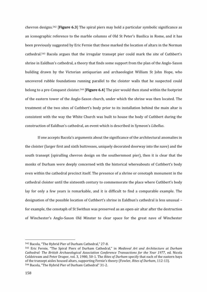
158
chevron designs.542 [Figure 6.3] The spiral piers may hold a particular symbolic significance as
an iconographic reference to the marble columns of Old St Peter’s Basilica in Rome, and it has
been previously suggested by Eric Fernie that these marked the location of altars in the Norman
cathedral.543 Bacola argues that the irregular transept pier could mark the site of Cuthbert’s
shrine in Ealdhun’s cathedral, a theory that finds some support from the plan of the Anglo-Saxon
building drawn by the Victorian antiquarian and archaeologist William St John Hope, who
uncovered rubble foundations running parallel to the cloister walls that he suspected could
belong to a pre-Conquest cloister.544 [Figure 6.4] The pier would then stand within the footprint
of the eastern tower of the Anglo-Saxon church, under which the shrine was then located. The
treatment of the two sites of Cuthbert’s body prior to its installation behind the main altar is
consistent with the way the White Church was built to house the body of Cuthbert during the
construction of Ealdhun’s cathedral, an event which is described in Symeon’s Libellus.
If one accepts Bacola’s arguments about the significance of the architectural anomalies in
the cloister (larger first and sixth buttresses, uniquely decorated doorway into the nave) and the
south transept (spiralling chevron design on the southernmost pier), then it is clear that the
monks of Durham were deeply concerned with the historical whereabouts of Cuthbert’s body
even within the cathedral precinct itself. The presence of a shrine or cenotaph monument in the
cathedral cloister until the sixteenth century to commemorate the place where Cuthbert’s body
lay for only a few years is remarkable, and it is difficult to find a comparable example. The
designation of the possible location of Cuthbert’s shrine in Ealdhun’s cathedral is less unusual –
for example, the cenotaph of St Swithun was preserved as an open-air altar after the destruction
of Winchester’s Anglo-Saxon Old Minster to clear space for the great nave of Winchester
542 Bacola, “The Hybrid Pier of Durham Cathedral,” 27-8. 543 Eric Fernie, “The Spiral Piers of Durham Cathedral,” in Medieval Art and Architecture at Durham Cathedral: The British Archaeological Association Conference Transactions for the Year 1977 , ed. Nicola Coldstream and Peter Draper, vol. 3, 1980, 50-1. The Rites of Durham specify that each of the eastern bays of the transept aisles housed altars, supporting Fernie’s theory (Fowler, Rites of Durham, 112-13). 544 Bacola, “The Hybrid Pier of Durham Cathedral” 31-2.
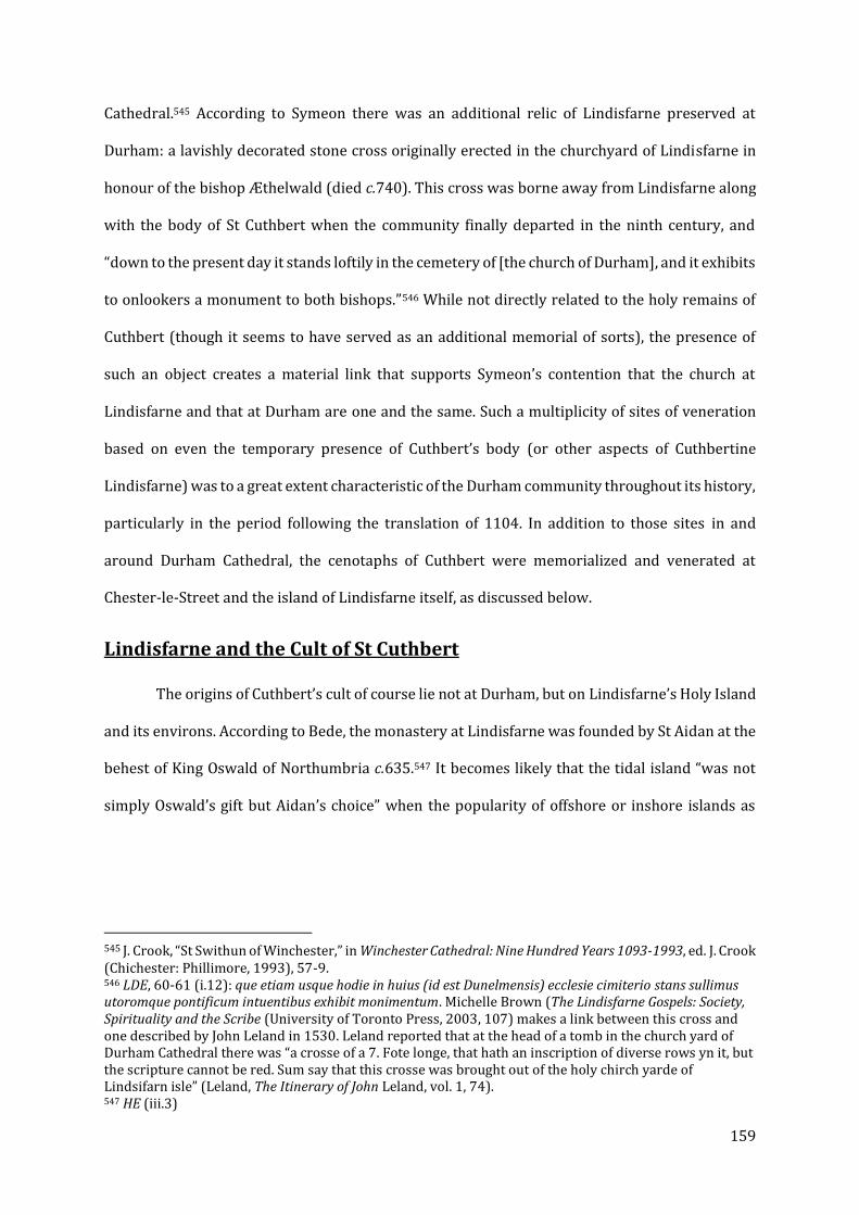
159
Cathedral.545 According to Symeon there was an additional relic of Lindisfarne preserved at
Durham: a lavishly decorated stone cross originally erected in the churchyard of Lindisfarne in
honour of the bishop Æthelwald (died c.740). This cross was borne away from Lindisfarne along
with the body of St Cuthbert when the community finally departed in the ninth century, and
“down to the present day it stands loftily in the cemetery of [the church of Durham], and it exhibits
to onlookers a monument to both bishops.”546 While not directly related to the holy remains of
Cuthbert (though it seems to have served as an additional memorial of sorts), the presence of
such an object creates a material link that supports Symeon’s contention that the church at
Lindisfarne and that at Durham are one and the same. Such a multiplicity of sites of veneration
based on even the temporary presence of Cuthbert’s body (or other aspects of Cuthbertine
Lindisfarne) was to a great extent characteristic of the Durham community throughout its history,
particularly in the period following the translation of 1104. In addition to those sites in and
around Durham Cathedral, the cenotaphs of Cuthbert were memorialized and venerated at
Chester-le-Street and the island of Lindisfarne itself, as discussed below.
Lindisfarne and the Cult of St Cuthbert
The origins of Cuthbert’s cult of course lie not at Durham, but on Lindisfarne’s Holy Island
and its environs. According to Bede, the monastery at Lindisfarne was founded by St Aidan at the
behest of King Oswald of Northumbria c.635.547 It becomes likely that the tidal island “was not
simply Oswald’s gift but Aidan’s choice” when the popularity of offshore or inshore islands as
545 J. Crook, “St Swithun of Winchester,” in Winchester Cathedral: Nine Hundred Years 1093-1993, ed. J. Crook (Chichester: Phillimore, 1993), 57-9. 546 LDE, 60-61 (i.12): que etiam usque hodie in huius (id est Dunelmensis) ecclesie cimiterio stans sullimus utoromque pontificum intuentibus exhibit monimentum. Michelle Brown (The Lindisfarne Gospels: Society, Spirituality and the Scribe (University of Toronto Press, 2003, 107) makes a link between this cross and one described by John Leland in 1530. Leland reported that at the head of a tomb in the church yard of Durham Cathedral there was “a crosse of a 7. Fote longe, that hath an inscription of diverse rows yn it, but the scripture cannot be red. Sum say that this crosse was brought out of the holy chirch yarde of Lindsifarn isle” (Leland, The Itinerary of John Leland, vol. 1, 74). 547 HE (iii.3)
160
centres of monastic retreat is taken into account.548 In particular, Lindisfarne bears a
topographical resemblance to the monastic centre at Iona in the Western Isles, though O’Sullivan
has questioned whether such similarities are more a function of the nature of early medieval
monasticism as opposed to a conscious imitation or memorialization of Iona itself. The sanctity
of Lindisfarne was assured even before Cuthbert’s episcopal residence and eremitic withdrawal
to a series of islands set apart from the island itself, but following his death c.687, Lindisfarne
became host to one of the earliest and most influential saints’ cults in Anglo-Saxon England. The
cult’s focus on the shrine and tomb of Cuthbert as a centrepiece for liturgical ceremonies
(including the translation of Cuthbert’s remains into a tomb-shrine in c.698) and miraculous
cures, while common in a later medieval context, were more common to the cults of Merovingian
Gaul than any Irish or Anglo-Saxon model.549
The form the earliest monastery took is uncertain; it is accepted that Cuthbert was buried
in the wooden church built by St Aidan (which would become a powerful secondary relic in its
own right). The proposed axial relationship between the Anglo-Saxon church of St Peter,
traditionally believed to be on the site of the twelfth-century priory, and the standing parish
church of St Mary could have existed as early as the seventh or eighth centuries, in an
arrangement known from a range of other Anglo-Saxon monastic sites.550 Excavations in 2016
and 2017 on the Heugh, the basalt ridge overlooking the site of Lindisfarne Priory to the south,
have revealed a number of buildings of likely early medieval origin, including a substantial stone
chapel dating from as early as the eighth century. The excavators also found the remains of a
tower just to the west of the chapel and confirmed the presence of a medieval structure under the
ruins of the post-Medieval ‘Lantern Chapel.’551
548 Deirdre O’Sullivan, “Space, Silence and Shortage on Lindisfarne: The Archaeology of Asceticism,” in Image and Power in the Archaeology of Early Medieval Britain : Essays in Honour of Rosemary Cramp, ed. H. Hamerow and A. MacGregor (Oxford: Oxbow, 2001), 36–7. 549 Deirdre O’Sullivan and Robert Young, Lindisfarne: Holy Island (London: English Heritage, 1995), 50. 550 J. Blair, “The Early Churches at Lindisfarne,” Archaeologia Aeliana, 5th, 19 (1991): 51. 551 Richard Carlton, “Archaeological Excavations on Lindisfarne Heugh,” in Peregrini Lindisfarne: An Anthology (Peregrini Lindisfarne Landscape Partnership, Northumberland County Council, 2017), 117–25.

161
Another major aspect of Cuthbert’s cult at Lindisfarne in the Anglo-Saxon period may
have been a sacred landscape centring around the stages of Cuthbert’s monastic and eremitic life.
[Figure 6.5] In recounting the story of a paralytic boy cured by wearing shoes once worn by
Cuthbert, Bede records that after the miracle the young man “went around the holy places
[circuivit loca sancta] praying and offering the sacrifice of praise to his Saviour.”552 Both the
monastic settlement at Lindisfarne and the cult of Cuthbert were irrevocably altered after the
island became the target of Scandinavian raiders, beginning with the famous sack of 793. These
attacks continued until c.875, when the community was forced to take up the body of their saint
(and by some accounts even the wooden church in which he was buried, see below) and flee to
the Northumbrian mainland. A seven-year journey eventually ended with the community settling
for about a century at Chester-le-Street before finally re-establishing themselves at Durham c.995.
But while the flight of 875 is presented as a watershed moment in later sources, the implication
that it also marked the end of monastic or other religious activity on the island until the twelfth
century is belied by the material record.553 Both older and more recent excavations have
discovered sculptural fragments dating from the late ninth- to the eleventh-centuries, after the
community was said to have fled.554
Though part of the original monastic community of Lindisfarne may have remained after
the departure of Cuthbert and a number of other relics, the traditional heart of the cult – the
incorrupt body of the saint himself – would only grace the shores of Lindisfarne once more, in
1069, when it was taken out of Durham to escape the wrath of William the Conqueror.555 In its
absence, however, the cult of Cuthbert on Lindisfarne was not necessarily diminished. In place of
the physical remains, the cenotaph became the primary point of veneration for the Lindisfarne
552 Emma J. Wells, “‘And He Went Round the Holy Places,” 224; BVSC 299-301 (§ 45): circuit loca sancta orando, et suo Salvatori sacrificium laudis offerendo. 553 Blair, “The Early Churches at Lindisfarne,” 51. 554 Rosemary Cramp, “The Artistic Influence of Lindisfarne within Northumbria,” in St. Cuthbert,: His Cult and His Community to AD 1200, ed. Gerald Bonner, D. W. Rollason, and Clare Stancliffe (Woodbridge: Boydell Press, 1989), 226; Rosemary Cramp, Corpus of Anglo-Saxon Stone Sculpture in England, vol. 1, 12 vols. (Oxford: Oxford University Press, 1984), 196-200; 206-208; 243-244. 555 LDE iii.15, 185-7.

162
cult, and it is possible that the ‘loca sancta’ referred to by Bede, as well as the sites of Cuthbert’s
eremitic life on the offshore islands, also gained a new importance as memorials of his life, and
perhaps even witnessed some of the saint’s later miracles. The exact situation of the cult on
Lindisfarne after the flight of 875 is difficult to determine. It is certain that by the twelfth century
the links between the cult of Cuthbert at Durham Cathedral and the site at Lindisfarne had been
firmly re-established. The primary source for this part of Lindisfarne’s history is the Libellus of
Reginald of Durham, a monk in the priory who may also have been involved in other
hagiographical works at Coldingham.556 The LBC consists of 111 chapters and seems to have been
first composed before 1167 as a record of the wide range of miracles worked by Cuthbert across
multiple sites in Northumbria; a continuation of thirty chapters can be dated c.1172-4.557 Writing
roughly forty years after the fact, Reginald recorded that Edward, a Benedictine monk of the
cathedral priory, oversaw the construction of a church on the site of Cuthbert’s cenotaph.558
The first record of a sizable monastic community dates from the early 1170s; it is
therefore likely that the priory church was not originally designed to serve a monastic cell, though
its impressive size suggests that it was regarded as highly important by the Durham
community.559 Certain features of the church, discussed below, suggest that it may have been
designed as a pilgrimage church. Perhaps beginning with the translation of 1104 at Durham, the
cult of St Cuthbert, now under the custodianship of the post-1083 Benedictine priory, entered a
new phase of its life. The apparent re-settlement of Lindisfarne by Durham in the 1120s would be
in line with the expanding sphere of influence of the cathedral and its bishops, as well as reflecting
the diffusion of the cult through much of Northumbria, with a particular focus on former or
current possessions of Cuthbert’s guardians and places with which he was associated during both
556 For the case for the attribution of St Æbbe’s Life to Reginald see Robert Bartlett, The Miracles of Saint Æbbe of Coldingham and Saint Margaret of Scotland, Oxford Medieval Texts (Oxford: Clarendon Press, 2003), xvii-xx. 557 Victoria Tudor, “The Cult of St Cuthbert in the Twelfth Century: The Evidence of Reginald of Durham,” in ed. Bonner et al, St. Cuthbert: His Cult and His Community, 449-50. Sally Crumplin, “Modernizing St Cuthbert: Reginald of Durham’s Miracle Collection,” Studies in Church History 41 (2005): 179–91. 558 LBC, 21-22. 559 O’Sullivan and Young, Lindisfarne: Holy Island, 70.

163
his life and death. The re-founded church and eventual priory on Holy Island and the Norman
cathedral at Durham were envisioned as linked not merely by their shared association with
Cuthbert but also the very architectural features of the two buildings.560 A similar phenomenon
can be observed at work in the illustrations of two twelfth-century copies of Bede’s Life, in Oxford
University College MS 165 and BL Yates Thompson 26, where Cuthbert’s Farne hermitage is
depicted with features reminiscent of much later buildings, discussed later in this chapter.561
The volume of recorded miracles at both the shrine in Durham (which may not have been
immediately accessible to pilgrims in the original design of the Norman eastern arm) and the
outlying sites of Lindisfarne and Farne increased dramatically in the twelfth century.562 Of those
miracles recorded by Reginald, however, few took place at the site of the cenotaph and the priory;
the most prominent site of cures and interventions were at and around Inner Farne, site of
Cuthbert’s final hermitage and his death.563 That island was also the dwelling place of a series of
eleventh- to fourteenth-century hermits, most notably Bartholomew (the subject of Geoffrey of
Durham’s Vita Bartolomei) who is mentioned among others in a miracle collection of c.1199.564
Reginald records seventeen miracles on Inner Farne; some of the beneficiaries were wayward
mariners, but there were a considerable number of pilgrims seeking cures. The implication is that
Farne was a fairly busy pilgrimage centre, and the existence of a guesthouse (discussed below)
would seem to confirm this impression.565 By the time of the addition of thirty-three chapters to
the Libellus in the 1170s, the epicentre of the saint’s miraculous deeds had shifted back to
Durham, though as shown by the production of the Miracles of Farne (De mirabilibus Dei modernis
560 Marner notes the deliberate similarities between the description of Cuthbert’s 698 translation by Bede and that recorded in the twelfth century of the 1104 translation at Durham. See Dominic Marner, “Measuring Time and Topography in the Cult of Saint Cuthbert at Durham,” in Saints of North-East England, 600-1500, 141-44. 561 Heidi Stoner, “The Architecture of a Life: An Iconography of Architectural Images in Oxford University College MS 165,” in ed. Bolton and Hawkes, The Art, Literature and Material Culture of the Medieval World, 218-9, 227. 562 Tudor, “The Cult of St Cuthbert in the Twelfth Century,” 451. 563 Wells, “‘And He Went Round the Holy Places," 215. 564 H.H.E. Craster, “The Miracles of Farne,” Archaeologia Aeliana, 29, 4 (1951): 93–107. 565 Sally Crumplin, “Rewriting History in the Cult of St Cuthbert from the Ninth to the Twelfth Centuries” (PhD Thesis, University of St Andrews, 2005), 236-7.

164
temporibus in Farne insula declaratis) c.1199, the praesentia of Cuthbert remained at his former
abode.566 It is possible that two distinct centres of Cuthbert’s cult served different constituencies:
a considerable number of the recipients of cures at Lindisfarne and Farne came from north of the
Tyne; the opposite was true for those cures recorded at Durham where a place of origin is
specified.567 The shift back to Durham in the 1170s has been assigned a variety of causes, most
notably the emergence of competition both far (Thomas Becket at Canterbury) and near (Godric
of Finchale).568 Perhaps the fame of Farne’s hermits, including Bartholomew, had grown to the
point where they began to overshadow their forbear. A final dimension of the cult in the twelfth
century is related to Cuthbert’s perceived misogyny. Bede’s treatment of Cuthbert’s relationship
with women is not particularly damning (outside of his attribution of the destruction of the mixed
community at Coldingham to the monastery’s depravity).569 But the emphasis on Cuthbert’s
monasticism in the later Durham-associated texts was accompanied by admonitions that women
were not to be allowed in Cuthbert’s immediate vicinity, including within Durham Cathedral and
the churches on Lindisfarne and Farne (though they were allowed in the churchyard), and the
implication given by later accounts is that it reflected ancient tradition. The cult of Godric of
Finchale, only miles from Durham, held no such apparent antipathy towards women, and Tudor
had noted that the majority of the pilgrims who are recorded as visiting that shrine were
female.570
566 Tudor, “The Cult of St Cuthbert in the Twelfth Century,” 455. This miracula was bound together with Reginald’s Libellus and the Vita of Bartholomew in BL MS Harley 4843. 567 Ibid, 465. 568 Wells, “‘And He Went Round the Holy Places'” 215-6. Crumplin questions this line of argument, particularly given the close links between Godric’s cult, the Durham cathedral priory, and Reginald himself (who also wrote a Life of Godric). Crumplin, “Rewriting History in the Cult of St Cuthbert from the Ninth to the Twelfth Centuries,” 180-3. 569 BSVC includes passages detailing Cuthbert’s cordial relationship with Ætheldreda of Ely and the healing of one of her nuns (§ 23-24) and the miraculous cure of a women suffering from pain in her side (§ 30). 570 Tudor, “The Cult of St Cuthbert in the Twelfth Century,” 457.
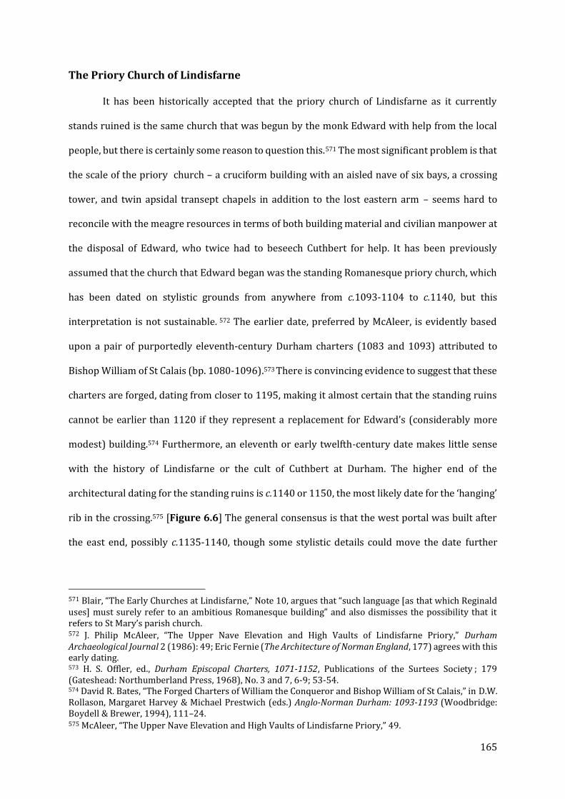
165
The Priory Church of Lindisfarne
It has been historically accepted that the priory church of Lindisfarne as it currently
stands ruined is the same church that was begun by the monk Edward with help from the local
people, but there is certainly some reason to question this.571 The most significant problem is that
the scale of the priory church – a cruciform building with an aisled nave of six bays, a crossing
tower, and twin apsidal transept chapels in addition to the lost eastern arm – seems hard to
reconcile with the meagre resources in terms of both building material and civilian manpower at
the disposal of Edward, who twice had to beseech Cuthbert for help. It has been previously
assumed that the church that Edward began was the standing Romanesque priory church, which
has been dated on stylistic grounds from anywhere from c.1093-1104 to c.1140, but this
interpretation is not sustainable. 572 The earlier date, preferred by McAleer, is evidently based
upon a pair of purportedly eleventh-century Durham charters (1083 and 1093) attributed to
Bishop William of St Calais (bp. 1080-1096).573 There is convincing evidence to suggest that these
charters are forged, dating from closer to 1195, making it almost certain that the standing ruins
cannot be earlier than 1120 if they represent a replacement for Edward’s (considerably more
modest) building.574 Furthermore, an eleventh or early twelfth-century date makes little sense
with the history of Lindisfarne or the cult of Cuthbert at Durham. The higher end of the
architectural dating for the standing ruins is c.1140 or 1150, the most likely date for the ‘hanging’
rib in the crossing.575 [Figure 6.6] The general consensus is that the west portal was built after
the east end, possibly c.1135-1140, though some stylistic details could move the date further
571 Blair, “The Early Churches at Lindisfarne,” Note 10, argues that “such language [as that which Reginald uses] must surely refer to an ambitious Romanesque building” and also dismisses the possibility that it refers to St Mary’s parish church. 572 J. Philip McAleer, “The Upper Nave Elevation and High Vaults of Lindisfarne Priory,” Durham Archaeological Journal 2 (1986): 49; Eric Fernie (The Architecture of Norman England, 177) agrees with this early dating. 573 H. S. Offler, ed., Durham Episcopal Charters, 1071-1152, Publications of the Surtees Society ; 179 (Gateshead: Northumberland Press, 1968), No. 3 and 7, 6-9; 53-54. 574 David R. Bates, “The Forged Charters of William the Conqueror and Bishop William of St Calais,” in D.W. Rollason, Margaret Harvey & Michael Prestwich (eds.) Anglo-Norman Durham: 1093-1193 (Woodbridge: Boydell & Brewer, 1994), 111–24. 575 McAleer, “The Upper Nave Elevation and High Vaults of Lindisfarne Priory,” 49.
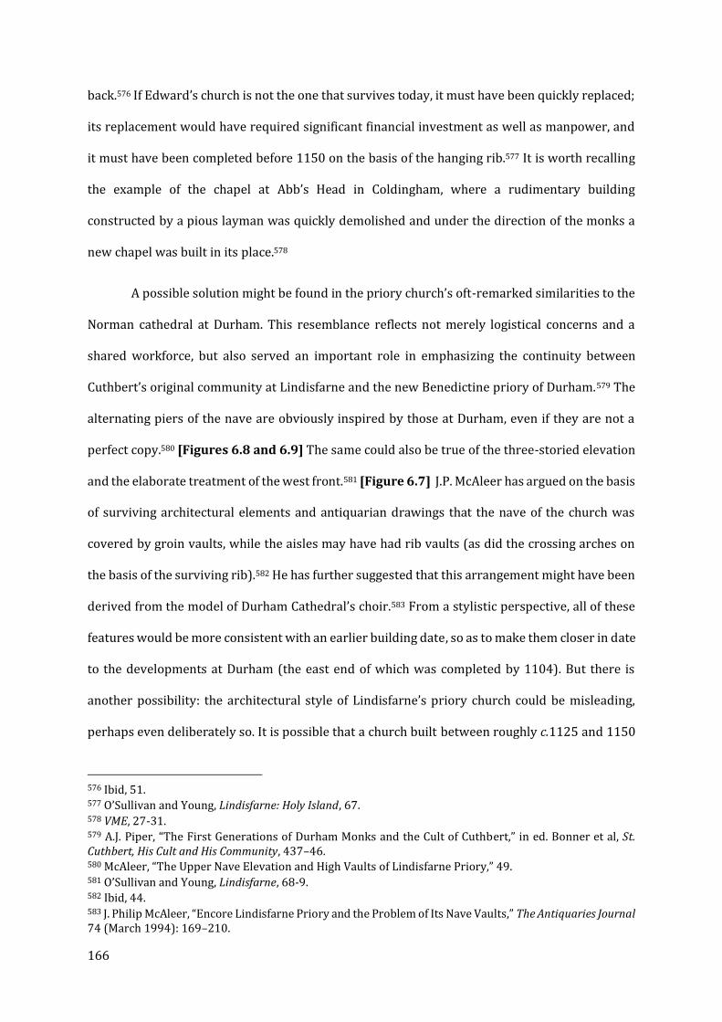
166
back.576 If Edward’s church is not the one that survives today, it must have been quickly replaced;
its replacement would have required significant financial investment as well as manpower, and
it must have been completed before 1150 on the basis of the hanging rib.577 It is worth recalling
the example of the chapel at Abb’s Head in Coldingham, where a rudimentary building
constructed by a pious layman was quickly demolished and under the direction of the monks a
new chapel was built in its place.578
A possible solution might be found in the priory church’s oft-remarked similarities to the
Norman cathedral at Durham. This resemblance reflects not merely logistical concerns and a
shared workforce, but also served an important role in emphasizing the continuity between
Cuthbert’s original community at Lindisfarne and the new Benedictine priory of Durham.579 The
alternating piers of the nave are obviously inspired by those at Durham, even if they are not a
perfect copy.580 [Figures 6.8 and 6.9] The same could also be true of the three-storied elevation
and the elaborate treatment of the west front.581 [Figure 6.7] J.P. McAleer has argued on the basis
of surviving architectural elements and antiquarian drawings that the nave of the church was
covered by groin vaults, while the aisles may have had rib vaults (as did the crossing arches on
the basis of the surviving rib).582 He has further suggested that this arrangement might have been
derived from the model of Durham Cathedral’s choir.583 From a stylistic perspective, all of these
features would be more consistent with an earlier building date, so as to make them closer in date
to the developments at Durham (the east end of which was completed by 1104). But there is
another possibility: the architectural style of Lindisfarne’s priory church could be misleading,
perhaps even deliberately so. It is possible that a church built between roughly c.1125 and 1150
576 Ibid, 51. 577 O’Sullivan and Young, Lindisfarne: Holy Island, 67. 578 VME, 27-31. 579 A.J. Piper, “The First Generations of Durham Monks and the Cult of Cuthbert,” in ed. Bonner et al, St. Cuthbert, His Cult and His Community, 437–46. 580 McAleer, “The Upper Nave Elevation and High Vaults of Lindisfarne Priory,” 49. 581 O’Sullivan and Young, Lindisfarne, 68-9. 582 Ibid, 44. 583 J. Philip McAleer, “Encore Lindisfarne Priory and the Problem of Its Nave Vaults,” The Antiquaries Journal 74 (March 1994): 169–210.

167
might have been designed and decorated to better resemble the existing Romanesque building at
Durham, rather than reflecting the subsequent developments in architectural design during the
intervening twenty years. A scheme of this sort would have been a powerful form of “architectural
propaganda,” cementing the links between the two centres of Cuthbert’s cult.584 As will be shown
in a following section, the illustrators of two twelfth-century Lives of Cuthbert chose to portray
Cuthbert’s hermitage, vividly described by Bede, as resembling the Anglo-Norman buildings at
Durham. As will be discussed in Chapter VII, the monks of Glastonbury, also greatly concerned
with memorializing their own past, may have employed a similar approach when building the
Lady Chapel on the site of the famed Vetusta Ecclesia, reduced to ashes by the fire of 1184.585
If this is not a case of ‘architectural propaganda’ and deliberately anachronistic design,
then the accuracy of Reginald’s account of Edward’s activities, or at least the date of the 1120s
which is generally accepted by historians, if not architectural specialists, is completely called into
question. If so, the reasons that such a story would have been fabricated are not entirely clear –
while there was certainly a desire to portray Lindisfarne after Cuthbert as an abandoned
wasteland in need of monastic restoration, it is not clear why the story of Edward could not have
been placed further back in the narrative. There are therefore two plausible solutions: either the
church at Lindisfarne was built in a convincingly archaic style to better reflect its model at
Durham, or the activities of Edward must be re-dated to the last decade of the eleventh century
or the first decade of the twelfth. On the basis of the charter evidence, the later date is preferred,
making a deliberately archaic building a compelling explanation for these anachronistic features.
584 Piper, “The First Generations of Durham Monks and the Cult of Cuthbert,” 444-5; O’Sullivan and Young, Lindisfarne, 68-9. The desire to link past events on Lindisfarne with contemporary developments in Durham may have also been expressed in the hagiographical material produced in the twelfth century. 585 Gilchrist and Green, Glastonbury Abbey, 434. In these acts of anachronism and imitatio, the monks of Durham and Lindisfarne were of course not the first; the phenomenon is evident in several periods, including efforts by Carolingian church builders to recall the form of early Christian basilicas. C.f. Richard Krautheimer, “The Carolingian Revival of Early Christian Architecture,” The Art Bulletin 24, no. 1 (1942): 1–38.
168
The Cenotaph
Regardless of when it was constructed, the design of the priory church at Lindisfarne does
not appear to have been well-suited to monastic life. The only entrances into the church besides
the west end were in the south aisle and south transept. The monastic buildings were eventually
built to the south.586 The existence of the parish church of St Mary means that the building must
have been initially primarily devoted to pilgrims who came to visit the empty grave, or cenotaph,
about which very little is known. The location of Cuthbert’s original grave is now lost, but it seems
certain that the priory church (and potentially Edward’s earlier church) was built to contain it. In
chapters xxi and xxii of Reginald’s Libellus the cenotaph itself plays an important role. Back in the
eighth or ninth centuries, during a major Viking attack on Lindisfarne (possibly that described by
Bede), the remaining monks fled ad Beati Cuthberti tumbam, where they were cut down by the
Vikings.587 At least three hundred years later, the monk Edward leaves a feast thrown for the
workers helping to build his church to go to Beati Cuthberti tumbam quae infra ecclesiam est,
giving thanks to the saint and beseeching him for enough stone to complete the church and
enough food and drink to see to the needs of the labourers.588 In a later chapter, he repeats this
action to find enough bread to feed the crowds at Cuthbert’s feast day.589 While there is no
description of the twelfth-century cenotaph itself (most of the subsequent miracles near
Lindisfarne take place on the site of Cuthbert’s hermitage on Inner Farne, below), these
references make it clear that the site of Cuthbert’s former grave was known in the years after the
Conquest, and sixteenth-century inventories indicate an image or monument on the site of the
cenotaph remained until at least 1535.590
586 O’Sullivan and Young also suggest that the presence of up to three altars in the church might suggest the opposite; that there was some sort of monastic community of Durham at Lindisfarne Priory in the first half of the twelfth century (Lindisfarne, 70). 587 LBC, 19 (i.13). 588 LBC 48-49 (i.22). 589 LBC, 58-60 (i.26). 590 Raine, James. The History and Antiquities of North Durham, as Subdivided into the Shires of Norham, Island, and Bedlington Which, from the Saxon Period until the Year 1844, Constituted Parcels of the County Palatine of Durham, but Are Now United to the County of Northumberland. (London: John Bowyer Nichols, 1830), 125.

169
As it is possible that the priory church was not originally designed as a monastic building,
or meant only to serve a small community, despite its grand scale and decorative scheme, the
church could have been built with pilgrims in mind. The blocked doorway in the north aisle of the
fourth bay of the nave, located across from the site of the possible holy well inside the church,
may have served as an access point for pilgrims, as it would have led right to the east end of the
nave where the cenotaph may have resided.591 [Figures 6.10 and 6.11] The only traces of an
earlier church, perhaps that containing the original tomb, were found during twentieth-century
clearance work. Under the direction of Peers, workers uncovered a foundation underlying the
north aisle wall, belonging to a “plain rectangular building, whose east wall was a little to the west
of the east end of this aisle.” [Figure 6.12] The foundations could potentially represent the eighth-
or ninth-century church of St Peter by Bishop Eadberht, possibly itself a replacement of St Finan’s
church (discussed below).592 Bede describes the body of St Cuthbert resting on the south side of
the church of his day, “to the right-hand side of the altar.”593 If this positioning held true for the
church Peers found, the cenotaph would have been located almost exactly on the central axis of
the twelfth-century priory church, which could in turn explain the re-alignment of the church to
the south if it placed the cenotaph at the centre of the east end of the nave, making it easily
accessible to pilgrims entering through the doorway in the north aisle wall.594 The importance of
the places where Cuthbert’s body previously resided is demonstrated elsewhere – a cenotaph at
Chester-le-Street is noted by Leland in the sixteenth century and the two possible monuments to
previous sites of Cuthbert’s remains at Durham were discussed previously. The cenotaph at
Lindisfarne would have been consistent with the model of a cult that placed great significance on
where a saint’s relics had been, not just in the shrine that presently held them. Furthermore, there
is another story from Bede’s Vita worth referencing when considering the relationship of the
priory church to its predecessor. After the saint had died and been buried, a boy cursed by
591 Wells, “And He Went Round the Holy Places,” 225-6. 592 O’Sullivan and Young, Lindisfarne, 43-44. 593 BVSC § 40: atque in ecclesia beati Apostoli Petri in dextera parte altaris petrino in sarcophago repositum. 594 Blair, “The Early Churches at Lindisfarne,” 51.
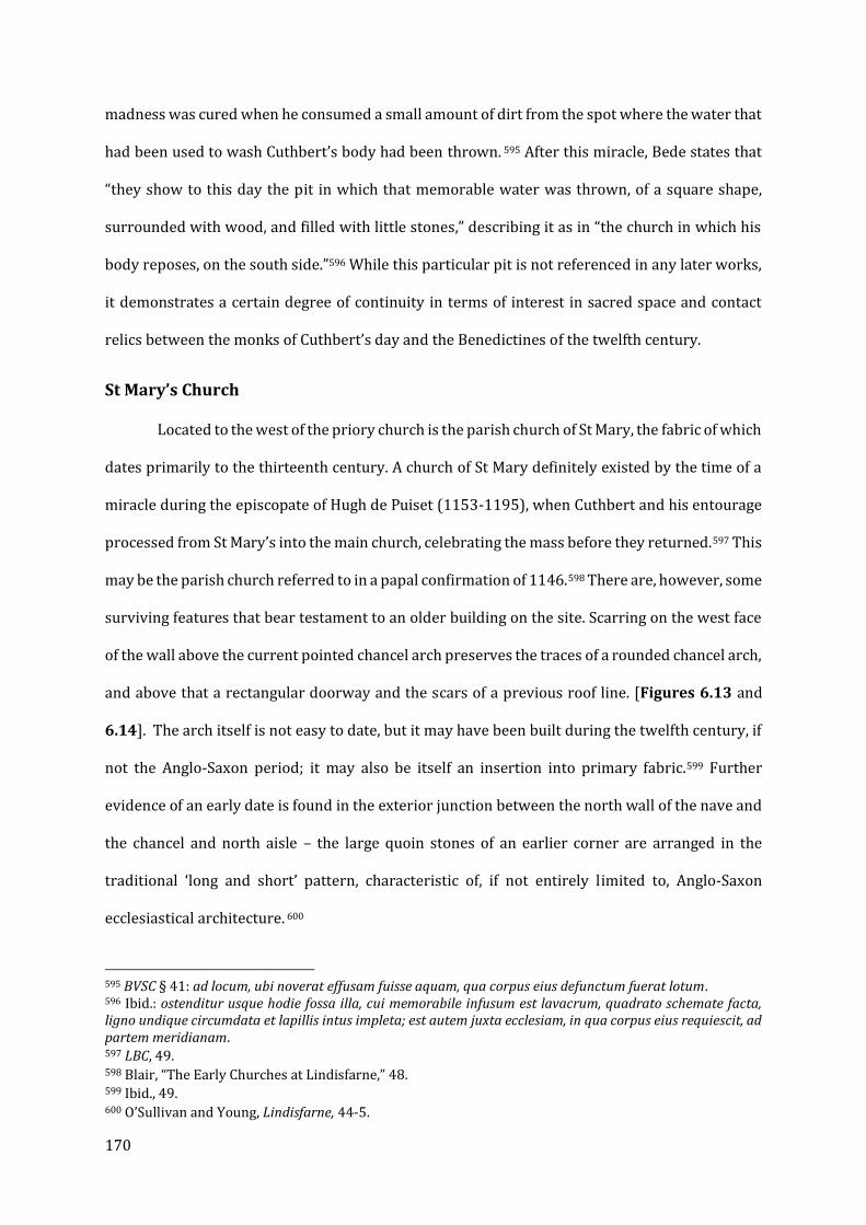
170
madness was cured when he consumed a small amount of dirt from the spot where the water that
had been used to wash Cuthbert’s body had been thrown. 595 After this miracle, Bede states that
“they show to this day the pit in which that memorable water was thrown, of a square shape,
surrounded with wood, and filled with little stones,” describing it as in “the church in which his
body reposes, on the south side.”596 While this particular pit is not referenced in any later works,
it demonstrates a certain degree of continuity in terms of interest in sacred space and contact
relics between the monks of Cuthbert’s day and the Benedictines of the twelfth century.
St Mary’s Church
Located to the west of the priory church is the parish church of St Mary, the fabric of which
dates primarily to the thirteenth century. A church of St Mary definitely existed by the time of a
miracle during the episcopate of Hugh de Puiset (1153-1195), when Cuthbert and his entourage
processed from St Mary’s into the main church, celebrating the mass before they returned.597 This
may be the parish church referred to in a papal confirmation of 1146.598 There are, however, some
surviving features that bear testament to an older building on the site. Scarring on the west face
of the wall above the current pointed chancel arch preserves the traces of a rounded chancel arch,
and above that a rectangular doorway and the scars of a previous roof line. [Figures 6.13 and
6.14]. The arch itself is not easy to date, but it may have been built during the twelfth century, if
not the Anglo-Saxon period; it may also be itself an insertion into primary fabric.599 Further
evidence of an early date is found in the exterior junction between the north wall of the nave and
the chancel and north aisle – the large quoin stones of an earlier corner are arranged in the
traditional ‘long and short’ pattern, characteristic of, if not entirely limited to, Anglo-Saxon
ecclesiastical architecture. 600
595 BVSC § 41: ad locum, ubi noverat effusam fuisse aquam, qua corpus eius defunctum fuerat lotum. 596 Ibid.: ostenditur usque hodie fossa illa, cui memorabile infusum est lavacrum, quadrato schemate facta, ligno undique circumdata et lapillis intus impleta; est autem juxta ecclesiam, in qua corpus eius requiescit, ad partem meridianam. 597 LBC, 49. 598 Blair, “The Early Churches at Lindisfarne,” 48. 599 Ibid., 49. 600 O’Sullivan and Young, Lindisfarne, 44-5.
171
The dimensions of the nave (19.5m x 5.8m x 7.5m) are comparable to the original western
church at Jarrow (20m x 5.5m). There is also the roof line of a previous chancel approximately a
metre higher than the thirteenth-century one visible on the east side of the wall above the chancel
arch. Taken together, it is very plausible that St Mary’s has eleventh-century, if not earlier, origins.
It could be associated with the community that produced a number of the sculptural fragments
dating from the period after the body of Cuthbert was taken from Lindisfarne in 875. 601
Furthermore, it is in an axial alignment with the priory church, and presumably the earlier church
of St Peter, a relatively common arrangement on Anglo-Saxon monastic or minster sites.602 While
the church itself was probably not a cult site, it was clearly important to the community, and the
retention of the alignment between the rebuilt priory and the earlier parish church suggests that
the monks from Durham were keen to preserve aspects of the topography of the ancient
monastery.603
The Heugh: Watchtower and Chapel
The basalt ridge known as the Heugh overlooking the medieval priory and modern village
of Lindisfarne is one of the most dramatic topographical features on the relatively flat tidal island,
and unsurprisingly appears to have played a significant role in the development and
memorialization of the first monastery. In addition to having potential topological significance —
Deidre O’Sullivan suggests that it could have been an “embodiment” of Mount Nebo in Jordan,
which overlooked the plains and provided a view of the city of Jerusalem — it has been long
suspected that the Heugh is the site of multiple buildings with dates ranging from the earliest
days of the monastery through the medieval period.604 Several antiquarian scholars drew
601 See Note 529, above. While the bulk of the tenth-century material is fragmentary, the eleventh-century cross heads (nos. 45 and 46 in CASSS I are easily datable. 602 O’Sullivan and Young, Lindisfarne, 44-5. Furthermore, Bede refers to a basilica maior when describing where Cuthbert’s body rested, suggesting the presence of at least one other church. (HE iii.17) Blair speculated that the slight mis-alignment south of St Mary’s Church to the priory church might be explained by the fact that the former was built to align with the location of the cenotaph, which the latter placed in the traditional location for a shrine (Blair, “The Early Churches of Lindisfarne,” 51). 603 A document of 1395 from the Priory refers to a churchyard of “St. Columb,” though its location is unknown. This could be further evidence of the medieval priory’s interests in its antiquity (O’Sullivan and Young, Lindisfarne, 45). 604 O’Sullivan, “Space, Silence and Shortage on Lindisfarne: The Archaeology of Asceticism,” 37.

172
attention to the visible earthworks on the ridge, though these observations and sketches were
not published.605 Some excavation was carried out by Brian Hope-Taylor in the 1960s (also
unpublished), and most notably, the Lindisfarne Research Project of 1985-6 surveyed the top of
the Heugh, carrying out a resistivity survey of the entire ridge [Figure 6.15].606 A number of
features of possible significance were identified, but until recently, interpretations of their form
and function were purely speculative.
Excavations in 2016 and 2017 revealed that structure ‘C’ was likely to be some sort of
tower (as suggested by its massive foundations and 2.5m thick walls); this could potentially be
the same or related to the watchtower (specula) mentioned by Bede in his Life of Cuthbert as used
by the monks to receive word of the death of Cuthbert on Farne, an association that could have
made it part of a biographical sacred landscape based on the life and death of the saint.607 The
walls were constructed from “closely-packed, deeply-set cobbles” faced with roughly cut stones,
suggesting an early-medieval origin. 608 This building, by one estimation eight metres square and
standing at an estimated twelve metres tall, may have also served the more mundane function of
enabling communication with the Anglian royal centre of Bamburgh. Feature ‘D’, located to the
east of the watchtower, was of even greater historical significance: it is probably the earliest
religious building yet found on Holy Island. [Figure 6.16] The excavations in 2016 and 2017 also
revealed a two-chambered building 17-20m in length on the south side, with a large western
chamber and a much narrower and slightly irregular eastern chamber. The dressing marks
indicated the use of pecking or linear pick-mark tooling. A break in the double-lined sandstone
blocks on the north wall could represent a doorway.609 Crudely-dressed worked stones were
found that were interpreted as the frames for windows, as well as a small stone trough that might
have served as a piscina, but no other worked stones were present to suggest any kind of carved
605 O’Sullivan and Young, Lindisfarne, 14. 606 Ibid, 46. 607 BVSC, 284-7: quod cum videret frater, qui in specula Lindisfarnensis insulae. 608 Carlton, “Archaeological Excavations on Lindisfarne Heugh,” 3-4. 609 Ibid.
173
decoration.610 The building was constructed of reflective white sandstone which would at times
have given the impression that “it was quite literally radiating the purest white light,” and its
presence on the 20m high ridge of the Heugh would make it visible to much of the
Northumberland coast, including the fortress of Bamburgh.611
The presence of a massive stone church atop the Heugh, separate from the apparent site
of the Anglo-Saxon monastic church under the current priory, invites additional speculation as to
the layout of the pre-Conquest monastery.612 There was evidently more than one church on Holy
Island, perhaps as early as Cuthbert’s own day. In the Historia Ecclesiastica, Bede referred to a
basilica maior on Holy Island, dedicated to “the Prince of the Apostles” (St Peter), into which the
body of Aidan would later be translated from the monk’s cemetery.613 Blair suggested that if this
building, in which both Aidan and Cuthbert were buried, is the predecessor to Lindisfarne’s priory
church, that could imply the existence of another, earlier church, perhaps associated with the
graveyard in which Aidan was first buried.614 Discussing the works of Aidan’s successor, Finan,
Bede wrote that he “built a church in the Isle of Lindisfarne suitable for an episcopal see, building
it after the Irish method, not of stone, but of hewn oak, thatching it with reeds.”615 Later, Bishop
Eadberht “removed the reed thatch and had the whole of it, both roof and walls, covered with
sheets of lead.”616 It is possible that this grand wooden church of Finan was replaced by the
basilica maior of St Peter, though Bede is not explicit on this point. But the Historia de Sancto
Cuthberto, a text of uncertain date but no earlier than the mid-ninth century, includes a rather
remarkable claim that that during the bishopric of Ecgred (bp. 830-875) the monks of Lindisfarne
610 Ibid., 6. 611 Keys, “One of Britain’s Oldest Churches Discovered on Holy Island of Lindisfarne.” 612 See D. Petts, “‘A Place More Venerable than All in Britain’ : The Archaeology of Anglo-Saxon Lindisfarne.,” in The Lindisfarne Gospels : New Perspectives., ed. R. Gameson (Leiden: Brill, 2017), 1–18. Petts’ analysis predates the discovery of the Heugh chapel. 613 HE iii.17. 614 Blair, “The Early Churches at Lindisfarne,” 47. It is of course possible that the ‘lesser’ church was the predecessor to St Mary’s Church, but that would not explain the chapel on the Heugh. 615 HE, iii.25: qui in insula Lindisfarnensi fecit ecclesiam episcopali sedi congruam, quam tamen, more Scotorum, non de lapide, sed de robore secto, total composuit atque arundine texit. 616 Ibid.: ablata arundine, plumbi laminis eam totam, hoc est, et tectum et Ipsos quoque parietes eius, cooperire curavit.

174
translated the wooden church erected by St Aidan (not Finan) on Holy Island and then re-erected
it in Norham.617 Assuming that this account is accurate and not merely a misattribution of the
church’s builder, it is unlikely that this church, while presumably also made of wood, is that
referred to by Bede (who makes no mention of any specific church built by Aidan, and says the
first bishop of Lindisfarne was buried in the monks’ cemetery). Returning to the stone church
found on the Heugh, it is not likely to be either of the two mentioned by Bede, and clearly cannot
be the one transported to Norham. It is, however, possible that it was built on the site of Aidan’s
original church, and it might even be speculated that it was erected as a protective casing for the
original church of St Aidan, which by the account of the Historia de Sancto Cuthberto had become
a relic in its own right. As will be discussed in Chapter VII, the monks of Glastonbury preserved
the original wattle-built Vetusta Ecclesia within a lead covering until its destruction in 1184 and,
of course, Bede said that Finan’s church was given similar treatment.618 The church rebuilt at
Norham presumably could have been covered with lead if it was so easily translated, but an
alternative form of protection is plausible. The large stone chapel on the Heugh might have served
as a kind of reliquary to preserve the oldest building on Holy Island from the elements,
particularly if Aidan’s first church was built on the Heugh. Regardless, the Heugh chapel, Finan’s
church, and the basilica maior of St Peter (as well as the predecessor to St Mary’s Church) could
make up some of the loca sancta referred to by Bede, not only as monuments to St Cuthbert, but
617 HSC, 49 (§ 9): qui transportavit quondam ecclesiam olim factum a beato Aidano tempore Oswaldi regis de Lindisfarnensi insula ad Northham, ibique eam reaedificavit. Johnson-South argues that the surviving Historia might be either an eleventh-century revision of a tenth-century composition, or possibly even an altogether original late eleventh-century text, reflecting the need to solidify the Durham community’s claims to Cuthbert’s patrimony at that time (25-35). Johnson South emphasized that “it is remarkable how much of the traditionally accepted history of the pre-Conquest community of St Cuthbert, including major events like the transition from Lindisfarne to Chester-le-Street, can be traced no further back than the Historia de Sancto Cuthberto itself…clearly one of our author’s main goals is to strengthen his community’s property claims by placing them in a convincing historical context.” Indeed, as Johnson South says “it can be unsettling to realize how much of the traditionally accepted history of the community of St Cuthbert after the time of Bede, as presented by Symeon of Durham and other twelfth-century authors, depends on this one source” (11). 618 There has also been speculation about the implications of the lead-covered churches in the visions in Æthelwulf's De Abbatibus (dedicated to Egbert, bishop of Lindisfarne 803-821). C.f. H. M. Taylor, “The Architectural Interest of Æthelwulf’s ‘De Abbatibus,’” Anglo-Saxon England 3 (1974): 163–73.
175
in the case of the Heugh chapel a carefully preserved memorial to the monastery’s founder, St
Aidan.
It is more difficult to assess what the role of these buildings might have been after the
twelfth-century foundation of Lindisfarne Priory, or if indeed to know if there were any visible
remains to suggest their presence. There is no evidence of later rebuilding work or post-Conquest
pottery to indicate occupation.619 The buildings are not specifically mentioned in any of the
hagiography of Symeon, Reginald or Geoffrey of Durham. Nonetheless, it remains a distinct
possibility that the sites on the Heugh remained important. It is clear from the sculpted stones
(mostly from standing crosses) that there was continuity of ecclesiastical activity well after the
departure of Cuthbert and his guardians in 875, and the fact that the location of Cuthbert’s
cenotaph was known to Edward suggests that there were at least some in the area or in the pre-
Norman community that could identify parts of the Saxon monastic site.
Excavations in 2017 and 2018 added to the picture of building activity on the Heugh from
the medieval period. The so-called ‘Chapel of the Lamp’ (Feature B in Figure 6.16) is a post-
medieval building that nonetheless appears to incorporate significant amounts of medieval
masonry, including mouldings from a pilastered doorway and the plinth of a small column.620
[Figure 6.17]. Three possible walls of an early church or chapel were found to underlie the
standing ruins, along with the remains of at least 11 human burials, 7 of which were at least
partially in situ within grave cuts.621 [Figure 6.18] Most intriguingly, a small piece of carved
sandstone with an intricate interlace design was found in one of the two rock-cut voids holding
several other burials, probably from a cross-shaft dating from the later eighth or ninth century.
Its positioning within a probably tenth-century burial greatly suggests a deliberate ‘special’
619 Richard Carlton, Personal Communication. 28 July 2017. 620 Wells, “‘and He Went Round the Holy Places,’” 225. 621 Richard Carlton, “Excavations on Lindisfarne Heugh in 2018” (The Archaeological Practice Ltd., 2018), https://www.academia.edu/38065729/Excavations_on_Lindisfarne_Heugh_in_2018: 5. Accessed April 22, 2019.

176
deposit of an ecclesiastical nature at some point a century or more after the removal of Cuthbert’s
body from the island.622
It is fair to question whether the Saxon chapel and watch-tower, or potentially their ruins,
were perceived as particularly noteworthy by the post-Conquest community from Durham, but
the obvious attention paid to other points of Cuthbertine significance, as well as the striking
prominence of the Heugh and the use of stone construction, argues that this idea should not be
easily dismissed. While it is possible that the buildings discussed here were demolished or robbed
either before or after the Conquest and the resettlement of Lindisfarne Priory in the 1120s, it
seems just as plausible, if not more so, that they remained visible on the Heugh in the later
medieval period, even if just as ruins or as a navigational marker. Given the interest in the
topography of the Anglo-Saxon monastery clearly demonstrated before, it would be quite
surprising if the Durham monks failed to take notice of these extraordinary early medieval
buildings in telling the story of Cuthbert’s Lindisfarne.
St Cuthbert’s Island
Just offshore of Holy Island and reachable by foot during low tide is Thrush Island or
Hobthrush, more commonly known as St Cuthbert’s Island. It has been accepted that the island
can be identified with the site of Cuthbert’s first hermitage before he relocated to Farne, even
further from the monastic community on Holy Island. Subsequently, Cuthbert’s successor Bishop
Eadberht also used the island for a place of seclusion and prayer, and it is described as being
“some distance from the church in a place surrounded by the sea.”623 Unlike the Heugh, the
significance of the site in the medieval period is easily recognizable. The T-shaped building [A]
(probably a single-celled chapel with a perpendicular domestic building against the west end) can
be identified with the chapel of St-Cuthbert-on-the-Sea, which appears in Dissolution-period
documents. [Figure 6.19] The inventory of 1535 specifies a set of liturgical robes (kept in the
622 Ibid., 6. 623 HE (iv.30): in remotiore ab ecclesia loco refluis undique pelagi.
177
priory vestry) as well as altar cloths, and images of St Cuthbert and St Thomas, suggesting the
chapel was in regular use at the end of the medieval period.624 Crossman also identified what he
thought were features of the hermitage: a low, circular mound north of the chapel [C]
representing the foundations of a possible cell (maybe even that of Cuthbert himself), and an
additional set of rectangular walls to the south-east of the chapel [B], representing the ruins of
another cell or a residential building). [Figure 6.20] While the ruins of the T-shaped building still
stand, and the circular mound is also visible as an earthwork, nothing now remains of the “ancient
walling” recorded by Crossman in the southeast corner of the island.625 Another visible feature is
what appears to be a shallow ditch and bank forming an enclosure around the T-shaped building
[D] (interpreted by Crossman as a breakwater). The possibly circular cell would be of the same
type found at many Irish monastic or hermitage sites, including Glendalough. The foundation and
walls of the T-shaped building are certainly post-Conquest in date based upon the consistency
and precision of their construction, and a date of the thirteenth century has been proposed.
Crossman’s own excavations in the nineteenth century led him to suggest that the ruins stood on
top of an earlier structure within a separate enclosure.626 No inhabitants of the island are
recorded after Eadberht, in striking contrast to the continuously occupied hermitage at Farne. It
is therefore possible that the site was restored or rebuilt as an attraction for pilgrims or the site
for liturgical commemoration of Cuthbert on the island where he had spent his days in prayer.
The presence of an evidently medieval building, potentially datable to the thirteenth century and
in use as late as the Dissolution, indicates a sustained interest and investment in the site by the
post-Conquest monastic community. The north-south building could have been a residence for a
priest or a shelter for visitors, suggesting that activity on the site went beyond occasional
liturgical ceremonies or commemorations. The island is less than an acre in size and exposed to
the elements, but also fully accessible from the shore of Holy Island at low tide. [Figure 6.21]
Further excavation will be needed to more precisely determine the form and date of the T-shaped
624 Raine, The History and Antiquities of North Durham, 125. 625 O’Sullivan and Young, Lindisfarne, 14-15. 626 Wells, “‘and He Went Round the Holy Places,’” 218.
178
structure, which appears to be the most active site of pilgrimage or reflection for modern visitors
judging by the presence of flowers and stones recently placed there. The use of a former
hermitage site as both a cult site and possibly a site of further ascetic occupation can find a parallel
with the use of St Kevin’s Church at Glendalough (Ch. IV).
Inner Farne
Even more than Holy Island, Inner Farne demonstrates the interest that the post-
Conquest community held in memorializing, and to an extent appropriating, the sacred terrain
once blessed by the presence of St Cuthbert. Inner Farne is one of fifteen to twenty small islands
(depending on the tide) located two to three miles from the Northumberland coast and around
seven miles by boat from Holy Island itself. [Figure 6.22]. Bede records that, after residing on the
tidal rock known as St Cuthbert’s Island, the saint “joyfully entered into the remote solitude which
he had long desired,” departing only once to serve as Bishop for two years before he returned to
Farne.627 His accommodations on the island eventually included a large circular cell, an oratory,
and a guesthouse located closer to the main landing point.628 Cuthbert was apparently the first to
use Farne as a spiritual retreat, but he was by no means the last – as at St Cuthbert’s Island, several
of his successors followed his eremitic example.629 While the first concrete evidence we have of a
monastic cell on Farne dates from 1255, when the names of two monks are recorded, it is readily
apparent that less structured but nonetheless officially recognized monastic or eremitic activity
was taking place for centuries after Cuthbert’s death.630 Æathilwald and Fergild inhabited the
island into the eighth century, in the process acquiring holiness of their own.631 This included at
627 BVSC, 214-215: quaesita, ac petita solitudinis secreta. 628 BVSC, 217. 629 Furthermore, Cuthbert was, consciously or not, imitating the practice of his predecessor Columba of Iona, who may have used a hut near the small foundation at Himba as a similar kind of retreat that afforded him an ascetic existence while still allowing him to serve as an institutional leader. (Aidan MacDonald, “Seeking the Desert in Adomnán’s Vitae Columbae,” in Listen, O Isles, unto Me: Studies in Medieval Word and Image in Honour of Jennifer O’Reilly, ed. Elizabeth Mullins and Diarmuid Scully (Cork: Cork University Press, 2011), 192). 630 Victoria Tudor, “Durham Cathedral and Its Hermits in the Twelfth Century,” in ed. Rollason et al, Anglo-Norman Durham: 1093-1193, 67–78. 631 Wells, “‘and He Went Round the Holy Places’,” 219.
179
least five monks of Durham after the refoundation of Lindisfarne Priory, among them Aelfric
(before 1150), Aelwin, and most famously Bartholomew, who joined the latter on Farne around
1150.632 The two attempted to coexist but eventually Aelwin departed Farne, leaving
Bartholomew, who gained a reputation for holiness that would pave the way for a cult after his
death in 1193.633 In the years following his death, the island became the site of a formal cell
belonging to Durham Cathedral, an arrangement that carried on until the Dissolution.
The importance of Farne as a cult centre for not only Cuthbert, who famously lived there,
but also the men who followed his example, like Bartholomew, is readily apparent in the
hagiographical literature attributed to Reginald of Durham, and a later set of miracles of c.1199
focused entirely on Farne, which coincided with the formal canonization of Cuthbert by the
Roman church.634 In addition to those miracles worked on Farne during Cuthbert’s lifetime, a
range of posthumous miracles were recorded from both the time after Cuthbert’s death and after
the restoration of monastic life at Lindisfarne in the twelfth century. These were in turn compiled
into miracula that served the purpose of authenticating and promoting Farne as a cult site.635The
resettlement of Farne as an eremitic retreat may have been made possible by the end of the threat
of Scandinavian raids in the twelfth century, though life on the island was by no means easy.636
There are other indications of the relative importance of the small cell on Farne; according to
Raine’s reading of the Rolls of the fourteenth century, the library at Farne Island was impressive,
possibly even more so than that at the Priory itself, and included a number of important
theological works as well as Bartholomew’s Vita, a book of “Meditations and Prayers” said to
belong to St Cuthbert himself (and as such a possible secondary relic), and “a red book containing
632 Raine, The History and Antiquities of North Durham, 341. The Vita of Bartholomew describes the site as being “long deserted by religion” at the time of his arrival, with the oratory of Cuthbert and his successors reduced to a sheepfold. Despite the apparently decrepit and unsanitary state of the island, Bartholomew nonetheless finds another hermit, Elwin, in residence. (Geoffrey of Coldingham, “Vita Bartholomaei Farnensis,” in Symeonis Monachi Opera Omnia: Historiae Ecclesiasie Dunhelmensis, ed. T. Arnold, Rolls Series 75 1 (London, 1882), 295–325). 633 Tudor, “Durham Cathedral and its Hermits,” 67-8. 634 Wells, “‘And He Went Round the Holy Places',” 215. 635 Crumplin, “Rewriting History in the Cult of St Cuthbert from the Ninth to the Twelfth Centuries.” 236-7. 636 Tudor, “Durham Cathedral and Its Hermits in the Twelfth Century.” 72-3.

180
the miracles of St Cuthbert,” which could refer to the collections written by Bede and/or Reginald
of Durham.637 What remains on the island is a small chapel of the fourteenth century dedicated to
Cuthbert, the much-altered remains of a possible second chapel of indeterminate date located
parallel and to the south of it, which now houses the National Trust information centre, and the
imposing bulk of Prior Castell’s Tower, first built in 1494 as a fortified residence. [Figures 6.23
and 6.24]
The accounts of 1360 to 1363 include references to repairs made on the “churches of
Farne,” as well as the construction of a “Hall of St Cuthbert,” likely the medieval guest hall.638 The
most interesting building is certainly the fourteenth-century chapel of St Cuthbert. Earlier
masonry, possibly belonging to a phase of the twelfth or thirteenth centuries, is built into the
standing walls.639 There are also the remains of a small room on the western wall of the chapel,
(marked as ‘F’ in Figure 6.25]) which Peter Ryder has suggested could be the lower story of a
pilgrim annex under a possible western tower.640 There is no sign of the twelfth-century
guesthouse or its supposedly ancient foundations (discussed below), though it is possible they
were obliterated by the construction of the complex of buildings around Prior Castell’s Tower in
the late fifteenth century, after the cult appears to have petered out. John Speed’s (geographically
imprecise) sixteenth-century map depicts the two chapels being joined by a transverse building
leading into a forecourt and the tower of Prior Castell, as well as a building on the south of the
island identified as the “Fishe House” and a cross on a pedestal of four steps nearby.641 [Figure
6.26] Raine’s account of his visit to Farne in 1818 adds the presence of “a humble shed built by
Cuthbert, its first monarch, of turf and unhewn stones,” but locates this “ad portam” at the main
harbour. There is no evidence of such a building today. Drawings by S.H. Grimm depict broken
637 Raine, The History and Antiquities of North Durham, 132; 346. 638 Ibid., 345. 639 Wells, “‘And He Went Round the Holy Places’,” Note 23. A church is mentioned in LBC, so these remains may represent the first church built by the monks of Durham on Farne sometime after 1120. 640 Ibid., 219. 641 John Speed, “Holy Island” “Farne” “Garnsey” “Jarsey,” The Theatre of the Empire of Great Britaine: Presenting an Exact Geography of the Kingdomes of England, Scotland, Ireland, and Wales (London: William Hall, 1611).

181
walls on the east side of St Cuthbert’s chapel that could belong to either the proposed ‘pilgrim’s
annex’ or part of the gatehouse seen in Speed’s map. [Figure 6.27] The Chapel of St Mary was
also reduced to fragmentary ruins in the nineteenth century, to the extent that there were no
datable architectural features remaining.642
One connection made between the Anglo-Saxon legacy of Cuthbert and the post-Conquest
priory concerned the description and depiction of the hermitage described in some detail by
Bede. In addition to an oratory and a guesthouse, Bede’s Vita Prosaica describes “a structure
almost round in plan, measuring about four or five poles from wall to wall; the wall itself is higher
than a man standing upright.”643 As for its construction “the living rock…[was] not cut of stone
nor of bricks and mortar, but just of unworked stone and turf.”644 Further emphasizing the
primitive construction of Cuthbert’s cell, these unworked stones, it is said, were too heavy for a
man to lift, and were raised up and put in place by angels. At least one subsequent visual
treatment of Cuthbert’s cell seems to have disregarded Bede’s detailed description almost
entirely; in the c.1100 Oxford Life of St Cuthbert (Oxford MS 165), produced at Durham at the time
that the cathedral was being rebuilt, the hermitage is depicted as being built of dressed stone,
possibly even ashlar.645 [Figure 6.28] A later illustrated version of the same Life, BL Yates
Thompson MS 26 (loosely dated c.1189-1212), follows the twelfth-century illustration, not the
eighth-century text they are both based upon. [Figure 6.29] As Heidi Stoner notes, dressed stone
(like that of the monasteries at Bede’s own Monkwearmouth and Jarrow built by Benedict Biscop)
was not only associated with romanitas, but by the end of the eleventh century was emblematic
of the great monolithic cathedrals then under construction across England. Unlike the Anglo-
Saxon churches which preceded them, which were generally added onto, repaired, and rebuilt
642 Raine, The History and Antiquities of North Durham, 341; 360. 643 BSVC, 216-217 (§ 27): est autem aedificium situ paene rotundum, a muro usque ad murum mensura quatuor ferme, sive quinque, perticarum distentum; murus ipse deforis altior longitudine stantis hominis. 644 Ibid.: quem videlicet murum, non secto lapide, vel latere et caemento, sed impolitus prorsus lapidibus et cespite, quem de medio loci fodiendo tulerat, composuit. 645 Malcolm Baker, “Medieval Illustrations of Bede’s Life of St. Cuthbert,” Journal of the Warburg and Courtauld Institutes 41 (1978): 16–49. Both Oxford MS 165 and Yates Thompson 26 are believed to have been copied and illustrated at Durham, but only the latter can be identified in the cathedral library records; the former might have been written for a private patron or another monastic house.
182
over the course of centuries, these were for the most part regularly planned buildings erected in
a few consecutive phases. Durham Cathedral, where both the Lives were produced, was built from
the ground up in just over twenty years. The audience of the Oxford and Yates Thompson vitae
would have been made to associate the sacred site of Cuthbert’s hermitage at Farne with the new
Norman building at Durham, and its later cousin, built deliberately in Durham’s own image, on
Holy Island itself.646 But while the Oxford and YT Lives took deliberate and calculated liberties
with the history as passed down by Bede, other Durham sources were (apparently) more faithful.
In his collection of miracles, Reginald of Durham describes the later twelfth-century hospitium.
Specifically, he explains that the lower courses of the contemporary building were “beati
Cuthberti manus fabricando fundavit.”647 Following Bede, Reginald also states that the stones
were of such size and weight that they required angelic assistance to lift into place. What would
seem to be implied was that the foundations of the twelfth-century guesthouse (of which nothing
survives) were much older, and that tradition held that they were built of the great stones
described by Bede, potentially indicating that the later guesthouse was built on the foundations
of Cuthbert’s cell, rather than on the site of the original domus nearer to the landing area. This
earlier guesthouse is possibly that described by Raine, though it is highly unlikely to be the same
building and based on his account he must be referring to what is called the ‘Fishe House’ on
Speed’s map. Visitors to the site, as well as anyone who read the miracula or heard them read
aloud, might therefore have understood that the stones of the hospitium had not only been
touched by the hands of Cuthbert, making them effectively secondary relics, but by the angels
themselves. Like the cenotaph inside the priory, the stones of the guesthouse would have served
as a secondary relic and focus of veneration, even though Cuthbert’s corporeal relics were far
646 Stoner, “The Architecture of a Life,” 221-2. Magdalene Carrasco also considers this interpretation, though her analysis primarily focuses on the allegorical and exegetical significance of the iconography (Magdalena Elizabeth Carrasco, “The Construction of Sanctity: Pictorial Hagiography and Monastic Reform in the First Illustrated ‘Life of St. Cuthbert’ (Oxford, University College MS 165),” Studies in Iconography 21 (2000): 47–89). 647 LBC, 102.

183
away in Durham. The book of Meditations and Prayers in possession of the cell’s library
supposedly owned by Cuthbert could have been another example of a ‘touch’ relic.
Instead of the saint’s death and afterlife (represented by the cenotaph on Holy Island and
the shrine of Cuthbert at Durham), the pilgrimage activity on Farne would have centred around
the events of Cuthbert’s earthly life, not unlike the proposed network of chapels which told the
story of St David’s life through the landscape around Menevia in Chapter V, as well as the Irish
example of St Kevin’s monastery at Glendalough discussed in Chapter III.648 Reginald’s account
makes it clear that, whatever exegetical meaning Bede might have imparted into his description
of the large, uncut stones, by this time the account was taken literally, and the presence of large
stones supposedly put in place by Cuthbert and his angelic helpers was seen as evidence of the
miraculous event, as well as a physical reminder of Cuthbert’s sanctity in life. It is also worth
emphasizing that, rather than the cenotaph, which seems to have been the centre of devotion and
even an early source of miracles for Cuthbert’s pre-875 cult, it is at Farne Island that Reginald
records the most miracles. In one of the accounts of the Miracles of Farne, St Cuthbert even tells a
man seeking relief from dropsy that “my home is Farne.”649 Despite the danger of its waters and
its distance from the priory, pilgrims from many locations north of the Tyne set out in search of
cures.650 Some may even have set out directly from the Northumberland coast, not Holy Island.651
The important role that the island of Inner Farne played in the cult of Cuthbert beyond Durham
in the twelfth to fourteenth centuries is undeniable, and it is rare that we have such direct
evidence of memorialization and physical description in the context of pilgrimage and miracle
accounts.
648 A.J. Piper, “The First Generations of Durham Monks and the Cult of Cuthbert,” in St. Cuthbert, His Cult and His Community to AD 1200, ed. Gerald Bonner, D. W. Rollason, and Clare Stancliffe (Woodbridge, Suffolk: Boydell Press, 1989), 445. 649 Craster, “The Miracles of Farne,” 100: domus mea Farne est. 650 Tudor, “Durham Cathedral and Its Hermits in the Twelfth Century.” 69-70. Tudor also suggests that Farne may have been the preferred or at least more frequent destination for pilgrims living north of the Tyne as compared to Durham Cathedral. 651 The man suffering from dropsy is sent to Bamburgh castle before taking ship to Farne.

184
Holy Island and Inner Farne are thus saturated with potential points of veneration and
memorialization, but as at Durham, I would argue that these are just two examples of a wider
phenomenon and preoccupation with sacred place and space by the community of Durham
Cathedral in the twelfth century. In addition to these more localized landscapes, the interests of
the Durham monks in the landscape that Cuthbert inhabited in life and death seems to have
extended to a much broader scale, particularly within the narratives created to justify and
legitimize the post-1083 Benedictine community by Symeon of Durham. The following sections
will examine two of these: the memorialization of the flight from Lindisfarne in 875 and the
narrative of the foundation of 1083 as the restoration of Northern monasticism.
St Cuthbert’s Way: Memorializing the Flight from Lindisfarne in 875
The Lindisfarne raid of c.793 has been viewed as a cataclysmic turning point and the
beginning of the Viking Age in England, but the evidence suggests that for the monks of Cuthbert’s
community at Lindisfarne it was only a setback.652 Eventually, as the later Durham sources
explained, the death of King Edmund (c.869) and the encroaching threat of the Danes prompted
the community to permanently flee Holy Island in c.875, taking with them not only Cuthbert’s
body but the relics of St Oswald and St Aidan and a decorated stone cross from the Lindisfarne
churchyard.653 The (purportedly) tenth-century Historia de Sancto Cuthberto adds to this sacred
collection a wooden church erected by St Aidan, which could possibly have been housed inside
the chapel on the Heugh as an architectural relic akin to the Vetusta Ecclesia at Glastonbury, as
will be discussed further in Chapter VII.654 The monks and their precious cargo would take a
circuitous route through a number of the monastery’s possessions, including Norham and Crayke,
652 LDE, 90-91 (ii.5). “So the church of Lindisfarne was ravaged and despoiled of its ornaments, but nevertheless for a long time afterwards an episcopal see remained there with the holy body of the blessed Cuthbert and those monks who had been able to escape from the hand of the barbarians.” (Taliter ecclesia Lindisfarnensi uastata et suis ornamentis spoliata, nichilominus tamen in ea sedes episcopalis et qui barbarorum manus effugere poterant monachi apud sacrum corpus beati Cuthberti multo post tempore permanserunt) 653 LDE, 101-103 (ii.6); 60-61 (i.12). As discussed below, the story told by the Libellus and the Historia omits a number of important contemporary political developments. 654 Blair, “The Early Churches at Lindisfarne,” 47. HSC, 49 (§ 9).

185
en route to Chester-le-Street, where the community and the bishopric would remain until 995,
when Cuthbert and his see ultimately relocated to Durham. This tumultuous period in the cult’s
history would have repercussions for centuries, and there is reason to suspect that Durham may
have called upon the Cuthbertine connections of several of these sites to justify their possessions
and privileges centuries later. As David Rollason observed, the post-Lindisfarne accounts
describe “not so much the removal of a church and a community but rather the translation of a
saint’s relics.”655 But Rollason has also questioned the way the community of Cuthbert was
portrayed as desperate and destitute during their seven-year odyssey in the ‘wilderness’ of
Northumbria. In addition to their apparent ability to successfully transport numerous treasures
and precious relics across significant distances, the stops taken along the way, particularly after
the aborted crossing to Ireland, correspond remarkably well with the extent of Lindisfarne’s
ancient episcopal estates (and later those of the Bishops of Durham). [Figure 6.30] Rather than
a desperate flight just ahead of ‘rampaging’ Norsemen, we might see the ‘wanderings’ of the
Cuthbertine community as a planned series of visitations to key holdings in order to maintain
their claim over these territories by gracing them with the presence of the saint himself.656
Johnson South goes so far as to argue that “the community seems to have been little diminished
by the transition from Lindisfarne to Chester-le-Street, [continuing] to exert control over a
substantial amount of property, as the (supposedly tenth-century) [Historia de Sancto Cuthberto]
records.”657 In the following sections, the Cuthbertine associations of a number of these estates,
as well as their continued importance in the post-Conquest period, will be examined.
655 D. W. Rollason, “The Wanderings of St Cuthbert,” in Cuthbert, Saint and Patron (Durham: Dean and Chapter of Durham, 1987), 46. 656 Rollason, “The Wanderings of St Cuthbert,” 50. The resonance between the story of the Israelites in exile, bearing the tabernacle containing the holiest of relics, and the journey of Cuthbert’s community, bearing his incorrupt body within his reliquary, would not have been lost on later monastic historians. Chapter IV discussed the tradition of portable relics in Ireland, though there are fewer examples of the entire body being transported for an extended period of time for the same purpose of consolidating territorial claims. 657 Ted Johnson South, Historia de Sancto Cuthberto: A History of Saint Cuthbert and a Record of His Patrimony, Anglo-Saxon Texts ; 3 (Woodbridge, Suffolk: D.S. Brewer, 2002), 3. According to that account, Guðfrið’s ascension to kingship had begun with a peace treaty sworn over the remains of St Cuthbert. (HSC, 53 (§ 13)).
186
Norham
Norham is located ten miles upstream from Berwick along the River Tweed. The
Cuthbertine community (and possibly the episcopal see itself) at Lindisfarne had previously
relocated to Norham at least once before, at some point during the episcopate of Bishop Ecgred
(830-875), possibly as part of a realignment of episcopal sees related to Guðfrið’s election to the
kingship of Bernicia.658 Either on this occasion, or when the Cuthbertine community and its relics
travelled through the town en route to the Irish Sea (and ultimately Chester-le-Street) after the
flight from Lindisfarne in 875, the Historia de Sancto Cuthberto records that a wooden church,
perhaps that built by St Aidan, was transported from Lindisfarne (along with the bodies of
Cuthbert and King Ceowulf, who had joined the monastery at Lindisfarne before his death) and
the entire edifice was re-erected in Norham.659 While Symeon does not credit Norham as hosting
the body of St Cuthbert (unlike the earlier HSC), recording only the aborted attempt to bring
Cuthbert to Ireland and then his arrival at Chester-le-Street following a brief stay at Crayke, the
purported diploma of the first Benedictine bishop and founder of Durham Cathedral Priory,
William of St Calais (probably dating to the end of the twelfth century rather than the given date
of 1083), references this tradition.660
It is certain that Norham was historically a possession of the see of Anglo-Saxon
Lindisfarne (and possibly the site of the see itself in the mid-ninth century, as testified by the
658 Alex Woolf, From Pictland to Alba, 789-1070: Scotland, 789-1070 (Edinburgh: Edinburgh University Press, 2007), 81-82. 659 HSC, 49 (§ 9). Woolf suggests that Aidan’s church was treated as a relic akin to the body of Cuthbert, and thus symbolically accompanied the transfer of the diocese from Lindisfarne to Norham (Woolf, From Pictland to Alba, 80-81). If this is the case, it implies that Aidan’s church was preserved for centuries and not directly replaced by the basilica maior mentioned by Bede in HE iii.17. 660 Catholic Church. Diocese of Durham, Durham Episcopal Charters, 1071-1152. No. 3, 8: Norham quam ipse ibi corpore quiescendo illustrauerat. The lengthy and circuitous journey of the community and its relics is detailed in LDE ii 9-13. The omission by Symeon is perhaps telling – his narratives rests on a direct continuity between the monks of Cuthbert at Lindisfarne to the Benedictine priory at Durham, represented by the presence of Cuthbert’s body and interrupted only by necessity between 875 and 1004; discussing political maneuvering that relocated the see of St Cuthbert (and his relics, the ultimate symbol of that episcopate) to Norham before the final flight of 875 serves to somewhat undermine both his major narratives: a harrowing escape from Vikings necessitating the departure of Cuthbert in the first place, and an assertion of direct continuity between Lindisfarne and Durham. C.f. E. Craster, “The Patrimony of St. Cuthbert,” English Historical Review 69 (1954): 187-188.

187
HSC), and in 1121 a great castle was begun there by Bishop Ranulph Flambard (1099-1128). The
keep was damaged and rebuilt following the Battle of the Standard in 1138 by Bishop Hugh de
Puiset (bp. 1153-1195).661 The parish church of Norham is dedicated to St Cuthbert and its
foundation is dated to the ninth century according to Symeon.662 While the standing fabric is late
medieval, it is clearly built on an earlier, high-status ecclesiastical site, evidenced by the presence
of a number of ninth- to tenth-century sculptural fragments, including a rare example of figural
representation.663 Another purported charter of William of St-Calais claims it was granted to the
monks of Durham in 1082 or 1083, and the church is mentioned once more in 1093.664 Long after
the body of Cuthbert had departed, Norham remained a site of veneration for the northern saint;
the church was said to possess a cross fashioned from a wooden table at which Cuthbert had once
eaten, upon which the locals swore their judicial oaths in the twelfth century, and the town was
the site of a minor miracle involving the recovery of the church’s keys from the gullet of a fish.665
In addition to being an important strategic site, Norham thus appears to have been a secondary
site of the cult of St Cuthbert in the post-Conquest period, where his presence was still felt three
hundred years after his relics had left.
Crayke
Like Norham, Crayke was an ancient possession of Cuthbert and the bishops of
Lindisfarne, granted along with “a circuit of three miles around it, so that on [Cuthbert’s] journeys
to and from York he might have a staging post (mansionem) where he might rest.”666 Crayke is
next mentioned in the aftermath of the failed attempt to bring Cuthbert’s body to Ireland from
661 Philip Dixon and Pamela Marshall, “The Great Tower in the Twelfth Century: The Case of Norham Castle,” Archaeological Journal 150, no. 1 (1993): 413-4. 662 LDE, 93 (ii.5). 663 CASSS I, 208-214. 664 LDE, 93. (ii.5) Note 33; Raine cites these documents but does not address their questionable authenticity (The History and Antiquities of North Durham, 259). 665 LBC, 57; 73. 666 LDE, 47 (i.9): villam quoque Crecam et tria in circuitu ipsius uille militaria ei dederunt, ut haberet Eboracum iens uel inde rediens mansionem ubi requiescere posset. Cambridge suggests that this claim of personal association with Cuthbert with the grant of King Ecgfrith (d.685) and Archbishop Theodore of York may be a later development, best preserved in HSC, 47 (v). Eric Cambridge, “Why Did the Community of St Cuthbert Settle at Chester-le-Street?” in ed. Bonner et al. St. Cuthbert, His Cult and His Community, 367-386.

188
the mouth of the River Derwent, thwarted, it is suggested, by the saint himself. At some point
Crayke became more than a mansionem: when the Cuthbertine community arrived sometime
before 883 there was an Abbot Geve there to greet them.667 The itinerant community remained
his guests for four months before the body of Cuthbert, together with a number of his guardians,
were moved to the new episcopal see of Chester-le-Street, where they remained for over a
century. But this would not be the end of Cuthbert’s institutional links to the site. HSC claims that
Cuthbert himself “installed a congregation of monks there and ordained an abbot.”668 A forged
charter in the twelfth-century Durham archives supposedly records a seventh-century grant of
Crayke to Cuthbert himself, highlighting the significance of the estate to the community of that
time.669
Outside of these textual references, evidence for either the mansionem or the reputed
monastic community at Crayke is slim: only two fragments of Anglian sculpture, decorated with
plant scroll and from an early ninth-century cross shaft, have ever been recovered, though the
quality of the carving is worth noting and suggests a high-status patron.670 The parish church of
Crayke is dedicated to St Cuthbert and located at the foot of the castle. While the standing fabric
of the church dates to around 1490, it too is probably on a much earlier site: limited
archaeological investigations near the modern churchyard wall uncovered a small cemetery of
thirty-one men, women and children, with one individual returning a radiocarbon date of AD 770-
667 Crayke’s earlier history is somewhat unclear – there was a hermit (Echa the anchorite) on the site by 767, and possibly a late-seventh- or early eighth-century community under Eanmund (mentioned in Æthelwulf’s De Abbatibus, II) c.f. Thomas Pickles, Kingship, Society, and the Church in Anglo-Saxon Yorkshire (Oxford: Oxford University Press, 2018), 129; Note 11. Pickles also suggests that Crayke may have been granted as part of a circle of miles (141). 668 HSC, 46-47 (§ 5): ibi sanctus Cuthbetus congregationem monachorum posuit et abbatem ordinauit. The same chapter mentions the community at Carlisle that seems to have been linked with Guðfrið’s Bernician patronage of Norham and Chester-le-Street, discussed further below, as well as the status of Eadred, abbot of Carlisle, as the head of the familia of St Cuthbert in the mid-ninth century (Woolf, From Alba to Albion, 81). The uncertain date of the HSC precludes the use of this passage as definitive evidence that Crayke had a Cuthbertine monastery (particularly given how little corroboration exists), but regardless, a later date for this account would only further emphasize the importance of the site to the Durham community. 669 Ibid., 141-2. Pickles notes that Crayke was also topographically well suited as a Northumbrian monastic retreat. 670 Cambridge, “Why did the Community of St Cuthbert Settle at Chester-le-Street?” 380-2. Cambridge also raises the possibility of related monastic sites at Northallerton and its chapelry Brompton (both of which produced significant quantities of Anglo-Saxon sculpture), but no firm evidence exists (382; 385); for the Crayke fragments, c.f. CASSS VI: 88-89.

189
1020, that might have been accompanied by a small church, or even associated with the
monastery itself.671 Overall, the association with and interest in the site by the Durham
community and the Prince-Bishops in the post-Conquest period was obvious – as late as the
nineteenth-century Crayke was a detached part of County Durham, and as at Norham, the bishop
of Durham built a castle in the town in the eleventh and twelfth centuries, probably a motte-and-
bailey earthwork and timber fortification later replaced by stone.672 In addition to serving its
original purpose of offering an episcopal residence close to York, the castle also featured a large
deer park.673 While Crayke does not seem to have been a site of veneration for Cuthbert, and no
miracles or relics are recorded, it was a valued possession of the Prince-Bishops, and its supposed
Cuthbertine heritage was surely a significant factor in their desire to hold onto it for so long.
Chester-le-Street
The long journey of the Lindisfarne community and the incorrupt body of St Cuthbert
finally came to an end in 883, when the episcopal see was re-established at Chester-le-Street.
There is some reason to suspect that the choice to settle there was not by chance – the Historia de
Sancto Cuthberto records a vision of Cuthbert to the abbot of Carlisle, implying that “all the land
between the Tyne and the Wear” would be given to the (still transitory) community of Cuthbert
in exchange for political support of the recently converted Bernician King Guðfrið (r.883-895).674
Guðfrið’s patronage might explain why the community chose to settle at Chester-le-Street instead
671 Pickles, Kingship, Society, and the Church in Anglo-Saxon Yorkshire, 133. Other possible archaeological evidence recovered in the relatively limited excavations carried out to this date are a bronze ring and an ironwork hoard; it should be noted that industrial activity has been linked with Anglo-Saxon monasteries. c.f. Kenneth A. Adams, “Monastery and Village at Crayke, North Yorkshire.,” Yorkshire Archaeological Journal 62 (1990): 35. 672 Jennifer Kaner, “Crayke and Its Boundaries.,” in Yorkshire Boundaries. eds. H.E. Jean Le Patourel, Moira H. Long, & May F Pickles (Leeds: Yorkshire Archaeological Society, 1993), 103–11. Crayke was also recognized as a sanctuary in the post-medieval period; given Durham Cathedral’s own history as a sanctuary, this might be significant. 673 Andrew Miller, “Deer Parks and Masculine Egos,” in Princes of the Church: Bishops and Their Palaces, ed. David Rollason (Abingdon: Routledge, 2017), 134-6; Jennifer Kaner, “Crayke and Its Boundaries,” 103–11. 674 Rollason, “The Wanderings of St Cuthbert,” 51; HSC, 53 (§ 13): totam terram inter Tiniam et Wyrram.

190
of returning to Lindisfarne, which remained under the control of the English nobleman Eadwulf
at Bamburgh.675
According to Symeon, it was only in the time of Bishop Æthelric (1041-1056) that the
wooden church at the time of the community’s arrival in 883 was demolished and rebuilt in stone,
and thus it has been suggested that the site at Chester-le-Street may have only been intended as
another temporary refuge.676 In fact, the community remained at Chester-le-Street for nearly a
century, when the threat of new Viking attacks caused the community to once again evacuate, this
time to the church at Ripon.677 Intended to be temporary or not, the Chester-le-Street community
seems to have had a number of powerful patrons in addition to Guðfrið, including Athelstan of
Wessex.678 Returning to Symeon’s account, it is suggested that the community meant to return to
Chester-le-Street, but along the road from Ripon a miraculous intervention by the saint led the
community to instead settle at Durham.679
The church of St Cuthbert at Chester-le-Street which now stands was built primarily from
the thirteenth century onwards, excepting a few remnants of earlier masonry in the chancel and
nave piers, but it seems reasonably certain that it is on the site of the community’s wooden church
and its mid-eleventh-century stone replacement.680 While there is no archaeological evidence of
the Anglo-Saxon or eleventh-century church, certain aspects of the architecture of the later
building appear to mirror the lost building. The nave is unusually narrow for a building of its
date, with its length 5.5 times its width; the best explanation for such an arrangement is that the
675 Gerald Bonner, “St Cuthbert at Chester-Le-Street,” in ed. Bonner et al, St Cuthbert, His Cult and Community, 387–95. 676 LDE Note 43. LDE, 171 (iii.9); Cambridge, “Why did the Community of St Cuthbert Settle at Chester-le-Street?” 372. Specifically, it is unusual that such an important church as one that housed the body of St Cuthbert for over a century would not be rebuilt in a fashion befitting its status and importance, particularly considering that the church was built within a Roman fort and stone and stone masons were available in the tenth century (370-1). 677 LDE, 145 (iii.1). 678 Bonner, “St Cuthbert at Chester-Le-Street.” 390-391. 679 Ibid. Rollason notes that the peninsula was cleared of trees with the help of Uthred, the Earl of Northumbria, which does raise the question of whether the land had been granted by the Earl and the story of the stuck cart was a later addition. Rollason, “The Wanderings of St Cuthbert,” 52. 680 Cambridge, “Why Did the Community of St Cuthbert Settle at Chester-Le-Street?” 368-70.

191
nave was built on the footprint of an earlier building and preserved its dimensions.681 [Figure
6.31] A break in the sequence of construction visible in the changing architecture of the nave (the
three easternmost bays of the nave are separated by a rectangular compound pier rather than
cylindrical columns) could correspond with a previous church being gradually demolished as the
work progressed westwards. [Figure 6.32] But the strongest evidence of post-Conquest cult
activity derives from John Leland’s record of 1530 of “a Tumbe with the Image of the Bishop token
that S Cuthberth ons was buried or remained in his Feretre there”; in other words, a cenotaph
marking Cuthbert’s resting place during the time the community stayed at Chester-le-Street.682
Where exactly this cenotaph monument was in relation to the existing church is not known – it
would presumably have been at the east end of the timber church and probably in the
easternmost part of the nave of the later stone replacement. The cenotaph monument at Chester-
le-Street was one of at least three recorded by late medieval sources, the others being at
Lindisfarne and Durham Cathedral itself (as well as a possible fourth site under the irregular
south transept pier, discussed above). It is not clear whether the Chester-le-Street cenotaph was
itself a place of miraculous cures and cult activity, as was the case for at least some time at
Lindisfarne.683 However, the absence of recorded curative miracles at the cenotaph should not
necessarily be taken as evidence that the site was of lesser importance than those places where
miracles were attested. The presence of a tomb monument on the site of Cuthbert’s former
resting place demonstrates the interest of the Durham community in memorializing this
important chapter of their history.
Cuthbert after the Conquest
In 1069, threats from the new Norman king forced the monks to once more take up the
body of St Cuthbert and flee until the danger had passed, returning this time to Lindisfarne from
Durham. The journey took three days, and the body of Cuthbert thus spent an evening at each of
681 Ibid., 370. 682 Leland, The Itinerary of John Leland the Antiquary, 1: 77. 683 LBC, 48-49 (i.22); 58-60 (i.26).
192
Jarrow, Bedlington, and Tughall, before arriving at the shore of Lindisfarne on the fourth night.684
Given the pattern of commemoration present both within the cathedral precinct of Durham as
well as the width and breadth of Northumbria, it is worth looking at the contemporary building
activities on these sites. And indeed, there is reason to believe that in addition to Jarrow, Norman
churches were built in the eleventh and twelfth centuries at Bedlington and Tughall. The almost
entirely demolished building in the deserted medieval village of Tughall, formerly a chapel of ease
for Bamburgh Castle, was noted by Raine as being among the first post-Conquest churches to be
built in Northumbria, on the basis of an ornamented Norman arch and semi-circular apse, the
former of which can be clearly seen in S.H Grimm’s eighteenth-century sketch.685 [Figure 6.33]
Unlike the site at Tughall, Bedlington’s Norman church seems to have been built over a Saxon
predecessor, and the town itself was part of the County Palatine of the Bishops of Durham until
the sixteenth century.686
In any case, the odyssey of Cuthbert’s incorrupt body was only the first of two grand
narratives and their associated religious landscapes promoted by Symeon of Durham and his
successors. From the perspective of the Benedictine community, it would not be until 1083 that
the monastic heritage of Cuthbert was fully restored. An entirely different sort of narrative, one
that also stretched across the length and breadth of Northumbria, was devised to explain the
centuries between the flight from Lindisfarne and the creation of Durham Cathedral priory.
A (Re)foundation Legend: 1083 and the Renewal of Northern Monasticism
It is relatively clear from Durham’s historical sources in the post-Conquest period that the
Benedictine community established at Durham in 1083 sought to distinguish itself from what had
684 Raine, The History and Antiquities of North Durham, 72; LDE, 185-7 (iii.15). 685 Raine, 72; “Pastscape - Detailed Result: TUGHALL CHAPEL,” accessed April 9, 2019, https://www.pastscape.org.uk/hob.aspx?hob_id=8206. The other possibility is that the eastern part of the chancel and apse were earlier in date than the rest of the church, which was subsequently enlarged to the west. 686 Raine, The History and Antiquities of North Durham, 366; “Pastscape - Detailed Result: CHURCH OF ST CUTHBERT,” accessed April 9, 2019, https://www.pastscape.org.uk/hob.aspx?hob_id=25429.
193
come before at Durham Cathedral.687 Specifically, this meant the monks of the new priory
resolving the problem of a lack of continuity between themselves and the secular canons they
replaced who had previously acted as guardians of St Cuthbert since the foundation of the
cathedral in 995. Durham historians, and first among them Symeon, the author of the Libellus de
Exordio, showed a keen interest in linking the new Benedictine community with the older
traditions of Northumbrian monastic practice associated with St Cuthbert.688 Sources associated
with Durham (including the purportedly tenth-century Historia de Sancto Cuthberto) stressed
that St Cuthbert was a monk (and monastic founder) as well as a bishop, and it seems to be in this
period that a particular misogyny or anti-female sentiment entered into the cult, perhaps in part
due to the fact that some of the deposed secular canons had been married.689 As Meryl Foster
observed, the first post-Conquest collection of miracles created by the new community, spanning
the departure from Lindisfarne to the present day, included a number of ahistorical but explicit
references to Durham as a monastery and the guardians of Cuthbert as monks, perhaps meant “as
part of a campaign to convince St Cuthbert’s devotees that there had been no real change in his
church, because no change was necessary.”690 But the effort to cast Cuthbert as a monk, thus
making his Benedictine successors of the post-1083 community the true heirs to his legacy and
cult, went beyond revising the saint’s vitae and miracula to serve the community’s interests or
simply eliding the differences. Perhaps following the author of the earlier Historia de Sancto
Cuthberto, Symeon constructed an ahistorical narrative around the foundation of the 1083 priory,
tying Cuthbert together with the Northumbrian (and continental) monasticism of Bede and the
monasteries of Wearmouth and Jarrow, de-emphasizing the importance of Lindisfarne’s own
687 William M. Aird, St Cuthbert and the Normans: The Church of Durham, 1071-1153, Studies in the History of Medieval Religion ; v. 14 (Woodbridge: Boydell Press, 1998), 138-141. 688 Rollason, “The Anglo-Norman Priory and Its Predecessor, 995-1189,” 27-37. 689 Tudor, “The Cult of St Cuthbert in the Twelfth Century,” 457. Margaret Coombe has suggested that this culture of misogyny could have been introduced by William of St-Calais. Margaret Coombe, “Reworking Corporate Memory: St Calais (Carilefus) and St Cuthbert” (International Medieval Conference, Leeds, 2018). 690 Meryl R. Foster, “Custodians of St Cuthbert: The Durham Monks’ Views of Their Predecessors, 1083-c.1200.,” in Anglo-Norman Durham: 1093-1193, 54-56; the inclusion of an instance of Cuthbert founding a monastery at Crayke (HSC, 47) is further evidence to support Johnson South's argument that the Historia is at best a late eleventh-century rewriting of an earlier source, if not a complete fabrication by the post-Conquest community (Johnson South, Historia de Sancto Cuthberto, 11-12).

194
Ionan origins from its foundation by St Aidan. But Symeon’s text went much further into historical
anachronism, as he creatively adapted the character of Bishop William Walcher (d.1081),
presenting the continentally-trained cathedral canon as an enthusiastic patron of Benedictine
monasticism who paved the way for the triumphant return of monks to Cuthbert’s side two years
after the bishop’s untimely death at the hands of a mob. 691 The following section will examine the
way that Symeon used a landscape of Northumbrian monastic sites to prefigure, and to an extent
re-enact, the monastic foundation at Durham Cathedral in 1083.
The story of the (re)foundation of Durham Cathedral Priory as told by Symeon began not
in the north but in the ancient kingdom of Mercia, when three Benedictine monks were inspired
by reading the lives of the northern saints and were given leave to depart their monasteries at
Winchcombe and Evesham. One of them, Aldwin, “desired to visit the places of [the Northern
saints], in other words their monasteries, although he knew that they had been deserted.”692 Upon
their arrival, Symeon relates, “[Bishop Walcher] gave them the monastery of the blessed Paul the
Apostle, which had been built at Jarrow, which had been built by the former abbot Benedict
[Biscop]. Its walls alone were standing roofless, and it had preserved hardly any sign of its former
antiquity.”693 Shortly thereafter, Walcher also granted to the growing community of Benedictine
monks at Jarrow their counterpart site of St Peter’s at Wearmouth, which was in a similarly ruined
state. The monks restored both monasteries, first living in wooden shelters, then rebuilding the
stone churches themselves. In “the third year of the pontificate of Walcher … Aldwin came into
this province and monastic life began to revive in it.”694
The motivations of Walcher are clear in both Symeon’s account (which tells of his
unspoken desire to become a monk) and a later addition which describes the bishop as “more
691 Aird, St Cuthbert and the Normans, 133-36; Foster, “Custodians of St Cuthbert,” 58. 692 LDE, 201 (iii.20): Quorum loca (uidelicet monasteria) licet aim in solitudinem sciret redacta, desiderauit inuisere. 693 LDE, 203 (iii.21): Dedit ergo eis monasterium beati Pauli apostoli a Benedicto quondam abbate constructum in Gyruum, quod stantibus adhuc solis sine culmine parietibus, uix aliquod antique nobilitatis seruauerat signum. 694 LDE, 209-11 (iii.22): usque tercium annum presulatus Walcheri quado per Aldwinum in ipsam prouinciam uenientem monarchorum in illa cepit habitatio reuiuiscere.
195
joyful than he had been accustomed to be” at the arrival of Aldwin and his compatriots from
Mercia.695 Symeon also describes how Walcher had begun to lay the foundations for monastic
buildings around the Anglo-Saxon cathedral before his untimely death in 1080. His successor,
William of St-Calais, supposedly continued his work transforming Durham Cathedral into a
Benedictine house. Finding that “the place which the saint renders illustrious by the presence of
his body was shamefully destitute and provided with a degree of service inappropriate to his
sanctity,” the new bishop investigated and found that in ancient times Cuthbert and his monks
had lived by the Benedictine rule. In order that these traditions might be restored, he sent for the
now-thriving communities at Wearmouth and Jarrow and brought them back to found a
Benedictine priory at Durham.696 Thus the monastic heritage of Cuthbert’s cult was restored using
monks drawn from two of the most famed sites of Northumbrian monasticism. Correspondingly,
the secular canons were expelled, ending an awkward period in the community’s history which
was later explained as being the result of only the novice monks surviving the attacks on
Lindisfarne in the ninth century, leading to slips in discipline.697 In the words of the Epitome added
to Symeon’s Libellus, “and thus it was that [William] had not introduced a new monastic order,
but, by God’s help, he re-established an ancient one that God was renewing.”698
Some aspects of this narrative are contradicted by known facts, and others are poorly
supported by the evidence. To begin with, William Walcher was an unlikely champion for
Benedictine monasticism. Walcher was originally a secular canon from Liège, and when examined
more critically, his actions with regards to Aldwin and the abandoned sites at Wearmouth and
Jarrow seem to be less benevolent gifts or opportunities in service of a monastic agenda, and more
695 LDE, 211; 263: Letior solito fit episcopus. This ‘epitome’ was added, in Foster’s view, to “prejudice the reader’s interpretation of the Libellus de exordio” and draw a hard line between the secular clerks and the monks who replaced them. It first appears in a hand of the 1120s or 1130s. (Foster, “Custodians of St Cuthbert,” 61-62). 696 LDE, 225-7 (iv.2): terram illius pene desolatam inuenit, locumque quem sacri corporis sui presentia illustrat, negligentiori quam eius deceret sanctitatem seruitio despicabiliter destitutum conspexit. The “degree of service” William of St-Calais supposedly found so lacking was the absence of “monks of his own order…[or] regular canons.” 697 LDE, 261. 698 LDE, 264-5: Sicque ad illud monachice conuersationis ordinem non nouum instituit, sed antiquum Deo renouante restituit.
196
of a convenient way to satisfy the latter-day disciples of Bede and Cuthbert while keeping them
under strict episcopal control. Twice Aldwin and his companions tried to settle at locations of
their own choosing before being overridden by the bishop: first at Muneceastre or Monkchester
(near Newcastle) before they were directed to the ruined abbey at Jarrow, and again in 1076,
when Aldwin was ordered to abandon his unauthorized cell at Melrose in the Scottish borders
and instead renew the monastic site of Monkwearmouth.699 Aldwin’s initial goal might not even
have been the establishment of a monastic community; his greater desire for an ascetic existence,
which threatened political complications with Malcolm III of Scotland in his attempted settlement
at Cuthbert’s original monastery of Melrose, seems to have been largely ignored by Symeon in
favour of presenting Aldwin as an advocate of the restoration of a coenobitic Benedictine
monasticism. The three named monks (Aldwin, Turgot, and Reinfrid) would end up moving on
from Jarrow and Monkwearmouth, with Reinfrid being involved in the re-foundation of Whitby
Abbey and Hackness.700
Not only Walcher’s but William of St-Calais’s own devotion to Cuthbert and his cult was
by no means as straightforward or faithful as Symeon presented it decades after the fact. The
translation of 1104 was evidently a controversial affair, though it ultimately cemented Durham’s
status as the institutional successor to Lindisfarne. With its patron at last fittingly enshrined, the
church at Durham was that much closer to being the same church as its ancient predecessor.
A Landscape of (Re)foundation
While some aspects of Symeon’s narrative of the restoration of Northumbrian
monasticism can certainly be called into question, particularly the motivations of the individual
actors, other parts are firmly backed up by material evidence above and below the ground. This
section will examine the evidence for activity at a set of sites related to Cuthbert or Northumbrian
monasticism in general (in addition to Lindisfarne, discussed above) that seem to have been of
699 Aird, St Cuthbert and the Normans, 134. 700 Ibid., 136.
197
particular interest to the Durham community in the late-eleventh and early-twelfth centuries. The
later twelfth-century Epitome of Symeon’s LDE states that the goal of Bishop Walcher in sending
Aldwin and his companions first to Jarrow and later to Wearmouth was to rebuild “the habitations
of the saints which had been destroyed [destructa sanctorum habitacula].”701 It is entirely
plausible that in the late twelfth century this sacred mission was seen as exceeding the original
mandate of Aldwin and encompassed a much larger range of ancient sites of Northumbrian
monasticism.
Wearmouth and Jarrow
While it is perhaps implied by Symeon that the ruinous state of the buildings at
Wearmouth and Jarrow dated back to the Viking raids which had struck so many Northumbrian
monasteries beginning with Lindisfarne in 793, in reality the damage was far more recent, likely
the result of contemporary Scottish incursions in 1069 and 1070.702 Just what Aldwin and his
monks found when they arrived first at St Paul’s Church at Jarrow and several years later at St
Peter’s Church at Wearmouth is unclear, particularly given that Jarrow had apparently hosted the
body of Cuthbert and a group of his guardians during the evacuation to Lindisfarne in 1069.
Symeon also relates the story of a certain Durham monk named Alfred, who may have been
responsible for acquiring the relics of the Venerable Bede from St Paul’s Church at Jarrow and
bringing them back to Durham, indicating that the church was still active, or at least accessible, in
the early eleventh century.703 St Peter’s Monkwearmouth also suffered the indignity of losing its
most illustrious saint, as the remains of Benedict Biscop, the founder of the double monastery,
were supposedly taken to Thorney Abbey during the tenth century.704 While Symeon’s account is
quite specific as to the ruinous conditions that Aldwin found at both sites, it should be emphasized
701 LDE, 262-3. 702 Sam Turner, Sarah Semple, and Alex Turner, Wearmouth and Jarrow: Northumbrian Monasteries in a Historic Landscape (Hatfield: University of Hertfordshire Press, 2013), 200. 703 LDE, 164-7 (iii.7). According to Symeon, Bede’s relics were hidden in Cuthbert’s coffin in a separate linen bag, and were discovered at the time of the 1104 translation of Cuthbert. 704 Turner et al., Wearmouth and Jarrow, 200. Of course, it is also implied in LDE ii.15 that the body of Cuthbert had rested at Jarrow in 1069 en route to Lindisfarne. It thus seems likely that the site was not completely abandoned.

198
that his description was an aspect of a greater story of the restoration of Benedictine monasticism
from the ‘ruins’ of the ancient past.705 Aldwin’s journey north and the subsequent restoration of
monastic observance at these sanctorum habitacula is represented as “akin to the
reestablishment of Christianity itself.”706 Traditionally, the stone churches at the two sites have
been assigned an Anglo-Saxon date.707 Considering the evidence of furta sacra well after Bede’s
time, in addition to finds of tenth- or eleventh-century sculptural fragments (including two relief-
carved crosses in the tower of St Peter’s Wearmouth), it seems likely that the foundations were
still active in the late Saxon period, however diminished from their glory days.708 But upon
examination of the surviving fabric, they are clearly multi-phase buildings, primarily dating from
the eleventh century on both sides of the Conquest, though some architectural elements are
considerably earlier.
St Paul’s Church at Jarrow has a central tower of possible pre-Conquest or Saxo-Norman
date, with a Victorian nave and north and west porches, and a chancel of an early date that at one
point appears to have been a separate building (the ‘Eastern Church’) before the construction of
the tower. [Figure 6.34] The Victorian nave obliterated its Anglo-Saxon or medieval predecessor
(the ‘Western’ Church).709 [Figure 6.35] An arrangement of two axially-aligned chapels is entirely
consistent with an early Anglo-Saxon monastic site, but the purpose of the Eastern Church is not
entirely clear. It may have been a funerary chapel, perhaps the setting of the relics of Bede, but
705 There is evidence of a gap in occupation between the late-Saxon buildings and Aldwin’s rebuilding in the form of pollen evidence from a well shaft, which demonstrates “a considerable amount of waste ground around the site” at the time of deposition.” (Rosemary Cramp, Wearmouth and Jarrow Monastic Sites, vol. 1, 2 vols. (Swindon: English Heritage, 2005), 116-17.) Cramp notes that Symeon’s description of the clearing of the site at Wearmouth is considerably more detailed than the corresponding account for Jarrow. (see LDE iii.22) 706 Aird, St Cuthbert and the Normans, 110. Aird argues that “Symeon’s description of the companions constructing a covering of branches and hay beneath which they restored the divine service to Bede’s monastery begins to read more and more like a fundatio myth rather than a strictly accurate historical account” (134; Note 149). 707 Harold McCarter Taylor and Joan Sills Taylor, Anglo-Saxon Architecture, 2 vols. (Cambridge: Cambridge University Press, 1965), 344-7; 432-56. 708 Excavations around St Peter’s Wearmouth showed that some burials were within or on top of the Anglo-Saxon monastic buildings, suggesting that some had gone out of use as the community had diminished in size. (Cramp, Wearmouth and Jarrow, 78; 117). 709 Ibid., 139-145.
199
by the time of Aldwin it seems to have been joined to the eastern tower of the Western Church by
a junction building that may have necessitated the demolition of the east end of the Western
Church and the west wall of the Eastern Church. The tower of St Paul’s Church at Jarrow is more
likely than its counterpart at Wearmouth to be of a pre-Conquest date, perhaps even a successor
to Benedict Biscop’s church as early as the eighth century, though it may well be later, and was
clearly heavily modified in the Norman period onward.710 There is more concrete evidence of
Aldwin’s and later post-Conquest building activity in the extant ruins of the monastic buildings.
The first phase of the standing remains would have been built between Aldwin’s arrival c.1074
and the foundation of the Durham Cathedral priory in 1083; Cambridge considers a date of
c.1076-1080 to be the most likely.711 A most intriguing feature is the triangular-headed opening
of a doorway in the western interior wall of the cloister (a form more associated with Anglo-Saxon
work), opposite a more conventionally Norman arrangement of shafts and cushion capitals on
the opposite doorway closer to the church which appears to be of the same date. [Figures 6.36
and 6.37]
St Peter’s Church at Wearmouth has a western tower, unlike the axial tower at Jarrow,
making it more easily comparable to a range of late-Saxon and Saxo-Norman buildings in the
north of England, including St Mary Bishophill Junior in York (dated by Stocker to the third
quarter of the eleventh century), and to an extent other Yorkshire churches of the period.712
[Figure 6.38] This would suggest that the tower and belfry, built of local sandstone with large
irregular quoins on top of a porch of a demonstrably different period, belonged not to the Anglo-
Saxon period as a defensive structure against Viking raids, but rather to the eleventh century,
either in the aftermath of the foundation of the cathedral at Durham or possibly after the
Conquest, when Aldwin and his compatriots arrived and reportedly rebuilt the church from
710 Ibid., 1; 167-8. 711 Eric Cambridge, “Early Romanesque Architecture in North-East England,” in Anglo-Norman Durham: 1093-1193, 149-150. 712 Leslie Peter Wenham, St. Mary Bishophill Junior and St. Mary Castlegate, Archaeology of York ; 8/2 (London: Council for British Archaeology, 1987). See also Michael Shapland, “In Unenvied Greatness Stands: The Lordly Tower-Nave Church of St Mary Bishophill Junior, York,” Church Archaeology 14 (2012): 1–14.
200
ruined walls.713 The only pre-nineteenth-century fabric is the tower, the porch, and west wall of
the nave; the nave and chancel were completely rebuilt. The interior and exterior of the tower do
bear some signs of fire damage, and it is tempting to speculate that this is evidence of the burning
of the church by the Scots of King Malcolm in 1070, but the lack of securely datable features in the
tower complicates this interpretation.714 The only architectural feature which can be confidently
assigned to Aldwin’s rebuilding is the bulbous base of the south pier of the chancel arch. [Figure
6.39] It is also possible that a more conventional Norman chancel arch (similar to that which
survives at Jarrow) survived until the rebuilding of the nineteenth century.715 There is probably
no simple solution to the dating problem – the church and tower at Wearmouth are certainly
multi-phase constructions and interpretation is further complicated by late- and post-medieval
work. Nonetheless, it is reasonable to conclude that significant amounts of the work date from
the time of Aldwin (c.1075), even if Symeon’s claims that the buildings were merely ruined walls
cannot be entirely substantiated. In terms of monastic buildings, unlike at Jarrow, no standing
remains can be dated back to the eleventh or twelfth century, and what was located
archaeologically cannot be easily disentangled from the period of reconstruction that can be
dated by ceramic evidence to the late-thirteenth or early-fourteenth centuries. Regardless, the
degree of investment in restoring one of the glories of the Northumbrian monastic past is fully
evident. Within the context of Symeon’s narrative, Wearmouth, like Jarrow, became a kind of
proving ground for the monks who would eventually make their triumphant return to Durham to
become worthy guardians of Cuthbert.
Wearmouth and Jarrow had little association with Cuthbert during their heyday, and
indeed were established in a different, continental and ‘Roman’ tradition, in contrast to
Lindisfarne’s own Irish-derived practices (via Aidan and Iona). Nonetheless, their monastic
heritage was unparalleled and well-known through the works of Bede. When attempting to
713 LDE iii.21-2; Cramp, Wearmouth and Jarrow Monastic Sites, 71-2. 714 Ibid., 72. 715 Ibid., 117.
201
restore a strict form of Benedictine monasticism to replace laxer traditions of the secular canons
at Durham, they were an obvious choice to lend credibility and legitimacy to the efforts of the
cathedral priory. By re-settling the sites at Wearmouth and Jarrow, Durham was laying claim to
their monastic heritage, even as it possessed the relics of Jarrow’s most famous son, the Vernable
Bede. Symeon’s narrative of rebuilding and restoration is to an extent borne out by the physical
evidence – both sites were the subject of significant material investment in both their churches
and their monastic buildings, and it seems likely that each was, as reported, in some degree of
disrepair.
Cuthbert and Durham Beyond Northumbria
There is one other site that draws together both of Symeon’s central narratives. Cuthbert’s
own monastic career began at Mailros, or Melrose, in the Scottish borders, and it became a site of
interest to Aldwin and Turgot. [Figure 6.40] While their initial attempts to settle at Melrose in
1076 (after the re-establishment of the church at Jarrow) were opposed by Bishop Walcher,
within a few decades the site of Cuthbert’s first monastery had become an important possession
of Durham Cathedral priory.716 A stone-built chapel of the late eleventh or early twelfth century
was present on the site by 1133, when it was given to the monks of the new Cistercian Abbey to
the west of the old site by David I.717 Unfortunately, little is known of this building, and Melrose is
not mentioned by Symeon as a place of interest, perhaps because these events did not support his
narrative of cooperation between Walcher and Aldwin in re-establishing monastic life at
Wearmouth and Jarrow (and eventually Durham). [Figure 6.41] Nonetheless, as both an
important site in Cuthbert’s life as well as the history of monasticism in early Northumbria, the
presence of a stone chapel in the possession of Durham Cathedral priory and its implications for
716 Aird, St Cuthbert and the Normans, 134-5. 717 Ian Borthwick Cowan, Medieval Religious Houses, Scotland: With an Appendix on the Houses in the Isle of Man, 2nd ed. (London, etc.: Longman, 1976), 51. See also Ronan Toolis and Glasgow University Archaeological Research Division, “Old Melrose,” 2009, https://doi.org/10.5284/1008785, accessed October 13, 2018; James King, “Old Melrose,” The Corpus of Romanesque Sculpture in Britain and Ireland, accessed October 13, 2018, https://www.crsbi.ac.uk/site/3741/; Mark Brennand, “Old Melrose, Scottish Borders- Desk-Based Assessment,” Monograph, December 2007, https://library.thehumanjourney.net/2204/, accessed January 14, 2019.

202
the cult of St Cuthbert are worth considering. Excavating the site of the chapel might shed light
on this early phase, but as yet there has been no archaeological activity at Old Melrose, apart from
some geophysical surveys which have tried without success to locate traces of the Anglo-Saxon
monastery.718 Reginald of Durham’s Libellus refers to miracle stories, told to him by Aelred of
Rievaulx, occurring in ‘Lothian’ in the area of Melrose Abbey, the latest of which dates from
around 1165, though these seem to be examples of Cuthbert defending his patrimony, rather than
miraculous cures.719 While it cannot be positively identified as the chapel of St Cuthbert at Old
Melrose, there are no other obvious candidates.
Conclusion: The Importance of Place in the Cult of St Cuthbert
The keen interest that the guardians of the cult of St Cuthbert held in places of significance
to their saint is repeatedly demonstrated in several different sacred ‘landscapes,’ ranging in size
from the confines of Durham Cathedral precinct to the length and breadth of Northumbria. A
consistent feature of the post-Conquest hagiography and historiography is a pre-occupation with
places that Cuthbert lived or that hosted his incorrupt remains in the centuries after his death.
Durham sought to control and invest in these sites as points in a sacred map that legitimized their
foundation as the rightful successors to Cuthbert’s monastic legacy. Their objectives and methods
varied across the extent of Durham’s historical and contemporary possessions, but the unifying
factor was the concern with demonstrating continuity between the original monastery of
Cuthbert at Lindisfarne and the new resting place of Cuthbert’s incorrupt body at Durham
Cathedral. Not only was Lindisfarne itself used and promoted as a secondary cult site, but a range
of features on Holy Island may have formed a landscape that told a story of Cuthbert’s life and
death, not unlike the use of the former dwellings of St Kevin at Glendalough (Ch. IV). The site of
718 Christine Rennie and Fiona Jackson, “Old Melrose Geophysics Surveys” (Guard Archaeology Limited, 2013), http://onlineborders.org.uk/community/mha/old-melrose-geophysics-survey-report-2013, accessed October 18, 2018. 719 LBC, 88. The cult of Cuthbert has a long history in Scotland from the very beginning, and a number of Reginald’s miracles take place in that kingdom, including a set of six miracles at a chapel at Slitrip in former Roxburghshire. (LBC, 136-41). Sally Crumplin, “Cuthbert the Cross-Border Saint in the Twelfth Century,” in Saints’ Cults in the Celtic World, ed. Stephen I. Boardman, John Reuben Davies, and Eila Williamson, Studies in Celtic History 25 (Woodbridge: Boydell & Brewer, 2009), 119–29.
203
his former hermitage and the place of his death, Inner Farne, became a pilgrimage centre in its
own right, with a series of miracula composed to testify to its effectiveness as a point of access to
the power of its most famous resident. On a much larger scale, monastic historians like Symeon
sought to rewrite the history of the community of St Cuthbert by tracing it across the
Northumbrian landscape. His efforts can be compared to those of the Abbey of Derry to lay claim
to the legacy of Colum Cille and the sites blessed by his presence by creating a historical landscape
that traced the movement of the centre of the cult, discussed in Chapter IV. The late eleventh and
early twelfth century also saw the historians of Durham resolve the difficult problem of claiming
continuity after a wholesale replacement of the religious observance and clerical personnel in
1083. As demonstrated through the work of Symeon, the community alternately demonstrated
continuity between Cuthbert’s monks and the secular clerics, while also emphasizing the
restoration of Northern monasticism by the creation of two communities of Benedictines at
Bede’s famed double monastery of Wearmouth and Jarrow. These communities were then used
to repopulate a new community at Durham, making them ‘heirs’ of both Cuthbert and Bede, the
two greatest monastic figures in early medieval Northumbria. Following these historical
narratives, there is abundant evidence of substantial material and financial investment by the
priory of Durham Cathedral that could be related to the cult and its activities. While not every site
or development might have been expressly intended to serve the interests of the cult, the
summation of them laid out in this chapter leaves little doubt as to how important such narratives
were.

204
VII: SAINTS IN THE MARSH: THE SACRED LANDSCAPE OF POST-
CONQUEST GLASTONBURY
Introduction
When one thinks of English landscapes imbued with history and sacred significance, one
of the first that comes to mind is that of Glastonbury. From the alleged site of the first church built
in England to the Arthurian mythos of the Isle of Avalon, Glastonbury has fascinated, frustrated,
and inspired countless generations of historians, mystics, and storytellers. Such flights of fancy
are not entirely modern inventions, and while the legends have only grown more elaborate over
time, among the most prominent promoters of such legends were the monks of Glastonbury
Abbey. Their most famous (and lucrative) evocation of Glastonbury’s legendary past was the
1191 inventio of a pair of skeletons identified as King Arthur and his queen, Guinevere, the timing
fortuitous indeed given the dire straits of the Abbey following a catastrophic fire in 1184.
In previous chapters, I have explored the creation and promotion of sacred landscapes
during the eleventh to thirteenth centuries in England and Wales, with a primary focus on the
landscape of chapels around St David’s Cathedral (Chapter V) and the macro- and micro-
landscapes of monastic heritage and saintly power promoted by Durham Cathedral and its
dependent cell on Holy Island, Lindisfarne (Chapter VI). In addition, I have demonstrated the
existence of similar landscapes of dispersed chapels and sacred sites in Ireland, particularly at
Glendalough, the Dingle Peninsula, and Glencolumbkille (Chapter IV). With these models
established, this chapter will make the case that a very similar situation may have existed at
Glastonbury, both before and after the fire of 1184. The construction of this speculative landscape
is based upon the more concrete, better preserved examples already discussed. The evidence
available for Glastonbury is fragmentary, and the textual record plagued with difficulties of
interpretation and dating due in no small part to the tireless ambitions and limitless creativity of
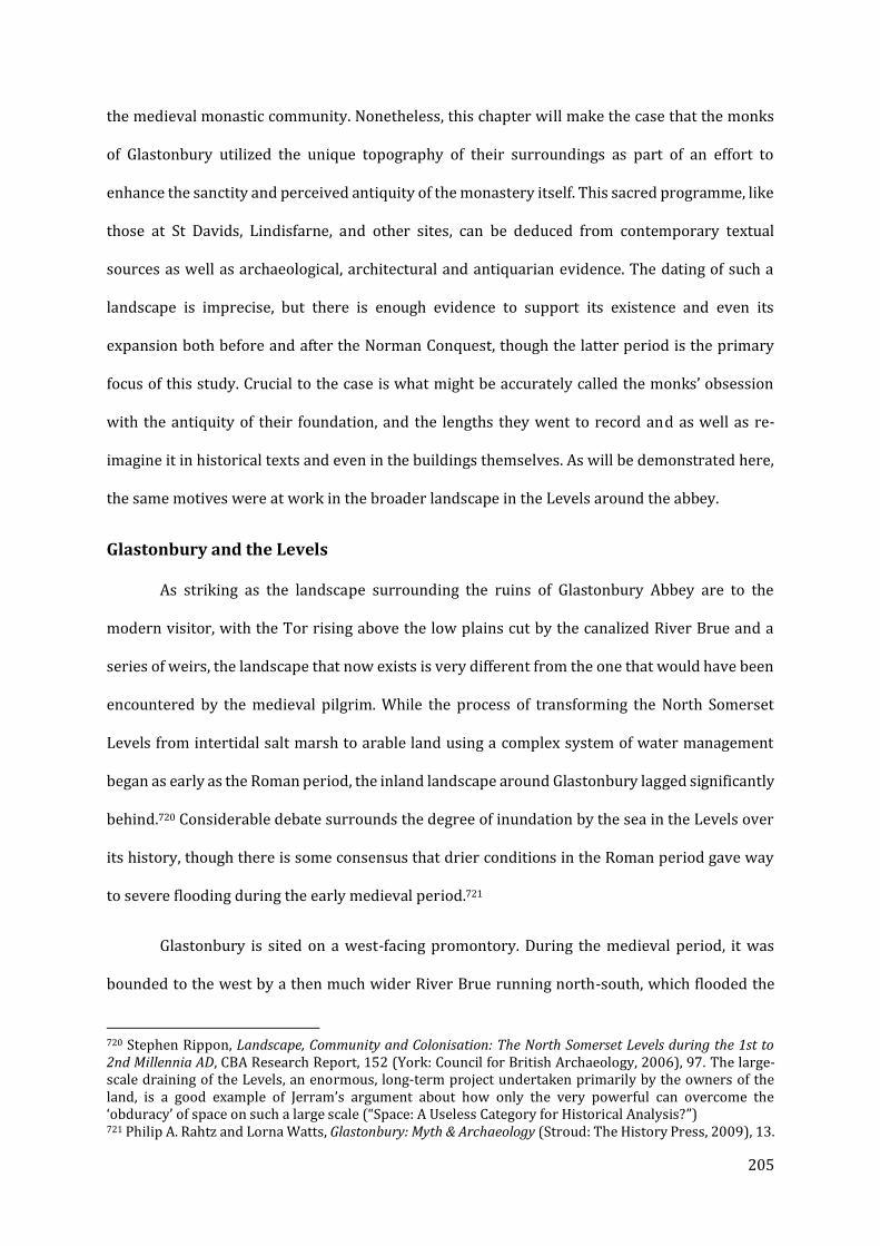
205
the medieval monastic community. Nonetheless, this chapter will make the case that the monks
of Glastonbury utilized the unique topography of their surroundings as part of an effort to
enhance the sanctity and perceived antiquity of the monastery itself. This sacred programme, like
those at St Davids, Lindisfarne, and other sites, can be deduced from contemporary textual
sources as well as archaeological, architectural and antiquarian evidence. The dating of such a
landscape is imprecise, but there is enough evidence to support its existence and even its
expansion both before and after the Norman Conquest, though the latter period is the primary
focus of this study. Crucial to the case is what might be accurately called the monks’ obsession
with the antiquity of their foundation, and the lengths they went to record and as well as re-
imagine it in historical texts and even in the buildings themselves. As will be demonstrated here,
the same motives were at work in the broader landscape in the Levels around the abbey.
Glastonbury and the Levels
As striking as the landscape surrounding the ruins of Glastonbury Abbey are to the
modern visitor, with the Tor rising above the low plains cut by the canalized River Brue and a
series of weirs, the landscape that now exists is very different from the one that would have been
encountered by the medieval pilgrim. While the process of transforming the North Somerset
Levels from intertidal salt marsh to arable land using a complex system of water management
began as early as the Roman period, the inland landscape around Glastonbury lagged significantly
behind.720 Considerable debate surrounds the degree of inundation by the sea in the Levels over
its history, though there is some consensus that drier conditions in the Roman period gave way
to severe flooding during the early medieval period.721
Glastonbury is sited on a west-facing promontory. During the medieval period, it was
bounded to the west by a then much wider River Brue running north-south, which flooded the
720 Stephen Rippon, Landscape, Community and Colonisation: The North Somerset Levels during the 1st to 2nd Millennia AD, CBA Research Report, 152 (York: Council for British Archaeology, 2006), 97. The large-scale draining of the Levels, an enormous, long-term project undertaken primarily by the owners of the land, is a good example of Jerram’s argument about how only the very powerful can overcome the ‘obduracy’ of space on such a large scale (“Space: A Useless Category for Historical Analysis?”) 721 Philip A. Rahtz and Lorna Watts, Glastonbury: Myth & Archaeology (Stroud: The History Press, 2009), 13.
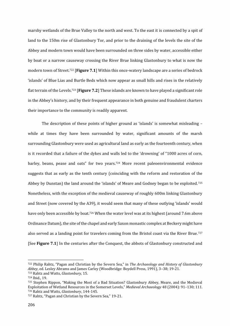
206
marshy wetlands of the Brue Valley to the north and west. To the east it is connected by a spit of
land to the 150m rise of Glastonbury Tor, and prior to the draining of the levels the site of the
Abbey and modern town would have been surrounded on three sides by water, accessible either
by boat or a narrow causeway crossing the River Brue linking Glastonbury to what is now the
modern town of Street.722 [Figure 7.1] Within this once-watery landscape are a series of bedrock
‘islands’ of Blue Lias and Burtle Beds which now appear as small hills and rises in the relatively
flat terrain of the Levels.723 [Figure 7.2] These islands are known to have played a significant role
in the Abbey’s history, and by their frequent appearance in both genuine and fraudulent charters
their importance to the community is readily apparent.
The description of these points of higher ground as ‘islands’ is somewhat misleading –
while at times they have been surrounded by water, significant amounts of the marsh
surrounding Glastonbury were used as agricultural land as early as the fourteenth century, when
is it recorded that a failure of the dykes and walls led to the ‘drowning’ of “1000 acres of corn,
barley, beans, pease and oats” for two years.724 More recent paleoenvironmental evidence
suggests that as early as the tenth century (coinciding with the reform and restoration of the
Abbey by Dunstan) the land around the ‘islands’ of Meare and Godney began to be exploited.725
Nonetheless, with the exception of the medieval causeway of roughly 600m linking Glastonbury
and Street (now covered by the A39), it would seem that many of these outlying ‘islands’ would
have only been accessible by boat.726 When the water level was at its highest (around 7.6m above
Ordinance Datum), the site of the chapel and early Saxon monastic complex at Beckery might have
also served as a landing point for travelers coming from the Bristol coast via the River Brue.727
[See Figure 7.1] In the centuries after the Conquest, the abbots of Glastonbury constructed and
722 Philip Rahtz, “Pagan and Christian by the Severn Sea,” in The Archaeology and History of Glastonbury Abbey, ed. Lesley Abrams and James Carley (Woodbridge: Boydell Press, 1991), 3–38; 19-21. 723 Rahtz and Watts, Glastonbury, 15. 724 Ibid., 19. 725 Stephen Rippon, “Making the Most of a Bad Situation? Glastonbury Abbey, Meare, and the Medieval Exploitation of Wetland Resources in the Somerset Levels,” Medieval Archaeology 48 (2004): 91–130; 111. 726 Rahtz and Watts, Glastonbury, 144-145. 727 Rahtz, “Pagan and Christian by the Severn Sea,” 19-21.

207
operated their own navigation and water management systems. These efforts included rebuilding
the Anglo-Saxon causeway and bridge from Street and either constructing or re-using a Saxon-
period canal running along the north side of Wirall Hill to Northover near Beckery and the old
course of the River Brue.728 These increasingly complex systems of water management were
developed over the course of the medieval period, and included the creation of a great fish pond
at the former site of St Benignus’s hermitage at Meare (where the fourteenth-century manorial
complex of church, manor house, and ‘fish house’ are still extant), but the landscape was not
“comprehensively drained” until the eighteenth century.729
While understanding the ‘true’ topographical reality of medieval Glastonbury is
important, particularly for evaluating how the landscape has changed, the myths and legends
surrounding Glastonbury and its environs have also had a profound impact on the way this
distinctive landscape seems to have been understood by contemporaries. Catherine Clarke
analysed the descriptions of the ‘islands’ surrounding the abbey in texts originating from them,
such as the twelfth-century De Antiquitate Glastonie Ecclesie of William of Malmesbury
(henceforth DA) and the fourteenth-century Chronica of John of Glastonbury. She found that these
frequently echoed the medieval trope of the quasi-Edenic locus amoenus (the ‘pleasant place’).730
What is particularly interesting about these literary descriptions, which seem to have grown all
the more panegyric over the centuries as the mythology of the abbey and its foundation legends
developed, is the striking absence of the human activity we know from other sources. Cultivation
and transformation of the landscape are alluded to, but almost exclusively in a spiritual sense.731
In light of these observations, while there were probably some changes in the use and physical
appearance of the Glastonbury landscape between the time of Dunstan and the 1120s when
William of Malmesbury was producing hagiographical and historical works for the post-Conquest
728 Rahtz and Watts, Glastonbury; 144-147; Richard Brunning, “Taming the Floodplain: River Canalisation and Causeway Formation in the Middle Anglo-Saxon Period at Glastonbury, Somerset,” Medieval Archaeology 54, no. 1 (November 2010): 319–29. 729 Rippon, “Making the Most of a Bad Situation?” 92. 730 Catherine A.M. Clarke, Literary Landscapes and the Idea of England, 700-1400 (Cambridge: D.S. Brewer, 2006), 68-70. 731 Ibid., 74.
208
monastic community, it does not necessarily follow that the community would have viewed these
changes as particularly spiritually or ideologically significant, especially considering their strong
preoccupation with demonstrating and often enhancing the antiquity of their foundation. The
continuing use of the word ‘islands’ to describe a number of key sites even through the fourteenth
century (including in forged charters of the supposed distant past) would therefore be a more
accurate representation of how the community perceived their surroundings in the historical
sense. The apparent ‘timelessness’ of many of the most important Glastonbury texts from the
medieval period presents a major challenge to the modern scholar. Successive chronicles are
written as additions to existing texts (primarily the DA), which have themselves survived only
with later interpolations, at the same time retaining details that were effectively outdated at the
time they were written. To make sense of this requires close comparison between datable sources
and some informed guesswork.
The sacred sites of the Glastonbury landscape can be read according to Lefebvre’s
conception of the “interpenetration” of space, where newer sites inherit and acknowledge those
that came before, but the former space never truly vanishes.732 The example of Meare, where a
hermitage and cult site associated with St Benignus was transformed into a manorial complex, an
evolution which goes unmentioned in the contemporary Chronica of John of Glastonbury, is
perhaps the best example of this phenomenon and the complexity and contradictory nature of
the monks’ ‘mental map’ of the surrounding area, as will be discussed later in the chapter.
The Twelve Hides of Glastonbury
Numerous Glastonbury sources, ranging from the pre-Conquest period (or forged
documents purporting to date from it) up to the time of the Dissolution, refer to the ‘Twelve Hides’
of Glastonbury. A hide was technically a unit of land which could sustain a single household, but
such a precise definition was not applicable in this instance.733 While the boundaries of the
732 Lefebvre, The Production of Space, 164. 733 Rahtz and Watts, Glastonbury, 147.
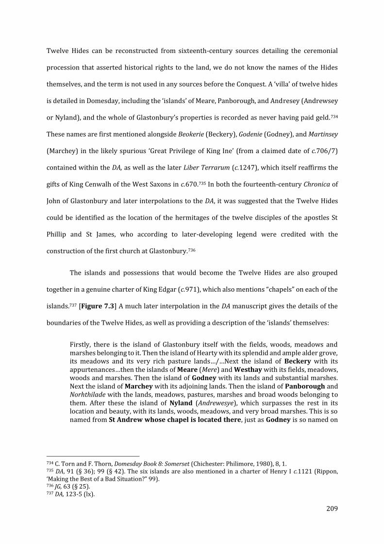
209
Twelve Hides can be reconstructed from sixteenth-century sources detailing the ceremonial
procession that asserted historical rights to the land, we do not know the names of the Hides
themselves, and the term is not used in any sources before the Conquest. A ‘villa’ of twelve hides
is detailed in Domesday, including the ‘islands’ of Meare, Panborough, and Andresey (Andrewsey
or Nyland), and the whole of Glastonbury’s properties is recorded as never having paid geld.734
These names are first mentioned alongside Beokerie (Beckery), Godenie (Godney), and Martinsey
(Marchey) in the likely spurious ‘Great Privilege of King Ine’ (from a claimed date of c.706/7)
contained within the DA, as well as the later Liber Terrarum (c.1247), which itself reaffirms the
gifts of King Cenwalh of the West Saxons in c.670.735 In both the fourteenth-century Chronica of
John of Glastonbury and later interpolations to the DA, it was suggested that the Twelve Hides
could be identified as the location of the hermitages of the twelve disciples of the apostles St
Phillip and St James, who according to later-developing legend were credited with the
construction of the first church at Glastonbury.736
The islands and possessions that would become the Twelve Hides are also grouped
together in a genuine charter of King Edgar (c.971), which also mentions “chapels” on each of the
islands.737 [Figure 7.3] A much later interpolation in the DA manuscript gives the details of the
boundaries of the Twelve Hides, as well as providing a description of the ‘islands’ themselves:
Firstly, there is the island of Glastonbury itself with the fields, woods, meadows and marshes belonging to it. Then the island of Hearty with its splendid and ample alder grove, its meadows and its very rich pasture lands…/…Next the island of Beckery with its appurtenances…then the islands of Meare (Mere) and Westhay with its fields, meadows, woods and marshes. Then the island of Godney with its lands and substantial marshes. Next the island of Marchey with its adjoining lands. Then the island of Panborough and Norhthilade with the lands, meadows, pastures, marshes and broad woods belonging to them. After these the island of Nyland (Andrewesye), which surpasses the rest in its location and beauty, with its lands, woods, meadows, and very broad marshes. This is so named from St Andrew whose chapel is located there, just as Godney is so named on
734 C. Torn and F. Thorn, Domesday Book 8: Somerset (Chichester: Philimore, 1980), 8, 1. 735 DA, 91 (§ 36); 99 (§ 42). The six islands are also mentioned in a charter of Henry I c.1121 (Rippon, ‘Making the Best of a Bad Situation?” 99). 736 JG, 63 (§ 25). 737 DA, 123-5 (lx).
210
account of the chapel of the Holy Trinity and Marchey on account of St Martin, whose chapel is there.738
While they did not represent the full extent of the Abbey’s historic holdings, the Twelve Hides and
the islands within them formed a “dryland ‘core’ around Glastonbury itself.”739 Their value seems
to have been two-fold; in addition to their wetland resources, it is implied in the charter of King
Edgar (c.971) that each of these ‘holy islands’ possessed a chapel, though later descriptions are
not as explicit. Chapels dedicated to St Martin, St Andrew, and the Holy Trinity, at Marchey or
Martinsey, Andrewsey (Nyland) and Godney respectively, are consistently identified, though
Meare, Westhay, and Panborough are generally described in the context of their natural
resources. Beckery is referred to as ‘Little Ireland’ and while we have archaeological evidence of
ecclesiastical activity from well before the Conquest, and a chapel is described in the accounts of
St Brigid during her time at Glastonbury, no chapel is specifically mentioned in the charters.740
While the archaeological evidence is unambiguous, Beckery’s absence from this part of the
historical record opens up the possibility that chapels or some other kind of religious monument,
such as a standing cross, existed on a number of ‘island’ sites after the time of King Edgar’s charter
but went without mention. One further chapel site might be added to this list: one dedicated to St
Cuthlac or Guthlac at Clewer, a small bedrock promontory near Nyland.741 There are a few other
sites of notable significance which may have been a part of this historical sacred landscape,
including the nearby village of Shapwick, which by the time of John of Glastonbury was believed
to be the site of the martyrdom of St Indract and his companions.742 Finally, there is the Tor itself,
738 DA, 151-3 (§ 72). Emphasis mine. 739 Rippon, “Making the Most of a Bad Situation?” 99. 740 Previous excavations of the Beckery site are detailed in J. Morland, “St Bridget’s Chapel, Beckery,” PSANHS 35, no. 2 (1889): 121–26; and Philip A. Rahtz and S.M. Hirst, Beckery Chapel, Glastonbury (Glastonbury: Glastonbury Antiquarian Society, 1974). Radiocarbon dating of burials found during excavations in 2016 returned a result of 406 to 544, which would make the foundation at Beckery the oldest monastic site known in Britain. Elizabeth Friend, “2016 Excavations at Beckery,” Axbridge Archaeological and Local History Society (blog), January 15, 2018, http://www.aalhs.co.uk/2018/01/15/2016-excavations-at-beckery, accessed May 18, 2018. 741 Rippon, “Making the Best of a Bad Situation?” 100-101. 742 Michael Winterbottom and Rodney M. Thomson, eds., William of Malmesbury: Saints’ Lives: Lives of SS. Wulfstan, Dunstan, Patrick, Benignus and Indract, Oxford Medieval Texts (Oxford: Clarendon Press, 2002), 310.
211
with its ruined tower of a fifteenth-century church dedicated to St Michael the Archangel; by the
time of John of Glastonbury (fl. 1340), this later church was claimed to be on the site of a structure
“not built by human hands,” discovered by SS Phagan and Deruvian as far back as the second
century, but its role in Glastonbury’s foundation legends may date back much further.743
Making the Case for a Sacred Landscape at Glastonbury
The antiquarian interests of the community at Glastonbury are well known (and will be
discussed in greater depth below). Two particular focal points within the monastic precinct have
dominated scholarship on the Abbey: first, the Vetusta Ecclesia, replaced after the fire of 1184 by
the present Lady Chapel, and secondly the inventio of King Arthur and Queen Guinevere and their
shrines within the Abbey Church. I would argue that Glastonbury’s sacred locales expanded well
beyond the promontory into the surrounding wetland landscape and its bedrock islands. In
addition to the chapel sites mentioned in the charter evidence discussed previously, the island of
Meare played a major role in the legendary sacred history of the monastic community as the site
of the hermitage and initial burial place of one of its early abbots, St Benignus (sometimes called
Beonna), before his translation to the abbey in 1091. Glastonbury’s own interest in Irish saints
(Patrick, Brigid, Benignus, and Indract among others) and records of Irish pilgrims would make a
comparison to a landscape like the Saint’s Road of Dingle Peninsula (Chapter IV) or the Irish-
influenced network of chapels at St Davids (Chapter V) all the more appropriate. These chapels,
together with sites of ancient significance such as the Vetusta Ecclesia and quite plausibly the Tor
itself, would have formed a sacred landscape which combined individual pilgrimage sites with
the medieval idea of the locus ameonus. As was the case for Lindisfarne and St Davids, evidence
for this theory can be found in both hagiographical and historical literature of the time, as well as
in surviving or excavated archaeological remains, though in the case of Glastonbury very few sites
have been thoroughly explored. The following section will explore the antiquarian interests of
743 JG, 57-9 (§ 22).
212
medieval Glastonbury and their efforts to memorialize and promote the antiquity of the
foundation within the abbey precinct before and after the fire of 1184, after which the specific
sites of interest in the broader landscape of the Levels will be examined.
Glastonbury Abbey and its Antiquarian Interests
From the unlikely discovery of King Arthur and Queen Guinevere in the grounds of the
abbey to the truly impressive collection of relics to the increasingly anachronistic legends of
Glastonbury’s apostolic origins, the keen interest of the community in its own history, as well as
the prestige and other benefits that could be gained from such associations, is fully evident in
surviving sources. The most complete treatment of these interests and activities is probably still
Antonia Gransden’s 1976 essay, but it is worth discussing how Glastonbury’s lucrative obsession
with its own past played out beyond the production of histories and hagiographies even prior to
the events of 1191.744 It should also be emphasized that while the bulk of scholarship on the
historical writing and myth-making of Glastonbury Abbey tends to focus on the events after the
1184 fire, in many ways the ‘discovery’ of Arthur and Guinevere was merely the most recent
evolution of the established traditions of the Glastonbury monks. While perhaps exceptional in a
broader historical context, to the monks it would have been nothing particularly innovative.
One of the most striking indications of the concern to record and celebrate the abbey’s
storied past is the volume of historiographical and hagiographical material that was generated as
part of this effort. The most important source for the immediate post-Conquest period at
Glastonbury is undoubtedly William of Malmesbury’s De Antiquitate Glastonie Eccleisie (c.1129)
as well as a number of saints’ lives he wrote for the community, including those of Dunstan,
Patrick, Indract and Benignus (the latter three are lost, but can be reconstructed to some extent
from later sources). William was commissioned by the abbey in part to answer the challenge of
the Canterbury hagiographer Osbern, who had erroneously described Dunstan (b.909) as
Glastonbury’s first abbot.745 The text that was produced may not have been what William
744 Gransden, “The Growth of the Glastonbury Traditions and Legends in the Twelfth Century.” 745 Ibid, 342.
213
originally planned – John Scott suggests that what had initially been a contract to produce a new,
Glastonbury-centric Life of Dunstan to rival Osbern’s led to a much more extensive work at the
urging of the monastic community.746 While William perhaps falls short of modern ideals of
historical objectivity and appropriate skepticism in the face of poorly documented traditions, it
should be noted that by the often imaginative standards of his contemporaries such as Geoffrey
of Monmouth (author of the History of the Kings of Britain, an alternative history based upon
dubious legend and tropes of the emerging genre of romance), he stands out as a professional of
his day. William’s work can be described as both cautious and scholarly, to the extent that he
refused to endorse certain traditions if they lacked convincing evidence to support them.747 The
conflict between the monks’ desires and William’s scruples poses a problem for historians, as the
earliest surviving manuscript with a full copy of De Antiquitate (preserved as a prologue to Adam
of Damerham’s own chronicle) does not appear to be entirely William’s work – significant
sections have been amended or interpolated, including multiple chapters narrating events that
happened long after William’s book was completed, often recording some of the more grandiose
and controversial claims which he originally omitted. William’s original text can be partly
reconstructed by comparing the earliest manuscript to his Gesta Regum and De gestis Pontificum
Anglorum of around the same period, and excluding passages which reference traditions that had
not yet fully developed during the early twelfth century, among these the alleged furta sacra of
Dunstan from Canterbury, the Arthurian inventio, and the legend of an Apostolic foundation.
Another major insertion was the so-called Charter of St Patrick, given the date of 430 CE but
almost certainly dating to c.1220, laying out a much more elaborate and detailed version of the
foundation legend than is present in William’s original text.748 De Antiquitate as it survives is thus
a problematic text that in some ways better reflects the perspective of the community after the
746 John Scott, ed., The Early History of Glastonbury: An Edition, Translation and Study of William of Malmesbury’s “De Antiquitate Glastonie Ecclesie” (Woodbridge: Boydell, 1981), 4-5. 747 Gransden, “The Growth of the Glastonbury Traditions and Legends in the Twelfth Century,” 202. Perhaps the best evidence of his caution is the sheer number of later interpolations ‘correcting’ the record, as it were. 748 Scott, The Early History of Glastonbury, 34-5; Gransden, “The Growth of the Glastonbury Traditions and Legends in the Twelfth Century,” 258.
214
fire of 1184 than it does when it was originally written in the second decade of the twelfth century.
In addition to late thirteenth- to early fourteenth-century Libellus of Adam of Damerham, John of
Glastonbury produced his own Chronica sive Antiquitates Glastoniensis Ecclesiae, dated by James
Carley to the 1340s.749 As a continuation of Adam of Damerham, it creatively expands upon
William of Malmesbury’s original text as well as the various interpolations of DA probably dating
from the late twelfth/early-to-mid thirteenth centuries.750 As the last major work on
Glastonbury’s history to be produced by a member of that community, it thus offers an
uncensored treatment of Glastonbury’s antiquarian traditions, including those thought too
dubious, or developing too late, to be included in DA. As a source for the late-eleventh to early-
thirteenth centuries (the time frame for this study) it is obviously problematic, but it also seems
reasonable that many of the later Glastonbury traditions may have existed in some form
considerably earlier, even if they were not recounted by William in his more disciplined rendition
of events. The sheer number of saints revered at Glastonbury is remarkable in and of itself. A
perusal of a c.1247 relic list (Cambridge, Trinity College R 5.33 (724), fols. 104r-105v) reveals a
collection that is all the more impressive given the likely loss of some relics in the 1184 fire
(though in the case of Patrick, Indract, and Gildas, Adam of Damerham claims their survival).751
There are also a number of reasons to doubt the authenticity of the relics described; on multiple
occasions it is implied or outright stated that Glastonbury possessed the entire bodies of certain
saints who are known or credibly claimed to reside elsewhere.752 The names of many of the saints
whose relics appear in the list are given by William of Malmesbury in DA, though the detail used
in the Trinity manuscript to describe the collections of bones in each feretory suggests that the
list was compiled to allow the monks to identify and catalogue their enormous collection of sacred
749 James Patrick Carley and David Townsend, eds., The Chronicle of Glastonbury Abbey: An Edition, Translation and Study of John of Glastonbury’s {Cronica Sive Antiquitates Glastoniensis Ecclesie}. (Woodbridge: Boydell, 1985), xxx. 750 Like any monastic chronicle, Adam of Damerham’s text had its own biases, in this case tending to downplay the accomplishments of the 1190s, and centring itself around the feud with Savaric fitzGeldewin, Bishop of Bath (d.1204). (Adam Stout, “Savaric, Glastonbury and the Making of Myths: A Reappraisal,” The Antiquaries Journal 96 (2016): 101–15. 751 AD, 47. 752 Martin Howley, “Relics at Glastonbury Abbey in the Thirteenth Century: The Relic List in Cambridge, Trinity College R.5 33 (724), Fols. 104r-105v,” Medieval Studies 71 (2009): 197–234, 205.

215
remains rather than as a public document.753 That these claims did not go unchallenged is most
notably demonstrated in the letter of Eadmer of Canterbury in 1123 which condemned and
refuted the alleged furta sacra of St Dunstan after the Danish sack of 1011 - a claim which was
‘supported’ by a fully-developed inventio after the 1184 fire.754 About thirty years earlier,
Eadmer’s fellow Canterbury hagiographer had visited Glastonbury, and found that the monks
there had preserved the cell that Dunstan had lived in when he was visited by (and repulsed) a
demon.755 The claim to Dunstan’s relics surfaced on and off again until the Dissolution, including
the construction of elaborate shrine by Abbot Richard Beere at the beginning of the sixteenth
century.756
Both before and after the 1184 fire, Glastonbury was “close-packed” with shrines and
reliquaries, and it was said of the Vetusta Ecclesia that “no part of the church is without the ashes
of the blessed” and “deservedly indeed is the repository of so many saints said to be a heavenly
shrine on earth.”757 In additions to great shrines of St Patrick (buried on the right hand side of the
altar in a decorated stone “pyramid”), St David (according to a later interpolation, Glastonbury
housed one of the stone altars given to David by the Patriarch of Jerusalem), St Indract and his
companions (to the left of the altar and beneath the stone floor, marked by another “pyramid”),
the relics of a host of Northern saints rescued from the Vikings were placed above the altar.758
After the fire of 1184, these were translated to the new abbey church.759 They were joined by the
shrine of Dunstan following the post-1184 inventio, as well as the arm of St Oswald.760 Another
753 Ibid, 207. 754 DA, 73-77 (§ 23-24). See Richard Sharpe, “Eadmer’s Letter to the Monks of Glastonbury Concerning St Dunstan’s Disputed Remains,” in The Archaeology and History of Glastonbury Abbey (Woodbridge: Boydell Press, 1991), 205–15. 755 Osbern of Canterbury, “Vita Sancti Dunstani Auctore Osberno,” in Memorials of Saint Dunstan, Archbishop of Canterbury, ed. William Stubbs (Longman & Co., 1874), 69–129, 82. 756 Julian M. Luxford, “Auro et Argento Pulcherrime Fabricatum: New Visual Evidence for the Feretory of St. Dunstan at Glastonbury and Its Relation to the Controversy over the Relics,” Antiquaries Journal 82 (2002): 105–24. 757 DA, 67 (§ 18): nec a beatorum cineribus vacat ullus fani ambitus … merito ergo dicitur celeste in terries sanctuarium tot sanctorum reconditorum. 758 DA, 69, (§ 21). 759 JG, 179-81 (§ 97) 760 DA, 79 (§ 25).

216
piramide located in the monks’ cemetery was inscribed with the names of a large number of
bishops and other holy men, many of them northern in origin, and William was willing to
“hesitantly” suggest that they contained the relics of those who were named .761 Sixty years after
De Antiquitate was composed, the bodies of Arthur and Guinevere were supposedly discovered
between two other pyramids.762 A significant number of kings and important ecclesiastical figures
were also said to be buried in and around the abbey church, many in ornate tombs or shrines.763
One of the most prevalent trends in the history of late Anglo-Saxon and arguably early
Anglo-Norman Glastonbury was its association with ‘Celtic,’ specifically Irish, saints. The precise
nature and origin of these connections, which were alleged in much later sources to be a key
feature of the foundation’s early centuries, are only recorded beginning in the twelfth century by
William of Malmesbury, who seems to have accepted many at face value, including the ambitious
claim that one of the earliest abbots of the community was none other than the Irish evangelist St
Patrick.764 While the alleged Charter of St Patrick (c.1220) would later elaborate upon the earlier
foundation legend of Glastonbury recorded by William, the cult itself may be no earlier than the
late tenth century in origin, first appearing in the earliest Life of St Dunstan (c.995x1004), which
alleges that in Dunstan’s youth Irish pilgrims flocked to Glastonbury and its shrine of St Patrick
(including the ill-fated Indract and his companions).765 The saint (as “Sancti Patricii senoris”)
761 DA, 85 (§ 32). These “piramides” were most likely tapered stone shafts, perhaps similar to the high crosses such as that found at Bewcastle or in Irish contexts. See Rahtz and Watts, Glastonbury, 114 and also Jane Hawkes, “Creating a View : Anglo-Saxon Sculpture in the Sixteenth Century,” in Making Histories : Proceedings of the Sixth International Conference on Insular Art, York 2011. ed Meg Boulton & Jane Hawkes (Donington: Shaun Tyas, 2013), 372–84. But Michael Lapidge has argued that the Glastonbury piramides might have been something different, more resembling house-shaped shrines in Ireland (Michael Lapidge, “The Cult of St Indract at Glastonbury,” in Ireland in Early Mediaeval Europe: Studies in Memory of Kathleen Hughes, ed. D. Whitelock, R. McKitterick, and N. Dumville (Cambridge: Cambridge University Press, 1982), 211). The absence of any similar monuments in England makes this possibility somewhat less likely. 762 DA, 83-5 (§ 31). 763 Ibid. 764 DA 55, (§ 8). Aside from the obvious incompatibility of the Glastonbury traditions with the Irish (and, as seen in Chapter V, Welsh) hagiography of Patrick, there is additional confusion resulting from the possibility that there were in fact two Patricks, an elder and a younger, and that the split in the Irish tradition could itself be a reaction to Glastonbury’s claim. c.f. Lesley Abrams, “St Patrick and Glastonbury Abbey : ‘nihil Ex Nihilo Fit?,’” in Saint Patrick, AD 493-1993. ed. Lesley Abrams & D.N. Dumville, Studies in Celtic History, 13 (Woodbridge: Boydell, 1993), 238-9. JG § 22-24 anticipates this problem, stating that the Glastonbury Patrick was in fact the elder, the famed apostle to the Irish. 765 Abrams, 'St Patrick and Glastonbury Abbey,' 235.
217
appears under 24 August in the tenth century calendar appended to the ‘Leofric Missal’
(c.979x987).766 Patrick is also present in the calendar of the ‘Bosworth Psalter’ (c.988x1006) as
“Sancti Patricii senioris in Glaestonia.”767 The tenth century is also the date of the earliest evidence
for the veneration of Brigid (associated with the chapel site at Beckery), also in the ‘Leofric
Missal.’768 [see Figure 7.4] According to later Glastonbury traditions present in De Antiquitate
and John of Glastonbury, Patrick was succeeded by another Irish figure, Saint Benignus (or
Beonna), but his name does not appear in the ‘Leofric Missal,’ suggesting that his cult developed
sometime between the end of the tenth century and the translation from Meare to Glastonbury in
1091.769 St Indract and his companions, allegedly martyred somewhere in the vicinity of
Glastonbury on pilgrimage to Patrick during the ninth century, were the subject of a twelfth-
century Life (now lost) that may have been based on a tenth-century Old English text.770
The case of the inventio of Arthur and Guinevere is, besides the dispute with Canterbury
over Dunstan’s relics, perhaps the most striking example of the Glastonbury community’s desire
to acquire a more conventional institutional sacred asset: a patron saint and associated cult.
Despite the remarkable number of saints whose relics were said to bless their churches, none of
them truly ‘belonged’ to the Glastonbury itself, as they were either more closely associated with
other sites or their ownership was contested. As will be shown below, this problem was partly
addressed by treating the Vetusta Ecclesia, dedicated to the Virgin Mary and supposedly of the
most ancient date, as an architectural relic. But the staging of the events of 1191, as well as the
effort taken to record the events using outside witnesses, is proof that this was not judged
766 MS Bodley 579, folios 39r, 39v, 40r. 767 Abrams, “St Patrick and Glastonbury Abbey,” 237. To make matters more confusing, Finberg suggests that Glastonbury may have, deliberately or otherwise, confused the Irish Patrick with the Cornish saint Petroc. See H. P. R. Finberg, “St Patrick at Glastonbury,” in West-Country Historical Studies (Newton Abbot: David and Charles, 1969): 78-9. 768 Scott, The Early History of Glastonbury, 192 n. 38; J.L. Robinson, “St Brigid at Glastonbury,” Journal of the Royal Society of Ireland 83, no. 4 (April 1953): 97–99. 769 Carley and Townsend, The Chronicle of Glastonbury Abbey, xxxviii-xxxix. Finberg suggests that the cult of Benignus may have originated with an otherwise unknown Anglo-Saxon holy man named Beonna, who spawned both the cult of Benignus at Glastonbury and also an Irish tradition which identified him as St Benen, Patrick’s episcopal successor (‘St Patrick at Glastonbury,’ 82-3). 770 Carley and Townsend, Chronicle, xl-xli.
218
sufficient. The bones of Arthur and Guinevere, figures drawn not from hagiography or the history
of Bede, but rather the genre of romance, occupied the place of traditional royal patron(s). After
they were discovered and exhumed, the royal remains were enshrined before the high altar in the
rebuilt abbey church.771 Antonia Gransden also suggests that the events of 1191 were
foreshadowed by the inventio of the relics of St Dunstan, supposedly contained within a box
inscribed with ‘S’ and ‘D’ ( not unlike how Arthur and Guinevere were found with an inscribed
cross identifying the remains).772 There can be no doubt that the report of the events of 1191
were meant to reach a wide audience: no less a literary figure than Giraldus Cambrensis produced
what seems to be an eyewitness account of the dramatic proceedings, including a suggestion that
a Welsh bard first told Henry II exactly where and how deep to dig.773 Gradually, the association
of Glastonbury with the Arthurian legend of Avalon was also established; while twelfth-century
writers Geoffrey of Monmouth and Caradoc of Llancarfan did not connect Arthur or Avalon to
Glastonbury, by the mid-fourteenth century the identification of Glastonbury as Avalon was
regarded as fact.774 A further development was the legend of the apostolic foundation of
Glastonbury, hinted at in William of Malmesbury but only later fully developed to involve the
apostles St James the Lesser and St Phillip. Finally, roughly fifty years after the discovery of Arthur
and Guinevere, the relatively obscure biblical figure Joseph of Arimathea became part of the
Glastonbury founding mythos.775 By the time of John of Glastonbury, the legend of Joseph’s crucial
role as a religious patron for the abbey was fully developed, with a lengthy account featured in
John of Glastonbury’s Chronica and the inclusion of a triptych representation of the deposition of
the cross on the rebuilt church of St Michael atop Glastonbury Tor.776 But while some of these
771 Gransden, “The Growth of the Glastonbury Traditions and Legends in the Twelfth Century,” 342; Gilchrist and Green, Glastonbury Abbey, 61. At the same time, Canterbury was cultivating the cult of Thomas Becket, a symbol of resistance to the monarchy.
772 Gransden, "The Growth of the Glastonbury Traditions and Legends in the Twelfth Century," 350. 773 Recorded in JG, 181-83 (§ 98); Gransden, “The Growth of the Glastonbury Traditions and Legends in the Twelfth Century,” 354. 774 JG,11-13 (§ 2). 775 V.M. Lagorio, “The Evolving Legend of St Joseph of Glastonbury,” in Glastonbury Abbey and the Arthurian Tradition. Ed. James Carley, Arthurian Studies, 44 (Woodbridge: D.S. Brewer, 2001), 55–81; 58-59. 776 Lagorio, 'The Evolving Legend of St Joseph of Glastonbury,' 66. See also: Aleksandra Walsham, “The Holy Thorn of Glastonbury: The Evolution of a Legend in Post-Reformation England,” Parergon 21, no. 2 (2004):

219
traditions were almost certainly developed much later than the post-Conquest period, the notion
of an apostolic foundation was probably much older, possibly even dating back to Anglo-Saxon
Glastonbury.
While the extensive hagiographical and historical record concerning Glastonbury and its
antiquarian traditions has been well studied, it is only more recently that scholars have
recognized that the same preoccupation with antiquity can be found within the architectural and
archaeological record drawn from the abbey precinct and its environs. In the absence of explicit
evidence for investment in and cultivation of most of the sites I have proposed as composing a
sacred landscape, it is important to demonstrate the extent of the antiquarian interests of the
Glastonbury community and the marks they left on built structures and the wider landscape. The
study of this evidence, however, has been at times plagued by similar problems of poor process,
flights of fancy, and even outright invention that characterized the former community. Much of
the work of previous antiquarians and archaeologists responsible for excavating and cataloguing
the Abbey has been found to be flawed, from the Spiritualist Frederick Bligh Bond, (abbey
excavation director from 1908-1922) who reportedly consulted a long-dead monk in his search
for the ancient monastery, to the archaeologist C.A. Raleigh Radford, who despite his well-earned
reputation seems to have been somewhat biased in his conclusions by a personal fascination with
Arthurian legend and an admiration of St Dunstan.777 This study, and all future work on
Glastonbury Abbey, is heavily indebted to the efforts of Roberta Gilchrist and Cheryl Green, who
subjected the archaeological evidence of Glastonbury Abbey from over one hundred years of
excavations to the rigorous scholarly criticism it had long required, as well as more rigorous work
of Philip Rahtz on the Tor and outlying areas of the monastic precinct.778
1–25. The first mention of the Holy Thorn comes in a vernacular poem of c.1520. The similarities between the flowering staff legend of Benignus at Meare (discussed below) and the story of Joseph at Glastonbury might represent an ideological shift as one cult rose and the other fell (3-4). 777 C.R. Radford, “Glastonbury Abbey before 1184, 1908-64,” in Medieval Art and Architecture at Wells and Glastonbury, ed. Nicola Coldstream, (British Archaeological Association, 1981), 110–74; for criticism of Radford's approach and interpretations, see Gilchrist and Green, Glastonbury Abbey, 7-17. 778 Rahtz, “Excavations on Glastonbury Tor, Somerset, 1964-6.”

220
The Vetusta Ecclesia: An Architectural Relic?
The preservation and promotion of the earliest buildings on Glastonbury formed a major
part of the monastic community’s efforts to assert the antiquity of their foundation, and the
clearest demonstration of this preoccupation was the treatment of the Vetusta Ecclesia, the
ancient wattle or wooden church dedicated to the Virgin Mary, first built sometime before the
death of St Patrick (the elder, d.472 and supposedly buried in the church). Following the legends
from the cult of St David, it was thought to have been erected by that saint during his campaign
of monastic foundation in Wales and western England.779 Even at the time of William of
Malmesbury’s work, it was believed that the Vetusta Ecclesia’s construction could be traced back
to the legendary mission of Pope Eleutherius to King Lucius in c.166, though the explicit statement
that the missionaries found “an ancient church, not built, they say, by human skill” is probably the
work of a later interpolator.780
A pre-c.472 date is considerably more plausible, if still somewhat unlikely after the
evidence of fifth or sixth century burials were found at the Beckery Chapel site.781 In De
Antiquitate, William describes the structure as first built of wattle and brushwood before it was
strengthened by being encased in wooden boards and covered in lead by Paulinus, Archbishop of
York (d. 644), and implies that it remained in this state, drawing many pilgrims, until its
destruction in the fire of 1184.782 The community seems to have taken the uncommon approach
of preserving the entire structure as a kind of architectural relic throughout the Anglo-Saxon
779 Rahtz and Watts, Glastonbury, 95. William’s Life of St Patrick is lost, but the version preserved by John Leland claims that Patrick was buried in the old church, potentially creating a terminus ad quem that William was more comfortable asserting as fact, as opposed to the more confused and unverified legends of an apostolic foundation (VP, 341-343). 780 Scott, The Early History of Glastonbury, p. 187, n. 18; DA, 46 (§ 1): antiquam … ecclesiam, nulla hominum arte, ut ferunt, constructam. This formulation appears in JG, 8-9 (§ 1). 781 Friend, “2016 Excavations at Beckery,” January 15, 2018. 782 DA, 53-55 (§ 6); 67 (§ 18). This claim is at odds with Gesta Regum § 36, where William wrote that the monastery was founded by King Ine (b. 688), but does not appear to be the work of an interpolator; it might be possible that it was added to appease the monastic community, who were at times unsatisfied by William’s defence of their foundation’s great antiquity. See: Scott, The Early History of Glastonbury, p. 4-6.
221
period (not unlike the possible treatment of Aidan’s church by the monks of Lindisfarne in
Chapter VI), including the extensive rebuilding and expansion of the abbey buildings under St
Dunstan in the ninth century, the scale of which has been confirmed by modern excavation.783
Dunstan’s church replaced the later building dedicated to St Peter to the east of the Vetusta
Ecclesia, built by King Ine in the eighth century.784 The only evidence we have of the appearance
of the Vetusta Ecclesia comes from a seal of 1171-1181, and while architectural representations
on such items are usually schematic, the resemblance of the rectangular chapel with a large
rounded window and flanking ‘pepper-box’ capped turrets to the Lady Chapel which succeeded
it is remarkable.785
Replacing the Vetusta Ecclesia, which could not be miraculously ‘rediscovered’ as many of
the abbey’s relics subsequently were, was clearly a priority for the community, on par with
rebuilding of the abbey church itself, which was laid out along the lines of the twelfth-century
church of Herluin, albeit extending much further to the east.786 The Lady Chapel was begun as
soon as a year after the fire and consecrated around two years later, and built directly over the
site of the Vetusta Ecclesia.787 In its twelfth-century form it was a rectangular build of 21.21m x
12.22m. [Figure 7.5] There are a number of reasons to believe that it was more than simply a
replacement for an important liturgical space of the abbey. The Lady Chapel is often cited as an
example of ‘transitional’ church architecture, and to an extent this is an accurate if incomplete
assessment.788 The slim, rounded arches of the portals, blind arcading, and windows are
characteristic of buildings that anticipated the lighter features of English Gothic. But to look at the
architecture alone is misleading. The Lady Chapel was lavishly decorated and painted (traces of
783 Gilchrist and Green, Glastonbury Abbey, 102-4. Such was the regard the Vetusta Ecclesia was held in that “if anyone thought to place any building nearby which by its shade interfered with the light of the church that building became a ruin.” Si quis e uicino aliquod edificium locandum putasset, quod obumbracione sua lacem inuideret ecclesiae, partuit ruine. (DA, 67 (§ 18)). 784 Rahtz and Watts, Glastonbury, 91; DA, 95 (§ 40). 785 Rahtz and Watts, Glastonbury, 95-96; A. Watkin, “The Earliest Glastonbury Seal,” Proceedings of the Somerset Archaeological & Natural History Society 94 (1949): 158–59. 786 Gilchrist and Green, Glastonbury Abbey, 406. 787 Malcolm Thurlby, “The Lady Chapel of Glastonbury Abbey,” Antiquaries Journal: Journal of the Society of Antiquaries of London 75 (1995): 107–70, 112. 788 Thurlby, “The Lady Chapel of Glastonbury Abbey,” 107.

222
which survive) with a program of foliate designs and two highly decorated portals in the north
and south walls (the iconographic program of the former was never completed). The advanced
figural carving of these portals was initially believed to date from as late as 1220, though it was
certainly original to the construction of the Lady Chapel and thus executed between 1185 and
1189.
There can be no doubt that Glastonbury, at this time enjoying the patronage of Henry II,
would have employed some of the most talented masons and stone carvers in the country. The
Romanesque interior and exterior blind arcading [Figure 7.6] and window tracery [Figure 7.7]
is decorated throughout by what are called “diagonally set chevrons” by Thurlby, but might be
interpreted as a three-dimensional rendering of the ‘dog tooth’ pattern of eleventh- and twelfth-
century Norman architecture, and they are also present throughout the thirteenth-century abbey
church.789 [Figure 7.8] The use of a quasi-Romanesque architecture for the chapel itself, which
may have borne a significant resemblance to the later stages of the lost Vetusta Ecclesia, can only
have been a deliberate choice. Many post-Conquest churches in England, including some major
sites such as Worcester (the slype and possibly the crypt shafts and capitals), Hexham and Ripon
(early Anglo-Saxon crypts), and Monkwearmouth and Jarrow (the priory churches of the re-
established foundations) retained Anglo-Saxon architectural features or even preserved integral
parts of Anglo-Saxon churches, at least in part to emphasize their antiquity during the transition
from Anglo-Saxon to Norman control. Julian Luxford has argued that this was a trait particularly
characteristic of English Benedictine foundations.790 The difficulty of creating the “diagonally-set
chevrons” in high relief is a further evidence for both the exceptional skill of the craftsmen who
built the Lady Chapel, and the desire to recall the chapel’s ancient predecessor through
architectural decoration. The construction of the Lady Chapel as a replacement for what was
effectively an architectural relic “can be understood as a form of architectural hagiography” which
789 Thurlby, “The Lady Chapel of Glastonbury Abbey,” 114. 790 Julian M. Luxford, The Art and Architecture of English Benedictine Monasteries, 1300-1540: A Patronage History (Woodbridge: The Boydell Press, 2005).

223
also created an “associative” or second-degree relic in the form of the chapel itself, built on the
sacred ground of the Vetusta Ecclesia.791 The abbey church at Glastonbury was rebuilt in two post-
Conquest phases, though one was found to have completely superseded the other. The first phase
of construction was characterized by institutional upheaval: a violent confrontation between the
monks of the abbey and Abbot Turstin (1078-1096) is recorded by William of Malmesbury in
three of his works, though the DA account seems to have been altered to paint the Glastonbury
monks in a better light.792 Construction of Turstin’s church was evidently begun but due either to
the instability of his abbacy or a lack of funds, it was demolished before the eastern arm was
complete.793 Turstin’s successor Abbot Herluin (1100-1118) began a much larger church, which
Radford reconstructed with a five-bay eastern arm capped by an apsidal east end, flanking apsidal
chapels en echelon, and a nine-bay nave.794 The cloisters and ranges were built at great expense
by Henry of Blois, with the work largely completed before 1150.795 The significance of these
phases of building relate to what can be concluded about the financial and institutional stability
of Glastonbury in the post-Conquest period, and what might be expected in terms of investment
and building activity on sites beyond the precinct. The tumultuous abbacy of Turstin is unlikely
to have witnessed significant activity on outlying chapels or other secondary sites, whereas the
resurgence of the abbey’s fortunes under Herluin would have made rebuilding older chapel sites
much more likely as the abbey tried to regain the splendour and fame it had achieved under
Dunstan. Furthermore, the abbacy of Herluin and his successors Seffrid I (1120-1125) and Henry
of Blois (1126-1171) corresponds with evidence of one of the bolder claims made before the fire
of 1184: the 1123 letter of Eadmer to Glastonbury disputing their possession of the former abbot
and archbishop’s body. The exceptional quality of the sculpture of Henry of Blois’s cloister
suggests a major improvement in the abbey’s fortunes that might have enabled the restoration
791 Gilchrist and Green, Glastonbury Abbey, 434. Another feature of interest is ‘St Joseph’s Well,’ today framed by a Romanesque arch. Rahtz and Watts, Glastonbury, 107. 792 DA, 157-159 (§ 78); Scott, The Early History of Glastonbury, 209 n. 165. The bloodshed was also mentioned by the Anglo-Saxon Chronicle (1083) and Orderic Vitalis. 793 Gilchrist and Green, Glastonbury Abbey, 397. 794 Ibid, 399. 795 Ibid.

224
and renewal of a pre-existing sacred landscape based around the historic Twelve Hides of
Glastonbury. While this theory is somewhat speculative, evidence in support of it exists at
Beckery, discussed below.
Moving Beyond the Precinct: Chapels and Holy Islands in Glastonbury’s Sacred Landscape
Glastonbury Tor
Glastonbury Tor is one of the most dominant features in the landscape of the Somerset
Levels, and can only have appeared even more so during the time before they were drained. The
Tor rises out of the landscape from the peninsula to a height of 158m (521ft), and from its summit
the entire landscape making up the Twelve Hides is visible, even in poor weather, including all of
the holy ‘islands’ and the chapel sites proposed below. [Figure 7.9] Furthermore, if one looks
past the modern trees and hedges that are features of the post-medieval landscape, the Tor is
clearly visible from any point within the traditional Twelve Hides. It has been a site of human
activity, if not occupation, long before the advent of Christianity, as archaeological excavations by
Phillip Rahtz recovered Neolithic and a handful of Roman finds from the summit.796 The steep
banks of the Tor appear to have been cut away at some point in the past, creating a series of
horizontal terraces, theorized to be anything from a prehistoric ritual maze to the product of
natural erosion to remnants of strip lynchet farming possibly using the topography left by the
either of the first two.797 While the earliest changes to the Tor cannot be known with any certainty,
Rahtz’s excavators did find conclusive evidence of human occupation in the sixth or possibly fifth
centuries. The earliest structures were timber, their foundations cutting into the bedrock at the
summit.798 A number of interpretations have been proposed, including a pagan temple, a
hermitage, or a ‘Dark Age’ stronghold, but Rahtz argued that the sixth- and seventh-century
796 Rahtz, “Excavations on Glastonbury Tor, Somerset, 1964-6.”; Rahtz and Watts, Glastonbury, 71. 797 Philip Rahtz, “Glastonbury Tor: A Modified Landscape,” Landscapes 3, no. 1 (2002): 9-13. 798 Rahtz and Watts, Glastonbury, 76.
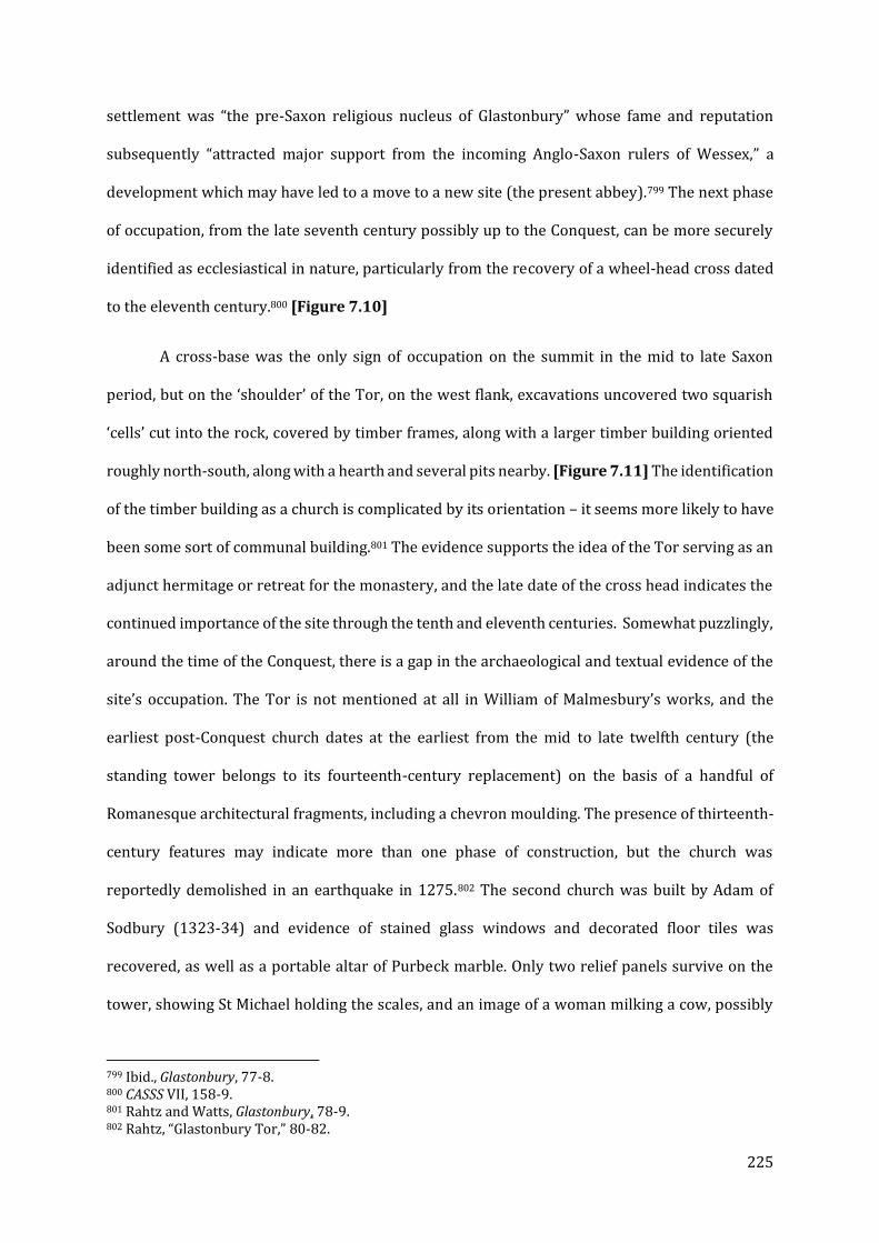
225
settlement was “the pre-Saxon religious nucleus of Glastonbury” whose fame and reputation
subsequently “attracted major support from the incoming Anglo-Saxon rulers of Wessex,” a
development which may have led to a move to a new site (the present abbey).799 The next phase
of occupation, from the late seventh century possibly up to the Conquest, can be more securely
identified as ecclesiastical in nature, particularly from the recovery of a wheel-head cross dated
to the eleventh century.800 [Figure 7.10]
A cross-base was the only sign of occupation on the summit in the mid to late Saxon
period, but on the ‘shoulder’ of the Tor, on the west flank, excavations uncovered two squarish
‘cells’ cut into the rock, covered by timber frames, along with a larger timber building oriented
roughly north-south, along with a hearth and several pits nearby. [Figure 7.11] The identification
of the timber building as a church is complicated by its orientation – it seems more likely to have
been some sort of communal building.801 The evidence supports the idea of the Tor serving as an
adjunct hermitage or retreat for the monastery, and the late date of the cross head indicates the
continued importance of the site through the tenth and eleventh centuries. Somewhat puzzlingly,
around the time of the Conquest, there is a gap in the archaeological and textual evidence of the
site’s occupation. The Tor is not mentioned at all in William of Malmesbury’s works, and the
earliest post-Conquest church dates at the earliest from the mid to late twelfth century (the
standing tower belongs to its fourteenth-century replacement) on the basis of a handful of
Romanesque architectural fragments, including a chevron moulding. The presence of thirteenth-
century features may indicate more than one phase of construction, but the church was
reportedly demolished in an earthquake in 1275.802 The second church was built by Adam of
Sodbury (1323-34) and evidence of stained glass windows and decorated floor tiles was
recovered, as well as a portable altar of Purbeck marble. Only two relief panels survive on the
tower, showing St Michael holding the scales, and an image of a woman milking a cow, possibly
799 Ibid., Glastonbury, 77-8. 800 CASSS VII, 158-9. 801 Rahtz and Watts, Glastonbury, 78-9. 802 Rahtz, “Glastonbury Tor,” 80-82.

226
St Brigid, who was associated with the abbey’s holding at Beckery. [Figure 7.12] The foundations
of an additional stone building were found to the west; this may have been a kitchen or
bakehouse, suggesting that the site was no longer an isolated hermitage, but rather a small cell of
Glastonbury Abbey itself.803
In contrast to William’s silence, both the later interpolators of his text and John of
Glastonbury emphasize the role of the Tor in the ancient history of the abbey. Central to the forged
charter of St Patrick (c.1220) is an account of the saint coming across “an old oratory, almost
destroyed yet suitable for Christian devotion and, it seemed to me, chosen by God.”804 There,
Patrick and his companion allegedly discovered an ancient book which detailed the apostolic
foundation of the church at Glastonbury, including the building of a church of St Michael the
Archangel, “so that he who would lead men to eternal honour at God’s command would there be
honored by men,” as well as the deeds of SS. Phagan and Deruvian, key figures in the more
ambitious foundation legend of Glastonbury.805 The saints allegedly secured an indulgence of
thirty years for pilgrims to the church of Michael at the summit of the Tor from the similarly
historically-dubious Pope Eleutherius. The story was given credence a century later by John of
Glastonbury, who specifically tied the offer of indulgence to both the Vetusta Ecclesia and the
ancient church of St Michael on the Tor.806
A dedication to Michael is common for a church located on high ground – other examples
include Mont St Michel in Normandy and St Michael’s Mount and Brent Tor in Cornwall, as well
as the Burrow Mump less than 15 miles southwest. In addition, Glastonbury held one or possibly
two chapels of Michael at Looe in Cornwall by the thirteenth century (one on the island and one
directly opposite on the mainland), which have been dated by archaeology to the eleventh or
803 Rahtz and Watts, Glastonbury, 81-82. 804 DA, 56-57 (§ 9): oratorium unum uetustum et fere dirutum, habile deuocioni Christiane, et, pro ut mihi uidebatur, a Deo electum. 805 DA. 56-59 (§ 9): quatinus ibi ab homnibus haberet honorem qui homines in perpetuos honores iubente Deo est introducturus. 806 JG, 63-5 (§ 25).
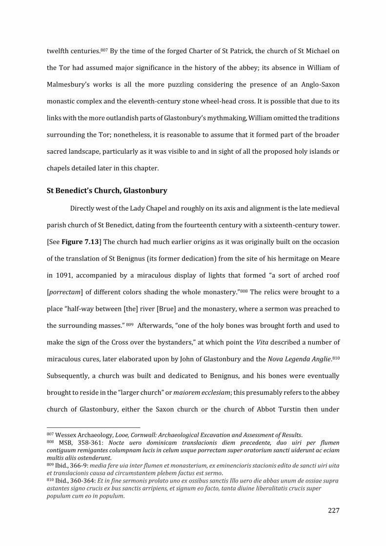
227
twelfth centuries.807 By the time of the forged Charter of St Patrick, the church of St Michael on
the Tor had assumed major significance in the history of the abbey; its absence in William of
Malmesbury’s works is all the more puzzling considering the presence of an Anglo-Saxon
monastic complex and the eleventh-century stone wheel-head cross. It is possible that due to its
links with the more outlandish parts of Glastonbury’s mythmaking, William omitted the traditions
surrounding the Tor; nonetheless, it is reasonable to assume that it formed part of the broader
sacred landscape, particularly as it was visible to and in sight of all the proposed holy islands or
chapels detailed later in this chapter.
St Benedict’s Church, Glastonbury
Directly west of the Lady Chapel and roughly on its axis and alignment is the late medieval
parish church of St Benedict, dating from the fourteenth century with a sixteenth-century tower.
[See Figure 7.13] The church had much earlier origins as it was originally built on the occasion
of the translation of St Benignus (its former dedication) from the site of his hermitage on Meare
in 1091, accompanied by a miraculous display of lights that formed “a sort of arched roof
[porrectam] of different colors shading the whole monastery.”808 The relics were brought to a
place “half-way between [the] river [Brue] and the monastery, where a sermon was preached to
the surrounding masses.” 809 Afterwards, “one of the holy bones was brought forth and used to
make the sign of the Cross over the bystanders,” at which point the Vita described a number of
miraculous cures, later elaborated upon by John of Glastonbury and the Nova Legenda Anglie.810
Subsequently, a church was built and dedicated to Benignus, and his bones were eventually
brought to reside in the “larger church” or maiorem ecclesiam; this presumably refers to the abbey
church of Glastonbury, either the Saxon church or the church of Abbot Turstin then under
807 Wessex Archaeology, Looe, Cornwall: Archaeological Excavation and Assessment of Results. 808 MSB, 358-361: Nocte uero dominicam translacionis diem precedente, duo uiri per flumen contiguum remigantes columpnam lucis in celum usque porrectam super oratorium sancti uiderunt ac eciam multis aliis ostenderunt. 809 Ibid., 366-9: media fere uia inter flumen et monasterium, ex eminencioris stacionis edito de sancti uiri uita et translacionis causa ad circumstantem plebem factus est sermo. 810 Ibid., 360-364: Et in fine sermonis prolato uno ex ossibus sanctis Illo uero die abbas unum de ossiae supra astantes signo crucis ex bus sanctis arripiens, et signum eo facto, tanta diuine liberalitatis crucis super populum cum eo in populum.

228
construction.811 The church of St Benignus would have been located near the western approach
to the peninsula, beside the old course of the River Brue.812 It does not appear that Benignus’s
relics ever resided in this church. Nonetheless, the fact that at least by the fourteenth century the
site was regarded to be a place of miracles, and that the church was built on the spot the body had
lain, is more than enough reason to envision it forming part of a landscape of pilgrimage with
physical ties to Glastonbury’s ancient past.
Other Sites of Interest in Glastonbury Town
Antiquarian accounts and early ordinance survey maps make reference to a chapel of St
Dunstan at Edgardley at the foot of the Tor. [Figure 7.13] Its age is unknown, though it was
converted into a barn after the Dissolution.813 A ‘slipper chapel’ of St James, so-called because
penitents would remove their travelling footwear and complete the last part of the journey
barefoot, is the only one of the original three that can be identified; it was converted into a
cottage.814 Its date is uncertain, though there is a blocked-up pointed window in the east wall.815
Holy Islands and Island Chapels
The example of Monaincha (Co. Tipperary), discussed in Chapter IV, is here taken as a
model for the putative chapels located on each of the islands associated with Glastonbury’s twelve
hides. As would appear to be the case at Beckery and Godney, a church or chapel was built on an
area of higher ground within a wetland context, perhaps originally as an eremitic retreat, but
eventually a broader component of the ecclesiastical landscape of the Mendip valley. [Figure
7.14] While the large church at Monaincha cannot be matched in scale by any of the known or
811 JG, 161-3 (§ 86). 812 Rahtz and Watts, Glastonbury, 130. 813 John Collinson and Edmund Rack, The History and Antiquities of the County of Somerset: Collected from Authentick Records, and an Actual Survey Made by the Late Mr. Edmund Rack. Adorned with a Map of the County, and Engravings of Roman and Other Reliques, Town-Seals, Baths, Churches, and Gentlemen’s Seats (London: R. Cruttwell, 1791), II, 265. 814 “Pastscape - Detailed Result: JACOBY COTTAGE,” accessed September 7, 2018, http://www.pastscape.org.uk/hob.aspx?hob_id=196712 815 Nikolaus Pevsner, South and West Somerset (London: Penguin Books, 1958), 182.

229
suspected chapel sites, it is plausible that given the foundation’s interest in Irish saints, the
resemblance was not coincidental.
Beckery
Today, Beckery, also known as St Bride’s Hill, is a low slope to the north of the west-ward
projecting bulk of Wirral Hill, located on the outskirts of the modern town of Glastonbury. Before
the diversion of the River Brue, Beckery would have been one of the primary landing points for
travelers coming from the west by boat, and stood above the surrounding marshes, even
becoming an ‘island’ when the water table was high.816 [See Figure 7.1 and Figure 7.13, above].
The Beckery ridge now extends to the modern embankments of the Brue, and probably
represents its greatest extent prior to the draining of the Levels. It is also located near Northover
Bridge, the end of an ancient causeway between Glastonbury and Street. The bulk of Wirral Hill
and the draining of the levels have made the site considerably less visually distinct from the
surrounding landscape, but during the early to high medieval period any buildings on the summit
of the hill would have been visible for some distance across the Brue and the marshes.817 At some
point, St Bride’s Well entered the site’s traditions; by the twentieth century it was identified with
shallow basin among the brambles, marked by an inscribed stone that has since been moved, and
the exact site has been lost.818 The summit of the island (rising 12.04m above sea level) is just
visible from the site of St Michael’s Church on the Tor, looking out over the town of Glastonbury,
emerging from behind the bulk of Wirral Hill, which obscures most of the surrounding landscape.
Unlike the other sites that will discussed, Beckery is afforded a wealth of both textual and
archaeological evidence. Beckery has a prominent place in all the earliest charters of Glastonbury,
including the forged charter of King Ine and the genuine charter of King Edgar, which describes it
as exempt from the jurisdiction of the bishop of Wells. In these early references, Beckery is
816 Philip A. Rahtz and S.M. Hirst, Beckery Chapel, Glastonbury (Glastonbury: Glastonbury Antiquarian Society, 1974), 16. 817 Ibid, 18-19. 818 Ibid, 16.
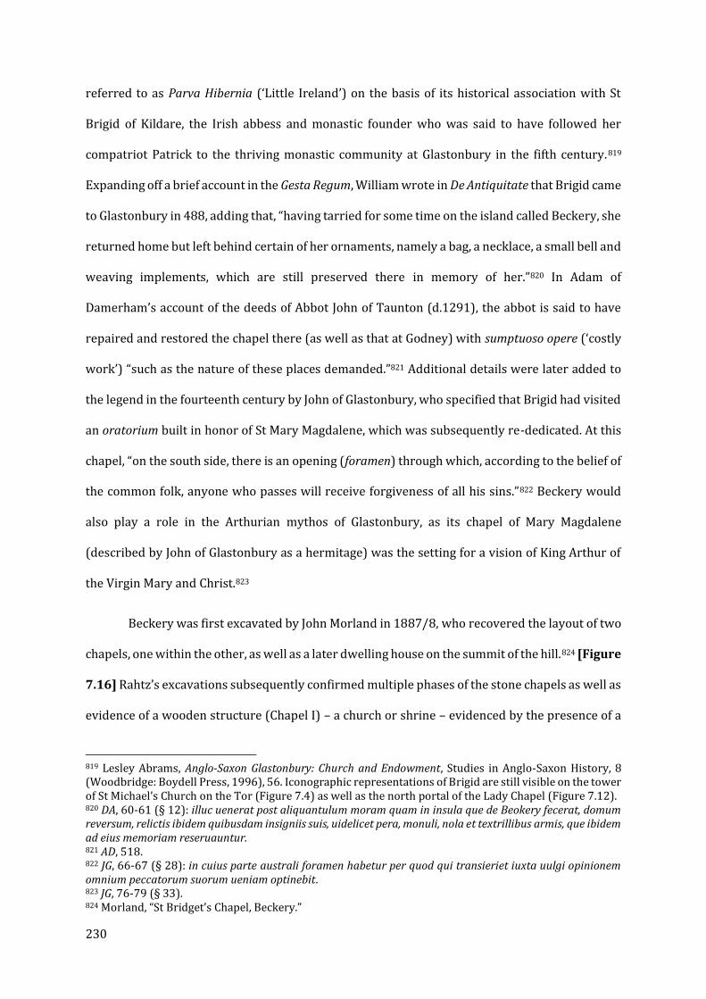
230
referred to as Parva Hibernia (‘Little Ireland’) on the basis of its historical association with St
Brigid of Kildare, the Irish abbess and monastic founder who was said to have followed her
compatriot Patrick to the thriving monastic community at Glastonbury in the fifth century.819
Expanding off a brief account in the Gesta Regum, William wrote in De Antiquitate that Brigid came
to Glastonbury in 488, adding that, “having tarried for some time on the island called Beckery, she
returned home but left behind certain of her ornaments, namely a bag, a necklace, a small bell and
weaving implements, which are still preserved there in memory of her.”820 In Adam of
Damerham’s account of the deeds of Abbot John of Taunton (d.1291), the abbot is said to have
repaired and restored the chapel there (as well as that at Godney) with sumptuoso opere (‘costly
work’) “such as the nature of these places demanded.”821 Additional details were later added to
the legend in the fourteenth century by John of Glastonbury, who specified that Brigid had visited
an oratorium built in honor of St Mary Magdalene, which was subsequently re-dedicated. At this
chapel, “on the south side, there is an opening (foramen) through which, according to the belief of
the common folk, anyone who passes will receive forgiveness of all his sins.”822 Beckery would
also play a role in the Arthurian mythos of Glastonbury, as its chapel of Mary Magdalene
(described by John of Glastonbury as a hermitage) was the setting for a vision of King Arthur of
the Virgin Mary and Christ.823
Beckery was first excavated by John Morland in 1887/8, who recovered the layout of two
chapels, one within the other, as well as a later dwelling house on the summit of the hill.824 [Figure
7.16] Rahtz’s excavations subsequently confirmed multiple phases of the stone chapels as well as
evidence of a wooden structure (Chapel I) – a church or shrine – evidenced by the presence of a
819 Lesley Abrams, Anglo-Saxon Glastonbury: Church and Endowment, Studies in Anglo-Saxon History, 8 (Woodbridge: Boydell Press, 1996), 56. Iconographic representations of Brigid are still visible on the tower of St Michael’s Church on the Tor (Figure 7.4) as well as the north portal of the Lady Chapel (Figure 7.12). 820 DA, 60-61 (§ 12): illuc uenerat post aliquantulum moram quam in insula que de Beokery fecerat, domum reversum, relictis ibidem quibusdam insigniis suis, uidelicet pera, monuli, nola et textrillibus armis, que ibidem ad eius memoriam reseruauntur. 821 AD, 518. 822 JG, 66-67 (§ 28): in cuius parte australi foramen habetur per quod qui transieriet iuxta uulgi opinionem omnium peccatorum suorum ueniam optinebit. 823 JG, 76-79 (§ 33). 824 Morland, “St Bridget’s Chapel, Beckery.”
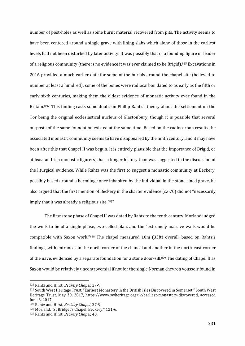
231
number of post-holes as well as some burnt material recovered from pits. The activity seems to
have been centered around a single grave with lining slabs which alone of those in the earliest
levels had not been disturbed by later activity. It was possibly that of a founding figure or leader
of a religious community (there is no evidence it was ever claimed to be Brigid).825 Excavations in
2016 provided a much earlier date for some of the burials around the chapel site (believed to
number at least a hundred): some of the bones were radiocarbon dated to as early as the fifth or
early sixth centuries, making them the oldest evidence of monastic activity ever found in the
Britain.826 This finding casts some doubt on Phillip Rahtz’s theory about the settlement on the
Tor being the original ecclesiastical nucleus of Glastonbury, though it is possible that several
outposts of the same foundation existed at the same time. Based on the radiocarbon results the
associated monastic community seems to have disappeared by the ninth century, and it may have
been after this that Chapel II was begun. It is entirely plausible that the importance of Brigid, or
at least an Irish monastic figure(s), has a longer history than was suggested in the discussion of
the liturgical evidence. While Rahtz was the first to suggest a monastic community at Beckery,
possibly based around a hermitage once inhabited by the individual in the stone-lined grave, he
also argued that the first mention of Beckery in the charter evidence (c.670) did not “necessarily
imply that it was already a religious site.”827
The first stone phase of Chapel II was dated by Rahtz to the tenth century. Morland judged
the work to be of a single phase, two-celled plan, and the “extremely massive walls would be
compatible with Saxon work.”828 The chapel measured 10m (33ft) overall, based on Rahtz’s
findings, with entrances in the north corner of the chancel and another in the north-east corner
of the nave, evidenced by a separate foundation for a stone door-sill.829 The dating of Chapel II as
Saxon would be relatively uncontroversial if not for the single Norman chevron voussoir found in
825 Rahtz and Hirst, Beckery Chapel, 27-9. 826 South West Heritage Trust, “Earliest Monastery in the British Isles Discovered in Somerset,” South West Heritage Trust, May 30, 2017, https://www.swheritage.org.uk/earliest-monastery-discovered, accessed June 6, 2017. 827 Rahtz and Hirst, Beckery Chapel, 37-9. 828 Morland, “St Bridget’s Chapel, Beckery,” 121-6. 829 Rahtz and Hirst, Beckery Chapel, 40.

232
the 1.2m wide entrance of the nave, suggesting the presence of post-Conquest portal into an older
building. 830 A substantial number of sherds of Saxo-Norman pottery (c.950-1150) indicate some
form of occupation, possibly domestic, at the site into the late-Saxon and probably Anglo-Norman
periods.831
It is possible that Morland’s assessment of Chapel II as being of a single, pre-Conquest
phase was mistake and a chancel or nave was added in the eleventh or twelfth century, or it could
be evidence of an older building being refurbished in the post-Conquest period. In all, the nave
measured 4.95 x 3.45 m internally and 6.7 x 4.95 m externally. Additionally, Morland reportedly
found a chamfered plinth of Bath Oolite on the north wall of the later chapel, which might have
originally come from the Chapel II build or rebuild.832 Chapel II is most likely to be the building
mentioned in the c.971 charter of King Edgar, but the evidence suggests that it continued in use
up until the construction of its successor, spanning the tenth to mid-thirteenth centuries. It seems
likely that the building would have been standing at the time of the Conquest, and that as part of
the program of renewal and re-investment in Glastonbury and its surrounding landscape,
additions or alterations were made, explaining the presence of the voussoir and possibly of the
chamfered plinth. The more defined foundations of Chapel III surround the earlier phases
entirely and between architectural features and the reference of Adam of Damerham this phase
can be comfortably dated to c.1275, possibly reaching into the fourteenth century on the basis of
the finds evidence. More puzzling is the stretch of wall, apparently contemporary to the building
or rebuilding of Chapel II, which runs parallel to the south wall of the nave for about ¾ of its
length, with about a metre gap between the two.833 [Figure 7.16] It could merely be a buttress to
support the chapel wall – the lower courses of the south nave wall showed some signs of slipping.
But there are other, more intriguing possibilities. The first is a base for a staircase to a gallery
830 Rahtz and Hirst, Beckery Chapel, 43. 831 Elizabeth Friend, “2016 Excavations at Beckery,” Axbridge Archaeological and Local History Society, 2018, http://www.aalhs.co.uk/2018/01/15/2016-excavations-at-beckery/. 832 Rahtz and Hirst, Beckery Chapel, 51 n. 97. 833 Ibid, 41-43.
233
over the west end of the nave, possibly a place where the aforementioned relics of Brigid were
displayed. Another concerns the legend passed on by John of Glastonbury, of the foramen that
could grant forgiveness of sins to those who passed through the opening.834 Too much damage
has been done to the walls of Chapel II to be able to conclusively resolve their relationship, but
the southernmost foundation does not seem to be a later repair or shoring up – the build and
mortar is identical to that of the original south wall.835 The possibilities are exciting regardless,
but the presence of monastic and possibly cult activity at Beckery is highly suggestive for what
may have been happening on or around the other ‘holy islands’ customarily named with Beckery:
Ferrameare (and Westhay), Godney, Panborough, Martinsey, and Andresey (one later charter
adds the promontory of Clewer (near Wedmore)).836 [Figure 7.14, above] Beckery is the only one
of the named ‘islands’ to have been excavated, and no standing remains survive from this period
at any of the sites in the study (a church at Meare dates to 1323). However, between the textual
evidence of activity at Meare, possible surviving parallels from Irish contexts, and the references
in charters, hagiography, and historical texts, a much broader landscape of holy islands, some of
which may have been the site of chapels both in the pre- and post-Conquest eras, can be proposed
to have existed in the Levels around the abbey.
Meare
The bedrock island of Meare has long been one of the most important possessions of
Glastonbury. A nearly intact late medieval manorial complex – a fourteenth-to-fifteenth-century
church, fourteenth-century manor house, and a fourteenth-century ‘Fish House’ (more likely a
summer residence for a monastic official) adjacent to the dried up fishponds – is the most obvious
medieval presence in the village. [Figure 7.17] The island was named after the mere (or meare)
pool – a natural water basin – and it was likely exploited for its natural resources beginning early
in Glastonbury’s history. As the middle ages progressed more and more of the land was drained
834 Rahtz and Watts, Glastonbury, 155; JG 67 (§ 28). 835 Rahtz and Hirst, Beckery Chapel,41-43. 836 Ibid, 11.

234
and used for agriculture and pasture, particularly for cattle; in the period of 1274-1315, 56.7
calves a year were born in Meare and Godney.837 The island first appears as Ferlingmere in a
dubious charter of King Cenwealh (c.670/72, allegedly), and a genuine charter of 680, when it is
recorded in as part of a grant to Glastonbury. The most obvious indicator of its importance in the
Anglo-Saxon period is the forged charter of King Ine (probably tenth-century) which confirms
Glastonbury’s rights to the surrounding ‘islands,’ including Meare.838 It continues to be included
as one of Glastonbury’s ‘core’ properties in a series of confirmation charters through the
thirteenth century, most preserved in Adam of Damerham and the Chronica of John of
Glastonbury, and is listed under the villa of Glastonbury in Domesday Book.839 Meare was also at
the center of a major dispute in the thirteenth century with the Bishop of Wells, when it was
appropriated by the bishopric before eventually being restored to Glastonbury’s control.840 While
its economic value is very clear, the island was of some significance to both the legendary
antiquity and contemporary cult activity of Glastonbury Abbey after and possibly before the
Norman Conquest. As the legend goes, an Irish bishop named Benignus (sometimes rendered as
Beonna) came to Glastonbury in 347, eventually succeeding St Patrick as Glastonbury’s abbot. Not
long afterwards, he took up residence on the island of Ferramere, in search of the isolation he so
craved. Among his first acts was to plant his staff in the ground, at which point it “straightaway
began to sprout green leaves and flowers,” which according to his reconstructed Vita he took as
a sign that he was meant to remain there in a life of prayer. According to the c.1130 vita, “the very
tree that signifies his sanctity can be seen standing by the saint’s chapel, its leaves spreading
wide.”841 Benignus frequently crossed a bridge or causeway he built himself to pray at the church
of St Mary (the Vetusta Ecclesia), but eventually the reed-bed [calmecum] was flooded, and he
henceforth “contented himself with life in his tiny cell, never wanting to go back to Glastonbury
837 Rippon, “Making the Most of a Bad Situation?” 127. 838 DA, 99 (lxii). 839 Abrams, Anglo-Saxon Glastonbury, 170-1. 840 Ibid, 171. 841 MSB, 348-9: Nam usque ad nostra tempora sanctitatis eius signifera ipsa arbor, sparsis late frondibus, iuxta beati uiri oratorium stare uidetur.
235
or anywhere beyond the bounds of his home. After immeasurable sufferings, he died a happy
death on the island.”842 According to reconstructed Vita Benigni, “his earthly remains are buried
in the church there, to the south by the altar, with the epitaph: Within this tomb Beonna lays /
was father here of monks in ancient days.”843 A number of miracles subsequently served to “make
the saint’s merits obvious.”844 The saint was translated with great acclaim in 1091 (see above in
the discussion of St Benedict’s Church in the town), an event that Rippon characterized as looking
“suspiciously like an attempt to bolster ‘cult activity.’”845 It is difficult to know whether there was
any historical basis to the cult of Benignus and his association with Meare or, as Rippon suggests,
it was a cult manufactured centuries later.846 There may have been a separate holy man of the
name of Beonna who was then linked with the Irish abbot as Patrick’s successor in later years.
The liturgical evidence that survives suggests that the feast of Benignus may not have been
celebrated before the end of the tenth century.847 In terms of the potential role that Meare might
have played in the post-Conquest cult, it does not particularly matter. Indeed, I would argue that
a later developing cult, combined with the focus on Meare evident in the literary evidence, would
make a manifestation of the cult on Meare in the eleventh and twelfth centuries all the more likely.
A comparison can be made once again to Monaincha, first used as a hermitage by St Cronan before
it became the site of small community and place of pilgrimage (Chapter IV).
While the surviving church of St Mary was built by Abbot Sodbury c.1322, there is a
reference to a capella cum cellario in an account relating to the restoration of Meare to
Glastonbury’s control during the abbacy of Michael of Amesbury (d.1252), indicating at the least
842 MSB, 354-5: uir beatus cellule tantum sue inhabitacione contentus, de reliquo nec Glastoniam reuisere nec extra ipsius cellue terminus uspiam uoluit exire. Et post immensos agones in dicta insula fine quieuit. 843 Ibid: Hoc patris in lapide Beonne sunt ossa locata, Qui pater extiterat monachorum hic tempore prisco. Hunc fore Patricii quondam fortasse ministrum Fantur Hybernigene et Beonnam de nomine dicunt. 844 Ibid: set nec defuere miracula quibus Deus ostenderet sancti merita. 845 Rippon, “Making the Most of a Bad Situation?” 102. 846 Winterbottom and Thomson, Saints’ Lives, 355 n. 5. It should be noted that John Leland recorded the presence of a great tomb in St Mary’s Church c. 1530: nam eius tumulus adhuc ostenditur propter lacum Feranium; he did not, however, make the connection to Benignus, it may thus be unrelated to the cult (John Leland, Commentarii de scriptoribus Britannicis, ed. Antonius Hall (Oxford: Sheldonian Theatre, 1709), 39. 847 Carley and Townsend, The Chronicle of Glastonbury Abbey, xxxviii-xxxix.
236
a previous building near the site, if not a church with more direct links to the cult.848 It might be
speculated that as the island became increasingly the private province of the abbot and as more
land was drained and exploited Meare’s cult significance may have waned, especially with the cult
of Benignus likely overshadowed by later developments. Nonetheless, considering the activity at
Beckery, where another Irish saint associated with the early history of the abbey was venerated,
the existence of a chapel built around the former tomb of Benignus, perhaps accompanied by a
tree that pilgrims might be told was that planted by Benignus upon his arrival, is entirely
plausible. The construction of a large manorial complex at Meare (entirely unmentioned by John
of Glastonbury) in the fourteenth century is suggestive of the changing nature of the site. In the
absence of excavation, the idea of Meare as a late-Saxon to early Norman cult site which only later
became an abbatial manor will remain hypothetical, but it would fit a model of the development
known both in Ireland and elsewhere in Britain.849
Godney
Nothing is known about the medieval church or chapel on this site, but its existence seems
certain from the documentary record, and an older building of undetermined age is recorded
having been restored in 1737.850 In the same passage, Collinson records a specific if somewhat
underwhelming miracle: the church on the site was never once fouled by birds even as it was
surrounded by a thick grove of trees. That Godney had miraculous associations into the early
modern period is suggestive of its medieval sacred significance. Adam of Damerham records that
a chapel at Godney was restored with opera sumptuoso by Abbot John of Taunton (d.1291).851
Notwithstanding its miraculous immunity from the menace of bird droppings, it is hard to know
if Godney was a specific place of pilgrimage, but it would have been an important early possession
848 AD, 211. The earlier phase of the manorial complex may also date to this time. See: M.C. Siraut, A.T. Thacker, and Elizabeth Williamson, “Parishes: Meare,” in Glastonbury and Street, ed. Robert W Dunning, vol. 9, A History of the County of Somerset (London: VCH, 2006), 120–42. 849 Another small chapel was reportedly in ruins at Westhay, half a mile to the west, but nothing else is known about it or its dedication (Collinson and Rack, The History and Antiquities of the County of Somerset, II, 273). Collinson also records a “old stone cross” in the churchyard. Its significance and age are unknown. 850 Collinson and Rack, The History and Antiquities of the County of Somerset, 273. 851 AD, 518.

237
of Glastonbury, lying three miles north of the abbey as distinctive ‘island’ rising out of the
marshes.852 [Figure 7.18] The presence of a rectory appropriated to Glastonbury is recorded in
1332.853 A seal recovered in 1754 shows St Dunstan as a Bishop, and was inscribed with S. Tome
Capellani Dei Insula: Collison suggests that this was Thomas, chaplain of Godney (or God’s
Island).854 Godney is clearly visible from the Tor and a chapel located there would have been
among the more distinctive features in the landscape north of the abbey. The recurrence of the
explanation of Godney as holding a chapel in the DA and John of Glastonbury would seem to imply
that some sort of religious building still stood in the post-Conquest period, perhaps similar to that
at Beckery.
Panborough
Panborough is implied to have a chapel in the charter of King Edgar (c.971)855 but
elsewhere is referred to as “vine-bearing”856 and particular emphasis is placed upon its “lands,
meadows, pastures, marshes, and broad woods.”857 While it has been suggested that it could be
named for St. Padan,858 the absence of any later reference to a chapel makes it more likely that
Panborough is a combination of the Old English patha (‘wayfarer’) and beorg (‘hill’), perhaps a
reference to its important strategic location next to a gap in the chain of hills between the Axe and
Brue river systems.859 It may thus have been acquired early in Glastonbury’s history for its
causeway linking the rivers. But its importance in later years may have been more due to more
than its location or agricultural resources; a later record of Glastonbury’s possessions records a
sizable vineyard and a cottage, but no chapel.860 Panborough might also be seen as an example of
the locus amoenus, a quasi-Edenic natural paradise in the midst of the marshes. Such a model is
852 Abrams, Anglo-Saxon Glastonbury, 132. 853 Siraut, Thacker, and Williamson, “Parishes: Meare.” 854 Collinson and Rack, The History and Antiquities of the County of Somerset, II. 273. 855 DA, 123-5 (§ 60). 856 JG, 17 (§ 4). 857 DA 153, (§ 53). 858 Rahtz and Hirst, Beckery Chapel, 11. 859 Abrams, Anglo-Saxon Glastonbury, 193. 860 Collinson and Rack, The History and Antiquities of the County of Somerset, 244.
238
one used frequently in a variety of ‘wetland’ monastic sites, including Ely and Ramsey Abbey.861
Whatever trees or overgrowth are referred in the medieval sources have been subsequently
cleared to make room for pasture. Panborough is a striking sight from the Levels, rising above the
otherwise low terrain. It would have stood out in the landscape, perhaps visible even from the
abbey site itself. [Figure 7.19]
Martinsey
The first reference to a chapel on the island of Martinsey (later Marchey) is in a charter of
712 recording the gift of Bishop Forthhere of Sherborne of ecclesiasm beati Martini confessoris to
Ealdberht, Abbot of Glastonbury.862 DA explains the name of Marchey as being “on account of St
Martin, whose chapel is there,” which is repeated by John of Glastonbury.863 Nothing more is
known of the chapel, though the island probably formed part of the abbey’s core-estates and the
area seems to have become a fishery by the end of the twelfth century. Earthworks surveys have
detected what could be the vallum of early monastic site, with a ditch and bank surviving to the
south, and field-walking and the cleaning of the drainage ditches turned up a substantial
collection of pottery fragments from the Roman period through the present, including Saxon and
medieval sherds, suggesting continuous occupation up through the construction of Marchey
Farm.864 A rectangular platform on the northern part of the former island might be the site of the
chapel of St Martin mentioned in the charters, but to date no archaeological investigation has been
carried out on the site, and it proved difficult to identify and photograph on a site visit.
Andresey (Nyland)
The tree-ringed hill of Nyland, formerly known as Andresey, marks part of the western
boundary of the Twelve Hides of Glastonbury, and thus plays a key role in delineating the abbey’s
861 Clarke, Literary Landscapes and the Idea of England, 700-1400, 68-70. 862 Abrams, Anglo-Saxon Glastonbury, 165-6. 863 DA, 153, (§ 73): Martenesie a sancto Martino cuius ibidem est capella; JG, 13 (§ 2). 864 Rahtz and Watts, Glastonbury; Historic England, “Early Christian Settlement and Monastic Site at Marchey Farm, Wookey,” accessed May 24, 2019, https://historicengland.org.uk/listing/the-list/list-entry/1011266.
239
ancient holdings from those of the Bishop of Wells or other lords.865 The DA and Chronica both
explain the name as referring to “St Andrew, who has chapel there.”866 It is possible that it actually
can be parsed as “Eadred’s Island,” but by the time of William of Malmesbury the connection with
Andrew seems firmly established; the place-name ‘Nyland’ is not used in any medieval source.867
There is no physical trace of any earlier building or settlement on the hill, but like most of the
sites under consideration, it has not been investigated archaeologically. As one of the higher peaks
in the area, it was undoubtedly as prominent in the landscape as Panborough. [Figure 7.20]
Other Sites of Interest: Glastonbury Environs
Shapwick
One of the minor Irish saints associated with Glastonbury by the tenth century was
Indract, who along with his companions was said to have been martyred by thieves on a
pilgrimage to Glastonbury, possibly to visit Patrick. The location of the incident (‘Hywisc’) is
unclear in the GR (§ 27) (‘iuxta Glastoniam’) and DA (§ 12) (‘ibidem’), and the original Life of
Indract has been lost. The NLA of John of Tynemouth gives ‘apud Shapwike,’ probably taken from
John of Glastonbury, and Lapidge prefers Huish Episcopi.868 It is possible that it refers to Withy,
“a detached part of Shapwick parish on the coastal marshes of the Somerset Levels, where there
is a large oval enclosure,” possibly evidence of early reclamation.869 In the reconstructed Life, the
site of the martyrdom is marked out to King Pedred, residing nearby, by a column of light.870 He
came out to the site and found the bodies (reliquas cultu) and brought them on to Glastonbury.871
The original parish church of Shapwick was demolished and moved into the center of the
medieval village, but there is no evidence that either structure was a site of cult activity, and the
865 Abrams, Anglo-Saxon Glastonbury, 46-7. 866 DA, 152, (§ 73): hec sic cognominatur a sancto Andrea cuius ibidem habetur capella; JG, 13 (§ 2). 867 Abrams, Anglo-Saxon Glastonbury, 47. 868 Winterbottom and Thomson, Saints’ Lives, 310 Note 2. 869 Rippon, “Making the Most of a Bad Situation?” 102. 870 VI, 375. 871 VI, 377.
240
written sources agree that the bodies did not remain long at the place of their martyrdom.872
Nonetheless, the later attempts to associate Indract’s martyrdom and the nearby village of
Shapwick may be significant in the broader scheme of Glastonbury’s sacred landscape.
Clewer
There are some antiquarian traditions and readings of the documentary evidence to
suggest the existence of a chapel of St Guthlac or ‘Cuthlac’ at Clewer, a rocky promontory near
Cheddar.873 [see Figure 7.14, above] Clewer is possibly first mentioned in connection with
Glastonbury as early as the eighth century, in a gift of Bishop Wilfrid, and DA records that Wilfrid
was given a hide at Clewer by King Centwine, who passed it onto the abbey, though the claim is
not mentioned in Domesday.874 While there is no mention of a chapel at Clewer in the c.1263
record of the Twelve Hides, it does appear in the c.1510 perambulation of the bounds.875 A
number of explanations have been offered to explain the dedication to ‘Cuthlac’ (or Guthlac),
including a confusion between the East Anglian saint of Crowland Abbey and a Glastonbury abbot
(824-851).876 But it is entirely possible that this ‘confusion’ was not so innocent. The
topographical setting of Crowland Abbey and Glastonbury was quite similar, and the monastic
community of the latter was, as we have seen, more than willing to borrow or steal the saints of
other foundations in search of their own powerful cult. The Abbey possessed three Lives of
Guthlac by 1247, and Henry of Blois is recorded to have given some of the saint’s relics to the
abbey.877 While the lack of any mention of Guthlac or Clewer in the existing histories makes this
claim tenuous, and the 1510 record could reflect a later association, it is possible that Clewer was
of some sacred significance in the medieval landscape around Glastonbury.
872 Christopher M. Gerrard, The Shapwick Project, Somerset: A Rural Landscape Explored, Society for Medieval Archaeology Monograph; 25 (Leeds: Society for Medieval Archaeology, 2007), 967-8. 873 Rahtz and Hirst, Beckery Chapel, 12. From Collison. 874 Abrams, Anglo-Saxon Glastonbury, 90. 875 Rippon, “Making the Most of a Bad Situation?” 102. 876 Carley, The Chronicle of Glastonbury Abbey, 275 n. 31. 877 Clarke, Literary Landscapes and the Idea of England, 77-79.

241
Conclusion: The Holy Islands of Glastonbury: Fact or Fiction?
The documentary sources for Glastonbury Abbey during both the pre- and post-Conquest
periods provide abundant evidence of a range of cults and cult sites which extended well beyond
the abbey precinct into the surrounding marshes of the Levels. A number of these bedrock
‘islands’ occupied a conspicuous place in the legends of Glastonbury’s foundation and antiquity,
appearing repeatedly in charters, both forged and genuine, and featuring prominently in the
community’s history and hagiography. At various times, the sources explicitly mention chapels
which at least existed on some of the named ‘islands’ during the pre-Conquest period, and their
continued importance in the post-Conquest sources, including the Chronica of John of
Glastonbury, is highly suggestive that the sites and their chapels remained or were rebuilt well
into the later Middle Ages, even as the landscape itself was transformed to become more
agriculturally productive. What form these chapel sites may have taken is suggested by the
excavated remains at Beckery as well as the surviving site at Monaincha (Co. Tipperary), which
might be seen as a model of a fully developed marshland island ecclesiastical site. Morland and
Rahtz’s excavations revealed a multi-phased building on the summit of St Bride’s Hill at Beckery
which may have been the site of cult activity organized around St Brigid, some of which may
actually be archaeologically visible in the form of the unusual wall to the south of Chapel II.
It is also possible that the chapels only existed in the pre-Conquest period, or even that
they were fictitious creations that provided a physical ‘fabric’ in Glastonbury’s rhetoric of its own
antiquity. By the thirteenth century, chapels existed at Godney and Meare, though their
relationship to a broader sacred landscape is less clear. The Glastonbury historical sources are
difficult, as they represent at once both the contemporary and ancient Glastonbury – John of
Glastonbury in particular presents his work as a continuation of De Antiquitate (and to an extent
the Libellus of Adam of Damerham); he may have seen no need to ‘update’ the earlier text (and
the later interpolations) to reflect the reality of Glastonbury and its landscape as it was in the
fourteenth century. In the case of Meare, John of Glastonbury’s explanation of the island and its
242
connection to Benignus would seem to be outdated – what may have once been a cult site had
become an important manorial complex belonging the officials of the monastery, with a manor
house, newly-built church dedicated to St Mary, and a building known as the Fish House (another
high-status domestic residence).878
If the islands and their chapels (as well as the Tor itself) are viewed as points in a sacred
landscape, meant to demonstrate the antiquity of the monastery as well to attract pilgrims,
Glastonbury’s affinity for Irish saints is important to consider. In addition to the multi-site sacred
complex as sites such as Glendalough and Inishmurray, and the isolated island chapel of the type
surviving at Monaincha, the model proposed here for Glastonbury is inspired by another
potentially Irish-influenced site: the coastal chapels surrounding St Davids’ Cathedral. In the case
of St Davids, the case for a sacred landscape, marked by chapels dedicated to figures associated
with David and his life, is relatively straightforward, as laid out in Chapter V. The chapels
themselves survive and/or have been the subject of archaeological investigation which provides
at least rough dating evidence. I argue that the importance of these sites and the direct links
between events in David’s life and individual locations on the peninsula is made explicit in the
late-twelfth century Vita of David by Giraldus Cambrensis, as part of a campaign to end any
uncertainty as to the antiquity of the cathedral site itself. To construct a similar model at
Glastonbury, encompassing the islands and perhaps the Tor, requires a fair bit of speculation and
inference. Nonetheless, I would argue it is more than plausible when the vast scope of
Glastonbury’s antiquarian interests is considered. To put it bluntly, there was very little that the
monastic community of Glastonbury would not do to reinforce the case for the antiquity of their
foundation and to draw pilgrims – an objective made more difficult by the absence of a single
famous saint to call their own. As at Glendalough’s Temple-na-Skellig and Monainchia itself, some
of these sites would have only been accessible by boat, though they may have been visible from
the abbey site in the medieval period. The mix of ‘universal’ saints in the dedications recorded is
878 Edward Impey, “A House for Fish or Men? The Structure, Function and Significance of the Fish House at Meare, Somerset,” English Heritage Historical Review 4 (2009): 30-31.

243
consistent with Glastonbury’s more ambitious pretensions – rather than saints whose holiness
was adjunct to David, like Non or Justinian, Glastonbury claimed connections to St Andrew, St
Michael, St Martin, the Holy Trinity, the Virgin Mary, and St Patrick (and through him Brigid,
Benignus, and Indract). It is also important to recognize that even if these islands were either
never the site of chapels (i.e. Panborough) or the chapels were long gone, they retained the
spiritually significant quality of the locus amoenus as unsullied spots of natural beauty amidst the
marshes, prime examples of Lefebvre’s ‘absolute’ spaces. In far more recent New Age traditions,
the island sites of Glastonbury are suggested to represent points on the Zodiac, possessing a
variety of pre-Christian associations. As farfetched as the idea might seem, it seems certain that
the modern authors of Glastonbury’s legendary past are merely following in the footsteps of their
monastic predecessors.
244
VIII: DISCUSSION: MODELLING SACRED LANDSCAPES AND THEIR
CULTS IN ANGLO-NORMAN ENGLAND AND WALES
The preceding three case studies have laid out my case for the creation and promotion of
sacred landscapes by ecclesiastical institutions in St Davids, Durham and Lindisfarne, and the
environs of Glastonbury Abbey. Another section delved into examples of the better-surviving
Irish tradition of sacred landscapes, laying out a set of models that could be used to both identify
and interpret features in the main case studies. In this chapter I will aim to approach this material
thematically, identifying and drawing together four specific aspects of the broader phenomenon
of sacred landscapes in the Anglo-Norman world: the biographical landscape, landscapes of
institutional myth, the re-use and adaptation of prior landscapes, and the dispersed ‘pilgrimage’
landscape.
The Biographical Landscape: In the Footsteps of the Saints
Biographical landscapes are centred around a particular saint, incorporating a range of
sites of importance to the saint or their spiritual familia in both their lifetime and in some cases
after their death. Identifying and interpreting this particular kind of landscape is thus highly
dependent on either written sources (usually hagiography) or from recorded local tradition.
Frequently, key moments in the life and afterlife of the saint and his or her familia are
memorialized at specific sites, often but not always where tradition holds the events took place.
Generally, biographical landscapes are smaller in scale than larger, more diffuse pilgrimage
landscapes, and in Ireland many of them are circumnavigated on their saint’s feast day in a turas,
or pilgrimage round. In more than one case, such landscapes seem to have been created and
promoted to create a secondary focus of veneration in the absence of corporeal relics, as was the
case at St Davids, Glencolumbkille, and Lindisfarne.

245
The landscape of St Kevin at Glendalough represents one of the best preserved of this
group, as many buildings of the period survive, along with hagiographical accounts from several
different periods. [see Figure 4.2] As discussed in Chapter IV, the site of Kevin’s monastic life can
be observed to ‘move’ from the chronologically earliest of old Irish texts (Betha Coemgen II) to
the latest (the twelfth-century Vita of Kevin, likely written by the canons of St Saviour’s Priory),
and a similar move can be seen between the emphasis on Kevin’s hermitage near the Upper Lake
to St Kevin’s House in the Lower Lake monastic complex.879 The landscape at Glendalough, though
much altered through the post-medieval period, nonetheless still illustrates two separate phases
of Kevin’s life. To the west, around the Upper Lake, are sites associated with Kevin’s ascetic life
(‘Kevin’s Bed,’ ‘Kevin’s Cell’ and the church of Temple-na-Skelig, located across the lake beneath
the cave of ‘Kevin’s Bed’). To the east of these is the main monastic complex – the site of Kevin’s
coenobitic life - as well as St Kevin’s Church or ‘House,’ which probably held his relics.
It is plausible that Glendalough was treated as a model of how to commemorate a saint
through the use of landscape and dispersed sacred sites which structured yearly processions (a
common feature of early Irish pilgrimage). It is also possible that such an arrangement existed in
the Anglo-Saxon period on Lindisfarne after St Cuthbert’s death in c.687. In the Life of Cuthbert,
there is an account of the penitent who went “around the holy places, praying and offering the
sacrifice of praise to his saviour.”880 Emma Wells identified a number of plausible “holy places”
the penitent may have visited, including the watchtower on the Heugh where the monks first
received word of Cuthbert’s death on Inner Farne, the site of Cuthbert’s first eremitic retreat on
St Cuthbert’s Isle offshore from the priory, the recently excavated stone church on the Heugh,
which might have contained the first wooden church built by St Aidan, and of course Cuthbert’s
grave in the monastic church, at the time the resting place of his relics.881 [see Figure 6.5] Further
excavation revealed the presence of a possible watchtower like that mentioned in Bede’s Vita
879 Lacey, “Monster and Monastery: St Kevin’s Lives and the Expansion of Glendalough”; Ó Carragáin, “Recluses, Relics, and Corpses: Interpreting St Kevin’s House.” 880 BVSC § 44. 881 Wells, “‘And He Went Round the Holy Places.”
246
Prosaica (referred to as BVSC), as well as medieval foundations under the post-medieval ‘Chapel
of the Lamp.’882 A classic example of the ‘western isles’ model of Irish pilgrimage site is
Inishmurray, with its main enclosure and a number of satellite altars and leachta. [Figure 4.22]
While it is far from impossible that Lindisfarne’s own Irish origins might have led to a
reproduction of this kind of landscape later continued and restored by the monks from Durham,
what is notable about these sites (which probably represent only a fraction of the loca sancta
referred to by Bede), is that they are united by their significance to the life and death of St
Cuthbert. The former hermitage of Farne Island, where Cuthbert had lived out his last days, was
re-occupied by other hermits, including Æathilwald and Fergild, who achieved saintly reputations
of their own, as might have also been the case at Glendalough with Carpre mac Cathuil. The
continued development of these sites up to and after the Conquest, when Lindisfarne became a
cell of Durham Cathedral Priory in the twelfth century, testify to the ongoing importance of these
satellite sites to the religious life of the priory and potentially to their use as pilgrimage stations.
These developments occurred in spite of the fact that the body of Cuthbert had been moved to
Durham Cathedral in the late tenth century, and Victoria Tudor has speculated that whether
pilgrims visited Lindisfarne or Durham could depend on their geographical origin or perhaps
even their gender.883 Several miracula from Inner Farne demonstrate the presence of a thriving
pilgrimage centre in the later Middle Ages.884 Another example from roughly the same period was
the sacred topography of Iona, the subject of Colum Cille’s biographer Adomnán’s De Locis Sanctis,
which drew comparisons between the surroundings of Colum Cille’s monastery and the sacred
topography of both Rome and the holy city of Jerusalem.885 According to Adomnán, crosses and
other markers indicated sites of particular spiritual significance, including sites associated with
882 Carlton, “Archaeological Excavations on Lindisfarne Heugh”; “Excavations on Lindisfarne Heugh in 2018.” 883 Tudor, “The Cult of St Cuthbert in the Twelfth Century," 437–46. 884 Craster, “The Miracles of Farne”; “The Miracles of St Cuthbert at Farne.” 885 David H. Jenkins, “Holy, Holier, Holiest”: The Sacred Topography of the Early Medieval Irish Church, Studia Traditionis Theologiae. Explorations in Early and Medieval Theology; 4 (Turnhout: Brepols, 2010), 36. For example, Colum Cille’s blessing of the monastic community on a hill overlooking the monastery is likened to Christ’s own Sermon on the Mount.
247
Colum Cille himself, such as the saint’s ‘pillow’ (compared to that of the Old Testament’s Jacob)
and the remnants of an ancient building on Torr an Aba, reputed to be St Columba’s Cell or writing
house.886
But while the development of these biographical landscapes can be traced back to well
before the arrival of the Normans to England, Wales, and Ireland, other sacred landscapes and
cults did not develop until much later. In my chapter on the biographical landscape of St Davids
in Wales (Ch. V), I proposed that the full development of the network of chapels (a number of
which were built on early medieval sites) and their relationship to one another and the cult based
in the cathedral was a later twelfth-century development, part of an institutional programme of
cult promotion which was bolstered by written works such as the revised Vita of David by
Giraldus Cambrensis. [Figure 5.2] In addition to a chapel at the supposed site of David’s baptism
(Capel-y-Pistyll near Porth Clais), there are the standing or excavated remains of chapels
dedicated to Non, his mother (perhaps believed to be the site of his birth), Justinian, his confessor,
and Patrick, his evangelical predecessor. Additional sites existed on Ramsey Island, including the
supposed site of Justinian’s martyrdom (though this episode is not featured before the
compilation of John of Tynemouth in the fourteenth century and a fifteenth-century vita et
miracula). The stone buildings which are known either from standing remains or archaeology
were mostly built between the eleventh and sixteenth centuries, though a number of them occupy
the site of early medieval enclosures and inhumation cemeteries.887
The mostly intact pilgrimage landscape of Glencolumbkille, Co. Donegal, may offer
another example of a late-developing biographical landscape in the vein of St Davids. While most
of the features which survive to this day are early, even prehistoric in date, their association with
Colum Cille, or Columba, may be much more recent, and reflect a similar program of cult
promotion on an existing sacred landscape. There is no convincing evidence of a connection
between the area now known as Glencolumbkille and its historical namesake, but there are vivid
886 Kirsty Owen, “Iona Island and Abbey,” Archaeological Journal 164, no. sup1 (January 1, 2007): 52–54. 887 Ludlow, “Identifying Early Medieval Ecclesiastical Sites in South-West Wales," 71-76.
248
traditions of Columba’s presence and activities at the site from the late Middle Ages (notably the
1532 Life of Colum Cille by Manus O’Donnell), as well as physical monuments linked to him –
Colum Cille’s ‘chair’ and ‘well’ on the high ground above the hill-top monastic enclosure being
two, and the ‘bed’ of Colum Cille within the primary chapel of that enclosure being another. There
is also the story of Colum Cille’s battle with the demons in the glen, where it is said that Colum
Cille cast his bell into the midst of the enemy horde, scattering and driving them from the area,
leaving the bell embedded in the ground where it became a source of protection. The ‘Townland
of the Demons’ is today the twelfth pilgrimage station of the Glencolumbkille turas: a standing
stone embedded in what could be the entrance of a collapsed souterrain. These stories and their
association with the much older features in the landscape may originate with the efforts of the
Abbey of Derry and its abbot Flaithbertach Ua Brolcháin (d.1175), discussed below.
With the exception of Glendalough and St Davids, a common thread between these sites
with biographical sacred landscapes is the absence of corporeal relics (and even in the case of St
David, the relics of the saint were only ‘discovered’ in the mid-thirteenth century, after the
composition of Giraldus’s Vita and at least some of the building and investment in the coastal
chapels).888 Glendalough, of course, also presents the best documented and preserved example of
a biographical landscape, even if it was apparently an addition to, rather than a substitute for, the
relics of St Kevin themselves, which seem to have been kept in St Kevin’s Church, rather than the
adjacent cathedral.889 The accepted wisdom that corporeal relics served a secondary function in
both the pre- and post-Conquest church in Wales has been challenged in recent years.890 However,
a strong case can still be made for the development and promotion of biographical landscapes as
a substitute for corporeal relics in certain instances. This was certainly the case at Lindisfarne,
where the centre of the Cuthbertine cult was the empty grave, or cenotaph, as well as the site of
Cuthbert’s final monastic retreat on Inner Farne, where a number of miracles are recorded. The
888 James, “The Cult of St David in the Middle Ages,” 18. 889 Ó Carragáin, “Recluses, Relics, and Corpses: Interpreting St Kevin’s House”; Moss, “Architectural Sculpture at Glendalough.” 890 Hurlock, Medieval Welsh Pilgrimage, 21-22.
249
development of the turas at Glencolumbkille can be plausibly explained as the attempt of the
community at Derry Abbey to create a physical link between their church and Colum Cille’s life
when they began to promote themselves as the institutional heirs of Colum Cille’s authority. This
authority was descended from Iona, which despite the eventual loss of its relics continued to
promote itself as a place of Columban pilgrimage. The particular circumstances that may have led
to the creation and promotion of a sacred landscape of David and his spiritual familia around the
present site of St Davids Cathedral will be reviewed in the following section.
Landscapes of Institutional Myth: Crisis and Continuity
The events of the Anglo-Norman invasions of England and Wales in the eleventh century,
and the gradual Anglo-Norman encroachment on Ireland in the late twelfth century, led to
dramatic institutional upheaval and ecclesiastical reforms. In England, the last Anglo-Saxon
bishop (Wulfstan of Worcester) died in the last decade of the eleventh century, and the
replacements for the native clerics were overwhelmingly drawn from the continent. In a related
development, Continental church reforms resulted in the displacement or conversion of pre-
Conquest institutions to Benedictine or Augustinian foundations. For those institutions that held
the relics of saints and or were traditionally the caretakers of a saint’s cult, there was often great
concern with both legal and ideological institutional continuity; despite the sometimes wholesale
replacement of prior communities, the new or reformed institutions sought to inherit the
legitimacy and authority of their predecessors.
As documented by a range of scholarship beginning with Susan Ridyard, the most
common response of Anglo-Norman institutions was to appropriate native cults and promote
them as a source of financial gain and prestige, sometimes reviving moribund cults or in other
cases inventing either new saints or associations between known saints and their own
foundations.891 The ‘problems’ of legitimacy facing individual institutions could vary greatly. For
example, Durham’s new Benedictine priory had to explain the expulsion of the secular canons
891 Ridyard, “‘Condigna Veneratio.’”
250
who had acted as Cuthbert’s guardians for more than a century, while Derry sought to exploit the
decline of the monastery of Iona by laying claim to Colum Cille’s monastic legacy. At St Davids, I
have argued that there was some degree of uncertainty as to the original location of St David’s
monastery by the late eleventh century, which became a liability as the community of St Davids’
Cathedral pursued its ambitions to become a metropolitan see.
One of the many tools used by these institutions was the appropriation, reinterpretation,
and promotion of sacred landscapes, on both a larger (covering an entire region, as with Durham
or Derry) and smaller (satellite chapels such as those at St Davids) scale. The concept of ‘walking
in the footsteps of the saints’ was a powerful and foundational notion of early Christian
pilgrimage, one with particular resonance in Ireland, but also found in Durham’s stewardship of
the cult of St Cuthbert. The advantage of using landscapes was to create a sacred geography that
‘bound’ the cult to a particular location or series of locations, sites which could be all the more
easily controlled and exploited by institutions in search of unquestionable legitimacy after
periods of upheaval. Such practices in Ireland can be found to derive from the phenomenon of
dindshenchas, or the lore of places, but the idea of associating points in the landscape, whether it
consisted of a physical or mental topography, was far older. In the form of the veneration of the
Holy Land and Rome, such practices were an important component of early Christian religion. As
shown in the preceding case studies, in the absence of corporeal relics or ancient buildings, the
intent was to turn a landscape, consisting of a series of individual sites, into a kind of contact relic
substitute, using both text and material investment to record and memorialize these associations.
One of the most common institutional challenges that the keepers of a saint’s cult had to
overcome was the physical relocation of the saints’ remains from one place, usually their original
grave, to a site with significantly less claim to antiquity. The most obvious example of this
phenomenon among those ecclesiastical institutions that were interested in creating and
promoting sacred landscapes is Durham Cathedral priory, which not only faced the challenge of
a site move, but also the complete replacement of the ‘original’ guardians of their saint with
251
continental monks. This new community, however, sought not to break from the past, but instead
to claim it for their own. Writers such as Symeon of Durham (possibly building off the work of the
author of the misleadingly-dated Historia de Sancto Cuthberto) manipulated events to draw a
direct line between Cuthbert, who was imagined as a monastic bishop above all else, and the
Benedictine monks of Durham. As detailed in Chapter VI, this was a complicated and diverse
effort, using both the writing of new histories and the acquisition and promotion of important
sites in Cuthbert’s afterlife, as well as establishing a cell and pilgrimage church on Lindisfarne
itself. Cuthbert became a saint of the wider North, with his cult even reaching into Scotland,
including Durham’s ownership of Old Melrose during the early twelfth century. The landscape of
northern monasticism, encompassing those sites associated with the most famous Benedictine
monk of Britain, the Venerable Bede, was repurposed to lend legitimacy to Durham as the
spiritual successor to the great monastery of Lindisfarne. The most comparable example to the
activities of Durham in the post-Conquest period are the expansionist ambitions of Derry Abbey
in Ireland. As had been the case at Lindisfarne, persistent Viking raids had diminished the
monastery of one of the most prominent saints in the region. The abandonment and desolation of
Iona was perhaps overstated by contemporary sources (as it was at Lindisfarne, and to a lesser
extent Wearmouth and Jarrow), but there was little doubt that the mantle of successor to Colum
Cille, the comarba, had left the island, first re-established in Kells. But Kells’ own decline in the
eleventh century would leave the door open for Derry and its ambitious bishop a century later,
leading to an entirely different narrative that placed Derry at the centre of Colum Cille’s legacy.
In Wales, St Davids also sought to widen their area of control by reaching back into their
past. It is clear from the textual evidence of the twelfth century, particularly the work of Giraldus
Cambrensis, that at least some in the community of canons sought to assert a claim to
metropolitan status, to rank alongside Canterbury itself. But there are hints that St Davids’ own
claims to institutional continuity may have been even more tenuous than Durham’s. As discussed
in Chapter V, the early medieval centre of David’s cult might not have been where the cathedral
was built at all, but rather up the Welsh coast in Ceredigion, at Hen Fynwy, before it was scattered

252
by centuries of raiding in the area by various parties, culminating in the destruction of David’s
shrine in 1090. [Figure 5.1] If the cathedral was going to appeal for metropolitan status on the
strength of its association with David, the apostle of the Welsh, it would have been vital to secure
their claim as the site of David’s original monastery. Building chapels at a number of sites around
the peninsula where Menevia had developed and associating them through hagiographical
accounts with the life of St David was one way to do this. A keen interest in local geography and
place names is evident in Giraldus’s Life, by contrast to the Life of Rhygyfarch (whose own origins
and loyalties were closer to Ceredigion than modern day Pembrokeshire). The largest difference
between St Davids and Durham, however, was certainly the absence of St David’s body, which
was said to have been lost around 1090 during the period of raiding prior to the establishment of
the Norman episcopal see, though it would be miraculously ‘discovered’ in the thirteenth century,
after this landscape had taken shape.
The case of Derry Abbey can be more closely compared to the examples from England and
Wales than most of the Irish case studies discussed in Chapter IV. As at Durham, a twelfth-century
effort to lay claim to a wide swath of ecclesiastical properties by appropriating the legacy of an
important saint was accompanied by the creation of a new history that legitimated these claims.
The Betha Colum Cille (or ‘The Irish Life of Colum Cille’) was composed between 1150 and 1169
and served a very similar purpose to Symeon’s Libellus (and the earlier Historia de Sancto
Cuthberto) by furthering the interests and ambitions of Derry Abbey. As with Symeon’s Libellus,
the Irish Life began by building off well known hagiographical and historical works, in this case
the influential hagiography of Columba by Adomnán. But from the beginnings of Colum Cille’s
monastic career, the Irish Life diverges dramatically from Adomnán’s account. According to the
Irish Life, Colum Cille’s first foundation after Iona was at Derry, following which he traveled
around Ireland on a campaign of monastic settlement, founding Raphoe, Durrow, Kells and
Clonmore. [Figure 4.36] The Irish Life also records the saint visiting a number of important
monasteries established by others and leaving gifts or secondary relics at each site, not unlike the
way that the presence of Cuthbert’s body at a number of sites around Northumbria was used to
253
tie them to Durham in the aftermath of the departure from Lindisfarne in 875.892 The only one of
these sites mentioned in Adomnán’s Vita S. Columbani is Durrow, and there is no evidence at all
of Columban foundations at Swords, Moone, or Drumcliffe. As was the case at Durham, where
Symeon made the ancient monasteries of Wearmouth and Jarrow a crucial part of a
(re)foundation narrative of Durham Cathedral Priory that emphasized continuity with
Lindisfarne and Cuthbert (despite the fact that there was no historical link between Cuthbert and
Wearmouth/Jarrow) the monks of Derry rewrote history. The Irish Life upended the commonly
accepted sequence of Columba’s monastic career to give the institution where it was written the
prestige of first foundation. This rhetorical effort is best seen in the context of a concerted effort
by Flaithbertach Ua Brolcháin to claim the legacy of Colum Cille for Derry Abbey. In 1150, the
abbot claimed the title of Colum Cille’s comarba from the heads of the beleaguered foundation at
Kells. From 1151 to 1153, Flaithbertach carried out a series of circuits through the northern
territories of Derry, including parts of the itinerary of foundation laid out in the Betha Colum Cille,
and ultimately secured the tribute of the churches of Colum Cille in Meath and Leinster. These
circuits in the twelfth century can be compared to the historical ‘circuit’ made by the body of St
Cuthbert in the centuries following the flight from Lindisfarne. In both cases, twelfth century
institutions used them to back their claims to legitimacy centuries later.
In general, the twelfth century seems to have been a time of institutional reconsolidation
and appropriation. Through institutional reform and political developments, many continental
clerics found themselves in charge of much older foundations at various points after the
conquests of England, Wales, and Ireland by the Norman and then Anglo-Norman kings. As laid
out by Susan Ridyard (though in a primarily eleventh-century context), many of these institutions
under new management found it advantageous to renew their sometimes-moribund cults, using
them as sources of institutional legitimacy and continuity, as well as a draw for new pilgrims in
an increasingly competitive environment. In some cases, these efforts continued beyond the
892 Overbey, Sacral Geographies; Herbert, Iona, Kells, and Derry, 181-4.

254
twelfth century, even after the reformed institutions found their feet, as was the case at Durham
and Lindsifarne. Unlike Durham, however, Derry’s twelfth-century efforts were not successful
over the long term, and by 1166 Derry had lost its foremost patron and the institutional familia
of Colum Cille began to fall apart in the face of the Norman invasion. The Prince Bishops of
Durham, on the other hand, maintained one of the most important saints’ cults in the north of
England, and retained control of most of the lands that were associated with Cuthbert. St Davids
ultimately encountered mixed success: the cult of David was fully established at the site of the
Norman cathedral in Menevia, and the bones of the saint were even miraculously ‘discovered’ at
Ewenny Priory in 1275. However, the metropolitan ambitions of Giraldus Cambrensis and the
canons ultimately went unrealized.
One continental parallel is worth discussing in the context of Durham and Derry and their
rewriting of history and use of a saint’s presence to assert territorial claims. As was the case at
Lindisfarne, Viking attacks drove out the monks of Stavelot-Malmedy and St Remacle in the
Ardennes from Remacle’s foundation at Stavelot in 884-85. The second book of the Miracula
Remacli recounts the journey of the monks and their precious cargo through a series of towns and
properties controlled by Stavelot-Malmedy, during which a number of miracles are recorded.893
The Miracula’s telling of the events served “to link territorial control to pastoral protection, and
to promote the entire territory that Stavelot controlled.”894 This narrative is remarkably similar
to that of the flight of Lindisfarne’s monks in 875. The cult of St Remacle also provides a rare
parallel to the veneration of an empty cenotaph of a saint, with the inventio of the saint’s original
tomb in 1042 and subsequent construction of the ‘grotto of St Remacle’ at Malmedy.895
At Glastonbury, the monks also enlisted their ties to early saints in pursuit of their case
for unquestioned antiquity. In the twelfth century, the community employed one of the foremost
historians of his age, William of Malmesbury, to compose several histories and revised and
893 Arnold, Negotiating the Landscape: Environment and Monastic Identity in the Medieval Ardennes, 193-5. 894 Ibid., 195. 895 Ibid., 187.
255
updated saints’ vitae, a work which was continued by numerous interpolators of the surviving
text as well as the fourteenth-century Chronica of John of Glastonbury. Glastonbury found itself
as a competitive disadvantage to sites of similar antiquity and wealth by its lack of a primary
saintly founder, and even the custody of its most famed abbot, Dunstan, was contested with Christ
Church, Canterbury. In the period before and after the Norman conquest, Glastonbury had begun
to advertise its links to a number of Irish saints, including Brigid, Beonna, and even the great
Patrick himself. While the monks claimed that Patrick had been buried in the Vetusta Ecclesia,
Beonna and Brigid became linked with the marshland islands of Meare and Beckery, respectively.
These sites seem to have formed the centre of their cults, rather than the monastery itself (even
though Beonna or Beningnus was translated in 1090). The Irish monastic site of Monaincha, with
its Romanesque church set on an island in the since-drained marshes of Co. Tipperary, might
provide some insight into what Beckery and its sister islands might have looked like. [Figure
4.25-4.27] It is possible that other ‘islands’ mentioned in the documentary records, including
Martinsey, Andresey (Nyland), Godney, and perhaps Clewer, also represented pilgrimage
locations to a variety of different saints beyond the bounds of the monastery itself, although there
is less evidence, both textual and archaeological, of the other sites. The fire of 1184 that destroyed
Glastonbury Abbey led to further changes in the mythologizing and legend-building of the
community. The destruction of the Vetusta Ecclesia, preserved as an architectural relic, as well as
the presumed loss of a bevy of other relics, necessitated the inventio of Arthur and Guinevere, as
well as the miraculous rediscovery of Dunstan. The islands themselves, as well as the Tor, were
fitted into new legends: Beckery became associated with Mary Magdalene, while Meare seems to
have become estate center of the abbot, and the Tor was said to be the earliest religious site in
the area, dating back to the time of the earliest evangelists in Britain, and by the late Middle Ages
Glastonbury celebrated its links to none less than Joseph of Arimathea.
The changing dedications and saintly associations between the islands around
Glastonbury, as well as the monastery itself, find some parallel with developments in the Dingle
Peninsula, but the greatest concern of the monks, like the community at Durham, seems to have

256
been institutional legitimacy and continuity. Glastonbury had no patron saint of Cuthbert’s
renown, but as with Durham and the Cuthbertine sites in Northumbria, the claim made to the
islands (which framed the legendary Twelves Hides of Glastonbury) might have been used to
solidify a legal property claim. As Durham competed for control of the manor at Crayke with York,
Glastonbury and Wells competed over the estate at Meare in the thirteenth century.
Reinvented Landscapes: Inventiones and Superseded Saints
The kind of institutional cult building discussed in the previous section took a number of
different forms, but in a few key examples the new or reformed institutions took over not only a
site or cult but a pre-existing sacred landscape with its own history and associations. The
phenomenon can be best observed in Ireland in places like Lough Derg (which is known to this
day as St Patrick’s Purgatory) and the Dingle Peninsula, mostly on the basis of place-name
evidence and tracking the development of certain traditions through the textual record. I have
argued that the association between St David and the settlement formerly called Menevia is one
that was only developed in the eleventh and twelfth centuries, but based on the presence of early
ecclesiastical sites, it is reasonable to speculate that this may be another example of landscape re-
use. While in some cases features in the landscape may have been granted significance in
Christian worship which they might not previously have possessed, the more common and likely
scenario is one of re-use, where we simply do not have evidence for the traditions that came
before. What is known from Dingle, Lough Derg, Glencolumbkille and potentially St Davids, as
well as later developments at Glastonbury, is that older, frequently local, saints could be displaced
by newer, better known saints with established cults.
Glencolumbkille, a coastal valley in County Donegal, was likely also part of the story of
Derry Abbey’s ultimately thwarted ambitions. There is no convincing evidence that ties Colum
Cille to the site, previously known as Senglenn, before the fifteenth century, and not even the
revisionist twelfth-century account of the Betha Colum Cille corroborates the claim. However,
there are reasons to suspect the hand of Derry nonetheless. Despite its distance from Derry, the
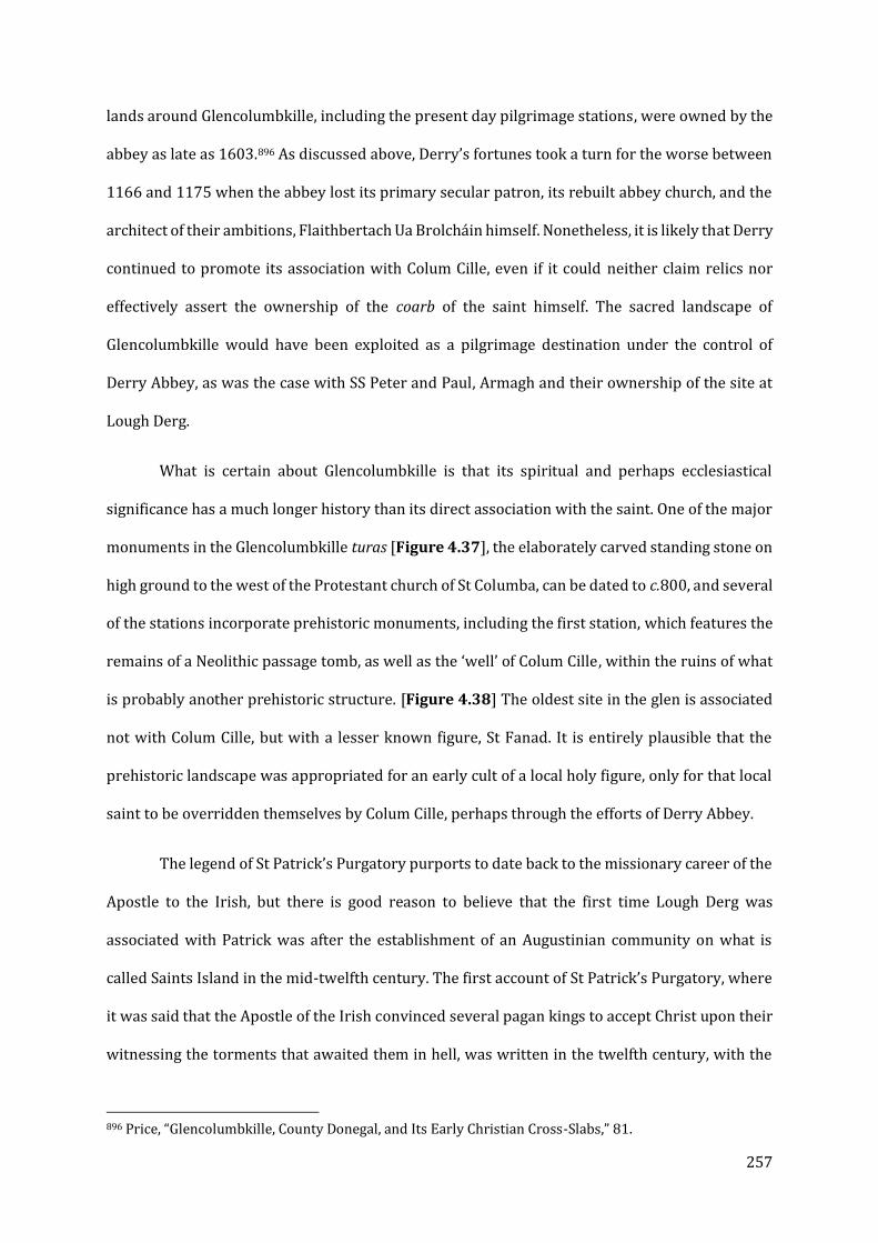
257
lands around Glencolumbkille, including the present day pilgrimage stations, were owned by the
abbey as late as 1603.896 As discussed above, Derry’s fortunes took a turn for the worse between
1166 and 1175 when the abbey lost its primary secular patron, its rebuilt abbey church, and the
architect of their ambitions, Flaithbertach Ua Brolcháin himself. Nonetheless, it is likely that Derry
continued to promote its association with Colum Cille, even if it could neither claim relics nor
effectively assert the ownership of the coarb of the saint himself. The sacred landscape of
Glencolumbkille would have been exploited as a pilgrimage destination under the control of
Derry Abbey, as was the case with SS Peter and Paul, Armagh and their ownership of the site at
Lough Derg.
What is certain about Glencolumbkille is that its spiritual and perhaps ecclesiastical
significance has a much longer history than its direct association with the saint. One of the major
monuments in the Glencolumbkille turas [Figure 4.37], the elaborately carved standing stone on
high ground to the west of the Protestant church of St Columba, can be dated to c.800, and several
of the stations incorporate prehistoric monuments, including the first station, which features the
remains of a Neolithic passage tomb, as well as the ‘well’ of Colum Cille, within the ruins of what
is probably another prehistoric structure. [Figure 4.38] The oldest site in the glen is associated
not with Colum Cille, but with a lesser known figure, St Fanad. It is entirely plausible that the
prehistoric landscape was appropriated for an early cult of a local holy figure, only for that local
saint to be overridden themselves by Colum Cille, perhaps through the efforts of Derry Abbey.
The legend of St Patrick’s Purgatory purports to date back to the missionary career of the
Apostle to the Irish, but there is good reason to believe that the first time Lough Derg was
associated with Patrick was after the establishment of an Augustinian community on what is
called Saints Island in the mid-twelfth century. The first account of St Patrick’s Purgatory, where
it was said that the Apostle of the Irish convinced several pagan kings to accept Christ upon their
witnessing the torments that awaited them in hell, was written in the twelfth century, with the
896 Price, “Glencolumbkille, County Donegal, and Its Early Christian Cross-Slabs,” 81.

258
Tractatus de Purgatorio Sancti Patricii of c.1184, followed by a detailed description of the
Purgatory by Giraldus Cambrensis in 1186. The form of the Purgatory is not consistent across
the following few centuries’ worth of accounts, raising the possibility that the Augustinian canons
who first settled on Saints Island after 1132 were altering the site to adapt it to the needs of the
pilgrims. As at Glencolumbkille, there is evidence that St Patrick might have been taking the place
of a more local figure, as Lough Derg is referred to in the Irish annals as the ‘Termon of Daveoc’
in 1070 and 1111. The motivation for the creation of this legend could lie in the circumstances of
the Augustinian community at SS Peter and Paul, Armagh, to which the Saints Island foundation
was dependent, who had lost control of another major Patrician pilgrimage site at Croagh Patrick
with the formation of the diocese of Tuam. At the same time, the translation of Patrick’s relics to
Downpatrick in 1186 may have created the need for a competing site.
The Dingle Peninsula has been known for centuries, and up to the present day, as the site
of a pilgrimage to Mount Brandon. The cult site at the summit was reconstituted in the nineteenth
century, and the new structure on the summit probably contains rubble from medieval
buildings.897 Mount Brandon also provides one of the most explicit examples of Irish pilgrimage
sites a destination for penitent sinners, as record of 1542 specifies that a murderer was assigned
to visit Mount Brandon as well as the famous island monastic site of Skellig Michael, off the west
coast of the Dingle Peninsula.898 According to legend (but not the existing Lives and accounts of St
Brendan the Navigator and his journey), Brendan ascended the mountain to pray for good fortune
in his upcoming voyage. Along the way to the summit from the traditional landing site at Ventry,
southwest of Dingle, are a wide range of early Christian monastic or ecclesiastical enclosures that
survive better than most comparable sites in England or Wales. There is also the twelfth-century
Romanesque church at Kilmalkedar, not far from the famous Gallarus Oratory, a well-preserved
eighth- or ninth-century one-celled church. Despite being the most recently built of the sites along
the route, the place-name of Kilmalkedar is the best evidence (along with the lack of evidence for
897 Cuppage, Archaeological Survey of the Dingle Peninsula, 263-264. 898 MacDonogh, The Dingle Peninsula, 185-6.

259
a contemporary connection between Dingle and St Brendan) that St Brendan may not have been
the first saint to lay claim to these lands. Kilmalkedar incorporates the name of Maolcethair, a
local Irish saint of the seventh century, and within the modern churchyard are a range of early
medieval carved stones, notably including a sundial and an alphabet stone. There is also a
possibility that the place name of the enclosure at Kilcolman, closer to the landing point at Ventry,
might not refer to ‘Colman the Pilgrim,’ as has been assumed based on the ogham inscription on
a cross-inscribed stone, but rather St Colmán Oilither, also known as Colman the Pilgrim of Ross –
the landscape might have been associated with either Colman or Maolcethair, or perhaps even
both before the nearby peak became associated with St Brendan the Navigator. The enclosures
can be dated to the early medieval period on the basis of diagnostic carved stones, and may have
grown up from proprietary churches which developed into small religious communities.899 While
it is possible that the route was promoted by the diocese of Ardfert, which was in competition
with the traditional site of Brendan’s cult at Clonfert, the case for institutional patronage is
considerably weaker than the other case studies discussed here. Nonetheless, the phenomenon
of a more universally known saint (Brendan) replacing a lesser-known, more local saint
(Maolcethair or possibly Colman), would parallel the development of the Irish sites at
Glencolumbkille, Lough Derg, and potentially Glastonbury, where some sites were (re)associated
in line with later-developing legends and institutional needs.
Glastonbury also saw a dramatic reuse and reimagining of its sacred landscape after the
fire of 1184 created the need for new sources of income. The inventio of Arthur and Guinevere, as
well as the revival of the cult of St Dunstan, may have shifted the focus of the pilgrimage tradition
from a number of secondary relics and sites to the more traditional shrines in the rebuilt abbey
church. The landscape and its islands remained a valuable asset to Glastonbury, however. As part
of a broader campaign of draining the wetlands, Meare was transformed from the site of St
Benignus’s hermitage into a medieval estate centre, of which the church, manor house, and a
899 Thomas, The Early Christian Archaeology of North Britain.
260
domestic residence known as the Fish House survive to this day. Beckery, formerly associated
with St Brigid, may have become more linked to Mary Magdalene. The thirteenth-century
“Charter of St Patrick” designated the Tor, which was surprisingly absent in the eleventh and
twelfth-century accounts of Glastonbury’s history, as the site of the purported earliest church in
Britain, founded by legendary saints on the instruction of the apostles themselves. In the later
Middle Ages, Glastonbury would associate itself with Joseph of Arimathea, with a well in the crypt
of the Lady Chapel and a thorn tree representing his presence in the landscape.
The Pilgrimage Landscape: The Saints in their Multitude
While the model of a reformed institution exploiting a native saint is the most frequent
scenario in the case studies discussed in the preceding chapters, there are cases where the
development of a sacred landscape was more decentralized. This was either because there was
no single saint (and his or her life and familia) associated with a series of sites in a broader
landscape (thus distinguishing this class of landscape from the biographical landscapes discussed
at the beginning of the chapter) or because the landscapes may have developed over a longer
period of time, perhaps even driven by local patronage rather than that of a large ecclesiastical
foundation. Nonetheless, these landscapes are also dominated by a single point which marks the
apex of holiness and the ultimate destination for the pilgrim. At Glastonbury, there seem to have
been a wide variety of dedications to the ‘island chapels’ that made up the landscape of the Twelve
Hides as discussed in foundational charters and institutional histories. Some of those dedications
were themselves flexible, switching from a saint that had gone out of fashion to one more relevant
to the present era. A ‘pilgrimage landscape’ as defined here is not necessarily mutually exclusive
with a biographical landscape; the key distinction is the strength and specificity of the surviving
textual sources and traditions. The Saint’s Road of Dingle Peninsula culminates with the summit
of Mount Brandon and its medieval chapel of St Brendan the Navigator. While this route passes
almost a dozen ecclesiastical sites, only a handful of them have dedications which are known
today.

261
Another example of a pilgrimage landscape that is less well understood is the series of
sacred sites leading along the Llyn peninsula in Wales to the ‘Island of 20,000 Saints,’ Bardsey.
Like the legend of St Patrick’s Purgatory, the renown of the site was probably at least partially an
invention by a post-Conquest Augustinian community.900 That Bardsey was a site of religious
significance in the early medieval period seems highly likely; its location on an island which was
close to the mainland, but which also presented a challenge to reach, is typical for a monastic or
eremitic community such as the Culdees.901 Eventually, it would be claimed that two journeys to
Bardsey Island by an Englishman were worth the same in terms of spiritual salvation as one
journey to Rome. As was the case of the Saint’s Road to Mount Brandon, the pilgrim would have
encountered a range of ecclesiastical sites or ancient features along his or her path, including
prehistoric monuments and chapels, some of which may have been dedicated to saints associated
with the legendary founder of the monastery on Bardsey Island, St Cadfan, before arriving at
Aberdaron and the church of St Hywyn, another follower of the saint. Several of the sites have
monuments linked with churches, such as the churches of St Bueno in Clynnogfawr (associated
with a Neolithic burial chamber at Bachwen) and Pistyll, as well as a standing stone at
Llangwnnadl Menhir, not far from St Gwynhoydl’s Church. All of these would have been logical
stopping points and wayside attractions for a pilgrim progressing down the peninsula to Bardsey.
As at Glencolumbkille and Dingle, distinctly pre-Christian sites and features may have been
repurposed for Christian veneration and pilgrimage.
900 Hurlock, Medieval Welsh Pilgrimage, 22. The first mention of 20,000 saints being buried on the island is from the Book of Llandaff, probably written between 1120 and 1140 at Llandaff Cathedral near Cardiff. On 7 May 1120, the bishop of Llandaff translated the relics of St Dyfrig from Bardsey Island to his cathedral, and the legend may have begun as a way to build the renown and prestige of the Cathedral’s newest acquisitions. (Wells, Pilgrim Routes of the British Isles, 115-116; Hurlock, 18-19). 901 Inishmurray and Skellig Michael are among the two best known Irish examples, but Ramsey Island near St Davids probably served the same function (Ch. V). The journey from the mainland to the shore at Looe in Cornwall was also known to be perilous (Wessex Archaeology, Looe, Cornwall: Archaeological Excavation and Assessment of Results). On the east side of the Llyn Peninsula there was also a former hermitage and eventual monastic cell on Tudwal Island (Karen Stöber and David Austin, “Culdess to Canons: The Augustinian Houses of North Wales,” in Monastic Wales: New Approaches, ed. Janet Burton and Karen Stöber (Cardiff: University of Wales Press, 2013), 39–54).
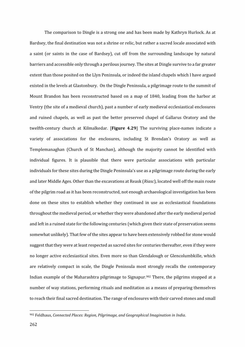
262
The comparison to Dingle is a strong one and has been made by Kathryn Hurlock. As at
Bardsey, the final destination was not a shrine or relic, but rather a sacred locale associated with
a saint (or saints in the case of Bardsey), cut off from the surrounding landscape by natural
barriers and accessible only through a perilous journey. The sites at Dingle survive to a far greater
extent than those posited on the Llyn Peninsula, or indeed the island chapels which I have argued
existed in the levels at Glastonbury. On the Dingle Peninsula, a pilgrimage route to the summit of
Mount Brandon has been reconstructed based on a map of 1840, leading from the harbor at
Ventry (the site of a medieval church), past a number of early medieval ecclesiastical enclosures
and ruined chapels, as well as past the better preserved chapel of Gallarus Oratory and the
twelfth-century church at Kilmalkedar. [Figure 4.29] The surviving place-names indicate a
variety of associations for the enclosures, including St Brendan’s Oratory as well as
Templemanaghan (Church of St Manchan), although the majority cannot be identified with
individual figures. It is plausible that there were particular associations with particular
individuals for these sites during the Dingle Peninsula’s use as a pilgrimage route during the early
and later Middle Ages. Other than the excavations at Reask (Riasc), located well off the main route
of the pilgrim road as it has been reconstructed, not enough archaeological investigation has been
done on these sites to establish whether they continued in use as ecclesiastical foundations
throughout the medieval period, or whether they were abandoned after the early medieval period
and left in a ruined state for the following centuries (which given their state of preservation seems
somewhat unlikely). That few of the sites appear to have been extensively robbed for stone would
suggest that they were at least respected as sacred sites for centuries thereafter, even if they were
no longer active ecclesiastical sites. Even more so than Glendalough or Glencolumbkille, which
are relatively compact in scale, the Dingle Peninsula most strongly recalls the contemporary
Indian example of the Maharashtra pilgrimage to Signapur.902 There, the pilgrims stopped at a
number of way stations, performing rituals and meditation as a means of preparing themselves
to reach their final sacred destination. The range of enclosures with their carved stones and small
902 Feldhaus, Connected Places: Region, Pilgrimage, and Geographical Imagination in India.
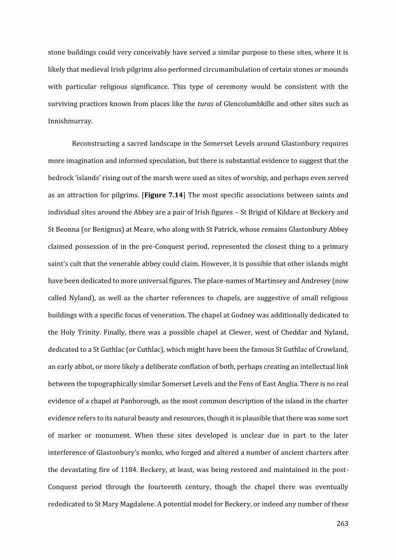
263
stone buildings could very conceivably have served a similar purpose to these sites, where it is
likely that medieval Irish pilgrims also performed circumambulation of certain stones or mounds
with particular religious significance. This type of ceremony would be consistent with the
surviving practices known from places like the turas of Glencolumbkille and other sites such as
Innishmurray.
Reconstructing a sacred landscape in the Somerset Levels around Glastonbury requires
more imagination and informed speculation, but there is substantial evidence to suggest that the
bedrock ‘islands’ rising out of the marsh were used as sites of worship, and perhaps even served
as an attraction for pilgrims. [Figure 7.14] The most specific associations between saints and
individual sites around the Abbey are a pair of Irish figures – St Brigid of Kildare at Beckery and
St Beonna (or Benignus) at Meare, who along with St Patrick, whose remains Glastonbury Abbey
claimed possession of in the pre-Conquest period, represented the closest thing to a primary
saint’s cult that the venerable abbey could claim. However, it is possible that other islands might
have been dedicated to more universal figures. The place-names of Martinsey and Andresey (now
called Nyland), as well as the charter references to chapels, are suggestive of small religious
buildings with a specific focus of veneration. The chapel at Godney was additionally dedicated to
the Holy Trinity. Finally, there was a possible chapel at Clewer, west of Cheddar and Nyland,
dedicated to a St Guthlac (or Cuthlac), which might have been the famous St Guthlac of Crowland,
an early abbot, or more likely a deliberate conflation of both, perhaps creating an intellectual link
between the topographically similar Somerset Levels and the Fens of East Anglia. There is no real
evidence of a chapel at Panborough, as the most common description of the island in the charter
evidence refers to its natural beauty and resources, though it is plausible that there was some sort
of marker or monument. When these sites developed is unclear due in part to the later
interference of Glastonbury’s monks, who forged and altered a number of ancient charters after
the devastating fire of 1184. Beckery, at least, was being restored and maintained in the post-
Conquest period through the fourteenth century, though the chapel there was eventually
rededicated to St Mary Magdalene. A potential model for Beckery, or indeed any number of these
264
chapels, is the mostly surviving arrangement of the Romanesque church at Monaincha, still
distinct in the landscape even after the draining of the marshes in the post-medieval period.
Unlike the possible pilgrimage circuits or satellite sites at Lindisfarne, St Davids,
Glencolumbkille and Glendalough, these islands would not have all been accessible by foot under
normal circumstances and might instead have had to be reached by boat. Nonetheless, influence
or inspiration for a sacred landscape encompassing what became known as the Twelve Hides of
Glastonbury, which formed the core of the Abbey’s ancient estates, could have come from Ireland
or Irish pilgrims, due to the presence of Irish saints’ cults and the proximity of Glastonbury to the
Irish Sea. Beckery’s position at the outer edge of the ‘island’ where Glastonbury Abbey was
established made it a likely landing point for boats approaching Glastonbury from the west, and
according to the Life of Benignus, Meare was also mostly cut off from the main abbey by
floodwaters. Beginning in the late Saxon period, the Levels began to be drained, and eventually
Meare went from a remote and most inaccessible retreat to one of the most important and
lucrative of the Abbey’s estates, with a new church, manor house, and summer residence (the
‘Fish House’) built during the fourteenth century, even as the legend of Benignus continued to be
recorded in the Abbey’s chronicles. Gradually, Glastonbury may have moved away from a
decentralized pilgrimage landscape demarcated by island chapels and a mix of specific and
universal dedications in an Irish-inspired model to a more conventional shrine and relic-based
cult in the new Abbey Church itself. At the same time, places like Meare, once the center of cults,
were becoming productive and valuable land. Glastonbury’s development may represent a hybrid
of traditions, showing evidence of a decentralized, satellite-site-based sacred landscape along the
lines of those seen in Ireland, eventually giving way to a more conventional shrine-cult in closer
accordance with the majority of post-Conquest religious centers. Glastonbury’s ‘grab bag’
approach to acquiring and promoting sacred sites and objects in their quest for an unquestionable
central cult, from the contact relics of Brigid to the preservation of the Vetusta Ecclesia as an
architectural relic (testified by its subsequent influence on the Lady Chapel built to replace it)
may give us strong evidence for the dynamic nature of these sacred landscapes.
265
These four models are far from exclusive, and there is abundant space to qualify and re-
categorize them, particularly given the number and variety of recognized sacred landscapes in
Ireland. As will be covered in the conclusion, the ultimate aim of this project is to argue for the
recognition of sacred landscape-building as a phenomenon of the Anglo-Norman period and to
identify other possible examples to create a more comprehensive understanding of the medieval
pilgrimage experience. It cannot be doubted that the great shrines within the great cathedrals
were generally the centres of saints’ cults, but this does not mean they were the only places that
pilgrims went, or indeed, as was explicitly the case at Coldingham, even the primary site of healing
miracles.
266
IX: CONCLUSION: REVIEW OF FINDINGS AND NEXT STEPS
As set out in the introduction, the goal of this project was to challenge a major assumption
about saints’ cults and patterns of veneration and promotion in the post-Conquest period – that
the centre of any cult – the primary source of miraculous energies, the ultimate destination of any
pilgrim seeking heavenly aid, the space most tightly designed and controlled and manipulated by
the keepers of the cult – was the shrine and its setting. John Crook, Ben Nilson, Tim Tatton-Brown,
and Eric Fernie are among the many scholars who have published major works focusing on the
shrine and its setting, and the majority of individual site monographs have devoted most of their
attention to either the architectural design of churches or the phases of building.903 More recently,
there has been increased interest in thinking about the dynamics of space within large churches
and ecclesiastical precincts more broadly by Roberta Gilchrist, Allan Doig and Peter Fergusson.904
The phenomenon of medieval pilgrimage itself has been extensively studied, including important
work by Kathryn Hurlock on pilgrimage in a specifically Welsh context, which does address the
issues of place and space.905 However, specific study of the material evidence of pilgrimage
beyond pilgrim tokens has been limited, with only a few more recent publications looking closely
at pilgrimage roads and routes outside of Ireland.906 Religion-driven landscape studies, such as
those by Turner and Stocker and Everson, have tended to focus less on the physical form of the
landscape and individual features and how they relate to one another than on the patterns of land
ownership and patronage, utilizing specific techniques for studying larger areas such as Historic
Landscape Characterization.907 Attempts to examine smaller-scale landscapes around
ecclesiastical sites within England and Wales have been limited, and as yet there has been no
903 Crook, The Architectural Setting of the Cult of the Saints; Nilson, Cathedral Shrines of Medieval England; Fernie, The Architecture of Norman England; Tim Tatton-Brown, “Canterbury and the Architecture of Pilgrimage Shrines in England,” in Pilgrimage: The English Experience from Becket to Bunyan, ed. Colin Morris and Peter Roberts (Cambridge: Cambridge University Press, 2002), 90–107. 904 Gilchrist, Norwich Cathedral Close; Allan Doig, Liturgy and Architecture from the Early Church to the Middle Ages, Liturgy, Worship, and Society (Aldershot: Ashgate, 2008); Doig, “Sacred Journeys/Sacred Spaces : The Cult of St Cuthbert"; Fergusson, Canterbury Cathedral Priory in the Age of Becket. 905 Hurlock, Medieval Welsh Pilgrimage. 906 Locker, Landscapes of Pilgrimage in Medieval Britain; Candy, The Archaeology of Pilgrimage on the Camino de Santiago; Wells, Pilgrim Routes of the British Isles. 907 Turner, Making a Christian Landscape; Everson and Stocker, Custodians of Continuity?.
267
comparative study of multiple sites of this type, though Richard Morris’ Churches in the Landscape
and a series of essays edited by P.S. Barnwell addressed these questions to an extent on a site-by-
site basis. 908
The introduction of this thesis introduced and defined two important terms for
identifying and understanding the way exterior space was used by the medieval cult of saints -
secondary cult site and sacred landscape. While the former was most explicitly demonstrated in
the case of St Æbbe’s chapel on Kirk Hill near Coldingham Priory (Ch. III), this thesis has identified
a number of examples of a much broader phenomenon driven by keen awareness of the spatial
dimensions of a saint’s life and afterlife, particularly the places where they were born, observed
the religious life, worked miracles, and where their bodies rested after they passed into the next
life. A particular concern with identifying, memorializing, and promoting sites of significance to a
saint before and after their death can be identified across different ecclesiastical traditions and
regions throughout the Anglo-Norman world. Such initiatives have been recognized and studied
in the context of hagiography and miracle collections. They have shed light on a period of
transition between ‘native’ religious traditions and the Continental practices and attitudes of the
Anglo-Norman ecclesiastical elite, and the way that old traditions and cults were appropriated
and exploited to create a sense of institutional continuity and as attractions for pilgrimage
(Chapter II).909 However, these previous studies have been limited by disciplinary divides as well
as a perception that interest in landscapes and multi-focal pilgrimage destinations were phased
out with the imposition of Norman reforms. While the phenomenon has been identified and
accepted in Irish scholarship (Chapter IV), the implications of its survival and presence on the
larger island so close by have not been properly considered. This thesis has demonstrated that
such a divide between ‘Irish’ or ‘Celtic’ traditions and Anglo-Norman reform of ‘native’ saints’
cults (focused around the shrine and the great churches that housed them), whether based on
908 Morris, Churches in the Landscape; Barnwell, Places of Worship in Britain and Ireland, 300-950. 909 Yarrow, Saints and Their Communities; Koopmans, Wonderful to Relate; Susan Ridyard, “‘Condigna Veneratio’"; Antonia Gransden, Legends, Tradition and History in Medieval England.

268
geography or differing ecclesiastical contexts, can be unhelpful and limiting, and that while it is
difficult to prove a diffusion or dissemination of these ideas and strategies of cult promotion from
Ireland to England and Wales, the possibility cannot be discounted.
In addition to challenging the paradigm that held the shrine and the cathedral that housed
it as the most important and even exclusive locus of sacred power for the cult of saints in Anglo-
Norman England and Wales, this thesis has argued for the existence of at least three examples of
the institutions serving as the guardians and promoters of sacred bodies or legacies utilizing
features in the landscape and its relationship to their own foundations in both the present and
perhaps more importantly the past to enhance their own prestige (Ch. V-VII). In the case of St
Davids (its coastal chapels and geographic centring of the life of St David), Durham Cathedral
Priory (interest in the resting places of Cuthbert at Durham, Lindisfarne, and the broader
Northumbrian landscape) and Glastonbury Abbey (a putative network of island chapels), all three
institutions primarily sought to assert and reinforce perceptions or claims of their antiquity for
contemporary advantage. All three can be argued to have installed, restored, promoted, or re-
shaped secondary cult sites to serve not only as attractions to pilgrims but as physical evidence
in their ideological programmes. It is important to note the significance of the Anglo-Norman (or
Anglo-Welsh) transition in all three cases. The three case studies are also linked by the production
of new or revised hagiography or historia, as well as examples of satellite buildings and material
investment at sites of sacred significance either controlled by or linked to their institutions.
Needless to say, these three sites are in no way unique in witnessing these dynamics or
developments; indeed, they are more common to the full body of foundations impacted by the
Norman transition than not (see the end of Chapter II for a number of examples). It therefore is
worth investing in future research to see if the same phenomenon of secondary cult sites and
sacred space can be identified elsewhere.
This thesis was necessarily limited in scope, and so was not able to explore examples of
secondary cult sites and sacred landscapes in Scotland (aside from that of Iona, discussed by

269
Overbey and Jenkins); there may be other island monasteries north of the English border, even
up into the Orkneys, that integrated the landscape into their foundation legends and
hagiography.910 Perhaps the most enticing candidate within England is Ely, which preserved a
number of place-names in the twelfth-century Liber Eliensis related to St Ætheldreda’s flight from
the north, and is situated in a similar wetland landscape to Glastonbury, and also its sister fenland
foundation of Crowland Abbey.911 The network of surviving chapels on the island of Lerins on the
French Mediterranean coast also invites further research on the phenomenon of sacred
landscapes on the continent, both in the context of ecclesiastical reform and cult promotion and
the process of conversion during the Northern Crusades.912 The relationship between the
recognition of the sacred topography of a saint’s life and death to most famous instance, the sites
associated with the life and death of Jesus Christ in Jerusalem, is another potential avenue of
further research.
The medieval world was, despite the all-consuming awareness of the divine presence and
the otherworldly in the minds of those who inhabited it, strongly grounded in the observation
and understanding of their earthly surroundings, and where the places they lived their everyday
lives in the mundane world intersected with the world to come. The spiritual geography these
places of intersection created was manifested in shrines and churches but also in secondary sites,
often natural features given new significance by the praesentia of holy men and women. While set
apart in their virtue and deeds, saints were nonetheless viewed as accessible to the medieval
believer, certainly more so than the Godhead itself. By the grace of God and a favourable moral
character, any man or woman could, technically, join the ranks of the saints, and even those who
could not achieve such lofty goals could at least share in their grace and ask them to serve as
910 Beatrice Widell, “The Monastic Lifeworld: Memories and Narratives of Landscapes of Early Medieval Monasticism in Argyll, Scotland,” Landscapes 18, no. 1 (January 2, 2017): 4–18. 911 Fairweather, Liber Eliensis, 38-43; 52-53. 912 Codou and Lauwers, Lérins, Une Île Sainte de l’Antiquité Au Moyen Age; Yann Codou, “Iles de Lérins: Ile Saint-Honorat, Les Chapelles Du Saint-Sauveur et de La Trinité,” Congrès Archéologique de France 168 (2012): 77–84; Rosa Maria Dessì and Michel Lauwers, “Désert, Église, Île Sainte. Lérins et La Sanctification Des Îles Monastiques de l’Antiquité à La Fin Du Moyen Age,” in Lérins, Une Île Sainte de l’Antiquité Au Moyen Age. Ed. Codou, Yann & Lauwers, Michel. Collection d’études Médiévales de Nice, 9 (Turnhout: Brepols, 2009), 231–79.
270
intercessors and conduits of God’s power. The myriad expressions and rituals of the medieval
cult of saints and Christian worship more broadly, and how it played out across larger and smaller
landscapes, is essential to understanding the medieval Christian worldview. The range of
evidence for such practices is scattered and often buried in other details, but with an
interdisciplinary approach it may be possible to access the world where men and women walked
in the footsteps of their holy forebearers.
271
REFERENCES AND SOURCES
Manuscripts Cited
London, British Library MS Royal 13 c i
London, British Library Yates Thompson 26
Oxford, University College MS 165
Maps
Harvey, John. “Map of the Parish of St Davids, Pembrokeshire, in 3 Parts.” 1840.
Ordinance Survey, Pembrokeshire XX.NW, 1908, 1:10560
Saxton, Christopher. “Penbrok Comitat Qui Inter Meridionales Cambriae Ytes Hodie Censetur Olim
Demetia. L Dyfet B Hoc Est Occidentalis Wallia Descriptio Ano Dni 1578.” 1578.
http://hdl.handle.net/10107/1445589.
Speed, John. “‘Holy Island’ ‘Farne’ ‘Garnsey’ ‘Jarsey.’” The Theatre of the Empire of Great Britaine: Presenting
an Exact Geography of the Kingdomes of England, Scotland, Ireland, and Wales. London: William
Hall, 1610.
Published Primary Sources
Adam of Damerham. Libellus de Rebus Gestis Glastoniensibus. Edited and with Introduction and
Critical Notes by David C. Standen. London: University of London, 2000.
Anon. “De mirabilibus Dei modernis temporibus in Farne insula declaratis.” In “The Miracles of
Farne.” Edited by H.H.E Craster. Archaeologia Aeliana 29, 4 (1951): 93–107; In “The Miracles of St
Cuthbert at Farne.” Edited by H.H.E Craster. Analecta Bollandiana 70 (1952): 5–19.
Anon. Domesday Book 8: Somerset. Edited by C. Torn and F. Thorn. Chichester: Phillimore, 1980.
Anon. “Historia de sancto Cuthberto.” In Historia de Sancto Cuthberto: A History of Saint Cuthbert

272
and a Record of His Patrimony. Edited and translated by Ted Johnson South, Anglo-Saxon Texts 3.
Woodbridge: D.S. Brewer, 2002.
Anon. “Liber Eliensis.” In Liber Eliensis: A History of the Isle of Ely from the Seventh Century to the
Twelfth. Edited by Janet Fairweather. Woodbridge: Boydell, 2005.
Anon. “Liber Llandevensis.” In The Liber Llandavensis, Llyfr Teilo: Or the Ancient Register of the Cathedral
Church of Llandaff, edited by William J. Rees. London: Longman & Co., 1840.
Anon. Miracula S. Davidis. British Library, London, MS Royal 13 c I
Anon. Vita Sancti Coemgeni. In “The Lives of Kevin (Caoimhghin) of Glendalough.” Edited by Ó
Riain, Pádraig. In Glendalough: City of God. Edited by Charles Doherty, Linda Doran, and Mary Kelly,
137–44. Dublin: Four Courts Press, 2011; In Vitae Sanctorum Hiberniae: partim hactenus ineditae.
Edited by Charles Plummer, 234-257. Vol. 1, 2 vols. Oxford: Clarendon Press, 1910.
Anon. Vita S. Wenefredi, In Two Medieval Lives of St Winefride. Edited by Ronald Pepin and Hugh
Feiss, 95-122. Eugene, OR, 2011.
Bede the Venerable. Historia Ecclesiastica Gentis Anglorum. In The Ecclesiastical History of the English
People. Edited by Judith McClure and Roger Collins, Oxford: Oxford University Press, 1999; In
Bede’s Ecclesiastical History of the English People. Edited by Bertram Colgrave and R.A.B. Mynors.
Oxford: Oxford University Press, 1992.
Bede the Venerable. Vita sancti Cuthberti prosaica. In Two Lives of Saint Cuthbert. Edited by
Bertram Colgrave, 141-308. Cambridge: Cambridge University Press, 2007.
Eadmer of Canterbury, “Eadmer’s Letter to the Monks of Glastonbury Concerning St Dunstan’s Disputed
Remains.” In The Archaeology and History of Glastonbury Abbey. Edited by Richard Sharpe, 205–15.
Woodbridge: Boydell Press, 1991.
273
Eadmer of Canterbury, The Life of St Anselm, Archbishop of Canterbury, by Eadmer. Edited by R.W. Southern.
Oxford: Nelson, 1972.
Geoffrey of Burton. Life and Miracles of St Modwenna. Edited by Robert Bartlett. Oxford Medieval
Texts. Oxford: Clarendon Press, 2002.
Geoffrey of Coldingham? Miracula S. Ebbe in The Miracles of Saint Æbbe of Coldingham and Saint
Margaret of Scotland. Edited by Robert Barlett, 2-67. Oxford Medieval Texts. Oxford: Clarendon
Press, 2003.
Geoffrey of Coldingham. Vita Bartholomaei Farnensis. In Symeonis Monachi Opera Omnia: Historiae
Ecclesiasie Dunhelmensis. Edited by T. Arnold, 295–325. Rolls Series 75 1. London: HMSO, 1882.
Giraldus Cambrensis. Descriptio Cambriae. In The journey through Wales and the description of
Wales. Edited by Betty Radice, 211-274. Harmondsworth: Penguin, 2004.
Giraldus Cambrensis. De Jure et Statu Menevensis Ecclesiae, II. In Giraldi Cambrensis Opera. Edited
by J. S. Brewer, 101-373. Vol.3, 8 vols. Rolls Series 21. London: Longman & Co., 1861.
Giraldus Cambrensis. Itinerarium Kambriae. Edited by Betty Radice, The journey through Wales
and the description of Wales. London: Penguin: 2004; In Giraldi Cambrensis Opera. Edited by J.F.
Dimock, 1-152. Vol. 6, 8 vols. Rolls Series 21. London: Longman & Co., 1861.
Giraldus Cambrensis. Topographia Hibernica. In The History and Topography of Ireland. Edited
and translated by John. J. O’Meara, Rev., 3-204. London: Penguin Books, 1982; In Giraldi Cambrensis
Opera. Ed. James F. Dimock, 3-204. Rolls Series 21. Vol. 5, 8 vols. London: Longman & Co., 1861.
Giraldus Cambrensis. De Vita S. Davidis Archiepiscopi Menevensis. In Giraldi Cambrensis Opera.
Edited by J.S. Brewer, 377-404. Rolls Series 21. Vol. 3, 8 vols. London: Longman & Co., 1861.
Goscelin of St Bertin. Vita S. Rumwoldi. In Three Eleventh-Century Anglo-Latin Saints’ Lives: Vita S. Birini, Vita
et Miracula S. Kenelmi, and Vita S. Rumwoldi. Edited by Rosalind C. Love, 92–116. Oxford Medieval
Texts. Oxford: Oxford University Press, 1996.
John of Glastonbury, Chronica Sive Antiquitates Glastoniensis Ecclesiae. In The Chronicle of

274
Glastonbury Abbey: An Edition, Translation and Study of John of Glastonbury’s {Cronica Sive
Antiquitates Glastoniensis Ecclesie}. Edited by James Carley and David Townsend. Woodbridge:
Boydell, 1985.
John of Tynemouth and John Capgrave. De Sancto Caradoco heremita. In Nova Legenda Anglie. ed.
C. Horstman, 174-177. Vol 2, 2 vols. Oxford: Clarendon Press, 1901.
John of Tynemouth and John Capgrave. De Sancto Iustiano Martire et Monacho. In Nova Legenda Anglie,
edited by C. Horstman, 93–95. Vol. 2, 2 vols. Oxford: Clarendon Press, 1901.
Leland, John. Commentarii de scriptoribus Britannicis. Edited by Antonius Hall. Oxford: Sheldonian Theatre,
1709.
Leland, John. The Itinerary of John Leland the Antiquary. Edited by Thomas Hearne. Vol. 1. 9 vols. Oxford:
Sheldonian Theatre, 1770.
O’Donnell, Manus. The Life of Colum Cille. Translated by Brian Lacey. Dublin: Four Courts Press,
1998.
Osbern of Canterbury. Vita Sancti Dunstani Auctore Osberno. In Memorials of Saint Dunstan, Archbishop of
Canterbury, edited by William Stubbs, 69–129. London: Longman & Co., 1874.
Reginald of Durham, Libellus de admirandis Beati Cuthberti virtutibus, in Raine, James, ed.
Reginaldi Monachi Dunelmensis Libellus de Admirandis Beati Cuthberti Virtutibus Quae Novellis
Patratae Sunt Temporibus. Publications of the Surtees Society 1. London: Nichols, 1835.
Rhygyfarch ap Sulien, Vita S. Davidi. In ‘Rhygyfarch’s Life of St David,’ St David of Wales: cult,
church, and nation. Edited by Richard Sharpe and John R. Davies, 107-155. Woodbridge: Boydell,
2007; In Life of St David. Edited by Arthur W. Wade-Evans. Translations of Christian Literature.
Series V. London: SPCK, 1923.
Symeon of Durham, Libellus de exordio atque procurso istius, hoc est Dunhelmensis ecclesie. In
Tract of the Origins and Progress of this the Church of Durham. Edited D.W. Rollason. Oxford: Oxford
Medieval Texts, 2000.

275
Various, Durham Episcopal Charters, 1071-1152. Edited by H.S. Offler, Publications of the Surtees
Society 179. Gateshead: Northumberland Press, 1968.
William of Malmesbury. De Antiquitate Glastonie Ecclesie. In The Early History of Glastonbury: An
Edition, Translation and Study of William of Malmesbury’s “De Antiquitate Glastonie Ecclesie.”
Edited by John Scott. Woodbridge: Boydell, 1981.
William of Malmesbury. Gesta Pontificum Anglorum. In The Deeds of the Bishops of England. Edited
and translated by D. Preest. Woodbridge: Boydell Press, 2002.
William of Malmesbury. Miracula S. Benigni. In William of Malmesbury: Saints’ Lives: Lives of SS.
Wulfstan, Dunstan, Patrick, Benignus and Indract. Edited by Michael Winterbottom and Rodney M.
Thomson, 344-67. Oxford Medieval Texts. Oxford: Clarendon Press, 2002.
William of Malmesbury. Passio S. Indracti. In William of Malmesbury: Saints’ Lives: Lives of SS.
Wulfstan, Dunstan, Patrick, Benignus and Indract. Edited Michael Winterbottom and Rodney M.
Thomson, 368-81. Oxford Medieval Texts. Oxford: Clarendon Press, 2002.
Secondary Sources
Abou-El-Hai, Barbara. “The Audiences for the Medieval Cult of Saints.” Gesta 30, no. 1 (1991): 3–15.
Abrams, Lesley. Anglo-Saxon Glastonbury: Church and Endowment. Studies in Anglo-Saxon History 8.
Woodbridge: Boydell Press, 1996.
Abrams, Lesley. “St Patrick and Glastonbury Abbey: ‘Nihil Ex Nihilo Fit?’” In Saint Patrick, AD 493-1993,
edited by Lesley Abrams and D.N. Dumville, 233–42. Studies in Celtic History 13. Woodbridge:
Boydell, 1993.
Aird, William M. St Cuthbert and the Normans: The Church of Durham, 1071-1153. Studies in the History of
Medieval Religion 14. Woodbridge: Boydell Press, 1998.

276
Alcock, Leslie, Elizabeth A. Alcock, and Sally M. Foster. “Reconnaissance Excavations on Early Historic
Fortifications and Other Royal Sites in Scotland, 1974-84: 1, Excavations near St Abb’s Head,
Berwickshire, 1980.” Journal of the Society of the Antiquaries of Scotland 116 (1986): 255–79.
Altenberg, Karen. Experiencing Landscapes: A Study of Space and Identity in Three Marginal Areas of Britain
and Sweden. Uppsala: Almquist and Wiksell, 2003.
Althoff, Gerd, Johannes Fried, and Patrick J. Geary, eds. Medieval Concepts of the Past: Ritual, Memory,
Historiography. Publications of the German Historical Institute. Washington, D.C.: German
Historical Institute, 2002.
Arnold, Ellen F. Negotiating the Landscape: Environment and Monastic Identity in the Medieval Ardennes.
Philadelphia: University of Pennsylvania Press, 2013.
Badger, A.B., and F. Green. “The Chapel Traditionally Attributed to St Patrick, Whitesand Bay,
Pembrokeshire.” Archaeologia Cambrensis 80 (1925): 87–119.
Baker, John, and Stuart Brookes. Beyond the Burghal Hidage: Anglo-Saxon Civil Defence in the Viking Age.
Leiden: Brill, 2013.
Baker, John, and Stuart Brookes. “Identifying Outdoor Assembly Sites in Early Medieval England.” Journal
of Field Archaeology 40, no. 1 (2015): 3–21.
Baker, Malcolm. “Medieval Illustrations of Bede’s Life of St. Cuthbert.” Journal of the Warburg and Courtauld
Institutes 41 (1978): 16–49.
Baring-Gould, S. “Exploration of St Non’s Chapel Near St Davids,” Archaeologia Cambrensis 15, no. 60
(1898): 345–49.
Baring-Gould, S. and John Fisher. The Lives of the British Saints: The Saints of Wales and Cornwall and Such
Irish Saints as Have Dedications in Britain, vol. i, 4 vols. London 1908.
Barker, Phillip. “Reconstructing Wulfstan’s Cathedral.” In St Wulfstan and His World, edited by N.P. Brooks
and Julia Barrow, 167–88. Aldershot: Ashgate, 2005.
Barlow, Frank. The English Church, 1066-1154: A History of the Anglo-Norman Church. New York: Longman,
1979.
Barnwell, P. S., ed. Places of Worship in Britain and Ireland, 300-950. Donington: Shaun Tyas, 2015.
Barraclough, Eleanor Rosamund. “Inside Outlawry in ‘Grettis Saga Ásmundarsonar’ and ‘Gísla Saga
Súrssonar’: Landscape in the Outlaw Sagas.” Scandinavian Studies 82, no. 4 (2010): 365–88.
Bartlett, Robert. The Natural and the Supernatural in the Middle Ages. Cambridge University Press, 2008.
277
Bartlett, Robert. Why Can the Dead Do Such Great Things? Saints and Worshippers from the Martyrs to the
Reformation. Princeton, New Jersey: Princeton University Press, 2013.
Bates, David R. “The Forged Charters of William the Conqueror and Bishop William of St Calais.” In Anglo-
Norman Durham: 1093-1193, edited by David Rollason, Margaret Harvey, and Michael Prestwich,
111–24. Woodbridge: Boydell & Brewer, 1994.
Bharati, Agehananda. “Pilgrimage in the Indian Tradition.” History of Religions 3, no. 1 (1963): 135–67.
Birch, Debra J. Pilgrimage to Rome in the Middle Ages: Continuity and Change. Boydell & Brewer Ltd, 2000.
Blair, John. “A Saint for Every Minster? Local Cults in Anglo-Saxon England.” In Local Saints and Local
Churches in the Early Medieval West, edited by A. Thacker and Richard Sharpe, 455–94. Oxford:
Oxford University Press, 2002.
Blair, John. “St Frideswides’s Monastery: Problems and Possibilities.” In St Fridewide’s Monastery at Oxford:
Archaeological and Architectural Studies, edited by John Blair, 3–20. Gloucester: Alan Sutton, 1990.
Blair, John. “The Early Churches at Lindisfarne.” Archaeologia Aeliana, 5th, 19 (1991): 47–53.
Blair, John, and Carol Pyrah. Church Archaeology: Research Directions for the Future. Research Report
(Council for British Archaeology) 104. York: Council for British Archaeology, 1996.
Bhreathnach, Edel. "Ynys Enlli: The Representation of a Medieval Pilgrim Destination." In Solitaries,
Pastors and 20,000 Saints: Studies in the Religious History of Bardsey Island (Ynys Enlli), edited by
Jonathan M Wooding, 1-14. Lampeter: Trivium Publications, 2010.
Boake, E.J. "Report on the excavation of the chapel at St Justinian, St David's." Archaeologica
Cambrensis 81 (1926), 381-94
Bond, James. “Landscapes of Monasticism.” In Landscape: The Richest Historical Record, edited by Della
Hooke, 63–72. SLS Supplementary Series 1. Amesbury: Society for Landscape Studies, 2000.
Bond, James. Monastic Landscapes. Cheltenham: Tempus, 2003.
Brefeld, Josephie. A Guidebook for the Jerusalem Pilgrimage in the Late Middle Ages: A Case for Computer-
Aided Textual Criticism. Uitgeverij Verloren, 1994.
Brennand, Mark. “Old Melrose, Scottish Borders- Desk-Based Assessment,” 2007.
https://library.thehumanjourney.net/2204/.
Brown, David, ed. Durham Cathedral: History, Fabric and Culture. New Haven, CT: Yale University Press,
2015.

278
Brown, Michelle P. The Lindisfarne Gospels: Society, Spirituality and the Scribe. University of Toronto Press,
2003.
Brown, P.L. “Enjoying the Saints in Late Antiquity.” Early Medieval Europe 9, no. 1 (2000): 1–24.
Brown, P.L. The Cult of the Saints: Its Rise and Function in Latin Christianity. Chicago: University of Chicago
Press, 1981.
Brown, P.L. “The Rise and Function of the Holy Man in Late Antiquity.” JRS 6 (1971): 80–101.
Brück, J. “In the Footsteps of the Ancestors: A Review of Christopher Tilley’s A Phenomenology of
Landscape: Places, Paths, and Monuments.” Archaeological Review from Cambridge 15, no. 1
(1998): 23–36.
Brunning, Richard. “Taming the Floodplain: River Canalisation and Causeway Formation in the Middle
Anglo-Saxon Period at Glastonbury, Somerset.” Medieval Archaeology 54, no. 1 (November 2010):
319–29.
Cambridge, Eric. “Early Romanesque Architecture in North-East England.” In Anglo-Norman Durham: 1093-
1193, edited by D. W. Rollason, Margaret Harvey, and Michael Prestwich, 141–60. Woodbridge:
Boydell Press, 1994.
Cambridge, Eric. “Why Did the Community of St Cuthbert Settle at Chester-Le-Street?” In St. Cuthbert, His
Cult and His Community to AD 1200, edited by Gerald Bonner, D. W. Rollason, and Clare Stancliffe,
367–86. Woodbridge: Boydell Press, 1989.
Campbell, James. “Some Twelfth-Century Views of the Anglo-Saxon Past.” Peritia 3 (1984): 131–50.
Candy, Julia M. The Archaeology of Pilgrimage on the Camino de Santiago. Oxford: Archaeopress, 2009.
Carlton, Richard. “Archaeological Excavations on Lindisfarne Heugh.” In Peregrini Lindisfarne: An
Anthology, 117–25. Peregrini Lindisfarne Landscape Partnership, Northumberland County
Council, 2017.
Carlton, Richard. “Excavations on Lindisfarne Heugh in 2018.” The Archaeological Practice Ltd., 2018.
https://www.academia.edu/38065729/Excavations_on_Lindisfarne_Heugh_in_2018.
Carr, Lydia, Russell Dewhurst, and Martin Henig, eds. Binsey: Oxford’s Holy Place: Its Saint, Village, and
People. Oxford: Archaeopress, 2014.
Carr, Sir John. A Tour Through Holland, Along the Right and Left Banks of the Rhine, to the South of Germany,
in the Summer and Autumn of 1806 ... Hartford: Lincoln and Gleason, 1807.

279
Carrasco, Magdalena Elizabeth. “The Construction of Sanctity: Pictorial Hagiography and Monastic Reform
in the First Illustrated ‘Life of St. Cuthbert’ (Oxford, University College MS 165).” Studies in
Iconography 21 (2000): 47–89.
Carroll, Jayne, and David N. Parsons, eds. Perceptions of Place: Twenty-First Century Interpretations of
English Place-Name Studies. English Place-Name Society (Series) Supernumerary v. for 2012.
Nottingham: English Place-Name Society, 2013.
Carruthers, Mary J. The Book of Memory: A Study of Memory in Medieval Culture. 2nd ed. Cambridge Studies
in Medieval Literature. Cambridge: Cambridge University Press, 2008.
Cartwright, Jane. "The Cult of St Non: Rape, Sanctity and Motherhood in Welsh and Breton
Hagiography." In St David of Wales: Cult, Church and Nation, ed. J Wooding and J Evans
(Woodbridge: Boydell and Brewer, 2007), 182–206
Carver, M. O. H., and Tomás Ó Carragáin. “A Landscape Converted: Archaeology and Early Church
Organisation on Iveragh and Dingle, Ireland.” In The Cross Goes North: Processes of Conversion in
Northern Europe, AD 300-1300, edited by M.O.H. Carver, 127–52. Woodbridge: York Medieval
Press, 2003.
Cassidy-Welch, Megan. “Space and Place in Medieval Contexts.” Parergon 27, no. 2 (2010): 1–12.
Certeau, Michel de. The Practice of Everyday Life. Translated by Steven Rendall. Berkeley, CA: University of
California Press, 1984.
Chibnall, Marjorie. Anglo-Norman England 1066-1166. 2nd ed. Oxford: Wiley-Blackwell, 1996.
Chibnall, Marjorie. The Debate on the Norman Conquest. Manchester: Manchester University Press, 1999.
Clarke, Catherine A.M. Literary Landscapes and the Idea of England, 700-1400. Cambridge: D.S. Brewer,
2006.
Codou, Yann. “Iles de Lérins: Ile Saint-Honorat, Les Chapelles Du Saint-Sauveur et de La Trinité.” Congrès
Archéologique de France 168 (2012): 77–84.
Codou, Yann, and Michel Lauwers. Lérins, Une Île Sainte de l’Antiquité Au Moyen Age. Collection d’études
Médiévales de Nice 9. Turnhout: Brepols, 2009.
Collinson, John, and Edmund Rack. The History and Antiquities of the County of Somerset: Collected from
Authentick Records, and an Actual Survey Made by the Late Mr. Edmund Rack. Adorned with a Map
of the County, and Engravings of Roman and Other Reliques, Town-Seals, Baths, Churches, and
Gentlemen’s Seats. London: R. Cruttwell, 1791.

280
Constable, Giles. “Forgery and Plagarism in the Middle Ages.” Archiv Fur Diplomatik 29 (1983): 1–41.
Coombe, Margaret. “Reworking Corporate Memory: St Calais (Carilefus) and St Cuthbert.” Leeds, 2018.
Cooney, Gabriel. “Sacred and Secular Neolithic Landscapes in Ireland.” In Sacred Sites, Sacred Places, edited
by David L Carmichael, Jane Hubert, Brian Reeves, and Audhild Schanche, 2nd ed., 32–41. New
York: Routledge, 1997.
Cowan, Ian Borthwick. Medieval Religious Houses, Scotland: With an Appendix on the Houses in the Isle of
Man... 2nd ed. London: Longman, 1976.
Cowley, Fred. "The Relics of St David: The Historical Evidence." In St David of Wales: Cult, Church
and Nation, edited by J. Wyn Evans and J Wooding, 274-81. Woodbridge: Boydell and Brewer, 2007.
Cramp, Rosemary. Corpus of Anglo-Saxon Stone Sculpture in England: Co. Durham and Northumberland. Vol.
1. 12 vols. Oxford: Oxford University Press, 1984.
Cramp, Rosemary. “The Artistic Influence of Lindisfarne within Northumbria.” In St. Cuthbert, His Cult and
His Community to AD 1200, edited by Gerald Bonner, D. W. Rollason, and Clare Stancliffe, 213–28.
Woodbridge: Boydell Press, 1989.
Cramp, Rosemary. Wearmouth and Jarrow Monastic Sites. Vol. 1. 2 vols. Swindon: English Heritage, 2005.
Craster, E. “The Patrimony of St. Cuthbert.” English Historical Review 69 (1954): 177–99.
Crook, J. The Architectural Setting of the Cult of the Saints. Oxford: Oxford University Press, 2000.
Crook, J. “The Romanesque East Arm and Crypt of Winchester Cathedral.” Journal of the British
Archaeological Association 62 (1989): 1–36.
Crumplin, Sally. “Cuthbert the Cross-Border Saint in the Twelfth Century.” In Saints’ Cults in the Celtic World,
edited by Stephen I. Boardman, John Reuben Davies, and Eila Williamson, 119–29. Studies in Celtic
History 25. Woodbridge: Boydell & Brewer, 2009.
Cubitt, Catherine. “Sites and Sanctity: Revisiting the Cult of Murdered and Martyred Anglo-Saxon Royal
Saints.” Early Medieval Europe 9, no. 1 (March 1, 2000): 53–83.
Cuppage, Judith. Archaeological Survey of the Dingle Peninsula: A Description of the Field Antiquities of the
Barony of Corca Dhuibhne from the Mesolithic Period to the 17th Century A.D. Ballyferriter:
Oidhreacht Chorca Dhuibhne, 1986.
Curl, James Stevens. The Oxford Dictionary of Architecture. Third edition. Oxford: University Press, 2015.
Davies, John Reuben. "Cathedrals and the Cult of Saints in Eleventh- and Twelfth-Century

281
Wales." In Cathedrals, Communities and Conflict in the Anglo-Norman World, edited by Paul Dalton,
Charles Insley and Louise J. Wilkinson, 99-115. Woodbridge: Boydell and Brewer, 2011.
Davies, Wendy. “The Myth of the Celtic Church.” In Welsh History in the Early Middle Ages: Text and Societies,
1–21. Variorum Collected Studies Series. Farnham: Ashgate, 2009.
Dessì, Rosa Maria, and Michel Lauwers. “Désert, Église, Île Sainte. Lérins et La Sanctification Des Îles
Monastiques de l’Antiquité à La Fin Du Moyen Age.” In Lérins, Une Île Sainte de l’Antiquité Au Moyen
Age, edited by Yann Codou and Michel Lauwers, 231–79. Turnhout: Brepols, 2009.
Dixon, Philip, and Pamela Marshall. “The Great Tower in the Twelfth Century: The Case of Norham Castle.”
Archaeological Journal 150, no. 1 (1993): 410–32.
Doig, Allan. Liturgy and Architecture from the Early Church to the Middle Ages. Liturgy, Worship, and Society.
Aldershot: Ashgate, 2008.
Doig, Allan. “Sacred Journeys/Sacred Spaces: The Cult of St Cuthbert.” In Saints of North-East England, 600-
1500, edited by Margaret Coombe, Anne Mouron, and Christina Whitehead, 305–25. Medieval
Church Studies 39. Turnhout: Brepols, 2017.
Dowd, Marion. “Saintly Associations with Caves in Ireland from the Early Medieval Period (AD 400- 1169)
through to Recent Times.” In Caves and Ritual in Medieval Europe, edited by K.A. Bergsvik and
Marion Dowd, 116–32. Oxford: Oxbow Books, 2018.
Eade, John, and Michael Sallnow. “Introduction.” In Contesting the Sacred: The Anthropology of Christian
Pilgrimage, edited by John Eade and Michael Sallnow, 1–29. London: Routledge, 1991.
Edwards, Nancy. “Monuments in a Landscape: The Early Medieval Sculpture of St David’s.” In Image and
Power in the Archaeology of Early Medieval Britain: Essays in Honour of Rosemary Cramp, edited by
H. Hamerow and A. MacGregor, 53–77. Oxford: Oxbow, 2001.
Edwards, Nancy, and Jana Horák. A Corpus of Early Medieval Inscribed Stones and Stone Sculptures in Wales.
Vol. 3. 3 vols. Cardiff: University of Wales Press, 2013.
Eickelman, D. Morrocan Islam: Tradition and Change in a Pilgrimage Center. Austin: University of Texas
Press, 1976.
Eliade, Mircea. Patterns in Comparative Religion. Translated by R. Sheed. London: Sheed and Ward, 1958.
282
Etchingham, Colman. “The Organization and Function of an Early Irish Church Settlement: What Was
Glendalough?” In Glendalough: City of God, edited by Charles Doherty, Linda Doran, and Mary Kelly,
22–53. Dublin: Four Courts Press, 2011.
Evans, J. Wyn. “Transition and Survival: St David and St Davids Cathedral.” In St David of Wales: Cult, Church
and Nation, edited by J. Wyn Evans and J Wooding, 20–40. Woodbridge: Boydell and Brewer, 2007.
Evans, J. Wyn. “St David and St Davids and the Coming of the Normans." In Transactions of the Honourable
Society of Cymmrodorion 11 (2005): 5-18.
Evans, J. Wyn. “St David and St David’s: Some Observations on the Cult, Site, and Buildings.” In
Celtic Hagiograpjhy and Saints’ Cults, edited by Jane Cartwright, 10-25. Cardiff: University of Wales
Press, 2003.
Evans, D. Simon, ed. The Welsh Life of St. David. Cardiff: University of Wales Press, 1988.
Evans, Margaret Carey. “The Contribution of Hoxne to the Cult of St. Edmund King and Martyr in the Middle
Ages and Later.” Proceedings of the Suffolk Institute of Archaeology and History 36, no. 3 (1987):
182–95.
Everett, N. “The Hagiography of Lombardic Italy.” Hagiographica 7 (2000): 49–126.
Everson, Paul, and David Stocker. Custodians of Continuity? The Premonstratensian Abbey at Barlings and
the Landscape of Ritual. Lincolnshire Archaeology and Heritage Report Series, 11. Sleaford:
Heritage Trust of Lincolnshire, 2011.
Fanning, T. “Excavation of an Early Christian Cemetery and Settlement at Reask, County Kerry, 1977.” PRIA
81, no. C (1981): 3–172.
Feehan, John. The Book of Aran the Aran Islands, Co. Galway. Newtonlynch: Tír Eolas, 1999.
Feldhaus, A. Connected Places: Region, Pilgrimage, and Geographical Imagination in India. New York:
Palgrave MacMillan, 2003.
Fergusson, Peter. Canterbury Cathedral Priory in the Age of Becket. Paul Mellon Centre for Studies in British
Art, 2011.
Fernie, Eric. The Architecture of Norman England. Oxford: Oxford University Press, 2000.
Finberg, H. P. R. “St Patrick at Glastonbury.” In West-Country Historical Studies, 70–88. Newton Abbot: David
and Charles, 1969.
Finucane, R. Miracles and Pilgrims: Popular Belief in Medieval England. London: Dent, 1977.

283
Flanagan, Marie Therese. The Transformation of the Irish Church in the Twelfth Century. Studies in Celtic
History 29. Woodbridge: Boydell, 2010.
Fletcher, Eric G. M. “The Monastery at Lérins.” Journal of the British Archaeological Association 133 (1980):
17–29.
Foster, Meryl R. “Custodians of St Cuthbert: The Durham Monks’ Views of Their Predecessors, 1083-
c.1200.” In Anglo-Norman Durham: 1093-1193, edited by D.W. Rollason, Margaret Harvey, and
Michael Prestwich, 53–65. Woodbridge: Boydell & Brewer, 1994.
Fouracre, Paul. “The Origins of the Carolingian Attempt to Regulate the Cult of Saints.” In The Cult of Saints
in Late Antiquity and the Middle Ages: Essays on the Contribution of Peter Brown, edited by James
Howard-Johnson and Paul Anthony Hayward, 115–42. Oxford: Oxford University Press, 1999.
Fox, Adam. Oral and Literate Culture in England, 1500-1700. Oxford: Clarendon Press, 2001.
Friend, Elizabeth. “2016 Excavations at Beckery.” Axbridge Archaeological and Local History Society, 2018.
http://www.aalhs.co.uk/2018/01/15/2016-excavations-at-beckery/.
Friend, Elizabeth. “2016 Excavations at Beckery.” Axbridge Archaeological and Local History Society (blog),
January 15, 2018. http://www.aalhs.co.uk/2018/01/15/2016-excavations-at-beckery/.
Gameson, Richard. The Manuscripts of Early Norman England (c. 1066-1130). British Academy Postdoctoral
Fellowship Monograph. Oxford: University Press, 1999.
Geary, Patrick J. Furta Sacra: Thefts of Relics in the Central Middle Ages. Princeton, NJ: Princeton University
Press, 1990.
Geary, Patrick J. Living with the Dead in the Middle Ages. Ithaca, NY: Cornell University Press, 1994.
Gelling, Margaret. Place-Names in the Landscape. Phoenix, 2000.
Gem, R. “The English Parish Church in the 11th and Early 12th Centuries: A Great Rebuilding.” In Minsters
and Parish Churches: The Local Church in Transition, 950-1200, edited by John Blair, 21–30. Oxford:
Oxford University Committee for Archaeology, 1988.
Gem, R. “The Significance of the 11th Century Rebuilding of Christ Church and St Augustine’s Canterbury in
the Development of Romanesque Architecture.” In Medieval Art and Architecture at Canterbury
before 1220, edited by Nicola Coldstream and Peter Draper. London: British Archaeological
Association, 1982.
Gerrard, Christopher M. The Shapwick Project, Somerset: A Rural Landscape Explored. Society for Medieval
Archaeology Monograph 25. Leeds: Society for Medieval Archaeology, 2007.

284
Ghabhláin, Sinéad Ní. “Carved Stone Head from Glencolumbkille, County Clare.” The Journal of the Royal
Society of Antiquaries of Ireland 118 (1988): 135–38.
Gilchrist, Roberta. “Medieval Archaeology and Theory: A Disciplinary Leap of Faith.” In Reflections: 50 Years
of Medieval Archaeology, edited by Roberta Gilchrist and Andrew J. Reynolds, 385–408. Society for
Medieval Archaeology Monographs 30. Leeds: Maney, 2009.
Gilchrist, Roberta. Norwich Cathedral Close: The Evolution of the English Cathedral Landscape. Studies in the
History of Medieval Religion. Woodbridge: Boydell, 2005.
Gilchrist, Roberta, and Cheryl Green. Glastonbury Abbey: Archaeological Investigations 1904-79. London:
The Society of Antiquaries of London, 2015.
Gilchrist, Roberta, and H. C. Mytum. The Archaeology of Rural Monasteries. Oxford: B.A.R., 1989.
Gillespie, Raymond. “Devotional Landscapes: God, Saints and the Natural World in Early Modern Ireland.”
In God’s Bounty?: The Churches and the Natural World, edited by Peter D. Clarke and Tony Claydon,
217–36. Studies in Church History 46. Saffron Walden: Ecclesiastical History Society, 2010.
Gittos, Helen. Liturgy, Architecture, and Sacred Places in Anglo-Saxon England. Medieval History and
Archaeology. Oxford: Oxford University Press, 2013.
Goodich, Michael. Miracles and Wonders: The Development of the Concept of Miracle, 1150-1350. Aldershot:
Ashgate, 2007.
Goullet, Monique. Écriture et réécriture hagiographiques: essai sur les réécritures de Vies de saints dans
l’Occident latin médiéval (VIIIe-XIIIe siècle). Turnhout: Brepols, 2005.
Gransden, Antonia, ed. Bury St Edmonds: Medieval Art, Architecture and Economy. Leeds: The British
Archaeological Association, 1998.
Gransden, Antonia. Legends, Tradition and History in Medieval England. London: Bloomsbury Publishing,
1992.
Gransden, Antonia. “The Growth of the Glastonbury Traditions and Legends in the Twelfth Century.” Journal
of Ecclesiastical History 27, no. 4 (1976): 337–58.
Graves, C. Pamela. The Form and Fabric of Belief: An Archaeology of the Lay Experience of Religion in Medieval
Norfolk and Devon. British Archaeological Reports 311. Oxford: Archaeopress, 2000.
Gray, Madeline. "Sacred Space and the Natural World: The Holy Well and Shrine of the Virgin Mary at
Penrhys." European Review of History 18, no. 2 (2011): 243-60.
285
Gwynn, Aubrey, R. Neville Hadcock, and David Knowles. Medieval Religious Houses: Ireland, with an
Appendix to Early Sites. Blackrock: Irish Academic Press, 1988.
Hamilton, Sarah, and Andrew Spicer. Defining the Holy: Sacred Space in Medieval and Early Modern Europe.
Farnham: Ashgate, 2005.
Harbison, Peter. “Church Reform and ‘Irish Monastic’ Culture in the Twelfth Century.” Journal of the Galway
Archaeological and Historical Society 52 (2000): 2–12.
Harbison, Peter. “Early Irish Pilgrim Archaeology in the Dingle Peninsula.” World Archaeology 26, no. 1
(1994): 90–103.
Harbison, Peter. Pilgrimage in Ireland: The Monuments and the People. Syracuse, NY: Syracuse University
Press, 1995.
Harbison, Peter, and Josh Lynam. St. Kevin’s Way, Hollywood to Glendalough, Co. Wicklow. Heritage Council
of Ireland Series: Medieval Irish Pilgrim Paths 2. Kilkenny: Heritage Council, 2002.
Harbison, Peter, and Josh Lynam. The Saint’s Road, Dingle Peninsula, Co. Kerry = Cosán Na Naomh, Corca
Dhuibhne, Co. Chiarraí. Heritage Council of Ireland Series: Medieval Irish Pilgrim Paths 1. Kilkenny:
Heritage Council, 2002.
Haren, Michael, and Yolande de Pontfarcy. The Medieval Pilgrimage to St Patrick’s Purgatory, Lough Derg
and the European Tradition. Enniskillen: Clogher Historical Society, 1988.
Hawker-Yates, Lily. “In the Very Place Where the Saint Had Lain: Healing and Cursing at the Barrow of St
Amphibalus.” Leeds, UK, 2019.
Hawkes, Jane. “Creating a View: Anglo-Saxon Sculpture in the Sixteenth Century.” In Making Histories:
Proceedings of the Sixth International Conference on Insular Art, York 2011, edited by Jane Hawkes
and Meg Boulton, 372–84. Donington: Shaun Tyas, 2013.
Hayward, Paul Antony. “Demystifying the Role of Sanctity in Western Christendom.” In The Cult of Saints in
Late Antiquity and the Middle Ages: Essays on the Contribution of Peter Brown, edited by James
Howard-Johnston and Paul Anthony Hayward, 115–42. Oxford: Oxford University Press, 1999.
Helmuth, Petra. “The Dindshenchas and Irish Literary Tradition.” In Cin Chille Cúile, edited by John Carey,
Máire Herbert, and Kevin Murray, 116–26. Aberystwyth: Celtic Studies Publication, 2004.
Hemp, W. J. “St. Kevin’s Bed, Glendalough.” The Journal of the Royal Society of Antiquaries of Ireland 7, no. 2
(1937): 290–94.
286
Herbert, Máire. Iona, Kells, and Derry: The History and Hagiography of the Monastic Familia of Columba.
Oxford: Oxford University Press, 1988.
Herity, Michael. “The Antiquity of an Turas (the Pilgrimage Round) in Ireland.” In Lateinische Kultur Im VIII.
Jahrhundert: Traube-Gedenkschrif, edited by Ludwig Traube, Albert Lehner, and Walter Berschin,
95–143. St. Ottilien: EOS Verlag Erzabtei St. Ottilien, 1989.
Historic England. “Early Christian Settlement and Monastic Site at Marchey Farm, Wookey.” Accessed May
24, 2019. https://historicengland.org.uk/listing/the-list/list-entry/1011266.
Hollis, Stephanie. “Strategies of Emplacement and Displacement: St Edith and the Wilton Community in
Goscelin’s Legend of Edith and the Liber Confortatius.” In A Place to Believe In: Locating Medieval
Landscapes, edited by Clare Lees and Gillian Overing, 150–69. University Park, PA: University of
Pennsylvania Press, 2006.
Hooke, Della. “Rivers, Wells and Springs in Anglo-Saxon England: Water in Sacred and Mystical Contexts.”
In Water and the Environment in the Anglo-Saxon World, edited by Maren Clegg Hyer and Della
Hooke, 107–35. Exeter Studies in Medieval Europe: History, Society and the Arts. Liverpool:
Liverpool University Press, 2017.
Hoskins, W. G. The Making of the British Landscape. London: Hodder & Stoughton, 1955.
Howard-Johnson, James. “Introduction.” In The Cult of Saints in Late Antiquity and the Middle Ages: Essays
on the Contribution of Peter Brown, edited by James Howard-Johnson and Paul Anthony Hayward,
1–26. Oxford: Oxford University Press, 1999.
Howe, J. “Creating Symbolic Landscapes: Medieval Development of Sacred Space.” In Varieties of Religious
Conversion in the Middle Ages, edited by James K. Muldoon, 63–78. Gainsville: University Press of
Florida, 1997.
Howe, John. “Creating Symbolic Landscapes: Medieval Development of Sacred Space.” In Inventing Medieval
Landscapes: Senses of Place in Western Europe, edited by John Howe and Michael Wolfe, 208–23,
2002.
Howes, Laura L. “Narrative Time and Literary Landscapes in Middle English Poetry.” In Inventing Medieval
Landscapes: Senses of Place in Medieval Europe, edited by Michael Wolfe and John Howe, 192–207,
2002.
Howley, Martin. “Relics at Glastonbury Abbey in the Thirteenth Century: The Relic List in Cambridge,
Trinity College R.5 33 (724), Fols. 104r-105v.” Medieval Studies 71 (2009): 197–234.
287
Hurlock, Kathryn. Medieval Welsh Pilgrimage, c.1100-1500. New York: Palgrave MacMillan, 2018.
Husserl, Edmund. The Crisis of European Sciences and Transcendental Phenomenology: An Introduction to
Phenomenological Philosophy. Northwestern University Studies in Phenomenology & Existential
Philosophy. Evanston, IL: Northwestern University Press, 1970.
Impey, Edward. “A House for Fish or Men? The Structure, Function and Significance of the Fish House at
Meare, Somerset.” English Heritage Historical Review 4 (2009): 22–35.
Ingold, Tim. “The Temporality of the Landscape.” World Archaeology 25, no. 2 (1993): 152–74.
James, Heather. “The Cult of St David in the Middle Ages.” Journal of the Pembrokshire Historical Society 7
(1996): 5–25.
James, Heather. “The Geography of the Cult of St David: A Study of Dedication Patterns in the
Medieval Diocese,” in St David of Wales: Cult, Church and Nation, edited by J Evans and J Wooding,
41-77. Woodbridge: Boydell and Brewer, 2007.
Jenkins, David H. “Holy, Holier, Holiest”: The Sacred Topography of the Early Medieval Irish Church. Studia
Traditionis Theologiae. Explorations in Early and Medieval Theology 4. Turnhout: Brepols, 2010.
Jerram, Leif. “Space: A Useless Category for Historical Analysis?” History and Theory 52, no. 3 (2013): 400–
419.
Johnson, Matthew. Archaeological Theory: An Introduction. 2nd Ed. Oxford: Blackwell, 2010.
Johnson, Matthew. Ideas of Landscape. Oxford: Blackwell, 2006.
Johnson, Matthew. “What Do Medieval Buildings Mean?” History and Theory 52, no. 3 (2013): 380–99.
Kaner, Jennifer. “Crayke and Its Boundaries.” In Yorkshire Boundaries, edited by H.E. Jean Le Patourel, Moira
H. Long, and May F. Pickles, 103–11. Leeds: Yorkshire Archaeological Society, 1993.
Kemp, Anthony. “Review: Inventiones: Fiction and Referentiality in Twelfth-Century English Historical
Writing by Monika Otter.” Speculum 74, no. 1 (1999): 235–37.
Kemp, Brian. “The Miracles of the Hand of St James.” The Berkshire Archaeological Journal 65 (1970): 1–19.
King, James. “Old Melrose.” The Corpus of Romanesque Sculpture in Britain and Ireland. Accessed October
13, 2018. https://www.crsbi.ac.uk/site/3741/.
Knowles, David. The Monastic Order in England: A History of Its Development from the Times of St. Dunstan
to the Fourth Lateran Council, 943-1216. 2nd Ed. Cambridge: Cambridge University Press, 1963.
Knowles, David. The Religious Orders in England. 3 vols. Cambridge: Cambridge University Press, 1948.

288
Knowles, David, and R.N. Hadcock. Medieval Religious Houses. Cambridge: Cambridge University Press,
1953.
Knowles, David, R.N. Hadcock, and V. London. The Heads of Religious Houses, 940-1216. Cambridge:
Cambridge University Press, 1972.
Koopmans, Rachel. Wonderful to Relate: Miracle Stories and Miracle Collecting in High Medieval England.
The Middle Ages Series. Philadelphia: University of Pennsylvania Press, 2010.
Krautheimer, Richard. “The Carolingian Revival of Early Christian Architecture.” The Art Bulletin 24, no. 1
(1942): 1–38.
Lacey, Brian. “Monster and Monastery: St Kevin’s Lives and the Expansion of Glendalough.” In Glendalough:
City of God, edited by Charles Doherty, Linda Doran, and Mary Kelly, 165–74. Dublin: Four Courts
Press, 2011.
Lagorio, Valerie M. “The Evolving Legend of St Joseph of Glastonbury.” In Glastonbury Abbey and the
Arthurian Tradition, edited by James Patrick Carley, 55–81. Arthurian Studies 44. Woodbridge: D.S.
Brewer, 2001.
Lapidge, Michael. “The Cult of St Indract at Glastonbury.” In Ireland in Early Mediaeval Europe: Studies in
Memory of Kathleen Hughes, edited by D. Whitelock, R. McKitterick, and N. Dumville, 179–212.
Cambridge: Cambridge University Press, 1982.
Lash, Ryan. “Pebbles and Peregrinatio : The Taskscape of Medieval Devotion on Inishark Island, Ireland.”
Medieval Archaeology 62, no. 1 (2018): 83–104.
Lash, Ryan, Ian Kujit, Elise Alonzi, Meredith S. Chesson, and Tommy Burke. “‘Differing in Status, but One in
Spirit’: Sacred Space and Social Diversity at Island Monasteries in Connemara, Ireland.” Antiquity
92, no. 362 (2018): 437–55.
Leerssen, Joseph Theodoor. National Thought in Europe: A Cultural History. Amsterdam: Amsterdam
University Press, 2006.
Lees, Clare, and Gillian Overing. “Anglo-Saxon Horizons: Places of the Mind in the Northumbrian
Landscape.” In A Place to Believe In: Locating Medieval Landscapes, edited by Clare Lees and Gillian
Overing, 1–26. University Park, PA: University of Pennsylvania Press, 2006.
Lefebvre, Henri. The Production of Space. Translated by Donald Nicholson-Smith. Oxford: Blackwell, 1991.
Le Goff, Jacques. "Clerical Culture and Folkloric Traditions in Merovingian Civilization." In Time, Work and
289
Culture in the Middle Ages, translated by Arthur Goldhammer, 153-58. Chicago: University of
Chicago Press, 1980.
Lifshitz, Felice. “Beyond Posivitism and Genre: ‘Hagiographical’ Texts as Historical Narratives.” Viator 25
(1994): 95–114.
Llobera, M., D. Wheatley, J. Steele, S. Cox, and O. Parchment. “Calculating the Inherent Visual Structure of a
Landscape (Inherent Viewshed) Using High-Throughput Computing.” In Beyond the Artefact:
Digital Interpretation of the Past: Proceedings of CAA2004, Prato, 13-17 April 2004, 2010.
Locker, Martin. Landscapes of Pilgrimage in Medieval Britain. Oxford: Archaeopress Archaeology, 2015.
Longley, David. "Early Medieval Burial in Wales." The Archaeology of the Early Medieval Celtic
Churches, edited by Nancy Edwards, 105-32. Leeds: Maney, 2009.
Lucas, A. T. “The Social Role of Relics and Reliquaries in Ancient Ireland.” The Journal of the Royal Society of
Antiquaries of Ireland 116 (1986): 5–37.
Ludlow, Neil. “Identifying Early Medieval Ecclesiastical Sites in South-West Wales.” In The Archaeology of
the Early Medieval Celtic Churches, edited by Nancy Edwards, 61–84. Leeds: Maney, 2009.
Luxford, Julian M. “Auro et Argento Pulcherrime Fabricatum : New Visual Evidence for the Feretory of St.
Dunstan at Glastonbury and Its Relation to the Controversy over the Relics.” Antiquaries Journal 82
(2002): 105–24.
Luxford, Julian M. The Art and Architecture of English Benedictine Monasteries, 1300-1540: A Patronage
History. Woodbridge: The Boydell Press, 2005.
MacDonald, Aidan. “Seeking the Desert in Adomnán’s Vitae Columbae.” In Listen, O Isles, unto Me : Studies in
Medieval Word and Image in Honour of Jennifer O’Reilly, edited by Elizabeth Mullins and Diarmuid
Scully, 191–203. Cork: Cork University Press, 2011.
MacDonogh, Steve. The Dingle Peninsula. Dingle: Mount Eagle Publications Ltd, 2013.
MacShamhráin, Ailbhe Séamus. Church and Polity in Pre-Norman Ireland: The Case of Glendalough.
Maynooth: An Sagart, 1996.
Manning, Conleth. “Archaeological Excavations at Two Church Sites on Inishmore, Aran Islands.” The
Journal of the Royal Society of Antiquaries of Ireland 115 (1985): 96–120.
Manning, Conleth. “Rock Shelters and Caves Associated with Irish Saints.” In Above and Beyond: Essays in
Memory of Leo Swan, 109–20. Wicklow: Wordwell Ltd., 2005.
290
Markus, R. “How on Earth Could Places Become Holy? Origins of the Christian Idea of Holy Places.” Journal
of Early Christian Studies 2, no. 3 (1994): 257–71.
Markus, R. The End of Ancient Christianity. Cambridge: Cambridge University Press, 1990.
Mason, Austin, and Tom Williamson. “Ritual Landscapes in Pagan and Early Christian England.” Fragments:
Interdisciplinary Approaches to the Study of Ancient and Medieval Pasts 6 (2017).
Massey, Doreen B. For Space. London: SAGE Publications, 2005.
McClain, Aleksandra. “The Archaeology of Transition: Rethinking Medieval Material Culture and Social
Change.” In The Art, Literature and Material Culture of the Medieval World: Transition,
Transformation and Taxonomy, edited by Jane Hawkes, Meg Boulton, and Melissa Herman, 22–41.
Dublin: Four Courts Press, 2015.
McClain, Aleksandra. “Theory, Disciplinary Perspectives and the Archaeology of Later Medieval England.”
Medieval Archaeology 56 (2012): 131–70.
McCready, William D. Signs of Sanctity: Miracles in the Thought of Gregory the Great. Toronto: Pontifical
Institute for Medieval Studies, 2000.
McGuinness, David. “Bullaun Stones and Early Medieval Pilgrimage at Glendalough.” In Ordinance Survey
Letters: Wicklow and Carlow, edited by Michael Herity and David McGuinness, 14–24. Dublin:
Fourmasters Press, 2013.
McNeill, C., and Harold G. Leask. “Monaincha, Co. Tipperary. Historical Notes.” The Journal of the Royal
Society of Antiquaries of Ireland 10, no. 1 (1920): 19–35.
Miller, Andrew. “Deer Parks and Masculine Egos.” In Princes of the Church: Bishops and Their Palaces, edited
by David Rollason, 127–41. Abingdon: Routledge, 2017.
Morland, J. “St Bridget’s Chapel, Beckery.” PSANHS 35, no. 2 (1889): 121–26.
Morris, Richard. Churches in the Landscape. London: Dent, 1989.
Morris, Richard. “Landscapes of Conversion among the Deirans : Lastingham and Its Neighbours in the
Seventh and Eighth Centuries.” In Places of Worship in Britain and Ireland, 300-950, edited by P.S.
Barnwell, 119–52. Rewley House Studies in the Historic Environment 4. Donington: Shaun Tyas,
2015.
Moss, Rachel. “Architectural Sculpture at Glendalough.” In Glendalough: City of God, edited by Charles
Doherty, Linda Doran, and Mary Kelly, 278–301. Dublin: Four Courts Press, 2011.
Murphy, K, M. Page, P. Crane, and H. Wilson. Excavation at St Patrick's Chapel 2014 Interim Report.
291
Llandeilo: Dyfed Archaeological Trust, 2014.
Murphy, K, M. Shiner, and H. Wilson. Excavation at St Patrick's Chapel 2015 Interim Report.
Llandeilo: Dyfed Archaeological Trust, 2015.
Murphy, K, M. Shiner, H. Wilson, and K. Hemer. Excavation at St Patrick's Chapel 2016 Interim Report.
Llandeilo: Dyfed Archaeological Trust, 2016.
Ní Cheallaigh, Máirín. “Ringforts or Fairy Homes: Oral Understandings and the Practice of Archaeology in
Nineteenth- and Early Twentieth-Century Ireland.” International Journal of Historical Archaeology
16, no. 2 (June 2012): 367–84.
Nilson, B. Cathedral Shrines of Medieval England. Woodbridge: Boydell Press, 2003.
Nolan, Mary Lee. “Irish Pilgrimage: The Different Tradition.” Annals of the Association of American
Geographers 73, no. 3 (1983): 421–38.
Nolan, M.L., and S. Nolan. Christian Pilgrimage in Modern Western Europe. Philadelphia: Haworth Press,
1992.
Nuanain, P.O. Glendalough and the Seven Churches of St. Kevin. Wicklow: P.J. Noonan, 1964.
Nugent, Louise. “‘A Short Note on the Co Wicklow Labyrinth Stone.’” Kildare Archaeological Journal, 2013,
330–34.
Nugent, Louise. “Exploring the Evidence for Early Medieval Pilgrimage at Kilcolman.” Journal of the Kerry
Archaeological and Historical Society 13 (2013): 23–50.
Ó Carragáin, Tomás. Churches in Early Medieval Ireland: Architecture, Ritual and Memory. New Haven, CT:
Yale University Press, 2010.
Ó Carragáin, Tomás. “Habitual Masonry Styles and the Local Organisation of Church Building in Early
Medieval Ireland.” Proceedings of the Royal Irish Academy. Section C: Archaeology, Celtic Studies,
History, Linguistics, Literature 105C, no. 3 (2005): 99–149.
Ó Carragáin, Tomás. “‘Rebuilding the “City of Angels”: Muirchertach Ua Briain and Glendalough, c.1096-
1111.’” In The Viking Age: Ireland and the West. Papers from the Proceedings of the XV Viking
Congress, Cork, August 2005., 258–70. Dublin: Four Courts Press, 2010.
Ó Carragáin, Tomás. “Recluses, Relics, and Corpses: Interpreting St Kevin’s House.” In Glendalough: City of
God, edited by Charles Doherty, Linda Doran, and Mary Kelly, 64–79. Dublin: Four Courts Press,
2011.

292
Ó Carragáin, Tomás. “The Architectural Setting of the Cult of Relics in Early Medieval Ireland.” The Journal
of the Royal Society of Antiquaries of Ireland 133 (2003): 130-76.
Ó Carragáin, Tomás. “The Saint and the Sacred Centre: The Early Medieval Pilgrimage Landscape of
Inishmurray.” In The Archaeology of the Early Medieval Celtic Churches, edited by Nancy Edwards,
207–26. The Society for Medieval Archaeology Monograph 29. London: Maney, 2009.
Ó Carragáin, Tomás, and Jerry O’Sullivan. Inishmurray: Monks and Pilgrims in an Atlantic Landscape. Vol. 1:
Survey and Excavations 1997-2000. Vol. 1. 2 vols. Cork: Collins, 2008.
Ó Floinn, Raghnall. “Insignia Columbae I.” In Studies in the Cult of Saint Columba, edited by Cormac Bourke,
136–61. Dublin: Four Courts, 1997.
O’Brien, Caimin. Stories from a Sacred Landscape: Croghan Hill to Clonmacnoise. Tullamore: Offaly County
Council, 2006.
O’Keeffe, Tadhg. “Augustinian Regular Canons in Twelfth- and Thirteenth-Century Ireland: History,
Architecture, and Identity.” In The Regular Canons in the Medieval British Isles, edited by Janet E.
Burton and Karen Stöber, 469–84. Turnhout: Brepols, 2011.
O’Keeffe, Tadhg. “Diarmait Mac Murchada and Romanesque Leinster: Four Twelfth-Century Churches in
Context.” The Journal of the Royal Society of Antiquaries of Ireland 127 (1997): 52–79.
O’Keeffe, Tadhg. Romanesque Ireland: Architecture and Ideology in the Twelfth Century. Dublin: Four Courts
Press, 2003.
Otter, Monika. Inventiones: Fiction and Referentiality in Twelfth-Century English Historical Writing. Chapel
Hill, NC: University of North Carolina Press, 1996.
Overbey, K.E. Sacral Geographies: Saints, Shrines, and Territory in Medieval Ireland. Turnhout: Brepols,
2012.
Owen, Kirsty. “Iona Island and Abbey.” Archaeological Journal 164, no. sup1 (January 1, 2007): 52–54.
“Pastscape - Detailed Result: CHURCH OF ST CUTHBERT.” Accessed April 9, 2019.
https://www.pastscape.org.uk/hob.aspx?hob_id=25429.
“Pastscape - Detailed Result: JACOBY COTTAGE.” Accessed September 7, 2018.
http://www.pastscape.org.uk/hob.aspx?hob_id=196712.
“Pastscape - Detailed Result: TUGHALL CHAPEL.” Accessed April 9, 2019.
https://www.pastscape.org.uk/hob.aspx?hob_id=8206&sort=4&search=all&criteria=tughall&rat
ional=q&recordsperpage=10.
293
Pearson, Mike. “In Comes I”: Performance, Memory and Landscape. Exeter Performance Studies. Exeter:
University of Exeter Press, 2006.
Pestell, Tim. Landscapes of Monastic Foundation: The Establishment of Religious Houses in East Anglia C. 650-
1200. Woodbridge: Boydell Press, 2004.
Pestell, Tim. “Using Material Culture to Define Holy Space: The Bromholm Project.” In Defining the Holy:
Sacred Space in Medieval and Early Modern Europe, edited by Sarah Hamilton and Andrew Spicer,
161–86. Aldershot: Ashgate, 2005.
Petts, D. “‘A Place More Venerable than All in Britain’ : The Archaeology of Anglo-Saxon Lindisfarne.” In The
Lindisfarne Gospels : New Perspectives., edited by R. Gameson, 1–18. Leiden: Brill, 2017.
Pevsner, Nikolaus. South and West Somerset. London: Penguin Books, 1958.
Pickles, Thomas. Kingship, Society, and the Church in Anglo-Saxon Yorkshire. Oxford: Oxford University
Press, 2018.
Powell, Hilary. “Following in the Footsteps of Christ: Text and Context in the Vita Mildrethae.” Medium
Aevum 82, no. 1 (2013): 23–43.
Powell, Hilary. “‘Once Upon a Time There Was a Saint’: Re-Evaluating Folklore in Anglo-Latin Hagiography.”
Folk-Lore 121, no. 2 (2010): 171–89.
Powell, Hilary. “Saints, Pilgrimage and Landscape in Early Medieval Kent c.800-1220.” In Early Medieval
Kent, 800-1220, edited by Sheila Sweetinburgh, 133–53. Kent History Project 10. Woodbridge: The
Boydell Press, 2016.
Price, Liam. “Glencolumbkille, County Donegal, and Its Early Christian Cross-Slabs.” The Journal of the Royal
Society of Antiquaries of Ireland 11, no. 3 (1941): 71–88.
Price, Liam. “Glencolumbkille, County Donegal, and Its Early Christian Cross-Slabs.” The Journal of the Royal
Society of Antiquaries of Ireland 11, no. 3 (1941): 71–88.
Price, Liam. “Glendalough: St Kevin’s Road.” In Feil-Sgribhinn Eoin Mhic Neill, 244–71. Dublin: Four Courts
Press, 1940.
Price, Liam. The Place-Names of Co. Wicklow. Dublin: Dublin Institute for Advanced Studies, 1945.
Pritchard, Aimee. "The Origins of Ecclesiastical Stone Architecture in Wales." In The Archaeology of the
Early Medieval Celtic Churches, edited by Nancy Edwards, 245-64. Leeds: Maney, 2009.

294
Radford, C.R. “Glastonbury Abbey before 1184, 1908-64.” In Medieval Art and Architecture at Wells and
Glastonbury, edited by Nicola Coldstream, 110–74. British Archaeological Association. Conference
Transactions 4. Leeds: W.S. Maney, 1981.
Rahtz, Philip. “Excavations on Glastonbury Tor, Somerset, 1964-6.” Archaeological Journal 127 (1971): 1–
81.
Rahtz, Philip. “Glastonbury Tor: A Modified Landscape.” Landscapes 3, no. 1 (2002): 4–18.
Rahtz, Philip. “Pagan and Christian by the Severn Sea.” In The Archaeology and History of Glastonbury Abbey,
edited by Lesley Abrams and James Carley, 3–38. Woodbridge: Boydell Press, 1991.
Rahtz, Philip A., and S.M. Hirst. Bordesley Abbey, Redditch, Hereford-Worcestershire: First Report on
Excavations 1969-1973. London: B.A.R., 1976.
Rahtz, Philip, and S.M. Hirst. Beckery Chapel, Glastonbury. Glastonbury: Glastonbury Antiquarian Society,
1974.
Rahtz, Philip, and Lorna Watts. Glastonbury: Myth & Archaeology. Stroud: The History Press, 2009.
Raine, James. The History and Antiquities of North Durham, as Subdivided into the Shires of Norham, Island,
and Bedlington Which, from the Saxon Period until the Year 1844, Constituted Parcels of the County
Palatine of Durham, but Are Now United to the County of Northumberland. Vol. 1. 2 vols. London:
John Bowyer Nichols, 1830.
Rennie, Christine, and Fiona Jackson. “Old Melrose Geophysics Surveys.” Guard Archaeology Limited, 2013.
http://onlineborders.org.uk/community/mha/old-melrose-geophysics-survey-report-2013.
Richter, Michael. Giraldus Cambrensis: The Growth of the Welsh Nation, 2nd ed. Aberystwyth:
National Library of Wales, 1976.
Ricoeur, Paul. History and Truth. Evanston, IL: Northwestern University Press, 1965.
Ridyard, Susan J. “‘Condigna Veneratio’: Post-Conquest Attitudes to the Saints of the Anglo-Saxons.” Anglo-
Norman Studies 9 (1987): 179–206.
Ridyard, Susan J. The Royal Saints of Anglo-Saxon England: A Study of West Saxon and East Anglian Cults.
Cambridge: Cambridge University Press, 2008.
Rippon, Stephen. Landscape, Community and Colonisation : The North Somerset Levels during the 1st to 2nd
Millennia AD. CBA Research Report 152. York: Council for British Archaeology, 2006.
295
Rippon, Stephen. “Making the Most of a Bad Situation? Glastonbury Abbey, Meare, and the Medieval
Exploitation of Wetland Resources in the Somerset Levels.” Medieval Archaeology 48 (2004): 91–
130.
Rist, Rebecca. “The Papacy, Inquisition and Saint Guinefort the Holy Greyhound.” Reinardus 30, no. 1
(2018): 190–211.
Roberts, Brian K. Landscapes of Settlement: Prehistory to the Present. London: Routledge, 1996.
Robinson, J.L. “St Brigid at Glastonbury.” Journal of the Royal Society of Ireland 83, no. 4 (April 1953): 97–
99.
Rollason, D. W. “The Cult of Murdered Royal Saints in Anglo-Saxon England.” Anglo-Saxon England 11
(1982): 1–22.
Rollason, D.W. “The Anglo-Norman Priory and Its Predecessor, 995-1189.” In Durham Cathedral: History,
Fabric and Culture, edited by David Brown, 27–37. New Haven: Yale University Press, 2015.
Royal Commission on Ancient and Historical Monuments in Wales. An Inventory of the Ancient Monuments
in Wales and Monmouthshire VII: County of Pembroke. Vol. 7. 7 vols. Richmond: HMSO, 1925.
Roymans, Nico, Fokke Gerritsen, Cor Van der Heijden, Koos Bosma, and Jan Kolen. “Landscape Biography
as Research Strategy: The Case of the South Netherlands Project.” Landscape Research 34, no. 3
(2009): 337–59.
Rubenstein, J. “Liturgy against History: The Competiting Visions of Lanfranc and Eadmer of Canterbury.”
Speculum 74 (1999): 279–309.
Russell, Paul. “Two Adaptations of the Life of St David.” Leeds, UK, 2019.
Schama, Simon. Landscape and Memory. London: Harper Collins, 1995.
Sharpe, Richard. “Eadmer’s Letter to the Monks of Glastonbury Concerning St Dunstan’s Disputed
Remains.” In The Archaeology and History of Glastonbury Abbey, 205–15. Woodbridge: Boydell
Press, 1991.
Sharpe, Richard. “Some Problems Concerning the Organization of the Church in Early Medieval Ireland.”
Peritia 3 (1984): 230–70.
Sharpe, Richard. “The Setting of St Augustine’s Translation, 1091.” In Canterbury and the Norman Conquest:
Churches, Saints and Scholars, 1066-1109, edited by R. Eales and R. Sharpe, 1–14. London: The
Hambledon Press, 1995.
Sharpe, Richard, "Which Text is Rhygyfarch's Life of St David?" In St David of Wales: church, cult and

296
nation, edited by J Wyn Evans and J Wooding, 90-106. Woodbridge: Boydell and Brewer, 2007.
Shovlin, John. “Pilgrimage and the Construction of Irish National Identity.” Proceedings of the Harvard Celtic
Colloquium 11 (1991): 59–76.
Sigal, Pierre-André. L’homme et le miracle dans la France médiévale (XIe-XIIe siecle). Paris: Cerf, 1985.
Siraut, M.C., A.T. Thacker, and Elizabeth Williamson. “Parishes: Meare.” In Glastonbury and Street, edited by
Robert W Dunning, 120–42. A History of the County of Somerset 9. London: Victoria County
History, 2006.
Smith, Julie Ann. “Clausura Distincta: Conceiving Space and Community for Dominican Nuns in the
Thirteenth Century.” Parergon 27, no. 2 (2010): 13–36.
Smith, Julia M.H. “Oral and Written: Saints, Miracles, and Relics in Brittany, c.850-1250,”
Speculum 65, no. 2 (1990): 309–43.
South West Heritage Trust. “Earliest Monastery in the British Isles Discovered in Somerset.” South West
Heritage Trust, May 30, 2017. https://www.swheritage.org.uk/earliest-monastery-discovered.
Southern, R.W., ed. The Life of St Anselm, Archbishop of Canterbury, by Eadmer. Oxford: Nelson, 1972.
“St Abb’s Head, Kirk Hill | Canmore.” Accessed August 27, 2016. https://canmore.org.uk/site/60173/st-
abbs-head-kirk-hill.
Stalley, R. A. Architecture and Sculpture in Ireland, 1150-1350. Dublin: Gill and Macmillan, 1971.
Standen, David Charles. “Libellus de Rebus Gestis Glastoniensibus, Attributed to Adam of Damerham, a
Monk of Glastonbury, Edited with Introduction and Critical Notes.” University of London, 2000.
Stein, Robert M. Reality Fictions: Romance, History, and Governmental Authority, 1025-1180. Notre Dame:
University of Notre Dame Press, 2006.
Stöber, Karen, and David Austin. “Culdess to Canons: The Augustinian Houses of North Wales.” In Monastic
Wales: New Approaches, edited by Janet Burton and Karen Stöber, 39–54. Cardiff: University of
Wales Press, 2013.
Stopford, J. “Some Approaches to the Archaeology of Christian Pilgrimage.” World Archaeology 26, no. 1
(1994): 57–72.
Stout, Adam. “Savaric, Glastonbury and the Making of Myths: A Reappraisal.” The Antiquaries Journal 96
(2016): 101–15.

297
Stronach, Simon. “The Anglian Monastery and Medieval Priory of Coldingham: Urbs Coludi Revisited.”
Proceedings of the Society of the Antiquaries of Scotland 135 (2005): 395–422.
Tatton-Brown, Tim. “Canterbury and the Architecture of Pilgrimage Shrines in England.” In Pilgrimage: The
English Experience from Becket to Bunyan, edited by Colin Morris and Peter Roberts, 90–107.
Cambridge: Cambridge University Press, 2002.
Taylor, H. M. “The Architectural Interest of Æthelwulf’s ‘De Abbatibus.’” Anglo-Saxon England 3 (1974):
163–73.
Taylor, Harold McCarter, and Joan Sills Taylor. Anglo-Saxon Architecture. Cambridge: Cambridge University
Press, 1965.
Thomas, Charles. The Early Christian Archaeology of North Britain. Oxford: Oxford University Press, 1971.
Thurlby, Malcolm. “The Lady Chapel of Glastonbury Abbey.” Antiquaries Journal: Journal of the Society of
Antiquaries of London 75 (1995): 107–70.
Tilley, Christopher Y. A Phenomenology of Landscape: Places, Paths, and Monuments. Explorations in
Anthropology. Oxford: Berg, 1994.
Tilley, Christopher Y. Interpreting Landscapes: Geologies, Topographies, Identities. Explorations in
Landscape Phenomenology 3. Walnut Creek, CA: Left Coast Press, 2009.
Toolis, Ronan, and Glasgow University Archaeological Research Division. “Old Melrose,” 2009.
https://doi.org/10.5284/1008785.
Trachtenberg, Marvin. Building-in-Time: From Giotto to Alberti and Modern Oblivion. New Haven, CT: Yale
University Press, 2010.
Triplett, Edward. “Visualizing Medieval Iberia’s Contested Space Through Multiple Scales of Visibility
Analysis.” In Digital Methods and Remote Sensing in Archaeology, edited by Maurizio Forte and
Stefano Campana, 199–227. Quantitative Methods in the Humanities and Social Sciences. Basel:
Springer International Publishing, 2016.
Tuan, Yi-fu. Space and Place: The Perspective of Experience. Minneapolis, MN: University of Minnesota Press,
2014.
Tudor, Victoria. “The Cult of St Cuthbert in the Twelfth Century: The Evidence of Reginald of Durham.” In
St. Cuthbert: His Cult and His Community to AD 1200, edited by Gerald Bonner, D. W. Rollason, and
Clare Stancliffe, 437–46. Woodbridge: Boydell Press, 1989.

298
Turner, Sam. Making a Christian Landscape: How Christianity Shaped the Countryside in Early-Medieval
Cornwall, Devon and Wessex. Exeter: University of Exeter Press, 2015.
Turner, Sam, Sarah Semple, and Alex Turner. Wearmouth and Jarrow: Northumbrian Monasteries in a
Historic Landscape. Hatfield: University of Hertfordshire Press, 2013.
Turner, Victor Witter. Image and Pilgrimage in Christian Culture: Anthropological Perspectives. Lectures on
the History of Religions 11. Oxford: Blackwell, 1978.
Van Dam, Raymond. Saints and Their Miracles in Late Antique Gaul. Princeton, NJ: Princeton University
Press, 1993.
Vauchez, Andri. Sainthood in the Later Middle Ages. Cambridge: Cambridge University Press, 2005.
Waddell, John. “An Archæological Survey of Temple Brecan, Aran.” Journal of the Galway Archaeological and
Historical Society 33 (1972): 5–27.
Walsham, Alexandra. “The Holy Thorn of Glastonbury: The Evolution of a Legend in Post-Reformation
England.” Parergon 21, no. 2 (2004): 1–25.
Walsham, Alexandra. “Footprints and Faith: Religion and the Landscape in Early Modern Britain and
Ireland.” Studies in Church History 46 (2010): 169–83.
Walsham, Alexandra. “Recording Superstition in Early Modern Britain: The Origins of Folklore.” In The
Religion of Fools? : Superstition Past and Present, edited by S.A. Smith and Alan Knight, 178–206.
Past & Present, Supplement [Ns], 3. Oxford: Oxford Journals, 2008.
Ward, Benedicta. Miracles and the Medieval Mind: Theory, Record and Event, 1000-1215. 2nd ed. Aldershot:
Wildwood House, 1987.
Warren, Graeme, Conor McDermott, Kim Rice, and Neil Carlin. “Archaeological Excavations at Lugduff
Townland, Upper Lake, Glendalough, Co. Wicklow 2012: Stratigraphical Report.” Technical Report.
University College Dublin. School of Archaeology, May 2013.
Watkin, A. “The Earliest Glastonbury Seal.” Proceedings of the Somerset Archaeological & Natural History
Society 94 (1949 1948): 158–59.
Weatherhead, Rennie. “Æbbe - Her Life and Cult.” History of the Berwickshire Naturalists’ Club 47, no. 3
(1998): 275–90.
Wells, Emma J. “‘And He Went Round the Holy Places Praying and Offering’’: Evidence for Cuthbertine
Pilgrimage to Lindisfarne and Farne in the Late Medieval Period’.’” In Newcastle and
Northumberland: Roman and Medieval Architecture and Art, edited by Jeremy Ashbee and Julian M.
299
Luxford, 214–31. British Archaeological Association Conference Transactions 36. Leeds: Maney,
2013.
Wells, Emma J. Pilgrim Routes of the British Isles. London: Robert Hale, 2016.
Wenham, Leslie Peter. St. Mary Bishophill Junior and St. Mary Castlegate. Archaeology of York, 8 / 2. London:
Council for British Archaeology, 1987.
Wessex Archaeology. Looe, Cornwall: Archaeological Excavation and Assessment of Results. Salisbury:
Wessex Archaeology, 2009.
Whitnah, Lauren L. “Reshaping History in the Cult of Æbbe of Coldingham.” In Medieval Cantors and Their
Craft, edited by Katie Ann-Marie Bugyis, A. B. Kraebel, and Margot E. Fassler, 207–21. Music,
Liturgy and the Shaping of History, 800-1500. Woodbridge: Boydell and Brewer, 2017.
Widell, Beatrice. “The Monastic Lifeworld: Memories and Narratives of Landscapes of Early Medieval
Monasticism in Argyll, Scotland.” Landscapes 18, no. 1 (January 2, 2017): 4–18.
Wilcox, Donald J. The Measure of Times Past: Pre-Newtonian Chronologies and the Rhetoric of Relative Time.
Chicago: University of Chicago Press, 1987.
Willis, Browne. A Survey of the Cathedral Church of St David’s and the Edifices Belonging to It, as They Stood
in the Year 1715. London: R Gosling, 1717.
Wilson, Stephen, ed. Saints and Their Cults: Studies in Religious Sociology, Folklore and History. Cambridge:
Cambridge University Press, 1985.
Wolf, Kenneth Baxter. Christian Martyrs in Muslim Spain. Cambridge: Cambridge University Press, 2014.
Wood, Ian N. “Early Merovingian Devotion in Town and Country.” Studies in Church History 16 (1979): 62–
76.
Wooding, J. “The Medieval and Early Modern Cult of St Brendan.” In Saints’ Cults in the Celtic World, edited
by Stephen I. Boardman, John Reuben Davies, and Eila Williamson, 180–204. Studies in Celtic
History 25. Woodbridge: Boydell Press, 2009.
Woolf, Alex. From Pictland to Alba, 789-1070: Scotland, 789-1070. Edinburgh: Edinburgh University Press,
2007.
Yarrow, Simon. Saints and Their Communities: Miracle Stories in Twelfth Century England. Oxford: Clarendon
Press, 2006.
Yarrow, Simon. “The Invention of St Mildburg of Wenlock.” Midland History 38, no. 1 (2013): 1–15.

300
Zaleski, Carol G. “St. Patrick’s Purgatory: Pilgrimage Motifs in a Medieval Otherworld Vision.” Journal of the
History of Ideas 46, no. 4 (1985): 467–85.


![Cult Poetry in Archaic Greece [2012]](https://static.fdokumen.com/doc/165x107/6317a4a0bc8291e22e0e59eb/cult-poetry-in-archaic-greece-2012.jpg)